

Final Baseline Hydrology Report - October 2012 - Urban Drainage ...
Final Baseline Hydrology Report - October 2012 - Urban Drainage ...
Final Baseline Hydrology Report - October 2012 - Urban Drainage ...

Create successful ePaper yourself
Turn your PDF publications into a flip-book with our unique Google optimized e-Paper software.
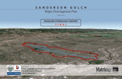
S A N D E R S O N G U L C H<br />
Major <strong>Drainage</strong>way Plan<br />
<strong>October</strong> <strong>2012</strong><br />
BASELINE HYDROLOGY REPORT<br />
F I N A L<br />
Sponsored by:<br />
<strong>Urban</strong> <strong>Drainage</strong> and Flood Control District<br />
City and County of Denver<br />
City of Lakewood<br />
Prepared by:<br />
1601 Blake Street, Suite 200 | Denver, Colorado 80202 | 303.573.0200
1601 Blake Street, Suite 200<br />
Denver, Colorado 80202<br />
(303) 572-0200<br />
fax (303) 572-0202<br />
drainage basin.<br />
This hydrologic information provides the project sponsors of the City and County of Denver,<br />
City of Lakewood, and the <strong>Urban</strong> <strong>Drainage</strong> & Flood Control District with updated mapping and<br />
modeling for better management of the watershed.<br />
<strong>October</strong> 30, <strong>2012</strong><br />
Mrs. Shea Thomas, PE<br />
Senior Master Planning Engineer<br />
<strong>Urban</strong> <strong>Drainage</strong> & Flood Control District<br />
2480 W. 26th Ave., Suite 156-B<br />
Denver, Colorado 80211<br />
RE:<br />
Sanderson Gulch <strong>Baseline</strong> <strong>Hydrology</strong> <strong>Report</strong><br />
Agreement No. 12-04.04<br />
Dear Mrs. Thomas:<br />
We appreciate the opportunity to provide this report of our hydrologic findings.<br />
Sincerely,<br />
Matrix Design Group, Inc.<br />
Robert Krehbiel, PE Hung-Teng Ho, PE<br />
Project Manager Project Engineer<br />
Matrix Design Group, Inc. is pleased to submit this Sanderson Gulch <strong>Baseline</strong> <strong>Hydrology</strong><br />
<strong>Report</strong>. The hydrology provided in this report will update the effective hydrology from the<br />
previous 1972 Major <strong>Drainage</strong>way Planning report for Sanderson Gulch and will set the basis<br />
for the upcoming Major <strong>Drainage</strong>way Plan and the Flood Hazard Area Delineation.<br />
The hydrologic model of this 7.6 square mile Sanderson Gulch watershed will be used to define<br />
the hydrology along the drainageways. This report defines the fully-developed existing<br />
conditions hydrology for the Sanderson Gulch watershed including the tributary of North<br />
Sanderson Gulch. The hydrologic model also includes imported stormwater from Mississippi<br />
Gulch that is captured by existing storm drains and conveyed into Sanderson Gulch. The report<br />
format and submittal is intended to follow the requirements of the <strong>Urban</strong> <strong>Drainage</strong> & Flood<br />
Control District guidelines.<br />
The previous hydrology presented in the 1972 Sanderson Gulch Major <strong>Drainage</strong>way Plan was<br />
based upon different hydrologic input parameters and modeling software. The previous plan<br />
modeled lower composite basin imperviousness and also utilized a design rainfall event that is<br />
lower than the currently accepted rainfall values.<br />
We have re-created the 1972 model with current software using the previous hydrologic model<br />
parameters to eliminate changes in hydrology solely as a result of changes in modeling<br />
software. The new model has been calibrated to the previous results, and then input<br />
parameters have been updated to current design values. The resulting hydrology computed for<br />
this study is higher than the previous values. The model calibration is justified based upon the<br />
past flood history and data from two USGS peak flow gages that operated in the Sanderson
Sanderson Gulch Major <strong>Drainage</strong>way Plan<br />
<strong>Baseline</strong> <strong>Hydrology</strong> <strong>Report</strong> <strong>October</strong> <strong>2012</strong><br />
TABLE OF CONTENTS<br />
1.0 INTRODUCTION...................................................................................................................................... 1<br />
1.1 Authorization ................................................................................................................................... 1<br />
1.2 Purpose and Scope ........................................................................................................................ 1<br />
1.3 Planning Process ............................................................................................................................ 1<br />
1.4 Mapping and Surveys ..................................................................................................................... 1<br />
1.5 Data Collection ............................................................................................................................... 2<br />
1.6 Acknowledgements ........................................................................................................................ 2<br />
APPENDICES<br />
Appendix A – Project Correspondence<br />
Appendix B – Hydrologic Analysis<br />
Appendix E – Wetland and Riparian Inventory<br />
2.0 STUDY AREA DESCRIPTION ............................................................................................................. 3<br />
2.1 Project Area .................................................................................................................................... 3<br />
2.2 Land Use......................................................................................................................................... 3<br />
2.3 Reach Descriptions ........................................................................................................................ 3<br />
2.4 Irrigation Ditches ........................................................................................................................... 14<br />
2.4.1 Agricultural Ditch ........................................................................................................................... 14<br />
2.4.2 Ward Canal ................................................................................................................................... 14<br />
2.5 Flood History ................................................................................................................................. 17<br />
2.6 Environmental Assessment .......................................................................................................... 18<br />
3.0 HYDROLOGIC ANALYSES ............................................................................................................... 27<br />
3.1 Overview and Methodology .......................................................................................................... 27<br />
3.2 Duplicate Hydrologic Model .......................................................................................................... 27<br />
3.2.1 Subwatershed Delineation ............................................................................................................ 27<br />
3.2.2 Basin Parameters ......................................................................................................................... 28<br />
3.2.3 Detention Pond Routing ............................................................................................................... 28<br />
3.2.4 Results Before Calibration ............................................................................................................ 28<br />
3.2.5 Calibration of Duplicate Hydrologic Model ................................................................................... 28<br />
3.3 Corrected (<strong>Baseline</strong>) Hydrologic Model ........................................................................................ 28<br />
3.3.1 Design Rainfall .............................................................................................................................. 28<br />
3.3.2 Watershed Imperviousness .......................................................................................................... 29<br />
3.3.3 Depression Losses ....................................................................................................................... 29<br />
3.3.4 Infiltration ...................................................................................................................................... 29<br />
3.3.5 Detention Ponds ........................................................................................................................... 29<br />
3.3.6 Hydrograph Routing ..................................................................................................................... 30<br />
3.4 Mississippi Gulch Major Storm <strong>Hydrology</strong> .................................................................................... 30<br />
3.5 Results – Corrected (<strong>Baseline</strong>) <strong>Hydrology</strong> Model ........................................................................ 31<br />
3.6 Comparison to Previous Studies .................................................................................................. 32<br />
4.0 REFERENCES.................................................................................................................................... 33
Sanderson Gulch Major <strong>Drainage</strong>way Plan<br />
<strong>Baseline</strong> <strong>Hydrology</strong> <strong>Report</strong> <strong>October</strong> <strong>2012</strong><br />
LIST OF TABLES<br />
Table 1-1 Project Participants .......................................................................................................................... 2<br />
Table 2-2 Major Crossing Structure Inventory ............................................................................................... 15<br />
Table 2-3 Existing Drop Structure Inventory .................................................................................................. 16<br />
Table 3-1 Subbasin Delineation Summary .................................................................................................... 27<br />
Table 3-2 One-Hour Point Rainfall Depths (Inches) ...................................................................................... 28<br />
Table 3-3 Zoning-Based Impervious Summary ............................................................................................. 29<br />
Table 3-4 Manning's Roughness Coefficients & Comparison ....................................................................... 30<br />
Table 3-5 Peak Discharge and Runoff Volume Summary (Selected Locations) .......................................... 31<br />
Table 3-6 Comparison to Previous Studies ................................................................................................... 32<br />
Appendix B – Hydrologic Analysis<br />
Table B-1<br />
Table B-2<br />
Table B-3<br />
Table B-4<br />
Table B-5<br />
Table B-6<br />
Table B-7<br />
Table B-8<br />
Model Development and Calibration Results ......................................................... Appendix B<br />
1972 Sanderson Gulch MDP 100-year 2-hour Rainfall Distribution ....................... Appendix B<br />
Design Storm Distribution Comparison .................................................................. Appendix B<br />
Design Storm Depth Comparison ........................................................................... Appendix B<br />
CUHP Input Parameters - Corrected (<strong>Baseline</strong>) <strong>Hydrology</strong> Model ........................ Appendix B<br />
Detention Pond Stage-Storage-Discharge Information .......................................... Appendix B<br />
SWMM Input/Output ............................................................................................... Appendix B<br />
Peak Discharges and Runoff Volumes (All Design Points) .................................... Appendix B<br />
LIST OF FIGURES<br />
Figure 2-1 Jurisdiction Map ...................................................................................................................... 15<br />
Figure 2-2 City-Owned Parcels Map ........................................................................................................ 16<br />
Figure 2-3 Parks and Open Space Map ................................................................................................... 17<br />
Figure 2-4 Irrigation Ditches Map ............................................................................................................. 18<br />
Figure 2-5 Reach Definition Map .............................................................................................................. 19<br />
Figure 2-6 Existing Crossings Map .......................................................................................................... 20<br />
Figure 2-7 Drop Structures Map ............................................................................................................... 21<br />
Appendix B – Hydrologic Analysis<br />
Figure B-1<br />
Figure B-2<br />
Figure B-3<br />
Figure B-4<br />
Figure B-5<br />
Figure B-6<br />
Figure B-7<br />
Interactive <strong>Hydrology</strong> Map ...................................................................................... Appendix B<br />
Calibrated Detention Pond Inflow/Outflow .............................................................. Appendix B<br />
Watershed Boundary and 100-Yr, I-Hour Isopluvial Map ....................................... Appendix B<br />
SWMM Routing Schematic ..................................................................................... Appendix B<br />
Storm Hydrographs at Key Design Points .............................................................. Appendix B<br />
Peak Discharge vs. Location .................................................................................. Appendix B<br />
Modeled Detention Ponds and Split Flows ............................................................. Appendix B<br />
Appendix E – Environmental Assessment<br />
Figure E-1<br />
Figure E-2<br />
Wetland and Riparian Inventory ............................................................................. Appendix E<br />
Historical Landfills ................................................................................................... Appendix E
Sanderson Gulch Major <strong>Drainage</strong>way Plan<br />
<strong>Baseline</strong> <strong>Hydrology</strong> <strong>Report</strong> <strong>October</strong> <strong>2012</strong><br />
1.0 INTRODUCTION<br />
1.1 Authorization<br />
Matrix Design Group, Inc. (Matrix) has been retained to complete a Major <strong>Drainage</strong>way Plan (MDP) and a<br />
Flood Hazard Area Delineation (FHAD) study for the Sanderson Gulch watershed including the tributaries of<br />
North Sanderson Gulch and Mississippi Gulch. The project is co-sponsored by the <strong>Urban</strong> <strong>Drainage</strong> and<br />
Flood Control District (UDFCD), the City of Lakewood (Lakewood) and the City and County of Denver<br />
(Denver). The Agreement regarding the Major <strong>Drainage</strong>way Plan (MDP) and Flood Hazard Area Delineation<br />
(FHAD) study for Sanderson Gulch (Agreement No. 12-04.04) was executed on July 12, <strong>2012</strong>.<br />
1.2 Purpose and Scope<br />
The purpose and scope of this project is to develop an updated Major <strong>Drainage</strong>way Plan (MDP) for the<br />
Sanderson Gulch watershed (Study Area). The <strong>Urban</strong> <strong>Drainage</strong> & Flood Control District was formed in<br />
1969 and Sanderson Gulch was one of the first watersheds to be master planned in 1972. The original MDP<br />
for the Study Area is entitled Major <strong>Drainage</strong>way Planning, Sanderson Gulch/Weir Gulch (Frasier & Gingery,<br />
August 1972). The former FHAD for the Study Area is Flood Hazard Area Delineation, Sanderson Gulch<br />
and North Sanderson Gulch (Gingery Associates, Inc., August 1979).<br />
Major elements of the scope of work for the current project are as follows:<br />
• Gather and assemble available information on existing drainage facilities, planning studies, land<br />
use plans, zoning, land ownership and other relevant information.<br />
• Coordinate with project sponsors including preparing for and participating in project meetings<br />
and public outreach meetings.<br />
• Develop updated hydrologic modeling for the entire watershed in accordance with current<br />
UDFCD modeling criteria.<br />
• Develop updated hydraulic modeling for all of Sanderson Gulch and North Sanderson Gulch.<br />
• Assess deficiencies in existing road crossings.<br />
• Assess deficiencies in existing grade controls and determine if and where new grade control<br />
structures are needed.<br />
• Assess deficiencies and failures in channel banks.<br />
• Evaluate alternative solutions to identified problems.<br />
• Evaluate options to import Mississippi Gulch major storm flows into Sanderson Gulch. (The<br />
minor storm is currently piped from Mississippi Gulch to Sanderson Gulch).<br />
• Develop an updated master plan for improvements including costs that address identified<br />
deficiencies and needs.<br />
• Develop an updated MDP report that documents all work completed and the selected<br />
improvements plan.<br />
1.3 Planning Process<br />
Project sponsors consist of the following:<br />
• <strong>Urban</strong> <strong>Drainage</strong> and Flood Control District<br />
• City and County of Denver<br />
• City of Lakewood<br />
Participants from the project sponsors are listed in Section 1.6 Acknowledgements. A project advisory<br />
committee consisting of representatives from the project sponsors held a kickoff meeting on July 17, <strong>2012</strong> at<br />
the offices of UDFCD. Progress meetings with the advisory committee were subsequently held August 21<br />
and <strong>October</strong> 15, <strong>2012</strong> (see enclosed Meeting Minutes in Appendix A: Project Correspondence). Additional<br />
progress meetings will be held on an approximate monthly basis throughout the study process.<br />
Public meetings are planned for this project, but have not yet occurred, to gather input from residents,<br />
stakeholders and interested parties. Dates for those meetings will be documented in the meeting minutes<br />
provided in the Appendix A.<br />
1.4 Mapping and Surveys<br />
Mapping information for this project was obtained from several sources. Given the multi-jurisdictional<br />
makeup of the watershed, every attempt was made to use the best available data. The following describes<br />
the various mapping components and their sources.<br />
Topographic Contours<br />
Two-foot topographic LIDAR-derived contour data collected by the USGS in the spring of 2008 was<br />
used for the eastern half of the watershed. The area along the drainageway for the west portion of the<br />
watershed was flown by TransVision in May <strong>2012</strong> which produced 2-foot contour data. USGS 10 meter<br />
DEM data were used to supplement the remaining area outside the Gulch corridor in the western half of<br />
the basin.<br />
Aerial Photography<br />
A 2009 color aerial photo, with a one foot pixel resolution, was provided by UDFCD.<br />
Base Mapping<br />
Base mapping information including, street centerlines, parcels, zoning, jurisdictional boundaries, and<br />
park boundaries were provided by the City and County of Denver and the City of Lakewood.<br />
Crossing Structure Survey<br />
Field survey of all existing road crossings was completed in June <strong>2012</strong> by Accurate EngiSurv, LLC and<br />
provided by UDFCD. Denver provided sufficiency ratings for the bridges within their jurisdiction.<br />
Coordinate System and Datum<br />
All GIS mapping and data for this study were developed using the Colorado State Plane, Central Zone<br />
coordinate system in U.S. feet. The horizontal datum is NAD83 and the vertical datum is NAVD88.<br />
1
Sanderson Gulch Major <strong>Drainage</strong>way Plan<br />
<strong>Baseline</strong> <strong>Hydrology</strong> <strong>Report</strong> <strong>October</strong> <strong>2012</strong><br />
1.5 Data Collection<br />
In addition to mapping and survey data described in the previous section, the following sources of data and<br />
information on the watershed were utilized in the study:<br />
• Major <strong>Drainage</strong>way Planning, Sanderson Gulch/Weir Gulch (Frasier & Gingery, August 1972).<br />
• Flood Hazard Area Delineation, Sanderson Gulch and North Sanderson Gulch (Gingery<br />
Associates, Inc., August 1979).<br />
• Sanderson Gulch Drop Structure Inventory and Bank Stabilization, South Platte River to<br />
Sheridan Boulevard, Engineering Assessment and Maintenance Master Plan (Icon Engineering,<br />
Inc., January 2002).<br />
• Gulch Master Plan, Denver Parks and Recreation (Matrix Design Group Inc., <strong>October</strong> 2009).<br />
• <strong>Final</strong> DRAFT Mississippi Gulch Outfall Alternatives Analysis and Scoping Study (Matrix Design<br />
Group Inc., December 2010).<br />
• River South Greenway Master Plan (Greenway Foundation, 2009).<br />
• Soils information for the hydrologic analysis was obtained from the Natural Resources<br />
Conservation Service (NRCS). Note that GIS data for soils was only available for the portion of<br />
the study area located within Jefferson County.<br />
• Future landuse information for the redevelopment of the Green Gables Country Club was taken<br />
from the Green Gables Official Development Plan (DTJ Design, Inc., Revised April 11, <strong>2012</strong>).<br />
• As-Built Drawings of various channel improvement projects from the UDFCD website<br />
(http://udfcd.gisworkshop.com/).<br />
1.6 Acknowledgements<br />
This report was prepared with the cooperation of UDFCD, City & County of Denver and the City of<br />
Lakewood. Representatives who were involved in and contributed to the study are listed in the following<br />
Table 1-1.<br />
Table 1-1 Project Participants<br />
Name Representing Project Role<br />
Shea Thomas UDFCD Project Manager<br />
Bill DeGroot UDFCD Floodplain Manager<br />
Mike Anderson Denver Public Works-Engineering Division Sponsor<br />
David Marquardt Denver Parks & Recreation, Planning Sponsor<br />
Kevin Lewis Denver Public Works, Wastewater Management Division Sponsor<br />
Terry Rogers Lakewood Public Works Sponsor<br />
John Paliga Lakewood Community Development Sponsor<br />
Robert Krehbiel Matrix Design Group, Inc. Project Manager<br />
HungTeng Ho Matrix Design Group, Inc. Project Engineer<br />
George Slovensky Matrix Design Group, Inc. Project Engineer<br />
Jennifer Newby Matrix Design Group, Inc. Project Engineer<br />
Bob Eck Matrix Design Group, Inc./Design Studios West Landscape Architect<br />
Ian Anderson Matrix Design Group, Inc./Design Studios West Landscape Architect<br />
Jane Kopperl Matrix Design Group, Inc. Landscape Architect<br />
Wilson Wheeler Matrix Design Group, Inc. GIS Manager<br />
Additional data obtained from the project sponsors included GIS data, drainage reports and design<br />
drawings and structure survey data. A complete list of references is provided in Section 9.0 References.<br />
Van tours of the drainageway were conducted with the project participants to better understand field<br />
conditions. The Denver portion was conducted by Denver Parks and Recreation on August 20, <strong>2012</strong>. The<br />
tour for the Lakewood portion was conducted by City of Lakewood staff on September 24, <strong>2012</strong>.<br />
2
Sanderson Gulch Major <strong>Drainage</strong>way Plan<br />
<strong>Baseline</strong> <strong>Hydrology</strong> <strong>Report</strong> <strong>October</strong> <strong>2012</strong><br />
2.0 STUDY AREA DESCRIPTION<br />
2.1 Project Area<br />
The project study area consists of the Sanderson Gulch watershed including the tributary North Sanderson<br />
Gulch. A map of the watershed is provided in the interactive <strong>Hydrology</strong> Map, Figure B-1 of Appendix B.<br />
Sanderson Gulch is a west bank tributary to the South Platte River in Denver. The confluence with the<br />
South Platte River is immediately downstream of Florida Avenue. The confluence and lower portion of the<br />
Sanderson Gulch watershed are located within the City and County of Denver. The watershed extends<br />
west from the South Platte River approximately 7 miles to S. Union Boulevard in the City of Lakewood and<br />
Jefferson County. The jurisdictions within the Sanderson Gulch watershed are shown on Figure 2-1. The<br />
northern boundary of the watershed varies from Exposition Avenue on the east to Florida Avenue on the<br />
west. The southern boundary of the watershed varies from approximately Harvard Avenue on the east to<br />
Morrison Road on the west.<br />
The Sanderson Gulch watershed has a drainage area of 7.6 square miles. NRCS hydrologic soil types<br />
within the basin are predominantly Type C. A soils map is provided in the interactive <strong>Hydrology</strong> Map, Figure<br />
B-1 of Appendix B. The watershed is essentially fully developed. The 152-acre Green Gables Country<br />
Club located near the southeast corner of the intersection of Wadsworth and Jewell in Jefferson County is<br />
the only significant undeveloped parcel and it is currently under redevelopment as mixed-use commercial<br />
and residential. Since development is approved and construction is imminent, this study assumes<br />
development of this site under the future conditions model. Watershed elevations range from 5230 feet at<br />
the confluence with the South Platte River to 5805 feet at the western limit of the watershed near S. Union<br />
Boulevard.<br />
Figure 2-2 identifies the parcels within the Sanderson Gulch that are city-owned. Within the City and County<br />
of Denver, Sanderson Gulch was one of the first drainageways to preserve the floodplain as open space<br />
and the gulch is almost entirely an open channel system contained within linear park and open space areas.<br />
Sanderson Gulch is not designated a wildlife corridor by Denver Parks and Recreation, but there are<br />
portions of the gulch that are designated as “Park” which means there are some use restrictions for those<br />
designated areas. The middle and upper reaches of Sanderson Gulch and the entirety of its tributary, North<br />
Sanderson Gulch, are located within Jefferson County and the City of Lakewood. Upper Sanderson Gulch<br />
and North Sanderson Gulch are also generally open channel systems, but the number of adjacent parks or<br />
open space areas is much more limited. Significant portions of the upper gulches are contained in narrow<br />
constructed drainageways. Figure 2-3 depicts the parks and open spaces within the Sanderson Gulch<br />
watershed.<br />
Map, Figure B-1 of Appendix B. Residential land uses make up a majority of the watershed. Limited<br />
commercial and industrial development exists along major arterial streets primarily Federal Boulevard,<br />
Sheridan Boulevard, Wadsworth Boulevard and the western part of Jewell Avenue. Land use within the<br />
watershed is summarized in Table 2-1.<br />
Table 2-1 Watershed Land Use Summary<br />
Land Use<br />
Percentage of Watershed<br />
Residential 75.7%<br />
Commercial/Industrial 11.4%<br />
Parks/Open Space/Ponds 12.9%<br />
Total 100.0%<br />
Watershed Area-Weighted Imperviousness 49.6%<br />
2.3 Reach Descriptions<br />
For the purposes of the evaluation of alternative improvements, Sanderson Gulch has been divided into 12<br />
reaches and North Sanderson Gulch into 4 reaches. Descriptions of the reaches are provided in the<br />
sections below and reach limits are illustrated in Figure 2-5. Major crossings are shown on Figure 2-6 and<br />
listed in Table 2-2. An inventory of existing drop structures is shown in Table 2-3. There are currently 35<br />
drop structures on Sanderson Gulch and 16 on North Sanderson Gulch as shown on Figure 2-7. In<br />
addition to these existing structures, the previous report Sanderson Gulch Drop Structure Inventory and<br />
Bank Stabilization (Icon Engineering, 2002) recommended three new drop structures within the City and<br />
County of Denver.<br />
Sanderson Gulch<br />
Reach 1 – South Platte River to Lipan Culvert Entrance (Denver)<br />
There are several irrigation ditches and water storage reservoirs within the Sanderson Gulch watershed.<br />
Figure 2-4 shows the ditch locations for the Agricultural Ditch, Welch Ditch, and the Salisbury Lateral Ditch.<br />
Smith Reservoir, Ward Reservoir No. 1, Ward Reservoir No. 2 and Ward Reservoir No. 5 within the<br />
Sanderson Gulch watershed are privately owned and used for irrigation water storage. The operation of<br />
these ditches is described in Section 2-4.<br />
2.2 Land Use<br />
Land use and zoning data was provided by the City and County of Denver and the City of Lakewood. A<br />
summary of how impervious area values were determined for hydrologic modeling is included in Section<br />
3.3.2 Watershed Imperviousness. Land use in the watershed is illustrated on the interactive <strong>Hydrology</strong><br />
3
Sanderson Gulch Major <strong>Drainage</strong>way Plan<br />
<strong>Baseline</strong> <strong>Hydrology</strong> <strong>Report</strong> <strong>October</strong> <strong>2012</strong><br />
Reach 1 is approximately 900 feet in length and extends<br />
through an industrial area adjacent to the South Platte<br />
River. The reach is distinguished from upstream areas by<br />
its adjacent industrial land uses, very limited access and<br />
floodplain encumbrance. From Lipan to the railroad,<br />
Sanderson Gulch is contained within a twin 14-foot wide x<br />
6.75-foot high (14’ x 6’9”) reinforced concrete box culvert<br />
(RCBC). The box culvert is 214 feet long, curvilinear double<br />
box culvert at 2.35% slope. Between the railroad and South<br />
Platte River Drive, Sanderson Gulch is an open channel.<br />
Reach 1 has a lack of maintenance and public access, and<br />
unlike other park reaches, has no parallel trail system to<br />
the gulch. The box culvert, railroad bridge, open channel<br />
and culvert under South Platte River Drive have limited<br />
flood conveyance capacity for the 100-year flood. The<br />
Burlington Northern Santa Fe (BNSF) Railroad Bridge is<br />
Lower Sanderson Gulch at the BNSF<br />
Railroad Bridge.<br />
poorly aligned with the open channel discharge from the upstream S. Lipan Street culvert and has greater<br />
than 10-year capacity, but less than 100-year capacity. Downstream, the culvert under South Platte River<br />
Drive has less than 10-year capacity and adjacent structures are in the regulatory floodplain.<br />
increasing visibility and public access to the river and providing recreational opportunities.<br />
Water Quality. Water quality treatment and infiltration is occurring in the open channel section of<br />
Sanderson Gulch. No major storm outfalls occur within Reach 1 so no additional water quality improvements<br />
are envisioned in this area.<br />
Reach 2 – S. Lipan Street to Zuni Street (Denver)<br />
Landscape and Ecology. The open channel in the reach<br />
downstream of the railroad bridge is narrow with steep<br />
slopes and confined to a 75-foot width corridor. The<br />
channel edge and overbank areas are dominated by nonirrigated<br />
bunch type grass species that are predominantly<br />
tall fescue with wheatgrass species in the upper elevations.<br />
The vegetation is interspersed with invasive species<br />
including, thistle, prickly lettuce, kochia and bindweed. A<br />
few invasive woody species such as cottonwoods, willows,<br />
Siberian elm and sumac exist in the short reach between<br />
the Lipan culvert exit and the railroad bridge.<br />
Maintenance. Maintenance of the grasses includes mowing<br />
to a height of approximately 6 inches once or twice a<br />
growing season after grass species have gone to seed.<br />
Removal of dead wood material and trash occur on an as<br />
need basis after storm events. Maintenance in this reach is<br />
generally completed by UDFCD.<br />
Lower Sanderson Gulch open channel at the<br />
South Platte River Drive crossing.<br />
Parks and Recreation. Because Reach 1 is constrained by limited access, acquisition of additional land<br />
from adjacent properties may be considered. Denver Parks considers grade separated maintenance<br />
access/ trail crossings on a case by-case basis. The existing Lipan Street and Florida Avenue Right of Way<br />
(ROW) may offer an opportunity for pedestrian improvements to link the upper reaches of Sanderson Gulch<br />
with the existing Platte River Greenway trail.<br />
The confluence of Sanderson Gulch with the South Platte River is included in the River South Greenway<br />
Master Plan (RISO) (Greenway Foundation, 2009). Recommendations for the confluence area include the<br />
realignment of South Platte River Drive away from the South Platte River as far as possible, increasing the<br />
width of the emergent flood bench, increasing or creating riparian buffers, improving wildlife habitat,<br />
Reach 2 begins upstream of the S. Lipan Street<br />
culvert and extends approximately 5,300 feet<br />
upstream to S. Zuni Street. The linear park and<br />
continuous pedestrian trail that characterize the<br />
Denver reach of Sanderson Gulch begins at S.<br />
Lipan Street. Adjacent park areas and the<br />
floodplain in Reach 2 are generally broader than<br />
areas upstream and include the Sanderson<br />
Gulch Park between W. Florida Avenue and S.<br />
Zuni Street which is up to 500 feet in width. The<br />
wide park areas in this reach have provided<br />
opportunities for channel restoration not<br />
possible in narrow upstream reaches. Two<br />
restoration projects have been completed in<br />
recent years in Sanderson Gulch Park. One<br />
project realigned the channel and restored a<br />
native riparian edge downstream and upstream<br />
of W. Florida Avenue. A second project<br />
replaced a single large drop structure with<br />
several smaller structures raising the incised<br />
Recently improved channel downstream of Zuni Street.<br />
4
Sanderson Gulch Major <strong>Drainage</strong>way Plan<br />
<strong>Baseline</strong> <strong>Hydrology</strong> <strong>Report</strong> <strong>October</strong> <strong>2012</strong><br />
channel invert over a 600-foot reach and allowing the use of softer drop structures of vegetation and<br />
ungrouted boulders. Aside from this recently restored section, the remainder of Reach 2 is moderately<br />
incised with 2-foot high vertical banks typical along the low flow channel. Channel banks have generally<br />
been stabilized with soil riprap. There is also a substantial amount of riprap in the channel invert forming<br />
intermittent riffles helping the channel to maintain a typical slope of 0.4 percent in this reach.<br />
Reach 3 – S. Zuni Street to S. Hazel Court (Denver)<br />
Reach 2 includes two road crossings and three existing drop structures. The W. Florida Avenue crossing<br />
has only 10-year capacity and adjacent residential structures are in the regulatory floodplain. The W.<br />
Arkansas Avenue crossing also has only 10-year capacity. Existing drop structures are in fair to good<br />
condition with one very small grouted boulder structure and two vertical drop structures with heights of 5 and<br />
6 vertical feet. The drop heights for the two vertical structures are greater than current UDFCD standards.<br />
Landscape and Ecology. The landscape adjacent to the gulch in Reach 2 is predominately tall fescue<br />
bunch grasses that overhang the bank into the waterway. The 600-foot reach upstream of W. Florida<br />
Avenue is unique and has a heavily vegetated riparian edge consisting of cottonwood, peachleaf willows<br />
and coyote willows. There are pockets of cattails and bulrushes interspersed throughout the reach where<br />
the water eddies near a drop or riffle, or where the channel bends and the water slows. Mature cottonwoods<br />
and peachleaf willows exist in sporadic locations with the largest concentration of cottonwoods being on the<br />
outside bend west of Lipan Street.<br />
Upland landscape character along this reach is predominately non-irrigated dryland grasses, native and<br />
non-native species including crested wheatgrass, sand dropseed, buffalograss and blue grama and the<br />
occasional little bluestem.<br />
Invasive species (thistle, kochia, smartweed, bindweed, prickly lettuce, common mallow, pigweed, rag weed,<br />
alfalfa, Siberian elm, Chinese elm and the occasional Russian olive) are present along the channel as well<br />
as in the dryland grass areas.<br />
Maintenance. Maintenance practices include mowing to a height of 4-6 inches for weed control and<br />
aesthetics, once or twice a growing season after grass species have gone to seed. Maintenance is shared<br />
between UDFCD and Denver Parks & Recreation (DPR), with UDFCD being responsible for 15 feet on<br />
either side of the channel and DPR maintaining everything beyond.<br />
Parks and Recreation. Existing park conditions in Sanderson Gulch Park, on the north side of the channel,<br />
immediately south of Godsman School and Park, include limited irrigation, poorly performing (non-irrigated)<br />
upland vegetative cover, poorly aligned access routes and crosswalks to the school. Recommendations in<br />
the 2009 Denver Parks and Recreation Gulch Master Plan by Matrix Design Group include irrigated turf and<br />
street tree improvements adjacent to W. Florida Avenue, and riparian enhancement along the channel.<br />
Since the park is the site of a former landfill, conditions discourage extensive excavation along Reach 2.<br />
The 2009 Denver Parks and Recreation Gulch Master Plan recommended the potential acquisition of two<br />
(2) parcels north of Arkansas between Navajo & Osage adjacent to the existing park.<br />
Water Quality. Current park programming on the south side of the channel provides the opportunity for<br />
potential water quality improvements at existing local storm drain outfalls along W. Gunnison Place.<br />
Reach 3 is approximately 3,700 feet in length. There is a<br />
continuous pedestrian trail but open space adjacent to the<br />
gulch is generally fairly narrow and there are no formal park<br />
areas. The floodplain is similarly narrow, being confined to<br />
a 100-200 foot width except at road crossings. The reach<br />
from S. Clay Street to Zuni Street is particularly incised<br />
within a roughly 100-foot wide floodplain.<br />
There are three road crossings and four existing drop<br />
structures in the reach. The crossings at S. Zuni Street<br />
and Federal Boulevard have greater than 10-year capacity<br />
but no structures are in the floodplain. The crossing at<br />
Clay Street has less than 10-year capacity and does not<br />
meet current City of Denver crossing criteria for<br />
overtopping depth, but a previous property acquisition<br />
eliminated adjacent structures in the floodplain.<br />
Clay Street crossing during a heavy rainfall<br />
event July 9, <strong>2012</strong>.<br />
The low flow channel is moderately incised with typically vertical 2-foot height channel banks. Banks are<br />
generally composed of soil riprap but deteriorated gabion mattresses also exist in some portions of the<br />
reach. The channel invert slope varies from approximately 0.4 to 0.6 percent. The steeper slopes are<br />
maintained by substantial riprap in the channel invert and intermittent informal riprap riffles that have<br />
formed. The drop upstream of Zuni Street is in reasonably good condition but the previous 2002 Sanderson<br />
Gulch Drop Structure Inventory and Bank Stabilization report by Icon Engineering (2002 Drop Inventory)<br />
recommended replacing it with a larger structure. Two sloping grouted boulder structures between S. Clay<br />
Street and Federal Boulevard are new with relatively low drop heights and are in good condition. The drop<br />
structure upstream of Federal Boulevard is a near vertical structure of grouted riprap that the 2002 Drop<br />
5
Sanderson Gulch Major <strong>Drainage</strong>way Plan<br />
<strong>Baseline</strong> <strong>Hydrology</strong> <strong>Report</strong> <strong>October</strong> <strong>2012</strong><br />
Inventory recommended increasing in height and breaking into two separate structures.<br />
Landscape and Ecology. Vegetation in Reach 3 is similar to the previous reach with tall fescue predominant<br />
along the channel edges. Non-irrigated dryland grass species of wheatgrass, dropseed, and fescue are<br />
present beyond the channel on the slopes. The occasional cottonwood or willow tree is interspersed along<br />
the channel. Small pockets of riparian vegetation, predominantly softstem bulrush and cattails, have<br />
established in areas where eddies of water are slow enough for them to take hold. These areas are typically<br />
adjacent to drop structures and culvert crossings.<br />
Invasive species (thistle, kochia, smartweed, bindweed, prickly lettuce, common mallow, pigweed, rag weed,<br />
curly dock, alfalfa, Siberian elm, Chinese elm and the occasional Russian olive) are present along the<br />
channel as well as in the upland grass areas.<br />
Maintenance. Maintenance practices include mowing to a height of 4-6 inches for weed control and<br />
aesthetics, once or twice a growing season after grass species have gone to seed. Maintenance is shared<br />
between UDFCD and DPR, with UDFCD being responsible for 15 feet on either side of the channel and<br />
DPR maintaining everything beyond.<br />
Parks and Recreation. Denver Parks comments referenced in the 2002 Drop Inventory included a<br />
preference for replacement of Drop #11 with two smaller drops. The Federal Boulevard crossing area<br />
presents difficult maintenance access with a higher incidence of trash and shopping cart accumulation, due<br />
to its higher commercial district pedestrian traffic. Current maintenance access/ trail crossings are at grade,<br />
with the maintenance access/trail non-aligned, crossing from the south side of the channel to the north side<br />
west of Federal. The 2009 Denver Parks and Recreation Gulch Master Plan includes the recommendation<br />
for potential land acquisition of one (1) residential property at the west side of the south end of S. Carlan<br />
Court along the north side of the channel.<br />
Water Quality. There are few storm drain outfalls within Reach 3, except at Federal Boulevard where 30-<br />
inch and 36-inch storm pipes enter the gulch. Neighborhood streets generally drain directly into the gulch.<br />
Reach 4 – S. Hazel Court to S. Tennyson Street (Denver)<br />
Reach 4 is approximately 5,400 feet in length and is contained<br />
within a linear park that is typically approximately 240 feet in<br />
width. There is a continuous pedestrian trail through the reach.<br />
Three road crossings (Irving, Lowell and Tennyson) exist, all of<br />
which have less than 10-year capacity. These crossings do not<br />
meet current Denver criteria for allowable floodwater overtopping.<br />
There are no adjacent structures in the floodplain in Reach 4.<br />
Four pedestrian low-flow bridge crossings exist in the reach and<br />
four existing drop structures varying in height from 4 to 5 feet.<br />
The four existing drops are all vertical structures constructed of<br />
gabion baskets with crest sections coated in gunite. These drops<br />
are all in poor condition and do not meet current UDFCD criteria<br />
for vertical drop height. The existing drops have been designed<br />
around a 0.4% overall channel slope which is maintained by<br />
numerous informal riprap riffles that exist between the formal<br />
drop structures. Additional drops are proposed for the upper<br />
portion of this reach above S. Lowell Boulevard where existing<br />
channel slopes are as steep as 1.5%. Channel banks throughout<br />
the reach are largely soil riprap and moderately incised typically<br />
with 2-foot height vertical low-flow banks. Sections of the banks<br />
are protected by deteriorated gabion mattresses.<br />
Sanderson Gulch west of Irving Street<br />
within the linear park corridor.<br />
Landscape and Ecology. Wide expanses of irrigated bluegrass turf dominate the vegetative landscape on<br />
both sides of the gulch as it meanders through the neighborhood park west of S. Hazel Court. As the gulch<br />
turns south at S. Java Way, the width is narrowed and the vegetation is less manicured and more native in<br />
character. As the gulch turns westward, the parklands open up to a greater width to S. Tennyson Street.<br />
Manicured and native grass areas are present throughout this section of the linear park system.<br />
Infrequent pockets of riparian vegetation may exist where the conditions permit, typically near drop<br />
structures or pipe outfalls. Species include bulrushes, cattails, coyote willow and the occasional Eleocharis<br />
and Carex species. Large Cottonwood and Chinese or Siberian Elm trees are present on both sides of the<br />
gulch in both the manicured and the naturalized areas.<br />
Predominant species include tall fescue grasses overhanging the steep banks of soil riprap at the waterway<br />
edge. Outside of the manicured turf areas, non-irrigated dryland grass species of buffalograss, blue grama,<br />
fescues, and wheatgrass are present. Invasive species (thistle, kochia, smartweed, bindweed, prickly<br />
lettuce, common mallow, barnyard grass, Johnsongrass, pigweed, rag weed, halogeton, redstem filaree,<br />
alfalfa, Siberian elm, Chinese elm and the occasional Russian olive and curly dock) are present along the<br />
channel as well as in the upland grass areas.<br />
Maintenance. Maintenance practices include mowing to a height of 4-6 inches for weed control and<br />
aesthetics, once or twice a growing season after grass species have gone to seed. Maintenance is shared<br />
between UDFCD and DPR, with UDFCD being responsible for 15 feet on either side of the channel and<br />
DPR maintaining everything beyond. DPR does maintain those areas of turf grass that are directly adjacent<br />
to the gulch per typical turf grass maintenance and schedule regime. Mowing of the turf grass within feet of<br />
the gulch occurs regularly.<br />
Parks and Recreation. Open space and park improvements in Reach 4 include recently completed play<br />
node improvements below S. Irving Street and below S. Newton Street. The 2009 Gulch Master Plan<br />
6
Sanderson Gulch Major <strong>Drainage</strong>way Plan<br />
<strong>Baseline</strong> <strong>Hydrology</strong> <strong>Report</strong> <strong>October</strong> <strong>2012</strong><br />
includes recommendations for nature theme enhancements to the Newton facility and new nature play<br />
nodes above Irving Street and below Raleigh Street. Existing under-performing play/ exercise nodes exist<br />
along the trail. Other recommendations include sheltered seating areas. The 2009 Gulch Master Plan<br />
includes a recommendation for the potential acquisition of the existing residential property on the south side<br />
of the channel at the corner of S. Tennyson Street at W. Colorado Avenue.<br />
Water Quality. Water quality improvements were recommended in the 2009 Gulch Master Plan along the<br />
north side of the channel at surface outfalls along W. Mexico Avenue. The existing water quality treatment<br />
areas on the north side of the channel at S. Mabry Way, S. Michigan Way, S Newton Street and S. Stuart<br />
Street are performing poorly.<br />
Reach 5 – S. Tennyson Street to Sheridan Boulevard (Denver)<br />
Reach 5 includes a road crossing at S. Xavier Street which has less than 10-year capacity. There are two<br />
existing drop structures in the reach, both in reasonably good condition. One of these, a near vertical<br />
gabion and gunite structure above S. Xavier Street, has a 5 foot drop height and does not meet current<br />
UDFCD criteria for vertical drops. The upper half of the reach above S. Wolff Street has a concrete-lined<br />
invert. Below this point, channel slopes alternate between fairly flat sections and informal riprap riffles,<br />
resulting in an overall slope approaching 0.8%. Additional grade control is planned for the steeper reach.<br />
Maintenance. Maintenance includes mowing to a height of approximately 4-6 inches once or twice a<br />
growing season after grass species have gone to seed. Removal of dead wood material and trash occur on<br />
an as need basis after storm events. In those areas where the regional trail traverses along the gulch,<br />
maintenance responsibilities are shared between UDFCD and DPR. Those areas that are not accessed by<br />
the public, west of Wolff Street to Sheridan Boulevard, are generally maintained exclusively by UDFCD.<br />
Reach 5 is approximately 2,800 feet in length and<br />
extends from S. Tennyson Street to the dividing line<br />
between the City and County of Denver and the City of<br />
Lakewood (Jefferson County) at Sheridan Boulevard.<br />
The formal wide linear park corridor of Sanderson Gulch<br />
ends at S. Tennyson Street, and the remainder of the<br />
reach within Denver up to Sheridan Boulevard is<br />
contained within a narrower corridor. At Tennyson Street<br />
the gulch corridor is initially 100 feet in width and then<br />
reduced further to 60 feet for the upper half of the reach<br />
starting near S. Wolff Street. The pedestrian path<br />
extends only east of S. Wolff Street. West of Wolff Street<br />
to Sheridan, the channel has a concrete lined invert.<br />
East of Xavier the Sanderson Gulch channel is<br />
confined to a narrow corridor without good<br />
maintenance access.<br />
Landscape and Ecology. Tall fescue grass species are predominant along the channel regardless of the<br />
bottom condition and they extend up the slope coincident with the two-year storm event. Non-irrigation<br />
upland grass species include fescue, wheatgrass, buffalograss, grama grass and sand dropseed.<br />
Pockets of riparian vegetation have been observed on the concrete pan. These include softstem bulrush<br />
and Eleocharis species and the occasional coyote willow. Mature cottonwoods and the peachleaf willows<br />
are sprinkled along this reach of the channel in addition to Siberian and Chinese elm.<br />
Invasive species (thistle, kochia, smartweed, bindweed, prickly lettuce, common mallow, barnyard grass,<br />
Johnsongrass, pigweed, rag weed, halogeton, redstem filaree, alfalfa, Siberian elm, Chinese elm and the<br />
occasional Russian olive and curly dock) are present along the channel as well as in the upland grass<br />
areas. Baby’s breath was observed near the gulch at S. Xavier Street.<br />
Parks and Recreation. The 2009 Denver Parks & Recreation Gulch Master Plan includes a<br />
recommendation for the potential acquisition of one (1) residential property on the south side of the channel<br />
below S. Tennyson Street, four (4) existing residential properties on the south side of the channel above S.<br />
Tennyson Street, and three (3) residential properties on the south side of the channel between S. Wolff<br />
Street and S. Xavier Street.<br />
Water Quality. This reach is generally too narrow for additional surface water quality treatment. The<br />
following storm outfalls exist within Reach 5 and discharge directly to the low flow channel:<br />
• 54-inch from the north in Utica Street<br />
• 30-inch from the south in Vrain Street<br />
• 42-inch from the south in Wolcott Court<br />
• 42-inch from the north in Sheridan Boulevard<br />
7
Sanderson Gulch Major <strong>Drainage</strong>way Plan<br />
<strong>Baseline</strong> <strong>Hydrology</strong> <strong>Report</strong> <strong>October</strong> <strong>2012</strong><br />
Reach 6 – Sheridan Boulevard to Confluence with North Sanderson Gulch (Lakewood)<br />
Maintenance. Through the privately owned Bit-O-Sea reach, the adjacent homeowners associations are<br />
responsible for the maintenance of the drainageway. The improved drainageway for the White Fence Farm<br />
Filing 1 through the Wilson Family Park and Clairefield Reservoir area is eligible for UDFCD maintenance.<br />
Parks and Recreation. The Wilson Family Park is comprised of 13.16 acres, of which 1.62 acres are<br />
devoted to the permanent pool of the reservoir, based on GIS data. The park is predominantly non-irrigated<br />
natural area, with the bike/pedestrian path on the north side of the channel/ reservoir, connecting with S.<br />
Manor Lane and crossing S. Harlan Circle at grade.<br />
Water Quality/Detention. The opportunity for water quality treatment in Reach 6 is within the Clairefield<br />
Reservoir which already serves as detention. A major storm drain tributary inflow crosses under Jewell<br />
Avenue to discharge down a grouted boulder rundown into Clairefield Reservoir. The future ballfields area in<br />
Wilson Family Park could potentially be graded lower to be within the floodplain and provide some additional<br />
peak shaving detention opportunities in a major event.<br />
Reach 6 extends approximately 3,500 feet upstream of<br />
Sheridan Boulevard through open space and a series of<br />
three ponds to S. Harlan Drive where it re-enters a narrow,<br />
constructed drainageway. The Bit-O-Sea Reservoir is<br />
privately owned and has no public or maintenance access.<br />
Upstream of Bit-O-Sea Reservoir is Clairefield Reservoir<br />
and the Wilson Family Park, which is within the City of<br />
Lakewood open space. This public area has a broad<br />
floodplain and more natural channel conditions without<br />
hardened banks or structures and little incision. There is a<br />
gravel trail adjacent to the gulch through the open space<br />
which serves the Wilson Family Park and Clairefield<br />
Reservoir. The broad floodplain and ponds offer unique<br />
opportunities in this reach.<br />
Wilson Family Park at S. Harlan Circle. This<br />
area has been improved and includes a<br />
recent LOMR.<br />
The two road crossings within this reach. The Sheridan Boulevard crossing has approximately 10-year<br />
capacity. The Manor Lane has 100-year capacity. Drop structures exist only at the outlets of Clairefield and<br />
Bit-O-Sea Reservoir. The Clairefield outlet drop structure is in good condition. The Bit-O-Sea outlet drop<br />
structure is privately owned and its current condition is unknown.<br />
Landscape and Ecology. Wilson Family Park has a large open water body in addition to a large native open<br />
space area. The gulch is heavily lined with riparian species of willows and cottonwoods. The upland portion<br />
of the park is non-irrigated dryland grasses consisting of grama, wheatgrass, dropseed, and fescue species.<br />
Shrub species include Green rabbitbrush and sage species. The short distance to the confluence of North<br />
Sanderson Gulch is heavily vegetated with riparian species of cottonwood and willows through a series of<br />
ponds west of the east loop of S. Harlan Circle.<br />
Invasive species (thistle, kochia, smartweed, bindweed, prickly lettuce, common mallow, barnyard grass,<br />
Johnsongrass, pigweed, rag weed, halogeton, redstem filaree, alfalfa, Siberian elm, Chinese elm and the<br />
occasional Russian olive and curly dock) are present along the channel as well as in the upland grass<br />
areas.<br />
Reach 7 – North Sanderson Gulch Confluence to Green Gables Entrance Road (Lakewood)<br />
Reach 7 is approximately 2,000 feet in length and extends from S. Harlan Circle to the privately owned<br />
Shwayder Pond at the Green Gables entrance road. Except for Shwayder Pond, the reach is contained in a<br />
narrow constructed drainageway. A public trail along the gulch exists only downstream of W. Jewell Avenue<br />
and there is little opportunity to continue it upstream because of private property ownership. The entire<br />
reach has been stabilized and the existing channel and facilities are generally in good condition. There is<br />
currently little need for further improvements. Road crossings consist of W. Harlan Circle, W. Jewell Avenue<br />
and the privately owned W. Lake Drive gated community entrance. All three of these crossings have 100-<br />
year capacity. Three grouted rock drop structures exist in the reach, all of which are relatively new and in<br />
good condition. The reach also contains the confluence with North Sanderson Gulch located between S.<br />
Harlan Circle and W. Jewell Avenue.<br />
8
Sanderson Gulch Major <strong>Drainage</strong>way Plan<br />
<strong>Baseline</strong> <strong>Hydrology</strong> <strong>Report</strong> <strong>October</strong> <strong>2012</strong><br />
Landscape and Ecology. Upstream of the confluence with North Sanderson Gulch, the Sanderson Gulch<br />
mainstem turns south and crosses W. Jewell Avenue underground. The gulch as it parallels W. Jewell<br />
Avenue is linear in nature with occasional concrete curbs directing the flow of the trickle channel being<br />
released from the irrigation pond upstream. Vegetation adjacent to the channel is a fescue type grass with<br />
invasive species (barnyard grass, Johnsongrass, prickly lettuce, and curly dock) throughout.<br />
Maintenance. The property owners and the adjacent homeowners associations are responsible for the<br />
maintenance of the drainageway through this reach. A short reach on each side of S. Lake Road is<br />
maintained by UDFCD. UDFCD checks the system for functionality and maintains flood conveyance<br />
capacity through this reach.<br />
Parks and Recreation. The area downstream of W. Jewell Avenue to S. Harlan Circle, including the<br />
confluence with North Sanderson Gulch, is designated as the Sanderson Gulch Greenbelt and is Lakewood<br />
public open space. The concrete public trail provides public and maintenance access through this natural<br />
area to both north and south sides of the channel in this segment, which also includes a series of small<br />
ponds below the confluence.<br />
Water Quality. There are public storm systems in Jewell Avenue that discharge into Reach 7 of Sanderson<br />
Gulch. There is little public ground within this reach for water quality treatment. Most opportunities for water<br />
quality treatment exist on the private land and the privately owned Shwayder Pond, but would require<br />
agreements for such use.<br />
Reach 8 – Green Gables Country Club (Jefferson County)<br />
uses. Current plans show Sanderson Gulch through the site as an open channel within an open space<br />
corridor. There are two proposed 100-year capacity road crossings within the site development. Proposed<br />
plans for redevelopment have been incorporated into this study.<br />
Landscape and Ecology. The existing vegetative species are manicured irrigated turf type grass species.<br />
Occasional mature cottonwood trees line the channel. Approximately 700 lineal feet of the gulch is currently<br />
piped through this section. Weed species are minimal through this reach.<br />
Maintenance. This reach is currently privately maintained. Maintenance practices are a typical golf course<br />
regime of closely mown, highly fertilized, irrigated turf grass. It appears that these practices occur right to the<br />
edge of the gulch boundaries. When the site is redeveloped, the channel will be eligible for UDFCD<br />
maintenance.<br />
Parks and Recreation. The proposed Official Development Plan (ODP) states that the Sanderson Gulch<br />
drainageway and associated floodplain will be a large open space area comprised of natural and landscape<br />
areas with a public trail corridor, with eight foot trail traversing the site from west to east. The ODP includes<br />
31.23 acres of public and private open space, predominantly located along Sanderson Gulch and a tributary<br />
from the south. The majority of Sanderson Gulch will be returned to a natural condition and designed to<br />
minimize erosion, maintain or improve stormwater management and enhance and maximize on-site aquatic<br />
resources. Trails, recreation areas, detention and natural areas and passive open space may be integrated<br />
within this area.<br />
Water Quality. There are two water feature ponds within the existing golf course. As with any golf course,<br />
there are always concerns about fertilizers and herbicides reaching the waterway. When the site is<br />
redeveloped, the improved Green Gables Entrance Road detention pond may also serve to improve water<br />
quality.<br />
Reach 9 –S. Wadsworth Blvd. to S. Allison Street (Lakewood)<br />
This section traverses through the existing Green Gables Golf Course. Reach 8 and the entire 152-acre<br />
Green Gables Country Club are currently within the jurisdiction of Jefferson County. In 2011, the Country<br />
Club closed its operations and was sold for redevelopment. Rezoning and redevelopment of the site is<br />
currently underway to change the land use into a planned development of mixed commercial and residential<br />
9
Sanderson Gulch Major <strong>Drainage</strong>way Plan<br />
<strong>Baseline</strong> <strong>Hydrology</strong> <strong>Report</strong> <strong>October</strong> <strong>2012</strong><br />
Reach 9 consists of a 1,600-foot length of twin 66-inch<br />
diameter culverts that convey flows across W. Jewell<br />
Avenue and Wadsworth through two commercial<br />
developments. The culverts have approximately 20-year<br />
capacity and extensive flooding of commercial buildings is<br />
possible during a large flood event.<br />
Landscape and Ecology. Sanderson Gulch is in a pipe<br />
from S. Wadsworth Boulevard to S. Allison Street.<br />
Maintenance. Maintenance of the pipe is the responsibility<br />
of the City of Lakewood Public Works Department.<br />
Parks and Recreation. There are no public park facilities<br />
within Reach 9.<br />
Entrance into the twin 66” culverts. The trash<br />
racks are in poor condition and do not meet<br />
current criteria for sizing.<br />
Reach 10 – S. Allison Street to Jewell Park Pond (Lakewood)<br />
long, Reach 9 culverts. To the west, the path has connectivity to Jewell Park and open space areas<br />
upstream.<br />
Landscape and Ecology. The gulch is confined to a linear<br />
alignment that has steep slopes and an incised channel<br />
that has tried to meander within the confines of the corridor.<br />
Grass species adjacent to the waterway include alkali<br />
sacaton and fescue. Upland grass species are few but<br />
include predominately crested wheatgrass. Small pockets<br />
of riparian species that have taken hold near slow water<br />
areas of the base flow predominantly at or around the many<br />
drop structures. Species include; three-square and softstem<br />
bulrushes and Carex species. The occasional peachleaf<br />
willow has taken root with the corridor. Invasive species<br />
(thistle, kochia, smartweed, bindweed, prickly lettuce,<br />
common mallow, barnyard grass, Johnsongrass, pigweed,<br />
rag weed, halogeton, redstem filaree, alfalfa, Chinese elm<br />
and the occasional curly dock) are present along the<br />
channel as well as in the upland grass areas.<br />
Open channel section with eroded banks and<br />
gabion basket drop structures at Ammons<br />
Street. Culverts are undersized relative to the<br />
capacity of the channel section.<br />
Maintenance. This reach is within the routine maintenance program of UDFCD. The City of Lakewood also<br />
maintains this reach. Mowing is carried out once or twice during the growing season. Trash and debris are<br />
removed after large storm events as needed. UDFCD performs maintenance on an as-needed basis to<br />
maintain capacity within the channel and stability of drop structures.<br />
Parks and Recreation. There are currently no public park facilities within Reach 10. The paved<br />
maintenance access/trail is used as a continuous public trail connection, with at-grade side street crossings<br />
throughout the length of the reach.<br />
Reach 10 is 2,600 feet in length and consists of a narrow<br />
constructed drainageway paralleling W. Jewell Avenue. The<br />
drainageway is approximately 45 feet in top width with a narrow (3’<br />
+/-) low flow channel and steep grassed side-slopes. The low flow<br />
channel has generally incised 1 to 2 feet, and bank failures exist<br />
throughout the reach. There are numerous low height drop<br />
structures constructed of gabions that are mostly in varying states<br />
of failure. Four road crossings exist in the reach each of which<br />
consists of parallel 60- to 66-inch culverts. Capacity of these<br />
crossings is limited to approximately the 10-year event but<br />
overtopping during larger storms up to the 100-year event does<br />
not flood adjacent structures. Repairs to the channel and drop<br />
structures in the reach are recommended. Storm outfall pipes<br />
have caused local erosion areas. The appearance of the drainage<br />
channel and the pedestrian experience along the path which<br />
currently parallels the drainage channel could be enhanced. On<br />
the east, the path ends at S. Allison Street at the entrance to the<br />
Storm outfall into the Reach 10 open<br />
channel section with local erosion at<br />
the outlet.<br />
10<br />
Water Quality. There are no existing formal water quality treatment systems in Reach 10. The channel<br />
adjacent to Jewell Avenue is too narrow for any active water quality treatment. The existing soft bottom<br />
channel promotes infiltration and passive water quality treatment.<br />
Reach 11 - Jewell Park Pond to Kendrick Reservoir (Lakewood)
Sanderson Gulch Major <strong>Drainage</strong>way Plan<br />
<strong>Baseline</strong> <strong>Hydrology</strong> <strong>Report</strong> <strong>October</strong> <strong>2012</strong><br />
Reach 11 extends 4,500 feet from the outlet of Jewell Park<br />
Pond upstream to the outlet of Kendrick Reservoir. Jewell<br />
Park Pond and Kendrick Reservoir were historically used as<br />
irrigation storage facilities. Both are currently owned by the<br />
City of Lakewood and are operated as park and recreation<br />
facilities. Jewell Park Pond has a surface area of 1.89<br />
acres.<br />
Water Quality. Runoff from the adjacent commercial and multi-family property on W. Jewell Avenue sheetflows<br />
into the grass lawns. Storm drain outfalls from the street also discharge into the channel. The soft<br />
channel bottom and disconnect of impervious surfaces promote passive water quality treatment. Jewell Park<br />
Pond provides passive water quality treatment.<br />
Reach 12 – Kendrick Reservoir to Smith Reservoir (Lakewood)<br />
Open channel areas in Reach 11 are limited to a 2,000-foot<br />
reach between Jewell Park Pond and Kendrick Reservoir.<br />
Open channel road crossings consist only of S. Garrison<br />
Street which has greater than 10-year capacity. The open<br />
channel reach below S. Garrison has broad grassy<br />
overbank areas and a wide floodplain. Above S. Garrison,<br />
there is only intermittent flow and the channel has been<br />
confined to a 50-foot wide grass swale.<br />
Greenway corridor upstream of Jewell Park<br />
Pond. The park owned by the City of<br />
Lakewood is well maintained.<br />
The channel connection between Jewell Park and Kendrick Reservoir Park occurs on City of Lakewood<br />
property adjacent to W. Utah Avenue, with an 8 foot attached walk serving as the public access trail. The S.<br />
Garrison Street crossing is at grade.<br />
Landscape and Ecology. Riparian species occur around the perimeter of Jewell Park Pond. These include<br />
cattails, cottonwoods and willows. Beyond the riprap edge of Jewell Park Pond is mowed turf grass. This<br />
vegetation type extends along the gulch west to S. Garrison Street. A variety of tree species exist in the<br />
park along the gulch including, cottonwoods, ash, linden, maple, honey locust and redwood. Within the<br />
gulch channel, there are several patches of softstem bulrush interspersed among the tall fescue and alkali<br />
sacaton grasses overhanging the gulch banks. Outside of the mowed turf grass, predominant grass species<br />
include wheatgrass.<br />
West of S. Garrison Street, the gulch is a native grass lined channel and is minimally incised. Grass species<br />
include fescue, wheatgrass, and bluegrass. A small pocket of riparian vegetation that includes cottonwood,<br />
willows and cattails exists on the lower section of the slope in a bed of riprap on the discharge side of<br />
Kendrick Reservoir. Invasive species (thistle, kochia, smartweed, bindweed, prickly lettuce, common<br />
mallow, barnyard grass, Johnsongrass, pigweed, rag weed, curly dock, halogeton, redstem filaree, alfalfa,<br />
Siberian elm, Chinese elm and Russian olive) are present along the channel, in upland grass areas and<br />
surrounding the pond.<br />
Maintenance. Maintenance of Jewell Park is the responsibility of the City of Lakewood. Maintenance<br />
occurs on a regular schedule for the manicured turf areas and park amenities. Mowing practices typically<br />
occur once or twice during the growing season for the non-irrigated dryland grass areas. UDFCD conducts<br />
routine maintenance of the drainageway from S. Garrison Street to Kendrick Reservoir.<br />
Parks and Recreation. Jewell Park is 7.63 acres including the pond acreage, and includes a continuous<br />
concrete maintenance /pedestrian access trail along the channel and along on the north side of Jewell Park<br />
Pond. The park is traversed on the west side of the pond by the Agricultural Ditch, an open channel<br />
irrigation ditch. In addition to the trail, park facilities include a playground and picnic areas. Irrigated turf<br />
grass lawns extend up the hillsides on each side of the channel.<br />
Reach 12 is the upstream-most reach of Sanderson Gulch<br />
and extends from the Kendrick Reservoir outlet 1,100 feet<br />
upstream to Smith Reservoir. The only formal connection<br />
between Smith and Kendrick Reservoirs is a small diameter<br />
pipe with a reported capacity of 19 cfs. No defined<br />
Sanderson Gulch channel exists between the two reservoirs.<br />
Kendrick Reservoir is owned by the City of Lakewood and<br />
has a water surface area of 31 acres. Smith Reservoir is an<br />
irrigation storage facility owned by the Agricultural Ditch and<br />
Reservoir Company and has a surface area of approximately<br />
52.5 acres. Both Smith and Kendrick Reservoirs have a<br />
small tributary drainage area and adequate capacity to<br />
contain the 100-year storm event with no outflows.<br />
Kendrick Reservoir is owned by the City of<br />
Lakewood and can contain the 100-year<br />
runoff event.<br />
Landscape and Ecology. A variety of riparian species are present at different locations around Kendrick<br />
Reservoir. These include a large expanse of cattails and phragmites at the western end of the lake and<br />
smaller pockets of cottonwood, willow trees and shrubs, softstem bulrush, Carex and Eleocharis species<br />
present throughout.<br />
Upland conditions include non-irrigated native grasses dominated by wheatgrass and fescue species.<br />
Mowed turf grass exists in areas of the uplands, but is generally confined to the outside edge of the trail that<br />
surrounds the lake.<br />
11
Sanderson Gulch Major <strong>Drainage</strong>way Plan<br />
<strong>Baseline</strong> <strong>Hydrology</strong> <strong>Report</strong> <strong>October</strong> <strong>2012</strong><br />
Maintenance. Maintenance of Kendrick Lake Park is the responsibility of the City of Lakewood and occurs<br />
on a regular schedule for the manicured turf areas and park amenities. Mowing practices typically occur<br />
once or twice during the growing season for the non-irrigated dryland grass areas. There are no UDFCD<br />
maintenance responsibilities through Reach 12.<br />
Parks and Recreation. Smith Reservoir includes a gravel loop trail around the reservoir, but there is no<br />
public access to the water. Kendrick Lake Park is 58 acres, including the reservoir surface area, and<br />
includes park and recreation facilities that include a paved parking lot, restrooms, demonstration gardens,<br />
picnic shelters and a playground. A continuous gravel loop trail around the reservoir provides pedestrian<br />
and fishing access.<br />
Water Quality. Smith Reservoir and Kendrick Reservoir provide passive water quality treatment.<br />
North Sanderson Gulch<br />
Reach NS1 – Sanderson Gulch Confluence to S. Pierce Street (Lakewood)<br />
Landscape and Ecology. This reach is dominated by heavy riparian vegetation species including<br />
cottonwood, willow and rushes. A large wetland pond area with some riparian species exists in the middle<br />
of the Greenbelt. Upland species of non-irrigated dryland grasses are predominantly wheatgrass and<br />
fescue. Invasive species (thistle, kochia, smartweed, bindweed, prickly lettuce, common mallow, barnyard<br />
grass, Johnsongrass, pigweed, rag weed, curly dock, halogeton, redstem filaree, alfalfa, Siberian elm,<br />
Chinese elm and Russian olive) are present, especially in the open non-irrigated upland areas.<br />
Maintenance. The White Fence Farm Filing No. 1 channel reach from the wetland pond to the confluence<br />
is eligible for UDFCD maintenance. The City of Lakewood maintains the reach between S. Harlan Circle<br />
and S. Pierce Street, with routine maintenance assistance from UDFCD.<br />
Parks and Recreation. The Sanderson Gulch Greenway is owned by the City of Lakewood and includes a<br />
continuous concrete pubic bike/pedestrian access with at-grade crossings.<br />
Water Quality. The Sanderson Gulch Greenway wetland pond provides passive water quality treatment.<br />
Reach NS2 – S. Pierce Street to Wadsworth Boulevard (Lakewood)<br />
Reach NS1 is approximately 2,800 feet long and extends upstream from the confluence with Sanderson<br />
Gulch to S. Pierce Street. The 2009 North Sanderson Gulch Greenbelt Improvements project stabilized the<br />
channel and included a large wetland pond area. The channel in this reach is contained in a narrow openspace<br />
corridor mostly less than 100-feet in width. It is recently stabilized with 11 relatively new grouted<br />
boulder drop structures but has an unlined invert and typically vegetated soil riprap banks. There is a very<br />
small, intermittent base flow in the lower portion of the reach and standing water in the small ponds and<br />
drop stilling basins. All of the existing drop structures and most channel banks are in good condition. A<br />
continuous concrete pedestrian path exists in the reach and the lower third has a path on both sides of the<br />
channel. The road crossing on S. Harlan Circle has 100-year capacity.<br />
The character of North Sanderson Gulch changes<br />
significantly in several ways at S. Pierce Street. The more<br />
open, aesthetic, drainageway with continuous public access<br />
and relatively new, 100-year drainage facilities downstream<br />
changes at S. Pierce Street to a 30-foot width constructed<br />
channel with a concrete invert, steep gabion mattress banks<br />
and no public access through Reach NS2. The small base<br />
flows which exist downstream disappear above S. Pierce<br />
Street. The concrete channel invert has deteriorated in<br />
many areas and the four bridge crossings at Pierce, Quay,<br />
Upham and Calahan have only approximately 10-year<br />
capacity with numerous adjacent residential structures in<br />
the floodplain. Significant improvements to the existing<br />
drainage facilities are recommended in this reach.<br />
Channel downstream of Wadsworth.<br />
Concrete pan and drop structure.<br />
12
Sanderson Gulch Major <strong>Drainage</strong>way Plan<br />
<strong>Baseline</strong> <strong>Hydrology</strong> <strong>Report</strong> <strong>October</strong> <strong>2012</strong><br />
Landscape and Ecology. Channel banks in this reach are<br />
predominately grass species including wheatgrass and<br />
fescue. Invasive species include Russian olive, thistle,<br />
kochia, smartweed, bindweed, prickly lettuce, common<br />
mallow, barnyard grass, Johnsongrass, pigweed, rag weed,<br />
curly dock and alfalfa.<br />
Maintenance. Routine and emergency maintenance<br />
responsibilities are performed by the City of Lakewood and<br />
UDFCD to maintain channel capacity and provide repairs<br />
after a storm event.<br />
Landscape and Ecology. Grass species making up the<br />
channel banks are predominantly wheatgrass and fescue.<br />
The corridor is narrow and linear with few trees. Where<br />
trees do exist, Russian olive is the most prevalent species.<br />
Invasive species include thistle, kochia, smartweed,<br />
bindweed, prickly lettuce, common mallow, barnyard grass,<br />
Johnsongrass, pigweed, rag weed, curly dock and alfalfa.<br />
Maintenance. Routine maintenance responsibilities are<br />
generally performed by UDFCD to maintain flood capacity<br />
and provide repairs after a storm event.<br />
Parks and Recreation. There is no public access, public<br />
park or open space facilities within Reach NS2. Pedestrian<br />
and bicycle connections are achieved on the local<br />
residential street network in the neighborhood.<br />
The concrete channel bottom is severely<br />
eroded in some areas.<br />
Parks and Recreation. No public access, public parks or<br />
open space facilities are provided within Reach NS3.<br />
Pedestrian connections are achieved on the local<br />
residential street network in the neighborhood.<br />
North Sanderson Gulch upstream of Alison<br />
Street. The channel is trapezoidal with a<br />
concrete pan.<br />
Water Quality. This concrete lined reach does not provide water quality treatment. The narrow corridor<br />
provides little opportunity for future water quality treatment options.<br />
Reach NS3 – S. Wadsworth Boulevard to S. Balsam Court (Lakewood)<br />
Water Quality. This concrete lined reach does not provide water quality treatment. The narrow corridor<br />
provides little opportunity for future water quality treatment options.<br />
Reach NS4 S. Balsam Court to S. Garrison Street (Lakewood)<br />
Reach NS3 is similar in character to the downstream Reach NS2. The channel is contained within a 36-foot<br />
wide drainage easement with no public access. The channel has 2H:1V grassed side slopes and a 4-foot<br />
width concrete invert. The concrete invert is significantly deteriorated in areas. The Wadsworth crossing<br />
has been upgraded to nearly 100-year capacity. The S. Allison Street crossing provides nearly 100-year<br />
capacity. The open channel portion of North Sanderson Gulch ends at W. Florida Avenue where a 36-inch<br />
diameter storm pipe discharges to the head of the channel.<br />
This upstream-most reach of North Sanderson Gulch is approximately 3,400 feet in length and consists of a<br />
24- to 36-inch diameter pipe in W. Florida Avenue. The pipe system begins at S. Garrison Street at the<br />
outfall of Robbins-Dasher Lake in Green Gables Park and extends down W. Florida Avenue to discharge<br />
into the open channel at W. Florida Avenue just east of S. Balsam Court.<br />
13
Sanderson Gulch Major <strong>Drainage</strong>way Plan<br />
<strong>Baseline</strong> <strong>Hydrology</strong> <strong>Report</strong> <strong>October</strong> <strong>2012</strong><br />
Landscape and Ecology. Sanctuary Park and Robbins-Dasher Lake are at the headwaters of North<br />
Sanderson Gulch. This is a native wildlife habitat park which is dominated by riparian species of<br />
cottonwoods, willows, cattails and phragmites. Invasive species thistle, kochia, smartweed, bindweed,<br />
prickly lettuce, common mallow, barnyard grass, Johnsongrass, pigweed, rag weed, curly dock, alfalfa,<br />
Chinese elm, Siberian elm and Russian olive.<br />
Maintenance. Routine maintenance responsibilities of the pipe and city-owned park are performed by the<br />
City of Lakewood.<br />
Parks and Recreation. Public bicycle and pedestrian access along the piped segment is provided on-street<br />
and by attached sidewalks along W. Florida Avenue. Green Gables Park (11.82 acres) and Sanctuary Park<br />
(10.69 acres) are bisected by S. Garrison Street. Green Gables Park includes 0.63 acres of water surface<br />
in its pond, and also includes softball and soccer athletic fields, paved parking, playground and restroom<br />
facilities. Sanctuary Park includes a 3.09 acre pond and natural areas, and has a gravel trail with wildlife<br />
observation overlooks.<br />
Sanderson Gulch watershed at Jewell Park Pond. During a major storm, the open channel could fill with<br />
stormwater and be a potential import to Sanderson Gulch. However, with an emergency overflow located at<br />
Mississippi Avenue, the Weir Gulch watershed tributary basin to the Agricultural Ditch downstream of the<br />
spill is relatively minor and considered insignificant.<br />
2.4.2 Ward Canal<br />
The Ward Canal, operated by the Ward Canal Company, supplies water to Kendrick Lake No. 1, Kendrick<br />
Lake, Smith Reservoir, Ward Reservoir No. 1 and Ward Reservoir No. 2 within the Sanderson Gulch<br />
watershed. The canal is open channel in some areas, but mostly piped underground through a majority of<br />
the reach in Sanderson Gulch. Because the canal is located along the ridgeline of the basin divide between<br />
Bear Creek and Sanderson Gulch, there is little area tributary to the canal. The amount of stormwater that<br />
could be imported or exported by the Ward Canal during a significant storm event is insignificant to the<br />
Sanderson Gulch major storm hydrology.<br />
Water Quality. Water quality treatment occurs within Sanctuary Park which acts as a 100-year retention<br />
pond. Passive water quality occurs within Robbins-Dasher Lake in Green Gables Park.<br />
2.4 Irrigation Ditches<br />
Irrigation ditches are an important consideration for Major <strong>Drainage</strong>way Planning studies. In the past, it has<br />
been common practice to ignore irrigation ditches, assuming they are full and runoff simply flows across<br />
them. However, during a major storm event, these open channel ditches can import or export flow from a<br />
drainage basin which should be considered in the hydrologic model. Piped irrigation ditches are less of a<br />
concern regarding stormwater runoff interaction. Additionally, municipalities are attempting to disconnect<br />
urban storm drainage from the irrigation ditches for liability and water quality concerns.<br />
The Sanderson Gulch headwaters receive irrigation water from two major ditches as shown on Figure 2-4:<br />
• Agricultural Ditch which diverts water from Clear Creek<br />
• Ward Canal which diverts water from Bear Creek<br />
2.4.1 Agricultural Ditch<br />
The Agricultural Ditch is operated by the Agricultural Ditch & Reservoir Company and also operates Smith<br />
Reservoir within the Sanderson Gulch drainage basin, and Main and East Reservoirs within the Weir Gulch<br />
drainage basin. The Agricultural Ditch is generally an open channel ditch which could have an interaction<br />
with surface stormwater runoff. It has emergency overflow spill points at Mississippi Avenue to discharge<br />
into Weir Gulch if necessary, and at Jewell Park Pond to discharge into Sanderson Gulch if necessary.<br />
Smith Reservoir has a 250 acre tributary basin, included the reservoir itself. Smith Reservoir is able to<br />
contain a 100-year storm event. However, during normal operations and in an emergency situation, Smith<br />
Reservoir can send water into East Reservoir. If East Reservoir were to spill, water would be intercepted by<br />
the Agricultural Ditch and conveyed into Sanderson Gulch to Jewell Park Pond to the emergency spill point.<br />
For the purposes of this study, the Agricultural Ditch is not expected to have an impact on major storm<br />
hydrology. If Smith Reservoir were to spill (potential export), this water would be returned back to the<br />
14
Sanderson Gulch Major <strong>Drainage</strong>way Plan<br />
<strong>Baseline</strong> <strong>Hydrology</strong> <strong>Report</strong> <strong>October</strong> <strong>2012</strong><br />
River<br />
Station<br />
Sanderson Gulch<br />
Table 2-2 Major Crossing Structure Inventory<br />
Location Reach Crossing Type Size Condition Capacity<br />
0+00 S. Platte River Dr. S-1 Culvert 15’-4” x 9’-3” CMP Good < 10 yr<br />
6+50 C&S Railroad S-1 Bridge 2 – 19’ x 5.5’ Open > 10 yr<br />
9+00 S. Lipan St. S-1 Culvert 2 - 14’ x 6’ 9”’ RCB Good* > 10 yr<br />
27+00 W. Arkansas Ave. S-2 Culvert<br />
96” RCP +<br />
120” x 78” HERCP<br />
43+50 W. Florida Ave. S-2 Culvert 15’-4” x 9’-3” CMP < 10 yr<br />
62+50 S. Zuni St. S-2 Culvert 2 – 12’ x 6’ RCB Good* > 10 yr<br />
77+00 S. Clay St. S-3 Culvert 2 – 66” RCP < 10 yr<br />
91+00 S. Federal Blvd. S-3 Culvert<br />
2 – 10’ x 6’ RCB +<br />
14’ x 8’ RCB<br />
10 yr<br />
> 10 yr<br />
104+50 S. Irving St. S-4 Culvert 2 – 10’ x 6’ RCB Good* < 10 yr<br />
121+00 S. Lowell Blvd. S-4 Culvert 66” RCP < 10 yr<br />
153+00 S. Tennyson St. S-4 Culvert 72” RCP < 10 yr<br />
171+00 S. Xavier St. S-5 Culvert 2 – 78” RCP < 10 yr<br />
181+00 Sheridan Blvd. S-6 Culvert 2 – 9.5’ x 5’ RCB 10 yr<br />
197+00 S. Manor Ln. S-6 Bridge<br />
210+50 S. Harlan Cir. S-6 Bridge<br />
220+00 W Jewell Ave. S-7 Culvert<br />
225+50 S. Lake St. S-7 Bridge<br />
228+00<br />
236+50<br />
286+00<br />
Shwayder Pond<br />
Outlet (Private)<br />
Green Gables<br />
Entrance Rd.<br />
W. Jewell Ave.<br />
S. Wadsworth Ave.<br />
2 – 22.5’ x 5’<br />
Openings<br />
2 – 16’ x 6’-8”<br />
Openings<br />
3 - RCB entrance and<br />
3 - 60” RCP outlet<br />
2 – 3’-9” x 14’<br />
Openings<br />
100 yr<br />
100 yr<br />
100 yr<br />
100 yr<br />
S-7 Culvert 3 – 24” < 10 yr<br />
S-7 Culvert<br />
S-9 Culvert<br />
8’ x 4’ + 24” RCP +<br />
15” RCP<br />
2 – 66” to 2 – 10’-5” x<br />
4’ @ exit<br />
> 10 yr<br />
> 10 yr<br />
289+00 S. Ammons St. S-10 Culvert 60” + 66” > 10 yr<br />
River<br />
Station<br />
Location Reach Crossing Type Size Condition Capacity<br />
292+50 S. Balsam St. S-10 Culvert 60” + 66” > 10 yr<br />
299+00 S. Carr St. S-10 Culvert 2 – 66” > 10 yr<br />
302+00 S. Cody St. S-10 Culvert 2 – 66” > 10 yr<br />
312+00<br />
Jewell Park Pond<br />
Outlet<br />
S-10<br />
318+00 Agricultural Ditch S-11<br />
Bridge Over<br />
Spillway<br />
Low Flow Pipe<br />
+ Overflow<br />
24’ x 4’-9” Open 100 yr<br />
24” RCP < 10 yr<br />
326+50 S. Garrison St. S-11 Culvert 45” x 29” HERCP < 10 yr<br />
339+50<br />
Kendrick Res.<br />
Outlet<br />
North Sanderson Gulch<br />
S-11<br />
Bridge Over<br />
Spillway<br />
72’ x 6.8’ Open 100 yr<br />
9+00 S. Harlan Cir. NS-1 Bridge 2 – 16’ x 5’ 100 yr<br />
28+00 S. Pierce St. NS-2 Culvert 2 – 12’ x 3’ RCB > 10 yr<br />
37+00 S. Quay Dr. NS-2 Culvert 2 – 8’ x 4’ RCB > 10 yr<br />
43+00 S. Upham St. NS-2 Culvert 2 – 8’ x 4’ RCB > 10 yr<br />
46+50 S. Calahan St. NS-2 Culvert 2 – 8’ x 5’ RCB > 10 yr<br />
59+00 S. Wadsworth Blvd. NS-3 Culvert 2 – 8’ x 4’ RCB > 10 yr<br />
74+00 S. Allison St. NS-3 Culvert 8’ x 5’ RCB > 10 yr<br />
Culvert/Bridge Condition Ratings:<br />
Good – No significant structural damage or degradation that would bring into question the structural integrity of<br />
the facility. Significant future service life is expected.<br />
Fair – Some damage or degradation to structural elements of the facility is evident. Structure is not in eminent<br />
danger of failure but repairs are required to ensure an extended future service life.<br />
Poor – Significant damage or degradation of structural elements of the facility is evident. Significant remedial<br />
work is required in the near future.<br />
Critical – Significant damage or degradation of structural elements of the facility is evident and at least partial<br />
failure appears possible during a large flood event. Major rehabilitation or complete replacement is required.<br />
Erosion Threat - In some cases channel invert and bank erosion can pose a threat to structures that are<br />
otherwise structurally sound. When this is the case, it is noted in parentheses.<br />
* Condition Rating from Kevin Rens, City & County of Denver, email dated 7/25/<strong>2012</strong>.<br />
15
Sanderson Gulch Major <strong>Drainage</strong>way Plan<br />
<strong>Baseline</strong> <strong>Hydrology</strong> <strong>Report</strong> <strong>October</strong> <strong>2012</strong><br />
River<br />
Station Drop # Drop Type<br />
Table 2-3 Existing Drop Structure Inventory<br />
Drop<br />
Height<br />
(ft)<br />
Condition<br />
Rating<br />
Safety<br />
Hazard<br />
Concern<br />
Location Notes<br />
18+40 1 Vertical Concrete 5 Good X S Navajo St.<br />
32+00 2 Steep Grouted 4.1 Fair X<br />
34+70 3 Grouted Rock 1.5’+/- Good<br />
37+90 4 Grouted Rock 2’+/- Fair<br />
42+50 5 Grouted Sloping Boulders 3.68 Good W. Florida Ave. D/S<br />
44+00 6 Stepped Blocks 5.46 Good X W. Florida Ave. U/S<br />
50+50 7<br />
54+00 8<br />
55+20 9<br />
Ungrouted Boulders and<br />
Vegetated Face<br />
Ungrouted Boulders and<br />
Vegetated Face<br />
Ungrouted Boulders and<br />
Vegetated Face<br />
2.3<br />
2.3<br />
2.3<br />
Good<br />
(new <strong>2012</strong>)<br />
Good<br />
(new <strong>2012</strong>)<br />
Good<br />
(new <strong>2012</strong>)<br />
64+50 10 Steep Grouted 4.3 Good X S Zuni St.<br />
80+50 11 Sloping Grouted 3<br />
84+50 12 Sloping Grouted 2<br />
Good<br />
(New 2001)<br />
Good<br />
(new 2001)<br />
95+20 13 Vertical Grouted 2.4 Fair<br />
Approxi. 400 feet U/S Clay St.<br />
S. Decatur St.<br />
Approxi. 450 feet U/S<br />
Federal Blvd.<br />
107+50 14 Vertical Gunite Gabions 3.4 Poor X S Java Way<br />
126+00 15 Vertical Gunite Gabions 4.5 Poor X S Michigan St.<br />
133+00 16 Vertical Gunite Gabions 3.5 Poor X S Newton St.<br />
141+00 17 Rock Drop 1’+/- Fair X<br />
163+50 18 Vertical Gunite Gabions 4 Fair X S Winona St.<br />
172+00 19 Vertical Gunite Gabions 5 Fair X S Xavier St.<br />
185+00 20 Loose Riprap 8.5 Bit-O-Sea Outlet<br />
197+00 21 Grouted Boulders 2.4 Good Manor Lane<br />
210+00 22 Grouted Boulders 4.5 Good S. Harlan Circle<br />
222+00 23 Grouted Boulders 4 Good<br />
Approxi. 300 feet D/S S<br />
Lake Rd.<br />
228+00 24 Grouted Boulders 5 Good Shwayder Pond Outlet<br />
287+80 25 Concrete/Gabions 1’+/- Poor<br />
River<br />
Station Drop # Drop Type<br />
Drop<br />
Height<br />
(ft)<br />
Condition<br />
Rating<br />
289+50 26 Concrete/Gabions 1’+/- Poor<br />
294+50 27 Concrete/Gabions 1’+/- Poor<br />
296+70 28 Concrete/Gabions 1’+/- Poor<br />
299+50 29 Concrete/Gabions 1’+/- Poor<br />
302+50 30 Concrete/Gabions 1’+/- Poor<br />
304+80 31 Concrete/Gabions 1’+/- Poor<br />
306+20 32 Concrete/Gabions 1’+/- Poor<br />
309+30 33 Concrete/Gabions 1’+/- Poor<br />
311+00 34 Concrete/Gabions 1’+/- Poor<br />
312+00 35 Concrete Baffle Block 3.5 Good<br />
North Sanderson Gulch<br />
Safety<br />
Hazard<br />
Concern<br />
Location Notes<br />
Jewell Park Pond<br />
Outlet<br />
1+80 1 Grouted Sloping Boulders 5.6 Good White Fence Farm Filing No. 1<br />
5+50 2 Grouted Sloping Boulders 4.3 Good White Fence Farm Filing No. 1<br />
7+20 3 Grouted Sloping Boulders 4.4 Good White Fence Farm Filing No. 1<br />
8+70 4 Grouted Sloping Boulders 3.6 Good White Fence Farm Filing No. 1<br />
12+00 5 Grouted Sloping Boulders TBD Good White Fence Farm Filing No. 1<br />
14+00 6 Grouted Sloping Boulders 2.92 Good Greenbelt Improvement<br />
16+70 7 Grouted Sloping Boulders 3.17 Good Greenbelt Improvement<br />
20+00 8 Grouted Sloping Boulders 3.42 Good Greenbelt Improvement<br />
24+70 9 Grouted Sloping Boulders 3’+/- Good Greenbelt Improvement<br />
27+20 10 Grouted Sloping Boulders TBD Good Greenbelt Improvement<br />
47+50 11 Vertical Concrete 3 Poor X North of Calahan<br />
54+00 12 Stepped Concrete 2.5 Poor East of Wadsworth<br />
56+00 13 Stepped Concrete 2.3 Poor East of Wadsworth<br />
65+00 14 Vertical Concrete 2 Fair West of Wadsworth<br />
73+50 15 Sloped Concrete 1’+/- Fair Allison St. Lakewood<br />
77+00 16 Vertical Concrete/Gabions 2.5 Fair Balsam St.<br />
16
Sanderson Gulch Major <strong>Drainage</strong>way Plan<br />
<strong>Baseline</strong> <strong>Hydrology</strong> <strong>Report</strong> <strong>October</strong> <strong>2012</strong><br />
2.5 Flood History<br />
In 1958, the City & County of Denver initiated a floodplain zoning ordinance along Sanderson Gulch. This<br />
ordinance preserved the floodplain areas immediately adjacent to the Sanderson Gulch channel and has<br />
likely since played a major role in limiting flood damages along the Gulch.<br />
USGS Gage No. 06711600 (Sanderson Gulch Tributary at Lakewood, CO) is located near the near<br />
intersection of Wadsworth and Florida in the North Sanderson Gulch with drainage area 0.57 square miles.<br />
The peak flood event for the 33 year period of record occurred on June 6, 1977.<br />
Past flooding along Sanderson and North Sanderson Gulch is not well documented and historical stream<br />
gaging data is limited. No reports of flooding property have been reported. The 1979 report Flood Hazard<br />
Area Delineation, Sanderson Gulch & North Sanderson Gulch (Gingery Associates, Inc., 1979) stated that<br />
major flood events had not occurred in the past 20 years. Other flood events have undoubtedly occurred<br />
but the fact that little information on historical flooding can be found may be indicative of both a lack of major<br />
flood events and early floodplain management efforts.<br />
USGS Gage No. 06711609 (Sanderson Gulch at Navajo St. at Denver, CO) near the outfall to the South<br />
Platte River was in operation between 1987 and 1999. The gage was located upstream of the Mississippi<br />
Gulch storm drain outlet to Sanderson Gulch with drainage area 7.98 square miles, and is no longer active.<br />
During this 13 year period, the maximum peak discharge recorded was 1,230 cfs on July 25, 1998. This<br />
flow is only slightly greater than the hydrology computed in 1972 for a 5-year event, and therefore significant<br />
flood events did not occur during this period.<br />
422 cfs<br />
North Sanderson Gulch<br />
1972 hydrology 100-year = 680 cfs<br />
1972 hydrology 10-year = 250 cfs<br />
1972 hydrology100-year = 2,910 cfs<br />
1972 hydrology 10-year = 1,900 cfs<br />
1,230 cfs<br />
17
Sanderson Gulch Major <strong>Drainage</strong>way Plan<br />
<strong>Baseline</strong> <strong>Hydrology</strong> <strong>Report</strong> <strong>October</strong> <strong>2012</strong><br />
2.6 Environmental Assessment<br />
Wetlands and Riparian Areas<br />
Wetland and riparian areas along the Sanderson Gulch and North Sanderson Gulch corridors are currently<br />
very limited. Figure E-1 in Appendix E delineates significant potential wetland and riparian areas based on<br />
the National Wetlands Inventory, 2009 aerial photography and field observations. Two recent projects<br />
within Sanderson Gulch Park between W. Florida Avenue and S. Zuni Street have re-established a natural<br />
riparian channel edge for approximately 1,600 feet of the channel. In those reaches of Sanderson Gulch<br />
contained within linear parks and open space, significant additional potential exists to reestablish wetlands<br />
and riparian areas. The 2009 Denver Parks and Recreation Gulch Master Plan (Matrix, 2009) recognized<br />
this potential and proposes establishing a sizeable riparian buffer along the channel edge throughout the<br />
Denver reach.<br />
Threatened and Endangered Species<br />
The U.S. Fish and Wildlife Service (USFWS) currently lists the following threatened and endangered<br />
species for Denver and Jefferson Counties (http://www.fws.gov/endangered/):<br />
Denver County Status Jefferson County Status<br />
Piping plover Threatened Mexican spotted owl Threatened<br />
Least tern Endangered Piping plover Threatened<br />
Ute ladies’-tresses orchid Threatened Least tern Endangered<br />
Preble’s jumping mouse Threatened Colorado Butterfly plant Threatened<br />
Pawnee montane skipper Threatened<br />
Canada Lynx<br />
Threatened<br />
Preble’s jumping mouse Threatened<br />
The entirety of the Sanderson Gulch watershed is within the Denver metropolitan Block Clearance Zone for<br />
Ute ladies’-tresses orchid, Preble’s meadow jumping mouse and the Colorado butterfly plant. These<br />
species should not be a concern for projects within the watershed.<br />
USFWS on-line maps currently indicate that the Canada lynx, Mexican spotted owl and the Pawnee<br />
montane skipper are not known or believed to occur within the Denver portion of the watershed east of<br />
Sheridan Avenue. Bird habitat resources for Piping plover, Least tern and the Mexican spotted owl within<br />
the Sanderson Gulch watershed and along the Sanderson and North Sanderson Gulch waterways are<br />
currently limited because the watershed is fully urbanized and there is little riparian corridor adjacent to the<br />
channels. Future design projects will require more detailed assessments of any potential threatened and<br />
endangered species habitat resources within the project limits.<br />
Landfills and Contamination<br />
There are many landfills in the lower Sanderson Gulch area. Figure E-2 in Appendix E presents known<br />
historical landfill areas within the Sanderson Gulch watershed. The source of this information is the City<br />
and County of Denver GIS. A review of environmental records and consultation with Denver Environmental<br />
Health staff indicates that likelihood of encountering severe environmental hazards is relatively low.<br />
As part of the <strong>Final</strong> DRAFT Mississippi Gulch Outfall Alternatives Analysis and Scoping Study, December<br />
2010, an initial file review was conducted of the regulatory-listed environmental issues potentially affecting<br />
Sanderson Gulch between Lipan Street and the South Platte River in Denver. A letter report dated <strong>October</strong><br />
15, 2009 by Matrix Environmental Services, LLC., (MES) to the City and County of Denver presented a<br />
summary of the sites identified during a regulatory search that are adjacent to or up-gradient of the outfall<br />
and may have impacted the drainageway. A First Search regulatory review of sites within a 1-mile radius of<br />
the outfall was conducted. The only sites identified that may have a current impact on the outfall area are<br />
the potential landfills located along lower Sanderson Gulch. Based on the potential presence of this landfill<br />
and because of the highly industrialized areas surrounding the Study Area, a materials management plan<br />
should be implemented for Sanderson Gulch during any intrusive development activities.<br />
Denver Radium Site<br />
UDFCD has been made aware of the potential for radium near the Sanderson Gulch outfall. However, the<br />
threat has been cleared according to research as summarized in the <strong>October</strong> 15, 2009 report from Matrix<br />
Environmental Services:<br />
“The Denver Radium Site consists of more than 65 properties along the South Platte River Valley in Denver,<br />
Colorado. In the early 1900s, radium was used for commercial purposes including cancer therapy and<br />
research. Several ore processing facilities located along the South Platte River provided a domestic source<br />
to meet the radium market demands. In the early 1920s, radium, vanadium, and uranium ores were<br />
discovered in Africa, and the Denver radium industry dried up. Radioactive soils and debris were<br />
abandoned at the processing facilities and the locations of the sites and contaminated debris piles were<br />
forgotten. In 1979, the EPA re-discovered the Denver Radium Site during a review of old documents and<br />
the State spearheaded several studies to locate the Denver Radium Site properties. The Denver Radium<br />
Site was added to the National Priority List (NPL) of Superfund Sites in September 2003 and was divided<br />
into 11 Operable Units (OUs).’<br />
“Contaminants at the site included radium, thorium, arsenic, lead, and radon gas, and contaminated media<br />
included air, soils, and groundwater. Clean-up was conducted at all 11 OUs and included the removal of<br />
contaminated soil to a permanent offsite disposal site, installation of radon gas ventilation systems, and<br />
contaminant stabilization. In September 2006, the <strong>Final</strong> Closeout <strong>Report</strong> for the Denver Radium Site was<br />
completed and the properties were deemed suitable for redevelopment.’<br />
“The Sanderson Gulch outfall is down-gradient of the Denver Radium Site Operable Unit 3 (OU3), bordering<br />
OU3 on the south. Remedial actions at OU3 began in August 1989 and were originally completed in<br />
September 1991. A phased approach to the cleanup allowed onsite businesses to maintain operations<br />
during the excavation and shipment of 63,672 tons of contaminated materials from OU3. Some areas of<br />
OU3 were not excavated and approximately 5,868 cubic yards of contaminated soils were originally left<br />
onsite beneath the groundwater table, near water lines, under South Jason Street, around the Packaging<br />
Corporation of America building, and along South Platte River Drive.’<br />
“In 2001, groundwater was collected from a monitoring well located within the OU3 boundary. The well had<br />
elevated levels of gross alpha and gross beta contamination. In 2003, an additional five monitoring wells<br />
were installed around OU3 and sampled for radionuclide contamination. Of the five new wells, only two<br />
wells exhibited radionuclide contamination. These wells were located within or immediately down-gradient of<br />
the contaminated soils that were left onsite. A final round of groundwater monitoring was completed in<br />
February 2004 and a final report was submitted in May 2004. In the 2008 five-year review of the Denver<br />
18
Sanderson Gulch Major <strong>Drainage</strong>way Plan<br />
<strong>Baseline</strong> <strong>Hydrology</strong> <strong>Report</strong> <strong>October</strong> <strong>2012</strong><br />
Radium Site, the CDPHE recommended allowing natural attenuation of contaminants in groundwater at<br />
OU3, with a milestone date set for September 2013.’<br />
“Because contaminated soil was left onsite, Institutional Controls (ICs) were implemented at OU3 where<br />
wastes were left in the ground. An informational IC for OU3 was placed by the State Engineer’s Office<br />
(SEO) which notified any well permit applicant of the presence of groundwater contamination. As part of the<br />
informational IC, the SEO also would send a copy of the well permit application to the EPA and CDPHE.’<br />
“In 2007, the City and County of Denver (CCOD) removed the remaining contaminated soil from OU3 at the<br />
Jason Street location. No groundwater sampling has been conducted since the removal of the contaminated<br />
soil from this area; however natural attenuation of the groundwater contamination is expected.’<br />
“Operation and Maintenance of OU3 includes monitoring compliance with the informational IC and is the<br />
responsibility of the State of Colorado. The IC includes areas around the Packaging Corporation of America<br />
Building at 1377 South Jason Street, the Central and Sierra Railroad right of way between West Louisiana<br />
and West Florida Streets, and the Kwan Sang Noodle Company, formerly Titan Labels at 1140 West<br />
Louisiana Street. The remaining properties within OU3 have been cleared for unrestricted use.’<br />
“On <strong>October</strong> 7, 2009, MES interviewed Mark Rudolph of the CDPHE, the Project Manager for the Denver<br />
Radium Site. Mr. Randolph indicated that no sampling has been completed within Sanderson Gulch and<br />
that all OUs from the Denver Radium Site (excluding OU8) have been recommended for de-listing from the<br />
NPL. Furthermore, Mr. Rudolph did not believe that there were any environmental concerns for Sanderson<br />
Gulch.”<br />
“Opinion: Because of the extensive investigation and remediation of OU3, and because of Institutional<br />
Controls for the remaining contamination within OU3, the Denver Radium Site, Operable Unit 3 is not<br />
considered a current area of concern for Sanderson Gulch.”<br />
19
S Lee St<br />
S Allison St<br />
S Pierce St<br />
S o u t h P<br />
Legend<br />
Storm Pipe<br />
l a t<br />
t e<br />
Open Channel<br />
FILE: G:\gis_projects\UDFCD_Sanderson_Gulch\active\apps\<strong>Hydrology</strong>_<strong>Report</strong>\Fig_2-1_UDFCD_Sanderson_Gulch_Jurisdiction_Map_11x17.mxd, 11/1/<strong>2012</strong>, wilson_wheeler<br />
Jewell Ave<br />
City & County of Denver<br />
City of Lakewood<br />
Unincorporated Jefferson County<br />
0 0.25 0.5 1<br />
Miles<br />
Union Blvd<br />
Kipling Pkwy<br />
Smith<br />
Reservoir<br />
Kenderick<br />
Lake No. 1<br />
No. DATE DESCRIPTION APPR.<br />
East<br />
Reservoir<br />
Kipling Pkwy<br />
Kendrick Res.<br />
S Holland Ct<br />
S Garrison St<br />
S Dover Way<br />
Morrison Rd<br />
designed by:<br />
drawn by:<br />
checked by:<br />
project no.:<br />
date:<br />
WW<br />
RK<br />
12.155.020<br />
8/27/<strong>2012</strong><br />
S Balsam Ct<br />
N . S<br />
W Evans Ave<br />
Wadsworth Blvd<br />
a n d e r s o n G u l c h<br />
S Wadsworth Blvd<br />
Ward Reservoir<br />
No. 2<br />
Wadsworth Blvd<br />
Green Gables<br />
Country Club<br />
W Florida Ave<br />
Ward Reservoir<br />
No. 1<br />
S Harlan Cir<br />
Clairfield<br />
Reservoir<br />
Sheridan Blvd<br />
URBAN DRAINAGE AND FLOOD<br />
CONTROL DISTRICT, CITY & COUNTY<br />
OF DENVER, CITY OF LAKEWOOD<br />
City of Lakewood<br />
S Sheridan Blvd<br />
Sheridan Blvd<br />
Denver<br />
Morrison Rd<br />
S a n d e r s o n G<br />
S Tennyson St<br />
Ward Reservoir<br />
No. 5<br />
Garfield<br />
Lake<br />
W Arkansas Ave<br />
u l c h<br />
SANDERSON GULCH<br />
MAJOR DRAINAGEWAY PLAN<br />
S Hazel Ct<br />
Federal Blvd<br />
W Kentucky Ave<br />
Federal Blvd<br />
Huston<br />
Lake<br />
W Mississippi Ave<br />
S Zuni St<br />
Jewell Ave<br />
JURISDICTION MAP<br />
S Lipan St<br />
R i v e r<br />
Mississippi<br />
Gulch<br />
Remnant<br />
FIGURE<br />
2-1
S Lee St<br />
S Allison St<br />
S Pierce St<br />
S o u t h P<br />
Legend<br />
Storm Pipe<br />
l a t<br />
t e<br />
Open Channel<br />
FILE: G:\gis_projects\UDFCD_Sanderson_Gulch\active\apps\<strong>Hydrology</strong>_<strong>Report</strong>\Fig_2-2_UDFCD_Sanderson_Gulch_City_Owned_Parcels_11x17.mxd, 11/1/<strong>2012</strong>, wilson_wheeler<br />
Jewell Ave<br />
City-Owned Parcel<br />
0 0.25 0.5 1<br />
Miles<br />
Union Blvd<br />
Kipling Pkwy<br />
Smith<br />
Reservoir<br />
Kenderick<br />
Lake No. 1<br />
No. DATE DESCRIPTION APPR.<br />
East<br />
Reservoir<br />
Kipling Pkwy<br />
Kendrick Res.<br />
S Holland Ct<br />
S Garrison St<br />
S Dover Way<br />
Morrison Rd<br />
designed by:<br />
drawn by:<br />
checked by:<br />
project no.:<br />
date:<br />
WW<br />
RK<br />
12.155.020<br />
8/27/<strong>2012</strong><br />
S Balsam Ct<br />
N . S<br />
W Evans Ave<br />
Wadsworth Blvd<br />
a n d e r s o n G u l c h<br />
S Wadsworth Blvd<br />
Ward Reservoir<br />
No. 2<br />
Wadsworth Blvd<br />
Green Gables<br />
Country Club<br />
Ward Reservoir<br />
No. 1<br />
W Florida Ave<br />
S Harlan Cir<br />
Clairfield<br />
Reservoir<br />
Sheridan Blvd<br />
URBAN DRAINAGE AND FLOOD<br />
CONTROL DISTRICT, CITY & COUNTY<br />
OF DENVER, CITY OF LAKEWOOD<br />
City of Lakewood<br />
S Sheridan Blvd<br />
Sheridan Blvd<br />
Denver<br />
Morrison Rd<br />
S a n d e r s o n G<br />
S Tennyson St<br />
Ward Reservoir<br />
No. 5<br />
Garfield<br />
Lake<br />
W Arkansas Ave<br />
u l c h<br />
SANDERSON GULCH<br />
MAJOR DRAINAGEWAY PLAN<br />
S Hazel Ct<br />
Federal Blvd<br />
Federal Blvd<br />
Huston<br />
Lake<br />
W Mississippi Ave<br />
S Zuni St<br />
Jewell Ave<br />
W Kentucky Ave<br />
CITY-OWNED PARCELS<br />
S Lipan St<br />
R i v e r<br />
Mississippi<br />
Gulch<br />
Remnant<br />
FIGURE<br />
2-2
S o u t h P<br />
Legend<br />
Park<br />
l a t<br />
t e<br />
Storm Pipe<br />
R i v e r<br />
FILE: G:\gis_projects\UDFCD_Sanderson_Gulch\active\apps\<strong>Hydrology</strong>_<strong>Report</strong>\Fig_2-3_UDFCD_Sanderson_Gulch_Parks_11x17.mxd, 11/1/<strong>2012</strong>, wilson_wheeler<br />
Jewell Ave<br />
Open Channel<br />
Union Blvd<br />
Smith Reservoir<br />
Cottonwood Park<br />
0 0.25 0.5 1<br />
Miles<br />
Kipling Pkwy<br />
Smith<br />
Reservoir<br />
Kenderick<br />
Lake No. 1<br />
No. DATE DESCRIPTION APPR.<br />
Kipling Pkwy<br />
Carmody Park<br />
Green Gables Park<br />
Sanctuary Park<br />
East<br />
Reservoir<br />
Kendrick Res.<br />
Jewell Park<br />
Kendrick Lake Park<br />
Morrison Rd<br />
designed by:<br />
drawn by:<br />
checked by:<br />
project no.:<br />
date:<br />
Patterson Cottages<br />
WW<br />
RK<br />
12.155.020<br />
8/27/<strong>2012</strong><br />
Wadsworth Blvd<br />
Founders Park<br />
N . S a n d e r s o n G u l c h<br />
Sanderson Gulch Greenbelt<br />
Ward Reservoir<br />
No. 2<br />
Wadsworth Blvd<br />
Green Gables<br />
Country Club<br />
Lakewood Link Recreation Center<br />
Wilson Family<br />
Park<br />
Ward Reservoir<br />
No. 1<br />
Lasley Cottages<br />
Lasley Park<br />
Clairfield<br />
Reservoir<br />
Sheridan Blvd<br />
URBAN DRAINAGE AND FLOOD<br />
CONTROL DISTRICT, CITY & COUNTY<br />
OF DENVER, CITY OF LAKEWOOD<br />
City of Lakewood<br />
Sheridan Blvd<br />
Denver<br />
Denison Park<br />
Lakewood Estates<br />
Park<br />
Unnamed Kentucky & Knox Park<br />
Ward Reservoir<br />
No. 5<br />
Morrison Rd<br />
Garfield Lake Park<br />
Schenck Park<br />
Force Park<br />
Garfield<br />
Lake<br />
Sanderson Gulch<br />
- Irving & Java<br />
S a n d e r s o n G<br />
u l c h<br />
Johnson Park<br />
Harvey Park<br />
Kunsmiller Park<br />
SANDERSON GULCH<br />
MAJOR DRAINAGEWAY PLAN<br />
Federal Blvd<br />
W Ford Pl<br />
Federal Blvd<br />
Huston<br />
Lake<br />
Godsman Park<br />
Tennessee Utility Easement<br />
W Mississippi Ave<br />
Jewell Ave<br />
Huston Lake Park<br />
Sanderson Gulch<br />
Athmar Park<br />
Ruby Hill Park<br />
PARKS AND OPEN SPACE<br />
Goldrick Park<br />
Mississippi<br />
Gulch<br />
Remnant<br />
Sanderson Gulch<br />
- Florida & Raritan<br />
FIGURE<br />
2-3
S Lee St<br />
S Allison St<br />
S Pierce St<br />
h P<br />
l a t<br />
S o u t<br />
Agricultural Ditch<br />
(from Clear Creek)<br />
t e<br />
R i v e r<br />
FILE: G:\gis_projects\UDFCD_Sanderson_Gulch\active\apps\<strong>Hydrology</strong>_<strong>Report</strong>\Fig_2-4_UDFCD_Sanderson_Gulch_Irrigation_Ditches_11x17.mxd, 11/1/<strong>2012</strong>, wilson_wheeler<br />
Agricultural<br />
Reservoir Ditch<br />
(Extended Welch Ditch)<br />
(from Clear Creek)<br />
Jewell Ave<br />
0 0.25 0.5 1<br />
Miles<br />
Union Blvd<br />
Kipling Pkwy<br />
N. Weir<br />
Gulch<br />
Main<br />
Reservoir<br />
Smith<br />
Reservoir<br />
Kipling<br />
Kenderick<br />
Lake No. 1<br />
No. DATE DESCRIPTION APPR.<br />
East<br />
Reservoir<br />
Kendrick Res.<br />
S Holland Ct<br />
Ward Canal<br />
Emergency<br />
Overflow<br />
Emergency<br />
Overflow<br />
S Garrison St<br />
Weir Gulch<br />
Morrison Rd<br />
designed by:<br />
drawn by:<br />
checked by:<br />
project no.:<br />
date:<br />
WW<br />
RK<br />
12.155.020<br />
8/27/<strong>2012</strong><br />
S Balsam Ct<br />
Wadsworth Blvd<br />
N . S a n d e r s o n G u l c h<br />
W Evans Ave<br />
S Wadsworth Blvd<br />
Ward Reservoir<br />
No. 2<br />
Wadsworth Blvd<br />
Green Gables<br />
Country Club<br />
Salisbury Lateral<br />
Ditch<br />
W Florida Ave<br />
Ward Reservoir<br />
No. 1<br />
S Harlan Cir<br />
Clairfield<br />
Reservoir<br />
URBAN DRAINAGE AND FLOOD<br />
CONTROL DISTRICT, CITY & COUNTY<br />
OF DENVER, CITY OF LAKEWOOD<br />
Sheridan Blvd<br />
City of Lakewood<br />
S Sheridan Blvd<br />
Sheridan Blvd<br />
Denver<br />
Morrison Rd<br />
Greene Ditch<br />
Inflow to<br />
Garfield Lake<br />
S a n d e r s o n G<br />
S Tennyson St<br />
Ward Reservoir<br />
No. 5<br />
Garfield<br />
Lake<br />
W Arkansas Ave<br />
Agricultural Ditch<br />
u l c h<br />
S Hazel Ct<br />
Federal Blvd<br />
Irrigation Ditches<br />
SANDERSON GULCH<br />
MAJOR DRAINAGEWAY PLAN<br />
Outflow from<br />
Garfield Lake<br />
Federal Blvd<br />
Agricultural Ditch<br />
Salisbury Lateral<br />
Ditch<br />
Huston<br />
Lake<br />
W Mississippi Ave<br />
S Zuni St<br />
W Kentucky Ave<br />
Jewell Ave<br />
Legend<br />
Salisbury Lateral Ditch<br />
Ward Canal<br />
Welch Ditch<br />
IRRIGATION DITCHES<br />
S Lipan St<br />
Storm Pipe<br />
Open Channel<br />
Pond<br />
Irrigation Reservoir<br />
FIGURE<br />
2-4
S Lee St<br />
S Allison St<br />
S Pierce St<br />
Legend<br />
S o u t h P<br />
Reach Limit<br />
l a t<br />
t e<br />
Storm Pipe<br />
FILE: G:\gis_projects\UDFCD_Sanderson_Gulch\active\apps\<strong>Hydrology</strong>_<strong>Report</strong>\Fig_2-5_UDFCD_Sanderson_Gulch_Reaches_11x17.mxd, 11/1/<strong>2012</strong>, wilson_wheeler<br />
Jewell Ave<br />
Open Channel<br />
0 0.25 0.5 1<br />
Miles<br />
Union Blvd<br />
Kipling Pkwy<br />
Smith<br />
Reservoir<br />
Kenderick<br />
Lake No. 1<br />
No. DATE DESCRIPTION APPR.<br />
East<br />
Reservoir<br />
Kipling Pkwy<br />
Kendrick Res.<br />
S12<br />
S Holland Ct<br />
S Garrison St<br />
S11<br />
NS4<br />
S Dover Way<br />
N . S a n d e r s o n<br />
Morrison Rd<br />
designed by:<br />
drawn by:<br />
checked by:<br />
project no.:<br />
date:<br />
S10<br />
WW<br />
RK<br />
12.155.020<br />
8/27/<strong>2012</strong><br />
S Balsam Ct<br />
NS3<br />
S9<br />
W Evans Ave<br />
Wadsworth Blvd<br />
G u l c h<br />
S Wadsworth Blvd<br />
Ward Reservoir<br />
No. 2<br />
Wadsworth Blvd<br />
NS2<br />
S8<br />
Green Gables<br />
Country Club<br />
W Florida Ave<br />
NS1<br />
Ward Reservoir<br />
No. 1<br />
S7<br />
S Harlan Cir<br />
Clairfield<br />
Reservoir<br />
S6<br />
URBAN DRAINAGE AND FLOOD<br />
CONTROL DISTRICT, CITY & COUNTY<br />
OF DENVER, CITY OF LAKEWOOD<br />
Sheridan Blvd<br />
City of Lakewood<br />
S Sheridan Blvd<br />
Sheridan Blvd<br />
Denver<br />
S5<br />
Ward Reservoir<br />
No. 5<br />
Morrison Rd<br />
Garfield<br />
Lake<br />
S a n d e r s o n G<br />
S Tennyson St<br />
W Arkansas Ave<br />
S4<br />
u l c h<br />
SANDERSON GULCH<br />
MAJOR DRAINAGEWAY PLAN<br />
S Hazel Ct<br />
Federal Blvd<br />
W Kentucky Ave<br />
Federal Blvd<br />
S3<br />
Huston<br />
Lake<br />
W Mississippi Ave<br />
S Zuni St<br />
Jewell Ave<br />
S2<br />
REACH DEFINITION MAP<br />
S Lipan St<br />
R i v e r<br />
Mississippi<br />
Gulch<br />
Remnant<br />
S1<br />
FIGURE<br />
2-5
S Lee St<br />
S Allison St<br />
S Pierce St<br />
S o u t h P<br />
Legend<br />
Ped Bridge (22)<br />
l a t<br />
t e<br />
Bridge (7)<br />
FILE: G:\gis_projects\UDFCD_Sanderson_Gulch\active\apps\<strong>Hydrology</strong>_<strong>Report</strong>\Fig_2-6_UDFCD_Sanderson_Gulch_Crossings_11x17.mxd, 11/1/<strong>2012</strong>, wilson_wheeler<br />
Jewell Ave<br />
Culvert (28)<br />
Storm Pipe<br />
Open Channel<br />
0 0.25 0.5 1<br />
Miles<br />
Union Blvd<br />
Kipling Pkwy<br />
Smith<br />
Reservoir<br />
Kenderick<br />
Lake No. 1<br />
No. DATE DESCRIPTION APPR.<br />
East<br />
Reservoir<br />
Kipling Pkwy<br />
Kendrick Res.<br />
S Holland Ct<br />
S Garrison St<br />
S Dover Way<br />
Morrison Rd<br />
designed by:<br />
drawn by:<br />
checked by:<br />
project no.:<br />
date:<br />
WW<br />
RK<br />
12.155.020<br />
8/27/<strong>2012</strong><br />
S Balsam Ct<br />
N . S<br />
W Evans Ave<br />
Wadsworth Blvd<br />
a n d e r s o n G u l c h<br />
S Wadsworth Blvd<br />
Ward Reservoir<br />
No. 2<br />
Wadsworth Blvd<br />
Green Gables<br />
Country Club<br />
W Florida Ave<br />
Ward Reservoir<br />
No. 1<br />
S Harlan Cir<br />
Clairfield<br />
Reservoir<br />
Sheridan Blvd<br />
URBAN DRAINAGE AND FLOOD<br />
CONTROL DISTRICT, CITY & COUNTY<br />
OF DENVER, CITY OF LAKEWOOD<br />
City of Lakewood<br />
S Sheridan Blvd<br />
Sheridan Blvd<br />
Denver<br />
Morrison Rd<br />
S a n d e r s o n G<br />
S Tennyson St<br />
Ward Reservoir<br />
No. 5<br />
Garfield<br />
Lake<br />
W Arkansas Ave<br />
u l c h<br />
SANDERSON GULCH<br />
MAJOR DRAINAGEWAY PLAN<br />
S Hazel Ct<br />
Federal Blvd<br />
W Kentucky Ave<br />
Federal Blvd<br />
Huston<br />
Lake<br />
W Mississippi Ave<br />
S Zuni St<br />
Jewell Ave<br />
EXISTING CROSSINGS<br />
S Lipan St<br />
R i v e r<br />
Mississippi<br />
Gulch<br />
Remnant<br />
FIGURE<br />
2-6
Union Blvd<br />
S Balsam Ct<br />
S Pierce St<br />
S Holland Ct<br />
S Lee St<br />
S Wadsworth Blvd<br />
S Garrison St<br />
S Dover Way<br />
S Allison St<br />
Kipling Pkwy<br />
S o u t<br />
h P<br />
l a t<br />
t e<br />
R i v er<br />
!(!(!(<br />
!(!(<br />
!! ((<br />
!(!(<br />
! (<br />
!! ((<br />
! (<br />
!! ((<br />
!! (( ! (<br />
!! (( ! ( ! (<br />
!! ((<br />
! (<br />
! (<br />
!(!( Jewell Ave<br />
! (<br />
!( !(<br />
!( ! (<br />
!( !(<br />
!(<br />
! (<br />
!! ((<br />
! (<br />
!! ((<br />
! (<br />
!! ((<br />
! (<br />
Sheridan Blvd<br />
Federal Blvd<br />
Wadsworth Blvd<br />
Sheridan Blvd<br />
r s o n G u l c h<br />
N . S a n d e<br />
u l c h<br />
City of Lakewood<br />
Denver<br />
S a n d e r s o n G<br />
Morrison Rd<br />
Kipling Pkwy<br />
Jewell Ave<br />
W Evans Ave<br />
W Florida Ave<br />
W Arkansas Ave<br />
W Kentucky Ave<br />
W Mississippi Ave<br />
S Sheridan Blvd<br />
S Harlan Cir<br />
S Hazel Ct<br />
S Lipan St<br />
S Tennyson St<br />
S Zuni St<br />
Legend<br />
!( Previously Proposed Drop<br />
!( Failed or Poor Condition Drop<br />
!( Existing Drop<br />
Storm Pipe<br />
Open Channel<br />
Smith<br />
Reservoir<br />
East<br />
Reservoir<br />
Kendrick Res.<br />
Kenderick<br />
Lake No. 1<br />
°<br />
0 0.25 0.5 1<br />
Miles<br />
No. DATE DESCRIPTION APPR.<br />
U/S of Ped. Bridge at Newton St. D/S of Ped. Bridge at Michigan Way<br />
Green Gables<br />
Country Club<br />
Ward Reservoir<br />
No. 1<br />
Clairfield<br />
Reservoir<br />
Ward Reservoir<br />
No. 5<br />
Garfield<br />
Lake<br />
Huston<br />
Lake<br />
Mississippi<br />
Gulch<br />
Remnant<br />
Ward Reservoir<br />
No. 2<br />
U/S of Irving St. at Iowa Ave.<br />
U/S of Cody St. at Jewell Ave.<br />
designed by:<br />
drawn by:<br />
checked by:<br />
project no.:<br />
date:<br />
WW<br />
RK<br />
12.155.020<br />
8/27/<strong>2012</strong><br />
URBAN DRAINAGE AND FLOOD<br />
CONTROL DISTRICT, CITY & COUNTY<br />
OF DENVER, CITY OF LAKEWOOD<br />
SANDERSON GULCH<br />
MAJOR DRAINAGEWAY PLAN<br />
DROP STRUCTURES<br />
FIGURE<br />
2-7<br />
FILE: G:\gis_projects\UDFCD_Sanderson_Gulch\active\apps\<strong>Hydrology</strong>_<strong>Report</strong>\Fig_2-7_UDFCD_Sanderson_Gulch_Drop_Structures_11x17.mxd, 11/1/<strong>2012</strong>, wilson_wheeler
Sanderson Gulch Major <strong>Drainage</strong>way Plan<br />
<strong>Baseline</strong> <strong>Hydrology</strong> <strong>Report</strong> <strong>October</strong> <strong>2012</strong><br />
3.0 HYDROLOGIC ANALYSES<br />
3.1 Overview and Methodology<br />
This study updates the major drainageway design flood flows based upon current criteria for the entirety of<br />
the Sanderson Gulch watershed including the tributary North Sanderson Gulch.<br />
The approach to development of the updated hydrologic modeling for the watershed was established in the<br />
kickoff meeting. The hydrology should not be changed simply due to the use of different hydrologic models.<br />
Therefore, it was important to re-create the 1972 model for Sanderson Gulch and Weir Gulch. The<br />
Sanderson Gulch portion of the 1972 MDP was extracted as it is hydrologically not connected to Weir Gulch<br />
and for the initial calibration exercise excluded the Mississippi Gulch watershed since no flows came to<br />
Sanderson Gulch from that watershed until the completion of a minor storm transbasin outfall in 1981. This<br />
re-created model, termed the “Duplicate Hydrologic Model,” was then edited using corrected rainfall and<br />
impervious values, and was termed the “Corrected Hydrologic Model.” The following two-step process was<br />
followed:<br />
1) Duplicate Hydrologic Model – Since an electronic file was not available for the 1972 model, the previous<br />
model was re-created. The watershed and sub-basins were delineated similar to the 1972 study;<br />
however the sub-basins were further subdivided to be less than 130 acres to meet current UDFCD<br />
criteria. Basin hydrologic parameters and rainfall from the 1972 MDP were adopted. This information<br />
was entered into the most current versions of UDFCD’s hydrologic models, and the results calibrated to<br />
match, as closely as possible, the 1972 MDP discharges at selected design points.<br />
2) Corrected (<strong>Baseline</strong>) Hydrologic Model – Starting with the Duplicate Hydrologic Model, stage-storagedischarge<br />
curves for each detention pond in the 1972 model for Sanderson Gulch were revised and<br />
updated as necessary to match current conditions. Current basin imperviousness was applied to each<br />
subbasin. The design rainfall values were updated to match current values according to the UDFCD<br />
criteria manual.<br />
For both the Duplicate and Corrected (<strong>Baseline</strong>) Hydrologic Models, the Colorado <strong>Urban</strong> Hydrograph<br />
Procedure (CUHP 2005), version 1.3.3 was used to generate hydrographs for each subwatershed for the 2-,<br />
5-, 10-, 25-, 50-, and 100-year storm return periods. Hydrographs for the subbasins were routed using the<br />
Environmental Protection Agency Stormwater Management Model (EPA SWMM), version 5.0.022, to<br />
determine peak discharge rates at design points.<br />
Model development and results for each of the two major modeling steps is described in the following<br />
sections.<br />
3.2 Duplicate Hydrologic Model<br />
In order to create a Duplicate Hydrologic Model, the 1972 MDP basin delineation was revised to meet<br />
current UDFCD criteria while attempting to leave basin parameters unchanged. Subbasin delineation,<br />
changes to infiltration and pond routing and subsequent calibration of the model results to arrive at the<br />
Duplicate Hydrologic Model are described in the following sections.<br />
3.2.1 Subwatershed Delineation<br />
The 1972 MDP divided the Sanderson Gulch watershed into 20 subbasins. These original 20 subbasins<br />
were subdivided into a total of 89 new subbasins to comply with current UDFCD modeling criteria.<br />
Subdividing of the original basins was based on topographic mapping, road profiles, curb and gutter,<br />
cross pans, previous drainage studies and site observations. Mapping used for the delineation consisted<br />
of 2-foot contour interval topography based on a 2008 LIDAR survey provided by Denver, one-foot<br />
contour interval mapping flown by Accurate EngiSurv in June, <strong>2012</strong>, and 10-foot contour interval USGS<br />
mapping.<br />
In accordance with UDFCD guidelines, subbasins within the study area were delineated so that no single<br />
subbasin exceeded 130-acres in area, and individual subbasins averaged no more than 100 acres.<br />
Subbasin delineation parameters are summarized in the Table 3-1. The maximum subbasin area is 150<br />
acres because Ward Reservoir Number 5 could not be further sub-divided. The second largest subbasin<br />
area is 122 acres.<br />
In addition to the Sanderson Gulch watershed, two-off site basins contribute runoff through storm<br />
drainage systems. The off-site basins are the Mississippi Gulch basin and Federal Boulevard / Lowell<br />
Avenue basin. These two off-site basins are not included in the Duplicate Hydrologic Model because they<br />
were not part of the 1972 MDP. They are included in Table 3-1 because they are used later in the<br />
Corrected Hydrologic Model.<br />
Table 3-1 Subbasin Delineation Summary<br />
Total Area<br />
Average<br />
Sub-basin<br />
Area<br />
Minimum<br />
Sub-basin<br />
Area<br />
Maximum<br />
Sub-basin<br />
Area<br />
(sq. mi.) (acres) (acres) (acres)<br />
Total No.<br />
of Sub-<br />
Basins<br />
Study Area<br />
(Sanderson Gulch Watershed)*<br />
Offsite Area<br />
(Federal Blvd and Lowell Ave)<br />
Offsite Area<br />
(Mississippi Gulch)<br />
7.6<br />
0.48<br />
0.92<br />
54.6<br />
61.4<br />
84<br />
1.16<br />
38.1<br />
37.4<br />
150<br />
93.1<br />
122.7<br />
89<br />
5<br />
7<br />
* Duplicate Hydrologic Model does not include the off-site Mississippi Gulch and Federal Boulevard / Lowell<br />
Avenue basins.<br />
Subbasin flow paths and slopes were determined using the project topography previously described. For<br />
the subbasins with drainageway slopes greater than 0.04 ft/ft, Figure RO-10, Slope Correction for Natural<br />
and Grass-Lined Channels in the UDFCD <strong>Urban</strong> Storm <strong>Drainage</strong> Criteria Manual (USDCM) was used for<br />
the adjustment. Figure B-1 in Appendix B shows the delineation of subbasins. The recommended<br />
watershed shape factor, which is the drainage basin length-to-width ratio, should not exceed 4 to 1 per<br />
UDFCD guidance. All subbasins were delineated for compliance with the shape factor criteria which<br />
unavoidably produced some small subbasins.<br />
27
Sanderson Gulch Major <strong>Drainage</strong>way Plan<br />
<strong>Baseline</strong> <strong>Hydrology</strong> <strong>Report</strong> <strong>October</strong> <strong>2012</strong><br />
3.2.2 Basin Parameters<br />
All basin parameters were left unchanged from the 1972 MDP with the exception of soil infiltration loss<br />
which was changed to Horton’s Equation because an unknown method was used in the 1972 MDP. The<br />
infiltration coefficients used in the 1972 MDP were 0.75 inch/hour and an extra loss of 5 percent. These<br />
are not applicable to Horton’s Equation and cannot be used in the current model. Soils in the portion of<br />
the watershed within the City of Lakewood consist primarily of Hydrologic Soil Group (HSG) C, as defined<br />
by the NRCS. There is no Hydrologic Soil Group information available for the City and County of Denver.<br />
The City and County of Denver Storm <strong>Drainage</strong> Master Plan (Matrix, June 2009) assumed Type C soils<br />
and this assumption was adopted for the <strong>2012</strong> Sanderson Gulch MDP. Figure B-1 in Appendix B shows<br />
the distribution of soil types within the watershed. Initial and final infiltration rates and Horton’s decay rate<br />
were determined using Table RO-7 in the UDFCD-USDCM. For HSG C soils, the initial infiltration rate<br />
was 3.0 inches per hour, the final infiltration rate was 0.5 inches per hour. The decay coefficient was<br />
calibrated to 0.00111.<br />
3.2.3 Detention Pond Routing<br />
Stage-storage-discharge curves for detention ponds within the watershed from the 1972 MDP were found<br />
to not match the results reported in the 1972 MDP. For calibration purposes, the curves were adjusted so<br />
that they produced the same pond discharges as the 1972 MDP for given inflows. Calibrated detention<br />
pond inflow and outflow hydrographs are presented in Appendix B, Figure B-2.<br />
3.2.4 Results Before Calibration<br />
Revised subbasin delineations, updated infiltration and detention pond stage-storage curves were<br />
incorporated into the modeling using the most current versions of CUHP and EPA SWMM. Modeling<br />
results before calibration of results are shown in Column B of Table B-1 in Appendix B.<br />
3.2.5 Calibration of Duplicate Hydrologic Model<br />
The final step in creating the Duplicate Hydrologic Model was to calibrate runoff results to match as<br />
closely as possible the 1972 MDP results. Calibration was done by adjusting the basin parameter C p and<br />
the decay coefficient in Horton’s infiltration equation. The calibrated Duplicate Hydrologic Model results<br />
are shown in the Column C of Table B-1 in Appendix B.<br />
3.3 Corrected (<strong>Baseline</strong>) Hydrologic Model<br />
Starting with the Duplicate Hydrologic Model, the following additional steps were carried out to develop a<br />
final Corrected (<strong>Baseline</strong>) Hydrologic Model.<br />
• Rainfall depths and distributions were updated to be in accordance with current criteria.<br />
• Basin imperviousness was updated to correspond to current conditions and criteria.<br />
• Stage-storage discharge information for each detention pond in the watershed was updated.<br />
The Sanderson Gulch watershed is fully developed with the exception of the 152-acre Green Gables<br />
Country Club. Green Gables is currently being redeveloped from an open space golf course to a mixed-use<br />
commercial and residential site. Because Green Gables constitutes only a small fraction of the Sanderson<br />
Gulch watershed, developing separate existing and future conditions models as is typical for most UDFCD<br />
watershed master plans was not deemed necessary. Only a future conditions model was developed for this<br />
study which includes the immanent redevelopment of Green Gables.<br />
All analysis for the Corrected (<strong>Baseline</strong>) Hydrologic Model has been carried out in accordance with the April<br />
2008 revision of the UDFCD-USDCM and is documented in the following sections.<br />
3.3.1 Design Rainfall<br />
Rainfall depth and distribution has been updated to current UDFCD-USDCM criteria for use in the<br />
Corrected (<strong>Baseline</strong>) Hydrologic Model. Rainfall duration and depth-area reduction factors (DARF’s)<br />
applied to point rainfall depths used within CUHP vary with the size of the watershed being analyzed. The<br />
total contributing drainage area at the outfall of Sanderson Gulch to the South Platte River is 7.6 square<br />
miles. For watersheds less than 10 square miles, the UDFCD-USDCM stipulates that the 1-hour point<br />
precipitation depth be used and that no reduction in that depth for area be applied.<br />
The one-hour point rainfall depths for the 2-, 5-, 10-, 25-, 50- and 100-year events were read from Figures<br />
RA-1 through RA-6 in the UDFCD-USDCM. Figure B-3 in Appendix B shows the watershed boundary<br />
on the isopluvial map for the 100-year, 1-hour event. Selected point rainfall depths for this and the other<br />
design events are given in Table 3-2 below. Point rainfall data from the previous 1972 MDP study is<br />
also shown in Table 3-2 for comparison. Table B-2 in Appendix B presents 1972 MDP point rainfall<br />
values and associated basins.<br />
Table 3-2 One-Hour Point Rainfall Depths (Inches)<br />
<strong>2012</strong> Sanderson Gulch MDP Update (Matrix)<br />
2-Year 5-Year 10-Year 25-Year 50-Year 100-Year<br />
0.98 1.4 1.65 2.01 2.3 2.57<br />
1. Point rainfall depths are read from Figure RA-1 through RA-6 of USDCM.<br />
1972 Sanderson Gulch MDP (Frasier & Gingery, Inc.)<br />
Rainfall varies by sub-basin within the watershed<br />
2-Year 5-Year 10-Year 25-Year 50-Year 100-Year<br />
0.67-0.79 - 1.35 - 1.74 - - 2.00 - 2.26<br />
The Sanderson Gulch watershed is 7.6 square miles and the UDFCD-USDCM requires the use of a 2-<br />
hour storm for watersheds less than 10 square miles. Table RA-2 in the UDFCD-USDCM was used to<br />
convert 1-hour point rainfall depths to the required 2-hour storm depth and distribution. Table B-3 in<br />
Appendix B shows a comparison of the 2-hour rainfall distribution from the 1972 MDP and that derived<br />
from the most current UDFCD-USDCM.<br />
The Sanderson Gulch watershed is partially located within the City and County of Denver and partially<br />
within the City of Lakewood and Jefferson County. Rainfall depth criteria differ somewhat in the<br />
respective criteria manuals for Denver, Lakewood and UDFCD. A comparison of 1-hour and 2-hour storm<br />
rainfall between the three different criteria is shown on the Table B-4 in Appendix B. The UDFCD-<br />
USDCM one-hour point rainfall depths are slightly higher than those recommended in The City and<br />
28
Sanderson Gulch Major <strong>Drainage</strong>way Plan<br />
<strong>Baseline</strong> <strong>Hydrology</strong> <strong>Report</strong> <strong>October</strong> <strong>2012</strong><br />
County of Denver Storm <strong>Drainage</strong> Design & Technical Criteria (January 2006). The City of Lakewood<br />
Storm <strong>Drainage</strong> Criteria provides only 2-hour depths and distributions for the 2-, 5-, 10-, 50- and 100-year<br />
events and these are slightly higher than both Denver and UDFCD criteria as shown in the appendix table.<br />
After discussions with the project sponsors, it was decided to use the UDFCD-USDCM rainfall values,<br />
given that the study area includes areas in both Denver and Lakewood, the Denver values yield lower<br />
flows, and the UDFCD-USDCM values are believed to be more precise for the project area. UDFCD time<br />
distributions of rainfall were also selected for use.<br />
3.3.2 Watershed Imperviousness<br />
A GIS-based approach was used to calculate the percent impervious area within the watershed. Zoning<br />
data provided by the City and County of Denver and the City of Lakewood was used in conjunction with<br />
Table RO-3 and Figures RO-3 through RO-5, from the UDFCD-USDCM, to generate percent impervious<br />
values for each zoning type. Table 3-3 lists each zoning type, the corresponding UDFCD land use<br />
description, and the associated percent impervious values used in the hydrologic model. GIS data<br />
representing the zoning-based imperviousness was intersected with the subbasin polygons to calculate<br />
area-weighted, or composite, percent impervious values for each subbasin. As previously described, the<br />
Sanderson Gulch watershed is essentially fully developed and the project sponsors elected to create only<br />
a future conditions model. The only significant future development anticipated is the redevelopment of the<br />
152-acre Green Gables Country Club. No existing conditions modeling was completed because of the<br />
insignificant change to the drainage basin.<br />
Table 3-3 Zoning-Based Impervious Summary<br />
Land Use Description<br />
% Imp.<br />
% of Watershed<br />
Area<br />
Business - Commercial Area 95% 2.9%<br />
Business - Neighborhood Area 85% 2.7%<br />
Industrial - Light Areas 80% 7.9%<br />
Open Space - Conservation 2% 0.0%<br />
Open Space - Park 5% 8.4%<br />
Residential - Apartments 80% 1.0%<br />
Residential - Multi-Unit (Attached) 75% 1.4%<br />
Residential - Multi-Unit (High Density) 66% 0.1%<br />
Residential - Multi-Unit (Low Density) 48% 0.5%<br />
Residential - Multi-Unit (Medium Density) 61% 0.2%<br />
Residential - Single-Family (Low Density) 28% 0.0%<br />
Residential - Single-Family ~3.6 DU/AC 42% 3.9%<br />
Residential - Single-Family ~4.2 DU/AC 43% 28.8%<br />
Residential - Single-Family ~4.8 DU/AC 45% 0.2%<br />
Residential - Single-Family ~5.1 DU/AC 45% 0.3%<br />
Residential - Single-Family ~7.3 DU/AC 48% 37.7%<br />
Residential - Single-Family ~9.7 DU/AC 55% 0.2%<br />
Water 100% 3.7%<br />
Basin input parameters including percent impervious for the Corrected (<strong>Baseline</strong>) <strong>Hydrology</strong> Model are<br />
provided in Appendix B Table B-5. Future conditions percent impervious values are illustrated for the<br />
watershed within the interactive <strong>Hydrology</strong> Map of Figure B-1 in Appendix B.<br />
3.3.3 Depression Losses<br />
Depression losses used are the same as the 1972 MDP. A pervious area value of 0.5 inches and an<br />
impervious depression loss of 0.1 inches were used for the entire watershed.<br />
3.3.4 Infiltration<br />
Modeling of infiltration utilized Horton’s Infiltration Equation. Initial and final infiltration rates and Horton’s<br />
decay rate were determined using Table RO-7 in the UDFCD-USDCM. For HSG C soils, the initial<br />
infiltration rate was 3.0 inches per hour, the final infiltration rate was 0.5 inches per hour. The decay<br />
coefficient was calibrated to 0.00111.<br />
3.3.5 Detention Ponds<br />
Typically UDFCD’s policy is to model only regional, publicly-owned facilities. However, the decision was<br />
made to include privately owned and maintained ponds since they were included in the previous study.<br />
Inadvertent detention areas were not modeled since their use and function cannot be predicted in the<br />
future.<br />
The following seven detention ponds were included in the 1972 and current updated baseline hydrology:<br />
1. Smith Reservoir, (private)<br />
2. Kendrick Reservoir,<br />
3. Jewell Park Reservoir,<br />
4. Green Gables Entrance Road,(private and has been enlarged to detain the excess runoff from<br />
the Green Gables Redevelopment)<br />
5. Clairefield Reservoir,<br />
6. Bit-O-Sea Reservoir, (private)<br />
7. Green Gable Park Pond<br />
In addition to these, four additional reservoirs have been included in the updated modeling:<br />
1. Kendrick Reservoir Number 1,<br />
2. Ward Reservoir Number 1,<br />
3. Ward Reservoir Number 5, and<br />
4. Harvey Park Lake<br />
These reservoirs and their tributary basins were excluded from the 1972 MDP because there is no outflow<br />
from these ponds for events up to at least the 100-year. Therefore, the results are the same whether they<br />
are in the model or excluded because they fully contain a 100-year event runoff without a discharge<br />
downstream. These four reservoirs have been included in the <strong>2012</strong> Corrected (<strong>Baseline</strong>) <strong>Hydrology</strong> Model<br />
to make all subbasins connected. These four reservoirs are filled by irrigation ditches and receive very<br />
little runoff from relatively small tributary areas and, consequently, have 100-year capacity. Agreements<br />
should be developed with the reservoir owners to ensure their long-term use for 100-year capacity storage<br />
of runoff is maintained.<br />
29
Sanderson Gulch Major <strong>Drainage</strong>way Plan<br />
<strong>Baseline</strong> <strong>Hydrology</strong> <strong>Report</strong> <strong>October</strong> <strong>2012</strong><br />
The following reservoirs within the Mississippi Gulch hydrologic model were not included in the baseline<br />
hydrology model because there is no formal storage volume or agreement for detention:<br />
1. Garfield Lake<br />
2. Huston Lake<br />
Stage-storage-discharge curves were established using topographic mapping, design information and<br />
previous studies. No design information for Smith Reservoir could be found and stage-storage-discharge<br />
data was developed using <strong>2012</strong> aerial mapping and discharges from 1972 MDP. Kendrick Reservoir’s<br />
stage-storage-discharge information from the 1972 MDP was found to be consistent with existing<br />
conditions and was adopted into the Corrected (<strong>Baseline</strong>) <strong>Hydrology</strong> Model without change.<br />
Reservoir routing information for Jewell Park Reservoir, Green Gables Entrance Road and Bit-O-Sea<br />
Reservoir from the 1972 MDP were determined to be obsolete. The stage-storage-discharge curves were<br />
developed using the structure survey data provided by UDFCD, topographic mapping and as-built<br />
drawings of the outlet structures. Clairefield Reservoir information was derived from LOMR Case Number<br />
03-08-0090P and modified to extend the stage-storage-discharge curve above the top of the control weir.<br />
The Green Gables Park Pond is an irrigation pond that has no outlet. This pond can contain 100-year<br />
runoff from the tributary basin because of the small tributary area. The reservoir routing information for this<br />
pond was derived from topographic mapping and field measurement.<br />
UDFCD's Detention Volume Estimating Workbook Version 2.03a was used to develop stage-storagedischarge<br />
information for input into the SWMM model. Overflow elements were added within SWMM<br />
where they were needed to convey the full 100-year storm event and ensure no inadvertent detention was<br />
being modeled at any of the detention ponds. A summary of the detention pond stage-storage-discharge<br />
information can be found in Table B-6 in Appendix B.<br />
3.3.6 Hydrograph Routing<br />
Parameters for the SWMM model conveyance elements were determined using the mapping described in<br />
Section 1.4. Manning’s roughness values were determined based on the 2009 aerial image supplemented<br />
by field observation. Table 3-4 provides the Manning’s n values selected for use in the Corrected<br />
(<strong>Baseline</strong>) <strong>Hydrology</strong> Model and also provides the 1972 MDP study values for comparison. The<br />
Manning’s n values were increased by 25 percent in accordance with the UDFCD-USDCM.<br />
The underground storm sewer system was not modeled, except at locations where trans-basin inflows<br />
occur. This is the result of storm sewers contravening topography where flows in the pipes are routed<br />
down streets and do not follow surface flows based upon topography. There are two trans-basin inflows in<br />
the updated hydrologic model and occur from Mississippi Gulch and Federal Boulevard/Jewell Avenue.<br />
These storm pipes have less than 100-year capacity. Therefore, in the 100-year model, only the capacity<br />
of the pipe is used to determine the trans-basin inflow.<br />
Additionally, split flow design points were setup to analyze trans-basin outflows as shown in Appendix B,<br />
Figure B-7. These occur where streets or pipe are conveying stormwater runoff into or away from the<br />
Sanderson Gulch watershed. Rather than following surface topography, stormwater runoff can be<br />
contained in the curb, gutter and cross pans of the roadway in a major event which divert water from the<br />
natural watershed.<br />
Table 3-4 Manning's Roughness Coefficients & Comparison<br />
<strong>2012</strong> Sanderson Gulch MDP and FHAD<br />
Routing Element Description Original 'n' Increase 'n' by 25%*<br />
Reinforced Concrete Pipe (old) 0.015 0.019<br />
Asphalt Pavement 0.016 0.020<br />
Engineered Channel, Ditch 0.035 0.044<br />
Natural <strong>Drainage</strong>way with No Brush 0.035 0.044<br />
Natural <strong>Drainage</strong>way with Brush 0.044 - 0.052 0.055 - 0.065<br />
Natural <strong>Drainage</strong>way with Trees 0.060 0.075<br />
1972 MDP<br />
Initial Run with 0.035, final Run with "n" values determined from formula in SWMM manual<br />
using invert slope to approximate friction slope.<br />
*UDFCD-USDCM Chapter 4 EPA SWMM and Hydrograph Routing Section 4.2.2.<br />
The SWMM input parameters and 100-year future conditions output are included in Appendix B as Table<br />
B-7. SWMM model elements, including subbasins, design points and conveyance elements are illustrated<br />
within the interactive <strong>Hydrology</strong> Map of Figure B-1 in Appendix B. Figure B-5 of the Appendix B provides<br />
a SWMM routing schematic.<br />
3.4 Mississippi Gulch Major Storm <strong>Hydrology</strong><br />
The Mississippi Gulch drainage basin is adjacent to the Sanderson Gulch basin, but does not have a good<br />
outfall connection to the South Platte River. The watershed includes the existing Garfield and Huston Lakes<br />
owned by Denver Parks and Recreation. Although these lakes provide attenuation and inadvertent<br />
detention, there is no formal agreement to maintain any stormwater controls within these water bodies.<br />
Therefore, their impact to stormwater has not been included in the baseline hydrologic model.<br />
In the minor storm event on Mississippi Gulch, a 72-inch pipe transitioning to a 7-foot high by 4-foot wide<br />
box culvert constructed in 1981 will convey stormwater from Mississippi Gulch into Sanderson Gulch. In a<br />
major storm event, some water will flow easterly in Mississippi Avenue, some will flow down Mississippi<br />
Gulch and some will be imported into Sanderson Gulch. UDFCD’s UD-Inlet Workbook for Streets was used<br />
to determine the capacity of Mississippi Avenue during a major storm event where the flow in the gutter is<br />
12-inches deep and the street slope is 2%. The amount of surface flow leaving the Mississippi Gulch<br />
watershed and flowing to the Sanderson Gulch watershed currently is limited by the capacity of the storm<br />
drain. Figure B-7 depicts major event storm flows from Mississippi where an estimated 90 cfs will be in<br />
Mississippi Avenue, 987 cfs in Mississippi Gulch and 307 cfs will be imported by pipe into Sanderson Gulch.<br />
The “duplicate effective” hydrologic model used to calibrate flows to the 1972 study did not include this<br />
transbasin inflow since the pipe did not exist at the time. However, the “corrected effective” model used in<br />
this study includes the 307 cfs imported Mississippi Gulch storm inflows.<br />
30
Sanderson Gulch Major <strong>Drainage</strong>way Plan<br />
<strong>Baseline</strong> <strong>Hydrology</strong> <strong>Report</strong> <strong>October</strong> <strong>2012</strong><br />
3.5 Results – Corrected (<strong>Baseline</strong>) <strong>Hydrology</strong> Model<br />
Corrected (<strong>Baseline</strong>) <strong>Hydrology</strong> Model peak discharges and volumes for the 2-, 5-, 10-, 25-, 50-, and 100-<br />
year storm events for selected key SWMM design points are presented in Table 3-5. Peak discharges and<br />
runoff volumes for all SWMM design points are provided in Tables B-8 in Appendix B.<br />
Figure B-5 in Appendix B shows hydrographs generated by EPA SWMM 5.0 for various storm events at<br />
key design points within the study area. Figure B-6 in Appendix B shows peak discharge versus location<br />
(station) for Sanderson Gulch and North Sanderson Gulch for all storm events.<br />
Table 3-5 Peak Discharge and Runoff Volume Summary (Selected Locations)<br />
Locations<br />
SWMM ID<br />
Total <strong>Drainage</strong> Area Future Conditions Peak Flow (cfs) Future Conditions Runoff Volume (acre-feet)<br />
(acres) (mi 2 ) Q 2 Q 5 Q 10 Q 25 Q 50 Q 100 V 2 V 5 V 10 V 25 V 50 V 100<br />
Sanderson Gulch<br />
Confluence at S Platte River Sanderson_Out 4861 7.60 848 1413 1897 3015 3683 4548 179 286 378 535 646 762<br />
W Florida Avenue 1106 4643 7.25 693 1191 1593 2621 3245 4040 153 245 328 474 578 687<br />
Federal Blvd 1114 4334 6.77 663 1142 1522 2352 2909 3628 142 228 304 440 536 638<br />
S Lowell Blvd 1124 4046 6.32 603 1016 1376 2109 2615 3329 123 200 270 396 485 579<br />
Sheridan Blvd 1145 2933 4.58 482 783 1027 1611 1951 2450 87 143 193 284 347 414<br />
Bit-O-Sea Reservoir - Out Bit-O-Sea_Out 2758 4.31 441 714 940 1487 1801 2272 0 0 0 0 0 0<br />
Bit-O-Sea Reservoir - In Bit-O-Sea 2758 4.31 457 732 960 1519 1827 2307 79 129 176 261 320 382<br />
Clairefield Reservoir - Out Clairefield_Out 2618 4.09 449 718 942 1487 1787 2256 0 0 0 0 0 0<br />
Clairefield Reservoir - In Clairefield 2618 4.09 525 838 1096 1799 2196 2653 75 123 167 247 302 361<br />
Confluence with N.S. G. - Downstream 1157 2192 3.42 453 710 923 1478 1773 2125 65 107 145 215 264 315<br />
Confluence with N.S.G. - Upstream 1162T 1431 2.24 226 327 406 569 678 1017 42 67 92 136 165 196<br />
Green Gable Entrance Road - Out GG_Entrance_Out 1335 2.09 206 296 379 530 639 947 0 0 0 0 0 0<br />
Green Gable Entrance Road - In GG_Entrance 1335 2.09 252 399 511 801 976 1180 40 66 88 127 155 183<br />
Wadsworth Blvd. 1167 1169 1.83 166 260 350 617 777 988 33 55 74 108 131 156<br />
W. Jewell Avenue 1169 976 1.53 104 181 254 462 580 729 24 41 56 83 102 121<br />
Jewell Park - Out Jewell_Out 746 1.17 68 120 172 325 413 519 0 0 0 0 0 0<br />
Jewell Park - In Jewell 746 1.17 86 148 209 383 483 599 16 28 39 59 71 85<br />
Kendrick Reservoir - Out Kendrick_Out 416 0.65 4 6 9 13 15 16 0 0 0 0 0 0<br />
Kendrick Reservoir - In Kendrick 416 0.65 62 99 126 195 237 281 15 24 31 43 51 60<br />
Smith Reservoir - Out Smith_Out 251 0.39 11 18 19 19 19 19 0 0 0 0 0 0<br />
Smith Reservoir - In Smith 251 0.39 124 191 239 360 432 510 11 17 22 31 37 44<br />
North Sanderson Gulch<br />
Confluence with Sanderson Gulch 1201 748 1.17 225 380 522 931 1167 1440 23 38 52 78 96 116<br />
S Pierce Street 1202 699 1.09 220 367 504 886 1111 1364 22 36 49 73 90 109<br />
Wadsworth Blvd. 1205 384 0.60 129 219 304 538 679 835 11 19 26 39 48 58<br />
Florida Avenue 1206 277 0.43 93 158 221 392 492 605 8 13 18 28 34 42<br />
Green Gables Park 1208T 113 0.18 37 63 87 152 192 234 3 5 7 10 13 16<br />
31
Sanderson Gulch Major <strong>Drainage</strong>way Plan<br />
<strong>Baseline</strong> <strong>Hydrology</strong> <strong>Report</strong> <strong>October</strong> <strong>2012</strong><br />
3.6 Comparison to Previous Studies<br />
Comparison of peak discharges from the 1972 MDP with values computed in this study for the <strong>2012</strong> MDP is provided in Table 3-6. Peak discharges determined in the <strong>2012</strong> MDP update are significantly higher than the 1972<br />
MDP throughout the basin with a 25 percent increase in 100-year peak discharge occurring at the outfall to the South Platte River.<br />
Sanderson Gulch<br />
Locations<br />
Peak Flow<br />
(cfs)<br />
Table 3-6 Comparison to Previous Studies<br />
32<br />
Peak Flow<br />
USDCM Ver. 2001<br />
2-hour Rainfall<br />
(I = 2.57 in/hr) &<br />
Distribution (cfs)<br />
Confluence at S Platte River Sanderson_Out 4900 4749 3350 5168 4621 4023 20% 3271 -2% 4177 25%<br />
Peak flow excludes trans-basin flow from<br />
Mississippi Gulch and Federal Blvd which were<br />
not included in 1972 MDP.<br />
W Florida Avenue 1106 4716 4549 3250 4950 4403 4007 23% 3214 -1% 3971 22%<br />
Peak flow rate excludes offsite basin flow from<br />
Federal Blvd which were not included in 1972<br />
MDP.<br />
Federal Blvd 1114 4377 4215 2880 4641 4094 3945 37% 2850 -1% 3558 24%<br />
Peak flow rate excludes offsite basin flow from<br />
Federal Blvd which were not included in 1972<br />
MDP.<br />
S Knox Ct - 3971 3951 2400 - - - - 2444 2% 3329 39%<br />
Per basin delineation and hydrograph routing,<br />
this is the best comparable design point with<br />
design point 1124 in <strong>2012</strong> MDP.<br />
S Lowell Blvd 1124 3439 3397 1830 4046 3806 3838 110% 2444 34% 3329 82%<br />
Per basin delineation and hydrograph routing,<br />
the best comparable design point from 1972 MDP<br />
is at S Knox Ct.<br />
Sheridan Blvd 1145 2870 2837 1450 2933 2783 3031 109% 1352 -7% 2450 69%<br />
Bit-O-Sea reservoir - Out Bit-O-Sea_Out 2580 2555 1300 2758 2608 2861 120% 1270 -2% 2272 75%<br />
Bit-O-Sea reservoir - In Bit-O-Sea 2580 2555 1500 2758 2608 2968 98% 1465 -2% 2307 54%<br />
Clairefield Reservoir - Out Clairefield_Out 2580 2555 1470 2618 2468 2816 92% 1431 -3% 2256 53%<br />
Clairefield Reservoir - In Clairefield 2580 2555 1800 2618 2468 2870 59% 1801 0% 2653 47%<br />
Confluence with N.S. G. 4 - Downstream 1157 2298 2270 1330 2179 2179 2595 95% 1553 17% 2125 60%<br />
Confluence with N.S.G. 4 - Upstream 1162T 1435 1414 620 1431 1431 1403 126% 612 -1% 1017 64%<br />
Green Gable Entrance Road - Out GG_Entrance_Out - - 580 1335 1335 1296 123% 569 -2% 947 63%<br />
Green Gable Entrance Road - In GG_Entrance - - 950 1335 1335 1324 39% 930 -2% 1180 24%<br />
Wadsworth Blvd. 1167 1178 1162 670 1169 1169 1127 68% 683 2% 988 47%<br />
W. Jewell Avenue 1169 1009 994 520 976 976 844 62% 528 2% 729 40%<br />
Jewell Park - Out Jewell_Out 840 820 375 746 746 517 38% 372 -1% 519 38%<br />
Jewell Park - In Jewell 840 820 505 746 746 641 27% 503 0% 599 19%<br />
Kendrick Reservoir - Out Kendrick_Out 373 363 10 416 416 13 30% 13 30% 16 60%<br />
Kendrick Reservoir - In Kendrick 373 363 225 416 416 347 54% 235 4% 281 25%<br />
Smith Reservoir - Out Smith_Out 255 245 19 251 251 19 0% 19 0% 19 0%<br />
Smith Reservoir - In Smith 255 245 375 251 251 694 85% 376 0% 510 36%<br />
North Sanderson Gulch<br />
Confluence with Sanderson Gulch 1201 863 857 1250 748 748 1392 11% 1166 -7% 1440 15%<br />
S Pierce Street 1202 728 718 1100 699 699 1345 22% 1110 1% 1364 24%<br />
Wadsworth Blvd. 1205 408 406 680 384 384 725 7% 676 -1% 835 23%<br />
Florida Avenue 1206 298 296 480 277 277 509 6% 478 0% 605 26%<br />
Green Gables Park 1208T 136 125 220 113 113 230 5% 218 -1% 234 6%<br />
1 Tributary areas were reported in the data input sheets of the 1972 Sanderson MDP.<br />
2 Tributary area includes sub-basins 119, 120, 121(Federal and Jewell), 137(Harvey Park), 138, 139(Ward Reservoir #5), and 156(Ward Reservoir #1) which were included in the 1972 MDP basin boundary, but were excluded from hydrologic modeling.<br />
3 Tributary area excludes 119, 120, 121, 122, 123 (Federal and Jewell), 137(Harvey Park), 138, 139(Ward Reservoir #5), and 156(Ward Reservoir #1).<br />
4 North Sanderson Gulch (N.S.G.)<br />
Design Points<br />
<strong>Report</strong>ed<br />
Tributary<br />
Area<br />
(acre) 1<br />
1972 MDP<br />
New<br />
Mapping<br />
Updated<br />
Tributary<br />
Area (acre)<br />
CUHP 2005_SWMM 5.0.0.22 Model Output (cfs)<br />
Tributary Peak Flow<br />
Calibrated Peak<br />
Entire Area (acre) 1972 2-hour Rainfall<br />
Flow 1972 2-hour<br />
%<br />
%<br />
Tributary Excluding (I = 2.0 to 2.26 in/hr)<br />
Rainfall (I = 2.0 to<br />
Difference<br />
Difference<br />
Area Split Flow & Distribution w/o<br />
2.26 in/hr) &<br />
(B) to (A)<br />
(C) to (A)<br />
(acre) 2 and Calibration (cfs)<br />
Distribution (cfs)<br />
(A) Retention 3 (B) (C) (D)<br />
<strong>2012</strong> MDP<br />
%<br />
Difference<br />
(D) to (A)<br />
Note
Sanderson Gulch Major <strong>Drainage</strong>way Plan<br />
<strong>Baseline</strong> <strong>Hydrology</strong> <strong>Report</strong> <strong>October</strong> <strong>2012</strong><br />
4.0 REFERENCES<br />
Boyle Engineering Corporation, Record Drawing, Sanderson Gulch Reach S-8. June 25, 1999.<br />
City and County of Denver, City and County of Denver Storm <strong>Drainage</strong> Design & Technical Criteria,<br />
January 2006.<br />
City of Lakewood, Storm <strong>Drainage</strong> Criteria Manual, August 9, 1982.<br />
DTJ Design, Inc., Green Gables Official Development Plan. Revised April 11, <strong>2012</strong>.<br />
Federal Emergency Management Agency, LOMR Case No. 03-08-0090P<br />
Frasier & Gingery, Inc., Major <strong>Drainage</strong>way Planning, Sanderson Gulch/Weir Gulch. 1972.<br />
Frasier & Gingery, Inc., As Constructed Drawing, Sanderson Gulch <strong>Drainage</strong> Improvement HUD Project<br />
No. WSF-CO-08-00-0157. September 1978.<br />
Gingery Associates, Inc., Flood Hazard Area Delineation, Sanderson Gulch and North Sanderson Gulch.<br />
August 1979.<br />
Greenway Foundation, River South Master Plan (2009).<br />
Guo, James C.Y. Modeling Consistency for Integrated Watershed Management Approach Adopted in<br />
Denver Metropolitan Area, Colorado, 2008.<br />
Icon Engineering, Inc., Sanderson Gulch Drop Structure Inventory and Bank Stabilization, South Platte<br />
River to Sheridan Boulevard, Engineering Assessment and Maintenance master Plan, January 2002.<br />
Matrix Design Group, Inc., Construction Drawings for Sanderson Gulch <strong>Drainage</strong> Improvements at Florida,<br />
2004.<br />
Matrix Design Group, Inc., Construction Drawings for Sanderson Gulch Channel Improvements W. Florida<br />
Avenue to S. Zuni Street, March <strong>2012</strong>.<br />
Matrix Design Group, Inc., City & County of Denver Storm <strong>Drainage</strong> Master Plan, June 2009<br />
Matrix Design Group Inc., Gulch Master Plan, Denver Parks and Recreation, <strong>October</strong> 2009.<br />
Matrix Design Group Inc., <strong>Final</strong> DRAFT Mississippi Gulch Outfall Alternatives Analysis and Scoping Study,<br />
December 2010.<br />
<strong>Urban</strong> <strong>Drainage</strong> and Flood Control District. <strong>Urban</strong> Storm <strong>Drainage</strong> Criteria Manual. Revised April 2008.<br />
<strong>Urban</strong> <strong>Drainage</strong> and Flood Control District. Colorado <strong>Urban</strong> Hydrograph Procedure, Version 1.3.3. 2005.<br />
U.S. Environmental Protection Agency. Storm Water Management Model, Version 5.0.020. March 2008.<br />
33
Sanderson Gulch Major <strong>Drainage</strong>way Plan<br />
<strong>Baseline</strong> <strong>Hydrology</strong> <strong>Report</strong> <strong>October</strong> <strong>2012</strong><br />
APPENDIX A<br />
PROJECT CORRESPONDENCE
Sanderson Gulch Major <strong>Drainage</strong>way Plan<br />
<strong>Baseline</strong> <strong>Hydrology</strong> <strong>Report</strong> <strong>October</strong> <strong>2012</strong><br />
MEETING MINUTES
1601 Blake Street, Suite 200<br />
Denver, Colorado 80202<br />
(p) 303.572.0200<br />
(f) 303.572.0202<br />
www.matrixdesigngroup.com<br />
MEETING MINUTES<br />
Sanderson Gulch<br />
Major <strong>Drainage</strong>way Plan and Flood Hazard Area Delineation<br />
Tuesday July 17, <strong>2012</strong>, 8:00am – 10:00am at UDFCD<br />
Attendees:<br />
Shea Thomas UDFCD 303-455-6277 sthomas@udfcd.org<br />
Bill DeGroot UDFCD 303-455-6277 bdegroot@udfcd.org<br />
Terry Rogers Lakewood Engineering 303-987-7934 terrog@lakewood.org<br />
John Paliga Lakewood Community Resources 303-987-7815 johpal@lakewood.org<br />
Mike Anderson Denver Capital Projects 720-865-3023 mike.anderson@denvergov.org<br />
David Marquardt Denver Parks 720.913.0629 david.marquardt@denvergov.org<br />
Kevin Lewis Denver Public Works 303-446-3658 donald.lewis@denvergov.org<br />
Robert Krehbiel Matrix Design Group - Eng 303-572-0200 robertk@matrixdesigngroup.com<br />
George Slovensky Matrix Design Group – Eng 303-572-0200 george_slovensky@matrixdesigngroup.com<br />
HungTeng Ho Matrix Design Group – Eng 303-572-0200 hungteng_ho@matrixdesigngroup.com<br />
Bob Eck Matrix Design Group – LA 303-572-0200 bob_eck@matrixdesigngroup.com<br />
Ian Anderson Matrix Design Group – LA 303-572-0200 ian_anderson@matrixdesigngroup.com<br />
Jane Kopperl Matrix Design Group – LA 303-572-0200 jane_ kopperl@matrixdesigngroup.com<br />
1. Project Coordination<br />
a. Meet Monthly – Next meeting in approximately 4 weeks for <strong>Hydrology</strong><br />
b. Web Site to be set up by Matrix<br />
2. Data Gathering<br />
a. Aerial base mapping Lakewood – received from UDFCD (The mapping is for the drainageway<br />
floodplain mapping and does not cover the entire upper watershed for the hydrologic model,<br />
especially, the area around the intersection of Kipling & Jewell and Kendrick Lake No.1.)<br />
b. Structure survey information – received from UDFCD<br />
c. 1972 hydrology Technical Appendix – received from UDFCD (The two binders of hardcopy named<br />
Sanderson Gulch FHAD provide data for HEC-2 input. The hydrology information of the 1972<br />
Study is not included except six rating curves. Four of the six rating curves are for the Clairefield<br />
Reservoir, Green Gable Entrance Road, Green Gable GC and Kendrick Reservoir in the<br />
Sanderson Gulch. The other two rating curves are for the KLIR Reservoir and Wadsworth &<br />
Florida in North Sanderson Gulch.)<br />
d. Survey information of detention areas – this may be requested later if needed<br />
e. Survey of thalweg at drop structures – this may be requested later if needed<br />
f. Historic aerial of outfall 1933 – Matrix is in the process of obtaining from Denver<br />
g. Parks data – available in GIS. David Marquardt to set up tour of the corridor.<br />
h. Mike Anderson to provide structural assessment from bridges group.<br />
3. Contacts:<br />
a. Irrigation Ditch Co. – Matrix to provide name of ditches to Lakewood for contact info.<br />
i. Salisbury lateral owned by Denver Water and Denver Parks<br />
ii. Agricultural Ditch Company contact is Gary Theander<br />
iii. Ward Canal<br />
Sanderson Gulch Meeting Minutes July 17, <strong>2012</strong><br />
b. Green Gables Development<br />
i. Official development plan available<br />
ii. CLOMR application submitted last week<br />
1. CLOMR based upon ~900 cfs<br />
2. Systems build for ~1800 cfs per their current modeling<br />
iii. Inertia and Wright Water Engineers working for the developer<br />
c. Burlington Northern Railroad – UDFCD working with them for a trail under RR at West Harvard<br />
4. Project Schedule<br />
a. 46 Weeks by contract (showing 42 weeks by cutting 4 weeks from <strong>Hydrology</strong>)<br />
b. Concurrent FHAD<br />
SANDERSON GULCH MDP & FHAD SCHEDULE<br />
Draft / First Comments <strong>Final</strong>/Second Public Meeting Selected Plan<br />
<strong>Baseline</strong> <strong>Hydrology</strong> <strong>Report</strong> 8/27/<strong>2012</strong> 9/17/<strong>2012</strong> 10/8/<strong>2012</strong><br />
Alternatives Analysis 11/19/<strong>2012</strong> 12/10/<strong>2012</strong> 1/4/2013 January 2013 1/28/2013<br />
Concept Design 3/25/2013 4/15/2013 5/6/2013 April 2013<br />
FHAD 11/5/<strong>2012</strong> 11/26/<strong>2012</strong> 12/17/<strong>2012</strong><br />
5. Project Approach<br />
a. <strong>Hydrology</strong>: Existing Conditions = Future Conditions if add Green Gables Development<br />
i. Develop “Duplicate Effective” model using values from 1972 model<br />
1. Set up model is in 1972, but with smaller basins<br />
2. Recreate previous detention ratings curves<br />
3. With all parameters the same, calibrate the new model to the old results<br />
4. Correct the model with updated rainfall, impervious, soils data, etc.<br />
5. Correct detention rating curves as needed<br />
6. Use future imperviousness for Green Gables<br />
ii. Detention (6 in previous study in Lakewood)<br />
1. Only dedicated detention facilities can be considered in FHAD<br />
2. Only ponds with adequate assurances agreement<br />
3. Inadvertent detention not allowed for FHAD studies unless an agreement with<br />
UDFCD is executed.<br />
4. <strong>Baseline</strong> report based upon existing detention<br />
5. Alternatives analysis can consider the value of other detention facilities<br />
6. Green Gables – detention has been formalized<br />
b. Hydraulics<br />
i. New Channel centerline<br />
1. Stationing zero at South Platte River<br />
2. Stationing zero for North Sanderson at confluence<br />
ii. Model Limits – extend same limits as UDFCD floodplains into Smith Reservoir<br />
iii. Tie into 10-year WSE of South Platte River<br />
iv. Junction for North Sanderson and Mississippi Gulch Alternative<br />
v. UDFCD has recently updated DFHAD guidelines<br />
c. Define Reaches as needed<br />
Page 2 of 3
Sanderson Gulch Meeting Minutes July 17, <strong>2012</strong><br />
d. Deficiencies<br />
i. Criteria for road culverts – per Denver and Lakewood manuals<br />
1. In general, Lakewood does not allow overtopping<br />
2. Denver criteria to be verified by Mike Anderson with Denver PW staff.<br />
3. Plan for 100-year capacity.<br />
ii. Criteria for drop structures<br />
1. The 2002 inventory for DCM was more detailed than needed for a master plan<br />
2. Up to 3’ vertical drop allowed<br />
3. Master plan drop height – preliminary design may break into multiple smaller<br />
iii. Bed and bank stabilization<br />
iv. Private property<br />
1. Bit O Sea<br />
2. Tree Farm – Use water for irrigation (no detention in pond)<br />
3. North Sanderson Pierce to Wadsworth (City cleans sediment)<br />
v. Trail connectivity<br />
vi. Parks - vegetation establishment, etc.<br />
e. Alternatives<br />
i. Bank stabilization approaches<br />
ii. Grade control<br />
iii. Water quality<br />
iv. Outfall alternatives<br />
v. Mississippi Gulch alternatives<br />
vi. North Sanderson alternatives<br />
vii. Jewell reach alternatives<br />
viii. Maintenance responsibilities<br />
6. Action Items:<br />
a. Matrix to set first meeting on <strong>Hydrology</strong> in 4 weeks<br />
b. Matrix to set up website<br />
c. Matrix to review new updated DFHAD Guidelines<br />
d. Matrix to check the map labeling of Clairefield Reservoir<br />
e. Matrix to distribute the basin map electronically<br />
f. Matrix/Denver to check if all CCD Parks data is available in GIS<br />
g. Matrix/Denver to set a van tour – extend the tour into Lakewood<br />
h. Lakewood/Denver to get contact info for ditch companies<br />
i. Lakewood to check on easements along private sections of the gulch<br />
j. Denver to ask their bridge group if any bridges have structural issues<br />
k. Denver to confirm desired capacity for street crossings.<br />
Page 3 of 3
1601 Blake Street, Suite 200<br />
Denver, Colorado 80202<br />
(p) 303.572.0200<br />
(f) 303.572.0202<br />
www.matrixdesigngroup.com<br />
MEETING MINUTES<br />
Sanderson Gulch<br />
Major <strong>Drainage</strong>way Plan and Flood Hazard Area Delineation<br />
Tuesday August 21, <strong>2012</strong>, 10:00am – 11:30am at UDFCD<br />
Attendees:<br />
Shea Thomas UDFCD 303-455-6277 sthomas@udfcd.org<br />
Bill DeGroot UDFCD 303-455-6277 bdegroot@udfcd.org<br />
Terry Rogers Lakewood Engineering 303-987-7934 terrog@lakewood.org<br />
Mike Anderson Denver Capital Projects 720-865-3023 mike.anderson@denvergov.org<br />
Jeremy Hamer Denver Capital Projects 720-865-3023 mike.anderson@denvergov.org<br />
Robert Krehbiel Matrix Design Group - Eng 303-572-0200 robertk@matrixdesigngroup.com<br />
HungTeng Ho Matrix Design Group – Eng 303-572-0200 hungteng_ho@matrixdesigngroup.com<br />
1. Previous Action Items:<br />
a. Matrix to set first meeting on <strong>Hydrology</strong> in 4 weeks – done<br />
b. Matrix to set up website – done<br />
c. Matrix to review new updated DFHAD Guidelines – done<br />
d. Matrix to check the map labeling of Clairefield Reservoir – done<br />
e. Matrix to distribute the basin map electronically – done<br />
f. Matrix/Denver to check if all CCD Parks data is available in GIS – done<br />
g. Matrix/Denver to set a van tour – extend the tour into Lakewood – done<br />
h. Lakewood/Denver to get contact info for ditch companies – open. Information has been provided,<br />
but the ditch companies have not been contacted to-date.<br />
i. Lakewood to check on easements along private sections of the gulch – done<br />
j. Denver to ask their bridge group if any bridges have structural issues – done<br />
k. Denver to confirm desired capacity for street crossings – done<br />
2. <strong>Baseline</strong> <strong>Hydrology</strong><br />
a. Basin boundary delineation<br />
i. New model has 101 sub basins – 94 in Sanderson Gulch and 7 in Mississippi Gulch<br />
ii. 1972 model had 20 sub-basin. These sub-basins are larger than the recommended<br />
average size of 100 acres.<br />
iii. Shape factor and design point inflow are reasons for further subdividing basins<br />
b. Basin parameters<br />
i. Impervious & pervious retention loss<br />
1. 1972 hydrology used an infiltration of 0.75 inches/hour. This does not equate to<br />
parameters used in the current model following Horton’s infiltration parameters<br />
2. 1972 pervious reported as 0.3 in the text, but example sub-basins used 0.1<br />
ii. Infiltration loss (Type C soil used throughout) – based upon Lakewood data. Type C<br />
soils will be assumed throughout the entire watershed.<br />
iii. Imperviousness City of Denver Land Use Data, City of Lakewood Land Use data and<br />
Future Green Gables Plan<br />
1. Average in 1972 was 40%<br />
2. Average for the updated study is 51%<br />
c. Rainfall<br />
i. 1972 rainfall varied by sub-basin<br />
ii. 1972 MDP rainfall distribution curve compared with current USDCM<br />
iii. 1972 modeled a 2-hour storm with a lower peak value for 100-year<br />
Sanderson Gulch Minutes August 21, <strong>2012</strong><br />
iv. Rainfall distribution criteria shown for Denver, Lakewood and USDCM<br />
v. Recommend using one rainfall for the entire watershed following USDCM<br />
d. Hydrograph Routing<br />
i. Channel cross section measured from topographic mapping<br />
ii. Crossing structures at basin boundary modeled with overflow elements<br />
iii. Trans-basin flow – water imported into basin by pipes and roadway<br />
1. Federal Blvd<br />
2. Mississippi Gulch Basin<br />
iv. Detention modeled in the following reservoirs:<br />
1. Smith Reservoir<br />
2. Kendrick Reservoir #1 (not in 1972 MDP because of 100-year capacity)<br />
3. Kendrick Reservoir<br />
4. Jewell Park Reservoir<br />
5. Green Gable Entrance Road<br />
6. Ward Reservoir #1 (not in 1972 MDP because of 100-year capacity)<br />
7. Clairefield Reservoir<br />
8. Bit-O-Sea Reservoir<br />
9. Ward Reservoir #5 (not in 1972 MDP because of 100-year capacity)<br />
10. Harvey Park Lake (not in 1972 MDP because of 100-year capacity)<br />
11. Green Gable Park Reservoir<br />
v. Findings regarding detention reservoirs<br />
1. Smith and Kendrick have low level outlets - not only spillway<br />
2. No rating curve chart was available for Smith Reservoir from 1972 study<br />
3. New rating curve needed for modified Green Gables Entrance Road<br />
e. Calibration<br />
i. Steps 1 – Input 1972 basin parameters and rainfalls, except infiltration coefficients into<br />
CUHP 2005. Using stage-storage-discharge curves from 1972 MDP.<br />
ii. Step 2 – Adjusted infiltration decay coefficient to 0.00111and adjusted Cp to reproduce<br />
peak flows at comparable design points. Adjusted the stage-storage-discharge curve<br />
for each reservoir to match the release peak flow in 1972 Study.<br />
iii. Step 3 – Adjust rating curves for detention ponds to match outfall with inflow. The<br />
1972 study reported detention volume, but the actual stored volume was larger. There<br />
are 3 with rating curves that do not match 1972 results.<br />
f. Duplicate Effective Results<br />
i. Results of duplicate effective model are a good comparison with 1972<br />
ii. Hydrographs prepared showing matching the peaks<br />
iii. Time of concentration good, except North Sanderson peak time calculated to be longer<br />
and outfall is calculated to be shorter.<br />
g. Corrected Effective Model and Preliminary Results<br />
i. Change imperviousness<br />
ii. Replace rainfall in the CUHP 2005 using up-to-date information<br />
iii. Correct detention pond rating curves using available topo to determine storage volume<br />
iv. Need to get corrected model from Green Gables<br />
h. Preliminary Model Results<br />
i. 4142 cfs vs 3350 cfs at outfall, but using incorrect rating curves from 1972<br />
ii. Concerned about Smith Reservoir in is 85% higher<br />
iii. How does Horton infiltration affect the numbers?<br />
iv. Need to check time of concentration. Look at a comparison from Sheridan Blvd to the<br />
South Platte River. Why is the time of concentration now shorter?<br />
Page 2 of 3
Sanderson Gulch Minutes August 21, <strong>2012</strong><br />
3. Define Reaches<br />
a. A map was distributed with proposed reaches – 11 reaches on Sanderson, and 5 on North<br />
Sanderson<br />
b. Street names should be shown at reach divides on the map<br />
c. Add reach 12 outlet of Smith<br />
d. Move 11 to Kendrick<br />
Action Items<br />
1. Matrix to change the rating curves of detention ponds for Corrected Effective model to actual conditions<br />
2. Matrix to check time of concentration to understand the model results<br />
3. Matrix to gather corrected effective model for Green Gables<br />
4. Matrix to contact the ditch companies in this study area<br />
5. Matrix to compare the 10-year gage analysis with the modeled 10-year hydrology<br />
6. Edit reach map to add reach 12, add street names, and move reach divide at the confluence and in<br />
Kendrick Lake<br />
7. Terry Rogers to arrange a van tour of Sanderson Gulch in Lakewood<br />
Page 3 of 3
1601 Blake Street, Suite 200<br />
Denver, Colorado 80202<br />
(p) 303.572.0200<br />
(f) 303.572.0202<br />
www.matrixdesigngroup.com<br />
MEETING MINUTES<br />
Sanderson Gulch<br />
Major <strong>Drainage</strong>way Plan and Flood Hazard Area Delineation<br />
Monday <strong>October</strong> 15, <strong>2012</strong>, 10:00am – 11:30am at UDFCD<br />
Attendees:<br />
Shea Thomas UDFCD 303-455-6277 sthomas@udfcd.org<br />
Bill DeGroot UDFCD 303-455-6277 bdegroot@udfcd.org<br />
Terry Rogers Lakewood Engineering 303-987-7934 terrog@lakewood.org<br />
John Paliga Lakewood Community Devm 303-987-7815 johpal@lakewood.org<br />
Mike Anderson Denver Capital Projects 720-865-3023 mike.anderson@denvergov.org<br />
David Marquardt Denver Parks 720.913.0629 david.marquardt@denvergov.org<br />
Kevin Lewis Denver Public Works 303-446-3658 donald.lewis@denvergov.org<br />
Robert Krehbiel Matrix Design Group - Eng 303-572-0200 robertk@matrixdesigngroup.com<br />
HungTeng Ho Matrix Design Group – Eng 303-572-0200 hungteng_ho@matrixdesigngroup.com<br />
Jane Kopperl Matrix Design Group 303-572-0200 jane_ kopperl@matrixdesigngroup.com<br />
George Slovensky Matrix Design Group 303-572-0200 george_slovensky@matrixdesigngroup.com<br />
Bob Eck Matrix Design Group 303-572-0200 bob_eck@matrixdesigngroup.com<br />
1. Previous Action Items:<br />
a. Matrix to change the rating curves of detention ponds for Corrected Effective model to actual<br />
conditions. Done.<br />
b. Matrix to check time of concentration to understand the model results. Done.<br />
c. Matrix to gather corrected effective model for Green Gables. Open.<br />
d. Matrix to contact the ditch companies in this study area. Open.<br />
e. Matrix to compare the 10-year gage analysis with the modeled 10-year hydrology. Done – See<br />
summary at the end of these minutes.<br />
f. Edit reach map to add reach 12, add street names, and move reach divide at the confluence and in<br />
Kendrick Lake. Done.<br />
g. Terry Rogers to arrange a van tour of Sanderson Gulch in Lakewood. Done.<br />
2. Schedule<br />
UPDATED SANDERSON GULCH MDP & FHAD SCHEDULE<br />
(dates revised from the kickoff meeting minutes are shown in red)<br />
Public<br />
Draft / First Comments <strong>Final</strong>/Second<br />
Meeting<br />
<strong>Baseline</strong> <strong>Hydrology</strong> <strong>Report</strong> 8/27/<strong>2012</strong> 10/04/<strong>2012</strong> 10/25/<strong>2012</strong><br />
Selected Plan<br />
Alternatives Analysis 11/19/<strong>2012</strong> 12/10/<strong>2012</strong> 1/4/2013 January 2013 1/28/2013<br />
Concept Design 3/25/2013 4/15/2013 5/6/2013 April 2013<br />
FHAD<br />
11/5/<strong>2012</strong><br />
First technical<br />
review only to<br />
UDFCD.<br />
11/26/<strong>2012</strong><br />
12/17/<strong>2012</strong><br />
Distribution<br />
to Sponsors<br />
3. Review <strong>Baseline</strong> <strong>Hydrology</strong> <strong>Report</strong> Comments<br />
a. Statistical Gage Analysis – the computed 10 year discharge based upon the gage data is lower<br />
than model discharges. This validates the calibration approach to adjust the raw model factor Cp<br />
to lower the model flows to the 1972 values with all other model input the same. FEMA accepted<br />
the hydrology in 1972 and the gage data is not giving us any reason to increase the hydrology<br />
because of the newer models. It is important to note that actual hydrology will generally always<br />
Sanderson Gulch Meeting Minutes <strong>October</strong> 15, <strong>2012</strong><br />
be less than model hydrology due to small on-site detention ponds not considered in the regional<br />
model, along with undersized inlets and other minor losses not considered.<br />
b. Irrigation Ditches Impacting Transbasin Flow - Transbasin flows could occur between Sanderson<br />
Gulch and Weir Gulch. The Agricultural Ditch diverts flows between Smith Reservoir (within<br />
Sanderson) and East Reservoir (within Weir). It appears that it might depend on the WSELs in<br />
each of the reservoirs to know which way the flows would go. This is discussed in the 1972 study.<br />
Runoff from the upper Sanderson Gulch is intercepted by Smith Reservoir, an irrigation storage<br />
reservoir owned by the Agricultural Ditch and Reservoir Co. The Smith Reservoir spillway directs<br />
overflow into an irrigation ditch flowing into East Reservoir which is located in the Weir Gulch<br />
Basin. This is effectively a transbasin diversion which would convey stormwater to the Weir<br />
Gulch basin during overflows of Smith Reservoir. If this discharge is allowed to continue during a<br />
major storm event, the effect would be to continually increase the inflow to East Reservoir into<br />
Weir Gulch. It will be important to understand where emergency overflows for the ditches are<br />
planned.<br />
c. Green Gables Road Detention – The Green Gables redevelopment project is moving ahead. A<br />
CLOMR has been submitted to UDFCD. The <strong>Baseline</strong> <strong>Hydrology</strong> model should match their<br />
design release rates.<br />
d. Mississippi Gulch – The baseline model imports only the capacity of the existing pipe into<br />
Sanderson Gulch. A FLO-2D model to assess flows either following or crossing Mississippi<br />
Avenue from Clay Street to Pecos is not necessary at this time. The Alternatives Analysis will<br />
explore options to leave the allowable capacity in Mississippi Avenue in a major event and<br />
convey the remainder to Sanderson Gulch.<br />
e. Water Quality – Water quality to be discussed as a subsection in Chapter 2 Reach Descriptions<br />
and also in the Alternatives Analysis section<br />
f. Maintenance - Lakewood has easements for North Sanderson Gulch from Pierce to Florida<br />
4. Alternatives Analysis Approach<br />
a. <strong>Hydrology</strong> – Look for opportunities to reduce the hydrology (Detention)<br />
i. Jewell Park Pond – Good opportunity to reduce flows into the King Soopers pipe at<br />
Jewell and Wadsworth<br />
ii. Carmody Park Pond – May provide a little benefit<br />
iii. Green Gables Entrance Road – Match the design flows in the CLOMR. No opportunity<br />
for additional detention beyond what is planned.<br />
iv. North Sanderson Greenbelt Improvement Wetland Pond (near Lamar Street). This area is<br />
not an opportunity for future detention.<br />
v. Clairefield Reservoir – The surrounding area is planned for future ballfields. This area is<br />
known as “Wilson Family Park.” The proposed ballfields could be set at the 25-year level<br />
or some other event to shave the peak off the 100-year flood. The fields cannot be flooded<br />
frequently. Lakewood to address the allowable frequency of flooding.<br />
vi. Irving Street – Could provide some marginal storage for peak shaving. Doubtful that this<br />
area could be regraded.<br />
vii. Garfield Lake – Currently not providing any benefit in the model. To account for some<br />
attenuation would require a formal agreement for a commitment to provide a detention<br />
volume. Detention options could include formalizing existing conditions to provide<br />
attenuation, or rebuilding the outlet to provide formal detention.<br />
viii. Huston Lake - Currently not providing any benefit in the model. To account for some<br />
attenuation would require a formal agreement for a commitment to provide a detention<br />
volume. Detention options could include formalizing existing conditions to provide<br />
attenuation, or rebuilding the outlet to provide formal detention.<br />
b. Flood Control – Examine options to remove structures from the floodplain. Use FEMA’s model<br />
as the preferred method to evaluate Benefits to Costs.<br />
Page 2 of 5
Sanderson Gulch Meeting Minutes <strong>October</strong> 15, <strong>2012</strong><br />
c. Crossing Structures – The Sponsors decided to show an upsize of all culverts/bridges to 100-year<br />
capacity. Denver has a “sufficiency rating” condition assessment for some of its structures and<br />
will investigate providing it for all structures on Sanderson Gulch within its jurisdiction.<br />
d. Channel Stabilization - Sanderson Gulch is quite stable today. Minor bank erosion areas will be<br />
addressed in the Concept Design <strong>Report</strong> (this is not a concern for the Alternatives Evaluation<br />
unless the solution would require additional drop structures.) The Alternatives Analysis will focus<br />
on ways to reduce the hydrology or where drop structures are needed.<br />
e. King Soopers Parking Lot – Can the hydrology be regulated so that a major flood can be<br />
contained in the existing pipes?<br />
f. South Platte Outfall – Evaluate alternatives for the connection to the South Platte, but do not<br />
spend the entire alternatives analysis budget on this one alternative.<br />
g. Mississippi Gulch – Evaluate options to import this flow into Sanderson Gulch<br />
h. Water Quality – Address ways to improve water quality, particularly from neighborhood streets.<br />
Sanderson Gulch Meeting Minutes <strong>October</strong> 15, <strong>2012</strong><br />
The following table is a summary of the gage analysis compared with the 1972 hydrology and also<br />
compared to this study:<br />
Gage Analysis 1972 MDP Current MDP<br />
10-year 175 cfs 250 cfs 304 cfs<br />
100-year 411 cfs 680 cfs 835 cfs<br />
Gage 06711609 is located at Navajo Street, upstream of the Mississippi Gulch storm drain outlet to<br />
Sanderson Gulch with a drainage area 7.98 square miles according to USGS data. A total of 13 years of<br />
record are available from 1986 through 1999. The following table summarizes the statistical analysis.<br />
5. Statistical Gage Summary<br />
The limited data from the two historic USGS gages on Sanderson Gulch was analyzed and compared using<br />
the US Army Corps of Engineers HEC-SSP Statistical Software Package, Version 2.0, <strong>October</strong> 2010. The<br />
Flow Frequency Analysis (Bulletin 17B) procedure was used for the analysis.<br />
Gage 06711600 is near the intersection of Wadsworth and Florida in the North Sanderson Gulch with a<br />
drainage area of 0.57 square miles according to the USGS gage data. A total of 33 years of record are<br />
available from 1969 through 2002. The following table summarizes the statistical analysis.<br />
For 13 years of record, the highest recorded peak discharge was 1,230 cfs.<br />
The following table is a summary of the gage analysis compared with the 1972 hydrology and also<br />
compared to this study:<br />
Gage Analysis 1972 MDP Current MDP<br />
10-year 821 cfs 1900 cfs 1662 cfs<br />
100-year 1536 cfs 3210 cfs 4205 cfs<br />
For 33 years of record, the highest recorded peak discharge was 422 cfs.<br />
Note: The design point locations are not the same for the 1972 study to this current study. This study has a<br />
design point at the gage location. However, the nearest design point to the gage from the 1972 MDP was at<br />
Florida Avenue. The tributary basin to the gage has a tributary area of approximate 150 acres more than the<br />
1972 Florida Avenue design point.<br />
Page 3 of 5<br />
Page 4 of 5
Sanderson Gulch Meeting Minutes <strong>October</strong> 15, <strong>2012</strong><br />
6. Action Items<br />
a. Matrix to take a look at the 1972 study regarding transbasin flows between Sanderson and Weir<br />
and let me know if/how it affects your model.<br />
b. Matrix to look at Green Gables CLOMR submittal and match their design in the <strong>Baseline</strong><br />
<strong>Hydrology</strong> study.<br />
c. Matrix to incorporate comments on the <strong>Baseline</strong> <strong>Hydrology</strong> <strong>Report</strong> and resubmit.<br />
d. Denver has a list of 20 structures in Sanderson Gulch. 17 are minor structures and 3 are major<br />
structures. Denver to provide a more detailed listing of the condition assessment data.<br />
e. Lakewood to investigate their floodplain ordinances regarding the ability to put the Wilson<br />
Family Park in the floodplain.<br />
Page 5 of 5
Sanderson Gulch Major <strong>Drainage</strong>way Plan<br />
<strong>Baseline</strong> <strong>Hydrology</strong> <strong>Report</strong> <strong>October</strong> <strong>2012</strong><br />
DRAFT HYDROLOGY REPORT REVIEW COMMENTS AND RESPONSES
Sanderson Gulch Major <strong>Drainage</strong>way Plan<br />
<strong>Baseline</strong> <strong>Hydrology</strong> <strong>Report</strong><br />
Draft <strong>Baseline</strong> <strong>Hydrology</strong> Review Comments dated <strong>October</strong> 9, <strong>2012</strong> and Responses<br />
Sanderson Gulch Major <strong>Drainage</strong>way Plan<br />
Ocotber <strong>2012</strong><br />
Section Author Page No. Comment Response<br />
Global Denver Parks ‐‐ Be consistent under "Parks and Recreation" sections when referring to potential acquisitions and refer to them only as potential. Done<br />
Global UDFCD ‐‐ Check for typos and grammatical errors Done<br />
Global UDFCD ‐‐ Leave out all mention of the FHAD from here on, since it's a separate document. Done<br />
Cover UDFCD Cover Change title to "Major <strong>Drainage</strong>way Plan" Done<br />
Cover Letter Matrix Cover Letter Change "Ms." To "Mrs." in address Done<br />
Cover Letter Denver Cover Letter Clarify scope of report ‐ minor vs. 100‐year event and the inclusion of Mississippi Gulch Done<br />
Cover Letter Denver Cover Letter Change "1972 study" to "1972 MDP" Done<br />
Cover Letter Denver Cover Letter Hyphenate "re‐create" Done<br />
Cover Letter Denver Cover Letter Change "10‐year old" to "40‐year old study" Rewritten<br />
Section 1.1 UDFCD 1 Change "tributary" to "tributaries" Done<br />
Section 1.1 UDFCD 1 Delete "Denver" Done<br />
Section 1.2 UDFCD 1 Delete "and FHAD" Done<br />
Section 1.2 UDFCD 1 Delete last bullet "Develop an FHAD…" Done<br />
Section 1.3 UDFCD 1 Combine Denver and Lakewood public meetings into one meeting Done<br />
Section 1.4 Denver 1 Add "LIDAR‐derived" before "two‐foot topographic contours…" Done<br />
Section 1.4 UDFCD 1 Change "The area along the gulch corridor" to "The area for the west portion of the watershed" Done<br />
Section 1.4 UDFCD 1 The area for the west portion of the watershed was flown by TransVision in May <strong>2012</strong> which produced 2‐ft contour data.<br />
The files we received list Accurate EngiSurv as the contractor. Also,<br />
the Civil3D surface provided had 1‐ft contours<br />
Section 1.4 Denver 1 Change "we" to "were" Done<br />
Section 1.5 UDFCD & Denver 2 Add to data collection list: Gulch Master Plan for City and County of Denver Parks and Recreation (Matrix Design Group, <strong>October</strong> 2009) Done<br />
Section 1.5 UDFCD & Denver 2 Add to data collection list: <strong>Final</strong> Draft Mississippi Gulch Outfall Alternatives Analysis and Scoping Study (Matrix Design Group December 2010) Done<br />
Section 1.5 Denver 2 Add to data collection list: River South Greenway Master Plan (Greenway Foundation, 2009) Done<br />
Section 1.6 Denver 2 Delete "Capital Projects" from Mike's description Done<br />
Section 1.6 Denver 2 Add "& Recreation ‐ Planning" to David's description Done<br />
Section 1.6 Lakewood 2 Delete "Engineering" from Terry's description Done<br />
Section 2.1 Denver 3 Change Layout: Show Figures 2‐1, 2‐2, 2‐3, 2‐4 on same pages (or opposite) the text so the reader doesn't have to flip back and forth ‐<br />
Section 2.1 Denver 3 Add location description for GGCC to 2nd paragraph Done<br />
Section 2.1 Denver 3 The Clover Knoll Ditch no longer exists. Delete from text and Figure 2‐4 OK<br />
Section 2.3 Denver 3 Consider inserting small reach maps into reach description text Done<br />
Section 2.3 Denver 3<br />
Reaches 2 & 4 discuss Water Quality but it's buried in the Parks & Recreation Section. Solution: create a new heading for Water Quality Opportunities for each reach, or just for those<br />
Done<br />
reaches where it's discussed<br />
Section 2.3, R1 Denver 3 Change "right of way(ROW)" to "access" Done<br />
Section 2.3, R1 Denver 3 Change culvert dimensions to: 14' w x 6'‐9" h Done<br />
Section 2.3, R1 Denver 3 Add "for the 100‐year storm" after "…flood conveyance capacity" Done<br />
Section 2.3, R1 Denver 3 Change "C&S" to "Burlington Northern Santa Fe (BNSF)" Done<br />
Section 2.3, R1 Denver 3<br />
These trees are listed as "invasive" in other reaches. Suggestion: If it's just invasive weeds, say "invasive weeds". If it's invasive weeds and trees, say "invasive species" and cite both<br />
the weeds and trees.<br />
Done<br />
Section 2.3, R1 Denver 4 Change "ROW" to "access" Done<br />
Section 2.3, R1 Denver 4 Change "ROW" to "land" Done<br />
Section 2.3, R1 Denver 4 Add "Right of Way" before "ROW" Done<br />
Section 2.3, R2 Denver 4 Change "begin" to "begins" Done<br />
Section 2.3, R2 UDFCD 4 Add description of 2nd road crossing Done<br />
Section 2.3, R2 Denver 4 The list includes invasive weeds & trees. Just say "Invasive species" and list them all. Done<br />
Section 2.3, R2 Denver 4 Add "2009 Denver Parks and Recreation" before "Gulches Master Plan" Done<br />
Section 2.3, R2 Denver 4<br />
Add paragraph: The 2009 Denver Parks and Recreation Gulch Master Plan recommended acquisition of two (2) parcels north of Arkansas between Navajo & Osage adjacent to the<br />
existing park.<br />
Done<br />
Section 2.3, R3 Denver 4<br />
These trees are listed as "invasive" in other reaches. Suggestion: If it's just invasive weeds, say "invasive weeds". If it's invasive weeds and trees, say "invasive species" and cite both<br />
the weeds and trees.<br />
Done<br />
Section 2.3, R3 Denver 4 Add "2009 Denver Parks and Recreation" before "Gulches Master Plan" Done<br />
Section 2.3, R3 Denver 4 Add "one(1)" after "land acquisition of" Done<br />
Section 2.3, R4 UDFCD 4 Add names of 3 road crossings ‐ Irving, Lowell and Tennyson? Done<br />
Section 2.3, R4 Denver 5<br />
These trees are listed as "invasive" in other reaches. Suggestion: If it's just invasive weeds, say "invasive weeds". If it's invasive weeds and trees, say "invasive species" and cite both<br />
the weeds and trees.<br />
Done<br />
Reach Map Denver Fig. 2‐5 Add map labels for all streets referenced in text Streets added<br />
Section 2.3, R4 Denver 5 Change "installation" to "installations" Rewritten<br />
Section 2.3, R4 Denver 5 Change "S. Newton Street to " S. Mabry Way, S. Michigan Way, S Newton Street and S. Stuart Street are " Done
Sanderson Gulch Major <strong>Drainage</strong>way Plan<br />
<strong>Baseline</strong> <strong>Hydrology</strong> <strong>Report</strong><br />
Draft <strong>Baseline</strong> <strong>Hydrology</strong> Review Comments dated <strong>October</strong> 9, <strong>2012</strong> and Responses<br />
Sanderson Gulch Major <strong>Drainage</strong>way Plan<br />
Ocotber <strong>2012</strong><br />
Section Author Page No. Comment Response<br />
Section 2.3, R4 Denver 5 Add "2009 Denver Parks & Recreation" before "Gulch Master Plan" Done<br />
Section 2.3, R5 UDFCD 5 Delete "the" before "Denver" Done<br />
Section 2.3, R5 Denver 6<br />
These trees are listed as "invasive" in other reaches. Suggestion: If it's just invasive weeds, say "invasive weeds". If it's invasive weeds and trees, say "invasive species" and cite both<br />
the weeds and trees.<br />
Done<br />
Section 2.3, R5 Denver 6 Add "2009 Denver Parks & Recreation" before "Gulch Master Plan" Done<br />
Section 2.3, R5 Denver 6 Insert text: "one (1) residential property on the south side of the channel below S. Tennyson Street," Done<br />
Section 2.3, R5 Denver 6 Delete "the" between "and" and "three" Done<br />
Section 2.3, R6 Denver 6 Delete "which" after "Bit‐O‐Sea Reservoir" Done<br />
Section 2.3, R6 Lakewood 6 Delete "for the City" after "maintenance access" Done<br />
Section 2.3, R6 Lakewood 6 Verify Wilson Family Park and Clairefield Reservoir connection to downstream reaches within Denver No downstream connection<br />
Section 2.3, R6 Lakewood 6 Add "of the east loop" before "of S. Harlan Circle Done<br />
Section 2.3, R6 Denver 6<br />
These trees are listed as "invasive" in other reaches. Suggestion: If it's just invasive weeds, say "invasive weeds". If it's invasive weeds and trees, say "invasive species" and cite both<br />
the weeds and trees.<br />
Done<br />
Section 2.3, R6 Lakewood 6 Delete "Maintenance responsibilities are unclear through this reach. It is presumed that the" Done<br />
Section 2.3, R6 Lakewood 6 Add "maintenance of the drainageway through this reach" after "responsible for the" Done<br />
Section 2.3, R6 UDFCD 6 Regarding UDFCD maintenance responsibility "Not sure what this means. If there is no easement and it's privately owned, we wouldn't maintain it." UDFCD and HOA<br />
Section 2.3, R6 UDFCD 6 Change "are" to "as" Done<br />
Section 2.3, R7 Lakewood 6 Delete "Maintenance responsibilities are unclear through this reach. It is presumed that the" Done<br />
Section 2.3, R7 Lakewood 6 Add "The property owners and" before "the adjacent" Done<br />
Section 2.3, R7 Lakewood 6 Change "landscape area adjacent" to "maintenance of the drainageway through this reach. A short reach on each side of S. Lake Rd. is maintained by UDFCD. " Done<br />
Section 2.3, R7 UDFCD 6 Regarding UDFCD maintenance responsibility "Same comment. We do maintain the channel on the south side of Jewell." Done<br />
Section 2.3, R9 UDFCD 7 Change R9 heading to "S. Wadsworth Blvd. to S. Allison Street" Done<br />
Section 2.3, R9 Lakewood 7 Change "completed by" to "the responsibility of" Done<br />
Section 2.3, R10 Lakewood 7 Add "Channel" after "<strong>Drainage</strong>" Done<br />
Section 2.3, R10 Lakewood 7 Add "Channel" after "<strong>Drainage</strong>" Done<br />
Section 2.3, R10 UDFCD 7 Delete last sentence of 1st paragraph Done<br />
Section 2.3, R10 Denver 7<br />
These trees are listed as "invasive" in other reaches. Suggestion: If it's just invasive weeds, say "invasive weeds". If it's invasive weeds and trees, say "invasive species" and cite both<br />
the weeds and trees.<br />
Done<br />
Section 2.3, R10 Lakewood 7 Add text to indicate this reach in in the routine maintenance program of UDFCD. Done<br />
Section 2.3, R11 UDFCD 7 Change "through" to "to" Done<br />
Section 2.3, R11 Lakewood 7 Delete "a" between "as" and "park" Done<br />
Section 2.3, R11 Lakewood 7 Change "width" to "wide" Done<br />
Section 2.3, R11 Lakewood 7 Change "mown" to "mowed" Done<br />
Section 2.3, R11 Lakewood 7 Change "mown" to "mowed" Done<br />
Section 2.3, R11 Lakewood 7 Move 5th and 6th paragraphs to the following section (Reach 12) Done<br />
Section 2.3, R11 Lakewood 7 Change "mown" to "mowed" Done<br />
Section 2.3, R11 Denver 7<br />
These trees are listed as "invasive" in other reaches. Suggestion: If it's just invasive weeds, say "invasive weeds". If it's invasive weeds and trees, say "invasive species" and cite both<br />
the weeds and trees.<br />
Done<br />
Section 2.3, R11 Lakewood 8 Move discussion of Kendrick lake Park to Reach 12 section Done<br />
Section 2.3, R11<br />
UDFCD &<br />
Lakewood<br />
8 Change "UDFCD maintenance responsibilities through this reach are unclear)." to "UDFCD conducts routine maintenance from Garrison St to Kendrick Reservoir." Done<br />
Section 2.3, R11 UDFCD 8 Move last paragraph to Reach 12 section Done<br />
Section 2.3, R12 Denver 8 Check surface area of Smith Reservoir (58 AC or 68.12 AC?) 52.5 acres<br />
Section 2.3, R12 Lakewood 8 Change "Smith" to "Kendrick" Done<br />
Section 2.3, R12 UDFCD 8 Change text to indicate no maintenance by UDFCD in this reach. Done<br />
Section 2.3, RNS1 Denver 8 Delete "weed" before "species" Done<br />
Section 2.3, RNS1 Lakewood 8 Delete "appear to" after responsibilities Done<br />
Section 2.3, RNS1 Lakewood 8 Add text "east of S. Harlan Circle. The City of Lakewood maintains the reach between S. Harlan Circle and S. Pierce St., with assistance from UDFCD." after "association" Done<br />
Section 2.3, RNS1 UDFCD 8 Add text indicating UDFCD currently maintains the channel from Pierce St down to the open space. Done<br />
Section 2.3, RNS2 Denver 8 Add map labels for all streets referenced in text Streets added<br />
Section 2.3, RNS2 Denver 8 Delete "weed" before "species" Done<br />
Section 2.3, RNS2 UDFCD 8 Verify maintenance responsibilities for Reach NS2 (UDFCD or Lakewood?) UDFCD and Lakewood<br />
Section 2.3, RNS3 Denver 9 Add map labels for all streets referenced in text Streets added<br />
Section 2.3, RNS3 Lakewood 9 Change "width" to "wide" Done<br />
Section 2.3, RNS3 Denver 9 Add "invasive" before "weed" Done<br />
Section 2.3, RNS3 Lakewood 9 Add "routine" before "maintenance" Done
Sanderson Gulch Major <strong>Drainage</strong>way Plan<br />
<strong>Baseline</strong> <strong>Hydrology</strong> <strong>Report</strong><br />
Draft <strong>Baseline</strong> <strong>Hydrology</strong> Review Comments dated <strong>October</strong> 9, <strong>2012</strong> and Responses<br />
Sanderson Gulch Major <strong>Drainage</strong>way Plan<br />
Ocotber <strong>2012</strong><br />
Section Author Page No. Comment Response<br />
Section 2.3, RNS3 UDFCD 9 Verify maintenance responsibilities for Reach NS2 (UDFCD or Lakewood?) UDFCD<br />
Section 2.3, RNS3 Lakewood 9 Add "also" after "would" Rewritten<br />
Section 2.3, RNS4 Denver 9 Add map labels for all streets referenced in text Streets added<br />
Section 2.3, RNS4 Lakewood 9 Add "just east of S. Balsam Ct." after "Florida Ave." Done<br />
Section 2.3, RNS4 Denver 9 Replace "Wood" with "Invasive" Done<br />
Section 2.3, RNS4 Lakewood 9 Delete "which" after "(10.69 acres)" Done<br />
Table 2‐2 UDFCD 10 Include a column for Reach Done<br />
Crossings Map UDFCD Figure 2‐6 Change number of crossing from 39 to 34 Done<br />
Table 2‐2 Denver 10 Include Sufficiency Rating, if available, in Condition field Done<br />
Table 2‐2 UDFCD 10 Fill in blank cells Done<br />
Table 2‐2 Matrix 10 Add column headings to right side of page Done<br />
Table 2‐3 Matrix 11 Add column headings to right side of page Done<br />
Table 2‐3 Lakewood 11 Add "Lakewood" to drop #15 location note Done<br />
Section 2‐4 Denver 12 Delete "is no longer active, but" before "was located" Done<br />
Section 2‐5 Denver 12 Add map labels for all streets referenced in text Streets added<br />
Section 2‐5 Denver 13 Add "(USFWS)" after "Service" Done<br />
Section 2‐5 Denver 13 Add "<strong>Final</strong> Draft" before "Mississippi" Done<br />
Section 2‐5 Denver 13 Add "by Matrix Environmental Services, LLC., (MES) to the City and County of Denver" after "2009" Done<br />
Section 2‐5 Denver 13 Replace "below" with "in the <strong>October</strong> 15, 2009 report from MES:" Done<br />
Section 2‐5 Denver 13 Add quotes to Matrix letter text Done<br />
Section 2‐5 Denver 14 Add "MES interviewed" before "Mark Rudolph" Done<br />
Section 2‐5 Denver 14 Delete "was interviewed" and add period Done<br />
Section 2‐5 Denver 14 Add "Opinion:" before the start of the last paragraph Done<br />
Jurisdiction Map Denver Fig 2‐1 Show pipe symbol connecting Smith and Kendrick Reservoirs Pipe added<br />
Jurisdiction Map Denver Fig 2‐1 Add "Remnant" to Miss Gulch label Label changed<br />
Jurisdiction Map Lakewood Fig 2‐1 Use different color shading for Lakewood Color changed<br />
Parcel Map Denver Fig 2‐2 Show pipe symbol connecting Smith and Kendrick Reservoirs Pipe added<br />
Parcel Map Denver Fig 2‐2 Add "Remnant" to Miss Gulch label Label changed<br />
Parks Map Denver Fig 2‐3 Show pipe symbol connecting Smith and Kendrick Reservoirs Pipe added<br />
Parks Map Denver Fig 2‐3 Label lakes and streets referenced in text Labels added<br />
Parks Map Denver Fig 2‐3 Label GGCC, project area Label added<br />
Appendix B Denver Fig B‐1 Label GGCC, project area Label added<br />
<strong>Hydrology</strong> Map Denver Fig B‐1 Add "Remnant" to Miss Gulch label Label changed<br />
Irrigation Map Denver Fig 2‐4 Modify symbology at Welch Ditch junction Symbology changed<br />
Irrigation Map Denver Fig 2‐4 Add "Remnant" to Miss Gulch label Label changed<br />
Irrigation Map Denver Fig 2‐4 Find name for ditch that connects Welch to Agricultural No name found<br />
Irrigation Map Denver Fig 2‐4 Change "Salisbury Lateral" to "Salisbury Ditch" Name changed<br />
Irrigation Map Denver Fig 2‐4 Extend Salisbury Ditch to Huston Lake per attached drawings Ditch extended per drawings<br />
Irrigation Map Denver Fig 2‐4 Remove Clover Knoll Ditch Ditch removed<br />
Irrigation Map Lakewood Fig 2‐4 Show ditched in different colors Symbology changed<br />
Reach Map Denver Fig 2‐5 Show pipe symbol connecting Smith and Kendrick Reservoirs Pipe added<br />
Reach Map Denver Fig 2‐5 Add "Remnant" to Miss Gulch label Label changed<br />
Reach Map Denver Fig 2‐5 Label GGCC Label added<br />
Reach Map Denver Fig 2‐5 Label lakes and streets referenced in text Labels added<br />
Crossings Map Denver Fig 2‐6 Show pipe symbol connecting Smith and Kendrick Reservoirs Pipe added<br />
Crossings Map Denver Fig 2‐6 Add "Remnant" to Miss Gulch label Label changed<br />
Drops Map Denver Fig 2‐7 Add "Remnant" to Miss Gulch label Label changed<br />
Drops Map Denver Fig 2‐7 Label photos with cross streets Streets labeled<br />
Drops Map Denver Fig 2‐7 Show pipe symbol connecting Smith and Kendrick Reservoirs Pipe added<br />
Section 3.1 Denver 22 Add text "and a proposed 100‐year outfall for the Mississippi Gulch Remnant to be conveyed to Sanderson Gulch." after "Gulch", then start a new paragraph Done<br />
Section 3.1 Denver 22 Add discussion addressing possible Sanderson/Mississippi interconnections per Mike's comments Done<br />
Section 3.1 Denver 22 Add text ". The model was then edited" before "using corrected…" Done<br />
Section 3.1 Denver 22 Add text "in the 1972 model for Sanderson Gulch" after "detention pond" Done<br />
Section 3.2.1 Lakewood 22 Check subbasin count vs. Table 3‐1 (90 or 89?) Done<br />
Section 3.3.1<br />
UDFCD &<br />
Lakewood<br />
23 In 4th paragraph, reference to Table B‐1 should be B‐4 Done
Sanderson Gulch Major <strong>Drainage</strong>way Plan<br />
<strong>Baseline</strong> <strong>Hydrology</strong> <strong>Report</strong><br />
Draft <strong>Baseline</strong> <strong>Hydrology</strong> Review Comments dated <strong>October</strong> 9, <strong>2012</strong> and Responses<br />
Sanderson Gulch Major <strong>Drainage</strong>way Plan<br />
Ocotber <strong>2012</strong><br />
Section Author Page No. Comment Response<br />
Section 3.3.1 Lakewood 23 Delete last sentence in 4th paragraph Done<br />
Section 3.3.5 UDFCD 24<br />
Revise text in 1st paragraph ‐ Add statement that says the decision was made to include these ponds since they were included in the previous study. Also, add "(private)" after the<br />
private ones.<br />
Done<br />
Section 3.3.5 Lakewood 24 Clairefield Reservoir no longer exists ‐<br />
Section 3.3.5 Denver 24 Add Miss. Gulch Reservoirs (Garfield and Huston Lake) Done<br />
Section 3.3.5 Denver 24 Add text related to required agreements with owners for future use Done<br />
Section 3.3.6 Denver 25 Address Mike's comment regarding trans‐basin flow and the drain in Lowell Done<br />
Section 3.3.6 Denver 25 Add "Sanderson Gulch" before "watershed" Done<br />
Section 3.3.6 Denver 25 Revise 3rd paragraph to address mikes comments Done<br />
Section 3.3.6 Denver 25 Add Section 3.7 for Mississippi Gulch Done<br />
Section 3.3.6 Lakewood 25 Change "the interactive hydrology map of Figure B‐1" to "figure B‐4, Hydrologic Routing Schematic" ‐<br />
Section 3.4 Lakewood 26 In 2nd paragraph, change "Figure B‐6" to "B‐5" and "B‐7" to "B‐6" Done<br />
Section 3.5 Lakewood 27 Change "Table 3‐7" to "3‐6" Done<br />
Section 3.5 Lakewood 27 Check for missing Figure B‐8 Done<br />
Table 3‐6 UDFCD 27<br />
Need to add to this table columns for the duplicate effective model you created, so we can see that the numbers matched the 1972 study. Why not just replace this table with Table<br />
B‐1?<br />
Done<br />
Table 3‐6 UDFCD 27 Some of these numbers don't match what's shown in Table B‐1. Done<br />
Table 3‐6 UDFCD 27 Why are peak flow differences so high, especially at GG Road Detention? Incorporate Green Gables Redevelopment CLOMR<br />
Section 3.6 Denver 28 Add section 3.X for 100‐Year Storm, Mississippi Gulch and address Mike's comments Done<br />
Section 3.6 Denver 28 Add text describing conclusion of statistical gage analysis Done<br />
Section 9 Denver 29 Add "Greenway Foundation, River South Master Plan (2009)" Done<br />
Section 9 Denver 29 Add "<strong>Final</strong> Draft" before "Mississippi" Done<br />
Appendix B Denver Fig B‐1<br />
Add note to soils map: "Type C is used since data is not available from the U.S. Department of Agriculture‐Natural Resources Conservation Service (NRCS); formerly the Soils<br />
Conservation Service."<br />
Label added<br />
Appendix B Lakewood Fig B‐2 Add "100‐Year" to legend Done<br />
Appendix B Matrix Fig B‐2 On fig B‐2, page 44‐45 change "Table" to "Figure" in title Done<br />
Appendix B Denver Fig B‐5 Clairfield misspelled Done<br />
Appendix B Denver Fig B‐5 Add "Pond" after "Jewell Park" Done<br />
Appendix B Denver Fig B‐7 Update Miss. Gulch flows, if needed based on Mike's comments on pages 31 & 34 Done<br />
Appendix B Lakewood Table B‐1 Confirm with or without detention Done<br />
Appendix B Lakewood Table B‐1 Why are the S Lowell Blvd numbers crossed out? Done<br />
Appendix B Denver Table B‐1 Explain footnote #2 and/or reference section Done<br />
Appendix B Denver Table B‐3 "Curve" misspelled Done<br />
Appendix B Denver Table B‐4 Change Denver 1‐hour, 5‐year to 1.34 Done<br />
Appendix B Denver Table B‐4 Denver Manual does not have a value for 25‐year, 1‐hour Done<br />
Appendix B Denver Table B‐4 Add "Table 5.1 of the " before Denver Done<br />
Appendix B Denver Table B‐4 Add "Manual" after "Criteria" Done<br />
Appendix B Denver Table B‐4 "Revised" is misspelled Done<br />
Appendix B Denver Table B‐4 Use "UDFCD Storm <strong>Drainage</strong> Criteria Manual" instead of "USDCM" Done<br />
Appendix B Denver Table B‐4 Denver Manual does not have 2‐hour total rainfall Done<br />
Appendix B UDFCD Table B‐6 Confirm second depth value for Smith Res. (0.3 instead of 1?) Done<br />
Appendix B UDFCD Table B‐6 Clairfield misspelled Done<br />
Appendix B UDFCD Table B‐6 Check 10‐ft Discharge for Clairfield Res. (2684?) Done<br />
Appendix B Denver Fig E‐1 Show pipe symbol connecting Smith and Kendrick Reservoirs Pipe added<br />
Appendix B Denver Fig E‐1 Add "Remnant" to Miss Gulch label Label changed<br />
Appendix B Denver Fig E‐1 Add label for W. Florida Ave. Label added<br />
Appendix B Denver Fig E‐2 Show pipe symbol connecting Smith and Kendrick Reservoirs Pipe added<br />
Appendix B Denver Fig E‐2 Add "Remnant" to Miss Gulch label Label changed<br />
Appendix B Denver Fig E‐2 Add label for W. Florida Ave. Label added
Sanderson Gulch Major <strong>Drainage</strong>way Plan<br />
<strong>Baseline</strong> <strong>Hydrology</strong> <strong>Report</strong> <strong>October</strong> <strong>2012</strong><br />
APPENDIX B<br />
HYDROLOGIC ANALYSIS
Sanderson Gulch Major <strong>Drainage</strong>way Plan<br />
<strong>Baseline</strong> <strong>Hydrology</strong> <strong>Report</strong> <strong>October</strong> <strong>2012</strong><br />
Figure B-1 <strong>Hydrology</strong> Map<br />
Click here to Open the <strong>Hydrology</strong> Map<br />
Appendix B – Hydrologic Analysis
Sanderson Gulch Major <strong>Drainage</strong>way Plan<br />
<strong>Baseline</strong> <strong>Hydrology</strong> <strong>Report</strong> <strong>October</strong> <strong>2012</strong><br />
Figure B-3 Watershed Boundary and 100-Year, 1-Hour Isopluvial Map<br />
Appendix B – Hydrologic Analysis
2109<br />
2304<br />
2107<br />
2105<br />
2302<br />
2103<br />
!(<br />
!(<br />
#*<br />
FILE: G:\gis_projects\UDFCD_Sanderson_Gulch\active\apps\<strong>Hydrology</strong>_<strong>Report</strong>\UDFCD_Sanderson_Gulch_SWMM_Routing_Schematic_11x17.mxd, 8/27/<strong>2012</strong>, chris_martin<br />
#*<br />
#*<br />
#*<br />
!(<br />
S FEDERAL BLVD MATCHLINE SEE SHEET 2<br />
S FEDERAL BLVD<br />
#*<br />
%,<br />
2114<br />
Legend<br />
Basin ID<br />
#*<br />
1114T<br />
2306<br />
Design Point<br />
Conveyance Element<br />
Detention Element<br />
") Outfall Element<br />
2119DIV<br />
113<br />
!(<br />
2114T<br />
111<br />
!(<br />
")<br />
112<br />
!(<br />
#*<br />
1112<br />
2113<br />
#*<br />
1113<br />
Jewell_Out<br />
2306<br />
110<br />
!(<br />
#* #*<br />
1305<br />
305<br />
!(<br />
#*<br />
1110<br />
109<br />
!(<br />
#* #*<br />
1111<br />
No. DATE DESCRIPTION APPR.<br />
2111<br />
2112<br />
2110<br />
1109<br />
#* #*<br />
1108<br />
108<br />
!(<br />
2305<br />
2108<br />
designed by:<br />
drawn by:<br />
checked by:<br />
project no.:<br />
date:<br />
304<br />
302<br />
!( 1304 !(<br />
1108T<br />
WW<br />
RK<br />
12.155.020<br />
8/23/<strong>2012</strong><br />
2108T<br />
#*<br />
1303<br />
!(<br />
#*<br />
1107<br />
#* #*<br />
1106<br />
106<br />
!(<br />
107<br />
!(<br />
105<br />
!(<br />
1106T<br />
2303<br />
!(<br />
303 301<br />
2106<br />
2106T<br />
#*<br />
1105<br />
#*<br />
1104<br />
104<br />
!(<br />
URBAN DRAINAGE AND FLOOD<br />
CONTROL DISTRICT, CITY & COUNTY<br />
OF DENVER, CITY OF LAKEWOOD<br />
2104<br />
#*<br />
1302<br />
#*<br />
1301<br />
#*<br />
1103T<br />
#*<br />
1103<br />
103<br />
!(<br />
2301<br />
2103T<br />
102<br />
!(<br />
#* #* #*<br />
1102T<br />
SANDERSON GULCH<br />
MAJOR DRAINAGEWAY PLAN<br />
Mississippi_St<br />
2301DIV<br />
2102T 2102<br />
1102<br />
1101<br />
101<br />
!(<br />
")<br />
EPA SWMM 5.0<br />
ROUTING SCHEMATIC<br />
SHEET 1 OF 4<br />
")<br />
Mississippi_St_Out<br />
S LIPAN ST<br />
Mississippi_Out<br />
2101<br />
Sanderson_Out<br />
W JEWELL AVE<br />
")<br />
FIGURE<br />
B-4
2139<br />
Harvey_Out<br />
2119<br />
!(<br />
#*<br />
!(<br />
!(<br />
#* #* #* #* #* #* #* #* #* #*<br />
1145T 1144T 1140<br />
1140T<br />
1124<br />
#*<br />
#*<br />
FILE: G:\gis_projects\UDFCD_Sanderson_Gulch\active\apps\<strong>Hydrology</strong>_<strong>Report</strong>\UDFCD_Sanderson_Gulch_SWMM_Routing_Schematic_11x17.mxd, 8/27/<strong>2012</strong>, chris_martin<br />
S SHERIDAN BLVD<br />
MATCHLINE SEE SHEET 3<br />
S SHERIDAN BLVD<br />
!(<br />
#*<br />
%,<br />
2145<br />
Legend<br />
Basin ID<br />
Design Point<br />
Conveyance Element<br />
2131<br />
Detention Element<br />
") Outfall Element<br />
2145T<br />
144<br />
!(<br />
1144<br />
W JEWELL AVE<br />
2131<br />
2144<br />
W MISSISSIPPI AVE<br />
128<br />
!(<br />
#* #*<br />
1130 1129<br />
130<br />
!(<br />
No. DATE DESCRIPTION APPR.<br />
2130<br />
129<br />
!(<br />
#*<br />
1128<br />
2144T<br />
143<br />
!(<br />
1143T<br />
2143<br />
#*<br />
1143<br />
141<br />
!(<br />
#*<br />
1141<br />
#*<br />
1127<br />
#* #*<br />
1126 1125<br />
#*<br />
Ward_5<br />
%, %, #*<br />
Ward_5_Out<br />
1138<br />
1137<br />
139<br />
!(<br />
140<br />
!(<br />
142<br />
!(<br />
#*<br />
1139<br />
126<br />
!(<br />
138<br />
!(<br />
Harvey<br />
designed by:<br />
drawn by:<br />
checked by:<br />
project no.:<br />
date:<br />
2143T<br />
WW<br />
RK<br />
12.155.020<br />
8/23/<strong>2012</strong><br />
2141<br />
2129<br />
2128<br />
2140<br />
2140T<br />
136<br />
!(<br />
1136T<br />
127<br />
!(<br />
2126<br />
#*<br />
1137T<br />
2138 2137<br />
2137T<br />
2127<br />
2136T<br />
URBAN DRAINAGE AND FLOOD<br />
CONTROL DISTRICT, CITY & COUNTY<br />
OF DENVER, CITY OF LAKEWOOD<br />
125<br />
!(<br />
2125<br />
124<br />
!(<br />
137<br />
!(<br />
307<br />
!(<br />
2124<br />
122<br />
!(<br />
123<br />
!(<br />
#*<br />
#*<br />
1307 1306<br />
1124T<br />
#*<br />
1122<br />
#*<br />
1123<br />
SANDERSON GULCH<br />
MAJOR DRAINAGEWAY PLAN<br />
116<br />
!(<br />
121<br />
!(<br />
2307<br />
117<br />
!(<br />
#*<br />
1117<br />
#*<br />
1116<br />
2124T<br />
2122<br />
2123<br />
120<br />
!(<br />
#*<br />
1121<br />
2117<br />
2116<br />
119<br />
!(<br />
114<br />
!(<br />
306<br />
!(<br />
118<br />
!(<br />
W JEWELL AVE<br />
2121<br />
EPA SWMM 5.0<br />
ROUTING SCHEMATIC<br />
SHEET 2 OF 4<br />
115<br />
!(<br />
#*<br />
1115<br />
2115<br />
#*<br />
1114<br />
#*<br />
1119<br />
2120<br />
2306<br />
#*<br />
1120<br />
S FEDERAL BLVD<br />
MATCHLINE SEE SHEET 1<br />
2119DIV<br />
S FEDERAL BLVD<br />
2114<br />
FIGURE<br />
B-4<br />
#*<br />
!(
2165<br />
2204T<br />
2155<br />
2149<br />
2146<br />
!(<br />
#*<br />
#*<br />
#*<br />
!(<br />
#* #* #*<br />
!(<br />
FILE: G:\gis_projects\UDFCD_Sanderson_Gulch\active\apps\<strong>Hydrology</strong>_<strong>Report</strong>\UDFCD_Sanderson_Gulch_SWMM_Routing_Schematic_11x17.mxd, 8/27/<strong>2012</strong>, chris_martin<br />
S WADSWORTH BLVD<br />
2205<br />
MATCHLINE SEE SHEET 4<br />
S WADSWORTH BLVD<br />
!(<br />
#*<br />
%,<br />
2167<br />
Legend<br />
Basin ID<br />
Design Point<br />
Conveyance Element<br />
Detention Element<br />
") Outfall Element<br />
1205T<br />
161<br />
!(<br />
#*<br />
1167T<br />
2204<br />
2205T<br />
203<br />
!(<br />
202<br />
!(<br />
#*<br />
1202<br />
159<br />
160<br />
!( !(<br />
#* #* #* #*<br />
1161 1160 1159 1158<br />
2161<br />
2167T<br />
1204T<br />
164<br />
!(<br />
#*<br />
1164<br />
#*<br />
1165<br />
165<br />
!(<br />
W MISSISSIPPI AVE<br />
2160<br />
2164<br />
No. DATE DESCRIPTION APPR.<br />
2202<br />
%,<br />
2163<br />
#*<br />
1163<br />
163<br />
!(<br />
GG_Entrance<br />
#*<br />
1202T<br />
2159<br />
GG_Entrance_Out<br />
158<br />
!(<br />
201<br />
!(<br />
#*<br />
1201<br />
#* #*<br />
1163T<br />
2202T<br />
2163T<br />
designed by:<br />
drawn by:<br />
checked by:<br />
project no.:<br />
date:<br />
2158<br />
1162A<br />
WW<br />
RK<br />
12.155.020<br />
8/23/<strong>2012</strong><br />
2162A<br />
#*<br />
1162T<br />
2162<br />
#*<br />
1162<br />
162<br />
!(<br />
135<br />
!(<br />
134<br />
!(<br />
2201<br />
Ward_1<br />
2162T<br />
%,<br />
2156<br />
#*<br />
1156<br />
156<br />
!(<br />
#*<br />
1135<br />
#*<br />
1134<br />
153<br />
!(<br />
Ward_1_Out<br />
157<br />
!(<br />
#*<br />
1157<br />
154<br />
!(<br />
150<br />
!(<br />
#*<br />
1153<br />
#*<br />
1155<br />
155<br />
!(<br />
URBAN DRAINAGE AND FLOOD<br />
CONTROL DISTRICT, CITY & COUNTY<br />
OF DENVER, CITY OF LAKEWOOD<br />
2135<br />
2134<br />
148<br />
!(<br />
2157<br />
2153<br />
151<br />
!(<br />
#* #*<br />
#*<br />
Clairefield<br />
1150<br />
1148<br />
2148<br />
%,<br />
2151<br />
#*<br />
1151<br />
2152<br />
#*<br />
1152<br />
152<br />
!(<br />
133<br />
!(<br />
#* #*<br />
1133<br />
2150<br />
Clairefield_Out<br />
149<br />
!(<br />
1149<br />
#*<br />
1148T<br />
SANDERSON GULCH<br />
MAJOR DRAINAGEWAY PLAN<br />
2133<br />
2148T<br />
W MISSISSIPPI AVE<br />
%,<br />
Bit-O-Sea<br />
Bit-O-Sea_Out<br />
W JEWELL AVE<br />
146<br />
!(<br />
147<br />
!(<br />
EPA SWMM 5.0<br />
ROUTING SCHEMATIC<br />
SHEET 3 OF 4<br />
131<br />
!(<br />
1131<br />
132<br />
!(<br />
145<br />
!(<br />
#* #*<br />
1145<br />
#*<br />
1146<br />
2147<br />
#*<br />
1147<br />
S SHERIDAN BLVD<br />
MATCHLINE SEE SHEET 2<br />
S SHERIDAN BLVD<br />
FIGURE<br />
B-4<br />
2131<br />
2145
2178<br />
2209<br />
2170<br />
GreenGablePark_Out<br />
2170T<br />
2168<br />
!(<br />
#*<br />
%,<br />
Legend<br />
Basin ID<br />
Design Point<br />
Conveyance Element<br />
Detention Element<br />
") Outfall Element<br />
S KIPLING PKWY<br />
210<br />
!(<br />
211<br />
!(<br />
#*<br />
1210<br />
#*<br />
1211<br />
S GARRISON ST<br />
2210<br />
2211<br />
208<br />
!(<br />
#*<br />
1209T<br />
#*<br />
1208<br />
2209T<br />
2208<br />
%,<br />
#*<br />
1208T<br />
GreenGablePark<br />
2208T<br />
206<br />
!(<br />
#*<br />
1206<br />
2206<br />
204<br />
!(<br />
#*<br />
1204<br />
2204<br />
S WADSWORTH BLVD<br />
#* #*<br />
1205<br />
2205<br />
FILE: G:\gis_projects\UDFCD_Sanderson_Gulch\active\apps\<strong>Hydrology</strong>_<strong>Report</strong>\UDFCD_Sanderson_Gulch_SWMM_Routing_Schematic_11x17.mxd, 8/27/<strong>2012</strong>, chris_martin<br />
S KIPLING PKWY<br />
#*<br />
1175<br />
175<br />
!(<br />
174<br />
!(<br />
#*<br />
1174<br />
173<br />
!(<br />
181<br />
!(<br />
#*<br />
1173<br />
2175<br />
2174<br />
#*<br />
1181<br />
2173<br />
2181<br />
%,<br />
%,<br />
No. DATE DESCRIPTION APPR.<br />
Smith<br />
Kendrick_1<br />
180<br />
!(<br />
Kendrick_1_Out<br />
Smith_Out<br />
#*<br />
1183<br />
#*<br />
1180<br />
2180<br />
172<br />
!(<br />
#*<br />
1172<br />
178<br />
!(<br />
183<br />
182<br />
!( !(<br />
Kendrick<br />
2171<br />
%, 1171<br />
%,<br />
179<br />
!(<br />
2183<br />
2172<br />
designed by:<br />
drawn by:<br />
checked by:<br />
project no.:<br />
date:<br />
Kendrick_Out<br />
W JEWELL AVE<br />
#* #*<br />
1179 1178<br />
#*<br />
1182<br />
WW<br />
RK<br />
12.155.020<br />
8/23/<strong>2012</strong><br />
171<br />
!(<br />
#*<br />
1209<br />
209<br />
!(<br />
170<br />
!(<br />
#*<br />
1170<br />
#* #* #* #*<br />
1172T 1171T 1170T<br />
2179<br />
2182<br />
2172T<br />
S GARRISON ST<br />
2171T<br />
URBAN DRAINAGE AND FLOOD<br />
CONTROL DISTRICT, CITY & COUNTY<br />
OF DENVER, CITY OF LAKEWOOD<br />
JewellPark<br />
JewellPark_Out<br />
#*<br />
1177<br />
177<br />
!(<br />
2177<br />
#*<br />
1169T<br />
2176<br />
#*<br />
1176<br />
176<br />
!(<br />
2169T<br />
SANDERSON GULCH<br />
MAJOR DRAINAGEWAY PLAN<br />
169<br />
!(<br />
#*<br />
1169<br />
207<br />
!(<br />
2169<br />
167<br />
!(<br />
EPA SWMM 5.0<br />
ROUTING SCHEMATIC<br />
SHEET 4 OF 4<br />
166<br />
!(<br />
#*<br />
1166<br />
2166<br />
#*<br />
1167<br />
#*<br />
1168<br />
168<br />
!(<br />
205<br />
!(<br />
2167<br />
MATCHLINE SEE SHEET 3<br />
S WADSWORTH BLVD<br />
FIGURE<br />
B-4<br />
!(<br />
#*<br />
#*
Sanderson Gulch Major <strong>Drainage</strong>way Plan<br />
<strong>Baseline</strong> <strong>Hydrology</strong> <strong>Report</strong><br />
Figure B‐5 ‐ Strom Hydrographs at Key Design Points<br />
<strong>October</strong> <strong>2012</strong><br />
Sanderson Gulch Hydrograph<br />
Design Point ‐ Sanderson_Out<br />
Sanderson Gulch Hydrograph<br />
Design Point 1145 ‐ Sheridan Blvd<br />
5000<br />
3000<br />
4500<br />
4000<br />
2500<br />
Discharge (cfs)<br />
3500<br />
3000<br />
2500<br />
2000<br />
1500<br />
10‐Year<br />
100‐Year<br />
Discharge (cfs)<br />
2000<br />
1500<br />
1000<br />
10‐Year<br />
100‐Year<br />
1000<br />
500<br />
500<br />
0<br />
0:00 1:00 2:00 3:00 4:00 5:00 6:00<br />
Time (hh:mm)<br />
0<br />
0:00 1:00 2:00 3:00 4:00 5:00 6:00<br />
Time (hh:mm)<br />
Sanderson Gulch Hydrograph<br />
Design Point ‐ Bit‐O‐Sea Reservoir<br />
Sanderson Gulch Hydrograph<br />
Design Point ‐ Clairefield Reservoir<br />
2500<br />
3000<br />
2000<br />
2500<br />
ischarge (cfs)<br />
Di<br />
1500<br />
1000<br />
10‐Year In<br />
10‐Year Out<br />
100‐Year In<br />
Discharge (cfs)<br />
2000<br />
1500<br />
1000<br />
10‐Year In<br />
10‐Year Out<br />
100‐Year In<br />
500<br />
100‐Year Out<br />
500<br />
100‐Year Out<br />
0<br />
0:00 1:00 2:00 3:00 4:00 5:00 6:00<br />
Time (hh:mm)<br />
0<br />
0:00 1:00 2:00 3:00 4:00 5:00 6:00<br />
Time (hh:mm)<br />
Sanderson Gulch Hydrograph<br />
Design Point ‐ Green Gable Entrance<br />
Sanderson Gulch Hydrograph<br />
Design Point ‐ Jewell Park Pond<br />
1400<br />
700<br />
1200<br />
600<br />
Discharge<br />
(cfs)<br />
1000<br />
800<br />
600<br />
400<br />
200<br />
0<br />
0:00 1:00 2:00 3:00 4:00 5:00 6:00<br />
Time (hh:mm)<br />
Discharge<br />
(cfs)<br />
500<br />
10‐Year In<br />
400<br />
10‐Year Out<br />
100‐Year In<br />
100‐Year Out<br />
300<br />
200<br />
100<br />
0<br />
0:00 1:00 2:00 3:00 4:00 5:00 6:00<br />
Time (hh:mm)<br />
10‐Year In<br />
10‐Year Out<br />
100‐Year In<br />
100‐Year Out<br />
Appendix B ‐ Hydrologic Analysis
Sanderson Gulch Major <strong>Drainage</strong>way Plan<br />
<strong>Baseline</strong> <strong>Hydrology</strong> <strong>Report</strong><br />
Figure B‐5 ‐ Strom Hydrographs at Key Design Points<br />
<strong>October</strong> <strong>2012</strong><br />
Sanderson Gulch Hydrograph<br />
Design Point ‐ Kendrick Reservoir<br />
Sanderson Gulch Hydrograph<br />
Design Point ‐ Smith Reservoir<br />
300<br />
600<br />
250<br />
500<br />
Discharge (cfs)<br />
200<br />
150<br />
100<br />
50<br />
10‐Year In<br />
10‐Year Out<br />
100‐Year In<br />
100‐Year Out<br />
Discharge (cfs)<br />
400<br />
300<br />
200<br />
100<br />
10‐Year In<br />
10‐Year Out<br />
100‐Year In<br />
100‐Year Out<br />
0<br />
0:00 1:00 2:00 3:00 4:00 5:00 6:00<br />
Time (hh:mm)<br />
0<br />
0:00 1:00 2:00 3:00 4:00 5:00 6:00<br />
Time (hh:mm)<br />
1600<br />
1400<br />
North Sanderson Gulch Hydrograph<br />
Design Point 1201 ‐ At Confluence with Sanderson Gulch<br />
250<br />
North Sanderson Gulch Hydrograph<br />
Design Point 1208T ‐ Green Gable Park<br />
1200<br />
200<br />
Discharg ge (cfs)<br />
1000<br />
800<br />
600<br />
400<br />
10‐Year<br />
100‐Year<br />
Discharge ( cfs)<br />
150<br />
100<br />
10‐Year<br />
100‐Year<br />
200<br />
50<br />
0<br />
0:00 1:00 2:00 3:00 4:00 5:00 6:00<br />
Time (hh:mm)<br />
0<br />
0:00 1:00 2:00 3:00 4:00 5:00 6:00<br />
Time (hh:mm)<br />
Appendix B ‐ Hydrologic Analysis
Sanderson Gulch Major <strong>Drainage</strong>way Plan<br />
<strong>Baseline</strong> <strong>Hydrology</strong> <strong>Report</strong><br />
5,000<br />
4,500<br />
4,000<br />
3,500<br />
3,000<br />
2,500<br />
<strong>October</strong> <strong>2012</strong><br />
Peak Discharges (cfs)<br />
Figure B‐6a ‐ Sanderson Gulch<br />
<strong>Baseline</strong> Peak Discharge vs. Channel Station ‐ Future Conditions<br />
100‐Year<br />
50‐Year<br />
25‐Year<br />
Smith Reservoir<br />
Kendrick Reservoir<br />
Jewell Park<br />
W Jewell Ave<br />
Wadsworth Blvd<br />
Green Gable Entrance<br />
Confluence with NSG D/S<br />
Clairefield Reservoir<br />
Bit‐O‐Sea Reservoir<br />
Sheridan Blvd<br />
Lowell Blvd<br />
Federal Blvd<br />
Florida Ave<br />
S. Platte River<br />
40,000<br />
35,000<br />
30,000<br />
25,000<br />
20,000<br />
15,000<br />
Station (ft)<br />
Figure B‐6b ‐ North Sanderson Gulch<br />
<strong>Baseline</strong> Peak Discharge vs. Channel Station Future Conditions<br />
10,000<br />
5,000<br />
0<br />
2,000<br />
1,500<br />
1,000<br />
500<br />
0<br />
1,600<br />
1,400<br />
1,200<br />
1,000<br />
800<br />
600<br />
10‐Year<br />
5‐Year<br />
2‐Year<br />
100‐Year<br />
50‐Year<br />
25‐Year<br />
10‐Year<br />
Green Gable Park<br />
Florida Ave<br />
Wadsworth Blvd<br />
Pierce Street<br />
Peak Discharges (cfs)<br />
Confluence Sanderson Gulch<br />
12,000<br />
10,000<br />
8,000<br />
6,000<br />
Station (ft)<br />
4,000<br />
Appendix B ‐ Hydrologic Analysis<br />
2,000<br />
0<br />
400<br />
200<br />
0<br />
5‐Year<br />
2‐Year
S Lee St<br />
S Allison St<br />
S Pierce St<br />
FILE: G:\gis_projects\UDFCD_Sanderson_Gulch\active\apps\<strong>Hydrology</strong>_<strong>Report</strong>\Fig_B-7_UDFCD_Sanderson_Gulch_Detention_11x17.mxd, 11/2/<strong>2012</strong>, wilson_wheeler<br />
Low Flows to<br />
Weir Gulch<br />
30" Storm Drain<br />
(Not Modeled)<br />
Jewell Ave<br />
Low Flows to<br />
Bear Creek<br />
30" Storm Drain<br />
(Not Modeled)<br />
Union Blvd<br />
Smith Reservoir<br />
- Irrigation Storage<br />
- Effective Routing<br />
- Private<br />
- 100-Year Capacity<br />
Kipling Pkwy<br />
Smith<br />
Reservoir<br />
Kenderick<br />
Lake<br />
Number 1<br />
Kenderick Lake No. 1<br />
- City-Owned<br />
- Irrigation Storage<br />
- Effective Routing Reservoir<br />
- 44 AC Tributary<br />
- 100-Year Capacity<br />
No. DATE DESCRIPTION APPR.<br />
East<br />
Reservoir<br />
Kipling Pkwy<br />
Kendrick<br />
Reservoir<br />
S Holland Ct<br />
Irrigation Flows to<br />
East Reservoir<br />
Kenderick Reservoir<br />
- City-Owned<br />
- Effective Routing Reservoir<br />
- 100-Year Capacity<br />
S Garrison St<br />
Sanctuary Park<br />
Wetland<br />
S Dover Way<br />
Morrison Rd<br />
Wadsworth Blvd<br />
Wadsworth<br />
Jewell Park Pond<br />
- City-Owned<br />
- Effective Routing Reservoir<br />
- Approximate10-Year Capacity<br />
Green Gables Park<br />
- City-Owned<br />
- Detention<br />
- Effective Routing Reservoir<br />
- 100-Year Capacity<br />
designed by:<br />
drawn by:<br />
checked by:<br />
project no.:<br />
date:<br />
Mississippi<br />
N o r<br />
t h S<br />
City of Lakewood<br />
Jefferson County<br />
Ward Reservoir Number 1<br />
- Private<br />
- Effective Routing Reservoir<br />
- 100-Year capacity<br />
WW<br />
RK<br />
12.155.020<br />
8/27/<strong>2012</strong><br />
S Balsam Ct<br />
W Evans Ave<br />
S Wadsworth Blvd<br />
Green Gables<br />
Country Club<br />
Ward Reservoir<br />
No. 2<br />
a n d e r s o n<br />
B e a r<br />
W Florida Ave<br />
Ward Reservoir<br />
Number 1<br />
G u<br />
C r e e k<br />
l<br />
S Harlan Cir<br />
c h<br />
Clairfield<br />
Reservoir<br />
Sheridan Blvd<br />
Green Gables Entrance Road<br />
- City-Owned<br />
- Detention<br />
- Effective Routing Reservoir<br />
- Less than 25-Year Capacity<br />
URBAN DRAINAGE AND FLOOD<br />
CONTROL DISTRICT, CITY & COUNTY<br />
OF DENVER, CITY OF LAKEWOOD<br />
Jefferson County\City of Lakewood<br />
City & County of Denver<br />
S Sheridan Blvd<br />
S<br />
Morrison Rd<br />
a<br />
n d<br />
Clairfield Reservoir<br />
- City-Owned<br />
- Effective Routing Detention<br />
- Approximate 25-Year Capacity<br />
e<br />
r s o n G u<br />
S Tennyson St<br />
Ward Reservoir<br />
Number 5<br />
Harvey Park<br />
Lake<br />
Bit-O-Sea<br />
- Private<br />
- Effective Routing Detention<br />
- Less than 100-Year Capacity<br />
Garfield<br />
Lake<br />
W Arkansas Ave<br />
l c h<br />
Harvey Park Lake<br />
- City-Owned<br />
- Effective Routing Reservoir<br />
- 100-Year capacity<br />
Ward Reservoir Number 5<br />
- Private<br />
- Effective Routing Reservoir<br />
- 100-Year capacity<br />
SANDERSON GULCH<br />
MAJOR DRAINAGEWAY PLAN<br />
S Hazel Ct<br />
Federal Blvd<br />
W Kentucky Ave<br />
Federal Blvd<br />
Huston<br />
Lake<br />
Q100= 90 cfs<br />
Q100= 987 cfs<br />
Q100= 307 cfs<br />
S Zuni St<br />
Q100= 71 cfs<br />
Jewell Ave<br />
Q100= 775 cfs<br />
MODELED DETENTION PONDS<br />
AND SPLIT FLOWS<br />
Mississippi<br />
Gulch<br />
Remnant<br />
S Lipan St<br />
S o<br />
u t<br />
h P<br />
l a t<br />
R i v e r<br />
t e<br />
0 0.25 0.5 1<br />
Miles<br />
FIGURE<br />
B-7
Sanderson Gulch Major <strong>Drainage</strong>way Plan<br />
<strong>Baseline</strong> <strong>Hydrology</strong> <strong>Report</strong><br />
Table B-1 Model Development and Calibration Results<br />
<strong>October</strong> <strong>2012</strong><br />
Sanderson Gulch<br />
Locations<br />
Design Points<br />
<strong>Report</strong>ed<br />
Tributary<br />
Area (acre) 1<br />
1972 MDP<br />
New<br />
Mapping<br />
Updated<br />
Tributary<br />
Area (acre)<br />
Peak Flow<br />
(cfs)<br />
Tributary<br />
Area (acre)<br />
Excluding<br />
Split Flow<br />
CUHP 2005_SWMM 5.0.0.22 Model Output (cfs)<br />
Peak Flow<br />
1972 2‐hour Rainfall<br />
(I = 2.0 to 2.26 in/hr) % Difference<br />
& Distribution w/o (B) to (A)<br />
Calibration (cfs)<br />
Calibrated Peak Flow<br />
1972 2‐hour Rainfall<br />
(I = 2.0 to 2.26 in/hr)<br />
& Distribution (cfs)<br />
Peak Flow<br />
USDCM Ver. 2001<br />
2‐hour Rainfall<br />
(I = 2.57 in/hr) &<br />
Distribution (cfs)<br />
Entire<br />
% Difference<br />
Tributary<br />
(C) to (A)<br />
Area (acre) 2<br />
and<br />
(A) (B) (C) (D)<br />
Confluence at S Platte River Sanderson_Out 4900 4749 3350 5168 4621 4023 20% 3271 ‐2% 4177 25%<br />
<strong>2012</strong> MDP<br />
% Difference<br />
(D) to (A)<br />
Note<br />
Peak flow excludes trans‐basin flow from Mississippi<br />
Gulch and Federal Blvd which were not included in<br />
1972 MDP.<br />
Retention 3 Appendix B ‐ Hydrologic Analysis<br />
W Florida Avenue 1106 4716 4549 3250 4950 4403 4007 23% 3214 ‐1% 3971 22% Peak flow rate excludes offsite basin flow from Federal<br />
Blvd which were not included in 1972 MDP.<br />
Federal Blvd 1114 4377 4215 2880 4641 4094 3945 37% 2850 ‐1% 3558 24% Peak flow rate excludes offsite basin flow from Federal<br />
Blvd which were not included in 1972 MDP.<br />
S Knox Ct ‐ 3971 3951 2400 ‐ ‐ ‐ ‐ 2444 2% 3329 39%<br />
Per basin delineation and hydrograph routing, this is<br />
the best comparable design point with design point<br />
1124 in <strong>2012</strong> MDP.<br />
S Lowell Blvd 1124 3439 3397 1830 4046 3806 3838 110% 2444 34% 3329 82%<br />
Per basin delineation and hydrograph routing, the best<br />
comparable design point from 1972 MDP is at S Knox<br />
Ct.<br />
Sheridan Blvd 1145 2870 2837 1450 2933 2783 3031 109% 1352 ‐7% 2450 69%<br />
Bit‐O‐Sea reservoir ‐ Out Bit‐O‐Sea_Out 2580 2555 1300 2758 2608 2861 120% 1270 ‐2% 2272 75%<br />
Bit‐O‐Sea reservoir ‐ In Bit‐O‐Sea 2580 2555 1500 2758 2608 2968 98% 1465 ‐2% 2307 54%<br />
Clairefield Reservoir ‐ Out Clairefield_Out 2580 2555 1470 2618 2468 2816 92% 1431 ‐3% 2256 53%<br />
Clairefield Reservoir ‐ In Clairefield 2580 2555 1800 2618 2468 2870 59% 1801 0% 2653 47%<br />
Confluence with N.S. G. 4 ‐ Downstream 1157 2298 2270 1330 2179 2179 2595 95% 1553 17% 2125 60%<br />
Confluence with N.S.G. 4 ‐ Upstream 1162T 1435 1414 620 1431 1431 1403 126% 612 ‐1% 1017 64%<br />
Green Gable Entrance Road ‐ Out GG_Entrance_Out ‐ ‐ 580 1335 1335 1296 123% 569 ‐2% 947 63%<br />
Green Gable Entrance Road ‐ In GG_Entrance ‐ ‐ 950 1335 1335 1324 39% 930 ‐2% 1180 24%<br />
Wadsworth Blvd. 1167 1178 1162 670 1169 1169 1127 68% 683 2% 988 47%<br />
W. Jewell Avenue 1169 1009 994 520 976 976 844 62% 528 2% 729 40%<br />
Jewell Park ‐ Out Jewell_Out 840 820 375 746 746 517 38% 372 ‐1% 519 38%<br />
Jewell Park ‐ In Jewell 840 820 505 746 746 641 27% 503 0% 599 19%<br />
Kendrick Reservoir ‐ Out Kendrick_Out 373 363 10 416 416 13 30% 13 30% 16 60%<br />
Kendrick Reservoir ‐ In Kendrick 373 363 225 416 416 347 54% 235 4% 281 25%<br />
Smith Reservoir ‐ Out Smith_Out 255 245 19 251 251 19 0% 19 0% 19 0%<br />
Smith Reservoir ‐ In Smith 255 245 375 251 251 694 85% 376 0% 510 36%<br />
North Sanderson Gulch<br />
Confluence with Sanderson Gulch 1201 863 857 1250 748 748 1392 11% 1166 ‐7% 1440 15%<br />
S Pierce Street 1202 728 718 1100 699 699 1345 22% 1110 1% 1364 24%<br />
Wadsworth Blvd. 1205 408 406 680 384 384 725 7% 676 ‐1% 835 23%<br />
Florida Avenue 1206 298 296 480 277 277 509 6% 478 0% 605 26%<br />
Green Gables Park 1208T 136 125 220 113 113 230 5% 218 ‐1% 234 6%<br />
1 Tributary areas were reported in the data input sheets of the 1972 Sanderson MDP.<br />
2 Tributary area includes sub‐basins 119, 120, 121(Federal and Jewell), 137(Harvey Park), 138, 139(Ward Reservoir #5), and 156(Ward Reservoir #1) which were included in the 1972 MDP basin boundary, but were excluded from hydrologic modeling.<br />
3 Tributary area excludes 119, 120, 121, 122, 123 (Federal and Jewell), 137(Harvey Park), 138, 139(Ward Reservoir #5), and 156(Ward Reservoir #1).<br />
4 North Sanderson Gulch (N.S.G.)
Sanderson Gulch Major <strong>Drainage</strong>way Plan<br />
<strong>Baseline</strong> <strong>Hydrology</strong> <strong>Report</strong><br />
<strong>October</strong> <strong>2012</strong><br />
Table B-2 1972 Sanderson Gulch MDP 100-year 2-hour Rainfall Distribution<br />
NS‐5,6, S‐12,13 S‐1 S‐2, S‐3 S‐4 S‐5,6 S‐7<br />
Point<br />
Point<br />
Point<br />
Point<br />
Point<br />
Point<br />
Curve<br />
Curve<br />
Curve<br />
Curve<br />
Curve<br />
Curve<br />
Rainfall Time Depth<br />
Rainfall Time Depth<br />
Rainfall Time Depth<br />
Rainfall Time Depth<br />
Rainfall Time Depth<br />
Rainfall Time Depth<br />
Value<br />
Value<br />
Value<br />
Value<br />
Value<br />
Value<br />
(in/hr) (Min) (in) (in/hr) (Min) (in) (in/hr) (Min) (in) (in/hr) (Min) (in) (in/hr) (Min) (in) (in/hr) (Min) (in)<br />
2.1 0 0 0.00 2.26 0 0.00 0.00 2.23 0 0.00 0.00 2.18 0 0.00 0.00 2.2 0 0.00 0.00 2.17 0 0.00 0.00<br />
10 0.13 0.06 10 0.14 0.06 10 0.14 0.06 10 0.13 0.06 10 0.14 0.06 10 0.13 0.06<br />
20 0.17 0.08 20 0.18 0.08 20 0.18 0.08 20 0.18 0.08 20 0.18 0.08 20 0.18 0.08<br />
30 0.35 0.17 30 0.38 0.17 30 0.37 0.17 30 0.36 0.17 30 0.37 0.17 30 0.36 0.17<br />
40 1.03 0.49 40 1.11 0.49 40 1.09 0.49 40 1.07 0.49 40 1.08 0.49 40 1.06 0.49<br />
50 0.27 0.13 50 0.29 0.13 50 0.29 0.13 50 0.28 0.13 50 0.28 0.13 50 0.28 0.13<br />
60 0.15 0.07 60 0.16 0.07 60 0.16 0.07 60 0.16 0.07 60 0.16 0.07 60 0.16 0.07<br />
70 0.09 0.04 70 0.10 0.04 70 0.10 0.04 70 0.09 0.04 70 0.09 0.04 70 0.09 0.04<br />
80 0.07 0.03 80 0.08 0.03 80 0.07 0.03 80 0.07 0.03 80 0.07 0.03 80 0.07 0.03<br />
90 0.07 0.03 90 0.08 0.03 90 0.07 0.03 90 0.07 0.03 90 0.07 0.03 90 0.07 0.03<br />
100 0.06 0.03 100 0.06 0.03 100 0.06 0.03 100 0.06 0.03 100 0.06 0.03 100 0.06 0.03<br />
110 0.06 0.03 110 0.06 0.03 110 0.06 0.03 110 0.06 0.03 110 0.06 0.03 110 0.06 0.03<br />
120 0.05 0.02 120 0.05 0.02 120 0.05 0.02 120 0.05 0.02 120 0.05 0.02 120 0.05 0.02<br />
Total 2.50 1.19 Total 2.69 1.19 Total 2.65 1.19 Total 2.60 1.19 Total 2.62 1.19 Total 2.58 1.19<br />
S‐8, NS‐2,3,4 S‐9,10,11 S‐14 SS‐1,2 NS‐1<br />
Point<br />
Point<br />
Point<br />
Point<br />
Point<br />
Curve<br />
Curve<br />
Curve<br />
Curve<br />
Curve<br />
Rainfall Time Depth<br />
Rainfall Time Depth<br />
Rainfall Time Depth<br />
Rainfall Time Depth<br />
Rainfall Time Depth<br />
Value<br />
Value<br />
Value<br />
Value<br />
Value<br />
(in/hr) (Min) (in) (in/hr) (Min) (in) (in/hr) (Min) (in) (in/hr) (Min) (in) (in/hr) (Min) (in)<br />
2.15 0 0.00 0.00 2.12 0 0.00 0.00 2.07 0 0.00 0.00 2 0 0.00 0.00 2.13 0 0.00 0.00<br />
10 0.13 0.06 10 0.13 0.06 10 0.13 0.06 10 0.12 0.06 10 0.13 0.06<br />
20 0.17 0.08 20 0.17 0.08 20 0.17 0.08 20 0.16 0.08 20 0.17 0.08<br />
30 0.36 0.17 30 0.35 0.17 30 0.35 0.17 30 0.33 0.17 30 0.36 0.17<br />
40 1.05 0.49 40 1.04 0.49 40 1.02 0.49 40 0.98 0.49 40 1.04 0.49<br />
50 0.28 0.13 50 0.27 0.13 50 0.27 0.13 50 0.26 0.13 50 0.27 0.13<br />
60 0.15 0.07 60 0.15 0.07 60 0.15 0.07 60 0.14 0.07 60 0.15 0.07<br />
70 0.09 0.04 70 0.09 0.04 70 0.09 0.04 70 0.09 0.04 70 0.09 0.04<br />
80 0.07 0.03 80 0.07 0.03 80 0.07 0.03 80 0.07 0.03 80 0.07 0.03<br />
90 0.07 0.03 90 0.07 0.03 90 0.07 0.03 90 0.07 0.03 90 0.07 0.03<br />
100 0.06 0.03 100 0.06 0.03 100 0.06 0.03 100 0.06 0.03 100 0.06 0.03<br />
110 0.06 0.03 110 0.06 0.03 110 0.06 0.03 110 0.06 0.03 110 0.06 0.03<br />
120 0.05 0.02 120 0.05 0.02 120 0.05 0.02 120 0.05 0.02 120 0.05 0.02<br />
Total 2.56 1.19 Total 2.52 1.19 Total 2.46 1.19 Total 2.38 1.19 Total 2.54 1.19<br />
Appendix B ‐ Hydrologic Analysis
Sanderson Gulch Major <strong>Drainage</strong>way Plan<br />
<strong>Baseline</strong> <strong>Hydrology</strong> <strong>Report</strong><br />
<strong>October</strong> <strong>2012</strong><br />
Table B-3 Design Storm Distribution Comparison<br />
1972 MDP NS‐5 100‐year rainfall distribution <strong>2012</strong> MDP UDFCD 100‐year rainfall distribution<br />
Point Rainfall Time Depth Curve Value Point Rainfall Time Depth Curve Value<br />
(in/hr) (Min) (in) (in/hr) (Min) (in)<br />
2.1 0 0 0.00 2.57 5 0.0257 0.01<br />
10 0.13 0.06 10 0.0771 0.03<br />
20 0.17 0.08 15 0.11822 0.046<br />
30 0.35 0.17 20 0.2056 0.08<br />
40 1.03 0.49 25 0.3598 0.14<br />
50 0.27 0.13 30 0.6425 0.25<br />
60 0.15 0.07 35 0.3598 0.14<br />
70 0.09 0.04 40 0.2056 0.08<br />
80 0.07 0.03 45 0.15934 0.062<br />
90 0.07 0.03 50 0.1285 0.05<br />
100 0.06 0.03 55 0.1028 0.04<br />
110 0.06 0.03 60 0.1028 0.04<br />
120 0.05 0.02 65 0.1028 0.04<br />
70 0.0514 0.02<br />
Total 2.50 1.19 75 0.0514 0.02<br />
80 0.03084 0.012<br />
85 0.03084 0.012<br />
90 0.03084 0.012<br />
95 0.03084 0.012<br />
100 0.03084 0.012<br />
105 0.03084 0.012<br />
110 0.03084 0.012<br />
115 0.03084 0.012<br />
120 0.03084 0.012<br />
Total 2.971 1.156<br />
Appendix B ‐ Hydrologic Analysis
Sanderson Gulch Major <strong>Drainage</strong>way Plan<br />
<strong>Baseline</strong> <strong>Hydrology</strong> <strong>Report</strong><br />
<strong>October</strong> <strong>2012</strong><br />
Table B-4 -Design Storm Depth Comparison (Inches)<br />
City and County of Denver<br />
2‐Year 5‐Year 10‐Year 25‐Year 50‐Year 100‐Year<br />
1‐Hour Point Rainfall a 0.95 1.34 1.55 ‐ 2.25 2.57<br />
2‐Hour Total Rainfall b 1.10 1.55 1.79 ‐ 2.60 2.97<br />
a Point rainfall depths are from Table 5.1 of the Denver <strong>Drainage</strong> Design and Technical Criteria Manual, Revised<br />
January 2006.<br />
b 2‐Hour Total Rainfall depths are the total rainfall depth used in the CUHP which is derived by distributing the 1‐hour<br />
point rainfall to a 2‐hour temporal distribution curve.<br />
City of Lakewood<br />
2‐Year 5‐Year 10‐Year 25‐Year 50‐Year 100‐Year<br />
1‐Hour Point Rainfall ‐ ‐ ‐ ‐ ‐ ‐<br />
2‐Hour Total Rainfall 1.18 1.6 1.9 ‐ 2.6 2.95<br />
Source : The Blue Book (Storm <strong>Drainage</strong> Criteria Manual) of City of Lakewood, the one‐hour point rainfall depths are<br />
unknown.<br />
UDFCD <strong>Urban</strong> Storm <strong>Drainage</strong> Criteria Manual (USDCM), Version June 2001 Revised April 2008<br />
1‐Hour Point Rainfall a 0.98 1.40 1.65 2.01 2.30 2.57<br />
2‐Hour Total Rainfall b 1.13 1.62 1.91 2.32 2.66 2.97<br />
a Point rainfall depths are from Figure RA‐1 through RA‐6 of the USDCM.<br />
b 2‐Hour Total Rainfall depths are the total rainfall depth used in the CUHP which is derived by distributing the 1‐hour<br />
point rainfall to a 2‐hour temporal distribution curve.<br />
Appendix B ‐ Hydrologic Analysis
Sanderson Gulch Major <strong>Drainage</strong>way Plan<br />
<strong>Baseline</strong> <strong>Hydrology</strong> <strong>Report</strong><br />
Table B‐5 ‐ Basin Input Parameters (CUHP 2005) for Corrected (<strong>Baseline</strong>) <strong>Hydrology</strong> Model<br />
<strong>October</strong> <strong>2012</strong><br />
Basin<br />
Area<br />
Area<br />
Distance to<br />
Centroid<br />
Length<br />
Slope<br />
Future Percent<br />
Imperviousness<br />
Average Maximum<br />
Depression Storage<br />
on Pervious<br />
Average Maximum<br />
Depression Storage<br />
on Impervious<br />
Initial Infiltration<br />
Rate<br />
Horton's Decay<br />
Coefficient<br />
<strong>Final</strong> Infiltration<br />
Rate<br />
acres mi 2 mi mi ft/ft % in in in/hr 1/seconds in/hr<br />
101 23 0.0352 0.1579 0.3845 0.0364 60 0.5 0.1 3.00 0.00111 0.50<br />
102 72 0.1118 0.2558 0.5524 0.0295 37 0.5 0.1 3.00 0.00111 0.50<br />
103 64 0.0998 0.3015 0.5969 0.0355 40 0.5 0.1 3.00 0.00111 0.50<br />
104 25 0.0391 0.1243 0.3255 0.0326 44 0.5 0.1 3.00 0.00111 0.50<br />
105 5 0.0072 0.0703 0.1963 0.0232 48 0.5 0.1 3.00 0.00111 0.50<br />
106 58 0.0911 0.3035 0.6674 0.0272 35 0.5 0.1 3.00 0.00111 0.50<br />
107 31 0.0480 0.1763 0.4228 0.0215 44 0.5 0.1 3.00 0.00111 0.50<br />
108 59 0.0927 0.1949 0.4927 0.0208 44 0.5 0.1 3.00 0.00111 0.50<br />
109 44 0.0688 0.2038 0.4419 0.0197 44 0.5 0.1 3.00 0.00111 0.50<br />
110 27 0.0419 0.2154 0.4369 0.0069 60 0.5 0.1 3.00 0.00111 0.50<br />
111 40 0.0623 0.2043 0.4749 0.0120 57 0.5 0.1 3.00 0.00111 0.50<br />
112 23 0.0361 0.1183 0.3091 0.0257 62 0.5 0.1 3.00 0.00111 0.50<br />
113 57 0.0894 0.0797 0.4304 0.0158 53 0.5 0.1 3.00 0.00111 0.50<br />
114 77 0.1201 0.3143 0.6878 0.0171 47 0.5 0.1 3.00 0.00111 0.50<br />
115 65 0.1021 0.2437 0.5682 0.0087 65 0.5 0.1 3.00 0.00111 0.50<br />
116 16 0.0244 0.0746 0.2562 0.0177 48 0.5 0.1 3.00 0.00111 0.50<br />
117 46 0.0721 0.2934 0.5455 0.0083 38 0.5 0.1 3.00 0.00111 0.50<br />
118 84 0.1320 0.4056 0.7760 0.0190 50 0.5 0.1 3.00 0.00111 0.50<br />
119 93 0.1454 0.3854 0.7890 0.0091 55 0.5 0.1 3.00 0.00111 0.50<br />
120 51 0.0798 0.2787 0.5274 0.0108 56 0.5 0.1 3.00 0.00111 0.50<br />
121 56 0.0880 0.2071 0.5197 0.0109 48 0.5 0.1 3.00 0.00111 0.50<br />
122 68 0.1069 0.2388 0.6764 0.0095 48 0.5 0.1 3.00 0.00111 0.50<br />
123 38 0.0596 0.2245 0.4372 0.0208 47 0.5 0.1 3.00 0.00111 0.50<br />
124 103 0.1611 0.3869 0.7122 0.0176 44 0.5 0.1 3.00 0.00111 0.50<br />
125 30 0.0470 0.2736 0.5753 0.0105 48 0.5 0.1 3.00 0.00111 0.50<br />
126 17 0.0262 0.1570 0.3971 0.0124 63 0.5 0.1 3.00 0.00111 0.50<br />
127 56 0.0880 0.2711 0.4851 0.0102 51 0.5 0.1 3.00 0.00111 0.50<br />
128 44 0.0685 0.1790 0.6333 0.0150 48 0.5 0.1 3.00 0.00111 0.50<br />
129 43 0.0677 0.1665 0.5053 0.0172 48 0.5 0.1 3.00 0.00111 0.50<br />
130 84 0.1308 0.1268 0.6447 0.0112 58 0.5 0.1 3.00 0.00111 0.50<br />
131 110 0.1715 0.4525 1.0269 0.0129 54 0.5 0.1 3.00 0.00111 0.50<br />
132 36 0.0568 0.2067 0.4451 0.0068 53 0.5 0.1 3.00 0.00111 0.50<br />
133 76 0.1188 0.2113 0.5778 0.0151 43 0.5 0.1 3.00 0.00111 0.50<br />
134 11 0.0173 0.1335 0.3701 0.0113 43 0.5 0.1 3.00 0.00111 0.50<br />
135 40 0.0620 0.2232 0.5319 0.0093 43 0.5 0.1 3.00 0.00111 0.50<br />
136 64 0.0994 0.2912 0.6553 0.0225 43 0.5 0.1 3.00 0.00111 0.50<br />
137 46 0.0718 0.1772 0.4061 0.0215 35 0.5 0.1 3.00 0.00111 0.50<br />
138 30 0.0469 0.1472 0.2632 0.0058 75 0.5 0.1 3.00 0.00111 0.50<br />
139 14 0.0215 0.0765 0.2140 0.0266 48 0.5 0.1 3.00 0.00111 0.50<br />
140 78 0.1223 0.4184 0.8016 0.0156 47 0.5 0.1 3.00 0.00111 0.50<br />
Appendix B ‐ Hydrologic Analysis
Sanderson Gulch Major <strong>Drainage</strong>way Plan<br />
<strong>Baseline</strong> <strong>Hydrology</strong> <strong>Report</strong><br />
Table B‐5 ‐ Basin Input Parameters (CUHP 2005) for Corrected (<strong>Baseline</strong>) <strong>Hydrology</strong> Model<br />
<strong>October</strong> <strong>2012</strong><br />
Basin<br />
Area<br />
Area<br />
Distance to<br />
Centroid<br />
Length<br />
Slope<br />
Future Percent<br />
Imperviousness<br />
Average Maximum<br />
Depression Storage<br />
on Pervious<br />
Average Maximum<br />
Depression Storage<br />
on Impervious<br />
Initial Infiltration<br />
Rate<br />
Horton's Decay<br />
Coefficient<br />
<strong>Final</strong> Infiltration<br />
Rate<br />
acres mi 2 mi mi ft/ft % in in in/hr 1/seconds in/hr<br />
141 36 0.0559 0.1072 0.4336 0.0114 49 0.5 0.1 3.00 0.00111 0.50<br />
142 111 0.1740 0.4051 0.8517 0.0191 48 0.5 0.1 3.00 0.00111 0.50<br />
143 69 0.1079 0.2040 0.5089 0.0238 48 0.5 0.1 3.00 0.00111 0.50<br />
144 14 0.0225 0.1114 0.2569 0.0206 45 0.5 0.1 3.00 0.00111 0.50<br />
145 79 0.1240 0.2809 0.6422 0.0106 48 0.5 0.1 3.00 0.00180 0.50<br />
146 29 0.0459 0.1449 0.3269 0.0174 80 0.5 0.1 3.00 0.00180 0.50<br />
147 66 0.1038 0.2437 0.6380 0.0220 73 0.5 0.1 3.00 0.00180 0.50<br />
148 69 0.1084 0.2791 0.6250 0.0121 38 0.5 0.1 3.00 0.00111 0.50<br />
149 105 0.1633 0.3531 0.9491 0.0108 43 0.5 0.1 3.00 0.00111 0.50<br />
150 35 0.0551 0.1964 0.4929 0.0146 32 0.5 0.1 3.00 0.00111 0.50<br />
151 72 0.1122 0.2305 0.4978 0.0228 50 0.5 0.1 3.00 0.00111 0.50<br />
152 19 0.0300 0.1842 0.3552 0.0192 66 0.5 0.1 3.00 0.00111 0.50<br />
153 28 0.0439 0.2620 0.4020 0.0170 48 0.5 0.1 3.00 0.00111 0.50<br />
154 22 0.0347 0.1743 0.3457 0.0164 47 0.5 0.1 3.00 0.00111 0.50<br />
155 66 0.1035 0.1679 0.5046 0.0180 46 0.5 0.1 3.00 0.00111 0.50<br />
156 150 0.2344 0.2810 0.6918 0.0088 64 0.5 0.1 3.00 0.00111 0.50<br />
157 12 0.0190 0.1399 0.2228 0.0289 91 0.5 0.1 3.00 0.00111 0.50<br />
158 1 0.0018 0.0522 0.0989 0.0230 42 0.5 0.1 3.00 0.00111 0.50<br />
159 6 0.0099 0.1019 0.1903 0.0100 59 0.5 0.1 3.00 0.00111 0.50<br />
160 13 0.0203 0.1890 0.3874 0.0176 43 0.5 0.1 3.00 0.00111 0.50<br />
161 17 0.0258 0.0847 0.3289 0.0138 82 0.5 0.1 3.00 0.00111 0.50<br />
162 59 0.0924 0.2662 0.5910 0.0199 13 0.5 0.1 3.00 0.00111 0.50<br />
163 37 0.0572 0.1337 0.3367 0.0349 52 0.5 0.1 3.00 0.00111 0.50<br />
164 76 0.1182 0.1952 0.5456 0.0139 64 0.5 0.1 3.00 0.00111 0.50<br />
165 54 0.0843 0.1460 0.3448 0.0220 48 0.5 0.1 3.00 0.00111 0.50<br />
166 38 0.0599 0.2005 0.4044 0.0169 88 0.5 0.1 3.00 0.00111 0.50<br />
167 74 0.1153 0.2504 0.5778 0.0193 69 0.5 0.1 3.00 0.00111 0.50<br />
168 80 0.1254 0.3930 0.6312 0.0180 48 0.5 0.1 3.00 0.00111 0.50<br />
169 74 0.1155 0.3506 0.6581 0.0178 50 0.5 0.1 3.00 0.00111 0.50<br />
170 46 0.0718 0.1819 0.4444 0.0136 46 0.5 0.1 3.00 0.00111 0.50<br />
171 60 0.0932 0.1454 0.4772 0.0167 45 0.5 0.1 3.00 0.00111 0.50<br />
172 112 0.1756 0.3023 0.7611 0.0105 54 0.5 0.1 3.00 0.00111 0.50<br />
173 106 0.1662 0.1707 0.5466 0.0125 78 0.5 0.1 3.00 0.00111 0.50<br />
174 111 0.1729 0.3859 0.7941 0.0324 45 0.5 0.1 3.00 0.00111 0.50<br />
175 34 0.0524 0.1641 0.4529 0.0510 44 0.5 0.1 3.00 0.00111 0.50<br />
176 66 0.1028 0.3309 0.8397 0.0131 43 0.5 0.1 3.00 0.00111 0.50<br />
177 90 0.1410 0.3820 0.8103 0.0101 47 0.5 0.1 3.00 0.00111 0.50<br />
178 59 0.0920 0.3070 0.6641 0.0063 38 0.5 0.1 3.00 0.00111 0.50<br />
179 18 0.0287 0.1731 0.3240 0.0129 72 0.5 0.1 3.00 0.00111 0.50<br />
180 8 0.0125 0.1393 0.3074 0.0074 77 0.5 0.1 3.00 0.00111 0.50<br />
Appendix B ‐ Hydrologic Analysis
Sanderson Gulch Major <strong>Drainage</strong>way Plan<br />
<strong>Baseline</strong> <strong>Hydrology</strong> <strong>Report</strong><br />
Table B‐5 ‐ Basin Input Parameters (CUHP 2005) for Corrected (<strong>Baseline</strong>) <strong>Hydrology</strong> Model<br />
<strong>October</strong> <strong>2012</strong><br />
Basin<br />
Area<br />
Area<br />
Distance to<br />
Centroid<br />
Length<br />
Slope<br />
Future Percent<br />
Imperviousness<br />
Average Maximum<br />
Depression Storage<br />
on Pervious<br />
Average Maximum<br />
Depression Storage<br />
on Impervious<br />
Initial Infiltration<br />
Rate<br />
Horton's Decay<br />
Coefficient<br />
<strong>Final</strong> Infiltration<br />
Rate<br />
acres mi 2 mi mi ft/ft % in in in/hr 1/seconds in/hr<br />
181 45 0.0699 0.1455 0.3793 0.0120 58 0.5 0.1 3.00 0.00111 0.50<br />
182 60 0.0940 0.1375 0.3647 0.0078 25 0.5 0.1 3.00 0.00111 0.50<br />
183 88 0.1370 0.2713 0.6775 0.0109 37 0.5 0.1 3.00 0.00111 0.50<br />
201 49 0.0766 0.1832 0.4301 0.0159 37 0.5 0.1 3.00 0.00111 0.50<br />
202 113 0.1762 0.4277 0.8838 0.0124 52 0.5 0.1 3.00 0.00111 0.50<br />
203 99 0.1550 0.3106 0.6331 0.0168 43 0.5 0.1 3.00 0.00111 0.50<br />
204 103 0.1608 0.3855 0.8730 0.0115 42 0.5 0.1 3.00 0.00111 0.50<br />
205 107 0.1674 0.2371 0.6388 0.0142 44 0.5 0.1 3.00 0.00111 0.50<br />
206 92 0.1437 0.3596 0.7951 0.0133 44 0.5 0.1 3.00 0.00111 0.50<br />
207 72 0.1131 0.2412 0.6034 0.0163 43 0.5 0.1 3.00 0.00111 0.50<br />
208 7 0.0113 0.0766 0.1741 0.0152 16 0.5 0.1 3.00 0.00111 0.50<br />
209 23 0.0365 0.1636 0.3465 0.0131 42 0.5 0.1 3.00 0.00111 0.50<br />
210 30 0.0474 0.1741 0.5143 0.0147 40 0.5 0.1 3.00 0.00111 0.50<br />
211 52 0.0811 0.2545 0.6503 0.0181 37 0.5 0.1 3.00 0.00111 0.50<br />
301 37 0.0584 0.1636 0.3892 0.0253 66 0.5 0.1 3.00 0.00111 0.50<br />
302 84 0.1310 0.2676 0.7107 0.0144 55 0.5 0.1 3.00 0.00111 0.50<br />
303 123 0.1918 0.3219 0.6564 0.0081 51 0.5 0.1 3.00 0.00111 0.50<br />
304 83 0.1294 0.1985 0.6277 0.0084 45 0.5 0.1 3.00 0.00111 0.50<br />
305 114 0.1783 0.2671 0.8137 0.0088 62 0.5 0.1 3.00 0.00111 0.50<br />
306 85 0.1333 0.3408 0.7853 0.0154 50 0.5 0.1 3.00 0.00111 0.50<br />
307 62 0.0963 0.2790 0.5751 0.0191 47 0.5 0.1 3.00 0.00111 0.50<br />
Appendix B ‐ Hydrologic Analysis
Sanderson Gulch Major <strong>Drainage</strong>way Plan<br />
<strong>Baseline</strong> <strong>Hydrology</strong> <strong>Report</strong><br />
Table B‐6 ‐ Detention Pond Stage‐Storage‐Discharge Information<br />
<strong>October</strong> <strong>2012</strong><br />
Smith Reservoir Kendrick #1 Reservoir Kendrick Reservoir<br />
Depth Storage Area Total Discharge Depth Storage Area Total Discharge Depth Storage Area Total Discharge<br />
(ft) (AF) (SF) (cfs) (ft) (AF) (SF) (cfs) (ft) (AF) (SF) (cfs)<br />
0 0.0 2286900 0 0 0.0 317988 0 0 0.0 1511532 0<br />
0.3 ‐ ‐ 19 3 22.8 344124 0 0.2 7.0 1528085 2<br />
1 52.8 2308680 ‐ 3.1 27.2 3449952 1000 0.4 14.0 1544638 6<br />
2 106.3 2352240 19 Stage‐Storage & Stage‐Discharge information was<br />
0.6 21.2 1561190 11<br />
3 160.8 2395800 1000 developed using <strong>2012</strong> Survey.<br />
0.8 28.4 1577743 16<br />
100‐year capacity reservoir, Stage‐Storage information<br />
was developed using <strong>2012</strong> Survey. Stage‐Discharge curve<br />
was information from 1972 MDP. This is a 100‐year<br />
capacity reservoir.<br />
1 35.7 1594296 23<br />
1.2 43.0 1610849 30<br />
1.3 46.7 1619125 34<br />
1.4 50.4 1627402 38<br />
1.5 54.2 1635242 42<br />
Stage‐Storage and Stage‐Discharge information were<br />
adopted from 1972 MDP.<br />
Jewell Park Reservoir Green Gable Entrance Road Clairefield Reservoir<br />
Depth Storage Area Total Discharge Depth Storage Area Total Discharge Depth Storage Area Total Discharge<br />
(ft) (AF) (SF) (cfs) (ft) (AF) (SF) (cfs) (ft) (AF) (SF) (cfs)<br />
0 0.0 93654 0 0.4 0.0 650 1 0 0.0 35277 0<br />
0.8 1.7 96703 47 1.4 0.1 8500 40 0.3 0.3 39316 12<br />
1.8 4.0 101059 158 2.4 0.5 25865 105 1.3 2.2 133873 108<br />
2.8 6.4 108029 305 3.4 1.4 50235 175 2.3 5.5 153706 253<br />
3.8 9.0 116741 482 4.4 2.9 78625 244 4.3 13.3 182573 647<br />
4.8 12.4 179032 686 5.4 5.0 105660 309 5.3 17.9 219868 885<br />
4.9 12.8 181962 710 6.4 7.6 127930 367 6.3 23.5 268772 1147<br />
5 13.2 185218 760 7.4 10.8 149965 418 7.3 30.1 302896 1430<br />
5.1 13.7 188474 827 8.4 16.1 174950 464 7.5 31.5 310072 1490<br />
5.3 14.5 194986 995 9.4 20.3 191450 506 8.5 39.0 345953 1812<br />
5.8 16.9 211266 1574 10.4 24.8 200075 545 9.55 47.6 366340 2344<br />
Stage‐Storage information was developed using <strong>2012</strong><br />
aerial survey topography mapping. Stage‐Discharge curve<br />
was calculated using UDFCD's survey data, as‐built plans<br />
and UD‐Detention Workbook.<br />
11.4 29.6 211725 581 10 51.6 409028 2684<br />
11.9 ‐ ‐ 628 11 61.5 453024 3766<br />
12.4 33.2 109336 724<br />
Source: LOMR Case No. 03‐08‐0090P, September 24, 2002,<br />
12.9 ‐ ‐ 878<br />
City of Lakewood <strong>Drainage</strong> Conformation Statement and<br />
13.4 36.6 181645 1104<br />
expanded using <strong>2012</strong> survey and As‐built Plans.<br />
13.9 ‐ ‐ 1401<br />
14.4 41.7 264845 1788<br />
Stage‐Storage information was incorporated from the<br />
Wright Water Engineers, Inc. Green Gables<br />
Redevelopment CLOMR, May <strong>2012</strong>.<br />
Appendix B ‐ Hydrologic Analysis
Sanderson Gulch Major <strong>Drainage</strong>way Plan<br />
<strong>Baseline</strong> <strong>Hydrology</strong> <strong>Report</strong><br />
Table B‐6 ‐ Detention Pond Stage‐Storage‐Discharge Information<br />
<strong>October</strong> <strong>2012</strong><br />
Bit‐O‐Sea Reservoir Ward Reservoir #1<br />
Harvey Park Lake<br />
Depth Storage Area Total Discharge Depth Storage Area Total Discharge Depth Storage Area Total Discharge<br />
(ft) (AF) (SF) (cfs) (ft) (AF) (SF) (cfs) (ft) (AF) (SF) (cfs)<br />
0 0.0 195584 0 0 0.0 2744280 0 0 0.0 248292 0<br />
1.2 5.8 227383 269 2 132.3 3018708 5 2 12.4 291852 5<br />
3.2 17.1 264845 1371 4 277.3 3297492 1000 2.2 13.8 296208 1000<br />
4.5 25.8 315810 2503<br />
5.2 31.1 343253 3294<br />
Stage‐Storage information was developed using Denver's<br />
2008 topography. Stage‐Discharge curve was calculated<br />
using as‐built plans and UD‐Detention Workbook.<br />
Stage‐Storage‐Discharge curves were developed using<br />
Denver's 2008 topography, storm drainage information.<br />
This is a 100‐year capacity reservoir.<br />
Stage‐Storage information was developed using Denver's<br />
2008 topography. 100‐year capacity, outlet controlled by<br />
18‐inch pipe.<br />
Ward Reservoir #5<br />
Green Gable Park Reservoir<br />
Depth Storage Area Total Discharge Depth Storage Area Total Discharge<br />
(ft) (AF) (SF) (cfs) (ft) (AF) (SF) (cfs)<br />
0 0.0 781902 0 0 0.0 37026 0<br />
2 36.4 801504 3 1 0.9 39640 0<br />
2.2 40.0 801504 1000 2 1.8 44431 0<br />
Stage‐Storage information was developed using Denver's<br />
2008 topography. 100‐year capacity, outlet controlled by<br />
12‐inch pipe.<br />
2.5 2.4 50965 53<br />
3 3.0 55321 150<br />
Stage‐Storage & Stage‐Discharge information was<br />
developed using <strong>2012</strong> Survey.<br />
Appendix B ‐ Hydrologic Analysis
Sanderson Gulch Major <strong>Drainage</strong>way Plan<br />
<strong>Baseline</strong> <strong>Hydrology</strong> <strong>Report</strong> <strong>October</strong> <strong>2012</strong><br />
EPA SWMM 5.0 INPUT PARAMETERS
Sanderson Gulch Major <strong>Drainage</strong>way Plan<br />
<strong>Baseline</strong> <strong>Hydrology</strong> <strong>Report</strong> <strong>October</strong> <strong>2012</strong><br />
Table B‐7 EPA SWMM 5.0 Input<br />
[TITLE]<br />
[OPTIONS]<br />
FLOW_UNITS CFS<br />
INFILTRATION HORTON<br />
FLOW_ROUTING KINWAVE<br />
START_DATE 08/01/<strong>2012</strong><br />
START_TIME 00:00:00<br />
REPORT_START_DATE 08/01/<strong>2012</strong><br />
REPORT_START_TIME 00:00:00<br />
END_DATE 08/02/<strong>2012</strong><br />
END_TIME 06:00:00<br />
SWEEP_START 01/01<br />
SWEEP_END 12/31<br />
DRY_DAYS 0<br />
REPORT_STEP 00:05:00<br />
WET_STEP 00:05:00<br />
DRY_STEP 01:00:00<br />
ROUTING_STEP 0:05:00<br />
ALLOW_PONDING NO<br />
INERTIAL_DAMPING PARTIAL<br />
VARIABLE_STEP 0.75<br />
LENGTHENING_STEP 0<br />
MIN_SURFAREA 0<br />
NORMAL_FLOW_LIMITED BOTH<br />
SKIP_STEADY_STATE NO<br />
FORCE_MAIN_EQUATION H-W<br />
LINK_OFFSETS DEPTH<br />
MIN_SLOPE 0<br />
[FILES]<br />
USE INFLOWS "Sanderson MDP_<strong>2012</strong>_100yr.txt"<br />
[EVAPORATION]<br />
;;Type Parameters<br />
;;---------- ----------<br />
CONSTANT 0.0<br />
DRY_ONLY NO<br />
[JUNCTIONS]<br />
;; Invert Max. Init. Surcharge Ponded<br />
;;Name Elev. Depth Depth Depth Area<br />
;;-------------- ---------- ---------- ---------- ---------- ----------<br />
1101 5241.96 0 0 0 0<br />
1102T 5256 0 0 0 0<br />
1103 5284 0 0 0 0<br />
1103T 5273 0 0 0 0<br />
1104 5274 0 0 0 0<br />
1105 5330 0 0 0 0<br />
1106T 5278.19 0 0 0 0<br />
1107 5308 0 0 0 0<br />
1108T 5296.54 0 0 0 0<br />
1109 5310 0 0 0 0<br />
1110 5354 0 0 0 0<br />
1111 5338 0 0 0 0<br />
1112 5318 0 0 0 0<br />
1113 5340 0 0 0 0<br />
1114T 5322.91 0 0 0 0<br />
1115 5362 0 0 0 0<br />
1116 5384 0 0 0 0<br />
1117 5384 0 0 0 0<br />
1120 5394 0 0 0 0<br />
1121 5410 0 0 0 0<br />
1122 5404 0 0 0 0<br />
1123 5420 0 0 0 0<br />
1124T 5344.06 0 0 0 0<br />
1125 5380 0 0 0 0<br />
1126 5398 0 0 0 0<br />
1127 5400 0 0 0 0<br />
1128 5418 0 0 0 0<br />
1129 5422 0 0 0 0<br />
1130 5428 0 0 0 0<br />
1131 5438 0 0 0 0<br />
1133 5450 0 0 0 0<br />
1134 5498 0 0 0 0<br />
1135 5494 0 0 0 0<br />
1136T 5366 0 0 0 0<br />
1137 5436 0 0 0 0<br />
1137T 5432 0 0 0 0<br />
1138 5452 0 0 0 0<br />
1139 5454 0 0 0 0<br />
1140T 5377 0 0 0 0<br />
1141 5420 0 0 0 0<br />
1143 5456 0 0 0 0<br />
1143T 5386 0 0 0 0<br />
1144T 5393.72 0 0 0 0<br />
1145T 5405.56 0 0 0 0<br />
1146 5440 0 0 0 0<br />
1147 5466 0 0 0 0<br />
1148 5428 0 0 0 0<br />
1148T 5426 0 0 0 0<br />
1149 5444 0 0 0 0<br />
1150 5482 0 0 0 0<br />
1151 5440 0 0 0 0<br />
1152 5480 0 0 0 0<br />
1153 5480 0 0 0 0<br />
1155 5506 0 0 0 0<br />
1156 5510 0 0 0 0<br />
1157 5434 0 0 0 0<br />
1158 5464 0 0 0 0<br />
1159 5476 0 0 0 0<br />
1160 5492 0 0 0 0<br />
1161 5514 0 0 0 0<br />
1162A 5458.46 0 0 0 0<br />
1162T 5435 0 0 0 0<br />
1163 5462 0 0 0 0<br />
1163T 5460 0 0 0 0<br />
1164 5480 0 0 0 0<br />
1165 5500 0 0 0 0<br />
1166 5518 0 0 0 0<br />
1167T 5499.42 0 0 0 0<br />
1168 5520 0 0 0 0<br />
1169T 5548 0 0 0 0<br />
1170 5578 0 0 0 0<br />
1170T 5574.19 0 0 0 0<br />
1171T 5583.12 0 0 0 0<br />
1172 5620 0 0 0 0<br />
1172T 5600 0 0 0 0<br />
1173 5660 0 0 0 0<br />
1174 5666 0 0 0 0<br />
1175 5680 0 0 0 0<br />
1176 5552 0 0 0 0<br />
1177 5580 0 0 0 0<br />
1178 5608 0 0 0 0<br />
1179 5626 0 0 0 0<br />
1180 5644 0 0 0 0<br />
1181 5652 0 0 0 0<br />
1182 5625 0 0 0 0<br />
1183 5635 0 0 0 0<br />
1201 5451.23 0 0 0 0<br />
1202T 5472.5 0 0 0 0<br />
1204 5522 0 0 0 0<br />
1204T 5496 0 0 0 0<br />
1205T 5508 0 0 0 0<br />
1206 5544 0 0 0 0<br />
1208 5588 0 0 0 0<br />
1208T 5582 0 0 0 0<br />
1209 5584 0 0 0 0<br />
Appendix B – Hydrologic Analysis
Sanderson Gulch Major <strong>Drainage</strong>way Plan<br />
<strong>Baseline</strong> <strong>Hydrology</strong> <strong>Report</strong> <strong>October</strong> <strong>2012</strong><br />
Table B‐7 EPA SWMM 5.0 Input<br />
1209T 5583 0 0 0 0<br />
1210 5590 0 0 0 0<br />
1211 5590 0 0 0 0<br />
1303 5330 0 0 0 0<br />
1304 5346 0 0 0 0<br />
1305 5350 0 0 0 0<br />
1306 5366 0 0 0 0<br />
1307 5398 0 0 0 0<br />
1102 5246.14 0 0 0 0<br />
1106 5278.63 0 0 0 0<br />
1108 5297.85 0 0 0 0<br />
1114 5323.02 0 0 0 0<br />
1124 5347.31 0 0 0 0<br />
1140 5378.64 0 0 0 0<br />
1144 5394.07 0 0 0 0<br />
1145 5406.98 0 0 0 0<br />
1162 5442.24 0 0 0 0<br />
1167 5500.1 0 0 0 0<br />
1169 5521.3 0 0 0 0<br />
1205 5510.53 0 0 0 0<br />
1171 5586.49 0 0 0 0<br />
1202 5473.15 0 0 0 0<br />
[OUTFALLS]<br />
;; Invert Outfall Stage/Table Tide<br />
;;Name Elev. Type Time Series Gate<br />
;;-------------- ---------- ---------- ---------------- ----<br />
Jewell_Out 5384 FREE NO<br />
Mississippi_Out 5270 FREE NO<br />
;Sanderson Gulch at South Platte River<br />
Sanderson_Out 5230 FREE NO<br />
Mississippi_St_Out 5298 FREE NO<br />
[DIVIDERS]<br />
;; Invert Diverted Divider<br />
;;Name Elev. Link Type Parameters<br />
;;-------------- ---------- ---------------- ---------- ----------<br />
1119 5386 2119DIV OVERFLOW 0 0 0 0<br />
1301 5275.56 2301DIV OVERFLOW 0 0 0 0<br />
1302 5300 2302 CUTOFF 89 0 0 0 0<br />
[STORAGE]<br />
;; Invert Max. Init. Storage Curve Ponded Evap.<br />
;;Name Elev. Depth Depth Curve Params Area Frac.<br />
Infiltration Parameters<br />
;;-------------- -------- -------- -------- ---------- -------- -------- -------- -------- -------- --------<br />
---------------<br />
Bit-O-Sea 5422.8 5.2 0 TABULAR Bit-O-Sea_Storage 0 0<br />
Clairefield 5427 11 0 TABULAR Clairefield_Storage 0 0<br />
GG_Entrance 5460.8 14.2 0 TABULAR GG_Entrance_Storage 0 0<br />
GreenGablePark 5587 3 0 TABULAR GreenGablePark 0 0<br />
Harvey 5434 2 0 TABULAR Harvey_Storage 0 0<br />
JewellPark 5576 5.8 0 TABULAR Jewell_Storage 0 0<br />
Kendrick 5618 2 0 TABULAR Kendrick_Storage 0 0<br />
Kendrick_1 5651 3 0 TABULAR Kendrick_1_Storage 0 0<br />
Smith 5658 4 0 TABULAR Smith_Storage 0 0<br />
Ward_1 5508 4 0 TABULAR Ward_1_Storage 0 0<br />
Ward_5 5450 3 0 TABULAR Ward_5_Storage 0 0<br />
[CONDUITS]<br />
;; Inlet Outlet Manning Inlet Outlet Init.<br />
Max.<br />
;;Name Node Node Length N Offset Offset Flow<br />
Flow<br />
;;-------------- ---------------- ---------------- ---------- ---------- ---------- ---------- ---------- --<br />
--------<br />
2101 1101 Sanderson_Out 644 0.044 0 0 0 0<br />
2102 1102 1101 210 0.01875 0 0 0 0<br />
2102T 1102T 1102 810 0.044 0 0 0 0<br />
2103 1103 1103T 232 0.02 0 0 0 0<br />
2103T 1103T 1102T 1743 0.044 0 0 0 0<br />
2104 1104 1103T 310 0.044 0 0 0 0<br />
2105 1105 1104 1635 0.02 0 0 0 0<br />
2106 1106 1106T 104 0.03 0 0 0 0<br />
2106T 1106T 1104 490 0.044 0 0 0 0<br />
2107 1107 1106T 545 0.02 0 0 0 0<br />
2108 1108 1108T 115 0.019 0 0 0 0<br />
2108T 1108T 1106 1785 0.044 0 0 0 0<br />
2109 1109 1108 305 0.02 0 0 0 0<br />
2110 1110 1109 1906 0.02 0 0 0 0<br />
2111 1111 1109 1297 0.02 0 0 0 0<br />
2112 1112 1108 584 0.044 0 0 0 0<br />
2113 1113 1112 420 0.02 0 0 0 0<br />
2114 1114 1114T 106 0.019 0 0 0 0<br />
2114T 1114T 1112 724 0.05 0 0 0 0<br />
2115 1115 1114 1092 0.02 0 0 0 0<br />
2116 1116 1115 2486 0.02 0 0 0 0<br />
2117 1117 1115 2456 0.02 0 0 0 0<br />
2119 1119 1114 1809 0.023 0 1.89 0 0<br />
2119DIV 1119 Jewell_Out 400 0.02 0 0 0 0<br />
2120 1120 1119 1348 0.02 0 0 0 0<br />
2121 1121 1119 2820 0.02 0 0 0 0<br />
2122 1122 1119 2593 0.02 0 0 0 0<br />
2123 1123 1119 3872 0.02 0 0 0 0<br />
2124 1124 1124T 133 0.019 0 0 0 0<br />
2124T 1124T 1114 2910 0.05 0 0 0 0<br />
2125 1125 1124 1657 0.02 0 0 0 0<br />
2126 1126 1125 1010 0.02 0 0 0 0<br />
2127 1127 1125 1636 0.02 0 0 0 0<br />
2128 1128 1127 1877 0.02 0 0 0 0<br />
2129 1129 1127 1816 0.02 0 0 0 0<br />
2130 1130 1129 1179 0.02 0 0 0 0<br />
2131 1131 1130 1378 0.02 0 0 0 0<br />
2133 1133 1131 1616 0.02 0 0 0 0<br />
2134 1134 1133 2177 0.02 0 0 0 0<br />
2135 1135 1133 2581 0.02 0 0 0 0<br />
2136T 1136T 1124 1693 0.044 0 0 0 0<br />
2137 1137 Harvey 400 0.01 0 0 0 0<br />
2137T 1137T 1136T 1910 0.019 0 0 0 0<br />
2138 1138 Ward_5 400 0.01 0 0 0 0<br />
2139 1139 Ward_5 400 0.01 0 0 0 0<br />
2140 1140 1140T 83 0.019 0 0 0 0<br />
2140T 1140T 1136T 1321 0.044 0 0 0 0<br />
2141 1141 1140 1895 0.02 0 9.36 0 0<br />
2143 1143 1143T 1997 0.02 0 0 0 0<br />
2143T 1143T 1140 1232 0.05 0 0 0 0<br />
2144 1144 1144T 65 0.019 0 0 0 0<br />
2144T 1144T 1143T 513 0.05 0 0 0 0<br />
2145 1145 1145T 140 0.019 0 0 0 0<br />
2145T 1145T 1144 914 0.044 0 0 0 0<br />
2146 1146 1145 406 0.02 0 11.02 0 0<br />
2147 1147 1146 1140 0.02 0 0 0 0<br />
2148 1148 Clairefield 400 0.01 0 0 0 0<br />
2148T 1148T Bit-O-Sea 400 0.01 0 0 0 0<br />
2149 1149 1148T 1124 0.02 0 0 0 0<br />
2150 1150 1149 3411 0.02 0 0 0 0<br />
2151 1151 Clairefield 400 0.01 0 0 0 0<br />
2152 1152 1151 1865 0.02 0 0 0 0<br />
2153 1153 1151 1715 0.02 0 0 0 0<br />
2155 1155 1153 1736 0.02 0 0 0 0<br />
2156 1156 Ward_1 400 0.01 0 0 0 0<br />
2157 1157 Clairefield 540 0.044 0 0 0 0<br />
2158 1158 1162T 1004 0.02 0 0 0 0<br />
2159 1159 1158 524 0.02 0 0 0 0<br />
2160 1160 1159 937 0.02 0 0 0 0<br />
2161 1161 1160 1751 0.02 0 0 0 0<br />
2162 1162 1162T 343 0.019 0 0 0 0<br />
2162A 1162A 1162 668 0.044 0 0 0 0<br />
Appendix B – Hydrologic Analysis
Sanderson Gulch Major <strong>Drainage</strong>way Plan<br />
<strong>Baseline</strong> <strong>Hydrology</strong> <strong>Report</strong> <strong>October</strong> <strong>2012</strong><br />
Table B‐7 EPA SWMM 5.0 Input<br />
2162T 1162T 1157 200 0.05 0 0 0 0<br />
2163 1163 GG_Entrance 400 0.01 0 0 0 0<br />
2163T 1163T 1162A 759 0.044 0 0 0 0<br />
2164 1164 GG_Entrance 800 0.03 0 0 0 0<br />
2165 1165 1164 1285 0.03 0 0 0 0<br />
2166 1166 1167 406 0.02 0 5.9 0 0<br />
2167 1167 1167T 130 0.019 0 0 0 0<br />
2167T 1167T 1164 2142 0.03 0 0 0 0<br />
2168 1168 1167 862 0.02 0 5.9 0 0<br />
2169 1169 1167 1606 0.03 0 0 0 0<br />
2169T 1169T 1169 1320 0.044 0 0 0 0<br />
2170 1170 JewellPark 400 0.01 0 0 0 0<br />
2170T 1170T 1169T 1320 0.044 0 0 0 0<br />
2171 1171 1171T 160 0.03 0 0 0 0<br />
2171T 1171T JewellPark 826 0.044 0 0 0 0<br />
2172 1172 Kendrick 400 0.01 0 0 0 0<br />
2172T 1172T 1171 1063 0.044 0 0 0 0<br />
2173 1173 Smith 400 0.01 0 0 0 0<br />
2174 1174 Smith 200 0.02 0 0 0 0<br />
2175 1175 Smith 1402 0.019 0 0 0 0<br />
2176 1176 1169T 100 0.02 0 0 0 0<br />
2177 1177 1170T 200 0.02 0 0 0 0<br />
2178 1178 1171 475 0.02 0 0 0 0<br />
2179 1179 1178 1268 0.02 0 0 0 0<br />
2180 1180 Kendrick 465 0.044 0 0 0 0<br />
2181 1181 Kendrick_1 400 0.01 0 0 0 0<br />
2182 1182 1178 2500 0.02 0 0 0 0<br />
2183 1183 1182 1351 0.02 0 0 0 0<br />
2201 1201 1157 944 0.044 0 0 0 0<br />
2202 1202 1202T 110 0.019 0 0 0 0<br />
2202T 1202T 1201 1860 0.044 0 0 0 0<br />
2204 1204 1204T 1885 0.02 0 0 0 0<br />
2204T 1204T 1202 1855 0.044 0 0 0 0<br />
2205 1205 1205T 130 0.019 0 0 0 0<br />
2205T 1205T 1204T 956 0.044 0 0 0 0<br />
2206 1206 1205 2277 0.044 0 0 0 0<br />
2208 1208 GreenGablePark 400 0.01 0 0 0 0<br />
2208T 1208T 1206 3278 0.02 0 0 0 0<br />
2209 1209 1209T 400 0.01 0 0 0 0<br />
2209T 1209T 1208T 400 0.01 0 0 0 0<br />
2210 1210 1209T 550 0.02 0 0 0 0<br />
2211 1211 1209T 756 0.02 0 0 0 0<br />
2301 1301 1102T 1735 0.015 0 .88 0 0<br />
2301DIV 1301 Mississippi_Out 400 0.02 0 0 0 0<br />
2302 1302 1301 349 0.02 0 16.44 0 0<br />
2303 1303 1301 1655 0.02 0 16.44 0 0<br />
2304 1304 1303 2445 0.02 0 0 0 0<br />
2305 1305 1303 2117 0.02 0 0 0 0<br />
2306 1306 1305 2260 0.02 0 0 0 0<br />
2307 1307 1306 1598 0.02 0 0 0 0<br />
Mississippi_St 1302 Mississippi_St_Out 100 0.019 0 0 0<br />
0<br />
[OUTLETS]<br />
;; Inlet Outlet Outflow Outlet Qcoeff/<br />
Flap<br />
;;Name Node Node Height Type QTable Qexpon<br />
Gate<br />
;;-------------- ---------------- ---------------- ---------- --------------- ---------------- ---------- --<br />
--<br />
Bit-O-Sea_Out Bit-O-Sea 1145 0 TABULAR/DEPTH Bit-O-Sea_Out NO<br />
Clairefield_Out Clairefield 1148T 0 TABULAR/HEAD Clairefield_Out NO<br />
GG_Entrance_Out GG_Entrance 1163T 0 TABULAR/HEAD GG_Entrance_Out NO<br />
GreenGablePark_Out GreenGablePark 1208T 0 TABULAR/DEPTH GreenGablePark_Out<br />
NO<br />
Harvey_Out Harvey 1137T 0 TABULAR/HEAD Kendrick_1_Out NO<br />
JewellPark_Out JewellPark 1170T 0 TABULAR/HEAD Jewell_Out NO<br />
Kendrick_1_Out Kendrick_1 1180 0 TABULAR/HEAD Kendrick_1_Out NO<br />
Kendrick_Out Kendrick 1172T 0 TABULAR/HEAD Kendrick_Out NO<br />
Smith_Out Smith Kendrick 0 TABULAR/HEAD Smith_Out NO<br />
Ward_1_Out Ward_1 1153 0 TABULAR/HEAD Ward_1_Out NO<br />
Ward_5_Out Ward_5 Harvey 0 TABULAR/HEAD Ward_5_Out NO<br />
[XSECTIONS]<br />
;;Link Shape Geom1 Geom2 Geom3 Geom4 Barrels<br />
;;-------------- ------------ ---------------- ---------- ---------- ---------- ----------<br />
2101 TRAPEZOIDAL 12 10 3.5 3.5 1<br />
2102 TRAPEZOIDAL 10 10 5 5 1<br />
2102T TRAPEZOIDAL 10 10 14 5.7 1<br />
2103 TRAPEZOIDAL 5 1 20 20 1<br />
2103T TRAPEZOIDAL 12 10 5 5 1<br />
2104 TRAPEZOIDAL 12 10 5 10 1<br />
2105 TRAPEZOIDAL 5 1 20 20 1<br />
2106 TRAPEZOIDAL 10 10 5 5 1<br />
2106T TRAPEZOIDAL 12 10 4 6 1<br />
2107 TRAPEZOIDAL 5 1 20 20 1<br />
2108 TRAPEZOIDAL 10 10 5 5 2<br />
2108T TRAPEZOIDAL 16 10 6 6 1<br />
2109 TRAPEZOIDAL 5 1 20 20 1<br />
2110 TRAPEZOIDAL 5 1 20 20 1<br />
2111 TRAPEZOIDAL 5 1 20 20 1<br />
2112 TRAPEZOIDAL 8 10 8 3 1<br />
2113 TRAPEZOIDAL 5 1 20 20 1<br />
2114 TRAPEZOIDAL 10 10 5 5 3<br />
2114T TRAPEZOIDAL 14 10 8 3 1<br />
2115 TRAPEZOIDAL 5 1 20 20 1<br />
2116 TRAPEZOIDAL 5 1 20 20 1<br />
2117 TRAPEZOIDAL 5 1 20 20 1<br />
2119 CIRCULAR 3 0 0 0 1<br />
2119DIV TRAPEZOIDAL 5 1 20 20 1<br />
2120 TRAPEZOIDAL 5 1 20 20 1<br />
2121 TRAPEZOIDAL 5 1 20 20 1<br />
2122 TRAPEZOIDAL 5 1 20 20 1<br />
2123 TRAPEZOIDAL 5 1 20 20 1<br />
2124 TRAPEZOIDAL 10 10 5 5 1<br />
2124T TRAPEZOIDAL 14 10 4 5 1<br />
2125 TRAPEZOIDAL 5 1 20 20 1<br />
2126 TRAPEZOIDAL 5 1 20 20 1<br />
2127 TRAPEZOIDAL 5 1 20 20 1<br />
2128 TRAPEZOIDAL 5 1 20 20 1<br />
2129 TRAPEZOIDAL 5 1 20 20 1<br />
2130 TRAPEZOIDAL 5 1 20 20 1<br />
2131 TRAPEZOIDAL 5 1 20 20 1<br />
2133 TRAPEZOIDAL 5 1 20 20 1<br />
2134 TRAPEZOIDAL 5 1 20 20 1<br />
2135 TRAPEZOIDAL 5 1 20 20 1<br />
2136T TRAPEZOIDAL 9 10 10 10 1<br />
2137 DUMMY 0 0 0 0 1<br />
2137T CIRCULAR 1.5 0 0 0 1<br />
2138 DUMMY 0 0 0 0 1<br />
2139 DUMMY 0 0 0 0 1<br />
2140 TRAPEZOIDAL 10 10 5 5 1<br />
2140T TRAPEZOIDAL 10 10 10 10 1<br />
2141 TRAPEZOIDAL 5 1 20 20 1<br />
2143 TRAPEZOIDAL 5 1 20 20 1<br />
2143T TRAPEZOIDAL 12 10 6 3.5 1<br />
2144 TRAPEZOIDAL 10 10 5 5 1<br />
2144T TRAPEZOIDAL 12 10 2 2 1<br />
2145 TRAPEZOIDAL 10 10 5 5 1<br />
2145T TRAPEZOIDAL 12 10 3 3 1<br />
2146 TRAPEZOIDAL 5 1 20 20 1<br />
2147 TRAPEZOIDAL 5 1 20 20 1<br />
2148 DUMMY 0 0 0 0 1<br />
2148T DUMMY 0 0 0 0 1<br />
2149 TRAPEZOIDAL 5 1 20 20 1<br />
2150 TRAPEZOIDAL 5 1 20 20 1<br />
2151 DUMMY 0 0 0 0 1<br />
2152 TRAPEZOIDAL 5 1 20 20 1<br />
Appendix B – Hydrologic Analysis
Sanderson Gulch Major <strong>Drainage</strong>way Plan<br />
<strong>Baseline</strong> <strong>Hydrology</strong> <strong>Report</strong> <strong>October</strong> <strong>2012</strong><br />
Table B‐7 EPA SWMM 5.0 Input<br />
2153 TRAPEZOIDAL 5 1 20 20 1<br />
2155 TRAPEZOIDAL 5 1 20 20 1<br />
2156 DUMMY 0 0 0 0 1<br />
2157 TRAPEZOIDAL 8 50 5 5 1<br />
2158 TRAPEZOIDAL 5 1 20 20 1<br />
2159 TRAPEZOIDAL 5 1 20 20 1<br />
2160 TRAPEZOIDAL 5 1 20 20 1<br />
2161 TRAPEZOIDAL 5 1 20 20 1<br />
2162 TRAPEZOIDAL 10 10 5 5 1<br />
2162A TRAPEZOIDAL 6 40 3 3 1<br />
2162T TRAPEZOIDAL 12 10 4 4 1<br />
2163 DUMMY 0 0 0 0 1<br />
2163T TRAPEZOIDAL 6 120 7 3 1<br />
2164 TRAPEZOIDAL 5 1 20 20 1<br />
2165 TRAPEZOIDAL 5 1 20 20 1<br />
2166 TRAPEZOIDAL 5 1 20 20 1<br />
2167 TRAPEZOIDAL 10 10 5 5 1<br />
2167T TRAPEZOIDAL 5 10 20 20 1<br />
2168 TRAPEZOIDAL 5 1 20 20 1<br />
2169 TRAPEZOIDAL 5 1 2 20 1<br />
2169T TRAPEZOIDAL 7 4 3 3 1<br />
2170 DUMMY 0 0 0 0 1<br />
2170T TRAPEZOIDAL 7 4 3 3 1<br />
2171 TRAPEZOIDAL 5 1 20 20 1<br />
2171T TRAPEZOIDAL 10 4 9 7 1<br />
2172 DUMMY 0 0 0 0 1<br />
2172T TRAPEZOIDAL 4 10 10 10 1<br />
2173 DUMMY 0 0 0 0 1<br />
2174 TRAPEZOIDAL 5 1 20 20 1<br />
2175 HORIZ_ELLIPSE 3.58 5.67 0 0 1<br />
2176 TRAPEZOIDAL 5 1 20 20 1<br />
2177 TRAPEZOIDAL 5 1 20 20 1<br />
2178 TRAPEZOIDAL 5 1 20 20 1<br />
2179 TRAPEZOIDAL 5 1 20 20 1<br />
2180 TRAPEZOIDAL 5 1 20 20 1<br />
2181 DUMMY 0 0 0 0 1<br />
2182 TRAPEZOIDAL 5 1 20 20 1<br />
2183 TRAPEZOIDAL 5 1 20 20 1<br />
2201 TRAPEZOIDAL 10 10 5 5 1<br />
2202 TRAPEZOIDAL 5 1 20 20 2<br />
2202T TRAPEZOIDAL 8 10 10 10 1<br />
2204 TRAPEZOIDAL 5 1 20 20 1<br />
2204T TRAPEZOIDAL 6 10 3 3 1<br />
2205 TRAPEZOIDAL 5 1 20 20 1<br />
2205T TRAPEZOIDAL 6 10 3 3 1<br />
2206 TRAPEZOIDAL 6 4 2 2 1<br />
2208 DUMMY 0 0 0 0 1<br />
2208T TRAPEZOIDAL 5 1 20 20 1<br />
2209 DUMMY 0 0 0 0 1<br />
2209T DUMMY 0 0 0 0 1<br />
2210 TRAPEZOIDAL 5 1 20 20 1<br />
2211 TRAPEZOIDAL 5 1 20 20 1<br />
2301 CIRCULAR 5.5 0 0 0 1<br />
2301DIV TRAPEZOIDAL 5 1 20 20 1<br />
2302 TRAPEZOIDAL 5 1 20 20 1<br />
2303 TRAPEZOIDAL 5 1 20 20 1<br />
2304 TRAPEZOIDAL 5 1 20 20 1<br />
2305 TRAPEZOIDAL 5 1 20 20 1<br />
2306 TRAPEZOIDAL 5 1 20 20 1<br />
2307 TRAPEZOIDAL 5 1 20 20 1<br />
Mississippi_St TRAPEZOIDAL 5 1 20 20 1<br />
[LOSSES]<br />
;;Link Inlet Outlet Average Flap Gate<br />
;;-------------- ---------- ---------- ---------- ----------<br />
[CURVES]<br />
;;Name Type X-Value Y-Value<br />
;;-------------- ---------- ---------- ----------<br />
Clairefield_Out Rating 0 0<br />
Clairefield_Out 0.3 11.9<br />
Clairefield_Out 1.3 107.5<br />
Clairefield_Out 2.3 253<br />
Clairefield_Out 4.3 646.7<br />
Clairefield_Out 5.3 884.9<br />
Clairefield_Out 6.3 1146.8<br />
Clairefield_Out 7.3 1430.4<br />
Clairefield_Out 7.5 1489.6<br />
Clairefield_Out 8.5 1812<br />
Clairefield_Out 9.55 2344<br />
Clairefield_Out 10 2684<br />
Clairefield_Out 11 3766<br />
Bit-O-Sea_Out Rating 0 0<br />
Bit-O-Sea_Out 1.2 269<br />
Bit-O-Sea_Out 3.2 1371<br />
Bit-O-Sea_Out 4.5 2503<br />
Bit-O-Sea_Out 5.2 3294<br />
GG_Entrance_Out Rating 0.4 0.9<br />
GG_Entrance_Out 1.4 40.3<br />
GG_Entrance_Out 2.4 105.0<br />
GG_Entrance_Out 3.4 174.7<br />
GG_Entrance_Out 4.4 243.8<br />
GG_Entrance_Out 5.4 308.6<br />
GG_Entrance_Out 6.4 366.5<br />
GG_Entrance_Out 7.4 418.0<br />
GG_Entrance_Out 8.4 464.1<br />
GG_Entrance_Out 9.4 506.1<br />
GG_Entrance_Out 10.4 544.8<br />
GG_Entrance_Out 11.4 580.9<br />
GG_Entrance_Out 11.9 627.8<br />
GG_Entrance_Out 12.4 723.7<br />
GG_Entrance_Out 12.9 877.5<br />
GG_Entrance_Out 13.4 1103.9<br />
GG_Entrance_Out 13.9 1401.1<br />
GG_Entrance_Out 14.4 1788.2<br />
Kendrick_Out Rating 0 0<br />
Kendrick_Out 0.2 2<br />
Kendrick_Out 0.4 6<br />
Kendrick_Out 0.6 11<br />
Kendrick_Out 0.8 16<br />
Kendrick_Out 1.0 23<br />
Kendrick_Out 1.2 30<br />
Kendrick_Out 1.3 34<br />
Kendrick_Out 1.4 38<br />
Kendrick_Out 1.5 42<br />
Ward_1_Out Rating 0 0<br />
Ward_1_Out 2.0 5<br />
Ward_1_Out 4.0 1000<br />
Ward_5_Out Rating 0 0<br />
Ward_5_Out 2.0 3<br />
Ward_5_Out 2.2 1000<br />
Harvey_Out Rating 0 0<br />
Harvey_Out 2.0 5<br />
Harvey_Out 2.2 1000<br />
Kendrick_1_Out Rating 0 0<br />
Kendrick_1_Out 3.0 0<br />
Kendrick_1_Out 3.1 1000<br />
Smith_Out Rating 0 0<br />
Smith_Out 0.3 19<br />
Smith_Out 2.0 19<br />
Appendix B – Hydrologic Analysis
Sanderson Gulch Major <strong>Drainage</strong>way Plan<br />
<strong>Baseline</strong> <strong>Hydrology</strong> <strong>Report</strong> <strong>October</strong> <strong>2012</strong><br />
Table B‐7 EPA SWMM 5.0 Input<br />
Smith_Out 3.0 1000<br />
Jewell_Out Rating 0 0<br />
Jewell_Out 0.8 47<br />
Jewell_Out 1.8 158<br />
Jewell_Out 2.8 305<br />
Jewell_Out 3.8 482<br />
Jewell_Out 4.8 686<br />
Jewell_Out 4.9 710<br />
Jewell_Out 5.0 760<br />
Jewell_Out 5.1 827<br />
Jewell_Out 5.3 995<br />
Jewell_Out 5.8 1574<br />
GreenGablePark_Out Rating 0 0<br />
GreenGablePark_Out 1 0<br />
GreenGablePark_Out 2 0<br />
GreenGablePark_Out 2.5 53<br />
GreenGablePark_Out 3 150<br />
Clairefield_Storage Storage 0 35277<br />
Clairefield_Storage 0.3 39316<br />
Clairefield_Storage 1.3 133873<br />
Clairefield_Storage 2.3 153706<br />
Clairefield_Storage 4.3 182573<br />
Clairefield_Storage 5.3 219868<br />
Clairefield_Storage 6.3 268772<br />
Clairefield_Storage 7.3 302896<br />
Clairefield_Storage 7.5 310072 Tab<br />
Clairefield_Storage 8.5 345953<br />
Clairefield_Storage 9.55 366340<br />
Clairefield_Storage 10 409028<br />
Clairefield_Storage 11 453024<br />
Bit-O-Sea_Storage Storage 0 195584<br />
Bit-O-Sea_Storage 1.2 227383<br />
Bit-O-Sea_Storage 3.2 264845<br />
Bit-O-Sea_Storage 4.5 315810<br />
Bit-O-Sea_Storage 5.2 343253<br />
GG_Entrance_Storage Storage 0.4 650<br />
GG_Entrance_Storage 1.4 8500<br />
GG_Entrance_Storage 2.4 25865<br />
GG_Entrance_Storage 3.4 50235<br />
GG_Entrance_Storage 4.4 78625<br />
GG_Entrance_Storage 5.4 105660<br />
GG_Entrance_Storage 6.4 127930<br />
GG_Entrance_Storage 7.4 149965<br />
GG_Entrance_Storage 8.4 174950<br />
GG_Entrance_Storage 9.4 191450<br />
GG_Entrance_Storage 10.4 200075<br />
GG_Entrance_Storage 11.4 211725<br />
GG_Entrance_Storage 12.4 223400<br />
GG_Entrance_Storage 13.4 235725<br />
GG_Entrance_Storage 14.4 250550<br />
Kendrick_Storage Storage 0 1511532<br />
Kendrick_Storage 0.2 1528085<br />
Kendrick_Storage 0.4 1544638<br />
Kendrick_Storage 0.6 1561190<br />
Kendrick_Storage 0.8 1577743<br />
Kendrick_Storage 1.0 1594296<br />
Kendrick_Storage 1.2 1610849<br />
Kendrick_Storage 1.3 1619125<br />
Kendrick_Storage 1.4 1627402<br />
Kendrick_Storage 1.5 1635242<br />
Ward_1_Storage Storage 0 2744280<br />
Ward_1_Storage 2.0 3018708<br />
Ward_1_Storage 4.0 3297492<br />
Ward_5_Storage Storage 0 781902<br />
Ward_5_Storage 2.0 801504<br />
Ward_5_Storage 2.2 801504<br />
Harvey_Storage Storage 0 248292<br />
Harvey_Storage 2.0 291852<br />
Harvey_Storage 2.2 296208<br />
Kendrick_1_Storage Storage 0 317988<br />
Kendrick_1_Storage 3.0 344124<br />
Kendrick_1_Storage 3.1 3449952<br />
Smith_Storage Storage 0 2286900<br />
Smith_Storage 1.0 2308680<br />
Smith_Storage 2.0 2352240<br />
Smith_Storage 3.0 2395800<br />
Jewell_Storage Storage 0 93654<br />
Jewell_Storage 0.8 96703<br />
Jewell_Storage 1.8 101059<br />
Jewell_Storage 2.8 108029<br />
Jewell_Storage 3.8 116741<br />
Jewell_Storage 4.8 179032<br />
Jewell_Storage 4.9 181962<br />
Jewell_Storage 5.0 185218<br />
Jewell_Storage 5.1 188474<br />
Jewell_Storage 5.3 194986<br />
Jewell_Storage 5.8 211266<br />
GreenGablePark Storage 0 37026<br />
GreenGablePark 1 39640<br />
GreenGablePark 2 44431<br />
GreenGablePark 2.5 50965<br />
GreenGablePark 3 55321<br />
[REPORT]<br />
INPUT YES<br />
CONTROLS NO<br />
SUBCATCHMENTS ALL<br />
NODES ALL<br />
LINKS ALL<br />
[TAGS]<br />
[MAP]<br />
DIMENSIONS 3102616.142 1663774.660 3142690.333 1686881.022<br />
Units None<br />
[COORDINATES]<br />
;;Node X-Coord Y-Coord<br />
;;-------------- ------------------ ------------------<br />
1101 3140170.407 1677111.384<br />
1102T 3139680.315 1677450.678<br />
1103 3138613.962 1676238.913<br />
1103T 3138608.576 1676605.135<br />
1104 3138249.830 1676674.271<br />
1105 3137619.654 1677754.672<br />
1106T 3137915.509 1676447.982<br />
1107 3137393.654 1676447.982<br />
1108T 3136428.019 1676189.110<br />
1109 3136259.546 1676521.946<br />
1110 3135304.023 1677787.520<br />
1111 3134862.456 1676521.946<br />
1112 3134352.929 1675400.165<br />
1113 3134363.837 1674949.897<br />
1114T 3133773.548 1675338.529<br />
1115 3133577.365 1676476.661<br />
Appendix B – Hydrologic Analysis
Sanderson Gulch Major <strong>Drainage</strong>way Plan<br />
<strong>Baseline</strong> <strong>Hydrology</strong> <strong>Report</strong> <strong>October</strong> <strong>2012</strong><br />
Table B‐7 EPA SWMM 5.0 Input<br />
1116 3131656.234 1676754.100<br />
1117 3132268.693 1677691.109<br />
1120 3133655.982 1672194.926<br />
1121 3132327.032 1671829.718<br />
1122 3130967.648 1673615.178<br />
1123 3130896.635 1672225.360<br />
1124T 3131180.686 1674700.657<br />
1125 3130945.818 1676417.905<br />
1126 3129971.630 1676408.715<br />
1127 3129962.440 1677033.665<br />
1128 3128593.063 1677759.711<br />
1129 3128142.731 1677116.379<br />
1130 3127012.306 1677438.045<br />
1131 3125615.358 1677575.902<br />
1133 3124319.504 1677015.284<br />
1134 3122260.844 1677088.808<br />
1135 3122288.415 1677925.139<br />
1136T 3129450.942 1674564.573<br />
1137 3129393.509 1672168.513<br />
1137T 3129133.678 1672750.039<br />
1138 3127884.015 1671846.817<br />
1139 3128570.711 1671630.292<br />
1140T 3128441.628 1674741.235<br />
1141 3126859.061 1675136.877<br />
1143 3126950.363 1672438.398<br />
1143T 3127004.767 1674426.990<br />
1144T 3126736.373 1674433.872<br />
1145T 3125834.846 1674151.715<br />
1146 3125645.054 1673550.958<br />
1147 3125675.488 1672384.323<br />
1148 3123798.116 1674423.959<br />
1148T 3124535.946 1673993.109<br />
1149 3124383.838 1675241.528<br />
1150 3122270.035 1676371.953<br />
1151 3124153.789 1673561.103<br />
1152 3124559.576 1672150.996<br />
1153 3123068.311 1672688.663<br />
1155 3122966.864 1670882.913<br />
1156 3121199.288 1671096.115<br />
1157 3122966.864 1673936.456<br />
1158 3121729.216 1673692.984<br />
1159 3121201.694 1673692.984<br />
1160 3120258.240 1673692.984<br />
1161 3118519.368 1673690.460<br />
1162A 3121921.964 1673540.814<br />
1162T 3122753.826 1673804.575<br />
1163 3120582.870 1672617.650<br />
1163T 3121150.970 1673206.040<br />
1164 3119811.875 1672962.568<br />
1165 3119122.039 1671988.681<br />
1166 3117722.076 1673784.286<br />
1167T 3117995.982 1673175.606<br />
1168 3117722.076 1672293.021<br />
1169T 3115150.307 1673680.832<br />
1170 3113557.481 1674262.432<br />
1170T 3113899.045 1673675.908<br />
1171T 3112615.177 1674004.944<br />
1172 3110261.616 1674704.925<br />
1172T 3111570.277 1674217.982<br />
1173 3107745.740 1674613.623<br />
1174 3107167.495 1675861.416<br />
1175 3106771.853 1673639.736<br />
1176 3115080.710 1673445.271<br />
1177 3113681.686 1673506.851<br />
1178 3112436.184 1673489.600<br />
1179 3111184.780 1673487.566<br />
1180 3109784.817 1673507.856<br />
1181 3107959.659 1672823.712<br />
1182 3111225.358 1672026.736<br />
1183 3109784.817 1672381.799<br />
1201 3122063.990 1674362.531<br />
1202T 3120538.750 1675227.251<br />
1204 3117708.717 1677002.614<br />
1204T 3118851.277 1676065.129<br />
1205T 3117954.807 1676141.299<br />
1206 3115678.148 1676265.727<br />
1208 3112784.407 1676429.189<br />
1208T 3113321.468 1676265.727<br />
1209 3113148.039 1676025.498<br />
1209T 3113150.319 1676198.790<br />
1210 3112381.008 1676326.581<br />
1211 3112392.072 1676099.764<br />
1303 3137006.784 1678761.589<br />
1304 3136271.310 1680433.577<br />
1305 3135113.939 1678991.826<br />
1306 3132844.969 1678981.297<br />
1307 3131307.755 1678923.388<br />
1102 3140089.622 1677267.567<br />
1106 3137913.831 1676244.299<br />
1108 3136255.437 1676131.583<br />
1114 3133559.875 1675338.529<br />
1124 3130945.818 1674699.291<br />
1140 3128188.012 1674741.235<br />
1144 3126560.885 1674437.313<br />
1145 3125662.799 1674062.250<br />
1162 3122388.619 1673561.103<br />
1167 3117711.931 1673165.461<br />
1169 3116443.849 1673692.984<br />
1205 3117667.702 1676129.581<br />
1171 3112402.139 1674025.233<br />
1202 3120316.098 1675303.422<br />
Jewell_Out 3134505.011 1673650.570<br />
Mississippi_Out 3140259.876 1678713.257<br />
Sanderson_Out 3140869.943 1676526.055<br />
Mississippi_St_Out 3140684.348 1679116.862<br />
1119 3133617.403 1673641.475<br />
1301 3138910.308 1678705.821<br />
1302 3138891.719 1679088.757<br />
Bit-O-Sea 3125046.519 1674027.757<br />
Clairefield 3123927.371 1673976.952<br />
GG_Entrance 3120795.907 1673145.172<br />
GreenGablePark 3112996.940 1676399.574<br />
Harvey 3129176.983 1672514.954<br />
JewellPark 3113591.982 1673838.065<br />
Kendrick 3110403.641 1674197.692<br />
Kendrick_1 3108245.009 1673218.812<br />
Smith 3108486.301 1674968.687<br />
Ward_1 3121759.429 1670906.477<br />
Ward_5 3128168.592 1672100.462<br />
[VERTICES]<br />
;;Link X-Coord Y-Coord<br />
;;-------------- ------------------ ------------------<br />
2102T 3139971.139 1677563.776<br />
2103T 3138985.570 1676637.449<br />
2103T 3139082.511 1677299.881<br />
2105 3137656.636 1676879.437<br />
2105 3138194.927 1676875.327<br />
2106T 3138010.772 1676664.377<br />
2108T 3137763.034 1675996.560<br />
2112 3134982.661 1675670.168<br />
2112 3135865.246 1676086.099<br />
2119 3133588.639 1674490.002<br />
2121 3132327.032 1672692.014<br />
2123 3131708.208 1672347.096<br />
2123 3131708.208 1673128.235<br />
2124T 3131840.089 1674710.801<br />
2124T 3132093.705 1675319.481<br />
Appendix B – Hydrologic Analysis
Sanderson Gulch Major <strong>Drainage</strong>way Plan<br />
<strong>Baseline</strong> <strong>Hydrology</strong> <strong>Report</strong> <strong>October</strong> <strong>2012</strong><br />
Table B‐7 EPA SWMM 5.0 Input<br />
2128 3128804.443 1677281.807<br />
2133 3125367.216 1677061.237<br />
2134 3124356.266 1677015.284<br />
2136T 3130300.151 1674794.780<br />
2137T 3129164.462 1673914.877<br />
2141 3126930.074 1674822.393<br />
2145T 3126169.224 1674365.883<br />
2150 3122435.463 1675480.479<br />
2155 3122763.971 1671278.555<br />
2169 3117417.736 1673561.103<br />
2175 3108374.709 1673629.592<br />
2182 3111945.629 1672168.761<br />
2201 3122388.619 1674321.953<br />
2201 3122713.248 1674058.191<br />
2204 3118845.418 1676744.806<br />
2206 3117138.627 1675828.690<br />
2301 3139672.460 1678519.931<br />
2304 3136311.834 1679055.757<br />
[BACKDROP]<br />
FILE "R:\12.155.020 (Sanderson Gulch MDP)\<strong>Hydrology</strong>\CUHP_SWMM\Working\<strong>2012</strong><br />
MDP\UDFCD_Sanderson_Gulch_SWMM.jpg"<br />
DIMENSIONS 3101879.795 1663152.848 3144379.795 1686542.503<br />
Appendix B – Hydrologic Analysis
Sanderson Gulch Major <strong>Drainage</strong>way Plan<br />
<strong>Baseline</strong> <strong>Hydrology</strong> <strong>Report</strong> <strong>October</strong> <strong>2012</strong><br />
EPA SWMM 5.0 100-YEAR, FUTURE CONDITIONS OUTPUT
Sanderson Gulch Major <strong>Drainage</strong>way Plan<br />
<strong>Baseline</strong> <strong>Hydrology</strong> <strong>Report</strong> <strong>October</strong> <strong>2012</strong><br />
Table B‐7 EPA SWMM 5.0 Output<br />
EPA STORM WATER MANAGEMENT MODEL - VERSION 5.0 (Build 5.0.022)<br />
--------------------------------------------------------------<br />
*********************************************************<br />
NOTE: The summary statistics displayed in this report are<br />
based on results found at every computational time step,<br />
not just on results from each reporting time step.<br />
*********************************************************<br />
****************<br />
Analysis Options<br />
****************<br />
Flow Units ............... CFS<br />
Process Models:<br />
Rainfall/Runoff ........ NO<br />
Snowmelt ............... NO<br />
Groundwater ............ NO<br />
Flow Routing ........... YES<br />
Ponding Allowed ........ NO<br />
Water Quality .......... NO<br />
Flow Routing Method ...... KINWAVE<br />
Starting Date ............ AUG-01-<strong>2012</strong> 00:00:00<br />
Ending Date .............. AUG-02-<strong>2012</strong> 06:00:00<br />
Antecedent Dry Days ...... 0.0<br />
<strong>Report</strong> Time Step ......... 00:05:00<br />
Routing Time Step ........ 300.00 sec<br />
*************<br />
Element Count<br />
*************<br />
Number of rain gages ...... 0<br />
Number of subcatchments ... 0<br />
Number of nodes ........... 135<br />
Number of links ........... 134<br />
Number of pollutants ...... 0<br />
Number of land uses ....... 0<br />
************<br />
Node Summary<br />
************<br />
Invert Max. Ponded External<br />
Name Type Elev. Depth Area Inflow<br />
------------------------------------------------------------------------------<br />
1101 JUNCTION 5241.96 12.00 0.0<br />
1102T JUNCTION 5256.00 12.00 0.0<br />
1103 JUNCTION 5284.00 5.00 0.0<br />
1103T JUNCTION 5273.00 12.00 0.0<br />
1104 JUNCTION 5274.00 12.00 0.0<br />
1105 JUNCTION 5330.00 5.00 0.0<br />
1106T JUNCTION 5278.19 12.00 0.0<br />
1107 JUNCTION 5308.00 5.00 0.0<br />
1108T JUNCTION 5296.54 16.00 0.0<br />
1109 JUNCTION 5310.00 5.00 0.0<br />
1110 JUNCTION 5354.00 5.00 0.0<br />
1111 JUNCTION 5338.00 5.00 0.0<br />
1112 JUNCTION 5318.00 14.00 0.0<br />
1113 JUNCTION 5340.00 5.00 0.0<br />
1114T JUNCTION 5322.91 14.00 0.0<br />
1115 JUNCTION 5362.00 5.00 0.0<br />
1116 JUNCTION 5384.00 5.00 0.0<br />
1117 JUNCTION 5384.00 5.00 0.0<br />
1120 JUNCTION 5394.00 5.00 0.0<br />
1121 JUNCTION 5410.00 5.00 0.0<br />
1122 JUNCTION 5404.00 5.00 0.0<br />
1123 JUNCTION 5420.00 5.00 0.0<br />
1124T JUNCTION 5344.06 14.00 0.0<br />
1125 JUNCTION 5380.00 5.00 0.0<br />
1126 JUNCTION 5398.00 5.00 0.0<br />
1127 JUNCTION 5400.00 5.00 0.0<br />
1128 JUNCTION 5418.00 5.00 0.0<br />
1129 JUNCTION 5422.00 5.00 0.0<br />
1130 JUNCTION 5428.00 5.00 0.0<br />
1131 JUNCTION 5438.00 5.00 0.0<br />
1133 JUNCTION 5450.00 5.00 0.0<br />
1134 JUNCTION 5498.00 5.00 0.0<br />
1135 JUNCTION 5494.00 5.00 0.0<br />
1136T JUNCTION 5366.00 10.00 0.0<br />
1137 JUNCTION 5436.00 0.00 0.0<br />
1137T JUNCTION 5432.00 1.50 0.0<br />
1138 JUNCTION 5452.00 0.00 0.0<br />
1139 JUNCTION 5454.00 0.00 0.0<br />
1140T JUNCTION 5377.00 10.00 0.0<br />
1141 JUNCTION 5420.00 5.00 0.0<br />
1143 JUNCTION 5456.00 5.00 0.0<br />
1143T JUNCTION 5386.00 12.00 0.0<br />
1144T JUNCTION 5393.72 12.00 0.0<br />
1145T JUNCTION 5405.56 12.00 0.0<br />
1146 JUNCTION 5440.00 5.00 0.0<br />
1147 JUNCTION 5466.00 5.00 0.0<br />
1148 JUNCTION 5428.00 0.00 0.0<br />
1148T JUNCTION 5426.00 5.00 0.0<br />
1149 JUNCTION 5444.00 5.00 0.0<br />
1150 JUNCTION 5482.00 5.00 0.0<br />
1151 JUNCTION 5440.00 5.00 0.0<br />
1152 JUNCTION 5480.00 5.00 0.0<br />
1153 JUNCTION 5480.00 5.00 0.0<br />
1155 JUNCTION 5506.00 5.00 0.0<br />
1156 JUNCTION 5510.00 0.00 0.0<br />
1157 JUNCTION 5434.00 12.00 0.0<br />
1158 JUNCTION 5464.00 5.00 0.0<br />
1159 JUNCTION 5476.00 5.00 0.0<br />
1160 JUNCTION 5492.00 5.00 0.0<br />
1161 JUNCTION 5514.00 5.00 0.0<br />
1162A JUNCTION 5458.46 6.00 0.0<br />
1162T JUNCTION 5435.00 12.00 0.0<br />
1163 JUNCTION 5462.00 0.00 0.0<br />
1163T JUNCTION 5460.00 6.00 0.0<br />
1164 JUNCTION 5480.00 5.00 0.0<br />
1165 JUNCTION 5500.00 5.00 0.0<br />
1166 JUNCTION 5518.00 5.00 0.0<br />
1167T JUNCTION 5499.42 10.00 0.0<br />
1168 JUNCTION 5520.00 5.00 0.0<br />
1169T JUNCTION 5548.00 7.00 0.0<br />
1170 JUNCTION 5578.00 0.00 0.0<br />
1170T JUNCTION 5574.19 7.00 0.0<br />
1171T JUNCTION 5583.12 10.00 0.0<br />
1172 JUNCTION 5620.00 0.00 0.0<br />
1172T JUNCTION 5600.00 4.00 0.0<br />
1173 JUNCTION 5660.00 0.00 0.0<br />
1174 JUNCTION 5666.00 5.00 0.0<br />
1175 JUNCTION 5680.00 3.58 0.0<br />
1176 JUNCTION 5552.00 5.00 0.0<br />
1177 JUNCTION 5580.00 5.00 0.0<br />
1178 JUNCTION 5608.00 5.00 0.0<br />
1179 JUNCTION 5626.00 5.00 0.0<br />
1180 JUNCTION 5644.00 5.00 0.0<br />
1181 JUNCTION 5652.00 0.00 0.0<br />
1182 JUNCTION 5625.00 5.00 0.0<br />
1183 JUNCTION 5635.00 5.00 0.0<br />
1201 JUNCTION 5451.23 10.00 0.0<br />
1202T JUNCTION 5472.50 8.00 0.0<br />
1204 JUNCTION 5522.00 5.00 0.0<br />
1204T JUNCTION 5496.00 6.00 0.0<br />
1205T JUNCTION 5508.00 6.00 0.0<br />
Appendix B – Hydrologic Analysis
Sanderson Gulch Major <strong>Drainage</strong>way Plan<br />
<strong>Baseline</strong> <strong>Hydrology</strong> <strong>Report</strong> <strong>October</strong> <strong>2012</strong><br />
Table B‐7 EPA SWMM 5.0 Output<br />
1206 JUNCTION 5544.00 6.00 0.0<br />
1208 JUNCTION 5588.00 0.00 0.0<br />
1208T JUNCTION 5582.00 5.00 0.0<br />
1209 JUNCTION 5584.00 0.00 0.0<br />
1209T JUNCTION 5583.00 5.00 0.0<br />
1210 JUNCTION 5590.00 5.00 0.0<br />
1211 JUNCTION 5590.00 5.00 0.0<br />
1303 JUNCTION 5330.00 5.00 0.0<br />
1304 JUNCTION 5346.00 5.00 0.0<br />
1305 JUNCTION 5350.00 5.00 0.0<br />
1306 JUNCTION 5366.00 5.00 0.0<br />
1307 JUNCTION 5398.00 5.00 0.0<br />
1102 JUNCTION 5246.14 10.00 0.0<br />
1106 JUNCTION 5278.63 16.00 0.0<br />
1108 JUNCTION 5297.85 10.00 0.0<br />
1114 JUNCTION 5323.02 14.00 0.0<br />
1124 JUNCTION 5347.31 10.00 0.0<br />
1140 JUNCTION 5378.64 14.36 0.0<br />
1144 JUNCTION 5394.07 12.00 0.0<br />
1145 JUNCTION 5406.98 16.02 0.0<br />
1162 JUNCTION 5442.24 10.00 0.0<br />
1167 JUNCTION 5500.10 10.90 0.0<br />
1169 JUNCTION 5521.30 7.00 0.0<br />
1205 JUNCTION 5510.53 6.00 0.0<br />
1171 JUNCTION 5586.49 5.00 0.0<br />
1202 JUNCTION 5473.15 6.00 0.0<br />
Jewell_Out OUTFALL 5384.00 5.00 0.0<br />
Mississippi_Out OUTFALL 5270.00 5.00 0.0<br />
Sanderson_Out OUTFALL 5230.00 12.00 0.0<br />
Mississippi_St_Out OUTFALL 5298.00 5.00 0.0<br />
1119 DIVIDER 5386.00 5.00 0.0<br />
1301 DIVIDER 5275.56 21.44 0.0<br />
1302 DIVIDER 5300.00 5.00 0.0<br />
Bit-O-Sea STORAGE 5422.80 5.20 0.0<br />
Clairefield STORAGE 5427.00 11.00 0.0<br />
GG_Entrance STORAGE 5460.80 14.20 0.0<br />
GreenGablePark STORAGE 5587.00 3.00 0.0<br />
Harvey STORAGE 5434.00 2.00 0.0<br />
JewellPark STORAGE 5576.00 5.80 0.0<br />
Kendrick STORAGE 5618.00 2.00 0.0<br />
Kendrick_1 STORAGE 5651.00 3.00 0.0<br />
Smith STORAGE 5658.00 4.00 0.0<br />
Ward_1 STORAGE 5508.00 4.00 0.0<br />
Ward_5 STORAGE 5450.00 3.00 0.0<br />
************<br />
Link Summary<br />
************<br />
Name From Node To Node Type Length %Slope Roughness<br />
------------------------------------------------------------------------------------------<br />
2101 1101 Sanderson_Out CONDUIT 644.0 1.8575 0.0440<br />
2102 1102 1101 CONDUIT 210.0 1.9909 0.0187<br />
2102T 1102T 1102 CONDUIT 810.0 1.2174 0.0440<br />
2103 1103 1103T CONDUIT 232.0 4.7467 0.0200<br />
2103T 1103T 1102T CONDUIT 1743.0 0.9754 0.0440<br />
2104 1104 1103T CONDUIT 310.0 0.3226 0.0440<br />
2105 1105 1104 CONDUIT 1635.0 3.4271 0.0200<br />
2106 1106 1106T CONDUIT 104.0 0.4231 0.0300<br />
2106T 1106T 1104 CONDUIT 490.0 0.8551 0.0440<br />
2107 1107 1106T CONDUIT 545.0 5.4779 0.0200<br />
2108 1108 1108T CONDUIT 115.0 1.1392 0.0190<br />
2108T 1108T 1106 CONDUIT 1785.0 1.0034 0.0440<br />
2109 1109 1108 CONDUIT 305.0 3.9868 0.0200<br />
2110 1110 1109 CONDUIT 1906.0 2.3091 0.0200<br />
2111 1111 1109 CONDUIT 1297.0 2.1593 0.0200<br />
2112 1112 1108 CONDUIT 584.0 3.4524 0.0440<br />
2113 1113 1112 CONDUIT 420.0 5.2453 0.0200<br />
2114 1114 1114T CONDUIT 106.0 0.1038 0.0190<br />
2114T 1114T 1112 CONDUIT 724.0 0.6782 0.0500<br />
2115 1115 1114 CONDUIT 1092.0 3.5719 0.0200<br />
2116 1116 1115 CONDUIT 2486.0 0.8850 0.0200<br />
2117 1117 1115 CONDUIT 2456.0 0.8958 0.0200<br />
2119 1119 1114 CONDUIT 1809.0 3.3789 0.0230<br />
2119DIV 1119 Jewell_Out CONDUIT 400.0 0.5000 0.0200<br />
2120 1120 1119 CONDUIT 1348.0 0.5935 0.0200<br />
2121 1121 1119 CONDUIT 2820.0 0.8511 0.0200<br />
2122 1122 1119 CONDUIT 2593.0 0.6942 0.0200<br />
2123 1123 1119 CONDUIT 3872.0 0.8781 0.0200<br />
2124 1124 1124T CONDUIT 133.0 2.4443 0.0190<br />
2124T 1124T 1114 CONDUIT 2910.0 0.7230 0.0500<br />
2125 1125 1124 CONDUIT 1657.0 1.9732 0.0200<br />
2126 1126 1125 CONDUIT 1010.0 1.7825 0.0200<br />
2127 1127 1125 CONDUIT 1636.0 1.2226 0.0200<br />
2128 1128 1127 CONDUIT 1877.0 0.9590 0.0200<br />
2129 1129 1127 CONDUIT 1816.0 1.2115 0.0200<br />
2130 1130 1129 CONDUIT 1179.0 0.5089 0.0200<br />
2131 1131 1130 CONDUIT 1378.0 0.7257 0.0200<br />
2133 1133 1131 CONDUIT 1616.0 0.7426 0.0200<br />
2134 1134 1133 CONDUIT 2177.0 2.2054 0.0200<br />
2135 1135 1133 CONDUIT 2581.0 1.7050 0.0200<br />
2136T 1136T 1124 CONDUIT 1693.0 1.1040 0.0440<br />
2137 1137 Harvey CONDUIT 400.0 0.5000 0.0100<br />
2137T 1137T 1136T CONDUIT 1910.0 3.4576 0.0190<br />
2138 1138 Ward_5 CONDUIT 400.0 0.5000 0.0100<br />
2139 1139 Ward_5 CONDUIT 400.0 1.0001 0.0100<br />
2140 1140 1140T CONDUIT 83.0 1.9763 0.0190<br />
2140T 1140T 1136T CONDUIT 1321.0 0.8327 0.0440<br />
2141 1141 1140 CONDUIT 1895.0 1.6889 0.0200<br />
2143 1143 1143T CONDUIT 1997.0 3.5074 0.0200<br />
2143T 1143T 1140 CONDUIT 1232.0 0.5974 0.0500<br />
2144 1144 1144T CONDUIT 65.0 0.5385 0.0190<br />
2144T 1144T 1143T CONDUIT 513.0 1.5050 0.0500<br />
2145 1145 1145T CONDUIT 140.0 1.0143 0.0190<br />
2145T 1145T 1144 CONDUIT 914.0 1.2572 0.0440<br />
2146 1146 1145 CONDUIT 406.0 5.4267 0.0200<br />
2147 1147 1146 CONDUIT 1140.0 2.2813 0.0200<br />
2148 1148 Clairefield CONDUIT 400.0 0.2500 0.0100<br />
2148T 1148T Bit-O-Sea CONDUIT 400.0 0.8000 0.0100<br />
2149 1149 1148T CONDUIT 1124.0 1.6016 0.0200<br />
2150 1150 1149 CONDUIT 3411.0 1.1141 0.0200<br />
2151 1151 Clairefield CONDUIT 400.0 3.2517 0.0100<br />
2152 1152 1151 CONDUIT 1865.0 2.1453 0.0200<br />
2153 1153 1151 CONDUIT 1715.0 2.3330 0.0200<br />
2155 1155 1153 CONDUIT 1736.0 1.4979 0.0200<br />
2156 1156 Ward_1 CONDUIT 400.0 0.5000 0.0100<br />
2157 1157 Clairefield CONDUIT 540.0 1.2964 0.0440<br />
2158 1158 1162T CONDUIT 1004.0 2.8897 0.0200<br />
2159 1159 1158 CONDUIT 524.0 2.2907 0.0200<br />
2160 1160 1159 CONDUIT 937.0 1.7078 0.0200<br />
2161 1161 1160 CONDUIT 1751.0 1.2565 0.0200<br />
2162 1162 1162T CONDUIT 343.0 2.1113 0.0190<br />
2162A 1162A 1162 CONDUIT 668.0 2.4289 0.0440<br />
2162T 1162T 1157 CONDUIT 200.0 0.5000 0.0500<br />
2163 1163 GG_Entrance CONDUIT 400.0 0.3000 0.0100<br />
2163T 1163T 1162A CONDUIT 759.0 0.2029 0.0440<br />
2164 1164 GG_Entrance CONDUIT 800.0 2.4007 0.0300<br />
2165 1165 1164 CONDUIT 1285.0 1.5566 0.0300<br />
2166 1166 1167 CONDUIT 406.0 2.9570 0.0200<br />
2167 1167 1167T CONDUIT 130.0 0.5231 0.0190<br />
2167T 1167T 1164 CONDUIT 2142.0 0.9067 0.0300<br />
2168 1168 1167 CONDUIT 862.0 1.6243 0.0200<br />
2169 1169 1167 CONDUIT 1606.0 1.3202 0.0300<br />
2169T 1169T 1169 CONDUIT 1320.0 2.0231 0.0440<br />
2170 1170 JewellPark CONDUIT 400.0 0.5000 0.0100<br />
2170T 1170T 1169T CONDUIT 1320.0 1.9845 0.0440<br />
2171 1171 1171T CONDUIT 160.0 2.1067 0.0300<br />
2171T 1171T JewellPark CONDUIT 826.0 0.8620 0.0440<br />
Appendix B – Hydrologic Analysis
Sanderson Gulch Major <strong>Drainage</strong>way Plan<br />
<strong>Baseline</strong> <strong>Hydrology</strong> <strong>Report</strong> <strong>October</strong> <strong>2012</strong><br />
Table B‐7 EPA SWMM 5.0 Output<br />
2172 1172 Kendrick CONDUIT 400.0 0.5000 0.0100<br />
2172T 1172T 1171 CONDUIT 1063.0 1.2710 0.0440<br />
2173 1173 Smith CONDUIT 400.0 0.5000 0.0100<br />
2174 1174 Smith CONDUIT 200.0 4.0032 0.0200<br />
2175 1175 Smith CONDUIT 1402.0 1.5694 0.0190<br />
2176 1176 1169T CONDUIT 100.0 4.0032 0.0200<br />
2177 1177 1170T CONDUIT 200.0 2.9062 0.0200<br />
2178 1178 1171 CONDUIT 475.0 4.5331 0.0200<br />
2179 1179 1178 CONDUIT 1268.0 1.4197 0.0200<br />
2180 1180 Kendrick CONDUIT 465.0 5.6002 0.0440<br />
2181 1181 Kendrick_1 CONDUIT 400.0 0.2500 0.0100<br />
2182 1182 1178 CONDUIT 2500.0 0.6800 0.0200<br />
2183 1183 1182 CONDUIT 1351.0 0.7402 0.0200<br />
2201 1201 1157 CONDUIT 944.0 1.8255 0.0440<br />
2202 1202 1202T CONDUIT 110.0 0.5909 0.0190<br />
2202T 1202T 1201 CONDUIT 1860.0 1.1436 0.0440<br />
2204 1204 1204T CONDUIT 1885.0 1.3794 0.0200<br />
2204T 1204T 1202 CONDUIT 1855.0 1.2319 0.0440<br />
2205 1205 1205T CONDUIT 130.0 1.9465 0.0190<br />
2205T 1205T 1204T CONDUIT 956.0 1.2553 0.0440<br />
2206 1206 1205 CONDUIT 2277.0 1.4701 0.0440<br />
2208 1208 GreenGablePark CONDUIT 400.0 0.2500 0.0100<br />
2208T 1208T 1206 CONDUIT 3278.0 1.1593 0.0200<br />
2209 1209 1209T CONDUIT 400.0 0.2500 0.0100<br />
2209T 1209T 1208T CONDUIT 400.0 0.2500 0.0100<br />
2210 1210 1209T CONDUIT 550.0 1.2728 0.0200<br />
2211 1211 1209T CONDUIT 756.0 0.9260 0.0200<br />
2301 1301 1102T CONDUIT 1735.0 1.0767 0.0150<br />
2301DIV 1301 Mississippi_Out CONDUIT 400.0 1.3901 0.0200<br />
2302 1302 1301 CONDUIT 349.0 2.2929 0.0200<br />
2303 1303 1301 CONDUIT 1655.0 2.2967 0.0200<br />
2304 1304 1303 CONDUIT 2445.0 0.6544 0.0200<br />
2305 1305 1303 CONDUIT 2117.0 0.9448 0.0200<br />
2306 1306 1305 CONDUIT 2260.0 0.7080 0.0200<br />
2307 1307 1306 CONDUIT 1598.0 2.0029 0.0200<br />
Mississippi_St 1302 Mississippi_St_OutCONDUIT 100.0 2.0004 0.0190<br />
Bit-O-Sea_Out Bit-O-Sea 1145 OUTLET<br />
Clairefield_Out Clairefield 1148T OUTLET<br />
GG_Entrance_Out GG_Entrance 1163T OUTLET<br />
GreenGablePark_OutGreenGablePark 1208T OUTLET<br />
Harvey_Out Harvey 1137T OUTLET<br />
JewellPark_Out JewellPark 1170T OUTLET<br />
Kendrick_1_Out Kendrick_1 1180 OUTLET<br />
Kendrick_Out Kendrick 1172T OUTLET<br />
Smith_Out Smith Kendrick OUTLET<br />
Ward_1_Out Ward_1 1153 OUTLET<br />
Ward_5_Out Ward_5 Harvey OUTLET<br />
*********************<br />
Cross Section Summary<br />
*********************<br />
Full Full Hyd. Max. No. of Full<br />
Conduit Shape Depth Area Rad. Width Barrels Flow<br />
---------------------------------------------------------------------------------------<br />
2101 TRAPEZOIDAL 12.00 624.00 6.41 94.00 1 9910.06<br />
2102 TRAPEZOIDAL 10.00 600.00 5.36 110.00 1 20544.54<br />
2102T TRAPEZOIDAL 10.00 1085.00 5.21 207.00 1 12151.67<br />
2103 TRAPEZOIDAL 5.00 505.00 2.51 201.00 1 15095.50<br />
2103T TRAPEZOIDAL 12.00 840.00 6.35 130.00 1 9603.08<br />
2104 TRAPEZOIDAL 12.00 1200.00 6.26 190.00 1 7815.85<br />
2105 TRAPEZOIDAL 5.00 505.00 2.51 201.00 1 12826.65<br />
2106 TRAPEZOIDAL 10.00 600.00 5.36 110.00 1 5919.25<br />
2106T TRAPEZOIDAL 12.00 840.00 6.34 130.00 1 8987.44<br />
2107 TRAPEZOIDAL 5.00 505.00 2.51 201.00 1 16216.56<br />
2108 TRAPEZOIDAL 10.00 600.00 5.36 110.00 2 15336.40<br />
2108T TRAPEZOIDAL 16.00 1696.00 8.29 202.00 1 23496.87<br />
2109 TRAPEZOIDAL 5.00 505.00 2.51 201.00 1 13834.43<br />
2110 TRAPEZOIDAL 5.00 505.00 2.51 201.00 1 10528.67<br />
2111 TRAPEZOIDAL 5.00 505.00 2.51 201.00 1 10181.47<br />
2112 TRAPEZOIDAL 8.00 432.00 4.33 98.00 1 7200.40<br />
2113 TRAPEZOIDAL 5.00 505.00 2.51 201.00 1 15868.50<br />
2114 TRAPEZOIDAL 10.00 600.00 5.36 110.00 3 4628.78<br />
2114T TRAPEZOIDAL 14.00 1218.00 7.29 164.00 1 11204.98<br />
2115 TRAPEZOIDAL 5.00 505.00 2.51 201.00 1 13094.80<br />
2116 TRAPEZOIDAL 5.00 505.00 2.51 201.00 1 6518.09<br />
2117 TRAPEZOIDAL 5.00 505.00 2.51 201.00 1 6557.78<br />
2119 CIRCULAR 3.00 7.07 0.75 3.00 1 69.30<br />
2119DIV TRAPEZOIDAL 5.00 505.00 2.51 201.00 1 4899.35<br />
2120 TRAPEZOIDAL 5.00 505.00 2.51 201.00 1 5337.71<br />
2121 TRAPEZOIDAL 5.00 505.00 2.51 201.00 1 6392.04<br />
2122 TRAPEZOIDAL 5.00 505.00 2.51 201.00 1 5772.86<br />
2123 TRAPEZOIDAL 5.00 505.00 2.51 201.00 1 6492.78<br />
2124 TRAPEZOIDAL 10.00 600.00 5.36 110.00 1 22464.84<br />
2124T TRAPEZOIDAL 14.00 1022.00 7.35 136.00 1 9760.62<br />
2125 TRAPEZOIDAL 5.00 505.00 2.51 201.00 1 9732.83<br />
2126 TRAPEZOIDAL 5.00 505.00 2.51 201.00 1 9250.41<br />
2127 TRAPEZOIDAL 5.00 505.00 2.51 201.00 1 7661.09<br />
2128 TRAPEZOIDAL 5.00 505.00 2.51 201.00 1 6785.23<br />
2129 TRAPEZOIDAL 5.00 505.00 2.51 201.00 1 7626.41<br />
2130 TRAPEZOIDAL 5.00 505.00 2.51 201.00 1 4942.79<br />
2131 TRAPEZOIDAL 5.00 505.00 2.51 201.00 1 5902.44<br />
2133 TRAPEZOIDAL 5.00 505.00 2.51 201.00 1 5970.72<br />
2134 TRAPEZOIDAL 5.00 505.00 2.51 201.00 1 10289.52<br />
2135 TRAPEZOIDAL 5.00 505.00 2.51 201.00 1 9047.21<br />
2136T TRAPEZOIDAL 9.00 900.00 4.71 190.00 1 8979.64<br />
2137 DUMMY 0.00 0.00 0.00 0.00 1 0.00<br />
2137T CIRCULAR 1.50 1.77 0.38 1.50 1 13.36<br />
2138 DUMMY 0.00 0.00 0.00 0.00 1 0.00<br />
2139 DUMMY 0.00 0.00 0.00 0.00 1 0.00<br />
2140 TRAPEZOIDAL 10.00 600.00 5.36 110.00 1 20199.84<br />
2140T TRAPEZOIDAL 10.00 1100.00 5.21 210.00 1 10192.68<br />
2141 TRAPEZOIDAL 5.00 505.00 2.51 201.00 1 9004.34<br />
2143 TRAPEZOIDAL 5.00 505.00 2.51 201.00 1 12976.10<br />
2143T TRAPEZOIDAL 12.00 804.00 6.35 124.00 1 6331.23<br />
2144 TRAPEZOIDAL 10.00 600.00 5.36 110.00 1 10543.95<br />
2144T TRAPEZOIDAL 12.00 408.00 6.41 58.00 1 5132.40<br />
2145 TRAPEZOIDAL 10.00 600.00 5.36 110.00 1 14471.51<br />
2145T TRAPEZOIDAL 12.00 552.00 6.43 82.00 1 7225.33<br />
2146 TRAPEZOIDAL 5.00 505.00 2.51 201.00 1 16140.55<br />
2147 TRAPEZOIDAL 5.00 505.00 2.51 201.00 1 10465.05<br />
2148 DUMMY 0.00 0.00 0.00 0.00 1 0.00<br />
2148T DUMMY 0.00 0.00 0.00 0.00 1 0.00<br />
2149 TRAPEZOIDAL 5.00 505.00 2.51 201.00 1 8768.63<br />
2150 TRAPEZOIDAL 5.00 505.00 2.51 201.00 1 7313.33<br />
2151 DUMMY 0.00 0.00 0.00 0.00 1 0.00<br />
2152 TRAPEZOIDAL 5.00 505.00 2.51 201.00 1 10148.25<br />
2153 TRAPEZOIDAL 5.00 505.00 2.51 201.00 1 10582.97<br />
2155 TRAPEZOIDAL 5.00 505.00 2.51 201.00 1 8479.83<br />
2156 DUMMY 0.00 0.00 0.00 0.00 1 0.00<br />
2157 TRAPEZOIDAL 8.00 720.00 5.47 130.00 1 8597.15<br />
2158 TRAPEZOIDAL 5.00 505.00 2.51 201.00 1 11778.05<br />
2159 TRAPEZOIDAL 5.00 505.00 2.51 201.00 1 10486.55<br />
2160 TRAPEZOIDAL 5.00 505.00 2.51 201.00 1 9054.67<br />
2161 TRAPEZOIDAL 5.00 505.00 2.51 201.00 1 7766.69<br />
2162 TRAPEZOIDAL 10.00 600.00 5.36 110.00 1 20878.21<br />
2162A TRAPEZOIDAL 6.00 348.00 4.46 76.00 1 4966.29<br />
2162T TRAPEZOIDAL 12.00 696.00 6.39 106.00 1 5035.64<br />
2163 DUMMY 0.00 0.00 0.00 0.00 1 0.00<br />
2163T TRAPEZOIDAL 6.00 900.00 4.96 180.00 1 3982.77<br />
2164 TRAPEZOIDAL 5.00 505.00 2.51 201.00 1 7156.94<br />
2165 TRAPEZOIDAL 5.00 505.00 2.51 201.00 1 5763.01<br />
2166 TRAPEZOIDAL 5.00 505.00 2.51 201.00 1 11914.43<br />
2167 TRAPEZOIDAL 10.00 600.00 5.36 110.00 1 10392.22<br />
2167T TRAPEZOIDAL 5.00 550.00 2.62 210.00 1 4924.95<br />
2168 TRAPEZOIDAL 5.00 505.00 2.51 201.00 1 8830.59<br />
2169 TRAPEZOIDAL 5.00 280.00 2.49 111.00 1 2930.05<br />
2169T TRAPEZOIDAL 7.00 175.00 3.63 46.00 1 1983.87<br />
Appendix B – Hydrologic Analysis
Sanderson Gulch Major <strong>Drainage</strong>way Plan<br />
<strong>Baseline</strong> <strong>Hydrology</strong> <strong>Report</strong> <strong>October</strong> <strong>2012</strong><br />
Table B‐7 EPA SWMM 5.0 Output<br />
2170 DUMMY 0.00 0.00 0.00 0.00 1 0.00<br />
2170T TRAPEZOIDAL 7.00 175.00 3.63 46.00 1 1964.82<br />
2171 TRAPEZOIDAL 5.00 505.00 2.51 201.00 1 6704.44<br />
2171T TRAPEZOIDAL 10.00 840.00 5.08 164.00 1 7786.40<br />
2172 DUMMY 0.00 0.00 0.00 0.00 1 0.00<br />
2172T TRAPEZOIDAL 4.00 200.00 2.21 90.00 1 1292.96<br />
2173 DUMMY 0.00 0.00 0.00 0.00 1 0.00<br />
2174 TRAPEZOIDAL 5.00 505.00 2.51 201.00 1 13862.92<br />
2175 HORIZ_ELLIPSE 3.58 16.27 1.10 5.67 1 169.40<br />
2176 TRAPEZOIDAL 5.00 505.00 2.51 201.00 1 13862.92<br />
2177 TRAPEZOIDAL 5.00 505.00 2.51 201.00 1 11811.78<br />
2178 TRAPEZOIDAL 5.00 505.00 2.51 201.00 1 14751.87<br />
2179 TRAPEZOIDAL 5.00 505.00 2.51 201.00 1 8255.61<br />
2180 TRAPEZOIDAL 5.00 505.00 2.51 201.00 1 7452.95<br />
2181 DUMMY 0.00 0.00 0.00 0.00 1 0.00<br />
2182 TRAPEZOIDAL 5.00 505.00 2.51 201.00 1 5713.61<br />
2183 TRAPEZOIDAL 5.00 505.00 2.51 201.00 1 5961.14<br />
2201 TRAPEZOIDAL 10.00 600.00 5.36 110.00 1 8383.33<br />
2202 TRAPEZOIDAL 5.00 505.00 2.51 201.00 2 5606.49<br />
2202T TRAPEZOIDAL 8.00 720.00 4.22 170.00 1 6785.89<br />
2204 TRAPEZOIDAL 5.00 505.00 2.51 201.00 1 8137.71<br />
2204T TRAPEZOIDAL 6.00 168.00 3.50 46.00 1 1452.76<br />
2205 TRAPEZOIDAL 5.00 505.00 2.51 201.00 1 10175.53<br />
2205T TRAPEZOIDAL 6.00 168.00 3.50 46.00 1 1466.51<br />
2206 TRAPEZOIDAL 6.00 96.00 3.11 28.00 1 838.20<br />
2208 DUMMY 0.00 0.00 0.00 0.00 1 0.00<br />
2208T TRAPEZOIDAL 5.00 505.00 2.51 201.00 1 7460.24<br />
2209 DUMMY 0.00 0.00 0.00 0.00 1 0.00<br />
2209T DUMMY 0.00 0.00 0.00 0.00 1 0.00<br />
2210 TRAPEZOIDAL 5.00 505.00 2.51 201.00 1 7816.93<br />
2211 TRAPEZOIDAL 5.00 505.00 2.51 201.00 1 6667.27<br />
2301 CIRCULAR 5.50 23.76 1.38 5.50 1 301.99<br />
2301DIV TRAPEZOIDAL 5.00 505.00 2.51 201.00 1 8169.19<br />
2302 TRAPEZOIDAL 5.00 505.00 2.51 201.00 1 10491.56<br />
2303 TRAPEZOIDAL 5.00 505.00 2.51 201.00 1 10500.28<br />
2304 TRAPEZOIDAL 5.00 505.00 2.51 201.00 1 5605.00<br />
2305 TRAPEZOIDAL 5.00 505.00 2.51 201.00 1 6734.65<br />
2306 TRAPEZOIDAL 5.00 505.00 2.51 201.00 1 5829.91<br />
2307 TRAPEZOIDAL 5.00 505.00 2.51 201.00 1 9805.75<br />
Mississippi_St TRAPEZOIDAL 5.00 505.00 2.51 201.00 1 10315.39<br />
************************** Volume Volume<br />
Flow Routing Continuity acre-feet 10^6 gal<br />
************************** --------- ---------<br />
Dry Weather Inflow ....... 0.000 0.000<br />
Wet Weather Inflow ....... 0.000 0.000<br />
Groundwater Inflow ....... 0.000 0.000<br />
RDII Inflow .............. 0.000 0.000<br />
External Inflow .......... 939.136 306.031<br />
External Outflow ......... 856.585 279.131<br />
Internal Outflow ......... 0.000 0.000<br />
Storage Losses ........... 0.000 0.000<br />
Initial Stored Volume .... 0.000 0.000<br />
<strong>Final</strong> Stored Volume ...... 83.899 27.340<br />
Continuity Error (%) ..... -0.144<br />
********************************<br />
Highest Flow Instability Indexes<br />
********************************<br />
Link Mississippi_St (3)<br />
Link 2113 (2)<br />
Link 2125 (2)<br />
Link 2205T (2)<br />
Link 2107 (2)<br />
*************************<br />
Routing Time Step Summary<br />
*************************<br />
Minimum Time Step : 300.00 sec<br />
Average Time Step : 300.00 sec<br />
Maximum Time Step : 300.00 sec<br />
Percent in Steady State : 0.00<br />
Average Iterations per Step : 1.07<br />
******************<br />
Node Depth Summary<br />
******************<br />
---------------------------------------------------------------------<br />
Average Maximum Maximum Time of Max<br />
Depth Depth HGL Occurrence<br />
Node Type Feet Feet Feet days hr:min<br />
---------------------------------------------------------------------<br />
1101 JUNCTION 1.36 8.65 5250.61 0 01:10<br />
1102T JUNCTION 1.65 8.53 5264.53 0 01:05<br />
1103 JUNCTION 0.03 1.09 5285.09 0 00:35<br />
1103T JUNCTION 1.69 9.30 5282.30 0 01:05<br />
1104 JUNCTION 1.69 9.30 5283.30 0 01:05<br />
1105 JUNCTION 0.01 0.41 5330.41 0 00:35<br />
1106T JUNCTION 1.47 8.69 5286.88 0 01:05<br />
1107 JUNCTION 0.02 0.80 5308.80 0 00:35<br />
1108T JUNCTION 1.36 7.85 5304.39 0 01:00<br />
1109 JUNCTION 0.05 1.18 5311.18 0 00:40<br />
1110 JUNCTION 0.04 0.74 5354.74 0 00:40<br />
1111 JUNCTION 0.04 0.92 5338.92 0 00:40<br />
1112 JUNCTION 1.58 8.89 5326.89 0 01:20<br />
1113 JUNCTION 0.03 1.02 5341.02 0 00:35<br />
1114T JUNCTION 1.58 8.89 5331.80 0 01:20<br />
1115 JUNCTION 0.07 1.23 5363.23 0 00:40<br />
1116 JUNCTION 0.03 0.82 5384.82 0 00:35<br />
1117 JUNCTION 0.05 0.97 5384.97 0 00:45<br />
1120 JUNCTION 0.05 1.31 5395.31 0 00:40<br />
1121 JUNCTION 0.05 1.25 5411.25 0 00:40<br />
1122 JUNCTION 0.06 1.43 5405.43 0 00:40<br />
1123 JUNCTION 0.04 1.12 5421.12 0 00:40<br />
1124T JUNCTION 1.57 9.02 5353.08 0 01:20<br />
1125 JUNCTION 0.13 2.60 5382.60 0 00:50<br />
1126 JUNCTION 0.03 0.70 5398.70 0 00:40<br />
1127 JUNCTION 0.13 2.59 5402.59 0 00:50<br />
1128 JUNCTION 0.04 1.15 5419.15 0 00:40<br />
1129 JUNCTION 0.13 2.71 5424.71 0 00:45<br />
1130 JUNCTION 0.13 2.73 5430.73 0 00:45<br />
1131 JUNCTION 0.11 2.32 5440.32 0 00:45<br />
1133 JUNCTION 0.08 1.74 5451.74 0 00:40<br />
1134 JUNCTION 0.02 0.53 5498.53 0 00:40<br />
1135 JUNCTION 0.04 0.95 5494.95 0 00:40<br />
1136T JUNCTION 1.13 5.84 5371.84 0 01:20<br />
1137 JUNCTION 0.00 0.00 5436.00 0 00:00<br />
1137T JUNCTION 0.00 0.00 5432.00 0 00:00<br />
1138 JUNCTION 0.00 0.00 5452.00 0 00:00<br />
1139 JUNCTION 0.00 0.00 5454.00 0 00:00<br />
1140T JUNCTION 1.13 5.84 5382.84 0 01:20<br />
1141 JUNCTION 0.04 0.99 5420.99 0 00:35<br />
1143 JUNCTION 0.04 1.12 5457.12 0 00:35<br />
1143T JUNCTION 1.51 8.63 5394.63 0 01:25<br />
1144T JUNCTION 1.35 8.63 5402.35 0 01:25<br />
1145T JUNCTION 1.24 7.54 5413.10 0 01:20<br />
1146 JUNCTION 0.08 0.82 5440.82 0 00:55<br />
1147 JUNCTION 0.08 0.82 5466.82 0 00:50<br />
1148 JUNCTION 0.00 0.00 5428.00 0 00:00<br />
1148T JUNCTION 0.20 0.71 5426.71 0 01:30<br />
1149 JUNCTION 0.20 0.71 5444.71 0 01:30<br />
1150 JUNCTION 0.11 0.45 5482.45 0 01:15<br />
Appendix B – Hydrologic Analysis
Sanderson Gulch Major <strong>Drainage</strong>way Plan<br />
<strong>Baseline</strong> <strong>Hydrology</strong> <strong>Report</strong> <strong>October</strong> <strong>2012</strong><br />
Table B‐7 EPA SWMM 5.0 Output<br />
1151 JUNCTION 0.18 1.37 5441.37 0 00:45<br />
1152 JUNCTION 0.03 0.72 5480.72 0 00:35<br />
1153 JUNCTION 0.18 1.39 5481.39 0 00:40<br />
1155 JUNCTION 0.05 1.27 5507.27 0 00:35<br />
1156 JUNCTION 0.00 0.00 5510.00 0 00:00<br />
1157 JUNCTION 1.23 6.10 5440.10 0 01:25<br />
1158 JUNCTION 0.04 0.82 5464.82 0 00:45<br />
1159 JUNCTION 0.04 0.82 5476.82 0 00:45<br />
1160 JUNCTION 0.04 0.81 5492.81 0 00:40<br />
1161 JUNCTION 0.03 0.76 5514.76 0 00:35<br />
1162A JUNCTION 0.41 2.62 5461.08 0 01:25<br />
1162T JUNCTION 1.23 6.11 5441.11 0 01:25<br />
1163 JUNCTION 0.00 0.00 5462.00 0 00:00<br />
1163T JUNCTION 0.41 2.62 5462.62 0 01:25<br />
1164 JUNCTION 0.63 2.63 5482.63 0 01:10<br />
1165 JUNCTION 0.05 1.46 5501.46 0 00:35<br />
1166 JUNCTION 0.04 0.88 5518.88 0 00:35<br />
1167T JUNCTION 0.65 3.66 5503.08 0 01:05<br />
1168 JUNCTION 0.05 1.26 5521.26 0 00:40<br />
1169T JUNCTION 0.99 4.43 5552.43 0 01:05<br />
1170 JUNCTION 0.00 0.00 5578.00 0 00:00<br />
1170T JUNCTION 0.96 4.30 5578.49 0 01:05<br />
1171T JUNCTION 0.88 3.46 5586.58 0 00:50<br />
1172 JUNCTION 0.00 0.00 5620.00 0 00:00<br />
1172T JUNCTION 0.48 0.53 5600.53 0 20:05<br />
1173 JUNCTION 0.00 0.00 5660.00 0 00:00<br />
1174 JUNCTION 0.06 0.96 5666.96 0 00:45<br />
1175 JUNCTION 0.08 1.55 5681.55 0 00:40<br />
1176 JUNCTION 0.08 0.60 5552.60 0 01:05<br />
1177 JUNCTION 0.08 0.77 5580.77 0 01:05<br />
1178 JUNCTION 0.09 1.56 5609.56 0 00:55<br />
1179 JUNCTION 0.04 0.67 5626.67 0 00:40<br />
1180 JUNCTION 0.03 0.45 5644.45 0 00:50<br />
1181 JUNCTION 0.00 0.00 5652.00 0 00:00<br />
1182 JUNCTION 0.09 1.59 5626.59 0 00:45<br />
1183 JUNCTION 0.07 1.27 5636.27 0 00:45<br />
1201 JUNCTION 0.26 4.76 5455.99 0 00:55<br />
1202T JUNCTION 0.23 4.18 5476.68 0 00:50<br />
1204 JUNCTION 0.07 1.19 5523.19 0 00:45<br />
1204T JUNCTION 0.24 5.10 5501.10 0 00:50<br />
1205T JUNCTION 0.21 4.63 5512.63 0 00:45<br />
1206 JUNCTION 0.23 5.21 5549.21 0 00:45<br />
1208 JUNCTION 0.00 0.00 5588.00 0 00:00<br />
1208T JUNCTION 0.07 1.35 5583.35 0 00:40<br />
1209 JUNCTION 0.00 0.00 5584.00 0 00:00<br />
1209T JUNCTION 0.05 1.06 5584.06 0 00:45<br />
1210 JUNCTION 0.04 0.83 5590.83 0 00:40<br />
1211 JUNCTION 0.05 1.06 5591.06 0 00:40<br />
1303 JUNCTION 0.12 2.12 5332.12 0 00:45<br />
1304 JUNCTION 0.07 1.37 5347.37 0 00:40<br />
1305 JUNCTION 0.11 2.03 5352.03 0 00:45<br />
1306 JUNCTION 0.09 1.67 5367.67 0 00:45<br />
1307 JUNCTION 0.05 0.96 5398.96 0 00:40<br />
1102 JUNCTION 1.19 6.72 5252.86 0 01:10<br />
1106 JUNCTION 1.45 8.55 5287.18 0 01:05<br />
1108 JUNCTION 1.01 6.06 5303.91 0 01:00<br />
1114 JUNCTION 2.50 9.00 5332.02 0 01:25<br />
1124 JUNCTION 1.07 5.51 5352.82 0 01:25<br />
1140 JUNCTION 9.40 10.33 5388.97 0 00:40<br />
1144 JUNCTION 1.24 7.54 5401.61 0 01:25<br />
1145 JUNCTION 11.09 11.83 5418.81 0 00:55<br />
1162 JUNCTION 0.49 2.64 5444.88 0 01:25<br />
1167 JUNCTION 5.95 7.15 5507.25 0 00:40<br />
1169 JUNCTION 0.99 4.43 5525.73 0 01:10<br />
1205 JUNCTION 0.25 5.18 5515.71 0 00:50<br />
1171 JUNCTION 0.56 1.89 5588.38 0 00:50<br />
1202 JUNCTION 0.25 5.07 5478.22 0 00:50<br />
Jewell_Out OUTFALL 0.08 2.49 5386.49 0 00:45<br />
Mississippi_Out OUTFALL 0.06 2.25 5272.25 0 00:50<br />
Sanderson_Out OUTFALL 1.36 8.65 5238.65 0 01:10<br />
Mississippi_St_Out OUTFALL 0.05 0.82 5298.82 0 00:35<br />
1119 DIVIDER 0.21 3.00 5389.00 0 00:30<br />
1301 DIVIDER 16.56 18.56 5294.12 0 00:50<br />
1302 DIVIDER 0.05 1.03 5301.03 0 00:40<br />
Bit-O-Sea STORAGE 0.41 4.23 5427.03 0 01:25<br />
Clairefield STORAGE 1.00 9.38 5436.38 0 01:15<br />
GG_Entrance STORAGE 1.73 13.05 5473.85 0 01:25<br />
GreenGablePark STORAGE 0.97 1.01 5588.01 0 06:40<br />
Harvey STORAGE 1.21 1.35 5435.35 1 06:05<br />
JewellPark STORAGE 0.42 3.98 5579.98 0 01:05<br />
Kendrick STORAGE 0.72 0.81 5618.81 0 20:05<br />
Kendrick_1 STORAGE 1.02 1.05 5652.05 0 05:55<br />
Smith STORAGE 0.39 0.76 5658.76 0 02:45<br />
Ward_1 STORAGE 0.40 0.43 5508.43 0 02:35<br />
Ward_5 STORAGE 0.39 0.43 5450.43 0 02:25<br />
*******************<br />
Node Inflow Summary<br />
*******************<br />
-------------------------------------------------------------------------------------<br />
Maximum Maximum Lateral Total<br />
Lateral Total Time of Max Inflow Inflow<br />
Inflow Inflow Occurrence Volume Volume<br />
Node Type CFS CFS days hr:min 10^6 gal 10^6 gal<br />
-------------------------------------------------------------------------------------<br />
1101 JUNCTION 98.31 4540.34 0 01:10 1.161 247.860<br />
1102T JUNCTION 0.00 4459.51 0 01:05 0.000 243.224<br />
1103 JUNCTION 272.33 272.33 0 00:35 3.234 3.234<br />
1103T JUNCTION 0.00 4176.71 0 01:05 0.000 229.539<br />
1104 JUNCTION 102.67 4108.12 0 01:05 1.124 226.332<br />
1105 JUNCTION 18.40 18.40 0 00:35 0.231 0.231<br />
1106T JUNCTION 0.00 4071.93 0 01:05 0.000 225.004<br />
1107 JUNCTION 128.84 128.84 0 00:35 1.556 1.556<br />
1108T JUNCTION 0.00 3982.99 0 01:00 0.000 220.771<br />
1109 JUNCTION 128.64 305.99 0 00:40 2.242 6.020<br />
1110 JUNCTION 68.60 68.60 0 00:40 1.538 1.538<br />
1111 JUNCTION 116.49 116.49 0 00:40 2.236 2.236<br />
1112 JUNCTION 86.71 3695.22 0 01:00 1.331 211.743<br />
1113 JUNCTION 239.54 239.54 0 00:35 3.184 3.184<br />
1114T JUNCTION 0.00 3628.10 0 01:20 0.000 207.276<br />
1115 JUNCTION 232.77 323.23 0 00:40 3.892 6.968<br />
1116 JUNCTION 55.62 55.62 0 00:35 0.817 0.817<br />
1117 JUNCTION 87.75 87.75 0 00:45 2.245 2.245<br />
1120 JUNCTION 156.61 156.61 0 00:40 2.855 2.855<br />
1121 JUNCTION 165.72 165.72 0 00:40 2.944 2.944<br />
1122 JUNCTION 211.47 211.47 0 00:40 3.582 3.582<br />
1123 JUNCTION 124.44 124.44 0 00:40 1.989 1.989<br />
1124T JUNCTION 0.00 3329.63 0 01:20 0.000 188.132<br />
1125 JUNCTION 77.09 1468.32 0 00:50 1.584 29.167<br />
1126 JUNCTION 53.13 53.13 0 00:40 0.977 0.977<br />
1127 JUNCTION 182.45 1344.09 0 00:50 3.022 26.602<br />
1128 JUNCTION 141.75 141.75 0 00:40 2.305 2.305<br />
1129 JUNCTION 153.59 1099.76 0 00:45 2.265 21.266<br />
1130 JUNCTION 343.13 999.66 0 00:45 4.543 18.999<br />
1131 JUNCTION 431.79 773.96 0 00:45 8.016 14.452<br />
1133 JUNCTION 263.23 363.97 0 00:40 3.841 6.431<br />
1134 JUNCTION 29.13 29.13 0 00:40 0.559 0.559<br />
1135 JUNCTION 114.19 114.19 0 00:40 2.024 2.024<br />
1136T JUNCTION 0.00 2633.70 0 01:20 0.000 150.621<br />
1137 JUNCTION 132.77 132.77 0 00:35 2.189 2.189<br />
1137T JUNCTION 0.00 0.00 0 00:00 0.000 0.000<br />
1138 JUNCTION 137.51 137.51 0 00:35 1.818 1.818<br />
1139 JUNCTION 58.16 58.16 0 00:35 0.745 0.745<br />
1140T JUNCTION 0.00 2641.69 0 01:20 0.000 150.698<br />
1141 JUNCTION 124.87 124.87 0 00:35 1.880 1.880<br />
1143 JUNCTION 250.38 250.38 0 00:35 3.580 3.580<br />
Appendix B – Hydrologic Analysis
Sanderson Gulch Major <strong>Drainage</strong>way Plan<br />
<strong>Baseline</strong> <strong>Hydrology</strong> <strong>Report</strong> <strong>October</strong> <strong>2012</strong><br />
Table B‐7 EPA SWMM 5.0 Output<br />
1143T JUNCTION 0.00 2484.01 0 01:20 0.000 138.909<br />
1144T JUNCTION 0.00 2451.94 0 01:25 0.000 135.352<br />
1145T JUNCTION 0.00 2449.30 0 01:20 0.000 134.663<br />
1146 JUNCTION 45.81 134.38 0 00:50 1.956 6.211<br />
1147 JUNCTION 89.44 89.44 0 00:50 4.254 4.254<br />
1148 JUNCTION 139.21 139.21 0 00:40 3.369 3.369<br />
1148T JUNCTION 0.00 2306.61 0 01:15 0.000 124.270<br />
1149 JUNCTION 38.96 51.98 0 01:30 5.291 6.938<br />
1150 JUNCTION 13.38 13.38 0 01:15 1.637 1.637<br />
1151 JUNCTION 250.76 632.15 0 00:40 3.802 11.779<br />
1152 JUNCTION 61.56 61.56 0 00:35 1.149 1.149<br />
1153 JUNCTION 137.61 361.68 0 00:40 2.637 6.830<br />
1155 JUNCTION 228.95 228.95 0 00:35 3.380 3.380<br />
1156 JUNCTION 654.19 654.19 0 00:35 8.941 8.941<br />
1157 JUNCTION 58.62 2124.64 0 01:00 0.847 102.348<br />
1158 JUNCTION 2.28 91.40 0 00:45 0.058 2.178<br />
1159 JUNCTION 14.22 89.08 0 00:45 0.360 2.120<br />
1160 JUNCTION 22.76 74.53 0 00:40 0.659 1.759<br />
1161 JUNCTION 55.70 55.70 0 00:35 1.096 1.096<br />
1162A JUNCTION 0.00 942.37 0 01:25 0.000 59.387<br />
1162T JUNCTION 0.00 1016.62 0 01:25 0.000 63.793<br />
1163 JUNCTION 157.37 157.37 0 00:35 1.956 1.956<br />
1163T JUNCTION 0.00 946.73 0 01:25 0.000 59.481<br />
1164 JUNCTION 319.71 1100.88 0 01:05 4.326 57.576<br />
1165 JUNCTION 223.00 223.00 0 00:35 2.725 2.725<br />
1166 JUNCTION 123.10 123.10 0 00:35 2.629 2.629<br />
1167T JUNCTION 0.00 988.01 0 01:05 0.000 50.610<br />
1168 JUNCTION 232.16 232.16 0 00:40 4.222 4.222<br />
1169T JUNCTION 0.00 656.52 0 01:05 0.000 35.426<br />
1170 JUNCTION 108.74 108.74 0 00:40 2.381 2.381<br />
1170T JUNCTION 0.00 606.70 0 01:05 0.000 32.131<br />
1171T JUNCTION 0.00 513.97 0 00:50 0.000 25.229<br />
1172 JUNCTION 258.70 258.70 0 00:40 6.211 6.211<br />
1172T JUNCTION 0.00 16.36 0 20:05 0.000 11.353<br />
1173 JUNCTION 278.41 278.41 0 00:40 6.857 6.857<br />
1174 JUNCTION 178.47 178.47 0 00:45 5.677 5.677<br />
1175 JUNCTION 62.84 62.84 0 00:40 1.714 1.714<br />
1176 JUNCTION 52.51 52.51 0 01:05 3.336 3.336<br />
1177 JUNCTION 87.44 87.44 0 01:05 4.737 4.737<br />
1178 JUNCTION 85.08 388.40 0 00:50 2.859 10.870<br />
1179 JUNCTION 42.57 42.57 0 00:40 1.145 1.145<br />
1180 JUNCTION 13.45 13.45 0 00:50 0.517 0.517<br />
1181 JUNCTION 115.75 115.75 0 00:40 2.532 2.532<br />
1182 JUNCTION 121.34 274.98 0 00:45 2.604 6.849<br />
1183 JUNCTION 160.95 160.95 0 00:45 4.243 4.243<br />
1201 JUNCTION 122.60 1439.69 0 00:55 2.348 37.721<br />
1202T JUNCTION 0.00 1362.34 0 00:50 0.000 35.358<br />
1204 JUNCTION 184.80 184.80 0 00:45 5.168 5.168<br />
1204T JUNCTION 0.00 1019.78 0 00:50 0.000 24.159<br />
1205T JUNCTION 0.00 834.13 0 00:45 0.000 18.985<br />
1206 JUNCTION 428.83 604.97 0 00:45 8.338 13.535<br />
1208 JUNCTION 10.13 10.13 0 00:45 0.289 0.289<br />
1208T JUNCTION 0.00 233.87 0 00:40 0.000 5.180<br />
1209 JUNCTION 58.43 58.43 0 00:40 1.169 1.169<br />
1209T JUNCTION 0.00 233.87 0 00:40 0.000 5.180<br />
1210 JUNCTION 69.56 69.56 0 00:40 1.497 1.497<br />
1211 JUNCTION 111.28 111.28 0 00:40 2.513 2.513<br />
1303 JUNCTION 345.93 1079.94 0 00:45 6.585 25.296<br />
1304 JUNCTION 185.35 185.35 0 00:40 4.280 4.280<br />
1305 JUNCTION 354.66 622.25 0 00:45 6.622 14.407<br />
1306 JUNCTION 199.92 321.55 0 00:45 4.548 7.774<br />
1307 JUNCTION 128.65 128.65 0 00:40 3.224 3.224<br />
1102 JUNCTION 316.32 4520.92 0 01:10 3.525 246.704<br />
1106 JUNCTION 149.41 4039.76 0 01:05 2.768 223.454<br />
1108 JUNCTION 188.64 3982.11 0 01:00 3.032 220.774<br />
1114 JUNCTION 454.03 3627.69 0 01:20 8.543 207.286<br />
1124 JUNCTION 519.18 3329.27 0 01:20 8.427 188.135<br />
1140 JUNCTION 535.41 2641.63 0 01:20 9.983 150.699<br />
1144 JUNCTION 47.50 2451.71 0 01:25 0.734 135.354<br />
1145 JUNCTION 69.27 2449.65 0 01:20 4.374 134.667<br />
1162 JUNCTION 101.09 976.35 0 01:25 2.272 61.620<br />
1167 JUNCTION 284.73 988.35 0 01:05 4.484 50.614<br />
1169 JUNCTION 73.99 729.26 0 01:10 3.952 39.336<br />
1205 JUNCTION 291.31 835.32 0 00:45 5.440 18.985<br />
1171 JUNCTION 161.37 514.33 0 00:50 3.067 25.235<br />
1202 JUNCTION 366.75 1364.31 0 00:50 11.186 35.358<br />
Jewell_Out OUTFALL 0.00 774.83 0 00:45 0.000 12.863<br />
Mississippi_Out OUTFALL 0.00 987.08 0 00:50 0.000 15.576<br />
Sanderson_Out OUTFALL 0.00 4547.60 0 01:10 0.000 247.832<br />
Mississippi_St_Out OUTFALL 0.00 89.52 0 00:35 0.000 2.839<br />
1119 DIVIDER 264.76 847.23 0 00:45 5.176 16.612<br />
1301 DIVIDER 144.15 1291.14 0 00:45 2.220 29.310<br />
1302 DIVIDER 251.29 251.29 0 00:40 4.630 4.630<br />
Bit-O-Sea STORAGE 0.00 2306.61 0 01:15 0.000 124.270<br />
Clairefield STORAGE 0.00 2652.54 0 00:55 0.000 117.455<br />
GG_Entrance STORAGE 0.00 1180.26 0 00:45 0.000 59.504<br />
GreenGablePark STORAGE 0.00 10.13 0 00:45 0.000 0.289<br />
Harvey STORAGE 0.00 132.97 0 00:35 0.000 2.657<br />
JewellPark STORAGE 0.00 599.19 0 00:50 0.000 27.567<br />
Kendrick STORAGE 0.00 281.06 0 00:40 0.000 19.371<br />
Kendrick_1 STORAGE 0.00 115.75 0 00:40 0.000 2.532<br />
Smith STORAGE 0.00 509.82 0 00:40 0.000 14.248<br />
Ward_1 STORAGE 0.00 654.19 0 00:35 0.000 8.941<br />
Ward_5 STORAGE 0.00 195.67 0 00:35 0.000 2.562<br />
**********************<br />
Node Surcharge Summary<br />
**********************<br />
Surcharging occurs when water rises above the top of the highest conduit.<br />
---------------------------------------------------------------------<br />
Max. Height Min. Depth<br />
Hours Above Crown Below Rim<br />
Node Type Surcharged Feet Feet<br />
---------------------------------------------------------------------<br />
1137 JUNCTION 30.08 0.000 0.000<br />
1138 JUNCTION 30.08 0.000 0.000<br />
1139 JUNCTION 30.08 0.000 0.000<br />
1148 JUNCTION 30.08 0.000 0.000<br />
1156 JUNCTION 30.08 0.000 0.000<br />
1163 JUNCTION 30.08 0.000 0.000<br />
1170 JUNCTION 30.08 0.000 0.000<br />
1172 JUNCTION 30.08 0.000 0.000<br />
1173 JUNCTION 30.08 0.000 0.000<br />
1181 JUNCTION 30.08 0.000 0.000<br />
1208 JUNCTION 30.08 0.000 0.000<br />
1209 JUNCTION 30.08 0.000 0.000<br />
Bit-O-Sea STORAGE 30.08 4.234 0.966<br />
Clairefield STORAGE 1.00 1.377 1.623<br />
GG_Entrance STORAGE 2.83 8.053 1.147<br />
GreenGablePark STORAGE 30.08 1.009 1.991<br />
Harvey STORAGE 30.08 1.350 0.650<br />
Kendrick_1 STORAGE 30.08 1.049 1.951<br />
Ward_1 STORAGE 30.08 0.429 3.571<br />
Ward_5 STORAGE 30.08 0.432 2.568<br />
*********************<br />
Node Flooding Summary<br />
*********************<br />
No nodes were flooded.<br />
**********************<br />
Storage Volume Summary<br />
**********************<br />
Appendix B – Hydrologic Analysis
Sanderson Gulch Major <strong>Drainage</strong>way Plan<br />
<strong>Baseline</strong> <strong>Hydrology</strong> <strong>Report</strong> <strong>October</strong> <strong>2012</strong><br />
Table B‐7 EPA SWMM 5.0 Output<br />
--------------------------------------------------------------------------------------------<br />
Average Avg E&I Maximum Max Time of Max Maximum<br />
Volume Pcnt Pcnt Volume Pcnt Occurrence Outflow<br />
Storage Unit 1000 ft3 Full Loss 1000 ft3 Full days hr:min CFS<br />
--------------------------------------------------------------------------------------------<br />
Bit-O-Sea 90.546 7 0 1041.498 77 0 01:25 2271.76<br />
Clairefield 129.082 5 0 2010.183 75 0 01:15 2256.20<br />
GG_Entrance 95.789 5 0 1586.529 85 0 01:25 946.73<br />
GreenGablePark 37.234 28 0 38.683 30 0 04:00 0.00<br />
Harvey 316.209 59 0 355.207 66 1 06:05 0.00<br />
JewellPark 40.862 6 0 414.739 56 0 01:05 519.25<br />
Kendrick 1106.935 35 0 1252.127 39 0 20:00 16.36<br />
Kendrick_1 328.184 33 0 338.497 34 0 03:10 0.00<br />
Smith 893.829 9 0 1748.071 19 0 02:40 19.00<br />
Ward_1 1110.263 9 0 1189.207 10 0 02:25 1.07<br />
Ward_5 302.360 13 0 338.924 14 0 02:20 0.65<br />
***********************<br />
Outfall Loading Summary<br />
***********************<br />
-----------------------------------------------------------<br />
Flow Avg. Max. Total<br />
Freq. Flow Flow Volume<br />
Outfall Node Pcnt. CFS CFS 10^6 gal<br />
-----------------------------------------------------------<br />
Jewell_Out 6.93 229.29 774.83 12.863<br />
Mississippi_Out 4.16 462.75 987.08 15.576<br />
Sanderson_Out 99.45 307.66 4547.60 247.832<br />
Mississippi_St_Out 9.42 37.21 89.52 2.839<br />
-----------------------------------------------------------<br />
System 29.99 1036.91 5668.38 279.110<br />
********************<br />
Link Flow Summary<br />
********************<br />
-----------------------------------------------------------------------------<br />
Maximum Time of Max Maximum Max/ Max/<br />
|Flow| Occurrence |Veloc| Full Full<br />
Link Type CFS days hr:min ft/sec Flow Depth<br />
-----------------------------------------------------------------------------<br />
2101 CONDUIT 4547.60 0 01:10 13.06 0.46 0.72<br />
2102 CONDUIT 4523.01 0 01:10 23.37 0.22 0.53<br />
2102T CONDUIT 4459.46 0 01:10 8.73 0.37 0.67<br />
2103 CONDUIT 267.83 0 00:40 11.04 0.02 0.22<br />
2103T CONDUIT 4157.52 0 01:05 9.29 0.43 0.71<br />
2104 CONDUIT 4115.27 0 01:05 5.55 0.53 0.77<br />
2105 CONDUIT 17.14 0 00:40 5.16 0.00 0.08<br />
2106 CONDUIT 4042.40 0 01:05 8.97 0.68 0.85<br />
2106T CONDUIT 4083.00 0 01:05 8.78 0.45 0.72<br />
2107 CONDUIT 126.38 0 00:40 9.77 0.01 0.16<br />
2108 CONDUIT 3982.99 0 01:00 15.25 0.13 0.42<br />
2108T CONDUIT 3957.97 0 01:05 8.90 0.17 0.49<br />
2109 CONDUIT 305.48 0 00:40 10.55 0.02 0.24<br />
2110 CONDUIT 67.09 0 00:45 5.98 0.01 0.15<br />
2111 CONDUIT 117.30 0 00:40 6.66 0.01 0.18<br />
2112 CONDUIT 3696.65 0 01:00 14.09 0.51 0.76<br />
2113 CONDUIT 245.63 0 00:35 11.19 0.02 0.20<br />
2114 CONDUIT 3628.10 0 01:20 5.50 0.26 0.57<br />
2114T CONDUIT 3628.57 0 01:20 6.93 0.32 0.63<br />
2115 CONDUIT 322.03 0 00:45 10.31 0.02 0.25<br />
2116 CONDUIT 47.50 0 00:45 4.29 0.01 0.15<br />
2117 CONDUIT 83.44 0 00:55 4.47 0.01 0.19<br />
2119 CONDUIT 71.43 0 01:55 11.59 1.03 1.00<br />
2119DIV CONDUIT 774.83 0 00:45 6.11 0.16 0.50<br />
2120 CONDUIT 151.71 0 00:45 4.45 0.03 0.26<br />
2121 CONDUIT 151.32 0 00:45 5.24 0.02 0.24<br />
2122 CONDUIT 190.13 0 00:45 5.15 0.03 0.27<br />
2123 CONDUIT 105.46 0 00:50 6.00 0.02 0.21<br />
2124 CONDUIT 3329.63 0 01:20 23.10 0.15 0.45<br />
2124T CONDUIT 3310.88 0 01:25 7.34 0.34 0.64<br />
2125 CONDUIT 1455.53 0 00:50 12.05 0.15 0.49<br />
2126 CONDUIT 53.60 0 00:40 5.11 0.01 0.14<br />
2127 CONDUIT 1355.19 0 00:50 9.88 0.18 0.52<br />
2128 CONDUIT 135.92 0 00:45 5.24 0.02 0.23<br />
2129 CONDUIT 1086.77 0 00:50 9.38 0.14 0.48<br />
2130 CONDUIT 978.43 0 00:45 6.63 0.20 0.54<br />
2131 CONDUIT 775.66 0 00:45 7.10 0.13 0.46<br />
2133 CONDUIT 357.80 0 00:45 5.97 0.06 0.34<br />
2134 CONDUIT 27.04 0 00:45 4.78 0.00 0.10<br />
2135 CONDUIT 106.27 0 00:45 6.13 0.01 0.18<br />
2136T CONDUIT 2635.72 0 01:25 7.35 0.29 0.61<br />
2137 DUMMY 132.77 0 00:35<br />
2137T CONDUIT 0.00 0 00:00 0.00 0.00 0.00<br />
2138 DUMMY 137.51 0 00:35<br />
2139 DUMMY 58.16 0 00:35<br />
2140 CONDUIT 2641.69 0 01:20 20.12 0.13 0.42<br />
2140T CONDUIT 2633.70 0 01:20 6.61 0.26 0.58<br />
2141 CONDUIT 119.44 0 00:40 6.26 0.01 0.19<br />
2143 CONDUIT 246.45 0 00:40 9.77 0.02 0.22<br />
2143T CONDUIT 2485.56 0 01:25 6.23 0.39 0.68<br />
2144 CONDUIT 2451.94 0 01:25 12.16 0.23 0.54<br />
2144T CONDUIT 2453.77 0 01:25 10.44 0.48 0.72<br />
2145 CONDUIT 2449.30 0 01:20 15.39 0.17 0.47<br />
2145T CONDUIT 2447.15 0 01:25 9.96 0.34 0.63<br />
2146 CONDUIT 134.40 0 00:55 9.66 0.01 0.16<br />
2147 CONDUIT 89.44 0 00:55 6.31 0.01 0.16<br />
2148 DUMMY 139.21 0 00:40<br />
2148T DUMMY 2306.61 0 01:15<br />
2149 CONDUIT 51.98 0 01:30 4.82 0.01 0.14<br />
2150 CONDUIT 13.21 0 01:35 3.01 0.00 0.09<br />
2151 DUMMY 632.15 0 00:40<br />
2152 CONDUIT 59.25 0 00:40 5.73 0.01 0.14<br />
2153 CONDUIT 348.69 0 00:45 9.15 0.03 0.27<br />
2155 CONDUIT 223.65 0 00:40 6.91 0.03 0.25<br />
2156 DUMMY 654.19 0 00:35<br />
2157 CONDUIT 2130.46 0 01:00 7.99 0.25 0.48<br />
2158 CONDUIT 89.92 0 00:50 6.96 0.01 0.16<br />
2159 CONDUIT 89.17 0 00:45 6.31 0.01 0.16<br />
2160 CONDUIT 75.31 0 00:45 5.44 0.01 0.16<br />
2161 CONDUIT 52.66 0 00:40 4.56 0.01 0.15<br />
2162 CONDUIT 974.77 0 01:25 15.92 0.05 0.26<br />
2162A CONDUIT 939.38 0 01:30 8.44 0.19 0.39<br />
2162T CONDUIT 1013.63 0 01:25 4.83 0.20 0.51<br />
2163 DUMMY 157.37 0 00:35<br />
2163T CONDUIT 942.37 0 01:25 2.72 0.24 0.44<br />
2164 CONDUIT 1099.94 0 01:10 8.88 0.15 0.49<br />
2165 CONDUIT 208.33 0 00:40 5.26 0.04 0.28<br />
2166 CONDUIT 121.79 0 00:35 7.52 0.01 0.18<br />
2167 CONDUIT 988.01 0 01:05 9.54 0.10 0.37<br />
2167T CONDUIT 982.00 0 01:10 6.05 0.20 0.52<br />
2168 CONDUIT 229.46 0 00:40 7.06 0.03 0.25<br />
2169 CONDUIT 727.06 0 01:10 7.41 0.25 0.59<br />
2169T CONDUIT 657.14 0 01:10 8.60 0.33 0.63<br />
2170 DUMMY 108.74 0 00:40<br />
2170T CONDUIT 604.04 0 01:05 8.37 0.31 0.61<br />
2171 CONDUIT 513.97 0 00:50 6.98 0.08 0.38<br />
2171T CONDUIT 507.71 0 00:55 4.71 0.07 0.34<br />
2172 DUMMY 258.70 0 00:40<br />
2172T CONDUIT 16.36 0 20:10 2.03 0.01 0.13<br />
2173 DUMMY 278.41 0 00:40<br />
2174 CONDUIT 178.41 0 00:45 9.24 0.01 0.19<br />
2175 CONDUIT 62.63 0 00:45 9.61 0.37 0.43<br />
2176 CONDUIT 52.48 0 01:05 6.81 0.00 0.12<br />
Appendix B – Hydrologic Analysis
Sanderson Gulch Major <strong>Drainage</strong>way Plan<br />
<strong>Baseline</strong> <strong>Hydrology</strong> <strong>Report</strong> <strong>October</strong> <strong>2012</strong><br />
Table B‐7 EPA SWMM 5.0 Output<br />
2177 CONDUIT 87.45 0 01:05 6.86 0.01 0.15<br />
2178 CONDUIT 386.80 0 00:50 11.77 0.03 0.25<br />
2179 CONDUIT 42.12 0 00:45 4.40 0.01 0.13<br />
2180 CONDUIT 13.48 0 00:50 3.04 0.00 0.09<br />
2181 DUMMY 115.75 0 00:40<br />
2182 CONDUIT 263.88 0 00:55 5.36 0.05 0.31<br />
2183 CONDUIT 158.87 0 00:50 4.82 0.03 0.25<br />
2201 CONDUIT 1431.13 0 00:55 8.95 0.17 0.48<br />
2202 CONDUIT 1362.34 0 00:50 6.55 0.12 0.45<br />
2202T CONDUIT 1352.61 0 00:55 6.36 0.20 0.52<br />
2204 CONDUIT 182.76 0 00:50 6.28 0.02 0.24<br />
2204T CONDUIT 1004.70 0 00:50 7.95 0.69 0.85<br />
2205 CONDUIT 834.13 0 00:45 10.78 0.08 0.39<br />
2205T CONDUIT 837.02 0 00:50 7.58 0.57 0.77<br />
2206 CONDUIT 597.07 0 00:50 8.11 0.71 0.86<br />
2208 DUMMY 10.13 0 00:45<br />
2208T CONDUIT 223.53 0 00:50 6.34 0.03 0.26<br />
2209 DUMMY 58.43 0 00:40<br />
2209T DUMMY 233.87 0 00:40<br />
2210 CONDUIT 68.81 0 00:40 4.76 0.01 0.17<br />
2211 CONDUIT 110.76 0 00:45 4.77 0.02 0.21<br />
2301 CONDUIT 307.28 0 01:40 15.21 1.02 1.00<br />
2301DIV CONDUIT 987.08 0 00:50 9.57 0.12 0.45<br />
2302 CONDUIT 165.84 0 00:40 10.02 0.02 0.21<br />
2303 CONDUIT 1083.02 0 00:50 11.83 0.10 0.42<br />
2304 CONDUIT 175.47 0 00:50 4.80 0.03 0.27<br />
2305 CONDUIT 613.05 0 00:50 7.42 0.09 0.40<br />
2306 CONDUIT 315.09 0 00:50 5.66 0.05 0.33<br />
2307 CONDUIT 128.03 0 00:45 6.60 0.01 0.19<br />
Mississippi_St CONDUIT 89.52 0 00:35 6.25 0.01 0.16<br />
Bit-O-Sea_Out DUMMY 2271.76 0 01:25<br />
Clairefield_Out DUMMY 2256.20 0 01:15<br />
GG_Entrance_Out DUMMY 946.73 0 01:25<br />
GreenGablePark_Out DUMMY 0.00 0 00:00<br />
Harvey_Out DUMMY 0.00 0 00:00<br />
JewellPark_Out DUMMY 519.25 0 01:05<br />
Kendrick_1_Out DUMMY 0.00 0 00:00<br />
Kendrick_Out DUMMY 16.36 0 20:05<br />
Smith_Out DUMMY 19.00 0 00:55<br />
Ward_1_Out DUMMY 1.07 0 02:35<br />
Ward_5_Out DUMMY 0.65 0 02:25<br />
Analysis begun on: Mon Oct 29 08:59:11 <strong>2012</strong><br />
Analysis ended on: Mon Oct 29 08:59:11 <strong>2012</strong><br />
Total elapsed time: < 1 sec<br />
*************************<br />
Conduit Surcharge Summary<br />
*************************<br />
----------------------------------------------------------------------------<br />
Hours Hours<br />
--------- Hours Full -------- Above Full Capacity<br />
Conduit Both Ends Upstream Dnstream Normal Flow Limited<br />
----------------------------------------------------------------------------<br />
2119 1.42 1.42 1.42 0.08 1.42<br />
2137 0.01 0.01 0.01 30.08 0.01<br />
2138 0.01 0.01 0.01 30.08 0.01<br />
2139 0.01 0.01 0.01 30.08 0.01<br />
2148 0.01 0.01 0.01 30.08 0.01<br />
2148T 0.01 0.01 0.01 30.08 0.01<br />
2151 0.01 0.01 0.01 30.08 0.01<br />
2156 0.01 0.01 0.01 30.08 0.01<br />
2163 0.01 0.01 0.01 30.08 0.01<br />
2170 0.01 0.01 0.01 30.08 0.01<br />
2172 0.01 0.01 0.01 30.08 0.01<br />
2173 0.01 0.01 0.01 30.08 0.01<br />
2181 0.01 0.01 0.01 30.08 0.01<br />
2208 0.01 0.01 0.01 30.08 0.01<br />
2209 0.01 0.01 0.01 30.08 0.01<br />
2209T 0.01 0.01 0.01 30.08 0.01<br />
2301 1.08 1.17 1.08 1.17 1.17<br />
Appendix B – Hydrologic Analysis
Sanderson Gulch Major <strong>Drainage</strong>way Plan<br />
<strong>Baseline</strong> <strong>Hydrology</strong> <strong>Report</strong><br />
Table B‐8 ‐ Peak Discharges and Runoff Volumes (All Design Points)<br />
<strong>October</strong> <strong>2012</strong><br />
Design Point<br />
<strong>Drainage</strong><br />
Area<br />
Future Conditions Peak Flow (cfs)<br />
Future Conditions Runoff Volume (acre‐feet)<br />
(acres) Q 2 Q 5 Q 10 Q 25 Q 50 Q 100 V 2 V 5 V 10 V 25 V 50 V 100<br />
1101 a 4861 848 1412 1896 3017 3676 4540 179 286 378 535 646 762<br />
1102T a 4767 837 1391 1868 2971 3626 4460 176 281 372 525 634 748<br />
1103 64 44 78 102 177 230 272 2 3 4 7 8 10<br />
1103T b 4767 709 1204 1610 2686 3341 4177 157 251 336 486 593 706<br />
1104 b 4703 702 1198 1601 2656 3294 4108 155 248 332 480 585 696<br />
1105 5 4 6 8 12 15 18 0 0 0 0 1 1<br />
1106T b 4673 697 1195 1598 2638 3266 4072 154 247 330 477 581 692<br />
1107 31 23 40 51 85 109 129 1 2 2 3 4 5<br />
1108T b 4584 691 1187 1584 2587 3214 3983 152 243 324 469 571 679<br />
1109 111 63 102 133 208 255 306 4 7 9 13 16 19<br />
1110 27 16 25 32 48 58 69 1 2 2 3 4 5<br />
1111 40 27 43 53 81 97 116 2 3 3 5 6 7<br />
1112 b 4414 672 1156 1537 2407 2988 3695 146 233 311 450 548 651<br />
1113 57 52 82 107 161 196 240 2 4 5 7 8 10<br />
1114T b 4334 663 1142 1522 2353 2912 3628 142 228 304 440 536 638<br />
1115 127 71 113 144 219 269 323 5 8 10 15 18 21<br />
1116 16 11 18 24 37 46 56 1 1 1 2 2 3<br />
1117 46 13 22 32 57 71 88 1 2 3 5 6 7<br />
1120 51 35 56 71 108 131 157 2 3 4 6 7 9<br />
1121 56 32 52 69 111 136 166 2 3 4 6 8 9<br />
1122 68 42 68 90 142 174 211 2 4 5 8 9 11<br />
1123 38 24 41 52 84 105 124 1 2 3 4 5 6<br />
1124T 4046 603 1017 1375 2109 2615 3330 123 200 270 396 484 579<br />
1125 547 267 444 589 976 1206 1468 20 32 43 62 75 90<br />
1126 17 13 21 26 37 45 53 1 1 2 2 3 3<br />
1127 500 252 410 543 897 1102 1344 18 29 39 56 69 82<br />
1128 44 28 45 60 95 116 142 2 2 3 5 6 7<br />
1129 400 203 337 444 730 906 1100 15 24 31 45 55 65<br />
1130 357 190 310 407 668 823 1000 13 21 28 40 49 58<br />
1131 273 147 238 317 518 636 774 10 16 21 30 37 44<br />
1133 127 61 103 142 237 297 364 4 6 9 13 16 20<br />
1134 11 5 9 12 19 24 29 0 1 1 1 1 2<br />
1135 40 21 34 46 76 94 114 1 2 3 4 5 6<br />
1136T 3332 510 842 1118 1717 2105 2634 98 160 216 317 388 463<br />
1137 46 20 35 49 85 109 133 1 2 3 4 5 7<br />
1137T 90 0 0 0 0 0 0 0 0 0 0 0 0<br />
1138 30 41 62 75 101 119 138 2 3 3 4 5 6<br />
1139 14 12 19 25 38 47 58 0 1 1 2 2 2<br />
1140T 3242 512 844 1122 1725 2110 2642 98 160 216 317 388 464<br />
1141 36 25 42 54 84 104 125 1 2 3 4 5 6<br />
Appendix B ‐ Hydrologic Analysis
Sanderson Gulch Major <strong>Drainage</strong>way Plan<br />
<strong>Baseline</strong> <strong>Hydrology</strong> <strong>Report</strong><br />
Table B‐8 ‐ Peak Discharges and Runoff Volumes (All Design Points)<br />
<strong>October</strong> <strong>2012</strong><br />
Design Point<br />
<strong>Drainage</strong><br />
Future Conditions Peak Flow (cfs)<br />
Future Conditions Runoff Volume (acre‐feet)<br />
Area<br />
(acres) Q 2 Q 5 Q 10 Q 25 Q 50 Q 100 V 2 V 5 V 10 V 25 V 50 V 100<br />
1143 69 50 82 106 168 209 250 2 4 5 8 9 11<br />
1143T 3017 488 799 1053 1639 1983 2484 90 147 199 293 358 427<br />
1144T 2948 482 785 1032 1616 1953 2452 88 143 194 285 349 416<br />
1145T 2933 482 782 1027 1611 1950 2449 87 143 193 284 347 414<br />
1146 96 37 56 68 98 115 134 6 9 11 14 17 19<br />
1147 66 24 37 45 65 76 89 4 6 7 10 11 13<br />
1148 69 22 38 52 91 114 139 2 3 4 7 8 10<br />
1148T 2758 457 732 960 1519 1827 2307 79 129 176 261 320 382<br />
1149 140 9 15 21 34 42 52 4 7 9 14 18 21<br />
1150 35 2 3 5 8 11 13 1 1 2 3 4 5<br />
1151 358 119 198 261 422 524 632 8 13 17 25 30 36<br />
1152 19 16 25 31 44 53 62 1 2 2 3 3 4<br />
1153 267 67 111 148 241 299 362 5 7 10 14 18 21<br />
1155 66 44 73 95 152 191 229 2 3 5 7 9 10<br />
1156 150 170 265 326 469 568 654 7 11 15 20 24 28<br />
1157 2192 453 710 923 1478 1773 2125 65 107 145 215 264 315<br />
1158 37 23 35 44 65 78 91 2 3 4 5 6 7<br />
1159 36 22 35 43 63 75 89 2 3 3 5 6 7<br />
1160 30 20 30 37 53 64 75 1 2 3 4 5 5<br />
1161 17 17 26 31 41 48 56 1 2 2 3 3 3<br />
1162A 1335 204 295 378 529 637 942 39 64 87 127 154 183<br />
1162T 1431 226 327 406 569 678 1017 42 67 92 136 165 196<br />
1163 37 34 54 70 105 129 157 1 2 3 4 5 6<br />
1163T 1335 206 296 379 530 639 947 39 64 87 127 154 183<br />
1164 1298 234 372 474 740 902 1101 39 63 85 123 150 177<br />
1165 54 44 72 95 148 183 223 2 3 4 6 7 8<br />
1166 38 40 60 71 93 108 123 3 4 5 6 7 8<br />
1167T 1169 166 261 350 617 777 988 33 55 74 108 131 156<br />
1168 80 46 74 98 156 192 232 3 5 6 9 11 13<br />
1169T 902 92 160 225 415 523 657 21 36 50 75 92 109<br />
1170 46 21 33 45 73 90 109 2 2 3 5 6 7<br />
1170T 837 83 145 206 383 483 607 19 33 46 68 83 99<br />
1171T 700 73 125 178 329 415 514 15 26 36 54 66 78<br />
1172 112 57 90 115 179 218 259 4 7 9 13 16 19<br />
1172T 416 4 6 9 13 15 16 7 13 18 26 31 35<br />
1173 106 82 124 149 204 240 278 6 10 12 16 18 21<br />
1174 111 32 52 70 119 147 178 4 6 8 12 14 17<br />
1175 34 12 19 25 42 52 63 1 2 2 4 4 5<br />
1176 66 9 14 20 34 42 53 2 3 5 7 8 10<br />
1177 90 16 26 34 58 71 87 3 5 7 10 12 15<br />
1178 225 55 93 134 248 314 388 6 10 14 22 27 33<br />
Appendix B ‐ Hydrologic Analysis
Sanderson Gulch Major <strong>Drainage</strong>way Plan<br />
<strong>Baseline</strong> <strong>Hydrology</strong> <strong>Report</strong><br />
Table B‐8 ‐ Peak Discharges and Runoff Volumes (All Design Points)<br />
<strong>October</strong> <strong>2012</strong><br />
Design Point<br />
<strong>Drainage</strong><br />
Area<br />
Future Conditions Peak Flow (cfs)<br />
Future Conditions Runoff Volume (acre‐feet)<br />
(acres) Q 2 Q 5 Q 10 Q 25 Q 50 Q 100 V 2 V 5 V 10 V 25 V 50 V 100<br />
1179 18 12 18 22 31 37 43 1 2 2 3 3 4<br />
1180 53 4 6 7 10 12 13 0 1 1 1 1 2<br />
1181 45 27 43 54 81 97 116 2 3 4 5 7 8<br />
1182 148 36 62 92 175 221 275 3 5 8 13 17 21<br />
1183 88 25 42 59 105 131 161 2 4 5 9 11 13<br />
1201 748 225 380 522 931 1167 1440 23 38 52 78 96 116<br />
1202T 699 220 368 504 884 1109 1362 22 36 49 73 90 109<br />
1204 103 32 52 71 122 152 185 3 5 7 11 13 16<br />
1204T 487 160 270 375 663 827 1020 14 24 33 50 61 74<br />
1205T 384 129 219 304 539 678 834 11 19 26 39 48 58<br />
1206 277 93 158 221 392 492 605 8 13 18 28 34 42<br />
1208 7 1 1 3 6 8 10 0 0 0 1 1 1<br />
1208T 113 37 63 87 152 192 234 3 5 7 10 13 16<br />
1209 23 10 16 23 39 48 58 1 1 2 2 3 4<br />
1209T 106 37 63 87 152 192 234 3 5 7 10 13 16<br />
1210 30 11 19 27 45 57 70 1 1 2 3 4 5<br />
1211 52 17 29 41 73 92 111 1 2 3 5 6 8<br />
1303 467 211 341 447 726 896 1080 18 29 38 54 65 78<br />
1304 83 35 57 76 125 154 185 3 4 6 9 11 13<br />
1305 261 128 206 265 424 518 622 11 17 22 31 37 44<br />
1306 147 63 102 134 217 266 322 5 8 11 16 20 24<br />
1307 62 25 40 54 87 107 129 2 3 5 7 8 10<br />
1102 a 4839 845 1406 1887 3007 3662 4521 178 285 376 532 643 759<br />
1106 b 4643 693 1191 1593 2621 3245 4040 153 245 328 474 578 687<br />
1108 b 4584 691 1187 1584 2587 3212 3982 152 243 324 469 571 679<br />
1114 b 4334 663 1142 1522 2352 2909 3628 142 228 304 440 536 638<br />
1124 4046 603 1016 1376 2109 2615 3329 123 200 270 396 485 579<br />
1140 3242 512 844 1122 1725 2110 2642 98 160 216 318 388 464<br />
1144 2948 483 785 1032 1616 1953 2452 88 143 194 285 349 416<br />
1145 2933 482 783 1027 1611 1951 2450 87 143 193 284 347 414<br />
1162 1394 207 302 387 544 654 976 40 65 88 131 159 190<br />
1167 1169 166 260 350 617 777 988 33 55 74 108 131 156<br />
1169 976 104 181 254 462 580 729 24 41 56 83 102 121<br />
1205 384 129 219 304 538 679 835 11 19 26 39 48 58<br />
1171 700 72 125 178 330 415 514 15 26 36 54 66 78<br />
1202 699 220 367 504 886 1111 1364 22 36 49 73 90 109<br />
Jewell_Out 307 93 195 278 493 630 775 3 8 13 24 31 40<br />
Mississippi_Out 588 0 75 184 538 745 987 0 1 6 22 33 48<br />
Sanderson_Out a 4861 848 1413 1897 3015 3683 4548 179 286 378 535 646 762<br />
Mississippi_St_Out c ‐ 57 89 89 90 90 90 3 5 7 8 8 9<br />
Appendix B ‐ Hydrologic Analysis
Sanderson Gulch Major <strong>Drainage</strong>way Plan<br />
<strong>Baseline</strong> <strong>Hydrology</strong> <strong>Report</strong><br />
Table B‐8 ‐ Peak Discharges and Runoff Volumes (All Design Points)<br />
<strong>October</strong> <strong>2012</strong><br />
Design Point<br />
<strong>Drainage</strong><br />
Future Conditions Peak Flow (cfs)<br />
Future Conditions Runoff Volume (acre‐feet)<br />
Area<br />
(acres) Q 2 Q 5 Q 10 Q 25 Q 50 Q 100 V 2 V 5 V 10 V 25 V 50 V 100<br />
1119 307 162 268 352 567 700 847 12 19 25 35 43 51<br />
1301 588 229 370 486 839 1055 1291 20 31 42 61 75 90<br />
1302 84 56 88 114 173 209 251 3 5 7 10 12 14<br />
Bit‐O‐Sea 2758 457 732 960 1519 1827 2307 79 129 176 261 320 382<br />
Clairefield 2618 525 838 1096 1799 2196 2653 75 123 167 247 302 361<br />
GG_Entrance 1335 252 399 511 801 976 1180 40 66 88 127 155 183<br />
GreenGablePark 7 1 1 3 6 8 10 0 0 0 1 1 1<br />
Harvey 90 20 35 49 85 109 133 1 2 3 5 7 8<br />
JewellPark 746 86 148 209 383 483 599 16 28 39 59 71 85<br />
Kendrick 416 62 99 126 195 237 281 15 24 31 43 51 60<br />
Kendrick_1 45 27 43 54 81 97 116 2 3 4 5 7 8<br />
Smith 251 124 191 239 360 432 510 11 17 22 31 37 44<br />
Ward_1 150 170 265 326 469 568 654 7 11 15 20 24 28<br />
Ward_5 44 52 80 99 139 166 196 2 3 4 6 7 8<br />
a Area excludes Mississippi Gulch Basin area of 587.8 acres and Federal Basin area of 307 acres.<br />
b Area excludes Federal Basin area of 307 acres.<br />
c Area is not counted for split flow.<br />
Appendix B ‐ Hydrologic Analysis
Sanderson Gulch Major <strong>Drainage</strong>way Plan<br />
<strong>Baseline</strong> <strong>Hydrology</strong> <strong>Report</strong> <strong>October</strong> <strong>2012</strong><br />
EXCERPTS FROM URBAN STORM DRAINAGE CRITERIA MANUAL
DRAINAGE CRITERIA MANUAL (V. 1)<br />
RAINFALL<br />
DRAINAGE CRITERIA MANUAL (V. 1)<br />
RUNOFF<br />
The area adjustment procedure can be tedious and time consuming; therefore, Table RA-3 is provided to<br />
assist the engineer with the area-depth adjustment calculations. To adjust the design storm distribution to<br />
account for the averaging effects of larger watersheds, follow these three steps:<br />
Step 1—Begin with the unadjusted design rainstorm for the needed storm duration (see Table RA-1)<br />
developed using the procedure described in Section 3.1.<br />
Step 2—On the basis of total watershed size, select the appropriate column(s) of adjustment factors<br />
in Table RA-3.<br />
Step 3—Multiply each incremental design storm depth by its respective adjustment factor for that time<br />
increment.<br />
Table RA-3—Area Adjustment Factors for Design Rainfall Distributions<br />
2-, 5-, and 10-Year Design Rainfall<br />
Area—Square Miles<br />
25-, 50-, 100-, and 500-Year Design<br />
Rainfall Area—Square Miles<br />
Time<br />
Minutes 10-20 20-30 30-50 50-75 10-20 20-30 30-50 50-75<br />
5 1.00 1.00 1.10 1.10 1.00 1.00 1.05 1.10<br />
10 1.00 1.00 1.05 1.10 1.00 1.00 1.05 1.10<br />
15 1.00 1.00 1.05 1.00 1.00 1.00 1.05 1.10<br />
20 0.90 0.81 0.74 0.62 1.00 1.00 1.05 1.00<br />
25 0.90 0.81 0.74 0.62 0.90 0.81 0.74 0.60<br />
30 0.90 0.81 0.74 0.62 0.90 0.81 0.74 0.60<br />
35 1.00 1.00 1.05 1.00 0.90 0.81 0.74 0.70<br />
40 1.00 1.00 1.05 1.10 1.00 1.00 1.05 1.00<br />
45 1.00 1.00 1.05 1.10 1.00 1.00 1.05 1.10<br />
50 1.00 1.00 1.05 1.10 1.00 1.00 1.05 1.10<br />
55 1.00 1.00 1.05 1.10 1.00 1.00 1.05 1.10<br />
60 1.00 1.00 1.05 1.10 1.00 1.00 1.05 1.10<br />
65 - 120 1.00 1.00 1.05 1.10 1.00 1.00 1.05 1.10<br />
125 - 180 1.00 1.15 1.20 1.40 1.00 1.15 1.20 1.40<br />
185 - 360 N/A 1.15 1.20 1.20 N/A 1.15 1.20 1.20<br />
See Section 7.2 for an example of the preparation of a design rainfall for use with CUHP.<br />
Table RO-3—Recommended Percentage Imperviousness Values<br />
Land Use or<br />
Surface Characteristics<br />
Business:<br />
Percentage<br />
Imperviousness<br />
Commercial areas 95<br />
Neighborhood areas 85<br />
Residential:<br />
Single-family *<br />
Multi-unit (detached) 60<br />
Multi-unit (attached) 75<br />
Half-acre lot or larger *<br />
Apartments 80<br />
Industrial:<br />
Light areas 80<br />
Heavy areas 90<br />
Parks, cemeteries 5<br />
Playgrounds 10<br />
Schools 50<br />
Railroad yard areas 15<br />
Undeveloped Areas:<br />
Historic flow analysis 2<br />
Greenbelts, agricultural 2<br />
Off-site flow analysis<br />
45<br />
(when land use not defined)<br />
Streets:<br />
Paved 100<br />
Gravel (packed) 40<br />
Drive and walks 90<br />
Roofs 90<br />
Lawns, sandy soil 0<br />
Lawns, clayey soil 0<br />
* See Figures RO-3 through RO-5 for percentage imperviousness.<br />
<br />
3<br />
2<br />
C<br />
A<br />
K<br />
A<br />
1.31i<br />
1.44i<br />
1.135i<br />
0.12 for C A 0, otherwise C A =0 (RO-6)<br />
<br />
3<br />
2<br />
CCD K<br />
CD<br />
0.858i<br />
0.786i<br />
0.774i<br />
0.04<br />
(RO-7)<br />
<br />
<br />
C<br />
B<br />
<br />
C 2<br />
C A<br />
CD<br />
Rev. 01/2004<br />
<strong>Urban</strong> <strong>Drainage</strong> and Flood Control District<br />
RA-5<br />
2007-01 RO-9<br />
<strong>Urban</strong> <strong>Drainage</strong> and Flood Control District
DRAINAGE CRITERIA MANUAL (V. 1)<br />
RUNOFF<br />
RUNOFF DRAINAGE CRITERIA MANUAL (V. 1)<br />
Figure RO-4—Watershed Imperviousness, Single-Family Residential Split-Level Houses<br />
Figure RO-3— Watershed Imperviousness, Single-Family Residential Ranch Style Houses<br />
2007-01 RO-15<br />
<strong>Urban</strong> <strong>Drainage</strong> and Flood Control District<br />
RO-16 2007-01<br />
<strong>Urban</strong> <strong>Drainage</strong> and Flood Control District
DRAINAGE CRITERIA MANUAL (V. 1)<br />
RUNOFF<br />
RUNOFF DRAINAGE CRITERIA MANUAL (V. 1)<br />
in Figure RO-A6 in Appendix A at the end of this chapter.<br />
3.2.2 Depression Losses<br />
Rainwater that is collected and held in small depressions and does not become part of the general<br />
surface runoff is called depression loss. Most of this water eventually infiltrates or is evaporated.<br />
Depression losses also include water intercepted by trees, bushes, other vegetation, and all other<br />
surfaces. The CUHP method requires numerical values of depression loss as inputs to calculate the<br />
effective rainfall. Table RO-6 can be used as a guide in estimating the amount of depression (retention)<br />
losses to be used with CUHP.<br />
Figure RO-5—Watershed Imperviousness, Single-Family Residential Two-Story Houses<br />
Table RO-6—Typical Depression Losses for Various Land Covers<br />
(All Values in Inches. For use with the CUHP Method)<br />
Land Cover Range in Depression (Retention) Losses Recommended<br />
Impervious:<br />
Large paved areas 0.05 - 0.15 0.1<br />
Roofs-flat 0.1 - 0.3 0.1<br />
Roofs-sloped 0.05 - 0.1 0.05<br />
Pervious:<br />
Lawn grass 0.2 - 0.5 0.35<br />
Wooded areas and open fields 0.2 - 0.6 0.4<br />
When an area is analyzed for depression losses, the pervious and impervious loss values for all parts of<br />
the watershed must be considered and accumulated in proportion to the percent of aerial coverage for<br />
each type of surface.<br />
3.2.3 Infiltration<br />
The flow of water into the soil surface is called infiltration. In urban hydrology much of the infiltration<br />
occurs on areas covered with grass. <strong>Urban</strong>ization can increase or decrease the total amount of<br />
infiltration.<br />
Soil type is the most important factor in determining the infiltration rate. When the soil has a large<br />
percentage of well-graded fines, the infiltration rate is low. In some cases of extremely tight soil, there<br />
may be, from a practical standpoint, essentially no infiltration. If the soil has several layers or horizons,<br />
the least permeable layer near the surface will control the maximum infiltration rate. The soil cover also<br />
plays an important role in determining the infiltration rate. Vegetation, lawn grass in particular, tends to<br />
increase infiltration by loosening the soil near the surface. Other factors affecting infiltration rates include<br />
slope of land, temperature, quality of water, age of lawn and soil compaction.<br />
Figure RO-6—Runoff Coefficient, C, vs. Watershed Percentage Imperviousness NRCS Hydrologic<br />
Soil Group A<br />
As rainfall continues, the infiltration rate decreases. When rainfall occurs on an area that has little<br />
antecedent moisture and the ground is dry, the infiltration rate is much higher than it is with high<br />
2007-01 RO-17<br />
<strong>Urban</strong> <strong>Drainage</strong> and Flood Control District<br />
RO-20 2007-01<br />
<strong>Urban</strong> <strong>Drainage</strong> and Flood Control District
RUNOFF DRAINAGE CRITERIA MANUAL (V. 1)<br />
DRAINAGE CRITERIA MANUAL (V. 1)<br />
RUNOFF<br />
Table RO-7—Recommended Horton’s Equation Parameters<br />
NRCS Hydrologic Infiltration (inches per hour) Decay<br />
Soil Group Initial—f i <strong>Final</strong>—f o Coefficient—a<br />
A 5.0 1.0 0.0007<br />
B 4.5 0.6 0.0018<br />
C 3.0 0.5 0.0018<br />
D 3.0 0.5 0.0018<br />
To calculate the maximum infiltration depths that may occur at each time increment, it is necessary to<br />
integrate Equation RO-8 and calculate the values for each time increment. Very little accuracy is lost if,<br />
instead of integrating Equation RO-8, the infiltration rate is calculated at the center of each time<br />
increment. This “central” value can then be multiplied by the unit time increment to estimate the<br />
infiltration depth. This was done for the four NRCS hydrologic soil groups, and the results are presented<br />
in Table RO-8. Although Tables RO-7 and RO-8 provide recommended values for various Horton<br />
equation parameters, these recommendations are being made specifically for the urbanized or urbanizing<br />
watersheds in the Denver metropolitan area and may not be valid in different meteorologic and climatic<br />
regions.<br />
Table RO-8—Incremental Infiltration Depths in Inches*<br />
NRCS Hydrologic Soil Group<br />
Time in Minutes** A B C and D<br />
5 0.384 0.298 0.201<br />
10 0.329 0.195 0.134<br />
15 0.284 0.134 0.096<br />
20 0.248 0.099 0.073<br />
25 0.218 0.079 0.060<br />
30 0.194 0.067 0.052<br />
35 0.175 0.060 0.048<br />
40 0.159 0.056 0.045<br />
45 0.146 0.053 0.044<br />
50 0.136 0.052 0.043<br />
55 0.127 0.051 0.042<br />
60 0.121 0.051 0.042<br />
65 0.115 0.050 0.042<br />
70 0.111 0.050 0.042<br />
75 0.107 0.050 0.042<br />
80 0.104 0.050 0.042<br />
85 0.102 0.050 0.042<br />
90 0.100 0.050 0.042<br />
95 0.098 0.050 0.042<br />
100 0.097 0.050 0.042<br />
105 0.096 0.050 0.042<br />
110 0.095 0.050 0.042<br />
115 0.095 0.050 0.042<br />
120 0.094 0.050 0.042<br />
* Based on central value of each time increment in Horton's equation.<br />
** Time at end of the time increment.<br />
Figure RO-10—Slope Correction for Natural and Grass-Lined Channels<br />
RO-22 2007-01<br />
<strong>Urban</strong> <strong>Drainage</strong> and Flood Control District<br />
2007-01 RO-27<br />
<strong>Urban</strong> <strong>Drainage</strong> and Flood Control District
Sanderson Gulch Major <strong>Drainage</strong>way Plan<br />
<strong>Baseline</strong> <strong>Hydrology</strong> <strong>Report</strong> <strong>October</strong> <strong>2012</strong><br />
EXCERPTS FROM CITY AND COUNTY OF DENVER<br />
STORM DRAINAGE DESIGN & TECHNICAL CRITERIA
STORM DRAINAGE DESIGN AND TECHNICAL CRITERIA<br />
RAINFALL<br />
5.0 RAINFALL<br />
5.1 Introduction<br />
The design rainfall data to be used to complete hydrologic analyses described in the RUNOFF chapter of<br />
these DENVER CRITERIA are presented in this section. More specifically, this chapter provides: 1) point<br />
precipitation values for Denver, 2) information on the Colorado <strong>Urban</strong> Hydrograph Procedure (CUHP),<br />
and 3) an intensity-duration-frequency table for use with the Rational Method. All hydrological analyses<br />
within Denver shall use the rainfall data presented herein for calculating storm runoff. There may be<br />
cases where the designer needs to consider events more extreme than the 100-year storm (e.g., for<br />
public safety).<br />
The design storms and intensity-frequency-duration tables for Denver were developed using the rainfall<br />
data and procedures presented in the DISTRICT MANUAL and are presented herein for convenience.<br />
5.2 Rainfall Depth-Duration-Frequency Values<br />
A review of the isopluvial maps presented in the Precipitation-Frequency Atlas of the Western United<br />
States, Volume III-Colorado (National Oceanic and Atmospheric Administration [NOAA] Atlas) shows that<br />
all of Denver can be included in one rainfall zone. The precipitation values for various return periods and<br />
duration storms were found to have minimal variation.<br />
The 1-hour point rainfall is necessary for use with both the Rational Method and CUHP and is also the<br />
basis for deriving durations less than one hour. For watersheds greater than 10 square miles, the 3-hour<br />
rainfall depth is required, and for watersheds 20 square miles and larger, the 6-hour rainfall depth is<br />
required for use with CUHP. One-hour point rainfall values are summarized in Table 5.1. To obtain<br />
durations less than 1 hour, the factors in Table 5.2 are applied to the 1-hour point rainfall.<br />
Date: July, 1992<br />
Revised:<br />
Table 5.1. One-hour Point Rainfall Depths<br />
Return Period<br />
One-hour Point Rainfall (inches)<br />
2-Year 0.95<br />
5-Year 1.34<br />
10-Year 1.55<br />
50-Year 2.25<br />
100-Year 2.57<br />
Reference: Wastewater Management Division, 1987, as determined<br />
based on NOAA Atlas 2, Volume IIII.<br />
01/2006 RF-1<br />
City and County of Denver
Sanderson Gulch Major <strong>Drainage</strong>way Plan<br />
<strong>Baseline</strong> <strong>Hydrology</strong> <strong>Report</strong> <strong>October</strong> <strong>2012</strong><br />
EXCERPTS FROM CITY OF LAKEWOOD<br />
STORM DRAINAGE CRITERIA MANUAL
Sanderson Gulch Major <strong>Drainage</strong>way Plan<br />
<strong>Baseline</strong> <strong>Hydrology</strong> <strong>Report</strong> <strong>October</strong> <strong>2012</strong><br />
APPENDIX E<br />
ENVIRONMENTAL ASSESSMENT
S Lee St<br />
S Allison St<br />
S Pierce St<br />
Legend<br />
Potential Wetland/Riparian Zone<br />
S o u t h P<br />
l a t<br />
Storm Pipe<br />
t e<br />
R i v e r<br />
Open Channel<br />
FILE: G:\gis_projects\UDFCD_Sanderson_Gulch\active\apps\<strong>Hydrology</strong>_<strong>Report</strong>\Fig_E-1_UDFCD_Sanderson_Gulch_Wetlands_11x17.mxd, 11/1/<strong>2012</strong>, wilson_wheeler<br />
*Source: National Wetlands Inventory (NWI) and<br />
2009 Aerial Photo<br />
Note: Potential wetland and riparian zones are nearly<br />
continuous along the study reach. Additional wetland<br />
investigation should be conducted prior to construction.<br />
Jewell Ave<br />
0 0.25 0.5 1<br />
Miles<br />
Union Blvd<br />
Kipling Pkwy<br />
Smith<br />
Reservoir<br />
Kenderick<br />
Lake No. 1<br />
No. DATE DESCRIPTION APPR.<br />
East<br />
Reservoir<br />
Kipling Pkwy<br />
Kendrick Res.<br />
S Holland Ct<br />
S Garrison St<br />
S Dover Way<br />
Morrison Rd<br />
designed by:<br />
drawn by:<br />
checked by:<br />
project no.:<br />
date:<br />
WW<br />
RK<br />
12.155.020<br />
8/27/<strong>2012</strong><br />
S Balsam Ct<br />
N . S<br />
W Evans Ave<br />
Wadsworth Blvd<br />
a n d e r s o n G u l c h<br />
S Wadsworth Blvd<br />
Ward Reservoir<br />
No. 2<br />
Wadsworth Blvd<br />
Green Gables<br />
Country Club<br />
W Florida Ave<br />
Ward Reservoir<br />
No. 1<br />
S Harlan Cir<br />
Clairfield<br />
Reservoir<br />
URBAN DRAINAGE AND FLOOD<br />
CONTROL DISTRICT, CITY & COUNTY<br />
OF DENVER, CITY OF LAKEWOOD<br />
Sheridan Blvd<br />
City of Lakewood<br />
S Sheridan Blvd<br />
Sheridan Blvd<br />
Denver<br />
Morrison Rd<br />
S a n d e r s o n G<br />
S Tennyson St<br />
Ward Reservoir<br />
No. 5<br />
Garfield<br />
Lake<br />
W Arkansas Ave<br />
u l c h<br />
SANDERSON GULCH<br />
MAJOR DRAINAGEWAY PLAN<br />
S Hazel Ct<br />
Federal Blvd<br />
W Kentucky Ave<br />
Federal Blvd<br />
Huston<br />
Lake<br />
W Mississippi Ave<br />
S Zuni St<br />
Jewell Ave<br />
POTENTIAL WETLANDS AND<br />
RIPARIAN ZONES<br />
Mississippi<br />
Gulch<br />
Remnant<br />
S Lipan St<br />
FIGURE<br />
E-1
S Lee St<br />
S Allison St<br />
S Pierce St<br />
Legend<br />
Known Landfill<br />
S o u t h P<br />
l a t<br />
Suspected Landfill<br />
t e<br />
R i v e r<br />
Storm Pipe<br />
FILE: G:\gis_projects\UDFCD_Sanderson_Gulch\active\apps\<strong>Hydrology</strong>_<strong>Report</strong>\Fig_E-2_UDFCD_Sanderson_Gulch_Historical_Landfills_11x17.mxd, 11/1/<strong>2012</strong>, wilson_wheeler<br />
Open Channel<br />
*Source: Pinyon Environmental<br />
Engineering Resources, Inc. (1997)<br />
Jewell Ave<br />
0 0.25 0.5 1<br />
Miles<br />
Union Blvd<br />
Kipling Pkwy<br />
Smith<br />
Reservoir<br />
Kenderick<br />
Lake No. 1<br />
No. DATE DESCRIPTION APPR.<br />
East<br />
Reservoir<br />
Kipling Pkwy<br />
Kendrick Res.<br />
S Holland Ct<br />
S Garrison St<br />
S Dover Way<br />
Morrison Rd<br />
designed by:<br />
drawn by:<br />
checked by:<br />
project no.:<br />
date:<br />
WW<br />
RK<br />
12.155.020<br />
8/22/<strong>2012</strong><br />
S Balsam Ct<br />
N . S<br />
W Evans Ave<br />
Wadsworth Blvd<br />
a n d e r s o n G u l c h<br />
S Wadsworth Blvd<br />
Ward Reservoir<br />
No. 2<br />
Wadsworth Blvd<br />
Green Gables<br />
Country Club<br />
W Florida Ave<br />
Ward Reservoir<br />
No. 1<br />
S Harlan Cir<br />
Clairfield<br />
Reservoir<br />
URBAN DRAINAGE AND FLOOD<br />
CONTROL DISTRICT, CITY & COUNTY<br />
OF DENVER, CITY OF LAKEWOOD<br />
Sheridan Blvd<br />
Lakewood<br />
S Sheridan Blvd<br />
Sheridan Blvd<br />
Denver<br />
Morrison Rd<br />
S a n d e r s o n G<br />
S Tennyson St<br />
Ward Reservoir<br />
No. 5<br />
Garfield<br />
Lake<br />
W Arkansas Ave<br />
u l c h<br />
SANDERSON GULCH<br />
MAJOR DRAINAGEWAY PLAN<br />
S Hazel Ct<br />
Federal Blvd<br />
W Kentucky Ave<br />
Federal Blvd<br />
Huston<br />
Lake<br />
W Mississippi Ave<br />
S Zuni St<br />
Jewell Ave<br />
HISTORICAL LANDFILLS<br />
Mississippi<br />
Gulch<br />
Remnant<br />
S Lipan St<br />
FIGURE<br />
E-2


