

Final Baseline Hydrology Report - October 2012 - Urban Drainage ...
Final Baseline Hydrology Report - October 2012 - Urban Drainage ...
Final Baseline Hydrology Report - October 2012 - Urban Drainage ...

You also want an ePaper? Increase the reach of your titles
YUMPU automatically turns print PDFs into web optimized ePapers that Google loves.
1601 Blake Street, Suite 200<br />
Denver, Colorado 80202<br />
(p) 303.572.0200<br />
(f) 303.572.0202<br />
www.matrixdesigngroup.com<br />
MEETING MINUTES<br />
Sanderson Gulch<br />
Major <strong>Drainage</strong>way Plan and Flood Hazard Area Delineation<br />
Tuesday July 17, <strong>2012</strong>, 8:00am – 10:00am at UDFCD<br />
Attendees:<br />
Shea Thomas UDFCD 303-455-6277 sthomas@udfcd.org<br />
Bill DeGroot UDFCD 303-455-6277 bdegroot@udfcd.org<br />
Terry Rogers Lakewood Engineering 303-987-7934 terrog@lakewood.org<br />
John Paliga Lakewood Community Resources 303-987-7815 johpal@lakewood.org<br />
Mike Anderson Denver Capital Projects 720-865-3023 mike.anderson@denvergov.org<br />
David Marquardt Denver Parks 720.913.0629 david.marquardt@denvergov.org<br />
Kevin Lewis Denver Public Works 303-446-3658 donald.lewis@denvergov.org<br />
Robert Krehbiel Matrix Design Group - Eng 303-572-0200 robertk@matrixdesigngroup.com<br />
George Slovensky Matrix Design Group – Eng 303-572-0200 george_slovensky@matrixdesigngroup.com<br />
HungTeng Ho Matrix Design Group – Eng 303-572-0200 hungteng_ho@matrixdesigngroup.com<br />
Bob Eck Matrix Design Group – LA 303-572-0200 bob_eck@matrixdesigngroup.com<br />
Ian Anderson Matrix Design Group – LA 303-572-0200 ian_anderson@matrixdesigngroup.com<br />
Jane Kopperl Matrix Design Group – LA 303-572-0200 jane_ kopperl@matrixdesigngroup.com<br />
1. Project Coordination<br />
a. Meet Monthly – Next meeting in approximately 4 weeks for <strong>Hydrology</strong><br />
b. Web Site to be set up by Matrix<br />
2. Data Gathering<br />
a. Aerial base mapping Lakewood – received from UDFCD (The mapping is for the drainageway<br />
floodplain mapping and does not cover the entire upper watershed for the hydrologic model,<br />
especially, the area around the intersection of Kipling & Jewell and Kendrick Lake No.1.)<br />
b. Structure survey information – received from UDFCD<br />
c. 1972 hydrology Technical Appendix – received from UDFCD (The two binders of hardcopy named<br />
Sanderson Gulch FHAD provide data for HEC-2 input. The hydrology information of the 1972<br />
Study is not included except six rating curves. Four of the six rating curves are for the Clairefield<br />
Reservoir, Green Gable Entrance Road, Green Gable GC and Kendrick Reservoir in the<br />
Sanderson Gulch. The other two rating curves are for the KLIR Reservoir and Wadsworth &<br />
Florida in North Sanderson Gulch.)<br />
d. Survey information of detention areas – this may be requested later if needed<br />
e. Survey of thalweg at drop structures – this may be requested later if needed<br />
f. Historic aerial of outfall 1933 – Matrix is in the process of obtaining from Denver<br />
g. Parks data – available in GIS. David Marquardt to set up tour of the corridor.<br />
h. Mike Anderson to provide structural assessment from bridges group.<br />
3. Contacts:<br />
a. Irrigation Ditch Co. – Matrix to provide name of ditches to Lakewood for contact info.<br />
i. Salisbury lateral owned by Denver Water and Denver Parks<br />
ii. Agricultural Ditch Company contact is Gary Theander<br />
iii. Ward Canal<br />
Sanderson Gulch Meeting Minutes July 17, <strong>2012</strong><br />
b. Green Gables Development<br />
i. Official development plan available<br />
ii. CLOMR application submitted last week<br />
1. CLOMR based upon ~900 cfs<br />
2. Systems build for ~1800 cfs per their current modeling<br />
iii. Inertia and Wright Water Engineers working for the developer<br />
c. Burlington Northern Railroad – UDFCD working with them for a trail under RR at West Harvard<br />
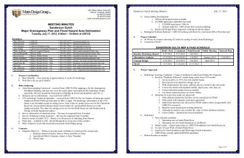
4. Project Schedule<br />
a. 46 Weeks by contract (showing 42 weeks by cutting 4 weeks from <strong>Hydrology</strong>)<br />
b. Concurrent FHAD<br />
SANDERSON GULCH MDP & FHAD SCHEDULE<br />
Draft / First Comments <strong>Final</strong>/Second Public Meeting Selected Plan<br />
<strong>Baseline</strong> <strong>Hydrology</strong> <strong>Report</strong> 8/27/<strong>2012</strong> 9/17/<strong>2012</strong> 10/8/<strong>2012</strong><br />
Alternatives Analysis 11/19/<strong>2012</strong> 12/10/<strong>2012</strong> 1/4/2013 January 2013 1/28/2013<br />
Concept Design 3/25/2013 4/15/2013 5/6/2013 April 2013<br />
FHAD 11/5/<strong>2012</strong> 11/26/<strong>2012</strong> 12/17/<strong>2012</strong><br />
5. Project Approach<br />
a. <strong>Hydrology</strong>: Existing Conditions = Future Conditions if add Green Gables Development<br />
i. Develop “Duplicate Effective” model using values from 1972 model<br />
1. Set up model is in 1972, but with smaller basins<br />
2. Recreate previous detention ratings curves<br />
3. With all parameters the same, calibrate the new model to the old results<br />
4. Correct the model with updated rainfall, impervious, soils data, etc.<br />
5. Correct detention rating curves as needed<br />
6. Use future imperviousness for Green Gables<br />
ii. Detention (6 in previous study in Lakewood)<br />
1. Only dedicated detention facilities can be considered in FHAD<br />
2. Only ponds with adequate assurances agreement<br />
3. Inadvertent detention not allowed for FHAD studies unless an agreement with<br />
UDFCD is executed.<br />
4. <strong>Baseline</strong> report based upon existing detention<br />
5. Alternatives analysis can consider the value of other detention facilities<br />
6. Green Gables – detention has been formalized<br />
b. Hydraulics<br />
i. New Channel centerline<br />
1. Stationing zero at South Platte River<br />
2. Stationing zero for North Sanderson at confluence<br />
ii. Model Limits – extend same limits as UDFCD floodplains into Smith Reservoir<br />
iii. Tie into 10-year WSE of South Platte River<br />
iv. Junction for North Sanderson and Mississippi Gulch Alternative<br />
v. UDFCD has recently updated DFHAD guidelines<br />
c. Define Reaches as needed<br />
Page 2 of 3


