

Final Baseline Hydrology Report - October 2012 - Urban Drainage ...
Final Baseline Hydrology Report - October 2012 - Urban Drainage ...
Final Baseline Hydrology Report - October 2012 - Urban Drainage ...

Create successful ePaper yourself
Turn your PDF publications into a flip-book with our unique Google optimized e-Paper software.
1601 Blake Street, Suite 200<br />
Denver, Colorado 80202<br />
(p) 303.572.0200<br />
(f) 303.572.0202<br />
www.matrixdesigngroup.com<br />
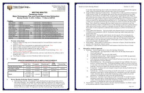
MEETING MINUTES<br />
Sanderson Gulch<br />
Major <strong>Drainage</strong>way Plan and Flood Hazard Area Delineation<br />
Monday <strong>October</strong> 15, <strong>2012</strong>, 10:00am – 11:30am at UDFCD<br />
Attendees:<br />
Shea Thomas UDFCD 303-455-6277 sthomas@udfcd.org<br />
Bill DeGroot UDFCD 303-455-6277 bdegroot@udfcd.org<br />
Terry Rogers Lakewood Engineering 303-987-7934 terrog@lakewood.org<br />
John Paliga Lakewood Community Devm 303-987-7815 johpal@lakewood.org<br />
Mike Anderson Denver Capital Projects 720-865-3023 mike.anderson@denvergov.org<br />
David Marquardt Denver Parks 720.913.0629 david.marquardt@denvergov.org<br />
Kevin Lewis Denver Public Works 303-446-3658 donald.lewis@denvergov.org<br />
Robert Krehbiel Matrix Design Group - Eng 303-572-0200 robertk@matrixdesigngroup.com<br />
HungTeng Ho Matrix Design Group – Eng 303-572-0200 hungteng_ho@matrixdesigngroup.com<br />
Jane Kopperl Matrix Design Group 303-572-0200 jane_ kopperl@matrixdesigngroup.com<br />
George Slovensky Matrix Design Group 303-572-0200 george_slovensky@matrixdesigngroup.com<br />
Bob Eck Matrix Design Group 303-572-0200 bob_eck@matrixdesigngroup.com<br />
1. Previous Action Items:<br />
a. Matrix to change the rating curves of detention ponds for Corrected Effective model to actual<br />
conditions. Done.<br />
b. Matrix to check time of concentration to understand the model results. Done.<br />
c. Matrix to gather corrected effective model for Green Gables. Open.<br />
d. Matrix to contact the ditch companies in this study area. Open.<br />
e. Matrix to compare the 10-year gage analysis with the modeled 10-year hydrology. Done – See<br />
summary at the end of these minutes.<br />
f. Edit reach map to add reach 12, add street names, and move reach divide at the confluence and in<br />
Kendrick Lake. Done.<br />
g. Terry Rogers to arrange a van tour of Sanderson Gulch in Lakewood. Done.<br />
2. Schedule<br />
UPDATED SANDERSON GULCH MDP & FHAD SCHEDULE<br />
(dates revised from the kickoff meeting minutes are shown in red)<br />
Public<br />
Draft / First Comments <strong>Final</strong>/Second<br />
Meeting<br />
<strong>Baseline</strong> <strong>Hydrology</strong> <strong>Report</strong> 8/27/<strong>2012</strong> 10/04/<strong>2012</strong> 10/25/<strong>2012</strong><br />
Selected Plan<br />
Alternatives Analysis 11/19/<strong>2012</strong> 12/10/<strong>2012</strong> 1/4/2013 January 2013 1/28/2013<br />
Concept Design 3/25/2013 4/15/2013 5/6/2013 April 2013<br />
FHAD<br />
11/5/<strong>2012</strong><br />
First technical<br />
review only to<br />
UDFCD.<br />
11/26/<strong>2012</strong><br />
12/17/<strong>2012</strong><br />
Distribution<br />
to Sponsors<br />
3. Review <strong>Baseline</strong> <strong>Hydrology</strong> <strong>Report</strong> Comments<br />
a. Statistical Gage Analysis – the computed 10 year discharge based upon the gage data is lower<br />
than model discharges. This validates the calibration approach to adjust the raw model factor Cp<br />
to lower the model flows to the 1972 values with all other model input the same. FEMA accepted<br />
the hydrology in 1972 and the gage data is not giving us any reason to increase the hydrology<br />
because of the newer models. It is important to note that actual hydrology will generally always<br />
Sanderson Gulch Meeting Minutes <strong>October</strong> 15, <strong>2012</strong><br />
be less than model hydrology due to small on-site detention ponds not considered in the regional<br />
model, along with undersized inlets and other minor losses not considered.<br />
b. Irrigation Ditches Impacting Transbasin Flow - Transbasin flows could occur between Sanderson<br />
Gulch and Weir Gulch. The Agricultural Ditch diverts flows between Smith Reservoir (within<br />
Sanderson) and East Reservoir (within Weir). It appears that it might depend on the WSELs in<br />
each of the reservoirs to know which way the flows would go. This is discussed in the 1972 study.<br />
Runoff from the upper Sanderson Gulch is intercepted by Smith Reservoir, an irrigation storage<br />
reservoir owned by the Agricultural Ditch and Reservoir Co. The Smith Reservoir spillway directs<br />
overflow into an irrigation ditch flowing into East Reservoir which is located in the Weir Gulch<br />
Basin. This is effectively a transbasin diversion which would convey stormwater to the Weir<br />
Gulch basin during overflows of Smith Reservoir. If this discharge is allowed to continue during a<br />
major storm event, the effect would be to continually increase the inflow to East Reservoir into<br />
Weir Gulch. It will be important to understand where emergency overflows for the ditches are<br />
planned.<br />
c. Green Gables Road Detention – The Green Gables redevelopment project is moving ahead. A<br />
CLOMR has been submitted to UDFCD. The <strong>Baseline</strong> <strong>Hydrology</strong> model should match their<br />
design release rates.<br />
d. Mississippi Gulch – The baseline model imports only the capacity of the existing pipe into<br />
Sanderson Gulch. A FLO-2D model to assess flows either following or crossing Mississippi<br />
Avenue from Clay Street to Pecos is not necessary at this time. The Alternatives Analysis will<br />
explore options to leave the allowable capacity in Mississippi Avenue in a major event and<br />
convey the remainder to Sanderson Gulch.<br />
e. Water Quality – Water quality to be discussed as a subsection in Chapter 2 Reach Descriptions<br />
and also in the Alternatives Analysis section<br />
f. Maintenance - Lakewood has easements for North Sanderson Gulch from Pierce to Florida<br />
4. Alternatives Analysis Approach<br />
a. <strong>Hydrology</strong> – Look for opportunities to reduce the hydrology (Detention)<br />
i. Jewell Park Pond – Good opportunity to reduce flows into the King Soopers pipe at<br />
Jewell and Wadsworth<br />
ii. Carmody Park Pond – May provide a little benefit<br />
iii. Green Gables Entrance Road – Match the design flows in the CLOMR. No opportunity<br />
for additional detention beyond what is planned.<br />
iv. North Sanderson Greenbelt Improvement Wetland Pond (near Lamar Street). This area is<br />
not an opportunity for future detention.<br />
v. Clairefield Reservoir – The surrounding area is planned for future ballfields. This area is<br />
known as “Wilson Family Park.” The proposed ballfields could be set at the 25-year level<br />
or some other event to shave the peak off the 100-year flood. The fields cannot be flooded<br />
frequently. Lakewood to address the allowable frequency of flooding.<br />
vi. Irving Street – Could provide some marginal storage for peak shaving. Doubtful that this<br />
area could be regraded.<br />
vii. Garfield Lake – Currently not providing any benefit in the model. To account for some<br />
attenuation would require a formal agreement for a commitment to provide a detention<br />
volume. Detention options could include formalizing existing conditions to provide<br />
attenuation, or rebuilding the outlet to provide formal detention.<br />
viii. Huston Lake - Currently not providing any benefit in the model. To account for some<br />
attenuation would require a formal agreement for a commitment to provide a detention<br />
volume. Detention options could include formalizing existing conditions to provide<br />
attenuation, or rebuilding the outlet to provide formal detention.<br />
b. Flood Control – Examine options to remove structures from the floodplain. Use FEMA’s model<br />
as the preferred method to evaluate Benefits to Costs.<br />
Page 2 of 5


