Final Baseline Hydrology Report - October 2012 - Urban Drainage ...
Final Baseline Hydrology Report - October 2012 - Urban Drainage ...
Final Baseline Hydrology Report - October 2012 - Urban Drainage ...
You also want an ePaper? Increase the reach of your titles
YUMPU automatically turns print PDFs into web optimized ePapers that Google loves.
Sanderson Gulch Major <strong>Drainage</strong>way Plan<br />
<strong>Baseline</strong> <strong>Hydrology</strong> <strong>Report</strong> <strong>October</strong> <strong>2012</strong><br />
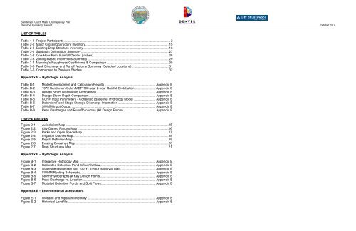
LIST OF TABLES<br />
Table 1-1 Project Participants .......................................................................................................................... 2<br />
Table 2-2 Major Crossing Structure Inventory ............................................................................................... 15<br />
Table 2-3 Existing Drop Structure Inventory .................................................................................................. 16<br />
Table 3-1 Subbasin Delineation Summary .................................................................................................... 27<br />
Table 3-2 One-Hour Point Rainfall Depths (Inches) ...................................................................................... 28<br />
Table 3-3 Zoning-Based Impervious Summary ............................................................................................. 29<br />
Table 3-4 Manning's Roughness Coefficients & Comparison ....................................................................... 30<br />
Table 3-5 Peak Discharge and Runoff Volume Summary (Selected Locations) .......................................... 31<br />
Table 3-6 Comparison to Previous Studies ................................................................................................... 32<br />
Appendix B – Hydrologic Analysis<br />
Table B-1<br />
Table B-2<br />
Table B-3<br />
Table B-4<br />
Table B-5<br />
Table B-6<br />
Table B-7<br />
Table B-8<br />
Model Development and Calibration Results ......................................................... Appendix B<br />
1972 Sanderson Gulch MDP 100-year 2-hour Rainfall Distribution ....................... Appendix B<br />
Design Storm Distribution Comparison .................................................................. Appendix B<br />
Design Storm Depth Comparison ........................................................................... Appendix B<br />
CUHP Input Parameters - Corrected (<strong>Baseline</strong>) <strong>Hydrology</strong> Model ........................ Appendix B<br />
Detention Pond Stage-Storage-Discharge Information .......................................... Appendix B<br />
SWMM Input/Output ............................................................................................... Appendix B<br />
Peak Discharges and Runoff Volumes (All Design Points) .................................... Appendix B<br />
LIST OF FIGURES<br />
Figure 2-1 Jurisdiction Map ...................................................................................................................... 15<br />
Figure 2-2 City-Owned Parcels Map ........................................................................................................ 16<br />
Figure 2-3 Parks and Open Space Map ................................................................................................... 17<br />
Figure 2-4 Irrigation Ditches Map ............................................................................................................. 18<br />
Figure 2-5 Reach Definition Map .............................................................................................................. 19<br />
Figure 2-6 Existing Crossings Map .......................................................................................................... 20<br />
Figure 2-7 Drop Structures Map ............................................................................................................... 21<br />
Appendix B – Hydrologic Analysis<br />
Figure B-1<br />
Figure B-2<br />
Figure B-3<br />
Figure B-4<br />
Figure B-5<br />
Figure B-6<br />
Figure B-7<br />
Interactive <strong>Hydrology</strong> Map ...................................................................................... Appendix B<br />
Calibrated Detention Pond Inflow/Outflow .............................................................. Appendix B<br />
Watershed Boundary and 100-Yr, I-Hour Isopluvial Map ....................................... Appendix B<br />
SWMM Routing Schematic ..................................................................................... Appendix B<br />
Storm Hydrographs at Key Design Points .............................................................. Appendix B<br />
Peak Discharge vs. Location .................................................................................. Appendix B<br />
Modeled Detention Ponds and Split Flows ............................................................. Appendix B<br />
Appendix E – Environmental Assessment<br />
Figure E-1<br />
Figure E-2<br />
Wetland and Riparian Inventory ............................................................................. Appendix E<br />
Historical Landfills ................................................................................................... Appendix E


