Lower Tolt River Floodplain Reconnection Project - Washington ...
Lower Tolt River Floodplain Reconnection Project - Washington ...
Lower Tolt River Floodplain Reconnection Project - Washington ...

Create successful ePaper yourself
Turn your PDF publications into a flip-book with our unique Google optimized e-Paper software.
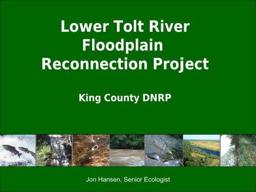
<strong>Lower</strong> <strong>Tolt</strong> <strong>River</strong><strong>Lower</strong> <strong>Tolt</strong> <strong>River</strong><strong>Floodplain</strong> <strong>Reconnection</strong> <strong>Project</strong><strong>Floodplain</strong><strong>Reconnection</strong> <strong>Project</strong>King County DNRPJon Hansen, Senior Ecologist
<strong>Project</strong> Overview• <strong>Floodplain</strong> <strong>Reconnection</strong> relying on river processes• Located on at confluence of two productive salmon rivers• Targets critical rearing and refuge needs• Partnership project using combination of local and statefunding
<strong>Project</strong> Partners• Significant grant funds– Salmon Recovery FundingBoard– ALEA program– King Conservation District• WRIA 7 and SnoqualmieWatershed Forum• MOU with City of Carnation
• Confluence of<strong>Tolt</strong> andSnoqualmie<strong>River</strong>s• Rural KingCounty south ofCity of CarnationSnohomish Watershed (WRIA#7)<strong>Tolt</strong> Watershed• John MacDonaldRegional Park(King CountyPark system)SEATTLEAREASnoqualmie<strong>River</strong>
Snoqualmie <strong>River</strong><strong>Tolt</strong> <strong>River</strong>
Core Area for Salmon Recovery• Snoqualmie <strong>River</strong><strong>Tolt</strong> Delta Reach• Concentratedspawning bymultiple species• But ~ 70 % banksarmored• Off channel andrearing/refugeidentified as criticalneed
<strong>Lower</strong> <strong>Tolt</strong> <strong>River</strong> Conditions• Levee system on bothbanks• Training Levee - preventchannel migration only• Narrow channelconstricts flow and limitshabitat<strong>Tolt</strong>• Isolated from off channelhabitats• Very popular, multipleuse park with excellentaccess to river<strong>Lower</strong> <strong>Tolt</strong> <strong>River</strong> passing <strong>Tolt</strong> MacDonald Park to confluencewith the Snoqualmie <strong>River</strong>
<strong>Project</strong> GoalsRestore natural riverprocessesMaintain current level offlood & erosion protectionPreserve and enhancerecreational uses
<strong>Tolt</strong><strong>River</strong>2000<strong>Tolt</strong><strong>River</strong>1937
CampgroundNov 7, 2006: Note Snoqualmie backwater influence
Restoring ProcessRemove barriers to natural channelmigration and habitat creationConstructed elements initiate andencourage, but not directInclude structural elements missingfrom floodplainJump start floodplain communitywith extensive riparian plantingsProtection provided uses naturalelements
Design Considerations• Parks property with high level of recreational use– Protection of existing facilities– Open during construction• Maintain flood protection during construction (2 yrs)• Address misconceptions about role of levee in floodprotection• Recreational floaters and large wood• Cultural Sensitivity of the site
CampLoopSetback LeveeMarinerFieldRevetmentEngineeredLog JamsOutlet ChannelLevee RemovalHabitat and Flood Protection Features
TRAIL CONNECTIONTO TOWNPAVED TRAILATOP LEVEEFLOATERTAKE-OUTPOINTFAMILYREC AREARecreation Features
Construction• Constructed in Phases– Phase 1 (2008) – Jansen Construction– Phase 2 (2009) – J.R. Hayes Construction• Contract Procurement and ConstructionManagement completed by Seattle• Construction and CMI - Well run andcoordinated
Design objective – maintain existing flood protectionAccomplished by matching existing leveeelevations at all cross sections
Levee Design with Buried Revetmentalong edge of developed Park
Campground Revetment designed forConcentrated <strong>Tolt</strong> <strong>River</strong> Flow
ELJ Design AssumedConcentrated <strong>Tolt</strong> <strong>River</strong> Flow
Construction Elements‣ Removed 3,157 feet of rock faced levee+ 2,119 feet setback levee+ 900 feet of pile/wood revetment/bank treatment+ 7 Engineered Log Jam structures+ 6 channel roughening structures+ 1,200 feet new outlet channel+ 21+ acres enhanced with native plants
Recreational Elements• 4,360 feet of new paved trail– Improved connected to regional trail and City– Included 50 foot pre-fab bridge• ~2,000 feet informal trail accessing floodplain• 3 parking lots ~ 150 stalls• Family picnic area• Interpretative Signs
Challenges• Park remained open during construction• Late start for Phase I (July 2008)• Cultural resources within Park property• Large storm between construction phases– Washed away fencing and plants– Deposited large logjam on levee
Logjam DilemmaJanuary 2009
LOG JAM – BEFORE(Use leaning tree on other side of river for reference)
Restoring Process• How long should it take to see results?• Managing expectations – internal andexternal• Monitoring change – baseline and eventdriven to see incremental change• Threshold for additional work or adaptivemanagement
Off Channel ConnectionSummer 2004 December 2010
Channel ComplexitySummer 2004 January 2011
Lateral Migration and LWD RecruitmentMay 2009 January 2011
What worked?• Partnership with complementary skills• Proactive recreational safety effort• <strong>Project</strong> website• Well Planned Construction Logistics• Professional Construction Management• Great Contractors
What Did NOT work?• Large Client Team with unclear decisionmaking process• Decentralized contract management• Decentralized and inconsistent PublicOutreach• Limited documentation of Early DesignDecisions
Lessons Learned• Flexibility is good, but stick to your goals• Do outreach early and give regular updates• Partnerships can be great – but set clear rolesand responsibilities• Consider full range of alternatives and document
<strong>Project</strong> TimelineDesign 2004 – 2008Permitting Sept 2007 – July 2008Construction July 2008 – Feb 2010Add’l Rock Removal August 2010Final Trail Connect May 2011
<strong>Project</strong> Costs and Funding• Construction cost $6.15 million• Phase 1 – Summer 2008 – $1.75M• Phase 2 – 2009 – $4.4M• Cost shares• Seattle $2.4M• King County $1.45M• Grants $2.3M
<strong>Lower</strong> <strong>Tolt</strong> <strong>River</strong><strong>Floodplain</strong><strong>Reconnection</strong> <strong>Project</strong>QUESTIONS?