CV OF DR. PK GARG Name - Channel - Indian Institute of ...
CV OF DR. PK GARG Name - Channel - Indian Institute of ...
CV OF DR. PK GARG Name - Channel - Indian Institute of ...

Create successful ePaper yourself
Turn your PDF publications into a flip-book with our unique Google optimized e-Paper software.
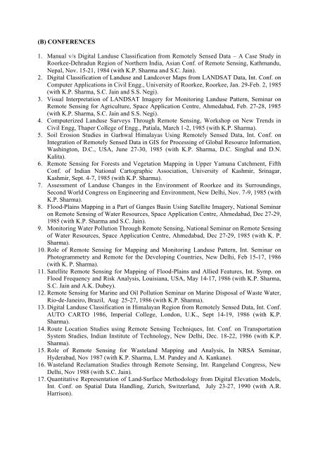
(B) CONFERENCES1. Manual v/s Digital Landuse Classification from Remotely Sensed Data – A Case Study inRoorkee-Dehradun Region <strong>of</strong> Northern India, Asian Conf. <strong>of</strong> Remote Sensing, Kathmandu,Nepal, Nov. 15-21, 1984 (with K.P. Sharma and S.C. Jain).2. Digital Classification <strong>of</strong> Landuse and Landcover Maps from LANDSAT Data, Int. Conf. onComputer Applications in Civil Engg., University <strong>of</strong> Roorkee, Roorkee, Jan. 29-Feb. 2, 1985(with K.P. Sharma, S.C. Jain and S.S. Negi).3. Visual Interpretation <strong>of</strong> LANDSAT Imagery for Monitoring Landuse Pattern, Seminar onRemote Sensing for Agriculture, Space Application Centre, Ahmedabad, Feb. 27-28, 1985(with K.P. Sharma, S.C. Jain and S.S. Negi).4. Computerized Landuse Surveys Through Remote Sensing, Workshop on New Trends inCivil Engg, Thaper College <strong>of</strong> Engg., Patiala, March 1-2, 1985 (with K.P. Sharma).5. Soil Erosion Studies in Garhwal Himalayas Using Remotely Sensed Data, Int. Conf. onIntegration <strong>of</strong> Remotely Sensed Data in GIS for Processing <strong>of</strong> Global Resource Information,Washington, D.C., USA, June 27-30, 1985 (with K.P. Sharma, D.C. Singhal and D.N.Kalita).6. Remote Sensing for Forests and Vegetation Mapping in Upper Yamuna Catchment, FifthConf. <strong>of</strong> <strong>Indian</strong> National Cartographic Association, University <strong>of</strong> Kashmir, Srinagar,Kashmir, Sept. 4-7, 1985 (with K.P. Sharma).7. Assessment <strong>of</strong> Landuse Changes in the Environment <strong>of</strong> Roorkee and its Surroundings,Second World Congress on Engineering and Environment, New Delhi, Nov. 7-9, 1985 (withK.P. Sharma).8. Flood-Plains Mapping in a Part <strong>of</strong> Ganges Basin Using Satellite Imagery, National Seminaron Remote Sensing <strong>of</strong> Water Resources, Space Application Centre, Ahmedabad, Dec 27-29,1985 (with K.P. Sharma and S.C. Jain).9. Monitoring Water Pollution Through Remote Sensing, National Seminar on Remote Sensing<strong>of</strong> Water Resources, Space Application Centre, Ahmedabad, Dec 27-29, 1985 (with K. P.Sharma).10. Role <strong>of</strong> Remote Sensing for Mapping and Monitoring Landuse Pattern, Int. Seminar onPhotogrammetry and Remote for the Developing Countries, New Delhi, Feb 15-17, 1986(with K. P. Sharma).11. Satellite Remote Sensing for Mapping <strong>of</strong> Flood-Plains and Allied Features, Int. Symp. onFlood Frequency and Risk Analysis, Louisiana, USA, May 14-17, 1986 (with K.P. Sharma,S.C. Jain and A.K. Dubey).12. Remote Sensing for Marine and Oil Pollution Seminar on Marine Disposal <strong>of</strong> Waste Water,Rio-de-Janeiro, Brazil, Aug 25-27, 1986 (with K.P. Sharma).13. Digital Landuse Classification in Himalayan Region from Remotely Sensed Data, Int. Conf.AUTO CARTO 1986, Imperial College, London, U.K., Sept 14-19, 1986 (with K.P.Sharma).14. Route Location Studies using Remote Sensing Techniques, Int. Conf. on TransportationSystem Studies, <strong>Indian</strong> <strong>Institute</strong> <strong>of</strong> Technology, New Delhi, Dec. 18-22, 1986 (with K.P.Sharma).15. Role <strong>of</strong> Remote Sensing for Wasteland Mapping and Analysis, In NRSA Seminar,Hyderabad, Nov 1987 (with K.P. Sharma, L.M. Pandey and A. Kankane).16. Wasteland Reclamation Studies through Remote Sensing, Int. Rangeland Congress, NewDelhi, Nov 1988 (with S.C. Jain).17. Quantitative Representation <strong>of</strong> Land-Surface Methodology from Digital Elevation Models,Int. Conf. on Spatial Data Handling, Zurich, Switzerland, July 23-27, 1990 (with A.R.Harrison).