COOPER BASIN EXPLORATION OPPORTUNITY BLOCKS ... - MISA
COOPER BASIN EXPLORATION OPPORTUNITY BLOCKS ... - MISA
COOPER BASIN EXPLORATION OPPORTUNITY BLOCKS ... - MISA

You also want an ePaper? Increase the reach of your titles
YUMPU automatically turns print PDFs into web optimized ePapers that Google loves.
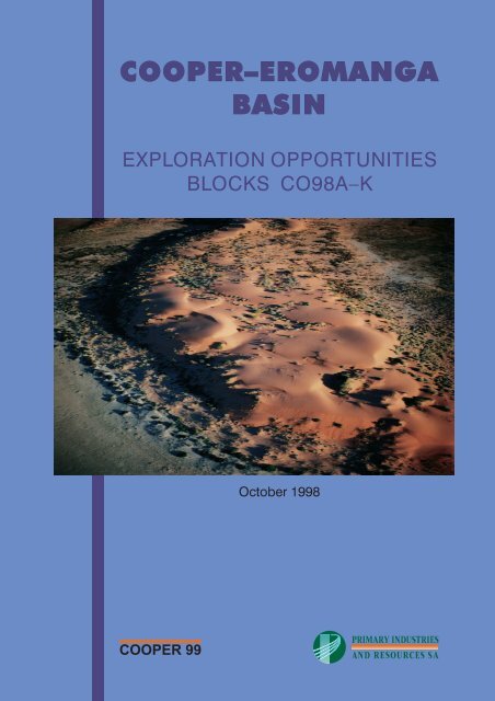
<strong>COOPER</strong>–EROMANGA<br />
<strong>BASIN</strong><br />
<strong>EXPLORATION</strong> OPPORTUNITIES<br />
<strong>BLOCKS</strong> CO98A–K<br />
<strong>COOPER</strong> 99<br />
October 1998
<strong>COOPER</strong> <strong>BASIN</strong><br />
<strong>EXPLORATION</strong> <strong>OPPORTUNITY</strong><br />
<strong>BLOCKS</strong> CO98-A to K<br />
Compiled by<br />
Elinor Alexander<br />
Petroleum Group<br />
OCTOBER 1998<br />
Cover photo: Sand dune in the Cooper Basin. Report book 98/00029<br />
© Department of Primary Industries and Resources South Australia, 1998<br />
This report is subject to copyright. Apart from fair dealing for the purposes of study, research,<br />
criticism or review as permitted under the Copyright Act, no part may be reproduced without<br />
written permission of the Chief Executive of Primary Industries and Resources South Australia.
CONTENTS<br />
EXECUTIVE SUMMARY ..............................................4<br />
<strong>EXPLORATION</strong> HISTORY ..............................................6<br />
GEOLOGICAL SUMMARY<br />
Eromanga Basin .................................................6<br />
Simpson Basin ..................................................8<br />
Cooper Basin ...................................................8<br />
Warburton Basin ................................................10<br />
PETROLEUM GEOLOGY<br />
Reservoirs ....................................................10<br />
Source rocks. ..................................................12<br />
Seals and plays .................................................13<br />
UNDISCOVERED POTENTIAL<br />
Introduction ...................................................13<br />
Cooper Basin gas ................................................13<br />
Cooper-Eromanga Basin oil. ..........................................14<br />
Results. .....................................................14<br />
INFRASTRUCTURE AND MARKETS<br />
Production facilities ...............................................14<br />
Services in the Cooper Basin ..........................................15<br />
Markets .....................................................15<br />
<strong>EXPLORATION</strong> ACCESS<br />
National Parks and Reserves ..........................................15<br />
Innamincka and Strzelecki Regional Reserves .................................17<br />
European heritage ...............................................17<br />
Aboriginal heritage ...............................................17<br />
Commonwealth Native Title Act 1993 .....................................17<br />
Environmental regulation ............................................17<br />
APPENDICES<br />
1. Block summaries ................................................21<br />
2. Data .......................................................57<br />
3. Licence application form and procedures. ...................................60<br />
FIGURES<br />
1. Cooper Basin location ..............................................5<br />
2. Eromanga Basin stratigraphy. ..........................................6<br />
3. Base Cretaceous, ‘C’ seismic horizon ......................................7<br />
4. Cooper Basin stratigraphy ............................................8<br />
5. Top Permian, ‘P’ seismic horizon ........................................9<br />
6. Warburton Basin stratigraphy. .........................................10<br />
7. Top Warburton Basin unconformity, ‘Z’ seismic horizon ...........................11<br />
8. Hydrocarbon plays schematic. .........................................13<br />
9. Pastoral leases and Regional Reserves, Cooper Basin region .........................16<br />
10. Native Title Claims, Cooper Basin region ...................................18<br />
11. Seismic line and well locations, ‘C’ horizon Block CO98 – A .........................20<br />
12. Seismic line and well locations, ‘C’ horizon Block CO98 – B .........................22
13. Seismic line and well locations, ‘C’ horizon Block CO98 – C .........................24<br />
14. Seismic line and well locations, ‘C’ horizon Block CO98 – D .........................28<br />
15. Seismic line and well locations, ‘C’ horizon Block CO98 – E .........................30<br />
16. Seismic line and well locations, ‘C’ horizon Block CO98 – F .........................36<br />
17. Seismic line and well locations, ‘C’ horizon Block CO98 – G .........................38<br />
18. Seismic line and well locations, ‘C’ horizon Block CO98 – H .........................42<br />
19. Seismic line and well locations, ‘C’ horizon Block CO98 – I .........................46<br />
20. Seismic line and well locations, ‘C’ horizon Block CO98 – J .........................50<br />
21. Seismic line and well locations, ‘C’ horizon Block CO98 – K .........................54<br />
TABLES<br />
1. First round acreage release blocks, Cooper Basin, 1998 .............................4<br />
2. Undiscovered recoverable Cooper Basin gas potential, billion cubic metres (tcf) ...............14<br />
3. Undiscovered recoverable Cooper Basin oil potential, million cubic metres (mmstb) .............14<br />
4. Major Cooper Basin pipelines .........................................14
PRIMARY INDUSTRIES AND RESOURCES<br />
SOUTH AUSTRALIA<br />
REPORT BOOK 98/00029<br />
<strong>COOPER</strong> <strong>BASIN</strong> <strong>EXPLORATION</strong> <strong>OPPORTUNITY</strong><br />
<strong>BLOCKS</strong> CO98-A to K.<br />
Compiled by E.M. Alexander with contributions from J.G.G. Morton (PIRSA) – undiscovered potential, A.J. Hill (PIRSA)<br />
and C. Boreham (AGSO) – source rocks, D.I. Gravestock (PIRSA) – seals and traps, A. Sansome (PIRSA) – data, D. Ivic<br />
(PIRSA) – seismic data.<br />
Executive Summary<br />
The Cooper Basin is located 800 km north of Adelaide in a remote, sparsely populated desert environment. The Cooper region<br />
has been under licence continuously since 1954 and is currently held by Santos and partners – PELs 5 & 6 cover 67 000 km 2 .<br />
Since 1954, Santos and joint venture partners have drilled over 1200 exploration, appraisal and development wells. At 30<br />
September 1997, 85 gas fields with a total of 354 gas wells were on line and a combined total of 190 PJ (150 Bcf) of sales gas<br />
was sold in that year to market in SA and NSW. At 30 November 1997, 28 oil fields with a total of 118 oil wells were on line<br />
and approximately 0.6 million kL (3.8 mmbbl) of crude oil, 0.4 million kL (2.5 mmbbl) of condensate and 0.3 million tonnes of<br />
LPG were sold.<br />
On 28 February 1999, PELs 5&6 expire and the South Australian Government has decided that the Cooper Basin, exclusive of<br />
production (and potentially retention) tenements will be made available for competitive bidding. In order to facilitate this<br />
process, reviews of the legislative regime, data issues and a review of the necessity of access to existing processing plant and<br />
associated infrastructure have been conducted.<br />
The opening of the Cooper Basin to competitive bidding provides a unique opportunity for explorers. Advantages include<br />
established infrastructure and markets, proven play concepts, high wildcat discovery rates, access to detailed data and a<br />
government with a proven track record of facilitation of responsible petroleum exploration and development.<br />
The release of blocks CO98-A to K is the first in a phased acreage release in the Cooper Basin. The announcement of blocks<br />
before the expiry of PELs 5 & 6 is designed to ensure a smooth transition by minimising delays in new exploration in the<br />
Cooper Basin.<br />
Table 1. First round acreage release blocks, Cooper Basin, 1998.<br />
Block Area Last Drilled No. wells Seismic Line Basins and targets<br />
km 2 Acres (x 10 6 ) km<br />
CO-98A 4316 1.066 - 0 405 Eromanga, Simpson and Warburton Basins, oil<br />
CO-98B 4315 1.066 1963 1 508 Eromanga and Warburton Basin, oil<br />
CO-98C 4987 1.232 1989 9 2336 Eromanga, Cooper and Warburton Basin, oil<br />
CO-98D 4891 1.208 1984 2 1263 Eromanga, Simpson and Warburton Basins, oil<br />
CO-98E 1365 0.337 1997 11 2499 Eromanga, Cooper and Warburton Basins, oil<br />
CO-98F 2964 0.732 1967 2 1745 Eromanga, Cooper and Warburton Basins, oil<br />
CO-98G 2878 0.711 1991 3 2365 Eromanga, Cooper and Warburton Basins, oil<br />
CO-98H 1884 0.465 1996 7 2014 Eromanga, Cooper and Warburton Basins, oil<br />
CO-98I 2703 0.668 1996 1 1689 Eromanga, Cooper and Warburton Basins, oil<br />
CO-98J 3893 0.962 1987 5 3019 Eromanga, Cooper and Warburton Basins, oil<br />
CO-98K 5236 1.294 1970 4 1619 Eromanga, Cooper and Warburton Basins, oil<br />
Applications may be made for any or all of the areas CO98-A to K. Licences are offered on the basis of the most competitive<br />
work program. In the event that more than one area is offered to an applicant for licence, there is no obligation for the applicant<br />
to accept any or all of the offers. In addition, applications for this first release of acreage will in no way prejudice successful<br />
applications in future Cooper Basin acreage releases.<br />
Enquiries and applications for Petroleum Exploration Licences (PELs) may be addressed to:<br />
The Chief Executive PIRSA Telephone: IAC 61 8 8463 3204<br />
C/o Director, Petroleum Group Facsimile: IAC 61 8 8463 3229<br />
PIRSA Website: www.mines.sa.gov.au/petrol<br />
GPO Box 1671,<br />
Adelaide, SA, 5001<br />
AUSTRALIA<br />
Applications should be accompanied by a proposed five year work program, a map of the area applied for, a $2 240 application<br />
fee and details of the technical and financial resources of the applicant (an application form and summary guidelines are<br />
included in Appendix 3).<br />
4<br />
The closing date for CO989-A to K applications is 4.00 pm on 11 March 1999.
g������2—�2y��˜��2IWWV<br />
5ƒ<br />
7<br />
��<br />
€��������2i�����—����2<br />
v����2@€ivA<br />
e��—��2����—��2˜���<br />
€��������2€��������2<br />
v����2@€€vA<br />
q—�2������<br />
y��2������<br />
v�—����<br />
r������—�2G2�����—����<br />
e�������<br />
ƒ—�������2��—����<br />
q—�2���������2��—����<br />
v������2�������2��—����<br />
w—���2��—�<br />
w����2��—�<br />
€�������2v����2@€vA2E2�—�<br />
q—�2����2��������<br />
€�������2v����2@€vA2E2���<br />
y��2����2��������<br />
g�����2f—���2��˜E���2�����<br />
H PS SH<br />
usvywi„‚iƒ<br />
€��������2E2ewq2 ���2SR<br />
�<br />
6<br />
6<br />
e†Q2X2IHIQVR2X2WVEIQWSFe€‚<br />
Fig. 1. Cooper Basin location.<br />
IQW�2HH9<br />
7<br />
�<br />
7<br />
�<br />
�<br />
555 5<br />
55 5 5555<br />
5<br />
55 55<br />
5<br />
555 5 ‡—����—2y�� ��<br />
…iixƒvexh<br />
gyWVEe gyWVEf<br />
gyWVEh<br />
gyWVEp<br />
gyWVEq<br />
€—����2€—����<br />
x��2e����2<br />
h����<br />
fs‚hƒ†svvi „‚egu<br />
€iv�222S2—��2T<br />
5<br />
6<br />
5 5<br />
6<br />
7<br />
�� h—�—������2q—�<br />
7<br />
5<br />
5<br />
5<br />
5<br />
5<br />
5<br />
7<br />
u���—��2y�� �� 55<br />
5<br />
5<br />
5<br />
55 5<br />
5<br />
5<br />
5<br />
5<br />
5 5<br />
55<br />
5<br />
5<br />
5<br />
5<br />
5 5<br />
55 5 5<br />
5 55 55 5<br />
5<br />
5<br />
5<br />
555 5555<br />
5<br />
5<br />
5<br />
5<br />
5<br />
5<br />
5<br />
55 5<br />
5<br />
5<br />
5<br />
5 555 555<br />
5<br />
5<br />
5<br />
55 5<br />
5<br />
5<br />
5 5<br />
5 5<br />
5<br />
5 5<br />
555 5 5<br />
5<br />
55 5<br />
55<br />
5<br />
5<br />
555 5<br />
5<br />
5<br />
5 5<br />
5555 5 5 55<br />
5<br />
55<br />
5 55 5 5<br />
5<br />
5<br />
5<br />
5<br />
��<br />
f���—˜������2q—�<br />
��<br />
p��2v—��2y��<br />
w���—��<br />
��<br />
7<br />
„���—�—��— �� q����—��—<br />
7<br />
�� w��������—2y��<br />
s��—����—<br />
s��—����— 5ƒ<br />
��<br />
w��������—2q—�<br />
w��—���2y�� ��<br />
q����—��—2q—�<br />
��<br />
q����—��—2y�� ��<br />
65ƒ<br />
�� h���—<br />
w���˜—<br />
��<br />
��<br />
w���˜—2<br />
h������—��2q—�<br />
„—��—��— ƒ����2g����—� �� ƒ��������<br />
��<br />
�� ��<br />
f��2v—��<br />
u���—�<br />
gyWVEr<br />
gyWVEs<br />
�<br />
gyWVEu<br />
u�����������2yƒ<br />
�<br />
�<br />
�<br />
�<br />
�<br />
�<br />
ƒ„‚ ivigus<br />
�<br />
„‚egu<br />
�<br />
�<br />
�<br />
�<br />
w����2w����<br />
gyWVEg<br />
�<br />
�<br />
�<br />
�<br />
5<br />
�<br />
�<br />
�<br />
� �<br />
€v2S<br />
2p���2ƒF‡F2 ��<br />
gyWVEt<br />
€vI2E2q—�2��������2��2e���—���<br />
€vP2E2v������2��������2��2€���2f�������<br />
g�������2h����<br />
�<br />
�<br />
5<br />
„���—���<br />
��<br />
�<br />
7<br />
�<br />
�<br />
�<br />
€v�2UDV<br />
„�2ƒ�����<br />
�<br />
�<br />
�<br />
7<br />
IRI�2HH9 PT�2HH9<br />
�<br />
�<br />
gyWVEi<br />
f���—���2v—����<br />
p��������2f���<br />
5<br />
�<br />
€v2W<br />
PW�2HH9<br />
xF2ƒF2‡F<br />
PW�2QH9<br />
5
<strong>EXPLORATION</strong> HISTORY<br />
The Cooper Basin forms the most significant element of<br />
Australia’s largest onshore oil and gas province (Fig. 1).<br />
Petroleum exploration commenced in the region in 1954<br />
with the granting of OEL 7 to R. Bristowe on behalf of<br />
Santos. Early exploration targeted the Cambro-Ordovician<br />
and in 1959 Innamincka 1 was drilled, following a<br />
reflection-refraction survey carried out over Innamincka<br />
Dome with Delhi Petroleum as operator. Additional<br />
reflection surveys over the ensuing years led to the discovery<br />
of gas in the Permian section in Gidgealpa 2 in 1963 and<br />
three years later the ‘giant’ Moomba gas field was<br />
discovered. One third of South Australia’s Cooper Basin<br />
gas reserves are in the Moomba and neighbouring Big Lake<br />
fields. The decision to generate the bulk of South Australia’s<br />
electricity from natural gas ensured the economic viability<br />
of constructing and operating the Moomba–Adelaide<br />
pipeline, and gas was first supplied to Adelaide in 1969.<br />
PELs 5 and 6 were granted to Delhi and Santos in 1969 to<br />
replace OELs 20 and 21. During 1973 an agreement was<br />
signed by the Cooper Basin Producers to supply gas for the<br />
New South Wales market and a pipeline was constructed<br />
linking Moomba and Sydney.<br />
The first Cooper Basin oil was discovered in Tirrawarra<br />
1 in 1970. The Tirrawarra field contains 80 per cent of<br />
known oil reserves in the SA region. Eromanga Basin oil<br />
was discovered in 1977 with an uneconomic flow from<br />
Poolowanna 1 (Poolowanna Trough) and the first economic<br />
oil flow was recorded from Strzelecki 3 in the following<br />
year. In order to market newly discovered oil and existing<br />
gas liquids, the Cooper Basin Liquids Project was initiated<br />
in 1980 and completed in stages from 1982 to 1984 at a cost<br />
of $1.4 billion. The project involved the construction of a<br />
high vapour pressure liquids pipeline from Moomba to a<br />
processing plant and storage and loading facilities at Port<br />
Bonython, as well as field development, oil collection and<br />
crude stabilisation facilities at Moomba.<br />
Shipments of crude oil and condensate commenced in<br />
1983 and LPG handling facilities were commissioned in<br />
July 1984. The establishment of these facilities enabled the<br />
Cooper Basin Producers to bring the wet gas reservoirs into<br />
production, which further enhanced production flexibility.<br />
In 1991 condensate production from Port Bonython was<br />
replaced by a full range naphtha, which has a greater market<br />
value.<br />
In 1991 a contract was signed for the sale of natural gas<br />
by the South–West Queensland Producers to South<br />
Australia. The gas is delivered to the South Australian<br />
market via a 190 km pipeline constructed by the Producers to<br />
link the Queensland gas fields with the Moomba processing<br />
facility and Moomba–Adelaide natural gas pipeline. An<br />
agreement was finalised between Santos on behalf of the<br />
Cooper Basin Producers and ICI in 1994 to supply ethane<br />
from Moomba to a petrochemical plant in Botany Bay. A<br />
pipeline was constructed and supply commenced in June<br />
1996.<br />
Since 1963, a total of 229 billion cubic metres (8.2 tcf) of<br />
recoverable raw gas and 6.9 million cubic metres (43.9<br />
million stocktank barrels) of recoverable oil have been<br />
discovered in the Cooper and Eromanga Basins in South<br />
Australia.<br />
6<br />
GEOLOGICAL SUMMARY<br />
Eromanga Basin<br />
The Eromanga Basin covers one million square<br />
kilometres of central-eastern Australia and contains the<br />
multi-aquifer system of the Great Artesian Basin. It<br />
unconformably overlies the Cooper and Warburton Basins.<br />
Eromanga Basin stratigraphy can be divided into three<br />
sequences – lower non-marine, marine and upper<br />
non-marine (Fig. 2). Exploration is concentrated on the<br />
productive lower non-marine sequence.<br />
The lowermost unit of the Eromanga Basin is the Early to<br />
Middle Jurassic Poolowanna Formation, which consists of<br />
interbedded siltstone, sandstone and coal, deposited in high<br />
sinuosity fluvial and floodplain environments. Poolowanna<br />
Formation intertongues with and is overlain by low sinuosity<br />
fluvial deposits of the Hutton and Algebuckina Sandstones.<br />
Basinward lateral equivalents of the Algebuckina Sandstone<br />
are Hutton Sandstone, Birkhead Formation, Adori<br />
Sandstone, Westbourne Formation, Namur Sandstone and<br />
Murta Formation. The Hutton, Adori and Namur<br />
Sandstones are similar in lithology and facies to the<br />
Algebuckina but with an additional volcaniclastic<br />
component in minor amounts.<br />
Middle to Late Jurassic Birkhead Formation consists of<br />
interbedded siltstone, coal and sandstone, Westbourne<br />
SYSTEM<br />
QUAT.<br />
CRETACEOUS TERTIARY<br />
JURASSIC<br />
AGE<br />
SERIES<br />
Late<br />
Early<br />
Late<br />
Middle<br />
Early<br />
Oodnadatta Formation<br />
Mackunda Formation<br />
Allaru Mudstone<br />
Coorikiana Sst. Toolebuc Formation<br />
Algebuckina<br />
Sandstone<br />
Bulldog Shale<br />
ROCK UNIT<br />
Millyera Formation and equivalent<br />
Yandruwantha Sand<br />
Namba Formation<br />
Eyre Formation<br />
Winton Formation<br />
Cadna-owie Formation<br />
Namur<br />
Sandstone<br />
Fig. 2. Eromanga Basin stratigraphy.<br />
Mount Howie<br />
Sandstone<br />
Wallumbilla<br />
Formation<br />
Murta Formation<br />
McKinlay Member<br />
Westbourne<br />
Formation<br />
Adori Sandstone<br />
Birkhead Formation<br />
Hutton Sandstone<br />
Poolowanna Formation<br />
GROUP<br />
MARREE<br />
SUBGROUP<br />
LAKE EYRE<br />
<strong>BASIN</strong><br />
EROMANGA <strong>BASIN</strong><br />
98-0019
g2ry‚s yx<br />
g������2—�2y��˜��2IWWV<br />
€��������2i�����—����2<br />
v����2@€ivA<br />
€��������2€��������2<br />
v����2@€€vA<br />
€��������2€��������2<br />
v����2e����—����2@€€veA<br />
e��—��2����—��2˜���<br />
€iv�2S2—��2T2E2g�����2f—���<br />
ƒ����2e����—��—<br />
hi€„r2„y2feƒi<br />
g‚i„egiy…ƒ<br />
9g92ƒisƒwsg2ry‚s yx<br />
H PS SH<br />
usvywi„‚iƒ<br />
€��������2E2ewq2 ���2SR<br />
e†Q2X2IHIQVRX2WVEIRIHFe€‚<br />
IQW�2HH9<br />
Fig. 3. Base Cretaceous, ‘C’ seismic horizon.<br />
gyWVEh<br />
gyWVEu<br />
…iixƒvexh<br />
gyWVEe gyWVEf<br />
gyWVEp<br />
gyWVEq<br />
gyWVEr<br />
gyWVEs<br />
w���˜—<br />
gyWVEg<br />
gyWVEt<br />
gyWVEi<br />
€vex2QR<br />
IRI�2HH9 PT�2HH9<br />
PW�2HH9<br />
xF2ƒF2‡F<br />
PW�2QH9<br />
7
Formation consists of interbedded siltstone and sandstone of<br />
Late Jurassic age. Murta Formation and McKinlay Member<br />
overlie and intertongue with the Namur Sandstone and<br />
consist of thinly interbedded siltstone, shale, sandstone<br />
deposited in a large lake which extended throughout the<br />
Cooper Basin region. The McKinlay Member is a lacustrine<br />
shoreface facies.<br />
Cadna-owie Formation records the transition into open<br />
marine conditions during the Early Cretaceous and consists<br />
of interbedded sandstone, siltstone and claystone with minor<br />
carbonate. The fluvio-deltaic Wyandra Sandstone Member<br />
is developed at the top of the Cadna-owie Formation. The<br />
contact between sandstones of the upper Cadna-owie<br />
Formation (Wyandra Sandstone Member) and overlying<br />
marine shales of the Bulldog Shale or Wallumbilla<br />
Formation approximates a prominent seismic reflector - the<br />
C horizon – which is mappable across the entire Eromanga<br />
Basin (Fig. 3). Formations of the Early Cretaceous (Aptian<br />
to Albian) are of secondary interest to petroleum exploration<br />
in the area and are not discussed in detail. The marine<br />
succession is overlain by the rapidly deposited upper<br />
non-marine sequence (Winton Formation) which consists of<br />
coal, floodplain and low sinuosity channel deposits.<br />
A period of erosion and deep weathering in the Late<br />
Cretaceous caused by a switch in drainage from the Cooper<br />
region to the Ceduna Depocentre on the rifted southern<br />
margin of the continent was followed by deposition of the<br />
non-marine Cainozoic Lake Eyre Basin. The modern<br />
landscape was formed during the Pliocene-Quaternary.<br />
Simpson Basin<br />
Non-marine Triassic sandstone, siltstone and shale of the<br />
Simpson Basin have been split into two formations. The<br />
Walkandi Formation is the older unit and consists of<br />
varicoloured interbedded shale, siltstone and minor<br />
sandstone. Pedogenic structures indicate fluctuation of the<br />
water table on a flood plain which was cut by high sinuosity<br />
fluvial channels. Walkandi Formation has been correlated<br />
with the Tinchoo Formation in the Cooper Basin, although<br />
Triassic palynological data are poor.<br />
Walkandi Formation is conformably overlain by Late<br />
Triassic Peera Peera Formation which consists of<br />
carbonaceous shale, coal and thin sandstone interbeds<br />
deposited in a high sinuosity fluvial environment. The Peera<br />
Peera Formation is correlated with the Cuddapan Formation<br />
in the Cooper Basin region based on well preserved,<br />
distinctive palynomorphs.<br />
Cooper Basin<br />
The intracratonic Cooper Basin represents a Late<br />
Carboniferous to Triassic depositional episode. It lies<br />
unconformably over early Palaeozoic sediments of the<br />
Warburton Basin and is overlain disconformably by the<br />
Eromanga Basin (Fig. 4). Three major troughs<br />
(Patchawarra, Nappamerri and Tenappera) are separated by<br />
structural ridges (Gidgealpa-Merrimelia-Innamincka (GMI)<br />
and Murteree) associated with the reactivation of<br />
northwest-directed thrust faults in the underlying Warburton<br />
Basin. These troughs contain up to 2500 m of<br />
Permo-Carboniferous to Triassic sedimentary fill overlain<br />
by as much as 1300 m of Jurassic to Tertiary cover.<br />
8<br />
The Cooper Basin unconformably overlies Warburton<br />
Basin sediments. The Late Carboniferous to Early Permian<br />
formations comprise, in ascending order, the Merrimelia<br />
Formation and Tirrawarra Sandstone which comprise a<br />
glaciofluvial system deposited on glacially sculpted flat<br />
lying to deformed Warburton Basin sediments and volcanics<br />
and intrusives. The Tirrawarra Sandstone represents low<br />
sinuosity fluvial to proglacial outwash deposits overlain by<br />
peat swamp, floodplain and high sinuosity fluvial facies of<br />
the Patchawarra Formation.<br />
Two lacustrine shale units (Murteree and Roseneath<br />
Shales) with intervening fluvio-deltaic sediments (Epsilon<br />
and Daralingie Formations) were deposited during a phase<br />
of continued subsidence. Early Permian uplift led to erosion<br />
of the Daralingie Formation and underlying units from<br />
basement highs.<br />
SYSTEM<br />
CAMBRO-<br />
ORDOVICIAN CARBON-<br />
JURASSIC-<br />
IFEROUS PERMIAN TRIASSIC CRETACEOUS<br />
CENOZOIC<br />
AGE<br />
SERIES<br />
Late<br />
Middle<br />
Early<br />
Late<br />
Early<br />
Late<br />
STAGE<br />
Norian to<br />
Rhaetian<br />
Carnian<br />
Ladinian<br />
Anisian<br />
Scythian<br />
Artinskian PP3<br />
Sakmarian<br />
Stephanian Asselian<br />
PALYNOLOGICAL<br />
ZONE<br />
LAKE EYRE <strong>BASIN</strong><br />
EROMANGA <strong>BASIN</strong><br />
PT5<br />
PT4<br />
PT3<br />
PT2<br />
Wimma<br />
Sandstone<br />
Member<br />
PT1 Callamurra<br />
Member<br />
Tatarian<br />
Kazanian<br />
PP6<br />
PP5<br />
Toolachee Formation<br />
Ufimian Daralingie<br />
Formation<br />
PP4<br />
Kungurian<br />
Roseneath Shale<br />
PP2<br />
PP1<br />
WARBURTON <strong>BASIN</strong><br />
Fig. 4. Cooper Basin stratigraphy.<br />
ROCK UNIT<br />
Cuddapan Formation<br />
Tinchoo Formation<br />
Paning<br />
Member<br />
Epsilon Formation<br />
Arrabury<br />
Formation<br />
Murteree<br />
Shale<br />
Patchawarra Formation<br />
Tirrawarra Sandstone<br />
Merrimelia Formation<br />
GIDGEALPA GROUP NAPPAMERRI GROUP<br />
<strong>COOPER</strong> <strong>BASIN</strong><br />
98-0015
g������2—�2y��˜��2IWWV<br />
€��������2i�����—����2<br />
v����2@€ivA<br />
€��������2€��������2<br />
v����2@€€vA<br />
€��������2€��������2<br />
v����2e����—����2@€€veA<br />
e��—��2����—��2˜���<br />
H PS SH<br />
usvywi„‚iƒ<br />
€��������2E2ewq2 ���2SR<br />
e†Q2X2IHIQVR2X2WVEIRIIFe€‚<br />
€2ry‚s yx<br />
€iv�2S2—��2T2E2g�����2f—���<br />
ƒ����2e����—��—<br />
hi€„r2„y2„y€2<br />
9€92ƒisƒwsg2ry‚s yx<br />
IQW�2HH9<br />
Fig. 5. Top Permian, ‘P’ seismic horizon.<br />
gyWVEh<br />
gyWVEu<br />
…iixƒvexh<br />
gyWVEe gyWVEf<br />
gyWVEp<br />
gyWVEq<br />
gyWVEr<br />
gyWVEs<br />
w���˜—<br />
gyWVEg<br />
gyWVEt<br />
gyWVEi<br />
€vex2QT<br />
IRI�2HH9 PT�2HH9<br />
PW�2HH9<br />
xF2ƒF2‡F<br />
PW�2QH9<br />
9
Floodplain, peat swamp and high sinuosity fluvial facies<br />
of the Late Permian Toolachee Formation were deposited on<br />
the Daralingie unconformity surface and are overlain<br />
conformably by Late Permian to Early Triassic Arrabury<br />
Formation. The uppermost coal, approximating the top<br />
Permian is mapped as the ‘P’ seismic horizon (Fig. 5). The<br />
Arrabury Formation comprise floodplain and channel facies<br />
of the Callamurra, Paning and Wimma Sandstone Members,<br />
which are overlain by the Early Triassic Tinchoo Formation.<br />
In the northern Patchawarra Trough, the Cooper Basin is<br />
locally overlain by the Middle to Late Triassic Cuddapan<br />
Formation. Deposition in the region was terminated at the<br />
end of the Early Triassic with slight but widespread<br />
deformation, regional tilt and erosion.<br />
Warburton Basin<br />
The Cooper Basin is unconformably underlain by<br />
sediments and volcanics of the eastern Warburton Basin<br />
(Fig. 6). Warburton Basin sediments range from Cambrian<br />
to Ordovician; Devonian sediments have not been<br />
intersected in the Cooper Basin region of South Australia<br />
The eastern Warburton Basin is essentially a fold belt<br />
deformed during the Late Devonian-Carboniferous Alice<br />
Springs Orogeny intruded by mid-Carboniferous granitoids<br />
and subsequently buried to depths ranging from 1300 m to<br />
almost 4000 m.<br />
The eastern Warburton Basin contains a basal suite of<br />
acid-intermediate volcanics, tuff and agglomerate<br />
(Mooracoochie Volcanics), overlain by dolomitised shelfal<br />
limestone historically assigned to the basal Kalladeina<br />
Formation. A Middle to Late Cambrian carbonate shelf<br />
developed in the Coongie-Cuttapirie area, with a slope to the<br />
east. Several depositional sequences have been identified in<br />
the Kalladeina Formation typically with deep water shales<br />
overlain progressively by shallow water carbonate and<br />
clastic deposits. The Pando and Innamincka Formations<br />
continue this trend to shallow water depths as part of a<br />
deltaic complex with an extensive marine shelf sand. Black<br />
shale of the Dullingari Group with rare graptolites was<br />
deposited in the deep water Larapintine Sea which extended<br />
through the Warburton and Amadeus Basins to the Canning<br />
Basin.<br />
Middle to Late Ordovician shale and siltstone constitute<br />
the last preserved deposits of the eastern Warburton Basin.<br />
Early-Middle Carboniferous granitic intrusives (Big Lake<br />
Suite) beneath the Nappamerri and Wooloo Troughs were<br />
responsible for localised silicification and contact<br />
metamorphism of Cambrian country rock. A weathered<br />
zone up to 150 m thick has altered Warburton Basin strata<br />
and the granites in particular, immediately beneath the<br />
Cooper Basin unconformity. The unconformity at the top of<br />
the Warburton Basin is mapped as the ‘Z’ seismic horizon<br />
(Fig. 7).<br />
Structural style superimposed by compressional<br />
deformation during the Alice Springs Orogeny follows<br />
arcuate northeasterly trends imposed by northwest-directed<br />
thrust faults. Wrench fault zones have been mapped<br />
seismically in the Titan-Charo-Yanta area on the northwest<br />
flank of the Patchawarra Trough. Complex folding and<br />
faulting occur in some parts of the basin, but in many regions<br />
the Early Palaeozoic is almost flat lying.<br />
10<br />
AGE<br />
CARBONACEOUS–CRETACEOUS<br />
ORDOVICIAN<br />
CAMBRIAN<br />
Mid-Late<br />
Early<br />
Late<br />
Middle<br />
Early<br />
PROTEROZOIC<br />
ROCK UNIT<br />
<strong>COOPER</strong>–EROMANGA <strong>BASIN</strong>S<br />
DULLINGARI<br />
Innamincka<br />
Formation<br />
Jena<br />
Basalt<br />
Fig. 6. Warburton Basin stratigraphy.<br />
Kalladeina<br />
Formation<br />
Mooracoochie<br />
Volcanics<br />
GROUP<br />
PETROLEUM GEOLOGY<br />
Reservoirs<br />
Eromanga Basin<br />
Principal reservoirs are good to excellent reservoir<br />
quality Hutton and Namur Sandstones (porosities up to 25%,<br />
permeability up to 2500 mD). Oil is also reservoired in fair<br />
to excellent quality sandstones in the Poolowanna and<br />
Birkhead Formations, McKinlay Member and Murta<br />
Formation. The Algebuckina Sandstone is a major artesian<br />
aquifer. The Cadna-owie Formation (Wyandra Sandstone<br />
Member) forms a significant oil reservoir in Queensland,<br />
however economic hydrocarbons have yet to be discovered<br />
in this unit within SA.<br />
Simpson Basin<br />
Sandstone beds within the Walkandi and Peera Peera<br />
Formation may form reservoirs in the eastern Simpson<br />
Basin. Where deeply buried in the Poolowanna Trough to<br />
the west, porosity and permeability have been severely<br />
reduced by silica overgrowths.<br />
Cooper Basin<br />
Multi-zone high sinuosity fluvial sandstones form poor<br />
to good quality reservoirs. The main gas reservoirs occur<br />
primarily within the Patchawarra Formation (porosities up<br />
to 23.8%, average 10.5% and permeability up to 2500 mD)<br />
and Toolachee Formation (porosities up to 25.3%, average<br />
12.4% and permeability up to 1995 mD). Shoreface and<br />
delta distributary sands of the Epsilon and Daralingie<br />
Formations are also important reservoirs. Oil is produced<br />
?<br />
Unnamed dolomite<br />
Pando<br />
Fm.<br />
98-1453
2ry‚s yx<br />
g������2—�2y��˜��2IWWV<br />
€��������2i�����—����2<br />
v����2@€ivA<br />
€��������2€��������2<br />
v����2@€€vA<br />
€��������2€��������2<br />
v����2e����—����2@€€veA<br />
e��—��2����—��2˜���<br />
€iv�2S2—��2T2E2g�����2f—���<br />
ƒ����2e����—��—<br />
hi€„r2„y2„y€22<br />
‡e‚f…‚„yx2<br />
py‚we„syx2<br />
9 92ƒisƒwsg2ry‚s yx<br />
H PS SH<br />
usvywi„‚iƒ<br />
€��������2E2ewq2 ���2SR<br />
e†Q2X2IHIQVR2X2WVEIRIPFe€‚<br />
IQW�2HH9<br />
gyWVEh<br />
gyWVEu<br />
…iixƒvexh<br />
gyWVEe gyWVEf<br />
gyWVEp<br />
gyWVEq<br />
Fig. 7. Top Warburton Basin unconformity, ‘Z’ seismic horizon.<br />
gyWVEr<br />
gyWVEs<br />
w���˜—<br />
gyWVEg<br />
gyWVEt<br />
gyWVEi<br />
€vex2QU<br />
IRI�2HH9 PT�2HH9<br />
PW�2HH9<br />
xF2ƒF2‡F<br />
PW�2QH9<br />
11
principally from low sinuosity fluvial sands within the<br />
Tirrawarra Sandstone (porosities up to 18.8%, average<br />
11.1% and permeability up to 329 mD). Towards the margin<br />
of the Cooper Basin, oil is also produced from the<br />
Patchawarra Formation.<br />
The Callamurra Member of the Arrabury Formation is<br />
conventionally regarded as a regional seal but nevertheless<br />
contains economic oil and gas reservoirs in some areas and is<br />
a leaky seal in others. Low sinuosity fluvial sandstones of<br />
the Paning and Wimma Sandstone Members form economic<br />
oil and gas reservoirs and high sinuosity fluvial sandstone of<br />
the Tinchoo Formation reservoir oil. As yet, there have been<br />
no economic oil or gas fields discovered in the Cuddapan<br />
Formation in South Australia.<br />
Warburton Basin<br />
Fractures in brittle siltstones (e.g. Dullingari Group in<br />
Lycosa 1) are capable of storing commercial oil and gas.<br />
Fracture patterns and their relation to pre-Cooper and<br />
post-Cooper Basin structure are currently being studied by<br />
PIRSA and NCPGG.<br />
Pando Formation sandstone has surprisingly high<br />
porosity (~10%) in view of its low stratigraphic position. It<br />
is glauconitic and zircon-rich and consequently has a high<br />
gamma ray response. Moolalla 1 gas is reservoired in this<br />
formation which extends from Pando in the west to Moomba<br />
in the northeast.<br />
Basal and middle Kalladeina Formation dolomites<br />
represent shelf limestones exposed to meteoric diagenesis<br />
during marine lowstands. Although minor gas shows have<br />
been recorded, porosity prediction has proved elusive, the<br />
dolomites and associated karst breccias proving tight when<br />
drilled.<br />
Sturt 6 oil was produced from weathered tuff which<br />
forms an extensive unit beneath the southwest Cooper<br />
Basin. The tuff, together with underlying agglomerate and<br />
lava, comprises the Mooracoochie Volcanics. Both the oil<br />
and gas originated from Permian source rocks.<br />
Source Rocks<br />
Both Cooper and Eromanaga Basin mature source rocks<br />
have actively contributed to oil accumulations in the region.<br />
Each oil accumulation needs to be considered on its merits<br />
with respect to the extent of ‘mixing’ from Permian and<br />
Mesozoic sources.<br />
Eromanga Basin<br />
Oil originated either in the Eromanga or the Cooper<br />
Basin or a mixture of both. Although it is recognised that<br />
Birkhead and Murta Formation sources exist, there is still<br />
considerable debate as to their extent and relative<br />
contribution.<br />
Potential source rocks of Jurassic and Early Cretaceous<br />
age contain Type II to Type III organic matter and have been<br />
shown to have maturities within the ‘oil window’ (onset of<br />
oil generation between vitrinite reflectance 0.65-0.7%).<br />
Significant suppression of Ro has been detected in some<br />
Eromanga Basin source rocks. Average TOC and pyrolysis<br />
yields are slightly lower for Eromanga source rocks<br />
compared to Permian source rocks. However, the Birkhead<br />
Formation contains the most hydrogen-rich organic matter<br />
and has an average TOC of 2.5% and S2 pyrolysis yield of<br />
12<br />
10.8 kg/tonne. The Poolowanna Formation shows fair to<br />
good source richness; the Westbourne Formation exhibits<br />
mainly fair source richness.<br />
Hydrocarbon extracts of Jurassic potential source rocks<br />
are paraffinic and waxy and similar to those from Permian<br />
sediments. This lack of distinction probably reflects only<br />
minor changes in organic facies and/or maturation histories<br />
or alternatively, reflects oil staining/contamination of<br />
Eromanga source rocks by migrating Permian<br />
hydrocarbons.<br />
Oils in Cretaceous reservoirs are often geochemically<br />
distinct from those in Jurassic reservoirs. They are typically<br />
light (45° API gravity), non-waxy, low sulphur, paraffinic<br />
crudes although waxy oils do occur. In Dullingari field,<br />
Murta Formation oils are thought to be locally sourced from<br />
Cretaceous source rocks.<br />
The marine Cretaceous sequence contains good potential<br />
source rocks, however it is considered immature for<br />
hydrocarbon generation. Clearly, more work needs to be<br />
done in order to distinguish local Eromanga Basin sourcing.<br />
Simpson Basin<br />
The Peera Peera Formation is rich in organic matter in<br />
the Poolowanna Trough to the west (TOC up to 5%) and is<br />
considered to be gas-prone, with modest oil generative<br />
potential.<br />
Cooper Basin<br />
Permian coal measures and shales are the principal<br />
hydrocarbon source rocks in the region and are dominated<br />
by Type III kerogens derived from higher plant<br />
assemblages. Oils and condensates are typically medium to<br />
light (30 to 60° API) and paraffinic, with low to high wax<br />
contents. Most Permian oils in Permian reservoirs contain<br />
significant dissolved gas and show no evidence of water<br />
washing. Gas composition is closely related to<br />
maturity/depth with drier gas occurring towards basin<br />
depocentres although there is strong geological control on<br />
hydrocarbon composition.<br />
The Patchawarra Trough contains the bulk of the oil and<br />
wet gas reserves consistent with local source rocks being in<br />
the ‘oil window’ while the hot Nappamerri Trough<br />
(40–50°C/km), underlain in part by granite, is overmature<br />
and contains mainly dry gas.<br />
Permian source rocks have average TOC and S2<br />
pyrolysis yields of 3.9% and 6.9 kg/tonne, respectively<br />
(excluding coals). Locally, the Toolachee Formation is the<br />
richest source unit. The Patchawarra Formation is<br />
considered the other major source unit especially the lower<br />
shales and coals. The lacustrine Murteree and Roseneath<br />
Shales appear to have little source potential.<br />
Together, the petrographic and geochemical evidence<br />
support coals and associated DOM as the effective source<br />
rocks capable of generating gas and minor oil, albeit in low<br />
yields. At maturity levels between 0.7-0.95% Ro, initial<br />
generation from the richer facies has led to partial filling of<br />
reservoirs with wet gas and oil. There is a sharp onset of<br />
significant hydrocarbon accumulation when the source<br />
reaches a maturity of 0.95% Ro.<br />
Thin, laterally discontinuous coals represent the best<br />
source rocks of the upper Nappamerri Group whilst shales
tend to be organically lean. Kerogen in formations of the<br />
lower Nappamerri Group tends to be oxidised and source<br />
rocks are humic-rich and gas-prone.<br />
Warburton Basin<br />
Source rock quality of samples principally from the<br />
Kalladeina Formation is poor to fair. With the exception of<br />
anomalously low maturity indices from Kalladeina 1, the<br />
succession below 3000 m is late-mature to post-mature for<br />
oil. Organic matter is mainly Type II kerogen derived from<br />
marine algal/bacterial precursors.<br />
Seals and Plays<br />
Where the regional seal is thin or absent multiple oil and<br />
gas pools are stacked in coaxial Permian-Mesozoic<br />
structures and may occur from as low as the Patchawarra<br />
Formation to as high as the Murta Formation. Locally,<br />
Permian oil has migrated into Warburton Basin reservoirs on<br />
the basin margin and gas has migrated into fractured<br />
Ordovician reservoirs fringing the Allunga Trough.<br />
Eromanga Basin<br />
Trapping mechanisms are dominantly structural<br />
(anticlines with four–way dip closure or drapes over<br />
pre-existing highs) with a stratigraphic component (e.g.<br />
Hutton–Birkhead transition, Poolowanna facies, McKinlay<br />
Member and Murta Formation). Eromanga structures in<br />
South Australia are rarely filled to spill with oil – net oil<br />
columns are relatively thin compared to the height under<br />
closure (due to poor sealing characteristics). Seals consist of<br />
intraformational siltstones and shales of the Poolowanna,<br />
Birkhead and Murta Formations – no economic<br />
hydrocarbons have been discovered in SA above the Murta<br />
Formation. Where these units are absent, potential seals<br />
include Bulldog Shale and Wallumbilla Formation.<br />
Cooper Basin<br />
Anticlinal and faulted anticlinal traps have been relied on<br />
as proven exploration targets but potential remains high for<br />
discoveries in stratigraphic and sub-unconformity traps,<br />
especially where the Permian sediments are truncated by the<br />
overlying Eromanga Basin succession. Economic oil and<br />
gas are reservoired in the Nappamerri Group, paradoxically<br />
metres<br />
1000<br />
2000<br />
3000<br />
Source rock Shale<br />
Gas Sandstone<br />
Oil Carbonate<br />
Fig. 8. Hydrocarbon plays schematic.<br />
Cenozoic<br />
LAKE EYRE<br />
<strong>BASIN</strong><br />
Jurassic-<br />
Cretaceous<br />
EROMANGA<br />
<strong>BASIN</strong><br />
Permo-<br />
Triassic<br />
<strong>COOPER</strong><br />
<strong>BASIN</strong><br />
Cambro-<br />
Ordovician<br />
WARBURTON<br />
<strong>BASIN</strong><br />
98-1407<br />
regarded as a regional seal to the Cooper Basin.<br />
Intraformational shale and coal form local seals in the major<br />
reservoir units. Beneath the Daralingie Unconformity are<br />
two important early Permian regional seals - the Roseneath<br />
and Murteree Shales. The Roseneath Shale is the top seal of<br />
the Epsilon Formation and the Murteree Shale seals the<br />
Patchawarra Formation.<br />
Warburton Basin<br />
Cooper Basin reservoirs, source rocks and seals have<br />
been juxtaposed against elevated ridges of Warburton Basin<br />
rock by faulting or by original deposition. These ridges are<br />
potential lateral seals but may also be reservoirs. Ridges are<br />
composed of sandstone, shale, carbonate and volcanic units,<br />
which are fresh to severely altered by weathering and<br />
diagenesis (but not metamorphism). Dips vary from<br />
horizontal to vertical, and units range from massive to<br />
slightly to pervasively fractured, with weak to strong<br />
faulting and folding. Their competence as lateral seals is<br />
dependent upon a combination of lithologic and structural<br />
factors.<br />
Potential traps in the Warburton Basin include large<br />
hanging wall anticlines associated with northeasterly<br />
trending thrust faults and upthrown fault blocks on wrench<br />
fault zones.<br />
A thick impermeable weathered profile on the top<br />
Warburton unconformity surface forms a semi-regional seal<br />
and is distinguished on logs by its low uniform resistivity.<br />
UNDISCOVERED POTENTIAL<br />
Introduction<br />
The Cooper Basin is a mature petroleum province,<br />
however potential remains high for discoveries in<br />
stratigraphic and sub-unconformity traps, which have<br />
received increasing interest in the past five years. Pinchout<br />
plays along the margins of the Cooper Basin have been<br />
tested with commercial success. 3D seismic will have a<br />
critical role to play in delineating more subtle traps in the<br />
future.<br />
Remaining South Australian Cooper–Eromanga<br />
reserves estimated by Santos at 1 January 1997 were 2534 PJ<br />
of sales gas, 5.08 x 10 6 t of LPG, 5.61 x 10 6 kL of<br />
condensate, 5.33 x 10 6 kL of crude oil and 349 PJ of ethane.<br />
Undiscovered reserves of hydrocarbons have also been<br />
estimated by PIRSA, the Bureau of Resource Sciences<br />
(BRS) and Stratigraphic Research International AS<br />
(APRAS) to predict the undiscovered potential of the<br />
Cooper and Eromanga Basins. Results are summarised<br />
below. For more detail, refer to The Petroleum Geology of<br />
SA – Volume 4, Cooper Basin.<br />
Cooper Basin gas<br />
The present discovered recoverable raw gas reserves (as<br />
at 1/1/98) of the basin are 229 billion cubic metres (8.2 TCF)<br />
comprising 129 billion cubic metres (4.6 TCF) of produced<br />
gas and 101 billion cubic metres (3.6 TCF) of gas yet to be<br />
produced from known discoveries. The average recovery<br />
factor for gas fields is 64%. There have been 121 Cooper<br />
Basin gas fields discovered in South Australia to 1/1/98 from<br />
298 new field wildcats.<br />
13
Table 2. Undiscovered recoverable Cooper Basin gas potential, billion cubic metres (tcf).<br />
Method (gas) Low estimate Average estimate High estimate<br />
Basin analogue 108 (3.8) 192 (6.8) 277 (9.8)<br />
APRAS (average) 39 (1.4) 181 (6.4) 546 (19.4)<br />
Pareto 41 (1.5) 60 (2.1) 83 (3.0)<br />
Basin plays 0 (0) 25 (0.9) 215 (7.7)<br />
Lognormal 7 (0.3) 12 (0.4) 19 (0.7)<br />
Table 3. Undiscovered recoverable Cooper Basin oil potential, million cubic metres (mmstb).<br />
Method (oil) Low estimate Average estimate High estimate<br />
Basin analogue 14.8 (93.8) 20.2 (128.2) 25.6 (162.6)<br />
Basin plays 0 (0) 13.7 (87) 41.5 (264)<br />
Pareto 2.0 (12.9) 5.4 (34.3) 20.3 (127.6)<br />
Lognormal 0.3 (2.0) 1.6 (10.0) 4.3 (27)<br />
APRAS (average) 0 (0) 0 (0) 4.3 (27.2)<br />
Cooper–Eromanga Basin oil<br />
The present recoverable oil reserves (as at 1/1/98) of the<br />
basin are 6.9 million cubic metres (43.9 MMSTB)<br />
comprising 4.6 million cubic metres (29.1 MMSTB) of<br />
produced oil and 2.3 million cubic metres (14.8 MMSTB) of<br />
oil yet to be produced from known discoveries. The<br />
combined average primary and secondary recovery factor<br />
for oil fields is 21%. More than 80% of the oil reserves are<br />
contained in the Tirrawarra Field. There have been 25<br />
Cooper oil fields discovered in South Australia up to 1/1/98<br />
from 297 new field wildcats. In the overlying Eromanga<br />
Basin, there have been 33 oil fields discovered from 293<br />
wildcats (to 1/1/93).<br />
Results<br />
Potential (undiscovered) resources should not be<br />
compared to traditional Proved, Probable and Possible<br />
reserves in known discoveries. Undiscovered resources are<br />
calculated to give a quantitative indication of the potential of<br />
the basin, and require considerable exploration to establish<br />
their existence. The results of methods considered to be<br />
reasonably reliable are summarised below.<br />
Table 4. Major Cooper Basin pipelines<br />
14<br />
Some of the potential attributed to the Cooper Basin may<br />
have already been discovered in the Eromanga Basin. The<br />
current discovered recoverable oil reserves of the Eromanga<br />
Basin in the Cooper Basin region are 14.5 million cubic<br />
metres (92.5 mmstb).<br />
INFRASTRUCTURE AND MARKETS<br />
Production Facilities<br />
A total of 5090 km of pipeline have been laid to gas<br />
markets in SA and NSW and to the liquids load out facility at<br />
Port Bonython. Key pipelines are listed in Table 4 and<br />
shown on Figure 1.<br />
Gas emerges at the wellhead at pressures up to<br />
25000 kPa and temperatures up to 120°C. Gas from<br />
individual wells passes via field gathering systems<br />
(flowlines) to satellite stations which separate gas, free water<br />
and condensate. Evaporation ponds are used for water<br />
disposal. The essentially water-free gas and condensate pass<br />
to the Moomba treatment plant through trunklines. Crude<br />
oil is transported by either pipeline or truck to the Moomba<br />
plant. Currently, nine oil and eleven gas satellites are in<br />
PL Pipeline name Operator Product Length Pipe diam. MAOP Construction<br />
(km) (mm) KPa Period<br />
1 Moomba–Adelaide Epic Energy Sales gas 1065 560 7300 1968–69<br />
total<br />
+ 12 laterals various 1969–90<br />
2 Moomba – Port Bonython Epic Energy (under Liquids 659 356 10380 1982<br />
liquids line contract to Santos)<br />
5 South–West Queensland Santos Sales gas 92 400 1991–92<br />
7 Moomba–Sydney East Australian Pipelines Sales gas 101 864 6200 1976<br />
+ loop line 10 660 1984<br />
8 Moomba–Sydney ethane line East Australian Pipelines 101 219 15300 1996
operation in the Cooper and Eromanga Basins.<br />
Approximately 1010 km of trunklines and 1135 m of<br />
flowlines have been laid to date in the region.<br />
At the Moomba plant free condensate and water are<br />
initially removed from the raw gas at the slug catchers. The<br />
gas then proceeds to the Benfield unit to ensure that no<br />
greater than 3% by volume of CO2 remains in the sales gas<br />
stream. The gas is dehydrated at molecular sieves before it<br />
proceeds to the liquid recovery plant where 100% of the<br />
remaining condensate, 98% of the LPG (C3 and C4) and<br />
75% of the ethane are removed, leaving sales gas for<br />
Adelaide and Sydney with a heating value %.5 megajoules<br />
per cubic metre. The plant has been designed to process 25.4<br />
x 10 6 m 3 (902 mmcf) of raw gas and 6000 kL (42 000 bbl) of<br />
condensate and crude oil per day. Condensate, LPG, crude<br />
and some ethane are transported as a ‘cocktail’ via a pipeline<br />
to Port Bonython where they are separated and marketed.<br />
The feedstock delivered to Port Bonython is first<br />
sampled, filtered and metered to determine flow rates and<br />
composition. It is then pumped through a series of<br />
fractionating towers to separate ethane (which is used as fuel<br />
gas for the plant), propane, butane, light naphtha,<br />
intermediate naphtha, heavy naphtha, and reduced crude.<br />
Once cooled to ambient temperatures, the naphtha and<br />
reduced crude fractions are pumped to the blending section<br />
where they are mixed in precise ratios. The resulting two<br />
products, ‘naphtha’ and ‘crude oil’ are sent to storage tanks<br />
to await shipping.<br />
One destination for Cooper–Eromanga crude oil and<br />
condensate is the refinery at Port Stanvac, which supplies<br />
petroleum products mainly for the South Australian market.<br />
The refinery commenced operations in 1963 and the<br />
adjacent lubricating oil refinery began operations in 1976.<br />
The refinery does not have sufficient capacity to produce all<br />
the State’s requirements for motor spirit, and some must be<br />
imported from interstate. The main refinery products from<br />
Port Stanvac are LPG, solvents, motor gasoline, jet fuel,<br />
kerosene, diesel, lube oil base stocks for Australian and<br />
overseas markets, fuel oil and bitumen.<br />
Mini-refinery technology has proven itself viable in the<br />
Eromanga Basin at Eromanga in southwest Queensland,<br />
where the company, Inland Oil Refiners has been operating<br />
since 1985. The Eromanga mini refinery has a throughput<br />
capacity of 1500 barrels of crude per day and receives<br />
feedstock from a number of Eromanga Basin oil fields,<br />
including the Inland oilfield, discovered by the company in<br />
1994. The principal product is diesel, which is trucked<br />
across western Queensland to regional centres for<br />
marketing. Other products include automotive distillate, jet<br />
fuel, high quality kerosenes and specialised products for<br />
Mount Isa Mines. Heavy residues are processed in Brisbane.<br />
A mini-refinery located adjacent to the Port Bonython<br />
liquids plant produces 95 kL/day (600 bbl/day) of gasoline<br />
by refining naptha feedstock from the liquids plant. The<br />
mini-refinery supplies the northern Spencer Gulf region.<br />
Services in the Cooper Basin<br />
The northern part of South Australia is sparsely<br />
populated and relatively undeveloped due to its remoteness<br />
and harsh climate. The main primary industry in the region<br />
is cattle which are run on large pastoral leases. Eco-tourism<br />
is a growing industry in the region. The township of<br />
Innamincka is located 65 km from Moomba and offers a<br />
hotel, general store and light aircraft airstrip. The Birdsville<br />
and Strzelecki Tracks are unsealed, but provide access for<br />
heavy vehicle transport in the region.<br />
Accommodation and support facilities are located at<br />
Moomba, a fly in-fly out camp operated by the Cooper Basin<br />
Joint Venture. Access to these facilities is by arrangement<br />
with Santos Ltd. The Moomba Camp can accommodate 450<br />
people, with an additional 150 beds mothballed. A full range<br />
of support services is available at Moomba including<br />
logging, wireline, fraccing, cementing, transport, fuel<br />
supply, aviation and emergency services. The sealed airstrip<br />
is 1720 m long and able to accept medium-sized jets.<br />
Groundwater, extracted from the Great Artesian Basin<br />
aquifer system, is critical for petroleum operations in the<br />
region. There are two major aquifers, the lower occurs<br />
within the Algebuckina Sandstone and Cadna-owie<br />
Formation and provides hot (up to 100°C) good quality<br />
(TDS 1000 mg/l) artesian water. The upper aquifer<br />
comprises the Winton and Mackunda Formations and<br />
produces poorer quality water but is shallower.<br />
Markets<br />
A free market was introduced in 1988 for all oil and<br />
condensate produced in Australia. There is no restriction on<br />
imports or exports of crude oil or refined petroleum<br />
products. A similar regime has applied since 1991 for LPG.<br />
Markets for crude oil and condensate exist in South<br />
Australia and Australia and low sulphur light crude oils find<br />
a ready domestic and overseas market.<br />
Ex-field natural gas prices in SA are freely negotiated<br />
between buyer and seller. As a consequence of a gas reform<br />
process in Australia, regulatory policy impediments to the<br />
free trade in gas are being removed and the rights of access<br />
to gas transmission and reticulation pipelines have been<br />
provided, and direct negotiations between consumers and<br />
producers facilitated. The deliverability of a right of access<br />
to upstream facilities is also currently being reviewed.<br />
The Australian Gas Association study of future<br />
Australian gas supplies and demand forecasts that an<br />
Australian gas grid would be economic early next century.<br />
South Australia, with Moomba as a potential hub, is ideally<br />
placed to be a supplier to this grid when it eventuates.<br />
<strong>EXPLORATION</strong> ACCESS<br />
National Parks and Reserves<br />
A number of National Parks and Reserves have been<br />
created to conserve the best examples of vegetation and<br />
landforms in the region (Fig. 9). There are three types of<br />
South Australian reserves including Conservation Parks,<br />
National Parks and Regional Reserves. The conditions of<br />
access vary from park to park, based upon the type of reserve<br />
classification, the activity proposed and its likely impact on<br />
the environment. Access for petroleum exploration and<br />
production is allowed in all parks in the Cooper Basin region<br />
and in all regional reserves in the state. Access issues into<br />
the Coongie Lakes Control Zone are currently under review.<br />
15
ƒsw€ƒyx2<br />
hiƒi‚„<br />
gyxƒF2€e‚u<br />
16<br />
ƒsw€ƒyx2hiƒi‚„<br />
‚iqsyxev2‚iƒi‚†i<br />
g��—���<br />
i�—����—<br />
IQW�2HH9<br />
g������2—�2y��˜��2IWWV<br />
€��������2i�����—����2<br />
v����2@€ivA<br />
e��—��2����—��2˜��� h���—����—<br />
e†Q2X2IIQVR2X2WVEIRHVFe€‚<br />
w—���2��—�<br />
w����2��—�<br />
H PS SH<br />
usvywi„‚iƒ<br />
€��������2E2ewq2 ���2SR<br />
e����22h����<br />
fs‚hƒ†svvi<br />
7<br />
7<br />
gyWVEh<br />
g������2r����<br />
…iixƒvexh<br />
gyWVEe gyWVEf<br />
gyWVEp<br />
gyWVEq<br />
w�����—���<br />
w���—<br />
w���������<br />
€—����2€—����<br />
x��2e����2<br />
h����<br />
€—����22€—����<br />
gyWVEr<br />
Fig. 9. Pastoral leases and Regional Reserves, Cooper Basin region.<br />
„‚egu<br />
u�����������2yƒ<br />
ƒ„‚ ivigus<br />
‚iqsyxev2‚iƒi‚†i<br />
gyWVEs<br />
gyWVEu<br />
ƒ„‚ ivigus<br />
7<br />
7<br />
5ƒ<br />
„‚egu<br />
q����—��—<br />
q����—��—<br />
w���˜—<br />
7<br />
gyWVEg<br />
7<br />
g�������2h����<br />
sxxewsxgue<br />
‚iqsyxev2<br />
‚iƒi‚†i<br />
w����2w����<br />
w����2w����<br />
g�������2h����<br />
s��—����—<br />
7<br />
5ƒ<br />
gyWVEt<br />
gyWVEi<br />
s��—����—<br />
f���—���2v—����<br />
7<br />
f���—���2v—����<br />
v�����<br />
7<br />
p��������2f���<br />
����—�˜��<br />
IRI�2HH9 PT�2HH9<br />
PW�2HH9<br />
xF2ƒF2‡F<br />
PW�2QH9
Innamincka and Strzelecki Regional<br />
Reserves<br />
These Regional Reserves provide for the conservation of<br />
wildlife and the natural or historic features of the land while,<br />
at the same time, permitting use of its natural resources.<br />
Petroleum and mineral exploration activity may take place<br />
provided that they are subject to controls consistent with the<br />
management plan for the reserve (much of the production in<br />
the Cooper Basin is sourced from the Innamincka Regional<br />
Reserve).<br />
Part of Block CO98-E lies within the Innamincka<br />
Regional Reserve, and part of Blocks CO98- H, I, J and K lie<br />
within the Strzelecki Regional Reserve (Fig. 9).<br />
Mineral and petroleum exploration licence applications<br />
for areas within Regional Reserves are processed by PIRSA<br />
but are referred to the Minister for Environment, Heritage<br />
and Aboriginal Affairs (MEHAA) for comment.<br />
Exploration work programs are discussed with DEHAA<br />
(Department for Environment, Heritage and Aboriginal<br />
Affairs) as a matter of policy. In the case of production<br />
tenements, approval must be given by the MEHAA. Failing<br />
Ministerial agreement, the issue is referred to the Governor<br />
for decision.<br />
In all other respects exploration and production is carried<br />
out under the provisions of the Petroleum Act and<br />
Regulations.<br />
Parts of the Cooper Basin (Fig. 9) are listed as wetlands<br />
of international significance under the Ramsar Convention<br />
(the 1971 Convention on Wetlands of International<br />
Importance). The Coongie Lakes and part of the Coopers<br />
Creek system have also been included in the Register of the<br />
National Estate (Fig. 9).<br />
European heritage<br />
A number of sites of European heritage significance such<br />
as historic buildings and structures and geological<br />
monuments occur in the region. These are indicated on the<br />
Environmental Sensitivity Maps available from PIRSA.<br />
The majority of the sites are small and easily avoided by<br />
exploration activities.<br />
Aboriginal heritage<br />
In South Australia it is an offence to disturb or destroy<br />
Aboriginal sites, objects or remains. Standard procedures for<br />
determining the presence of Aboriginal heritage prior to the<br />
commencement of activities have been determined. These<br />
procedures involve consulting with the relevant Aboriginal<br />
organisation and maintaining a watch for sites, objects or<br />
remains during activities. Generally the sites are no larger<br />
than a few hundred square metres and are easily avoided.<br />
Since the inception of the Aboriginal Heritage Act in 1988,<br />
there have been no conflicts between Aboriginal heritage<br />
sites and exploration or production activities in South<br />
Australia.<br />
Commonwealth Native Title Act 1993<br />
The Native Title Act 1993 was passed by Federal<br />
Parliament on 22 December 1993. The lengthy and complex<br />
Act provides statutory recognition and protection for the<br />
concept of native title as recognised by the High Court in the<br />
case of Mabo v Queensland in 1992. Native title means<br />
rights held by indigenous inhabitants of Australia at and<br />
since the time of European settlement - it differs from<br />
conventional titles. The nature of native title rights vary<br />
from group to group according to laws and customs,<br />
however there must be a sufficient and relevant connection<br />
to the land in question, continuous since 1836 in South<br />
Australia. Native title may include the right to camp or<br />
travel across land, rights to hunt, fish, gather food and take<br />
materials (timber, bark, ochre etc.) from the land.<br />
Applications by Aboriginal claimants are recorded in the<br />
Register of Native Title Claims. The National Native Title<br />
Tribunal (NNTT) makes determinations on applications<br />
under the Act. A National Native Title Register comprising<br />
a record of all approved determinations made by the NNTT,<br />
Federal Court, High Court, other Courts or Tribunals and<br />
recognised State/Territory arbitral bodies.<br />
The Premier of South Australia declared in April 1994<br />
that SA would enact State legislation to ensure that State<br />
laws were consistent with the Commonwealth’s Racial<br />
Discrimination Act and as far as appropriate, the Native<br />
Title Act, while retaining the option to challenge the Native<br />
Title Act in whole or in part to make it more workable and<br />
less complex. Late in 1994, a package of four Native Title<br />
Bills was introduced into the SA House of Assembly and<br />
were all passed.<br />
In 1995 a ‘safety net’ clause was introduced into the<br />
Petroleum Act which gives a licensee first right to any<br />
licence which may be terminated due to no fault of the<br />
licensee.<br />
Licence holders are encouraged to develop a dialogue<br />
with regard to Aboriginal Heritage and related matters, with<br />
Aboriginal people having associations with their licence<br />
area.<br />
Following passage of the Commonwealth Native Title<br />
Amendment Act, the South Australian Government is<br />
considering establishment of a legislative response. A<br />
number of options are available under the new<br />
Commonwealth legislation to develop alternate State<br />
procedures to handle Native Title matters. A public<br />
announcement of the State’s response is likely later in 1998.<br />
Current Native Title Applications in the Cooper Basin<br />
region are shown on Figure 10.<br />
Environmental regulation<br />
Environmental issues pertinent to petroleum exploration<br />
are well managed in SA, primarily through proper<br />
operational planning in the initial stages. In order to ensure<br />
that activities are undertaken in a manner which avoids or<br />
minimises environmental impacts, several documents are<br />
required before approval to commence operations is given.<br />
First a Declaration of Environmental Factors (DEF) is<br />
required from the licensee. This is the licensee’s assessment<br />
of the environmental impact of the proposed activity. A<br />
Code of Environmental Practice is also required by<br />
regulation. The code describes procedures that the<br />
proponent will adopt during the planning, field management<br />
and monitoring phases of the operation.<br />
Santos Ltd. and their joint venture partners, who are the<br />
major oil and gas producers within the Eromanga and<br />
Cooper Basin, have developed Codes of Environmental<br />
17
18<br />
ƒgWUGQ<br />
g������2—�2y��˜��2IWWV<br />
€��������2i�����—����2<br />
v����2@€ivA<br />
€�������2����—��2˜���<br />
H PS SH<br />
usvywi„‚iƒ<br />
€��������2E2ewq2 ���2SR<br />
e†Q2X2IHIQVR2X2WVEIRHWFe€‚<br />
gWVGRR<br />
gWTGIHW<br />
ƒgWSGR<br />
ƒgWSGP<br />
ƒgWUGR<br />
ƒgWUGI<br />
ƒgWVGI<br />
ƒgWUGQ<br />
ƒgWSGR<br />
IQW�2HH9<br />
7<br />
7<br />
gyWVEu<br />
…iixƒvexh<br />
gyWVEe gyWVEf<br />
gyWVEh<br />
gyWVEp<br />
gyWVEq<br />
ƒgWSGP<br />
Fig. 10. Native Title Claims, Cooper Basin region.<br />
€—����2€—����<br />
x��2e����2<br />
h����<br />
ƒgWUGI<br />
WUGP<br />
gyWVEr<br />
ƒgWUGR<br />
gyWVEs<br />
u�����������2yƒ<br />
7<br />
w���˜—<br />
7<br />
5ƒ<br />
q����—��—<br />
7<br />
gyWVEg<br />
7<br />
g�������2h����<br />
ƒgWVGI<br />
w����2w����<br />
gWTGIHW<br />
gyWVEt<br />
gyWVEi<br />
gWV<br />
GRR<br />
s��—����—<br />
7<br />
5ƒ<br />
s��—����—<br />
f���—���2v—����<br />
7<br />
7<br />
p��������2f���<br />
IRI�2HH9 PT�2HH9<br />
PW�2HH9<br />
xF2ƒF2‡F<br />
PW�2QH9
Practice for exploration and production. The codes provide<br />
guidance to licensees on environmental issues that need to<br />
be taken into consideration in planning and undertaking<br />
exploration activities. These codes are currently being<br />
revised in a move towards an outcomes based approach.<br />
However in the interim they provide a standard acceptable to<br />
the Government. A company may either adopt these Codes<br />
or use its own Codes of Environmental Practice subject to<br />
approval by PIRSA.<br />
PIRSA is able to assist licensees by providing examples<br />
of the documentation and advising on their scope. To date<br />
there have been no significant concerns raised with regard to<br />
requirements to minimise the environmental impacts of their<br />
operations.<br />
The Codes are required to be reviewed regularly (at least<br />
every 3 years) to ensure techniques are up-to-date. All<br />
documentation is subject to regulation. A revision of the<br />
Petroleum Act is currently under way and any future<br />
documentation and operations will need to ensure the three<br />
prime objectives of exploration which are:<br />
1. undertake an appropriate planning and<br />
assessment process,<br />
2. avoid or minimise short to medium term<br />
impacts,<br />
3. avoid all long term impacts.<br />
19
20<br />
�<br />
�<br />
9<br />
CB<br />
gyWVEe<br />
gyWVEh<br />
�<br />
€��—������2I�<br />
gyWVEf<br />
h��2r���<br />
I y��2—��2q—�<br />
€iv�2S2—��2T<br />
e��—��2����—��2˜���<br />
y��<br />
g�����2f—���2��˜E���2�����<br />
y��2ƒ����<br />
IWSUETW H PH<br />
q—�<br />
IWUHEUW<br />
usvywi„‚iƒ<br />
q—�2ƒ����<br />
IWVHEVW q—�2����2y��2ƒ����<br />
IWWHEWU<br />
f���2gyWVEe<br />
Fig. 11. Seismic line and well locations, ‘C’ horizon Block CO98 – A.<br />
e†QXIHIQVRXWVEIQWT
APPENDIX 1 – BLOCK SUMMARIES<br />
CO98-A<br />
Area 4316 km 2<br />
1.066 million acres<br />
Distance to Moomba 220 km<br />
Nearest producing field Fly Lake-Brolga gas field (160 km)<br />
Seismic surveys:<br />
Record Survey No. lines Total km<br />
1 60 ER01 1 60.8<br />
2 61 ER01 4 22.9<br />
3 62 ER02 44 184.8<br />
4 63 CP01 13 132.9<br />
5 79 ER01 1 3.5<br />
Total no. of lines 63 lines<br />
Total line km of seismic 404.9 km<br />
Previous drilling:<br />
Well Year Total depth Primary Status<br />
drilled (m) objective<br />
None drilled<br />
CO98-A seismic lines<br />
Survey Line km<br />
60 ER01 60-BM 60.8<br />
61 ER01 61-BM 15.4<br />
61 ER01 61-BM11 2.3<br />
61 ER01 61-BM17A 3.7<br />
61 ER01 61-BM24 .5<br />
62 ER02 62-B24J 3.3<br />
62 ER02 62-B24K 1.1<br />
62 ER02 62-B24L 1.7<br />
62 ER02 62-B24M 3.3<br />
62 ER02 62-B24N 3.3<br />
62 ER02 62-B25P 0.7<br />
62 ER02 62-B25R 3.1<br />
62 ER02 62-B26B 0.2<br />
62 ER02 62-B26C 3.3<br />
62 ER02 62-B26D 3.3<br />
62 ER0 2 62-B26E 3.3<br />
62 ER0 2 62-B26F 3.3<br />
62 ER0 2 62-B26G 3.4<br />
62 ER0 2 62-B26H 3.4<br />
62 ER0 2 62-B26J 3.3<br />
62 ER0 2 62-B26K 3.3<br />
62 ER0 2 62-B27B 3.4<br />
62 ER0 2 62-B27C 3.3<br />
62 ER0 2 62-B27D 3.3<br />
62 ER0 2 62-B27E 3.4<br />
62 ER0 2 62-B27F 3.4<br />
62 ER0 2 62-B27G 2.6<br />
62 ER0 2 62-B27H 3.4<br />
Survey Line km<br />
62 ER0 2 62-B29A 1.7<br />
62 ER0 2 62-B29B 18.5<br />
62 ER0 2 62-B29C 9.6<br />
62 ER0 2 62-B32A 3.3<br />
62 ER0 2 62-B32B 3.3<br />
62 ER0 2 62-B32C 1.3<br />
62 ER0 2 62-B32G 1.6<br />
62 ER0 2 62-B32H 3.3<br />
62 ER0 2 62-B32J 3.3<br />
62 ER0 2 62-B32K 1.7<br />
62 ER0 2 62-B33A 3.3<br />
62 ER0 2 62-B33J 3.3<br />
62 ER0 2 62-B33K 1.6<br />
62 ER0 2 62-B34A 3.3<br />
62 ER0 2 62-B34B 3.1<br />
62 ER0 2 62-B35A 3.1<br />
62 ER0 2 62-B35B 3.4<br />
62 ER0 2 62-BR17 12.0<br />
62 ER0 2 62-BR18 33.3<br />
62 ER0 2 62-BR30 1.2<br />
62 ER0 2 62-BR31 3.4<br />
63 CP0 1 63-BR24 3.1<br />
63 CP0 1 63-BR29 16.5<br />
63 CP0 1 63-BR31A 3.3<br />
63 CP0 1 63-BR31B 3.3<br />
63 CP0 1 63-BR31C 3.3<br />
63 CP0 1 63-BR31D 3.2<br />
63 CP0 1 63-BR31E 1.6<br />
63 CP0 1 63-BR44A 46.0<br />
63 CP0 1 63-BR44B 0.6<br />
63 CP0 1 63-BR45 6.3<br />
63 CP0 1 63-BR46 25.6<br />
63 CP0 1 63-BR47 13.2<br />
63 CP0 1 63-BR50 6.9<br />
79 ER01 79-QAG 3.5<br />
21
22<br />
gyWVEe<br />
gyWVEh<br />
� €��—������22I<br />
�<br />
gyWVEf<br />
�<br />
h��2r���<br />
I y��2—��2q—�<br />
€iv�2S2—��2T<br />
e��—��2����—��2˜���<br />
y��<br />
g�����2f—���2��˜E���2�����<br />
y��2ƒ����<br />
IWSUETW B q—�<br />
H<br />
PH<br />
IWUHEUW C q—�2ƒ����<br />
usvywi„‚iƒ<br />
IWVHEVW � q—�2����2y��2ƒ����<br />
IWWHEWU<br />
f���2gyWVEf<br />
Fig. 12. Seismic line and well locations, ‘C’ horizon Block CO98 – B.<br />
9<br />
gyWVEg<br />
e†QXIHIQVRXWVEIQWU
CO98-B<br />
Area 4315 km 2<br />
1.006 million acres<br />
Distance to Moomba 204 km<br />
Nearest producing field Keleary oil field (110 km)<br />
Seismic lines:<br />
Record Survey No. lines Total km<br />
1 60 ER01 1 24.8<br />
2 62 ER02 1 5.7<br />
3 63 CP01 14 307.9<br />
4 65 CP01 1 17.6<br />
5 79 ER01 2 94.7<br />
6 84 CP12 2 58.1<br />
Total no. of lines 21 lines<br />
Total line km of seismic 508.7 km<br />
Previous drilling:<br />
Well Year Total depth Primary Status<br />
drilled (m) objective<br />
Putamurdie 1 1963 1,952.5 Cooper/ Abandoned<br />
Eromanga -<br />
Oil<br />
CO98-B seismic lines<br />
Survey Line km<br />
60 ER0 1 60-BC 24.8<br />
62 ER02 62-BR18 5.7<br />
63 CP0 1 63-BR18 33.0<br />
63 CP0 1 63-BR44B 20.7<br />
63 CP0 1 63-BR45 69.4<br />
63 CP0 1 63-BR46 7.8<br />
63 CP0 1 63-BR47 25.7<br />
63 CP0 1 63-BR48 12.1<br />
63 CP0 1 63-BR49 26.8<br />
63 CP0 1 63-BR50 12.2<br />
63 CP0 1 63-BR51 13.3<br />
63 CP0 1 63-BR52 13.6<br />
63 CP0 1 63-BR53 31.9<br />
63 CP0 1 63-BR54 16.0<br />
63 CP0 1 63-BR55 12.7<br />
63 CP0 1 63-BR56 12.7<br />
65 CP0 1 65-LH 17.6<br />
79 ER01 79-QAG 35.2<br />
79 ER01 79-QAM 59.5<br />
84 CP12 84-THR 36.4<br />
84 CP12 84-TKA 21.7<br />
23
24<br />
gyWVEf<br />
�<br />
�<br />
r—����2h����2I<br />
€�����2I<br />
�<br />
gyWVEg<br />
�<br />
9<br />
�<br />
t—���2I<br />
gyWVEi<br />
€������2I<br />
e�—˜���2I<br />
h��2r���<br />
I y��2—��2q—�<br />
€iv�2S2—��2T<br />
e��—��2����—��2˜���<br />
y��<br />
g�����2f—���2��˜E���2�����<br />
y��2ƒ����<br />
IWSUETW B q—�<br />
H PH<br />
IWUHEUW C q—�2ƒ����<br />
usvywi„‚iƒ<br />
IWVHEVW � q—�2����2y��2ƒ����<br />
IWWHEWU<br />
f���2gyWVEg<br />
Fig. 13. Seismic line and well locations, ‘C’ horizon Block CO98 – C.<br />
9<br />
�<br />
e†QXIHIQVRXWVEIQWV
CO98-C<br />
Area 4987 km 2<br />
1.232 million acres<br />
Distance to Moomba 196 km<br />
Nearest producing field Keleary oil field (73 km)<br />
Seismic surveys:<br />
Record Survey No. lines Total km<br />
1 57 ER01 5 36.6<br />
2 58 ER02 1 65.9<br />
3 60 ER01 3 60.6<br />
4 66 ER01 1 25.9<br />
5 79 ER01 3 139.1<br />
6 81 CP05 12 223.0<br />
7 83 CPXX1 1 0.0<br />
8 84 CP12 4 34.4<br />
9 85 CP11 35 640.8<br />
10 85 CP21 9 109.8<br />
11 85 CPXX1 2 2.0<br />
12 85 CPXX2 4 3.9<br />
13 85 CPXX3 3 4.0<br />
14 86 CP11 4 50.1<br />
15 86 CP21 18 326.4<br />
16 86 CPXX1 2 2.9<br />
17 87 CP21 15 191.7<br />
18 87 CPXX1 1 1.2<br />
19 88 CP01 24 211.4<br />
20 88 CPXX1 4 8.8<br />
21 95 CP01 10 121.1<br />
22 96 CP01 9 76.4<br />
Total no. of lines: 166 lines<br />
Total line km of seismic: 2336.0 km<br />
Previous drilling:<br />
Well Year Total depth Primary Status<br />
drilled (m) objective<br />
Haddon Downs 1<br />
1986 2,011.9 Eromanga - Abandoned<br />
Oil<br />
Potiron 1 1988 2,171.7 Hutton - Oil Abandoned<br />
James 1 1988 2,548.4 Hutton/ Suspended<br />
Poolowanna - oil<br />
Oil<br />
Araburg 1 1989 2,394.5 Hutton/ Abandoned<br />
Nappamerri -<br />
Oil<br />
CO98-C seismic lines<br />
Survey Line km<br />
57 ER01 57HAD-A1 10.5<br />
57 ER01 57HAD-A2 0.4<br />
57 ER01 57HAD-A3 7.6<br />
57 ER01 7HAD-B 16.3<br />
57 ER01 57HAD-C 1.6<br />
58 ER02 58NAPP-A 65.9<br />
60 ER01 60-BC 21.7<br />
60 ER01 60-BC 25.6<br />
60 ER01 60-RAIN 13.4<br />
66 ER01 66-NH 25.9<br />
79 ER01 79-QAE 65.8<br />
79 ER01 79-QAM 40.7<br />
Survey Line km<br />
79 ER01 79-QAN 32.6<br />
81 CP05 81-QJL 19.9<br />
81 CP05 81-QJM 22.1<br />
81 CP05 81-QJN 25.3<br />
81 CP05 81-QJP 20.6<br />
81 CP05 81-QKK 14.4<br />
81 CP05 81-QKL 25.3<br />
81 CP05 81-QKM 17.0<br />
81 CP05 81-QKN 17.2<br />
81 CP05 81-QKP 12.4<br />
81 CP05 81-QKQ 26.1<br />
81 CP05 81-QKR 13.7<br />
81 CP05 81-QKS 9.0<br />
83 CPXX1 83-NJR 0.0<br />
84 CP12 84-TKA 31.8<br />
84 CP12 84-TNL 1.2<br />
84 CP12 84-TRH 0.8<br />
84 CP12 84-TRK 0.6<br />
85 CP11 85-YMF 3.5<br />
85 CP11 85-YMG 10.4<br />
85 CP11 85-YMH 10.1<br />
85 CP11 85-YMM 20.4<br />
85 CP11 85-YXD 17.0<br />
85 CP11 85-YXE 15.5<br />
85 CP11 85-YXF 21.0<br />
85 CP11 85-YXG 14.5<br />
85 CP11 85-YXH 14.0<br />
85 CP11 85-YXJ 5.0<br />
85 CP11 85-YXK 1.0<br />
85 CP11 85-YXL 19.0<br />
85 CP11 85-YXM 11.0<br />
85 CP11 85-YXN 11.0<br />
85 CP11 85-YXP 11.0<br />
85 CP11 85-YXQ 10.0<br />
85 CP11 85-YXR 10.4<br />
85 CP11 85-YXS 10.5<br />
85 CP11 85-YXT 10.0<br />
85 CP11 85-YXX 10.0<br />
85 CP11 85-YXY 10.0<br />
85 CP11 85-YXZ 10.0<br />
85 CP11 85-YYA 12.0<br />
85 CP11 85-YYB 29.9<br />
85 CP11 85-YYC 41.6<br />
85 CP11 85-YYD 26.9<br />
85 CP11 85-YYE 34.5<br />
85 CP11 85-YYF 9.0<br />
85 CP11 85-YYF 25.4<br />
85 CP11 85-YYG 38.2<br />
85 CP11 85-YYH 22.0<br />
85 CP11 85-YYJ 30.1<br />
85 CP11 85-YYK 38.0<br />
85 CP11 85-YYL 22.7<br />
85 CP11 85-YYM 35.5<br />
25
Survey Line km<br />
85 CP21 85-ZFH 8.9<br />
85 CP21 85-ZFJ 15.4<br />
85 CP21 85-ZFK 22.1<br />
85 CP21 85-ZFL 13.8<br />
85 CP21 85-ZFN 1.9<br />
85 CP21 85-ZFP 11.4<br />
85 CP21 85-ZFQ 11.3<br />
85 CP21 85-ZFR 11.6<br />
85 CP21 85-ZFS 13.5<br />
85 CPXX1 85-XMA 1.0<br />
85 CPXX1 85-XMB 1.0<br />
85 CPXX2 85-YZZ 1.0<br />
85 CPXX2 85-ZAA 1.0<br />
85 CPXX2 85-ZAB 1.0<br />
85 CPXX2 85-ZAC 0.9<br />
85 CPXX3 85-ZEE 1.0<br />
85 CPXX3 85-ZFT 2.0<br />
85 CPXX3 85-ZFW 1.0<br />
86 CP11 86-AFE 42.7<br />
86 CP11 86-AJX 2.0<br />
86 CP11 86-AJY 1.0<br />
86 CP11 86-AJZ 4.4<br />
86 CP21 86-AFD 41.4<br />
86 CP21 86-AFF 20.8<br />
86 CP21 86-AFG 8.5<br />
86 CP21 86-AFH 19.6<br />
86 CP21 86-AFJ 8.5<br />
86 CP21 86-AFK 8.5<br />
86 CP21 86-AFL 28.9<br />
86 CP21 86-AFM 9.8<br />
86 CP21 86-AFN 16.8<br />
86 CP21 86-AFP 25.8<br />
86 CP21 86-AFQ 33.8<br />
86 CP21 86-AFR 37.9<br />
86 CP21 86-AFS 10.5<br />
86 CP21 86-AFT 31.6<br />
86 CP21 86-AGX 3.9<br />
86 CP21 86-AGY 6.3<br />
86 CP21 86-AGZ 4.5<br />
86 CP21 86-AHA 9.3<br />
86 CPXX1 86-ZWP 1.9<br />
86 CPXX1 86-ZWQ 1.0<br />
87 CP21 87-BEP 9.1<br />
87 CP21 87-BEQ 8.5<br />
87 CP21 87-BER 9.0<br />
87 CP21 87-BES 9.0<br />
87 CP21 87-BET 6.5<br />
87 CP21 87-BGA 9.0<br />
87 CP21 87-BGB 9.0<br />
87 CP21 87-BGC 10.5<br />
87 CP21 87-BGD 14.0<br />
87 CP21 87-BGE 17.4<br />
87 CP21 87-BGF 14.1<br />
26<br />
Survey Line km<br />
87 CP21 87-BGG 13.6<br />
87 CP21 87-BGH 8.5<br />
87 CP21 87-BGJ 32.7<br />
87 CP21 87-BGK 20.9<br />
87 CPXX1 87-FFA 1.2<br />
88 CP01 88-BTP 9.0<br />
88 CP01 88-BTQ 6.8<br />
88 CP01 88-BTR 11.1<br />
88 CP01 88-BTS 10.9<br />
88 CP01 88-BTT 9.0<br />
88 CP01 88-BTW 9.0<br />
88 CP01 88-BTX 7.5<br />
88 CP01 88-BTY 5.5<br />
88 CP01 88-BTZ 16.2<br />
88 CP01 88-BWA 19.3<br />
88 CP01 88-BWB 2.0<br />
88 CP01 88-BWB 10.6<br />
88 CP01 88-BWC 9.5<br />
88 CP01 88-BWD 8.8<br />
88 CP01 88-BWE 8.8<br />
88 CP01 88-BWF 7.4<br />
88 CP01 88-BXE 5.4<br />
88 CP01 88-BXF 7.5<br />
88 CP01 88-BXG 7.9<br />
88 CP01 88-BXH 13.0<br />
88 CP01 88-BXJ 5.2<br />
88 CP01 88-BXK 4.2<br />
88 CP01 88-BXL 5.4<br />
88 CP01 88-BXM 11.7<br />
88 CPXX1 88-FSF 0.7<br />
88 CPXX1 88-FSH 3.9<br />
88 CPXX1 88-FSJ 2.3<br />
88 CPXX1 88-FSK 1.8<br />
95 CP01 95-FQN 6.0<br />
95 CP01 95-FQP 7.5<br />
95 CP01 95-FQQ 3.0<br />
95 CP01 95-FQQ 17.9<br />
95 CP01 95-FQR 25.0<br />
95 CP01 95-FQS 16.5<br />
95 CP01 95-FQT 18.0<br />
95 CP01 95-FQW 13.6<br />
95 CP01 95-FQX 6.4<br />
95 CP01 95-FQY 7.2<br />
96 CP01 96-GRJ 13.4<br />
96 CP01 96-GRK 13.0<br />
96 CP01 96-GRL 4.2<br />
96 CP01 96-GRM 14.4<br />
96 CP01 96-GRN 8.2<br />
96 CP01 96-GRP 8.1<br />
96 CP01 96-GRQ 8.1<br />
96 CP01 96-GSF 6.0<br />
96 CP01 96-GSG 1.1
CO98-D<br />
Area 4891 km 2<br />
1.208 million acres<br />
Distance to Moomba 160<br />
Nearest producing field Fly Lake-Brolga gas field (100 km)<br />
Seismic:<br />
Record Survey No. lines Total km<br />
1 61 ER01 2 36.4<br />
2 61 ER02 11 191.4<br />
3 62 ER02 57 532.1<br />
4 79 PE01 2 17.6<br />
5 82 CP01 13 374.0<br />
6 82 CP42 1 2.4<br />
7 83 CP31 9 72.8<br />
8 84 CP12 3 36.5<br />
Total no. of lines: 97 lines<br />
Total line km of seismic: 1263.3 km<br />
Previous drilling:<br />
Well Year Total depth Primary Status<br />
drilled (m) objective<br />
Pandieburra 1 1963 2,210.7 Palaeozoic Abandoned<br />
Koonchera 1 1984 2,088.5 Eromanga - Abandoned<br />
Oil<br />
CO98-D seismic lines<br />
Survey Line km<br />
61 ER01 61-BM 35.3<br />
61 ER01 61-BM31 1.1<br />
61 ER02 61GAS-C3 56.6<br />
61 ER02 61GAS-I 24.5<br />
61 ER02 61GAS-J 51.6<br />
61 ER02 61GAS-K1 19.0<br />
61 ER02 61GAS-K2 4.6<br />
61 ER02 61GAS-U 6.4<br />
61 ER02 61GAS-V 6.5<br />
61 ER02 61GAS-W 6.4<br />
61 ER02 61GAS-X 3.3<br />
61 ER02 61GAS-Y 6.5<br />
61 ER02 61GAS-Z 6.1<br />
62 ER02 62-B15A 23.0<br />
62 ER02 62-B15B 18.2<br />
62 ER02 62-B16A 11.5<br />
62 ER02 62-B16B 25.2<br />
62 ER02 62-B19A 9.2<br />
62 ER02 62-B19B 8.2<br />
62 ER02 62-B19C 11.2<br />
62 ER02 62-B19D 5.5<br />
62 ER02 62-B22A 3.4<br />
62 ER02 62-B22B 3.4<br />
62 ER02 62-B22C 3.3<br />
62 ER02 62-B22H 2.6<br />
62 ER02 62-B22J 3.3<br />
62 ER02 62-B22K 3.4<br />
Survey Line km<br />
62 ER02 62-B22L 1.7<br />
62 ER02 62-B24C 3.3<br />
62 ER02 62-B24G 3.4<br />
62 ER02 62-B24H 3.3<br />
62 ER02 62-B25A 3.4<br />
62 ER02 62-B25B 3.3<br />
62 ER02 62-B25C 3.3<br />
62 ER02 62-B25G 3.4<br />
62 ER02 62-B25H 3.3<br />
62 ER02 62-B25K 1.1<br />
62 ER02 62-B25L 1.7<br />
62 ER02 62-B25M 3.3<br />
62 ER02 62-B25N 3.2<br />
62 ER02 62-B25P 2.6<br />
62 ER02 62-B26A 3.4<br />
62 ER02 62-B26B 3.2<br />
62 ER02 62-B27A 3.3<br />
62 ER02 62-B40A 6.0<br />
62 ER02 62-B40B 6.1<br />
62 ER02 62-BR11 15.7<br />
62 ER02 62-BR12 12.4<br />
62 ER02 62-BR13 21.2<br />
62 ER02 62-BR14 9.2<br />
62 ER02 62-BR17 36.7<br />
62 ER02 62-BR18 28.5<br />
62 ER02 62-BR2 12.2<br />
62 ER02 62-BR20 21.6<br />
62 ER02 62-BR21 5.4<br />
62 ER02 62-BR30 2.1<br />
62 ER02 62-BR36 5.0<br />
62 ER02 62-BR37 20.8<br />
62 ER02 62-BR38 11.6<br />
62 ER02 62-BR39 14.4<br />
62 ER02 62-BR4 36.3<br />
62 ER02 62-BR41 4.9<br />
62 ER02 62-BR42 10.5<br />
62 ER02 62-BR43 14.3<br />
62 ER02 62-BR5 9.3<br />
62 ER02 62-BR6 5.8<br />
62 ER02 62-BR7A 9.7<br />
62 ER02 62-BR8A 18.1<br />
62 ER02 62-BR8B 7.1<br />
62 ER02 62-BR9 6.1<br />
79 PE01 79-WDB 8.8<br />
79 PE01 79-WDB 8.8<br />
82 CP01 82-QNA 56.4<br />
82 CP01 82-QNB 84.8<br />
82 CP01 82-QNC 39.8<br />
82 CP01 82-QND 32.7<br />
82 CP01 82-QNE 11.0<br />
82 CP01 82-QNF 7.8<br />
82 CP01 82-QNG 16.2<br />
82 CP01 82-QNH 21.0<br />
27
28<br />
gyWVEe gyWVEf<br />
gyWVEh<br />
gyWVEp<br />
�<br />
�<br />
�<br />
�<br />
€—����˜���—2I<br />
u������—2I<br />
„��—�22I<br />
h��2r���<br />
I y��2—��2q—�<br />
€iv�2S2—��2T<br />
e��—��2����—��2˜���<br />
y��<br />
g�����2f—���2��˜E���2�����<br />
y��2ƒ����<br />
q—�<br />
q—�2ƒ����<br />
� q—�2����2y��2ƒ����<br />
CB<br />
IWSUETW H PH<br />
IWUHEUW<br />
usvywi„‚iƒ<br />
IWVHEVW<br />
IWWHEWU<br />
f���2gyWVEh<br />
Fig. 14. Seismic line and well locations, ‘C’ horizon Block CO98 – D.<br />
9<br />
e†QXIHIQVRXWVEIQWW
Survey Line km<br />
82 CP01 82-QNJ 21.0<br />
82 CP01 82-QNK 20.2<br />
82 CP01 82-QNL 12.0<br />
82 CP01 82-QNM 33.6<br />
82 CP01 82-QNN 17.5<br />
82 CP42 82-LMG 2.4<br />
83 CP31 83-NGK 15.9<br />
83 CP31 83-NGL 10.9<br />
83 CP31 83-NGM 5.6<br />
83 CP31 83-NGN 7.1<br />
83 CP31 83-NGP 7.1<br />
83 CP31 83-NGQ 7.1<br />
83 CP31 83-NGR 6.4<br />
83 CP31 83-NQY 3.2<br />
83 CP31 83-NQZ 9.5<br />
84 CP12 84-SFR 29.3<br />
84 CP12 84-SFS 6.1<br />
84 CP12 84-SGB 1.2<br />
29
30<br />
�<br />
B<br />
�<br />
h��—������2I<br />
p���—2I<br />
w������2I<br />
B<br />
�<br />
€�����22I<br />
g����—2I<br />
�<br />
999<br />
9<br />
�<br />
�<br />
g—�—�—�2I<br />
u���—��22I<br />
UU<br />
UT<br />
„�����—22I<br />
‡—�������22I<br />
f�—�˜���22I<br />
IWSUETW<br />
IWUHEUW<br />
IWVHEVW<br />
IWWHEWU<br />
€��������2€��������<br />
22v����2e����—����<br />
h��2r���<br />
q—�<br />
q—�2ƒ����<br />
q—�2����2y��2ƒ����<br />
y��<br />
Fig. 15. Seismic line and well locations, ‘C’ horizon Block CO98 – E.<br />
�<br />
B<br />
C<br />
�<br />
9<br />
�<br />
I y��2ƒ���� �<br />
u����22I<br />
9<br />
ƒ�������2I<br />
t—���22I<br />
gyWVEi<br />
�<br />
y��2—��2q—�<br />
€iv�2S2—��2T<br />
e��—��2����—��2˜���<br />
g�����2f—���2��˜E���2�����<br />
gyWVEg<br />
€—����22I<br />
C<br />
‚��2ƒ�����2I<br />
H IH<br />
usvywi„‚iƒ<br />
f���2gyWVEi<br />
e†QXIHIQVRXWVEIRHH<br />
9
CO98-E<br />
Area 1365 km 2<br />
0.337 million acres<br />
Distance to Moomba 135 km<br />
Nearest producing field Keleary and Telopea PPLs lie in<br />
block area<br />
Seismic surveys:<br />
Record Survey No. lines Total km<br />
1 58 ER02 1 8.3<br />
2 63 CP01 3 21.5<br />
3 66 ER01 4 83.6<br />
4 67 CP01 3 46.7<br />
5 69 CPXX1 1 0.0<br />
6 70 CP01 4 48.2<br />
7 70 CP08 2 24.2<br />
8 73 CP01 2 23.5<br />
9 78 CP01 7 185.1<br />
10 79 CP01 5 50.0<br />
11 80 CP02 22 263.0<br />
12 80 PEXX2 1 0.8<br />
13 81 CP04 23 208.9<br />
14 83 CP31 9 61.3<br />
15 84 CP12 9 118.6<br />
16 84 CPXX5 3 6.7<br />
17 85 CP11 8 73.4<br />
18 85 CP21 7 60.5<br />
19 85 CPXX1 1 1.0<br />
20 87 CP21 3 2.8<br />
21 88 CP01 10 37.2<br />
22 88 CPXX1 1 3.7<br />
23 89 CP01 3 18.8<br />
24 91 CP11 20 131.0<br />
25 92 CP01 2 5.3<br />
26 94 CP01 10 58.1<br />
27 94 CP10 5 29.7<br />
28 94 CP21 6 22.8<br />
29 95 CP01 6 44.4<br />
30 95 CP05 2 8.0<br />
31 96 CP01 39 539.9<br />
32 96 CP02 47 237.0<br />
33 97 CP01 20 221.1<br />
Total no. of lines: 166 lines<br />
Total line km of seismic: 2336.0 km<br />
Previous drilling:<br />
Well Year Total depth Primary Status<br />
drilled (m) objective<br />
Paning 1 1980 3,181.5 Cooper Oil & Abandoned<br />
Gas<br />
Kenny 1 1984 3,038.5 Eromanga - Abandoned<br />
Oil<br />
Walkillie 1 1984 2,748.6 Eromanga - Abandoned<br />
Oil<br />
Keleary 1 1991 2,634.3 Tinchoo - Oil Producer<br />
Keleary 2 1994 2,533.5 Tinchoo - Oil Producer<br />
Telopea 1 1994 2,747.2 Birkhead/ Producer<br />
Hutton/<br />
Poolowanna -<br />
Oil<br />
Caraway 1 1995 2,729.8 Birkhead/ Abandoned<br />
Hutton/<br />
Tinchoo - Oil<br />
Telopea 2 1995 2,727.9 Tinchoo - Oil Producer<br />
Reg Sprigg 1 1996 2,542.9 Basal Hutton/ Suspended<br />
Birkhead/<br />
Poolowanna -<br />
Oil<br />
Streeton 1 1997 2,852.9 Confidential Abandoned<br />
CO98-E seismic lines<br />
Survey Line km<br />
58 ER02 58NAPP-A 8.3<br />
63 CP01 63-PE1 8.1<br />
63 CP01 63-PE3 12.8<br />
63 CP01 63-PE6 0.6<br />
66 ER01 66-NF 27.5<br />
66 ER01 66-NG 21.8<br />
66 ER01 66-NI 18.2<br />
66 ER01 66-NK 16.1<br />
67 CP01 67-RP 11.3<br />
67 CP01 67-RQ 21.7<br />
67 CP01 67-RR 13.7<br />
69 CPXX1 69-ODL 0.0<br />
70 CP01 70-FTA 17.4<br />
70 CP01 70-FTB 19.9<br />
70 CP01 70-FTQ2 7.7<br />
70 CP01 70-FTR 3.2<br />
70 CP08 70-FDH 6.5<br />
70 CP08 70-FDI 17.7<br />
73 CP01 73-EAD 12.0<br />
73 CP01 73-EBM 11.5<br />
78 CP01 78-JPL 49.2<br />
78 CP01 78-JPM 34.9<br />
78 CP01 78-JPR 37.9<br />
78 CP01 78-JPS 16.9<br />
78 CP01 78-JPT 22.5<br />
78 CP01 78-JPU 17.8<br />
78 CP01 78-JPV 5.9<br />
79 CP01 79-JUH 11.8<br />
79 CP01 79-JUJ 15.1<br />
79 CP01 79-JUK 9.9<br />
79 CP01 79-JUL 5.7<br />
79 CP01 79-JUM 7.5<br />
80 CP02 80-JXN 26.7<br />
80 CP02 80-JXP 1.8<br />
80 CP02 80-JXR 10.3<br />
80 CP02 80-JXS 8.4<br />
80 CP02 80-JXT 13.1<br />
80 CP02 80-JXW 14.5<br />
80 CP02 80-JXX 8.5<br />
80 CP02 80-JXY 10.0<br />
80 CP02 80-JXZ 23.0<br />
80 CP02 80-JYA 12.0<br />
80 CP02 80-JYB 34.0<br />
80 CP02 80-JYC 8.9<br />
80 CP02 80-JYE 9.0<br />
80 CP02 80-JYF 7.6<br />
80 CP02 80-JYG 8.5<br />
80 CP02 80-JYH 9.1<br />
80 CP02 80-JYH 15.2<br />
80 CP02 80-JYJ 4.3<br />
80 CP02 80-JYT 17.4<br />
80 CP02 80-JYW 9.7<br />
31
Survey Line km<br />
80 CP02 80-JZA 4.2<br />
80 CP02 80-JZB 6.9<br />
80 PEXX2 80-QFH 0.8<br />
81 CP04 81-KNW 0.8<br />
81 CP04 81-KNX 0.9<br />
81 CP04 81-KQA 16.0<br />
81 CP04 81-KQB 27.8<br />
81 CP04 81-KQC 21.3<br />
81 CP04 81-KQD 13.4<br />
81 CP04 81-KQE 3.5<br />
81 CP04 81-KQF 0.7<br />
81 CP04 81-KQF 15.0<br />
81 CP04 81-KQG 25.4<br />
81 CP04 81-KQH 22.0<br />
81 CP04 81-KQJ 10.5<br />
81 CP04 81-KQK 5.5<br />
81 CP04 81-KQL 14.4<br />
81 CP04 81-KQM 5.3<br />
81 CP04 81-KQN 1.9<br />
81 CP04 81-KQP 7.7<br />
81 CP04 81-KQQ 0.1<br />
81 CP04 81-KQR 4.6<br />
81 CP04 81-KQS 5.1<br />
81 CP04 81-KQT 3.8<br />
81 CP04 81-KQW 0.4<br />
81 CP04 81-KQW 2.7<br />
83 CP31 83-NEJ 0.1<br />
83 CP31 83-NZH 4.4<br />
83 CP31 83-NZJ 4.4<br />
83 CP31 83-NZK 3.0<br />
83 CP31 83-NZL 3.0<br />
83 CP31 83-NZM 3.1<br />
83 CP31 83-NZP 16.4<br />
83 CP31 83-NZQ 14.3<br />
83 CP31 83-NZR 12.6<br />
84 CP12 84-THW 12.5<br />
84 CP12 84-THX 9.8<br />
84 CP12 84-THY 15.0<br />
84 CP12 84-THZ 15.4<br />
84 CP12 84-TNG 8.5<br />
84 CP12 84-TNH 8.6<br />
84 CP12 84-TNJ 11.2<br />
84 CP12 84-TNK 11.1<br />
84 CP12 84-TNL 26.5<br />
84 CPXX5 84-XAY 1.1<br />
84 CPXX5 84-XAZ 3.7<br />
84 CPXX5 84-XBB 1.8<br />
85 CP11 85-YMF 13.9<br />
85 CP11 85-YMG 4.0<br />
85 CP11 85-YMH 3.6<br />
85 CP11 85-YMM 7.1<br />
85 CP11 85-YYW 19.0<br />
85 CP11 85-YYX 7.6<br />
32<br />
Survey Line km<br />
85 CP11 85-YYY 8.6<br />
85 CP11 85-YYZ 9.6<br />
85 CP21 85-ZFG 8.3<br />
85 CP21 85-ZFH 7.5<br />
85 CP21 85-ZFJ 12.3<br />
85 CP21 85-ZFP 8.8<br />
85 CP21 85-ZFQ 7.8<br />
85 CP21 85-ZFR 6.7<br />
85 CP21 85-ZFS 9.2<br />
85 CPXX1 85-XMC 1.0<br />
87 CP21 87-BEP 0.9<br />
87 CP21 87-BEQ 1.5<br />
87 CP21 87-BET 0.5<br />
88 CP01 88-BTQ 1.2<br />
88 CP01 88-BTS 0.1<br />
88 CP01 88-BWF 1.4<br />
88 CP01 88-BWH 6.1<br />
88 CP01 88-BWJ 6.8<br />
88 CP01 88-BWK 5.1<br />
88 CP01 88-BWL 3.9<br />
88 CP01 88-BWP 1.6<br />
88 CP01 88-BWQ 2.3<br />
88 CP01 88-BWR 8.9<br />
88 CPXX1 88-FSL 3.7<br />
89 CP01 89-CGW 8.1<br />
89 CP01 89-CGX 7.6<br />
89 CP01 89-CGY 3.1<br />
91 CP11 91-DFE 13.7<br />
91 CP11 91-DFF 8.1<br />
91 CP11 91-DFG 11.6<br />
91 CP11 91-DFH 10.1<br />
91 CP11 91-DGF 2.0<br />
91 CP11 91-DGG 5.1<br />
91 CP11 91-DGH 4.4<br />
91 CP11 91-DGJ 4.4<br />
91 CP11 91-DGK 4.4<br />
91 CP11 91-DGL 4.7<br />
91 CP11 91-DGM 4.4<br />
91 CP11 91-DGN 4.4<br />
91 CP11 91-DGP 7.6<br />
91 CP11 91-DGQ 8.9<br />
91 CP11 91-DGR 5.8<br />
91 CP11 91-DGS 5.8<br />
91 CP11 91-DGZ 13.1<br />
91 CP11 91-DHA 7.1<br />
91 CP11 91-DHB 3.9<br />
91 CP11 91-DHC 1.5<br />
92 CP01 92-DZD 0.4<br />
92 CP01 92-DZE 4.9<br />
94 CP01 94-EXP 5.5<br />
94 CP01 94-EXQ 6.2<br />
94 CP01 94-EXR 6.3<br />
94 CP01 94-EXS 6.3
Survey Line km<br />
94 CP01 94-EXT 8.9<br />
94 CP01 94-EXW 4.0<br />
94 CP01 94-EXX 7.0<br />
94 CP01 94-EXY 3.1<br />
94 CP01 94-EXZ 4.6<br />
94 CP01 94-EYA 6.0<br />
94 CP10 94-FCY 4.8<br />
94 CP10 94-FCZ 4.5<br />
94 CP10 94-FDA 4.4<br />
94 CP10 94-FDB 6.0<br />
94 CP10 94-FDC 10.0<br />
94 CP21 94-FJM 1.5<br />
94 CP21 94-FJN 3.1<br />
94 CP21 94-FJP 3.1<br />
94 CP21 94-FJQ 3.3<br />
94 CP21 94-FJR 3.7<br />
94 CP21 94-FJX 8.1<br />
95 CP01 95-FSN 7.8<br />
95 CP01 95-FSP 10.2<br />
95 CP01 95-FSQ 7.7<br />
95 CP01 95-FSR 6.9<br />
95 CP01 95-FSS 5.9<br />
95 CP01 95-FST 5.9<br />
95 CP05 95-FYK 3.1<br />
95 CP05 95-FYL 4.9<br />
96 CP01 96-GJG 31.0<br />
96 CP01 96-GJH 26.0<br />
96 CP01 96-GJJ 34.2<br />
96 CP01 96-GJK 28.0<br />
96 CP01 96-GJN 2.1<br />
96 CP01 96-GJP 5.2<br />
96 CP01 96-GJQ 7.9<br />
96 CP01 96-GJR 10.2<br />
96 CP01 96-GJS 13.1<br />
96 CP01 96-GJT 15.0<br />
96 CP01 96-GJW 32.6<br />
96 CP01 96-GJX 30.0<br />
96 CP01 96-GJY 23.1<br />
96 CP01 96-GJZ 17.2<br />
96 CP01 96-GKA 23.1<br />
96 CP01 96-GKB 20.1<br />
96 CP01 96-GKC 23.1<br />
96 CP01 96-GKD 27.8<br />
96 CP01 96-GKE 20.1<br />
96 CP01 96-GKF 16.5<br />
96 CP01 96-GRR 4.6<br />
96 CP01 96-GRS 2.7<br />
96 CP01 96-GRT 3.5<br />
96 CP01 96-GRW 6.3<br />
96 CP01 96-GRX 5.4<br />
96 CP01 96-GSF 8.1<br />
96 CP01 96-GSG 16.5<br />
96 CP01 96-HHC 11.1<br />
Survey Line km<br />
96 CP01 96-HHD 6.6<br />
96 CP01 96-HHE 11.7<br />
96 CP01 96-HHF 9.6<br />
96 CP01 96-HHG 3.6<br />
96 CP01 96-HHH 8.0<br />
96 CP01 96-HHJ 6.9<br />
96 CP01 96-HHK 5.4<br />
96 CP01 96-HHL 4.9<br />
96 CP01 96-HHM 4.5<br />
96 CP01 96-HHN 8.5<br />
96 CP01 96-HHP 5.6<br />
96 CP02 96-RS200 3.0<br />
96 CP02 96-RS204 3.0<br />
96 CP02 96-RS208 3.0<br />
96 CP02 96-RS212 3.0<br />
96 CP02 96-RS216 3.0<br />
96 CP02 96-RS220 3.0<br />
96 CP02 96-RS224 3.5<br />
96 CP02 96-RS232 3.5<br />
96 CP02 96-RS236 3.5<br />
96 CP02 96-RS240 3.5<br />
96 CP02 96-RS244 3.5<br />
96 CP02 96-RS248 3.5<br />
96 CP02 96-RS252 3.5<br />
96 CP02 96-RS256 3.5<br />
96 CP02 96-RS260 3.5<br />
96 CP02 96-RS264 4.1<br />
96 CP02 96-RS268 4.1<br />
96 CP02 96-RS272 4.1<br />
96 CP02 96-RS276 4.1<br />
96 CP02 96-RS280 4.1<br />
96 CP02 96-RS284 4.1<br />
96 CP02 96-RS288 4.1<br />
96 CP02 96-RS292 4.1<br />
96 CP02 96-RS296 4.1<br />
96 CP02 96-RS300 4.1<br />
96 CP02 96-RS304 4.1<br />
96 CP02 96-RS308 4.1<br />
96 CP02 96-RS312 4.1<br />
96 CP02 96-RS316 4.1<br />
96 CP02 96-RS320 4.1<br />
96 CP02 96-RS324 4.1<br />
96 CP02 96-RS636 8.7<br />
96 CP02 96-RS644 8.7<br />
96 CP02 96-RS652 8.7<br />
96 CP02 96-RS660 8.7<br />
96 CP02 96-RS668 8.7<br />
96 CP02 96-RS676 8.7<br />
96 CP02 96-RS684 8.7<br />
96 CP02 96-RS692 8.7<br />
96 CP02 96-RS700 8.7<br />
96 CP02 96-RS708 8.7<br />
96 CP02 96-RS716 8.7<br />
33
Survey Line km<br />
96 CP02 96-RS724 7.0<br />
96 CP02 96-RS732 7.0<br />
96 CP02 96-RS740 4.4<br />
96 CP02 96-RS748 4.2<br />
97 CP01 97-HMH 5.6<br />
97 CP01 97-HMJ 12.3<br />
97 CP01 97-HMK 6.0<br />
97 CP01 97-HML 16.5<br />
97 CP01 97-HMM 18.6<br />
97 CP01 97-HMN 15.2<br />
97 CP01 97-HMP 12.8<br />
97 CP01 97-HMQ 18.0<br />
97 CP01 97-HMR 3.2<br />
97 CP01 97-HMR 27.3<br />
97 CP01 97-HMS 18.0<br />
97 CP01 97-HMT 18.0<br />
97 CP01 97-HPK 0.6<br />
97 CP01 97-HXG 1.9<br />
97 CP01 97-HXH 2.1<br />
97 CP01 97-HYT 7.5<br />
97 CP01 97-HYW 7.1<br />
97 CP01 97-HYX 8.0<br />
97 CP01 97-HYY 11.0<br />
97 CP01 97-HYZ 11.6<br />
34
CO98-F<br />
Area 2964 km 2<br />
Distance to Moomba 106 km<br />
0.732 million acres<br />
Nearest producing field Leleptian gas field (60 km)<br />
Seismic lines:<br />
Record Survey No. lines Total km<br />
1 61 ER02 1 13.1<br />
2 62 ER02 3 55.8<br />
3 63 CP01 1 2.9<br />
4 64 CP01 1 18.4<br />
5 65 CP01 2 88.9<br />
6 66 ER01 8 109.4<br />
7 67 CP01 3 28.4<br />
8 69 CP04 15 132.5<br />
9 76 CP01 1 8.6<br />
10 77 CP01 4 37.7<br />
11 81 CP04 5 30.0<br />
13 82 CP02 3 71.9<br />
14 82 CP42 5 38.5<br />
15 83 CP31 2 14.1<br />
16 84 CP12 25 489.9<br />
17 85 CP11 9 80.7<br />
18 87 CP11 5 39.7<br />
19 87 CP21 2 2.2<br />
20 88 CP01 18 102.0<br />
21 89 CP01 3 4.1<br />
22 91 CP11 2 3.5<br />
23 92 CP01 13 186.9<br />
24 95 CP01 11 88.8<br />
25 97 CP01 1 2.1<br />
Total no. of lines: 134 lines<br />
Total line km of seismic: 1745.0 km<br />
Previous drilling:<br />
Well Year Total depth Primary Status<br />
drilled (m) objective<br />
Kalladeina 1 1967 3,761.5 Cambrian Abandoned<br />
Hoolendinnie 1 1998 1,850.1 Confidential Abandoned<br />
CO98-F seismic lines<br />
Survey Line km<br />
61 ER02 61GAS-Q 13.1<br />
62 ER02 62-BR6 9.6<br />
62 ER02 62-BR7B 30.1<br />
62 ER02 62-BR8B 16.1<br />
63 CP01 63-AN 2.9<br />
64 CP01 64-CV 18.4<br />
65 CP01 65-FV 80.1<br />
65 CP01 65-FY 8.9<br />
66 ER01 66-MA 32.1<br />
66 ER01 66-MB 33.8<br />
66 ER01 66-MC 1.1<br />
66 ER01 66-MC 8.7<br />
66 ER01 66-MD 15.2<br />
66 ER01 66-MH 7.1<br />
66 ER01 66-MI 2.8<br />
66 ER01 66-NE 8.6<br />
Survey Line km<br />
67 CP01 67-SJ 9.8<br />
67 CP01 67-SK 17.3<br />
67 CP01 67-SR 1.3<br />
69 CP04 69-PWT 1.2<br />
69 CP04 70-PWU 22.5<br />
69 CP04 70-PWV 19.3<br />
69 CP04 70-PWW 6.8<br />
69 CP04 70-PWW 11.8<br />
69 CP04 70-PWX 1.8<br />
69 CP04 70-PWX 5.6<br />
69 CP04 70-PWZ 11.5<br />
69 CP04 70-PXA 1.9<br />
69 CP04 70-PXB 6.9<br />
69 CP04 70-PXI 1.3<br />
69 CP04 70-PXJ 6.6<br />
69 CP04 70-PXK 17.7<br />
69 CP04 70-PXL 9.3<br />
69 CP04 0-PXM 8.1<br />
76 CP01 76-JEL 8.6<br />
77 CP01 77-JLM 5.3<br />
77 CP01 77-JLN 16.7<br />
77 CP01 77-JLP 8.5<br />
77 CP01 77-JLQ 7.2<br />
81 CP04 81-KRF 30.3<br />
81 CP04 81-KRG 16.4<br />
81 CP04 81-KRL 16.0<br />
81 CP04 81-KRM 16.1<br />
81 CP04 81-KRN 16.3<br />
82 CP01 82-QNC 5.2<br />
82 CP01 82-QND 7.2<br />
82 CP01 82-QNF 6.4<br />
82 CP01 82-QNG 2.7<br />
82 CP01 82-QNM 8.5<br />
82 CP02 81-KRE 29.3<br />
82 CP02 1-KRH 25.7<br />
82 CP02 81-KRK 16.9<br />
82 CP42 82-LME 21.5<br />
82 CP42 82-LMF 1.5<br />
82 CP42 82-LNG 6.0<br />
82 CP42 82-LNH 6.8<br />
82 CP42 82-LNJ 2.7<br />
83 CP31 83-NQT 13.6<br />
83 CP31 83-NQW 0.5<br />
84 CP12 84-SFR 40.3<br />
84 CP12 84-SFS 5.8<br />
84 CP12 84-SFS 56.2<br />
84 CP12 84-SFT 3.4<br />
84 CP12 84-SFT 66.3<br />
84 CP12 84-SFW 69.2<br />
84 CP12 84-SFX 22.3<br />
84 CP12 84-SFX 22.3<br />
84 CP12 84-SFY 1.8<br />
84 CP12 84-SFY 3.9<br />
35
36<br />
gyWVEq<br />
gyWVEh<br />
�<br />
�<br />
r�����������22I<br />
gyWVEp<br />
�<br />
�<br />
v������22I<br />
�<br />
u—��—����—22I<br />
u���������2I<br />
�<br />
g�—��2I<br />
g—��—˜���—2I<br />
„��—�2I<br />
9<br />
9<br />
�<br />
B<br />
�B �<br />
x���—2I<br />
‡�����2v—��2I<br />
h��2r���<br />
I y��2—��2q—�<br />
€iv�2S2—��2T<br />
e��—��2����—��2˜���<br />
y��<br />
g�����2f—���2��˜E���2�����<br />
y��2ƒ����<br />
IWSUETW H PH<br />
B q—�<br />
IWUHEUW<br />
usvywi„‚iƒ<br />
C q—�2ƒ����<br />
IWVHEVW � q—�2����2y��2ƒ����<br />
f���2gyWVEp<br />
IWWHEWU<br />
Fig. 16. Seismic line and well locations, ‘C’ horizon Block CO98 – F.<br />
9<br />
x���<br />
x�������2ƒ��<br />
t—�2v—��<br />
e�—��—22I<br />
B<br />
e†QXIHIQVRXWVEIRHI<br />
v����
Survey Line km<br />
84 CP12 84-SFY 20.4<br />
84 CP12 84-SFZ 2.3<br />
84 CP12 84-SGA 39.1<br />
84 CP12 84-SGB 35.6<br />
84 CP12 84-SGC 22.1<br />
84 CP12 84-SGD 16.2<br />
84 CP12 84-TRZ 8.3<br />
84 CP12 84-TSA 8.3<br />
84 CP12 84-TSB 8.3<br />
84 CP12 84-TSC 8.3<br />
84 CP12 84-TSD 8.3<br />
84 CP12 84-TSE 6.7<br />
84 CP12 84-TSF 6.7<br />
84 CP12 84-TSG 6.4<br />
84 CP12 84-TZN 1.7<br />
85 CP11 85-XGZ 20.1<br />
85 CP11 85-XHA 20.0<br />
85 CP11 85-XHB 15.8<br />
85 CP11 85-XHC 0.1<br />
85 CP11 85-XHD 0.1<br />
85 CP11 85-XHH 17.3<br />
85 CP11 5-XHJ 3.4<br />
85 CP11 85-ZGW 1.2<br />
85 CP11 85-ZHB 2.7<br />
87 CP11 87-BAS 13.0<br />
87 CP11 87-BAT 1.2<br />
87 CP11 87-BAW 10.2<br />
87 CP11 87-BAX 8.6<br />
87 CP11 87-BAY 6.7<br />
87 CP21 87-APM 1.4<br />
87 CP21 87-APN 0.9<br />
88 CP01 88-BKY 4.8<br />
88 CP01 88-BKZ 7.7<br />
88 CP01 88-BLA 5.4<br />
88 CP01 88-BLB 5.5<br />
88 CP01 88-BLE 7.8<br />
88 CP01 88-BLF 12.0<br />
88 CP01 88-BLG 2.3<br />
88 CP01 88-BLG 3.7<br />
88 CP01 88-BPT 3.7<br />
88 CP01 88-BST 0.2<br />
88 CP01 88-BTA 14.4<br />
88 CP01 88-BTB 4.1<br />
88 CP01 88-BTC 5.4<br />
88 CP01 88-BTD 5.5<br />
88 CP01 88-BTE 7.8<br />
88 CP01 88-BTF 7.0<br />
88 CP01 88-WRK 2.5<br />
88 CP01 88-WRK 2.5<br />
89 CP01 89-CALW 0.2<br />
89 CP01 89-CAM 3.5<br />
89 CP01 89-CAN 0.4<br />
Survey Line km<br />
91 CP11 91-CXL 0.2<br />
91 CP11 91-CXM 3.4<br />
92 CP01 92-CKS 28.2<br />
92 CP01 92-CKT 22.2<br />
92 CP01 92-CKW 18.6<br />
92 CP01 92-CKX 24.6<br />
92 CP01 92-CKY 24.5<br />
92 CP01 92-CKZ 6.5<br />
92 CP01 92-CKZ 8.1<br />
92 CP01 92-CLA 1.4<br />
92 CP01 92-CLA 2.0<br />
92 CP01 92-CLA 9.4<br />
92 CP01 92-CLB 20.1<br />
92 CP01 92-CLC 13.3<br />
92 CP01 92-CLD 8.1<br />
95 CP01 95-FRA 1.9<br />
95 CP01 95-FRB 2.3<br />
95 CP01 95-FRB 7.8<br />
95 CP01 95-FRC 10.4<br />
95 CP01 95-FRD 8.7<br />
95 CP01 95-FRE 10.2<br />
95 CP01 95-FRF 9.3<br />
95 CP01 95-FRG 7.8<br />
95 CP01 95-FRH 7.8<br />
95 CP01 95-FRJ 14.9<br />
95 CP01 95-FRK 7.6<br />
97 CP01 97-HPY 2.1<br />
37
38<br />
�<br />
gyWVEq<br />
�<br />
r�����������22I<br />
�<br />
�<br />
v������22I<br />
�<br />
u—��—����—22I<br />
gyWVEp<br />
v����2I<br />
u���������2I<br />
�<br />
�<br />
g—��—˜���—22I<br />
�<br />
9v—��2r���2I<br />
r������2I 9 99 9 999<br />
�9� 9 �<br />
ƒ����2I<br />
9<br />
ƒ����2i—��2I<br />
w—�����—2I<br />
x�—����2I<br />
� � 99 999<br />
9 99�9<br />
ƒ�<br />
g������2x����2I „—��—��—2I<br />
„—����—2I<br />
ƒ�����2‡���2I �9<br />
‡������2I �€—�����22I<br />
� �„�˜�����—2I<br />
� t�����2I<br />
€���—��2x����2I9<br />
t—��—22I�<br />
gyWVEr €���—��22I � u—<br />
f—��—<br />
u—���—2ƒ�����<br />
9<br />
x���—2I B<br />
�B �<br />
‡�����2v—��22I<br />
h��2r���<br />
I y��2—��2q—�<br />
€iv�2S2—��2T<br />
e��—��2����—��2˜���<br />
y��<br />
g�����2f—���2��˜E���2�����<br />
y��2ƒ����<br />
IWSUETW B q—�<br />
H PH<br />
IWUHEUW C q—�2ƒ����<br />
usvywi„‚iƒ<br />
IWVHEVW � q—�2����2y��2ƒ����<br />
IWWHEWU<br />
f���2gyWVEq<br />
Fig. 17. Seismic line and well locations, ‘C’ horizon Block CO98 – G.<br />
9<br />
x���<br />
x�������2ƒ����<br />
t—�2v—��22I<br />
B<br />
e�—��—22I<br />
e†QXIHIQVRXWVEIRHP
CO98-G<br />
Area 2878 km 2<br />
Distance to Moomba 90 km<br />
0.711 million acres<br />
Nearest producing field Sturt-Taloola-Tantanna oil fields<br />
(37 km), Jack Lake gas field (47 km)<br />
Seismic surveys:<br />
Record Survey No. lines Total km<br />
1 61 ER01 3 18.5<br />
2 63 CP01 1 32.0<br />
3 64 CP01 5 95.7<br />
4 65 CP01 3 38.6<br />
5 66 ER01 5 49.5<br />
6 67 CP01 2 56.8<br />
7 69 CP04 7 76.8<br />
8 69 ER01 1 7.5<br />
9 70 CP09 9 44.7<br />
10 76 CP01 2 10.9<br />
11 77 CP01 2 12.7<br />
12 82 CP02 4 64.1<br />
13 84 CP12 15 113.8<br />
14 84 CP32 4 33.6<br />
15 85 CP11 36 878.8<br />
16 85 CP21 2 4.2<br />
17 85 CP51 2 3.6<br />
18 86 CP11 2 2.9<br />
19 86 CP21 9 145.9<br />
20 87 CP11 6 43.6<br />
21 87 CP21 6 48.9<br />
22 88 CP01 22 258.4<br />
23 89 CP01 29 204.6<br />
24 90 CP08 7 36.7<br />
25 91 CP11 7 46.5<br />
26 95 CP01 6 36.0<br />
Total no. of lines: 187 lines<br />
Total line km of seismic: 2365.5 km<br />
Previous drilling<br />
Well Year Total depth Primary Status<br />
drilled (m) objective<br />
Lhotsky 1 1988 1,931.2 Eromanga - Abandoned<br />
Oil<br />
Lycium 1 1989 2,250.0 Poolowanna - Water well<br />
Oil<br />
Kuenpinnie 1 1991 2,607.3 Upper Abandoned<br />
Patchawarra -<br />
Gas<br />
CO98-G seismic lines<br />
Survey Line km<br />
61 ER01 61-MMK 10.7<br />
61 ER01 61-MMK12 1.7<br />
61 ER01 61-MMKS 6.0<br />
63 CP01 63-AL 32.0<br />
64 CP01 64-CE 4.7<br />
64 CP01 64-CU 48.7<br />
64 CP01 64-CV 8.5<br />
64 CP01 64-CW 19.4<br />
64 CP01 64-CX 14.5<br />
65 CP01 65-FV 9.4<br />
Survey Line km<br />
65 CP01 65-FW 27.1<br />
65 CP01 65-FX 2.1<br />
66 ER01 66-MB 29.9<br />
66 ER01 66-MC 1.4<br />
66 ER01 66-ME 8.1<br />
66 ER01 66-MF 5.7<br />
66 ER01 66-MI 4.5<br />
67 CP01 67-SR 21.9<br />
67 CP01 67-ST 34.8<br />
69 CP04 70-PWW 2.8<br />
69 CP04 70-PWW 14.4<br />
69 CP04 70-PWZ 4.6<br />
69 CP04 70-PXA 12.5<br />
69 CP04 70-PXB 1.6<br />
69 CP04 70-PXB 39.9<br />
69 CP04 70-PXK 0.9<br />
69 ER01 70-LAF3 7.5<br />
70 CP09 70-MAA 0.7<br />
70 CP09 70-MAB 3.2<br />
70 CP09 70-MAE 11.4<br />
70 CP09 70-MAF 1.3<br />
70 CP09 70-MAF 7.0<br />
70 CP09 70-MAG 3.3<br />
70 CP09 70-MAI 5.9<br />
70 CP09 70-MAJ 3.1<br />
70 CP09 70-MAK 8.7<br />
76 CP01 76-JDB 4.8<br />
76 CP01 76-JEL 6.0<br />
77 CP01 77-JLN 9.2<br />
77 CP01 77-JLP 3.5<br />
82 CP02 81-KRD 15.5<br />
82 CP02 81-KRE 16.8<br />
82 CP02 81-KRH 18.5<br />
82 CP02 81-KRK 13.4<br />
84 CP12 84-SFX 4.7<br />
84 CP12 84-SFY 6.9<br />
84 CP12 84-SFY 23.0<br />
84 CP12 84-SFZ 1.8<br />
84 CP12 84-SFZ 33.9<br />
84 CP12 84-SGB 0.6<br />
84 CP12 84-SGB 29.1<br />
84 CP12 84-SGC 1.7<br />
84 CP12 84-TRZ 1.8<br />
84 CP12 84-TSA 1.8<br />
84 CP12 84-TSB 2.6<br />
84 CP12 84-TSC 2.1<br />
84 CP12 84-TSD 2.1<br />
84 CP12 84-TZP 0.1<br />
84 CP12 84-TZQ 1.5<br />
84 CP32 84-TZZ 0.0<br />
84 CP32 84-XAB 0.9<br />
84 CP32 84-XAC 24.6<br />
84 CP32 84-XAE 8.1<br />
39
Survey Line km<br />
85 CP11 5-XHA 34.0<br />
85 CP11 85-XHB 49.9<br />
85 CP11 85-XHC 57.8<br />
85 CP11 85-XHD 57.5<br />
85 CP11 85-XHE 60.7<br />
85 CP11 85-XHF 52.2<br />
85 CP11 85-XHG 40.5<br />
85 CP11 85-XHH 30.8<br />
85 CP11 85-XHJ 27.7<br />
85 CP11 85-XQG 26.7<br />
85 CP11 85-XQH 9.6<br />
85 CP11 85-XQJ 12.1<br />
85 CP11 85-XRD 14.0<br />
85 CP11 85-XRE 21.4<br />
85 CP11 85-XRF 2.5<br />
85 CP11 85-XRG 21.6<br />
85 CP11 85-ZGL 24.9<br />
85 CP11 85-ZGM 49.5<br />
85 CP11 85-ZGN 26.2<br />
85 CP11 85-ZGP 20.2<br />
85 CP11 85-ZGQ 26.1<br />
85 CP11 85-ZGR 18.2<br />
85 CP11 85-ZGS 10.0<br />
85 CP11 85-ZGT 9.7<br />
85 CP11 85-ZGW 37.5<br />
85 CP11 85-ZHB 9.2<br />
85 CP11 85-ZHC 6.5<br />
85 CP11 85-ZHD 6.4<br />
85 CP11 85-ZHE 9.9<br />
85 CP11 85-ZHF 6.6<br />
85 CP11 85-ZHG 6.6<br />
85 CP11 85-ZHH 25.6<br />
85 CP11 85-ZHL 12.1<br />
85 CP11 85-ZHN 9.3<br />
85 CP11 85-ZLQ 11.2<br />
85 CP21 85-ZKM 2.1<br />
85 CP21 85-ZKM 2.1<br />
85 CP51 85-ZKN 1.8<br />
85 CP51 85-ZKN 1.8<br />
86 CP11 86-AEW 2.8<br />
86 CP11 86-AEX 0.2<br />
86 CP21 86-ZGX 7.5<br />
86 CP21 86-ZGY 7.4<br />
86 CP21 86-ZGZ 22.2<br />
86 CP21 86-ZHA 10.4<br />
86 CP21 86-ZHJ 25.1<br />
86 CP21 86-ZHK 12.8<br />
86 CP21 86-ZHM 17.7<br />
86 CP21 86-ZHP 18.0<br />
86 CP21 86-ZHQ 24.9<br />
87 CP11 87-BAT 13.9<br />
87 CP11 87-BAW 7.3<br />
87 CP11 87-BAX 8.3<br />
40<br />
Survey Line km<br />
87 CP11 87-BAY 9.7<br />
87 CP11 87-BCM 2.3<br />
87 CP11 87-BCS 2.1<br />
87 CP21 87-APJ 7.9<br />
87 CP21 87-APK 9.0<br />
87 CP21 87-APL 6.1<br />
87 CP21 87-APM 9.7<br />
87 CP21 87-APN 8.1<br />
87 CP21 87-APP 8.0<br />
88 CP01 88-BNW 3.7<br />
88 CP01 88-BPW 5.8<br />
88 CP01 88-BPX 0.6<br />
88 CP01 88-BRC 10.5<br />
88 CP01 88-BRD 3.4<br />
88 CP01 88-BRD 10.7<br />
88 CP01 88-BRE 9.7<br />
88 CP01 88-BRG 10.1<br />
88 CP01 88-BRH 20.1<br />
88 CP01 88-BSR 12.6<br />
88 CP01 88-BSS 25.6<br />
88 CP01 88-BST 24.4<br />
88 CP01 88-BSW 15.4<br />
88 CP01 88-BSX 26.5<br />
88 CP01 88-BSY 13.7<br />
88 CP01 88-BSZ 22.7<br />
88 CP01 88-BTB 7.9<br />
88 CP01 88-BTC 12.6<br />
88 CP01 88-BTD 1.5<br />
88 CP01 88-BTE 1.2<br />
88 CP01 88-BYM 12.6<br />
88 CP01 88-BYN 7.1<br />
89 CP01 89-BZK 0.0<br />
89 CP01 89-BZL 1.8<br />
89 CP01 89-BZM 7.5<br />
89 CP01 89-BZN 8.9<br />
89 CP01 89-BZP 4.3<br />
89 CP01 89-BZQ 6.3<br />
89 CP01 89-BZR 14.1<br />
89 CP01 89-BZS 7.8<br />
89 CP01 89-BZT 13.2<br />
89 CP01 89-BZW 12.1<br />
89 CP01 89-BZX 10.0<br />
89 CP01 89-BZY 9.4<br />
89 CP01 89-BZZ 7.9<br />
89 CP01 89-CAA 7.5<br />
89 CP01 89-CBG 9.7<br />
89 CP01 89-CBH 8.0<br />
89 CP01 89-CBJ 5.6<br />
89 CP01 89-CBK 13.8<br />
89 CP01 89-CBL 6.4<br />
89 CP01 89-CBM 3.7<br />
89 CP01 89-CBN 3.6<br />
89 CP01 89-CBP 7.2
Survey Line km<br />
89 CP01 89-CBQ 5.8<br />
89 CP01 89-CBQD 6.4<br />
89 CP01 89-CBR 3.9<br />
89 CP01 89-CBS 6.3<br />
89 CP01 89-CBT 8.4<br />
89 CP01 89-CEX 2.3<br />
89 CP01 89-CEY 2.3<br />
90 CP08 90-CJT 4.0<br />
90 CP08 90-CJTD 4.0<br />
90 CP08 90-CJW 4.0<br />
90 CP08 90-CJX 4.0<br />
90 CP08 90-CKM 8.5<br />
90 CP08 90-CKN 4.6<br />
90 CP08 90-CKP 7.5<br />
91 CP11 91-CXH 11.2<br />
91 CP11 91-CXJ 11.6<br />
91 CP11 91-CXK 6.1<br />
91 CP11 91-CXL 7.0<br />
91 CP11 91-CXL 7.2<br />
91 CP11 91-CXM 3.2<br />
91 CP11 91-DDE 0.1<br />
95 CP01 95-FQZ 10.5<br />
95 CP01 95-FRA 9.2<br />
95 CP01 95-FRB 0.4<br />
95 CP01 95-FRJ 8.8<br />
95 CP01 95-FYB 3.7<br />
95 CP01 95-FYC 3.5<br />
41
42<br />
gyWVEq<br />
9 99 9 999<br />
9 �9� 9<br />
� 999 999 99<br />
99 �9<br />
99 9<br />
� �<br />
v—��2r���22I<br />
r������2I�<br />
w������22I<br />
ƒ����2I w—�����—2I<br />
ƒ����2i—��2I<br />
x�—����2I<br />
ƒ�����2I<br />
�<br />
�9<br />
g������2x����2I<br />
„—����—22I<br />
„—��—��—2I ƒ�����2‡���2I<br />
‡������2I �<br />
u���—2I<br />
€—�����22I „�˜�����—2I<br />
�t�����2I<br />
€���—��2x����2I 9<br />
t—��—22I�<br />
f—�����—2I<br />
€���—��22I<br />
� u—����—2I<br />
f—��—2I�<br />
u—���—2ƒ��������22I<br />
‰—����22I<br />
�<br />
gyWVEr<br />
gyWVEs<br />
�<br />
€—���2x����2I<br />
�<br />
�<br />
�<br />
�<br />
f������2I<br />
B B<br />
�<br />
�<br />
B<br />
��<br />
� B<br />
BB<br />
�<br />
�<br />
9<br />
B 9 9 999 �9 9 9 w��—�2I<br />
g—�—�—�2I<br />
B�<br />
�B<br />
p—���—2I<br />
f—���—2I<br />
BB<br />
�<br />
�<br />
�<br />
�<br />
999<br />
9<br />
€—���22I ‡—���2I<br />
�<br />
€—���22P u���<br />
€—���2ƒ����22I �<br />
w—����—2I<br />
€—����—����2I<br />
h��2r���<br />
I y��2—��2q—�<br />
€iv�2S2—��2T<br />
e��—��2����—��2˜���<br />
y��<br />
g�����2f—���2��˜E���2�����<br />
y��2ƒ����<br />
IWSUETW B q—�<br />
H IH<br />
IWUHEUW<br />
usvywi„‚iƒ<br />
C q—�2ƒ����<br />
IWVHEVW � q—�2����2y��2ƒ����<br />
IWWHEWU<br />
f���2gyWVEr<br />
Fig. 18. Seismic line and well locations, ‘C’ horizon Block CO98 – H.<br />
9<br />
€—����—2I<br />
e†QXIHIQVRXWVEIRHQ<br />
‡���—<br />
„���<br />
‡—�
CO98-H<br />
Area 1884 km 2<br />
0.465 million acres<br />
Distance to Moomba 67 km<br />
Nearest producing field Daralingie gas field (28 km),<br />
Sturt-Taloola-Tantanna oil<br />
fields (35 km)<br />
Seismic surveys:<br />
Record Survey No. lines Total km<br />
1 63 CP01 1 11.3<br />
2 64 CP01 11 204.1<br />
3 65 CP01 3 31.4<br />
4 67 CP01 5 45.9<br />
5 68 CP01 7 43.2<br />
6 69 CP02 1 9.1<br />
7 70 CP09 4 30.1<br />
8 76 CP01 3 38.3<br />
9 77 CP01 1 4.3<br />
10 78 CP01 1 9.5<br />
11 79 CP01 1 2.1<br />
12 82 CP02 23 249.4<br />
13 82 CP42 2 7.4<br />
14 84 CP32 14 133.0<br />
15 85 CP11 15 75.2<br />
16 85 CP21 14 399.4<br />
17 86 CP31 22 139.2<br />
18 87 CP11 14 123.6<br />
19 88 CP01 23 246.7<br />
20 89 CP01 3 10.2<br />
21 90 CP08 5 27.0<br />
22 91 CP03 4 11.6<br />
23 91 CP11 11 65.8<br />
24 92 CP01 2 18.3<br />
25 94 CP21 4 38.8<br />
26 95 CP01 7 39.8<br />
Total no. of lines: 200 lines<br />
Total line km of seismic: 2014.8 km<br />
Previous drilling:<br />
Well Year Total depth Primary Status<br />
drilled (m) objective<br />
Pando 1 1966 1,933.3 Cooper - Gas Abandoned<br />
Pando 2 1969 1,895.5 Cooper - Abandoned<br />
Oil & Gas<br />
Pando North 1 1970 1,969.0 Cooper - Abandoned<br />
Oil/Gas<br />
Pintari 1 1987 1,792.8 Eromanga - Abandoned<br />
Oil<br />
Pando South 1 1992 1,848.6 Birkhead/ Abandoned<br />
Hutton - Oil<br />
Jaspa 1 1996 1,772.4 Namur - Oil Abandoned<br />
Barra 1 1996 2,106.7 Patchawarra - Abandoned<br />
Gas<br />
CO98-H seismic lines<br />
Survey Line km<br />
63 CP01 63-AP 11.3<br />
64 CP01 64-BD 8.6<br />
64 CP01 64-BK 20.9<br />
64 CP01 64-CC 13.6<br />
64 CP01 64-CC 28.2<br />
64 CP01 64-CD 36.2<br />
Survey Line km<br />
64 CP01 64-CE 8.5<br />
64 CP01 64-CJ 16.5<br />
64 CP01 64-CL 32.2<br />
64 CP01 64-CM 17.5<br />
64 CP01 64-CN 7.6<br />
64 CP01 64-CP 14.2<br />
65 CP01 65-FK 20.2<br />
65 CP01 65-FQ 9.1<br />
65 CP01 65-FV 2.1<br />
67 CP01 67-QA 4.9<br />
67 CP01 67-QG 5.7<br />
67 CP01 67-QH 11.7<br />
67 CP01 67-QX 2.6<br />
67 CP01 67-RI 20.9<br />
68 CP01 68-TB 8.1<br />
68 CP01 68-TH 6.2<br />
68 CP01 68-TI 17.2<br />
68 CP01 68-TJ 3.1<br />
68 CP01 68-TK 5.0<br />
68 CP01 68-TN 3.3<br />
68 CP01 68-TQ 0.3<br />
69 CP02 69-PWK 9.1<br />
70 CP09 70-MAB 5.0<br />
70 CP09 70-MAC 6.6<br />
70 CP09 70-MAD 7.9<br />
70 CP09 70-MAH 10.6<br />
76 CP01 76-JDA 9.8<br />
76 CP01 76-JDF 24.1<br />
76 CP01 76-JDG 4.4<br />
77 CP01 77-JLG 4.3<br />
78 CP01 78-JNA 9.5<br />
79 CP01 79-JSS 2.1<br />
82 CP02 82-MCN 0.8<br />
82 CP02 82-MCP 3.2<br />
82 CP02 82-MCR 4.3<br />
82 CP02 82-MCT 6.0<br />
82 CP02 82-MCW 7.9<br />
82 CP02 82-MCX 10.6<br />
82 CP02 82-MCY 36.0<br />
82 CP02 82-MCZ 5.3<br />
82 CP02 82-MDA 7.5<br />
82 CP02 82-MDB 14.1<br />
82 CP02 82-MDC 9.3<br />
82 CP02 82-MDD 9.6<br />
82 CP02 82-MDE 16.2<br />
82 CP02 82-MDF 3.2<br />
82 CP02 82-MDH 3.9<br />
82 CP02 82-MDK 6.0<br />
82 CP02 82-MDL 4.7<br />
82 CP02 82-MDN 11.5<br />
82 CP02 82-MDP 3.0<br />
82 CP02 82-MDQ 14.9<br />
43
Survey Line km<br />
82 CP02 82-MDR 23.8<br />
82 CP02 82-MDS 17.4<br />
82 CP02 82-MDT 30.1<br />
82 CP42 82-LQG 2.9<br />
82 CP42 82-LQJ 4.5<br />
84 CP32 84-SHX 37.1<br />
84 CP32 84-SHY 5.4<br />
84 CP32 84-SHZ 14.7<br />
84 CP32 84-SJA 6.6<br />
84 CP32 84-SJB 4.9<br />
84 CP32 84-SJC 2.1<br />
84 CP32 84-SJD 1.8<br />
84 CP32 84-SJE 1.2<br />
84 CP32 84-SJF 0.0<br />
84 CP32 84-SJG 2.6<br />
84 CP32 84-SJH 16.0<br />
84 CP32 84-XAA 12.0<br />
84 CP32 84-XAD 20.4<br />
84 CP32 84-XAE 8.2<br />
85 CP11 85-XGA 3.7<br />
85 CP11 85-XGB 2.7<br />
85 CP11 85-XGD 2.8<br />
85 CP11 85-XQM 9.7<br />
85 CP11 85-XQZ 1.2<br />
85 CP11 85-XRA 3.6<br />
85 CP11 85-XRC 5.9<br />
85 CP11 85-XRD 9.1<br />
85 CP11 85-XRE 6.6<br />
85 CP11 85-XRG 11.9<br />
85 CP11 86-ZMD 1.8<br />
85 CP11 86-ZME 4.5<br />
85 CP11 86-ZMF 7.2<br />
85 CP11 86-ZMG 2.3<br />
85 CP11 86-ZMH 2.5<br />
85 CP21 85-XKJ 7.2<br />
85 CP21 85-XKK 10.0<br />
85 CP21 85-XKL 17.0<br />
85 CP21 85-XKM 50.1<br />
85 CP21 85-XKN 46.9<br />
85 CP21 85-XKP 34.4<br />
85 CP21 85-XKQ 17.8<br />
85 CP21 85-XKR 27.5<br />
85 CP21 85-XKS 34.5<br />
85 CP21 85-XKT 30.5<br />
85 CP21 85-XKW 37.9<br />
85 CP21 85-XKX 35.5<br />
85 CP21 85-XKY 28.0<br />
85 CP21 85-XKZ 22.0<br />
86 CP31 86-ZPM 3.7<br />
86 CP31 86-ZPN 5.3<br />
86 CP31 86-ZPP 12.0<br />
86 CP31 86-ZPQ 17.0<br />
86 CP31 86-ZPR 7.9<br />
44<br />
Survey Line km<br />
86 CP31 86-ZPS 6.0<br />
86 CP31 86-ZPT 3.6<br />
86 CP31 86-ZPW 10.4<br />
86 CP31 86-ZPX 5.7<br />
86 CP31 86-ZPY 6.3<br />
86 CP31 86-ZPZ 6.5<br />
86 CP31 86-ZQA 7.0<br />
86 CP31 86-ZQB 7.0<br />
86 CP31 86-ZQC 7.0<br />
86 CP31 86-ZQD 7.0<br />
86 CP31 86-ZQX 0.6<br />
86 CP31 86-ZQY 2.9<br />
86 CP31 86-ZSP 6.0<br />
86 CP31 86-ZSQ 4.4<br />
86 CP31 86-ZSR 3.5<br />
86 CP31 86-ZST 4.6<br />
86 CP31 86-ZSW 5.0<br />
87 CP11 87-ATD 12.0<br />
87 CP11 87-ATE 12.0<br />
87 CP11 87-ATF 12.0<br />
87 CP11 87-ATG 12.0<br />
87 CP11 87-ATH 21.5<br />
87 CP11 87-BDC 1.7<br />
87 CP11 87-BDD 7.8<br />
87 CP11 87-BDE 7.9<br />
87 CP11 87-BDF 4.4<br />
87 CP11 87-BDG 3.0<br />
87 CP11 87-BDH 1.0<br />
87 CP11 87-BDJ 1.9<br />
87 CP11 87-BDK 10.0<br />
87 CP11 87-BDL 16.4<br />
88 CP01 88-BNZ 0.6<br />
88 CP01 88-BPA 9.4<br />
88 CP01 88-BPB 1.0<br />
88 CP01 88-BPC 4.7<br />
88 CP01 88-BPD 7.0<br />
88 CP01 88-BPE 10.1<br />
88 CP01 88-BRK 0.8<br />
88 CP01 88-BRL 12.5<br />
88 CP01 88-BRN 1.4<br />
88 CP01 88-BSB 19.9<br />
88 CP01 88-BSC 12.1<br />
88 CP01 88-BSD 21.4<br />
88 CP01 88-BSE 21.6<br />
88 CP01 88-BSH 10.1<br />
88 CP01 88-BSJ 10.1<br />
88 CP01 88-BSK 15.0<br />
88 CP01 88-BSL 9.9<br />
88 CP01 88-BSM 14.8<br />
88 CP01 88-BSN 11.0<br />
88 CP01 88-BSP 26.7<br />
88 CP01 88-BSQ 18.0<br />
88 CP01 88-BXC 4.5
Survey Line km<br />
88 CP01 88-BXD 4.0<br />
89 CP01 89-BZB 0.0<br />
89 CP01 89-CHF 5.1<br />
89 CP01 89-CHG 5.1<br />
90 CP08 90-CMC 6.0<br />
90 CP08 90-CMD 6.0<br />
90 CP08 90-CME 5.0<br />
90 CP08 90-CMF 5.0<br />
90 CP08 90-CMG 5.0<br />
91 CP03 91-CYW 2.2<br />
91 CP03 91-CYX 3.3<br />
91 CP03 91-CYY 4.9<br />
91 CP03 91-CZA 1.1<br />
91 CP11 91-CYK 8.5<br />
91 CP11 91-CYL 9.4<br />
91 CP11 91-CYM 6.6<br />
91 CP11 91-CYN 8.5<br />
91 CP11 91-CYP 5.3<br />
91 CP11 91-CYQ 4.7<br />
91 CP11 91-CYR 4.2<br />
91 CP11 91-CYS 3.1<br />
91 CP11 91-CYT 0.9<br />
91 CP11 91-CZB 7.3<br />
91 CP11 91-DAN 7.3<br />
92 CP01 92-DHT 11.1<br />
92 CP01 92-DHW 7.2<br />
94 CP21 94-FGH 12.7<br />
94 CP21 94-FGJ 8.7<br />
94 CP21 94-FGK 0.1<br />
94 CP21 94-FGP 17.3<br />
95 CP01 95-FMX 10.5<br />
95 CP01 95-FMY 6.0<br />
95 CP01 95-FMZ 6.0<br />
95 CP01 95-FNA 3.1<br />
95 CP01 95-FNB 1.0<br />
95 CP01 95-FQM 10.0<br />
95 CP01 95-FXC 3.2<br />
45
46<br />
gyWVEr<br />
gyWVEr<br />
�<br />
gyWVEs<br />
gyWVEu<br />
�<br />
gyWVEs<br />
gyWVEu<br />
�<br />
�<br />
€—����—22I<br />
‡���—2I<br />
h�����22I<br />
�<br />
�<br />
€—��—��22I<br />
�<br />
gyWVEt<br />
�<br />
u�˜—��22I<br />
gyWVEt<br />
u��˜—���2I<br />
„���—2„���—�—2I<br />
h��2r���<br />
I y��2—��2q—�<br />
€iv�2S2—��2T<br />
e��—��2����—��2˜���<br />
y��<br />
g�����2f—���2��˜E���2�����<br />
y��2ƒ����<br />
IWSUETW B q—�<br />
H PH<br />
IWUHEUW C q—�2ƒ����<br />
usvywi„‚iƒ<br />
IWVHEVW � q—�2����2y��2ƒ����<br />
IWWHEWU<br />
f���2gyWVEs<br />
Fig. 19. Seismic line and well locations, ‘C’ horizon Block CO98 – I.<br />
9<br />
9<br />
�<br />
q���—22I<br />
e†QXIHIQVRXWVEIRHR
CO98-I<br />
Area 2703 km 2<br />
0.668 million acres<br />
Distance to Moomba 89 km<br />
Nearest producing field Wancoocha oil and gas field (38 km)<br />
Seismic surveys<br />
Record Survey No. lines Total km<br />
1 62 ER01 8 34.3<br />
2 63 ER01 2 8.1<br />
3 64 CP01 3 47.1<br />
4 65 CP01 9 163.7<br />
5 65 CP02 1 27.2<br />
6 66 ER01 1 18.5<br />
7 67 CP01 7 45.8<br />
8 69 CP01 2 1.1<br />
9 69 CP02 15 190.0<br />
10 70 CP05 8 74.5<br />
11 79 CP01 4 47.5<br />
12 82 CP02 8 90.2<br />
13 82 CP42 6 66.3<br />
14 83 CP21 13 66.7<br />
15 84 CP32 8 160.4<br />
16 85 CP11 2 4.7<br />
17 85 CP21 25 161.3<br />
18 87 CP11 4 3.4<br />
19 89 CP01 6 17.9<br />
20 93 CP01 6 28.4<br />
21 94 CP21 9 49.5<br />
22 95 CP01 6 131.7<br />
23 96 CP01 13 250.4<br />
Total no. of lines: 165 lines<br />
Total line km of seismic: 1688.8 km<br />
Previous drilling:<br />
Well Year Total depth Primary Status<br />
drilled (m) objective<br />
Pampari 1 1996 1,531.6 Namur - Oil Abandoned<br />
CO98-I seismic lines<br />
Survey Line km<br />
62 ER01 62-MI 1.7<br />
62 ER01 62-MI 19.9<br />
62 ER01 62-MI102 2.2<br />
62 ER01 62-MI105E 1.1<br />
62 ER01 62-MI105N 1.5<br />
62 ER01 62-MI96 0.8<br />
62 ER01 62-MIW102A 5.5<br />
62 ER01 62-MIW102B 1.7<br />
63 ER01 63-BL 4.0<br />
63 ER01 63-MIW102A 4.2<br />
64 CP01 64-BC 7.4<br />
64 CP01 64-CC 1.8<br />
64 CP01 64-CN 37.9<br />
65 CP01 65-ET 20.6<br />
65 CP01 65-EU 29.7<br />
65 CP01 65-EV 21.8<br />
Survey Line km<br />
65 CP01 65-FC 22.0<br />
65 CP01 65-FD 11.9<br />
65 CP01 65-FH 21.6<br />
65 CP01 65-FI 21.3<br />
65 CP01 65-FJ 7.6<br />
65 CP01 65-FZ 7.3<br />
65 CP02 65-PB 27.2<br />
66 ER01 66-MJ 18.5<br />
67 CP01 67-QI 6.8<br />
67 CP01 67-QR 10.4<br />
67 CP01 67-QY 8.8<br />
67 CP01 67-QZ 7.1<br />
67 CP01 67-RB 4.2<br />
67 CP01 67-RF 0.4<br />
67 CP01 67-RH 8.1<br />
69 CP01 69-VC 0.1<br />
69 CP01 69-VK 1.0<br />
69 CP02 69-PVU 0.7<br />
69 CP02 69-PVV 20.8<br />
69 CP02 69-PVZ 6.8<br />
69 CP02 69-PWA 6.5<br />
69 CP02 69-PWB 13.7<br />
69 CP02 69-PWC 3.4<br />
69 CP02 69-PWD 26.5<br />
69 CP02 69-PWE 5.6<br />
69 CP02 69-PWG 2.9<br />
69 CP02 69-PWH 9.0<br />
69 CP02 69-PWI 15.9<br />
69 CP02 69-PWJ 25.4<br />
69 CP02 69-PWL 27.9<br />
69 CP02 69-PWM 5.6<br />
69 CP02 69-PWN 19.1<br />
70 CP05 70-PXO 8.8<br />
70 CP05 70-PXQ 12.2<br />
70 CP05 70-PXS 13.6<br />
70 CP05 70-PXT 1.2<br />
70 CP05 70-PXV 15.3<br />
70 CP05 70-PXW 11.3<br />
70 CP05 70-PXX 9.8<br />
70 CP05 70-PXY 2.3<br />
79 CP01 79-JSN 32.7<br />
79 CP01 79-JSU 9.2<br />
79 CP01 79-JSV 1.9<br />
79 CP01 79-JSW 3.7<br />
82 CP02 82-MBY 16.3<br />
82 CP02 82-MBZ 5.7<br />
82 CP02 82-MCA 14.2<br />
82 CP02 82-MCB 10.1<br />
82 CP02 82-MCE 8.7<br />
82 CP02 82-MCF 12.6<br />
82 CP02 82-MCG 14.3<br />
47
Survey Line km<br />
82 CP02 82-MCH 8.2<br />
82 CP42 82-LQN 7.6<br />
82 CP42 82-LQP 15.3<br />
82 CP42 82-LQQ 7.6<br />
82 CP42 82-LQR 7.4<br />
82 CP42 82-LQS 21.6<br />
82 CP42 82-LQW 6.7<br />
83 CP21 83-SBQ 15.4<br />
83 CP21 83-SBR 2.6<br />
83 CP21 83-SBS 2.7<br />
83 CP21 83-SBT 4.1<br />
83 CP21 83-SCP 5.6<br />
83 CP21 83-SCQ 5.3<br />
83 CP21 83-SCR 5.0<br />
83 CP21 83-SCS 4.5<br />
83 CP21 83-SDS 4.3<br />
83 CP21 83-SDT 0.1<br />
83 CP21 83-SDW 1.6<br />
83 CP21 83-SDX 1.5<br />
83 CP21 84-SDZ 14.0<br />
84 CP32 84-SJH 20.2<br />
84 CP32 84-SJJ 33.6<br />
84 CP32 84-SJK 37.2<br />
84 CP32 84-SJL 11.2<br />
84 CP32 84-SJM 24.6<br />
84 CP32 84-SJN 11.4<br />
84 CP32 84-SJP 10.9<br />
84 CP32 84-TZY 11.2<br />
85 CP11 85-XGA 0.3<br />
85 CP11 85-XGC 4.5<br />
85 CP21 85-XKN 2.7<br />
85 CP21 85-XKP 13.6<br />
85 CP21 85-XKY 8.4<br />
85 CP21 85-XLA 14.5<br />
85 CP21 85-XLB 13.6<br />
85 CP21 85-XLC 3.9<br />
85 CP21 85-XLD 3.5<br />
85 CP21 85-XLE 8.0<br />
85 CP21 85-XLF 16.0<br />
85 CP21 85-XLG 16.0<br />
85 CP21 85-XLH 10.0<br />
85 CP21 85-XLJ 10.0<br />
85 CP21 85-XLK 10.0<br />
85 CP21 85-XLL 10.0<br />
85 CP21 85-XLM 3.1<br />
85 CP21 85-XLN 3.0<br />
85 CP21 85-XLP 2.8<br />
85 CP21 85-XLQ 2.5<br />
85 CP21 85-XLR 0.9<br />
85 CP21 85-XLT 0.9<br />
85 CP21 85-XLW 0.8<br />
85 CP21 85-XLX 1.0<br />
48<br />
Survey Line km<br />
85 CP21 85-YNS 1.6<br />
85 CP21 85-YNW 2.0<br />
85 CP21 85-YNX 2.6<br />
87 CP11 87-BDS 0.0<br />
87 CP11 87-BDT 1.4<br />
87 CP11 87-BDW 1.5<br />
87 CP11 87-BDY 0.4<br />
89 CP01 89-CFM 3.2<br />
89 CP01 89-CFN 3.3<br />
89 CP01 89-CFQ 8.7<br />
89 CP01 89-CFX 2.1<br />
89 CP01 89-CFY 0.3<br />
89 CP01 89-CFZ 0.4<br />
93 CP01 93-EKL 4.2<br />
93 CP01 93-EKM 2.8<br />
93 CP01 93-EKN 3.4<br />
93 CP01 93-EKP 2.1<br />
93 CP01 93-EKQ 1.9<br />
93 CP01 93-EKT 14.1<br />
94 CP21 94-FFD 6.6<br />
94 CP21 94-FFE 3.7<br />
94 CP21 94-FFF 2.0<br />
94 CP21 94-FFH 5.1<br />
94 CP21 94-FFJ 5.0<br />
94 CP21 94-FFK 4.9<br />
94 CP21 94-FFL 4.8<br />
94 CP21 94-FFM 11.0<br />
94 CP21 94-FFN 6.2<br />
95 CP01 95-FNG 0.2<br />
95 CP01 95-FNJ 0.3<br />
95 CP01 95-FXB 41.2<br />
95 CP01 95-FXC 34.9<br />
95 CP01 95-FXD 29.9<br />
95 CP01 95-FXE 25.2<br />
96 CP01 96-GKG 21.3<br />
96 CP01 96-GKH 20.6<br />
96 CP01 96-GKJ 33.0<br />
96 CP01 96-GKK 20.3<br />
96 CP01 96-GKL 15.5<br />
96 CP01 96-GKM 6.9<br />
96 CP01 96-GKN 18.8<br />
96 CP01 96-GKP 21.4<br />
96 CP01 96-GKQ 20.7<br />
96 CP01 96-GKR 8.7<br />
96 CP01 96-GKS 20.6<br />
96 CP01 96-GKT 26.9<br />
96 CP01 96-GKW 15.7
CO98-J<br />
Area 3893 km 2<br />
Distance to Moomba 89 km<br />
0.962 million acres<br />
Nearest producing field Limestone Creek-Biala oil<br />
fields (34 km)<br />
Seismic surveys:<br />
Record Survey No. lines Total km<br />
1 62 ER01 7 39.2<br />
2 63 ER01 5 148.8<br />
3 64 CP01 1 13.0<br />
4 65 CP01 10 127.2<br />
5 67 CP01 8 93.2<br />
6 68 CP01 10 78.1<br />
7 69 CP01 28 356.8<br />
8 69 CP02 12 116.0<br />
9 70 CP05 3 11.0<br />
10 75 CP01 4 12.1<br />
11 76 CP01 9 119.4<br />
12 79 CP01 4 14.8<br />
13 81 CP06 8 43.3<br />
14 82 CP02 18 205.3<br />
15 82 CP05 5 12.7<br />
16 82 CP42 3 16.6<br />
17 83 CP21 30 158.2<br />
18 83 CP22 12 63.2<br />
19 83 CPXX1 1 2.1<br />
20 84 CP32 11 217.3<br />
21 85 CP21 38 470.7<br />
22 85 CP41 14 115.5<br />
23 86 CP21 6 48.4<br />
24 87 CP21 4 31.2<br />
25 88 CP01 5 21.7<br />
26 89 CP01 7 5.5<br />
27 91 CP11 1 0.5<br />
28 92 CP01 9 62.9<br />
29 93 CP01 13 52.8<br />
30 94 CP01 10 19.9<br />
31 94 CP21 12 74.4<br />
32 95 CP01 10 128.9<br />
33 96 CP01 17 138.4<br />
Total no. of lines: 326 lines<br />
Total line km of seismic: 3018.9 km<br />
Previous drilling<br />
Well Year Total depth Primary Status<br />
drilled (m) objective<br />
Kobarie 1 1970 1,686.7 Cooper - gas Abandoned<br />
Tilparee 1A 1971 2,148.5 Cooper - gas Abandoned<br />
Kumbarie 1 1984 1,773.9 Eromanga - Abandoned<br />
oil & gas<br />
Mulga 2 1985 1,905.0 Eromanga - Abandoned<br />
oil<br />
Wuroopie 1 1987 2,045.2 Cooper - gas Abandoned<br />
CO98-J seismic lines<br />
Survey Line km<br />
62 ER01 62-MI 4.3<br />
62 ER01 62-MI 13.4<br />
62 ER01 62-MI109E 0.4<br />
62 ER01 62-MI109N 1.8<br />
62 ER01 62-MI121E 1.0<br />
Survey Line km<br />
62 ER01 62-MI121N 0.9<br />
62 ER01 62-MI122 17.4<br />
63 ER01 63-BL 30.8<br />
63 ER01 63-BL 39.3<br />
63 ER01 63-BLR 5.8<br />
63 ER01 63-DT 13.3<br />
63 ER01 63-DT 59.7<br />
64 CP01 64-BA 13.0<br />
65 CP01 65-EQ 16.6<br />
65 CP01 65-ES 7.8<br />
65 CP01 65-ES 27.0<br />
65 CP01 65-ET 30.2<br />
65 CP01 65-EY 9.6<br />
65 CP01 65-EZ 9.7<br />
65 CP01 65-FA 6.9<br />
65 CP01 65-FI 9.3<br />
65 CP01 65-FJ 2.1<br />
65 CP01 65-FO 8.1<br />
67 CP01 67-QJ 23.1<br />
67 CP01 67-QK 16.1<br />
67 CP01 67-QL 24.1<br />
67 CP01 67-QM 14.5<br />
67 CP01 67-QN 4.4<br />
67 CP01 67-QZ 2.5<br />
67 CP01 67-RA 4.8<br />
67 CP01 67-RH 3.6<br />
68 CP01 68-UE 6.4<br />
68 CP01 68-UF 16.2<br />
68 CP01 68-UG 10.2<br />
68 CP01 68-UH 12.9<br />
68 CP01 68-UI 0.9<br />
68 CP01 69-UR 9.2<br />
68 CP01 69-US 8.7<br />
68 CP01 69-UY 5.1<br />
68 CP01 69-UZ 1.5<br />
68 CP01 69-VA 7.0<br />
69 CP01 69-VB 24.1<br />
69 CP01 69-VD 15.9<br />
69 CP01 69-VE 25.8<br />
69 CP01 69-VJ 18.5<br />
69 CP01 69-VK 22.2<br />
69 CP01 69-VN 10.5<br />
69 CP01 69-VO 4.4<br />
69 CP01 69-VT 4.1<br />
69 CP01 69-VU 16.9<br />
69 CP01 69-VV 15.3<br />
69 CP01 69-VW 13.2<br />
69 CP01 69-WD 8.0<br />
69 CP01 69-WF 5.2<br />
69 CP01 69-WG 6.1<br />
69 CP01 69-WH 7.2<br />
69 CP01 69-WI 8.8<br />
69 CP01 69-WJ 10.4<br />
49
���—22I<br />
u��—��22I<br />
u��—��2P<br />
‡—����—2I<br />
—2I<br />
I<br />
50<br />
gyWVEs<br />
gyWVEu<br />
gyWVEt<br />
9 9��<br />
B�<br />
�B �<br />
BB 9 � �<br />
BBB9<br />
I BB<br />
999<br />
9 9 9<br />
B 999<br />
999 9 9 9� �99 B<br />
h���—�—2I<br />
f�����22I €���—22I p—�����2I<br />
g—�—��—2‡���2I e����2I x—��������2I<br />
9�9<br />
9 e������2I �<br />
99 �9 99 q—�—��—���2I g—˜�����22I t��—2I9<br />
9<br />
�<br />
�9f�—�—2I<br />
v��������2g����2I €�������22I<br />
h���—�—2ƒ����2I …�—���2I � � �<br />
x�������2I f—�����—2I<br />
u��—����2I�<br />
�…��—��22I<br />
h�����2I�<br />
w���—2I �‡�������22I<br />
� 9<br />
�<br />
�<br />
€—��—��2I<br />
gyWVEs<br />
�<br />
�<br />
u�˜—��2I<br />
u��˜—���2I<br />
„���—2„���—�—2I<br />
gyWVEu<br />
g�����2I<br />
�<br />
q���—22I<br />
�<br />
�<br />
w���—22P<br />
gyWVEt<br />
BB B<br />
�<br />
�<br />
„���—���<br />
e����—22I �w���—���<br />
‡���—22I w—�—��2I<br />
f�����—22I g��˜����2I<br />
€—����2I<br />
h��2r���<br />
I y��2—��2q—�<br />
€iv�2S2—��2T<br />
e��—��2����—��2˜���<br />
y��<br />
g�����2f—���2��˜E���2�����<br />
y��2ƒ����<br />
IWSUETW B q—�<br />
H PH<br />
IWUHEUW<br />
usvywi„‚iƒ<br />
C q—�2ƒ����<br />
IWVHEVW � q—�2����2y��2ƒ����<br />
IWWHEWU<br />
f���2gyWVEt<br />
Fig. 20. Seismic line and well locations, ‘C’ horizon Block CO98 – J.<br />
9<br />
�<br />
e†QXIHIQVRXWVEIRHS
Survey Line km<br />
69 CP01 69-WK 4.6<br />
69 CP01 69-WM 32.9<br />
69 CP01 69-WN 3.2<br />
69 CP01 69-XD 11.6<br />
69 CP01 69-XE 15.3<br />
69 CP01 69-XF 3.2<br />
69 CP01 69-XG 11.2<br />
69 CP01 69-XH 12.2<br />
69 CP01 69-XI 28.1<br />
69 CP01 69-XL 8.0<br />
69 CP01 69-XM 9.7<br />
69 CP02 69-PVT 30.9<br />
69 CP02 69-PVU 7.3<br />
69 CP02 69-PVW 5.6<br />
69 CP02 69-PVX 4.7<br />
69 CP02 69-PVY 11.3<br />
69 CP02 69-PVZ 9.2<br />
69 CP02 69-PWA 7.9<br />
69 CP02 69-PWC 8.5<br />
69 CP02 69-PWD 7.1<br />
69 CP02 69-PWE 8.0<br />
69 CP02 69-PWG 7.5<br />
69 CP02 69-PWH 7.8<br />
70 CP05 70-PXT 3.0<br />
70 CP05 70-PXU 5.6<br />
70 CP05 70-PZE 2.4<br />
75 CP01 75-JCF 2.7<br />
75 CP01 75-JCG 4.7<br />
75 CP01 75-JCH 4.4<br />
75 CP01 75-JCN 0.3<br />
76 CP01 76-JFY 4.4<br />
76 CP01 76-JFZ 1.9<br />
76 CP01 76-JGC 15.6<br />
76 CP01 76-JGD 40.5<br />
76 CP01 76-JGE 16.3<br />
76 CP01 76-JGF 7.9<br />
76 CP01 76-JGG 19.9<br />
76 CP01 76-JGH 1.7<br />
76 CP01 76-JGJ 11.2<br />
79 CP01 79-JSM 1.3<br />
79 CP01 79-JSP 0.8<br />
79 CP01 79-JST 5.4<br />
79 CP01 79-JTD 7.3<br />
81 CP06 81-KWA 7.1<br />
81 CP06 81-KWB 5.8<br />
81 CP06 81-KWC 5.9<br />
81 CP06 81-KWD 6.2<br />
81 CP06 81-KWE 3.4<br />
81 CP06 81-KWF 2.4<br />
81 CP06 81-KWH 6.2<br />
81 CP06 81-KWJ 6.1<br />
82 CP02 82-MBM 0.0<br />
Survey Line km<br />
82 CP02 82-MBN 7.5<br />
82 CP02 82-MBP 9.3<br />
82 CP02 82-MBQ 0.6<br />
82 CP02 82-MBQ 14.9<br />
82 CP02 82-MBR 14.7<br />
82 CP02 82-MBS 13.9<br />
82 CP02 82-MBT 10.8<br />
82 CP02 82-MBW 21.4<br />
82 CP02 82-MBX 12.7<br />
82 CP02 82-MBZ 21.1<br />
82 CP02 82-MCB 7.6<br />
82 CP02 82-MCC 0.8<br />
82 CP02 82-MCD 0.7<br />
82 CP02 82-MCE 13.5<br />
82 CP02 82-MCF 4.8<br />
82 CP02 82-MCL 18.4<br />
82 CP02 82-MCM 32.7<br />
82 CP05 82-LSN 0.2<br />
82 CP05 82-LSP 2.9<br />
82 CP05 82-LSQ 4.4<br />
82 CP05 82-LST 2.3<br />
82 CP05 82-LSW 2.9<br />
82 CP42 82-LQP 2.3<br />
82 CP42 82-LQT 10.2<br />
82 CP42 82-LQW 4.2<br />
83 CP21 83-LZB 5.1<br />
83 CP21 83-NBA 0.9<br />
83 CP21 83-NBC 2.9<br />
83 CP21 83-NBD 2.9<br />
83 CP21 83-NBE 4.3<br />
83 CP21 83-SCP 3.2<br />
83 CP21 83-SCQ 2.4<br />
83 CP21 83-SCR 2.5<br />
83 CP21 83-SCS 3.4<br />
83 CP21 83-SCT 12.5<br />
83 CP21 83-SCW 11.2<br />
83 CP21 83-SCX 4.3<br />
83 CP21 83-SCY 4.3<br />
83 CP21 83-SCZ 3.8<br />
83 CP21 83-SDE 3.6<br />
83 CP21 83-SDF 6.4<br />
83 CP21 83-SDG 3.1<br />
83 CP21 83-SDH 4.0<br />
83 CP21 83-SDJ 4.3<br />
83 CP21 83-SDK 0.9<br />
83 CP21 83-SDK 5.3<br />
83 CP21 83-SDL 2.2<br />
83 CP21 83-SDM 2.2<br />
83 CP21 83-SDS 6.9<br />
83 CP21 83-SDT 4.0<br />
83 CP21 83-SDW 3.9<br />
83 CP21 83-SDX 3.0<br />
51
Survey Line km<br />
83 CP21 83-SEA 4.1<br />
83 CP21 84-SDY 17.6<br />
83 CP21 84-SDZ 22.9<br />
83 CP22 83-LYZ 4.2<br />
83 CP22 83-NBF 6.8<br />
83 CP22 83-NBH 2.8<br />
83 CP22 83-NBJ 2.5<br />
83 CP22 83-NBK 6.1<br />
83 CP22 83-NBL 3.0<br />
83 CP22 83-NBM 3.3<br />
83 CP22 83-NBN 5.2<br />
83 CP22 83-NBP 3.8<br />
83 CP22 83-NBQ 2.0<br />
83 CP22 83-NBQ 10.0<br />
83 CP22 83-NBT 13.5<br />
83 CPXX1 83-NHC 2.1<br />
84 CP32 84-STN 8.2<br />
84 CP32 84-STP 6.7<br />
84 CP32 84-STQ 5.5<br />
84 CP32 84-STR 6.0<br />
84 CP32 84-STS 6.1<br />
84 CP32 84-STT 3.9<br />
84 CP32 84-SWX 58.4<br />
84 CP32 84-SWY 47.8<br />
84 CP32 84-SWZ 38.5<br />
84 CP32 84-SXA 35.0<br />
84 CP32 84-TJP 1.3<br />
85 CP21 85-XLM 4.9<br />
85 CP21 85-XLN 5.1<br />
85 CP21 85-XLP 5.2<br />
85 CP21 85-XLQ 4.9<br />
85 CP21 85-XLR 5.1<br />
85 CP21 85-XLS 7.0<br />
85 CP21 85-XLT 5.1<br />
85 CP21 85-XLW 5.2<br />
85 CP21 85-XLX 5.0<br />
85 CP21 85-XWJ 12.0<br />
85 CP21 85-XWN 7.5<br />
85 CP21 85-XZY 4.5<br />
85 CP21 85-XZZ 68.0<br />
85 CP21 85-YAA 12.5<br />
85 CP21 85-YAB 22.7<br />
85 CP21 85-YAC 8.5<br />
85 CP21 85-YAD 8.5<br />
85 CP21 85-YAE 5.6<br />
85 CP21 85-YAF 8.6<br />
85 CP21 85-YAJ 1.9<br />
85 CP21 85-YAK 7.8<br />
85 CP21 85-YAL 8.5<br />
85 CP21 85-YAM 5.5<br />
85 CP21 85-YAN 35.8<br />
85 CP21 85-YAP 9.3<br />
85 CP21 85-YAQ 9.3<br />
52<br />
Survey Line km<br />
85 CP21 85-YAR 36.2<br />
85 CP21 85-YAS 8.5<br />
85 CP21 85-YAT 13.9<br />
85 CP21 85-YAZ 10.0<br />
85 CP21 85-YBA 11.8<br />
85 CP21 85-YBB 13.5<br />
85 CP21 85-YBC 14.8<br />
85 CP21 85-YBD 38.8<br />
85 CP21 85-YBE 36.3<br />
85 CP21 85-YET 1.5<br />
85 CP21 85-YEW 0.9<br />
85 CP21 85-YEX 0.5<br />
85 CP41 85-XTS 12.0<br />
85 CP41 85-XTT 1.5<br />
85 CP41 85-XTW 16.8<br />
85 CP41 85-XTX 9.9<br />
85 CP41 85-XTY 7.0<br />
85 CP41 85-XTZ 7.4<br />
85 CP41 85-XWA 12.5<br />
85 CP41 85-XWB 6.0<br />
85 CP41 85-XWC 6.0<br />
85 CP41 85-XWD 7.9<br />
85 CP41 85-XWE 7.9<br />
85 CP41 85-XWF 6.9<br />
85 CP41 85-XWG 6.9<br />
85 CP41 85-XWH 6.9<br />
86 CP21 86-ADF 10.8<br />
86 CP21 86-ADG 7.9<br />
86 CP21 86-ZSL 6.7<br />
86 CP21 86-ZSM 7.3<br />
86 CP21 86-ZSN 7.9<br />
86 CP21 86-ZSS 7.8<br />
87 CP21 87-ARK 6.0<br />
87 CP21 87-ARL 7.1<br />
87 CP21 87-ARM 6.0<br />
87 CP21 87-ARP 12.1<br />
88 CP01 88-BJP 2.9<br />
88 CP01 88-BJR 1.5<br />
88 CP01 88-BJS 0.6<br />
88 CP01 88-BJZ 4.8<br />
88 CP01 88-BKA 11.8<br />
89 CP01 89-CCM 0.1<br />
89 CP01 89-CCN 1.7<br />
89 CP01 89-CCP 0.3<br />
89 CP01 89-CCQ 0.0<br />
89 CP01 89-CCQD 0.1<br />
89 CP01 89-CCR 1.5<br />
89 CP01 89-CCS 1.7<br />
91 CP11 91-CYA 0.5<br />
92 CP01 92-DJR 3.9<br />
92 CP01 92-DJS 9.8<br />
92 CP01 92-DJT 6.2<br />
92 CP01 92-DJW 8.4
Survey Line km<br />
92 CP01 92-DJX 4.7<br />
92 CP01 92-DKC 6.3<br />
92 CP01 92-DKD 7.1<br />
92 CP01 92-DKE 6.4<br />
92 CP01 92-DKF 10.0<br />
93 CP01 93-EJY 2.6<br />
93 CP01 93-EKB 0.4<br />
93 CP01 93-EKC 1.0<br />
93 CP01 93-EKD 4.7<br />
93 CP01 93-EKE 6.4<br />
93 CP01 93-EKF 5.7<br />
93 CP01 93-EKG 6.1<br />
93 CP01 93-EKH 4.0<br />
93 CP01 93-EKJ 2.0<br />
93 CP01 93-EKJ 4.0<br />
93 CP01 93-EKK 4.6<br />
93 CP01 93-ELT 6.2<br />
93 CP01 93-ELW 5.1<br />
94 CP01 94-EYR 3.5<br />
94 CP01 94-EYS 1.6<br />
94 CP01 94-EYT 2.6<br />
94 CP01 94-EYW 1.6<br />
94 CP01 94-EYW 3.7<br />
94 CP01 94-EYX 4.5<br />
94 CP01 94-EYY 0.1<br />
94 CP01 94-EYZ 0.3<br />
94 CP01 94-EZA 1.0<br />
94 CP01 94-EZB 1.1<br />
94 CP21 94-FFD 7.9<br />
94 CP21 94-FFF 9.9<br />
94 CP21 94-FFG 6.5<br />
94 CP21 94-FFH 6.8<br />
94 CP21 94-FFJ 5.0<br />
94 CP21 94-FFK 3.6<br />
94 CP21 94-FFL 3.7<br />
94 CP21 94-FFN 4.1<br />
94 CP21 94-FFP 6.4<br />
94 CP21 94-FFQ 6.1<br />
94 CP21 94-FFR 7.5<br />
94 CP21 94-FFS 6.9<br />
95 CP01 95-FLY 3.2<br />
95 CP01 95-FLZ 4.9<br />
95 CP01 95-GEZ 9.1<br />
95 CP01 95-GFA 21.3<br />
95 CP01 95-GFB 17.1<br />
95 CP01 95-GFC 30.1<br />
95 CP01 95-GFD 8.2<br />
95 CP01 95-GFE 13.4<br />
95 CP01 95-GFF 5.8<br />
95 CP01 95-GFG 15.9<br />
96 CP01 96-GHE 1.4<br />
96 CP01 96-GHF 5.2<br />
96 CP01 96-GHG 9.1<br />
Survey Line km<br />
96 CP01 96-GHH 3.8<br />
96 CP01 96-GHJ 3.1<br />
96 CP01 96-GHK 3.0<br />
96 CP01 96-GNF 17.7<br />
96 CP01 96-GNG 8.4<br />
96 CP01 96-GNH 8.3<br />
96 CP01 96-GNJ 9.3<br />
96 CP01 96-GNK 9.2<br />
96 CP01 96-GNL 9.0<br />
96 CP01 96-GNM 8.1<br />
96 CP01 96-GNN 8.1<br />
96 CP01 96-GNP 9.3<br />
96 CP01 96-GNQ 16.1<br />
96 CP01 96-GNR 9.0<br />
53
54<br />
gyWVEs<br />
gyWVEs<br />
IWSUETW<br />
IWUHEUW<br />
IWVHEVW<br />
IWWHEWU<br />
�<br />
B<br />
C<br />
�<br />
9<br />
gyWVEu<br />
�<br />
‡���—2I<br />
gyWVEu<br />
h��2r���<br />
q—�<br />
q—�2ƒ����<br />
q—�2����2y��2ƒ����<br />
y��<br />
Fig. 21. Seismic line and well locations, ‘C’ horizon Block CO98 – K.<br />
I y��2ƒ���� �<br />
�<br />
�<br />
g�����2I<br />
u��˜—���2I<br />
„���—2„���—�—2I<br />
y��2—��2q—�<br />
€iv�2S2—��2T<br />
e��—��2����—��2˜���<br />
g�����2f—���2��˜E���2�����<br />
gyWVEt<br />
�<br />
gyWVEt<br />
�<br />
q���—22I<br />
H PH<br />
usvywi„‚iƒ<br />
f���2gyWVEu<br />
e†QXIHIQVRXWVEIRHT
CO98-K<br />
Area 5236 km 2<br />
1.294 million acres<br />
Distance to Moomba 128 km<br />
Nearest producing field Wancoocha oil and gas field (79 km)<br />
Seismic surveys:<br />
Record Survey No. lines Total km<br />
1 62 ER01 9 90.8<br />
2 63 ER01 4 16.2<br />
3 64 CP01 2 10.0<br />
4 65 CP01 5 92.6<br />
5 65 CP02 6 120.9<br />
6 66 ER01 3 35.8<br />
7 67 CP01 6 65.8<br />
8 69 CP01 9 123.5<br />
9 69 CP02 21 309.7<br />
10 70 CP05 9 99.3<br />
11 82 CP02 13 190.4<br />
12 83 CP21 1 0.9<br />
13 84 CP32 10 192.8<br />
14 84 CP42 1 28.8<br />
15 85 CP21 25 241.5<br />
Total no. of lines: 124 lines<br />
Total line km of seismic: 1619.0 km<br />
Previous drilling:<br />
Well Year Total depth Primary Status<br />
drilled (m) objective<br />
Tinga 1968 2,301.8 Cooper - gas Abandoned<br />
Tingana 1<br />
Weena 1 1970 1,644.0 Cooper - gas Abandoned<br />
Gurra 1 1970 1,428.2 Cooper - gas Abandoned<br />
Cherri 1 1970 1,400.8 Cooper oil/ Abandoned<br />
gas<br />
CO98-K seismic lines<br />
Survey Line km<br />
62 ER01 62-MI 60.9<br />
62 ER01 62-MI51N 0.7<br />
62 ER01 62-MI70E 1.4<br />
62 ER01 62-MI70N 1.5<br />
62 ER01 62-MI87 9.0<br />
62 ER01 62-MI90E 1.1<br />
62 ER01 62-MI90N 1.1<br />
62 ER01 62-MI95 1.8<br />
62 ER01 62-MIW102B 13.4<br />
63 ER01 63-BL 0.0<br />
63 ER01 63-MIW102B 7.7<br />
63 ER01 63-MIW5S 2.5<br />
63 ER01 63-MIW9S 6.0<br />
64 CP01 64-CN 8.4<br />
64 CP01 64-CS 1.6<br />
65 CP01 65-EW 27.0<br />
65 CP01 65-FC 28.0<br />
65 CP01 65-FE 10.6<br />
65 CP01 65-FF 15.1<br />
Survey Line km<br />
65 CP01 65-FG 11.8<br />
65 CP02 65-PA 8.9<br />
65 CP02 65-PB 27.3<br />
65 CP02 65-PD 27.3<br />
65 CP02 65-PE 20.4<br />
65 CP02 65-PF 22.0<br />
65 CP02 65-PG 15.0<br />
66 ER01 66-MJ 3.9<br />
66 ER01 66-MK 14.1<br />
66 ER01 66-MM 17.8<br />
67 CP01 67-QI 4.7<br />
67 CP01 67-QJ 25.9<br />
67 CP01 67-QR 14.7<br />
67 CP01 67-RB 6.2<br />
67 CP01 67-RF 4.6<br />
67 CP01 67-RG 9.7<br />
69 CP01 69-VC 15.2<br />
69 CP01 69-VD 10.6<br />
69 CP01 69-VF 13.5<br />
69 CP01 69-VG 22.5<br />
69 CP01 69-VH 27.5<br />
69 CP01 69-VI 11.3<br />
69 CP01 69-VL 16.7<br />
69 CP01 69-VM 5.6<br />
69 CP01 69-XH 0.6<br />
69 CP02 69-PVA 12.0<br />
69 CP02 69-PVB 48.1<br />
69 CP02 69-PVC 10.5<br />
69 CP02 69-PVD 10.3<br />
69 CP02 69-PVE 10.5<br />
69 CP02 69-PVF 30.3<br />
69 CP02 69-PVG 5.6<br />
69 CP02 69-PVH 6.4<br />
69 CP02 69-PVI 22.9<br />
69 CP02 69-PVJ 8.8<br />
69 CP02 69-PVK 12.0<br />
69 CP02 69-PVL 30.2<br />
69 CP02 69-PVM 6.4<br />
69 CP02 69-PVN 12.1<br />
69 CP02 69-PVO 13.5<br />
69 CP02 69-PVP 11.5<br />
69 CP02 69-PVQ 28.4<br />
69 CP02 69-PVS 11.3<br />
69 CP02 69-PVT 10.7<br />
69 CP02 69-PWF 4.0<br />
69 CP02 69-PWP 4.0<br />
70 CP05 70-PXX 10.4<br />
70 CP05 70-PXY 9.2<br />
70 CP05 70-PXZ 7.3<br />
70 CP05 70-PZA 24.1<br />
70 CP05 70-PZB 14.7<br />
70 CP05 70-PZC 4.8<br />
55
Survey Line km<br />
70 CP05 70-PZD 10.2<br />
70 CP05 70-PZE 10.6<br />
70 CP05 70-PZF 8.0<br />
82 CP02 82-MCB 9.4<br />
82 CP02 82-MCC 16.2<br />
82 CP02 82-MCD 22.9<br />
82 CP02 82-MCE 8.9<br />
82 CP02 82-MCF 9.7<br />
82 CP02 82-MCG 15.1<br />
82 CP02 82-MCH 23.8<br />
82 CP02 82-MCJ 21.9<br />
82 CP02 82-MCK 23.7<br />
82 CP02 82-MCM 1.3<br />
82 CP02 82-MFA 14.3<br />
82 CP02 82-MFB 12.6<br />
82 CP02 82-MFC 10.5<br />
83 CP21 84-SDZ 0.9<br />
84 CP32 84-TJE 25.7<br />
84 CP32 84-TJF 21.5<br />
84 CP32 84-TJG 45.2<br />
84 CP32 84-TJH 22.7<br />
84 CP32 84-TJJ 15.0<br />
84 CP32 84-TJL 15.0<br />
84 CP32 84-TJM 14.1<br />
84 CP32 84-TJN 14.7<br />
84 CP32 84-TJP 8.5<br />
84 CP32 84-TJQ 10.4<br />
84 CP42 84-TJK 28.8<br />
85 CP21 85-YNA 7.0<br />
85 CP21 85-YNB 10.3<br />
85 CP21 85-YNC 7.0<br />
85 CP21 85-YND 12.0<br />
85 CP21 85-YNE 13.0<br />
85 CP21 85-YNF 7.5<br />
85 CP21 85-YNG 13.0<br />
85 CP21 85-YNH 9.5<br />
85 CP21 85-YNJ 22.7<br />
85 CP21 85-YNK 18.7<br />
85 CP21 85-YNL 13.2<br />
85 CP21 85-YNM 5.8<br />
85 CP21 85-YNN 5.1<br />
85 CP21 85-YNP 13.7<br />
85 CP21 85-YNQ 11.0<br />
85 CP21 85-YNR 11.0<br />
85 CP21 85-YNS 9.7<br />
85 CP21 85-YNT 9.0<br />
85 CP21 85-YNW 3.0<br />
85 CP21 85-YNX 13.5<br />
85 CP21 85-YNY 5.0<br />
85 CP21 85-YNZ 6.0<br />
85 CP21 85-YPA 4.5<br />
85 CP21 85-YPB 6.5<br />
85 CP21 85-YPC 4.0<br />
56
APPENDIX 2 – DATA<br />
PEPS-SA ® (Attribute)<br />
PIRSA has developed PEPS-SA (Petroleum Exploration<br />
and Production System—South Australia), a comprehensive<br />
relational database containing a range of technical data<br />
relevant to the petroleum industry. PEPS-SA is being<br />
continually developed and is available for purchase. The<br />
key data element is the petroleum well, of which there are<br />
~1600 in SA. For each well there may be thousands of<br />
attributes. There are eight key modules comprising 99 data<br />
sets (see below).<br />
Data are supplied with a PEPS-SA menu-driven<br />
windows system. For clients without Paradox, a copy of<br />
Paradox Runtime and software to query and export the data<br />
are provided.<br />
PEPS-SA ® (Spatial)<br />
Bundled with the attribute data are Mapinfo spatial<br />
datasets. Viewing this data in a mapping package allows the<br />
geoscientist to turn on and off various layers of interest,<br />
zoom in and out etc, to allow the generation of a custom built<br />
base map which can be printed.<br />
There are more than 60 separate layers, ranging from<br />
general topographic data such as state boundaries, coastline,<br />
national parks and restricted areas, road, railways and<br />
various tenements, through to geologic layers such as basin<br />
outlines, well locations, seismic lines, seismic horizons,<br />
tectonic provinces, and many more.<br />
The PEPS-SA attribute and spatial data are bundled<br />
together as one package on CD-ROM which costs $3000.<br />
Update of PEPS-SA twice a year costs an additional $300<br />
per year.<br />
Contact Alan Sansome Ph: (08) 8463 3221,<br />
Fax: (08) 8463 3229,<br />
e-mail: asansome@msgate.mesa.sa.gov.au<br />
Core Photos<br />
The department has recently scanned all petroleum core<br />
photographs and the thumbnail images are present in the<br />
data package if you receive the CD-ROM version. Full size<br />
images are approximately 1500 pixels by 1000 pixels by 256<br />
colours. The total set contains over 1900 images and<br />
occupies 1.4 Gigabytes. These are available for purchase<br />
($250) on CD-ROM (3 disks) together with viewing<br />
software. The software links the photo to the attribute data.<br />
Contact Alan Sansome Ph: (08) 8463 3221,<br />
Fax: (08) 8463 3229,<br />
e-mail: asansome@msgate.mesa.sa.gov.au<br />
Well Logs (Petlog)<br />
The digital open hole well log database includes field<br />
and edit tapes, and higher resolution data including<br />
dipmeter, FMS (Formation Microscanner), array sonic and<br />
VSP (Vertical Seismic Profile). These data are now<br />
available in a variety of formats and media including<br />
CD-ROM.<br />
Data are available as:<br />
• basic validated data as originally supplied in digital<br />
format, EDIT or FIELD processing<br />
• fully verified and merged digital data, or data<br />
digitised from analogue source.<br />
PIRSA will provide quotes on application for well logs.<br />
Contact Alan Sansome Ph: (08) 8463 3221,<br />
Fax: (08) 8463 3229,<br />
e-mail: asansome@msgate.mesa.sa.gov.au<br />
Seismic Shotpoint Database<br />
This is a comprehensive digital data set of shotpoint<br />
locations and associated attribute data from ~611 surveys<br />
carried out in the State and adjacent waters to 40°S latitude<br />
between 1955 and 1997. These data are maintained in<br />
Engineering Abandonment's; casing details; formation tests (open & closed); liquid evaluation tests; perforations; treatments; well tests.<br />
Geology Aromatic hydrocarbons; core analysis; cores including (core photograph thumbnails); cuttings; formation tops;<br />
hydrocarbon bulk composition; palynology; Rock-Eval; saturated hydrocarbons; source rock extracts; thin sections;<br />
vitrinite reflectance.<br />
Geophysics Seismic analog tapes; seismic exabyte tapes (including raw field data and processed data); seismic lines; seismic<br />
sections; seismic survey marks; seismic survey reports; seismic surveys; surveys and lines; synthetic seismograms,<br />
permanent survey markers.<br />
Log data Index to log paper prints; index of digital logs; log codes; log headers and bottom hole temperatures.<br />
Miscellany Petroleum act; petroleum regulations. Statistics – AGL sales; expenditure; consumer price index; crude oil prices; gas<br />
pricing, gas sales; liquid sales; petroleum royalties; raw gas; seismic surveys; wells drilled.<br />
Production CO 2; crude oil; crude oil production summary; crude oil test data; crude unit oil; enhanced oil recovery gas injection<br />
volumes; gas field reservoir data; Katnook gas production; oil field reservoir data; raw gas deliverability; raw gas<br />
production summary; raw gas production completion summary; raw gas production.<br />
Production graphs – Cooper Basin only – production history (gas, oil); decline curve (gas, oil); completions (gas, oil); water<br />
ratio (gas); water ratio history (gas); average gas rates (gas); gas rate history (gas); completion days (gas, oil); oil cut<br />
decline (oil); oil cut history (oil); average oil rates (oil); oil rate history (oil); production versus cumulative (gas, oil).<br />
Tenements PELs; PPLs; PLs; pipeline sections.<br />
Wells Basic well data — well completion reports.<br />
57
ArcInfo where complex GIS analysis and modelling can be<br />
performed with other digital data sets. The index to these<br />
data and summary information are also available in PEPS.<br />
Digital data are available for purchase in various formats<br />
on exabyte tape or diskette. Hard copy maps can be prepared<br />
for any area at any scale.<br />
Contact Dave Cockshell Ph: (08) 8463 3233,<br />
Fax: (08) 8463 3229,<br />
e-mail: dcockshell@msgate.mesa.sa.gov.au<br />
Seismic Mapping<br />
A program commenced in 1989 to consolidate open file<br />
basic and interpreted data into coherent data sets. The aim<br />
was to prepare regional interpretations of basin structure to<br />
attract explorers into prospective basins with vacant acreage.<br />
This program is nearing completion for the major onshore<br />
and large areas of the offshore basins.<br />
Cooper Basin Folio<br />
This folio is the culmination of an extensive seismic<br />
mapping and interpretation of the Cooper and Eromanga<br />
Basins in SA. Whilst this folio is restricted to the immediate<br />
area of PELs 5 and 6, regional datasets covering the<br />
Eromanga and Cooper Basins in SA, Queensland, NSW and<br />
the NT have been prepared as part of the National<br />
Geoscience Mapping Accord.<br />
• Volume 1 of the Cooper Basin Folio contains key<br />
seismic depth structure maps, formation isopachs<br />
and structural elements.<br />
• Volume 2 contains geological datasets including<br />
lithofacies maps and maturity maps of key source<br />
intervals (depths to oil and gas windows).<br />
All data are available in digital format and are<br />
supplemented by individual technical reports available from<br />
PIRSA. Each volume of the folio costs $1999, including<br />
postage and packing. In addition, individual hard copy maps<br />
can be purchased from $100 each, however discounts are<br />
available if map sets are purchased.<br />
Stack Seismic Data<br />
Archive processed data in SEG-y format are available for<br />
4474 seismic lines from the existing PEL 5 and 6 area. In<br />
most cases 3 versions of data are available:<br />
• Filtered Final<br />
• Filtered Migration<br />
• Raw Final for each line (where produced).<br />
PIRSA has a total of some 12300 data files on 12<br />
Exabyte Tapes. All data has had SP/CDP relationships<br />
embedded in the EBCIDIC header, and supporting attribute<br />
data relating to the line and data files. Approximately 10 %<br />
of all the data has been verified as correct and readable in the<br />
Geoquest IESX.<br />
Contact Dave Cockshell Ph: (08) 8463 3233,<br />
Fax: (08) 8463 3229,<br />
e-mail: dcockshell@msgate.mesa.sa.gov.au<br />
Core Library<br />
Confidential and open file drillhole samples obtained<br />
from company and departmental petroleum, stratigraphic<br />
58<br />
and mineral exploration are stored at the PIRSA Core<br />
Library. Over 3 million metres of core and cuttings from<br />
24 000 drillholes are currently stored. The Core Library is<br />
located at 23 Conyngham St, Glenside. Viewing facilities<br />
are fully enclosed. All open file samples are available for<br />
inspection and sampling is permitted. Forty-eight hours<br />
notice is required.<br />
Contact Brian Logan Ph: (08) 8379 9574,<br />
Fax: (08) 8338 1925,<br />
e-mail blogan@msgate.mesa.sa.gov.au<br />
Petroleum Tenements<br />
An A4 size petroleum tenement map, including a listing<br />
of tenement, holder(s) and interests, expiry date and area, is<br />
prepared quarterly and is free on request.<br />
Contact Mario Collela Ph: (08) 8463 3209,<br />
Fax: (08) 8463 3229,<br />
e-mail mcollela@msgate.mesa.sa.gov.au<br />
All tenements granted, surrendered or cancelled are<br />
published in the South Australian Government Gazette<br />
issued weekly from the State Information Centre, 25<br />
Grenfell St, Adelaide. These notices are also widely<br />
publicised in the business, investment and resources sectors<br />
of the local and international press, as well as by circulation<br />
to listed exploration companies, stockbrokers, etc.<br />
Aeromagnetic Database<br />
A digital database of aeromagnetic survey boundaries<br />
has been compiled and gives the location of all airborne<br />
surveys over South Australia and adjacent waters.<br />
Contact: Dominic Calandro Ph: (08) 8463 3051,<br />
Fax: (08) 8463 3040,<br />
e-mail dcalandro@msgate.mesa.sa.gov.au<br />
Digital Geological Maps Of South Australia<br />
SA_DISPLAY — An integrated set of State-wide<br />
geological, geophysical, geochemical and groundwater<br />
databases brought together in GIS where they can be<br />
digitally overlain and interrogated. Available in ArcView<br />
and MapInfo formats.<br />
SA_GEOLOGY — A library of digital geological maps<br />
that provides detailed, up to date GIS coverages of the<br />
State’s geology. Available in ASCII, ArcInfo, DXF,<br />
ArcView and MapInfo formats.<br />
Contact Stephen Bell Ph: (08) 8463 3288,<br />
Fax: (08) 8463 3268,<br />
e-mail sbell@msgate.mesa.sa.gov.au<br />
Miscellaneous Data<br />
PIRSA holds the largest collection of South Australian<br />
geoscientific literature, mining and exploration data, dating<br />
from the 1850s. The data comprises open file company<br />
exploration reports (including well completion reports),<br />
PIRSA open file report books, geophysical data including<br />
seismic sections, government publications, geoscientific<br />
maps, plans, publications and more.<br />
Contact Peter Dunne Ph: (08) 8463 3003,<br />
Fax: (08) 8204 1880<br />
e-mail pdunne@msgate.mesa.sa.gov.au
Document Storage Centre<br />
The PIRSA Document Storage Centre is responsible for<br />
storing and copying all unpublished material. Copies may<br />
be ordered in paper, microfiche and transparency media.<br />
The centre strives to complete standard orders within two<br />
days.<br />
Contact Peter Dunne Ph: (08) 8463 3003,<br />
Fax: (08) 8204 1880<br />
e-mail pdunne@msgate.mesa.sa.gov.au<br />
Web Site<br />
To be kept on a more up to date basis on what is<br />
happening in South Australia, why not visit our web site at<br />
www.mines.sa.gov.au/petrol<br />
59
APPENDIX 3 – LICENCE APPLICATION<br />
FORM AND PROCEDURES<br />
Review of Petroleum Act<br />
A Green paper on a review of the Petroleum Act 1940<br />
was released in 1997 and comments from industry and other<br />
interested parties received. Comments have been<br />
considered and Legislation is currently being drafted. It is<br />
anticipated that the draft Bill will be ready for Industry and<br />
other interest groups comments in October 1998.<br />
Key elements to changes in the Petroleum Act include<br />
implementation of objective regulation, with the willing<br />
assistance of industry; changes to the issue of tenements<br />
A draft Bill for a new South Australian Petroleum Act<br />
has very recently been made available for comment. This<br />
follows analysis of submissions following release of a<br />
Discussion Paper in 1996 and a Green paper last year. The<br />
legislation governing onshore petroleum exploration and<br />
production in south Australia had not undergone a major<br />
review since the Petroleum Act was proclaimed in 1940,<br />
although a number of amendments have been made from<br />
time to time. This legislation has served as an effective basis<br />
for regulation of the upstream petroleum industry. It has<br />
become evident, however, that the existing prescriptive<br />
regime is becoming less effective as advances are made in<br />
regulatory practice and community aspirations. The main<br />
thrust of the proposed legislation is to provide a modern,<br />
pro-competitive, efficient and flexible basis for<br />
administration of petroleum exploration and development.<br />
The objective is to establish a business environment that<br />
maximises investment opportunities for the exploration<br />
industry in the State and facilitates the development of<br />
discoveries. The main features of the Bill are:<br />
• establishment of a co-regulatory regime focussing<br />
on achievement of environmental, public safety and<br />
resource management objectives and reduced<br />
compliance costs (this is strongly supported by both<br />
industry and community interest groups);<br />
• licence allocation and management mechanisms to<br />
facilitate competition in line with competition policy<br />
principles;<br />
• rights of third party access to licensed pipelines<br />
(where not covered by the national access regime), to<br />
depleted reservoirs (for gas storage purposes); and to<br />
pipeline easements;<br />
• greater security of tenure for licences though<br />
improved registration procedures;<br />
• public consultation processes with regard to<br />
establishment of environmental objectives and for<br />
significant proposed activities (consistent with<br />
provisions of the Development Act);<br />
• reduced risk to Government for liabilities arising<br />
from the industry’s activities;<br />
• increased royalties from 2001 and a fee structure<br />
designed to encourage the adoption by industry of<br />
management systems to undertake their activities;<br />
and<br />
• the ‘grandfathering’ of existing Petroleum<br />
Exploration and Production Licence rights, with new<br />
exploration licences having rights to Retention<br />
60<br />
Licences but stricter criteria for Production<br />
Licences.<br />
The Occupational Health and Safety (OH&S) provision<br />
of the Petroleum Regulations have been repealed and<br />
substituted by regulation under the OH&S Act.<br />
Application<br />
Although there is no form set by regulation, an<br />
application for a Petroleum Exploration Licence (PEL) may<br />
be lodged in accordance with the attached pro forma, and<br />
should be accompanied by two copies of a plan of the<br />
application area and accompanied by the prescribed fee<br />
(which is currently A$ 2240 for each licence applied for).<br />
An application for a PEL can be lodged at any time over<br />
any area of the State not currently under a PEL or a<br />
Petroleum Production Licence (PPL) unless applications for<br />
the area have been specifically invited and a closing date<br />
nominated for receipt of applications.<br />
An application can be made by an individual(s) or a<br />
company(s) or a combination of an individual(s) or a<br />
company(s). When a foreign company makes an<br />
application, the foreign company must be registered as a<br />
foreign company under the provisions of the Australian<br />
Corporations Law. Information on registration<br />
requirements can be supplied on request.<br />
Technical Qualifications/Experience<br />
The applicant must submit with the application a<br />
summary of the technical qualifications of the applicant (or<br />
consultants/agents of the applicant) to satisfy requirements<br />
that the applicant is capable of satisfying compliance with<br />
the Petroleum Act and the terms and conditions of the<br />
licence.<br />
Financial Position<br />
Evidence of the financial position of the applicant is to be<br />
supplied to demonstrate ability to fulfil the proposed work<br />
program. Such evidence can be in the form of the latest<br />
annual report or a verifiable statement from an independent<br />
accountant/auditor/ financial institution. If financial<br />
resources are not available for the full five year program, the<br />
applicant will have to provide evidence that there are<br />
financial resources available for at least the first licence year<br />
program prior to the grant of the licence.<br />
Work Program<br />
The applicant must submit with the application a<br />
statement of exploratory operations the applicant proposes<br />
to carry out in each year of the five year term of the licence,<br />
including an estimate of exploration expenditure to be<br />
incurred in each year of the licence.<br />
A minimum exploratory expenditure for each of the first<br />
two years of the licence is $16 /km² per year, and $24 /km²<br />
for each of the remaining three years.<br />
Award Criteria<br />
The basic objective in awarding a Petroleum Exploration<br />
Licence is to select the work program most likely to achieve<br />
the fullest assessment of the petroleum potential within the<br />
licence over the initial five year licence term recognising the<br />
essential role of wells in the discovery of petroleum. Work
program bids will be assessed taking account of the criteria<br />
listed below.<br />
The criteria for assessment of work programs, not<br />
necessarily in order of priority are:<br />
• The number of wells to be drilled and their timing;<br />
• The amount and nature of seismic surveying to be<br />
carried out and its timing;<br />
• The number of years that an applicant is willing to<br />
guarantee the work program;<br />
• Other data acquisition and reprocessing to be carried<br />
out;<br />
• The extent to which the proposed work program<br />
reflects the information available from previous<br />
exploration;<br />
• The adequacy of financial resources and technical<br />
expertise available to the applicant.<br />
In addition to the above criteria, where work program<br />
bids are very similar, the benefits of the introduction of new<br />
explorers into the area may be taken into account.<br />
It should be noted that there are no criteria limiting the<br />
number of PELs which may be offered to one applicant<br />
(although in considering Competition Policy Principles it<br />
would require major work program benefits to offer more<br />
than three PELs to the one applicant in the first round of<br />
bidding). There will be no consideration taken of the<br />
success of applicants in the various bidding rounds in<br />
selecting successful applicants.<br />
Once a licence has been granted, a licensee is obliged to<br />
carry out the work program stipulated in the year the licence<br />
is in. Any failure to fulfil the work program for that year<br />
may, if a genuine ‘force majeure’ case is not proved, may<br />
result in cancellation of the licence. Variation of licence<br />
conditions are possible, however this would only generally<br />
be done where extraordinary cause exists, especially for a<br />
licence issued for which there were competing bids.<br />
Santos exploration drilling update<br />
Santos have amended their drilling program and a well<br />
may be drilled north of James 1 in Block CO98-C. Should<br />
this well, or any others proposed in Blocks CO98-A to K<br />
discover hydrocarbons before expiry of PELs 5&6, the PPL<br />
area will be excised from the relevant Block. However,<br />
basic data associated with wells will be available on expiry<br />
of PELs 5&6 on 1 March 1999.<br />
61
62<br />
PEL APPLICATION CHECKLIST<br />
The following information must be included in the<br />
licence application:<br />
1. Complete the attached PRO FORMA and<br />
include two copies of a plan of the application<br />
area.<br />
2. PRO FORMA application must be signed by<br />
individual applicants and if the application is<br />
made by a consortium including a company(s)<br />
the application must be made under the<br />
company(s) seal.<br />
3. If applicant is a foreign company, the company<br />
must be registered as a foreign company under<br />
the provisions of the Australian Corporations<br />
Law.<br />
4. A summary of the technical qualifications of<br />
the applicant (or consultants/agents of the<br />
applicant).<br />
5. Evidence of the financial position of the<br />
applicant to demonstrate ability to fulfil the<br />
proposed work program (i.e. the latest annual<br />
report or a verifiable statement from an<br />
independent accountant/auditor/ financial<br />
institution).<br />
6. A statement of exploratory operations the<br />
applicant proposes to carry out in each year of the<br />
five year term of the licence, including an<br />
estimate of exploration expenditure to be<br />
incurred in each year of the licence.<br />
7. The prescribed fee of A$2240 for each licence<br />
applied for, made payable to Primary Industries<br />
and Resources SA.
APPLICATION FOR PETROLEUM <strong>EXPLORATION</strong> LICENCE<br />
PETROLEUM ACT, 1940 (SECTION 7)<br />
To the Chief Executive, Department of Primary Industries and Resources South Australia<br />
I/We,. ..............................................................<br />
..................................................................<br />
..................................................................<br />
hereby make application for the grant of a petroleum exploration licence in respect of the area described hereunder [please tick<br />
block(s) you are applying for]:<br />
DESCRIPTION OF AREA<br />
Block Tick here Approximate area<br />
km2 Acres (million)<br />
CO98-A � 4316 1.066<br />
CO98-B � 4315 1.066<br />
CO98-C � 4987 1.232<br />
CO98-D � 4891 1.208<br />
CO98-E � 1365 0.337<br />
CO98-F � 2964 0.732<br />
CO98-G � 2878 0.711<br />
CO98-H � 1884 0.465<br />
CO98-I � 2703 0.668<br />
CO98-J � 3893 0.962<br />
CO98-K � 5236 1.294<br />
Note each Block is offered as a separate licence and the application fee is currently A$2240 per licence. Details in support of<br />
the application (see Checklist) and the application fee of $....................... are attached.<br />
............................................. ..............................<br />
............................................. ..............................<br />
Signature of applicants(s). Where application is made by a consortium including a company(s), the application must be made<br />
under the company(s) seal.<br />
Dated this ...................................... day of ...................................... 19............<br />
CLOSING DATE: 4.00 pm ON 11 MARCH 1999<br />
SEND APPLICATIONS TO:<br />
The Chief Executive PIRSA<br />
C/o Director, Petroleum Group Phone: IAC 61 8 8463 3204<br />
Primary Industries and Resources SA Facsimile: IAC 61 8 8463 3229<br />
GPO Box 1671, Adelaide, SA, 5001, AUSTRALIA.<br />
63