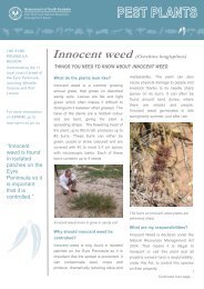
2007 Wetland Inventory for the Eyre Peninsula
2007 Wetland Inventory for the Eyre Peninsula
2007 Wetland Inventory for the Eyre Peninsula
- No tags were found...

You also want an ePaper? Increase the reach of your titles
YUMPU automatically turns print PDFs into web optimized ePapers that Google loves.
6.3 GIS DatabaseThis project builds on initiatives undertaken by Planning SA and <strong>the</strong> Department <strong>for</strong> Environment andHeritage. GIS databases are developed <strong>for</strong> <strong>the</strong> Murray River region Carru<strong>the</strong>rs and Nicolson (1992) andpublished in <strong>the</strong> <strong>for</strong>m of an Atlas, Jensen et al (1996). A GIS database exists <strong>for</strong> <strong>the</strong> South East region of<strong>the</strong> state and published in <strong>the</strong> <strong>for</strong>m of a technical report (Carru<strong>the</strong>rs and Hille 1997). One of <strong>the</strong> projectscopes <strong>for</strong> this project is to provide a digital coverage of spatial boundaries of identified wetlands. This willprovide a GIS database <strong>for</strong> <strong>Eyre</strong> <strong>Peninsula</strong>, Mount Lofty Ranges, Nor<strong>the</strong>rn Agricultural Districts andKangaroo Island. Gaps in coverage will occur simply due to project constraints, and it is suggested that<strong>the</strong>se gaps be filled at a later stage.A State-wide numbering system was developed <strong>for</strong> identifying wetlands which follows <strong>the</strong> systemestablished <strong>for</strong> <strong>the</strong> Murray wetlands. The Murray region wetlands have been assigned <strong>the</strong> numbers S0001to S0999. The South East region wetlands have been assigned <strong>the</strong> numbers S1000 to S1999, Nor<strong>the</strong>rnAgricultural Districts S4000 to S4999, Kangaroo Island S5000 to S5999 and <strong>the</strong> Mount Lofty Ranges S2000S2999. <strong>Eyre</strong> <strong>Peninsula</strong> is assigned numbers S3000 to S3999.The system used to produce <strong>the</strong> wetlands data is <strong>the</strong> ESRI (Environmental Systems Research Institute)geographic in<strong>for</strong>mation system (GIS) ARC/INFO. The GIS layer was created initially from <strong>the</strong> existing landcover layer that contained areas designated as swamps, vegetated swamps, lakes and vegetated lakes.This land cover layer was mapped from 1:40 000 colour aerial photography (Carru<strong>the</strong>rs and Hille 1997).6.4 <strong>Wetland</strong> inventory surveyIn developing <strong>the</strong> wetland survey it was critical that in<strong>for</strong>mation relevant to <strong>the</strong> wetland risk assessmentframework was incorporated. This ultimately involves <strong>the</strong> collection of physical, biological and chemicalparameters. Several survey methodologies were studied and incorporated; <strong>the</strong>se included:Butcher R.J.(1999) Assessing biodiversity in temporary and permanent wetlands. Pp 50-53 in The O<strong>the</strong>r 99%. TheConservation and Biodiversity of Invertebrates, ed by Ponder W and Lunney D, (1999). Transactions of <strong>the</strong> RoyalZoological Society of New South Wales Finlayson C.M. and Spiers A.G. (1999) Techniques <strong>for</strong> enhanced wetland inventory and monitoring. SupervisingScientist, Canberra Fairwea<strong>the</strong>r P.G. & Napier (1998) Environmental indicators <strong>for</strong> national state of <strong>the</strong> environment reporting - inlandwaters. Environment Australia Maher W & Liston P (1997) Water quality <strong>for</strong> maintenance of aquatic ecosystems: Appropriate indicators andanalysis. Australia: State of <strong>the</strong> Environment Technical Paper Series. (Inland waters). Environment Australia Morelli J & de Jong M (1996) A Directory of Important <strong>Wetland</strong>s in South Australia. South Australian Departmentof Environment and Natural Resources, Adelaide Storey A.W., Lane J.A.K and Davies P.M. (1997) Monitoring <strong>the</strong> ecological character of Australia's wetlands ofinternational importance (RAMSAR Convention). Western Australian Department of Conservation and LandManagement and Biodiversity Group of Environment Australia.11