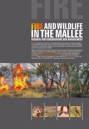
2007 Wetland Inventory for the Eyre Peninsula
2007 Wetland Inventory for the Eyre Peninsula
2007 Wetland Inventory for the Eyre Peninsula
- No tags were found...

You also want an ePaper? Increase the reach of your titles
YUMPU automatically turns print PDFs into web optimized ePapers that Google loves.
APPENDIX 1<strong>Wetland</strong> <strong>Inventory</strong> descriptions<strong>Wetland</strong> Reference Number: The wetland reference number is critical <strong>for</strong> clearly defining wetlandlocations within regions of <strong>the</strong> State. The wetland reference number acts as <strong>the</strong> primary key <strong>for</strong> records <strong>for</strong>each wetland, this enables data transfer between databases and GIS tables.<strong>Wetland</strong> Name: The name of <strong>the</strong> site.Ramsar Site: If <strong>the</strong> wetland is listed as a Ramsar site.Description of Site: A general description of <strong>the</strong> location features, closest roads or landmarks.Current Land useOn site: Current human use of <strong>the</strong> designated wetland area.Surrounding area: Human use on land adjacent to <strong>the</strong> wetlands, and more broadly in <strong>the</strong> surroundingcatchment.Tenure/ownershipOn site: Details of land ownership of <strong>the</strong> wetland site if possible.Surrounding: Details of <strong>the</strong> tenure type that is dominant in <strong>the</strong> surrounding areas if possible.Jurisdiction and management authority: The name of <strong>the</strong> body or bodies responsible <strong>for</strong> management of<strong>the</strong> wetland.Complied by: Name of person undertaking data collection.Organisation: Organisation that is managing <strong>the</strong> data collectionDate/time: Date and time of data collection.Region: Geographical region (eg <strong>Eyre</strong> <strong>Peninsula</strong>, Yorke <strong>Peninsula</strong> and Kangaroo Island)Environmental Regions: This refers to broad environmental regions within South Australia as describedby Laut P (1977), or regions described within <strong>the</strong> Regional Biodiversity Plans developed by <strong>the</strong> Department<strong>for</strong> Environment and Heritage (2000 – 2001).Key Bio diversity Areas: The Department <strong>for</strong> Environment and Heritage has developed key biodiversityareas within <strong>the</strong> Regional Biodiversity Plans <strong>for</strong> South Australia. The key biodiversity areas have beendeveloped by analysis of biological assets of <strong>the</strong> area and in<strong>for</strong>mation from community groups. There aresix key biodiversity areas identified within <strong>the</strong> three wetland study regions; <strong>the</strong>se are: coastal wetlandhabitat areas, fragmented habitat areas, grassland habitat, large remnant area, ridgeline systems,threatened habitat area.GPS reading: Taken in Latitude and Longitude or easting and northing.Map Sheet and Reference: Record of map sheet name and number with grid reference if required.Approximate Area: usually recorded after of be<strong>for</strong>e survey by GIS query.Elevation: in meters above sea level. Preferably recorded from GPS and compared with map sheetelevation values.60