GECDIS - Seatech
GECDIS - Seatech
GECDIS - Seatech
- No tags were found...
Create successful ePaper yourself
Turn your PDF publications into a flip-book with our unique Google optimized e-Paper software.
<strong>GECDIS</strong>The Choice for ECDIS navigation systems
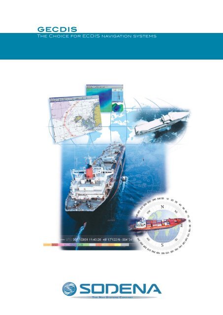
<strong>GECDIS</strong>The Choice for ECDIS navigation systemsA PROVEN SOLUTIONSODENA pioneered ECDIS systems by starting <strong>GECDIS</strong>’s development in1997. The first equipment was placed on a Merchant navy ship in 2000.Now, since July 1, 2002, the IMO has recognized the ECDIS as the standardon Merchant Navy ships. Constant improvements have been achieved allalong.Hundreds of <strong>GECDIS</strong> systems have been implemented.The main references are:Ships and submarines of the French Navy, fully equipped with “NetRadar”the Sodena flexible Radar Overlay solution. Brittany Ferries, CMA-CGM,Delmas, SNCM, Socatra, Broström Tankers. Icelandic, Danish, German,and Malaysian Coast Guards, Singapore Navy ultimate Frigates,…COMPREHENSIVE AND UP-TO-DATE<strong>GECDIS</strong> is a very comprehensive solution benefiting from all the latestdevelopments in marine navigation and communication systems. Almostall the features one would expect from a navigation system are available on<strong>GECDIS</strong> - with SODENA performance. SODENA was one of the firstCompanies to develop an Ethernet TCP/IP PC-based RADAR solution withother Ethernet interfaces to concentrate and distribute NMEA data signals.A COST-EFFECTIVE SOLUTIONSpecialized in PC-based Navigation systems from the beginning in 1989,SODENA has developed <strong>GECDIS</strong> to take maximum advantage of thistechnology. <strong>GECDIS</strong> is easy to implement, to customize and to maintain.<strong>GECDIS</strong> is also a powerful tool to optimize route and planning, enabling oneto reduce fuel consumption, voyage time and work time. <strong>GECDIS</strong> canintegrate Tidal world Database, Grib format files weather forecastinformation, Geostrophical and Surface stream data for better routeplanning.Moreover, <strong>GECDIS</strong> is very competitive, enabling you to benefit from the bestproduct at the best price.
2002FULL ECDIS-COMPLIANT GISSince June 5, 2002 <strong>GECDIS</strong> has been compliant with the ECDISstandard, according to the new SOLAS (Safety of life at sea)regulations. These certificates have been constantly renewed toinclude the latest Sodena Software developments and becomeWheelmark when certification rules have been modified.SODENA is ISO 9001 certifiedThe broadest range of electronic charts engines for ECDIS/ECSYou can use the ECDIS compliant chart systems:• S.57 Edition 3.1, encrypted S63 or not, from RENC as Primar-Stavanger,IC-ENC or directly from local Hydrographic Offices.You can also use:• ARCS Navigator, from the British Admiralty• BSB, from the US NOAA• DNC, from the US NIMA• C-MAP CM93 ed3 professional edition• C-MAP NT Max• Private ENCsENC Charts updatesIndependently from the standard Weekly Chart CD update process, thanks to Gecdis’Chart correction system, information can be manually modified and brought onto theENC S57/S63 charts.
COMPREHENSIVE...Planned route dual fuel.The display is 100% customisable: for exampleDisplay of tidal and stream data on yournavigation screen.<strong>GECDIS</strong> offers route trackingand informs you about weatherforecasts.Easy and efficientRoute can be optimised with your parameter andsaved for a future trip.Berthing: this display enables you to have in realtime the best route as well as bathymetry data andberthing view on the back up screen.Deep sea: you can optimize your route, have accessto different displays such as channel views.Full control of appearance and user interface<strong>GECDIS</strong> allows you to accurately control what information is displayed atanytime and to design your own user interface. Users can have their ownlogin and access rights. The user can set up specific active control buttonsand define various information pages and bars: by clicking on the toolbaryou can choose contextual frame displays for berthing, deep-sea, …Dynamic databases:weather, bathymetric, tidal, tidal stream and navigation data<strong>GECDIS</strong> has a dynamic database which offers original processing on userdata. It is possible to define simple &/or advanced requests (filters) anddisplay (or hide) according to position, date, time period, depth, data type(marks, tracks, areas, etc.) and data origin. The user can define these filtersand save them for later use. Track data can be replayed.Furthermore, <strong>GECDIS</strong> can import a very wide range of data from standardand maritime databases (Local harbor surveys, weather forecasts, …).<strong>GECDIS</strong> is a multi-mobile and fleet acquisition platform.ECDIS navigation functions<strong>GECDIS</strong> offers route monitoring, route tracking. All features fromtraditional dead reckoning and astronautical navigation have beenimplemented. This lets you maintain the youngest mates practicing bothfully electronically - via a GPS positioned Own Ship - and the traditionallyone represented through a shadow Own Ship.Route planningRoutes can be graphically built by means of the cursor or the keyboard byjust entering the Lat/Long values. Each Route leg can be defined with itsposition values, corridor and specified average speed. <strong>GECDIS</strong> enables totake into account most particular conditions and events: weather, stream,waiting times at harbour, specific speeds...You can enter a planned Estimated Time of Arrival (ETA) at the waypoints ofyour choice. <strong>GECDIS</strong> will then optimise and compute the whole route data.You will be able to choose the Departure time, or/and intermediate ETAand/or Final ETA. All combinations are given according to realistic limits.When navigating, route monitoring data is recomputed in real time. ExistingGPS, previously stored NMEA. Routes Libraries can be recovered using<strong>GECDIS</strong>’s Import facility.
... AND UP-TO-DATEOptional WinComC frames.This picture shows radar overlay. It enables tocorrelate chart data and radar image.The safest navigation featuresVoyage Data RecorderThanks to its acquisition capabilities, <strong>GECDIS</strong> is a kind of “Small VoyageData recorder”. Sodena’s R&D team is working on an Official Small VoyageData Recorder integration taking advantage of the Data acquisitionElectronic interfaces NetI/O has built-up for the French Navy. These flexible(Web page Addressable) interfaces can receive Digital, Analog and Synchroinputs concentrating all of them in Standard NMEA sentences available ona TCPIP Net for a Cost Effective Solution mixing ECDIS and SVDR.Communication<strong>GECDIS</strong> can integrate Inmarsat communication features through WinComC- For example, Fleet Management reporting in background task.More accurate than ever positioningGPS data can be correlated with other navigation sensors. As for positiondifference from selected positioning systems, comparing the chartereddepth value with one from the Echo Sounder Transducer can automaticallygenerate Warning alarms.Search and RescueTaking advantage of its Oil Spill and Maritime Research and CoordinationCentre system, Gecdis integrates a SAR module following IMO IAMSARregulations.AlarmsEven if acknowledged, all Alarms, Warnings and or Anomalies are stored,classified, sorted in the Black Box. This Alarm Logbook can easily beconsulted to check what has happened at a specific Date and Time. Allkinds of user data objects can be set up to ring alarms on any mobilesentering &/or leaving these geographically specified areas.Radar overlay and Universal AISTo enhance safety and to follow the latest Nav52 committee on thecorrelation of different sources of data, it is also possible to connect<strong>GECDIS</strong> to almost any already installed analogical ARPA RADAR systems.With certain Radar models, a specific <strong>GECDIS</strong> Cursor can be synchronizedwith the Radar one, offering to officers an easy tool to correlate. UniversalAIS is of course linked to Gecdis improving visual targets correlations.Thus, you will benefit from the following advantages:• High quality RADAR overlay.• Tracks automated on numerous targets ARPA &/or AIS with theirparticular information.• Consultation of any AIS mobiles within the Own Ship area.Search and Rescue function.Anti-collision alarm on a Mobile with a less than1 Nm CPA.AIS: on the right frame, you automatically have theidentification of the proximity ships.
SODENA’s sensor interfaces to connectyour RADAR, LOG, GYRO and your othernon NMEA sensors to your ECDIS system.EASY TO IMPLEMENT AND OPERATEAs a PC-based system, <strong>GECDIS</strong> is easy to install, easy to adapt andyour operating and maintenance costs are dramatically reduced. Inorder to provide you with the most suitable solution, <strong>GECDIS</strong> is acustomizable platform offering you the following key advantages:The most versatile hardware configurationSODENA offers several hardware configurations to meet your needs:• IEC 60945 & 61174 approved TFT Screens from 15” (ECS - non back upsystem) to minimum ECDIS 19“ up to 23“ and soon bigger when available inseaworthy typed approved versions.• Rugged PCs: they are certified IEC 60945 to the consolidated, “worst-case”requirements of all the major international marine Classification Societies.Any hardware solution can easily be adapted to your needs:• For a new system;• Any retrofit solution can easily be implemented at your request;• A back-up system can be added to your existing system, if a full ECDISSystem is required. Under certain conditions SODENA ECS sold systems canbe upgraded to the ECDIS standard when a fully ECDIS system is needed;• Most of our technical drawings are integrating Industrial Ethernet LANsolutions.Computer Certified Technology A320MA wide range of sensors and peripheral equipmentsWith broad experience in maritime sensors, SODENA has developed <strong>GECDIS</strong>to interface with almost every sensor, enabling you to connect any of yourexisting and future equipment:• NMEA Sensors: DGPS, GYRO, SOUNDER, SHIPLOG, Inertial Platform,AUTOPILOT...• RADAR: : a connection to any radar via Sodena’s NETRADAR interface box.• AIS (Automated Identification System)• Communication devices (INMARSAT…)ISIC PCM4HP Compaq Mariner systems PC based
Conrac displayThe most customisable softwareAlmost everything can be customized:• Shortcuts and menus;• Frames and colors (user layouts);• External data displays.Besides position, much different data can be displayed and manipulatedwith <strong>GECDIS</strong>: depth, air and sea temperature, air pressure, gyro course,log speed, roll, pitch, swaying, wind speed and direction, geostrophicaland tidal streams...• Conning: taking advantage of the Serial Data acquisition and normativecentralization in <strong>GECDIS</strong>, Sodena offers an optional Standard ConningDisplay feature.ISIC displayNorth Invent displayEasy to maintainPC based systems are completely separate from the traditional shipelectronic maintenance scheme.Most of the time you will not need local technical support which coulddamage your ECDIS System integrity.Effectively, displays are quite standard today, in case of need, you aresure to find one onboard or ashore which could replace the faulty oneduring service.Concerning the PC unit, it is best to receive a similar one from amanufacturer already prepared using the ship system hard disk imagealways stored by Sodena at first delivery.Sodena makes the engagement to ship a replacement PC units within2 working days via express delivery during the one year guarantee.Extended Guarantee services and maintenance are available on demand.Training CentreThe simulator can be used to train several trainees simultaneously, eachof them operating ECDIS / RADAR workstations.The Instructor workstation allows:creation and execution of script, including fault simulation.Radar images are virtually computed from the official ENC S57 charts.Sodena has delivered several ECDIS Training systems to Navys.We have also developed dedicated training courses for both Navigationteachers and Users.Hatteland displayHardware requirements in case of ECS Soft purchase:• Intel Pentium ® IV processor or better, 1Gb RAM, & 40Gb hard disk;• Designed for Windows XP ® ;• Displays: Monitors from 12” up to 23” and more with a minimumresolution 1024x768;• Fully OpenGL compatible multi-head Nvidia Chipset Graphic card for3D option;• Inputs: Isolated serial ports and Ethernet RJ45 100 Mbits port to linkmost sensors using the NMEA protocols. DVD drive unit, 3.5” Floppyunit in case of ARCS use, USB 2.0 plugs for additional connections.Hatteland Panel PC
An outstanding quality of serviceWith more than 6,000 ships installed, SODENA is a leader in Geographical Information Systems.SODENA’s main competitive advantage is its highly skilled engineering team which always enables themost suitable solution for your needs. SODENA is a subsidiary of IXCORE group, a sister company ofIXSEA, present through offices and representatives in France, UK, Norway, Denmark, Iceland, Spain,Italy, Greece, Portugal and many other countries. SODENA is ISO 9001 v.2000 certified.Global networkWe strive to exceed our customers’ expectations from conception to installation and beyond with ourhigh-performance technology, our international sales network and round-the-clock customer support.SODENA SAS40-62, rue du Général Malleret Joinville • 94400 VITRY SUR SEINE - FRANCETel: + 33 1 55 53 12 70 • Fax: + 33 1 55 53 12 71www.sodena.net2006-10 • <strong>GECDIS</strong>


