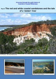
Part 8 â The Towns â Merimbula-Tathra - Sapphire Coast
Part 8 â The Towns â Merimbula-Tathra - Sapphire Coast
Part 8 â The Towns â Merimbula-Tathra - Sapphire Coast
- No tags were found...

You also want an ePaper? Increase the reach of your titles
YUMPU automatically turns print PDFs into web optimized ePapers that Google loves.
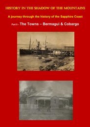
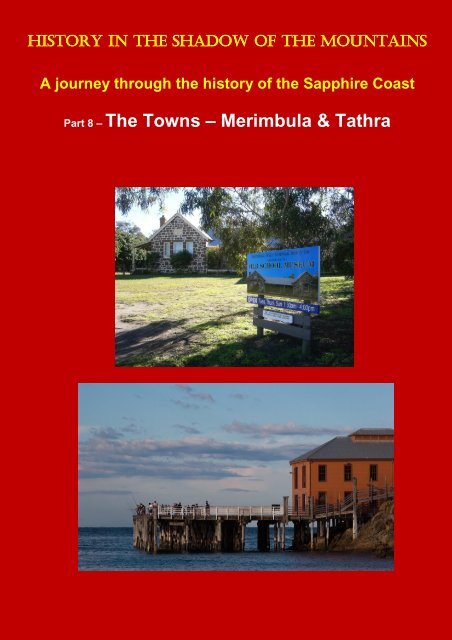
HISTORY IN THE SHADOW OF THE MOUNTAINSA journey through the history of the <strong>Sapphire</strong> <strong>Coast</strong><strong>Part</strong> 8 – <strong>The</strong> <strong>Towns</strong> – <strong>Merimbula</strong> & <strong>Tathra</strong>
<strong>Merimbula</strong>(maps on the last page)<strong>The</strong> Imlay Brothers, who owned land at Bega, Kameruka, Cobargo and south ofTwofold Bay also had holdings in <strong>Merimbula</strong>. As a result of the economic depressionof the early 1840s they lost their <strong>Merimbula</strong> property to their Sydney bankers, theWalker Brothers, who in turn sold their leases in 1852 to the newly formed TwofoldBay Pastoral Association. Later, Matthew Munn and his family took over theenterprise.<strong>Merimbula</strong> began its existence as a private village belonging to the Twofold BayPastoral Association, which opened it as a port in 1855. A wheat flour and maize millwas built but eventually the port closed in 1917 due to labour disputes and litigation.All that remains of the original port are two sheds. Allotments of land went on sale in1860 when the Association was dissolved with the introduction of the Crown LandsActs. <strong>The</strong> first ferry service across the lake was established in 1857 and a bridgeconstructed in 1908. It was replaced with the current bridge in 1982.<strong>Merimbula</strong> Bridge 1935As happened in Eden and Pambula, the discovery of gold in Kiandra stimulated thedevelopment of <strong>Merimbula</strong> and facilities in the town were increased to cope with aninflux of up to 200 persons a week. Once again, a gold rush helped a town to grow.During the gold rush in the 1860s, there was a weekly steamship service and later aneight-horse wagon providing road transport on a weekly basis. After the gold rushfinished, the town continued to grow slowly as a service centre for surrounding ruralareas.<strong>The</strong> town of <strong>Merimbula</strong> was not gazetted until 1912 and little changed until the 1950swhen it first became a popular holiday resort.<strong>Merimbula</strong> Wharf<strong>Merimbula</strong> Wharf c 1930Rebuilt <strong>Merimbula</strong> Wharf
<strong>The</strong> <strong>Merimbula</strong> wharf was built in the mid-1800s and operated until 1952 when thelast steamer called in. <strong>The</strong> old wharf was demolished in 1979 but rebuilt as the resultof community enthusiasm. It is now a recreational site with magnificent views of<strong>Merimbula</strong> Bay.Built heritage in <strong>Merimbula</strong>Courunga‘Courunga’ is a substantial stone cottage on a commanding hilltop site. <strong>The</strong> cottagewas built in about 1870 by Matthew Munn. It contains elaborate joinery and originallyhad a shingle roof. Later additions were the cast iron stanchions and, in1880, anextraordinary Victorian Gothic corner tower of timber construction, together with twoGothic pavilions also of timber, one a kitchen, both complete with castellatedparapets. ‘Courunga’ is listed on the NSW State Heritage Register.<strong>The</strong> Munn name is synonymous with the development of <strong>Merimbula</strong> as the familyhad large holdings and milling operations in the district that were central to theeconomy of the early town. <strong>The</strong> physical prominence and landmark status of‘Courunga’ (also called ‘Munn’s Towerhouse’) reflect the social and economicprominence of the Munn family in <strong>Merimbula</strong> in the period of its early development.‘Courunga’, or Munn’s TowerhouseFormer School and ResidenceIn 1875 a school and residence were built at 85-87 Main Street. <strong>The</strong> building was asingle-storey construction of hewn sandstone walls and originally had a shingle roof,but this was later replaced with corrugated iron. It is currently a museum managedby the <strong>Merimbula</strong>-Imlay Historical Society. See:http://thebegavalley.org.au/oldschoolmuseum.html<strong>The</strong> Old School Museum <strong>Merimbula</strong>
<strong>Tathra</strong>Following an 1851 inquiry into the transport system serving the NSW south coast, theIllawarra and South <strong>Coast</strong> Steam Navigation Company was formed from theamalgamation of various shipping enterprises.<strong>Tathra</strong> came into existence as a small jetty which served as a shipping outlet for agroup of Bega Valley farmers led by Daniel Gowing. Gowing had offered financialreward to anyone willing to ship produce from a place further north of <strong>Merimbula</strong>,which is 25km to the south of <strong>Tathra</strong>. <strong>The</strong> small jetty was replaced in 1862 byanother wharf using funds donated by local farmers and the shipping company. <strong>The</strong>wharf was built of native turpentine timber (a relative of eucalyptus) with its pilesembedded in solid rock. <strong>The</strong> site was chosen because the adjacent headlandprovided shelter from southerly winds. It was the only site suitable between<strong>Merimbula</strong> and Bermagui.<strong>The</strong> <strong>Tathra</strong> township was surveyed in 1861 and regular shipping commenced in 1862when the wharf was built. Passengers travelled to and from Sydney with pigs andother produce – the origin of its contemporary fame as the 'Pig and Whistle Line'.<strong>The</strong> region’s population increased after Crown lands were opened up for freeselection in 1861. <strong>The</strong> region’s growth is mirrored in the expansion of the wharf. <strong>The</strong>shipping company built a cargo shed in 1866 and increased use led to theenlargement of the wharf several times - in 1873, 1878, 1886, 1889, 1903 and 1912.A cattle yard was built in 1901, the existing two-storey shed was constructed in 1907and a jib crane added in 1912.<strong>The</strong> steamer service was crucial to the region because of the absence of a railwayline and poor roads. <strong>The</strong> Princes Highway from Batemans Bay to the Victorianborder was still a gravel surface in 1940. <strong>The</strong> bridge over the Clyde River atBatemans Bay replaced the punt in 1956, the year south coast shipping finallyceased.<strong>Tathra</strong> Wharf heritage<strong>Tathra</strong> Wharf is listed on the Register of the National Estate and the NSW StateHeritage List because it is the only surviving wharf and building complex on eastcoast Australia that dates from the 1860s coastal shipping period.<strong>The</strong> wharf is an excellent example of a marine building constructed entirely fromhardwood. It has architectural consistency in detailing and construction. <strong>The</strong> basicstructure is timber decking and superstructure supported on timber piles into a rockseabed to a maximum depth of 7.6 metres. At the inshore end the structureterminates on a stone and concrete retaining wall finishing well above mean highwater level. On the western half of the wharf are two timber-framed structures. Anoriginal two-storey shed is at the landward end and a single-storey shed, built aboutthe turn of the 19 th century, abuts the larger shed. <strong>The</strong> larger shed has interestingroof trusses with a monitor scissor truss. All timbers are constructed with traditionaljointing and metal fasteners. <strong>The</strong> construction of the wharf and the sheds are of ahigh standard of craftsmanship typical of the period.<strong>The</strong> landscape setting of the wharf and structures is little changed, allowing thevisitor to visualise it in its heyday. <strong>The</strong> small promontory, which is mostly parkland,gives extensive views up and down the coast, especially to the north. <strong>The</strong>re is apopular restaurant in the wharf building.
Tarthra Wharf todayFarewelling World War 1 recruits from the <strong>Tathra</strong> Wharf
<strong>Merimbula</strong> (Google Earth)<strong>Tathra</strong> (Google Earth)