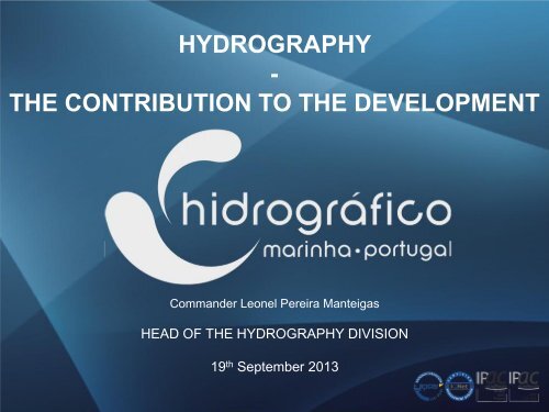
HYDROGRAPHY - THE CONTRIBUTION TO THE DEVELOPMENT
HYDROGRAPHY - THE CONTRIBUTION TO THE DEVELOPMENT
HYDROGRAPHY - THE CONTRIBUTION TO THE DEVELOPMENT

Create successful ePaper yourself
Turn your PDF publications into a flip-book with our unique Google optimized e-Paper software.
SUMMARY• Hydrography• Contribution to Maritime Activities• IHPT Contribution• Return on Investment• Conclusions
IntroductionHydrography contribution to economic and structuraldevelopment - transversal to the economic activitiesrelated with maritime and coastal zones.IHO M-2- The Need for National Hydrographic Services.Convention for the Safety of Life at Sea (SOLAS).Studies estimating the economic return of investment inhydrography.Thecnical Visit to Mozambique - INAHINA
Hydrography2004That branch of applied science which deals with the measurement anddescription of the physical features of the navigable portion of the EARTH'ssurface and adjoining coastal areas, with special reference to theiruse for the purpose of NAVIGATION.2010Hydrography is the branch of applied sciences which deals with themeasurement and description of the physical features of oceans, seas,coastal areas, lakes and rivers, as well as with the prediction oftheir change over time, for the primary purpose of safety ofnavigation and in support of all other marine activities,including economic development, security and defence,scientific research, and environmental protection.IHO S32 - Hydrographic Dictionary
Contribution to Maritime Activities
Efficiency of NavigationOver than 80% of the international trade.Reliable charts, updated with Hydrographic Surveysmeeting the international standards (S-44), allow:• Most direct routes;• Deeper draft vessels (more cargo);• Reduction on insurance rates.http://en.wikipedia.org/wiki/File:Panamax_container_ship.JPG
TourismTourism may be an important source of resources fordeveloping countries.Cruise ships would like to explore new destinations but dependon the availability of adequate charts based on recenthydrographic surveys.There is also a tendency for larger ships with larger draughts.http://tiffanyallee.com/wpcontent/uploads/2013/06/cruise-ship.jpghttp://www.portcanaveral.com/mediaaccess/cruise/ships07.jpg
Recreational NavigationAdequate charts based on modern hydrographic surveyscontribute to increase the activity in this sector witch isimportant to the states economy.http://www.camerasnaps.org.uk/boats/03-sailing-boat.htmhttp://casadecampomarinanews.files.wordpress.com/2013/06/dscn76172.jpg
Coastal EngineeringHigh resolution bathymetric data complementedwith tides, waves and currents information areessential on coastal engineering projects.Harbour construction maintenance and expansion;Dredging operations;Coastal erosion control & protection.http://etcoastalconstruction.com/images/UnderConstruction/LongSeaWallSm.JPGhttp://cabodesines.blogspot.pt/2012/02/fotos-dasobras-molhe-oeste-em-sines.htmlhttp://cdn.coastalcare.org/wpcontent/uploads/2012/01/coastal-erosion-uk.jpg
Telecommunications and EnergyHigh resolution batymetry are essencial to plan thelayout of submarine cables or pipelines and to mooringsystems to generate energy, or install foundations forwind turbines.http://2.bp.blogspot.com/_f7me5b15ZaI/SGH7fKy6wgI/AAAAAAAAGIs/2PB4fbNzMZA/s400/441.jpghttp://www.lexpress.fr/pictures/423/216586_des-techniciens-posent-le-cable-sous-marinen-fibre-optique-african-coast-to-europe-augabon-le-27-octobre-2011.jpghttp://www.stabbertmaritime.com/images_2006/offshore/WindTurbine_small.jpg
Coastal Zone ManagementHydrographic data are essential to plan and assurean efficient and sustainable management of thecoastal zones.http://wiki.bdtnrm.org.au/index.php/Sustainable_Coastshttp://geo.ku.dk/coadapt/iczm/
EnvironmentEnvironmental protection trough the contribute to safenavigation.Environmental management definition and delimitation ofspecial areas.To support numerical modeling to study previously theenvironmental impact of some human or natural events.http://www.theguardian.com/world/2012/jun/14/australia-largest-marine-reservehttp://www.tc.gc.ca/media/images/marinesafety/col-amsee.jpghttp://www.rsmas.miami.edu/assets/images/oil-spill/oil-s5.gif
Living ResourcesNautical Charts are essential to represent special areas suchas: protected areas and reserves, aquaculture sites.Special Nautical Charts including additional data related withfisheries will help in the efficiency of fishing activities.
Mineral ResourcesHydrographic data is a part of the necessary information to findout the areas with mineral resources.Is also important to establish the exploration structures and forthe safe transport specially for the hazardous ones.http://oceanexplorer.noaa.gov/explorations/03mex/logs/sept21/media/dscn0011_600.jpghttp://origin-ars.els-cdn.com/content/image/1-s2.0-S0167779909000754-gr1.jpg
Marine ScienceModel generation and mooring of scientificequipments, are examples activities very dependenton the bathymetric information.http://mysciencespace.com/Oceans/media/graphics/adcp.jpg
Maritime BoundariesHydrographic data - fundamental to the delimitationof the Extended Continental Shelf established on theUnited Nations Convention on the Law of the Sea.http://www.teara.govt.nz/en/diagram/6968/defining-the-continental-shelf
Law Enforcement & DefenceAdequate nautical charts and derived specific products arerequired to monitor the maritime activities and to, navies andcoast guards, realize and train law enforcement and defenseoperations.High resolution hydrographic surveys can provide importantinformation to produce some Additional Military Layers and formine warfare operations.
IHPT – Bathymetric dataIHPT Contributes to those activities:• Collecting the bathymetric data.• Producing and updating nautical charts.
IHPT Folio
IHPT ChartsNautical chartsCharts of sedimentsFishery charts
IHPT ChartsLeisure chartsBathymetric chartsElectronic NavigationalCharts
IHPT Military Products
Return on InvestmentHydrographic surveys are expensive, require costlyequipment and specialized technicians.Does the investment in hydrography has a quantifiable return?Benefits quantification is very complex.
Return on InvestmentIn 1992 Canada realized a study related with thecost/benefits of having an Hydrographic Serviceand concluded the ratio is 1:10.In 2012 Socio-Economic Study Concluded :“For every dollar American taxpayers spend onNOAA’s National Geodetic Survey (NGS) CoastalMapping Program, they receive more than $35 inbenefits”http://www.noaanews.noaa.gov/stories2012/032812_coastalmapping-economicvalue.html
Conclusions• Hydrographic contributes to several areas of activitiesimportant to the countries development.• Investment in hydrography is essential to navigationsafety, saving lives and protecting the marineenvironment, supports several activities essential to asustained development, to the national security and theexploration and management of the maritime areas.• The return is expected to be significantly higher than theinvestment.
Thank you !