Algorithms for the visualization and simulation of mobile ad hoc and ...
Algorithms for the visualization and simulation of mobile ad hoc and ...
Algorithms for the visualization and simulation of mobile ad hoc and ...

You also want an ePaper? Increase the reach of your titles
YUMPU automatically turns print PDFs into web optimized ePapers that Google loves.
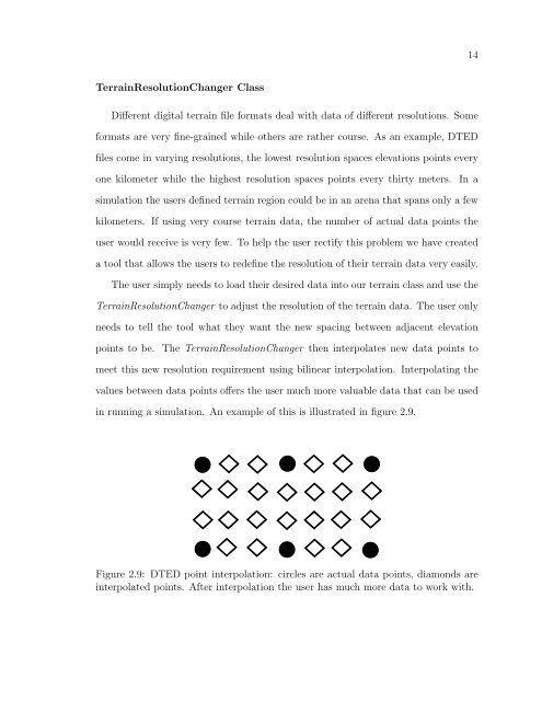
14TerrainResolutionChanger ClassDifferent digital terrain file <strong>for</strong>mats deal with data <strong>of</strong> different resolutions. Some<strong>for</strong>mats are very fine-grained while o<strong>the</strong>rs are ra<strong>the</strong>r course. As an example, DTEDfiles come in varying resolutions, <strong>the</strong> lowest resolution spaces elevations points everyone kilometer while <strong>the</strong> highest resolution spaces points every thirty meters. In a<strong>simulation</strong> <strong>the</strong> users defined terrain region could be in an arena that spans only a fewkilometers. If using very course terrain data, <strong>the</strong> number <strong>of</strong> actual data points <strong>the</strong>user would receive is very few. To help <strong>the</strong> user rectify this problem we have createda tool that allows <strong>the</strong> users to redefine <strong>the</strong> resolution <strong>of</strong> <strong>the</strong>ir terrain data very easily.The user simply needs to lo<strong>ad</strong> <strong>the</strong>ir desired data into our terrain class <strong>and</strong> use <strong>the</strong>TerrainResolutionChanger to <strong>ad</strong>just <strong>the</strong> resolution <strong>of</strong> <strong>the</strong> terrain data. The user onlyneeds to tell <strong>the</strong> tool what <strong>the</strong>y want <strong>the</strong> new spacing between <strong>ad</strong>jacent elevationpoints to be. The TerrainResolutionChanger <strong>the</strong>n interpolates new data points tomeet this new resolution requirement using bilinear interpolation. Interpolating <strong>the</strong>values between data points <strong>of</strong>fers <strong>the</strong> user much more valuable data that can be usedin running a <strong>simulation</strong>. An example <strong>of</strong> this is illustrated in figure 2.9.Figure 2.9: DTED point interpolation: circles are actual data points, diamonds areinterpolated points. After interpolation <strong>the</strong> user has much more data to work with.