Algorithms for the visualization and simulation of mobile ad hoc and ...
Algorithms for the visualization and simulation of mobile ad hoc and ...
Algorithms for the visualization and simulation of mobile ad hoc and ...

You also want an ePaper? Increase the reach of your titles
YUMPU automatically turns print PDFs into web optimized ePapers that Google loves.
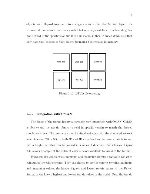
16objects are collapsed toge<strong>the</strong>r into a single matrix within <strong>the</strong> Terrain object, thisremoves all boundaries that once existed between <strong>ad</strong>jacent files. If a bounding boxwas defined in <strong>the</strong> specification file <strong>the</strong>n this matrix is <strong>the</strong>n trimmed down such thatonly data that belongs to that desired bounding box remains in memory.Figure 2.10: DTED file ordering2.4.2 Integration with OMANThe design <strong>of</strong> <strong>the</strong> terrain library allowed <strong>for</strong> easy integration with OMAN. OMANis able to use <strong>the</strong> terrain library to re<strong>ad</strong> in specific terrain to match <strong>the</strong> desired<strong>simulation</strong> arena. The terrain can <strong>the</strong>n be visualized along with <strong>the</strong> simulated networksetup in ei<strong>the</strong>r 2D or 3D. In both 2D <strong>and</strong> 3D <strong>visualization</strong>s <strong>the</strong> terrain data is turnedinto a height map that can be colored in a series <strong>of</strong> different color schemes. Figure2.11 shows a sample <strong>of</strong> <strong>the</strong> different color schemes available to visualize <strong>the</strong> terrain.Users can also choose what minimum <strong>and</strong> maximum elevation values to use whencomputing <strong>the</strong> color schemes. They can choose to use <strong>the</strong> current terrain’s minimum<strong>and</strong> maximum values, <strong>the</strong> known highest <strong>and</strong> lowest terrain values in <strong>the</strong> UnitedStates, or <strong>the</strong> known highest <strong>and</strong> lowest terrain values in <strong>the</strong> world. Once <strong>the</strong> terrain