Transportation effects assessment - Upper Hutt City Council
Transportation effects assessment - Upper Hutt City Council
Transportation effects assessment - Upper Hutt City Council

You also want an ePaper? Increase the reach of your titles
YUMPU automatically turns print PDFs into web optimized ePapers that Google loves.
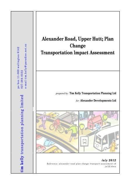
po b ox 11-069 welling ton 61420 27 - 28 4 - 03 32e-m ail ti m.kelly@ pa ra dise. net. nzAlexander Road, <strong>Upper</strong> <strong>Hutt</strong>; PlanChange<strong>Transportation</strong> Impact Assessmenttim kelly transportation planning limitedprepared by: Tim Kelly <strong>Transportation</strong> Planning Ltdfor: Alexander Developments LtdJuly 2012R e f e r e n c e : a l e x a n d e r r o a d p l a n ch a n g e t r a n s p o r t a s s e s s m e n t v 5j u l 1 2 . d o c x
Proposed Plan Change, Alexander Road, <strong>Upper</strong> <strong>Hutt</strong>: <strong>Transportation</strong> ImpactAssessmentiContents1 BACKGROUND & SCOPE ..................................................................................................................................... 11.1 BACKGROUND ................................................................................................................................................. 11.2 SCOPE ........................................................................................................................................................... 12 EXISTING SITUATION .......................................................................................................................................... 22.1 LOCATION ...................................................................................................................................................... 22.2 ROAD ENVIRONMENT ....................................................................................................................................... 22.3 TRAFFIC VOLUMES ........................................................................................................................................... 32.4 CRASH HISTORY .............................................................................................................................................. 42.5 PEDESTRIAN & CYCLE ACCESSIBILITY ..................................................................................................................... 52.6 PUBLIC TRANSPORTATION ACCESSIBILITY ............................................................................................................... 52.7 EXISTING USE OF THE SITE.................................................................................................................................. 52.8 PLANNED CHANGES .......................................................................................................................................... 53 THE PROPOSAL ................................................................................................................................................... 73.1 ZONE CHANGE ................................................................................................................................................ 73.2 LIKELY DEVELOPMENT ....................................................................................................................................... 73.3 PEDESTRIAN, CYCLE AND PUBLIC TRANSPORT ACCESSIBILITY ....................................................................................... 74 ASSESSMENT OF EFFECTS ................................................................................................................................... 84.1 PLAN CHANGE VS. SPECIFIC PROPOSAL .................................................................................................................. 84.2 TRAFFIC GENERATION, DISTRIBUTION AND EXTERNAL ROAD NETWORK EFFECTS .............................................................. 84.3 PEDESTRIAN, CYCLE, DISABILITY & PUBLIC TRANSPORT ACCESSIBILITY ........................................................................... 94.4 LOCATION AND VEHICLE DEPENDENCY .................................................................................................................104.5 COMPARISON OF INDUSTRIAL AND RESIDENTIAL USE OF THE SITE................................................................................105 DISTRICT PLAN COMPLIANCE ............................................................................................................................115.1 RELEVANT PLAN & STATUS ...............................................................................................................................115.2 RESIDENTIAL ZONE RULES .................................................................................................................................115.3 CITY-WIDE RULES ...........................................................................................................................................125.4 SUMMARY ....................................................................................................................................................136 CONCLUSIONS ...................................................................................................................................................13Tim Kelly <strong>Transportation</strong> Planning Ltd July 2012
Proposed Plan Change, Alexander Road, <strong>Upper</strong> <strong>Hutt</strong>: <strong>Transportation</strong> ImpactAssessment11 Background & Scope1.1 Background1.2 ScopeA change in zoning from ‘Industrial’ to ‘Residential’ is sought for a 14 hectare site on thesouthern side of Alexander Road in <strong>Upper</strong> <strong>Hutt</strong>.By enabling the use of the site for residential purposes, the plan change would result in apattern and density of development different to that foreshadowed by the existing zonecontrols. This would, in turn, lead to changes in the expected volumes and patterns oftransportation activity associated with the site, with a potential to generate <strong>effects</strong>. Such<strong>effects</strong> may arise with respect to the operation of the internal and adjacent road network,pedestrian and cycle accessibility and safety, public transport accessibility, servicing andparking supply / demand.This document assesses the potential for the <strong>effects</strong> described above. In relation totransportation issues, it also addresses the general suitability of the site for residentialactivity, and the ability of residential development to comply with the requirements of the<strong>Upper</strong> <strong>Hutt</strong> District Plan (UHDP).This document forms a part of the overall Assessment of Environmental Effects (AEE)supporting the plan change application.Tim Kelly <strong>Transportation</strong> Planning Ltd July 2012
Proposed Plan Change, Alexander Road, <strong>Upper</strong> <strong>Hutt</strong>: <strong>Transportation</strong> ImpactAssessment22 Existing Situation2.1 LocationThe location of the application site is shown by Figure 2.1 (boundaries shown areapproximate).ApplicationSiteFigure 2.1:General Location(Source: <strong>Upper</strong> <strong>Hutt</strong>CC GIS)The site lies on the southern side of Alexander Road, with a frontage to this road. Vehicularaccess to the site is proposed from William Durant Drive, which is currently formed andintersects with Alexander Road on its southern side.2.2 Road EnvironmentThe location of the site within the wider transportation network is shown by Figure 2.2.The general road environment in this area is shown by photos at Annex A.Alexander RoadAlexander Road provides an alternative route to Fergusson Drive for traffic between WardStreet in Wallaceville to the north and Messines Avenue / Fergusson Drive to the south. Italso provides access to a number of activities along its length, including the currently zonedindustrial areas (of which the subject site forms a part). This functionality is recognised byits categorisation as a Secondary (District) Arterial road in the roading hierarchy defined bythe UHDP.The section of Alexander Road immediately adjacent to the application site is subject to aspeed limit of 80 km/hr and no street lighting is provided. Within a legal width of 20m, twotraffic lanes are provided, with narrow sealed shoulders. Whilst no formed footpath exists,a gravelled track has been provided along the southern side of the road between the WardStreet and William Durant Drive intersections. Towards the southern edge of the site, theTim Kelly <strong>Transportation</strong> Planning Ltd July 2012
Proposed Plan Change, Alexander Road, <strong>Upper</strong> <strong>Hutt</strong>: <strong>Transportation</strong> ImpactAssessment3road widens to provide a flush median and a right-turn bay at the intersection with WilliamDurant Drive.Clearway provisions apply between a point west of the Ward Street intersection and theeastern boundary of the site, prohibiting kerbside parking (and stopping) on both sides ofthe road. The road is level and straight, providing for a good standard of visibility.The intersection with William Durant Drive is priority controlled, with movements from theside road being subject to give-way control. Slip lanes provide for left turning movementsinto and out of the side road, and a separate lane is provided for traffic movements turningright into William Durant Drive from Alexander Road. Sight lines are good for allmovements in this area.To the south, two other roads intersect with Alexander Road on its southern side, anunnamed road intersects 135m from the William Durant Drive intersection and a further340m beyond this, Dante Road. Both of these intersections are priority controlled.To the north, Alexander Road intersects with Ward Street 1.1 kms from the William DurantDrive intersection. To the south, Alexander Road becomes Messines Avenue whichintersects with Fergusson Drive 2.4 kms from the site.William Durant DriveWilliam Durant Drive is a new road formed to service the originally intended industrial andcommercial development of this area. A wide 12m carriageway has been constructed, with3m wide footpaths (narrowed in places to provide for planting) on both sides within a roadreserve of 20m. Signage and road markings for a bus stop have been provided on theeastern side of the road.Thomas Neal CrescentThomas Neal Crescent intersects with William Durant Drive 70m from the Alexander Roadintersection and loops around to rejoin it a further 270m away. This has been constructedwith the same purpose and to the same standard as William Durant Drive.A short stub of Thomas Neal Crescent to the south-west of William Durant Drive wasintended to provide access to/from the adjoining commercial area, but this access hasbeen closed to prohibit vehicle movement.2.3 Traffic VolumesTraffic count information for Alexander Road (at a point 70m to the south-west of theWard Street intersection) has been supplied by <strong>Upper</strong> <strong>Hutt</strong> <strong>City</strong> <strong>Council</strong> (UHCC), and issummarised by Table 2.1.The reduction in observed traffic volumes between January 2010 and August 2011 may bepartly explained by seasonal variances and the <strong>effects</strong> of the economic recession (includinghigher fuel prices).Tim Kelly <strong>Transportation</strong> Planning Ltd July 2012
Proposed Plan Change, Alexander Road, <strong>Upper</strong> <strong>Hutt</strong>: <strong>Transportation</strong> ImpactAssessment4These traffic volumes are modest and well within the capacity of the road. As a result,congestion is not an issue in this area.MeasureLocation: Alexander Road (70m south of Ward St)Date January 2010 August 20115-Day total (vehs/day) 5,900 4,8007-Day total (vehs/day) 5,400 4,600Peak Hour (vehs/hour)* 550 – 650 450 – 550% heavy vehicles 4.8% 3.1%% 80 km/hr or less** 99.9% 100.0%% greater than 80 km/hr** 0.1% 0%Table 2.1: Summary Traffic Counts and Speeds* estimated values** count location is at 80/50 km/hr boundary, hence speeds can be expected to be lower than those adjacentto the site2.4 Crash HistoryThe crash database maintained by the New Zealand Transport Agency (NZTA) has beenused to identify crashes within this area over the six-year period from January 2006.A plot summarising the recorded crashes in this general area is shown at Annex B. Fivecrashes have been recorded on Alexander Road in the vicinity of the application site:August 2007 (Tuesday, 11pm): a westbound car lost control to the south-west of theDante Road intersection, alcohol suspected (no injuries);September 2009 (Friday, 11pm): a westbound car lost control close to the Dante Roadintersection, alcohol suspected (no injuries);January 2010 (Friday, 11pm): an eastbound car lost control 500m south-west of theWard Street intersection, excessive speed (no injuries);August 2010 (Friday, 4:30pm): an eastbound car lost control 490m south-west of theWard Street intersection, excessive speed (no injuries); andOctober 2010 (Sunday, 1:30am): a westbound car lost control 200m north-east of theDante Road intersection, excessive speed (one minor injury).There is a clear pattern of loss-of-control type crashes late at night involving excessivespeed and/or alcohol. Whilst of concern, these do not indicate any specific safety problemswith the geometry of this section of Alexander Road. As William Durant Drive has beenclosed to traffic, it is logical that no crashes would be recorded at its intersection withAlexander Road. Whilst the use of the site for residential purposes would introduce turningmovements at the intersection, the flat terrain and straight road alignment in this areaprovide for good sight-lines and an expected high standard of safety.Tim Kelly <strong>Transportation</strong> Planning Ltd July 2012
Proposed Plan Change, Alexander Road, <strong>Upper</strong> <strong>Hutt</strong>: <strong>Transportation</strong> ImpactAssessment5By law, only those crashes involving personal injuries are required to be reported.Accordingly, it is possible that a number of other non-injury crashes may have occurredwhich have not been included in these records.2.5 Pedestrian & Cycle AccessibilityExternal to the application site, Alexander Road provides only a gravelled path on itssouthern side for use by pedestrians. Beyond this, footpaths are provided on the urbanroad network at Ward Street and Messines Avenue.Cycle movements are required to share the carriageway with general traffic.2.6 Public <strong>Transportation</strong> AccessibilityNo scheduled bus services currently operate along Alexander Road. The 115 <strong>Upper</strong> <strong>Hutt</strong> –Pinehaven service operates along part of Messines Avenue to the south and Ward Street /Lane Street to the north.The <strong>Hutt</strong> Valley railway line runs parallel to and approximately 750m to the north ofAlexander Road, with frequent services between <strong>Upper</strong> <strong>Hutt</strong>, Lower <strong>Hutt</strong> and Wellington.The closest stations are at Wallaceville (1.5 kms by road) and Trentham (2.6 kms by road),both of which provide for commuter parking.2.7 Existing Use of the SiteThe application site is currently vacant and hence does not generate any traffic activity.2.8 Planned ChangesNo major upgrades are planned for the roading network in this area.The UHCC Urban Growth Strategy 1 (UGS) identifies the AgResearch Wallaceville site as adevelopment area for a ‘smart village’ with ‘a model of sustainable, integrated urbandevelopment’. The 66 hectare site lies to the eastern end of the Trentham racecourse andis broadly bounded by Alexander Road (south), Ward Street (east) and the railway line(north). Whilst detailed planning has yet to be undertaken, the UGS envisages a mix ofdevelopment, to include high, medium and low density residential development andbusiness parks.The UGS indicates that the advantages of this site for such development include goodaccessibility, both by road and to the adjacent rail network.It can be anticipated that subdivision and development consistent with the Urban DesignProtocol will result in associated vehicular and pedestrian routes being constructed thatwill provide for improved accessibility between Alexander Road and existing urban areas tothe north-east and possibly also to the north of the railway. It may also result in pedestrianand cycle paths being implemented along the full Alexander Road frontage of theAgResearch land.1 <strong>Upper</strong> <strong>Hutt</strong> Urban Growth Strategy. <strong>Upper</strong> <strong>Hutt</strong> <strong>City</strong> <strong>Council</strong>, September 2007.Tim Kelly <strong>Transportation</strong> Planning Ltd July 2012
Proposed Plan Change, Alexander Road, <strong>Upper</strong> <strong>Hutt</strong>: <strong>Transportation</strong> ImpactAssessment6ApplicationSiteFigure 2.2: Site Location Within Wider <strong>Transportation</strong> Network (Source: Google Maps)Tim Kelly <strong>Transportation</strong> Planning Ltd July 2012
Proposed Plan Change, Alexander Road, <strong>Upper</strong> <strong>Hutt</strong>: <strong>Transportation</strong> ImpactAssessment73 The Proposal3.1 Zone ChangeThe site is currently zoned ‘Business Industrial’ under the provisions of the UHDP.The proposal is to re-zone the site as ‘Residential’.3.2 Likely DevelopmentDevelopment MixA ‘Residential’ zoning of the site would enable minimum lot sizes of 400m 2 (front, rear) –450m 2 (corner). A conceptual structure plan has been developed for the site whichassumes lots of this size suggesting a total of approximately 209 lots, each of which couldaccommodate a single dwelling. With the final number being dependent upon detailedsubdivision analysis and design, a ‘worst-case’ of 225 dwellings has been assumed for thepurposes of the <strong>assessment</strong>.Non-residential activities such as a childcare centre or small dairy are not Permittedactivities under the ‘Residential’ zoning provisions. Whilst such activities may be beneficialin terms of reducing overall levels of external transportation demand (the structure planmakes specific provision for a dairy), their establishment cannot be assumed.Vehicular AccessNo changes are envisaged for the external access to the site by means of the WilliamDurant Drive / Alexander Road intersection. This would be the only means of access to thesite, as the connection into the adjacent development area would remain closed to traffic.Internal RoadsSections of roading already constructed within the site (William Durant Drive, Thomas NealCrescent and Du Pont Lane) would be retained, and augmented by a pattern of otherroading connections. The structure plan shows a possible roading network for the site.3.3 Pedestrian, Cycle and Public Transport AccessibilityInternally, roads within the site will generally provide for footpaths to both sides and thegenerous width of most roads will allow cycle movements to be accommodated within alow speed environment.Whilst vehicle access by means of Thomas Neal Crescent to the adjacent ‘industrial’ areawould continue to be prohibited, provision is proposed for pedestrian and cycleconnectivity at this location.The likely development of the AgResearch site signalled by the Urban Growth Strategy(described in Section 2.8) will provide pedestrian and cycle connectivity between theAlexander Road area and existing urban areas and the railway. In the event that this doesnot proceed or does not include provision for pedestrian and cycle movements alongTim Kelly <strong>Transportation</strong> Planning Ltd July 2012
Proposed Plan Change, Alexander Road, <strong>Upper</strong> <strong>Hutt</strong>: <strong>Transportation</strong> ImpactAssessment8Alexander Road, it is recommended that such provision is made prior to the sale of any lotsfor residential use within the application site. The use of development contributions (partof which are used to fund roading infrastructure) could be considered for this purpose.Such pedestrian and cycle connectivity will encourage the uptake of these modes of travel,resulting in some reduction in rates of private vehicle use.As noted in Section 2, no public bus services currently operate along Alexander Road. Thepresence of a bus stop within the site indicates that at some stage there was anexpectation of public bus services serving the site under the original proposals for industrialdevelopment. Residential development of the scale proposed will generate a demandwhich, especially with other development in this area, may justify the provision of aservice. Provision for bus stops can be made on the Alexander Road frontage and/or withinthe site, as required.The close proximity of the Wallaceville railway station and the availability of commuterparking would make this attractive for use by residents of the proposed residential area.4 Assessment of Effects4.1 Plan Change vs. Specific ProposalThe zoning of this site as ‘Residential’ would change the activities which are permitted onthe site. Within this zoning, a range of permitted development patterns could occur whichdiffer in terms of their density, traffic generation and provision for internal roading.As described in Section 3, 225 household units can reasonably be considered to representthe highest density of development (and hence maximum level of traffic generation andassociated <strong>effects</strong>).4.2 Traffic Generation, Distribution and External Road Network EffectsTraffic GenerationA typical trip rate associated with residential developments is 9 vehicle movements /dwelling / day, with approximately 10% of these occurring in each of the weekday morningand evening peak periods.With 225 dwellings, the daily trip generation associated with the site would be 2,025vehicle movements/day, with 200 vehicle movements/hour in each of the peak periods.The number of heavy vehicle movements would be very low.If any non-residential activities were to establish within the site, such as a dairy or achildcare centre, these could be expected to reduce the reliance upon external travel andlead to some reduction in the external trip rate. However, this has not been assumed in the<strong>assessment</strong>s that follow.Tim Kelly <strong>Transportation</strong> Planning Ltd July 2012
Proposed Plan Change, Alexander Road, <strong>Upper</strong> <strong>Hutt</strong>: <strong>Transportation</strong> ImpactAssessment9Traffic DistributionVehicle trips to/from the <strong>Upper</strong> <strong>Hutt</strong> CBD (and the Wairarapa) would most likely useAlexander Road (north-east), whilst those travelling to/from virtually all other parts of theWellington region (Wellington, Lower <strong>Hutt</strong>, Porirua and Kapiti) would logically useAlexander Road (south-west). The balance of movements by direction cannot bedetermined accurately, but is likely to be reasonably even, with 40-60% in each direction.Traffic EffectsFull residential development of the site would result in an additional 800 – 1,200 vehiclemovements per day on each part of Alexander Road, increasing the existing daily volume of4,800 vehicles/day (August 2011, Table 2.1) to 5,600 – 6,000 vehicles/day.This volume remains well within the capacity of the road and its intersections and wouldnot give rise to any appreciable congestion <strong>effects</strong>.The William Durant Drive / Alexander Road intersection has been constructed to a highstandard in anticipation of additional traffic activity associated with industrial activity (andin particular, a much higher proportion of heavy vehicles). For this reason, this intersectionwill be easily able to accommodate vehicle movements associated with residentialdevelopment without giving rise to any significant delays or congestion for either turningmovements or through vehicle movements on Alexander Road.Access SafetyThe high standard of the William Durant Drive / Alexander Road intersection, the goodsight lines available in this area, the provision of separate lanes for turning movements andthe lower traffic volumes associated with residential development will ensure that theproposed access will operate safely.Internal RoadsThe principal internal access roads have already been constructed to a high standard.Whilst the detail of the internal road network will be subject to subsequent approvals byUHCC, there are no space constraints within the site which would preclude theconstruction of the remaining roads to a standard which will ensure their safety andconvenience of use, by vehicles, pedestrians and cyclists. These standards will be compliantwith those defined by the Code of Practice for Civil Engineering Works 2 and/orNZS4404:2010 3 .4.3 Pedestrian, Cycle, Disability & Public Transport AccessibilityThe internal road network will make full provision for pedestrian and cycle movement.As described in Section 3.3, it is anticipated that pedestrian and cycle facilities can beprovided which link the site with the existing urban area and the railway network.2 Code of Practice for Civil Engineering Works. <strong>Upper</strong> <strong>Hutt</strong> <strong>City</strong> <strong>Council</strong>, 19983 NZS4404:2010 Land Development and Subdivision Infrastructure. Standards New Zealand, 2010.Tim Kelly <strong>Transportation</strong> Planning Ltd July 2012
Proposed Plan Change, Alexander Road, <strong>Upper</strong> <strong>Hutt</strong>: <strong>Transportation</strong> ImpactAssessment10If such links are created, a crossing facility in the form of median islands would be requiredon Alexander Road. Whilst this could still be safely provided within the existing 80 km/hrspeed environment, it is likely that if development were to occur with accesses on bothsides of the road then justification would exist for a reduction in the applicable speed limit(which could be accommodated without giving rise to any congestion). The detail andpositioning of any median islands would be defined in consultation with council officers.An indicated in Section 3, the establishment of up to 225 dwellings (and the possibledevelopment of the AgResearch site) would be likely to justify the provision of bus servicesin this area, linking to the <strong>Upper</strong> <strong>Hutt</strong> CBD and the rail network. Such services would resultin some reduction in the vehicle trip rate associated with the site.4.4 Location and Vehicle DependencyWithout any internal dairy or childcare facilities, this area would be similar to otherresidential areas within <strong>Upper</strong> <strong>Hutt</strong>, such as Riverstone Terraces and Mount Marua.Indeed, this area would be more accessible to shops, the central city and the rail network,as shown by the comparison of travel distances summarised by Table 4.1.AreaMaximum Road Distance to ....Nearest Shops <strong>Upper</strong> <strong>Hutt</strong> CBD Rail NetworkRiverstone Terraces 4.0 kms 7.2 kms 6.5 kmsMount Marua 3.7 kms 6.8 kms 6.8 kmsAlexander Road 1.9 kms 3.4 kms 2.0 kmsTable 4.1: Maximum Travel Distances (from the furthest point of each area)In terms of transportation <strong>effects</strong>, the site is also little different to the location of theAgResearch land, where (as described in Section 2.8) the <strong>Council</strong> is promoting medium andhigh density residential development.4.5 Comparison of Industrial and Residential Use of the SiteIt is relevant to compare the <strong>effects</strong> associated with the residential development of the siteagainst those which are currently permitted and associated with ‘industrial’ activity.Traffic Volumes & EffectsDevelopment of the site for residential purposes would be likely to result in a significantlylower level of effect upon the adjacent road network than that associated with currentlypermitted industrial activity.Whilst ‘industrial’ trip generation rates can vary widely depending upon the characteristicsof a specific development, a general guide can be provided by the application of a trip rateof 15 vehicle trips/day for each 100m 2 of gross floor space, where this is at least 30% of thetotal site area. For a 14 hectare site, this suggests 42,000m 2 of floorspace, generating 6,300vehicle movements/day (of which 12% or 750 can be expected to be heavy vehicles).Tim Kelly <strong>Transportation</strong> Planning Ltd July 2012
Proposed Plan Change, Alexander Road, <strong>Upper</strong> <strong>Hutt</strong>: <strong>Transportation</strong> ImpactAssessment11Accordingly, total traffic volumes associated with residential activity would not only be lessthan a third of those associated with industrial activity, but also the number of heavyvehicle movements would be minimal.Effects of Heavy VehiclesA significant proportion of the heavy vehicle movements associated with the industrial useof the site would route to or from State Highway 2.For movements to and from State Highway 2 (south, including State Highway 58) a route bymeans of either Messines Avenue / Fergusson Drive or Ward Street / Fergusson Drive /Whakatiki Street would be used.For movements to and from State Highway 2 (north), a route by means of either WardStreet / Fergusson Drive / Whakatiki Street, Lane Street / Blenheim Street / Gibbons Streetor Lane Street / Goodshed Road / Park Street / Fergusson Drive is required.In all cases, extensive use is required of the urban road network, involving transit throughsome areas of residential development with consequent adverse <strong>effects</strong> upon bothamenity and conditions for other road users.5 District Plan Compliance5.1 Relevant Plan & StatusThe relevant plan is the <strong>Upper</strong> <strong>Hutt</strong> District Plan (UHDP).As noted in Section 2, the roading hierarchy defined by the UHDP identifies Alexander Roadas ‘Secondary District Arterial Road’.5.2 Residential Zone RulesThe table below assesses the ability of residential development enabled by the proposedre-zoning to comply with the relevant requirements of the Residential zone rules.RuleRule 18.9: where vehicle access points are shared bythree or more dwelling units, for all rear sites and forall sites fronting arterial, or distributor / collectorstreets there must be provision for turning a vehicleon site in order that vehicles do not reverse into thestreetRule 18.9: all accessways and manoeuvring areasshall be formed and surfaced in accordance with theCode of Practice for Civil Engineering Works (CoP).Rule 18.9: all sites shall have practical vehicle accessto car parking and loading spaces, in accordancewith the CoP.Rule 18.9: vehicular access to a corner site shall beResponseAble to comply: no requirements forvehicles to reverse into any roadsAble to comply: required standards can bemetAble to comply: appropriate vehicleaccess can be provided in all casesAble to comply: corner sites can beTim Kelly <strong>Transportation</strong> Planning Ltd July 2012
Proposed Plan Change, Alexander Road, <strong>Upper</strong> <strong>Hutt</strong>: <strong>Transportation</strong> ImpactAssessment12Rulelocated no closer than 8m from the street corner.Where a site is located on an intersection of aprimary or secondary arterial traffic route, the sitingof the vehicular access shall be located as far aspracticable from the corner of the street.Rule 18.9: where a corner site is located at anintersection of a national, primary or secondaryarterial traffic route, no building, fence or otherstructure is to be erected and no vegetation allowedto grow so as to obstruct a traffic sight line.Rule 18.9: at the intersection of a road or rail levelcrossing, no building, fence or other obstructionwhich block sight lines for trains shall be erected,placed or grown in the hatched area marked inDiagram A in Chapter 38.Rule 18.9: subdivision and land use activities withdirect access to a State Highway shall comply withthe access and visibility standards set out inDiagrams B to E in Chapter 38.Responseappropriately accessedNot applicable.Not applicable.Not applicable.5.3 <strong>City</strong>-Wide RulesRuleCar Parking 31.1: dwelling units (excluding familyflats and sites with more than four dwelling units) toprovide a minimum of two off-street parking spacesper dwelling unitCar Parking 31.2: car parks required by this standardshall be available for vehicles used in associationwith the activity at any time the activity is carriedout.Car Parking 31.3: all car parks and loading areas shallbe surfaced and maintained so they do not create adust nuisance or allow vehicles to carry deleteriousmaterials such as mud, stone, chips or gravel ontoany road, footpath or service lane.Car Parking 31.4: two or more owners of any onesite may jointly make provision, by way of formalagreement, for car parks or loading facilities for theirbuildings or activities. This is subject to the totalnumber of car parks not being less than the sum ofthe spaces required for the various buildings ofactivities calculated separately. The car parks thatare required may be located on land other than theResponseAble to comply: parking able to beprovidedAble to comply: all of the parkingprovided will be available for use by therelevant residential dwellingsAble to comply: all of the parkingprovided will meet this requirementNot ApplicableTim Kelly <strong>Transportation</strong> Planning Ltd July 2012
Proposed Plan Change, Alexander Road, <strong>Upper</strong> <strong>Hutt</strong>: <strong>Transportation</strong> ImpactAssessment14direct pedestrian and cycle connectivity to established residential areas and therailway network is anticipated;the planned development of the AgResearch site on the northern side of AlexanderRoad will provide opportunities for enhanced connectivity;the provision of the anticipated 225 dwellings on the site would create additionaldemand for the provision of a bus service on Alexander Road;use of the site for residential activity would result in considerably lower levels of trafficgeneration, especially heavy vehicles, when compared with the currently permittedindustrial use of the site, with consequently much lower impacts upon the roadnetwork and amenity;residential development of this site can be fully compliant with the relevant standardsof the district plan; andoverall, the proposed residential use would not give rise to any significant adverse<strong>effects</strong> upon the operation of the immediate or wider road network.Tim Kelly <strong>Transportation</strong> Planning Ltd July 2012
ANNEX A: PHOTOS OF ROAD CONDITIONS IN AREAANNEX A: PHOTOS OF ROAD CONDITIONS IN AREAPhoto 1View to SW along AlexanderRoad, William Durant Driveintersection on left(April 2012)Photo 2View to SE along William DurantDrive, from Alexander Roadintersection(April 2012)Photo 3View to NE along Thomas NealCrescent from William DurantDrive intersection(April 2012)Tim Kelly <strong>Transportation</strong> Planning Ltd July 2012
ANNEX A: PHOTOS OF ROAD CONDITIONS IN AREAPhoto 4View to NE along AlexanderRoad to east of site(April 2012)Photo 5View to SW along AlexanderRoad to east of site(April 2012)Photo 6View NE along Alexander Road,William Durant Driveintersection on right(April 2012)Tim Kelly <strong>Transportation</strong> Planning Ltd July 2012
ANNEX B: CRASH PLOTANNEX B: PLOT OF RECORDED CRASHES FROM 2006Application SiteFigure B1: Recorded Crashes from 2006Source: NZTA Crash Analysis SystemTim Kelly <strong>Transportation</strong> Planning Ltd July 2012