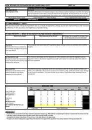
Warboys front cover - Huntingdonshire District Council
Warboys front cover - Huntingdonshire District Council
Warboys front cover - Huntingdonshire District Council
- No tags were found...

You also want an ePaper? Increase the reach of your titles
YUMPU automatically turns print PDFs into web optimized ePapers that Google loves.
<strong>Warboys</strong> site 1Site InformationLandownerMr David EnglandAgentRobert Doughty ConsultancySite Area0.6 hectaresThis site provides an attractive setting for the listed buildings and church to the south, and provides an attractive open setting to recreation field.A small amount of residential development could take place to replace the existing barns.Developable Area-Notional Density Range-Notional Capacity8Site 1: <strong>Warboys</strong>
<strong>Warboys</strong> site 2This site has been amalgamated from severalpaddocks, with more than one owner. Part ofthe site is well hidden from long views, but thesoft mature landscaped edge to this part of<strong>Warboys</strong> should be protected and so the siteshould not be considered suitable fordevelopment.Site InformationLandownerSouthern part - R. H. Topham and SonsNorthern part Camvil DevelopmentsAgentSouthern part John Martin and AssociatesNorthern part by Andrew S Campbell Associates.Site Area2.4 hectaresDevelopable Area-Notional Density Range-Notional Capacity-Site 2: <strong>Warboys</strong>
<strong>Warboys</strong> site 3This site again consists of several paddocks,some open and some enclosed by hedgesand mature trees. Part of the site is open tolong views, but again the soft maturelandscaped edge to this part of <strong>Warboys</strong>should be protected and so the site should notbe considered suitable for development.Site InformationLandownerCamvil DevelopmentsAgentAndrew S Campbell AssociatesSite Area2.7 hectaresDevelopable Area-Notional Density Range-Notional Capacity-Site 3: <strong>Warboys</strong>
Land behind Station Road, <strong>Warboys</strong>6Site SurveySite Location and ContextThis site is located to the north of the main village of <strong>Warboys</strong>, west of Station Road. The 9.4 ha sitecomprises a field behind the existing development at Old Mill Avenue which extends to the development ofOrchard Close and Coronation Avenue.Land UseThe land is arable farmland.Topography and LandformThe land is sloping, lying on the higher land of the fen margin.Vegetation (Trees and Hedgerows)There are some hedgerows and trees surrounding the field boundaries.Hydrological Features (Streams and Watercourses)There are no hydrological features within the site.Other on Site Features (Particular landscape features, existing buildings etc.)There are no other features on the site.Routes and physical Connectivity (Access, access to village centre/services etc.)The site is approximately 500m to the village centre and facilities.Views and Visual Connectivity (In and out, visual prominence and landmarks/focal points)The site is a large arable field on sloping land so offers some open views to the north west.Landscape Quality/ConditionThe landscape is good quality.Site Role and FunctionThe site is arable agricultural land.Site ConstraintsConservation AreaThe site is not in the <strong>Warboys</strong> Conservation Area.Listed BuildingsThere are no listed buildings within the site.Archaeological SitesThe site is not in an area of archaeological potential.Tree Preservation OrdersThere are no TPOs within the site.Public Rights of Way (PROW)There are PROWs which crosses the site diagonally, one to east and one to the west.County Wildlife Sites, SSSIs, Nature Reserves, Habitats of Legally Protected SpeciesPringle Wood Cutting County Wildlife Sites is approximately 600m from the site. There are no SSSIs orlegally protected species within 1 km of the site.Flood PlainThe site is not in the 1:100 year flood plain.HighwaysA full Transport Assessment is required. There is poor linkage to the local highway network and a lack ofintegration with the existing settlement for alternative modes of travel opportunities, such a cycling, walkingand public transport.Education<strong>Warboys</strong> Community School is 600m south west of the site and is accessible by walking or cycling. The siteis in the catchment of Ramsey Abbey College approximately 7 km north, accessible by vehicular transport(there is a school bus).Site 6: <strong>Warboys</strong>
<strong>Warboys</strong> site 6Although this large site appears to connectthe outlying part of <strong>Warboys</strong> with the rest ofthe village, it is very difficult to see how thesetwo parts of the village can be effectivelyintegrated, and this means that this site isunsuitable for development.Site InformationLandownerMcCann HomesAgentWoods Hardwick Planning LtdSite Area9.6 hectaresDevelopable Area-Notional Density RangeNotional CapacitySite 6: <strong>Warboys</strong>
Land in the south Sports Ground, <strong>Warboys</strong>7Site SurveySite Location and ContextThis site is located to the south of the main village of <strong>Warboys</strong>, east of Pathfinder Way. The 9.4 ha sitecomprises a grass field located in the southwest corner of the Sports Ground.Land UseThe land is a Sports ground.Topography and LandformThe land is flat.Vegetation (Trees and Hedgerows)There are some hedgerows and trees surrounding the field boundaries.Hydrological Features (Streams and Watercourses)There are no hydrological features within the site, a drain abuts the southern boundary.Other on Site Features (Particular landscape features, existing buildings etc.)There are no other features on the site.Routes and physical Connectivity (Access, access to village centre/services etc.)The site is approximately 400m to the village centre and facilities.Views and Visual Connectivity (In and out, visual prominence and landmarks/focal points)The site is enclosed by hedgerows so has limited views out of the countryside.Landscape Quality/ConditionThe landscape is good quality.Site Role and FunctionThe site is a Sports Ground.Site ConstraintsConservation AreaThe site is not in the <strong>Warboys</strong> Conservation Area.Listed BuildingsThere are no listed buildings within the site.Archaeological SitesThe site is not in an area of archaeological potential, although there is evidence of rideg and furrow to thesouth west of the site.Tree Preservation OrdersThere are no TPOs within the site.Public Rights of Way (PROW)There are two PROWs which crosse the site; one runs near to the western boundary and the second runsclose to the east boundary.County Wildlife Sites, SSSIs, Nature Reserves, Habitats of Legally Protected SpeciesPringle Wood Cutting County Wildlife Site and Nature Reserve is approximately 800m north of the site. Thereare no SSSIs or legally protected species within 1 km of the site.Flood PlainThe site is not in the 1:100 year flood plain.HighwaysThis site is a possible opportunity subject to a Transport Assessment to assess suitability of the existinghighway infrastructure of Pathfinder Way. The site is within walking and cycling distance of the village centrefacilities and the public transport corridor.Education<strong>Warboys</strong> Community School is 600m north west of the site and is accessible by walking or cycling. The site isin the catchment of Ramsey Abbey College approximately 7 km north, accessible by vehicular transport (thereis a school bus).Site 7: <strong>Warboys</strong>
<strong>Warboys</strong> site 7This small site is easily accessed from recentresidential development to the west. However,as it is currently used as a sports ground, it isunsuitable for development.Site InformationLandownerNot knownAgentNot KnownSite Area0.4 hectaresDevelopable Area-Notional Density Range-Notional Capacity-Site 7: <strong>Warboys</strong>