ILLINOIS NATURE PRESERVES COMMISSION - Illinois DNR
ILLINOIS NATURE PRESERVES COMMISSION - Illinois DNR
ILLINOIS NATURE PRESERVES COMMISSION - Illinois DNR
- No tags were found...

Create successful ePaper yourself
Turn your PDF publications into a flip-book with our unique Google optimized e-Paper software.
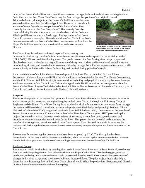
miles of the Lower Cache River watershed flowed eastward through the breach and culverts, draining into theOhio River via the Post Creek Cutoff reversing the flow through this portion of the original channel.Prior to the breach, drainage from the Lower Cache River watershed wasassumed to flow west into the Mississippi River. However, a considerableamount of water from the eastern portions of the Lower Cache Rivercurrently flows east to the Post Creek Cutoff. This easterly flow alsooccurred during flood events prior to the breach when both the Ohio andMississippi Rivers were above flood stage. The hydraulics of the LowerCache River are very complex. Since the division of the Cache River basininto two watersheds, the Lower Cache River does not receive flow from theUpper Cache River to maintain a sustained flow in the downstreamdirection. 1Exhibit CClearer water draining from the Lower CacheRiver flowing from the breach in the KarnakLevee as it enters the Post Creek Cutoff.The Cache River basin has experienced impaired water quality thatthreatens its biodiversity; much of this is due to human modifications to the aquatic and terrestrial watershed(IEPA 2008) 2 . Rivers need free-flowing water. The gentle current of a free-flowing river brings oxygen anddissolved nutrients, while also moving pollutants out of the system. A river and its connected natural areas aremost healthy, diverse, and sustainable when water is flowing through them. Further, aquatic animals must be ableto move freely to find suitable habitat for breeding and survival during periods of drought.A current initiative of the Joint Venture Partnership, which includes Ducks Unlimited Inc., the <strong>Illinois</strong>Department of Natural Resources (I<strong>DNR</strong>), the Natural Resource Conservation Service, The Nature Conservancy,and the U.S. Fish and Wildlife Service, is to restore flow variability and physical connectivity between the upperand lower segments of the Cache River. This is also a goal in the IWAP, as well as the management plans forLower Cache River “Reserve” which includes Section 8 Woods Nature Preserve and Buttonland Swamp, a part ofCache River Land and Water Reserve and a National Natural Landmark.Proposal:The restoration project to reconnect the Upper and Lower Cache River channels has been postponed in order toaddress water quality issues and ecological integrity in the Lower Cache. Although the U.S. Army Corps ofEngineers and the <strong>Illinois</strong> State Water Survey have provided critical information about how water flows throughthe system, additional detail is needed to advance this project into final design and planning. Southern <strong>Illinois</strong>University-Carbondale (SIUC) sought and received a State Wildlife Grant titled, “Demonstrating the benefits ofStream Restoration to Aquatic Communities in the Cache River Basin.” In the grant, SIUC proposed a pilotproject that would assess and demonstrate the effects of increasing stream flow on oxygen dynamics andmacroinvertebrate communities in the Lower Cache River. This project has the potential to demonstrate thebenefits of restoring even, low flows to the Lower Cache system. Data obtained should aid in selecting thepathway and designing the channel/connection structure necessary to rejoin the upper and lower segments of theCache River.Two options for conducting this demonstration have been proposed by SIUC. The first option has beendetermined to be the best possible demonstration design, while the second option attempts to take into accountcertain limitations presented by the state’s recent litigation concerning that section of the Cache River.Preferred Option:Reconnection would be simulated by creating flow in the Lower Cache River east of State Route 37, monitoringfour sites and comparing them to four reference sites in the Upper Cache River. Dissolved oxygen, primaryproduction, turbidity, and duckweed cover would be assessed. Results would allow quantitative assessment ofchanges in dissolved oxygen and stream metabolism to increased flows. The pilot project should also help todetermine how increasing flow in the Lower Cache channel would affect the production, abundance, and diversityof macroinvertebrate communities through sampling.2