Terrain and Obstacles
Terrain and Obstacles
Terrain and Obstacles
- No tags were found...

Create successful ePaper yourself
Turn your PDF publications into a flip-book with our unique Google optimized e-Paper software.
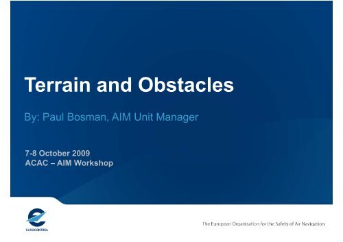
<strong>Terrain</strong> <strong>and</strong> <strong>Obstacles</strong>By: Paul Bosman, AIM Unit Manager7-8 October 2009ACAC – AIM Workshop
timeTransition from AIS to AIMP-10 — Communication networksP-12 — Aeronautical informationbriefingP-09 — Aeronautical data exchangeP-21 — Digital NOTAMP-19 — Interoperability withmeteorological productsP-20 — Electronicaeronautical chartsP-16 — Training P-18 —Agreements with data originatorsPhase 3P-02 — Data integrity monitoringP-01 — Data quality monitoringP-15 — Aerodrome mappingP-14 — <strong>Obstacles</strong>P-11 — Electronic AIP P-13 — <strong>Terrain</strong>P-06 — Integrated aeronauticalinformation databaseP-07 — Unique identifiersP-08 — Aeronautical informationconceptual modelPhase 2P-04 — Monitoring of diff AnnexP-03 — AIRAC adherence monitoringP-17 — QualityP-05 — WGS-84 implementationPhase 12
History• RTCA / EUROCAE• Developed by SC-193 / WG-44• User Requirements for <strong>Terrain</strong> & Obstacle Data, DO-276A / ED-98A• Membership mainly Industry• User/Industry requirement driven.• No acquisition cost, safety case, business case assessment• ICAO• Amdt 33 Introduced the requirements for eTOD• Amdt 34 Lighting & Marking obstacle requirements• Amdt 36 Revisions• EUROCONTROL• TOD Working Group• Amdt proposals• Awareness & guidance3
The four areasArea 1 & 2 <strong>Obstacles</strong>Area 4Area 1 & 2 <strong>Terrain</strong> Area 34
User requirements• Ground Proximity Warning System - Minimum Safety Altitude Warning• Contingency procedures• Aircraft operating limitation analysis (RTOW)• Instrument procedure design• Drift-down / en-route emergency l<strong>and</strong>ing• Advanced Surface Movement Guidance <strong>and</strong> Control systems• Aeronautical charts / On-board databases• Flight simulator• Aerodrome / heliport obstacle management• Synthetic vision6
Amdt 36 - Area 1 – Main modifications• TOD WG fully supported this area.• Recommended that en-route obstacles are harmonised with themilitary requirements for en-route obstacles.• Recommended that the vertical accuracy be increased to ±3m:• Applicable from 20 th November 2008.7
Amdt 36 - Area 2 – Main modifications• <strong>Terrain</strong> requirements were kept• Originally obstacles were omni-directional Very costly !!• Now a much reduced requirement• Applies differing filter heights in sub-regions of Area 2:• Area 2a <strong>and</strong> 2b: 3m AGL;• Area 2c: 15m AGL;• Area 2d: 100m AGL.• Applicable from 15 th November 20128
Amdt 36 - 3 – Main modifications• In RTCA / EUROCAE requirements• “Supplemental <strong>Terrain</strong> Requirementsfor Aerodrome Mapping”• Data set is not useful where aerodromemapping data does not exist.• Therefore, it has been reduced from aSt<strong>and</strong>ard to a Recommended Practicewhere:• “supported by the availability ofaerodrome mapping data”• Applicable from 15 th November 201210
Areas mapped to User Requirements• GPWS / MSAWArea 1 2 3• Contingency procedures • Aircraft operating limitation analysis• Instrument procedure design • Drift-down / en-route emergency l<strong>and</strong>ing (limited)• A-SMGCS (!)• Aeronautical charts / On-board databases• Flight simulator• Aerodrome / heliport obstacle management[Application defined][Application defined]Not fully understood• Synthetic vision – Non-mature (civil) technology / generic shapes vsexact representation12
• Area 1Costs• Most States have some National terrain data available <strong>and</strong> theobstacles are already provided in the AIP;• May be some transitional issues.• Area 2• Initial assessment for terrain & obstacle, €100K per aerodrome.• Area 3• The cost of generating this data was estimated as €2-3K peraerodrome;• Note, many aerodromes have information available, but not inthe correct form.• Area 4• This data is already available <strong>and</strong> used to generate the PATC<strong>and</strong> needs to be digitised. Very low cost.13
Benefits• Avoidance of manual entry• Better modelling of the operating environment;• Provision of terrain data previously not made available by States• Better knowledge of environment may lead to better utilisation ofavailable airspace.• NOTABENE: New hazards.• Today, users operate safely using a few significant obstacles• Completeness <strong>and</strong> meaning of digitally maintained datasets14
• GuidanceImplementing aspects• High Level Safety Study (available)• Awareness & Training workshops - 18-19 Nov 2009, 2 x 2010 (TBD)• Implementation Manual - 2010/Q2 First release, 2010/Q4 update• Data model• <strong>Obstacles</strong> : Covered by AIXM 5• <strong>Terrain</strong> :<strong>Terrain</strong> eXchange model (TIXM) – Under discussion• Some recent best practices• Pilot cases studies – France, Switzerl<strong>and</strong> etc.• Unresolved issues Institutional Focus Group• Cost recovery <strong>and</strong> charging• Provision <strong>and</strong> maintenance of eTOD• Legal liability• Cross-border harmonisation15
Conclusions• Significant costs• eTOD is beneficial to todays <strong>and</strong> essential to tomorrow’s ATM• Implementation can start• Need for global sharing best practices <strong>and</strong> lessons learned• More info ?• http://www.eurocontrol.int/aim• http://extranet.eurocontrol.int eTOD Forum• http://extranet.eurocontrol.int One SkyTeamAIM Team -> Stakeholder Consultation -> TOD WG -> Working Group16
Questions?