Issue 13 - NEXRAD Radar Operations Center - NOAA
Issue 13 - NEXRAD Radar Operations Center - NOAA
Issue 13 - NEXRAD Radar Operations Center - NOAA

You also want an ePaper? Increase the reach of your titles
YUMPU automatically turns print PDFs into web optimized ePapers that Google loves.
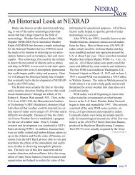
<strong>NEXRAD</strong>NowAir Traffic Controllers Using WSR-88D ProductsIt’s been a little more than a year since the FAA beganfull-fledged use of WSR-88D products as advisory overlayson the air traffic controller displays. So it might be agood opportunity to reintroduce ourselves and to discussour use of these important visual tools for aviation safety.In fact, we have anecdotal reports that controllers have asignificantly improved awareness of precipitation eventsthat could impact air traffic flows and safety. Departuresfrom Dallas-Ft. Worth were able to depart during a seriesof thunderstorms, because controllers could see where theweather was. Armed with this improved awareness, controllersare able to more efficiently manage their sectors.They can anticipate pilot requests to change their routingsto avoid weather and can report what they see more precisely.Can you assign a dollar figure to this? That’s the 6million dollar question, but we can say it’s a contributor inFAA efforts to create an infrastructure to promote efficiencyand safety.Air traffic controllers using WSR-88D products arecalled en route controllers. They are from 22 Air RouteTraffic Control <strong>Center</strong>s (ARTCCs) across the country,along with slightly smaller facilities in Alaska, Hawaii,Puerto Rico and Guam. They control aircraft during theirflights between airport terminal areas. (There are a fewtimes when en route controllers provide approach controlservices to aircraft at smaller airports or during contingencies.)But most of the time the approach to landing servicesare provided by terminal controllers in radarapproach control centers or in towers. The system usedby en route controllers to display WSR-88D products iscalled the Weather and <strong>Radar</strong> Processor, or WARP.WARP is just one tool in the National Airspace System orNAS. NAS automated systems include controller displays,state of the art communication systems, and supportsystems like WARP.Users of the WARP and WSR-88D products havedesignated focal points for FAA participation on WSR-88D Unit <strong>Radar</strong> Committees (URCs).WARP performs a wide array of functions, but theycan be listed as three basic ones. One function is to providemeteorologists and briefers with products similar tothose provided by the AWIPS used by Weather ForecastOffices and remoted to Central Weather Service Units(CWSUs). That function is used to analyze and compilebriefing graphics for ARTCCs. A second function ofWARP is to collect and distribute Rapid Update Cyclewind products to FAA computers that predict the futureflight paths of aircraft on Instrument Flight Rules (IFR)flight plans. The third function of WARP is to provide agraphic overlay that depicts areas of moderate or greaterprecipitation. This third function has created a time-sensitiveelement to use of the overlay products that we havenot had in the past.Controllers are not meteorologists, so they reportwhat they see on their display. Three colors are assignedto their display of precipitation: light cyan (greenish blue),royal blue and checkered cyan. An example of these canbe found in Figure 1. The light cyan is termed, “moderateweather.” Controllers phraseology for the other two colorsis “heavy weather.” We have learned that there canbe a small, but acceptable, time delay in the portrayal ofthe data, but this is overshadowed by the much more accuratedepiction now available to the controllers. Prior tothis improved display, controllers had to rely on their aircrafttracking radar – less than optimally tuned to viewprecipitation – and a generalized depiction of slash marks(///) for moderate weather and uppercase h’s (HHH) forheavy weather. Comparisons of the two reveal muchmore clarity of detail with the WSR-88D overlay.But this has been an evolutionary learning process.For example, the Weather Forecast Office (WFO) cancontrol the base altitude for lrml (known to us as Product65). The corresponding view on the controller scope is000 – 240 (surface to 24 thousand feet). The FAA discoveredthat the base altitude settings varied from WFO toWFO. When the base altitude is not set to the default setting,important weather conditions may be hidden fromthe controller’s view. So, until May of 2004, controllerswere instructed not to use this view, for obvious safetyreasons. (In February and May of 2004, the ROC releasedmaintenance messages to ensure this product is set to thedefault setting).Another learning process is being able to know whena single WSR-88D radar is degraded or out of service.The WARP system can alarm when the data flow betweenWSR-88Ds and FAA users is interrupted. However, westill do not have an automated way to inform air trafficcontrollers that a radar affecting their sector is not providingdata. For the time being, ARTCCs have to use a verbalnotification process. We’ve learned that free text messagescontribute greatly to our understanding of the reasonfor an outage. Estimates of system restoration are(Continued on Page 10)page 9