Baseline Spec Template - NEXRAD Radar Operations Center - NOAA
Baseline Spec Template - NEXRAD Radar Operations Center - NOAA
Baseline Spec Template - NEXRAD Radar Operations Center - NOAA

Create successful ePaper yourself
Turn your PDF publications into a flip-book with our unique Google optimized e-Paper software.
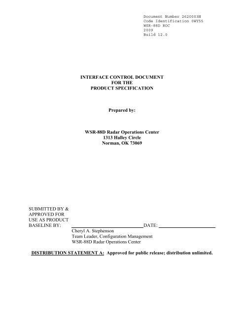
Document Number 2620003NCode Identification 0WY55WSR-88D ROC2009Build 12.0INTERFACE CONTROL DOCUMENTFOR THEPRODUCT SPECIFICATIONPrepared by:WSR-88D <strong>Radar</strong> <strong>Operations</strong> <strong>Center</strong>1313 Halley CircleNorman, OK 73069SUBMITTED BY &APPROVED FORUSE AS PRODUCTBASELINE BY:DATE:Cheryl A. StephensonTeam Leader, Configuration ManagementWSR-88D <strong>Radar</strong> <strong>Operations</strong> <strong>Center</strong>DISTRIBUTION STATEMENT A: Approved for public release; distribution unlimited.
Document Number 2620003NCode Identification 0WY55WSR-88D ROC2009Build 12.0INTERFACE CONTROL DOCUMENTFOR THE PRODUCT SPECIFICATION2620003DOCUMENT REVISION RECORD FORMREVISION - A B C D E F G H I J K L MRELEASED BY ROC ROC ROC ROC ROC ROC ROC ROC ROC ROC ROC ROC ROC ROCRELEASE 03/01/9 06/26/9 09/11/0 01/27/0 06/19/0 12/29/0 06/13/0 01/30/0 07/29/0 4/13/05 2/8/06 5/25/07 3/25/08 3/3/09DATE6 8 1 2 2 2 3 4 4EFFECTIVITY 03/01/9 06/26/9 09/11/0 01/27/0 06/19/0 12/29/0 06/13/0 01/30/0 07/29/0 4/13/05 2/8/06 5/25/07 3/25/08 3/3/096 8 1 2 2 2 3 4 4AUTHORITY F0048 F0095 F0103 F0158 F0164 F0174 F0182 F0185 F0186 F0209 F0126/ F0250 F0286 0349F0210FAST TRACK NO NO NO NO ROC ROC ROC ROC ROC ROC ROC ROC ROC ROCREV HISTORY BLD9.0BLD10.0BLD1.0BLD1.2BLD2.0BLD3.0BLD4.0BLD5.0BLD6.0BLD7.0BLD8.0BLD9.0BLD10.0BLD11.0INTRODUCTIO - ANSCOPE - ASection 1.0 - A C D LSection 2.0 - A C D LSection 3.0 - A D LSection 4.0 - A D I LSection 5.0 - A D FSection 6.0 - A B DSection 7.0 - A D FSection 8.0 - A DSection 9.0 - A D FSection 10.0 - A DSection 11.0 - A D GSection 12.0 - A D E HSection 13.0 - A D FSection 14.0 - A D FSection 15.0 - A D FSection 16.0 - A DSection 17.0 - A DSection 18.0 - A D H ISection 19.0 - A DSection 20.0 - A D F G H J LSection 21.0 - A D G I LSection 22.0 - A D ISection 23.0 - A DSection 24.0 - A DSection 25.0 - A DSection 26.0 - A D G H I JSection 27.0 - A D ISection 28.0 - A D G LSection 29.0 - A D E G I K LSection 30.0 - A D GSection 31.0 - A D G ISection 32.0 - A DSection 33.0 - A D E G LSection 34.0 - A D I L MSection 35.0 N/A N/A B DSection 36.0 D H ISection 37.0 D H ISection 38.0DSection 39.0 D KSection 40.0 E GSection 41.0 F LSection 42.0HSection 43.0HSection 44.0HSection 45.0JSection 46.0 K LSection 47.0LAppendix A - A F G H I LAppendix B - A F G LAppendix C D E F G IAppendix D H DeletedR-1
Document Number 2620003NCode Identification 0WY55WSR-88D ROC2009Build 12.0Table of Contents1 REFLECTIVITY (R, DR, and SDR) .................................................................................................1-11.11.2SS Product Description..............................................................................................................1-1Display Format...........................................................................................................................1-11.2.1 Data Levels..........................................................................................................................1-11.2.2 Color Level Code Tables .....................................................................................................1-11.2.3 Range/Data Resolution.......................................................................................................1-31.3 Annotations ................................................................................................................................1-31.3.1 Alphanumeric......................................................................................................................1-31.3.2 <strong>Spec</strong>ial Symbols ..................................................................................................................1-31.4 Product Interaction ....................................................................................................................1-32 MEAN RADIAL VELOCITY (V, DV, and SDV)..............................................................................2-12.1 SS Product Description..............................................................................................................2-12.2 Display Format...........................................................................................................................2-12.2.1 Data Levels..........................................................................................................................2-12.2.2 Color Level Code Tables .....................................................................................................2-12.2.3 Range/Data Resolution.......................................................................................................2-22.3 Annotations ................................................................................................................................2-32.3.1 Alphanumeric......................................................................................................................2-32.3.2 <strong>Spec</strong>ial Symbols ..................................................................................................................2-32.4 Product Interaction ....................................................................................................................2-33 SPECTRUM WIDTH (SW and SDW) .............................................................................................3-13.1 SS Product Description..............................................................................................................3-13.2 Display Format...........................................................................................................................3-13.2.1 Data Levels..........................................................................................................................3-13.2.2 Color Level Code Tables .....................................................................................................3-13.2.3 Range/Data Resolution.......................................................................................................3-23.3 Annotations ................................................................................................................................3-23.3.1 Alphanumeric......................................................................................................................3-23.3.2 <strong>Spec</strong>ial Symbols ..................................................................................................................3-23.4 Product Interaction ....................................................................................................................3-24 DELETED..........................................................................................................................................4-15 DELETED..........................................................................................................................................5-16 COMPOSITE REFLECTIVITY and COMPOSITE REFLECTIVITY EDITED FORANOMALOUS PROPAGATION (CR and CRE).....................................................................................6-16.1 SS Product Description..............................................................................................................6-16.2 Display Format...........................................................................................................................6-16.2.1 Graphic Display ..................................................................................................................6-16.2.2 Alphanumeric Display ........................................................................................................6-26.3 Annotations ................................................................................................................................6-26.3.1 Alphanumeric......................................................................................................................6-26.3.2 <strong>Spec</strong>ial Symbols ..................................................................................................................6-26.4 Product Interaction ....................................................................................................................6-27 DELETED..........................................................................................................................................7-18 ECHO TOPS (ET)..............................................................................................................................8-18.1 SS Product Description..............................................................................................................8-18.2 Display Format...........................................................................................................................8-18.2.1 Data Levels..........................................................................................................................8-18.2.2 Color Level Code Tables .....................................................................................................8-18.2.3 Range/Data Resolution.......................................................................................................8-18.3 Annotations ................................................................................................................................8-2i
Document Number 2620003NCode Identification 0WY55WSR-88D ROC2009Build 12.08.3.1 Alphanumeric......................................................................................................................8-28.3.2 <strong>Spec</strong>ial Symbols ..................................................................................................................8-28.4 Product Interaction ....................................................................................................................8-29 DELETED..........................................................................................................................................9-110 DELETED ....................................................................................................................................10-111 DELETED ....................................................................................................................................11-112 VELOCITY AZIMUTH DISPLAY (VAD), (VWP)......................................................................12-112.1 SS Product Description ........................................................................................................12-112.2 Display Format .....................................................................................................................12-112.2.1 Data Levels........................................................................................................................12-212.2.2 Color Level Code Table.....................................................................................................12-212.2.3 Range/Data Resolution.....................................................................................................12-312.2.4 Alphanumeric Display .................................................................................................12-312.3 Annotations...........................................................................................................................12-412.3.1 Alphanumeric....................................................................................................................12-412.3.2 <strong>Spec</strong>ial Symbols ................................................................................................................12-412.4 Product Interaction ..............................................................................................................12-412.5 Comment ...............................................................................................................................12-413 DELETED ....................................................................................................................................13-114 CROSS SECTION (RCS, VCS) ...................................................................................................14-114.1 SS Product Description ........................................................................................................14-114.2 Display Format .....................................................................................................................14-114.2.1 Data Levels........................................................................................................................14-114.2.2 Color Level Code Tables ...................................................................................................14-114.2.3 Range/Data Resolution.....................................................................................................14-114.3 Annotations...........................................................................................................................14-214.3.1 Alphanumeric....................................................................................................................14-214.3.2 <strong>Spec</strong>ial Symbols ................................................................................................................14-214.4 Product Interaction ..............................................................................................................14-215 DELETED ....................................................................................................................................15-116 STORM RELATIVE MEAN RADIAL VELOCITY (SRM, SRR)...............................................16-116.1 SS Product Description ........................................................................................................16-116.2 Display Format .....................................................................................................................16-116.2.1 Data Levels........................................................................................................................16-116.2.2 Color Level Code Tables ...................................................................................................16-116.2.3 Range/Data Resolution.....................................................................................................16-216.3 Annotations...........................................................................................................................16-216.3.1 Alphanumeric....................................................................................................................16-216.3.2 <strong>Spec</strong>ial Symbols ................................................................................................................16-216.4 Product Interaction ..............................................................................................................16-217 VERTICALLY INTEGRATED LIQUID (VIL)...........................................................................17-117.1 SS Product Description ........................................................................................................17-117.2 Display Format .....................................................................................................................17-117.2.1 Data Levels........................................................................................................................17-117.2.2 Color Level Code Tables ...................................................................................................17-117.2.3 Range/Data Resolution.....................................................................................................17-117.3 Annotations...........................................................................................................................17-217.3.1 Alphanumeric....................................................................................................................17-217.3.2 <strong>Spec</strong>ial Symbols ................................................................................................................17-217.4 Product Interaction ..............................................................................................................17-218 STORM TRACKING INFORMATION (STI) .............................................................................18-1ii
Document Number 2620003NCode Identification 0WY55WSR-88D ROC2009Build 12.023.2 Display Format .....................................................................................................................23-123.2.1 Data Levels........................................................................................................................23-123.2.223.2.3Color Level Code Tables ...................................................................................................23-1Range/Data Resolution.....................................................................................................23-223.3 Annotations...........................................................................................................................23-223.3.1 Alphanumeric....................................................................................................................23-223.3.2 <strong>Spec</strong>ial Symbols ................................................................................................................23-223.4 Product Interaction ..............................................................................................................23-224 DELETED ....................................................................................................................................24-125 USER ALERT MESSAGE (UAM) ..............................................................................................25-125.125.2SS Product Description ........................................................................................................25-1Display Format .....................................................................................................................25-125.3 Annotations...........................................................................................................................25-125.3.125.3.2Alphanumeric....................................................................................................................25-1<strong>Spec</strong>ial Symbols ................................................................................................................25-126 RADAR CODED MESSAGE (RCM)...........................................................................................26-126.1 SS Product Description ........................................................................................................26-126.2 Display Format .....................................................................................................................26-126.2.1 A/N Message Format ........................................................................................................26-127 FREE TEXT MESSAGE (PTM, FTM)........................................................................................27-127.1 SS Product Description ........................................................................................................27-127.2 Display Format .....................................................................................................................27-127.3 Annotations...........................................................................................................................27-127.4 Product Interaction ..............................................................................................................27-128 SURFACE RAINFALL ACCUMULATION (OHP, THP) .........................................................28-128.1 SS Product Description ........................................................................................................28-128.2 Display Format .....................................................................................................................28-128.2.1 Data Levels........................................................................................................................28-128.2.2 Color Level Code Table.....................................................................................................28-128.2.3 Range/Data Resolution.....................................................................................................28-128.3 Annotations...........................................................................................................................28-228.3.1 Alphanumeric....................................................................................................................28-228.3.2 <strong>Spec</strong>ial Symbols ................................................................................................................28-228.4 Product Interaction ..............................................................................................................28-228.5 Comment ...............................................................................................................................28-229 STORM TOTAL RAINFALL ACCUMULATION (STP and DSP)............................................29-129.1 SS Product Description ........................................................................................................29-129.2 Display Format .....................................................................................................................29-129.2.1 Data Levels........................................................................................................................29-129.2.2 Color Level Code Tables (for the image version of the product): ...................................29-229.2.3 Range/Data Resolution.....................................................................................................29-229.3 Annotations, Both versions of the product will contain the following: .............................29-229.3.1 Alphanumeric....................................................................................................................29-229.3.2 <strong>Spec</strong>ial Symbols ................................................................................................................29-429.4 Product Interaction ..............................................................................................................29-429.5 Comment ...............................................................................................................................29-430 HOURLY DIGITAL PRECIPITATION ARRAY (DPA).............................................................30-130.1 SS Product Description ........................................................................................................30-130.2 Display Format .....................................................................................................................30-130.2.1 Data Levels........................................................................................................................30-130.2.2 Color Level Code Tables ...................................................................................................30-1iv
Document Number 2620003NCode Identification 0WY55WSR-88D ROC2009Build 12.030.2.3 Range/Data Resolution.....................................................................................................30-130.3 Annotations...........................................................................................................................30-230.3.130.3.2Alphanumeric....................................................................................................................30-2<strong>Spec</strong>ial Symbols ................................................................................................................30-330.4 Product Interaction ..............................................................................................................30-331 SUPPLEMENTAL PRECIPITATION DATA (SPD) .................................................................31-131.1 SS Product Description ........................................................................................................31-131.2 Display Format .....................................................................................................................31-131.2.1 Graphic Display ................................................................................................................31-131.2.2 Alphanumeric Display ......................................................................................................31-131.3 Annotations...........................................................................................................................31-131.3.1 Alphanumeric....................................................................................................................31-131.3.2 <strong>Spec</strong>ial Symbols ................................................................................................................31-231.4 Product Interaction ..............................................................................................................31-232 USER SELECTABLE RAINFALL ACCUMULATION (USP) .................................................32-132.1 SS Product Description ........................................................................................................32-132.2 Display Format .....................................................................................................................32-132.2.1 Data Levels........................................................................................................................32-132.2.2 Color Level Code Tables ...................................................................................................32-132.2.3 Range/Data Resolution.....................................................................................................32-132.2.4 Alphanumeric Display ......................................................................................................32-232.3 Annotations...........................................................................................................................32-232.3.1 Standard Annotations ..................................................................................................32-232.3.2 <strong>Spec</strong>ial Symbols ................................................................................................................32-232.4 Product Interaction ..............................................................................................................32-233 HYBRID SCAN REFLECTIVITY (HSR) and DIGITAL HYBRID SCAN REFLECTIVITY(DHR)33-133.1 SS Product Description ........................................................................................................33-133.2 Display Format .....................................................................................................................33-133.2.1 Data Levels........................................................................................................................33-133.2.2 Color Level Code Tables ...................................................................................................33-133.2.3 Range/Data Resolution.....................................................................................................33-133.3 Annotations...........................................................................................................................33-133.3.1 Digital Alphanumeric .......................................................................................................33-133.3.2 Graphic Alphanumeric .....................................................................................................33-333.4 Product Interaction ..............................................................................................................33-334 CLUTTER FILTER CONTROL..................................................................................................34-134.1 SS Product Description ........................................................................................................34-134.2 Display format ......................................................................................................................34-134.2.1 Data Levels........................................................................................................................34-134.2.2 Color Level Code Tables ...................................................................................................34-134.2.3 Range/Data Resolution.....................................................................................................34-234.3 Annotations...........................................................................................................................34-234.3.1 Alphanumeric....................................................................................................................34-234.3.2 <strong>Spec</strong>ial Symbols ................................................................................................................34-234.4 Product Interaction ..............................................................................................................34-235 ITWS Digital Base Velocity (ITWSDBV) ...................................................................................35-135.1 SS Product Description ........................................................................................................35-135.2 Display Format .....................................................................................................................35-135.2.1 Data Levels........................................................................................................................35-135.2.2 Color Level Code Tables ...................................................................................................35-1v
Document Number 2620003NCode Identification 0WY55WSR-88D ROC2009Build 12.035.2.3 Range/Data Resolution.....................................................................................................35-135.2.4 Product <strong>Spec</strong>ific Data .......................................................................................................35-135.335.4Annotations...........................................................................................................................35-2Product Interaction ..............................................................................................................35-236 Clutter Likelihood Reflectivity (CLR) ........................................................................................36-136.1 SS Product Description ........................................................................................................36-136.2 Display Format .....................................................................................................................36-136.2.1 Data Levels........................................................................................................................36-136.2.2 Color Level Code Tables ...................................................................................................36-136.2.3 Range/Data Resolution.....................................................................................................36-136.3 Annotations...........................................................................................................................36-236.3.1 Alphanumeric....................................................................................................................36-236.3.2 <strong>Spec</strong>ial Symbols ................................................................................................................36-236.4 Product Interaction ..............................................................................................................36-237 Clutter Likelihood Doppler (CLD) ..............................................................................................37-137.1 SS Product Description ........................................................................................................37-137.2 Display Format .....................................................................................................................37-137.2.1 Data Levels........................................................................................................................37-137.2.2 Color Level Code Tables ...................................................................................................37-137.2.3 Range/Data Resolution.....................................................................................................37-237.3 Annotations...........................................................................................................................37-237.3.1 Alphanumeric....................................................................................................................37-237.3.2 <strong>Spec</strong>ial Symbols ................................................................................................................37-237.4 Product Interaction ..............................................................................................................37-238 SUPEROB ....................................................................................................................................38-138.1 SS Product Description ........................................................................................................38-138.2 Display Format .....................................................................................................................38-138.2.1 Data Levels........................................................................................................................38-138.2.2 Color Level Code Tables ...................................................................................................38-138.2.3 Range/Data Resolution.....................................................................................................38-138.2.4 Product <strong>Spec</strong>ific Data .......................................................................................................38-238.3 Annotations...........................................................................................................................38-238.4 Product Interaction ..............................................................................................................38-239 Digital High Resolution Vertically Integrated Liquid (HRVIL)...............................................39-139.1 SS Product Description ........................................................................................................39-139.2 Display Format .....................................................................................................................39-139.2.1 Data Levels........................................................................................................................39-139.2.2 Color Level Code Tables ...................................................................................................39-139.2.3 Range/Data Resolution.....................................................................................................39-239.3 Annotations...........................................................................................................................39-239.3.1 Alphanumeric....................................................................................................................39-239.3.2 <strong>Spec</strong>ial Symbols ................................................................................................................39-239.4 Product Interaction ..............................................................................................................39-240 User Selectable Layer Composite Reflectivity (ULR) ...............................................................40-140.140.2SSS Product Description ......................................................................................................40-1Display Format .....................................................................................................................40-140.2.1 Data Level .........................................................................................................................40-140.2.2 Color Level Code Tables ...................................................................................................40-140.2.3 Range/Data Resolution.....................................................................................................40-140.3 Annotations...........................................................................................................................40-240.3.1 Alphanumeric....................................................................................................................40-2vi
Document Number 2620003NCode Identification 0WY55WSR-88D ROC2009Build 12.046.3.2 <strong>Spec</strong>ial Symbols ................................................................................................................46-246.4 Product Interaction ..............................................................................................................46-247 <strong>NEXRAD</strong> TURBULENCE DETECTION ALGORITHM (EDR, EDC).....................................47-147.1 SS Product Description ........................................................................................................47-147.2 Display Format .....................................................................................................................47-147.2.1 Data Levels........................................................................................................................47-147.2.2 Color Level Code Tables ..............................................................................................47-147.2.3 Range/Data Resolution.....................................................................................................47-247.3 Annotations...........................................................................................................................47-247.3.1 Alphanumeric....................................................................................................................47-247.3.2 <strong>Spec</strong>ial Symbols ................................................................................................................47-247.4 Product Interaction ..............................................................................................................47-248 DIFFERENTIAL REFLECTIVITY (ZDR, DZD)........................................................................48-148.148.2SS Product Description ........................................................................................................48-1Display Format .....................................................................................................................48-148.2.1 Data Levels........................................................................................................................48-148.2.2 Color Level Code Tables ...................................................................................................48-148.2.3 Range/Data Resolution.....................................................................................................48-248.3 Annotations...........................................................................................................................48-248.3.1 Alphanumeric....................................................................................................................48-248.3.2 <strong>Spec</strong>ial Symbols ................................................................................................................48-248.4 Product Interaction ..............................................................................................................48-249 CORRELATION COEFFICIENT (CC, DCC) ............................................................................49-149.1 SS Product Description ........................................................................................................49-149.2 Display Format .....................................................................................................................49-149.2.1 Data Levels........................................................................................................................49-149.2.2 Color Level Code Tables ...................................................................................................49-149.2.3 Range/Data Resolution.....................................................................................................49-249.3 Annotations...........................................................................................................................49-249.3.1 Alphanumeric....................................................................................................................49-249.3.2 <strong>Spec</strong>ial Symbols ................................................................................................................49-249.4 Product Interaction ..............................................................................................................49-250 SPECIFIC DIFFERENTIAL PHASE (KDP, DKD)...................................................................50-150.1 SS Product Description ........................................................................................................50-150.2 Display Format .....................................................................................................................50-150.2.1 Data Levels........................................................................................................................50-150.2.2 Color Level Code Tables ...................................................................................................50-150.2.3 Range/Data Resolution.....................................................................................................50-250.3 Annotations...........................................................................................................................50-250.3.1 Alphanumeric....................................................................................................................50-250.3.2 <strong>Spec</strong>ial Symbols ................................................................................................................50-250.4 Product Interaction ..............................................................................................................50-251 HYDROMETEOR CLASSIFICATION (HC, DHC, HHC).........................................................51-151.1 SS Product Description ........................................................................................................51-151.2 Display Format .....................................................................................................................51-151.2.1 Data Levels........................................................................................................................51-151.2.2 Color Level Code Tables ...................................................................................................51-151.2.3 Range/Data Resolution.....................................................................................................51-251.3 Annotations...........................................................................................................................51-251.3.1 Alphanumeric....................................................................................................................51-251.3.2 <strong>Spec</strong>ial Symbols ................................................................................................................51-2viii
Document Number 2620003NCode Identification 0WY55WSR-88D ROC2009Build 12.051.4 Product Interaction ..............................................................................................................51-252 MELTING LAYER (ML) .............................................................................................................52-152.152.2SS Product Description ........................................................................................................52-1Display Format .....................................................................................................................52-152.2.1 Data Levels........................................................................................................................52-152.2.2 Color Level Code Tables ...................................................................................................52-152.2.3 Range/Data Resolution.....................................................................................................52-252.3 The Annotations ...................................................................................................................52-252.3.1 Alphanumeric....................................................................................................................52-252.3.2 <strong>Spec</strong>ial Symbols ................................................................................................................52-252.4 Product Interaction ..............................................................................................................52-253 ONE-HOUR ACCUMULATION (OHA).....................................................................................53-153.1 SS Product Description ........................................................................................................53-153.2 Display Levels.......................................................................................................................53-153.2.1 Data Levels........................................................................................................................53-153.2.2 Color Level Code Table.....................................................................................................53-153.3 Range, Data, & Temporal Resolution..................................................................................53-153.4 Annotations...........................................................................................................................53-153.4.1 Alphanumeric....................................................................................................................53-153.5 Product Interaction ..............................................................................................................53-254 DIGITAL ACCUMULATION ARRAY (DAA) ............................................................................54-154.1 SS Product Description ........................................................................................................54-154.2 Display Format .....................................................................................................................54-154.2.1 Data Levels........................................................................................................................54-154.2.2 Range, Data, & Temporal Resolution..............................................................................54-154.3 Annotations...........................................................................................................................54-154.3.1 Alphanumeric....................................................................................................................54-154.4 Product Interaction ..............................................................................................................54-155 STORM TOTAL ACCUMULATION (STA)................................................................................55-155.1 SS Product Description ........................................................................................................55-155.2 Display Format .....................................................................................................................55-155.2.1 Data Levels........................................................................................................................55-155.2.2 Color Level Code Table.....................................................................................................55-155.3 Range, Data, & Temporal Resolution..................................................................................55-155.4 Annotations...........................................................................................................................55-255.4.1 Alphanumeric....................................................................................................................55-255.4.2 Paired Alphanumeric........................................................................................................55-255.5 Product Interaction ..............................................................................................................55-356 DIGITAL STORM TOTAL ACCUMULATION (DSA) ..............................................................56-156.1 SS Product Description ........................................................................................................56-156.2 Display Format .....................................................................................................................56-156.2.1 Data Levels........................................................................................................................56-156.2.2 Range, Data, & Temporal Resolution..............................................................................56-156.3 Annotations...........................................................................................................................56-156.3.156.3.2Alphanumeric....................................................................................................................56-1Digital Alphanumeric .......................................................................................................56-156.4 Product Interaction ..............................................................................................................56-357 DIGITAL USER-SELECTABLE ACCUMULATION (DUA)....................................................57-157.1 SS Product Description ........................................................................................................57-157.2 Display Format .....................................................................................................................57-157.2.1 Data Levels........................................................................................................................57-1ix
Document Number 2620003NCode Identification 0WY55WSR-88D ROC2009Build 12.057.2.2 Range, Data, & Temporal Resolution..............................................................................57-157.3 Annotations...........................................................................................................................57-157.4 Product Interaction ..............................................................................................................57-158 DIGITAL ONE-HOUR DIFFERENCE (DOD) ..........................................................................58-158.1 SS Product Description ........................................................................................................58-158.2 Display Format .....................................................................................................................58-158.2.1 Data Levels........................................................................................................................58-158.2.2 Range, Data, & Temporal Resolution..............................................................................58-158.3 Annotations:..........................................................................................................................58-158.4 Product Interaction ..............................................................................................................58-159 DIGITAL STORM TOTAL DIFFERENCE (DSD).....................................................................59-159.1 SS Product Description ........................................................................................................59-159.2 Display Format .....................................................................................................................59-159.2.159.2.2Data Levels........................................................................................................................59-1Range, Data, & Temporal Resolution..............................................................................59-159.3 Annotations:..........................................................................................................................59-159.4 Product Interaction ..............................................................................................................59-160 DIGITAL INSTANTANEOUS PRECIPITATION RATE (DPR) ..............................................60-160.1 SS Product Description ........................................................................................................60-160.2 Display Format .....................................................................................................................60-160.2.1 Data Levels........................................................................................................................60-160.2.2 Range, Data, & Temporal Resolution..............................................................................60-160.2.3 DPR Format for External Systems..................................................................................60-160.3 Annotations:..........................................................................................................................60-160.4 Product Interaction ..............................................................................................................60-2APPENDIX A........................................................................................................................................... A-1APPENDIX B........................................................................................................................................... B-1APPENDIX C........................................................................................................................................... C-1Index of TablesTABLE I. PARAMETER STANDARD DIMENSIONS FOR DISPLAY..................................................5TABLE II. PRODUCT PARAMETERS....................................................................................................6TABLE III. STANDARD ABBREVIATIONS ........................................................................................11Index of FiguresFormat I. Full Screen ................................................................................................................................. 1Format Ia. Full Screen (Status and Annotation Area).............................................................................2Format Ib. Status and Annotation Area (Parameter Select Mode).........................................................3Format II. Quarter Screen ..........................................................................................................................4Format IIa: Quarter Screen Layout ......................................................................................................5Format IIb. Quarter Screen Window/Non-Window Products................................................................6Format III. Attribute Area.........................................................................................................................8Format IVA VWP Grid...............................................................................................................................9Format IVb. VAD Grid .............................................................................................................................10Format V. Cross-Section Grid..................................................................................................................11Format I. Storm Tracking ........................................................................................................................1Format I. Storm Tracking ........................................................................................................................1Format II. Hail Index ................................................................................................................................2x
Document Number 2620003NCode Identification 0WY55WSR-88D ROC2009Build 12.0Format II Hail Index .................................................................................................................................. 2Format III. Mesocyclone...........................................................................................................................3Format III Mesocyclone..............................................................................................................................3Format IIIb. Mesocyclone Rapid Update (Sheet 1 of 1) .........................................................................3Format IIIc. Mesocyclone Detection (Sheet 1 of 1).................................................................................4TORNADO VORTEX SIGNATURE ADAPTATION PARAMETERS......................................................4Format IV. TVS........................................................................................................................................... 5Format IVb. TVS Rapid Update .................................................................................................................5Format V. Storm Structure........................................................................................................................5FORMAT VI SPD (Sheet 1 of 2)..................................................................................................................6FORMAT VI. SPD (sheet 2 of 2) ................................................................................................................6Format VII. DPA.......................................................................................................................................... 8Format VIII. DHR and DSP........................................................................................................................9Format IX Precipitation Adaptation Data (sheet 1 of 4)........................................................................10Format IX Precipitation Adaptation Data (sheet 2 of 4).......................................................................10Format IX Precipitation Adaptation Data (sheet 3 of 4).......................................................................11Format IX Precipitation Adaptation Data (sheet 4 of 4)........................................................................11Format X for VAD Wind Data to VWP Tabular Alphanumeric Block (TAB) (Sheet 1 of 3)................12Format X Wind Profile Adaptable Parameters (Sheet 2 of 3) ............................................................12Format X Wind Profile Adaptable Parameters (Sheet 3 of 3) ..............................................................12Format XI <strong>Radar</strong> Echo Classifier Adaptable Parameters (Sheet 1 of 1) ...........................................13FORMAT XII One-hour and Storm Total Snow Accumulation (sheet 1 of 2)......................................14FORMAT XII One-hour and Storm Total Snow Accumulation (sheet 2 of 2)_ [product name] 1([product mnemonic]).................................................................................................................................14FORMAT XIII User Selectable Snow Accumulation (sheet 1 of 2) ......................................................14FORMAT XIII User Selectable Snow Accumulation (sheet 2 of 2) ......................................................15Format XV: Storm Total Accumulation TAB (Sheet 1 of 3)....................................................................17Format XV: Storm Total Accumulation TAB (Sheet 2 of 3)....................................................................17Format XV: Storm Total Accumulation TAB (Sheet 3 of 3)....................................................................17xi
Document Number 2620003NCode Identification 0WY55WSR-88D ROC2009Build 12.0INTRODUCTIONThe Product <strong>Spec</strong>ification Interface Control Document is an internal engineering document for detaildesign criteria for the SS meteorological products.SCOPEThe product descriptions and the product range/resolution of the 31 October 2001 issue of 2810000D,WSR-88D System <strong>Spec</strong>ification, form the basis for the product specification. The specificationsdefine special symbols and characters.Appendix A contains standard and product specific units and dimensions, symbols, abbreviations,parameters and display features. These are also defined in each product specification.Appendix B contains product display formats. Alphanumeric tabular formats are contained in C.0-1
Document Number 2620003NCode Identification 0WY55WSR-88D ROC2009Build 12.01 REFLECTIVITY (R, DR, AND SDR)1.1 SS Product Description"This product shall provide the reflectivity data displayable as an image 1 and formatted as a dataarray. For the image version, variations of the product shall be organized to provide various areas ofcoverage and display resolutions, while the data array version will provide the highest resolutionavailable for the entire coverage area. On Super-Resolution azimuth scans, variations of the dataarray version of the product shall be organized to provide super-resolution and legacy-resolutioncoverage and resolution requirements. Both versions will be limited to the lowest 70,000 feet AGL ofthe atmosphere. The product shall be generated for any azimuth scan at a single elevation anglebased on user requirements. Each scan shall be updated once per volume scan time. 2 For the imageversion, each product shall be available for both 8 and 16 reflectivity data levels, while 256reflectivity data levels will be provided in the data array version. Each product shall includeannotations for the product name, radar ID, time and date of scan, data level code, elevation angle,maximum data value (dBZ), radar position, radar elevation above MSL, and radar operationalmode."Super-Resolution refers to the following three spatial resolution and coverage enhancements: 0.5degazimuth sampling, 0.13nmi range sampling of Reflectivity, 162nmi coverage area for Mean RadialVelocity and <strong>Spec</strong>trum Width. The relevant distinction for Reflectivity is the reduced azimuthsample interval and range sample interval. “Super-Resolution” was introduced in 2008 (Build 10)and was optionally generated during “Split Cuts” processing (the lowest 2 or 3 elevation angles) asspecified in the Volume Coverage Pattern definition.1.2 Display FormatThe product is displayable in full- or quarter-screen format (see Appendix B).1.2.1 Data LevelsFor the image version, the range of data level values (dBZ) varies with operational mode, areaclimatology and season, and with <strong>NEXRAD</strong> system (or agency) adaptation data. The range ofreflectivity supported by the RDA is -32 to +95 dBZe.1.2.2 Color Level Code TablesThe color level code used for display of the image version of reflectivity is <strong>NEXRAD</strong> (or agency)system adaptation data. Some examples of color tables for both Modes A and B are listed. With theexception of the end points, the lower value of the range is assigned to the individual colorsdisplayed. The range of values for each is also indicated.- - - - - - -" 1 Defines the form of presentation on a graphic display; not necessarily the form of transmission."" 2 Defined in Appendix B"1-1
Document Number 2620003NCode Identification 0WY55WSR-88D ROC2009Build 12.0Color Level CodesPrecipitation Mode16-Level DisplayCode dBZRangedBZColor LevelsCode Color0 ND SNR
Document Number 2620003NCode Identification 0WY55WSR-88D ROC2009Build 12.0Precipitation Mode and Clear Air Mode8-LevelCodeDisplaydBZRangedBZColor LevelsCode Color0 ND SNR
Document Number 2620003NCode Identification 0WY55WSR-88D ROC2009Build 12.02 MEAN RADIAL VELOCITY (V, DV, AND SDV)2.1 SS Product Description"This product shall provide the mean radial velocity data both displayable as an image andformatted as a data array. For the image version, variations of the product shall be organized toprovide various areas of coverage and display resolution, while the data array version will providethe highest resolution available for the entire radar coverage area. On Super-Resolution azimuthscans, variations of the data array version of the product shall be organized to provide superresolutionand legacy-resolution coverage and resolution requirements. Both versions will be limitedto lowest 70,000 feet AGL of the atmosphere. The product shall be generated for any azimuth scanat a single elevation angle based on user requirements. Each scan shall be updated once per volumescan time. For the image version, each product shall include both 8 and 16 mean radial velocity datalevels, while 256 velocity data levels will be provided in the data array version. Each product shallinclude annotations for the product name, radar ID, time and date of scan, data level code, elevationangle, maximum data value detected (knots, positive and negative), radar position, radar elevationabove MSL, and radar operational mode."Super-Resolution refers to the following three spatial resolution and coverage enhancements: 0.5degazimuth sampling, 0.13nmi range sampling of Reflectivity, 162nmi coverage area for Mean RadialVelocity and <strong>Spec</strong>trum Width. The relevant distinction for Mean Radial Velocity is the increasedcoverage area and reduced azimuth sample interval.2.2 Display FormatThe product is displayable in full- or quarter-screen format (see Appendix B).2.2.1 Data LevelsFor the image version, the range of mean radial velocity values will vary with operational mode andwith <strong>NEXRAD</strong> system (or agency) adaptation data. The data thresholds are site adaptable.The range of values used is a function of meteorological mode and/or operator option.2.2.2 Color Level Code TablesThe color level code used for display of the image version of mean radial velocity is <strong>NEXRAD</strong> system(or agency) adaptation data. Examples for currently defined color tables are shown. With theexception of end point values the lower value of the velocity range is assigned to the individual colorsdisplayed. The range of values for each is also indicated.2-1
Document Number 2620003NCode Identification 0WY55WSR-88D ROC2009Build 12.0Color Level Codes16-Level DisplayCode knotsRangeknotsColor LevelsCode Color0 ND SNRknots (00 E0 FF) light blue2 -50 -50>knots>-64 (00 80 FF) medium blue3 -36 -36>knots>-50 (32 00 96) dark blue4 -26 -26>knots>-36 (00 FB 90) light green5 -20 -20>knots>-26 (00 BB 99) medium green6 -10 -10>knots>-20 (00 8F 00) dark green7 -1 0>knots>-10 (CD C9 9F) light gray8 0 0
Document Number 2620003NCode Identification 0WY55WSR-88D ROC2009Build 12.02.3 Annotations2.3.1 AlphanumericStandard Annotations (Appendix A, I(A))Elevation AngleData Level CodeMaximum Data Value Detected (both positive and negative)2.3.2 <strong>Spec</strong>ial SymbolsNone defined2.4 Product InteractionAll overlay products are displayable on this product: Hail Index Mesocyclone Storm Tracking Information Tornado Vortex Signature.2-3
Document Number 2620003NCode Identification 0WY55WSR-88D ROC2009Build 12.03 SPECTRUM WIDTH (SW AND SDW)3.1 SS Product Description"This product shall provide the radial velocity spectrum width data both displayable as an image andformatted as a data array. For the image version, variations of the product shall be organized toprovide various areas of coverage and display resolutions, while the data array version shall providethe highest resolution available for the entire radar coverage area. Both versions will be limited tolowest 70,000 feet AGL of the atmosphere. The image version of the product shall be generated forany azimuth scan at a single elevation angle based on user requirements. The data array version ofthe product shall be generated for any super-resolution azimuth scan at a single elevation anglebased on user requirements. Each scan shall be updated once per volume scan time. For the imageversion, each product shall be available for 8 spectrum width data levels, while 256 spectrum widthdata levels shall be provided in the data array version. Each product shall include annotations forthe product name, radar ID, time and date of scan, data level code, elevation angle, maximum datavalue detected (knots), radar position, radar elevation above MSL, and radar operational mode."Super-Resolution refers to the following three spatial resolution and coverage enhancements: 0.5degazimuth sampling, 0.13nmi range sampling of Reflectivity, 162nmi coverage area for Mean RadialVelocity and <strong>Spec</strong>trum Width. The relevant distinction for <strong>Spec</strong>trum Width is the increasedcoverage area and reduced azimuth sample interval.3.2 Display FormatThe product is displayable in full- or quarter-screen format (see Appendix B).3.2.1 Data LevelsFor the image version, the range of spectrum width data values displayed is from 0 to 20 kts (Anylevels exceeding 20 kts will be truncated to 20 kts). For the data array version, the range ofspectrum width data values displayed is from 0 to 40 kts (the RDA clips spectrum width at NyquistVelocity/√3).3.2.2 Color Level Code TablesThe color level code used for display of the image version spectrum width is <strong>NEXRAD</strong> system (oragency) adaptation data. The currently defined color table for spectrum width is listed.8-LevelCodeDisplayknotsRangeknotsColor LevelsCodeColor0 ND SNR
Document Number 2620003NCode Identification 0WY55WSR-88D ROC2009Build 12.03.2.3 Range/Data ResolutionThe image products will be available for the range/resolution combination as indicated below.Displayed values for lower resolution products are chosen by selecting every other bin value (0.27-nmi resolution) and every fourth bin value (0.54 nmi resolution).Coverage Area Resolution Product <strong>Center</strong>(nmi Radius) (nmi x deg)0 to 32 0.13 x 1 <strong>Radar</strong> location0 to 62 0.27 x 1 <strong>Radar</strong> location0 to 124 0.54 x 1 <strong>Radar</strong> locationThe data array product will be available for the range/resolution as indicated.Coverage Area (nmi) Resolution (nmi x deg) Product <strong>Center</strong>0 to 162 0.13 x 0.5 <strong>Radar</strong> location3.3 Annotations3.3.1 AlphanumericStandard Annotations (Appendix A, I(A))Elevation AngleData Level CodeMaximum Data Value Detected3.3.2 <strong>Spec</strong>ial SymbolsNone defined3.4 Product InteractionAll overlay products are displayable on this product: Hail Index Mesocyclone Storm Tracking Information Tornado Vortex Signature.3-2
Document Number 2620003NCode Identification 0WY55WSR-88D ROC2009Build 12.04 DELETED4-1
Document Number 2620003NCode Identification 0WY55WSR-88D ROC2009Build 12.05 DELETED5-1
Document Number 2620003NCode Identification 0WY55WSR-88D ROC2009Build 12.06 COMPOSITE REFLECTIVITY AND COMPOSITE REFLECTIVITY EDITED FORANOMALOUS PROPAGATION (CR AND CRE)6.1 SS Product Description"This product shall provide composite reflectivity data displayable as an image. For eachgeographical resolution element, this product shall provide the highest reflectivity value above theresolution element available from any elevation angle scan of a volume scan. This product shall beupdated once per volume scan. The product shall be available for both 8 and 16 reflectivity datalevels. The product shall include annotations for the product name, radar ID, time and date of scan,data level code, maximum data value (dBZ), radar position, radar elevation above MSL and radaroperational mode. In addition, storm information generated by the various meteorologicalalgorithms, e.g. the Storm Cell Identification & Tracking (SCIT) algorithm and Tornado DetectionAlgorithm (TDA) shall be included as annotations or graphic overlays, or both, as the user selects.When selected, the algorithm generated information shall be provided for all identified storms.When these additional annotations or overlays are selected by the user, they shall be providedroutinely until deselected. The information in these optional overlays and annotations shall beupdated once per volume scan time.For the second version of this product (CRE), a clutter editor is applied to the reflectivity image data(using both velocity and spectrum width data as inputs) to remove clutter contaminated data."6.2 Display Format6.2.1 Graphic DisplayThe product is displayable in full-screen or quarter-screen format (see Appendix B).6.2.1.1 Data Display6.2.1.1.1 Data-LevelsThe range of data level values vary with operational mode, area climatology and season, and is<strong>NEXRAD</strong> system (or agency) adaptation data.6.2.1.1.2 Color Level Code TablesThe color level code used for display of reflectivity is <strong>NEXRAD</strong> system (or agency) adaptation data.Currently defined color tables for both 8 and 16 levels are listed in the product specification 1.2.2. Agray scale color table is available for use at PUP operator option. (The composite reflectivity grayscale will allow the overlay colors to be easily distinguishable from the composite reflectivity image.)6.2.1.2 Range/Data ResolutionCoverage Area(nmi radius)Resolution(nmi x nmi) Product <strong>Center</strong>124 0.54 x 0.54 <strong>Radar</strong> Location248 2.2 x 2.2 <strong>Radar</strong> Location6.2.1.3 Graphic OverlayNot Applicable6-1
Document Number 2620003NCode Identification 0WY55WSR-88D ROC2009Build 12.06.2.2 Alphanumeric DisplayNot Applicable6.3 AnnotationsCombined Attribute Table (Configuration 5, Format III, Appendix B)6.3.1 AlphanumericStandard Annotations (Appendix A, I(A))Data Level CodeMaximum (CR or CRE) Data Value Detected6.3.2 <strong>Spec</strong>ial SymbolsNone defined6.4 Product InteractionThe following overlay prod Color Levels products are displayable on this product: Attribute Tables Hail Mesocyclone Storm Track Information Tornado Vortex Signature.6-2
Document Number 2620003NCode Identification 0WY55WSR-88D ROC2009Build 12.07 DELETED7-1
Document Number 2620003NCode Identification 0WY55WSR-88D ROC2009Build 12.08 ECHO TOPS (ET)8.1 SS Product Description"This product shall provide the echo tops information displayed as an image. This product shall beproduced from the output of the Echo Tops Algorithm. The product shall be updated once pervolume scan time. The product shall be available for 16 altitude range data levels referenced tomean sea level. The product shall include annotations for product name, radar ID, time and date ofscan, maximum data value detected (Height in feet, MSL), radar position, radar elevation aboveMSL, and radar operational mode."8.2 Display FormatThis product is displayable in full- or quarter-screen format (see Appendix B).8.2.1 Data LevelsThe product will be available for 16 altitude range levels. The range of altitude values are 5,000 feetto 70,000 feet in increments of 5,000 feet. The component with the highest altitude of each echowhich meets the minimum reflectivity value specified in adaptation data (default value of 18.5 dBZ)will be used as the echo top.8.2.2 Color Level Code Tables16-LevelCodeDisplaykftRangekft MSLColor LevelsCodeColor0 ND No Data (00 00 00) black1 0 kft
Document Number 2620003NCode Identification 0WY55WSR-88D ROC2009Build 12.08.3 Annotations8.3.1 AlphanumericStandard Annotations (Appendix A, I(A))Maximum Data Value DetectedData Level Code8.3.2 <strong>Spec</strong>ial SymbolsNone defined8.4 Product InteractionThe following overlay products are displayable on this product: Hail Index Mesocyclone Storm Tracking Information Tornado Vortex Signature.8-2
Document Number 2620003NCode Identification 0WY55WSR-88D ROC2009Build 12.09 DELETED9-1
Document Number 2620003NCode Identification 0WY55WSR-88D ROC2009Build 12.010 DELETED10-1
Document Number 2620003NCode Identification 0WY55WSR-88D ROC2009Build 12.011 DELETED11-1
Document Number 2620003NCode Identification 0WY55WSR-88D ROC2009Build 12.012 VELOCITY AZIMUTH DISPLAY (VAD), (VWP)12.1 SS Product Description"This product shall provide the Velocity Azimuth Display Algorithm derived wind speed anddirection. Two versions of the product shall be produced. For the first version, the wind speed anddirection at up to 30 altitudes shall be computed and displayed as wind barbs on a height scale.The specific altitude levels at which VAD winds are computed and reported shall be site adaptable inone thousand feet increments. The specific altitudes at which winds are requested shall be used toderive the specific slant range and elevation angle for the VAD algorithm analysis. The use of lookup tables relating a specific slant range and elevation angle to a specific wind reporting altitude forcomputational efficiency is permitted. To facilitate this, off-line processing may be used to generatenew look-up tables whenever adaptation parameters are changed or new scanning sequences areinvoked. The specific methods of computing slant range and elevation angle are subject toGovernment approval.Wind speed and direction will be reported to the highest altitude level at which sufficient signal isavailable for processing by the VAD algorithm. This product will be produced in a tabular format ofalphanumeric values and as a stand-alone graphic product. The graphic product will contain thecurrent and up to 10 previous height plots (user selectable) displayed simultaneously on a timeversus height scale. This version of the product will include annotations for the product name, radarID, radar position, radar elevation above MSL, time and date of volume scan, and maximum windspeed and associated direction of most current plot. Altitude levels will be shown referenced to meansea level. The alphanumeric format will contain all wind data derived by the VAD algorithm for thecurrent volume scan. Upon user request, all site adaptable parameters identified as input to thealgorithm used to generate data for this product will be available at the alphanumeric display.A second version of the VAD winds product shall be produced upon user request. This version shallpresent the VAD wind analysis for a specific altitude. The data displayed shall consist of theDoppler velocity data used to compute the VAD wind and the best fit function used to determine thehorizontal wind speed and direction. The data shall be presented to the user as a graphical plot ofthe actual Doppler velocity and the best fit function on an orthogonal axis of speed versus azimuth.The vertical axis presented shall be speed, scaled as necessary, to allow all data to be displayed. TheNyquist velocity for the specific scan shall be graphically annotated on the display if the range of thescaled vertical axis is sufficient. The horizontal axis shall be azimuth, scaled from 0-360 degreeswith true North as 0/360 degrees. This product shall be available for any wind value included in themost recent time-height cross-section of the VAD Winds Product. This version of the product shallinclude annotations for the product name, radar ID, radar position, radar elevation above MSL, timeand date of volume scan, slant range, elevation angle, wind speed and direction, computed altitude ofwinds, RMS error, and best fit function in the form A1 + V sin (θ+δ). (See Algorithm Report.)"12.2 Display FormatThe VWP is displayable in grid Format IVA, Appendix B. The grid is considered to be part of theimage and will always be displayed simultaneously with the image.The grid for the VWP will consist of a vertical scale for altitude in thousands of feet above MSL and ahorizontal time scale. The specific altitude levels are site adaptable. The vertical grid scale for theheights will be divided to equally space the number of heights that are selected. It will not benecessarily scaled since the screen is not large enough to accommodate the total interval that ispossible to select. The adaptation data may have intervals of varying increments of 1,000. The12-1
Document Number 2620003NCode Identification 0WY55WSR-88D ROC2009Build 12.0horizontal time scale will accommodate up to 10 previous user selectable height plots (e.g., the last10 volume scans in addition to the current volume scan).The altitude levels will be indicated in thousands of feet along the right and left ordinates and thetime (hour and minutes) along the abscissa. Full screen display will be used for this product. Windbarb units will be in knots. Direction in both cases will be the direction from which the wind isblowing in degrees.The VAD product is displayable in grid Format IVB, Appendix B. The grid is considered to be part ofthe image and will be displayed simultaneously with the image. In addition, the Nyquist Velocity forthe specified scan will be graphically annotated on the display if it falls within the range of thescaled vertical axis.The grid for the VAD product consists of a vertical scale for velocity and a horizontal scale forazimuth. The equation for the FIT function in the form of A1 + V sin (Aε +δ) will also be displayed.The vertical scale is labeled with velocity values scaled such that all the data fits on the display. Theunit for the velocity grid is knots. The horizontal scale is labeled with azimuth in 0 to 360 degrees.True North is 0/360 degrees. The FIT function is defined as above, where A1, V and δ corresponds toCF1, SPW and -DW-90 as defined in the <strong>NEXRAD</strong> Algorithm Report.The velocity values will be plotted as individual points on the orthogonal axis and overlaid with thebest fit sine wave function.12.2.1 Data LevelsFor the VWP product, the wind vector flag shaft origin will be plotted to the appropriate elevation(ordinate) and time (abscissa) intersection.The wind vector will be plotted at the height at which it was observed. If the wind is calm, i.e.,sufficient echoes are present but velocities are
Document Number 2620003NCode Identification 0WY55WSR-88D ROC2009Build 12.0The color level table for the VAD product:The velocity points will be color coded to the reflectivity value at the same position. The eight-levelcolor table is defined as follows:Color Levels8-LevelCodeDisplaydBZRangedBZCodeColor(00 00 00) black0 Not Used1 dBZ (77 77 90) medium gray2 5 5
Document Number 2620003NCode Identification 0WY55WSR-88D ROC2009Build 12.012.3 Annotations12.3.1 AlphanumericFor the VWP Product:Standard Annotations (Appendix A, I(A))Data Level CodeMaximum Wind Speed (current plot)Direction of Wind Speed (current plot)Site Adaptable ParametersFor the VAD Product:Standard Annotations (Appendix A, I(A))Slant RangeElevation AngleWind Speed and DirectionRoot Mean Square (RMS) ErrorComputed Altitude of Wind12.3.2 <strong>Spec</strong>ial SymbolsFor the VWP Product:The wind speed and direction will be plotted with the standard meteorological wind barbpresentation.The direction will be plotted as a straight line of 20 pixels in length from the direction of the wind.The vector will terminate at the intersection of the appropriate altitude and time.Wind direction is plotted to the nearest 5 degrees and speed to the nearest 5 knots. The specialsymbol for the wind barbs is a flag consisting of lines which are perpendicular and to the left of thewind shaft using the scale as indicated.2 barb (5 pixels in length) = 5 knots, example: 270° 65 kts1 barb (10 pixels in length) = 10 knotsFull triangle (10 pixels in length and 4 pixel base) = 50 knotsShaft length = 20 pixelsFor the VAD Product:The velocity data will be plotted as single points on the grid of velocity vs. azimuth. The best fitfunction will be plotted over the field of velocity points as a linked vector in a contrasting color.The span of velocity data displayed on the grid is as follows:VelocitySpan of Velocity data (grid)
Document Number 2620003NCode Identification 0WY55WSR-88D ROC2009Build 12.013 DELETED13-1
Document Number 2620003NCode Identification 0WY55WSR-88D ROC2009Build 12.014 CROSS SECTION (RCS, VCS)14.1 SS Product Description"This product shall provide a vertical cross section of reflectivity or mean radial velocity datadisplayable as an image for a user selected vector. This vector shall be defined by the operator usingtwo end-points, up to 230 km apart, and at any orientation and location within 230 km of the radar.This product shall be produced by mapping the nearest value in range along a radial, to a point inthe plane of the vertical cross section defined by the intersection of the plane and the radial. Thedisplayable version of the product shall be produced by linearly interpolating between the mappedvalues, both horizontally and vertically as necessary. The product shall be generated only onrequest. The product shall be available for both 8 and 16 data levels defining the intensity rangeand velocity range data levels. The product shall include annotations for the product name, radarID, time and date of volume scan, maximum data value and location(s), radar position, radarelevation above MSL, and the radar operational mode. The location of the vector center and the endpoints (az/ran) shall also be indicated."14.2 Display FormatThe product is displayable on a unique grid (Format V, Appendix B) with height as ordinate and thedistance along the cross section as the abscissa. The distance grid scale of the abscissa will be one ofthree with the range of the data determining which grid scale is used. The three scales are 0 to 50nmi, 0 to 80 nmi, and 0 to 120 nmi. Range marks are labeled every 5 nmi for the 0 to 50 nmi rangeand every 10 nmi for the remainder.The origin of the grid represents the Western nearest or Northern end point of the vector, dependingupon its orientation, and the data that is contained in the label of the grid is the range from theradar of this point. Vectors will be plotted to outline the cross section area. These vectors will showthe extent of the data domain that is limited because of the length of the user supplied vector, andthese outline vectors will also show the difference between the area of no data versus no radarsampled data.The grid is considered an integral part of the product and will always be available simultaneouslywith the image.14.2.1 Data LevelsThe data level values that may be selected for reflectivity and mean radial velocity are the same asthose specified in 1.2.1 and 2.2.1, respectively.14.2.2 Color Level Code TablesThe color level code table for the Reflectivity will be the 16-level table defined in 1.2.2. The Velocitytable will be the 16-level velocity table defined in 2.2.2. The grid color will be light gray.14.2.3 Range/Data ResolutionCoverage Area Resolution (nmi(R-Z plane) x nmi)124 nmi x 70 kft 0.54 nmiAltitudeHorizontal x 0.27nmi VerticalProduct <strong>Center</strong>N/A14-1
Document Number 2620003NCode Identification 0WY55WSR-88D ROC2009Build 12.014.3 Annotations14.3.1 AlphanumericStandard Annotations (Appendix A, I(A))Maximum Data Value DetectedLocation of Maximum Data ValuesLocation of Vector <strong>Center</strong> (AZRAN)Location of Vector End Points (AZRAN)Data Level CodesBase Data Type14.3.2 <strong>Spec</strong>ial SymbolsNone defined14.4 Product InteractionNone14-2
Document Number 2620003NCode Identification 0WY55WSR-88D ROC2009Build 12.015 DELETED15-1
Document Number 2620003NCode Identification 0WY55WSR-88D ROC2009Build 12.016 STORM RELATIVE MEAN RADIAL VELOCITY (SRM, SRR)16.1 SS Product Description"This product shall provide mean radial velocity for: (a) a small geographic area centered upon ornear an identified storm of interest with the storm motion removed, or (b) the entire area of radarcoverage (to 230 km) with the average storm motion removed. This product shall be produced uponrequest for any azimuth scan at any elevation angle. The product shall be generated as adisplayable image by removing the radial (velocity component away from the radar antenna)component of storm motion from the mean radial velocity values.The radial component of storm motion shall be computed using the storm motion value computed forthe identified storm by the Storm Cell Tracking Algorithm, the vector average of all currentlyidentified storms or a value input by the user. The value of storm motion used to adjust the meanradial velocity values shall be user selectable at the time of product request, or default to the vectoraverage of all currently identified storms if not selected. Each product shall contain 16 data levelsfor storm-adjusted mean radial velocity. Each product shall include annotations for the productname, radar ID, time and date of scan, elevation angle, storm motion, coordinates of product center,radar position, radar elevation above MSL, and radar operational mode."16.2 Display FormatEach product version is displayable in full- or quarter-screen format (see Appendix B).16.2.1 Data LevelsBoth product versions use 16 data levels. The data level code may vary with operational mode andwith <strong>NEXRAD</strong> (or agency) system adaptation data. One currently identified velocity table is shown.16.2.2 Color Level Code TablesColor Levels16-LevelCodeDisplayknotsRangeknots Code Color0 ND SNRknots (00 E0 FF) light blue2 -40 -40>knots>-50 (00 80 FF) medium blue3 -30 -30>knots>-40 (32 00 96) dark blue4 -22 -22>knots>-30 (00 FB 90) light green5 -10 -10>knots>-22 (00 BB 00) medium green6 -5 -5>knots>-10 (00 8F 00) dark green7 -1 0>knots>-5 (CD C0 9F) light gray8 0 0
Document Number 2620003NCode Identification 0WY55WSR-88D ROC2009Build 12.016.2.3 Range/Data ResolutionCoverage Area(a) (nmi x nmi) Resolution (nmi Product <strong>Center</strong>(b) (nmi radius) x deg)Version (a) 27 x 27(Region)0.27x1 Location of stormcenterVersion (b) 0 to 124(Map)0.54x1 <strong>Radar</strong> location16.3 Annotations16.3.1 AlphanumericStandard Annotations (Appendix A, I(A))Elevation AngleCoordinates of Product <strong>Center</strong> (AZRAN or Lat/Long)Data Level CodeMaximum Data Values Detected (after storm motion removal)Motion Vector*Height Above Ground level of the Window Containing the Meteorological Phenomena**16.3.2 <strong>Spec</strong>ial SymbolsNone defined16.4 Product InteractionAll overlay products are displayable on this product: Hail Index Mesocyclone Storm Tracking Information Tornado Vortex Signature.- - - - - - -*Either a mean for all storms (map), or for one particular storm (region) derived from storm seriesalgorithms or as operator input.16-2
Document Number 2620003NCode Identification 0WY55WSR-88D ROC2009Build 12.017 VERTICALLY INTEGRATED LIQUID (VIL)17.1 SS Product Description"This product shall provide vertically integrated liquid values displayed as an image. The output ofthe VIL Algorithm shall be used to produce this product. The product shall be updated once pervolume scan time. The product shall be available for 16 data levels. Each product shall includeannotations for product name, radar ID, time and date of volume scan, maximum data value (VILvalue,), radar position, radar elevation above MSL, and the radar operational mode.'17.2 Display FormatThe product is displayable in full- or quarter-screen format (see Appendix B).17.2.1 Data LevelsThe VIL values displayed range upwards to a maximum adaptable value (default = 80 Kg/m 2 ).Values greater than that value are truncated to that value.17.2.2 Color Level Code TablesThe color level code used for display of VIL is a <strong>NEXRAD</strong> (or agency) system adaptation data. Thecurrently defined color table for VIL is listed.Color Levels16-LevelCodeDisplaykg m -2Rangekg m -2 Code Color0 ND kg m -2
Document Number 2620003NCode Identification 0WY55WSR-88D ROC2009Build 12.017.3 Annotations17.3.1 AlphanumericThe automated annotations for this product are:Standard Annotations (Appendix A, I(A))Data Level CodeMaximum Data Value Detected17.3.2 <strong>Spec</strong>ial SymbolsNone defined17.4 Product InteractionAll overlay products are displayable on this product: Hail Index Mesocyclone Storm Tracking Information Tornado Vortex Signature.17-2
Document Number 2620003NCode Identification 0WY55WSR-88D ROC2009Build 12.018 STORM TRACKING INFORMATION (STI)18.1 SS Product Description"This product shall provide information concerning the past, present and future positions of eachidentified storm cell. This product shall be generated from the output of the Storm Cell Trackingand Storm Position Forecast algorithms. It shall be produced in a tabular format of alphanumericvalues, as a stand alone graphic product, and in a format for generating graphic overlays to otherproducts. This product shall be updated once per volume scan time. Each product shall include astandard set of total annotations and number of identified storm cells for which tracking is available.Upon user request, all site adaptable parameters identified as inputs to the algorithm(s) used togenerate data for this product shall be available at the alphanumeric display."18.2 Display FormatEach storm cell identified will be given a unique ID of two characters. The first character will be acapital letter, A through Z, and the second will be a number, 0 through 9. The sequence will be A0,B0, C0,...Z0, A1,...Z9. The sequence is recycled following Z9. When there have not been any stormcells identified in a user specified "number of past volume scans", then the sequence of IDs will bereset so that the next storm cell identified will have the ID A0. See also Appendix A, I(B)(21) formore details on the Storm Cell ID.18.2.1 Graphic DisplayThe product is displayable in full- and quarter-screen formats (see Appendix B, Formats I and II).18.2.1.1 Data DisplayThe ID will be placed 5 pixels to the right and 5 pixels down from the current centroid positions. TheID will be white (code FF FF FF) and the background in black (code 00 00 00). See also Appendix A,I(B)(2).When sufficient data is available, the past positions for each volume scan (up to the number of pastvolume scan minus the current volume scan) will be shown along with the current position and up tofour future positions (e.g., +15, +30, +45, +60 min).The forecast position interval and number of past volumes (or positions) are Unit <strong>Radar</strong> Committee(URC) level adaptation data and will vary over a range of 5 to 60 minutes (in 5-minute increments)and 5 to 13 volume scans, respectively. The default interval is 15 minutes, and the default numberof past volumes (or positions) is 10. The past positions displayed will be the actual centroid positionswhere each storm cell was identified for up to the specified number of past volume scans (includingthe current volume scan). Storm cell tracks will consist of past, current and forecast storm cellcentroid positions connected by one pixel wide linear segments. The PUP operator will have theability through a menu at the Alphanumeric Terminal to select whether to display the past and/orforecast tracks and positions.In the event an identified storm cell's forecast speed is less than a user-specified minimum speed, thestorm cell's motion is considered stationary. For stationary storm cells, no past or forecast storm cellpositions will be displayed. The minimum storm cell speed is URC level adaptation data and willvary over the range of 0.0 m/s to 10.0 m/s. The default is 2.5 m/s.Note: See "<strong>Spec</strong>ial Symbols and Characters" of Appendix A, 1(B(2)) for more details on the StormCell Track18-1
Document Number 2620003NCode Identification 0WY55WSR-88D ROC2009Build 12.0The PUP operator will have the ability through a one level password protected menu at theAlphanumeric Terminal to select a maximum number of storm cells for display within the currentdisplay area (or window). The default is 20 storm cells. When the number of identified storm cells inthe current window exceeds the maximum number of cells for display, the storm cells with thelargest Cell-based VIL will be selected for display and a message will be displayed in the lower leftcorner of the screen indicating the number of identified storm cells in the current window which arenot displayed. The message will have the same format as in the following example: "4 CELLS INWINDOW NOT DISPLAYED". If the number of storm cells not displayed in the current windowchanges, the message will change as well.18.2.1.2 Range/Data ResolutionCoverage Area(nmi radius)Resolution (nmix nmi)Product <strong>Center</strong>0 to 248 N/A <strong>Radar</strong> location18.2.1.3 Graphic OverlayAs a graphic overlay to other products, only the overlay portion of the graphic display product isdisplayed; that is, the screen right annotations are not displayed. Symbols and characters aredescribed in the data display above.18.2.2 Alphanumeric Display18.2.2.1 Alphanumeric ScreenA tabular format (Appendix C) of up to an adaptable number of identified storms cells will bedisplayable on the alphanumeric display screens. The tabular format will include:(a) Storm Cell ID(b) Current storm Position in (AZRAN) degrees and nmi to the nearest integer from the RDA(c) The Forecast Direction in degrees (to the nearest integer) from which the storm cell is moving(d) The Forecast Speed of the storm cell in kts to the nearest integer(e) The azimuth and range forecast position of the storm cell to the nearest integer in degrees andnmi for each forecast interval up to four forecast positions(f) The forecast error and mean forecast error in nmi to the nearest 0.1 nmi(g) On the first page, Average Storm Cell Speed in kts to the nearest integer(h) On the first page, Average Storm Cell Direction in degrees to the nearest integer(i) Storm Cell Tracking/Forecast Position Adaptable ParametersBy default, all storm cells (entries), up to a maximum of 100, can be displayed in this format.However, the MSCF has the capability to limit the number of storm cells included in this formatfrom 7 to 100.Note: Storm cells which are new (i.e., lack history) shall indicate "NEW" in the Movement field.Note: If a forecast position(s) for a storm cell can not be determined, then "NO DATA" shall bedisplayed for that interval in the Forecast Positions field of the alphanumeric display.18-2
Document Number 2620003NCode Identification 0WY55WSR-88D ROC2009Build 12.018.2.2.2 Graphic ScreenA tabular format (appendix B, Format III, configuration 1) of all identified storm cells will bedisplayable on the graphic display screens. The tabular format will include:(a) Storm Cell ID(b) Current Storm Position in (AZRAN) degrees and nmi to the nearest integer form the RDA(c) The Forecast Direction in degrees to the nearest integer form which the storm cell is moving(d) The Forecast Speed of the storm cell in kts to the nearest integer(e) The forecast error and mean forecast error in nmi to the nearest 0.1 nmi(f) Maximum reflectivity in dBZ to the nearest integer(g) Height of the Maximum Reflectivity in kft to the nearest integerNote: Storm cells which are new (i.e., lack history) shall indicate "NEW" in the Forecast Movementfield.18.3 Annotations18.3.1 AlphanumericStandard AnnotationsTotal Number of Identified Storms18.3.2 <strong>Spec</strong>ial SymbolsPast positions of the storm will be shown as small (5-pixel diameter) white, filled circles and forecastpositions as white plus (+) marks of similar size. The current position is a circle (7-pixel diameter)within which is an "X".The past, current, and forecast position symbols are connected with white line segments.18.4 Product InteractionThe graphic portion of the product including the tabular format is displayable as an overlay on allgeographically based products.18.5 CommentsAll site Storm Cell Tracking/Forecast adaptable parameters identified as inputs to generate data forthis product will be available at the alphanumeric display upon user request. This data will beformatted in a tabular layout showing the parameter name in one column and the value in anadjacent column.18-3
Document Number 2620003NCode Identification 0WY55WSR-88D ROC2009Build 12.019 HAIL INDEX (HI)19.1 SS Description"This product shall provide, for each storm cell identified by the Storm Cell Identification andTracking algorithm, the Probability of Hail, the Probability of Severe Hail, and the MaximumExpected Hail Size. The hail probabilities and size shown for each storm cell shall be generated bythe Hail Algorithm. This product shall be produced in a tabular format of alphanumeric values, as astand alone graphic product, and in a format for generating graphic overlays to other products. Thisproduct shall include a standard set of annotations. Upon user request, all site adaptableparameters identified as inputs to the algorithm(s) used to generate data for this product shall beavailable at the alphanumeric display."19.2 Display FormatThe Probabilities of Hail and Severe Hail are computed in 10% increments. The Maximum ExpectedHail Size is calculated to the nearest 0.25 inch.19.2.1 Graphic DisplayThe product is displayable in full- or quarter-screen formats (See Appendix B, Formats I and II).19.2.1.1 Data DisplayIf the Probability of Hail and/or the Probability of Severe Hail for a storm cell meet minimum displayadaptable parameters, then a Hail Symbol (see Appendix A, I(A)(6) is placed immediately to theright of the storm cell ID. That position will be 19 pixels to the right and 2 pixels down form thestorm cell centroid location. As a graphic overlay to other products, the hail symbol flashes and onlythe overlay portion of this product are displayed. The operator has the option to stop the flashing ofthe hail symbol. No hail symbol is displayed if the Probability of Severe Hail and the Probability ofHail are 0%.The Maximum Expected Hail Size is also displayed in the middle of the Hail Symbol in white to thenearest inch. In this display, if the Maximum Expected Hail Size is less than 0.75 inches, anasterisk will be displayed, and if the size is greater than 4 inches, "4" inches will be displayed.19.2.1.2 Range/Data ResolutionCoverage Area(nmi radius)Resolution (nmix deg)Product <strong>Center</strong>0 to 124 N/A N/A19.2.1.3 Graphic OverlayAs a graphic overlay to other products, only the overlay portion of the graphic display product andthe attribute table is displayed.19.2.2 Alphanumeric19.2.2.1 Alphanumeric DisplayIn the alphanumeric product (tabular format for the alphanumeric screen), the Hail Attribute Table(see Appendix B, format III, configuration 4), and the combined Attribute Table (see Appendix B,Format III, configuration 5), the following apply: if the Probability of Severe Hail and the Probabilityof Hail are 0%, then "0.00" inches is displayed; if the Probability of Severe Hail and the Probability of19-1
Document Number 2620003NCode Identification 0WY55WSR-88D ROC2009Build 12.0Hail ore greater than 0% and the Maximum Expected Hail Size is less than 0.50 inches, then "4.00" inches is displayed; if the hail characteristics can not be determined (e.g. storm cell is beyond124 nmi range) the hail characteristics are labeled 'UNKNOWN'.By default, all storm cells (entries), up to a maximum of 100, can be displayed in this format.However, the MSCF has the capability to limit the number of storm cells included in this formatfrom 10 to 100.19.2.2.2 Alphanumeric ScreenThe tabular format, displayed on the alphanumeric screen (i.e. the Hail alphanumeric product),includes up to an adaptable number of storm cells identified by the Storm Cell Centroids Algorithm.The format used is specified in Appendix C.(a) Storm Cell ID(b) Probability of Severe Hail in percentage(c) Probability of Hail in percentage(d) Maximum Expected Hail Size in inches(e) Adaptable Hail Parameters19.2.2.3 Graphic ScreenThe tabular format, displayed on the graphic screen (i.e. the Hail Attribute Table) includes all stormcells identified by the Storm Cell Centroids Algorithm. The format used is specified in Appendix B,Format III, Configuration 4.(a) Storm Cell ID(b) Current Storm Position in (AZRAN) degrees and nmi to the nearest integer from the RDA(c) Probability of Severe Hail in percentage(d) Probability of hail in percentage(e) Maximum Expected hail Size in inches(f) Altitude of 0°C and -20°C environmental temperatures in kft (from adaptation data)(g) Time and Date of the last change to the Hail Temperature Altitudes19.3 Annotations19.3.1 AlphanumericStandard Annotations (Appendix A, I(A))19.3.2 <strong>Spec</strong>ial SymbolsThe hail symbol is a green isosceles triangle. The triangle can be small (a base of 8 pixels and aheight of 12 pixels) or large ( a base of 16 pixels and a height of 20 pixels). The size of the triangleand whether the triangle is filled depends upon the Probability of Severe Hail and the Probability ofHail. The following are the rules of display and default settings.Triangle Prob. Of Svr. Hail Prob. Of HailLarge/Filled >50% N/ALarge/Open >30% N/ASmall/Filled 0% >50%Small/Open 0% >30%However, the probabilities are adaptable parameters at the PUP alphanumeric terminal, and theuser has the ability to disable the display of one or both of the small and/or large triangles. TheMaximum Expected Hail Size will be displayed in the middle of the triangle.19-2
Document Number 2620003NCode Identification 0WY55WSR-88D ROC2009Build 12.019.4 Product InteractionThe graphic portion of the product including the tabular format is displayable as an overlay to allgeographically based products.19.5 CommentsAll site adaptable parameters identified as inputs to generate data for this product will be availableat the alphanumeric display upon user request. This data will be formatted in a tabular layoutshowing the parameter name in one column and the value in an adjacent column.When ranking of storm cells by hail characteristics, storm cells labeled 'UNKNOWN' are consideredof lower rank than those with a Probability of Severe Hail of 0% and a Probability of Hail of 0%.19-3
Document Number 2620003NCode Identification 0WY55WSR-88D ROC2009Build 12.020 MESOCYCLONE (M, MRU, MD, DMD)20.1 SS Product Description"The Mesocyclone (M) product shall provide information about identified shear and mesocyclonefeatures. This product shall be generated from the output of the Legacy Mesocyclone DetectionAlgorithm. This product shall be generated in a format that can be used to generate analphanumeric tabular display for an identified feature or all simultaneously, a graphic display or agraphic overlay to other products. This product shall be updated once per volume scan time. If on aparticular volume scan there is no output from the Legacy Mesocyclone Detection Algorithm (i.e., nofeatures of any type are identified), a version of the product shall be produced that exhibits thenegative condition. This product shall include annotations for the product name, radar ID, date andtime of volume scan, radar position, radar elevation above MSL, and radar operational mode. Uponuser request, all site adaptable parameters identified as input to the algorithm(s) used to generatedata for this product shall be available at the alphanumeric display."“A Mesocyclone Rapid Update (MRU) version of this product shall be generated once per elevationscan time to provide updated Legacy Mesocyclone Detection Algorithm information. Current LegacyMesocyclone Algorithm data at an elevation scan shall be based on the elevations that have beencompleted thus far in the current volume scan. This information shall be combined withMesocyclone and Storm Track Algorithm information from the previous volume scan to form theMRU product.The average motion of all SCIT storm cells from the previous volume scan shall be used to derive aforecast position of each previous feature at the current volume scan time. In feature type order, theforecast position of each feature from the previous volume scan shall be matched to the closestfeature from the current volume scan, within a search radius defined by SCIT algorithm adaptationdata. Current 3D features which are not matched to a feature from the previous volume scan, shallbe assigned the status of New. If previous volume scan data are unavailable, all features shall bereported as new. Current features shall inherit the attributes of the matched previous feature(associated storm ID, feature type, maximum tangential shear, height of maximum tangential shear,top height, base azimuth, base range, base height, azimuth diameter, range diameter).The position attributes (base azimuth, range, and height) of a previous feature matched to a currentfeature shall be updated to the current detection. If the top height of the matched feature is higher,the feature top height shall be updated. The position attributes of a previous feature not matched toa current feature, shall be set to the extrapolated forecast position. The status of unmatchedprevious features shall be assigned to Extrapolated. Strength attributes shall be updated if theyincrease in magnitude.The strength attributes are feature type and maximum tangential shear. If the maximum tangentialshear is updated, the radial and azimuthal diameters and the height of the maximum tangentialshear shall also be updated. Features with increasing strength attributes shall be assigned thestatus of Increasing. All other matched features shall be assigned the status of Persistent. Attributedata updated with current volume data shall be identified. At the end of the volume scanextrapolated features shall be removed.This product shall be generated in a format that can be used to generate an alphanumeric tabulardisplay, a graphic display or a graphic overlay to other products. On alphanumeric displays, thestatus (Persistent, Increasing, New, or Extrapolated) of each feature status shall be reported. In the20-1
Document Number 2620003NCode Identification 0WY55WSR-88D ROC2009Build 12.0graphic symbol display, features status shall be reported as either extrapolated or current. Currentfeatures include all features with a status of Increasing, Persistent, or New. If on a particularelevation scan there is no output (i.e., no features of any type are identified), a version of the productshall be produced that exhibits the negative condition. This product shall include annotations forthe product name, radar ID, date and time of volume scan, elevation angle, radar position, radarelevation above MSL, and radar operational mode.”"The MD version of this product shall provide information about circulation features generated fromthe output of the new Mesocyclone Detection Algorithm. This product shall provide informationconcerning the past and future positions of each tracked circulation feature. This product shall begenerated in a format that can be used to generate an alphanumeric tabular display for an identifiedfeature or all simultaneously, a graphic display or a graphic overlay to other products. This productshall be updated once per volume scan time. If on a particular volume scan there is no output fromthe Mesocyclone Detection Algorithm (i.e., no features of any type are identified), a version of theproduct shall be produced that exhibits the negative condition. This product shall includeannotations for the product name, radar ID, date and time of volume scan, radar position, radarelevation above MSL, and radar operational mode."The DMD version of this product shall be generated to support generation of interactive userdisplays at an external system (e.g., AWIPS). This product shall be updated once per elevation scantime. The end-of-volume edition shall contain complete algorithm data for the volume scan. Theelevation editions shall contain the algorithm data which has been updated since the previousvolume edition product. A detection status shall be reported for circulation features that are toppedor extrapolated. If on a particular elevation scan there is no output from the Mesocyclone DetectionAlgorithm (i.e., no features of any type are identified), a version of the product shall be produced thatexhibits the negative condition. This product shall include annotations for the product name, radarID, date and time of volume scan, elevation angle, radar position, radar elevation above MSL, andradar operational mode.20.2 Display Format20.2.1 Graphic DisplayThe products are displayable in full- or quarter-screen format (see Appendix C).20.2.1.1 Data DisplayThe mesocyclone or 3D correlated shear symbol will be placed directly over the position of themesocyclone or shear at the lowest elevation scan in which it was detected. For the MRU product:extrapolated mesocyclone and 3D correlated shear features will be displayed centered on theforecasted position at the lowest elevation scan it was previously detected; mesocyclone and 3Dcorrelated shear features detected in the current volume scan will be displayed centered on theposition of the matched current feature at the lowest angle in which it is detected. See alsoAppendix A, I(B)(4).For the MD version, the graphic display will contain up to 100 MDA detected features, sorted first bystrength rank, then by Mesocyclone Strength Index (MSI). The number of features in the productcan be reduced by raising the minimum display filter rank and/or the overlap filter, both MDAadaptable parameters.When sufficient data are available, the past positions of each feature for each volume scan (up to 10past volume scans) will be shown along with the current position and up to six future positions (at 520-2
Document Number 2620003NCode Identification 0WY55WSR-88D ROC2009Build 12.0minute intervals). The past positions will be displayed at the lowest elevation each MDA featurewas detected. MDA tracks will consist of past, current and forecast positions connected by linearsegments with a width of one pixel. The operator at the external display system (e.g., AWIPS) willhave the ability to select whether to display the past and/or forecast tracks and positions and featureIDs.In the event an identified MDA feature forecast speed is less than 2.5 m/s the feature motion isconsidered stationary. For stationary MDA features, a single past position will be reported at thecurrent feature center.20.2.1.2 Range/Data ResolutionCoverage Area Resolution (nmi Product <strong>Center</strong>(nmi radius)x nmi)0 to 124 N/A <strong>Radar</strong> location20.2.1.3 Graphic OverlayAs a graphic overlay to other products, it will be possible to display only the image portion of thisproduct; that is, the screen right area annotations will not be displayed when the product is used asan overlay. Each mesocyclone will be identified with the associated storm ID in white. In overlayform, the mesocyclone and 3D shear symbol have pixel priority over all but the TVS symbol. Themesocyclone and 3D shear symbols, which are displayed in yellow, flash when displayed as overlays.The operator will have the option to stop the flashing of the mesocyclone symbol.For the MRU version, the AWIPS operator will have the option to turn off display of extrapolatedfeatures.For the MD version, circulations strong enough to be classified as mesocyclones will be identifiedwith the Circulation ID (0 to 999) displayed next to the mesocyclone symbol.20.2.2 Alphanumeric DisplayAn alphanumeric tabular product version is generated for display on the alphanumeric display. Theformat to be used is defined in Appendix C.With the following exceptions, the format of the MRU graphic attribute and alphanumeric tabularportions of the product will follow the non-rapid update Mesocyclone product: feature status will bereported as EXT, PER, INC, and, NEW to denote extrapolated, persistent, increasing, and newfeatures, respectively; and the character ^ (hexadecimal value 5E) will be placed next to data whichwas computed from current volume scan detections. The format to be used is defined in Appendix Band C.For the MD version, up to 100 features will be listed from highest to lowest strength rank withMesocyclone Strength Index (MSI) as a secondary order (highest MSI to lowest MSI).Except for those parameters indicated with an asterisk above, the elevation edition will contain onlyparameters updated since the previous volume. A complete time history of MDA information for afeature is available from a collection of DMD volume editions along with the latest DMD elevationedition. All data for an on-going feature can be linked by its Meso ID parameter that remainsconstant through out the life time of a feature.20-3
Document Number 2620003NCode Identification 0WY55WSR-88D ROC2009Build 12.0If the base is detected on the lowest elevation scan of the volume scan, then the BASE (height) isqualified with ‘’.20.2.3 DMD Format for External SystemsThe DMD product is a rapid update implementation of the MDA, meaning that after each elevationcut of the current volume scan, algorithm output is available to update any MDA results from theprevious volume scan. Therefore, it is important to distinguish between products with the LastElevation Flag set (i.e. a volume edition) and those without the Last Elevation Flag set (i.e. anelevation edition). A volume edition, will contain complete MDA information for the volume scan.For the volume edition, the parameters listed below are included for all detected MDA featuresmeeting a minimum strength rank of 1 (up to a maximum of 100 features):As specified in Figure 3-15b, Note 1, of the RPG To Class 1 User ICD, the DMD product is encodedusing an API available from the <strong>Radar</strong> <strong>Operations</strong> <strong>Center</strong>. This API also provides functions forthose wishing to decode a DMD product, as well as extract product parameters and featureparameters. The DMD product contains up to 100 MDA detected circulation features. All DMDproducts contain the following three DMD Product Parameters:20-4
DMD Format for External SystemsDMD Product ParametersUnits ; Precision or Values(One parameter per DMD product)Average Direction of Tracked Features deg ; 0.1Average Speed of Tracked Features m/s ; 0.1Last Elevation FlagValues = 0 or 1 if last elevationElevation Angle (array) deg ; 0.1Elevation Time (array) s ; 1MDA Feature ParametersUnits ; Precision or Values(One parameter per MDA detected circulation)Meso ID (1) na ; 1Detection Status (1) Values = "TOP", "EXT", “ “Base Azimuth (1) deg ; 0.1Base Range (1) km ; 0.1Age s ; 1Strength Rank na ; 1Strength Rank Type Values = ' ', 'L' or 'S' (2)MSI na ; 1Base Diameter km ; 0.1Base Height km ; 0.1Depth km ; 0.1Storm Relative Depth percent ; 1Base Gate-to-Gate Velocity Difference m/s ; 0.1Base Shear m/s/km ; 0.1Base Rotational Velocity m/s ; 0,1Max Rotational Velocity m/s ; 0.1Height of Max Rotational Velocity km ; 0.1Max Shear m/s/km ; 0.1Height of Max Shear km ; 0.10-2 km ARL Convergence m/s ; 0.12-4 km ARL Convergence m/s ; 0.1Associated TVSValues = 'Y', 'N' or 'U'Associated Storm IDValues = "A0" through "Z9"Overlaps Lower FeatureValues = "Y" or "N"Base on Lowest ElevationValues = "Y" or "N"Direction deg ; 0.1Speed m/s ; 0.1# Past Positions na ; 1Past Latitude Position (array) deg; 0.0001Past Longitude Position (array) deg; 0.0001# Forecast Positions na ; 1Forecast Latitude Position (array) deg; 0.0001Forecast Longitude Position (array) deg; 0.0001Number of 2D Features in this 3D Feature na ; 1Tilt Number (array) na ; 12D Height (array) km ; 0.12D Diameter (array) km ; 12D Gate-to-Gate Velocity Difference (array) m/s ; 12D Shear (array) m/s/km ; 12D Rotational Velocity (array) m/s ; 12D Strength Rank (array) na ; 1(1) Always included for all featuresDocument Number 2620003NCode Identification 0WY55WSR-88D ROC2009Build 12.020-5
Document Number 2620003NCode Identification 0WY55WSR-88D ROC2009Build 12.0(2) L = Low core. This means the "core depth" must be LESS THAN 3 km AND the core depth must beGREATER THAN 25% of the mean SCIT cell depth AND the core base must be LESS THAN 3km. S = Shallow.This means the "core depth" must be GREATER THAN 1 km AND the core top must be LESS THAN 3km ANDthe strength rank is GREATER THAN OR EQUAL TO 5.20.3 Annotations20.3.1 AlphanumericStandard annotationsSite Adaptable Parameters for the legacy versionElevation angle for the MRU versionAll annotations (except for <strong>Radar</strong> position) with the alphanumeric product format will be included inthe message.20.3.2 <strong>Spec</strong>ial SymbolsThe mesocyclone will be displayed (centered on the location of the mesocyclone at the lowestelevation angle in which it is detected) as a yellow open circle, whose perimeter is 4 pixels thick. Thesize of the symbol will be proportional to the average of the mesocyclone radial and azimuthaldiameters. The minimum size symbol will be a circle having a diameter of 14 pixels.The 3D correlated shear will be displayed as a yellow open circle, 1 pixel thick and is centered(similarly to the mesocyclone) on the 3D shear center at the lowest elevation angle at which it wasdetected. The size will be proportional to the average diameter. The minimum size symbol will be acircle having a diameter of 14 pixels.For the MRU version, AWIPS will distinguish between the Mesocyclone and 3D correlated shearfeatures will by the thickness of the perimeter of a circle (i.e., thick perimeter is a Mesocyclone andthin for 3D Correlated Shear). In addition, AWIPS will distinguish between current (new,persistent, and increasing) and extrapolated (unmatched) 3D features by the line style of the circleperimeter (i.e., traditional AWIPS mesocyclone and 3D Correlated shear symbols are used forcurrent features, but symbols with a dashed perimeter are used for extrapolated features).For the MD version, features having a strength rank 5 or higher will be displayed similar to thelegacy Mesocyclone symbol. In addition, if the feature’s base was detected on the lowest elevationangle, or its base height was at or below 1 kilometer, the Mesocyclone symbol will contain outwardspikes. For MDA features having a strength rank less than 5, the symbol will be similar to thelegacy 3D correlated shear symbol. The size of the symbol will be drawn to scale with the base levelfeature diameter.The MDA track consists of past, current, and forecast feature positions connected by linear segmentsone pixel wide. Past positions will be displayed as yellow filled diamond. Forecast positions will bedisplayed as yellow x cross signs, of similar size.20.4 Product InteractionThis product is displayable as an overlay on all geographically based products. For the MRUversion, the AWIPS operator will be provided the option to choose between displaying the latestelevation (i.e., highest elevation) and displaying a specific elevation; when the latest elevation isselected, the display will automatically update when higher elevation products are received.20-6
Document Number 2620003NCode Identification 0WY55WSR-88D ROC2009Build 12.020.5 CommentsAll site adaptable parameters identified as inputs to the algorithm used to generate data for thisproduct will be available for display at the applications terminal upon user request. See 12.8 for theformat description.The current value of the three MDA adaptable parameters will be placed in a corner of the graphicoverlay display. If there are no features, the text “No Circulations” will be placed on the graphicdisplay20-7
Document Number 2620003NCode Identification 0WY55WSR-88D ROC2009Build 12.021 TORNADO VORTEX SIGNATURE (TVS)21.1 SS Product Description"This product shall provide information regarding the existence and location of an identified TornadoVortex Signature (TVS). This product shall be produced from the output of the Tornado DetectionAlgorithm. The product shall produce an alphanumeric tabular display and a graphic overlay of thealgorithm output data for each identified TVS (and Elevated TVS (ETVS)) signature informationwhen such is identified. This product shall be updated once per volume scan time. This productshall include annotations for the product name, radar ID, time and date of volume scan, radarposition, radar elevation above MSL, and radar operational mode. Upon user request, all siteadaptable parameters identified as inputs to the algorithm(s) used to generate data for this productshall be available at the alphanumeric display."“A Tornado Vortex Signature Rapid Update (TRU) version of this product shall be generated onceper elevation scan time to provide updated Tornado Detection Algorithm (TDA) information. CurrentTornado Detection Algorithm data at an elevation scan shall be based on the elevations that havebeen completed thus far in the current volume scan. This information shall be combined with TDA,MDA, and Storm Track Algorithm information from the previous volume scan to form the TRUproduct.The average motion of all tracked MDA features from the previous volume scan shall be used toderive a forecast position of each TDA feature from the previous volume scan at the current volumescan time. If the average motion from MDA is unavailable, the average motion of all SCIT stormcells from the previous volume scan shall be used. In priority rank order, the forecast position of eachfeature from the previous volume scan shall be matched to the closest feature from the currentvolume scan, within a search radius defined by SCIT algorithm adaptation data.Priority rank order places TVS types before ETVSs, and within each type features are ordered byLow-level Delta Velocity, from greatest to least. Current TVS/ETVS features which are not matchedto a feature from the previous volume scan, shall be assigned the status of New. If previous volumescan data are unavailable, all features shall be reported as New. Current features shall inherit theattributes of the matched previous feature (associated storm ID, feature type, low-level deltavelocity, maximum delta velocity and its height, average delta velocity, maximum shear and itsheight, base and top heights, depth, and base azimuth and range).The position attributes (base azimuth, range, and height) of a previous feature matched to a currentfeature shall be updated to the current detection. The position attributes of a previous feature notmatched to a current feature, shall be set to the extrapolated forecast position (base azimuth andrange only). The status of unmatched previous features shall be assigned to Extrapolated.Strength attributes of a previous feature matched to a current feature shall be updated if theyincrease in magnitude. The strength attributes are feature type, low-level delta velocity, and depth.The attributes maximum delta velocity, maximum shear, and average delta velocity are also updatedto the current value if they increase in magnitude, but their increase will not trigger a status changeto Increasing. If the maximum delta velocity and maximum shear are updated, their heights shallalso be updated. Features with increasing strength attributes shall be assigned the status ofIncreasing. All other matched features shall be assigned the status of Persistent.Attribute data updated from current volume data shall be identified. At the end of the volume scan,the extrapolated features shall be removed. This product shall be generated in a format that can be21-1
Document Number 2620003NCode Identification 0WY55WSR-88D ROC2009Build 12.0used to generate an alphanumeric tabular display, a graphic display or a graphic overlay to otherproducts. In each type of display, features shall appear in priority rank order. On alphanumericdisplays, the status (Persistent, Increasing, New, or Extrapolated) of each feature status shall bereported.In the graphic symbol display, features status shall be reported as either extrapolated or current.Current features include all features with a status of Increasing, Persistent, or New. If on aparticular elevation scan there is no output (i.e., no features of any type are identified), a version ofthe product shall be produced that exhibits the negative condition. This product shall includeannotations for the product name, radar ID, date and time of volume scan, elevation angle, radarposition, radar elevation above MSL, and radar operational mode.”21.2 Display FormatThe product has three parts. Geographic and alphanumeric table parts are displayable on thegraphic screen. And the alphanumeric table is displayable on the alphanumeric screen. For allthree parts, data (described below) will be provided for all detected TVSs and Elevated TVS (ETVS).By default, a maximum of 15 TVSs and 20 ETVSs are detectable; however, these numbers areadaptable at the MSCF up to values of 25 TVSs and 25 ETVSs.Each TVS (and ETVS) is associated with the nearest storm cell within an MSCF adaptable distance.If the TVS (or ETVS) is not associated with a storm cell, "??" will be displayed as the Storm Cell ID.With the following exceptions, the format of the TRU graphic attribute and alphanumeric tabularportions of the product will follow the non-rapid update TVS product: feature status will be reportedas EXT, PER, INC, and, NEW to denote extrapolated, persistent, increasing, and new features,respectively; and the character ^ (hexadecimal value 5E) will be placed next to data which wascomputed from current volume scan detections. The format to be used is defined in Appendix B andC.21.2.1 Graphic ScreenThese parts of the product are displayable concurrently as an overlay on all geographically basedproducts. As a graphic overlay to other products, it will be possible to display only the image portionof this product; that is, the screen right area annotations will not be displayed when the product isused as an overlay.21.2.1.1 GeographicThe graphic display consists of the TVS and ETVS symbols (see Section 21.3.2) The symbols areplaced such that the apex of the triangle is centered on the geographic position of the TVS (or ETVS)at the lowest elevation angle where it is found. For the TRU product: extrapolated TVS and ETVSfeatures will be displayed centered on the forecasted position at the lowest elevation scan it waspreviously detected; TVS and ETVS features detected in the current volume scan will be displayedcentered on the position of the matched current feature at the lowest angle in which it is detected.The symbols flash when displayed as an overlay. The operator will have the option to stop theflashing. Along with each TVS (and ETVS), the Storm Cell ID (see Section 18.2) is displayed inwhite (Code: FF FF FF) 5 pixels to the right and 5 pixels down from the location of the storm cellcentroid. This part of the product is displayable in full- and quarter-screen formats (see AppendixB).The PUP operator will have the ability through a one level password protected menu at theAlphanumeric Terminal to select whether to display the symbols for only TVSs or both TVSs and21-2
Document Number 2620003NCode Identification 0WY55WSR-88D ROC2009Build 12.0ETVSs. The default will be to only display TVS symbols. For the TRU version on the AWIPS thefollowing applies: the operator will have the option to turn off display of extrapolated features; theoperator will be provided the option to choose between displaying the latest elevation (i.e., highestelevation) or displaying a specific elevation; when the latest elevation is selected, the display willautomatically update when higher elevation products are received.21.2.1.1.1 Range/Data ResolutionCoverage Area(nmi radius)Resolution (nmix nmi)Product<strong>Center</strong>0 to 124 N/A <strong>Radar</strong> Location21.2.1.2 Alphanumeric TableA tabular format is displayable on the graphic screen (i.e. the TVS Attribute Table). The formatused is specified in Appendix B, Format III, Configuration 3 and includes the following informationabout all TVSs and ETVSs.(a) TYPE - TVS or ETVS(b) STORM ID - ID of the closest associated Storm Cell(c) AZ/RAN - Azimuth and range in degrees and nmi to the nearest integer.(d) AVGDV - Average Delta Velocity in knots to the nearest integer(e) LLDV - Low-level (base) Delta Velocity in knots to the nearest integer(f) MDV - Maximum Delta Velocity in knots to the nearest integer(g) BASE - Base height (of the signature) in kft to the nearest tenths(h) DPTH - Depth (of the signature) in kft to the nearest integerTVSs are listed before ETVSs, and both types are ranked by their Low-level Delta Velocity (fromgreatest to least). (NOTE: If the base is detected on the lowest elevation scan of the volume scan,then the BASE (height) is qualified with ''.) A brief description of this format can also be found in Appendix A, II(4).21.2.2 Alphanumeric ScreenA tabular format is displayable on the alphanumeric screen (i.e. the TVS alphanumeric product).The format used is specified in Appendix C and includes the following information about all TVSsand ETVSs (up to an adaptable number):(a) Feat Type - Feature Type, TVS or ETVS(b) Feat ID - Feature ID (or number)(c) Storm ID - Storm Cell ID(d) AZ/RAN - Azimuth and range in degrees and nmi to the nearest integer(e) AVGDV - Average Delta Velocity in knots to the nearest integer(f) LLDV - Low-level (base) Delta Velocity in knots to the nearest integer(g) MXDV/Hgt - Maximum Delta Velocity in knots to the nearest integer and the Height in kft to thenearest tenths(h) Depth - Depth (of the signature) in kft to the nearest tenths(i) Base/Top - Base and Top (of the signature) in kft to the nearest tenths(j) MXSHR/Hgt - Maximum Shear in m/s/km to the nearest integer and Height in kft to the nearesttenths21-3
Document Number 2620003NCode Identification 0WY55WSR-88D ROC2009Build 12.0TVSs are listed before ETVSs, and both types are ranked by their Low-level Delta Velocity (fromgreatest to least). (NOTE: If the base or top are detected on the lowest or highest elevation scan ofthe volume scan, respectively, then the Base/Top (height(s)) is qualified with '', respectively.And, if either the base or top are detected on the lowest or highest elevation scan of the volume scan,respectivley, then the Depth is also qualified with a '>'.) In addition, this part of the product includesall TDA adaptable parameters. The adaptable parameters are formatted in a tabular layout showingthe parameter name in one column and the value and units in an adjacent column.21.3 AnnotationsIf the TDA found more than the (adaptable) maximum number of TVSs or ETVSs, then the numberof TVSs or ETVSs (as appropriate) in the Annotations will be preceded by a '>'.21.3.1 Graphic ScreenStandard Annotations (Appendix A,I(A))Number of TVSs and ETVSsElevation angle for the TRU version21.3.2 Alphanumeric ScreenProduct <strong>Spec</strong>ificationStandard Units and Abbreviations,Product NameDate/time of volume scanRDA IDElevation angle for the TRU versionNumber of TVSs and ETVSs21.4 <strong>Spec</strong>ial SymbolsThe symbol for a TVS is a red (code: FF 00 00) filled inverted isosceles triangle, and the symbol foran ETVS is the same except it is unfilled (i.e. only a red triangle outline). The triangle has a base of10 pixels and a height of 14 pixels. For the TRU version on the AWIPS, extrapolated (unmatched)TVS and ETVS features will be distinguished (less prominent symbols) from current (new,persistent, and increasing) features (normal TVS and ETVS symbols).21-4
Document Number 2620003NCode Identification 0WY55WSR-88D ROC2009Build 12.022 STORM STRUCTURE (SS)22.1 SS Product Description"This product shall provide, for each identified storm cell, information regarding the structure of thestorm cell. This product shall be produced from and contain the values that are output by the StormCell Centroids Algorithm. This product shall be updated once per volume scan time. This productshall be produced in a tabular alphanumeric format and shall include annotations for the productname, radar ID, time and date of volume scan, and the total number of identified storm cells. Uponuser request, all site adaptable parameters identified as inputs to the algorithm(s) used to generatedata for this product shall be available at the alphanumeric display."22.2 Display Format22.2.1 Graphic DisplayThis product does not have a graphic component. However, Trend data is available with thisproduct. The contents and format of the Trend Data are delineated in packet codes 21 and 22 of theInterface Control Document for RPG/Associated PUP (2620001).22.2.2 Alphanumeric DisplayThis product is displayable only on the applications terminal in tabular alphanumeric format (seeAppendix C). The alphanumeric tabular format, displayed on the alphanumeric screen includes thefollowing information for up to an adaptable number of storm cells identified by the Storm CellCentroids Algorithm.(a) Storm Cell ID(b) Current Storm Position in (AZRAN) degrees and nmi to the nearest integer from the RDA(c) Storm base in kft(d) Storm top in kft(e) Cell Based VIL in kg/m 2(f) Maximum Reflectivity in dBZ(g) Height of Maximum Reflectivity in kft(h) Number of Storm Cells(i) Adaptable Parameters for all SCIT algorithmsBy default, all storm cells (entries), up to a maximum of 100, can be displayed in this format.However, the MSCF has the capability to limit the number of storm cells included in this formatfrom 10 to 100.22.2.2.1 Range/Data ResolutionCoverage Area(nmi radius)Resolution (nmix nmi)Product<strong>Center</strong>0 to 248 N/A <strong>Radar</strong> location22.3 Annotations22.3.1 AlphanumericStandard annotations (Appendix A, I(A))Number of Storms detected22-1
Document Number 2620003NCode Identification 0WY55WSR-88D ROC2009Build 12.022.3.2 <strong>Spec</strong>ial SymbolsNone defined22.4 Product InteractionNone22.5 CommentsAll site adaptable parameters identified as inputs to generate data for this product will be availableat the alphanumeric display upon user request. This data will be formatted in a tabular layoutshowing the parameter name in one column and the value in an adjacent column.22-2
Document Number 2620003NCode Identification 0WY55WSR-88D ROC2009Build 12.023 LAYER COMPOSITE REFLECTIVITY (LRM, LRA, APR)23.1 SS Product Description"Each product shall contain annotations for product name, radar ID, date and time of volume scan,maximum data value detected, radar position, radar elevation above MSL, and radar operationalmode. All layer products shall be on a geographically based Cartesian grid, centered on the radar.Up to three layers shall be available for layer products at each site; the depth of each layer shall becontrolled via adaptation data. The exception to this is the Layer Composite Reflectivity -Anomalous Propagation Removed (APR) product which consists of one layer, and that layer has thesame layer boundaries as the lowest layer of the Layer Composite Reflectivity product. The defaultvalues are listed in SS, Table E-1. No layer will be less than 6,000 ft thick. Each layer product shallbe updated on a volume scan basis.Eight data levels shall be available for each product, including one for data below minimumthreshold and one for no data. The default values for the reflectivity shall be standard NWS DVIPlevels, as defined in FMH 7. The data level thresholds shall be controlled via adaptation data.Before layering, the reflectivity data shall be thresholded with respect to mean noise level and shallalso be filtered to remove spurious isolated data caused by point targets. It shall be possible to selecteither a maximum value or the average reflectivity for the grid box, but not both simultaneously.The range of coverage for each product shall be controlled via adaptation data; the default is a 460-km x 460-km square centered on the radar.For the APR product, a clutter editor is applied to the reflectivity data (using both velocity andspectrum width data as inputs) to remove clutter contaminated data. This product displays themaximum value for each grid box. The range of coverage for this product is fixed as a 460-km x 460-km squared centered on the radar.A three-dimension (3-D) grid box shall be defined as the vertical projection of the geographicallybased Cartesian grid square through the appropriate layer. All radar resolution volumes whosecenters are contained in a given 3-D grid box shall be included in the computation for the 3-D gridbox. All 3-D boxes whose centers fall in a radar resolution volume shall include the radar resolutionvolume in the computation for that 3-D grid box. A center that falls on a boundary shall beconsidered to fall on both/all sides of the boundary. The product resolution shall be 4 km by 4 km.The use of look-up tables for computational efficiency is permitted. To facilitate this, off-lineprocessing may be used to generate new look-up tables whenever adaptation parameters arechanged or new scanning sequences are added to the system."23.2 Display FormatThe product is displayable in full- or quarter-screen format (see Appendix B).23.2.1 Data LevelsThe reflectivity data levels will vary as specified in adaptation data.23.2.2 Color Level Code TablesThe color level code used for display will default to the NWS DVIP values specified in FMH 7.However, other levels may be substituted via adaptation data. The currently defined color code islisted.23-1
Color Levels8-LevelCodeDisplaydBZRangedBZ Code Color0 ND SNR
Document Number 2620003NCode Identification 0WY55WSR-88D ROC2009Build 12.024 DELETED24-1
Document Number 2620003NCode Identification 0WY55WSR-88D ROC2009Build 12.025 USER ALERT MESSAGE (UAM)25.1 SS Product Description"This product shall provide a brief message defining an area of indicated severe weather. Themessage shall contain the location, type and severity of the weather event, and storm speed anddirection of movement. The product shall be updated once per volume scan. The product shallinclude annotations for the product name, radar ID, time and date of scan, radar position, radarelevation above MSL, and severe weather information as appropriate."25.2 Display FormatUAM NNN(RDA ID)(MONTH/DAY/YEAR)HH:MM(HOUR:MINUTES)MM/DD/YYAlert Area(1 or 2)Position (see note 1) Azimuth XXX.X DEGRange XXX.X NMAlert Category XXXXXXXXXXXXXXXXX (see Table IV of 2620001)Threshold (Operator Selected Value and units)Exceeding (Alert Triggering Value and units)Storm Cell ID XX STORM MOTION XXX/XXX DEG/KTS.25.3 Annotations25.3.1 AlphanumericStandard AnnotationsLocation of Alerting PhenomenaSevere Weather Information as appropriate25.3.2 <strong>Spec</strong>ial SymbolsNone defined.Note 1:Position is the alert grid box center for grid base alerts, features base center for mesocycloneand TVS alerts, not applicable for VAD and One Hour rainfall alerts, and Storm cells centroid for allother alerts.25-1
Document Number 2620003NCode Identification 0WY55WSR-88D ROC2009Build 12.026 RADAR CODED MESSAGE (RCM)26.1 SS Product Description"The <strong>Radar</strong> Coded Message (RCM) shall be produced in accordance with, SS, 2810000A, Appendix Kand made available from the RPG.The RCM product shall be produced automatically up to 2 times per hour based on time of dayspecified at the MSCF in minutes after the hour. This product shall also be produced upon one-timerequest from the designated RPGOP/PUP using data from the last completed volume scan. For acontinually scanning radar, the product shall be produced from the last completed volume scan priorto the scheduled time.26.2 Display Format26.2.1 A/N Message FormatThe A/N message format for Parts A, B and C are outlined in Appendix B, <strong>Radar</strong> Coded Message, in2620001 RPG/Class 1 User ICD.26-1
Document Number 2620003NCode Identification 0WY55WSR-88D ROC2009Build 12.027 FREE TEXT MESSAGE (PTM, FTM)27.1 SS Product Description"This product shall provide a capability for defining an alphanumeric message for one-timetransmission to specific <strong>NEXRAD</strong> Unit interface(s). The product shall be generated by an operatorthrough the MSCF or RPGOP for transmission to the RPG's users or by the PUP operator fortransmission to the PUP's users. Messages may be designated to be transmitted to a specific orseveral <strong>NEXRAD</strong> Unit interfaces. Product shall include radar ID, date, and time that the messagewas completed."27.2 Display FormatA prose style paragraphed statement or message27.3 AnnotationsStandard annotations as applicable27.4 Product InteractionNone27-1
Document Number 2620003NCode Identification 0WY55WSR-88D ROC2009Build 12.028 SURFACE RAINFALL ACCUMULATION (OHP, THP)28.1 SS Product Description"These products shall provide 1-hour and 3-hour rainfall accumulation maps displayed as an image.The 1-hour map shall be updated every volume scan time and the 3-hour map shall be updated onceper hour. These products shall be available for 16 accumulated precipitation data levels. Eachproduct shall include annotations for the product name, radar ID, date and ending time (TSavgcur*or clock hour as appropriate) of the rainfall rate integration, maximum data value, radar position,radar elevation above MSL, radar operational mode, mean-field bias in the radar estimate of theprecipitation rate (Bcur*), and the effective (Gage-<strong>Radar</strong> Pair) sample size associated with the biasestimate (GRPcur*)."28.2 Display FormatThese products are displayable in full-screen format or quarter-screen format (see Appendix B).28.2.1 Data LevelsThe product will contain 16 data levels. The data level code may vary with operational mode andwith <strong>NEXRAD</strong> (or agency) system adaptation data. The data thresholds are also site adaptable.28.2.2 Color Level Code TableColor Levels16-LevelCodeDisplayInchesRangeInches Code Color0 ND in=0.0 (00 00 00) black1 >0.00 0.0
Document Number 2620003NCode Identification 0WY55WSR-88D ROC2009Build 12.028.3 Annotations28.3.1 AlphanumericStandard AnnotationsDate and End Time of Rainfall IntegrationMaximum Data Value<strong>Radar</strong> Bias Estimate (mean bias for 3-hour product)Effective G-R Pair Sample Size (mean for 3-hour product)Missing PeriodsGage Adjustment Bias Flag28.3.1.1 Paired AlphanumericSee Section 29.3.1.1 for complete list of adaptation data. See Format IX for OHP. [Note: THP pairedalphanumeric product contains no adaptation data list.]28.3.2 <strong>Spec</strong>ial SymbolsNone28.4 Product InteractionThe following overlay products are displayable on this product: Hail Index Mesocyclone Storm Tracking Information Tornado Vortex Signature.28.5 CommentAll site adaptable parameters identified as inputs to generate data for this product will be availableat the alphanumeric display upon user request. This data will be formatted in a tabular layoutshowing the parameter name in one column and the value in an adjacent column.28-2
Document Number 2620003NCode Identification 0WY55WSR-88D ROC2009Build 12.029 STORM TOTAL RAINFALL ACCUMULATION (STP AND DSP)29.1 SS Product Description"This product shall provide rainfall accumulation data, both displayed as an image and formatted asnon-displayable, digital data. The product format and content of the image version (STP) shall bethe same as the surface Rainfall Accumulation Product except the time period shall be a variableand shall equal the period of continuous rainfall in the radar area of coverage. This product shallinclude annotations for product name, radar ID, maximum data value detected, radar position, timesand dates of the beginning and end (TSavgcur* or clock hour as appropriate) of the rainfall rateintegration, radar position, radar elevation above MSL, radar operational mode, the mean-field biasin the radar estimate of the precipitation rate (Bcur*), and the effective (Gage-<strong>Radar</strong> Pair) samplesize associated with the bias estimate (GRPcur*).""The digital version of this product (DSP) shall be available for 256 data levels at each sample binlocation of a 1 degree by 2 kilometer polar grid, extending to a range of 230 kilometers (124 nauticalmiles). The digital version is provided to support processing external to the <strong>NEXRAD</strong> system. Itshall be updated every volume scan and will include the same annotations as the graphical versionof the product (listed above)."29.2 Display FormatThe image version of this product is displayed in full-screen format or quarter-screen format (seeAppendix B). It will be formatted as an image radial product. The digital version is non-displayable.29.2.1 Data LevelsIn the image version of the product, the storm total precipitation is displayed in 16 data levels. Thedata level code may vary with operational mode and with <strong>NEXRAD</strong> (or agency) system adaptationdata. The data thresholds are site adaptable.The digital version of the product will contain 256 data levels on an automatically- adjustable, linearscale based on the maximum storm accumulation. Level code 0 will correspond to no accumulationand level codes 1 through 255 will indicate accumulations, with a minimal step of .01 inches. Forevery multiple of 2.55 inches exceeded, the scale will increment by a corresponding integer multiple.That is, if the maximum accumulation exceeds 2.55 inches, the scale will become .02 inches; if themaximum exceeds 5.10 inches, the scale will become .03 inches, etc. The scale (as integer multiple of.01 inches) will be included in the product header.The digital data will be compacted on a radial basis.*See <strong>NEXRAD</strong> Algorithm Report29-1
Document Number 2620003NCode Identification 0WY55WSR-88D ROC2009Build 12.029.2.2 Color Level Code Tables (for the image version of the product):Color Levels16-Level Display Inches RangeCodeInches Code Color0 ND in=0.0 (00 00 00) black1 >0.00 0.0
Document Number 2620003NCode Identification 0WY55WSR-88D ROC2009Build 12.0Adaptation Data, including:(Enhanced Preprocessing Algorithm)Width of the <strong>Radar</strong> BeamBlockage ThresholdClutter ThresholdWeight ThresholdFull Hybrid Scan ThresholdLow Refl. ThresholdRain Detection Refl. ThresholdRain Detection Area ThresholdRain Detection Time ThresholdZ-R Multiplicative CoefficientZ-R Power CoefficientMinimum Reflectivity to Convert to RateMaximum Reflectivity to Convert to RateNumber Exclusion Zones(Rate Algorithm)Range Cut-OffRange Effect Coefficient #1Range Effect Coefficient #2Range Effect Coefficient #3Minimum Precip. RateMaximum Precip. Rate(Accumulation Algorithm)Threshold Elapsed Time to RestartMaximum Time for InterpolationMinimum Time in Hourly PeriodThreshold Hourly OutlierEnding time Gage AccumulationMaximum Period Accumulation ValueMaximum Hourly Accumulation Value(Adjustment Algorithm)Time bias EstimationThreshold Number of Gage-<strong>Radar</strong> PairsReset Bias ValueLongest Allowable Lag (Hours)The following alphanumeric data only applies to the STP product.AWIPS Site ID of Most Recent Bias SourceThe following alphanumeric data only applies to the DSP product.Selected Supplemental Data, including:Average Scan DateAverage Scan TimeFlag Zero HybridFlag Rain DetectedFlag Reset Storm TotalFlag Precip. Begin29-3
Document Number 2620003NCode Identification 0WY55WSR-88D ROC2009Build 12.0Last Date RainLast Time RainTotal No. of Blockage Bins RejectedTotal No. of Clutter Bins RejectedTotal Bins SmoothedPercent of Hybrid Scan FilledHighest Elevation Angle (degree)Rain AreaSpot Blanking StatusBias-Related Fields, including:Time (secs) Bias Value Last Updated LocallyDate (modified Julian) Bias Value Last Updated LocallyTime (secs) of Last Update of Local Bias TableDate (modified Julian) of Last Update of Local Bias TableObservation Time (secs) of Latest Bias TableObservation Date (modified Julian) of Latest Bias TableGeneration Time (secs) of Latest Bias TableGeneration Date (modified Julian) of Latest Bias TableMean- Field Bias EstimateEffective G-R Pair Sample SizeMemory Span (Hours) used in Bias Estimate29.3.2 <strong>Spec</strong>ial SymbolsNone29.4 Product InteractionThe following overlay products are displayable on the graphic version of this product: Hail Index Mesocyclone Storm Tracking Information Tornado Vortex Signatures.29.5 CommentAll site adaptable parameters identified as inputs to generate data for this product will be availableat the alphanumeric display upon user request. This data will be formatted in a tabular layoutshowing the parameter name in one column and the value in an adjacent column.29-4
Document Number 2620003NCode Identification 0WY55WSR-88D ROC2009Build 12.030 HOURLY DIGITAL PRECIPITATION ARRAY (DPA)30.1 SS Product Description"The product shall provide hourly running total digital radar-rainfall estimates in an array format(not display oriented) to support processing performed external to the <strong>NEXRAD</strong> System. Thisproduct shall be available for 256 data levels for each array element. Each product shall includeannotations for product name, radar ID, date and ending time (TSavcur* or clock hour asappropriate) of the rainfall rate integration, radar position, the radar operational mode, themaximum data value, the mean-field bias in the radar estimate of the precipitation rate (Bcur*), andthe effective (Gage-<strong>Radar</strong> Pair) sample size associated with the bias estimate (GRPcur*)."30.2 Display FormatThis is not a displayable product.30.2.1 Data LevelsThe accumulation data will be compacted-in the 1/40-LFM grid in a maximum of 256 levels, whilethe rate data will be compacted in the 1/4 LFM grid with a maximum of 8 levels. These levels aredefined as follows:8-LevelCode Display Range (in/hr)0 0.0 0.0
Document Number 2620003NCode Identification 0WY55WSR-88D ROC2009Build 12.030.3 Annotations30.3.1 AlphanumericStandard AnnotationsMaximum Data ValueSupplemental Data, including:End Date and End Time Hourly AccumulationTotal No. of Blockage Bins RejectedTotal No. of Clutter Bins RejectedNumber of Bins SmoothedPercent of Hybrid Scan Bins FilledHighest Elevation Angle used in Hybrid ScanTotal Hybrid Scan Rain AreaNumber of Bad Scans in Current Hour<strong>Radar</strong> Bias EstimateEffective G-R Pair Sample SizeCurrent Volume Coverage Pattern NumberCurrent Operational (Weather) ModeMissing Periods (Begin Date; Begin Time; End Date; End Time)Adaptation Data, including:(Enhanced Preprocessing Algorithm)Width of the <strong>Radar</strong> BeamBlockage ThresholdClutter ThresholdWeight ThresholdFull Hybrid Scan ThresholdLow Refl. ThresholdRain Detection Refl. ThresholdRain Detection Area ThresholdRain Detection Time ThresholdZ-R Multiplicative CoefficientZ-R Power CoefficientMinimum Reflectivity to convert to RateMaximum Reflectivity to convert to RateNumber Exclusion Zones(Rate Algorithm)Range Cut-OffRange Effect Coefficient #1Range Effect Coefficient #2Range Effect Coefficient #3Minimum Precip. RateMaximum Precip. Rate(Accumulation Algorithm)Threshold Elapsed Time to RestartMaximum Time for InterpolationMinimum Time in Hourly PeriodThreshold Hourly OutlierEnding Time Gage AccumulationMaximum Period Accumulation Value30-2
Document Number 2620003NCode Identification 0WY55WSR-88D ROC2009Build 12.0Maximum Hourly Accumulation Value(Adjustment Algorithm)Time Bias EstimationThreshold Number of Gage-<strong>Radar</strong> PairsReset Bias ValueLongest Allowable Lag (Hours)Bias Applied Flag30.3.2 <strong>Spec</strong>ial SymbolsNone30.4 Product InteractionNone30-3
Document Number 2620003NCode Identification 0WY55WSR-88D ROC2009Build 12.031 SUPPLEMENTAL PRECIPITATION DATA (SPD)31.1 SS Product Description"This product shall provide selected supplemental data generated or collected during the operation ofthe precipitation processing subsystem algorithm. This product shall also provide the complete tableof mean-field, gage-radar Bias values evaluated at different memory timespans (hours), receivedfrom AWIPS. This product shall be updated once per volume scan time.This product shall be produced in a tabular alphanumeric format. This product shall includeannotations for product name, radar ID, radar position, date and time of volume scan, maximumdata value, radar elevation above MSL, and radar operational mode."31.2 Display Format31.2.1 Graphic DisplayThis product does not have a graphic component.31.2.2 Alphanumeric DisplayThis product is displayable only on the alphanumeric screen in tabular alphanumeric format (seeAppendix C).31.3 Annotations31.3.1 AlphanumericStandard Annotations(Part I----Supplemental Precipitation Data):Site Adaptation-RPG ID NumberVolume Scan Date and TimeVolume Coverage PatternOperational (Weather) ModeBias Applied FlagBias EstimateEffective # Gage-<strong>Radar</strong> PairsMemory Span (Hours) used in Bias EstimateAverage Scan Date (Last Bias Update)Average Scan Time (Last Bias Update)Total No. of Blockage Bins RejectedTotal No. of Clutter Bins RejectedTotal No. of Final Bins SmoothedHybrid Scan Percent Bins FilledHybrid Scan Highest Elevation usedHybrid Scan Total Rain AreaBegin Missing Period DateBegin Missing Period TimeEnd Missing Period DateEnd Missing Period Time(Part II----Gage-<strong>Radar</strong> Mean Field Bias Table):Average Scan Date (Last Bias Update)31-1
Document Number 2620003NCode Identification 0WY55WSR-88D ROC2009Build 12.0Average Scan Time (Last Bias Update)Bias Applied Flag (Yes/No)Memory Span (Hours) (per evaluation timespan)Effective # Gage-<strong>Radar</strong> Pairs (per evaluation timespan)Average Gage Value (per evaluation timespan)Average <strong>Radar</strong> Value (per evaluation timespan)Mean-Field Bias Value (per evaluation timespan)31.3.2 <strong>Spec</strong>ial SymbolsNone31.4 Product InteractionNone31-2
Document Number 2620003NCode Identification 0WY55WSR-88D ROC2009Build 12.032 USER SELECTABLE RAINFALL ACCUMULATION (USP)32.1 SS Product Description"This product shall provide a rainfall accumulation map displayed as an image, for a user selectedaccumulation period. The product format and content shall be the same as the Surface RainfallAccumulation (SS 28) and Storm Total Rainfall Accumulation (SS 29) products, except theaccumulation period shall be of variable duration (in whole clock hours), ranging from a beginning toan ending time specified by the user. The product will usually be generated by request, but may alsobe generated routinely for limited, designated periods. One of these periods shall be the DefaultPeriod, which will span a 24 hour period from 1200z of the previous day to 1200z of the present day.The default version of the product may be generated any time following the completion of the firstvolume scan to start after 1200z each day, up to 6 hours later. The period of accumulation shall bedefined by the operator via two parameters: the Ending Hour (ranging from 0 to 23z), and the TimeSpan (ranging form 1 to 24 whole clock hours prior to the Ending Hour.) No more than 30 hours ofrainfall data prior to the most recent clock-hour will be required to generate this product.If a requested product cannot be generated due to an error condition, a message will be displayedexplaining why, and the available hours of precipitation accumulation in the precipitation data basewill be listed."This product shall include annotations for product name, radar ID, maximum data value detected,radar position, times and dates of the beginning and end (clock hour) of the rainfall rate integration,radar position, radar elevation above MSL, radar operational mode, the mean-field bias in the radarestimate of the precipitation rate (Bcur*), and the effective (Gage-<strong>Radar</strong> Pair) sample size associatedwith the bias estimate (GRPcur*)."32.2 Display FormatThe product is displayed in full-screen or quarter-screen format (see Appendix B).32.2.1 Data LevelsThe User Selectable Rainfall Accumulation is displayed in 16 data levels on one of two possiblescales, based on the maximum data value detected: one scale corresponding to that presently in usefor the Surface Rainfall Accumulation products (OHP & THP); the other scale corresponding to thatpresently in use for the Storm Total Rainfall Accumulation product (STP). The scale used for theUser Selectable product will switch automatically between the two, with the OHP & THP scale ineffect unless the product maximum data value exceeds the lower limit of the maximum data level(e.g. 8 inches), in which case the STP scale will be invoked. Each data level code may vary withoperational mode and with <strong>NEXRAD</strong> (or agency) system adaptation data.*See Algorithm Report32.2.2 Color Level Code TablesSee sections 28.2.2 and 29.2.2.32.2.3 Range/Data ResolutionThe resolution of this graphic product is 1.1 nmi (range) by 1 deg (azimuth) out to a range of 124nmi.32-1
Document Number 2620003NCode Identification 0WY55WSR-88D ROC2009Build 12.032.2.4 Alphanumeric Display32.2.4.1 Graphic ScreenA tabular format (Appendix B, Format III, Configuration 6) will be displayable on the graphicdisplay screens. The tabular format will include:(a) Gage Bias Flag(b) Number of Hours in product(c) End Times(d) Bias(e) Hours Included Flag32.3 Annotations32.3.1 Standard AnnotationsBeginning/ending Date and Time of Rainfall Rate IntegrationMaximum Data Value<strong>Radar</strong> Bias EstimateEffective G-R Pair Sample SizeGage Adjustment Bias Flag32.3.2 <strong>Spec</strong>ial SymbolsNone32.4 Product InteractionThe following overlay products are displayable on this product: Hail Index Mesocyclone Storm Tracking Information Tornado Vortex Signatures.32-2
Document Number 2620003NCode Identification 0WY55WSR-88D ROC2009Build 12.033 HYBRID SCAN REFLECTIVITY (HSR) AND DIGITAL HYBRID SCAN REFLECTIVITY(DHR)33.1 SS Product Description"This product shall provide radar-reflectivity values for the composite Hybrid Scan*, both displayedas an image and formatted as non-displayable digital data. This product shall be assembled fromthe lowest four elevation angles and yielding a representative reflectivity value at every sample binlocation of a 1 degree by 1 kilometer polar grid, out to a range of 230 kilometers (124 nautical miles).This digital data is provided to support processing performed external to the <strong>NEXRAD</strong> System, andis not display oriented. This product shall be updated once every volume scan time.The digital version of this product shall be available for 256 data levels at each sample bin location.Each digital product shall include annotations for the product name, radar ID, date and time of thescan (TSavcur*), radar position, radar elevation above MSL, radar operational mode, and themaximum data value (dBZ).The image version of this product shall represent the Reflectivity data. Each product shall includeannotations for the product name, radar ID, time and date of scan, data level code, maximum datavalue (dBZ), radar position, radar elevation above MSL, and radar operational mode."33.2 Display FormatThe image version of this product is displayed in full-screen format or quarter-screen format (seeAppendix B). It will be formatted as an image radial product. The digital version is not adisplayable product.33.2.1 Data LevelsThe 256 data levels of the digital product cover a range of reflectivity from -32.0 to 94.5 dBZ, in .5dBZ increments. Level codes 0 and 1 correspond to "Below Threshold" and "Range Folded",respectively, while level codes 2 through 255 correspond to the reflectivity data itself.The image version of this product shall contain 16 data levels. The range of data level values (dBZ)varies with operational mode, area climatology and season, and with <strong>NEXRAD</strong> system (or agency)adaptation data. The range of Reflectivity supported by the RDA is -32 to +95 dBZe.33.2.2 Color Level Code TablesFor the digital version of this product, the color table is not applicable. The graphic version of thisproduct color level codes shall be identical to that used by the 16 data level base Reflectivity definedin product specification 1.2.2.33.2.3 Range/Data ResolutionThe Hybrid Scan extends to a range of 124 nmi, on a 230 x 360 (.54 nmi x 1 degree-resolution) polargrid.33.3 Annotations33.3.1 Digital AlphanumericStandard AnnotationsTime and Date of the Scan (Tsavcur*)33-1
Document Number 2620003NCode Identification 0WY55WSR-88D ROC2009Build 12.0Spot Blanking StatusMaximum Data ValuePrecipitation Status Message, including:Current Date Precip Function RanCurrent Time Precip Function RanLast Date Precip DetectedLast Time Precip DetectedCurrent Precip CategoryLast Precip CategoryAdaptation Data, including:(Enhanced Preprocessing Algorithm)Width of the <strong>Radar</strong> BeamBlockage ThresholdClutter ThresholdWeight ThresholdFull Hybrid Scan ThresholdLow Refl. ThresholdRain Detection Refl. ThresholdRain Detection Area ThresholdRain Detection Time ThresholdZ-R Multiplicative CoefficientZ-R Power CoefficientMinimum Reflectivity to convert to RateMaximum Reflectivity to convert to RateNumber Exclusion Zones(Rate Algorithm)Range Cut-OffRange Effect Coefficient #1Range Effect Coefficient #2Range Effect Coefficient #3Minimum Precip. RateMaximum Precip. Rate(Accumulation Algorithm)Threshold Elapsed Time to RestartMaximum Time for InterpolationMinimum Time in Hourly PeriodThreshold Hourly OutlierEnding Time Gage AccumulationMaximum Period Accumulation ValueMaximum Hourly Accumulation Value(Adjustment Algorithm)Time Bias EstimationThreshold Number of Gage-<strong>Radar</strong> PairsReset Bias ValueLongest Allowable Lag (Hours)Bias Applied FlagSelected Supplemental Data, including:Average Scan DateAverage Scan TimeFlag Zero HybridFlag Rain Detected33-2
Document Number 2620003NCode Identification 0WY55WSR-88D ROC2009Build 12.0Flag Reset Storm TotalFlag Precip. BeginLast Date RainLast Time RainTotal No. of Blockage Bins RejectedTotal No. of Clutter Bins RejectedTotal Bins SmoothedPercent of Hybrid Scan FilledHighest Elevation Angle (degree)Rain AreaSpot Blanking StatusBias-Related Fields, including:Time (secs) Bias Value Last Updated LocallyDate (modified Julian) Bias Value Last Updated LocallyTime (secs) of Last Update of Local Bias TableDate (modified Julian) of Last Update of Local Bias TableObservation Time (secs) of Latest Bias TableObservation Date (modified Julian) of Latest Bias TableGeneration Time (secs) of Latest Bias TableGeneration Date (modified Julian) of Latest Bias TableMean-Field Bias EstimateEffective G-R Pair Sample SizeMemory Span (Hours) used in Bias Estimate33.3.2 Graphic AlphanumericStandard Annotations (Appendix A, I(A))33.4 Product InteractionProduct interaction for the image version of this product is identical to the base Reflectivity definedin product specification 1.4.- - - - -*See <strong>NEXRAD</strong> Algorithm Report33-3
Document Number 2620003NCode Identification 0WY55WSR-88D ROC2009Build 12.034 CLUTTER FILTER CONTROL34.1 SS Product Description"This product will provide for display of Clutter Filter and Bypass Maps as a radial image, for theuser selected elevation segment. The product, while considered a volume product, may not begenerated every volume scan. The product will be generated upon detection of updated ClutterFilter Map and/or Bypass Map data received from the RDASC or in response to user request(s) whenproduct is not in the RPG Product Database. Up to five elevation segments are available forselection." If Clutter Mitigation Decision (CMD) is active, all five segments will be generated everyvolume scan in response to the RPG receipt of the CMG generated Bypass Map."Version 1 of the CFC product is different than Version 0 in four distinct ways: (1) the "NotchwidthMap" is now called the "Clutter Filter Map", (2) there can be up to five elevation segments instead oftwo, (3) there is no "channel" information, and (4) the azimuthal resolution has changed from 1.4 degto 1.0 deg.Version 0 of the CFC product shall include annotations for elevation segment number (1 or 2),channel (Surveillance or Doppler), bypass map generation date/time, Notchwidth Map generationdate/time, all other standard annotations.Version 1 of the CFC product shall include annotations for elevation segment number (up to 5),Bypass Map generation date/time, CMD flag, Clutter Filter Map generation date/time, and all otherstandard annotations.34.2 Display formatThe product is displayed in full-screen or quarter screen format (see Appendix B).34.2.1 Data LevelsThe Clutter Filter Control product is displayable in 8 and 4 data levels for Version 0 and 1,respectively. These data levels designate the filtering enabled over each area.34.2.2 Color Level Code TablesCFC Product Version 08-LevelCodeOp SelectCode Filter Level Description0 0 Filter Off Disable Filter1 1 No Clutter Bypass Map in CTRL2 1 Low (1) Bypass Map in CTRL3 1 Medium (2) Bypass Map in CTRL4 1 High (3) Bypass Map in CTRL5 2 Low (1) Force Filter6 2 Medium (2) Force Filter7 2 High (3) Force FilterCFC Product Version 14-LevelCodeOp SelectCode Filter Level Description0 0 Filter Off Disable Filter1 1 No Clutter Bypass Map in CTRL4 1 Clutter Bypass Map in CTRL7 2 Force Filter34-1
Document Number 2620003NCode Identification 0WY55WSR-88D ROC2009Build 12.034.2.3 Range/Data ResolutionThe resolution of Version 0 of the Clutter Filter Control product is 1 km (range) by 1.4 deg (azimuth)out to a range of 124 nmi. (230 km). The resolution of Version 1 of the Clutter Filter Control productis 1 km (range) by 1.0 deg (azimuth) out to a range of 124 nmi. (230 km).34.3 Annotations34.3.1 AlphanumericCFC Product Version 0Standard AnnotationsElevation Segment NumberChannel (Surveillance or Doppler)Bypass Map generation date/timeNotchwidth Map generation date/timeCFC Product Version 1Standard AnnotationsElevation Segment NumberBypass Map generation date/timeClutter Filter Map generation date/timeCMD flag34.3.2 <strong>Spec</strong>ial SymbolsNone defined34.4 Product InteractionNone34-2
Document Number 2620003NCode Identification 0WY55WSR-88D ROC2009Build 12.035 ITWS DIGITAL BASE VELOCITY (ITWSDBV)35.1 SS Product Description"This product shall provide mean radial velocity in a digital array format to support processingexternal to the <strong>NEXRAD</strong> system. This product shall be generated for each azimuth scan (elevation)based upon user requirements. This product shall consist of a one degree by 1 kilometer polar gridout to a range of 115 kilometers (62 nautical miles). This product shall provide 256 data levels(including 254 mean radial velocity data levels and indications for data "below the Signal-to-Noisethreshold" and "Range Folding") for each array element. The product shall be formatted as aGraphic Product as specified in the ICD for the RPG/Associated PUP, Document Number 2620001,using Digital Radial Data Array Packets, Figure 3-11c. In addition to the standard contents of theGraphic Product, this product shall include the minimum data value (in meters per second), theincrement (in meters per second), the number of data levels, the elevation (in degrees), the maximumnegative velocity detected (in knots) and the maximum positive velocity detected (in knots).35.2 Display FormatThis is not a displayable product.35.2.1 Data LevelsThe product will have 256 data levels with codes "0" and "1" corresponding to "Below Signal-to-Noise(S/N) Threshold" and "Range Folding", respectively. Data level codes 2 through 255 correspond tomean radial velocity -63.5 to +63 meters per second respectively in 0.5 meters per second increments.This data coding will be adhered to regardless of the Doppler Velocity Resolution of the dataprovided by the RDA. With a velocity precision code of 2 (see Product <strong>Spec</strong>ific Data), the range ofvelocities produced by RDA is -127 to +126 meters per second. Any velocity data exceeding themaximum (-63.5/+63) will be represented by the maximum velocity.35.2.2 Color Level Code TablesColor level code tables are not provided. The encoding velocities into the 256 level value is accordingto Table III-E, Base Data Scaling, in the RDA/RPG ICD, Document Number 2620002, with LSB=0.5.35.2.3 Range/Data ResolutionThis product will be a polar data array with a sample bin for each 0.54 NM slant range and each 1degree (nominal) of angular rotation. The array will normally have up to 366 radials based upon thevariation in width of the <strong>NEXRAD</strong> radials from 0.95 to 1.1 degrees. However, in certain conditions,radial width could vary from 0.1 to 2.0 degree with a maximum of 400 radials in a product. Angularrotation will be in degrees clockwise relative to True North. This product will extend to a range of 62NM (115 km) with a data value for each .54 NM (1 km). This resolution is obtained by samplingevery fourth data bin of the base velocity data. To reduce the product size to a useful detectionvolume, the range coverage at higher elevations will not include data over 18,000 feet AGL above theradar (as measured above a flat plane at the radar).35.2.4 Product <strong>Spec</strong>ific DataThe following data, specific to this product, is included in the Graphic Product message according tostandard procedures as follows. This information is also provided in the ICD for the RPG/AssociatedPUP, Figure 3-6 and Table V.35-1
Document Number 2620003NCode Identification 0WY55WSR-88D ROC2009Build 12.0Halfword Field Name Contents Units RangePrecision/Accuracy30 Product Dependent(P3)elevation angle degrees -1.0 to+45.00.1, Note131 Data Level 1 minimum data value m/s*10 -63.5 Note 1Threshold33 Data Level 2 increment m/s*10 0.5 Note 1Threshold47 Data Level 3 number of levels N/A 0 - 255 1Threshold48 Product Dependent maximum negative velocity knots -123 to 0 1(P4)detected49 Product Dependent maximum positive velocity knots 0 to +123 1(P5)detected50 Product Dependent(P7)velocity precision code N/A 1 or 2 1, Note 2Note 1.Scaled integer, precision determines scaling.Note 2. Velocity precision code indicates the quantization of the base velocity data used to createthis product. A value of 1 denotes 0.5 m/s and 2 denotes 1.0 m/s. Regardless of this code, product 93is formatted as if the precision is always 0.5 m/s.35.3 Annotations35.4 Product Interaction35-2
Document Number 2620003NCode Identification 0WY55WSR-88D ROC2009Build 12.036 CLUTTER LIKELIHOOD REFLECTIVITY (CLR)36.1 SS Product DescriptionThe Clutter Likelihood Reflectivity product shall provide a displayable image of the percentageprobability that the radar is detecting ground clutter in the reflectivity radial samples. Theprocessing shall be based on the output of the <strong>Radar</strong> Echo Classifier (REC) algorithm using theAnomalous Propagation /Clutter target logic. The product shall be generated for any azimuth scanat a single elevation angle based on user requirements. Each product shall be available in an 11-level display. A separate data level code shall be used to represent sampled bins below SNRthreshold. The product shall display the percentage likelihood of clutter for each reflectivity bin,from the radar to 124 nautical miles range. The product shall be a radial format display with arange resolution of 0.54 nautical miles. Each product shall include annotations for the productname, radar ID, time and date of scan, data level code, elevation angle, radar position, radarelevation above MSL and radar operational mode. Upon user request, all site adaptable parametersidentified as inputs to the algorithm used to generate data for this product shall be available to theuser.36.2 Display FormatThe product is displayable as a radial format, graphic image as described in the Interface ControlDocument for the RPG to Class 1 User.36.2.1 Data LevelsThe 11 color level codes used for display of REC AP/Clutter Likelihood Reflectivity are <strong>NEXRAD</strong> (oragency) system adaptation data. An example of color table for both Precipitation and Clear AirModes is listed. With the exception of the end points, the lower value of the range is assigned to theindividual colors displayed. The range of values for each is also indicated.36.2.2 Color Level Code Tables11-Level Clear Air and Precipitation Modes11-Level Code Display Percent Range Percent Color LevelsCode Color0 ND SNR
Document Number 2620003NCode Identification 0WY55WSR-88D ROC2009Build 12.00 to 1240.54 x 1<strong>Radar</strong> Location36.3 Annotations36.3.1 AlphanumericStandard Annotations (Appendix A, I(A))Elevation AngleData Level CodeSite Adaptable Parameters36.3.2 <strong>Spec</strong>ial SymbolsNone defined.36.4 Product InteractionAll overlay products are displayable on this product:Hail IndexMesocycloneStorm Tracking InformationTornado Vortex Signature36-2
Document Number 2620003NCode Identification 0WY55WSR-88D ROC2009Build 12.037 CLUTTER LIKELIHOOD DOPPLER (CLD)37.1 SS Product DescriptionThe Clutter Likelihood Doppler product shall provide a displayable image of the percentageprobability that the radar is detecting ground clutter in the Doppler radial samples. The processingshall be based on the output of the <strong>Radar</strong> Echo Classifier (REC) algorithm using the AnomalousPropagation /Clutter target logic. The product shall be generated for any azimuth scan at a singleelevation angle based on user requirements. Each product shall be available in an 12-level display.A separate data level code shall be used to represent sampled bins below SNR threshold. A separatedata level code shall be used to represent bins where the Doppler data is undermined due to rangefolded data. The product shall display the percentage likelihood of AP/clutter for each Doppler bin,from the radar to 124 nautical miles range. The product shall be a radial format display with arange resolution of 0.54 nautical miles. The value displayed for a given 0.54 nautical mile bin shallbe the maximum of the four corresponding Doppler bins. Each product shall include annotations forthe product name, radar ID, time and date of scan, data level code, elevation angle, radar position,radar elevation above MSL and radar operational mode. Upon user request, all site adaptableparameters identified as inputs to the algorithm used to generate data for this product shall beavailable to the user.37.2 Display FormatThe product is displayable as a radial format, graphic image as described in the Interface ControlDocument for the RPG To Class 1 User.37.2.1 Data LevelsThe 12 color level codes used for display of REC Clutter Likelihood Doppler are <strong>NEXRAD</strong> (or agency)system adaptation data. An example of color table for both Precipitation and Clear Air Modes islisted. With the exception of the end points, the lower value of the range is assigned to theindividual colors displayed. The range of values for each is also indicated.37.2.2 Color Level Code Tables12-Level Clear Air and Precipitation Modes12-LevelCodeDisplayPercentRangePercent0 ND SNR
Document Number 2620003NCode Identification 0WY55WSR-88D ROC2009Build 12.037.2.3 Range/Data ResolutionThe products are available for the following:Coverage Area Resolution(nmi Radius)(nmi x deg)Product <strong>Center</strong>0 to 1240.54 x 1<strong>Radar</strong> Location37.3 Annotations37.3.1 AlphanumericStandard Annotations (Appendix A, I(A))Elevation AngleData Level CodeSite Adaptable Parameters37.3.2 <strong>Spec</strong>ial SymbolsNone defined37.4 Product InteractionAll overlay products are displayable on this product:Hail IndexMesocycloneStorm Tracking InformationTornado Vortex Signature37-2
Document Number 2620003NCode Identification 0WY55WSR-88D ROC2009Build 12.038 SUPEROB38.1 SS Product DescriptionThis product will contain 8 bit precision radial velocity data as an average of all base velocity binswithin discrete sampling areas for a predetermined time span. The product, while considered avolume product, will not be generated every volume scan. The time span over which the velocitydata is averaged will be adaptable between 10 minutes and 3 hours with the default value being 1hour. The product will be generated at the end of the time span.Each elevation scan will be divided into multiple sampling areas, or SuperOb cells. The SuperObcells are defined by an adaptation data supplied range size and azimuth size. A maximum range willalso be defined to limit the range extent of the averaging.Velocity data will be averaged within these SuperOb cells for each elevation of the volume coveragepattern. If the volume coverage pattern changes during the time span, thereby causing a change inelevation angles, a tolerance will be established so that elevation differences beyond the tolerancewill cause velocity data for the new elevation(s) to be averaged separately. Elevation differenceswithin the tolerance value will cause velocity data from the new elevation(s) to be included in theaverages for the nearest elevation.A minimum number of samples for a usable average will be defined in adaptation data. If a SuperObcell does not meet this minimum number of samples within the time span, an average will not becomputed for that cell.At the end of a time span, the resulting product will supply the following information for eachSuperOb cell in each elevation: average radial velocity, root mean square of the average radialvelocities, azimuth, latitude, longitude, height, and time deviation. The time deviation is the meannumber of seconds deviation from the base time of all the sample times included in the SuperOb cell.The base time is defined as the center of the time span of data collection base. The latitude,longitude, height and azimuth values are also determined from the mean of all samples in theSuperOb cell.38.2 Display Format38.2.1 Data LevelsThe product will contain averaged velocity data in 8 bit (256 data level) precision.38.2.2 Color Level Code TablesColor level code tables are not provided. Information for the SuperOb cells in each elevation isformatted according to the RPG To Class I User Interface Control Document, Document Number2620001, packet code 27.38.2.3 Range/Data ResolutionThe resolution and range extent of the SuperOb cells are determined from RPG adaptation data.Adaptation data defines a range size (default 5 kilometers) and an azimuth size (default 6 degrees).Adaptation data also defines a maximum range for processing (default 100 kilometers).38-1
Document Number 2620003NCode Identification 0WY55WSR-88D ROC2009Build 12.038.2.4 Product <strong>Spec</strong>ific DataThe following data, specific to this product, is included in the Graphic Product message according tostandard procedures as follows. This information is also provided in the ICD for the RPG To Class IUser, Figure 3-6 and Table V.Halfword Field Name Contents Units Range Precision/Accuracy27 Product Dependent (P1) Base Time minutes 0 to 1143928 Product Dependent (P2) Time Radius minutes 5 to 90 147 Product Dependent (P4) SuperOb Cell Range Size km 1 to 10 148 Product Dependent (P5) SuperOb Cell Azimuth degrees 2 to 12 1Size49 Product Dependent (P6) Maximum Range km 60 to 123050 Product Dependent (P7) Minimum Number ofSamplesN/A 20 to200138.3 Annotations38.4 Product Interaction38-2
Document Number 2620003NCode Identification 0WY55WSR-88D ROC2009Build 12.039 DIGITAL HIGH RESOLUTION VERTICALLY INTEGRATED LIQUID (HRVIL)39.1 SS Product Description“This product shall provide digital values of vertically integrated liquid (VIL) in a polar radialformat. These digital, high-resolution VIL data are provided to support processing performedexternal to the <strong>NEXRAD</strong> System. A polar VIL algorithm similar to the original <strong>NEXRAD</strong> VILAlgorithm shall be used. Input to HRVIL is provided on an elevation basis by the Data QualityAssurance (DQA) algorithm. The DQA analyzes the reflectivity factor data to detect and removeboth constant power signature artifacts and anomalous propagation. The HRVIL product shallproduce a representative VIL value at every sample bin location of a 1 kilometer (0.54 nautical mile)by 1 degree polar grid, out to a range of 460 kilometers (248 nautical miles). The distance to centerof the first range bin is the same as that for the input data. The product shall be updated once percompletion of a full volume scan. This product shall provide for 256 data levels including threevalues reserved for flagging. The product shall be formatted as a Graphic Product as specified in theICD for Class 1 Users (Document Number 2620001) using Digital Radial Data Array Packets asdescribed in Figure 3-11c.Each digital product shall include annotations for product name, radar ID, time and date of volumescan, maximum data value (digital VIL value), radar position, radar elevation above MSL, and theradar operational mode.”39.2 Display FormatThis is not a displayable product.39.2.1 Data LevelsThe product will have 256 data levels with codes "0" and "1" corresponding to "Below threshold data"and "flagged data", respectively. Digital value 255 also is reserved for future use as a flag, if needed.Data level codes 2 through 254 correspond to VIL values ranging from 0.05 kg m -2 to a maximum of80 kg m -2 . Any VIL value above 80 kg m -2 is assigned a digital data value of 254. The following tablelists the equations used to convert VIL to a digital value through the Build 8 version of this product:Digital VIL (DVL) Range VIL Range (kg m -2 ) Equation0 =0.189 DVL = 38.8763*LN(VIL) + 83.902839.2.2 Color Level Code TablesFor this digital product, the color table is not applicable.39-1
Document Number 2620003NCode Identification 0WY55WSR-88D ROC2009Build 12.039.2.3 Range/Data ResolutionThe resolution of this polar product is 0.54 nmi (1 km) in range by 1 degree in azimuth out to aradial range of 248 nmi (460 km). The distance to center of the first range bin is the same as that forthe input data. The radar location is at the product center.39.3 Annotations39.3.1 AlphanumericThe automated annotations for this product are:Standard Annotations (Appendix A, I(A))Digital Data Level to VIL Conversion InformationMaximum Digital Data Value DetectedNumber of artifact edited radials volume39.3.2 <strong>Spec</strong>ial SymbolsNone defined.39.4 Product InteractionNone.39-2
Document Number 2620003NCode Identification 0WY55WSR-88D ROC2009Build 12.040 USER SELECTABLE LAYER COMPOSITE REFLECTIVITY (ULR)40.1 SSS Product Description"This product shall be provided on a 1 degrees by 1 kilometer polar grid, out to a range of 230kilometers (124 nautical miles). For each resolution element, this product shall provide themaximum reflectivity value above the resolution element of sample bins intersecting the layer fromany elevation angle scan of a volume scan. At most ten layers shall be available per volume. Thealtitude limits of each layer shall be specified by user product request. No layer shall be less than1,000 ft thick. Each layer product shall be updated on a volume scan basis. Sixteen data levels shallbe available for each product, including one for data below minimum Signal-to-Noise threshold andone for unavailable data. Data is unavailable at a given range resolution element to gaps betweenelevation scans or if the given resolution element lies above the layer or below the layer. Eachproduct shall contain annotations for product name, radar ID, date and time of volume scan,maximum data value detected, radar position, radar elevation above MSL, and radar operationalmode."40.2 Display Format40.2.1 Data LevelThis product shall contain 16 displayable levels (4 bits) as follows: the first data level shall depictdata below the signal - to- noise ratio threshold; the second data level shall depict data which isunavailable due to gaps in the Volume coverage Pattern; the third data level shall contain all datagreater than signal-to-noise threshold and less than -5 dBZ; the last data level shall contain all datagreater or equal to 55 dBZ; the remaining twelve data levels shall depict reflectivity values greateror equal to -5 dBZ to less than 55 dBZ, at increments to 5 dBZ.40.2.2 Color Level Code Tables16-Level Code Display dBZ Range dBZ Code Color0 >TH SNR
Document Number 2620003NCode Identification 0WY55WSR-88D ROC2009Build 12.040.3 Annotations40.3.1 AlphanumericStandard Annotation (Appendix A).Data Level CodesMaximum Data Value DetectedRequested Altitudes of the Layer Bottom and (to correct request errors as described below)To permit product generation, invalid product request parameters (i.e., ICD non-compliance such aslayer altitude outside of 0 or 70k ft, or minimum thickness less than 1k ft) shall be modifiedaccording to the following rules: (A) If the layer bottom altitude is less than 0k ft, generate a productbased on a layer bottom altitude of 0k ft; (B) If the layer top altitude is greater than 70k ft, generatea product based on a layer top altitude of 70k ft; (C) If the layer thickness is zero, generate a productbased on the top altitude being 1k ft higher than the layer bottom altitude; (D) If the layer top(bottom) altitude are both above (below) the valid altitude limits, generate a product with the layertop (bottom) altitude set to 70k ft (0k ft) and with the other altitude set to 1k ft lower (higher); (E) Ifthe layer top altitude is less than the layer bottom altitude, switch the limits so that the layer depthis greater than zero.40.3.2 <strong>Spec</strong>ial SymbolsNone defined.40-2
Document Number 2620003NCode Identification 0WY55WSR-88D ROC2009Build 12.041 DIGITAL HIGH RESOLUTION ENHANCED ECHO TOPS (HREET)41.1 SS Product Description“This product shall provide the echo tops information to support processing performed by externalsystems. Reflectivity data used to generate this product shall be edited for artifacts and anomalouspropagation by the Data Quality Assurance algorithm. The HREET algorithm also removesmeteorologically implausible spurious tops at or above 45,000 feet. The HREET product shall beupdated once per volume scan time. This product shall report echo tops at a vertical resolution of1000 feet referenced to mean sea level on a 1 degree by 1 kilometer polar grid to a range of 345kilometers (186 nautical miles). Echo top data shall be flagged to indicate the “topped” condition,meaning echo tops may be higher than indicated. A Topped condition results when either thereflectivity is greater than the threshold of 18 dBZ at the top elevation scan, or when the valueimmediately above an 18+ dBZ value is bad and no other values at higher elevations are abovethreshold. Additionally, two values shall be reserved for “no data” and “bad data”. A sample bin isflagged “bad data” if the reflectivity was edited by the DQA algorithm. The value “no data” meansthere are no reflectivity data above threshold at the location of the sample bin. The flaggedconditions can not be “topped”."Each product shall include annotations for product name, radar ID, time and date of volume scan,maximum data value (echo top), echo top reflectivity threshold value, the number of radials involume determined to be artifacts, the number of spurious points removed, radar position, radarelevation above MSL, and the radar operational mode.”41.2 Display Format41.2.1 Data LevelsThe product will have 71 data levels with codes "0" and "1" corresponding to "missing data" and "baddata", respectively. Data level codes 2 through 71 correspond to EET values ranging from 0.0 kft toa maximum of 69.9 kft. Any EET value at or above 70 kft is assigned a value of 1 (bad data). Thefollowing table lists the data levels used and their corresponding EET values.Digital EET Range EET Range (kft)0 Missing data1 Bad data2-71 0
Document Number 2620003NCode Identification 0WY55WSR-88D ROC2009Build 12.0Standard Annotations (Appendix A, I(A))Digital Data Level to EET Conversion InformationMaximum Digital Data Value DetectedNumber of artifact edited radials in volumeEcho Top threshold value (in dBZ)Number of spurious points removed41.3.2 <strong>Spec</strong>ial SymbolsNone defined.41.4 Product InteractionNone.41-2
Document Number 2620003NCode Identification 0WY55WSR-88D ROC2009Build 12.042 ONE HOUR SNOW ACCUMULATION (OSW, OSD)42.1 SS Product Description"These products shall provide radar algorithm estimated 1-hour snow water equivalent and snowdepth accumulation images. The products shall be updated every volume scan. The products shallbe available for 16 data levels. Each product shall include annotations for the product name, radarID, date and ending time of the accumulation, the type of range/height correction (such as algorithmderived or static) has been applied to the accumulation, maximum data value, azimuth and range ofthe maximum value, radar position, radar elevation above MSL, and radar operational mode."42.2 Display Format42.2.1 Graphical DisplayThe products are displayable in full-screen format or quarter-screen format (see Appendix B) as aradial product. The product will contain 16 data levels. The table below defines the default colorand data levels. Color and data levels may vary with display systems and with <strong>NEXRAD</strong> (or agency)preferences.42.2.1.1 Color Level Code TableOSW OSD Color Levels16-LevelCodeDisplay100thsRangeInchesDisplayInchesRangeInches Code ColorInches0 ND in=0.0 ND in=0.0 (00 00 00) black1 >0 0.0
Document Number 2620003NCode Identification 0WY55WSR-88D ROC2009Build 12.042.3 Annotations42.3.1 AlphanumericStandard annotationsStarting date [of snow accumulation]Starting time [of snow accumulation]Ending date [of snow accumulation]Ending time [of snow accumulation]Maximum ValueAzimuth of Maximum ValueRange to Maximum ValueRange/height Correction Applied: RCA or staticMissing Time - cumulative length in time of the missing periods42.3.2 <strong>Spec</strong>ial SymbolsNone42.4 Product InteractionNone42-2
Document Number 2620003NCode Identification 0WY55WSR-88D ROC2009Build 12.043 STORM TOTAL SNOW ACCUMULATION (SSW AND SSD)43.1 SS Product Description"These products shall provide radar algorithm estimated storm total snow water equivalent andsnow depth accumulation images. The products shall be updated every volume scan. The productsshall be available for 16 data levels. Each product shall include annotations for the product name,radar ID, starting and ending date and time of the accumulation, the type of range/height correction(such as algorithm derived or static) has been applied to the accumulation, maximum data value,azimuth and range of the maximum value, radar position, radar elevation above MSL, and radaroperational mode."43.2 Display Format43.2.1 Graphical DisplayThe products are displayable in full-screen format or quarter-screen format (see Appendix B) as aradial product. The product will contain 16 data levels. The table below defines the default colorand data levels. Color and data levels may vary with display systems and with <strong>NEXRAD</strong> (or agency)preferences43.2.1.1 Color Level Code Table:SSW SSD Color Levels16-LevelCodeDisplayInchesRangeInchesDisplayInchesRangeInches Code Color0 ND in=0.0 ND in=0.0 (00 00 00) black1 >0.00 0.0
Document Number 2620003NCode Identification 0WY55WSR-88D ROC2009Build 12.043.3 Annotations43.3.1 AlphanumericStandard annotationsStarting date [of snow accumulation]Starting time [of snow accumulation]Ending date [of snow accumulation]Ending time [of snow accumulation]Maximum ValueAzimuth of Maximum ValueRange to Maximum ValueRange/height Correction Applied: RCA or staticMissing Time - cumulative length in time of the missing periods43.3.2 <strong>Spec</strong>ial SymbolsNone43.4 Product InteractionNone43-2
Document Number 2620003NCode Identification 0WY55WSR-88D ROC2009Build 12.044 USER SELECTABLE SNOW ACCUMULATION (USW, USD)44.1 SS Product Description"These products shall provide radar algorithm estimated storm total snow water equivalent andsnow depth accumulation images for a user selected accumulation period. The product format andcontent shall be the same as the storm total snow accumulation products, except the accumulationperiod shall be of variable duration and in whole top-of-the-hour clock hours. The products shall beupdated at the top of the every hour (as requested). The accumulation period shall be definable bythe requester via two parameters: the Ending Hour (ranging from 0 to 23Z) and the Time Span(ranging from 1 to 30 whole clock hours prior to the Ending Hour.) The product will usually begenerated by request, but may also be generated routinely for designated periods. The defaultaccumulation period shall span a 24 hour period from 1200Z of the previous day to 1200Z of thepresent day.The products shall be available for 16 data levels. Each product shall include annotations for theproduct name, radar ID, dates and times of the starting and end (clock hour) of the snowaccumulation, the type of range correction (such as algorithm or static derived) has been applied tothe accumulation, maximum data value, azimuth and range of the maximum value, radar position,radar elevation above MSL, and radar operational mode.”44.2 Display Format44.2.1 Graphical DisplayThe product is displayed in full-screen or quarter-screen format (see Appendix B).44.2.1.1 Color Level Code TablesThe User Selectable Snow Accumulation is displayed in 16 data levels on one of two sets of scalesbased on the maximum data value detected: a) one scale corresponding to that presently in use forthe One Hour Snow Accumulation products (OSW for snow water equivalent or OSD for snow depth),or b) a scale corresponding to that used for the Storm Total Snow Accumulation products (SSW forsnow water equivalent or SSD for snow depth). The scale used for the user selectable snowaccumulation product (USW or USD) will switch automatically between the two, with the OSW orOSD scales in effect unless the product maximum data value exceeds the lower limit of themaximum data level in which case the SSW or SSD scale will be invoked. Color and data levels willvary with display systems and with <strong>NEXRAD</strong> (or agency) preferences. Data levels will vary aschanges are made to the OSW, OSD, SSW, and SSD color and data levels.44.2.1.2 Range/Data ResolutionThe resolution of this graphic product is 0.54 nmi (range) by 1 deg (azimuth) out to a range of 124nmi.44.2.2 Alphanumeric DisplayUpon request, all site adaptable parameters for this product will be available as an alphanumericdisplay. This data will be formatted in a tabular layout showing in sequential columns theparameter names, values, and units.44-1
Document Number 2620003NCode Identification 0WY55WSR-88D ROC2009Build 12.044.3 Annotations44.3.1 AlphanumericStandard annotationsStarting date [of snow accumulation]Starting time [of snow accumulation]Ending date [of snow accumulation]Ending time [of snow accumulation]Maximum ValueAzimuth of Maximum ValueRange to Maximum ValueRange/height Correction Applied: RCA or staticEnd HourTime SpanAvailable hours44.3.2 <strong>Spec</strong>ial SymbolsNone44.4 Product InteractionNone44-2
Document Number 2620003NCode Identification 0WY55WSR-88D ROC2009Build 12.045 ARCHIVE III STATUS PRODUCT (ASP)45.1 SS Product DescriptionSection 3.7.1.6.3 states "The capability shall (1) be provided to detect, record, and display all statusand error messages."The ASP product contains an adaptable number of hours of RPG status log messages. The product(by default) is generated every eight hours at 00:00, 08:00, and 16:00 GMT. The product contains allRPG status log messages since the last product was generated.This product shall include annotations for the product name, radar ID, date and time of volume scan,elevation angle, radar position, radar elevation above MSL, and radar operational mode.45.2 ASP Format for External SystemsThe product is formatted according to the Generic Product Format (GPF) packet description andencoded using External Data Representation (XDR). See the RPG to Class 1 User ICD for moreinformation about GPF and XDR.45.3 Annotations45.3.1 AlphanumericStandard annotations45-1
Document Number 2620003NCode Identification 0WY55WSR-88D ROC2009Build 12.046 GUST FRONT MIGFA (GFM)46.1 SS Product Description“This product shall provide convergence boundary detections (such as gust fronts) with 10 and 20minute forecast positions. The product extends to 70 kilometers (38 nautical miles) range from theradar. This product is provided to support processing performed by external systems and is notdisplay oriented. Input to MIGFA is a merger of the 0.5 and 1.5 degree elevation cuts for all VCPsbut VCP 12 and VCP 212. For VCP 12 and VCP 212, the merger is for the 0.5 and 1.3 degreeelevation cuts. This product will be updated once every volume scan time. Each product will includea standard set of annotations and a count of the number of detections in the volume. The productshall be formatted as a Generic Data Product as specified in the ICD for Class 1 Users (DocumentNumber 2620001) using Packet 28 as described in Appendix E.”Each product shall include annotations for product name, radar ID, time and date of volume scan,number of detections in the volume, radar position, radar elevation above MSL, and the radaroperational mode.”46.2 Display Format46.2.1 Data LevelsThe product does not have data levels. Detections and their 10 and 20 minute forecast positionsconsist of a series of location points.46.2.2 Color Level Code TablesFor this product the color table is not applicable.46.2.3 GFM Format for External SystemsMIGFA output is encoded using Generic Data Packet 28. This packet is described in Note 1 forFigure 3-15b of the RPG To Class 1 User ICD (Document 2620001I). Packet 28 provides for a selfdescribing<strong>NEXRAD</strong> output product. The <strong>Radar</strong> <strong>Operations</strong> <strong>Center</strong> (ROC) supports API to encode(serialize) and decode (deserialize) Packet 28 formatted products. It is available upon request fromthe ROC.MIGFA uses the Area Component Data Structure to describe both detections and predictions.Appendix E describes the many data structures available in Packet 28. Figure E-6 (Area ComponentData Structure (Sheet 2)) is pertinent to MIGFA. A set of three structures is provided IF MIGFAdetects a convergence boundary. The set includes a detection with two predictions. For each, a set ofcomponent parameters and X,Y radar-centric geographic location points is provided in units ofkilometers. The specific component parameters are listed:DETECTION COMPONENT PARAMETERSParameter NameUnits;Default ValuesDetection ID Numbern.aForecast Time Offset Minutes; 0Convergence Boundary Propagation Um/sConvergence Boundary Propagation Vm/sAverage Speed of Wind Behind Frontm/s46-1
Document Number 2620003NCode Identification 0WY55WSR-88D ROC2009Build 12.0Average Direction of Wind Behind FrontWind Behind Front U ComponentWind Behind Front V ComponentWind Behind Analysis Point X CoordinateWind Behind Analysis Point Y CoordinateWind Shear HazardDegreesm/sm/skmkmm/sPREDICTION COMPONENT PARAMETERSParameter NameUnits; Default ValuesDetection ID Numbern/aForecast Time Offset Minutes; 10 or 2046.3 AnnotationsNOTE: The detection ID number component parameter for the prediction is set to match the parentdetection’s ID component parameter value. This method links the two predictions and one detectionas a set. The detection ID number for each detection or prediction is volume specific. MIGFA doesnot apply ID number consistency between volumes. Any ID numbering similarity between volumesis coincidental.46.3.1 AlphanumericThe automated annotations for this product are:Standard Annotations (Appendix A, I(A))Number of detections in volume46.3.2 <strong>Spec</strong>ial SymbolsNone defined.46.4 Product InteractionNone.46-2
Document Number 2620003NCode Identification 0WY55WSR-88D ROC2009Build 12.047 <strong>NEXRAD</strong> TURBULENCE DETECTION ALGORITHM (EDR, EDC)47.1 SS Product DescriptionThis product shall provide digital values of in-cloud atmospheric turbulence (eddy dissipation rate,EDR, denoted 1/3 and having units m 2/3 s -1 ) and of an associated data quality control index, or“confidence,” EDC, for each elevation tilt in a polar radial format. These digital EDR and EDC dataare provided to support the detection of conditions hazardous to aviation. In particular, it isanticipated that they will be used by a turbulence product developed under the FAA’s AviationWeather Research Program and disseminated via the <strong>NOAA</strong> Aviation Weather <strong>Center</strong>’s AviationDigital Data Service. Input to the NTDA is provided on an elevation basis by the Level II dataproducts and the <strong>Radar</strong> Echo Classifier (REC) algorithm, which identifies the likelihood that dataare contaminated by clutter. The NTDA shall use the REC data, along with internal quality controlprocedures, to avoid or mitigate the use of Doppler data contaminated by poor signal quality,overlaid echoes or non-atmospheric returns. The NTDA product shall produce a representative EDRvalue and associated confidence value at every sample bin location on a 2 kilometer (1.08 nauticalmile) by 1 degree polar grid, from 2 km out to a maximum range of 230 kilometers (124 nauticalmiles), but limited to the lowest 70,000 feet AGL of the atmosphere. The product shall be generatedfor each elevation at its completion. This product shall provide for 64 data levels for EDR includingone value reserved for flagging, and 8 data levels for EDC. Each digital product shall includeannotations for product name, radar ID, time and date of scan, elevation angle, radar position, radarelevation above MSL, and the radar operational mode.47.2 Display FormatThis product is not currently intended for display.47.2.1 Data LevelsThe NTDA EDR product, EDR, shall have 64 data levels with code “0” corresponding to “missingdata”. Data level codes 1 through 62 correspond to EDR values ranging from 0.0 m 2/3 s -1 to 1.525 m 2/3s -1 . Any EDR value greater than or equal to 1.55 m 2/3 s -1 is assigned a digital data value of 63. Thefollowing table lists the equations used to convert EDR to a digital value. DEDR is “digital EDR”.DEDR Range EDR Range (m 2/3 s -1 ) Equation0 Bad or Missing -1-62 0.0 EDR < 1.55 DEDR = 40.0*EDR + 163 1.55 DEDR = 63The NTDA confidence product, EDC, shall have 8 data levels. Data level codes 0 through 7correspond to EDC values ranging from 0 to 1, where 0 designates that the associated EDR estimateis of low quality and 1 represents high quality. The following table lists the equations used to convertconfidence to a digital value. DEDC is “digital EDC”.DEDC Range EDC Range Equation0-6 0.0 EDC < 0.875 DEDC = 8*EDC7 0.875 DEDC = 747.2.2 Color Level Code TablesSince this product is not currently intended for display, the color table is not applicable.47-1
Document Number 2620003NCode Identification 0WY55WSR-88D ROC2009Build 12.047.2.3 Range/Data ResolutionThe resolution of this polar product is 1.08 nmi (2 km) in range by 1 degree in azimuth out to amaximum radial range of 124 nmi (230 km). The distance to center of the first range bin is 2 km.The radar location is at the product center.47.3 Annotations47.3.1 AlphanumericThe automated annotations for this product are:Standard Annotations (Appendix A, I(A))47.3.2 <strong>Spec</strong>ial SymbolsNone defined.47.4 Product InteractionNone.47-2
Document Number 2620003NCode Identification 0WY55WSR-88D ROC2009Build 12.048 DIFFERENTIAL REFLECTIVITY (ZDR, DZD)48.1 SS Product Description"This product will provide the polarimetric differential reflectivity data displayable as an image 1 andformatted as a data array. Both versions will be limited to the lowest 70,000 feet Above <strong>Radar</strong> Level(ARL) of the atmosphere. The product shall be generated for any azimuth scan at a single elevationangle based on user requirements. Each scan shall be updated once per volume scan time. 2 For theimage version, the product shall be available for 16 data levels, while 256 data levels will be providedin the data array version. Each product shall include annotations for the product name, radar ID,time and date of scan, data level code, elevation angle, maximum and minimum data value (dB),radar position, radar elevation above MSL, and radar operational mode."48.2 Display FormatThe product is displayable in full- or quarter-screen format (see Appendix B).48.2.1 Data LevelsFor the image version, the range of data level values (dB) varies with <strong>NEXRAD</strong> system adaptationdata. The range of differential reflectivity supported by the RDA and reported in the DZD (fullresolution) base product is -7.9 to +7.9 dB, at a precision of 0.0625 dB.48.2.2 Color Level Code TablesThe color level code used for display of the image version of differential reflectivity is <strong>NEXRAD</strong> (oragency) system adaptation data. A recommended color table is listed. The range of displayed datalevels shall be the same for all Operational Modes. With the exception of the end points, the lowervalue of the range is assigned to the individual colors displayed. The range of values for each is alsoindicated.Color Level CodesPrecipitation or Clear Air Mode16-LevelCodeDisplaydBRangedBColor LevelsCode Color0 ND SNR
Document Number 2620003NCode Identification 0WY55WSR-88D ROC2009Build 12.0" 1 Defines the form of presentation on a graphic display; not necessarily the form of transmission."" 2 Defined in Appendix B"48.2.3 Range/Data ResolutionThe image products will be available for the range/resolution as indicated. Displayed values for thelower resolution product are chosen by selecting every fourth bin value.Coverage Area Resolution Product <strong>Center</strong>(nmi Radius) (nmi x deg)0 to 124 0.54 x 1 <strong>Radar</strong> locationThe data array product will be available for the range/resolution as indicated.Coverage Area Resolution Product <strong>Center</strong>(nmi Radius) (nmi x deg)0 to 162 0.13 x 1 <strong>Radar</strong> location48.3 Annotations48.3.1 AlphanumericStandard Annotations (Appendix A, I(A))Elevation AngleData Level CodeMaximum and Minimum Data Value Detected48.3.2 <strong>Spec</strong>ial SymbolsNone defined48.4 Product InteractionAll overlay products are displayable on this product:Hail IndexMesocycloneStorm Tracking InformationTornado Vortex Signature48-2
Document Number 2620003NCode Identification 0WY55WSR-88D ROC2009Build 12.049 CORRELATION COEFFICIENT (CC, DCC)49.1 SS Product Description"This product shall provide the polarimetric correlation coefficient data displayable as an image 1 andformatted as a data array. Both versions will be limited to the lowest 70,000 feet ARL of theatmosphere. The product shall be generated for any azimuth scan at a single elevation angle basedon user requirements. Each scan shall be updated once per volume scan time. 2 For the imageversion, the product shall be available for 16 data levels, while 256 data levels will be provided in thedata array version. Each product shall include annotations for the product name, radar ID, time anddate of scan, data level code, elevation angle, maximum and minimum data value, radar position,radar elevation above MSL, and radar operational mode."49.2 Display FormatThe product is displayable in full- or quarter-screen format (see Appendix B).49.2.1 Data LevelsFor the image version, the range of data level values (dimensionless) varies with <strong>NEXRAD</strong> system(or agency) adaptation data. The range of correlation coefficient supported by the RDA and reportedin the DCC (full resolution) base product is 0.2 to +1.05, at a precision of 0.00333.49.2.2 Color Level Code TablesThe color level code used for display of the image version of polarimetric correlation coefficient is<strong>NEXRAD</strong> (or agency) system adaptation data. A recommended color table is listed. The range ofdisplayed data levels shall be the same for all Operational Modes. With the exception of the endpoints, the lower value of the range is assigned to the individual colors displayed. The range ofvalues for each is also indicated.Color Level CodesPrecipitation or Clear Air Mode16-LevelCodeDisplaydimensionlessRangedimensionlessColor LevelsCode Color0 ND SNR
Document Number 2620003NCode Identification 0WY55WSR-88D ROC2009Build 12.0" 1 Defines the form of presentation on a graphic display; not necessarily the form of transmission."" 2 Defined in Appendix B"49.2.3 Range/Data ResolutionThe image products will be available for the range/resolution as indicated. Displayed values for thelower resolution product are chosen by selecting every fourth bin value.Coverage Area Resolution Product <strong>Center</strong>(nmi Radius) (nmi x deg)0 to 124 0.54 x 1 <strong>Radar</strong> locationThe data array product will be available for the range/resolution as indicated.Coverage Area (nmi Radius) Resolution (nmi x deg) Product <strong>Center</strong>0 to 162 0.13 x 1 <strong>Radar</strong> location49.3 Annotations49.3.1 AlphanumericStandard Annotations (Appendix A, I(A))Elevation AngleData Level CodeMaximum Data Value DetectedMinimum Data Value Detected49.3.2 <strong>Spec</strong>ial SymbolsNone defined49.4 Product InteractionAll overlay products are displayable on this product:Hail IndexMesocycloneStorm Tracking InformationTornado Vortex Signature49-2
Document Number 2620003NCode Identification 0WY55WSR-88D ROC2009Build 12.050 SPECIFIC DIFFERENTIAL PHASE (KDP, DKD)50.1 SS Product Description"This product shall provide the polarimetric specific differential phase data displayable as an image 1and formatted as a data array. Both versions will be limited to the lowest 70,000 feet ARL of theatmosphere. The product shall be generated for any azimuth scan at a single elevation angle basedon user requirements. Each scan shall be updated once per volume scan time. 2 For the imageversion, the product shall be available for 16 data levels, while 256 data levels will be provided in thedata array version. Each product shall include annotations for the product name, radar ID, time anddate of scan, data level code, elevation angle, maximum and minimum data value (deg/km), radarposition, radar elevation above MSL, and radar operational mode."50.2 Display FormatThe product is displayable in full- or quarter-screen format (see Appendix B).50.2.1 Data LevelsFor the image version, the range of data level values (deg/km) varies with <strong>NEXRAD</strong> system (oragency) adaptation data. The range of polarimetric specific differential phase supported by the dualpolarizationdata preprocessing algorithm and reported in the DKD (full resolution) base product is -2 to +10 deg/km, at a precision of 0.05 deg/km.50.2.2 Color Level Code TablesThe color level code used for display of the image version of polarimetric specific differential phase is<strong>NEXRAD</strong> (or agency) system adaptation data. A recommended color table is listed. The range ofdisplayed data levels shall be the same for all Operational Modes. With the exception of the endpoints, the lower value of the range is assigned to the individual colors displayed. The range ofvalues for each is also indicated.Color Level CodesPrecipitation or Clear Air Mode16-LevelCodeDisplaydeg/kmRangedeg/kmColor LevelsCode Color0 ND SNR
Document Number 2620003NCode Identification 0WY55WSR-88D ROC2009Build 12.0" 2 Defined in Appendix B"50.2.3 Range/Data ResolutionThe image products will be available for the range/resolution as indicated. Displayed values for thelower resolution product are chosen by selecting every fourth bin value.Coverage Area ResolutionProduct <strong>Center</strong>(nmi Radius) (nmi x deg)0 to 124 0.54 x 1 <strong>Radar</strong> locationThe data array product will be available for the range/resolution as indicated.Coverage Area (nmi Radius) Resolution (nmi x deg) Product <strong>Center</strong>0 to 162 0.13 x 1 <strong>Radar</strong> location50.3 Annotations50.3.1 AlphanumericStandard Annotations (Appendix A, I(A))Elevation AngleData Level CodeMaximum and Minimum Data Value Detected50.3.2 <strong>Spec</strong>ial SymbolsNone defined50.4 Product InteractionAll overlay products are displayable on this product:Hail Index Mesocyclone Storm Tracking Information Tornado Vortex Signature50-2
Document Number 2620003NCode Identification 0WY55WSR-88D ROC2009Build 12.051 HYDROMETEOR CLASSIFICATION (HC, DHC, HHC)51.1 SS Product Description"This product shall provide derived hydrometeor classification data displayable as an image 1 andformatted as a data array. All versions will be limited to the lowest 70,000 feet ARL of theatmosphere. The HC and DHC products shall be generated for any azimuth scan at a singleelevation angle based on user requirements. Each azimuth scan shall be updated once per volumescan time. 2 The HHC product shall be a data array version generated once per volume scan time 2and consist of a hybrid of the azimuth scan versions where the displayed hydro classification for eachrange bin is the value used by the Quantitative Precipitation Estimation (QPE) algorithm. Thedisplayable image version shall be generated for 16 hydrometeor categories. The data array versionsshall be generated for all hydrometeor categories generated by the Hydrometeor ClassificationAlgorithm. Each product shall include annotations for the product name, radar ID, time and date ofscan, data level code, elevation angle, radar position, radar elevation above MSL, and radaroperational mode."51.2 Display FormatThe product is displayable in full- or quarter-screen format (see Appendix B).51.2.1 Data LevelsFor the image version, the range of hydrometeor categories varies with <strong>NEXRAD</strong> system (or agency)adaptation data.51.2.2 Color Level Code TablesThe color level code used for display of the image version of hydrometeor classification is <strong>NEXRAD</strong>(or agency) system adaptation data. A recommended color table is listed. The hydrometeorcategories selected for display shall be the same for all Operational Modes.Color Level CodesPrecipitation or Clear Air Mode16-LevelCodeDisplayCategory CodeDisplayConditionColor LevelsCode Color0 ND SNR
Document Number 2620003NCode Identification 0WY55WSR-88D ROC2009Build 12.0" 2 Defined in Appendix B"51.2.3 Range/Data ResolutionThe HC product will be available for the range/resolution as indicated. Displayed values for thelower resolution product are chosen by selecting every fourth bin value after the high resolution datahas undergone a 9 bin Mode filter (center bin +/- 4 bins along each radial).Coverage Area ResolutionProduct <strong>Center</strong>(nmi Radius) (nmi x deg)0 to 124 0.54 x 1 <strong>Radar</strong> locationThe DHC product will be available for the range/resolution as indicated.Coverage Area (nmi Radius) Resolution (nmi x deg) Product <strong>Center</strong>0 to 162 0.13 x 1 <strong>Radar</strong> locationThe HHC product will be available for the range/resolution as indicated.Coverage Area (nmi Radius) Resolution (nmi x deg) Product <strong>Center</strong>0 to 124 0.13 x 1 <strong>Radar</strong> location51.3 Annotations51.3.1 AlphanumericStandard Annotations (Appendix A, I(A))Elevation AngleData Level Code51.3.2 <strong>Spec</strong>ial SymbolsNone defined51.4 Product InteractionAll overlay products are displayable on this product:Hail Index MesocycloneStorm Tracking InformationTornado Vortex Signature51-2
Document Number 2620003NCode Identification 0WY55WSR-88D ROC2009Build 12.052 MELTING LAYER (ML)52.1 SS Product Description"This product shall provide contours of the melting-layer/radar-beam intersections and shall beproduced by contouring the output of the Melting Layer Detection Algorithm. This product shall bedisplayable alone or as an overlay on elevation based products. At 1 degree azimuth angleincrements, it shall depict the range where the radar beam is centered on the top and bottom of themelting layer and the range where the beam starts and stops intersecting the melting layer. Theranges for each of these four melting-layer/radar-beam transitions will be used to construct fourcontours.The product shall be generated for any azimuth scan at a single elevation angle based on userrequirements. Each scan shall be updated once per volume scan time. Each product shall includeannotations for the product name, radar ID, time and date of scan, data level code, elevation angle,radar position, radar elevation above MSL, and radar operational mode."52.2 Display FormatThe product is displayable in full- or quarter-screen format (see Appendix B).52.2.1 Data LevelsThe contours have defined meaning.52.2.2 Color Level Code TablesColor Level CodesPrecipitation or Clear Air Mode16-LevelCodeDisplayCategory CodeDisplayConditionColor LevelsCode Color0 TBD TBD TBD1 TE Melting Layer Top Edge (9C 9C 9C) medium gray2 TC Melting Layer Top <strong>Center</strong> (F5 F5 F5) near white3 BC Melting Layer Bottom <strong>Center</strong> (F5 F5 F5) near white4 BE Melting Layer Bottom Edge (9C 9C 9C) medium gray5 TBD TBD TBD6 TBD TBD TBD7 TBD TBD TBD8 TBD TBD TBD9 TBD TBD TBDA TBD TBD TBDB TBD TBD TBDC TBD TBD TBDD TBD TBD TBDE TBD TBD TBDF TBD TBD TBD52-1
Document Number 2620003NCode Identification 0WY55WSR-88D ROC2009Build 12.052.2.3 Range/Data ResolutionCoverage Area Resolution(nmi x nmi) (nmi x deg) Product <strong>Center</strong>162 x 162 0.13 nmi x 1 deg <strong>Radar</strong> Location52.3 The Annotations52.3.1 AlphanumericStandard Annotations (Appendix A, I(A))Elevation AngleData Level Code52.3.2 <strong>Spec</strong>ial SymbolsNone defined52.4 Product InteractionThe product is displayable as an overlay on all geographical elevation base products from the sameelevation scan.52-2
Document Number 2620003NCode Identification 0WY55WSR-88D ROC2009Build 12.053 ONE-HOUR ACCUMULATION (OHA)53.1 SS Product DescriptionThe One-Hour Accumulation (OHA) product shall be a polar grid of precipitation accumulation overthe last hour. The product will be displayable as a graphical image. The accumulations arecomputed using the dual polarization Quantitative Precipitation Estimation (QPE) algorithm. Theproduct format is similar to the Storm Total Accumulation product. The product shall be updatedevery volume scan.53.2 Display Levels53.2.1 Data LevelsThe product will contain 16 data levels. Below are the default color levels and data levelsthresholds. The data levels thresholds are site adaptable.53.2.2 Color Level Code Table16-Level Display Range Inches Code ColorCode Inches0 ND in = 0.0 (00 00 00) black1 >0.00 0.0 < in < 0.1 (AA AA AA) gray2 0.10 0.1 ≤ in < 0.25 (76 76 76) dark gray3 0.25 0.25 ≤ in < 0.5 (00 FF FF) cyan4 0.50 0.5 ≤ in < 0.75 (00 AF AF) dark cyan5 0.75 0.75 ≤ in < 1.0 (00 FF 00) green6 1.00 1.0 ≤ in < 1.25 (00 8F 00) dark green7 1.25 1.25 ≤ in < 1.5 (FF 00 FF) magenta8 1.50 1.5 ≤ in < 1.75 (AF 32 7D) dark magenta9 1.75 1.75 ≤ in < 2.0 (00 00 FF) blueA 2.00 2.0 ≤ in < 2.5 (32 00 96) dark blueB 2.50 2.5 ≤ in < 3.0 (FF FF 00) yellowC 3.00 3.0 ≤ in < 4.0 (FF AA 00) orangeD 4.00 4.0 ≤ in < 6.0 (FF 00 00) bright redE 6.00 6.0 ≤ in < 8.0 (AE 00 00) dark redF 8.00 8.0 ≤ in (FF FF FF) white53.3 Range, Data, & Temporal ResolutionThe resolution of the graphic products is 2 km range by 1 degree azimuth (1.1-nmi by 1 degree), andthe maximum range is 230 km (124 nmi.). This product is updated every volume scan.53.4 Annotations53.4.1 AlphanumericStandard annotations (Appendix A, I(A))Maximum accumulation (inches)Ending date of accumulationEnding time of accumulationMean-field-bias (bias information for future implementation)53-1
Sample Size (Effective No. Gage/<strong>Radar</strong> Pairs) (for future implementation)Document Number 2620003NCode Identification 0WY55WSR-88D ROC2009Build 12.053.5 Product InteractionThe following overlay products are displayable on the graphic version of this product:Hail Index Mesocyclone Storm Tracking Information Tornado Vortex Signatures Melting Layer53-2
Document Number 2620003NCode Identification 0WY55WSR-88D ROC2009Build 12.054 DIGITAL ACCUMULATION ARRAY (DAA)54.1 SS Product DescriptionThe Digital Accumulation Array (DAA) product shall be a polar grid of digital high-resolution onehourprecipitation accumulation. The product will span the last hour regardless of when thePrecipitation Accumulation Initiation Function (PAIF) indicated that precipitation began. Theproduct will be displayable as a graphical image. The accumulations are computed using the dualpolarization Quantitative Precipitation Estimation (QPE) algorithm. The product shall be updatedevery volume scan. This product shall not have a bias applied (within the RPG).54.2 Display Format54.2.1 Data LevelsThis product will contain 256 data levels on an automatically adjustable linear scale based on themaximum accumulation in the grid over the user specified time span. Data level 0 will correspond toeither no accumulation or NO_DATA, and data levels 1 through 255 will indicate accumulationsscaled to 0.01 inches. Color levels can be determined by the display system.54.2.2 Range, Data, & Temporal ResolutionThe resolution of the graphic products is 250 m range by 1 degree azimuth (0.13 nmi by 1 degree),and the maximum range is 230 km (124 nmi.). This product is updated every volume scan.54.3 Annotations54.3.1 AlphanumericStandard annotations (Appendix A, I(A))Maximum accumulation (inches)Ending date of accumulationEnding time of accumulationMean-field-bias (bias information for future implementation)54.4 Product InteractionThe following overlay products are displayable on the graphic version of this product:Hail IndexMesocycloneStorm Tracking InformationTornado Vortex SignaturesMelting Layer54-1
Document Number 2620003NCode Identification 0WY55WSR-88D ROC2009Build 12.055 STORM TOTAL ACCUMULATION (STA)55.1 SS Product DescriptionThe Storm Total Accumulation (STA) product shall be a polar grid of precipitation accumulationsince the Precipitation Accumulation Initiation Function (PAIF) indicated that precipitation hasbegun. The product will be displayable as a graphical image. The beginning of the precipitation andthe accumulations are computed using the dual polarization Quantitative Precipitation Estimation(QPE) algorithm. If there has not been any precipitation in the last hour, the polar grid shall beblank. The product format and content is similar as to the One-Hour Accumulation product exceptthis product also has an alphanumeric layer. This product shall be appended with analphanumerical layer including the adaptable parameter values, bias information (for futureimplementation), and other supplemental (precipitation status) data.55.2 Display Format55.2.1 Data LevelsThe product will contain 16 data levels. Below are the default color levels and data levelsthresholds. The data levels thresholds are site adaptable.55.2.2 Color Level Code Table16-Level Display Range Inches Code ColorCode Inches0 ND in = 0.0 (00 00 00) black1 >0.00 0.0 ≤ in < 0.3 (AA AA AA) gray2 0.3 0.3 ≤ in < 0.6 (76 76 76) dark gray3 0.6 0.6 ≤ in < 1.0 (00 FF FF) cyan4 1.0 1.0 ≤ in < 1.5 (00 AF AF) dark cyan5 1.5 1.5 ≤ in < 2.0 (00 FF 00) green6 2.0 2.0 ≤ in < 2.5 (00 8F 00) dark green7 2.5 2.5 ≤ in < 3.0 (FF 00 FF) magenta8 3.0 3.0 ≤ in < 4.0 (AF 32 7D) dark magenta9 4.0 4.0 ≤ in < 5.0 (00 00 FF) blueA 5.0 5.0 ≤ in < 6.0 (32 00 96) dark blueB 6.0 6.0 ≤ in < 8.0 (FF FF 00) yellowC 8.0 8.0 ≤ in < 10.0 (FF AA 00) orangeD 10.0 10.0 ≤ in < 12.0 (FF 00 00) bright redE 12.0 12.0 ≤ in < 15.0 (AE 00 00) dark redF 15.0 15.0 ≤ in (FF FF FF) white55.3 Range, Data, & Temporal ResolutionThe resolution of the graphic products is 2 km range by 1 degree azimuth (1.1-nmi by 1 degree), andthe maximum range is 230 km (124 nmi.). This product is updated every volume scan.55-1
Document Number 2620003NCode Identification 0WY55WSR-88D ROC2009Build 12.055.4 Annotations55.4.1 AlphanumericStandard annotations (Appendix A, I(A))Start date of accumulationStart time of accumulationMaximum accumulation (inches)Ending date of accumulationEnding time of accumulationMean-field-bias (bias information for future implementation)Sample Size (Effective No. Gage/<strong>Radar</strong> Pairs) (for future implementation)55.4.2 Paired AlphanumericPrecipitation status, bias information, and all dual-polarization URC LOCA adaptable parametersbelow will be appended to this product in text as formatted in Appendix C, Format XIV.Adaptation Data, including:(Melting Layer Detection Algorithm)Default Melting Layer DepthManual Override Flag(Rate Algorithm)Kdp Multiplier CoefficientKdp Power CoefficientZ-R Multiplier CoefficientZ-R Power CoefficientZdr/Z Multiplier CoefficientZdr/Z Power Coefficient for ZZdr/Z Power Coefficient for ZdrMaximum Correlation Coef./KdpMaximum Kdp Beam BlockageMaximum Usability BlockageMaximum ReflectivityMinimum Kdp Usage RateWet Snow Multiplicative CoefficientGraupel Multiplicative CoefficientRain/Hail Multiplicative CoefficientDry Snow Multiplicative CoefficientCrystals Multiplicative CoefficientPercent of the precipitation rate grid filledPAIF Precipitation Rate ThresholdPAIF Precipitation Area ThresholdPrecipitation Detection Time ThresholdNumber of Exclusion Zones(Accumulation Algorithm)Threshold Elapsed Time to RestartMaximum Time for InterpolationMaximum Hourly Accumulation Value(Adjustment Algorithm)Time bias Estimation (bias information for future implementation)Threshold Number of Gage-<strong>Radar</strong> Pairs (bias information for future implementation)Reset Bias Value (bias information for future implementation)55-2
Longest Allowable Lag (Hours) (bias information for future implementation)Bias Applied Flag (bias information for future implementation)Document Number 2620003NCode Identification 0WY55WSR-88D ROC2009Build 12.055.5 Product InteractionThe following overlay products are displayable on the graphic version of this product:Hail IndexMesocycloneStorm Tracking InformationTornado Vortex SignaturesMelting Layer55-3
Document Number 2620003NCode Identification 0WY55WSR-88D ROC2009Build 12.056 DIGITAL STORM TOTAL ACCUMULATION (DSA)56.1 SS Product DescriptionThe Digital Storm Total Accumulation (DSA) product shall be a polar grid of digital high-resolutionprecipitation accumulation since the Precipitation Accumulation Initiation Function (PAIF)indicated that precipitation has begun. The product will be displayable as a graphical image. Thebeginning of the precipitation and the accumulations are computed using the dual polarizationQuantitative Precipitation Estimation (QPE) algorithm. The product shall be updated every volumescan. If there has not been any precipitation in the last hour, the polar grid shall be blank. Theproduct is appended with an alphanumerical layer including the adaptable parameter values, biasinformation (for future implementation), and other supplemental (precipitation status) data.56.2 Display Format56.2.1 Data LevelsThis product will contain 256 data levels on an automatically adjustable linear scale based on themaximum accumulation in the grid over the duration of a storm event. Data level 0 will correspondto either no accumulation or NO_DATA, and data levels 1 through 255 will indicate accumulationsscaled to 0.01 inches. Color levels can be determined by the display system.56.2.2 Range, Data, & Temporal ResolutionThe resolution of the graphic products is 250 m range by 1 degree azimuth (0.13 nmi by 1 degree),and the maximum range is 230 km (124 nmi.). This product is updated every volume scan.56.3 Annotations56.3.1 AlphanumericStandard annotations (Appendix A, I(A))Start date of accumulationStart time of accumulationMaximum accumulation (inches)Ending date of accumulationEnding time of accumulationMean-field-bias (bias information for future implementation)56.3.2 Digital AlphanumericBias information, supplemental data, and all dual-polarization URC LOCA adaptable parameterswill be appended to this product in the format shown in Appendix C, Format XIV.Adaptation Data, including:(Melting Layer Detection Algorithm)Default Melting Layer DepthManual Override Flag(Rate Algorithm)Kdp Multiplier CoefficientKdp Power CoefficientZ-R Multiplier CoefficientZ-R Power Coefficient56-1
Document Number 2620003NCode Identification 0WY55WSR-88D ROC2009Build 12.0Zdr/Z Multiplier CoefficientZdr/Z Power Coefficient for ZZdr/Z Power Coefficient for ZdrMaximum Correlation Coef./KdpMaximum Kdp Beam BlockageMaximum Usability BlockageMaximum ReflectivityMinimum Kdp Usage RateWet Snow Multiplicative CoefficientGraupel Multiplicative CoefficientRain/Hail Multiplicative CoefficientDry Snow Multiplicative CoefficientCrystals Multiplicative CoefficientPercent of the precipitation rate grid filledPAIF Precipitation Rate ThresholdPAIF Precipitation Area ThresholdPrecipitation Detection Time ThresholdNumber of Exclusion Zones(Accumulation Algorithm)Threshold Elapsed Time to RestartMaximum Time for InterpolationMaximum Hourly Accumulation Value(Adjustment Algorithm)Time Bias Estimation (bias information for future implementation)Threshold Number of Gage-<strong>Radar</strong> Pairs (bias information for future implementation)Reset Bias Value (bias information for future implementation)Longest Allowable Lag (Hours) (bias information for future implementation)Bias Applied Flag (bias information for future implementation)Supplemental Data, including:Scan DateScan TimeFlag Precip DetectedFlag Storm Total ActiveFlag Precip BeginLast Date PrecipLast Time PrecipPercent of Hybrid Rate FilledHighest Elevation Angle UsedTotal Precipitation AreaSpot Blanking Volume StatusBias-Related Fields, including: (for future implementation)Time Bias Value Last Updated LocallyDate Bias Value Last Updated LocallyTime of Last Update of Local Bias TableDate of Last Update of Local Bias TableObservation Time of Latest Bias TableObservation Date of Latest Bias TableGeneration Time of Latest Bias TableGeneration Date of Last Bias TableMean-Field Bias EstimateEffective G-R Pair Sample Size56-2
Document Number 2620003NCode Identification 0WY55WSR-88D ROC2009Build 12.0Memory Span used in Bias EstimateAWIPS Site ID of Most Recent Bias Source56.4 Product InteractionThe following overlay products are displayable on the graphic version of this product:Hail IndexMesocycloneStorm Tracking InformationTornado Vortex SignaturesMelting Layer56-3
Document Number 2620003NCode Identification 0WY55WSR-88D ROC2009Build 12.057 DIGITAL USER-SELECTABLE ACCUMULATION (DUA)57.1 SS Product DescriptionThe Digital User-Selectable Accumulation (DUA) product shall be a polar grid of high-resolutionprecipitation accumulation over a user-selected accumulation period. The product will span the userselectedperiod regardless of when the Precipitation Accumulation Initiation Function (PAIF)indicated that precipitation began. The product will be displayable as a graphical image. Theaccumulations are computed using the dual polarization Quantitative Precipitation Estimation(QPE) algorithm. The accumulation period shall be of variable duration as specified by the user anddefined via two parameters: the Ending Time (Z) in hh:mm format, and the Time Span in hh:mmformat (ranging from a minimum of 15 minutes to 24 hours prior to the Ending Time). The productcan be generated by request or routinely for designated periods and times. By default, the DUAproduct shall be generated at 1200 Z for a time span of 24 hours and every volume scan for timespans of 1 and 3 hours.57.2 Display Format57.2.1 Data LevelsThis product will contain 256 data levels on an automatically adjustable linear scale based on themaximum accumulation in the grid over the user specified time span. Data level 0 will correspond toeither no accumulation or NO_DATA, and data levels 1 through 255 will indicate accumulationsscaled to 0.01 inches. Color levels can be determined by the display system.57.2.2 Range, Data, & Temporal ResolutionThe resolution of the graphic products is 250 m range by 1 degree azimuth (0.13 nmi by 1 degree),and the maximum range is 230 km (124 nmi.). This product is updated as specified by the user.57.3 AnnotationsStandard annotations (Appendix A, I(A))Time Span MinutesStart MinutesMaximum accumulation (inches)End DateEnd TimeMean-field-bias (bias information for future implementation)57.4 Product InteractionThe following overlay products are displayable on the graphic version of this product:Hail IndexMesocycloneStorm Tracking InformationTornado Vortex SignaturesMelting Layer57-1
Document Number 2620003NCode Identification 0WY55WSR-88D ROC2009Build 12.058 DIGITAL ONE-HOUR DIFFERENCE (DOD)58.1 SS Product DescriptionThe Digital One-Hour Difference product shall be a polar grid of digital accumulation differences.The differences are computed by subtracting the latest one-hour-estimate computed by the legacyPPS from the one-hour estimates computed by the QPE. Neither estimate will have any bias applied.This product will be generated every volume scan whether or not precipitation has been detected.58.2 Display Format58.2.1 Data LevelsThis product will contain 256 data levels on an automatically adjustable linear scale based on thedifference with the maximum magnitude (positive or negative). The 0 data level always indicatesNO_DATA. The remaining data levels will be scaled at equal steps centered at 0 difference for the128 th data level. The minimum step will be 0.01 inches. The difference with the maximummagnitude (greatest positive or negative value) is used to determine the scale and offset values usedto encode the data levels. Color levels can be determined by the display system.58.2.2 Range, Data, & Temporal ResolutionThe resolution of the graphic products is 250 m range by 1 degree azimuth (0.13 nmi by 1 degree),and the maximum range is 230 km (124 nmi.). This product is updated every volume scan.58.3 Annotations:Standard annotations (Appendix A, I(A))Maximum difference (inches)Ending date of accumulationEnding time of accumulationMinimum difference (inches)58.4 Product InteractionThe following overlay products are displayable on the graphic version of this product:Hail IndexMesocycloneStorm Tracking InformationTornado Vortex SignaturesMelting Layer58-1
Document Number 2620003NCode Identification 0WY55WSR-88D ROC2009Build 12.059 DIGITAL STORM TOTAL DIFFERENCE (DSD)59.1 SS Product DescriptionThe Digital Storm Total Difference product shall be a polar grid of digital accumulation differences.The differences are computed by subtracting the storm total estimates computed by the legacy PPSfrom the storm total estimates computed by the QPE. Neither estimate will have any bias applied.The product shall be a volume-based product and shall be updated every volume scan. However, thisproduct will only contain a graphical image whenever one of the systems (legacy PPS or dualpolarizationQPE) has detected precipitation and is accumulating storm total information. That is,this product will only have a graphical image present when at least one of the systems is generatingstorm total products.59.2 Display Format59.2.1 Data LevelsThis product will contain 256 data levels on an automatically adjustable linear scale based on thedifference with the maximum magnitude (positive or negative). The 0 data level always indicatesNO_DATA. The remaining data levels will be scaled at equal steps centered at 0 difference for the128 th data level. The minimum step will be 0.01 inches. Color levels can be determined by thedisplay system.59.2.2 Range, Data, & Temporal ResolutionThe resolution of the graphic products is 250 m range by 1 degree azimuth (0.13 nmi by 1 degree),and the maximum range is 230 km (124 nmi.). This product is updated every volume scan.59.3 Annotations:Standard annotations (Appendix A, I(A))Start date of accumulationStart time of accumulationMaximum difference (inches)Ending date of accumulationEnding time of accumulationMinimum difference (inches)59.4 Product InteractionThe following overlay products are displayable on the graphic version of this product:Hail IndexMesocycloneStorm Tracking InformationTornado Vortex SignaturesMelting Layer59-1
Document Number 2620003NCode Identification 0WY55WSR-88D ROC2009Build 12.060 DIGITAL INSTANTANEOUS PRECIPITATION RATE (DPR)60.1 SS Product DescriptionThe Digital Instantaneous Precipitation Rate (DPR) shall be a polar grid of digital high-resolutioninstantaneous precipitation rates. The product will be generated independent of whether thePrecipitation Accumulation Initiation Function (PAIF) indicates precipitation is present. Theproduct can be displayable as a graphical image. The rates are computed using the dual polarizationQuantitative Precipitation Estimation (QPE) algorithm. The product shall be a volume-basedproduct and shall be updated every volume scan.60.2 Display Format60.2.1 Data LevelsThe product contains 65536 data levels on a linear scale from 0.000 inches/hour to 65.535inches/hour, with a precision of 0.001 inches. Color levels can be determined by the display system.The Scale and Offset used in the equation (F = (N - OFFSET) / SCALE), where N is the integer datavalue and F is the resulting floating point value) to relate the integer data values to accumulationvalues, which are ANSI/IEEE Standard 754-1985 floating point values. Halfwords 31 and 32 containthe Scale, which for product 176 is always 1000.0, and halfwords 33 and 34 contain the Offset, whichfor product 176 is always 0.0. Halfword 36 contains the maximum data level, an unsigned short intwhich is always 65535; halfword 37 contains the number of number of leading flag values (always 0);and halfword 38 contains the number of number of trailing flag values (always 0). Note that forproduct 176, halfword 36 contains the maximum data level. The other scale and offset precipitationproducts store the number of possible values in this halfword, but for product 176, the number ofpossible values is 65,536 which will not fit into a halfword.60.2.2 Range, Data, & Temporal ResolutionThe resolution of the graphic products is 250 m range by 1 degree azimuth (0.13 nmi by 1 degree),and the maximum range is 230 km (124 nmi.). This product is updated every volume scan.60.2.3 DPR Format for External SystemsDPR product shall be formatted as a Generic Radial Product Format using Packet 28 as described inAppendix E of the RPG To Class 1 User ICD. This product uses the Radial Component DataStructure (Figure E-3, Sheet 2) to describe Digital Instantaneous Precipitation Rate data. Asspecified in Figure 3-15c, Note 2, of the RPG To Class 1 User ICD, the DPR product is encoded usingan API available from the <strong>Radar</strong> <strong>Operations</strong> <strong>Center</strong>.60.3 Annotations:Standard annotations (Appendix A, I(A))Avg. date of hybrid rate scanAvg. time of hybrid rate scanPrecip detected flagMaximum instantaneous precipitation rate (inches/hour)Hybrid rate percent bins filledHighest elev. usedGage bias to be applied flag60-1
Document Number 2620003NCode Identification 0WY55WSR-88D ROC2009Build 12.060.4 Product InteractionThe following overlay products are displayable on the graphic version of this product:Hail IndexMesocycloneStorm Tracking InformationTornado Vortex SignaturesMelting Layer60-2
Document Number 2620003NCode Identification 0WY55WSR-88D ROC2009Build 12.0APPENDIX AAnnotations, Symbols, Abbreviations, and Display FeaturesI. Annotations(A)Standard AnnotationsEvery color Graphic product and most alphanumeric products will have, as a minimum, the followingautomated annotations (except as otherwise noted in specific product descriptions): Product <strong>Spec</strong>ification Standard Units, Annotations, Symbols, Abbreviations, and Display Features Product name Date/time of elevation, volume or azimuth scan RDA ID RDA Position (A/N Location) RDA elevation above MSL (feet) Operational mode.(B)<strong>Spec</strong>ial Symbols and CharactersThe following special symbols and characters will be used in each product display as appropriate.Any further refinement for particular product will be made in the product specification.(1) Storm IDEach identified storm will be given a unique ID of two characters. The first character will be acapital letter, A through Z, and the second will be a number, 0 through 9. The sequence will be A0,B0, C0,...Z0, A1, B1, C1,...Z1, A2,...Z9. The sequence is recycled following Z9. When there has notbeen any storm cells identified in a user specified "number of past volume scans", then the sequenceof IDs will be reset so that the next storm cell identified will have the ID A0. The ID will be white(code FF FF FF) and the background in black (code 00 00 00).(2) Storm Cell TrackThe storm cell track consists of past, current, and forecast storm cell centroid positions connected byone pixel wide linear segments. Past positions will be displayed as white filled (5-pixel diameter)circles.Current positions will be displayed as a circle (7-pixel diameter) with an "X" inside the circle.Forecast positions will be displayed as a circle (7-pixel diameter) of white plus signs, 1 pixel wide, ofsimilar size. Forecast interval is a user agency or <strong>NEXRAD</strong> system option. This productspecification uses a 15-minute default value.For stationary cells, no past or forecast storm cell positions will be displayed. Instead, stationarystorm cells shall be denoted by a circle (12-pixel diameter) concentric with the current positionsymbol.(3) RDA PositionThe associated RDA symbol will be displayed as a white open 1 pixel circle which is 5 pixels indiameter and is centered on the RDA location.(4) MesocycloneThe mesocyclone will be displayed (centered on the location of the mesocyclone at the lowestelevation angle in which it is detected) as a yellow open circle, whose perimeter is 4 pixels thick. Thesize of the symbol will be proportional to the average of the mesocyclone radial and azimuthaldiameters. The minimum size symbol will be a circle having a diameter of 14 pixels. See section20.3.2 for MRU, MD and DMD special symbol product requirements.(5) Correlated 3D ShearThe 3D correlated shear will be displayed as a yellow open circle l pixel thick and is centered(similarly to the mesocyclone) on the 3D shear center at the lowest elevation angle at which it wasdetected. The size will be proportional to the average diameter. The minimum size symbol will be aA-1
Document Number 2620003NCode Identification 0WY55WSR-88D ROC2009Build 12.0circle having a diameter of 14 pixels. See section 20.3.2 for MRU, MD and DMD special symbolproduct requirements.(6) HailThe hail symbol is a green isosceles triangle. The triangle can be small (a base of 8 pixels andheight of 12 pixels) or large (a base of 16 pixels and a height of 20 pixels). The size of the triangleand whether the triangle is filled depends upon the Probability of Severe Hail and the Probability ofHail. The following are the rules of display and default settings.Triangle Probability of Severe Hail Probability of HailLarge/Filled >50% N/ALarge/Open >30% N/ASmall/Filled 0% >50%Small/Open 0% >30%However, the probabilities are adaptable parameters at the PUP alphanumeric terminal, and theuser has the ability to disable the display of one or both of the small and/or large triangles. TheMaximum Expected Hail Size will be displayed in the middle of the triangle.(7) TVSThe TVS symbol is an inverted red-filled isosceles triangle, and the symbol for an Elevated TVS(ETVS) is the same except it is unfilled. The triangle has a base of 7 pixels and a height of 12 pixels.See section 21.4 for TRU special symbol product requirements.II.Standard and Product <strong>Spec</strong>ific Annotation DisplayThe annotations are automated, entered and displayed on the 128 by 512 pixel screen right area inwhite except where specified. All alphanumeric characters will fit into a 7 by 9 pixel area and thenumber of characters in a single horizontal line will not exceed 18 characters assuming standardspacing between them.In addition:(1)The radar position which will be displayed at its actual location as described (I.B.3) on the graphicdisplay. In addition, the RDA latitude and longitude will be displayed in the screen right area.(2)The Data Level Code colors will be displayed as specified in the Color Level Code Tables.(3)Storm ID, Storm Track, TVS, mesocyclone and hail overlays are all to be overlaid on a number ofother products. They may be overlaid individually or in combination on a displayed product. Toensure readability when displayed in combination, a placement algorithm is required that will allowthe symbols to be placed in close proximity with the storm to which the phenomena apply withoutinterference between symbols and without interference with the image.The following rules apply to the algorithm:Storm ID - will be placed 5 pixels east and 5 pixels to the south of the storm centroid for all productsand overlays.Storm Track - will be displayed as indicated on the Storm Track Information product.TVS - The apex of the symbol will be placed on any product at the position corresponding to the TVS(or ETVS) position at the lowest elevation angle where it is detected. Mesocyclone - will be overlaid on any product at a position corresponding to its position at thelowest elevation angle where it is detected.Hail symbol - will be placed to the right of the storm ID.Pixel color precedence, in the event that some symbols overlay each other, or the imagery is specifiedin PUP adaptation Data. The current precedence follows: TVS Mesocyclone Storm track information and storm ID HailBackground Map (background or foreground) and imagery have the lowest precedence and whichone is the absolute lowest depends on whether the background maps are in the foreground orbackground.A-2
Document Number 2620003NCode Identification 0WY55WSR-88D ROC2009Build 12.0(4) Display of Storm Attribute DataStorm attribute data is obtained as direct output of the following algorithms: mesocyclone, hail, TVSdetection, storm cell segments, storm cell centroids, storm cell tracking, and storm position forecast.These will be displayed on the upper portion (52 by 512 pixel area) of the graphic display area. Thisstorm attribute section has been designed into the graphic display Format III (Appendix B). In eachof the configurations only a limited number of storm cells can be accommodated, and, therefore, toobtain attribute information on remaining storm cells, paging is necessary. The data content andformat have been configured for five different attribute data sets which are listed below.Configuration 1 is applied to the Storm Tracking Information (STI) and includes data on storm ID,storm cell centroid position (AZRAN), forecast speed and direction of the storm cell ("NEW" isindicated during first volume scan storm cell is detected); forecast error and mean forecast error;maximum reflectivity in dBZ and its height. The table outline for the STI attribute data shall becyan. When STI is displayed as a stand alone product, the annotations will be displayed. When it isoverlaid on other products which include an attribute table, the STI table replaces the overlaidproduct's table. By default, all storm cells (entries), up to a maximum of 100, can be displayed inthis format. However, the MSCF has the capability to limit the number of storm cells included inthis format from 6 to 100.Configuration 2A, associated with the Mesocyclone product data set, includes storm ID, featureposition (AZRAN), feature type, base and top of the feature and radial and azimuthal diameter. Thetable outline for the Mesocyclone attribute data shall be yellow. The mesocyclone product is a standalone product as well as an overlay product and the manner in which Configuration 2 is handled isthe same as that of Configuration 1.Configuration 2B, associated with the Mesocyclone Rapid Update (MRU) product closely follows theMesocyclone product. Differences are described in section 20.2.2. The table outline for the MRUattribute data shall be yellow. The MRU product is a stand alone product as well as an overlayproduct and the manner in which Configuration 2B is handled is the same as that of Configuration 1.Configuration 2C, associated with the Mesocyclone Detection (MD) product closely follows theMesocyclone product. Differences are described in section 20.2.2. The table outline for the MDattribute data shall be yellow. Due to a limit of 6 pages, only the strongest 36 MDA features areincluded in the Attribute Data. The MD product is a stand alone product as well as an overlayproduct and the manner in which Configuration 2C is handled is the same as that of Configuration 1.Configuration 3 is applied to the TVS product, which is a stand alone product and overlay orannotation to other products. For each TVS and Elevated TVS (ETVS) the following attributes arelisted: type (TVS or ETVS), storm cell ID, (base) position (AZ/RAN), average delta velocity, low-level(base) delta velocity, maximum delta velocity, base height, and depth. (NOTE: If the base isdetected on the lowest elevation scan of the volume scan, then the base (height) is qualified with ''.) The table outline for the TVS attribute datashall be red. Configuration 3B, associated with the TVS Rapid Update (TRU) product closely followsthe TVS product. Differences are described in section 21.2 and 21.2.1.1. The manner in which theconfiguration data and the image data are handled when overlaid on other products (including otheroverlay products) is the same as that of Configurations l and 2.Configuration 4 is applied to the Hail Index product, which is a stand alone product or an overlay toother products. The attribute data set of Configuration 4 includes the storm cell ID, storm cellcentroid position (AZRAN), the probability of severe hail, the probability of hail, the maximumexpected hail size, the user selectable hail temperature altitudes (MSL) (of the 0º C and -20º Cenvironmental temperatures), and the time and date of the last change to the hail temperaturealtitudes. The table outline for the Hail attribute data shall be green. The manner in whichConfiguration 4 is displayed is the same as that described for Configuration 1. By default, all stormA-3
Document Number 2620003NCode Identification 0WY55WSR-88D ROC2009Build 12.0TABLE I. PARAMETER STANDARD DIMENSIONS FOR DISPLAYPARAMETER CHARACTERS UNITSAltitude HHHHH feetBase/Tops XX.X 10 3 feetClutter Likelihood XX percentDate (Calendar) MM:DD:YY month, day, yearDate Level Code XX.X (integer)Display <strong>Center</strong> Coordinate:Azimuth/Range (AZRAN) DDD/XXX degrees/nmi (integer)Latitude/Longitude DDMMSS/DDDMMSS degrees, minutes/secondsDiameter XX.X nmiDirection of storm motion DDD degrees (integer)Elevation Angle DD.D degrees and tenthsError, Variance XX.X ktsMean Radial Velocity XX kts (integer)Orientation/Rotation XX.X/.XXX degrees/radians<strong>Radar</strong> elevation above MSL HHHH feetRange XXX nmi (integer)RDA XXXX alphabetical identifierReflectivity XX dBZ (integer)Resolution X.XX nmiShear XX 10/s, 10/sSpeed of storm motion XX.X ktsTime (GMT) HH:MM:SS hour, min, secTurbulence XX.X cm 2/3sVelocity <strong>Spec</strong>trum Width XX kts (integer)Wind direction DDD degrees (integer)Wind speed XX kts (integer)A-5
RPGSCREENSELECTRANGE/RESOL.DATALEVELSDocument Number 2620003NCode Identification 0WY55WSR-88D ROC2009Build 12.0TABLE II. PRODUCT PARAMETERSELEV.ANGLELAYERORALTITUDEA-6DISPLAYCENTERCONTOURINTERVALALPHATABULARALPHAANNOTATEOVERLAYSTAND-ALONEGRAPHICNTR1 BASEX X X X XREFLECTIVITYNTR2 MEAN RADIAL X X X X XVELOCITYNTR3 SPECTRUM X X X X XWIDTHNTR4 Deleted X X X XNTR5 DeletedNTR6 COMPOSITE X X X X XREFLECTIVITYNTR7 DeletedNTR8 ECHO TOPS X X XNTR9 DeletedNTR10 Deleted X X X X XNTR11 Deleted X X X XNTR12 VELOCITYX X ALTITUDE XAZIMUTHDISPLAYNTR13 DeletedNTR14 CROSS SECTION X XAZRANENDXPTS.NTR15 DeletedNTR16 STORMa) RELATIVE MEANRADIALVELOCITYREGIONX X X X X XNTR16b)NTR17NTR18STORMRELATIVE MEANRADIALVELOCITY MAPVERTICALLYINTEGRATEDLIQUIDSTORMTRACKINGINFORMATIONX XXX X XX X X X X XNTR19 HAIL INDEX X X X X X XNTR20 MESOCYCLONE X X X X X XXECHOMOTIONX
NTR21 TORNADOVORTEXSIGNATURENTR22 STORMSTRUCTURENTR23 LAYERCOMPOSITEREFLECTIVITYNTR24 DeletedNTR25 USER ALERTMESSAGENTR26 RADAR CODEDMESSAGENTR27 FREE TEXTMESSAGENTR28 SURFACERAINFALLACCUMULATIONNTR29 STORM TOTALRAINFALLACCUMULATIONNTR30 HOURLYDIGITALPRECIPITATIONARRAYNTR31 SUPPLEMENTALPRECIPITATIONDATANTR32USERSELECTABLERAINFALLACCUMULATIONHYBRID SCANREFLECTIVITYNTR33a) DIGITAL HYBRIDSCANREFLECTIVITYb) HYBRID SCANREFLECTIVITYNTR34 CLUTTER FILTERCONTROLNTR35 ITWS Digital BaseVelocity ArrayRPGSCREENSELECTRANGE/RESOL.DATALEVELSDocument Number 2620003NCode Identification 0WY55WSR-88D ROC2009Build 12.0ELEV.ANGLELAYERORALTITUDEA-7DISPLAYCENTERCONTOURINTERVALALPHATABULARALPHAANNOTATEOVERLAYX X X X X XX X XX X X LAYER XX XX XX XX X XX X XX XX XX X XXX X X X X XX X XX XSTAND-ALONEGRAPHICECHOMOTION
Document Number 2620003NCode Identification 0WY55WSR-88D ROC2009Build 12.0RPGSCREENSELECTRANGE/RESOL.DATALEVELSELEV.ANGLELAYERORALTITUDEDISPLAYCENTERCONTOURINTERVALALPHATABULARALPHAANNOTATEOVERLAYNTR36 CLUTTERX X X XLIKELIHOODREFLECTIVITYNTR37 CLUTTERX X X XLIKELIHOODDOPPLERNTR38 SUPEROB XNTR39 DIGITAL HIGH X XRESOLUTIONVERTICALLYINTEGRATEDLIQUIDNTR40 USERX X LAYER XSELECTABLELAYERCOMPOSITEREFLECTIVITYNTR41 DIGITAL HIGHRESOLUTIONENHANCEDECHO TOPS(HREET)NTR42 ONE HOUR X X X X X X XSNOWACCUMULATIONNTR43 STORM TOTAL X X X X X X XSNOWACCUMULATIONNTR44 USERX X X X X X XSELECTABLESNOWACCUMULATIONNTR45 ARCHIVE IIISTATUSPRODUCTNTR46 GUST FRONTMIGFANTR47 <strong>NEXRAD</strong>TURBULENCEDETECTIONALGORITHMNTR48DIFFERENTIALREFLECTIVITYX X X X XSTAND-ALONEGRAPHICECHOMOTIONA-8
Document Number 2620003NCode Identification 0WY55WSR-88D ROC2009Build 12.0NTR49NTR50NTR51NTR52NTR53NTR54NTR55NTR56NTR57NTR58NTR59NTR60RPGSCREENSELECTRANGE/RESOL.DATALEVELSCORRELATIONCOEFFICIENTX X X X XSPECIFICX X X X XDIFFERENTIALPHASEHYDROMETEOR X X X X XCLASSIFICATIONMELTING LAYER X X X X XONE-HOURACCUMULATIONDIGITALACCUMULATIONARRAYSTORM TOTALACCUMULATIONDIGITAL STORMTOTALACCUMULATIONDIGITAL USER-SELECTABLEACCUMULATIONDIGITAL ONE-HOURDIFFERENCEACCUMULATIONDIGITAL STORMTOTALDIFFERENCEACCUMULATIONDIGITALINSTANTANEOUSPRECIPITATIONRATEELEV.ANGLELAYERORALTITUDEDISPLAYCENTERCONTOURINTERVALALPHATABULARALPHAANNOTATEX X X X XX X X X XX X X X X XX X X X XX X X X XX X X X XX X X XX X X X XOVERLAYSTAND-ALONEGRAPHICECHOMOTIONNOTE: ALL PRODUCTS ARE GENERATED (AS FREQUENTLY AS ONE PER VOLUME SCAN) BASED ON1) PUP ROUTINE PRODUCT SETS (RPS) LISTS2) RPG PRODUCT GENERATION AND DISTRIBUTION LIST3) ONE-TIME PRODUCT REQUEST4) PAIRED PRODUCT/ALERT WHEN ALERT THRESHOLD/CATEGORIES ARE MET OR EXCEEDEDA-9
Document Number 2620003NCode Identification 0WY55WSR-88D ROC2009Build 12.0EXCEPTIONS1) RADAR CODED MESSAGE GENERATED ONCE OR TWICE AN HOUR (MSCF OPTION)2) USER ALERT MESSAGE & FREE TEST MESSAGE GENERATED AS REQUIREDNOTES: A) RANGE SELECTION IS SYNONYMOUS WITH RESOLUTION SELECTION. ONLY NTR1 (BASE REFLECTIVITY) HAS ARESOLUTION CHANGE WITH NO CHANGE IN AREA COVERAGE (0 - 248 NMI PRODUCT).B) BACKGROUND MAPS MAY BE DEFAULTED FOR EACH PRODUCT. BACKGROUND CHANGES ARE ACCOMPLISHED (BY THE USER) AFTERTHE DEFAULT PRODUCT SELECTION IS DISPLAYED.A-10
TABLE III. STANDARD ABBREVIATIONSBackground MapsDisplay AnnotationsAirportAPAirway HighAHAirway LowALCityCICounty/StateCO/STHighwaysHYLFM GridLFMilitary <strong>Operations</strong> AreaMONavigation AidsNADocument Number 2620003NCode Identification 0WY55WSR-88D ROC2009Build 12.0Instrument Landing SystemNon-Directional BeamVHF Omni-Directional RangeVHF Omni-DirectionalRange/Directional MeasuringEquipmentVHF Omni-DirectionalRange/Tactical Air NavigationILSNDBVORVORDMEVORTACProhibited Area<strong>Radar</strong> SiteRestricted AreaRiverRiver BasinWarning AreaOperational ModeClear Air ModePrecipitation ModeOverlaysAlert Grid 1Alert Grid 2AnnotationsAttributeHail IndexMesocycloneMesocyclone Rapid UpdateStorm TrackTVSSS ProductsComposite ReflectivityCorrelation CoefficientCross SectionDifferential ReflectivityDigital Accumulation ArrayDigital Correlation CoefficientPAPSRARVRBWADisplay AnnotationsBADisplay AnnotationsA1A2ANATHIMMRUSTTVAbbreviationsCRCCRCS, VCSZDRDAADCCA-11
Document Number 2620003NCode Identification 0WY55WSR-88D ROC2009Build 12.0Digital Differential ReflectivityDigital Hydrometeor ClassificationDigital Instantaneous PrecipitationRateDigital One-Hour DifferenceAccumulationDigital <strong>Spec</strong>ific Differential PhaseDigital Storm Total AccumulationDigital Storm Total DifferenceAccumulationDigital User-SelectableAccumulationEcho TopsFree Text MessageHail IndexHourly Digital Precipitation ArrayHybrid Scan ReflectivityHybrid Scan HydrometeorClassificationHydrometeor ClassificationLayer Composite Reflectivity(Average, Maximum, AnomalousPropagation Removed)Layer Composite Turbulence(Average, Maximum)Mean Radial VelocityMelting LayerMesocycloneMesocyclone DetectionDigital Mesocyclone DetectionOne-Hour AccumulationOne-Hour Rainfall AccumulationOne-Hour Snow Water EquivalentOne-Hour Snow DepthPrecipitation AccumulationInitiation FunctionPrecipitation PreprocessingSubsystemPUP Text MessageQuantitative PrecipitationEstimation<strong>Radar</strong> Coded MessageReflectivity<strong>Spec</strong>ific Differential Phase<strong>Spec</strong>trum WidthStorm Relative Mean Radial VelocityMapStorm Relative Mean Radial VelocityRegionStorm StructureStorm Total AccumulationDZDDHCDPRDODDKDDSADSDDUAETFTMHIDPAHSRHHCHCLRA, LRM, APRLTA, LTMV, DV, SDVMLMMDDMDOHAOHPOSWOSDPAIFPPSPTMQPERCMR, DR, SDRKDPSW, SDWSRMSRRSSSTAA-12
Document Number 2620003NCode Identification 0WY55WSR-88D ROC2009Build 12.0Storm Total Rainfall AccumulationStorm Total Snow Water EquivalentStorm Total Snow DepthStorm Tracking InformationSupplemental Precipitation DataThree-Hour Rainfall AccumulationTornado Vortex SignatureTornado Vortex Signature RapidUpdateUser Alert MessageUser Selectable Layer CompositeReflectivityUser Selectable Snow WaterEquivalentUser Selectable Snow DepthVelocity Azimuth DisplayVertical Wind ProfileVertically Integrated LiquidSTPSSWSSDSTISPDTHPTVSTRUUAM*ULRUSWUSDVADVWPVILAbove Ground levelAGLAlphanumericA/NAzimuthAZAzimuth/RangeAZRAN<strong>Center</strong> PointC/PCathode Ray TubeCRT<strong>Center</strong>edCTRD10 log (Rainfall Accumulation/mm) dBA10 log (Equivalent Reflectivity) dBZdegreedegDiameterDIAMDigital Video Integrator andDVIPProcessorElevationELEVElevated TVSETVSErrorERRFeatureFEATFederal Meteorological Handbook FMHfeetftForecastFCSTGreenwich Mean TimeGMTheightHgtIdentification NumberIDInterface Control DocumentICDIntervalINTkilofeetKftknotsktsLimited Fine MeshLFMMaximum ReflectivityMAX ZMaximum <strong>Spec</strong>trum WidthMAX WIDTHMaximum VelocityMAX VELMaster System Control Function MSCFA-13
Document Number 2620003NCode Identification 0WY55WSR-88D ROC2009Build 12.0Mean Sea LevelMSLNational Weather ServiceNWSnautical milesnmi<strong>NEXRAD</strong> Technical Requirements NTRNext Generation Weather <strong>Radar</strong> <strong>NEXRAD</strong>No DataNDNot ApplicableN/AOrientationORIOverhangOVHOverlayOVLAPositiveYESPrinciple User External Systems PUESPrinciple User ProcessorPUPProbablePBL<strong>Radar</strong> Data AcquisitionsRDA<strong>Radar</strong> Product GenerationRPGRadialRADRange FoldingRFRoot Mean SquareRMSRotationROTRoutine Product SetRPSsecond(s)sSignal-to-Noise RatioSNRSystem <strong>Spec</strong>ificationSSStormSTMSurfaceSFCTo Be DeterminedTBDUnknownUNKVarianceVARVideo Integrated ProcessorVIPVolumeVOL- - - - - - - - - - - - -* A complete listing of alert abbreviations used in the UAM appears in section 8.3.1 of PUP/RPGOPUser’s Manual.A-14
Document Number 2620003NCode Identification 0WY55WSR-88D ROC2009Build 12.0APPENDIX BGraphic Display FormatsFORMAT (FULL SCREEN DISPLAY)Format I. Full ScreenB-1
Document Number 2620003NCode Identification 0WY55WSR-88D ROC2009Build 12.0Format Ia. Full Screen (Status and Annotation Area)STATUS AND ANNOTATION AREA (PARAMETER SELECT MODE)B-2
Document Number 2620003NCode Identification 0WY55WSR-88D ROC2009Build 12.0Format Ib. Status and Annotation Area (Parameter Select Mode)B-3
Document Number 2620003NCode Identification 0WY55WSR-88D ROC2009Build 12.0Format II. Quarter ScreenB-4
Document Number 2620003NCode Identification 0WY55WSR-88D ROC2009Build 12.0Format IIa:Quarter Screen LayoutB-5
Document Number 2620003NCode Identification 0WY55WSR-88D ROC2009Build 12.0CONF 1STORMIDAZRANFCSTMVTTRACKERRDBZMHGTFormat IIb.XXXXXXXXXXXXX.XXXX.XXX.XXX.XXX.XQuarter Screen Window/Non-Window ProductsNTR 18 STORM TRACKING INFORMATIONNOTE: STORMS ARE ORDERED ACCORDING TO: 1) CELL-BASED VIL AND 2) MAXIMUM REFLECTIVITYCONF 2ASTORM XXNTR 20 MESOCYCLONEIDFEATUREXXXXXXXFEATURES ARE 1. MESO (MESOCYCLONE)AZ XXX2. 3 DC SHR (3D CORRELATEDRAN XXXSHEAR)BASE XX.X NOTE: STORMS WITH MESOCYCLONE ARE GIVENB-6
Document Number 2620003NCode Identification 0WY55WSR-88D ROC2009Build 12.0TOP XX.X DISPLAY PRIORITYRAD XX.XAZ DIA XX.XCONF 2BCONF 2CCONF 3ASTATUS/ XXX /NTR 20B MESOCYCLONE RAPID UPDATEID XXFEATUREXXXXXXX^FEATURES ARE 1. MESO (MESOCYCLONE)AZ RAN XXX ^2. 3 DC SHR (3D CORRELATEDXXXSHEAR)BASE XX.X^NOTE: STORMS WITH MESOCYCLONES HAVE PRIORITYTOP XX.XRAD XX.X^AZDIA XX.XCIR XXXNTR 20 MESOCYCLONE DETECTIONSTMID XXSR XXaLLRV XXXAZ XXXRAN XXXHGT XXMXRV XXBASE XXLOWEST STRENGTH RANK.TYPE XXXXNTR 21 TVSSTM ID XXAZ RAN XXXTYPES ARE 1. TVSXXXAVGDV XXX 2. ETVS (Elevated TVS)LLDVMDVBASEDEPTHXXXXXXXXX.XXXNOTE: TVSs are listed before ETVSs, and both types areordered by Low-level Delta Velocity (from highest to lowest).CONF3BTYPESTIDAZRANLLDVMDVSTAAVGDVBASEDPTHXXXX ^XXXXX^XXX^XXX^XXXXXX^XXXXXNTR 21TVSTYPES ARE 1. TVS2. ETVS (Elevated TVS)NOTE: TVSs are listed before ETVSs, and both types areordered by Low-level Delta Velocity (from highest tolowest).STORMIDAZRANXXXXXXXXNTR 19 HAILNOTE: STORMS ARE ORDERED ACCORDING TO: 1)PROBABILITY OF SEVERE HAIL AND 2) PROBABILITYB-7
Document Number 2620003NCode Identification 0WY55WSR-88D ROC2009Build 12.0CONF 4OF HAILPOSH/P XXX/XOH XXMAX XX.XXHAILSIZE0/-20 C TEMP ALT XX.X/XX.X KFT(MSL) - LASTCHANGE HH/MM DD/MM/YYCONF5STMIDXXAZ/RAN TVS MDA POSH/POH/MXSIZEXXX/XXXXXX XXX XXX/XXX/XX.XXVILXXDBZMHGTXXXX.XTOPXX.XXFCSTMVMTXXX/XXXCOMBINEDATTRIBUTETABLENOTE: STORM CELLS ORDERED: TVSs, ETVS, MESOs (by strength rank if meeting MinimumDisplay Filter strength rank), POSH, POH, AND CELL-BASED VIL. MDA column contains"NONE" if no MDA feature is associated with the storm cell, otherwise the 2-digit strength rank isdisplayed.NOTE: THE STORM CELL TOP(TOP) DATA IS QUALIFIED WITH ‘>’ IF THE CELL WASDETECTED ON THE HIGHEST ELEVATION SCAN OF THE VOLUME COVERAGE PATTERN.GAGE BIAS - APPLIEDNTR32USPXX OF YY HOURS IN PRODUCTCONF END XXZ6 TIMESBIAS Y.YYHOURSINCLUDED?YES/NOGENERAL NOTES: 1 ALL HORIZONTAL AND VERTICAL LINES SEPARATING THEPARAMETERS ARE ONE PIXEL WIDE.2 LETTER SIZES (ALL A/N) FIT INTO A 7 X 9 PIXEL AREA.Format III. Attribute AreaB-8
Document Number 2620003NCode Identification 0WY55WSR-88D ROC2009Build 12.0VWP GRIDNOTE 1:THE NUMBER OF PIXELS BETWEEN HORIZONTAL HEIGHT LINES IS A FUNCTIONOF THE NUMBER OF MSCF SELECTED HEIGHTS (THE MINIMUM NUMBER IS 14 PIXELS)Format IVA VWP GridB-9
Document Number 2620003NCode Identification 0WY55WSR-88D ROC2009Build 12.0Format IVb. VAD GridB-10
Document Number 2620003NCode Identification 0WY55WSR-88D ROC2009Build 12.0Format V. Cross-Section GridB-11
Document Number 2620003NCode Identification 0WY55WSR-88D ROC2009Build 12.0APPENDIX CAlphanumeric Tabular FormatsStorm Tracking Hail IndexMesocyclone TVS Storm StructureSupplementary Precipitation DataHourly Digital Precipitation ArrayDigital Hybrid Scan ReflectivityPrecipitation Adaptation DataWind Profile adaptable ParameterClutter Likelihood Adaptation DataOne-Hour and Storm Total Snow AccumulationUser Selectable Snow AccumulationStorm Total AccumulationSTORM POSITION/FORECASTRADARID:nnn DATE/TIMEMM:DD:YY:/HH:MM:SSNUMBER OFSTORMSnnnSTORM IDCURRENT POSITION FORECAST POSITION ERRORAZRAN(DEG/NM)MOVEMENT(KEG/KTS)15 MIN(DEG/NM)30 MIN(DEG/NM)45 MIN(DEG/NM)60 MIN(DEG/NM)FAST/MEAN (NM)XX XXX/XXX XXX/XXX XXX/XXX XXX/XXX XXX/XXX XXX/XXX XX.X/XX.XNOTE:STORMS ARE ORDERED ACCORDING TO: 1) MAXIMUM CELL-BASED VIL AND 2)MAXIMUM REFLECTIVITY.NOTE:THE NUMBER OF STORM CELLS DISPLAYED FROM THE TOP OF THE ORDEREDLIST IS ADAPTABLE AT THE MSCF.Format I. Storm TrackingSTORM CELL TRACKING/FORECAST ADAPTATION DATAXXX (DEG) DEFAULT (DIRECTION) X.X (M/S) THRESH (MINIMUM SPEED)XX.X (KTS) DEFAULT (SPEED) XX (KM) ALLOWABLE ERRORXX (MIN) TIME (MAXIMUM) XX (MIN) FORECAST INTERVALXX NUMBER OF PAST VOLUMES X NUMBER OF INTERVALSXX.X (M/S) CORRELATION SPEED XX (MIN) ERROR INTERVALSCIT REFLECTIVITY MEDIAN FILTERX.X (KM) FILTERKERNEL SIZEXXXX.XREFLECTIVITY FILTEREDFormat I. Storm TrackingTHRESH(FILTERFRACTION)HAILRADAR ID nnn DATE/TIME MM:DD:YY/HH:MM:SS NUMBER OF STORM CELLS nnnSTORMIDPROBABILITY OFSEVERE HAIL (%)PROBABILITY OFHAIL (%)MAX EXPECTEDHAIL SIZE (IN)C-1
XX XXX XXX XX.XXDocument Number 2620003NCode Identification 0WY55WSR-88D ROC2009Build 12.0NOTE: STORMS ARE ORDERED ACCORDING TO: 1) PROBABILITY OF SEVERE HAIL AND 2)PROBABILITY OF HAIL.NOTE: THE NUMBER OF STORM CELLS DISPLAYED FROM THE TOP OF THE ORDEREDLIST IS ADAPTABLE AT THE MSCF.Format II. Hail IndexHAIL DETECTION ADAPTATION DATAXX.X (KFT)HEIGHT (0 DEG CELSIUS) \ X.XXX(KM) POH HEIGHT DIFFERENCE#1XX.X (KFT)HEIGHT (-20 DEGCELSIUS)\ X.XXX(KM) POH HEIGHT DIFFERENCE#2X.XE-HKE COEFFICIENT #1 \ X.XX (KM) POH HEIGHTXXX DIFFERENCE #3XXX HKE COEFFICIENT #2 \ X.XXX(KM) POH HEIGHT DIFFERENCE#4XX.X HKE COEFFICIENT #3 \ X.XXX(KM) POH HEIGHT DIFFERENCE#5XX.X POSH COEFFICIENT \ X.XXX(KM) POH HEIGHT DIFFERENCE#6XX (%) POSH OFFSET \ X.XXX(KM) POH HEIGHT DIFFERENCE#7.XXSHI HAIL SIZECOEFFICIENT\ X.XXX(KM) POH HEIGHT DIFFERENCE#8.X SHI HAIL SIZE EXPONENT \ X.XXX(KM) POH HEIGHT DIFFERENCE#9XX (dBZ) THR HKE REF WGTLOWER LIM\ X.XXX(KM) POH HEIGHT DIFFERENCE#10XX (dBZ) THR HKE REF WGTUPPER LIM\ XX (dBZ) THR MIN REFLECTIVITYPOHXX (%) THRESH(RCM PROBABLEHAIL)\ XX (1%) THRESH(RCM POSITIVEHAIL)XX.X 10E2 J/M**2/S)WTSM\ - (10E5 J/MS) WTSM OFFSETCOFFICIENTXX.XXXX (KM) MAX HAIL PROCESSING \RANGEFormat II Hail IndexMESOCYCLONERADAR ID NNN DATE/TIMENUMBER OF STORMS NNMM:DD:YY/HH:MM:SSFEATIDSTORIDFEATTYPEBASEKFTTOPKFTAZRANDEG-NMHGTKFTDIAMRAD(NM)AZSHEAR(E-3/S)XX XX MESO HH.H HH.H DDD/XXX HH.H XXX XXX XXXXX XX MESO HH.H HH.H DDD/XXX HH.H XXX XXX XXXXX XX MESO HH.H HH.H DDD/XXX HH.H XXX XXX XXXXX XX 3DC SHR HH.H HH.H DDD/XXX HH.H XXX XXX XXXXX XX 3DC SHR HH.H HH.H DDD/XXX HH.H XXX XXX XXXXX XX UNC SHR HH.H HH.H DDD/XXX HH.H XXX XXX XXXXX XX UNC SHR HH.H HH.H DDD/XXX HH.H XXX XXX XXXXX XX UNC SHR HH.H HH.H DDD/XXX HH.H XXX XXX XXXXX XX UNC SHR HH.H HH.H DDD/XXX HH.H XXX XXX XXXC-2
Document Number 2620003NCode Identification 0WY55WSR-88D ROC2009Build 12.0XX XX UNC SHR HH.H HH.H DDD/XXX HH.H XXX XXX XXXFormat III. MesocycloneMESOCYCLONE ADAPTATION PARAMETERSMIN # PATTRN VEC XXMAX HGT MESO X.X KMHGH MOMENTUM THR XXX.X KM**2/HRLOW MOMENTUM THR XXX.X KM**2/HRHGH SHR THR XX.X 1/HRLOW SHR THR X.X.X 1/HRMAX DIAM RATIO THR X.XFAR MAX DIAM RATIO THR X.XMIN DIAM RATIO THR X.XFAR MIN DIAM RATIO THR X.XRANGE FAR MAX/MIN XXX.X KMMAX RADIAL DIFFERENCE X.X KMMAX AZIMUTHAL DIFFERENCE X.X DEGFormat III MesocycloneMESOCYCLONE RAPID UPDATERADAR ID: NNN DATE: MM/DD/YY TIME:Elev: xx.x degHH:MM:SSFEATURESTORMFEATUREBASETOPkftAZRANdeg-nmHGTkftDIAM(NM)AZSHEAR(E-3/S)ID TYPE kftRADSTATUSEXT XX MESO HH. HH. DDD/XXX HH.H XXX XXX XXXH HPER XX MESO HH. HH. DDD/XXX^ HH.H XXX XXX XXXH^ HINC XX MESO HH. HH. DDD/XXX^ HH.H XXX XXX XXX^ H^ HINC XX 3DC HH. HH. DDD/XXX^ HH.H XXX^ XXX XXX^SHR H^ H^INC XX 3DC HH. HH. DDD/XXX^ HH.H XXX^ XXX XXX^SHR^ H^ H^EXT XX UNC HH. HH. DDD/XXX^ HH.H XXX XXX XXXSHR H HXXX XX UNC HH. HH. DDD/XXX HH.H XXX XXX XXXSHR H H^XXX XX UNC HH. HH. DDD/XXX HH.H XXX XXX XXXSHR H HXXX XX UNC HH. HH. DDD/XXX HH.H XXX XXX XXXSHR H HXXX XX UNC HH. HH. DDD/XXX HH.H XXX XXX XXXSHR H HFormat IIIb. Mesocyclone Rapid Update (Sheet 1 of 1)MESOCYCLONE DETECTION ALGORITHMRADAR ID:NNNDATE: MM/DD/YYTIME: HH:MM:SSAvg dir/spd:XXX/XXXCIR AZR SR STM ID |-LOW |-- |-MAX TVS MO MSC-3
CIDXXXANdeg/nmXXX/XXXLEVEL-|RV DVBASEXXa XX XX XXXXXXDocument Number 2620003NCode Identification 0WY55WSR-88D ROC2009Build 12.0RV-|kftktsFormat IIIc. Mesocyclone Detection (Sheet 1 of 1)TORNADO VORTEX SIGRADAR ID NNN DATE/TIMENUMBER OF TVS/ETVS NNN/NNNMM:DD:YY/HH:MM:SSFeatTypeFeatIDStormIDAZ/RAN(deg,nm)AVGDVLLDVMXDV/HgtDepth(kft)Base/Top(kft)MXSHR/Hgt(kt) (kt) (kt,kft)(m/s/km,kft)HHH XX HH XXX/XX XXX XXX XXX/XX. XXX.X XXX.X/XX XXX/XX.XHXXX.XHHH XX HH XXX/XX XXX XXX XXX/XX. XXX.X XXX.X/XX XXX/XX.XHXXX.XHHH XX HH XXX/XX XXX XXX XXX/XX. XXX.X XXX.X/XX XXX/XX.XHXXX.XHHH XX HH XXX/XX XXX XXX XXX/XX. XXX.X XXX.X/XX XXX/XX.XHXXX.XHHH XX HH XXX/XX XXX XXX XXX/XX. XXX.X XXX.X/XX XXX/XX.XHXXX.XHHH XX HH XXX/XX XXX XXX XXX/XX. XXX.X XXX.X/XX XXX/XX.XHXXX.XTORNADO VORTEX SIGNATURE ADAPTATION PARAMETERS0(dBZ) . . .MIN REFLECTIVITY 2.5(KM) . . .CIRCULATION RADIUS #111(M/S) . . .VECTOR VELOCITY4.0(KM) . . .CIRCULATION RADIUS #2DIFFERENCE100(KM) . . .MAX PATTERN VECTOR 80(KM) . . .CIRCULATION RADIUS RANGERANGE10.0(KM) . . .MAX PATTERN VECTOR 600 . . . .. MAX # OF 2D FEATURESHEIGHT2500 . . .MAX # OF PATTERN VECTORS 3 . . . . .MIN # OF 2D FEAT/ 30FEATURE11(M/S) . . .DIFFERENTIAL VELOCITY #1 1.5(KM) . . . MIN 3D FEATURE DEPTH15(M/S) . . .DIFFERENTIAL VELOCITY #2 25(M/S) . . .MIN 3D FEAT LOW-LVL DELTAVEL20(M/S) . . .DIFFERENTIAL VELOCITY #3 36(M/S) . . MIN TVS DELTA VELOCITY25(M/S) . . .DIFFERENTIAL VELOCITY #4 35 . . . . .MAX # OF 3D FEATURES30(M/S) . . .DIFFERENTIAL VELOCITY #5 15 . . . . .MAX # OF TVSS35(M/S) . . .DIFFERENTIAL VELOCITY #6 20 . . . . .MAX # OF ELEVATED TVSS3 . . .MIN # OF VECTORS/ 2D 0.6(KM) . . . .MIN TVS BASE HEIGHTFEATURE0.5(KM) . . .2D VECTOR RADIAL1.0(DEG) . . . MIN TVS ELEVATIONDISTANCE1.5(DEG) . . .2D VECTOR AZIMUTHAL DIST 3.0(KM) . . . .MIN AVG DELTA VELOCITYHGT4.0(KM/K . . .2D FEATURE ASPECT RATIO 20.0(KM) . . . MAX STORM ASSOCIATION DISTXXXXXTIONdeg/ktsXXX/XXXIXXXXXC-4
Document Number 2620003NCode Identification 0WY55WSR-88D ROC2009Build 12.0M)Format IV. TVSTVS Rapid UpdateRADAR ID: DATE:TIME:TVS/ETVS: >xx/>xx ELEV: xx.xnnnmm/dd/yy hh:mm:ssFEATURE STORMBase/ToAZ/RAN AVGDV LLDV MXDV/HgtDepth p MXSHR/HgtSTAT TYPE ID (deg,nm) (kt) (kt) (kt,kft) (kft) (kft) (E-3/s,kft)XXX TVS^ XX XXX/XXX^XXX XXX^ XXX/XX.X^>XX.X XX.X^XXX/XX.X^XXX TVS^ XX XXX/XXX^XXX XXX^ XXX/XX.X^>XX.X XX.X^XXX/XX.X^XXX TVS^ XX XXX/XXX^XXX XXX^ XXX/XX.X^>XX.X XX.X^XXX/XX.X^XXX TVS^ XX XXX/XXX^XXX XXX^ XXX/XX.X^>XX.X XX.X^XXX/XX.X^XXX ETVS^XX XXX/XXX^XXX XXX^ XXX/XX.X^>XX.X XX.X^XXX/XX.X^XXX ETVS^XX XXX/XXX^XXX XXX^ XXX/XX.X^>XX.X XX.X^XXX/XX.X^XXX ETVS^XX XXX/XXX^XXX XXX^ XXX/XX.X^>XX.X XX.X^XXX/XX.X^XXX ETVS^XX XXX/XXX^XXX XXX^ XXX/XX.X^>XX.X XX.X^XXX/XX.X^Format IVb. TVS Rapid UpdateSTORM STRUCTURERADAR ID NNN DATE/TIME MM:DD:YY/HH:MM:SS NUMBER OF STORMS NNNSTORMAZ/RAN(DEG,NMBASEKFTTOPKFTCELL BASED VILKG/M**2MAX REFdBZHEIGHTKFTID )XX XXX/XXX XX.X XXX. XXX XX XX.XXNOTE: The Storm Cell Top (TOP) and Storm Cell Base are the height above ground level (AGL).NOTE: The Storm Top (TOP) data is qualified with '>' if the cell was detected on the highestelevation scan of the Volume Coverage Pattern.NOTE: The Storm Cell Base (BASE) data is qualified with '
Document Number 2620003NCode Identification 0WY55WSR-88D ROC2009Build 12.0CLUTTER BINS REJECTEDFINAL BINS SMOOTHED- {XXXXXXXX}- {XXXXXXXX}HYBRID SCAN PERCENT BINS FILLEDHIGHEST ELEV. USED (DEG)TOTAL RAIN AREA (KM**2)-{XXXXX.XX}-{XXXXX.XX}-{XXXXXX.X}MISSING PERIODS: NONE or {MM/DD/YY HH:MM mm/dd/yy hh:mm}FORMAT VI SPD (Sheet 1 of 2)GAGE-RADAR MEAN FIELD BIAS TABLELAST BIAS UPDATE TIME:MM/DD/YY HH:MMBIAS APPLIED? {YES/NO}MEMORY SPAN(HOURS)EFFECTIVE NO.G-R PAIRSAVG. GAGEVALUE (MM)AVG. RADARVALUE (MM)MEAN-FIELDBIASXXXXXXXX.XXX XXXXXXXX.XXX XXXXXXXX.XXX XXXXXXXX.XXX XXXXXXXX.XXXXXXXXXXX.XXX XXXXXXXX.XXX XXXXXXXX.XXX XXXXXXXX.XXX XXXXXXXX.XXXXXXXXXXX.XXX XXXXXXXX.XXX XXXXXXXX.XXX XXXXXXXX.XXX XXXXXXXX.XXXXXXXXXXX.XXX XXXXXXXX.XXX XXXXXXXX.XXX XXXXXXXX.XXX XXXXXXXX.XXXXXXXXXXX.XXX XXXXXXXX.XXX XXXXXXXX.XXX XXXXXXXX.XXX XXXXXXXX.XXXXXXXXXXX.XXX XXXXXXXX.XXX XXXXXXXX.XXX XXXXXXXX.XXX XXXXXXXX.XXXXXXXXXXX.XXX XXXXXXXX.XXX XXXXXXXX.XXX XXXXXXXX.XXX XXXXXXXX.XXXXXXXXXXX.XXX XXXXXXXX.XXX XXXXXXXX.XXX XXXXXXXX.XXX XXXXXXXX.XXXXXXXXXXX.XXX XXXXXXXX.XXX XXXXXXXX.XXX XXXXXXXX.XXX XXXXXXXX.XXXXXXXXXXX.XXX XXXXXXXX.XXX XXXXXXXX.XXX XXXXXXXX.XXX XXXXXXXX.XXXFORMAT VI. SPD (sheet 2 of 2)DATA FORMAT: (TIME(HH:MM), VALUE(INCHES), DURATION(MINUTES)GAGE ID: XXXX TYPE: {ACC;INC} LAT: XX.XX LON: XXX.XX AZ: XXX.X RNG: XXX.X #RPTS:XXVariable Description Format Range Units Default(PPS ADAPTATION DATA) {ADAP(nn)}Beam Width {XXXXX.XX} 0.8 - 1.0 DEG 0.9Blockage Threshold {XXXXX.XX} 0.0 - 100.0 % 50.0Clutter Threshold {XXXXX.XX} 0 - 100 % 50Weight Threshold {XXXXX.XX} 0.0 - 100.0 % 50.0Full Hybrid Scan Threshold {XXXXX.XX} 90.0 - 100.0 % 99.7Low Refl. Threshold {XXXXX.XX} -40.0 - -20.0 dBZ -32.0Rain Detection Refl. Threshold {XXXXX.XX} 10.0 - 30.0 dBZ 20.0Rain Detection Area Threshold {XXXXX.XX} 0 - 82800 KM**2 80Rain Detection Time Threshold {XXXXX.XX} 0 - 1440 MIN 60Z-R Mult. Coef. {XXXXX.XX} 30.0 - 3000.0 -- 300.0Z-R Power Coef. {XXXXX.XX} 1.0 - 2.5 -- 1.4Min Refl. to convert to Rate {XXXXX.XX} -32.0 - 20.0 dBZ 0.0Max Refl. to convert to Rate {XXXXX.XX} 50.0 - 90.0 dBZ 70.0Number Exclusion Zones {XXXXX.XX} 0 - 20 -- 0Range Cut-Off {XXXXX.XX} 0 - 230 KM 230Range Effect Coeff. #1 {XXXXX.XX} 0.0 - 3.0 dBR 0.0Range Coeff. Coeff. #2 {XXXXX.XX} 1.0 - 10.0 dBR 1.0Range Coeff. Coeff. #3 {XXXXX.XX} 0.0 - 1.0 dBR 0.0Min Precip. Rate for inclusion {XXXXX.XX} 0.0 - 10.0 MM/HR 0.0Max Precip. Rate allowed {XXXXX.XX} 50.0 - 1600.0 MM/HR 103.8Thresh. Elapsed Time to Restart {XXXXX.XX} 45 - 60 MINS 60Max. Time for Interpolation {XXXXX.XX} 15 - 60 MINS 30Min. Time in Hourly Period {XXXXX.XX} 0 - 60 MINS 54C-6
Document Number 2620003NCode Identification 0WY55WSR-88D ROC2009Build 12.0Threshold Hourly Outlier {XXXXX.XX} 50 - 800 MM 400End Time Gage Accumulation {XXXXX.XX} 0 - 59 MINS 0Max Period Accum Value {XXXXX.XX} 50 - 400 MM 400Max Hourly Accum Value {XXXXX.XX} 50 - 1600 MM 800Time Bias Estimation {XXXXX.XX} 50 - 59 MINS 50Thresh. No. Gage-<strong>Radar</strong> Pairs {XXXXX.XX} 6 - 30 - 10Reset Bias Value {XXXXX.XX} 0.5 - 2.0 - 1.0Longest Allowable Lag {XXXXX.XX} 100 - 1000 HOURS 168Bias Applied Flag {T or F} T - F - F(BIAS TABLE DATA){BIAS(nn)}(Same as Appendix C, Format VI,SPD, sheet 2)(PPS SUPPLEMENTAL DATA) {SUPL(nn)}Rate Scan 1Date: {XXXXXXX} Time: {XXXXX}. . . . . .. . . . . .Rate Scan nnDate: {XXXXXXX} Time: {XXXXX}(Note: nn can range from 2 to 16)Hourly Accumulation End Date {XXXXXXXX}Hourly Accumulation End Time {XXXXXXXX}Total No. of Blockage Bins {XXXXXXXX}RejectedTotal No. of Clutter Bins Rejected {XXXXXXXX}Total Bins Smoothed{XXXXXXXX}Percent of Hybrid Scan Bins Filled {XXXXX.XX}Highest Elevation Angle Used {XXXXX.XX}Total Hybrid Scan Rain Area {XXXXXX.X}Number of Bad Scans in Hour {XXXXXXXX}Bias Estimate{XXXXX.XX}Effective No. Gage-<strong>Radar</strong> Pairs {XXXXX.XX}Memory Span (Hours){XXXXX.XX}Current Volume Coverage Pattern {XXXXXXXX}Current Operational (Weather) {XXXXXXXX}ModeNo Missing Periods in CurrentHourNOTE 1: The alphanumeric data package of the DPA product (#81) is contained in the last layer ofthe product, which can range from layer #2 to layer #18, depending on the number of layers of RLEformattedRate Scans which precede it (i.e., 0-16). It is formatted using Text and <strong>Spec</strong>ial SymbolsPacket Code 1: Write Text (No Value). (See RPG/Associated PUP ICD for details.) It contains two"sub-layers" of information: Adaptation Data and Supplemental Data. Each sub-layer is preceded byan 8-character field containing a mnemonic for the data type followed by the number of elements ofthat type to follow (i.e., "ADAP(nn)", then "SUPL(nn)").NOTE 2: The Adaptation Data sub-layer contains values only (i.e., no preceding descriptiveinformation), but the values are always listed in the exact order seen above. Each value is givenin a field of 8 ASCII characters, as seen in the "Format" column (which, alone, contains the entirecontents of the Adaptation Data sub-layer of the product). The meaning of each field can beascertained from the additional columns, above.NOTE 3: The Supplemental Data sub-layer contains values along with preceding descriptiveinformation. Up to 80 ASCII characters are used for the description and value of each field. TheC-7
Document Number 2620003NCode Identification 0WY55WSR-88D ROC2009Build 12.0number in parentheses following the mnemonic "SUPL" (e.g., 27) refers to the number of elements ofinformation to follow.Format VII. DPAVariable Description Format Range Units Default(PRECIP STATUS MESSAGE {PSM (nn)}DATA)Current Precip Function Ran {XXXXXXXX} 0 - 99999 JULIAN DAYS --Current Time Precip Function {XXXXXXXX} 0 - 86399 SEC --RanLast Date Precip Detected {XXXXXXXX} 0 - 99999 JULIAN DAYS --Last Time Precip Detected {XXXXXXXX} 0 - 86399 SEC --Last Precip Category {XXXXXXXX} 0, 1 or 2 -- --Previous Precip Category {XXXXXXXX} 0, 1 or 2 -- --(PPS ADAPTATION DATA) {ADAP (nn) }Beam Width {XXXXX.XX} 0.8 - 1.0 DEG 0.9Blockage Threshold {XXXXX.XX} 0.0 - 100.0 % 50.0Clutter Threshold {XXXXX.XX} 0 - 100 % 50Weight Threshold {XXXXX.XX} 0.0 - 100.0 % 50.0Full Hybrid Scan Threshold {XXXXX.XX} 90.0 - 100.0 % 99.7Low Refl. Threshold {XXXXX.XX} -40.0 - -20.0 dBZ -32.0Rain Detection Refl. Threshold {XXXXX.XX} 10.0 - 30.0 dBZ 20.0Rain Detection Area Threshold {XXXXX.XX} 0 - 82800 KM**2 80Rain Detection Time Threshold {XXXXX.XX} 0 - 1440 MINS 60Z-R Mult. Coef. {XXXXX.XX} 30.0 - 3000.0 -- 300.0Z-R Power Coef. {XXXXX.XX} 1.0 - 2.5 -- 1.4Min Refl. to convert to Rate {XXXXX.XX} -32.0 - 20.0 dBZ 0.0Max Refl. to convert to Rate {XXXXX.XX} 50.0 - 90.0 dBZ 70.0Number Exclusion Zones {XXXXX.XX} 0 - 20 -- 0Range Cut-Off {XXXXX.XX} 0 - 230 KM 230Range Effect Coeff. #1 {XXXXX.XX} 0.0 - 3.0 dBR 0.0Range Coeff. Coeff. #2 {XXXXX.XX} 1.0 - 10.0 dBR 1.0Range Coeff. Coeff. #3 {XXXXX.XX} 0.0 - 1.0 dBR 0.0Min Precip. Rate for inclusion {XXXXX.XX} 0.0 - 10.0 MM/HR 0.0Max Precip. Rate allowed {XXXXX.XX} 50.0 - 1600.0 MM/HR 103.8Thresh. Elapsed Time to Restart {XXXXX.XX} 45 - 60 MINS 60Max. Time for Interpolation {XXXXX.XX} 15 - 60 MINS 30Min. Time in Hourly Period {XXXXX.XX} 0 - 60 MINS 54Threshold Hourly Outlier {XXXXX.XX} 50 - 800 MM 400End Time Gage Accumulation {XXXXX.XX} 0- 59 MINS 0Max Period Accum Value {XXXXX.XX} 50 - 400 MM 400Max Hourly Accum Value {XXXXX.XX} 50 - 1600 MM 800Time Bias Estimation {XXXXX.XX} 50 - 59 MINS 50Thresh. No. Gage-<strong>Radar</strong> Pairs {XXXXX.XX} 6 - 30 -- 10Reset Bias Value {XXXXX.XX} 0.5 - 2.0 -- 1.0Longest Allowable Lag {XXXXX.XX} 100-1000 HOURS 168Bias Applied Flag { T or F } T - F -- FSUPPLEMENTAL DATA (EPRE {SUPL(nn)}ALG))Average Scan Date {XXXXXXXX} 0 - 99999 JULIAN DAYS --Average Scan Time {XXXXXXXX} 0 - 86399- SEC -Flag Zero Hybrid {XXXXXXXX} 0 or 1 -- --C-8
Document Number 2620003NCode Identification 0WY55WSR-88D ROC2009Build 12.0Flag Rain Detected {XXXXXXXX} 0 or 1 -- --Flag Reset Storm Total {XXXXXXXX} 0 or 1 -- --Flag Precip Begin {XXXXXXXX} 0 or 1 -- --Last Date Rain {XXXXXXXX} 0 - 99999 JULIAN DAYS --Last Time Rain {XXXXXXXX} 0 - 86399 SEC --Total No. of Blockage Bins {XXXXXXXX} 0 - 82800 -- --RejectedTotal No. of Clutter Bins{XXXXXXXX} 0 - 82800 -- --RejectedTotal Bins Smoothed {XXXXXXXX} 0 - 82800 -- --Percent of Hybrid Scan Bins {XXXXX.XX} 9.0 - 100.0 % --FilledHighest Elevation Angle Used {XXXXX.XX} 0.5 - 19.5 DEG --Total Hybrid Scan Rain Area {XXXXX.XX} 0.0 - 99999 KM**2 --Spot Blanking Volume Status {XXXXXXXX} 0 or 1 -- --(BIAS-RELATED FIELDS) {BIAS(nn)}Time Bias Value Last Updated {XXXXXXXX} 0-86399 SEC --LocallyDate Bias Value Last Updated {XXXXXXXX} 0-99999 JULIAN DAYSLocallyTime of Last Update of Local {XXXXXXXX} 0-99999 SECBias TableDate of Last Update of Local {XXXXXXXX} 0-86399 JULIAN DAYS --Bias TableObservation Time of Latest Bias {XXXXXXXX} 0-86399 SECTableObservation Date of Latest Bias {XXXXXXXX} 0-99999 JULIAN DAYS --TableGeneration Time of Latest Bias {XXXXXXXX} 0-86399 SECTableGeneration Date of Last Bias {XXXXXXXX} 0-99999 JULIAN DAYS --TableMean-Field Bias Estimate {XXX.XXXX} .0001-99.9999Effective G-R Pair Sample Size {XXXXX.XX} 0.00-999.99 ---Memory Span used in Bias {XXXXXXX} 0.001-10.**7 --EstimateNOTE 1: The alphanumeric data package of the DHR product (#32) and the DSP product ( #138) iscontained in the last (i.e., 2nd) layer of the product. It is formatted using Text and <strong>Spec</strong>ial SymbolsPacket Code 1: Write Text (No Value). (See RPG/Associated PUP ICD for details.) It contains four"sub-layers" of information: Precipitation Status Message parameters, Adaptation Data,Supplemental Data (Precipitation Preprocessing Algorithm only), and Bias-related parameters.Each sub-layer is preceded by an 8-character field containing a mnemonic for the data type followedby the number of elements of that type to follow (i.e., "PSM (nn)", followed by "ADAP(nn)","SUPL(nn)" and "BIAS(nn)").NOTE 2: The alphanumeric data sub-layer contains values only (i.e., no preceding descriptiveinformation), but the values are always listed in the exact order seen above. Each value is givenin a field of 8 ASCII characters, as seen in the "Format" column (which, alone, contains the entirecontents of the alphanumeric data sub-layer of the product). The meaning of each field can beascertained from the additional columns, above.Format VIII. DHR and DSPRADAR HALF POWER BEAM WIDTH. . . . . . . . . .. . . . . . . . . . . . . . . . . . . . . . .0.90 DEGC-9
Document Number 2620003NCode Identification 0WY55WSR-88D ROC2009Build 12.0. . . .MAXIMUM ALLOWABLE PERCENT OF BEAM BLOCKAGE. . . . . . . . . . . . .. . .MAXIMUM ALLOWABLE PERCENT LIKELIHOOD OF CLUTTER. . . . . . . .. . . .PERCENT OF BEAM REQUIRED TO COMPUTE AVERAGE POWER. . . . . .. . . . .PERCENT OF HYBRID SCAN NEEDED TO BE CONSIDERED FULL. . . . . .. . . . . .LOW REFLECTIVITY THRESHOLD (dBZ) FOR BASE DATA . . . . . . . . . . . . .. . . .REFLECTIVITY (dBZ) REPRESENTING SIGNIFICANT RAIN . . . . . . . . . . .. . . . . .AREA WITH REFLECTIVITY EXCEEDING SIGNIFICANT RAINTHRESHOLD. .THRESHOLD TIME WITHOUT RAIN FOR RESETTING STP . . . .. . . . . . . . .. . . . .REFLECT-TO-PRECIP RATE CONVERSION MULTIPLICATIVECOEFFICIENT. .REFLECT-TO-PRECIP RATE CONVERSION POWER COEFFICIENT. . . . . .. . . .MIN dBZ FOR CONVERTING TO PRECIP RATE (VIA TABLE LOOKUP) . . .. . . . .MAX dBZ FOR CONVERTING TO PRECIP RATE (VIA TABLE LOOKUP). . .. . . . .NUMBER OF EXCLUSION ZONES . . . . . . . . . . . . . . . . . . . . . . . . . . . . . . . . . . .. . . . . . . .Format IX Precipitation Adaptation Data (sheet 1 of 4)RANGE BEYOND WHICH TO APPLY RANGE-EFFECT CORRECTION . . .. . . . . .1 ST COEFFICIENT OF RANGE-EFFECT FUNCTION . . . . . . . . . . . . . . . . . .. . . . . .2 ND COEFFICIENT OF RANGE-EFFECT FUNCTION . . . . . . . . . . . . . . . . . .. .3 RD COEFFICIENT OF RANGE-EFFECT FUNCTION . . . . . . . . . . . . . . . . . .. .. . .MIN RATE SIGNIFYING PRECIPITATION . . . . . . . . . . . . . . . . . . . . . . . . . . .. . . . .MAX PRECIPITATION RATE . . . . . . . . . . . . . . . . . . . . . . . . . . . . . . . . . . . . . . .. . . .Format IX Precipitation Adaptation Data (sheet 2 of 4)REINITIALIZATION TIME LAPSE THRESHOLD (FOR ACCUM PROCESS) .. . . . .MAX TIME DIFFERENCE BETWEEN SCANS FOR INTERPOLATION. . . . .. . . . . .MIN TIME NEEDED TO ACCUMULATE HOURLY TOTALS. . . . . . . . . . . . . .. . . . . . .THRESHOLD FOR HOURLY OUTLIER ACCUMULATION. . . . . . . . . . . . . . .. . . . . .HOURLY GAGE ACCUMULATION SCAN ENDING TIME. . . . . . . . . . . . . . . .. . . . . .50.00 %50.00 %50.00 %99.70 %-32.00 dBZ20.00 dBZ80.00 KM**260.00 MINUTES300.001.400.00 dBZ70.00 dBZ0.00230.00 KM0.00 dBR1.00 dBR0.00 dBR0.00 MM/Hr103.80 MM/Hr60.00 MINUTES30.00 MINUTES54.00 MINUTES400.00 MM0.00 MINUTESC-10
Document Number 2620003NCode Identification 0WY55WSR-88D ROC2009Build 12.0MAX ACCUMULATION PER SCAN-TO-SCAN PERIOD. . . . . . . . . . . . . . . . . . 400.00 MM. . . . . .MAX ACCUMULATION PER HOURLY PERIOD. . . . . . . . . . . . . . . . . . . . . . . . 800.00 MM. . . . . .Format IX Precipitation Adaptation Data (sheet 3 of 4)MINUTES AFTER CLOCK HOUR WHEN BIAS IS UPDATED. . . . . . . . . . . . . .. 50.00 MINUTES. . .THRESHOLD # OF GAGE/RADAR PAIRS NEEDED TO SELECT BIAS FROM 10.00TABLE. . . . .RESET VALUE OF GAGE/RADAR BIAS ESTIMATE. . . . . . . . . . . . . . . . . . . . . . 1.00. . . . .LONGEST AVAILABLE LAG FOR USE OF BIAS FROM BIAS TABLE. . . . . . . . 168.00 HOURS. . . . .AWIPS SITE ID OF MOST RECENT BIAS SOURCEXXXFormat IX Precipitation Adaptation Data (sheet 4 of 4)VAD Algorithm Output MM/DD/YY HH:MMALT U V W DIR SPD RMS DIV SRNG ELEV100ft m/s m/s cm/s deg kts kts E - 3/s nm degXXX XXX.X XXX.X XXX.X XXX XXX XX.X XXX.X XXX.X XX.XXXX XXXX XXX.X XXX.X XXX.X XXX XXX XX.X XXX.X XXX.X XX.XXXX XXXX XXX.X XXX.X XXX.X XXX XXX XX.X XXX.X XXX.X XX.XXXX XXXX XXX.X XXX.X XXX.X XXX XXX XX.X XXX.X XXX.X XX.XXXX XXXX XXX.X XXX.X XXX.X XXX XXX XX.X XXX.X XXX.X XX.XXXX XXXX XXX.X XXX.X XXX.X XXX XXX XX.X XXX.X XXX.X XX.XXXX XXXX XXX.X XXX.X XXX.X XXX XXX XX.X XXX.X XXX.X XX.XXXX XXXX XXX.X XXX.X XXX.X XXX XXX XX.X XXX.X XXX.X XX.XXXX XXXX XXX.X XXX.X XXX.X XXX XXX XX.X XXX.X XXX.X XX.XXXX XXXX XXX.X XXX.X XXX.X XXX XXX XX.X XXX.X XXX.X XX.XXXX XXXX XXX.X XXX.X XXX.X XXX XXX XX.X XXX.X XXX.X XX.XXXX XXXX XXX.X XXX.X XXX.X XXX XXX XX.X XXX.X XXX.X XX.XXXX XXXX XXX.X XXX.X XXX.X XXX XXX XX.X XXX.X XXX.X XX.XXXX XXXX XXX.X XXX.X XXX.X XXX XXX XX.X XXX.X XXX.X XX.XXXX XNote: The column labels are described as follows:ALT- Altitude above mean sea level in hundreds of feet;U, V - Eastward, northward components of the wind in m/s;W- Upward component of the wind in cm/s;DIR - Standard wind direction in degrees;C-11
Document Number 2620003NCode Identification 0WY55WSR-88D ROC2009Build 12.0SPD - Standard wind speed in knots;RMS - Scatter between velocity points and the VAD fitted curve in knots;DIV- Divergence of the wind in 10 per second;SRNG - Slant range of the VAD analysis in nautical miles;ELEV - Elevation angle of the VAD analysis in degrees;Format X for VAD Wind Data to VWP Tabular Alphanumeric Block (TAB) (Sheet 1 of 3)VAD Algorithm Output MM/DD/YY HH:MMADAPTABLE PARAMETERS - WIND PROFILEVAD ANALYSIS SLANT RANGE 16.2 NMIBEGINNING AZIMUTH ANGLE 0.0 DEGREEENDING AZIMUTH ANGLE 0.0 DEGREENUMBER OF PASSES 2RMS THRESHOLD 9.7 KNOTSSYMMETRY THRESHOLD 13.6 KNOTSDATA POINTS THRESHOLD 25Format X Wind Profile Adaptable Parameters (Sheet 2 of 3)ALTITUDES SELECTED2000 3000 4000 5000 6000 70008000 9000 10000 11000 12000 1300014000 15000 16000 17000 18000 1900020000 21000 22000 24000 25000 2600028000 30000 35000 40000 45000 50000OPTIMUM SLANT RANGE 16.2Format X Wind Profile Adaptable Parameters (Sheet 3 of 3)<strong>Radar</strong> Echo Classifier Adaptation DataVariable Description Format Range Units DefaultAP/Clutter Target ScalingFunction Thresholds:Texture of Reflectivitygenerating a 0% likelihoodTexture of Reflectivitygenerating a 100%likelihoodAbs. value of Sign of Refl.Change generating a 0%likelihoodAbs. value of Sign of Refl.Change generating a 100%likelihoodAbs. value of (Refl. SpinChange - 50) generating a0% likelihoodAbs. value of (Refl. SpinChange - 50) generatinga100% likelihoodAbs. value of MeanVelocity generating a 0%likelihoodAbs. value of MeanVelocity generating a 100%likelihoodXX.X 0.0 - 80.0 dBZ**2 0.0XX.X 0.0 - 80.0 dBZ**2 45.0X.X 0.0 - 1.0 -- 1.0X.X 0.0 - 1.0 -- 0.0XXX.X 0.0 - 100.0 -- 50.0XXX.X 0.0-100.0 -- 0.0XX.X 0.0 - 10.0 m/s 2.3XX.X 0.0-10.0 m/s 0.0C-12
Document Number 2620003NCode Identification 0WY55WSR-88D ROC2009Build 12.0Standard Deviation of X.X 0.0 - 5.0 m/s 0.7Velocity generating a 0%likelihoodStandard Deviation of X.X 0.0-5.0 m/s 0.0Velocity generating a 100%likelihoodMean <strong>Spec</strong>trum Width X.X 0.0 - 5.0 m/s 3.2generating a 0% likelihoodMean <strong>Spec</strong>trum Width X.X 0.0 - 5.0 m/s 0.0generating a 100%likelihoodAP/Clutter Target SpinCharacteristic Thresholds:Spin Change Threshold XX.X 0.0 - 20.0 -- 2.0Spin ReflectivityXX.X 0.0 - 20.0 dBZ 5.0ThresholdAP/Clutter TargetCategory Weighting:Texture of Reflectivity X.XX 0.0 - 1.0 -- 1.0weightSign of Reflectivity X.XX 0.0 - 1.0 -- 1.0Change weightReflectivity Spin Change X.XX 0.0 - 1.0 -- 1.0weightMean Velocity weight X.XX 0.0 - 1.0 -- 1.0Standard Deviation of X.XX 0.0 - 1.0 -- 1.0Velocity weightMean <strong>Spec</strong>trum Width X.XX 0.0 - 1.0 -- 1.0weightExtents for RadialProcessing:Azimuthal Extent X 1-4 Radials 1Reflectivity Range Extent X 1-4 Bins 2Doppler Range Extent X 1-8 Bins 4Format XI <strong>Radar</strong> Echo Classifier Adaptable Parameters (Sheet 1 of 1)[product name] 1([product mnemonic])RPG Name: XXXX Date: MM/DD/YYYY Time: HH:MMZ 2Starting Date:................MM/DD/YYYYStarting Time:................ HH:MMZ 2Ending Date:..................MM/DD/YYYYEnding Time:.................. HH:MMZ 2Maximum Snow Depth:... X.XX inches 3Azimuth of Maximum Value:.....XXX degreesRange to Maximum Value:.......XXX nautical milesRange/height Correction Applied:StaticMissing Time:.................XXX minutesNOTE 1: Product names and product mnemonics are “ONE HOUR SNOW WATER EQUIVALENT(OSW)”, “ONE HOUR SNOW DEPTH (OSD)”, “STORM TOTAL SNOW WATER EQUIVALENT(SSW)”, and “STORM TOTAL SNOW DEPTH (SSD)”, “USER SELECTABLE SNOW WATEREQUIVALENT (USW)”, and “USER SELECTABLE SNOW DEPTH (USD)”.C-13
Document Number 2620003NCode Identification 0WY55WSR-88D ROC2009Build 12.0NOTE 2: Times are in UTC and are followed by a “Z”.NOTE 3: One Hour Snow Water Equivalent (OSW) and Storm Total Snow Water Equivalent (SSW)products will have the “Maximum Snow Water Equivalent” listed instead of the “Maximum SnowDepth”.FORMAT XII One-hour and Storm Total Snow Accumulation (sheet 1 of 2)Snow Accumulation Algorithm Configuration ParametersRPG Name: XXXX Date: MM/DD/YYYY Time: HH:MMZZ-S Multiplicative Coefficient.........................................XXX.XZ-S Power Coefficient.......................................................X.XSnow - Water Ratio...........................................................XX.X in/inMinimum Reflectivity/Isolated Bin Threshold.............X.X dBZMaximum Reflectivity/Outlier Bin Threshold............................... XX.X dBZBase Elevation for Default Range Height Correction.................. X.X degMinimum Height Correction Threshold.........................X.X kmRange Height Correction Coefficient #1......................X.XXXXRange Height Correction Coefficient #2......................X.XXXXRange Height Correction Coefficient #3......................X.XXXXTime Span Threshold.........................................XX minMinimum Time Threshold......................................XX minUse RCA Correction Flag (RCA Currently Not Available)....... XXXFORMAT XII One-hour and Storm Total Snow Accumulation (sheet 2 of 2)_ [productname] 1 ([product mnemonic])[product name] 1([product mnemonic])RPG Name: XXXX Date: MM/DD/YYYY Time: HH:MMZ 2Starting Date:................MM/DD/YYYYStarting Hour:................ HH:MMZ 2Ending Date:..................MM/DD/YYYYEnding Hour:.................. HH:MMZ 2Maximum Snow Depth:........... X.XX inches 3Azimuth of Maximum Value:..... XXX degreesRange to Maximum Value:....... XXX nautical milesRange/height Correction Applied: StaticEnd Hour Requested:........... HHZ 2No. of Hours Requested:.......XXAvailable Hours:.............. XX 4HHZ 2 HHZ HHZ HHZ HHZ HHZ HHZ HHZ HHZ HHZ HHZ HHZ HHZ HHZ HHZNOTE 1: Product names and product mnemonics are “USER SELECTABLE SNOW WATEREQUIVALENT (USW)”, and “USER SELECTABLE SNOW DEPTH (USD)”.NOTE 2: Times are in UTC and are followed by a “Z”.NOTE 3: The User Selectable Snow Water Equivalent (USW) product will have the “Maximum SnowWater Equivalent” listed instead of the “Maximum Snow Depth”.NOTE 4: For the list of available hours, all available hours (in UTC) are listed, even if the hoursaren’t included in the product due to the number of hours requested. Up to 30 hours can be listed.FORMAT XIII User Selectable Snow Accumulation (sheet 1 of 2)Snow Accumulation Algorithm Configuration ParametersRPG Name: XXXX Date: MM/DD/YYYY Time: HH:MMZZ-S Multiplicative Coefficient.............................XXX.XC-14
Document Number 2620003NCode Identification 0WY55WSR-88D ROC2009Build 12.0Z-S Power Coefficient......................................X.XSnow - Water Ratio..........................................XX.X in/inMinimum Reflectivity/Isolated Bin Threshold.................X.X dBZMaximum Reflectivity/Outlier Bin Threshold..................XX.X dBZBase Elevation for Default Range Height Correction..........X.X degMinimum Height Correction Threshold.........................X.X kmRange Height Correction Coefficient #1......................X.XXXXRange Height Correction Coefficient #2......................X.XXXXRange Height Correction Coefficient #3......................X.XXXXTime Span Threshold.........................................XX minMinimum Time Threshold......................................XX minUse RCA Correction Flag (RCA Currently Not Available)....... XXXFORMAT XIII User Selectable Snow Accumulation (sheet 2 of 2)Variable Description Format Range Units Default 2(ADAPTATION DATA) {ADAP(nn)} 1Default Melting Layer Depth {X.X} 0.0 - 3.0 Km 0.5Manual Override Flag { T or F } T - F N/A FKdp Multiplier Coefficient {XX} 10 - 1000 N/A 44Kdp Power Coefficient {X.XXX} 0.010 - 1.000 N/A 0.822Z-R Multiplier Coefficient {XXX} 30 - 3000 N/A 300Z-R Power Coefficient {X.X} 1.0 - 2.5 N/A 1.4Zdr/Z Multiplier Coefficient {X.XXXX} 0.1 - 10.0 N/A 0.0142Zdr/Z Power Coefficient for Z {X.XXX} -5.0 - 5.0 N/A 0.770Zdr/Z Power Coefficient for Zdr {X.XX} -5.0 - 5.0 N/A -1.67Minimum Correlation Coef. For Precip {X.XXXX} -1.0 - 1.0 N/A 0.8500Minimum Correlation Coef. For Kdp {X.XXXX} -1.0 - 1.0 N/A 0.9000Maximum Reflectivity {XX.X} 45.0 - 60.0 dBZ 53.0Maximum Kdp Beam Blockage {XX} 0 - 100 % 70Maximum Usability Blockage {XX} 0 - 100 % 50Minimum Kdp Usage Rate {XX.X} 0.0 - 50.0 mm/hr 10.0Wet Snow Multiplicative Coefficient {X.X} 0.0 - 5.0 N/A 0.6Graupel Multiplicative Coefficient {X.X} 0.0 - 5.0 N/A 0.8Rain/Hail Multiplicative Coefficient {X.X} 0.0 - 5.0 N/A 0.8Dry Snow Multiplicative Coefficient {X.X} 0.0 - 5.0 N/A 2.8Crystals Multiplicative Coefficient {X.X} 0.0 - 5.0 N/A 2.8% Rate Grid Filled Threshold {XXX.X} 90.0 - 100.0 % 99.7PAIF Precipitation Rate Threshold {X.X} 0.5 - 50.0 mm/hr 0.5PAIF Precipitation Area Threshold {XXXXX} 0 - 82800 km 2 80Precipitation Detection Time{XX} 0 - 1400 mins 60ThresholdNumber of Exclusion Zones {XX} 0 - 20 N/A 0Threshold Elapsed Time to Restart {XX} 45 - 60 mins 60Maximum Time for Interpolation {XX} 15 - 60 mins 30Maximum Hourly Accumulation Value {XXX} 50 - 1600 mm 800Time Bias Estimation {XX} 50 - 59 mins 50Thresh. No. Gage-<strong>Radar</strong> Pairs {XX} 6 - 30 N/A 10Reset Bias Value {X.X} 0.5 - 2.0 N/A 1.0Longest Allowable Lag {XXX} 100-1000 hours 168SUPPLEMENTAL DATA (RATE {SUPL(nn)} 1C-15
Document Number 2620003NCode Identification 0WY55WSR-88D ROC2009Build 12.0ALG)Scan Date {XXXXX} 0 - 32767 Julian Date --Scan Time {XXXXX} 0 - 86399 sec -Flag Precip Detected { T or F } T - F -- --Flag Storm Total Active { T or F } T - F -- --Flag Precip Begin { T or F } T - F -- --Last Date Precip {XXXXX} 0 - 32767 Julian Date --Last Time Precip {XXXXX} 0 - 86399 sec --Percent of Hybrid Rate Filled {XX.XX} 90.00 - 100.00 % --Highest Elevation Angle Used {XX.X} 0.5 - 19.5 deg --Total Precipitation Area {XXXXXX.X} 0.0-169190.0 km 2 --Spot Blanking Volume Status 0 or 1 0 - 1 -- --(BIAS-RELATED FIELDS) {BIAS(nn)} 1Time Bias Value Last Updated Locally {XXXXX} 0 - 86399 sec --Date Bias Value Last Updated Locally {XXXXX} 0 - 32767 Julian Date --Time of Last Update of Local Bias {XXXXX} 0 - 86399 sec --TableDate of Last Update of Local Bias {XXXXX} 0 - 32767 Julian Date --TableObservation Time of Latest Bias Table {XXXXX} 0 - 86399 sec --Observation Date of Latest Bias Table {XXXXX} 0 - 32767 Julian Date --Generation Time of Latest Bias Table {XXXXX} 0 - 86399 sec --Generation Date of Last Bias Table {XXXXX} 0 - 32767 Julian Date --Gage Bias Applied {YES, NO} YES - NO NOMean-Field Bias Estimate {XX.XXXX} .0001-99.9999 -- --Effective G-R Pair Sample Size {XXX.XX} 0.00-999.99 -- --Memory Span used in Bias Estimate {XXXXXXXX} 0.001-10.**7 -- --AWIPS Site ID of Most Recent Bias {XXX} alphanumeric N/A --SourceNOTE 1: The alphanumeric data package of the DSA product ( #172) is contained in the last (i.e.,2nd) layer of the product. It is formatted using Text and <strong>Spec</strong>ial Symbols Packet Code 1: Write Text(No Value). (See RPG/Associated PUP ICD for details.) It contains three "sub-layers" of information:Adaptation Data, Supplemental Data (QPE Rate Algorithm only), and Bias-related parameters (forfuture implementation). Each sub-layer is preceded by an 8-character field containing a mnemonicfor the data type followed by the number of elements of that type to follow (i.e., "ADAP(nn)", followedby "SUPL(nn)" and "BIAS(nn)").NOTE 2: The alphanumeric data sub-layer contains values only (i.e., no preceding descriptiveinformation), but the values are always listed in the exact order seen above. Each value is givenin a field of 8 ASCII characters, as seen in the "Format" column (which, alone, contains the entirecontents of the alphanumeric data sub-layer of the product). The meaning of each field can beascertained from the additional columns, above.Format XIV. Digital Storm Total Accumulation (DSA)STORM TOTAL ACCUMULATIONRADAR ID: XXXX DATE: MM/DD/YY TIME: HH:MMVOLUME COVERAGE PATTERN: XXX MODE: XXXXXXXXX {Precip or Clear-Air}GAGE BIAS APPLIED- {YES, NO}BIAS ESTIMATE - { XX.XXXX }EFFECTIVE # G/R PAIRS - { XXX.XX }MEMORY SPAN (HOURS) - { XXXXXXXX }DATE/TIME LAST BIAS UPDATE - {MM/DD/YY HH:MM}C-16
Document Number 2620003NCode Identification 0WY55WSR-88D ROC2009Build 12.0HYBRID RATE PERCENT BINS FILLED - {XXX.XX}HIGHEST ELEV. USED - {XX.X}(DEG)TOTAL PRECIP AREA - {XXXXXX.X}(KM**2)AWIPS Site ID of Most Recent Bias Source - {XXX}Format XV: Storm Total Accumulation TAB (Sheet 1 of 3)Default Melting Layer X.X km Max Kdp Beam Blockage XX %DepthManual Override Flag XXXXX Max Usability Blockage XX %Kdp Multiplier Coefficient XX Min Kdp Usage Rate XX.X MM/HRKdp Power Coefficient X.XXX Wet Snow Mult Coeff X.XZ-R Multiplier Coefficient XXX Graupel Mult Coeff X.XZ-R Power Coefficient X.X Rain/Hail Mult Coeff X.XZdr/Z Multiplier Coeff X.XXXDry Snow Mult Coeff X.XXZdr/Z Power Coefficient for X.XXX Crystals Mult Coeff X.XZZdr/Z Power Coefficient for X.XX% Rate Grid FilledXX.X %ZdrThresholdMin Correl Coef For Precip X.XXXPAIF Precip Rate Threshold X.X mm/hrXMin Correl Coef for Kdp X.XXXPAIF Precip Area Threshold XXXXX km^2XMax Reflectivity XX.X dBZ Precip Detection Time XX minThresholdFormat XV: Storm Total Accumulation TAB (Sheet 2 of 3)Number Of Exclusion ZonesXXThreshold Elapsed Time to Restart XX MINUTESMaximum Time for Interpolation XX MINUTESMaximum Hourly Accumulation Value XXX MMTime Bias Estimation XX MINUTESThreshold Number of Gage-<strong>Radar</strong> Pairs XXReset Bias ValueX.XLongest Allowable Lag XXX HOURSFormat XV: Storm Total Accumulation TAB (Sheet 3 of 3)C-17