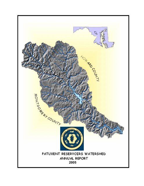
Annual Report - Washington Suburban Sanitary Commission
Annual Report - Washington Suburban Sanitary Commission
Annual Report - Washington Suburban Sanitary Commission

You also want an ePaper? Increase the reach of your titles
YUMPU automatically turns print PDFs into web optimized ePapers that Google loves.
2005
POLICY BOARDDonna Wilson, ChairWilliam BarnesAndrew BrunhartJames CaldwellTrudye Morgan JohnsonGeorge LechliderJames RobeyPrince George's CountyHoward Soil Conservation District<strong>Washington</strong> <strong>Suburban</strong> <strong>Sanitary</strong> <strong>Commission</strong>Montgomery CountyMaryland-National Capital Park and Planning <strong>Commission</strong>Montgomery Soil Conservation DistrictHoward CountyACKNOWLEDGMENTSOur sincere thanks are given to the members of the Technical Advisory Committee and the Workgroups for theirefforts over the last year.Technical Advisory CommitteeMeosotis Curtis, ChairSusan Overstreet, Vice ChairNazir BaigGul BehsudiMohammad HabibianBuddy LofflerLarry LubbersKristal LullPaul MeyerBert NixonDavid PlummerHoward SaltzmanJerry Maldonado (replaced Derek Winodgradoff in March 2005)Stan WongMontgomery County Department of Environmental ProtectionHoward County Department of Planning and ZoningMaryland-National Capital Park and Planning <strong>Commission</strong>Maryland Department of the Environment<strong>Washington</strong> <strong>Suburban</strong> <strong>Sanitary</strong> <strong>Commission</strong>Maryland Department of AgricultureMaryland Department of Natural ResourcesHoward Soil Conservation DistrictPrince George’s County Health DepartmentHoward County Health DepartmentMontgomery Soil Conservation DistrictHoward County Department of Public WorksPrince George’s County Department of Environmental ResourcesMontgomery County Department of Permitting ServicesOutreach WorkgroupSandra AugustDiane DavisKristal LullAngela MoralesFrank Wise<strong>Washington</strong> <strong>Suburban</strong> <strong>Sanitary</strong> <strong>Commission</strong>Montgomery County Department of Environmental ProtectionHoward Soil Conservation DistrictHoward County Department of Public WorksPrince George’s County Health DepartmentRiparian Buffers Priority Funding WorkgroupMeosotis CurtisLaura MillerAngela MoralesSusan OverstreetHoward SaltzmanMark SymborskiMontgomery County Department of Environmental ProtectionMontgomery County Department of Environmental ProtectionHoward County Department of Public WorksHoward County Department of Planning and ZoningHoward County Department of Public WorksMaryland-National Capital Park and Planning <strong>Commission</strong>i
TABLE OF CONTENTSA MESSAGE FROM THE CHAIR ..............................................................................................iiiBackground..................................................................................................................................... 1Status on Priority Resources Protection.......................................................................................... 1Priority Resource: Reservoir / Water Supply............................................................................ 1Priority Resource: Terrestrial Habitat....................................................................................... 1Priority Resource: Stream Systems........................................................................................... 2Priority Resource: Aquatic Biota.............................................................................................. 3Priority Resource: Rural Character and Landscape.................................................................. 3Priority Resource: Public Awareness and Stewardship............................................................ 3Progress on Implementation Items.................................................................................................. 41) Reservoir and Tributary Water Chemistry Monitoring ........................................................ 42) Tributary Biological and Habitat Monitoring....................................................................... 43) Stream Corridor Management .............................................................................................. 54) Reservoirs and Watershed Models ....................................................................................... 55) Agricultural Management Local-Cost Share Initiative ........................................................ 66) Sediment Study..................................................................................................................... 7Rocky Gorge Reservoir Surveys.......................................................................................... 7Triadelphia Reservoir Delta Surveys.................................................................................. 7Upcoming Work .................................................................................................................. 77) Forestry Management and Recreational Use Survey ........................................................... 88) Public Outreach and Involvement Initiatives ....................................................................... 8Funding for FY06 and FY07........................................................................................................... 9Conclusion .................................................................................................................................... 10TABLE 1. PRIORITY RESOURCES CHARTS ................................................................... 11-16TABLE 2. PATUXENT RESERVOIRS WATERSHED WORK PROGRAMFOR FY06 and FY07...................................................................................................17-18TABLE 3. PATUXENT RESERVOIRS WATERSHEDAGRICULTURAL PROGRESS 2005 ............................................................................. 19ii
A MESSAGE FROM THE CHAIRThe Patuxent Reservoirs Watershed Technical Advisory Committee (TAC) herein submits thePatuxent Reservoirs Watershed <strong>Annual</strong> <strong>Report</strong> 2005. The report presents TAC progress duringthe past year towards achieving long-term protection of priority resources. The priority resourcesinclude: reservoirs and drinking water supply; terrestrial habitat; stream systems; aquatic biota;rural character and landscape; and public awareness and stewardship.Much of the TAC's work program during 2005 focused on refining and ranking theimplementation items previously identified as being necessary to meet watershed protectiongoals. At the annual Policy Board meeting in 2004, the Policy Board initiated and the TACsupported a request to the <strong>Washington</strong> <strong>Suburban</strong> <strong>Sanitary</strong> <strong>Commission</strong> (WSSC) for dedicatedresources to achieve the implementation timeline for priority resources protection. The TACproposed that two full-time positions and $500,000 in project seed money be included in theFY2006 budget for WSSC. One position would provide needed coordination to expandwatershed stewardship, while the second position would provide technical assistance and pursuegrant funding opportunities to support the TAC's work program.Subsequent guidance on the WSSC budget process indicated that this request needed morespecificity in how the $500,000 would be spent before it would be considered in a request forfiscal year funding. The TAC consensus was that establishing and maintaining forested riparianbuffers should be the highest priority for implementation. These buffers provide multiplebenefits for reservoirs and stream water quality, terrestrial habitat, instream habitat, andmaintaining the rural landscape.The TAC work program during 2005 continued its emphasis on increasing environmentalstewardship. The TAC's Outreach Workgroup and its watershed partners organized andconducted 10 activities during April for Earth Month, which attracted over 400 participants.Throughout the year, the Outreach Workgroup maintained its focus on school-based activities,including the Patuxent Reservoirs Watershed Schools Mentoring Partnership. The OutreachWorkgroup identified the need for a full-time coordinator as its highest priority in order toachieve the watershed protection goals for public outreach and stewardship.During the last year, TAC member agencies made significant progress on the established workprogram items for: water chemistry monitoring and stream resources assessments; reservoirsedimentation study and water quality modeling; agricultural best management practices; theassessment and management recommendations of the forest resources in the watershed; andpublic outreach and involvement. However, without additional resources it will not be possibleto complete implementation items in the timeline proposed for reservoir and watershed resourceprotection. The TAC will continue to pursue the dedicated staffing and priority project fundingrequired for successful long-term protection of the six priority resources.iii
.iv
BackgroundSince 1997, the TAC has completed an <strong>Annual</strong> <strong>Report</strong> to summarize accomplishments andidentify funding needs to address watershed priority resources issues. The priority resources are:reservoirs and drinking water supply; terrestrial habitat; stream systems; aquatic biota; ruralcharacter and landscape; and public awareness and stewardship. Table 1, Priority Resources,provides information about each priority resource, including the associated issue, measures,goals, implementation items and implementation dates. In 2005, a key task for the TAC was tofurther prioritize the implementation items and develop associated costs for these priority itemsto support the request to WSSC for dedicated staff and funding.This <strong>Annual</strong> <strong>Report</strong> will be accompanied by a separate Technical Supplement to providedetailed background information and additional documentation. The Technical Supplement willbe issued at the end of the year.Status on Priority Resources ProtectionPriority Resource: Reservoir / Water SupplyThe WSSC and the Maryland Department of the Environment (MDE) led discussions on thispriority resource. There were no changes to the five performance measures (chlorophyll-a,dissolved oxygen, reservoir monitoring, total organic carbon, sediment) or theimplementation items (reservoir monitoring, model reliability, nutrient reduction, trendanalysis, bathymetric survey). The lead agencies determined that there was no need foradditional funding for monitoring until the reservoir water quality model was completed andresults available. Additional funding is required to continue the bathymetric survey andsediment oxygen demand determination.Priority Resource: Terrestrial HabitatThis priority resource focuses on forest resources. The resource management agencies fromHoward County and Montgomery County, and the Montgomery County Department ofPlanning in the Maryland-National Park and Planning <strong>Commission</strong> (MNCPPC-Planning) leddiscussions on protection of forest resources. Both Howard and Montgomery County haveongoing programs that cover half of the implementation items listed in Table 1 to protectforest resources. Additional funding and staffing are needed to address the remainingimplementation items. The initial focus for implementation continues to be on creating andmaintaining forested riparian buffers, as defined under the Stream Systems priority resource.Recent discussions among the Montgomery County Interagency Forest Conservation Team(IFCT) members has led to a reconsideration of forested buffer needs on public land in theMontgomery County portion of the Patuxent Reservoirs Watershed. Montgomery Countycurrently provides for a minimum forested buffer of 100 feet countywide to protect stream1
Patuxent Reservoirs Watershed <strong>Annual</strong> <strong>Report</strong>November 2005and water quality. There are also arguments in favor of 100-foot minimum buffers in termsof forest viability and habitat quality. As a result, the Montgomery County TAC membersrequested that the recommended minimum forested buffers on public land in MontgomeryCounty be increased from the current 35' minimum width.By the end of 2005, the Maryland Department of Natural Resources (DNR) will conclude theForestry Study of the WSSC property, which will be used to determine potential next stepsfor enhancement of forest resources in the entire reservoirs watershed.Priority Resource: Stream SystemsThere are two performance measures for Stream Systems: buffers and stream stability. Thebuffer measure includes two implementation items: 1) establish 35-foot minimum riparianbuffers throughout the watershed on all publicly-owned land by 2013, and 2) establish 35-foot minimum riparian buffers on all developed private land by 2023. These implementationitems have also been adopted as a priority for protection of the Terrestrial Habitat priorityresource.BuffersDuring 2005, Howard and Montgomery County continued their efforts to refine the mapsthat show existing and non-existing buffer areas, based on public and private landownership.In Montgomery County, the IFCT determined that it needed additional mappinganalytical support and asked its members about providing this service. The IFCTattempted to identify the total cost for not just planting, but also the multi-yearmaintenance costs, to assure that the trees and shrubs planted will survive to maturity andprovide maximum environmental benefits.The IFCT identified criteria for prioritizing lengths of streams needing buffers. Higherpriority would be given to stream reaches meeting the following criteria:• Longer lengths of 1 st and 2 nd order streams;• Lands that will most likely receive long-term maintenance;• Lands with other special environmental resources such as steep slopes andwetlands;• Properties with livestock;• Properties with higher percentage of non-forested lands;• Stream reaches that would connect larger blocks of existing forest lands;• Larger properties (including those owned by PEPCO); and• Publicly-owned lands such as the landfill.2
Patuxent Reservoirs Watershed <strong>Annual</strong> <strong>Report</strong>November 2005In Howard County, the Department of Public Works (DPW), Stormwater ManagementDivision took the lead to develop a budget to achieve the riparian buffer goal. The focuswill be on privately-owned land, since there is very little publicly-owned land not alreadyforested or targeted for reforestation. The DPW is considering a model used in the LittlePatuxent watershed, by which the County reviewed aerial photos and tax maps, identifiedparcels that needed buffers, and then contacted property owners to offer trees for the areaof their property adjacent to streams.Priority Resource: Aquatic BiotaThe TAC had previously agreed that stream reaches with "severe" or "very severe" erosion,that were located within subwatersheds with "fair" aquatic biota conditions, would betargeted for restoration. Due to funding and logistic constraints, no new stream restorationprojects were initiated during 2005. Work continues on the Lower Hawlings and CherryCreek Restoration Projects in Montgomery and Howard County, respectively.Priority Resource: Rural Character and LandscapeThe planning and agricultural land preservation agencies in the watershed took the lead ondiscussions about this priority resource. They include: the Howard County Department ofPlanning and Zoning (HCDPZ), Howard Soil Conservation District (HSCD), MontgomeryCounty Department of Economic Development, Montgomery Soil Conservation District(MSCD), and MNCPPC-Planning. All but one of the implementation items for this priorityresource have ongoing implementation dates. The status of ongoing rural land preservationefforts in both Counties, including efforts to support the agricultural industry and toimplement best management practices (BMPs) for soil and water quality conservation wereidentified during 2004. Both Counties have significant ongoing levels of activities to protectthis priority resource. The workgroup did not identify any priority implementation itemsneeding additional funds at this time.Howard County is currently looking at ways to refine and enhance its rural zoning andagricultural land preservation program, including a proposal to increase the maximum lotsize to 2 acres for cluster lots within 2,500 feet of the reservoirs. The current 1-acremaximum lot size for cluster development does not meet MDE lot size requirements forresidential development on septic systems.Priority Resource: Public Awareness and StewardshipThe TAC’s Outreach Workgroup includes members from WSSC, Howard and MontgomeryCounty, Prince George’s County Health Department, and the HSCD. During 2005 theWorkgroup continued its focus on Earth Month activities and the Patuxent ReservoirsWatershed Schools Mentoring Partnership. The Workgroup has requested additional staffsupport from the other partner agencies to help assist with planning and implementation of3
Patuxent Reservoirs Watershed <strong>Annual</strong> <strong>Report</strong>November 2005the action items for this priority resource. The workgroup awaits the funding of a requestedfull-time Outreach Coordinator position to expand outreach efforts.Progress on Implementation ItemsTable 2, Patuxent Reservoirs Watershed Work Program for FY06 and FY07, lists ongoingimplementation items and identifies the priority resource or resources that will be protected orenhanced by completion of the associated task. Progress for each implementation item is givenbelow.1) Reservoir and Tributary Water Chemistry MonitoringThe WSSC is currently in the 14 th year of monitoring the reservoirs water quality. Three sitesat each reservoir are monitored monthly during March, April, October, and November, andtwice monthly during May thru September. The focus is on water chemistry, includingphosphorus, nitrogen, total organic carbon, pesticides, metals, turbidity, fecal coliform, andchlorophyll. In addition, in-situ transparency and profile measurements of pH, depth,conductivity, temperature, reduction-oxidation potential, and dissolved oxygen areperformed.To date, the reservoirs still show a trend towards low dissolved oxygen during the summermonths. Carlson’s trophic state index (TSI), used to define the degree of eutrophication of alake, places the reservoirs in the eutrophic state for lakes that are nutrient rich with limitedoxygen levels in the bottom waters. Chlorophyll-a in both reservoirs has a TSI of about 52.2) Tributary Biological and Habitat MonitoringThis task is needed to track progress in protecting Stream System and Aquatic Biota priorityresources. The results from the tributary biological and habitat monitoring are being used totrack stream system changes as watershed land cover changes and stream restoration,streamside BMPs, and buffer enhancements are implemented.During 2004, the Montgomery County Department of Environmental Protection (DEP)modified its schedule for Patuxent watershed monitoring to accelerate the monitoring of theRocky Gorge Dam subwatershed, to collect data for the environmental impact study for theIntercounty Connector. During 2005, the DEP monitored the Upper Patuxent and theHawlings River in the reservoirs watershed; results for the 2005 monitoring will be availablefor the next <strong>Annual</strong> <strong>Report</strong>.During 2004, 12 stations were monitored in the Rocky Gorge Dam subwatershed. Most ofthese stations scored "Good" for benthic macroinvertebrates and for benthic habitat, but"Poor" for fish. The reason for the "Poor" fish scores had to do with small stream size, smallcontributing drainage area, and possible fish blockages. Only one station, upstream of Tucker4
Patuxent Reservoirs Watershed <strong>Annual</strong> <strong>Report</strong>November 2005Lane, was identified as needing additional follow-up. This station had good habitat butimpaired fish and benthic communities. While there were heavy deposits of fine sediment atthis station, there were no apparent ongoing land disturbance activities in the contributingdrainage areas.In March 2005, Howard County started the second round of benthic biomonitoring inthe Rocky Gorge, and the Upper and Lower Brighton Dam watersheds. The benthic samplingwas completed July 2005 and the taxonomic identification is currently underway. A draftreport will be available in the fall of 2005.3) Stream Corridor ManagementThis task includes follow-up for stream restoration projects to address priority areas ofinstability. Implementation is needed to protect the Stream System and Aquatic Biotapriority resources and to support long-term protection of the Reservoir/Water Supply priorityresource.In fall 2005, Montgomery County will complete construction of its first restoration project inthe Patuxent River Watershed: Project 7a, in the Lower Hawlings River. The project costhas increased to $460,405 from the original estimate of $231,000, which included $125,000in grant funding from DNR. The project covers the 2,700-foot reach of the Hawlings Riverabove Brighton Dam and is addressing streambank stability, floodplain access, and in-streamhabitat. Winter and early spring work proceeded slowly as contractors adapted to a wetseason and subsequently higher than anticipated flows. After suspending work for theinstream closure period, contractors resumed work in the lower reaches, completing many ofthe extensive floodplain benches and terraces. Work already completed in the upper end haswithstood the test of several large spring runoff events as well as some substantial summerthunderstorms.Howard County continues to improve the Cherry Creek Watershed. Using a $25,000 grantfrom the DNR and $37,600 from the Chesapeake Bay Trust, the County is moving forward torestore 300 linear feet of headwater stream. In July 2005, the County started construction ofthe three new stormwater management ponds, followed by the stream restoration.4) Reservoirs and Watershed ModelsThis task is needed to support protection of the Reservoir/Water Supply priority resource. Apreliminary version of the watershed model had been completed but, without significantrefinement, was determined not to be suitable for Total Maximum Daily Load (TMDL)development. The MDE has entered into an agreement with the Interstate <strong>Commission</strong> onthe Potomac River Basin (ICPRB) to refine and enhance the existing watershed and reservoirmodels. The models will facilitate the improved tracking of phosphorus in the system, allowbetter estimates of loading by land use type, enable the inclusion of the effects of latewinter/early spring algae blooms, and provide more sensitive responses to watershed loadchanges. The modeling work will be used as the basis for TMDL development to address5
Patuxent Reservoirs Watershed <strong>Annual</strong> <strong>Report</strong>November 2005nutrient impairment in the Rocky Gorge Reservoir, and nutrient and sediment impairments inthe Triadelphia Reservoir. The TMDLs will be submitted to the Environmental ProtectionAgency (EPA) for review and approval in 2006.5) Agricultural Management Local Cost-Share InitiativeTable 3, 2005 Agricultural Progress,provides a summary of agricultural best managementpractices implemented in the Patuxent Reservoirs Watershed during 2005.Between October 2004 and July 2005, the HSCD initiated four cost-share agreements andsuccessfully completed one contract. The completed contract was for a diversion in theamount of $1,353. The practices for the four new contracts include spring development, atrough, stream crossings, and a grassed waterway. Technical assistance to landowners toprevent soil erosion and protect water quality is an ongoing effort.The HSCD continues to provide educational programs for horse owners. A Horse Seminarwas held in March 2005 with approximately 22 individuals attending. This program focusedon heavy use areas, hay quality evaluation, fertilizing, and soil sampling. A Horse PastureWalk took place in May 2005 with 25 attendees. This event focused on convertingabandoned cropland to horse pasture and rotational grazing.The MSCD has continued efforts to engage the equine community in conservation practices.In November 2004, MSCD hired an Equine Resource Conservationist (ERC) to provideinformation and technical assistance to horse farm owners in Montgomery County. InJanuary 2005, the new ERC sent letters to over 270 horse owners in the Patuxent watershedto encourage these landowners to take advantage of soil conservation and nutrientmanagement planning assistance offered by MSCD and Cooperative Extension. Anotherfocus of this effort was to generate interest in the Patuxent Reservoirs Watershed ProtectionCost-Share Program. The Patuxent Cost-Share Program may have more applicability tohorse farms or other smaller operations, since it provides more limited funding than othergrant programs, but has fewer administrative requirements.Education and outreach programs were an important focus for MSCD this year. In additionto Close Encounters with Agriculture (2,700 4 th graders) and Envirothon (120 high schoolstudents), MSCD also provided important adult education programs this year. In October2004, MSCD coordinated a Farm Tour in the Patuxent Watershed that focused on a variety ofconservation practices, land management issues, and research opportunities. About 40participants attended the tour, including several State Delegates and County Council staff. InFebruary 2005, MSCD co-sponsored a Deer Management Workshop that was attended byover 70 people, mainly farmers.6
Patuxent Reservoirs Watershed <strong>Annual</strong> <strong>Report</strong>November 20056) Sediment StudyThe study is funded by the WSSC and is being conducted by DNR Watershed Services inconjunction with the Maryland Geological Survey (MGS) to perform bathymetric surveysand related analysis in the reservoirs during the period July 1, 2004 to June 30, 2007. Afurther study funded by WSSC in conjunction with the MGS is to conduct in-situ sedimentoxygen demand measurements in the Triadelphia Reservoir to support MDE’s effort indeveloping the reservoir model and TMDL development.Rocky Gorge Reservoir SurveysThe collection of bathymetric data in Rocky Gorge Reservoir was initiated by MGS duringthe spring of 2005. The methodology used was the same as used in Triadelphia Reservoir in2004, including use of both 200KHz and 28KHz sounding signals. Water level data for thatperiod was also collected to correct for pool levels. Preliminary analysis of the collected dataindicates that follow-up data collection in the reservoir will be necessary. A return datacollection run will be completed in the fall of 2005.Once completed, the bathymetric survey of the Rocky Gorge Reservoir will be evaluated inconjunction with topographic survey data previously obtained from Scott’s Cove. Thetopographic survey of the Scott’s Cove delta area was performed to investigate a location notcovered by the primary open-water bathymetric survey. The data collection is intended toevaluate sedimentation from small tributaries draining to the reservoir. The surveys wereconducted using an automatic level to measure six cross sections that extended across theupper limits of the cove. Sediment cores were extracted from the cove for grain size and bulkdensity analyses. Locations of proposed sediment cores were noted in the cross section data.Data is being organized into an Excel spreadsheet.Triadelphia Reservoir Delta SurveysCore samples extracted from the Cattail Creek delta area in 2004 were sent to Dr. JerryRitchie of the USDA in Beltsville for Cesium-137 analysis. Dr. Ritchie completed theanalysis and has returned the preliminary results. Several of the cores show trends inCesium-137 concentrations that may indicate the presence of 1954 (pre-atomic testing)horizon. This will allow for an estimate of sediment aggradation from 1954 to the present tobe developed. A meeting will be scheduled with Dr. Ritchie in the fall of 2005 to interpretthe results in conjunction with the topographic surveys.Upcoming WorkMGS is preparing to return to the Rocky Gorge Reservoir for a follow-up bathymetric andshoreline survey in the fall of 2005. A finalized bathymetric surface of both reservoirs will beprepared once the Rocky Gorge data collection has been fully completed. Digital mapproducts and analyses of reservoir storage capacities will be completed thereafter. Work onthe reservoir delta areas will be continued in 2006. Additional topographic surveys and7
Patuxent Reservoirs Watershed <strong>Annual</strong> <strong>Report</strong>November 2005coring is proposed in Triadelphia Reservoir at the parking area and boat ramp located onTriadelphia Mill Road.7) Forestry Management and Recreational Use SurveyIn May 2003, DNR entered into an agreement with WSSC to conduct an in-depth study ofthe forest resources and associated recreational uses on WSSC land in the watershed.Fieldwork for the forest assessment was completed in June 2005. The recreational usersurvey is being prepared for distribution by WSSC. Once the survey data is collected, it willbe analyzed and the results will be provided to WSSC and other stakeholders. User groupshave been targeted for response to the survey. One group will receive information onavailable recreation opportunities and costs, while the other group will not. WSSC isconsidering incentives for ratepayers to respond to the survey. On-site surveys will beconducted at recreational areas in English and Spanish. There may also be an online reply tothe survey for certain groups. The first draft of the report is due out for review in October2005.8) Public Outreach and Involvement InitiativesThe TAC has identified the need for sustained environmental stewardship as critical to longtermprotection of all Priority Resources and significant efforts continue despite limitedfunding. The focus continues on Earth Month activities and the Schools MentoringPartnership.• Earth Month (April, 2005) was successful, with over 400 people participating in the 10events that were held. A new event for this year, "Earth Day Celebration," was not wellattended but efforts will be made to expand this program with increased publicity andactivities to include involvement by school children and teachers, art or poetry contests,and other family friendly activities.• The Patuxent Reservoirs Watershed Schools Mentoring Partnership continues to moveforward. Two more of our schools, Scotchtown Hills Elementary School in PrinceGeorge’s County and Hammond Elementary School in Howard County, earned MarylandGreen School certification and were honored at a ceremony in June 2005. They join HighPoint High School from Princes George’s County, which received this certification lastJune. This makes three schools in our watershed to be so honored. Additional efforts willbe made to reach other schools in the watershed by offering watershed tours foradministrators and teachers.• The "Family Campfire" held at the Brighton Dam Recreation Center in October 2005 wasagain a tremendous success reaching over 500 people. The major purpose of this annualevent is to recognize the accomplishments of teachers, students, and schools thatparticipated in the Mentoring Partnership during the year. It is also a significant8
Patuxent Reservoirs Watershed <strong>Annual</strong> <strong>Report</strong>November 2005opportunity to provide additional information on source water protection and ways to getinvolved with environmental stewardship.• The Mentoring Partnership "Gazette" will continue to be produced and sent electronicallyto the teachers, parents and administrators in our partnership. We will also strive todistribute this newsletter to local and municipal governments, in order to increaseawareness of our program among local government officials.Funding for FY2006 and 2007The tasks that are underway and expected funding expenditures during FY2006 and requestedfunds for FY2007 are shown in Table 2. During 2004, the TAC identified the need for dedicatedstaff and funding resources to accomplish the watershed protection goals. At the Policy Boardmeeting in 2004, the consensus among all but the WSSC representative was that the funding tocover these two full-time staff and project funding be included in the WSSC budget request tothe Montgomery and Prince George's County Councils.The proposed request included two full-time staff for public outreach and implementationsupport. These positions would coordinate projects and activities, increase public stewardshipefforts in the watershed, provide technical analysis and tracking, and seek out and apply for grantfunding to support implementation in coming years. During 2005, the TAC refined the estimatefor dedicated project funding to $485,000 during FY2007 to accelerate the rate of bufferestablishment and maintenance. This represents estimates of $185,000 in Howard County for aprivate land initiative and $300,000 in Montgomery County for a public land initiative.Howard County estimates that 450 acres of privately-owned land, involving approximately 1,800property owners, needs stream buffer plantings. In order to meet this goal by 2023,approximately 100 property owners per year need to be contacted and 26.5 acres of buffersplanted. The plantings are estimated to cost $6,500 per acre, for an annual cost of $172,500. Theproperty owners will be provided with the trees, and will be responsible for the actual plantingand follow up maintenance. Contacting the cooperating property owners and coordinating thedelivery of trees to the owners will require part-time staffing at an annual cost of approximately$12,500. The total FY07 cost for the program is estimated to be $185,000. This estimate mayvary depending on the degree to which property owners agree to participate in the reservoirswatershed buffer planting program. Where possible, other grant opportunities will be exploredto reduce the local cost-share for the program.The Montgomery County Department of Park and Planning will focus on reforesting streambuffers located on public land and within existing conservation easements on private land.Reforestation techniques will draw from County guidelines as well as the reforestationexperience of Park staff. Emphasis will be placed on protection from deer damage andmaintenance to control invasive species. The plan for the first year is to reforest the largestcontiguous Park property with unforested buffers. This site is located within the Reddy Branchsubwatershed of the Hawlings River. This subwatershed has only fair water quality and wouldbenefit by restoring the stream buffers where encroachment from neighboring properties has9
Patuxent Reservoirs Watershed <strong>Annual</strong> <strong>Report</strong>November 2005taken place. This location accounts for approximately one-fifth of the unforested buffers onpublic land. The total cost, not including staff time, will be approximately $300,000.ConclusionOver the past year, the TAC continued to evaluate potential implementation items and setpriorities for effective long-term watershed management. In order to assure our success, theconsensus within the TAC is to focus on public outreach, a need for two full-time staff, andriparian buffer establishment and maintenance.The TAC recognizes that an educated and involved public is needed to assure drinking waterquality, terrestrial and stream resource protection, and maintenance of the rural character of thewatershed landscape. Successful completion of our goals will require a full-time position tocoordinate more effective outreach to residents and resource users in the watershed. In addition,the TAC will need a full-time liaison capable of coordinating across agencies and diverseprojects, tracking the success and rate of implementation across the watershed, and seeking outand applying for grant funding to support implementation. The TAC also recognizes theimportance of fully-functioning riparian forested buffers to achieve multiple goals for protectingpriority resources.Without proper staffing and funding resources, the TAC will not be able to accelerate or trackthe success of ongoing efforts, nor achieve implementation within the timelines established asnecessary to protect the priority resources of the watershed.10
Patuxent Reservoirs Watershed <strong>Annual</strong> <strong>Report</strong>November 2005TABLE 1. PRIORITY RESOURCES CHARTResource: Reservoir/Water SupplyIssue: The public need for a sufficient quantity of safe and high quality drinking water calls for adopting a proactive and multi-barrierapproach, which starts with utilizing raw water of the highest quality and sustainable quantity, now and in the future. To achieve thisfor the Patuxent water filtration plant we need to control reservoir eutrophication, reduce Disinfectant By-Products (DBPs) precursors,and limit reservoirs capacity loss.Measures Goals Implementation Items Time Line ResponsibleChlorophyll-aDissolved oxygenSuite of water qualityparameters in reservoirmonitoring protocolTotal organic carbon (TOC)Sediment• Chl-a not to exceed a 10 ug/l meanduring the growing season and not toexceed a 30 ug/l instantaneousconcentration• DO not to fall below 5 mg/l at anytime in the epilimnion, not to fallbelow 5 mg/l in the entire watercolumn during completely mixedperiods, and not to fall below 10%saturation at any time in thehypolimnion• Five year data trend analysis forother monitored water qualityparameters shows no netdeterioration• TOC – 20% annual reduction goal,with 40% reduction for peak quarterat the location where water iswithdrawn for treatment purposes• Sediment accumulation rate not toexceed previous years• Perform reservoir monitoring forChl-a, DO, and TOC during thegrowing season• Enhance and fine tune modelreliability for watershedmanagement.• Develop and begin implementationof a plan to reduce nutrients, basedon model/TMDL requirements.• Update trend analysis for reservoirwater quality parameters on a 5-year cycle• Perform bathymetric survey ofreservoirs at 10 year intervals orlessOngoingOngoing2006 - 200820092006PartnerWSSCWSSC/MDETACWSSCWSSC11
Patuxent Reservoirs Watershed <strong>Annual</strong> <strong>Report</strong>November 2005TABLE 1. PRIORITY RESOURCES CHARTResource: Terrestrial HabitatIssue: Preservation of forests provides water quality benefits by reducing sediment and nutrient loading of streams from surroundingland uses.Measures Goals Implementation Items Time Line ResponsiblePartnerForest Cover• Maintain and increase forestcover• Encourage private property owners toparticipate in tree planting programs.OngoingTACForestConnectivityForest SizeForest DiversityForestSustainability• Increase forest interior habitat• Improve forest connectivity(larger forest tracts areconnected by forest corridors• Ensure diverse forestcommunities (communitiescontain a variety of speciesand ages)• Ensure forests are selfsustainingand capable oflong-term natural regeneration• Ensure publicly owned parkland and openspace is forested to the maximum extentpossible.• Target reforestation and forest conservationprograms to increase forest connectivity andforest interior habitat.• Develop a forest management plan to ensureforest diversity and long-term naturalregeneration, identifying and addressingpotential problems such as excessive deerpopulations, invasive species and humanimpacts.2006 - 2023Ongoing2006 - 2013TACTACTAC• Implement deer management programs.OngoingTAC• Implement strategies for control of invasiveplants.2006 - 2008TAC12
Patuxent Reservoirs Watershed <strong>Annual</strong> <strong>Report</strong>November 2005TABLE 1. PRIORITY RESOURCES CHARTResource: Stream SystemIssue: Preventing stream habitat degradation - The stream system includes all intermittent and perennial streams and their adjacentfloodplains. A stable stream system provides significant nutrient and sediment removal during both baseflow and stormflow events.The stream and its associated riparian buffer are also important as sources of high quality food and habitat for both aquatic andterrestrial organisms.Measures Goals Implementation Items Time Line ResponsiblePartnerBuffer corridor width andcontinuityStream bank and stream channelstability• A minimum 35-foot riparian bufferon all streams on properties thatwere developed prior to currentstream buffer requirements.• No areas of "severe" or "verysevere" stream bank erosion basedon the Stream Corridor Assessmentsand other locally collected data.• Establish and maintainminimum 35' riparian bufferson all publicly-owned land• Accelerate programs toestablish and maintainstreamside buffers to aminimum of 35' on privatelyownedlands to the maximumextent possible• Establish and maintainstreamside fencing programs tokeep all livestock out ofstreams to the maximum extentpossible2006 -2013 WSSC,MNCP&PC,HC,MC2006 - 2023 WSSC,MNCP&PC, HC,HSCD, MC,MSCD2006 - 2013 HSCD, MSCD• Address significant areas ofstream bank and channelinstability through streamrestoration projects andstormwater retrofits to themaximum extent possible2006 - 2013 HC,HSCDMNCP&PC, MC13
Patuxent Reservoirs Watershed <strong>Annual</strong> <strong>Report</strong>November 2005TABLE 1. PRIORITY RESOURCES CHARTResource: Aquatic BiotaIssue: Biological Integrity– This is the condition of the benthic macroinvertebrate communities based on a comparison to a referencestreams in Montgomery County, i.e. relatively undisturbed and therefore the best quality to be expected in the region that includes thePatuxent Reservoirs Watershed.Measures Goals Implementation Items Time Line ResponsiblePartnerIBI - Index of BiologicalIntegrity• No subwatershed with abenthic IBI indicating"fair" or "poor" condition.• Aggressively pursue cost-share funds to constructagricultural BMPs, stream restoration, andstormwater retrofit projects to address factorscontributing to degraded biological integrity2006 - 2023 HC,HSCDMC,MSCDMNCP&PC• Mitigate runoff impacts from land use changes 2006 - 2023 HC,MCMNCPPC• Preserve conditions insubwatersheds with"excellent" and "good"benthic IBIs• Protect existing habitat and water quality of streamsin high-quality subwatersheds to the maximum extentpossible by pursuing programs to maintain orincrease existing land cover2006 - 2023 HC,HSCDMC,MSCDMNCP&PCIBI - Index of Biological Integrity, also referred to as Index of Biotic Integrity in MBSS publications14
Patuxent Reservoirs Watershed <strong>Annual</strong> <strong>Report</strong>November 2005TABLE 1. PRIORITY RESOURCES CHARTResources: Rural Character and LandscapeIssue: Preserve open spaces and maintaining an economically viable and environmentally protective agricultural community.Measures Goals Implementation Items Time Line ResponsibleAgricultural Preservation Enrollment• Total Acres Enrolled• Number of Farms EnrolledAgricultural Demographics• Acres of Ag Land• Market Value of Ag Production• Size of Farms• Types of FarmsOpen Space and Parkland Acquisitionand Easement Programs• Acres of open space landpreserved by non-agriculturaleasements or acquisitionParticipation in agriculturalconservationprograms and percent of conservationplansthat are implementedPreserve theagricultural and ruralnature, and open spaceof the watershedCreate a landscape thatis protective of waterqualityContinue zoning and land use policies in thewatershed to maintain rural characterContinue easement acquisition throughagricultural land preservation programsEncourage participation in other conservation andopen space preservation programsContinue agricultural economic developmentprogramsEncourage enrollment in federal and state nutrientmanagement and stream protection programsPromote greater utilization of funding providedby the Res. Protection Group to supplementfederal and state agricultural programsUtilize effective open space land managementpractices that are beneficial to water qualityCreate and routinely update an electronic mapbased system to track BMP implementationOngoingOngoingOngoingOngoingOngoingOngoingOngoing2006 - 2013PartnerHC/MNCP&PCHC/MCHC/MCMNCP&PCHC/MCHSCD/MSCDHSCD/MSCDHC/MNCP&PCWSSCHSCD/MSCD15
Patuxent Reservoirs Watershed <strong>Annual</strong> <strong>Report</strong>November 2005TABLE 1. PRIORITY RESOURCES CHARTResource: Public Awareness and StewardshipIssue: Awareness and support by residents and resource usersMeasure Goals Implementation Items Time Line Responsible PartnerResidents participatingin stewardshipactivities• Citizen action to improvewatershed resources – seeevidence of watershed friendlyactivities and practices• 10 to 15 stewardship offeringsper year• Identify citizen groups throughoutwatershed and be available forpresentations upon request• Organize stewardship events andparticipate in other community events• Recognize good stewards through annualawards2006-2008Ongoing2006 - 2008WSSCHC,MC,PGMNCP&PCHSCD, MSCD• Form “Friends of the Watershed” group ofcitizen volunteers that will take on taskssuch as newsletter preparation and someEarth Month planning2006 - 2008Schools participatingin mentoring• School and communityinvolvement – 20 participatingGreen School partners by endof 2003 and 5 additionalschools participating each yearthereafter until all 43 areattained• Continue and expand Green SchoolsMentoring PartnershipOngoingWSSC, HC,MC,PGMNCP&PCHSCD, MSCDActive support byelected officials• Routine communication withelected officials• Routine communication with electedofficials2006 - 2008 MC,PG,HCMNCP&PCRoutine coverage bymedia• Expanded media coverage ofwatershed events – print, radioand TV• Increase communication with media• Support regional efforts to establish mediasavvycampaigns that emphasize waterquality protection2006 – 2008 WSSCHC,MC,PGMNCP&PCImplementation dates are contingent upon adequate staff support; with limited support, focus will be on Earth Month activities and Green Schools Partnership16
Patuxent Reservoirs Watershed <strong>Annual</strong> <strong>Report</strong>November 2005TABLE 2. PATUXENT RESERVOIRS WATERSHED WORK PROGRAM FOR FY06 and FY07.PRIORITY RESOURCESPROTECTEDReservoir/Water SupplyStream SystemAquatic BiotaReservoir/Water SupplyStream SystemAquatic BiotaReservoir/Water SupplyReservoir/Water SupplyStream SystemAquatic BiotaRural Character and LandscapePublic Awareness andStewardshipReservoir/Water SupplyIMPLEMENTATIONNEED1. Reservoir and tributarywater chemistry monitoring2. Tributary biological andhabitat monitoring3. Stream CorridorManagement4. Reservoir and WatershedModels5. Agricultural managementlocal cost-share initiative6. Sediment StudyIMPLEMENTATION ITEM AGENCY FY06Reservoir monitoring and lab analysis WSSC In-kind In-kind5 USGS watershed flow gauge stations WSSC $44,700 $50,000Conduct second round ofbiomonitoring program in the reservoirwatershedHCIn-kind forreport review andcompletionUpper Patuxent and Hawlings River MC In-kind services(monitoring)Hawlings River Restoration Monitoring MC $0 $5,000FY07(proposed)No additionalfundingIn-kind services(data analysis andreport writing)Cherry Creek Study andHC $230,000 $220,000ImplementationHawlings River Project Implementation MC $ 300,000 $0Hillsborough Low ImpactPG $15,000Development RetrofitComplete reservoir eutrophication MDEmodel and data trend analysis andsupport ongoing model enhancement WSSC $40,000 $20,000Funding for local cost-share program HC, MC, WSSCProgram oversight for voluntaryimplementation of agricultural BMPsPerform bathymetric survey andsediment accumulation study andconduct in-situ sediment oxygendemand determinationNo additionalfundingNo additionalfundingHSCD, MSCD In kind services In kind servicesWSSC $67,000 $60,00017
Patuxent Reservoirs Watershed <strong>Annual</strong> <strong>Report</strong>November 2005TABLE 2. PATUXENT RESERVOIRS WATERSHED WORK PROGRAM FOR FY06 and FY07.PRIORITY RESOURCESPROTECTEDReservoir/Water SupplyTerrestrial HabitatStream SystemAquatic BiotaRural Character and LandscapePublic Awareness andStewardshipReservoir/Water SupplyTerrestrial HabitatStream SystemAquatic BiotaRural Character and LandscapePublic Awareness andStewardshipReservoir/Water SupplyTerrestrial HabitatStream SystemAquatic BiotaRural Character and LandscapePublic Awareness andStewardshipIMPLEMENTATIONNEED7. Forestry Management andRecreational Use Study8. Public outreach andinvolvement initiatives9. Complete <strong>Annual</strong> <strong>Report</strong>IMPLEMENTATION ITEM AGENCY FY06Study on status and threats tosustainable forests on WSSC properties,including recreational usesEarth Month, <strong>Annual</strong> Policy BoardMeeting and other outreach activitiesGreen Schools Mentoring PartnershipCompilation and editingDNRWSSCAll TACagenciesWSSC and MCAll TACAgencies$9,800(Recreational UseSurvey FederalGrant)In-kind servicesIn-kind services$400 HC$500 WSSC$400 MC$1,000 WSSCIn-kind services(WSSC and MC)In-kind servicesPrinting and distribution WSSC $200 $200$0$0FY07(proposed)In-kind services$500 HC$500 WSSC$500 MC$1,000 WSSCIn-kind services(WSSC and MC)In-kind servicesTOTAL FUNDING* $694,000 $372,700* Totals do not include $69,000 US Forest Service grant to DNR for WSSC Forestry Study. MDE contribution for the reservoirs water quality model has notbeen finalized. For FY2007, there is a TAC request to include funding in the WSSC budget for two full-time staff support (one for public outreach and one foradministrative and technical support) and $485,000 to accelerate riparian buffer implementation18
Patuxent Reservoirs Watershed <strong>Annual</strong> <strong>Report</strong>November 2005TABLE 3. 2005 Agricultural ProgressPractice Howard SCD Montgomery SCDConservation Plans developed 4 (197.0 ac.) 10 (546 ac.)Conservation Plans Revised 2 (66.4 ac)Landowners Contacted or Requested21 300informationLandowners Applying BMP’S 2 21BMP’S Installed 5 65Cover Crop 5 (227 ac.)Conservation Tillage 4 (262.7 ac.) 26 (542 ac.)Grassed WaterwaysDiversion 1 (200 ft.)FencingFilter StripGrade Stabilization StructureHUA (Heavy Use Area)Nutrient Management 37 (902 ac.)Pest Management 11 (347 ac.)Roof RunoffStream CrossingTrough 1Waste Storage StructureNew Cost Share Agreements 4Cost Share Agreements Completed 1Pipeline 1 (1100 ft.)Ag Chemical Facility 1Subsurface Drainage 1 (1000 ft.)Educational/Outreach Events 2 6 (about 3,000 participants)19