The Rimba Raya Biodiversity Reserve REDD Project
The Rimba Raya Biodiversity Reserve REDD Project
The Rimba Raya Biodiversity Reserve REDD Project

You also want an ePaper? Increase the reach of your titles
YUMPU automatically turns print PDFs into web optimized ePapers that Google loves.
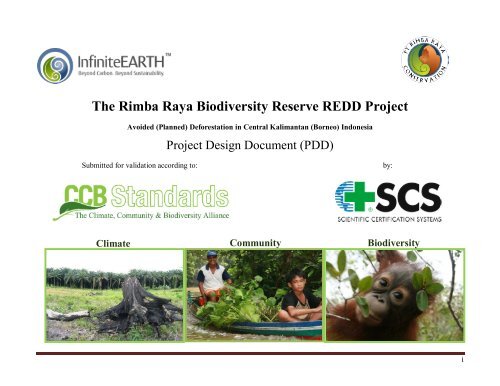
<strong>The</strong> <strong>Rimba</strong> <strong>Raya</strong> <strong>Biodiversity</strong> <strong>Reserve</strong> <strong>REDD</strong> <strong>Project</strong>Avoided (Planned) Deforestation in Central Kalimantan (Borneo) Indonesia<strong>Project</strong> Design Document (PDD)Submitted for validation according to:by:Climate Community <strong>Biodiversity</strong>i
Technical Advisors:In cooperation with:Health In HarmonyTechnical Coordination (Maps, Regulations, etc.):Authors:Eka Ginting, PT <strong>Rimba</strong> <strong>Raya</strong> Conservation Leslie Bolick, Infinite-EarthZakaria Ahmad, PT <strong>Rimba</strong> <strong>Raya</strong> Conservation Todd Lemons, Infinite-EarthAisyah E. Sileuw, Daemeter Consulting Jeff Reece, Infinite-EarthBetsy Yaap, Daemeter Consulting Scott Stanley, Forest CarbonRenie Djojoasmoro OFI Gary Paoli, Daemeter ConsultingRobert Yappi OFI Sean McDermott, Infinite-EarthFajar Dewanto OFIii
AcknowledgementsWith Special Recognition and Thanks to:Orangutan Foundation InternationalDr. Biruté Mary Galdikas Founderfor their unparalleled 40 year commitment to forest conservation in the Tanjung Puting National Park and the eastern buffer zone to thepark that now comprises the <strong>Rimba</strong> <strong>Raya</strong> <strong>Biodiversity</strong> <strong>Reserve</strong>.andClinton Climate Initiative-‐Forestry, S.E. AsiaDr. D. Andrew WardellMr. Taufiq AlimiRegional DirectorNational Coordinatorfor their generous support in the validation process of the Methodology and validation of the project by both the VCS and CCBStandards, under the Norad grant to CCI-‐Forestry (GLO-‐4244, INS09/010).andShell Canada LimitedWayne SowardsMawas <strong>Project</strong> Leadfor their generous support and tireless work in developing the peat methodology (“Baseline and monitoring methodology forconservation projects that avoid planned land use conversion in peat swamp forests, Version 5.2, March 2010”) and seeing it though thefirst validation.iii
<strong>Project</strong> Profile Highlights<strong>Project</strong> Owner<strong>Project</strong> DeveloperNGO Partner & <strong>Project</strong> BeneficiaryHost CountryRegionProvinceRegencyForest TypeTotal <strong>Project</strong> Zone (<strong>Project</strong> Management Area)Total Area at Risk of DeforestationPT <strong>Rimba</strong> <strong>Raya</strong> ConservationInfinite-‐Earth, Ltd.Orangutan Foundation InternationalIndonesiaKalimantan (Island of Borneo)Central KalimantanSeruyanHCV Tropical Peat Swamp Forest91,215 ha91,215 ha<strong>Project</strong> Area (Carbon Accounting Area)47,006 ha30-‐year Carbon Emissions Avoided in the Carbon Accouting AreaTotal Carbon Stocks in <strong>Project</strong> Management Area96,376,455 t CO 2 e>250 million t CO 2 e<strong>Project</strong> Start Date by <strong>Project</strong> Developer November 2008Primary Deforestation Driver<strong>REDD</strong> StandardsEndangered, Threatened & Vulnerable Mammals in <strong>Project</strong> ZonePlanned Deforestation (Government Policy & Palm Oil)CCB & VCS29 including the Endangered Bornean OrangutanEndangered, Threatened & Vulnerable Species (All) in <strong>Project</strong> Zone 94+Communities in <strong>Project</strong> Area and <strong>Project</strong> Zone0 in <strong>Project</strong> Area. 14 in <strong>Project</strong> Zoneiv
ContentsContents ................................................................................................................................................................................................. 5GLOSSARY OF ACRONYMS ............................................................................................................................................................. 8GLOSSARY OF PROJECT SPECIFIC TERMS ................................................................................................................................ 9EXECUTIVE SUMMARY .................................................................................................................................................................... 1G1. Original Conditions in the <strong>Project</strong> Area ............................................................................................................................................................................... 7G1.1. <strong>Project</strong> Location and Basic Physical Parameters ........................................................................................................................................................... 7G1.2. Types and Condition of <strong>Project</strong> Area Vegetation ........................................................................................................................................................ 13G1.4. Current Carbon Stocks within the <strong>Project</strong> Area .......................................................................................................................................................... 24G1.5. Description of <strong>Project</strong> Zone Communities .................................................................................................................................................................. 30G1.6. Current Land Use, Property Rights, and Conflicts ...................................................................................................................................................... 40G1.7. Description of <strong>Project</strong> Zone <strong>Biodiversity</strong>.................................................................................................................................................................... 43G1.8. <strong>Project</strong> Zone High Conservation Value Evaluation ..................................................................................................................................................... 54G1.8.1. Significant Concentrations of <strong>Biodiversity</strong> Values ................................................................................................................................................... 57G1.8.2. Significant Large Landscape-Level Areas ............................................................................................................................................................... 66G1.8.3. Threatened or Rare Ecosystems .............................................................................................................................................................................. 69G1.8.4. Areas Providing Critical Ecosystem Services .......................................................................................................................................................... 71G1.8.5. Areas Fundamental for meeting the basic needs of local communities ...................................................................................................................... 77G1.8.6. Areas Critical for Traditional Cultural Identity ........................................................................................................................................................ 78G2. Baseline <strong>Project</strong>ions ......................................................................................................................................................................................................... 79G2.1. Most Likely ‘Without <strong>Project</strong>’ Land-‐Use Scenario ........................................................................................................................................................ 79G2.2. Documentation of <strong>Project</strong> ‘Additionality’................................................................................................................................................................... 97G2.3. Estimated Carbon Stock Changes for ‘Without <strong>Project</strong>’ Reference Scenario .............................................................................................................. 107G2.4. ‘Without <strong>Project</strong>’ Scenario Effects on <strong>Project</strong> Zone Communities ............................................................................................................................. 121G2.5. ‘Without <strong>Project</strong>’ Scenario Effects on <strong>Project</strong> Zone <strong>Biodiversity</strong> ............................................................................................................................... 123G3. <strong>Project</strong> Design and Goals ................................................................................................................................................................................................. 126G3.1. Summary of <strong>Project</strong> Climate, Community, and <strong>Biodiversity</strong> Objectives ..................................................................................................................... 126G3.2. Description of Major <strong>Project</strong> Activities ..................................................................................................................................................................... 127G3.3. <strong>Project</strong> Boundaries and Location of Major <strong>Project</strong> Activities ..................................................................................................................................... 147G3.4. <strong>Project</strong> Lifetime, Accounting Period, and Implementation Schedule .......................................................................................................................... 148G3.5. Risks to Expected Climate, Community, and <strong>Biodiversity</strong> Benefits............................................................................................................................ 157G3.6. <strong>Project</strong> Design and High Conservation Values .......................................................................................................................................................... 163G3.7. <strong>Project</strong> Benefits Beyond <strong>Project</strong> Lifetime .................................................................................................................................................................. 163G3.8. Stakeholder Identification and the <strong>Rimba</strong> <strong>Raya</strong> Process Framework .......................................................................................................................... 166G3.9. CCBA Public Comment Period ................................................................................................................................................................................. 176G3.10. Grievances and Conflict Resolution ........................................................................................................................................................................ 176G3.11. <strong>Project</strong> Financing .................................................................................................................................................................................................... 178G4. Management Capacity and Best Practices ....................................................................................................................................................................... 179G4.1. <strong>Project</strong> Proponents and Governance Structure ........................................................................................................................................................... 179v
G4.2. Key Technical Skills for <strong>Project</strong> Implementation ....................................................................................................................................................... 187G4.3. Capacity Building and <strong>Project</strong> Training ..................................................................................................................................................................... 191G4.4. <strong>Project</strong> Recruitment Policy ....................................................................................................................................................................................... 195G4.5. Laws and Regulations Governing Workers’ Rights ................................................................................................................................................... 195G4.6. Occupational Risk and Worker Safety ....................................................................................................................................................................... 196G4.7. Financial Health of Implementing Organizations ....................................................................................................................................................... 196G5. Legal Status and Property Rights ..................................................................................................................................................................................... 197G5.1. Laws and Regulations Governing Property Rights ..................................................................................................................................................... 197G5.2. Documentation of <strong>Project</strong> Approval .......................................................................................................................................................................... 198G5.3. Documentation of <strong>Project</strong> Property Rights ................................................................................................................................................................ 205G5.4. <strong>Project</strong>-Driven Relocation......................................................................................................................................................................................... 205G5.5. Illegal Activities in the <strong>Project</strong> Zone ......................................................................................................................................................................... 205G5.6. Title to Carbon Rights .............................................................................................................................................................................................. 207CLIMATE SECTION ............................................................................................................................................................................... 208CL1. Net Positive Climate Impacts .......................................................................................................................................................................................... 208CL1.1. Estimate of Net Changes in Carbon Stocks Due to <strong>Project</strong> Activities ....................................................................................................................... 208CL1.2. Estimate of Net Changes in Emissions of non-CO 2 Gases ........................................................................................................................................ 209CL1.3. Estimate of Other Emissions Resulting from <strong>Project</strong> Activities ................................................................................................................................ 209CL1.4. Demonstration of Net Positive Climate Impacts ...................................................................................................................................................... 209CL1.5. Double Counting of Emissions Reductions ............................................................................................................................................................. 210CL2. Offsite Climate Impacts (‘Leakage’) ................................................................................................................................................................................ 211CL2.1. Leakage Assessment and Estimate of Offsite Emissions .......................................................................................................................................... 212CL2.2. Leakage Mitigation and Estimate of Impact ............................................................................................................................................................ 231CL2.3. Net Leakage Impacts and Leakage Buffer ............................................................................................................................................................... 233CL2.4. Leakage and non-CO 2 Gases .................................................................................................................................................................................... 234CL3. Climate Impact Monitoring ............................................................................................................................................................................................ 234CL3.1. Initial Climate Monitoring Plan .............................................................................................................................................................................. 234CL3.2. Development of Comprehensive Climate Monitoring Plan ...................................................................................................................................... 234Purpose of monitoring ....................................................................................................................................................................................................... 235Description of the monitoring plan ...................................................................................................................................................................................... 235COMMUNITY SECTION ........................................................................................................................................................................ 239CM1. Net Positive Community Impacts .................................................................................................................................................................................. 239CM1.1. Estimate of Impact of <strong>Project</strong> Activities on Communities ....................................................................................................................................... 239CM1.2. Impact of <strong>Project</strong> Activities on High Conservation Values ..................................................................................................................................... 243CM2. Offsite Stakeholder Impacts ......................................................................................................................................................................................... 245CM2.1. Potential Negative Offsite Stakeholder Impacts ...................................................................................................................................................... 245CM2.2. Mitigation Plans for Negative Offsite Stakeholder Impacts ..................................................................................................................................... 246CM2.3. Net Impacts on Other Stakeholder Groups ............................................................................................................................................................. 247CM3. Community Impact Monitoring .................................................................................................................................................................................... 247CM3.1. Preliminary Community Monitoring Plan .............................................................................................................................................................. 247CM3.2. Preliminary High Conservation Values Monitoring Plan ........................................................................................................................................ 251CM3.3. Development of Comprehensive Community Monitoring Plan ............................................................................................................................... 251vi
BIODIVERSITY SECTION ....................................................................................................................................................................... 253B1. Net Positive <strong>Biodiversity</strong> Impacts..................................................................................................................................................................................... 253B1.1. Estimate of Impact of <strong>Project</strong> Activities on <strong>Biodiversity</strong> ............................................................................................................................................ 253B1.2. Impact of <strong>Project</strong> Activities on High Conservation Values ......................................................................................................................................... 254B1.3. <strong>Project</strong> Activities and Invasive Species ..................................................................................................................................................................... 263B1.4. <strong>Project</strong> Activities and Non-Native Species ................................................................................................................................................................ 265B1.5. <strong>Project</strong> Activities and GMOs .................................................................................................................................................................................... 265B2. Offsite <strong>Biodiversity</strong> Impacts ............................................................................................................................................................................................. 265B2.1. Potential Negative Offsite <strong>Biodiversity</strong> Impacts ........................................................................................................................................................ 265B2.2. Mitigation of Negative Offsite <strong>Biodiversity</strong> Impacts .................................................................................................................................................. 266B2.3. Demonstration of Net Positive <strong>Biodiversity</strong> Impacts .................................................................................................................................................. 266B3. <strong>Biodiversity</strong> Impact Monitoring ....................................................................................................................................................................................... 267B3.1. Preliminary <strong>Biodiversity</strong> Monitoring Plan ................................................................................................................................................................. 267B3.2. Preliminary High Conservation Values Monitoring Plan ............................................................................................................................................ 269B3.3. Development of Comprehensive <strong>Biodiversity</strong> Monitoring Plan .................................................................................................................................. 269GOLD LEVEL SECTION .......................................................................................................................................................................... 273GL2. Exceptional Community Benefits ................................................................................................................................................................................... 273GL2.1. Human Development Ranking ................................................................................................................................................................................ 273GL2.2. <strong>Project</strong> benefits to the lowest 50% of households .................................................................................................................................................... 275GL2.3. Barriers to project benefits reaching the poorer households ..................................................................................................................................... 275GL2.4. Identification and mitigation of negative impacts from project to poorer households. ............................................................................................... 276GL2.5. Effectiveness of Community Impact Monitoring with focus on poorer households and women. ............................................................................... 277GL3. Exceptional <strong>Biodiversity</strong> Benefits ................................................................................................................................................................................... 278GL3.1. Vulnerability .......................................................................................................................................................................................................... 278GL3.1.1. Critically Endangered or Endangered Species ...................................................................................................................................................... 278GL3.1.2. Vulnerable Species .............................................................................................................................................................................................. 280GL3.2. Irreplaceability ....................................................................................................................................................................................................... 281GL3.2.1. Restricted-Range Species .................................................................................................................................................................................... 281GL3.2.2. Species with Large but Clumped Distributions ..................................................................................................................................................... 282GL3.2.3. Globally Significant Congregations ..................................................................................................................................................................... 282GL3.2.4. Globally Significant Source Populations .............................................................................................................................................................. 283BIBLIOGRAPHY .................................................................................................................................................................................... 284vii
GLOSSARY OF ACRONYMSAB 32 Assembly Bill 32: California’s Global WarmingSolutions ActAEP: American Electric PowerCARB: California Air Resources BoardCER: Certified Emission ReductionCCAR: California Climate Action RegistryCCBA: Climate, Community, and <strong>Biodiversity</strong> AllianceCCB: Climate, Community, and <strong>Biodiversity</strong> StandardsCCX: Chicago Climate ExchangeCCFE: Chicago Climate Futures ExchangeCFTC: Commodities Futures Trading CommissionCDM Clean Development MechanismCFC ChlorofluorocarbonsCFI Carbon Financial InstrumentCO 2 Carbon dioxideCO 2 e: X amount of (solid organic) carbon x 3.67 = CO 2equivalentDEFRA: Department for Environment, Food and RuralAffairs (UK)ECCM: Edinburgh Center for Carbon ManagementECIS: European Carbon Investor ServicesECX: European Climate ExchangeERT: Environmental Resources TrustEU ETS: European Union Emission Trading SchemeERU: Emission Reduction UnitGHG: Greenhouse GasGWP: Global warming potentialIIED: International Institute for Environment andDevelopment’sJI: Joint ImplementationKWh: kilowatt hourLULUCF: Land Use, Land Use Change and ForestryMtCO 2 e: Millions of tonnes of carbon dioxide equivalentNGAC: New South Wales Greenhouse AbatementCertificateNGO: Non- governmental OrganizationNOx: Nitrogen oxideN2O: Nitrous oxideNSW GGAS: New South Wales Greenhouse GasAbatement SchemeOTC: Over-the-counter marketPG&E: Pacific Gas & Electric (California & other westernstates)REC: Renewable energy creditRGGI: Regional Greenhouse Gas Initiative (11 EasternUnited States + California)SO2: Sulfur dioxidetCO 2 e: Ton of carbon dioxide equivalent (1 tonne of solidorganic carbon x 3.67 = 1 tonne of CO 2 equivalent)TREC: Tradable renewable energy creditVER: Verified Emission ReductionVCS: Voluntary Carbon StandardVCU: Voluntary Carbon UnitWBCSD: World Business Council for SustainableDevelopmentWRCAI: Western Regional Climate Action InitiativeWRI: World Resources InstituteWWF: World Wildlife Fundviii
GLOSSARY OF PROJECT SPECIFIC TERMSCarbon Accounting Area – From VCS terminology, this is referred to as the <strong>Project</strong> Area in CCB Standards. <strong>The</strong> Carbon Accounting Area isthe section of the <strong>Rimba</strong> <strong>Raya</strong> forest concession that is managed for carbon credits, comprising 47,006 ha of the 91,215 <strong>Rimba</strong> <strong>Raya</strong>concession.Leakage (InfiniteEARTH Definition) -‐ Any increase in greenhouse gas emissions that occurs outside a project’s boundary and withinCentral Kalimantan, is measurable and directly attributable to project activities, and involves the harvesting of Protected Forest andProtected Areas.Physical Buffer – A defined section of forest located on the perimeter of a national park whose presence acts as a barrier against theencroachment of oil palm plantation, logging or other illegal activities into the park. <strong>The</strong> InfiniteEARTH <strong>Rimba</strong> <strong>Raya</strong> <strong>Reserve</strong> will fund areserve-‐wide network of permanent guard posts, community-‐based patrols, and a fire brigade, further strengthening <strong>Rimba</strong> <strong>Raya</strong>’s role asa Physical Buffer.<strong>Project</strong> Area – <strong>The</strong> 47,006 ha within the <strong>Rimba</strong> <strong>Raya</strong> concession that is being audited for avoided Green house Gas (GHG) emissions. <strong>The</strong><strong>Project</strong> Area is comprised of land that would convert to oil palm estates but for the intervention of InfiniteEARTH.<strong>Project</strong> Zone – This includes the full 91,215 ha of the <strong>Rimba</strong> <strong>Raya</strong> concession. <strong>The</strong> <strong>Project</strong> Zone seeks to account for communities whoseeconomies are affected by activities within the <strong>Rimba</strong> <strong>Raya</strong> concession and extend climate and biodiversity management well beyond<strong>Project</strong> Area boundaries.Positive Leakage – An increase in the carbon stores of neighboring forests as a consequence of project activities.<strong>Project</strong> Management Area – From VCS terminology, this is referred to as the <strong>Project</strong> Zone in CCB Standards.Social Buffer – <strong>The</strong> consequences of engagement with local communities, government and NGOs as stakeholders in resource managementand conservation of forest around a national park. <strong>The</strong> provision of social services and creation of employment incentivizes stakeholdersto support forest preservation and oppose the harvesting of forest. This acts as an additional societal barrier to the incursion of illegalactivities into the nearby national park.ix
EXECUTIVE SUMMARYEvery minute of every day in Indonesia, an area of biodiverseforest the size of five football fields is slashed and burned forconversion to oil palm plantation. Annually, this primary driverof deforestation destroys more than 25,000 square kilometers offorestland – an area roughly the size of Belgium – in a wastefulcycle that is responsible for Indonesia’s ranking as the world’sthird largest emitter of greenhouse gases despite being a non-industrializednation whose economy accounts for less than 1%of global GDP (World Bank and IMF Global Rankings -‐ 2008). Thiswanton destruction of forests is fueling an environmentalcatastrophe that reaches far beyond the borders of Indonesia.<strong>The</strong> <strong>Rimba</strong> <strong>Raya</strong> project aims to stem the tide of destruction thatthreatens global climate stability.<strong>The</strong> <strong>Rimba</strong> <strong>Raya</strong> <strong>Biodiversity</strong> <strong>Reserve</strong> is a beautiful and storiedexpanse of tropical peat swamp forest on the southern coast ofBorneo in Central Kalimantan province, Indonesia, covering91,215 hectares of land along the eastern flank of world-renownedTanjung Puting National Park. Without the <strong>Rimba</strong> <strong>Raya</strong>project, this area would be lost to planned oil palm development.<strong>The</strong> habitat protected by the Park and the <strong>Reserve</strong> is home todozens of endangered species, including the Bornean orangutan.Along the eastern edge of the <strong>Reserve</strong>, 14 impoverishedcommunities face looming economic forces that threaten toappropriate land that has been their home for generations.<strong>The</strong> <strong>Rimba</strong> <strong>Raya</strong> project represents an innovation in the field ofconservation via Reductions in Emissions from Deforestation andDegradation (<strong>REDD</strong>). <strong>REDD</strong> is quickly emerging as the mostpromising new tool for addressing the rampant deforestationresponsible for some 20% of annual global greenhouse gasemissions. But mature standards, methods, and technologies arestill years away, and critical forests are disappearing at analarming rate. While the sector struggles with growing pains,hoping to incorporate into the international market system just asmall fraction of the value that forests have to offer if allowed toremain standing, other industries race to destroy the world’sremaining forests for short-‐term profit.<strong>The</strong> Guinness Book of World Records ranks Indonesiaas having the highest rate of deforestation in the world,with the amount of forest lost equivalent to 300 soccerfields each hour. This world record estimates Indonesia’sdeforestation rate at 1.8 million hectares (2 percent of itsforests) per year between 2000 and 2005.<strong>The</strong> World Bank has predicted that in Kalimantan therewill be no lowland rainforests left outside protected areasby 2010 if current destruction rates continue. According to Forest Watch Indonesia, CentralKalimantan's forests are being converted into oil palmplantations at the fastest rate in the country. <strong>The</strong> rate hasincreased more than 400 times to 461,992 hectares peryear in 2007 from 1,163 hectares per year in 1991. According to Wetlands International, the annualdeforestation rate of Central Kalimantan peatlands was5.4% between 2002 and 2005. Satellite studies show that about 56% (more than 29,000km 2 ) of protected lowland forests in Kalimantan were cutdown between 1985 and 2001.1
<strong>REDD</strong>, which is necessarily conservative in its accounting at thisearly developmental stage, cannot compete against the fulleconomic strength of oil palm and logging companies, itsprincipal rivals in the race to save Indonesia’s forests.<strong>The</strong> <strong>Rimba</strong> <strong>Raya</strong> project offers an interim solution by targeting forprotection a forest which functions as a buffer region to theembattled Tanjung Puting National Park, home of the world-famousCamp Leakey Orangutan Research Center. Until a maturesystem with rational incentives is in force, forests that offer bothextraordinary climate, community, and biodiversity benefits andpresent a compelling case for national government interventionshould be prioritized for <strong>REDD</strong> activity.<strong>The</strong> <strong>Rimba</strong> <strong>Raya</strong> <strong>Biodiversity</strong> <strong>Reserve</strong> <strong>Project</strong> adopts anintegrated approach to greenhouse gas emissions reductions thatemphasizes both rural development and orangutan habitatconservation. For too long, the world has accepted the view thatdevelopment and conservation are diametrically opposed. As aresult, little effort has been made to balance development needsof local communities with the imperatives of global conservation.InfiniteEARTH, the <strong>Project</strong> Proponent of <strong>Rimba</strong> <strong>Raya</strong>, believesthat the two must co-‐exist for either to succeed.Beyond Carbon. Beyond Sustainability."Neutral" and "Sustainable" are words we would never use todescribe our commitment to the future we envision for ourchildren, and yet they are frequently tendered as acceptablebenchmarks for success in the race to save the planet.InfiniteEARTH believes that we owe our children and the futuregenerations of this planet much more than a merely“sustainable” future.InfiniteEARTH was founded on one basic belief: "Carbon Neutraland Sustainable are simply not enough.” This belief is thecornerstone of the <strong>Rimba</strong> <strong>Raya</strong> <strong>Biodiversity</strong> <strong>Reserve</strong> and theguiding principle by which all project activities will beimplemented. From this guiding principle, we have created sixessential mandates, which separate the <strong>Rimba</strong> <strong>Raya</strong> <strong>Biodiversity</strong><strong>Reserve</strong> <strong>Project</strong> from all other <strong>REDD</strong> projects.1. Double Offset. <strong>The</strong> <strong>Project</strong> will be designed to conservetwice as much carbon as it sells through its registry of carbon credits,thereby ensuring that we make positive improvements that go BeyondCarbon Neutral and Beyond Sustainability.2. Protection in Perpetuity. <strong>Project</strong> Proponents will form anon-‐profit foundation and, with a percentage of annual profits, willfund an endowment sufficient to protect the project area inperpetuity, well beyond the official 30-‐year project life.3. Social Programs to meet UN Millenium Goals. <strong>Project</strong>Social Programs are designed to achieve the eight UN Milleniumdevelopment Goals within the project area by 2015.4. Conservation of Endangered Wildlife and Habitat. <strong>The</strong><strong>Project</strong> Area must provide habitat for at least one major endangeredspecies. <strong>The</strong> <strong>Rimba</strong> <strong>Raya</strong> <strong>Biodiversity</strong> <strong>Reserve</strong> houses more than sixmajor endangered species of mammals and literally hundreds ofthreatened and endangered species of flora and fauna.5. Positive Leakage via Protection of a National Park.Ideally, the <strong>Project</strong> Area should be adjacent to a National Park,thereby creating significant positive leakage by providing a physicaland social barrier to the park.6. Partnership with a local Conservation Group (NGO).<strong>Project</strong>s will be designed to support the work of an established andrespected conservation group (such as Orangutan FoundationInternational) for their ongoing conservation work.2
This project is intended to become the model in for-‐profitnational park conservation. By acquiring land-‐use rights forborder forests surrounding protected areas, project proponentscan create a self-‐sustaining park system whereby commercialcarbon sales fund the management of physical and social bufferzones (Figure 1). This model can deliver economic benefits thatreach far beyond mere subsistence-‐level income opportunitiesfor the constituent communities, while simultaneously casting aprotective net around Indonesia’s national parks, which housesome of the world’s highest stores of biodiversity.as are the local communities, the Regency, the Province,and the National Department of Forestry.Carbon sales fund a <strong>Reserve</strong>-‐wide network of permanentguard posts, community-‐based patrols, and a fire brigade,thereby creating a “physical buffer” to the Park.By engaging NGOs and local communities in theconservation process and by providing employmentopportunities, the InfiniteEARTH plan creates a “socialbuffer” to the park.In partnership with the Orangutan Foundation InternationalInfiniteEARTH’s primary objective is to form an alliance betweenconservation, community, and commerce to preserve HighConservation Value Forests that are also habitats for endangeredspecies. In keeping with that objective, InfiniteEARTH haspartnered with <strong>The</strong> Orangutan Foundation International and itsfounder, Dr. Biruté Mary Galdikas, for its <strong>Rimba</strong> <strong>Raya</strong> project inCentral Kalimantan (Indonesian Borneo). InfiniteEARTH willleverage OFI’s and Dr. Galdikas’ thirty-‐seven year history of grass-rootsforest and orangutan conservation in Central Kalimantan.Figure 1. <strong>The</strong> <strong>Rimba</strong> <strong>Raya</strong> physical and social buffer model.Through a revenue-‐share program, the ManagementAuthority of the National Park is commercially subsidized,In 1971, Biruté Mary Galdikas, was chosen as one of the threefemale protégés of world famous anthropologist, Dr. LouisLeakey. Her mission was to go to Borneo to research the "lastarboreal great ape left on Earth", the endangered orangutan.Biruté Galdikas, along with Dian Fossey and Jane Goodall wouldform the famed trio known as "Leakey's Angels“.From the abandoned forester's hut where she first landed, shehas built the world famous Camp Leakey Research Center andlater co-‐founded the Orangutan Foundation International3
Rehabilitation Center (OFI), home to over 300 injured ororphaned Orangutans. In 1997, Dr. Galdikas was awarded the“Kalpataru Prize for Environmental Leadership” by theIndonesian government and is the only foreigner to ever havewon the award. For 2008, she has been nominated to receive the“Satya Lencana Pembangunan Prize for Leadership in SocialDevelopment”.InfiniteEARTH has drafted this <strong>Project</strong> Design Document to meetthe requirements of the Climate, Community and <strong>Biodiversity</strong><strong>Project</strong> Design Standards, Second Edition (CCB Standards). <strong>The</strong>CCB Standards serve as a screen to identify those <strong>REDD</strong> projectsthat subscribe to the highest ethical and ecological ideals. <strong>The</strong><strong>Rimba</strong> <strong>Raya</strong> project is seeking Gold-‐level certification under thesestandards. InfiniteEARTH will concurrently apply for certificationunder the Voluntary Carbon Standard (VCS), a global carbonaccounting standard including a formal validation and verificationprogram for voluntary greenhouse gas offsets.<strong>REDD</strong> projects that seek certification under CCB Standards mustshow substantial climate benefits from avoided emissions, andalso demonstrate that the rights and needs of local communitieshave been addressed and important biodiversity conservationwill be achieved by project activities. <strong>The</strong> <strong>Rimba</strong> <strong>Raya</strong> project hasbeen designed to balance all three of these concerns. In July 2008, Yale University published anEnvironmental Performance Index that rankedIndonesia 102 nd out of 149 countries because of itshigh rate of deforestation. Indonesia has produced 85percent of its emissions through deforestation. A study by Greenomics Indonesia reports that ~18.4million hectares of managed forest concessions havebeen occupied illegally, mostly by plantation andmining companies that have been grantedunauthorized permits by local government officials. According to Wetlands International, oil palmplantations in Kalimantan expanded by 11.5 per centto nearly a million hectares between 2002 and 2003.4
Climate. With recent redistricting in Central Kalimantan provinceand a concerted push for economic development on the part ofthe newly created Seruyan District, oil palm has already reachedthe border of Tanjung Puting National Park. <strong>The</strong> <strong>Rimba</strong> <strong>Raya</strong><strong>Project</strong> Area, for years host to periodic incursions by illegallogging operations, has now been targeted for clearance,drainage, and conversion to oil palm plantation. Such a processwould oxidize peat deposits underlying most of these lands andrelease millions of tonnes of carbon dioxide into the atmosphereover the life of the plantations.InfiniteEARTH has successfully intervened in this process,establishing the <strong>Rimba</strong> <strong>Raya</strong> <strong>Biodiversity</strong> <strong>Reserve</strong> to block anyfurther encroachment by palm oil companies. In an effort toprotect the <strong>Project</strong> Area and safeguard anticipated climatebenefits, the <strong>Reserve</strong> will construct a network of guard posts andfire towers, develop a fire response and prevention plan, hire andtrain a dedicated corps of guards and firefighters, and implementa comprehensive ecosystem restoration program to rehabilitatedegraded portions of the <strong>Project</strong> Area.A Baseline Scenario, drafted by ForestCarbon usingmethodology developed by Winrock International,estimates that net emissions avoided from preventingplanned deforestation for a <strong>Project</strong> Area covering only47,000 hectares of the total 91,215-‐hectare <strong>Project</strong> Zoneamount to 30.5 million tonnes CO 2 e over the first tenyears of the project, or approximately 3.2 million tonnesCO 2 e per year on average.Over the 30-‐year life of the project, avoided emissionsexceed 96 million tonnes CO 2 e.Community. An initial social survey of communities in the<strong>Project</strong> Zone paints a picture of nearly 2000 indigenous familiesliving in villages and hamlets. In these communities, poverty isdefined by the quality of materials used to build the family hutand by livelihoods eked out from fishing nearby rivers – whichare in decline owing to flooding, sedimentation and pollutioncaused by conversion of upstream forests into plantations.<strong>The</strong> <strong>Rimba</strong> <strong>Raya</strong> project envisions the development of a socialbuffer to complement the physical buffer created by the <strong>Reserve</strong>.InfiniteEARTH believes that only by addressing the root causes ofdeforestation – poverty, hunger, disease, lack of adequateshelter, and exclusion – will sustainable protection of the <strong>Reserve</strong>and adjacent National Park be achieved.To that end, and with full collaboration from the impactedcommunities, project proponents will implement a slate of socialprograms linked to the United Nations Millennium DevelopmentGoals for Indonesia.<strong>The</strong> first stage in the development of the <strong>Rimba</strong> <strong>Raya</strong> socialbuffer will focus on basic needs, from clean water and improvedhealth care to increased agricultural yields and new employmentopportunities. A second stage will focus on developing optionsand choice, with programs targeting early childhood educationand development, capacity building, and micro-‐credit. At alltimes, community members will be given a stake in the projectand a role in its design and implementation.<strong>Biodiversity</strong>. A preliminary assessment of High ConservationValues in the contiguous habitat inside the Park and the <strong>Reserve</strong>identifies dozens of species of threatened, endangered,5
estricted-‐range, or otherwise protected species of animals andplants that will benefit from project activities. <strong>The</strong> social andphysical buffer under development by the <strong>Rimba</strong> <strong>Raya</strong> project,includes a comprehensive program to protect and rehabilitatecritical exosystems, which will allow these species to thrive in atime of increasing external pressures and diminishing habitat.To implement the project’s biodiversity programs, InfiniteEARTHhas teamed with Orangutan Foundation International (OFI), anorganization whose founder, Dr. Biruté Mary Galdikas, has foughtfor nearly 40 years to protect the forests of Tanjung PutingNational Park, rescue threatened orangutans, rehabilitate them,and reintroduce them into the wild. Initial plans call for theconstruction of orangutan release stations and feeding platformsinside the <strong>Reserve</strong>, the release of 300 rehabilitated orangutans,and the development of a tracking study in conjunction with aglobal outreach and education campaign. Additionally,InfiniteEARTH and OFI field teams and conservation managerswill strengthen and expand protection of <strong>Rimba</strong> <strong>Raya</strong> <strong>Reserve</strong>which provides habitat for hundreds of species of flora andfauna.Summary CommentsThis <strong>Project</strong> Design Document is necessarily a technicaldocument, but the subdued tone and copious detail should notdistract the reader from the real and very imminent threatmenacing a forest of unparalleled importance. InfiniteEARTHhopes that the methods and data contained herein will serveothers who are fighting to protect the world’s remaining forestsduring this period of upheaval, innovation, and experimentation.InfiniteEARTH is committed to the creation of somethingenduring and extraordinary in the <strong>Rimba</strong> <strong>Raya</strong> <strong>Biodiversity</strong><strong>Reserve</strong>. <strong>Project</strong> proponents believe that the marketmechanisms originally conceived by the UN Panel on ClimateChange are the only viable model for saving the world’sremaining ancient biodiverse forests. Capitalism andconservation can coexist peacefully and equitably. Allstakeholders – including local communities, the host country,project investors, and the wildlife that depend on these forests –can share in the compound benefits generated from thecommercialization of invaluable ecosystem services that <strong>Rimba</strong><strong>Raya</strong> forests provide.“If we lose the battle against tropicaldeforestation, we lose the battle againstclimate change”-‐ Charles, Prince of Wales6
GENERAL SECTIONG1. Original Conditions in the <strong>Project</strong> AreaGeneral InformationG1.1. <strong>Project</strong> Location and Basic Physical Parameters<strong>The</strong> location of the project and basic physical parameters (hydrology,geology, soil, climate).Location of the <strong>Project</strong><strong>The</strong> <strong>Rimba</strong> <strong>Raya</strong> project is located in the Seruyan District in theprovince of Central Kalimantan, Indonesia (Figure 2). <strong>The</strong> districtcapital, Kuala Pembuang, is located on the Seruyan River at theJava Sea coast about 12 km southeast of <strong>Rimba</strong> <strong>Raya</strong>. <strong>The</strong>provincial capital, Palangkaraya, lies approximately 200 km to thenortheast.<strong>The</strong> project is bounded by Tanjung Puting National Park (TPNP) tothe west, the Java Sea to the south, and the Seruyan River to theeast. To the north, a political line extends from the northeastcorner of TPNP to the Seruyan River. In the official AreaVerification map produced by the Government of Indonesia forthe project, this political line traverses a palm oil concession. Asthis concession has already been converted to palm oil, it wasexcluded from the project. <strong>The</strong> northern boundary of the projectis now coextensive with the oil palm plantation boundary.Figure 2. <strong>Project</strong> location and boundaries in relation to TanjungPuting National Park and proposed palm oil concessions.7
HydrologyWatersheds in the <strong>Project</strong> Zone were delineated using theHydroSHEDS data set (http://hydrosheds.cr.usgs.gov/). <strong>The</strong>majority of the <strong>Project</strong> Area and Zone fall within the Seruyanwatershed, which flows along the eastern side of the <strong>Project</strong> Areato the south (Figure 3). <strong>The</strong> Seruyan watershed itself coversapproximately 13,144 km 2 . Other watersheds in or near the<strong>Project</strong> Zone are small and near the coastline, with headwatersless than 10 km from the sea.GeologySurface geology of the <strong>Project</strong> Zone is dominated by depositionalsubstrates of very recent origin compared to much ofKalimantan. <strong>The</strong>se swamp and river deposits are characteristic ofcoastal Kalimantan formations including <strong>Rimba</strong> <strong>Raya</strong>.Major elements depicted in Figure 4 are described below. Toproduce this map, scanned copies of Geology sheets number1512 & 1513 (Geological Research and Development Centre1994) were rectified independently to Landsat 5 orthorectifiedimagery (path 119 row 62 02/07/1989) to correct a number ofmajor geographic errors. <strong>The</strong> two sheets were independentlydigitized and combined, and were found to be inconsistent formany attributes, but are represented as is. Surface geologyclasses TQd and QTp are probably interchangeable in this area,judging from Landsat imagery, but not interchangeable over thefull extent of the sheets (not shown). Class Qs in the northernpart of the <strong>Project</strong> Zone is probably made up from a combinationof classes Qau and Qas shown separately in the south. Animproved version of the geology can be reconstructed fromLandsat and some limited field work in the future.Figure 3. Watersheds in the <strong>Rimba</strong> <strong>Raya</strong> <strong>Project</strong> Zone and vicinity(i) Deltic Deposits -‐ Qad. Holocene. Coarse-‐ to fine-‐grainedsands, silts, and mud. Loose quartz sands, bright brown, locally8
containing marine organic matter. Silt and mud are bright grey,sometimes bedded, containing organic matter, and depositedunderneath coarse-‐grained sands. This unit is found only in thePembuang River mouth area, suggesting a progressing deltasequence influenced by wave activity. This unit occasionallymixes with other surface deposits.(i) Deltic Deposits -‐ Qad. Holocene. Coarse-‐ to fine-‐grainedsands, silts, and mud. This unit is found only in the PembuangRiver mouth area to the north and outside the project area.(ii) Undifferentiated Clastic Deposits – Qau. Holocene. Sands,silt, clay, mud, and peat. Unbedded coarse-‐ to fine-‐grained sands,bright brown in color, mainly composed of quartz, feldspar, andbiotite, but locally containing conglomerates. Silts areunconsolidated, bright grey in color, and unbedded. Grey clayand mud are very elastic, and the peat is dark brown. In manyplaces this unit is very similar to the other superficial desposits.(iii) River Deposits – Qas. Holocene. Cobble/pebble, sand, silt,clay, and mud containing debris of terrestrial organic matter.Cobble/pebble and sand mostly unconsolidated, composed ofrock fragments (sandstone/coal/quartz) and organic matter.Silt/clay and mud found mostly in the river mouth area, mixedwith tiny plant matter. Lineaments orientated semi-‐parallel tothe main river course indicate the influence of the river flooding.(v) Pembuang Formation – QTp. Late Pleistocene.Carbonaceous sandstone, conglomerate, siltstone, claystone, andpeat. Coarse-‐ to medium-‐grained sandstone mostly composed ofquartz, K Feldspar, biotite, and carbon-‐rich matter. Polimicteousconglomerate, chiefly composed of quartz, calcite and sandstone.Semi-‐consolidated sandstone ranging from fine-‐ to medium-grainedsize. Grey siltstone and claystone showing well beddedstructures. Brown peat attends to 50 cm thick. <strong>The</strong> C14 dating ofthe uppermost part of the formation indicates an age of c. 45,000years (Late Pleistocene). This formation was deposited in theprogressing delta environment, and included at least threeperiods of stratigraphic sequence. A type location is suggested inthe right corner bank of the Pembuang River upstream andclose/opposite to Kampung Jahitan, or 03 01' S 112 17' E.(vi) Dahor – TQd. Middle Miocene-‐Plio Plistocene.Conglomerate, sandstone, and alternation of claystone-containinglignite layer with paralic environment, thickness up toapproximately 500 m, no fossil; can be correlated with the Dahorformation in Palangkaraya quadrangle.(iv) Swamp Deposits – Qs. Quaternary. Peats, kaolinitic clay, siltwith intercalation of sand, and plant remains.9
SoilA soil map for the <strong>Project</strong> Zone was produced using the SoilResource Exploration Map (Pontianak MA49, Centre for Soil andAgroclimate Research, Bogor, Indonesia) at a scale of 1:1,000,000(Figure 5). This map depicts Soil Mapping Units (SMU), whichrepresent an area with recognizable landform wherein similar soiltypes are likely to be found.Associated soil types in each mapping unit are summarized inTable 1. <strong>The</strong> great groups and general descriptions are derivedfrom Soil Taxonomy (Soil Survey, USDA 1999). Co-‐dominant soiltypes derived from peat (SMU 3) and riverine alluvium (SMU 20)underly the <strong>Project</strong> Zone. Coarser-‐textured sediment-‐derivedsoils are also found in the north (SMU 52; possibly associatedwith kerangas vegetation on poorly draining psamments withsub-‐surface hardpan) and the east (SMU 61).<strong>The</strong> soil map shows general agreement with the geological map,and RePPProT land systems. <strong>The</strong> map was first rectified usingLandsat 5 orthorectified imagery (path 119 row 62 02/07/1989)to adjust for major geographic errors. <strong>The</strong> resulting image showsvastly improved alignment with the Seruyan River and coastline.<strong>The</strong> image was then on-‐screen digitized over the <strong>Project</strong> Zoneboundaries. Remaining differences are likely accounted for byresidual geographic inaccuracies and the fact that the base mapwas produced at a scale of 1:1,000,000. Further improvementscould be made based on Landsat interpretation or other imagery,but ultimately, field surveys may be required. <strong>The</strong>re are noknown alternative soil maps available for this region.Figure 4. Surface geology of the <strong>Project</strong> Zone10
Table 1. Soil Types associated with each Soil Mapping UnitSoilMappingUnit314205261DominantSoilsHaplohemist,SulfihemistsEndoaquepts,SulfaquentsEndoaquepts,DystrudeptsQuartzipsam-ments,DurorthodsHaplorthods,PalehumultsGeneralDescriptionModeratelydecomposedpeat soilssome of whichare sulphicSaturatedInceptisolsand SaturatedSulphicEntisolsSaturatedInceptisolsand AcidicInceptisolsQuartzicEntisols andSpodosolswith aCementedHardpanFreedrainingSpodosols andHumus richUltisolsParentMaterialOrganicAluviumAluviumSedimentSedimentSub-landformPeatDomeDelta orEstuaryAluvialFloodPlaneTerracesTerracesReliefFlatFlatFlatFlat -‐RollingFlat -‐RollingFigure 5. Soil Mapping Units in the <strong>Project</strong> Zone (see Table 1 fordominant soils in each soil mapping unit)11
ClimateRainfall in the <strong>Project</strong> Zone is approximately 2500 – 2700 mm peryear (WorldClim v1.4 http://www.worldclim.org/). <strong>The</strong> <strong>Project</strong>Zone falls into two agro-‐climatic zones: B1 and C1 (Figure 6).Zone B1 has long-‐term averages of 7 – 9 months per year > 200mm of precipitation per month and < 2 months per year with 200 mm ofprecipitation per month and < 2 months of < 100 mm per month(Oldeman et al. 1980).Figure 6. Agro-‐Climate Zones in the <strong>Project</strong> Zone (rainfallisohyets shown at 100 mm intervals)12
G1.2. Types and Condition of <strong>Project</strong> Area Vegetation<strong>The</strong> types and condition of vegetation within the project area.General description<strong>The</strong> <strong>Project</strong> Area is adjacent to Tanjung Puting National Park andshares most of the vegetation types occurring there, but indifferent relative proportions. An extremely rich variety ofnatural wet and dry land vegetation types are represented, oftenforming a fine-‐scale complex mosaic. From southern coastalareas to the low Pleistocene terraces of the north, these naturalvegetation types include: mangrove and tidal/brackish waterswamps near the coast line; marshy, grass-‐dominated wetlands;riparian and freshwater swamp forest associated with theSeruyan River and its many tributaries; peat swamp forestdeveloping on peatlands of various depths (up to and greaterthan 5 meters deep), kerangas (heath) vegetation of variousforms (tall to stunted) on sandy soils; and lowland mixeddipterocarp forest on mineral soils (Susilo 1997; MacKinnon et al.1996; OFI 2008; Stanley & Salim 2008; Bolick 2010).Vegetation diversity is enriched by a wide range of anthropogenicdisturbance, including: logging, burning, peat drainage, andnatural vegetation conversion to agriculture. <strong>The</strong>se influenceshave produced a mosaic of disturbance types overlaying naturalvegetation types, including: alang-‐alang grasslands, activelymanaged agricultural areas associated with settlements, post-‐fireshrubland and secondary forest, and regenerating logged forest.Major vegetation classesPrior to field surveys in the <strong>Project</strong> Area, Stanley & Salim 2008described and mapped broad vegetation types in <strong>Rimba</strong> <strong>Raya</strong>based on a review of existing data and analysis of recent satelliteimagery. Six broad vegetation classes were identified: (i) mixedfreshwater swamp, (ii) peat swamp forest, (iii) lowlanddipterocarp forest, (iv) kerangas forest, (v) marshy swamps, and(vi) anthropogenic disturbance types:i. Mixed freshwater swamp. Freshwater swamp is anecological and functionally important vegetation type on Borneo,with a natural variety of structural and compositional forms thatco-‐vary with local terrain features, proximity to rivers, frequencyand duration of flooding, and soil type. Freshwater swamp formsoccur throughout Tanjung Puting, and in the <strong>Project</strong> Area withlimited distribution adjacent to major rivers and their tributaries.Freshwater swamp is said to have been the natural vegetationcover of approximately 7% of Kalimantan (MacKinnon & Artha,cited in MacKinnon et al. 1996), although the vast majority of thisswamp type has been converted to wetland rice cultivation. It istherefore considered an extremely endangered ecosystem bymost conservation organizations (e.g., Wikramanayake et al.2002).Freshwater swamps develop where periodic flooding causeswater logging on soils. Soils are much less acidic than peatswamps (with which freshwater swamps may occur in closeassociation), and they are among the most nutrient-‐rich topicalsoils due to frequent deposition of silt and organic matter.Forests tend to be very productive in terms of tree growth, litterfall, and leaf and fruit production, with high natural rates ofdisturbance and canopy turnover due to frequent tree falls andgap formation. Where inundation is frequent but temporary,freshwater swamps can have tall stature (c. 35 m) and standingbiomass; where inundation is frequent and prolonged, forestscan be stunted and dominated by only a few tree species.13
Compositionally, freshwater swamps share many species incommon with lowland dipterocarp forest, but in general they arefar less species-‐rich (though exceptionally diverse examples havebeen documented). <strong>The</strong> most abundant tree species in thisvegetation type are members of the following genera: Alstonia,Campnosperma, Dyera, Koompassia, Litsea, Neesia, Saraca andSyzygium.<strong>The</strong> distribution of freshwater swamps in the <strong>Project</strong> Area hasnot been mapped for <strong>Rimba</strong> <strong>Raya</strong>, reflecting the limitations ofremote sensing in capturing the fine-‐scale pattern of its naturaldistribution. <strong>The</strong> vegetation type no doubt occurs in closeassociation with rivers, and future efforts to conduct ground-basedvegetation mapping will assist with mapping this type.ii. Peat swamp. Peat swamp is the dominant forest type inthe <strong>Project</strong> Area, with compositional and structural variationdepending on peat depth and hydrology. Peat swamp is widelydistributed throughout northern, western and southern Borneoin coastal and lowland areas. However, forested peat swampshave declined markedly in extent over the past several decadesdue to wild fires and conversion to non-‐forest uses, includingsmall scale and industrial oil palm estates (Wikramanayake et al.2002). In Indonesia, a small proportion of remaining peatlandecosystems has formal protected status. A Presidential Decreeissued in 1990 declared all peat lands > 300 cm deep as protectedareas unsuitable for development, yet this is rarely enforced.According to maps produced by Wetlands International(Wayunto et al. 2004), peat depth in the project area ranges from50-‐100cm, but maps of peat depth based on RePPProT landsystems (RePPProT 1989) show deeper peat layers ranging from50-‐200 cm in the MDW land system covering ca. 60% of the<strong>Project</strong> Area (see Annex 1). Field surveys of <strong>Rimba</strong> <strong>Raya</strong> showthat peat depths exceed 400-‐600 cm in project area peatlands,which dominate major drainages of the Seruyan River. Much ofthese peat areas remain in forest cover that varies in level ofdegradation from lightly disturbed to heavily degraded by fireand logging. <strong>The</strong> largest peat swamp forest block in <strong>Rimba</strong> <strong>Raya</strong>covers the center third of the <strong>Project</strong> Area is contiguous withextensive forests in the adjacent national park.Dominant species of conservation concern in peat swamps, andwhich are confirmed or very likely present in the <strong>Project</strong> Area,include the endangered dipterocarps Shorea teysmanniana, S.uliginosa and S. platycarpa; the protected species Gonystylusbancanus (CITES Annex II); and Dyera costulata, which is alsoprotected by the Government of Indonesia and severelyoverharvested throughout its range.iii. Lowland mixed dipterocarp forest. Lowland mixeddipterocarp forest is the richest and tallest stature lowland foresttype on Borneo, with canopy height ranging from 35-‐50 m,emergent trees to > 60 m, and aboveground biomass valuesranging from ca. 300-‐600 Mg (metric tons) per ha, which is onaverage 60% higher than that of the Amazon (Slik et al. 2009;Paoli et al. 2008). <strong>The</strong> floristic composition of mixed dipterocarpforest, which occurs on mineral soils, differs from all forms ofswamp forest described above, though many genera are sharedin common.Lowland mixed dipterocarp forest occurs in parts of the greaterTPNP landscape (Susilo 1997), intergrading with kerangas foreston sandy soils and peat swamp forest in low-‐lying drainages. Thisforest type is prevalent where mineral soils occur on the north-easternside of Tanjung Puting, bordering <strong>Rimba</strong> <strong>Raya</strong>. This high14
ground area, which marks the division of the Kumai and Seruyanwatersheds, represents the southernmost extent of low foothillsthat descend from the northern interior of the province down tothe Java Sea. In the <strong>Project</strong> Area, lowland mixed dipterocarpforest is restricted to the far northwest and is contiguous withsimilar forest in northeastern Tanjung Puting.iv. Kerangas forest. Kerangas forest, sometimes referred toas heath forest, is a distinctive Sundaland forest type developingon nutrient-‐poor, often waterlogged sandy soils. Kerangas isextremely variable in structure and composition depending onsoil and climatic conditions, with tall kerangas producing amaximum canopy height of 35-‐40 m, and severely stuntedkerangas reaching a canopy of less than 5 m. All forms share incommon a surface organic layer (10 to over 100 cm); apredominance of trees with small, thick, nutrient-‐poor leaves; tallnarrow crowns; and a relatively uniform canopy with few if anyemergent trees (except in examples of tall kerangas).Kerangas supports lower plant and animal diversity than lowlandforests on well-‐drained soils, but harbors a large number ofendemic plants, especially understory and epiphytic woody orherbaceous species. Common woody plants include Vacciniumlauriflorum, Rhodomyrtus tomentosus, Tristianopsis whiteana,Gymnostoma nobile, Shorea retusa, Hopea kerangasensis, Hopeadryobalanoides, Swintonia glauca, Combretocarpus rotundatus,Cratoxylum glaucum, and a rich assemblage of species in thegenus Syzygium.Many plant species have specialized adaptations to the lownutrient conditions typical of kerangas, including the epiphyticmyrmecophytes (ant plants) Myrmecodia and Hydnophytum, thecarnivorous pitcher plants (Nepenthes), sundews (Drosera), andbladderworts (Utricularia), and understory and epiphytic orchidsincluding the protected black orchid (Coelogyne pandurata). Incomparison to other forest types on Borneo, kerangas forestscontain a relatively high density of plants of Australasian origin,including the families Myrtaceae and Casuarinaceae, andgymnosperms of the southern hemisphere, including Agathis,Podocarpus and Dacrydium.Kerangas vegetation occurs in the northern and southern parts ofthe <strong>Project</strong> Area, on sandy terraces, which intergrade with peatswamps and also with mixed dipterocarp forest on mineral soilsin the northwest. Most of these kerangas areas have beenburned and tall forest has been replaced by sparse scrubvegetation on open sand.v. Marshy swamp. A dominant and widespread vegetationtype throughout the <strong>Project</strong> Area is marshy swamp. <strong>The</strong>seperiodically inundated grasslands with no forest cover arevariously represented on Ministry of Forestry and othergovernment maps as open swamp, seasonal lake, andunproductive wetlands.In the <strong>Project</strong> Area, marshy swamp occurs in three major blocks:one in association with flood plains of the Seruyan River,extending from the southeastern boundary of <strong>Rimba</strong> <strong>Raya</strong>northward up to and beyond Muara Dua village; and the othertwo along the major drainages to the Seruyan along the Sigintungand Baung Rivers. Along these interior rivers, marshy swamps arecontiguous with intact peat swamp forest. <strong>The</strong> extent to whichthe current distribution of these open swamps is natural,manmade, or a combination of both is not well understood.vi. Disturbance classes. <strong>The</strong> <strong>Project</strong> Zone has experienced avariety of disturbance histories, ranging from low intensity15
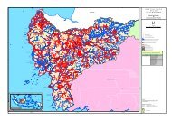
selective logging, intensive logging, fires, small-‐scale agricultureby subsistence farmers, and forest conversion to oil palm in thenorth. Historical and on-‐going anthropogenic disturbance hasmodified natural vegetation to varying degrees such thatvegetation classes described above are occur over a range ofdisturbance classes.Vegetation and Land Cover AssessmentA land cover assessment of the <strong>Rimba</strong> <strong>Raya</strong> <strong>Project</strong> Area wasconducted January 2010 in order to provide baseline data for theproject and to support the carbon assessment. A classificationscheme of 18 land use / land cover types was developed for<strong>Rimba</strong> <strong>Raya</strong> based on Ministry of Forestry classification andexpanded to include more detailed and accurate types specific tothe <strong>Project</strong> Area. Annex 2 includes the full report for the landcover assessment, conducted by Bolick (2010).Land cover mapping was accomplished following a two-‐partapproach including remote sensing image classificationtechniques followed by image interpretation in GIS. In the firstphase, pixel-‐based image classification was conducted to makeuse of spectral information in Landsat7 ETM+ bands that aresensitive to vegetation. <strong>The</strong> results of this classification providedimportant verification of broad land cover types such as forest,shrub and herb cover. In the second phase, land cover wasinterpreted and digitized using classified and full band Landsatdata in a GIS. Interpretation was therefore able to incorporatekey ancillary data including aerial photos, field survey data andother GIS data compiled for <strong>Rimba</strong> <strong>Raya</strong>, which substantiallyimproved the classification.<strong>The</strong> resulting 18 classes from the land cover assessment, weregrouped into 13 classes for the carbon assessment to reflectbroad vegetation classes identified by Stanley and Salim (2008),while preserving classification detail that strongly affects above-groundbiomass and carbon estimates (e.g. forest type and levelof degradation). Vegetation classes are described in Table 2 andshown in Figure 7.Table 2. <strong>Rimba</strong> <strong>Raya</strong> Land Use/Land Cover ClassesClass NameLowland forestLowland forest(degraded)Peat swampforest (lightlydegraded)Peat swampforest (highlydegraded)PeatshrublandsSeasonallyinundatedwetlandsDescriptionLowland dipterocarp forest on mineral soils.This is a “dry land” type and is foundprimarily in the northwest.Lowland dipterocarp forest on mineral soilswith some apparent logging damage,adjacent to lowland forest. Note that theterm “degraded” is used rather than the term“secondary” which implies forest successionfrom clear-cutting.Peat swamp forest, locally “rawa” denotingpeat substrate. All peat swamp forests in<strong>Rimba</strong> <strong>Raya</strong> appear to be lightly tomoderately degraded by logging and fire.Peat swamp forest patches bordering areasof intensive human activity. Heavilydegraded and at high risk of loss.Formerly peat swamp forests, these areaswere deforested by fire. Shrubs andscattered trees on peat, seasonally wet.Locally “danau” or seasonal lake, most ofthese areas were formerly peat swampforests that have been logged and burned.Where these are adjacent to rivers, floodingmay be semi-permanent.16
Table 2. (cont’d) <strong>Rimba</strong> <strong>Raya</strong> Land Use/Land Cover ClassesClass NameRiver andcoastal forestKerangasforestOpen sandscrubBare groundor sparselyvegetatedCultivatedland withshrubsOil palmplantationOpen waterDescriptionNarrow patches of riverine forest along theSeruyan on mineral or mixed soils. Includesone small mangrove patch on the Java Sea.In the south, short, even-canopied scrubforest on sandy soils. In the north, tall, richtropical heath forest on predominantly sandsoils. Both types visually distinct on satelliteimagery and occurring in small patches.Open sand soils with sparse kerangas scrubvegetation, locally known as “padang”. <strong>The</strong>semay be former kerangas forests that haveburned. In the north, open sandy soilsdominate. In the south, vegetation cover ismore dense and may be intermediate tokerangas forest. Some of these shrublandpatches border burned peat swamp forests inthe south and recovering vegetation may besecondary peat swamp on peat soils.Large bare areas in open sand scrub areclassified as bare ground, as are peatlandareas recently deforested by fire. <strong>The</strong> lattermay have low or sparse vegetation regrowth.Repeatedly burned cultivation land, locally“ladang”, often abandoned after severalyears of cultivation. Active cultivation landmay have appear bright on imagery frompost-fire herbaceous growth. Inactive fieldsmay have woody shrubs and scattered trees.At <strong>Rimba</strong> <strong>Raya</strong> oil palm is the only cropplantation and is confined to the KUCCconcession in the north.Deep water with no vegetation occuring onmajor rivers.Figure 7 – <strong>Rimba</strong> <strong>Raya</strong> <strong>Project</strong> Area Vegetation and Land Cover17
G1.3. Boundaries of the <strong>Project</strong> Area and <strong>Project</strong> Zone<strong>The</strong> boundaries of the project area and project zone and theirrelation to the National Park and nearby communities<strong>Project</strong> Area and <strong>Project</strong> Zone<strong>The</strong> <strong>Rimba</strong> <strong>Raya</strong> site is comprised of a 47,006 ha <strong>Project</strong> Areawithin a 91,215 ha <strong>Project</strong> Zone (Figure 8). <strong>The</strong> <strong>Project</strong> Area isdefined by the boundaries of four planned but undeveloped palmoil concessions and represents the carbon project boundary. InVCS terminology, the <strong>Project</strong> Area is referred to as the CarbonAccounting Area.<strong>The</strong> <strong>Project</strong> Zone is defined by geographic and politicalboundaries and represents the area of project influence,especially with reference to communities potentially affected bythe project as well as climate and biodiversity managementconcerns extending beyond <strong>Project</strong> Area borders. In VCSterminology the <strong>Project</strong> Zone is referred to as the <strong>Project</strong>Management Area. Tanjung Puting National Park on the west,the Java Sea on the south, and the Seruyan River on the eastform the boundaries of the <strong>Project</strong> Zone. PT Kharisma UnggulCentralama Cemeriang (PT KUCC), an active palm oil concession,has been excised from and forms the northern boundary of the<strong>Project</strong> Zone.<strong>The</strong>se boundaries, their delineation and relation to current landuse and land management are described in this section.Figure 8 – <strong>Rimba</strong> <strong>Raya</strong> <strong>Project</strong> Area and <strong>Project</strong> Zone Boundaries18
Tanjung Puting National Park and <strong>Rimba</strong> <strong>Raya</strong> BorderTanjung Puting National Park (TPNP) bounds <strong>Rimba</strong> <strong>Raya</strong> to thewest, though there is still some uncertainty regarding the exactlocation of the park boundary. <strong>The</strong> <strong>Rimba</strong> <strong>Raya</strong> Area Verificationis based on park borders delineated in the 2006 provincial plan,which was approaching finalization in 2009. This marks morethan seven decades of a somewhat convoluted history of theexpansion and contraction of Tanjung Puting borders. Brend(2005) summarizes much of the following history:<strong>The</strong>re were originally two conservation areas in what today isconsidered Tanjung Puting National Park: Kotawaringin Wildlife<strong>Reserve</strong> in Kabupaten Kotawaringin Barat, and Sampit Wildlife<strong>Reserve</strong> in what is now Kabupaten Seruyan. <strong>The</strong>se were gazettedin 1936 and 1937, respectively, by the Colonial Government andwere combined in 1978 with the name Tanjung Puting Wildlife<strong>Reserve</strong> and a total area of 305,000 ha. This area was thendesignated as a candidate national park by decree of the Ministerof Forestry in May 1984. In December 1984, a decree from theDirector General PHPA authorized the working territory of theTanjung Puting National Park to cover the area of the formerWildlife <strong>Reserve</strong>, amounting to 300,040 ha. In 1990 an act waspassed that defined the legal status of national parks for the firsttime. <strong>The</strong> forest surrounding the new National Park wereoriginally State Forest Land, later designated as Production Forest(Hutan Produksi or HP) by the Department of Forestry, andworked as active logging concessions.In 1996, the expired logging concessions on the western sidewere incorporated into the newly designated Tanjung PutingNational Park by the Minister of Forestry’s SK No. 687/Kpts-‐II/1996 dated 25 October 1996. <strong>The</strong> land between the easternborder of TPNP and the Seruyan River remained in productionforest (HP designation) but were accroding to the Tanjung PutingNational Park Management Plan (MoF 1994) proposed as parkextensions and managed buffer zones.In a 1997 paper, the head of the National Park referred to thePark’s eastern boundaries as having been “cut,” most likelymeaning a simple trail was cleared through the forest. Morerecently, the eastern boundaries, in the new Kabupaten ofSeruyan, were mapped and apparently marked in the field withtemporary poles. This temporary boundary (‘trayek batassemantara’) has been approved by the multi-‐agency BoundaryDelineation Committee as incorporated in the map annexed tothe Decision Letter (SK) of the Bupati Seruyan No. 29/Thn 2003dated 27 September 2003. (Note, one of the pre-‐conditions forfull gazettement, is having a temporary boundary marked first).In June 2004, Orangutan Foundation International (OFI) becameaware of plans for four palm-‐oil plantations to be establisheddown the eastern edge of the park. On 18 February 2005, theMinster of Forestry released letter no. S.79/Menhut-‐VII/2005,specifically mentioning the palm-‐oil companies which “overlapwith TPNP and/or the area of production forest which acts as abuffer zone to the national park.” Three months later, on 13 May2005, the Minister of Forestry wrote letter No. S.292/Menhut-‐VII/2005 stating that the border of TNTP in the northern part ofthe park would be changed, granting approval for conversion ofthe area into the four palm oil plantations mentioned in the 18February letter, and adding two additional oil plantations to thesouth along the Java Sea.<strong>The</strong> borders of these planned oil palm estates are shown in themap on the preceding page (Figure 8) and form the <strong>Project</strong> Area.19
Communities in the <strong>Project</strong> Zone<strong>The</strong> <strong>Rimba</strong> <strong>Raya</strong> <strong>Project</strong> Zone is designed to include communitiesaffected by activities within the <strong>Rimba</strong> <strong>Raya</strong> <strong>Project</strong> Area. In thecontext of CCB Standards, 'communities' are defined as all groupsof people, including Indigenous peoples, migratory, and otherlocal groups who live within or adjacent to the <strong>Project</strong> Area, aswell as any groups that regularly visit the area and derive income,livelihood, or cultural values from the area. Using this definition,we can imagine communities located outside the <strong>Project</strong> Area,but potentially affected by the project, to include:1. Communities with land rights in the <strong>Project</strong> Area. <strong>The</strong>seinclude villages along the Seruyan River, which forms the easternborder of the project.2. Communities in which certain individuals travel some distanceinto the <strong>Project</strong> Area to log, hunt or collect forest products.A social survey was undertaken in December 2008 in order togather basic information about land rights and land use in andaround the project area. This information, together with landcover/land use mapping supports inferences about whichcommunities may have rights to and/or use land in the projectzone. Both are discussed below to provide context for delineating<strong>Project</strong> Area and <strong>Project</strong> Zone boundaries. Descriptions ofcommunity characteristics and land use are detailed in sectionsG.1.5 and G.1.6.Communities with land rights in the <strong>Project</strong> Area. In the mostgeneral sense, land belonging to communities in or near the<strong>Project</strong> Area could include all land in villages (desa) that borderthe <strong>Project</strong> Area. Looking at the map in Figure 9, this approachwould unnecessarily include areas up to 20 km from the <strong>Project</strong>Area border (e.g. Desa Muara Dua), following administrative linesrather than current land use and land rights. For this reason,land use and rights patterns were examined to determine a moreaccurate project zone.During the December 2008 social survey, all surveyedcommunities were located within the <strong>Project</strong> Area, along thewest bank of the Seruyan River. Four of these communities alsohave pemukiman (small settlements) on the east bank, that areidentified with the larger communities directly across the river.<strong>The</strong>se include Telaga Pulang, Baung, Jahitan and Muara Dua.Community livelihoods in the <strong>Project</strong> Area derive mainly fromfishing. In the past, many communities planted dry rice andvegetables and collected rubber from rubber gardens. In thepast three years, however, monthly flooding has limited theirlivelihood activities to fishing and palm sugar production (fromthe tree Arenga pinnata). <strong>The</strong>refore, available data suggestcommunities in the <strong>Project</strong> Area are not currently heavilydependent on their land (i.e., land which they possess the rightto use). <strong>The</strong> majority of communities is Muslim, and thereforegenerally hunts a smaller set of animals and, in these areas, atlower intensity. Communities surveyed claim that they do nothunt, focusing instead on fishing. Community reliance on forestsis limited to fire wood and, at times, logging. Communities claimthat logging is no longer part of their livelihood activities, largelydue to lack of valuable timber and recent crackdowns on illegallogging (with several local officials jailed). Communities do,however, still obtain wood from the east side of the river, whichis designated as Production Forest under central governmentclassification. It was emphasized during site visits that locallivelihoods are very compromised by recent flooding and people20
with sufficient means are moving out of the area. Those whomust remain are barely surviving and live under extremelydifficult, unhygienic conditions.Based on available data from initial site visits, cultural valueslinked to the <strong>Project</strong> Area and its surroundings appear to be verylow or nonexistent. For Muslim communities, local areas ofcultural importance include mosques and graveyards (which arenot considered sacred as they often are in the Dayakcommunities of Kalimantan). All ethnic Dayaks encounteredwere Muslim. A very small number of Christians reside in thearea (less that 1% in Desa Telaga Pulang) and no churches wereencountered.It is expected that any villages located close to the <strong>Project</strong> Zoneon the east side of the river have experienced similar floodingand meet their livelihood needs in a similar manner to those inthe <strong>Project</strong> Zone. Even if communities to the east were stillplanting rice or other crops, it is highly unlikely that farmerswould travel the distance across the river, as there are few areassuitable for planting. Nevertheless, it is possible thatcommunities on the east side of the river have rights to someland inside the <strong>Project</strong> Area. It is also possible that occasionalforays into the forest in the <strong>Project</strong> Area occur, but this tooseems unlikely, given that (i) they are Muslim and hunt at verylow levels (in some cases not at all), and (ii) current land coverindicates there is greater availability of forest on the east side ofthe river for harvesting of non-‐traditional forest products.Based on the foregoing information, all communities on theSeruyan River from Bahaur, near the northeastern boundary ofthe KUCC oil palm plantation south to Tanjung Rengas, in thevicinity of the southernmost proposed oil palm plantations, willbe included in the <strong>Rimba</strong> <strong>Raya</strong> <strong>Project</strong> Zone. This conservativelyincludes all residents who may have access to the <strong>Project</strong> Area,regardless of their minimal expected use of the area, given thatthey reside on the Seruyan River. This river, forming the easternboundary of the <strong>Project</strong> Zone, provides the only access to <strong>Rimba</strong><strong>Raya</strong>, which remains roadless.Distant communities using the <strong>Project</strong> Area. Communitiessituated at some distance from the <strong>Project</strong> Area are most likelyto use the <strong>Project</strong> Area for illegal logging, especially in thesouthern portion of <strong>Rimba</strong> <strong>Raya</strong> and Tanjung Puting NationalPark, where illegal logging is reported to be ongoing. Forexample, one coastal community inside the National Park andwest of <strong>Rimba</strong> <strong>Raya</strong>, Segintong Luar, was established specificallyas a logging community in the 1990s. Further surveys in theproject vicinity will be conducted, and any communitydetermined to rely heavily for its livelihood on illegal logging inthe <strong>Project</strong> Area will be included in the <strong>Project</strong> Zone. Other usesof the <strong>Project</strong> Area (e.g. hunting and collection of other non-traditionalforest products) are thought to be minimal based ondata collected during recent social surveys.“<strong>The</strong> price of anything is the amount oflife you exchange for it”-‐ Naturalist and PhilosopherHenry David Thoureau21
Delineation of the <strong>Project</strong> Zone. To ensure the inclusion of allcommunities that potentially derive some form of livelihood fromthe area, the <strong>Project</strong> Zone will comprise the 47,000 ha <strong>Project</strong>Area plus an additional 44,215 ha of surrounding lands includingall 12 communities on the Seruyan River within the potentialsphere of influence of the project. Land inside Tanjung PutingNational Park, to the west of the <strong>Project</strong> Area, has been excludedfrom the <strong>Project</strong> Zone. Recent community surveys indicate thatthe national park was previously used for logging but is no longerused for this purpose as a result of recent improvements in lawenforcement. Additionally, land use for purposes other thanlogging would likely be met in forests located closer to thecommunities, inside the <strong>Project</strong> Area but outside the nationalpark.Figure 9. <strong>Project</strong> Area, <strong>Project</strong> Zone, Tanjung Puting NationalPark, and villages (desa) surveyed during the December 2008Daemeter social survey (labeled in red).<strong>The</strong> <strong>Project</strong> Zone extends west to the border of Tanjung PutingNational Park, south to the Java Sea, east to the Seruyan Riverand north to the land surrounding KUCC oil palm plantation. Thisbroad delineation extends management and co-‐benefits of the<strong>Reserve</strong> as far as the major geographic and administrativeboundaries that have historically constrained land use activitiesin the <strong>Rimba</strong> <strong>Raya</strong> region. To the north, the <strong>Project</strong> Zone extendsmore than 25 kilometers beyond the <strong>Project</strong> Area to forests andcommunities surrounding KUCC plantation in order to extendclimate, community and biodiversity benefits to a threatenedpark border, at-‐risk lowland and peat swamp forest, and sixcommunties that lie far beyond <strong>Project</strong> Area boundaries. Thisinclusive delineation of the <strong>Project</strong> Zone promotescomprehensive community planning in the Seruyan and preventsthe formation of marginalized frontiers between importantgeographic boundaries.22
Community ApprovalNo formal process for obtaining community approval exists.Nonetheless, village heads in <strong>Project</strong> Zone communities wereconsulted during the social survey, and all gave their tacitapproval pending continued community involvement in projectdesign and implementation as evidenced by their signatures onthe “PT RIMBA RAYA CONSERVATION PROJECT COMMUNITYSUPPORT MEMO” (see English version sample).For a complete copy set or both the English and BahasaIndonesia versions of the Community Support Memos, pleasesee Annex 3.A discussion of local property rights is elaborated upon in sectionG1.Government Approval<strong>The</strong> process for acquiring the IUPHHK-‐RE concession license fromthe Government of Indonesia is lengthy, and complicated by theabsence of an administrative framework for <strong>REDD</strong> projects,which are currently under development. <strong>Project</strong> proponentshave already obtained the following required documents andauthorizations:Official Area Verification -‐ Government-‐issued mapindicating the license area boundaries and confirming thatthere are no conflicting recognized claims to the <strong>Project</strong>Area (see Figure 41, Section G5.2).Bupati’s Recommendation -‐ Letter from the head of theSeruyan District government granting local approval toFigure 10. Sample of the English version of the CommunitySupport Memo signed by Village Chiefs throughout the <strong>Project</strong>Zone.23
the project and recommending that the nationalgovernment issue the license (see Figure 42, Section G5.2)Governor’s Recommendation -‐ Letter from the head ofCentral Kalimantan granting provincial approval to theproject and recommending that the national governmentissue the license (see Figure 43, Section G5.2)Minister’s Decree (SP-‐1). Tentative national-‐levelapproval of the project by the Minister of Forestry. Thisdocument bars all other applications for the <strong>Project</strong> Areaand signals official sanction of the project pendingcompletion of a number of administrative steps. (seeFigure 44, Section G5.2)<strong>Project</strong> proponents are awaiting the following documents andauthorizations. SP-‐2. Upon completion of an abbreviated EnvironmentalImpact Assessment by project proponents, the Minister ofForestry issues this document instructing the governmentto issue the IUPHHK-‐RE following payment to thegovernment of license fee. Expected Date: June 2010. SK. Minister’s Decree officially authorizing IUPHHK-‐RElicense. Expected Date: July 2010.Carbon stocks in <strong>Rimba</strong> <strong>Raya</strong> are primarily comprised of below-groundpeat and above-‐ground tree biomass. <strong>The</strong>se carbon poolswere quantified for the Carbon Accounting Area, consisting of47,006 ha. Stratification of the project area and methods ofcarbon calculation are briefly described below and detailed in theBaseline Report (Annex 4) and project methodology 1 .Total carbon stocks were calculated by strata (land cover typeand peat depth and distribution) using guidance and toolsprovided by the project methodology and the IPCC 2003 GoodPractice Guidance (GPG) for Land Use, Land-‐Use Change andForestry (LULUCF). Peat and aboveground tree biomass wereincluded in carbon stock change calculations, while abovegroundnon-‐tree biomass, litter, and deadwood were conservativelyexcluded. Carbon stocks and baseline GHG emissions wereestimated based on equations provided in the methodology.<strong>Project</strong>-‐specific data from field surveys, high resolution aerialimage acquisition, and remote sensing and G.I.S. analysis wereused whenever appropriate and were supplemented byrecommended default data values from IPCC and peer-‐reviewedscience.G1.4. Current Carbon Stocks within the <strong>Project</strong> AreaCurrent carbon stocks within the project area, using stratification byland-‐use or vegetation type and methods of carbon calculation (such asbiomass plots, formulae, default values) from the IntergovernmentalPanel on Climate Change’s 2006 Guidelines for National GHGInventories for Agriculture, Forestry and Other Land Use (IPCC 2006 GLfor AFOLU) or a more robust and detailed methodology.1 <strong>The</strong> methodology for this project follows the “Baseline and MonitoringMethodology for Conservation <strong>Project</strong>s that Avoid Planned Land UseConversion in Peat Swamp Forests, Version 5.1 December, 2009”, developedby Winrock International 1 . 1 accessed April 10, 2010 at http://www.v-‐c-s.org/docs/NM-‐Baseline-‐Component_A-‐Land-‐Use-‐Change-‐(plantations)_v5.1_031209.pdf24
Stratification by Landcover TypeMapped land cover classes represent vegetation type (e.g. peatswamp forest, kerangas forest, peat shrubland) and level ofanthropogenic disturbance in peat swamp forest (e.g. lightlydegraded, highly degraded), both of which are expected to affectcarbon stocks in aboveground biomass. Landcover classificationand mapping for <strong>Rimba</strong> <strong>Raya</strong> was conducted to improve regionallandcover maps by the Indonesian Ministry of Forestry. Methodsand results are briefly described below and detailed in theLandcover Assessment Report (Annex 2).Land cover mapping was accomplished following a two-‐partapproach including automated image classification followed bymanual image interpretation in GIS. In the first phase, pixel-‐basedimage classification was conducted to make use of spectralinformation in Landsat7 ETM+ bands that are sensitive tovegetation. <strong>The</strong> results of this classification provided importantverification of broad land cover types such as forest and no-forestvegetative cover and bare soil. In the second phase, landcover was interpreted and digitized using classified and originalLandsat data in a GIS. Interpretation was therefore able toincorporate key ancillary data including aerial photos, surveydata and other GIS data compiled for <strong>Rimba</strong> <strong>Raya</strong>, whichimproved the classification.Results of landcover classification (Table 2 and Figure 11) showthat the Carbon Accounting Area is predominated by lightlydegraded peat swamp forest (40.5%) and peat shrublands(25.6%) with some kerangas forest (10.2%) and open scrub(11.4%).Biomass SurveyIn order to quantify biomass associated with landcover types, acombination of ground and aerial surveys were conducted.Survey transect locations are shown in Figure X. Survey methodsand results are briefly described below and detailed in theCarbon Assessment Survey Report (Annex 5). Two 8-‐personteams of trained and experienced field staff conducted theground survey. A total of 16,000 meters of transect were markedand surveyed with biomass data recorded across 36 plotsrepresenting 9 hectares of forest. Biomass measurementsincluded tree diameter, tree height and tree crownmeasurements.Table 2. Land Cover Classification and Extent in the <strong>Project</strong>Carbon Accounting AreaLand Cover Description Extent (Ha) % TotalPeat Swamp Forest (lightly degraded) 18,983 40.4Peat swamp forest (highly degraded_ 1,734 3.7Peat Shrubland (
During the ground surveys, aerial surveys were also conducted. Atotal of 3,382 photos were taken over the <strong>Rimba</strong> <strong>Raya</strong>concession. Photos with high cloud cover were excluded andremaining photos were ortho-‐rectified and georeferenced asdescribed in the baseline report. One-‐hectare plots wereinstalled in the center of each photo and tree crowns wereidentified and measured in order to estimate above ground treebiomass. Example aerial photos with plots and tree-‐crowndelineations are shown below for lightly degraded peat swampforest (Figure 12a) and kerangas forest/open scrub (Figure 12b).Biomass by landcover class for <strong>Rimba</strong> <strong>Raya</strong> based on ground andaerial survey analysis is shown in Table 3.Land Cover DescriptionTable 3. Biomass of Land Cover typesBiomass in trees > 10cm DBH (t d.m. ha-‐1)Peat Swamp Forest (lightly degraded) 206Peat swamp forest (highly degraded) 140Peat Shrubland (
Figure 12a. Example aerial photos with plots and tree-‐crowndelineations for lightly degraded peat swamp forest and kerangasforest/open scrubFigure 12b. Example aerial photos with plots and tree-‐crowndelineations for kerangas forest/open scrub27
Stratification by Peat Distribution<strong>The</strong> principal factor controlling carbon content in peat forests isthe depth of the peat, with type of peat layer and bulk density assecondary factors. <strong>The</strong> majority of peat swamps in Indonesia aredeeper than 1 m, and sometimes more than 15 m in depth(Rieley et al. 1997). Hooijer estimates 42% of the peat land areasin Indonesia are over two meters thick, accounting for most ofthe country’s peat and carbon deposits (Hooijer et al. 2006).<strong>The</strong> most comprehensive peat assessment to date for Indonesiawas conducted by Wetlands International using both primary andsecondary data sources (Wayunto et al. 2004). A series of mapswere produced that show peat depth and type for each provinceand district. <strong>The</strong>se data show shallow peats distributedthroughout the <strong>Rimba</strong> <strong>Raya</strong> Carbon Accounting Area. WetlandsInternational data was ground-‐truthed by an in situ peat depthassessment conducted by Forest Carbon and OFI.Peat Depth SurveyPeat depth was measured at 100-‐meter intervals along all surveytransects. Methods and results are briefly described below anddetailed in two Carbon Assessment Survey Reports (Annex 5). Atotal of 16 km of transect were marked and surveyed with peatdepth measured in 159 locations. Average depth of each transectis shown in Figure 13 together with Wetlands peat mapping.Unexpectedly, peat depths were moderately deep acrossall survey transects. 67% of peat depth measurementsexceeded the reach of the peat probe at ca. 5 meters andaverage depth overall was 4.3 meters.Figure 13. Peat map for <strong>Rimba</strong> <strong>Raya</strong> and Tanjung Puting NationalPark from Wetlands International with ground surveymeasurements recorded on carbon assessment survey transects.28
Actual peat depths measured in the <strong>Rimba</strong> <strong>Raya</strong> CarbonAccounting Area exceed Wetlands International estimates for thearea and likely contain an average carbon content of 2,500t C/ha(associated with two-‐four meter Hemist/Fibrist peats). This farexceeds the calculated carbon loss under the baseline whichassumes a maximum 1 meter peat loss through burning andsubsidence under a business as usual scenario.Combined Above and Belowground Carbon EstimatesStock changes for above and below ground carbon were assessedunder the baseline scenario (described in G.2 and the baselinereport) in order to determine the amount of carbon emissionsavoided by the project.<strong>The</strong> baseline analysis, which takes a necessarilyconservative approach, shows that protection of <strong>Rimba</strong><strong>Raya</strong> carbon stocks over the 30-‐year life of the projectequate to an estimated 96,376,455 t CO2e avoided.It should be noted that as an additional method of conservativeanalysis, the above-‐ground biomass estimates did not includebiomass below 20 cm in diameter. This additional built in“buffer” in the baseline is seen as offsetting other uncertaintiesassociated with this emerging science. Table 4 demonstrates theareas in which project proponents have built in up-‐front buffersin its baseline calculations and in leakage estimates.Table 4. Comparison Charts of inherent “buffer” built intobaselines calculations based on conservative protocolsAreaAboveGroundBiomassBelowGroundBiomassLeakagefromActivityShiftingPositiveLeakage(TanjungPutting)ConservativeApproach(based on peerreviwed scientificdata)Count all aboveground biomassAccount forannual growth inbiomassEvidencesupports 1.5MPeat is a non-renewablefiniteresource, whichby definitionrules out leakagePark hashistorical andcurrent leakagedue to variousactivities that willbe mitigated withprojectUltra-‐ConservativeApproach(used in baselinecalculation)Did not countbiomass < 20 cmDid not accountfor annual growthin biomassUsed 1 metertotal subsidenceover project lifeMonitoring forleakage of palmoil companydisplaced byprojectDid not countpositive leakagegenerated bycreation of bufferto park“Built-‐inBuffer”created byuse ofconservativeprotocolsTBATBATBATBATBA*This table will be updated to reflect quantifiable data in the final submissionversion29
G1.5. Description of <strong>Project</strong> Zone CommunitiesG1.5. A description of communities located in the project zone,including basic socio-‐economic and cultural information that describesthe social, economic and cultural diversity within communities (wealth,gender, age, ethnicity etc.), identifies specific groups such as IndigenousPeoples and describes any community characteristics.In December 2008, a socioeconomic and cultural survey wasconducted by Daemeter Consulting to identify and describecommunities present in and near the <strong>Rimba</strong> <strong>Raya</strong> <strong>Project</strong> Area.Methodology<strong>The</strong> methodology used for collecting data included individualinterview and small group discussion. <strong>The</strong> village head, deputyvillage head, village secretary, Chairman of BPD (BadanPerwakilan Desa, Village Representative Body), informal leaders,elders, youth, and women leaders represented the targetcontacts, as these individuals and groups have the greatestaccess to village-‐specific information. In some cases, members ofthese groups were interviewed individually, allowing for therepetition of certain questions to gauge consistency acrossinterviewees. In other cases, the small group format facilitateddiscussions, allowing for the collaborative elaboration andrefinement of information as it pertained to a specific village.<strong>The</strong> interviews addressed topics as described in the CCBStandards with the goal of collecting relevant data andinformation, but they were otherwise unstructured, emphasizingtopics of interested to interviewees.OverviewFourteen villages (desa) were identified, from Pembuang Hulu(north of the <strong>Project</strong> Area) down to Kuala Pembuang, the capitalof Seruyan District (southeast of the <strong>Project</strong> Area).Administratively, these 14 villages fall under the same district(Kabupaten Seruyan), but three different subdistricts(kecamatan). <strong>The</strong> villages and their subdistricts are: Bahaur,Paring <strong>Raya</strong>, Parang Batang, and Tanjung Hanau located in HanauSubdistrict; Banua Usang, Paren, Ulak Batu, Palingkau, CempakaBaru, and Telaga Pulang located in Danau Sembuluh Subdistrict;and Baung, Jahitan, Muara Dua and Tanjung Rengas located inSeruyan Hilir Subdistrict. Of these villages, only Paring <strong>Raya</strong> wasnot visited as it is a recent extension of Bahaur and presumablycomprises similar communities. Another three settlements(Batuwirang, Kendurian, and Segintong Luar) were identifiedafter the survey was completed. <strong>The</strong>se are assumed to beseparate villages from those visited and will be surveyed as partof the Phase II Community Assessment. Table 5 providespopulation data for the villages visited.Most community members residing in the 14 villages surveyed,rely on the Seruyan River for their basic needs, cash income, andtransportation. Before the 1990s, forests provided for thecommunities’ basic needs and cash income. Villagers clearedforests to make their ladang and plant rice and rubber. <strong>The</strong>y alsologged the forests and sold logs to markets in Baung, TelagaPulang, and Segintong Luar. However, after the operations ofHutan Lestari, conducted by the Ministry of Forestry in the late1990s to control illegal activities within state forests, loggingbecame the least favored livelihood option for villagers. <strong>The</strong>rewere (and still are) some illegal logging cases resulting in elitevillage officials or their family members being jailed.30
Villagers’ access to forests has become even more restricted withrecent oil palm plantation development. In the villages surveyed,it was common to hear complaints of oil palm companiesoperating in a manner that caused land tenure disputes. Thisform of conflict reportedly never occurred in the past, when landuse issues were resolved by visiting villages and asking forpermission to operate in the area. Only a few companies havehad the good will to resolve such conflicts by negotiating with thevillagers directly, some even asking for facilitation by thegovernment. A number of palm oil companies still use the ‘NewOrder approach’, arranging for the police’s special task force orthe military to support them in negotiations with villagers, aposture that is inevitably (and often intentionally) intimidating.From the villages visited, most of the villagers – who typicallybelong to Dayak and Banjar tribes – earn their living from fishing.Seeing this, the Seruyan District government developed aprogram to help the communities improve the productivity andsustainability of fish populations in the river by adopting akeramba (aquaculture) system. However, it is reported that inthe last five years the Seruyan River has experienced far morefrequent flooding than in previous periods. In the past, floodingoccurred predictably once each year and could be anticipated.Recently, they have experienced monthly flooding, and somecommunities remain flooded for up to three months at a time.Table 5. Population data for villages in the <strong>Rimba</strong> <strong>Raya</strong> <strong>Project</strong> AreaNo. Village No. of Families No. of People No. of Women No. of Men Predominant Tribe1 Bahaur -‐ 1700 -‐ -‐ Dayak Kahayan2 Paring <strong>Raya</strong> 20 -‐ -‐ -‐ Dayak Kahayan3 Parang Batang -‐ 206 -‐ -‐Dayak Keninjal &Bangkul4 Tanjung Hanau 127 511 281 230 Banjar5 Banua Usang 215 642 -‐ -‐ Dayak Pante & Banjar6 Paren 113 227 113 114 Dayak Pante & Banjar7 Ulak Batu 70 181 89 92 Dayak Nadju & Banjar8 Palingkau 43 168 77 91 Dayak Nadju & Banjar9 Cempaka Baru 133 566 216 250 Dayak & Banjar10 Telaga Pulang 411 2313 1008 1305 Banjar & Dayak11 Baung 250 2015 992 1223 Banjar & Dayak12 Jahitan 133 477 208 269 Dayak & Banjar13 Muara Dua 140 523 236 287 Banjar & Dayak14 Tanjung Rengas 320 1406 641 765 Banjar & DayakTotals: 1,975 10,935 3,861 4,62631
Only a few of the communities have healthcare facilities.Villagers from communities without healthcare facilities go toother communities for treatment. At one point, there were anumber of midwives assigned to each village, but due to theextremely challenging living conditions (unhealthy environment,lack of clean water, etc.) only a few midwives have stayed.In terms of education, village elders did not attend school or, ifthey did, attended only through elementary school. On average,each village has one elementary school building that is poorlymaintained. One exception is the elementary school in Parenvillage, which was renovated recently. <strong>The</strong> younger generationsnow receive education through high school, but schoolchildrenmust move to Telaga Pulang or Pembuang Hulu to attend. Someteenagers return to their villages after completing high school tohelp their parents. Others work with oil palm companies orbecome boat operators. Still others do not return to theirvillages, instead migrating to towns and cities for otheremployment opportunities.Due to the extreme poverty in the area, many villagers leavetheir communities to look for work elsewhere. At the same time,many migrants have started coming to the area to work with oilpalm companies operating on land near these communities. Anumber of village officials cited these changing population trendsas the principal complicating factor in conducting an accuratecensus of the population.<strong>The</strong> migrant workers have become a controversial issue withvillagers, who feel that they are reducing local employmentopportunities. All officials interviewed said that the oil palmcompanies prefer to use their own workers rather than trainlocals to work for them. Another common complaint is that oilpalm companies use community land, but the compensation paiddoes not meet the communities’ expectations.Life seems difficult for most of the villagers in the <strong>Project</strong> Zone.<strong>The</strong>ir access to forests is limited by the expansion of oil palmplantations. <strong>The</strong>y cannot fish when the river is flooded, acondition that is occurring with increasing frequency. <strong>The</strong>ycannot compete with migrant workers if they wish to work forthe oil palm companies. <strong>The</strong>y cannot afford the day-‐to-‐day costof living, which is significantly more expensive than in otherplaces in Indonesia (e.g., gasoline and kerosene are priced threetimes higher here than in cities). <strong>The</strong>y are typically last to knowwhat is happening in the area. In effect, they are being drivenfrom their land.Survey Results1. Bahaur Village. Administratively, Bahaur village is under theHanau Subdistrict, located in the Seruyan District. Bahaur is anold village, established prior to Indonesian Independence in1945. <strong>The</strong> village, located within 40 minutes of Pembuang Hulu,can be reached via speedboat. It has only one sub-‐village(dusun), named Manggana. <strong>The</strong> word Bahaur comes from thePembuang Hulu language, in which it means “banyak hanau” (alot of palm trees, referring to the palm Arenga pinnata).Historically, and through to the present day, the palm has hadsignificant economic value for the Bahaur people, especiallywomen, who process the palm water into brown sugar. Atpresent the price of brown sugar is IDR 15,000/kg when soldlocally. <strong>The</strong> population is predominantly Dayak Kahayan, withIslam as the dominant religion.32
Reportedly comprising 21,000 hectares, the village hascategorized its land into the following land uses: settlement,swidden agriculture, and graveyard. Most land is privatelyowned by families, with the exception of a plantation plantedwith jelutung (Dyera costulata) and rubber that belongs to thevillage (200 ha). This land was distributed to 100 families, eachgiven two hectares, by the Indonesian government. <strong>The</strong> familiesare only authorized to manage the piece of land that they weregiven and they do not have ownership rights to the land. <strong>The</strong>se200 ha are not concentrated in one area, but rather scatteredthroughout the village. This plantation development is part ofthe National Reforestation Program that was managed under theSeruyan District’s DAK-‐DR (Dana Anggaran Kabupaten-‐DanaReboisasi, the District Budget from the Department of Forestry’sReforestation Fund).Reportedly, there are no conflicts among villagers. <strong>The</strong>y are saidto respect each other, and respect the boundaries of each other’sproperty. <strong>The</strong>y know which ladang (swidden area) belongs towhom without the use of physical marks on the ground. Whenconflicts arise, they prefer using discussion in lieu ofconfrontation to resolve them. At present, the ownership of landis registered through Surat Kepemilikan Tanah (SKT), issued bythe Village Head. However not all villagers have used this SKT toclaim their land officially.Most of the villagers have multiple sources of income, but themain source at present is from fishing. In the past, they alsocollected rattan and used forested areas for their needs. Since oilpalm licenses were issued from Seruyan District and plantationsdeveloped on nearby land, however, the villagers claim that allthe forests are gone. According to the village secretary, there is apotential conflict brewing with the oil palm license holder PT.Wana Sawit Timur. <strong>The</strong> company has yet to visit the village todiscuss the license area or other issues of oil palm operation.Villagers generally meet their basic needs through a cash-‐basedeconomy, purchasing carbohydrates, vitamins, minerals, someprotein, and medicines. <strong>The</strong>y meet their protein needs largelythrough fishing.Both formal and informal institutions are present in the village.Formal institutions are managed through government structures,typically comprising a village head, village secretary, other staff ofthe village office, and a BPD (Badan Perwakilan Desa, VillageRepresentative Body). Bahaur does not have a village office.Currently the administration operates out of the village head’shouse. Informal institutions include a women’s group (e.g., PKK,Program Kesejahteraan Keluarga, Family Welfare Program), aweekly Islam study group, a youth group, and a farmer group. Toorganize meetings, Bahaur uses written invitations delivered aday in advance. <strong>The</strong> villagers prefer to have something in writingto inform them, although the verbal communication system stillfunctions.Villagers apply national and Islamic laws to regulate most aspectsof their lives. Historically, they used Islamic law, which providesmen twice the proportion that women receive, to determineinheritance. Yet they have modified this law and today sons anddaughters receive equal portions. <strong>The</strong>y have a local term, “cutfish” (potong ikan), meaning equal division among children.<strong>The</strong>re appears to be an equal division between villagers whosupport oil palm plantation development and those who supportforest conservation. Some believe that oil palm can bring a newsource of income for them, improving their livelihoods, whileothers are confident that forests contribute most to their33
livelihoods, providing protection from natural disasters likeflooding and erosion. To them, forests provide fuel wood andconstruction materials, and help maintain the rivers, which theyrely on for water and fish. In accordance with these differentstances, some villagers are prepared to release land for any oilpalm plantation development scheme that may arrive, whileothers will not sell rights to their land and hope for a programthat will protect the remaining forests.2. Paring <strong>Raya</strong>. Paring <strong>Raya</strong> is a new village established bypeople originating from Bahaur village. <strong>The</strong> settlement, about a15-‐minute boat ride south of Bahaur, was legalized in July 2008.Only 20 families reside in this village. Information on the totalpopulation of this village was not available. This village was notvisited during the survey, but community characteristics areassumed to be similar to those of Bahaur village.3. Parang Batang. This village, established in 1913, is inhabitedby 206 families. Administratively, it is under the HanauSubdistrict. Information on the number of men and womenresiding in the village was not available during the survey. <strong>The</strong>village has one dusun (Kahoe) located on the west side ofSeruyan River. Most of the villagers are Dayak Keninjal andBangkul (90%), with the remaining 10% from Java, Banjar, orother ethnic backgrounds. Everyone in the community is Muslim,and they speak the language Pembuang as well as Indonesian.Most of the villagers earn their living by fishing (75%), whileothers do so by tapping rubber and collecting jelutung (25%),which can provide them with cash income of approximately IDR47,000/day. During the rainy season, this second group rarelytaps rubber, shifting over to fishing instead. In regard to basicneeds, carbohydrates, non-‐fish protein, vitamins, minerals, andmedicines are all purchased from markets. <strong>The</strong> villagers stilldepend on local natural resources for water, fuel wood, wood forconstruction materials, and protein (fish). <strong>The</strong>y do not use theforest for cultural or religious purposes.Few villagers (approx. 10%) have registered their private,individually owned land to receive a SKT from the village head. Inaddition to private land, the village also has a 500 ha communalforest that villagers utilize for wood.In December 2008, the village received funding from theAgriculture Service Office (District level) through a program calledPUAP (Program Usaha Agribusiness dan Peternakan, Agri-‐ andLivestock Business Program). <strong>The</strong>re are two farmer groups thatmanage this agricultural program.4. Tanjung Hanau. Tanjung Hanau village lies on the borderbetween the Hanau and Danau Sembuluh Subdistricts, but fallsunder the administration of the Hanau Subdistrict. FromPembuang Hulu (heading downstream on the Seruyan River) itcan be reached within 3 hours by long boat. Alternatively, it canbe reached in 5 hours heading upstream from Kuala Pembuang,the capital of Seruyan District. <strong>The</strong> village consists of 127 familiesand 511 people (281 women and 230 men). Of these, 130women and 192 men are considered to be of working age.Ethnically, the villagers are mostly Banjar and speak both Banjarand Indonesian. <strong>The</strong>y are all Muslim.Most of the villagers earn their living through fishing and rubbertapping. <strong>The</strong> oil palm companies periodically offer thecommunities one-‐off employment opportunities (for landclearing and planting) with a wage of IDR 47,000/day. For thepast two years villagers have not been able to work on the land34
for ladang or rubber because of the routine flooding of theSeruyan River.Village land is owned individually, with most ownership rightslacking formal documentation. In addition to the individual land,Tanjung Hanau also has 25 square kilometres of communal foreston the east side of Seruyan River. Use of this forest has not beeninstitutionalized, although local villagers are permitted to sourcetimber at a subsistence level. To date, no illegal logging has beenreported in this forest.A few NGOs, including WALHI and Sawit Watch, have made shortvisits to this village. According to the respondent, their visit wasintended to document any conflicts between communities andoil palm companies. <strong>The</strong>y also carried out some advocacy work,attempting to organize villagers against oil palm encroachment.However, the community organizing activity did not yield solidresults as it was undertaken over a short period of time. WorldEducation has also worked in this village, conducting communityorganizing activities. For financial reasons, however, theactivities have stopped, and WE is currently focusing on the 5 of12 villages along the Seruyan River included in their initial workplan.5. Banua Usang. Banua Usang comes under the administrationof the Danau Sembuluh Subdistrict. It consists of 215 familiestotalling 642 people. Most of the villagers are Dayak Pante, asub-‐group of Dayak that converted to Islam generations ago.<strong>The</strong>y speak Banjar and Indonesian. Most are fishermen, as theirforest was converted to oil palm some time ago. For the pasttwo years they have been unable to clear forest for ladangbecause they must compete with the oil palm plantation for thisland. <strong>The</strong>y now depend on alternatives to meet their basicneeds, including carbohydrates, protein (non-‐fish), vitamins,minerals, and medicines. <strong>The</strong>y still rely on local natural resourcesfor protein (fish), water, wood for construction materials, andfuel wood. <strong>The</strong>y do not have cultural practices tied to the forest.<strong>The</strong> village has one farmer group, called Bina Sejahtera, with 100members. This group receives funding from PUAP (ProgramUsaha Agribisnis dan Peternakan), which was introduced by theAgriculture Service Office from Seruyan District. Additionally, thefarmer group has received the DAK-‐DR assistance for planting100 ha of rubber and jelutung on land provided by the program.<strong>The</strong> planted area is not concentrated in one location.<strong>The</strong> village does not have a land use plan, but is interested inhaving an organization facilitate the process of developing such aplan. WALHI and Sawit Watch made a brief visit to this village todocument conflicts between villagers and oil palm companies. Aspart of a program put together by these two organizations, thechairman of BPD (Badan Perwakilan Desa, Village RepresentativeBody) was invited to a meeting where he exchanged and sharedhis experiences with oil palm companies with other villagers fromdifferent islands. <strong>The</strong> intent was for him to learn how toundertake advocacy work to lobby against oil palm development.6. Paren. Administratively, this village belongs to the DanauSembuluh Subdistrict. <strong>The</strong> size of the village is about 15,000hectares, including the villagers’ ladang and rubber plantationsand the village itself. <strong>The</strong> village has 227 people (113 women and114 men) comprising 116 families. Sixty percent of the totalpopulation is of working age. <strong>The</strong> villagers are mostly Muslimand ethnically Dayak Pante (95%) and Banjar (5%). Most speakPembuang and Indonesian.35
Similar to the other villages along Seruyan River, land is ownedindividually in the village, but there is also a 500 ha communalforest used to meet the villagers’ subsistence needs for timber.<strong>The</strong> village has organized villagers into two farmer groups(Sepakat and Bahandep).7. Ulak Batu. Ulak Batu used to be part of Telaga Pulang village.<strong>The</strong> name Ulak Batu was chosen by an official from the BangkalSubdistrict in 1965 because he thought that Ulak Batu hadenough people to become a separate village. It is now underDanau Sembuluh Subdistrict administration. <strong>The</strong> village bordersParen village to the north, with Sembuluh to the east, Palingkauto the south and the <strong>Project</strong> Area to the west.<strong>The</strong> population is 181 people, comprising 89 women and 92 menin roughly 70 families. Most of the villagers are of Dayak Nadjuand Banjar descent, and the vast majority are Muslim. <strong>The</strong>yspeak Pembuang, Banjar, and Indonesian.Before the 1990s, the villagers practiced logging and thereforerelied on the forest as their source of cash income. Beginning inthe late 1990s with the Ministry of Forestry operation to combatillegal logging, however, it has been difficult for them to find cashincome. <strong>The</strong>y initially shifted to fishing, but they now facedifficulty with seasonal uncertainty, flooding, and thedegradation of the Seruyan River. It is therefore difficult forthem to meet their basic needs.8. Palingkau. Palingkau was established in 1977, and it iscurrently under Danau Sembuluh Subdistrict administration. It isinhabited by 168 people, 77 women and 91 men, in 43 families.Most of the villagers are Dayak Nadju or Banjar, and all areMuslim. <strong>The</strong>y speak Pembuang, Banjar, and Indonesian.<strong>The</strong> village borders Ulak Batu village to the north, Sembuluh tothe east, Cempaka Baru to the south and the <strong>Project</strong> Area to thewest.Ninety percent of the families earn their living from fishing in theSeruyan River. <strong>The</strong> fish they catch include baung, jelawat,haruan, biyawan, tapah, and kemancung. In addition to fishingin the Seruyan River, they also make some “keramba” foraquaculture. Farmed species include bakut, jelawat, toman,baung and haruan.9. Cempaka Baru. Cempaka Baru is one of the villages under theadministration of the Danau Sembuluh Subdistrict. It containsone dusun (subvillage), also called Cempaka Baru, with twohamlets (RTs). <strong>The</strong> village was established in 1963. Prior to beingnamed Cempaka Baru, it was called Danau Pepundak. <strong>The</strong>population consists of 566 people in 133 families. Approximately360 of the villagers are of working age. Three quarters of thetotal population are Dayak, and the other quarter is Banjar. All ofthe villagers are Muslim. Of the 133 families, 70 are considered“poor” – a term locally defined as families whose house roofing ismade of leaves or whose daily income is less than IDR 30,000.<strong>The</strong> village has formal (village governance) and informal(women’s group/PKK, youth group/Karang Taruna) institutions,although the informal institutions are no longer active. <strong>The</strong>village also has a cooperative bank, and all members of thecooperative can deposit money and borrow from the bank.To meet their basic needs, the villagers depend on rivers forprotein (fish) and on the forest for construction material and fuelwood. <strong>The</strong>y did not indicate which forest they utilize.36
Most people from Cempaka Baru do not possess a landcertificate for their property. Only 5% have a Surat KeteranganTanah (SKT) signed by the village head. Swidden agricultureareas and rubber gardens are owned individually, notcommunally. Individuals know the boundaries of their propertieswithout relying on clear physical markers. <strong>The</strong>y use naturalfeatures such as rivers and large trees to mark the boundaries.So far, there have been no conflicts among the villagers over landboundaries. In addition to individual property, there is alsocommunal forest land owned by the village. <strong>The</strong> village has notestablished formal regulations for its utilization, but only villagersfrom Cempaka Baru are permitted to use it. <strong>The</strong> village also has aland use plan that divides the village land into settlements,agricultural areas, plantations, fisheries, graveyards, and publicfacilities.In general, community members would like to have adevelopment program without sacrificing their remainingforested lands. <strong>The</strong>y prefer to have a program that can protecttheir forests while at the same time generating income toimprove their welfare.10. Telaga Pulang. Administratively, Telaga Pulang is within theDanau Sembuluh Subdistrict. It has two sub-‐villages on eitherside of the Seruyan River, with a total of 6 hamlets. <strong>The</strong>population is 2,313 people, consisting of 1,305 men and 1,008women in 411 families. <strong>The</strong>re are 1,754 people considered to beof working age. Almost all residents are Muslim, with only onepercent of families reported to be Christian. Ethnically, thevillagers are Banjar (50%), Dayak (45%), and other (5%).Fifty-‐five percent of families earn their living from fishing andfarming, while the other 45% work for private companies(including oil palm) operating near the village. Daily income fromfishing is around IDR 45,000. Fifty percent of the families areconsidered poor because they earn less than IDR 30,000/day andhave roofs made of leaves on their houses.<strong>The</strong> land in the village is owned privately by individuals. Only20% of the families have registered their land with the village andreceived official documents in the form of SKT. About 5% of thevillage’s total area is communal forest land. <strong>The</strong> village has yet toset up a separate body to manage this land. <strong>The</strong> villagers do notuse forests for cultural or religious purposes. Basic needs met bylocal natural resources include protein (fish), water for bathing,drinking, and washing, fuel wood, and wood for construction.Other necessities, such as carbohydrates, vitamins, minerals, andmedicines, are purchased.<strong>The</strong> village also has a cooperative bank called Koperasi Pare Itahwhich the members can use to save and borrow money.11. Baung. <strong>The</strong> village of Baung is located in the Seruyan HilirSubdistrict. It has one sub-‐village with the same name and threehamlets (RT). Two are located along the riverbank while the thirdis farther south and inhabited by only three families. <strong>The</strong> totalpopulation is 2,015 people, comprising 992 women and 1223men in 250 families. 1,631 people are considered to be ofworking age. Ethnically, almost 90% of the families are Banjar, 9%Dayak, and 1% Javanese.Of the 250 families, 100 are considered poor either because theirdaily income is less than IDR 20,000 or because their houses arein very poor condition. <strong>The</strong>se poor families receive direct cashassistance under a BLT program from the government. Farmingand fishing are the principal sources of income for 70% of thevillagers, while the remaining 30% work for the oil palm37
company. On average, farmers and fishermen can earn IDR35,000/day. <strong>The</strong> farmers tap rubber, jelutung (Dyera costulata),and gembor (raw material used for mosquito repellent).To meet their basic needs, villagers rely heavily on cashpurchases from markets in the Seruyan District or other nearbyvillages. Natural resources used to meet basic needs includeriver water for drinking, bathing, and washing, fish for protein,and fuel wood from the remaining forests.<strong>The</strong>re are three economic institutions in the village, the KoperasiUsaha Mandiri (an oil palm-‐plasma cooperative that is not activeyet), the Mekar Sari Farmer Group (a World Education-‐facilitatedgroup focusing on agricultural activities), and Subur MandiriFarmer Group (a Forestry Service Office program for plantingrubber (Hevea braziliensis) and jelutung (Dyera costulata)).<strong>The</strong> village has a land use plan that separates the land accordingto functions, including the following categories: settlement(housing), village office facility, agricultural land, plantation,fishery, and public facilities (e.g. school and medical center).Each individual has private land for farming or settling. No onehas official documentation to prove ownership, but there isconsensus on property boundaries. Land conflicts amongvillagers have yet to occur, although there have been someconflicts with individuals from the neighboring village.Seventy percent of the total area of the village is reported to beforest land, which makes it communal property.12. Jahitan. Jahitan is another village under the administrationof the Seruyan Hilir Subdistrict. This village was established farbefore Indonesian independence in 1945. It consists of only 1dusun with 2 hamlets on either side of the Seruyan River. <strong>The</strong>population totals 477 people, including 269 men and 208 womenin 133 families. <strong>The</strong>re are 335 individuals of working age. Mostof the villagers are Dayak (95%), with some Banjar (4%) andJavanese (1%). All are Muslim.Sixty percents of the families work for the oil palm plantationbelonging to PT. Gawe Bahandep Sawit Mekar, while the other40% are farmers and fishermen. This latter group earns IDR35,000/day on average. Of the 133 families, only 11 areconsidered poor and receive BLT (Bantuan Langsung Tunai, CashDirect Aid) from the government.<strong>The</strong> villagers meet their carbohydrate, vitamin, mineral, andmedicinal needs by cash purchases in markets or neighboringvillages. <strong>The</strong>y still depend on local natural resources to meetbasic needs for water, protein, construction materials, and fuelwood. <strong>The</strong>y do not have any cultural relations to the forest.Jahitan has one formal institution, the village government (villagehead, village representative body, village secretary and otherofficials). <strong>The</strong> only informal institution identified was the farmergroup, Mardi Rukun, which is facilitated by the Forestry ServiceOffice for planting rubber and jelutung.<strong>The</strong> village has developed a land use system that divides thevillage area into the following functions: housing, agricultural,fishery, plantation, public facilities, village office, and graveyard.Seventy percent of the families have registered their land withthe village head to obtain their SKT. <strong>The</strong> village still has a lot offorested land, which is considered communal property.Regulations for using these forests have yet to be developed, butin principle every individual in the village has access to it.38
13. Muara Dua. Muara Dua is also under Seruyan HilirSubdistrict administration. It has 3 dusun (Muara Dua, Belanti,and Tempudan) located on either side of Seruyan River. <strong>The</strong>population is 523 people, comprising 287 men and 236 women in140 families. <strong>The</strong> number of people of working age is 419.Ethnically the villagers are Banjar (60%) and Dayak (40%), and allare Muslim. All of them earn their living by fishing and farming,with cash income approximating IDR 40,000/day. Of the 140families, 36 are considered poor as they earn less than IDR20,000/day. <strong>The</strong>se poor families receive Cash Direct Aid from thegovernment.Muara Dua villagers still depend on local natural resources tomeet basic needs: fish for protein, water, wood for constructionmaterials and fuel. <strong>The</strong>y purchase other basic needs, such ascarbohydrates, vitamins, minerals, non-‐fish protein, andmedicines.Land is owned individually and communally. Individualownership is not registered with the village head, althoughlandowners know the boundaries of their properties.Reportedly, there have been no conflicts between villagers andoutside parties. No companies operate in the village. However,in 2008 word reached the village that the Seruyan Districtgovernment had plans for part of the village land to be allocatedfor oil palm plantation development. At present, the oil palmcompany with a license for the area, PT. Ahmad Saleh, has yet tocommence its operations on the ground. Similar to other villagesin Seruyan Hilir Subdistrict, Muara Dua has not developed anyinstitutions for managing the village forests, but each individualmay use this communal land.<strong>The</strong>re are two farmer groups, Harapan Makmur (25 members)and Setia Karya (15 members). One is facilitated by WorldEducation and the other by the Forestry Service Office at theDistrict level.14. Tanjung Rengas. Tanjung Rengas is the southern-‐mostvillage in the Seruyan Hilir Subdistrict, and includes one dusunwith six hamlets located on the west side of Seruyan River. It isinhabited by 1,406 people, consisting of 765 men and 641women in 320 families. <strong>The</strong> number of working age people is985. Ethnically the population is 50% Dayak and 50% Banjar.Seventy percent of the villagers earn their living from fishing,20% from farming and 10% from working for companies. <strong>The</strong>average income from fishing or farming is IDR 30,000/day. Of the320 families, 70% reportedly live in poverty, which they define ashaving an income of less than IDR 25,000/day, owning no land, orliving in a house with a palm roof.Similar to other nearby communities, villagers here meet theirbasic needs for carbohydrates, vitamins, minerals, and medicinesthrough cash purchases and depend on local natural resourcesfor water, construction materials, and fuel wood. <strong>The</strong> villagersdo not have cultural ties to the forests.Land is owned individually, but most of the land has not beenregistered with the village. Only 5% of the families have obtaineda SKT signed by the village head. <strong>The</strong>re is communal forest landavailable for use by the villagers. Officially, any individual whowants to use the land must report to the village head to apply fora SKT, but no sanctions are applied for failure to do so. <strong>The</strong>village has delineated village land into the following use39
categories: housing, office, agricultural use, plantation, fishery,public facilities, and graveyard.<strong>The</strong>re are five farmer groups, each with 20-‐50 members.G1.6. Current Land Use, Property Rights, and ConflictsA description of current land use and customary and legal propertyrights including community property in the project zone, identifying anyongoing or unresolved conflicts or disputes and identifying anddescribing any disputes over land tenure that were resolved during thelast ten years (see also G5).Land Use and Property Rights<strong>The</strong> local system of land ownership is quite simple and clearamong locals, only engendering complications with the arrival ofoutside interests. Locally, villagers respect each other’s propertyand land rights. <strong>The</strong>y know the location of boundaries withoutresorting to physical demarcation. Until recently, they did nothave an official, written form of documentation to verify landownership. Some villages and individuals have now started touse land ownership certificates (Surat Kepemilikan Tanah) issuedand signed by the village head.Most villages have a land use plan for land within their village(desa) boundaries. A typical village land classification schemecreates the following categories: housing, agriculture (used forplanting rubber (Hevea braziliensis, Dyera costulata, or otherspecies that contribute to their livelihoods), public facilities (suchas health clinics and schools), fisheries, and graveyards.Some communities have accepted the expansion of oil palmplantations into the area, while others have fought it. Onecommon complaint is that communities are not informed aboutthe existence of oil palm plantations in their vicinity, but they arewilling to try planting oil palm to see whether this species cancontribute significantly to their welfare.When asked what kinds of programs they would like to see intheir communities, most villagers stated that they were open toany program that would improve their welfare and capacity toface future challenges. <strong>The</strong>y emphasized that they wished to beinformed early in the process, before the program commenced.Conflicts<strong>The</strong> survey of communities in the <strong>Project</strong> Zone conducted byDaemeter Consulting suggests that very few conflicts overproperty rights existed in the area until the arrival of oil palmplantations. Since then, however, protracted social conflicts havebeen relatively common, particularly during the early phase ofplantation development. During this phase, oil palm companiesoften seize disputed land first and worry about the legal andeconomic consequences later, as compensation typically doesnot have to be paid until after the plantation has commencedoperations. Local communities, by contrast, must bear the socialand environmental costs from the earliest phase of plantationdevelopment. <strong>The</strong> following is a detailed chronological record ofa typical conflict, as yet unresolved, between <strong>Project</strong> Zonecommunity members and an oil palm company:1997. During the high season for logging, several members ofTanjung Hanau village dug a channel to be used fortransporting logs. <strong>The</strong> channel, called Tatah Pambakal, waslocated on farm land previously cleared by the village head,near Natai Pambakal. In addition to transporting logs, thechannel was also used for fishing and transportation.40
2000-‐2006. Several members of Tanjung Hanau village usedland near Natai Pambakal for farming, planting crops as wellas fruit and rubber trees. 2006-‐2007. PT. Kharisma Unggul Centraltama Cemerlangbegins survey activities in an area of roughly 19,500 ha,entering portions of Natai Pambakal without consent fromthe owners. 2006-‐2008. Community members with farmland in NataiPambakal try to arrange for land certificates (SKT) at theoffice of the village head, making five separate attempts overtwo years, but he fails to respond.February 2007. PT. Kharisma becomes PT.Wana Sawit SuburLestari and continues development activities in an area of14,200 ha based on Decision No. 20 of 2007 by the Bupati ofSeruyan Regency. PT.WSSL is a subsidiary of BEST Group(Borneo Eka Sawit Tangguh). <strong>The</strong> company begins plantingpalms in Natai Pambakal, which is now officially located inblock Q 28 of PT. WSSL’s concession. Late 2007. <strong>The</strong> area in Natai Pambakal claimed bycommunity members is estimated at 43 hectares. Out of thistotal, PT. WSSL plants oil palm on 35 hectares by end of 2007,including on land previously planted with rubber trees withhelp from World Education using resources from theReforestation Fund granted by the Indonesian government. July 2008. PT. WSSL pays a local representative, nominallyacting on behalf of one of the community members, Rp.10,000,000 as compensation for 10 ha of land. <strong>The</strong> receiptand statement letter are signed by the representative, theTanjung Hanau village head, the Hanau Subdistrict head, andthe acting general manager of PT. WSSL. Sept. 2008. PT. WSSL attempts offers to pay for landbelonging to another community member. When thecommunity member attempts to negotiate the price, thecompany threatens to have the village head, the Subdistricthead, and the local representative revoke recognition of hisright to the land. <strong>The</strong> community member acquiesces andthe company pays him Rp. 14,847,000 for 11 ha of land.Community members send a letter to the company withcopies to the Seruyan Regency, the Seruyan House ofRepresentatives, the chief of the Hanau police, the HanauSubdistrict head, and local media, stating that the land indispute belongs to the them and that the company mustremove the palm trees already planted there.Oct. – Nov. 2008. <strong>The</strong> company fails to respond to the letter,and instead continues planting trees on the disputed land,this time with the help of policemen armed with guns.Dec. 2008. A second letter is sent to the company withcopies to the chief of the Pembuang Hulu police precinct, thePembuang Hulu Subdistrict head, and the head of TanjungHanau village.January 1, 2009. Fifteen members of Tanjung Hanau villageremove oil palm trees from disputed land for whichcompensation has not been settled.January 2, 2009. Company management, guarded by fourpolicemen and one member of the Indonesian military, meetwith villagers and demand that they stop removing oil palmtrees. <strong>The</strong> company issues a response letter claiming thatcompensation has already been made for the disputed landand threatening to file a report against community membersin the event of further vandalism to company property.A full list of the conflicts identified during the survey is includedin Table 6 below.41
Table 6. Current Community Conflict and Resolution Status within the <strong>Project</strong> ZoneVillageConflict TypeStartDateResolution Status900 hectares overlapped with PT. Sawit Mas Nugraha Persada’s licensearea.Village land overlapped with PT. Rim Capital’s license area, but the sizeof the area is not clearBanua Village land overlapped with PT. Karisma Unggul’s license area but theUsang size of the area is not clear2002 All remain UnresolvedParang 2000 ha of village land overlap with license area of PT. Wana Sawit<strong>The</strong> Head of Hanau Subdistrict is mediating,2005Batang Timurbut it has yet to be resolved.450 ha overlap with PT. Wana Sawit Timur’s license area 2005ParenConflict with the villagers of Banua Usang following the operation of PT.Rim Capital. <strong>The</strong> land of a villager in Paren borrowed by a villager in 2006 All remain UnresolvedBanua Usang was surrendered to PT. Rim Capital. <strong>The</strong> size is not clear.200 ha overlap with PT. Rim Capital’s license area 2007Ulak Batu 250 ha of village overlapping with PT. Wana Sawit Timur’s license area. 2005 UnresolvedResolution was achieved in 2008, but withTelaga Compensation of the land surrendered by villagers to PT. Mega Ikadissatisfaction by the villagers as the2006Pulang Kansacompensation was decided unilaterally bythe companyResolved, with company unilaterallyCompensation issues over land surrendered to PT. Mega Ika Kansa 2005deciding to pay IDR 500,000/ha for individualland and IDR 200,000/ha for communal land.BaungVillagers dissatisfied with the result.A family in Telaga Pulang borrowed land from a family in Baung village.<strong>The</strong> borrower surrendered the land to an oil palm company (PT. MegaIka Kansa).2006 UnresolvedTanjungRengasConflict with village following operations of PT. Sarana Titian Permata 2005Resolved, with company payingcompensation and building a school for thevillage42
G1.7. Description of <strong>Project</strong> Zone <strong>Biodiversity</strong>A description of current biodiversity within the project zone (diversity ofspecies and ecosystems) and threats to that biodiversity, usingappropriate methodologies, substantiated where possible withappropriate reference material.For the validation phase, Daemeter Consulting conducted adesktop study of biodiversity in the <strong>Rimba</strong> <strong>Raya</strong> project areabased on extensive information available on the adjacentTanjung Puting National Park. Phase II of the biodiversityassessment, to be conducted before verification, will involveextensive on-‐site evaluation of habitat status and confirmation ofspecies present. For a full description of the planned assessment,see Section B3.3, below.Current <strong>Biodiversity</strong><strong>The</strong> <strong>Project</strong> Area abuts TPNP for the full extent of the park’s c. 90km eastern border. As there is no natural boundary between thetwo, the <strong>Project</strong> Area is likely to support a similar diversity offlora and fauna as the park. As with TPNP, vegetation ispredominantly low-‐lying swamp forest (peat and freshwater)with dry land areas of kerangas (various forms), riverine andlimited extent of mixed dipterocarp forest (see Section G1.2).Plants. Initial research indicates that plant species diversity inthe project area is extremely high, and many elements of theflora are rare, threatened or protected species. Comprehensiveand systematic floristic surveys have not yet been conducted ineither Tanjung Puting National Park or the project area. For thisreason, there were limited primary data available for directreference to assemble and evaluate a list of plant species presentin the project area. However, a semi-‐structured botanical surveywas conducted inside the project area by a group of researchersfrom the Agricultural Institute of Bogor (Santosa et al. 2008),combining limited field identification with translation of localnames into Latin binomials. <strong>The</strong>se floristic data, which should betreated as preliminary, were in turn supplemented based on (i)likely vegetation types in the project area (see Section G1.2); (ii)species associated with these vegetation types on Kalimantanand considered potentially present in the project area, based onDaemeter’s field botanical experience on the island andreference to secondary literature (Ashton 1982; Anderson 1972;Mansur 2002; Ng & Ibrahim 2001); and (iii) reference to plantrecords from other sources deemed reliable. <strong>The</strong> resulting list(see Annex 6) is no doubt far from complete, but it isnevertheless a conservative, sound compilation of reliable dataupon which to build.Throughout the course of research, emphasis was placed onwoody plants. This choice overlooks most orchid and carnivorousplant diversity, both of which are likely to be extremely high inthe <strong>Project</strong> Area given the predominance of peat swamp andkerangas vegetation types. No attempt has been made toindicate species confirmed or potentially present in the differentvegetation types of the project area (i.e., peat, kerangas,freshwater swamp, riparian forest, mixed dipterocarp forest),pending field verification of these types and their condition.To maximize conservation relevance of this partial list, effort wasconcentrated on evaluating records and data for theDipterocarpaceae and other plant families (e.g., Sapotaceae)known to predominate the IUCN list of threatened plants inIndonesia, as well as the Government of Indonesia list ofprotected species. Among the 180 plant taxa listed (mostlywoody plants), 45 are considered threatened by IUCN. Of these,25 species are Critically Endangered (CR), 14 are Endangered (EN)43
and six are Vulnerable (VU). CR species are heavily dominated bycanopy trees in the genus Shorea and to a lesser extentDipterocarpus, both of which are overexploited for timberproduction throughout their range, and have suffered extensivehabitat loss due to conversion to non-‐forest uses. <strong>The</strong> mediumsize canopy tree Shorea balangeran, common in nearby TPNP, isconsidered among the most highly threatened dipterocarps onBorneo due to severe over-‐harvesting throughout its range,where it naturally forms high density stands that make it a targetfor commercial logging operations. <strong>The</strong> species is likely presentin the project area as well.At least 15 species potentially present in the project area areprotected by GOI. <strong>The</strong>se include medium to tall timber treespecies restricted to peat swamp and wet kerangas forest, suchas Palaquium leiocarpum and Ganua motleyana in theSapotaceae, and Dyera costulata (jelutung) in the Apocynaceae,as well as the ground dwelling pitcher plan Nepenthesampullaria. Also considered potentially present in limited areasof mixed dipterocarp forest in the project area, especially alongflood plains of slow moving rivers, is Bornean Ironwood(Eusideroxylon zwageri), as well as the illipe nut tree Shoreaseminis.Mammals. Swamp forests are known to support lower diversityand densities of mammals than Borneo’s lowland dipterocarpforests (MacKinnon et al 1996), yet many of Borneo’s iconicspecies, as well as species of conservation concern, are present inthe area (e.g. orangutan and proboscis monkey). TPNP is animportant refuge for many mammal species, especially those thatdo not thrive in disturbed habitats (e.g. agile gibbon). Protectionof forests in the <strong>Rimba</strong> <strong>Raya</strong> project area will expand this refuge,hopefully reducing pressure on the park, which has alreadysuffered extensive degradation through illegal logging, fire andagricultural encroachment.<strong>The</strong> <strong>Rimba</strong> <strong>Raya</strong> project area likely hosts some 122 mammalspecies (c. 54% of the c. 227 mammal species thought to occuracross the island). Many of these are confirmed present in theneighboring TPNP, while others are deemed likely or potentiallypresent (e.g. unrecorded in or near the project area, but likely orpotentially present based on known habitat and geographicrange, or, were once confirmed present, but are now potentiallylocally extinct – e.g. banteng, Bos javanicus). Annex 7 provides acomplete species list of mammals confirmed, likely or potentiallypresent in the <strong>Rimba</strong> <strong>Raya</strong> project area.Species of particular conservation concern are those listed asEndangered by IUCN. <strong>The</strong>se include the Orangutan (Pongopygmaeus), Agile gibbon (Hylobates agilis), Proboscis monkey(Nasals larvatus), Pangolin (Manis javanica), Banteng (Bosjavanicus), Otter civet (Cynogale bennettii), Hairy-‐nosed otter(Lutra sumatrana), and Borneo bay cat (Catopuma badia).Cetacea (whales, dolphins, porpoises) and Sirenia (dugong) arenot included in the attached mammal species list. Little is knownabout the presence of these aquatic species and their use of localrivers, although the dugong (Dugong dugon) and Irrawaddydolphin (Orcaella brevirostris) are reported to occur in rivers andcoastal waters of TPNP (Siliow 1997, MacKinnon 1996). <strong>The</strong>sespecies are therefore considered possibly present in the SeruyanRiver and its estuary.Bats are diverse (96 species in Borneo; ca. 40% of the island’sterrestrial mammals) and perform valuable ecological servicessuch as pest control, pollination and seed dispersal (Hutson et al.44
2001). Despite this, species losses are predicted to exceed 40 %by 2100 in the Southeast Asia region (Lane et al. 2006). Forestbats of the families Rhinolophidae and Hipposideridae, as well asvespertilionids of the subfamilies Kerivoulinae and Murininae(38% of Borneo’s bats) are particularly vulnerable to habitatdisturbance (Struebig et al. 2008), and flying-‐foxes (Pteropusspp.) are subject to overhunting (Struebig et al. 2009).Borneo is one of the most important areas in Southeast Asia forbat diversity with more species recorded than any other island. Afifth of these species are IUCN Red Listed as Vulnerable (7 spp) orNear Threatened (13 spp) (IUCN 2008), and a further 7% (7 spp)are Data Deficient. Since the <strong>Rimba</strong> <strong>Raya</strong> area is characterised byoligotrophic forests, the area likely supports lower bat diversitythan limestone areas elsewhere on Borneo. However, some 45species (47% of the Borneo list) are likely to be present, a third ofwhich are IUCN Red Listed, and 13 of which have restrictedranges or are endemic to Borneo. Like Tanjung Puting, the areashould be a particularly important stronghold for ‘Vulnerable’forest-‐roosting species such as Hipposideros ridleyi, Murinaaenea and Murina rozendaali, which are typical of old growthforest, roosting in tree cavities or under the bark of old trees.Peatswamp and peat forests are also priority roosting habitatsfor large flying-‐foxes (Pteropus vampyrus), a species that issuffering massive declines throughout its range due tooverhunting and habitat loss.Much of our knowledge of Borneo’s bats comes from research inSabah. <strong>The</strong> ecology, diversity and distributions of bats inKalimantan is relatively unknown, and our knowledge of batdiversity in oligotrophic forests is very poor. Further research is apriority, as such forests are likely to be important strongholds forforest-‐roosting species that are rapidly declining from forest lossthroughout Borneo. In addition to further documenting diversityover the island, research should be focused on the conservationthreats bats face, and should include quantifying preyconsumption by large colonies of insectivorous bats to advocatetheir protection in agricultural areas; describing roost typesavailable to forest bats so that mitigation strategies can bedeveloped by timber companies; and identifying areas whereintensive Pteropus hunting is taking place so that interventioncan be best placed (Struebig et al. 2009).Birds. Some 361 bird species may reasonably be expected tooccur in the <strong>Rimba</strong> <strong>Raya</strong> project area based on currentknowledge regarding distribution and habitat preferences. <strong>The</strong>list includes 223 species (61.8%) that have previously beenrecorded in TPNP (bin Jalan & Galdikas 1986; Nash & Nash 1987).Based on habitat preferences, some 232 bird species may beexpected to occur in intact forest habitats, including kerangas,peat swamp, freshwater swamp forest, dipterocarp and riparianforest associations; 174 species may occur in anthropogenicallydisturbed forest habitats such as secondary forest, tembawang,small forest patches and coastal fringing forests and woodlands;97 species may occur in converted habitats including ladang,regrowth scrub, sawit, grasslands and other cleared areas; and atleast 127 species may occur in freshwater non-‐forest wetlandhabitats, including swamps and rivers, and in coastal marinehabitats. A suite of additional coastal and oceanic seabirds maybe sighted along the coast but were not included in the initialsurvey.Of these species, 156 are of national and/or internationalconservation significance. Eighty species are listed by the IUCNas Threatened or Near-‐threatened with global extinction,including the Endangered Storm’s Stork (Ciconia stormi), and45
eight are listed as Vulnerable. Eighty-‐three species are protectedunder Indonesian law and 48 species are listed under CITESAnnex 8 (Peregrine Falcon Falco peregrinus, Helmeted HornbillBuceros vigil) or II.Of nine globally Threatened taxa that may occur, the followingseven have been recorded inside TPNP:1. Storm’s Stork (Endangered). Endemic to the Sunda sub-region,where less than 1,000 birds remain in the forestedswamps of Borneo, Sumatra and the Malay Peninsula. InKalimantan both species occupy habitat along theMahakam River and in scattered localities near the southcoast including near Bandjarmasin, along the NegaroRiver and in TPNP (bin Jalan & Galdikas 1986; Nash &Nash 1987; Budiono et al. 2006; BirdLife International2001). Importantly, Storm’s Stork is believed to breed inTPNP.2. Lesser Adjutant (Leptoptilos javanicus) (Vulnerable).Formerly common in wetlands throughout SoutheastAsia, habitat loss, hunting and disturbance have resultedin a dwindling and fragmented global population of lessthan 5,000 birds (BirdLife International 2001). Mostclosely associated with coastal mangroves and associatedmudflats. Lesser Adjutant is believed to breed in TPNP.3. Black Partridge (Vulnerable). <strong>The</strong> ecology of this scarceand inconspicuous Sundaic endemic is poorly known,though it apparently inhabits lowland and hill forest,including peatswamp (BirdLife International 2001; Madge& McGowan 2002). Recorded breeding in kerangas inTPNP (Nash & Nash 1987).4. Crestless Fireback (Vulnerable). A scarce pheasant oflowland forests in Borneo, Sumatra and the MalayPeninsula. Few recent records from Borneo, with mostrestricted to the south and west (BirdLife International2001). Recorded in TPNP (bin Jalan & Galdikas 1986;BirdLife International 2001).5. Large Green-‐pigeon (Vulnerable). A patchily distributedinhabitant of primary and logged lowland Sundaic forests(BirdLife International 2001). Extensive habitat clearanceand hunting pressure have led to heavy declines in aglobal population that is currently estimated at less than20,000 birds. As a large-‐fruited fig specialist it is likely notto depend heavily on kerangas or other low productivityforests. It has been recorded on multiple occasions inTPNP (bin Jalan & Galdikas 1986; Nash & Nash 1987;BirdLife International 2001) and is likely also to occur insurrounding areas.6. Blue-‐headed Pitta (Vulnerable). Endemic to Borneowhere it is patchily distributed though locally fairlycommon in appropriate habitat within lowland and hillforests up to 600 m asl. <strong>The</strong> core habitat is primary andregenerating selectively logged forest near rivers andstreams, where it prefers flatter terrain such asfloodplains and alluvial terraces (Lambert 1992; Lambertand Woodcock 1996; BirdLife International 2001). <strong>The</strong>Blue-‐headed Pitta is particularly sensitive to logging.Unlike many other pitta species it has not been recordedin degraded habitats such as plantations and scrub, and itmay only occur in logged forests that are adjacent toprimary forest which acts as a source of dispersing birds46
(Lambert and Woodcock 1996; BirdLife International2001). Moreover, while the recent high rates ofdeforestation have depleted populations of all lowlandbiota, those Bornean endemics preferring accessible andecologically sensitive level riverine forest are likely to beplaced under even higher pressure. This species isreported to occur in TPNP (BirdLife International 2001).7. Hook-‐billed Bulbul (Vulnerable). Endemic to Borneo,Sumatra and Bangka Island where it is a specialist residentof low productivity forests such as kerangas andpeatswamp (Sheldon 1987; Dutson et al. 1991; BirdLifeInternational 2001). It is reportedly common in inlandforest areas in TPNP, including swamp forest, kerangasand fire-‐padang scrub (Nash & Nash 1987).Borneo’s southern coastal forests and wetlands (including ‘Lakeof a Thousand Birds’ in Tanjung Puting National Park and LakeSembuluh on the east side of the Seruyan River) host a variety ofbird species that are entirely or largely restricted to these partsof the island. <strong>The</strong>se include two species of woodpecker (SundaPygmy Woodpecker, Common Flameback), two kingfishers(Ruddy and Collared Kingifshers), at least three species ofwaterbird (Purple Swamphen, Common and Dusky Moorhens),and a suite of resident and migratory passerines (MangroveWhistler, Asian Glossy Starling, Great Tit, Brown and Long-‐tailedShrikes, Copper-‐throated Sunbird and Crimson-‐breasted andScarlet-‐headed Flowerpeckers).In addition to the large number of IUCN-‐threatened bird speciesresiding in the area, TPNP also supports breeding colonies ofwetland birds that are known to breed in few or no other placesin Borneo, including a number of Threatened birds. Species inthis category include Storms’ Stork, Lesser Adjutant and a varietyof egrets and herons (bin Jalan and Galdikas 1986).Further research on birds in the estate is highly desirable due to acombination of factors:<strong>The</strong> distribution and ecology of Bornean birds are still poorlyunderstood. Importantly, there are still gaps in ourknowledge of the bird community structure in TPNP andsurrounding areas. <strong>The</strong> most extensive list to date wascompiled over a single period between May and Septemberin 1986 (Nash and Nash 1987). While this work provides agood background survey of the local avifauna, it does notconstitute a complete inventory of all bird species present. Inparticular, a number of endemic and conservationallysignificant taxa may remain undetected (e.g. Wallace’s HawkEagle Spizaetus nanus, Bonaparte's Nightjar Caprimulgusconcretus).<strong>The</strong> high biodiversity values present in Bornean lowlandforests.<strong>The</strong> high rate of loss of Bornean lowland forests in recentdecades, including the destruction and degradation of habitatwithin protected as well as production landscapes. As aresult, there is an emerging consensus that maintainingIndonesia’s biodiversity will rely on conservation effortswithin production landscapes (e.g. Meijaard et al. 2005).<strong>The</strong> high number of bird (and other) species of internationaland national conservation significance present within TPNP,situated immediately to the west of the forest managementunit, many of which may also occur in adjacent areas.<strong>The</strong> loss or degradation of ~40% of forest originally existingwithin TPNP, particularly from illegal logging and forest fires(Environmantal Investigation Agency 1999; Greenpeace47
2004). <strong>The</strong>se losses highlight the importance of adjacentareas in firming the ongoing viability of resident birdpopulations. Of more than 32,000 ha of Oil Palm estatesituated immediately to the east of TPNP, some 75% stillsupports intact or only lightly degraded forest (Stanley 2008).This area thus offers excellent opportunities for bolsteringthe viability of animal populations utilizing TPNP andsurrounding areas.Taken together, these factors indicate that an on-‐the-‐groundbiodiversity survey will be of great value in: characterizing thebiodiversity values present within the oil palm license areas in ornear the project area; identifying areas and habitats important inmaintaining the viability of local, regional and in some casesglobal populations of species of concern; and developingsustainable management of High Conservation Values presentwithin the project area and biodiversity in the broader sense, theprotection of which is a central feature of the CCBA standard.Reptiles and Amphibians. Borneo is one of the richest islands onthe Sunda Shelf for reptiles and amphibians (MacKinnon et al1996). Although understudied, especially when compared toplants, mammals and birds, Borneo is known to haveapproximately 166 species of snakes, 3 species of crocodile, 104species of lizard, at least 15 species of turtles and tortoises, and183 species of amphibians (MacKinnon et al 1996, Iskandar2000). To our knowledge, Tanjung Puting National Park’s TPNPherptofauna has never been surveyed. Fifteen species ofherptofauna have been confirmed present in TPNP, but this listclearly does not represent the full suite of herptofauna likelypresent in the park and <strong>Rimba</strong> <strong>Raya</strong> project area. Annex 9presents an incomplete list of reptiles that have been identifiedas confirmed or possibly present in the <strong>Rimba</strong> <strong>Raya</strong> project area.Of particular concern is the False Ghavial (Tomistoma schlegelii)(EN under IUCN), which has been hunted to extinction in most ofBorneo but is still present in TPNP and may be present as well inthe Seruyan River running along the eastern edge of the <strong>Rimba</strong><strong>Raya</strong> project area. <strong>The</strong> Estuarine Crocodile (Crocodylus porosus) isalso present in TPNP. Although listed as lower risk on IUCN, thisspecies has also suffered severe overhunting and is listed in CITESAnnex II and protected by Indonesian law. While conductingsocial surveys in the <strong>Rimba</strong> <strong>Raya</strong> project area, the Daemetersocial team reported villager claims that crocodiles still exist inthe Seruyan River and its tributaries.<strong>The</strong> Malayan giant turtle (Orlitia borneensis) and Asian gianttortoise (Manouria emys) are two Endangered (IUCN) reptilesthat are also confirmed present in TPNP, and also likely presentin the <strong>Rimba</strong> <strong>Raya</strong> project area. <strong>The</strong> Painted river terrapin(Callagur borneoensis) has not been confirmed present in thepark, but is a Critically Endangered (IUCN) species that should beconsidered if faunal surveys are undertaken.Management of these species, as well as other herptofauna, willneed to focus on protecting wetland areas and undisturbedforests (preferred habitats for Bornean herptofauna), reducinghunting, and maintaining water quality in rivers and wetlands.Hunting pressure on crocodiles and turtles tends to beparticularly severe, with crocodiles seen as a threat to humansafety and their skin a valuable commodity, while turtles are apreferred food. Sedimentation, nutrient loading, and destructivefishing practices (e.g. cyanide) also have negative implication ondistribution and viability of water/river dependent species.48
Threats to <strong>Biodiversity</strong> from Oil PalmStudies of biodiversity make up less than 1% of the literature onoil palm (Turner et al. 2008), but enough is known to concludethat short-‐term impacts are severe and long-‐term impacts likelyto be catastrophic for native wildlife populations. <strong>The</strong>re istremendous overlap between oil palm growing areas and priorityregions for biodiversity conservation. In this paper, the threatsto biodiversity arising from plantation development in CentralKalimantan, Indonesian Borneo, are inferred from 23 studiesacross taxa. Since most studies have been undertaken in theSundaland biogeographic region (principally in Sumatra, Borneoand peninsular Malaysia), such inference is reliable andappropriate.Direct impact of conversion. Conservation management in oilpalm plantations requires an understanding of the levels ofbiodiversity plantations can support relative to prior, oralternative, land-‐cover. In much of Central Kalimantan oil palmplantations have directly replaced natural forest (Potter 2009);thus comparisons of biodiversity levels to undisturbed ordisturbed forests are appropriate.Species vary in their dependence of habitat features and hencetheir sensitivity to environmental change. Some groups mayrespond positively to landscape change (i.e. they thrive inplantations), and others may become locally extinct. <strong>The</strong> netresponse can be determined according to taxonomic group orover all species studied, and depends upon the extent to whichnatural habitat features are replicated. Oil palm monoculture as apotential habitat contrasts greatly with that provided by naturalforest: plantations have a much less complex structure, with auniform tree age structure, lower canopy, sparse undergrowth,less stable microclimate and greater human disturbance, and arecleared and replanted on a 25-‐30 year rotation (Corley andTinker, 2003).Annex 10 reviews the findings of the 23 studies available thathave compared animal diversity in oil palm plantations to that offorest. Summaries by taxonomic group are as follows:Plants. <strong>The</strong> loss of virtually all major components offorest vegetation during conversion is perhaps the mostintuitively obvious impact of plantations; it lays thefoundation for impacts on faunal groups, yet it has receivedlittle comment in the oil palm literature. Intensiveagricultural management precludes regeneration of nativevegetation, which results in forest trees, lianas, epiphyticorchids, and indigenous palms being completely absent frommost plantations. In Jambi, Sumatra, more species ofpteridophytes (i.e. non-‐flowering plants such as mosses andferns) were found present in oil palm plantation plots than inold growth dipterocarp forest, but few forest specialistspersisted in oil palm and the most dominant species weretypical of regrowth on disturbed or burnt ground or alongroadsides (Danielsen et al. 2009). Species composition,abundance, and use of substrate were markedly different tonatural communities in forest.Mammals. Studies of small mammals, bats andmedium/large mammals in Jambi, Sumatra illustrate anothernotable decline in biodiversity levels in oil palm plantations.Only 25% of bat species from native forests were retained inoil palm plantations, and most squirrels, tree shrews andprimates were absent (Danielsen & Heegaard 1995). Otherstudies in Sumatra revealed that 88% of the medium to largemammals found in logged forest were absent in thesurrounding oil palm plantations (Maddox et al. 2007), and49
small mammal species richness declined by 40% (Scott et al.2004). Generalist primates such as macaques are frequentlyseen foraging along forest/oil palm boundaries, and highprofile species such as orangutans and elephants aresometimes reported raiding plantations when they arepresent in neighbouring forest. Since their presence dependson proximity to neighbouring forest and access to theplantation, they are not permanent inhabitants. Wild pigs(Sus scrofa) have been recorded in unusually high numbers inforests bordering oil palm plantations (Ickes et al. 2001;Maddox et al. 2007). Since their food requirements aresaturated by an abundance of palm fruits, they dominate thelarge mammal community. Generalist predators such asleopard cats (Prionailurus bengalensis) may also becomelocally abundant in oil palm landscapes. This is likely aresponse to high prey densities – for example rats such asRattus tiomanicus can reach densities of 600 per ha inplantations (Rajaratnam et al 2007). Nonetheless, high-profilespecialist predators such as clouded leopards (Neofelisnebulosa) have been reported as absent in plantations inSumatra (Maddox et al. 2007).Birds. <strong>The</strong> impoverishment of an oil palm plantation’savifauna compared to that of forest is consistently noted,with the proportion of forest species surviving in plantationsreported as between 10 and 38% (Aratrakorn et al. 2006;Danielsen & Heegaard 1995). Moreover bird species in oilpalm are significantly more widespread and are of lowerconservation status than those in forest, and the losses ofspecies are not random with respect to guild; in a study inThailand, all forest woodpeckers, barbets and most of thebabblers were absent from plantations, and there was agreater tendency for larger species such as hornbills tobecome locally extinct (Aratrakorn et al. 2006). For manyplantations an exception to this trend would be the barn owl(Tyto alba), which is frequently introduced or encouraged inplantations as a natural form of pest control for rat pests(Corley and Tinker, 2003).Reptiles. <strong>The</strong>re are few data available from Southeast Asia,but a study of a landscape mosaic in the Dominican Republicsuggested that neotropical lizards were quite resilient in oilpalm plantations with 83% of the forest fauna represented(Glor et al 2001). In Sumatra, populations of snakes such asblood pythons (Python brongersmai) and short-‐tailed pythons(P. curtus) have increased with anthropogenic habitatmodification, especially the establishment of oil palmplantations (Shine et al 1999). Again, this is likely due to alocal abundance of key prey species such as rats.Invertebrates. Invertebrates exhibit more variation in theirresponse to conversion of forest to oil palm than vertebrates.Of 16 independent comparisons of invertebrate diversity inforest and oil palm plantations, nine revealed declines inspecies richness (i.e. the number of species) in plantations. InSabah, beetle diversity was much lower in plantations of oilpalm than in those of Acacia, or logged or undisturbed forest(Chung et al. 2000). An open canopy and minimal forestvegetation and leaf litter were typical features of plantationsand were linked to falls in diversity of beetle guilds. Beetlesshowed a shift in trophic structure across a disturbancegradient, moving from predator dominated communitieswithin forests, to a simple community in oil palm with a muchhigher proportion of fungivores and sporophages. In Ghana,the scarab beetle community in oil palm was dominated byinvasive savanna species, which were recorded in50
superabundance (Davis & Philips 2001), whereas in Sabah,ant communities were dominated by the invasive crazy antAnoplolepis gracilipes (Brühl 2001). In fact, 40% of the antspecies found in oil palm plantations in Sabah were alieninvasives, and the community was likened to those in heavilydisturbed urban areas. In studies of ants, bees and moths,comparisons between oil palm and forest revealed anincrease in species richness of certain components ofinvertebrate communities. For example, one study of beesfound more species in oil palm than in forest, but might haveunderestimated species richness in forest because the canopywas not sampled (Liow et al. 2001). Indeed, furtherexamination of community structure revealed that oil palmplantations typically exhibited much lower bee abundancethan undisturbed forest, and honey bees (Apidae) werenotably absent, with important implications for forestregeneration.Overall trends across taxa. <strong>The</strong> 23 studies reviewed in Annex10 have formed the basis of a meta-‐analysis to reveal trendsin biodiversity following conversion of forest to oil palm(Danielsen et al. 2009; Fitzherbert et al. 2008). For eachcomparison, species are classified as forest-‐specialists orotherwise, according to independent assessments. Changesto communities are quantified for each taxonomic group andthen as a mean effect size.Across all studies (i.e. pooling vertebrates and invertebrates)a mean of only 15% of forest species are evident in oil palm.In other words, 85% of natural forest species are lost inconversion to oil palm. For vertebrates, the total number ofspecies in plantations is less than half (38%) that of naturalforest, and only 22% of the vertebrate species found inforests are found in plantations. Species richness of birds,lizards and mammals is always lower in oil palm plantationsthan in forest. Community similarity between plantationsand forest is notably poor (29%), and on average, plantationsare more dominated by fewer species than forest (meanevenness 0.8).<strong>The</strong> mean response of invertebrates is not as clear. Onaverage, oil palm plantations and forest sites have similarnumbers of invertebrate species (i.e. mean totalinvertebrates species richness does not differ significantlybetween plantations and forests; 89%; Figure 14). However,only 31% of invertebrate species found in forests are alsofound in plantations, with a similarity in communitycomposition of just 21%. Again, on average, oil palminvertebrate communities are dominated by a few species(mean evenness 0.7).In summary, converting forest to oil palm leads to asignificantly impoverished wildlife community. Most forestspecies are lost and replaced by smaller numbers of largelynon-‐forest species resulting in simpler, species-‐poorcommunities. <strong>The</strong> species lost tend to include taxa that relyon habitat features not found in plantations (such as deadwood, or large trees for cavity-‐dwelling species), those withthe most specialized diets, those with the smallest range sizesand those of highest conservation concern (Chey et al. 2006;Peh et al. 2006; Danielsen and Heegaard 1995). Plantationassemblages are typically dominated by a few abundantgeneralist non-‐forest species that include alien invasives andpests. While any conversion of natural forest is inevitablydamaging to biodiversity, studies that have compared severalland-‐cover types reveal that oil palm plantations support51
even fewer forest species than plantations of other treecommodity products such as rubber, cocoa and Acacia,(Fitzherbert et al. 2008).Figure 14. <strong>The</strong> impact of replacing forest with oil palm on the number ofanimal species (i.e. species richness). Bars represent the mean number ofanimal species recorded in oil palm as a proportion of those recorded inforest, and all species recorded in oil palm and only those present in both oilpalm and forest (“shared species”). Data are presented as mean proportionsand confidence limits for invertebrates (light grey) and for mammals, birds,and reptiles combined (dark grey). Meta-‐analysis sample sizes are provided inparentheses. <strong>The</strong> figure is reproduced from Danielsen et al. (2009), where theanalysis is described in full.Caveats. A substantial proportion of the current literaturesuffers from several common methodological shortcomings(see Danielsen et al. 2009; Fitzherbert et al. 2008). <strong>The</strong> mostobvious is that it is typically more difficult to detect species ina structurally complex forest compared to the more openstructure of an oil palm plantation. Another is that samplingin oil palm near to forest borders is likely to result in inflatedspecies richness because of transient species from the forestbeing recorded. It is also likely that a time lag exists betweenhabitat loss and extinction so that species recorded in oilpalm plantations cannot ultimately persist in the long-‐term.<strong>The</strong> net effect of these shortcomings, in addition to non-standardizedanalytical procedures and reporting biases, isthat the biodiversity value of oil palm plantations is likely tobe overestimated. <strong>The</strong> impact of converting forest to oilpalm is probably even more damaging to biodiversity than iscurrently considered. <strong>The</strong>re is clearly a need for moreresearch. While the current literature reveals massive threatsto above-‐ground terrestrial biodiversity from oil palm, thereis virtually no reliable data available that documents threatsto below-‐ground diversity, or freshwater and even marinecommunities that may be downstream of plantations.Indirect threats through forest fragmentation. In SoutheastAsia, oil palm agriculture is becoming a significant driver of forestfragmentation, a process that describes the conversion offormerly continuous habitat into smaller, more isolated patches.Given that oil palm and other tree crops are unsuitable habitatsfor most forest species, plantations may act as barriers to animalmovements (Struebig et al 2008; Maddox et al. 2007). Smallerforest fragments surrounded by oil palm in Malaysia support alower diversity of butterflies (Benedick et al. 2006), ants (Brühl2001) and bats (Struebig et al. 2008). <strong>The</strong> implication of this isthat retaining remnants of natural forest in concessions mayincrease the biodiversity value of plantations, but most benefitswill only result from retaining larger patches. Edge effects inforests are likely to exacerbate this situation. Increased52
vulnerability to wind, desiccation and fire might be negligible intall-‐growth mature plantations, but this is yet to be examined.Increased tree sapling mortality in forests where densities of wildpigs are elevated could have more far-‐reaching implications forforest regeneration, resulting in forest fragments degrading overtime together with the wildlife they support.Impacts of management practices. <strong>The</strong>re is the potential for arange of additional factors arising from oil palm managementpractices to threaten biodiversity, but these have so far not beenrigorously assessed.Initial forest clearance. Replacing forest with oil palmplantations, especially on peat soils, contributes substantiallyto greenhouse gas emissions and thus to climate change, agrowing global threat to biodiversity (Danielsen et al 2009).Locally, seeds and sedentary animals are killed by fire used toclear forest or spread accidentally from plantations.Water pollution. Although the high sediment loads instreams that follow land clearance apparently return tobaseline levels once a plantation is established (Corley andTinker 2001), this requires constant monitoring that may belacking in remote plantations. Water pollutants fromplantations and on-‐site mills, such as POME (palm oil milleffluent), fertilizers and pesticides, are likely to impactaquatic wildlife severely. However, where POME is treatedbefore discharge, such impacts are likely to be negligible, andpesticide use is relatively low for oil palm compared to othertree crops because of widespread use of integrated pestmanagement (IPM) and leguminous cover crops.Access. Development of any agricultural land, including oilpalm plantations, facilitates access to neighbouring forests,increasing the likelihood of human-‐wildlife conflict andhunting rates. This is likely to further exacerbate threats tovulnerable species, particularly mammals such as orangutans(Pongo pygmaeus), flying foxes (Pteropus spp) and pangolins(Manis javanica). Increased access to forests also increasesvulnerability to illegal logging, compromising biodiversitythrough greater habitat loss.<strong>Biodiversity</strong>-‐friendly plantations? It is unlikely that oil palmmanagement practices could be improved enough to significantlyincrease the biodiversity value of plantations. This is because themain cause of massive biodiversity losses in oil palm areas isreduction in habitat complexity, and there are only limitedopportunities to improve that whilst maintaining agriculturalproductivity. Retaining epiphytes or undergrowth in plantationsonly marginally increases the number of bird and butterflyspecies, and planting non-‐native plants such as Euphorbiaheterophylla to attract beneficial insects does not significantlyimprove the biodiversity value (Koh, 2008). Of much greaterbiodiversity value is the protection of forest fragments andcorridors within plantations, including riverside buffers andremnants on slopes. However, tens of thousands of hectares offorest are typically required to avert the extinction of manyspecies (Falcy and Estades, 2007), meaning that avoiding oil palmdevelopment on forested land in the first place will always be thebest option for biodiversity.53
Other threats to biodiversityAdditional threats to biodiversity in the <strong>Project</strong> Zone includeforest degradation from illegal logging, human-‐induced fires, anda broad range of ‘edge effects’ associated with plantations,including unsustainable hunting by resident worker populationsand capture of songbirds for the commercial pet trade. Each isdescribed below in order of declining severity.Logging. <strong>The</strong> most important direct threat to biodiversityresulting from illegal logging in the <strong>Project</strong> Zone includesdegradation of forest habitat, on which a large portion ofresident biodiversity depends. <strong>Biodiversity</strong> in areas adjacent toconcentrations of illegal logging in the south are especially at risk.Indirect impacts of illegal logging include hunting for subsistenceand commercial purposes by loggers and increased risk of firesassociated with temporary human shelters (especially in peatareas).Fires. Fires in the <strong>Project</strong> Zone are concentrated in two clusters,one in the south and another in the north (see Section G1.8.4).Historically, fires have been a major cause of forest loss in peatand mineral soil areas, and remain a current threat especially inseasonally inundated grassland areas in the south (see Section G1.2). Direct negative impacts of fire include total destruction ofnatural habitat, with the potential for long-‐term continuousdegradation – especially on peat areas due to cyclical fires.Hunting. Preliminary data from the social survey indicate that,on the whole, hunting by local communities occurs at low levelsand is limited primarily to deer. No evidence was found fortrapping of songbirds or other wildlife by local communities forthe local or outside commercial pet trade. Available datatherefore suggest that threats to biodiversity in the <strong>Project</strong> Zonearising from hunting and/or trapping are much less severe thanthreats posed by oil palm, logging, or fires.G1.8. <strong>Project</strong> Zone High Conservation ValueEvaluationAn evaluation of whether the project zone includes any of the followingHigh Conservation Values (HCVs) and a description of the qualifyingattributes:This section requires an assessment of High Conservation Values(HCV) present in the <strong>Project</strong> Zone and a description of theirqualifying attributes. It distinguishes six categories of HCVdenoted as G1.8.1-‐1.8.6, which correspond to HCVs 1-‐6,respectively, of the Global HCV Toolkit (ProForest 2003) and theHCV Resource Network (www.hcvnetwork.org). A nationalinterpretation (Toolkit) based on the Global Toolkit wasdeveloped for Indonesia in 2003, and revised in 2008. For thissection, the description of HCVs present in the <strong>Project</strong> Zonefollows the definitions and criteria outlined in the revised Toolkitfor Indonesia, as summarized in Table 7 below.<strong>The</strong> following discussion of HCVs should be considered apreliminary identification, or HCV pre-‐assessment, based on acombination of: (i) rapid appraisal social surveys; (ii) a variety ofsecondary data sources including land cover maps, on-‐line spatialdata sets (e.g. hotspot fire records), satellite imagery, ecosystemmaps, and published and unpublished data sources; and (iii)expert opinion. Of the 13 values and sub-‐values defined in theToolkit for Indonesia, 10 are deemed present in the <strong>Project</strong> Zone,one is potentially present and two are deemed absent. Asummary of findings is presented below in Table 8.54
Table 7. High Conservation Values and sub-‐values, revised HCV Toolkit for Indonesia (2008)HCV Value Sub DescriptionHCV 1Areas with ImportantLevels of <strong>Biodiversity</strong>HCV 2Natural Landscapes &DynamicsHCV 3Rare or EndangeredEcosystemsHCV 4EnvironmentalServicesHCV 5Basic NeedsHCV 6CulturalIdentity1.1 Areas that Contain or Provide <strong>Biodiversity</strong> Support Function to Protection or Conservation Areas1.2 Critically Endangered Species1.3 Areas that Contain Habitat for Viable Populations of Endangered, Restricted Range or Protected Species1.4 Areas that Contain Habitat of Temporary Use by Species or Congregations of Species2.1 Large Natural Landscapes with Capacity to Maintain Natural Ecological Processes and Dynamics2.2 Areas that Contain Two or More Contiguous Ecosystems2.3 Areas that Contain Representative Populations of Most Naturally Occurring Species3 Rare or Endangered Ecosystems4.1Areas or Ecosystems Important for the Provision of Water and Prevention of Floods for DownstreamCommunities4.2 Areas Important for the Prevention of Erosion and Sedimentation4.3 Areas that Function as Natural Barriers to the Spread of Forest or Ground Fire5 Natural Areas Important for Meeting the Basic Needs of Local People6 Areas Critical for Maintaining the Cultural Identity of Local Communities55
HCV1.1Table 8. Preliminary evaluation of High Conservation Values in the <strong>Rimba</strong> <strong>Raya</strong> <strong>Project</strong> ZoneHCV TitleAreas that Contain or Provide <strong>Biodiversity</strong> Support Function to Protection orConservation AreasPresentPresent1.2 Critically Endangered Species Present1.31.4Areas that Contain Habitat for Viable Populations of Endangered, Restricted Range orProtected SpeciesAreas that Contain Critical Habitat of Temporary Use by Species or Congregations ofSpecies2.1 Large Landscapes with Capacity to Maintain Natural Ecological Processes and DynamicsPresentPresent2.2 Areas that Contain Two or More Contiguous Ecosystems Present2.3 Areas that Contain Populations of Most Naturally Occurring Species Present3 Rare or Endangered Ecosystems Present4.1Areas or Ecosystems Important for the Provision of Water and the Prevention ofFloods for Downstream CommunitiesPresentFindingsNot Present orUnlikelyNot LikelyPresent4.2 Areas Important for the Prevention of Erosion and Sedimentation Not Present4.3 Areas that Function as Natural Barriers to the Spread of Destructive Fire Present5 Natural Areas Critical for Meeting the Basic Needs of Local People Present6 Areas Critical for Maintaining the Cultural Identity of Local CommunitiesPotentiallyPresent56
G1.8.1. Significant Concentrations of <strong>Biodiversity</strong>ValuesGlobally, regionally or nationally significant concentrations ofbiodiversity values;<strong>The</strong> Indonesian Toolkit distinguishes four sub-‐values of HCV 1,corresponding approximately to G1.8.1.a, b, c, and d, below:HCV 1.1 Areas that contain or provide biodiversitysupport function to protected areasHCV 1.2 Areas that contain one or more individuals ofHCV 1.3Critically Endangered speciesAreas with habitat for viable populations ofone or more endangered, restricted-‐ range,or protected speciesHCV 1.4 Areas that contain habitat of temporary use byspecies or congregations<strong>The</strong> potential presence of each sub-‐value of HCV 1 in the<strong>Project</strong> Zone is discussed in turn.a. protected areas.HCV 1.1 draws attention to areas that contain or providebiodiversity support function to protection orconservation areas in or near the assessment area (in thiscase the <strong>Project</strong> Zone) to ensure that managementactions are taken to maintain or enhance the function ofsuch areas. HCV 1.1 in the revised Toolkit includes areasofficially protected by the Government of Indonesia, aswell as those designated by local communities toconserve local biodiversity.<strong>The</strong> key question for evaluating HCV 1.1 in the Indonesiancontext is:Does the assessment area contain a protection orconservation area designated to conservebiodiversity, or does it provide a biodiversitysupport function to such an area in thesurrounding landscape?HCV 1.1 is considered present in the <strong>Project</strong> Zone. <strong>The</strong><strong>Rimba</strong> <strong>Raya</strong> <strong>Project</strong> Area is adjacent to and contiguouswith the eastern boundary of Tanjung Puting NationalPark, a protected area of well-‐known biodiversityconservation importance. <strong>The</strong> <strong>Project</strong> Zone provides vitalbiodiversity support function as a buffer zone of TanjungPuting, by expanding the effective area of lowland forestcover in the greater Tanjung Puting landscape by 14% (OFI2008). This buffer zone function expands availablehabitat for orangutans and a wide variety of threatenedor protected plant and animal species in the nationalpark, as described more fully under sections G1.8.1.b-‐dbelow.<strong>The</strong> <strong>Project</strong> Zone also contains legally mandatedprotection zones along riparian-‐zone floodplains of theSeruyan River and its numerous tributaries, as well as lakeshore buffer zones associated with undiscovered wetlandareas potentially present within the freshwater/peatswamp mosaic of habitats in the <strong>Project</strong> Zone, and thewestern shores of the Sembuluh Lake system overlappingthe eastern boundary of the <strong>Project</strong> Zone (see Figure 8 inSection G1.3, above). <strong>The</strong>se protected areas aredelineated by the government primarily for the protection57
of water supplies and prevention of floods, but they alsoprovide an important de facto biodiversity supportfunction for aquatic wildlife, including amphibians,reptiles, fish, crustaceans, and birds (see discussion ofSembuluh Lake in section G 1.8.1.d below for moreinformation).b. threatened species.<strong>The</strong> aim of HCV 1.2 is to identify critically endangered (CR)species and sub-‐species that occur in or near themanagement unit (MU) and that may suffer negative off-siteimpacts from operational activities.Birds and MammalsNo HCV 1.2 birds or mammals are thought to be presentin the <strong>Project</strong> Zone. <strong>The</strong> CR Sumatran rhino (Dicerorhinussumatrensis), once present in nearby Tanjung PutingNational Park (TPNP), is now extinct in the region.PlantsTwenty-‐five HCV 1.2 plants were identified as likelypresent in the <strong>Rimba</strong> <strong>Raya</strong> <strong>Project</strong> Zone (see Table 11below). All are in the Dipterocarpaceae family: five in thegenus Dipterocarpus, one in the genus Dryobalanops, fourin the genus Hopea, and 15 in the genus Shorea.Distribution of these species is restricted to maturelowland rainforest in its various forms (freshwater swampforest, peat swamp forest and lowland dipterocarp forest)and all are considered CR due primarily to habitat loss.Proposed HCV 1.2 management will, therefore, be donein parallel with HCV 1.3 and 3 (see below), where therequirement is to maintain and manage sufficient habitatto ensure long-‐term population viability.HerptofaunaOnly one HCV 1.2 species of herptofauna was identified aspotentially present in the <strong>Project</strong> Zone, the CR Paintedriver terrapin (Callagur borneoensis). This species isknown to inhabit the tidal portions of rivers and estuarinemangrove areas and feed on fruit, leaves, and clams.Females nest on sand beaches along riverbanks andcoastal beaches. <strong>The</strong> distribution of the terrapin onBorneo is unclear. Using the precautionary principle, it istherefore noted here. This species will be furtherinvestigated during the HCV full assessment. As theproject aims to prevent further degradation of theSeruyan River and its tributaries through stabilizing landuse and potentially replanting some areas to restoreriparian zone and flood plain buffers, these successfulconservation actions will have a positive net impact onthis HCV, if present.c. endemic species.HCV 1.3 aims to identify areas where viable populationsof endangered, restricted range, or protected species areknown or likely to occur, and to ensure that managementaction is taken to conserve sufficient habitat forcontinued viability of the population. In the assessmentof this HCV, populations of species confirmed or likelypresent are assumed to be viable until credibly provenotherwise, through population modeling, analysis of58
habitat extent and condition, or exhaustive field surveys.HCV 1.3 species also includes viable populations of CRspecies listed above under HCV 1.2 (Section G1.8.1b).BirdsOf the 361 bird species expected to occur in the <strong>Rimba</strong><strong>Raya</strong> <strong>Project</strong> Zone, 110 (30%) are considered to be HCV1.3 (see Table 9 below). Of these, 82 have beenconfirmed in the neighboring TNTP, including the IUCNEndangered Storm’s stork (Ciconia stormi), eight IUCNVulnerable species, two CITES Annex I listed species(Helmeted hornbill and Peregrine falcon), 46 CITES AnnexII species, 83 species protected by the Government ofIndonesia, one restricted-‐range species (Javan white-‐eye),and four species endemic to Borneo.Nearby TPNP also supports breeding colonies of wetlandbirds that are known to breed in few or no other places inBorneo, including a number of Threatened birds. Speciesin this category include Storms’ Stork, Lesser Adjutant,and a variety of egrets and herons. Storm’s Stork(Endangered) is of particular concern. Endemic to theSunda sub-‐region, less than 1,000 birds remain in theforested swamps of Borneo, Sumatra, and the MalayPeninsula.Of the 110 HCV 1.3 species, 38 (35%) are thought to arethought to depend solely on natural forest, while another34 (31%) use natural forest as well as disturbed forests.Nineteen species are known to use converted, non-‐forestlands, but only 3 of these exist solely in non-‐forestedareas. Thirty-‐nine species are wetland and/or coastalspecies.Thus, the spatial distribution of HCV 1.3 birds in the<strong>Project</strong> Zone encompasses, at a minimum, all remainingforests and non-‐forested wetlands.MammalsFifty-‐five HCV 1.3 mammal species are potentially presentin the <strong>Project</strong> Zone (see Table 10 below). Of these, eightare listed by IUCN as Endangered and 21 as Vulnerable,six are listed by CITES on Annex I and 18 on Annex II, 24species are protected by the Government of Indonesia,and 15 are endemic to Borneo.Species of particular conservation concern are thoselisted as Endangered by IUCN. <strong>The</strong>se include theOrangutan (Pongo pygmaeus), Agile gibbon (Hylobatesagilis), Proboscis monkey (Nasals larvatus), Pangolin(Manis javanica), Banteng (Bos javanicus), Otter civet(Cynogale bennettii), Hairy-‐nosed otter (Lutra sumatrana)and Borneo bay cat (Catopuma badia). All except thepangolin rely on forested habitats, with the agile gibbondependent on mature or primary forest. Only theorangutan and pangolin are known to enter and usegardens and plantation.As with birds, many HCV 1.3 mammals are dependent onnatural forest habitats. Thirty-‐four HCV 1.3 mammals aredependant on forest, and seven of these rely on primaryforest. While the remaining 21 species use forest, theyare also known to use or exist in non-‐forested areas (e.g.59
ladang agriculture, scrub, short secondary forestregrowth), usually when such areas are in close proximityto forests.PlantsTwenty-‐four HCV 1.3 plant species were identified aslikely present in the <strong>Project</strong> Zone (see Table 11 below).Most common among these are members of theDipterocarpaceae (18 of 24 species), including six specieslisted as Vulnerable by IUCN, 14 listed as Endangered byIUCN, and six species protected under Indonesian law.<strong>The</strong>se species are mainly concentrated in peat and mixedfreshwater swamp ecosystems of the <strong>Project</strong> Zone, but atleast 14 species also occur in the area of lowlanddipterocarp forest in the north. All of these species,especially dipterocarps, are largely or totally dependenton natural forest for pollination by outbreeding, seedpredator avoidance, seedling recruitment, and growth.HerpetofaunaSeventeen HCV 1.3 reptiles are identified as likely orpotentially present in the <strong>Project</strong> Zone, seven of whichhave been confirmed in neighboring TPTN (see Table 12below). Of these, five are listed as Endangered by IUCN:False Ghavial (Tomistoma schlegelii), Malayan giant turtle(Orlitia borneensis), Asian brown tortoise (Manouriaemys), Black-‐breast leaf turtle (Geoemyda spengleri), andSpiny turtle (Heosemys spinosa).HCVCITESI & IIIUCNCRENVULR/ntGoIPBTNTPXblank?Of particular concern is the False Ghavial, which has beenhunted to extinction in most of Borneo but is still presentin TPNP. <strong>The</strong> species may still be present in the SeruyanRiver along the eastern border of the <strong>Project</strong> Area. <strong>The</strong>Estuarine Crocodile (Crocodylus porosus) is also present inTPNP. Although listed as lower risk on IUCN, this specieshas suffered severe over-‐hunting and is listed in CITESAnnex II and protected by Indonesian law. Villagers in the<strong>Project</strong> Area claim that crocodiles still exist in the SeruyanRiver and its tributaries.DefinitionsHigh Conservation Value species (ie, threatened underIUCN listing, CITES App I or II, protected byIndonesian law, or restricted range (RR)- endemic toBorneo considered RR in this case.)Convention on International Trade in EndangeredSpecies of Wild Fauna and FloraIndicates species listed under CITES Annex I or IIWorld Conservation UnionCritically EndangeredEndangeredVulnerableLower Risk: Near ThreatenedGovernment of IndonesiaSpecies protected under Indonesian lawEndemic to BorneoTanjung Putting National ParkPresence previously confirmed in the parkLikely present in the park based on distribution andhabitat needs.Possibly present in the park based on distribution andhabitat needs.60
Table 9. Endangered High Conservation Value (HCV) Bird Species Inside <strong>Project</strong> AreaScientific Name Common Name IUCN CITES Gol TPNPMelanoperdix nigra Black Partridge VU XCaprimulgus concretus Bonaparte's Nightjar VU IISpizaetus nanus Wallace's Hawk Eagle VU II PCiconia stormi Storm's Stork EN XLeptoptilos javanicus Lesser Adjutant VU P XPitta baudii Blue-headed Pitta VU P XTable 10. Endangered High Conservation Value (HCV) Mammal Species Inside <strong>Project</strong> AreaScientific Name Common Name IUCN CITES Gol End. TPNPBos javanicus Banteng (tembadau) EN x locally extinct?Catopuma badia Borneo Bay cat EN App II x B xCynogale bennettii Otter-civet EN App II xHylobates albibarbisBornean White-bearded Gibbon,Bornean Agile GibbonEN App I xLutra sumatrana Hairy-nosed otter EN App II xManis javanica Sunda pangolin EN App II x xNasalis larvatus Proboscis monkey EN App I x B xPongo pygmaeus Bornean Orangutan EN App I x x61
Table 11. Critically Endangered High Conservation Value (HCV) Plant Species Inside <strong>Project</strong> AreaGenus / Species Family IUCN CITES Gol TPNPDipterocarpus coriaceus Dipterocarpaceae CR PDipterocarpus elongatus Dipterocarpaceae CR PDipterocarpus eurhynchus Dipterocarpaceae CR PDipterocarpus gracilis Dipterocarpaceae CR PDipterocarpus kunstleri Dipterocarpaceae CR PDryobalanops fusca Dipterocarpaceae CRHopea beccariana Dipterocarpaceae CRHopea sangal Dipterocarpaceae CRHopea semicuneata Dipterocarpaceae CRShorea balangeran Dipterocarpaceae CRShorea gibossa Dipterocarpaceae CRShorea induplicata Dipterocarpaceae CRShorea johorensis Dipterocarpaceae CRShorea lamellata Dipterocarpaceae CRShorea longiflora Dipterocarpaceae CRShorea longisperma Dipterocarpaceae CRShorea palembanica Dipterocarpaceae CRShorea platycarpa Dipterocarpaceae CRShorea ricehetia Dipterocarpaceae CRShorea rugosa Dipterocarpaceae CRShorea sagittata Dipterocarpaceae CRShorea seminis Dipterocarpaceae CR P62
Table 12. Endangered High Conservation Value (HCV) Reptile Species Inside the <strong>Project</strong> AreaScientific Name Common Name IUCN CITES Gol TPNPOrlitia borneensis Bornean Terrapin, Malayan Giant Turtle EN App II x xManouria emys Asian Brown Tortoise, Asian Giant Tortoise EN App II xCallagur borneoensis Painted Terrapin CRAmyda cartilaginea Asiatic Soft-shell Turtle VUDogania subplana Malaysian Soft-shell Turtle LCPelodiscus sinensis Chinese Soft-shell Turtle VUGeoemyda spengleri Black-breast Leaf Turtle ENHeosemys spinosa Spiny Turtle, Sunburst Turtle ENSiebenrockiella crassicollis White Cheek Terrapin VUManouria emys Brown Giant Tortoise, Asian Giant Tortoise EN App IICuora amboinensis Asian Box Turtle VU App IITomistoma schlegelii False Ghavial EN App I x x63
d. areas that support significant concentrations of aspecies during any time in their lifecycle (e.g. migrations,feeding grounds, breeding areas).<strong>The</strong> purpose of HCV 1.4 is to identify and maintain habitatfeatures within a landscape where temporarycongregations of wildlife occur during key stages of thelife cycle, such as for periodic feeding, reproduction,shelter, or refuge from disturbance. <strong>The</strong> managementgoal of HCV 1.4 is to maintain the function andaccessibility of such areas to resident wildlife.<strong>The</strong> Toolkit for Indonesia lists the following examples ofkey habitats under HCV 1.4:Caves for bats or swiftletsLakes or other open water bodies for resident ormigrant water birdsGrassy banks along slow moving rivers forbreedingSalt licksAreas with known high concentrations of fruitavailability, especially figs, for frugivorousvertebratesDead or standing trees used for nesting by birdsand other vertebratesEcotones or ecoclines across which animals move,sometimes in large numbers, to forage in differenthabitats where food is available at different times<strong>The</strong> key question for identifying HCV 1.4 in the <strong>Project</strong>Zone is:Does the <strong>Project</strong> Zone contain or is it likely tocontain one or more keystone habitat(s) oftemporary use by species or congregations ofspecies?On the basis of available data, and with reference to therevised Toolkit, the following attributes of HCV 1.4 aredeemed present in the <strong>Project</strong> Zone: (i) lakes or openwater bodies for resident or migrant birds, (ii) grassybanks along slow moving rivers, and (iii) ecotones acrosswhich animals moves to track seasonal availability of fruit.<strong>The</strong>y are discussed in turn below.Lakes or open water bodies<strong>The</strong> western edge of Lake Sembuluh, situated east of the<strong>Project</strong> Area but included within the eastern edge of the<strong>Project</strong> Zone, is very likely to function as HCV 1.4,providing vital wetland habitat for concentrations ofmigratory and resident wetland bird species. NearbyTanjung Puting National Park and Lake Sembuluh aresituated along the East Asian-‐Australasian Flyway (EAAF),which holds the highest number of wader populations ofany global flyway, with more than 35 species of Arctic-breedingmigratory wader traversing this route to reachregular non-‐breeding grounds in the tropics and as farsouth as Australia and New Zealand. A full description ofLake Sembuluh and its potential importance for birdconservation is provided in Annex 8.64
Some 62 bird species from 11 families that use inland orsub-‐coastal wetlands may reasonably be expected tooccur in the vicinity of Lake Sembuluh as regular migrantsor aseasonal non-‐breeding visitors (vagrants excluded).Species include 31 ‘shorebirds’ or ‘waders’ (Charadriidae,Scolopacidae, Glareolidae), 10 herons, egrets, andbitterns (Ardeidae), six ducks (Anatidae), six rails andcrakes (Rallidae), three gulls and terns (Laridae), twokingfishers (Alcedinidae, Halcyonidae), and four migratorypasserines (Sylviidae, Passeridae). Twenty species areprotected under Indonesian law, including all gulls andterns and most egrets and herons. Four species are listedby the IUCN as Near Threatened – the Band-‐bellied Crake(Porzana paykullii) and three Palearctic waders: Black-tailedGodwit (Limosa limosa), Eurasian Curlew (Numeniusarquata), and Asian Dowitcher (Limnodromussemipalmatus). None are listed as globally threatened.Sixteen have been recorded previously at nearby TanjungPuting (see Annex 8).While some of these species are ‘migrants’ in the truestsense, travelling annually along the EAAF, many othersmove about in a more nomadic pattern between islandsor throughout the wider Sundaic region. Some of thesespecies are considered likely to arrive and breed in thearea.Grassy banks along slow-‐moving riversGrassy banks along slow-‐moving rivers or standing waterbodies can be important breeding habitat for birds andreptiles (especially crocodiles, see Section G1.8.1.cabove), as well as feeding grounds for a number ofvertebrates. Such areas are likely to be widely distributedthroughout the <strong>Project</strong> Zone, along the Seruyan River andits tributaries, in as-‐yet undiscovered wetland areaswithin intact areas of the freshwater/peat swamp mosaicof habitats throughout the <strong>Project</strong> Zone, and along theshores of Lake Sembuluh.Ecotones across which animals move to track seasonalavailability of fruit<strong>The</strong> revised Toolkit draws attention to zones of transitionbetween ecosystem types as areas of special importancefor maintaining habitat connectivity to ensure that themigratory movements of locally nomadic frugivorousspecies remain intact. This is because broadly differentecosystem types often show asynchronous phenologicalpatterns of fruiting, and therefore enable frugivorousvertebrates to maintain a positive energy balance bymoving among different habitat types. Examples of suchtaxa include orangutans, gibbons, and bearded pigs,among others. Ecosystem transitions identified asimportant in the Toolkit, and which are present in the<strong>Project</strong> Zone, include transitions between:Swamp and non-‐swamp forestKerangas and non-‐kerangasWetland and non-‐wetland areasAn indicative map of transitions between theseecosystem types can be inferred from the distribution ofvegetation types (see Figure 7 in Section G 1.2, above).This map will be revised once a refined version ofecosystem types in the <strong>Project</strong> Zone is available.65
G1.8.2. Significant Large Landscape-Level AreasGlobally, regionally or nationally significant large landscape-‐level areaswhere viable populations of most if not all naturally occurring speciesexist in natural patterns of distribution and abundance;This HCV is equivalent to HCV 2 under the Global Toolkit and therevised HCV Toolkit for Indonesia. Under the revised Toolkit,three sub-‐values are distinguished:HCV 2.1 Large landscapes with capacity to maintainnatural ecological dynamicsHCV 2.2 Areas that contain two or more contiguousecosystemsHCV 2.3 Areas with representative populations of mostnaturally occurring species<strong>The</strong> potential presence of each HCV in the <strong>Project</strong> Zone isdiscussed in turn.HCV 2.1HCV 2.1 aims to identify large, relatively intact landscapeswith a capacity to maintain natural ecological processes anddynamics. HCV 2.1 seeks to ensure that management actionis taken to protect the interior and buffer zones of suchlandscapes.<strong>The</strong> Toolkit defines this HCV as forest blocks with cores of>20,000 in size after delineating (‘subtracting’) a 3-‐km bufferalong the margin of the forest block.Roughly 36% (144,000 ha) of TPNP and 60% (59,960 ha) of the<strong>Project</strong> Area were classified as non-‐forest in 2005, leaving anestimated combined total of c. 288,000 ha of forest, in variousforms, across the TPNP-‐<strong>Project</strong> Area landscape. Though large intotal extent, landscape forest cover is rather fragmented,reflecting (i) deforestation along the Sekonyer, Air Besar, and AirKecil rivers and tributaries within TPNP, as well as the SeruyanRiver and its tributaries on the eastern border the <strong>Project</strong> Area;(ii) replacement of forest by grasslands and marshy swampswithin TPNP as a result of widespread fires triggered by loggingand small scale agricultural conversion; (iii) coastal deforestationextending northward into TPNP and the <strong>Project</strong> Area; and (iv)large scale forest conversion to oil palm in the northeast andnorthern sections of TPNP and the <strong>Project</strong> Area, respectively.This has created at least four major blocks of forest, illustrated inFigure 15. <strong>The</strong> first and largest block (Block 1) is situated in thenorth of TPNP and comprises an intact mosaic of freshwaterswamp, peat swamp, lowland MDF, and kerangas. Block 2 issituated south of Block 1 within TPNP, and is delineated by bandsof deforestation along the Air Besar River to the north and AirKecil River to the south. This block centers on a major peatswamp dome, inter-‐digitated with various forms of freshwaterswamp and possibly tall kerangas. Block 3 is situated south ofBlock 2 within TPNP, separated from it by an arc of deforestationalong the Air Kecil River to the north. This block extendssouthward into the open wetland areas of southern TPNP andsoutheastward for c. 20 km along the northern edge of thesewetlands, terminating at the western boundary of the <strong>Project</strong>Area. Block 4 is situated in the central portion of the <strong>Project</strong>Area, extending westward into TPNP and northward for nearly 30km. This block is largest and most intact in the south, where itcenters on a peat swamp forest spanning the border of TPNP andthe <strong>Project</strong> area, and grades northward into a long narrow arm offorest classifed as MDF, but which is also likely to support variousforms of kerangas.66
<strong>The</strong> most recent available map for landscape forest cover of the <strong>Project</strong> Zone and nearby TPNP arethose produced by OFI based on interpretation of Landsat 7 imagery from late 2005 (Figure 15).Figure 15. 2005 forest cover map of TPNP and <strong>Project</strong> Area. <strong>The</strong> combined total area of TPNP(c. 400,000 ha) and the adjacent <strong>Project</strong> Zone (c. 91,215 ha) is approximately 491,215 ha.67
It is possible that a degree of permeable connectivity remainsfunctional among one or more of these blocks, especially for taxathat are capable of utilizing a mosaic of regenerating secondaryor disturbed primary forests as ‘connecting habitat’. However,neither the landscape mosaic of fragments, nor one or more ofthe individual fragments themselves, qualifies as HCV 2.1 underthe landscape definition. This reflects their size, shape andrelative isolation caused by the surrounding (predominantly)non-‐forest matrix. While Block 4 in the <strong>Project</strong> Area is vital tolong term biodiversity conservation (especially the orangutan)and maintenance of HCVs 1 and 3 (see Sections G 1.8.1 and 1.8.3above), its long narrow shape means the block does not qualityas HCV 2.1.HCV 2.2HCV 2.2 aims to identify and maintain ecotones and ecoclinesthat connect different ecotypes (ecosystem classes),especially where they occur in large forest landscapes. Suchtransitional environments are important not only for theirmaintenance of key ecosystem functions by ensuringcontinued movement of species and flux of materials andenergy across boundaries, but also as centres of biodiversityin their own right.In the case of TPNP and the <strong>Project</strong> Zone, maintenance ofecotones can be especially important for long-‐termpopulation viability of mobile, locally nomadic frugivorousvertebrates that forage among multiple habitat types trackingseasonal availability of fruit. Broadly different ecosystemtypes often show asynchronous phenological patterns offruiting, and therefore enable specialist frugivores, such ashornbills and gibbons, to maintain a positive energy balanceby moving among different habitat types. Examples of suchtaxa likely or confirmed present in the <strong>Project</strong> Zone andnearby TPNP include orangutans, gibbons, bearded pigs,pigeons, and fruit bats.Ecosystem transitions listed under HCV 2.2 in the Toolkitinclude wetlands and non-‐wetlands, swamp and non-swamps,kerangas and non-‐kerangas, karst and non-‐karstforest, and elevational gradients that encompass transitionsbetween lowland, sub-‐montane, and/or montane forest.With reference to the vegetation description under section G1.2, three HCV 2.2 ecosystem transitions are present in the<strong>Project</strong> Zone, and are discussed in turn below:Wetland and non-‐wetlandsSwamps and non-‐swampsKerangas and non-‐kerangasWetland and non-‐wetland. <strong>The</strong> most notable wetland tonon-‐wetland transition in the <strong>Project</strong> Zone is that whichoccurs along the western edge of Lake Sembuluh.Swamps and non-‐swamps. <strong>The</strong> swamp to non-‐swamptransitions are centered on three kinds of swamp: (i)periodically inundated grasslands or marshes; (ii) freshwateror riparian swamps; and (iii) peat swamps. Based on bestavailable vegetation mapping for the <strong>Project</strong> Zone, transitionsfrom marshy swamps to other natural vegetation types occurin two major concentrations, one near Telagapulang in themiddle of the <strong>Project</strong> Zone, and the other in the south. Inboth cases, marshes grade into intact peat swamps. Preciselocation of transitions from freshwater or riparian swamps toother natural ecosystems cannot be mapped at present butoccur in association with the Seruyan River and its major68
tributaries. Transitions among peat and non-‐peat areas arelimited mainly to continuous boundaries with marshes, asmentioned above.Kerangas and non-‐kerangas. As with transitions fromfreshwater or riparian swamp to other ecosystems, kerangasto non-‐kerangas transitions cannot be mapped at present,though they are likely to be common in parts of the north(see Section G 1.2).HCV 2.3HCV 2.3 aims to identify landscapes with representativepopulations of most naturally occurring species in the studyregion and with a capacity to maintain such populations inthe long term.As described under Section G1.7 on biodiversity in the <strong>Project</strong>Zone and under Sections G1.8.1 and 1.8.2 on endangeredspecies and regional forest cover in the <strong>Project</strong> Zone andnearby TPNP, the <strong>Project</strong> Zone is an important part of a largelandscape mosaic of diverse natural and anthropogenicecosystem types. This mosaic covers c. 500,000 ha ofterrestrial and aquatic ecosystems, including: (i) c. 266,000 haof natural forest, representing at least five major terrestrialecosystem types; (ii) numerous ecotonal transitions amongcontrasting terrestrial ecosystem; (iii) a complex network ofrivers and associated riparian environments draining nutrientpoor sandy soils or peat swamps, which produce so-‐called‘black water rivers’ with distinctive aquatic fauna; and (iv) alarge black water lake system (Lake Sembuluh).Combined, this area is confirmed or likely to support some ofthe largest populations of threatened and protected speciesknown from the area of study – especially the orangutan –including a total of 361 species of birds, 167 species ofmammals (including 45 species of bats), and at least 180species of free-‐standing large woody plants (note thisexcludes orchids, pitcher plants, lianas, epiphytes andunderstory herbs). Species lists are provided in Annexes 6 –9.On the basis of these data, HCV 2.3 is considered present inthe <strong>Project</strong> Zone and in nearby TPNP, to which it makes vitalcontributions of intact lowland habitat to support landscape-levelpopulations of most naturally occurring species.G1.8.3. Threatened or Rare EcosystemsThreatened or rare ecosystems;<strong>The</strong> precautionary approach for identification of HCV 3ecosystems throughout Indonesia makes use of a national landsystem classification and mapping program carried out by theGovernment of Indonesia during the 1980s and early 90s, calledthe Regional Physical Planning Programme for Transmigration(RePPProT). <strong>The</strong> RePPProT program described and mapped 414land systems throughout Indonesia at a scale of 1:250000. <strong>The</strong>seland systems are classifications of land forms based on specificassociations between lithology, climate, hydrology, topography,soils, geographic location, and organisms – factors that are alsoknown to affect the distribution of natural ecosystems. Withinlimitations of the data, these land systems can be used as proxiesfor broad ecosystem typing.69
<strong>The</strong> revised Toolkit for Indonesia includes a table for Kalimantan(Table 8.3.1 in the revised Toolkit) that lists each land system,corresponding ecosystem types associated with it, andconservation status of these ecosystems as rare or endangered,based on expert input and reference to other conservationpriority setting schemes commonly used in Indonesia (e.g. theWWF Global 200 Ecoregions).If a land system present in an assessment area (i.e., the <strong>Project</strong>Zone) is defined as rare or endangered with reference to theprecautionary approach defined in the Toolkit, then all remainingnatural ecosystems on the ground – within such land systems –are defined as HCV 3. (Note: the precautionary approach foridentifying HCV 3 is necessarily more conservative than theanalytical approach, meaning that in some parts of Indonesia, agiven ecosystem will be more likely to be classified as HCV 3using the former than the latter.)Eight land systems are present in the <strong>Project</strong> Zone, and they areshown in Figure 16, below. <strong>The</strong>se land systems, their associatedecosystems, and HCV 3 status are summarized in Table 13.LandSystemTable 13. A summary of HCV 3 ecosystemspresent in the <strong>Project</strong> ZoneAssociated ecosystemsRarityStatusEndangeredStatusMDW Shallow peat < 2 m depth -‐ EndangeredKerangas of various forms &EndangeredSGT medium extensive areas oflowland MDF-‐BWNKerangas in various forms &Endangered-‐limited areas of lowland MDFKHY Riparian & alluvium forest -‐ EndangeredSBG Riparian & alluvium forest -‐ EndangeredSRM Shallow peat < 1 m depth -‐ EndangeredBeach forest and otherEndangeredPTGRarevegetationKLR Grass & reed swamps Rare EndangeredAll of these land systems are considered HCV 3, rare orendangered ecosystems, following the precautionary approachoutlined in the revised Toolkit.Based on available data for vegetation mapping in the <strong>Project</strong>Zone, areas classified as natural vegetation in Figure 7 (seeSection G1.2 above) can be considered an indicative map of HCV3 areas in the <strong>Project</strong> Zone.70
G1.8.4. Areas Providing Critical Ecosystem ServicesAreas that provide critical ecosystem services (e.g., hydrologicalservices, erosion control, fire control);This HCV is equivalent to HCV 4 under the Global Toolkit and therevised HCV Toolkit for Indonesia. Under the revised Toolkit,three sub-‐values are distinguished:HCV 4.1 Areas or ecosystems important for provision ofwater and prevention of floodHCV 4.2 Areas important for the prevention of erosion andsedimentationHCV 4.3 Areas that function as a natural break to thespread of forest or ground fire<strong>The</strong> potential presence of each HCV in the <strong>Project</strong> Zone isdiscussed in turn.HCV 4.1HCV 4.1 draws attention to areas or ecosystems that areimportant for the provision of clean water and prevention offlood for downstream communities and aims to ensuremanagement action is taken to maintain provision of theseservices.Figure 16 Land Class systems in the <strong>Project</strong> Zone.<strong>The</strong> revised Toolkit defines areas important for the provision ofclean water as watersheds and riparian zones that feed intorivers on which communities depend for water and relatedservices, such as protein from fishing. Evaluation of HCV 4.1 isthus a two-‐step process: first, the identification of areas orecosystems known to have a direct impact on river function in71
the assessment area; and second, an evaluation of communitydependence on such rivers as a source of clean water and theirvulnerability to floods if upstream areas are degraded.Step 1. <strong>The</strong> Toolkit defines ecosystems important for provision ofwater and prevention of floods as:Cloud forestRidge line forestRiparian or flood plain forestKarst forestPeat forest or peat landFreshwater swamp forestMangrove forestMarsh or other wetland vegetationLakes or other open water bodiesOf these nine ecosystem types listed in the Toolkit, six arepresent in the <strong>Project</strong> Zone: (i) riparian or flood plain forest, (ii)peat forest or peat land, (iii) freshwater swamp forest, (iv) marshor wetland vegetation (natural and manmade), and (v) lakes orother open water bodies.Step 2. Results of social surveys in the <strong>Project</strong> Zone (see sectionsG1.5, G1.8.5 & G2.4) indicate that: (i) local communities arefundamentally dependent on the Seruyan river and its tributariesfor the provision of water, protein (fish), and transportationwithin the <strong>Project</strong> Zone; and (ii) communities are extremelyvulnerable to floods, which are becoming more frequent andsevere as upstream forests are degraded by logging and fires andreplaced by grassland and in the north converted to oil palmplantations following clear-‐cutting and drainage of peat swamps.<strong>The</strong> expansion of oil palm plantations into northern sections ofthe <strong>Project</strong> Zone deserves special mention. Plantations haveeffectively transformed the ecological function of this area froma ‘natural sponge’, which dampened hydrological impacts ofintense rainstorms by absorbing and slowly releasing rain water,to a compacted, rapidly draining source of storm water runoff.One could argue, in a strict sense, that communities are nolonger dependent on upstream ecosystems of the <strong>Project</strong> Zonefor prevention of floods, since floods are reported to be frequentand severe, implying that, in fact, ecosystems no longer functionto prevent floods. Such reasoning would be inconsistent,however, with the spirit of HCV, since it is clear that continueddegradation of these upstream ecosystems will make a badsituation worse. Very large areas of intact peat swamp forestremain in the <strong>Project</strong> Zone (c. 27,700 ha; see Section G1.2), andconversion of these areas to oil palm would severely worsen thefrequency and duration of floods suffered by downstreamcommunities.Any and all intact and regenerating peat swamp forest, riparianor flood plain forest, and natural grass land or marshy swampsplay a vital role in the provision of clean water and prevention ofworsening floods. <strong>The</strong>se areas are considered HCV 4.1ecosystems in the <strong>Project</strong> Zone.HCV 4.2HCV 4.2 aims to identify areas with high erosion risk that must bemanaged carefully to prevent soil erosion or sedimentation ofrivers or open water bodies.72
In the revised Toolkit, HCV 4.2 areas are defined as areas withestimated soil Erosion Risk Potential of > 180 t/ha/yr. <strong>The</strong>procedure recommended for evaluating HCV 4.2 is asimplification of the Universal Soil Loss Evaluation (USLE), whereland cover types and soil management are ignored (i.e., a worst-casescenario). An indicative map of HCV 4.2 areas forKalimantan prepared by Tropenbos is provided with the revisedToolkit as a Digital Annex. According to this map, HCV 4.2 is notpresent in the <strong>Project</strong> Zone (see Figure 17 below). This findingalso accords well with the occurrence of soil types in the <strong>Project</strong>Zone (see Section G 1.1), topography, and inferred erosion risk.Continued degradation of peat swamp forest in the <strong>Project</strong> Zone,especially in the form of drainage canal construction andconversion to oil palm, will have negative impacts on waterquality through increased sedimentation. This, however, is moreappropriately treated in HCV 4.1, where peat swamp forests havebeen identified as an HCV 4.1 ecosystem vital for watershedprotection and provision of clean water.Figure 17. Erosion Potential in the <strong>Project</strong> Zone73
HCV 4.3HCV 4.3 aims to identify and maintain areas that serve as naturalfirebreaks, protecting vulnerable areas from known current orhistorical sources of fire.<strong>The</strong> key question for evaluating the potential presence of HCV4.3 in the <strong>Project</strong> Zone is:Does the effective license area contain areas that functionas a natural barrier to the spread of forest or ground fire?Intact primary tropical forests are thought to offer a degree ofprotection against the spread of forest fires, with damagetypically limited only to the understory stratum of forest.Everwet or waterlogged forest types, such as primary peatswamp or freshwater swamp forests, have a further naturalresistance to fire, as long as surface substrates, especially in thecase of peat lands, remain waterlogged. Primary forestsdamaged by a range of human activities – especially logging andswamp drainage – can, however, transform naturally resistantprimary forests into highly combustible areas, especially during aprolonged dry season.While fires can be caused by natural sources, such as lightning,the vast majority of forest fires in the tropics are caused byhumans. In remote Kalimantan, traditional swidden fallowagricultural systems are the dominant form of agriculture. Fire isan essential part of site preparation for both clearing land andtemporarily increasing soil fertility for one or two planting cycles.Smallholder land clearance using fire is often cited as a majorsource of forest fires, but other sources include hunters burningneighbouring grasslands to drive game, fisherman burningwetlands during the dry season to increase their catch later in thewet season, and irresponsible industrial agricultural or forestrycorporations using fire for large-‐scale land clearance. <strong>The</strong>likelihood of forest fires increases substantially during periods ofdraught, such as during El Niño and La Niña years, which over thepast 20 years have occurred in 1986-‐1987, 1991-‐1992, 1993,1994, 1997-‐1998, 2002-‐2003, 2004-‐2005 and 2006-‐2007.Table 14. Summary of fire detection in the <strong>Project</strong> Zone,1995-‐2007 ATSR World Fire Atlas DataYear Number of fires detected % of total1997 57 752002 3 42004 2 32006 14 18Total 76 100Severely degraded lowland forests and drained peat swamps arethe areas most severely affected by fires in Kalimantan andSumatra, with large quantities of highly combustible materialsavailable to burn. Degraded but un-‐drained peat swamp forestcan also be highly combustible if severe, temporary drops in thewater table occur due to draught. Another source ofcombustible material is surface coal deposits, which once on firemay continue to burn underground until the coal substrate isexhausted.74
HCV 4.3 in the revised Toolkit draws attention to naturalecosystems that function to prevent or impede the spread of fire,or in other words, areas that functions as buffers betweenpotential sources of combustion and potentially highlycombustible stock.To evaluate the potential occurrence of HCV 4.3 areas in the<strong>Project</strong> Zone and nearby TPNP, the history of fires in and nearbythe <strong>Project</strong> Zone was examined using the 1995-‐2007 ATSR WorldFire Atlas. This database uses remote sensing data from the ERS-‐2 ATSR-‐2 (http://earth.esa.int/ers/eeo9/earth_esa.html) todetect the presence of fires at night. <strong>The</strong> data provided areconsidered to underestimate the total number of large fires butare consistent over time and space, and thus allow comparisonacross studies.Using these data, fires were detected almost exclusively betweenthe months of August and December, and only during years thatcoincided with El Niño droughts, such as in 1997, 2002, 2004 and2006 (Table 14). Fires were most severe in number and extentduring 1997, which also coincided with the longest drought sinceWorld Fire Atlas data compilation began.Two concentrations of fire in the <strong>Project</strong> Area were detected, onein the south near Tanjung Rengas, in association with whatappears to be a grassland swamp of unknown origins (i.e., naturalor anthropogenic), and the other in the north, in association withan established oil palm estate on shallow peat (Figure 18). <strong>The</strong>absence of fires in non-‐El Niño years suggests that fires areaccidental, rather than part of a deliberate policy to clear landwithin the <strong>Project</strong> Zone.75
Within the <strong>Project</strong> Area and neighbouring TPNP, there are manyareas of peat swamp forest and other vegetation types growingon medium and deep peat substrates. <strong>The</strong>se areas support somelarge blocks of intact forest, as well as vegetation in variousstages of degradation, and show a history of fire susceptibility.<strong>The</strong> risk of future fire in these areas is increased further bycontinued forest degradation by logging, or draining of peatlandsfor agricultural purposes, with severe impacts on peat ecologyand thusfire risk both on-‐ and off-‐site. <strong>The</strong> spatial extent of peatareas affected by drainage, and thus having an increasedsusceptibility to fire, depends on local area hydrology, inparticular dome structure if a dome is present. Inside the <strong>Project</strong>Area it is likely that only drainage canals constructed in areas onthe western bank of the Seruyan River would be relevant.Some of the more intact peat swamp forest areas appear to beamong the least fire prone ecosystems in the <strong>Project</strong> Area. Suchforests potentially function as a barrier to spread of fire,especially in the central portion of the <strong>Project</strong> Area, which alsofunctions as a vital channel of connectivity between the <strong>Project</strong>Area and the greater TPNP landscape.Figure 18. Fires detected by ATSR 1995-‐2007 in the <strong>Project</strong> Area76
G1.8.5. Areas Fundamental for meeting the basicneeds of local communitiesAreas that are fundamental for meeting the basic needs of localcommunities (e.g., for essential food, fuel, fodder, medicines or buildingmaterials without readily available alternatives)HCV 5 aims to identify natural areas (terrestrial and aquatic) thatare important to local communities for the provision of basicneeds (e.g., food, water and building materials), in situationswhere such needs cannot be met with readily availablealternatives. <strong>The</strong> management goal of HCV 5 is to ensurecontinued provision of such basic needs through collaborativemanagement of the areas or through substituting forest/river-derivedbasic need with alternatives, provided such alternativeswill be available into the foreseeable future even withoutsupport were the project to end.<strong>The</strong> Indonesian Toolkit defines basic needs as carbohydrates,protein, water, vitamins & minerals, medicine, fuel, buildingmaterials and fodder. Key questions to assess the presence ofHCV 5 in the <strong>Project</strong> Zone are:Do communities living within the <strong>Project</strong> Zone use forests orother natural ecosystem types, including rivers, for meetingbasic needs?Where are such forest-‐derived resources located in relationto the communities?If the entire landscape or some areas within it wereconverted or degraded, would the availability of importantforest resources be impacted? If so, do the communitieshave alternatives for meeting these needs?Based on preliminary field visits in each of the villages,communities in the <strong>Project</strong> Area are dependent on natural forestand rivers to obtain a number of basic needs. <strong>The</strong>se includewater, protein (fish), timber for building materials, and fuelwood. <strong>The</strong> Seruyan River is the most important source formeeting basic needs for water, including for drinking, washing,and sanitation purposes. <strong>The</strong> Seruyan is also vital for localtransport. All communities appear to depend very heavily on theSeruyan for protein derived from fish. Upstream tributaries arealso used. Communities did not report depending on forest forhunting as an alternative source of animal derived protein – duein part to religious prohibitions – suggesting rivers are vital in thisregard. Based on available data, communities appear to derivetimber for local consumption (building) from communal forestareas on the east side of the Seruyan, which is outside the<strong>Project</strong> Area but inside the <strong>Project</strong> Zone. Fuel wood is derivedfrom nearby forests, usually of a disturbed nature (e.g.,regenerating secondary forests).Market alternatives are available for fish-‐derived protein,building materials, and fuel wood, but these appear to be farbeyond the reach of most community members. This conclusionis based on reports that communities already have troubleaffording market purchases to meet other basic needs, such ascarbohydrates, vitamins & minerals and non-‐fish protein.77
G1.8.6. Areas Critical for Traditional Cultural IdentityAreas that are critical for the traditional cultural identity ofcommunities (e.g., areas of cultural, ecological, economic or religioussignificance identified in collaboration with the communities).HCV 6 draws attention to areas that are important formaintaining local cultural identity, such as burial sites, sacredsites, or locations where forest products are obtained for ritual orceremonial purposes. Management of HCV 6 aims to maintain orenhance the function of these areas by implementing amanagement plan developed in collaboration with localcommunities. At a minimum, this requires delineating andprotecting such areas from damage.areas east of the Seruyan, outside the <strong>Project</strong> Area but inside the<strong>Project</strong> Zone. If such forests also hold cultural importance tocommunities, then such areas might be considered HCV 6.HCV6 is considered unlikely to present in most communities ofthe <strong>Project</strong> Area, but this will require more intensive interview-baseddata collection.Key questions in assessing the presence of HCV 6 in the <strong>Project</strong>Area include:Are there areas of cultural significance to communities?How are these areas used (e.g., worship, sacred place) and atwhat frequency?Where are these areas located?In the <strong>Project</strong> Area, most of the communities are Dayak ethnicity,but converted from animism or Christianity to Islam in recentpast. Unlike Dayak communities elsewhere in Kalimantan, whogenerally follow Christianity, communities in the <strong>Project</strong> Areawere considered unlikely to have religious rituals dependent onforests, as this is prohibited by Islamic teachings. Preliminaryfield surveys confirmed this, as no communities reported thepresence of sacred forest locations for worship or other culturalceremonies. As mentioned above, some communities do,however, assert customary rights over nearby communal forest78
G2. Baseline <strong>Project</strong>ionsG2.1. Most Likely ‘Without <strong>Project</strong>’ Land-‐Use ScenarioThis section describes the most likely land-‐use scenario in the absenceof the project following IPCC 2008 Guidance for AFOLU, describes therange of potential land-‐use scenarios and associated drivers of GHGemissions and justifies why the land-‐use scenario selected is most likely.Land Use and Land Planning in the <strong>Project</strong> AreaIn 1996, the Tanjung Puting National Park border was set (shownas purple line in Figure 19) and comprised 396,000ha 2 . Eachprovince and district in Indonesia is required to conduct ten-‐yearspatial plans and the 2003 plan for Central Kalimantan indicateda different, smaller border (similar to green border in Figure 19).This revision to the border of the Park was agreed to by theMinister of Forestry in 2005 3 .In the buffer area east of the park in what is now the <strong>Rimba</strong> <strong>Raya</strong>concession two timber concessions selectively logged the areaduring the 1980s and 1990s, PT Bina Samaktha4 in the northeastportion and PT Mulung Basidi 5 in the southeast. <strong>The</strong> companiesstopped operations in 1998 and 2000, respectively. Since thensome of the easily accessed forest has been illegally selectivelylogged by nearby villagers.2 Minister of Forestry’s SK No. 687/Kpts-II/19963 Minister of Forestry’s SK No.292/MENHUT-VII/2005Tanggal 13 Mei 20054 SK HPH No. 33/KPTS/Um/I/1978 tanggal 8 Januari 1978seluas ± 50.000 Ha5 SK HPH No. 26/KPTS/Um/I/1980 tanggal 14 Januari 1980seluas ± 98.000 Ha)Figure 19. Tanjung Puting National Park Boundaries 1996 (shownin purple) 2005 (shown in green) and the <strong>Rimba</strong> <strong>Raya</strong> concessionboundary (shown in yellow)79
In 2004, five oil palm estates were formally proposed to theBupati and the Governor that partially occupy the ex-‐timberconcessions adjacent to the Park (Figure 20). All five of theseproposed estates have received the initial stage of oil palmpermits from the Seruyan Bupati with the northernmost estatealso being granted the estate license (HGU – Indonesianacronym).Following HGU designation, the northernmost estate was rapidlyconverted to oil palm plantation. This concession, managed by PTKharisma Unngul Centratama) became operational in 2007.InfiniteEARTH has obtained copies of official government lettersrequesting the conversion or <strong>Rimba</strong> <strong>Raya</strong> to five individualestates. <strong>The</strong> original copies and translations of these letters areincluded in Annex 11.This series of events strongly suggests that conversion of theremaining four palm oil concessions, is the most likely baseline or“business as usual scenario” for the <strong>Project</strong>. And the <strong>Rimba</strong> <strong>Raya</strong><strong>Project</strong> Area is based on the boundaries of the four planned butas yet undeveloped oil palm concessions (Figure 21). <strong>The</strong> CarbonAccounting Area boundary, which covers an area of 47,006 ha, iscoincident with proposed concession boundaries except in thenorth where it has been reduced to exclude an area of potentialhydrological impact within 3 km of the developed KUCCplantation.Field surveys, government records research and spatial analysiswere conducted to further investigate and document thisscenario and also used to test alternative scenarios, both ofwhich are discussed in the following sections.Figure 20. Outline of five original proposed oil palm concessionsin the <strong>Project</strong> Area, the 1996 TPNP border (shown in black) andthe new park border (shown in red) revised as a result of illegalinfringement by the palm oil estate to the north of the park.80
Planned Deforestation<strong>The</strong> underlying assumption of planned deforestation is that theState is able to guide and control deforestation through spatialand land use planning that allocates specific forest areas forconversion. An investigation of planned deforestation wascarried out for <strong>Rimba</strong> <strong>Raya</strong> and found to support the baselinescenario of conversion to palm oil. Spatial plans at the district,province, and national government levels are summarized below.<strong>The</strong> Central Kalimantan Land Use Planning Agency (BAPPEDA)developed a spatial plan in 2003 that was signed into law 6 . <strong>The</strong><strong>Rimba</strong> <strong>Raya</strong> area was allocated mostly as production forest with athin strip of conversion forest allocated for communitydevelopment along the Seruyan River. (Figure 22) <strong>The</strong> land useclasses in the 2003 Spatial Plan located in the <strong>Rimba</strong> <strong>Raya</strong> areaconcur with the earlier MoF National Spatial Plan (TGHK 1982).Figure 21. <strong>Rimba</strong> <strong>Raya</strong> <strong>Project</strong> Area (Carbon Accounting Area)Despite having a legal spatial plan in 2003, the province begandeveloping a new spatial plan in 2006, mainly to synchronize thehuge demand from oil palm developers with a spatial plan thatallows for extensive conversion of production forest. Figure 23below, compares the new draft provincial plan (RTRWP) with theMoF National Plan (TGHK) with conversion forest represented bya pink color. From Figure 23 it is obvious that the draft 2006provincial plan seeks to convert a massive swath of productionforest; practically one third of the province would be in oil palmestates. In fact, the province is planning to deforest over 2.6Mha of forest, based on their draft plan, including the <strong>Rimba</strong> <strong>Raya</strong>area.6 Peraturan Daerah No. 8 Tahun 200381
Figure 23. Comparison of the new draft provincial plan (RTRWP)with the MoF National Plan (TGHK) . Conversion forestrepresented by a pink color.Figure 22. 2003 Spatial Plan82
production forest, dark green – protection forest. Black arrowindicates location of <strong>Rimba</strong> <strong>Raya</strong> concession and red arrow showslocation of planned CPO harbor.Regency plans are consistent with provincial plans in showingredesignation of production forest to conversion forest. <strong>The</strong>current draft spatial plan for Seruyan District has allocatedalmost 40% of the district including the <strong>Rimba</strong> <strong>Raya</strong> area asconversion forest (Figure 24).Moreover, similar district plans throughout the province areproviding impetus for larger scale land use redesignation toaccommodate the regional expansion of oil palm plantations.Figure 23 shows an overlay of oil palm estates, where theyhave been allowed to operate in regards to the MinistryofForestry (MoF) spatial plan. It should be noted that MoFplanning takes precedent over provincial spatial plans unlessthey have been approved by BAPPLAN (Spatial Planning Agencyof MoF).Figure 24. Seruyan Regency Spatial Plan (2006-‐2016). Colors:pink – conversion forest, yellow – conversion for community use,yellow/green – production forest, light green – limitedTable 15 examines the overlap between oil palm estates and theMoF Spatial Plan. Oil palm estates now occupy nearly 800,000haof production forest and another 800,000ha of estates haveentered the approval process. In order to legally operate onproduction forest, each estate must obtain a Ministerial Decree(surat pelapasan) that relinquishes this area from the permanentforest estate. Given the number of oil palm estates and the highdemand for further conversion, it becomes obvious why theprovince is seeking to change the land use status.83
Table 15. Extent of Overlap w/ Oil Palm EstatesMoF Spatial Plan(TGHK)Land Use ClassesWithOperatingPermit(ha)Proposed(ha)Total(ha)Agricultural & otheruses (APL)22,220 2,612 24,832Protected Forest(HL)0 3,819 3,819Production Forest(HP)799,450 804,441 1,603,891Limited ProductionForest (HPT)43,366 99,199 142,565Conversion Forest(HPK)366,295 582,796 949,091Protected Areas(HSA-‐W)5,045 1,140 6,185Wetlands 30 707 737Grand Total 1,236,407 1,494,715 2,731,122Supporting Documentation1. During a December 2006 public hearing onTanjung Puting National Park and provincialgovernment plans, the head of the CentralKalimantan Forestry Office presented a mapshowing the five oil palm estate bordersadjacent to the park, which comprise the <strong>Rimba</strong><strong>Raya</strong> <strong>Project</strong> Area (Figure 20).Figure 25. Central Kalimantan spatial plan (TGHK) and overlapwith oil palm estates in operation (red) and planned (blue).Production Forest is shown in yellow; conversion forest in pink.84
2. <strong>The</strong> Surayan Bupati has issued location permits for allfour oil palm estates. Copies of these permits wereobtained for PT Eka Sawit and PT Graha Indosawit(Annex 12)3. <strong>The</strong> Minister of Forestry has set a precedent ofissuing decrees allowing the conversion of productionforest and specifically issued a decree allowing theconversion of production forest in the buffer zone ofTPNP for the establishment of PT Kharisma UngguCentraultama, (Annex 13).4. <strong>The</strong> Central Kalimantan Governor has sent a letterto the Minister requesting that the four plannedfour estates in the <strong>Rimba</strong> <strong>Raya</strong> <strong>Project</strong> area bechanged from production forest to conversion status(No. 525/358/Ek tanggal 5 Maret 2005, copy of letternot available, but specifically mentioned inpresentation by Provincial Forestry Head).5. Response from the Minister to letter No. 525 wherehe is in basic agreement with the conversion butrequested that the Governor swap forest areas thatwere formally classified for conversion to production(Annex 14).presented their conclusions which included arecommendation that the status of ProductionForest areas that already possess an ‘ijin lokasi’should be changed to Conversion Forest. Thisincludes all four planned oil palm estates in <strong>Rimba</strong><strong>Raya</strong>.7. During a March 2009 field visit to <strong>Rimba</strong> <strong>Raya</strong>, anewly dug canal and road were observedconnecting the PT Kharisma oil palm estate with theSeruyan River in the vicinity of Tanjung Hanua villageInstalling these canals is common practice in oilpalm estates to provide access to the estate, andallow for drainage of the peat swamp. Suchinfrastructure development facilitates expansion oftransportion corridors and ancillary land clearing,and its location at the southern end of theoperational PT. KUCC plantation and close to aSeruyan village indicates a drive for plantationdevelopment southward from KUCC.6. In February 2009, the Joint Spatial Planning Teamappointed to resolve the conflict between the 2006Provincial Spatial Plan and the MoF spatial plan,85
Baseline analysis: LandcoverIn order to assess existing conditions in the project area and gain a better understanding ofbaseline scenario impacts, field suveys and analysis were conducted. Landcover analysis andoverlay of planned palm oil concessions shows that the four remaining estates are comprised ofthe following land cover classes and sizes (Table 16).Table 16. Size and land cover classification for four proposed concessionsLand CoverClassesBorneoEka SawitTangguhGrahaIndoSawitAndal<strong>Rimba</strong> SawitUtamaPlanindoWahanaAgrotamaMakmurPerkasaGrandTotal(ha)Bare or SparselyVegetated339 2,660 1,501 4,598 9,098Cultivated Landwith Shrubs0 0 0 0 0Kerangas Forest 142 0 2,139 102 2,383Lowland Forest 0 0 0 0 0Lowland ForestDegraded0 0 0 0 0Oil PalmPlantation0 0 0 0 0Open Sand Scrub(locally 'Padang')593 592 7,737 1,792 10,714Open Water 43 0 0 0 43Peat Forest(highly194 97 0 1,325 1,616degraded)Peat Forest(lightly5,712 8411 72 3762 17,957degraded)Peat Shrubland 1,212 331 0 0 1,543River and CoastalForest0 0 0 885 885SeasonallyInundatedWetlands1,052 487 0 1,228 2,767TOTAL 9,287 12,578 11,449 13,692 47,00686
Existing Conditions: Field Surveys of Peat and BiomassOverviewForest Carbon consultants and Orangutan FoundationInternational (OFI) conducted a field survey June 22 – July 4, 2009on behalf of InfiniteEARTH to support the <strong>Rimba</strong> <strong>Raya</strong> carbonassessment. Two 8-‐person field teams, including experiencedforest surveyors, OFI staff and local residents familiar with <strong>Rimba</strong><strong>Raya</strong> forests conducted the survey. In the initial 6 transectssurveyd, a total of 12,750 meters of transect were marked andsurveyed with peat depth measured in 131 locations and biomassdata recorded across 28 plots representing 7 hectares of forest.27 of 28 plots were located in logged peat swamp forest which isthe predominant forest type in <strong>Rimba</strong> <strong>Raya</strong>.Survey results indicate that despite the history ofselective-‐hand logging in the area, forest biomass ismoderately high and relatively consistent across majorforest blocks in <strong>Rimba</strong> <strong>Raya</strong>.Unexpectedly, peats were moderately deep across allsurvey transects. Most peat measurements exceeded thereach of the peat probe at 4 or 5 meters. Peats were 2-‐3meters deep on the southernmost transect within 10 kmof the Java Sea.DBH measurements of subplot treesMeasuring peat depth and using the prism to sample basal area87
All survey data has been entered into an Excel workbook andprovided to InfiniteEARTH, Forest Carbon and OrangutanFoundation International (OFI). <strong>The</strong>se data provide the firstdetailed ground information on the condition and characteristicsof forest and peat in <strong>Rimba</strong> <strong>Raya</strong> which will be used in carbonstock assessments and other ecological analyses conducted byproject participants.Field Work Areas and Transect LocationsField survey areas were distributed north to south and located tocover a broad geographic area representing forest typesthroughout <strong>Rimba</strong> <strong>Raya</strong> (Figure 26). Inititally, six transects wereused to organize survey points, plots and subplots. Available landcover maps and satellite imagery of the area were reviewed inorder to locate transects in forest across a variety of hydrologicconditions and levels of disturbance.Field teams staged field work out of OFI monitoring posts andtemporary camps near transects. Transects 1 and 2 weresurveyed by combined teams at the start of the fieldwork.Following completion of these surveys, separate teams movedsouth to survey Transects 3 and 4 (Central Team) and Transects 5and 6 (Southern Team). From overnight camps, teams navigatedto the transect start to cut and mark the centerline.On 4 of the original 6 transects, the transect center was used asthe start point to provide an efficient means of accomplishingmulti-‐day surveys from centrally-‐located camps or site accesspoints. At these sites (T2, T3, T4, T6), transect layout proceededin two parts: 1-‐1.25 km to the East and 1-‐1.25 km to the West. Atthe other sites (T1 and T5), forest conditions relative to site entrypoints required transect layout from the endpoints.Northern transects 1 and 2 were located in the vicinity of BaungRiver and OFI’s Post Sitiung. Central transects 3 and 4 werelocated in the interior of <strong>Rimba</strong> <strong>Raya</strong> from Muara Dua village onthe Seruyan River accessed by the Sigintung River and Tatah “J”Canal. Southern transects 5 and 6 were located in <strong>Rimba</strong> <strong>Raya</strong> inthe vicinity of Tanjung Rengas village on the Seruyan, accessed bycanals.Transect and Plot Layout<strong>The</strong> survey was designed to orient all transects east-‐west tofacilitate accuracy and consistency in layout. All transects followthis east-‐west orientation except Transect 5 which follows theorientation of the relatively narrow forest patch. Transects were2.0 -‐ 2.25 km in length oriented on a bearing of 90° -‐ 270°.Transect 5 was oriented on a bearing of 310° -‐ 130° to traversethe existing forest patch. Transect centerlines were marked every10 meters with poles and flagging which provided orientation forsurvey plots.Along the transects, tree counts for volume estimates wererecorded every 50 meters and peat depth was measured every100 meters. Biomass plots 250m x 10m (¼ hectare), were locatedat 250 meter intervals on the transect. Tree diameter, tree heightand tree canopy measurements were recorded in biomass plotsfor large trees (> 20 cm dbh) across the entire plot and withintwo nested subplots (50 x 10m) for small trees (10-‐20 cm dbh). Atotal of 12.75 km of transect were surveyed including 131 samplelocations for peat depth, 262 sample locations for tree volumeand 28 biomass plots representing 7 hectares of detailed treesurveys.For a complete report on the Carbon Assessment Surveys, seeAnnex 5.88
Ms. Leslie Bolick, in partnership with Dr. Biruté Galdikas and Dr.Suwido Limin and with the assistance of Orangutan FoundationInternational (OFI) field staff, conducted a forest survey in theproposed <strong>Rimba</strong> <strong>Raya</strong> restoration concession July 17 –September 1, 2009.<strong>The</strong> survey was conducted following protocols used in the carbonassessment fieldwork carried out by Forest Carbon Consultantsand Orangutan Foundation International for Infinite Earth June22 – July 4, 2009. <strong>The</strong> objective of the new survey (transects T7and T8) was to augment the original dataset (transects T1-‐T6) bytargeting previously unsurveyed areas in <strong>Rimba</strong> <strong>Raya</strong>’s coreforest. This report documents the survey and the new dataset, inorder to support use of these data by <strong>Rimba</strong> <strong>Raya</strong> projectparticipants.Transects T1-‐T6 of the original carbon assessment survey weredistributed across a broad geographic area in the <strong>Rimba</strong> <strong>Raya</strong>accounting area to represent a range of forest conditions.Detailed descriptions and maps of transects 1-‐6 are part of theoriginal field report for the carbon assessment (Bolick 2009).Figure 26. Map showing location of the 8 Transect plots used forpeat depth and land cover analysis. <strong>The</strong>se plots are permanentlyfixed and marked in situ.New transects T7 and T8 were located to better represent thecentral northern interior of <strong>Rimba</strong> <strong>Raya</strong> where the largest andmost inaccessible forest blocks are located. Transect T7 waslocated in an area that appeared to be a different forest typebased on visual interpretation of satellite imagery. Transect T8was located in an area that appeared to be dense swamp forestat some distance from logging rails which are prevalentthroughout the study area. Together, these eight transectsprovide a broadly distributed representation of forest in <strong>Rimba</strong><strong>Raya</strong>’s Carbon Accounting Area.89
For a complete report on the Carbon Assessment Surveys, seeAnnex 5.Canal Depth SurveyA field survey was conducted in order to assess the canal depthand drainage practices of the KUCC oil palm estate. Drainagedepth is an important component in the methodology for thepurpose of calculating the baseline.measuring water depth, siting land grade and recordingmeasurements in a field notebook. Care was taken to accuratelysite original land grade which was often situated below roadgrade by at least 0.5 meters so that canal depths were not over-estimated.KUCC lies at the northern extent of <strong>Rimba</strong> <strong>Raya</strong> and is situatedapproximately 10-‐20 meters higher in elevation than the projectarea. <strong>The</strong> land in KUCC grades east towards the Seruyan Riverand south to the deep peats of <strong>Rimba</strong> <strong>Raya</strong>'s carbon accountingarea. In low-‐lying areas, especially along rivers draining to theSeruyan, a network of drainage canals have been cut throughpeat swamps where oil palm has been planted. <strong>The</strong>se areas werethe focus of the field survey aimed at systematically measuringdrainage canal depths.Survey target locations were established by interpreting peatdrainage areas on 10-‐meter resolution SPOT5 satellite imagery.Seventy-‐five target locations were identified, entered intoGarmin GeoXT GPS units and mapped on hardcopy field maps.Two two-‐person survey teams spent five days during August 9-‐18traversing plantation roads on motorbike to reach targetlocations. Some target locations were situated in a mosaic of highground areas (non-‐peat) and some were unreachable as newlycut roads could not be accessed. Areas of newly cut peat that hadnot yet been planted in oil palm were excluded from the survey.A total of 50 locations distributed throughout KUCC peatlandswere surveyed. Teams used centimeter measuring tapes andwooden stakes to measure canal depth below-‐water and above-waterto the natural land grade. Team members divided tasks ofMeasuring primary drainage canal depthResults showed that canal depth in the KUCC peatland areasalready planted in oil palm were 1.44 meters averaging allprimary, secondary and tertiary drainages. <strong>The</strong> four primarydrainages measured were all >2 meters deep (average 2.23meters). <strong>The</strong>se data exclude newly opened areas of deeper peatwhich had not yet been planted in oil palm. Three of these areaswere visited during an initial survey, and new drainage canalswere measured at >3 meters deep (average 3.40 meters).90
At KUCC, canal depths of 1.4 to 3.4 meters are necessary tosufficiently lower the water table for planting and maintainingyoung oil palm. To the south, in <strong>Rimba</strong> <strong>Raya</strong>, it is expected thatdrainage requirements could exceed those of KUCC given thatthere is no high ground and all deep peats, measured at >4meters throughout the project zone as documented in thecarbon assessment survey.Given the deep peat and the correspondingly deep drainagecanals, it can reasonably be extrapolated that peat subsidencewould exceed 1.5 meters (in the without-‐project scenario) basedon the calculations for subsidence within the methodology.However, the methodology, as it is currently written, places amaximum cap of 1 meter subsidence, regardless of on-‐the-groundconditions at the project site. <strong>The</strong> survey, nonetheless,serves to provide empirical evidence that the baselinecalculations are conservative by a margin of perhaps 50% andthat the full 1 meter subsidence allowance in the methodologyshould be used in the case of the <strong>Rimba</strong> <strong>Raya</strong> carbon accountingarea.Given the deep peat and the correspondingly deep drainagecanals, it can reasonably be extrapolated that peat subsidencewould exceed 1.5 meters (in the without project scenario) basedon the general calculations for subsidence within themethodology and based on other scientific data readily available.margin of perhaps 50% and that the full 1 meter subsidenceallowance in the methodology should be used in the case of the<strong>Rimba</strong> <strong>Raya</strong> carbon accounting area.Measuring primary drainage canal depthHowever, the methodology, as it is currently written, places amaximum cap of 1 meter subsidence, regardless of actualconditions in the project site.<strong>The</strong> survey, nonetheless, serves to validate with solid impericalevidence that the baseline calculations are conservative by a91
Identification of Baseline Scenario using CDM Tool<strong>The</strong> baseline scenario was determined by applying the“Combined tool to identify the baseline scenario and demonstrateadditionality in A/R CDM <strong>Project</strong> Activities.” Alternative scenarioswere identified and analyzed for the project area. Of thesealternative scenarios, complete conversion of the project area topalm oil plantations was identified as most likely to occur in theabsence of the project, and was therefore chosen as the baselinescenario.<strong>The</strong> most plausible baseline scenario for the <strong>Rimba</strong> <strong>Raya</strong> projectwas determined using steps presented in the approved A/R CDM“combined tool to identify the baseline scenario anddemonstrate additionality” depicted in Figure 26 (available at:http://cdm.unfccc.int/methodologies/ARmethodologies/Tools/EB35_repan19_Combined_AR_Tool_ver01.pdf).This step-‐wise approach is considered the accepted standardunder both the Clean Development Mechanism (CDM) and theVoluntary Carbon Standard (VCS). Steps and sub-‐steps foranalysis of the <strong>Rimba</strong> raya project are outlined below.Figure 26. Flowchart of the CDM A/R “combined tool to identifythe baseline scenario and demonstrate additionality”92
STEP 0. Preliminary screening based on the starting date of theproject activity.<strong>The</strong> VCS does not allow RED projects with a start date prior to2002. <strong>The</strong> start date of the <strong>Rimba</strong> <strong>Raya</strong> project is 2008 and thusthe project is eligible as a VCS RED project.STEP 1. Identification of alternative scenarios to the projectactivity4.5.Conservation/protection in the absence of carbonfinancing: <strong>The</strong> project lands are conserved as intact peatswamp forest without intervention by the projectproponents.Conservation/protection with carbon financing (proposedproject activity): <strong>The</strong> project lands are conserved as intactpeat swamp forest, funded entirely or in part throughcarbon financing.Sub-‐step 1a. Identify credible alternative land use scenariosto the proposed project activity.Four potential alternative land-‐use scenarios in addition tothe proposed project activity were identified. <strong>The</strong> outcomeof Sub-‐step 1a is a list of credible alternative land-‐usescenarios that could have occurred on the land within theproject boundary:1. Conversion to palm oil plantations: <strong>The</strong> project lands arezoned by the Indonesian Government for plantationestablishment, with illegal timber harvesting occurringprior to land clearing.2. Continuation of pre-‐project land use: <strong>The</strong> project landscontinue to be zoned by the Indonesian Government asProduction Forest and undergo both legal and illegaltimber harvesting.3. Conversion to agriculture: <strong>The</strong> project lands are openedup for agricultural development (for crops other than oilpalm), with illegal timber harvesting occurring prior toland clearing.Sub-‐step 1b. Consistency of credible alternative land usescenarios with enforced mandatory applicable laws andregulationsIn Indonesia, land which is presently under forestrymanagement that will be taken out of forestry and handedout for conversion to agricultural purposes (such as palm oil)is referred to as KPP or KPPL land. <strong>The</strong>se conversion areasare planned by provincial and district governments. Underthis land use planning structure, alternative land usescenarios 1 and 3 are in compliance with applicable legal andregulatory requirements.Illegal logging occurs in virtually all forests that containvaluable timber and thus illegal logging is a component of allpossible baseline scenarios that do not involve forestprotection against such activities. Although illegal loggingdoes not comply with applicable legislation and regulations,an examination of current practice in the project region inwhich the law applies indicates that laws against illegallogging are systematically not enforced and thus there is non-compliance.93
Under Indonesian legislation, Law (UU) No. 41/1999-‐ForestryLaw defines forest status types and each type’s allowablefunctions/activities, management, planning and research, anddevelopment requirements. Forests in Indonesia thereforefall into four distinct categories, based on the ‘prime function’to be achieved:Conservation forest: conserve biodiversity Protection forest: protect hydrology/water quality,prevent floods, control erosion, prevent saltwaterintrusion, and maintain soil fertility, as well as protectdeep peat (>3 m depth)Production forest: produce timber or other goods andservicesBased on this classification scheme, alternative land usescenarios 2 (production forest) and 4 (conservation forest)identified in Sub-‐step 1a are entirely in compliance withapplicable legal and regulatory requirements, currently and inthe foreseeable future.Conservation/protection with project financing (land usescenario 5) complies with applicable legislation andregulations. <strong>The</strong> project proponent can apply to theIndonesian government for ownership and/or carbon rightsto the proposed project area, and therefore conservationwith project financing is fully within applicable legal andregulatory requirements.<strong>The</strong> result of Sub-‐step 1b is that all alternative scenarios (1-‐5)listed above are plausible and in compliance with mandatorylegislation and regulations, or in the case of illegal loggingwithin forests zoned for production or conversion, legislationis not systematically enforced.STEP 2: Barrier analysisSub-‐step 2a. Identification of barriers that would prevent theimplementation of at least one alternative land use scenarioSeveral realistic and credible barriers prevent the realizationof several of the land use scenarios identified in Sub-‐step 1a.A list of barriers that may prevent one or more land usescenarios identified in Sub-‐step 1a is given below.Barriers to Alternative Scenario #1 (conversion to palm oilplantations). <strong>The</strong>re are no barriers to alternative scenario #1.Rather, there are several incentives for this land use scenario,summarized below:Indonesia is the world’s largest producer of palm oil, withMalaysia close behind. Together they account for 87percent of global production (USDA 2007). Indonesia’spalm oil production has been growing steadily, primarilyfor export. In 2006, of the estimated 14-‐16 million tonsproduced, some 11 million tons were exported, accordingto the Indonesian Palm Oil Producers Association (Gapki2006). An estimated 19.5 million tons of palm oil areexpected to be produced in Indonesia in 2009 (Simamora2009b).Indonesia’s Ministry of Agriculture plans to issue aministerial decree to allow businesses to developpeatland for oil palm plantations (Simamora 2009b).94
Indonesia currently has an estimated 5.5 million hectaresof palm oil plantations, and the area under cultivationthrough the development of an additional 6.1 millionhectares in Kalimantan, Papua, and other provinces(Guerin 2007).While about three quarters of Indonesia’s productioncomes from Sumatra, the provinces with the greatestpotential for continued growth are Kalimantan and IrianJaya, due to the relative availability of land for conversionto plantations. According to the Indonesian Chamber ofCommerce, in 2006 East and Central Kalimantan togetheraccounted for over 30 percent of the remaining land areain Indonesia suitable for conversion to oil palmplantations. This has resulted in an increasing area withinCentral Kalimantan that supports industrial oil palm, goingfrom no formal plantations in 1967 to 200-‐300,000 ha ofplanted area in 2002. <strong>The</strong> Indonesian Chamber ofCommerce reports that palm oil area in CentralKalimantan grew from 240,000 hectares in 2003 to nearly270,000 hectares in 2005 (ICCI 2006).In July 2008, the Central Kalimantan government reported2,847,720 ha of proposed oil palm plantations in theregion, by 186 companies, with investments on the orderof US$25M planned (GCK 2008).Barriers to Alternative Scenario #2 (continuation of pre-projectland use as production forest with continued illegallogging).Institutional barriers: Though the project land was zonedas production forest in the past, in 2006 individualpermits were issued by the district governments todevelop at least four palm oil concessions in the <strong>Project</strong>Area. One concession is already active. CentralKalimantan’s 2006 Spatial Plan (RTRWP), currentlyundergoing approval by the Indonesian government,shows the entire carbon accounting boundary area zonedfor agricultural development, thereby supporting thenotion that the project region was re-‐designated fromproduction forest to development land, likely becausemuch of the valuable timber in the region has alreadybeen extracted. <strong>The</strong>refore, continued classification asproduction forest faces institutional barriers because thecurrent designation by the government is another landuse.Barriers to Alternative Scenario #3 (conversion to agriculturethat is not palm oil):Barriers due to local ecological conditions: <strong>The</strong> projectarea is not suitable for agricultural development due to itspresence on peat. <strong>The</strong> failed Mega Rice <strong>Project</strong> washalted in the late 1990s in Central Kalimantan after it was95
drained due to the realization that areas of deep peatwere unsuitable for agriculture.Barriers due to prevailing practice: growing crops otherthan palm oil is not a common land use within the projectregion.Barriers to Alternative Scenario #4 (conservation in theabsence of carbon financing):especially when the land use is not profitable ascompared with the planned land use.Barriers due to prevailing practice: No project activity ofthis type is currently operational in the region.Technological barriers: there is little equipment availablefor enforcing forest protection, i.e., for hiring forestguards, monitoring illegal logging, extinguishing forestfires, etc.Institutional barriers: the conservation forest scenariofaces institutional barriers because governmentalplanning prevents alternative land uses from occurring,especially when a proposed land use like conservation isnot profitable as compared with the planned land use.Technological barriers: there is little equipment availablefor enforcing forest protection, i.e., additional funding isnot likely to become available to hire forest guards,monitor illegal logging, prevent forest fires, etc.Barriers to Alternative Scenario #5 (proposed projectactivity): Investment barriers: <strong>The</strong>re is currently no formal nationalor international capital market for this type of activity. Akey intent of the project is to demonstrate the viability ofharnessing carbon finance for the purpose ofstrengthening the case for conservation. Institutional barriers: <strong>The</strong> project activity facesinstitutional barriers because centralized governmentalplanning provides disincentive for alternative land uses,Sub-‐step 2b. Elimination of land use scenarios that areprevented by the identified barriers<strong>The</strong> land use scenarios identified in Sub-‐step 1a that areprevented by at least one of the barriers listed in Sub-‐step 2ainclude:Scenario #2: Continuation of pre-‐project land use(production forest)Scenario #3: Conversion to agricultureScenario #4: Conservation in the absence of carbonfinancingScenario #5: Conservation with carbon financing(proposed project activity)Thus the remaining plausible land use scenario is:Scenario #1: Conversion to oil palm plantations afterillegal logging activities extract valuable timberSub-‐step 2c. Determination of baseline scenario (if allowed bythe barrier analysis)96
<strong>The</strong> decision tree under Sub-‐step 2c in the combined tool wasapplied:Is forest protection without being registered as avoluntary project activity included in the list of land usescenarios that are not prevented by any barrier: Decision:NOIf no, then: Does the list contain only one land usescenario? Decision: YESIf yes, then the remaining land use is the baselinescenario. Continue with Step 4: Common practice test.STEP 3: Investment analysis (not included per Sub-‐step 2c above)STEP 4: Common practice analysisConservation activities such as the <strong>Rimba</strong> <strong>Raya</strong> project are notcommon in the region. One other conservation project, theMawas Conservation <strong>Project</strong>, is carrying out conservationactivities in southeastern Central Kalimantan, but this project isnot fully operational due to implementation challenges.Additional information regarding the baseline scenario: Althoughthe investment analysis was not necessary to determine the mostlikely baseline scenario, additional evidence demonstrating thatthe project lands are under threat of conversion to plantations issummarized below.A key difficulty in documenting a baseline scenario in Indonesia isthat there are multiple and overlapping jurisdictions whose legalauthorities are relevant to the approval of plantations for palmoil. <strong>The</strong>se include the district, provincial, and central authorities,and departments such as Forestry, Environment, and Planning.<strong>Project</strong>s may be approved by one authority but not recognized –or even known – at another. What is demonstrable is that the<strong>Rimba</strong> <strong>Raya</strong> region is under threat of incursion as demonstratedby the official maps shown below. Without intervention byInfinite Earth, these or other developments would haveproceeded.Evidence/documentation for threat of conversion to palm oilplantations included documentation for the four oil palmconcessions within the <strong>Project</strong> Area that have been given permitsby the Indonesian government (See Annexes 12, 13 & 14). <strong>The</strong>northernmost concession is already under development and istherefore excluded from the <strong>Project</strong> Area and accountingboundary.G2.2. Documentation of <strong>Project</strong> ‘Additionality’This section documents that project benefits would not have occurred inthe absence of the project, explains how existing laws or regulationswould likely affect land use and justifies that project benefits are truly‘additional’ and would be unlikely to occur without the project.<strong>The</strong> basis for “additionality” in the project area is “AvoidingPlanned Deforestation” where government land-‐use planningpolicy specifically targets the project zone for conversion from a“forest” classification to a “non-‐forest classification for industrialagriculture exploitation” (principally oil palm).Under the VCS Guidelines for AFOLU <strong>Project</strong>s, “PlannedDeforestation” can encompass a wide variety of activities suchas: national resettlement programs from non-‐forested toforested regions; plans to convert well-‐managed community-ownedforests to other non-‐forest uses; planned forest97
conversion for urban, rural, and infrastructure development; andin the case applicable to <strong>Rimba</strong> <strong>Raya</strong>, national land plans toreduce the forest estate and convert it to industrial-‐scaleproduction of commodities such as soybeans, pulpwood12, andoil palm. Other forms of planned deforestation could includedecisions by individual landowners or community groups, whoseland is legally zoned for agriculture, to convert their forest(s) tocrop production or biofuel plantations. According to the VCS-‐Guidance for AFOLU <strong>Project</strong>s, these planned deforestationactivities would be outlined in land planning or managementdocuments, and could therefore be readily verified under theVCS. Such is the case for <strong>Rimba</strong> <strong>Raya</strong>.National Perspective.Indonesia is currently the world’s largest crude palm oil (CPO)producer, and the country is expected to produce 19.5 milliontons this year. <strong>The</strong> Agriculture Ministry has stated that oil palm isthe country’s main driver of economic growth, indicating that itintends to issue a decree this year opening millions of additionalhectares of peatland for oil palm development (Simamora2009b).In <strong>Rimba</strong> <strong>Raya</strong>, the majority of the project zone (total projectmanagement area) has been proposed by the provincialgovernment to be gazetted for conversion to non-‐forestagricultural industrial estates. In response, oil palmconcessionaires applied for and were granted 5 concession areas,which comprise the entire project area (carbon accounting area)by the local regency and the Provincial government.Overview: <strong>The</strong> Threat of Palm Oil to Indonesian ForestsTo provide the appropriate context for a discussion of project‘additionality’, it is useful first to review the relationship betweenoil palm development and forest management at the national,provincial and local levels.Indonesia is the world’s largest producer of crude palmoil (19.5 million tons per year) and production is centeredin Central Kalimantan, which has the world’s highest rateof deforestation (3.5-‐5% forest loss per year).At the same time, Indonesia has an average annual rate ofdeforestation of 2%, one of the highest in the world, with CentralKalimantan deforestation rates that are double national figures98
and top global rates at 3.5-‐5%. Oil palm companies prefer toestablish plantations on forested land, first logging valuabletimber, and then using logging revenues to fund their operations.Often, companies will exploit discrepancies in the landclassification and permitting processes between national andlocal governments to obtain additional land. A recent study byGreenomics Indonesia showed that about 18.4 million hectaresof forest concession areas had been occupied illegally, mostly byplantation and mining companies that were granted permits byregents (Simamora 2008). <strong>The</strong> study warned that deforestationwould increase if the government failed to resolve overlappingpermits from government agencies.Provincial Perspective. <strong>The</strong> relationship between oil palmplantation development and deforestation is having devastatingeffects on natural resources at the provincial level. According toa study by Forest Watch Indonesia last year, Central Kalimantan'sforests are being converted into oil palm plantations at thefastest rate in the country. In a recent 16-‐year period, the rate offorest to plantation conversion surged more than 400 times,from 1,163 hectares per year in 1991 to 461,992 hectares peryear in 2007 (Simamora, 2009a). <strong>The</strong> study also found that 14percent of 3 million hectares of peat land in the province hadalready been converted to oil palm plantations (Simamora2009a). This represented a 5.42% annual loss of peatland forestsbetween 2002 and 2005 (Langner et al. 2006).Taken together, these statistics paint a grim picture of the realityon the ground. Still more worrying is the sense that these trendsare accelerating. <strong>The</strong> Ministry of Forestry indicated recently thatit has received a mounting number of requests from localadministrations for permits to convert Indonesia's dwindlingforests into plantations, mostly due to uncertainty surroundingthe spatial planning law (Simamora, 2009a).Ministry senior official Soenaryo said the most controversialproposal had come from Central Kalimantan despite conflict withthe spatial planning law. Central Kalimantan has asked to convertabout 2.5 million hectares of forest. “We know CentralKalimantan has violated the law, but they justify their demandfor the central government's approval for the forest conversionunder a regional ordinance and other regulations,” he said(Simamora, 2009a)In Central Kalimantan 461,992 hectares of forest wereconverted to plantation in 2007 -‐ a rate 400 times greaterthan forest to plantation conversion in 1991(Simamora 2009a).A recent study found that the annual deforestation ratefor peat soil areas of Central Kalimantan between 2002and 2005 was 5.42% (Langner et al. 2006).Protected areas are not exempt from this assault, as they containsome of the most highly valuable timber resources stillremaining, making them a target for exploitation. Althoughprotection laws are in place throughout Borneo, these are ofteninadequate or unenforced. One satellite study shows that morethan 56 percent (>29,000 km 2 ) of protected lowland forests inKalimantan were cut down between 1985 and 2001 (Curran et al.2004). Focusing on one protected area, Gunung Palung NationalPark, West Kalimantan, the study shows that 38 percent oflowlands inside the park, and more than 70 percent of lowlandsin the surrounding 10-‐km park buffer were deforested from 198899
to 2002. Furthermore, deforestation inside the park rapidlyaccelerated after forests in the park buffer were lost (9.5%annual rate of deforesation after 1999).In Kalimantan, more than 56% of protected lowlandforests were cut down between 1988 and 2001In Gunung Palung National Park, West Kalimantan > 70%of the 10-‐km park buffer was deforested from 1988 to2002. Loss of the park buffer caused a rapid accelerationin annual rate of deforestation (9.5% after 1999)inside the park, which lost 38% of its lowland forests.In the Gunung Palung park buffer, after valuable timber wasremoved, forests were clear-‐felled for conversion to oil palmplantation (concessions and plantations comprise 70% of thepark buffer). This pattern of conversion from abandoned loggingconcession to oil palm plantation is characteristic of current landchange in Kalimantan.From the 1970’s, Kalimantan land use and management wasdominated by the federal timber industry. However,overexploitation has caused a rapid decline in this industry (94%reduction in active federal logging concessions between 1970and 2004) (Curran et al. 2004). Most former logging concessions,abandoned and unmanaged by the federal government are openfor reclassification to agriculture and industrial use. This pavesthe way for oil palm plantation development through allocationof concessions by the provincial government.<strong>The</strong> recent shift from federal to provincial land management hasexpanded considerably since decentralization laws were passedin 1999. While local and national governments are working toresolve inconsistency and conflict regarding land management,the process has engendered a feeling of empowerment at thelevel of local government that has catalyzed de factodecentralization (Rhee et al. 2004).In Central Kalimantan, the provincial government has proposedextensive land reclassification from federally-‐managed “HP”lands (Hutan Produksi/Production Forest) to provincially-managed“KPP” lands (Forest Conversion Land) in order torelease and convert most lowland areas to oil palm plantations.Of particular concern to forest watchers is a 2-‐million-‐hectare oilpalm project funded by China and supported by the Indonesiangovernment (Simamora 2009a) that may be driving plans forrapid conversion of Central Kalimantan forest<strong>The</strong> official Provincial Government Land-‐Use Change Plan Map(Figure 27) clearly demonstrates the provincial government’sintent to convert a significant portion of the province’s entireland mass to palm oil. <strong>The</strong> areas in red are still classified as“Forest” by the Central government but under the provincial planwould be re-‐classified as “Non-‐Forest” Agricultural use, pavingthe way for their destruction and conversion to palm oil.“Things alter for the worsespontaneously, if they be not altered forthe better designedly”-‐ Philosopher & StatesmanSir Francis Bacon100
Figure 27. Provincial Government Land-‐Use Change Plan Map (2008) with areas in red representing lands classified as “Forests” to begazetted for conversion to “Non-‐Forest” Agricultural use (Palm Oil).101
Local Perspective. Tanjung Puting National Park, located neargrowth centers for palm oil in Central Kalimantan faces animmediate threat of deforestation and degradation fromexpanding plantations. Most of the forests in the surroundingregion have already been logged, making the park and its forestbuffer (the <strong>Rimba</strong> <strong>Raya</strong> project) particularly vulnerable toaccelerated rates of deforestation.OFI has been fighting encroachment by oil palm companies intoTPNP and the surrounding buffer, including the <strong>Project</strong> Area,since 2004. A brief chronology of the major incidents in thisstruggle follows:1990. <strong>The</strong> Government of Indonesia passes an act definingthe legal status of national parks for the first time. <strong>The</strong> forestsurrounding the new National Park is designated State ForestLand, later reclassified as Production Forest and subsequentlyworked as active logging concessions.1996. <strong>The</strong> Minister of Forestry’s SK No. 687/Kpts-‐II/1996,dated 25 October 1996, incorporates the expired loggingconcessions on the western side of the National Park into thenewly designated Tanjung Puting National Park. <strong>The</strong> landbetween the eastern border of TPNP and the Seruyan River(current <strong>Project</strong> Zone) remains Production Forest.2004. OFI first becomes aware of plans to establish four oilpalm plantations along the eastern edge of the park (current<strong>Project</strong> Area). During a location survey of northern TPNP,they find an extension of the PT. Wanasawit plantation insidethe park borders. <strong>The</strong>y also discover the PT. KUCC plantationclearing land that has not yet been approved for conversion.February 2005. <strong>The</strong> Minster of Forestry issues letter no.S.79/Menhut-‐VII/2005, specifically mentioning the four palmoil companies which “overlap with TPNP and/or the area ofproduction forest which acts as a buffer zone to the nationalpark”, indicating the concession licenses must be revoked. May 2005. <strong>The</strong> Minster of Forestry issues letter No.S.292/Menhut-‐VII/2005, stating that the northern border ofTPNP will be altered, excising over 30,000 hectares from thepark. In addition, the letter approves conversion of the areainto the four palm oil plantations mentioned in the Februaryletter and adds two additional concessions to the south. <strong>The</strong>letter refers to the 2003 Provincial Spatial Plan (RTRWP) forCentral Kalimantan for the first time. Late 2005/early 2006. During fieldwork, OFI records boundarymarkers and cut lines made by PT. KUCC extending at least 1km further inside the park than approved plantation borders. March 2006. USAID (through an IDCP grant to OFI) funds thefirst of a series of stakeholder meetings to discuss land useand land management in the TPNP region. May 2006. <strong>The</strong> Provincial legislature visits Tanjung Puting,noting that the province was preparing a new (2006) RTRWP,and would accept comments/alterations to the 2003 RTRWP. March 2007. Definitive boundaries for KUCC plantation aredemarcated in the field and GIS data released to OFI. June 2008. OFI obtains Provincial Spatial Plan data (Figure 27above) demonstrating the government’s intent to modify theTPNP boundary, significantly reducing its area, and convertthe eastern park buffer area to nonforest Agricultural Use foroil palm plantation development. Remote sensing and GISanalysis showed that >3000 ha of the park had already beenconverted to oil palm (Figure 28 below). November 2008. InfiniteEARTH partners with OFI to expandguard post staff and strengthen patrols in the TPNP bufferregion (<strong>Rimba</strong> <strong>Raya</strong> <strong>Project</strong> Zone) to control unpermitteddeforestation and pursue the <strong>Rimba</strong> <strong>Raya</strong> <strong>REDD</strong> project toprevent park buffer conversion to oil palm.102
Analysis of Regional Palm Oil Expansion Using Satellite ImageryIn order to quantify the threat of deforestation in the projectregion, a remote sensing and GIS analysis was conducted toassess the extent and rate of deforestation and conversion to oilpalm. For the purpose of this analysis, a study region wasdelineated to include ~464,000 hectares north and east of TPNPincluding the <strong>Rimba</strong> <strong>Raya</strong> <strong>Project</strong> Zone. Interpretation anddelineation of plantation boundaries was conducted using annualLandsat ETM+ image scenes (30 meter resolution) in ENVI imageanalysis software and ArcGIS. Results are summarized in the map(Figure 28) and Tables below.Palm oil plantation development in the TPNP / <strong>Rimba</strong> <strong>Raya</strong> regionbegan before 2000 (Figure 29), at which time there wereapproximately 61,330 ha of palm oil, representing 13.2% of theanalysis study area (Table 17). By 2003, oil palm plantation areahad increased slightly to 64,280 ha, representing 13.9% of thestudy area. After 2003, oil palm expanded significantly. In total,during the 2000 – 2008 study period, 102,518 ha of new palm oilwere developed, representing a 167.2% increase over the landarea of palm oil in 2000. As of 2008, there were 163,850 ha ofpalm oil comprising 35.3% of the study area.Figure 28. Palm oil encroachment on Tanjung Puting NationalPark, based on January 2008 SPOT5 satellite imagery.Land cover rate of conversion to palm oil was not significantbetween 2000 and 2003. Compared to plantation extent in theprevious year, there was small change in 2001 and 2003 and nochange in 2002. Between 2000 and 2003, a total of 2,949 ha ofnew palm oil were developed representing a conversion rate of983 ha per year (0.21% average annual rate of conversion in thestudy area) (Table 18).103
Table 17. 2000-‐2008 Palm Oil Extent of Conversionin Study Areahectares of% of study% change in palmYear palm oil inareaoil areastudy areain palm oil2000 61,332 13.2%2003 64,2802008 163,8504.8% increase inarea since 2000167.2% increase inarea since 200013.9%35.3%Table 18. 2000 – 2008 Palm Oil Rate of Conversionin Study AreaTime PeriodHectares ofNEW Palm OilAverageAnnualIncrease inPalm Oil AreaAverageannual rate ofland coverconversion topalm oil2000-‐2003 2,949 983 ha/yr 0.21%2003-‐2008 99,566 19,913 ha/yr 4.29%2000-‐2008 102,515 12,814 ha/yr 2.76%the 2003 – 2008 period, palm oil developed at a rate of 19,913 haper year (4.29% average annual rate of conversion in the studyarea).<strong>The</strong>se analyses suggest that Tanjung Puting and <strong>Rimba</strong> <strong>Raya</strong> areunder serious threat of immediate and extensive encroachmentand conversion given rapidly expanding oil palm plantations inthe region.Table 19. 2000 – 2008 Change in Plantation ExtentYearHectares ofPalm Oil inStudy Area2000 61,332Change fromPreviousPeriodAnnualChange2001 62,648 1,316 1,3162002 62,648 -‐ 02003 64,280 1,633 1,6332007 147,053 82,773 20,6932008 163,850 16,796 16,796Between 2003 and 2008 there was rapid and extensive expansionof palm oil plantations in the study area. Between 2003 and2007, 82,770 ha of new plantations were developed, indicatingan expansion rate of 20,693 ha per year (Table 19). Thisrepresents a 21-‐fold increase in the annual rate of palm oilconversion compared to the 2000 – 2003 period. By 2008another 16,796 ha of palm oil were developed. On average in104
Figure 29. Expansion of Palm Oil Inside and around the <strong>Rimba</strong> <strong>Raya</strong> <strong>Project</strong> Zone105
Provincial Government Targets <strong>Rimba</strong> <strong>Raya</strong> for Conversion ofForest Lands to Oil Palm<strong>The</strong> basis for “additionality” in the project area is “AvoidingPlanned Deforestation” where government land-‐use planningpolicy specifically targets the project zone for conversion from a“forest” classification to a “non-‐forest classification for industrialagriculture exploitation” (principally oil palm). Under the VCSGuidelines for AFOLU <strong>Project</strong>s, “Planned Deforestation” canencompass a wide variety of activities such as: nationalresettlement programs from non-‐forested to forested regions;plans to convert well-‐managed community-‐owned forests to othernon-‐forest uses; planned forest conversion for urban, rural, andinfrastructure development; and in the case applicable to <strong>Rimba</strong><strong>Raya</strong>, national land plans to reduce the forest estate and convertit to industrial-‐scale production of commodities such as soybeans,pulpwood12, and oil palm. Other forms of planned deforestationcould include decisions by individual landowners or communitygroups, whose land is legally zoned for agriculture, to convert theirforest(s) to crop production or biofuel plantations. According tothe VCS-‐Guidance for AFOLU <strong>Project</strong>s, these planneddeforestation activities would be outlined in land planning ormanagement documents, and could therefore be readily verifiedunder the VCS. Such is the case for <strong>Rimba</strong> <strong>Raya</strong>.In <strong>Rimba</strong> <strong>Raya</strong>, the majority of the project zone (total projectmanagement area) has been proposed by the provincialgovernment to be gazetted for conversion to non-‐forestagricultural industrial estates. In response, oil palmconcessionaires applied for and were granted 5 concession areas,which comprise the entire project area (carbon accounting area)by the local regency (Bupati) and the provincial government(Governor).Figure 30. Map showing <strong>Project</strong> Zone boundaries withsurrounding active and approved palm oil concessions.106
G2.3. Estimated Carbon Stock Changes for ‘Without<strong>Project</strong>’ Reference ScenarioCalculate the estimated carbon stock changes associated with the‘without project’ reference scenario described above. This requiresestimation of carbon stocks for each of the land-‐use classes of concernand a definition of the carbon pools included, among the classesdefined in the IPCC 2006 GL for AFOLU. <strong>The</strong> timeframe for this analysiscan be either the project lifetime (see G3) or the project GHGaccounting period, whichever is more appropriate. Estimate the netchange in the emissions of non-‐CO 2 GHG emissions such as CH4 andN2O in the ‘without project’ scenario. Non-‐CO 2 gases must be includedif they are likely to account for more than 5% (in terms of CO 2 -‐equivalent) of the project’s overall GHG impact over each monitoringperiod. <strong>Project</strong>s whose activities are designed to avoid GHG emissions(such as those reducing emissions from deforestation and forestdegradation (<strong>REDD</strong>), avoiding conversion of non-‐forest land, or certainimproved forest management projects) must include an analysis of therelevant drivers and rates of deforestation and/or degradation and adescription and justification of the approaches, assumptions and dataused to perform this analysis. Regional-‐level estimates can be used atthe project’s planning stage as long as there is a commitment toevaluate locally-‐specific carbon stocks and to develop a project-‐specificspatial analysis of deforestation and/or degradation using anappropriately robust and detailed carbon accounting methodologybefore the start of the project.Applicability of Existing Methodology<strong>The</strong> sections outlined below for estimating baseline CO 2 eemissions follow the methodology developed by WinrockInternational for the Mawas Conservation <strong>Project</strong> titled:“Baseline methodology for conservation projects that preventor reduce anthropogenically-‐induced fire in peat swamp forests,Version 5.1, December 2009” <strong>The</strong> <strong>Rimba</strong> <strong>Raya</strong> project meets theapplicability conditions outlined in the methodology as follows:A. <strong>The</strong> <strong>Rimba</strong> <strong>Raya</strong> project prevents land use change ontropical peat swamp forests.B. Baseline approach (c) is the most appropriate choice fordetermination of the baseline scenario (changes in carbonstocks in the project boundary are calculated based onthe most likely land use at the time the project starts)C. <strong>The</strong> project avoids complete conversion of peat swampforests to another known land use (palm oil plantations).D. <strong>The</strong> project prevents planned land use conversion inknown, discrete parcels of peatland.E. <strong>The</strong> project avoids land use change that would be causedby corporate or governmental entities (plantationcompanies, national forestry departments, etc.) and notby community groups, community-‐based organizations, orindividual households.F. Peat drainage in the project area would not exceed 1meter in depth.G. Carbon stocks in dead wood and litter can be expected tofurther decrease (or increase less) in the absence of theproject activity during the time frame that coincides withthe crediting period of the project activity.H. <strong>The</strong> parcels of peat swamp forest to be converted toanother land use do not contain human settlements(towns, villages, etc.) or human activities such asagriculture, grazing or fuelwood collection.I. <strong>The</strong> biomass of vegetation within the project boundary atthe start of the project is at steady-‐state or increasing due107
to recovery from past disturbance, and so monitoringproject GHG removals by vegetation can beconservatively neglected if desired.J. <strong>The</strong> volume of trees extracted for lumber per hectareprior to land conversion is assumed to be equivalent tothe total volume (or biomass) of all trees above theminimum size class sold in the local timber market.Baseline CO 2 e emissions from planned palm oil concessionsOverview of calculations. <strong>The</strong> <strong>Rimba</strong> <strong>Raya</strong> project follows themethodology developed for the Mawas Conservation <strong>Project</strong> inCentral Kalimantan titled “Baseline methodology forconservation projects that prevent or reduce anthropogenically-inducedfire in peat swamp forests, Version 5.1, December2009” Baseline CO 2 e emissions are estimated in this report basedon the best available data which include site-‐specific data,Mawas data and peer-‐reviewed science.<strong>The</strong> baseline methodology outlines three main steps forestimating baseline net avoided GHG emissions:(1) Stratification and sampling;(2) Estimation of GHG emissions from changes inaboveground biomass; and(3) Estimation of GHG emissions from peat.Stratification of the project area into land cover strata isexplained in Section G2.1. Calculations for estimating the area ofconversion and greenhouse gas (GHG) emissions from changes inaboveground biomass and emissions from peat are summarizedand presented in the tables below, followed by summary tablesshowing total emissions avoided over a 30-‐year life-‐of-‐projectscenario. Baseline calculations for the first ten years were thefocus of the analysis. <strong>The</strong>se are estimates only; in the projectscenario the baseline will need to be re-‐assessed every ten yearsto incorporate new data sources, policy changes, etc., and thusminimal attention should be given to the baseline estimatesbeyond the 10 year window.Calculating emissions from aboveground biomass involves fourcomponents: (1) emissions from timber; (2) emission fromburning remaining aboveground biomass; (3) sequestration byreplacement vegetation (palm oil); and (4) emissions fromharvest rotations. As palm oil plantations operate on a 25-‐30year timeframe, emissions from harvest rotations were notconsidered in this analysis.Calculating emissions from peat involves two components: (1)emissions from drainage and (2) emissions from burning for sitepreparation.Calculations are summarized below. For full calculations,please see the Baseline Report and Methodology.<strong>Project</strong> start dateInfiniteEARTH dates the start of project actitives from November,2008, which is when a letter from the Bupati of the SeruyanDistrict was signed recommending that the <strong>Rimba</strong> <strong>Raya</strong>Concession be awarded to RT <strong>Rimba</strong> <strong>Raya</strong> (see Figure 42 in s.G5.1.) and when Infinite-‐Earth began officially funding operationsfor conservation efforts in the project area. From this pointforward, the remaining four palm oil concessions no longer hadthe authority to commence operations.108
Emissions from aboveground biomass. Carbon stock changes inaboveground biomass and explained in full in the methodologyand are the sum of carbon stock changes due to timber extractionprior to land clearing, biomass burning of the remainingvegetation, and re-growth of replacement vegetation (palm oil).Harvest emissions during rotation years are not included.Timber emissions. <strong>The</strong> biomass of timber extracted under thebaseline scenario was estimated by implementing stepsoutlined in Section 5.2.1.1 in the methodology. <strong>Project</strong>-specificdata were used and are described in the BaselineReport.Step 1. Determine species and minimum diameter of treesthat would have been extracted under the baseline scenario.All tree species above the minimum diameter threshold wereassumed to be harvested. It is conservative to assume alarger proportion of trees extracted before the remainingtrees are burned, because some of the carbon in theextracted timber is stored as long-‐term wood products. <strong>The</strong>minimum diameter that would have been harvested underthe baseline scenario was assumed to be 20 cm. Thisthreshold is based on market survey information collected byBOSF on common practice in the region.Biomass in trees >20 cm for all <strong>Rimba</strong> <strong>Raya</strong> landcover classesare shown in Table 20 and reflect project-‐specific analysisbased on aerial and ground survey data.Weighted average CO 2 e emissions were used in calculationsfor each concession based on the proportion of each landcover type present within each concession area.109
StratumTable 20. Calculations of CO 2 emissions from timber extraction for each land cover stratum.An area-‐weighted average of all land cover types was used in the final calculationsTotal biomassin trees
Table 4 of this study gives a net production of industrialroundwood (IR) of 12 Tg C in 1990.Table 5 gives a value of 3 Tg of wood going into long-‐termwood products (use >5 yr; definition of long-‐termaccording to FAO definition).In all the following tables, starting in year 11, the rows areshaded since these estimates are to be consideredapproximates and a revised baseline will need to becalculated before year 10 and re-‐validated.Thus, the percent of harvest logs (IR produced for all ofIndonesia) going into long-‐term wood products is 3/12=25%. <strong>The</strong> remainder (short-‐term use
Year of<strong>Project</strong>Area loggedyr-‐1Table 21. Annual CO 2 e emissions from timber extraction (t CO 2 e yr-‐1)Annual CO 2 e emissions from timber extraction (t CO 2 e yr-‐1)Concession 1Borneo Eka SawitTangguhConcession 2Graha Indo SawitAndal TunggalConcession 3Wahana AgroTama MakmurConcession 4<strong>Rimba</strong> SawitUtama PlanindoAnnual total (tCO 2 e yr -‐1)CumulativeTotal (t CO 2 e)1 2000 136,253 0 0 0 136,253 136,2532 4000 136,253 129,286 0 0 265,539 401,7913 6000 136,253 129,286 99,596 0 365,135 766,9264 6,287 19,552 129,286 99,596 80,844 329,278 1,096,2045 6000 0 25,826 99,596 80,844 309,726 1,405,9306 1241 0 0 13,346 23,162 62,333 1,468,2637 0 0 0 0 0 0 1,468,2638 0 0 0 0 0 0 1,468,2669 0 0 0 0 0 0 1,468,26610 0 0 0 0 0 0 1,468,26611 0 0 0 0 0 0 1,468,26612 0 0 0 0 0 0 1,468,26613 0 0 0 0 0 0 1,468,26614 0 0 0 0 0 0 1,468,26615 0 0 0 0 0 0 1,468,26616 0 0 0 0 0 0 1,468,26617 0 0 0 0 0 0 1,468,26618 0 0 0 0 0 0 1,468,26619 0 0 0 0 0 0 1,468,26620 0 0 0 0 0 0 1,468,26621 0 0 0 0 0 0 1,468,26622 0 0 0 0 0 0 1,468,26623 0 0 0 0 0 0 1,468,26624 0 0 0 0 0 0 1,468,26625 0 0 0 0 0 0 1,468,26626 0 0 0 0 0 0 1,468,26627 0 0 0 0 0 0 1,468,26628 0 0 0 0 0 0 1,468,26629 0 0 0 0 0 0 1,468,26630 0 0 0 0 0 0 1,468,266Totals 25,528 428,310 542,969 312,134 184,853 1,468,266112
Year of<strong>Project</strong>Area burnedyr-‐1Table 22. Annual CO 2 e emissions from biomass burning (t CO 2 e yr-‐1)Annual CO2e emissions from biomass burning (t CO 2 e yr-‐1)Concession 1Borneo Eka SawitTangguhConcession 2Graha Indo SawitAndal TunggalConcession 3Wahana AgroTama MakmurConcession 4<strong>Rimba</strong> SawitUtama PlanindoAnnual total (tCO 2 e yr -‐1)CumulativeTotal (t CO 2 e)1 2000 135,812 0 0 0 135,812 135,8122 4000 135,812 124,688 0 0 260,500 396,3123 6000 135,812 124,688 124,688 0 385,188 781,5014 8000 135,812 124,688 124,688 79,459 464,647 1,246,1485 7,243 84,407 124,688 124,688 79,459 413,242 1,659,3906 6000 0 124,688 124,688 79,459 328,835 1,998,2257 6000 0 124,688 124,688 79,459 328,835 2,317,0618 4,578 0 36,035 124,688 79,459 240,182 2,557,2439 3,142 0 0 105,548 57,568 163,116 2,720,35910 0 0 0 0 0 0 2,720,35911 0 0 0 0 0 0 2,720,35912 0 0 0 0 0 0 2,720,35913 0 0 0 0 0 0 2,720,35914 0 0 0 0 0 0 2,720,35915 0 0 0 0 0 0 2,720,35916 0 0 0 0 0 0 2,720,35917 0 0 0 0 0 0 2,720,35918 0 0 0 0 0 0 2,720,35919 0 0 0 0 0 0 2,720,35920 0 0 0 0 0 0 2,720,35921 0 0 0 0 0 0 2,720,35922 0 0 0 0 0 0 2,720,35923 0 0 0 0 0 0 2,720,35924 0 0 0 0 0 0 2,720,35925 0 0 0 0 0 0 2,720,35926 0 0 0 0 0 0 2,720,35927 0 0 0 0 0 0 2,720,35928 0 0 0 0 0 0 2,720,35929 0 0 0 0 0 0 2,720,35930 0 0 0 0 0 0 2,720,359Totals 627,656 784,163 853,677 454,863 2,720,359113
GHG removals from oil palm sequestration. Growth curves forpalm oil were constructed from literature data. Equations 43-‐46from the proposed methodology were used to estimate theaccumulation of biomass carbon on the future plantation sites.Biomass data used to formulate a non-‐linear growth curve arecited in Cannell (1982) but reported originally in Ng et al. (1968).In Malaysia, one or two palms of average size were sampled fromeach high-‐yielding, fertilized stand on marine clay with fine sandyloams. Stand values were obtained by multiplying mean valuesby the number of palms per hectare (palms ha -‐1 = 148 at all ageclasses). Dry biomass values for stem wood and bark werecombined with values for branches, fruit, and foliage to computea total aboveground biomass value, which was then multiplied by0.47 to calculate total carbon per hectare. <strong>The</strong> use of these datais conservative because oil palm would likely have lower growthrates on peat soils than on high-‐yielding, fertilized stands onmineral soils.Equation 44 of the proposed methodology requires the use offour parameters to calibrate the non-‐linear growth function.Model parameters for the oil palm growth function are as follow,and modeled growth curve and data points used to fit the curveare shown in Figure 31:MaxYld = 70, Prm1 = 0.176, Prm 2 = 2.5, Prm3 = 0.6It is assumed that the concession areas would have been drained,cleared, and burned one year prior to planting. Planting wasassumed to occur at a rate of 2,000 ha yr -‐1 , for a total of threeage “cohorts” of trees in the northern two concessions and four“cohorts” of trees in the southernmost concession.Sequestration on each concession is shown in Table 23 below.Aboveground Carbon Stocks (t C/ha)80706050403020100Modeled t C/ha95% CI upper bound95% CI lower boundMeasured Data0 5 10 15 20Stand age (years)r 2 = 0.95Figure 31. Modelled growth curve for oil palm.Emissions from PeatPeat burningBased on pertinent scientific literature, it was assumed thatthe average depth of peat burned for initial land clearing is0.3 m (estimates ranged between 30 and 80 cm). <strong>The</strong> bulkdensity of peat is assumed to be 0.15 g cm-‐3 (or t m-‐3) basedon a review of several sources. Local emission factors forburning peat at 480 C are 185,000 g CO 2 per ton of peat and5,785 g CH4 per ton of peat. Total emissions from peatburned for initial land clearing over the first ten years of theproject are estimated as 5.47 million tCO 2 e, or approximately5,478,802 tCO@e per year over the first ten years (Table 24).114
Year of<strong>Project</strong>Area of oilpalmTable 23. Annual CO 2 e sequestration by palm oil (t CO2e yr-‐1)Annual CO2e sequestration by palm oil (t CO 2 e yr-‐1)Concession 1Borneo Eka SawitTangguhConcession 2Graha Indo SawitAndal TunggalConcession 3Wahana AgroTama MakmurConcession 4<strong>Rimba</strong> SawitUtama PlanindoAnnual total (tCO 2 e yr -‐1)CumulativeTotal (t CO 2 e)1 0 0 0 0 0 0 02 2000 0 0 0 0 0 03 6000 5,353 0 0 0 5,353 5,3534 12000 24,546 5,353 0 0 29,900 35,2535 18000 55,179 24,546 5,353 0 85,078 120,3326 20000 94,970 55,179 24,546 5,353 180,049 300,3817 20000 121,599 87,634 55,179 24,546 288,958 589,3398 20000 144,648 109,649 92,988 55,179 402,463 991,8029 20000 157,074 120,782 134,195 92,988 505,039 1,496,84110 20000 159,852 123,360 173,906 131,197 588,315 2,085,15611 20000 155,581 119,959 203,634 159,854 639,028 2,724,18312 20000 146,733 112,763 217,860 174,640 651,997 3,376,18013 20000 135,275 103,436 219,045 177,794 635,549 4,011,72914 20000 122,640 93,165 210,993 172,650 599,448 4,611,17715 20000 109,812 82,753 197,107 162,190 551,863 5,163,04016 20000 97,425 72,713 180,028 148,733 498,899 5,661,93917 20000 85,856 63,348 161,650 133,949 444,803 6,106,74118 20000 75,304 54,814 143,255 118,976 392,349 6,499,09019 20000 65,844 47,170 125,655 104,543 343,212 6,842,30220 20000 57,475 40,412 109,323 91,081 298,291 7,140,59421 20000 50,146 34,497 94,495 78,814 257,952 7,398,54622 20000 43,778 29,360 81,249 67,826 222,214 7,620,76023 20000 38,280 24,927 69,562 58,111 190,881 7,811,64024 20000 33,558 21,121 59,348 49,607 163,634 7,975,27525 20000 29,519 17,886 50,488 42,222 140,095 8,115,37026 20000 26,076 15,092 42,849 35,848 119,865 8,235,23527 20000 23,149 12,733 36,296 30,375 102,553 8,337,78828 20000 20,665 10,733 30,694 25,694 87,788 8,425,57529 20000 18,563 9,040 25,923 21,705 75,231 8,500,80630 20000 16,786 7,609 21,868 18,314 64,577 8,565,383Totals 2,115,689 1,500,014 2,767,491 2,182,189 8,565,383115
Year of<strong>Project</strong>Area burnedyr-‐1Table 24. Annual CO 2 e emissions from peat burning (t CO2e yr-‐1)Annual CO2e emissions from peat burning (t CO2e yr-‐1)Concession 1Borneo Eka SawitTangguhConcession 2Graha Indo SawitAndal TunggalConcession 3Wahana AgroTama MakmurConcession 4<strong>Rimba</strong> SawitUtama PlanindoAnnual total (tCO 2 e yr -‐1)CumulativeTotal (t CO 2 e)1 2,000 275,837 0 0 0 275,837 275,8372 4,000 275,837 275,837 0 0 551,673 827,5103 6,000 275,837 275,837 275,837 0 827,510 1,655,0194 8,000 275,837 275,837 275,837 275,837 1,103,346 2,758,3655 6,986 135,987 275,837 275,837 275,837 963,497 3,721,8626 4,857 0 275,837 118,196 275,837 669,869 4,391,7317 4,000 0 275,837 0 275,837 551,673 4,943,4048 2,503 0 69,373 0 275,837 345,209 5,288,6139 1,379 0 0 0 190,189 190,189 5,478,80210 0 0 0 0 0 0 5,478,80211 0 0 0 0 0 0 5,478,80212 0 0 0 0 0 0 5,478,80213 0 0 0 0 0 0 5,478,80214 0 0 0 0 0 0 5,478,80215 0 0 0 0 0 0 5,478,80216 0 0 0 0 0 0 5,478,80217 0 0 0 0 0 0 5,478,80218 0 0 0 0 0 0 5,478,80219 0 0 0 0 0 0 5,478,80220 0 0 0 0 0 0 5,478,80221 0 0 0 0 0 0 5,478,80222 0 0 0 0 0 0 5,478,80223 0 0 0 0 0 0 5,478,80224 0 0 0 0 0 0 5,478,80225 0 0 0 0 0 0 5,478,80226 0 0 0 0 0 0 5,478,80227 0 0 0 0 0 0 5,478,80228 0 0 0 0 0 0 5,478,80229 0 0 0 0 0 0 5,478,80230 0 0 0 0 0 0 5,478,802Totals 39,725 1,239,333 1,724,392 945,705 1,213,681 5,478,802116
Peat drainage. To be conservative, it is assumed that areasoutside the proposed plantation boundaries would be unaffectedby drainage under the baseline scenario. <strong>The</strong> analysis presentedhere also excludes the influence of tatahs (small canals used forillegal logging) on peat drainage. Fieldwork may show that tatahscause a background level of peat drainage in the area ofinfluence around each tatah; if these canals are shown tosignificantly affect drainage, baseline calculations will need to bemodified to take into account the background drainage impacts.For this analysis, it is assumed that all peat areas within the<strong>Project</strong> Area are undrained and that palm oil plantationsmaintain a constant drainage depth of 80 cm below the surface.This is based on data from Hooijer et al. (2006) who derived aminimum estimate of 0.80 m, a likely estimate of 0.95 m and amaximum estimate of 1.1 m.Drainage depth was linked to CO 2 emissions (in t CO 2 ha -‐1 yr -‐1 )using a regression relationship derived primarily from long-termmonitoring of peat subsidence in drained peatlandscombined with peat carbon content and bulk density analysis.This method filters the contribution of peat compaction fromthe total subsidence rate, and the remainder is attributed toCO 2 emission (Wösten et al. 1997; Wösten and Ritzema2001). Long-‐term monitoring of peat subsidence producesthe most accurate and reliable data, but yields only fewmeasurement points. For lack of a large enough populationof observations, a linear relation between drainage depth andCO 2 emission was fitted through the data whereas the actualrelation is known to be non-‐linear. <strong>The</strong>refore, Eq. 60 in theproposed methodology was applied as:where:MEB, dd , it 0.91DB,drain,itME B,dd,it = mean CO 2 emissions from drained peat instratum i, time t; t CO 2 /haD B,,drain,it = average depth of peat drainage oraverage depth to water table under thebaseline scenario in stratum i, time t; cmIn the drainage depth range most common in southeast Asianpeatlands, the relation is supported by results fromnumerous gas emission monitoring studies in peatlands. <strong>The</strong>relation used in this analysis, derived on the basis of literaturereview, is considered conservative. Methane (CH 4 ) fluxesfrom peat were not accounted for because research to dateindicates that CH 4 fluxes in tropical peatlands are negligiblecompared to CO 2 fluxes (Furukawa et al. 2005; Hadi et al.2005; Jauhiainen et al. 2005).Baseline drainage emissions from the palm oil concessionsare estimated as 22.9 million t CO 2 e over the first ten years,with an average emission of close to 2.29M t CO 2 e yr-‐1 forthe first ten years (Table 25).117
Year of<strong>Project</strong>Area burnedyr-‐1Table 25. Emission from peat drainage associated with palm oil plantationsAnnual CO 2 e emissions from peat drainage (t CO 2 e yr-‐1)Concession 1Borneo Eka SawitTangguhConcession 2Graha Indo SawitAndal TunggalConcession 3Wahana AgroTama MakmurConcession 4<strong>Rimba</strong> SawitUtama PlanindoAnnual total (tCO 2 e yr -‐1)CumulativeTotal (t CO 2 e)1 2,000 182,000 0 0 0 182,000 182,0002 6,000 364,000 182,000 0 0 546,000 728,0003 12,000 546,000 364,000 182,000 0 1,092,000 1,820,0004 20,000 728,000 546,000 364,000 182,000 1,820,000 3,640,0005 26,986 817,738 728,000 546,000 364,000 2,455,738 6,095,7386 31,843 817,738 910,000 623,987 546,000 2,897,725 8,993,4647 35,843 817,738 1,092,000 623,987 728,000 3,261,725 12,255,1898 38,346 817,738 1,137,773 623,987 910,000 3,489,498 15,744,6889 39,725 817,738 1,137,773 623,987 1,035,489 3,614,987 19,359,67510 39,725 817,738 1,137,773 623,987 1,035,489 3,614,987 22,974,66211 39,725 817,738 1,137,773 623,987 1,035,489 3,614,987 26,589,65012 39,725 817,738 1,137,773 623,987 1,035,489 3,614,987 30,204,63713 39,725 817,738 1,137,773 623,987 1,035,489 3,614,987 33,819,62514 39,725 817,738 1,137,773 623,987 1,035,489 3,614,987 37,434,61215 39,725 817,738 1,137,773 623,987 1,035,489 3,614,987 41,049,60016 39,725 817,738 1,137,773 623,987 1,035,489 3,614,987 44,664,58717 39,725 817,738 1,137,773 623,987 1,035,489 3,614,987 48,279,57418 39,725 817,738 1,137,773 623,987 1,035,489 3,614,987 51,894,56219 39,725 817,738 1,137,773 623,987 1,035,489 3,614,987 55,509,54920 39,725 817,738 1,137,773 623,987 1,035,489 3,614,987 59,124,53721 39,725 817,738 1,137,773 623,987 1,035,489 3,614,987 62,739,52422 39,725 817,738 1,137,773 623,987 1,035,489 3,614,987 66,354,51123 39,725 817,738 1,137,773 623,987 1,035,489 3,614,987 69,969,49924 39,725 817,738 1,137,773 623,987 1,035,489 3,614,987 73,584,48625 39,725 817,738 1,137,773 623,987 1,035,489 3,614,987 77,199,47426 39,725 817,738 1,137,773 623,987 1,035,489 3,614,987 80,814,46127 39,725 817,738 1,137,773 623,987 1,035,489 3,614,987 84,429,44828 39,725 817,738 1,137,773 623,987 1,035,489 3,614,987 88,044,43629 39,725 817,738 1,137,773 623,987 1,035,489 3,614,987 91,659,42330 39,725 817,738 1,137,773 623,987 1,035,489 3,614,987 95,274,411Totals 23,081,199 29,990,779 16,691,675 25,510,758 95,274,411118
Total net baseline emissions. Table 26 summarizes the net GHGemissions avoided by preventing the establishment of palm oilplantations in the project area. This summary table is brokendown by component and shows that peat drainage isoverwhelmingly the most significant source of GHG emissionsassociated with palm oil development. Increases in GHGemissions by sources within the project boundary as a result ofimplementation of the project activity were estimated as zero,but will need to be tracked as part of the project’s activities.Under the VCS, the baseline must be re-‐assessed after ten years.<strong>The</strong>refore, the baseline emissions in the first ten years should bethe focus of attention; estimates beyond the 10-‐year window aresubject to change as new policy measures are instituted and newdata become available. In the first ten years of the project,baseline emissions avoided are estimated as 30.5 million t CO2e,or approximately 3.05 million t CO 2 e per year for the first tenyears.119
Yr of<strong>Project</strong>Table 26. Net baseline GHG emissions avoided by preventing conversion to palm oil plantations (t CO 2 e).Emissions fromtimber(t CO 2 e)Emissions frombiomass burning(t CO 2 e)Growth of oilpalm (t CO 2 e)Emissions frompeat drainage(t CO 2 e)Emissions frompeat burning(t CO 2 e)Net CO2e emissions(t CO 2 e)Cumulative CO2eemissions (t CO 2 e)1 136,253 135,812 0 182,000 275,837 729,901 729,9012 265,539 260,500 0 546,000 551,673 1,623,712 2,353,6133 365,135 385,188 5,353 1,092,000 827,510 2,664,479 5,018,0924 329,278 464,647 29,900 1,820,000 1,103,346 3,687,372 8,705,4645 309,726 413,242 85,078 2,455,738 963,497 4,057,125 12,762,5896 62,333 328,835 180,049 2,897,725 669,869 3,778,714 16,541,3037 0 328,835 288,958 3,261,725 551,673 3,853,275 20,394,5788 240,182 402,463 3,489,498 345,209 3,672,430 24,067,0089 163,116 505,039 3,614,987 190,189 3,463,254 27,530,26210 0 588,315 3,614,987 0 3,026,672 30,556,93511 639,028 3,614,987 0 2,975,960 33,532,89412 651,997 3,614,987 0 2,962,991 36,495,88513 635,549 3,614,987 0 2,979,438 39,475,32314 599,448 3,614,987 0 3,015,539 42,490,86315 551,863 3,614,987 0 3,063,125 45,553,98716 498,899 3,614,987 0 3,116,089 48,670,07617 444,803 3,614,987 0 3,170,185 51,840,26118 392,349 3,614,987 0 3,222,775 55,062,89919 343,212 3,614,987 0 3,271,775 58,334,67420 298,291 3,614,987 0 3,316,696 61,651,37121 0 0 257,952 3,614,987 0 3,357,035 65,008,40622 0 0 222,214 3,614,987 0 3,392,774 68,401,17923 0 0 190,881 3,614,987 0 3,424,107 71,825,28624 0 0 163,634 3,614,987 0 3,451,353 75,276,63925 0 0 140,095 3,614,987 0 3,474,892 78,751,53126 0 0 119,865 3,614,987 0 3,495,122 82,246,65427 0 0 102,553 3,614,987 0 3,512,435 85,759,08928 0 0 87,788 3,614,987 0 3,527,200 89,286,28829 0 0 75,231 3,614,987 0 3,539,756 92,826,04530 0 0 64,577 3,614,987 0 3,550,410 96,376,455Totals 1,468,266 2,720,359 8,565,383 95,274,411 5,478,802 96,376,455120
G2.4. ‘Without <strong>Project</strong>’ Scenario Effects on <strong>Project</strong>Zone CommunitiesDescribe how the ‘without project’ reference scenario would affectcommunities in the project zone, including the impact of likely changesin water, soil and other locally important ecosystem services.Palm Oil and communities in Indonesia<strong>The</strong> damaging impact of oil palm plantations on the environmentin Souteast Asia is already well documented, including forestdestruction, fires, the loss of orangutan habitat, pollution andsedimentation of rivers, and the oxidation of peatlands leading tomassive carbon dioxide emissions. But the impact of oil palmimpact extends far beyond environmental damage, harming thevery communities it purports to help through usurpation ofcommunity land, conflict that sometimes leads to violence, andthe perverse diminishment of economic opportunity.Legally, once land has been identified by a company wanting todevelop a new plantation, the local communities and indigenouspeoples must be consulted about the development andappropriate levels of compensation. An environmental impactassessment (EIA) must also be carried out before a land usepermit is granted. Evidence suggests, however, that this processis rarely adhered to on the ground. Many communities reportthat they are not consulted at the appropriate stages of thepermitting process and only discover that their land has beenallocated for palm oil when the bulldozers arrive to clear theirancestral territories. When community consultations do takeplace, these are often flawed, and palm oil companies do notpermit communities to influence decisions on oil palm plantationdevelopment. Companies also frequently fail to explain tocommunities that the land they relinquish will not be returned tothem at the end of the HGU (allocated land use) period, but willinstead devolve to the State.<strong>The</strong> rapid expansion of oil palm plantations in Indonesia leads tohundreds of disputes and conflicts over land involvingdemonstrations, land occupations, displaced persons, arrests,beatings, torture, and deaths. As of January 2008, Sawit Watch,an Indonesian NGO, has monitored 513 active conflicts betweencompanies and communities in the oil palm plantation sector inIndonesia. <strong>The</strong>se conflicts involve 135 companies from 23groups, both private and state-‐owned.Sawit Watch believes that 1,000 communities may be involved inoil palm-‐related conflicts in Indonesia. Information collated bythe Consortium for Agrarian Reform (KPA) from media sourcesand by member organizations in 19 provinces shows thatbetween mid-‐1998 and early 2002:• At least 479 local people and activists defendingcommunity rights were tortured in 41 conflicts.• At least 12 were killed in 14 conflicts.• At least 134 were shot in 21 cases.• At least 25 were abducted in seven cases.• At least 936 were arrested in 77 cases.• At least 284 houses or huts were burned down ordestroyed in 25 cases.• No less than 307,954 hectares of peasants' land wasaffected by crop damage, destruction and burning.• No less than 1,901 peasants and activists werethreatened in 157 cases.<strong>The</strong> debate around the expansion of the oil palm industry issometimes framed in terms of trade-‐offs between the crop’s121
environmental impacts and the need for economic development,but few local people appear to benefit. Revenues are of coursebeing generated from palm oil. <strong>The</strong> price of crude palm oil hasrisen steadily over the past few years, with the exception of thecurrent economic crisis. However, many of the villagers whohave given up their land to become smallholders or to work onplantations find that their situation has not improved. Reportspublished over the last 10 years have consistently shown that theconditions of smallholders and laborers working on or linked tolarge plantations are often very poor.When oil palm companies seek to acquire land and permits toexpand their operations, they not only hold out the promise ofsmallholdings, but also claim to provide employment for localcommunities and indigenous peoples. <strong>The</strong> promise ofemployment is a central argument used to convince communitiesto accept conversion of their land to oil palm plantations. Inreality, the opportunities created are short-‐lived. Once theplantation has been established, many of the full-‐time contractedpositions are replaced with casual jobs at lower wages offeringfewer protections. Plantation managers often hire migrantworkers for these jobs, further disenfranchising indigenouspeople. While the minimum wage often does not meet thegovernment’s own standards for a decent livelihood, plantationwages, even for contracted workers, are frequently at or belowthe minimum wage.Observers comment that many local people have little choice butto work as casual laborers on oil palm estates. Though they maywell be underpaid, transformation of their land to oil palmmonoculture leaves them few employment options.<strong>The</strong> lack of community land rights, corruption in permitallocations, and irregularities in community consultations onlyaccelerate the expansion of oil palm plantations in Indonesia.<strong>The</strong> clearing of forests also results in the loss of subsistenceresources such as bush-‐meat, forest fruit, forest vegetables,medicinal plants, roofing, building materials, firewood, andmaterials for traditional crafts. Community agro-‐forestry plotsmay also be lost, and communities bear the brunt of externalitiessuch as fires (set to clear the plantations), floods (which arereported to follow plantation establishment), and a loss of accessto clean water.‘Without-‐project’ effects on communities within <strong>Project</strong> ZoneOil palm plantation expansion is a cornerstone of thedevelopment program that the Seruyan District has implementedsince 2000 in an effort to increase the region’s income. Forestareas near TPNP (including the <strong>Project</strong> Area) have been licensedto more than eight oil palm companies, and thus far four havebegun plantation development activities. Some of thesecompanies have been operating since 2005 (based on the licensearea issued by the Seruyan District Head) in upstream villagesinside the <strong>Project</strong> Zone, including Bahaur, Paren, Parang Batang,Tanjung Hanau, Ulak Batu and Palingkau. Without the <strong>Rimba</strong><strong>Raya</strong> project, the other four are likely to commence developmentin the near future.Oil palm development, if conducted in accordance with currentlaws, would see companies working in partnership with localcommunities to develop land with the expectation ofstrengthening the local economy and eventually improving thewelfare of local communities. To date, however, the process ofland acquisition by oil palm companies in the <strong>Project</strong> Zone has122
created conflict over land rights where none existed before (seeSection G1.6 above). Compensation for land has been decidedunilaterally by oil palm companies, and communities complainthat they have been treated unfairly. Companies often clear landand plant oil palm prior to receiving consent from the owner andsigning a formal lease agreement. <strong>The</strong> current situation isunlikely to change without first reaching a peak of collectiveprotests and/or violence on the part of the communities, withreprisals from plantation owners, as seen in other parts ofIndonesia.Beyond these conflicts over land rights and compensation, forestconversion by oil palm companies – the ‘without project’scenario – will likely diminish the region’s capacity to deliverenvironmental services on which <strong>Project</strong> Zone communities rely.<strong>The</strong> replacement of robust ecosystems with monocultureplantations like oil palm inevitably reduces water retention andincreases runoff and flooding. Recent and persistent flooding inthe <strong>Project</strong> Zone is attributable to the conversion of land for oilpalm plantations to the north of the <strong>Project</strong> Area.<strong>The</strong> pollution of rivers with chemicals used to fertilize the soil isanother inevitable consequence of plantation development. Twocommunities in the <strong>Project</strong> Zone (Bahaur and Tanjung Hanau)already claim that they cannot use river water for drinking sincethe arrival of oil palm plantations. In the Lake Sembuluh region,community members report that bathing in the water makestheir skin itch, blaming the effluent being deposited in the lake bythe nearby oil palm processing plant.<strong>The</strong>se problems are likely to multiply with further developmentof oil palm plantations in the area. Oil palm development createsa local “Catch 22”: conversion leaves communities landless; inturn, community members obtain temporary work clearing land,planting, and harvesting oil palm, but after the initial push todevelop a plantation, regular employment is usually unavailable;community members then turn to fishing, but increased floodingand pollution diminish the Seruyan’s capacity to support thislivelihood.<strong>Project</strong> Zone communities have already experienced the negativeenvironmental impacts of oil palm with only limited plantationdevelopment. Continued development is likely to increase thestress on these impoverished communities. Under suchconditions, poverty levels are likely to rise further, provokingcollective protests and demonstrations by the communities withpossible violent repercussions, as has happened in other parts ofIndonesia with similar patterns of oil palm development.G2.5. ‘Without <strong>Project</strong>’ Scenario Effects on <strong>Project</strong>Zone <strong>Biodiversity</strong>Describe how the ‘without project’ reference scenario would affectbiodiversity in the project zone (e.g., habitat availability, landscapeconnectivity and threatened species).Palm Oil and Habitat LossAround 40 per cent of Indonesia’s legal timber supply resultsfrom land clearance for conversion to plantations. At $2,100/perhectare, timber generates an attractive cash source to subsidizeplantation development. In the past burning was widely used toclear land of remaining timber stands. <strong>The</strong> forest fires of 1997/98devastated over 5 million hectares of forest. Althoughaggravated by years of exploitative logging and the El Niño effect,satellite imagery confirms that the majority of these fires were123
triggered by palm-‐oil companies using uncontrolled burning toclear land.Orangutans inhabit lowland dipterocarp, freshwater and peat-swampforests, the same forests targeted for conversion to oilpalm plantation. In the decade between 1992 and 2003,orangutan habitat declined by more than 5.5 million hectares,while the plantation area across Borneo and Sumatra increasedby almost 4.7 million hectares. It has been estimated that thefires of 1997/98 alone were responsible for the loss of one-‐thirdof Borneo’s orangutan population – a massive step back in theconservation effort to save this species from extinction.<strong>The</strong> Bornean Orangutan is found in the Indonesian provinces ofWest, Central and East Kalimantan, and the Malaysian states ofSabah and Sarawak. Extensive fieldwork and improved surveytechniques over the past decade have revealed that there maybe higher numbers of orangutan on Borneo than previouslythought, and the population is estimated to stand at around47,000 individuals. During this time, however, the rate ofdeforestation has escalated. Forests across the Borneanorangutan’s entire range are under pressure from illegal loggingand conversion to oil-‐palm plantations, and habitatfragmentation is a significant issue across the island.Experts have identified a number of key habitat areas that arecrucial for the continued existence of orangutan in the wild.Within Central Kalimantan, two-‐thirds of the priority areas can beconsidered at risk of conversion. Recent habitat analysis revealedthat in 2002, the total area of orangutan habitat remaining inKalimantan was about 8.5 million hectares, divided into 306distinct habitat units. To compound the problem offragmentation, the majority of the forest is now classified asdegraded.Degraded forests support a lower density of orangutans thanprimary forests. Furthermore, degradation makes these forestsmore likely to be reclassified as ‘conversion forest’ – destined tobe clear cut and converted to oil-‐palm plantations. ConsideringBorneo’s deforestation rate of 1.3million hectares per year, theoutlook for the Bornean orangutan is not favorable.‘Without-‐project’ effects on biodiversity within the <strong>Project</strong> ZoneTanjung Puting National Park (TPNP) is world-‐renowned for itsorangutan population. With a population of 5,000 individuals,representing 10% of the global orangutan population, the Parkmakes an essential contribution to the protection and continuedsurvival of the Bornean orangutan. <strong>Rimba</strong> <strong>Raya</strong> is an importantpart of greater Tanjung Puting National Park, and its large forestblocks adjacent to the park augment TPNP orangutanpopulations by an estimated 14%. Additionally, <strong>Rimba</strong> <strong>Raya</strong>’smosaic of terrestrial and aquatic ecosystems house hundreds ofspecies of flora and fauna and provide habitat for many rare andendangered species. A recent study of the <strong>Project</strong> ManagementZone documented high biodiversity including 361 species ofbirds, 122 species of mammals, and 180 species of trees andwoody plants likely to be present in the project area.Orangutan populations and most of <strong>Rimba</strong> <strong>Raya</strong>’s biodiversitywould be lost with conversion to palm oil, the most likely‘without-‐project’ scenario. <strong>The</strong> park’s northern border alreadyconsists of palm-‐oil plantations and there has been a history ofencroachment and other negative impacts by plantations on thepark. In December 2002 as much as 30,000 tonnes of palm-‐oilmill effluent leaked into the Sekonyer River after settling ponds124
at the Wana Sawit oil palm plantation ruptured. This damagedthe aquatic ecosystem threatening endangered freshwater fishspecies and polluting the water resource on which local peopledepend. In May 2003, Wana Sawit planted oil palm on up to 380hectares of once-‐forested land inside the park’s border. In June2004, a series of roads up to 10km long were discovered leadingfrom this area further into the park, facilitating illegal logging andextensive degradation of the protected forests.In 2004 NGOs uncovered plans by three other plantationcompanies to expand their operations. Examination and satelliteanalysis of these plans revealed that over 17,000 hectares of parkland, nearly all of the supposed ‘buffer zone’ along the Easternborder, would be lost if the proposed expansion took place.Without the <strong>Rimba</strong> <strong>Raya</strong> project, this expansion of palm oilplantations encroaching the park would undoubtedly proceedaccording to plan.Under the most likely ‘without project’ scenario, severe negativeimpacts on biodiversity in the project zone can be expected.Under this scenario, the vast majority of the <strong>Project</strong> Area isconverted to oil palm. Such a large expansion of oil palm wouldlead to remaining forests being heavily exploited and very few, ifany, natural forests remaining. As has been experienced in otherareas in Kalimantan and Southeast Asia, this scenario would likelyisolate patches of remaining forest, eliminating existingconnectivity with the national park and between remnantpatches of forest. Such a large-‐scale conversion to oil palmwould leave very limited habitat for threatened species, andwould lead to their local extinction. Only a small percentage ofnative wildlife can persist in such an environment, able to live in(e.g. mice, rats, pangolin), use, or pass through (e.g. pigs anddeer) oil palm plantations. Seed banks of threatened plantswould also be lost through such large-‐scale conversion tomonoculture.Even a less severe (though less likely) ‘without project’ scenario,under which a smaller portion of the <strong>Project</strong> Area is converted tooil palm (it is unforeseeable that none of it would) and theremaining land left to current land use patterns, would proveharmful to biodiversity. Under this scenario, some landscapeconnectivity would remain, albeit through secondary anddegraded forests as they continue to be exploited for timber andgrow increasingly susceptible to fire through human disturbance.Fire, through anthropogenic causes, has had a strong influenceon the landscape in the Tanjung Puting National Park. Thispattern of human-‐induced fire has also occurred in the <strong>Project</strong>Zone, and is likely to increase with a rise in disturbed forests andhuman presence, both of which will occur without the <strong>Rimba</strong><strong>Raya</strong> project. Although this scenario is preferable to the moresevere ‘without project’ scenario, allowing for greater levels ofbiodiversity to persist, it is still far from optimal as there is aguaranteed reduction in biodiversity, especially to threatened,forest-‐dependent species and large-‐bodied mammal species.125
G3. <strong>Project</strong> Design and GoalsG3.1. Summary of <strong>Project</strong> Climate, Community, and<strong>Biodiversity</strong> ObjectivesProvide a summary of the project’s major climate, community andbiodiversity objectives.<strong>The</strong> <strong>Rimba</strong> <strong>Raya</strong> project represents a new model in for-‐profitconservation. <strong>The</strong> project was designed to attract conventionalprivate sector funding, successfully compete with commercialinterests for the project area’s natural resources, and attract ahigh caliber of NGO and private-‐sector management.In selecting the project area, InfiniteEARTH and OFI have set outto save a vast swath of peat swamp forest flanking the entire ca.90 km eastern boundary of Tanjung Puting National Park fromimminent deforestation at the hands of palm oil concessionaires.<strong>The</strong> overarching goal of the project is to utilize funds from thesale of carbon credits generated by the <strong>Rimba</strong> <strong>Raya</strong> project toengage the surrounding communities in park-‐wide conservationefforts, thereby creating a physical and social buffer to the parkand providing effective protection to significant carbon stocksand the park’s unique biodiversity.TPNP, situated on the southern coast of Borneo, has naturalborders to the west and south along the Java Sea. While thereare a number of communities inside the park along its westerncoast, OFI has been active in engaging and integrating themsustainably into the park’s management. <strong>The</strong> park’s northernborder has been the subject of disputes for a number of years,but OFI has been relatively successful in working withcommunities there to prevent illegal logging and to limitpollution from nearby gold mining operations.Along TPNP’s eastern border, however, OFI has met with littlesuccess in defending the park. <strong>The</strong> combination of impoverishedcommunities and valuable timber in the past and the resurgenteconomics of the palm oil industry have created clear financialincentives for the exploitation of this land to the detriment of thepark and surrounding communities. Palm oil companies havepushed into the <strong>Rimba</strong> <strong>Raya</strong> project area and have even madeillegal inroads into the park proper. For years there has beenserious discussion of reclassifying portions of the park along thiseastern boundary for conversion to palm oil plantations, setting adangerous precedent with ominous consequences for the park’scarbon stocks and biodiversity.<strong>The</strong> <strong>Rimba</strong> <strong>Raya</strong> project’s climate objectives are two-‐fold. First,to stop encroachment by palm oil plantations in the project areaitself, thereby avoiding over 80 million tonnes of carbon dioxide-equivalentemissions over the life of the project. Second, tocreate a physical barrier between the palm oil plantations andTanjung Puting National Park, thereby safeguarding the park’scarbon stocks in a calculated model of positive leakage.With respect to biodiversity, the project objectives are also two-fold.<strong>The</strong> first is to expand the contiguous habitat of the nationalpark eastward all the way to the Seruyan River, a natural anddefensible boundary. <strong>The</strong> current border, which falls betweenthe park and the <strong>Rimba</strong> <strong>Raya</strong> <strong>Reserve</strong>, is both artificial andecologically arbitrary, and consequently has been subject tocontroversy and breach. <strong>The</strong> practical extension of the park willalleviate much of the external pressure that has driven habitatloss, thereby benefiting all of the park’s flora and fauna. <strong>The</strong>126
second overarching biodiversity objective is to support the workthat OFI and Dr. Biruté Galdikas have carried out for decades,with a number of project activities aimed at extending OFI’sconservation, rehabilitation, and environmental educationprograms.Beyond extending a physical buffer along the eastern border ofTPNP, the project envisions the creation of a social buffer toalleviate external pressures on the park and project area. Byactively engaging the communities within the project zone,InfiniteEARTH hopes to build on the work that World Educationhas initiated over the past few years, improving access to healthcare, education, and other government services, and workingwith households to ensure food security. In addition, allmembers of project-‐zone communities will have access toemployment and capacity-‐building opportunities with the projectitself, and they will benefit from the protection of ecosystemservices that will result naturally from project activities.<strong>The</strong> <strong>Rimba</strong> <strong>Raya</strong> project, if successful, will serve as a for-‐profitmodel for the integrated protection of national parks that do nothave sufficient resources to ensure the integrity of their ownborders. <strong>The</strong> final project objective is to disseminate informationabout this model globally via an interactive education programfocusing on new research and conservation work by OFI and Dr.Galdikas.G3.2. Description of Major <strong>Project</strong> ActivitiesDescribe each project activity with expected climate, community andbiodiversity impacts and its relevance to achieving the project’sobjectives.Establishment of <strong>Rimba</strong> <strong>Raya</strong> <strong>Reserve</strong><strong>The</strong> primary project activity will be the establishment of the<strong>Rimba</strong> <strong>Raya</strong> <strong>Reserve</strong>, a privately-‐funded protected areacomprising 91,215 ha of peat swamp, lowland and kerangasforest along the eastern boundary of Tanjung Puting NationalPark. <strong>The</strong> management plan envisions the creation of a series ofguard towers, a fire response plan and fire brigade, and acomprehensive monitoring system. <strong>The</strong>se measures will helpensure the permanence of <strong>Project</strong> Area carbon stocks andbiodiversity and the territorial integrity of TPNP. In addition,project proponents will fund significant enrichment andrehabilitation work inside the <strong>Project</strong> Area, increasing carbonstocks and habitat available for biodiversity.Guard post network. OFI has been instrumental in funding andbuilding a small network of guard posts along the perimeter ofTanjung Puting over the past two decades, with the bulk of theseposts located along the park boundaries to the north and west.<strong>The</strong> <strong>Rimba</strong> <strong>Raya</strong> project will extend this network of guard poststo create comprehensive observation and communicationcoverage along the eastern side of the park and project area.127
elements and an assessment of the <strong>Project</strong> Area to developprocedures and training around fire prevention, response, andrehabilitation.A Guard Post and Fire Tower in the <strong>Rimba</strong> <strong>Raya</strong> <strong>Biodiversity</strong> <strong>Reserve</strong>, built byOFI & Infinite-‐Earth.To ensure the permanence of the project, the budget calls for theconstruction of five fire towers across the <strong>Project</strong> Area, the hiringand training of a six-‐person Fire Brigade, and the purchase ofstate-‐of-‐the-‐art fire response technology – including airboats,swamp buggies, and water cannons – specifically designed forswamp forests and tested in swampland regions such as theFlorida Everglades National Park in the southeastern UnitedStates. Airboats have been used effectively to create fire breaksin tall grasses in a matter of minutes. Airboats and swampbuggies equipped with 1700 gmp water cannons will provideimmediate access to virtually any environment within the<strong>Reserve</strong> and can cut forest loss by 75% compared toconventional, manual suppression techniques.<strong>The</strong> current budget calls for the construction of four guard postsper year for the first five years of the project, for a total of 20guard posts. During the first year of operations, 35 guards will behired, equipped, and provided with GIS and patrol training. <strong>The</strong>network of guards and guard posts will allow for comprehensiveprotection of the <strong>Project</strong> Area against illegal logging, poaching,and encroachment by oil palm plantations.Fire Plan. In past years, largely due to the practices of palm oilplantations within the <strong>Project</strong> Zone, fires have periodically sweptthrough the <strong>Project</strong> Area and the park during dry periods. <strong>The</strong><strong>Rimba</strong> <strong>Raya</strong> project will create a fire response system, includingtraining and equipping a fire brigade and developing a fireresponse plan for the reserve in conjunction with guard towersand stations. <strong>The</strong> Fire Plan will include an institutionalcomponent addressing capital, personnel, and organizationalThis innovative, amphibious emergency vehicle combines the versatility ofan airboat with full fire-‐fighting, EMS, and rescue capabilities.128
InfiniteEARTH is committed to protecting the concession of PT.<strong>Rimba</strong> <strong>Raya</strong>, and has contracted Marc Nicolas, an internationally-recognizedexpert experienced in peat swamp fire preventionand suppression, to develop and implement a fire plan for <strong>Rimba</strong><strong>Raya</strong>. <strong>The</strong> document examines the current conditions of theconcession and its degraded peat swamp forest at high fire risk.<strong>The</strong> technical aspects of fire prevention, pre-‐suppression,suppression and post-‐suppression are explained in detail. Fireprevention includes cooperative agreements, preventioninfrastructures and fire information system. Fire pre-‐suppressioncovers pre-‐attack planning, fire management organization,standard operating procedures, task forces (crews, equipmentand training), awareness campaigns and patrols. Fire suppressionincludes fire command system, mobilization, firefighting andrescue operations. Fire post-‐suppression covers identification ofburnt areas, damage assessment and rehabilitation. See thecomplete fire plan in Annex 15.totaling approximately 30,000 hectares, have been divided into40 blocks based on the cycle of tree growth in swamp forest (Seefigure 32, below). Each year, the project proponents will carryout enrichment activity in four blocks, planting seedlings ofnative dipterocarp and other appropriate tree species in areaswith an insufficient inventory of young trees.In addition, non-‐forested areas (including shrubland, grassland,and deforested areas), totaling approximately 25,000 hectares,have been divided into 60 blocks based on proximity tocontiguous intact forest. Each year, project proponents will carryout significant rehabilitation work, planting native species such asjabon, binuang, and makaranga that thrive in exposed anddegraded conditions. By the conclusion of the project, significantstretches of forest will have been restored to their natural state,increasing carbon stocks in the <strong>Project</strong> Area and providingadditional habitat, thereby strengthening the physical bufferprotecting TPNP.Monitoring Plan. To further ensure permanence, acomprehensive Monitoring Plan has been developed to ensurethe collection and analysis of relevant climate, community, andbiodiversity data. Combining ground truthing observations,advanced remote sensing, and periodic aerial flyovers, themonitoring plan will track key indicators to ensure the integrity ofthe reserve’s carbon stocks and biodiversity and to allow projectproponents to adapt the reserve management plan to changingconditions. See the complete Carbon Monitoring PlanMethodology in Annex 16Enrichment and Rehabilitation. <strong>The</strong> project proponents havecommitted to undertaking significant enrichment andrehabilitation work inside the <strong>Project</strong> Area. Forested areas,Indigenous Species, Cash Crop, Community-‐based Agro-‐forestryProgram. As part of its reforestation effort, <strong>Rimba</strong> <strong>Raya</strong> willlaunch a community-‐based, cash crop agro-‐forestry project basedon multi-‐story plantations of native species cash crops, includingfruit, nut, spice, and rubber trees, inter-‐planted with rare species(such as ramin and meranti) in a matrix of secondary forestregrowth.While rubber plantations may seem counter-‐intuitive toconservation and biodiversity, they are the most benign of allindustrial crops, having no change on soil chemistry andtherefore supporting the growth of other native species.Additionally, rubber tree plantations are a viable orangutan129
habitat in terms of canopy and food source, whereas otherindustrial estates such as palm oil are not. Particularly whencombined with fruit crops, they can provide a sustainable incomefor local communities as well as a dependable supplemental foodsource for orangutan populations (purchased by InfiniteEARTHand OFI from a community cooperative).According to a joint CIFOR/USAID report titled “Tree Planting inIndonesia: Trends, Impacts and Directions”, Helping Dayaksmallholders to improve their traditional rubber growingpractices has been one method of increasing their incomes,thereby securing their economic welfare and politicalindependence. Specifically targeting adoption by smallholders,the Rubber Association of Indonesia (GAPKINDO), theInternational Centre for Research in Agroforestry (ICRAF), theIndonesian Rubber Research Institute and the Centre forCooperative International Agronomic Research for Development(CIRAD) are cooperating on a Smallholder Rubber Agroforestry<strong>Project</strong> (SRAP). <strong>The</strong> purpose is to develop means forincorporating improved planting materials into smallholders.<strong>The</strong> "jungle rubber" system is a low-‐input agroforestry system inwhich rubber competes with the regrowth of the natural forest.<strong>The</strong> system is inexpensive and requires little labor to establishand maintain. SRAP organizers accept that jungle rubber gardenshave a number of advantages. <strong>The</strong> mixtures of crops growntogether with rubber provide a diverse income consistent withsmallholder labor capacity. <strong>The</strong> gardens are also environmentallybenign; they protect soil fertility, prevent erosion and have arelatively high level of biodiversity (Sivanadyan and Norhayati1992; ICRAF 1994). <strong>The</strong> purpose of the SRAP is to leave thetraditional rubber gardens essentially as they are, but increasetheir productivity by adding jungle rubber trees with improvedplanting material. <strong>The</strong> key to the ongoing research effort is toidentify a variety of higher-‐yielding rubber that will grow in theheavily shaded, highly competitive and minimally tended junglegarden.One very important aspect of the “jungle rubber” system is that itcreates a very fast growing forest canopy, which facilitatesorangutan migration across vast areas of forest in pursuit ofseasonally fruiting trees. One of the biggest risks for theremaining orangutan populations is the fact that the forests inIndonesia have been highly fragmented. Depite the existence ofpristine islands of primary forest, orangutans cannot survive onthese islands due to the sporadic fruiting of native trees.Orangutans spend their lives traversing large expanses of forestsin search of fruiting trees and when that forest canopy is brokenand their mobility constrained as it is in Kalimantan, their verysurvival is challenged, even in the absence of all other risks.Reconnecting these islands of primary forest by creatingsuperhighways of high canopy plantation forests (rubber)intermingled with natural species and fruit plantations isessential to the survival and long-‐term growth of the residentorangutan poplulations within the <strong>Rimba</strong> <strong>Raya</strong> <strong>Reserve</strong> and theTanjung Puting National Park. <strong>The</strong> collateral community benefitsof this program are explained in more detail in the “CommunityAgro-‐Forestry” section below.130
Figure 32. Map of <strong>Project</strong> Area enrichment and rehabilitation schedule.131
Funding of OFI activitiesTanjung Puting National Park is one of the largest remainingprotected habitats for the endangered Borneo Orangutan. Forover twenty years, OFI has been rescuing orangutans orphanedby deforestation, rehabilitating them, and releasing them backinto the wild, where they are monitored for research andeducation purposes. OFI has also managed Camp Leakey, a wildorangutan reserve inside the park, and its conservation activitieshave extended to securing park borders and educatingcommunities around the park.A portion of the revenues from the sale of the project’s carboncredits will be used to fund OFI’s ongoing activities, including newprograms for reforestation of critical orangutan habitats andacquisition of viable habitat that does not currently meet <strong>REDD</strong>project requirements for additionality.In addition, project proponents will build three new orangutanrelease centers and six feeding platforms at strategic locationsinside the <strong>Project</strong> Area over the first three years of the project.Working with project proponents, OFI will use the release centersto reintroduce as many as 300 orangutans from their OrangutanCare Center and Quarantine (OCCQ) Rehabilitation Center nearPangkalan Bun, back into the wild, utilizing the reserve as astaging ground for their migration into the park. <strong>The</strong> feedingplatforms, which are mobile, will function as an integralcomponent of the reintroduction process. By progressivelymoving the locations of feeding platforms farther away from therelease centers, project proponents and OFI staff can monitororangutan adaptation and exercise partial control over orangutanwhereabouts for the first several months after release.Orangutan release center and supplemental feeding platform in <strong>Rimba</strong> <strong>Raya</strong>132
Co-‐management of Tanjung Puting National Park<strong>The</strong> TPNP Authority currently has a staff of 56 personnel, workingout of offices in Pangkalan Bun, Pembuang Hulu, KualaPembuang, and Kumai, whose job it is to protect over 400,000 haof national park besieged by economic actors that would profitfrom its destruction. <strong>The</strong> mere presence of the <strong>Rimba</strong> <strong>Raya</strong>project along the park’s exposed eastern flank will greatly reducethe resource and administrative burden for this staff.Beyond this, and as part of their commitment to developing afor-‐profit conservation model for underfunded national parks,the <strong>Rimba</strong> <strong>Raya</strong> project proponents will work to strengthen theco-‐management agreement already in existence betweenTanjung Puting National Park and OFI.A portion of the revenues from the sale of the project’s carboncredits will be used to fund directly the park’s management andconservation activities. Moreover, park personnel will haveaccess to training and capacity-‐building opportunities, improvedequipment for monitoring and communication, and the reserve’sfire brigade.Development of Social BufferAn essential element of the <strong>Rimba</strong> <strong>Raya</strong> project is theengagement of all stakeholders in the <strong>Project</strong> Zone in order tocreate a social buffer to the park and <strong>Project</strong> Area, therebyalleviating many of the external pressures that drivedeforestation. <strong>The</strong> project proponents have created a processframework designed to disseminate information about projectdevelopment and implementation, support communityparticipation in all aspects of the project, and offer opportunitiesfor capacity-‐building.To create an effective social buffer, project proponents believethat a comprehensive approach to socio-‐economic developmentmust be undertaken with the objective of addressing the rootcauses of community-‐based deforestation – namely poverty,hunger, disease, lack of adequate shelter, and exclusion. To thatend, a slate of programs has been developed based on data froman initial social survey in the <strong>Project</strong> Zone and with reference tothe UN Millennium Development Goals for Indonesia. For a fullelaboration of specific social targets, see Section CM1.1, below.Early Childhood Education and Development (ECED).According to the World Bank, there has beensignificant progress on human developmentoutcomes in Indonesia over the past two decades(World Bank 2006). However, these positive national trendsmask disparities at the regional and district levels and amongsocioeconomic groups. A large proportion of the population stilllives in poverty, and there are large differences in education,health, and nutrition outcomes among districts. Furthermore,within districts, the poor suffer further disadvantages along everydimension. Children from poor families start school later,complete fewer years of schooling, and have higher dropout andrepetition rates. <strong>The</strong>se children also have lower rates ofparticipation in early childhood education and development(ECED) services. Districts with high dropout rates, for example,have low enrollment in early education services.ECED initiatives are designed to develop “school readiness” inyoung children. International evidence shows that these133
interventions can improve the poor health and educationoutcomes of disadvantaged children. In Indonesia, an evaluationof the World Bank-‐supported ECED project shows that childrenwho participated in the project have higher levels of schoolreadiness at age 6 than their peers. A cost-‐benefit analysisindicates that ECED has high economic returns in Indonesia: ifthese services are targeted at the poor, for every $1 invested inECED, a return of $7 can be expected. <strong>The</strong>refore, increasedsupport for ECED initiatives can be expected to improve humandevelopment outcomes, boost productivity in general, and levelthe playing field for poor children in particular.Materials such as music and art supplies and learning aids forbuilding fine motor skills are taken for granted in developedcountries, but they are a luxuries few children enjoy in the poorcommunities in this remote part of the world. WhileInfiniteEARTH is prohibited by law from engaging in the fundingor development of formal education, we will address ECED needsthrough our community centers, where we will provide thenecessary materials and train of local staff in the basics of ECED.Community Centers. Following the successful example of OFIwith communities in the park’s western region, projectproponents will build community centers in strategically selectedvillages inside the <strong>Project</strong> Zone to act as a soft interface betweenthe project and the communities. <strong>The</strong> community centers willoffer facilities for park and project staff as well as for communityorganizations, and they will supply news and radiocommunication facilities, libraries, and social and agriculturaltraining programs.Example of a community center built by OFI in Sungai CabangAgriculture & Aquaculture Productivity. <strong>The</strong> <strong>Rimba</strong><strong>Raya</strong> project will also extend World Education’songoing programs for food security, access togovernment services, and capacity building withinthe project zone. By helping local households meet their foodneeds utilizing land already under cultivation and by educatingthem about their political rights, the <strong>Rimba</strong> <strong>Raya</strong> project willeliminate many of the incentives driving illegal logging and theunnecessary conversion of forest to agricultural land. <strong>The</strong> projectwill also work to train project-‐zone community members andoffer them priority employment in all major project activities.Since most of the communities are fishermen, rather thanhorticulturalists, far more damage to the forest originates fromslashing and burning to create seasonal lakes. Once the lakes134
have been depleted, they are abandoned and new areas areburned.One Laptop per Child: Mission Statement: Tocreate educational opportunities for the world'spoorest children by providing each child with arugged, low-‐cost, low-‐power, connected laptopwith content and software designed forcollaborative, joyful, self-‐empowered learning. When childrenhave access to this type of tool they get engaged in their owneducation. <strong>The</strong>y learn, share, create, and collaborate. <strong>The</strong>ybecome connected to each other, to the world and to a brighterfuture.A small machine with a big mission. <strong>The</strong> XO is a potent learningtool designed and built especially for children in developingcountries, living in some of the most remote environments. It’sabout the size of a small textbook. It has built-‐in wireless and aunique screen that is readable under direct sunlight for childrenwho go to school outdoors. It’s extremely durable, brilliantlyfunctional, energy-‐efficient, and fun.Many years and an infinite amount of sweat equity went into thecreation of the XO laptop. Designed collaboratively by expertsfrom academia and industry, the XO is the product of the verybest thinking about technology and learning. It was designedwith the real world in mind, considering everything from extremeenvironmental conditions such as high heat and humidity, totechnological issues such as local language support. As a result,the XO laptop is extremely durable, brilliantly functional, energy-efficient,responsive, and fun.XO is fully compliant with the European Union's RoHS Directive. Itcontains no hazardous materials. Its LiFePO4 or NiMH batteriescontain no toxic heavy metals, plus it features enhanced batterymanagement for an extended recharge-‐cycle lifetime. It will alsotolerate alternate power-‐charging sources, such as car batteries.XO is fully compliant with the European Union's RoHS Directive. Itcontains no hazardous materials. Its LiFePO4 or NiMH batteriescontain no toxic heavy metals, plus it features enhanced batterymanagement for an extended recharge-‐cycle lifetime. It will alsotolerate alternate power-‐charging sources, such as car batteries.Experience shows that laptop components most likely to fail arethe hard drive and internal connectors. <strong>The</strong>refore, XO has nohard drive to crash and only two internal cables. For addedrobustness, the machine's plastic walls are 2mm thick, asopposed to the standard 1.3mm. Its wireless antennas, which faroutperform thetypical laptop,double asexternal coversfor the USBports, which areprotectedinternally aswell. <strong>The</strong> displayis also cushionedby internal“bumpers.” <strong>The</strong>estimatedproduct lifetimeis at least fiveyears.135
Community Agro-‐Forestry. In keepingwith its commitments to reforestingdegraded lands within the <strong>Rimba</strong> <strong>Raya</strong><strong>Reserve</strong>, InfiniteEARTH intends toimplement a community-‐based agro-‐forestry program for nativecash-‐crop species. <strong>The</strong> program will subdivide portions of the<strong>Project</strong> Area near <strong>Project</strong> Zone villages designated for restorationinto community plots. Villages can then subdivide these plotsinto family subplots if they choose. Each community plot andfamily subplot will be managed by “virtual” owners, who willenjoy the economic benefits of their labor. To support thesesemi-‐industrial smallholder estates, a seedling/sapling breedingprogram will be developed and funded by InfiniteEARTH with afocus on management and ownership by community women.In addition to ecosystem restoration benefits, the program willachieve several collateral benefits. First, it will incorporate acommunity-‐based co-‐op structure that promotes family-‐ownedenterprises and “virtual” land-‐tenure. Second, as mentioned inprevious section on reforestation, the plan is based on multi-storyplantations of native species cash crops, including fruit, nut,spice, and rubber trees, inter-‐planted with rare species (such asramin and meranti) and all competing with the re-‐growth ofsecondary forest.Particularly when combined with fruit crops, natural “junglerubber” plantations can provide a sustainable income for localcommunities as well as a dependable supplemental food sourcefor orangutan populations.Protein Energy Malnutrition (PEM). Globally, 1 billion people areunable to secure a nutritionally adequate diet to keep themhealthy and active, and 100 million of those people suffer fromthe consequences of Protein Energy Malnutrition (PEM).Childhood malnutrition claims the lives of 5 million children eachyear.According to projections made by the Committee on ForeignRelations in their report on Global Food Insecurity presented tothe United States Senate (February 2009), “By 2050, it isprojected that population growth will require a doubling in farmoutput, yet growth rates in food production in some regions havebeen stagnated.” As countries become more affluent, thedemand for protein in their diet increases at rates faster than thepopulation or food production growth rates.PEM is the most lethal form of malnutrition and hunger. It isbasically a lack of calories and protein because protein isnecessary for key body functions including provision of essentialamino acids and the development and maintenance of muscles.In their pursuit of sustenance level food production, the villagessurrounding the <strong>Rimba</strong> <strong>Raya</strong> project area have historicallydeforested progressively larger tracts of forest for the productionof low nutritional value starch crops such as rice as well asburning out swamp forests for the creation of seasonal lakes forfish harvesting. Lastly, additional forest land is cleared for cattleproduction. In addition to planned deforestation, the use of firefor clearing is a primary source of deforestation by uncontrolledfire.<strong>Project</strong> proponents intend to provide and finance Portable FarmsAquaponics Systems as a means of mitigating these stressesplaced on the surrounding environment as well as substantiallyincreasing the output and quality of protein and organicvegetable production.136
Aquaponics is the symbiotic cultivation ofplants and aquatic animals in arecirculating environment, to maximizethe use of the energy and nutrients in thesystem in order to harvest the greatest amount of vegetables andfish protein from the system. By combining the fish, water andplants, aquaponics systems use an integrated environment toproduce vegetables and fish in very small space, with very littlewater and land use.<strong>The</strong> term Aquaponics is derived from the combination ofhydroponics (soilless agriculture) and recirculating aquaculture(fish farming). <strong>The</strong> reference Village Aquaponics refers to anaquaponic system utilizing low-‐tech systems specifically set upfor the purpose of providing a protein crop (the fish) and avegetable, herb or fruit crop (the plants) to a specific rural areasurrounding the operation. <strong>The</strong> primary advantage of VillageAquaponics is that it significantly reduces the land area requiredand is far less destructive than traditional horticultural practicesand it also mitigates the primary negative aspect of aquaculture -‐water pollution from waste resulting from high density fishpopulations in a restricted area.A Portable Farms Aquaponics System is aclosed-‐loop food production facility housed ina climatically adapted structure and requiringthe input of some energy in order to grow very large quantities ofproduce and fish in a small area. <strong>The</strong> energy input includes boththe fish food and some electricity, which can be solar or windgenerated, to pump the air and water used in the system. Itrequires no other fertilizers, pest controls, added chemicals oradditives. Typically, in rural areas, fish food can be locallyproduced through insect harvesting and cultivation.<strong>The</strong> aquaponics system duplicates what nature has been doingfor billions of years. <strong>The</strong> water, containing the fish waste, ispumped out of the fish tanks to a settling tank, where the solidssettle to the bottom of the tank while the nutrient-‐rich waterthen flows, by gravity, through a series of trays where the plantsare growing, and then back into the fish tanks. <strong>The</strong> small amountof separated fish-‐waste water in the settling tank is drained off atregular intervals, and can be used to fertilize crops such as trees,ornamentals or lawns.Significant reduction of environmental destructionfrom traditional slash and burn horticultural andfishing practices, replaced by small footprint, highoutput intensive production of fish protein and organicvegetable farming.Significant reduction of land clearing and methaneproduction from cattle through substitution of fishprotein.<strong>The</strong> 90 produces 70,000 vegetables and 21,000 pounds of fishper year.<strong>The</strong> cycle of the water flowing through the system repeats itselfseveral times each day. Some make-‐up water has to be added atregular intervals to compensate for the water used in the settlingtank cleaning, and for the water used by the plants for growth(transpiration) -‐ a simple, elegant system requiring very littleenergy to produce high quantities of locally grown food.137
<strong>The</strong> only requirement is to pump the water from the fish tank tothe “Flood Valve”, which works with flow rates lower than 100gallons per hour, thereby significantly reducing electric powerconsumption. Water is pumped to the “Flood Valve” which has astandard toilet valve installed with an extension on the overflowpipe. On the side of the tank there is a small adjustable siphonthat, when the water gets to the set height, starts to fill acounterweight with a small hole in the bottom. As the siphon fillsthe counterweight, it eventually gets heavy enough to pull openthe flapper on the flush valve and dumps the flood tank to thegrow beds.Successful aquaponics systems in a developing country requiresimplicity, reliability and ideally freedom from the need for gridpower, as well as the need to control the flood and drainparameters of the system. A “Flood Valve” system developed byTravis Hughey solves this problem. <strong>The</strong> “Flood Valve” utilizes anykind of pump whether it is electric, gas, hydro-‐electric, solar orwind driven.As the water drains from the flood tank, the siphon breaks andthe counterweight starts to empty. As it becomes light enough,the flapper closes and the tank begins filling again. <strong>The</strong> floodvolume is adjusted by the height of the small siphon, and thecycle time is adjusted by the after-‐flow. Excess water isredirected from the pump back through a spray nozzle to aeratethe fish tank. This modification to the system only requires onepump and no timers, float valves, etc. <strong>The</strong> pump runscontinuously so there is no start and stop. <strong>The</strong>re are, however,limitations on how deep the flood tank can be when using arubber flapper since the water pressure can become too great forthe flapper to lift without tearing.138
Clean Water Systems. Over a billionpeople on the planet still do not haveaccess to the most basic element neededto support life: safe drinking water. Everyyear, 1.7 million deaths – mainly among children under the age offive – result from diarrhea caused by polluted water. <strong>The</strong> UNMillennium Development Goal for Indonesia calls for halving thepopulation without access to safe drinking water by 2015.Recent years have seen increased flooding in the Seruyan Riverwatershed, and <strong>Project</strong> Zone communities have had troublegaining access to clean water resources. Based on communitysurveys intended to help project proponents prioritize socialprograms, the first phase of programs aimed at creating a socialbuffer will include Potters for Peace, an organization that trainslocal communities to make and sell inexpensive ceramic waterfiltration devices.Since 1998, Potters for Peace has facilitated the worldwideproduction of low-‐tech, low-‐cost, colloidal silver-‐enhancedceramic water purifiers (CWP). Field experience and clinical testresults have shown that this filter is effective in eliminatingapproximately 99.88% of water-‐borne disease agents.Potters for Peace, a member of the World Health Organization’sInternational Network to Promote Household Water Treatmentand Safe Storage, will provide a five-‐week training workshop to acommunity selected on the basis of indicated desire toparticipate, livelihood needs, and proximity to the requirednatural resources for production. Water filters will be madeavailable to all communities in the <strong>Project</strong> Zone and sold tocommunities beyond.This program will improve the livelihoods of all communitymembers, reduce the resources expended on medical treatment,and indirectly remove some of the economic pressure drivingdeforestation in the <strong>Project</strong> Area.Examples of ceramic water filtration systems from Potters for PeaceFuel-‐Efficient Stoves. More than three billionpeople, or half the world's population, cook in theirhomes using traditional fire and stoves, burningbiomass fuels like wood, dung, and crop waste. Forhours at a time every day, families breathe in lethal fumes fromthese cooking fires. Indoor air pollution (IAP) currently claims thelives of 1.5 million people worldwide every year, which isequivalent to one person every 20 seconds. Women and childrenmake up the vast majority of these deaths due to their increasedexposure in the home. Nearly all community members in the<strong>Project</strong> Zone use wood and other biomass for their cooking fuel.This practice creates a number of problems, including IAP, longsearch times for fuel, and pressure on nearby forests.139
<strong>The</strong> <strong>Rimba</strong> <strong>Raya</strong> project proponents intend to make available toall <strong>Project</strong> Zone communities the Envirofit B1100 Clean CookStoves. <strong>The</strong>se inexpensive, well-‐designed stoves significantlyreduce the amount of fuel wood required to cook and theamount of smoke generated during cooking. InfiniteEARTH plansto provide every family bordering the project area with anEnvirofit stove. This program will not only reduce resources usedfor medical treatment and thus improve the health andlivelihoods of community members, but will also decrease illegallogging inside the <strong>Project</strong> Area, thereby preserving carbon stocksand habitat for biodiversity.without light after the sunset, since they do not have access togrid-‐connected electricity.<strong>The</strong> unavailability of electricity and, consequently, lighting in suchrural areas affects not only the lifestyle of the inhabitants butalso the economy, the culture, and the safety of communities.Without lighting, the majority of working activities must besuspended, and productivity is significantly penalized. Reading,studying, and interacting with other people become activitiesmore difficult to realize when the sunlight is no longer available.In much of the world, these communities still create light bytraditional means by using fire, while more advancedcommunities may use candles or kerosene lamps.All of these methods have their own disadvantages includingcost, indoor air pollution (exposure to smoke and toxic fumes),fire risk and environmental degredation, while flashlightspowered by batteries are used as portable sources of light forintermittent use.Examples of the Envirofit B1100 Clean Cook StoveLow Maintenance -‐ Small Scale Solar Lighting. Sincethe dawn of mankind, fire (light) has been one of ourmost coveted technologies. It is hard for manypeople to imagine living at night without being ableto obtain light at the flick of a switch. However, about half ofhumanity (from China to Latin America, from India to Africa) lives<strong>The</strong>se sources are cheaper than any form of electricity. On theother hand, the low efficiency, the poor quality of the light andthe intrinsic fire risk of all combustion light sources supports theuse of electric lighting in off-‐grid locations.Among the various possibilities to fulfill this need, solar LEDlighting solutions are gaining more and more consideration.<strong>The</strong>se solutions combine the use of an ecological and renewableenergy source with an efficient way to convert energy into light.140
Roy Solar Co., Ltd. is a leading developer and supplierof self-‐contained rural solar systems for ruralhousehold use in developing countries. <strong>The</strong> SRY-‐01 Kitconsists of a solar panel, power supply box and LEDbulb (very low energy consumption, only 1W) and is<strong>Project</strong> proponents intend to supply each village household andcommunity center with a Roy Solar Lighting System. Roy SolarSystems will also be used to charge the “One Laptop per Child”computers as well as the pumps for the Aquaponics Systems.Micro-‐Credit.Microcredit is theextension of verysmall loans to poorentrepreneurs and to others living in poverty. <strong>The</strong>se individualslack collateral, steady employment, and a verifiable credit historyand therefore cannot meet even the most minimal qualificationsto gain access to traditional credit. Microcredit is a financialinnovation that is generally considered to have originated withthe Grameen Bank in Bangladesh, where it has successfullyenabled extremely impoverished people to engage in self-employmentprojects that allow them to generate an incomeand, in many cases, begin to build wealth and exit poverty.IE hopes to provide all individuals inside the <strong>Project</strong> Zone withaccess to credit as a means to expand their livelihoods optionsand improve their socio-‐economic status. Towards that end, IEwill develop a targeted micro-‐credit program for <strong>Project</strong> Zonecommunities.currently regarded as one the best lighting solution for people inremote areas. <strong>The</strong> system uses NI-‐MH (Nickel Metal Hydride)rechargeable battery instead of lead-‐acid battery or NI-‐CDbatterybecause of its long life, and is non toxic.One of the fundamental tenets of micro-‐credit is the reduction ofoverhead to ensure that all credit capital reaches the individualswho truly need it. Moreover, micro-‐credit is an extremelydelicate business model, and significant amounts of time arerequired to align micro-‐credit programs with the nuances andneeds of local communities. Because of these considerations, IEintends to work jointly with “MBK”. MBK is featured on141
www.kiva.org as highly reputable field partner, and follows theGrameen model of micro-‐credit.While expanding into such a remote area as the <strong>Project</strong> Zone willpresent real challenges, MBK has had significant success inmodeling programs in Indonesia and are willing to help projectproponents design a model specifically for local communities.<strong>Project</strong> proponents will partner with these organizations toprovide: 1) funding for all individuals in the <strong>Rimba</strong> <strong>Raya</strong> <strong>Project</strong>Zone; 2) budget support for field agents to work in the area; 3)supplementary budget support as needed and justified; and 4)support for training of field agents dedicated to the region (i.e.,basic training program at Grameen bank in Bangladesh).While we prefer to work under the Grameen model loaning smallamounts to groups of women with weekly collection periods andno collateral, we will rely on our local partner’s expertise toadjust the program in order to maximize benefits for localcommunities.Sustainable Health CareProgram. IE plans to develop ahealth care system designedspecifically to meet the needsof <strong>Project</strong> Zone communities in collaboration with Health inHarmony (HIH), a Western Kalimantan-‐based health careprogram that integrates high quality, affordable health care withstrategies to protect threatened forests.<strong>The</strong> IE health care program framework will comprise three steps:1. Assess the health care needs of <strong>Project</strong> Zone communities; 2.Develop a system that best suits their unique needs; and 3.Evaluate the program regularly to improve, adapt, and evolve aswe learn more and needs change.HIH is currently serving over 60,000 people in 52 villages with astaff of 22 people. <strong>The</strong>y have found that the largest health issuesin their area include high blood pressure, tuberculosis, diabetes,upper respiratory infections, and heart disease. Additionally, theWorld Health Organization indicates that the major health issuesin Indonesia generally are communicable diseases (i.e., TB,Malaria, and HIV/AIDS), mother and child health issues, andother non-‐communicable diseases (i.e., eye care, dental care,etc.). IE will use the UN MDG as benchmarks and targets for thehealth care program (see Section CM1.1 below).<strong>The</strong> IE health care program is part of a comprehensive effort todevelop a social buffer between <strong>Project</strong> Zone communities andthe <strong>Project</strong> Area and TPNP. As such, the program will strive forsustainability, incorporating elements that reinforceconservation. While HIH never denies care to any individual in itsproject area, it does have an incentive program, offeringdiscounted care to villages that do not engage in illegal logging.<strong>Project</strong> proponents will work with HIH to develop a similarprogram for the <strong>Rimba</strong> <strong>Raya</strong> <strong>Project</strong> Zone.Floating Clinic. <strong>Project</strong> proponents will arrange forthe construction, outfitting, and deployment of afloating medical clinic. In lieu of community clinics, afloating clinic was chosen for its mobility and theresulting ability to deliver medical services up and down theSeruyan River, effectively servicing all of the communities in the<strong>Project</strong> Zone.142
InfiniteEARTH has chosen to use the Phinisi and its hand-‐crafteddesign in order to promote and preserve this traditional woodenshipbuilding industry. <strong>The</strong> ship will be constructed fromsustainably harvested local hardwoods (preferably from firedamaged areas) by the local craftsmen who keep this vital part ofIndonesian history and culture alive.Capacity Building ProgramsBelow are presented a number of specific capacity buildingprograms, researched by project proponents as potentiallyapplicable to <strong>Project</strong> Zone community needs. However, the finalprograms will be designed in collaboration with the communitiesto ensure that they address current community concerns andprioritize community needs for capacity building.Indigenous Peoples Eco-‐Tourism Knowledge TransferenceAccording to WWF-‐Indonesia, “Ecotourism can create economicvalue for conservation areas. As long as local communities cantake part in the development of ecotourism, it can become animportant conservation-‐based enterprise and livelihood strategy.Ecotourism can also be socially and ecologically sustainable as faras fair partnerships are forged between communities, localgovernment, and private sector” (WWF-‐Indonesia 2008).<strong>The</strong> Phinisi has a special place in the history and development ofIndonesia. First built by the Konjo people of Sulawesi, thesemajestic hand-‐made ships date back to the famous Spice Routeperiod, when they were the main mode of transportation forwood, spices, and rice among islands stretching from Australia tothe Southeast Asia coast. Phinisi have been sailed by the Bugispeople for generations and are still being built in the sametraditional fashion today.As part of a broad capacity-‐building program, project proponentswill develop “knowledge transference” programs with indigenouspeoples in other parts of the world who have built successfulecotourism industries around swamplands. Specifically,InfiniteEARTH will facilitate and finance a “sister city” programbetween the communities bordering the <strong>Rimba</strong> <strong>Raya</strong> <strong>Reserve</strong> andthe Seminole Indian Tribe of the Florida Everglades.For nearly fifty years, the Seminole Indians haveprovided tourism services revolving aroundswamp tours, traditional village tours, and wildlifeshows. <strong>The</strong> Seminole Tribe of Florida currentlyemploys more than 2,000 non-‐Indians and143
purchases more than $24 million dollars in goods and servicesfrom more than 850 Florida vendors each year.In addition, the Tribe pays $3.5 million in federal payroll taxes. Afacilitated exchange of information and experience should help<strong>Project</strong> Zone communities to develop a thriving ecotourismprogram in cooperation with the <strong>Rimba</strong> <strong>Raya</strong> <strong>Reserve</strong> over thecourse of the project lifetime.Orangutan Release and TrackingAn important focus of activity for the project, is to develop andimplement a tracking program in order to collect information onorangutans released in <strong>Rimba</strong> <strong>Raya</strong>. This program will build onthe work of Dr. Biruté Galdikas and OFI and advance conservationscience and orangutan research in an understudied area. Thisproject will also be used to disseminate information about thisnew for-‐profit national park conservation model, through globaloutreach and education program focusing on the work of Dr.Biruté Galdikas, OFI and affiliated researchers.Orangutans are notoriously difficult to track, and the migrationpatterns of male orangutans remain relatively unknown. As partof this project activity, all released orangutans will be implantedwith and tracked by state-‐of-‐the-‐art biotrackers, developedspecifically for the project by SirTrack. A sample of male subjectsfrom each cohort of rehabilitated orangutans released in thereserve will be particularly targeted using this tracking device toaddress questions about male movement patterns. <strong>The</strong>biotrackers will allow Dr. Galdikas and her research team to trackthe migration patterns of all research subjects as they movewithin <strong>Rimba</strong> <strong>Raya</strong> <strong>Reserve</strong> and into Tanjung Puting NationalPark.SirTrack’s system is based onthe “Sky Ranger”hardware/software that ismounted on a small plane forremote detection of up to 130 targets across 14,000 ha usingintelligent search strategies. This system enables multiple, radio-taggedorangutans to be simultaneously tracked in remote areasand across the full extent of <strong>Rimba</strong> <strong>Raya</strong>.144
Outreach and Education<strong>The</strong> centerpiece of this outreach effort will be aGoogle Earth feature that allows the public tofollow the movements of individual orangutansover a number of years. Through this application,Dr. Galdikas and InfiniteEARTH hope to transform their work intoa comprehensive and interactive educational experience that willengage schools across the globe.In addition to disseminating information about OFI and InfiniteEarth research programs, Infinite Earth will invite and supportIndonesian and outside scientists and students in conductingbiodiversity, ecology and conservation studies in <strong>Rimba</strong> <strong>Raya</strong>.<strong>Project</strong> proponents have already begun programs withOrganization for Tropical Studies (OTS), CIFOR, RedlandsUniversity and ESRI which will be expanded in the first year post-verification.<strong>Rimba</strong> <strong>Raya</strong> will hostinternational students andfaculty on an educationalfield visit organized by the Organization for Tropical Studies (OTS)July 2010. OTS researchers and students, guided by ForestCarbon and Infinite Earth field experts will: Develop an understanding of how forest restoration andrehabilitation projects are designed at large and small scalesincluding private sector projects Develop an understanding of the ecological, economic andlogistical processes involved in forest restoration Explore thetrade-‐offs in approaches for biodiversity protection, timberproduction and carbon sequestration Gain hands-‐on experience in restoration design andimplementation Apply toolkits for the monitoring and evaluation of restorationprojects Evaluate GHG emissions under various levels of degradation andthe impact of a nascent carbon trading initiativeThis program will be an important pilot project to bring students,conservation workers and scientists into <strong>Rimba</strong> <strong>Raya</strong> to engage inhands-‐on learning and initiate more advanced, longterm researchand applied conservation management. For more on the <strong>Rimba</strong><strong>Raya</strong> OTS program seehttp://www.ots.ac.cr/images/downloads/aboutots/media/atbc-course2010.pdfThis year, <strong>Rimba</strong><strong>Raya</strong> will also hostCIFOR’s GlobalComparative Study on <strong>REDD</strong> (GCS) research, which aims toanalyze the impact of <strong>REDD</strong> projects in six countries, includingIndonesia.<strong>The</strong> research uses a Before and After approach, that is, wedocument how things are Before a project is implemented andAfter that project is carried out. We This year, July 2010, CIFORwill carry out a “BEFORE” socio-‐economic analysis, returning in2012 to carry out the “AFTER” component of research.145
<strong>The</strong> comparative analysis will be used to assess the effectivenessof <strong>REDD</strong> across sites, which will contribute to this nacentapproach to conservation and development.<strong>Rimba</strong> <strong>Raya</strong> will be one of six “intensive” study sites, whereCIFOR researchers will spend about 2-‐3 months at each site,involving household, village, and proponent surveys. This willmake <strong>Rimba</strong> <strong>Raya</strong> the representative site for Indonesia and willprovide additional education and outreach for the project.<strong>Project</strong> proponents have beguncollaborating with theUniversity of Redlands andRedlands Institute to develop a series of spatial analysis projectsfor <strong>Rimba</strong> <strong>Raya</strong>, which will provide an important exchange ofeducational and project benefits. University of Redlands directsprograms in Geographic Information Science and is a partner toESRI, the leader in GIS software. Redlands Institute is a partnerorganization that conducts applied GIS such developingconservation monitoring tools and analysis modules. <strong>Project</strong>proponents are currently hosting a senior analyst from RedlandsInstitute in Kalimantan to assist in applying and improvinganalysis for <strong>Rimba</strong> <strong>Raya</strong> monitoring. This collaboration will alsoinclude educational exchanges with the university, anddevelopment of tools, workflows and systems for building andmaintaining the monitoring database.ESRI, the leader inGIS software,established thenon-‐profit ESRI Conservation Program to assist NGOs worldwideto develop and use GIS for conservation management. OFI is alongtime partner and recipient of ECP grants and <strong>Rimba</strong> <strong>Raya</strong> is anew focus of GIS work under ECP. This year, July 2010, the <strong>Rimba</strong><strong>Raya</strong> <strong>REDD</strong> project will be featured at the ESRI International UserConference hosted and supported by the ECP-‐founded Societyfor Conservation GIS (SCGIS). Communication, informationexchange and learning are the focus of these activities and haveincluded technology transfer to Indonesia and U.S.-‐based trainingof OFI’s Indonesian GIS staff. <strong>The</strong>se same activities will be carriedout by project proponents for <strong>Rimba</strong> <strong>Raya</strong>.146
G3.3. <strong>Project</strong> Boundaries and Location of Major<strong>Project</strong> ActivitiesProvide a map identifying the project location and boundaries of theproject area(s), where the project activities will occur, of the projectzone and of additional surrounding locations that are predicted to beimpacted by project activities (e.g. through leakage).Figure 33 depicts the <strong>Project</strong> Area, <strong>Project</strong> Zone, and surroundingregion. Most major project activites related to climate andbiodiversity will take place throughout the <strong>Project</strong> Area, whilemost activities related to community goals will take placethroughout the <strong>Project</strong> Zone communities. <strong>The</strong>se activities havenot been depicted here, but full descriptions are available inSection G3.2 above. Many leakage mitigation activities are alsoregional or not amenable to depiction in this format, but a fulldescription is available in Section CL2 below.Figure 33. Map of major project activities147
G3.4. <strong>Project</strong> Lifetime, Accounting Period, andImplementation ScheduleDefine the project lifetime and GHG accounting period and explain andjustify any differences between them. Define an implementationschedule, indicating key dates and milestones in the project’sdevelopment.<strong>Project</strong> Lifetime and GHG Accounting Period<strong>Project</strong> lifetime. <strong>The</strong> official lifetime for the <strong>Rimba</strong> <strong>Raya</strong> projectis 60 years, equal to the term of the IUPHHK-‐RE concessionlicense issued for the <strong>Project</strong> Area by the Minister of Forestry.This license is for an ecosystem restoration concession, and thereare mandated forest restoration requirements over the life of thelicense.Accounting period. <strong>The</strong> GHG crediting period for the project is30 years, consistent with the date determined by the BaselineScenario. <strong>The</strong> project has adopted a planned deforestationapproach with oil palm as the driver of deforestation. Givenestimated peat depths in the <strong>Project</strong> Area, our methodologyestimates that all peat deposits would have been completelyoxidized in the “without project” scenario at the end of thisperiod, marking a natural conclusion to the crediting period.Mechanisms have been put in place to ensure adequate fundingfor mandated ecosystem restoration activities from years 30 to60 and for all major project activities in perpetuity after the GHGcrediting period. A portion of the credits generated by theproject will be sold, and the revenues invested in an endowmentfund explicitly designated for project continuity after creditingrevenues expire (see Section G3.7, below). In addition, many ofthe major project activities are designed to become self-‐sustaining over the project lifetime, such that they will notrequire crediting revenues to continue after the project comes toan end.Certification schedule. <strong>Project</strong> proponents expect to undertakeannual certification of carbon credits for the first ten years of theproject, followed by certification every two years for theremaining twenty years, as indicated in Table 27:VerificationNumberTable 27. Verification Schedule for the<strong>Rimba</strong> <strong>Raya</strong> Crediting PeriodVerificationYear VintageYearNumberVintage1 2010 2009 11 2021 2019-‐20202 2011 2010 12 2023 2021-‐20223 2012 2011 13 2025 2023-‐20244 2013 2012 14 2027 2025-‐20265 2014 2013 15 2029 2027-‐20286 2015 2014 16 2031 2029-‐20307 2016 2015 17 2033 2031-‐20328 2017 2016 18 2035 2033-‐20349 2018 2017 19 2037 2035-‐203610 2019 2018 20 2039 2037-‐2038148
<strong>Project</strong> start date. Given the complex history of land usage andland rights in the <strong>Project</strong> Area, determining an exact project startdate is somewhat difficult. OFI, a partner in the project, hasstruggled for decades to protect this region and ensure theterritorial integrity of the adjacent TPNP (see Section G2.2) andhas been physically engaged in the area through active protrolssince 2005. Although project proponents secured national-‐levelsupport for the project as early as March of 2008, they haveopted for a more conservative start date of November 2008,when the Bupati signed an official letter recommending theproject (see Section G5.2, below). As <strong>Project</strong> Area oil palmplantations relied on the Bupati’s support for their concessionclaims, this letter marks the date on which the project succeededin supplanting those claims, preventing them from continuing todeforest the project area and therefore began officially“conserving carbon” per the definitions under the VCS guidelines.Implementation Schedule for Major <strong>Project</strong> ActivitiesTable 28 below details key events and milestones for the firstthree years of project implementation.“<strong>The</strong> great use of life is to spend it forsomething that will outlast it”-‐ Philosopher, William James149
Table 28. <strong>Rimba</strong> <strong>Raya</strong> Implementation Schedule for CCBA<strong>Project</strong> Phase Event / Milestone Activity Description / Relevancy1-‐Feasibility study1-‐Feasibility study1-‐Feasibility study1-‐Feasibility study1-‐Feasibility study1-‐Feasibility study1-‐Feasibility studyMeeting withOrangutanFoundation Intl.Visit potentialproject site areaMeetindependently withthree members ofCommission 4(development) ofthe ProvinciallegislatureMeet withProvincial GovernorMeet withConservation Dept.of the Ministry ofForestry (PHKA)Meet withConservation Dept.of the Ministry ofForestry (PHKA)Deliver LOI toMinistry of ForestryDetermine synergy betweenorangutan conservation objectivesand avoided deforestationSurvey current condition of forest,assess immediate local threat frompalm oilDiscuss new land-‐use plan thatintends to convert Production Foreststo Palm OilDetermine possibility of his supportgiven historical support of palm oilMeet with "Head of Sub-‐Directorate"of the dept. in order to build supportat lower levels within the agency.Meet with the "Director of AreaConservation" and "Director General"to explicitly outline the project planand ask for supportLay out plan. Demonstrate commongoals with OFI and define projectarea.StartDate20-‐Mar-‐200821-‐Mar-‐200821-‐Mar-‐200825-‐Mar-‐20088-‐Apr-‐20089-‐Apr-‐200810-‐Apr-‐2008FinishDate21-‐Mar-‐200823-‐Mar-‐200825-‐Mar-‐200825-‐Mar-‐20088-‐Apr-‐20089-‐Apr-‐200810-‐Apr-‐2008StatusCompleteCompleteCompleteCompleteCompleteCompleteCompleteResponsiblePartyToddLemonsToddLemonsToddLemons /BirutéGaldikasToddLemons /BirutéGaldikasToddLemons /BirutéGaldikasToddLemons /BirutéGaldikasToddLemons /BirutéGaldikas150
1-‐Feasibility study1-‐Feasibility study1-‐Feasibility study1-‐Feasibility study2-‐Establishment of<strong>Rimba</strong> <strong>Raya</strong><strong>Reserve</strong>2-‐Establishment of<strong>Rimba</strong> <strong>Raya</strong><strong>Reserve</strong>1-‐Feasibility study2-‐Establishment of<strong>Rimba</strong> <strong>Raya</strong><strong>Reserve</strong>2-‐Establishment of<strong>Rimba</strong> <strong>Raya</strong><strong>Reserve</strong>2-‐Establishment of<strong>Rimba</strong> <strong>Raya</strong><strong>Reserve</strong>Meet with Ministerof ForestryCommission "DeskTop Study"Application for"Area verification"Meet with Chiefs ofthe local villagesEstablishment ofoffices<strong>Project</strong> DesignMeet with Bupati ofthe SeruyanRegencyBupati's Letter ofRecommendation<strong>Biodiversity</strong> StudyCommunityAssessmentDetermine level of support for theproject. Ask for advice on how toproceedContract ForestCarbon to conduct aDesk Top Study of the <strong>Project</strong> areaLocal branch of the National ForestryDept determines current legal status ofproject area and issues letter ofapproval if no legal conflicts with titleor proposed activitiesDetermine level of support for theproject. Discuss community concernsand needsAdministrative offices established inJakarta and Pangkalanbun and fieldoffice established in SeruyanDesign & Development of the <strong>Rimba</strong><strong>Raya</strong> <strong>REDD</strong> <strong>Project</strong>Determine level of support for theproject. Discuss regency needs.Bupati of Seruyan Regency signs letterof approval and recommendation ofthe projectCommission <strong>Biodiversity</strong> Study ofproject areaCommission Assessment for allcommunities in the project area todetermine land tenure analysis, socio-economicstatus and needs, etc12-‐Apr-‐20081-‐Jun-‐200815-‐Sep-‐200815-‐Sep-‐20081-‐Oct-‐20081-‐Oct-‐200815-‐Oct-‐20081-‐Nov-‐20081-‐Nov-‐20081-‐Dec-‐200812-‐Apr-‐200815-‐Aug-‐20081-‐Oct-‐200818-‐Sep-‐200831-‐Dec-‐201015-‐Mar-‐200918-‐Oct-‐200811/31/200815-‐Jan-‐20091-‐Feb-‐2009CompleteCompleteCompleteCompleteStartedCompleteCompleteCompleteCompleteCompleteToddLemons /BirutéGaldikasForestCarbonToddLemons /PrometheusInfinite-‐EarthInfinite-‐EarthInfinite-‐EarthToddLemonsToddLemons /PrometheusDaemeterDaemeter151
2-‐Establishment of<strong>Rimba</strong> <strong>Raya</strong><strong>Reserve</strong>5-‐Extension of OFIActivities6-‐Development ofSocial Buffer6-‐Development ofSocial Buffer2-‐Establishment of<strong>Rimba</strong> <strong>Raya</strong><strong>Reserve</strong>2-‐Establishment of<strong>Rimba</strong> <strong>Raya</strong><strong>Reserve</strong>2-‐Establishment of<strong>Rimba</strong> <strong>Raya</strong><strong>Reserve</strong>2-‐Establishment of<strong>Rimba</strong> <strong>Raya</strong><strong>Reserve</strong>2-‐Establishment of<strong>Rimba</strong> <strong>Raya</strong><strong>Reserve</strong>2-‐Establishment of<strong>Rimba</strong> <strong>Raya</strong><strong>Reserve</strong>Governor's Letter ofRecommendationConstruction oforangutan releasecenters & feedingplatformVillage HeadsMeetingDaemeter SocialSurveyAgreement withcarbon buyersTechnical ProposalTechnical ProposalFire PlanPDD Pre-‐validationPDD Translation andDisseminationGovernor of the Central Kalimantanprovince signs letter of approval andrecommendation of the projectFour release stations will be built insidethe project area, 1 per year for the firstthree years of the projectOFI sponsored meeting of <strong>Project</strong> ZoneVillage Heads to discuss conservationissues.Daemeter field team visits villages inthe <strong>Project</strong> Zone to gather info andelicit opinions on proposed projectactivitiesContract for the purchase of <strong>REDD</strong>creditsSubmit Technical proposal (<strong>Project</strong>Operational Plan) to Dept of Forestryfor reviewPresent Technical proposal (<strong>Project</strong>Operational Plan) to Dept of Forestryand field questions & concerns.Design and Implementation ofcomprehensive fire prevention andresponse planPDD submitted for pre-‐validationreviewPDD translated into Indonesian anddistributed to all stakeholders for theCCBA public comment period1-‐Dec-‐20081-‐Dec-‐200823-‐Dec-‐200823-‐Dec-‐200815-‐Feb-‐20091-‐Mar-‐200915-‐Apr-‐20091-‐May-‐20091-‐May-‐20091-‐May-‐200915-‐Mar-‐200931-‐Mar-‐201223-‐Dec-‐200828-‐Dec-‐200815-‐Jun-‐201015-‐Mar-‐20091-‐May-‐20091-‐Jun-‐201031-‐May-‐200931-‐May-‐2009CompleteStartedCompleteCompleteCompleteCompleteCompleteCompleteCompleteCompleteToddLemons /Dr.Galdikas<strong>Rimba</strong> <strong>Raya</strong>/ OFIOFIDaemeterInfinite-‐EarthIE Mgt Team/ SonokolingIE Mgt Team/ SonokolingMarcNicolasRainforestAllianceRini Firdaus /OFI / <strong>Rimba</strong><strong>Raya</strong>152
2-‐Establishment of<strong>Rimba</strong> <strong>Raya</strong><strong>Reserve</strong>2-‐Establishment of<strong>Rimba</strong> <strong>Raya</strong><strong>Reserve</strong>2-‐Establishment of<strong>Rimba</strong> <strong>Raya</strong><strong>Reserve</strong>2-‐Establishment of<strong>Rimba</strong> <strong>Raya</strong><strong>Reserve</strong>2-‐Establishment of<strong>Rimba</strong> <strong>Raya</strong><strong>Reserve</strong>6-‐Development ofSocial Buffer5-‐Extension of OFIActivities2-‐Establishment of<strong>Rimba</strong> <strong>Raya</strong><strong>Reserve</strong>6-‐Development ofSocial Buffer2-‐Establishment of<strong>Rimba</strong> <strong>Raya</strong><strong>Reserve</strong>Minister's Letter ofRecommendationMonitoring PlanDaemeter Phase 2<strong>Biodiversity</strong> andCommunityAssessmentsCCBA Validation2 nd Validation ofMethodologyPublic commentmeetingsRelease ofrehabilitatedorangutansEnvironmentalImpact AssessmentCommunityconsultationsMinister's Decreegranting IUPHHKConcession RightsConcession approved contingent oncompliance with administrative stepsDesign & Development of MonitoringPlanCCBA validation and verificationPDD posted to CCBA website andproject validation commences,triggering public comment periodReceive 1 st validation of methodology,receive 2 nd validationMeetings in <strong>Project</strong> Zone communitiesto describe project and elicit comments<strong>The</strong> coordinated release of 300rehabilitated orangutans into theproject areaConduct Environmental Impact Studyper Dept of Forestry Regulations forfinal approvalSeries of meetings with <strong>Project</strong> Zonecommunities to elaborate and prioritizesocial programsFinal approval of the <strong>Rimba</strong> <strong>Raya</strong>rehabilitation and restorationconcession license1-‐Jun-‐20091-‐Jun-‐20091-‐Jun-‐20091-‐Jun-‐20091-‐Jun-‐20091-‐Jun-‐200915-‐Jun-‐20091-‐Janl-‐20101-‐Aug-‐20091-‐Sep-‐200930-‐Jun-‐200915-‐Jan-‐200915-‐Jan-‐201015-‐Jun-‐201015-‐Jul-‐201015-‐May-‐201031-‐Dec-‐201215-‐Apr-‐201031-‐May-‐201015-‐Jul-‐2010CompleteCompleteCompleteCompleteStartedCompleteStartedCompleteStartedPendingIE Mgt Team/PrometheusForestCarbon /DaemeterDaemeterSCSBureauVeritas<strong>Rimba</strong> <strong>Raya</strong>/OFI<strong>Rimba</strong> <strong>Raya</strong> /OFIDaemeter<strong>Rimba</strong> <strong>Raya</strong>IE Mgt Team/ <strong>Rimba</strong> <strong>Raya</strong>153
6-‐Development ofSocial Buffer2-‐Establishment of<strong>Rimba</strong> <strong>Raya</strong><strong>Reserve</strong>2-‐Establishment of<strong>Rimba</strong> <strong>Raya</strong><strong>Reserve</strong>3-‐Execution of<strong>Rimba</strong> <strong>Raya</strong>Operational Plan3-‐Execution of<strong>Rimba</strong> <strong>Raya</strong>Operational Plan3-‐Execution of<strong>Rimba</strong> <strong>Raya</strong>Operational Plan4-‐Co-‐Managementof Tanjung Puting5-‐Extension of OFIActivities7-‐Outreach andEducation6-‐Development ofSocial BufferEstablishment ofcommunitycommitteesIUPJL BusinessLicenseVCS VerificationGuard PostsHiring and trainingof new personnelHiring and trainingof fire brigadeExecution of Co-‐ManagementAgreement withTPNP AuthorityConstruction oforangutan remotefeeding platformsBiotrackerdevelopmentAnnual grants toWorld EducationEstablish system of communityinvolvement in day-‐to-‐day operations ,process and procedural rules fordecision making, arbitration, etc. usingexisting socio/political/judicialstructures (village counsels, tribunals)Application & Approval of BusinessLicense for trading Carbon Credits(under complicance scheme only)VCS verification commences20 guard posts built at strategiclocations across the <strong>Reserve</strong>, 4 per yearfor the first 5 years of the projectField manager, Chief <strong>Reserve</strong> warden,and 35 new guards hired and trainedFire chief engaged and fire brigadehired and trainedBecome an additional party to theexisting and historical co-‐managementagreement between OFI and TPNPFour supplemental feeding platformswill be built inside the project areaDesign and development of proprietaryBiotracker implantGrants to expand World Educationcommunity activities in project zone1-‐Jan-‐201015-‐May-‐201015-‐Feb-‐20101-‐Jun-‐20091-‐Jun-‐20091-‐May-‐20101-‐Jun-‐20101-‐Jun-‐20091-‐Jun-‐20091-‐Jun-‐201115-‐Jun-‐2011?15-‐Aug-‐201031-‐Dec-‐201131-‐Dec-‐201131-‐Dec-‐20111-‐Dec-‐201031-‐Dec-‐201115-‐Jun -‐201131-‐Dec-‐2039StartedPendingStartedStartedStartedStartedStartedStartedStartedPending<strong>Rimba</strong> <strong>Raya</strong> /OFIInfinite-‐Earth/<strong>Rimba</strong> <strong>Raya</strong>SCSInfinite-‐Earth/ OFI / <strong>Rimba</strong><strong>Raya</strong>Infinite-‐Earth/ OFI / <strong>Rimba</strong><strong>Raya</strong>Infinite-‐Earth/<strong>Rimba</strong> <strong>Raya</strong><strong>Rimba</strong> <strong>Raya</strong> /OFIInfinite-‐Earth/ OFI / <strong>Rimba</strong><strong>Raya</strong>Infinite-‐Earth/ SirTrackInfinite-‐Earth154
4-‐Co-‐Managementof Tanjung Puting4-‐Co-‐Managementof Tanjung Puting5-‐Extension of OFIActivities6-‐Development ofSocial Buffer6-‐Development ofSocial Buffer6-‐Development ofSocial Buffer6-‐Development ofSocial Buffer7-‐Outreach andEducation2-‐Establishment of<strong>Rimba</strong> <strong>Raya</strong><strong>Reserve</strong>6-‐Development ofSocial BufferCommencement ofannual grants toTPNPTraining of TPNPguards and staffCommencement ofannual grants toOFICommunity centers& libraries & “OneLaptop per Child”Water filtrationsystemsFuel efficient clean-techsustainablecook stovesAquaponicsprogramOrangutan studyCCBA VerificationEarly ChildhoodEducation &Development(ECED)Grants to fund TPNP conservationactivitiesBring in outside military and policetraining personnel to adequately trainand equip staffGrants to fund OFI orangutanconservation and rehabilitationactivities2-‐3 community centers & libraries willbe built, 1 in Baung and 1 inMuaraduaDevelopment of community basedclean filtration system via "Potters forPeace"Finance and distribution of Fuelefficient clean-‐tech cook stoves toeach householdFund technical consultants oncreating a high yield, small footprintaquaponics greenhousesDesign and setup of orangutantracking studyReceive CCBA Gold ValidationBegin stocking materials and hiringtrainer / instructors for the ECEDprograms at the 2-‐3 communitycenters1-‐Jun-‐20111-‐Jun-‐20111-‐Jun-‐20111-‐Jun-‐20111-‐Dec-‐201015-‐Mar-‐20111-‐Jun-‐201115-‐Jun-‐200915-‐Mar-‐20091-‐Jun-‐201131-‐Dec-‐203931-‐Dec-‐203931-‐Dec-‐203931-‐Dec-‐203915-‐Mar-‐201131-‐Dec-‐201131-‐Dec-‐201231-‐Dec-‐201215-‐Aug-‐201031-‐Dec-‐2039PendingPendingPendingPendingStartedStartedPendingStartedStartedPendingInfinite-‐Earth<strong>Rimba</strong> <strong>Raya</strong>/ OFIInfinite-‐Earth<strong>Rimba</strong> <strong>Raya</strong>/ OFI<strong>Rimba</strong> <strong>Raya</strong><strong>Rimba</strong> <strong>Raya</strong><strong>Rimba</strong> <strong>Raya</strong><strong>Rimba</strong> <strong>Raya</strong>/ OFIRainforestAlliance<strong>Rimba</strong> <strong>Raya</strong>/ OFI /WorldEducation155
7-‐Outreach andEducation3-‐Execution of<strong>Rimba</strong> <strong>Raya</strong>Operational Plan6-‐Development ofSocial Buffer3-‐Execution of<strong>Rimba</strong> <strong>Raya</strong>Operational Plan6-‐Development ofSocial Buffer6-‐Development ofSocial Buffer6-‐Development ofSocial Buffer3-‐Execution of<strong>Rimba</strong> <strong>Raya</strong>Operational PlanInteractiveEducationalPlatformImplementation ofMonitoring PlanImmunizationProgramConstruction of firetowersCommencement ofmicro-‐creditprogramConstruction offloating clinicDevelop Eco-‐Tourism programPhase I-‐IIIRehabilitation ofdegraded habitatCreation of an interactive educationalplatform around the content of theresearch studyExecution of Monitoring PlanLaunch disease prevention &immunization program5 fire towers built at strategiclocations across the <strong>Reserve</strong>, 1 peryear for the first 5 years of the projectProvide micro-‐finance program tolocal communities for agriculture,aqua-‐culture and other enterprisedevelopmentPhinisi floating clinic built; operationscommence along Seruyan riverCreate a “sister city” (sister village)type program with the SeminoleIndian communities in the FloridaEvergladesRehabilitation of degraded habitat viaa multi-‐story mixed indigenousspecies natural forest & communitybased cash crop agro-‐forestryapproach1-‐Jun-‐20111-‐Jun-‐20091-‐Jun-‐201115-‐Mar-‐20091-‐Jun-‐20111-‐Jun-‐20121-‐Jun-‐20121-‐Jun-‐201231-‐Dec-‐203931-‐Dec-‐203931-‐Dec-‐203931-‐Dec-‐201431-‐Dec-‐203931-‐Dec-‐201431-‐Dec-‐203931-‐Dec-‐2039PendingStartedPendingStartedPendingPendingPendingPending<strong>Rimba</strong> <strong>Raya</strong>/ Infinite-‐EarthForestCarbon/Daemeter /OFI / <strong>Rimba</strong><strong>Raya</strong><strong>Rimba</strong> <strong>Raya</strong><strong>Rimba</strong> <strong>Raya</strong>Infinite-‐Earth<strong>Rimba</strong> <strong>Raya</strong>Infinite-‐Earth<strong>Rimba</strong> <strong>Raya</strong>156
G3.5. Risks to Expected Climate, Community, and<strong>Biodiversity</strong> BenefitsIdentify likely natural and human-‐induced risks to the expected climate,community and biodiversity benefits during the project lifetime andoutline measures adopted to mitigate these risks.FireRisk. <strong>The</strong> principal risk to all expected climate, community, andbiodiversity benefits during the project lifetime is the loss ofcarbon stocks inside the <strong>Project</strong> Area due to fire, whether naturalor human-‐induced. Fire would at once reverse climate benefitsthrough the release of carbon emissions from abovegroundforest and belowground peat deposits, undo any expectedbiodiversity benefits through destruction of habitat, andindirectly impact community benefits through the elimination ofthe main funding mechanism.Fire is perhaps the key permanence issue facing <strong>REDD</strong> projects.Even for the <strong>Rimba</strong> <strong>Raya</strong> project, which consists in large part ofpeat swamp forest, both natural and human-‐induced firesthreaten many of the project benefits for climate, community,and biodiversity. <strong>The</strong> potential surface and ground fuels arepredominantly waterlogged for much of the year and do not posea fire hazard even in periods when neighboring grasslands canburn. However, in extremely dry seasons, fires can burn in thesurface fuels and penetrate into the peat beneath the groundcover to a depth of 0.5 – 2.0 m. Such fires tend to flare up intopreviously killed trees and become particularly difficult to control(Nicolas and Beebe 1999).Fire in Indonesia. <strong>The</strong> serious threat posed to worldenvironment and health first gained global notice during the1997 / 1998 El Niño Southern Oscillation (ENSO) event, duringwhich approximately 25 million hectares of land were affected byfire. During this period, Indonesia suffered the worst fires of anycountry worldwide, with over 10 million hectares burned. InKalimantan alone, over one million hectares of peat swampforest were consumed in the fires. Estimates for the economiccosts of these devastating firest from forest degradation anddeforestation alone range from $1.6 – 2.7 billion. Estimates forthe cost of the smoke haze pollution generated by these firesrange from $674 – 799 million, and for the environmental costsfrom emitted carbon at $2.8 billion (Tacconi 2003). Given therampant conversion of forest land to oil palm and other uses, firecontinues to pose a significant risk to forested land throughoutIndonesia.<strong>Project</strong> Zone History. <strong>The</strong> history of fire inside the <strong>Project</strong> Zone isdifficult to determine with any accuracy as no records have beenkept, although it is clear from anecdotal evidence that fires haveperiodically affected the region. During 2006, a prolonged dryseason made the entire country particularly vulnerable, and firesswept through portions of TPNP and the <strong>Project</strong> Zone. OFI, incoordination with the TPNP board and the BKSDA (regency landdepartment) Manggala Agni unit, fought the fire, contributingUSD 11,000 and hundreds of man-‐hours to the effort. <strong>The</strong>seefforts were only moderately successful, hampered by difficultyof access to areas affected by fire, subterranean peat fires, andthe lack of water resources. A survey of the <strong>Project</strong> Zone afterthe fire revealed the following:157
Pembuang Hulu and Tanjung Hanau region.Beginning in early 2006, the oil palm plantationdeveloped by PT. KUCC adjacent to TPNP opened anumber of new roads, providing direct access from theplantation to the Seruyan River to facilitate clearing. As istypical during plantation development, land was clearedusing heavy equipment and the cleared material wasstacked for burning.Under normal circumstances, fires used to dispose of thecleared material can be controlled, but during theprolonged dry season of 2006, fires set for land clearingburned out of control, spreading to other areas.In addition, a number mines that formerly produced goldwere in use at the time by local people mining zirconsand. Miners used fire to clear overgrown roads leadingto the mines, and these fires may also have spread tosurrounding forest areas.Baung and SigintungFigure 34. Map of recent fire’s location & direction<strong>The</strong> Baung area is best classified as seasonal swamp. Dueto changing precipitation patterns, this area is typicallyflooded during the wet season and dry during the dryseason. During prolonged dry seasons, the nearbyseasonal lake, which can be travelled only by canoeduring the wet season, is traversable on foot. <strong>The</strong> area ishighly prone to fire because vegetation is dominated byshrubs and bushes with a relatively thick accumulation ofpeat.Similarly, the Sigintung area is prone to seasonal flooding,but during prolonged dry seasons it transforms into an158
open area dominated by bushes, with deposits of peatmoss spread throughout, making it a fire hazard.Fire occurring in the Baung and Sigintung areas is usuallycaused by local fishermen, who burn bushes and brushblocking their access to creeks and streams. <strong>The</strong>se smallfires then spread throughout the region.Mitigation. <strong>The</strong> <strong>Rimba</strong> <strong>Raya</strong> project has engaged TechnofireConsulting Group, noted experts in fire prevention and response,to develop the project Fire Plan. Plan development will progressin two phases – an initial field assessment and design phase,followed by an implementation phase – across the fourdimensions outlined below:Institutional1. Identification of the peat swamp topography, watertable, old logging roads, orangutans habitat and fire-proneareas;2. Selection of the potential partners (local communitiesand private plantations) and identification of possiblecooperation (training and equipment, joint patrolsand response, etc.);3. Development of cooperative agreements for firemanagement with priority villages, privateplantations, and Tanjung Puting National Park;4. Determination of the need for access roads, watersupplies, fire breaks, command posts, warehouses,and lookout towers;5. Determination of the need for radio communicationequipment and development of radio communicationsystem;6. Determination of the need for fire equipment andprotective gear for crews from the <strong>Rimba</strong> <strong>Raya</strong><strong>Reserve</strong> and for crews from local communities;7. Determination of the need for transportation vehicles,small canal boats, and logistics equipment;8. Development of the fire management organization,fire command system, and standard operatingprocedures;9. Training in fire and rescue at basic and advancedlevels for crew members from the <strong>Rimba</strong> <strong>Raya</strong><strong>Reserve</strong> Fire Brigade (advanced training includesmaterials on fire motor pumps and training oftrainers);10. Training in fire and rescue for priority villages that willbe equipped with fire equipment and protective gear(cooperative agreements).Prevention1. Determination of routine maintenance for accessroads, water supplies, fire breaks, and lookout towers;2. Determination of routine maintenance for commandposts, radio communication equipment, fireequipment, protective gear, and warehouses;3. Determination of routine maintenance fortransportation vehicles, small canal boats, andlogistics equipment;4. Development of fire information system (dangerrating and early warning);5. Determination of the need for sign boards for firedanger;6. Determination of the need for awareness campaigns,socialization, and coordination meetings;159
.7. Determination of the need for simulation exercisesand readiness drills in collaboration with partners(cooperative agreements);8. Determination of the need for prevention patrols incollaboration with fire crews from priority villages (byroad and river).Response1. Readiness, coordination, and first response patrols;2. Mobilization of fire crews, equipment, and logistics;3. Firefighting and safety during response;4. Reinforcement with crews from partners (cooperativeagreements);5. Rescue of injured or threatened persons andorangutans;6. Reporting on firefighting and rescue activities.Other risks7. Rescue of injured or threatened persons andRehabilitation1. Collection of evidence and investigations;2. Evolution monitoring of the fire-‐affected area;3. Fire prevention and response assessment;4. Restoration of burned areas.A number of additional, minor risks also threaten expectedproject benefits, though to a smaller extent than the threatposed by fire. <strong>The</strong>se additional threats and proposed mitigationmeasures are described below.See Annex 15 for complete Fire Plan160
Figure 35. Planned components of the <strong>Rimba</strong> <strong>Raya</strong> Fire PlanRisks to climate benefits. Illegal logging poses a threat to theexpected climate benefits of the project. <strong>The</strong> first step inremoving this threat is to understand it by mapping the actorsinvolved. This includes identifying who they are, who fundsthem, and where the logs go. If the actors are from <strong>Project</strong> Zonecommunities, then the solution will involve engaging them indiscussion and developing alternative activities to guaranteetheir livelihoods. Many project activities are already aimed atreducing this threat. If the actors are from outside the <strong>Project</strong>Zone, however, then the solution will be more complex, requiringthe involvement of outside parties such as law enforcementpersonnel. <strong>Project</strong> proponents have designed a managementand monitoring system designed to identify and address thisthreat (see Section G3.2).Encroachment by palm oil poses a second threat to expectedclimate benefits. While the <strong>Project</strong> Area is protected on threesides by the Seruyan River, the Java Sea, and Tanjung PutingNational Park, palm oil plantation development in the north hasalready expanded beyond authorized boundaries and threatensto encroach farther into the <strong>Project</strong> Area. <strong>The</strong> continuedadvancement of this plantation, with its network of drainagecanals, threatens to undermine all contiguous forest. While<strong>REDD</strong> methodology necessarily requires an adversarial161
elationship with oil palm companies during the projectdevelopment phase (for “additionality”), it also promotes a morecollaborative relationship during project implementation (toreduce “leakage”). As such, project proponents have devised aseries of measures to induce collaboration by the plantation tothe north of the <strong>Project</strong> Area (see Section CL2.2). Among those,and in addition to the management and monitoring systemsdesigned to protect the territorial integrity of the <strong>Project</strong> Areamore generally, are two specific measures aimed at preventingfurther encroachment. First, project proponents intend to builda road to delineate the boundaries of the northern plantation atthe time of commencement of project activities. This road willreduce the potential for plantation creep and also serve as a firebreak. Second, project proponents hope to collaborate in thedesign and management of plantation drainage canals adjacentto the <strong>Project</strong> Area to reduce the impact on contiguous forest.Small-‐scale agriculture and agroforestry on the part of <strong>Project</strong>Zone community members poses another threat. While theDaemeter social survey indicates that most community land is onthe east side of the Seruyan River, a number of villages and sub-villagesare located on the west side of the river, inside the<strong>Project</strong> Area. <strong>Project</strong> proponents intend to honor reasonableclaims of land rights by community members and excise themfrom the GHG accounting area. Community members maychoose to make ladangs, and some villagers have even expresseda willingness to develop their own palm oil plantations. Toreduce the risk to expected climate benefits, project proponentshope to provide more attractive alternative livelihoods to thesevillagers, especially through the Community Forestry program(see Section G3.2). For those who still wish to convert land onthe west side of the Seruyan, mitigation measures will includeeducation and awareness around zero burning policies andagreements to avoid conversion of forest or peat areas.Climate change, with a concomitant reduction in the capacity ofthe <strong>Project</strong> Area to support peat swamp forest, poses a final,long-‐term, and somewhat inchoate risk to expected climatebenefits. <strong>Project</strong> proponents have designed a carbon monitoringsystem with the capacity to identify declines in carbon stocksover time. Utilized in tandem with the comprehensive ecosystemrestoration program that will commence during the first year ofproject activities (see Section G3.2), this system should allow forthe identification and mitigation of this threat.Risks to biodiversity benefits. <strong>The</strong> risks to biodiversity benefitsare coextensive with the risks to climate benefits describedabove in the sense that any threat that reduces carbon stocks willalso reduce habitat and lead to a diminishment in biodiversity.For those risks, the mitigation measures described above shouldalso prove effective in protecting biodiversity.<strong>The</strong>re is in addition the risk of illegal hunting inside the <strong>Project</strong>Area. From the social survey conducted by Daemeter, this threatappears to be somewhat negligible. Nearly all <strong>Project</strong> Zonecommunity members are of the Muslim faith, which prohibits theconsumption of most species in the <strong>Project</strong> Area. Nevertheless,any remaining poachers should be deterred by the <strong>Rimba</strong> <strong>Raya</strong><strong>Reserve</strong>’s guard network and encouraged to find alternativesources of food through the various livelihoods programs thatcomprise the project’s social buffer.162
Risks to community benefits. In addition to the risks to climatebenefits enumerated above, which would reduce funding forcommunity programs, increased flooding presents a specificthreat to expected community benefits. During the social survey,communities reported that flood frequency, magnitude, andduration had been predictable in the past, and limited to periodicmajor rain storms. Today, floods are more frequent and severe,and last for much longer periods of time. Whereas in the pastfloods may have lasted for one to three day, for example, a singleflood today can last for one to five weeks. This flooding hasalready reduced the prospects of many <strong>Project</strong> Zone communitymembers who rely on fishing for their livelihoods.Recommended actions needed for reducing flooding are difficultto ascertain without further knowledge of proximal causes, suchas deforestation in upstream watersheds, canal construction byoil palm companies for swamp drainage, etc. Instead, projectproponents will focus on alternative livelihoods programs as away to mitigate the impacts of increased flooding.G3.6. <strong>Project</strong> Design and High Conservation ValuesDemonstrate that the project design includes specific measures toensure the maintenance or enhancement of the high conservation valueattributes identified in G1 consistent with the precautionary principle.A preliminary analysis of HCVs in the <strong>Project</strong> Zone determinedthat 11 of the 13 HCV sub-‐values defined in the Toolkit forIndonesia are potentially present (see discussion in Section G1.8).Maintenance or enhancement of all these HCVs depend directlyon the protection of remaining forest, retention of connectivitybetween remnant forests in the <strong>Project</strong> Zone with those of TPNP,potential rehabilitation of degraded riparian forest zones in the<strong>Project</strong> Area, and prevention of oil palm expansion to protectwater quality and associated aquatic habitats of the Seruyan.Specific measures to achieve this are outlined in section G3.2,and their relationship to specific HCVs are discussed in SectionsCM1.2 and B1.2.G3.7. <strong>Project</strong> Benefits Beyond <strong>Project</strong> LifetimeDescribe the measures that will be taken to maintain and enhance theclimate, community and biodiversity benefits beyond the projectlifetime.To fulfill permanence requirements, proponents of a <strong>REDD</strong>project must arrange for the protection of the <strong>Project</strong> Area for 30years. IE has developed a model that will protect the <strong>Rimba</strong> <strong>Raya</strong><strong>Project</strong> Area in perpetuity.InfiniteEARTH will form a non-‐profit foundation and with 5% ofits annual profits, fund an endowment sufficient to protect theproject area in perpetuity, well beyond the official 30 yearproject life. This approach marks an effort not only to offsetcarbon footprints, but also to make inroads into the currentglobal carbon deficit that is driving climate change.Most important among these projects is a set-‐aside endowmentto fund the preservation of the <strong>Rimba</strong> <strong>Raya</strong> reserve in perpetuity.Resources will be dedicated and inalienable from the first day ofoperations, ensuring that the <strong>Rimba</strong> <strong>Raya</strong> <strong>Reserve</strong> will remainintact indefinitely. During the 30 years of project life, revenuesfrom the sale of carbon credits will be used to fund all CCBS-relatedprograms. Once the project reaches the end of the CCBSperiod, remaining programs will be funded by “endowment163
capital.” In order to ensure that the principle is never depleted,endowment capital will be placed in an investment vehicle thatallows the Foundation partners to withdraw only interest earned,adjusted for inflation after taxes and fees.A graphic depiction of the measures taken to ensure thepermanence of project benefits is presented in figure 36 below.Another goal will be to fund initiatives directed at improving thesocial and economic welfare of indigenous populations beyondthe requirements established by the CCBS. <strong>The</strong> Foundation willencourage feedback and regular program evaluation to ensuretargeted spending for optimal results, collaborative priority-settingfor maximum social impact, and flexibility for adaptivemanagement.In addition to these measures, IE intends to acquire insuranceagainst major catastrophes, ensuring that the project will remainenvironmentally and financially sound.“Leave this earth a better place thanwhen you arrived”-‐ Author, Sidney Sheldon164
Figure 36. <strong>The</strong> InfiniteEARTH permanence model.165
G3.8. Stakeholder Identification and the <strong>Rimba</strong> <strong>Raya</strong>Process FrameworkDocument and defend how communities and other stakeholderspotentially affected by the project activities have been identified andhave been involved in project design through effective consultation,particularly with a view to optimizing community and stakeholderbenefits, respecting local customs and values and maintaining highconservation values. <strong>Project</strong> developers must document stakeholderdialogues and indicate if and how the project proposal was revisedbased on such input. A plan must be developed to continuecommunication and consultation between project managers and allcommunity groups about the project and its impacts to facilitateadaptive management throughout the life of the project.StakeholdersStakeholder categories, descriptions, and channels ofcommunication identified during the social survey conducted byDaemeter Consulting are presented below in Table 29.166
StakeholderCategoryVillagersFarmers’Women’sgroupsandFormal VillageLeadersInformalLeadersWorldEducationOFIWALHISawit WatchGovernmentOfficesOil palmcompaniesTable 29. Stakeholder categories and channels of communicationDescriptionRecipients and beneficiaries of any program implementedin <strong>Project</strong> Zone villages.Organization with the common goal of improvingmembers’ welfare.Village heads, Village secretaries, and BPD Chairmen (seeFigure 37 below)Village members with influence in the village, oftenapproached to facilitate communicationCommunity organizer that implements communitydevelopment programsCommunity facilitator working to raise stakeholders’awareness of conservationEnvironmental protection advocacy organizationNetwork of civil society organizations working to raisepublic awareness of the negative impacts of oil palmdevelopmentLicense oil palm plantation companies; monitor theirprogress; implement programs at the village level;facilitate conflict resolution for any village disputePlantation development, with limited social programs forlocal communitiesChannels of CommunicationsVerbal communication from village headWritten invitation from village head for meetings withoutsiders (oil palm companies, higher-‐level governmentofficials, etc.).Word of mouthLetters and other written mediaAnnouncement board in village office or mosqueWord of mouthLetters and other written mediaDirect visit to Village OfficeWord of mouthLetters and other written mediaAnnouncement board in village office or mosqueInternet (including email and instant messaging)TelephoneInternet (including email and instant messaging)TelephoneInternet (including email and instant messaging)TelephoneInternet (including email and instant messaging)TelephoneOfficial letterTelephoneIn-‐person visitOfficial letterTelephoneIn-‐person visit167
2. Improve multi-‐stakeholder planning and decision-‐makingprocesses related to conservation and development inand around TPNP.<strong>The</strong> project proved successful, and Phase 2 (July 2005 – June2007) expanded the geographic scope of the project to includefive villages in the Seruyan District. Two more objectives wereadded:3. Increase farmer food security and income generationthrough participatory sustainable agriculturaldevelopment and action research on various crops andlivestock;4. Strengthen the capacity of local community-‐basedorganizations and farmer leaders to facilitate community-basedlearning processes for agriculture and livelihooddevelopment, and natural resources management.Figure 37. Organizational Structure for Village GovernmentsCommunity Involvement Prior to Commencement of <strong>Project</strong>Over the course of the project, approximately 1400 – 1500impoverished rural families participated, along with park rangers,government personnel, and staff from numerous NGOs. Beloware some of the project highlights relating to communityengagement within the project zone:Beginning in 2003, OFI and World Education commenced theTanjung Puting Integrated Conservation and Development<strong>Project</strong> (TPICDP) with funding from USAID. During Phase 1 of theproject (October 2003 -‐ February 2006), they worked withcommunities to the north and west of the park with the followingobjectives:1. Increase and improve community and park patrolling ofTPNP;Starting in 2003, OFI, World Education, and the TanjungPuting park management authorities established a co-managementteam to help promote the conservation ofthe park in a coordinated, effective manner. Regularstakeholder meetings have since been held. Under theagreement, the project’s patrols, with their better groundcoverage, act as monitoring agents.In 2003, project proponents organized a series ofcommunity meetings on the eastern side of the park to168
discuss ways in which the illegal logging canals could beclosed. <strong>The</strong>y received community support for closingdown illegal logging canal Tata J. In 2004, project proponents organized numerousstakeholder meetings about the proposed palm-‐oilplantation expansion along TPNP’s eastern boundary andarranged a site visit with one of the plantation managers,government officials, local NGOs, and the media. Beginning in 2005, WE established a presence in theSeruyan, setting up a regional office and embedding fieldstaff in five villages In 2005, WE and OFI jointly facilitated a discussion withTanjung Hanau village about the location of the Park’seastern border, because the community wanted to openmore land for farming and/or the establishment of arubber plantation. In 2005, WE ran a week-‐long training program on “SocialAnalysis” and, together, WE and OFI facilitated aworkshop on conflict resolution. In 2006-‐07, WE promoted and facilitated the preparationof regulations governing the protection of naturalresources in six villages. <strong>The</strong> long process involved inproducing a village regulation—social analysis training,mapping of social facts, analysis of strategic issues—helped build an awareness of the importance of theseregulations for the long-‐term future of the community.<strong>The</strong> process was participatory, involving all elements ofthe community and in consultation with the district legalaffairs office for formal legitimization. Hanao district, Seruyan, has commenced an embryoniccommunication forum for farmers’ groups at the districtlevel. <strong>The</strong> forum’s activities are still limited tocommunication, and as yet it has no strategic agenda forpromoting the villagers’ aspirations. However, there are agreat many multi-‐village issues in Seruyan, andcommunity forums like this one are needed to build acommon perception and to learn about various issuesinfluencing communities.In 2007, WE organized the first stakeholders’ meeting inthe Seruyan District. Local government was representedby the Regional Secretary, chair of commission B,members of local parliament, the heads of the localagriculture and animal husbandry service, the districtdevelopment planning agency, the local fisheries andmarine affairs service, the forestry service, and threesubdistrict heads from Seruyan Hilir, Danau Sembuluh,and Hanao. Discussions between villagers, villageadministrations, district parliament and representativesof relevant local government agencies produced 14strategic issues, which were packaged as a document forpresentation to the district head and district parliament,in the hope that policy makers would listen to theiraspirations.169
Community Involvement during <strong>Project</strong> DevelopmentSince the start of the <strong>Rimba</strong> <strong>Raya</strong> project development process,OFI and World Education have continued their community workin the region (with interim funding from USAID until a newprogram is formalized), but their program goals have evolved toprovide a bridge to major project activities under the <strong>Rimba</strong> <strong>Raya</strong>project.Meanwhile, project proponents have engaged with governmentand NGO stakeholders at all levels to secure support for theproject and to collaborate on project design and development toensure successful implementation. Concurrently, a social surveyproject was initiated in the <strong>Project</strong> Zone, and communitystakeholders were interviewed to assess their current conditionand priorities. A list of early dialogues with communitystakeholders is presented in Table 30 below.<strong>Rimba</strong> <strong>Raya</strong> management team. Hartjahjo Ariawan (Wawan) isnow our field manager for community affairs.<strong>The</strong> following is a list of specific community engagement meetingdates conducted during the development phase of the project: November 6-‐11, 2009 January 13-‐14, 2010 January 15-‐19, 2010 February 7-‐10, 2010 February 25 – March 1, 2010 March 6-‐11, 2010 March 22-‐23, 2010 March 28-‐30, 2010Please see Annex 17a, 17b and 17c for a full report oncommunity engagement activities.Subsequently, project proponents have engaged with thecommunities on an ongoing basis, covering a variety of issuesincluding project design, community needs and priorities,discussions about illegal harvesting activities inside the projectarea, community access to the project area, filling in of oldlogging canals, solar lighting, employment, land-‐use conflicts withpalm oil, formation of guard patrols, fire management, and solarlighting.In January 2010, the project proponents hired the programmanager of World Education as a permanent addition to the170
Table 30. List of Dialogues with Community StakeholdersNo Date Name Function Contact Addres1 23/12/08 Misransyah Village Head Desa Muara Dua2 23/12/08 Jarman BPD Chairman Desa Muara Dua3 23/12/08 Yusri Farmers’ Group Leader Desa Muara Dua4 23/12/08 Edi Susanto Village Head Desa Baung5 23/12/08 MujiBurahman BPD Chairman Desa Baung6 23/12/08 Maspul Village Secretary Desa Baung7 23/12/08 Karta Village Head Desa Palingkau8 23/12/08 Hamdi BPD Chairman Desa Palingkau9 23/12/08 Karya Youth Desa Palingkau0 23/12/08 Sumiati Women’s Leader Desa Palingkau11 23/12/08 Idram Village Head Desa Tanjung Hanau12 23/12/08 Arkani BPD Chairman Desa Tanjung Hanau13 23/12/08 Anita PKK Desa Tanjung Hanau14 23/12/08 Dahlidin Village Head Desa Ulak Batu15 23/12/08 Abdul Wahab BPD Chairman Desa Ulak Batu16 23/12/08 Risnawati PKK Desa Ulak Batu17 26/12/08 Arniun Village Head Desa Cempaka Baru18 26/12/08 Endok Village Secretary Desa Cempaka Baru19 26/12/08 Anjis BPD Chairman Desa Cempaka Baru20 26/12/08 Asmin Informal Leader Desa Cempaka Baru21 26/12/08 Komalasari Housewife Desa Cempaka Baru22 26/12/08 Sajidin Youth Desa Cempaka Baru23 26/12/08 Joyo Village Head Desa Telaga Pulang24 26/12/08 Sumadi Village Secretary Desa Telaga Pulang25 26/12/08 H. Suharmun BPD Chairman Desa Telaga Pulang26 26/12/08 Sumiati Housewife Desa Telaga Pulang27 26/12/08 Edi Susanto Village Head Desa Baung28 26/12/08 MujiBurahman BPD Chairman Desa Baung29 26/12/08 Maspul Village Secretary Desa Baung30 26/12/08 Karjono Informal Leader Desa Baung171
31 26/12/08 Burhanudin Merchant Desa Baung32 26/12/08 Kamila Housewife Desa Baung33 27/12/08 Marjan Village Head Desa Jahitan34 27/12/08 Nursin Kurniawati Village Secretary Desa Jahitan35 27/12/08 Arkani BPD Chairman Desa Jahitan36 27/12/08 Juanda Informal Leader Desa Jahitan37 27/12/08 Risnawati PKK Desa Jahitan38 27/12/08 Misransyah Village Head Desa Muara Dua39 27/12/08 Jarman BPD Chairman Desa Muara Dua40 27/12/08 Yusri Farmer Group Chief Desa Muara Dua41 27/12/08 Haryanto Informal leader Desa Muara Dua42 27/12/08 Dahidin Youth Desa Muara Dua43 27/12/08 Abdul Syukur Village Head Desa Tanjung Rengas44 27/12/08 Rudiansyah Village Secretary Desa Tanjung Rengas45 27/12/08 M. Guntur BPD Chairman Desa Tanjung Rengas46 27/12/08 M. Rajiun Kaur Pemerintahan Desa Tanjung Rengas47 27/12/08 Hartono Kaur Pembangunan Desa Tanjung Rengas48 27/12/08 Badi BPD Secretary Desa Tanjung Rengas49 26/12/08 Sudereo Village Head Desa Bahaur50 26/12/08 Kaspul Anwar Village Secretary Desa Bahaur51 26/12/08 Mukri BPD Chairman Desa Parang Batang52 26/12/08 Essom Ketua RT 1 Desa Tanjung Hanau53 26/12/08 Ibu Lily Midwife Desa Tanjung Hanau54 27/12/08 Toni Village Head Desa Banua Usang55 27/12/08 Ardiansyah BPD Deputy Chairman Desa Banua Usang56 27/12/08 Yudi Syara Village Head Desa Paren57 27/12/08 Muhamas Kasman BPD Chairman Desa Paren58 27/12/08 Sadiyan BPD Deputy Chairman Desa Paren59 28/12/08 Wahab BPD Chairman Desa Ulak Batu60 28/12/08 Ibu Pembekal Housewife Desa PalingkauBPD = Badan Perwakilan Desa (Village Representative Body)PKK = Women Movement for Welfare Improvement172
Changes to <strong>Project</strong> resulting from stakeholder consultationsPrior to the social survey and dialogues with communitystakeholders, project proponents intended to offer a limited setof social programs targeted directly at reducing communityimpacts on the <strong>Project</strong> Area. <strong>The</strong>se early programs, building onwork by OFI and World Education in the region, focused onconservation education and increased crop yields.<strong>The</strong> results of the social survey made it clear that these measureswould be insufficient. <strong>The</strong> development of oil palm in the regionappears to be following the same course as in other parts ofIndonesia, suggesting that the region will see an increase inconflicts and a diminishment in environmental services, even ifthe ‘without project’ scenario is successfully avoided. Alreadythe region’s ability to sustain traditional livelihoods is in decline.Fishing yields have decreased over the past few years with therise of flooding, clean water is a scarce commodity, and oil palmcompanies have commenced a campaign of land seizures thatwill likely end only when all viable land has been usurped.In discussions with community members, time and again accessto clean water was listed as the top priority for any developmentprogram. After survey results were compiled, project proponentsimmediately began researching appropriate programs, andPotters for Peace (see Section G3.2) was selected as the bestcandidate given local needs, project goals, and availableresources.Once project proponents understood the impoverished state of<strong>Project</strong> Zone communities, a more comprehensive effort atdevelopment commenced under the theory that only a broad-based,comprehensive socio-‐economic program would reducethe impact of <strong>Project</strong> Zone communities on the <strong>Project</strong> Area in ameaningful and permanent way. At this stage, projectproponents adopted the UN Millennium Development Goals forIndonesia as a roadmap to community engagement. A numberof additional programs linked explicitly to these goals (andreferencing the needs of <strong>Project</strong> Zone communities as indicatedin the social survey) were researched, budgeted, andincorporated as major project activities. Going forward,communities will again be consulted in order to refine, elaborate,and prioritize these programs.Process FrameworkAs part of the <strong>Rimba</strong> <strong>Raya</strong> project’s community developmentinitiatives, project proponents will focus on the followingfoundational issues, all of which must be addressed in aconcerted fashion for true community engagement on higher-orderactivities:1. Access to Information2. Participation3. Capacity Building<strong>The</strong>se three issues are described in the table below, commencingwith a review of current status, identifying problems that willlikely be encountered in addressing each issue, clarifying the goalstate, and recommending strategies for development.173
Table 31. <strong>Rimba</strong> <strong>Raya</strong> <strong>Project</strong> Process Framework AnalysisProcessFrameworkCurrent StatusProblemsAccess to Information Participation Capacity BuildingVillagers have little access to information onSeruyan area development priorities.Some villages get information by word-‐of-‐mouthand letters.<strong>The</strong>re are announcement boards located outsidemosques in the villages, but they are seldom used.<strong>The</strong>re is a lack of transparency by village elites –such as the heads of villages (kepala desa) andtheir staff, as well as the Village RepresentativeBody (Badan Perwakilan Desa) – who often fail toinform villagers about local development projects.Villagers are unaware of their right to informationabout local developments that affect them.Villagers view all local development projects asgovernment-‐backed programs that they mustsupport.People have become apathetic to information,especially from oil palm companies. All informationis filetered through village elites, in unwritten form,and with frequent reneging on promises.Low participation andmembership in local farmergroups and women’s groups.Participation in governmentand NGO programs isgenerally limited to groupmembers.Existing groups may beexclusive, involving onlycertain people and limitednumbers.Opportunities to participatein groups that implementdevelopment activitiestypically are not widelyadvertised.Often people are notinterested in participationbecause they do not view theoffered activities as asolution to their problem(s).Some capacity building activitiesare offered to members offarmers’ and women’s groups.<strong>The</strong>se capacity building activitiesare mostly related to rubber andjelutung plantationdevelopment, and to fishfarming.Current conditions – exclusiveparticipation and limited accessto information – may limitengagement of stakeholders inthe target group but outside ofthese formal groups.Capacity building activities aredeveloped externally (bygovernment, NGOs, or outsidedonors), and often are not basedon what stakeholders view astargeting their needs.<strong>The</strong>re has been no capacitybuilding program focusing onthe processing, marketing, andsales of the villagers’ currentproduce (fish, jelutung, rubber,etc.).174
GoalsVillagers can easily access and understandinformation.Villagers receive information through a variety ofchannels; e.g., word-‐of-‐mouth, functionalannouncement boards in every mosque, etc.Establishment of an information clearinghouse opento all villagers in every village.Villager participation isaccommodated at everylevel of implementation ofdevelopment projects.Villagers are given leadershiproles in project activities.Capacity building activities areeffective in meeting people’sneeds (as defined by thecommunities themselves) andare inclusive of all interestedcommunity members.StrategiesProvide all project-‐related information in clearlanguage easily understood by the villagers.Identify effective communication strategies, forexample approaching the village head, the sub-village(dusun) head, and the chief of hamlets tomake sure that all villagers are informed aboutproject activities.Organize separate meetings at the desa, dusun, andRT levels to make sure that the information isreaching everyone.Establish information centers and functionalannouncement boards in <strong>Project</strong> Zone villages,beginning with project community centers.Offer activities that engagethe communities’ interest.Apply approaches that useboth group and individualengagement to ensure activeand inclusive communityparticipation in communityconsultations.Provide invitations tocommunity engagementactivities in both writtenand verbal forms.Base capacity building forvillagers on community-‐definedneeds.Build on the capacity buildingprocess of NGOs and civil societyorganizations that havecredibility in the eyes of thecommunities.Expand capacity buildingopportunities to individuals andgroups not traditionally targetedfor these programs.175
G3.9. CCBA Public Comment PeriodDescribe what specific steps have been taken, and communicationsmethods used, to publicize the CCBA public comment period tocommunities and other stakeholders and to facilitate their submissionof comments to CCBA. <strong>Project</strong> proponents must play an active role indistributing key project documents to affected communities andstakeholders and hold widely publicized information meetings inrelevant local or regional languages.<strong>The</strong> following steps will be taken to publicize the CCBA publiccomment period to all project stakeholders: <strong>The</strong> PDD and other project-‐related documents will betranslated into Bahasa Indonesia. A Summary Brief of community-‐related project activities will bedrafted and translated into Bahasa Indonesia. All stakeholders (see Section G3.8) will receive a copy of thePDD and an explanation of the CCBA public comment period,along with instructions for submitting comments to CCBA. In addition, copies of the Summary Brief will be distributed toall <strong>Project</strong> Zone communities. At the commencement of the CCBA public comment period, aseries of community meetings will be organized in <strong>Project</strong> Zonecommunities, and meeting times widely publicized according tothe channels of communication identified in the social survey(see Section G3.8). <strong>The</strong> project will be presented to community members at thesemeetings, with an emphasis on community-‐related projectactivities, and they will have an opportunity to discuss theproject. At the conclusion of these meetings, community members willbe instructed on how to submit comments to CCBA.G3.10. Grievances and Conflict ResolutionFormalize a clear process for handling unresolved conflicts andgrievances that arise during project planning and implementation. <strong>The</strong>project design must include a process for hearing, responding to andresolving community and other stakeholder grievances within areasonable time period. This grievance process must be publicized tocommunities and other stakeholders and must be managed by a thirdparty or mediator to prevent any conflict of interest. <strong>Project</strong>management must attempt to resolve all reasonable grievances raised,and provide a written response to grievances within 30 days.Grievances and project responses must be documented.Together with the team that conducted the <strong>Project</strong> Zone socialsurvey, project proponents have formulated a draft process forhearing and resolving grievances from communities, othercompeting landholders and local government., <strong>The</strong> final standardoperating procedure on community conflict resolution will beprepared in consultation with local communities and will besigned by the project management. It will incorporate proceduralelements of collaboration and transparency should ease effortsat conflict resolution in the future.Several conflict resolution strategies are available for use withinthe draft process and can be applieddepending on the situation.Principallyhowever, given cultural and social barriers that canexist, the use of a third-‐party intermediary that acts as acommunity liaison and mediator is a well-‐documented strategy inIndonesia.This approach can be applied to local level communityissues as well as between other persons seeking to compete forland rights.176
Community Conflict Resolution<strong>The</strong> project proponent will identify a qualified third party tomanage grievances. This will mostly likely be World Education atproject commencement. Although involved in some aspects ofproject implementation, organizations such as OFI and WorldEducation areexcellent independent organizations with strongon-‐going ties to <strong>Project</strong> Zone communities and have reputationsfor honest engagement.During community consultations, the project proponent willexplain the conflict resolution process and provide clear verbaland written guidance on how grievances can be raised to theproponent through the third-‐party intermediary and/orcommunity liaison.A distinction should be drawn between preventative andproceduralconflict resolution with communities. Preventativemanagement of conflicts involves holding regular stakeholdermeetings and the implementation of well-‐designed communitydevelopment programming. Procedural community conflictresolution involves the actual management and handling ofindividual or community wide grievances.<strong>The</strong> draft proceduralcommunity conflict resolution process is asfollows:1. Each community has been provided with a method andcontact details for a third-‐party intermediary whorepresents the project proponent. For example, arepresentative from World Education or OFI, whomaintain regular contact with villages.2. When a grievance has been lodged, the third-‐partyintermediary will notify the project proponent and invitestakeholders lodging the grievance within one week aftersubmission to discuss their concerns.3. <strong>The</strong> stakeholder lodging the grievance will meetindependently with a designated Indonesianrepresentative of the third-‐party intermediaryorganization to identify concerns and discuss potentialsolutions. <strong>The</strong> intermediary will document the nature ofthe grievance, the actions being requested and the list ofpotential solutions that were discussed at the meetingwith the stakeholder.4. Where a significant grievance is lodged, the third-‐partyintermediary will then report to the project proponentabout the grievance being lodged.5. <strong>The</strong> third-‐party intermediary and the project proponentwill meet to decide on the appropriate course of action toaddress the issue. This may take many forms, such as:o Directly addressing the grievance in a way thatsolves the problem as requested stakeholder,o Making suggestions that arrive at a middle groundbetween what is being requested by thestakeholder and what is feasible from theperspective of the project proponent,o Offering to hold a community-‐wide meetingbetween the third-‐party intermediary and thestakeholder’s community, oro Outright rejectionof the grievance with a writtenexplanation as to the reasonable basis of thedecision.6. <strong>The</strong> third-‐party intermediary will then report back to thestakeholder lodging the grievance to present the solution.7. This exchange of information should continue until thedispute has been resolved.8. <strong>The</strong> time frame should be no longer than 30 days.9. <strong>Project</strong> proponents will prepare a report on the resolutionprocess, which will be made accessible to stakeholders.177
In some contexts, for example where whole villages raise a claim,it may be more appropriateto adopt local practices for conflictresolution. Often this involves the gathering of communitymembers to sit down and discuss the issue in open where eachmember has an equal say in the discussion and can voice theirown issues. In this case, multiple members of a third-‐partyintermediary organization could attend the meeting. In somesituations it may be appropriate for a representative from theproject proponent to attend. This has been a successful approachto resolving issues at a community community level.Other Stakeholder and Land Rights Conflict ResolutionsPreventative and procedural conflict resolution may also arisewith a neighboring oil palm estate or landholder. Preventativemeasures will be taken to reduce the incidence of conflictsarising in the first place. This may for example includeundertaking regular business-‐to-‐business consultative meetingswith the estate manager to maintain a healthy dialogue.Both the project proponent and proponent’s third-‐partyintermediary will be present. For the purposes of conflictprevention, it is important that initial meetings focus on reachinga mutual understanding of the real-‐world location of boundarylines. Estate owners should be notified that boundaries will beregularly monitored by the project proponent.In cases where disagreements and conflicts do arise, a third-‐partyintermediary procedure adopted from the community processmay be necessary. For the purposes of clarifying boundary lines,land rights and other normative and legal issues,it may be moreappropriate to use a legal body for this process, rather than alocal NGO.G3.11. <strong>Project</strong> FinancingDemonstrate that financial mechanisms adopted, including projectedrevenues from emissions reductions and other sources, are likely toprovide an adequate flow of funds for project implementation and toachieve the anticipated climate, community and biodiversity benefits.To determine financial soundness, three distinct time periodsmust be considered:1. <strong>Project</strong> commencement through carbon credit verification2. Carbon credit verification through the end of project life3. Post-‐project<strong>Project</strong> commencement through carbon credit validationTo ensure that the <strong>Rimba</strong> <strong>Raya</strong> project is properly certified andthat adequate VERs are generated, capital requirements throughcarbon credit verification amount to roughly 2.5M USD.In addition to the 500K USD that management has invested in theprocess, IE is negotiating a binding contract with a large “bridgefinancier” that will provide 2M USD, using other contracts that IEhas in place as leverage.Carbon credit verification through the end of project lifeIE has executed a binding contract with a large European bank inan option premium structure for 2M VERs. <strong>The</strong> contract statesthat upon verification the EU bank will pay IE 2M USD (1 USD perVER) for the option to buy the 2M VERs for 4 USD per VER, or 8MUSD (total 10M USD).Revenues from this one initial contract will fund <strong>Rimba</strong> <strong>Raya</strong>operations for at least the first two years of project life.178
Subsequent years will be financed through additional forwardsales or spot sales in voluntary markets, and possibly throughcompliance markets currently under development.Post-‐projector components of the project. <strong>The</strong> primary responsibilities andskill sets are as follows:<strong>The</strong> organizational structure is elaborated in the table and twocharts below:InfiniteEARTH has developed a comprehensive model to ensurethe financial soundness of the project in perpetuity. In essence, anot-‐for-‐profit foundation will be established with an endowmentfunded from the sale of carbon credits. Assuming that all creditswill have been sold by the end of the 30-‐year project life, theendowment will contain approximately 25M USD, which shouldyield in excess of 1M USD per annum when invested in low riskgovernment bonds. This annual interest will provide for theindefinite protection of the project area. For more information,see Section G3.7, above.“<strong>The</strong> power of imagination makes usG4. Management Capacity and Best PracticesG4.1. <strong>Project</strong> Proponents and Governance StructureIdentify a single project proponent which is responsible for the project’sdesign and implementation. If multiple organizations or individuals areinvolved in the project’s development and implementation thegovernance structure, roles and responsibilities of each of theorganizations or individuals involved must also be described.-‐ Naturalist & ConservationistJohn MuirInfiniteEARTH is the principal project proponent, responsible forthe design and implementation of the project via its localoperational entity, PT. <strong>Rimba</strong> <strong>Raya</strong> Conservation. A number ofother institutions are involved in implementing specific programs179
Table 32. Required Skill Sets , Key Personnel & Related Experience for Successful Execution of <strong>Project</strong> Goals<strong>Project</strong>ActivityRequiredExperienceand Skill SetKey TeamMembersPertinent ExperienceForest<strong>Reserve</strong>Policing &FireProtection(GuardTowers, FireTowers, etc)General<strong>Project</strong>Management(logistics,budgets,personnel,etc)<strong>Project</strong>managementexperience ofan industrialestate,forestryplantation,conservationarea, etc.<strong>Project</strong>managementexperience ofan industrialestate,forestryplantation,conservationarea, etc.ToddLemonsOFIDr. BirutéGaldikasTechnofireConsultingGroupToddLemonsJeff ReeceEka GintingZachariaAhmadLeslie BolickManaging Director of Industrias del Oriente - Bolivia’s largest forestry operation with750,000 hectares of tropical forest lands, 10 manufacturing plants, and over 3000employeesOne of the three protégé’s of Dr. Louis Leakey know as “Leakey’s Angels” that alsoincluded Jane Goodall and Diane Fossey. Forty years experience in co-management ofTanjung Puting National Park, including the construction and permanent staffing of 19guard posts throughout the park and within the project area. Recipient of Kalpataru(Indonesia's Highest Recognition for Environment Services) in 1997.Incident commander, fire and rescue senior officer, Major (Battalion Chief)in long detachment position from the French Ministry of the Interior. A proven trackrecord of thirty one years experience in disaster. Management. Proficient in risk andpreparedness assessment, incident command system and mitigation techniques fromfield-level expertise to national strategy. Experienced in crisis situations and large-scaletraining programmes.25 years experience in offshore project management of natural resources projects withfield operations experience in Chile, Brazil, Bolivia, Malaysia, and ChinaManaged China-based private equity firm with over 1B in assets including manyportfolio companies involved in the automotive, chemical and horticulture industriesIndonesian entrepreneur, founder and CEO of Internet company indo.com, SeniorAssociate with McKinsey & Company, the world's leading strategy and managementconsulting firm.Forestry consultant with 20 years experience in the field, with particular experience inforestry conservation programs including work with CIFOR.20 years experience in conservation planning, tropical ecology and GIS with six yearsfield experience in Tanjung Puting and <strong>Rimba</strong> <strong>Raya</strong>, Kalimantan. 10 years experienceleading resource assessment field surveys in tropical forest with local and western experts(Polynesia and Indonesia). Managed spatial analysis for 2 largest Habitat ConservationPlans in the U.S. and supervised production of more than 500 environmentaldocuments. PhD candidate UC Davis (2010) specializing in tropical peatland andorangutan ecology, conservation, spatial analysis and remote sensing.180
Social andAgriculturalEducationCommunitybasedEnterpriseDevelopmentHistory intechnical skilleducation,socialassessment andservice toindigenouscommunitiesDemonstratedability todevelopbusinessmodels basedon communitybasedproduction,developmarkets fortheir productsWorldEducationHartjahjoAriawanDr. BirutéGaldikasJeff ReeceToddLemonsJeff ReeceEkaGintingHartjahjoAriawanWorld Education is well known for its global work in environmental education,community development, maternal and child health, school governance, integratedliteracy, small enterprise development, and refugee training. Since its founding in 1951,World Education has worked in over 60 countries in all regions of the world to providetraining and technical assistance in many sectors. World Education supports thedevelopment of many types of indigenous non-governmental organizations (NGOs) andcommunity-based organizations (CBOs) to achieve long-term results.A graduate of the Brawijaya University with a BA in Agriculture. Ariawan has worked inCommunity Development for almost 20 years, most recently with World Education on ajoint Seruyan community conservation eduction project involving World Education andOFI and funded by USAID.Recipient of Satya Lencana Pembangunan (Medal of Development) in SocialDevelopment in 2008 from the Government of Indonesia.Community center development in Yekaterinburg Russia as well as a network of Englishteachers, job center and skills development throughout Siberia.-Founder & Managing Director of Focura Flooring – a joint-venture between anindigenous community, a local manufacturer and a foreign distributor-Founder & Managing Director of Tribal Hands Foundation – enabled an indigenouscommunity to redirect traditional wood carving skills into a community based enterprisemanufacturing high-end custom millwork for export to overseas marketsCommunity center development in Yekaterinburg Russia as well as a network of Englishteachers, job center and skills development throughout Siberia.Indonesian entrepreneur, founder and CEO of Internet company indo.com, SeniorAssociate with McKinsey & Company, the world's leading strategy and managementconsulting firm.A graduate of the Brawijaya University with a BA in Agriculture. Ariawan has worked inCommunity Development for almost 20 years, most recently with World Education on ajoint Seruyan community conservation eduction project involving World Education andOFI and funded by USAID.181
Develop areforestationprogramaroundcommunitybased (Co-Op)cash cropagro-forestryCarbon SalesMicro CreditDevelop asafe waterfilterproductionfacility as acommunitybasedenterpriseFloatingClinic, Health&ImmunizationProgramsKnowledge ofplantationdesign,cultivation andmanagementCarbon tradingand marketdevelopmentexperienceDevelop asustainablemicrocreditprogramKnowledge ofwater filtrationsystems andcapacitybuildingexperiencewith traditionalcommunitiesDevelop asustainablehealth caredeliverysystem for thelocalcommunitiesCamWebb(Advisor)ZachariaAhmadGazprom(Advisor)MBKPotters forPeaceHealth inHarmony2005-2008 Senior Research Scientist, Arnold Arboretum of Harvard University.2002–2005 Associate Research Scientist, Dept. Ecol. and Evol. Biology, Yale University(visiting scholar at UC Davis, hosted by Michael Sanderson).2000–2002 Donnelley Research Fellowship of the Yale Institute of Biospheric Studies.Sponsored by Michael J. Donoghue and P. Mark S. Ashton.Forestry consultant with 20 years experience in the field, with particular experience inforestry conservation programs including work with CIFOR.Gazprom is an expert in carbon markets and carbon trading and is one of the world’slargest energy companies.- MBK (Mitra Bisnis Keluarga) stands for “Family Business Partners”. MBK is a nonbankfinancial company (NBFC) regulated by the Ministry of Finance and with a venturecapital license issued in November 2006. Using the classic Grameen Bank methodology,MBK provides working capital to low-income households in Indonesia in order to raisetheir family incomes and living standards.Since 1998, Potters for Peace, a member of the World Health Organization’sInternational Network to Promote Household Water Treatment and Safe Storage, hasbeen assisting in the production worldwide of a low-tech, low-cost, colloidal silverenhancedceramic water purifier (CWP). Field experience and clinical test results haveshown this filter to effectively eliminate approximately 99.88% of most water borndisease agents.-Health in Harmony supports an innovative program in West Kalimantan, Indonesia,that partner with local communities to integrate high quality, affordable health care withstrategies to protect the threatened rain forest.-Kinari Webb, MD: Dr. Webb first developed the vision for this work when studyingorangutans in 1993 at Gunung Palung National Park.-Hotlin Ompusunggu, Doctor of Dentistry, CeHE: Program Manager, Dr. Hotlincomes originally from Sumatra. She has four years experience working for theIndonesian government in a rural part of Sumatra; she coordinated medical and dentalteams after the Tsunami in Aceh, and lived in England for one year doing a Diploma incommunity development and higher education. Prior to joining Health in Harmony, shewas the director of a mobile clinic on a boat in Southern Sumatra for two years.182
CarbonAccountingMethodologyCarbonMonitoring<strong>Biodiversity</strong>MonitoringCommunityMonitoringDevelopreliablemethodologies formeasuringcarbon stocksand assessingadditionalityand leakageMonitorClimate andcarbon levelchangesrelated to the<strong>Project</strong>Monitorchanges in<strong>Biodiversity</strong>as a result ofprojectactivitiesAssess theimpact ofprojectactivities onthesurroundingcommunitiesWinrockIntl.ForestCarbon &WinrockIntl.DaemeterConsultingWorldEducationWinrock International is a leading voice and active participant in the global environmentand climate change arena. For over a decade, Winrock has been the organization trustedworldwide to bring the most cutting edge, proven information and services for greenhousegas assessment in agriculture, forestry, and other land uses. Ecosystem Services fulfillsWinrock’s mission by developing innovative approaches to carbon estimation anddisseminating this information to organizations and communities worldwide so they canparticipate in new markets. Winrock International was created in 1985 with the merger ofthree institutions: the International Agricultural Development Service, the WinrockInternational Livestock Research and Training Center, and the Agricultural DevelopmentCouncil (A/D/C).Forest Carbon is led by Scott Stanley MSc, who has worked in Latin America and SEAsia for more than 20 years conducting forestry research and managing large forestry andconservation projects funded by the World Bank, USAID, <strong>The</strong> Nature Conservancy, Floraand Fauna International.Daemeter Consulting is an independent firm based in Bogor, Indonesia, specializing inthe provision of technical services to promote responsible management of forest andagricultural landscapes. Daemeter has expertise in social, ecological and politicaldimensions of sustainability in Indonesia, with emphasis on High Conservation Valueidentification and management - Social and cultural surveys - Public consultation andstakeholder engagement - Ecosystem mapping using remote and field based methods -<strong>Biodiversity</strong> surveys - Certification mentoring.World Education is well known for its global work in environmental education,community development, maternal and child health, school governance, integratedliteracy, small enterprise development, and refugee training. Since its founding in 1951,World Education has worked in over 60 countries in all regions of the world to providetraining and technical assistance in many sectors. World Education supports thedevelopment of many types of indigenous non-governmental organizations (NGOs) andcommunity-based organizations (CBOs) to achieve long-term results.183
Figure 38 PT <strong>Rimba</strong> <strong>Raya</strong> Conservation Organizational Chart184
Figure 39 PT <strong>Rimba</strong> <strong>Raya</strong> Conservation Organizational Chart by Implementing Entity185
Figure 40. <strong>Project</strong> Organizational Chart by Operational Sector186
G4.2. Key Technical Skills for <strong>Project</strong> ImplementationDocument key technical skills that will be required to implement the projectsuccessfully, including community engagement, biodiversity assessment andcarbon measurement and monitoring skills. Document the managementteam’s expertise and prior experience implementing land managementprojects at the scale of this project. If relevant experience is lacking, theproponents must either demonstrate how other organizations will bepartnered with to support the project or have a recruitment strategy to fillthe gaps.General <strong>Project</strong> ManagementKey technical skills. Key skills for general project management aredivided into three categories. <strong>The</strong> first comprises skills needed tomanage the physical assets of the <strong>Rimba</strong> <strong>Raya</strong> <strong>Reserve</strong>, includingforest security and fire protection. <strong>The</strong> second includes generaladministrative skills to manage logistics, budgets, and humanresources. <strong>The</strong> final category addresses skills related to <strong>REDD</strong> policyand the certification of carbon credits.Expertise and prior experience. <strong>The</strong> InfiniteEARTH team has a wealthof experience managing forestry assets. Todd Lemons, the CEO, wasmanaging director of Industrias del Oriente, Bolivia’s largest forestryoperation, with 747,000 ha of tropical forest land, ten manufacturingplants, and over 3000 employees. OFI, a principal partner organization,has 37 years of experience co-‐managing Tanjung Puting National Park,including the construction and permanent staffing of 19 guard poststhroughout the park and inside the <strong>Project</strong> Area.For general logistics and administrative experience, the InfiniteEARTHteam has nearly 50 years of combined experience: Todd Lemons has25 years of experience managing offshore natural resources projectswith field operations experience in Chile, Bolivia, Brazil, Malaysia, andChina.Gaps. <strong>The</strong> principal gap in management of the reserve’s physicalassets is in fire prevention and response. To remedy this gap, projectproponents have engaged Marc Nicolas, and incident commander andfires and rescue senior officer on long detachment from the FrenchMinistry of the Interior. Mr. Nicolas has 31 years of experience indisaster management, risk and preparedness assessment, incidentcommand system and mitigation techniques, and capabilities fromfield-‐level expertise to national strategy. He has worked previously ona number of forestry projects in Indonesia.Community EngagementKey technical skills. Technical skills required for communityengagement and monitoring will vary at different stages of the project.Six areas that will require technical skills when working withcommunities include (i) communications, (ii) community organizing,(iii) conflict resolution, (iv) community mapping, (v) communitydevelopment, and (vi) monitoring.Communications. Communication will be key to successful projectimplementation. Effective communication will need to beimplemented at each stage – making clear to communities thepurpose of the project, how the project aims to involve thecommunity, and time frames for each step in the process. Withoutclear communication communities often become disillusioned withprojects. Failure to communicate with the community at large,opting instead to go through representatives also creates risk (i.e.that information will not get through or that information is187
manipulated to serve someone’s personal agenda). For thisreason, it is extremely important that a communication strategy isput in place to ensure that information reaches intendedrecipients, and that recipients have a chance to provideconstructive feedback. In rural environments, suchcommunication can take the form of meetings, printed materials(in which distribution must be overseen), and radio. It will beimportant to have a clear communication strategy, not onlyregarding the method of communication, but also content.Designing a communication strategy and managing disseminationof project information will therefore be tasked to people andorganizations with skills and experience in this area.Community Organizing. Motivating and engaging people to workcollectively to improve their social situation is central tocommunity organizing, and to the success of the <strong>Rimba</strong> <strong>Raya</strong> socialprograms. In each community there is likely to be someone whohas naturally taken on this role (e.g. kepala dusun), but it will beimportant that community organizing is not left solely in the handsof this individual, for risk that certain individuals or groups will beexcluded or ulterior motives promoted. Individuals with expertisein community organizing will therefore be involved in the projectto guide the process (including mentoring of existing and emergingcommunity leaders) and oversee that community engagement inthe project is successful.Conflict Resolution. In addition to a number of current conflictsbetween communities and oil palm companies in the <strong>Project</strong> Zone,the <strong>Rimba</strong> <strong>Raya</strong> project will likely experience other conflicts duringproject planning and implementation. Mediating such conflictsand guiding people through to resolution is a specialized skill thatwill be required onsite. A formal conflict resolution process will bedeveloped and implemented, including a system for people toreport conflicts and an individual or group with specialized skills inthis area to manage issues as they arise.Community Mapping. <strong>The</strong> clear definition of property boundariesand important natural resource and cultural areas will beundertaken early in project development. A number of goodreference guides exist to guide communities through this process,but someone with experience in this area will be needed to leadthe process. Some basic technical skills required for this includeuse of a GPS, compass, map reading, and ability to follow aninstruction guide. <strong>The</strong> leader(s) of community mapping must alsobe skilled in community engagement and organizing to motivatelocal communities to participate in mapping activities.Community Development. As a community needs assessment iscarried out, some community development ideas will begin to takemore concrete form. A specialist in livelihoods development willbe engaged during this process to help determine the feasibility ofvarious development ideas (see Section G3.2) and to stimulatenew ideas. Specialists in specific areas of interest will also beengaged (e.g., an agronomist for agricultural programs, fisheriesexpert for freshwater fisheries management, and veterinarian foranimal husbandry projects, etc.)Community Monitoring. A community monitoring program (seeSection CM3.1) will be set up by someone with experience in thisarea to ensure that design, data collection, and analysis areestablished properly and provide useful data to the adaptivemanagement process. Once the monitoring program isoperational, survey work can be conducted by individuals withminimal technical skills, but analysis and management in the188
monitoring program will continue to require specialized skills inthis area.Expertise and prior experience. As documented above (see SectionG3.8), OFI and World Education have an ongoing program, funded byUSAID, to promote conservation in and around Tanjung PutingNational Park. Since 2003, they have engaged the communitiessurrounding the park in informational meetings, educationalworkshops, capacity building and skills development, and conservationwork. In the process, they have disseminated information about theimportance of protecting the park and generated goodwill incommunities inside the <strong>Project</strong> Zone, laying a sturdy foundation forcontinued stakeholder engagement during project implementation.Both of these organizations will be intimately involved in projectimplementation.Gaps. Daemeter Consulting, an independent firm based in Bogor,Indonesia, and specializing in provision of technical services topromote responsible management of forest and agriculturallandscapes, was engaged during project development to conduct asocial survey, assess all <strong>Project</strong> Zone communities, and develop the<strong>Rimba</strong> <strong>Raya</strong> community monitoring plan. <strong>Project</strong> proponents have anongoing relationship with Daemeter, and will continue to engage thisorganization on a regular basis to produce monitoring reports and asneeded to fill any gaps in technical expertise.<strong>Biodiversity</strong> AssessmentKey technical skills. <strong>The</strong> project will need the following technical skillsto assess and monitor biodiversity in the <strong>Project</strong> Zone. <strong>The</strong>se skills willalso provide capacity to monitor changes in HCVs 1-‐3 over time.Forest cover and condition mapping will be required in order tomonitor the success of the project in maintaining or improvingforest cover and condition during the project lifetime. Forest covermapping can be done adequately using conventional analysis ofreadily available remote sensing imagery (e.g. Landsat 5 and 7), butforest degradation mapping will require development ofspecialized techniques, extensive ground surveys or high (sub-meter)resolution aerial photographic data. This will require acombination of GIS, remote sensing, and field survey skills todescribe forest condition classes.Ecosystem mapping will be required to refine the currentunderstanding and delineation of ecosystem types in the <strong>Project</strong>Zone. This will enable improvements to carbon estimation;description of flora and fauna known or likely to be present;population estimation of rare, threatened, or endemic/restricted-rangespecies (especially wetland specialist birds); anddevelopment of more detailed management activities to ensurelong-‐term conservation of ecosystem and associated biodiversity.Ecosystem mapping will require a combination of GIS, remotesensing, and field survey skills to describe vegetation typesincluding diagnostic species assemblages and structural attributes.Botanical Survey skills will be required to document more fully thediversity of plant species present in the <strong>Project</strong> Zone, which to datehas not been formally surveyed. <strong>The</strong> area likely shares manyspecies in common with nearby Tanjung Puting, but direct surveywill still be required in order to provide a baseline for ongoingmonitoring, as well as to confirm the presence of species ofconservation importance considered potentially present. Botanicalsurveys should focus on the documentation and where possiblepopulation estimation of HCV 1.2 and 1.3 species (see Tables 10 –189
13). One area of special consideration for developing technicalskills (perhaps best achieved through partnership with experts) iscapacity to survey orchids and other rare epiphytic plants, whichare likely to be present in diverse numbers in peat swamp andpossible kerangas forest types of the <strong>Project</strong> Zone.Orangutan population survey through nest counts and/or directobservation will be required to refine habitat-‐specific populationestimates of this threatened iconic species within each of themajor ecosystem types. This will provide a baseline for long termpopulation monitoring, and enable development of targetedpriority conservation interventions where orangutan populationnumbers are highest and threats to their-‐long term conservationsignificant. Development of this technical skill by the managementteam should be an especially high priority given contributions ofestimated orangutan population numbers in the <strong>Project</strong> Zone tooverall landscape population viability (see section G 1.7). Technicalskills required for this task will include field methods in nest surveyand analytical techniques for inferred population numbers basedon nest counts.Mammal surveys will be required to confirm the presence ofspecies of conservation concern that are considered potentiallypresent in the <strong>Project</strong> Zone, and where possible to estimatepopulation numbers for long-‐term population monitoring.Particular emphasis should be placed on the documentation andwhere possible population estimation of HCV 1.2 and 1.3 species,especially primates (see Table 10). This task will require thedevelopment of technical skills to identify mammals based ondirect sighting, call recognition, prints, signs of recent feeding, andscat recognition.Bird surveys will be required to confirm the presence of species ofconservation concern that are considered potentially present inthe <strong>Project</strong> Zone, and where possible to estimate populationnumbers for long term population monitoring. Particular emphasisshould be placed on the documentation and where possiblepopulation estimation of HCV 1.2 and 1.3 species (see Table 9). Asurvey of special interest should be that of migratory and rareaquatic birds that use nearby Lake Sembuluh on the eastern edgeof the <strong>Project</strong> Zone. <strong>The</strong> task of surveying birds will require thedevelopment of technical skills to identify birds based on directsighting and call recognition.Camera trapping would also be a useful technical skill for membersof the project management team to acquire, given its long termusefulness in estimating population numbers for some large bodyterrestrial mammals and, especially, for survey and documentationof rare or shy species infrequently encountered through directobservation in the field.Expertise and prior experience. OFI has a deep store of technicalexpertise and experience in monitoring, assessing, and rehabilitatingorangutans and other species of animals and plants important to thesurvival of orangutans. <strong>Project</strong> proponents will draw upon this set ofskills and expertise in implementing biodiversity-‐related projectactivities.Gaps. Daemeter Consulting was engaged during project developmentto conduct a desktop biodiversity assessment and to develop the<strong>Rimba</strong> <strong>Raya</strong> biodiversity monitoring plan. <strong>Project</strong> proponents have anongoing relationship with Daemeter, and will continue to engage thisorganization on a regular basis to produce monitoring reports and asneeded to fill any gaps in technical expertise.190
Carbon Measurement and MonitoringKey technical skills. <strong>The</strong> following technical skills will be needed formeasurement and monitoring of carbon levels:Development of a carbon accounting methodology specificallygeared to tropical peat swamp forets.An understanding of local, regional, and national landconversion practices and spatial planning policies in order todetermine the level of threat (additionality).Ability to interpret satellite imagery including but not limited toSPOT & LandSat data, as well as to plot, create, and interpretdata from high resolution areal photography.Ability to plot, create and interpret GIS data including theability to collect ground calibration data as well as to conductground truthing for comparison to satellite imagery.Expertise and prior experience. InfiniteEARTH has contracted withtwo of the leading experts in this field both globally (from amethodology perspective) and locally (from a field executionperspective).Winrock International is a leading voice and active participant in theglobal environment and climate change arena. For over a decade,Winrock has been the organization trusted worldwide to bring themost cutting edge, proven information and services for greenhousegas assessment in agriculture, forestry, and other land uses. EcosystemServices fulfills Winrock’s mission by developing innovativeapproaches to carbon estimation and disseminating this informationto organizations and communities worldwide so they can participate innew markets. Winrock International was created in 1985 with themerger of three institutions: the International AgriculturalDevelopment Service, the Winrock International Livestock Researchand Training Center, and the Agricultural Development Council(A/D/C).Forest Carbon is led by Scott Stanley MSc, who has worked in LatinAmerica and SE Asia for more than 20 years conducting forestryresearch and managing large forestry and conservation projectsfunded by the World Bank, USAID, <strong>The</strong> Nature Conservancy, Flora andFauna International. Scott has lived in Indonesia for the past nine yearsand has a real world perspective on local, regional and national issues.Gaps. <strong>Project</strong> proponents have an ongoing relationship with Winrockand ForestCarbon, and will continue to engage these organizations forthon a regular basis in order to tap their expertise as needed to fill anygaps.G4.3. Capacity Building and <strong>Project</strong> TrainingInclude a plan to provide orientation and training for the project’s employeesand relevant people from the communities with an objective of buildinglocally useful skills and knowledge to increase local participation in projectimplementation. <strong>The</strong>se capacity building efforts should target a wide range ofpeople in the communities, including minority and underrepresented groups.Identify how training will be passed on to new workers when there is staffturnover, so that local capacity will not be lost.Capacity building is a critical element in the operation of the <strong>Rimba</strong><strong>Raya</strong> project’s social service program. In order for these initiatives tosucceed, members of the community need the skills necessary toeffectively implement this mandate. It is therefore imperative for thesocial service provisions to not just create additional employment, but191
also provide training in the skills required to maximise theseopportunities.A description of the <strong>Rimba</strong> <strong>Raya</strong> Process Framework, intended toaddress foundational issues in capacity building, is provided in SectionG3.9, above. Below are presented a number of specific capacitybuilding programs, researched by project proponents as potentiallyapplicable to <strong>Project</strong> Zone community needs. However, the finalprograms will be designed in collaboration with the communities toensure that they address current community concerns and prioritizecommunity needs for capacity building.Major Programs (see Section G3.2 for full descriptions): Forest patrol and security Fire fighting and prevention GIS equipment and techniques Agro-‐forestry and ecosystem restoration Wildlife monitoring Orangutan feeding and care Small business development“<strong>The</strong> definition of capacity building is broad. It is a holisticenterprise, encompassing a multitude of activities. It meansbuilding abilities, relationships and values that will enableorganisations, groups and individuals to improve theirperformance and achieve their development objectives. Itincludes strengthening the processes, systems and rules thatinfluence collective and individual behaviour and performancein all development endeavours. And it means enhancingpeople’s technical ability and willingness to play newdevelopmental roles and adapt to new demands andsituations.”-‐ Capacity building for sustainable development.An Overview of UNEP Environmental Capacity DevelopmentActivities.192
Table 33. <strong>Rimba</strong> <strong>Raya</strong> Capacity BuildingEvent /MilestoneActivity Description /RelevancyStart DateFinish DateCapacityBuilding SkillsResponsiblePartyDevelopmentof Fire PlanEstablishmentof communitycommitteesGuard PostsHiring andtraining of newpersonnelHiring andtraining of firebrigadeAnnual grantsto WorldEducationTraining ofTPNP guardsand staffDesign andImplementation ofcomprehensive fireprevention andresponse planEstablish a system ofcommunityinvolvement in day-‐to-dayoperations, processand procedural rules fordecision making andarbitration usingexistingsocio/political/judicialstructures, such asvillage counsels andtribunals.20 guard posts built atstrategic locationsacross the <strong>Reserve</strong>, 4per year for the first 5years of the projectField manager, Chief<strong>Reserve</strong> warden, 35new guards hired andtrainedFire chief engaged and5-‐man fire brigadehired and trainedGrants to expand WorldEducation communityactivities in project zoneBring in outsidemilitary and policetraining personnel toadequately train andequip01-‐May-‐0901-‐Jun -‐201001-‐Jun -‐200901-‐Jun -‐200901-‐May -‐201001-‐Jun -‐201101-‐Jun -‐201101-‐Jun -‐201001-‐Jun -‐201131-‐Dec-‐201131-‐Dec -‐201131-‐Dec -‐201131-‐Dec –203931-‐Dec -‐2039Fire Preventionand ProtectionCommunitydialogue andorganisationskillsForest SecurityTrainingForest SecurityTrainingFire Preventionand ProtectionEarly educationservicesForest SecurityTrainingMarc Nicolas<strong>Rimba</strong> <strong>Raya</strong> /OFIInfinite-‐Earth /OFIInfinite-‐Earth /OFI<strong>Rimba</strong> <strong>Raya</strong>Infinite-‐Earth<strong>Rimba</strong> <strong>Raya</strong> /OFI193
Communitycenters &librariesWater filtrationsystemsAquaponicsProgramOrangutanstudyEarly ChildhoodEducation &Development(ECED)InteractiveeducationalplatformDevelop Eco-‐Tourismprogram2-‐3 community centers& libraries will be built,1 in Baung and 1 inMuaraduaDevelopment ofcommunity based cleanfiltration system via"Potters for Peace"Fund technicalconsultants on creatinga high yield, smallfootprint acquaponicsgreenhousesDesign and setup oforangutan trackingstudyBegin stocking materialsand hiring trainer /instructors for the ECEDprograms at the 2-‐3community centersCreation of aninteractive educationalplatform around thecontent of the researchstudyCreate a “sister city”(sister village) typeprogram with theSeminole Indiancommunities in theFlorida Everglades01-‐Jun -‐201101-‐Dec -‐201001-‐Jun -‐201101-‐Jun -‐200901-‐Jun -‐201101-‐Jun -‐201101-‐Jun -‐201231-‐Dec -‐201215-‐Mar -‐201131-‐Dec -‐201231-‐Dec -‐201231-‐Dec -‐203931-‐Dec -‐203931-‐Dec-‐39Constructionand librarymanagementtrainingImprovedhealth servicesHydrology andAquaculturetrainingOrangutanresearch<strong>Project</strong>developmentand teachertrainingIncreasededucation anddeeperawareness offorestTourismservices,including basicEnglish<strong>Rimba</strong> <strong>Raya</strong> /OFI / WorldEducation<strong>Rimba</strong> <strong>Raya</strong> /Potters forPeace<strong>Rimba</strong> <strong>Raya</strong><strong>Rimba</strong> <strong>Raya</strong> /OFI<strong>Rimba</strong> <strong>Raya</strong> /OFI / WorldEducation<strong>Rimba</strong> <strong>Raya</strong> /Infinite-‐EarthInfinite-‐Earth194
G4.4. <strong>Project</strong> Recruitment PolicyShow that people from the communities will be given an equalopportunity to fill all employment positions (including management) ifthe job requirements are met. <strong>Project</strong> proponents must explain howemployees will be selected for positions and where relevant, mustindicate how local community members, including women and otherpotentially underrepresented groups, will be given a fair chance to fillpositions for which they can be trained.<strong>The</strong> <strong>Rimba</strong> <strong>Raya</strong> Recruitment Policy ensures that members of<strong>Project</strong> Zone communities will be given priority for all project-relatedpositions.Key positions to be filled initially include: project manager, fireand forestry manager, environment and conservation manager,field operations manager, logistics and procurement manager,GIS specialist, accountant, reserve guards, fire brigade, watercraftproper applicant base has been acquired – including adequaterepresentation from women and other minority groups – aninterview process featuring verbal and written interviews withmultiple IE staff will commence with the goal of selecting the bestcandidate for the position.Finally, for women and other minorities than are not hired, amicro-‐credit program will be available to ensure that they haveother project-‐related opportunities. See Section G3.2 above for adetailed discussion of this program.G4.5. Laws and Regulations Governing Workers’RightsSubmit a list of all relevant laws and regulations covering worker’srights in the host country. Describe how the project will inform workerspilots, orangutan care providers, and other monitoring andadministrative staff.Noting the means of effective communication described by theinitial <strong>Project</strong> Zone social survey (see Section G3.8, above), IE willadvertise employment opportunities by contacting village headsand by posting to announcement boards in village offices andmosques. Partner organizations OFI and WE will also be enlistedto disseminate information.<strong>The</strong> <strong>Rimba</strong> <strong>Raya</strong> Recruitment Policy places emphasis on ensuringthat an adequate number of women and members of otherunderrepresented groups have the opportunity to apply. Astraining for most staff has been budgeted, prior technicalexperience will not be imperative for most positions. In manycases, specialized local knowledge and relationships will be moreimportant than technical knowledge. For each position, once aabout their rights. Provide assurance that the project meets or exceedsall applicable laws and/or regulations covering worker rights and,where relevant, demonstrate how compliance is achieved.<strong>The</strong> main body of Indonesian law governing the relationsbetween workers and employers is UU No. 13/2003.In addition, the following conventions of the International LabourOrganisation have been ratified by Indonesia: C81 – Labour Inspection Convention, 1947 C87 – Freedom of Association and Protection of the Rightto Organise Convention, 1948 C98 – Right to Organise and Collective BargainingConvention, 1949 C100 – Equal Remuneration Convention, 1951195
C102 – Social Security (Minimum Standards) Convention,1952 C105 – Abolition of Forced Labour Convention, 1957 C111 – Discrimination (Employment and Occupation)Convention, 1958 C138 – Minimum Age Convention, 1973 C169 – Indigenous and Tribal Peoples Convention, 1989 C182 – Worst Forms of Child Labour Convention, 1999G4.7. Financial Health of Implementing OrganizationsDocument the financial health of the implementing organization(s) todemonstrate that financial resources budgeted will be adequate toimplement the project.See Annex 18<strong>Project</strong> proponents have a comprehensive Process Framework inplace (see Section G3.8), which includes components designed toinform all stakeholders of their rights with respect to the project.<strong>The</strong> <strong>Rimba</strong> <strong>Raya</strong> project will exceed all local labor requirementsand will ensure that all workers are apprised of their rights.G4.6. Occupational Risk and Worker SafetyComprehensively assess situations and occupations that pose asubstantial risk to worker safety. A plan must be in place to informworkers of risks and to explain how to minimize such risks. Whereworker safety cannot be guaranteed, project proponents must showhow the risks will be minimized using best work practices.None of the project activities proposed in Section G3.2 entailsextraordinary risk to future <strong>Rimba</strong> <strong>Raya</strong> employees. A number ofthe activities (<strong>Reserve</strong> patrol, Fire response, Orangutan care)include a degree of risk inherent to those activities. Design andimplementation of those activities will include measures tominimize risks to worker safety. In all cases, workers will beinformed of risks and trained in best work practices to reducethem.196
G5. Legal Status and Property RightsG5.1. Laws and Regulations Governing PropertyRightsSubmit a list of all relevant national and local laws and regulations inthe host country and all applicable international treaties andagreements. Provide assurance that the project will comply with theseand, where relevant, demonstrate how compliance is achieved.<strong>The</strong> <strong>Rimba</strong> <strong>Raya</strong> project will comply with all international,national, and local laws and regulations relevant to projectimplementation, as indicated below:Relevant International Treaties and Agreements Convention on International Trade in Endangered Species(1973) International Covenant on Civil and Political Rights (1976) International Covenant on Economic, Social and CulturalRights (1976) Convention on the Elimination of all forms ofDiscrimination Against Women (1981) Rio Declaration on Environment and Development (1992) United Nations Framework Convention on Climate Change(1992) <strong>Biodiversity</strong> Convention (1992) International Convention on the Protection of the Rightsof All Migrant Workers and Members of <strong>The</strong>ir Families(2003)Laws of the Government of IndonesiaProperty Rights. All land inside the <strong>Project</strong> Area is designated asfederal government property. <strong>Project</strong> design andimplementation therefore must be in conformity to the followingnational regulations.Government Regulation No. 6 of 2007 regarding ForestLayout and Preparation of Forest Management and ForestUtilization dated January 8, 2007, as amended byGovernment Regulation No. 3 of 2008 regardingAmendment of GR No. 6 dated February 4, 2008Minister of Forestry Regulation No. P.61/Menhut-‐II/2008Regarding Provision and Application Procedure for theGranting of Business License for Forest Wood Utilizationof Natural Forest in Production Forest dated October 28,2008<strong>The</strong>re are, in addition, a host of provincial and local laws that willaffect various aspects of project implementation as they relate toland use and property rights. <strong>Project</strong> proponents intend tocomply with all relevant laws. A legal opinion has been draftedby SSEK, one of Indonesia’s leading law firms, outlining land-‐userights and carbon rights. See Annex 19.197
G5.2. Documentation of <strong>Project</strong> ApprovalDocument that the project has approval from the appropriateauthorities, including the established formal and/or traditionalauthorities customarily required by the communities.Government Approval<strong>The</strong> process for acquiring the IUPHHK-‐RE concession license fromthe Government of Indonesia is lengthy and complicated by theabsence of an administrative framework for <strong>REDD</strong> projects,currently under development. <strong>Project</strong> proponents have alreadyobtained the following necessary documents and authorizations:sanction of the project pending completion of a numberof administrative steps (See Figure 45 below).SP-‐2. Upon completion of a comprehensiveEnvironmental Impact Assessment by project proponents,the Minister of Forestry issues this document instructingthe government to issue the IUPHHK-‐RE followingpayment to the government of license fee. ExpectedDate: May 31, 2010.SK. Minister’s Decree officially authorizing IUPHHK-‐RElicense. Expected Date: July 31, 2010. Official Area Verification. Government-‐issued mapindicating the license area boundaries and confirming thatthere are no conflicting recognized claims to the <strong>Project</strong>Area (see Figure 42 below). Bupati’s Recommendation. Letter from the head of theSeruyan District government granting local approval tothe project and recommending that the nationalgovernment issue the license (see Figure 43, below).Governor’s Recommendation. Letter from the head ofCentral Kalimantan granting provincial approval to theproject and recommending that the national governmentissue the license (see Figure 44, below).<strong>Project</strong> proponents are awaiting the following documents andauthorizations.Community ApprovalNo formal process for obtaining community approval exists.Nonetheless, village heads in <strong>Project</strong> Zone communities wereconsulted during the social survey, and all gave their tacitapproval pending continued community involvement in projectdesign and implementation as evidenced by their signatures onthe “PT RIMBA RAYA CONSERVATION PROJECT COMMUNITYSUPPORT MEMO”. See Figure 46.For a complete copy set or both the English and BahasaIndonesia versions of the Community Support Memos, pleasesee Annex 3.SP-‐1. Tentative national-‐level approval of the project bythe Minister of Forestry. This document bars all otherapplications for the <strong>Project</strong> Area and signals official198
Figure 41. Community Support Memo signed by Chiefs of theVillages within the <strong>Project</strong> Zone199
Figure 42. Official Land Area Verification map showing legal project boundary and location200
Figure 43. Original Letter from Bupati, SeruyanOriginal Letter page 1 of 1 English Translation page 1 of 1201
Figure 44. Original Letter from Governor, Central KalimantanGOVERNMENT OF CENTRAL KALIMANTAN PROVINCESECRETARIAT OF LOCAL GOVERNMENTJalan RTA Milono No. 1 Telp 21538 – 21214 – 21365 and 21354 Fax 24153PALANGKA RAYAPalangka <strong>Raya</strong>, 16 July 2009No : 522/896/BkAttachment : -To : President DirectorRegarding : Request for PT. <strong>Rimba</strong> <strong>Raya</strong> in Support of ConservationMayapada Tower, 12 th FloorJalan Sudirman Kav. 28, JakartaPusat 12920Telp 021 5289 7446 Fax 021 52897399In JakartaReferring to your letter No. 003/IX/2008/JKT dated 15 September 2008regarding Request for Support to the Proposal for Ecosystem Restoration ofPT. <strong>Rimba</strong> <strong>Raya</strong> Conservation in Seruyan Regency, Central KalimantanProvince, we would like to inform you that in principle Government of CentralKalimantan Province supports the PT. <strong>Rimba</strong> <strong>Raya</strong> Conservation EcosystemRestoration Plan in Seruyan Regency. Considering Governor’s authority andtask is not governed on Minister of Forestry Regulation No. P.61/Menhut-II/2008 on Procedure of Granting of Timber Utilization Ecosystem RestorationLicense on Natural Forest within Production Forest through Request. If youneed Governor of Central Kalimantan Province support in the form ofsupporting letter, you should request the Minister of Forestry to ask theGovernor of Central Kalimantan to provide the requested support.Please be advised accordingly and thank you for your kind attention.Copied of this letter shall be delivered to:Governor of Central Kalimantan ProvinceSecretariat of Local GovernmentSignatureIr. THAMPUNAH SINSENG, Dipl. HEPEMBINA UTAMANIP. 19520617 198001 1 002Governor of Central Kalimantan Province in Palangka <strong>Raya</strong> (as a report)Original Letter from Governor, 1 of 2 English Translation from Governor, 1 of 2202
GOVERNMENT OF CENTRAL KALIMANTAN PROVINCESECRETARIAT OF LOCAL GOVERNMENTJalan RTA Milono No. 1 Telp 3221538-3221214-3221365 Fax 3224153PALANGKA RAYAMINUTES OF MEETINGMeeting : Discussion on request for support to the proposal of RestorationEcosystem of PT. <strong>Rimba</strong> <strong>Raya</strong> ConservationDate : Monday, 22 June 2009Time : 10.00 WIB – finishVenue : Meeting Room of Secretary of Central Kalimantan ProvinceChairman : Secretary of Central Kalimantan ProvinceAttendees : 1. Ir. Anang Acil R. Head of Forestry Office of Central KalimantanProvince2. Ir. Anung Setiadi, M.M. Head of Investment Board of CentralKalimantan Province3. Ir. Humala Pontas Pangaribuan. Development Planning Bureau ofCentral Kalimantan Province4. Ir. Annediyenie. Environment Office of Central Kalimantan Province5. Dra. Lenny I Simmon. Head of Economic and Natural ResourcesAdministration Bureau6. Syahmin, Law Bureau of Secretariat of Central KalimantanProvince7. Ir. Sunarti, M.M. Economic and Natural Resources AdministrationBureauI. MAIN TOPICLetter from President Director of PT. <strong>Rimba</strong> <strong>Raya</strong> Conservation No. 003/IX/2008/JKTdated September 15, 2008 regarding Request for Support to the Ecosystem Proposal ofPT. <strong>Rimba</strong> <strong>Raya</strong> Conservation in Seruyan Regency, Central Kalimantan ProvinceII.CONCLUSION OF THE MEETINGAfter heard input and suggestion from the attendees then the conclusions of themeeting are as follow:1. In principle, Government of Central Kalimantan Province supports the plan ofecosystem restoration of PT. <strong>Rimba</strong> <strong>Raya</strong> Conservation in Seruyan Regency2. <strong>The</strong> feasible area for ecosystem restoration excluded existing plantation area andbuffer zone of Tanjuang Puting National Park is + 37,370 ha3. <strong>The</strong> Ecosystem Restoration proposal will be registered and once theregulation/requirement and legal basis of spatial plan are clear then it will beproceed further4. <strong>The</strong> company shall request Minister of Forestry to request Governor’s support tothe Ecosystem Restoration plan of PT. <strong>Rimba</strong> <strong>Raya</strong> Conservation5. Letter of support from Governor of Central Kalimantan Province will be providedonce the request letter from Minister of Forestry is received.Acknowledgement:Chairman of the meetingLocal Government SecretarySignatureIr. Thampunah Sinseng, Dipl. HEPembina UtamaNIP. 19520617 198001 1 002Palangka <strong>Raya</strong>, 22 June 2009Note takerHead of Sub Division of Forestry andEnvironmentSignatureIr. Sunarti, M.MPenata Tingkat INIP. 19690907 199403 2 005Original Letter from Governor, 2 of 2 English Translation from Governor, 2 of 2203
Figure 45. Original Minister’s Decree (SP1)204
G5.3. Documentation of <strong>Project</strong> Property RightsDemonstrate with documented consultations and agreements that theproject will not encroach uninvited on private property, communityproperty, or government property and has obtained the free, prior, andinformed consent of those whose rights will be affected by the project.Based on consultations with community representatives duringthe initial social survey (see Section G3.9 above), projectproponents were able to determine that, with few exceptions,village and communal property lies to the east of the SeruyanRiver, inside the <strong>Project</strong> Zone but outside the <strong>Project</strong> Area. Tothe extent that community or individual villager property lieswithin the <strong>Project</strong> Area, project proponents will offer the optionof integrating the property into the project’s Community Agro-‐Forestry program (see Section G3.2 above) or excising the landfrom the <strong>Project</strong> Area.All <strong>Project</strong> Area land belongs to the Government of Indonesia,and the appropriate licenses and authorizations will be in placeprior to commencement of major project activities.Customary RightsDuring interviews, villagers reported no traditional or customaryland claims in the <strong>Project</strong> Zone. Unlike Dayak elsewhere inKalimantan, the villages appear not to have adat (indigenous)rules governing the management of land. Instead, land isprivately owned. Though villagers do not have formaldocumentary evidence of ownership, it is passed down throughgenerations, and locally acknowledged, with different partiesaware of common boundaries between adjacent properties.Villagers therefore reported that they have never had localconflicts over the land tenure amongst themselves.In the area there is another category of land status called HutanDesa or Lahan Desa, which appears legally to belong to the Desa,or administrative township. If this is forested it is called HutanDesa. If it is deforested it is called Lahan Desa. This land can beclaimed and used by individuals for agricultural purposes, butfirst they need to coordinate with the desa administration to doso. This entails requesting a Surat Keterangan Tanah (SKT), whichonce received means the land becomes privately held. It is notclear if there is sanction from the administrative governmentwhen the rule is violated.G5.4. <strong>Project</strong>-Driven RelocationDemonstrate that the project does not require the involuntaryrelocation of people or of the activities important for the livelihoods andculture of the communities. If any relocation of habitation or activities isundertaken within the terms of an agreement, the project proponentsmust demonstrate that the agreement was made with the free, prior,and informed consent of those concerned and includes provisions forjust and fair compensation.<strong>The</strong> initial social survey conducted by Daemeter Consultingindicates that the <strong>Rimba</strong> <strong>Raya</strong> project does not require therelocation of any people or activities important for the livelihoodsand culture of <strong>Project</strong> Zone communities.G5.5. Illegal Activities in the <strong>Project</strong> ZoneIdentify any illegal activities that could affect the project’s climate,community or biodiversity impacts (e.g., logging) taking place in theproject zone and describe how the project will help to reduce theseactivities so that project benefits are not derived from illegal activities.205
Encroachment by Palm Oil Plantations<strong>The</strong> principal illegal threat to the project’s climate andbiodiversity benefits is continued encroachment by the oil palmplantation inside the <strong>Project</strong> Zone to the north of the <strong>Project</strong>Area. <strong>The</strong> plantation has already expanded its operations beyondauthorized boundaries, destroying valuable forest habitat.Moreover, the plantation’s drainage canals threaten nearby peatdeposits inside the <strong>Project</strong> Area.Due to additionality requirements of <strong>REDD</strong> projects, therelationship between project developers and palm oilconcessionaires is necessarily adversarial at projectcommencement. Upon project implementation, however, therelationship must become collaborative to avoid leakage. <strong>Project</strong>proponents intend to engage the palm oil company with a seriesof steps designed to defuse this threat. First, a road will be builtbetween the plantation and the <strong>Project</strong> Area to prevent furtherencroachment and to serve as a fire break. Second, an effort willbe made to work with the plantation owners to design adjacentdrainage canals to prevent incidental impacts to <strong>Project</strong> Areacarbon deposits. In exchange, project proponents will work withplantation owners to identify and acquire viable non-‐peat landthat has already been deforested for additional plantations.Illegal Logging<strong>The</strong>re is a history of illegal logging inside the <strong>Project</strong> Area, andsome indication that logging in the southern part of <strong>Project</strong> Areaand extending into Tanjung Puting National Park may be ongoing.An initial social survey of <strong>Project</strong> Zone communities indicates thatthis threat does not arise from within the <strong>Project</strong> Zone, but ratherfrom outside communities that have no legal or traditional stakein <strong>Project</strong> Area forests.To mitigate this threat, project proponents will establish acomprehensive network of guard towers and patrols to ensurethe territorial integrity of the <strong>Project</strong> Area and prevent access byloggers. This project activity is described in greater detail underSection G3.2, above.Resource Use Surrounding CommunitiesAlthough minor in comparison to the threat posed by both legaland illegal palm oil plantations, the surrounding communities doplace some pressure on the physical integrity of the <strong>Rimba</strong> <strong>Raya</strong><strong>Reserve</strong>. Anecdotal evidence suggests that villagers engage inlimited hunting and fishing inside the <strong>Project</strong> Area, occasionallylog trees for timber, and cut down forest to expand arable land.Since 2003, World Education has been working with farmersaround TPNP to achieve food security and alleviate pressure onproximate forest land. In 2005, these efforts expanded into theSeruyan, beginning with the introduction of rice blockmanagement techniques to greatly reduce the impact of croppests in four villages on the east side of TNTP. Five Seruyanvillages (Tanjung Hanao, Ulak Batu, Palingkao, Buang, Muara Dua)are currently participating in a program intended to yield riceself-‐sufficiency and diversify crops by introducing agroforestry.Where viable, WE has sought to introduce community gardensand aquaculture.Under the auspices of the <strong>Rimba</strong> <strong>Raya</strong> project, this program willbe expanded and extended to every village in the <strong>Project</strong> Zone.Beyond that, project proponents have designed a slate of socio-‐206
economic programs designed to address poverty issues at theroot of this threat. <strong>The</strong>se programs, described in Section G3.2,will create a social buffer and reduce this threat to projectbenefits.G5.6. Title to Carbon RightsDemonstrate that the project proponents have clear, uncontested titleto the carbon rights, or provide legal documentation demonstratingthat the project is undertaken on behalf of the carbon owners with theirfull consent. Where local or national conditions preclude clear title tothe carbon rights at the time of validation against the Standards, theproject proponents must provide evidence that their ownership ofcarbon rights is likely to be established before they enter into anytransactions concerning the project’s carbon assets.To date, project proponents have complied with all necessaryadministrative steps towards acquiring an IUPHHK-‐RE for the<strong>Project</strong> Area. See Annex 19.<strong>The</strong> foregoing indicates that project proponents have taken allreasonable steps to obtain clear, uncontested title to the <strong>Rimba</strong><strong>Raya</strong> project carbon rights. Ownership of carbon rights will beestablished conclusively before any transactions concerning theproject’s carbon assets are finalized.In a formal legal opinion dated 10 February 2009 (see Annex 19for the full opinion), based on a review of relevant governmentregulations and project documentation and on discussions withthe appropriate governmental authorities, legal counsel for theproject proponents stated the following:In order to engage in carbon trading activities, a companymust first obtain an IUPJL (Business License to UtilizeEnvironmental Service). However, the Minister of Forestryhas yet to issue any Environmental Service licenses becauseno implementing regulations have been promulgated.As a result, the DOF advises that in the absence of the IUPJLimplementing regulations, business actors intending toengage in carbon trading activity in a Production Forest mustfirst apply for an IUPHHK-‐RE, to be followed by an applicationfor IUPJL once the implementing regulations have beenissued.207
CLIMATE SECTIONCL1. Net Positive Climate ImpactsCL1.1. Estimate of Net Changes in Carbon Stocks Dueto <strong>Project</strong> ActivitiesEstimate the net change in carbon stocks due to the project activitiesusing the methods of calculation, formulae and default values of theIPCC 2006 GL for AFOLU or using a more robust and detailedmethodology. <strong>The</strong> net change is equal to carbon stock changes with theproject minus carbon stock changes without the project (the latterhaving been estimated in G2). This estimate must be based on clearlydefined and defendable assumptions about how project activities willalter GHG emissions or carbon stocks over the duration of the project orthe project GHG accounting period.<strong>The</strong> following methodology has been used to estimate netchanges in carbon stocks: Summarize emissions from planned deforestationcomponent in final Baseline Scenario (Section G2.3) Summarize emissions from unplanned deforestationcomponent in final Baseline Scenario (if necessary)(Section G2.3). Elements of this component:o Baseline deforestation rate (%/yr) – requires theidentification of a reference region, leakage belt,and accounting area.o Baseline deforestation location – requiresidentification of drivers and modeling of land-‐usechangeo Methodology for calculating changes in carbonstocksEstimate carbon stock changes under ‘with project’scenarioCalculate net change in carbon stocks due to projectactivitiesFinal Net Change in Carbon Stocks Due to projectActivities (before Non-‐Permanance buffer):96,376,455 t CO2e208
CL1.2. Estimate of Net Changes in Emissions of non-CO2 GasesEstimate the net change in the emissions of non-‐CO 2 GHG emissionssuch as CH 4 and N 2 O in the with and without project scenarios if thosegases are likely to account for more than a 5% increase or decrease (interms of CO 2 equivalent) of the project’s overall GHG emissionsreductions or removals over each monitoring period.<strong>The</strong> following non-‐CO 2 emissions will not be included: In the Baseline Scenario, oil palm could conceivablyincrease N2O emissions due to fertilization. Nevertheless,it is conservative to exclude these emissions in the finalaccounting. In the Baseline Scenario, CH4 sequestration as a result ofpeat drainage is insignificant in comparison with CO 2emissions. <strong>The</strong>refore CH 4 is exluded.<strong>The</strong> following non-‐CO 2 emissions will be included: CH 4 and N 2 O emissions from biomass and peat burning forland clearingCL1.3. Estimate of Other Emissions Resulting from<strong>Project</strong> ActivitiesEstimate any other GHG emissions resulting from project activities.Emissions sources include, but are not limited to, emissions frombiomass burning during site preparation, emissions from fossil fuelcombustion, direct emissions from the use of synthetic fertilizers, andemissions from the decomposition of N-‐fixing species.No biomass burning, N-‐fixing species, or synthetic fertilizers willbe utilized in any project activities. Emissions from fossil fuelcombustion no longer need be accounted for under CDM rules.CL1.4. Demonstration of Net Positive Climate ImpactsDemonstrate that the net climate impact of the project is positive. <strong>The</strong>net climate impact of the project is the net change in carbon stocks plusnet change in non-‐CO 2 GHGs where appropriate minus any other GHGemissions resulting from project activities minus any likely project-relatedunmitigated negative offsite climate impacts (see CL2.3).A comprehensive estimate of net changes in carbon stocks due toproject activities has been calculated in the Baseline Scenario,(see Section G2.1). Applying the Baseline to the followingequation is used to estimate net climate impacts:Net climate impacts = Net change in carbon stocks (Section CL1.1)+ net change in non-‐CO 2 GHGs (Section CL1.2) – Emissionsresulting from project activities (Section CL1.3) – Unmitigatedleakage (Section CL2.3)For <strong>Rimba</strong> <strong>Raya</strong>: 96,376,455 + A – 0 – 0, where A is expected tobe small. <strong>The</strong>refore <strong>Rimba</strong> <strong>Raya</strong> is expected to have substantialnet positive climate impacts.209
CL1.5. Double Counting of Emissions ReductionsSpecify how double counting of GHG emissions reductions or removalswill be avoided, particularly for offsets sold on the voluntary market andgenerated in a country with an emissions cap.On 1 May 2009, the Indonesian Minister of Forestry promulgatedthe Minister of Forestry Regulation P.30/2009 on Procedures forReducing Emissions from Deforestation and Forest Degradation(<strong>REDD</strong>). This regulation created the world’s first legal frameworkfor the implementation and management of <strong>REDD</strong> projects and<strong>REDD</strong>-‐generated carbon credits. <strong>The</strong> Indonesian governmentdeveloped this regulation in anticipation of the inclusion into thepost-‐Kyoto protocol of a mechanism that would allow for thetrading of carbon credits generated from <strong>REDD</strong> projects. Whilenegotiations for the successor to the Kyoto Protocol are notcomplete, it is possible – although not definite – that there will bean accounting of <strong>REDD</strong>-‐generated carbon offsets in the nextglobal carbon-‐trading protocol.At present, InfiniteEARTH intends to certify all emissionsreductions according to the Voluntary Carbon Standard GHGaccounting protocol, and all carbon credits will be registered withthe VCS registry.Nonetheless, bearing in mind the uncertainty surrounding thefuture of <strong>REDD</strong> regulation, InfiniteEARTH has developed astrategy that will prevent the double counting of carbon. <strong>The</strong>accompanying diagram illustrates InfiniteEARTH’s response toanticipated scenarios:Figure 46. InfiniteEARTH Double Counting Scenario Planning210
CL2. Offsite Climate Impacts (‘Leakage’)Leakage is the unanticipated decrease or increase in GHGbenefits outside of a project’s accounting boundary resultingfrom the project’s activities. A number of theoretical andmethodological issues complicate leakage accounting and haveyet to be resolved.First among them is the question of scale. In theory, leakagemust be accounted for at the local, regional, and national levels.Realistically, national leakage accounting is beyond the purviewof any individual project developer, depending instead ongovernment land use priorities and incentives, and bestaddressed through a national leakage buffer or some similarmechanism. Accounting for leakage at the local scale willnecessarily be the focus of project proponents, with an emphasison regional concerns where data is available and mitigationefforts supported by the government.Second is a question of the agent responsible for driving leakage.Primary leakage focuses on the displacement of activity by theoriginal ‘baseline agents’ targeted by the project. Three forms ofprimary leakage have been identified in the theoretical literature(Aukland et al. 2003):Activity Shifting: the activities that cause emissions arenot permanently avoided, but simply displaced to anotherlocation outside the <strong>Project</strong> Area.Outsourcing: the purchase or contracting out of theservices or commodities, by the baseline agent, that werepreviously produced on-‐site.Ecological: indirect positive impacts on adjacent forestsresulting from project activities aimed at protecting the<strong>Project</strong> Area.Secondary leakage occurs when a project’s outputs createincentives to increase GHG emissions elsewhere. Unlike primaryleakage, secondary leakage activities are not directly linked to,nor carried out by, the original baseline agents. Three forms ofsecondary leakage have also been identified in the theoreticalliterature:Market effects: when emissions reductions are offset bynew emissions created from shifts in supply and demandof the products and services affected by the project. Thistype of leakage is likely to occur with projects that affectmarket-‐based activities, such as commercial agriculture,timber harvesting, and reforestation and afforestation.Super-‐acceptance of alternative livelihood options: thealternative activities provided by a project may result inan influx of people attracted into the area from regionsoutside of the original project boundaries or target group,who may adopt the activities promoted by the project.This may result in either positive or negative leakage.Life-‐cycle emissions shifting: mitigation activities increaseemissions in upstream or downstream activities (e.g.,conservation leads to eco-‐tourism and more traffic).A pragmatic approach to leakage accounting will focus onprimary leakage, incorporating secondary leakage concernswhere they are both significant and measurable.<strong>The</strong> third and final issue complicating leakage accounting is thetheoretical distinction between positive and negative leakage.211
Negative leakage is the unanticipated decrease in GHG benefitsoutside the <strong>Project</strong> Area as a result of project activities, whilepositive leakage is the unanticipated increase in GHG benefits.Traditionally, positive leakage has been considered toospeculative, and current methodology favors an approach thatdiscounts positive leakage. This approach is fundamentallyflawed, however, in that it fails to assess accurately thedifferences in value with respect to avoided GHG emissionsamong specific blocks of forest.<strong>REDD</strong> is not a cure-‐all for deforestation, but rather a limited andtargeted mechanism for saving discrete forests under imminentthreat. As such, it must provide the correct set of incentives tohelp stakeholders prioritize which forests will be saved based ona rational calculation of all GHG benefits arising from a potentialproject. Fundamental to this argument is the notion that not allforests are equal in terms of the GHG benefits they provide.Some forests are isolated, and protecting them via the <strong>REDD</strong>mechanism protects only the carbon stocks within the <strong>Project</strong>Area. Other forests may in addition function as buffers, offeringstrategic opportunities (through site selection and projectorientation) to safeguard additional carbon stocks outside the<strong>Project</strong> Area. To the extent that these external emissionsreductions are additional, concrete, and measurable, they shouldbe included in project GHG accounting to ensure that the optimalset of incentives underpins the <strong>REDD</strong> mechanism. Positiveleakage accounting is arguably the best tool to accomplish thisend.CL2.1. Leakage Assessment and Estimate of OffsiteEmissionsDetermine the types of leakage that are expected and estimatepotential offsite increases in GHGs (increases in emissions or decreasesin sequestration) due to project activities. Where relevant, define andjustify where leakage is most likely to take place.Baseline drivers and agents<strong>The</strong> principal baseline driver for the <strong>Rimba</strong> <strong>Raya</strong> project area isdeforestation, with palm oil companies acting as agents. Localand provincial spatial planning maps designate most of the forestbetween the eastern border of Tanjung Puting National Park andthe Seruyan River for conversion to palm oil. Proprietaryresearch by OFI and InfiniteEARTH into current and historicalpractices by these companies suggests that the remainder of the<strong>Project</strong> Area and much of TPNP are also under threat.Negative Leakage AnalysisActivity shifting. Likely the principal concern for projectproponents. Five palm oil companies were granted illegalconcessions inside the Seruyan buffer region. One company hasalready converted its concession to oil palm, oversteppingconcession boundaries and encroaching into the <strong>Project</strong> Area.Four of the companies had yet to commence operations whenproject proponents intervened, and their concessions have beenextinguished. <strong>The</strong>se displaced concessionaires may attempt toobtain other land suitable for oil palm development, in whichcase project emissions will to some degree have been displacedrather than avoided.212
Outsourcing. No palm oil is currently under production withinthe <strong>Project</strong> Area, so outsourcing leakage is unlikely.Market effects. Though relevant to any national leakageaccounting system, market effects are too speculative to gaugeon a project basis. For palm oil, moreover, the size of the marketdwarfs any shifts in supply and demand likely to occur due to anyone <strong>REDD</strong> project, and the economic incentives to convert anyremaining forests to plantations are so overwhelming that addedcompetition from <strong>REDD</strong> does little to increase them.<strong>The</strong> rapid rate of deforestation of peatland has brought aboutgreat cause for concern. With the advent of <strong>REDD</strong>, there ispotential to dramatically reduce the rate of global deforestation,which is critically important to both bio-‐diversity and climatestability. <strong>The</strong> primary challenge to the efficacy of <strong>REDD</strong> is theissue of leakage, which suggests that the prevention of carbon ina localized project area may not lead to net carbon avoidance in abroader context if the carbon output activities merely shift toother areas, a practice referred to as activity shifting.<strong>The</strong> basic premise of <strong>REDD</strong> is to assign a market value to eco-systemsservices, namely carbon sequestration, that havepreviously not been factored into the total real cost of a givenproduct. <strong>The</strong> idea is that if the fully burdened cost of theproducts we consume reflected the total real cost of production,including hitherto unpaid environmental services, then the priceof environmentally damaging products would increase, therebymaking them less competitive than more sustainable alternatives.This realignment of market pricing mechanisms is intended tobring into balance a system that currently is in disequilibriumbecause, up to now, there has been no cost associated with thegreen house gases released as a result of deforestation.<strong>The</strong>refore, any theoretical argument surrounding the benefits orconsequences of <strong>REDD</strong> and possible risks of leakage, mustnecessarily entail a review of the basic economic concepts relatedto supply/demand elasticities and their relationship to priceequilibriums and disequilibrium. In the pages that follow, thefollowing issues will be addressed:Due to the non-‐renewable nature of peat land given thehundred’s and even thousands of years required toregenerate, peat land should be treated as a non-renewableresource that is being depleted at a rate fromwhich it will not be able to regenerate, eventually yieldingvery volatile climatic outcomes.Unaccounted for economic costs, known as negativeexternalities, will ultimately wreak havoc on eco-‐systemsand long term regional and global climate stability.Essentially, a negative externality is a cost, in this case tothe environment and to all those reliant on its stabilityincluding plants, animals and people. In the currentmarket paradigm, this cost is not reflected in the price ofthe palm oil and the products that use palm oil.Ultimately all costs are not accounted for when peat landis converted, which leads to an artificially sustaineddisequilibrium in excess short-‐term demand and long-termlimited supply due to the fact that currentenvironmental degradation is not being factored into theprice today, but is rather being pushed off to the future.Because peat land is currently not considered, eithersocially or in terms of acknowledged importance, a non-renewableresource therefore peat land is significantly213
undervalued. Moreover, the arguments in favor of palmoil production for bio-‐fuel development are highly flawedwhen environmental costs, also known as externalities,are unaccounted for.Once enacted, <strong>REDD</strong> will assist in providing somerevaluation to peat, both literal and figurative, as a resultof the worth placed on stored carbon values andincreased land use competition.Added competition to land will have upward pressures onshort term palm oil prices due to increased demand.Ultimately, once palm oil producers shift productioncapacity to marginalized non-‐peat land the short terminput price increases would equilibrate as lower costplantation land will be identified and developed throughallocative efficiency. Moreover, the carbon credit marketwould settle at a higher equilibrium price and quantity asdemand gains traction among <strong>REDD</strong> adopting developedcountries.Increased input prices will cause activity shifting amongpalm oil producers due to the high level of demandelasticity for palm oil in commodities and consumermarkets in order to keep costs competitive.This activity shifting away from the depletion andconversion of peat land to agricultural uses will ultimatelyyield positive leakages with respect to emissions, all elseequal and the value placed on preserved peat will help tobring market outcomes closer to equilibrium as a result ofexternal effect accounting.By definition, a non-‐renewable resource is a natural resourcethat cannot be produced, re-‐grown, regenerated, or reused on ascale which can sustain its consumption rate (Wikipedia, 2009).<strong>The</strong> acceptance of <strong>REDD</strong> will address the critical importance ofpeat land and, in doing so will implicitly re-‐align peat land as ahighly necessary source of climate stability and biodiversity.Conceptually, this will systemically motivate governments,private enterprises, NGO’s and individuals to place higher valueon peat land as a non-‐renewable resource as opposed to aninefficient land use when compared to agricultural production.Moreover, unaccounted external costs will be brought in linewhich will provide for a more realistic picture of marketoutcomes.<strong>The</strong>refore, it is appropriate to examine the market functions ofpeatlands, both before and after <strong>REDD</strong>, from the perspective ofthe economics of non-‐renewable resources, which will beexamined at depth in coming paragraphs. Moreover, insubsequent paragraphs the implications of <strong>REDD</strong> on palm oilproduction, land use changes and resource allocation will befocused on.Furthermore, the concept of leakage will be defined andaddressed as it relates to the acceptance of <strong>REDD</strong>. A commonargument in favor of degradation is the use of palm oil as a bio-fuel.This will be addressed in terms of flaws in the argumentsand negative leakages associated with the development thereof.Additionally, an examination of the relationship between scarcityand resource allocation and how these relate to and influenceactivity shifting will be discussed. In addition, the marketinteractions that will likely take place as a result of the addedcompetition, with respect to palm oil companies’ activity shifting,relative to plantation land acquisition will be addressed.214
<strong>The</strong> concept of leakage will be a critical component in measuringthe success of <strong>REDD</strong>. Specifically, how impactful will <strong>REDD</strong> be onlocal, regional and global emissions levels, particularly as theypertain to the contribution of deforestation to greenhouse gasemissions. Opponents of <strong>REDD</strong> argue that it may merely shiftemissions from deforestation to the developed world as carboncredits will be purchased without attempting to reduce domesticemissions levels.This argument is flawed in the sense that it assumes no policy ormarket implications resulting from <strong>REDD</strong>. An importantargument in favor of peat land use as a carbon store is simply thefact that it is extremely high in carbon content.Converting peat to agricultural use has significant environmentaleffects that have a measurable economic cost. In the currentmarket paradigm, this cost is not reflected in the price of thepalm oil and the products that use palm oil. <strong>The</strong>se unaccountedfor economic costs, known as negative externalities, willultimately wreak havoc on eco-‐systems and long term regionaland global climate stability. Essentially, a negative externality is acost, in this case to the environment and to all those reliant on itsstability including plants, animals and people.Ultimately all costs are not accounted for when peat land isconverted, both the costs to all impacted, as well as the costs tothe degradation of the environment. During depletion significantlevels of carbon are emitted as the peat is burned, as well as afteroxidation through subsidence. Additionally, the ability of thepeat to sequester carbon is lost after it is deforested. <strong>The</strong> abilityof palm oil trees to capture carbon is low relative to peat and as aresult the effect of degradation and lost ability to contain thecarbon compounds the negative environmental impacts.Assuming global emission levels are held constant, the result ofconverting peatlands yields a negative leakage into theenvironment. On the other hand, assuming the peat is no longerconvertible to palm oil due to land use regulations, producers arenow forced to find non-‐peat land for the new plantationdevelopment and therefore, the carbon is contained in the peat,the peat is still able to continue to contain additional carbon andthe new plantation of palm oil trees also sequestering carbon,will result in a positive leakage.Conservatively, the least positive impact <strong>REDD</strong> may have on thepalm oil industry will simply be a substitution from peat land useto alternative marginalized land uses, which will still yieldreduced emissions levels by way of shifts in the allocation ofresources (to be elaborated upon in the coming paragraph). Interms of the impact on primary leakages, the palm oil companies,assuming industrial technology of palm oil farmers does notbecome more emission heavy, will simply shift to alternative landuses thereby yielding positive impacts on adjacent forests,particularly with respect to long term climate stability. Marketeffects associated with secondary leakages will be illustratedbelow.Ultimately, the result of <strong>REDD</strong> on emissions levels will yieldpositive leakages, all else being equal. A primary argument infavor of peat depletion in support of palm oil is the developingbio-‐fuel industry. <strong>The</strong> leakages associated with conversion inorder to produce bio-‐fuels are both negative and substantial.Vegetable oils, and in particular palm oil, are increasingly beingused as bio-‐fuel due largely to crude oil price volatility and thesocietal inclination to ultimately reduce greenhouse gasemissions. <strong>The</strong> attraction to palm oil as bio-‐fuel is due in largepart to its high yield, relative to other vegetable oils (Searchinger,215
et. al., 2005). However the long term benefits associated withbio-‐fuel infrastructure investment largely ignore the broaderenvironmental impacts associated with cultivation, productionand transportation of bio-‐fuels, which result in a significantlyhigher magnitude of greenhouse gas emissions in the short term.According to a recent report, agro-‐fuel expansion on a large scalemay only have negligible effects on greenhouse gas emissionreduction (Ernsting, et. al, 2007). One of the primary argumentsagainst bio-‐fuel production and distribution is the level of fossil-fuelsinvolved in the production process. In fact, the 2007 studyfound that between 74% and 95% of the energy in corn ethanol isderived from fossil fuel inputs.Moreover, the study discussed the prevalence of coal use inmany of the refineries, which is very high in carbon content. Alarge amount of data exists which suggests that large scale agro-fuelexpansion could actually accelerate the climate changeprocess, as opposed to mitigating it (Ernsting, et. al., 2007). It isargued that this increase would be due to the added level ofdeforestation, increased use of fossil fuel inputs and the use ofnitrous based fertilizers (a critical component for high yieldfields), among others. Essentially, a key argument opposing largescale agrofuel expansion is that there is a negative leakageassociated with production and additionally, benefits areoverstated while costs are understated suggesting disequilibriumwithin the palm oil market relative to bio-‐fuel expansion (i.e. asignificant negative external effect).<strong>The</strong> continued increase in deforestation rates associated withbroad level bio-‐fuel production would have a multiplicative effecton carbon release, especially on peat land, as degraded peat landloses carbon storage capacity, becomes susceptible to fire andreleases large amounts of carbon annually (Rieley, 2006).According to a study done by Holly Gibbs (2008), ittakes nearly 900 years to receive payback to palm oilas bio-‐fuel that is cultivated on degraded peat land.A recent study, which examines the land cover changein Southeast Asia in order to meet bio-‐fuel marketdemand, suggests that nearly 30 times more carbonwill be released as a result of the shift to palm oilplantations from peat land (Siegert, 2006).Moreover, results of the study suggest that producingone tonne of palm oil on peat land will result in therelease of between 15 and 70 tonnes of CO2 over the25 year life cycle as a result of the conversion.<strong>The</strong> growing understanding of the impact of greenhouse gasemissions from degradation and deforestation suggests thatpeatlands critical role in CO 2 emissions and storage should behighly protected and, according to Dr. Susan Page, “should beused as a ‘bank’ because they are worth more as biodiversity andcarbon stores than oil palm or pulp tree plantations.” <strong>The</strong>importance of peat land is essentially magnified as a result oftheir importance to climate control, biodiversity and theincreasing scarcity as palm oil plantations threaten theirpreservation due to the non-‐renewable nature, or high level ofterminal scarcity associated with peat land.<strong>The</strong> concept of scarcity is critical to understanding the marketfunctions associated with peat land use and preservation. Inbasic economic terms, scarcity is unlimited demand for a limited216
esource. As scarcity increases for a good, the price is generallybid up, causing quantity demanded of that good to decrease,all else being equal. In other words, in market economies withcommon convertible currencies, price functions as a rationingdevice; as quantity available decreases, price increases, whichimplies the growing level of scarcity of a good or resource.Generally, all goods have some level of scarcity which isrepresentative of a host of supply constraints. In the case of anon-‐renewable resource such as oil, it is understood that supply(either short-‐ term or long-‐term) is finite so reductions inproduction levels or diminished reserves will lead to upwardpressures on prices. Peat is effectively a finite resource sincethe replacement time is measured in hundreds and eventhousands of years, far beyond the reference points of leakagearguments and the project life (25 years).<strong>The</strong> difference between resources like peat and oil is that thelevel of dependence on, or scarcity of, is not necessarilyimplicit in its valuation. As a result, collective efforts andpressure for broad conservation are not of the magnitude theyneed to be considering the importance of peat land to overallclimate stability. In other words, if the remaining oil supply wasbeing depleted at a level of approximately 2-‐5% annually, as ispeat, prices and behaviors would reflect as such on a broadscale.<strong>The</strong> adoption of <strong>REDD</strong> should help to revalue peat landsignificantly as it would achieve the following: 1) morestringent land use regulation would impose an additional levelof scarcity given the formal land classification that palm oilcompanies and <strong>REDD</strong> companies would have to compete for and2) add value to the peat based on the carbon quantitiescontained therein, which would in turn make it competitive topalm oil in its natural state (not degraded). An illustration of thelikely market outcomes is provided below. In addition tounderstanding scarcity of resources, the activity shifting that willlikely take place as palm oil producers are forced to competewith carbon companies is an important contextual concept.Economic theory suggests that there will be a shift in resourceusage relative to land in competition with palm oil and carbon asa result of <strong>REDD</strong>. Another critical piece tying these argumentstogether are those that identify and measure the external costsversus the external benefits in order to get a true picture of themarkets reflection of the benefits and costs to society. <strong>The</strong> influxof competitors for the land will likely result in displaced palm oilproduction resources, which could be considered a negativeimpact; however, once adjustments are made, the palm oilfarmers do not become displaced in the long term indicatingneither an external benefit nor cost but rather a long termconstant state.This inter-‐temporal displacement will cause activity shiftingamong palm oil farmers and companies. Specifically, in order toexpand production, palm oil companies will be required to findalternative land uses for palm oil production, assuming theincreased input costs are less desirable than finding lessexpensive land sources. In other words, there will be a shift inallocative efficiency of resources associated with palm oilproduction.By definition, allocative efficiency is a theoretical measure of thebenefits achieved, or utility derived, through the distribution, orchange in distribution of resources. Meaning that throughmarket functions, resources will continue to be distributed and217
edistributed such that the most efficient combination ofresources will be used. Subsequently, the outcomes from thesedistributional shifts can be measured and “winners” and “losers”are determined based on these adjustments. When the benefitsto the “winners” are greater than the lost benefits to the “losers”there is said to be an increase in allocative efficiency, and viceversa. This activity shifting that will occur as a result of <strong>REDD</strong> issimply an illustration of market forces at work.Assuming governments uphold land use laws and markets areallowed to work freely within the constraints of the enforcement,the resources will be allocated efficiently, unused/marginalizedland will be absorbed as displaced palm oil farmers are forced tobe innovative with their production methods as a result of thechange in supply and demand conditions for peat land in light ofrapid depletion.<strong>The</strong> external costs associated with <strong>REDD</strong> will likely be reducedfrom the pre-‐<strong>REDD</strong> condition, all else equal. This means thatgiven the reduced emissions levels and the positive leakagesassociated with <strong>REDD</strong>, not only will negative externalities fromdeforestation be reduced, but ultimately the proposedrevaluation of peat land will provide a more realistic cost givenpeats importance to bio-‐diversity and climate stability.<strong>The</strong> levels of peat deforestation are so great that excessive levelsof carbon are being released into the atmosphere on a dailybasis. It is in this respect that peatlands should be examined as anon-‐renewable resource, particularly in areas where the rapiddegradation threatens both the existence of the peat, as well asthe future potential of the peat to regenerate. Land use patternswill likely be affected as more carbon credit companies move into the area and create competition with palm oil producers.Moreover, the market functions associated with the growingcarbon credit market will likely have significant impacts on landuse patterns throughout Indonesia, including the <strong>Rimba</strong> <strong>Raya</strong>project area in Central Kalimantan. Based on this determination,we introduce the first component supporting our argumentswhich was developed by Harold Hotelling.<strong>The</strong> premise is that the equilibrium price trajectory for a non-renewableresource generally rises exponentially (attributable tothe magnitude of the scarcity), until the point at which the priceis so high that demand would be crowded out. Due to the non-renewablenature of the resource, in this case Kalimantan peatland, it is implied in the exponentially rising price, that thequantity of remaining land would be continuously falling until theresource was fully exhausted, or until such time that the resourcewould no longer be utilized due to substitution to alternativemore cost effective resource types (see Figure 47).While the existence of this condition empirically has not beenexamined at length, relative to peat land, the developing carboncredit market would have larger positive impacts on themagnitude of price exponentiation and ultimate depletiontrajectory as the value of the land will be placed in its existencerather than in its degradation and conversion. This particularexample illustrates the relationship between the price per unit ofa finite natural resource over time, relative to remaining quantity.218
<strong>The</strong> model in Figure 48 represents the market for peat land bothbefore and after <strong>REDD</strong> in a basic supply and demand framework.Notice the initial supply curve (denoted ST) is completely vertical.This represents the fixed amount of agricultural (and to beconverted to agricultural) land available in Indonesia. <strong>The</strong> initialdemand curve (denoted DT) represents current demand foragricultural (and to be converted to agricultural) land inIndonesia.Figure 47. Hotellings Equilibrium Price and Quality Trajectoriesfor Non-‐Renewable ResourcesIn Kalimantan the amount of peat land is declining at a rate of5.42% per year (Wetlands International, 2002). If <strong>REDD</strong> is enactedthe total store of land will be reduced further and competition forland will increase significantly engaging not only palm oilproducers, but also those looking to capitalize on the carbonstore in the peat land with the intention of selling credits. Thislevel of heightened scarcity will have significant impacts oncurrent and future land use plans. <strong>The</strong> market responsesassociated with this new, more limited quantity of available landwill likely follow basic market principles, assuming limitedgovernment involvement in market functionality withappropriate enforcement of land use regulations and propertyrights.Figure 48. Peat Land Market Supply and Price Equilibrium219
<strong>The</strong> intersection of the hypothetical demand and supply curvesyields the market clearing equilibrium price for peat land inIndonesia, (denoted PT), where P stands for price (throughoutthe example) and subtext T represents the present time period(i.e. prior to <strong>REDD</strong>). If <strong>REDD</strong> were to be enacted, the total supplyof available land demanded by palm oil farmers and carbon creditcompanies would be reduced based on <strong>REDD</strong> guidelines, which isindicated by the leftward shift in the supply curve (denotedST+1). Independent of any changes in demand, the marketclearing price would be bid up as a result of the diminished stockof available land (denoted PT+1), where subtext T+1 representsthe subsequent time period after period T. Empirical evidence(Othman, 2003) suggests that the elasticity of demand for palmoil and other edible oils is very high (i.e. highly substitutable).<strong>The</strong> resulting impact on demand for peat land to be used forpalm oil would be diminished by palm oil producers as a result ofthe relatively higher input costs associated with the increasingpeat land prices. Palm oil producers would be able to either: 1)compete for the land, 2) move to other less competitive non-‐peatland or 3) transition productive endeavors to other industries.One likely outcome would be activity shifting due to the fact thatthe input costs would increase (discussed in more detail below)and the transaction costs associated with redirecting industrialproduction into an alternative industry would likely besignificantly high enough to inhibit a substitution.<strong>The</strong> reason for this competitive adjustment is that carbon creditcompanies have moved on to peat land (or conversion forests) inorder to capitalize on the expected value of the carbon storedwithin the peat, effectively bidding up the price of the landpreviously demanded by palm oil companies. This is the impetusthrough which palm oil producers move to marginalized non-‐peatlands, which are not directly impacted by <strong>REDD</strong>, in order tomaintain competitive cost structure within their palm productionoperations.<strong>The</strong> short term impact on the carbon credit market is anincreased supply of available credits (see Figure 49) due to thevalue added to stored carbon by the implementation of <strong>REDD</strong>.We see current market equilibrium price and quantity (PT andQT) at intersection of initial pre-‐<strong>REDD</strong> supply and demand curves(DT and ST). <strong>The</strong> initial increase in carbon credits will shift thesupply curve to the right (to ST+1). In the longer term, assumingcountries, firms and individuals adopt the policies required by<strong>REDD</strong>, the demand for the carbon credits will increase (to ST+!)yielding an increase in the longer term horizon of equilibriumprice and quantity (intersection of DT+1 and ST+1).<strong>The</strong> longer term impact of added carbon store profitabilityexhibits a multi-‐stage effect as policy implementation and landuse enforcement are crucial. Specifically, the time in which ittakes for users of the carbon credits to create the market breadthin order to see significant market traction will occur over time asthe industry expands. At this juncture government regulation iscrucial as indicated by Othman (2003), higher supply elasticitiesexist, wherein governmental organizations fail to enforce policies,this failure enables higher risk activities to persist, which couldultimately result in no significant additionality as palm oilproducers could recapture peat land or other land gazzeted foragricultural use. In other words, higher levels of profitability toone use reduce the elasticity of supply to other uses.220
Eventually, through substitution to other non-‐peatlands, priceimpacts on palm oil may be mitigated. Palm oil producers wouldbe able to compete with carbon credit companies for the sameland; however, the cost structure of the domestic palm oilindustry would increase, possibly creating a substitution awayfrom palm oil in the consumer market as a result of its highelasticity.In order to maintain competitive advantage palm oil producerswould need to identify less expensive land, which after <strong>REDD</strong>would likely be to marginalized non-‐peatlands, or lands not asabundant in carbon. <strong>The</strong> longer term impact would result inlower input prices to agricultural land uses, although cultivationtime and subsequent production costs may increase bidding upthe price slightly, the long term market clearing price would likelybe lower than if palm oil companies were to attempt to competefor <strong>REDD</strong> lands.Figure 49. Short-‐Term Supply ReductionThis dynamic implies that <strong>REDD</strong> provides a direct incentive tocompanies to acquire peat land to hold in order to sell carboncredits. As long as the land use regulation is enforced to thenewly designated use, the elasticity to other uses, or opportunitycost, diminishes over time solidifying the newer less greenhousegas intensive uses. <strong>The</strong> resulting impact on the Indonesian palmoil market is shown in Figure 49. Specifically, the impact <strong>REDD</strong>would have on the palm oil market would yield a short termsupply reduction, which would reflect in upward pressure onprices, the supply curve would shift from ST to ST+1.Ultimately the adoption of <strong>REDD</strong> will be a step in the rightdirection in terms of emissions reductions. Although, the shortterm impacts on the palm oil industry will consist of minordisplacement of producers eventually, through efficientresource allocation, they will adapt to the change in the policylandscape and will adjust business practices accordingly.<strong>The</strong> added level of scarcity brought about by <strong>REDD</strong>, along withthe societal repositioning and pricing of palm oil as beingderived from a non-‐renewable resource, will provide addedvalue to peat land, which was previously only associated withpalm oil production, thereby yielding a price adjustment that ismore representative of the external costs associated with theproduction. While palm oil proponents suggest that a betteruse for peat land is as a land resource for palm oil plantations221
dedicated to bio-‐fuel production, there is a large body ofresearch validating the flaws in this argument whenenvironmental costs are taken into account.Moreover, with the implementation of <strong>REDD</strong>, saving even oneparcel of peat land will have positive leakage effects due to thehigh level of carbon released both during and afterdeforestation along with the lost sequestering capacity of peatland. Activity shifting may occur, but since there is a finitesupply of peat and since it is a non-‐renewable resource, theactivity must necessarily shift to non-‐peatlands. <strong>The</strong> carbonoutput from the re-‐directed production onto non-‐peatlands willbe less than the “without project scenario”.<strong>The</strong> market will respond to the changing demand for carboncredits and peat land. Through direct and indirect priceadjustments for palm oil and carbon credits, along with theelevated level of competition brought about through thescarcity imposed by <strong>REDD</strong>, both producers of palm oil andcarbon credit companies should be made better off as landpreviously not demanded will ultimately be utilized in a moreallocatively efficient way with an elevated knowledge andunderstanding of the external costs associated therein.This paper has attempted to cover the fact that peat land, giventhe hundred’s and even thousands of years required toregenerate, should be treated as a non-‐renewable resource thatis being depleted at a rate from which it will not be able toregenerate, eventually yielding volatile climatic outcomes.in favor of palm oil production for bio-‐fuel development arehighly flawed when environmental costs, also known asexternalities, are unaccounted for.<strong>The</strong> adoption of <strong>REDD</strong> into a global compliance scheme, willprovide for the revaluation of peatlands, both literal andfigurative, as a result of the cost and benefit placed on storedcarbon values and increased land use competition.Added competition for peatlands will have upward pressures onshort term palm oil prices due to increased making alternative,more sustainable oils more competitive. Ultimately, once palmoil producers shift production capacity to marginalized non-‐peatland the short term input price increases would equilibrate aslower cost plantation land will be identified and developedthrough allocative efficiency. Moreover, the carbon creditmarket would settle at a higher equilibrium price and quantity asdemand gains traction among developed countries adopting<strong>REDD</strong>. Increased input prices will cause activity shifting amongpalm oil producers due to the high level of demand elasticity forpalm oil in commodities and consumer markets in order to keepcosts competitive.This activity shifting away from the depletion and conversion ofpeat land for agricultural uses to marginalized land will ultimatelyyield positive leakages with respect to emissions, all else equaland the value placed on preserved peat will help to bring marketoutcomes closer to equilibrium as a result of external effectaccounting.Because peat land is currently not considered, either socially or interms of acknowledged importance, a non-‐renewable resource, itis therefore significantly undervalued. Moreover, the arguments222
Super-‐acceptance of alternative livelihood options. Whiletheoretically a concern, this form of leakage is realistically a non-issuewith projects that displace oil palm plantations. Palm oilcompanies prefer to hire migrant workers, and plantationdevelopment under the ‘without project’ scenario often leads toan influx of people into the region that even the most successfulof livelihoods-‐promoting programs under the ‘with project’scenario could never hope to equal.Life-‐cycle emissions shifting. While relevant, this form of leakageis likely insignificant relative to other leakage concerns and toospeculative to calculate ex-‐ante. It will be monitored over time,and project GHG benefits adjusted accordingly.Positive Leakage AnalysisActivity shifting. Under the project’s GHG accountingmethodology, a deduction from expected climate benefits ismade for carbon that would have been sequestered in oil palmplantations under the ‘without project’ scenario. <strong>Project</strong>proponents will negotiate with displaced companies to developland outside the <strong>Project</strong> Area that has already been deforested,in which case the sequestered carbon deductions should arguablybe cancelled as the carbon benefits will still accrue under the‘with project’ scenario.Ecological. <strong>The</strong> <strong>Rimba</strong> <strong>Raya</strong> <strong>Project</strong> Area was chosen specificallyfor its proximity to Tanjung Puting National Park. <strong>The</strong> projectboundaries and license class were selected specifically for theirprotective functions with respect to the park. Before projectcommencement, palm oil companies had already succeeded inpressuring the government into redesignating land traditionallywithin the Park boundaries for conversion to palm oil, and one oilpalm company in the north of the Seruyan buffer region hadalready encroached its boundaries and converted land formerlyinside the Park to oil palm plantation. <strong>Project</strong> proponents, byrescuing the buffer region, have cut off access to Park boundariesand removed future threats to this portion of the park. To theextent that this positive leakage can be quantified using the samedata and methodology applied to GHG accounting within the<strong>Project</strong> Area, these avoided emissions should be included in theproject’s carbon benefits by deducting the appropriate number ofcredits from the project’s leakage buffer.Leakage Accounting MethodologyLeakage represents the increase in GHG emissions by sourcesthat occur outside the project boundary that are measureableand attributable to the project activity. Leakage is assumed tooccur as a result of economic activity displacement (e.g. shiftingpattern of oil palm conversion) and it is this displaced activity thatwill be monitored and accounted in order to adjust net GHGemissions avoided by the project.To calculate leakage from the displacement of activity, adetermination must first be made as to whether ‘without project’activities have shifted outside the project area. Under thefollowing conditions, a determination of no displacement can bemade:Without project activities are halted and no displacementtakes place due to project leakage mitigation activities;Without project activities were planned by centralizedgovernment entities on government-‐owned and operatedland;223
Without project activities are displaced to non-‐peatlandareas outside the project boundary that haveaboveground carbon stocks below a certain threshold; orWithout project activities are displaced to peatland areasoutside the project boundary with aboveground carbonstocks below a certain threshold and belowground carbonstocks depleted at least five years prior to the start ofproject activities.subtracting the estimated emissions due to leakage fromnet avoided emissions.Leakage Estimate<strong>The</strong> methodology utilized to estimate leakage will include thefollowing four modules:If project implementation is expected to result in thedisplacement of economic activities that result in land use and/orland cover changes outside the project boundary, the increase inemissions are estimated utilizing a four-‐step process:Activity shifting – Planned deforestationActivity shifting – Unplanned deforestation (if necessary)Market effectsBiomass extractionFirst, information on the total area of existing plantationsoperated by the displaced entity is collected andseparated into plantations on peat and plantations onnon-‐peat.Second, the expected increase in area of new plantationsfor the specific entity displaced as a result of projectactivity is estimated from information about factorsinfluencing plantation establishment trends (e.g.,proportion of current plantations on peat; number of newpermits assigned to the displaced entity over the past 5 to10 years, etc.).Third, the GHG emissions from land use/cover changeattributable to the displaced entity are estimated as thesum of emissions associated with peat burning for landclearing, peat drainage, and changes in carbon stocks forland clearing.Finally, the net reduction in GHG emissions fromdeforestation and degradation are calculated byNon-‐Permanence Analysis and Buffer DeterminationBoth general and project-‐type specific risks fit into the “low” riskcategory corresponding with a 10% non-‐permanence riskwithholding buffer. This section follows the guidelines of the VCSTool for AFOLU Non-‐Permanence Analysis and BufferDetermination and was conducted by Forest Carbon. It describesgeneral and project-‐type specific risk factors and ratings.224
Total Net Carbon Stock from all emissions is96,376,455 t CO 2 eDeducting for non-‐permanence yields a Buffer of 10%:(9,637,645) t CO 2 eyielding aFinal Net Change in Carbon StockGeneral risks are risks faced by all AFOLU projects. Risk ratingsfor total risk were determined through the “Likelihood xSignificance Methodology for Assessing AFOLU <strong>Project</strong> Risk” inAnnex A of the VCS Tool for AFOLU Non-‐Permanence Analysisand Buffer Determination. Scoring of variables for likelihood,significance, adequacy of counter measures and adequacy ofmanagement systems in Table 35, were done in accordance withscoring criteria provided under the Likelihood x SignificanceMethodology. Subsequent calculation of risk was done using thegiven formula for Total Risk in Table 36. Qualitative riskclassifications for generic risks were converted based on Table 37.* See VCS Tool for AFOLU Non-‐Permanence Risk Analysis and BufferDetermination, Annex A, Boxes 1-‐5, p.15of:86,738,809 t CO 2 eTable 34. Calculation of TOTAL RISK for <strong>Project</strong> Type Specific(<strong>REDD</strong>) Risk RatingsR = L × S × (1 -‐ (C × M)/16)10Where:R = Total risk,L = Likelihood of occurrence,S = Significance of impact,C = Adequacy of countermeasures to avert or minimize risk,M = Adequacy of management system.*VCS Tool for AFOLU Non-‐Permanence Risk Analysis and Buffer Determination,Annex A, Section 6, Box 2, p. 15<strong>Project</strong>-‐type specific risks were assessed using Section IV“Reducing Emissions from Deforestation and Degradation(<strong>REDD</strong>)” of the VCS Tool for AFOLU Non-‐Permanence Analysis andBuffer Determination. Rating of risk categories were based on theoptions available in Section IV.Table 35. Conversion of total risk into risk classesScore (example)Risk Classificaation2.8 – 3.0 Fail2.0 –
Table 36. Assessment of risk factors applicable to all VCS AFOLU projectsRiskFactor<strong>Project</strong> RiskRisk ofunclear landtenure andpotential fordisputesRisk offinancialfailureRisk oftechnicalfailureRisk ofmanagement failureEconomic RiskRisk of risinglandopportunitycosts thatcausereversal ofsequestration and/orprotectionLikelihood(L)Significance(S)Mitigation(C)MitigationSystem(M)TotalRisk(R)RiskRating0 3 4 4 0.0000 Low0.3333 3 3 4 0.2500 Low0.05 1 4 4 0.0000 Low0.1333 2 3 4 0.0667 Low0 2 4 4 0.0000 LowInfiniteEARTH <strong>Rimba</strong>-‐<strong>Raya</strong> <strong>Project</strong>InfiniteEARTH will hold an Ecosystem Restoration Concession License overthe project zones and area. This license will provide InfiniteEARTH usagerights for a period of up to 60 years with an option to renew for an additional30 years beyond that.<strong>The</strong> project proponents have fully funded the development costs of theproject up to and including the land-‐use rights acquition, project certificationand the first years operating budget. Additionally, they have pre-‐sold the first2 years vintages (flexible volume), which ensures a fully funded operationalbudget for years two and three.No new technologies will be introduced that play a significant or vital role inthe implementation of activities on the ground. Forest protection andmonitoring activities on the ground invoke best practices from otherprotected and conservation areas utilized in other parts of Indonesia andinternationally. Thus, risk of technical failure is low.InfiniteEARTH has established an experienced management team at theexecutive, managerial and operational field levels. Where key staff positionsare not currently filled, a systematic plan for role and function of theremaining positions has been identified and the persons responsible forthose duties in the interim period has been assigned. Apart from its coreteam, InfiniteEARTH has secured either partnerships or contractualagreements with relevant NGOs and expert consulting firms to support itscore staff.Although rising land opportunity costs are expected to rise with the price ofOil Palm, the land tenure agreement held by InfiniteEARTH over the <strong>Rimba</strong><strong>Raya</strong> area gives rights to the land for a period of up to 60 years with theopportunity to renew for an additional 30 years beyond that. While thegovernment does have the right to to cancel Ecosystem RestorationConcession Licenses, such cancelations can only result from evaluations ofperformance and a lack of compliance with required environmental impactassessments. Land opportunity costs are not a basis for license cancelation.226
Table 36. ...continuedRiskFactorLikelihood(L)Significance(S)Mitigation(C)MitigationSystem(M)TotalRisk(R)RiskRatingInfiniteEARTH <strong>Rimba</strong>-‐<strong>Raya</strong> <strong>Project</strong>Regulatory and Social RiskRisk ofpoliticalinstabilityRisk ofsocialinstability0.01333 2 4 3 0.0067 Low0.01333 2 4 3 0.0067 LowIn the post-‐Suharto era starting in 1998, Indonesia entered into a process ofsteady democratization. Since then Indonesia has maintained steadyincreasing political stability at national and regional levels and rapid politicaland commercial engagement with the West.Several national forestry sector policies decentralizing control of forest areasto local levels have been but under renewed central government control, inparticular those regarding spatial planning and new national policies onReducing Emissions from Deforestation and Degradation.With the re-‐election of President Susilo Bambang Yudhoyono in 2009,political stability in Indonesia is expected to continue to grow. Whilecorruption at all levels continues to be an significant problem in Indonesia,the central government has taken strong steps to tackle the issue throughthe creation of the Corruption Eradication Commission (KomisiPemberantasan Korupsi). Indonesia has received intense internationalattention specifically with respect to <strong>REDD</strong>, making it further accountable toachieve transparency and stability as a national process.Since the end of the Suharto period, there has existed no history of largesocial unrest in or around the project area, the Province of CentralKalimantan or on a national level that would cause any significant risk to theproject.InfiniteEARTH's has focused intensively the mitigation of social conflict in thedesign and approach to community development in the <strong>Rimba</strong> <strong>Raya</strong> area.InfiniteEARTH has already begun to engage with local communities on theground and involved them directly in project development activities. LocalGovernment and community information gathering and sharing has been acentral aspect of passing knowledge about the intentions, activities andbenefits of the <strong>Rimba</strong> <strong>Raya</strong> project.227
Table 36. ...continuedRiskFactorLikelihood(L)Natural Disturbance RiskRisk ofdevastatingfireRisk of pestand diseaseattacksRisk ofextremeweatherevents (e.g.floods,drought,winds)Geologicalrisk (e.g.volcanoes,earthquakes,landslides)Significance(S)Mitigation(C)MitigationSystem(M)TotalRisk(R)RiskRating0.3333 3 3 4 0.2500 Low0 0 0 0 0.0000 Low0.05 0 4 0 0.0000 Low0 0 4 0 0.0000 LowInfiniteEARTH <strong>Rimba</strong>-‐<strong>Raya</strong> <strong>Project</strong><strong>The</strong> <strong>Rimba</strong> <strong>Raya</strong> project has been subjected to fires over its recent history.Much of this has been the result of human induced fires for agricultural landclearing. <strong>The</strong> drainage of the peat swamps creates conditions for intense andlong burning fires. Thus, one of the driving carbon mitigation functions of theproject is to avoid these fires from occurring. This is achieved throughpreventing the drainage of peat, and putting in place a fire managementsystem including fire watchtowers to rapidly detect, isolate and extinguishany fires that do occur.Pest and disease attacks are not believe to have been a historical issue in the<strong>Rimba</strong> <strong>Raya</strong> project area. Ecological surveys undertaken throughout theproject lifetime are one method of detecting new invasive and destructivepests or diseases that may result in carbon loss from the project areathrough increased tree mortality.Central Kalimantan is subject to seasonal shifts in precipitation. Riverflooding and mild drying of certain peat areas are the two common extremesof these weather patterns. Flooding presents limited risk to the project area,as it is comprised almost entirely of peat swamp forest areas that are alreadyflooded seasonally. Extended droughts would present only indirect risk inthat it would make the peat more vulnerable to fire. However, firemanagement programs that will be invoked as a result of this project will bepresent to manage such risk.Extreme geological events in Indonesia are experienced regularly. Mostnotably regular earthquakes, landslides and the 2004 Tsunami. <strong>The</strong> <strong>Rimba</strong><strong>Raya</strong> project area is of sufficient distance from coastal waters to be impactedby a Tsunami. Risks to the project from earthquakes and landslides arenegligible. Borneo ranges are non-‐volcanic. Only one extinct volcano existson the island and is situated in the far northern region of the island over1,000 kilometers away.228
Table 37. Assessment of risk factors falling into the project category of Reducing Emissions from Deforestation and DegradationRisk Factor %Land Ownership / Land Management TypeLand owned by private or public forestconservation organization with a goodtrack record in forest conservationactivities and able to obtain and enforcenationally recognized legal protection ofthe landRiskRating5% LowInfiniteEARTH <strong>Rimba</strong>-‐<strong>Raya</strong> <strong>Project</strong>Land is owned by central government. InfiniteEARTH is seeking a license for ecosystemrestoration that is valid for 60 years with an option for renewal for an additional 30 years.InfiniteEARTH has a partnership with Orangutan Foundation International (OFI) to undertakeforest conservation activities. OFI has a long history of conservation, forest protection andorangutan habitat management activities in the adjacent National Park, Tanjung Puting, to thewest.Technical Capability of <strong>Project</strong> Developer / ImplementorNo previous experience in the design andimplementation of activities that mayensure the longevity of carbon benefits.15% MediumThis is InfiniteEARTH's first project as an organization. Several members of the staff ofInfiniteEARTH have extensive experience in designing and implementing several elements ofthe project activities. Additionally, InfiniteEARTH has the direct support of carbon forestryprofessionals with experience in the design of activities leading to the longevity of carbonbenefits.Net revenues/financial returns from the project to ALL relevant stakeholdersLower than pre-‐project or lower thanalternative land-‐uses10% LowIt is reasonably assumed that alternative land-‐uses for the <strong>Rimba</strong> <strong>Raya</strong> area would be theconversion of the area for growing and harvesting palm oil. While Palm Oil produces high netrevenues and financial returns for the palm oil company and local government, benefits forlocal communities are often questionable.With respect to the <strong>Project</strong> Developer, in early years with a low $/tCO 2 e price of around $5,revenues will likely be less than alternative land uses. It is approximated that after an increasein price to approximately $15/tCo 2 e, the project could produce higher returns than alternativeland uses for Crude Palm Oil. Local communities, who are often temporarily hired to operateas the main deforestation agents, will derive a higher financial benefit starting from the earlyyears of the project. Local and National governments are expected to derive higher longer-termvalue from the project than alternative land uses.229
Table 37. ...continuedRisk Factor %Infrastructure and natural resourcesLow likelihood of new road(s)/rails beingbuilt near the <strong>REDD</strong> project boundaryHigh-‐value non-‐forest related naturalresources (oil, minerals, etc.) known toexist within <strong>REDD</strong> project areaRiskRating5% Very Low10% LowInfiniteEARTH <strong>Rimba</strong>-‐<strong>Raya</strong> <strong>Project</strong>New roads may be built near the project boundary. This is likely to occur in the northern mostregion of the project area that is already converted for oil palm plantations.No known non-‐forest related natural resources are known to exist within the <strong>REDD</strong> projectarea.Population surrounding the project areaDecreasing or increasing, but with lowpopulation density (e.g., 1 in 10 years) 10% Low<strong>Project</strong> financial PlanCredible long-‐term financial strategy inplace (e.g., endowment, annuity-‐payinginvestments, and the like)10% LowMean Risk calculation: 8.75% LowMedian Risk Calculation: 10% LowFlooding on surrounding lands from intense wet seasons or fires could cause crops to fail,however communities are considered to have agricultural practices adapted to such risks orhave alternative land options in neighboring areas where practices could be temporarilyrelocated.<strong>The</strong> project proponents have fully funded the development costs of the project up to and including theland-‐use rights acquition, project certification and the first years operating budget. Additionally, theyhave pre-‐sold the first 2 years vintages (flexible volume), which ensures a fully funded operational budgetfor years two and three. Additionally, see section G3.7 for a detailed explanation of the endowment forfunding project activities beyond the 30 year project life.*This assessment conducted by Forest Carbon230
CL2.2. Leakage Mitigation and Estimate of ImpactDocument how any leakage will be mitigated and estimate the extentto which such impacts will be reduced by these mitigation activities.Well-‐designed projects employing a set of leakage mitigationstrategies tend to be intrinsically less prone to some forms ofnegative leakage. <strong>The</strong> <strong>Rimba</strong> <strong>Raya</strong> project incorporates suchdesign features to minimize and mitigate leakage. A number ofbroad mitigation strategies are described below, followed by anoverview of the <strong>Rimba</strong> <strong>Raya</strong> leakage mitigation plan.Mitigation StrategiesSite selection. Selecting a block of forest in a region that is highlyinaccessible, or where all nearby forests have already beenremoved, can obviate the risk of activity shifting leakage.Selecting a block of forest that functions as a buffer to additionalblocks of threatened forest can facilitate positive ecologicalleakage.<strong>Project</strong> design. <strong>Project</strong>s that integrate activities such as forestconservation, forest restoration, community development, etc.,will be more successful in reducing leakage.Leakage contracts. Agreements between project proponentsand baseline agents that specify actions to deter activity shiftingcan reduce negative leakage.Monitoring and discounting. Negative leakage that cannot beavoided is monitored closely, and project carbon offsets adjustedaccordingly.<strong>The</strong> <strong>Rimba</strong> <strong>Raya</strong> Leakage Mitigation PlanSite selection. <strong>The</strong> <strong>Rimba</strong> <strong>Raya</strong> project is located in a bufferregion between Tanjung Puting National Park and a broad zonedesignated for economic development. By managing the park’sbuffer zone for conservation, creating a social and physicalbarrier to the park, preventing deforestation adjacent to the parkand subsequent degradation inside the park, <strong>Rimba</strong> <strong>Raya</strong>facilitates positive ecological leakage.Moreover, Central Kalimantan has seen the highest deforestationrates for any province in Indonesia, and few viable forestedpeatland concessions remain in the area for conversion to palmoil. In the <strong>Rimba</strong> <strong>Raya</strong> region, there are few places thatdeforestation could be shifted, thus conservation gains achievedby the project are likely net permanent gains for the region.Both of these factors should reduce the potential for leakagesignificantly.<strong>Project</strong> design.Community programs. A portion of the carbon revenues willfund World Education’s improved agricultural yields programin communities around the project area. <strong>Project</strong> activitiesalso envision capacity-‐building and employment of localcommunity members, as well as a host of livelihoodsprograms. This broad engagement of <strong>Project</strong> Zonecommunities should significantly reduce pressure on <strong>Project</strong>Area forests.Ecosystem restoration. <strong>Project</strong> proponents will undertake acomprehensive program of reforestation and ecosystemrestoration, including a community forestry component, in231
degraded portions of the <strong>Project</strong> Area. This program shouldstrengthen carbon stocks and reduce the threat ofencroachment by oil palm plantations into unauthorizedforests within the project’s vicinity.Leakage contracts. Displaced concessions. Using leakage contracts, deforestedand drained land in the southern portion of the <strong>Project</strong> Areawill be allocated to companies displaced by the project. Thismechanism should help mitigate any negative activity-‐shiftingleakage at the local level. Active plantation. <strong>Project</strong> proponents will negotiate with theactive oil palm plantation north of the <strong>Project</strong> Area with thefollowing goals:o Build a road to delineate current plantationboundaries, function as a firebreak, and preventencroachment in the future;o Participate in design and management of drainagecanals adjacent to <strong>Project</strong> Area forestso Contract oil palm company and its employees to assistwith ecosystem restoration program on degraded<strong>Project</strong> Area lando Cooperate on the development of a fruit plantationfor supplemental feeding of rehabilitated orangutans.Monitoring and discounting. Monitoring of displaced concessionaires. <strong>The</strong> investmentsand actions of the four palm oil companies displaced by theproject will be monitored, and the destruction of nativeforests and peatlands on their part will be prevented ordiscounted from project carbon benefits. Community monitoring. As part of the proposed <strong>Rimba</strong> <strong>Raya</strong>community monitoring plan, the activities of resource usersaffected by the project will be tracked and any leakageprevented or discounted from carbon benefits.Set-‐aside. <strong>The</strong> InfiniteEARTH double offset pledgeincorporates a 50% set-‐aside of the project’s carbon stock.This should mitigate any negative market-‐effects leakage atthe national or regional level not accounted for by theproject’s leakage mitigation strategy.Leakage Mitigation AssessmentLeakage Mitigation through “Social Barriers”<strong>The</strong> project proponents have designed multiple compoundcommunity benefits into the project that address the underlyingsocial drivers of deforestation. <strong>The</strong> primary elements of theproject’s leakage mitigation plans from a community perspectiveare: Community Employment Capacity Building & Transference Access to Clean, Safe Drinking Water Access to Healthcare Services Early Childhood Development Access to Micro-‐Credit Direct economic revenue share from project revenues<strong>The</strong>se projects will be funded by the project proponents andexecuted in conjunction with exceptional NGOs with vastexperience in the areas such as:<strong>The</strong> Orangutan Foundation InternationalWorld Education InternationalHealth in Harmony232
MBK (Micro-‐Credit)Potters for Peace (low tech, clean water systems)Interviews with the communities and their leaders within the<strong>Project</strong> Zone have shown that the programs listed above meetand exceed the needs and expectations of the commununities.Additionally, they far exceed their current conditions as well asthe benefits provided or promised by the Palm Oil industry.See section CM1 below for a full description of the project’sSocial Programs aimed at mitigating leakage.<strong>The</strong> project proponents will leverage the 5-‐year success recordthat the Orangutan Foundation International and WorldEducation have within the <strong>Project</strong> Zone with regard to providingsocial benefits programs in exchange for conservation. Through aUSAID grant, OFI and WE have provided agricultural andconservation educational services to the major communitieswithin the <strong>Project</strong> Zone and have built significant goodwill and“buy-‐in” from the communities. <strong>The</strong>ir work has laid an excellentfoundation of community support for the <strong>Rimba</strong> <strong>Raya</strong> project.Leakage Mitigation through “Physical Barriers”Satellite imagery of the Tanjung Puting National Park reveals thatthe northwestern quadrant houses the most intact and pristineforests left in the park. Other areas of the park have beenseriously degraded by human activities such as illegal logging,fires and poaching.This is not an anomaly or simply nature’s design. For over 14,000continuous days, Dr. Biruté Galdikas and her dedicated staff havephysically occupied and defended the forests in that area of thepark as part of their unyielding fight to save the EndangeredBornean Orangutan. <strong>The</strong> formula is simple in design: Build GuardPosts at every access point, staff them 24 hrs a day with reliableand dedicated personnel, send out regular patrols, keep a checkon fires, work closely with the Forestry Department, and alwayskeep up the pressure.See sections G3.2 and G3.5 for a more detailed description of theGuard Post Network and Fire Plans.<strong>The</strong> forests of Borneo are vast and remote. Deforestation occursbecause of lack of interest, lack of vigilance, lack of enforcementand lack of alternatives. InfiniteEARTH and its partners will fillthese voids.CL2.3. Net Leakage Impacts and Leakage BufferSubtract any likely project-‐related unmitigated negative offsite climateimpacts from the climate benefits being claimed by the project anddemonstrate that this has been included in the evaluation of net climateimpact of the project (as calculated in CL1.4).Due to the nature of the project and its activities, there are noidentifiable unmitigated offsite climate impacts resulting fromproject activities. Positive climate impacts do not rely ontechnologies or activities that produce emissions in such a waythat unmitigated primary or secondary leakage is likely to occur.Unexpected offsite impacts are actively mitigated throughpreventive activities onsite, within the project area through thescope of designated project activities.Given this, unmitigated leakage has a value of “0” and netclimate impacts remain unchanged. Net climate impacts,continues to be defined as defined in CL. 1.4.233
CL2.4. Leakage and non-CO2 GasesNon-‐CO 2 gases must be included if they are likely to account for morethan a 5% increase or decrease (in terms of CO 2 equivalent) of the netchange calculations (above) of the project’s overall off-‐site GHGemissions reductions or removals over each monitoring period.No non-‐CO 2 gases are expected to account for more than a 5%increase or decrease of the project’s overall offsite GHGemissions.CL3. Climate Impact MonitoringCL3.1. Initial Climate Monitoring PlanDevelop an initial plan for selecting carbon pools and non-‐CO 2 GHGs tobe monitored, and determine the frequency of monitoring. Potentialpools include aboveground biomass, litter, dead wood, belowgroundbiomass, wood products, soil carbon and peat. Pools to monitor mustinclude any pools expected to decrease as a result of project activities,including those in the region outside the project boundaries resultingfrom all types of leakage identified in CL2. A plan must be in place tocontinue leakage monitoring for at least five years after all activitydisplacement or other leakage causing activity has taken place.Individual GHG sources may be considered ‘insignificant’ and do nothave to be accounted for if together such omitted decreases in carbonpools and increases in GHG emissions amount to less than 5% of thetotal CO 2 equivalent benefits generated by the project. Non-‐CO2 gasesmust be included if they are likely to account for more than 5% (in termsof CO 2 equivalent) of the project’s overall GHG impact over eachmonitoring period. Direct field measurements using scientifically robustsampling must be used to measure more significant elements of theproject’s carbon stocks. Other data must be suitable to the project siteand specific forest type.A Monitoring Plan has been developed for <strong>Rimba</strong> <strong>Raya</strong> and willbe revised and updated as needed .See Annex 20 for the Carbon & Climate Monitoring Plan.CL3.2. Development of Comprehensive ClimateMonitoring PlanCommit to developing a full monitoring plan within six months of theproject start date or within twelve months of validation against theStandards and to disseminate this plan and the results of monitoring,ensuring that they are made publicly available on the internet and arecommunicated to the communities and other stakeholders.Based on the final changes in the Methodology, the initial CarbonMonitoring Plan has been drafted and implemented. Monitoringactivities have been initiated as per this plan and have beendesigned to fit with OFI’s activities.See Annex 20 for the Complete Carbon & Climate MonitoringPlan.<strong>The</strong> Carbon & Climate Monitoring Plan should be considered aliving document with adjustments being made as needed on anon-‐going basis.234
Purpose of monitoring<strong>The</strong> methodology stated above proposes methods for monitoringthe following elements:1. <strong>The</strong> proposed project activity including the projectboundary, a buffer region surrounding the projectboundary to ensure against impacts of outside drainageactivities, and all activities that result in increased GHGemissions inside the project boundary.2. Actual net GHG emissions including changes in carbonstocks in above-‐ground biomass and peat emissions.3. Leakage due to displacement of economic activitiesinitially planned inside the project area.4. A Quality Assurance/Quality Control plan, including fieldmeasurements, data collection verification, data entryand archiving, as an integral part of the monitoring plan ofthe proposed project activity, to ensure the integrity ofdata collected.Description of the monitoring planMonitoring methodology steps1. <strong>The</strong> project implementation is monitored, including theproject boundary, the area prevented from land use changeand any activities that reduce carbon stocks or result inpeat emissions in the project area over the crediting period.If the project boundary is not a functionally discretehydrological unit, a buffer zone around the projectboundary is also monitored to ensure against drainageactivities occurring outside the project boundary that couldpotentially impact peat emissions in the project area, perApplicability Condition K of this methodology.2. Stratification of the project area is monitored periodicallybecause two different strata may become similar enough interms of carbon to justify their merging. <strong>The</strong> ex-poststratification considers monitoring of the project strata toverify the applicability of the ex-ante stratification, andvariables that influence the strata. <strong>The</strong> ex post stratificationprocedures facilitate cost-effective, consistent and accuratemonitoring of carbon stock changes of the project duringthe crediting period.3. Baseline net GHG emissions are not monitored in thismethodology. <strong>The</strong> methodology prescribes validity of thebaseline identified ex ante at the start of the project activityfor the crediting period, thereby avoiding the need formonitoring of the baseline over the crediting period, andachieves savings in the costs associated with baselinemonitoring.4. <strong>The</strong> calculation of ex-post actual net GHG emissionsavoided is based on data obtained from sample plots,regional literature values and methods developed in IPCCGPG-LULUCF to estimate carbon stock changes in thecarbon pools and peat emissions.5. Leakage due to activity displacement is monitored andaccounted in order to calculate the net GHG emissionsavoided.6. <strong>The</strong> QA/QC guidelines proposed as part of the monitoringplan verify the accuracy and consistency of fieldmeasurements and ensure the integrity of data collection,management of project databases and the database archivalduring the crediting period.7. When a project is undergoing validation and verification,non-permanence risk analysis shall be conducted by boththe project developer and the verifier at the time ofverification in accordance with the VCS Tool for AFOLUNon-Permanence Risk Analysis and Buffer Determination.235
Monitoring of the boundary of the proposed project activityIt should be noted that the project proponents have used twodistinct boundaries that coincide with CCBA definitions, namelythe project zone and the project area. <strong>The</strong> project zone is thearea that is influenced by the project and includes surroundingcommunities that could have an impact on the project, eitherpositive or negative. <strong>The</strong> project area delineates the area wherecarbon accounting takes place and is smaller in size (47,000ha)compared to 91,200ha for the project zone. Both borders will bemonitored throughout the life of the project, but only in theproject area (carbon accounting area) will carbon credits begenerated. For the purposes of this document, any reference tothe project boundary is meant to describe the carbon accountingarea.Because this methodology is applicable to avoided emissionsprojects, the project boundary is fixed throughout the entirecrediting period. After initial verification of the project boundaryusing field-‐based methods, GPS systems and/or remote sensingmethods, the project boundary must be monitored over thecrediting period to account for emissions associated with anydeforestation, illegal logging, peat drainage, or other events thathave occurred within this boundary.Monitoring of the project boundary is meant to demonstrate thatthe actual area where baseline activities were preventedconforms to the area outlined in the project plan. <strong>The</strong> followingmonitoring activities are planned:1. Field and/or aerial surveys concerning the actual projectboundary within which baseline activities have beenprevented;2. Measuring geographical positions (latitude and longitudeof each corner polygon sites) using GPS or remote sensingmethods;3. Checking whether the actual boundary is consistent withthe description in the PDD;4. If the actual boundary falls outside of the projectboundary as defined in the PDD, these lands shall not beaccounted as a part of the project activity.5. Input the measured geographical positions into the GISsystem and calculate the eligible area of each stratum.Political, natural, and anthropogenic factors:National, local and sectoral policies that could influence land usein the absence of the plannedproject activities as well as natural and anthropogenic factorsthat could influence land use, landcover, and natural regeneration have been examined inanticipation of the beginning of the creditingperiod. <strong>The</strong>se factors will again be evaluated at the end of thecrediting period as follows:Review relevant national, local and sectoral regulations toidentify any possible conflicts inproject activities.Evaluate the level of risk of natural factors including fire,pest and disease attack, geologicalinstability, and climate.Monitor relevant anthropogenic factors including humanactivity in project area and socialInstability236
Monitoring of forest protection activitiesAs part of monitoring forest protection activities, any increases inGHG emissions that occur within the project boundary after thestart of the project must be recorded and deducted from the exante estimate of baseline emissions. <strong>The</strong> following categories shallbe recorded in the project database and reported at the time ofverification: Area where natural or anthropogenic disturbances(including fire, illegal logging and other land use change)occurred within the project boundary by date, location,biomass lost or affected, and the preventative or curativemeasures, if any implemented Number and location of logging gaps by date, location,biomass lost or affected, and the preventative or curativemeasures, if any implemented Area and depth of peat burned within the project area bydate, location, estimated peat emissions, and thepreventative or curative measures, if any implemented Area of peat, if any, that was drained within the projectboundary by date, location, estimated peat emissions, andthe preventative or curative measures, if any implemented Information on forest protection practicesMonitoring of project emissionsEmissions in peat swamp normally occur due to fire, man-‐madedrainage, and through extractive or conversion activities, andoccasionally could occur due to extended droughts. <strong>The</strong>monitoring system will have built-‐in checks and take ahierarchical approach starting first with satellite imagery, aerialsurveys, and then ground patrols. <strong>The</strong> hierarchical system willutilize medium resolution imagery (28-‐30m) and local knowledgeto identify high risk areas, which will be monitored on a quarterlybasis either using overflights or through patrol teams. ALOSimagery will be downloaded every year and is at a resolutionsimilar to LANDSAT. <strong>The</strong> 2008 ALOS image is shown on thefollowing page.Due to hydrostatic pressure, canals can have impacts on drainingpeat forest several kilometers away, causing subsidence,oxidation, and the eventual collapse of peat domes. To avoid thisissue, the methodology calls for a buffer of 3km that excludesman-‐made canals from the carbon accounting area andmonitoring will need to track whether any canals are being builtin this buffer. <strong>The</strong> <strong>Rimba</strong> <strong>Raya</strong> border has been designed tominimize risks from man-‐made drainage with its western borderabutting Tanjung Puting NP, while its eastern border follows theSeruyan River. <strong>The</strong>re are several pre-‐existing small canals in theproject area that were built to extract timber from small-‐scaleillegal logging operations. Small dams will be built to stop thedrainage in years two and three of the project once the level ofsupport for the project among the communities has considerablystrengthened.<strong>The</strong> project area has been divided into forest strata where eachstratum represents a unique forest type (peat, lowland, heathforests) and land use class (unlogged or degraded). <strong>The</strong> area wasstratified before the biomass survey in order to increaseefficiency and precision of the survey. Following the biomasssurvey, the strata were revised using information gained bothfrom field plots and high resolution aerial photography. Annualmonitoring will assess if there are any changes to the strataboundaries.237
Monitoring will be conducted by a professional team consistingof a coordinator, a field team, and a GIS technician. <strong>The</strong>coordinator will report directly to the General Manager.All monitoring activities will be implemented using StandardOperational Procedures (SOPs) and personnel will be trainedpermanently to ensure the data quality.238
COMMUNITY SECTIONCM1. Net Positive Community Impacts(Study conducted by Daemeter Consulting)CM1.1. Estimate of Impact of <strong>Project</strong> Activities onCommunitiesUse appropriate methodologies to estimate the impacts oncommunities, including all constituent socio-‐economic or culturalgroups such as indigenous peoples (defined in G1), resulting fromplanned project activities. A credible estimate of impacts must includechanges in community well-‐being due to project activities and anevaluation of the impacts by the affected groups. This estimate must bebased on clearly defined and defendable assumptions about howproject activities will alter social and economic well-‐being, includingpotential impacts of changes in natural resources and ecosystemservices identified as important by the communities (including waterand soil resources), over the duration of the project. <strong>The</strong> ‘with project’scenario must then be compared with the ‘without project’ scenario ofsocial and economic well-‐being in the absence of the project (completedin G2). <strong>The</strong> difference (i.e., the community benefit) must be positive forall community groups.At the Millennium Summit in September of 2000, the largestgathering of world leaders in history adopted the UN MillenniumDeclaration, committing their nations to a new global partnershipto reduce extreme poverty and elaborating a series of time-boundtargets, with a deadline of 2015, that have become knownas the Millennium Development Goals. <strong>The</strong> MillenniumDevelopment Goals (MDGs) are the world's short-‐term,quantified targets for addressing extreme poverty in its manydimensions – income poverty, hunger, disease, lack of adequateshelter and exclusion – while promoting gender equality,education, and environmental sustainability. <strong>The</strong>y are also basichuman rights – the rights of each person on the planet to health,education, shelter, and security.In an effort to create a social buffer for the <strong>Project</strong> Area andnearby Tanjung Puting National Park, InfiniteEARTH has designedmany project activities around targets and success indicatorsproposed by the MDG program for Indonesia (for a completedescription of targets and indicators, see Annex 21):Goal 1: Eradicate extreme poverty and hungerGoal 2: Achieve universal primary educationGoal 3: Promote gender equality and empower womenGoal 4: Reduce child mortalityGoal 5: Improve maternal healthGoal 6: Combat HIV/AIDS, malaria and other diseasesGoal 7: Ensure environmental sustainabilityGoal 8: Develop a Global Partnership for Development239
Table 38. InfiniteSUSTAINABILITY Matrix for <strong>Rimba</strong> <strong>Raya</strong> Monitoring Plan & UN MDGs<strong>Rimba</strong> <strong>Raya</strong>CollateralBenefitsProgramsMeeting and Exceeding United Nations Millennium Development Goals for 2015Roll Out PlanConstruction &operation of Guard &Fire Towers andOrangutan CareFacilities2010 2011 2012 2013 2014 20150% 20% 40% 60% 80% 100%Indicators:#1-5Indicators:#11<strong>The</strong> construction and ongoing operation of the guard and fire towers and the orangutan carefacilities provides substantial employment opportunities to the local community at wellabove subsistence levels wages. In particular, the orangutan care facilities will be staffedpredominantly by womenIndicators:#1-5Indicators:#11Indicators:#25-29, 32Indicators:#25-29Community staffed towers and care facilitiescreates a strong physical and social netaround the project area and the adjacentTanjung Putting ParkIndicators:#45-48Equal OpportunityEmployment at<strong>Rimba</strong> <strong>Raya</strong> <strong>Reserve</strong>Employ at least one member in50% of all families in the projectarea by 2015Target 50% of all employmentfor womenCreate a social and physicalbarrier around the reserve bylinking community welfare withconservationMake local communitiesfinancial stake holders in thesuccess of the projectFuel-Efficient, LowEmissions, BiomassCook Stoves &Solar LightingIndicators:#13-15Indoor air pollution is a significant health hazard, particularly forpregnant women and children and can lead to long-term chronichealth issues. <strong>The</strong> lack of adequate lighting prevents children fromreading and studying during non-daylight hours when usually theyare engaged in thefamilies horticulturalactivities.Indicators:#25-29A significant amount of pressure is placed on local forests by ruralcommunities simply from basic fuel source needs for cooking andfor light during the12 hour equatorial nights.240
Carbon,Community, &<strong>Biodiversity</strong>MonitoringIndicators:#1-5Locally staffed monitoring programsprovide capacity building and abovesubsistence level wagesIndicators:#11Indicators:#11Monitoring jobs are easily filled by womenIndicators:#25-31Indicators:#25-32As the adage goes: “What gets measured,gets managed”Indicators:#45-48Capacity BuildingProgramsAnnual Grants toOFI, TPNP, LocalUniversities forScientific ResearchCommunityCenters, Libraries& “EarlyDevelopment”Program & “OneLaptop per Child”ImmunizationProgramCapacity building programs will provideessential transferable skills, giving thecommunity members, particularly women,viable new employment optionsIndicators:#25-29Nearly all of the capacity building programsare centered around conservation awarenessand the skills necessary for theimplementation of environmental initiativesIndicators:#45-48- Agriculture: World Education-Orangutan Conservation: OFI-Eco-Tourism: Seminole Indians-Micro-Finance: Yamida or MBKFunding of grants to local universities and NGOs for scientific research and linking them with outside organizations supports localcapacity building and promotes local engagement in the conservation effort. Providing direct funding to the Tanjung Putting NationalPark Management Authority provides tangible additional protection and therefore significant positive leakage for/from the park (an areafour times the size of the project area)Indicators:#6-8Make early childhood education and development programs available to every child in all communities within the project zone vialearning materials in the community centers and through funding of trained instructors and training programs for instructors from thecommunitiesIndicators:#13-15Indicators:#21-24Fund and promote malaria prevention methods, programs and related equipment to reduce the incidence of child mortality from malaria inthe communities by half. Cut the mortality rate from tuberculosis amongst children and adults by half241
Phinisi FloatingClinicMicro-FinanceRestoration <strong>Project</strong>throughCommunity BasedAgro-Forestry &AquaponicsCommunity-BasedEco-TourismIndicators:#13-15Indicators:#16-17Indicators:#21-24Provide mobile Medical & Dental, Emergency medical, professional maternity care including birthing, and minor surgery to thecommunities along the Seruyan RiverIndicators:#1-5Indicators:#11Indicators:#25-32Indicators:#45-48A portion of the revenue share with the local communities will be delivered through our micro-finance program. As with most microfinanceprograms, ours will focus on women as the primary beneficiary group, funding programs such as the seedling/sapling greenhousenurseries, small scale eco-tourism (home stays), poultry and small scale low impact aquaculture projects, etc. InfiniteEARTH willsubcontract the administration of these programs to Yamida or MBKIndicators:#1-5Indicators:#25-29Indicators:#45-48Achieve restoration and reforestation goals through integrated natural forest re-growth with community based cash crop, multi-story mixedagro-forestry and low-impact aquaculture programs that alleviate hunger, poverty and pressures on the surrounding primary and secondaryforests. Execute in cooperation and participation of the palm oil concessionaires (as JV partners) in order to address leakage risk.Indicators:#1-5Indicators:#11Indicators:#25-29Indicators:#45-48Create a “sister city” (sister village) type program with the Seminole Indian communities in the Florida Everglades who have a long andsuccessful history of community based eco-tourism based on indigenous cultures and swamp forests. From this collaboration andknowledge transfer, create a community based eco-tourism business for the communities in the project area through micro-financingprogram and through potential JVs with intl. groups*At the close of 2015, project proponents will assemble a review board for the purposes of assessing the extent and degree of completion ofthese goals. <strong>The</strong> review board will consist of third-‐party service providers and advisors to the project, community project managementcommittee members, and other strategic advisers drawn from related NGOs in the region. At this time, recommendations will be solicitedfor a new set of goals, targets, and indicators for the remainder of the project lifetime. <strong>The</strong> review board will most likely rely on new MDGsset forth by the UN at that time.242
CM1.2. Impact of <strong>Project</strong> Activities on HighConservation ValuesDemonstrate that no High Conservation Values identified in G1.8.4-‐6will be negatively affected by the project.(Study conducted by Daemeter Consulting)Maintaining and enhancing forests and other natural ecosystemsis key to protecting HCVs 4-‐6 and their associated sub-‐values inthe <strong>Project</strong> Zone, as described and identified under SectionsG1.8.4-‐6.None of the planned project activities will have a negative impacton HCVs in the <strong>Project</strong> Zone. <strong>Project</strong> activities are heavilyfocused on maintaining and enhancing forests and naturalecosystems, and thus the environmental, social, and culturalbenefits derived from them. Such activities will have a strongpositive impact on HCVs 4-‐6. Table 39 below summarizes keythreats to HCVs and recommended project activities to addressthreats within the framework of the project.Some of these HCV sub-‐values require attention to specific areaswithin the <strong>Project</strong> Zone, including: preserving mature forest fornatural fire breaks near sources of fire in the south (HCV 4.3);protecting shoreline forest or other natural vegetation along LakeSembuluh; rehabilitating riparian forest zones along the Seruyanand its major tributaries (HCV 4.1); and monitoring communalforest areas used for subsistence timber production outside ofthe <strong>Project</strong> Area but inside the <strong>Project</strong> Zone east of the Seruyan(HCV 5). Additionally, maintenance of some HCVs will requireeducation programs for local communities, e.g. to reduce oreliminate the use of fire in the open wetlands in the south whereit has been suggested fishermen do this periodically to renewseasonal shallow water fishing grounds.243
Table 39. Threats and management recommendations for HCVs 4-‐6 in the <strong>Project</strong> ZoneHCV Threats to HCV Management Recommendation & Activities4.1Oil palm expansion and deforestation leading tocontinued pollution and degradation of the watersheddraining into the Seruyan River on which communitiesdepend for water & fisheries (see also HCV 5)4.2 Deemed not present N/A4.3 Continued fire, illegal logging, and oil palm expansion5Water: pollution and sedimentation of the Seruyanfrom oil palm; pollution from local human populations,in particular river use for sanitation purposes;conversion of riparian forests.Fisheries: same as for water.Prevent further oil palm expansion;maintain and enhance remaining forests in the <strong>Project</strong> Zone; possiblyrehabilitate select riparian forest zones; prevent spread of forest fires,especially into peat areas with direct impact on water quality of the SeruyanProtect all remaining forests (esp. natural forests) and wetlands from periodicfire; prevent further conversion to industrial scale agriculture, which increasesfire risk; reduce possible deliberate use of fire for renewal of shallow waterfishing grounds through education and awareness campaignsWater: Prevention of further oil palm expansion; education and outreach tocreate viable safer alternative for public sanitation; prevention of furtherconversion and loss of riparian forests, as well as possible rehabilitation of keyriparian zones.Fisheries: same as for water above, plus planned efforts to explore potentialfor facilitating communities to organize and establish a fisheries cooperative,local rules and management regulations, and associated local enforcementbodies.6Building Materials: forest loss, especially through landclearance related to oil palm expansion, but alsoincluding small scale agriculture.Fuel wood: forest loss (more data required on exactlywhere such fuel wood is sourced.HCV deemed unlikely but potentially present in theform of remnant natural forest areas east of theSeruyan (outside the <strong>Project</strong> Area but inside the<strong>Project</strong> Zone) that are managed communally forsubsistence wood production; further research isrequired to understand if such forests have culturalmeaning in addition to their utility as wood and fibersources.Building materials: Prevention of forest loss by oil palm expansion and possibledevelopment of local bodies to manage local timber harvesting levels topromote chances for long-‐term sustainable supplies.Fuel wood: prevention of large-‐scale natural vegetation clearance for oil palm.Prevention of forest loss by oil palm expansion and possible development oflocal bodies to manage communal forest areas in a more structured fashion topromote chances for long-‐term sustainability of forest areas.244
CM2. Offsite Stakeholder ImpactsCM2.1. Potential Negative Offsite Stakeholder ImpactsIdentify any potential negative offsite stakeholder impacts that theproject activities are likely to cause.If the project successfully prevents oil palm companies fromoperating in the <strong>Project</strong> Area, some people who might have beenemployed by these companies may not have access toemployment in the region. <strong>The</strong> overwhelming trend in standardemployment practices of local palm oil companies is to hiretransmigrant labor from offsite locations such as Java andSumatra. <strong>The</strong>refore, in practice very few of these employeeswould not have been hired from inside <strong>Project</strong> Zone communitiesand those that would be employed would most likely be hired onan “ass needed” seasonal basis. During interviews with the localcommunities, project proponents, World Education, OFI andDaemeter all independently found that only a handful ofcommunity members were employed by the large palm oiloperator on the northern border of <strong>Rimba</strong> <strong>Raya</strong>. See Communitysections for more details.<strong>The</strong>re is a history of illegal logging inside the <strong>Project</strong> Area andextending into Tanjung Puting National Park, and evidence thatsome illegal logging activities may be ongoing in the southernportion of the <strong>Project</strong> Area. If project activities are successful inprotecting these forests and eliminating the threat of illegallogging, then individuals who rely on this practice for theirlivelihoods will see their benefits reduced. However, availableinformation indicates that most if not all large-‐scale illegal loggingis undertaken by communities from outside the <strong>Project</strong> Zone, andthat they have no traditional or communal claims to the land.<strong>The</strong> loss of benefits derived from such illegal activities is outsidethe scope of project requirements as defined by the CCBAstandard.Threat to Subsistence Livelihoods<strong>Project</strong> Proponents recognize that one of the fundamentalcomponents to <strong>Rimba</strong> <strong>Raya</strong>’s success is the participation andsupport of affected communities. Villages have patterns ofhunting and harvesting that are both steeped in tradition andcontribute to local economies. Consequently, it is important thatefforts at protecting the forest do not inadvertently infringe uponthese activities. Concurrently, there are concerns that areduction in regional palm activity would diminish employmentopportunities on plantations, further harming local economies.Taken together, it is necessary to address possible negativecommunity impacts from the project.Although InfiniteEARTH aims to safeguard the forest against theincursion of palm oil plantations, there will not be an impositionof curbs to traditional modes of hunting and harvesting.InfiniteEARTH recognizes the economic and cultural value of suchactivities, and does not seek to restrain them. In fact, curbs arelargely unnecessary, as hunting and harvesting from the forestare not significant contributors to local economies. Moreover,the opportunity cost of jobs from palm is minimal, as most laboris hired from outside of local communities. InfiniteEARTH willalso provide employment through the provision of social serviceprograms.245
Hunting – Communities in the <strong>Project</strong> Zone are predominantlyMuslim. To that end, they tend not to engage in the hunting ofbush meat – such as wild boar – that are common in other partsof Indonesia. Social surveys indicated that hunting is limited todeer which can be found in and around the project area. Meatprotein is largely acquired through fishing in the Seruyan Riverand project area and poultry raising in villages. Maintaining localpeat swamp and other forest types through project actvities isexpected to improve fish and game stocks used by communities.Forest Harvesting – In the past, many communities planted dryrice and vegetables and collected rubber from rubber gardens.From 2005 – 2008, however, monthly flooding has limited theirlivelihood activities to fishing and palm sugar production (fromthe tree Arenga pinnata). Surveys indicated that <strong>Project</strong> Zonecommunities are not actively engaged in the harvesting of forestbeyond simple usage. As a means to provide further revenuesoruces to the communities from sustainable activities,InfiniteEARTH will incorporate a “Jungle Rubber” project into itsreforestation efforts. See Community and <strong>Biodiversity</strong> sections forfurther information.Employment – In Kalimantan, a standard palm oil plantationemploys one person per every eight hectares of land. <strong>The</strong>communities within <strong>Rimba</strong> <strong>Raya</strong> comprise roughly 2,000 families.Given the size of <strong>Rimba</strong> <strong>Raya</strong>, the number of workers required towork on palm concessions would comfortably exceed the supplyof labor provided by <strong>Project</strong> Zone communities. To compensatefor the shortfall, the majority of laborers who would work in palmwould be hired from other parts of Indonesia (primarily Java).Indeed, it is common for palm companies to hire laborers fromoutside of local communities. <strong>The</strong>re are two reasons for this:migrant laborers are less concerned with protecting local forest;and as migrant laborers become economically dependent onpalm, they tend to be more loyal to the company. Palmcompanies’ preference for hiring outside labor thereby limitsopportunities for <strong>Project</strong> Zone communities to benefit from palmemployment. <strong>The</strong> opportunity costs associated with palmemployment will thus not have a large impact on <strong>Project</strong> Zonecommunities.Moreover, InfiniteEARTH’s double offset program will providerevenue into a non-‐profit foundation that will create jobs throughthe provision of social services. In addition to the positiveexternalities generated by implementing UN Millennium Goals,the foundation will create direct employment in fire prevention,forest security, and Orangutan care. Increased access toeducation, healthcare and microfinance will also positively affectlocal economies.CM2.2. Mitigation Plans for Negative OffsiteStakeholder ImpactsDescribe how the project plans to mitigate these negative offsite socialand economic impacts.To a large extent, the offsite stakeholders impacted by the loss ofoil palm employment are impossible to identify as they arebrought in for temporary work as needed. With current plans onthe part of the national and provincial government to expandpalm oil plantations throughout Indonesia, this speculative groupof negatively impacted stakeholders should have ampleemployment opportunities in other oil palm plantations.As a matter of policy, members of <strong>Project</strong> Zone communities willbe given priority in hiring for most project-‐related positions. Tothe extent that positions are not filled internally, however, they246
will be offered at large, and offsite stakeholders who arenegatively impacted by the loss of oil palm employmentopportunities may apply as well.Finally, for those people who currently work in the activeplantation to the north of the <strong>Project</strong> Area and who would benegatively impacted by the project’s plans to prevent furtherexpansion of that plantation into the <strong>Project</strong> Area (expansion thatis currently illegal by the terms of the plantation’s license), theproject intends, via leakage mitigation contracts, to undertake acooperative forest rehabilitation program that would offer thesestakeholders additional employment opportunities.CM2.3. Net Impacts on Other Stakeholder GroupsDemonstrate that the project is not likely to result in net negativeimpacts on the well-‐being of other stakeholder groups.All off-‐site stakeholders negatively impacted by project activitieseither belong to an inchoate group (displaced oil palmplantations) or are engaged in illegal activities (loggingoperations). Conversely, project activities may result insubstantial positive off-‐site impacts both from maintenance andimprovements in ecosystem services and from secondary andindirect effects of social and economic programs undertaken byproject proponents.Ultimately, estimating net impacts on off-‐site stakeholders is toospeculative to be of much use, although it should be noted thatthe total potential off-‐site impacts are minor in comparison tothe significant and overwhelmingly positive on-‐site stakeholderimpacts of proposed project activities.CM3. Community Impact MonitoringCM3.1. Preliminary Community Monitoring PlanDevelop an initial plan for selecting community variables to bemonitored and the frequency of monitoring and reporting to ensurethat monitoring variables are directly linked to the project’s communitydevelopment objectives and to anticipated impacts (positive andnegative).<strong>The</strong> <strong>Rimba</strong> <strong>Raya</strong> project is committed to the development ofsustainable livelihoods for communities in the <strong>Project</strong> Zone.Monitoring activities used to measure the project’s impact oncommunity livelihoods will need to be designed to suit specificgoals and interventions. A sustainable livelihoods framework(based on Bebbington 1999) can be used to guide this process.<strong>The</strong> framework is based on the premise that user groups andindividual households have five capital assets, which they can usefor various livelihood outcomes. <strong>The</strong>se five capital assets include:1. Physical capital (e.g., household assets, agriculturalimplements, transport, energy, communication and otherinfrastructure, technology)2. Financial capital (e.g., credit, savings, remittances,pensions)3. Social capital (e.g. adherence to rules, relationships oftrust, mutuality of interest, leadership, kin and ethnicnetworks, social networks or organizations, access towider institutions, ability to demand)4. Natural capital (e.g. soil fertility, water resources, forestresources, grazing resources, land quantity and quality)5. Human capital (e.g. knowledge and information, skills,health, ability to work)247
All five of these capital assets are closely linked to each other andimportant to the development of sustainable communitylivelihoods. In the table below, the capital assets approach is usedto frame principles, criterion, and indicators that may beappropriate for the <strong>Rimba</strong> <strong>Raya</strong> <strong>Project</strong> Zone. <strong>The</strong> listed criteriaand indicators were chosen based on community livelihoodneeds identified during the preliminary social survey. Specificinterventions will initially be chosen with reference to the UNMillennium Development Goals (See Section CM1.1, above), andadjusted to meet local needs in a participatory fashion, withtarget communities helping to identify the appropriate principles,criteria, interventions, and indicators for their area. Also notethat criteria can be developed for various scales (e.g., household,village, and district levels). <strong>The</strong> examples below focus on thehousehold and village level.248
Table 40. Parameters for the <strong>Rimba</strong> <strong>Raya</strong> Community Monitoring PlanCapital Asset Principle Possible Criterion Possible Indicator for the Seruyan AreaPhysicalPhysical capitalis maintainedand improvedover time.Physical status of housing ismaintained or improved.Access to fishing equipment ismaintained or improvedNumber of households that have upgraded from leaf to aluminiumroofs.Number of individuals with fishing boats or other fishing equipment.FinancialSocialNaturalFinancial capitalgrows and isequitablydistributed.Maintenance ofa set of dynamicrules and norms.Yield and qualityof naturalresource goodsand services isimproved.Household savingsgrow and are equitablydistributed.Job opportunities increase andare equitably distributed.Increased communityinvolvement in communityorganizations.Increased participation informal electoral process.People are empowered withregard to negotiations over landrights.Local village laws, adat, aremaintained and enforced.Communities have increasedaccess to arable land.Communities have landsecurity.Water quality of river improvesIncome and expenditures of families (e.g., proportion of householdswith income higher than the current level of income)Employment rates (e.g., number of family members with a job orbusiness; distribution of job opportunities across gender and socialstatus)Number of households with members involved in at least onecommunity organization or programProportion of families who participate in the formal electoral process(Number of households with actual voters.)Number of grievances recorded against oil palm companies declines.Level of adherence to adat laws and frequency of penalties beinggiven for those breaking them.Decrease in flooding of their agricultural land.Increase in productivity of arable land.Forests and agricultural areas that are important to meeting basicneeds become available.e.g., water quality monitored for turbidity and pollution, draining ofpeat swamps in the area stopped, hopefully in turn reducing flooding249
Hygiene improvesProportion of households or individuals with knowledge andinformation on hygiene (post promotion through communication,social mobilization, community participation, social marketing, and/oradvocacy).Number of incidence of diarrhoea, typhoidHumanImproved andequitabledistribution ofhuman capital.Improved andequitabledistribution ofhuman capital.Sanitary sewage disposalincreasesCommunities have access toclean water for bathing, cookingand drinkingCommunity health and accessto health care improvesProportion of households with sanitary toilet facilities (not excretinginto the Seruyan River where they wash dishes and bathe)Improved sanitation facilities (hand washing soap, safe watercontainers, water treatment)Percentage of households with access to clean waterNumber of water treatment facilities in a villageMortality rates (infant, child, mother)Existence of medical centers (including number of doctors and nursesand number of patient visits)Prevalence of acute and chronic malnutrition and diseaseNumber of children attending schoolEducation and access toeducation and capacity buildingactivities improvesPercent of family members who go/have gone to schoolNumber of family members who are able to read and writeNumber of family members who have attended some type oflivelihood related training250
CM3.2. Preliminary High Conservation ValuesMonitoring PlanDevelop an initial plan for how they will assess the effectiveness ofmeasures used to maintain or enhance High Conservation Valuesrelated to community well-‐being (G1.8.4-‐6) present in the project zone.All of the monitoring described above under Section CM3.1applies directly to monitoring under this section for ensuring themaintenance of HCVs 4-‐6 in the <strong>Project</strong> Zone. Moreover, aninitial social survey of the <strong>Project</strong> Zone found that rivers providean important source of water and fish protein to localcommunities. <strong>The</strong>se HCV5 and HCV6 areas will be mappeddefinitively in parallel with community land mapping activitiesdescribed in Section CM3.3 below as part of a full HCVassessment.CM3.3. Development of Comprehensive CommunityMonitoring PlanCommit to developing a full monitoring plan within six months of theproject start date or within twelve months of validation against theStandards and to disseminate this plan and the results of monitoring,ensuring that they are made publicly available on the internet and arecommunicated to the communities and other stakeholders.<strong>Project</strong> proponents are committed to developing a fullcommunity monitoring plan within twelve months of validationagainst the CCB Standards. In addition to the development of amonitoring plan, Phase II of the Community Assessment – to beconducted by Daemeter Consulting – will focus on four maintasks:Community Needs AssessmentAn in-‐depth community needs assessment will be carried out foreach community in the <strong>Project</strong> Zone prior to any on-‐the-‐groundproject implementation. Such an assessment is important foridentifying gaps between community needs and desiredconditions with regard to all five capital assets (as described inSection CM3.1 above) – the foundation for creating sustainablelivelihoods. This information will feed into all elements of projectdevelopment, and will particularly guide the design of suitablecommunity development programs. Importantly, it will alsoinitiate relationship-‐building, crucial to project success. Engagingcommunities early in the project, with a focus on their needs, isalso an important way to build a sense of belonging to theproject. It must be noted that this can also be one of the riskieststages in project development as it is often the stage wherecommunities’ hopes are raised and expectations can soar.Communities will be hoping for programs that offer immediatetangible benefits (jobs, healthcare, and other income-‐relatedactivities). If such hopes are unwittingly created during this initialengagement, and subsequently unmet, conflict will likely arise,risking project success. It is critical that this assessment isundertaken in a manner that manages this risk. To avoid theserisks, this assessment will be undertaken in cooperation withWorld Education, which has active programs and a productiveworking relationship in three <strong>Project</strong> Zone villages (Baung, UlakBatu and Palingkau).251
LARASITA<strong>Project</strong> proponents will work together with the local BPN office(Badan Pertanahan Nasional) through its LARASITA Program(Program Layanan Rakyat untuk Sertifikat Tanah; Public Servicefor Land Certification) to establish formal land ownership forcommunities. This will be a major step towards resolving currentland tenure issues and safeguarding against future ones.Involvement in this program will be done in parallel with theparticipatory mapping of community land and resources. Todate, the land conflicts that have occurred in villages in the<strong>Project</strong> Area – especially between villagers and oil palmcompanies – have been a result of an uncoordinated licensingsystem by the Seruyan District. It is common practice that alicense is issued by the District Head (Bupati) without taking intoaccount other stakeholders’ concerns – especially that of villagersor communities, which do not have the legal documentation tosupport the claim that their land has been unfairly taken by thelicensed companyIllegal loggingIllegal logging appears to be an on-‐going threat to forests andbiodiversity in the <strong>Project</strong> Area. Mapping the real actors involvedin this illegal activity will be the first step in preparing strategiesto resolve the issue. Given that a number of village heads in the<strong>Project</strong> Zone were recently arrested for their involvement inillegal logging, it will be important to gain a clear picture of theseindividuals, their involvement, and their level of influence overcommunity members.Job Opportunities with the <strong>Rimba</strong> <strong>Raya</strong> <strong>Project</strong>Conflict between projects and local communities often occurwhen projects hire non-‐locals for all skilled and senior positions,offering only unskilled jobs to local community members (e.g.,casual work during planting or harvesting seasons in oil palmplantations). <strong>The</strong> <strong>Rimba</strong> <strong>Raya</strong> project will invest in a strongstrategy to provide training and other educational programs withthe goal of increasing local capacity to fill more skilled andpermanent positions within the project organization. <strong>The</strong> PhaseII Community Assessment will seek to identify appropriatepositions and individuals from within <strong>Project</strong> Zone communities.252
BIODIVERSITY SECTION(Study conducted by Daemeter Consulting)B1. Net Positive <strong>Biodiversity</strong> ImpactsB1.1. Estimate of Impact of <strong>Project</strong> Activities on<strong>Biodiversity</strong>Use appropriate methodologies to estimate changes in biodiversity as aresult of the project in the project zone and in the project lifetime. Thisestimate must be based on clearly defined and defendable assumptions.<strong>The</strong> ‘with project’ scenario should then be compared with the baseline‘without project’ biodiversity scenario completed in G2. <strong>The</strong> difference(i.e., the net biodiversity benefit) must be positive.<strong>The</strong> net biodiversity benefit for the <strong>Project</strong> Zone over the projectlifetime will clearly be positive, as seen in a comparison of the‘with project’ and ‘without project’ scenarios along any metric.<strong>The</strong> ‘without project’ scenario equates to conversion of most orall remaining forests in the <strong>Project</strong> Area to oil palm plantations,currently the greatest threat to biodiversity in the <strong>Project</strong> Zoneand throughout Borneo more generally (see Section G 1.7 fordetailed discussion of oil palm impacts on biodiversity). Four oilpalm plantation licenses have already been issued inside the<strong>Project</strong> Area, covering 47,000 ha of mature to lightly disturbedforest. A fifth plantation to the north is already operational andwas therefore excluded from the <strong>Project</strong> Area. This plantationand has cleared large areas of forest on peat and mineral soils(see Section G1.2), with direct negative impacts on biodiversityon site and associated off-‐site impacts, includingapparent increases in the occurrence of fire (see Section G1.8.4).Without the project, the other four oil palm license areas willsoon become operational, likely extending their reach beyondauthorized boundaries and placing the entire <strong>Project</strong> Zone at risk.<strong>The</strong> realization of this threat will lead to a sharp decline in thebiodiversity of the <strong>Project</strong> Zone through direct negative impactsof land clearing and associated indirect impacts (e.g., providingaccess to more remote forests – including the nearby TPNP – forhunting, illegal logging, and the draining of peat swamp forest;see Section G 1.7).253
B1.2. Impact of <strong>Project</strong> Activities on HighConservation ValuesDemonstrate that no High Conservation Values identified in G1.8.1-‐3will be negatively affected by the project.Maintaining and enhancing forests and other natural ecosystemsis key to protecting HCVs 1-‐3 in the <strong>Project</strong> Zone. Some of theseHCV sub-‐values require protection of specific areas within the<strong>Project</strong> Zone (e.g. ecotones and areas that provide connectivitybetween the <strong>Project</strong> Area and neighboring Tanjung PutingNational Park). Additionally, maintenance of some HCVs willrequire education programs for local communities, e.g. to protectimportant bird areas, such as wetlands, and to reduce huntingpressure (if deemed at some point in the future to become aserious concern – see Section G1.7).None of the project activities planned for the <strong>Project</strong> will have anegative impact on HCVs in the <strong>Project</strong> Zone. <strong>Project</strong> activitiesare heavily focused on maintaining and enhancing forests andnatural ecosystems, and thus connectivity among them. Suchactivities will have a strong positive impact on HCVs 1-‐3. Table 41below summarizes the most severe threats to each HCV in the<strong>Project</strong> Zone and provides associated managementrecommendations and activities to alleviate these threats. Thishighlights the project focus on maintaining and enhancing forestsand natural ecosystems to protect HCVs 1-‐3. Threats and projectactivities to mitigate key threats are discussed further below.254
Table 41. Threats and management recommendations for HCVs 1-‐3 in the <strong>Project</strong> ZoneHCV Threats to HCV Management Recommendation & Activities1.11.2Disconnecting HCV 1.1 forests from the <strong>Project</strong>Area; degrading or removing forest or othernatural habitat from the supporting area(<strong>Project</strong> Zone)Plants: Illegal logging, fire, small scaleagriculture, conversion to oil palmHerps (possibly one terrapin): hunting, eggharvesting, degradation of riparian habitats andsand beaches along river used for nesting1.3 Habitat loss, habitat degradation, hunting1.42.1Lakes & water bodies: water pollution, humaninhabitation, conversion of shores, hunting.Grassy banks & slow moving rivers: habitatconversionEcotones: Habitat disturbance, especiallythrough land clearanceHCV deemed not present because large tracts offorest already fragmented by anthropogeniccauses (fire and logging)Maintain and enhance forests in the <strong>Project</strong> Zone and connectivityto the <strong>Project</strong> Area because of its supporting function to neighboringTPNPPlants: Cessation of logging (except limited selective timberharvesting for local consumption); protection all remaining forestsHerps: Protection of the Seruyan and its tributaries throughstabilizing land use and potentially replanting some areas to restoreriparian zone and flood plain buffers. Education program for localcommunities.Protecting all remaining forests (esp. natural forests) and wetlands;prevent further conversion to industrial scale agriculture; reducinghunting through education and awareness campaignsLakes & water bodies: Education and protection of important birdareasGrassy banks & slow moving rivers: Education and protection ofareas important to birds for nesting or foraging.Ecotones: Protection of forest and wetland ecotones from any formof disturbancePotential to enhance landscape level forest connectivity (in turnrestoring this HCV) by preventing further isolation of remainingfragments and reconnecting large remnant patches of forest2.2 Habitat degradation and conversion Protecting wetlands and forests where ecotones exist2.3 Habitat degradation and conversion; hunting Protecting wetlands and forests; reduce hunting3 Logging and forest conversion Not to clear forest in HCV 3 areas255
HCV 1.1 Support Function to Protected AreasHCV 1.1 draws attention to areas that contain or providebiodiversity support function to protection or conservation areasin or near the <strong>Project</strong> Zone to ensure that management actionsare taken to maintain or enhance the function of such areas.HCV 1.1 is considered present in the <strong>Project</strong> Zone, given itscurrent condition (at least partially forested) and direct contiguitywith the eastern boundary of TPNP, a protected area of very highbiodiversity conservation importance. <strong>The</strong> <strong>Project</strong> Zone providesvital biodiversity support function as a buffer zone of TPNP, byexpanding the effective area of lowland forest cover in thegreater Tanjung Puting landscape by 14% (OFI 2008), as describedabove under Sections G1.8.1-‐2. This buffer zone functionexpands available habitat for orangutans and a wide variety ofother threatened or protected plant and animal species in thenational park.<strong>The</strong> <strong>Project</strong> Zone also contains legally mandated protection zonesalong riparian-‐zone floodplains of the Seruyan River and itsnumerous tributaries, as well as lake shore buffer zonesassociated with undiscovered wetland areas potentially presentwithin the freshwater/peat swamp mosaic of habitats in the<strong>Project</strong> Zone, and the western shores of the Sembuluh Lakesystem overlapping the eastern boundary of the <strong>Project</strong> Zone.Key threats to this HCV include forest loss due to fire and oil palmconversion, degradation of the biodiversity value of the bufferthrough logging and degradation of riparian and lake side bufferzones through small-‐scale conversion for agriculture anddevelopment of human settlements in lakeside environments. Allof the conservation efforts described in more detail below tomaintain HCVs 1.3, 1.4, 2.2, and 2.3 will ensure positive netimpacts on HCV 1.1 by the project.HCV 1.2 Critically Endangered SpeciesConservation activities of the project will have net positiveimpacts on HCV 1.2 species as follows:Birds and Mammals. No HCV 1.2 birds or mammals are thoughtto be present in the project zone.Plants. Twenty-‐five HCV 1.2 plants were identified as likelypresent in the <strong>Rimba</strong> <strong>Raya</strong> <strong>Project</strong> Zone (see Table 11). <strong>The</strong>sespecies occur in various forms (freshwater swamp forest, peatswamp forest and lowland dipterocarp forest) and all areconsidered CR due primarily to habitat loss. Proposed HCV 1.2management will address precisely this threat, pursued in parallelwith HCV 1.3 and 3 (see below), where the goal will be tomaintain and manage sufficient habitat to ensure long-‐termpopulation viability of all threatened, protected and restrictedrange species.At present, insufficient data are available to estimate existingpopulation sizes for HCV 1.2 plants in the <strong>Project</strong> Zone, or todetermine minimum necessary population sizes to ensure long-termviability. However, as the project aims to retain all remnantnatural forest, successful conservation measures taken by theproject to protect natural forests will serve to increase long-‐termpopulation viability of these HCV 1.2 species.It should also be noted that the HCV Toolkit for Indonesia makesprovision for limited harvesting of CR plants of demonstrableeconomic importance – e.g., locally common dipterocarp species256
that contribute substantially to commercial timber volumes in alogging concession – provided that a management plan is in placeto ensure long term population viability through sustainableharvesting. In this situation, management of commercial HCV 1.2plants becomes identical to that of HCV 1.3, namely to retainsufficient habitat for maintaining viable populations. In the caseof the <strong>Rimba</strong> <strong>Raya</strong> project, this management provision of HCV 1.2would permit limited selective timber harvesting of CRdipterocarps for local use by communities within the <strong>Project</strong> Zoneas part of a broader livelihoods development program.Herptofauna. Only one HCV 1.2 species of herptofauna wasidentified as potentially present in the <strong>Project</strong> Zone, the CRPainted river terrapin (Callagur borneoensis). This species isknown to inhabit the tidal portions of rivers and estuarinemangrove areas and to feed on fruit, leaves, and clams. As theproject aims to prevent further degradation of the Seruyan Riverand its tributaries through stabilizing land use and replantingsome areas to restore riparian zone and flood plain buffers, thesesuccessful conservation actions will have a positive net impact onthis HCV 1.2 species, if present.Conclusion. Overall, conservation efforts planned by the projectto protect remaining natural forests and prevent furtherdegradation of river quality will result in net positive impacts onHCV 1.2 species likely present in the <strong>Project</strong> Zone.HCV 1.3 Areas that Contain Habitat for Viable Populations ofEndangered, Restricted-‐Range, or Protected Species<strong>The</strong> aim of HCV 1.3 is to identify areas where viable populationsof endangered, restricted-‐range, or protected species are knownor likely to occur, and to ensure that management action is takento conserve sufficient habitat for long-‐term viability of thepopulation. In the assessment of this HCV, populations of speciesconfirmed or likely present are assumed to be viable untilcredibly proven otherwise through population modeling, analysisof habitat extent and condition, or exhaustive field surveys. HCV1.3 species also include viable populations of CR species listedabove under HCV 1.2.Conservation activities of the project will have net positiveimpacts on HCV 1.3 bird, mammal, or plant species as follows:Birds. A total of 110 HCV 1.3 bird species are considered likelypresent in the project zone (see Table 9). Of these, 38 (35%) arethought to depend solely on natural forest, while another 34(31%) use natural forest as well as disturbed forests. Nineteenspecies are known to use converted non-‐forest lands, but only 3of these exist solely in non-‐forested areas. Thirty-‐nine speciesare wetland and/or coastal species.Major threats to HCV 1.3 birds include habitat loss anddegradation, especially of riparian and wetland habitat foraquatic birds. As with other parts of Kalimantan, bird capture forlocal consumption and the commercial pet trade may represent afurther threat to HCV 1.3 birds, but there were no indications ofsuch activity during preliminary field visits to villages in the<strong>Project</strong> Zone.Based on habitat needs for HCV 1.3 birds, long-‐term populationviability will require protecting forests and non-‐forestedwetlands. <strong>Project</strong> conservation measures to protect all remainingforests and to restore targeted riparian and floodplain bufferzones in the <strong>Project</strong> Area will address the most important threatto HCV 1.3 species by securing remaining habitat and preventing257
further losses. Protection of non-‐forest wetland areas, if present,will also be required, but since the project aims to protect allremaining natural habitat, especially by preventing conversion tooil palm, wetland protection seems likely to be achieved by theproject.Additional environmental outreach and education activities,planned as part of a broader livelihoods and communityengagement program, will also serve to reduce hunting andtrapping pressures on bird populations, which as noted alreadyappear to be low. If these project activities are successfullyimplemented, net project impacts on HCV 1.3 bird populationswill be positive.Mammals. Fifty-‐five HCV 1.3 mammal species are potentiallypresent in the <strong>Project</strong> Zone (see Table 10). Of these, eight arelisted by IUCN as Endangered and 21 as Vulnerable, six are listedby CITES in Annex I and 18 in Annex II, a total of 24 species areprotected by the Government of Indonesia, and 15 species areendemic to Borneo.As with birds, many HCV 1.3 mammals are dependent on naturalforest habitats. Thirty-‐four HCV 1.3 mammals in the <strong>Project</strong> Zoneare dependent on forest, and seven of these rely exclusively onprimary forest. While the remaining 21 species use forest, theyare also known to use non-‐forested areas (e.g. ladang agriculture,scrub, short secondary forest regrowth), usually when such areasare in close proximity to forests. Only the orangutan andpangolin are known to enter and use gardens and plantations ona regular basis when food is available.<strong>The</strong> major threat to HCV 1.3 mammals is habitat loss anddegradation, especially intact lowland dipterocarp and peatswamp habitats. As with other parts of Kalimantan, mammalcapture for local consumption may be a further threat to HCV 1.3mammals, but preliminary data collected during field visits tovillages in the <strong>Project</strong> Zone indicate a very low frequency ofhunting, due in part to the fact that most communities areMuslim and therefore may consume a small number of mammalspecies. <strong>Project</strong> conservation measures to protect all remainingnatural habitat and to restore targeted riparian and floodplainbuffer zones in the <strong>Project</strong> Area will address the most importantthreat to HCV 1.3 mammals by securing remaining habitat andpreventing further losses. Additional environmental outreachand education activities, planned as part of a broader livelihoodsand community empowerment program, will serve to reducepotential hunting pressure further, which as noted alreadyappears to be low. Together, these project activities will serve tomaintain or enhance HCV 1.3 mammals.<strong>Project</strong> benefits for orangutans deserve special mention. Muchof the land in the <strong>Project</strong> Area remains undeveloped, providingan estimated 44,000 ha of additional forest contiguous with TPNPto the west of the <strong>Project</strong> Area (OFI 2008). This represents 14%of forest in the region of TPNP and adjacent areas, providingsignificant habitat for orangutans and other wildlife. A recentstudy on orangutans in TPNP and its buffer, including portions ofthe <strong>Project</strong> Area, found resident orangutan populations averaging1.9 orangutans per square kilometer (Galdikas et al. unpublishedreport, cited in OFI 2008). More recent field surveys by OFIconfirmed similar orangutan densities in the <strong>Project</strong> Area as awhole and showed that individual orangutan home ranges crossthe park boundary into the <strong>Project</strong> Area. This demonstratesoccurrence of one or more inter-‐connected orangutanpopulation(s) in TPNP and the <strong>Project</strong> Area.258
<strong>The</strong> current orangutan population of TPNP is estimated to bemore than 4,700 individuals (OFI 2008). Adjacent forests in the<strong>Project</strong> Area provide an additional 44,000 hectares of suitableorangutan habitat, supporting an estimated 760 individuals. Thisfigure represents an augmentation of the TPNP orangutanpopulation by an additional 14%.It is expected that the project will greatly reduce deforestationrates over the coming years, primarily by preventing oil palmplantation development in the park buffer and limiting access tothe national park from the eastern border. <strong>The</strong>se preventivemeasures will have marked impacts on the long-‐term populationstatus of the orangutan. A 2008 analysis of past and futureprojected deforestation in the <strong>Project</strong> Area found that forest inthe <strong>Project</strong> Area would be completely deforested in a ‘withoutproject’ scenario and that TPNP would lose an estimated 147,000hectares (60%) of its forest cover during this same period. Byextrapolation, this simplified ‘without project’ scenario suggeststhat the orangutan population in the <strong>Project</strong> Area would bereduced by more than one-‐half and that of the greater TPNPorangutan population would be reduced by a third.Plants. Twenty-‐four HCV 1.3 plant species were identified asconfirmed or likely present in the <strong>Project</strong> Zone (see Table 11).Most common among these are members of theDipterocarpaceae (18 of 24 species), including six species listed asVulnerable by IUCN, 14 as Endangered IUCN, and six protectedunder Indonesian law. <strong>The</strong>se species are concentrated mainly inpeat and mixed freshwater swamp ecosystems of the <strong>Project</strong>Zone, but at least 14 species are also likely to occur in the area oflowland dipterocarp forest in the north. All of these species,especially dipterocarps, are largely or totally dependent onnatural forest for pollination by out breeding, seed predatoravoidance, seedling recruitment, and growth.<strong>The</strong> two most significant threats to HCV 1.3 plants in the <strong>Project</strong>Zone are illegal logging (most HCV 1.3 plants are timber species)and habitat loss by fire, small scale agriculture, and conversion tooil palm. As mentioned under HCV 1.2, the cessation of logging,apart from limited selective timber harvesting for localconsumption in the <strong>Project</strong> Zone, will be the main conservationintervention measure of the project. In addition, the project aimsto protect all remaining forest by eliminating any furtherconversion to oil palm and controlling fire. If successful, netproject activities will therefore serve to maintain or enhance HCV1.3 plants by eliminating the two main threats to long-‐termviability of plant populations.<strong>The</strong>re is the possibility that livelihood activities supported by theproject could take place in a location where HCVs 1-‐3 are present(e.g., limited wood production for local subsistence consumptionthrough selective logging). Considerations for how to minimizesuch impacts were discussed in Section G1.8.1, and will beadopted by the project. <strong>The</strong> key element of a managementstrategy to minimize this potential negative impact will be toensure subsistence harvesting levels do not exceed thoserequired to maintain or enhance viable populations of HCV 1.3tree species whose harvest may be permitted as part of a broaderlivelihoods development program (e.g., Shorea uliginosa in mixedpeat swamp forest or Shorea balangeran in freshwater swampand riparian forest).Herptofauna. Seventeen HCV 1.3 reptiles are identified as likelyor potentially present in the <strong>Project</strong> Zone, seven of which havebeen confirmed in neighboring TPTN (see Table 12). Of these,259
five are listed as Endangered by IUCN: False Ghavial (Tomistomaschlegelii), Malayan giant turtle (Orlitia borneensis), Asian browntortoise (Manouria emys), Black-‐breast leaf turtle (Geoemydaspengleri), and Spiny turtle (Heosemys spinosa).Of particular concern are the False Ghavial (Tomistomaschlegelii), which has been hunted to extinction in most ofBorneo, and the Estuarine crocodile (Crocodylus porosus), both ofwhich are present in TPNP and may be present in the SeruyanRiver based on reports from villagers in the <strong>Project</strong> Zone.Management of these HCV 1.3 species, as well as otherherptofauna, will focus on protecting wetland areas andundisturbed forests (preferred habitats for Borneanherptofauna), reducing hunting, and maintaining water quality inrivers and wetlands. Sedimentation, river pollution by oil palmeffluent and nutrient loading, and destructive fishing practices(e.g. cyanide) all have negative impacts on the distribution andviability of water/river-‐dependent species. As the project aims to(i) protect habitat for these species by protecting forest andassociated wetland areas, (ii) prevent further industrialagricultural encroachment (with attendant negative impacts onwater quality), and (iii) conduct environmental educationawareness and livelihood activities focused on the promotion ofsustainable fishing practices and avoidance of hunting of HCVspecies, net project impacts on HCV 1.3 herptofauna will serve tomaintain or enhance this HCV.Conclusion. Overall, conservation efforts planned by the projectto protect remaining natural forests and prevent furtherdegradation of river quality will result in net positive impacts onHCV 1.3 species likely present in the <strong>Project</strong> Zone.HCV 1.4 Areas that Contain Critical Habitat of Temporary Use bySpecies or Congregations of SpeciesThree habitat types under HCV 1.4 were highlighted as potentiallypresent in the <strong>Project</strong> Zone: (i) lakes and open water bodies; (ii)grassy banks and slow-‐moving, shallow rivers; and (iii) possibleecotonal transitions among major ecosystem types that may beimportant as travel routes for locally nomadic frugivores, such asthe orangutan. Major current and future threats to wildlifedependent on lakes and open water bodies include pollutioncaused by oil palm plantation run-‐off (and possible impropertreatment of mill effluent), conversion of shoreline ecosystemsdue to expanding human habitations, and possible over-‐huntingand fishing. Major threats to grassy banks and slow movingrivers, as well as ecotonal transitions, are habitat destruction anddegradation through logging, fires, and conversion to oil palm.<strong>Project</strong> activities to mitigate these threats, and enhance HCV 1.4management, will include identification and protection ofpotentially important wetland bird areas (including efforts toprotect shoreline areas of Lake Sembuluh), education outreach toraise awareness about the importance of maintaining waterquality to local livelihoods and wildlife and the impact of differentlocal practices on water quality, identification and protection ofecotonal transitions from, e.g., wetland to non-‐wetland and fromkerangas to non-‐kerangas.Conclusion. Combined impacts of the project to eliminate therisk of widespread forest loss and ecosystem conversion by oilpalm, together with efforts to map and protect potentiallyimportant wetland areas and ecotonal transitions, shorelinevegetation along Lake Sembuluh, and possibly other wetlands,and education outreach to raise awareness and change behaviors260
elated to human impacts on water quality and wetlandprotection will have net positive impacts on HCV 1.4.HCV 2.1 Large Landscapes with Capacity to Maintain NaturalEcological Processes and DynamicsHCV 2.1 was deemed not present in the <strong>Project</strong> Zone. <strong>The</strong>reforeno specific management to maintain this value is recommended.It is noted, however, that if the project succeeds in protectingand potentially enlarging forest cover and connectivity in the<strong>Project</strong> Zone, then it is possible in the long term that this projectwill restore the large intact landscape function (HCV 2.1) oncepresent in the area.HCV 2.2 Areas that Contain Two or More Contiguous EcosystemsHCV 2.2 aims to identify and maintain ecotones and ecoclinesthat connect different ecotypes (ecosystem classes), especiallywhere they occur in large forest landscapes. Such transitionalenvironments are important not only for the maintenance of keyecosystem functions, by ensuring movement of species and fluxof materials and energy across boundaries, but also as centers ofbiodiversity in their own right.For the <strong>Project</strong> Zone and nearby TPNP, maintenance of ecotoneswill be important for long-‐term population viability of mobile,locally nomadic frugivorous vertebrates that forage amongmultiple habitat types tracking seasonal availability of fruit.Broadly different ecosystem types often show asynchronousphenological patterns of fruiting, and therefore enable specialistfrugivores, such as hornbills and gibbons, to maintain a positiveenergy balance by tracking fruit availability among differenthabitat types. Such taxa present in the <strong>Project</strong> Zone and nearbyTPNP include orangutans, gibbons, bearded pigs, pigeons, andfruit bats among others.Ecosystem transitions listed under HCV 2.2 in the Toolkit presentin the <strong>Project</strong> Zone include the following (see maps in SectionG1.2):Adjacent wetland and non-‐wetland area. <strong>The</strong> most notablewetland to non-‐wetland transition in the <strong>Project</strong> Zone occursalong the western edge of Lake Sembuluh.Adjacent swamps and non-‐swamp areas. <strong>The</strong> swamp to non-swamptransitions are centered on three kinds of swamp: (i)shallow periodically inundated grasslands or marshes; (ii)freshwater or riparian swamps; and (iii) peat swamps.Adjacent kerangas and non-‐kerangas areas. Kerangas to non-kerangasare most common in northern parts of the <strong>Project</strong> Zone.<strong>The</strong> main threats to this HCV are uncontrollable spread ofwildfires into peat forest areas adjacent to periodically inundatedgrasslands in the south (see Section G1.8.4), and continuedexpansion of oil palm, in particular southward from the estate inthe north.Conclusion. Conservation efforts planned by the project toprotect remaining natural forests by (i) reducing fire risk throughprevention of logging, (ii) fighting fires directly throughconstruction of observation towers and development anddeployment of fire fighting teams and equipment, and (iii)prevention of continued expansion of oil palm will result in netpositive impacts on HCV 2.2 in the <strong>Project</strong> Zone.261
HCV 2.3 Areas that Contain Populations of Most NaturallyOccurring SpeciesHCV 2.3 aims to identify landscapes supporting representativepopulations of most naturally occurring species in the studyregion and with a capacity to maintain such populations in thelong term.<strong>The</strong> <strong>Project</strong> Zone is an important part of a large landscape mosaicof diverse natural and anthropogenic ecosystem types, coveringc. 500,000 ha of terrestrial and aquatic ecosystems. This areaincludes c. 266,000 ha of natural forest, representing at least fivemajor terrestrial ecosystem types; numerous ecotonal transitionsamong contrasting terrestrial ecosystem; a complex network ofrivers and associated riparian environments draining nutrient-poorsandy soils and/or peat swamps, which produce so-‐called‘black water rivers’ with distinctive aquatic fauna; and (iv) a largeblack water lake system (Lake Sembuluh).<strong>The</strong> area is considered likely to support some of the largestpopulations of threatened and protected species known fromsouth central Kalimantan, including a total of 361 species of birds,167 species of mammals (including 45 species of bats), and atleast 180 species of free-‐standing large woody plants (excludingorchids, pitcher plants, lianas, epiphytes, and understory herbs).HCV 2.3 is therefore considered present in the <strong>Project</strong> Zone andnearby TPNP, to which it makes vital contributions of lowlandhabitat to support landscape-‐level populations of most naturallyoccurring species.<strong>The</strong> two largest threats to HCV 2.3 are habitat degradation andconversion resulting from oil palm expansion and wild fire.Possible future threats include intensified logging and hunting.Presence of HCV 2.3 in an area is effectively a combination ofdimensions of HCVs 1.2 and 1.3, relating to species, and HCVs 1.1,1.4, 2.1, and 3, relating to habitats. For this reason, the analysisprovided above (and below) relating to net positive projectimpacts on these component values apply to HCV 2.3 as well.Conclusion. Overall, conservation efforts planned by the projectto protect remaining natural forests by preventing oil palmexpansion, logging, and fires, combined with efforts to preventfurther degradation of river quality and open wetlands will resultin net positive impacts on HCV 2.3 in the <strong>Project</strong> Zone.HCV 3 Rare or Endangered EcosystemsAll remaining natural vegetation types in the <strong>Project</strong> Zone areprovisionally considered rare or endangered ecosystems underHCV 3 (see Section G1.2 above). Immediate threats to HCV 3include all factors described above as drivers of habitat loss andforest conversion within the <strong>Project</strong> Zone. All conservationactivities described above in relation to prevention of continuedforest loss and ecosystem conversion apply to management ofHCV 3.Conclusion. Conservation efforts planned by the project toprotect all remaining natural forests and other natural ecosystemby (i) reducing fire risk through prevention of widespread illegallogging, (ii) fighting fires through immediate detection usingobservation towers and rapid response through deployment offire fighting teams and equipment, and (iii) prevention ofcontinued expansion of oil palm will result in net positive impactson HCV 3 in the <strong>Project</strong> Zone.262
B1.3. <strong>Project</strong> Activities and Invasive SpeciesIdentify all species to be used by the project and show that no knowninvasive species will be introduced into any area affected by the projectand that the population of any invasive species will not increase as aresult of the project.<strong>The</strong> <strong>Rimba</strong> <strong>Raya</strong> project plan includes both an enrichmentcomponent for forested areas (divided into 40 blocks, I -‐ XL) thatmay have been slightly degraded due to illegal logging, and arehabilitation component for deforested and highly degradedareas (divided into 60 blocks, A – BH) that require significantrestoration work. <strong>The</strong> species to be used for enrichment andrehabilitation are listed in Table 42 below. None of these speciesis invasive..263
Table 42. Species to be used for <strong>Rimba</strong> <strong>Raya</strong> project rehabilitation and enrichment activitiesNo.SpeciesLocal NameScientific NameBlock PlantationI ENRICHMENT PLANTING1 Meranti Shorea sp. I -‐ XL2 Jelutung Dyera costulata I -‐ XL3 Ramin Gonystylus bancanus I -‐ XL4 Keruing Dipterocarpus sp I -‐ XL5 Ulin Eusideroxylon zwageri I -‐ XL6 Tengkawang Shorea stenoptera I -‐ XL7 Merawan Hopea sp I -‐ XL8 Dahu Dracontomelon sp. I -‐ XL9 Melur Dacrydium sp I -‐ XL10 Gelam Melaleuca sp I -‐ XL11 Nyatoh Palaquium sp) I -‐ XL12 Terentang Campnosperma sp I -‐ XL13 Pulai Alstonia scholaris I -‐ XL14 Durian Hutan Durio Sp. I -‐ XL15 Bintangur Callophyllum sp. I -‐ XL16 Jambu-‐jambu Eugenia sp. I -‐ XL17 Kayu Arang Diospyros sp. I -‐ XL18 Resak Vatica sp. I -‐ XL19 Puspa Schima sp I -‐ XL20 Saninten Castanopsis sp. I -‐ XLII REHABILITATION PLANTING1 Jabon Antocephalus cadamba A-‐BH2 Binuang Octomeles sumatrana Miq A-‐BH3 Makaranga Macaranga sp A-‐BH4 Akasia Acacia sp. A-‐BH264
B1.4. <strong>Project</strong> Activities and Non-Native SpeciesDescribe possible adverse effects of non-‐native species used by theproject on the region’s environment, including impacts on native speciesand disease introduction or facilitation. <strong>Project</strong> proponents must justifyany use of non-‐native species over native species.N/AB1.5. <strong>Project</strong> Activities and GMOsGuarantee that no GMOs will be used to generate GHG emissionsreductions or removals.<strong>Project</strong> proponents guarantee that no GMOs will be used togenerate GHG emission reductions or removals.B2. Offsite <strong>Biodiversity</strong> ImpactsB2.1. Potential Negative Offsite <strong>Biodiversity</strong> ImpactsIdentify potential negative offsite biodiversity impacts that the project islikely to cause.<strong>The</strong> project is unlikely to have any negative impacts onbiodiversity outside the <strong>Project</strong> Zone resulting directly fromproject activities. <strong>The</strong>re is the possibility for activities currentlyactive in, or slated for, the <strong>Project</strong> Area to be displaced intoneighboring areas or other parts of Kalimantan. For example, oilpalm companies that are unable to operate in the <strong>Project</strong> Area(as a result of the project) may purchase licenses to operate inneighboring areas, having a clear negative impact on biodiversityin that area. Similarly, illegal logging currently taking place in the<strong>Project</strong> Area may be displaced into other neighboring areas,intensifying damage to these areas.At a landscape spatial scale, oil palm development and illegallogging will continue to spread into other areas regardless ofproject activities in the <strong>Project</strong> Area. This can be argued based onthe current distribution of both activities in and near the <strong>Project</strong>Zone, existing oil palm licenses in the region, local developmentplans for a major Crude Palm Oil export facility on the southerncoast of the <strong>Project</strong> Area and ongoing expansion of both activitiesacross Kalimantan. For oil palm, current land use planning inKalimantan, current and predicted expansion rates for oil palm inKalimantan, and continued market demand for this relativelyinexpensive oil indicate that oil palm will continue its rapidexpansion. For illegal logging, a lack of enforcement ofIndonesian laws limiting unpermitted logging and timber export,and continuing global markets for cheap, illegal wood, indicatethat this threat to biodiversity will also continue.<strong>The</strong> project’s presence may shift the spatio-‐temporal dynamicsand/or intensity of when these activities reach other areas in theimmediate vicinity, but given the full range of factors driving oilpalm expansion mentioned above, the incremental impact withinthe <strong>Project</strong> Zone and adjacent areas is likely to be small. Onepossible exception is the short-‐term response of the four oil palmcompanies whose licenses are retired if the project isimplemented as planned. If these licenses are simply retiredthrough a commercial transaction, then off-‐site biodiversityimpacts will be zero. If a license swap is pursued, whereby thecurrent licenses are retired and/or traded for licenses in newareas, then biodiversity impacts in these new areas will be265
negative. In this scenario, net biodiversity impacts will depend onexactly where such licenses are established, and subsequentcomparisons of biodiversity gains in the <strong>Project</strong> Area compared tobiodiversity losses where the new licenses are issued. <strong>The</strong>project has a clear plan for tracking the future business activitiesof the companies whose licenses will be retired in the ‘withproject’ scenario.From a biodiversity perspective, both oil palm and illegal loggingare environmentally unsustainable options, to be minimized oravoided wherever possible. By creating and protecting a largearea of natural habitat contiguous with TPNP, the project will behelping to maintain and enhance biodiversity in a region thatwould otherwise be degraded or lost to these two activities.Maintaining biodiversity in rain forests is highly dependent onmaintaining ecosystem dynamics between species, and retaininglarge enough tracts of habitat for species with the largest ranges.Oil palm plantations completely uncouple ecosystem dynamicsand illegal logging can heavily disturb the dynamic and makeforests susceptible to fire, which results in vast losses ofbiodiversity.B2.2. Mitigation of Negative Offsite <strong>Biodiversity</strong>ImpactsDocument how the project plans to mitigate these negative offsitebiodiversity impacts.To gauge off-‐site impacts to biodiversity that may be caused bythe project, project proponents will monitor the movements andbusiness activities of oil palm companies that will retire theirlicenses in the <strong>Project</strong> Area as a result of project activities. Tomitigate the potential off-‐site impacts of oil palm displacement,project proponents will attempt to cooperate with displacedcompanies via leakage contracts to shift their operations to non-peatlandthat has already been deforested.<strong>The</strong> project will also document the political economic dimensionsof illegal logging activities in the <strong>Project</strong> Zone (e.g., where loggersoriginate, who is funding the illegal logging) and report theactivity to appropriate authorities. Alternative job opportunitieswill be sought for local residents involved in the illegal loggingthrough community development initiatives. <strong>The</strong> project will alsoattempt to track where illegal logging operations relocate, in aneffort to monitor off-‐site impacts to biodiversity.It should be noted, finally, that any potential off-‐site negativeimpacts to biodiversity will be more than offset by the projectsrole as a physical buffer to Tanjung Puting National Park and theprotection that the project will offer to the park’s biodiversity.B2.3. Demonstration of Net Positive <strong>Biodiversity</strong>ImpactsEvaluate likely unmitigated negative offsite biodiversity impacts againstthe biodiversity benefits of the project within the project boundaries.Justify and demonstrate that the net effect of the project on biodiversityis positive.<strong>The</strong> evaluation of on-‐site biodiversity benefits of the project incomparison to potential off-‐site unmitigated negative impactscan be framed as follows:<strong>The</strong>re is a risk that disturbance to remaining biodiversity inneighboring areas may intensify more quickly than it wouldwithout the project (off-‐site negative impacts), which may266
offset to an unknown degree the enhanced security of animportant, at-‐risk biodiversity area that would eventually belost without the project (on-‐site positive impacts).Given that the areas to be protected by the project – namely,nearby TPNP and the associated buffer zone – are widelyacknowledged as the most important biodiversity reservoirs insouthern Kalimantan, and that they are both highly threatened,any rational evaluation strongly suggests that net impacts will beoverwhelmingly positive.B3. <strong>Biodiversity</strong> Impact MonitoringB3.1. Preliminary <strong>Biodiversity</strong> Monitoring PlanDevelop an initial plan for selecting biodiversity variables to bemonitored and the frequency of monitoring and reporting to ensurethat monitoring variables are directly linked to the project’s biodiversityobjectives and to anticipated impacts (positive and negative).Four broad categories of monitoring activities that addressbiodiversity management goals of the project include: (i) changein forest cover and condition; (ii) plant and wildlife population;(iii) quality and condition of aquatic habitats – including riversand lakes – and of terrestrial wetland ecosystems such asmarshes and inundated grasslands; and (iv) fires.Forest Cover and ConditionAs most biodiversity management goals are linked to themaintenance and protection of forests, monitoring the extentand condition of forest cover in the <strong>Project</strong> zone will be a toppriority. This portion of the plan also links directly tomaintenance and monitoring of carbon stocks, so the ultimatedesign of a forest cover and condition monitoring system must besufficiently robust to describe change within acceptable levels ofprecision as required by the CCBA and VCS at the verificationstage.Forest cover and condition monitoring can be achieved through acombination of remote sensing methods and field observation.Medium-‐resolution imagery (e.g. Landsat 7) should be obtainedand analyzed every six months, supplemented with high-resolution(Ikonos, QuickBird, or aerial photography) imageryobtained and analyzed on an annual basis. Forest cover andcondition classes should be analyzed using at least three classes,e.g. > 70%, 70-‐50% and < 50% canopy cover. <strong>The</strong>se classes canbe defined first through image classification, but should then beinvestigated intensively on the ground during the first year to testthat degradation classes based on image analysis in factcorrespond to real difference in canopy cover, perhaps usingbasal area as an easily measured proxy.Accurate interpretation of satellite imagery to classify forestcover and condition classes may require ecosystem-‐specificmethods (e.g., peat swamp vs. kerangas vs. lowland dipterocarpforest) in order to increase global accuracy across the <strong>Project</strong>Zone.Another form of field data collection that should be incorporatedinto a forest cover and condition monitoring plan is ground-‐basedforest observation patrols. Because potential forest loss ordegradation can take place at a spatial scale finer than what canbe readily detected by satellite image analysis, a set of267
permanent 10-‐20 km transects should be marked and walked ona continuous basis across all the major forest ecosystem types tomonitor tree-‐by-‐tree losses in the <strong>Project</strong> Zone. This approachwill provide direct evidence for individual trees losses (which maybe permitted in some areas for subsistence purposes) and arobust measure of effectiveness for protection measures.Ground surveys to monitor logging within the <strong>Project</strong> Zoneshould operate on a continuous basis with quarterly interimreports and an annual summary.Plant and Wildlife Populations<strong>The</strong> fact that current hunting pressures and the incidence ofcapture of song birds for the commercial pet trade in the <strong>Project</strong>Zone appears to be low means that a robust program formonitoring the success of forest protection efforts will serve as areasonably good proxy for success of overall biodiversityconservation efforts. However, such pressures could rise overtime, and off-‐site impacts originating in oil palm plantations tothe north or climate change more generally could intensify. Asystem must be in place to ensure such impacts can be measuredover the duration of the project. For this reason, a monitoringprogram for targeted plant and wildlife populations in the <strong>Project</strong>Zone should be developed.Such a monitoring program must include the following keyelements:Selection and justification of focal taxa for monitoringpurposes – this can be based on the status of individualspecies or guilds as iconic species, umbrella species,indicator species, top predators, or other keystonefunctions (e.g., predatory large forest cats; seed dispersalagents such as fruit bats, hornbills, or gibbons; stranglerfigs for frugivores; amphibians as indicators ofdisturbance).Selection and justification of parameters to be measured– alternatives include: (a) composition and diversity ofspecies within a guild or taxonomic group (e.g., all birds ormammals or herptofauna; tall canopy trees; all primatesor arboreal frugivores or understory birds); (b) populationsize and range movements of target taxa of exceptionalimportance (e.g., orangutan); or (c) changes in abundanceand distribution of indicators for disturbance, such asrelative abundance of closely related light-‐loving versusshade-‐dependent plant species (e.g., Macaranga versusMallotus in the plant family Euphorbiaceae). Development and justification of taxon-‐specificapproaches to sampling – these must be adequate toquantify mean and variance of the parameters, and withsufficient replication to detect meaningful changes in theparameters over time. Determination and justification of data collectionschedules – should be at least once annually, but somedata collection will be essentially continuous, such asforest monitoring outlined above and orangutanpopulation surveys.Clarification and justification of analytical methods fordata analysis to ensure data are adequate to capturechanges in whatever parameters are being measured,such as population size for individual species of concern(e.g. orangutans), community composition, diversity, orspecies richness.Identification of who will do the data collection andanalysis, what forms of training will be required, and whocan deliver this training to increase local capacity both for268
increasing project awareness and involvement, as well aslocal job creation.Quality and Condition of Aquatic and Wetland EcosystemsGiven the prevalence of open wetland or other hydrologicallysensitive ecosystems within the <strong>Project</strong> Zone, considerationshould be given to monitoring the status of these ecosystems. Ata minimum, monitoring of water quality in the Seruyan River, andpossibly nearby Lake Sembuluh, should be included in the plan.Water quality measurements should include basic health andecological parameters such as dissolved organic matter,sedimentation loads, pH and alkalinity, dissolved oxygen levels,and phyto and zooplankton loads, among other. Experts shouldbe consulted in the development of specific methods of datacollection and analysis, subject to the same quality considerationsoutlined under point (ii) above.Fire<strong>The</strong> seasonal occurrence of fire in periodically inundatedgrasslands, which historically have been a main source of groundfires, should be monitored. Periodic fires have direct negativeimpacts on resident wetland wildlife, and can set back theregeneration or accumulation of biodiversity habitat in theseimportant areas. Moreover, such burning, especially in peatareas, has off-‐site negative impacts on water quality in theSeruyan and air quality in the <strong>Project</strong> Zone (which can affectpollination success of insect-‐dependent plant species). Such firesalso increase the risk of wildfires spreading from the south intothe mature central areas of peat swamp forest identified as highpriority in Section G 1.8.2.B3.2. Preliminary High Conservation ValuesMonitoring PlanDevelop an initial plan for assessing the effectiveness of measures usedto maintain or enhance High Conservation Values related to globally,regionally or nationally significant biodiversity (G1.8.1-‐3) present in theproject zone.All of the monitoring described above under Section B3.1 appliesdirectly to monitoring under this section for ensuring themaintenance of HCVs 1-‐3 in the <strong>Project</strong> Zone. <strong>The</strong> protection offorests, maintenance and/or restoration of connectivity,sustainability of wildlife populations, and prevention of fire arecentral to both biodiversity in the broad sense and theexceptional biodiversity attributes emphasized under SectionsG1.8.1-‐3.B3.3. Development of Comprehensive <strong>Biodiversity</strong>Monitoring PlanCommit to developing a full monitoring plan within six months of theproject start date or within twelve months of validation against theStandards and to disseminate this plan and the results of monitoring,ensuring that they are made publicly available on the internet and arecommunicated to the communities and other stakeholders.<strong>Project</strong> proponents are committed to developing a fullbiodiversity monitoring plan within twelve months of validationagainst the CCB Standards. In addition to the development of amonitoring plan, Phase II of the <strong>Biodiversity</strong> Assessment – to beconducted by Daemeter Consulting – will focus on four maintasks: (i) the refinement of ecosystem mapping in the <strong>Project</strong>Zone through a combination of remote sensing (preferably using269
high resolution imagery) and field surveys; (ii) confirmation ofspecies considered potentially or likely present (see SectionG1.7), in particular species of concern under HCV 1.2 and 1.3 (seeSection G1.8); (iii) a systematic avifaunal survey of nearby LakeSebuluh, which is partly covered by the <strong>Project</strong> Zone; and (iv)follow-‐up work for any other HCVs requiring more detailed studyto determine condition, spatial extent, and proper long-‐termmanagement.Improved Ecosystem MappingThis component will be required to refine the currentunderstanding and delineation of ecosystem types in the <strong>Project</strong>Zone, which will enable improvements in carbon estimation;description of flora and fauna known or likely to be present;population estimation of rare, threatened, or endemic/restricted-rangespecies (especially wetland specialist birds); anddevelopment of more detailed management activities to ensurelong-‐term conservation of ecosystem and associated biodiversity.Accurate ecosystem mapping will require a combination of GIS,remote sensing, and field survey techniques to describevegetation types based on structural attributes and diagnosticspecies assemblages. Mapping should take advantage of anyhigh-‐resolution imagery or aerial photography used for othercomponents of the <strong>Rimba</strong> <strong>Raya</strong> project (e.g., carbon estimation)to develop a draft vegetation map integrating these data withother secondary sources such as improved soil maps, geology,and RePPProT land systems.Confirmation of Species Likely or Potentially PresentApart from the orangutan and a limited number of other species,most of the biodiversity data prepared for the PDD areinferential, based on geographic range of species and availabilityof suitable habitat rather than on direct observation. For thisreason, most species are listed as likely or potentially present inthe species tables. Field surveys will be required during Phase IIto confirm the presence of these species in the <strong>Project</strong> Zone, soas to deepen understanding of the overall biodiversity value ofthe area and spatial patterning of biodiversity within it. This workwill be vital to prioritize conservation actions and develop moredetailed monitoring plans. In the medium term, it should beadequate for surveys to focus on major taxonomic groups,including plants, birds, mammals, and herptofauna. In the future,surveys can be expanded to include less studied groups, includinginsects, fish, and aquatic invertebrates. <strong>The</strong> surveys should bedesigned as general inventories of all species encountered, butwhere possible special emphasis should be placed on confirmingthe presence of species listed under HCVs 1.2 and 1.3, as well asother special taxa mentioned below.Botanical Survey. Botanical and descriptive vegetation surveysprovide the basis for understanding spatial patterning ofbiodiversity. Such surveys will be required during Phase II todocument more fully the diversity of plant species present in the<strong>Project</strong> Zone, which to date has not been formally surveyed andis certain to be diverse. <strong>The</strong> area likely shares many species incommon with nearby Tanjung Puting, but direct survey will stillbe required in order to provide a baseline for ongoing monitoringin the <strong>Project</strong> Zone. Botanical surveys should focus ondocumentation and where possible population estimation of HCV1.2 and 1.3 species (see Table 11 in Section G1.8, above). Onearea of special consideration should be the survey of orchids andother rare epiphytic plants, which are likely to be present indiverse numbers given the presence of peat swamp and kerangasforest types. This work requires specialized skills, however, which270
might be sourced through the Herbarium Bogoriense in Cibinong,West Java.Avifaunal surveys. Birds can be an extremely useful and cost-effectiveindicator of habitat quality and diversity due to thedependency of certain species on specific habitat types thatretain relatively intact ecosystem function. Such surveys must beperformed throughout the <strong>Project</strong> Zone both to confirm thepresence of bird species considered likely or potentially presentunder HCV 1.2 and 1.3 (see Table 9 in Section G1.8, above) and tobegin developing a sense for areas rich in rare, threatened, orprotected bird species as a means for prioritizing conservationand habitat protection activities. Bird surveys should be carriedout in coordination with surveys for other taxa, in particularplants, and the selection of survey sites should be informed byrefined vegetation maps.Mammal surveys. <strong>The</strong> indicator value of most readily surveyedmammal species is lower and less cost-‐effective than of birds.Nevertheless, there is a large number of HCV 1.3 mammalsconsidered likely or potentially present in the <strong>Project</strong> Zone (seeTable 10 in Section G1.8, above), and their presence must beconfirmed. Mammal surveys should be carried out incoordination with surveys for other taxa and, as for birds, theselection of survey sites should be informed by improved maps ofecosystem types and condition. <strong>The</strong> orangutan merits specialattention during mammal surveys, and should perhaps beconsidered a survey project unto itself. <strong>The</strong> primary goals oforangutan surveys should be to map orangutan distributionwithin the <strong>Project</strong> Zone, estimate approximate populationdensities within different ecosystem types (in particular peat vs.not-‐peat and mature vs. recently disturbed areas), orangutanability to move among different ecosystem types, and threats topopulation persistence (if any) beyond factors related to thedirect risk of habitat loss by conversion to oil palm.Herptofauna surveys. Reptiles and amphibians can be veryinformative indicators of habitat quality due to their small bodysize, porous skin, and dependence (in some cases) on remarkablynarrow ecological niches characteristic of mature naturalhabitats. Herptofauna surveys can be extremely time-‐intensive,however, making it difficult to sample with sufficient replicationacross large areas to characterize large landscapes. Herp surveysalso require specialized skills for confident identification. <strong>The</strong>sedownsides notwithstanding, herptofauna surveys must be givenhigh priority during Phase II, as the predominance of wetlandand/or waterlogged ecosystem types are very suitable habitat foramphibians in particular.One Critically Endangered species of herptofauna was identifiedas potentially present in the <strong>Project</strong> Zone: the Painted riverterrapin (Callagur borneoensis). This species is known to inhabittidal portions of rivers and estuarine mangrove areas, where itfeeds on fruit, leaves, and clams. Females nest on sand beachesalong riverbanks and coastal beaches. Distribution of the specieson Borneo is unclear, but based on preliminary descriptions ofhabitat types in the south of the <strong>Project</strong> Zone, the species isconsidered potentially present. Follow-‐up surveys shouldaddress this possibility.Other aquatic reptiles of concern – and which should be surveyedin tandem with the Painted river terrapin – are the False Ghavial(Tomistoma schlegelii) and the Estuarine Crocodile (Crocodylusporosus). <strong>The</strong> False Ghavial is considered Endangered by IUCNand has been hunted to extinction throughout much of Borneo.<strong>The</strong> species is still present in nearby Tanjung Puting, and may also271
e present in the Seruyan River inside the <strong>Project</strong> Zone. <strong>The</strong>Estuarine Crocodile (Crocodylus porosus), also present in TanjungPutting, is listed as lower risk by IUCN, but has suffered severeoverhunting and is listed as CITES Annex II and protected byIndonesian law. While conducting social surveys in the <strong>Project</strong>Area, villagers reported that crocodiles still exist in the SeruyanRiver and its tributaries. Surveys for both species shouldtherefore be considered.Bird Survey of Lake SebuluhMigratory and aquatic birds associated with Lake Sembuluh onthe eastern edge of the <strong>Project</strong> Zone comprise a category ofavifauna of special interest for survey. Some 62 bird species from11 families that use inland or sub-‐coastal wetlands areconsidered potentially present at Lake Sembuluh, as regularmigrants or a seasonal non-‐breeding visitors. Species ofconservation concern include 31 ‘shorebirds’ or ‘waders’; 10herons, egrets, and bitterns; six ducks; six rails and crakes; threegulls and terns; two kingfishers; and four migratory passerines.Twenty of these species are protected under Indonesian law, andfour are listed as Near Threatened by IUCN – the Band-‐belliedCrake (Porzana paykullii) and three Palearctic waders: Black-tailedGodwit (Limosa limosa), Eurasian Curlew (Numeniusarquata), and Asian Dowitcher (Limnodromus semipalmatus).Sixteen of these species have been recorded previously at nearbyTanjung Puting and may also be present in the <strong>Project</strong> Zone. Thisshould be confirmed.HCV Full AssessmentA subset of HCVs identified for section G 1.8 of the PDD willrequire follow-‐up assessment in the field. <strong>The</strong> most onerous ofthese are linked to biodiversity values (HCVs 1-‐3), but at least oneof these (HCV 1 – Areas with Important Levels of <strong>Biodiversity</strong>) willbe adequately addressed by outputs from activities (i) – (iii)described above. If it is desirable to identify HCV 3 (Rare orEndangered Ecosystems) in the <strong>Project</strong> Zone using the AnalyticalMethod described in the revised HCV Toolkit (rather than thePrecautionary Approach reported in section G1.8.3), then thiswork will need to be done during Phase II. Follow-‐up assessmentof HCVs 5 & 6 must also be conducted, as explained in SectionG1.6. This requirement should be addressed adequately,however, as part of structured community surveys and outreachactivities anticipated for the Phase II Community Assessment (seeSection CM3.3 above).“Everything you want in life has a priceconnected to it. <strong>The</strong>re's a price to pay ifyou want to make things better and aprice to pay just for leaving things asthey are”-‐ Author & Inconoclast, Harry Browne272
GOLD LEVEL SECTIONGL2. Exceptional Community Benefits<strong>The</strong> <strong>Rimba</strong> <strong>Raya</strong> project is applying for Gold Level status underthe CCBA standard on the basis of the exceptional biodiversitybenefits described below.GL2.1. Human Development RankingDemonstrate that the project zone is in a low human developmentcountry OR in an administrative area of a medium or high humandevelopment country in which at least 50% of the population of thatarea is below the national poverty line.Indonesia is a Medium Human Development country on theUNDP Human Development Index (UNDP 2007). Poverty level ofthe administrative area of the project, therefore, is used toqualify for Criterion GL2.1.<strong>The</strong> national poverty line in Indonesia, set by the IndonesianBureau of Statistics (Badan Pusat Statistic – BPS), is defined byhousehold ability to afford a specified minimum food intake andother essential non-‐food items. <strong>The</strong> Indonesian poverty line isstricter than that commonly used by international organizations,such as the World Bank and UN. Where these organizations setthe threshold for extreme poverty at US$1/person/day, andmoderate poverty at US$2/person/day, BPS has set theIndonesian poverty limit at $1.55/person/day (WB 2006).This difference ($0.45) may seem trivial, but its impact on povertystatistics is profound – tens of millions of Indonesian householdsmeet World Bank and UN definitions of poverty, but not nationalones, and are thus included from national statistics.For example, in 2006 BPS reported 17.8% of Indonesians weresaid to live below the national poverty line, yet 49% of thepopulation was living on less than $2/day (WB 2006).Additionally, Indonesian national poverty statistics do not reflectthe lack of access to basic services and poor human developmentoutcomes that are endemic to most outer lying regions of thearchipelago, including the <strong>Project</strong> Area.It is in this light that we review Indonesian poverty statistics andthe reality on the ground in the <strong>Rimba</strong> <strong>Raya</strong> <strong>Project</strong> Area in orderto justify qualification of the project for this criterion.273
<strong>The</strong> <strong>Rimba</strong> <strong>Raya</strong> <strong>Project</strong> is located in the Seruyan District(Kabupaten) of Central Kalimantan. BPS data from 2004 show 5-‐10% of the population in Central Kalimantan fall below thenational poverty line – 500,000 to 1 million individuals (WB2006). According to Provincial data alone, the <strong>Project</strong> would notmeet the ‘50% of the population’ threshold for this criterion. Butone must look at spatial patterns of regional development withinthe Province to evaluate GL2.1 appropriately.<strong>The</strong> Seruyan District has a population of c.112000 people. In 2004(the most recent data available) Seruyan was reported to have aper capita income of Rp. 7,012,379/year (PDKS 2004). At the 2004exchange rate, this is equivalent to $2.22/person/day –approaching, but still exceeding, the $2/day internationalthreshold for poverty. However, one must consider spatialpatterns of development within Seruyan, and equality of incomedistribution, to evaluate populations of the <strong>Project</strong> Area itself.Unfortunately, national statistics are not reported at the sub-‐District level, and formal household income surveys have not yetbeen conducted for communities of the <strong>Project</strong> Area.Nevertheless, qualitative inferences can be drawn tocontextualize these averages on the basis of known incomedisparities between rural and urban populations, and byreference to other standard indicators of poverty.Income disparities between rural and urban populations inIndonesia are severe, especially in remote areas. Incomes of ruralpopulations tend to be highly dependent on farming and othernatural resource harvesting, which can be highly dependent onlocal environmental conditions, regional and international marketdemand, and freedom of access to alternative markets.Livelihoods of most households in the <strong>Project</strong> Area aredependent on dry land farming or fisheries of the Seruyan river,both of which are reported be in severe decline due to intensifiedflooding (farming) and mismanagement and/or pollution of theSeruyan river (fisheries). On this basis, it is highly likely that poorrural populations of the <strong>Project</strong> Area fall far below the Districtaverage of US$2.22/person/day, and thus qualify as living belowthe national poverty line of US$2/person/day.Alternative standard indicators of poverty include access toeducation, health care, clean drinking water and housing. Asdetailed above in the community section, access to all four ofthese services are extremely limited and/or non-‐existent in the<strong>Project</strong> Area. Both health care and education facilities requiredistant travel and cost is a limiting factor. Sanitation facilities arenot available (e.g. septic tanks are not used), with toiletsdesigned to drop waste directly into rivers – the same rivers usedto bathe, wash and collect water for drinking and cooking.Supporting data for these conditions are based on directobservations acquired during a recent social survey, site visits andfrom other national and international organizations working inthe area (OFI and World Education). Limited availablegovernment data are consistent with this conclusion.A government health program called Jaminan KesehatanMasyarakat (Jamkesmas) to assist poor families with the cost ofhealth care announced last year that 27,143 residents out of thec. 112,000 of the Seruyan District (c. 24%) were too poor to covertheir own medical costs, thus qualifying for this program (Kapuas2008). Again, this averages across the entire Seruyan District, notspecifically for the communities or sub-‐districts in the <strong>Project</strong>Area, which by anecdotal data are amongst the mostimpoverished people in the Seruyan district. When widelyrecognized severe disparities of income between urban and ruralpopulations are considered, the extreme rural conditions of the274
<strong>Project</strong> Area would suggest that far more than 24% of thepopulation cannot afford access to basic medical care.On the basis of these arguments, emphasizing the need tocontextualize available national and District-‐level data, it isargued that the vast majority of communities of the <strong>Project</strong> Areain fact live far below the national poverty line for Indonesia.GL2.2. <strong>Project</strong> benefits to the lowest 50% ofhouseholdsDemonstrate that at least 50% of households within the lowestcategory of well-‐being (e.g., poorest quartile) of the community arelikely to benefit substantially from the project.This section describes how the project will identify households inthe lowest category of well-‐being and how these households willbenefit from the <strong>Project</strong>.Households in the lowest category of well-‐being will be identifiedthrough a comprehensive household livelihood securityassessment (HLSA) or similar tool. Such an assessmentincorporates all elements that contribute to a household’s well-being,and analyze whether households have adequate andsustainable access to income and resources to meet basic needs,such as access to food, drinking water, health facilities,educational opportunities, housing, and time for communityparticipation and social integration (CARE 2002).<strong>The</strong> population of the <strong>Project</strong> Area is 10,935 individuals from1,975 households. Fifty percent of the poorest quartile amountsto 1,367 individuals, or c. 247 households, that must benefitsubstantially from the <strong>Project</strong> to meet Criterion GL2.2.<strong>The</strong> <strong>Project</strong> is designed such that it will offer a multitude ofprograms and activities to communities across the <strong>Project</strong> Area.As described previously in this report, these will include an earlychildhood education program, three community centers, a micro-creditprogram, a mobile health clinic, reforestation in threelocations spread across the <strong>Project</strong> Area, agroforestry initiatives,an orangutan reintroduction project and more. <strong>The</strong>se programsand activities will be designed and implemented to target andprioritize involvement of individuals in the poorest quartile ofhousehold, and they are expected to reach far more than 50%(247 household) of the poorest quartile.<strong>The</strong> poorest quartile is expected to benefit substantially bygaining access to resources previously unavailable to them; cleanwater, health care, education, training, credit and employmentopportunities. <strong>The</strong>ir involvement in any of the programs and useof any of the services will be optional, but participation isexpected to be high based on initial community consultation andfeedback from local and international NGOs working in the area.Individuals in this quartile will be offered services andopportunities that will improve quality of life for their families,empowering them and to lift themselves from chronic poverty.GL2.3. Barriers to project benefits reaching thepoorer householdsDemonstrate that any barriers or risks that might prevent benefitsgoing to poorer households have been identified and addressed in orderto increase the probable flow of benefits to poorer households.<strong>The</strong> two greatest barriers, or risks, that might prevent projectbenefits reaching the poorer households include: 1)Communication on program opportunities being restricted,275
intentionally or unintentionally, from reaching the poorerhouseholds. For example, the village head (which is usuallyrelatively affluent in a community and frequently used as the soleconduit for distributing information) may try to guide or restrictprogram participation based on his personal interests and familyor other personal relationships. 2) <strong>The</strong> communities are provokedby a project opponent and misguided to categorically reject theproject. In this scenario, communities in the area are erroneouslyseen as accepting of every development project or programoffered to them, when in fact, they may wish to filter outquestionable initiatives. If the <strong>Project</strong> does not provide amechanism for communities to provide such fed back, thisrenders communities vulnerable to provocation by individualswith alternative agendas threatened by the <strong>Project</strong>.<strong>The</strong>se two risks will be addressed through routine, directcommunication with the target households, taking advantage of,but not relying exclusively on, traditional forms ofcommunication. Communication will therefore follow two paths:the traditional system via local government (sub-‐District,township and village heads) and a direct grassroots system,delivering project information directly through physical site visits.This approach aims to appease local government and traditionalleaders, not overstepping or offending them, but also ensurescommunication with the poorest households will be fluid andmaximizes their participation in project activities.GL2.4. Identification and mitigation of negativeimpacts from project to poorer households.Demonstrate that measures have been taken to identify any poorer andmore vulnerable households and individuals whose well-‐being orpoverty may be negatively affected by the project, and that the projectdesign includes measures to avoid any such impacts. Where negativeimpacts are unavoidable, demonstrate that they will be effectivelymitigated.Measures to identify the most vulnerable households andindividuals will be undertaken as part of the HLSA described inGL2.2 above. Part of this assessment will be to identify ways inwhich all households, including the poorest households, may benegatively affected by the project. At the moment livelihoods inthe <strong>Project</strong> Area are largely dependent on fishing and a limitedamount of farming (with productivity in apparent steep decline).<strong>Project</strong> activities are designed to enhance these activities,improving techniques and returns. Socially and politically, theproject is thought to provide negligible risk to poor or vulnerablehouseholds. Although currently deemed unlikely, the risk ofpreviously unidentified negative impacts arising is always presentand will be monitored throughout the project.276
GL2.5. Effectiveness of Community Impact Monitoringwith focus on poorer households and women.Demonstrate that community impact monitoring will be able to identifypositive and negative impacts on poorer and more vulnerable groups.<strong>The</strong> social impact monitoring must take a differentiated approach thatcan identify positive and negative impacts on poorer households andindividuals and other disadvantaged groups, including women.Monitoring and evaluation of project impact on communities willfollow the HLSA methodology. Other resources, such as CARE’sBenefits Harms Guidebook (2001) that has a focus specifically onunintentional negative impacts will also be used as reference.Disadvantaged groups that have been identified in the <strong>Project</strong>Area include: 1) women, 2) the elderly, 3) the poor, and 4)landless individuals that make a living working on other people’sfarm land (usually a neighbor). <strong>The</strong>se groups of people will besurveyed differently to the rest of the community, making aneffort to monitor each individual or household as opposed torepresentative sampling. Community-‐based monitoring initiativesare part of the HLSA methodology, making this goal of reachingeach individual realistic and achievable.277
GL3. Exceptional <strong>Biodiversity</strong> BenefitsStudy conducted by Daemeter Consulting<strong>The</strong> <strong>Rimba</strong> <strong>Raya</strong> project is applying for Gold Level status underthe CCBA standard on the basis of meeting the VulnerabilityCriterion. Additionally, the <strong>Project</strong> is thought to qualify under theIrreplaceability Criterion. Both are demonstrated below.GL3.1. VulnerabilityVulnerability. Regular occurrence of a globally threatened species(according to the IUCN Red List) at the site:Based on data from neighboring Tanjung Puting National Park,the <strong>Rimba</strong> <strong>Raya</strong> project area is very likely to have a large numberof globally threatened species. As described in the biodiversitysection above, forest between TPNP and the project area iscontiguous, with similar vegetation types, forest structure andecosystem mosaics. Species previously identified in TPNP aretherefore a solid proxy for species likely to occur in the projectarea. As displayed in the table below, a total of 54 species listedas Critically Endangered or Endangered by IUCN are likely presentin the <strong>Rimba</strong> <strong>Raya</strong> project area, 17 of which are confirmedpresent in TPNP. An additional 40 species listed as Vulnerable byIUCN are likely present in the project area, 13 of which areconfirmed in TNTP.GL3.1.1. Critically Endangered or Endangered SpeciesCritically Endangered (CR) and Endangered (EN) species -‐ presence of atleast a single individual;<strong>The</strong> following table lists the 17 Critically Endangered (CR) andEndangered (EN) species confirmed present in nearby TPNP.Most notable among these is the Bornean orangutan (EN), whichis confirmed as present in the <strong>Project</strong> Area.Table 43. Estimated Total and Confirmed Number ofEndangered, Threatened & Vulnerable Species Found in<strong>Project</strong> AreaCertificationNumberCR & EN SpeciesTotal (confirmed)VU SpeciesTotal (confirmed)Mammal 8 (6) 21 (12)Bird 1 (1) 8 (6)Plant 39 (7) 6 (1)Reptile 6 (3) 5 (0)Total 54 (17) 40 (19)278
MammalsSix EN mammal species are confirmed present in TPNP and/or the<strong>Project</strong> Area, including the Bornean orangutan (Pongopygmaeus), agile gibbon (Hylobates agilis), proboscis monkey(Nasals larvatus), pangolin (Manis javanica), hairy-‐nosed otter(Lutra sumatrana), and Borneo bay cat (Catopuma badia). All sixof these species, except the pangolin, rely on forested habitats,with the agile gibbon dependent on mature or primary forest.<strong>The</strong> banteng (Bos javanicus) was previously confirmed present inTPNP, but is now likely locally extinct.PlantsAll of the seven confirmed CR and EN plants listed are largeemergent or canopy trees in the Dipterocarpaceae, including onein the genus Dipterocarpus, five Shorea and one Vatica species.Distribution of these species is restricted to mature lowland rainforest in its various forms (freshwater swamp forest, peat swampforest, and lowland dipterocarp forest) and all are considered CRor EN due primarily to habitat loss. Based on habitat type andextent in the <strong>Project</strong> Area, large populations of these species arelikely to be present, in particular the CR species Dipterocarpuscoriaceus and Shorea balangeran.present on the basis of geographic range, and the condition andextent of suitable habitat.ReptilesA further three species of EN herptofauna are likely present inthe <strong>Project</strong> Area based on confirmed presence in TPNP andcontiguity of suitable habitat: the False ghavial (Tomistomaschlegelii); Malayan giant turtle (Orlitia borneensis) and Asianbrown tortoise (Manouria emys).One notable CR species of herptofauna is considered potentiallypresent in the <strong>Project</strong> Zone, the Painted river terrapin (Callagurborneoensis). This species inhabits the tidal portion of rivers andestuarine mangrove areas and feeds on fruit, leaves, and clams.Females nest on sand beaches along riverbanks and coastalbeaches. Its distribution on Borneo is unclear, and is likelywidespread but rare. It is considered potentially present on thebasis of suitable habitat in the <strong>Project</strong> Zone.BirdsOf the 361 bird species considered likely to occur in TPNP and the<strong>Project</strong> Area, one species – the Storm’s Stork (Ciconia stormi) – isclassified as EN. Endemic to the Sunda sub-‐region, less than1,000 individuals of this stork remain in the forested swamps ofBorneo, Sumatra and the Malay Peninsula. It is considered likely279
Table 44. Endangered & Critically Endangered SpeciesFound in <strong>Project</strong> AreaMammalsCatopuma badia Borneo bay cat ENHylobates albibarbis Bornean agile gibbon ENLutra sumatrana Hairy-‐nosed otter ENManis javanica Sunda pangolin ENNasalis larvatus Proboscis monkey ENPongo pygmaeus Bornean orangutan ENBirdsCiconia stormi Storm's Stork ENPlantsDipterocarpus coriaceusCRShorea balangeranCRShorea platycarpaCRShorea quisoCRShorea leprosulaENShorea teysmanianaENVatica mangapchoiENReptilesTomistoma schlegelii False ghavial ENOrlitia borneensis Malayan giant turtle ENManouria emys Asian giant tortoise ENGL3.1.2. Vulnerable SpeciesVulnerable species (VU) -‐ presence of at least 30 individuals or 10 pairs.In addition to the 47 species with CR or EN status that areconfirmed or likely present in the <strong>Project</strong> Area, an additional 40species classified as Vulnerable by IUCN are considered likelypresent in the project area. Nineteen of these have beenconfirmed present in nearby TPNP, and are listed in the tablebelow. As noted, these species are considered very likely to occurin the <strong>Rimba</strong> <strong>Raya</strong> project area based on habitat contiguity withthe TPNP and comparatively low levels of hunting reported in the<strong>Project</strong> Area.Table 45. Vulnerable Species Found in <strong>Project</strong> AreaMammalsArctictis binturongHelarctos malayanusHipposideros ridleyiMacaca nemestrinaMegaerops wetmoreiMurina aeneaMurina rozendaaliNeofelis diardiNycticebus menagensisRusa unicolorSus barbatusTarsius bancanusBirdsLeptoptilos javanicusTreron capelleiLophura erythrophthalmaMelanoperdix nigraPitta baudiiSetornis crinigerPlantsGonystylus bancanusBinturong (bearcat)Sun bearRidley's roundleaf batPig-‐tailed macaqueWhite collared fruit batBronzed tube nosed batGilded tube nosed batSunda clouded leopardBornean slow lorisSambar deerBearded pigSunda tarsierLesser AdjutantLarge Green PigeonCrestless FirebackBlack PartridgeBlue-‐headed PittaHook-‐billed Bulbul280
To illustrate the likelihood of at least 30 individuals of one VUspecies occurring in the <strong>Project</strong> Area (as required by this criteriafor Gold Standard), three species from the table above wereselected and analyzed based on known densities for thosespecies. <strong>The</strong> table below shows the known range of densities forthe slow loris, binturong and sambar deer (small, medium andlarge mammals). Also shown are conservative estimates forminimum areas of habitat required to maintain 30 individuals ofeach species. A conservative method of estimation was used,based on lowest recorded densities for each species. Thisconservative approach enables evaluation of whether sufficienthabitat is present in the <strong>Project</strong> Area to support 30 individuals ofeach species, even if present at low densities in the <strong>Project</strong> Area.Based on 2005 satellite imagery the <strong>Project</strong> Area contains c.32,000 ha of mature forest and c. 15,000 ha of secondary forest(c. 47,000 ha total). In comparison, estimated minimum areasrequired for populations of at least 30 individuals of the slowloris, binturong and sambar deer are c. 10,000, 13,700 and15,000 ha, respectively. This demonstrates that even at lowestrecorded densities, mature forest habitat alone is more thansufficient to support 30 individuals of these three species. In fact,minimum populations of at least 2-‐3 times this size (60-‐90individuals) are more likely.As noted, extremely low density estimates were used for thisexercise, yet for many species, densities will, in fact, be highest inmature forest areas, which remain extensive in the <strong>Project</strong> Area.This further emphasizes the conservative nature of estimates.When viewed in the broader landscape context, the <strong>Project</strong> Areaand TPNP together likely provide sufficient habitat for 30individuals of all 19 Vulnerable Species confirmed as present inthe area.Table 46. Density & Habitat Range of Species Found in<strong>Project</strong> AreaSpeciesDensityRange(indiv.km -1 )At lowdensity(indiv.ha -1 )Haindiv -1Haneededfor 30Slow loris a 0.3-80 0.003 333 10,000Binturong b 0.218-0.00218 459 13,7610.352Sambar deer c 0.2-1.42 0.002 500 15,000a Wiens 2002; Nekaris et al. 2008bGrassman et al. 2005; Meijaard et al. 2005c Kawanishi & Sunquist 2004; O’Brien et al. 2003GL3.2. IrreplaceabilityIrreplaceability. A minimum proportion of a species’ global populationpresent at the site at any stage of the species’ lifecycle according to thefollowing thresholds:<strong>The</strong> <strong>Rimba</strong> <strong>Raya</strong> <strong>Project</strong> also qualifies for the <strong>Biodiversity</strong> GoldLevel status under Irreplaceability Criteria GL3.2.2 and GL3.2.4based on the presence of the Bornean orangutan in the <strong>Project</strong>Area.GL3.2.1. Restricted-Range SpeciesRestricted-‐range species -‐ species with a global range less than 47,000km2 and 5% of global population at the site;N/A281
GL3.2.2. Species with Large but ClumpedDistributionsSpecies with large but clumped distributions -‐ 5% of the globalpopulation at the site;<strong>Project</strong> benefits for the Bornean orangutan (Pongo pygmaeus),endemic to Borneo, deserve special mention. Much of the land inthe <strong>Project</strong> Area remains undeveloped, providing an estimated44,000 ha of additional forest contiguous with TPNP to the westof the <strong>Project</strong> Area (OFI 2008). This represents 14% of forest inthe region of TPNP and adjacent areas (the ‘greater TPNPlandscape’), providing significant habitat for orangutans andother wildlife. A recent study on orangutans in TPNP and itsbuffer, which partly includes the <strong>Project</strong> Area, found residentorangutan populations averaging 1.9 orangutans per squarekilometer (Galdikas et al. unpublished report, cited in OFI 2008).More recent field surveys by OFI confirmed similar orangutandensities in the <strong>Project</strong> Area as a whole, and showed thatindividual orangutan home ranges cross the park boundary intothe <strong>Project</strong> Area. <strong>The</strong>se data demonstrate the occurrence of oneor more inter-‐connected orangutan population(s) in the greaterTPNP landscape, including <strong>Rimba</strong> <strong>Raya</strong>.<strong>The</strong> Bornean orangutan population of TPNP is estimated to bemore than 4,700 individuals (OFI 2008), or c. 9.8% of the totalestimated population of c. 48,000 for all of Borneo (Ancrenaz etal. 2008). Adjacent forests in the <strong>Project</strong> Area provide anadditional 44,000 hectares of suitable orangutan habitat,supporting an estimated 760 individuals. This augments theTPNP orangutan population by an additional 14%, and the globalpopulation by nearly 2%.It is expected that the project will greatly reduce deforestationrates over the coming years, primarily by preventing oil palmplantation development into the park buffer zone along thewestern bank of the Seruyan, and by limiting access to thenational park from the eastern border. This will have markedimpacts on the long-‐term population status of the orangutan. A2008 analysis of past and future projected deforestation in the<strong>Project</strong> Area found that forest in the <strong>Project</strong> Area would becompletely deforested in 20 years and that of the park would losean estimated 147,000 hectares (60%) of its forest cover duringthis same period. By extrapolation, this simplified ‘withoutproject’ scenario suggests that the orangutan population in the<strong>Project</strong> Area would be reduced by more than one-‐half and that ofthe greater TPNP orangutan population would be reduced by onethird, in the absence of project activities to mitigate these losses.Thus the <strong>Project</strong> Area itself contains nearly 2% of the globalpopulation and provides vital protection and support toguarantee long term persistence of a further 9.8% of the globalpopulation of this species.GL3.2.3. Globally Significant CongregationsGlobally significant congregations -‐ 1% of the global populationseasonally at the site;N/A282
GL3.2.4. Globally Significant Source PopulationsGlobally significant source populations -‐ 1% of the global population atthe site;Estimated total global populations of the Borneo orangutannumber fewer than 48,000. OFI has estimated a remnant wildorangutan population of 500 to 900 in the project area, therebycomprising in excess of 1% of the total species population.Additionally, up to 300 orangutans currently at the OFIQuarantine and Rehabilitation Center will be released into the<strong>Rimba</strong> <strong>Raya</strong> <strong>Reserve</strong>.283
BIBLIOGRAPHYAnderson, J.A.R. (1972). Trees of the peat swamp forests ofSarawak. Forest Department, Sarawak, Malaysia.Aratrakorn, S. et al. (2006) Changes in bird communitiesfollowing conversion of lowland forest to oil palm and rubberplantations in southern Thailand. Bird ConservationInternational 16, 71-‐82Ashton, P.S. (1982). Dipterocarpaceae. Flora Malesiana. Series 1,Volume 9.Aukland, L., P.M. Cost, and S. Brown (2003). “A Conceptualframework and its application for addressing leakage: the caseof avoided deforestation.” Climate Policy 3 (2003) 123–136.Bebbington, A. (1999). Capitals and Capabilities: A Framework forAnalyzing Peasant Viability, Rural Livelihoods and Poverty.World Development. Volume 27, Issue 12, December 1999,Pages 2021-‐2044.Benedick, S. et al. (2006) Impacts of rain forest fragmentation onbutterflies in northern Borneo: species richness, turnover andthe value of small fragments. Journal of Applied Ecology 43,967-‐977bin Jalan B. & Galdikas B. M. F. (1986) Birds of Tanjung PuttingNational Park, Kalimantan Tengah. A preliminary list. Kukila 3(1-‐2): 33-‐37.BirdLife International (2001) Threatened Birds of Asia: theBirdLife International Red Data Book. BirdLife International,Cambridge.Boehm, H. e. a. (2001). “Fire Impacts and Carbon Release onTropical Peatlands in Central Kalimantan, Indonesia.” 22ndAsian Conference on Remote Sensing Singapore.Brühl, C. A. (2001). Leaf Litter Ant Communities in TropicalLowland Rain Forests in Sabah, Malaysia: Effects of ForestDisturbance and Fragmentation, <strong>The</strong>sis. Univ. Würzburg,Germany.Budiono, Kreb D. & Agustina R. (2006) <strong>Biodiversity</strong> Surveys in theMiddle Mahakam Lakes and Wetlands Area in East Kalimantan,Indonesia, 2005. Middle Mahakam Conservation Program,2006.CARE (2002). Households Livelihood Security Assessments. AToolkit for Practitioners. Prepared for the PHLS Unit by: TANGOInternational Inc., Tucson, Arizona 2002.CARE (2001). Benefits Harms Guidebook. Atlanta, USA.Chang, M.S. et al. (1997) Changes in abundance and behaviour ofvector mosquitoes induced by land use during the developmentof an oil palm plantation in Sarawak. Transactions of the RoyalSociety of Tropical Medicine and Hygiene 91, 382-‐386Chey, V.K. (2006) Impacts of forest conversion on biodiversity asindicated by moths. Malay. Nat. J. 57, 383-‐418284
Chung, A.Y.C. et al. (2000) <strong>The</strong> diversity of beetle assemblages indifferent habitat types in Sabah, Malaysia. Bulletin ofEntomological Research 90, 475-‐496Collins, N.M., J.A. Sayer and T.C. Whitmore (1991). <strong>The</strong>Conservation Atlas of Tropical forest: Asia and the Pacific.World Conservation Union/IUCN, Simon & Schuster, New York.Corley, R.H.V. and Tinker, P.B. (2003) <strong>The</strong> Oil Palm, BlackwellScienceCurran, L. M. et al., (2004), “Lowland Forest Loss in ProtectedAreas of Indonesian Borneo,” Science, vol. 303, February 2004.Danielsen, F. et al. (2009) Biofuel plantations on forested lands:double jeopardy for biodiversity and climate. ConservationBiology (In Press)Danielsen, F. and Heegaard, M. (1995) Impact of logging andplantation development on species diversity: a case study fromSumatra. In Management of tropical forests: towards anintegrated perspective (Sandbukt, Ø., ed), pp. 73-‐92, Centre forDevelopment and the Environment, University of OsloDavis, A. and Philips, T. (2005) Effect of deforestation on asouthwest Ghana dung beetle assemblage (Coleoptera:Scarabaeidae) at the periphery of Ankasa Conservation Area.Environmental Entomology 34, 1081-‐1088Diemont, W.H., GJ Nabuurs, JO Rieley, HD Rijksen (1997).“Climate change and management of tropical peatlands as acarbon reservoir.” <strong>Biodiversity</strong> and Sustainability of TropicalPeatlands.Dutson G. C. L., Wilkinson R. J. & Sheldon B. C. (1991) Hook-‐billedBulbul, Setornis criniger, and Grey-‐breasted Babbler,Malacopteron albogulare, at Barito Ulu, Kalimantan. Forktail, 6,78-‐82.Ernsting, A., Rughani, D., Boswell, A. (2007). Agrofuels Threatento Accellerate Global Warming. UNFCC, Bali. RetrievedSeptember, 6 2009 from the biofuelwatch website:http://www.biofuelwatch.org.ukFalcy, M.R. and Estades, C.F. (2007) Effectiveness of corridorsrelative to enlargement of habitat patches. ConservationBiology 21, 1341-‐1346Fitzherbert, E. B. et al. 2008. How will oil palm expansion affectbiodiversity? Trends in Ecology and Evolution 23, 538-‐545Forest Carbon (2008). A preliminary carbon estimate in theproposed extension area of Tanjung Puting National Park,Central Kalimantan, Indonesia.Furukawa, Y., K. Inubushi, M. Ali, A.M. Itang, H. Tsuruta (2005).Effect of changing groundwater levels caused by land usechanges on greenhouse gas fluxes from tropical peat lands.Nutrient Cycling in Agroecosystems 71: 81-‐91.Gapki (2006), “Indonesia’s palm oil production expected to rise in2006,” Xinhua, 06 March, 2006GCK (2008). Website of the Government of Central Kalimantan,available at:http://www.kalteng.go.id/INDO/Kebun_investor.htm285
Gibbs, H., (2008) Carbon payback times for crop-‐based biofuelexpansion in the tropics: the effects of changing yield andtechnology. Environmental Research Letter. 3, 10ppGlor, R.E. et al. (2001) Lizard diversity and agriculturaldisturbance in a Caribbean forest landscape. <strong>Biodiversity</strong> andConservation 10, 711-‐723Grassman, L.I., Tewes, M.E., N.J.Silvy (2005). Ranging, habitat useand activity patterns of binturong Arctictis binturong andyellow-‐throated marten Martes flavigula in north-‐centralThailand. Wildlife Biology 11:1.Greenpeace (2004) Tanjung Puting National Park Under Siege.Guerin, B. (2007) A who’s who of Indonesian biofuel. Asian Times,22 May 2007.http://www.atimes.com/atimes/Southeast_Asia/IE22Ae02.htmlHadi, A, K. Inubushi, Y. Furukawa, E. Purnorno, M. Rasmadi, H.Tsuruta (2005). Greenhouse gas emissions from tropicalpeatlands of Kalimantan, Indonesia. Nutrient Cycling inAgroecosystems 71: 73-‐80.Hassall, M. et al. (2006) <strong>Biodiversity</strong> and abundance of terrestrialisopods along a gradient of disturbance in Sabah, East Malaysia.European Journal of Soil Biology 42, S197-‐S207HCV Toolkit (2008). Konsorsium Revisi Toolkit Indonesia. 2008.Panduan Identifikasi Kawasan Bernilai Konservasi Tinggi diIndonesia, Bogor.Hooijer, A., Silvius, M., Wösten, H. and Page, S. (2006).“Assessment of CO 2 emissions from drained peatlands in SEAsia.” Delft Hydraulics report Q3943, PEAT-‐CO 2 .Hotelling, H., (1931). <strong>The</strong> economics of exhaustive resources,Journal of Political Economy, 39, 137-‐175.Hutson A. et al. (2001) Microchiropteran bats – global statussurvey and conservation action plan. IUCN Switzerland.ICCI (2006). Tulus Tambunan. Indonesian Crude Palm Oil:Production, Export Performance and Competitiveness.Indonesian Chamber of Commerce and Industry, September2006: p. 3. http://www.kadin-‐indonesia.or.id/en/doc/opini/Indonesian_Crude_Palm_Oil_Production_Export_Performance_And_Competitiveness.pdfIckes, K. et al. (2005) Impacts of nest construction by native pigs(Sus scrofa) on lowland Malaysian rain forest saplings. Ecology86, 1540-‐1547Iskandar, D.T. 2000.Turtles & Crocodiles of Insular Southeast Asia& New Guinea. Department of Biology, Institute of Technology,Bandung, Indonesia.Jauhiainen, J., A. Jaya, T. Inoue, J. Heikkinen, P. J. Martikainenand H. Vasander (2005). Carbon fluxes from a tropical peatswamp forest floor. Global Change Biology 11, 1788-‐1797.Kapuas (2008). 763.556 Warga Miskin Dapat Jaminan Kesehatan.Accessed at on 1 May 2009.286
Kawanishi, K. and M.E. Sunquist (2004). Conservation status oftigers in primary rainforest of Peninsular Malaysia. BiologicalConservation 120, pp.329-‐344.Koh, L.P. (2008) Can oil palm plantations be made morehospitable for forest butterflies and birds? Journal of AppliedEcology 45, 1002-‐1009Lambert F. R. (1992) <strong>The</strong> consequences of selective logging forBornean lowland forest birds. Philosophical Transactions of theRoyal Society of London Series B 335, 443-‐457.Lambert F. R. & Woodcock M. (1996) Pittas, Broadbills andAsities. Pica Press, Sussex, UK.Lane D. et al. (2006) Dramatic decline in bat species richness inSingapore, with implications for Southeast Asia. BiologicalConservation 131, 584-‐593.Langner, Andreas, Jukka Miettinen & Florian Siegert (2006),“Remote Sensing as a Tool for Land Use Change, Fire and IllegalLogging Monitoring as well as Peatland Restoration Planning inSoutheast Asia,” available athttp://www.restorpeat.alterra.wur.nl/download/Andreas%20Langner.pdf.Liow, L.H. et al. (2001) Bee diversity along a disturbance gradientin tropical lowland forests of south-‐east Asia. Journal ofApplied Ecology 38, 180-‐192MacKinnon, K., G. Hatta, H. Halim, A. Mangalik (1996). <strong>The</strong>Ecology of Kalimantan: Indonesian Borneo. <strong>The</strong> Ecology ofIndonesia Series, Volume III. Dalhousie University, PeriplusEditions (HK) Ltd., Singapore.Maddox, T. et al. (2007) <strong>The</strong> conservation of tigers and otherwildlife in oil palm plantations, Zoological Society of LondonMadge S. & McGowan P. (2002) Pheasants, Partridges andGrouse. Christopher Helm, London.Mansur, M. (2002). Nepenthes: Kantong semar yang unik.Penebar Swadaya, Depok, Indonesia.Meijaard E., Sheil D., Nasi R., Augeri D., Rosenbaum B., IskandarD., Setyawati T., Lammertink M., Rachmatika I., Wong A.,Soehartono T., Stanley S. & O’Brien T. (2005) Life After Logging:Reconciling Wildlife Conservation and Production Forestry inIndonesian Borneo. CIFOR, WCS and UNESCO, Bogor, Indonesia.Muraleedharan, T.R., M. Radojevic, A. Waugh, A. Caruana (2000).Emissions from the combustion of peat: an experimental study.Atmospheric Environment 34: 3033-‐3035.Nash S. V. & Nash A. D. (1987) An annotated checklist of the birdsof Tanjung Putting National Park, Central Kalimantan. Kukila 3(3-‐4): 93-‐116.Nekaris, K.A.I., G.V. Blackham, V.Nijman (2008). Conservationimplications of low encounter rates of five nocturnal primatespecies (Nycticebus spp.) in Asia. <strong>Biodiversity</strong> Conservation17:733-‐747.Ng, T.P. and S. Ibrahim (2001). Common trees in peat swampforests of Penninsular Malaysia. Forest Research InstituteMalaysia, Kuala Lumpur, Malaysia.287
Nicolas, Marc V.J. and Grant S. Beebe, (1999) Fire Management inthe Logging Concessions and Plantation Forests of Indonesia.Noerdjito, M. and I. Maryanto (2007). Jenis-‐jenis hayati yangdilindungi perundang-‐undangan Indonesia. LIPI Press, Cibinong,Indonesia.O’Brien, T.G., M.Kinnaird, H.T.Wibisono (2003). Crouching tigers,hidden prey: Sumatran tiger and prey populations in a tropicalforest landscape. Animal Conservation 6, pp.131-‐139.Orangutan Foundation International (2008). Seruyan ForestAnalysis – Working Report, December 2008.Othman, J., (2003). Linking Agricultural Trade, Land Demand andEnvironmental Externalities: Case of Oil Palm in Southeast Asia.ASEAN Economic Bulletin. 20 (3), 244-‐55.Page, S., (2009) New Data Analysis Conclusive About Release ofCO 2 When Natural Swamp Forest is Converted to Oil PalmPlantation. Carbopeat. Retrieved September, 17 2009 from theCarbopeat website:http://www.geog.le.ac.uk/carbopeat/press/pr2.htmlPage, S. E., Rieley, J.O., Wust, R. “Peatlands: Evolution andRecords of Environmental and Climate Changes.” Developmentin Earth Surface Processes.Page, S. E., Siegert, F., Rieley, J.O.,Boehm, H.V., Jayak, A., andLimink, S. (2002). “<strong>The</strong> amount of carbon released from peatand forest fires in Indonesia during 1997.” Nature 420: 61-‐65.Paoli, G.D., L.M. Curran and J.W.F. Slik (2008). Soil nutrientsaffect spatial patterns of aboveground biomass and emergenttree density in southwestern Borneo. Oecologia 155:287-‐299.Peh, K.S.H. et al. (2006) Conservation value of degraded habitatsfor forest birds in southern Peninsular Malaysia. Diversity andDistributions 12, 572-‐581Permerintah Daerah Kabupaten Seruyan (2004). Paparan BupatiSeruyan Tahun 2004. Accessed at on1 May 2008.Potter, L. (2009) <strong>The</strong> oil palm question in Borneo. In Reflectionson the Heart of Borneo (Persoon, G., and Osseweijer, M., eds),Tropenbos International (in press)Proctor, J. (1999) Heath forests and acid soils. Botanical Journalof Scotland 51:1-‐14.Rajaratnam, R. et al. (2007) Diet and habitat selection of theleopard cat (Prionailurus bengalensis borneoensis) in anagricultural landscape in Sabah, Malaysian Borneo. Journal ofTropical Ecology 23, 209-‐217Rhee, S. 2000. De Facto Decentralization during a Period ofTransition in East Kalimantan. Asia Pacific Community ForestryNewsletter 13 (2): 34-‐40.Rieley, J., (2009). New Data Analysis Conclusive About Release ofCO 2 When Natural Swamp Forest is Converted to Oil PalmPlantation. Carbopeat. Retrieved September, 17 2009 from the288
Carbopeat website:http://www.geog.le.ac.uk/carbopeat/press/pr2.htmlRieley, J. O., Page, S. E., and Shepherd, P. A. (1997). “Tropical BogForests of South East Asia,” in: Conserving Peatlands. L. Parkyn,Stoneman, R. E. and Ingram, H. A. P., Wallingford., CABInternational: 35-‐41.Room, P.M. (1975) Diversity and organization of the groundforaging ant faunas of forest, grassland and tree crops in PapuaNew Guinea. Australian Journal of Zoology 23, 71Santosa, Y., A.P. Kartono and A. Muin (2008). Pendugaan potensidan studi keanekaragaman jenis vegetasi di calon lokasipelepasan-‐liaran orang utan di Kabupaten Seruyan, PropinsiKalimantan Tengah. Institute Pertanian Bogor, Bogor,Indonesia.Scott, D. M., E. Gemita, and T. M. Maddox (2004). Small cats inhuman modified landscapes in Sumatra. Cat News 40:23-‐25.Searchinger, T., (2008). Use of U.S. cropland for biofuelsincreases greenhouse gases through emissions from land usechange. Science.Sheldon F. H. (1987) Habitat preferences of the Hook-‐billedBulbul Setornis criniger and the White-‐throated BabblerMalacopteron albogulare in Borneo. Forktail 3, 17-‐25.Shine, R. et al. (1999) Ecological attributes of two commercially-harvestedpython species in northern Sumatra. Journal ofHerpetology 33, 249-‐257Siegert, F., (2009) New Data Analysis Conclusive About Releaseof CO 2 When Natural Swamp Forest is Converted to Oil PalmPlantation. Carbopeat. Retrieved September, 17 2009 from theCarbopeat website:http://www.geog.le.ac.uk/carbopeat/press/pr2.htmlSimamora, Adianto P., (2008), “Government more bark thanbite,” <strong>The</strong> Jakarta Post, December 22, 2008.Simamora, Adianto P., (2009b), “Govt to allow peatlandplantations,” <strong>The</strong> Jakarta Post, February 13, 2009.Simamora, Adianto P., (2009a), “Regions seek forestconversions,” <strong>The</strong> Jakarta Post, February 2, 2009.Slik, J.W.F., N. Raes, S.I. Aiba, F.Q. Brearley, C.H. Cannon, E.Meijaard, H. Nagamasu, R. Nilus, G.D. Paoli, A.D. Poulsen, D.Sheil, E. Suzuki, J.L.C.H. van Valkenburg, C.O. Webb, P.Stanley S. A. (2008) Preliminary Carbon Estimate in the ProposedExtension Area of Tanjung Puting National Park, CentralKalimantan, Indonesia. Draft Report to EnVision Corp.Stanley, S. Leighton, M. and Bathgate, J. (2005). “HighConservation Value Forest Assessment of PT Adindo.” <strong>The</strong>Nature Conservancy and APRIL Pulp and Paper Report. EastKalimantan, Indonesia.Struebig, M.J. et al. (2008) Conservation value of forestfragments to palaeotropical bats. Biological Conservation 141.2112-‐2126Struebig M. et al. (2009) Bats of Borneo: diversity, distributionsand representation in protected areas. <strong>Biodiversity</strong> andConservation.[Special Issue: <strong>Biodiversity</strong> Crisis on Tropical289
Islands]. In Press.Susilo, H.D. (1997). <strong>The</strong> Tanjung Putting National Park andBiosphere <strong>Reserve</strong>, Indonesia. Working Papers No. 22. South-‐South Co-‐operation Programme on Environmentally SoundSocio-‐economic Development in the Humid Tropics, UNESCO,France.Tacconi, Luca, (2003) Fires in Indonesia: Causes, Costs and PolicyImplications, Center for International Forestry Research.Turner, E.C. et al. (2008) Oil palm research in context: identifyingthe need for biodiversity assessment. PLoS ONE 3, e1572UNDP (2007). Human Development Report 2007/2008, FightingClimate Change: Human Solidarity in a Divided World. NYC,New York.USDA (2007), US Department of Agriculture CommodityIntelligence Report, 31 December 2007Wayunto, S., S. Ritung, and Subagjo H. (2004). “Maps of Area ofPeatland distribution and carbon content in Kalimantan.”Wetlands International – Indonesia Program & Wildlife HabitatCanada.Wetlands International. 2004. Peatland distribution and carboncontent in Kalimantan, 2000-‐2002.Wiens, F. (2002). Behavior and Ecology of Wild Slow Lorises(Nycticebus coucang): Social Organization, Infant Care System,and Diet. Dissertation presented to the Faculty of Biology,Chemistry and Geosciences of Bayreuth University in partialfulfillment of the requirements for the degree of Doctor ofNatural Sciences. Bayreuth.Wikramanayake, E., E. Dinerstein, C.L. Loucks et al. (2002).Terrestrial Ecoregions of the Indo-‐Pacific: a ConservationAssessment. Island Press, Washington, DC.Wilkie and S. Wulffraat (2009). In review. Why lowland forst ofBorneo have 60% higher aboveground biomass than theAmazon. Ecology Letters.Wikipedia, Non-‐Renewable Resource. (2009). In Wikipedia, thefree encyclopedia. Retrieved September 29, 2009, fromhttp://en.wikipedia.org/wiki/Non-‐renewable_resourceWinjum et al. (1998). FAO 1995. FAO Yearbook: Forest products.FAO For. Serv. No. 28, FAO, Rome, 422 p.World Bank, (2006) Early Childhood Education and Developmentin Indonesia: An Investment for a Better Life. Washington, D.C.World Bank (2006). Making the new Indonesia work for the poor:Overview. Jakarta, Indonesia.Wösten, J.H.M., A.B. Ismail and A.L.M. Van Wijk (1997). Peatsubsidence and its practical implications: a case study inMalaysia. Geoderma 78: 25-‐36Wösten, J.H.M. and H.P. Ritzema (2001). Land and watermanagement options for peatland development in Sarawak,Malaysia. International Peat Journal 11: 59-‐66.290
WWF-‐Indonesia, (2008) “Ecotourism, A Harmony BetweenEconomic and Conservation,” Press Release, Aug. 8, 2008,available athttp://wwf.or.id/index.php?fuseaction=press.detail&language=e&id=PRS1218179948.291