master plan update - City of Boca Raton
master plan update - City of Boca Raton
master plan update - City of Boca Raton
- No tags were found...

You also want an ePaper? Increase the reach of your titles
YUMPU automatically turns print PDFs into web optimized ePapers that Google loves.
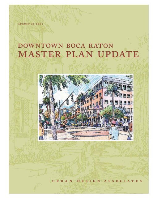
august 27 2007downtown boca raton<strong>master</strong> <strong>plan</strong> <strong>update</strong>urban design associates
downtown boca raton<strong>master</strong> <strong>plan</strong> <strong>update</strong>PREPARED FORCommunity RedevelopmentAgency<strong>City</strong> <strong>of</strong> <strong>Boca</strong> <strong>Raton</strong>PREPARED BYUrban Design AssociatesCONSULTANT TEAMGlatting Jackson Kercher AnglinLaQuatra Bonci AssociatesLive, Work, Learn, PlayZimmerman Volk Associatesi
CONTENTSSECTION A: INTRODUCTIONUpdating the Vision 2Process 4Issues 8SECTION B : GENERAL RECOMMENDATIONSPlanning Strategy 14The Plan 16SECTION C : FRAMEWORKSFrameworks 22Design Guidelines 34SECTION D : QUARTERSQuarters 44SECTION E : INITIATIVESInitiatives 52SECTION F : IMPLEMENTATIONImplementation 66APPENDIX : TECHNICAL ANALYSIS(UNDER SEPARATE COVER)Public ProcessTrafficCommercial and RecreationResidential Marketiii
introduction
SECTION AINTRODUCTIONupdating the visionThis Master Plan Update was commissionedto provide a framework for successfullyrealizing the Vision for Downtown<strong>Boca</strong> <strong>Raton</strong> in the context <strong>of</strong> theissues it faces today. The original Visionfor Downtown <strong>Boca</strong> <strong>Raton</strong> was clearlyarticulated in 1982:“The community <strong>of</strong> <strong>Boca</strong> <strong>Raton</strong> isunique. As part <strong>of</strong> one <strong>of</strong> the most rapidlygrowing regions in the country, ithas maintained standards <strong>of</strong> excellencein the residential neighborhoods whichensure continuing economic vitality andenvironmental quality. Now is the timeto apply the same standards <strong>of</strong> excellenceto Downtown, before its declineas a commercial center and acceleration<strong>of</strong> blight go any further. Redevelopmentimplies a long-range commitment to apublic policy to enhance the Downtownfor present and future generations tolive, work, shop, and enjoy.”Much was accomplished as a result <strong>of</strong>that vision and the <strong>plan</strong>s that followed.SANBORN SQUARE This early effortto create a public space in the center <strong>of</strong>Downtown provides a quiet and relaxingplace along Federal Highway anda setting for the historic Town Hall byAddison Mizner.MIZNER PARK One <strong>of</strong> the most recognizedand celebrated urban developments<strong>of</strong> recent times, this mixed-useproject created an urban focus for cultural,retail, business, and residentialuses in Downtown.ARTS AND CULTURE The Art Museumand Amphitheater, developed as part<strong>of</strong> Mizner Park, have become the focus<strong>of</strong> cultural life for the <strong>City</strong>.TAMING OF FEDERAL HIGHWAY Bycoordinating traffic on several arterials,it was possible to prevent the wideningto six lanes <strong>of</strong> this major thoroughfare.PLAZA REAL SOUTH A public easementthrough a private developmenthas created an urban street lined withrestaurants and mixed-use buildings.With Mizner Park, <strong>Boca</strong> <strong>Raton</strong> led theway in developing urban town centersand reestablishing the idea <strong>of</strong> a Downtownon the Florida Coast. It became amodel for others to follow. As a result,it now finds itself in competition withnewer, more urban developments. Andthere is an increasing sense that theDowntown has lost its way with respectto achieving the vision created in 1982.For these reasons, the <strong>City</strong> commissionedthis Plan Update to provide aframework for making informed decisionson the location, type, and design <strong>of</strong>development, and on priorities for funding.This Master Plan Update will alsobe coordinated with the ComprehensivePlan Update and the Multi-ModalTransportation District efforts.Town HallSanborn SquareMizner ParkPlaza Real South2
Plaza Real SouthMizner BoulevardGlades RoadDixie HighwayFederal HighwayIntracoastalWaterwayNW <strong>Boca</strong> <strong>Raton</strong> BoulevardNW First AvenueNorth Ocean BoulevardPlaza RealCrawford BoulevardNE First Avenue<strong>City</strong> HallWest Palmetto Park RoadDixie HighwayFederal HighwayMizner BoulevardEast Palmetto Park RoadSouth Ocean Boulevard<strong>Boca</strong> <strong>Raton</strong> Resortand ClubLake <strong>Boca</strong> <strong>Raton</strong>Camino Gardens BoulevardEast Camino RealAtlanticOceanEast Camino RealDixie HighwayFederal HighwayDowntown <strong>Boca</strong> <strong>Raton</strong> Today: All <strong>of</strong> the buildings are color coded by type <strong>of</strong> use. Public open space is indicated in dark green.SINGLE-FAMILYRESIDENTIALMULTI-FAMILYRESIDENTIALCOMMERCIAL /MIXED-USEINSTITUTIONSINDUSTRIALPARKS ANDOPEN SPACE3
A great deal <strong>of</strong> common groundexists on the need for the <strong>Boca</strong> <strong>Raton</strong>Downtown Master Plan to:» Improve the public realm,» Improve connectivity for peopleand vehicles,» Support existing special places andprovide ideas for new special places,and» Create a sense <strong>of</strong> wholeness toDowntown.Building on this common ground,the Downtown Master Plan is beingdeveloped so that it is able to serve asboth a tool to guide decision-makingrelated to <strong>Boca</strong> <strong>Raton</strong>’s downtown, andto provide ideas to inspire existing andnew developments to provide the diversityand type <strong>of</strong> development for aneconomically healthy and sustainableDowntown <strong>Boca</strong> <strong>Raton</strong>.An informal group discussion at an open house meetingCommercial X-Ray analysis and a preliminary framework drawingCitizen presentation at a public meetingProposed road section along Palmetto Park Road5
SECTION AINTRODUCTIONGreen dots show participants’ views <strong>of</strong> <strong>Boca</strong> <strong>Raton</strong>’s strengthsSTRENGTHSParticipants were provided a base map<strong>of</strong> Downtown <strong>Boca</strong> <strong>Raton</strong> as well asthree green, three red, and three bluedots. They were asked to use the dotsto identify those places on the map thatthey considered to be strengths (greendots), weaknesses (red dots), and priorityareas for change that would helpachieve their vision for the future (bluedots). The summary <strong>of</strong> each <strong>of</strong> the dottypes provides valuable insights.The pattern <strong>of</strong> green dots creates anorth /south pattern reflecting the areasthat have been most worked on duringthe past 20 years.»»»»»»»»»»»»»»Mizner ParkRoyal Palm PlazaSanborn SquareMix <strong>of</strong> usesLike that downtown is not toodenseTown Hall, heritage<strong>Boca</strong> <strong>Raton</strong> Resort and ClubOceanfrontSilver Palm ParkCivic uses – <strong>City</strong> Hall, LibraryLandscapingMix <strong>of</strong> restaurantsCultural activitiesAdjacent residential areasPhotos showing some <strong>of</strong> <strong>Boca</strong> <strong>Raton</strong>’s strengths:Sanborn Square, the <strong>Boca</strong> <strong>Raton</strong> Resort,Mizner Park, and the beach.6
WEAKNESSESThe red dots, or worst places, are generallyin an east / west pattern. The greatestconcentration <strong>of</strong> these are in the center<strong>of</strong> Downtown. This suggests that thenext phase <strong>of</strong> effort needs to completethe north /south connections in this areaand deal with east / west ones, especiallyalong Palmetto Park Road.Red dots highlight weaknesses in <strong>Boca</strong> <strong>Raton</strong>CONNECTIONS»»»»»»Not pedestrian-friendly; Downtownlacks connectivityDifficult experiences in traffic andintersectionsLack <strong>of</strong> connection to waterfront /access to waterNot enough green spaceIntersection <strong>of</strong> Federal and PalmettoPoor entrances and exits(except southern)PLACES»»»»»Palmetto Park RoadAbandoned Wildflower propertyNo sense <strong>of</strong> placeRundown propertiesStretch <strong>of</strong> Dixie Highway, behindMizner ParkAS WELL AS…» Parking» Uncertainty and stalleddevelopment» Lack <strong>of</strong> relevant activitiesPhotos illustrating the problems <strong>of</strong> <strong>Boca</strong> <strong>Raton</strong>such as street widths and commercial uses7
SECTION AINTRODUCTIONissuesAt the most fundamental level, the issueis whether Downtown can become acohesive Downtown. It is now perceivedto be a collection <strong>of</strong> separateplaces. On the positive side, it has all <strong>of</strong>the functions you would expect to findin a Downtown, including <strong>City</strong> Hall,museums, a library, post <strong>of</strong>fice, <strong>of</strong>ficebuildings, shops, educational uses, performancevenues, parks, and an increasingamount <strong>of</strong> residential uses. But, itdoes not have the coherence that bringsall <strong>of</strong> these uses together.The portrait drawing on page 3 clearlyillustrates one <strong>of</strong> the key problems facingDowntown. It is a narrow, north /southband <strong>of</strong> mixed-use development, cut <strong>of</strong>ffrom other parts <strong>of</strong> the <strong>City</strong>. Downtownis constrained by the barriers created bynorth /south arterials and the railroadlines which have made it difficult to createa unified Downtown. Most people’sperceptions <strong>of</strong> Downtown’s boundariesinclude the railroad tracks as the westernedge, or even Federal Highway. And yet,<strong>City</strong> Hall, the library, and the Children’sMuseum are west <strong>of</strong> that boundary. Peopleexpress great pleasure about walkingamong uses in certain specific areassuch as Mizner Park, but experiencegreat difficulty in walking across majorstreets. As a result, Downtown presentsitself as a collection <strong>of</strong> separated and isolateddestinations. There is evidence thatsome businesses are leaving and that thecompetition from more urban and walkabledowntowns is drawing customersthat would otherwise come here.As illustrated on page 9, most <strong>of</strong> thecurrently approved development proposalsare located within this same narrownorth-south band. Each is designedwith concern for the public realm immediatelyaround it, but without an overallframework, it is difficult to visualize howthey would all work together to create aDowntown.In short, Downtown <strong>Boca</strong> <strong>Raton</strong> hasnot been able to maintain its early leaddue to a series <strong>of</strong> factors that have preventedthe vision from being fully realized.PEDESTRIAN NETWORKAn essential element in successful downtownsis an interconnected network <strong>of</strong>streets and open space that providescomfortable pedestrian connections.<strong>Boca</strong> <strong>Raton</strong> has successful pedestrianpockets, but fails to provide a pedestriannetwork that links its various parts. Aparticularly vivid example can be seenon Palmetto Park Road where, despiteefforts to create a pedestrian-friendlyenvironment, past programs have beenunsuccessful in doing so. The emphasisgiven to through traffic, combined withroad and sidewalk design that encouragevehicles to travel at high speed, hasmade it impossible to provide this vitalattribute.DEVELOPMENT PROCESSWhile the original vision called foran holistic approach to developmentin which each part contributes to thewhole, most projects are conceived anddealt with by the <strong>City</strong> on a project-byprojectbasis.Existing conditions along Federal Highwayand Palmetto Park Road8
Plaza Real SouthMizner BoulevardDESIGN GUIDELINESOriginally conceived to simplify thedevelopment process, the existing designguidelines have become cumbersome.They are overly simplistic with the samerequirements irrespective <strong>of</strong> site size orlocation. This has resulted in a uniformrather than diverse built result.DEVELOPMENT MARKETIn recent years, the strong, high-endinvestor and second home market forcondominiums has produced very highland values and units which are notoccupied much <strong>of</strong> the year, if at all. It hasnot been considered feasible to developyear-round housing in a wide range <strong>of</strong>prices because <strong>of</strong> the high land cost.This Presents an impediment to thelong-term viability <strong>of</strong> Downtown.Crawford Boulevard<strong>City</strong> HallWest Palmetto Park RoadNW <strong>Boca</strong> <strong>Raton</strong> BoulevardDixie HighwayNW First AvenueFederal HighwayNE First AvenuePlaza RealMizner BoulevardEast Palmetto Park RoadBARRIERSThe combined barriers which definethe edges <strong>of</strong> Downtown have causedthe <strong>City</strong> and the development communityto focus all <strong>of</strong> their efforts in anorth-south corridor, limiting the range<strong>of</strong> development opportunities and preventingthe creation <strong>of</strong> a truly cohesive,real Downtown.Portrait <strong>of</strong> existing conditions in <strong>Boca</strong> <strong>Raton</strong>, including proposed future developments, as <strong>of</strong>March 2007Diagram and photo <strong>of</strong> existing barriers within downtown <strong>Boca</strong> <strong>Raton</strong>9
SECTION AINTRODUCTIONBlue dots mark participants’ visions for <strong>Boca</strong> <strong>Raton</strong>Underutilized land in the spine area and “pedestrian calming” elements along Palmetto Park RoadAreas for future visions and improvement: 1st Street, pedestrian realm, and Federal HighwayVISIONSParticipants identified a number <strong>of</strong> prioritiesfor change in Downtown <strong>Boca</strong><strong>Raton</strong> by placing blue dots on the map.These priorities point to specific placeswhere change is needed. The most denseclusters <strong>of</strong> blue dots show support fortaking action to:» Improve Palmetto Park Road East» Take action on the Wildflowerproperty» Address the future <strong>of</strong> the ‘Spine’areaIn addition to identifying the needto improve specific places, there was alsowidespread support for creating a Downtownthat:» Is more pedestrian-friendly» Provides a mix <strong>of</strong> people and placesto go, and many different reasons tocome Downtown» Has a variety <strong>of</strong> building types andarchitectural harmony» Has a strong cultural atmosphere» Provides people with the recreation,leisure, and outdoor options they’relooking for, while also meeting residents’daily life needs» Has an identity» Connects people to water» Is a place for families to live andgrow; <strong>of</strong>fers quality <strong>of</strong> place to livework-playand affordable housingfor employees» Takes advantage <strong>of</strong> the demographicaffluence, while also creating theconditions that allow small momand-popshops to thrive.10
SUMMARY OF KEYMESSAGES TO DATE»»»»»Many people are excited by theopportunity to strengthen Downtown<strong>Boca</strong> <strong>Raton</strong>. They see a needand opportunity for the MasterPlan to connect a series <strong>of</strong> strong,yet currently disconnected, parts <strong>of</strong>Downtown.There is widespread agreementregarding many <strong>of</strong> the steps thatcan be taken to strengthen theconnections in Downtown. Thisincludes creating and enhancingpedestrian, cycling and transitconnections while still facilitatingsmooth car access and parking.Many people are looking at <strong>Boca</strong><strong>Raton</strong>’s Downtown and comparingit to what’s happening in nearbyareas like Las Olas and DelrayBeach. They are interested in making<strong>Boca</strong> <strong>Raton</strong> a place that hasmore <strong>of</strong> the activity, life, and feel <strong>of</strong>these places, and also better meetsthe needs <strong>of</strong> the residents.The Intracoastal Waterway and theAtlantic Ocean are great assets toDowntown <strong>Boca</strong> <strong>Raton</strong>. The <strong>City</strong>would benefit from easier accessfrom Downtown to enjoy the water.It is important to take advantage<strong>of</strong> opportunities to preserve andcelebrate <strong>Boca</strong> <strong>Raton</strong>’s heritage.This should be done in a way thatfits with the other elements <strong>of</strong> thefuture vision many people have forthe <strong>City</strong>.»»In order to make the Master Plan areality, some critical policy changeswill be required to facilitate publicand private investment as well asdevelopment and design decisions.In response to the ideas testedduring the Charrette, participantsidentified and confirmed that priorityareas for actions include:› Making it easier to cross CentralPalmetto Park Road – this is acritical Downtown connection.› Making it possible to connectsouth from Mizner Park to RoyalPalm Plaza.› Making more <strong>of</strong> Sanborn Square,how it’s used and how it’s connectedto the surrounding area.› Improving Palmetto Park RoadEast, including dramaticallyimproving the streetscape andexperience for people makingtheir way to the waterfront.GOALS AND PRINCIPLESFrom this input and our analyses, wehave identified a set <strong>of</strong> Goals which canserve as Planning Principles:» Create a unique identity for Downtown<strong>Boca</strong> <strong>Raton</strong> as the cultural,civic, and specialized retail center <strong>of</strong>the region, with a full complement<strong>of</strong> residential accommodations andrecreational amenities.» Create a comfortable pedestrianscaleenvironment connecting all<strong>of</strong> the parts <strong>of</strong> Downtown, whileproviding appropriate accommodation<strong>of</strong> vehicular movement.»»»»Provide an appropriate mix <strong>of</strong><strong>of</strong>fice, residential, hotel, retail, cultural,civic, and recreational uses.Provide a coordinated strategy forparking and access.Provide the basis for a diversearchitectural and environmentalcharacter for the various parts <strong>of</strong>Downtown that both reflect its historyand current scale.Enhance Downtown’ s connectionto the waterfronts and its quality <strong>of</strong>open space.11
general recommendations
SECTION BGENERAL RECOMMENDATIONS<strong>plan</strong>ning strategyDuring the <strong>plan</strong>ning process, the needto create a better pedestrian networkconnecting Downtown’s various partsemerged as the participants’ top priorityfor this part <strong>of</strong> the city.This straightforward goal will bedifficult to achieve given the physicalconstraints <strong>of</strong> Downtown, especially thenorth/south barriers.However, it can be accomplishedwith a collaborative effort among publicagencies, especially those responsiblefor transportation, private developmentinterests, and citizens groups. Theseries <strong>of</strong> diagrams on this page suggestsa strategy for connectivity which can beaccomplished incrementally. Each publicworks improvement, each individualdevelopment, and each individual propertyimprovement should be done withinthis strategy. In that way, the collection<strong>of</strong> individual efforts will result in a unifiedwhole.The sequence illustrates how totransform Downtown from a collection<strong>of</strong> separate destinations into an integratedDowntown with a collection <strong>of</strong>unique addresses.SEPARATE DESTINATIONSA series <strong>of</strong> successful but containedand separate destinations exists, withpedestrian-scaled environments withinthem, but without connection to eachother. These include Mizner Park, SanbornSquare, Plaza Real South, parts <strong>of</strong>Royal Palm Plaza, Silver Palm Park, andCamino Real west <strong>of</strong> Federal Highway.BARRIERSThe design <strong>of</strong> many streets and lack <strong>of</strong>adequate sidewalk areas, together withthe high speed <strong>of</strong> traffic on some <strong>of</strong> themajor arterials, cause the street patternto form a series <strong>of</strong> barriers that preventconnections between destinations.14
A NEW GREEN NETWORKBy systematically improving sidewalks,streetscapes, pedestrian crossings, andpublic open space, it is possible to createan interconnected network that willencourage people to use the whole <strong>of</strong>Downtown instead <strong>of</strong> one isolated destinationat a time.THE GREEN NETWORK ANDTHE STREET PATTERNThe basis <strong>of</strong> this network is already inplace. It can be extended in some areaswithout conflicts with key vehicularroutes. The most critical points are thosein which the pedestrian network crossesmajor arterials or runs along them.Key areas include Federal Highway,NE and NW Second Street, PalmettoPark Road, <strong>Boca</strong> <strong>Raton</strong> Boulevard, andMizner Boulevard.A COLLECTION OFQUARTERSThe green network makes it possible toreinforce the existing destinations andanchors as well as to connect them. Italso provides a framework for additionaldevelopment around and between thoseanchors. Because the various areas withinDowntown have different charactersand uses, we recommend that definedareas be established within Downtown,each with its own character and mix <strong>of</strong>uses. These areas could be thought <strong>of</strong>as neighborhoods or ‘Quarters,’ suchas the Mizner Park Quarter, The SanbornSquare Quarter, etc. Within eachQuarter there should be a mix <strong>of</strong> usesincluding residential, <strong>of</strong>fice, cultural,retail, civic, and entertainment, but thebalance <strong>of</strong> uses, scale <strong>of</strong> buildings, andcharacter <strong>of</strong> public open space would bedifferent.15
SECTION BGENERAL RECOMMENDATIONSthe <strong>plan</strong>To implement this strategy, the MasterPlan Update is organized into two categories:Frameworks and Quarters.FRAMEWORKSThe creation <strong>of</strong> an interconnected network<strong>of</strong> pedestrian-scaled streets andpublic open space will provide the muchneeded connectivity between the parts<strong>of</strong> Downtown. It can be achieved as acollection <strong>of</strong> individual initiatives andefforts, rather than one massive operation,but there needs to be a consistentapproach to management and design.QUARTERSThe Frameworks serve a series <strong>of</strong> Quarters,each with its own character andtypes <strong>of</strong> uses. New development withineach quarter should be designed withcareful attention to the way in whichthe proposed development will support,enhance, and build upon the assets whichexist today. The Quarters include:Open Space Framework12Mizner Park Quarter, a parklikespace serving retail, <strong>of</strong>fices, shops,and cultural uses;Sanborn Square Quarter, a diversemix <strong>of</strong> uses and building types adjacentto Sanborn Square;42153Plaza Real South Quarter, a busy<strong>of</strong>fice and retail quarter with tallbuildings;345<strong>City</strong> Hall Quarter which includes<strong>City</strong> Hall, the new library and<strong>of</strong>fice uses related to the futuretransit stations;Palmetto Park East Quarter whichwill create a pleasant walk to theIntracoastal waterway; andQuarters Diagram616
6 Camino Real Quarter which is adiverse mix <strong>of</strong> separate addressesconnected by well-landscaped roads.The Master Plan Update identifiesa series <strong>of</strong> Initiatives within each<strong>of</strong> these Quarters. They all combineimprovements to the public realm andthe Framework as well as private development.In this way, ‘whole addresses’can be created with each developmentinitiative. The <strong>plan</strong> drawing on the followingpage highlights potential developmentsand public improvements ineach <strong>of</strong> the Quarters. The perspectivedrawings on these pages illustrate theway in which improvements to the publicrealm should be coordinated withdevelopment projects.Perspective <strong>of</strong> an improved Palmetto Park Road, west <strong>of</strong> Federal HighwayPalmetto Park Road, east <strong>of</strong> Mizner Boulevard, with an improved residential and pedestrian environment17
SECTION BGENERAL RECOMMENDATIONSA view <strong>of</strong> a revised intersection crossing Palmetto Park Road at Plaza Real SouthImproved street crossing for NE First Avenue at NE Second Street south <strong>of</strong> Mizner Park18
Plaza Real SouthMizner BoulevardNW <strong>Boca</strong> <strong>Raton</strong> BoulevardNW Fourth StreetNW First AvenuePlaza RealNW Third StreetCrawford BoulevardNW Second StreetNE First AvenueEast Palmetto Park RoadDixie HighwayEast Royal Palm RoadFederal HighwayMizner BoulevardSE Fifth StreetSW Seventh Street<strong>Boca</strong> <strong>Raton</strong> Resort and ClubEast Camino RealIllustrative Master Plan: Potential future development programs are illustrated in bold colors19
frameworks
SECTION CFRAMEWORKSframeworksThe proposed Framework <strong>of</strong> Streetsand Public Open Space is illustrated inthe large diagram on the facing page. Itemphasizes the continuity <strong>of</strong> pedestrianexperience throughout the Downtown. Toachieve this, a series <strong>of</strong> modifications tothe current framework are needed. All <strong>of</strong>these are essential to the effective development<strong>of</strong> the Multi-Modal TransportationDistrict which will change the basis forevaluating development potential.Design Guidelines are another type<strong>of</strong> Framework that gives form to development.We have included suggestionsfor revising those guidelines in thissection because they are based on thecharacter <strong>of</strong> the streets and public openspaces on which they are located.ESTABLISH A HIERARCHYOF STREETSTo use new techniques that can bothaccommodate the needs <strong>of</strong> traffic andcreate a pedestrian environment effectively,it is first necessary to recognizethe different categories <strong>of</strong> streets andtypes <strong>of</strong> traffic.APPLY URBAN STANDARDSTO DOWNTOWNTHOROUGHFARESFlorida’s version <strong>of</strong> the Context-BasedThoroughfare Program provides anopportunity to introduce urban standardson through streets in Downtown.The <strong>City</strong> should consider applyingurban standards to the portion <strong>of</strong> FederalHighway between Camino Real andMizner Boulevard, East Palmetto ParkRoad <strong>of</strong> Crawford Boulevard, and all<strong>of</strong> Mizner Boulevard, and North EastSecond Street.CREATE PEDESTRIANCROSSWALKSKey connections including NE SecondStreet at Plaza Real North and PalmettoPark Road at Plaza Real South shouldinclude pedestrian lights, expandedcrosswalks, and streetscape improvements.IMPROVE SIDEWALKSImprove the pedestrian environmentwith a combination <strong>of</strong> public improvementsand enhanced design guidelinesfor private development.IMPROVE AND COMPLETEBIKEWAY NETWORKEnhance the safety <strong>of</strong> bicycle lanesthrough design changes and fill gaps inthe existing system.DEVELOP A PARKINGPROGRAMDevelop a Parking Program that combinespublic garages and public parkingspaces on private developments.SUPPORT TRANSITINITIATIVESSupport Transit in all forms, includingregional rail on the FEC line, Shuttlesto Tri-Rail, and the Downtown Circulatoras part <strong>of</strong> the parking system.REVISE DESIGNGUIDELINESRevise the Design Guidelines to encouragediversity <strong>of</strong> building form andenhancement <strong>of</strong> the public realm.Urban street standardsCreate pedestrian crosswalksImprove sidewalksParking programTransit initiative22
Plaza Real Real South SouthMizner BoulevardBoulevardNW <strong>Boca</strong> <strong>Boca</strong> <strong>Raton</strong> <strong>Raton</strong> BoulevardBoulevardPlaza RealNW Fourth StreetNW Third StreetCrawford BoulevardBoulevardNW Second StreetNE NE First First Avenue Avenue<strong>City</strong> HallNW First AveDixie HighwaySE First StreetEast Palmetto Park RoadEast Royal Palm RoadFederal Highway HighwayMizner BoulevardBoulevardSE Fifth Street<strong>Boca</strong> <strong>Raton</strong> Resortand ClubEast Camino RealFramework Diagram: Streets and Public Open Space23
Mizner BoulevardSECTION CFRAMEWORKSSTREET HIERARCHYThe engineering and design <strong>of</strong> some <strong>of</strong>the streets in Downtown are based onstandards that generally apply to suburbanconditions, encourage high speedtravel, and are not consistent with thegoal <strong>of</strong> creating a unified downtown. Inrecent years, a series <strong>of</strong> advancementsin the art <strong>of</strong> street design have providedsome techniques for both serving trafficneeds and creating an appropriate urbanenvironment. To use these techniques, itis first necessary to recognize the differentcategories <strong>of</strong> street and that a hierarchyexists based on the volumes andtypes <strong>of</strong> traffic. With this agreed to, itis possible to modify the detailed design<strong>of</strong> existing streets to be consistent withtheir urban function and the nature <strong>of</strong>traffic using them. The hierarchy wouldinclude the following idealized modelswhich then serve as a model for revisionsto existing streets:TYPE AType A streets are high mobility streetsthat may carry a great deal <strong>of</strong> throughtraffic but which also need to providesafe and comfortable pedestrian environmentsassociated with mixed andsometimes dense land uses. The design<strong>of</strong> these streets must enable pedestriansto cross safely at key points. Theseinclude Federal Highway, PalmettoPark Road West <strong>of</strong> Federal Highway,Camino Real west <strong>of</strong> Federal Highway,and Dixie Highway (limited pedestrianrole at Second Street and Palmetto ParkRoad).TYPE BType B streets provide a combination <strong>of</strong>access and mobility both <strong>of</strong> which areimportant to the overall network. TypeB streets carry some through traffic, buttypically at a lower volume than TypeA. These are <strong>of</strong>ten four lane (or more)Street Type DiagramDixie HighwayNW Second Streetdivided streets located in more sensitivecontexts in which increased pedestrianmovements need to be respected. Theyinclude Palmetto Park Road betweenFederal Highway and Mizner Boulevard,Mizner Boulevard, and CaminoReal east <strong>of</strong> Federal Highway.TYPE CAccess streets, Type C streets are eitherthree-lane streets or two lanes with amedian. They provide vehicular access toparking and pedestrian access to homesand businesses and have the highestlevel <strong>of</strong> activity and conflicts. As such,they should be designed to encourageslower speed traffic and to serve pedestrian-scaleuses along them. SecondStreet and East Palmetto Park Road <strong>of</strong>Mizner Boulevard are examples <strong>of</strong> TypeC streets.Federal Highway HighwayNE First First Avenue AvenueEast Palmetto Park RoadTYPE DType D are two-lane local streets whichcarry primarily local traffic. These are<strong>of</strong>ten streets that provide access to residentialareas. Vehicle speeds should below in anticipation <strong>of</strong> unexpected pedestrianmovements (such as children).Dixie Highway, indicated in red inthe <strong>plan</strong> diagram, will carry the mostthrough traffic and for much <strong>of</strong> itslength will accommodate higher speed.Additional landscape treatment shouldbe provided in the public right-<strong>of</strong>-wayon both sides <strong>of</strong> the road, especially theeast side <strong>of</strong> the road. In the area betweenPalmetto Park Road and Second Street,traffic should be slowed down in orderto facilitate pedestrian cross walks.jaywalk.24
TYPE A12' 8' 6' 7' 11' 11'11' 11' 7' 6' 20'TYPE DTYPE CTYPE B8' 6' 6' 7' 10' 10'10' 10' 6' 20'14' 6' 8' 10' 10' 8' 6' 6' 8' 14' 6' 8' 10' 11' 10' 8' 6' 6'Alternative Type C as three-lane street with a center turn lane5' 5' 6' 6' 9' 9' 6' 10'Detailed cross-sections <strong>of</strong> street types25
Mizner BoulevardBoulevardSECTION CFRAMEWORKSURBAN STANDARDS FORDOWNTOWN THOROUGHFARESThe idealized models when applied toexisting streets suggest a series <strong>of</strong> modifications.These can apply to the streetsindicated in the diagram on this page.A more detailed description is providedfor both Federal Highway and East PalmettoPark Road.Dixie HighwayChange Traffic Signal Cycles inthe Pedestrian ZoneBy switching to shorter traffic signalcycles (e.g., 60 seconds instead <strong>of</strong> 120seconds), pedestrians will be able to crossmore frequently and not be tempted tojaywalk. Capacity will be preserved oreven enhanced if these shorter cycles aretimed to create a 25- to 30-mph vehicleprogression speed.NW Second StreetFederal HighwayNE NE First Avenue AvenueEast Palmetto Park RoadEliminate Right Turn Lanes In thePedestrian ZoneThe presence <strong>of</strong> dedicated right-turnlanes is an anti-urban, anti-pedestrian(longer cross walks, high speed rightturns) element that typically is not basedon capacity needs, but on preservingvehicle speed in the moving lanes. Sincethe traffic signal timing would be set toa speed <strong>of</strong> 25 to 30 mph, speed preservationshould no longer be a goal.Add Traffic Signals / CrosswalksAs speeds are reduced and balance isestablished, urban traffic signal spacingwill improve both pedestrian and vehicularaccess and circulation. The 300- to325-foot spacing <strong>of</strong> intersections <strong>of</strong> theexisting street grid is a perfectly acceptablespacing <strong>of</strong> signals in a downtown.Streets with improvements in urban standardsThrough vehicles would still be able toprogress along the timed corridor at 25to 30 mph.As the development <strong>of</strong> such a streetprogresses, more time-intensive effortsto balance the street should follow.These may include:» Lane Width Reduction: 10- or 11-foot lanes are appropriate at targetspeed.» Eliminate Shoulder: No shoulder isrequired on this urban street.» Median with Trees: Verticalelements tend to reduce vehiclespeeds.»»»»»»Add Edge Vertical Elements (trees,furniture, parking)Reduced Length Left-Turn Lanes(Resulting from shorter signalcycles)Add People or Evidence <strong>of</strong>People (tables, chairs, etc.)Pedestrian-Scale LightingBuilding HeightUrban Signage (edge razor signsand similar); perpendicular tostorefronts26
Federal HighwayFederal Highway is, <strong>of</strong> course, an importantroute for vehicular movement.Solutions along a shared street such asthis should be focused on creating anappropriate balance between driver andpedestrian needs (as opposed to wants).Vehicles need adequate capacity alongthe corridor, but they do not need todrive at excessive speeds. Pedestriansneed a space that is safe and comfortable,not one that encourages disorganized ordangerous crossings. Fortunately, severalrelatively low-cost initial design techniquescan be used to achieve the desiredbalance among competing needs.These include changing traffic signalcycles, improving crosswalks, addingpedestrian signals and trees, and eliminatingturning lanes. As new developmenttakes place, or as funding becomesavailable, modifications to street widthcan be considered.Existing conditionsFuture condition <strong>of</strong> new development alongFederal Highway with setback and/or curbmodificationsIntersection diagram <strong>of</strong> the existing condition<strong>of</strong> Federal Highway at Palmetto Park RoadIntersection diagram <strong>of</strong> Federal Highway atPalmetto Park Road, after improvements aremadeBefore (left) and after (right) sections <strong>of</strong> NE Second Street at Plaza Real27
SECTION CFRAMEWORKSEast Palmetto Park RoadTwo alternatives have been tested forPalmetto Park Road, both with the goal<strong>of</strong> establishing a better pedestrian-vehiclebalance.Alternative 1: Thee-lane section withmedian. The effects <strong>of</strong> creating a threelanesection <strong>of</strong> Palmetto Park Roadbetween Mizner Boulevard and NE 5thAvenue do not appear to be overly burdensome.The <strong>Boca</strong> <strong>Raton</strong> DowntownDRI Report indicates that 865 cars perhour in the peak direction are expectedby the year 2020. This is well withinthe capacity <strong>of</strong> one moving lane in eachdirection, plus a center turn lane, in asection with no traffic signals. Accordingto <strong>City</strong> Engineering staff analyses,the intersections on either end <strong>of</strong> thecorridor (Palmetto Park Road at MiznerBoulevard and NE 5th) would operateat no worse than vehicle level <strong>of</strong> serviceD under the proposed configurations.Even if this level <strong>of</strong> capacity werenot available, reduced peak hour vehiclelevels <strong>of</strong> service in a downtown areaare common and can even be desirablewhen trying to create a balancedenvironment. In addition to daily traveldemands, this street is an importantemergency evacuation route for islandresidents. A population <strong>of</strong> the sizeexpected to be on the island could easilybe evacuated over a two-to fourhourperiod in two outbound lanes inthe case <strong>of</strong> weather or other type <strong>of</strong>emergency, depending on traffic controland street operation <strong>plan</strong>s. A three-lanesection would allow this two-lane outboundtype <strong>of</strong> operation to occur easily.As indicated in the <strong>plan</strong>, the middlelane should have a different paving surfaceand would also be used by emergencyvehicles or when there is a vehiclestopped in the moving lane. It can alsobe a second stacking lane for cars waitingwhen the bridge is closed.The detailed design <strong>of</strong> theseimprovements will require special careto align with the lanes on the bridge.We recommend that the transition takeplace east <strong>of</strong> Fifth Avenue.Alternative 2: In the course <strong>of</strong> the <strong>plan</strong>ningprocess, the design team evaluatedan alternative concept. By eliminatingboth the parking lane and the median,it will be possible to both provide fourmoving lanes and expand the width <strong>of</strong>the sidewalks on both sides. The <strong>City</strong>could consider operating this as a fourlaneroad during the day and then usethe outside lanes for parking in the evening.The cross section indicates that thesidewalk areas have sufficient dimensionto encourage the landscape treatmentillustrated in the perspective. However,there is a greater distance from curb tocurb for crosswalks located at intersectionsthan the three-lane option.We recommend the three-laneoption, in part because it provides themost flexibility for emergency vehiclesin the event <strong>of</strong> a blocked lane.Before view <strong>of</strong> East Palmetto Park RoadImproved pedestrian environment on EastPalmetto Park Road28
Existing <strong>plan</strong> (left) and section (right) <strong>of</strong> East Palmetto Park Road12' 6' 5'-6'' 45'5'-6'' 6' 10'Revised <strong>plan</strong> (left) and section (right) <strong>of</strong> East Palmetto Park Road,showing a three-lane section17' 11' 17'Revised <strong>plan</strong> (left) and section (right) <strong>of</strong> Palmetto Park Road, showinga four-lane section10' 10' 10' 10'29
Mizner BoulevardBoulevardSECTION CFRAMEWORKSPEDESTRIAN CROSSWALKSSeveral approaches to improving theexperience <strong>of</strong> pedestrians crossingstreets are needed to achieve the walkableenvironment that was a unanimousdesire <strong>of</strong> residents and stakeholders. Themost basic <strong>of</strong> these design approaches issimply to reduce the distance that mustbe crossed at key locations. In variouslocations, this may mean reducing thenumber <strong>of</strong> lanes, reducing the width <strong>of</strong>lanes, removing auxiliary elements (rightturn lanes, shoulders) or reducing cornerturning radii. For example, the intersection<strong>of</strong> Plaza Real (Mizner Park) and NESecond Street features a five-lane (widelanes) cross-section <strong>of</strong> NE Second Street.However, on either end <strong>of</strong> this importantpedestrian section (west <strong>of</strong> Federal Highwayand East <strong>of</strong> Mizner Boulevard), thereis only one traffic lane entering NE SecondStreet. So it is not likely that vehiclesneed these five lanes, and the space couldbe better balanced if the space were redistributed.These sorts <strong>of</strong> logical trade-<strong>of</strong>fscan and should be found at intersectionsthroughout the <strong>City</strong>.Priority intersections include: PalmettoPark Road at Plaza Real South,Federal Highway and Mizner Boulevard,NE Second Street at Dixie Highway,Federal Highway and Mizner Boulevard,and Mizner Boulevard at NEThird and Fifth Streets and at SE FirstStreet and Royal Palm Plaza.Dixie HighwayNW Second StreetEast Palmetto Park RoadProposed crosswalk improvements indicated with purple circlesFederal Highway HighwayRoyalPalmPlazaNE Fifth StreetNE Third StreetBefore and after diagrams showing the pedestrian improvements around Mizner Park30Before (left) and after (right) view <strong>of</strong> Second Street from Mizner Park
Mizner BoulevardBoulevardSIDEWALK IMPROVEMENTSThe pedestrian environment can beimproved through a combination <strong>of</strong>public improvements and enhanceddesign guidelines for private developmentthat include expanding sidewalkdimensions, improving the placement <strong>of</strong>landscape materials, and creating pedestrianopen spaces. Key locations include:Portions <strong>of</strong> Palmetto Park Road, FederalHighway, NE and NW Second Streetand Camino Real west <strong>of</strong> Federal Highway.Just as vehicles require particulardesign elements to be in place for safeand comfortable use, pedestrians requirefunctional elements such as adequatespace to move (side-by-side, in oppositedirection, around open doors, etc.) andbuffers from moving traffic (landscapingor parked cars). Palm trees are appropriateclose to the curb to define the streetand create a barrier from moving traffic.Shade trees with foliage beginning 7’-0”above ground level are essential in thisclimate. Both are required.Dixie HighwayNW Second StreetSidewalk improvements on various streetsFederal HighwayNE NE First Avenue AvenueEast Palmetto Park Road12' 8' 6' 8' 6' 6' 5' 5' 6'Type A - Residential Type B - Residential Type D - Residential20' 6'20' 6'10' 6'Type A - Commercial Type B - Commercial Type D- Commercial31
Mizner BoulevardBoulevardMizner BoulevardBoulevardSECTION CFRAMEWORKSBIKEWAY NETWORKThe existing bikeway system is nearlycomplete, but key gaps in the routebetween Downtown and Florida AtlanticUniversity (FAU) should be filled(Glades Road and Fourth /SecondStreets). Other gaps include the routealong the A1A. In addition, the physicalconfiguration in Downtown along NESecond Street should be an integral part<strong>of</strong> the revised streetscape program. Thediagram indicates the option <strong>of</strong> a bikeroute along East <strong>Boca</strong> <strong>Raton</strong> Road inorder to connect with the future publicopen space on the Wildflower site.Dixie HighwayNW Second StreetNE NE First First Avenue AvenueEast Palmetto Park RoadFederal Highway HighwayADDITIONAL BIKEWAY CONNECTIONSENHANCED BIKEWAY CONNECTIONSPARKING PROGRAMThe goal should be to serve more thanone use with parking facilities, so thatpeople will ‘park once’ when coming toDowntown. The garages at Mizner Parkhave excess capacity much <strong>of</strong> the time.Three approaches to managed parkingshould be considered:Dixie Highway1Portland-style leasing program, inwhich private and public parkingareas are put into a pool for jointuse on a fee basis.NW Second StreetEast Palmetto Park RoadNE First First Avenue Avenue2<strong>City</strong>-funded public garage to bebuilt in conjunction with privatedevelopment. In this case, concessionsto developers on parkingrequirements could be tied to fundingsupport for the garages.Federal Highway Highway3Joint funding <strong>of</strong> garages in specificdevelopments to include publicparking spaces.Proposed shared-use parking32
Mizner BoulevardBoulevardTRANSIT INITIATIVESThe Multimodal Transit Feasibilityand Funding Study will provide ways<strong>of</strong> coordinating various forms <strong>of</strong> transitwithin the <strong>City</strong> and the Region. Anearly action program will be the shuttlesystem between those areas which havebeen identified as activity centers and theTri-Rail Station. Although FAU and theHospital are most likely to support sucha shuttle system first, it will ultimatelybe expanded to serve Downtown.The concept <strong>of</strong> a Downtown Circulatoris an integral part <strong>of</strong> the recommendedparking program. If parkinggarages are efficiently connected to aseries <strong>of</strong> destinations, they are more likelyto be effective. However, the immediatedemand for such a facility may notbe strong enough to support it.Therefore, we suggest combiningthese two transit initiatives by establishinga route for a shuttle to Tri-Railand the other activity centers that makesa loop in the center <strong>of</strong> Downtown, asindicated on the diagram. The route runsfrom <strong>City</strong> Hall, along Second Street toMizner Boulevard, south to SE FirstStreet and north along Federal Highwayto Second Street and back to <strong>City</strong> Hall.This route comes within a five-minutewalk <strong>of</strong> most parking garages andattractions in the Downtown. As usageincreases, the Downtown Circulatorcould be expanded as its own program.Future transit facilities include acommuter rail station on the FEC tracks.We recommend that this be located nearNW Second Street and that it be coordinatedwith the construction <strong>of</strong> parkingfacilities currently being considered forthe new library.The concept <strong>of</strong> a Downtown Circulatorconnecting parking garages andthe major use areas within Downtownshould be encouraged. An early alignmentshould be considered that wouldDixie HighwayNW Second StreetTRI-RAIL SHUTTLE CONNECTIONprovide frequent service on a limitedloop and access within 500 feet <strong>of</strong> majorgarages and attractions in the core.A later phase could include the moreextensive loop currently being considered.MMTD District DiagramFederal HighwayTri-RailFAUNE NE First Avenue AvenueDowntownEast Palmetto Park RoadDOWNTOWN CIRCULATORElectric bus as downtown connector inNorfolk, VA between parking facilities anddowntown destinations33
SECTION CFRAMEWORKSdesign guidelinesAddison Mizner described one <strong>of</strong> hisdesign principles as follows: “Florida isflat as a pancake. You must build witha strong skyline to give your buildingcharacter.” This is evident in his drawingsfor <strong>Boca</strong> <strong>Raton</strong> and in the towersand fanciful ro<strong>of</strong>scapes <strong>of</strong> his buildings.He would not be pleased with theresults <strong>of</strong> the present system <strong>of</strong> designguidelines. The combination <strong>of</strong> a rigidheight limit, standardized setbacks, andmarket pressure to maximize developmentwithin the standard envelope createdby the guidelines have resulted in aseries <strong>of</strong> large, bulky buildings <strong>of</strong> similarform. They have been described as havinga crew-cut look. The resulting skylinecould also be described as flat as apancake.During the public process, therewere widely varied views about buildingheight. On the one hand, there weresome who felt that no building should begreater than two stories, and others wh<strong>of</strong>elt that buildings needed to be muchtaller to create the sense <strong>of</strong> a downtown.But most people felt that there wassomething wrong with the uniformityand lack <strong>of</strong> variety that is leading to aless personal character for Downtown.Therefore, in order to fulfill thevision for Downtown and create thequality <strong>of</strong> environment represented inthe images <strong>of</strong> the Master Plan Update,revisions to the current design guidelinesfor Downtown need to be made.We recommend that height bedefined by the number <strong>of</strong> stories ratherthan a fixed number <strong>of</strong> feet. The fixeddimension has led to squat floor-to-floorheights and makes it nearly impossibleto have the type <strong>of</strong> elements that areessential to creating the skyline Miznerwould have wanted. A full revision <strong>of</strong>the guidelines is beyond the scope <strong>of</strong>this Master Plan Update, but we suggesta more three-dimensional approach toresolving this issue. Pattern Books ratherthan Design Guidelines are <strong>of</strong>ten helpfulbecause they provide actual patternsrather than abstract formulas.We suggest an approach that beginswith the scale <strong>of</strong> the street. The presentdesign guidelines have the same setbackand height requirements, irrespective<strong>of</strong> where the site is or what the scale<strong>of</strong> the street might be. We recommendthat large-scale, through-streets havemore vertical facades with taller buildingsvisible from the street. This can bean effective means <strong>of</strong> taming traffic. Ifdrivers feel that they are driving throughan ‘urban room’ they will slow down inways and places where they typically donot if the space feels suburban. Smallscaleintimate streets are <strong>of</strong>ten best if thebuildings that are visible from the streetare two to four stories in height. Thepresent guidelines result in a buildingdensity. By revising the setback requirements,we are suggesting that the existingamount <strong>of</strong> building be redistributed.In some cases, it may be desirable to permitparts <strong>of</strong> the buildings to be higherthan the present limit in exchange formore public open space and more complexbuilding forms. Each <strong>of</strong> the fourstreet types described previously shouldhave its own design guideline provisions.50'30' 20'6'14' 10'Diagrams <strong>of</strong> current design guidelinesThe four cross-sections and axonometricdiagrams on pages 35 and 36illustrate one way in which this could beaccomplished. In each case, the amount<strong>of</strong> development permitted would bebased on the current guidelines, but thephysical configuration would be modified.The red line in the section drawingrepresents the setback and height limitscalled for by the present guidelines.The <strong>plan</strong> on page 37 indicates thelocation for each type <strong>of</strong> street. Thiscreates a framework for determiningthe forms <strong>of</strong> buildings that will create adifferent character as appropriate for thescale <strong>of</strong> the space.34
TYPE ALARGE-SCALE STREETS WITHHEAVY THROUGH TRAFFICThe present building setbacks are onlysix feet from the property line. However,the sidewalk design standards call for aminimum 26-foot setback from the curbline. To achieve this, many buildings willneed more than six feet in setback. Furthermore,we suggest that the standardscall for physical improvements to thepublic right-<strong>of</strong>-way that could includelandscape or structural elements such asthe trellis system illustrated at PalmettoPark Road and Federal Highway. Thesection illustrates a facade rising 6 storiesat the first setback line with higherfloors slightly stepped back above that.This would create an appropriate scaleurban space for wide, heavily traveledstreets, such as Federal Highway andPalmetto Park Road west <strong>of</strong> FederalHighway.CurrentSetbackLine26' 7'7' 30'Cross-section <strong>of</strong> the proposed guidelines underType A. Note: dashed red line denotes existingsetback criteriaThree dimensional diagram <strong>of</strong> a section <strong>of</strong> thedevelopmentTYPE BLARGE-SCALE STREETS WITHLESS THROUGH TRAFFICThe minimum setback from the curbshould be 26 feet, but the height <strong>of</strong> thebuilding at that facade line should be amaximum <strong>of</strong> 5 stories with higher floorsset back as described. The minimumsetback from the curb should also be 26feet, but the height <strong>of</strong> the building at thefacade line should a minimum <strong>of</strong> 4 storiestall. Higher floors would be set backfurther than those on Type A streets.CurrentSetbackLine26'15' 15' 30'Cross-section <strong>of</strong> the proposed guidelines underType BThree dimensional diagram <strong>of</strong> a section <strong>of</strong> thedevelopment35
SECTION CFRAMEWORKSTYPE CTHREE-LANE STREETS WITHMIXED-USE ACTIVITYThese should have frequent crosswalksand would have a smallerscale facade,except where special features are neededsuch as the termination <strong>of</strong> the MiznerPark axis. The setbacks would start atthe top <strong>of</strong> the third floor and taller elementswould be less visible from thestreet. The minimum setback from thecurb would be 20 feet, with 26 feet preferred.The facade at the first setbackshould be no more than 3 stories, withupper floors stepped back further thanTypes A and B.CurrentSetbackLine20'15' 15' 50'Cross-section <strong>of</strong> the proposed guidelines underType CThree dimensional diagram <strong>of</strong> a section <strong>of</strong>the developmentTYPE DTWO-LANE STREETSThese small-scale local streets andpedestrian ways should have deeper setbacks,as illustrated with taller elementsnot visible from the space <strong>of</strong> the street.CurrentSetbackLine16'30' 30' 50'Cross-section <strong>of</strong> the proposed guidelines underType DThree dimensional diagram <strong>of</strong> a section <strong>of</strong>the development36
Plaza Real Real South SouthMizner BoulevardBoulevardNW <strong>Boca</strong> <strong>Boca</strong> <strong>Raton</strong> <strong>Raton</strong> BoulevardBoulevardNW Fourth StreetNW First AvenuePlaza RealNW Third StreetCrawford BoulevardBoulevardNW Second StreetNE NE First First Avenue Avenue<strong>City</strong> HallDixie HighwaySE First StreetEast Palmetto Park RoadEast Royal Palm RoadFederal Highway HighwayMizner BoulevardBoulevardSE Fifth Street<strong>Boca</strong> <strong>Raton</strong> Resortand ClubEast Camino RealA framework diagram showing the streets <strong>of</strong> <strong>Boca</strong> <strong>Raton</strong> based upon typeTYPE A TYPE B TYPE C TYPE D37
SECTION CFRAMEWORKSARTICULATION ANDCHARACTERGeneral massing and height are onlythe first step in determining the bestform and scale for urban buildings. Theaxonometric diagram indicates ways inwhich the general massing should bearticulated.The image illustrates a site at theintersection <strong>of</strong> a Type A and Type Cstreet. The setbacks are different andthey are resolved in the massing atthe corner. In this case, the corner hasa tower element that is taller than thesetback formula calls for. It is balancedwith a cut in the massing. Together thesechanges create a diverse and well-scaledbuilding.MASSING ELEMENTSThe massing is further articulated withchanges <strong>of</strong> <strong>plan</strong>e and color which createthe image <strong>of</strong> an urban collection <strong>of</strong>buildings along a street. The length <strong>of</strong>each element should be no less than 20feet and no more than 60 feet and notwo adjacent elements should be thesame length.MassingArticulationFACADE ARTICULATIONAND COMPOSITIONThe bay lines are indicated as the basisfor establishing a scale and rhythm forarchitectural elements such as windows,balconies, and doors. There should be aclear base, middle, and top. These patternsshould reinforce the massing elementsto create a diverse facade.Facade Composition38
Massing: photo <strong>of</strong> <strong>Boca</strong> <strong>Raton</strong> Resort & Club as precedent for appropriate massingArticulation: precedent photo <strong>of</strong> sophisticated articulation <strong>of</strong> the Everglades ClubFacade composition: a well-defined precedent <strong>of</strong> facade composition at the <strong>Boca</strong> <strong>Raton</strong> Resort & Club39
SECTION CFRAMEWORKSADDITIONALREQUIREMENTS ANDINCENTIVESPARKINGIn the most successful Downtowns,parking for new development is rarelyrequired by zoning. Developers willprovide that which is required to satisfytheir market, but the best situations areones in which parking serves many differentuser groups. Therefore, the construction<strong>of</strong> public parking garages willbe an important part <strong>of</strong> this program.There are many options for doing thisincluding subsidies to private developmentsto provide public parking withinthem, payments by developers to the<strong>City</strong> to build public parking, or increaseddevelopment rights to amortize the cost<strong>of</strong> such facilities.As a general criteria for all streettypes, garages shall not be exposed onany floor level facing a public street oropen space. In addition, garages must belined with active uses with a minimumdepth <strong>of</strong> 25 feet.ParkingParking LinerParkingParking LinerPedestrianaDiagrams highlighting how parking can be screened and lined by new development40
PUBLIC SPACEIMPROVEMENTSTo create wide sidewalks, arcades, pergolas,and landscaped areas with shadetrees, it will be necessary to provide suchspace both within the public right-<strong>of</strong>wayand on private property. This mayrequire land in addition to that currentlyrequired as open space, but it willcertainly require private investment. Inview <strong>of</strong> current public budgets, it willbe important to establish public/privatecollaboration to achieve that. Inexchange for significant private investmentin the creation <strong>of</strong> the public realm,both in the public right-<strong>of</strong>-way and onprivate property, increases in the amount<strong>of</strong> development could be granted.PedestrianAmenitiesIncreasedDevelopmentAreaRESIDENTIAL DIVERSITYThe market study indicates the lack <strong>of</strong>balance in Downtown housing. Most<strong>of</strong> the housing is second home and top<strong>of</strong> the market. To succeed, Downtownneeds a 7 day a week, 24-hour populationrather than empty windows.We encourage the development <strong>of</strong>the first few floors above ground-floorretail as small apartments or condominiums.It is most critical to have activewindows close to the ground where theycan enliven the public spaces below. Thislocation is not desirable for the high-endmarket which is based on distant views,but very good for those who want tobe close to the activity <strong>of</strong> Downtown.This is also the market most likely to useDowntown amenities on a regular basisand provide the animation needed for asustainable Downtown.We recommend that the <strong>City</strong> considergranting increased developmentrights in order to achieve this.ResidentialLinerIncreasedDevelopmentAreaDiagrams <strong>of</strong> incentives and examples <strong>of</strong> development41
quarters
SECTION DQUARTERSquartersSuccessful Downtowns are collections <strong>of</strong>a wide variety <strong>of</strong> places and addresses. Aproblem for most new development isthat it tends to be uniform in characterand scale. In Downtown <strong>Boca</strong> <strong>Raton</strong>,the design guidelines have tended toreinforce this pattern. Therefore, theMaster Plan Update calls for a series <strong>of</strong>quarters with different character, range<strong>of</strong> uses, and even scale.MIZNER PARKThis garden-like public space, lined witharcaded shops, is an unusual urban spacefor an American city. It is most like thegardens <strong>of</strong> the Palais Royal in Paris(as illustrated at right). Mizner Park isnearly complete, but needs to be furtherdeveloped at both ends and have betteredges along Federal Highway. Thisquarter should include development onthe west side <strong>of</strong> Federal Highway. Itsnorthern edge should create a gatewayto Downtown.SANBORN SQUARE QUARTERThis area should be diverse with a mix<strong>of</strong> old and new, small and large buildings,filled with eclectic uses. The smallscale <strong>of</strong> public spaces within the quartershould create a contrast with the grandeur<strong>of</strong> Mizner Park and with largerbuildings on its perimeter.PLAZA REAL SOUTHThis is becoming the Downtown MainStreet, especially with the character <strong>of</strong>Plaza Real South with larger buildingsthat still provide pedestrian-scale activitiesat ground level.CITY HALL QUARTERWith the advent <strong>of</strong> a commuter rail terminal,this area can become the futurecore <strong>of</strong> Downtown and include largerscalebuildings that combine <strong>of</strong>fice, residential,and civic uses.PALMETTO PARK EASTThis area has the potential to becomethe Champs Elysees <strong>of</strong> <strong>Boca</strong> <strong>Raton</strong>,with wide, well-landscaped, garden-likepedestrian walks along the street that arelined with residential, restaurant, hotel,and business uses. It terminates in apublic access to the Intracoastal Waterwayand to the bridge to the beach.CAMINO REAL QUARTERThis southern anchor for Downtownincludes the beautifully landscaped corridoreast <strong>of</strong> Federal Highway and a mix<strong>of</strong> less well coordinated streetscapes. It ismore a collection <strong>of</strong> individual destinationsthan a single quarter.Overall Quarters PlanView <strong>of</strong> improvement to Plaza Real SouthPalais Royal in Paris44
Mizner Park<strong>City</strong> Hall QuarterSanborn SquareQuarterPalmetto Park EastPlaza Real SouthCamino Real QuarterIllustrative <strong>plan</strong> with Quarters identifiedCRA Boundary45
SECTION DQUARTERSMIZNER PARKMizner Park is a gathering place andfeatures cultural events and attractions.People visit Mizner Park morning,afternoon, and evening to shop,eat, stroll, socialize, people-watch or beentertained. Some <strong>of</strong> the existing positiveanchors include amphitheater performances,the art museum, Plaza Real,and the restaurant terraces.Future opportunities for theenhancement <strong>of</strong> Mizner Park includea book shop (coming soon), additionalchildren’s programs, a performing artsschool, an indoor music hall, and localsouvenir shops.As a Quarter, however, it is not complete.The next phase <strong>of</strong> cultural facilities,including the completion <strong>of</strong> theproposed concert hall should be part<strong>of</strong> the next phase <strong>of</strong> development. TheQuarter is not sufficiently visible fromthe main approaches into Downtown. Itturns its back on Federal Highway and itlacks an effective connection to PalmettoPark Road. Therefore, future initiativesshould be encouraged on both sides <strong>of</strong>Federal Highway to create an attractivefront door. This should include mixedusedevelopment in a scale and character<strong>of</strong> architecture that visibly extendsMizner Park. The southern connectionacross NE Second Street to the SanbornQuarter is also critical for its long-termsuccess. Tavener Tower should be reconstructedand placed as an anchor on thesouthern end <strong>of</strong> Plaza Real.Dixie HighwayMizner Park Quarter illustrative <strong>plan</strong>Federal HighwayPlaza RealNE Second StreetImages showing the character within the Mizner Park Quarter46
Federal HighwayMizner BoulevardPlaza RealSANBORN SQUARE QUARTERThe blocks between NE Second Streetand Palmetto Park Road have long beenthought to hold the key to uniting thevarious parts <strong>of</strong> Downtown. A series<strong>of</strong> proposals over the years have failedto be realized for a variety <strong>of</strong> reasons.Those <strong>plan</strong>s conceived the area primarilyas a link and tried to create a grandpublic space. This Quarter, however,has the potential <strong>of</strong> becoming a uniqueaddress <strong>of</strong> its own, in contrast with thegrandeur <strong>of</strong> Mizner Park. It could bean address that is pedestrian, edgy andorganic – a place for entertainment, fun,creative experiences, and nightlife in anenvironment that preserves some existingbuildings harmoniously with newdevelopment.At Sanborn Square, people will beattracted to living and working in acreative environment in the midst <strong>of</strong>restaurants, art galleries, and specialtyshops. This Quarter will be bustlingin the afternoons, evenings, and late atnight.One existing positive anchor is SanbornSquare itself, which is <strong>of</strong>ten usedfor weddings and photo shoots. Also,some <strong>of</strong> the shops at Mizner Plaza arequality commercial concepts that couldbe relocated to this newly developedquarter.Future opportunities to develop andconnect Sanborn as a Quarter includeclusters <strong>of</strong> small restaurants with outdoorterraces, arts retail shops, live musicvenues, and a wine and culinary school.Sanborn can be a South Florida destinationaddress for design, with creativePalmetto Park RoadIllustrative Plan <strong>of</strong> one option for the Sanborn Square Quarter<strong>of</strong>fices and designers living and workingthere. There can also be a boutiquehotel. Bollards can transform the streetsat certain times to become pedestrianonly,providing the opportunity for streetfestivals and special events.Whether it is developed as a single,large-scale development or an incrementalone consisting <strong>of</strong> smaller individualefforts, the Quarter should include awide range <strong>of</strong> building scales and types.NE Second StreetAn example <strong>of</strong> the pedestrian environment47
SECTION DQUARTERSFederal HighwayPLAZA REAL SOUTHMuch <strong>of</strong> the most recently completedlarge-scale development and that whichis already approved for development isin this area. The result is a large-scale,Downtown-like area with a promising‘restaurant row’ at its core. It is connectedto the Royal Palm retail area which isalso projected for similar redevelopment.The character <strong>of</strong> this development, governedby the current design guidelinesis becoming monolithic and uniform.Therefore, more diversity is needed inthe next phases, and key connections toPalmetto Park Road need to be reinforced.The suggested improvementsto Federal Highway would result in abetter relationship to the areas west <strong>of</strong>Federal Highway so that the entire areacan be a coherent and diverse district.The tallest buildings should be closestto Federal Highway and Palmetto ParkRoad to reinforce the center <strong>of</strong> Downtown.Structures to the south and eastshould decrease in scale.Plaza Real South is the physical center<strong>of</strong> Downtown and, as such, should bea comfortable vehicular and pedestrianurban streetscape that is accessible on a24-hour basis. It should also be a mixeduseplace for working and shopping.Palmetto Park RoadDixie HighwayPlaza Real South Quarter illustrative <strong>plan</strong>Images showing Plaza Real South character48
CITY HALL QUARTERThe key anchors for this civic heart <strong>of</strong>Downtown are separated from the mostactive areas by the double barriers <strong>of</strong> therailroad tracks and roads. The proposedchanges to the roads and improvedpedestrian crossings are intended to providea better linkage between the twosides <strong>of</strong> these barriers. The boundaries<strong>of</strong> the <strong>City</strong> Hall Quarter straddle thesebarriers. Buildings <strong>of</strong> large scale alongthe tracks and lining the portions <strong>of</strong>Palmetto Park Road, Federal Highway,and NW Second Street can be used totame the scale <strong>of</strong> the roads and provide astrong visual center for the Downtown.The scale should decrease to the west,especially at the edge <strong>of</strong> the neighborhoodsand around a potential new civicsquare in the center <strong>of</strong> the <strong>City</strong> HallComplex. The addition <strong>of</strong> a new library,parking, mixed-use buildings and additionalpublic buildings can create a trulyunique part <strong>of</strong> Downtown. A largeamount <strong>of</strong> the land is publicly owned,which should be a way <strong>of</strong> introducing awider range <strong>of</strong> housing types and pricesto encourage a more diverse Downtownpopulation.The key to the future <strong>of</strong> this areais the proposed commuter rail stationalong the FEC tracks and a circulatorbus system connecting it with the rest<strong>of</strong> Downtown.The <strong>City</strong> Hall Quarter wouldbecome a community place that is welcoming,informative, inclusionary andcaring. It is the address where peoplecan meet and connect with other communitymembers through a variety <strong>of</strong>recreational activities, meetings, andfun social experiences throughout theday and evening.NW <strong>Boca</strong> <strong>Raton</strong> RoadPalmetto Park Road<strong>City</strong> Hall Quarter illustrative <strong>plan</strong>An example <strong>of</strong> the pedestrian environmentDixie HighwayFederal Highway49
SECTION DQUARTERSPALMETTO PARK EASTPalmetto Park East is central Downtown’sconnector to the IntracoastalWaterway and the beach. As such, itmust be a calming, comfortable, andcongenial experience for both pedestrians,cyclists, and drivers.It should be a welcoming and safeplace for both vehicles and pedestrians,and encourage people to slow down. Itis a mixed-use address that is lively duringthe day and evening, where peoplelive, work, recreate, and enjoy traditionalneighborhood conveniences and restaurants.The existing anchors which supportthese activities include new residentialcondominiums, <strong>of</strong>fices, restaurants,and Silver Palm Park. The future <strong>of</strong> theWildflower property, on the north side<strong>of</strong> the street, should include public accessto the waterfront, a connection under thebridge, and active uses along the waterfront.This should be the case whetherthe balance <strong>of</strong> the property is developedprivately or if it is all a public park.In the future, this address can beenhanced with wider sidewalks, continuousrestaurant terraces, shaded areas, aswell as benches and seating alternatives.Additional recreational trail systemscan be developed nearby on NE SecondStreet to connect walkers, joggers, andcyclists to the beach.Images depicting the pedestrian character in this quarterPalmetto Park RoadAn illustrative <strong>plan</strong> showing the new Palmetto Park East Quarter50
initiatives
SECTION EINITIATIVESinitiativesIn order to implement this Vision, theMaster Plan Update includes a series <strong>of</strong>proposed Initiatives. Preliminary drafts<strong>of</strong> these were presented in the course <strong>of</strong>the public process and received broadbasedendorsement.Each initiative combines both publicimprovements and private development.Their success depends on creating theappropriate public realm and on usingthe design guideline approach describedin the last section <strong>of</strong> this report.Each Initiative is located within one<strong>of</strong> the Quarters. The initiatives are:West Palmetto Park Road &NW Second Street with theFederal/<strong>City</strong> Hall QuarterThe barrier effect <strong>of</strong> Federal Highwaymust be overcome in order to begin theprocess <strong>of</strong> integrating the <strong>City</strong> HallQuarter into Downtown. The majorcatalyst will be a new library, publicparking for Downtown, and the futurecommuter rail station.East Palmetto Park RoadConsiderable development activity isoccuring along this link to the waterfront.The character <strong>of</strong> the pedestrianrealm needs to be improved in order toprovide an active and lively urban place.There are options for the ways in whichthis can be accomplished.Central Palmetto Park Roadand Plaza Real South QuarterThe most urgent initiative is to provideadequate pedestrian crossing in the center<strong>of</strong> Palmetto Park Road between FederalHighway and Mizner Boulevard. Byovercoming the barrier that blocks midblockpedestrian movement, this link,combined with additional developmentin Plaza Real South, would extend thepedestrian zone <strong>of</strong> Downtown.NE Second Street andthe Sanborn Square QuarterAnother urgent priority is connectingthe southern end <strong>of</strong> Mizner Park to theSanborn Square Quarter. The redesign<strong>of</strong> NE Second Street will make it morecomfortable to cross, but it will not befully successful without the redevelopment<strong>of</strong> at least this portion <strong>of</strong> the SanbornSquare Quarter to permit pedestrianlinkages to <strong>Boca</strong> <strong>Raton</strong> Road andto Palmetto Park Road.Detail views <strong>of</strong> the four initiatives52
West PalmettoPark Road and<strong>City</strong> HallSanbornSquareEast PalmettoPark RoadCentral PalmettoPark RoadDiagram <strong>of</strong> initiatives within quarters53
SECTION EINITIATIVESINITIATIVE 1:CENTRAL PALMETTO PARKROAD AND PLAZA REAL SOUTHThe section <strong>of</strong> Palmetto Park Roadbetween Federal Highway and MiznerBoulevard is the heart <strong>of</strong> Downtown.Its current configuration is designed tomove traffic through it rather than createa sense <strong>of</strong> place. It is currently notpossible to cross the street as a pedestrianin the central section. Therefore,the first initiative should be to revise thestreetscapes in this area to provide a comfortablepedestrian crossing in the center<strong>of</strong> Palmetto Park Road in alignmentwith Plaza Real South. As illustrated inthe before and after perspectives opposite,the existing raised median, whichis currently an obstacle for pedestrians,must be removed and a wide, graciouspedestrian crossing should be installedthat includes a pedestrian crossinglight. The streetscape should includepalm trees and decorative street lightsperpendicular to the street to emphasizethe crosswalk. Ideally, future developmenton the block to the North wouldinclude a vehicular as well as pedestrianconnection to this point.This should be done in collaborationwith the owners <strong>of</strong> the Merrill LynchBuilding to create a more pedestrianfriendlyand active ground floor withrestaurant and retail uses facing PlazaReal South (at a minimum) to the portion<strong>of</strong> Palmetto Park Road frontageclosest to the proposed crossing.On the north side <strong>of</strong> the street, thelow storefront buildings include a smallarcade which could provide the opportunityfor north/south connection.The next phase <strong>of</strong> development currentlyunder consideration is a hotel and<strong>of</strong>fice complex south <strong>of</strong> Palmetto ParkRoad. The design <strong>of</strong> this building asillustrated in the perspective drawingshould reinforce the pedestrian characterPalmetto Park RoadFederal HighwayFederal HighwayFramework diagram <strong>of</strong> the initiativePalmetto Park RoadDetail illustrative <strong>plan</strong> <strong>of</strong> the initiativePlaza Real SouthPlaza Real SouthSE First StreetSE First StreetMizner BoulevardMizner Boulevard54
Perspective <strong>of</strong> the improved pedestrian crossing at Palmetto Park Road and Plaza Real South<strong>of</strong> the space. The streetscape should beimproved as part <strong>of</strong> the program. Basedon the assumption that SE First Avenuehas been vacated in the first block south<strong>of</strong> Palmetto Park Road, the streetscape<strong>plan</strong> illustrates a double block betweenPlaza Real South and Federal Highway.In this way, the blocks would be sufficientlylarge to make sure parking iswithin the blocks and not visible. It alsomakes it possible to provide additionalpublic parking within blocks. The loss <strong>of</strong>the street should be compensated forwith an increase in the amount <strong>of</strong> publicopen space which we have illustrated onthe design <strong>plan</strong>.Through this combination <strong>of</strong>streetscape improvements and newdevelopment, Palmetto Park Road willbegin to become the center <strong>of</strong> Downtown.Photo <strong>of</strong> existing conditions: Palmetto Park Road and First AvenueBefore and after conditions <strong>of</strong> the pedestrian environment along Palmetto Park Road55
SECTION EINITIATIVESINITIATIVE 2: NORTHEASTSECOND STREET ANDSANBORN SQUAREDISTRICTLong considered to be the missing linkin Downtown’s redevelopment, the areabetween NE Second Street and PalmettoPark Road has been <strong>plan</strong>ned, andre-<strong>plan</strong>ned several times. There are currentlyseveral proposals being advocatedby one group or another, including a proposalto consolidate all <strong>of</strong> the propertiesinto one ownership for redevelopment.For any <strong>of</strong> these <strong>plan</strong>s, the first stepshould be to provide a framework <strong>of</strong>pedestrian circulation and streets forthe area. The diagram illustrates criticallinkages to adjacent areas, as well asexisting buildings and open space forwhich interest exists to preserve them.The creation <strong>of</strong> the pedestrian crosswalkson NW Second Street and PalmettoPark Road is described on page30. With the elimination <strong>of</strong> SW FirstAvenue south <strong>of</strong> Palmetto Park Road,it is essential to have a north/south linkthat connects with the alignment <strong>of</strong>both Plaza Real South and Plaza RealNorth. This could be a pedestrianscaledstreet with appropriate sidewalksor unified decorative pavement that canaccommodate both pedestrians and cars.Its character should be small-scale andinformal. It could be built incrementally.There are many possible configurations,but the solution should clearly connectto both the north and the south.East /west linkages to SanbornSquare also need to be created eitheralong the alignment <strong>of</strong> <strong>Boca</strong> <strong>Raton</strong>Road or along the north and south edges<strong>of</strong> Sanborn Square.NE Second StreetPalmetto Park RoadFederal HighwayFederal HighwayNE First AvenueNE First AvenueFramework alternative developed during the charretteNE Second StreetPalmetto Park RoadDetail illustrative <strong>plan</strong> alternative developed during the charretteMizner BoulevardMizner Boulevard56
Perspective <strong>of</strong> new crossing and development at Plaza Real North and NE Second StreetThe <strong>plan</strong> drawing indicates onepossible configuration for the area,which was developed in the charrette.It includes an informal street runningnorth/south through the area and acollection <strong>of</strong> buildings <strong>of</strong> various scalesand types, with the preservation <strong>of</strong> someexisting buildings.The perspective drawing illustratesthe entrance to this informal street. It isflanked by substantial buildings includinga large-scale one that terminates thevista from Mizner Park. In the distance,the Cramer House is visible as the termination<strong>of</strong> the first segment <strong>of</strong> thestreet.The sequence <strong>of</strong> <strong>plan</strong>s illustrates theway in which individual properties couldbe developed over time to achieve this<strong>plan</strong>. The required open space for eachproperty is aligned with that on adjacentproperties to provide a througheasement. There should be a creativeapproach to parking and the flexibilitysuggested in the design guidelines toachieve this character.Existing conditions and phased approach usingthe location <strong>of</strong> required public open space onindividual parcels to create a small-scale street57
SECTION EINITIATIVESALTERNATIVE PROPOSALS<strong>Boca</strong> <strong>Raton</strong> Historical Society Charrette:Several designs were developed in apublic charrette. All <strong>of</strong> the alternativespreserved some <strong>of</strong> the existing buildings.One <strong>of</strong> these alternatives is illustratedhere. The first created a north /southpedestrian connection, preserved somebuildings, and proposed large-scalebuildings on the two eastern corners <strong>of</strong>the site.Sanborn Village Proposal: A currentproposal calls for the clearance <strong>of</strong> allbuildings in the area and proposes amixed-use complex with low-scaledretail buildings along the axis <strong>of</strong> PlazaReal and larger-scale buildings on thefour corners. The retail buildings inthe center create a series <strong>of</strong> pedestrianpromenades which connect the north /south axis and provide vistas to the westto Sanborn Square and the historicTown Hall. One level <strong>of</strong> public parkingis provided under the entire site. This isintended to serve all <strong>of</strong> Downtown andis located within five minutes <strong>of</strong> mostDowntown activities. Parking for the<strong>of</strong>fice and residential buildings will beprovided in above-ground garages.The concept <strong>of</strong> lower-scale buildingsin the center and the diversity <strong>of</strong>architecture is consistent with the designguidelines, as is the pedestrian system.However, other aspects should beconsidered in the design if the projectmoves forward. To conform to the designguidelines, the tallest buildings shouldbe the ones closest to Federal Highway.There should be some form <strong>of</strong> vehicularaccess in the public spaces. Some <strong>of</strong>the existing buildings should be eitherpreserved or reconstructed to add to therichness <strong>of</strong> the small-scale environmentcreated in the center <strong>of</strong> the site.Historical Society (mid-level development)Illustrative <strong>plan</strong> for Crocker proposal in the spine areaImagery from the Crocker proposal for the spine area58
Other Alternatives: There are many possibilitiesfor this area. Another possiblealternative is illustrated on this page.KEY ELEMENTSThe following key elements should bepart <strong>of</strong> any <strong>plan</strong> for the area:» A pedestrian connection betweenNE Second Street and <strong>Boca</strong> <strong>Raton</strong>Road and between <strong>Boca</strong> <strong>Raton</strong>Road and Palmetto Park Road. Wealso recommend a vehicular connectionbe developed. The scaleand size <strong>of</strong> this connection could beeither a collection <strong>of</strong> Palm BeachMizner Vias or a small-scale street.To be consistent with the idea <strong>of</strong>creating a village atmosphere, wesuggest that larger-scale spaces notbe considered.» Sanborn Square should be a focus<strong>of</strong> the design as should the historicTown Hall. Buildings could belargest in scale along Palmetto ParkRoad close to Federal Highway,somewhat smaller in scale alongSecond Street and lower in scalealong Mizner Boulevard. Thesmallest-scale buildings should bein the center. It is desirable to havepublic circulation, either vehicularor pedestrian along the northand south sides <strong>of</strong> the Square. Atpresent, only the sides or backs <strong>of</strong>buildings face the Square. Buildingsshould have active facadeswith public uses opening onto theSquare. First Avenue should eitherremain, or, if it no longer functionsas a street, should have active usesfacing the Square.Small grid <strong>of</strong> streets»»Some <strong>of</strong> the historic buildings inthe center <strong>of</strong> the area should eitherbe preserved in place if possible, ormoved to another location withinthe Quarter, or have their facadesreconstructed as part <strong>of</strong> the development.There should be a full range <strong>of</strong> usesand a wide range <strong>of</strong> type and scale<strong>of</strong> buildings.59
SECTION EINITIATIVESINITIATIVE 3:CITY HALL QUARTERThe <strong>City</strong> Hall Quarter is not currentlyperceived to be an integral part<strong>of</strong> Downtown. The combined barriers<strong>of</strong> the FEC Railroad line, Dixie Highway,Federal Highway, and the types <strong>of</strong>buildings and uses along the tracks makeit difficult to perceive this area as part <strong>of</strong>Downtown.However, the area has great potentialas an important quarter. Currentproposals include a new library andDowntown parking facility, as illustratedin the Phase 1 diagram. The <strong>plan</strong> suggestsrelocating NW First Avenue to thewest to provide a landscaped buffer andpotential parking area along the FECTracks.The anticipated commuter rail stationwill be located in this area. It shouldbe conceived as an inter-modal facilityand be located south <strong>of</strong> the new librarysite along the relocated street. This areawill then be an ideal location for intenseTransit-Oriented Development. Furthermore,there is a large amount <strong>of</strong><strong>City</strong>-owned land, which means thatdevelopment can be accomplished in amore cost-effective way than elsewherein Downtown. This could be an opportunityto provide a wide range <strong>of</strong> moreaffordable housing since land cost is one<strong>of</strong> the obstacles to such development.The long-term goal is to have afull range <strong>of</strong> uses in the area includingmixed-income residential, <strong>of</strong>fice, civic,retail, and recreational uses. The scale<strong>of</strong> the tracks and Dixie Highway couldbe improved with large-scale buildings.Investment in the area could bringmuch-needed street improvements.There are two key initiatives to beginthis process: The first is to improvepedestrian crossings at Federal andboth Second Street and Palmetto ParkRoad. The second is the new library andPhase 1 Phase 2NW <strong>Boca</strong> <strong>Raton</strong> RoadPalmetto Park RoadDixie HighwayIllustrative <strong>plan</strong> showing the phasing and final <strong>plan</strong>s <strong>of</strong> the <strong>City</strong> Hall QuarterFederal Highway60
Perspective <strong>of</strong> the improved pedestrian environment along central Palmetto Park Road at Federal Highwaygarage. Longer-range initiatives includemixed-use buildings on several blocks. Ifthe Police Department is relocated to amore central location in the <strong>City</strong>, its sitecould be an ideal one for <strong>of</strong>fice use.The <strong>City</strong> Hall complex uses landinefficiently and should be redevelopedat some point in the future. The mostsignificant landmarks in the area arethe banyan trees, now sadly surroundedby parked cars. They could be part <strong>of</strong>a significant public open space aroundwhich civic and mixed-use buildingswould provide a dignified focus for the<strong>City</strong> Hall Quarter.Photo <strong>of</strong> existing conditions at Federal Highway and Palmetto Park Road61
SECTION EINITIATIVESINITIATIVE 4: EASTPALMETTO PARK ROADEast Palmetto Park Road is currently<strong>plan</strong>ned to be developed with Downtown-scalebuildings. The goal is tocreate a lively mixed-use street leadingto the Intracoastal Waterway and thebeach. The properties are constrainedby the depth <strong>of</strong> the blocks and are notconnected to the streets to the north.Although this limits the capacity <strong>of</strong> thearea to become a ‘Main Street,’ it is stillpossible to develop a combination <strong>of</strong>hotel, <strong>of</strong>fice, and residential buildingswith some ground-floor retail, especiallyrestaurant, café, and destination uses.The design <strong>of</strong> the pedestrian experienceshould include wide <strong>plan</strong>ting beds witha meandering sidewalk suggesting agrand approach to the waterfront.The public realm can be developed inone <strong>of</strong> two ways: The preferred solutionis to reconfigure Palmetto Park Road asa three-lane road with parking on bothsides. The other is to keep a four-lanesection but eliminate the parking. Ineither case, a much wider sidewalk areais created. We further recommend thatdevelopment on each side include frontyard space to provide additional landscapematerial.This street leads to Silver Palm Park,which is also in need <strong>of</strong> improvement.The <strong>plan</strong> indicates a more compactparking area to provide space for activeuses including a café or pavilion on thewater. The Wildflower property shouldbe included in this program, either as apublic park or as a development site withpublic access to the waterfront. In eithercase, it is important to provide pedestrianaccess along the water between thesetwo park areas.East Palmetto Park RoadIllustrative <strong>master</strong> <strong>plan</strong> <strong>of</strong> East Palmetto Park RoadExisting conditionsOption showing parks on both parcelsThree- and four-lane options on an improved East Palmetto Park Road62
A new vision for East Palmetto Park RoadPhotograph <strong>of</strong> the existing pedestrian environment and streetscape63
implementation
SECTION FIMPLEMENTATIONimplementationINITIATIVESThe Master Plan Update is organized t<strong>of</strong>acilitate implementation.The two types <strong>of</strong> elements, Frameworksand Development Quarters, eachhave their own method <strong>of</strong> being implemented.The Frameworks are mostly inthe public realm but require a collaborationwith private property owners anddevelopers. The Development projectsare on private property, but must havepublic endorsement to be built.The <strong>plan</strong> also identifies specific initiatives,all <strong>of</strong> which include both publicimprovements and private development.This calls for an effective collaborationamong public agencies and private owners.Each initiative requires both a holistic,interdisciplinary approach as well asstrong leadership. This is generally bestaccomplished with either a Task Forceor a Steering Committee to review andsupport the initiatives.In our experience, the most effectiveorganizational structure for implementingsuch a program is one in which thereis a group <strong>of</strong> citizens and public <strong>of</strong>ficialscharged with the task. The most commonform in other parts <strong>of</strong> the U.S. is tohave a Redevelopment Authority Boardappointed by Council but not necessarilyconsisting <strong>of</strong> Council members.This group then sees the redevelopmenteffort as its primary task rather than one<strong>of</strong> many responsibilities. Another effectiveapproach is to establish a Task Forceor Steering Committee. In that alternative,we recommend that the DowntownAdvisory Committee (which wasrecently created by the CRA Board)become the Downtown Steering Committeeresponsible for the implementation<strong>of</strong> the <strong>plan</strong>. Since this Committeeserves at the pleasure <strong>of</strong> the CRA Board,it would be led by the Chair <strong>of</strong> the CRAand report to the Board on a regularbasis.Equally important is the organization<strong>of</strong> <strong>City</strong> staff for the implementation<strong>of</strong> the program.We therefore recommend that eachinitiative have a Task Force consisting <strong>of</strong>key <strong>City</strong> staff and the key private sectorindividuals involved in implementingthe initiative. The overall coordination<strong>of</strong> the effort will require a senior staffperson within <strong>City</strong> Hall with adequatesupport staff.This is critical in order to maintainthe interdisciplinary nature <strong>of</strong> the process.Most efforts are currently beingaccomplished by agencies or departmentswith a single focus. For example,the improvements to the public realminclude crosswalks, revised cartwaydesigns, and streetscapes. The effortwould normally be led by the MunicipalServices Department. But the focus<strong>of</strong> such a department is generally onvehicular traffic movement, not onthe other aspects <strong>of</strong> street design. Thedesign work should be done, not by anengineering firm focusing primarily onthe mechanics <strong>of</strong> the design, but by aninterdisciplinary design team that willfind creative solutions for the whole.It is the role <strong>of</strong> the Steering Committee,the CRA Board, and the InitiativeTask Forces to make sure this isaccomplished.The <strong>plan</strong> also identifies the projectswhich are most important to move forwardwith quickly. These include:1 Central Palmetto Park Roadincluding crosswalk and streetimprovements2 New development south <strong>of</strong> PalmettoPark Road3 NE Second Street improvementswith crosswalk extending to MiznerPark, combined with partial orfull redevelopment <strong>of</strong> the SanbornSquare Quarter4 <strong>City</strong> Hall Quarter developmentincluding the new library and parkingfacility as well as crosswalks atFederal Highway and both SecondStreet and Palmetto Park Road5 East Palmetto Park Road improvementsand Silver Palm Park combinedwith development on theWildflower property6 Development a comprehensiveparking program:Step 1 Set up a governingmechanismStep 2 Conduct a parking needsstudy to evaluate the gap betweenspaces needed and available supplyStep 3 Organize property ownersand city agencies to develop a coordinatedsystem66
TRANSPORTATIONA series <strong>of</strong> approaches and initiativeswill be required to implement the transportationrecommendations. These fallinto three broad categories: Policy, Regulation,and Projects.POLICYOn streets that are not under the directcontrol <strong>of</strong> the <strong>City</strong> (most notably stateroutes such as Federal Highway), the<strong>City</strong> will have to articulate its preferredpolicies (for example, to lower vehiclespeeds, improve pedestrian environment,etc.) and begin a campaign <strong>of</strong> lobbyingand negotiation with agency partners.This may involve the identification<strong>of</strong> funding that can be used to implementprojects, then working throughDOT during the project implementationprocess. It may mean implementingchanges as part <strong>of</strong> ongoing maintenanceor upgrading programs. In any case, theeffort will have to be diligent and longterm.REGULATIONMany <strong>of</strong> the proposed transportationimprovements can happen as part <strong>of</strong>redevelopment in partnership with theprivate sector. For this to occur, however,the proper codes and ordinances must bein place to communicate needs to individualproperty owners.this <strong>master</strong> <strong>plan</strong>ning effort. The issue <strong>of</strong>funding, however, will require additionalwork. Funds may be available fromFederal sources in the form <strong>of</strong> annualtransportation allocations. There maybe opportunities to apply for grants orenhancement funding. There may alsobe opportunities to explore options suchas a business improvement district, taxincrement financing, or revenue bondsto create a greater pool <strong>of</strong> local funds.REGULATORY MECHANISMSTo implement the concepts presented inthis Master Plan Update, the <strong>City</strong> willneed to make appropriate modificationsto various instruments that guide developmentand <strong>plan</strong>ning. These include:the <strong>City</strong>’s Comprehensive Plan includingthe Multi-Modal TransportationDistrict Regulations, Amended DowntownPlan, and the Amended DowntownDevelopment Order. In addition,the <strong>City</strong> should participate in FDOT’sLiveable Communities Program.PROJECTSOn the streets the <strong>City</strong> does control, aprocess <strong>of</strong> project identification, prioritization,and funding must take place. Thefirst two can largely be extrapolated from67