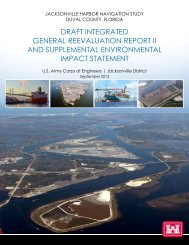
Draft Integrated General Reevaluation Report II and Supplemental ...
Draft Integrated General Reevaluation Report II and Supplemental ...
Draft Integrated General Reevaluation Report II and Supplemental ...
- No tags were found...

Create successful ePaper yourself
Turn your PDF publications into a flip-book with our unique Google optimized e-Paper software.
To follow through with the intent of the original study authorization it wasdetermined by USACE that further study was needed. The feasibility costsharing agreement (FCSA) for this study was signed in 2006.The President of the United States issued a “We Can’t Wait Initiative” on July 19,2012. This initiative included expediting the study for Jacksonville Harbor. Theresult was a reduction in the study schedule by 14 months.Alternative Plans: The Jacksonville Harbor federal navigation projectencompasses approximately 20 river miles from the mouth of the St. JohnsRiver at Mayport to the Talleyr<strong>and</strong> terminal near downtown Jacksonville (Figure1). The current authorized channel depth is 40 ft for the main channel <strong>and</strong> 38 feetfor the West Blout Isl<strong>and</strong> Channel. For planning purposes, the project wasevaluated in segments (reaches). Segment 1 was originally from the entrancechannel to approximately river mile 14 (Dames Point), it was later reduced toapproximately river mile 13. Segments 2 <strong>and</strong> 3 include additional reachesbetween Dames Point <strong>and</strong> Talleyr<strong>and</strong> <strong>and</strong> the West Blount Isl<strong>and</strong> Channel (cutsF&G).Ship simulation modeling was conducted to determine changes in the projectarea footprint required for the larger vessels to maneuver in the channel. identifynavigation problems <strong>and</strong> measures required to improve navigation in the harbor.The design vessel was the Maersk S-Class which has vessel dimensions ofmaximum draft of 48 feet, beam of 141 feet, <strong>and</strong> length of 1,139 feet. After initialevaluation <strong>and</strong> with concurrence of the non-federal sponsor, Segments 2 <strong>and</strong> 3were eliminated because it was determined that the majority of benefiting vesselstransit Segment 1. Multiple channel deepening <strong>and</strong> widening measures <strong>and</strong>turning basins were combined into alternative plans. The following alternativeplans <strong>and</strong> combinations were evaluated:• No action;• Deepening Alternatives: Depths between 41 <strong>and</strong> 50 feet were evaluated;• Widening Alternatives: Widening areas at the Turning Wall Reach <strong>and</strong> St.Johns Bluff Reach were evaluated, successful meeting in these areas wasshown in ship simulation, in combination with deepening alternatives. Ast<strong>and</strong>-alone widening alternative was also evaluated;• Turning Basins: Turning Basins at Blount Isl<strong>and</strong> <strong>and</strong> Brills Cut wereevaluated in combination with deepening <strong>and</strong> widening alternatives;• Non-Structural Alternatives: Non-structural measures considered includeadditional tug assists <strong>and</strong> using high tide conditions to allow deeper draftvessels to transit the harbor.iv