Abstract - Centre for Ecological Sciences - Indian Institute of Science
Abstract - Centre for Ecological Sciences - Indian Institute of Science
Abstract - Centre for Ecological Sciences - Indian Institute of Science
- No tags were found...
Create successful ePaper yourself
Turn your PDF publications into a flip-book with our unique Google optimized e-Paper software.
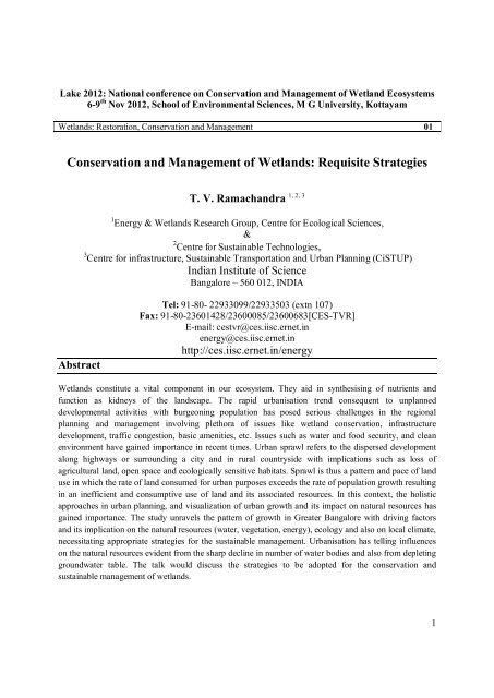
Lake 2012: National conference on Conservation and Management <strong>of</strong> Wetland Ecosystems6-9 th Nov 2012, School <strong>of</strong> Environmental <strong><strong>Science</strong>s</strong>, M G University, KottayamWetlands: Restoration, Conservation and Management 01Conservation and Management <strong>of</strong> Wetlands: Requisite StrategiesT. V. Ramachandra1 Energy & Wetlands Research Group, <strong>Centre</strong> <strong>for</strong> <strong>Ecological</strong> <strong><strong>Science</strong>s</strong>,&2 <strong>Centre</strong> <strong>for</strong> Sustainable Technologies,3 <strong>Centre</strong> <strong>for</strong> infrastructure, Sustainable Transportation and Urban Planning (CiSTUP)<strong>Indian</strong> <strong>Institute</strong> <strong>of</strong> <strong>Science</strong>Bangalore – 560 012, INDIA1, 2, 3<strong>Abstract</strong>Tel: 91-80- 22933099/22933503 (extn 107)Fax: 91-80-23601428/23600085/23600683[CES-TVR]E-mail: cestvr@ces.iisc.ernet.inenergy@ces.iisc.ernet.inhttp://ces.iisc.ernet.in/energyWetlands constitute a vital component in our ecosystem. They aid in synthesising <strong>of</strong> nutrients andfunction as kidneys <strong>of</strong> the landscape. The rapid urbanisation trend consequent to unplanneddevelopmental activities with burgeoning population has posed serious challenges in the regionalplanning and management involving plethora <strong>of</strong> issues like wetland conservation, infrastructuredevelopment, traffic congestion, basic amenities, etc. Issues such as water and food security, and cleanenvironment have gained importance in recent times. Urban sprawl refers to the dispersed developmentalong highways or surrounding a city and in rural countryside with implications such as loss <strong>of</strong>agricultural land, open space and ecologically sensitive habitats. Sprawl is thus a pattern and pace <strong>of</strong> landuse in which the rate <strong>of</strong> land consumed <strong>for</strong> urban purposes exceeds the rate <strong>of</strong> population growth resultingin an inefficient and consumptive use <strong>of</strong> land and its associated resources. In this context, the holisticapproaches in urban planning, and visualization <strong>of</strong> urban growth and its impact on natural resources hasgained importance. The study unravels the pattern <strong>of</strong> growth in Greater Bangalore with driving factorsand its implication on the natural resources (water, vegetation, energy), ecology and also on local climate,necessitating appropriate strategies <strong>for</strong> the sustainable management. Urbanisation has telling influenceson the natural resources evident from the sharp decline in number <strong>of</strong> water bodies and also from depletinggroundwater table. The talk would discuss the strategies to be adopted <strong>for</strong> the conservation andsustainable management <strong>of</strong> wetlands.1
Bangalore is experiencing unprecedented urbanisation and sprawl in recent times due to concentrateddevelopmental activities with impetus on industrialisation <strong>for</strong> the economic development <strong>of</strong> the region.This concentrated growth has resulted in the increase in population and consequent pressure oninfrastructure, natural resources and ultimately giving rise to a plethora <strong>of</strong> serious challenges such asclimate change, enhanced green-house gases emissions, lack <strong>of</strong> appropriate infrastructure, trafficcongestion, and lack <strong>of</strong> basic amenities (electricity, water, and sanitation) in many localities, etc. Thisstudy shows that there has been a growth <strong>of</strong> 632% in urban areas <strong>of</strong> Greater Bangalore across 38 years(1973 to 2010). Urban heat island phenomenon is evident from large number <strong>of</strong> localities with higherlocal temperatures. The study unravels the pattern <strong>of</strong> growth in Greater Bangalore and its implication onlocal climate (an increase <strong>of</strong> ~2 to 2.5 ºC during the last decade) and also on the natural resources (76%decline in vegetation cover and 79% decline in water bodies), necessitating appropriate strategies <strong>for</strong> thesustainable management. The study reveals that frequent flooding (since 2000, even during normalrainfall) in Bangalore is a consequence <strong>of</strong> the increase in impervious area with the high-density urbandevelopment in the catchment and loss <strong>of</strong> wetlands and vegetation. This is coupled with lack <strong>of</strong> drainageupgrade works with the changes in enhanced run-<strong>of</strong>fs, the encroachment and filling in the floodplain onthe waterways, obstruction by the sewer pipes and manholes and relevant structures, deposits <strong>of</strong> buildingmaterials and solid wastes with subsequent blockage <strong>of</strong> the system and also flow restrictions from undercapacity road crossings (bridge and culverts). The lack <strong>of</strong> planning and en<strong>for</strong>cement has resulted insignificant narrowing <strong>of</strong> the waterways and filling in <strong>of</strong> the floodplain by illegal developments.Keywords: Wetlands, Conservation, Mitigation, Spatial analysis, Urban floods2


