Rare Plant Survey Report 2010 (51 pgs) - Western Riverside County ...
Rare Plant Survey Report 2010 (51 pgs) - Western Riverside County ...
Rare Plant Survey Report 2010 (51 pgs) - Western Riverside County ...

Create successful ePaper yourself
Turn your PDF publications into a flip-book with our unique Google optimized e-Paper software.
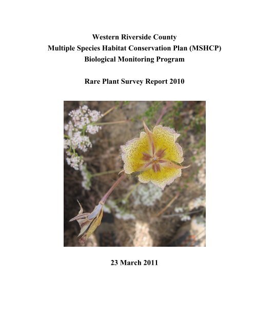
<strong>Western</strong> <strong>Riverside</strong> <strong>County</strong>Multiple Species Habitat Conservation Plan (MSHCP)Biological Monitoring Program<strong>Rare</strong> <strong>Plant</strong> <strong>Survey</strong> <strong>Report</strong> <strong>2010</strong>23 March 2011
<strong>Rare</strong> <strong>Plant</strong> <strong>Survey</strong> <strong>Report</strong> <strong>2010</strong>TABLE OF CONTENTSINTRODUCTION.........................................................................................................................................1GOALS AND OBJECTIVES ...................................................................................................................1METHODS ....................................................................................................................................................2PROTOCOL DEVELOPMENT ................................................................................................................2PERSONNEL AND TRAINING ...............................................................................................................2SURVEY SITE SELECTION...................................................................................................................3SURVEY METHODS ............................................................................................................................5DATA ANALYSIS................................................................................................................................6RESULTS.......................................................................................................................................................7DISCUSSION ..............................................................................................................................................13RECOMMENDATIONS FOR FUTURE SURVEYS ...................................................................................14LITERATURE CITED...............................................................................................................................15LIST OF TABLES AND FIGURESTABLE 1. List of 39 species surveyed for and/or detected in <strong>2010</strong>. ................................................................4FIGURE 1. Covered plant species detected in the Conservation Area in <strong>2010</strong>.. ..............................................8FIGURE 2. Covered plant species detected in the Conservation Area in <strong>2010</strong> ................................................9FIGURE 3. Covered plant species detected in the Conservation Area in <strong>2010</strong>.. ............................................10FIGURE 4. Covered plant species detected in the Conservation Area in <strong>2010</strong>.. ............................................11FIGURE 5. Covered plant species detected in the Conservation Area in <strong>2010</strong>.. ............................................12TABLE 2. Summary of demonstrate-conservation objective for 13 covered plant species............................13LIST OF APPENDICESAPPENDIX A. <strong>Rare</strong> <strong>Plant</strong> <strong>Survey</strong> Protocol.....................................................................................................16APPENDIX B. <strong>Rare</strong> <strong>Plant</strong> <strong>Survey</strong> Forms ........................................................................................................26APPENDIX C. Summary of Species Objectives and <strong>Survey</strong> Needs for Covered <strong>Plant</strong> Species. Bolded TextIndicates Species That Have At Least 75% of Their Distributional Occurrences Confirmed.......................28APPENDIX D. Summary of Species-specific Objectives and <strong>2010</strong> <strong>Survey</strong> Status for Each Covered <strong>Plant</strong>Species...........................................................................................................................................................31<strong>Western</strong> <strong>Riverside</strong> <strong>County</strong> MSHCPBiological Monitoring Programii
<strong>Rare</strong> <strong>Plant</strong> <strong>Survey</strong> <strong>Report</strong> <strong>2010</strong>NOTE TO READER:This report is an account of survey activities conducted by the BiologicalMonitoring Program for the <strong>Western</strong> <strong>Riverside</strong> <strong>County</strong> Multiple Species HabitatConservation Plan (MSHCP). The MSHCP was permitted in June 2004. The MonitoringProgram monitors the distribution and status of the 146 Covered Species within theConservation Area to provide information to Permittees, land managers, the public, andthe Wildlife Agencies (i.e., the California Department of Fish and Game and the U.S.Fish and Wildlife Service). Monitoring Program activities are guided by the MSHCPspecies objectives for each Covered Species, the information needs identified in MSHCPSection 5.3 or elsewhere in the document, and the information needs of the Permittees.MSHCP reserve assembly is ongoing and it is expected to take 20 or more yearsto assemble the final Conservation Area. The Conservation Area includes lands acquiredfor conservation under the terms of the MSHCP and other lands that have conservationvalue in the Plan Area (called public or quasi-public lands in the MSHCP). In this report,the term “Conservation Area” refers to the Conservation Area as understood by theMonitoring Program at the time the surveys were planned and conducted.We would like to thank and acknowledge the land managers in the MSHCP PlanArea, who in the interest of conservation and stewardship facilitate Monitoring Programactivities on the lands for which they are responsible. A list of the lands where datacollection activities were conducted in 2009 is included in Section 7.0 of the <strong>Western</strong><strong>Riverside</strong> <strong>County</strong> Regional Conservation Authority (RCA) Annual <strong>Report</strong> to the WildlifeAgencies. Partnering organizations and individuals contributing data to our projects areacknowledged in the text of appropriate reports.While we have made every effort to accurately represent our data and results, itshould be recognized that data management and analysis are ongoing activities. Anyreader wishing to make further use of the information or data provided in this reportshould contact the Monitoring Program to ensure that they have access to the bestavailable or most current data.The primary preparer of this report was the <strong>2010</strong> Botany Program Lead, JeffGalvin. If there are any questions about the information provided in this report, pleasecontact the Monitoring Program Administrator. If you have questions about the MSHCP,please contact the Executive Director of the RCA. Further information on the MSHCPand the RCA can be found at www.wrc-rca.org.Contact Information:Executive Director<strong>Western</strong> <strong>Riverside</strong> <strong>County</strong> MSHCP<strong>Western</strong> <strong>Riverside</strong> <strong>County</strong>Monitoring Program AdministratorRegional Conservation Authority c/o Adam Malisch4080 Lemon Street, 12th Floor 4500 Glenwood Drive, Bldg. CP.O. Box 1667 <strong>Riverside</strong>, CA 92501<strong>Riverside</strong>, CA 92502-1667 Ph: (9<strong>51</strong>) 248-2552Ph: (9<strong>51</strong>) 955-9700<strong>Western</strong> <strong>Riverside</strong> <strong>County</strong> MSHCPBiological Monitoring Programiii
<strong>Rare</strong> <strong>Plant</strong> <strong>Survey</strong> <strong>Report</strong> <strong>2010</strong>INTRODUCTIONThe <strong>Western</strong> <strong>Riverside</strong> <strong>County</strong> MSHCP covers 63 plant species. For most ofthese species, the MSHCP requires the confirmation of a number of occurrences, often atspecified sites, within the Conservation Area. Unless a given species-specificconservation objective has more rigorous requirements, the Biological MonitoringProgram is obligated to survey for the distribution of covered plant species at least onceevery 8 years with the goal of verifying occupancy at ≥75% of the sites listed in thespecies objective (Dudek & Associates 2003). Some covered plants also have“demonstrate-conservation” objectives that require us to document a specific level ofconservation. These species are not considered adequately conserved until individualobjectives have been met, usually a specified number of locations with a minimumnumber of individuals of the target species.Historic distribution information for covered plant species was consolidated forthe MSHCP from a variety of sources including herbarium records, field notes, ‘grayliterature’, and species databases. The status of covered plant species at the recordedlocations requires verification due to the varying sources, ages, and precision of therecords. In order to ascertain whether species objectives are being met and to determinefuture long-term monitoring needs, we plan to field-verify historic records for each of the63 covered plant species during the Inventory Phase (first 5-8 years of monitoring). Asstipulated by the MSHCP, at the end of the Inventory Phase we will return to verifiedlocations to monitor the occurrences at least once every 8 years. We will continue tosearch for additional occurrences for species with unmet objectives when expansion ofthe Conservation Area includes appropriate habitat.<strong>Survey</strong>s conducted in <strong>2010</strong> built on the activities of previous years. TheUniversity of California, <strong>Riverside</strong> Center for Conservation Biology (UCR CCB), undera contract from the California Department of Fish and Game, conducted surveys for 27covered plant species in 2003 and 2004 (UCR CCB 2005). Biological MonitoringProgram staff conducted targeted surveys for 16 Covered Species in 2005, 32 species in2006, 28 species in 2007, 44 species in 2008, and 37 species in 2009. In <strong>2010</strong>, wemonitored the phenology of 19 species at 13 sentinel sites with previously confirmedoccurrences of Covered Species to guide the timing of target surveys elsewhere in theConservation Area. We focused survey efforts on 34 plant species and documented thepresence of 3 additional covered plant species encountered incidentally. The goals for the<strong>2010</strong> rare plant survey were as follows:Goals and Objectives1. Verify historical locations and document new locations of covered plant speciesin the Conservation Area.a. Search for target species within all suitable habitats inside selected grid cellsuntil surveyors locate the species of interest or determine that the species wasunlikely to be detected.2. Continue to improve knowledge of covered plant species status within theConservation Area.<strong>Western</strong> <strong>Riverside</strong> <strong>County</strong> MSHCPBiological Monitoring Program1
<strong>Rare</strong> <strong>Plant</strong> <strong>Survey</strong> <strong>Report</strong> <strong>2010</strong>a. Collect species-specific information at observation sites such as speciesabundance, phenology, and population size.3. Continue to improve knowledge of covered plant species habitat suitability needs.a. Collect habitat information at survey sites to determine covariates associatedwith species presence.4. Continue to test and refine protocol for surveying historical locations of coveredplant species.a. Use phenological progression of plants at sentinel sites to make decisionsabout when to initiate and conclude surveys for target plant species.b. Streamline the amount of information collected at survey grid cells to reducethe amount of time spent per survey, and thereby increase the number of gridcells surveyed per person per day.c. Improve the resolution of actual area occupied by a given species byestimating the spatial area occupied by an occurrence into one of 6 sizeclasses.METHODSProtocol DevelopmentWe made minor modifications to the existing rare plant survey protocol for <strong>2010</strong>surveys and have included the modifications and the forms used for the surveys in the<strong>Western</strong> <strong>Riverside</strong> <strong>County</strong> MSHCP Biological Monitoring Program Protocol forInventory-Phase <strong>Rare</strong> <strong>Plant</strong> <strong>Survey</strong>s (Appendix A).Personnel and TrainingIn February and March of <strong>2010</strong>, Jeff Galvin, the Biological Monitoring ProgramBotany Lead, instructed members of the plant field crew in identification of commonplant families and all 63 covered plant species. Members of the plant field crew were alsorequired to become familiar with a variety of habitat types where Covered Species occurand with associated species. Crews went on training walks with personnel alreadyfamiliar with common vegetation in the Plan Area and used a variety of field guides toassist in plant identification. <strong>Survey</strong>ors also were shown herbarium specimens of targetspecies as well as closely related or potentially confusing species. Crew members werequizzed weekly on the information presented. For all quizzes, surveyors determined ifpressed specimens and photographs were Covered Species and, if so, which CoveredSpecies. At the end of the training period, surveyors took a test to determine if they couldcorrectly identify all 63 covered plant species. <strong>Survey</strong>ors passed the final test if theycorrectly identified all Covered Species and did not mistake a co-occurring species for aCovered Species. The California Department of Fish and Game and RegionalConservation Authority funded Biological Monitoring Program personnel. Staff whoconducted surveys for rare plants in <strong>2010</strong> are listed below.• Jeff Galvin (Project Lead, Biological Monitoring Program)• Ana Hernandez (Biological Monitoring Program )• John Dvorak (Biological Monitoring Program)<strong>Western</strong> <strong>Riverside</strong> <strong>County</strong> MSHCPBiological Monitoring Program2
<strong>Rare</strong> <strong>Plant</strong> <strong>Survey</strong> <strong>Report</strong> <strong>2010</strong>• Karyn Drennen (Biological Monitoring Program )• Kim Freeburn (Biological Monitoring Program )• Kim Sparks (Biological Monitoring Program )• Rose Cook (Biological Monitoring Program)<strong>Survey</strong> Site SelectionSentinel <strong>Survey</strong>sSentinel sites are locations where we know covered plant species regularly occur.We monitor the phenology of target species throughout the growing season at sentinelsites to determine the optimal time to document species occurrences. We chose sitesbased on the presence and diversity of recently documented Covered Species and, whenpossible, select sites with an elevation and aspect similar to planned target surveylocations. During the <strong>2010</strong> field season, we visited 13 sentinel sites to monitor thephenology of 19 target species (Table 1). Based on initial surveys, we concluded that<strong>2010</strong> was an appropriate year to survey for all targeted plant species throughout theConservation Area. We continued to use sentinel site surveys throughout the field seasonto determine the appropriate survey period for species of interest. We started sentinelsurveys on 15 March <strong>2010</strong> in grassland, coastal sage scrub, and chaparral openings in thePerris Basin. As the spring and summer progressed, sentinel surveys transitioned tohigher elevations in the San Jacinto Mountains and concluded on 21 July.Target <strong>Survey</strong>sWe selected target species and broad survey locations from the remaining unmetobjectives identified in the MSHCP species-specific accounts. A number of resourcesguided the selection of target survey sites including the MSHCP species accountsdeveloped by Dudek and Associates (2001), the Consortium of California Herbaria(CCH), the California Natural Diversity Database (CNDDB), and the 2005 GeographicInformation System (GIS) vegetation map of western <strong>Riverside</strong> <strong>County</strong> (CDFG et al.2005) (CCH <strong>2010</strong>; CNDDB <strong>2010</strong>; CDFG et al. 2005). We also used our internal <strong>Rare</strong><strong>Plant</strong> Database and the MSHCP Historical Database, which was created bygeoreferencing and consolidating available distributional data for all Covered Speciesthroughout the Plan Area (Dudek & Associates 2001).We began by surveying areas in and around CNDDB polygons, focusing onsections that, according to the vegetation map, contained appropriate habitat as definedby the species account. When no CNDDB data were available, we based survey siteselection on point data in the Historical Database. Before selecting sites, we attempted tocorrect georeferencing errors that are widespread throughout the database, and then finetunedthe selection based on a combination of recently vouchered specimens from theCCH and presence of appropriate habitat. If information from the database produced nohistorical observation points or if the surveys were unsuccessful, we focused instead onareas specifically mentioned in the species account or areas containing appropriatehabitat. In general, previously unsurveyed areas took precedence over locations targetedduring earlier survey efforts; however, if time allowed, we resurveyed sites as well.<strong>Western</strong> <strong>Riverside</strong> <strong>County</strong> MSHCPBiological Monitoring Program3
<strong>Rare</strong> <strong>Plant</strong> <strong>Survey</strong> <strong>Report</strong> <strong>2010</strong>We timed surveys based on observations during sentinel site visits. We completedour first target species surveys of the <strong>2010</strong> season on 13 March and the final survey on 9November.Table 1. List of 39 species surveyed for and/or detected in <strong>2010</strong>.<strong>Survey</strong> a Detection a Species Scientific Name Common NameS,R,T -- Allium munzii Munz's onionT I,T Arabis johnstonii Johnston's rock cressT I,T Arctostaphylos rainbowensis Rainbow manzanitaS I Atriplex coronata var. notatior San Jacinto Valley crownscaleS,T S,T Atriplex serenana var. davidsonii Davidson's saltscaleT -- Atriplex parishii Parish's brittlescaleT -- Berberis nevinii Nevin's barberryS,R,T S,R,T Brodiaea filifolia Thread-leaved brodiaea-- I Calochortus palmeri var. munzii Munz's marisposa lilyS,R,T I,S,R,T Calochortus plummerae Plummer's mariposa lilyT T Calochortus weedii var. intermedius Intermediate mariposa lilyS,T I,T Centromadia pungens ssp. laevis Smooth tarplantS,R,T I,S,R,T Chorizanthe leptotheca Peninsular spine flowerS,R,T I,S,R,T Chorizanthe parryi var. parryi Parry's spineflowerS I,S Chorizanthe polygonoides var. longispina Long-spined spineflowerT I Chorizanthe procumbens Prostrate spine flowerS,R,T S,R,T Convolvulus simulans Small-flowered morning-gloryS,T S,T Deinandra mohavensis Mojave tarplantT T Dodecahema leptocera Slender-horned spine flowerS,T S,T Dudleya multicaulis Many-stemmed dudleyaS,R,T S,T Erodium macrophyllum Large-leaved filareeS,T S,T Harpagonella palmeri Palmer's graplinghookT T Holocarpha virgata ssp. elongata Graceful tarplantS,T S,T Hordeum intercedens Vernal barleyS,T S,T Lasthenia glabrata ssp. coulteri Coulter's goldfieldsT -- Lepechinia cardiophylla Heart-leaved pitcher-sage-- I Lilium humboldtii ssp. ocellatum Ocellated Humboldt lilyS,R,T R,T Microseris douglasii var. platycarpha Small-flowered microseris-- I Mimulus clevelandii Cleveland bush monkey flowerT I,T Mimulus diffusus Palomar monkey flowerT T Myosurus minimus ssp. apus Little mousetailT T Nama stenocarpum Mud namaS,T T Navarretia fossalis Spreading navarretiaT -- Orcuttia californica California Orcutt grassR,T R,T Oxytheca caryophylloides Chickweed oxythecaS,T I,S Penstemon californicus California beardtongueT I,T Quercus engelmannii Engelmann oakT T Romneya coulteri Coulter's matilija poppyT -- Trichocoronis wrightii var. wrightii Wright's trichocoronisa S = sentinel site, T = targeted search, R = revisited occurrence, “--“ = not applicable<strong>Western</strong> <strong>Riverside</strong> <strong>County</strong> MSHCPBiological Monitoring Program4
<strong>Rare</strong> <strong>Plant</strong> <strong>Survey</strong> <strong>Report</strong> <strong>2010</strong>Deinandra mohavensis MappingWe based site selection for Deinandra mohavensis mapping on recent point dataqueried from the <strong>Rare</strong> <strong>Plant</strong> Database and a U.S. Forest Service layer containinglocations of rare plants documented in the San Bernardino National Forest (SBNF)(SBNF 2007). Spatial data showed that this species is widely distributed throughout theSan Jacinto Mountains, so we selected sites with a high concentration of documentedoccurrences, including Garner Valley, Chimney Flats, and Oak Flats. We surveyed all 3sites from 20 July through 28 July.<strong>Survey</strong> MethodsSentinel SitesWe navigated to points where Monitoring Program biologists or UCR CCB haddocumented target plant species in previous years. Due to the recent nature of theserecords, and the fact that all coordinates were collected using GPS units, we assumedpoints were highly accurate and, therefore, only searched for the target species in theimmediate area of the given point. If located, we recorded the same species-specificinformation required for target surveys, as described below. If unable to locate a targetspecies, we took it as evidence that current environmental conditions and phenology ofthe target species were not yet suitable for targeted surveys. In these cases, we revisitedthe site until the phenology progressed to a point where we could easily detect thespecies.Target <strong>Survey</strong>sWe used 2 different approaches for target surveys. For distributional objectives,we navigated to assigned 250 m x 250 m grid cells containing historically documentedoccurrences of targeted plant species. For demonstrate-conservation objectives, we oftenconducted surveys around known occurrences queried from the <strong>Rare</strong> <strong>Plant</strong> Database. Wesearched assigned cells until all species of interest were located, or all suitable habitats, asdefined by the “Habitat and Habitat Associations” section of the species account (Dudekand Associates 2001), were covered. Although each survey focused on particular targetspecies, we remained vigilant for all Covered Species. When we found a target species,either as the result of a directed search or incidental to a search for a different species, werecorded species-specific information including abundance, phenology, patch size,dominant substrate, dominant vegetation community, and dominant species in 5functional groups (trees, shrubs, native forbs, exotic forbs, and grasses). Regardless of theoutcome of the survey, we documented the search effort and collected vegetationcommunity, site phenology, and site disturbance information about the area surveyed. Wedescribe survey methods in further detail in the <strong>2010</strong> Protocol for Inventory-Phase <strong>Rare</strong><strong>Plant</strong> <strong>Survey</strong>s and <strong>Rare</strong> <strong>Plant</strong> <strong>Survey</strong> Forms (Appendix B).Deinandra mohavensis MappingOne species, D. mohavensis, required a different survey protocol to achieve itsspecies objective. The demonstrate-conservation objective for this species requires theconfirmation of localities covering at least 100 ac (0.4 km 2 ). To achieve this objective,we focused surveys around known occurrences at Garner Valley, Chimney Flats, and Oak<strong>Western</strong> <strong>Riverside</strong> <strong>County</strong> MSHCPBiological Monitoring Program5
<strong>Rare</strong> <strong>Plant</strong> <strong>Survey</strong> <strong>Report</strong> <strong>2010</strong>Flats. At each site, we recorded UTMs for every individual located at least 5 m from anindividual already marked during the survey. For each attempted locality, we searched allsuitable habitat until we mapped at least 100 ac or the field day ended.Data AnalysisIn this report, we present results of surveys conducted in <strong>2010</strong> as well as overallprogress toward meeting species objectives. To determine if we confirmed localities of D.mohavensis, we uploaded all recorded coordinates into ArcMap (ESRI 2009), created 5-m buffers for all points, dissolved the buffers, and calculated the overall acreage. Next,we divided the polygon into localities of at least 100 ac that were at least a quarter section(804 m) apart. To report on total progress towards meeting species objectives, weevaluated our data along with recent data that other agencies have shared with us,including data collected by SBNF, the Center for Natural Lands Management (CNLM),and UCR CCB. This analysis is necessarily qualitative given the descriptive nature of theinformation we collected during surveys.The species-specific objectives listed in the MSHCP specify a certain number oflocations, occurrences, records, and/or localities for each species, and often identify areaswhere the species have historically occurred. For distributional objectives, the MSHCPuses 3 terms (“location”, “locality”, and “occurrence”) interchangeably but does notdefine them. For clarity, when referring to distributional objectives in this report, we willonly use the term “occurrence”. We define “occurrence” as the unit or group ofindividuals meeting the criteria for 1 location in the species objective. When speciesobjectives have a one-to-one relationship between number of occurrences and locationswhere they require confirmation, we have a very clear idea of what constitutes anoccurrence. For example, objective 2 for Mimulus clevelandii requires that we “includewithin the MSHCP Conservation Area the two known [occurrences] of this species onSantiago Peak in the Santa Ana Mountains and on the Northern Slopes of the Agua TibiaMountains.” Other species objectives require the inclusion of a specified number ofknown occurrences in the Conservation Area without listing each specific site whereconservation of the species will occur. For example, objective 2 for Penstemoncalifornicus requires that we “include within the MSHCP Conservation Area at least 15occurrences in Aguanga, Blackburn Canyon, and the San Jacinto Mountains.” We areunable to apply a single definition of “occurrence” when species objectives do notspecify a distinct location for each occurrence. Instead, we define “occurrence” on a caseby-casebasis, factoring in, when available, the typical spatial distribution of the species,general ecology, geography, and conservation intent. In addition, we use a combinationof a close reading of the MSHCP species account and U.S. Fish and Wildlife ServiceBiological Opinion (USFWS 2004), as well as the original data points shown in theMSHCP Historical Database, to delineate, to the best of our abilities, the knownoccurrences to which the objectives refer.Per the MSHCP, we cannot consider some species adequately conserved until weachieve additional goals beyond the conservation of historic occurrences. In this report,we will use the term “demonstrate-conservation objective” to refer to these additionalgoals. For demonstrate-conservation objectives, the MSHCP uses the term “locality” anddefines its minimum dimensions as a quarter section (160 ac). In this report, for the<strong>Western</strong> <strong>Riverside</strong> <strong>County</strong> MSHCPBiological Monitoring Program6
<strong>Rare</strong> <strong>Plant</strong> <strong>Survey</strong> <strong>Report</strong> <strong>2010</strong>purpose of clarity, we will only use the term “locality” when referring to objectivesregardless of extent. The species-specific demonstrate-conservation objectives typicallylist a minimum number of individuals that must be present for a given occupied site toqualify as a locality, unless a smaller population has been demonstrated to be selfsustaining.We use the highest number of individuals counted in an area in a single day todetermine the total number of individuals at a locality and to avoid over-countingindividuals. A few species have demonstrate-conservation objectives that only ask for aspecific number of localities without regard to the number of individuals at each locality.RESULTSWe conducted 15 sentinel site visits at 13 unique sites for 19 targeted speciesbetween 11 March and 8 July <strong>2010</strong> (Table 1). We detected the first annual CoveredSpecies beginning to flower at the McElhinney-Stimmel property on 11 March. Wefocused target surveys on annual and herbaceous perennial species in the Perris Basin inMarch, April, and early May, based on the plant phenology at our sentinel sites. By mid-May, the phenology for many of these species was past peak detectability, so we shiftedour survey effort to higher-elevation sites and perennial species.We surveyed 338 unique grid cells, 34 of which we surveyed twice, for a total of372 survey events. Of those grid cells, we completely surveyed 214 (58%) and partiallysurveyed another 158 (42%). On average, we took 44 minutes to survey a grid cell;surveys lasted from 1 to 270 minutes depending on the extent of suitable habitat,vegetation structure, and topography. In 104 surveyed cells (31%), we detected at least 1covered plant species, though not always the targeted species.In <strong>2010</strong>, we detected 27 of the 34 targeted Covered Species and recordedincidental observations of an additional 5 Covered Species (Table 1). Counting multipledetections of the same species in a single grid cell as 1 detection (i.e., presence/absence ina cell) and including incidental data, we made a total of 155 detections of 32 coveredplant species in <strong>2010</strong> (Appendix C) (Figures 1-5). We confirmed 41 new occurrences for19 Covered Species that fulfill requirements of a distributional species objective(Appendix C). We also confirmed 41 localities for 8 species that fulfill a requirement of ademonstrate-conservation objective (Table 2). We have confirmed 332 of 476 requiredoccurrences (70%) and 119 of 141 required localities (84%) based on all surveys to dateby the Biological Monitoring Program, UCR CCB, and recent data from SBNF. We haveconfirmed all occurrences for 20 species (30%) and all localities for 9 (64%). Theremaining species have a mean of 55% of required occurrences confirmed and 45% ofrequired localities (Appendix C).We mapped 701 acres of D. mohavensis throughout the San Jacinto Mountains,from Oak Flat in the Northwest to Quinn Flats in the Southeast. The spatial separationbetween polygons allowed us to divide the mapped area into 5 localities that meet thedemonstrate-conservation objective for this species.<strong>Western</strong> <strong>Riverside</strong> <strong>County</strong> MSHCPBiological Monitoring Program7
CALIMESAEASTVALEÄ10NORCORIVERSIDEMORENO VALLEYBANNING#*!( !(")")")")")HEMET")CORONA")BEAUMONT§¨¦ 15PERRISSAN JACINTO#*Legend#* Arabis johnstonii#* Arctostaphylos rainbowensis#* Chorizanthe leptotheca") Dodecahema leptoceras") Hordeum intercedens") Holocarpha virgata ssp. elongata!( Nama stenocarpumHighwaysRoads#*#*#*#*#*LAKE ELSINORECANYON LAKEWILDOMAR#*#*#*#*#* ")MENIFEEMURRIETATEMECULAWater BodiesMilesExisting Conservation LandCitiesI 0 10 km0 2.5 5 10 15 20#*#* #*#*#*#*#*#*#*#* #*#*Date: 10 March 2011UTM Nad 83 Zone 11Contact: Jeff GalvinMSHCP Biological Monitoring ProgramFigure 1. Covered plant species detected in the Conservation Area in <strong>2010</strong>.
CALIMESAEASTVALEÄ10NORCORIVERSIDEMORENO VALLEYBANNINGCORONABEAUMONT§¨¦ 15#*#*#*#*PERRISSAN JACINTO")Legend#* Chorizanthe procumbens#* Convolvulus simulans#* Calochortus palmeri var. munzii") Calochortus weedii var. intermedius") Deinandra mohavensis") Navarretia fossalisHighwaysRoads#*#*LAKE ELSINORECANYON LAKEWILDOMARMENIFEEMURRIETA") ")") ") ") ")TEMECULAWater BodiesMilesExisting Conservation LandCitiesI 0 10 km0 2.5 5 10 15 20HEMET")")")#* #*")Date: 10 March 2011UTM Nad 83 Zone 11Contact: Jeff GalvinMSHCP Biological Monitoring ProgramFigure 2. Covered plant species detected in the Conservation Area in <strong>2010</strong>.
#*Legend#* Brodiaea filifolia#* Calochortus plummerae#* Chorizanthe parryi var. parryi") Erodium macrophyllum") Mimulus diffusus") Myosurus minimus ssp. apus!( Nama stenocarpumHighwaysRoadsEASTVALENORCOCORONA")§¨¦ 15")RIVERSIDE#*")")#*#*#*#* ")LAKE ELSINORECANYON LAKE#*#*MORENO VALLEYPERRISWILDOMARMENIFEEMURRIETA#* #*#*TEMECULACALIMESA!( !(")")")")")Ä10SAN JACINTOHEMET#*#*#*#*#*#*#*BEAUMONTWater BodiesMilesExisting Conservation LandCitiesI 0 10 km0 2.5 5 10 15 20#*BANNING#*#*#*#*#*#*#*#*#*#*#*#*Date: 10 March 2011UTM Nad 83 Zone 11Contact: Jeff GalvinMSHCP Biological Monitoring ProgramFigure 3. Covered plant species detected in the Conservation Area in <strong>2010</strong>.
CALIMESAEASTVALEÄ10NORCORIVERSIDEMORENO VALLEYBANNINGCORONA§¨¦ 15#* #* ")")")PERRIS#*#*#*BEAUMONTSAN JACINTO#*#*#*")")") ") ")")Legend#* Atriplex coronata var. notatior#* Dudleya multicaulis#* Centromadia pungens spp. laevis") Microseris douglasii ssp. platycarpha") Mimulus clevelandii") Oxytheca caryophylloides!( Quercus engelmannii!( Romneya coulteriHighwaysRoads!(!(!(#*LAKE ELSINORE")CANYON LAKEWILDOMAR#*")MENIFEEMURRIETA")#* #*#*#*TEMECULA#*#* #*#*#* #*Water BodiesMilesExisting Conservation LandCitiesI 0 10 km0 2.5 5 10 15 20HEMET")!(Date: 10 March 2011UTM Nad 83 Zone 11Contact: Jeff GalvinMSHCP Biological Monitoring ProgramFigure 4. Covered plant species detected in the Conservation Area in <strong>2010</strong>.
CALIMESAEASTVALEÄ10NORCORIVERSIDEMORENO VALLEYBANNINGLegendCORONA#* Atriplex serenana var. davidsonii#* Chorizanthe polygonoides var. longispina#* Lasthenia glabrata ssp. coulteri") Lilium humboldtii ssp. ocellatum") Penstemon californicusHighwaysRoads§¨¦ 15#*#*#*#*LAKE ELSINORE")CANYON LAKEPERRISWILDOMARMENIFEEMURRIETA#*#*#* #*TEMECULA#*#*SAN JACINTOHEMETBEAUMONTWater BodiesMilesExisting Conservation LandCitiesI 0 10 km0 2.5 5 10 15 20")Date: 10 March 2011UTM Nad 83 Zone 11Contact: Jeff GalvinMSHCP Biological Monitoring ProgramFigure 5. Covered plant species detected in the Conservation Area in <strong>2010</strong>.
<strong>Rare</strong> <strong>Plant</strong> <strong>Survey</strong> <strong>Report</strong> <strong>2010</strong>Table 2. Summary of demonstrate-conservation objective for 13 covered plant species.SpeciesObjectiveConfirmed LocalitiesIndividuals% ofLocalities per Locality <strong>2010</strong> Total TotalArctostaphylos rainbowensis 10 50 3 3 30%Calochortus plummerae 6 500 2 6 100%Chorizanthe leptotheca 10 1000 8 10 120%Chorizanthe parryi var. parryi 10 1000 5 10 110%Deinandra mohavensis 4 N/A 1 4 4 100%Holocarpha virgata ssp. elongata 10 1000 0 10 100%Hulsea vestita ssp. callicarpha 16 50 0 16 100%Microseris douglasii var. platycarpha 10 1000 9 9 90%Muhlenbergia californica 10 50 0 0 0%Oxytheca caryophylloides 10 1000 9 10 100%Polygala cornuta var. fishiae 10 50 0 10 100%Potentilla rimicola 5 N/A 2 0 1 20%Romneya coulteri 30 N/A 2 3 30 100%Total 141 - 41 119 84%1 Demonstrate-conservation objective calls for 100 ac occupied per locality.2Demonstrate-conservation objective does not specify number of individuals per locality.DISCUSSIONThe 2009 <strong>Rare</strong> <strong>Plant</strong> <strong>Survey</strong> <strong>Report</strong> recommended that we place a greateremphasis on meeting demonstrate-conservation objectives in <strong>2010</strong>. This survey year weconfirmed 41 demonstrate-conservation localities, more than 8 times as many as in 2009(n = 5). We also surveyed 50% more grid cells (n = 160) with the intent of meeting moredemonstrate-conservation objectives than we did in 2009 (n = 108). The increase inlocalities may have been partially due to an increased focus on demonstrate-conservationobjectives. Favorable environmental conditions, such as above-average rainfall and along, moderate spring, may also have led to an increase in the abundance of herbaceousspecies. Many of the Covered Species with demonstrate-conservation objectives areherbaceous, so it is possible there were simply more individuals to count towards theobjective.In addition, this season we saw an increase in the number of confirmedoccurrences for distributional objectives. We confirmed 41 occurrences for distributionalobjectives, a 46% increase over 2009 (n = 28). In almost all previous rare plant surveyreports, we stated that as the Inventory Phase progressed we would likely observe agradual decline in confirmed occurrences. We assumed that in the beginning of theInventory Phase, we would confirm more occurrences because of the larger pool ofoccurrences to choose from and the ability to select those with precise localitydescriptions and/or recent spatial data. Then, in the later years, we would have to confirmoccurrences based on old observations without reliable spatial data. Besides the favorable<strong>Western</strong> <strong>Riverside</strong> <strong>County</strong> MSHCPBiological Monitoring Program13
<strong>Rare</strong> <strong>Plant</strong> <strong>Survey</strong> <strong>Report</strong> <strong>2010</strong>environmental conditions, the increase in detections was achieved by re-georeferencingall historic points and, when available, factoring in detailed information about theassociated voucher, including dominant species, soil composition, fire history, andgeneral habitat descriptions. By doing this, we were able to target smaller areas andeliminate occurrences that actually exist outside of the Conservation Area.Also in <strong>2010</strong>, we focused on identifying and preparing vouchers of a number ofspecies with confusing or recently altered taxonomy. We revisited all 4 Brodiaea filifoliaCNDDB polygons at the Santa Rosa Plateau to confirm that B. filifolia was present andthat we didn’t mistake it for Brodiaea santarosae, a recently described and very similarspecies. We confirmed B. filifolia in 3 polygons, including EO05, EO30, and EO31, andwe detected only B. santarosae in the fourth, EO03. As a result, we recommend that thespecies objective not include CNDDB polygon EO03. We also vouchered all previouslyconfirmed occurrences of Chorizanthe leptotheca, as well as any confirmed this year. Inthe past, surveyors have had difficulty differentiating C. leptotheca from C. staticoidesand C. xanti var. leucotheca. Andy Sanders, UCR Herbarium curator, confirmed that allvouchers submitted were the Covered Species C. leptotheca.Recommendations for Future <strong>Survey</strong>sWhile we made substantial progress towards meeting all of the demonstrateconservationobjectives this year, Arctostaphylos rainbowensis, Microseris douglasii ssp.platycarpha, Muhlenbergia californica, and Potentilla rimicola, still have unconfirmedlocalities. For A. rainbowensis, we confirmed 3 of 10 localities at the Santa Rosa Plateau,the Tenaja Corridor, and San Mateo Canyon. There are numerous potential localities atthe Santa Margarita Ecological Reserve, the Santa Rosa Plateau, the Tenaja Corridor, andthe Agua Tibia Mountains. While this species is identifiable throughout most of the year,it is easier to differentiate from Arctostaphylos glandulosa, a morphologically similarspecies, when it is flowering and/or fruiting. We should therefore focus surveys for A.rainbowensis when it is typically flowering and/or fruiting and survey all potentiallocations until we confirm an additional 7 localities. This year we confirmed 9 of 10localities for M. douglasii ssp. platycarpha. Although we were able to confirm 90% ofthe localities in 1 season, the remaining occurrence may prove difficult to confirmbecause we might have exhausted all the potential locations within the ConservationArea. The demonstrate-conservation objectives for M. californica and P. rimicola may beimpossible to achieve. There are no historic records for M. californica within the PlanArea. The basis for including this species in the MSHCP relies solely on an unpublishedUSFWS document that we have been unable to acquire. We should only survey for thisspecies if we acquire new information pertaining to its distribution throughout the PlanArea. There are only 2 historic records for P. rimicola within the Plan Area, both locatedon the southwestern slopes of the San Jacinto Mountains. In 2008, we confirmed 1locality south of Seven Pines Trail and surveyed all remaining suitable habitat within thePlan Area. Therefore, unless additional suitable habitat is added to the ConservationArea, we should not continue to survey for this species.As of the end of <strong>2010</strong>, we have confirmed 331 of 475 occurrences (71%) requiredto meet the distributional objectives. This does not include Brodiaea orcuttii and M.californica because the best available information indicates that they do not occur in the<strong>Western</strong> <strong>Riverside</strong> <strong>County</strong> MSHCPBiological Monitoring Program14
<strong>Rare</strong> <strong>Plant</strong> <strong>Survey</strong> <strong>Report</strong> <strong>2010</strong>Plan Area. Of the remaining 144 occurrences, 75 (52%) are completely or mostly outsideof the Conservation Area and 28 (19%) are unlikely to be confirmed because theobjective includes duplicate records, the potential survey area is prohibitively large, or allpotential habitat has been searched multiple times. During the 2011 rare plant surveyseason, we should target the remaining 41 occurrences (28%) for 16 Covered Species.We should survey for the other 103 occurrences when and if the Conservation Areaincludes appropriate parcels.LITERATURE CITED[CDFG] California Department of Fish and Game, Aerial Information Systems,California Native <strong>Plant</strong> Society. 2005. Vegetation - <strong>Western</strong> <strong>Riverside</strong> Co.[ds170]. Publication Date: 2005-07-31. Online: http://bios.dfg.ca.gov/.[CNDDB] California Natural Diversity Database 2006. Sacramento (CA): NaturalHeritage Division, California Department of Fish and Game.[CCH] Consortium of California Herbaria. <strong>2010</strong>, Vouchered specimen of MSHCPcovered species within <strong>Western</strong> <strong>Riverside</strong> <strong>County</strong>, California.Dudek & Associates. 2001. Species 8 Occurrence Point Data. Prepared for <strong>County</strong> of<strong>Riverside</strong> Transportation and Lands Management Agency. Prepared by Dudek &Associates, Inc. Created January, 2001.Dudek & Associates. 2003. <strong>Western</strong> <strong>Riverside</strong> <strong>County</strong> Multiple Species HabitatConservation Plan (MSHCP). Final MSHCP, Volumes I and II. Prepared for<strong>County</strong> of <strong>Riverside</strong> Transportation and Lands Management Agency. Prepared byDudek & Associates, Inc. Approved June 17, 2003.[ESRI] Environmental Systems Research Institute ArcGIS: Release 9.2 [software]. 2006.Redlands (CA): Environmental Systems Research Institute.[SBNF]. San Bernardino National Forest. 2007, <strong>Rare</strong> <strong>Plant</strong>s occurrence in the SanBernardino National Forest (SBNF_20071211_data)[ESRI Shapefile][UCR CCB] University of California, <strong>Riverside</strong>, Center for Conservation Biology. 2005.Final <strong>Report</strong>: <strong>Western</strong> <strong>Riverside</strong> <strong>County</strong> Multiple Species Habitat ConservationPlan Monitoring Program. Prepared for California Department of Fish and Game,under contracts titled: Inland Ecosystems of California: Resource AssessmentProject and <strong>Western</strong> <strong>Riverside</strong> <strong>County</strong> and Sierra Nevada Wildlife AssessmentProject. May 4, 2005.[USFWS] U.S. Fish and Wildlife Service. 2004. Intra-Service Biological and ConferenceOpinion on Issuance of an Incidental Take Permit for the <strong>Western</strong> <strong>Riverside</strong><strong>County</strong> Multiple Species Habitat Conservation Plan (File FWS-WRIV- 870.19).Carlsbad, California. June.<strong>Western</strong> <strong>Riverside</strong> <strong>County</strong> MSHCPBiological Monitoring Program15
<strong>Rare</strong> <strong>Plant</strong> <strong>Survey</strong> <strong>Report</strong> <strong>2010</strong>Appendix A. <strong>Rare</strong> <strong>Plant</strong> <strong>Survey</strong> ProtocolINTRODUCTION<strong>Western</strong> <strong>Riverside</strong> <strong>County</strong> MSHCPBiological Monitoring ProgramProtocol for Inventory-Phase <strong>Rare</strong> <strong>Plant</strong> <strong>Survey</strong>sMarch 6, <strong>2010</strong>There are 63 plant species covered by the <strong>Western</strong> <strong>Riverside</strong> <strong>County</strong> MSHCP. Formost of these species, the MSHCP requires the confirmation of a number of occurrences,often at specified sites, within the Conservation Area. Unless a given species-specificconservation objective has more rigorous requirements, the Biological MonitoringProgram is obligated to survey for the distribution of covered plant species at least onceevery 8 years, with the goal of verifying occupancy at ≥75% of the sites listed in thespecies objective. Some covered plant species also have a species objective that requiresa specific level of conservation to be demonstrated. These species are not consideredadequately conserved by the MSHCP until the terms of the species objective (usually aspecified number of locations with a minimum number of individuals of the species inquestion) have been met.Historic distribution information for covered plant species was consolidated forthe MSHCP from a variety of sources including herbarium records, field notes, grayliterature, and species databases. The current status of covered plant species at therecorded locations needs to be verified due to the varying sources, ages, and precision ofthe records. In order to ascertain whether species objectives are being met and todetermine future long-term monitoring needs, we plan to field-verify historic records foreach of the 63 covered plant species during the first 5-8 years of the permit. As stipulatedby the MSHCP, at the end of this Inventory Phase we will return to verified locations tomonitor the occurrences at least once every 8 years. We will continue to search foradditional occurrences as reserve lands are acquired, or in the case of species that havenot been found at the required number of locations, as additional information abouthabitat suitability and potentially suitable locations are acquired.The University of California, <strong>Riverside</strong> Center for Conservation Biology (UCRCCB), under a contract from the California Department of Fish and Game, conductedsurveys for 27 covered plant species in 2003 and 2004 (UCR CCB 2005). MonitoringProgram biologists conducted targeted surveys for 16 covered plant species in 2005, 32species in 2006, 28 species in 2007, 44 species in 2008, and 28 species in 2009. In <strong>2010</strong>we will focus our surveys on 37 covered species. The goals for the <strong>2010</strong> rare plantsurveys are as follows:Goals and Objectives1. Verify historical locations and document new locations of covered plantspecies in the Conservation Area.<strong>Western</strong> <strong>Riverside</strong> <strong>County</strong> MSHCPBiological Monitoring Program16
<strong>Rare</strong> <strong>Plant</strong> <strong>Survey</strong> <strong>Report</strong> <strong>2010</strong>a. Divide the Conservation Area into 250 m x 250 m grid cells.b. Search for target species within all suitable habitats inside selectedgrid cells until surveyors locate the species of interest or determinethat the species was unlikely to be detected.2. Continue to improve knowledge of covered plant species status within theConservation Area.a. Collect species-specific information at observation sites such asspecies abundance, phenology, and population size.3. Continue to improve knowledge of covered plant species habitat suitabilityneeds.a. Collect habitat information at survey sites to determine covariatesassociated with species presence.4. Continue to test and refine protocol for surveying historical locations ofcovered plant species.a. Use phenological progression of plants at sentinel sites to makedecisions about when to initiate and conclude surveys for target plantspecies.b. Reduce amount of information collected at survey grid cells to reduceamount of time spent per survey and therefore increase the number ofgrid cells that can be surveyed per person per day.c. Improve the resolution of actual area occupied by a given species byestimating the spatial area occupied by an occurrence into one of 4 sizeclasses.METHODS<strong>Survey</strong> DesignWe will conduct surveys for covered plant species throughout most of the spring,summer and fall depending on rainfall, other seasonal variants, and current status towardsmeeting Species Objectives. <strong>Survey</strong>s will take place during each species’ peak floweringor fruiting time unless the target species is easily identifiable in sterile form (such as formany shrubs and trees). Sentinel sites will be established at locations with knownoccurrences of covered plant species in order to help time surveys appropriately. Focusedsurveys for these species will begin once the species’ are documented in peak phenologyat a sentinel site. Even with the use of sentinel sites, we cannot declare a survey absenceto be a true absence because a species may not have been detected at a site due toregional differences in seasonality or because observers failed to detect the species.Inventory-phase rare plant surveys are aimed at recording species presence, notdetermining true absence.Known locations of target species of interest will be chosen and visited on anapproximately biweekly basis at sentinel sites. Sentinel sites will be chosen based onknown presence of species of interest and overlap between species records, so that onevisit can collect information about the status of several species. When the time is deemed<strong>Western</strong> <strong>Riverside</strong> <strong>County</strong> MSHCPBiological Monitoring Program17
<strong>Rare</strong> <strong>Plant</strong> <strong>Survey</strong> <strong>Report</strong> <strong>2010</strong>phenologically appropriate based on findings at sentinel sites, surveyors will begintargeted searches for species of interest. Each survey will involve thoroughly searchingall appropriate habitat for species of interest within a 250 m x 250 m sampling station. Aninitial station will be chosen to survey when there is a species record within the stationfrom the MSHCP Historical Database. Points in the Database were derived fromherbarium records, CNDDB information and other records. Additional distributionalinformation will be added to the Database from sources such as regional HCPs and landmanagers’ records as needed to further direct searches and meet Species Objectives. Ifthe species of interest is not detected in the initial station, the survey effort will beexpanded to include searches in surrounding stations that contain suitable habitat.Field MethodsWe will choose sentinel sites to inform us of the current phenological state ofspecies of interest and to make generalizations about species of interest that do not havesentinel sites. Sentinel sites are composed of one or more sampling stations withoccurrences of covered plant species documented in the last 5 years. <strong>Survey</strong>ors will begiven coordinates for 1 or more species known from the sentinel site. There should belittle error in the coordinates for sentinel sites; therefore, surveyors will confinethemselves to searching the immediate area around the coordinates for each of the speciesof interest to determine presence/absence of each species. For each species at a sentinelsite, surveyors will record their assessment of the site for the species, choosing from“found”, “early”, “late”, “dry”, or “other”. <strong>Survey</strong>ors will record the standard surveyinformation for the sentinel site, and, if a target species is detected, record the standardspecies-specific information (Described below). To avoid over-collection of plantmaterial at the sentinel sites, surveyors will never make a plant collection at a sentinel siteunless specifically directed to do so by the Botany Program Lead.For target surveys, each surveyor will be assigned one to several samplingstations to survey in a day. For each station, surveyors will be given a list of targetspecies, as well as the coordinates for any MSHCP Historic Database points of interestthat fall within the station. <strong>Survey</strong>ors will also be given coordinates for covered plantspecies previously found in the station. <strong>Survey</strong>ors will thoroughly search the station fortarget species in those species’ appropriate habitats. They will also document thepresence of any other covered plant species that they find that has not been previouslyrecorded in the sampling station. At the end of the survey effort, surveyors will determinewhether the survey was “complete” or “incomplete.” It will seldom be possible forsurveyors to be absolutely confident that target species are not present in a samplingstation. <strong>Survey</strong>ors will consider a survey to be complete if they have searched appropriatehabitat across the breadth of the sampling station. Considering a survey complete beforeall target species are found means that the sampling station will have lower priority forfuture surveys, not that the species of interest is definitely not in the sampling station.<strong>Survey</strong>s will be considered incomplete when surveyors are not able to survey allappropriate habitat within the sampling station. <strong>Survey</strong>ors may return to the station tocomplete the survey at a later date.<strong>Survey</strong>ors will list all of the species they targeted in their search and record anassessment of either “found” or “unknown.” <strong>Survey</strong>ors will not record species as other<strong>Western</strong> <strong>Riverside</strong> <strong>County</strong> MSHCPBiological Monitoring Program18
<strong>Rare</strong> <strong>Plant</strong> <strong>Survey</strong> <strong>Report</strong> <strong>2010</strong>categories, such as “early” or “late” because information on survey timing will bedependent on sentinel site survey results. Regardless of whether or not covered plantspecies are found, surveyors will collect information about their search effort and thegeneral area. <strong>Survey</strong>ors will record the time searched in minutes; a brief site description,including dominant species; vegetation communities searched; site impacts, includingtheir relative intensity and details on the exact nature of the impact; and the dominantphenology of the herbaceous, shrub and tree layers.Species-specific information will be take for all covered plant species found duringtargeted plant surveys, unless a species has previously been documented in the samplingstation. When a covered plant species is found, surveyors will search the area surrounding theoccurrence to determine the spatial extent and total number of individuals in the occurrence.For species that are difficult to detect, surveyors may want to walk in a slowly widening spiralaround the found occurrence or along a series of transects in order to make sure that allindividuals are found. Only one occurrence record should be recorded for species that arecontinuously distributed, even if the species occurs in low densities. Only one occurrenceshould be recorded for species found in small patches that are common in the landscape. Ifspecies occur in small patches that would be difficult to relocate in subsequent years, surveyorsshould record separate occurrence information for each patch. Once the surveyor hasdetermined the bounds of the species occurrence, they can record species-specific information,including: UTM’s at the center of the occurrence, slope in degrees, aspect in degrees,abundance, patch size within 4 size classes (1=
<strong>Rare</strong> <strong>Plant</strong> <strong>Survey</strong> <strong>Report</strong> <strong>2010</strong>plant hallway. <strong>Survey</strong> and vehicle assignments will be posted on the white boardlocated in the old mammal room.2) Targeted <strong>Survey</strong>s: For each station, surveyors will be given a list of target species,as well as, the coordinates for any MSHCP Historic Database points and previouslyconfirmed target species points that fall within the station. <strong>Survey</strong>ors will thoroughlysearch the station for target species in those species’ appropriate habitats. In addition,surveyors will document the presence of any previously undocumented covered plantspecies that they find in the sampling station.a) For all target surveys, regardless of the outcome, surveyors will record generalsite information, including: observer initials; survey type; station ID; surveyevaluation (incomplete, complete, or N/A); date; search time in minutes; adescription of the general area, including dominant species; target species,including an assessment (U= unknown or F= found) ; phenology of the sentinelsite within three functional groups (herbaceous, shrub, and tree); vegetationcommunities present in the survey station; and site impacts.i) <strong>Survey</strong> Evaluation: It will seldom be possible for surveyors to be absolutelyconfident that target species are not present in a sampling station. <strong>Survey</strong>orscan consider a survey to be complete if they have searched all appropriatehabitat across the breadth of the sampling station. If a surveyor is unable tosurvey all habitats they believe to be appropriate, they should record“incomplete”.ii) Search Time: The search time is only the time spent surveying for the targetspecies and does not include time spent taking site-specific or species-specificinformation. Search time will be recorded in minutes.iii) General Description: <strong>Survey</strong>ors will use this space to briefly describe thehabitat within the survey station. This description will include dominantspecies, major topographic features, hydrologic features, and anything else thesurveyors feels is relevant to the survey.iv) Target Species: The list of target species will only include those species thatthe surveyor was specifically instructed to survey for. If another coveredspecies is detected, the surveyor will take species specific information, butwill not record it as a target species. The surveyor will record an assessmentcode for each of the target species. The target species receives an “F” if it isfound within the survey station or a “U” if it was not detected. The assessmentcodes “E”, “L”, “D”, and “O” are not used for target surveys.v) Vegetation Communities <strong>Survey</strong>ed: <strong>Survey</strong>ors will record all vegetationcommunities that were surveyed within the sentinel site. Communities listedin bold are a coarser classification than the other listed communities.<strong>Survey</strong>ors will only use the coarser classification if a finer classification is notapplicable.vi) Phenology: <strong>Survey</strong>ors will record the phenology of the herbaceous, shrub, andtree layers as “early”, most individuals vegetative; “peak”, most individuals inflower; “late”, most plants in fruit or beginning to desiccate; “drought”, sparseand/or stunted vegetation growth associated with unusually dry conditions; or“not applicable”, layer not present in sampling station.<strong>Western</strong> <strong>Riverside</strong> <strong>County</strong> MSHCPBiological Monitoring Program20
<strong>Rare</strong> <strong>Plant</strong> <strong>Survey</strong> <strong>Report</strong> <strong>2010</strong>vii) Site Impacts: <strong>Survey</strong>or will list all site impacts present in the survey stationsusing their numeric codes (listed on the datasheet). For each impact, thesurveyor will record the intensity of the impact (“L” for low intensity, “M” formedium intensity, or “H” for high intensity), as well as, a brief description ofeach impact. For example, if Bromus diandrus is the dominant species withinhe station, the surveyor would record an impact code of “5” (competition fromexotics), an impact intensity of “H”, and a description identifying the exoticspecies.b) <strong>Survey</strong>ors will record species-specific information for all covered plant speciesfound during targeted plant surveys, unless a species has previously beendocumented in the sampling station. Once the surveyor has determined the boundsof the species occurrence, they can record species-specific information, including:UTM’s, slope in degrees, aspect in degrees, abundance (exact or estimate), patchsize, phenology, photo ID, specimen ID, habitat photo ID, notes, substrate,vegetation communities, site impacts, and the 3 most dominant species within 5functional groups (Trees, shrubs, native forbs, exotic forbs, and grasses).i) UTM’s: <strong>Survey</strong>or will always record UTMs in NAD83 at the center of theoccurrence. Determining where the center of the occurrence is located willrequire the surveyor to known the extent of the occurrence.ii) Slope: <strong>Survey</strong>ors will use a clinometer to measure the average inclination indegrees of the terrain where the plant species grows.iii) Aspect: <strong>Survey</strong>ors will use a declinated compass to determine the aspect in thedirection of the slope. If the slope is 0, then there is no aspect.iv) Count Exact: If the size of the occurrence, distribution of individuals, andoverall detectability is appropriate, <strong>Survey</strong>ors will record an exact count forabundance. <strong>Survey</strong>ors will always record an exact count if one is required tomeet a demonstrate conservation objective.v) Count Est.: If an exact count would be prohibitively time-consuming ordifficult, surveyors will record abundance as 1 of 5 size classes: 1=
<strong>Rare</strong> <strong>Plant</strong> <strong>Survey</strong> <strong>Report</strong> <strong>2010</strong>leading zeroes. <strong>Survey</strong>ors should take several photos of each species they arerecording as a separate occurrence, including photographs showing fruit,flowers and other distinguishing characteristics. <strong>Survey</strong>ors should include aruler or other device in photos to show size of plants.ix) Collection ID: <strong>Survey</strong>or will record initials and a collection number(s) for anyspecimen taken of the target species. <strong>Survey</strong>ors will follow plant collectionguidelines when making collections of covered plant species (Appendix A)and will only make a collection when specifically told to do so by the BotanyProgram Lead.x) Habitat Photo ID: <strong>Survey</strong>or will take at least one photograph documenting thehabitat surrounding the species occurrence. The surveyor will record theirinitials and the jpeg number without any leading zeroes. The species ofinterest should be flagged if it is not clearly visible in the photograph so thatits relationship to the surrounding area can be seen.xi) Notes: <strong>Survey</strong>ors will record any information that can help assess the health ofthe occurrence or further explain the species’ habitat preferences. <strong>Survey</strong>orswill also record a description of the spatial extent of the species, such as“along an approximately 50 m length of the stream.” The surveyor will notrecord the dominant species, that information is recorded elsewhere.xii) Substrate: <strong>Survey</strong>ors will record the surface substrate(s) upon which thecovered species is growing. <strong>Survey</strong>ors can choose one or more of thefollowing: cliff, gravel (fragments between 2 mm and 7.5 cm), litter, log,moss, rock, bare soil (fragments < 2mm), or water. Specific soil informationcan be recorded in the notes section.xiii) Vegetation community: <strong>Survey</strong>ors will record all vegetation communitiesin which the target species is growing.xiv) Site Impacts: <strong>Survey</strong>ors will record this in the same way they do for thesurvey site assessment, except, they will only list impacts that directlyinfluence the occurrence.xv) Dominant Species: <strong>Survey</strong>ors will record the 3 most dominant species within5 functional groups (tree, shrub, grass, native forb and non-native forbspecies) occurring within 10-m of the occurrence. <strong>Survey</strong>ors will record thefull, scientific name of the dominant species and not the 6-letter code.3) Site Revisits: <strong>Survey</strong>ors will occasionally be asked to revisit sites in order to collectadditional information about covered plant species. <strong>Survey</strong>ors may be asked to revisitsites in order to make a collection of the species so that it can be definitivelyidentified.a) <strong>Survey</strong>ors should always record UTMs, number of individuals and phenologyinformation for the species of interest and can decide what additional informationto record about the species.b) <strong>Survey</strong>ors will record the survey evaluation as “N/A”.4) Sentinel Site Visits: <strong>Survey</strong>ors will navigate to and survey in the area of theconfirmed occurrences within the sentinel site. We assume that these points are veryaccurate, so surveyors will only search within the immediate area of the confirmedoccurrences.<strong>Western</strong> <strong>Riverside</strong> <strong>County</strong> MSHCPBiological Monitoring Program22
<strong>Rare</strong> <strong>Plant</strong> <strong>Survey</strong> <strong>Report</strong> <strong>2010</strong>a) For all sentinel site visits, regardless of the outcome, surveyors will record generalsite information, including: observer initials; survey type; station ID; surveyevaluation (incomplete, complete, or N/A); date; search time in minutes; adescription of the general area, including dominant species; target species,including an assessment; phenology of the sentinel site within three functionalgroups (herbaceous, shrub, and tree); vegetation communities present in thesentinel site; and site impacts.i) Target Species Assessment: The surveyor will record an assessment code foreach of the target species. The target species receives an “F” if it is foundwithin the sentinel site, an “E” if it is too early in the season for the species tobe detected, an “L” if it is too late in the season for the species to be detected,a “D” if the species is unlikely to be detected because of drought conditions,and an “O” if there is another reason why the species is not detectable.b) <strong>Survey</strong>ors will record species-specific information for all covered plant speciesfound during sentinel site visits. Once the surveyor has determined the bounds ofthe species occurrence, they can record species-specific information, including:UTM’s, slope in degrees, aspect in degrees, abundance (exact or estimate), patchsize, phenology, photo ID, specimen ID, habitat photo ID, notes, substrate,vegetation communities, site impacts, and the 3 most dominant species within 5functional groups (Trees, shrubs, native forbs, exotic forbs, and grasses).5) After returning from the field, surveyors will upload all photographs referenced ondata sheets, properly label them (yearmonthday_initials_Jpeg#), enter them in thedatabase (S:\Databases\<strong>Rare</strong><strong>Plant</strong><strong>Survey</strong>s.mdb), and file them in the appropriate dataphotos folder (S:\Projects\Data_Photos\<strong>Rare</strong><strong>Plant</strong>s\<strong>2010</strong>). <strong>Survey</strong>ors will also placeall completed data sheets in the black letter tray next to the plant leads desk and returnall permits and maps to their labeled folder in the filing cabinet at the beginning of theplant hallway.Equipment:• Clinometer• Clipboard• Declinated compass• Digital camera• Field forms• Field plant press with newspaper• Flags or flagging• Hand held pruning shears• Handheld GPS unit• <strong>Plant</strong> identification aids• Topographic maps• Two way radio• Weed digger<strong>Western</strong> <strong>Riverside</strong> <strong>County</strong> MSHCPBiological Monitoring Program23
<strong>Rare</strong> <strong>Plant</strong> <strong>Survey</strong> <strong>Report</strong> <strong>2010</strong>TRAININGAll surveyors will participate in 4 weekly trainings that consist of slideshowsdetailing field characteristics used to identify covered plant species. Proficiency of fieldcrew to properly identify covered species will be measured through 3 weekly quizzes anda final examination. The quizzes and the exam will test the ability of the surveyor toproperly identify covered species, as well as, their ability to tell them apart from similar,common species. <strong>Survey</strong>ors will also receive training in proper collection technique andthe <strong>2010</strong> Protocol for Inventory-Phase <strong>Rare</strong> <strong>Plant</strong> <strong>Survey</strong>s.Training Results<strong>Survey</strong>ors that successfully complete training will be able to properly identify all<strong>2010</strong> target species and be able to differentiate them from similar, common species. Inaddition, surveyors will be able to properly collect specimen and survey for rare plantsfollowing the <strong>2010</strong> Protocol for Inventory-Phase <strong>Rare</strong> <strong>Plant</strong> <strong>Survey</strong>s.DATA ANALYSISThe species-specific objectives listed in the MSHCP specify a certain number oflocations, occurrences, records, and/or localities for each species, and often include a listof areas where the species should be found. The term “population” is avoided in thespecies objectives for rare plants and also in this report due to the difficulty ofdetermining what constitutes a population. For distributional objectives the MSHCP uses,but does not define, the terms: location, locality, and occurrence. Throughout the speciesaccounts, when referring to distributional objectives, those 3 terms are often usedinterchangeably. We define “occurrence” as the unit to describe a group of individualsmeeting the criteria for one location in the species objective. When species objectiveshave a one-to-one relationship between number of occurrences and locations where theyare to be found, we have a very clear idea of what constitutes an occurrence. Forexample, objective 2 for Mimulus clevlandii requires that we “Include within the MSHCPConservation Area the two known [Occurrences] of this species on Santiago Peak in theSanta Ana Mountains and on the Northern Slopes of the Agua Tibia Mountains.” Otherspecies objectives require a specified number of known occurrences to be included in theConservation Area without listing each specific site where the species will be conserved.For example, objective 2 for Penstemon californicus requires that we “Include within theMSHCP Conservation Area at least 15 occurrences in Aguanga, Blackburn Canyon, andthe San Jacinto Mountains.” When distinct locations for each occurrence are notspecified, we are unable to apply a single definition of ‘occurrence’. Instead, we define‘occurrence’ on a case-by-case basis, factoring in, when available, the typical spatialdistribution of the species, general ecology, geography, and conservation intent. Inaddition, we use a combination of a close reading of the MSHCP species account andFish and Wildlife Service Biological Opinion (USFWS 2004), as well as the original datapoints shown in the MSHCP Historical Database, to delineate, to the best of our abilities,the known occurrences to which the objectives refer.In the MSHCP, some species are not considered adequately conserved untiladditional goals, beyond the conservation of historic occurrences, are met. Fordemonstrate-conservation objectives, the MSHCP uses the term “locality” and defines its<strong>Western</strong> <strong>Riverside</strong> <strong>County</strong> MSHCPBiological Monitoring Program24
<strong>Rare</strong> <strong>Plant</strong> <strong>Survey</strong> <strong>Report</strong> <strong>2010</strong>minimum dimensions as 1 quarter section. In this report, for the purpose of clarity, theterm “locality” will only be used when referring to demonstrate-conservation objectives.The species-specific objective typically lists a minimum number of individuals that mustbe present for a given occupied site to qualify as a locality, unless a smaller populationhas been demonstrated to be self-sustaining. We use the highest number of individualscounted in an area in a single day to determine the total number of individuals at alocality to avoid over-counting individuals. A few species have demonstrate-conservationobjectives that only ask for a specific number of localities without regard to the numberof individuals at each locality.TIME LINE• February-March <strong>2010</strong>: Training• March: Sentinel Site Visits• March-August: Target <strong>Survey</strong>sLITERATURE CITEDCNPS Vegetation Committee. April 20, 2004. California Native <strong>Plant</strong> Society RelevéProtocol. 9 p.http://www.cnps.org/cnps/vegetation/pdf/rapid_assessment_protocol.pdfUnited States Department of Agriculture Forest Service. March 2005. Threatened,Endangered and Sensitive <strong>Plant</strong>s <strong>Survey</strong> Field Guide. Rangeland ManagementStaff. Washington, DC.United States Department of Agriculture Forest Service. March 2005. Threatened,Endangered and Sensitive <strong>Plant</strong>s Element Occurrence, Rangeland ManagementStaff. Washington, DC.<strong>Western</strong> <strong>Riverside</strong> <strong>County</strong> MSHCPBiological Monitoring Program25
<strong>Rare</strong> <strong>Plant</strong> <strong>Survey</strong> <strong>Report</strong> <strong>2010</strong>Appendix B. <strong>Rare</strong> <strong>Plant</strong> <strong>Survey</strong> FormsMSHCP Biological Monitoring Program<strong>Rare</strong> <strong>Plant</strong> <strong>Survey</strong> Site AssessmentObserver Initials: ______ Add. observers: ___________________________<strong>Survey</strong> Type: Grid Sentinel RevisitStation ID (Grid or Site ID): ______________________<strong>Survey</strong> evaluation: Incomplete Complete N/ADate: ___________ Search time: _____ minGeneral area description, including dominant species: ___________________________________________________________________________________________________________________________________________________________________________________________________________________________________________________________________________________________________________________Target species:Species Assessment ExplanationAssessment: Early, Late, Dry, No appropriate habitat, Unknown, Other, FoundVegetation Community surveyed (circle all): Dunes Scrubland Chaparral CSSGrass/Herb Alkali playa Meadow Native grassland Non-native grassland Vernal poolRiparian Riparian scrub Riparian woodland MarshBroad-leaved woodland Coniferous woodland Rock FieldPhenologySite ImpactsSite Impact Intensity: L- low, M- medium, H- highLayerHerbShrubTreeDominantPhenologyImpact Intensity Brief DescriptionDominant phenologyE- early, P- peak, L- late,D- drought, N- Not applicable(layer not present)<strong>Western</strong> <strong>Riverside</strong> <strong>County</strong> MSHCPBiological Monitoring Program26
<strong>Rare</strong> <strong>Plant</strong> <strong>Survey</strong> <strong>Report</strong> <strong>2010</strong>MSHCP Biological Monitoring Program<strong>Rare</strong> <strong>Plant</strong> <strong>Survey</strong> Species Occurrence InformationObserver Initials: ______ Add. observers: _______________ Date: ___________ Station: __________Species UTME UTMN Slope Aspect# ofindivs.0 __ __ __ __ __ __ __ __ __ __ __ __ __º ºExact/Est?Patchsize%Seed.%Sapl’g% Veg.Adult%Flower%Fruit%Desic. Photo ID Specimen IDHabitat photo ID: __________________Notes: _______________________________________________________________________________________________________________________________________________________________________________________________________________________________Recheck:_______Revisit:_______Substrate (list all): ______________________ Veg. Community (list all):______________________________________________Site impacts (Impact/Intensity/Note):1)____/____/_____________________________________________2) ____/____/____________________________________________3) ____/____/____________________________________________4)____/____/_____________________________________________5) ____/____/____________________________________________Dominant trees: _______________________/ ____________________/ ________________________Dominant shrubs: _____________________/ ____________________/ ________________________Dominant native forbs: _________________/ ____________________/ ________________________Dominant exotic forbs: _________________/ ____________________/ _________________________Dominant grasses: _____________________/ ____________________/ _________________________<strong>Western</strong> <strong>Riverside</strong> <strong>County</strong> MSHCPBiological Monitoring Program27
<strong>Rare</strong> <strong>Plant</strong> <strong>Survey</strong> <strong>Report</strong> <strong>2010</strong>Appendix C. Summary of Species Objectives and <strong>Survey</strong> Needs for Covered <strong>Plant</strong> Species. BoldedText Indicates Species That Have At Least 75% of Their Distributional Occurrences Confirmed.Detections OccurrencesSpecies NameGrids<strong>Survey</strong>ed Target¹ Incidental TotalMSHCPDefined<strong>2010</strong>ObservedTotalObserved²%OccurrencesConfirmedAllium marvinii 0 0 0 0 No Distributional ObjectiveAllium munzi 4 4 0 0 0 13 09 70%Ambrosia pumila 0 0 0 0 2 0 1 50%Arabis johnstonii 4 7 3 1 4 7 4 5 71%Arctostaphylos rainbowensis 4 7 9 0 9 15 0 7 47%Astragalus pachypus var. jaegeri 4 0 0 0 0 7 0 3 43%Atriplex coronata var. notatior 0 0 2 2 4 0 2 50%Atriplex parishii 20 0 0 0 3 0 0 0%Atriplex serenana var. davidsonii 20 1 0 1 3 1 2 66%Berberis nevinii 20 0 0 0 3 0 1 33%Brodiaea filifolia 24 3 0 3 10 1 5 50%Brodiaea orcuttii 0 0 0 0 NA 0 NA NACalochortus palmeri var. munzii 0 0 2 2 10 0 10 100%Calochortus plummerae 12 13 5 18 7 2 7 100%Calochortus weedii var.3 0 1 33%intermedius 3 3 0 3Caulanthus simulans 0 0 0 0 No Distributional ObjectiveCeanothus ophiochilus 0 0 0 0 3 0 2 67%Centromadia pungens ssp. laevis 60 12 4 16 27 8 19 70%Chorizanthe leptotheca 24 6 4 10 No Distributional ObjectiveChorizanthe parryi var. parryi 31 8 3 11 20 1 16 80%¹ Grid-level detections from <strong>2010</strong> targeted surveys and incidental observations.² Data collected by Biological Monitoring Program (2005 - <strong>2010</strong>), San Bernardino National Forest (2002 - 2007), Center for Natural LandsManagement (2006), Center for Conservation Biology (2003-2004, 2006).³ Some uncertainty regarding species-level identification. See species-specific information in Appendix C.4See Appendix D for detailed description of species-specific objectives.<strong>Western</strong> <strong>Riverside</strong> <strong>County</strong> MSHCPBiological Monitoring Program28
<strong>Rare</strong> <strong>Plant</strong> <strong>Survey</strong> <strong>Report</strong> <strong>2010</strong>Appendix C. Cont.Detections OccurrencesSpecies NameGrids<strong>Survey</strong>ed Target¹ Incidental TotalMSHCPDefined<strong>2010</strong>ObservedTotalObserved²%OccurrencesConfirmedChorizanthe polygonoides var.longispina 0 0 7 7 32 0 32 100%Chorizanthe procumbens 5 0 2 2 14 0 9 64%Convolvulus simulans 8 1 3 4 8 1 7 88%Deinandra mohavensis 8 5 0 5 5 0 3 60%Dodecahema leptoceras 3 1 0 1 11 1 3 27%Dudleya multicaulis 4 20 3 0 3 19 3 7 37%Dudleya viscida 0 0 0 0 3 0 3 100%Eriastrum densifolium ssp.sanctorum 0 0 0 0 3 0 3 100%Erodium macrophyllum 4 6 1 0 1 5 1 4 80%Eryngium aristulatum var. parishii 0 0 0 0 4 0 4 100%Galium angustifolium ssp. jacinticum 0 0 0 0 8 0 8 100%Galium californicum ssp. primum 0 0 0 0 4 0 4 100%Harpagonella palmeri 9 6 2 8 24 4 21 88%Heuchera hirsutissima 3 0 0 0 0 2 0 1 50%Holocarpha virgata ssp. elongata 4 0 1 1 8 0 6 75%Hordeum intercedens 21 5 2 7 4 1 2 50%Hulsea vestita ssp. callicarpha 0 0 0 0 12 0 12 100%Juglans californica var. californica 4 0 0 0 0 7 0 4 57%Lasthenia glabrata ssp. coulteri 15 0 3 3 20 1 12 60%Lepechinia cardiophylla 7 0 0 0 7 0 4 57%¹ Grid-level detections from <strong>2010</strong> targeted surveys and incidental observations.² Data collected by Biological Monitoring Program (2005 - <strong>2010</strong>), San Bernardino National Forest (2002 - 2007), Center for Natural LandsManagement (2006), Center for Conservation Biology (2003-2004, 2006).³ Some uncertainty regarding species-level identification. See species-specific information in Appendix C.4See Appendix D for detailed description of species-specific objectives.<strong>Western</strong> <strong>Riverside</strong> <strong>County</strong> MSHCPBiological Monitoring Program29
<strong>Rare</strong> <strong>Plant</strong> <strong>Survey</strong> <strong>Report</strong> <strong>2010</strong>Appendix C. Cont.Detections OccurrencesSpecies NameGrids<strong>Survey</strong>ed Target¹ Incidental TotalMSHCPDefined<strong>2010</strong>ObservedTotalObserved²% OccurrencesConfirmedLilium humboldtii ssp. ocellatum 0 0 1 1 4 0 4 100%Lilium parryi 0 0 0 0 7 0 7 100%Limnanthes gracilis var. parishii 0 0 0 0 1 0 1 100%Microseris douglasii var.platycarpha 20 5 0 5 8 1 5 63%Mimulus clevelandii 0 0 2 2 2 0 2 100%Mimulus diffusus 18 1 2 3 18 3 11 61%Monardella macrantha ssp. hallii 4 0 0 0 0 4 0 4 100%Muhlenbergia californica 4 0 0 0 0 NA 0 NA NAMyosurus minimus ssp. apus 13 4 2 6 5 2 5 100%Nama stenocarpum 4 2 0 2 2 2 2 100%Navarretia fossalis 44 3 0 3 13 3 5 38%Navarretia prostrata 0 0 0 0 1 0 1 100%Orcuttia californica 13 0 0 0 3 0 2 67%Oxytheca caryiophylloides 10 6 0 6 5 0 5 100%Penstemon californicus 19 0 1 1 14 0 5 36%Phacelia stellaris 0 0 0 0 2 0 1 50%Polygala cornuta ssp. fishae 0 0 0 0 3 0 3 100%Potentilla rimicola 4 0 0 0 0 2 0 1 100%Quercus Engelmanii 2 1 1 2 33 1 25 76%Romneya coulteri 21 3 0 3 No Distributional ObjectiveSatureja chandleri 0 0 0 0 7 0 3 43%Sibaropsis hammittii 0 0 0 0 1 0 1 100%Trichocoronis wrightii var. wrightii 27 0 0 0 4 0 0 0%Totals 529 105 50 155 476 41 332 70%¹ Grid-level detections from <strong>2010</strong> targeted surveys and incidental observations.² Data collected by Biological Monitoring Program (2005 - <strong>2010</strong>), San Bernardino National Forest (2002 - 2007), Center for Natural LandsManagement (2006), Center for Conservation Biology (2003-2004, 2006).³ Some uncertainty regarding species-level identification. See species-specific information in Appendix C.4See Appendix D for detailed description of species-specific objectives.<strong>Western</strong> <strong>Riverside</strong> <strong>County</strong> MSHCPBiological Monitoring Program30
<strong>Rare</strong> <strong>Plant</strong> <strong>Survey</strong> <strong>Report</strong> <strong>2010</strong>Appendix D. Summary of Species-specific Objectives and <strong>2010</strong> <strong>Survey</strong>Status for Each Covered <strong>Plant</strong> Species.Allium marvinii, Yucaipa onionThis species does not have a distributional objective listed in the MSHCP.However, in 2008, surveyors encountered an occurrence of 3000 individuals at thePotrero unit of the San Jacinto Wildlife Area (UCR205445). In 2009, incidental to avegetation survey, we encountered an occurrence of 101 individuals on BLM land justnorth of the Soboba Indian Reservation (UCR205446). We did not survey for or detectthis species during the <strong>2010</strong> survey season.Allium munzii, Munz’s onionObjective 2 for this species requires the inclusion of at least 13 occurrences withinTemescal Valley and the southwestern portion of the Plan Area, including the followingCore Areas: Harford Springs Park, privately owned EO 5 population in Temescal Valley,Alberhill, DiPalma Rd, Estelle Mountain, Domenigoni Hills, Lake Skinner, BachelorMountain, Elsinore Peak, Scott Road, North Peak, and northeast of Alberhill (EO 16).Based on the species account and cited CNDDB occurrences, we consider this objectiveto require the inclusion of single occurrences at Estelle Mountain, the Domenigoni Hills,Lake Skinner, Scott Road, Alberhill, DePalma Road, Bachelor Mountain, CNDDB EO05,Northeast of Alberhill, North Peak, Elsinore Peak, Harford Springs <strong>County</strong> Park, and 1more unique occurrence. Prior to <strong>2010</strong>, we confirmed single occurrences at HarfordSprings Park, Alberhill (UCR217<strong>51</strong>6), Estelle Mountain, Domenigoni Hills(UCR217543), Lake Skinner, Bachelor Mountain, Elsinore Peak, Scott Road, and NorthPeak. In <strong>2010</strong>, we target-surveyed 4 stations in the Winchester 700 property but wereunable to detect Allium munzii. Currently, the historic occurrence at DePalma Road iscompletely outside of the Conservation Area. We have confirmed 9 of 13 (70%)occurrences.Ambrosia pumila, San Diego ambrosiaObjective 2 for this species requires the inclusion of at least 2 of the 3 knownoccurrences: Alberhill Creek at Nichols Road and Skunk Hollow. Prior to <strong>2010</strong>, theCNLM confirmed an occurrence near Skunk Hollow. In <strong>2010</strong>, we did not survey for thisspecies because the remaining occurrence at Alberhill Creek is not currently included inthe Conservation Area. Including CNLM data, we have confirmed 1 of 2 (50%)occurrences.Arabis johnstonii, Johnston’s rock cressObjective 2 for this species requires the inclusion of 2 Core Areas, including atleast 17 of the known occurrences in Garner Valley and Mountain Springs. Seven of theknown occurrences are from the CNDDB, and are, with the exception of 1 occurrencenear San Jacinto Peak, located in Garner Valley. The remaining 10 occurrences, based onherbarium records and the UCR CCB database, are located in the immediate area of orhave precision buffers overlapping the referenced CNDDB occurrences. Based on this,we interpret the objective to require the inclusion of the 6 CNNDB occurrences in GarnerValley and the 1 near San Jacinto Peak. Prior to <strong>2010</strong>, we confirmed CNDDB occurrenceEO07, located in the Quinn Flats section of Garner Valley. In <strong>2010</strong>, we surveyed 7<strong>Western</strong> <strong>Riverside</strong> <strong>County</strong> MSHCPBiological Monitoring Program31
<strong>Rare</strong> <strong>Plant</strong> <strong>Survey</strong> <strong>Report</strong> <strong>2010</strong>stations throughout Garner Valley and confirmed 3 of the remaining CNDDBoccurrences (EO06, EO05, and EO03). In addition, incidental to target survey forPenstemon californicus we detected Arabis johnstonii in EO08. Based on ourinterpretation of the objective, we have confirmed 5 of 7 (71%) occurrences.Arctostaphylos rainbowensis, Rainbow manzanitaObjective 2 for this species requires the inclusion of 15 of the known occurrencesat San Mateo Canyon Wilderness, Gavilan Mountain, Santa Margarita EcologicalReserve, Santa Rosa Plateau, Temecula, Wildomar, Margarita Peak, and Pechanga. Afew inconsistencies in the species account make a direct reading of the objective difficult.Namely, the incidental take section of the species account states that the Temecula andPechanga occurrences will not be conserved, even though those occurrences arespecifically mentioned in the objective. Fortunately, the “conservation levels” section ofthe species account clarifies the objective. Therefore, based on our reading of this section,we interpret the objective to require the inclusion of 9 occurrences near the Santa RosaPlateau, 3 in the Santa Ana Mountains, 2 in the Agua Tibia Mountains, and 1 at the SantaMargarita Ecological Reserve. Prior to <strong>2010</strong>, we confirmed 2 occurrences in Santa AnaMountains (UCR189582 and UCR189791), 1 at the Santa Margarita Ecological Reserve(UCR189556), 1 in the Agua Tibia Mountains, and 3 near the Santa Rosa Plateau(UCR189797). In <strong>2010</strong>, we did not survey for new occurrences of this species. We haveconfirmed 7 of 15 (47%) occurrences.Objective 3 for this species, a demonstrate-conservation objective, requires theconservation of 10 localities with at least 50 individuals each. Prior to <strong>2010</strong>, we had notconfirmed any localities large enough to qualify for the objective. In <strong>2010</strong>, we confirmed3 localities from the Santa Rosa Plateau west to San Mateo Canyon. We have confirmed3 of 10 (30%) localities.Astragalus pachypus var. jaegeri, Jaeger’s milk-vetchObjective 2 for this species requires the inclusion of the 7 known occurrences inAguanga Valley, the San Jacinto Mountains, Potrero Creek, Sage, Temecula Canyon andthe core location at Vail Lake and the base of the Agua Tibia Mountains. The speciesaccount references 2 CNDDB occurrences at Vail Lake, 1 in the Santa MargaritaEcological Reserve, 1 near Sage, 1 at Potrero Creek, 1 near Aguanga, and 1 in the AguaTibia Mountains, as well as 11 historic locations that are clustered near or have precisionbuffers that overlap the CNDDB records. We therefore interpret the objective to requirethe inclusion of the 7 CNDDB records. Prior to <strong>2010</strong>, we confirmed single occurrences inthe Agua Tibia Mountains, the San Jacinto Mountains, and Potrero Creek. In <strong>2010</strong>, wedid not survey for this species. Of the remaining 4 occurrences, 1 is completely out of theConservation Area (Vail Lake) and 2 have CNDDB polygons that cover 7 km². We haveconfirmed 3 of 7 (43%) occurrences.Atriplex coronata var. notatior, San Jacinto Valley crownscaleObjective 2 for this species requires the inclusion of the Alberhill Creekoccurrence as well as 3 Core Areas, located along the San Jacinto River from the vicinityof Mystic Lake southwest to the vicinity of Perris and in the upper Salt Creek drainagewest of Hemet. We interpret this objective to require the inclusion of 4 occurrences:<strong>Western</strong> <strong>Riverside</strong> <strong>County</strong> MSHCPBiological Monitoring Program32
<strong>Rare</strong> <strong>Plant</strong> <strong>Survey</strong> <strong>Report</strong> <strong>2010</strong>Alberhill Creek, San Jacinto Wildlife Area, San Jacinto River south of the RamonaExpressway, and upper Salt Creek. Prior to <strong>2010</strong>, we confirmed occurrences of Atriplexcoronata at Davis Unit of the San Jacinto Wildlife Area and Salt Creek. In <strong>2010</strong>, wedidn’t survey for this species but, incidental to another survey, we detected it on thewestern shore of Mystic Lake. Currently, all the historic occurrences near Alberhill Creekand along the San Jacinto River are outside of the Conservation Area. We haveconfirmed 2 of 4 (50%) occurrences.Atriplex parishii, Parish’s brittlescaleObjective 2 for this species requires the inclusion of the 3 known occurrences inthe upper Salt Creek drainage west of Hemet. In <strong>2010</strong> we surveyed 12 stations in thevicinity of Salt Creek but did not detect this species. We have confirmed 0 of 3occurrences.Atriplex serenana var. davidsonii, Davidson’s saltscaleObjective 2 for this species requires the inclusion of the 3 known occurrences ofAtriplex serenana var. davidsonii at Salt Creek, the San Jacinto River and the San JacintoWildlife Area. Prior to <strong>2010</strong>, we confirmed an occurrence at the San Jacinto WildlifeArea. In <strong>2010</strong>, we surveyed 12 stations in the vicinity of Salt Creek and detected apopulation of 8 individuals just west of the Hemet Airport. The remaining historicoccurrence along the San Jacinto River is currently outside of the Conservation Area. Wehave confirmed 2 of 3 (66%) occurrences.Berberis nevinii, Nevin’s barberryObjective 2 for this species requires the inclusion of the known occurrences in theSan Timoteo/Badlands area, Jurupa Hills, and Agua Tibia/Vail Lake area. Based on thespecies account and the MSHCP Historical Database, we interpret this objective torequire the inclusion of occurrences near San Timoteo/Badlands, the Jurupa Hills, and theAgua Tibia/Vail Lake area. Prior to <strong>2010</strong>, we confirmed a number of occurrences on OakMountain (UCR189589) and on the northern edge of the Agua Tibia Mountains(UCR217657). In <strong>2010</strong>, we surveyed 20 stations in the hills east of Mystic Lake, but didnot detect this species. Currently, the historic occurrence near the Jurupa Hills iscompletely outside the Conservation Area; and, according to the biological opinion it wasdestroyed by recent development. A very small portion of the precision buffersurrounding the historic occurrence in the Badlands is within the Conservation Area, andwe have surveyed all of it. We have confirmed 1 of 3 (33%) occurrences.Brodiaea filifolia, thread-leaved brodiaeaObjective 2 for this species requires the inclusion of the Core Areas located atGoetz Road (EO1), Perris Valley airport (EO2), Tenaja Road (EO3), Mesa de Colorado(EO5), Hemet vernal pools (EO26), South [San Jacinto Wildlife Area] (EO27), SquawMountain (EO29), Santa Rosa Ranch (EO30), Slaughterhouse (EO31), North [SanJacinto Wildlife Area] (EO43) and Redondo Mesa (EO 52). Prior to <strong>2010</strong>, we confirmedCNDDB occurrences near the Santa Rosa Plateau (EO3, EO30, EO5, and EO31) and atthe Davis unit of the San Jacinto Wildlife Area (EO43). In <strong>2010</strong>, because of recenttaxonomic changes to B. filifolia, we revisited the 4 previously confirmed occurrences atthe Santa Rosa Plateau to confirm their identity. Of the 4 occurrences we confirmed B.<strong>Western</strong> <strong>Riverside</strong> <strong>County</strong> MSHCPBiological Monitoring Program33
<strong>Rare</strong> <strong>Plant</strong> <strong>Survey</strong> <strong>Report</strong> <strong>2010</strong>filifolia within 3 of the CNDDB polygons (EO05, EO30, and EO31). At the remainingoccurrence, EO03, we only detected B. santarosae, a recently described and closelyrelated species. Additionally, we detected this species within CNDDB occurrence EO27near the southern boundary of the San Jacinto Wildlife Area. The remaining occurrencesare currently not in the Conservation Area. Not including EO03, we have confirmed 5 of10 (50%) occurrences.Brodiaea orcuttii, Orcutt’s brodiaeaObjective 1 for this species requires the inclusion of 1 occurrence at MillerMountain within the San Mateo Wilderness Area; a complex of about 5 occurrences onMesa de Burro, Mesa de Colorado, and Mesa de la Punta on the Santa Rosa Plateauwithin the Santa Rosa Plateau Preserve; and 1 occurrence along the San Jacinto River.Prior to <strong>2010</strong>, we only surveyed for Brodiaea orcuttii as part of vernal pool surveys andwere unable to confirm any occurrences. Chester et al. (2007) suggest that previouslyidentified occurrences of Brodiaea orcuttii in <strong>Riverside</strong> <strong>County</strong> may actually consist of anewly described species, B. santarosae. In <strong>2010</strong>, we did not survey for this species. Wehave confirmed 0 of 7 occurrences.Calochortus palmeri var. munzii, Munz’s mariposa lilyObjective 2 for this species requires the inclusion of 10 of the known occurrenceswithin the San Jacinto Mountains, including Garner Valley. Prior to <strong>2010</strong>, we confirmed8 occurrences throughout the San Jacinto Mountains from Alvin Meadows west ofIdyllwild to Bull Canyon trailhead south of Garner Valley (UCR189812). Another 2occurrences have been confirmed using data from the U.S. Forest Service. IncludingForest Service data, we have confirmed 10 of 10 (100%) occurrences.Calochortus plummerae, Plummer’s mariposa lilyObjective 2 for this species requires the inclusion of at least 8 of the knownoccurrences (near Hemet Lake within Garner Valley within the San Jacinto Mountains,the Jurupa Hills, Reche Canyon, along Highway 74 in the San Jacinto Mountains andwest of Oak Glen Conservation Camp within the San Bernardino Mountains). Weinterpret this objective to require the inclusion of single occurrences in the Jurupa Hills;in the vicinity of Reche Canyon/Boxsprings; along Highway 74, in the San JacintoMountains; at the Southwestern <strong>Riverside</strong> <strong>County</strong> Multiple Species Reserve; in GarnerValley; west of Oak Glen Conservation Camp; and 2 occurrences in the vicinity of theBadlands/San Timoteo Canyon. The historic point near Garner Valley is actually basedon a voucher for Calochortus palmeri var. munzii and not C. plummerae, therefore we donot consider that occurrence to be part of the objective. Prior to <strong>2010</strong>, we confirmed 1occurrence along Highway 74, 2 in the Badlands, 1 at Lake Skinner, and 1 in the JurupaHills. In <strong>2010</strong>, we confirmed occurrences on the southwestern slopes of Box Springs andnear the Oak Glen Conservation Camp. Not including the occurrence near Hemet Lake,we have confirmed 7 of 7 (100%) occurrences.Objective 3 for this species, a demonstrate-conservation objective, requires theconservation of 6 localities with ≥ 500 individuals each. Prior to <strong>2010</strong>, we confirmedlocalities with over 500 individuals at the Potrero Unit of the San Jacinto Wildlife Area,along Rousse Ridge, at Chimney Flats, and in the Jurupa Hills. In <strong>2010</strong>, we confirmed a<strong>Western</strong> <strong>Riverside</strong> <strong>County</strong> MSHCPBiological Monitoring Program34
<strong>Rare</strong> <strong>Plant</strong> <strong>Survey</strong> <strong>Report</strong> <strong>2010</strong>locality over 500 individuals along Highway 74 and throughout the Oak Flats area of theSan Jacinto Mountains. We have confirmed 6 of 6 (100%) localities for this species.Calochortus weedii var. intermedius, intermediate mariposa lilyObjective 2 for this species requires the inclusion of at least 2 of the knownoccurrences, in the hills west of Crown Valley and Vail Lake, and possibly a thirdlocality in the Sierra Peak area of the Santa Ana Mountains. Prior to <strong>2010</strong>, we confirmedan occurrence near Sierra Peak in the Santa Ana Mountains (UCR217564). In <strong>2010</strong>, weconfirmed an occurrence east of the Hogbacks, in the Winchester 700 property(UCR217523 and UCR216952). The occurrence near the Hogbacks is not mentioned inthe species account so we are not counting it toward the objective. The remaining 2occurrences are currently outside of the Conservation Area. We have confirmed 1 of 3(33%) occurrences.Caulanthus simulans, Payson’s jewelflowerThis species does not have a distributional objective in the MSHCP. Prior to<strong>2010</strong>, we detected numerous occurrences of Caulanthus simulans near Silverado Ranch(UCR217523 and UCR189560). In <strong>2010</strong>, we did not target or detect this species.Ceanothus ophiochilus, Vail Lake ceanothusObjective 2 for this species requires the inclusion of at least 3 core locations in thevicinity of Vail Lake and the Agua Tibia Wilderness area. We interpret this objective torequire the inclusion of occurrences in the vicinity of the 2 CNDDB records at AguaTibia and the 1 CNDDB record near Vail Lake. Prior to <strong>2010</strong>, we confirmed occurrencesof Ceanothus ophiochilus at the 2 locations in the Agua Tibia Wilderness. In <strong>2010</strong>,because the remaining CNDDB occurrence is outside of the Conservation Area, we didnot survey for this species. We have confirmed 2 of 3 (67%) occurrences.Centromadia pungens ssp. laevis, smooth tarplantObjective 2 for this species requires the inclusion of at least 27 of the knownoccurrences of this species at Antelope Valley, Temescal Canyon, Lake Elsinore,Murrieta Creek, French Valley, Lakeview Mountains, Lake Skinner, Diamond ValleyLake, Sycamore Canyon Park, Alberhill Creek, Lake Matthews, the Santa Ana River, andthe core locations at the San Jacinto Wildlife Area, the middle segment of the San JacintoRiver, and Upper Salt Creek. The species account mentions substantially more historicoccurrences than are listed in the objective and the USFWS Biological Opinion (2004)states that the populations at Lake Matthews and Diamond Valley Lake are most likelyextirpated. Therefore, we interpret the objective to require the Inclusion of at least 27 ofthe known occurrences of this species at Antelope Valley; Temescal Canyon; South ofLake Elsinore; Murrieta Creek; French Valley; Lakeview Mountains; Lake Skinner;Sycamore Canyon Park; Alberhill Creek; Northwest of Hemet; the Gavilan Hills; Northof the Tres Cerritos Hills; Potrero Creek; Clinton Keith east of the Deer Creekdevelopment; the Santa Ana River; and multiple occurrence in the core locations at theSan Jacinto Wildlife Area, the middle segment of the San Jacinto River, and Upper SaltCreek. Prior to <strong>2010</strong>, we confirmed 1 occurrence at Lake Skinner, 1 at Murrieta Creek, 3at the San Jacinto Wildlife Area (UCR189808 and UCR189803), 1 at Salt Creek, 2 in theBadlands, 1 at Harford Springs <strong>County</strong> Park (UCR217565), 1 along Potrero Creek<strong>Western</strong> <strong>Riverside</strong> <strong>County</strong> MSHCPBiological Monitoring Program35
<strong>Rare</strong> <strong>Plant</strong> <strong>Survey</strong> <strong>Report</strong> <strong>2010</strong>(UCR217656), and 1 at Sycamore Canyon (UCR217501). In <strong>2010</strong>, we confirmed 3occurrences along Murrieta creek (UCR217652), 1 along near the Deer Creekdevelopment, 1 north of the Tres Cerritos Hills (UCR217639), 1 at the San JacintoWildlife Area, 1 along the drainage north of Diamond Valley Lake (UCR217662), and 1in the Hidden Valley Wildlife Area. We also surveyed 10 stations in French Valley butdid not detect this species. We have confirmed 19 of 27 (70%) occurrences at 2 of 3(66%) Core Areas.Chorizanthe leptotheca, peninsular spine flowerObjective 2 for this species, a demonstrate-conservation objective, requires theconservation of 10 localities with 1000 individuals each. Prior to <strong>2010</strong>, we confirmed 3localities in the San Jacinto Mountains: Juan Diego Flats (UCR217642), Garner Valley(UCR205449 and UCR205450), and west of the 371-74 junction (UCR205448). Inaddition, UCR CCB confirmed a locality with more than 1000 individuals alongHighway 74, near the Cranston Ranger Station (UCR217641). In <strong>2010</strong>, we confirmed 4localities in Bautista Canyon (UCR217644 and UCR217645), 1 east of Dripping SpringsCampground (UCR216959), 2 west of Durasno Valley (UCR217524), and 1 alongRousse Ridge (UCR217525). In addition, we confirmed occurrences of less than 1000individuals in Bee Canyon and Temescal Canyon (UCR217527).We have confirmed 12of 10 (120%) localities.Chorizanthe parryi var. parryi, Parry’s spine flowerObjective 2 for this species requires inclusion of 20 occurrences of Chorizantheparryi var. parryi, including locations throughout the Vail Lake area and in the vicinity ofLake Matthews, Gavilan Hills, Antelope Valley, Rawson Canyon, Santa Rosa Hills,Reche Canyon, Wilson Valley, Juniper Flats, Gilman Hot Springs Road and DiamondValley Lake. The objective does not require the inclusion of known occurrences;therefore, we interpret this objective to require confirmation of the species at each of the11 locations mentioned and confirmation of additional occurrences anywhere in theConservation Area. Prior to <strong>2010</strong>, we confirmed 1 occurrence at Harford Springs <strong>County</strong>Park, 1 in Crown Valley, 1 at the Potrero Unit of the San Jacinto Wildlife Area, 1 inCactus Valley, 1 at Kabian Park, 1 on the McElhinney/Stimmel property, 2 in RawsonCanyon, 3 near Lake Skinner, 2 in Wilson Valley, 1 in the Sedco Hills, and 1 north ofDiamond Valley Lake. In <strong>2010</strong>, we confirmed the historic occurrence on the north side ofLake Matthews. Of the remaining 4 historic occurrences 3 are currently outside of theConservation Area (Juniper Flats, Vail Lake, and Reche Canyon) and the Gilman HotSprings occurrence is most likely extirpated. We have confirmed 16 of 20 (80%)occurrences.Objective 3 for this species, a demonstrate-conservation objective, requires theconfirmation of 10 localities with ≥1000 individuals each. Prior to <strong>2010</strong>, we confirmedsingle localities with ≥1000 individuals at McElhinney/Stimmel, Bogart <strong>County</strong> Park,and Lake Skinner. In addition, UCR CCB documented single localities of this species inthe Sedco Hills, Lake Skinner, and in the vicinity of Wilson Valley with ≥1000individuals. In <strong>2010</strong>, we confirmed 5 localities: 1 east of the Hogbacks, 1 at the PotreroUnit of the San Jacinto Wildlife Area, 1 at Harford Springs <strong>County</strong> Park, and 2 east ofLake Skinner. We have confirmed 11 of 10 (110%) localities.<strong>Western</strong> <strong>Riverside</strong> <strong>County</strong> MSHCPBiological Monitoring Program36
<strong>Rare</strong> <strong>Plant</strong> <strong>Survey</strong> <strong>Report</strong> <strong>2010</strong>Chorizanthe polygonoides var. longispina, long-spined spine flowerObjective 2 for this species requires the inclusion of at least 32 occurrences of thisspecies, including the 2 core locations at Lake Matthews and in the Agua TibiaMountains. The objective does not specify the inclusion of “known” occurrences;therefore, we assume the 32 occurrences can be anywhere within the Conservation Areaas long as 1 is near Lake Matthews and 1 is near the Agua Tibia Mountains. Prior to<strong>2010</strong>, we confirmed 1 occurrence at Alberhill, 5 at Lake Skinner, 2 on Oak Mountain, 1at McElhinney/Stimmel, 2 in Garner Valley, 1 on Elsinore Peak, 1 at Harford Springs<strong>County</strong> Park, 3 in San Mateo Canyon, 1 near Lake Matthews, 3 at the Santa Rosa Plateau,and 5 near Agua Tibia. In 2006, UCR CCB confirmed single occurrences of this speciesat Kabian Park and in the Sedco Hills. The CNLM has confirmed 3 occurrences, 1 atJohnson Ranch, 1 near Warm Springs, and 1 at Lincoln Ranch. While we did not targetthis species in <strong>2010</strong>, we detected it 7 times incidental to other surveys. Including CCBand CNLM data, we have confirmed 32 of 32 (100%) occurrences.Chorizanthe procumbens, prostrate spine flowerObjective 2 for this species requires the inclusion of at least 14 of the knownoccurrences in the Santa Ana Mountains; in the Agua Tibia Mountains, including theCore Areas at Dorland Mountain; west of Beaumont; and the vicinity of French Valley.Based on our analysis of the species account and the MSHCP Historical Database, weinterpret this objective to require the inclusion of 2 occurrences in the vicinity of theAgua Tibia Mountains, 1 west of Beaumont, 1 north of Bachelor Mountain (east ofFrench Valley), 5 in the Santa Ana Mountains, and 5 other occurrences distinct fromthose already mentioned. Prior to <strong>2010</strong>, we confirmed 5 occurrences of this species in theSanta Ana Mountains, 3 in the Agua Tibia Mountains, and 1 at the Santa Rosa Plateau. In<strong>2010</strong>, we surveyed 5 stations near Warm Springs but did not detect this species. We haveconfirmed 9 of 14 (64%) occurrences.Convolvulus simulans, small-flowered morning-gloryObjective 2 for this species requires the inclusion of at least 8 of the knownoccurrences including Vail Lake, Lake Skinner, Lake Matthews, Temescal Canyon,Alberhill, Santa Rosa Plateau, Santa Ana Mountains, and Skunk Hollow. The historicoccurrence in the Santa Ana Mountains was improperly georeferenced and is actually thesame as the Temescal Canyon occurrence. Prior to <strong>2010</strong>, we confirmed singleoccurrences on Oak Mountain (UCR189581), Lake Skinner, Alberhill, Lake Matthews(UCR217547), South of Scott Road (UCR205442 and UCR205452), and the Santa RosaPlateau (UCR189584 and UCR189783). In <strong>2010</strong>, we confirmed an additional occurrencesouth of Lake Matthews (UCR217666). The remaining occurrence in Temescal Canyonis not currently within the Conservation Area. Not including the Santa Ana Mountainsoccurrence, we have confirmed 7 of 8 (88%) occurrences.Deinandra mohavensis, Mojave tarplantObjective 2 for this species requires the inclusion of at least 5 of the knownoccurrences within the San Jacinto Mountains, the foothills of the San Jacinto Mountains,and northeast of Vail Lake. Based on the species account, the CNDDB, and the MSHCPHistorical Database, we consider these to include CNDDB occurrences along highway243 (EO17, EO10), as well as historic occurrences near Wilson Valley, along 243 north<strong>Western</strong> <strong>Riverside</strong> <strong>County</strong> MSHCPBiological Monitoring Program37
<strong>Rare</strong> <strong>Plant</strong> <strong>Survey</strong> <strong>Report</strong> <strong>2010</strong>of Pine Cove, and near Mountain Center. Prior to <strong>2010</strong>, we confirmed single occurrencesat EO17, near Mountain Center, and along 243 north of Pine Cove. The occurrence inWilson Valley is based on a suspect observation and has a precision buffer that covers314 km². In previous years, we have exhaustively surveyed EO10 and have not detectedthis species. We have confirmed 3 of 5 (60%) occurrences.Objective 3 for this species, a demonstrate-conservation objective, requires theinclusion of 4 localities occupying 100 ac each. In <strong>2010</strong>, we mapped over 100 acres ofDeinandra mohavensis at each of 5 locations throughout the San Jacinto Mountains:Chimney Flats, Oak Flats, Quinn Flats, Fobes Canyon, and the north end of GarnerValley. We have confirmed 5 of 4 (125%) localities.Dodecahema leptoceras, slender-horned spine flowerObjective 2 for this species requires inclusion of at least 11 of the knownoccurrences, including Temescal Canyon, Bautista Canyon, upper San Jacinto River,Agua Tibia Wilderness Area, Alberhill, Alberhill Creek east of Lake Elsinore, RailroadCanyon, Vail Lake, Kolb Creek, and east of State Street south of Hemet. Prior to <strong>2010</strong>,we confirmed single occurrences near Bautista Canyon and the Agua Tibia Mountains. In<strong>2010</strong>, we confirmed an occurrence along the upper portion of the San Jacinto River. Wehave confirmed 3 of 11 (27%) occurrences.Dudleya multicaulis, many-stemmed dudleyaObjective 2 for this species requires the inclusion of at least 26 of the knownoccurrences, including at Estelle Mountain, Temescal Canyon, the Santa Ana Mountains,Gavilan Hills, Alberhill Creek, and the Prado Basin. The MSHCP Historical Databasedoes not contain locations for 26 unique occurrences and the USFWS Biological Opinion(2004) for this species only recognizes 19 unique records within the Conservation Area.We recommend that this species objective be amended to include only unique, knownoccurrences of Dudleya multicaulis. Based on the MSHCP Historical Database and theUSFWS Biological Opinion (2004), we interpret the objective to require the inclusion of8 of the 10 CNDDB occurrences, including 2 on Estelle Mountain, 1 in the San MateoCanyon Wilderness, 3 in Temescal Creek, 1 on Alberhill Mountain, and 1 in the PradoBasin. In addition, the objective requires the inclusion of 11 unique occurrences ofDUMU at Vail Lake, La Paz Canyon, Arroyo del Toro, Bedford Canyon, the EstelleMountain Reserve, Temescal Canyon, northwest of Lake Elsinore, and the San MateoCanyon Wilderness. Prior to <strong>2010</strong>, we confirmed 2 CNDDB occurrences and 1 historicoccurrence on Estelle Mountain and 1 occurrence in the Oak Flat area of San MateoCanyon. In <strong>2010</strong>, we confirmed an occurrence on Alberhill Mountain, and 2 occurrenceswithin the Estelle Mountain Reserve, north of Dawson Canyon. We have confirmed 7 of19 (37%) occurrences.Dudleya viscida, sticky-leaved dudleyaObjective 2 for this species requires the inclusion of 3 occurrences within the SanMateo Wilderness Area of the Santa Ana Mountains. Prior to <strong>2010</strong>, we confirmed 3occurrences in the San Mateo wilderness separated from one another by at least 1 km. Wehave confirmed 3 of 3 (100%) occurrences.<strong>Western</strong> <strong>Riverside</strong> <strong>County</strong> MSHCPBiological Monitoring Program38
<strong>Rare</strong> <strong>Plant</strong> <strong>Survey</strong> <strong>Report</strong> <strong>2010</strong>Eriastrum densifolium ssp. sanctorum, Santa Ana River woolly starObjective 2 for this species requires the inclusion of at least 3 occurrences alongthe Santa Ana River near the San Bernardino <strong>County</strong> border. Prior to <strong>2010</strong>, we confirmed3 occurrences of this species along a 2-km stretch of the Santa Ana River, from MissionBlvd to the San Bernardino <strong>County</strong> Line. We have confirmed 3 of 3 (100%) occurrences.Eryngium aristulatum var. parishii, San Diego button-celeryObjective 2 for this species requires the inclusion of at least 4 known occurrenceson the Santa Rosa Plateau. Prior to <strong>2010</strong>, we confirmed 2 occurrences of Eryngiumaristulatum var. parishii on Mesa de Burro and 2 on Mesa de Colorado. We haveconfirmed 4 of 4 (100%) occurrences.Erodium macrophyllum, round-leaved filareeObjective 2 for this species requires the inclusion of 8 out of the 10 knownoccurrences of round-leaved filaree: 4 occurrences in the Gavilan Hills region and 1 eachat Lake Matthews, along Temescal Wash near Lee Lake, at Diamond Valley Lake, and inthe foothills of the Agua Tibia Mountains. Of the 8 included occurrences, all 4 in theGavilan Hills are from the same location south of Lake Matthews. In addition, based onthe MSHCP Historical Database, we realize the occurrence in the foothills of the AguaTibia Mountains is actually located on Oak Mountain and the occurrence at DiamondValley Lake is actually located on the south side of Bachelor Mountain, just north ofLake Skinner. Therefore, based on the USFWS Biological Opinion (2004) and theHistorical Database, we consider this objective to require the inclusion of 5 out of the 7known occurrences in the Gavilan Hills region, at Lake Matthews, along Temescal Washnear Lee Lake, at Lake Skinner, and on Oak Mountain. Prior to <strong>2010</strong>, we confirmed 1occurrence each at Lake Skinner, Oak Mountain, and the Gavilan Hills. In <strong>2010</strong>, weconfirmed a single occurrence just south of Lake Matthews (UCR2169<strong>51</strong>). Theoccurrence in Temescal Canyon is currently out of access. We have confirmed 4 of 5(80%) unique occurrences.Galium angustifolium ssp. jacinticum, San Jacinto Mountains bedstrawObjective 2 for this species requires the inclusion of at least 8 of the knownoccurrences at Lake Fulmor, Dark Canyon, and the Black Mountain area. There are 3CNDDB records for this species and 6 records in the MSHCP Historical Database.However, all but 2 of the records in the MSHCP Historical Database are virtuallyidentical to the CNDDB polygons. The remaining 2 records are extremely imprecise andmay overlap with 2 of the CNDDB records. Therefore, for our analysis, we are onlyconsidering the 3 CNDDB records as specific sites to be confirmed and counting anyadditional, unique occurrences toward the objective. To further complicate matters, theCNDDB occurrence near Black Mountain appears to be poorly georeferenced. Afterreading the locality information of the voucher the CNDDB record is based on, wedetermined that the area 1 km northwest was a more likely area for the occurrence to belocated. Prior to <strong>2010</strong>, we confirmed the CNDDB occurrences at Lake Fulmor, nearBlack Mountain, and near Stone Creek Camp as well as historic occurrences near LawlerPark, Dark Canyon, along Seven Pines Trail, on Fuller Ridge, and on the southern edgeof Pine Cove. We have confirmed 8 of 8 (100%) occurrences.<strong>Western</strong> <strong>Riverside</strong> <strong>County</strong> MSHCPBiological Monitoring Program39
<strong>Rare</strong> <strong>Plant</strong> <strong>Survey</strong> <strong>Report</strong> <strong>2010</strong>Galium californicum ssp. primum, California bedstrawObjective 2 for this species requires the inclusion of at least 4 of the knownoccurrences in the vicinity of Alvin Meadows between Pine Cove and Idyllwild in theSan Jacinto Mountains. Prior to <strong>2010</strong>, the San Bernardino National Forest confirmed 4occurrences near Alvin Meadows. Including U.S. Forest Service data, we have confirmed4 of 4 (100%) occurrences.Harpagonella palmeri, Palmer’s grapplinghookObjective 2 for this species requires the inclusion of at least 24 of the knownoccurrences of this species at Temescal Wash, Alberhill, Lake Elsinore, Antelope Valley,Bachelor Mountain, Vail Lake, Lake Matthews, Harford Springs Park, ClevelandNational Forest, Skunk Hollow, and Lake Skinner. Prior to <strong>2010</strong>, we confirmed 1occurrence at Harford Springs Park (UCR217545), 2 at Lake Matthews (UCR217<strong>51</strong>0 andUCR217556), 1 at Alberhill (UCR217542), 5 at Lake Skinner, 2 at Vail Lake/OakMountain, 1 at McElhinney/Stimmel, and 2 in the Cleveland National Forest(UCR217554). The CNLM has reported single occurrences at Lincoln Ranch, WarmSprings, and Skunk Hollow. In <strong>2010</strong>, we confirmed 1 occurrence east of DrippingSprings, 1 east of the Hogbacks (UCR217648), and 2 near Lake Matthews (UCR217521and UCR217646). Including CNLM data, we have confirmed 21 of 24 (88%)occurrences.Heuchera hirsutissima, shaggy-haired alumrootObjective 2 for this species requires the inclusion of 2 known occurrences in theSan Jacinto Mountains: 1 on the western slopes of the San Jacinto Mountains above theSan Jacinto River and the other in a gully behind Tahquitz Rock. Heuchera hirsutissimais a difficult species to identify because it is only distinguishable from similar species ofHeuchera sp. when it is in flower and it is part of a complex of species in need ofmonographic study (Elvander 1993). In 2007, with the aid of Andy Sanders, curator ofthe UCR Herbarium, we were unable to positively identify to species a collection wemade of Heuchera sp., even though the specimen contained flowers. Therefore, we arereporting only on our observations of Heuchera sp. Prior to <strong>2010</strong>, we confirmed anoccurrence on the western slopes of the San Jacinto Mountains. Additionally, MonitoringProgram staff have twice documented Heuchera sp. growing on or near Tahquitz Rockduring off-work hours. However, all individuals located around Tahquitz Rock weregrowing outside of the Plan Area. If the individuals at the first location are indeed H.hirsutissima, we have confirmed 1 of 2 (50%) occurrences.Holocarpha virgata ssp. elongata, graceful tarplantObjective 2 for this species requires the inclusion of at least 8 of the knownoccurrences, including 4 occurrences located on Santa Rosa Plateau and 4 occurrences inthe San Mateo Canyon Wilderness Area. Prior to <strong>2010</strong>, we confirmed 4 occurrences atthe Santa Rosa Plateau (UCR217500 and UCR189778) and 2 in the San Mateo CanyonWilderness. In <strong>2010</strong>, we surveyed 4 stations in the San Mateo Canyon Wilderness but didnot detect this species. We have confirmed 6 of 8 (75%) occurrences.Objective 3 for this species, a demonstrate-conservation objective, requires theconservation of 10 localities with at least 1000 individuals each. Prior to <strong>2010</strong>, we<strong>Western</strong> <strong>Riverside</strong> <strong>County</strong> MSHCPBiological Monitoring Program40
<strong>Rare</strong> <strong>Plant</strong> <strong>Survey</strong> <strong>Report</strong> <strong>2010</strong>confirmed 8 localities on the Santa Rosa Plateau and 2 in the area of the Tenaja Corridor.We have confirmed 10 of 10 (100%) localities.Hordeum intercedens, vernal barleyObjective 2 for this species requires the inclusion of at least 4 occurrences(including 3 core locations) in the San Jacinto Wildlife Area, the middle segment of theSan Jacinto River from the Ramona Expressway south to Railroad Canyon, the upper SaltCreek drainage west of Hemet, and near Nichols Road at Alberhill. Prior to <strong>2010</strong>, weconfirmed an occurrence at the San Jacinto Wildlife Area (UCR189804, UCR189805,and UCR189806). In <strong>2010</strong>, confirmed an occurrence near the Salt Creek Drainage. Wehave confirmed 2 of 4 (50%) occurrences.Hulsea vestita ssp. callicarpha, beautiful hulseaObjective 2 for this species requires the inclusion of at least 12 of the knownoccurrences at Lake Fulmor, Pine Cove, Idyllwild, Mountain Center, Pine Meadow andLake Hemet. The MSHCP Historical Database contains 23 records for this species in theSan Jacinto Mountains that are precise to within 2000 m or less. The BiologicalMonitoring Program and SBNF have detected Hulsea vestita ssp. callicarpha within thevicinity of at least 18 of these records, including in the vicinity of all of the specific areasmentioned in the species account. Including data from SBNF, we have confirmed 12 of12 (100%) occurrences.Objective 3 for this species, a demonstrate-conservation objective, requires theconservation of 16 localities with no less than 50 individuals each. Of the 23 confirmedoccurrences, 16 contain more than 50 individuals. Including data from SBNF, we haveconfirmed 16 of 16 (100%) localities.Juglans californica var. californica, California black walnutObjective 2 for this species requires the inclusion of at least 7 known occurrenceswithin the Santa Ana Mountains, at Lake Skinner, at the Santa Rosa Plateau, and east ofPedley. Prior to <strong>2010</strong>, we confirmed 2 occurrences at Lake Skinner, 1 along the SantaAna River/east of Pedley, and 1 in Chino Hills State Park. All of these locations containonly a few scattered individuals, not extensive California walnut woodlands. Occurrencesof Juglans californica var. californica in the vicinity of Lake Skinner and Santa RosaPlateau are not thought to be naturally occurring, but rather the result of introductions(USFWS 2004). Also, according to Zach Principe, former Project Ecologist at the SantaRosa Plateau Ecological Reserve, naturally occurring J. californica var. californica hasnever been documented on the Santa Rosa Plateau (2007 email from Z. Principe to DianeMenuz, former Botany Program Lead, Biological Monitoring Program, unpublisheddata). As a result, we recommend that the objective for this species be reevaluated andrewritten. Native stands of this species are thought to be restricted to the area around theSanta Ana River and the northern Santa Ana Mountains (USFWS 2004). As the objectiveis currently written, we have confirmed 4 of 7 (57%) occurrences.Lasthenia glabrata ssp. coulteri, Coulter’s goldfieldsObjective 2 for this species requires the inclusion of at least 20 of the knownoccurrences, including 3 Core Areas: the San Jacinto Wildlife Area and the southern<strong>Western</strong> <strong>Riverside</strong> <strong>County</strong> MSHCPBiological Monitoring Program41
<strong>Rare</strong> <strong>Plant</strong> <strong>Survey</strong> <strong>Report</strong> <strong>2010</strong>shores of Mystic Lake, the middle segment of the San Jacinto River, and a portion of theAlberhill locality. Based on the species account, the MSHCP Historical Database, and theCNDDB, our interpretation of the known occurrences includes the 5 CNDDB recordsalong the San Jacinto River south of Ramona Expressway, 7 in San Jacinto Wildlife Area, and 1 near Alberhill, as well as any 7 other historic occurrences that are distinct fromthe CNDDB records. Prior to <strong>2010</strong>, we confirmed 11 occurrences at San Jacinto WildlifeArea, 5 CNDDB occurrences and 6 historic occurrences. In <strong>2010</strong>, we confirmed anadditional occurrence on the southern shore of Mystic Lake. We have confirmed 12 of 20(60%) occurrences.Lepechinia cardiophylla, heart-leaved pitcher sageObjective 2 for this species requires the conservation of 7 known occurrences inthe vicinity of Sierra Peak, Indian Truck Trail, Bald Peak, Trabuco Peak, HorsethiefTrail, Pleasants Peak, and the ridge between Ladd Canyon and East Fork Canyon. All 7of the historic locations correspond to a CNDDB occurrence. Prior to <strong>2010</strong>, weconfirmed occurrences of Lepechinia cardiophylla at Sierra Peak, near Pleasants Peak,Bald Peak, and Indian Truck Trail. The remaining 3 occurrences are all along the<strong>Riverside</strong>/Orange <strong>County</strong> boundary and we have thoroughly surveyed all suitable habitatlocated within the <strong>Riverside</strong> portion of their CNDDB polygons. Although not specificallymentioned in the species account, we have detected this species in 5 additional locationsthroughout the Santa Ana Mountains: EO03 above Wardlow Canyon, along SkylineDrive, and 2 places along Indian Truck Trail. We have confirmed 4 of 7 (57%)occurrences.Lilium humboldtii ssp. ocellatum, ocellated Humboldt lilyObjective 2 for this species requires the inclusion of at least 4 of the knownoccurrences at Arroyo Seco Canyon in the Agua Tibia Wilderness Area, Fisherman’sCamp in Tenaja Canyon, Castro Canyon, Horsethief Canyon, Elsinore Mountains, andCorona between Tin Mine Canyon and Santiago Peak, Skyline Drive populations. CastroCanyon is located in San Diego <strong>County</strong>, and the reference to the Elsinore Mountains andHorsethief Canyon probably comes from the same 1955 herbarium collection by GaleSphon that lists the locality as “Peninsular Ranges; Santa Ana Mountains region;Horsethief Canyon, Elsinore Mountains.” Therefore, we interpret the objective to requirethe conservation of Lilium humboldtii ssp. ocellatum in Arroyo Seco Canyon, TenajaCanyon, Horsethief Canyon, and in the vicinity of Tin Mine Canyon. Prior to <strong>2010</strong>, weconfirmed single occurrences at Arroyo Seco, Horse Thief Canyon (UCR217561), TinMine Canyon, and Fisherman’s camp. In <strong>2010</strong>, incidental to a stream survey, we detectedthis species in De Luz Creek. We have confirmed 4 of 4 (100%) occurrences.Lilium parryi, lemon lilyObjective 2 for this species requires the inclusion of at least 7 occurrences withinthe San Jacinto Mountains. Prior to <strong>2010</strong>, we confirmed 7 occurrences in the San JacintoMountains. We have confirmed 7 of 7 (100%) occurrences.Limnanthes gracilis var. parishii, Parish’s meadowfoamObjective 2 for this species requires the inclusion of at least 1 known occurrenceon the Santa Rosa Plateau. Prior to 2009, we surveyed for Limnanthes gracilis var.<strong>Western</strong> <strong>Riverside</strong> <strong>County</strong> MSHCPBiological Monitoring Program42
<strong>Rare</strong> <strong>Plant</strong> <strong>Survey</strong> <strong>Report</strong> <strong>2010</strong>parishii, but were unable to confirm its presence. In 2009, we confirmed the knownoccurrence on the Mesa de Colorado, at the Santa Rosa Plateau. We have confirmed 1 of1 (100%) occurrence.Microseris douglasii ssp. platycarpha, small-flowered microserisObjective 2 for this species requires the inclusion of at least 8 of the knownoccurrences at Lake Matthews, in the Cleveland National Forest, at Lake Skinner, and atVail Lake. Prior to <strong>2010</strong>, we confirmed 2 occurrences at Lake Skinner (UCR189562), 1on Oak Mountain/Vail Lake (UCR189587), and 1 at Lake Matthews (UCR217<strong>51</strong>5). In<strong>2010</strong>, we confirmed an additional occurrence near Lake Matthews (UCR217636). Wehave confirmed 5 of 8 (63%) occurrences.Objective 3 for this species, a demonstrate-conservation objective, requires theconservation of 10 localities each with ≥1000 individuals. In <strong>2010</strong>, we confirmed 9localities, including: 1 south of Lake Matthews (UCR217636), 1 near Alberhill(UCR189588), 1 on the Mesa de Burro (UCR217650), 2 at the McElhinney/Stimmelproperty (UCR217<strong>51</strong>9), 1 east of the Hogbacks (UCR217528), 1 on the southern slope ofBachelor Mountain (UCR189562), 1 east of Lake Skinner, and 1 on Oak Mountain(UCR189587). We have confirmed 9 of 10 (90%) localities.Mimulus clevelandii, Cleveland’s bush monkey flowerObjective 2 for this species requires the inclusion of the 2 known occurrences ofthis species on Santiago Peak in the Santa Ana Mountains and on the northern slopes ofthe Agua Tibia Mountains. Prior to <strong>2010</strong>, we confirmed the occurrence near SantiagoPeak (UCR189579) and in the Agua Tibia Mountains (UCR217549). In <strong>2010</strong>, we didn’ttarget this species but we detected it incidentally in two new locations. We haveconfirmed 2 of 2 (100%) occurrences.Mimulus diffusus, Palomar monkey flowerObjective 2 for this species requires the inclusion of at least 18 of the knownoccurrences: on the Santa Rosa Plateau; in the vicinity of Sage; French Valley; east ofLake Skinner; and in the San Jacinto, Agua Tibia, and the Santa Ana Mountains. Basedon our readings of the species account and the MSHCP Historical Database, we interpretthis objective to require the inclusion of 5 occurrences in the Santa Ana Mountains, 3 inthe Agua Tibia Mountains, 6 in the San Jacinto Mountains, 1 at the Santa Rosa Plateau, 1near Sage, 1 at Lake Skinner, and 1 at the east end of French Valley. Prior to <strong>2010</strong>, weconfirmed 1 occurrence on Elsinore Peak, 1 in San Mateo Canyon (UCR205443), 1 nearLake Skinner (UCR217568), 2 in Agua Tibia (UCR205444 and UCR217534), and 3 inthe San Jacinto Mountains. In <strong>2010</strong>, we confirmed 3 occurrences in the Santa AnaMountains (UCR217637 and UCR217640). In addition, we surveyed 12 stations in theSan Jacinto Mountains and 2 in the Agua Tibia Mountains, but did not detect this species.We have confirmed 11 of 18 (61%) occurrences.Monardella macrantha ssp. hallii, Hall’s monardellaObjective 2 for this species requires the inclusion of 5 known occurrences,including: Cahuilla Mountain, southwest of Pine Cove in the San Jacinto Mountains, 2occurrences on the north slope of the Agua Tibia Mountains, and Santiago Peak in the<strong>Western</strong> <strong>Riverside</strong> <strong>County</strong> MSHCPBiological Monitoring Program43
<strong>Rare</strong> <strong>Plant</strong> <strong>Survey</strong> <strong>Report</strong> <strong>2010</strong>Santa Ana Mountains. Based on the MSHCP Historical Database and CNDDB records,we believe the 2 cited occurrences in the Agua Tibia Mountains are actually at the samelocation. Therefore, we interpret the objective to require the inclusion of the 4 knownoccurrences at Cahuilla Mountain, southwest of Pine Cove, the north slope of the AguaTibia Mountains, and Santiago Peak. Prior to <strong>2010</strong>, we confirmed single occurrences inthe Santa Ana Mountains, the Agua Tibia Mountains, Cahuilla Mountain, and the SanJacinto Mountains. Based on out interpretation of the objective, we have confirmed 4 of 4(100%) occurrences.Muhlenbergia californica, California muhlyObjective 2 for this species requires the inclusion of known occurrences at Sage,Aguanga, Estelle Mountain, Prado Dam, Temescal Canyon, and Sitton Peak. Neither theMSHCP Historical Database nor the CNDDB contain any records of Muhlenbergiacalifornica within the Plan Area. In addition, the locations mentioned in the USFWSBiological Opinion (2004) and the species account are solely based on an unpublishedreport by the USFWS that we have been unable to acquire. Based on the currentinformation we have about the distribution of this species, we recommend changing thespecies objective or not including this species in the MSHCP.Myosurus minimus ssp. apus, little mouse tailObjective 2 for this species requires the inclusion of at least 5 of the knownoccurrences of this species, including Harford Springs <strong>County</strong> Park on the GavilanPlateau and the 3 core locations: 1 along Salt Creek west of Hemet and 2 on the SantaRosa Plateau. Prior to <strong>2010</strong>, we confirmed single occurrences on Mesa de Burro, Mesa deColorado, and near Salt Creek. In <strong>2010</strong>, we confirmed single occurrences at HarfordSprings and another location near Salt Creek (UCR216948). We have confirmed 5 of 5(100%) occurrences.Nama stenocarpum, mud namaObjective 2 for this species requires the inclusion of 2 of 3 known occurrencesalong the San Jacinto River near Gilman Springs Road. In <strong>2010</strong>, confirmed 2 occurrencesalong the edge of Mystic Lake (UCR217638). We have confirmed 2 of 2 (100%)occurrences.Navarretia fossalis, spreading navarretiaObjective 2 for this species requires the inclusion of at least 13 of the knownoccurrences at Skunk Hollow, the Santa Rosa Plateau and core locations: the San JacintoWildlife Area, floodplains of the San Jacinto River from the Ramona Expressway southto Railroad Canyon, and upper Salt Creek west of Hemet. Based on our interpretation ofthe species account, these occurrences include 1 at Skunk Hollow, 1 at the Santa RosaPlateau, 2 at Salt Creek, 4 along the San Jacinto River, and 5 at the San Jacinto WildlifeArea. Prior to <strong>2010</strong>, we confirmed 1 occurrence at the San Jacinto Wildlife Area(UCR189559) and 1 on Mesa de Burro (UCR206021). In <strong>2010</strong>, we confirmed 2occurrences at the San Jacinto Wildlife Area, 1 near EO28 just north of the RamonaExpressway and 1 between EO37 and EO38. We also confirmed an occurrence in thevicinity of Salt Creek. In addition, we surveyed 16 stations (8 of them twice) on the south<strong>Western</strong> <strong>Riverside</strong> <strong>County</strong> MSHCPBiological Monitoring Program44
<strong>Rare</strong> <strong>Plant</strong> <strong>Survey</strong> <strong>Report</strong> <strong>2010</strong>side of the San Jacinto Wildlife Area but did not detect this species. We have confirmed 5of 13 (38%) occurrences.Navarretia prostrata, prostrate navarretiaObjective 2 for this species requires the inclusion of at least 1 known occurrenceat the Santa Rosa Plateau. Prior to <strong>2010</strong>, we confirmed the occurrence on the Mesa deBurro (UCR206020). We have confirmed 1 of 1 (100%) occurrences.Orcuttia californica, California Orcutt grassObjective 2 for this species requires the inclusion of at least 3 of the knownoccurrences at the Santa Rosa Plateau, Skunk Hollow, and in the upper Salt Creekdrainage west of Hemet. Prior to <strong>2010</strong>, we confirmed an occurrence at the Santa RosaPlateau (UCR2175<strong>51</strong>) and CNLM confirmed an occurrence at Skunk Hollow. In <strong>2010</strong>,we surveyed 12 stations near the Salt Creek drainage, but did not detect any of thisspecies. Including CNLM data, we have confirmed 2 of 3 (66%) occurrences.Oxytheca caryophylloides, chickweed oxythecaObjective 2 for this species requires the inclusion of at least 5 of the knownoccurrences within the San Jacinto Mountains. Prior to <strong>2010</strong>, we confirmed 5 distinctoccurrences north of Idyllwild, in the San Jacinto Mountains (UCR217535). We haveconfirmed 5 of 5 (100%) occurrences.Objective 3 for this species, a demonstrate-conservation objective, requires theconservation of 10 localities with ≥1000 individuals each. Prior to <strong>2010</strong>, we confirmed 1locality of this species with ≥1000 individuals. In <strong>2010</strong>, we confirmed 9 localities with atleast 1000 individuals in the vicinity of Hwy 243 between the Alandale and Vista GrandeRanger Stations (UCR217526 and UCR2176<strong>51</strong>). We have confirmed 10 of 10 (100%)localities.Penstemon californicus, California beardtongueObjective 2 for this species requires the inclusion of at least 15 occurrences inAguanga, Blackburn Canyon, and the San Jacinto Mountains (including Garner Valley,Pyramid Peak, and Kenworthy Ranger Station). While the SBNF has confirmed thepresence of Penstemon californicus at Pyramid Peak, it is located outside of the PlanArea. Based on our analysis of the species account, the MSHCP Historical Database, andthe CNDDB, we interpret this objective to require the inclusion of occurrences nearAguanga, the CNDDB occurrence EO6 on Rousse Ridge, the 7 CNDDB occurrences inGarner Valley, and 5 other historic locations distinct from those already mentioned. Priorto <strong>2010</strong>, we confirmed 5 occurrences in Garner Valley. In <strong>2010</strong>, we surveyed 6 stationsnear the CNDDB polygon EO06 but did not detect this species. The habitat near EO06does not appear to be suitable for Penstemon californicus, so we surveyed an additionalhabitat in 13 stations near Rousse Hill, an area with habitat similar to Garner Valley, butstill were unable to confirm any occurrences. Not including Pyramid Peak, we haveconfirmed 5 of 14 (35%) of occurrences.<strong>Western</strong> <strong>Riverside</strong> <strong>County</strong> MSHCPBiological Monitoring Program45
<strong>Rare</strong> <strong>Plant</strong> <strong>Survey</strong> <strong>Report</strong> <strong>2010</strong>Phacelia stellaris, Brand’s phaceliaObjective 2 for this species requires the inclusion of the 2 known occurrencesalong the Santa Ana River at Fairmont Park and in the Santa Ana Wilderness Area. Thelatter locality is actually a site along the Santa Ana River west of Fairmont Park wherePhacelia stellaris was collected in 2000. Prior to <strong>2010</strong>, we confirmed the occurrence inthe Santa Ana Wilderness. The occurrence at Fairmont Park is based on a voucher from1925 that we have been unable to track down. In <strong>2010</strong>, we did not survey for this species.We have confirmed 1 of 2 (50%) occurrences.Polygala cornuta var. fishiae, Milk’s fishwortObjective 2 for this species requires the inclusion of at least 3 of the knownoccurrences (Santa Rosa Plateau, Santa Margarita Ecological Reserve, and San MateoCanyon). Prior to <strong>2010</strong>, we confirmed occurrences of Polygala cornuta var. fishiae at theSanta Rosa Plateau (UCR189814), the Santa Margarita Ecological Reserve (UCR189555and UCR217659), and in San Mateo Canyon (UCR189795). In <strong>2010</strong>, we did not surveyfor this species. We have confirmed 3 of 3 (100%) occurrences.Objective 3 for this species, a demonstrate-conservation objective, requires theconservation of 10 localities with ≥50 individuals or ramets each. Prior to <strong>2010</strong>, weconfirmed 6 localities greater than 50 individuals at the Santa Margarita EcologicalReserve, 1 in San Mateo Canyon, 1 in the Tenaja Corridor (UCR217566), and 2 in theSanta Ana Mountains (UCR189801 and UCR189815). In <strong>2010</strong>, we did not survey for thisspecies. We have confirmed 10 of 10 (100%) localities.Potentilla rimicola, cliff cinquefoilObjective 2 for this species requires the inclusion of 2 known occurrences in DarkCanyon and near Deer Spring. In 2008, we spent 9 days backpacking in the San JacintoMountains to look for this species. Before surveying, we identified areas with seeminglyappropriate habitat using digital imagery in ArcGIS. We surveyed these areas as well asareas near the localities cited in the species objective. We found this species in only 1 of32 surveyed grid cells. We found Potentilla rimicola almost directly between the 2occurrences mentioned in objective 2 (UCR217560). We believe the occurrences cited inthe objective, which are both drawn from collections made on 27 July 1924, may actuallyrefer to a single collection site. If this is the case, then we have confirmed the only knownoccurrence for this species within the Conservation Area, and the species objectiveshould be modified accordingly.Objective 3 for this species, a demonstrate-conservation objective, requires theconservation of 5 localities at least 1 quarter section apart without regard to number ofindividuals. Prior to <strong>2010</strong>, we confirmed one locality in the San Jacinto Mountains. In<strong>2010</strong>, we did not survey for this species. We have confirmed 1 of 5 (20%) localities.Quercus engelmannii, Engelmann oakObjective 2 for this species requires the inclusion of at least 33 knownoccurrences of this species, including the core locations at the Santa Rosa Plateau and inthe Santa Ana Mountains. Based on the MSHCP Historical Database, we interpret theobjective to require the inclusion of 2 occurrences in the Tenaja corridor, 1 in the San<strong>Western</strong> <strong>Riverside</strong> <strong>County</strong> MSHCPBiological Monitoring Program46
<strong>Rare</strong> <strong>Plant</strong> <strong>Survey</strong> <strong>Report</strong> <strong>2010</strong>Mateo Canyon Wilderness, 7 at the Santa Rosa Plateau, 3 south of the Santa Rosa Plateau, 2 in the vicinity of the Santa Margarita Ecological Reserve, 1 along Murrieta Creek, 2 atLake Skinner, 1 at Vail Lake, 1 near Sage, 1 at Wilson Valley, 1 at Potrero unit of theSan Jacinto Wildlife Area, 1 at Estelle Mountain, 2 in the Santa Ana Mountains, 1 atSycamore Canyon, 2 in the Agua Tibia Mountains, and 5 other occurrences distinct fromthose already mentioned. Prior to <strong>2010</strong>, we confirmed 1 occurrence at the Potrero unit ofthe San Jacinto Wildlife Area, 7 at the Santa Rosa Plateau, 1 in San Mateo Canyon, 1 inthe Agua Tibia Wilderness, 2 at the Santa Margarita Ecological Reserve, 2 near LakeSkinner, 2 in the Tenaja Corridor, 1 on Estelle Mountain, and 7 other distinctoccurrences. In <strong>2010</strong>, we confirmed an occurrence that falls within the precision buffer ofthe Vail Lake occurrence. We have confirmed 25 of 33 (75%) occurrences.Objective 3 for this species requires recruitment to be maintained at a minimumof 80 percent of the conserved occurrences as measured by the presence/absence ofseedlings and/or saplings across any 5 consecutive years. This objective is addressed inthe Engelmann Oak (Quercus engelmanii) Recruitment Pilot <strong>Survey</strong> <strong>Report</strong> <strong>2010</strong>.Romney coulteri, Coulter’s matilija poppyObjective 2 for this species, a demonstrate-conservation objective, requires theinclusion of 30 localities (locality in this sense is not smaller than one quarter section).Based on our interpretation of the species account, the 30 localities, as long as they are atleast 1 quarter section from each other, can be located anywhere within the ConservationArea. Prior to <strong>2010</strong>, we confirmed 27 localities for this species throughout theConservation Area (UCR189813 and UCR217533). In <strong>2010</strong>, we confirmed an additional3 localities: 1 north of Alberhill, 1 along the Coldwater Creek Trail, and 1 in the foothillsof the Santa Ana Mountains just northwest of Lake Elsinore (UCR217664). We haveconfirmed 30 of 30 (100%) localities.Satureja chandleri, San Miguel SavoryObjective 2 for this species requires the inclusion of at least 7 of the knownoccurrences on the Santa Rosa Plateau; in the vicinity of Tenaja guard station, 3 milessouth of Murrieta near De Luz Road in the Santa Ana Mountains; and 3 miles southwestof Murrieta near Warner’s ranch. Based on our reading of the species account, CNDDBdata, and the MSHCP Historical Database, we interpret the objective to require theinclusion of 5 occurrences at the Santa Rosa Plateau, 1 in San Mateo Canyon, and 1 inthe Santa Ana Mountains. Prior to <strong>2010</strong>, we confirmed 3 occurrences at the Santa RosaPlateau: along Tenaja Truck Trail (UCR217505), in Miller Canyon (UCR189553), and ina drainage on the southeast corner of the Mesa de Burro (UCR189575). In <strong>2010</strong>, we didnot survey for this species. The remaining occurrences near the Plateau are currentlyoutside of the Conservation Area and the 2 occurrences in the Santa Ana Mountains arebased on extremely old and vague observations. We have confirmed 3 of 7 (43%) ofoccurrences.Sibaropsis hammittii, Hammitt’s clay-cressSpecies Objective 2 requires the inclusion of the 1 known occurrence nearElsinore Peak. Prior to <strong>2010</strong>, we confirmed an occurrence on Elsinore Peak in the SantaAna Mountains. We have confirmed 1 of 1 (100%) occurrence.<strong>Western</strong> <strong>Riverside</strong> <strong>County</strong> MSHCPBiological Monitoring Program47
<strong>Rare</strong> <strong>Plant</strong> <strong>Survey</strong> <strong>Report</strong> <strong>2010</strong>Trichocoronis wrightii var. wrightii, Wright’s trichocoronisSpecies Objective 2 requires the inclusion of 4 known occurrences along the SanJacinto River from the vicinity of the Ramona Expressway, San Jacinto Wildlife Area,and along the northern shore of Mystic Lake. In <strong>2010</strong>, we surveyed 25 stations throughthe San Jacinto Wildlife Area but did not detect this species. We have confirmed 0 of 4occurrences.LITERATURE CITEDChester T, Armstrong W, Madore K. 2007. Brodiaea santarosae (Themidaceae), a newrare species from the Santa Rosa basalt area of the Santa Ana Mountains ofsouthern California. Madroño 54:187-198.Elvander PE 1993. Saxifragaceae. p. 1002 - 1008 in Hickman JC, editor. The JepsonManual: Higher <strong>Plant</strong>s of California. Berkeley (CA): University of CaliforniaPress.[USFWS] U.S. Fish and Wildlife Service. 2004. Intra-Service Biological and ConferenceOpinion on Issuance of an Incidental Take Permit for the <strong>Western</strong> <strong>Riverside</strong><strong>County</strong> Multiple Species Habitat Conservation Plan (File FWS-WRIV- 870.19).Carlsbad, California. June.<strong>Western</strong> <strong>Riverside</strong> <strong>County</strong> MSHCPBiological Monitoring Program48