SA on Hydropower Project â Punatshangchhu - National ...
SA on Hydropower Project â Punatshangchhu - National ...
SA on Hydropower Project â Punatshangchhu - National ...

You also want an ePaper? Increase the reach of your titles
YUMPU automatically turns print PDFs into web optimized ePapers that Google loves.
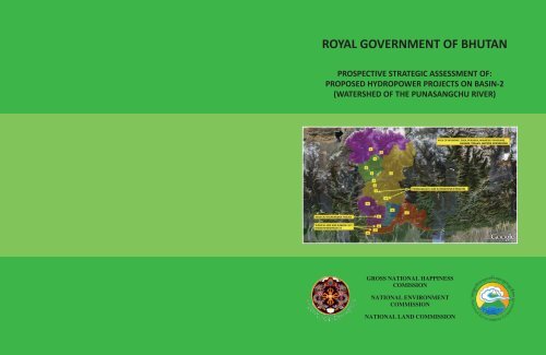
ROYAL GOVERNMENT OF BHUTANPROSPECTIVE STRATEGIC ASSESSMENT OF:PROPOSED HYDROPOWER PROJECTS ON BASIN-2(WATERSHED OF THE PUNA<str<strong>on</strong>g>SA</str<strong>on</strong>g>NGCHU RIVER)FIGURE2:LOCATIONMAPOFBASIN2ANDSITESOFPROPOSEDHYDROPOWERDEVELOPMENTSITESThelegendforFigure2isdescribedinSecti<strong>on</strong>5.5ofthisReport.1GROSS NATIONAL HAPPINESSCOMISSIONNATIONAL ENVIRONMENTCOMMISSIONNATIONAL LAND COMMISSION
PREAMBLEThe Strategic Assessment (<str<strong>on</strong>g>SA</str<strong>on</strong>g>) Report is prepared to identify the widerdevelopment impacts expected from the development of megahydropowerprojects planned for Basin‐2 (the Punasangchu River Basin).The report identifies expected development impacts and introducesmeasures to effectively manage and mitigate forecasted negativeenvir<strong>on</strong>mental, social and ec<strong>on</strong>omic impacts while introducing measuresto reinforce expected positive impacts expected from the developments.The foundati<strong>on</strong> of the Report is the agreed <str<strong>on</strong>g>SA</str<strong>on</strong>g> Objective and, as such,the report ventilates the Objective into sub‐objectives relative to themesand sectors (Topics) agreed by stakeholders. These cover envir<strong>on</strong>mental,social, cultural, ec<strong>on</strong>omic and global (climate) dimensi<strong>on</strong>s.The <str<strong>on</strong>g>SA</str<strong>on</strong>g> Report is the key c<strong>on</strong>sultati<strong>on</strong> document detailing the <str<strong>on</strong>g>SA</str<strong>on</strong>g> processand its outcomes. As such, the document is a stand‐al<strong>on</strong>e document thatserves to inform government authorities, stakeholders and the generalpublic.1
COVER NOTEThe attached Strategic Assessment Report has been prepared for:HYDROPOWER DEVELOPMENTS PLANNED FOR BASIN‐2THE GROSS NATIONAL HAPPINESS COMMISSION,The Resp<strong>on</strong>sible Authority THE NATIONAL is: ENVIRONMENT COMMISSION,THE NATIONAL LAND COMMISSIONCONTACTMr. SONAM YANGLEY – DIRECTOR GENERAL ‐ NECSMR. KARMA TSHITEEN‐SECRETARY – GNHCDASHO <str<strong>on</strong>g>SA</str<strong>on</strong>g>NGAY KHANDU‐SECRETARY ‐ NLCADDRESSTEL. NoE‐MAILSIGNATUREFOR THE GNHC FOR THE NEC FOE THE NLCDATE2
FIGURE‐2: LOCATION MAP OF BASIN‐2 AND SITES OF PROPOSED HYDROPOWER DEVELOPMENT SITESThe legend for Figure‐2 is described in Secti<strong>on</strong>‐5.5 of this Report.4
AREA OF INFLUENCE AND FOCUS AREAS CONSIDERED DURING THE STRATEGIC ASSESSMENTFigure‐3: Area of Influence: Gasa, Punakha, Wangdue‐Phodrang, Dagana, Tsirang, Sarpang Dz<strong>on</strong>gkhags (North to South). The Focus area wasselected as two linked areas: to the North Punakha and Wangdue‐Phodrang and the sec<strong>on</strong>d in the Southern regi<strong>on</strong> of Dagana, Sarpang andTsirang Dz<strong>on</strong>gkhags.5
RISK CATEGORI<str<strong>on</strong>g>SA</str<strong>on</strong>g>TION ................................................................................................... 735.7 MACRO‐ZONATION OF THE NORTH AND SOUTH FOCUS AREAS ............................................ 745.8 DESCRIPTION OF THE EXPECTED IMPACT ON NATIONAL SUSTAINABLE DEVELOPMENTOBJECTIVES (LOCAL, REGIONAL AND NATIONAL) .............................................................. 756. ENVIRONMENTAL AND SOCIO‐ECONOMIC IMPACTS ............................................................ 777. MANAGEMENT AND MITIGATION MEASURES ........................................................ 897.1 PROPOSED MANAGEMENT AND MITIGATION MEASURES (NECES<str<strong>on</strong>g>SA</str<strong>on</strong>g>RY TO ACHIEVE SUB‐OBJECTIVES AND MEET NATIONAL STANDARDS) .............................................................. 897.2 PRIORITISED DEVELOPMENT ACTIONS IN THE AREA OF INFLUENCE ..................................... 1008. INDICATORS AND MONITORING ............................................................................ 1048.1 BENCHMARKING ...................................................................................................... 1048.2 DZONGKHAG AUDITS ................................................................................................. 1069. RECOMMENDATIONS ............................................................................................ 10710. NEXT STEPS ............................................................................................................ 10911. REFERENCES........................................................................................................... 11112. ANNEXES ................................................................................................................ 11312.1 ANNEX‐1: THE STRATEGIC ASSESSMENT PROCESS ................................................ 114A: KEY STAGES IN THE STRATEGIC ASSESSMENT PROCESS ........................................................... 114SCREENING ....................................................................................................................... 115SCOPING 116IDENTIFICATION, SELECTION AND ASSESSMENT OF ALTERNATIVES ............................................... 117SELECTION OF PREFERRED ALTERNATIVES ............................................................................... 117IMPACT EVALUATION .......................................................................................................... 118SETTING PLANNING AND DEVELOPMENT PRIORITIES ................................................................. 118INTRODUCING GNH MANAGEMENT AND MITIGATION MEASURES ............................................... 118DEVELOPMENT CONDITIONALITY .......................................................................................... 119B: THE STRATEGIC ASSESSMENT REPORT ................................................................................ 119C: TECHNICAL REVIEW ........................................................................................................ 120D: ADOPTION, ENDORSEMENT AND RECORD OF DECISION ......................................................... 121E: IMPLEMENTATION AND MONITORING ................................................................................ 121F: REVIEW ........................................................................................................................ 12212.2 ANNEX‐2: MACROZONING OF SELECTED FOCUS AREAS ........................................ 12312.3 ANNEX‐3: LEGAL FRAMEWORK SUPPORTING THE STRATEGIC ASSESSMENT ...... 16012.4 ANNEX‐4: LIST OF PARTICIPANTS (WORKSHOP‐1 AND 2) ....................................... 16812.5 ANNEX‐5: THE (ZERO OPTION) SCENARIO ............................................................. 17112.6 ANNEX‐6: PROCESS ACTION PLAN ....................................................................... 1987
CSRDANIDADECDoEDoFDoRDEODRMDRREFRCEIAFYPGDPGISGNHGNHCGLOFGoIICDPIEEJDMPLDCLLDCMDGMEAMSMEMoAMoEAMoEMoFMoHMoHCAMoWHSMWNBCNECNECSNSBNSDSNSPNuNU<str<strong>on</strong>g>SA</str<strong>on</strong>g>CRONYMSCorporate Social Resp<strong>on</strong>sibilityDanish Internati<strong>on</strong>al Development AssistanceDistrict Envir<strong>on</strong>mental CommitteesDepartment of EnergyDepartment of ForestryDepartment of RoadsDistrict Envir<strong>on</strong>mental OfficerDisaster Risk ManagementDisaster Risk Reducti<strong>on</strong>Envir<strong>on</strong>ment Friendly Road C<strong>on</strong>structi<strong>on</strong>Envir<strong>on</strong>ment Impact AssessmentFive Year PlanGross Domestic ProductGeographic Informati<strong>on</strong> SystemGross Nati<strong>on</strong>al HappinessGross Nati<strong>on</strong>al Happiness Commissi<strong>on</strong>Glacial Lake Outburst FloodGovernment of IndiaIntegrated C<strong>on</strong>servati<strong>on</strong> and Development ProgrammeInitial Envir<strong>on</strong>ment Evaluati<strong>on</strong>Jigme Dorji Nati<strong>on</strong>al ParkLeast Developed CountryLandlocked ‐ LDCMillennium Development GoalsMultilateral Envir<strong>on</strong>mental AgreementMicro, Small and Medium EnterprisesMinistry of AgricultureMinistry of Ec<strong>on</strong>omic AffairsMinistry of Educati<strong>on</strong>Ministry of FinanceMinistry of HealthMinistry of Home and Cultural AffairsMinistry of Works and Human SettlementMegawattNati<strong>on</strong>al biodiversity CentreNati<strong>on</strong>al Envir<strong>on</strong>ment Commissi<strong>on</strong>Nati<strong>on</strong>al Envir<strong>on</strong>ment Commissi<strong>on</strong> SecretariatNati<strong>on</strong>al Statistics Bureau of BhutanNati<strong>on</strong>al sustainable Development StrategyNati<strong>on</strong>al Strategic PlanNgultrumNati<strong>on</strong>al Urbanizati<strong>on</strong> Strategy8
OECDRBCRBMRGoBRNRRSPN<str<strong>on</strong>g>SA</str<strong>on</strong>g><str<strong>on</strong>g>SA</str<strong>on</strong>g>ARCSEASDWWFOrganizati<strong>on</strong> for Ec<strong>on</strong>omic Cooperati<strong>on</strong> and DevelopmentRiver Basin CommitteeResults Based ManagementRoyal Government of BhutanRenewable Natural ResourceRoyal Society for Protecti<strong>on</strong> of NatureStrategic AssessmentSouth Asian Associati<strong>on</strong> for Regi<strong>on</strong>al Cooperati<strong>on</strong>Strategic Envir<strong>on</strong>mental AssessmentSustainable DevelopmentWorld Wide Fund for Nature9
ACKNOWLEDGEMENTSThe SEA/<str<strong>on</strong>g>SA</str<strong>on</strong>g> process by definiti<strong>on</strong> is an issues‐driven participative approach tothe envir<strong>on</strong>mental assessment of plans, policies, programmes developmentproposals or complex projects. In this regard, the c<strong>on</strong>tributi<strong>on</strong>s of theparticipants at the two workshops must be acknowledged, as their inputswere invaluable to the SEA exercises. It must also be appreciated that theSEA report below is an output of their hard work at the two weekl<strong>on</strong>gworkshops in Wangdue and Paro. The list of participants at the workshops isattached to the report and we would like to acknowledge them as availablenati<strong>on</strong>al capacity for future SEAs in Bhutan. The participants included adiverse mix of capacities (from Gewog Administrative Officers to DashoDz<strong>on</strong>gdags to Senior Officers from stakeholder agencies) who discussedissues candidly and deliberated l<strong>on</strong>g hours to emerge with workablesoluti<strong>on</strong>s and alternatives aimed at mitigating the negative envir<strong>on</strong>mentalimpacts of the proposed development while at the same time enhancingsocio‐ec<strong>on</strong>omic opportunities for the people living in the area of influence.We would like to acknowledge their hard work as the primary input to thisSEA.Acknowledgements are also due to Mr. Michael Pears<strong>on</strong> for his dedicati<strong>on</strong>and patience as Technical Expert for the SEA exercise. The advantage of thisSEA is that the c<strong>on</strong>sultants introduced the technical aspects of the exerciseand then <strong>on</strong>ly guided the workshop participants through the various stagesof the process. Therefore, the strength of this SEA is that it is a true nati<strong>on</strong>alendeavour. Mr. Michael Pears<strong>on</strong>’s patience in sharing his experience andguiding the participants without overly intervening in the process wasremarkable.We would also like to acknowledge Mr. Tandin Dorji for his services as localc<strong>on</strong>sultant. Mr. Tandin Dorji not <strong>on</strong>ly participated and c<strong>on</strong>tributed to theprocess but also gained valuable experience and know‐how about the SEAprocess through his associati<strong>on</strong> with the technical expert. We are hopefulthat he will c<strong>on</strong>tinue to c<strong>on</strong>tribute as a nati<strong>on</strong>al resource for future SEAs inBhutan.Acknowledgements are also due to the following officers from the Nati<strong>on</strong>alEnvir<strong>on</strong>ment Commissi<strong>on</strong>: Mr. Thinley Dorji who coordinated the workshops;Mr. Tshewang Dorji who managed the process intermittently while alsoplaying a vital part in the SEA workshops; Mr. Tshewang Chaskar for all theadministrative and logistical arrangements; Mrs. Kesang Dema for takingcare of the financial aspects of the project; Mrs. Pema Lhazom for taking careof the secretarial needs of the project; and Mr. Karma Tshering for managingthe entire process.We would also like to take this opportunity to express our gratitude to DashoNado Rinchhen, who as Head of the NEC then, provided much guidance and10
impetus to entire process. Without his encouragement and motivati<strong>on</strong>, itwould not have been possible to gather such a diversity of experts for thetwo SEA workshops. Our acknowledgements also go out to Dasho Paljor J.Dorji, Advisor to the Nati<strong>on</strong>al Envir<strong>on</strong>ment Commissi<strong>on</strong>, for gracing theopening of the SEA workshops and for inspiring the participants to input theirexperiences in the overall exercise. We would also like to acknowledge Mr.S<strong>on</strong>am Yangley, Director General, NEC, for ensuring the c<strong>on</strong>tinuity of the SEAprocess through the discussi<strong>on</strong> of the report at the nati<strong>on</strong>al level.We would also like to acknowledge the Gross Nati<strong>on</strong>al HappinessCommissi<strong>on</strong> (GNHC) and the Nati<strong>on</strong>al Land Commissi<strong>on</strong> (NLC) for theircooperati<strong>on</strong> in this endeavour. We want to highlight that these two partneragencies play strategic roles in the SEA process and the spirit of cooperati<strong>on</strong>extended for this SEA was commendable. Acknowledgements are also due tothe NLC for providing the maps for the SEA exercises.Lastly, we would like to acknowledge and express our gratitude to DANIDAfor providing the financial assistance to undertake the SEA. We remainc<strong>on</strong>fident that this SEA will c<strong>on</strong>tribute to the integrati<strong>on</strong> of envir<strong>on</strong>mentalc<strong>on</strong>siderati<strong>on</strong>s into Policies, Plans and Programmes of the Royal Governmentof Bhutan while evaluating their inter‐linkages with ec<strong>on</strong>omic and socialc<strong>on</strong>siderati<strong>on</strong>s.11
EXECUTIVE SUMMARYThis Report describes the process, outcome, and recommendati<strong>on</strong>s of aStrategic Assessment to identify and c<strong>on</strong>sider the wider developmentimpacts (Envir<strong>on</strong>mental, socio‐ec<strong>on</strong>omic and GNH) of planned hydropowerinvestments in Basin‐2 and particularly <strong>on</strong> the Punasangchu and DagachuRivers. The planned hydropower development projects <strong>on</strong> Basin‐2 Rivershave been inscribed and prioritised in the Tenth Five Year Plan (2008‐2013).The point of departure for this Strategic Assessment was agreement (am<strong>on</strong>gstakeholders) that each hydropower project is an agent of development andchange. As such, the cumulative development impact of all plannedhydropower projects are expected to be significant and transformative atlocal, regi<strong>on</strong>al, nati<strong>on</strong>al and trans‐nati<strong>on</strong>al levels.This Report describes the Strategic Assessment Process carried out toc<strong>on</strong>sider the best possible development alternative(s) targeting two selectedfocus areas where development catalysed by the hydropower projects areexpected to c<strong>on</strong>centrate. A northern focal area c<strong>on</strong>siders development in anarea extending from Gasa and Punakha Dz<strong>on</strong>gkhags to the north and southto the site of the Punasangchu‐1 hydropower project. A southern focal areac<strong>on</strong>siders forecasted development of Lhamoizingka, southern DaganaDz<strong>on</strong>gkhag, Western Sarpang and Tsirang Dz<strong>on</strong>gkhags. The Report c<strong>on</strong>sidersthe envir<strong>on</strong>mental and socio‐ec<strong>on</strong>omic impacts and benefits of eachproposed development alternative and details c<strong>on</strong>sultative and participatorymethods used to select a preferred alternative, identify negative impactsthat could be expected from the selected alternative(s) and proposesmanagement and mitigati<strong>on</strong> measures necessary to offset negative impactsand optimise overall development benefits accrued to the selected area ofinfluence (Figure‐2) the focus areas and to the Kingdom of Bhutan.The Strategic Assessment of planned hydropower developments <strong>on</strong> Basin‐2Rivers is aligned to Article 5 of the C<strong>on</strong>stituti<strong>on</strong> of the Kingdom of Bhutan(2008), The Nati<strong>on</strong>al Envir<strong>on</strong>ment Protecti<strong>on</strong> Act of Bhutan (2007), theRegulati<strong>on</strong>s for the Envir<strong>on</strong>mental Clearance of <strong>Project</strong>s and the Regulati<strong>on</strong>s<strong>on</strong> Strategic Envir<strong>on</strong>mental Assessment (2002).The rati<strong>on</strong>ale of this Strategic Assessment was to:• Introduce a mechanism to fully c<strong>on</strong>sider development c<strong>on</strong>sequencesand impacts of planned hydropower developments <strong>on</strong> Basin‐2 Riversover a 20‐year temporal framework;• Ensure that potential negative impacts and risks expected frominduced development and future investments catalysed by thehydropower projects have been identified and fully c<strong>on</strong>sidered and12
inform development planning of both the focus areas and theselected area of influence;• C<strong>on</strong>sider the cumulative effects of the proposed policy, plan,programme or development proposal (in this case the plannedhydropower investments) <strong>on</strong> a local, sectoral, regi<strong>on</strong>al, nati<strong>on</strong>al ortrans‐nati<strong>on</strong>al perspective.• Propose management and mitigati<strong>on</strong> measures to minimise theenvir<strong>on</strong>mental and socio‐ec<strong>on</strong>omic c<strong>on</strong>sequences of identifiednegative impacts;• Select development alternatives that best meet the present andfuture needs of affected Dz<strong>on</strong>gkhags and their people;• Support development planning and decisi<strong>on</strong>/making in the focusareas, Dz<strong>on</strong>gkhags and the Area of Influence that are affected directlyor indirectly by hydropower development projects (mega‐projects).The Strategic Assessment Process:In 2002, the Nati<strong>on</strong>al Envir<strong>on</strong>ment Commissi<strong>on</strong> enacted its Regulati<strong>on</strong>s <strong>on</strong>Strategic Envir<strong>on</strong>mental Assessment of Policies, Plans and Programmes asper the articles and provisi<strong>on</strong>s of the Envir<strong>on</strong>mental Assessment Act of 2000.These Regulati<strong>on</strong>s were not put into practice given that Line Ministriesc<strong>on</strong>sidered that the enacted Regulati<strong>on</strong>s would lead to delays in Governmentprocesses and therefore impede development. Since then, the Regulati<strong>on</strong>shave been kept <strong>on</strong> standby but agreement was reached that they would beactivated and applied, as necessary, to proposed “mega‐projects” of nati<strong>on</strong>alsignificance. As such, the hydropower mega‐projects <strong>on</strong> the Punasangchuand Dagachu Rivers meet agreed assessment criteria.The present Strategic Assessment was tailored to the specific needs of theRoyal Government of Bhutan represented by: The Nati<strong>on</strong>al Envir<strong>on</strong>mentCommissi<strong>on</strong> and Secretariat; the Gross Nati<strong>on</strong>al Happiness Commissi<strong>on</strong>; theNati<strong>on</strong>al Land Commissi<strong>on</strong>; Stakeholder Dz<strong>on</strong>gkhags and key Line Ministries.The methods used were a composite of: The OECD/DAC methodology asdescribed in their Good Practice Guidance (2006); the United Nati<strong>on</strong>sUniversity Course Modules <strong>on</strong> SEA of 2006; GTZ‐SEA guidance; Danidaguidance <strong>on</strong> SEA applicati<strong>on</strong>s; the Experience of the Scottish Executivedetailed in their SEA Toolkit (2006); the guidance provided by theInternati<strong>on</strong>al Associati<strong>on</strong> of Impact Assessment (IAIA) and pers<strong>on</strong>al <str<strong>on</strong>g>SA</str<strong>on</strong>g>applicati<strong>on</strong> experience of the Process Facilitator (Michael P. Pears<strong>on</strong> PhD.Danida Technical Advisor to NECS)13
c<strong>on</strong>sidered during the Assessment were agreed by process stakeholders anda framework for the introducti<strong>on</strong> of additi<strong>on</strong>al stakeholder alternatives wasprepared; Informati<strong>on</strong> needs and sources of informati<strong>on</strong> were identified;Existing sector plans specific to the spatial c<strong>on</strong>text of the assessment wereidentified and requested; A steering or platform group (the Trainingmaterials necessary to the Assessment Phase were prepared.This stage of the Assessment process was carried out through site visits toc<strong>on</strong>cerned Dz<strong>on</strong>gkhags, discussi<strong>on</strong>s with Dz<strong>on</strong>gdags, Dz<strong>on</strong>gkhagEnvir<strong>on</strong>mental Officers, and officers from c<strong>on</strong>cerned central administrati<strong>on</strong>s.In additi<strong>on</strong>, existing informati<strong>on</strong> sources were identified from the Ministry ofAgriculture, The Ministry of Works and Human Settlement, GNHC, the NECS,the NLC, Ministry of Ec<strong>on</strong>omic Affairs and others.Process design was also detailed during the Scoping stage and later validatedby Process participants during the first Workshop.IDENTIFICATION AND ASSESSMENT OF ALTERNATIVES: Alternatives to bec<strong>on</strong>sidered and analysed during the Process were identified and selected byProcess participants/stakeholders. All alternatives proposed by the floorduring plenary sessi<strong>on</strong>s were initially retained. Participants reduced thenumber of proposed alternatives through discussi<strong>on</strong> and vote. Only thoseAlternatives retained were analysed through scenario c<strong>on</strong>structi<strong>on</strong>, riskanalysis and expert judgement.SELECTION OF THE PREFERRED ALTERNATIVE: On completi<strong>on</strong> of the prospectiveanalysis through scenario c<strong>on</strong>structi<strong>on</strong> and expert judgement, participantspresented their analysis to the floor in a plenary sessi<strong>on</strong>. A plenary discussi<strong>on</strong>and debate <strong>on</strong> the outcomes of each analysis led to the selecti<strong>on</strong> of apreferred alternative(s).IMPACT IDENTIFICATION AND ASSESSMENT: The technical group /processparticipants were then requested to detail each development acti<strong>on</strong> likely tocomprise the preferred alternative over the temporal and geographic scopeof the Assessment.Envir<strong>on</strong>mental, social, ec<strong>on</strong>omic and GNH impacts (point source andcumulative) expected from each development acti<strong>on</strong> were then identifiedtogether with requisite management and mitigati<strong>on</strong> necessary to offset thepredicted effect.<strong>Project</strong>ed development was then plotted as polyg<strong>on</strong>s <strong>on</strong> maps and Google‐Earth images. Though this is a low resoluti<strong>on</strong> mapping exercise, it wassufficient to address issues of compatibility and spatial relati<strong>on</strong>ships both inthe focal area and the identified area of influence.15
THE STRATEGIC ENVIRONMENTAL ASSESSMENT REPORT: The results of theAssessment Phase are complied to prepare this Draft SEA Report. The Reportis then subjected to a further stakeholder c<strong>on</strong>sultati<strong>on</strong> and validati<strong>on</strong>procedure and adjusted as necessary to prepare the Final SEA Report.ADOPTION AND RECORD OF DECISION: Once the Report has been adjusted andvalidated by the joint Commissi<strong>on</strong>s, a Statement of Endorsement is preparedand submitted by the joint Commissi<strong>on</strong>s to their Chairman.The Statement of Endorsement is an official document that serves to instructcentral and lower tiers of government to introduce mainstreamed Processresults and outcomes to their future plans. It also instructs government toact <strong>on</strong> Process recommendati<strong>on</strong>s.PROCESS ORGANI<str<strong>on</strong>g>SA</str<strong>on</strong>g>TION:The Strategic Assessment was initiated by the Nati<strong>on</strong>al Envir<strong>on</strong>mentCommissi<strong>on</strong> Secretariat and led jointly by the NEC, the GNHC and the NLC <strong>on</strong>behalf of the GNHC. The Strategic Assessment was organized as follows:The Joint Commissi<strong>on</strong>s lead the process and comment <strong>on</strong> the results of theTechnical Group resp<strong>on</strong>sible for c<strong>on</strong>tributing towards the successfulc<strong>on</strong>clusi<strong>on</strong> of the different stages of the Process. The Joint Commissi<strong>on</strong>sreceive the Strategic Assessment Report, provide comments and finallyrecommend endorsement of the Report.The Endorsed Report is then delivered to c<strong>on</strong>cerned Dz<strong>on</strong>gkhags withinstructi<strong>on</strong>s to introduce mainstreamed outcomes to their futuredevelopment plans.A Technical Group comprising representatives of all stakeholder groups(Central Government, C<strong>on</strong>cerned Dz<strong>on</strong>gkhags, Geogs, Experts, the GeneralPublic, NGO’s, Associati<strong>on</strong>s, etc) was called to participate in the process. TheTechnical Group was provided with training and support to enable them toc<strong>on</strong>tribute effectively to the process.The Technical Group was asked to participate in two c<strong>on</strong>sultative workshopsduring which objectives were agreed, alternatives identified and selected,impact assessment was carried out and management/mitigati<strong>on</strong> measuresidentified and outcome recommendati<strong>on</strong>s drafted. As such, the TechnicalGroup was critical and key to the successful outcome of the Process.PROCESS OBJECTIVE AND SUB‐OBJECTIVES:The Objective of the <str<strong>on</strong>g>SA</str<strong>on</strong>g> was determined through stakeholder discussi<strong>on</strong>sduring the Scoping Stage of the SEA. Stakeholders approved the Objectiveduring the 1 st Stakeholder Workshop held in Wangdue from the 31 st of16
August to the 5 th of September 2009. Sub‐objectives were derived from theObjective and formulated to address the critical themes to be addressedduring the Assessment Process.THE OBJECTIVE OF THE STRATEGIC ASSESSMENT:Process Stakeholders agreed that the Objective of the Strategic Assessmentto assess the overall development impacts expected from hydropowerinvestments <strong>on</strong> Basin‐2 would be:“To analyse through relevant stakeholder and public participati<strong>on</strong>, anumber of alternative development scenarios expected from investmentsin <strong>Project</strong>s <strong>on</strong> Basin II to enable the selecti<strong>on</strong> of optimal soluti<strong>on</strong>sdelivering maximum sustainable (GNH) benefits of Bhutan while minimizingthe cumulative impacts of that development”.THE SUB‐OBJECTIVES OF THE ASSESSMENT PROPOSED BY PROCESS STAKEHOLDERS:As noted previously, sub‐objectives were formulated relative to the principaltopics and themes to be c<strong>on</strong>sidered during the assessment. These have beenextracted from secti<strong>on</strong> 4.4 of the Report and are presented below:1. Climate Change: Development planning and associated investments in thearea of influence of Basin‐2 hydropower investments are directed andplanned taking into c<strong>on</strong>siderati<strong>on</strong> risks and cumulative impacts expectedfrom climate change and systematically introducing mitigati<strong>on</strong> andmanagement measures.2. Watersheds and Catchment Basins: Catchment basins and water suppliesare mapped, inventoried and effectively managed to ensure c<strong>on</strong>tinueddelivery of critical ecosystem services to downstream users and the State.3. Ec<strong>on</strong>omic Development: Ec<strong>on</strong>omic and urban development of Dz<strong>on</strong>gkhagsand Geogs directly affected by investment in Basin‐2 hydropowerdevelopments is planned, coherent, sustainable and, as such, does notimpact negatively <strong>on</strong> the populati<strong>on</strong>, the envir<strong>on</strong>ment and c<strong>on</strong>serves intergenerati<strong>on</strong>alequity.4. Tourism, Eco‐tourism and Tourism Services: Development of tourismassets and opportunities in the area of influence of Basin‐2 hydropowerdevelopments are identified, z<strong>on</strong>ed, promoted, developed sustainably andc<strong>on</strong>tribute to nati<strong>on</strong>al, regi<strong>on</strong>al and local development plans (within theprinciples of GNH).5. Envir<strong>on</strong>ment (Polluti<strong>on</strong> c<strong>on</strong>trol, Waste Management, WaterManagement, Biodiversity and Natural Assets): Investments anddevelopments in the Basin‐2 area are integrated into the natural17
envir<strong>on</strong>ment / Landscape by giving a high priority <strong>on</strong> the quality andlimitati<strong>on</strong>s of ecosystems in the area of influence and minimizing negativeenvir<strong>on</strong>mental impacts.Biodiversity inventoried in the area of influence of planned Basin‐2hydropower investments is enhanced and acti<strong>on</strong>s leading to irreversiblelosses are prevented.6. Social Infrastructure: Improving the livelihood of the people by providingbetter heath services, educati<strong>on</strong>, employment opportunities, recreati<strong>on</strong>alfacilities, better communicati<strong>on</strong> and financial services.7. Agriculture and Forests: Ensure minimum loss of agricultural land andGovernment Reserve Forest lands while ensuring an adequate supply ofland for all future demand as per the relevant laws of the Kingdom.8. Culture and Heritage:A. Cultural heritage values and sites are protected and promoted as social,historical and ec<strong>on</strong>omic assets.B. Cultural heritage and cultural fabric in the areas of influence is notaffected by the development and migrati<strong>on</strong>/displacement haveminimum negative impacts9. Security: Measures to enhance existing security relati<strong>on</strong>ships withneighbour states to ensure that security risks do not erode ec<strong>on</strong>omic/socialdevelopment opti<strong>on</strong>s and potential.ALTERNATIVE DEVELOPMENT OPTIONS CONSIDERED:Alternative‐1: Wangdue‐Punakha (including Gasa) develops as a tourism aswell as services hub. Southern focal area develops as a tourismand industrial area.Alternative‐2: The Wangdue Punakha focal area develops as a manufacturingcentre. The southern focal area is developed for agroindustriesand trans‐boundary trade centres.Alternative‐3: Wangdue‐Punakha develops as a major urban centre withinternati<strong>on</strong>al and nati<strong>on</strong>al standard services in tourism and afocus <strong>on</strong> East‐West South distributi<strong>on</strong> hub. The southern areais developed as an entry port and SEZ/Industrial area.Alternative‐4: Wangdue‐Punakha services internati<strong>on</strong>al and nati<strong>on</strong>al tourismand is an East‐West‐South trade and distributi<strong>on</strong> hub. TheSouthern focal area is developed as a Special Ec<strong>on</strong>omic z<strong>on</strong>eand industrial area.18
Descripti<strong>on</strong>s for each of the proposed alternatives are provided in secti<strong>on</strong> 5.2of the Report.THE PREFERRED ALTERNATIVE: The preferred alternative selected by Processparticipants was the result of discussi<strong>on</strong> and analysis of all proposedalternatives. Stakeholders agreed to merge Alternatives 3 and 4 to formulatetheir preferred development opti<strong>on</strong>. As such, the preferred alternative asformulated by Process stakeholders is as follows:PREFERRED ALTERNATIVE (Merged Alternatives 3 and 4)WANGDUE‐PUNAKHA AND GA<str<strong>on</strong>g>SA</str<strong>on</strong>g> DEVELOP INTERNATIONAL ANDNATIONAL STANDARD SERVICES IN TOURISM WITH WANGDUE‐PUNAKHA AS A MAJOR URBAN CENTRE (CONURBATION).THE SOUTHERN FOCAL AREA DEVELOPS AS A TOURISM ANDINDUSTRIAL AREA, SPECIAL ECONOMIC ZONE AND ENTRY PORT.REJECTED ALTERNATIVES AND RATIONALE FOR REJECTION: Rati<strong>on</strong>ale forselecti<strong>on</strong> and rejecti<strong>on</strong> of the various proposed alternatives are presentedbelow. The text has been extracted from Secti<strong>on</strong> 5.3 of the Report.Alternative‐1: Wangdue‐Punakha (including Gasa) develops as a tourism aswell as services hub. Southern focal area develops as a tourismand industrial area.Process participants rejected the alternative given that it did not includesufficient elements to fully capitalise <strong>on</strong> development opportunities in boththe focal areas and the overall area of influence c<strong>on</strong>sidered in thisassessment.Participants also c<strong>on</strong>sidered that the alternative was missing criticalc<strong>on</strong>nectivity to external and internal markets provided by the establishmentof a “dry port” at Lhamoizingka (Alternative‐3).Alternative‐2: Wangdue‐Punakha is developed as a light industry andmanufacturing area. The southern focal area is developed foragro‐industries and trans‐boundary trade centres.Process participants rejected the alternative <strong>on</strong> the basis that it did notc<strong>on</strong>sider that the attributes and comparative advantages of the area wouldbe best served if development focused solely <strong>on</strong> industry and manufacturing.Participants c<strong>on</strong>sidered the alternative missed the tourism dimensi<strong>on</strong>.Alternative‐3: Wangdue‐Punakha develops as a major urban centre withinternati<strong>on</strong>al and nati<strong>on</strong>al standard services in tourism and a19
focus <strong>on</strong> East‐West South distributi<strong>on</strong> hub. The southern areais developed as an entry port and SEZ/Industrial area.The Alternative was retained and merged with Alternative‐4 below toelaborate the preferred alternative detailed in secti<strong>on</strong> 5.4 of this report.Participants c<strong>on</strong>sidered that Wangdue‐Phodrang and Punakha would mergeinto a large urban area within the 20‐year temporal framework of theassessment.Participants also c<strong>on</strong>sidered that establishment of a “dry port” inLhamozingkha (Kalikhola) would be likely within the temporal framework ofthe assessment. Furthermore, participants c<strong>on</strong>sidered that a “dry port”would significantly enhance ec<strong>on</strong>omic development opportunities of thecentral Dz<strong>on</strong>gkhags (the area of influence).Alternative‐4: Wangdue‐Punakha services internati<strong>on</strong>al and nati<strong>on</strong>al tourismand is an East‐West‐South trade and distributi<strong>on</strong> hub. TheSouthern focal area is developed as a Special Ec<strong>on</strong>omic z<strong>on</strong>eand industrial area.Process participants chose to retain this alternative and voted to mergeAltrnative‐4 to Alternative‐3.The merged preferred alternative is detailed below in secti<strong>on</strong> 5.4 of thisReport.THE PRINCIPAL FORECASTED NEGATIVE IMPACTS EXPECTED FROM THE PREFERREDALTERNATIVE:Process participants/stakeholders c<strong>on</strong>sidered the preferred alternativerelative to the development expected from it. As such they characterisednegative impacts relative to broad scale development foci. These included:Urban expansi<strong>on</strong>: The development scenario foresees rapid expansi<strong>on</strong> of theWangdue‐Punakha urban areas and gradual expansi<strong>on</strong> Lhamoizingka in linewith the establishment of a Special Ec<strong>on</strong>omic Z<strong>on</strong>e, Industrial Estates andexpanded adjacent agricultural areas. Likewise, the preferred developmentopti<strong>on</strong> forecasts expansi<strong>on</strong> of Tsirang, Sarpang, Gelephu, Damphu and Daga.Though urban growth is forecast in all existing urban areas, the principalexpansi<strong>on</strong> will be in Wangdue‐Punakha that will absorb all villages betweenPunakha and Wangdue and Lhamoizingka during the latter stages of the 20‐year temporal framework.Expansi<strong>on</strong> is expected to generate significant volumes of solid waste andwastewaters in line with increased commercial activities and increasingpopulati<strong>on</strong> as employment generati<strong>on</strong> from tourism, service, and light20
manufacturing industries becomes apparent over the 20‐year temporalframework of the Assessment.Expansi<strong>on</strong> will also result in a de‐facto increase in land transformati<strong>on</strong> thatwill call for c<strong>on</strong>versi<strong>on</strong> of government reserve forests and agricultural land inboth the north and south focal areas. Resettlement of existing populati<strong>on</strong>s islikely and will be required over the 20‐year temporal framework of theAssessment. Stakeholders also c<strong>on</strong>sidered that forecasted urban expansi<strong>on</strong>and populati<strong>on</strong> growth would result in significant depleti<strong>on</strong> of naturalresources (aggregates, st<strong>on</strong>e, wood products, etc.) as demand for buildingmaterials increased and that extracti<strong>on</strong> could lead to alterati<strong>on</strong> of existinglandscape values.Stakeholders c<strong>on</strong>sidered urban expansi<strong>on</strong> would lead to an increasedincidence of water polluti<strong>on</strong> and c<strong>on</strong>taminati<strong>on</strong> of potable water sources. Inadditi<strong>on</strong> to these impacts, stakeholders c<strong>on</strong>sidered that urban expansi<strong>on</strong>would also result in increased air polluti<strong>on</strong>, noise polluti<strong>on</strong>, depleti<strong>on</strong> ofnatural resources, increased incidence of communicable diseases andprevalence of HIV/AIDS.Tourism Sector: The preferred alternative forecasts a significant expansi<strong>on</strong> intourism facilities, tourism support services and infrastructures in both thenorthern focal area c<strong>on</strong>centrated around the Punakha‐Wangdue c<strong>on</strong>urbati<strong>on</strong>and the southern focal area c<strong>on</strong>centrated in Lhamoizingka, the periphery ofthe Phibsoo Wildlife Sanctuary and the shorelines of the Sunkosh reservoirs.While expansi<strong>on</strong> of the tourism sector will enhance envir<strong>on</strong>mentalmanagement throughout the area of influence and lead to increasedemployment/income generati<strong>on</strong>, it is also foreseen that the c<strong>on</strong>structi<strong>on</strong> andoperati<strong>on</strong> of tourism facilities could also result in significant negativeenvir<strong>on</strong>mental and socio‐ec<strong>on</strong>omic impacts that will demand proactive andc<strong>on</strong>tinuous management and mitigati<strong>on</strong>.Negative impacts identified by Process stakeholders included: a significantvolume of solid wastes and spoils generated during c<strong>on</strong>structi<strong>on</strong> and thenoperati<strong>on</strong> of tourism facilities; Increased water c<strong>on</strong>sumpti<strong>on</strong> and generati<strong>on</strong>of wastewater requiring treatment; possible c<strong>on</strong>taminati<strong>on</strong> of ground waterpotable water supplies; land transformati<strong>on</strong> of depleti<strong>on</strong> of critical naturalresources; possible increased air polluti<strong>on</strong> and increased incidence ofcommunicable diseases.Transport Sector: Process participants forecast a rapid expansi<strong>on</strong> oftransport infrastructure over the 20‐year temporal framework of theassessment. These included: C<strong>on</strong>structi<strong>on</strong> of a trunk road (aligned <strong>on</strong> theeastern banks of the Punasangchu River to Sunkosh Bridge) linkingLhamoizingka to Wangdue‐Punakha‐Thimphu and the Eastern Dz<strong>on</strong>gkhags;Expansi<strong>on</strong> of the feeder road and farm road networks throughout the area ofinfluence; C<strong>on</strong>structi<strong>on</strong> of a road tunnel linking Wangdue‐Punakha toThimphu; Development of water‐based transport and ferry crossings <strong>on</strong> and21
across the Sunkosh reservoirs; C<strong>on</strong>structi<strong>on</strong> of a regi<strong>on</strong>al airport atLhamoizingka and c<strong>on</strong>structi<strong>on</strong> of a trans‐Bhutan railway (aligned parallel tothe border with India) and linking Sibsoo (Samtse Dz<strong>on</strong>gkhag) to Jampani(Trashigang Dz<strong>on</strong>gkhag).Identified negative impacts included: Generati<strong>on</strong> of spoils requiring adequatedisposal; Land transformati<strong>on</strong>; depleti<strong>on</strong> and fragmentati<strong>on</strong> of naturalresources and critical ecosystems/habitats; polluti<strong>on</strong> of groundwatersources, increased emissi<strong>on</strong>s resulting in localised air polluti<strong>on</strong>; accidentalspillage of fuels and oils; illegal dumping of transport wastes includinghydrocarb<strong>on</strong>s; Polluti<strong>on</strong> of surface waters and potable water sources; alteredbiodiversity inventories; ribb<strong>on</strong> development adjacent to c<strong>on</strong>structedinfrastructures; increased prevalence of HIV/AIDS.Agriculture and Fisheries Sector: Process stakeholders c<strong>on</strong>sidered that thepreferred alternative would lead to expansi<strong>on</strong> and diversificati<strong>on</strong> ofagricultural producti<strong>on</strong> in the area of influence. They also forecast asignificant increase in commercial farming practices and expansi<strong>on</strong> of agrobasedindustrial output. C<strong>on</strong>structi<strong>on</strong> of the Sunkosh Reservoirs could alsosee growth of the fisheries sector through the establishment of commercialand artisanal fish farms <strong>on</strong>, or adjacent to the reservoirs.Negative impacts expected from sector growth and development couldinclude: Significant demand for agricultural land and expansi<strong>on</strong> of ruralsettlements would lead to increased transformati<strong>on</strong> of existing governmentreserve forests; Deforestati<strong>on</strong>; Fragmentati<strong>on</strong> of critical habitats; Increasedbank erosi<strong>on</strong> throughout the basin leading to increased sediment loads, andimpacted riverine biodiversity; Polluti<strong>on</strong> of rivers, watercourses, groundwater and near surface water supplies resulting from increased use offertilizers and pesticides and depleted biodiversity inventories.Industrial Sector: Negative impacts forecast for the Industrial Sectorincluded: Increased producti<strong>on</strong> of solid waste that could includec<strong>on</strong>taminated waste, organic waste (from agro‐Industries and abattoirs;Wastewater requiring special treatment to remove toxic materials and heavymetals; increased producti<strong>on</strong> of gaseous emissi<strong>on</strong>s; Noise polluti<strong>on</strong> in thevicinity of industrial facilities; Depleti<strong>on</strong> of natural resources; naturalresource and habitat fragmentati<strong>on</strong>; Cultural diluti<strong>on</strong> and increasedvandalism of cultural heritage sites; Increased incidence of communicablediseases and HIV/AIDS; increased rural migrati<strong>on</strong> and a c<strong>on</strong>comitantdepleti<strong>on</strong> of rural communities and available workforce.Mining Sector (Mines and Quarries): Process participants agreed thatimproved access infrastructures in the area of influence and expansi<strong>on</strong> ofurban areas, light industries, manufacturing industries and tourism wouldlead to increased mineral explorati<strong>on</strong> and eventual exploitati<strong>on</strong>.22
Identified negative impacts included: Degradati<strong>on</strong> of natural resource andbiodiversity inventories; Significant increase in the producti<strong>on</strong> of spoilsrequiring adequate and n<strong>on</strong>‐impacting disposal; Fragmentati<strong>on</strong> of forestresources and land transformati<strong>on</strong> further depleting government reserveforest inventories; polluti<strong>on</strong> of surface waters through increasedsedimentati<strong>on</strong>, fuel and hydrocarb<strong>on</strong> spills, and dumping of toxic materials;Cultural diluti<strong>on</strong> and fragmentati<strong>on</strong> of rural communities.Energy Sector: Negative impacts expected from this sector were attributedto increasing populati<strong>on</strong> and settlement in the area of influence (theec<strong>on</strong>omic drawing factor of the projects). Impacts will include but not belimited to: Expanding urban areas; investment in service based industries tosupport the hydropower sector (Garages and repair facilities; Die‐casting andsmall parts producti<strong>on</strong>; cleaning and laundry services; catering services;Financial Services; vehicle sales and rentals; Recreati<strong>on</strong>al Services; etc.);increased import and c<strong>on</strong>sumpti<strong>on</strong> of packaged domestic goods; increasingdemand for water; increasing pressure <strong>on</strong> existing services and utilities; Landtake for hydro related settlements, transmissi<strong>on</strong> lines and electricitydistributi<strong>on</strong> networks; depleti<strong>on</strong> of natural resources; increased incidence ofwater, air and soil polluti<strong>on</strong>; increased solid waste and waste watergenerati<strong>on</strong>; cultural diluti<strong>on</strong> and erosi<strong>on</strong> in both urban and rural areas;increased and unstoppable rural to urban migrati<strong>on</strong>.Health Sector and Public Health: Apart from land transformati<strong>on</strong> for thec<strong>on</strong>structi<strong>on</strong> and expansi<strong>on</strong> of health facilities throughout the area ofinfluence, Process participants c<strong>on</strong>sidered that the principal negativeimpacts that could be expected from the sector were: Increased producti<strong>on</strong>of c<strong>on</strong>taminated hospital waste requiring specific disposal methods:C<strong>on</strong>taminated wastewater and sharps requiring special disposal; Increasedincidence of communicable diseases and HIV/AIDS as populati<strong>on</strong> densityincreases in areas serviced by the infrastructure.Finance Sector: increased access to funds and increasing household incomescould result in depleti<strong>on</strong> of natural resources in line with increasing demandfrom the populati<strong>on</strong> (forest and n<strong>on</strong>‐forest products, building materials,land, etc.); increased volumes of waste generated in line with increasingwealth of the populati<strong>on</strong>.Natural Resources: Impact included: Localised depleti<strong>on</strong> as a result ifincreased demand from the expanding populati<strong>on</strong> and settled industries;Deforestati<strong>on</strong>; reduced provisi<strong>on</strong> of envir<strong>on</strong>mental services; depletedbiodiversity inventories.Detailed descripti<strong>on</strong>s of predicted envir<strong>on</strong>mental and socio‐ec<strong>on</strong>omicimpacts are presented in Secti<strong>on</strong> 6 of the Report. Secti<strong>on</strong>‐7 of the Reportdetails management and mitigati<strong>on</strong> measures required to offset identifiedimpacts. These measures should be introduced into all future development23
plans, structural plans, Five‐Year Plans and Annual Plans targeting the Area ofInfluence or originating from Dz<strong>on</strong>gkhags within the Area of Influence. Theintroducti<strong>on</strong> of identified development acti<strong>on</strong>s with embeddedmanagement and mitigati<strong>on</strong> measures to any development Plan or Budgetensures that the Plan has been mainstreamed to offset negative impacts,optimise positive impacts and reduce downstream costs for restorati<strong>on</strong> andcorrective measures.Prioritised development acti<strong>on</strong>s have been detailed in secti<strong>on</strong> 7.2 of theReport. These have been presented logically and sequentially relative to theprospective development scenarios c<strong>on</strong>structed by process participants.Prioritised acti<strong>on</strong>s from Secti<strong>on</strong>‐7.2 could be used to inform the preparati<strong>on</strong>of the 11 th Five‐Year Plan. In the short‐term, immediate acti<strong>on</strong>s could beintroduced to Annual Plans and Budgets of the c<strong>on</strong>cerned Dz<strong>on</strong>gkhags(assuming the Report is approved, endorsed and translated into Directives toall tiers of Government).Secti<strong>on</strong>‐8 of the Report highlights participants choice for the introducti<strong>on</strong> ofa new results based instrument to measure progress made towards agreedobjectives and targets at the Dz<strong>on</strong>gkhag and Geog level. The Secti<strong>on</strong> details a“Benchmarking” and Audit process that, in the opini<strong>on</strong> of ProcessParticipants, could prove effective, increase transparency, operate withinand support nati<strong>on</strong>al principles of GNH, lead to greater coherence andcohesi<strong>on</strong>, identify weakness and reinforce strengths within each Dz<strong>on</strong>gkhagand Geog.RISK ANALYSIS:Process participants were requested to c<strong>on</strong>sider elements of risk that wouldor could have a bearing <strong>on</strong> their proposed scenarios.For the purpose of the Strategic Assessment, risk was treated as an eventthat could have a direct or indirect impact <strong>on</strong> development forecast for anygiven scenario. In additi<strong>on</strong>, the element of risk was categorised as likely,unlikely or uncertain within the temporal framework of the assessment. Theelement of risk was also categorised according magnitude of the event andtreated as either critical or not critical.If an element of identified risk were both critical and uncertain then it wouldpreclude any investment or development in areas likely to be affected by therisk element in questi<strong>on</strong>.The Strategic Assessment identified Glacial Lake Outburst Flooding of Basin‐2as a critically uncertain risk and therefore demands that risk areas beidentified and regulated to exclude all structural or infrastructuredevelopment. Risk elements identified by process participants and theircategorisati<strong>on</strong> is presented in secti<strong>on</strong> 5.6.1 of this Report24
AREA OF INFLUENCE: PRIORITISED DEVELOPMENT/PLANNING ACTIONSProcess participants c<strong>on</strong>sidered the likely development outcomes resultingfrom their preferred development alternative and structured these in alogical sequence in their prospective scenario presented in Secti<strong>on</strong>‐5.5above. The sequence of activities required to plan, execute and m<strong>on</strong>itor eachidentified development acti<strong>on</strong> will be similar in each case and will bepreceded by a generic set of acti<strong>on</strong>s, which should be carried out between2010 and 2015.1. Revisi<strong>on</strong> of existing Structural Plans to introduce development prioritiesidentified through this Assessment.2. Elaborati<strong>on</strong> of a detailed Spatial Development Plan for the Area ofInfluence and the forecast focal development areas.3. Identificati<strong>on</strong> of GLOF risk areas and systematic development prohibiti<strong>on</strong>in all current and future development plans.4. Promulgati<strong>on</strong> of a Law prohibiting c<strong>on</strong>structi<strong>on</strong> and physicaldevelopment in GLOF risk areas.5. Preparati<strong>on</strong> of a digital cadastre for the area of influence.6. Agreement <strong>on</strong> development macro‐z<strong>on</strong>es in the areas of influencewhere <strong>on</strong>ly certain types of compatible development will be permitted.7. Delineati<strong>on</strong> of identified macro‐z<strong>on</strong>es <strong>on</strong> the digital cadastre.8. Elaborati<strong>on</strong> of informati<strong>on</strong> folders describing the developmentc<strong>on</strong>diti<strong>on</strong>ality that must be met (envir<strong>on</strong>mental, physical, structural andsocial) prior to approval to proceed and licensing.9. Prepare and make available detailed natural resource and biodiversityinventories for the area of influence and the focal areas.10. Determine the current state of the envir<strong>on</strong>ment in the area of influenceto include: water quality of surface and ground water; air quality andcurrent emissi<strong>on</strong> levels; potential risk areas (landslides, GLOF, flood risk,etc.); current noise polluti<strong>on</strong> levels; present use of fertilizers andpesticides; current volumes of waste and wastewater generated;locati<strong>on</strong> and type of waste management in the area of influence.11. Define limits of change for envir<strong>on</strong>mental parameters that cannot beexceeded. The limits shall be structured <strong>on</strong> internati<strong>on</strong>al standards25
adjusted to the Bhutanese c<strong>on</strong>text (example: Euro‐4, Euro‐5 emissi<strong>on</strong>standards for vehicles).12. Prepare a specific development Plan and Strategy for the establishmentof a Special Ec<strong>on</strong>omic Z<strong>on</strong>e in Lhamoizingka, complete with urbanexpansi<strong>on</strong> areas and the locati<strong>on</strong> of critical infrastructure and services(roads, waste management, sewerage, power transmissi<strong>on</strong> anddistributi<strong>on</strong>, residential areas, green areas, recreati<strong>on</strong> areas, rail linksand terminals to India, hospitals, schools, etc.)13. Commissi<strong>on</strong> a study to analyse (in detail) the opti<strong>on</strong> and feasibility ofc<strong>on</strong>structing a railway from Sibsoo to Eastern Trashigang. The Railway,as described in this Report would follow an alignment proximal to theborder with India and traverse both the Phibsoo and Manasc<strong>on</strong>servati<strong>on</strong> areas.14. C<strong>on</strong>vene a public hearing to present the findings of the Railway study(11) and agree <strong>on</strong> the future of the proposal.15. Identify suitable locati<strong>on</strong>s for sanitary landfills and wastewatertreatment facilities to service the future Wangdue‐Punakha c<strong>on</strong>urbati<strong>on</strong>.Reserve the locati<strong>on</strong> and issue directives to assure they are not allocatedto other purposes.16. Revise the existing Roads Development Master Plan in line with thefindings and recommendati<strong>on</strong> of this Report. The Plan should be revisedto include the c<strong>on</strong>structi<strong>on</strong> of a fast trunk road linking Lhamoizingka toWangdue‐Punakha following the shortest and most appropriatealignment adjacent to the future Punasangchu River reservoirs. TheAlignment should allow for development of tourism facilities andservices (ferry boat, water transport, terminals) <strong>on</strong> suitable landbetween the highest high water mark <strong>on</strong> the shore and the road.17. Develop a time‐based Strategic Plan for infrastructure improvement andupgrading in the area of influence.18. Commissi<strong>on</strong> a detailed study and feasibility study to determine the mostappropriate alignment for a road tunnel linking Wangdue‐Punakha toThimphu. The analysis must include a preliminary social andenvir<strong>on</strong>mental impact profile of the propose works.19. Identify and reserve an area suitable for c<strong>on</strong>structi<strong>on</strong> of a regi<strong>on</strong>alairport in Lhamoizingka.20. Immediately identify alternatives to spoils dumping <strong>on</strong> riverbanks,valleys or other natural area. Ensure that future hydropower, road,infrastructure, tunnelling, urban expansi<strong>on</strong> activities are not permitted26
to dump spoils. The preferred spoils treatment opti<strong>on</strong> must be someform of re‐use and recycle process with in‐built revenue generati<strong>on</strong>opportunities.21. Initiate marketing and promoti<strong>on</strong> campaigns to attract investment to thefocal areas following completi<strong>on</strong> of the Planning processes and thepreparati<strong>on</strong> of c<strong>on</strong>diti<strong>on</strong>ality informati<strong>on</strong>/instructi<strong>on</strong> folders.22. Agree <strong>on</strong> Instituti<strong>on</strong>al Arrangements for the technical review andapproval of license applicati<strong>on</strong>s for all development types in the area ofinfluence.23. Agree <strong>on</strong> the instituti<strong>on</strong>al Arrangements for subsequent performancem<strong>on</strong>itoring, state of the envir<strong>on</strong>ment m<strong>on</strong>itoring and Dz<strong>on</strong>gkhagPerformance Audits.Specific development acti<strong>on</strong>s, identified through the above preparatoryactivities, should be introduced into the 11 th Five Year Plan (2014‐2019),subsequent Five‐Year Development Plans and Annual Plans and budgetsderived from these Plans. Introduced acti<strong>on</strong>s will be fully mainstreamedthereby reducing their envir<strong>on</strong>mental and social impact, enhancing theirdevelopmental benefits and reducing downstream corrective andrestorati<strong>on</strong> costs.PROCESS RECOMMENDATIONS:On c<strong>on</strong>clusi<strong>on</strong> of the Strategic Assessment Process, participants shaped thefollowing recommendati<strong>on</strong>s to the Joint Commissi<strong>on</strong>s based <strong>on</strong> theircollective experience gained from the Process:1. Stakeholders recommend that all future development planning oranalysis of the development c<strong>on</strong>sequences of complex investmentprojects should be subject to Strategic Assessments to ensure that thesedeliver optimal development outcomes with minimal envir<strong>on</strong>mental,and social impacts.2. Stakeholders recommend that Strategic Assessment Processes bedesigned and implemented to ensure that all Dz<strong>on</strong>gkhags are providedwith the Technical skills to apply the Process systematically to theirdevelopment planning and to inform their decisi<strong>on</strong>‐making processes.Opportunities to expose Eastern Dz<strong>on</strong>gkhags to the <str<strong>on</strong>g>SA</str<strong>on</strong>g> Process could be:Proposed hydropower development <strong>on</strong> Basin‐3 and the development ofan Internati<strong>on</strong>al airport and Industrial Estate in the Gelephu regi<strong>on</strong>27
3. Furthermore, Stakeholders recommend that the 11 th Five‐Year Plan beelaborated <strong>on</strong> the basis of systematic Strategic Assessments carried outat Sub‐Nati<strong>on</strong>al levels to ensure that each c<strong>on</strong>stituent element of thatPlan is c<strong>on</strong>sistent and coherent to Nati<strong>on</strong>al Development objectives,c<strong>on</strong>tributes to local development objectives, is fully mainstreamed tomitigate against predicted point source or cumulative impacts.4. Stakeholders agree that the principal Nati<strong>on</strong>al Instituti<strong>on</strong>al driver forensuring a systematic applicati<strong>on</strong> of Strategic Assessments (as amainstreaming instrument of choice) should be the Gross Nati<strong>on</strong>alHappiness Commissi<strong>on</strong>. Stakeholders encourage the Commissi<strong>on</strong> todraw <strong>on</strong> experience gained by participants and, in particular the Nati<strong>on</strong>alEnvir<strong>on</strong>ment Commissi<strong>on</strong> Secretariat to facilitate disseminati<strong>on</strong> of theProcess to Sub‐Nati<strong>on</strong>al Administrati<strong>on</strong>s, Line Ministries and otherc<strong>on</strong>cerned parties.5. Stakeholders recommend that the Gross Nati<strong>on</strong>al HappinessCommissi<strong>on</strong>, together with the Nati<strong>on</strong>al Envir<strong>on</strong>ment Commissi<strong>on</strong>Secretariat issue a directive and prepare an <str<strong>on</strong>g>SA</str<strong>on</strong>g> Process methodology toenable and m<strong>on</strong>itor the systematic applicati<strong>on</strong> of the Process, or avariant of it, to all complex development projects.Complex development projects shall include but not be limited to:Transport infrastructure; Strategic infrastructure; <strong>Hydropower</strong>Development; Urban Expansi<strong>on</strong>; Industrial Developments; Nati<strong>on</strong>al Parksand C<strong>on</strong>servati<strong>on</strong> Areas; Mines and mineral extracti<strong>on</strong> areas and others.6. Stakeholder participants str<strong>on</strong>gly recommend that the RoadsDepartment c<strong>on</strong>sider designing a new Highway to link Lhamoizingka(Kalikhola) to the Sunkosh Bridge juncti<strong>on</strong> <strong>on</strong> the Eastern bank of thePunasangchu River. The Recommendati<strong>on</strong> is based <strong>on</strong> the outcome ofthe Process and the need for a fast North‐South Trunk Road link toWangdue‐Phodrang, Punakha, Thimphu and the Eastern Dz<strong>on</strong>gkhags.7. Stakeholders recommend that the Tourism Board of Bhutan initiate asurvey and product development initiative to identify and promotetourism opportunities in the vicinity of the Punasangchu River and inparticular in areas adjacent to the highway recommended as item‐5above.Through the process Stakeholders have identified a significant futuretourism resource adjacent to the reservoirs established by the Sunkosh<strong>Hydropower</strong> <strong>Project</strong>s, the Phibsoo Wildlife Sanctuary and other naturalassets in the regi<strong>on</strong>.8. Stakeholders str<strong>on</strong>gly recommend that all identified GLOF risk areas <strong>on</strong>the Punasangchu River Basin be categorised as development and28
investment exclusi<strong>on</strong> areas. Furthermore, Stakeholders recommend thatrisk areas be designated as “Green Recreati<strong>on</strong> Areas” and developed forthat purpose. Development could include: Park‐land; Footpaths; Bicyclepaths; Nature Trails; Water recreati<strong>on</strong> areas; Planned picnic sites withfire pits; etc.29
1. INTRODUCTIONIn line with the objectives of the 10 th Five Year Plan (2008‐2013), themandate of the Nati<strong>on</strong>al Envir<strong>on</strong>ment Commissi<strong>on</strong> and the Draft Guidelinesfor Mainstreaming Envir<strong>on</strong>ment of Policies, Plans and Programmes, the NECSand its partners (the Gross Nati<strong>on</strong>al Happiness Commissi<strong>on</strong> and the Nati<strong>on</strong>alLand Commissi<strong>on</strong> have designed and implemented a Participatory StrategicAssessment type process to c<strong>on</strong>sider the wider development implicati<strong>on</strong>sand impacts of series of hydropower developments planned and beingc<strong>on</strong>structed <strong>on</strong> Basin‐2, the Punasangchu River a development activityhighlighted and prioritised in the 10 th FYP.The Nati<strong>on</strong>al Envir<strong>on</strong>ment Commissi<strong>on</strong>, together with its process partnersthe Gross Nati<strong>on</strong>al Happiness Commissi<strong>on</strong> and the Nati<strong>on</strong>al LandCommissi<strong>on</strong> agreed to collaborate to design and implement a rapid, multistakeholderand cross‐sectoral prospective Strategic Assessment of theprioritised development acti<strong>on</strong>. The Assessment used techniques and toolsdeveloped for Strategic Envir<strong>on</strong>mental Assessment that were adapted andtested to resp<strong>on</strong>d to the specific c<strong>on</strong>text and need of the Royal Governmentof Bhutan.A joint technical committee c<strong>on</strong>stituted by members from the Gross Nati<strong>on</strong>alHappiness Commissi<strong>on</strong>, the Nati<strong>on</strong>al Land Commissi<strong>on</strong> and the Nati<strong>on</strong>alEnvir<strong>on</strong>ment Commissi<strong>on</strong> Secretariat was established to guide the StrategicAssessment Process. The technical committee will receive, review andprovide comments to this document. Once changes have been introducedthe Technical Committee will distribute this document to members of thethree Commissi<strong>on</strong>s prior to a joint sessi<strong>on</strong> where process outcomes andrecommendati<strong>on</strong>s detailed in this report will be discussed.As a participatory process, the Strategic Assessment brought togetherrepresentatives from Dz<strong>on</strong>gkhags likely to be directly or indirectly affectedby development acti<strong>on</strong>s. As such, senior officials from Chukha, Gasa,Punakha, Wangdue‐Phodrang, Sarpang, Dagana and Tsirang participated. Inadditi<strong>on</strong> to these participants, representatives from stakeholder Ministriesand administrati<strong>on</strong>s were also present. These included: the Gross Nati<strong>on</strong>alHappiness Commissi<strong>on</strong>; the NECS; the NLC; the Ministry of Ec<strong>on</strong>omic Affairs;Ministry of Works and Human Settlement; Department of Roads and theDepartment of Energy.The Strategic Assessment of the proposed hydropower projects <strong>on</strong> the Basin‐2 is aligned to Article 5 of the C<strong>on</strong>stituti<strong>on</strong> of the Kingdom of Bhutan (2008),The Nati<strong>on</strong>al Envir<strong>on</strong>ment Protecti<strong>on</strong> Act of Bhutan (2007), the Regulati<strong>on</strong>sfor the Envir<strong>on</strong>mental Clearance of <strong>Project</strong>s and the Regulati<strong>on</strong>s <strong>on</strong> StrategicEnvir<strong>on</strong>mental Assessment (2002).30
The Strategic Assessment Process is a n<strong>on</strong>‐statutory process that leads to theelaborati<strong>on</strong> of technical guidance to better manage and mitigateenvir<strong>on</strong>mental and socio‐ec<strong>on</strong>omic impacts expected from a preferred andoptimal development alternative selected by process participants. As such,proposed management and mitigati<strong>on</strong> can be introduced to any plan orelement of a plan and ensures that each acti<strong>on</strong>/activity c<strong>on</strong>stituting a currentor future plan are both coherent and mainstreamed. Process outcomesshould serve as a guide and do not replace nati<strong>on</strong>al and sub‐nati<strong>on</strong>alplanning processes. Likewise, results do not replace the need for statutoryEIA procedures necessary for envir<strong>on</strong>mental clearances and licensing.The Strategic Assessments were supported through funding provided by jointRoyal Government of Bhutan – Government of Denmark Envir<strong>on</strong>ment andUrban Sector Programme Support (EUSPS).31
2. BACKGROUNDProcess participants selected the Area of Influence for this StrategicAssessment as: Gasa, Punakha, Wangdue‐Phodrang, Dagana, Tsirang,Sarpang Dz<strong>on</strong>gkhags (North to South). Participants then c<strong>on</strong>sidered thatdevelopment would c<strong>on</strong>centrate in two linked areas Focus Areas: to theNorth Punakha and Wangdue‐Phodrang and the sec<strong>on</strong>d in the Southernregi<strong>on</strong> of Dagana, Sarpang and Tsirang Dz<strong>on</strong>gkhags.The socio‐ec<strong>on</strong>omic profiles of these Dz<strong>on</strong>gkhags are detailed below:2.1 ADMINISTRATIVE AND SOCIO‐ECONOMIC PROFILE OF THEAREA OF INFLUENCEGA<str<strong>on</strong>g>SA</str<strong>on</strong>g> DZONGKHAGGasa lies in the extreme northwest of the country. It is bordered by PunakhaDz<strong>on</strong>kghag in the southeast, Thimphu in the southwest, Wangdue in the eastand the Tibetan regi<strong>on</strong> of China <strong>on</strong> the extreme north. The Dz<strong>on</strong>gkhag has anarea of 4,409.30 square kilometers (Gasa Dz<strong>on</strong>gkhag, 9 th Five Year PlanDocument), which is 11% of the total area of the whole country. Gasa is thesource of the country’s two major rivers, the Pho Chhu and the Mo Chhu.Gasa’s altitude ranges from 1,500 meters to 4,500 meters above sea levelwith a climate that ranges from temperate to alpine characterized byextremely cold winters and short and pleasant summers. The average rainfallin Gasa Dz<strong>on</strong>gkhag is about 2,000mm annually.The main source of cash income for the people is through the hire of horsesand mules to transport goods for tourist <strong>on</strong> trek and for Bhutanese who visitthe Gasa hot springs in the winter. Sale and bartering of livestock products isanother source of income for the people of Laya and Lunana Gewogs. A fewcereals and vegetables are grown but <strong>on</strong>ly in limited areas due to marketingc<strong>on</strong>straints and depredati<strong>on</strong> by wild animals.The Layaps and Lunaps lead a pastoral life rearing yaks and sheep in themountains during summer and move with their herds to permanentsettlements in the winter.Gasa Dz<strong>on</strong>gkhag’s cultural heritage includes 13 lhakhangs and chortens. Gasais also famous for the Tshachu (hot spring), which was destroyed by thefloods in 2009. Efforts are currently underway to rec<strong>on</strong>struct the Tsachuwhich attracts many visitors (both nati<strong>on</strong>al and from outside) every autumnand winter.32
Gasa at a GlanceFeatureStatistics1 Area (Sq.Km) 4,409.302 Populati<strong>on</strong> 3116Male 1635Female 14853 No. of households 7274 Populati<strong>on</strong> Density (per Sq.Km) 15 Number of literate pers<strong>on</strong>s 1,2786 Trade Licensesi) Manufacturing 2ii) Small and Medium Enterprises 417 Subsistence Poverty 1.08 Number of SchoolsCommunity Primary School 2Lower Sec<strong>on</strong>dary School 1Middle Sec<strong>on</strong>dary School 19 Land UseForest 33.3%Pasture 5.3%Agriculture 0.2%Others (Rocky outcrops, perpetual snow etc) 61.7%10 Health FacilitiesBHUs 4Outreach Clinics with shed 3ORCs without shed 5Hospital beds 511 Number of Households having access to roadsby time takenLess than 3 hours 196More than 3 hours (more than half a day) 531Source: MOA Statistics and the PHC 2005PUNAKHA DZONGKHAGPunakha Dz<strong>on</strong>gkhag is situated in western Bhutan, at the c<strong>on</strong>fluence of thePhochhu and Mochhu rivers (that join to form the Punasangchhu). Thealtitude of the Dz<strong>on</strong>gkhag ranges from 1,200 to 4,800 metres. With a totalarea of 975 square kilometers, the Dz<strong>on</strong>gkhag is made up of 11 Gewogs. Thetemperature varies from 30 degrees Celsius during the summer to 5 degreesCelsius during the winter. Punakha receives an average annual rainfall of1,500mm. Until 1955, Punakha served as the winter capital of Bhutan. ThePunakha Dz<strong>on</strong>g c<strong>on</strong>tinues to be the winter residence of the Central M<strong>on</strong>kBody.33
Punakha Dz<strong>on</strong>gkhag is well known for agricultural products such as rice,vegetables and fruits. Paddy, wheat, maize, and mustard are the main cropsgrown in the Dz<strong>on</strong>gkhag. Fruits grown in the Dz<strong>on</strong>gkhag include guava,peach, plum, pear and oranges. Chillies, beans, radish, cabbages, brinjal andtomatoes are the comm<strong>on</strong> vegetables grown in the Dz<strong>on</strong>gkhag. Vegetablesare an important source of income for the farmers of Punakha Dz<strong>on</strong>gkhag.Being an important landmark in Bhutan’s history, Punakha Dz<strong>on</strong>g attractsmany tourists every year. The Dz<strong>on</strong>gkhag also boasts of two hot springs,namely the Koma Tshachu and the Chhubu Tshachu, that attract manyBhutanese every autumn and winter.Punakha at a GlanceFeatureStatistics1 Area (Sq.Km) 1,108.32 Populati<strong>on</strong> 23,462Male 11,979Female 11,4833 Number of households 4,5644 Populati<strong>on</strong> Density (per Sq.Km) 215 Number of literate pers<strong>on</strong>s 12,8606 Trade Licenses (2007)i) Manufacturing 3ii) Number of service automobile workshops 1iii) SMEs 1547 Subsistence Poverty Incidence 1.98 Number of SchoolsCommunity Primary School 8Lower Sec<strong>on</strong>dary School 3Middle Sec<strong>on</strong>dary School 1Primary School 2Higher Sec<strong>on</strong>dary School 1Private Higher Sec<strong>on</strong>dary School 19 Land UseForest 89.4Pasture 1.9Agriculture 4.7Others (Rocky outcrops, perpetual snow etc) 3.9Settlements 0.1Orchards28ha10 Health FacilitiesHospitals 1BHUs 5ORCs with shed 8ORCs without shed 1Hospital beds 4011 Number of Households having access to roads34
y time takenLess than 3 hours 4,399More than 3 hours (more than half a day) 165WANGDUE DZONGKHAGWangdue Dz<strong>on</strong>gkhag is located in Western Bhutan and is bordered byPunakha in the north, Thimphu in the west, Tr<strong>on</strong>gsa in the east and Tsirang inthe south.Wangdue‐Phodrang has an area of about 4,308 square kilometres withelevati<strong>on</strong>s ranging from 800 to 5800 meters above sea level. The summersare moderately hot and the winters cool with the northern part of theDz<strong>on</strong>gkhag remaining under snow cover. The Dz<strong>on</strong>gkhag receives about1000mm of rainfall annually.Wangdue is the sec<strong>on</strong>d largest district in Bhutan, comprising of fifteen vastand diverse Geogs. Of the fifteen Geogs, Phobjikha Geog is famous as thewinter habitat of the Black‐necked Cranes. The Jigme Dorji WangchuckNati<strong>on</strong>al Park extends into the northern part of the Dz<strong>on</strong>gkhag and coversalmost four Geogs. Gangtey Goenpa and Boed Langdra are other importantcultural sites in the Dz<strong>on</strong>gkhag.Rich pasture for livestock is located in the higher Geogs of Phobjikha,Gangtey, Sephu and Dangchu. There are about 39,380 heads of livestock inthe Dz<strong>on</strong>gkhag that provide income to rural households through the sale ofbutter and cheese (Wangdue Dz<strong>on</strong>gkhag, 9 th Five Year Plan Document).Paddy is an important crop and paddy fields are mostly located al<strong>on</strong>g theDangchu and Puna Tsang Chu where two crops of rice are grown annually.Potato is an important cash crop for the Geogs of Phobji, Gangtey and Sephuwhile citrus producti<strong>on</strong> is increasing every year in the Geogs of Daga, Bjena,Phangyul and Rubeisa. Ginger is an important cash crop in Daga and AthangGeogs. The lower valley towards the southern belt is best suited for subtropicalhorticulture crops such as oranges, mangoes, pineapples, guavas etc.Wangdi at a GlanceFeatureStatistics1 Area (Sq.Km) 4,0292 Populati<strong>on</strong> 31,135Male 16,083Female 15,0523 Number of households 62274 Populati<strong>on</strong> Density (per Sq.Km) 85 Number of literate Pers<strong>on</strong>s 14,8946 Trade Licenses (2007)i) Manufacturing 25ii) SMEs 42635
iii) No. of service automobile workshops 57 Subsistence Poverty (2007) 1.98 Number of Schools (2007)Community Primary School 13Primary School 5Lower Sec<strong>on</strong>dary School 3Middle Sec<strong>on</strong>dary School 2Higher Sec<strong>on</strong>dary School 19 Land UseForest 73.8Pasture 3.5Agriculture 2.3Orchards5haSettlements 0.1Others (Rocky outcrops, perpetual snow etc) 20.310 Health FacilitiesHospital 1BHUs 4ORCs with shed 11ORCs without shed 2Hospital beds 2011 Number of Households having access to roadsby time takenLess than 3 hours 5380More than 3 hours (more than half a day) 847TSIRANG DZONGKHAGTsirang Dz<strong>on</strong>gkhag is located in the south‐central part of the country. TheDz<strong>on</strong>gkhag’s altitude ranges from 400 to 2000 meters above sea level.Approximately 58% of the land is under forest cover comprising mainly ofbroadleaf and chir pine species.Damphu, in Kikhorthang Gewog, is the main town and the administrati<strong>on</strong>centre.The Dz<strong>on</strong>gkhag has good development potential. The diverse agro‐ecologicalfeatures provide the Dz<strong>on</strong>gkhag with potential for the cultivati<strong>on</strong> of manydifferent types of cereals as well as horticulture crops. Paddy, maize andmillet are the major cereal crops grown while orange, cardamom andvegetables are the principal cash crops. Mandarin c<strong>on</strong>stitutes an importantsource of cash income for most of the farmers. Livestock rearing is also animportant ec<strong>on</strong>omic activity c<strong>on</strong>tributing to both subsistence c<strong>on</strong>sumpti<strong>on</strong>and income generati<strong>on</strong>.With the Wangdue‐Sarpang highway passing through the Dz<strong>on</strong>gkhag and agood network of internal roads and mule tracks, most of the Geogs in the36
Dz<strong>on</strong>gkhag are well c<strong>on</strong>nected. The Dz<strong>on</strong>gkhag benefits from market accessto major towns like Gelephu and Thimphu. The shortage of power supply is,however, a major c<strong>on</strong>straint faced by the Dz<strong>on</strong>gkhag.Tsirang at a GlanceFeatureStatistics1 Area (Sq.Km) 1807.32 Populati<strong>on</strong> 13,419Male 9517Female 91503 Number of households 36514 Populati<strong>on</strong> Density (per Sq.Km) 75 Number of literate Pers<strong>on</strong>s 8,9316 Trade Licenses (2007)i) Manufacturing 7ii) SMEs 186iii) Number of service automobile workshops 47 Subsistence Poverty (2007) 2.58 Number of SchoolsCommunity Primary School 5Primary School 2Lower Sec<strong>on</strong>dary School 2Middle Sec<strong>on</strong>dary School 1Higher Sec<strong>on</strong>dary School 19 Land UseForest 76.2Pasture86haAgriculture 21.7Orchards 0.1Settlements4haOthers (Rocky outcrops, perpetual snow etc) 1.810 Health FacilitiesHospitals 1BHUs 4ORCs with shed 11ORCs without shed 2Hospital beds 2011 Number of Households having access to roadsby time takenLess than 3 hours 3086More than 3 hours (more than half a day) 565DAGANA DZONGKHAG37
Dagana Dz<strong>on</strong>gkhag is <strong>on</strong>e of the remotest Dz<strong>on</strong>gkhags in the country withdispersed and remote settlements. The Dz<strong>on</strong>gkhag c<strong>on</strong>sists of eleven Geogs.It shares its borders with Thimphu and Chukha Dz<strong>on</strong>gkhag to the west,Wangdue‐Phodrang Dz<strong>on</strong>gkhag to the north, Tsirang Dz<strong>on</strong>gkhag to the eastand Sarpang Dz<strong>on</strong>gkhag to the south. The elevati<strong>on</strong> ranges from 600m toover 3800m above sea level. The Dz<strong>on</strong>gkhag falls within the Temperate Z<strong>on</strong>ein the north and sub‐tropical z<strong>on</strong>e in the south and is characterized by hotand wet summers and cool and dry winters.About 79% of the total area of the Dz<strong>on</strong>gkhag is under forest cover with treespecies like Champ, Arguray, Chir pine and Sal, etc. The Dz<strong>on</strong>gkhag has 4,782hectares of Kamzhing (dry land) and 2,115 hectares of Chuzhing (irrigated/Wetland). There are about 6,050 hectares of land under mixed cultivati<strong>on</strong>.With improved breeds of livestock and support in the form of good feed andfodder, the Dz<strong>on</strong>gkhag has good potential for livestock developmentThe Dz<strong>on</strong>gkhag produces c<strong>on</strong>siderable quantities of oranges and cardamoms.The Dz<strong>on</strong>gkhag has good potential for growing cash crops like ginger, mango,green gram and mustard to increase the cash income of the people.The rugged terrain with poor road c<strong>on</strong>diti<strong>on</strong>s hampers communicati<strong>on</strong> bothwithin and outside the Dz<strong>on</strong>gkhag. The high cost of living due to shortage ofsupplies and high cost of transportati<strong>on</strong> to and from the Dz<strong>on</strong>gkhag areother problems faced by the inhabitants of the Dz<strong>on</strong>gkhag. The c<strong>on</strong>structi<strong>on</strong>of the Dagachu <strong>Hydropower</strong> <strong>Project</strong> is expected to bring immense ec<strong>on</strong>omicopportunities for the people of Dagana and ease some of these c<strong>on</strong>straints.38
Dagana at a GlanceFeatureStatistics1 Area (Sq.Km) 1,724.32 Populati<strong>on</strong> 22,670Male 11,500Female 11,1703 Number of households 4,3504 Populati<strong>on</strong> Density (per Sq.Km) 135 Number of literate Pers<strong>on</strong>s 9,8966 Trade Licenses (2007)i) Manufacturingii) SMEs 208iii) Number of service automobile workshops 37 Subsistence Poverty 9.78 Number of SchoolsCommunity Primary School 14Primary School 2Lower Sec<strong>on</strong>dary School 2Middle Sec<strong>on</strong>dary School 29 Land UseForest 82.2Pasture 1.2Agriculture 12.7Orchards 1.1Settlements4haOthers (Rocky outcrops, perpetual snow etc) 2.910 Health FacilitiesHospitalsBHUs 8ORCs with shed 13ORCs without shed 5Hospital beds 511 Number of Households having access to roadsby time takenLess than 3 hours 3454More than 3 hours (more than half a day) 896<str<strong>on</strong>g>SA</str<strong>on</strong>g>RPANG DZONGKHAGSarpang Dz<strong>on</strong>gkhag is situated in the central southern foothills borderingIndia. The Dz<strong>on</strong>gkhag stretches from Lhamozingkha in the west to ManasNati<strong>on</strong>al Park in the east. Its topographic features have undulated terrainwith elevati<strong>on</strong>s ranging from 200m to 3600m above mean sea level. About12% of the total area is under agriculture. Paddy, maize, wheat and millet are39
some of the major crops. Cash crops such as orange, areca nut, cardamom,ginger, guava, lem<strong>on</strong>, banana and mango are grown extensively.Sarpang is <strong>on</strong>e of the oldest towns in the country with access to motorableroads as early as in the 1950s. Due to its close proximity to the Indianmarkets, Sarpang has been the commercial centre for the centralDz<strong>on</strong>gkhags. Favourable terrain and climatic c<strong>on</strong>diti<strong>on</strong>s combined with fertileagricultural land offer tremendous opportunity for farm mechanizati<strong>on</strong> andcommercial horticultural development in the Dz<strong>on</strong>gkhag.Sarpang at a GlanceFeatureStatistics1 Area (Sq.Km) 13042 Populati<strong>on</strong> 60,100Male 19,332Female 17,7693 Number of households 7,3464 Populati<strong>on</strong> Density (per Sq.Km) 465 Number of literate Pers<strong>on</strong>s 19,0756 Trade Licensesi) Manufacturing 41ii) SMEs 766iii) Service Automobile workshops 167 Subsistence Poverty (2007) 3.38 Number of SchoolsCommunity Primary School 8Primary School 1Private Primary School 2Lower Sec<strong>on</strong>dary School 5Middle Sec<strong>on</strong>dary School 1Higher Sec<strong>on</strong>dary School 19 Land UseForest 83.3Pasture 0.6Agriculture 12.0Orchards 0.3Settlements 0.1Others (Rocky outcrops, perpetual snow etc) 3.810 Health FacilitiesHospital 2BHUs 10ORCs with shed 13ORCs without shed 4Hospital beds 7511 Number of Households having access to roadsby time takenLess than 3 hours 664340
More than 3 hours (more than half a day) 7032.2 ENVIRONMENTAL PROFILE OF THE AREA OF INFLUENCEBhutan is situated in the Eastern Himalayas and its fragile mountainousecosystem makes it vulnerable to changes in the state of its naturalenvir<strong>on</strong>ment. The c<strong>on</strong>servati<strong>on</strong> of the natural envir<strong>on</strong>ment is highlighted as<strong>on</strong>e of the four pillars for “Gross Nati<strong>on</strong>al Happiness,” Bhutan’s developmentphilosophy that has gained much internati<strong>on</strong>al acclaim in recent years. Inspite of the increasing pressure from socio‐ec<strong>on</strong>omic development andmodernizati<strong>on</strong>, the c<strong>on</strong>servati<strong>on</strong> of its natural resources c<strong>on</strong>tinues to be apriority for the Royal Government.The area of influence is also the home of two Protected Areas and <strong>on</strong>eC<strong>on</strong>servati<strong>on</strong> Area. Sprawling across 4,349 sq km, Jigme Dorji Nati<strong>on</strong>al Park ishome to a diverse species of flora and fauna. This nati<strong>on</strong>al park covers theentire Dz<strong>on</strong>gkhag of Gasa and the western areas of Thimphu and Parodistricts. Jigme Dorji Nati<strong>on</strong>al Park has more than 30 species of mammals,300 species of birds, and 1400 species of plants. Snow leopards, Black bears,markot, sambar, barking deer, Takin and musk deer are found in this area.Semi‐nomadic people living here are mostly yak herders who harvestmedicinal and aromatic plants and subsist <strong>on</strong> marginal agriculture and forestproducts. The park is also the source of some of Bhutan’s main rivers.Phibsoo Wildlife Sanctuary has an area of 278 Sq. Km. and is located in southcentralBhutan in Sarpang Dz<strong>on</strong>gkhag. It is the <strong>on</strong>ly protected areas in thecountry where natural Sal forest and chital deer are found. Like Royal Manas,Phibsoo is home to Elephants the Royal Bengal Tiger, Gaur, three species ofMahseer and possibly the rare Ganges River dolphin. Unlike Royal Manas, ithas no human residents. Phobjikha valley, in Wangdue Dz<strong>on</strong>gkhag, issituated at 3000m <strong>on</strong> the periphery of the northwestern tip of Jigme SingyeWangchuck Nati<strong>on</strong>al Park. The valley has been declared a C<strong>on</strong>servati<strong>on</strong> Areaas it is <strong>on</strong>e of the main winter habitats of the Black‐necked Cranes. Thesebirds are internati<strong>on</strong>ally endangered and <strong>on</strong>ly a few thousand remain in thewild, all of which are in the Himalayan regi<strong>on</strong>. The Cranes spend theirsummers in Tibet where they breed and rear their young before setting outevery year to spend their winters in Bhutan.Large‐scale developmental activities will definitely have adverseenvir<strong>on</strong>mental impacts <strong>on</strong> the area of influence. The Punatsangchu Basin isthe nesting place of the White‐bellied Her<strong>on</strong>, a globally threatened birdspecies. About 23 birds nest in the basin of the Punatsangchu River. With thecommencement of the Punatsanchu 1 <strong>Project</strong>, the habitat of these rare birdsis threatened. Similarly the river basin is also the spawning ground formigrating fish species such as the Mahseer. The c<strong>on</strong>structi<strong>on</strong> of a series ofdams <strong>on</strong> the Punatsanchu River will have a direct impact <strong>on</strong> their migrati<strong>on</strong>route and spawning grounds.41
The area of influence c<strong>on</strong>tinues to enjoy good air quality. The main sourcesof air polluti<strong>on</strong> in the area are from the combusti<strong>on</strong> of biomass for supply ofdomestic energy and agricultural activities, combusti<strong>on</strong> of fossil fuels fromvehicular emissi<strong>on</strong>s, and fugitive dusts from unpaved roads and newc<strong>on</strong>structi<strong>on</strong> sites. Most of the satellite towns in Bhutan do not have properwaste disposal systems so the waste is burnt thereby polluting the urban air.However, the number of vehicles in the area of influence c<strong>on</strong>tinues to growevery year and although vehicle emissi<strong>on</strong>s testing is c<strong>on</strong>ducted every year,this needs to be supported by more effective m<strong>on</strong>itoring programs to ensurethat vehicles that fail the standards rectify their emissi<strong>on</strong>s.There are no major industries located in the area of influence so air polluti<strong>on</strong>as a result of industrial emissi<strong>on</strong>s is not an issue.Based <strong>on</strong> the preliminary data collected by the NEC, it can be said that thequality of water in the area of influence is healthy. The data indicate that themain rivers and their major tributaries, with some excepti<strong>on</strong>s, are still of apristine quality. The natural water quality of the rivers can be characterizedas highly oxygenated, slightly alkaline with low c<strong>on</strong>ductivity and no recordedsalinities. However, there are localized polluti<strong>on</strong> problems that needattenti<strong>on</strong> to avoid health problems and deteriorating recipient c<strong>on</strong>diti<strong>on</strong>s.Chief am<strong>on</strong>g these are the unsanitary c<strong>on</strong>diti<strong>on</strong>s found al<strong>on</strong>g the banks ofstreams and rivers both in urban areas and in rural locati<strong>on</strong>s. This problem isexacerbated at urban locati<strong>on</strong>s where surface drainage, oil and grease spillsfrom workshops, grey water sullage from domestic households andunc<strong>on</strong>trolled seepage/overflow from septic tanks and piping flow directlyinto the rivers. TheAs in other parts of the country, the area is also experiencing land usechanges. The rising populati<strong>on</strong> has aggravated the situati<strong>on</strong> and will furtherworsen it if timely counter measures are not taken. <strong>Hydropower</strong> producti<strong>on</strong>is the biggest source of revenue for the country. In additi<strong>on</strong>, hydropower isviewed as an essentially clean source of energy and a means of reducing thecountry’s dependence <strong>on</strong> traditi<strong>on</strong>al solid fuels, e.g. fuelwood and fossil fuel,which are much more envir<strong>on</strong>mentally damaging and expensive. The socioec<strong>on</strong>omicand envir<strong>on</strong>mental benefits notwithstanding, hydropowerdevelopment can impose some envir<strong>on</strong>mental and social costs. C<strong>on</strong>structi<strong>on</strong>of dams, power transmissi<strong>on</strong> and distributi<strong>on</strong> lines, and associatedinfrastructure such as access roads has a bearing <strong>on</strong> land stability andbiodiversity. Influx of n<strong>on</strong>‐native c<strong>on</strong>structi<strong>on</strong> workers in massive numbersexposes the local populati<strong>on</strong> to acculturati<strong>on</strong> and exerts additi<strong>on</strong>alpopulati<strong>on</strong> pressure <strong>on</strong> the surrounding natural resources (BhutanEnvir<strong>on</strong>ment Outlook 2006). The c<strong>on</strong>structi<strong>on</strong> of major hydropower projectsand associated activities such as road c<strong>on</strong>structi<strong>on</strong>, operati<strong>on</strong> of quarries andthe c<strong>on</strong>structi<strong>on</strong> of transmissi<strong>on</strong> lines in the area will further exacerbate theproblem if not m<strong>on</strong>itored properly.42
Solid waste generati<strong>on</strong> and disposal have emerged as a major envir<strong>on</strong>mentalproblem particularly in the urban areas in recent times. Rapid urbanizati<strong>on</strong>,growing affluence, changing c<strong>on</strong>sumpti<strong>on</strong> patterns, low level of awarenessand poor civic sense am<strong>on</strong>g the Bhutanese public are the key factors causingincreased waste generati<strong>on</strong>. The solid waste problem is growingexp<strong>on</strong>entially in urban towns in the area of influence. Apart from municipalsolid waste, there is also the c<strong>on</strong>cern of health care waste and industrial solidwaste. Data <strong>on</strong> industrial solid waste is currently not available. As for healthcare waste, the Health Care Waste Management Plan produced by theMinistry of Health in 2004 provides an estimated figure of 73.2 t<strong>on</strong>s ofinfectious waste per year. Electr<strong>on</strong>ic waste, in this day and age of televisi<strong>on</strong>,computers, cell ph<strong>on</strong>es and various other electr<strong>on</strong>ic gadgets is also a majoremerging c<strong>on</strong>cern (Bhutan Envir<strong>on</strong>ment Outlook 2008).43
3. METHODOLOGYThe Strategic Assessment was tailored to the specific needs of the Royalgovernment of Bhutan represented by: The Nati<strong>on</strong>al Envir<strong>on</strong>mentCommissi<strong>on</strong> and Secretariat; the Gross Nati<strong>on</strong>al Happiness Commissi<strong>on</strong>; theNati<strong>on</strong>al Land Commissi<strong>on</strong>; Stakeholder Dz<strong>on</strong>gkhags and key Line Ministries.The methods used were a composite of: The OECD/DAC methodology asdescribed in their Good Practice Guidance (2006); the United Nati<strong>on</strong>sUniversity Course Modules <strong>on</strong> SEA of 2006; GTZ‐SEA guidance; Danidaguidance <strong>on</strong> SEA applicati<strong>on</strong>s; the Experience of the Scottish Executivedetailed in their SEA Toolkit (2006); the guidance provided by theInternati<strong>on</strong>al Associati<strong>on</strong> of Impact Assessment (IAIA) and pers<strong>on</strong>al <str<strong>on</strong>g>SA</str<strong>on</strong>g>applicati<strong>on</strong> experience of the Process Facilitator (Michael P. Pears<strong>on</strong> PhD.Danida Technical Advisor to NECS)3.1 WHAT IS A STRATEGIC ENVIRONMENTAL/STRATEGICASSESSMENTSadler and Verheem (1996) drafted the generally quoted definiti<strong>on</strong> forStrategic Envir<strong>on</strong>mental Assessment (SEA):“SEA is a systematic process for evaluating the envir<strong>on</strong>mental c<strong>on</strong>sequencesof proposed policy, plan or programme initiatives in order to ensure they arefully included and appropriately addressed at the earliest appropriate stageof decisi<strong>on</strong>‐making <strong>on</strong> par with ec<strong>on</strong>omic and social c<strong>on</strong>siderati<strong>on</strong>s”. TheProcess includes a written report and the involvement of both stakeholdersand the public throughout the process.The OECD‐DAC, SEA Task Team (2006) defined the process as:“A range of analytical and participatory approaches that aim to integrateenvir<strong>on</strong>mental c<strong>on</strong>siderati<strong>on</strong>s into Policies, Plans and Programmes andevaluates their inter‐linkages with ec<strong>on</strong>omic and social c<strong>on</strong>siderati<strong>on</strong>s”The SEA/<str<strong>on</strong>g>SA</str<strong>on</strong>g> process by definiti<strong>on</strong> must therefore be an issues drivenparticipative approach to the envir<strong>on</strong>mental assessment of plans, policies,programmes development proposals or complex projects. Furthermore, itshould c<strong>on</strong>tribute to sustainable development through the assessment ofstrengths, weaknesses, and envir<strong>on</strong>mental resources, which can support orbe detrimental to development.The process is designed to:• Be implemented pro‐actively and should inform and be supportive ofdevelopment proposals.44
• Facilitate the design of envir<strong>on</strong>mentally sustainable policies, plans,development proposals and complex projects.• C<strong>on</strong>sider a range of alternative opti<strong>on</strong>s to the proposed policy, plan,programme, development proposal or complex project• C<strong>on</strong>sider the cumulative effects of the proposed policy, plan,programme or development proposal <strong>on</strong> a local, sectoral, regi<strong>on</strong>al,nati<strong>on</strong>al or global perspective.• Define the envir<strong>on</strong>mental parameters within which a particulardevelopment proposal can be realised.• Create a framework against which impacts and benefits due to aparticular policy, plan, programme or development proposal can bemeasured.• In the present (Bhutan) c<strong>on</strong>text, the process is designed to be fullytransparent, participatory and deliver cross‐sectoral co‐ordinati<strong>on</strong>essential to c<strong>on</strong>sistent decisi<strong>on</strong>s and rapid implementati<strong>on</strong> ofdevelopment proposals.3.2 STRATEGIC ENVIRONMENTAL ASSESSMENT – A PROCESSTAILORED TO THE BHUTANESE CONTEXTThe present <str<strong>on</strong>g>SA</str<strong>on</strong>g> process resp<strong>on</strong>ds to the mainstreaming requirements of the10 th Five Year Plan, which called <strong>on</strong> all Sectors, Agencies, Dz<strong>on</strong>gkhags andGewogs to mainstream envir<strong>on</strong>mental issues into their Policies, Plans,Programmes and <strong>Project</strong>s.In 2002, the Nati<strong>on</strong>al Envir<strong>on</strong>ment Commissi<strong>on</strong> enacted its Regulati<strong>on</strong>s <strong>on</strong>Strategic Envir<strong>on</strong>mental Assessment of Policies, Plans and Programmes asper the articles and provisi<strong>on</strong>s of the Envir<strong>on</strong>mental Assessment Act of 2000.These Regulati<strong>on</strong>s were not put into practice given that Line Ministriesc<strong>on</strong>sidered that the enacted Regulati<strong>on</strong>s would lead to delays in Governmentprocesses and therefore impede development. Since then, the Regulati<strong>on</strong>shave been kept <strong>on</strong> standby but agreement was reached that they would beactivated and applied, as necessary, to proposed “mega‐projects” of nati<strong>on</strong>alsignificance.At present, mainstreaming has taken <strong>on</strong> a new dimensi<strong>on</strong> and impetus inBhutan. Inclusi<strong>on</strong> of mainstreaming requirements to the 10 th Plan has led theNEC and GNHC to prepare draft Envir<strong>on</strong>ment Mainstreaming Guidelines.These have been circulated and will now be incorporated into a genericguideline focused <strong>on</strong> GNH and incorporating Envir<strong>on</strong>ment, Poverty andClimate mainstreaming guidance for Policies, Plans, Programmes and45
<strong>Project</strong>s. This set is being prepared by the GNHC with support from NECunder the auspices of Danida and UNEP/UNDP.The present effort is piloting a new and simplified approach tomainstreaming. It is a bottom‐up approach that: Forecasts planned andexpected development; Prioritises sequential and coherent developmentacti<strong>on</strong>s; Informs development planning and introduces management andmitigati<strong>on</strong> measures to offset all predicted impacts pro‐actively.This approach is appropriate to the current development c<strong>on</strong>text and willserve to reinforce Nati<strong>on</strong>al mainstreaming initiatives and directives. Theapproach ensures that all elements c<strong>on</strong>stituting a Plan or Programme havebeen mainstreamed prior to introducti<strong>on</strong> to the instrument. As such, giventhat all c<strong>on</strong>stituent elements of the Plan or Programme have embeddedimpact management and mitigati<strong>on</strong>, then, the Instrument is by definiti<strong>on</strong>mainstreamed.3.3 <str<strong>on</strong>g>SA</str<strong>on</strong>g> PROCESS ORGANIZATIONThe Strategic Assessment of the Development impacts expected fromhydropower developments <strong>on</strong> Basin‐2 (the Punasangchu River) was initiatedby the Nati<strong>on</strong>al Envir<strong>on</strong>ment Commissi<strong>on</strong> Secretariat and led jointly by theNEC, the GNHC and the NLC <strong>on</strong> behalf of the GNHC. The Assessment hasbeen implemented. The SEA was organized as follows:The Joint Commissi<strong>on</strong>s lead the process and comments <strong>on</strong> the results of theTechnical Group resp<strong>on</strong>sible for c<strong>on</strong>tributing towards the successfulc<strong>on</strong>clusi<strong>on</strong> of the different stages of the Process. The Joint Commissi<strong>on</strong>sreceive the <str<strong>on</strong>g>SA</str<strong>on</strong>g> Report, provide comments and finally recommendendorsement of the Document.The Endorsed Report is then delivered to c<strong>on</strong>cerned Dz<strong>on</strong>gkhags withinstructi<strong>on</strong>s to introduce mainstreamed outcomes to their futuredevelopment plans.A Technical Group comprising representatives of all stakeholder groups(Central Government, C<strong>on</strong>cerned Dz<strong>on</strong>gkhags, Geogs, Experts, the GeneralPublic, NGO’s, Associati<strong>on</strong>s, etc) was called to participate in the process. TheTechnical Group was provided with training and support to enable them toc<strong>on</strong>tribute effectively to the process.The Technical Group was asked to participate in two c<strong>on</strong>sultative workshopsduring which objectives were agreed, alternatives identified and selected,impact assessment was carried out and management/mitigati<strong>on</strong> measuresidentified and outcome recommendati<strong>on</strong>s drafted. As such, the TechnicalGroup was critical and key to the successful outcome of the Process.46
3.4 GEOGRAPHIC SCOPE OF THE STRATEGIC ASSESSMENTWorkshop participants c<strong>on</strong>sidered the geographic focus of the Assessmentsand through c<strong>on</strong>sultati<strong>on</strong> have agreed <strong>on</strong> the following:For the Assessment c<strong>on</strong>sidering development <strong>on</strong> Basin‐2 the geographicfocus will be Gasa, Punakha, Wangdue‐Phodrang, Dagana, Sarpang, Tsirangand Chukha Dz<strong>on</strong>gkhags. Participants also agreed that the principal focusareas should be Wangdue‐Phodrang and Punakha and the belt includingsouthern Dagana, Sarpang and Tsirang. Dz<strong>on</strong>gkhags <strong>on</strong> the East‐WestHighway will also be c<strong>on</strong>sidered as required during Workshop‐2 discussi<strong>on</strong>s.(See Figure‐1 pg. 6)3.5 TEMPORAL FRAMEWORK OF THE STRATEGIC ASSESSMENTWorkshop participants c<strong>on</strong>sidered the temporal framework of theAssessments and through c<strong>on</strong>sultati<strong>on</strong> have agreed, both for the Basin‐2assessment and the Dhamdum industrial estate assessment, that theassessment period shall be 20 years (present to 2029).Agreement was reached that the assessment will be c<strong>on</strong>sidered in 5‐yearincrements in order to better inform future 5‐year planning cycles.3.6 PROCESS METHODOLOGYThe methodology applied in this Strategic Assessment Process wasstructured <strong>on</strong> and is similar to the standard approach described in Secti<strong>on</strong>‐3and Annex‐ 1 (12.1) of this Report. Certain steps were adjusted as follows:1. Screening: Gross Nati<strong>on</strong>al Happiness Commissi<strong>on</strong>, the Nati<strong>on</strong>alEnvir<strong>on</strong>ment Commissi<strong>on</strong> and the Nati<strong>on</strong>al Land Commissi<strong>on</strong> agreedthat hydropower investments initiated and proposed for Basin‐2 thePunasangchu River were likely to have both significant and wideranging development c<strong>on</strong>sequences and significant point‐source andcumulative envir<strong>on</strong>mental, social, ec<strong>on</strong>omic and GNH impacts.In order to better understand the nature of expected developmentand effectively manage identified impacts it was agreed that the mostappropriate tool would be a Strategic Assessment.The Nati<strong>on</strong>al Envir<strong>on</strong>ment Commissi<strong>on</strong> was instructed to lead theStrategic Assessment Process <strong>on</strong> behalf of the Gross Nati<strong>on</strong>alHappiness Commissi<strong>on</strong> and to include the Nati<strong>on</strong>al Land Commissi<strong>on</strong>as its Process Partner.47
2. Scoping: This stage of the Assessment process was carried outthrough site visits to c<strong>on</strong>cerned Dz<strong>on</strong>gkhags, discussi<strong>on</strong>s withDz<strong>on</strong>gdags, Dz<strong>on</strong>gkhag Envir<strong>on</strong>mental Officers, and officers fromc<strong>on</strong>cerned central administrati<strong>on</strong>s. In additi<strong>on</strong> existing informati<strong>on</strong>sources were identified from the Ministry of Agriculture, The Ministryof Works and Human Settlement, GNHC, the NECS, the NLC, Ministryof Ec<strong>on</strong>omic Affairs and others.Process design was also detailed during the Scoping stage and latervalidated by Process participants during the first Workshop.3. Identificati<strong>on</strong> of Alternatives: Alternatives to be c<strong>on</strong>sidered andanalysed during the Process were identified and selected by Processparticipants/stakeholders. All alternatives proposed by the floorduring plenary sessi<strong>on</strong>s were initially retained. Participants reducedthe number of proposed alternatives through discussi<strong>on</strong> and vote.Only those Alternatives retained were analysed through scenarioc<strong>on</strong>structi<strong>on</strong>, risk analysis and expert judgement.4. Selecti<strong>on</strong> of the Preferred Alternative: On completi<strong>on</strong> of theprospective analysis through scenario c<strong>on</strong>structi<strong>on</strong> and expertjudgement, participants presented their analysis to the floor in aplenary sessi<strong>on</strong>. A plenary discussi<strong>on</strong> and debate <strong>on</strong> the outcomes ofeach analysis led to the selecti<strong>on</strong> of a preferred alternative(s).5. Impact Identificati<strong>on</strong> and Assessment: The technical group /processparticipants were then requested to detail each development acti<strong>on</strong>likely to comprise the preferred alternative over the temporal andgeographic scope of the Assessment.Envir<strong>on</strong>mental, social, ec<strong>on</strong>omic and GNH impacts (point source andcumulative) expected from each development acti<strong>on</strong> were thenidentified together with requisite management and mitigati<strong>on</strong>necessary to offset the predicted effect.<strong>Project</strong>ed development was then plotted as polyg<strong>on</strong>s <strong>on</strong> maps andGoogle‐Earth images. Though this is a low resoluti<strong>on</strong> mappingexercise, it was sufficient to address issues of compatibility andspatial relati<strong>on</strong>ships both in the focal area and the identified area ofinfluence.Development polyg<strong>on</strong>s were then c<strong>on</strong>diti<strong>on</strong>ed through theintroducti<strong>on</strong> of prescribed c<strong>on</strong>diti<strong>on</strong>s that should be met prior toissuance of licences and envir<strong>on</strong>mental clearance. This processoutcome serves to inform prospective investors and reduce the need48
for subsequent impact assessment. The outcome also streamlinesfuture m<strong>on</strong>itoring needs.6. The <str<strong>on</strong>g>SA</str<strong>on</strong>g> Report: The Draft Strategic Assessment Report was preparedand distributed to participants for comment. Participants wererequested to verify that the Draft Report accurately reflected theirc<strong>on</strong>sensual views and did not introduce issues and elements thatwere not discussed by them during the proceedings.Comments received from stakeholders and participants were thenintroduced to the Report as appropriate. Comments not edited intothe Report are normally presented as an Annex to the Report withreas<strong>on</strong>s why the comment was not introduced to the Report.The Finalised Draft Report is then distributed to members of theCommissi<strong>on</strong>s (GNHC, NECS and NLC) prior to c<strong>on</strong>vening a jointCommissi<strong>on</strong> meeting. Any comments received from the Commissi<strong>on</strong>s,or instructi<strong>on</strong>s from the Commissi<strong>on</strong>s are then introduced to preparethe Final Strategic Assessment Report.Stakeholders are represented at the Joint Commissi<strong>on</strong> meeting toensure that proposed changes and instructi<strong>on</strong>s from the Commissi<strong>on</strong>sdo not alter the sense or c<strong>on</strong>text of the Report.On completi<strong>on</strong> of this stage of the Assessment, the Report is readyfor validati<strong>on</strong> and endorsement by the Chairman of the JointCommissi<strong>on</strong>s.The Chairman of the joint Commissi<strong>on</strong> may wish/instruct that theFinal Report be submitted for endorsement to a higher nati<strong>on</strong>alauthority (the Prime Minister or the Cabinet).7. Validati<strong>on</strong> of the Results: Completi<strong>on</strong> and acceptance of the FinalStrategic Assessment Report by the Commissi<strong>on</strong>s is c<strong>on</strong>sidered avalidati<strong>on</strong> of its results, outcomes and recommendati<strong>on</strong>s. Validati<strong>on</strong>is underlined by the signature of the Report Cover Note by theChairman of the Commissi<strong>on</strong> and the designated seniorrepresentative of all process partners (GNHC, NECS, NLC).8. Statement of Endorsement: Once the Report has been adjusted andvalidated by the joint Commissi<strong>on</strong>s, a Statement of Endorsement isprepared and submitted by the joint Commissi<strong>on</strong>s to their Chairman.The Statement of Endorsement is an official document that serves toinstruct central and lower tiers of government to introducemainstreamed Process results and outcomes to their future plans. Italso instructs government to act <strong>on</strong> Process recommendati<strong>on</strong>s.49
3.7 PUBLIC CONSULTATIONPublic C<strong>on</strong>sultati<strong>on</strong> is an essential step in any Strategic Assessment Process.In this case public c<strong>on</strong>sultati<strong>on</strong> was carried out in two ways:1. Dz<strong>on</strong>gkhag Envir<strong>on</strong>ment Officers pers<strong>on</strong>ally introduced the Report tocommunities at the Geog level in the focus area and the area ofinfluence. They explained the process and described its outcomes andrecommendati<strong>on</strong>s. Comments received from communities wererecorded and transmitted to the NECS for inclusi<strong>on</strong> (as necessary) tothe Report. Comments received from communities are included asannexes to this report.2. The Draft Report is to be presented to the public and c<strong>on</strong>cernedauthorities at a Nati<strong>on</strong>al C<strong>on</strong>sultati<strong>on</strong> Workshop to be held inThimphu (over a 1‐day period) during the m<strong>on</strong>th of March 2010.Comments received during this workshop will also be included (asneeded) into the Report. Comments Received will also be introducedto the Comments Annex menti<strong>on</strong>ed in item 1 above.3.8 STRATEGIC ASSESSMENT: WORKSHOP‐1A First c<strong>on</strong>sultati<strong>on</strong> workshop to introduce the Strategic Assessment Processto stakeholder participants was held in Wangdue‐Phodrang from the 31 st ofAugust to the 4 th of September 2009.54 stakeholder participants from Gasa, Punakha, Wangdue‐Phodrang,Dagana, Tsirang, Sarpang and Chukha Dz<strong>on</strong>gkhags, the NECS, GNHC, NLC,Department of Energy, Ministry of Agriculture and the Ministry of Ec<strong>on</strong>omicAffairs attended this workshop (The participants’ list is presented as Annex‐12.1 of this Report)During the First Workshop, participants were introduced to: StrategicAssessments; presented with internati<strong>on</strong>al case studies of similarassessments; introduced to assessment tools including: prospectiveprocesses through scenario c<strong>on</strong>structi<strong>on</strong>; value of expert judgement; usingrisk and probability; c<strong>on</strong>structi<strong>on</strong> of a zero (business as usual scenario);setting the geographic and temporal scope of the assessment; collaborativediscussi<strong>on</strong> techniques; setting the objective of the assessment; identificati<strong>on</strong>of global issues, topics and themes to be c<strong>on</strong>sidered during the assessmentand setting sub‐objectives relative to selected topics and themes.Participants also elaborated a range of alternative development opti<strong>on</strong>s tobe developed (through scenario c<strong>on</strong>structi<strong>on</strong>) during the sec<strong>on</strong>d workshop.50
3.9 DEFINING A BASELINE: DATA AND INFORMATIONGATHERING AND COMPILATIONIn order to fully understand changes expected from development of megahydropowerprojects <strong>on</strong> Basin‐2, it is necessary to clearly define the currentstatus of envir<strong>on</strong>mental and social systems in the area of influence likely tobe affected (positively or negatively) by the development acti<strong>on</strong>s.In the current case, participants have c<strong>on</strong>sidered the current state of theenvir<strong>on</strong>ment, existing envir<strong>on</strong>mental management systems and processes inplace. The baseline c<strong>on</strong>siders: Existing Structural Development Plans; Solidwaste management systems; waste water treatment facilities; managementand mitigati<strong>on</strong> of glacial outburst floods; current land use; urban footprintsand expected urban expansi<strong>on</strong> areas; forest cover and forest managementsystems; existence and extent of critical ecosystems; c<strong>on</strong>servati<strong>on</strong> andbiodiversity management units and processes; demographic and socialdevelopment trends in the area of influence.Results have shown that the current state of the envir<strong>on</strong>ment in the area ofinfluence under c<strong>on</strong>siderati<strong>on</strong> is near optimal and the direct result ofnati<strong>on</strong>al envir<strong>on</strong>mental management priorities prescribed in the C<strong>on</strong>stituti<strong>on</strong>and detailed in Nati<strong>on</strong>al Legislati<strong>on</strong> and their accompanying directives andregulati<strong>on</strong>s.Baseline informati<strong>on</strong> has been collated from Bhutan’s Envir<strong>on</strong>ment OutlookReport of 2008, Envir<strong>on</strong>mental Impact Assessments of the Punasangchu‐1<strong>Hydropower</strong> development, studies related to the Dagachu <strong>Hydropower</strong> andreservoir project, GLOF Risk assessments, site visits and expert knowledge.Current baseline informati<strong>on</strong> is systematically improved as new data andinformati<strong>on</strong> becomes available and is introduced to subsequent <str<strong>on</strong>g>SA</str<strong>on</strong>g> cycles.3.10 STRATEGIC ASSESSMENT: WORKSHOP‐2A Sec<strong>on</strong>d c<strong>on</strong>sultati<strong>on</strong> workshop to Complete the Strategic AssessmentProcess initiated during the first workshop was held in Paro from the 23 rd tothe 28 th of November 2009.45 stakeholder participants from Gasa, Punakha, Wangdue‐Phodrang,Dagana, Tsirang, Sarpang and Chukha, Dz<strong>on</strong>gkhags, the NECS, GNHC, NLC,Department of Industry, Department of Roads, Ministry of Agriculture andthe Ministry of Ec<strong>on</strong>omic Affairs attended this workshop (The participants’list is presented as Annex‐12.1 of this Report).51
During the Sec<strong>on</strong>d Workshop participants were asked to re‐visit the resultsof the first workshop and c<strong>on</strong>sider whether selected objectives, subobjectives,topics and themes were still valid. Changes or additi<strong>on</strong>s werec<strong>on</strong>sidered by participants and original choices adjusted as necessary.During the sec<strong>on</strong>d workshop, participants c<strong>on</strong>tinued their work initiatedduring the first workshop. With experience gained from c<strong>on</strong>structi<strong>on</strong> of thezero (business as usual) scenario, participants c<strong>on</strong>structed prospectivedevelopment scenarios complete with expected social, envir<strong>on</strong>mental andec<strong>on</strong>omic impacts for each selected alternative development opti<strong>on</strong>.On completi<strong>on</strong> of the prospective scenario building activity, participantspresented results and then selected a preferred alternative through atransparent voting process.The preferred alternative was then detailed over the temporal and spatialscope of the assessment.Impacts expected from each identified development acti<strong>on</strong> c<strong>on</strong>stituting thedevelopment alternative over the temporal and spatial scope were identifiedand mitigati<strong>on</strong>/management measures were proposed.Identified development acti<strong>on</strong>s were plotted <strong>on</strong> either a 1:50,000 map or <strong>on</strong>to Google‐Earth images to understand spatial relati<strong>on</strong>ships and identify areaswhere incompatibilities could result loss of investment value, cumulativeimpacts or other outcome. Discussi<strong>on</strong> and negotiati<strong>on</strong> am<strong>on</strong>g participantseither led to e repositi<strong>on</strong>ing of the development activity or adjustment toproposed management and mitigati<strong>on</strong> measures.The workshop was c<strong>on</strong>cluded with a discussi<strong>on</strong> <strong>on</strong> implementati<strong>on</strong> andm<strong>on</strong>itoring opti<strong>on</strong>s. A benchmarked and results based m<strong>on</strong>itoring systemwas introduced and accepted by participants as the most suitable to theirdevelopment purposes. The benchmarking system proposed is closely linkedto nati<strong>on</strong>al development and GNH indicator sets.Finally, Participants agreed <strong>on</strong> a set of recommendati<strong>on</strong>s to be included inthe Strategic Assessment Report (see Secti<strong>on</strong>‐9 of this Report).3.11 ASSESSMENT METHODOLOGYFor this particular prospective Strategic Assessment, methodology used wasstructured <strong>on</strong>:1. Scenario c<strong>on</strong>structi<strong>on</strong> for each development alternative identified byprocess participants;52
2. Forecasting techniques based <strong>on</strong> expert judgement, risk andprobability assessments/analysis, proximity analysis and vulnerabilitymapping.Process participants were provided with support and instructi<strong>on</strong> <strong>on</strong> the useof the various techniques (item‐2 above) and effectively applied these asthey c<strong>on</strong>structed their scenarios. The methodology selected and usedpermitted direct comparis<strong>on</strong> and evaluati<strong>on</strong> of each scenario relative toothers developed and permitted participants to select a preferred (optimal)development alternative.The preferred alternative was also compared to the “business as usual” (Zeroopti<strong>on</strong>) scenario to determine the likely and expected/predicted impacts ofthe selected alternative over the temporal scope of the assessment.The selected methodology was suitable to a “first generati<strong>on</strong>” StrategicAssessment and particularly well suited to the “bottom‐up” approachadopted for this Assessment. The principal intent of the Assessment was toinform development planning and choice making through a clearidentificati<strong>on</strong> of individual planning elements that would c<strong>on</strong>stitute anyfuture plan. The process was also designed to ensure that each identifiedplanning element or acti<strong>on</strong> was mainstreamed to include management andmitigati<strong>on</strong> measures to offset identified impacts (point source andcumulative).3.12 DESCRIPTION OF THE (ZERO OPTION): BUSINESS ANDUSUAL SCENARIOThe Zero (or business as usual) scenarios c<strong>on</strong>sider a development picture ofthe area of influence and selected focus areas in a situati<strong>on</strong> where there isno foreseen development of hydropower <strong>on</strong> the Punasangchu River Basin.Though this situati<strong>on</strong> is some distance from the reality (the Punasangchu‐1hydropower development has been initiated), it is important to project howdevelopment would evolve over the 20‐year time frame without the catalyticeffect of the hydropower projects <strong>on</strong> their area of influence.The participants’ c<strong>on</strong>solidated “zero” scenario is presented as Annex‐12.2 ofthis Report.3.13 IDENTIFICATION AND SELECTION OF ALTERNATIVESSecti<strong>on</strong>‐5 of this Report details alternative development opti<strong>on</strong>s proposed byProcess participants and analysed through prospective scenario c<strong>on</strong>structi<strong>on</strong>and expert judgement. Development expected in each of the proposedalternatives was c<strong>on</strong>sidered relative to the zero (business as usual) scenariosdescribed in secti<strong>on</strong> 5.12 above and Annex‐4 of this Report.53
4. OBJECTIVE AND SUB‐OBJECTIVE OF THE STRATEGICASSESSMENT4.1 PURPOSE OF THE OBJECTIVES AND SUB‐OBJECTIVESThe Objective and Sub‐Objectives of the Strategic Assessment serve to guideand focus the Process. Sub‐Objectives ensure that discussi<strong>on</strong>s do not drift toout of c<strong>on</strong>trol. The Objective ensures that all choices and outcomes arecoherent and aligned to both Process and Nati<strong>on</strong>al Objectives.4.2 THE OBJECTIVE OF THE <str<strong>on</strong>g>SA</str<strong>on</strong>g>The objective of the strategic assessment should be aligned to nati<strong>on</strong>alvisi<strong>on</strong>s, goals and development objectives. In principle, the objective of theStrategic Assessment can be drawn from the 10 th Five‐Year Plan and adjustedto the specific c<strong>on</strong>text of the Strategic Assessment.As such, it was recommended that participants draft their proposed StrategicAssessment objective based <strong>on</strong> the core development planning principles ofthe Kingdom of Bhutan:“ The core principles of Bhutan’s development planning have essentiallyfocused <strong>on</strong> fulfilling the fundamental objectives of achieving broad basedand sustainable growth, improving the quality of life, ensuring thec<strong>on</strong>servati<strong>on</strong> of the natural envir<strong>on</strong>ment, preserving the country’s richculture and strengthening good governanceProcess stakeholders agreed that the <str<strong>on</strong>g>SA</str<strong>on</strong>g> Process objective would be:“To analyse through relevant stakeholder and public participati<strong>on</strong>, anumber of alternative development scenarios expected from investmentsin <strong>Project</strong>s <strong>on</strong> Basin II to enable the selecti<strong>on</strong> of optimal soluti<strong>on</strong>sdelivering maximum sustainable (GNH) benefits of Bhutan while minimizingthe cumulative impacts of that development”.4.3 IDENTIFICATION OF TOPICS AND THEMES TO BECONSIDEREDThe principal global themes (identified by process participants) to bec<strong>on</strong>sidered during the assessment were climate change, poverty, and waterresources to include basin management and trans‐boundary issues. Of these,climate change typified by: Fluctuating rainfall patterns; flooding events;accelerated glacial melt and glacial outburst floods (GLOF) were all retained54
y workshop participants. As such, these were c<strong>on</strong>sidered critical to anyc<strong>on</strong>siderati<strong>on</strong> of future development in the geographic and focus areas.Salient issues, identified by process participants, to be c<strong>on</strong>sideredthroughout the assessment included but were not limited to:• Protecti<strong>on</strong> and c<strong>on</strong>servati<strong>on</strong> of critical and sensitive areas;• Land Tenure and land‐use (current and forecast)• Hydrology and drainage patterns;• Protecti<strong>on</strong> of cultural/religious assets and heritage sites;• Cultural diluti<strong>on</strong>;• Settlements and settlement patterns;• Land‐take of the various development and infrastructure opti<strong>on</strong>s underc<strong>on</strong>siderati<strong>on</strong>;• Habitat and resource fragmentati<strong>on</strong>;• Current and future demand <strong>on</strong> natural assets (forests, wildlife, minerals,water, land, etc.) both legal and illegal.• Expansi<strong>on</strong> of existing urban areas;• Poverty and migrati<strong>on</strong> (at local, nati<strong>on</strong>al and regi<strong>on</strong>al levels);• Trans‐boundary issues (trade, tourism, c<strong>on</strong>servati<strong>on</strong>, transport, criticalresources including water resource management, etc.)• C<strong>on</strong>taminati<strong>on</strong> of comm<strong>on</strong> resources (waste discharges, wastemanagement, specific locati<strong>on</strong> of primary and sec<strong>on</strong>dary industrial areas,etc.);4.4 THE SUB‐OBJECTIVES OF THE STRATEGIC ASSESSMENTThe Sub‐Objectives drafted by process participants and presented below arethe product of c<strong>on</strong>sensus and, as noted above, serve to frame and focusdiscussi<strong>on</strong> and prospective analysis of the various alternatives assessed.A Sub‐Objective is drafted and agreed for each of the topics and themesidentified by process participants as critical to the strategic assessment.TOPIC/THEMEClimate ChangeSUB‐OBJECTIVEDevelopment planning and associated investments inthe area of influence of Basin‐2 hydropowerinvestments are directed and planned taking intoc<strong>on</strong>siderati<strong>on</strong> risks and cumulative impacts expectedfrom climate change and systematically introducing55
Watershed andCatchment BasinsEc<strong>on</strong>omicDevelopmentTourism , EcotourismandTourism ServicesEnvir<strong>on</strong>ment:Polluti<strong>on</strong> c<strong>on</strong>trolWaste ManagementWater ManagementBiodiversityNatural AssetsSocial InfrastructureAgriculture/ForestsCulture and HeritageSecuritymitigati<strong>on</strong> and management measures.Catchment basins and water supplies are mapped,inventoried and effectively managed to ensurec<strong>on</strong>tinued delivery of critical ecosystem services todownstream users and the State.Ec<strong>on</strong>omic and urban development of Dz<strong>on</strong>gkhags andGeogs directly affected by investment in Basin‐2hydropower developments is planned, coherent,sustainable and, as such, does not impact negatively<strong>on</strong> the populati<strong>on</strong>, the envir<strong>on</strong>ment and c<strong>on</strong>servesinter‐generati<strong>on</strong>al equity.Development of tourism assets and opportunities inthe area of influence of Basin‐2 hydropowerdevelopments are identified, z<strong>on</strong>ed, promoted,developed sustainably and c<strong>on</strong>tribute to nati<strong>on</strong>al,regi<strong>on</strong>al and local development plans (within theprinciples of GNH).Investments and developments in the Basin‐2 area areintegrated into the natural envir<strong>on</strong>ment / Landscapeby giving a high priority <strong>on</strong> the quality and limitati<strong>on</strong>sof ecosystems in the area of influence and minimizingnegative envir<strong>on</strong>mental impacts.Biodiversity inventoried in the area of influence ofplanned Basin‐2 hydropower investments is enhancedand acti<strong>on</strong>s leading to irreversible losses areprevented.Improving the livelihood of the people by providingbetter heath services, educati<strong>on</strong>, employmentopportunities, recreati<strong>on</strong>al facilities, bettercommunicati<strong>on</strong> and financial services.Ensure minimum loss of agricultural land andGovernment Reserve Forest lands while ensuring anadequate supply of land for all future demand as perthe relevant laws of the Kingdom.A. Cultural heritage values and sites are protected andpromoted as social, historical and ec<strong>on</strong>omic assets.B. Cultural heritage and cultural fabric in the areas ofinfluence is not affected by the development andmigrati<strong>on</strong>/displacement have minimum negativeimpactsMeasures to enhance existing security relati<strong>on</strong>shipswith neighbour states to ensure that security risks d<strong>on</strong>ot erode ec<strong>on</strong>omic/social development opti<strong>on</strong>s andpotential.56
5. ASSESSMENT OF GNH IMPACTS (ENVIRONMENTAL,SOCIAL, ECONOMIC, CULTURAL, SPIRITUAL ANDGOOD GOVERNANCE)5.1 IDENTIFICATION AND SELECTION OF DEVELOPMENTALTERNATIVESThis secti<strong>on</strong> of the <str<strong>on</strong>g>SA</str<strong>on</strong>g> Report details development alternatives proposed byprocess participants and c<strong>on</strong>siders the likely envir<strong>on</strong>mental and socioec<strong>on</strong>omicimpacts (GNH impacts) expected from the selected (preferred)alternative(s). The secti<strong>on</strong> also proposes reas<strong>on</strong>able measures that would berequired to manage and mitigate identified issues and impacts likely tobecome apparent as the proposed developments and investments arerealised in the area of influence and the selected focus areas over the 20‐year temporal framework of the assessment.1. All proposed alternatives share comm<strong>on</strong> features that have shapedall scenarios c<strong>on</strong>structed by process participants. These are describedbelow:2. The proposed developments are focussed in two distinct z<strong>on</strong>esdescribed as the Wangdi‐Phodrang Punakha area to the north and asouthern area bordered by the Phibsoo Wildlife Sanctuary to the Eastand encompassing a wide area to the north and west of Lhamoizingkaand the Punasangchu River.3. All process participants c<strong>on</strong>sidered that development in areasadjacent to the Damphu to Sarpang and Gelephu road would alsobenefit from the catalytic effect of hydropower developments <strong>on</strong>Basin‐2.4. Risks related to climate uncertainty, flooding events and risks relatedto possible and catastrophic Glacial Lake Outburst Flooding eventsshaped the process leading to the elaborati<strong>on</strong> and eventual selecti<strong>on</strong>of alternatives.5. Process participants structured their proposed alternatives relative toNati<strong>on</strong>al and sub‐nati<strong>on</strong>al development priorities.The preferred alternative was selected <strong>on</strong> the basis of the alternative’sc<strong>on</strong>tributi<strong>on</strong> to sustainable development objectives described in the 10 thPlan and detailed in sub‐nati<strong>on</strong>al plans (including structural plans).57
5.2 DESCRIPTION OF THE PROPOSED ALTERNATIVES OVER THEAGREED TEMPORAL AND GEOGRAPHIC SCOPE OF THEASSESSMENTDevelopment alternatives/opti<strong>on</strong>s identified by process participants duringthe first c<strong>on</strong>sultative workshop and later refined during the sec<strong>on</strong>dc<strong>on</strong>sultative workshop are described below:Alternative‐1: Wangdue‐Punakha (including Gasa) develops as a tourismas well as services hub. Southern focal area develops as atourism and industrial area.Descripti<strong>on</strong> of alternative‐1:Alternative‐1 has a distinct tourism focus. The Northern focal areacomprising an area extending north from the site of the Punasangchu‐1<strong>Hydropower</strong> project includes the current urban areas of Wangdue‐Phodrangand Punakha and also includes the Mochhu and Phochhu River basins totheir headwaters in Gasa Dz<strong>on</strong>gkhag.A Southern focal area was located by participants north of the border areasadjacent to Lhamoizingka (Kalikhola) and extending West al<strong>on</strong>g the newroads being c<strong>on</strong>structed to Phuntsholing via Raidak and Manitar thePunasangchu River north to Sunkosh Bridge and the Eastern regi<strong>on</strong>sincluding the Phibsoo Wildlife Sanctuary, Tsirang and Sarpang Dz<strong>on</strong>gkhags(with a focus <strong>on</strong> areas adjacent to existing road networks).In this alternative Wangdue‐Phodrang and Punakha develop as a tourism hubcapitalising <strong>on</strong> its distinct cultural and climatic advantages. Gasa Dz<strong>on</strong>gkhag,located within the Jigme Dorji Nati<strong>on</strong>al Park develops distinct nature basedtourism products and services tourism demand from its neighbourDz<strong>on</strong>gkhags to the south and also provides recreati<strong>on</strong>al services to anincreasingly wealthy populati<strong>on</strong> from Thimphu.The Wangdue‐Punakha area also develops a vibrant services sector providingspecialist services to the tourism sector and demand from increasing settledpopulati<strong>on</strong>s drawn to the area by hydropower developments.The Southern focal area capitalises <strong>on</strong> improved road networks developed tolink the border areas at Lhamoizingka to Wangdue‐Phodrang, Tsirang,Sarpang, Phuntsholing and Gelephu. The area also capitalises <strong>on</strong> plannedhydropower reservoirs resulting from the Sunkosh Lift and Sunkosh 4000hydropower projects to develop water based tourism and water basedtransport services.58
Agro‐based industries are established in areas adjacent to Lhamoizingka andin suitable areas adjacent to the Damphu to Gelephu roads. A new high‐endtourism area is planned and developed at a locati<strong>on</strong> immediately north ofthe Phibsoo Wildlife Sanctuary <strong>on</strong> the banks of the Sunkosh Lift Reservoir.Lhamoizingka expands to become a major entry and distributi<strong>on</strong> hubservicing central Bhutan.Participants developing this alternative forecast the following points:Gasa Dz<strong>on</strong>gkhag develops a niche market based <strong>on</strong> community‐basedecotourism where the local communities are directly involved in the touristmanagement and are benefitting from it. The Dz<strong>on</strong>gkhag also develops as arecreati<strong>on</strong>al area for the local tourists (especially near by Dz<strong>on</strong>gkhags). Thedifferent product packages offered are (am<strong>on</strong>gst others): Organised andserviced camping areas in the vicinity of the hot springs; Organised trekking;High‐end and mid‐range lodge type accommodati<strong>on</strong> <strong>on</strong> trekking routes;Cultural site visits; Photographic treks; Bird watching; Farm stay holidayswith traditi<strong>on</strong>al experience; Organic farming; River based activities such asrafting and hydrospeed; C<strong>on</strong>cessi<strong>on</strong> based tourism activities and others.Both Punakha and Wangdue develop full‐fledged tourism cultural andwater‐based tourism industries. Hotels and resorts are planned in selectedsites adjacent to the Punasangchu, Mochu and Pochu Rivers. Hotel, resortand recreati<strong>on</strong>al sites and amenities are located in suitable and GLOF safeareas. Expansi<strong>on</strong> of Wangdue‐Punakha leads to expansi<strong>on</strong> of the financialservices sector and the establishment of numerous businesses and servicecentres.Tsirang and Dagana Dz<strong>on</strong>gkhags develop agriculture based tourismindustries with water‐based tourism al<strong>on</strong>g the Punasangchhu – Sunkoshbasin. The central locati<strong>on</strong> of Tsirang precludes development of tourismservice facilities and those tourism investments that are attracted to the areawill cater primarily to business tourism and farm stay tourism.Development of Sarpang Dz<strong>on</strong>gkhag, over the temporal framework of theassessment, is focussed <strong>on</strong> expansi<strong>on</strong> of agro‐based industries located inwell‐serviced industrial estates.Alternative‐2: Wangdue‐Punakha is developed as a light industry andmanufacturing area. The southern focal area is developed foragro‐industries and trans‐boundary trade centres.Descripti<strong>on</strong> of alternative‐2:Radically different from Alternative‐1, this alternative does not have anytourism focus. Process participants chose to address this development59
opti<strong>on</strong> to test whether a future for the area structured <strong>on</strong> industrialdevelopment, manufacturing, trans‐boundary trade and agro‐basedindustries could deliver optimal development outcomes for the area ofinfluence and its populati<strong>on</strong>.To this end, participants developed the alternative over the 20‐year temporalframework and c<strong>on</strong>sidered that:There would be a significant expansi<strong>on</strong> of private sector activities that wouldlead to improved income generati<strong>on</strong> opportunities both for investors andemployees. The alternative developed c<strong>on</strong>sidered that the industrial andmanufacturing base would emanate from agro‐based industries. The overalloutlook over the 20‐year time frame would be a generalised improvement inthe living standards of the populati<strong>on</strong>.On the negative side, participants c<strong>on</strong>sidered that the alternative would becounter to nati<strong>on</strong>al sustainable development principles in that it would leadto: Increased land transformati<strong>on</strong>; Deforestati<strong>on</strong> to make additi<strong>on</strong>al landavailable in identified development focus areas; increased demand <strong>on</strong>natural resources (renewable and n<strong>on</strong>‐renewable); increased noise, waterand air polluti<strong>on</strong>; increased generati<strong>on</strong> of solid and liquid wastes that woulddemand the introducti<strong>on</strong> of c<strong>on</strong>sequent and effective management andwould also require space for the installati<strong>on</strong> of waste treatment facilities.Participants also c<strong>on</strong>sidered the likely implicati<strong>on</strong>s of this alternative <strong>on</strong> thecultural integrity of the populati<strong>on</strong>.Alternative‐3: Wangdue‐Punakha develops as a major urban centre withinternati<strong>on</strong>al and nati<strong>on</strong>al standard services in tourism and afocus <strong>on</strong> East‐West South distributi<strong>on</strong> hub. The southern areais developed as an entry port and SEZ/Industrial area.Descripti<strong>on</strong> of alternative‐3:The Alternative foresees that the urban areas of Wangdue and Punakhamerge to form a single urban entity within the 20‐year time frame of theassessment. The principal activity is focused <strong>on</strong> tourism and service deliveryto the tourism sector and hydropower sector as demand for servicesincreases of the assessment period. Wangdue‐Punakha receives anddistributes goods arriving from the SEZ in the southern focal area.In the southern focal area, the alternative c<strong>on</strong>siders the establishment of afuncti<strong>on</strong>al Special Ec<strong>on</strong>omic Z<strong>on</strong>e (SEZ) that serves to stimulate investmentsin specialized light industry, manufacturing and agro‐based industries. TheSEZ includes a “dry port” and becomes an entry port and hub servicing thecentral regi<strong>on</strong> of Bhutan. The SEZ and “dry port” are c<strong>on</strong>nected to theWangdue‐Punakha c<strong>on</strong>urbati<strong>on</strong>, the East and West by an efficient network60
of highways. A network of district and feeder roads links outlying settlementsto the principal trunk roads.The Alternative was described by Process participants as:Series of town planning phases are completed over the assessment periodultimately merging Wangdue‐Punakha town. Distances between other urbanareas and districts are further reduced through improved road network androad tunnelling. Service industries, high‐end internati<strong>on</strong>al standard hotelsare established and new tourism products developed to cater to bothnati<strong>on</strong>al and internati<strong>on</strong>al tourists. Some administrative headquartersmoved to Wangdue‐Punakha. Recreati<strong>on</strong>al facilities are created and a majorurban centre and serve as distributi<strong>on</strong> hub for east, south and west. Thesouthern area becomes a SEZ with the establishment of an internati<strong>on</strong>alairport, railway c<strong>on</strong>nectivity and the establishment of a dry port anddevelopment of industrial area in the south to derive maximum benefit fromthe hydropower developed al<strong>on</strong>g that basin.Alternative‐4: Wangdue‐Punakha services internati<strong>on</strong>al and nati<strong>on</strong>altourism and is an East‐West‐South trade and distributi<strong>on</strong>hub. The Southern focal area is developed as a SpecialEc<strong>on</strong>omic z<strong>on</strong>e and industrial area.Descripti<strong>on</strong> of alternative‐4:Alternative‐4 is similar to Alternative‐3 but its focus is <strong>on</strong> expansi<strong>on</strong> of thetourism and trade sectors and does not c<strong>on</strong>sider expansi<strong>on</strong> of Wangdue‐Punakha into a larger c<strong>on</strong>urbati<strong>on</strong> over the 20‐year time frame of theassessment.Process participants charged with the elaborati<strong>on</strong> of a development scenariorelative to this alternative focused <strong>on</strong> the following salient points:1. The alternative would lead to the creati<strong>on</strong> of a more dynamic tourismsector based <strong>on</strong> the nati<strong>on</strong>al principles of ‘high value and low volume’,balancing ec<strong>on</strong>omic development and preservati<strong>on</strong> of culture heritage.Participants c<strong>on</strong>sidered that expansi<strong>on</strong> of a vibrant tourism industry in thearea of influence would boost employment opportunities and c<strong>on</strong>tributetowards poverty alleviati<strong>on</strong>.2. The alternative would lead to the establishment of small‐scale industriesresulting in broad based growth. The Wangdue area would develop into amarket centre and service provider as efficient trade and transit routes t<strong>on</strong>eighbouring districts like Tr<strong>on</strong>gsa, Zhemgang, Bumthang were expandedand developed.61
3. The Southern focal area would be developed into a Special Ec<strong>on</strong>omic Z<strong>on</strong>ethrough the enhancement of business development services. These wouldidentify and promote investment opportunities, enterprise and skillsdevelopment and the establishment of <strong>on</strong>e window clearance system.4. The alternative would also lead to the expansi<strong>on</strong> of surface transportinfrastructure such as highways, road and bus terminals; all aimed atproviding safe, clean and increasingly affordable access to public transportservices.5.3 REJECTED ALTERNATIVES AND RATIONALE FOR REJECTIONOnce development scenarios for each of the four proposed alternatives werecompleted and presented, discussed and debated in plenary sessi<strong>on</strong>,participants were requested to vote for their two preferred alternatives. Thevoting process was by secret ballot and results were tallied in the presence ofall participants.The voting procedure showed that there was a clear preference forAlternative 3 and the sec<strong>on</strong>d ranked alternative was Alternative‐4. As such,participants agreed to merge alternatives 3 and 4 and elaborated a preferredalternative described below in secti<strong>on</strong> 5.4.The table below details the reas<strong>on</strong>s and logic (evoked by stakeholders) foreither rejecting or retaining the various alternatives:ALTERNATIVEAlternative 1:Wangdue‐Punakha (includingGasa) develops as a tourismas well as services hub.Southern focal area developsas a tourism and industrialarea.Alternative‐2:Wangdue‐Punakha isdeveloped as a light industryand manufacturing area. Thesouthern focal area isdeveloped for agro‐industriesand trans‐boundary tradecentres.Alternative‐3:Wangdue‐Punakha developsas a major urban centre withinternati<strong>on</strong>al and nati<strong>on</strong>alREASONS FOR REJECTION• Process participants rejected the alternative given thatit did not include sufficient elements to fully capitalise<strong>on</strong> development opportunities in both the focal areasand the overall area of influence c<strong>on</strong>sidered in thisassessment.• Participants also c<strong>on</strong>sidered that the alternative wasmissing critical c<strong>on</strong>nectivity to external and internalmarkets provided by the establishment of a “dry port” atLhamoizingka (Alternative‐3).• Process participants did not c<strong>on</strong>sider that theattributes and comparative advantages of the areawould be best served if development focused <strong>on</strong>industry and manufacturing.• Participants c<strong>on</strong>sidered the alternative missed thetourism dimensi<strong>on</strong>.• As such, Process participants rejected the alternative.• The Alternative was retained and merged withAlternative‐4 below to elaborate the preferredalternative detailed in secti<strong>on</strong> 5.4 of this report.• Participants c<strong>on</strong>sidered that Wangdue‐Phodrang and62
standard services in tourismand a focus <strong>on</strong> East‐WestSouth distributi<strong>on</strong> hub. Thesouthern area is developed asan entry port andSEZ/Industrial area.Alternative‐4:Wangdue‐Punakha servicesinternati<strong>on</strong>al and nati<strong>on</strong>altourism and is an East‐West‐South trade and distributi<strong>on</strong>hub. The Southern focal areais developed as a SpecialEc<strong>on</strong>omic z<strong>on</strong>e and industrialarea.Punakha would merge into a large urban area within the20‐year temporal framework of the assessment.• Participants c<strong>on</strong>sidered that establishment of a “dryport” in Lhamozingkha (Kalikhola) would be likely withinthe temporal framework of the assessment.Furthermore, participants c<strong>on</strong>sidered that a “dry port”would significantly enhance ec<strong>on</strong>omic developmentopportunities of the central Dz<strong>on</strong>gkhags (the area ofinfluence).• Process participants chose to retain this alternativeand voted to merge Altrnativ‐4 to Alternative‐3.• The merged preferred alternative is detailed below insecti<strong>on</strong> 5.4 of this Report.63
5.4 THE PREFERRED ALTERNATIVEThe preferred development alternative selected by process participants isdetailed below. As menti<strong>on</strong>ed previously, this alternative is the result of themerging and reformulati<strong>on</strong> of Alternatives 3 and 4 described above in secti<strong>on</strong>5.2.PREFERRED ALTERNATIVE (Merged Alternatives 3 and 4)WANGDUE‐PUNAKHA AND GA<str<strong>on</strong>g>SA</str<strong>on</strong>g> DEVELOP INTERNATIONAL ANDNATIONAL STANDARD SERVICES IN TOURISM WITH WANGDUE‐PUNAKHA AS A MAJOR URBAN CENTRE (CONURBATION).THE SOUTHERN FOCAL AREA DEVELOPS AS A TOURISM ANDINDUSTRIAL AREA, SPECIAL ECONOMIC ZONE AND ENTRY PORT.5.5 DETAILED DESCRIPTION OF THE PREFERRED ALTERNATIVEFigure‐xx: Principal features of the Area of Influence c<strong>on</strong>sidered during theStrategic Assessment64
ITEM NUMBER DECRIPTION1 Gasa Dz<strong>on</strong>gkhag2 Pochu River. GLOF risk3 Punakha Dz<strong>on</strong>gkhag4 Mochu River. Extreme GLOF risk5 Wangdue‐Phodrang Dz<strong>on</strong>gkhag6 Punakha Dz<strong>on</strong>g and Town7 Wangdue Dz<strong>on</strong>g and Town8 Punasangchu River9 Punasangchu‐1 <strong>Hydropower</strong> <strong>Project</strong>10 Punasangchu‐2 <strong>Hydropower</strong> <strong>Project</strong>11 Dagachu <strong>Hydropower</strong> <strong>Project</strong> and Reservoir12 Sunkosh 4000 <strong>Hydropower</strong> <strong>Project</strong> with its 52 km. reservoir13 Sunkosh Lift <strong>Hydropower</strong> <strong>Project</strong> with its 13 km. reservoir14 Lhamoizingka development area. Border crossing to India15 Dagana Dz<strong>on</strong>gkhagTsirang Dz<strong>on</strong>gkhag. Highway c<strong>on</strong>necting Wangdue to16Sarpang and Gelephu.Sarpang Dz<strong>on</strong>gkhag. Regi<strong>on</strong>al airport and Jigmiling Industrial17 Estate. Phibsoo Wildlife Sanctuary to the West bordering thePunasangchu/Sunkosh River.DESCRIPTION OF THE AREA OF INFLUENCE:Gasa Dz<strong>on</strong>gkhag and the Jigme Dorji Nati<strong>on</strong>al Park define the northern limitsof the area of influence. Gasa, Lunana and Laya regi<strong>on</strong>s are both the sourceareas for the Punasangchu River and are integral to the Nati<strong>on</strong>al Park. Assuch they remain undisturbed and development is limited to n<strong>on</strong>‐impactingec<strong>on</strong>omic development such a nature‐based tourism and limited agriculturalactivities.A northern area, namely the Wangdue and Punakha valleys, Wangdue‐Phodrang and Punakha Dz<strong>on</strong>gkhags is designated as a development focalarea and expands as tourism investments; services, light industries and tradedistributi<strong>on</strong> facilities are established.The area between Wangdue and Sunkosh Bridge (a linear distance of 70kilometres) remains virtually free of development except for a Hydrocompound to be established <strong>on</strong> a 36‐hectare site at a locati<strong>on</strong> known asPinsa.A southern focal area comprising Dagana, Tsirang and Sarpang Dz<strong>on</strong>gkhagsare likely to undergo major physical and occupati<strong>on</strong>al transformati<strong>on</strong> as aresult of: <strong>Hydropower</strong> developments <strong>on</strong> the River basin; the establishment ofa Special Ec<strong>on</strong>omic Z<strong>on</strong>e, industrial estate and support services in the65
Lhamoizingka (Kalikhola border area), expansi<strong>on</strong> of agro‐based industries inTsirang and Sarpang; Development of high‐end and mid‐range tourismfacilities benefitting from established reservoirs and the southernc<strong>on</strong>servati<strong>on</strong> areas; further development of transport infrastructures;improved trans‐boundary and nati<strong>on</strong>al c<strong>on</strong>nectivity and finally the probableestablishment of a regi<strong>on</strong>al airport at Lhamoizingka.The area of influence is likely to also extend East to Gelephu (includingJigmiling) and West towards Phuntsholing.Process participants were requested to c<strong>on</strong>struct development scenarios forthe selected preferred alternative. The edited results of this exercise aredetailed in the secti<strong>on</strong>s below. The scenario c<strong>on</strong>structed describesdevelopment in the area of influence over the 20‐year temporal frameworkof the assessment.A. State at Time‐0 (2009):Ec<strong>on</strong>omy: Internati<strong>on</strong>al tourism is gradually expanding. A limited number ofhotels and resorts exist or are being c<strong>on</strong>structed but these are generally notto internati<strong>on</strong>al standards. There are no recreati<strong>on</strong>al facilities in place exceptfor a few rough soccer fields. Most of the populati<strong>on</strong> resides in rural areasand practice subsistence farming. Trading limited to c<strong>on</strong>sumer goods,agricultural produce and limited exportable goods such as potatoes. Socialservice facilities to resident populati<strong>on</strong>s are limited and of low standardDz<strong>on</strong>gkhag and Geog administrati<strong>on</strong> are increasingly effective as their roleand resp<strong>on</strong>sibilities are adjusted in line with the decentralisati<strong>on</strong> process.Transport & Communicati<strong>on</strong>: The roads network is functi<strong>on</strong>al butcharacterised by narrow roads. Traffic volumes are low and there isc<strong>on</strong>nectivity to the Eastern Dz<strong>on</strong>gkhags to the West (Thimphu, Phuntsholingroads are being planned to c<strong>on</strong>nect Lhamoizingka to Phuntsholing viaManitar and to Daga and Wangdue via Geserling. A fast north‐south trunkroad linking Lhamoizingka to Wangdue aligned in a positi<strong>on</strong> adjacent tofuture reservoirs <strong>on</strong> the Punasangchu River are not c<strong>on</strong>sidered at this time.During Tenth Plan feeder and farm roads will join major settlements withinthe basin. In the south the proposed regi<strong>on</strong>al airport at Gelephu would beinitiated. Segments of the southern East‐West highway will be c<strong>on</strong>structed. Apossible rail c<strong>on</strong>necti<strong>on</strong> linking the Samtse to Samdrup J<strong>on</strong>gkhar remains adistant opti<strong>on</strong> yet to be c<strong>on</strong>sidered. A rail link joining Pasakha to the railNetwork in India has been agreed and an Industrial Estate proposed forJigmiling could be initiated.Envir<strong>on</strong>ment & culture: The state of the envir<strong>on</strong>ment in the area ofinfluence and both focus areas is still pristine although impacts attributed tofarm road c<strong>on</strong>structi<strong>on</strong> and the disposal of spoils from hydropower projectsand urban expansi<strong>on</strong> are rapidly becoming an issue requiring urgent66
attenti<strong>on</strong>. Further impacts are being generated from the c<strong>on</strong>structi<strong>on</strong> ofhigh‐tensi<strong>on</strong> transmissi<strong>on</strong> lines, rural electrificati<strong>on</strong> infrastructures andurban expansi<strong>on</strong> of the major populati<strong>on</strong> centres such a Wangdue andPunakha. Culture and traditi<strong>on</strong> remains undiluted and well preserved.Urbanizati<strong>on</strong>: Urbanizati<strong>on</strong> still in its infancy with heavy state support forplanned city/town development at Khuruthang and Bajo. Lobesa, Rurichuand Nobding just growing into satellite towns. Lobesa is expanding rapidly asa result of demand for space and structure generated by the Punasangchu‐1hydropower project.Major projects/activities: Punasangchu hydropower project Phase I initiatedwith a surge in immigrant workers populati<strong>on</strong> al<strong>on</strong>g River basin c<strong>on</strong>centratedbetween Khuruthang and Lanitsawa. C<strong>on</strong>vergence of local trading populati<strong>on</strong>in same area mostly engaged in c<strong>on</strong>sumer goods trading. Local c<strong>on</strong>tractorsmostly employed in minor civil works provided by PHPA. Plan is <strong>on</strong> way tobuild a new hospital at Rinchengang and expand Rinchengang CPS. Privateand GRF land al<strong>on</strong>g Tsirang Wangdue highway frozen for private buildingc<strong>on</strong>structi<strong>on</strong> to ensure land required for the project is available. Similarfreezing of development al<strong>on</strong>g proposed Sunkosh affected area needs to bec<strong>on</strong>sidered urgently.B. State at T+5‐years (2014):Ec<strong>on</strong>omy and development: By 2014, the Tenth Five Year Plan will havebeen completed and Eleventh Five Year plan launched. The tourism sectorwill have developed c<strong>on</strong>siderably in the Wangdue‐Punakha area with theadditi<strong>on</strong> of a number of internati<strong>on</strong>al standard hotels, resorts and lodges.Eco‐tourism trails and supporting infrastructure are place in suitablelocati<strong>on</strong>s in the area of influence. Gasa Dz<strong>on</strong>gkhag will have rehabilitatedand expanded facilities at Gasa Tshachu and opened few more nature andtrekking trails increasing possibilities for revenue generati<strong>on</strong> by ruralpopulati<strong>on</strong>s. GDP doubles due to Industrial Estates and the injecti<strong>on</strong> ofm<strong>on</strong>ey into the ec<strong>on</strong>omy resulting from the ec<strong>on</strong>omic multiplier effect ofmajor hydropower projects (Punasangchu I, II, Sunkosh, Mangdechu, Kuri‐G<strong>on</strong>gri, Chamkharchu I and II, Dagachu and Khol<strong>on</strong>gchu) under c<strong>on</strong>structi<strong>on</strong>.In the agriculture sector, the producti<strong>on</strong> of cereals would slump owing to aproducti<strong>on</strong> shift towards in cash crops.Major projects/activities: The Punasangchu‐I hydropower project will bemidway through its c<strong>on</strong>structi<strong>on</strong>. The Punasangchu‐II and Sunkoshmultipurpose hydropower project will have been initiated.Demography & settlements: Immigrant and migrant workers populati<strong>on</strong> willhave reached 20,000 and will be c<strong>on</strong>centrated in areas downstream ofLobesa till Pinsa. In the lower focal area immigrant and migrant populati<strong>on</strong>will be c<strong>on</strong>centrated at Samakhola, Homakhola and Kerabari area. Local67
Bhutanese populati<strong>on</strong> engaged in project related works and trading reachesabout 5,000. Wangdue‐Punakha is slowly merging as a major urban area withec<strong>on</strong>omic activities centred <strong>on</strong> trading, c<strong>on</strong>structi<strong>on</strong> and tourism services.Rurichu, Lanitsawa and few pockets of settlement become established in thevicinity of major hydropower building sites. Pressure <strong>on</strong> social services andpublic service facilities increase drastically, especially educati<strong>on</strong>, healthservices, roads and drinking water.Strategic & Social infrastructures: Bridge c<strong>on</strong>structi<strong>on</strong> begins to improve thec<strong>on</strong>nectivity of Wangdue and Punakha. A study to assess the feasibility of aroad tunnel c<strong>on</strong>necting Thimphu (the administrative capital) and Punakha‐Wangdue is commissi<strong>on</strong>ed and executed. 95% of rural Bhutan is now fullyelectrified; Primary educati<strong>on</strong> facilities are available to nearly 100% of thepopulati<strong>on</strong>; Health infrastructures are in place though staffing would still bedeficient. The North‐south road (Thimphu‐Gelephu‐Dagana‐Lhamoizingka) iscompleted or nearing completi<strong>on</strong>. Telecommunicati<strong>on</strong> facilities and Internetservices are available throughout Basin‐2. All Geog centres in the basin arereachable by all weather roads. Most major settlements in Basin II have farm/ feeder roads.A decisi<strong>on</strong> is made to initiate tunnelling between Wangdue‐Punakha andThimphu and between Paro and Thimphu to reduce time required for travelbetween these cities, improve c<strong>on</strong>nectivity and reduce transport costs.Envir<strong>on</strong>ment & Culture: Major earth cutting and excavati<strong>on</strong>s al<strong>on</strong>g the basinleading to increased landslides, siltati<strong>on</strong> of rivers and streams due to thedumping of spoils, road inc<strong>on</strong>veniences, loss of vegetati<strong>on</strong> and loss ofbiodiversity. The pressure <strong>on</strong> forest resources increases significantly as aresult of increasing demand from the c<strong>on</strong>structi<strong>on</strong> sector. Air, waterpolluti<strong>on</strong> and solid wastes generati<strong>on</strong> increase significantly in line withincreased populati<strong>on</strong> and ec<strong>on</strong>omic activity.Cultural diluti<strong>on</strong> becomes increasingly evident. The traditi<strong>on</strong>al joint familysystem disintegrates. M<strong>on</strong>ey begins to dominate traditi<strong>on</strong>al cultural valuesand the erosi<strong>on</strong> of traditi<strong>on</strong>al value system becomes apparent. Erosi<strong>on</strong> of thetraditi<strong>on</strong>al family structure and value system leads to an increase in smallscalecriminality.C. State at T+10‐years (2019):Ec<strong>on</strong>omy & development: The 11 th Five Year Plan is completed andevaluated. The 12 th Five Year Plan has been prepared using mainstreamingand c<strong>on</strong>sultative techniques (now used systematically at all levels ofgovernment) and has been launched. The Punasangchu‐I and II, the Dagachu,Kuri G<strong>on</strong>gri and the Khol<strong>on</strong>gchu hydropower projects are completed,commissi<strong>on</strong>ed and begin to generate significant revenues to the Kingdom ofBhutan. Dependence <strong>on</strong> foreign development assistance is terminated.68
Foreign Direct Investment and Funding will still be required to finance megaprojectssuch as hydropower development, transport infrastructure, arailway linking the border Dz<strong>on</strong>gkhags, airports and GLOF risk mitigati<strong>on</strong>works. The balance of trade statistics show very significant positive growth.In the Wangdue‐Punakha focal area, light industries, food processing,tourism and service industries are the principal sources of employment andrevenue generati<strong>on</strong>. Gasa Dz<strong>on</strong>gkhag diversifies their nature‐based offer oftourism products and service both nati<strong>on</strong>al and internati<strong>on</strong>al tourismmarkets. Gasa develops a line of products based <strong>on</strong> health and wellness andbegins culturing medicinal plants (including the means to culture andsustainable harvest of Cordyceps sinensis) to enhance revenue generati<strong>on</strong>opportunities of rural and distant communities. At the nati<strong>on</strong>al level, theprivate sector expands and becomes the principal c<strong>on</strong>tributor of the nati<strong>on</strong>alec<strong>on</strong>omy. Government takes up the resp<strong>on</strong>sibility of macro‐planningregulatory functi<strong>on</strong>s. The rural ec<strong>on</strong>omy will be predominated by cashearning activities in agriculture and livestock and food security will becomemore vulnerable. Dependence of food grains from India and otherneighbouring countries will increase with a decline in nati<strong>on</strong>al producti<strong>on</strong>.At this time, c<strong>on</strong>structi<strong>on</strong> of the Sunkosh 4000 and Sunkosh Lift multipurposeprojects is still <strong>on</strong> going in Basin‐2. <strong>Hydropower</strong> projects in other Basins areidentified, planned and under c<strong>on</strong>structi<strong>on</strong>. Industrial estates and SpecialEc<strong>on</strong>omic Z<strong>on</strong>es planned and developed in the Southern focal area becomeoperati<strong>on</strong>al and investors begin c<strong>on</strong>structing their facilities.Demography & settlement: Khuruthang and Bajothang towns merge as aresult of settlement and increased populati<strong>on</strong> density. There will bemigrati<strong>on</strong>s from neighbouring districts and villages to the urban centre. Thegradually over crowding of the merged town will see increased pressure <strong>on</strong>the existing services and facilities which will need to be expanded. The livingstandards of the people would have increased significantly.Strategic & Social infrastructures: Bridges c<strong>on</strong>necting the Punakha‐Wangdue c<strong>on</strong>urbati<strong>on</strong> is completed. Road tunnelling begins betweenThimphu and Punakha‐Wangdue town. 100% of rural Bhutan comes under<strong>on</strong>‐grid electrificati<strong>on</strong>; Primary educati<strong>on</strong> facilities are readily available to100% of the populati<strong>on</strong>; Health services and facilities are in place andqualified staffing is increased. North‐South road (Thimphu‐Gelephu‐Dagana‐Lhamoizingka) is completed. Telecommunicati<strong>on</strong> facilities covered all cornersof Basin II. All Geog centres in the basin are reachable by roads. Most majorsettlements in Basin II have farm / feeder roads.The road from Lhamoizingka to Geserling needs to be replaced with moredirect trunk roads, preferably aligned <strong>on</strong> both banks of the water bodiescreated by the Sunkosh 4000 and Sunkosh Lift hydropower/watermanagement projects. Interior c<strong>on</strong>necting feeder roads network will need tobe expanded. Investments for the establishment of ports/ferries will need to69
e c<strong>on</strong>sidered. Other employment generating activities <strong>on</strong> the periphery ofthe reservoirs (aquaculture, tourism, transport services, etc.) will beidentified and created as these activities come <strong>on</strong> line.Envir<strong>on</strong>ment & Culture: Major earth cutting and excavati<strong>on</strong>s al<strong>on</strong>g the basinwould be completed and soil stabilizati<strong>on</strong> begins to take place. Restorati<strong>on</strong> oflost vegetati<strong>on</strong> and studies and protect wild life in the affected regi<strong>on</strong>s iscompleted. Less<strong>on</strong>s learned are applied to other Basins where hydropowerdevelopment projects are either being implemented or planned. Forests arethreatened by increasing demand for timber and forest cover targetsstipulated in the C<strong>on</strong>stituti<strong>on</strong> of the Kingdom of Bhutan are at risk. Air andwater polluti<strong>on</strong> increase in areas with insufficient management andtreatment facilities. Solid waste disposal becomes severe issue owing topopulati<strong>on</strong> c<strong>on</strong>centrati<strong>on</strong> al<strong>on</strong>g the basin.Cultural diluti<strong>on</strong> becomes increasingly evident, joint family systemdisintegrate. M<strong>on</strong>ey dominates and loss of value system.Investments must be made by the projects or the Department of Forest tore‐vegetate damaged areas <strong>on</strong> river basins subjected to hydropowerdevelopment, road c<strong>on</strong>structi<strong>on</strong> and urban expansi<strong>on</strong>. Recreati<strong>on</strong>al sites andgreen belts need to be developed all al<strong>on</strong>g the highways in the Basin.Biodiversity Inventories and robust natural resource management will needto be systematically applied to support and assure sustainable expansi<strong>on</strong> ofthe tourism sector.D. State at T+20‐years (2029):Ec<strong>on</strong>omy & development: Four Five‐Year Plans have now been completed.Nati<strong>on</strong>al Revenues are the principal source of financing. The Private sectorbecomes main engine of ec<strong>on</strong>omic growth. Food security is enhancedthrough the introducti<strong>on</strong> of high yield agriculture methods. The reliance <strong>on</strong>food and grain imports decreases as both the agricultural and agro‐industrialsectors diversify to meet nati<strong>on</strong>al demand.The south comprising Dagana, Tsirang, and Sarpang is developed as a SpecialEc<strong>on</strong>omic Z<strong>on</strong>e with an emphasis <strong>on</strong> small and medium industries. Heavyindustries generating limited polluti<strong>on</strong> would be encouraged but allowed<strong>on</strong>ly <strong>on</strong> completi<strong>on</strong> of rigorous impact assessment and verificati<strong>on</strong> thatproposed envir<strong>on</strong>mental management procedures are within pre‐definedstandards and norms of the SEZ. The SEZ would be provided with powergenerated in Basin‐2 and industries will be encouraged to source rawmaterials locally. Aquaculture, water based tourism and recreati<strong>on</strong> productsand water‐based transport services will be encouraged and promoted. Scopefor additi<strong>on</strong>al industrial development areas in the southern area of influencewill be identified and developed. In the rural areas (farming community)promoti<strong>on</strong> of agro‐based and NWFP based small and medium industries will70
e promoted. Tsirang and Dagana will be declared as areas exclusively forcertified organic farming.C<strong>on</strong>structi<strong>on</strong> of the two Sunkosh multipurpose hydropower projects iscompleted and the facilities commissi<strong>on</strong>ed. Bajo‐Khuruthang town becomesfully functi<strong>on</strong>al with increased trade activities and becomes distributi<strong>on</strong> hubfor the other neighbour districts. Ec<strong>on</strong>omic activities in the south increasewith: The completi<strong>on</strong> of SEZ’s; the c<strong>on</strong>structi<strong>on</strong> of functi<strong>on</strong>al internati<strong>on</strong>aland regi<strong>on</strong>al airports at Lhamoizingka and Gelephu; Railway c<strong>on</strong>nectivity toall Southern Dz<strong>on</strong>gkhags and from these to the Indian Nati<strong>on</strong>al Railwaynetwork; and the establishment of “dry ports” to facilitate trade. Ec<strong>on</strong>omicactivities have now diversified to meet nati<strong>on</strong>al and internati<strong>on</strong>al demand.Aquaculture and water based recreati<strong>on</strong> becomes very prominent.Investments must still be made for improving the c<strong>on</strong>nectivity from ruralpockets to the trunk roads.Demography & settlement: Khuruthang and Bajothang town have mergedand opportunities generate increased rural to urban migrati<strong>on</strong> fromneighbouring districts and villages. The rapidly expanding populati<strong>on</strong> willresult in increased pressure <strong>on</strong> the existing services and facilities that willneed modernisati<strong>on</strong> and expansi<strong>on</strong>. The living standards of the populati<strong>on</strong>have improved significantly. Investment will be required to develop andupgrade water supply networks, wastewater and solid waste managementsystems. Urban and satellite town development will have to be strictlyregulated through agreed structural and development plans. Thec<strong>on</strong>centrati<strong>on</strong> of populati<strong>on</strong> in the urban and semi‐urban areas will call forstricter security and social service facilities. The Central governmentrelocates key Ministries to Wangdue‐Punakha given the existence of therapid tunnel road between Thimphu and the c<strong>on</strong>urbati<strong>on</strong>.Strategic & Social infrastructures: Bridges c<strong>on</strong>necting the towns ofKhuruthang, Wangdue and Lobesa are completed. Road tunnelling betweenThimphu and the Punakha‐Wangdue c<strong>on</strong>urbati<strong>on</strong> is completed townsignificantly reducing travel time between Thimphu and Paro and enhancingc<strong>on</strong>nectivity to the Eastern Dz<strong>on</strong>gkhags. All communities and settlements inBhutan are now electrified; Primary and sec<strong>on</strong>dary educati<strong>on</strong> facilities areavailable to all; Health infrastructures and services are readily accessible andthe average age of the populati<strong>on</strong> increases significantly. New fast trunkroads linking Lhamoizingka to Wangdue Punakha are c<strong>on</strong>structed openingopportunities for new tourism developments <strong>on</strong> the banks of the Sunkosh4000 and Sunkosh Lift reservoirs. The North‐South road linking Wangdue toGelephu is upgraded to internati<strong>on</strong>al highway standards. The Road linkingWangdue to Daga, Geserling and Lhamoizingka is downgraded to a principalDistrict road. Telecommunicati<strong>on</strong> facilities covered all corners of Basin II. AllGeog centres in the basin are accessible by good quality roads with assuredyear‐round passage. All principal settlements in Basin‐2 are c<strong>on</strong>nected to thehighway and trunk road network through all seas<strong>on</strong> farm / feeder roads.71
Trans‐boundary transport and communicati<strong>on</strong> would have been improvedtremendously through the nati<strong>on</strong>al southern railway, multiple rail links toIndia and a Southern East –West highway that complements the railnetwork. The Southern East‐West Highway serves to distribute goods andservices to communities and businesses adjacent to rail stati<strong>on</strong>s and transferstati<strong>on</strong>s. The cost of fuels encourages trucks to opt for “truck <strong>on</strong> flatbedrailway soluti<strong>on</strong>s”. The Government invests strategically to expand publictransport infrastructures.Envir<strong>on</strong>ment & Culture: Major earth‐moving works in the Basin arecompleted. Impacts generated from the disposal of spoils (dams, roads,tunnels) have been reduced as a result of a policy of re‐use and recycle.Historical spoil dump areas are either restored or stabilised. Impacted areasare c<strong>on</strong>verted to plantati<strong>on</strong> forests. Demand for timber products c<strong>on</strong>tinuesto expand and loss of natural forest is offset through plantati<strong>on</strong> forests.Air, and water polluti<strong>on</strong> remain critical issues that require c<strong>on</strong>tinuousupgrading of treatment facilities and c<strong>on</strong>trols to enforce nati<strong>on</strong>al emissi<strong>on</strong>standards. State of the Art solid waste management is systematicallyintroduced to all urban, and industrial areas.Security issues: With the opening of the south as the entry point for tradeand commerce and with the expected huge movement of goods and peoplethere will be security issues both external and internal to the people andproperties. This will demand government to reinforce security measures inborder areas and elaborate innovative border management procedures tofacilitate the safe movement of people and goods. At T+20 it is highly likelythat friendly relati<strong>on</strong>s between India and Bhutan will have evolved to anopen border policy with joint security procedures to assure the safety of thepopulati<strong>on</strong>.5.6 IDENTIFIED RISKSProcess participants were requested to c<strong>on</strong>sider elements of risk that wouldor could have a bearing <strong>on</strong> their proposed scenarios.For the purpose of the Strategic Assessment, risk is treated as an event thatcould have a direct or indirect impact <strong>on</strong> development forecast for any givenscenario. In additi<strong>on</strong>, the element of risk is categorised as likely, unlikely oruncertain within the temporal framework of the assessment. The element ofrisk is also categorised according magnitude of the event and treated aseither critical or not critical.In all cases, identified risk must be mitigated and managed. Selectedmanagement and mitigati<strong>on</strong> measures must be systematically introduced toboth Dz<strong>on</strong>gkhag and Nati<strong>on</strong>al Development Plans (Five‐Year Plans andAnnual Plans).72
If an element of identified risk were both critical and uncertain then itwould preclude any investment or development in areas likely to beaffected by the risk element in questi<strong>on</strong>.The Strategic Assessment identified Glacial Outburst Flooding of Basin‐2 asa critically uncertain risk and therefore demands that risk areas beidentified and regulated to exclude all structural or infrastructuredevelopment. Management opti<strong>on</strong>s are described in Secti<strong>on</strong>‐7 below.RISK CATEGORI<str<strong>on</strong>g>SA</str<strong>on</strong>g>TIONProcess participants identified the following Risk elements:ISSUE DIRECT INDIRECT T‐0 T+5 T+10 T+20 COMMENTSHigh risk of GLOFGLACIAL LAKEoutburst at any time.CatastrophicOUTBURST FLOOD YES NO CRITICAL UNCERTAINTY c<strong>on</strong>sequences to(GLOF)downstreamsettlements andinfrastructures.Reservoir InducedEarthquakes have beenreported from theRESERVOIRRegi<strong>on</strong> (RFS). A majorINDUCEDYES YES UNCERTAINQuake such as ChinaEARTHQUAKEcould have significantand catastrophicdownstream impacts.Global warming:Drying up of waterCLIMATE CHANGE YES NO LIKELY AND CRITICAL sources. Increasedincidence of floodingevents.ENVIRONMENT YES YES LIKELYEnvir<strong>on</strong>mentdegradati<strong>on</strong>: Water, air,soils, natural resources,landscape.SECURITY NO YES LIKELYIncreasing migrati<strong>on</strong> tourban areas. Increasedtransboundarymovement ofc<strong>on</strong>structi<strong>on</strong> workers.Transboundary issues:resource based andpolitical.POPULATIONRural‐urban migrati<strong>on</strong>,YES YES LIKLEY AND CRITICAL FROM T+10EXPLOSIONinflux of laboursHazards due to Glacial Lake Outburst Floods <strong>on</strong> the Mochu, Pochu and upperPunasangchu Rivers have been partially mapped by the Department of73
Geology and Mines of the Ministry of Ec<strong>on</strong>omic Affairs. Hazard mapping andimpact characterisati<strong>on</strong> has been supported by the Netherlands ClimateAssistance Programme (DGM‐NCAP <strong>Project</strong> to Prepare Hazard Maps of thePunasangchu River from Khuruthang to Lhamoizingka).The DGM‐NCAP project has identified 5 potentially dangerous glacial lakes <strong>on</strong>the Mochu Basin and 9 potentially dangerous Lakes <strong>on</strong> the Phochu RiverBasin. The Hazard mapping activity, reported by Karma in 2003(www.nlcap.net/fileadmin/NCAP/Resources/Bhutan_presentati<strong>on</strong>_IPM08.pdf), classifies riverbanks into high, medium and low risk areas and providesan indicati<strong>on</strong> of the ec<strong>on</strong>omic, social and envir<strong>on</strong>mental impacts that couldbe expected.C<strong>on</strong>cerns regarding the possibility of Reservoir Induced Earthquakesgenerated as a result of the creati<strong>on</strong> of the Sunkosh 4000 and Sunkosh liftreservoirs needs to be seriously c<strong>on</strong>sidered. Proximity of the reservoir sitesto the Indian Plate subducti<strong>on</strong> z<strong>on</strong>e could lead to aggravated earthquakesincreasing the risk of dam failures, catastrophic flooding and structuraldamage to adjacent structures. A revisi<strong>on</strong> of c<strong>on</strong>structi<strong>on</strong> norms andstandards to strengthen earthquake resistance in areas likely to be affectedwill have to be carried out and strictly enforced.For the purpose of this Strategic Assessment it is str<strong>on</strong>gly recommended thatStructural Plans, Spatial Plans and other periodic Development Plansintegrate the findings of the Department of Geology and Mines to ensurethat high‐risk areas remain free of structural development andrecommended in this report.5.7 MACRO‐ZONATION OF THE NORTH AND SOUTH FOCU<str<strong>on</strong>g>SA</str<strong>on</strong>g>REA<str<strong>on</strong>g>SA</str<strong>on</strong>g>nnex 12.2 details the salient features and c<strong>on</strong>diti<strong>on</strong>ed macro‐z<strong>on</strong>ati<strong>on</strong> ofthe northern and southern development focal areas selected by processparticipants.The Annex also describes a digital cadastre based development and impactmanagement procedure that could be applied in the Kingdom of Bhutan to:Support effective and timely envir<strong>on</strong>mental management; trackenvir<strong>on</strong>mental reporting according to agreed schedules between investorsand relevant authorities; integrate sectoral informati<strong>on</strong> into a singleinformati<strong>on</strong> system; lay the foundati<strong>on</strong> for a nati<strong>on</strong>al GNH informati<strong>on</strong>exchange system.74
5.8 DESCRIPTION OF THE EXPECTED IMPACT ON NATIONALSUSTAINABLE DEVELOPMENT OBJECTIVES (LOCAL,REGIONAL AND NATIONAL)Process participants unanimously selected the preferred alternative as the<strong>on</strong>e most likely to deliver optimal develop outcomes at the local, regi<strong>on</strong>aland nati<strong>on</strong>al levels. The development scenario described in secti<strong>on</strong> 5.5 aboveis a likely and realistic opini<strong>on</strong> of how development is likely to be shaped bythe selected alternative.In additi<strong>on</strong> to the c<strong>on</strong>structed scenario, participants were also requested toc<strong>on</strong>sider the c<strong>on</strong>tributi<strong>on</strong> of the alternative to nati<strong>on</strong>al developmentobjectives at Local, Regi<strong>on</strong>al and Nati<strong>on</strong>al levels. The opini<strong>on</strong> of processparticipants is presented below.Overview of the Development Outcomes at T+20 years:Through investments and expansi<strong>on</strong> of a tourism oriented private sector,expansi<strong>on</strong> and improvement of public sector services, the development of afuncti<strong>on</strong>al and operati<strong>on</strong>al trade hub in Wangdue‐Punakha, theestablishment of a Special Ec<strong>on</strong>omic Z<strong>on</strong>e in Lhamoizingka, investments inmanufacturing and light industries in the Southern focal area, diversificati<strong>on</strong>of the tourism offer in the South and improved transport opti<strong>on</strong>s andinfrastructures, it is expected that significant benefits will be accrued to bothDz<strong>on</strong>gkhags in the area of influence and to the Nati<strong>on</strong> as a whole. Theproposed development alternative would lead to increased revenuegenerati<strong>on</strong>, employment, improved standards of living, enhancedenvir<strong>on</strong>mental management, poverty alleviati<strong>on</strong> and ultimately c<strong>on</strong>tributeeffectively to Nati<strong>on</strong>al GNH goals.At the Local Level: The preferred development alternative would c<strong>on</strong>tributeto planning and investment aimed at a generalised improvement of basicamenities and public services. Merging of the Wangdue and Punakha urbanareas into a single municipal structure would assure coherent developmentplanning, expansi<strong>on</strong> and cost savings resulting from the c<strong>on</strong>structi<strong>on</strong> ofcomm<strong>on</strong> facilities such as: Waste water treatment plants; Sanitary Landfills;Sewerage; Underground electrical transmissi<strong>on</strong> lines and distributi<strong>on</strong> points;Shopping recreati<strong>on</strong>al centres.Investments in the tourism and services sectors will lead to increasedemployment and a generalised improvement in the livelihood of thepopulati<strong>on</strong>.Recogniti<strong>on</strong> that Glacial Lake Outburst Floods (GLOF) would result incatastrophic destructi<strong>on</strong> of structures and infrastructures in identified riskareas would lead to a revisi<strong>on</strong> of existing Structural Plans of all urban andperi‐urban areas in the risk areas. Identified GLOF risk areas would be75
delineated and treated as public recreati<strong>on</strong>al sites. Public safety would beguaranteed by n effective warning system operated and maintained bydesignated State instituti<strong>on</strong>s.At the Regi<strong>on</strong>al Level: The preferred alternative would lead to the designand development of an efficient transport infrastructure comprising: FastNorth‐South trunk roads c<strong>on</strong>necting the border areas to Wangdue‐Punakha,Thimphu and the Eastern Dz<strong>on</strong>gkhags; Improved c<strong>on</strong>nectivity would beenhanced through c<strong>on</strong>structi<strong>on</strong> of an East‐West railway linking South‐Eastern Trashigang (Jampani) to Sibsoo‐Samtse Dz<strong>on</strong>gkhag in the West;Regi<strong>on</strong>al and internati<strong>on</strong>al airports at Lhamoizingka and Gelephurespectively; A road tunnel linking Wangdue‐Punakha to Thimphu;Introducti<strong>on</strong> of water based transport <strong>on</strong> reservoirs created throughc<strong>on</strong>structi<strong>on</strong> of the Sunkosh 4000 and Sunkosh Lift hydropower project andexpansi<strong>on</strong> of District, feeder and farm roads linking near and distantcommunities/settlements.The alternative would also lead to improved delivery of financial services toall communities in the area of influence. In additi<strong>on</strong>, there will be increasingdemand for local agricultural products to meet the requirements of agrowing urban and peri‐urban populati<strong>on</strong> and that of the tourism sector.The Regi<strong>on</strong> will become an ec<strong>on</strong>omic engine for regi<strong>on</strong>al and nati<strong>on</strong>algrowth. As such, the regi<strong>on</strong> will become a driver of rural‐urban migrati<strong>on</strong> andpartly resp<strong>on</strong>sible for populati<strong>on</strong> shifts that could lead to a reducti<strong>on</strong> ofagricultural producti<strong>on</strong>, c<strong>on</strong>tribute to nati<strong>on</strong>al food insecurity and thetransformati<strong>on</strong> of rural landscapes through aband<strong>on</strong>ment.Regardless of the negative aspects of the alternative, Process Participantsc<strong>on</strong>sidered that its c<strong>on</strong>tributi<strong>on</strong> to sustainable development (GNH)objectives at the regi<strong>on</strong>al level outweighed the negative aspects, which theyc<strong>on</strong>sidered could be managed systematically and effectively.At the Nati<strong>on</strong>al Level: The preferred development alternative would lead to:Increased GDP and a c<strong>on</strong>comitant decreased need to secure financing fromexternal sources and cooperating partners.The Alternative would also c<strong>on</strong>tribute significantly to: Nati<strong>on</strong>al povertyalleviati<strong>on</strong> targets; Nati<strong>on</strong>al development targets specific to employment,educati<strong>on</strong>, service provisi<strong>on</strong>, life expectancy, state of the envir<strong>on</strong>ment,disaster preparedness; industrial development; ec<strong>on</strong>omic diversificati<strong>on</strong>;balance of trade and others.76
6. ENVIRONMENTAL AND SOCIO‐ECONOMIC IMPACTSStakeholders forecast likely envir<strong>on</strong>mental and socio‐ec<strong>on</strong>omic impacts likelyto become apparent as a result of the realisati<strong>on</strong> of their preferredalternative over the geographic and temporal scope of the StrategicAssessment. The secti<strong>on</strong> below represents the exact and c<strong>on</strong>sensual opini<strong>on</strong>of Process Participants. The analysis is c<strong>on</strong>sidered correct for the purpose ofthis Assessment and represents their opini<strong>on</strong> based <strong>on</strong> their expertjudgement.Predicted impacts are characterised and grouped according to type and arec<strong>on</strong>sistent with scenarios c<strong>on</strong>structed for the preferred alternative.Appropriate management and mitigati<strong>on</strong> measures for each identifiedimpact are proposed in Secti<strong>on</strong>‐7 of this Report.1. Urban Expansi<strong>on</strong>The development scenario foresees rapid expansi<strong>on</strong> of the Wangdue‐Punakha urban areas and gradual expansi<strong>on</strong> Lhamoizingka in line with theestablishment of a Special Ec<strong>on</strong>omic Z<strong>on</strong>e, Industrial Estates and expandedadjacent agricultural areas. Likewise, the preferred development opti<strong>on</strong>forecasts expansi<strong>on</strong> of Tsirang, Sarpang, Gelephu, Damphu and Daga.Though urban growth is forecast in all existing urban areas, the principalexpansi<strong>on</strong> will be in Wangdue‐Punakha that will absorb all villages betweenPunakha and Wangdue and Lhamoizingka during the latter stages of the 20‐year temporal framework.Process participants predicted that the following impacts would becomeapparent as a result of urban expansi<strong>on</strong> and populati<strong>on</strong> growth:Envir<strong>on</strong>ment and Socio‐ec<strong>on</strong>omic impact characterisati<strong>on</strong>:• Land Transformati<strong>on</strong>: C<strong>on</strong>versi<strong>on</strong> of Government Reserve Forest orsettled land to accommodate urban expansi<strong>on</strong>. Resettlement andcompensati<strong>on</strong> of resident populati<strong>on</strong>s could be envisaged.• Solid Waste: Significant increase in solid generated wastes from bothresidential and n<strong>on</strong>‐residential areas; Disposal of building wastebecomes an issue; Increase in domestic waste and packaging; Significantincrease in organic waste.• Waste Water: significant increase in wastewaters and sewage generatedby residents and business users; C<strong>on</strong>tinued use of septic tanks leads toc<strong>on</strong>taminati<strong>on</strong> of groundwater supplies;• Water Polluti<strong>on</strong>: C<strong>on</strong>taminati<strong>on</strong> of wells and ground source potablewater as a result of infiltrati<strong>on</strong> due to surface cleaning (roads and77
vehicles); c<strong>on</strong>taminati<strong>on</strong> due to illegal waste water dumping;c<strong>on</strong>taminati<strong>on</strong> due to inappropriate disposal of waste oils;C<strong>on</strong>taminati<strong>on</strong> due to accidental spills (fuels, oils, chemicals, fertilizers,pesticides, etc.); Direct discharge of untreated waste water impacts thePunasangchu River and its tributaries impacts aquatic biodiversity andwater quality.• Air Polluti<strong>on</strong>: Expected from vehicle emissi<strong>on</strong>s and waste incinerati<strong>on</strong>and inappropriate waste disposal; Increased use of fuel wood.• Noise Polluti<strong>on</strong>:• Natural Resources: Extracti<strong>on</strong> of building materials (aggregates, st<strong>on</strong>eand boulders, Cement, wood products); localised resource depleti<strong>on</strong>;Landscape changes; Impacts <strong>on</strong> the sustained provisi<strong>on</strong> of ecosystemservices.• Public Health: Increased Prevalence of HIV/AIDS in populated areas;increased incidence of communicable diseases.• Incompatible Development:2. Tourism SectorCurrently the tourism industry in the area of influence is underdevelopedrelative to its physical, natural and cultural attributes. As Nati<strong>on</strong>al and localinfrastructures develop it is expected that investment in the tourism sectorwill expand rapidly with a c<strong>on</strong>comitant significant increase in both positiveand negative impacts resulting from that growth.Envir<strong>on</strong>ment and Socio‐ec<strong>on</strong>omic impact: While tourism enhancesenvir<strong>on</strong>mental protecti<strong>on</strong>, employment and income generati<strong>on</strong>. It isexpected that there will be a significant increase in water c<strong>on</strong>sumpti<strong>on</strong>,waste generati<strong>on</strong>, energy c<strong>on</strong>sumpti<strong>on</strong>, groundwater c<strong>on</strong>taminati<strong>on</strong>, airpolluti<strong>on</strong> and cultural erosi<strong>on</strong>. Likewise there is a possibility for theprevalence of HIV/AIDS to increase in adjacent areas. A rapid and significantincrease in tourism in the area of influence could result in increased costs ofliving for local inhabitants and increasing land values making access to landdifficult to local residents. Increasing social marginalisati<strong>on</strong>.The preferred alternative foresees a rapid expansi<strong>on</strong> of internati<strong>on</strong>alstandard hotels, resorts and lodges in the northern and southern focal areasof the area of influence. Lower standard hotels and inns servicing local andbusiness market segments will also become established in significantnumbers. The sector will also result in the establishment of recreati<strong>on</strong>alfacilities (amusement parks, cinemas, restaurants, etc.) all of which willrequire space, generate waste and social change. Participants also indicatedthat they c<strong>on</strong>sidered a significant increase in farm stay facilities (GasaDz<strong>on</strong>gkhag) likely.Expansi<strong>on</strong> of the sector will also lead to the establishment of tourism supportservices such as: Industrial laundries, tour operators, vehicle rental78
companies, service garages, food distributi<strong>on</strong>; suppliers of c<strong>on</strong>structi<strong>on</strong>material; furniture and kitchen suppliers; and others.Impact characterisati<strong>on</strong> for the tourism sector:• Solid Waste: Disposal of building waste; Domestic waste and packaging;Organic waste and excess food disposal.• Waste Water: significant increase in wastewaters and sewage generatedby tourism facilities. On average internal water c<strong>on</strong>sumpti<strong>on</strong> per guestnight will range between 130‐300 litres (toilets flushing, kitchens,laundry, shower/bath, drinking water) External water use per guest night(landscape, external cleaning, swimming pools and spa’s, car washing)are likely to increase polluti<strong>on</strong> loading of groundwater sources and <strong>on</strong>lyrequired increased treatment capacity if discharged to sewer lines.External water use volumes for internati<strong>on</strong>al standard hotels will besimilar to and additive to internal use c<strong>on</strong>sumpti<strong>on</strong> 1 .• Water Polluti<strong>on</strong>: C<strong>on</strong>taminati<strong>on</strong> of wells and ground source potablewater as a result of infiltrati<strong>on</strong> from inadequate or low capacity septictanks.• Air Polluti<strong>on</strong>: Vehicle emissi<strong>on</strong>s and waste incinerati<strong>on</strong> andinappropriate waste disposal.• Land Transformati<strong>on</strong>: C<strong>on</strong>versi<strong>on</strong> of Government Reserve Forest orsettled land to accommodate tourist resorts, lodges and camps;Resettlement of resident populati<strong>on</strong>s could be envisaged.• Natural Resources: Extracti<strong>on</strong> of building materials (aggregates, st<strong>on</strong>eand boulders, Cement, wood products); localised resource depleti<strong>on</strong>;Landscape changes; impacts <strong>on</strong> the sustained provisi<strong>on</strong> of ecosystemservices.• Public Health: Increased Prevalence of HIV/AIDS in areas adjacent totourism facilities.3. Transport Sector:The Roads Master Plan foresees gradual expansi<strong>on</strong> and improvement of theNati<strong>on</strong>al roads network to provide services and c<strong>on</strong>nectivity to allcommunities, cities and settlements in the Nati<strong>on</strong>al territory. Thisassessment c<strong>on</strong>sidered the current roads network and forecastinfrastructure development over its 20‐year temporal framework. Processparticipants including representatives from the Ministry of Works andHuman Settlement – Department of Roads c<strong>on</strong>sidered the current Planincluding the proposed road linking Lhamoizingka to Geserling, Daga andWangdue‐Punakha and recognised that the road should be rec<strong>on</strong>sidered in1 Dakers, A; D. Lees; R. Cullen and G Meyer-Hubbert (2006): Impact of Tourism <strong>on</strong> waterand wastewater services in small towns. Tourism Research Recreati<strong>on</strong> and Educati<strong>on</strong> Centre.Lincoln University – New Zealand.79
light of the demands of the preferred alternative. As such, processparticipants have suggested that a new alignment for a fast trunk roadlinking Lhamoizingka to Wangdue‐Punakha be identified at a safe distance <strong>on</strong>the Eastern banks of the Punasangchu River and its future reservoirs.Envir<strong>on</strong>ment and Socio‐ec<strong>on</strong>omic impact characterisati<strong>on</strong>: Roadsdevelopment will result in significant envir<strong>on</strong>mental and socio‐ec<strong>on</strong>omicimpacts throughout the study area. These are detailed below and specific toeach infrastructure type foreseen in the Strategic Assessment.a. Trunk Roads: The prospective analysis carried out by processparticipants foresees a rapid trunk road c<strong>on</strong>necti<strong>on</strong> from Lhamoizingkanorth towards a c<strong>on</strong>necti<strong>on</strong> with the Wangdue‐Punakha highway atSunkosh Bridge. Impacts related to this road would be: Landtransformati<strong>on</strong>; Limited loss of Government Reserve Forests al<strong>on</strong>g andadjacent to the alignment; generati<strong>on</strong> and disposal of spoils due to thecutting and c<strong>on</strong>structi<strong>on</strong> process; Waste generated by c<strong>on</strong>structi<strong>on</strong>crews; Incidence of waste following commissi<strong>on</strong>ing of the road includinglitter increases; Increased incidence of wood cutting and wildlifedepleti<strong>on</strong> in areas adjacent to or made accessible by the trunk road;Polluti<strong>on</strong> of surface waters, tributaries and streams as a result of wasteoils and fuels disposal (roadside repairs); Incidental spills of chemical andtoxic wastes (accidents); Increased prevalence of HIV/AIDS in areasserviced by the infrastructure; Possibility of ribb<strong>on</strong> type development inareas adjacent to the infrastructure.b. Feeder Roads: Impacts generated by the c<strong>on</strong>structi<strong>on</strong> and expansi<strong>on</strong> ofthe Nati<strong>on</strong>al network of feeder roads in the area of influence are similarto those described above for trunk roads.c. Farm Roads: Impacts related to farm roads are again similar to thoseabove but limited primarily to the disposal of spoils generated duringc<strong>on</strong>structi<strong>on</strong> and later during periodic maintenance. Ribb<strong>on</strong>development in areas adjacent to farm roads will be unlikely given thatthe end purpose of these roads is to provide access to markets and basicservices (health, educati<strong>on</strong>) to distant settlements/communities notservices by higher‐grade infrastructure.4. Future Infrastructure Types/Opti<strong>on</strong>s: The prospective developmentscenario c<strong>on</strong>structed by process participants forecasts a number ofinfrastructure developments that could be realised within the temporalframework of the assessment. Impacts that could be expected fromthese are listed below:a. Road Tunnels: Rapid ec<strong>on</strong>omic development of the Wangdue‐Punakha c<strong>on</strong>urbati<strong>on</strong> will require fast and efficient transport links toThimphu and Paro airport. Participants c<strong>on</strong>sidered that the most80
appropriate soluti<strong>on</strong> would be to c<strong>on</strong>struct a road tunnel linkingThimphu valley to the Punasangchu River valley. The tunnel would bec<strong>on</strong>structed from a point east of Lobesa to a point west of Thimphu.Tunnelling distance would be between 10‐15 kms. A feasibilitydistance given technologies currently applied to the c<strong>on</strong>structi<strong>on</strong> oftunnels in “run of the river” hydropower projects.Impacts expected from tunnel c<strong>on</strong>structi<strong>on</strong> would be a significantvolume of spoils that would require innovative disposal. Localised airpolluti<strong>on</strong> from the c<strong>on</strong>centrati<strong>on</strong> of vehicle emissi<strong>on</strong>s being ventedfrom the tunnel; limited land transformati<strong>on</strong> and loss of Governmentforests in cleared areas at either extremity of the tunnel (parkingareas, safety/administrati<strong>on</strong> infrastructure, truck inspecti<strong>on</strong> andweigh stati<strong>on</strong>s, rest areas). The tunnel would be the preferred routingof most vehicles. As such there will be reduced impact to sensitiveareas adjacent to the present “over the top” road. The existing roadwould be maintained and used when the tunnel is closed formaintenance or for oversized vehicles or vehicles carrying dangerousor volatile cargos.b. Water based Transport: C<strong>on</strong>structi<strong>on</strong> of the Sunkosh 4000 andSunkosh Lift hydropower and reservoir projects will lead to thecreati<strong>on</strong> of two large reservoirs extending from a point 14 kms northof the border with India to a point near the c<strong>on</strong>fluence of theDagachu River with the Punasangchu River. Together the tworeservoirs will result in navigable reservoirs extending 13 kms. And 52kms respectively (in a rough north‐south alignment).Process participants c<strong>on</strong>sidered that water based transport should bec<strong>on</strong>sidered as a future multimodal transport soluti<strong>on</strong> in the area ofinfluence. C<strong>on</strong>structed scenarios envisaged several transportopportunities:1. East‐West ferry Crossings: Several ferry crossing would beestablished between the eastern and western Banks of thereservoir. These would be barge type ferries capable of carrying anumber of cars and/or trucks. Terminals and settlements wouldbe established <strong>on</strong> either bank. Ferry crossing would enhance East‐West c<strong>on</strong>nectivity and transit times.Impacts would include but not be limited to: Solid wastegenerati<strong>on</strong> from settlements and terminals; Waste water;c<strong>on</strong>structi<strong>on</strong> spoils (road beds, loading ramps, c<strong>on</strong>structi<strong>on</strong> of thesettlement and its infrastructure; natural resource depleti<strong>on</strong>(wood cutting, limited habitat loss, impacts to biodiversity); Waterpolluti<strong>on</strong> (dumping of waste and refuse into the reservoir, oil and81
fuels spillage); Limited displacement of populati<strong>on</strong>s resident atselected crossing sites.2. North South scheduled services (passengers and goods): Impactswould be similar to those described above for ferry crossings. Thenumber of landing stati<strong>on</strong>s c<strong>on</strong>structed <strong>on</strong> the reservoir wouldmultiply identified impacts.3. North‐South cruises (tourism); Cruise services <strong>on</strong> the reservoirwould operate differently and would not result in increasedincidence of waste and refuse disposal (collected and disposed <strong>on</strong>shore); there would be no waste water disposal from the vessels(equipped with holding tanks); oil and fuel spillage would also belimited with the existence of <strong>on</strong>‐board holding and disposalreservoirs. Impacts related to the c<strong>on</strong>structi<strong>on</strong> ofloading/offloading facilities would still require management andmitigati<strong>on</strong>. Likewise, disposal of wastes and spent oils wouldrequire special c<strong>on</strong>siderati<strong>on</strong>.Water based transport, regardless of the type envisaged would requirecomm<strong>on</strong> support facilities that would have to be c<strong>on</strong>structed orestablished at suitable locati<strong>on</strong>s <strong>on</strong> the banks of the reservoirs. Theseinclude ship repair facilities, fuelling facilities and waste disposal andmanagement facilities.Boatyards can generate significant waste including fine particulates(metal, paint, anti‐fouling paint); waste oil and grease; oil c<strong>on</strong>taminatedwater (bilge water); scrap of various types (metal, wood, electricalwiring; plastics; etc.); Waste generated by boatyard workers.Fuelling facilities can result in chr<strong>on</strong>ic spillage into reservoirs. Specificmitigati<strong>on</strong> and management techniques will have to be developed (seeSecti<strong>on</strong>‐7 of this Report).c. Regi<strong>on</strong>al Airports: Development of the airport at Gelephu has beenannounced since the completi<strong>on</strong> of the participant discussi<strong>on</strong>s. Thisairport will require an EIA that will identify all likely envir<strong>on</strong>mentalimpacts and measures for their mitigati<strong>on</strong>.Process participants did identify an opti<strong>on</strong> to c<strong>on</strong>struct a regi<strong>on</strong>al airportat Lhamoizingka. This airport would complement transportinfrastructures and also service Phuntsholing via the new road viaManitar.C<strong>on</strong>structi<strong>on</strong> of an airport at Lhamoizingka would be inscribed in aStructural Plan for the development of Lhamoizingka including: Itssupport infrastructure; Special Ec<strong>on</strong>omic Z<strong>on</strong>e; Urban expansi<strong>on</strong> areas;82
Recreati<strong>on</strong>al areas; Industrial Estates; etc. Impacts directly attributed toa future airport will include but not be limited to: Land take and landtransformati<strong>on</strong>; Noise polluti<strong>on</strong>; Air polluti<strong>on</strong> due to aircraft emissi<strong>on</strong>s;C<strong>on</strong>taminati<strong>on</strong> of ground water supplies in the event of fuel spillage oraircraft wash down; Building waste and spoils; Solid waste and wastewater.d. Railways: Participants in both the present Strategic Assessment and theStrategic Assessment to c<strong>on</strong>sider the likely development c<strong>on</strong>sequencesof proposed Industrial Estates in Samtse Dz<strong>on</strong>gkhag c<strong>on</strong>sidered thatBhutan would be well‐served by a railway c<strong>on</strong>necting Sibsoo (westernSamtse Dz<strong>on</strong>gkhag) to Jampani (Eastern Trashigang Dz<strong>on</strong>gkhag). Theproposed railway would be c<strong>on</strong>structed parallel to the border with Indiaand would traverse <strong>on</strong> a least cost direct routing. The routing wouldrequire transit through the Phibsoo Wildlife Sanctuary, the Royal ManasNati<strong>on</strong>al Park and the Khaling Wildlife Sanctuary. Transit through theseNati<strong>on</strong>al c<strong>on</strong>servati<strong>on</strong> assets is possible if c<strong>on</strong>structi<strong>on</strong> and operati<strong>on</strong>follow strict guidelines (which will need to be defined in c<strong>on</strong>sultati<strong>on</strong>with RSPN)An electrical railway could be an optimal transport soluti<strong>on</strong> for southernBhutan. It requires limited land take, is easily c<strong>on</strong>trolled and managedand can serve to move goods and passengers (including trucks <strong>on</strong>flatbeds) to strategic c<strong>on</strong>necti<strong>on</strong>s to fast north‐south trunk roads. Theproposed opti<strong>on</strong> draws <strong>on</strong> ample power generated by current and futurehydropower projects in Bhutan.Impacts related to a rail opti<strong>on</strong> would be primarily related to thec<strong>on</strong>structi<strong>on</strong> phase and limited to land take, c<strong>on</strong>structi<strong>on</strong> spoils andlimited deforestati<strong>on</strong> of c<strong>on</strong>servati<strong>on</strong> assets. A railway would not pose athreat to wildlife as a result of speed restricti<strong>on</strong>s within c<strong>on</strong>servati<strong>on</strong>areas. The railway would be single track with double track at intervals toallow safe passing of opposing trains. C<strong>on</strong>structi<strong>on</strong> will be self‐c<strong>on</strong>tainedfrom bed and rail c<strong>on</strong>structi<strong>on</strong> rolling stock. The c<strong>on</strong>structi<strong>on</strong> trainwould be provided with track and ballast from behind (already laidtrack). Ballast would come from existing quarries and rails (100 metresecti<strong>on</strong>s) pre‐assembled <strong>on</strong> sleepers and laid by the c<strong>on</strong>structi<strong>on</strong> train.A rail opti<strong>on</strong> in Southern Bhutan becomes an interesting opti<strong>on</strong> as fuelcosts for road transport increase and are reflected in the overall price oftransported goods.5. Agriculture and Fisheries SectorThe preferred alternative will lead to expansi<strong>on</strong> and diversificati<strong>on</strong> ofagricultural producti<strong>on</strong> in the area of influence. There will be a83
significant increase in commercial farming practices and expansi<strong>on</strong> ofagro‐based industrial output.Aquaculture (fish farms) could be established <strong>on</strong> or adjacent to theSunkosh reservoirs.Envir<strong>on</strong>ment and Socio‐ec<strong>on</strong>omic impact characterisati<strong>on</strong>:Depleti<strong>on</strong> of Natural Resource Inventories: C<strong>on</strong>versi<strong>on</strong> of land toagricultural use; Increased settlement of areas with agricultural potentialwith a c<strong>on</strong>comitant increase in deforestati<strong>on</strong> through clearing and forfuel wood supplies; Fragmentati<strong>on</strong> of critical habitats and ecosystemsincreases.Deforestati<strong>on</strong> of critical basin catchments: Increased sedimentati<strong>on</strong> ofstreams and rivers as a result of upstream erosi<strong>on</strong>; ecosystem servicesexpected from catchments are diminished; Potable water resources(during periods of drought) are reduced.Polluti<strong>on</strong> of surface waters: Chemical polluti<strong>on</strong> due to increased use offertilizers and pesticides; C<strong>on</strong>taminati<strong>on</strong> of near surface drinking watersupplies;Fisheries: Depleti<strong>on</strong> of wild stocks of commercial species in thePunasangchu River and its tributaries; C<strong>on</strong>versi<strong>on</strong> of land for the purposeof aquaculture; increased charcoal producti<strong>on</strong> for treatment (smoking) ofwild and farmed fish products.6. Industrial SectorEc<strong>on</strong>omic development priorities, trans‐boundary agreements and sitespecificadvantages of the Lhamoizingka area lead to the establishmentof a Special Ec<strong>on</strong>omic Z<strong>on</strong>e supported by satellite Industrial Estates.Investors benefit from locally available raw materials and produce goodsfor both nati<strong>on</strong>al and internati<strong>on</strong>al markets. The focus is <strong>on</strong> lightmanufacturing/industries, assembly and agro‐based industries.Service Industries and distributi<strong>on</strong> centres are established in theWangdue‐Punakha area servicing the northern focal area, Thimphu, Paroand the Eastern Dz<strong>on</strong>gkhags.Envir<strong>on</strong>ment and Socio‐ec<strong>on</strong>omic impact characterisati<strong>on</strong>:Solid Waste: Disposal of building waste; disposal of by‐products,packaging, etc.; c<strong>on</strong>taminated organic waste from abattoirs and meatprocessing facilities.84
Waste Water: Disposal of high BOD effluents. Effluents with highchemical and heavy metal c<strong>on</strong>centrati<strong>on</strong>s (Tanneries).Emissi<strong>on</strong>s: Gaseous and particulate emissi<strong>on</strong>s that can be unpleasant anddangerous to populati<strong>on</strong>s in adjacent areas.Depleti<strong>on</strong> of Natural Resources: Increased woodcutting for charcoalproducti<strong>on</strong> in adjacent areas; Resource fragmentati<strong>on</strong> due toc<strong>on</strong>structi<strong>on</strong> of the infrastructure and designated industrial areas;deforestati<strong>on</strong> resulting from increased timber extracti<strong>on</strong>.Cultural Erosi<strong>on</strong>: Rural to urban migrati<strong>on</strong>; Cultural diluti<strong>on</strong> Ruralcommunities fragmented as a result of migrati<strong>on</strong>.Increased prevalence of HIV/AIDS in industrial areas with a significantinflux of foreign workers could become apparent.7. Mining Sector (Mines and Quarries)Development of the area of influence resulting from the preferredalternative together with ample generated power and an effectivetransport infrastructure will open up the area to explorati<strong>on</strong> and laterinvestment to supply raw materials to industry established in thesouthern focal area.Envir<strong>on</strong>ment and Socio‐ec<strong>on</strong>omic impact: Expansi<strong>on</strong> of the miningsector (assuming the existence of mineral resources) could lead toincreased envir<strong>on</strong>mental polluti<strong>on</strong> and depleti<strong>on</strong> of critical naturalresources. It is expected that these would be offset by the rigidapplicati<strong>on</strong> of existing/strengthened laws. Expansi<strong>on</strong> of the mining sectorin the area of influence could lead to a significant c<strong>on</strong>tributi<strong>on</strong> to the GDPand employment.Envir<strong>on</strong>ment and Socio‐ec<strong>on</strong>omic impact characterisati<strong>on</strong>:Degradati<strong>on</strong> of natural resource inventories: Damage to sensitive areasresulting from explorati<strong>on</strong>; Increased hunting and poaching;Displacement of wildlife stocks away from natural habitats if these arebeing explored/exploited.Solid waste and Spoils disposal: Domestic, industrial and overburdencould be generated in significant quantities and will need proper andagreed disposal methods.Increased polluti<strong>on</strong> of surface waters and air (if mining is operati<strong>on</strong>al):The type of envir<strong>on</strong>mental impact expected would be dependent <strong>on</strong> thetype of mining undertaken.85
Depleti<strong>on</strong> and fragmentati<strong>on</strong> of forest resources: Mining and thedevelopment of infrastructure to support mining will c<strong>on</strong>tributesignificantly to depleti<strong>on</strong> and fragmentati<strong>on</strong> of forest resources in thearea of influenceCultural Erosi<strong>on</strong>: Cultural diluti<strong>on</strong>; Immigrati<strong>on</strong> and migrati<strong>on</strong>; Ruralcommunities fragmented as a result of migrati<strong>on</strong>.8. Energy SectorThe Assessment recognises that the energy sector is the driver of changeand development of Basin‐2. The Assessment does not c<strong>on</strong>sider the directand c<strong>on</strong>structi<strong>on</strong> based impacts of hydropower development <strong>on</strong> thePunasangchu River given that these are covered by Envir<strong>on</strong>mental ImpactAssessments specific to each hydropower project.For the purpose of this assessment we c<strong>on</strong>sider the wider developmentimpacts directly related to the hydropower projects <strong>on</strong> the area ofinfluence and over the temporal framework of the assessment.Envir<strong>on</strong>ment and Socio‐ec<strong>on</strong>omic impact characterisati<strong>on</strong>:Impacts will be attributed to increasing populati<strong>on</strong> and settlement in thearea of influence (the ec<strong>on</strong>omic drawing factor of the projects). Impactswill include but not be limited to: Expanding urban areas; investment inservice based industries to support the hydropower sector (Garages andrepair facilities; Die‐casting and small parts producti<strong>on</strong>; cleaning andlaundry services; catering services; Financial Services; vehicle sales andrentals; Recreati<strong>on</strong>al Services; etc.); increased import and c<strong>on</strong>sumpti<strong>on</strong> ofpackaged domestic goods; increasing demand for water; increasingpressure <strong>on</strong> existing services and utilities; Land take for hydro relatedsettlements, transmissi<strong>on</strong> lines and electricity distributi<strong>on</strong> networks;depleti<strong>on</strong> of natural resources; increased incidence of water, air and soilpolluti<strong>on</strong>; increased solid waste and waste water generati<strong>on</strong>; culturaldiluti<strong>on</strong> and erosi<strong>on</strong> in both urban and rural areas; increased andunstoppable rural to urban migrati<strong>on</strong>.9. Health Sector and Public HealthThe preferred alternative foresees the c<strong>on</strong>structi<strong>on</strong> of new hospitals,clinics and dispensaries. Likewise it foresees the expansi<strong>on</strong> of existingfacilities to cater for increasing populati<strong>on</strong> in the interim. This expansi<strong>on</strong>will be associated to impacts that will need to be mitigated and managed.Predicted impacts are detailed below.Envir<strong>on</strong>ment and Socio‐ec<strong>on</strong>omic impact characterisati<strong>on</strong>:86
C<strong>on</strong>structi<strong>on</strong> of new health facilities or expansi<strong>on</strong> of existing facilities willrequire land and access to infrastructure (electricity, sewerage, water andcommunicati<strong>on</strong>); During c<strong>on</strong>structi<strong>on</strong> there will be building spoils andwastes that will need to be processed. Following completi<strong>on</strong>, impacts willbe primarily related to the treatment of solid waste, wastewater andtoxic/hazardous waste. Of these the most difficult to handle will be thelatter which will require either <strong>on</strong>‐site incinerati<strong>on</strong> or safe transport to adesignated incinerati<strong>on</strong> facility. Transport of hazardous waste could leadto off‐site polluti<strong>on</strong> incidents in the event of accidents or spillage.Expected impacts in the Health Sector can be summarised as follows:• C<strong>on</strong>taminated hospital waste requiring specific disposal methods:C<strong>on</strong>taminated waste, wastewater and sharps requiring specialdisposal criteria.• Increased incidence of communicable diseases as populati<strong>on</strong> densityincreases in areas serviced by the infrastructure.• Increased Prevalence of HIV/AIDS in areas serviced by healthinfrastructures.10. Finance SectorBarter system and cash trade is still in existence in the area of influence.As the area develops and roads infrastructures become available to allcommunities there will be expansi<strong>on</strong> of the financial services sectorc<strong>on</strong>comitant with increasing household incomes and wealth.Envir<strong>on</strong>ment and Socio‐ec<strong>on</strong>omic impact characterisati<strong>on</strong>:Impacts directly related to improved access to funds and to increasinghousehold incomes are likely to be:• Degradati<strong>on</strong> and Fragmentati<strong>on</strong> of natural resource inventories:increasing demand for forest and n<strong>on</strong>‐forest resources linked toenhanced household incomes and increasing populati<strong>on</strong> density.• Increased levels of Waste Generated: a direct result of increasinghousehold incomes.11. Natural ResourcesAs populati<strong>on</strong> in the area of influence increases in line with rapid andfocused ec<strong>on</strong>omic development, it is likely that there will be an initialsurge in the exploitati<strong>on</strong> of natural resources (licensed and un‐licensed).The surge will be brought under c<strong>on</strong>trol as Nati<strong>on</strong>al Laws and regulati<strong>on</strong>sare but eventually laws will be enforced to protect natural resources. Therisk of overexploitati<strong>on</strong> will remain and its c<strong>on</strong>trol will require thec<strong>on</strong>certed efforts of all c<strong>on</strong>cerned administrati<strong>on</strong>s.87
Envir<strong>on</strong>ment and Socio‐ec<strong>on</strong>omic impact characterisati<strong>on</strong>:Infrastructure development in the area of influence facilitates naturalresource management (the area is now easily accessible to managers andinspectors). The infrastructure also makes the resources easily available topotential users and, as such is likely to lead to increased demand, use andeventual localised depleti<strong>on</strong>. Rural to urban migrati<strong>on</strong> will lead tolocalised depleti<strong>on</strong> in areas adjacent to urban areas but, resources inpopulati<strong>on</strong> depleted rural areas will be auto‐protected as a direct result ofdecreased demand.88
7. MANAGEMENT AND MITIGATION MEASURES7.1 PROPOSED MANAGEMENT AND MITIGATION MEASURES(NECES<str<strong>on</strong>g>SA</str<strong>on</strong>g>RY TO ACHIEVE SUB‐OBJECTIVES AND MEETNATIONAL STANDARDS)Envir<strong>on</strong>mental and socio‐ec<strong>on</strong>omic impacts expected from the preferreddevelopment opti<strong>on</strong> and described in Secti<strong>on</strong>‐6 above were grouped intoimpact categories. Management measures necessary to mitigate theseimpacts are detailed in the table below.The recommended management and mitigati<strong>on</strong> measures described beloware necessary to offset predicted impacts. As such, each identifiedmanagement and mitigati<strong>on</strong> measure should be c<strong>on</strong>sidered a pre‐c<strong>on</strong>diti<strong>on</strong>to licensing and must be embedded systematically into Dz<strong>on</strong>gkhag andNati<strong>on</strong>al Development Plans (5‐Year Plans, Annual Plans, Spatial Plans,Structural Plans, etc.)PREDICTED IMPACTSIncreased Producti<strong>on</strong> of SolidWasteMITIGATION AND MANAGEMENTMEASURES• The preferred disposal technique shallbe in planned sanitary landfills;• Where land for sanitary landfills are notsuitable then alternative methods suchas: Baling; Incinerati<strong>on</strong> or new GasPlasma Incinerati<strong>on</strong> techniques can bec<strong>on</strong>sidered.From the Tourism Sector:• Tourism operators and hotel owners arerequired to apply waste reducti<strong>on</strong>policies;• Tourism operators are made resp<strong>on</strong>siblefor separati<strong>on</strong> and treatment of theirwastes.• Compositing of organic waste.• Disposal to designated waste disposalfacilities in each Dz<strong>on</strong>gkhag orMunicipality;• Inspecti<strong>on</strong>s to verify waste managementschemes are carried out periodically ateach property/operati<strong>on</strong>.Urban and Industrial Waste:• State of the art sanitary landfills arec<strong>on</strong>structed in suitable areas adjacent orproximal to all urban areas;89
• Treatment and disposal according towaste characterisati<strong>on</strong> in designatedDz<strong>on</strong>gkhag or Municipal sanitarylandfills.• Industries are made resp<strong>on</strong>sible for pretreatmentof waste generated withintheir facilities;• Industries settling in the area should berequired to introduce clean producti<strong>on</strong>methods to minimise waste.• Waste recycling, where possible will bemade mandatory;• Periodic site and process inspecti<strong>on</strong>s aremandatory and carried out by adesignated authority.Dz<strong>on</strong>gkhags:• Dz<strong>on</strong>gkhags should identify suitablelocati<strong>on</strong>s for sanitary landfill sites andcomposting sites <strong>on</strong> a high priority basis.• Sanitary landfills should be planned,financed and c<strong>on</strong>structed.• Operati<strong>on</strong> and maintenance should bec<strong>on</strong>tracted out to experienced operators.• Waste collecti<strong>on</strong> and treatment feesshould be introduced to encouragewaste minimisati<strong>on</strong> at all levels.Geogs:• Solid waste management should alsobe introduced systematically;• Suitable l<strong>on</strong>g‐term soluti<strong>on</strong>s must beidentified for smaller settlements andrural areas;• Collecti<strong>on</strong> and c<strong>on</strong>solidati<strong>on</strong> schemescould be c<strong>on</strong>sidered. Collected refusewould then be transferred periodicallyto designated landfill sites;• Waste from smaller settlements couldalso be collected and baledperiodically. Bales can be used to rec<strong>on</strong>tourvalleys to increase agriculturalpotential.Profit from Waste Initiatives:• Nati<strong>on</strong>al and Dz<strong>on</strong>gkhag Authoritiesshould encourage and support theestablishment of waste recycling SME’s.• Residues from Gas Plasma Incinerati<strong>on</strong>90
Toxic and Hazardous WasteIncreased WastewaterVolume Generatedcan be recycled as tarmac aggregates (aglassy substance is all that remainsfrom t<strong>on</strong>s of waste). No toxic emissi<strong>on</strong>s.From the Health Sector:• Disposal of all toxic and hazardouswastes from hospitals, clinics anddispensaries shall be according to agreedand licensed procedures.• The NEC will issue licenses and beresp<strong>on</strong>sible for periodic m<strong>on</strong>itoring.• Disposal shall not be permitted insanitary landfill sites or any othercomm<strong>on</strong> licensed disposal site;• Illegal disposal shall be tracked andsancti<strong>on</strong>ed severely;• High temperature incinerati<strong>on</strong> shall bethe preferred disposal technique.From the Industrial Sector:• Industries shall be resp<strong>on</strong>sible for pretreatmentof their hazardous waste orthe proper and legal disposal of thematerials. Disposal shall be according tobest internati<strong>on</strong>al practice;• All toxic and hazardous waste resultingfrom any industrial or commercialprocess shall be signalled prior tolicensing,• Standing c<strong>on</strong>trol regulati<strong>on</strong>s shall applyand shall be enforced by the relevantauthority;• The NECS shall verify compliance andenforce regulati<strong>on</strong>s (which may includesuspensi<strong>on</strong> of a license in the event ofrepeat irregularities)Increasing populati<strong>on</strong> in the area ofinfluence, increasing investment in tourism,light industry, and service industriesincreases demand <strong>on</strong> water with ac<strong>on</strong>comitant increase in generatedwastewater in both the northern andsouthern focal areas.Urban and Industrial Waste:• Suitable locati<strong>on</strong>s for tertiary wastewater treatment facilities are identifiedin each urban area and in the Wangdue‐Punakha c<strong>on</strong>urbati<strong>on</strong>;91
• When possible, wastewater treatmentfacilities shall be located away fromresidential and tourism areas.• Treatment plants shall be located downslopeto minimise the need for pumping(added cost);• All urban areas shall be c<strong>on</strong>nected towaste water treatment facilities throughdedicated sewerage networks;• Soak‐away pits and open latrines will bedisc<strong>on</strong>tinued and replaced by septictanks in areas where c<strong>on</strong>necti<strong>on</strong> totreatment facilities is difficult.• Industries should be required to pretreattheir effluents prior to discharge toofficial treatment facilities. Effluentsmust meet nati<strong>on</strong>al standards (detailedin the Water Act of 2010) prior todischarge.• Discharges of untreated wastewater andsewage into receiving waters shall beprohibited.From the Tourism Sector:• Lodges, Camps and Resorts located inareas distant to Municipal/Districtwastewater treatment facilities will berequired to have <strong>on</strong>‐site treatment t<strong>on</strong>ati<strong>on</strong>al standards.• Mini‐treatment plants shall be thepreferred treatment method;• Wastewater treatment shall be specifiedand agreed prior to licensing. The NECSshall be resp<strong>on</strong>sible for m<strong>on</strong>itoring andinspecti<strong>on</strong> following commissi<strong>on</strong>ing ofeach self c<strong>on</strong>tained treatment plant;• Discharges of untreated wastewater andsewage into receiving waters shall beprohibited. Discharges will be trackedand the resp<strong>on</strong>sible party will besancti<strong>on</strong>ed heavily (fines, penaltiesclean‐up and restorati<strong>on</strong> costs);• All wastewater treatment facilities(regardless of size) shall be subject toregular inspecti<strong>on</strong> by a designatedauthority.Dz<strong>on</strong>gkhags:92
Increased Volume ofC<strong>on</strong>structi<strong>on</strong> WasteIncreased Volume of Spoils• Dz<strong>on</strong>gkhags should identify suitablelocati<strong>on</strong>s for wastewater treatmentfacilities <strong>on</strong> a high priority basis.• Land for the facilities should be secured<strong>on</strong> a high priority basis;• Wastewater treatment facilities shouldbe planned, financed and c<strong>on</strong>structed.• Operati<strong>on</strong> and maintenance should bec<strong>on</strong>tracted out to experienced operators.• Water treatment and sanitati<strong>on</strong> feesshould be introduced to offset operatingcosts.• All discharges of untreated effluents toreceiving waters should be suppressedwithin an agreed period of time.Ec<strong>on</strong>omic growth in the area of influencewill result in increased physicaldevelopment (c<strong>on</strong>structi<strong>on</strong>, buildingrehabilitati<strong>on</strong>, infrastructure development).There will be significant volumes of buildingwastes generated that will need eitherrecycling or adequate disposal.Districts:• Areas designated to receive buildingwastes should be identified <strong>on</strong> a highpriority basis;• Building waste should be crushed andrecycled as building aggregates if suitablefor that purpose;• Fiscal incentives should be provided towaste recycling enterprises;• Crushed building waste should be usedfor c<strong>on</strong>structi<strong>on</strong> of roadbeds to offsetcost and reduce damage due to theproliferati<strong>on</strong> of aggregate quarries.The principal source of spoils requiringhandling and proper disposal will be: Roadworks; Tunnels; <strong>Hydropower</strong> projects;Excavati<strong>on</strong>s; Site preparati<strong>on</strong> works; andothers.Treatment and disposal:• Disposal in valleys, <strong>on</strong> riverbanks andother natural areas is not feasible. Spoildisposal from the Punasagchu‐1<strong>Hydropower</strong> project is already a majorissue with inadequate disposal altering93
LandC<strong>on</strong>versi<strong>on</strong>/Transformati<strong>on</strong>riverbeds, increasing downstreamsiltati<strong>on</strong> and destabilising banks.Disposal in lateral valleys leads tobiodiversity loss, alterati<strong>on</strong> and blockageof smaller watercourses and damage tocritical forest resources.• Efforts should be crushed, sorted and reusedas building materials andaggregates.• Spoils can generate a profitableaggregates business.• Spoils re‐use policies can significantlyreduce damage to forests and naturalresource depleti<strong>on</strong> likely to result fromincreased number of quarries andaggregate businesses.Current land use in the area of influencewill be significantly altered as demand forland to accommodate urban expansi<strong>on</strong>;infrastructure development, industrialdevelopment and others increase over thetemporal framework of the StrategicAssessment.Management and Mitigati<strong>on</strong>:• The Nati<strong>on</strong>al Land Commissi<strong>on</strong>, togetherwith Dz<strong>on</strong>gkhag administrati<strong>on</strong>s shouldcarry out or update their land and landuse inventories;• Land management priorities should bedefined within the area of influence andin particular in the northern andsouthern focal areas;• Currently <strong>on</strong>going cadastral surveys todevelop a Nati<strong>on</strong>al Digital Cadastreshould be carried out in the area ofinfluence and its focal areas <strong>on</strong> a prioritybasis;• Land for specific development types(tourism, residential, industry,recreati<strong>on</strong>, agriculture, forest,c<strong>on</strong>servati<strong>on</strong>, etc.) should be identifiedand reserved for that purpose <strong>on</strong>ly.Developments incompatible with thedesignated use must be prohibited as ameans of stimulating and protectinginvestment and quality of life;• GLOF risk areas identified by the94
Polluti<strong>on</strong> of Surface Waterand Potable Water SuppliesDepartment of Geology and Mines mustby delineated and kept free of allstructural development. Identified riskareas can be maintained in their currentuse or c<strong>on</strong>verted to green recreati<strong>on</strong>alareas (parks, cycle paths, picnic areas,trails, etc) when located within an urbanor urban expansi<strong>on</strong> area.• Existing Structural Plans will need to berevised in light of the findings andrecommendati<strong>on</strong>s of this Assessment;• A Spatial Development Plan for the areaof influence and the focal areas shouldbe prepared. The Spatial Plan shouldincorporate Structural Plans,Infrastructure Master Plans and otherrelevant Sector specific Plans.• The resultant Plan will identify alldesignated development z<strong>on</strong>es anddescribe (in detail) the type of activitypermitted and the c<strong>on</strong>diti<strong>on</strong>s requiredfor establishment of each developmenttype.• Legislati<strong>on</strong> should be strengthened (asneeded) to regulate unplannedsettlements and unlicensed landc<strong>on</strong>versi<strong>on</strong>/transformati<strong>on</strong>.• A register of industries, effluents(sources and types) should beestablished. The register should be usedto track back to polluters shouldc<strong>on</strong>taminati<strong>on</strong> be detected. The Registerwill be cross referenced to the digitalcadastre;• A register of fertilizers and pesticidesshould be established with reference touse relative to each plot registered <strong>on</strong>the digital cadastre;• Regulate use of pesticides and fertilizers;• The quality of surface and groundwatersupplies should be m<strong>on</strong>itored <strong>on</strong> aregular basis.• Nati<strong>on</strong>al enforcement detailed in theWater Act and standing Nati<strong>on</strong>alEnvir<strong>on</strong>mental Regulati<strong>on</strong>s should befollowed and enforced;95
• The NECS should support Dz<strong>on</strong>gkhag andGeog Authorities through capacitydevelopment, technical expertise andsystematic m<strong>on</strong>itoring.Disposal of Waste Oil andFuelsAccidental Spills (fuels, oils,chemicals and other toxicmaterials)Nati<strong>on</strong>al Level:• Directives should be issued to designateand plan areas designated for theestablishment of garages and vehicleservice centres.Dz<strong>on</strong>gkhags:• Criteria for the establishment of vehicleservice facilities should be prepared(relative to Nati<strong>on</strong>al Directives). Thecriteria will include regulati<strong>on</strong>s for theproper disposal of waste oils and fuels;• Inspectors will ensure that garage andservice centres respect establishedoperating standards.• A system of fines should be introducedand applied;• Dz<strong>on</strong>gkhag authorities will organisecollecti<strong>on</strong> of waste oils and fuels <strong>on</strong> aregular basis. Arrangements should bemade to c<strong>on</strong>solidate collecti<strong>on</strong>s andtransfer them to reprocessing facilities.Districts should be paid for each deliverymade to the reprocessing facility. Thecollecti<strong>on</strong> and sale of waste oils and fuelsto a reprocessing facility will be auditedand the results shall be made public.• The waste oil and fuels collecti<strong>on</strong> systemcan be c<strong>on</strong>tracted out to suitablyqualified enterprises;• Inspectors will patrol the roadinfrastructure network regularly toensure that oils are not dumped <strong>on</strong> theroadside. Appropriate fines should bec<strong>on</strong>sidered and applied as needed.• Accidental spills (due to road accidentsand other unforeseen incidents) areunavoidable. Clean up and restorati<strong>on</strong>units should be established andmobilised to resp<strong>on</strong>d in the event ofaccidents. (In most countries the RoadsDepartment supported by the96
Depleti<strong>on</strong> of NaturalResource InventoriesDegradati<strong>on</strong> andFragmentati<strong>on</strong> of ForestResourcesEmergency Services have thisresp<strong>on</strong>sibility).• Accidental spills shall always be reportedto the NECS. The NECS shall m<strong>on</strong>itor thesite for possible c<strong>on</strong>taminati<strong>on</strong> ofsurface and ground waters.• An updated map and inventory ofnatural resources in the Area ofInfluence must be prepared (<strong>on</strong> apriority basis) to enable effectivem<strong>on</strong>itoring of natural resourcedepleti<strong>on</strong>.• Capacity development of theresp<strong>on</strong>sible authority will be required.Capacity refers to numbers of availablepers<strong>on</strong>nel and their technical expertise.• Regular m<strong>on</strong>itoring of the resourcebase will need to be carried out.C<strong>on</strong>tingency plans will be prepared andcorrective measures shall be triggeredby the results of m<strong>on</strong>itoring.• Introducti<strong>on</strong> of c<strong>on</strong>certed publicawareness campaigns to reducedemand <strong>on</strong> natural resources.• Introducti<strong>on</strong> of modern and efficientwood burning stoves to reduce demandfor fuel wood. Introducti<strong>on</strong> ofpelletizing processes using waste woodas part of a wood stove c<strong>on</strong>versi<strong>on</strong> andmodernisati<strong>on</strong> process.• Reinforcement of community basednatural resource management schemes(Community forests, delegatedresource management, communityspecies protecti<strong>on</strong> schemes, etc.).• Improved cross border wildlifem<strong>on</strong>itoring in the southern andnorthern areas of the geographic area.• Coupling resource managementobjectives to expansi<strong>on</strong> of the tourismsector and supported by benefit sharingschemes and direct employment.• C<strong>on</strong>servati<strong>on</strong> forest areas should bemapped and legally designated.• The routing/locati<strong>on</strong> of proposedinfrastructures (roads, railways,97
Depleti<strong>on</strong> of BiodiversityInventories and Animal‐Human C<strong>on</strong>flictsairports, ports, terminals, etc) shouldbe delineated and c<strong>on</strong>diti<strong>on</strong>s set forestablishment of their rights of way.• Timber cutting for the rights of wayshould be licensed to a commercialoperator and the revenue used formanagement of forest reserves in thearea of influence.• Fragmentati<strong>on</strong> should be mitigatedthrough designati<strong>on</strong> of c<strong>on</strong>servati<strong>on</strong>corridors.• The Forest Department together withforest officers at the Dz<strong>on</strong>gkhag andGeog levels must c<strong>on</strong>tinue todesignate areas where licensedcutting for charcoal producti<strong>on</strong> wouldbe permitted.• The capacity of the ForestDepartment to m<strong>on</strong>itor and manageforest resources should be enhancedthrough recruitment and training.• Awareness campaigns targeting forestc<strong>on</strong>servati<strong>on</strong> should be designed andimplemented.• Plantati<strong>on</strong> forests for charcoalproducti<strong>on</strong> and local use should beestablished in collaborati<strong>on</strong> with localresident communities.Increased human activities in the area ofinfluence will lead to a reducti<strong>on</strong> in baselinebiodiversity inventories. Management andc<strong>on</strong>trol measures should include but not berestricted to:• Planned human settlement in areasdistant from known biodiversity hotspotsor areas of c<strong>on</strong>centrati<strong>on</strong>;• Habitat and ecosystem integrityshould be c<strong>on</strong>sidered in alldevelopment planning;• Urban expansi<strong>on</strong> areas are planned tomaintain habitat integrity andprevent fragmentati<strong>on</strong>;• Speed restricti<strong>on</strong>s and speed c<strong>on</strong>troldevices applied to secti<strong>on</strong>s of theinfrastructure known to be in theproximity of or bisecting known98
migrati<strong>on</strong> routes and/or knownbiodiversity c<strong>on</strong>centrati<strong>on</strong> areas;• Game fencing in areas that areparticularly pr<strong>on</strong>e to animal‐humanc<strong>on</strong>flicts (proximity to the PhibsooWildlife Sanctuary and the RoyalManas Nati<strong>on</strong>al Park.Ec<strong>on</strong>omic growth, migrati<strong>on</strong> from rural anddistant areas and the influx of migrants tourban centres are likely to lead to socialc<strong>on</strong>flict, and a gradual erosi<strong>on</strong> of social andcultural values specific to Bhutan.Management will require the c<strong>on</strong>certedeffort of Nati<strong>on</strong>al and Sub‐Nati<strong>on</strong>alAuthorities and the visible presence of theM<strong>on</strong>archy (as protector of cultural andtraditi<strong>on</strong>al values).Erosi<strong>on</strong> of Social and CulturalHeritageMigrati<strong>on</strong> and UnplannedSettlementThe magnitude of the problem should bem<strong>on</strong>itored at the Geog level and followedby social services (schools, clinics,dispensaries) in rural areas.A “State of Bhutan’s Rural Areas andCultural Heritage” should be prepared priorto the preparati<strong>on</strong> of each 5‐YearDevelopment Plan. Recommendedcorrective measures should then beintroduced to the Nati<strong>on</strong>al DevelopmentPlan.Management measures to avoid theestablishment of unplanned settlements inurban areas or ribb<strong>on</strong> type developments inareas adjacent to the planned infrastructurerequires:• Identificati<strong>on</strong> and cadastral planningof urban expansi<strong>on</strong> areas in allexisting urban centres of thec<strong>on</strong>cerned Districts.• Identificati<strong>on</strong> of sites suitable for theestablishment of settlements in keyareas al<strong>on</strong>g the routing of theproposed infrastructure.• Cadastral planning of identified sites.• Definiti<strong>on</strong> of clear mechanism for theallocati<strong>on</strong> of plots to migrants.99
Increase in HIV/AIDSPrevalenceMitigati<strong>on</strong> measures targeting an expectedincrease in HIV/AIDS prevalence rates as ac<strong>on</strong>sequence of increased mobility of thepopulati<strong>on</strong>, improved roads infrastructureand increased presence of foreignc<strong>on</strong>structi<strong>on</strong> workers can include: to roadrehabilitati<strong>on</strong> can include:• HIV/AIDS educati<strong>on</strong> and preventi<strong>on</strong>messages (radio, billboards) al<strong>on</strong>g theroute, and preventi<strong>on</strong> activitiesat truck stops (drama, educati<strong>on</strong>sessi<strong>on</strong>s, etc).• Health posts at truck stopsor outreach health services from thelocal health centers at truck stops, forthe provisi<strong>on</strong> of c<strong>on</strong>doms, counselingand testing services, STItreatment, and other basic healthservices.• Free C<strong>on</strong>dom distributi<strong>on</strong> at truckstops and at hotels7.2 PRIORITISED DEVELOPMENT ACTIONS IN THE AREA OFINFLUENCEProcess participants c<strong>on</strong>sidered the likely development outcomes resultingfrom their preferred development alternative and structured these in alogical sequence in their prospective scenario presented in Secti<strong>on</strong>‐5.5above. The sequence of activities required to plan, execute and m<strong>on</strong>itor eachidentified development acti<strong>on</strong> will be similar in each case and will bepreceded by a generic set of acti<strong>on</strong>s, which should be carried out between2010 and 2015.1. Revisi<strong>on</strong> of existing Structural Plans to introduce developmentpriorities identified through this Assessment.2. Elaborati<strong>on</strong> of a detailed Spatial Development Plan for the Area ofInfluence and the forecast focal development areas.3. Identificati<strong>on</strong> of GLOF risk areas and systematic developmentprohibiti<strong>on</strong> in all current and future development plans.4. Promulgati<strong>on</strong> of a Law prohibiting c<strong>on</strong>structi<strong>on</strong> and physicaldevelopment in GLOF risk areas.100
5. Preparati<strong>on</strong> of a digital cadastre for the area of influence.6. Agreement <strong>on</strong> development macro‐z<strong>on</strong>es in the areas of influencewhere <strong>on</strong>ly certain types of compatible development will bepermitted.7. Delineati<strong>on</strong> of identified macro‐z<strong>on</strong>es <strong>on</strong> the digital cadastre.8. Elaborati<strong>on</strong> of informati<strong>on</strong> folders describing the developmentc<strong>on</strong>diti<strong>on</strong>ality that must be met (envir<strong>on</strong>mental, physical,structural and social) prior to approval to proceed and licensing.9. Prepare and make available detailed natural resource andbiodiversity inventories for the area of influence and the focalareas.10. Determine the current state of the envir<strong>on</strong>ment in the area ofinfluence to include: water quality of surface and ground water;air quality and current emissi<strong>on</strong> levels; potential risk areas(landslides, GLOF, flood risk, etc.); current noise polluti<strong>on</strong> levels;present use of fertilizers and pesticides; current volumes of wasteand wastewater generated; locati<strong>on</strong> and type of wastemanagement in the area of influence.11. Define limits of change for envir<strong>on</strong>mental parameters that cannotbe exceeded. The limits shall be structured <strong>on</strong> internati<strong>on</strong>alstandards adjusted to the Bhutanese c<strong>on</strong>text (example: Euro‐4,Euro‐5 emissi<strong>on</strong> standards for vehicles).12. Prepare a specific development Plan and Strategy for theestablishment of a Special Ec<strong>on</strong>omic Z<strong>on</strong>e in Lhamoizingka,complete with urban expansi<strong>on</strong> areas and the locati<strong>on</strong> of criticalinfrastructure and services (roads, waste management, sewerage,power transmissi<strong>on</strong> and distributi<strong>on</strong>, residential areas, greenareas, recreati<strong>on</strong> areas, rail links and terminals to India, hospitals,schools, etc.)13. Commissi<strong>on</strong> a study to analyse (in detail) the opti<strong>on</strong> and feasibilityof c<strong>on</strong>structing a railway from Sibsoo to Eastern Trashigang. TheRailway, as described in this Report would follow an alignmentproximal to the border with India and traverse both the Phibsooand Manas c<strong>on</strong>servati<strong>on</strong> areas.14. C<strong>on</strong>vene a public hearing to present the findings of the Railwaystudy (11) and agree <strong>on</strong> the future of the proposal.101
15. Identify suitable locati<strong>on</strong>s for sanitary landfills and wastewatertreatment facilities to service the future Wangdue‐Punakhac<strong>on</strong>urbati<strong>on</strong>. Reserve the locati<strong>on</strong> and issue directives to assurethey are not allocated to other purposes.16. Revise the existing Roads Development Master Plan in line withthe findings and recommendati<strong>on</strong> of this Report. The Plan shouldbe revised to include the c<strong>on</strong>structi<strong>on</strong> of a fast trunk road linkingLhamoizingka to Wangdue‐Punakha following the shortest andmost appropriate alignment adjacent to the future PunasangchuRiver reservoirs. The Alignment should allow for development oftourism facilities and services (ferry boat, water transport,terminals) <strong>on</strong> suitable land between the highest high water mark<strong>on</strong> the shore and the road.17. Develop a time‐based Strategic Plan for infrastructureimprovement and upgrading in the area of influence.18. Commissi<strong>on</strong> a detailed study and feasibility study to determinethe most appropriate alignment for a road tunnel linkingWangdue‐Punakha to Thimphu. The analysis must include apreliminary social and envir<strong>on</strong>mental impact profile of thepropose works.19. Identify and reserve an area suitable for c<strong>on</strong>structi<strong>on</strong> of a regi<strong>on</strong>alairport in Lhamoizingka.20. Immediately identify alternatives to spoils dumping <strong>on</strong> riverbanks,valleys or other natural area. Ensure that future hydropower,road, infrastructure, tunnelling, urban expansi<strong>on</strong> activities are notpermitted to dump spoils. The preferred spoils treatment opti<strong>on</strong>must be some form of re‐use and recycle process with in‐builtrevenue generati<strong>on</strong> opportunities.21. Initiate marketing and promoti<strong>on</strong> campaigns to attractinvestment to the focal areas following completi<strong>on</strong> of thePlanning processes and the preparati<strong>on</strong> of c<strong>on</strong>diti<strong>on</strong>alityinformati<strong>on</strong>/instructi<strong>on</strong> folders.22. Agree <strong>on</strong> Instituti<strong>on</strong>al Arrangements for the technical review andapproval of license applicati<strong>on</strong>s for all development types in thearea of influence.23. Agree <strong>on</strong> the instituti<strong>on</strong>al Arrangements for subsequentperformance m<strong>on</strong>itoring, state of the envir<strong>on</strong>ment m<strong>on</strong>itoringand Dz<strong>on</strong>gkhag Performance Audits.102
Specific development acti<strong>on</strong>s, identified through the above preparatoryactivities, should be introduced into the 11 th Five Year Plan (2014‐2019),subsequent Five‐Year Development Plans and Annual Plans and budgetsderived from these Plans. Introduced acti<strong>on</strong>s will be fully mainstreamedthereby reducing their envir<strong>on</strong>mental and social impact, enhancing theirdevelopmental benefits and reducing downstream corrective andrestorati<strong>on</strong> costs.103
8. INDICATORS AND MONITORINGThe Royal Government of Bhutan gauges its development through a Nati<strong>on</strong>alIndicator set structured <strong>on</strong> Internati<strong>on</strong>al sustainable development indicatorsets defined by internati<strong>on</strong>al development targets such as the MillenniumDevelopment Goals. The Gross Nati<strong>on</strong>al Happiness Commissi<strong>on</strong> is currentlyworking <strong>on</strong> a nati<strong>on</strong>al set of indicators to measure progress towards its GNHgoals and objectives. To these the GNH will add a set of performanceindicators to measure the level of achievement, efficiency and c<strong>on</strong>tinuedpertinence of its development programmes detailed in Nati<strong>on</strong>alDevelopment Plans and Annual Plans derived from these.During the course of this Strategic Assessment it was found that there wasc<strong>on</strong>siderable c<strong>on</strong>fusi<strong>on</strong> regarding indicators am<strong>on</strong>g Process Participants. Assuch, it was proposed (and unanimously accepted) that a different but linkedapproach be adopted to measure progress in the executi<strong>on</strong> of Plan activitiesat the Dz<strong>on</strong>gkhag and Geog levels of government. The proposed approach isbased <strong>on</strong> the principles of “Benchmarking” a tool used effectively in thebusiness and industrial sectors and increasingly used to measure progresstowards objectives in a variety of different settings (including spatial andsocio‐ec<strong>on</strong>omic development).8.1 BENCHMARKINGThe Oxford Dicti<strong>on</strong>ary of Human Resource Management 2benchmarking as:describes“The technique of comparing organizati<strong>on</strong>s in order to identify 'best practice'.Managers might benchmark their organizati<strong>on</strong> in order to assess how it isperforming, to identify areas for improvement, and to look for new ideas. Thepurpose is to identify best practice and to transfer all or part of this to <strong>on</strong>e'sown organizati<strong>on</strong>. Invariably the transfer process involves adapting the ideasand techniques to industry‐specific or organizati<strong>on</strong>al‐specific circumstances.In theory, any aspects of the organizati<strong>on</strong>'s operati<strong>on</strong> can be benchmarked,including human resource policies and practices (training methods, equalopportunities policies, remunerati<strong>on</strong> packages, etc.), providing they can bemeasured in a c<strong>on</strong>sistent manner across all organizati<strong>on</strong>s being compared.”“Benchmarking can be applied to many different areas and at many differentlevels, ranging from the manufacturing industry to public serviceadministrati<strong>on</strong>, at individual department or company level, as well assectoral or policy level. Benchmarking has already been successfully2 A Dicti<strong>on</strong>ary of Human Resource Management (2008): Edited by Edmund Heery andMike No<strong>on</strong>. Sec<strong>on</strong>d Editi<strong>on</strong>. Oxford University Press. ISBN 0‐19‐829618‐5104
implemented as a tool to improve performance in the private sector and,more recently, in the public sector by government administrati<strong>on</strong>s and otherpublic instituti<strong>on</strong>s”.The principal steps involved in Benchmarking are:1. The ability to self‐assess through a clear understanding of anadministrati<strong>on</strong>s processes and performance in minute detail;2. To analyse implementati<strong>on</strong>, executi<strong>on</strong> and processes relative toagreed development objectives, sub‐objectives and targets. Toanalyse an Administrati<strong>on</strong>s performance relative to others(Dz<strong>on</strong>gkhag to Dz<strong>on</strong>gkhag or Sector to Sector) successful processesand performance;3. To compare measured performance against those of others whichmight have been analysed. To compare measured performanceagainst pre‐agreed targets (water quality will not exceed fixed values;health services will be delivered to x% of the populati<strong>on</strong>; etc.)4. To identify and implement changes to assure that targets are met orperformance deficiencies corrected.Figure‐x: Benchmarking would permit Nati<strong>on</strong>al and Sub‐nati<strong>on</strong>aladministrati<strong>on</strong>s to set targets according to their Annual or Five‐YearDevelopment Plans. The Benchmarks could be specific to planned activities(kilometres of road c<strong>on</strong>structed; number of hospitals c<strong>on</strong>structed ormodernised; sector specific Developments; Employment; Educati<strong>on</strong>; or anyactivity specified in the Plan or introduced as a Benchmark).105
Since each activity has been mainstreamed to mitigate and manage anypredicted negative envir<strong>on</strong>mental, socio‐ec<strong>on</strong>omic or GNH impact, then abenchmark audit should show that there has not been any deteriorati<strong>on</strong> inc<strong>on</strong>diti<strong>on</strong> as measured at the “zero‐state” (the baseline or reference level forany given parameter).If during a benchmark performance audit, it is found that there has beendeteriorati<strong>on</strong> of any reference c<strong>on</strong>diti<strong>on</strong>, then it is obligatory to track thesource (reas<strong>on</strong>) and introduce corrective measures.As noted in Figure‐x above, benchmarks cannot be separated from agreedNati<strong>on</strong>al Indicators sets. Benchmarking is an opportunity to introducemeasurement systems that are transparent and subject to public scrutiny tocreate an atmosphere c<strong>on</strong>ducive to c<strong>on</strong>tinuous improvement.8.2 DZONGKHAG AUDITSThe C<strong>on</strong>cept of Dz<strong>on</strong>gkhag Audits was presented and discussed <strong>on</strong>c<strong>on</strong>clusi<strong>on</strong> of the sec<strong>on</strong>d <str<strong>on</strong>g>SA</str<strong>on</strong>g> process workshop. The purpose of an auditprocess was detailed and generally accepted by process participants as aneffective means of assessing performance relative to benchmarks and targetsdefined by each Dz<strong>on</strong>gkhag and Geog.Audits would be carried out by multi‐sector teams representing differentadministrati<strong>on</strong>s. Teams must include a representative from the Nati<strong>on</strong>alEnvir<strong>on</strong>ment Commissi<strong>on</strong> Secretariat and the Nati<strong>on</strong>al Land Commissi<strong>on</strong>.Representatives from Sector Ministries or Administrati<strong>on</strong>s would be selectedfrom a roster of certified auditors.Audit results will be discussed with Dz<strong>on</strong>gkhag and Geog officials in a publicsessi<strong>on</strong> in which local communities are encouraged to participate. Resultswill: Report performance relative to targets; Identify weaknesses; Identify allcases where targets have deteriorated relative to their reference values andpropose remedial acti<strong>on</strong>s.Audit results will be submitted to the GNHC as part of Nati<strong>on</strong>al performancem<strong>on</strong>itoring procedures relative to Annual and Five‐Year Development Plans.The GNHC will then c<strong>on</strong>firm receipt of the Audit Report, c<strong>on</strong>firm therecommendati<strong>on</strong>s of the Auditors and inform the c<strong>on</strong>cerned Dz<strong>on</strong>gkhagaccordingly.Dz<strong>on</strong>gkhag Audit procedures should be agreed b all c<strong>on</strong>cerned parties. TheAudit process should be tested and refined prior to its systematic applicati<strong>on</strong>(to be agreed by Dz<strong>on</strong>gkhags in a joint statement).106
9. RECOMMENDATIONSOn c<strong>on</strong>clusi<strong>on</strong> of the Strategic Assessment Process, participants shaped thefollowing recommendati<strong>on</strong>s to the Joint Commissi<strong>on</strong>s based <strong>on</strong> theircollective experience gained from the Process:1. Stakeholders recommend that all future development planning oranalysis of the development c<strong>on</strong>sequences of complex investmentprojects should be subject to Strategic Assessments to ensure thatthese deliver optimal development outcomes with minimalenvir<strong>on</strong>mental, and social impacts.2. Stakeholders recommend that Strategic Assessment Processes bedesigned and implemented to ensure that all Dz<strong>on</strong>gkhags areprovided with the Technical skills to apply the Process systematicallyto their development planning and to inform their decisi<strong>on</strong>‐makingprocesses.Opportunities to expose Eastern Dz<strong>on</strong>gkhags to the <str<strong>on</strong>g>SA</str<strong>on</strong>g> Process couldbe: Proposed hydropower development <strong>on</strong> Basin‐3 and thedevelopment of an Internati<strong>on</strong>al airport and Industrial Estate in theGelephu regi<strong>on</strong>3. Furthermore, Stakeholders recommend that the 11 th Five‐Year Planbe elaborated <strong>on</strong> the basis of systematic Strategic Assessmentscarried out at Sub‐Nati<strong>on</strong>al levels to ensure that each c<strong>on</strong>stituentelement of that Plan is c<strong>on</strong>sistent and coherent to Nati<strong>on</strong>alDevelopment objectives, c<strong>on</strong>tributes to local development objectives,is fully mainstreamed to mitigate against predicted point source orcumulative impacts.4. Stakeholders agree that the principal Nati<strong>on</strong>al Instituti<strong>on</strong>al driver forensuring a systematic applicati<strong>on</strong> of Strategic Assessments (as amainstreaming instrument of choice) should be the Gross Nati<strong>on</strong>alHappiness Commissi<strong>on</strong>. Stakeholders encourage the Commissi<strong>on</strong> todraw <strong>on</strong> experience gained by participants and, in particular theNati<strong>on</strong>al Envir<strong>on</strong>ment Commissi<strong>on</strong> Secretariat to facilitatedisseminati<strong>on</strong> of the Process to Sub‐Nati<strong>on</strong>al Administrati<strong>on</strong>s, LineMinistries and other c<strong>on</strong>cerned parties.5. Stakeholders recommend that the Gross Nati<strong>on</strong>al HappinessCommissi<strong>on</strong>, together with the Nati<strong>on</strong>al Envir<strong>on</strong>ment Commissi<strong>on</strong>Secretariat issue a directive and prepare an <str<strong>on</strong>g>SA</str<strong>on</strong>g> Process methodologyto enable and m<strong>on</strong>itor the systematic applicati<strong>on</strong> of the Process, or avariant of it, to all complex development projects.107
Complex development projects shall include but not be limited to:Transport infrastructure; Strategic infrastructure; <strong>Hydropower</strong>Development; Urban Expansi<strong>on</strong>; Industrial Developments; Nati<strong>on</strong>alParks and C<strong>on</strong>servati<strong>on</strong> Areas; Mines and mineral extracti<strong>on</strong> areasand others.6. Stakeholder participants str<strong>on</strong>gly recommend that the RoadsDepartment c<strong>on</strong>sider designing a new Highway to link Lhamoizingka(Kalikhola) to the Sunkosh Bridge juncti<strong>on</strong> <strong>on</strong> the Eastern bank of thePunasangchu River. The Recommendati<strong>on</strong> is based <strong>on</strong> the outcome ofthe Process and the need for a fast North‐South Trunk Road link toWangdue‐Phodrang, Punakha, Thimphu and the Eastern Dz<strong>on</strong>gkhags.7. Stakeholders recommend that the Tourism Board of Bhutan initiate asurvey and product development initiative to identify and promotetourism opportunities in the vicinity of the Punasangchu River and inparticular in areas adjacent to the highway recommended as item‐5above.Through the process Stakeholders have identified a significant futuretourism resource adjacent to the reservoirs established by theSunkosh <strong>Hydropower</strong> <strong>Project</strong>s, the Phibsoo Wildlife Sanctuary andother natural assets in the regi<strong>on</strong>.8. Stakeholders str<strong>on</strong>gly recommend that all identified GLOF risk areas<strong>on</strong> the Punasangchu River Basin be categorised as development andinvestment exclusi<strong>on</strong> areas. Furthermore, Stakeholders recommendthat risk areas be designated as “Green Recreati<strong>on</strong> Areas” anddeveloped for that purpose. Development could include: Park‐land;Footpaths; Bicycle paths; Nature Trails; Water recreati<strong>on</strong> areas;Planned picnic sites with fire pits; etc.108
10. NEXT STEPSThe Strategic Assessment Process has reached an advanced state ofcompleti<strong>on</strong>. The next stages are critical to its successful outcome andvalidati<strong>on</strong> of its results and recommendati<strong>on</strong>s. The steps necessary tocomplete the process are detailed below:1. Circulate and adjust this draft Report:The Draft <str<strong>on</strong>g>SA</str<strong>on</strong>g> report is completed and circulated within the Nati<strong>on</strong>alEnvir<strong>on</strong>ment Commissi<strong>on</strong> Secretariat, the Gross Nati<strong>on</strong>al HappinessCommissi<strong>on</strong> and the Nati<strong>on</strong>al Land Commissi<strong>on</strong> for review, comment andadjustment relative to received comments.2. Deliver the adjusted <str<strong>on</strong>g>SA</str<strong>on</strong>g> Draft Report to NECS:The Revised and adjusted Draft <str<strong>on</strong>g>SA</str<strong>on</strong>g> Report is delivered to the NECS, theGNHC, the NLC and the Liais<strong>on</strong> Office Denmark (LOD).3. Prepare and Nati<strong>on</strong>al C<strong>on</strong>sultati<strong>on</strong> Workshop.NECS Officers together with partners in GNHC and NLC prepare a Nati<strong>on</strong>alC<strong>on</strong>sultati<strong>on</strong> Workshop to be held during the m<strong>on</strong>th of March 2010. Thepurpose of the C<strong>on</strong>sultati<strong>on</strong> will be to present findings andrecommendati<strong>on</strong>s to a broad and representative platform (Line Ministries,Stakeholder Administrati<strong>on</strong>s, Dz<strong>on</strong>gkhag representatives, Private SectorInterests, NGO’s and Associati<strong>on</strong>s and other interested parties).The Nati<strong>on</strong>al C<strong>on</strong>sultati<strong>on</strong> workshop is an event where Process outcomesand recommendati<strong>on</strong>s are discussed, detailed and defended. Participantcomments are received, recorded and introduced to the Draft Report asrequired.4. Adjust the Draft Report following Nati<strong>on</strong>al C<strong>on</strong>sultati<strong>on</strong>Workshop and circulate to participants to ensure that itc<strong>on</strong>tinues to represent their c<strong>on</strong>sensual choice.The Nati<strong>on</strong>al Envir<strong>on</strong>ment Commissi<strong>on</strong> Secretariat supported by theirProcess C<strong>on</strong>sultant prepares the Final Draft Report and circulates to theReport to Process participants to ensure that the Final Versi<strong>on</strong> stillrepresents their views and c<strong>on</strong>sensual choice.Once validated by Process participants, the <str<strong>on</strong>g>SA</str<strong>on</strong>g> Report (Final Draft) issubmitted to members of the NEC, GNHC, NLC Commissi<strong>on</strong>s in preparati<strong>on</strong>109
of a joint Commissi<strong>on</strong> meeting to discuss, validate and endorse the Report,its outcomes and its recommendati<strong>on</strong>s.5. Prepare a joint GNHC, NLC, NEC meeting to present thedocument and process for endorsement:The NECS prepares and joint NEC prepares a joint NEC, GNHC, NLC meetingand presents the <str<strong>on</strong>g>SA</str<strong>on</strong>g> Report (Final Draft) to the members.6. Final Adjustments of the Draft <str<strong>on</strong>g>SA</str<strong>on</strong>g> Report to prepare the FinalReport:The Final <str<strong>on</strong>g>SA</str<strong>on</strong>g> Report is prepared following introducti<strong>on</strong> of comments frommembers of the Joint Commissi<strong>on</strong>s.The Final Report is presented to the NECS representing the Chairman of theJoint Commissi<strong>on</strong>s. The NECS c<strong>on</strong>firms that recommended adjustments havebeen introduced to the Report and issues a Note recommendingEndorsement.7. Prepare a Statement of Endorsement (to be approved by theChairpers<strong>on</strong> presiding over the joint meeting):A “Formal Statement of Endorsement” is prepared and signed byrepresentatives of the Chairman of the NEC, the GNHC, NLC and submittedto the proper Authority for acti<strong>on</strong>.8. Publish the final Endorsed Report:The Report detailing the outcome and recommendati<strong>on</strong>s of the StrategicAssessment Report of development expected from hydropowerdevelopment in Basin‐2 (The Punasangchu River Basin) is published andmade available to: Nati<strong>on</strong>al and Sub‐Nati<strong>on</strong>al planning and developmentAuthorities; Line Ministries; NGO’s and Associati<strong>on</strong>s; and the General Public.The Report should then c<strong>on</strong>tribute to inform Development Planning andpermit the introducti<strong>on</strong> of GNH mainstreamed priority acti<strong>on</strong>s to thosePlans.9. Prepare a Process Manual describing the <str<strong>on</strong>g>SA</str<strong>on</strong>g> processdeveloped for the Royal Government of Bhutan:A tailored and operati<strong>on</strong>al Strategic Assessment Process Manual to be usedfor subsequent Strategic Assessment Processes is drafted and introduced toLocal Government Planning Guidance.110
11. REFERENCESRoyal Government of Bhutan: Nati<strong>on</strong>al Envir<strong>on</strong>ment Commissi<strong>on</strong>Secretariat, 2002. Regulati<strong>on</strong> for Envir<strong>on</strong>mental Clearance of<strong>Project</strong>s and Regulati<strong>on</strong> <strong>on</strong> Strategic Envir<strong>on</strong>ment Assessment.Royal Government of Bhutan: Ministry of Agriculture, 2008.Biodiversity Acti<strong>on</strong> Plan.Royal Government of Bhutan: Nati<strong>on</strong>al Envir<strong>on</strong>ment Commissi<strong>on</strong>,1998. The Middle Path: Nati<strong>on</strong>al Envir<strong>on</strong>ment Strategy forBhutan.Royal Government of Bhutan: Nati<strong>on</strong>al Statistics Bureau, 2008.Infrastructure Mapping of Bhutan.Royal Government of Bhutan: Nati<strong>on</strong>al Envir<strong>on</strong>ment Commissi<strong>on</strong>Secretariat, 2009. Waste Preventi<strong>on</strong> and Management Act ofBhutan..Royal Government of Bhutan: Nati<strong>on</strong>al Envir<strong>on</strong>ment Commissi<strong>on</strong>Secretariat, Bhutan Water Visi<strong>on</strong> 2025 and Bhutan Water Policy.Royal Government of Bhutan: Nati<strong>on</strong>al Envir<strong>on</strong>ment Commissi<strong>on</strong>‐UNDP‐GEF. Bhutan Nati<strong>on</strong>al Adaptati<strong>on</strong> Programme of Acti<strong>on</strong>.Royal Government of Bhutan: Nati<strong>on</strong>al Envir<strong>on</strong>ment Commissi<strong>on</strong>Secretariat. Bhutan Envir<strong>on</strong>ment Outlook 2008.Royal Government of Bhutan: Planning Commissi<strong>on</strong>. Ninth Plan:Main Document. 2002‐2007Royal Government of Bhutan: Gross Nati<strong>on</strong>al HappinessCommissi<strong>on</strong>. Tenth Five‐Year Plan: 2008‐2013. Volumes 1‐2.Royal Government of Bhutan: Gross Nati<strong>on</strong>al HappinessCommissi<strong>on</strong> (2009). Interim Guidelines for MainstreamingEnvir<strong>on</strong>ment in Policies and Programmes. 26pp.111
Royal Government of Bhutan: Gross nati<strong>on</strong>al HappinessCommissi<strong>on</strong> Thimphu Dz<strong>on</strong>gkhag Tenth Plan (2008‐2013).Royal Government of Bhutan: Gross nati<strong>on</strong>al HappinessCommissi<strong>on</strong> Wangdue‐Phodrang Dz<strong>on</strong>gkhag Tenth Plan (2008‐2013).Royal Government of Bhutan: Gross nati<strong>on</strong>al HappinessCommissi<strong>on</strong> Dagana Dz<strong>on</strong>gkhag Tenth Plan (2008‐2013).Royal Government of Bhutan: Gross nati<strong>on</strong>al HappinessCommissi<strong>on</strong> Sarpang Dz<strong>on</strong>gkhag Tenth Plan (2008‐2013).Royal Government of Bhutan: Gross nati<strong>on</strong>al HappinessCommissi<strong>on</strong> Punakha Dz<strong>on</strong>gkhag Tenth Plan (2008‐2013).Royal Government of Bhutan: Gross nati<strong>on</strong>al HappinessCommissi<strong>on</strong> Chukha Dz<strong>on</strong>gkhag Tenth Plan (2008‐2013).Royal Government of Bhutan: Gross nati<strong>on</strong>al HappinessCommissi<strong>on</strong> Gasa Dz<strong>on</strong>gkhag Tenth Plan (2008‐2013).112
12. ANNEXES1. THE STRATEGIC ASSESSMENT PROCESS2. MACROZONING OF SELECTED FOCUS AREAS3. LEGAL FRAMEWORK FOR THE STRATEGIC ASSESSMENT4. LIST OF PARTICIPANTS (WORKSHOPS 1 AND 2)5. THE (ZERO OPTION) SCENARIO6. PROCESS ACTION PLAN113
12.1 ANNEX‐1: THE STRATEGIC ASSESSMENT PROCESSThe Strategic Assessment Process carried out to assess envir<strong>on</strong>mental, social,ec<strong>on</strong>omic and overall GNH impacts expected from investments in hydropowerprojects <strong>on</strong> the Punasangchu River basin (Basin‐2). The Process was specificallytailored to the Bhutanese c<strong>on</strong>text and designed to:1. Deliver a rapid assessment based <strong>on</strong> a c<strong>on</strong>sultative process involving allinstituti<strong>on</strong>al stakeholders of c<strong>on</strong>cerned Dz<strong>on</strong>gkhags, Line Ministries, privatesector interests and civil society.2. C<strong>on</strong>sider various development alternatives that could result from the currentand proposed hydropower investments.3. C<strong>on</strong>sider the wider development impacts over a pre‐defined and agreed areaof influence that far exceeded the actual impact footprint of eachinvestment.4. Extend the scope of EIA’s carried out for the investment projects required bythe Envir<strong>on</strong>mental Assessment Act of 2007, the Regulati<strong>on</strong>s <strong>on</strong> theEnvir<strong>on</strong>mental Clearance of <strong>Project</strong>s and the Regulati<strong>on</strong> <strong>on</strong> StrategicEnvir<strong>on</strong>mental Assessment of 2002.A: KEY STAGES IN THE STRATEGIC ASSESSMENT PROCESSThe stages of an SEA/<str<strong>on</strong>g>SA</str<strong>on</strong>g> process are similar to the stages of an Envir<strong>on</strong>mental ImpactAssessment (EIA) process. Though the stages are similar, the <str<strong>on</strong>g>SA</str<strong>on</strong>g> process is verydifferent from the internati<strong>on</strong>ally agreed format of an EIA.The distinguishing attributes of an SEA/<str<strong>on</strong>g>SA</str<strong>on</strong>g> are that: They are tailored to each specificcase; They have inherent flexibility; They require the c<strong>on</strong>tinued and activeparticipati<strong>on</strong>/c<strong>on</strong>sultati<strong>on</strong> of all c<strong>on</strong>cerned stakeholders; They c<strong>on</strong>sider impacts overa large geographic area and over an agreed and temporal scope that far exceeds theanalytical cover of an EIA; They are shaped and c<strong>on</strong>tained by an agreed set ofObjectives and Sub‐Objectives; They c<strong>on</strong>sider a number of viable alternatives ordevelopment opti<strong>on</strong>s; They are rapid and require low levels of detail (low dataresoluti<strong>on</strong>) and finally, their mainstreamed results are the product of c<strong>on</strong>sensus andserve to effectively inform planning and decisi<strong>on</strong> making processes.
SEA/<str<strong>on</strong>g>SA</str<strong>on</strong>g> PROCESS STAGESIt should be noted that an SEA/<str<strong>on</strong>g>SA</str<strong>on</strong>g> process is a “learning” process in which the resultsof m<strong>on</strong>itoring serve to improve the resoluti<strong>on</strong> of outcomes with each cycle. Theprocess should be repeated prior to each planning cycle (prior to each 5‐yearplanning cycle).Each stage of the process detailed in the graphic above is detailed in the secti<strong>on</strong>below.SCREENINGdetermine whether:Policies, programmes, plans, developmentproposals and complex investments projects(the object) are screened by theEnvir<strong>on</strong>mental Authority or by the prop<strong>on</strong>entAuthority resp<strong>on</strong>sible to determine the needto subject the object to an SEA/<str<strong>on</strong>g>SA</str<strong>on</strong>g> process.The screening process requires that theEnvir<strong>on</strong>mental Authority, the prop<strong>on</strong>entAuthority or similar questi<strong>on</strong> the object to• The Policy, Plan, Programme, Development Proposal or Complex Investment<strong>Project</strong> is likely to have significant envir<strong>on</strong>mental, social or ec<strong>on</strong>omic impactsthat could be reduced by subjecting it to the SEA/<str<strong>on</strong>g>SA</str<strong>on</strong>g> procedure.• The Policy, Plan, Programme, Development Proposal or Complex Investment<strong>Project</strong> sets an enabling framework or catalyses further projects that willrequire an EIA according to nati<strong>on</strong>al legislati<strong>on</strong>.115
• The Policy, Plan, Programme, Development Proposal or Complex Investment<strong>Project</strong> is likely to have significant impacts <strong>on</strong> societal activities whichthemselves are likely to result in significant envir<strong>on</strong>mental, social orec<strong>on</strong>omic impacts (e.g. Expansi<strong>on</strong> of infrastructure, urbanisati<strong>on</strong>, transport,special development z<strong>on</strong>es, settlement in the affected area, etc.).• The Policy, Plan, Programme, Development Proposal or Complex Investment<strong>Project</strong> is exempt from the SEA/<str<strong>on</strong>g>SA</str<strong>on</strong>g> process following a clear dem<strong>on</strong>strati<strong>on</strong>that it will not have any envir<strong>on</strong>mental c<strong>on</strong>sequences.The Nati<strong>on</strong>al Envir<strong>on</strong>ment Commissi<strong>on</strong>, together with its partners the Gross Nati<strong>on</strong>alHappiness Commissi<strong>on</strong> and the Land Commissi<strong>on</strong> c<strong>on</strong>sidered that proposedhydropower developments planned or currently being implemented <strong>on</strong> Basin‐2 werelikely to have significant development, envir<strong>on</strong>mental, social and ec<strong>on</strong>omic impacts.As such, the three Commissi<strong>on</strong>s requested that a Strategic Assessment Process beinitiated to:- Identify and mitigate envir<strong>on</strong>mental, social and ec<strong>on</strong>omic impacts;- Inform development planning processes at both the Dz<strong>on</strong>gkhag and Centrallevels of Government and- Assure optimal development outcomes from proposed investments.SCOPINGThis phase of the <str<strong>on</strong>g>SA</str<strong>on</strong>g> defines the informati<strong>on</strong>the <str<strong>on</strong>g>SA</str<strong>on</strong>g> report should provide. It c<strong>on</strong>centrates<strong>on</strong> relevant impacts and possible alternativesand includes:1. The envir<strong>on</strong>mental objectives andindicators (if any at this stage) thatshould be c<strong>on</strong>sidered by the <str<strong>on</strong>g>SA</str<strong>on</strong>g>2. The envir<strong>on</strong>mental impacts to bec<strong>on</strong>sidered by the <str<strong>on</strong>g>SA</str<strong>on</strong>g> including cumulative impacts.3. A decisi<strong>on</strong> <strong>on</strong> the alternatives to be c<strong>on</strong>sidered by the <str<strong>on</strong>g>SA</str<strong>on</strong>g>. Scoping will resultin a listing of alternatives that will be c<strong>on</strong>sidered and assessed by theprocess.4. An approach to the assessment (baseline studies and surveys, forecasting,back‐casting, scenario building, expert judgement, etc.)5. A full justificati<strong>on</strong> for leaving issues out of the <str<strong>on</strong>g>SA</str<strong>on</strong>g> that might have beenproposed during the scoping phase.116
IDENTIFICATION, SELECTION AND ASSESSMENT OF ALTERNATIVESStakeholder participants identified four (4) alternative development alternatives,including a “business as usual” or no site development alternative during the Scopingstage of the <str<strong>on</strong>g>SA</str<strong>on</strong>g> Process. Each alternative was analysed by participants <strong>on</strong> the basis ofexpert judgment through scenario c<strong>on</strong>structi<strong>on</strong> and forecasting. Preliminary impactand issue analysis was carried out for each of the alternatives proposed.The Assessment Phase c<strong>on</strong>sidered the envir<strong>on</strong>mental, social, ec<strong>on</strong>omic anddevelopmental impacts of the proposed industrial estate at the proposed site and analternate site. The Assessment Phase effectively c<strong>on</strong>tributed to:• The identificati<strong>on</strong> of: Natural assets; Risk areas; Development c<strong>on</strong>straints:Planning c<strong>on</strong>flicts; C<strong>on</strong>flicting resource demands; Predicted resourcedemand; Predicted urban expansi<strong>on</strong> and investment areas; Demographictrends and settlement patterns, etc. Impacts (point source and cumulative)are identified and analysed (all c<strong>on</strong>sidered relative to site visits, ancillarystudies, interviews, expert inputs and documentary evidence);• The identificati<strong>on</strong> of Sectoral synergies and inc<strong>on</strong>sistencies and led to theidentificati<strong>on</strong> of opti<strong>on</strong>s and opportunities;• The identificati<strong>on</strong> of suitable and targeted impact mitigati<strong>on</strong> for eachidentified development acti<strong>on</strong>.• Recommendati<strong>on</strong>s to Nati<strong>on</strong>al and Dz<strong>on</strong>gkhag administrati<strong>on</strong>s <strong>on</strong> the needto introduce outcomes to future planning and development of theDz<strong>on</strong>gkhags directly and indirectly affected by hydropower development <strong>on</strong>Basin‐2 (including all support infrastructures and expansi<strong>on</strong> areas).It should be noted that, as a direct result of its participative nature, the assessmentstage proved itself as a valuable integrati<strong>on</strong> and c<strong>on</strong>sensus‐building instrument vitalto the outcome of the <str<strong>on</strong>g>SA</str<strong>on</strong>g> process.SELECTION OF PREFERRED ALTERNATIVE<str<strong>on</strong>g>SA</str<strong>on</strong>g>nalysis and discussi<strong>on</strong> of the four (4) proposed alternatives permitted participantsto evaluate the merits and demerits of each proposed development opti<strong>on</strong>. On thebasis of this analysis, participants arrived at a c<strong>on</strong>sensual decisi<strong>on</strong> regarding whichalternative(s) would be retained for further detailing and which would be rejected.The results of this analysis are presented in Secti<strong>on</strong>‐5 of this Report117
The results of the Assessment Phase are complied to prepare this Draft <str<strong>on</strong>g>SA</str<strong>on</strong>g> Report.The Report is then subjected to a further stakeholder c<strong>on</strong>sultati<strong>on</strong> and validati<strong>on</strong>procedure and adjusted as necessary to prepare the Final <str<strong>on</strong>g>SA</str<strong>on</strong>g> Report.IMPACT EVALUATIONImpact evaluati<strong>on</strong> normally relies <strong>on</strong> theavailability of suitable data sets andenvir<strong>on</strong>mental baselines determined for thedefined area to be c<strong>on</strong>sidered in theassessment. In the absence of robust datasets and baselines, the <str<strong>on</strong>g>SA</str<strong>on</strong>g> can be effectivelycarried out <strong>on</strong> the basis of expert judgement,rapid surveys and existing data sets.The Nati<strong>on</strong>al Envir<strong>on</strong>ment Commissi<strong>on</strong> Secretariat has an envir<strong>on</strong>mental andbiodiversity baseline for the target area drawn from the Bhutan Envir<strong>on</strong>mentOutlook (2008), Envir<strong>on</strong>mental Impact Assessments carried out for thePunasangchu‐1 <strong>Hydropower</strong> project, and various other documentary sources. Theimpact assessment of development expected from the Basin‐2 hydropower projectsand its variants were assessed <strong>on</strong> the basis of scenario building and impactforecasting relative to a do nothing‐or zero opti<strong>on</strong> scenario. Forecasting was carriedout <strong>on</strong> the basis of expert judgement.SETTING PLANNING AND DEVELOPMENT PRIORITIESThe detailed outcome of the Strategic Assessment provides opportunities forNati<strong>on</strong>al and Sub‐Nati<strong>on</strong>al administrati<strong>on</strong>s to define development and investmentpriorities structured <strong>on</strong> a sequential development framework elaborated over a 20‐year time frame.Each identified development acti<strong>on</strong> is coherent to the overall development objectiveand its expected impacts (point source and cumulative) have been mitigated.Regular m<strong>on</strong>itoring throughout their implementati<strong>on</strong> periods will ensure that bothmitigati<strong>on</strong> and management are adequate and effective.Prioritisati<strong>on</strong> and sequencing should be rec<strong>on</strong>sidered at regular intervals through theReview process described below in Item‐F of this chapter of the Report.INTRODUCING GNH MANAGEMENT AND MITIGATION MEASURESEach identified development acti<strong>on</strong> will have direct and indirect social,envir<strong>on</strong>mental, ec<strong>on</strong>omic and “well‐being” (GNH) impacts. Taken individually, theimpact footprint of each development acti<strong>on</strong> would normally be mitigated andmanaged through EIA regulatory procedures.118
In an <str<strong>on</strong>g>SA</str<strong>on</strong>g> process, the expected/predicted impacts of development acti<strong>on</strong>s arec<strong>on</strong>sidered jointly, over a large geographic area and over a significant period of time(20‐years). As such, the process c<strong>on</strong>siders direct and indirect point source andcumulative impacts and introduces c<strong>on</strong>sequent management and mitigati<strong>on</strong>measures to address these.The effectiveness of introduced mitigati<strong>on</strong> and management to offsetexpected/predicted impacts is also m<strong>on</strong>itored at regular intervals through protocolsspecific to the <str<strong>on</strong>g>SA</str<strong>on</strong>g> Process and its future cycles.DEVELOPMENT CONDITIONALITYThe outcomes of the <str<strong>on</strong>g>SA</str<strong>on</strong>g> process provides development, planning and regulatoryauthorities with the means to define investment and development c<strong>on</strong>diti<strong>on</strong>ality foreach development/investment type.Development c<strong>on</strong>diti<strong>on</strong>ality serves multiple purposes:• Provides development authorities and private sector interests with a clearlydefined set of c<strong>on</strong>diti<strong>on</strong>s that must be included in their proposal, design oractivity to ensure that predicted impacts are mitigated and managed prior toany agreement/license to proceed.• Ensures that incompatible development activities are not located in such away as to detract value and opportunity from existing or proposedinvestments (tourism areas are not located adjacent to industrial areas ornoxious service facilities such as waste treatment and processing).• Reduces the need for costly EIA’s and, as such, serves as an investmentpromoti<strong>on</strong> tool.• Provides guarantees and assurance to investors and ensures that alldevelopment proposals or acti<strong>on</strong>s are treated in the same manner.• C<strong>on</strong>diti<strong>on</strong>ality can be applied to an area identified for similar developmenttypes.• C<strong>on</strong>diti<strong>on</strong>ality is an effective mechanism to manage expected cumulativeimpacts.B: THE STRATEGIC ASSESSMENT REPORTThe <str<strong>on</strong>g>SA</str<strong>on</strong>g> Report is written to informdecisi<strong>on</strong>‐makers <strong>on</strong> the envir<strong>on</strong>mental,social and ec<strong>on</strong>omic ‐ GNH impacts of theprogramme, policy, plan or developmentproposal.119
• The Report is the outcome of the process. It is a document intended toinform Nati<strong>on</strong>al, Sectoral and Dz<strong>on</strong>gkhag planning processes and introduceenvir<strong>on</strong>mental management and mitigati<strong>on</strong> measures.• The SEA Report is a c<strong>on</strong>cise document supported by Annexes that presentsthe findings of the Process and serves to inform Nati<strong>on</strong>al Planning Agencies(GNHC) and relevant Sector Planning bodies <strong>on</strong> the need to introduceadjustments, mitigati<strong>on</strong> or other relevant recommendati<strong>on</strong>s;• The report informs future planning, programming and decisi<strong>on</strong>‐makingprocesses targeting the Dz<strong>on</strong>gkhags within the projected area of influence ofthe proposed development acti<strong>on</strong>s.• The report provides the means to m<strong>on</strong>itor progress against agreed baselines.The Report also describes: m<strong>on</strong>itoring requirements; over whatperiod/frequency m<strong>on</strong>itoring should be carried out; and, who shall beresp<strong>on</strong>sible• The Strategic Assessment Report is a living document that should be revisedregularly to ensure that it remains pertinent to the nati<strong>on</strong>al, regi<strong>on</strong>al andlocal development landscape.C: TECHNICAL REVIEWThe Technical Review of the <str<strong>on</strong>g>SA</str<strong>on</strong>g> process andReport is normally carried out by an externalneutral body and provides a means for qualityassurance of both the report and the process.The review determines whether the Reporthas addressed the issues raised during thescoping phase and determines and whetherall opti<strong>on</strong>s and alternatives have been fullydiscussed, forecasts accurately presented anddetermines whether the level of participati<strong>on</strong> has been adequate. The reviewprocess c<strong>on</strong>centrates heavily <strong>on</strong> the Executive Summary that must accurately reflectthe c<strong>on</strong>tents of the Report.In the case of the current Strategic Assessment, the Draft <str<strong>on</strong>g>SA</str<strong>on</strong>g> Report will becirculated for comment and presented to a Nati<strong>on</strong>al C<strong>on</strong>sultati<strong>on</strong> Workshop forcomment and adjustment as required.120
D: ADOPTION, ENDORSEMENT AND RECORD OF DECISIONOn completi<strong>on</strong> of the Technical Review, theapproved final <str<strong>on</strong>g>SA</str<strong>on</strong>g> report is submitted to ajoint meeting of the Nati<strong>on</strong>al Envir<strong>on</strong>mentCommissi<strong>on</strong>, the Gross Nati<strong>on</strong>al HappinessCommissi<strong>on</strong> and the Nati<strong>on</strong>al LandCommissi<strong>on</strong>.On receipt of the Draft <str<strong>on</strong>g>SA</str<strong>on</strong>g> Report, the JointCommissi<strong>on</strong>s c<strong>on</strong>sider: the integrity andcompleteness of the Report; whether the report represents a balanced and unbiasedrecord of the c<strong>on</strong>sensual opini<strong>on</strong> of Stakeholders; to what extent comments fromc<strong>on</strong>sultative meetings have been taken into account and introduced to the Report;the relevance of impact management and mitigati<strong>on</strong> measures; coherence withother Plans, Programmes or Strategies and the methods proposed to m<strong>on</strong>itorsignificant envir<strong>on</strong>mental and socio‐ec<strong>on</strong>omic impacts. Comments from the JointCommissi<strong>on</strong>s are introduced to the Report to produce the Final and definitive <str<strong>on</strong>g>SA</str<strong>on</strong>g>Report. Once finalised, the Commissi<strong>on</strong>s approve/accept to formally receive the <str<strong>on</strong>g>SA</str<strong>on</strong>g>report and their Chairman (the Prime Minister) endorses the document.Endorsement c<strong>on</strong>sists of a document known as the “Record of Decisi<strong>on</strong>” thatinstructs Nati<strong>on</strong>al and Sub‐Nati<strong>on</strong>al Administrati<strong>on</strong>s to introduce the outcomes totheir future planning, informs lower tiers of government <strong>on</strong> implementati<strong>on</strong> andmanagement modalities; recommends the adopti<strong>on</strong> of development c<strong>on</strong>diti<strong>on</strong>ality,establishes impact and performance m<strong>on</strong>itoring procedures and instructs <strong>on</strong> themeans to formalise Process Recommendati<strong>on</strong>s.E: IMPLEMENTATION AND MONITORINGThe <str<strong>on</strong>g>SA</str<strong>on</strong>g> Report has identified developmentpriorities and impact‐m<strong>on</strong>itoring modalitiesto ensure that proposed management andmitigati<strong>on</strong> measures are effective and areimplemented systematically. Systematicm<strong>on</strong>itoring will also identify unforeseenimpacts and allow the prop<strong>on</strong>ent orc<strong>on</strong>cerned authorities to introduceappropriate mitigati<strong>on</strong> at an early stage.M<strong>on</strong>itoring also gauges to what degreeprocess recommendati<strong>on</strong>s and outcomes are introduced to planning andmanagement processes at the Provincial, District and Local levels of government.Secti<strong>on</strong>‐8 of this Report details m<strong>on</strong>itoring modalities and identifies the relevantNati<strong>on</strong>al, and Sub‐Nati<strong>on</strong>al Authorities that could assume m<strong>on</strong>itoring121
esp<strong>on</strong>sibilities. Actual m<strong>on</strong>itoring resp<strong>on</strong>sibilities should be clearly attributed withinthe Nati<strong>on</strong>al, Provincial and District Plans (Annual Plan and Five‐year Plan).F: REVIEWThe Review Stage of an <str<strong>on</strong>g>SA</str<strong>on</strong>g> process is bothcritical and essential to subsequent planningcycles. It is during the review stage that theprincipal difference between an EIA and an<str<strong>on</strong>g>SA</str<strong>on</strong>g> is realised. An EIA is a <strong>on</strong>e‐timeassessment followed by m<strong>on</strong>itoring to ensurethat prescribed mitigati<strong>on</strong> has beenintroduced and is effective. An <str<strong>on</strong>g>SA</str<strong>on</strong>g>/SEA is ac<strong>on</strong>tinuous and cyclic process where resultsof m<strong>on</strong>itoring are re‐introduced tosubsequent <str<strong>on</strong>g>SA</str<strong>on</strong>g> process cycles thereby improving the resoluti<strong>on</strong> and effectiveness ofthe process itself.The <str<strong>on</strong>g>SA</str<strong>on</strong>g> Review Stage is carried before the initiating a subsequent cycle (the Processis initiated prior to a 5‐year or Annual planning cycle). The Review:• C<strong>on</strong>tributes effectively to a critical assessment of development prioritiesidentified during the previous <str<strong>on</strong>g>SA</str<strong>on</strong>g> Process cycle.• Tests whether the prioritised development acti<strong>on</strong> is still relevant and c<strong>on</strong>sidersits positi<strong>on</strong> relative to new acti<strong>on</strong>s that may now be required given an evoluti<strong>on</strong>in the overall development landscape.• Test the overall effectiveness of mainstreamed of impact management andmitigati<strong>on</strong> measures;• Allows for recommendati<strong>on</strong>s to be made regarding the introducti<strong>on</strong> of newdevelopment acti<strong>on</strong>s during the subsequent Process cycle;• Identifies the need for the introducti<strong>on</strong> of more robust impact management andmitigati<strong>on</strong>.• Identifies weaknesses in the previous Process cycle and makes recommendati<strong>on</strong>s<strong>on</strong> corrective measures to be introduced to the subsequent cycle.In c<strong>on</strong>clusi<strong>on</strong>: The quality and effectiveness of an SEA/<str<strong>on</strong>g>SA</str<strong>on</strong>g> process improves each timethe process cycle is carried out to support and inform a particular planning cycle orinform development planning (the present case).122
12.2 ANNEX‐2: MACROZONING OF SELECTED FOCUS AREASPURPOSE:The purpose of macro‐z<strong>on</strong>ati<strong>on</strong> of the Area of influence or the focal areas identifiedby process participants is to describe a physical representati<strong>on</strong> of prospectivedevelopment expected from their preferred alternative. As such, macroz<strong>on</strong>ingserves to:• Identify the physical locati<strong>on</strong> of development type <strong>on</strong> a defined territory (areaof influence or selected focal area for development) and to fit in adjustmentsexpected from a Plan, Programme or Complex Development <strong>Project</strong>.• To assess the compatibility of proposed activities relative to the physicalcharacter of the site; adjacent social and ec<strong>on</strong>omic activities, nature ofexpected impacts (envir<strong>on</strong>mental and socio‐ec<strong>on</strong>omic), the nature of expectedcumulative impacts, future development opti<strong>on</strong>s, infrastructure and proximityto areas with incompatible development or ec<strong>on</strong>omic activities,METHODOLOGY:Within the c<strong>on</strong>text of this Strategic Assessment, process participants were asked toc<strong>on</strong>sider the likely development impact of hydropower investments <strong>on</strong> Basin‐2relative to current land use and settlement patterns. They were then requested toproject future land use and settlement patterns over the 20‐year temporalframework of the assessment and to plot these as broad macro‐Z<strong>on</strong>es <strong>on</strong> theterritory likely to be affected.Broad macroz<strong>on</strong>ing presented in figures 12.2.3 and 12.2.4 below represent theopini<strong>on</strong> and choice of process participants. The macro‐z<strong>on</strong>ing exercise would have tobe repeated to introduce greater precisi<strong>on</strong> to enable the Nati<strong>on</strong>al Land Commissi<strong>on</strong>to introduce results to their Nati<strong>on</strong>al Digital Cadastre.Macro‐z<strong>on</strong>es represent a c<strong>on</strong>sensual opini<strong>on</strong> <strong>on</strong> optimal use of available land andresources to accommodate forecasted development in any given geographic area.POLYGON (ZONE) CONDITIONING:For the purpose if this Strategic Assessment, “Polyg<strong>on</strong> C<strong>on</strong>diti<strong>on</strong>ing” refers to theintroducti<strong>on</strong> of development principles and parameters to development Z<strong>on</strong>esidentified by process participants and physically located <strong>on</strong> the territories likely to beaffected by hydropower development mega‐projects <strong>on</strong> the Punasangchu River.C<strong>on</strong>diti<strong>on</strong>ing describes: The type of development expected in each of identifiedZ<strong>on</strong>es; Acceptable development or investments in each Z<strong>on</strong>e; unacceptable orincompatible development that would be excluded for a Z<strong>on</strong>e; Requisite123
development planning; Recommended envir<strong>on</strong>mental mitigati<strong>on</strong> and managementneeds for each Z<strong>on</strong>e to offset possible point source or cumulative impacts and, ifrequired specific compliance m<strong>on</strong>itoring needs.C<strong>on</strong>diti<strong>on</strong>ing has three principal purposes:1. Informs Municipal, Dz<strong>on</strong>gkhag and Central planning and developmentAuthorities <strong>on</strong> territorial planning opti<strong>on</strong>s and c<strong>on</strong>diti<strong>on</strong>s attached to eachZ<strong>on</strong>e proposed in the opti<strong>on</strong>. C<strong>on</strong>diti<strong>on</strong>ing would then serve to informcoherent territorial planning and ensure that identified envir<strong>on</strong>mentalmitigati<strong>on</strong> and management measures are systematically introduced(mainstreamed) to all future plans;2. Protects developers and investors against the possibility of incompatibledevelopment <strong>on</strong> adjacent or proximal land (example: an industrialdevelopment activity adjacent to a tourism development site);3. Promotes investment and development by: Guiding interested parties tolocati<strong>on</strong>s compatible to their proposed activity; informing interested partiesof development c<strong>on</strong>diti<strong>on</strong>ality that must be met prior to approval of anydevelopment proposal; introducing transparent and clear procedures forapproval of each stage of any development acti<strong>on</strong> (c<strong>on</strong>cept approval, EIA,c<strong>on</strong>diti<strong>on</strong>al license, final approval and license <strong>on</strong> inspecti<strong>on</strong> of completedworks).Development Z<strong>on</strong>es identified by Process Participants are presented and describedin the figures below. Figure 12.2.1 is intended to dem<strong>on</strong>strate how the results andoutcomes of a Strategic Assessment process “fits” to the Nati<strong>on</strong>al Digital Cadastrebeing developed by the Nati<strong>on</strong>al Land Commissi<strong>on</strong> and how these will benefitenvir<strong>on</strong>mental management and m<strong>on</strong>itoring <strong>on</strong> local, regi<strong>on</strong>al and nati<strong>on</strong>al scales.Figure 12.2.2 Details the salient features of the northern (Wangdue‐Punakha)Development Z<strong>on</strong>e likely to be influenced by the development of mega‐<strong>Hydropower</strong>projects <strong>on</strong> the Punasangchu River. Figure 12.2.3 details macroz<strong>on</strong>ing carried out byprocess participants for the northern development area. Figure 12.2.4 detailsmacroz<strong>on</strong>ing carried out by process participants for the proposed Lhamoizingkadevelopment area.MANAGING, MONITORING AND MITIGATING DEVELOPMENT IMPACTSManagement and impact mitigati<strong>on</strong> measures attached to each development z<strong>on</strong>eare attached to each plot described <strong>on</strong> the digital cadastre relative to any identifiedz<strong>on</strong>e.Registered plot owners or prospective investors interested in acquiring a plot areprovided with documents detailing obligatory c<strong>on</strong>diti<strong>on</strong>s that must be met prior toissuance of any license to develop. In the case of existing owners, these are provided124
with instructi<strong>on</strong>s <strong>on</strong> how to introduce adjustments to satisfy agreed impactmanagement and mitigati<strong>on</strong> norms.Once this procedure has been completed, instituti<strong>on</strong>s such as the NEC caninterrogate any plot <strong>on</strong> the cadastre and retrieve informati<strong>on</strong> detailing the: Name ofthe owner; Nature of the licensed activity; Expected impacts from the activity;Agreed mitigati<strong>on</strong> measures described in the development EIA; Date the EIA wasapproved; Agreed reporting schedules; Dates reports were received; M<strong>on</strong>itoringschedules and outcomes; Details <strong>on</strong> future m<strong>on</strong>itoring needs which will informDz<strong>on</strong>gkhag Envir<strong>on</strong>ment Officers and NEC m<strong>on</strong>itoring teams; Use of restrictedproducts (fertilizers and pesticides); Nature and volume of wastes generated;Compliance to agreed treatment of generated waste and other informati<strong>on</strong> asrequired by the regulating authority..Other sectors will also be able to interrogate plots to determine whether sectorspecific obligati<strong>on</strong>s have been met.125
Digital Cadastre‐based DevelopmentManagement System.Figure (12.2.1)LAYERSDESCRIPTIONThe 1st layer would normally be a base map describing a nati<strong>on</strong>al, regi<strong>on</strong>al or local1 territory to be subjected to a territorial plan. The layer would detail salient geographicfeatures, settlements, natural assets, etc.A 2 nd layer could describe the area of influence of a particular development acti<strong>on</strong> (megaprojector plan). The layer would include details <strong>on</strong> administrative boundaries,2infrastructure, ec<strong>on</strong>omic activities, envir<strong>on</strong>mental hotspots, nati<strong>on</strong>al statistical data(settlements, demography, services, etc.) and other informati<strong>on</strong> comm<strong>on</strong> to all sectors.A 3rd layer could describe the physical, envir<strong>on</strong>mental and socio‐ec<strong>on</strong>omic profile of a3 development focal area likely to be directly affected by the development acti<strong>on</strong>. This layerwill describe a baseline situati<strong>on</strong> prior to implementati<strong>on</strong>.A 4th layer could describe a territorial organisati<strong>on</strong> of the development focal area. Itdetails development macro‐Z<strong>on</strong>es to which is attached development c<strong>on</strong>diti<strong>on</strong>ality that4 detail envir<strong>on</strong>mental, structural, architectural and social c<strong>on</strong>diti<strong>on</strong>s that must be met byinterested parties (the State, Investors and developers). Incompatible activities to anyidentified development Z<strong>on</strong>e are excluded and directed to an appropriate Z<strong>on</strong>e.Development and c<strong>on</strong>diti<strong>on</strong>ed macro‐Z<strong>on</strong>es are delivered to the Nati<strong>on</strong>al LandCommissi<strong>on</strong> (NLC). The NLC will then prepare a digital cadastre of the macro‐Z<strong>on</strong>e5 including details of: existing properties; current land use; identificati<strong>on</strong> and subdivisi<strong>on</strong> ofplots to be developed; existing infrastructure; planned infrastructure; natural features tobe protected; green areas; etc.A 6th layer could describe details of the digital cadastre within an identified macro‐Z<strong>on</strong>e.6Plot numbers, occupant, use, demarcati<strong>on</strong> points, references, etc.A 7 th layer could describe Sector specific informati<strong>on</strong>. In the case of NECS it woulddescribe: The licensed activity and details of the license holder; details of the EIA; Natureof Impacts or possible impacts; Reporting schedules; M<strong>on</strong>itoring schedules; Dischargeand emissi<strong>on</strong>s criteria; informati<strong>on</strong> <strong>on</strong> solid waste produced; details of any approved7reuse and recycling schemes; etc. This layer of informati<strong>on</strong> would significantly focus andimprove envir<strong>on</strong>mental management capacity (at central and decentralised levels) andserve as an effective means to ensure that mainstreamed management and mitigati<strong>on</strong>measures are appropriate, effective and m<strong>on</strong>itored c<strong>on</strong>tinuously (in real time).An 8 th layer could provide other sectors with the necessary means to managedevelopment acti<strong>on</strong>s (detailed in Nati<strong>on</strong>al and Sub‐Nati<strong>on</strong>al Development Plans) to verify8that mainstreamed mitigati<strong>on</strong> measures are effective and c<strong>on</strong>tribute to the delivery ofplanned development outcomes.The Cadastre based informati<strong>on</strong> system should be centralised and made available to allsectors and levels of government. As such, the system will c<strong>on</strong>tribute to: Coordinati<strong>on</strong> andcoherence am<strong>on</strong>gst all levels and tiers of government; Good governance; Transparency;Future development planning; Envir<strong>on</strong>mental management; M<strong>on</strong>itoring and enforcement.126
NORTHERN FOCAL AREA: WANGDUE, PUNAKHA, GA<str<strong>on</strong>g>SA</str<strong>on</strong>g> DEVELOPMENT ZONE (Figure: 12.2.2)127
NORTHERN DEVELOPMENT ZONE: DEVELOPMENT MACROZONING (Figure: 12.2.3)128
POLYGON (ZONE) CONDITIONING:1 Pochhu Mixed Agriculture Z<strong>on</strong>eCONDITIONING:The z<strong>on</strong>e extends from the c<strong>on</strong>fluence of the Pochu and Mochu rivers northwards tothe source of the Pochu River. The z<strong>on</strong>e is delineated <strong>on</strong> both banks of the PochuRiver extending laterally al<strong>on</strong>g both banks of its tributaries.• Agricultural areas adjacent to the Pochu River are mapped and inventoried. Plotsand title‐holders entered to the nati<strong>on</strong>al digital cadastre.o The limits of the z<strong>on</strong>e are plotted <strong>on</strong> the cadastre. All properties within thez<strong>on</strong>e are subject to comply to the same impact management regulati<strong>on</strong>so Updated property titles complete with envir<strong>on</strong>mental managementc<strong>on</strong>diti<strong>on</strong>s are delivered to each registered owner.o Available plots and aband<strong>on</strong>ed plots are identified and made available toprospective interested parties.• A register of fertilizer use in the z<strong>on</strong>e is established.o Title‐holders keep an updated log of fertilizer use.• A register of pesticide use in the z<strong>on</strong>e is established.o Title‐holders keep a log of pesticide use.• Plot activity and waste profile is entered into an envir<strong>on</strong>ment layer of the digitalcadastre informati<strong>on</strong> system.• Waste management infrastructure (relative to each plot) is entered into thecadastre informati<strong>on</strong> system (mains c<strong>on</strong>necti<strong>on</strong>, septic tank, pit latrine, solid wastecollecti<strong>on</strong>, composting, burning, etc)• Disc<strong>on</strong>tinue the use of pit latrines and soak‐away pits for domestic sewage• Define limits to structural development including: height restricti<strong>on</strong>s; architecturalstyle; colour; density; earthquake resistance; proximity to watercourses and GLOFrisk areas.Compatible development:• Tourism developments;• Tourism Services (not including laundry services);• Farm‐stay holiday facilities;• Nature trails;Incompatible development in this z<strong>on</strong>e:• Industrial development and manufacturing;• High‐density residential development;• High‐rise structures;• Sanitary landfill sites;• Structural developments in GLOF risk areas.2 Mochu Mixed Agriculture and Tourism Z<strong>on</strong>eCONDITIONING:The z<strong>on</strong>e extends from the c<strong>on</strong>fluence of the Mochu and Pochu rivers northwards tothe source of the Mochu River. The z<strong>on</strong>e is delineated <strong>on</strong> both banks of the MochuRiver extending laterally al<strong>on</strong>g both banks of its tributaries.129
• Agricultural and Tourism areas adjacent to the Mochu River are mapped andinventoried. Plots and title‐holders entered to the nati<strong>on</strong>al digital cadastre.o The limits of the z<strong>on</strong>e are plotted <strong>on</strong> the cadastre. All properties within thez<strong>on</strong>e are subject to comply to the same impact management regulati<strong>on</strong>so Updated property titles complete with envir<strong>on</strong>mental managementc<strong>on</strong>diti<strong>on</strong>s are delivered to each registered owner.o Available plots and aband<strong>on</strong>ed plots are identified and made available toprospective interested parties.• Agricultural areas adjoining the Mochu River are subject to the same c<strong>on</strong>diti<strong>on</strong>alityas those described for the Pochu Mixed Agricultural Z<strong>on</strong>e above.• Tourism developments/investments in the z<strong>on</strong>e are mapped and inventoried. Plotsand title‐holders are entered into the nati<strong>on</strong>al digital cadastre.o The nature and type of tourism establishment is recorded <strong>on</strong> the cadastre.This informati<strong>on</strong> will include the number of rooms and beds, public facilities(dining rooms, c<strong>on</strong>ferencing, recreati<strong>on</strong>al services, waste managementsystems in place, annual occupancy, number of staff, number of vehicles andtype of vehicle, energy sources, water sources and others.o Plots available for tourism development are identified <strong>on</strong> the cadastre andmade available to prospective investors/developers.• Formulate tourism development guidelines to include:o Density and height of built structures. No structure should exceed two floors.o Architectural character of built structures. Structures should be c<strong>on</strong>sistentwith local/nati<strong>on</strong>al architectural vocabularies.o Standards for internal infrastructures including: waste water treatment; solidwaste management; standards for discharged effluents; external lighting;standards for access roads and internal roads;o Spoils disposal. Spoils generated during c<strong>on</strong>structi<strong>on</strong> stages of tourismdevelopment shall be disposed of in registered spoils dump areas designatedby the proper Dz<strong>on</strong>gkhag or Geog authority. Developers found to bedumping spoils randomly shall be fined and/or made liable for clean‐upcosts.o Fertilizer and pesticide use. The use of fertilizers and pesticides shall beregulated as per c<strong>on</strong>diti<strong>on</strong>s applied to adjacent agricultural areas andtourism establishments shall maintain a logbook detailing pesticide andfertilizer use.o Waste disposal. Solid waste shall not be incinerated <strong>on</strong> site. All solid wasteshall be disposed of in municipal waste disposal facilities.o Wastewater treatment. Distant properties shall be equipped with selfc<strong>on</strong>tainedcompact biological treatment systems (Sec<strong>on</strong>dary treatment).Treated water should be used for irrigati<strong>on</strong> purposes. When possible,properties shall be c<strong>on</strong>nected to mains sewer lines.• Privatisati<strong>on</strong> of comm<strong>on</strong> property resources such as: riverbanks, watercourses,protective green belts and others shall be prohibited.• No tourism structures shall be permitted in designated GLOF risk areas.Compatible Development:• Farm and home stay facilities;• Tourism compatible small and medium scale enterprises (restaurants, shops,130
handicrafts, adventure sports, bicycle rental, nature trails, guiding services, etc.);• Expansi<strong>on</strong> of villages and settlements;• Market gardeningIncompatible Development:• Heavy and Medium Industries;• Visible quarries and mines that detract from the scenic character of the area;• High rise (+4 floors) urban development or urban expansi<strong>on</strong>;• High density urban development;• Sanitary landfill sites;Polluting activities. Any development likely to generate noxious or particulate airemissi<strong>on</strong>s or potential noxious wastewater discharges. These could include:industry, manufacturing, brick works, pulp and paper, vehicle maintenance, etc.)3 Gasa Low Impact Tourism Z<strong>on</strong>eCONDITIONING:The low impact tourism z<strong>on</strong>e encompasses Gasa Dz<strong>on</strong>gkhag and northern PunakhaDz<strong>on</strong>gkhag. The z<strong>on</strong>e is integral to the Jigme Dorji Nati<strong>on</strong>al Park (JDNP). As aterritory integral to the Nati<strong>on</strong>al Park, its development opti<strong>on</strong>s are severely curtailedby current Protected Area Management principles and practice. Park managementprinciples also ensure that impacting development cannot be c<strong>on</strong>sidered.• All land use types must be recorded, mapped and entered into the nati<strong>on</strong>al digitalcadastre. These include: settlements, cultural sites and values, administrativefacilities, m<strong>on</strong>asteries, natural values, trekking routes, campsites and others.• Future development opti<strong>on</strong>s include:o Low Impact Tourism including but not limited to: Farm and home stay holidayaccommodati<strong>on</strong>; Lodges and Resorts catering to nati<strong>on</strong>al and internati<strong>on</strong>altourism and in particular the trekking market segments; Serviced campsites;Activity/Adventure tourism products (climbing, white water rafting,hydrospeed, cany<strong>on</strong>ing, canopy walks; Interpreted Nature Trails);o Tourism support and guiding services;o Market Gardening;o Organic farmingo Expanded producti<strong>on</strong> and marketing of certified of n<strong>on</strong>‐wood forestproducts.o A full feasibility study detailing opti<strong>on</strong>s, opportunities and optimal numbers ofdevelopment types should be carried out prior to any decisi<strong>on</strong> <strong>on</strong> permissiblefuture development in JDNP.• Expansi<strong>on</strong> of potential ec<strong>on</strong>omic and social development opportunities indesignated JDNP territories requires that Park management principles be revisedto enable resident populati<strong>on</strong>s to benefit from development opportunitiesavailable to peoples residing in areas not limited by Park Management principlesand objectives. The Nature C<strong>on</strong>servati<strong>on</strong> Divisi<strong>on</strong> of the Department of Forestscould c<strong>on</strong>sider revising Park Z<strong>on</strong>ati<strong>on</strong> to describe development z<strong>on</strong>es andcorridors. Areas adjacent to the new road linking Punakha and Gasa town couldbe c<strong>on</strong>sidered a development z<strong>on</strong>e. An area defining a development perimeteraround Gasa town could also be declassified.131
C<strong>on</strong>diti<strong>on</strong>s for development:• Design criteria detailing structural development must be formulated. Criteriamust address: permissible density and height of structures; architectural styles;preferred materials; source of building materials; obligatory waste managementregulati<strong>on</strong>s; use of toxic or noxious materials.• All developments must comply with strict EIA regulati<strong>on</strong>s imposed <strong>on</strong> allproposed developments and investments.Wastewater treatment:• All tourism facilities shall be required to install state of the art compact biologicaltreatment units of sufficient capacity to treat wastewater generated from allsources (at full occupancy);• Villages shall be supplied with appropriate treatment facilities and provided withthe means to c<strong>on</strong>nect all properties to the facility.• Licenses for c<strong>on</strong>structi<strong>on</strong> of individual septic tanks shall be disc<strong>on</strong>tinued.• The use of soak pits and pit latrines shall be disc<strong>on</strong>tinued.• Discharges of raw sewage to any receiving water shall be prohibited and strictlyenforced.• Dz<strong>on</strong>gkhag Envir<strong>on</strong>ment Officers will establish a regular water‐m<strong>on</strong>itoringschedule.Solid waste management:• Appropriate facilities shall be made available to Gasa Dz<strong>on</strong>gkhag.o Incinerati<strong>on</strong> shall not be permitted.o All tourism establishments shall practice re‐use and recycling. Arrangementsmust be made to transport sorted material to collecti<strong>on</strong> points in Punakha orWangdue.o Dumping of waste oils (all sources) is prohibited. Waste oils must betransferred out of the area to registered collecti<strong>on</strong> points.o Gasa Dz<strong>on</strong>gkhag should evaluate and select the most appropriate opti<strong>on</strong> forthe treatment of municipal and c<strong>on</strong>solidated waste (from distant tourismfacilities). These could include: Baling systems; Waste reducti<strong>on</strong>, recyclingand composting; External treatment.Spoils management:• Prepare a spoils management plan. Spoils originating from building, road works,demoliti<strong>on</strong>, c<strong>on</strong>structi<strong>on</strong> of electrical transmissi<strong>on</strong> infrastructure, or any otherengineering work shall be disposed of in agreed locati<strong>on</strong>s that do not interfere withany natural system. Dumping in micro‐valleys, watercourses or liable to slip shallnot be prohibited.o Spoils re‐use and recycling procedures shall be developed and enforced.Agriculture:• Agricultural areas in Gasa Dz<strong>on</strong>gkhag are mapped and inventoried. Plots and titleholdersentered to the nati<strong>on</strong>al digital cadastre.o The limits of each identified agricultural area is plotted <strong>on</strong> the cadastre. Allproperties within any agricultural area is required to comply to the sameimpact management regulati<strong>on</strong>so Updated property titles complete with envir<strong>on</strong>mental managementc<strong>on</strong>diti<strong>on</strong>s are delivered to each registered owner.132
o Available plots and aband<strong>on</strong>ed plots are identified and made available toprospective interested parties.• A register of fertilizer use agricultural areas is established (<strong>on</strong> a plot by lot basis).o Title‐holders must keep an updated log of fertilizer use.• A register of pesticide use agricultural areas is established (<strong>on</strong> a plot by lot basis).o Title‐holders must keep a log of pesticide use.• Plot activity and waste profile is entered into an envir<strong>on</strong>ment layer of the digitalcadastre informati<strong>on</strong> system.4 Punakha Cultural Heritage and Tourism Z<strong>on</strong>eCONDITIONING:The z<strong>on</strong>e describes the area adjacent to and in line of sight of Punakha Dz<strong>on</strong>g. Thecultural and historical character of the site precludes adjacent development thatwould detract from its character. As such, any development likely to impact the sitewould be excluded and redirected to a more appropriate site.All land use types must be recorded, mapped and entered into the nati<strong>on</strong>al digitalcadastre.• Install waste collecti<strong>on</strong> at all parking areas used by visitors to the Dz<strong>on</strong>g.• C<strong>on</strong>struct toilet facilities with wastewater holding tanks (if not c<strong>on</strong>nected to mainssewers) adjacent to all parking areas used by visitors.• All structural development shall be designed to standards fully compatible with thearchitectural style of the Dz<strong>on</strong>g.• C<strong>on</strong>structi<strong>on</strong> in GLOF risk areas shall be prohibited.• Commercial facilities (shops, restaurants) in the vicinity of the Dz<strong>on</strong>g shall besubject to site‐specific regulati<strong>on</strong>s. Regulati<strong>on</strong>s shall instruct <strong>on</strong>:o Sign posting: identificati<strong>on</strong> of all commercial business shall be discreet andunique to this site. Carved or sand blasted wood signposting of specificdimensi<strong>on</strong>s could be c<strong>on</strong>sidered. Natural wood with painted highlights shouldbe the norm. The standard blue and white sign is not appropriate to this site.• Punakha Dz<strong>on</strong>gkhag officers should carry out regular visitor surveys to m<strong>on</strong>itor sitemanagement effectiveness. Service adjustments should be made regularly ifrequired from results of visitor surveys.5 Khuruthang New Town and Expansi<strong>on</strong> Z<strong>on</strong>eCONDITIONING:The z<strong>on</strong>e comprises the current limits of Khuruthang new Town and an area adjacentto it that has been designated an urban expansi<strong>on</strong> area by process participants. Thenew town was developed according to agreed town plans. Further expansi<strong>on</strong> of theurban footprint should be subject to the following c<strong>on</strong>diti<strong>on</strong>s:• Development of the urban expansi<strong>on</strong> area should be detailed in a new urban plan.o The local populati<strong>on</strong> must agree to the proposed urban plan.o The plan will detail the: Physical layout of future expansi<strong>on</strong> areas; density,maximum permissible height; infrastructure layout; locati<strong>on</strong> of publicservices; locati<strong>on</strong> of public areas and parks; locati<strong>on</strong> of recreati<strong>on</strong>al areas;areas available for commercial development; and others.o All subdivided plots must be recorded, mapped and entered into the nati<strong>on</strong>al133
digital cadastre.o The digital cadastre shall be updated as plots are assigned. The cadastre shallrecord the title holder, type of structure to be c<strong>on</strong>structed, end use of thestructure, number of people residing in or using the structure, volumes ofwaste and type of waste generated, water c<strong>on</strong>sumpti<strong>on</strong>, source of the watersupply to the property, c<strong>on</strong>necti<strong>on</strong> to mains sewer or details of otherwastewater infrastructure, electrical c<strong>on</strong>sumpti<strong>on</strong>, type of heating, etc.Envir<strong>on</strong>mental Management:• Wastewater shall be channelled from all properties to a proposed wastewatertreatment facility adjacent to Lobesa (see Z<strong>on</strong>e 11 below).o Discharge of untreated wastewater to the Punasangchu River is prohibited.o The use of septic tanks and soak pits shall be disc<strong>on</strong>tinued.o C<strong>on</strong>taminated wastewater (hospital waste, hydrocarb<strong>on</strong> pollutedwastewaters, wastewater polluted by other chemical substances) shall besubject to specific treatment regimes to be elaborated by Dz<strong>on</strong>gkhag officialsand approved by the NECS.o Waste oils and fuels (from garages and vehicle service facilities) shall betransported to collecti<strong>on</strong> points. Source and volume shall be recorded at thecollecti<strong>on</strong> point and revenues generated through reprocessing distributed(according to volume delivered) to respective sources.• Solid Waste/Municipal Waste: Waste shall be collected and treated in facilitiescomm<strong>on</strong> to Punakha, Khuruthang, Lobesa and Wangdue. C<strong>on</strong>siderati<strong>on</strong> should begiven to alternatives to a comm<strong>on</strong> sanitary landfill site.o Khuruthang Municipality shall introduce obligatory waste sorting, re‐use andrecycling practices to all households and businesses.o The Municipality shall require that all new investments/developments, likelyto generate significant volumes of waste, introduce dem<strong>on</strong>strable wasteminimisati<strong>on</strong> practice to their operati<strong>on</strong>s.o Composting of organic waste could be viable treatment alternative butrequires efficient sorting at the source.o Discussi<strong>on</strong>s should be initiated with central authorities to explore thepossibility of transferring municipal solid waste to a central treatment facility.A central treatment facility such as an arc plasma incinerati<strong>on</strong> plant couldeffectively treat waste generated in Punakha, Khuruthang, Lobesa, Wangdue,Thimphu, Paro and Haa. Arc Plasma incinerati<strong>on</strong> does not produce emissi<strong>on</strong>sand burn gas can be used to generate electricity to offset costs. The byproductis a vitrified material that can be used as an aggregate in roadc<strong>on</strong>structi<strong>on</strong>.• Potable water supplies: water sources for Khuruthang town and its futureexpansi<strong>on</strong> area shall be mapped and entered into the nati<strong>on</strong>al digital cadastre.Informati<strong>on</strong> in the cadastre shall include: maximum and minimum flow; number ofplots supplied by any given source; treatment required (by source); regularlyupdated water quality data; water quality criteria that should not be exceeded(NECS Nati<strong>on</strong>al Standards for drinking water).o NECS, together with the relevant Dz<strong>on</strong>gkhag authorities shall be resp<strong>on</strong>siblefor regular m<strong>on</strong>itoring and quality checks <strong>on</strong> drinking waters supplied toKhuruthang residents134
o In view of the forecast future expansi<strong>on</strong> of Khuruthang it is advisable toidentify and secure additi<strong>on</strong>al potable water sources and supplies.• Emissi<strong>on</strong>s: emissi<strong>on</strong>s shall be regulated through the strict implementati<strong>on</strong> ofnati<strong>on</strong>al regulati<strong>on</strong>s and management practice. The Nati<strong>on</strong>al Envir<strong>on</strong>mentManagement Council shall make its staff available to Dz<strong>on</strong>gkhag officers to providetraining (as needed) to Dz<strong>on</strong>gkhag and Geog officialso Investments and developments likely to generate emissi<strong>on</strong>s shall not bepermitted in the Khuruthang area unless they dem<strong>on</strong>strate verifiableemissi<strong>on</strong> c<strong>on</strong>trol mechanism in their project/investment proposal.Spoils management:• Prepare a spoils management plan. Spoils originating from building, road works,demoliti<strong>on</strong>, c<strong>on</strong>structi<strong>on</strong> of electrical transmissi<strong>on</strong> infrastructure, or any otherengineering work shall be disposed of in agreed locati<strong>on</strong>s that do not interfere withany natural system. Dumping in micro‐valleys, watercourses or liable to slip shallnot be prohibited.o Spoils re‐use and recycling procedures shall be developed and enforced.Compatible Developments:• Tourism services;• Small and medium scale n<strong>on</strong>‐polluting enterprises• Commerce.Incompatible Developments:• Emissi<strong>on</strong> generating industrial development;• Mineral processing;• Abattoirs.6 GLOF Risk Z<strong>on</strong>esCONDITIONING:• GLOF risk z<strong>on</strong>es identified by the Department of Geology and mines shall berevised and included in the digital cadastre as development exclusi<strong>on</strong> areas.• Structures present in GLOF risk z<strong>on</strong>es should be relocated (if possible) to safe areas.• GLOF risk z<strong>on</strong>es can be developed as public parks, green belts and recreati<strong>on</strong>alareas (footpaths, cycle trails, picnic areas, etc).• GLOF warning systems must be introduced and the populati<strong>on</strong> instructed <strong>on</strong>resp<strong>on</strong>se relative to predicted danger levels.• C<strong>on</strong>tingency (GLOF resp<strong>on</strong>se) plans must be prepared by the relevant Dz<strong>on</strong>gkhagadministrati<strong>on</strong> and made known to both government officials and the populati<strong>on</strong>.7 C<strong>on</strong>servati<strong>on</strong> and Recreati<strong>on</strong> Z<strong>on</strong>eCONDITIONING:The z<strong>on</strong>e designates the Toepi R<strong>on</strong>gchhu River valley and catchment basin. Processparticipants have described the area as a development exclusi<strong>on</strong> z<strong>on</strong>e and naturec<strong>on</strong>servati<strong>on</strong> z<strong>on</strong>e. As such, <strong>on</strong>ly soft developments should be permitted in thedelimited z<strong>on</strong>e. These include:• Interpreted nature trails;• Picnic sites equipped with picnic tables, BBQ pits, waste disposal receptacles;• Parking area;135
• Field toilets;• Fire c<strong>on</strong>trol and management facilities.Site management should be resp<strong>on</strong>sibility of Lobesa Municipality <strong>on</strong> behalf of theNature C<strong>on</strong>servati<strong>on</strong> Divisi<strong>on</strong> of the Department of Forests‐Ministry of Agriculture.Z<strong>on</strong>es8, 9 and10Lobesa Town, Lobesa Urban Expansi<strong>on</strong> Z<strong>on</strong>e and Lobesa Servicesand Manufacturing Z<strong>on</strong>eCONDITIONING:Implementati<strong>on</strong> of the Punasangchu‐1 hydropower project has led to a rapid andunplanned expansi<strong>on</strong> of Lobesa Town. The proposed expansi<strong>on</strong> z<strong>on</strong>e has beendescribed <strong>on</strong> the assumpti<strong>on</strong> that the strategic locati<strong>on</strong> of Lobesa (<strong>on</strong> the main East‐West‐North and South highways) will c<strong>on</strong>tinue to drive growth and expansi<strong>on</strong>. It hasbeen forecast that Lobesa will become the business and commercial hub of theWangdue Punakha c<strong>on</strong>urbati<strong>on</strong>. The proposed expansi<strong>on</strong> z<strong>on</strong>es would be availablefor residential purposes (Z<strong>on</strong>e 9) and (Z<strong>on</strong>e‐10) primarily for commercial and servicepurposes.Planning: Lobesa town should be precisi<strong>on</strong> mapped. Plots, parcels, commercialentities, religious sites, services, infrastructure layout and others must be enteredinto the digital cadastre.• The limits of future urban (9) and commercial/services expansi<strong>on</strong> areas (10) shouldbe identified and plotted <strong>on</strong> the digital cadastre.• The expansi<strong>on</strong> area should then be planned and the plan presented to the generalpublic for comment and endorsement.• Plots can be made available <strong>on</strong>ce land within the expansi<strong>on</strong> area has been secured.o Alternatively, plot owners within the expansi<strong>on</strong> area can place theirproperties <strong>on</strong> the market and receive market value at a time of theirchoosing.• The town plan and plan for future expansi<strong>on</strong> areas must detail all physical planningaspects. These would include but not be limited to: Roads; electricity distributi<strong>on</strong>infrastructure; telecommunicati<strong>on</strong>s infrastructure, individual plots; green areas;commercial use areas (shops, markets, restaurants, hotels and inns, etc);recreati<strong>on</strong>al areas; services (schools, hospitals, police stati<strong>on</strong>s, etc.); garages andothers.oooThe c<strong>on</strong>solidated town plan will also detail envir<strong>on</strong>mental managementinfrastructure. This will include but not be limited to: Water distributi<strong>on</strong>infrastructure; wastewater collecti<strong>on</strong> infrastructure; solid waste collecti<strong>on</strong>points; solid waste sorting facilities; waste water treatment facility describedas Z<strong>on</strong>e 11 below.The plan will detail a z<strong>on</strong>ing plan for the commercial/services expansi<strong>on</strong> z<strong>on</strong>eto ensure that like activities are clustered. Social service facilities must beclustered in an area that is both easily accessible to town residents but alsodistant from any incompatible activity (noise generating activity would not beplaced adjacent to a school or hospital).The c<strong>on</strong>solidated town and expansi<strong>on</strong> area plan will be mainstreamed toembed envir<strong>on</strong>mental and socio‐ec<strong>on</strong>omic safeguards designed to mitigateexpected impacts.136
o The plan will be screened to test the level of mainstreaming by NECS andGNHC.The digital cadastre shall be updated as plots are assigned. The cadastre shall recordthe title holder, type of structure to be c<strong>on</strong>structed, end use of the structure,number of people residing in or using the structure, volumes of waste and type ofwaste generated, water c<strong>on</strong>sumpti<strong>on</strong>, source of the water supply to the property,c<strong>on</strong>necti<strong>on</strong> to mains sewer or details of other wastewater infrastructure, electricalc<strong>on</strong>sumpti<strong>on</strong>, type of heating, etc.Envir<strong>on</strong>mental management c<strong>on</strong>diti<strong>on</strong>ality will be the same as that described forKhuruthang. The purpose is not to introduce management variants, but to try tostandardise under the principle that Punakha, Khuruthang, Lobesa, Bajo, andWangdue will become a c<strong>on</strong>urbati<strong>on</strong> and will be managed/administered under asingle Municipal structure.Envir<strong>on</strong>mental Management:• Wastewater shall be channelled from all properties to a proposed wastewatertreatment facility adjacent to Lobesa (see Z<strong>on</strong>e 11 below).o Discharge of untreated wastewater to the Punasangchu River is prohibited.o The use of septic tanks and soak pits shall be disc<strong>on</strong>tinued.o C<strong>on</strong>taminated wastewater (hospital waste, hydrocarb<strong>on</strong> pollutedwastewaters, wastewater polluted by other chemical substances) shall besubject to specific treatment regimes to be elaborated by Dz<strong>on</strong>gkhag officialsand approved by the NECS.o Waste oils and fuels (from garages and vehicle service facilities) shall betransported to collecti<strong>on</strong> points. Source and volume shall be recorded at thecollecti<strong>on</strong> point and revenues generated through reprocessing distributed(according to volume delivered) to respective sources.o The quality and character of wastewater generated in the commercial andservices z<strong>on</strong>e will be m<strong>on</strong>itored by Municipal Envir<strong>on</strong>ment Officers,Dz<strong>on</strong>gkhag Envir<strong>on</strong>ment Officers and by NECS m<strong>on</strong>itoring teams.o Provisi<strong>on</strong>s for pre‐treatment prior to discharge to main sewer lines must beestablished and enforced during the design approval and licensing process(EIA). NECS will ensure that agreed c<strong>on</strong>diti<strong>on</strong>s have been met and are beingmaintained by the license holder.• Solid Waste/Municipal Waste: Waste shall be collected and treated in facilitiescomm<strong>on</strong> to Punakha, Khuruthang, Lobesa and Wangdue. C<strong>on</strong>siderati<strong>on</strong> should begiven to alternatives to a comm<strong>on</strong> sanitary landfill site.o Lobesa Municipality shall introduce obligatory waste sorting, re‐use andrecycling practices to all households and businesses.o The Municipality shall require that all new investments/developments, likelyto generate significant volumes of waste, introduce dem<strong>on</strong>strable wasteminimisati<strong>on</strong> practice to their operati<strong>on</strong>s.o Composting of organic waste could be viable treatment alternative butrequires efficient sorting at the source.o Discussi<strong>on</strong>s should be initiated with central authorities to explore thepossibility of transferring municipal solid waste to a central treatment facility.A central treatment facility such as an arc plasma incinerati<strong>on</strong> plant couldeffectively treat waste generated in Punakha, Khuruthang, Lobesa, Wangdue,137
Thimphu, Paro and Haa. Arc Plasma incinerati<strong>on</strong> does not produce emissi<strong>on</strong>sand burn gas can be used to generate electricity to offset costs. The byproductis a vitrified material that can be used as an aggregate in roadc<strong>on</strong>structi<strong>on</strong>.Spoils management:• Prepare a spoils management plan. Spoils originating from building, road works,demoliti<strong>on</strong>, c<strong>on</strong>structi<strong>on</strong> of electrical transmissi<strong>on</strong> infrastructure, or any otherengineering work shall be disposed of in agreed locati<strong>on</strong>s that do not interfere withany natural system. Dumping in micro‐valleys, watercourses or liable to slip shallprohibited.o Spoils re‐use and recycling procedures shall be developed and enforced.• Potable water supplies: water sources for Lobesa Municipality including its futureexpansi<strong>on</strong> area shall be mapped and entered into the nati<strong>on</strong>al digital cadastre.Informati<strong>on</strong> in the cadastre shall include: maximum and minimum flow; number ofplots supplied by any given source; treatment required (by source); regularlyupdated water quality data; water quality criteria that should not be exceeded(NECS Nati<strong>on</strong>al Standards for drinking water).o NECS, together with the relevant Dz<strong>on</strong>gkhag authorities shall be resp<strong>on</strong>siblefor regular m<strong>on</strong>itoring and quality checks <strong>on</strong> drinking waters supplied toLobesa residentso In view of the forecast future expansi<strong>on</strong> of Lobesa it is advisable to identifyand secure additi<strong>on</strong>al potable water sources and supplies.• Emissi<strong>on</strong>s: emissi<strong>on</strong>s shall be regulated strictly according to established nati<strong>on</strong>alstandards. The NECS shall make its staff available to Dz<strong>on</strong>gkhag officers to providetraining (as needed) to Dz<strong>on</strong>gkhag and Geog officialso Investments and developments likely to generate emissi<strong>on</strong>s shall not bepermitted in the Lobesa area unless they dem<strong>on</strong>strate verifiable emissi<strong>on</strong>c<strong>on</strong>trol mechanism in their project/investment proposalCompatible Developments:• Tourism services;• Small and medium scale n<strong>on</strong>‐polluting enterprises• Commerce (shops, restaurants, financial services, taxi services, etc)• Managed market area.• Bus terminal• Professi<strong>on</strong>al vehicle repair facilities.Incompatible Developments:• Emissi<strong>on</strong> generating industries;• Any industry or manufacturing enterprise likely to generate toxic waste and/or dust• Mineral processing;• Abattoirs and commercial meat processing facilities.11 Lobesa Regi<strong>on</strong> Wastewater Treatment Facility and ForestCONDITIONING:The z<strong>on</strong>e identified for c<strong>on</strong>structi<strong>on</strong> of Lobesa, Punakha, Khuruthang, Bajo andWangdue wastewater treatment facility has been located <strong>on</strong> apparently vacant landsouth of the Chimi Lhakhang M<strong>on</strong>astery. The site has been selected <strong>on</strong> the principle138
that it is of sufficient size to accommodate both a closed biological treatment stati<strong>on</strong>and a plantati<strong>on</strong> forest to serve as a final filter for treated effluents.The facility will receive gravity flows from Lobesa, Khuruthang, Punakha, settlementsal<strong>on</strong>g the Lobesa to Wangdue highway and the Natural Resources College.Wastewater from Bajo and Wangdue would need to be pumped to the treatmentfacility.• The precise locati<strong>on</strong> of the treatment facility and its adjacent forest must beplotted <strong>on</strong> the digital cadastre.o Sewer networks must be planned and plotted <strong>on</strong> the cadastre.o Pumping stati<strong>on</strong>s will be plotted <strong>on</strong> the cadastreo Plots excluded from the sewerage network must be identified and plotted <strong>on</strong>the cadastre. The plot will identify the type of wastewater system being used(septic tank, soak pit, pit latrine, or other). Alternative plot specificwastewater treatment will be disc<strong>on</strong>tinued as the mains sewerage networkexpands.• NECS will participate in stati<strong>on</strong> design and process selecti<strong>on</strong>.o NECS will approve and oversee m<strong>on</strong>itoring of the treatment plant and itseffluent.o A c<strong>on</strong>tingency plan will be elaborated in the event the plant should fail.o All discharges of untreated wastewater effluents are prohibited. Dischargeevents must be reported to NECS.o NECS, Dz<strong>on</strong>gkhag Envir<strong>on</strong>ment Officers and Municipal Envir<strong>on</strong>ment Officerswill design a robust m<strong>on</strong>itoring system complete with fixed (geo‐referenced)m<strong>on</strong>itoring stati<strong>on</strong>s both upstream and downstream of a point <strong>on</strong> thePunasangchu River perpendicular to the treatment facility.• Treated water could be used for irrigati<strong>on</strong> purposes if deemed to be clear of allpathogens and other toxic elements.o Treated water cannot be used for drinking purposes unless treated to tertiarylevels and tested safe.12 M<strong>on</strong>astery and Cultural Heritage SiteCONDITIONING:Chimi Lhakhang has been built <strong>on</strong> a hilltop adjacent to the Punasangchu and ToepiR<strong>on</strong>gchhu Rivers. The base of the hill describes the limits of the Z<strong>on</strong>e.As a religious, cultural heritage and nati<strong>on</strong>al heritage site the z<strong>on</strong>e is c<strong>on</strong>sidered as adevelopment exclusi<strong>on</strong> z<strong>on</strong>e.The Lhakhang shall be serviced by Lobesa Municipality: Solid waste collecti<strong>on</strong> anddisposal; C<strong>on</strong>necti<strong>on</strong> to the Lobesa wastewater treatment facility.Compatible development:• Service facilities to improve and regulate visitor access to the site. All facilitieswould be located the adjacent mixed agricultural z<strong>on</strong>e at the base of the hill.These could include: Parking areas; toilet facilities; serviced rest area.o Toilets shall be c<strong>on</strong>nected directly to the Lobesa Waste water treatmentfacility.Incompatible development:139
• All structural development incompatible with the nature of the religious site;• Residential areas;• Commercial developments;• Industrial developments• Polluting industries.13 Armed Forces Relocati<strong>on</strong> Z<strong>on</strong>eCONDITIONING:Z<strong>on</strong>e‐19 describes the limits of the current armed forces base and training centre.This large z<strong>on</strong>e is now located <strong>on</strong> prime land that will be required for the futureexpansi<strong>on</strong> of Wangdue town. As such, it is str<strong>on</strong>gly recommended that an alternatesite for the base and training facility be identified, reserved for future use andplotted <strong>on</strong> the digital cadastre.As a nati<strong>on</strong>al security facility, informati<strong>on</strong> regarding specific internal developmentshall not be made available to the nati<strong>on</strong>al digital cadastre. The cadastre will <strong>on</strong>lydetail the external limits of the site and any no‐build setback that could beestablished around its perimeter.• The armed forces facility will be c<strong>on</strong>nected to the mains sewer and theLobesa wastewater treatment facility.• Armed forces vehicles will deliver solid wastes to a designated Municipaltreatment facility.• Dangerous materials and time‐spent ordnance (shells, muniti<strong>on</strong>s, explosives)shall be disposed of according to armed forces regulati<strong>on</strong>s in safe c<strong>on</strong>diti<strong>on</strong>s.14 Mixed Agriculture Z<strong>on</strong>esCONDITIONINGThe mixed agriculture z<strong>on</strong>es are located <strong>on</strong> both the eastern and western banks ofthe Punasangchu River. The z<strong>on</strong>es are primarily agricultural but also c<strong>on</strong>tain villagesand individual residential/farm building units.• Identified Agriculture Z<strong>on</strong>es are critical to the social fabric of the area of influenceand are vital to the protecti<strong>on</strong> of rural landscapes of vital importance to expansi<strong>on</strong>of a local tourism ec<strong>on</strong>omy.All plots, properties or agricultural service enterprises in designated MixedAgricultural z<strong>on</strong>es must be mapped and fully inventoried. Plots and title‐holdersentered to the nati<strong>on</strong>al digital cadastre.o The limits of the z<strong>on</strong>e are plotted <strong>on</strong> the cadastre. All properties within thez<strong>on</strong>e are subject to comply to the same envir<strong>on</strong>mental and socio‐ec<strong>on</strong>omicimpact management regulati<strong>on</strong>s.o Updated property titles complete with envir<strong>on</strong>mental managementc<strong>on</strong>diti<strong>on</strong>s are delivered to each registered owner.o Available plots and aband<strong>on</strong>ed plots are identified and made available toprospective interested parties.• Mixed Agricultural z<strong>on</strong>es are subject to the same c<strong>on</strong>diti<strong>on</strong>ality as those describedfor the Pochu Mixed Agricultural Z<strong>on</strong>e (described above).• Describe a critical area needed for producti<strong>on</strong> of rice, cereals and produce for local140
c<strong>on</strong>sumpti<strong>on</strong>. This is the area that cannot be compromised in favour ofdevelopment.o Identify measures to combat property speculati<strong>on</strong> that could lead to areducti<strong>on</strong> in designated mixed agricultural areas.o C<strong>on</strong>sider introducti<strong>on</strong> of compensatory fiscal instruments to reduce revenuegaps between agriculturalists and other commercial activities.Compatible Development:• Tourism: hotels, resorts, restaurants.• Farm and home stay facilities;• Tourism compatible small and medium scale enterprises (restaurants, shops,handicrafts, adventure sports, bicycle rental, nature trails, guiding services, etc.);• Expansi<strong>on</strong> of villages and settlements;• Market gardeningIncompatible Development:• Any activity that reduces the area available to agriculture• Heavy and Medium Industries;• Visible quarries and mines that detract from the scenic character of the area;• High rise (+4 floors) urban development or urban expansi<strong>on</strong>;• High density urban development;• Sanitary landfill sites;Polluting activities. Any development likely to generate noxious or particulate airemissi<strong>on</strong>s or potential noxious wastewater discharges. These could include:industry, manufacturing, brick works, pulp and paper, vehicle maintenance, etc.)15 Mixed Commercial and ResidentialCONDITIONING:The mixed commercial and residential z<strong>on</strong>es describe areas that are already settledal<strong>on</strong>g the Lobesa to Wangdue highway and existing settled areas in Wangdue Town.The z<strong>on</strong>e includes limited expansi<strong>on</strong> possibilities to accommodate future growth.C<strong>on</strong>diti<strong>on</strong>ing relative to these z<strong>on</strong>es is identical to that described for Lobesa (Z<strong>on</strong>es8,9 and 10) and reflects a needs to introduce coherent and c<strong>on</strong>sistent design,development, management and regulatory frameworks in view of a future where alltowns, settlements, commercial activities and services are managed as a unifiedMunicipal structure – The Punakha –Wangdue c<strong>on</strong>urbati<strong>on</strong>.16 College of Natural ResourcesCONDITIONING:The limits of the plot assigned to the College of Natural Resources must be enteredinto the digital cadastre together with a detail of all its comp<strong>on</strong>ent structures andinfrastructures. The digital cadastre will identify end‐use of each building, thenumber of people it can accommodate, water use, <strong>on</strong>‐site waste water treatment,maximum and minimum volumes and nature of solid waste generated, energyc<strong>on</strong>sumpti<strong>on</strong>, any use of renewable energy sources, and others.• The College will be required to c<strong>on</strong>nect to the mains sewerage network anddisc<strong>on</strong>tinue using any <strong>on</strong>‐site treatment systems.• Additi<strong>on</strong>al structural development will be subject to the same regulatory141
frameworks as those described for adjacent urban, residential or mixed residentialand commercial z<strong>on</strong>es.17 Tourism Z<strong>on</strong>eCONDITIONING:A tourism z<strong>on</strong>e has been delineated <strong>on</strong> the western banks of the Punasangchu River.The z<strong>on</strong>e is located above GLOF risk areas identified by the Department of Geologyand Mines. The z<strong>on</strong>e includes existing tourism properties such as the Drag<strong>on</strong> NestHotel and the Punasangchu Cottages. The z<strong>on</strong>e could accommodate other propertiesupstream of the Punasangchu Cottages property.• Tourism developments/investments in the z<strong>on</strong>e are mapped and inventoried. Plotsand title‐holders are entered into the nati<strong>on</strong>al digital cadastre.o The nature and type of tourism establishment is recorded <strong>on</strong> the cadastre.This informati<strong>on</strong> will include the number of rooms and beds, public facilities(dining rooms, c<strong>on</strong>ferencing, recreati<strong>on</strong>al services, waste managementsystems in place, annual occupancy, number of staff, number of vehicles andtype of vehicle, energy sources, water sources and others.o Plots available for tourism development are identified <strong>on</strong> the cadastre andmade available to prospective investors/developers.• Formulate tourism development guidelines to include:o Density and height of built structures. No structure should exceed two floors.o Architectural character of built structures. Structures should be c<strong>on</strong>sistentwith local/nati<strong>on</strong>al architectural vocabularies.o Standards for internal infrastructures including: waste water treatment; solidwaste management; standards for discharged effluents; external lighting;standards for access roads and internal roads;o Spoils disposal. Spoils generated during c<strong>on</strong>structi<strong>on</strong> stages of tourismdevelopment shall be disposed of in registered spoils dump areas designatedby the proper Dz<strong>on</strong>gkhag or Geog authority. Developers found to bedumping spoils randomly shall be fined and/or made liable for clean‐upcosts.o Fertilizer and pesticide use. The use of fertilizers and pesticides shall beregulated as per c<strong>on</strong>diti<strong>on</strong>s applied to adjacent agricultural areas andtourism establishments shall maintain a logbook detailing pesticide andfertilizer use.o Waste disposal. Solid waste shall not be incinerated <strong>on</strong> site. All solid wasteshall be disposed of in municipal waste disposal facilities.o Wastewater treatment. Distant properties shall be equipped with selfc<strong>on</strong>tainedcompact biological treatment systems (Sec<strong>on</strong>dary treatment).Treated water should be used for irrigati<strong>on</strong> purposes. When possible,properties shall be c<strong>on</strong>nected to mains sewer lines.• Privatisati<strong>on</strong> of comm<strong>on</strong> property resources such as: riverbanks, watercourses,protective green belts and others shall be prohibited.• No tourism structures shall be permitted in designated GLOF risk areas.Compatible Development and Land Use:• Agricultural activities;• Low rise, low density residential areas;142
• Restaurants;• Souvenir shops.Incompatible Development:• Any type of industry;• Waste water treatment facility;• Sanitary landfill;• Any noise generating activity including amusement parks;• Garages and other types of vehicle servicing facilities.18 Bajo, Bajo New Town and Expansi<strong>on</strong> Z<strong>on</strong>esCONDITIONING:The Bajo New Town and adjacent expansi<strong>on</strong> z<strong>on</strong>es describe areas that are eitheralready settled <strong>on</strong> the Eastern banks of the Punasangchu River, are beingc<strong>on</strong>structed (Bajo New Town) or are likely to be planned and c<strong>on</strong>structed as demandfor housing and commercial units increases over the 20‐year temporal framework ofthe assessment.C<strong>on</strong>diti<strong>on</strong>ing relative to these z<strong>on</strong>es is identical to that described for Lobesa (Z<strong>on</strong>es8,9 and 10) and reflects a needs to introduce coherent and c<strong>on</strong>sistent design,development, management and regulatory frameworks in view of a future where alltowns, settlements, commercial activities and services are managed as a unifiedMunicipal structure – The Punakha –Wangdue c<strong>on</strong>urbati<strong>on</strong>.• A detailed analysis of potential risks associated to a “worst case” GLOF emergencyshould be carried out. The study should focus <strong>on</strong> potential loss of property in BajoNew Town and other riverside properties and facilities.• A disaster preparedness c<strong>on</strong>tingency plan should be elaborated and tested.19 Military Area. Proposed Future Wangdue Town Expansi<strong>on</strong> Z<strong>on</strong>eCONDITIONING:Z<strong>on</strong>e 19 describes the current area occupied by the armed forces base and trainingcentre in Wangdue Town. The z<strong>on</strong>e occupies approximately 40.5 hectares ofprimarily flat or minimal slope land. The z<strong>on</strong>e bisects Wangdue Town and the NewTown being c<strong>on</strong>structed <strong>on</strong> Bajo. Likewise, the military area fragments opportunitiesto plan infrastructure (roads, underground electrical and telecoms distributi<strong>on</strong>, cablesystems and water supply and wastewater collecti<strong>on</strong> and pumping facilities.Process participants analysing future expansi<strong>on</strong> opti<strong>on</strong>s for Wangdue Townc<strong>on</strong>cluded that: The Armed Forces Base and Training Centre would either have to berelocated; or that some of its land would have to made available for Wangdue city’sexpansi<strong>on</strong> sometime over the 20‐year temporal framework of the Assessment.In either case the following issues would need to be c<strong>on</strong>sidered during the designand planning stages of the expansi<strong>on</strong> area.Planning Principles: The site provides a unique opportunity to prepare a ModelTown Plan that is both forward looking and effective. The Plan could Plan the area toservice the tourism focus of Wangdue. It proximity to the Wangdue Dz<strong>on</strong>g makes the143
site ideal for a low‐rise residential and hotel area. The site would also c<strong>on</strong>tain shops,restaurants and entertainment centres (cinemas, parks, etc.). Secti<strong>on</strong>s of the Oldtown due to be demolished should be retained to give the city a unique historicfabric.Social and Envir<strong>on</strong>mental Management Principles: Site c<strong>on</strong>trol and managementprocedures would be identical to those described for the other urban developmentareas in the future Wangdue‐Punakha c<strong>on</strong>urbati<strong>on</strong> (See Z<strong>on</strong>es 5, 8, 9, 10, 17 and 18).20 Bajo Sec<strong>on</strong>dary School, Agricultural College and Vocati<strong>on</strong>alTraining InstituteCONDITIONING:The limits of the plots assigned to the Agricultural College, the Bajo Sec<strong>on</strong>darySchool and the Vocati<strong>on</strong>al Training Institute (all located <strong>on</strong> the Eastern Bank of thePunasangchu River must be entered into the digital cadastre together with a detailof all their comp<strong>on</strong>ent structures and infrastructures. The digital cadastre willidentify end‐use of each building <strong>on</strong> each plot or parcel. In additi<strong>on</strong>, the number ofpeople they can accommodate, water use, <strong>on</strong>‐site waste water treatment, maximumand minimum volumes and nature of solid waste generated, energy c<strong>on</strong>sumpti<strong>on</strong>,any use of renewable energy sources, and others will be recorded for each plot <strong>on</strong>the digital cadastre.• The Sec<strong>on</strong>dary School and Agricultural College will be required to c<strong>on</strong>nect to themains sewerage network and disc<strong>on</strong>tinue using any existing <strong>on</strong>‐site treatmentsystems.Additi<strong>on</strong>al structural development will be subject to the same regulatoryframeworks as those described for adjacent urban, residential or mixed residentialand commercial z<strong>on</strong>es.21 Punasangchu‐1 Reservoir Recreati<strong>on</strong> Z<strong>on</strong>eCONDITIONING:A reservoir extending from the Punasangchu‐1 hydroelectric dam upstream to aforecast locati<strong>on</strong> north of the Punasangchu Cottages Resort will be created <strong>on</strong>completi<strong>on</strong> of the building works. It is expected that the reservoir will be fullyestablished at the time of commissi<strong>on</strong>ing.• The reservoir will reduce winter flow rates (the river will become docile) andprovide opportunities for the reservoir to be used for recreati<strong>on</strong>al purposes.• During the m<strong>on</strong>so<strong>on</strong> period it is likely that river flow will approximate thoseexperienced at present without the existence of the Dam. As such, during them<strong>on</strong>so<strong>on</strong> period, the reservoir would not be available for water‐based recreati<strong>on</strong>alactivities.• The reservoir and all related infrastructure should be recorded <strong>on</strong> the digitalcadastre.o Maximum and minimum reservoir water levels should be clearly identified inthe cadastre.o The projected GLOF risk z<strong>on</strong>e should be recorded <strong>on</strong> the cadastre.o A no build setback of at least 100m relative to the GLOF risk z<strong>on</strong>e and linedescribing the maximum allowable reservoir level must be surveyed andmapped.144
Recreati<strong>on</strong>al use:<strong>Hydropower</strong> and other dammed reservoirs are comm<strong>on</strong>ly used for recreati<strong>on</strong>alpurposes in most countries. Recreati<strong>on</strong> is permitted according to strict rulesdesigned to assure the safety of pers<strong>on</strong>s and service providers using the resource.• A flagged chain will be suspended from bank to bank 1/2metre above the water todescribe a point bey<strong>on</strong>d which no activity is permitted. The chain is the closestpoint any reservoir user can approach the Dam and its infrastructure.• Safe swimming areas must be identified and delimited using surface floats.o Bathing water quality must be tested <strong>on</strong> a regular basis. Bathing will beprohibited in the event that water quality falls below an agreed standard forbathing waters.o Either the Dz<strong>on</strong>gkhag Envir<strong>on</strong>ment Officer or a designated pers<strong>on</strong> from theMinistry of Health should carry out regular m<strong>on</strong>itoring of the quality of bathingwaters.o Boating within a swimming area must be forbidden.• During minimal flow periods it will be possible for recreati<strong>on</strong>al users to use n<strong>on</strong>motorisedvessels (canoes, pedal boats, sail boats, kayaks, row boats, windsurfsand others)o Motorised vessels should be permitted <strong>on</strong> c<strong>on</strong>diti<strong>on</strong> that the operator haspassed a full training programme and is licensed to operate a motorised vesseland to carry passengers (family and friends).o Operators of commercial motorised vessels would have to pass a differenttesting procedure permitting them to operate a vessel with passengers (payingguests).o In both cases the license is intended to test the operators resp<strong>on</strong>se in theevent of any emergency.• A resp<strong>on</strong>se c<strong>on</strong>tingency plan should be elaborated to resp<strong>on</strong>d effectively in case ofoils, fuels or chemical spillage.Access Points: access to the reservoir could be from suspended jetties fr<strong>on</strong>tingtourism properties, water taxi stops, emergency resp<strong>on</strong>se facilities and designatedswimming areas.• All access points will have to be agreed by the hydropower authority and Municipalofficers resp<strong>on</strong>sible for reservoir development and use.• Activities permitted from each designated access point must be clearly identified<strong>on</strong> the license.• Safety measures specific to each access point must be clearly identified <strong>on</strong> thelicense.• The relevant reservoir authority must approve c<strong>on</strong>structi<strong>on</strong> techniques and designof any access point.• Suspended jetties should be the preferred opti<strong>on</strong>. A suspended jetty c<strong>on</strong>sists of afixed extremity <strong>on</strong> shore, a suspended platform and a hinged ramp and floatingplatform <strong>on</strong> the reservoir. This arrangement permits the jetty to adjust to thevarying water levels of the reservoir. The arrangement also permits the owner toquickly remove the jetty from the reservoir in the event of a flood or extremeflows.Safety measures: The reservoir authority must recruit and train safety pers<strong>on</strong>nel topatrol the reservoir, c<strong>on</strong>trol its use and rescue vessels or individuals in distress.145
Commercial Uses: Commercial users wishing to establish water‐taxi businesses coulduse the reservoir. Other commercial uses could include: Dz<strong>on</strong>g cruises, Water‐skiing;Gravel barging services and others. In all cases, commercial use must be compatiblewith recreati<strong>on</strong>al use and must always be c<strong>on</strong>trolled and licensed.146
SOUTHERN FOCAL AREA: LHAMOIZINGKA DEVELOPMENT ZONE (Figure: 12.2.4)147
POLYGON CONDITIONING:1 Punasangchu RiverCONDITIONING:The Punasangchu River will be altered radically as a result of planned hydropowerdevelopments. The proposed Sunkosh Dams will create two reservoirs extending 65kilometres from a point approximately 14 kilometres from the border with India atLhamoizingka.• Changes are likely to result in the loss of existing wetlands, riverbank habitats andexisting fish spawning and nursery areas. Changes are expected to be temporaryas wetlands, spawning and nursery become re‐established in other locati<strong>on</strong>s <strong>on</strong>cethe reservoirs reach their optimal levels.• River management plans will have to be adjusted to become reservoirmanagement plans.• Reservoirs will have to mapped, z<strong>on</strong>ed and all risk areas identified. Risk areas willinclude but not be limited to: Areas pr<strong>on</strong>e to landslides; Surge risk areas to beavoided; Critical habitats; Critical watersheds; and others.o A development setback of at least 100m from surge and flood risk areas willbe delineated. No structural or infrastructural development should bepermitted within the setback.o Lands adjacent to the river and at risk from overtopping or breach must beclearly identified (for a worst‐case scenario). Development within these areasshould be limited to agriculture or other uses that do not require builtstructures.• Fish migrati<strong>on</strong>: The dams are likely to have a significant impact <strong>on</strong> fish migrati<strong>on</strong>.Though dam design does include provisi<strong>on</strong>s for the c<strong>on</strong>structi<strong>on</strong> of fish ladders,there is no proof that these will be effective. As such, it is likely that themanagement of fish resources will shift from the management of resident andmigrating species to management of resident species within the reservoirs.• Spoils dumping: Spoils dumping into the reservoir basin, micro‐valleys andwatercourses must be strictly prohibited.• Discharges: All discharges of untreated wastewaters must be strictly prohibited.• M<strong>on</strong>itoring: The reservoir management body together with NECS and Dz<strong>on</strong>gkhagEnvir<strong>on</strong>ment Officers will be resp<strong>on</strong>sible for defining a reservoir‐m<strong>on</strong>itoring plan.o The plan will identify fixed and geo‐referenced m<strong>on</strong>itoring stati<strong>on</strong>s.o The positi<strong>on</strong> of each m<strong>on</strong>itoring stati<strong>on</strong> will be entered into the digitalcadastre and linked to a publicly accessible database of m<strong>on</strong>itoring results.o M<strong>on</strong>itoring will include species m<strong>on</strong>itoring.• C<strong>on</strong>tingency planning in event of oil spills: Use of the reservoir for commercialand recreati<strong>on</strong> purposes will demand that the reservoir authority together withNECS and Dz<strong>on</strong>gkhag officials elaborate an oil spill c<strong>on</strong>tingency plan.2 Sunkosh Dam and ReservoirsCONDITIONING:Two reservoirs would be created (13 and 52 kilometres respectively) if the Sunkosh4000 and Sunkosh lift dams are c<strong>on</strong>structed. The reservoirs will create significant
water bodies that will significantly alter water current and flow patterns. Issuesrelated to the reservoirs have been described in Z<strong>on</strong>e‐1 above. This secti<strong>on</strong> willdetail additi<strong>on</strong>al measures that should be taken into c<strong>on</strong>siderati<strong>on</strong> in thepreparati<strong>on</strong> of any reservoir use and management plan.• The reservoirs and all related infrastructure should be recorded <strong>on</strong> the digitalcadastre.o Maximum and minimum reservoir water levels should be clearly identified inthe cadastre.o The projected surge risk and flood risk z<strong>on</strong>es should be recorded <strong>on</strong> thecadastre.o A no build setback of at least 100m relative to the GLOF risk z<strong>on</strong>e and linedescribing the maximum allowable reservoir level must be surveyed, mappedand entered into the cadastre as a no‐development z<strong>on</strong>e.• The sheer size of the proposed reservoirs will reduce both summer and winter flowrates and provide opportunities for the reservoir to be used for recreati<strong>on</strong>al andcommercial purposes.Recreati<strong>on</strong>al and Commercial use:<strong>Hydropower</strong> and other dammed reservoirs are comm<strong>on</strong>ly used for recreati<strong>on</strong>alpurposes in most countries. Recreati<strong>on</strong> is permitted according to strict rulesdesigned to assure the safety of pers<strong>on</strong>s and service providers (commercial users)using the resource.• A flagged chain will be suspended from bank to bank 1/2metre above the water todescribe a point bey<strong>on</strong>d which no activity is permitted. The chain is the closestpoint any reservoir user can approach the Dams and their infrastructure.• Safe swimming areas must be identified and delimited using surface floats.o Bathing water quality must be tested <strong>on</strong> a regular basis. Bathing will beprohibited in the event that water quality falls below an agreed standard forbathing waters.o Either the Dz<strong>on</strong>gkhag Envir<strong>on</strong>ment Officer or a designated pers<strong>on</strong> from theMinistry of Health should carry out regular m<strong>on</strong>itoring of the quality of bathingwaters.o Boating within a swimming area must be forbidden.• Recreati<strong>on</strong>al users will be permitted to use n<strong>on</strong>‐motorised vessels (canoes, pedalboats, sail boats, kayaks, row boats, windsurfs and others). Users must be requiredto abide by strict safety regulati<strong>on</strong>s.o Motorised vessels should be permitted <strong>on</strong> c<strong>on</strong>diti<strong>on</strong> that the operator haspassed a full training programme and is licensed to operate a motorised vesseland to carry passengers (family and friends).o Operators of commercial motorised vessels would have to pass a differenttesting procedure permitting them to operate a vessel with passengers (payingguests).o In both cases the license is intended to test the operators resp<strong>on</strong>se in theevent of any emergency.• A resp<strong>on</strong>se c<strong>on</strong>tingency plan should be elaborated to resp<strong>on</strong>d effectively in case ofoils, fuels or chemical spillage.• Commercial use shall include but not be limited to: Water taxis, reservoir cruise149
oats (overnight accommodati<strong>on</strong> and guest services); Ferry boats; Freight barges;Bulk carriers (aggregates) and others. Commercial use must be compatible withrecreati<strong>on</strong>al use and must always be c<strong>on</strong>trolled and licensed.Access Points: access to the reservoir could be from suspended jetties fr<strong>on</strong>tingtourism properties, water taxi stops, emergency resp<strong>on</strong>se facilities and designatedswimming areas.• All access points will have to be agreed by the hydropower authority and Municipalofficers resp<strong>on</strong>sible for reservoir development and use.• Activities permitted from each designated access point must be clearly identified<strong>on</strong> the license.• Safety measures specific to each access point must be clearly identified <strong>on</strong> thelicense.• The relevant reservoir authority must approve c<strong>on</strong>structi<strong>on</strong> techniques and designof any access point.• Suspended jetties should be the preferred opti<strong>on</strong>. A suspended jetty c<strong>on</strong>sists of afixed extremity <strong>on</strong> shore, a suspended platform and a hinged ramp and floatingplatform <strong>on</strong> the reservoir. This arrangement permits the jetty to adjust to thevarying water levels of the reservoir. The arrangement also permits the owner toquickly remove the jetty from the reservoir in the event of a flood or extremeflows.Safety measures: The reservoir authority must recruit and train safety pers<strong>on</strong>nel topatrol the reservoir, c<strong>on</strong>trol its use and rescue vessels or individuals in distress.3 Phibsoo Wildlife SanctuaryCONDITIONING:The z<strong>on</strong>e described the current declared limits of the Phibsoo Wildlife Sanctuary.The Nature C<strong>on</strong>servati<strong>on</strong> Divisi<strong>on</strong> of the Department of Forests manages andadministers the Sanctuary.• Western limits of Phibsoo WS may need to be adjusted if Sunkosh reservoir levelsimpinge <strong>on</strong> its current declared boundaries.• PWS is a valuable natural asset that will c<strong>on</strong>tribute to l<strong>on</strong>g‐term ec<strong>on</strong>omicdevelopment of the southern focal area.• Accessible form Lhamoizingka and Sarpang Town• The Regi<strong>on</strong>al airport at Gelephu and the proposed North‐South trunk road linkingLhamoizingka to Wangdue, Thimphu and the Eastern Dz<strong>on</strong>gkhags will furtherenhance access to the site.Management Needs:• Prepare a comprehensive living and n<strong>on</strong>‐living resource inventories.• Revise and update inventories, descripti<strong>on</strong>s and physical locati<strong>on</strong>s of criticalhabitats.• Identify sensitive areas to be avoided by any future infrastructure and visitoraccess plan.Support to Local and Regi<strong>on</strong>al Ec<strong>on</strong>omic Development:• The assessment proposes to define a tourism development z<strong>on</strong>e (Z<strong>on</strong>e 4) in anarea adjacent to the Sanctuary. As such, Sanctuary Management Plans should beadjusted to reflect a predicted increase in visitor numbers.150
• Access roads, entry gates, a visitor centre, a network of nature trails, wildlifeviewing stati<strong>on</strong>s, viewing blinds, field toilet facilities and others should bedesigned and entered into the revised Management Plan.• Elaborate and implement a waste management plan as and when required.• Anti‐poaching units will need to be reinforced and trained.• Sanctuary management pers<strong>on</strong>nel and anti‐poaching units must be supported byadequate equipment inventories.• The regulatory frameworks will need to be revised.• Elaborate a benefit sharing strategy and plan through participatory processesinvolving local populati<strong>on</strong>s.4 Tourism Development Z<strong>on</strong>eCONDITIONING: A tourism z<strong>on</strong>e has been delineated East of the presentPunasangchu River and North of the Phibsoo Wildlife Sanctuary. The Z<strong>on</strong>e is <strong>on</strong>elevated land and will be fr<strong>on</strong>ted by the Sunkosh reservoir <strong>on</strong>ce the Sunkosh 4000and Sunkosh Lift Dams have been c<strong>on</strong>structed. The site has the potential to becomeBhutan’s premier tourism destinati<strong>on</strong> built <strong>on</strong> its unique mix of water‐based tourism,nature‐based tourism, proximity to cultural heritage sites and proximity to efficientair and road transport infrastructures. The proposed site is flood proof and itsc<strong>on</strong>figurati<strong>on</strong> makes it safe from landslide induced reservoir surge.Immediate needs:• The proposed site should be delineated and secured for future development <strong>on</strong>cec<strong>on</strong>structi<strong>on</strong>s of the proposed Sunkosh Dams have been approved. Thedelineated site and proposed end‐use must be entered into the digital cadastre.o The site is subdivided into large development plots. Plots are registered in thecadastre.o Development principles are formulated.o Marketing material is prepared and made available to prospective investors.Marketing material makes reference to development c<strong>on</strong>diti<strong>on</strong>alityelaborated from the items detailed below.Development c<strong>on</strong>diti<strong>on</strong>ality: The unique nature of this site must be protectedthrough a rigid adherence to development standards designed to protectprospective investors from ad‐hoc and inappropriate development.• The area should open to investors willing to develop substantial properties aimedat providing a unique nature based tourism product.o Properties will be aimed at high‐end market segments and will focus <strong>on</strong>health, wellness, wildlife and biodiversity, water‐based activity experiences,cultural tourism.o The properties will all be low‐rise and low density.o The architectural character of built structures should be unique to the siteBuildings should reflect the nati<strong>on</strong>al architectural style but this should beadjusted to a humid forest envir<strong>on</strong>ment.o All structures will have to employ the best available technologies to minimiseimpacts, increase envir<strong>on</strong>mental efficiency and maximise visitorcomfort/safety.o All structures must be certified earthquake resistant. Proximity of the site tothe Indian Plate subducti<strong>on</strong> z<strong>on</strong>e coupled to the inherent risk from reservoirinduced earthquakes obliges investors to design and c<strong>on</strong>struct to the strictest151
standards.o The largest structure <strong>on</strong> any plot will be the comm<strong>on</strong> facilities (recepti<strong>on</strong>,services, restaurants, kitchens and stores).o All properties will be permitted to c<strong>on</strong>struct private access to the SunkoshReservoir. This will include, jetties, boat ramps, artificial beaches, boatmoorings, fuelling stati<strong>on</strong> and others. Access points will be approved andlicensed by the relevant authorities and the reservoir management body.As Site Development is Initiated: Tourism developments/investments in the z<strong>on</strong>eare mapped and inventoried. Plots and title‐holders are entered into the nati<strong>on</strong>aldigital cadastre.o The nature and type of tourism establishment is recorded <strong>on</strong> the cadastre.This informati<strong>on</strong> will include the number of rooms and beds, public facilities(dining rooms, c<strong>on</strong>ferencing, recreati<strong>on</strong>al services, waste managementsystems in place, annual occupancy, number of staff, number and type ofboats, number and type of vehicles, energy sources, water sources andothers.o Standards for internal infrastructures including: waste water treatment; solidwaste management; standards for discharged effluents; external lighting;standards for access roads and internal roads;o Spoils disposal. Spoils generated during c<strong>on</strong>structi<strong>on</strong> stages of each tourismdevelopment shall be disposed of <strong>on</strong> site. Disposal shall include re‐use andrecycling, landscaping, c<strong>on</strong>touring, and other n<strong>on</strong>‐intrusive opti<strong>on</strong>s. Disposalthat damages or threatens natural systems should be prohibited.o Fertilizer and pesticide use. The use of fertilizers and pesticides shall beregulated as per c<strong>on</strong>diti<strong>on</strong>s applied to agricultural areas. Each tourismestablishment shall maintain a logbook detailing pesticide and fertilizer use.o Waste disposal. Solid waste shall not be incinerated <strong>on</strong> site. All solid wasteshall be disposed of in municipal waste disposal facilities in Lhamoizingka.• Wastewater treatment. Each property shall be equipped with a self‐c<strong>on</strong>tainedcompact biological treatment system (Sec<strong>on</strong>dary treatment). Treated water shouldbe used for irrigati<strong>on</strong> purposes.• No tourism structures shall be permitted in designated flood, surge or landsliderisk areas.Compatible Development and Land Use:• Market gardens• Low rise, low density residential areas (staff housing col<strong>on</strong>ies);Incompatible Development:• Any type of industry or commercial activity adjacent to the designated area;• Garages and service facilities (adjacent trunk road)• Noise generating developments.5 Proposed North‐South Trunk RoadCONDITIONING:A new north‐south trunk road c<strong>on</strong>necting Lhamoizingkha to Wangdue via Sunkoshbridge has been proposed by Process Participants. The proposed road would tracknorthwards al<strong>on</strong>g the Eastern bank of the Sunkosh reservoirs at a safe distance fromall possible flood and surge risks.152
The proposed trunk road replaces the planned Lhamoizingka to Daga road. ThePlanned road would eventually be declassified from a Highway to a Feeder road.The proposed road would also service the tourism area proposed as z<strong>on</strong>e‐4.Road c<strong>on</strong>structi<strong>on</strong> must be carried out to best envir<strong>on</strong>mental standards. Spoils shallbe re‐used as ballast for road c<strong>on</strong>structi<strong>on</strong> or transported away from roadc<strong>on</strong>structi<strong>on</strong> sites.NECS and Dz<strong>on</strong>gkhag Officials will collaborate with the Roads Department to designthe most appropriate safeguard measures to minimise impacts due to roadc<strong>on</strong>structi<strong>on</strong>.The proposed road will be subject to an EIA that will also describe social andenvir<strong>on</strong>mental impact mitigati<strong>on</strong> measures as well management and resp<strong>on</strong>seprocedures <strong>on</strong>ce the road has been commissi<strong>on</strong>ed.6 Lhamoizingka TownCONDITIONING:Z<strong>on</strong>e‐6 describes the current footprint of Lhamoizingka Town. Recent informati<strong>on</strong>(available following completi<strong>on</strong> of Process workshop‐2) suggests that the Ministry ofHome Affairs is currently assessing territorial opti<strong>on</strong>s available for c<strong>on</strong>structi<strong>on</strong> of aNew Town. As such, it is suggested that envir<strong>on</strong>mental management procedures forthe existing Town be upgraded as needed to effectively service its residentpopulati<strong>on</strong>. Service improvement should focus <strong>on</strong> solid waste management,protecti<strong>on</strong> of potable water supplies, register and management of fertilizers andpesticides in adjacent agricultural areas and green areas within the town and aninventory of all current sources of polluti<strong>on</strong> that could be mitigated throughenhanced management and c<strong>on</strong>trol measures.7 Mixed Forest and Fruit Orchard Z<strong>on</strong>eCONDITIONING:The limits of the area should be entered into the digital cadastre.All existing plots must be entered into the cadastre and plot titles should be revisedand updated as necessary.The cadastre should register how the plot is being used, Volume and type of wastegenerated, <strong>on</strong> site waste treatment type, size and locati<strong>on</strong> of any structures <strong>on</strong> theplot and others.• The mixed forest and orchard z<strong>on</strong>e should be treated in a manner similar tomixed agricultural z<strong>on</strong>es (Z<strong>on</strong>e‐8 below).• Forested areas should be managed to preserve forest cover while permittinglicensed harvesting to support local wood‐based small‐scale industries.• Local inhabitants could use Forest litter and fallen trees as fuel wood.Compatible development:Market gardening and certified organic fruit and produce.Small‐scale value additi<strong>on</strong> wood industries.Incompatible development:Any type of emissi<strong>on</strong> and waste generating processing industry.Sanitary landfill.8 Mixed Agricultural Z<strong>on</strong>e153
CONDITIONING:The mixed agriculture z<strong>on</strong>es are located adjacent to Lhamoizingkha in an areabounded by the Thimphu River to the West and Punasangchu River to the East. Asec<strong>on</strong>d area is located north of the proposed Special Ec<strong>on</strong>omic Z<strong>on</strong>e andIndustrial/Manufacturing Area <strong>on</strong> the western bank of the Thimphu River. The z<strong>on</strong>esare primarily agricultural but also c<strong>on</strong>tain settlements and individualresidential/farm building units.• Identified Agriculture Z<strong>on</strong>es are critical to the social fabric of the area of influenceand are vital to the protecti<strong>on</strong> of rural landscapes of vital importance to expansi<strong>on</strong>of a local tourism ec<strong>on</strong>omy.All plots, properties or agricultural service enterprises in designated MixedAgricultural z<strong>on</strong>es must be mapped and fully inventoried. Plots and title‐holdersentered to the nati<strong>on</strong>al digital cadastre.o The limits of the z<strong>on</strong>e are plotted <strong>on</strong> the cadastre. All properties within thez<strong>on</strong>e are subject to comply to the same envir<strong>on</strong>mental and socio‐ec<strong>on</strong>omicimpact management regulati<strong>on</strong>s.o Updated property titles complete with envir<strong>on</strong>mental managementc<strong>on</strong>diti<strong>on</strong>s are delivered to each registered owner.o Available plots and aband<strong>on</strong>ed plots are identified and made available toprospective interested parties.• A register of fertilizer use in the z<strong>on</strong>e is established.o Title‐holders keep an updated log of fertilizer use.• A register of pesticide use in the z<strong>on</strong>e is established.o Title‐holders keep a log of pesticide use.• Plot activity and waste profile is entered into an envir<strong>on</strong>ment layer of the digitalcadastre informati<strong>on</strong> system.• Waste management infrastructure (relative to each plot) is entered into thecadastre informati<strong>on</strong> system (mains c<strong>on</strong>necti<strong>on</strong>, septic tank, pit latrine, solid wastecollecti<strong>on</strong>, composting, burning, etc)• Disc<strong>on</strong>tinue the use of pit latrines and soak‐away pits for domestic sewage• Define limits to structural development including: height restricti<strong>on</strong>s; architecturalstyle; colour; density; earthquake resistance; proximity to watercourses and GLOFrisk areas.• Describe a critical area needed for producti<strong>on</strong> of rice, cereals and produce for localc<strong>on</strong>sumpti<strong>on</strong>. This is the area that cannot be compromised in favour ofdevelopment.o Identify measures to combat property speculati<strong>on</strong> that could lead to areducti<strong>on</strong> in designated mixed agricultural areas.o C<strong>on</strong>sider introducti<strong>on</strong> of compensatory fiscal instruments to reduce revenuegaps between agriculturalists and other commercial activities.Compatible Development:• Tourism: hotels, resorts, restaurants.• Farm and home stay facilities;• Tourism compatible small and medium scale enterprises (restaurants, shops,handicrafts, adventure sports, bicycle rental, nature trails, guiding services, etc.);• Expansi<strong>on</strong> of villages and settlements;• Market gardening154
Incompatible Development:• Any activity that reduces the area available to agriculture• Heavy and Medium Industries;• Visible quarries and mines that detract from the scenic character of the area;• High rise (+4 floors) urban development or urban expansi<strong>on</strong>;• High density urban development;• Sanitary landfill sites;Polluting activities. Any development likely to generate noxious or particulate airemissi<strong>on</strong>s or potential noxious wastewater discharges. These could include:industry, manufacturing, brick works, pulp and paper, vehicle maintenance, etc.)9 Lhamoizingka Flood Proof Urban Expansi<strong>on</strong> Z<strong>on</strong>eCONDITIONING:The Government of Bhutan, Dagana Dz<strong>on</strong>gkhag Officials and local inhabitants arecurrently c<strong>on</strong>sidering possible locati<strong>on</strong>s for the New Lhamoizingka town. Severalopti<strong>on</strong>s close to the border with India have been c<strong>on</strong>sidered.The Prospective Strategic Assessment c<strong>on</strong>sidered possible locati<strong>on</strong>s for a NewLhamoizingka Town. Sites were analysed relative to: The proposed locati<strong>on</strong> of futuretransport infrastructures; Locati<strong>on</strong>s of bridges across the Thimphu River and thePunasangchu River. In additi<strong>on</strong>, the analysis c<strong>on</strong>sidered the target area relative toflood risk due to a major GLOF event, or to a catastrophic failure of the Sunkosh4000 or Sunkosh Lift dams.The proposed site has been selected <strong>on</strong> the basis that it provides effective floodproofing against all flood events noted above. The site is elevated and is providedprotecti<strong>on</strong> by undeveloped areas that will tend to deflect floodwaters to the southand east.Relevant authorities should critically evaluate the proposed site.Management and mitigati<strong>on</strong> measures that should be taken into account whenpreparing a design and development Plan for New Lhamoizingka Town include butare not limited to:Planning: Lhamoizingka New Town should be precisi<strong>on</strong> mapped within the areadesignated for its different stages of development. Plots, parcels, commercial areas,religious sites, services, parks and recreati<strong>on</strong> areas, infrastructure layout and othersshould be clearly identified and entered into the digital cadastre.• The limits of future residential, commercial/services areas should be identified andplotted <strong>on</strong> the digital cadastre.• Residential areas should be separated from commercial and services areas bygreen areas or parks.• Urban development plans should be presented to the general public for commentand endorsement.• Plots can be made available <strong>on</strong>ce land within the development area has beensecured.o Private land should be c<strong>on</strong>verted to the use specified by the Plan for anygiven locati<strong>on</strong>. Owners should be provided with the opportunity to retain andsubdivide their land according to the proposed plan. Properties should bevalued and sold in an open and transparent market.o The New Lhamoizingka Town plan should detail envir<strong>on</strong>mental management155
infrastructure. This will include but not be limited to: Water distributi<strong>on</strong>infrastructure; wastewater collecti<strong>on</strong> infrastructure; solid waste collecti<strong>on</strong>points; solid waste sorting facilities;o The plan will detail a z<strong>on</strong>ing plan for commercial and service enterprises toensure that like activities are clustered. Social service facilities must beclustered in areas that are both easily accessible to town residents but alsodistant from any incompatible activity (noise generating activity would not beplaced adjacent to a school or hospital).o The New Lhamoizingka town will be mainstreamed to embed envir<strong>on</strong>mentaland socio‐ec<strong>on</strong>omic safeguards designed to mitigate expected impacts.o The plan will be screened to test the level of mainstreaming by NECS andGNHC.The digital cadastre shall be updated as plots are assigned. The cadastre shall recordthe title holder, type of structure to be c<strong>on</strong>structed, end use of the structure,number of people residing in or using the structure, volumes of waste and type ofwaste generated, water c<strong>on</strong>sumpti<strong>on</strong>, source of the water supply to the property,c<strong>on</strong>necti<strong>on</strong> to mains sewer or details of other wastewater infrastructure, electricalc<strong>on</strong>sumpti<strong>on</strong>, type of heating, etc.Envir<strong>on</strong>mental management c<strong>on</strong>diti<strong>on</strong>ality will be the same as that described forother Towns in the area of influence (Khuruthang, Lobesa, Wangdue, Punakha andBajo). The purpose is not to introduce management variants, but to try tostandardise Municipal envir<strong>on</strong>mental management. It is evident that each city orTown will have specific needs according to the physical character of its surroundingsand the nature of its ec<strong>on</strong>omic activities. But, in general, the principles presentedbelow are sound and should be treated as standard requirements of future urbandevelopment.Envir<strong>on</strong>mental Management:• Wastewater shall be channelled from all properties to a wastewater treatmentfacility adjacent to Lhamoizingka New Town.o Discharge of untreated wastewater into the Punasangchu River, the ThimphuRiver or any other watercourse must be strictly prohibited.o The use of septic tanks and soak pits should be disc<strong>on</strong>tinued.o C<strong>on</strong>taminated wastewater (hospital waste, hydrocarb<strong>on</strong> pollutedwastewaters, wastewater polluted by other chemical substances) shall besubject to specific treatment regimes to be elaborated by Dz<strong>on</strong>gkhag officialsand approved by the NECS.o Waste oils and fuels (from garages and vehicle service facilities) shall betransported to collecti<strong>on</strong> points. Source and volume shall be recorded at thecollecti<strong>on</strong> point and revenues generated through reprocessing distributed(according to volume delivered) to respective sources.o The quality and character of wastewater generated in the commercial andservices z<strong>on</strong>e will be m<strong>on</strong>itored by Municipal Envir<strong>on</strong>ment Officers,Dz<strong>on</strong>gkhag Envir<strong>on</strong>ment Officers and by NECS m<strong>on</strong>itoring teams.o Provisi<strong>on</strong>s for pre‐treatment prior to discharge to main sewer lines must beestablished and enforced during the design approval and licensing process(EIA). NECS will ensure that agreed c<strong>on</strong>diti<strong>on</strong>s have been met and are being156
maintained by the license holder.• Solid Waste/Municipal Waste: Waste shall be collected and treated in facilitiescomm<strong>on</strong> to all settlements. Villages and towns in the vicinity of New LhamoizingkaTown. C<strong>on</strong>siderati<strong>on</strong> should be given to alternatives that would replace sanitarylandfill sites.o Lhamoizingka Municipality shall introduce obligatory waste sorting, re‐useand recycling practices to all households and businesses.o The Municipality shall require that all new investments/developments, likelyto generate significant volumes of waste, introduce dem<strong>on</strong>strable wasteminimisati<strong>on</strong> practice to their operati<strong>on</strong>s.o Composting of organic waste could be viable treatment alternative butrequires efficient sorting at the source.Spoils management:• Prepare a spoils management plan. Spoils originating from building, road works,demoliti<strong>on</strong>, c<strong>on</strong>structi<strong>on</strong> of electrical transmissi<strong>on</strong> infrastructure, or any otherengineering work shall be disposed of in agreed locati<strong>on</strong>s that do not interfere withany natural system. Dumping in micro‐valleys, watercourses or liable to slip shallprohibited.o Spoils re‐use and recycling procedures shall be developed and enforced.• Potable water supplies: water sources for Lhamoizingka New Town and adjacentsettlements should be mapped and entered into the nati<strong>on</strong>al digital cadastre.Informati<strong>on</strong> in the cadastre should include: maximum and minimum flow; numberof plots supplied by any given source; treatment required (by source); regularlyupdated water quality data; water quality criteria that should not be exceeded(NECS Nati<strong>on</strong>al Standards for drinking water).o NECS, together with the relevant Dz<strong>on</strong>gkhag authorities shall be resp<strong>on</strong>siblefor regular m<strong>on</strong>itoring and quality checks <strong>on</strong> drinking waters supplied toLhamoizingka residents• Emissi<strong>on</strong>s: emissi<strong>on</strong>s shall be regulated strictly according to established nati<strong>on</strong>alstandards. The NECS shall make its staff available to Dz<strong>on</strong>gkhag officers to providetraining (as needed) to Dz<strong>on</strong>gkhag and Geog officialso Investments and developments likely to generate emissi<strong>on</strong>s shall not bepermitted in the Lhamoizingka urban z<strong>on</strong>e unless they dem<strong>on</strong>strate verifiableand effective emissi<strong>on</strong> c<strong>on</strong>trol mechanisms in their project/investmentproposalCompatible Developments:• Tourism services;• Small and medium scale n<strong>on</strong>‐polluting enterprises• Commerce (shops, restaurants, financial services, taxi services, etc)• Managed market area.• Bus terminal• Future railway stati<strong>on</strong>• Professi<strong>on</strong>al vehicle repair facilities.Incompatible Developments:• Emissi<strong>on</strong> generating industries;• Any industry or manufacturing enterprise likely to generate toxic waste and/or dust157
• Mineral processing;• Abattoirs and commercial meat processing facilities.10 Special Ec<strong>on</strong>omic Z<strong>on</strong>e and Manufacturing AreaCONDITIONING:An area destined for development as a Special Ec<strong>on</strong>omic Z<strong>on</strong>e (SEZ) focussed <strong>on</strong>industry and manufacturing businesses has been located <strong>on</strong> the Western Bank ofThimphu River adjacent to the internati<strong>on</strong>al border with India.The area is slightly elevated and apparently protected from extreme flooding events.As an SEZ the site would be treated as a semi‐aut<strong>on</strong>omous ec<strong>on</strong>omic developmententity subjected to a tailored fiscal structure and free of customs and import duties(when exporting its products outside the nati<strong>on</strong>al territory of Bhutan.The Lhamoizingka SEZ would be part of a series of such entities established atstrategic border locati<strong>on</strong>s in southern Bhutan.Development Planning: Site boundaries would be surveyed, mapped and enteredinto the digital cadastre.The site should then be subdivided and each plot entered into the cadastre togetherwith infrastructure plans (roads, electrical distributi<strong>on</strong>, water supplies, wastewatercollecti<strong>on</strong>; <strong>on</strong>‐site waste water treatment facilities; telecommunicati<strong>on</strong> distributi<strong>on</strong>network; green areas; administrati<strong>on</strong> block and z<strong>on</strong>es for specific industry types,services and others.Envir<strong>on</strong>mental Management:o Wastewater shall be channelled from all properties to a proposed (<strong>on</strong>‐site)wastewater treatment facility.o Discharge of untreated wastewater to the Thimphu River or any otherwatercourse must be strictly prohibited.o The use of septic tanks and soak pits shall not be allowed under anycircumstance. This exclusi<strong>on</strong> also applies during c<strong>on</strong>structi<strong>on</strong> phases(c<strong>on</strong>tractors will have to install temporary biological treatment systems)o C<strong>on</strong>taminated wastewater (hydrocarb<strong>on</strong> polluted wastewaters, wastewaterpolluted by other chemical substances or heavy metals) shall be pre‐treatedby the generating industry to standards acceptable for introducti<strong>on</strong> to normalwastewater streams and treatment. Provisi<strong>on</strong>s for pre‐treatment prior todischarge to main sewer lines must be established and enforced during thedesign approval and licensing process (EIA). NECS will ensure that agreedc<strong>on</strong>diti<strong>on</strong>s have been met and are being maintained by the license holder.The NECS will m<strong>on</strong>itor compliance.o Waste oils and fuels (from garages and vehicle service facilities) shall betransported to collecti<strong>on</strong> points/transfer stati<strong>on</strong>s. Source and volume shall berecorded at the collecti<strong>on</strong> point and revenues generated throughreprocessing distributed (according to volume delivered) to respectivesources.o The quality and character of wastewater generated in industrial, commercialand services z<strong>on</strong>e will be m<strong>on</strong>itored by Municipal Envir<strong>on</strong>ment Officers,Dz<strong>on</strong>gkhag Envir<strong>on</strong>ment Officers and by NECS m<strong>on</strong>itoring teams.• Solid Waste/Municipal Waste: Waste shall be collected and treated in facilities158
servicing Lhamoizingka New Town and adjacent settlements. C<strong>on</strong>siderati<strong>on</strong> shouldbe given to alternatives to a comm<strong>on</strong> sanitary landfill site.o The SEZ administrati<strong>on</strong> shall introduce obligatory waste sorting, re‐use andrecycling practices to all investors. This requirement shall be included in eachlicense/c<strong>on</strong>tract.o The SEZ administrati<strong>on</strong> shall require that all new investments/developments,likely to generate significant volumes of waste, introduce dem<strong>on</strong>strablewaste minimisati<strong>on</strong> practice to their operati<strong>on</strong>s.Spoils management:• The SEZ administrati<strong>on</strong> together with Dz<strong>on</strong>gkhag and NECS Officials shall prepare aspoils management plan. Spoils originating from building, road works, demoliti<strong>on</strong>,c<strong>on</strong>structi<strong>on</strong> of electrical transmissi<strong>on</strong> infrastructure, or any other engineeringwork shall be disposed of in agreed locati<strong>on</strong>s that do not interfere with any naturalsystem. Dumping in micro‐valleys, watercourses or any landslide pr<strong>on</strong>e area shallprohibited.o Spoils re‐use and recycling procedures shall be developed and enforced.• Water supplies: Water sources available to the SEZ shall be identified, mapped andentered into the nati<strong>on</strong>al digital cadastre. Informati<strong>on</strong> in the cadastre shall include:maximum and minimum flow; number of plots supplied by any given source;treatment required (by source); regularly updated water quality data; water qualitycriteria that should not be exceeded (NECS Nati<strong>on</strong>al Standards for drinking water).o NECS, together with the relevant Dz<strong>on</strong>gkhag authorities shall be resp<strong>on</strong>siblefor regular m<strong>on</strong>itoring and quality checks <strong>on</strong> waters supplied for humanc<strong>on</strong>sumpti<strong>on</strong> or for use in a food processing industry.• Emissi<strong>on</strong>s: emissi<strong>on</strong>s shall be strictly regulated according to established nati<strong>on</strong>alstandards. The NECS shall make its staff available to Dz<strong>on</strong>gkhag officers to providetraining (as needed) to Dz<strong>on</strong>gkhag and Geog officialso Investments and developments likely to generate emissi<strong>on</strong>s shall bepermitted <strong>on</strong>ly if they dem<strong>on</strong>strate verifiable emissi<strong>on</strong> c<strong>on</strong>trol mechanism intheir project/investment proposal159
12.3 ANNEX‐3: LEGAL FRAMEWORK SUPPORTING THE STRATEGICASSESSMENTThe Strategic Assessment carried out to determine the wider development impactsexpected from the establishment of an Industrial Estate at Dhamdum and aproposed model Industrial Development in the Sibsoo area is founded <strong>on</strong> theC<strong>on</strong>stituti<strong>on</strong> and Laws of the Kingdom of Bhutan, commitments related toInternati<strong>on</strong>al C<strong>on</strong>venti<strong>on</strong>s to which Bhutan has acceded and Sectoral Acts andRegulati<strong>on</strong>s.The principal legal instruments are described below.The C<strong>on</strong>stituti<strong>on</strong> of the Kingdom of BhutanThe C<strong>on</strong>stituti<strong>on</strong> of the Kingdom of Bhutan, which was formally adopted in July2008, features envir<strong>on</strong>mental c<strong>on</strong>servati<strong>on</strong> as a c<strong>on</strong>stituti<strong>on</strong>al mandate. Article 5 ofthe C<strong>on</strong>stituti<strong>on</strong> stresses that:“Every Bhutanese is a trustee of the Kingdom’s natural resources andenvir<strong>on</strong>ment for the benefit of the present and future generati<strong>on</strong>s and it is thefundamental duty of every citizen to c<strong>on</strong>tribute to the protecti<strong>on</strong> of the naturalenvir<strong>on</strong>ment, c<strong>on</strong>servati<strong>on</strong> of the rich biodiversity of Bhutan and preventi<strong>on</strong> ofall forms of ecological degradati<strong>on</strong> including noise, visual and physical polluti<strong>on</strong>through the adopti<strong>on</strong> and support of envir<strong>on</strong>ment friendly practices andpolicies.”The Article mandates the government to protect, c<strong>on</strong>serve and improve the pristineenvir<strong>on</strong>ment and safeguard the biodiversity of the country; prevent polluti<strong>on</strong> andecological degradati<strong>on</strong>; secure ecologically balanced sustainable development; andensure a safe and healthy envir<strong>on</strong>ment. It further stipulates that the governmentshall maintain at least 60 percent of the country under forest cover for all time andthe Parliament may enact envir<strong>on</strong>mental legislati<strong>on</strong> to ensure sustainable use ofnatural resources, intergenerati<strong>on</strong>al equity and the sovereignty of the State over itsown biological resources.Article 22 of the C<strong>on</strong>stituti<strong>on</strong> is dedicated to Local Governments. The first and fourthparagraphs of this Article state the following visi<strong>on</strong>ary, clear and supportivestatements <strong>on</strong> Local Governments:“Power and authority shall be decentralized and devolved to elected LocalGovernments to facilitate the direct participati<strong>on</strong> of the people in thedevelopment and management of their own social, ec<strong>on</strong>omic andenvir<strong>on</strong>mental well being.160
The objectives of Local Government shall be to: (a) provide democratic andaccountable government for local communities; (b) ensure the provisi<strong>on</strong> ofservices to communities in a sustainable manner; (c) encourage theinvolvement of communities and community organizati<strong>on</strong>s in matters oflocal governance; and (d) discharge any other resp<strong>on</strong>sibilities as maybeprescribed by law made by Parliament.”With regards to local level capacity, the Article stipulates that local governmentsshall be supported by the central government in the development of administrative,technical and managerial capacities and structures, which are resp<strong>on</strong>sive,transparent, and accountable (Secti<strong>on</strong> 18a).Bhutan 2020:The Bhutanese development philosophy of ‘Gross Nati<strong>on</strong>al Happiness’ advocates amulti‐dimensi<strong>on</strong>al development approach that seeks to maintain harm<strong>on</strong>y andbalance between ec<strong>on</strong>omic, emoti<strong>on</strong>al and envir<strong>on</strong>mental well‐being of the peopleand nati<strong>on</strong>. Bhutan 2020, the country’s visi<strong>on</strong> document to maximize GNH, outlineshuman development, cultural preservati<strong>on</strong>, balanced and equitable ec<strong>on</strong>omicdevelopment, good governance, and envir<strong>on</strong>mental sustainability as the maindevelopment objectives. These objectives are elucidated with c<strong>on</strong>siderable foresightin the following Bhutan 2020 statements:“(Happiness) is to be achieved within the framework of traditi<strong>on</strong>al values andethics, and through c<strong>on</strong>certed efforts to achieve sustainable improvements inthe standard of living, the quality of life, and levels of well‐being and welfare.Future development that not <strong>on</strong>ly recognizes, promotes and instils anappreciati<strong>on</strong> and awareness of the nati<strong>on</strong>’s rich cultural heritage and itsc<strong>on</strong>tinued value as a rich fund of social philosophy, but also its role inmeeting spiritual and emoti<strong>on</strong>al needs, in maintaining our distinctiveidentity, and in cushi<strong>on</strong>ing us from some of the negative impacts ofmodernizati<strong>on</strong>.The benefits of development are (to be) shared equitably between differentincome groups and regi<strong>on</strong>s and in ways that promote social harm<strong>on</strong>y,stability and unity and c<strong>on</strong>tribute to the development of a just andcompassi<strong>on</strong>ate society.Development of our instituti<strong>on</strong>s, human resources and systems in ways thatenable us to reduce our dependence <strong>on</strong> others, to manage an increasinglycomplex process of development, and to enlarge opportunities for people atall levels to participate more fully and effectively in decisi<strong>on</strong>s that have abearing <strong>on</strong> their lives and livelihoods and the future of their families,communities and the nati<strong>on</strong>.The (development) choices made in resp<strong>on</strong>se to the many challenges thatc<strong>on</strong>fr<strong>on</strong>t the nati<strong>on</strong> embody the principle of envir<strong>on</strong>mental sustainability and161
do not impair the biological productivity and diversity of the naturalenvir<strong>on</strong>ment.”Tenth Five‐Year Plan (2008‐2012):The Tenth Five Year Plan (FYP) provides the development framework for the financialyears 2008/09 to 2012/13. The central objective of the Tenth FYP is povertyreducti<strong>on</strong>, with the emphasis to reduce the proporti<strong>on</strong> of the populati<strong>on</strong> livingbelow the nati<strong>on</strong>al poverty line from 23.1 percent to about 15 percent. The TenthFYP can be viewed as Bhutan’s poverty reducti<strong>on</strong> strategy. It stresses pro‐poor socialand ec<strong>on</strong>omic development approaches such as expanding infrastructure and roadc<strong>on</strong>nectivity in rural areas where majority of the country’s poor live, andstrengthening of agricultural producti<strong>on</strong> and productivity that will help raise ruralincomes and improve food security.Six key strategies have been identified to achieve poverty reducti<strong>on</strong> in the TenthFYP. These are: (1) vitalizing industry; (2) nati<strong>on</strong>al spatial planning (includingsustainable urban development and housing); (3) synergizing integrated rural‐urbandevelopment; (4) expanding strategic infrastructure; (5) investing in human capital;and (6) fostering an enabling envir<strong>on</strong>ment through good governance.The Tenth FYP addresses envir<strong>on</strong>ment as a crosscutting theme. It recognizes thatprotecting and c<strong>on</strong>serving the envir<strong>on</strong>ment will require greater attenti<strong>on</strong> thanbefore as the accelerating pace of socio‐ec<strong>on</strong>omic development accompanied byincreased infrastructure development, urbanizati<strong>on</strong>, industrializati<strong>on</strong>, andc<strong>on</strong>sumpti<strong>on</strong> patterns is expected to create additi<strong>on</strong>al stress <strong>on</strong> the naturalenvir<strong>on</strong>ment. At the same time, it emphasizes the need to use the country’senvir<strong>on</strong>mental resources as a development asset for ec<strong>on</strong>omic growth and povertyreducti<strong>on</strong> within the limits of sustainability.The Tenth FYP identifies clear nati<strong>on</strong>al development and investment priorities.Within these, the document identifies both hydropower development <strong>on</strong> thePunasangchu River Basin and the development of an Industrial Estate at Dhamdum,Samtse Dz<strong>on</strong>gkhag, as priorities to be either initiated or completed during the periodof the Tenth Plan.Bhutanese laws that provide for envir<strong>on</strong>mental management:There are several laws in the country that provide for envir<strong>on</strong>mental management.The key <strong>on</strong>es are outlined below:Nati<strong>on</strong>al Envir<strong>on</strong>ment Protecti<strong>on</strong> Act 2007: The Act is an umbrella law, whichrequires all other laws and regulati<strong>on</strong>s governing the use of land, water, forests,minerals and other natural resources to be c<strong>on</strong>sistent with it. It specifically laysdown principles and directives for the protecti<strong>on</strong> of envir<strong>on</strong>mental quality and themaintenance of forest, biodiversity and ecosystem integrity.162
Envir<strong>on</strong>mental Assessment Act 2000: The Act establishes procedures for theassessment of potential effects of strategic plans, policies, programmes, and projects<strong>on</strong> the envir<strong>on</strong>ment, and for the determinati<strong>on</strong> of policies and measures to reducepotential adverse effects and promote envir<strong>on</strong>mental benefits. The Act requires theRoyal Government of Bhutan to ensure that envir<strong>on</strong>mental c<strong>on</strong>cerns are fully takeninto account when formulating, renewing, modifying and implementing any policy,plan or programme.Regulati<strong>on</strong> Envir<strong>on</strong>ment Impact Assessment and Strategic Envir<strong>on</strong>mentalAssessment: The Regulati<strong>on</strong>, issued by the Nati<strong>on</strong>al Envir<strong>on</strong>ment Commissi<strong>on</strong>,details the resp<strong>on</strong>sibilities and procedures for implementati<strong>on</strong> of Envir<strong>on</strong>mentalAssessment and clearance procedures of projects as required by the Nati<strong>on</strong>alEnvir<strong>on</strong>mental Protecti<strong>on</strong> Act of 2000.The Regulati<strong>on</strong> also refers to the need to introduce Strategic Envir<strong>on</strong>mentalAssessment procedures to ensure that the envir<strong>on</strong>mental and social impactsexpected from Plans, Policies and Programmes are c<strong>on</strong>sidered and mitigated prior tofinalisati<strong>on</strong> of the PPP formulati<strong>on</strong> process. The regulati<strong>on</strong> furthermore instructs thatthe SEA process shall be a participatory and c<strong>on</strong>sultative process.Guidelines for Mainstreaming Envir<strong>on</strong>ment in Policies and Programmes: TheNati<strong>on</strong>al Envir<strong>on</strong>ment Commissi<strong>on</strong> and Gross Nati<strong>on</strong>al Happiness Commissi<strong>on</strong> haveproduced an interim set of “Guidelines for Mainstreaming Envir<strong>on</strong>ment in Policiesand Programmes”. The Draft Guidelines have been distributed for comment to allrelevant stakeholders and will now be c<strong>on</strong>solidated to similar guidelines aimed atmainstreaming envir<strong>on</strong>ment for pro‐poor growth and development in Policies,Strategies and Plans of the Government of Bhutan.The c<strong>on</strong>solidated guidance document has not yet been prepared. It is foreseen thatthe current Strategic Assessment Process detailed in this Report will c<strong>on</strong>tributesignificantly to the c<strong>on</strong>solidated guidance document.Furthermore, it is envisaged that the process outcome of this Report and thec<strong>on</strong>solidated guidance document will be integral to the Guidance documentsdelivered to Local Government as part of the Nati<strong>on</strong>al Decentralisati<strong>on</strong> Process.Forest and Nature C<strong>on</strong>servati<strong>on</strong> Act 1995: This law provides for the protecti<strong>on</strong>and sustainable use of forests, wildlife and related natural resources of Bhutan, andcovers sustainable forest management, protecti<strong>on</strong> of government reserved forests,social and community forestry, transport and trade of forestry produce, protectedareas, wildlife c<strong>on</strong>servati<strong>on</strong>, soil and water c<strong>on</strong>servati<strong>on</strong>, and forest fire preventi<strong>on</strong>.Mines and Mineral Management Act 1995: This Act recognizes the preservati<strong>on</strong>,protecti<strong>on</strong> and setting of envir<strong>on</strong>mental standards and c<strong>on</strong>servati<strong>on</strong> of naturalresources as critical for sustainable mining practices, and stipulates variousprocedures and requirements to ensure that mining projects are planned and carriedout with full c<strong>on</strong>siderati<strong>on</strong> of envir<strong>on</strong>mental management needs.163
Pesticides Act 2000: This legislati<strong>on</strong> was enacted with the objective to ensure thatintegrated pest management is pursued, thereby limiting the use of pesticides as alast resort; assuring that appropriate types and quality of pesticides are introducedinto the country; and that pesticides are effective when used as recommendedwhilst deleterious effects <strong>on</strong> human beings and the envir<strong>on</strong>ment are minimized.Biodiversity Act of Bhutan 2003: This law asserts the sovereignty of the countryover its biodiversity resources and lays down the c<strong>on</strong>diti<strong>on</strong>s for the grant of accessto biodiversity resources, benefit sharing, and protecti<strong>on</strong>, and describes variousrights, offences and penalties related to biodiversity use.Road Act 2004: The Act accords the Department of Roads the mandate to adoptand promote envir<strong>on</strong>ment friendly practices and techniques in the implementati<strong>on</strong>of road activities. It requires that all road c<strong>on</strong>structi<strong>on</strong> and maintenance worksc<strong>on</strong>form to envir<strong>on</strong>mental c<strong>on</strong>siderati<strong>on</strong>s, geological stability c<strong>on</strong>siderati<strong>on</strong>s andpreservati<strong>on</strong> of agricultural land.Waste Preventi<strong>on</strong> and Management Act 2009: This is the most recentenvir<strong>on</strong>mental law ratified by the Parliament. The purpose of the Act is to protectand sustain human health through protecti<strong>on</strong> of the envir<strong>on</strong>ment by reducing thegenerati<strong>on</strong> of waste, promoting the segregati<strong>on</strong>, reuse and recycling of wastes,disposal of waste in an envir<strong>on</strong>mentally sound manner, and effective functi<strong>on</strong>ingand coordinati<strong>on</strong> am<strong>on</strong>g implementing agencies.The Water Act (draft 2009): The Act is currently under final revisi<strong>on</strong>. The purposeof the Act is to ensure that water resources are protected, used, developed,c<strong>on</strong>served and managed in an ec<strong>on</strong>omically efficient, socially equitable, andenvir<strong>on</strong>mentally sustainable manner.Local Governments’ Act of the Kingdom of Bhutan, 2009 (LG Act)The LG Act is anticipated to become effective during the sec<strong>on</strong>d half of 2009 and willthus provide the overall legal framework for local governance to which SESP and PEIPhase 2 will be aligned. Local government electi<strong>on</strong>s are planned to take place duringthe fourth quarter of 2009 – resulting in elected councils being established asfollows:• Dz<strong>on</strong>gkhag Tshogdu (DT)• Gewog Tshogde (GT)• Thromde Tshogde (TT)• Thromde Yenlag Tshogde (TYT)The Dz<strong>on</strong>gkhag Tshogdu will – in its area of jurisdicti<strong>on</strong> – comprise two electedrepresentatives from each Gewog (Gup and Mangmi), <strong>on</strong>e elected representativefrom the Dz<strong>on</strong>gkhag Thromde, and <strong>on</strong>e elected representative from the Dz<strong>on</strong>gkhag164
Yenlag Thromdes. The LG Act provides increased powers and expanded functi<strong>on</strong>s tothe local governments, which am<strong>on</strong>g others include: promoti<strong>on</strong> of holistic andintegrated area‐based development/ land use planning; c<strong>on</strong>servati<strong>on</strong> andenhancement of the envir<strong>on</strong>ment; regulati<strong>on</strong> of natural resource uses; regulati<strong>on</strong> ofpolluti<strong>on</strong>; and organisati<strong>on</strong> of relief measures in case of natural disasters andemergencies. The local government functi<strong>on</strong>s are operati<strong>on</strong>alised through five‐yearand annual plans and budgets, which respectively are accumulated in RGoB’s fiveyearand annual plans and budgets. The Dz<strong>on</strong>gkhag Tshogdu will m<strong>on</strong>itor andevaluate the Gewogs’ implementati<strong>on</strong> performance, whereas the Thromdes willc<strong>on</strong>duct their own m<strong>on</strong>itoring and evaluati<strong>on</strong>.The Local Government Act, which is designed enable effective decentralisati<strong>on</strong>,provides a unique platform and opportunity to introduce operati<strong>on</strong>al GNHmainstreaming requirements to facilitate and/or inform: The preparati<strong>on</strong> of Five‐Year and annual plans; the identificati<strong>on</strong> of c<strong>on</strong>sensus based development priorities;the preparati<strong>on</strong> of budgets; introducti<strong>on</strong> of performance based m<strong>on</strong>itoring of theeffectiveness of development acti<strong>on</strong>s/investments; and others.Internati<strong>on</strong>al C<strong>on</strong>venti<strong>on</strong>s ratified by the Kingdom of Bhutan:In additi<strong>on</strong> to Nati<strong>on</strong>al Legislati<strong>on</strong>, Bhutan has become Party to a number ofC<strong>on</strong>venti<strong>on</strong>s of relevance to both the Strategic Assessment and developmentchoices that will be made by the Government in the area of influence c<strong>on</strong>sidered inby this assessment. The C<strong>on</strong>venti<strong>on</strong>s are described in general terms below:United Nati<strong>on</strong>s C<strong>on</strong>venti<strong>on</strong> <strong>on</strong> Biological Diversity (CBD): The C<strong>on</strong>venti<strong>on</strong> <strong>on</strong>Biological Diversity was signed at the Rio “Earth Summit” of 1992. It included twobinding agreements, the C<strong>on</strong>venti<strong>on</strong> <strong>on</strong> Climate Change, which targets industrial andother emissi<strong>on</strong>s of greenhouse gases such as carb<strong>on</strong> dioxide, and the C<strong>on</strong>venti<strong>on</strong> <strong>on</strong>Biological Diversity, the first global agreement <strong>on</strong> the c<strong>on</strong>servati<strong>on</strong> and sustainableuse of biological diversity.The C<strong>on</strong>venti<strong>on</strong> has three main goals:• The c<strong>on</strong>servati<strong>on</strong> of biodiversity,• Sustainable use of the comp<strong>on</strong>ents of biodiversity, and• Sharing the benefits arising from the commercial and other utilizati<strong>on</strong> of geneticresources in a fair and equitable wayThe C<strong>on</strong>venti<strong>on</strong> recognizes that the c<strong>on</strong>servati<strong>on</strong> of biological diversity is "a comm<strong>on</strong>c<strong>on</strong>cern of humankind" and is an integral part of the development process. Theagreement covers all ecosystems, species, and genetic resources. It links traditi<strong>on</strong>alc<strong>on</strong>servati<strong>on</strong> efforts to the ec<strong>on</strong>omic goal of using biological resources sustainably. Itsets principles for the fair and equitable sharing of the benefits arising from the useof genetic resources, notably those destined for commercial use. It also covers therapidly expanding field of biotechnology, addressing technology development andtransfer, benefit sharing and bio‐safety. Importantly, the C<strong>on</strong>venti<strong>on</strong> is legallybinding.165
The Kingdom of Bhutan acceded to the C<strong>on</strong>venti<strong>on</strong> <strong>on</strong> Biological Diversity in 1995.Cartagena Protocol <strong>on</strong> Biosafety to the C<strong>on</strong>venti<strong>on</strong> <strong>on</strong> Biological Diversity: TheCartagena Protocol <strong>on</strong> Bio‐safety is an internati<strong>on</strong>al treaty governing the movementsof living modified organisms (LMO’s) resulting from modern biotechnology from <strong>on</strong>ecountry to another. It was adopted <strong>on</strong> 29 January 2000 as a supplementaryagreement to the C<strong>on</strong>venti<strong>on</strong> <strong>on</strong> Biological Diversity and entered into force <strong>on</strong> 11September 2003.The Protocol’s aim is to protect biological diversity from the potential risks posed byLMO’s and establishes an advance informed agreement procedure to ensure thatcountries are able to make informed decisi<strong>on</strong>s prior to importing or introducingLMO’s into their territory. The Protocol adopts the precauti<strong>on</strong>ary approach detailedin Principle 15 of the C<strong>on</strong>venti<strong>on</strong> <strong>on</strong> Biological Diversity.The Kingdom of Bhutan Acceded to the Cartagena Protocol August 2002.United Nati<strong>on</strong>s Framework C<strong>on</strong>venti<strong>on</strong> <strong>on</strong> Climate Change (UNFCCC): The UnitedNati<strong>on</strong>s Framework C<strong>on</strong>venti<strong>on</strong> <strong>on</strong> Climate Change sets an overall framework forintergovernmental efforts to tackle the challenge posed by climate change. Itrecognizes that the climate system is a shared resource whose stability can beaffected by industrial and other emissi<strong>on</strong>s of carb<strong>on</strong> dioxide and other greenhousegases. Under the C<strong>on</strong>venti<strong>on</strong>, governments:• Gather and share informati<strong>on</strong> <strong>on</strong> greenhouse gas emissi<strong>on</strong>s, nati<strong>on</strong>al policies andbest practices• Launch nati<strong>on</strong>al strategies for addressing greenhouse gas emissi<strong>on</strong>s and adaptingto expected impacts, including the provisi<strong>on</strong> of financial and technological supportto developing countries• Cooperate in preparing for adaptati<strong>on</strong> to the impacts of climate changeThe C<strong>on</strong>venti<strong>on</strong> entered into force <strong>on</strong> 21 March 1994. The Kingdom of BhutanAcceded to the C<strong>on</strong>venti<strong>on</strong> in 1995The Kyoto Protocol: Is an internati<strong>on</strong>al agreement linked to the United Nati<strong>on</strong>sFramework C<strong>on</strong>venti<strong>on</strong> <strong>on</strong> Climate Change. It was adopted in Kyoto, Japan, <strong>on</strong> 11December 1997 and entered into force <strong>on</strong> 16 February 2005. The Protocol setsbinding targets for 37 industrialized countries and the European community forreducing greenhouse gas (GHG) emissi<strong>on</strong>s. The Protocol lapses in 2012 and itsbinding replacement to the Protocol remains elusive at present.The Kingdom of Bhutan Acceded to the Kyoto Protocol in 2002 and became amember in 2005.166
United Nati<strong>on</strong>s C<strong>on</strong>venti<strong>on</strong> to Combat Desertificati<strong>on</strong>: The C<strong>on</strong>venti<strong>on</strong> to CombatDesertificati<strong>on</strong> was adopted <strong>on</strong> 17 June 1994 and entered into force <strong>on</strong> 26December 1996. The kingdom of Bhutan Acceded to the C<strong>on</strong>venti<strong>on</strong> in 2004.The principal purpose of the C<strong>on</strong>venti<strong>on</strong> is "to combat desertificati<strong>on</strong> and mitigatethe effects of drought in countries experiencing serious drought and/ordesertificati<strong>on</strong>" To achieve this goal, the C<strong>on</strong>venti<strong>on</strong> calls for acti<strong>on</strong> involvinginternati<strong>on</strong>al cooperati<strong>on</strong> and a partnership approach. It focuses <strong>on</strong> improving landproductivity, rehabilitati<strong>on</strong> of land, c<strong>on</strong>servati<strong>on</strong> and sustainable management ofland and water resources. Such acti<strong>on</strong>s are intended to prevent the l<strong>on</strong>g‐termc<strong>on</strong>sequences of desertificati<strong>on</strong>, including mass migrati<strong>on</strong>, species loss, climatechange and the need for emergency assistance to populati<strong>on</strong>s in crisis.Basel C<strong>on</strong>venti<strong>on</strong> <strong>on</strong> the C<strong>on</strong>trol of Trans‐boundary Movements of HazardousWastes and their Disposal: The Basel C<strong>on</strong>venti<strong>on</strong> is an Internati<strong>on</strong>al treaty designedto reduce the movements of hazardous waste between nati<strong>on</strong>s and, moreimportantly, to prevent the transfer of hazardous waste from developed to lessdeveloped countries (LDC’s). The C<strong>on</strong>venti<strong>on</strong> other purpose is to minimise theamount and toxicity of wastes generated and to ensure that their management iscarried out close to the source of generati<strong>on</strong> and is envir<strong>on</strong>mentally sound.The C<strong>on</strong>venti<strong>on</strong> entered into force in 1992 and the Kingdom of Bhutan acceded in2004.Vienna C<strong>on</strong>venti<strong>on</strong> for the Protecti<strong>on</strong> of the Oz<strong>on</strong>e Layer: The Vienna C<strong>on</strong>venti<strong>on</strong>establishes a framework for internati<strong>on</strong>al cooperati<strong>on</strong> aimed at the development ofpolicies and the formulati<strong>on</strong> of suitable measures to protect human health and theenvir<strong>on</strong>ment against adverse effects resulting or likely to result from humanactivities, which modify or are likely to modify the oz<strong>on</strong>e layer (art. 2[1][2]).Specific obligati<strong>on</strong>s relating to the c<strong>on</strong>trol and eliminati<strong>on</strong> of oz<strong>on</strong>e‐depletingsubstances (ODS) are c<strong>on</strong>tained in the M<strong>on</strong>treal Protocol <strong>on</strong> Substances that Depletethe Oz<strong>on</strong>e Layer.The Kingdom of Bhutan Acceded to and ratified the C<strong>on</strong>venti<strong>on</strong> in 2004.M<strong>on</strong>treal Protocol <strong>on</strong> Substances that Deplete the Oz<strong>on</strong>e Layer: This Protocol to theVienna C<strong>on</strong>venti<strong>on</strong> for the Protecti<strong>on</strong> of the Oz<strong>on</strong>e Layer is an internati<strong>on</strong>al treatydesigned to protect the oz<strong>on</strong>e layer through the phasing out of producti<strong>on</strong> ofsubstances identified as the likely causative agents of oz<strong>on</strong>e depleti<strong>on</strong>. The principalcausative agents are halogenated hydrocarb<strong>on</strong>s c<strong>on</strong>taining either chlorine orbromine.The Protocol entered into force <strong>on</strong> the first of January 1989 and Bhutan Acceded tothe Protocol in 2004.167
12.4 ANNEX‐4: LIST OF PARTICIPANTS (WORKSHOP‐1 AND 2)S.No Name Designati<strong>on</strong>, Organizati<strong>on</strong> Workshop‐1 Workshop‐2 Email Address1 Tandin Tshewang ADAO, Punakha tansee_09@yahoo.com2 Kaka ADzFO, Punakha kaka_tshering@druknet.bt3 Dorji Gyeltshen AFO, Tsirang4 Namgyel Dorji LRO, Tsirang5 Kuenzang LRO, Punakha6 Tawchu DYT Chair., Punakha7 Sahadev Thapa DCPO, Wangdue sthapa@druknet.bt8 Sarita Gurung GAO, Daga, Wangdue saritaleo63@yahoo.com9 Inchu Dolkar GAO, Gaselo, Wangdue inchudolkar@hotmail.com10 Kuenzang Wangmo GAO,Guma, Punakha kuenzawangmo@yahoo.com11 Rebecca Pradhan Ecologist, RSPN Rebecca@druknet.bt12 Pema Lakshey GAO, Sarpang pemshet@yahoo.com13 Lobzang Dendup GAO, Sarpang ldendup@yahoo.com14 Ugyen Samdrup DYT Secretary, Sarpang yensam25@gmail.com15 Tashi Dendup Ranger, Wangdue denduptashi_moa@yahoo.com16 Kinley Tshering Ranger, Wangdue toebgyemkha@yahoo.com17 Pema Rinzin Ranger, Wangdue pema_rnzn@yahoo.com18 Tshering Wangdi Forest Ranger twangdi38@yahoo.com19 S<strong>on</strong>am ADAO, Wangdue namsowangdi@yahoo.com20 Tikaram Thapa AEO, Dagana21 Tshering Choden DEO, Officer,Wangdue tsheringchoden@nec.gov.bt22 Tshering Penjor APO,GNH Commissi<strong>on</strong> tsheringp@ghnc.gov.bt23 Jigme Choki Dz Env Officer,Punakha jimiechoki@gmail.com24 Ugyen Tshomo Ghaley APO, Punakha ughaley@yahoo.com
25 Ngawang Dorji Dz Env Officer, Chukha ngawa123@yahoo.com26 Dorji Tshering Chief Survey Engineer,Nati<strong>on</strong>al Land27 S<strong>on</strong>am Dhargay Sr. GIS Officer, Nati<strong>on</strong>aldhargay@gmail.comLand28 S. K Bhujel AE, Tsirang29 S<strong>on</strong>am DAO, Tsirang30 S<strong>on</strong>am Rabten GAO, Dagana ragu_rabten@hotmail.com31 Lhawang Dorji Chirman, Dagana32 Kelzang Tenzin LRO,Dagana33 S<strong>on</strong>am Tshering DE, Dagana34 Sachin Limbu Dz. Env officer,Dagana sachin.limbu@gmail.com35 S<strong>on</strong>am Tobgay Dz. Forest officer,Dagana tobgays76@yahoo.com36 Chewang Gyeltshen ADAO,Gasa chewanggyeltshen@yahoo.com37 Karma P.Dorji NPM, MOEA38 Abilal Baskota CFO, Wangdue abilalbas@gmail.com39 S<strong>on</strong>am Desel Env Officer, MOWHS s<strong>on</strong>amdesel@gmail.com40 Chencho Dorji DEO, Gasa chencho_dorji@hotmail.com41 Tashi Dendup DEO, Tsirang tas_dens@hotmail.com42 Kinga Wangmo APO, Chukha kingaeco@hotmail.com43 Sherab Chophel GAO, Gasa chophelsherab_@yahoo.com44 Yeshey DYT Chairman,Tsirang45 Nima Dorji Gyeltshen GAO,Rangthangling,Tsirang46 Ngawang Norbu GAO,Barsh<strong>on</strong>g,Tsirang47 Thinley Dorji NECS thinleydorji@nec.gov.bt48 Tenzin Khorlo NECS tkhorloo@nec.gov.bt49 Tshewang Dorji NECS dorji.tshewang@nec.gov.bt169
50 Tshewang Chaskar NECS tchaskar@yahoo.com51 Kumbo Dukpa NECS kdukpa@nec.gov.bt52 Karma C. Nyedrup NECS kc@nec.gov.bt53 Pema Lhazom NECS54 S<strong>on</strong>am Dargay NECS55 K.B Rai DCPO,Wangdue57 Ngawang Chophel Planning, Tsirang58 Sangay Dorji DzFO,Gasa59 Galey Dorji ADFO,T/phu60 S<strong>on</strong>am Dorji DYT,Thimphu61 Tshering Gyeltshen EE,DOR62 Passang Engineer,DOR63 S<strong>on</strong>am Tobgay DzFO,Dagana64 Tashi Gyeltshen Dy EE65 Yeshey DYT,Tsirang66 Tenzin Wangchuk ICTO,Tsirang67 Leki SrFR,Wangdue68 Kezang Uden GAO,Tsirang69 Needup Gyeltshen GAO,Sarpang70 Langa Dorji DEO,Sarpang71 Dorji Tenzin GAO,Gasa29 PARTICIPANTS ATTENDED BOTHTOTAL PARTICIPANTS 54 45 WORKSHOPS AND HAVE BEENEXPOSED TO THE FULL PROCESS170
12.5 ANNEX‐5: THE (ZERO OPTION) SCENARIOSTATE AT TIME‐0 (2009)GROUP‐1 GROUP‐2 GROUP‐3 GROUP‐4 GROUP‐5Ec<strong>on</strong>omic development &financial servicesExistence of natural resources(minerals deposits, forestproducts, NWFP etc.), privatesector at infant stage, few/noFDI. Existing small industriesusing out dated technologies,low profit, proprietor ownbusiness & access to market islimited.Limited financial instituti<strong>on</strong>s,m<strong>on</strong>opoly & high interest rateand n<strong>on</strong>‐existence in rural areas.Transport and InfrastructureRoad network al<strong>on</strong>g the basinnarrow and not infiltratedlatitudinal, traffic flow ismoderate with less accident,n<strong>on</strong>‐existence of mass urbantransport system & frequentroadblocks. Most remote areasnot accessible by road, mode oftransport is <strong>on</strong>ly road.Strategic InfrastructureInadequate infrastructure withlow standards/quality, low lcoverage, pressure <strong>on</strong> theexisting infrastructure, n<strong>on</strong>existenceof infrastructures likeBRIEF DESCRIPTION OF THE SCENARIOEc<strong>on</strong>omic development andfinancial servicesSubsistence farming prevailing.Seas<strong>on</strong>al tourism.Cottage industries.Sand and st<strong>on</strong>e quarries.Limited financial instituti<strong>on</strong>s.Transport and InfrastructureAdequate transport facilities(expensive).Road c<strong>on</strong>nectivity limited tomajor towns.Strategic InfrastructureSufficient basic facilities(educati<strong>on</strong>, VTIs, health).Partial coverage oftelecommunicati<strong>on</strong> & e‐communicati<strong>on</strong> facilities.80% electrified.Emerging urbanizati<strong>on</strong>.Tourism and Recreati<strong>on</strong>Seas<strong>on</strong>al tourism.Shortage of recreati<strong>on</strong>facilities.Natural AssetsExistence of natural resources(Nati<strong>on</strong>al Parks, timber, river,flora, fauna).Existence of undisturbed1. Ec<strong>on</strong>omic developmentThe entire area of interest is at alow level of ec<strong>on</strong>omicdevelopment.Mainly agricultural and livestockactivities. Paddy, cash crops(apple, orange, and cardamom)in the valleys. Yak‐herding andcattle rearing are also comm<strong>on</strong><strong>on</strong> the present slopes.A few numbers of st<strong>on</strong>e andsand quarries is supplyingrequirements of minorc<strong>on</strong>structi<strong>on</strong> and to feed thesmall factories.The tourist facilities are not fullydeveloped, mainly catering totransit type of tourist duringpeak seas<strong>on</strong>. Emerging hotelindustry with improvingfacilities. One high‐end hotel:Aman Kora Punakha.Chukha,Tala and Basochhuhydro power is operati<strong>on</strong>algenerating 60MW power. Twoindustrial estates in Pasakha,<strong>on</strong>e in P/ling, Wood‐basedindusty in Darla/Gedu. Localtextile industry in Chukha.Foreign trade is mainly throughEc<strong>on</strong>omic and FinancialservicesThe trade limits to themarketing of surplus farmproducts from the farm to theurban centres and basicnecessity items from urbancentres to the farm. Thereexist two st<strong>on</strong>e quarries andtwo sand and st<strong>on</strong>e factories.Many business ventures likeshops, hotels, automobileworkshops, gas stati<strong>on</strong>s are inplaced.The financial needs are cateredby BoB and BNB branch officesin the focus areas. The BDFCcaters the financial needs ofrural communityTransport and InfrastructureThere are adequateinfrastructures and facilitieslike roads, communicati<strong>on</strong>,schools, health centres andtraining institutes. The modeof transport is <strong>on</strong>ly road waysand the roads are maintainedfrequently by the Departmentof Roads. . The WangdueECONOMIC DEVELOPMENTAND FINANCIAL SERVICES:‐ Currently Dz<strong>on</strong>gkhagAdministrati<strong>on</strong> and theCentral Government cater toall the developmentactivities in the area.‐No Financial Instituti<strong>on</strong>s‐ Existing BDFC‐ Mining in Dagana(quartzite, talc), Wangdue‐ St<strong>on</strong>e Quarrying‐Logging‐Army Welfare <strong>Project</strong>(Distillery)‐ Trade of cordycepsTRANSPORT:‐Existing Highways, Districtroads and farms roads‐Main form of transport issurface transport. Mostpeople still walk to schools,villages, office, medicalcentres, market, governmentoffices etc.INFRASTRUCTURE:- Pocket settlements anddeclared satellite towns,District Towns- Existing Government
airports/helipads, recreati<strong>on</strong>alfacilities etc.Tourism and Recreati<strong>on</strong>Potential for tourism (hiking,mountain biking, river rifting,bird watching, farm house stayetc), however tourist arrival arelow and are mostly culturalbased and there are limitedrecreati<strong>on</strong>al activities.Natural AssetsEnvir<strong>on</strong>ment status still pristine,natural habitats are undisturbedand intact, no watershedmanagement schemes, bufferz<strong>on</strong>e for critical areas except forbiological corridors in protectedareas. The quarrying is carriedout randomly. Forest resourcesare able to meet publicdemands. Prevalence ofunsustainable harvest ofNWFP’sCultural AssetsFully intact but pr<strong>on</strong>e tovandalism, theft and damage bynatural hazards.Populati<strong>on</strong>, Employment andSocial ServicesLow populati<strong>on</strong> density, moreilliterate & employment issue ismanageable.Free basic social servicesprovided (health, educati<strong>on</strong>etc.) Availing service servicestakes l<strong>on</strong>ger time.Climate and External Naturalpristine forest.Existence of protected areas.Numerous catchment areas.Cultural assetsMagnificent historicalm<strong>on</strong>uments.Numerous ancient templesand religious site.Populati<strong>on</strong>, Employment andSocial servicesLow populati<strong>on</strong> density in thearea.High rate of jobless schooldropouts.Adequate number of healthcentres and schools.Insufficient safe drinkingwater.No proper waste managementsystem.Climatic and external naturalfactorsUnpredictable weatherpatterns.Emerging issue of GLOF.Changing of cropping pattern.Agriculture and LandSubsistence farming withpartial mechanizati<strong>on</strong>.Scattered and limited landholdings.Legal, regi<strong>on</strong>al andinternati<strong>on</strong>al issuesStrict legal system in place.Insurgent militants.Sector and nati<strong>on</strong>al policies,generati<strong>on</strong> of revuenue throughexport of power to India fromDGPC (CHPC, BHPC, THPC).Some agricultural products esp.Orange, apple are exported toBangladesh and India.2. Strategic infrastructureApprox. 80% educati<strong>on</strong>al facilitycovered. Approx. 70% healthcoverage is achieved, with 30%remaining to be developed.Mobile coverage over 90% ofthe area. Electricity coveragehas reached less than 20%. Roadcoverage has reached almost in50% of the area of interest, butmany of the roads are notfuncti<strong>on</strong>al in rainy seas<strong>on</strong>.Bridge development needs totake place all over thedz<strong>on</strong>gkhags of basin‐II. Plannedairport in Gelephu. Properlyplanned townships exist atKhuruthang, Tsirang, Gelephu.Bajothangtownshipc<strong>on</strong>structi<strong>on</strong> has started. Majorbanks (BoB, BNB, BDFC)branches are estd. in manyplaces and <strong>on</strong>ly Gasa does nothave branch. GLOF Earlywarning system is alreadystarted implementati<strong>on</strong> but noearthquake predicti<strong>on</strong> orwarning system.3. Social servicesHuman resources developmentthrough improving quality ofbridge <strong>on</strong> East‐West Nati<strong>on</strong>alHighway c<strong>on</strong>nects the westernand eastern regi<strong>on</strong>s of Bhutanand there is proposal to widenEast‐West High Ways. Themodes of transport includep<strong>on</strong>y‐porter, buses and taxiand goods are transportedmainly by trucks.Strategic InfrastructureThe educati<strong>on</strong> needs arecatered by CPS, LSS, MSS, HSSand private school. There areadequate health facilities tomeet the day to day healthcare of the people. The healthservices are catered by DistrictHospitals, BHUs and ORCs.Except for few pockets, thebasin is accessible by B‐mobileand Tashi cell. Few remoteareas are c<strong>on</strong>nected by solarph<strong>on</strong>es. There exists at least<strong>on</strong>e urban centre in all thedistricts within the basin. Thedevelopment of Bajothangtownship in WangduePhodrang <strong>on</strong>‐going.Tourism and Recreati<strong>on</strong>Few hotels and Resort werebuilt to cater to tourism. TheDz<strong>on</strong>gs, lhakhangs, hot‐springsare the main tourist attracti<strong>on</strong>.Tourists also visit the placeduring Domchoes and Tsechushosted in the Dz<strong>on</strong>gs. Thenatural landscape is used byInstituti<strong>on</strong>s, schools,BHUs and Hospitals- Cottage industries- Small hotelsBRIDGES:- Highway Bridges (approx.5 nos), Dz<strong>on</strong>gkhagBridges- Suspensi<strong>on</strong> BridgesSRATEGICINFRASTRUCTURES:- Basachu Hydro Power- Darachu Mini Hyropower,Power houseTOURISMANDRECREATION:- Tourists destinati<strong>on</strong>s(Gasa, Punakha,Gangtey, WangdueDz<strong>on</strong>g)- Waters sports (rafting) inWangdue, Dagana &Punakha- Bird watching in Wagdue& Punakha- Camping and picnic spots- Tsechus- Eco‐trailNATURAL ASSETS:- JDNP, JSWNP, CentennialPark, Royal Botanical &Recreati<strong>on</strong>al Park, DikchuNP, Phipsoo Wild LifeSanctuary- Biodiversity/flora/fauna(blue poppy, red panda,Black necked crane, white172
FactorsHigh risk from GLOF, vulnerableto epidemics, disaster copingmechanisms limitedAgriculture and LandThought limited arable land,fully utilized foragriculture/subsistence farming(<strong>on</strong>ce a year), land degradati<strong>on</strong>.There is high dependency <strong>on</strong>agriculture (rural ec<strong>on</strong>omy).Legal, regi<strong>on</strong>al andInternati<strong>on</strong>al IssuesLocal/internati<strong>on</strong>al c<strong>on</strong>flict overrights to natural assets,manageable anti‐social issuesSector and Nati<strong>on</strong>al Policies,Plans and <strong>Project</strong>sC<strong>on</strong>flicting Policies/legislati<strong>on</strong>splans and projectsGross Nati<strong>on</strong>al Happiness.Poverty alleviati<strong>on</strong>.Sustainable development.Decentralizati<strong>on</strong>.C<strong>on</strong>stituti<strong>on</strong>al M<strong>on</strong>archy.educati<strong>on</strong>, n<strong>on</strong>‐formaleducati<strong>on</strong> and vocati<strong>on</strong>altraining institute.The present health services isnot upto the standard required.There is shortage of doctors,nurses, medicines andequipment. Drinking watersupply coverage is available in90% of the dz<strong>on</strong>gkhags. Still afew sources of water have driedup and new sources have to befound.Agricultural extensi<strong>on</strong> servicesare available in all gewogs butneed to be extended to all thechiwogs in order to promoteagricultural productivity.Forestry services needed to beextended upto the chiwog level.Postal services <strong>on</strong>ly available atdz<strong>on</strong>gkhag and dungkhag levelbut not at gewog and chiwoglevel.Waste disposal is a not properlyd<strong>on</strong>e. No systematic collecti<strong>on</strong>of waste even in urban areas.There are a few land‐fill siteswhich have to be improved insanitary standards, and thenumbers should be increased inother areas.Public transport servicesavailable in approx. 40% of thearea. Taxis and bus services areentirely privatised.Financial credit services,the picnic goers as picnic spot.The basin is also a attracti<strong>on</strong> toshot Bhutanese movies.Natural AssetsThe basin is the habitat of wildlife like the endangered birdwhite –bellied her<strong>on</strong>, Goldenlangur and Takin and aquaticfauna like Migratory fish‐ Katleand Mashir. The basin is also asource of timber, sand andboulders and n<strong>on</strong>‐wood forestproducts like mushroom, fernsand wild asparagus.The buffer z<strong>on</strong>e of JDWNP alsofalls within the basin.Cultural AssetsFour historical dz<strong>on</strong>gs arelocated in the Basin namelyGasa, Punakha, Wangdue andDagana Dz<strong>on</strong>gs. In additi<strong>on</strong>,<strong>on</strong>e new Dz<strong>on</strong>g meant <strong>on</strong>ly forAdministrative functi<strong>on</strong> isc<strong>on</strong>structed in Tsirang. Apartfrom Dz<strong>on</strong>gs, many historicalm<strong>on</strong>uments like lhakhangs,gomdheys, shedras andchortens exist in the basin.Populati<strong>on</strong>, employment andsocial serviceOn an average 20% of thepopulati<strong>on</strong> in every focus areaare settled within 0.5 kmradius from the river basin.Majority of the populati<strong>on</strong>depend <strong>on</strong> agriculture assource of livelihoods. Otherbellied her<strong>on</strong>, palas eagle,golden masher, Bengaltigers, etc.)- Punatsangchu- Hot springsCULTURAL ASSETS:- Dz<strong>on</strong>gs, Lhakhags,m<strong>on</strong>asteries, chortens- Tshechus- Religious cerem<strong>on</strong>ies- Nyes (holy sites)POPULATION,EMPLOYMENT AND SOCIALSERVICES- Populati<strong>on</strong> as per thecensus 2005. Have lowpopulati<strong>on</strong> density.Currently, the populati<strong>on</strong>is manageable and insome areas still havepastoral/indigenouscommunity with uniquecultural and occupati<strong>on</strong>alidentity.- Dominated by agrarianec<strong>on</strong>omy- Most people in theDz<strong>on</strong>gkhags go toThimphu for employment(Rural – Urban Migrati<strong>on</strong>)- The jobs in Dz<strong>on</strong>gkhagsnot seen to be attractive.Most people go to theCapital for medical,market and other servicesthat are not provided forin the Dz<strong>on</strong>gkhags.173
farmer’s banking, mobilebanking should be madeavailable in the gewogs as it is<strong>on</strong>ly available in dz<strong>on</strong>gkag levelat present.Employment opportunities aremainly in small businessc<strong>on</strong>tractors engaged inc<strong>on</strong>structi<strong>on</strong> industry. Majorityof people are working <strong>on</strong> smallself‐owned farms.4. Natural assets/biodiversityThis area has good forestcoverage above approx. 70% ofthe area. N<strong>on</strong>e Wood Forestproducts like mushrooms, ferns,cane, cordyceps, medicinalherbs, should be harvested <strong>on</strong>sustainable basis. Commercialtimber extracti<strong>on</strong> is carried outscientifically in designatedForest Management Units, forrural c<strong>on</strong>structi<strong>on</strong> requirementscan be met from nearby forestto settlements.Critically endangered (
degradatai<strong>on</strong> and therefore noland magnament campaignshave been carried out.There is no demarcati<strong>on</strong> ofbuffer z<strong>on</strong>es for any purposebut however there is strictenforcement of the rules andregulati<strong>on</strong>s of the country withregard to the protecti<strong>on</strong> of theforest (<strong>on</strong>ly forest line for forestfire c<strong>on</strong>trol is cut).5. Climatic issues & risksGLOF is a serious climate‐changeinduced risk for the basin‐IIregi<strong>on</strong>. Out of over 600identified glaciers around 25 arec<strong>on</strong>sidered dangerous. An earlywarning system has been put inplace starting from Lunanaglacier to Sunkosh.The glaciers estimated to beretreating at rate of 25‐30meters annually in theHimalayan regi<strong>on</strong>.In last five years, there has beenperceptible rise in temperatureacross the regi<strong>on</strong> as well assome extreme rainfall events.6. Law and orderThe northern border is closedand there is regular BorderDistrict Coordinati<strong>on</strong> meetings(BDCM) to discuss southerntrans‐boundary issues andsecurity issues with the Indiancounterparts.There is significant number ofcenters like Bajo andKuruthang.Climate and External NaturalFactorsDue to global warming andgreen house effect the meltingrates of glacial have increasedand snow fall reduced anderratic rainfall experienced inthe recent years effectingvegetati<strong>on</strong>s growth and theiryield. Basin II falls underidentified high risk areas to beaffected by GLOF from lunana.Mitigati<strong>on</strong> works are going <strong>on</strong>at the site at Lunana and at thesame time awarenesscampaigns.Agriculture and LandSubsistence farming – wet land& dry land producti<strong>on</strong>(producti<strong>on</strong> of paddy, rice,millets )Semi‐commercial producti<strong>on</strong>(oranges, vegetables,livestock). Farm roads arebeing c<strong>on</strong>structed to provideaccess to the far flung villagesto market their farm produces.The land managementpractices plantati<strong>on</strong> and bioengineeringare c<strong>on</strong>fined toprotect agriculture land. Theriver training works andembankment were carried outto protect urban centre andagriculture land.- Using semi mechanizedfarming technique- Growth of wild pests likewild boars, wolves,elephants etc. due tohuman encroachment <strong>on</strong>the natural habitat (SevereHuman wildlife c<strong>on</strong>flicts).- Land degradati<strong>on</strong>increasing- Increasing Land usechange in the projectedareas (changing the landpattern)- Increasing landfragmentati<strong>on</strong>SECTOR AND NATIONALPOLICIES, PLANS ANDPROJECTS:- 10 th Five year Plans- C<strong>on</strong>structi<strong>on</strong> of GasaDistrict Road- C<strong>on</strong>structi<strong>on</strong> of farmroads, District Roads- Rural Waters SupplySchemes- Rural Electrificati<strong>on</strong>projects- Rural School expansi<strong>on</strong>- Preparati<strong>on</strong> ofPunatsangchu <strong>Project</strong>- Preparati<strong>on</strong> Daga ChuHydro Power <strong>Project</strong>.- Plan for development ofrailway and airport inSarpang175
legal foreign workers in thec<strong>on</strong>structi<strong>on</strong> industry, roadc<strong>on</strong>structi<strong>on</strong> and other smallindustries.Some cultural diluti<strong>on</strong> isgradually increasing or takingplace.7. Humanitarian/social issuesRight now there is no serioussocial issues like displacement,however there is someresettlement in the southernregi<strong>on</strong> viz. In Dagana, Sarpangand Tsirang.Rural‐urban migrati<strong>on</strong> is takingplace and <strong>on</strong>ly old people areleft in the farms. Joblessnessand lack of employmentopportunities are <strong>on</strong> theincrease. The youth labouravailable often d<strong>on</strong>ot possessthe required qualificati<strong>on</strong>s andskills. There is not much youthrelated anti‐social issues.There is no noticeable urbanslums in this regi<strong>on</strong>.The nati<strong>on</strong>al popn. Growth rateis around 3.1%, which is quitehigh. This regi<strong>on</strong> is rich innatural resources.HIV/AIDS, H1N1 and suchdiseases are not prevalent in theregi<strong>on</strong>.There is a high percentage ofhuman‐wildlife c<strong>on</strong>flict whichexists in this regi<strong>on</strong>.There is not much genderLegal, Regi<strong>on</strong>al andInternati<strong>on</strong>al IssuesWe share a close tie with theneighbouring country‐INDIAand also the situati<strong>on</strong> all al<strong>on</strong>gthe regi<strong>on</strong> is calm with vibrantsecurity positi<strong>on</strong>s. Our countryhas impermeable borbers inthe the south and in the northwhich therefore d<strong>on</strong>’t allowany infusi<strong>on</strong> of foreigners. Ourculture has also been intactand prevalent since timesunknown. Appropriate lawsand rules like Land Act 2007,GYT & DYT Chathrims were inplaced. Legislative bodies likeGYT & DYT were formed atGewog and District level toimplement Government plansand policies. The members ofthese legislative bodies areelected by the people. Thelegislative bodies areadequately supported by theexecutive arm‐ DistrictAdministrati<strong>on</strong>.Sector and Nati<strong>on</strong>al Policies,Plans and <strong>Project</strong>sThe 10 FYP is in the sec<strong>on</strong>dyear of implementati<strong>on</strong>. TheDz<strong>on</strong>gkhag and gewog basedactivities include farm roadc<strong>on</strong>structi<strong>on</strong>, rehabilitati<strong>on</strong>works and other communitydevelopment works. The works- Awareness <strong>on</strong> DisasterManagementENVIRONMENTALDEGRADATION176
STATE AT+5 YEARS(2014)Ec<strong>on</strong>omic development &financial servicesExistence of natural resources(minerals deposits, forestproducts, NWFP etc.), privatesector at infant stage, few FDI.Existing small industriesinvesting in technologies, lowprofit, proprietorship business.Limited financial instituti<strong>on</strong>s,m<strong>on</strong>opoly & high interest rateand starts catering to ruralcommunities.Transport and InfrastructureRoad network al<strong>on</strong>g the basinwidened and series of minorroads c<strong>on</strong>necting communitiesc<strong>on</strong>structed, traffic flowincreases with higher rates ofaccident. Introducti<strong>on</strong> of massurban transport system in fewtowns. Frequent road blocks.Ec<strong>on</strong>omic development andfinancial servicesSubsistence farming stillprevalent.Increased tourism.Cottage industries.St<strong>on</strong>e quarries.New financial instituti<strong>on</strong>sestablished.Transport and InfrastructureImproved transport facilities.Better road c<strong>on</strong>diti<strong>on</strong>s.Wider road network (farmroad c<strong>on</strong>structi<strong>on</strong>s).Strategic InfrastructureEnhanced and accessible basicfacilities (educati<strong>on</strong>, VTIs,health).Coverageoftelecommunicati<strong>on</strong> & e‐communicati<strong>on</strong> facilities tomost of the Basin II areas.issues.The gap between rich and pooris not so noticeable.8. Enabling envir<strong>on</strong>mentThe local government capacityrequires to be strengthened.Disaster management is not yetfully implemented at the locallevel.Appropriate laws, rules, andregulati<strong>on</strong>s are sufficient for thepresent requirements.Effective implementati<strong>on</strong> ofgovernment policies is takingplace.1. Ec<strong>on</strong>omic developmentPrices of commodities haveincreased a lot due to the highworkers populati<strong>on</strong> <strong>on</strong> thePunatsangchu‐I project whichhas started in 2009.Commercial Farming producti<strong>on</strong>will get increased a lot asdemand increased due toincreased populati<strong>on</strong>.Revenue generated byChukha,Tala and Basochhu<strong>Hydropower</strong> plants may helpand be used in fundingdevelopment of thePunatssangchu <strong>Hydropower</strong>projects.2. Strategic infrastructureLhamozingkha‐Dagana feederroad c<strong>on</strong>structi<strong>on</strong> has started.More number of hospitals andschool at Wangdue dz<strong>on</strong>ghagworks <strong>on</strong> Punstsangchu‐I is <strong>on</strong>goingand many more hydroprojects are planned in thebasin. The widening ofPhuentsholing‐ThimphuNati<strong>on</strong>al Highways (NHW) is<strong>on</strong>‐going and there is proposalto widen Thimphu‐Trashigangand Thimphu‐Sarpang NHWs.In additi<strong>on</strong>, there is alsoproposal to c<strong>on</strong>struct newHighway from Phuentsholingto Daga Pela viaLhamoizingkha.Ec<strong>on</strong>omic and FinancialservicesWith good network of roadand market, farmers willcommercialize their farmingactivities. There will be moreexploitati<strong>on</strong> of naturalresources like timber, sand andboulders. The financialinstitutes will open morebranch offices. New companymay venture into banking andinsurance business.Transport and InfrastructureThe mode of transport mayremain the roads <strong>on</strong>ly butinvestments may be d<strong>on</strong>e <strong>on</strong>existing rural roads byproviding base course andst<strong>on</strong>e‐pitched drainagethroughout the whole lengthThe widening works of Tsirang‐ECONOMIC DEVELOPMENTAND FINANCIAL SERVICES:‐ Geog Administrati<strong>on</strong> will bestrengthened.‐ Thromde Tshogde will be inplace‐ Local government electi<strong>on</strong>s‐ NGO and civil societiesincreased‐New Banks and its branchesand banking system in place‐Mining and Quarryingactivities intensified andincreased.‐ Increased number of touroperatorsTRANSPORT:‐Increased in vehiculartransport (two fold)‐ Decrease in pedestrian andanimal transport‐ Easy accessibility of people177
Most remote areas accessible byroad, mode of transport of <strong>on</strong>lyroad.Strategic InfrastructureAdequate infrastructure withlow standards/quality, no fullcoverage, pressure <strong>on</strong> theexisting infrastructure, n<strong>on</strong>existenceof infrastructures likeairports/helipads, recreati<strong>on</strong>alfacilities etc.Tourism and Recreati<strong>on</strong>New tourism productsintroduced and implemented.Limited recreati<strong>on</strong>al activities.Natural AssetsEnvir<strong>on</strong>ment status still pristine,natural habitats get disturbed,no watershed managementschemes or buffer z<strong>on</strong>e forcritical areas. Forest resourcesare able to meet publicdemands. Sustainable harvest ofNWFP’sCultural AssetsFully intact but pr<strong>on</strong>e tovandalism, theft and damage bynatural hazards.Populati<strong>on</strong>, Employment andSocial ServicesPopulati<strong>on</strong> grows, moreilliterate & employment issue ismanageable, displacement ofsettlement due todevelopmental activities andincrease in anti‐social activities.Basic social services provided95 % electrified.Increasing rate ofurbanizati<strong>on</strong>.Tourism and Recreati<strong>on</strong>Increased tourism.Few recreati<strong>on</strong> facilities.Natural assetsWith a better road network,urbanizati<strong>on</strong>, developmentalactivities there will beexploitati<strong>on</strong> of naturalresources (outside core z<strong>on</strong>eof protected areas).Decreased GRF.Existence of protected areas.Catchment areas protected.Human‐wildlife c<strong>on</strong>flict.Cultural assetsMagnificent historicalm<strong>on</strong>uments.Numerous ancient templesand religious site.Populati<strong>on</strong>, Employment andSocial servicesIncreasing populati<strong>on</strong>(Migrati<strong>on</strong>, immigrantlabourers).Decreased jobless school dropouts(most will be recruitedbecause of upcomingPunatsangchhu <strong>Project</strong> &other development activitiesinduced by it).Upgraded health centres andschools.New water sources to beidentified.3. Social servicesHealth and educati<strong>on</strong> serviceswill be improved and upgradedto meet the requirements of thepeople.Farming populati<strong>on</strong> hasdecreased.Waste management facilitieswill be set up.Cultural heritage has beenmaintained.4. Natural assets/biodiversityForest cover in the basin‐IIregi<strong>on</strong> will decrease. Naturalresources will deplete.Some habitat loss (white‐belliedher<strong>on</strong> Mahseer and GoldenLangur)5. Climatic issues & risksGlaciers retreat rate mayincreaseEarly warning system improved6. Law and orderLaw and order is maintainedwith adequate resources7. Humanitarian/social issuesRural‐urban migrati<strong>on</strong> hasaccelerated. New areas ofsettlement have come up.Displacement of affectedpopulati<strong>on</strong> has taken place.Lot of employmentopportunities due to the project.Health hazards have increased8. Enabling envir<strong>on</strong>mentSarpang will begin. The preinvestmentstudies of P/ling‐Daga Pela NHW will start.Strategic InfrastructureUp gradati<strong>on</strong> of few schoolsand c<strong>on</strong>structi<strong>on</strong> of BHUs andORCs might take place. Thedevelopment of Bajo townshipwill be completed. Thecoverage of B‐Mobile andTashi Cell might increase.Tourism and Recreati<strong>on</strong>Tourism and recreati<strong>on</strong>services will more remain thesame.Natural AssetsThe volume of timber, sandand boulders and n<strong>on</strong>‐woodforest products available in thebasin may reduce the wild lifeanimals found in the basin mayalso decline.Cultural AssetsFew lhakhangs may bec<strong>on</strong>structed.Populati<strong>on</strong>, employment andsocial servicePopulati<strong>on</strong> in the focus areawill increase with the inflow offoreign workers forPunatshangchu project.Majority of the populati<strong>on</strong>depend <strong>on</strong> agriculture assource of livelihoods. Otheroff‐farm activities includeremittance, c<strong>on</strong>tract labourers,taxi‐driving and rental mayto the market and centresfor other basic facilities.‐ Increased oil distributors.INFRASTRUCTURE:- District towns developed(Sarpang)- The c<strong>on</strong>diti<strong>on</strong>s of theNati<strong>on</strong>al Highway, districtroads improved.- More number of bridges,suspensi<strong>on</strong> bridgesc<strong>on</strong>structed.- Basic service facilities forthe public provided.- Increased number ofhigher, middle and lowersec<strong>on</strong>dary schools- Increased number ofhotels.TOURISMANDRECREATION:- Increased number oftourists which needs to bemanaged and also basicfacilities services will be inplace.- Tourist’s destinati<strong>on</strong>sincreased because of theincreasing number oftourists and identificati<strong>on</strong>and development oftourist destinati<strong>on</strong>s.- More eco‐trail andmountain trails identified.NATURAL ASSETS:- Habitat of the whitebelliedher<strong>on</strong> disturbed.178
(health, educati<strong>on</strong> etc.) still free.Improvement in providingservice deliveryClimate and External NaturalFactorsRisk mitigati<strong>on</strong> from GLOF,vulnerable to epidemics,disaster coping mechanismsvery less.Agriculture and LandSlight changes in land usepattern (agriculture and forestland being used for urbanizati<strong>on</strong>andinfrastructuredevelopment).Legal, regi<strong>on</strong>al andInternati<strong>on</strong>al IssuesLocal/internati<strong>on</strong>al c<strong>on</strong>flict overrights to natural assets, antisocialsocial issues increases.Sector and Nati<strong>on</strong>al Policies,Plans and <strong>Project</strong>s.C<strong>on</strong>flicting Policies harm<strong>on</strong>izedthrough proper protocolWaste management systemstill prevalent.Climatic and external naturalfactorsUnpredictable weatherpatterns.GLOF risks still persist.Changing of cropping pattern.Agriculture and LandSubsistence farming still butmore mechanized.Adaptati<strong>on</strong> to new farmingpatterns.Scattered and limited landholdings.Land‐use c<strong>on</strong>flicts.Legal, regi<strong>on</strong>al andinternati<strong>on</strong>al issuesInsurgent militants.Trans‐boundary water usec<strong>on</strong>flicts.Sector and nati<strong>on</strong>al policies,plans and projectsGross Nati<strong>on</strong>al Happiness.Poverty alleviati<strong>on</strong>.Sustainable development.C<strong>on</strong>stituti<strong>on</strong>al M<strong>on</strong>archy.Local political interventi<strong>on</strong>s.More Decentralizati<strong>on</strong>.Str<strong>on</strong>g and rigid policies toc<strong>on</strong>serve natural assets.Local government has beenstrengthened a lot.It is very important to managewater bodies and resourcesproperly in view of theenormous potential for hydropowergenerati<strong>on</strong>.Erratic weather and rainfallpattern causes landdegradati<strong>on</strong>, change ofvegetati<strong>on</strong>, crop damage,human disease (diarrhoea,malaria, dengue fever)increase with rise inpopulati<strong>on</strong>.. there will beemployment created byPunatshangchu project. wastegenerated will increase doublefoldClimate and External NaturalFactorsDue to global warming andgreen house effect the meltingrates of glacial have increased.Numbers of erratic snow andrainfall may experienceaffecting vegetati<strong>on</strong>s growthand livelihood of people.Agriculture and LandProducti<strong>on</strong> pattern of farmersmay change from subsistencefarming to commercial farmingdue to increase in market.More farm roads will bec<strong>on</strong>structed. Agricultural landmight be taken by thePunatshangchu <strong>Project</strong>.Legal, Regi<strong>on</strong>al andInternati<strong>on</strong>al IssuesThe Indo‐Bhutan friendshipmay grow str<strong>on</strong>ger.Sector and Nati<strong>on</strong>al Policies,Plans and <strong>Project</strong>sThe Dz<strong>on</strong>gkhag and gewogbased activities of the 10 th FYPmay be achieved. The 11 th FYPThe works <strong>on</strong> Punstsangchu‐Iwill be in full swing and- Increased hot spring usersdue to easy accessibility.POPULATION,EMPLOYMENT AND SOCIALSERVICES- Populati<strong>on</strong> will beincreased (due to thenumber of labours andproject people)- Boom in business activitiesc<strong>on</strong>verging mostly inPunakha‐Wangdue‐Sunkosh‐Damphu.- Rural – Urban Migrati<strong>on</strong>decreased marginally- Social services/facilitiesincreased- Increased crime rates- Waste Management issues- Diseases increased.- Increased employmentopportunities in HydroPower <strong>Project</strong>s increased.- Increased number ofheavy vehicles for thetransport of raw materialsfor the c<strong>on</strong>structi<strong>on</strong> of thePunatsangchu <strong>Project</strong>s.CLIMATE AND EXTERNALNATURAL FACTORS:- More erratic weatherpatterns.- Possibilities of GLOF,earthquake since thegeographical terrain of179
STATE AT+10 YEARS(2019)Ec<strong>on</strong>omic development &financial servicesExistence of natural resources(minerals deposits, forestEc<strong>on</strong>omic development andfinancial servicesReduced subsistence farming(farmer populati<strong>on</strong>1. Ec<strong>on</strong>omic developmentTourism industry will increasedue to the attractive parks <strong>on</strong>reservoir and entertainmentPunatshangchu II may bestarted.The widening ofPhuentsholing‐ThimphuNati<strong>on</strong>al Highways (NHW) maybe completed. The roadwidening works of Thimphu –Sarpang will start.Ec<strong>on</strong>omic and FinancialservicesFarm producti<strong>on</strong> becomesmore market‐oriented andthe project sites getdisturbed.AGRICULTURE AND LANDUSE:- More Irrigati<strong>on</strong> channelsc<strong>on</strong>structed and planned.- Farming practicesdecreased.- Most of the agriculturalland used for otherdevelopment activities(like hotels, schools,housing etc.)- More land fragmentati<strong>on</strong>- Change from subsistencefarming to commercialfarming (potential basedfarming).- Changed land use patternwith many developmentinfrastructures in place.- Human wildlife c<strong>on</strong>flictsincreased.ENVIRON. DEGRADATION- <strong>Project</strong> area suffer fromnoise and air polluti<strong>on</strong>- Aesthetic decreased dueto scarring, excavati<strong>on</strong> fortunnel works- Increased amount of solidwaste, c<strong>on</strong>structi<strong>on</strong> wasteand excavated spoils fromc<strong>on</strong>structi<strong>on</strong> site.ECONOMIC DEVELOPMENTAND FINANCIAL SERVICES:‐ Punatasangchu, Dagachu<strong>Project</strong> Commissi<strong>on</strong>ed180
products, NWFP etc.), privatesector begins to develop,increase in FDI. Existing smallindustries investing intechnologies, profit increases incompanies.Adequate financial instituti<strong>on</strong>s,competiti<strong>on</strong> & interest ratebegins to decline & branchoffices to rural communitieswill be established.Transport and InfrastructureRoad network al<strong>on</strong>g the basinwidened and series of minorroads c<strong>on</strong>necting communitiesc<strong>on</strong>structed, traffic flowincreases with higher rates ofaccident. Distance betweenThimphu & Wangdue willreduced with road tunnelling.Introducti<strong>on</strong> of mass urbantransport system in most urbanareas. Frequency of road blocksreduced. Most remote areasaccessible by road, alternativemodes of transport in pipelines.Strategic InfrastructureAdequate infrastructure &standards/quality improves,full coverage, pressure <strong>on</strong> theexisting infrastructure reduced,less fuel wood c<strong>on</strong>sumpti<strong>on</strong>,airports/helipads gets duec<strong>on</strong>siderati<strong>on</strong>, recreati<strong>on</strong>alactivities will be available inmost urban canters.Tourism and Recreati<strong>on</strong>decreased).Increased revenue fromincreased tourism industry.Set up of more cottageindustries.St<strong>on</strong>e quarries increased.Advanced financialinstituti<strong>on</strong>s built‐in.Transport and InfrastructureImproved transport facilities.Better road c<strong>on</strong>diti<strong>on</strong>s.Upgradati<strong>on</strong> of farm roads tofeeder roads.Tunnelling.Helicopter services (Chenchowood–helicopter services inpartnership with Bill Gates).Strategic InfrastructureEnhanced and accessible basicfacilities (educati<strong>on</strong>, VTIs,health).Coverageoftelecommunicati<strong>on</strong> & e‐communicati<strong>on</strong> facilities inalmost all parts of the Basin II.100 % electrified.Urbanizati<strong>on</strong>.Tourism and Recreati<strong>on</strong>Tourism expands, diversifiesand sites are developed (Visitof Uncle ET, Jadoo withHrithik).Adequate and advancesrecreati<strong>on</strong> facilities.Natural assetsWith a better road network,urbanizati<strong>on</strong>, developmentalfacilitiesInternal tourists numbers mayincreaseCottage industries due totourist industry will come upMore mechanized, commercialfarming projectsTourists destinati<strong>on</strong> mayincrease in rural areas2. Strategic infrastructurePunatsangchu‐I projectcompleted and generatingmore revenueIT facilities will be improvedInternati<strong>on</strong>al class educati<strong>on</strong>alfacility will be estd. (~1,000acres campus)Gelephug airport completed3. Social servicesSocial services will be furtherimproved with moderntechnology and equipment.Waste recycling should bepromoted.Banking and other instituti<strong>on</strong>alservices provided in the gewoglevel4. Natural assets/bio‐diversityReforestati<strong>on</strong>, afforestati<strong>on</strong>programmes are pursued andBiodiversity is activelyprotected.Mahseer may not be able tomigrate due to high hydrodamsand are at serious risk.Enforcement of buffer z<strong>on</strong>es isimproved.demand driven. Farmersventuring into producti<strong>on</strong> ofexotic fruit meant for export.People have choices ofbanking facilities and bankingservices becoming morecustomer‐friendly.Transport and InfrastructureThe c<strong>on</strong>structi<strong>on</strong> of P/ling‐Dagapela NHW might begin.Strategic InfrastructurePunatshangchu I will becompleted. One or twoprivate school might come up.Health services cateredthrough well staffedDz<strong>on</strong>gkhag and projectHospitals.Tourism and Recreati<strong>on</strong>More Hotels and resorts maycome up.Natural AssetsThe habitat of white –belliedher<strong>on</strong>, Golden langur, Takinand aquatic life will beDisturbed. The migratoryMashir fish will no l<strong>on</strong>ger beseen in the areas. Moredamages to the envir<strong>on</strong>mentdue many c<strong>on</strong>structi<strong>on</strong> worksmore bio‐engeneering may becarried out.Climate and External NaturalFactorsPossibility of GLOF and floodsdue to incessant rainfall. Thebasin will experience rise in‐ There will be morecommercial activities‐ More service sectors(Hotels, resorts, handcraftshops, clinics etc.)‐ More investment inindustries/SMEs because ofassessable raw materials,market, labour‐ More investment pockettowns in the Basin 2‐ There will be diversificati<strong>on</strong>of services provided byfinancial instituti<strong>on</strong>s‐ Growth of existing financialinstituti<strong>on</strong>s and introducti<strong>on</strong>of new financial instituti<strong>on</strong>sand services‐ Diversificati<strong>on</strong> of crops andlivestock to meet theincreased demand of thepopulati<strong>on</strong>.‐ Private sector encouraged,expanded and strengthened‐ Standard of life for thelocalities improved.NATURAL ASSETS:- There will be moredemand of timber,st<strong>on</strong>es, sand, marble etc.leading to theexploitati<strong>on</strong> of naturalresources.- Drying up of water sourcebecause of the increasingdemand and also due toman made disasters181
New tourism products fullyutilized by the tourist in allseas<strong>on</strong>. More recreati<strong>on</strong>alactivities.Natural AssetsEnvir<strong>on</strong>ment status stillpristine, natural habitats getdisturbed; start watershedmanagement schemes or bufferz<strong>on</strong>e for critical/protectedareas. Forest resources are ableto meet public demands.Sustainable harvest of NWFP’sCultural AssetFully intact but pr<strong>on</strong>e tovandalism, theft and damageby natural hazards.Populati<strong>on</strong>, Employment andSocial ServicesPopulati<strong>on</strong> growth increasesespecially in urban centres,literacy rate increases &employment issue reachesminimum. Basic social servicesprovided (health, educati<strong>on</strong>etc.) are free. Improvement inproviding service deliveryClimate and External NaturalFactorsGLOF risk mitigated fromThorthormi completely,vulnerable to epidemics,disaster coping mechanismsimproves. Early warning systeminstalled and operati<strong>on</strong>al.Agriculture and LandChanges in land use patternactivities there will beexploitati<strong>on</strong> of naturalresources (outside core z<strong>on</strong>eof protected areas).Decreased GRF.Existence of protected areas.Catchment areas protected.Human‐wildlife c<strong>on</strong>flict.Cultural assetsMagnificent historicalm<strong>on</strong>uments.Numerous ancient templesand religious site.Decrease in the number ofBhutanese traditi<strong>on</strong>al Chims(houses).Emergence of differentreligious groups.Populati<strong>on</strong>, Employment andSocial servicesIncreasing populati<strong>on</strong>(Migrati<strong>on</strong>).Decreased jobless schooldrop‐outs.Upgraded health centres andschools with better facilities.Improved quality of life.Adopti<strong>on</strong> of new technologyto solve drinking waterproblem.Increase in waste generati<strong>on</strong>.Waste management problemminimized (Incinerators,proper landfills).Climatic and external naturalfactorsUnpredictableweather5. Climatic issues & risksGLOF mitigati<strong>on</strong> measures areput in place and highlytechnical early warning systemsare improved.6. Humanitarian/social issuesSocial issues increases due toc<strong>on</strong>tinued work <strong>on</strong> the newproject sites and also theincreased populati<strong>on</strong>s in thetowns.There will be c<strong>on</strong>tinueddisplacement and resettlementof people affected by theprojects.Some slums will come up dueto urban poverty and gapbetween rich and poorincreases.7. Enabling envir<strong>on</strong>mentLocal government capacity inplace and able to meet thechallenges of localdevelopment.Disaster management systemfully developed and given highpriority.Up‐stream development plansneeds to be carefully reviewedbefore they are approved.temperature. The river waterlevel may increase due tomore glacial melting, therebyincreasing the risk z<strong>on</strong>es.Populati<strong>on</strong>, employment andsocial servicesThe radius area of settlementform the river bank mayexpand bey<strong>on</strong>d 0‐5 km.around 40% of the populati<strong>on</strong>may settle near the projectarea.The waste generati<strong>on</strong> willdouble up.Chances of spreading diseaseslike STD & HIV/AIDs due toc<strong>on</strong>centrati<strong>on</strong> and moreinteracti<strong>on</strong> of people.More people will be absorbedin c<strong>on</strong>structi<strong>on</strong>.Sector and Nati<strong>on</strong>al Policies,Plans and <strong>Project</strong>sPolicies will be framed withwider public participati<strong>on</strong>.Plans will be results‐oriented.Many projects beneficial forthe people will be fundedfrom the domestic revenue.People will be more aware <strong>on</strong>democratic principles andinstituti<strong>on</strong>s.(exploitati<strong>on</strong>)- Decrease in the number ofblacked necked crane andwhite bellied her<strong>on</strong>.- Decrease in thebiodiversity in the floraand faunaINFRASTRUCTURE:- <strong>Hydropower</strong> generati<strong>on</strong>infrastructures atPunatsangchu 1 & 2 inplace.- Double lane Highwayc<strong>on</strong>necting Gelephu toThimphu- Need for parks and otherrecreati<strong>on</strong>al facilities.- C<strong>on</strong>structi<strong>on</strong> of Landfill,transfer stati<strong>on</strong> for thedisposal of the everincreasing wastes.- Power transmissi<strong>on</strong> anddistributi<strong>on</strong> lines in place.- Automobile work shops inplace.- Urban Infrastructuresincluding service utilities(storm water drainage,sewerage, street lightings,etc.) in place- Hotels and extendedgovernment instituti<strong>on</strong>sc<strong>on</strong>structed and in place.- Housing facilitiesc<strong>on</strong>structed.TOURISMANDRECREATION:182
(agriculture and forest landbeing used for urbanizati<strong>on</strong> andinfrastructure development).Government and farmersinvesting in sustainable landmanagement.Legal, regi<strong>on</strong>al and Internati<strong>on</strong>alIssuesLocal/internati<strong>on</strong>al c<strong>on</strong>flictover rights to natural assetsgets resolved, anti social issuesincreasesSector and Nati<strong>on</strong>al Policies,Plans and <strong>Project</strong>sC<strong>on</strong>flicting Policies harm<strong>on</strong>izedthrough proper protocolpatterns.GLOF risks still persist.Changing of cropping pattern.Agriculture and LandSubsistence farming limitedto outskirts.Intensive farming practices(sustainable food sufficiencywill be an issue).C<strong>on</strong>gested and limited landholdings.More land‐use c<strong>on</strong>flicts.Visible land degradati<strong>on</strong>.Legal, regi<strong>on</strong>al andinternati<strong>on</strong>al issuesTrans‐boundary water usec<strong>on</strong>flicts aggravated.Sector and nati<strong>on</strong>al policies,plans and projectsGross Nati<strong>on</strong>al Happiness.New visi<strong>on</strong>.Sustainable development.Decentralizati<strong>on</strong>.C<strong>on</strong>stituti<strong>on</strong>al M<strong>on</strong>archy.‐ Tourism expanded anddiversified.POPULATION,EMPLOYMENT AND SOCIALSERVICES- Dramatic increase inpopulati<strong>on</strong>- Rate of Rural – UrbanMigrati<strong>on</strong> decreased- Increased employmentopportunities- Employment avenueswill diversifySOCIAL ISSUES:- Displacement ofsettlements.- Need ofresettlement/rehabilitati<strong>on</strong>- Loss of cultural values,traditi<strong>on</strong> and land use- Cultural diluti<strong>on</strong>- Disintegrati<strong>on</strong> of jointfamily system.- Old traditi<strong>on</strong>al housesremoved/dismantledand replaced with newarchitecture.- Increased crime rates,vandalism, drug abuseetc.- Increase of the rate ofdiseases (HIV AIDs)CLIMATE AND EXTERNALNATURAL FACTORS:- More erratic weatherpatterns.183
- Possibilities of GLOF,earthquake since thegeographical terrain ofthe project sites getdisturbed.AGRICULTURE AND LANDUSE:- Decrease in cultivati<strong>on</strong> ofagricultural land- Remaining agriculturalland will be fullymechanized.- Change in agriculturalpattern where peoplecultivate giving way forcommercial crops.Subsistence farming maybe n<strong>on</strong>‐existent/reduced.- Agricultural landc<strong>on</strong>verted to housingcol<strong>on</strong>ies and othercommercial purposes.- Privately owned land willbe used for plantati<strong>on</strong>s.TRANSPORTATION ANDCOMMUNICATION:- ICT developed- Increased number ofvehicles and other modesof transport.ENVIRONMENTDEGRADATION- Increased noise, air, andwater polluti<strong>on</strong>- Water sources encroachedand polluted.- Quality and volume Rivers184
and lake waterdeterioted.- Decrease in the number ofwater catchments areas.- Increased amount ofwaste generati<strong>on</strong>.- Exploited natural forestsSTATE AT +20 YEARS(2029)Ec<strong>on</strong>omic development &financial servicesOptimumutilizati<strong>on</strong>/explorati<strong>on</strong> ofnatural resources (mineralsdeposits, forest products,NWFP etc.), private sectorbecome engine of ec<strong>on</strong>omicgrowth, FDI in most prioritysectors. All industries useslatest and cleaner technologiesgenerate maximum profit in allcompanies.Different financial instituti<strong>on</strong>sproviding wide range ofservices and choice,competiti<strong>on</strong> & full coverage.Transport and InfrastructureRoad network & c<strong>on</strong>diti<strong>on</strong>smeets internati<strong>on</strong>al standards,all corners of communitiesc<strong>on</strong>nected by road, traffic flowincreases but rates of accidentdecreases. There will be roadtunnels, mass urban transportsystem operati<strong>on</strong>al & othermodes of transport (sky train,railways, and water transport)Ec<strong>on</strong>omic development andfinancial servicesIntensive farming (withincreased mechanizati<strong>on</strong>).Lesser revenue due to slowdown in tourism industry.Small scale industries(envir<strong>on</strong>ment friendly).Commerce and tradeexpands.St<strong>on</strong>e quarries decreased.More and competitivefinancial instituti<strong>on</strong>s withbetter facilities.Growth of private sectors.Transport and InfrastructureImproved transport facilities.More service centres.Increase in polluti<strong>on</strong>.Better road c<strong>on</strong>diti<strong>on</strong>s.Upgradati<strong>on</strong> of feeder roadsto district roads.Major cities c<strong>on</strong>nectedthrough tunnel sub‐ways.Strategic InfrastructureWell established facilities(both basic and comfort).1. Ec<strong>on</strong>omic developmentPunakha‐Wangdue will be <strong>on</strong>eec<strong>on</strong>omic and administrativeunit to meet the demands of a1 lac plus metropolitanpopulati<strong>on</strong>.Macro‐ec<strong>on</strong>omy will developbut the local/micro ec<strong>on</strong>omywill be decreased.The tourism sector will bemainstay of the local ec<strong>on</strong>omyin the regi<strong>on</strong>.2. Strategic infrastructureAll the hydro‐power projects inthe basin‐II are completed.Road network c<strong>on</strong>nectivity iscompleted:Dagana‐Lhamozingkha, Chukha‐dagana,Getena‐Chukha.3. Social servicesSome of the high earnings fromhydro‐power export will bechannelled to local socialservices, which will bemaintained at a very highlevel/standard.4. Natural assets/bio‐diversityAdditi<strong>on</strong>al efforts and fundingEc<strong>on</strong>omic and FinancialservicesThe ec<strong>on</strong>omy of the area mayrise to a great extent withhigh income level of thepeople. Each household at therural level may own a car. Thefarm producti<strong>on</strong> may increasevigorously than the previousyears.Few big companies mayset up their private banks. Percapita income increased bythree‐folds.Transport and InfrastructureRoads access to all gewogsand villages. The the Nati<strong>on</strong>alHighway may be upgraded tospacious (double lane). Butnumber of vehicles mayincrease giving rise to agreater traffic c<strong>on</strong>gesti<strong>on</strong>sand problems. Hi‐qualitybridges may replace theexisting <strong>on</strong>es.There may be a undergroundrailway network c<strong>on</strong>structedto c<strong>on</strong>nect the north andsouthern part of the basinECONOMIC DEVELOPMENTAND FINANCIAL SERVICES:- Well establishedgovernment instituti<strong>on</strong>s,service sectors, financialinstituti<strong>on</strong>s andbusiness/commercialsectors.- Self reliant ec<strong>on</strong>omy- Democracy firmly based- Private sector wellestablished.INFRASTRUCTURE:- Necessary strategicinfrastructure in place.TOURISMANDRECREATION:‐ Increased number oftourists and touristdestinati<strong>on</strong>.POPULATION,EMPLOYMENT AND SOCIALSERVICES- Increased populati<strong>on</strong>.- Better employmentopportunities.- Improved quality of life185
will be developed.Strategic InfrastructureAdequate infrastructure &standards/quality improves,full coverage, pressure <strong>on</strong> theexisting infrastructure reduced,less or no fuel woodc<strong>on</strong>sumpti<strong>on</strong> & there will besec<strong>on</strong>d internati<strong>on</strong>al airportand few domestic airports,recreati<strong>on</strong>al facilities will beavailable in most urbancentres.Tourism and Recreati<strong>on</strong>Tourist arrival increasesunreas<strong>on</strong>ably in all seas<strong>on</strong> andnumber of bed night stayincreases too. Wide range ofrecreati<strong>on</strong>al choice will beavailableNatural AssetsThere will be no randomquarrying, envir<strong>on</strong>ment statusstill pristine but naturalhabitats get displaced.Watershed managementschemes or buffer z<strong>on</strong>e forcritical/protected areas wouldhave been completed. Forestresources would be c<strong>on</strong>trolledfor use by creating alternative.Cultural AssetsWhile cultural sites would befully intact, there will beincreased vandalism, theft anddamage by natural hazards.Modernizati<strong>on</strong> will affect theTourism and Recreati<strong>on</strong>Tourism industry slow down(with deteriorati<strong>on</strong> ofenvir<strong>on</strong>mental and culture)Regi<strong>on</strong>al tourism increased.Pressure <strong>on</strong> recreati<strong>on</strong>facilities.Natural assetsWith a better road network,urbanizati<strong>on</strong>, developmentalactivities there will beexploitati<strong>on</strong> of naturalresources (outside core z<strong>on</strong>eof protected areas).More community forestsestablished.Existence of protected areas.Catchment areas protectedextensively.Cultural assetsMagnificent historicalm<strong>on</strong>uments.Numerous ancient templesand religious site.Decrease in the number ofBhutanese traditi<strong>on</strong>al Chims(houses).Emergence of differentreligious groups.Populati<strong>on</strong>, Employment andSocial servicesPopulati<strong>on</strong> c<strong>on</strong>tinue toincrease.Increased demand <strong>on</strong> healthcare and educati<strong>on</strong>al services.Increased employment issues.Upgraded health centres andwill be allocated to thec<strong>on</strong>servati<strong>on</strong> of nature in theregi<strong>on</strong>.5. Climatic issues & risksFocus is given to the mitigati<strong>on</strong>of Glof risks to the hydropowerprojects.6. Humanitarian/social issuesThe populati<strong>on</strong> will bestabilized.area. This railway will be thenused to transportgoods and people.Strategic InfrastructureUp gradati<strong>on</strong> of few schoolsand c<strong>on</strong>structi<strong>on</strong> of BHUs andORCs might take place. One ortwo private school mightcome up. The focus area willbe fully electrifiedTourism and Recreati<strong>on</strong>There will be severalrecreati<strong>on</strong>al areas in the basingiving rise to touristattracti<strong>on</strong>. There may beboating and swimmingfacilities available.Natural AssetsFew dams will be c<strong>on</strong>structedwhich will reduce the flow ofwater thereby will be possibleto establish plantati<strong>on</strong>sdownstream. However, fewflora and fauna may getextinct due to scarcity ofwater.Climate and External NaturalFactorsPossibility of GLOF and floodsdue to incessant rainfall. Thebasin will experience rise intemperature. The river waterlevel may increase due tomore glacial melting, therebyincreasing the risk z<strong>on</strong>es.Populati<strong>on</strong>, employment andsocial serviceswith increase in the livingstandards.SOCIAL ISSUES:- Loss of cultural values,traditi<strong>on</strong> and land use- Cultural diluti<strong>on</strong>- Decrease in ethnic groups- Disintegrati<strong>on</strong> of jointfamily system.- Increased crime rates,vandalism, drug abuseetc.- Increase of the rate ofdiseases (HIV AIDs)- Big gaps between thehaves and the have nots.AGRICULTURE AND LANDUSE:- Diversified and fullymechanized agriculturalfarming system.- Reduced land foragricultural purposes.TRANSPORTATION:- Increased number ofvehicles, flow of trafficand number of accidents.- Public transport systemimproved.ENVIRONMENTDEGRADATION- Increased noise, air, andwater polluti<strong>on</strong>- Water sources encroachedand polluted.- Quality and volume Riversand lake water186
cultural values am<strong>on</strong>g theyouth.Populati<strong>on</strong>, Employment andSocial ServicesPopulati<strong>on</strong> growth/densityincreases especially in urbancentres, literacy rate increases& employment issue reachminimum. Basic social servicesprovided (health, educati<strong>on</strong>etc.) with minimum frees.Improvement in providingservice deliveryClimate and External NaturalFactorsGLOF risk mitigated fromThorthormi completely,vulnerable to epidemics,disaster coping mechanismsimproves. Early warningsystem, search & rescue teamoperati<strong>on</strong>al.Agriculture and LandThere will be changes in landuse pattern due tourbanizati<strong>on</strong>. Agricultureactivities will be fullymodernized and mechanized.Land management will becarried out in all regi<strong>on</strong>s.Legal, regi<strong>on</strong>al and Internati<strong>on</strong>alIssuesLocal/internati<strong>on</strong>al c<strong>on</strong>flictover rights to natural assetsgets resolved but anti socialissues increasesschools with better facilities.Increase in prevalence ofdiseases (water borne, airborne, HIV, obesity,Influenza).Adopti<strong>on</strong> of new technologyto solve drinking waterproblem.Increase in waste generati<strong>on</strong>.Waste management problemminimized (Incinerators,proper landfills).Improved quality of life.Climatic and external naturalfactorsUnpredictable weatherpatterns.GLOF risks still persist.Changing of cropping pattern.Agriculture and LandIntensive farming withincreased mechanizati<strong>on</strong>(sustainable food sufficiencywill be an issue).Commercial farming.C<strong>on</strong>gested and limited landholdings.More land‐use c<strong>on</strong>flicts.Increased land degradati<strong>on</strong>.Legal, regi<strong>on</strong>al andinternati<strong>on</strong>al issuesTrans‐boundary water usec<strong>on</strong>flicts still an issue.Sector and nati<strong>on</strong>al policies,plans and projectsGross Nati<strong>on</strong>al Happiness.New visi<strong>on</strong>.Dependence <strong>on</strong> agriculture assource of livelihoods willdecline. People have easyaccess to safe drinking waterby installati<strong>on</strong> of watertreatment plants. The wastegenerated is managed withestablishment of properwaste disposal and treatmentplants.Sector and Nati<strong>on</strong>al Policies,Plans and <strong>Project</strong>sVibrantdemocracyestablished. All GewogCenters c<strong>on</strong>nected by motorable road. All villageselectrified.deteriorated.- Decrease in the number ofwater catchments areas.- Increased amount ofwaste generati<strong>on</strong>.- Exploited natural forests187
Sector and Nati<strong>on</strong>al Policies,Plans and <strong>Project</strong>sC<strong>on</strong>flicting Policies harm<strong>on</strong>izedthrough proper protocolStr<strong>on</strong>g and rigid policies toc<strong>on</strong>serve natural and culturalassets.Decentralizati<strong>on</strong>.EXPECTED SECTOR/ISSUE BASED IMPACTS (Can be Direct or Indirect or both: ranked as Y/N +/‐1,2,3) for Time @0,+5,+10,+20 yrs.ECONOMICDEVELOPMENT ANDFINANCIAL SERVICESTRANSPORT ANDINFRASTRUCTURE(ROADS, BRIDGES ETC)STRATEGICNFRASTRUCTURETOURISMRECREATIONANDY, Y: 1,1,2,3Ec<strong>on</strong>omic development at infantstage and huge potential forfurther growth with FDI.Y, Y: 1,1,2,3Transportati<strong>on</strong> infrastructurewill develop over the time withalternative modes of efficienttransport in place & ruralc<strong>on</strong>nectivity will c<strong>on</strong>trolmigrati<strong>on</strong>Y, Y: 1,1,2,3Inadequate infrastructurespossess pressure <strong>on</strong> thoseexisting. With developmentquality infrastructure willreplace the existing & enhancethe livelihood of people.Y, Y: 2,2,3,3Existence of tourism in theregi<strong>on</strong> has developed theregi<strong>on</strong>. Further promoti<strong>on</strong> willdepend <strong>on</strong> the development ofnew products, enablingenvir<strong>on</strong>ment & implementati<strong>on</strong>.Y, Y: 1,2,3,3Due to the establishment ofprojects al<strong>on</strong>g Basin II,revenue generated fromdifferent industries liketourism, financial & cottageindustries, hotels, etc., willc<strong>on</strong>tribute to the GDP of tothe Nati<strong>on</strong> as a whole.Y, Y: 1,2,3,3Road network will beincreased and improvedenhancing accessibility tomarkets and basic facilities.Y, Y: 1,2,3,3Due to development activities,better infrastructures will be inplace.Y, Y: 1,2,3,2Though tourism industry willboom in the beginning andc<strong>on</strong>tinue for the first fewyears, it’s likely to slow downin the later years due to loss ofcultural and natural assets.Y, Y: 0,1,2,3The local ec<strong>on</strong>omy will peak inthe T+10 period and <strong>on</strong>ce theHPP are complete there will be adecrease to a stable level.Y, Y: 1,1,2,3Majority of the people areagrarian but with goodY, Y: 1,2,3,3 Y, Y: ‐1, ‐1, 1, 2Most areas will be accessibledue to improved roadnetwork. However, there is alikelihood of more accidentsY, Y: 0,1,2,3 Y, Y: 1,1,2,3Basic infrastructures are therebut need to be strengthenedY, Y: 0,0,1,3 Y, Y: 1, 1, 1, 2Currently the tourism industryis underdeveloped. As the roadnetwork unfolds we expectpositive results. Moreinvestment in tourism, moretourists comingY, Y: 0,1,2,3Ec<strong>on</strong>omic self relianceachieved.Y, Y: 1,2,2,3Expansi<strong>on</strong> of facilities due toImproved transportinfrastructuresY, Y: 0,1,2,3Revenue generati<strong>on</strong> andoverhead infrastructure inplace.N, Y: 1,1, ‐1, ‐1Increased number of touristthereby increasing culturaldiluti<strong>on</strong>, increase in wastegenerati<strong>on</strong>.188
NATURAL ASSETSCULTURAL ASSETSPOPULATION,EMPLOYMENTSCIAL SERVICESCLIMATEEXTERNALFACTOR<str<strong>on</strong>g>SA</str<strong>on</strong>g>NDANDNATURALY, Y: 3,3,2,2While utilizing the naturalresources for development,preservati<strong>on</strong> and c<strong>on</strong>servati<strong>on</strong>will remain top priority at thenati<strong>on</strong>al & internati<strong>on</strong>al level.Y, Y: 2,2,2,2Culture preservati<strong>on</strong> &promoti<strong>on</strong> will c<strong>on</strong>tinue toflourish. However challengeslike vandalism & theft ofchorten and temples willincrease in future.Y, Y: 0,1,2,2The existing services areinadequate to cater to thegrowing populati<strong>on</strong>. With moredevelopmental activities socialservices will improve and moreemployment opportunities willbe created.Y, Y: ‐1,0,1, 2Insufficient expertise & rescueequipments in disastermanagement are nati<strong>on</strong>alc<strong>on</strong>cern. However, with theformati<strong>on</strong> of proper instituti<strong>on</strong>,capacity development andimplementati<strong>on</strong> the impacts ofdisaster can be minimized.Similarly, due to increasingpopulati<strong>on</strong>, there will be apressure <strong>on</strong> recreati<strong>on</strong>centres.Y, Y. 3,2,1, ‐1With development activities infull swing, it is expected thatthe natural assets willdeteriorate.N, Y: 3,3,2,2The cultural asset is probableto be threatened in l<strong>on</strong>g runwith modernizati<strong>on</strong> andexternal influence.Y, Y: 1,2,3,3Owing to the availability ofbetter facilities, living standardof the people will improvedrastically. There will be moreemployment opportunities inthe early phase of the project,however, in the later stageunemployment will be anissue.N, Y: ‐1,‐2,‐3,‐3With development andindustrial growth, climatechange induced disaster andimpacts will be aggravated.Y, Y: 3,1,1,2During project period, not muchtourism development. Oncompleti<strong>on</strong>, there will be verygood tourism industry.N, Y: 0, ‐1, ‐2, 1Some irreversible losses ofbiodiversity will occur. Regenerati<strong>on</strong>of forest and itsresources takes time to recoverto original level, which may notbe attained in 20 years.Y, Y: 0,2,3,1Foreign cultural invasi<strong>on</strong> willnegatively affect local culturalvalues. After 10+ years theculture will again startrecovering.Y, Y: 1,2,2,2Due to c<strong>on</strong>structi<strong>on</strong>s ofhydropower plants morepressure put <strong>on</strong> the naturalenvir<strong>on</strong>mentY, Y: ‐1, ‐1, ‐2, ‐2Severe pressure <strong>on</strong> naturalassetsY, Y: ‐1, ‐1, 1,1, Y, Y: 2,2,1, ‐1Diluti<strong>on</strong> of culture and lossof Bhutanese values and lossof community bel<strong>on</strong>glinessY, Y: ‐1, 1,2,3There will be moreemployment opportunities andhousehold income willincreaseY, Y: 0,0, ‐1, ‐1 Y, Y: 1,1,2,3Due to global warming andgreen house effect chances ofGLOF and other relateddisasters.AGRICULTURE AND Y, Y: 1,0,0,1 Y, Y: ‐1, ‐2,‐3,‐3 Y, Y: 0,2,3,2 Y, Y: 1,2,3,3 Y, Y: 1,1,2,2,Y, Y: 1, 2, 2, 2The populati<strong>on</strong> is expectedto increase due to thedecreased rural urbanmigrati<strong>on</strong>. The social servicesare expected to improve aswell.N, Y: 0, ‐1, ‐2, ‐2Un‐predictable climaticc<strong>on</strong>diti<strong>on</strong>s due to thedisturbance of naturalenvir<strong>on</strong>ment.189
LANDLEGAL, REGIONAL ANDINTERNATIONAL ISSUESSECTOR AND NATIONALPOLICIES, PLANS ANDPROJECTSThe developmental activities willchange the land use pattern insome places. However, withagriculture modernizati<strong>on</strong> andland management theproducti<strong>on</strong> will increaseY, Y: 0,‐1,?,?Increasing right to naturalresources locally and may beinternati<strong>on</strong>ally for 5 years willhave legal issues after which theissue is unpredictable.Y, Y: 0,1,1,2Policies, plans & projects willhave no immediate impact.However, there will be positiveimpact with harm<strong>on</strong>izati<strong>on</strong> ofc<strong>on</strong>flicting policies.Agricultural lands will be usedfor other developmentalactivities particularlyurbanizati<strong>on</strong>. As populati<strong>on</strong>increases, individual landholdings will be limited.Y, Y: 2, ‐1, ‐1, ‐1With the growth ofhydropower projects al<strong>on</strong>g theBasin II, it is probable thatthere will be water issues withthe neighbouring country whoare likely to face watershortage.N, Y: 3,3,3,3As populati<strong>on</strong> increases,initially there will beexploitati<strong>on</strong> of both naturaland cultural assets buteventually laws will beenforced to protect theseassets.Agriculture will increase, landavailability will decrease.Pattern of producti<strong>on</strong> willchange from subsistence tocommercial farming. With thecoming up of moreinfrastructures moreagricultural land will be lost.Y, Y: 1,1,2,3 Y, Y: 0,1,2, ‐1With ec<strong>on</strong>omic development,the diplomatic relati<strong>on</strong> maygrow.N, Y: 1,1,2,2 Y, Y: 0,1,2,2More democratic and resultoriented policies and plansformulated for betterdevelopment.EXPECTED ENVIRONMENTAL, SOCIAL and ECONOMIC IMPACTS (+/‐ 1.2.3) ORDER: ENV: SOCIAL: ECON.ECONOMICDEVELOPMENT ANDFINANCIAL SERVICES1(‐1): 2(‐1): 3Envir<strong>on</strong>mentEc<strong>on</strong>omic activities will havenegative impact <strong>on</strong> envir<strong>on</strong>mentinitially but in the l<strong>on</strong>g run it willreap positive benefitsSocialNegative because ofdisplacement leading to socialissues but positive due toec<strong>on</strong>omic gain (employment,more social services)Ec<strong>on</strong>omicImmense potential for revenue1(‐3): 3(‐1): 3- Ec<strong>on</strong>omic development isinversely proporti<strong>on</strong>al tothe envir<strong>on</strong>ment;- Ec<strong>on</strong>omic developmentwill improve livelihood;- Ec<strong>on</strong>omic developmentwill increase the Nati<strong>on</strong>’sGDP.‐2(0): 0(+2): 0(+2)Taken as average impact over 20years. There is overall negativeimpact <strong>on</strong> envir<strong>on</strong>ment. Sociallythere is positive benefit. There ispositive ec<strong>on</strong>omic benefit.‐2(1): 2: 2As the ec<strong>on</strong>omy grows, thesocial life improves withnegative impact <strong>on</strong> theenvir<strong>on</strong>mentAgriculture would decreasebut the producti<strong>on</strong> wouldincrease based <strong>on</strong> the valueearned.Y, Y: 1,2,2,2Y, Y: 1,2,2,2‐2: ‐1: 3Due to developmentactivities, there will beenvir<strong>on</strong>ment degradati<strong>on</strong>and social issues however,there are ec<strong>on</strong>omic benefits.190
TRANSPORT ANDINFRASTRUCTURE(ROADS, BRIDGES ETC)STRATEGICNFRASTRUCTURETOURISMRECREATIONNATURAL ASSET<str<strong>on</strong>g>SA</str<strong>on</strong>g>NDgenerati<strong>on</strong>‐1: 2: 2Envir<strong>on</strong>mentAll developmental activities willrequire destructi<strong>on</strong> of thenatural envir<strong>on</strong>mentSocialImprove access to services andincrease living standardEc<strong>on</strong>omicAccessibility and services willpromote positive ec<strong>on</strong>omicdevelopment‐2: 3: 3Envir<strong>on</strong>mentAll developmental activities willrequire destructi<strong>on</strong> of thenatural envir<strong>on</strong>mentSocialCommunities will extremelybenefit from the readilyavailable servicesEc<strong>on</strong>omicEnhanced ec<strong>on</strong>omic growth2(‐1): 2(‐1): 3Envir<strong>on</strong>mentPromote envir<strong>on</strong>mentprotecti<strong>on</strong>SocialMay have changes <strong>on</strong> behaviourpattern. Create employmentopportunitiesEc<strong>on</strong>omicEnhanced ec<strong>on</strong>omic growth3: 2: 3Envir<strong>on</strong>ment1(‐3): 3(‐1): 3- It will deteriorateenvir<strong>on</strong>ment;- Will make life easier andcomfortable;- It will boost ec<strong>on</strong>omy.1(‐3): 3: 3- Set up of infrastructurewill have negative impact<strong>on</strong> the envir<strong>on</strong>ment;- With better facilities inplace, it will be better forthe people;- It will enhance livelihood.2(‐1): 1(‐1): 2- It will encourageprotecti<strong>on</strong> andpreservati<strong>on</strong> ofenvir<strong>on</strong>ment;- Employment generati<strong>on</strong>is created;- With tourism industryincreased, incomegenerati<strong>on</strong> will be alsoincrease.3: 3: 2(‐2)- Healthy envir<strong>on</strong>ment;‐2: 3: 3Air polluti<strong>on</strong> due to vehiclesnegatively impacts <strong>on</strong>envir<strong>on</strong>ment. Through improvedtransport c<strong>on</strong>nectivity, there issocial and ec<strong>on</strong>omic benefits.‐2: 3: 2Building strategic infrastructurehas negative impact <strong>on</strong>envir<strong>on</strong>ment. It also bringssocio‐ec<strong>on</strong>omic benefits‐1(1): ‐1(1): 0(3)Tourism can have negativeimpact <strong>on</strong> env. As well as social.But there is positive ec<strong>on</strong>omicand social benefit.‐1(0): 0(2): 0(2)Abundant natural assets has‐2: 2: 2With the good road networkand maximum access, thetransportati<strong>on</strong> becomesreliable and comfortable. Theincrease in automobiles mayhowever increase polluti<strong>on</strong>.‐1: 2: 2People may have access moreincreased facilities. Thec<strong>on</strong>structi<strong>on</strong> of theseinfrastructures may requiremore space.‐2(1): 2: 2For the attracti<strong>on</strong> of thetourists we may havebeautifully built recreati<strong>on</strong>alareas but they may cause –veimpact <strong>on</strong> theenvir<strong>on</strong>ment(waste, poaching,health risk). People may haveemployment opportunities.Inflow of hard currencies.‐2: 2: 2Exploitati<strong>on</strong> of natural‐2: 3: 3Main form of linkages‐2(2): 1: 3There is social and ec<strong>on</strong>omicbenefit but affecting theenvir<strong>on</strong>ment however,envir<strong>on</strong>ment can bemanaged with theEnvir<strong>on</strong>ment ManagementPlan.‐2: ‐2: 3Increased tourist activitiesare a source of income butthere are social andenvir<strong>on</strong>mental issues.‐3(1): 1: 2Due to ec<strong>on</strong>omic pressure,191
CULTURAL ASSETSPOPULATION,EMPLOYMENT ANDSCIAL SERVICESCLIMATE ANDEXTERNAL NATURALFACTORSPromote envir<strong>on</strong>mentprotecti<strong>on</strong>.SocialCommunity benefiting fromgood envir<strong>on</strong>mentEc<strong>on</strong>omicEnhanced ec<strong>on</strong>omic growth2: 2: 2Envir<strong>on</strong>mentPromote envir<strong>on</strong>mentprotecti<strong>on</strong>SocialUnited and harm<strong>on</strong>ious societyEc<strong>on</strong>omicUnique culture drawsinternati<strong>on</strong>al attenti<strong>on</strong>‐1: ‐1: 2Envir<strong>on</strong>mentIncrease in populati<strong>on</strong> causesstress <strong>on</strong> envir<strong>on</strong>mentSocialPopulati<strong>on</strong> increase putspressure <strong>on</strong> job marketEc<strong>on</strong>omicPositive HR‐2: ‐2: 1(‐2)Envir<strong>on</strong>mentDegrading climatic c<strong>on</strong>diti<strong>on</strong>sSocialCommunities vulnerable tohazards (GLOF)Ec<strong>on</strong>omicUntimely rain affect harvest butclimate change enhancecultivati<strong>on</strong> in higher altitude- People live healthier lives;- Natural resources will bean asset. However, it willbe a hindrance todevelopment activities.3: 3: 3(‐1)- It will have positiveimpact; however, itimposes some limitati<strong>on</strong><strong>on</strong> the ec<strong>on</strong>omicdevelopment of thecountry.(‐2): 2(‐1): 3(‐1)- With increasedpopulati<strong>on</strong>, envir<strong>on</strong>mentwill be affected;- Better living standard butunemployment issues;- Growth in ec<strong>on</strong>omy butunemployment will haveec<strong>on</strong>omic implicati<strong>on</strong>s.(‐3): (‐3): (‐3)- It has a negative impact<strong>on</strong> envir<strong>on</strong>ment, societyand ec<strong>on</strong>omy.benefit both social andec<strong>on</strong>omic (NWFP)‐1(0): 0(2): 0(2)Some cultural practices havenegative effect <strong>on</strong> envir<strong>on</strong>ment(wood for prayer‐flags). It hashigh cultural and ec<strong>on</strong>omicbenefit (cultural tourism).‐2(1): ‐2(2): 0(1)More populati<strong>on</strong> has negativeimpact <strong>on</strong> envir<strong>on</strong>ment(garbage, solid waste etc), butalso offers more employmentopportunities.‐3: ‐1: ‐1Climate change is negativelyimpacting the envir<strong>on</strong>ment aswell as social and ec<strong>on</strong>omics.resources as raw materials forinfrastructure1: 1(‐2): 2There may be diluti<strong>on</strong> ofculture with mixture ofdifferent types of people‐2: 2(‐1): 2With the rise in populati<strong>on</strong>, themay be more demand for basicneeds. Social problems mayarise. With proper socialservices people may beeducated well, live l<strong>on</strong>ger andbe productive.‐1: ‐2: ‐2This may cause huge loss <strong>on</strong>the infrastructures and lives.natural assets are exploited.1: ‐1: 2Cultural diluti<strong>on</strong>‐2: 2: 3Employment opportunitiesand generati<strong>on</strong> of nati<strong>on</strong>alrevenue‐3: ‐1: ‐3Threat to ec<strong>on</strong>omy, socialand envir<strong>on</strong>ment.AGRICULTURE AND ‐1: 2: 2 (‐3): 3: 3 1(‐1): 2: 2(‐1) ‐1: 2: 2 ‐1: 2: 2192
LANDLEGAL, REGIONAL ANDINTERNATIONAL ISSUESSECTOR AND NATIONALPOLICIES, PLANS ANDPROJECTSEnvir<strong>on</strong>mentLand c<strong>on</strong>versi<strong>on</strong> for agriculturalpurposesSocial and Ec<strong>on</strong>omicAgricultural dependent society0: ‐1: ‐1Legal issues hamper ec<strong>on</strong>omicgrowth eventually affectingpeople and envir<strong>on</strong>ment.3: 3: 3Critical for achieving GNH- Limited agricultural landwill lead to encroachmentof GRF;- It will enhance theec<strong>on</strong>omy and livelihoodof the local people.‐: 3: ‐- It will affect the relati<strong>on</strong>with the neighbouringcountries.3: 3: 3- Based <strong>on</strong> the situati<strong>on</strong>,plans, policies andprojects will be framed.Farming has both positive andnegative impacts <strong>on</strong>envir<strong>on</strong>ment and ec<strong>on</strong>omic.0: 0: 0Not much idea1: 1: 1Not much ideaDue to limited availability ofland, people may resort tointensive farming, use ofchemicals giving rise toenvir<strong>on</strong>ment degradati<strong>on</strong>.People may resort tocommercial farming.2: 2: 1The legal policies and plansmay have more aspecttowards the envir<strong>on</strong>mentalc<strong>on</strong>servati<strong>on</strong>. With theincreased diplomatic relati<strong>on</strong>s,we may be secured.1(‐1): 2: 2Sectors plans may be welldeveloped for the socioec<strong>on</strong>omicgrowthThere are ec<strong>on</strong>omic andsocial benefits.2: 1: 12: 3: 3Nati<strong>on</strong>al Plans and policiesmade in place for thebetterment of the people.TYPES OF RISK IDENTIFIED BY THE GROUPS (Likely, Unlikely: Y/N. T@0,+5,+10,+20.) Critical uncertainties are signalled and curtail all developmentopti<strong>on</strong>s.1. GLOF: Critical uncertainty,the likelihood of happening ishigh with high damagepossibilities. (Likely)2. Flooding – various: Criticaluncertainty, the likelihood ofhappening is high with highdamage possibilities. (Likely)3. Climate change: Uncertainty,its occurrence will highly impactthe populati<strong>on</strong> dynamics.(Likely)4. Epidemics: Uncertainty,Increase in n<strong>on</strong>‐treatable andhighly communicable diseases(H1N1, H1N5, HIV). (Likely)1. GLOF: Likely, CriticalUncertainty2. Flooding – various: Likely,Critical.3. Climate change: Likely,Critical4. Shortage of water: Likely,critical but manageable.1. GLOF: Likely, CriticalUncertainty. The principal riskfactor.2. Flooding – various. Likely andcritical.3. Climate change: Likely,critical. The country will have toadapt to inevitable climatechange4. Geopolitical issues: Unlikely,not critical. Unlikely thatneighbouring countries will goto war.1. GLOF: Likely, critical. Mayhamperec<strong>on</strong>omicdevelopment.2. Flooding – various. Likely,critical.3. Climate change: Likely,critical.4. Geopolitical issues: Likely,critical. May arise and couldhinder ec<strong>on</strong>omic growth.1. GLOF2. Flooding – various.3. Climate change4. Water c<strong>on</strong>flicts193
5. Political instability: Uncertainas democracy is still in infantstage. (Likely in internati<strong>on</strong>alc<strong>on</strong>text: Unlikely in Nati<strong>on</strong>alc<strong>on</strong>text.)6. Global ec<strong>on</strong>omic crises:Change in ec<strong>on</strong>omic dynamicscan affect tourism &implementati<strong>on</strong> ofdevelopmental activities. (Likely)7. Nati<strong>on</strong>al security:Uncertainty due togeographical locati<strong>on</strong>. (Likely)8. Water c<strong>on</strong>flicts: Uncertain,Globally predicted due topopulati<strong>on</strong> increase and climatechange. (Likely)5. Cultural diluti<strong>on</strong>: Likely,Manageable.6. Loss of Agric. Land: Likely,critical7. Loss of Natural Assets:Likely, manageable8. Rural/urban migrati<strong>on</strong>:Likely, manageable.5. Political uncertainty:Unlikely, not critical. A stablepolitical system.ISSUES IDENTIFIED AND COMMON TO ALL GROUPSSl. No. Theme/Topic Sl. No. Sl. No. Theme/Topic1 Ec<strong>on</strong>omic Development 2 Strategic Infrastructure3 Social ServicesOpportunitiesa. Domestic & Foreigntradeb. Industrialdevelopmentc. Tourism Activitiesd. Mining activitiese. Agriculture &livestock activitiesa. Educati<strong>on</strong> Facilitiesb. Health Facilitiesc. Telecommunicati<strong>on</strong> Facilitiesd. Power transmissi<strong>on</strong>se. Road c<strong>on</strong>structi<strong>on</strong>sf. Bridge c<strong>on</strong>structi<strong>on</strong>g. Surface Transport Developmenth. Airports & helipadsi. Urbanizati<strong>on</strong>a. Educati<strong>on</strong> Servicesb. Health Servicesc. Drinking Water Supply Schemed. Employment Opportunitiese. Financial Servicesf. Courier and Postal Servicesg. Waste treatment and Disposalh. Public Transport Servicesf. Small, MediumEnterprisej. Financial Instituti<strong>on</strong>sk. Early Warning Systemg. Private SectorDevelopment4 Naturalersity5 Climatic Issues & Risksa. GLOF6 Law and Ordera. Trans‐boundary issues5. Water supply6. Change of Plans/Policiesof the Government7. Global ec<strong>on</strong>omic financialrisk8.Geopoliticalissues/diplomaticrelati<strong>on</strong>s194
a. Biodiversity, flora‐fauna‐Forest resources‐Aquatic fauna‐Watershed/water bodiesmanagement‐Land managementb. Creati<strong>on</strong> of buffer z<strong>on</strong>es7 Humanitarian/Sociala. Displacement & stressb. Resettlement Vs Settlingc. Migrati<strong>on</strong> Vs overd. Youth & Employmente. Youth & anti social issuef. Urban Povertyg. Populati<strong>on</strong> growth VsScarcity of Resourcesh. Modernizati<strong>on</strong> VsCulture & Traditi<strong>on</strong>si. Health (diseases)j. Human wild‐life c<strong>on</strong>flictsk. Gender issuesl. Gap between rich & poorPROCESS OBJECTIVEb. Early melting of glacialc. Rainfall Vs Vegetati<strong>on</strong> Growthd. M<strong>on</strong>so<strong>on</strong> Vs LandDegradati<strong>on</strong>8 Enabling Envir<strong>on</strong>menta. Capacity development of LocalGovernanceb. Disaster management in placec. Policies and programmesformulati<strong>on</strong>d. Appropriate laws, rules andregulati<strong>on</strong>s in placee. Effective implementati<strong>on</strong>b. Securityc. Cultural & traditi<strong>on</strong>sd. Immigrati<strong>on</strong> (with reference to foreign workers)9 Poverty & Envir<strong>on</strong>menta. Poverty & Envir<strong>on</strong>mentb. Changing land use pattern (urbanizati<strong>on</strong>)c. Food securityd. Poverty & healthe. Rural livelihoodf. Uneven income distributi<strong>on</strong>g. Educati<strong>on</strong> & PovertyOBJECTIVE OF THE STRATEGIC ASSESSMENT PROPOSED BY PARTICIPANTS“To analyse through relevant stakeholder and public participati<strong>on</strong>, a number of alternativedevelopment scenarios expected from investments in <strong>Project</strong>s <strong>on</strong> Basin II to enable the selecti<strong>on</strong>of optimal soluti<strong>on</strong>s delivering maximum sustainable (GNH) benefits o Bhutan while minimizingthe cumulative impacts of that development”.195
Climate ChangeTOPICS and THEME SUB‐OBJECTIVES SELECTED BY PARTICIPANTSDevelopment planning and associated investments in the area of influence of Basin‐2 hydropower investments aredirected and planned taking into c<strong>on</strong>siderati<strong>on</strong> risks and cumulative impacts expected from climate change andsystematically introducing mitigati<strong>on</strong> and management measures.WatershedsBasins/CatchmentCatchment basins and water supplies are mapped, inventoried and effectively managed to ensure c<strong>on</strong>tinueddelivery of critical ecosystem services to downstream users and the State.Ec<strong>on</strong>omic DevelopmentTourism – Eco‐tourism –Tourism ServicesEnvir<strong>on</strong>ment:‐ Polluti<strong>on</strong> c<strong>on</strong>trol‐ Waste Management‐ Water Management‐ Biodiversity‐ Natural AssetsSocial InfrastructureAgriculture/ForestsEc<strong>on</strong>omic and urban development of Dz<strong>on</strong>gkhags and Geogs directly affected by investment in Basin‐2 hydropowerdevelopments is planned, coherent, sustainable and, as such, does not impact negatively <strong>on</strong> the populati<strong>on</strong>, theenvir<strong>on</strong>ment and c<strong>on</strong>serves inter‐generati<strong>on</strong>al equity.Development of tourism assets and opportunities in the area of influence of Basin‐2 hydropower developments areidentified, z<strong>on</strong>ed, promoted, developed sustainably and c<strong>on</strong>tribute to nati<strong>on</strong>al, regi<strong>on</strong>al and local developmentplans (within the principles of GNH).Investments and developments in the Basin‐2 area are integrated into the natural envir<strong>on</strong>ment / Landscape bygiving a high priority <strong>on</strong> the quality and limitati<strong>on</strong>s of ecosystems in the area of influence and minimizing negativeenvir<strong>on</strong>mental impacts.Biodiversity inventoried in the area of influence of planned Basin‐2 hydropower investments is enhanced andacti<strong>on</strong>s leading to irreversible losses are prevented.Improving the livelihood of the people by providing better heath services, educati<strong>on</strong>, employment opportunities,recreati<strong>on</strong>al facilities, better communicati<strong>on</strong> and financial services.Ensure minimum loss of agricultural land and Government Reserve Forest lands while ensuring an adequate supplyof land for all future demand as per the relevant laws of the Kingdom.196
Culture and HeritageSecurityA. Cultural heritage values and sites are protected and promoted as social, historical and ec<strong>on</strong>omic assets.B. Cultural heritage and cultural fabric in the areas of influence is not affected by the development andmigrati<strong>on</strong>/displacement have minimum negative impactsMeasures to enhance existing security relati<strong>on</strong>ships with neighbour states to ensure that security risks do not erodeec<strong>on</strong>omic/social development opti<strong>on</strong>s and potential.197
12.6 ANNEX‐6: PROCESS ACTION PLANPROCESS ACTION PLANACTION TIMING PARTICIPANTS RESPONSIBILITY STATUSNECS ‐ Management1Introducti<strong>on</strong> of the SEA Process toand staff;• June 3 ‐ NLCKey Stakeholders and ProcessDanida ProcessMay – June 2009. • June 9 –NLC NECS, GNHC.Partners: NEC, NLC, GNHC andAdvisor;• June 12 NECS, DEO’s.Dz<strong>on</strong>gkhag Envir<strong>on</strong>ment Officers.Liais<strong>on</strong> OfficeCOMPLETEDDenmark.Agreement <strong>on</strong> StrategicAssessments to be carried (Sectorsor Development Acti<strong>on</strong>s) outaccording to following criteria:• Based <strong>on</strong> priorities defined inGross Nati<strong>on</strong>al Happinessthe 10 th FYP;Commissi<strong>on</strong>;NECS – GNHC – NLC2 • Complex or mega‐projects May – June 2009 Nati<strong>on</strong>al Envir<strong>on</strong>ment – Process Advisor COMPLETEDlikely to have significant widerdevelopment impacts;Commissi<strong>on</strong>;Nati<strong>on</strong>al Land Commissi<strong>on</strong>• Predicted Envir<strong>on</strong>ment, Socialand Ec<strong>on</strong>omic impactsrequiring management andmitigati<strong>on</strong>;3 Process Planning and Budgeting June 8‐24,2009 NECSTshewang Chaskar –Process AdvisorCOMPLETED45Site visit to Wangdue‐Phodrang tolocate venues for Basin‐2Workshops.Preliminary agreement <strong>on</strong> proposedplan and budgetJune 23,2009June 25,2009NECSLOD‐NECSTshewang Chaskar –Process AdvisorH.E. Deputy Minister‐ NECSCOMPLETEDCOMPLETED
67891011Finalisati<strong>on</strong> of Process Descripti<strong>on</strong>,Plan and Budget (The PlanningDocument)Delivery of the Planning documentto the Liais<strong>on</strong> Office Denmark forEndorsementDeparture of the Short‐TermAdvisor.Delivery of the Planning Documentto GNHC for approval and release offundsPlanning and logistics necessary toprocess preparati<strong>on</strong>Preparati<strong>on</strong> of site visits Basin‐2projects:• Number of NECS participants ‐3,4;• DEO’s informed to be available;• Letters to Dz<strong>on</strong>gdags informingof the visit and requesting ascheduled meeting withDz<strong>on</strong>gkhag officers.• Hydro‐engineers informed andmeetings arranged;• Hotel reservati<strong>on</strong>sJune 26, 2009June 29, 2009NECSNECSDirector General –NECSLiais<strong>on</strong> OfficeDenmark.Tshewang Chaskar –Process AdvisorH.E. Deputy Minister‐ NECSDirector General –NECSCOMPLETEDCOMPLETEDJune 30, 2009 n.a. n.a. n.a.June 30,2009July 2009July 2009NECSNECS‐GNHC‐NLC‐DEO’sNECS – DEO’s – GNHCDirector General –NECSDirector General ‐NECSDirector General –NECSThinley Dorji – NECSDz<strong>on</strong>gkhagEnvir<strong>on</strong>ment OfficersCOMPLETEDFunds releasedAugust 2009COMPLETEDCOMPLETED199
12• Transport and logistics arranged;• Visit to include hydropower sitesand an overview of the area ofinfluence.Preparati<strong>on</strong> of site visits –Dhamdum Industrial Estateprojects:• Number of NECS participants ‐3,4;• DEO’s informed to be available;• Letters to Dz<strong>on</strong>gkdags informingof the visit and requesting ascheduled meeting withDz<strong>on</strong>gkhag officers.• Department of Industry informedand meetings arranged;• Hotel reservati<strong>on</strong>s• Transport and logistics arranged;• Visit to include Industrial Estatesand an overview of the area ofinfluence.July 2009NECS – DEO’s ‐ GNHCDirector General –NECSTenzin Khorloo –NECSDz<strong>on</strong>gkhagEnvir<strong>on</strong>ment OfficersCOMPLETED13 Arrival of the Short‐Term Advisor August 4,2009 n.a. n.a. n.a.14Briefing at NEC to discuss status andNECS staff andAugust 5‐7, 2009NECSprogress of <str<strong>on</strong>g>SA</str<strong>on</strong>g> arrangementsProcess AdvisorCOMPLETED15Scoping Missi<strong>on</strong>: Basin‐2 <strong>Project</strong>sNECS – ProcessNECS officers – DEO’s –• Bilateral stakeholder discussi<strong>on</strong>sAdvisor andDz<strong>on</strong>gkhag Administrati<strong>on</strong>s –(Dz<strong>on</strong>gkhags and project officers); August 11‐15,Dz<strong>on</strong>gkhagProcess Advisor – <strong>Hydropower</strong>• Site Visits to Area of influence and 2009Envir<strong>on</strong>ment Officersengineers – Department ofthe proposed focus area;from the area ofEnergy• Presentati<strong>on</strong> of the <str<strong>on</strong>g>SA</str<strong>on</strong>g> process andinfluence.COMPLETED200
1617procedures;• Preliminary definiti<strong>on</strong> of SEAProcess Objectives;• Preliminary definiti<strong>on</strong> of SEAProcess Framework (Spatial andTemporal)• Missi<strong>on</strong> Report to documentprogress, c<strong>on</strong>straints and detailnext steps.Scoping Missi<strong>on</strong>: DhamdumIndustrial Estate• Bilateral stakeholder discussi<strong>on</strong>s(Dz<strong>on</strong>gkhags and project officers);• Site Visits to Area of influence andthe proposed focus area;• Presentati<strong>on</strong> of the <str<strong>on</strong>g>SA</str<strong>on</strong>g> process andprocedures;• Preliminary definiti<strong>on</strong> of SEAProcess Objectives;• Preliminary definiti<strong>on</strong> of SEAProcess Framework (Spatial andTemporal)Missi<strong>on</strong> Report to documentprogress, c<strong>on</strong>straints and detail nextsteps.Letters of Invitati<strong>on</strong> to workshopparticipantsAugust 18‐22,2009August 15NECS officers – DEO’s –Dz<strong>on</strong>gkhag Administrati<strong>on</strong>s –Process Advisor – IndustrialEstate planners – Departmentof Industry.NECSNECS – ProcessAdvisor andDz<strong>on</strong>gkhagEnvir<strong>on</strong>ment Officersfrom the area ofinfluence.H.E. Deputy Minister‐ NECSDirector General –NECSCOMPLETEDCOMPLETED18 Preparati<strong>on</strong> workshop materials: August 25‐28 2009 NECS – GNHC ‐ NLC Process Advisor COMPLETED201
19• Workshop agenda• PowerPoint presentati<strong>on</strong>s;• Forms;• Scenario Forms;• Participant Folders andstati<strong>on</strong>ary;• C<strong>on</strong>firm logistics.• Dry run to NECS staffparticipating in the Workshops.Workshop – 1: Basin‐2 <strong>Hydropower</strong><strong>Project</strong>s. Venue – Wangdue‐Phodrang• Introducti<strong>on</strong> to SEA/<str<strong>on</strong>g>SA</str<strong>on</strong>g> andworkshop format;• Agreement <strong>on</strong> the ProcessFramework (Spatial and Temporal);• Definiti<strong>on</strong> and agreement <strong>on</strong>Process Objective and Subobjectives;• Compilati<strong>on</strong> of availableinformati<strong>on</strong> collected and broughtto the venue by participants;• Introducti<strong>on</strong> to Scenarioc<strong>on</strong>structi<strong>on</strong>;• Identificati<strong>on</strong> of scenarios;• Introducti<strong>on</strong> to forecasting;• Introducti<strong>on</strong> to Analyticaltechniques, examples andselecti<strong>on</strong> of preferred opti<strong>on</strong>s;• Linkages; envir<strong>on</strong>mental and socio‐August 31 –September 5 2009NECS‐ GNHC ‐ NLCMr. Tshering TashiMr. K.C. NyedrupMr. Thinley DorjiMr. TshewangChaskarMs. TshewangZangmoH.E. Deputy Minister– NECS.Director General –NECS.Mr. Tshering TashiMr. K.C. NyedrupMr. Thinley DorjiMr. TshewangChaskarCOMPLETED(58 participants)202
2021ec<strong>on</strong>omic effects;• Dem<strong>on</strong>strati<strong>on</strong> of the use ofImpact matrices;• C<strong>on</strong>structi<strong>on</strong> and discussi<strong>on</strong> of“zero” opti<strong>on</strong> scenarios.• C<strong>on</strong>structi<strong>on</strong> of T+5,10,15,20scenarios• Identificati<strong>on</strong> of informati<strong>on</strong> needsand availability.Compilati<strong>on</strong> of informati<strong>on</strong> andresults of Workshop‐1 Basin‐2developments. Discussi<strong>on</strong>s in NECSto study the process and introduceadjustments as necessary prior toWorkshop‐2 Basin‐2 developmentsand Workshop‐1 Dhamdum.Workshop – 1: Dhamdum IndustrialEstate <strong>Project</strong>s. Venue ‐ Paro• Introducti<strong>on</strong> to SEA/<str<strong>on</strong>g>SA</str<strong>on</strong>g> andworkshop format;• Agreement <strong>on</strong> the ProcessFramework (Spatial and Temporal);• Definiti<strong>on</strong> and agreement <strong>on</strong>Process Objective and Subobjectives;• Compilati<strong>on</strong> of availableinformati<strong>on</strong> collected and broughtto the venue by participants;• Introducti<strong>on</strong> to ScenarioSeptember7‐11, 2009September14‐19, 2009NECS – ThimphuNECS‐ GNHC ‐ NLCProcess AdvisorMr. Tshering TashiMr. K.C. NyedrupMr. Thinley DorjiMr. TshewangChaskarMs. TshewangZangmoH.E. Deputy Minister– NECS.Director General –NECS.Mr. Tshering TashiMr. K.C. NyedrupMr. Tenzin Khorloo.Mr. TshewangChaskar.Ms. TshewangZangmoCOMPLETEDCOMPLETED(53 participants)203
22c<strong>on</strong>structi<strong>on</strong>;• Identificati<strong>on</strong> of scenarios;• Introducti<strong>on</strong> to forecasting;• Introducti<strong>on</strong> to Analyticaltechniques, examples andselecti<strong>on</strong> of preferred opti<strong>on</strong>s;• Linkages; envir<strong>on</strong>mental and socioec<strong>on</strong>omiceffects;• Dem<strong>on</strong>strati<strong>on</strong> of the use ofImpact matrices;• C<strong>on</strong>structi<strong>on</strong> and discussi<strong>on</strong> of“zero” opti<strong>on</strong> scenarios.• C<strong>on</strong>structi<strong>on</strong> of T+5,10,15,20scenarios• Identificati<strong>on</strong> of informati<strong>on</strong> needsandCompilati<strong>on</strong> of informati<strong>on</strong> andresults of Workshop‐1 DhamdumIndustrial Estate. Discussi<strong>on</strong>s inNECS to study the process andintroduce adjustments as necessaryprior to Workshop‐2 (Dhamdumand Basin‐2 hydro projects).23 Data and informati<strong>on</strong> gathering toestablish baselines critical to theprocess and to future m<strong>on</strong>itoring.Informati<strong>on</strong> will be collected from:Stakeholders; Statistics; Census;Instituti<strong>on</strong>s; Associati<strong>on</strong>s; NGO’s;September21‐23 and 25 2009October 1‐25 2009NECS – ThimphuNECS – GNHC – NLC – Sectors –Stakeholders – Dz<strong>on</strong>gkhags –and others.Process AdvisorMr. Tshering TashiMr. K.C. NyedrupMr. Tenzin KhorlooMr. TshewangChaskarMs. TshewangZangmoNECS staff;GNHC;NLC;DEO’sCOMPLETEDIN PROGRESS204
24252627Cooperating Partners; and all othersources identified.Progress Report to the joint GNHC‐NEC Commissi<strong>on</strong>Letters of Invitati<strong>on</strong> to workshopparticipantsDrafting of Strategic AssessmentReports (Basin‐2 hydropower andDhamdum Industrial Estate):• Agree <strong>on</strong> Report format;• Agree <strong>on</strong> the Table of c<strong>on</strong>tents;• Draft background secti<strong>on</strong>s;• Draft Methods Secti<strong>on</strong>• Draft secti<strong>on</strong> detailing theenvir<strong>on</strong>mental, social andec<strong>on</strong>omic framework andbaseline.Preparati<strong>on</strong> of materials for the 2 ndBasin‐2 and Dhamdum Workshops:October 26‐302009October 26 ‐302009November 2‐132009November 2‐132009NECSNECSNECS‐GNHC ‐NLCNECS – GNHC ‐ NLCH.E. Deputy Minister– NECS.Director General –NECS.Process AdvisorMr. Tshering TashiMr. Thinley DorjiMr. Tenzin KhorloMs. TshewangZangmoMr. K.C. NyedrupH.E. Deputy Minister‐ NECSDirector General –NECSGNHC – NLC – NECStaffDirector General –NECS.Mr. Tshering TashiProcess AdvisorMr. Thinley DorjiMr. Tenzin KhorlooMs. TshewangZangmoMr. K.C. NyedrupProcess AdvisorMr. K.C. NyedrupREPORT SUBMITTEDAND BUDGETRELEASEDCOMPLETEDCOMPLETEDCOMPLETED205
28• Workshop agenda• PowerPoint presentati<strong>on</strong>s;• Forms;• Scenario Forms;• Participant Folders andstati<strong>on</strong>ary;• C<strong>on</strong>firm logistics.Workshop – 2: Dhamdum IndustrialEstate <strong>Project</strong>s. Venue – to bedecided.• Analysis of Scenarios;• <strong>Project</strong>ed land‐use and landdemand in the area of influenceand the focus area;• Identify c<strong>on</strong>flicts andincompatibilities relative to thescenarios;• Identify Risk Areas relative to thescenarios• Identificati<strong>on</strong> of developmentalternatives;• Identificati<strong>on</strong> of opti<strong>on</strong>s andopportunities;• Impact assessments and mitigatingmeasures (point source andcumulative);• Selecti<strong>on</strong> of preferred opti<strong>on</strong> andalternative choices;• Full Descripti<strong>on</strong> of preferredopti<strong>on</strong>, mitigating measures,November16‐20, 2009NECS‐ GNHC ‐ NLCMr. Thinley DorjiMr. Tenzin KhorloMr. TshewangChaskarMs. TshewangZangmoH.E. Deputy Minister– NECS.Director General –NECS.Mr. Tshering TashiMr. K.C. NyedrupMr. Tenzin Khorloo.Mr. TshewangChaskar.Ms. TshewangZangmoProcess AdvisorCOMPLETED206
2930enhancement of opportunities;• Compilati<strong>on</strong> of ResultsWorkshop – 2: Basin‐2 <strong>Hydropower</strong><strong>Project</strong>s. Venue –to be decided.Analysis of Scenarios;• <strong>Project</strong>ed land‐use and landdemand in the area of influenceand the focus area;• Identify c<strong>on</strong>flicts andincompatibilities relative to thescenarios;• Identify Risk Areas relative to thescenarios• Identificati<strong>on</strong> of developmentalternatives;• Identificati<strong>on</strong> of opti<strong>on</strong>s andopportunities;• Impact assessments and mitigatingmeasures (point source andcumulative);• Selecti<strong>on</strong> of preferred opti<strong>on</strong> andalternative choices;• Full Descripti<strong>on</strong> of preferredopti<strong>on</strong>, mitigating measures,enhancement of opportunities;• Compilati<strong>on</strong> of ResultsPreparati<strong>on</strong> of Draft SEA/<str<strong>on</strong>g>SA</str<strong>on</strong>g> Reportfor Basin‐2 <strong>Hydropower</strong> <strong>Project</strong>sNovember23‐28, 2009December1‐18, 2009(Tentative dates)NECS‐ GNHC ‐ NLCNECS‐GNHC‐ NLC –ProcessAdvisorH.E. Deputy Minister– NECS.Director General –NECS.Mr. Tshering TashiMr. K.C. NyedrupMr. Thinley DorjiMr. TshewangChaskarProcess AdvisorNECS StaffProcess AdvisorSCHEDULEDPLANNEDTHIS REPORT31 Preparati<strong>on</strong> of Draft SEA/<str<strong>on</strong>g>SA</str<strong>on</strong>g> Report December NECS‐GNHC‐ NLC –Process NECS Staff DRAFT REPORTAS207
for the Dhamdum Industrial Estate<strong>Project</strong>s32 Process Advisor Departs Bhutan1‐18, 2009(Tentative dates)December 19,2009Advisor Process Advisor PREPAREDn.a. n.a. n.a.33Disseminate Draft <str<strong>on</strong>g>SA</str<strong>on</strong>g> Reports toStakeholders for Comments andadjustmentJanuary 2010GNHC‐NECS – DzEO’sGNHC – NLC – NECStaffH.E. Deputy Minister– NECS.Director General –NECS.Mr. Tshering TashiMr. K.C. NyedrupMr. Thinley DorjiMr. Tenzin KhorlooMs. TshewangZangmoSCHEDULEDPLANNEDAS343536Prepare Final Draft SEA/<str<strong>on</strong>g>SA</str<strong>on</strong>g> Reportsincorporating stakeholdercomments.Circulate Draft Report to keyStakeholders and the Private Sectorin preparati<strong>on</strong> of a Nati<strong>on</strong>alC<strong>on</strong>sultati<strong>on</strong> WorkshopPrepare the Natii<strong>on</strong>al C<strong>on</strong>sultati<strong>on</strong>Workshop:- Draw up lists of participants- Select and secure a venue- Send invitati<strong>on</strong>sJanuary 2010January‐February2010NECS‐GNHC‐ NLC –Process AdvisorNECS ‐ DzEONECS StaffProcess AdvisorNECS, GNHC StaffMarch 2010 NECS‐GNHC‐NLC NECS, GNHC StaffSCHEDULEDPLANNEDSCHEDULEDPLANNEDSCHEDULEDPLANNEDA<str<strong>on</strong>g>SA</str<strong>on</strong>g><str<strong>on</strong>g>SA</str<strong>on</strong>g>S208
37Adjust Draft Reports followingoutcomes and comments of theNati<strong>on</strong>al C<strong>on</strong>sultati<strong>on</strong> Workshop.March 2010 NECS StaffProcess AdvisorSCHEDULEDPLANNEDAS38394041Submit SEA/<str<strong>on</strong>g>SA</str<strong>on</strong>g> Report to jointGNHC‐NEC‐NLC Commissi<strong>on</strong>members.Joint GNHC‐NEC‐NLC Commissi<strong>on</strong>meeting at a venue to be decided topresent the findings for commentsand endorsement.Adjust Report following commentsof the Joint Commissi<strong>on</strong>Draft Record of Decisi<strong>on</strong> <strong>on</strong> behalfof the joint GNHC‐NEC‐NLCCommissi<strong>on</strong> as per their specificinstructi<strong>on</strong>s.March 2010April 2010April 2010April 2010GNHC‐NEC ‐NLCGNHC – NEC – NLCNECS‐GNHC‐ NLC –Process AdvisorGNHC ‐ NECSH.E. Deputy Minister– NECS.Director General –NECSMr. K.C. NyedrupH.E. Deputy Minister– NECS.Director General –NECS.Mr. Tshering TashiMr. K.C. NyedrupMr. Thinley DorjiMr. Tenzin KhorloMs. TshewangZangmoProcess AdvisorNECS StaffProcess AdvisorH.E. Deputy Minister– NECS.Director General –NECS.Mr. K.C. NyedrupMr. Thinley DorjiMr. Tenzin KhorloMs. TshewangSCHEDULEDPLANNEDSCHEDULEDPLANNEDSCHEDULEDPLANNEDSCHEDULEDPLANNEDA<str<strong>on</strong>g>SA</str<strong>on</strong>g><str<strong>on</strong>g>SA</str<strong>on</strong>g><str<strong>on</strong>g>SA</str<strong>on</strong>g>S209
42Prepare a first Draft of an SEA/<str<strong>on</strong>g>SA</str<strong>on</strong>g>Process implementati<strong>on</strong> manual.March‐April 2010NECSZangmoProcess AdvisorNECS StaffProcess AdvisorDRAFT IN PROGRESS210