Table of Contents - Nillumbik Shire Council
Table of Contents - Nillumbik Shire Council
Table of Contents - Nillumbik Shire Council

Create successful ePaper yourself
Turn your PDF publications into a flip-book with our unique Google optimized e-Paper software.
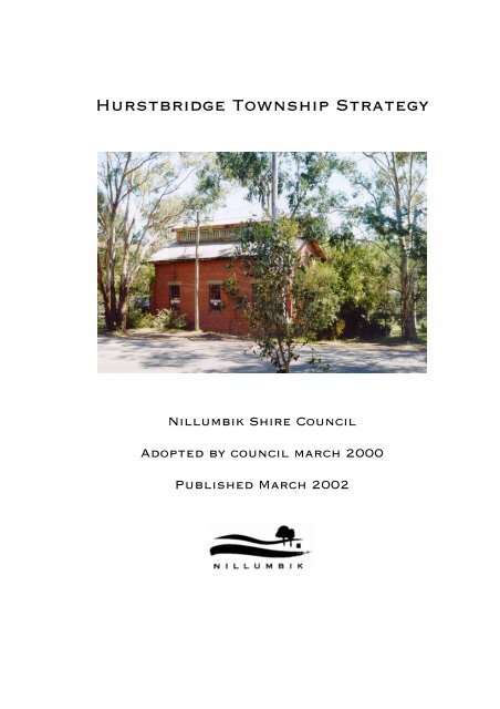
Hurstbridge Township Strategy<strong>Nillumbik</strong> <strong>Shire</strong> <strong>Council</strong>Adopted by council march 2000Published March 2002
Prepared byEnvironment and Cultural Planning Section<strong>Nillumbik</strong> <strong>Shire</strong> <strong>Council</strong>in association withDavid McCubbin – Landscape Architect,Doug Frood – Pathways Experiences,John Chivers and Associates P/L andKLM Gerner Consulting Group.
Hurstbridge Township StrategyExecutive Summary<strong>Nillumbik</strong> <strong>Shire</strong> <strong>Council</strong> adopted the Hurstbridge Township Strategy on 21 March 2000.This Strategy has been revised in accordance with the <strong>Council</strong>’s resolutions.IntroductionThe Hurstbridge Township Strategy is an integrated land use strategy for the future use,conservation and development <strong>of</strong> the township over the next 10 to 20 years. The Strategydocuments the preferred form <strong>of</strong> use, conservation and development <strong>of</strong> land that shouldtake place in Hurstbridge. The Strategy also details environmental managementinitiatives, strategies for economic and commercial development and infrastructuremaintenance. The Strategy details actions to achieve the strategies associated with theseissues.Planning Policy ContextThe Strategy has been prepared within the context established by State Planning Policy,the <strong>Nillumbik</strong> Municipal Strategic Statement and the <strong>Nillumbik</strong> <strong>Council</strong> Plan. TheStrategy also has regard to other major planning policies affecting Hurstbridge.The Strategy will provide a framework for the planning and delivery <strong>of</strong> capital works in thetownship area, landscape and urban design initiatives and environmental works projects.The land use elements <strong>of</strong> the Strategy will also be capable <strong>of</strong> implementation through the<strong>Nillumbik</strong> Planning Scheme. This includes provisions in the Municipal StrategicStatement, local policies and zones and overlays.Community Consultation ProcessCommunity input has played an integral role in the development <strong>of</strong> this Strategy. Publicconsultation has enabled the contribution <strong>of</strong> local expertise and knowledge in helping towork through the situation analysis, issues identification and strategy formulation phases.The main aim <strong>of</strong> the consultation process has been to establish an interactive processbetween local residents and <strong>Council</strong> to facilitate a co-operative approach to the Strategyand its implementation.Key actions undertaken as part <strong>of</strong> the consultation process included the TownshipCharrette, which was held in July 1999, to help identify planning issues and to developactions that could be implemented to address these issues. Following this exercise, aquestionnaire was sent to households in the study area focussing on the main issues raisedat the Charrette, to gain a broader perspective on those issues that appear to be <strong>of</strong> mostconcern to the Hurstbridge community.The draft Hurstbridge Township Strategy was placed on public exhibition for seven weeksduring December 1999 and January 2000. Approximately 213 submissions were receivedduring the exhibition process.<strong>Nillumbik</strong> <strong>Shire</strong> <strong>Council</strong> – March 2002i
Hurstbridge Township StrategyTownship Pr<strong>of</strong>ileSettlement and HousingExisting settlement is clearly defined with a hard urban edge separating the township fromrural land and conservation uses. Hurstbridge has retained a ‘rural village’ atmospheregenerally defined by the confined, concentrated activity areas and its small scale.Residential allotments are generally large, with detached dwellings on single lots thepredominant form <strong>of</strong> housing in the Hurstbridge area.There are few vacant allotments within the township boundaries, and limited opportunityfor any further residential growth in the rural areas. The population <strong>of</strong> Hurstbridge isincreasing, although at a slower rate in comparison to the wider municipality. There is ahigh proportion <strong>of</strong> traditional nuclear families in the area.EnvironmentHurstbridge is characterised by undulating topography with existing development largelyconfined by the four main ridgelines adjacent to the town centre. There are significantareas <strong>of</strong> native vegetation located adjacent to the township. Even so, much <strong>of</strong> the nativevegetation has been modified and is under threat from weed invasion and poor landmanagement practices.Significant areas <strong>of</strong> faunal habitat occur. There is pressure from some landowners,however, to allow development <strong>of</strong> some areas <strong>of</strong> high faunal and habitat significance withinthe study area. The retention <strong>of</strong> the creek corridors and adjoining open space areas are avaluable environmental feature <strong>of</strong> the township and also an important habitat link.Hurstbridge has retained a ‘rustic’ feel, with the built form in association with the qualities<strong>of</strong> the surrounding vegetation, geology and topography combining to give Hurstbridge aparticular rural character and strong sense <strong>of</strong> place.Rural Land UseThe existing subdivisional pattern <strong>of</strong> rural land is largely the result <strong>of</strong> controls introducedin 1971 to prevent further residential subdivision and to retain conservation and landscapevalues <strong>of</strong> the area and <strong>Shire</strong> as a whole. Rural land around Hurstbridge has generally beendeveloped for rural-living purposes, although some small scale agricultural enterprises areestablishing in the Hurstbridge area.Economic DevelopmentThe township centre’s primary function is as a service centre to the local community with acomplementary tourism function. There are opportunities for further economicdevelopment along Main Road, with a number <strong>of</strong> vacant allotments in the township centre.Approximately one-third <strong>of</strong> retail floor space within the township centre is primarily aimedat visitor and tourist needs, with tourism presenting itself as an environmentallysustainable option for continued and further economic growth <strong>of</strong> the township.InfrastructureThe Hurstbridge community is largely reliant on its road network, with high car ownership.The railway line, however provides an important service for people without access to cars.The local road network feeds into Heidelberg-Kinglake Road in the township centre,feeding large volumes <strong>of</strong> through traffic through the township.<strong>Nillumbik</strong> <strong>Shire</strong> <strong>Council</strong> – March 2002ii
Hurstbridge Township StrategyThe layout <strong>of</strong> car parking in the town centre is inefficient and adds to the conflict <strong>of</strong> trafficand pedestrian movement in the township centreWater, sewerage and drainage services are generally adequate for the existing population,however these services are not designed to allow significant expansion <strong>of</strong> the town. Thereis no reticulated gas service in the town.For a town <strong>of</strong> Hurstbridge’s size, there are limited youth and child care facilities. The totalamount <strong>of</strong> open space comprises approximately 30 hectares, including a range <strong>of</strong> passiveand active open space areas, however improvement to provision and location <strong>of</strong> publicfacilities is required to improve the utilisation <strong>of</strong> public land.Community Consultation OutcomesCommunity consultation has played a key role in the preparation <strong>of</strong> this Strategy.Settlement and HousingThis component <strong>of</strong> the Strategy was the most contentious and attracted considerableinterest in relation to all issues contained within the Strategy. It is noted, however, thatthe issue was largely contentious due to the impact further development may have on thenatural environment.• Approximately 80% <strong>of</strong> submissions made by residents are not in favour <strong>of</strong> any furtherresidential growth;• Significant growth is strongly rejected; and• If there was to be any new development then it should have consideration toenvironmental qualities and constraints, as well as enhancing the character <strong>of</strong> thearea.EnvironmentIssues relating to the protection <strong>of</strong> the environment also attracted considerable interest.The local community supports protection <strong>of</strong> the natural and built environment, with a largenumber <strong>of</strong> respondents submitting that more must be done to protect and enhanceenvironmental values. Some key actions identified include:• More controls to restrict land clearing and native vegetation removal;• More funding is required to aid weed control and revegetation programs, particularlyalong the creeks and other waterways; and• More education programs need to be initiated by <strong>Council</strong> and other groups, toeducate landowners about proper land management, weed control, planting, pestcontrol, waterway health etc.With regard to the built environment:• New development should have regard to the existing streetscape and neighbourhoodcharacter;• Old historic buildings should be retained and protected to maintain and enhance therustic character <strong>of</strong> Hurstbridge, particularly along Main Road; and• Support for the introduction <strong>of</strong> design guidelines for new development along MainRoad.<strong>Nillumbik</strong> <strong>Shire</strong> <strong>Council</strong> – March 2002iii
Hurstbridge Township StrategyRural Land UseFew comments were received in relation to rural land use, with most comments generatingsupport for the continuance <strong>of</strong> non-urban breaks between settlements and to improve landmanagement practices.Economic DevelopmentThere has been an emphasis from many sections <strong>of</strong> the community to nurture andencourage greater tourism in the area. Although large sections <strong>of</strong> the community are infavour <strong>of</strong> promoting tourism, it is felt that this should not be to the detriment <strong>of</strong> the town’scurrent service role to the local community, nor should it have a detrimental impact on theenvironment. Improvement to retail activity in the township is also supported.InfrastructureSubmissions to the Strategy have primarily focussed on the issues <strong>of</strong> the Main RoadConcept Plan, Monash Bridge, by-pass road options and public open space. Mostrespondents were generally in favour <strong>of</strong> the concept plans, with the main exception beingthe narrowing <strong>of</strong> Main Road. Monash Bridge proved a more contentious issue, with justover half <strong>of</strong> those making a submission relating to the bridge in favour <strong>of</strong> a new two-lanebridge.Support was given to the provision <strong>of</strong> more public facilities and amenities on public land.There was also strong support for the provision <strong>of</strong> youth and childcare facilities in thetownship centre.<strong>Nillumbik</strong> <strong>Shire</strong> <strong>Council</strong> – March 2002iv
Hurstbridge Township StrategyTownship StrategySettlement and HousingWith very little vacant residential land in the Hurstbridge Township, any growth inpopulation and housing could only be achieved via intensification <strong>of</strong> existing townshipallotments (i.e. infill and higher density) or rezoning land on the edges <strong>of</strong> the currenttownship to allow further residential development.Two fundamental principles guided debate in this area: firstly that the current character <strong>of</strong>the Hurstbridge township must be protected and, secondly, that the natural environmentmust be protected.Any significant intensification <strong>of</strong> existing township allotments was rejected in terms <strong>of</strong> itsdetrimental impact on the character <strong>of</strong> Hurstbridge.A detailed analysis <strong>of</strong> all areas abutting the existing township identified a small number <strong>of</strong>sites that may potentially be considered for residential development via rezoning to theTownship Zone.Strong arguments were mounted both in favour and against any further growth inpopulation and housing through the rezoning <strong>of</strong> more land from Environmental Rural toTownship Zone.Arguments against any expansion <strong>of</strong> the Hurstbridge township included:• Protection <strong>of</strong> the Green Wedge;• Further urban expansion would threaten environmental values;• Better preservation <strong>of</strong> conservation and environment values;• Any rezonings at all would render it impossible to manage any future demands forfurther rezonings;• Supposed economic and social benefits with increased population not demonstratedfrom first principles; and• Tourism/visitor market could support commercial centre growth.Arguments advanced in favour <strong>of</strong> expansion <strong>of</strong> the township included:• Demand for housing opportunities in Hurstbridge can’t presently be satisfied;• Further services will be lost without population growth, following on from closure <strong>of</strong>the high school, petrol station and bank;• There may be some capacity for further growth in the township without underminingamenity and environment values;• Increased population will result in increased local employment opportunitiesparticularly in retail trade; and• Additional development is largely ‘infill’ development near existing areas.The Strategy investigated nine potential areas that could possibly satisfy amenity andconservation/environment criteria for residential use. The Strategy concludes that <strong>of</strong> thesenine areas only two are suitable for residential development and even then further workwould be required to establish the extent <strong>of</strong> development potential. Two other areas havebeen identified as having limited development potential due to infrastructure and/orenvironmental issues and, similarly, further work would be required to establish the extent<strong>Nillumbik</strong> <strong>Shire</strong> <strong>Council</strong> – March 2002v
Hurstbridge Township Strategy<strong>of</strong> development potential. The other five areas investigated were not considered suitable toprovide for further township residential development.The development assessment process for the areas identified as suitable for residentialdevelopment is outlined in the Strategy. This includes provisions for a development planfor requiring detailed site assessment and design response. The density <strong>of</strong> residentialdevelopment should be in accordance with the environmental and landscape qualities thatexist. Density should also match the design outcomes sought for the area.The interface between township, rural and conservation areas, and issues concerning thephysical and functional relationship between urban and rural activities, are ongoing issuesfor Hurstbridge. The Strategy addresses these issues and outlines environmental anddesign responses that should be used. Further residential development is not consideredsuitable in areas with high environmental values and/or environmental constraints norwhere such development intrudes into the non-urban breaks between nearby townships.EnvironmentHurstbridge is characterised by undulating topography, creek corridors, open spaces andheavily vegetated land. It is the natural environment that drew many <strong>of</strong> its residents tothe area and which the residents now want to protect and enhance.The Strategy outlines objectives to encourage land management practices and land useactivities that have the capacity to be sustained and both protect and enhance the naturalenvironment. This includes the protection <strong>of</strong> soil and water quality and the conservation <strong>of</strong>flora and fauna values.Pest plants are a major issue within private and public open space, especially along thewaterways. The Strategy recommends the continued implementation <strong>of</strong> community weedprograms and prioritising weed infested open space areas into <strong>Council</strong>’s work programs.Overlay provisions in the New Format <strong>Nillumbik</strong> Planning Scheme related toenvironmental management are detailed. The Strategy recommends the continuedadministration <strong>of</strong> these provisions.The Strategy recommends the active support <strong>of</strong> local groups such as Friends and Landcaregroups to undertake environmental works in accordance with relevant catchmentstrategies.Wildfire risk to person and property is an identified hazard in the Hurstbridge area due tothe combination <strong>of</strong> extensive vegetation cover, the orientation <strong>of</strong> steeply sloping land,climatic conditions and the location and design <strong>of</strong> development. The Strategy recommendsthe continued administration <strong>of</strong> the Wildfire Management Overlay. The overlay requiresany development application to have consideration to water supply, access, buildings andworks and vegetation management.The architectural quality <strong>of</strong> a streetscape is an important feature in Hurstbridge, which canmake a positive contribution to the overall appearance <strong>of</strong> the built environment. Historicbuildings are part <strong>of</strong> the architectural quality <strong>of</strong> the township and should be protected.Guidelines for built form elements, including ro<strong>of</strong>s, verandahs, windows, doors, signage,height and materials are detailed in the Strategy. The Strategy recommends that a Designand Development Overlay be included in the <strong>Nillumbik</strong> Planning Scheme by way <strong>of</strong> anamendment. The overlay should be located over all that land fronting Heidelberg-KinglakeRoad (Main Road) between Parker Street and Cherry Tree Road to guide futuredevelopment.<strong>Nillumbik</strong> <strong>Shire</strong> <strong>Council</strong> – March 2002vi
Hurstbridge Township StrategyMany other historic buildings, bridges, trees are located within the Hurstbridge study areaand add to the ‘rural’ character <strong>of</strong> the township. It is important to protect these heritagevalues for future generations to enjoy through application <strong>of</strong> the Heritage Overlay.Design and landscaping improvements for the Main Road area, including tree planting,street furniture, road alignment and parking and town entry points are detailed in theStrategy. Improvements for the railway area and Greysharps Road are specified.Rural Land UseWhile much <strong>of</strong> the rural land surrounding Hurstbridge has been identified as having faunaland habitat significance and high vegetation and conservation value, it is recognised thatagriculture is an important economic benefit to the area and should be protected whereagricultural production <strong>of</strong> land is in operation.Inappropriate subdivisions or other land uses that would affect the productive potential <strong>of</strong>agricultural land will be discouraged. New agricultural activities should be encouragedwhere the use is sustainable and will have minimal impact on the environment andsurrounding area.Like many settlements within <strong>Nillumbik</strong> <strong>Shire</strong>, residential development in Hurstbridge hasbeen well contained, with the township generally surrounded by larger rural allotments,providing physical separation between other settlements. The aim is to continue to containurban development within defined areas, and new residential growth should only occur inthose areas designated as suitable within this Strategy.Economic Development<strong>Nillumbik</strong> <strong>Shire</strong> <strong>Council</strong> is keen to enhance and encourage sustainable economicdevelopment in the Hurstbridge area. The township centre in particular, is a critical areain terms <strong>of</strong> the economic development <strong>of</strong> Hurstbridge, providing both a neighbourhoodservice role and complementary tourist role.Given the limited amount <strong>of</strong> vacant land available for redevelopment in the Main Roadarea it is considered that the retail/commercial development <strong>of</strong> this land be encouraged.Consequently, residential uses will be discouraged unless part <strong>of</strong> a retail/commercialredevelopment.Tourism development consistent with the cultural and environmental qualities <strong>of</strong> the areawill continue to be supported. It is recognised that there is a need to improve the quality <strong>of</strong>tourist facilities and infrastructure. Tourism development must not have a detrimentalimpact on the character and environmental qualities <strong>of</strong> the area.InfrastructureThe objectives for infrastructure in the township are to maximise use <strong>of</strong> availableinfrastructure and avoid environmental impacts <strong>of</strong> any future infrastructure provision.Parking plays a major role in contributing to the productive use <strong>of</strong> a retail centre. Thelocation and design layout <strong>of</strong> car parking is a major priority in the design program forHurstbridge. Any car parking design and development, however, must be developed in away that responds to the character <strong>of</strong> the area and is sensitive to the local environment. Itis not suitable to construct car parking areas that do not respond to the local environment.The township requires a road system that will provide for the adequate movement <strong>of</strong>vehicles and flow <strong>of</strong> traffic while also providing for sufficient carparking opportunities andensuring pedestrian safety. Several bypass options were investigated, however, nosignificant road developments are proposed as part <strong>of</strong> the Strategy.<strong>Nillumbik</strong> <strong>Shire</strong> <strong>Council</strong> – March 2002vii
Hurstbridge Township StrategyMonash Bridge located on Arthurs Creek Road is both a significant historical feature andan essential access route for vehicles entering the township. Community response has beenvaried in regard to the value <strong>of</strong> the bridge as an access route worthy <strong>of</strong> retention in iscurrent form. Three options have been identified with regard to the bridge: retention in itscurrent form, an additional single lane bridge; and an additional dual lane bridge. <strong>Council</strong>resolved to with hold a final decision on the preferred option until further consultation hasbeen carried out.. Further investigation <strong>of</strong> environmental impacts and transportimplications will be necessary.In terms <strong>of</strong> open space the Strategy identifies a major opportunity to link the open space <strong>of</strong>Fergusons Paddock with the town centre, reinforcing the rural character <strong>of</strong> Hurstbridgeand providing new recreation opportunities.SummaryThe key strategies identified for Hurstbridge are:• Planning for the conservation <strong>of</strong> the qualities <strong>of</strong> the township.• Protecting natural resources <strong>of</strong> soil, water, flora and fauna in an area that is criticalfor the maintenance <strong>of</strong> environmental quality.• Protecting the landscape and built character <strong>of</strong> the township.• Promoting economic development, particularly locally based employment, in retail,tourism and the service sector.• Ensuring residential development is in accordance with environmental capabilityand is coordinated with infrastructure provision.The Hurstbridge Township Strategy seeks to provide a basis for ensuring that land use,conservation and development that occurs in Hurstbridge contributes to the qualities <strong>of</strong> thetownship. In order to achieve the long term vision for the township it will be necessary totake a series <strong>of</strong> steps which incrementally build towards the desired future.The Strategy will be implemented in the following ways:• strategic - changes to the <strong>Nillumbik</strong> Municipal Strategic Statement, and potentiallyLocal Policies;• statutory - changes to the provisions <strong>of</strong> the new format <strong>Nillumbik</strong> Planning Scheme,made by way <strong>of</strong> an amendment;• advisory - use <strong>of</strong> the Strategy in giving advice to potential developers and thecommunity about appropriate land use and development in Hurstbridge;• investment - identifying location and type <strong>of</strong> preferred land use and development inHurstbridge;• capital works - guiding the type and location <strong>of</strong> capital works development andmaintenance in Hurstbridge; and• environmental management - coordinated with <strong>Council</strong>’s environmental worksprograms and interaction with environment groups and State Government agencies.<strong>Nillumbik</strong> <strong>Shire</strong> <strong>Council</strong> – March 2002viii
Hurstbridge Township StrategySnapshot <strong>of</strong> HurstbridgeSettlement and Housing• Existing settlement is clearly defined with a hard urban edge separating thetownship from rural land uses.• Detached dwellings on single lots are the predominant form <strong>of</strong> housing in theHurstbridge area.• Few vacant lots within the township boundaries.• Total population <strong>of</strong> Hurstbridge increasing, although at a slower rate in comparisonto the wider municipality.• There is a high proportion <strong>of</strong> traditional nuclear families in Hurstbridge.Environment• Significant areas <strong>of</strong> native vegetation remain adjacent to the township.• Existing development is largely confined by the ridges, immediately adjacent to thetown centre leaving some valleys and gullies and outer lying ridge areasundeveloped.• Much <strong>of</strong> the native vegetation has been modified and is under threat from weedinvasion and poor land management practices• Significant areas <strong>of</strong> faunal habitat are largely undisturbed.• Retention <strong>of</strong> the creek corridors and adjoining open space areas are valuableenvironmental features <strong>of</strong> the township.• Urban/residential containment, restricting the township to defined parameters withmostly undeveloped bushland covered allotments surround the town.• Steeply sloping land remains undeveloped on the township fringe.Rural Land Use• The existing subdivisional pattern <strong>of</strong> rural land was created as a result <strong>of</strong> controlsintroduced in 1971 to retain conservation and landscape values.• Rural land around Hurstbridge has been largely developed as low density residentialproperties.• A large proportion <strong>of</strong> rural land remains vegetated.• New agricultural enterprises are establishing in the Hurstbridge area.Economic Development• The township centre’s primary function is to serve the local community with acomplementary tourism function.• Some opportunities for further retail and commercial development within the MainRoad.• Retail sector employs the largest number <strong>of</strong> Hurstbridge residents.• Approximately one-third <strong>of</strong> retail floor space within the township centre is primarilydirected at visitor and tourist needs.<strong>Nillumbik</strong> <strong>Shire</strong> <strong>Council</strong> – March 2002ix
Hurstbridge Township Strategy• Tourism represents an environmentally sustainable option for continued and furthereconomic growth <strong>of</strong> the township.• Tourism should not expand to the detriment <strong>of</strong> the township character and naturalenvironment.Infrastructure• The road network feeds into Heidelberg-Kinglake Road in the township centre, withlarge volumes <strong>of</strong> thoroughfare traffic.• A single line railway and train station located within the town centre. The maincommuter carpark is located <strong>of</strong>f Heidelberg-Kinglake Road.• The layout <strong>of</strong> some sections <strong>of</strong> carparking in the township centre (particularly on thewestern side <strong>of</strong> Heidelberg-Kinglake Road) is insufficient and inefficient.• The traffic movement within township centre conflicts with pedestrian movement.• Monash Bridge identified as a key point <strong>of</strong> conflict within the whole road network.• Improved pedestrian access required with better linkages between functionalprecincts to reduce conflict between traffic and pedestrian movement.• No reticulated gas services in the town.• Water, sewerage and drainage services adequate, but not designed for significantexpansion <strong>of</strong> the town.• No youth and child care facilities.• Total amount <strong>of</strong> open space provision sufficient, however improvement to provision <strong>of</strong>public facilities required.<strong>Nillumbik</strong> <strong>Shire</strong> <strong>Council</strong> – March 2002x
Hurstbridge Township StrategyRecommendationsThe following list provides a full list <strong>of</strong> the final recommendations (<strong>Council</strong> resolutions)contained within the Strategy.Settlement and Housing1. That any decision to amend the zoning <strong>of</strong> the Hurstbridge Secondary College Site (Site 1)not be progressed until a determination has been made by the State EducationDepartment, or other interested parties, on the end use <strong>of</strong> the site. As part <strong>of</strong> thedetermination <strong>of</strong> the end use <strong>of</strong> the site, consideration should be given to the application <strong>of</strong>a Development Plan Overlay to the site that requires an assessment <strong>of</strong> the environmentalsignificance and hazards <strong>of</strong> the land, details measures to manage and protect theseenvironmental values and sites out a concept plan to guide future development.2. That areas 2, 3, 4, 5, 6, 7, 8 and 9 not be supported for future residential development.3. No amendments to rezone land to a residential zone be considered by <strong>Council</strong> until there isan identified need in terms <strong>of</strong> <strong>Shire</strong> wide housing requirements. This consideration shouldbe made as part <strong>of</strong> the <strong>Nillumbik</strong> Housing Strategy and the three year review <strong>of</strong> the<strong>Nillumbik</strong> Municipal Strategic Statement.Environment4. Actively support local groups such as Friends and Landcare groups to undertakeenvironmental works in accordance with <strong>Council</strong> strategies and relevant catchmentstrategies.5. Initiate stormwater management arrangements to protect water quality in the area.6. Continue to support community weed control programs and pest animal control in the area.7. Identify and prioritise areas that are weed infested to be incorporated into <strong>Council</strong>’s workprograms.8. Encourage landowners to utilise education programs (eg Land for Wildlife, Farm$mart,Landcare, Melbourne Water Stream Frontage Program etc) for targeted managementstrategy advice for landowners living adjacent to creeks.9. Introduce an Amendment to incorporate affected areas to the Land Subject to InundationOverlay, upon completion <strong>of</strong> an assessment <strong>of</strong> affected areas by Melbourne Water.10. That the Environmental Significance Overlay continue to be applied to identified areas inthe Hurstbridge township.11. That development within identified faunal and habitat areas have regard to theconservation measures contained within the Sites <strong>of</strong> Faunal and Habitat Significance inNorth East Melbourne (Beardsell 1997).12. Encourage use <strong>of</strong> the Trust for Nature covenants on private property.<strong>Nillumbik</strong> <strong>Shire</strong> <strong>Council</strong> – March 2002xi
Hurstbridge Township Strategy13. Continue to administer the native vegetation removal controls <strong>of</strong> the <strong>Nillumbik</strong> PlanningScheme.14. Where conditions attached to a planning permit for vegetation removal requirereplacement trees, that suggested species are indigenous species <strong>of</strong> local stock whereappropriate.15. That <strong>Council</strong> promote compliance with the Catchment and Land Protection Act 1994 interms <strong>of</strong> controlling environmental and noxious weeds.16. That residential development be discouraged in areas where there is a combination <strong>of</strong> highslope, dense vegetation, limited water supply and poor vehicular access.17. Continue to administer the provisions <strong>of</strong> the Wildfire Management Overlay.18. That a Design and Development Overlay be included in the New Format <strong>Nillumbik</strong>Planning Scheme by way <strong>of</strong> an amendment. The overlay should incorporate the featuresoutlined above and be located over all that land fronting Heidelberg-Kinglake Road (MainRoad) between Parker Street and Cherry Tree Road to guide future development.19. That other design and development provisions be considered as part <strong>of</strong> the <strong>Nillumbik</strong>Neighbourhood Character study (forthcoming).20. That <strong>Council</strong> adopts the Main Road Concept Plan (as detailed on Maps 10 and 11 containedin this Strategy). (Deferred)21. That <strong>Council</strong> approach VicTrack and/or Alstom to progress strategies for improving theappearance <strong>of</strong> the station area. That all VicTrack and/or Alstom owned land be included instrategies for improved use in the station and Main Road area, as detailed in the MainRoad Concept Plan. That consultation be maintained with VicTrack and/or Alstom onthese strategies.22. Maintain and enhance the entrance points to Hurstbridge and create attractive and definedapproach to the town centre, through appropriate landscaping and/or use <strong>of</strong> sculptures.23. Consider a street tree planting program for Main Road, which is linked to the main naturalcommunity being Plains Grassy Woodland, to encourage natural revegetation <strong>of</strong> thesespecies.24. That where any road works are to be carried out, existing trees are retained where possible.25. Review and replace suitable trees located under powerlines. Some tall species <strong>of</strong> trees havebeen inappropriately planted under powerlines. There are some species that would be moresuitable for planting under powerlines.26. Street tree and landscaping plans should be prepared in consultation with traders andresidents.27. That an inventory <strong>of</strong> the provision <strong>of</strong> existing street furniture along Main Road be carriedout.28. That additional street furniture be provided at identified locations.<strong>Nillumbik</strong> <strong>Shire</strong> <strong>Council</strong> – March 2002xii
Hurstbridge Township Strategy29. Ensure that any new infrastructure, e.g. seating etc. has regard to <strong>Council</strong>’s DisabilityAccess Policy.30. That a set <strong>of</strong> guidelines for signage based on the guidelines above, be incorporated withinthe Local Planning Policy Framework <strong>of</strong> the New Format <strong>Nillumbik</strong> Planning Scheme.31. Ensure that any new paving is sympathetic to the surrounding environment and complieswith the Disability Access Policy.32. Paving materials that should be encouraged include concrete, cobblestones or other pavingmaterial that is sympathetic to the streetscape and uses colours to match the surroundingvegetation.Rural Land Use33. Encourage small agricultural enterprises on suitable sites in the wider Hurstbridge areaand encourage retention <strong>of</strong> existing agricultural land uses.34. Support sustainable agricultural enterprises and the diversification <strong>of</strong> agriculturalactivities.35. Discourage inappropriate subdivision or land uses that would affect the productivepotential <strong>of</strong> agricultural land.36. That <strong>Council</strong> continue to <strong>of</strong>fer property management courses, the sustainable agriculturerebate and other programs designed to encourage sustainable land management practices.Economic Development37. Recognise that the role and function <strong>of</strong> the Hurstbridge town centre will be maintained as aneighbourhood and specialist services shopping centre.38. That retail uses be encouraged in the Main Road area. Accordingly limit additionalpedestrian level street frontage residential development in the retail and commercialprecincts <strong>of</strong> the town centre.39. Provide ongoing support to the Hurstbridge Trader’s Association.40. Encourage the establishment <strong>of</strong> home-based business in the Hurstbridge area.41. Offer continued support to the <strong>Nillumbik</strong> Tourism Association.42. Promote tourism development, including in surrounding rural areas.43. Protect and enhance those natural and physical features which contribute to providing atourism experience in Hurstbridge.44. Coordinate signage which ensures attractive and appropriate information and directioninformation, while maintaining the visual aesthetics <strong>of</strong> the township.<strong>Nillumbik</strong> <strong>Shire</strong> <strong>Council</strong> – March 2002xiii
Hurstbridge Township StrategyInfrastructure45. <strong>Council</strong> consider making application to VicRoads to review speed limits as developmentoccurs in the Hurstbridge area, particularly along Main Road.46. Adopt all those changes above incorporated in the Main Road Concept Plan (coveringcarparking, traffic management, footpaths, open space areas, transport and the like) shownon maps 10 and 11 <strong>of</strong> the Strategy. (Deferred)47. Review time limits for carparking along Main Road.48. That <strong>Council</strong> withhold a final decision on the preferred option(s) for the Monash Bridgeuntil further community consultation has been undertaken by the State Government, aswell as assessment <strong>of</strong> heritage, transport and environmental impacts.49. That a review <strong>of</strong> facilities and amenities on public land in Hurstbridge be considered.50. That new facilities e.g. BBQ’s, play equipment, pergolas etc. be considered in suitableidentified areas.51. That the acquisition and/or disposal <strong>of</strong> public land within Hurstbridge be considered aspart <strong>of</strong> the Open Space Strategy (forthcoming).Strategy Implementation52. Consider amendments to the Municipal Strategic Statement to incorporate therecommendations <strong>of</strong> the Hurstbridge Township Strategy.53. All recommendations related to capital works be referred to <strong>Council</strong>’s 10 year capital worksprogram.54. All recommendations related to capital works be subject to additional communityconsultation and design work where appropriate.55. All recommendations related to additional budget commitments for projects or programs beconsidered as part <strong>of</strong> <strong>Council</strong>’s budget preparation as appropriate.<strong>Nillumbik</strong> <strong>Shire</strong> <strong>Council</strong> – March 2002xiv
Hurstbridge Township Strategy<strong>Table</strong> <strong>of</strong> <strong>Contents</strong>EXECUTIVE SUMMARY .......................................................................................................... IRECOMMENDATIONS.......................................................................................................... XI1. INTRODUCTION .......................................................................................................... 11.1 BACKGROUND .................................................................................................................. 11.2 STRATEGY OBJECTIVES ...................................................................................................... 11.3 STUDY AREA.................................................................................................................... 22. PLANNING POLICY CONTEXT...................................................................................... 62.1 STATE PLANNING POLICY FRAMEWORK ................................................................................. 62.2 MUNICIPAL STRATEGIC STATEMENT...................................................................................... 82.3 COUNCIL PLAN 2000-2003 ............................................................................................ 102.4 EXISTING STRATEGIES AND STUDIES................................................................................... 113. STRATEGY PROCESS ................................................................................................ 153.1 COMMUNITY CONSULTATION.............................................................................................. 153.2 NEW FORMAT NILLUMBIK PLANNING SCHEME...................................................................... 184. COMMUNITY CONSULTATION OUTCOMES................................................................. 204.1 SETTLEMENT AND HOUSING.............................................................................................. 204.2 ENVIRONMENT ............................................................................................................... 234.3 RURAL LAND USE........................................................................................................... 274.4 ECONOMIC DEVELOPMENT ................................................................................................ 284.5 INFRASTRUCTURE ........................................................................................................... 295. TOWNSHIP STRATEGY.............................................................................................. 375.1 SETTLEMENT AND HOUSING.............................................................................................. 375.2 ENVIRONMENT ............................................................................................................... 825.3 RURAL LAND USE........................................................................................................... 985.4 ECONOMIC DEVELOPMENT .............................................................................................. 1005.5 INFRASTRUCTURE ......................................................................................................... 1036. TOWNSHIP PROFILE .............................................................................................. 1206.1 SETTLEMENT AND HOUSING............................................................................................ 1206.2 ENVIRONMENT ............................................................................................................. 1306.3 RURAL LAND USE......................................................................................................... 1536.4 ECONOMIC DEVELOPMENT .............................................................................................. 1576.5 INFRASTRUCTURE ......................................................................................................... 1657. CONCLUSION ......................................................................................................... 1767.1 KEY STRATEGY ELEMENTS .............................................................................................. 1767.2 MOVING FORWARD ........................................................................................................ 1767.3 IMPLEMENTATION PROCESS ............................................................................................ 1767.4 MORE INFORMATION...................................................................................................... 177APPENDICESA QUESTIONNAIRE RESULTSB CONSULTATIVE TEAMS DIRECTIONS STATEMENTSC CONSULTATIVE TEAM COMMENTS – DRAFT STRATEGYD SUBMITTERS TO THE NEW FORMAT NILLUMBIK PLANNING SCHEMEE SWOT ANALYSISF PUBLIC SUBMISSIONS SUMMARY – DRAFT STRATEGYG DIAMOND VALLEY SECONDARY COLLEGE SITEH DEVELOPMENT PLANI DEVELOPMENT CONTRIBUTIONSJ COSTINGSK NEROC REPORT – HURSTBRIDGE SITES<strong>Nillumbik</strong> <strong>Shire</strong> <strong>Council</strong> – March 2002xv
Hurstbridge Township StrategyMAPSMAP 1 HURSTBTIDGE STUDY AREA ....................................................................................... 3MAP 2 MSS FRAMEWORK PLAN........................................................................................... 4MAP 3 MSS REGIONAL PLAN .............................................................................................. 5MAP 4 TRANSPORT OPPORTUNITIES & CONSRAINTS – TOWN CENTRE ........................................ 32MAP 5 TRANSPORT OPPORTUNITIES & CONSTRAINTS – GENERAL.............................................. 33MAP 6 INVESTIGATION AREAS ............................................................................................ 41MAP 7 ENVIRONMENTAL CONSTRAINTS................................................................................ 43MAP 8 TOWN CENTRE – OPPORTUNITIES AND CONSTRAINTS .................................................... 86MAP 9 TOWN CENTRE – OPPORTUNITIES AND CONSTRAINTS .................................................... 87MAP 10 MAIN ROAD CONCEPT PLAN..................................................................................... 90MAP 11 MAIN ROAD CONCEPT PLAN..................................................................................... 91MAP 12 ALTERNATIVE TRUCK ROUTES................................................................................. 102MAP 13 MONASH BRIDGE ................................................................................................. 109MAP 14 BYPASS ROUTES.................................................................................................. 112MAP 15 ZONING ............................................................................................................. 116MAP 16 LAND USE.......................................................................................................... 118MAP 17 CENSUS COLLECTION DISTRICTS ............................................................................ 121MAP 18 TOPOGRAPHY ...................................................................................................... 126MAP 19 SLOPE............................................................................................................... 127MAP 20 RIDGELINES ....................................................................................................... 128MAP 21 PRE 1750 VEGETATION TYPES............................................................................... 133MAP 22 VEGETATION COVER ............................................................................................. 136MAP 23 SITES OF FAUNAL AND HABITAT SIGNIFICANCE.......................................................... 138MAP 24 WILDFIRE MANAGEMENT OVERLAY .......................................................................... 146MAP 25 TOWNSHIP EDGE ................................................................................................. 150MAP 26 TOWN CENTRE – USE ........................................................................................... 152MAP 27 OPEN SPACE RESERVES ........................................................................................ 169TABLESTABLE 1 INVESTIGATION AREAS ............................................................................................ 40TABLE 2 FLORA ASSESSMENT SUMMATION ............................................................................. 51TABLE 3 SERVICE AUTHORITIES............................................................................................ 52TABLE 4 INFRASTRUCTURE ASSESSMENT OF INVESTIGATION AREAS ............................................. 61TABLE 5 SUMMARY OF RESULTS ........................................................................................... 76TABLE 6 CHANGE IN POPULATION ....................................................................................... 120TABLE 7 AVERAGE HOUSEHOLD SIZE................................................................................... 120TABLE 8 AGE STRUCTURE AND CHANGES 1991-1996 ........................................................... 122TABLE 9 RELATIONSHIP IN HOUSEHOLDS – 1996 .................................................................. 123TABLE 10 COUNTRY OF BIRTH.............................................................................................. 123TABLE 11 LANGUAGE SPOKEN AT HOME ................................................................................ 124TABLE 12 SITES OF FAUNAL & HABITAT SIGNIFICANCE .............................................................. 137TABLE 13 HERITAGE SITES.................................................................................................. 143TABLE 14 ESTIMATED NUMBER OF JOBS IN HURSTBRIDGE......................................................... 154TABLE 15 EMPLOYMENT BY INDUSTRY.................................................................................... 157TABLE 16 WEEKLY INDIVIDUAL INCOME ................................................................................. 158<strong>Nillumbik</strong> <strong>Shire</strong> <strong>Council</strong> – March 2002xvi
Hurstbridge Township StrategyDIAGRAMSDIAGRAM 1 TOWNSHIP/BUSHLAND HARD EDGE ........................................................................... 69DIAGRAM 2 TOWNSHIP/AGRICULTURE HARD EDGE ....................................................................... 69DIAGRAM 3 TRANSITION.......................................................................................................... 69DIAGRAM 4 USE OF NATURAL FEATURES .................................................................................... 68DIAGRAM 5 USE OF NATURAL FEATURES.................................................................................... 68DIAGRAM 6 VISUAL BARRIERS.................................................................................................. 70DIAGRAM 7 LOW DENSITY DEVELOPMENT BUFFER ZONE................................................................ 70DIAGRAM 8 RESIDENTIAL AND AGRICULTURAL USES..................................................................... 70DIAGRAM 9 UNDESIRABLE TOWN FORM ..................................................................................... 73DIAGRAM 10 DESIRABLE TOWN FORM ......................................................................................... 74DIAGRAM 11 SCALE................................................................................................................. 82DIAGRAM 12 ROOF FORM.......................................................................................................... 82DIAGRAM 13 VERANDAHS ......................................................................................................... 83DIAGRAM 14 VERANDAH ........................................................................................................... 83DIAGRAM 15 VERANDAH ........................................................................................................... 83DIAGRAM 17 WINDOWS ............................................................................................................ 83DIAGRAM 17 DOORS ................................................................................................................ 84DIAGRAM 18 PAINTING SCHEME................................................................................................. 85DIAGRAM 19 SIGNAGE.............................................................................................................. 92DIAGRAM 20 MEDIAN ISLANDS – MAIN ROAD.............................................................................. 103DIAGRAM 21 MEDIAN STRIP TREATMENT.................................................................................... 104DIAGRAM 22 STREETSCAPE ..................................................................................................... 104<strong>Nillumbik</strong> <strong>Shire</strong> <strong>Council</strong> – March 2002xvii
Hurstbridge Township Strategy1. IntroductionThe Hurstbridge Township Strategy is an integrated land use strategy for the future use,conservation and development <strong>of</strong> the township over the next 10 to 20 years.The Strategy documents the preferred form <strong>of</strong> use, conservation and development <strong>of</strong> landthat should take place in Hurstbridge and the actions to achieve this.The Strategy will be implemented through the <strong>Nillumbik</strong> Planning Scheme, <strong>Council</strong>’scapital works programs and other <strong>Council</strong> projects and programs.The Strategy has been prepared within the context established by State Planning Policy,the <strong>Nillumbik</strong> Municipal Strategic Statement and the <strong>Nillumbik</strong> <strong>Council</strong> Plan.1.1 BackgroundPrior to <strong>Council</strong> amalgamations in 1994, parts <strong>of</strong> the Hurstbridge township were containedwithin three municipalities being the former <strong>Shire</strong>s <strong>of</strong> Eltham, Diamond Valley andWhittlesea. This arrangement limited the development <strong>of</strong> consistent policies and planningcontrols across the area. Hurstbridge and its surrounds are now located within the <strong>Shire</strong> <strong>of</strong><strong>Nillumbik</strong> allowing, for the first time, the development <strong>of</strong> an integrated strategy for thearea as a whole. The Strategy is an initiative <strong>of</strong> <strong>Nillumbik</strong> <strong>Shire</strong> <strong>Council</strong> to provide avision and strategic land use plan for the development <strong>of</strong> the township.Previous studies have focused on landscape and design, and retail and traffic issuesaffecting the commercial precinct <strong>of</strong> the Hurstbridge township. This Strategy will build onprevious work undertaken, but extends this further to consider a broader range <strong>of</strong> land useplanning issues across the township and in the surrounding area.1.2 Strategy ObjectivesThe project objectives as contained within the Project Brief prepared are:• Review, consolidate and update past studies to provide an overview <strong>of</strong> the townshipand an assessment <strong>of</strong> the relative success <strong>of</strong> previous planning approaches;• To identify the requirements <strong>of</strong> the range <strong>of</strong> users <strong>of</strong> the township, including youth,elderly and disabled;• Identify land use planning issues and formulate actions to address these issues;• Achieve a community consultation process for the duration <strong>of</strong> the project whichaddresses the needs <strong>of</strong> all stakeholders and provides for the identification <strong>of</strong> a widerange <strong>of</strong> issues;• Develop community participation and ownership <strong>of</strong> the Strategy;• Involve the community, government agencies and key stakeholders in thedevelopment <strong>of</strong> the Strategy;• Provide an integrated strategy that addresses current and future land use planningissues;• Promote safe and efficient transport and movement systems;• Protect and enhance the design and landscape qualities <strong>of</strong> the township;• Ensure adequate provision <strong>of</strong> land for various forms <strong>of</strong> use and development,consistent with the overall strategy for the township; ensure infrastructure servicesare provided in an efficient and environmentally sensitive manner;<strong>Nillumbik</strong> <strong>Shire</strong> <strong>Council</strong> – March 2002 1
Hurstbridge Township StrategyMap 1 - study area<strong>Nillumbik</strong> <strong>Shire</strong> <strong>Council</strong> – March 2002 3
Hurstbridge Township StrategyMap 2- framework plan mss<strong>Nillumbik</strong> <strong>Shire</strong> <strong>Council</strong> – March 2002 4
Hurstbridge Township StrategyMap 3- region map from mss<strong>Nillumbik</strong> <strong>Shire</strong> <strong>Council</strong> – March 2002 5
Hurstbridge Township Strategy2. Planning Policy ContextThis section provides a brief overview <strong>of</strong> the major planning policies affecting Hurstbridgeand which have been recognised in the formalisation <strong>of</strong> this Strategy. Consistency withexisting and future <strong>Council</strong> policies is important to facilitate the implementation <strong>of</strong> theStrategy.2.1 State Planning Policy FrameworkThe State Planning Policy Framework provides a context for spatial planning and decisionmaking by <strong>Council</strong>. There are specific policies which encompass objectives andimplementation techniques that apply across Victoria. <strong>Council</strong> must take account <strong>of</strong>, andgive effect to, the general principles and specific policies applicable to the various issues toensure integrated decision making. The following extracts provide a brief outline <strong>of</strong> some <strong>of</strong>the principles in the State Planning Policy Framework that are considered relevant to theHurstbridge Township.SettlementPlanning authorities should plan to accommodate projected population growth over at leasta ten year period, taking account <strong>of</strong> opportunities for redevelopment and intensification <strong>of</strong>existing urban areas, as well as the limits <strong>of</strong> land capability and natural hazards,environmental quality and costs <strong>of</strong> providing infrastructure.In planning for urban growth, planning authorities should encourage consolidation <strong>of</strong>existing urban areas and especially higher density and mixed use development near publictransport routes.Planning decisions should assist the creation <strong>of</strong> linked parkland and open space systemsand the protection <strong>of</strong> high quality agricultural land and native vegetation.EnvironmentThose issues that are applicable to Hurstbridge are the protection <strong>of</strong> catchments,waterways and groundwater, water quality and, floodplain management, and wildfire.Other important issues include: conservation <strong>of</strong> native flora and fauna, open space,heritage and energy efficiency. Some <strong>of</strong> the general implementation measures include:• ensuring that land use activities that may discharge contaminated run<strong>of</strong>f or wastesto waterways are sited and managed to protect the quality <strong>of</strong> surface water andground water resources, rivers, streams, wetland, estuaries and marineenvironments;• taking flood prone areas into consideration in the preparation <strong>of</strong> planning schemesand land use planning decisions to avoid intensifying the impacts <strong>of</strong> flooding throughinappropriately located uses and developments;• consideration <strong>of</strong> potential impacts <strong>of</strong> land use and development on the spread <strong>of</strong>plants and animal pests from areas <strong>of</strong> known infestation into natural ecosystems;and• promotion <strong>of</strong> energy efficient building and subdivision design.HousingPlanning authorities are required to identify areas suitable for residential developmenthaving regard to population projections, environmental factors and infrastructureprovision.<strong>Nillumbik</strong> <strong>Shire</strong> <strong>Council</strong> – March 2002 6
Hurstbridge Township Strategy<strong>Nillumbik</strong> <strong>Shire</strong> <strong>Council</strong> – March 2002 7
Hurstbridge Township StrategyMinister’s Direction No. 6 is a State Government policy, which must be addressed for anyproposal to introduce new areas <strong>of</strong> low-density residential land. Minister’s Direction No. 6states that supply <strong>of</strong> land for residential development at a density <strong>of</strong> 0.4 to 2 hectaresshould not exceed ten years’ supply.Economic DevelopmentThose economic issues applicable to economic development in Hurstbridge are business,tourism and agriculture. Some <strong>of</strong> the general implementation measures include:• encouraging the development <strong>of</strong> a range <strong>of</strong> well designed and sited tourist facilities,including integrated resorts, motel accommodation and smaller scale operations suchas host farm, bed and breakfast and retail opportunities; and• supporting effective agricultural production and processing infrastructure, ruralindustry and farm related retailing and assist genuine farming enterprises to adjustflexibly to market changes.InfrastructureThe main issues applicable to infrastructure development in Hurstbridge are declaredhighways and railways, bicycle transport, education facilities, water supply, sewerage anddrainage, water management and telecommunications. Some <strong>of</strong> the generalimplementation measures include:• encouraging higher land use densities and mixed use developments near railwaystations, transport interchanges, and principal bus routes. pedestrian access topublic transport should be facilitated and safeguarded; and• planning wherever possible, <strong>of</strong>f-road bicycle networks which should be included innew urban development.2.2 Municipal Strategic StatementThe Municipal Strategic Statement (MSS) forms part <strong>of</strong> the New Format <strong>Nillumbik</strong>Planning Scheme. The MSS outlines the strategic vision for sustainable land use andnatural resource management in the municipality and responds to a range <strong>of</strong>environmental, social and economic factors which shape the <strong>Shire</strong>.The MSS provides a historical and current pr<strong>of</strong>ile <strong>of</strong> the municipality in relation tosettlement, housing, rural land use, environment, conservation, landscape, economicdevelopment and infrastructure. The MSS also identifies the key land-use features andtrends that will influence the future strategic direction <strong>of</strong> land-use and development withinthe <strong>Shire</strong>.The MSS outlines the objectives and strategies which need to be implemented to achievethe desired land use and natural resource management vision. Most <strong>of</strong> these strategies willbe implemented through the New Format <strong>Nillumbik</strong> Planning Scheme in the form <strong>of</strong> localpolicies, and zone and overlay provisions.<strong>Nillumbik</strong> <strong>Shire</strong> <strong>Council</strong> – March 2002 8
Hurstbridge Township StrategyEnvironment, Conservation and LandscapeObjectives• To protect and enhance sites <strong>of</strong> environmental significance.• To encourage sustainable land management practices.• To protect places <strong>of</strong> natural and cultural heritage.Strategies• Provide support and assistance to community environmental projects involved inprotecting and enhancing areas <strong>of</strong> high environmental value.• Undertake community education programs that will improve the knowledge andskills <strong>of</strong> landowners and managers in sustainable land management.• Application <strong>of</strong> an Environmental Significance Overlay to identified sites <strong>of</strong> national,state and regional faunal and habitat significance, derived from the NEROC Report(Beardsell 1997).• Apply the Heritage Overlay to identify, protect and enhance heritage places <strong>of</strong>natural or cultural significance.Settlement and HousingKey Objectives• To provide for residential development which meets the projected increase <strong>of</strong> thenumber and type <strong>of</strong> households within the municipality, while respecting localcommunity and environmental values through locality and site responsiveconsideration and design.• To contain urban development and maintain non-urban breaks between existingurban areas and townships, and between townships.• To consolidate and sustain existing urban areas and township character.Strategies• Implement township strategies.• Cluster commercial and community facilities in rural townships that have nocommercial zonings.• Implement a local policy to facilitate medium density housing in areas with goodaccess to local services and public transport, which demonstrates site and arearesponsive design.Rural Land UseKey Objectives• To limit the fragmentation <strong>of</strong> land in rural areas.• To facilitate the separation <strong>of</strong> conflicting rural land uses.• To minimise infrastructure servicing demand in rural areas<strong>Nillumbik</strong> <strong>Shire</strong> <strong>Council</strong> – March 2002 9
Hurstbridge Township StrategyStrategies• Protect the productive potential <strong>of</strong> rural land by limiting small lot subdivision.• Restrict the number <strong>of</strong> rural lots having more than one dwelling throughimplementation <strong>of</strong> a local policy to guide consideration <strong>of</strong> permit applications formore than one dwelling per lot in non-urban areas.• Apply the Environmental Rural Zone to non-urban land with environmentalsignificance and landscape valuesEconomic DevelopmentObjectives• To facilitate sustainable economic development.• To promote good urban design in all townships.Strategies• Promote economic development opportunities that build on the cultural and physicalcharacteristics <strong>of</strong> the conservation and rural focus (the ‘green wedge’) <strong>of</strong> the <strong>Shire</strong>.• Encourage the creation <strong>of</strong> a sense <strong>of</strong> place and opportunities for meeting andcommunity interaction.InfrastructureObjectives• To ensure the efficient provision <strong>of</strong> infrastructure to areas designated for residentialand low-density residential development.• To minimise infrastructure servicing demand in rural areas.Strategies• Limit the development <strong>of</strong> residential and low density residential services untilcritical infrastructure services are available.• Apply the Residential 1 Zone to contain township areas which can be serviced by anappropriate range <strong>of</strong> utility services.2.3 <strong>Council</strong> Plan 2000-2003The <strong>Council</strong> Plan 2000/2003 is a major strategic planning document incorporating thesignificant initiatives that will be undertaken by <strong>Council</strong> in the short and medium term. Itsets out <strong>Council</strong>’s vision, values and goals. The document also builds on a number <strong>of</strong>significant policy documents that have already been developed including the MSS and theRecreation Strategy. The <strong>Council</strong> Plan is the result <strong>of</strong> significant <strong>Council</strong>lor, staff andcommunity input.The <strong>Council</strong> Plan sets out eight (8) municipal goals which have been further developedthrough the identification <strong>of</strong> key objectives and action plans to achieve these objectives.Some <strong>of</strong> the key goals and objectives that are applicable to the development <strong>of</strong> the WattleGlen Township Strategy are outlined below.<strong>Nillumbik</strong> <strong>Shire</strong> <strong>Council</strong> – March 2002 10
Hurstbridge Township StrategyGoal 1 – Environment Protection and SustainabilityObjectives• To protect and enhance <strong>Nillumbik</strong>’s unique natural environment.• To facilitate community partnerships and ownership <strong>of</strong> key environmental projectsand programs.Goal 2 –Land Use Planning, Development and ConservationObjectives• To encourage sensitive planning, development and conservation that protects andenhances the natural and built environment.• To encourage participation and facilitate understanding by the community and otherstakeholders in the planning process.Goal 3 – Community EngagementObjectives• To recognise the diversity <strong>of</strong> views within our community and ensure our systems forengaging people in decision-making are inclusive and respectful <strong>of</strong> this diversity.• To effectively communicate <strong>Council</strong>’s activities, decisions and achievements.2.4 Existing Strategies and StudiesExisting strategies and studies relevant to Hurstbridge include:Neighbourhood Character Study (2000) Mike Scott & Associates, Lisa Riddle PlanningServices and John Curtis Pty LtdThis study was commissioned by <strong>Nillumbik</strong> <strong>Shire</strong> <strong>Council</strong> to provide a strategic basis forhousing, landscape, built form and general development within most <strong>of</strong> the settlementareas zoned Residential 1, Township, Mixed Use and Low Density Residential throughoutthe <strong>Shire</strong>. The study involved a broad analysis <strong>of</strong> the urban areas <strong>of</strong> the <strong>Shire</strong>, detailedmapping <strong>of</strong> the various characteristics and community consultation. The result is theidentification <strong>of</strong> seven character types within the urban areas, which have been furtherdivided into 19 precincts. A brochure has been prepared for each precinct detailing keycharacteristics, a preferred future character statement, and precinct guidelines for futuredevelopment. The Preferred Future Character descriptions will be used to assess thesuitability <strong>of</strong> proposed developments.Residential Design Guidelines (2000) Mike Scott & Associates, Lisa Riddle PlanningServices and John Curtis Pty LtdThe Residential Design Guidelines have been prepared in conjunction with theNeighbourhood Character Study. The <strong>Shire</strong>’s natural environment presents a number <strong>of</strong>physical constraints on the siting, design and construction <strong>of</strong> new dwellings. These includethe need to retain natural bushland as well as prevent erosion, preserve wildlife andmaintain natural vistas. The guidelines provide design techniques for single and mediumdensity housing with particular reference to slope, vegetation and building materials. Theguidelines have been developed and linked to each character precinct to support theachievement <strong>of</strong> the preferred future character.<strong>Nillumbik</strong> <strong>Shire</strong> <strong>Council</strong> – March 2002 11
Hurstbridge Township StrategyHousing Strategy (2000) <strong>Nillumbik</strong> <strong>Shire</strong> <strong>Council</strong>The Housing Strategy provides a strategic framework for future <strong>Council</strong> decision-makingrelating to settlement and housing within the <strong>Shire</strong> and to facilitate the planning <strong>of</strong> futurehousing so that the needs <strong>of</strong> future households are met. The Strategy recognises theimportance <strong>of</strong> housing and residential development in the <strong>Shire</strong>, however, any housingdevelopment needs to occur within the context <strong>of</strong> protecting the green wedge andmaintaining environmental values. The Strategy recognises however, that declininghousehold sizes, an aging population and an unmet demand for more affordable housingindicate the need for a greater diversity <strong>of</strong> housing in the future.Recreation Strategy (2000) <strong>Nillumbik</strong> <strong>Shire</strong> <strong>Council</strong>This document was prepared to identify the needs <strong>of</strong> the <strong>Nillumbik</strong> community in relationto the provision <strong>of</strong> recreation and leisure facilities. The Strategy provides a strategicframework for recreation and leisure planning in the <strong>Shire</strong> over the next five to ten years.An inventory <strong>of</strong> all existing recreation and leisure facilities has been compiledincorporating community halls, ovals and indoor sporting stadiums. Communityconsultation was undertaken to determine participation trends <strong>of</strong> recreation and leisurefacilities in the <strong>Shire</strong> and to gain feedback regarding the condition <strong>of</strong> current facilities andperceived need/desire for new facilities.Diamond Creek Trail - Diamond Creek to Hurstbridge Feasibility Study (July 1999)ParklinksThis study was commissioned by <strong>Nillumbik</strong> <strong>Shire</strong> <strong>Council</strong> to determine the feasibility <strong>of</strong>locating a bicycle trail between the Diamond Creek and the Hurstbridge townships. Threepossible alignments for the trail were considered being along the rail reserve, the DiamondCreek or the roadside. Each option was rated having regard to connectivity, amenity,experience, cost, safety, achievability, access to attractions, security and environmentalimpact. The final recommendation was for an alignment, which incorporates componentsfrom all three options and is staged to enable some sections to be developed as the need andthe opportunity arises.Yarra Catchment Action Plan (1999) Department <strong>of</strong> Natural Resources and EnvironmentThis plan has been developed as the ‘first ever Management Plan for the Yarra River,involving a total review <strong>of</strong> the policy objectives for the entire length <strong>of</strong> the Yarra andleading to a long term strategy for the river’. An assessment <strong>of</strong> catchment issues (criteria)affecting the 19 sub-catchments has been undertaken and included strategic land useplanning and development, stormwater management, sewage management, nativevegetation and fauna habitat enhancement, recreation and tourism and weed and pestanimal management. Criteria for each issue are reviewed in the context <strong>of</strong> community andagency experience and result in six sub-catchments being identified for priority action <strong>of</strong>which includes the Diamond Creek sub-catchment. The Diamond Creek was included dueto the consistently high number <strong>of</strong> problems identified. These include severe waterwaydegradation, pressure for urban expansion along the corridor and nutrient problemsassociated with septic tanks and urban run-<strong>of</strong>f.Disability Needs Analysis Final Report (February 1998) J. Prideaux and AssociatesThis report covers the whole <strong>of</strong> the <strong>Nillumbik</strong> <strong>Shire</strong> to provide <strong>Council</strong> with information forthe development <strong>of</strong> a policy to support best practice services and well focused programs forpeople with disabilities living in the <strong>Shire</strong>. Hurstbridge is identified as not being wellserviced by disability services and access. The report recommends improvement toeducating the community about local services and facilities. In summary the report foundthat there is a need for improved access to public transport and to develop communityawareness about individual local communities.<strong>Nillumbik</strong> <strong>Shire</strong> <strong>Council</strong> – March 2002 12
Hurstbridge Township StrategySites <strong>of</strong> Faunal and Habitat Significance in North East Melbourne (1997) Cam BeardsellThis report identifies and describes 104 sites <strong>of</strong> faunal and habitat significance in NorthEast Melbourne. Within each site description, sites have been ranked into three levels <strong>of</strong>significance <strong>of</strong> habitat and fauna (National, Sate, and Regional). Rankings for habitat arebased on the number <strong>of</strong> criteria they possess (Very High, High, Medium). Habitatsignificance criteria include: diversity <strong>of</strong> habitat reference stands; species diversity andpopulation density; population or species significance in a Victorian context. Faunalcriteria are also ranked against a criteria <strong>of</strong> National, State or Regional significance withadditional sub-criteria representing rarity, diversity, representativeness and populationdensity. Each site also contains conservation management measures which outline thethreatening processes and conservation policies for each site.2020 Vision - A Preferred Future (1996) Peter Ellyard for <strong>Nillumbik</strong> <strong>Shire</strong> <strong>Council</strong>This report aimed to provide and co-ordinate a cohesive vision for the future <strong>of</strong> the <strong>Shire</strong> <strong>of</strong><strong>Nillumbik</strong>. The information contained in the report was compiled through extensivecommunity consultation, and considered key areas such as: population, the builtenvironment, town and community centres, transport, agriculture, arts and culturalactivities and social groups such as the young and the elderly. A clear finding from thereport was the need to maintain a strong commitment to the ‘green wedge’ and to foster astrong environmental ethos for the <strong>Shire</strong>.<strong>Nillumbik</strong> Tourism Report (November 1996) La Trobe University, Albury/WodongaCampus, Department <strong>of</strong> BusinessThis report outlines the current tourism scenario within the <strong>Shire</strong> <strong>of</strong> <strong>Nillumbik</strong> and theobjectives and strategies that are critical to the future growth and success <strong>of</strong> the tourismindustry. It also provided a marketing strategy for future tourism development. Thefindings were both qualitative and quantitative research methods (resident attitudesurveys, visitor surveys, written submissions and through the public consultationprograms). The strengths, weaknesses, opportunities and threats to tourism in the <strong>Shire</strong>were documented in relation to other tourist precincts and the needs <strong>of</strong> the tourismindustry. The report recommended marketing strategies to improve visitation levels,through increasing awareness <strong>of</strong> the <strong>Nillumbik</strong> region. In summary, it was found that<strong>Council</strong> and residents are generally supportive <strong>of</strong> further advancement <strong>of</strong> the local tourismindustry so long as development does not occur to the detriment <strong>of</strong> the naturalenvironment.Diamond Creek Concept Plan (June 1995) Melbourne Parks and WaterwaysThis concept plan was developed to direct the restoration <strong>of</strong> natural habitat andsustainable land management along the entire length <strong>of</strong> Diamond Creek from KinglakeNational Park to the Yarra River. This plan also provided a framework for continueddevelopment <strong>of</strong> recreation and leisure opportunities within public land adjacent towaterways. The major initiatives contained within the plan include: natural environment;heritage; recreation; water quality; community involvement; management andmaintenance. The Concept Plan categorises the Diamond Creek from Chute Street toFergusons Paddock as having medium habitat, regional fauna and regional botanicalsignificance and from Fergusons Paddock to St Andrews Township as having high habitatand national faunal significance.<strong>Shire</strong> <strong>of</strong> Eltham Hurstbridge Town Centre Study (June 1989) Henshall Hansen andAssociatesThe primary objective <strong>of</strong> this study was to prepare a plan for the town centre to address thekey components <strong>of</strong> car parking, vehicular access, pedestrian access, land-use andstreetscape design. The study was prepared after significant community consultation toidentify the main issues and areas <strong>of</strong> concern with regard to these key components <strong>of</strong> thetown centre. The study includes a number <strong>of</strong> objectives and strategies for each <strong>of</strong> theprecinct areas with implementation <strong>of</strong> the concept plan to be achieved over four stages.<strong>Nillumbik</strong> <strong>Shire</strong> <strong>Council</strong> – March 2002 13
Hurstbridge Township StrategyHurstbridge Townscape Guidelines (1987) RMIT Design Studio 3, Department <strong>of</strong> LandscapeArchitectureThis document developed landscape and townscape guidelines to improve the physicalappearance <strong>of</strong> the town thereby revitalising the social and economic climate and providinga sense <strong>of</strong> community and place. Guidelines were proposed for each <strong>of</strong> the townscapecomponents identified including the town approaches, street tree planting, architecture,street furniture and signage, paving, residential gardens, car parking facilities and publicopen space.Key Points - Planning Policy Context• The Hurstbridge Township Strategy is prepared in the context <strong>of</strong> the State PlanningPolicy Framework (SPPF) and the <strong>Nillumbik</strong> Municipal Strategic Statement.• The Strategy has been prepared having regard to the <strong>Council</strong> Plan 2000-2003.• A number <strong>of</strong> previous studies and strategies relevant to Hurstbridge have beenconsidered the preparation <strong>of</strong> this Strategy.•<strong>Nillumbik</strong> <strong>Shire</strong> <strong>Council</strong> – March 2002 14
Hurstbridge Township Strategy3. Strategy Process3.1 Community ConsultationThis section outlines the process <strong>of</strong> community consultation that has been followed. Theoutcomes <strong>of</strong> this consultation are included in Section 5. Community input has played anintegral role in the development <strong>of</strong> this Strategy. Public consultation has enabled thecontribution <strong>of</strong> local expertise and knowledge in helping to work through the situationanalysis, issues identification and strategy formulation phases.The main aim <strong>of</strong> the consultation process has been to establish an interactive processbetween local residents and <strong>Council</strong> to facilitate a co-operative approach to the Strategyand its implementation. Community and stakeholder consultation during the preparation<strong>of</strong> the Strategy has included the following program <strong>of</strong> actions:• media releases issued through the local newspaper to advise residents to the process<strong>of</strong> the Strategy;• a pamphlet detailing the Strategy program and consultation process was sent toaround 1,100 households in the study area and surrounding areas, plus those peoplewho had registered an interest in the Strategy;• a township Charrette was held on the weekend <strong>of</strong> 10 and 11 July 1999. TheCharrette served as a forum to allow residents to identify and analyse strategicissues confronting the community and as an opportunity for community groups and arange <strong>of</strong> pr<strong>of</strong>essionals to interact to discuss issues and look at improvements for thetownship;• a meeting was held on 22 July 1999 to present the Charrette Report to the localcommunity. This report documented issues and ideas raised at the townshipCharrette and has provided a focus for the preparation <strong>of</strong> the Strategy as well asfacilitate further discussion;• over 1,000 questionnaires were distributed to households within the study area andsurrounding areas seeking the community’s views and expectations for Hurstbridge.Comments are addressed as part <strong>of</strong> the Strategy. Approximately 300 questionnaireswere returned;• following a nomination process, three consultative teams were appointed to facilitatefurther discussion on township, environment and transport issues;• upon completion <strong>of</strong> the Strategy, Bulletin No. 3 was distributed to householdsinviting residents to attend two walk-in workshops on 11 and 13 December, 1999.The workshops enabled people to view the Strategy and discuss proposals on a oneto-onebasis with <strong>Council</strong> <strong>of</strong>ficers;• the bulletin and subsequent public notices in the Diamond Valley News invitedpublic comment, approximately 213 submissions were received;• <strong>Council</strong>lors and <strong>Council</strong> <strong>of</strong>ficers invited to attend a community meeting held on 10February 2000 to discuss the draft Strategy, organised by local community groups;and• submitters to the draft Strategy were invited to attend and make presentation to thePolicy and Services Committee Meeting on 14 March 2000. Twenty submitters maderepresentation to the Committee.<strong>Nillumbik</strong> <strong>Shire</strong> <strong>Council</strong> – March 2002 15
Hurstbridge Township StrategyTownship CharretteThe Township Charrette was held over the weekend <strong>of</strong> 10 and 11 July, 1999. The main aim<strong>of</strong> the Hurstbridge Charrette was to identify planning issues and develop practical actionsthat can be implemented to address these issues.The term ‘charrette’ is commonly used to refer to collaborative planning exercisesundertaken in a short space <strong>of</strong> time which are generally used to efficiently gain input andideas from the community about design and/or land use issues.The Charrette was undertaken at Hurstbridge to encourage greater communityparticipation and to allow immediate data collection and site inspections. Approximately 50people attended each day <strong>of</strong> the Charrette, and a wide range <strong>of</strong> views were expressed duringthe workshop sessions.There was sufficient opportunity for participants in the Charrette to discuss issues andwork through potential solutions. The main issues discussed at the Charrette related tothemes <strong>of</strong> traffic and transport, the environment, retail and tourism opportunities,recreation and open space, streetscape and landscape design and land-use planning issues.To facilitate discussion, attendees formed several workshop groups to address individualtheme topics. Each workshop group was required to identify the main issues within eachtheme and identify possible actions or solutions. Each group was also given an opportunityto prioritise their proposed actions and/or identify those criteria against which all futureworks and development should meet.The issues identified as part <strong>of</strong> the Charrette have assisted in focusing discussion andworking through possible solutions to the key issues identified in the brief. The issuesarising from the Charrette were a key element in the preparation <strong>of</strong> the questionnaire thatwas subsequently sent to households in the Hurstbridge area.QuestionnaireA questionnaire was prepared with both open and closed questions, to gain a broaderperspective on those issues that appear to be <strong>of</strong> most concern to the Hurstbridgecommunity. Approximately 1,100 questionnaires were sent to households in the studyarea, with around 300 being returned (almost 25%). It should be noted that while aresponse was received from nearly one-quarter <strong>of</strong> all households notified, the number <strong>of</strong>responses represents less than 10% <strong>of</strong> the total population.Responses to the closed questions were similar to the attitudes <strong>of</strong> those sections <strong>of</strong> thecommunity participating in the Charrette. The provision <strong>of</strong> open-ended questions enabledan opportunity for respondents to identify specific issues <strong>of</strong> concern and present their viewson a range <strong>of</strong> topics. Many <strong>of</strong> the comments forwarded by respondents are included inSection 5.The questionnaire also provided an opportunity for people to identify what qualities theymost value as well as identification <strong>of</strong> the main threats to the quality <strong>of</strong> life in Hurstbridge.The full results from the questionnaire can be found in Appendix A.Consultative TeamsAs part <strong>of</strong> the community consultation process, three consultative teams were establishedwith members appointed by the <strong>Nillumbik</strong> <strong>Shire</strong> <strong>Council</strong>. The Consultative Teams were:1. Land use, infrastructure and planning;2. Environment, landscape, townscape, design and heritage; and<strong>Nillumbik</strong> <strong>Shire</strong> <strong>Council</strong> – March 2002 16
Hurstbridge Township Strategy3. Transport, traffic and parking.The two principal aims <strong>of</strong> the consultative teams were to:• suggest matters to be considered as part <strong>of</strong> the draft Strategy; and• provide comment on material produced as part <strong>of</strong> the draft Strategy.Each group met several times to identify the main issues arising from each topic area. Awritten ‘directions statement’ outlining the matters each consultative team considersshould be addressed by the Hurstbridge Township Strategy (focused on the planning issuefor that committee) was prepared and presented to the Ordinary Meeting <strong>of</strong> <strong>Council</strong> on 19October 1999. The written directions statement for each group is indicated as Appendix B.Upon release <strong>of</strong> the draft Strategy, each member <strong>of</strong> the three consultative teams wasrequested to provide a written report commenting on the draft Strategy, focussing on theplanning theme discussed by that team. Nine submissions were received. Each submissionhas been assessed and where appropriate changes incorporated into this document. Asummary <strong>of</strong> comments from each team is included as Appendix C.Community Response to Draft Strategy<strong>Council</strong> released the draft Strategy for comment on 6 December 1999. The initial closingdate for public comment was extended to 21 January 2000 to allow for the ChristmasHoliday period.During the exhibition period approximately 213 submissions were received. Some 133 <strong>of</strong>these submissions were in the form <strong>of</strong> a standard letter, requesting <strong>Council</strong> to review theissue <strong>of</strong> development in the township to ensure that the current environment, lifestyle andcharacter <strong>of</strong> Hurstbridge are retained. The letter refers to questionnaire results containedin the appendices <strong>of</strong> the draft Strategy, which indicates that the majority <strong>of</strong> respondentsdisagree that further residential development should occur in the township area.In addition to the standard letter, approximately 22 response forms were returned alongwith 50 written submissions. It should be noted that a number <strong>of</strong> households put inmultiple submissions. In all approximately 172 individual households made a response tothe draft Strategy.Submitters to the draft Strategy were invited to attend and make representation to thePolicy and Services Committee, held at the <strong>Council</strong> Offices on 14 March 2000. Twentysubmitters to the draft Strategy responded to the invitation and made a brief presentationto the Committee.Key Points - Community Consultation• There were many opportunities for community participation in the Strategy.• The results <strong>of</strong> a weekend ‘charrette’ have been documented in a Charrette Report.• Three community consultative teams have prepared and tabled with <strong>Council</strong> a‘directions statement’ on township development, environment and transport.• Additional comment has been received following the release <strong>of</strong> the draft Strategy.<strong>Nillumbik</strong> <strong>Shire</strong> <strong>Council</strong> – March 2002 17
Hurstbridge Township Strategy3.2 New Format <strong>Nillumbik</strong> Planning SchemeBackground<strong>Nillumbik</strong> <strong>Shire</strong> <strong>Council</strong> commenced the preparation <strong>of</strong> its New Format <strong>Nillumbik</strong>Planning Scheme in 1996. The new format planning scheme was placed on exhibition inJuly 1997. A second informal exhibition period commenced in March 1998 as a result <strong>of</strong>changes to the provisions by the State Government, which affected a large proportion <strong>of</strong> the<strong>Shire</strong>. Any person was able to make a submission to <strong>Council</strong> in relation to the new formatplanning scheme and over 700 submissions were received.A Panel and Advisory Committee was appointed to consider the new format planningscheme and hear and make recommendations on submissions. The Panel conducted ahearing in February and March 1999. The Report <strong>of</strong> the Panel and Advisory Committeewas released in April 1999.The Panel’s recommendations were set out in three parts:A) actions recommended for implementation prior to adoption <strong>of</strong> the scheme;B) actions that could be deferred for later action by <strong>Council</strong>; andC) actions that should be referred to the Department <strong>of</strong> Infrastructure.The New Format <strong>Nillumbik</strong> Planning Scheme was revised having regard to the ‘A’recommendations <strong>of</strong> the Report <strong>of</strong> the Panel and Advisory Committee. This includedamendments to the Municipal Strategic Statement, amendments to the schedules to thezone and overlay provisions and modifications to the application <strong>of</strong> zones and overlays toland throughout the municipality. While some <strong>of</strong> the recommendations affected asignificant number <strong>of</strong> properties throughout the <strong>Shire</strong>, a number <strong>of</strong> recommendations alsorelated to individual properties. The revised new format planning scheme was adopted by<strong>Council</strong> on 19 October 1999 and was subsequently submitted to the Minister for approval.The <strong>Nillumbik</strong> Planning Scheme was approved by the Minister for Planning on 22 June2000.SubmissionsApproximately 70 submissions were made to the new format planning scheme relating toland in the Hurstbridge area. These submissions tend to relate to residential development,and in particular, properties on the township fringe. The majority <strong>of</strong> submissions werereceived from people living and/or owning property on the township edge. A list <strong>of</strong> allsubmitters can be found in Appendix D.Of these submissions, 20 were from, or made on behalf <strong>of</strong>, property owners seeking to haveland rezoned or have provisions changed to provide for further residential development. Afurther 10 submissions objected to alterations to the Environmental Rural Zone provisionsto remove the clause making possible the subdivision <strong>of</strong> land for a house lot excision. Most<strong>of</strong> these submissions relate to land on the western side <strong>of</strong> the Diamond Creek. Combinedthese submissions relate to land with an approximate total area <strong>of</strong> approximately 185hectares.Thirty-six submissions opposed further residential development <strong>of</strong> the township. Themajority <strong>of</strong> these submissions opposed the rezoning <strong>of</strong> particular properties.Six submissions made were generally in support <strong>of</strong> the New Format <strong>Nillumbik</strong> PlanningScheme. Five additional submissions provided comment/suggested changes to theMunicipal Strategic Statement.<strong>Nillumbik</strong> <strong>Shire</strong> <strong>Council</strong> – March 2002 18
Hurstbridge Township Strategy<strong>Council</strong> made a recommendation on each submission to the New Format <strong>Nillumbik</strong>Planning Scheme to the Panel and Advisory Committee. <strong>Council</strong>’s position was to notsupport any <strong>of</strong> the requests for rezoning and subdivision within Hurstbridge until suchtime as this Strategy was prepared and adopted.Panel RecommendationsThe Panel made a number <strong>of</strong> comments in response to submissions received in relation tothe Hurstbridge area, the most significant being that no submissions requesting permissionto develop land in the Hurstbridge area be supported until such time as a strategic reviewis carried out for the area.The Panel did make one exception, however, and recommended that <strong>Council</strong> provide for atwo lot subdivision <strong>of</strong> land in Christian Road. The Panel considered that this particularproperty could be subdivided as it would provide an appropriate buffer to the township, dueto its relationship with Arthurs Creek and urban development west <strong>of</strong> the creek.Furthermore the subdivision would enable the placement <strong>of</strong> management controls along theArthurs Creek frontage.The Panel also indicated its support <strong>of</strong> the rezoning <strong>of</strong> land at 1038 Heidelberg-KinglakeRoad, from Environmental Rural Zone to Township Zone. The Panel identified the land asa ‘signature’ site located at the entrance to the township and concluded that site responsivedevelopment on the subject land would make a valuable contribution to the HurstbridgeTownship. In this case the Panel recommeded that <strong>Council</strong> consider including the landwithin the urban boundary at part <strong>of</strong> the strategy review.In regard to Hurstbridge generally, the Panel considered that, because <strong>of</strong> the terraincharacteristics, the existing subdivision pattern, and the broader range <strong>of</strong> controls availablein the township zone (e.g. subdivision <strong>of</strong> residential lots between 300 to 4,000 squaremetres), that it is appropriate to have an immediate interface between the residential areaand surrounding Environmental Rural Zone. The Panel considered that there is no realneed for a substantive transition or buffer area between the two land-uses.Although the Panel indicated that future land use planning <strong>of</strong> Hurstbridge should bedetermined through this Strategy, in its response to some <strong>of</strong> the submissions, the Panelconsidered that ‘overall benefits could accrue if Hurstbridge did achieve a greater servicingrole for both its immediate and hinterland areas through allowing some growth <strong>of</strong> its urbanelements’.Key Points - New Format <strong>Nillumbik</strong> Planning Scheme• Approximately 70 submissions made to the New Format <strong>Nillumbik</strong> Planning Schemerelated to land in Hurstbridge.• The Panel considered that the issues raised in these submissions should beconsidered as part <strong>of</strong> the Hurstbridge Township Strategy.• The Panel indicated general support for an ‘immediate interface’ between townshipand rural areas, and the potential for some additional residential growth.<strong>Nillumbik</strong> <strong>Shire</strong> <strong>Council</strong> – March 2002 19
Hurstbridge Township Strategy4. Community Consultation OutcomesCommunity consultation has played a key role in the preparation <strong>of</strong> this Strategy. Theconsultation process has particularly assisted in the preparation <strong>of</strong> the township pr<strong>of</strong>ile,SWOT analysis and planning strategy. The SWOT analysis is included in Appendix E.The first stage <strong>of</strong> the consultation process involved the identification <strong>of</strong> issues. The issuesraised by the community generally fall into the five categories:1. settlement and housing;2. environment;3. rural land use;4. economic development; and5. infrastructure.Community values have been summarised, and comprise a variety <strong>of</strong> views on the aboveissues. ‘Value’ can be defined as, ‘that property <strong>of</strong> a thing because <strong>of</strong> which it is esteemed,desirable or useful, or the degree <strong>of</strong> this property possessed; worth, merit or importance;any object or quality desirable as a means or as an end in itself; to regard or esteem highly’(The Macquarie Dictionary, Macquarie University, NSW, 1989).The second stage <strong>of</strong> the consultation process enabled the community to comment on thedraft Strategy. A brief summary <strong>of</strong> the main issues raised in response to the draft Strategyis incorporated at the end <strong>of</strong> each <strong>of</strong> the five key topics outlined above. A full summary isincluded in Appendix F.4.1 Settlement and HousingCommunity Views - Settlement and HousingOne <strong>of</strong> the major issues that is being considered as part <strong>of</strong> this Strategy revolves aroundsettlement patterns and housing supply and demand within the Hurstbridge area. There isa view held by some members <strong>of</strong> the community to allow further development around thetown. In contrast, other people are generally opposed to any further development outsidethe existing township area.The following lists some <strong>of</strong> the community views/attitudes in relation to the issue <strong>of</strong> furtherdevelopment in Hurstbridge:• Residential development should not be considered as inevitable for Hurstbridge.Some <strong>of</strong> us would like to see the current character retained as long as possible.• If there is any development at all it should be <strong>of</strong> a small scale.• With an expanding population encroaching all around us and land becoming morescarce; we cannot continue to be narrow minded about development. Hurstbridgewill become a ghost town if we do not allow moderate, carefully planned development.• We should not have to defend our way <strong>of</strong> life against developers whose only aim ispr<strong>of</strong>it. Hurstbridge attracts people the way it is now. If we wanted greaterconvenience we would live nearer the city.• Moderate growth is needed to support local business.• Hurstbridge must remain a separate town and not merge into other suburbs.<strong>Nillumbik</strong> <strong>Shire</strong> <strong>Council</strong> – March 2002 20
Hurstbridge Township Strategy• More people have the right to grow up in these surroundings. People who want thisfor their families are being frozen out.• <strong>Council</strong> can take a ‘King Canute’ attitude and resist all development and assume itisn’t going to happen anyway, or it can be proactive in managing the development sothat it is balanced.• There is an extreme, pent up demand for small acre lots here - legislate for theserequirements.• Over-development has not only eroded the rural atmosphere but has caused drainageproblems and strained power supplies which are no longer reliable in areas.• Hurstbridge is an island paradise in a sea <strong>of</strong> suburbia - let’s preserve it.• Allowing some new residential development would perhaps allow expansion <strong>of</strong>services such as gas and sewerage.• People purchase in Hurstbridge for environmental reasons, space and lack <strong>of</strong>residential development.• We believe that development should occur but not on a grand scale. It should be keptto an absolute minimum.• There needs to be some identification <strong>of</strong> the township ‘edge’.• Implementation <strong>of</strong> buffer zones around the township edge.• Infill development will maintain the urban edge <strong>of</strong> the township; and• Consolidation versus moderate expansion <strong>of</strong> the township.As part <strong>of</strong> the questionnaire sent to households in the Hurstbridge area, residents wereasked to identify areas suitable for residential development. From the replies received it isevident that some members <strong>of</strong> the community are opposed to any further development inthe Hurstbridge district while others see major expansion as the future vision fordevelopment in Hurstbridge. Some <strong>of</strong> the replies given to this question included:• along the main roads to and from the township leaving the back roads and bushareas natural;• along Cherry Tree Road;• along Haleys Gully Road;• along the railway line;• anywhere within the study area;• on the high school land and along Main Road;• within a 5 kilometre radius around the existing township;• development should only be within the current residential zones i.e. not constantlyreducing the bushland and farmland;• Diamond Creek; and• Wattle Glen.Community Values - Settlement and HousingThe following set <strong>of</strong> values aim to identify social, environmental, physical and economicoutcomes that people have said should be achieved in the event <strong>of</strong> further developmentbeing allowed. These values are:<strong>Nillumbik</strong> <strong>Shire</strong> <strong>Council</strong> – March 2002 21
Hurstbridge Township Strategy• maintenance <strong>of</strong> the natural environment;• retention <strong>of</strong> bush woodland character. Future development should allow for theretention <strong>of</strong> trees and provide adequate areas for future planting <strong>of</strong> indigenous trees;• retain definition <strong>of</strong> the township edge;• residential development should be site responsive and should complement theexisting streetscape and townscape character;• new development should have regard to the visual impact (colour <strong>of</strong> materials,height, style etc);• any new development should have minimal impact on the existing landscape(vegetation removal, effect <strong>of</strong> sight lines, views etc);• new development should not impact on the amenity <strong>of</strong> adjoining/adjacent residents;• development should be designed and sited to minimise removal <strong>of</strong> indigenousvegetation;• the use <strong>of</strong> vacant land in the township area, suitable for residential use anddevelopment should be maximised;• a diversity <strong>of</strong> housing stock should be provided; and• ensure new development does not exceed capacity <strong>of</strong> existing infrastructure, orinfrastructure is provided prior to any new development.Comment on Draft Strategy – Settlement & HousingThe majority <strong>of</strong> responses received in relation to the draft Strategy focussed on, or madesome comment on, the issue <strong>of</strong> development. Of the 172 households that made asubmission, approximately 80% <strong>of</strong> households do not support residential development inHurstbridge. Most <strong>of</strong> these objections (133) were in the form <strong>of</strong> a standard letter.Clearly a large proportion <strong>of</strong> residents do not support any further residential growth in thetown. Some <strong>of</strong> the reasons given by respondents who submitted a response form or writtensubmission include:• Further residential growth conflicts with resident preferences (9 respondents);• Residential development will not influence economic growth <strong>of</strong> the township (3respondents);• Infrastructure constraints are a concern (6 respondents); and• There is no demonstrated need for residential development (4 respondents).Many residents oppose further development on the basis that residential development willsignificantly alter the character <strong>of</strong> the Hurstbridge township. There is also considerableconcern that further development will have a detrimental impact on the naturalenvironment.Approximately 18 written submissions and 10 response forms were in support <strong>of</strong> residentialdevelopment, although a number <strong>of</strong> these respondents support limited development <strong>of</strong> oneor two sites only. A number <strong>of</strong> respondents made specific references to the preferreddevelopment areas identified in the draft Strategy. Responses were a mixture <strong>of</strong> supportand disagreement for the sites identified as potentially suitable for development within theStrategy.• Support for the identification <strong>of</strong> sites for development (4 respondents);<strong>Nillumbik</strong> <strong>Shire</strong> <strong>Council</strong> – March 2002 22
Hurstbridge Township Strategy• Do not support development <strong>of</strong> Area 1 (3 respondents);• Do not support development <strong>of</strong> Area 3 (3 respondents)• Support the development <strong>of</strong> Area 1 (2 respondents);• Support the development <strong>of</strong> Area 3 (4 respondents);• No areas are suitable for residential development (1 respondent);• Limited development on some <strong>of</strong> the sites is possible (2 respondents); and• Support development <strong>of</strong> an additional site not identified as suitable within the draftStrategy (7 respondents).A few <strong>of</strong> respondents also identified other areas which they believe should be developedincluding land in Area 5 (Wattletree Road) and land to the south-west <strong>of</strong> the township.4.2 EnvironmentCommunity Views - Natural EnvironmentThroughout the consultation process there has been a consistent identification by the localcommunity to preserve, maintain and enhance the natural environment. The environmentis highly valued by the local community.Some <strong>of</strong> the issues and views identified include:• No flora survey has been undertaken. Such a study should be done and incorporatedinto planning controls.• Environmental management <strong>of</strong> both public and private land needs to be improved.• Road surfacing and drainage is an important issue. Priority areas for sealing includeroads near creeks and high density development.• Areas <strong>of</strong> habitat and wildlife corridors should be protected and maintained.• Areas along the creeks and wetland areas should be revegetated, protected andmaintained.• More signs indicating prevalence <strong>of</strong> animals on roads are required.• A weed management strategy needs to be ‘sold’ to residents to help combatenvironmental weeds in the area.• Minimise erosion from sloping sites through revegetation and mulching <strong>of</strong>unprotected land.• Areas <strong>of</strong> high environmental and habitat significance should be protected.• Stronger planning controls are needed to restrict and control land clearing andvegetation removal.• Many people have a lack <strong>of</strong> knowledge about the environment and poor landmanagement skills.• It is important to maintain the ‘green wedge’.• Indigenous planting should be encouraged and suitable areas set aside within newdevelopment to provide for landscaping opportunities.• New development should be sited and designed to minimise the impact on theenvironment and the character <strong>of</strong> the area.<strong>Nillumbik</strong> <strong>Shire</strong> <strong>Council</strong> – March 2002 23
Hurstbridge Township Strategy• The water <strong>of</strong> the Diamond Creek needs to be improved and measures implemented toachieve this.• Any infrastructure works should have minimum impact on the natural environment.Community Values - Natural EnvironmentSome <strong>of</strong> the values raised by the community in relation to the natural environment can bedirectly attributed to the issue <strong>of</strong> development and its potential detrimental impacts on theenvironment. Some <strong>of</strong> the values expressed by the community in reference to theenvironment mirror those values within the settlement and housing section:• maintenance and enhancement <strong>of</strong> the natural environment including creek areas,conservation areas and private property;• retention <strong>of</strong> bush woodland character;• improve water quality <strong>of</strong> the creeks and prevent further degradation;• retain definition <strong>of</strong> the township edge;• indigenous plants should be encouraged where any landscaping is required orproposed by landowners/developers;• vegetation clearing should be minimised where possible, particularly maturevegetation;• planting and revegetation <strong>of</strong> creek banks and conservation areas should beundertaken;• future development should allow for the retention <strong>of</strong> trees and provide adequateareas for future planting <strong>of</strong> indigenous trees;• weeds should be eradicated and planting <strong>of</strong> exotic plants discouraged;• private property owners should take some responsibility for appropriate landmanagement;• open space areas and conservation areas should be maintained and enhancedthrough further landscaping and protective measures;• any new development should have minimal impact on the existing landscape(vegetation removal, effect <strong>of</strong> sight lines, views etc); and• any application for development should have regard to the NEROC Report and theDiamond Creek Sub-catchment Local Action Plan.Comment on Draft Strategy – Natural EnvironmentFrom the responses it would appear that respondents were generally in support <strong>of</strong> thestrategic directions contained in this section, however more must be done to protect andenhance the natural environment.Some <strong>of</strong> the comments made in response to this section <strong>of</strong> the Strategy include:• More needs to be done to maintain the environment. There is currently too muchland clearing, removal <strong>of</strong> native vegetation and planting <strong>of</strong> exotic plants in localgardens (2 respondents);• Protect habitat areas (2 respondents);• More funding needs to be set aside to aid weed control and revegetation programs (2respondents);<strong>Nillumbik</strong> <strong>Shire</strong> <strong>Council</strong> – March 2002 24
Hurstbridge Township Strategy• The environment is <strong>of</strong> a high priority and should be protected ( 1 respondent); and• Hurstbridge’s environment is being endangered by plans for significant growth (10+respondents).The main criticism <strong>of</strong> the draft document is that more specific actions andrecommendations need to be included in the Hurstbridge Strategy to achieve the statedobjectives. This has been done in the revised document.Community Views - Built EnvironmentA wide range <strong>of</strong> views were expressed by the community outlining the current problemswith the Main Road design, and possible actions that could be implemented to improve thestreetscape.• The intermingling <strong>of</strong> residential uses and commercial uses along the Main Road isappealing.• Encourage retail development along Main Road and discourage new residentialdevelopment.• Scouts bottle depot and adjoining truck depot should be relocated and the sitedeveloped.• Township centre is spread out along the Main Road over a long distance discouraginggreater pedestrian movement and encouraging greater car usage.• Get rid <strong>of</strong> the old Telstra yard, vacant service station and rural feed store which arean eyesore.• Open up the area at the back <strong>of</strong> the existing shops facing onto Fergusons Paddock forrestaurant and other uses.• Historic Bank building at Allwood House should be relocated so it stands as aseparate feature.• Any landscaping proposal for the Main Road should incorporate indigenous groundcover.• Better maintenance <strong>of</strong> round-abouts, road reserves and public pedestrian pathways isrequired.• Landscaping along the Main Road needs to be improved and maintained.• Leases <strong>of</strong> railway land for industrial/commercial uses should be reviewed uponcompletion and alternative uses explored.• Retain the historic value <strong>of</strong> the township.• Some existing sites/buildings clash with ‘themes’ <strong>of</strong> the township (i.e. village theme) -should have more comprehensive guidelines in place to prevent similar types <strong>of</strong>development.• New development should be sympathetic to the existing character <strong>of</strong> the area.• Should encourage some <strong>of</strong> the older ‘eye-sore’ buildings to improve their appearanceto the street through re-painting, landscaping etc.• Town should not be identified by any large signs which detract from the visualamenity.• Town entrances could be defined through use <strong>of</strong> sculptures etc.• Allwood House and its garden should be retained and better utilised by the localcommunity through lowering fence and improving pedestrian access.<strong>Nillumbik</strong> <strong>Shire</strong> <strong>Council</strong> – March 2002 25
Hurstbridge Township Strategy• Need an overall theme for the town.• Need consistent signage throughout the town to improve the image <strong>of</strong> the townshipcentre - replace modern signage with similar signs for all commercial developments.• Powerlines are intrusive and a problem with established trees along the Main Road.Given the prohibitive cost <strong>of</strong> underground cabling need to review types <strong>of</strong> treesplanted along Main Road.• Better maintenance <strong>of</strong> garden areas outside shops is needed.• More consistent landscaping is required along the Main Road, particularly north <strong>of</strong>Anzac Avenue.• Greater uniformity <strong>of</strong> street lighting and street furniture is required consistent withthe theme for Hurstbridge.• Paving materials are ad hoc throughout the township centre and surfacing <strong>of</strong> pathsshould be reviewed.• Use <strong>of</strong> the vacant land between the milk bar and antique shop would be a bonus tothe township centre if used as an outdoor cafe.• Retention <strong>of</strong> existing trees is important.• Review additional heritage sites for protection.• The perceived weakness <strong>of</strong> the town being too spread out could be turned into apositive by developing separate but linked precincts e.g. upper, lower, village etc.Community Values - Built EnvironmentMany <strong>of</strong> the values raised by the community in relation to the built environment arerelated to the existing character <strong>of</strong> the area. Some <strong>of</strong> the values expressed by thecommunity in reference to the built environment are:• residential development should be site responsive and should complement theexisting streetscape and townscape character;• design guidelines should be implemented to guide residential development;• maintenance and enhancement <strong>of</strong> streetscapes, particularly Main Road;• protection <strong>of</strong> heritage buildings and places;• well designed and consistent street tree planting and landscaping <strong>of</strong> Main Road toprovide greater continuity;• signage within the Main Road precinct should be consistent and should be controlledto minimise visual clutter;• new development should respect the existing streetscape character with regard t<strong>of</strong>orm, architecture and historic integrity <strong>of</strong> the streetscape;• design and provision <strong>of</strong> street furniture should be uniform along the street; and• inappropriate use and development should be discouraged in the Main Road where itwill impact on the visual amenity <strong>of</strong> the township centre.Comment on Draft Strategy – Built EnvironmentMost <strong>of</strong> the comments received in relation to the built environment relate specifically to theMain Road concept plans contained within the draft Strategy. Responses have generallybeen supportive <strong>of</strong> the proposed changes and the strategic directions contained within theEnvironment section <strong>of</strong> the Strategy.<strong>Nillumbik</strong> <strong>Shire</strong> <strong>Council</strong> – March 2002 26
Hurstbridge Township StrategyRespondents were generally in favour <strong>of</strong> introducing a set <strong>of</strong> design guidelines forbuildings, particularly for new buildings constructed along Main Road. A couple <strong>of</strong>respondents also supported the introduction <strong>of</strong> signage guidelines that would result insignage along Main Road being more consistent and coordinated and discourage theproliferation <strong>of</strong> signs.Other Main Road improvements that were supported by some people included:• Provision <strong>of</strong> a low fence around the reserve on the corner <strong>of</strong> Main Road and AnzacAvenue (1 respondent);• Retention <strong>of</strong> significant buildings along Main Road(3 respondents); and• Revegetation <strong>of</strong> railway land and surrounding areas (6 respondents).There were some suggestions contained in the draft, however, which were not supported bya number <strong>of</strong> people and these include:• Uniform street furniture (2 respondents);• Removal <strong>of</strong> some older buildings including the old bank next to Allwood House andgarage on the corner <strong>of</strong> Arthurs Creek and Main Roads (3 respondents);• Removal <strong>of</strong> shop buildings located on railway land, east <strong>of</strong> the train station (1respondent); and• Inclusion <strong>of</strong> site within the proposed Heritage Overlay (1 respondent).Changes to address dot points 2 and 3 have been included in the revised document.4.3 Rural Land UseCommunity Views - Rural Land UseSome <strong>of</strong> the comments made by the community indicate that there are some conflictsbetween urban/residential and rural land uses. In particular the use and development <strong>of</strong>the abattoir to the north <strong>of</strong> Hurstbridge has attracted comment and the negative impacts ithas on the residential community.• We feel the abattoir is not appropriate for the area. Pig trucks going through thetownship centre are <strong>of</strong> no benefit to tourism, restaurants or cafes.• Pig trucks are spoiling the area – their stench ruins it for café patrons and sightseersto the area as well as locals.• I am sick <strong>of</strong> people whining about pig trucks and other trucks that add value to thecommunity.Other comments have been made in relation to the development <strong>of</strong> rural land on thetownship fringe for residential purposes. Most <strong>of</strong> the comments have been listed within thesettlement and housing section, although they also ultimately relate to land use.Community Values - Rural Land UseSome <strong>of</strong> the values expressed by the community in reference to rural land use are:• buffer areas should be provided/retained around the township;<strong>Nillumbik</strong> <strong>Shire</strong> <strong>Council</strong> – March 2002 27
Hurstbridge Township Strategy• new development should not exceed the capacity <strong>of</strong> existing infrastructure;• maintenance <strong>of</strong> the natural environment;• retention <strong>of</strong> the bush/woodland character;• prevent inappropriate/<strong>of</strong>fensive agricultural uses close to the township; and• encourage tourism opportunities such as wineries etc.Comment on Draft Strategy – Rural Land UseFew comments were received in relation to rural land use, with most comments generatingsupport for the continuance <strong>of</strong> non-urban breaks between settlements and to contain urbandevelopment within a defined area.4.4 Economic DevelopmentCommunity Views - Economic developmentAlthough some sections <strong>of</strong> the community perceive that the existing township centre isviable in its current from, as an adjunct to the development issue, it is considered by othersthat population growth is essential to maintaining the viability <strong>of</strong> the economic base <strong>of</strong> thetown centre.More recently, there has been an emphasis from many sections <strong>of</strong> the community tonurture and encourage greater tourism in the area. People have identified thatHurstbridge has many assets including areas <strong>of</strong> cultural and historic significance, a mix <strong>of</strong>shops aimed primarily at the tourist/visitor market, the natural environment and largeareas <strong>of</strong> open space, bed and breakfast accommodation and the establishment <strong>of</strong> vineyardsand wineries which are all ‘pull’ factors.Although large sections <strong>of</strong> the community are in favour <strong>of</strong> promoting tourism, it is felt thatthis should not be to the detriment <strong>of</strong> the town’s current service role to the localcommunity, nor should it have a detrimental impact on the environment.The following is a list <strong>of</strong> views and ideas that have been raised by the community inrelation to economic issues:• The present mix <strong>of</strong> retail and commercial development is generally adequate for localconvenience needs.• The trend towards back to back restaurants and cafes which is occurring in Elthamshould be avoided.• Lack <strong>of</strong> tourism services and commercial uses.• Encourage niche marketing and tourist type facilities within the retail sector.• Possible tourist use <strong>of</strong> the former sub-station.• The railway heritage be developed by beautifying the station and surrounds andintroducing steam train trips from the city.• The proposed heritage trail is supported and gives the town a wonderful opportunityto identify its significant sites.• Additional heritage sites be identified and protected through the planning scheme.• Hurstbridge needs a town square area with public conveniences, outdoor cafes, winebars, well-designed playgrounds etc.<strong>Nillumbik</strong> <strong>Shire</strong> <strong>Council</strong> – March 2002 28
Hurstbridge Township Strategy• Suitable economic strategies need to be developed e.g. heritage trails, walking,cycling and horse riding trails, wetland eco-tourism, community markets etc.• Public transport to surrounding villages e.g. St Andrews and Panton Hill be explored.• Provision <strong>of</strong> new employment opportunities e.g. through tourism.• Tourism could be an important economic base for Hurstbridge as an alternative t<strong>of</strong>urther residential development.Community Values - Economic DevelopmentSome <strong>of</strong> the values expressed by the community in reference to economic development are:• tourism development should be encouraged within the township and surroundingarea;• chain stores or commercialisation’ <strong>of</strong> retail outlets should be discouraged;• eco-tourism activities/attractions should be encouraged;• the service role <strong>of</strong> the township centre should be retained;• consolidation <strong>of</strong> the Main Road - signage, theme, colour and design;• provision <strong>of</strong> more tourist type activities in existing buildings along Main Road;• beautification <strong>of</strong> the Main Road; and• public transport linkages between other nearby settlements and tourist destinationsexploredComment on Draft Strategy – EconomicSubmissions were generally supportive <strong>of</strong> the strategic directions contained within thissection <strong>of</strong> the draft Strategy, however, support and promotion <strong>of</strong> tourism developmentappears to be somewhat <strong>of</strong> a contentious issue within the local community.Some <strong>of</strong> the comments raised in response to the issue <strong>of</strong> tourism include:• Less emphasis on tourism and more focus on basic business ( 2 respondents);• More emphasis and support for tourism development (6 respondents);• Do not support large tourist type accommodation (1 respondent); and• Use <strong>of</strong> railway substation for tourism be supported (3 respondents).Although most comments were in response to tourism related development, other issuesarising from submissions included the need for improved visitor facilities (e.g. toilets andseats), support for the consolidation <strong>of</strong> retail activities in Main Road, the need for a bankand petrol station and suitable locations for small service/industrial type industries.4.5 InfrastructureCommunity Views - InfrastructureMany <strong>of</strong> the issues raised in relation to infrastructure relate to the existingconstraints/capacity <strong>of</strong> physical infrastructure and the potential impact new developmentwill have on the capacity <strong>of</strong> this infrastructure.<strong>Nillumbik</strong> <strong>Shire</strong> <strong>Council</strong> – March 2002 29
Hurstbridge Township StrategyFew roads are constructed to urban standards with only Main Road and some <strong>of</strong> the newersubdivided areas provided with sealed roads. In addition to the condition <strong>of</strong> the roadsmany residents have raised issues <strong>of</strong> pedestrian safety, parking, signage, and trafficconflicts as issues needing to be addressed by this report.Other issues raised in relation to traffic and access include the future role <strong>of</strong> MonashBridge, review <strong>of</strong> speed limits to the entrances <strong>of</strong> the town, pedestrian access around theoutskirts <strong>of</strong> the township centre, provision <strong>of</strong> new bicycle and walking trails, heavy trafficusing the township centre and flow <strong>of</strong> traffic along the Main Road.The lack <strong>of</strong> recreational services and facilities for youth has been raised <strong>of</strong>ten throughoutthe community consultation process. While there are a large number <strong>of</strong> open space andrecreation reserves, there has been minimal infrastructure provision for specific facilitiessuch as a BMX track or a youth community hall. Constraints for constructing suchfacilities include: availability <strong>of</strong> land, funding and environmental concerns.There are a number <strong>of</strong> opportunities, however, which have been raised and include afterhours social opportunities e.g. pub, c<strong>of</strong>fee shop with a bar, take-away food store; use <strong>of</strong> anexisting or construction <strong>of</strong> a new building for youth programs; youth training facilities e.g.multi-media, music, drama and provision <strong>of</strong> other recreational facilities where possible.Many people also commented on the perceived lack <strong>of</strong> open space within the Hurstbridgearea and the need for more public amenities such as BBQ’s, rubbish bins and toilets toincrease patronage and improve the amenity <strong>of</strong> existing open space areas.The following comments have been made in relation to infrastructure:• Infrastructure needs improving.• Existing and services are inadequate to cope with increased development i.e. roads,footpaths and drainage.• Extension <strong>of</strong> sewerage and upgrading <strong>of</strong> roads are required.• It is imperative that mains gas is connected to the township.• Review the location and type <strong>of</strong> pedestrian crossing near the Post Office on MainRoad.• Push button lights needed to assist pedestrian movement at the crossing near thePost Office.• Review the school crossing as currently a hazard to pedestrians outside school hours.• Level <strong>of</strong> pedestrian crossings and walking paths along some roads leading toHurstbridge township centre and railway are dangerous.• Improve pedestrian linkages between residential areas and the Main Road, includingtrails along open space areas.• Provide more pedestrian crossings/pedestrian refuges along the length <strong>of</strong> Main Roadand other hazardous streets to improve pedestrian safety.• The volume and speed <strong>of</strong> traffic along Main Road is a hazard to users <strong>of</strong> the towncentre.• Need to traffic calming measures along Main Road to reduce the speed <strong>of</strong> traffic.• Parking is generally adequate in amount, however needs better signage to increaseawareness.• Additional car spaces are required.<strong>Nillumbik</strong> <strong>Shire</strong> <strong>Council</strong> – March 2002 30
Hurstbridge Township Strategy• Unconstructed car parking next to the butcher and primary school should be sealedand landscaped.• Car parking is considered adequate, however any new development should berequired to provide maximum number <strong>of</strong> spaces as required per the planning scheme.• Inappropriate ingress and egress from the railway station car park, due in part to thedevelopment on the southern corner blocking motorists views.• Provide a new access to the station car park from the Parker Road roundabout toprovide better access to and from the station.• Provide commuter car parking on the western side <strong>of</strong> the train station to reducetraffic <strong>of</strong> Main Road and improve commuter access to station.• Main Road should be widened to allow sufficient room for safe parallel carparkingalong the Main Road, with sufficient room for planting bays to break up the visualimpact and allow sufficient room for bicycles to use the Main Road.• No more land from Fergusons Paddock should be used for additional carparking.• Pedestrian or vehicle access is required from the Main Road to Fergusons Paddock toimprove linkages between the park and the retail area.• Possibility to provide some parking to the rear <strong>of</strong> the shops to serve both shoppersand people using the recreation facilities. Any access or carparking should be welllandscaped and screened from the park.• Roads should be sealed in residential areas to decrease dust in summer and run-<strong>of</strong>fand erosion in winter.• Some form <strong>of</strong> frequent public transport between Hurstbridge and Greensborough tolink with rail between Greensborough and the city.• Heavy vehicles use Main Road as a thoroughfare creating a hazard to motorist andpedestrians.• Alternative routes for heavy vehicles should be investigated.• Monash Bridge to remain as a single lane bridge. Social aspect <strong>of</strong> stopping andwaving on-coming traffic.• Existing bridge is historic and should be retained.• Duplication <strong>of</strong> Monash Bridge.• Monash Bridge to be retained and used as a pedestrian bridge if a new bridge isconstructed.• Restrict access to Monash Bridge to prohibit large heavy vehicles using the bridge.• Lower speed limits along Haleys Gully Road.• Double parking <strong>of</strong> buses is a problem.• A bus interchange is required possibly at the train station.• Lack <strong>of</strong> public amenities within the commercial area.• Town centre urgently needs youth related services, facilities and activities. Could beindoor facilities such as a hall or outdoor facilities.• Existing play equipment required upgrading and additional equipment for childrenarea needed.• Provision <strong>of</strong> a local swimming pool facility.• Public transport is an on-going problem with no bus services and limited rail service.• Extend the bike path from Diamond Creek to Hurstbridge.<strong>Nillumbik</strong> <strong>Shire</strong> <strong>Council</strong> – March 2002 31
Hurstbridge Township Strategy• Parklands need to have better facilities for children and families to use.• A multi-purpose sport centre - outdoor basketball court/blading/skating area.• Potential for a wide range <strong>of</strong> uses and development on the school site - existingcommunity facilities should be retained and maintained.Map 4 shows those the constraints and opportunities that the Transport ConsultativeCommittee identified in relation to transport and access within the town centre, many <strong>of</strong>these are outlined above. Map 5 shows the opportunities and constraints for the outlyingareas <strong>of</strong> the township.Community Values - InfrastructureSome <strong>of</strong> the values expressed by the community in reference to infrastructure are:• improved infrastructure provision;• safer pedestrian crossings and accessways;• provision <strong>of</strong> pedestrian paths that meet requirements <strong>of</strong> all sections <strong>of</strong> the communityincluding disabled and elderly;• improved car parking facilities - improve efficiency and reduce environmental impactfrom run-<strong>of</strong>f;• improved safety for motorists using road network and parking facilities;• minimise environmental impact;• reduce traffic conflicts e.g. Monash Bridge;• provision <strong>of</strong> youth and child care facilities; and• provision <strong>of</strong> gas.Comment on Draft Strategy – InfrastructureThis section <strong>of</strong> the draft Strategy generated a large number <strong>of</strong> responses, with commentsprimarily focussed on the issues <strong>of</strong> the Main Road Concept Plans, Monash Bridge, by-passroad options and public open space.The Main Road Concept Plans were generally well received, with most respondentssupporting at least one section <strong>of</strong> the plan. Those ideas that were most supported byrespondents include:• Upgrades for railway land (10+ respondents);• Improved access and exposure to Fergusons Paddock (5+ respondents);• Improvements to pedestrian access and safety including central pedestrian refuges(10+ respondents);• Use <strong>of</strong> reduced speed limits along Main Road (5+ respondents); and• Improvements to existing pedestrian crossings (10+ respondents).Those concepts that were the least supported by respondents include:• The narrowing <strong>of</strong> some sections <strong>of</strong> Main Road to slow the traffic; and• Over-use <strong>of</strong> pedestrian refuges.Additional suggestions made to improve the layout and safety <strong>of</strong> Main Road include:<strong>Nillumbik</strong> <strong>Shire</strong> <strong>Council</strong> – March 2002 32
Hurstbridge Township Strategy• Use <strong>of</strong> brick paving through the town centre; and• Discourage abattoir trucks from using Main Road.<strong>Nillumbik</strong> <strong>Shire</strong> <strong>Council</strong> – March 2002 33
Hurstbridge Township Strategymap 4 transport - town centre<strong>Nillumbik</strong> <strong>Shire</strong> <strong>Council</strong> – March 2002 34
Hurstbridge Township Strategymap 5 transport<strong>Nillumbik</strong> <strong>Shire</strong> <strong>Council</strong> – March 2002 35
Hurstbridge Township StrategyThe preferred option for Monash Bridge also appears to be a contentious issue, with justover half <strong>of</strong> those responding to the community response form in favour <strong>of</strong> Option 3 - dualcarriage way and preservation <strong>of</strong> the existing bridge. Most <strong>of</strong> the other respondents were infavour <strong>of</strong> Option 1 – retention <strong>of</strong> the Monash Bridge in its current form. Only 2 people werein favour <strong>of</strong> constructing another single lane bridge.Other comments made in regard to the Monash Bridge included provision <strong>of</strong> better signageand flashing warning lights. A number <strong>of</strong> respondents also stated that any improvementsto the existing bridge or construction <strong>of</strong> a new bridge should have minimal impacts on theenvironment and be sensitively designed to protect and enhance the Monash Bridge.A significant number <strong>of</strong> respondents also stated their concern over the possibility <strong>of</strong> abypass route being constructed in or around the town. Numerous reasons were stated andincluded environmental impacts, impact on quality <strong>of</strong> life, increased traffic and proposedroute through built up residential areas. Interestingly a number <strong>of</strong> people supportedbypass routes, with many <strong>of</strong> these respondents <strong>of</strong>fering alternative routes both in andaround the town.Those respondents in favour <strong>of</strong> a bypass route generally anticipated that the bypass routewould prevent/deter heavy articulated vehicles travelling through the town centre.Another way to control the number <strong>of</strong> heavy vehicles travelling through the town centre isto provide an alternative route, which was also supported by a number <strong>of</strong> respondents.A number <strong>of</strong> comments were also made in response to public open space within thetownship, which included the need for more amenities and facilities, improved directionsignage and lighting along pedestrian paths.A few respondents were also concerned that there were no specific recommendationsrelating to community services and the need for facilities for the youth and elderly, andupgrading <strong>of</strong> existing facilities such as the community hall which has poor heating andcooling facilities. These issues have been noted and referred to <strong>Council</strong>’s Community andLeisure Services Section.Key Points - Community Consultation Outcomes• No consensus regarding the extent <strong>of</strong> any residential development.• The protection <strong>of</strong> the character <strong>of</strong> the township and the promotion <strong>of</strong> good design.• Protection <strong>of</strong> the environment and actions to address environmental problems.• Protection <strong>of</strong> the rural identity <strong>of</strong> Hurstbridge.• Economic development, particularly tourism, provided environmental values aremaintained.• Improvements to physical and social infrastructure.<strong>Nillumbik</strong> <strong>Shire</strong> <strong>Council</strong> – March 2002 36
Hurstbridge Township Strategy5. Township StrategyThis section presents the township Strategy. Options associated with some issues arepresented with recommendations on the preferred strategy.5.1 Settlement and HousingSettlement and Housing ObjectivesThe objectives for settlement and housing in Hurstbridge the have been derived from ananalysis <strong>of</strong> a number <strong>of</strong> sources including consideration <strong>of</strong> State and Local Planning PolicyFrameworks and key issues arising from the community consultation process. The keyobjectives for housing and settlement in Hurstbridge are:• To maintain the rural character and environmental qualities <strong>of</strong> the township;• Provide a range <strong>of</strong> housing types to meet the needs and preferences <strong>of</strong> thecommunity;• Integrate residential use and development with community, commercial andrecreation areas and transport systems;• To ensure that any residential development is <strong>of</strong> a type that minimises the impact onthe natural environment and rural land uses;• To ensure that any land identified for residential development has, or can beprovided with, a suitable level <strong>of</strong> infrastructure services; and• To promote a defined urban edge to the township.Township Development Assessment ProcessA fundamental objective <strong>of</strong> the Hurstbridge Township Strategy is to determine whether anyfurther development is necessary and why any further development should/should not besupported. Following from this discussion and analysis it is then necessary to determinewhether any land is suitable to be developed for further residential growth.In order to firstly assess the necessity for further residential development in Hurstbridgeand secondly identify the suitability <strong>of</strong> land in Hurstbridge for future residentialdevelopment, a detailed analysis and assessment <strong>of</strong> land potentially suitable for residentialdevelopment has been assessed against the following factors:1. Strategic - is the provision <strong>of</strong> land for residential development consistent with local,municipal and regional planning policy?2. Environmental - is the land suitable for development considering its environmentalqualities (e.g. flora and fauna) and constraints (e.g. wildfire and flood)?3. Infrastructure - is the land able to connect to, or be provided with, adequatephysical services (reticulated or on-site) at reasonable cost and no detrimentalenvironmental impact?4. Social and Economic - will the development <strong>of</strong> the land, and its location, provideaccess to, and assist in supporting, local community and commercial services andfacilities?This analysis will identify the underlying strategic principles that will be used to determinewhether any further residential development should be supported in Hurstbridge. Whereany further residential development is supported, it will also determine the mostappropriate location, density and form <strong>of</strong> any such development.<strong>Nillumbik</strong> <strong>Shire</strong> <strong>Council</strong> – March 2002 37
Hurstbridge Township StrategyBefore land can be considered suitable for residential development it must be assessedagainst these four factors.Township Development OptionsAs part <strong>of</strong> the community consultation process, a number <strong>of</strong> development options for theprovision <strong>of</strong> future residential development in Hurstbridge have been identified. Eachoption needs to be considered against the four factors outlined above to determine thesuitability <strong>of</strong> each <strong>of</strong> these options in meeting the preferred outcomes detailed in thisstrategy.It is recognised that there is limited vacant land available for additional residentialdevelopment in Hurstbridge, although there are opportunities for further infilldevelopment within the existing Township Zone. Land capability constraints, areas <strong>of</strong>environmental value and infrastructure limitations are the basis for the limited landavailability.Through the community consultation process, four possible options were identified forfuture residential growth in Hurstbridge:1. No growth or allowing only limited development <strong>of</strong> existing vacant lots with nochange in township zones or minimum subdivision sizes;2. Intensification <strong>of</strong> residential development through development <strong>of</strong> vacant sites andan increase in density within existing residential areas; or3. Moderate growth - allowing some expansion <strong>of</strong> residential (or low density residential)development into a small number <strong>of</strong> the adjoining rural areas.4. Substantial growth – involving the residential subdivision <strong>of</strong> large areas or corridors<strong>of</strong> land in the outlying rural areas.The following sections provide a strategic and technical analysis in helping to determinefirstly whether any further residential development should be supported in Hurstbridgeand secondly to help identify what land, if any, may be suitable for further residentialdevelopment.Part <strong>of</strong> the analysis will consider the concept <strong>of</strong> the ‘urban fringe’ and the use <strong>of</strong> planningcontrols to control the type and density <strong>of</strong> development on the fringe <strong>of</strong> urban areas andnon-urban areas. A discussion <strong>of</strong> fringe treatments will also assist in helping to determinewhich if any <strong>of</strong> the four options above are suitable options for HurstbridgeA brief discussion providing arguments for both supporting and not supporting each <strong>of</strong> theabove options is provided at the end <strong>of</strong> this chapter.Strategic AssessmentThe consideration <strong>of</strong> residential development as part <strong>of</strong> the Strategy is done in recognitionthat the Strategy has been prepared in the context <strong>of</strong> the <strong>Nillumbik</strong> Municipal StrategicStatement (MSS).The MSS which forms part <strong>of</strong> the Local Planning Policy Framework outlines <strong>Council</strong>’svision for sustainable land use and natural resource management in the <strong>Shire</strong>. It respondsto a range <strong>of</strong> environmental, social and economic factors that shape the <strong>Shire</strong>. Furthermorethe MSS outlines the objectives and strategies which need to be implemented to achieve thedesired land use and natural resource management vision. The objectives and strategies <strong>of</strong>the MSS must be considered in combination.A major aim <strong>of</strong> the MSS is to contain urban development and maintain non-urban breaksbetween settlements. Key strategies contained in the MSS to achieve the objective <strong>of</strong><strong>Nillumbik</strong> <strong>Shire</strong> <strong>Council</strong> – March 2002 38
Hurstbridge Township Strategycontaining residential development include opposing the rezoning <strong>of</strong> land for urban or lowdensity residential purposes, unless supported by the framework plan or <strong>Council</strong> Strategy.In this sense, the preparation <strong>of</strong> the Hurstbridge Township Strategy is the process for adetermination <strong>of</strong> whether additional residential land be made available.In relation to housing and settlement within the <strong>Shire</strong> the MSS states “The maintenance <strong>of</strong>existing settlement pattern consisting <strong>of</strong> distinct urban areas and clearly defined ruraltownships surrounded by non-urban areas is critical to the ongoing sustainability <strong>of</strong> the<strong>Shire</strong> <strong>of</strong> <strong>Nillumbik</strong> as a ‘green wedge’ municipality. Expansion <strong>of</strong> townships intosurrounding areas is contrary to the ‘green wedge’ concept and needs to be addressedthrough township strategies.”The five objectives contained in the Settlement and Housing section <strong>of</strong> the MSS areintended to result in realistic expectations <strong>of</strong> land potential by helping to identify preferredareas within the <strong>Shire</strong> for future residential use and development and to ensure themaintenance <strong>of</strong> the <strong>Shire</strong> as a green wedge municipality.The MSS states furthermore, “State Planning Policy states that ‘outward metropolitangrowth must be confined to designated growth areas…’ The <strong>Shire</strong> <strong>of</strong> <strong>Nillumbik</strong> is located onthe fringe <strong>of</strong> metropolitan Melbourne and it is noted that it does not form part <strong>of</strong> adesignated growth corridor. Outward metropolitan development, therefore, will not be asignificant feature <strong>of</strong> the municipality.”Some residential development in Hurstbridge may be suitable provided that, among otherthings, it can be demonstrated to be consistent with the MSS. Any development <strong>of</strong>Hurstbridge, however, will be minor in comparison to major designated growth areas inDiamond Creek, Plenty and Greensborough. Large sections <strong>of</strong> undeveloped land has beenzoned for residential and low-density residential development in these areas, as part <strong>of</strong> theintroduction <strong>of</strong> the New Format <strong>Nillumbik</strong> Planning Scheme.Objective 1 <strong>of</strong> the Settlement and Housing section <strong>of</strong> the MSS seeks to ‘provide forresidential development which meets the projected increase <strong>of</strong> the number and type <strong>of</strong>households within the municipality while respecting local community and environmentalvalues through the locality and site responsive consideration and design.’A key strategy to meet this objective is ‘to ensure that anecdotal figures do not drivestrategic planning decisions for the <strong>Shire</strong>, as population growth in the <strong>Shire</strong> is notpredicted to be substantial’. Current assessment <strong>of</strong> residential and rural-residential landindicates that there is adequate land supply to meet the projected growth in the shortmediumterm. This issue will be further discussed in light <strong>of</strong> the Housing Strategy.The attractiveness and lifestyle qualities <strong>of</strong> Hurstbridge are likely to attract newdevelopment no matter how much land is made available. However, given theenvironmental and infrastructure constraints on available land in Hurstbridge, it isdifficult to simply project growth based on existing population and housing trends.Another key strategy identified in the MSS to meet the above objective is ‘to ensure thatany medium density housing is focussed in areas with good access to commercial andcommunity services, public transport, open space and where appropriate, where suitableinfrastructure is available’. Furthermore, support for the rezoning <strong>of</strong> any land withinHurstbridge to provide for additional residential development should have consideration tothe proximity <strong>of</strong> the said land to services such as public transport, open space, and othercommunity services, which is in keeping with current State and <strong>Council</strong> policy.Objective 2 <strong>of</strong> the MSS is “To contain urban development and maintain non-urban breaksbetween existing urban areas and townships, and between townships.” This is a keystrategy to protect and maintain the ‘green wedge’. The maintenance <strong>of</strong> non-urban breaksbetween townships and settlements has been a key element <strong>of</strong> strategic land use planning<strong>Nillumbik</strong> <strong>Shire</strong> <strong>Council</strong> – March 2002 39
Hurstbridge Township Strategypolicy over the past few decades. To protect the economic, social and environmentalbenefits provided by the non-urban areas within the <strong>Shire</strong>, and around Hurstbridge, theyhave to be managed appropriately.One <strong>of</strong> the key strategies identified in the MSS to meet this objective is to containresidential development within existing urban zones in accordance with the frameworkplan and township strategy plans. The forthcoming Metropolitan Strategy will also provideguidance on how best to protect and maintain non-urban areas within the <strong>Shire</strong>.If any further rezoning <strong>of</strong> land for residential development is to be supported, any landproposed to be rezoned should be located to ensure that the expanse <strong>of</strong> non-urban areabetween Hurstbridge and other nearby settlements, particularly Wattle Glen being theclosest settlement, is not further diminished. Maintenance and protection <strong>of</strong> these nonurbanareas is <strong>of</strong> particular importance where the land is <strong>of</strong> environmental significance orsupports productive farmland.Providing for residential development <strong>of</strong> a limited scale, in accordance with environmentalobjectives and local character, may provide a counterbalance to allowing additionaldevelopment in rural and bushland areas. In terms <strong>of</strong> maintaining breaks betweendeveloped areas, this can be achieved if the form <strong>of</strong> development is infill or located withinwell defined extensions <strong>of</strong> the township area.Objective 3 <strong>of</strong> the Settlement and Housing section is ‘to consolidate and sustain existingurban and township character.’ This objective sets a parameter that any development mustbe centred around, in this case, an existing township. Therefore the rezoning <strong>of</strong> anyadditional land for residential development should result in the consolidation <strong>of</strong> theexisting township boundaries.Furthermore, the provision <strong>of</strong> a limited amount <strong>of</strong> land that results in a more defined urbanboundary should serve to counter any justification for residential development in areas thatare isolated or separate from an urban or township area, including requests for ad hocresidential rezonings.Although Hurstbridge is separated into two distinct sections east and west <strong>of</strong> the DiamondCreek it is considered that the boundaries between the urban and non-urban land uses aregenerally well defined. There has been minimal small-lot rural-residential subdivisionbeyond the current perimeter <strong>of</strong> the township zone, which has facilitated the maintenance<strong>of</strong> well-defined township boundaries.There are perhaps two exceptions where past planning provisions have allowed theinappropriate subdivision <strong>of</strong> land into small lots beyond the current township boundaries.These are the Fawkner Crescent subdivision west <strong>of</strong> the township and the CarolineCrescent subdivision north <strong>of</strong> the township. Both subdivisions consist <strong>of</strong> lots approximately0.4 hectare in area and were subdivided prior to the introduction <strong>of</strong> more stringentplanning controls in the 1970’s.Incorporation <strong>of</strong> these areas <strong>of</strong> land into the township boundary would necessitate theinclusion <strong>of</strong> additional sections <strong>of</strong> non-urban land separating these low-density subdivisionsfrom the township in order to maintain clear definition <strong>of</strong> the township boundaries. Anyrezoning <strong>of</strong> this land however, would need to have consideration to the other objectivescontained in the MSS, other <strong>Council</strong> strategies and policies.Objectives 4 and 5 reinforce the point that the type <strong>of</strong> development must be <strong>of</strong> high qualityand promote energy efficient design.<strong>Council</strong>’s Housing Strategy, adopted by <strong>Council</strong> in April 2001, provides a framework for<strong>Council</strong> decisions affecting housing and settlement in the <strong>Shire</strong>. It will guide decisionsabout the location and type <strong>of</strong> dwellings required to meet the housing needs <strong>of</strong> residents <strong>of</strong><strong>Nillumbik</strong> <strong>Shire</strong> <strong>Council</strong> – March 2002 40
Hurstbridge Township Strategythe <strong>Shire</strong> over the next 10 to 20 years. The Strategy was developed in the context <strong>of</strong> theState Planning Policy, the MSS and the <strong>Council</strong> Plan following analysis <strong>of</strong> population,housing and settlement patterns and land supply in the <strong>Shire</strong>.The Strategy recognises that there are limited ‘greenfield’ sites available for developmentand that any further significant rezoning <strong>of</strong> land on the urban fringe to allow residentialdevelopment is not anticipated and is unlikely to be supported. The Housing Strategystates that, “The <strong>Shire</strong> <strong>of</strong> <strong>Nillumbik</strong> is a limited growth area. There is sufficient residentialland available to accommodate projected population increases to at least 2011. In themedium to long term, however, the current trend which projects 4,538 more households by2021 is unlikely to continue. As the current residential land is developed andredevelopment and infill opportunities are taken up, it is anticipated that the populationwill stabilise and then decline…”The Housing Strategy has six (6) key objectives. For each objective a number <strong>of</strong> preferredoutcomes and actions to achieve these outcomes have been identified. Key objectives andresponding actions particularly relevant to Hurstbridge include:1. Housing in Appropriate Locations – oppose future rezoning <strong>of</strong> land on the <strong>Shire</strong>’s urbanfringe unless part <strong>of</strong> a comprehensive planning strategy; support rating policies toencourage residential development <strong>of</strong> vacant residential land; identify opportunities forresidential intensification in areas close to public transport, commercial centres andcommunity facilities and facilitate and promote mixed developments in Township andMixed Use zones.2. Housing Diversity – Investigate sites suitable for infill development, redevelopmentand change <strong>of</strong> use to residential, close to facilities and services and identify surplusGovernment and other public land and, where possible, encourage redevelopment toprovide a variety <strong>of</strong> dwellings and tenures.3. Supporting Housing Choice – Take public transport routes and walking and cyclinglinks into account when planning new subdivisions.It is considered that some limited residential growth in Hurstbridge may contribute toachieving the objectives and strategies <strong>of</strong> the MSS. However, any development will alsoneed to have regard to the environmental, rural, economic and infrastructure objectivesand strategies detailed in the MSS and other <strong>Council</strong> policy and strategies.Investigation AreasFor the purpose <strong>of</strong> the environmental and infrastructure evaluation, an assessment hasbeen made <strong>of</strong> nine (9) potential residential areas in Hurstbridge. Map 6 indicates thelocation <strong>of</strong> investigation areas.All <strong>of</strong> these sites are located on the periphery <strong>of</strong> the existing Township Zone boundary, andare located within the study area boundary. The range <strong>of</strong> sites enables a comparativeanalysis to be undertaken.The sites were also selected in accordance with the recommendation <strong>of</strong> the AdvisoryCommittee and Panel, that no land outside the study area be considered for furthersubdivision. As stated previously, approximately 20 submissions were made to the newformat planning scheme relating to land in the Hurstbridge area seeking to have landrezoned or have provisions changed to provide for further residential development.Combined, these submissions relate to land with an approximate total area <strong>of</strong>approximately 185 hectares. The investigation areas include land subject to submissionsthat are within the study area, plus adjoining land where applicable.<strong>Nillumbik</strong> <strong>Shire</strong> <strong>Council</strong> – March 2002 41
Hurstbridge Township StrategyThe following table provides a summary <strong>of</strong> the main characteristics <strong>of</strong> each area:<strong>Table</strong> 1: Investigation AreasSite No. Location No. <strong>of</strong> ExistingPropertiesIndicativeSite Area1 Former Diamond Valley1 2.5 haSecondary College2 Meander Road 1 10 ha3 Haleys Gully Road/ Hurst Road 2 15 ha4 Bingley Avenue 34 40 ha5 Hurstbridge – Arthurs Creek Rd 1 14 ha6 Heidelberg – Kinglake Road 15 20 ha7 Flat Rock Road 5 30 ha8 Heather Avenue 12 35 ha9 Christians Road 6 40 haArea 1 – Diamond valley Secondary College Site<strong>Nillumbik</strong> <strong>Shire</strong> <strong>Council</strong> – March 2002 42
Hurstbridge Township StrategyMap 6 – Investigation areas<strong>Nillumbik</strong> <strong>Shire</strong> <strong>Council</strong> – March 2002 43
Hurstbridge Township StrategyEnvironmental AssessmentIf residential growth is to be allowed in Hurstbridge it must be on the basis <strong>of</strong> developmentaccording with environmental capability and not having a detrimental impact on theenvironmental processes and character qualities in the area. This is consistent withcommunity preferences expressed in meetings and submissions for this Strategy. It is alsoconsistent with <strong>Council</strong>'s policy expressed in the MSS and <strong>Council</strong>’s obligations underplanning and environmental legislation.The key environmental factors to address in considering additional residential growth arethe maintenance <strong>of</strong> environmental:• processes (water filtration, vegetation regeneration, soil formation, faunareproduction and the like); and• qualities (water quality, biodiversity, natural landscape and the like).Land use and development that does not impact on these environmental factors, or canmake a positive contribution to them, may be suitable.The method used for the assessment <strong>of</strong> environmental capability is a ‘sieve’ mappingprocess that combines information on:• ridgelines;• waterways;• land subject to inundation;• tree cover;• slope greater than 30 per cent;• wildfire hazard; and• faunal habitat.These environmental factors represent either sensitive environmental features or someform <strong>of</strong> environmental hazard that exists. It should be noted that the assessment does notinclude soil. Generally, the geological and soil information available for Hurstbridge is notat a scale suitable for application in such an assessment. Further assessment <strong>of</strong> soilconditions (for stability and, if necessary, effluent disposal capacity) would be requiredbefore development occurs.This relatively simple, yet effective, mapping exercise combines the 7 environmentalfactors. Different areas <strong>of</strong> land are then allocated a score <strong>of</strong> between 0 and 5. No landreceives a score higher than 5. This is because some <strong>of</strong> the factors are mutually exclusive,i.e. a ridgeline cannot also be a waterway, nor land with a 30% slope be subject toinundation. Generally scores can be categorised as:• 0-1 no or limited constraints;• 2-3 moderate constraints; and• 4-5 high level <strong>of</strong> constraints.The overall result for the land capability is shown on Map 7. It should be noted that theflora assessment below has not been incorporated into this map.<strong>Nillumbik</strong> <strong>Shire</strong> <strong>Council</strong> – March 2002 44
Hurstbridge Township StrategyMap 7 – environmental constraints<strong>Nillumbik</strong> <strong>Shire</strong> <strong>Council</strong> – March 2002 45
Hurstbridge Township StrategyWhere the environmental constraints are moderate or high, development needs to beminimised or not allowed at all. In some instances design and siting measures can be putin place to avoid or mitigate any impact on (or from) these environmental factors. That is,land with a moderate score may be able to be developed, however, significantenvironmental protection works, engineering works and costs would probably be required.A description <strong>of</strong> environmental features appears in Section 6 <strong>of</strong> this document.Environmental Capability ResultsThe overall result for environmental capability indicates that there are three (3) areaswhere environmental constraints are low, these are:• Area 1 -Former Diamond Valley Secondary School site• Area 6 – Heidelberg-Kinglake Road• Area 9 – Christian Road southPlease note - these are general descriptions <strong>of</strong> the areas. Some areas with moderate to highconstraints are located within these areas.There are four (4) areas where constraints are medium:• Area 3 - Haleys Gully Road;• Area 4 - Bingley Avenue and Wattle Tree Road• Area 5 - Hurstbridge-Arthurs Creek Road; and• Area 7 - Flat Rock Road.There are two (2) general areas where constraints are high:• Area 2 – Meander Road South - the southern end <strong>of</strong> Meander Road; and• Area 8 – Heather AvenueFlora AssessmentThe second part <strong>of</strong> the environmental evaluation is a vegetation assessment. Anassessment <strong>of</strong> the vegetation and conservation quality has been made for each investigationsite. Information was gathered through site inspections and use <strong>of</strong> historical information.A description <strong>of</strong> the categories used to determine vegetation and conservation quality arelisted below.Vegetation Quality:• Very Poor - Ground layer almost totally comprising introduced species, few if anyindigenous (plant) species present, only isolated if any remnant trees.• Poor - Ground layer mostly comprising introduced species, weed invasions typicallysevere, indigenous species present mostly more disturbance tolerant grasses. Treecanopy <strong>of</strong>ten reduced to isolated trees.• Medium - Indigenous species conspicuous in ground layer, or if infrequent thenparticularly diverse, usually with a range <strong>of</strong> herbaceous flora still present. Treecanopy sometimes partly cleared, or if extensively cleared then ground layerdominated by native species.• High - Indigenous species dominant in ground layer (usually exceeding 50% <strong>of</strong>perennial cover) and a substantial portion <strong>of</strong> diversity retained. Unless the ground<strong>Nillumbik</strong> <strong>Shire</strong> <strong>Council</strong> – March 2002 46
Hurstbridge Township Strategylayer is remarkably intact, the tree canopy is usually relatively intact (particularly inforest situations), even if <strong>of</strong> regrowth character. This latter character is consideredless important in woodland habitats, per se than the understorey. The reality is that‘old growth’ vegetation is almost non-existent in the foothills north-east <strong>of</strong>Melbourne, as a consequence <strong>of</strong> prior timber removal activities, and the regrowthnature <strong>of</strong> the vegetation makes it important, even if its habitat values are reduced bythe loss <strong>of</strong> old trees.Conservation Quality:While degraded sites may provide poor habitat for much <strong>of</strong> the fauna, the ratings do notoverride the possibility <strong>of</strong> the use <strong>of</strong> a site by significant fauna such as invertebrates orsome bird species. The assessments do take into account the depletion or rarity <strong>of</strong> thefeatures represented at the site - e.g. if a community is rare or threatened or uncommonspecies are present, a site can be <strong>of</strong> medium to high conservation value even if thevegetation is quite degraded.• Low - Original ecosystem virtually completely displaced by introduced species,habitat apparently (in the absence <strong>of</strong> restoration works) <strong>of</strong> minimal value for otherthan common disturbance tolerant species.• Medium - While habitat quality is substantially reduced, either a reasonable range orcover <strong>of</strong> native species is still present, or if highly degraded, the communityrepresented is severely depleted and relatively intact examples are rare to nonexistent.• High - Denotes that the site is important in the context <strong>of</strong> contributing to retention <strong>of</strong>biodiversity on at least the local to regional scale. This rating is applied where eitherthe indigenous vegetation is relatively intact or the site provides valuable habitat forrestricted species or communities.• Very High - Used to denote exceptional examples <strong>of</strong> high quality habitat or the knownpresence <strong>of</strong> threatened species.Area 1 - Diamond Valley Secondary College SiteFormer Vegetation TypesFormerly supporting Riparian Forest and Plains Grassy Woodland (c. 50% each).Vegetation ConditionCleared and degraded (i.e. supporting virtually totally introduced ground cover, primarilypasture species), but abutting remnant bushland to west.Vegetation QualityVery poor.Significant FeaturesRelatively undeveloped site currently provides a buffer to significant bushland to the west.More intensive development will increase pressure on the adjacent bushland (e.g. throughedge effects such as dispersal <strong>of</strong> environmental weed seed from gardens via birds).Potential for restoration <strong>of</strong> woodland dominated by Blakely’s Red Gum and strengthening<strong>of</strong> habitat corridor along creek. While blackberry invasion along the creek adjacent to thesite is severe, a number <strong>of</strong> significant plant species persist along this section <strong>of</strong> stream.Conservation Quality<strong>Nillumbik</strong> <strong>Shire</strong> <strong>Council</strong> – March 2002 47
Hurstbridge Township StrategyOn-site values low, but see comments above.Area 2 - Meander Road (South)Former Vegetation TypesMostly Grassy Dry Forest (c. 80%), residue Valley Grassy Forest with relatively small area<strong>of</strong> Riparian Forest.Vegetation ConditionVery good in eastern section, poorer in western part where grazed and mostly cleared.Vegetation QualityHigh in Valley Grassy Forest and adjacent Grassy Dry Forest in eastern section. RiparianForest with heavy blackberry infestation but retaining significant species. Quality poor ingrazed Red Box to west.Significant FeaturesVery good quality Valley Grassy Forest abutting one <strong>of</strong> the best sections <strong>of</strong> creek in thetownship area, despite presence <strong>of</strong> blackberries. Many regionally significant speciesincluding orchids, ferns and herbs. Matted Flax-lily (Dianella amoena) possible withinValley Grassy Forest. Buffer areas provided by surrounding land-use and residual even ifsomewhat tenuous linkage to other bushland areas.Conservation QualityVery high, lower in western section.Area 2a - Meander Road (North)Former Vegetation TypesMostly Grassy Dry Forest (c. 70%), residue Valley Grassy Forest with small area <strong>of</strong> CreeklineHerb-rich Woodland.Vegetation ConditionGrazed and extensively partly cleared. Largely pasture and open trees, but some areas atleast with remnant ground-layer, including some Valley Grassy Forest.Vegetation QualityPoor to medium.Significant FeaturesArea still retains some remnant Valley Grassy Forest and Grassy Dry Forest vegetation,but relatively degraded compared with other local examples.Conservation QualityLow, to medium in some less altered sections.<strong>Nillumbik</strong> <strong>Shire</strong> <strong>Council</strong> – March 2002 48
Hurstbridge Township StrategyArea 3 - Haleys Gully RoadFormer Vegetation TypesFormerly supporting Valley Grassy Forest and Grassy Dry Forest (c. 50% each).Vegetation ConditionOverstorey at least partly cleared over substantial portion and formerly grazed, butground-layer still predominantly native and retaining a reasonable diversity, especially onhigher slopes.Vegetation QualityMainly medium (to poor on some lower slopes).Significant FeaturesRemnant Valley Grassy Forest (Yellow Box over Kangaroo Grass dominated understorey).Very few remnants <strong>of</strong> higher than medium quality persist anywhere.Conservation QualityHighArea 4 - Haleys Gully Road and Wattle Tree RoadFormer Vegetation TypesFormerly supporting Box-Ironbark Forest (c. 30%), Grassy Dry Forest (c. 50%), ValleyGrassy Forest (c. 20%), and small areas <strong>of</strong> Creek-line Herb-rich Woodland.Vegetation ConditionMajority <strong>of</strong> area still retaining overstorey, but fragmented into many small holdings withpatchy disturbed/developed areas, and variable in understorey quality (e.g. throughinvasion <strong>of</strong> weeds such as Vernal Grass and loss <strong>of</strong> understorey diversity through frequentslashing or horse grazing).Vegetation QualityPoor to high (mostly medium).Significant FeaturesBox-Ironbark Forest is a poorly reserved, localised and restricted community in thefoothills north-east <strong>of</strong> Melbourne. Private land occurrences are consequently important.Formerly with Charming Spider Orchid, but population has apparently been destroyed inrecent years.Conservation QualityMedium to high (especially larger blocks and in rear sections <strong>of</strong> current sub-divisions).<strong>Nillumbik</strong> <strong>Shire</strong> <strong>Council</strong> – March 2002 49
Hurstbridge Township StrategyArea 5 - Hurstbridge - Arthurs Creek RoadFormer Vegetation TypesFormerly supporting Valley Grassy Forest (c. 70%), residue Grassy Dry Forest and (minor)Creek-line Herb-rich Woodland.Vegetation ConditionPartly cleared on lower slopes. Area is grazed, and has Sydney Black Wattle (Acaciadecurrens) invasion, but a native grassy understorey is still present over much <strong>of</strong> the block,especially on higher slopes. Approximately 10 - 15 species <strong>of</strong> orchid are still present (C.Beardsell, pers. comm.).Vegetation QualityMainly medium (to poor on parts <strong>of</strong> lower slopes).Significant FeaturesRemnant Valley Grassy Forest (as for Area 3 Haleys Gully Road/Hurst Road).Conservation QualityHighArea 6 - Heidelberg - Kinglake RoadFormer Vegetation TypesFormerly mostly Valley Grassy Forest (c. 70%), with Grassy Dry Forest in south part <strong>of</strong>eastern section, with minor and fringing Creek-line Herb-rich Woodland.Vegetation ConditionMostly cleared and degraded, but with some remnant patches <strong>of</strong> overstorey trees (primarilya small uncleared area <strong>of</strong> Grassy Dry Forest in the southern part); small areas withKangaroo Grass and sparse Yellow Box on northern edge north <strong>of</strong> the gully.Vegetation QualityMainly very poor, to poor to low in small patches.Significant FeaturesMinor values in remnant trees and Kangaroo Grass patches, but not particularlysignificant in an overall local context. While the Creek-line Herb-rich Woodland vegetationis severely degraded, this is true <strong>of</strong> nearly all examples, and some restoration potentialexists, particularly as remnant vegetation persist to the north <strong>of</strong> this small creek.Conservation QualityMostly low.<strong>Nillumbik</strong> <strong>Shire</strong> <strong>Council</strong> – March 2002 50
Hurstbridge Township StrategyArea 7 - Flat Rock RoadFormer Vegetation TypesFormerly primarily Grassy Dry Forest (c. 70%), with residue (mostly on eastern side)comprising Valley Grassy Forest and Herb-rich Foothill Forest, with small area <strong>of</strong> CreeklineHerb-rich Woodland.Vegetation ConditionThe Grassy Dry Forest vegetation remains largely uncleared, other types, especially onlower slopes, at least partially cleared and grazed. Invasion <strong>of</strong> woody weeds (especiallyMontpellier Broom and Boneseed) is severe along the closed extension <strong>of</strong> Anzac Avenue, butis at least mostly suppressed by slashing within the adjacent private land area. Whilefrequent slashing suppresses the mid-storey and potentially a range <strong>of</strong> ground-layerspecies, in this instance slashing is also preventing far more severe impacts from the woodyweeds present.Vegetation QualityMainly medium (to poor on lower slopes and some <strong>of</strong> the more weedy areas), high in lessdisturbed areas (mainly within Grassy Dry Forest).Significant FeaturesSome areas <strong>of</strong> Valley Grassy Forest / Herb-rich Foothill Forest are still <strong>of</strong> at least mediumquality. Part <strong>of</strong> larger area <strong>of</strong> contiguous remnant vegetation, which is <strong>of</strong> consistentlyhigher quality to south.Conservation QualityMostly medium to high.Area 8 - Heather Avenue (north)Former Vegetation TypesFormerly Grassy Dry Forest (c. 30%), Valley Grassy Forest, Box-Ironbark Forest and HerbrichFoothill Forest (c. 20% each), with small area <strong>of</strong> Creek-line Herb-rich Woodland.Vegetation ConditionArea is grazed and cleared in south-east section, with higher quality remnant vegetationnorth-west <strong>of</strong> the minor drainage line that traverses the area, especially on higher slopesand ridges.Vegetation QualityPoor in south-east, high in north-west section.Significant FeaturesDiverse range <strong>of</strong> habitats including Box-Ironbark Forest. Part <strong>of</strong> a larger area <strong>of</strong> remnantvegetation which includes areas 7, 8 and 9 and extends to Temple Ridge.<strong>Nillumbik</strong> <strong>Shire</strong> <strong>Council</strong> – March 2002 51
Hurstbridge Township StrategyArea 8 - Heather Avenue (north) - ContinuedConservation QualityLow in south-east, high in north-west.Area 8a - Heather Avenue (south)Former Vegetation TypesBox-Ironbark Forest (c. 50%), Grassy Dry Forest and Herb-rich Foothill Forest (c. 20%each), small areas <strong>of</strong> Valley Grassy Forest and minor occurrence <strong>of</strong> Creek-line Herb-richWoodland.Vegetation ConditionArea is ungrazed and mostly comprises uncleared, high quality bushland. While prone toinvasion by woody weeds, these appear to be mostly still at relatively low levels. Disturbedareas are small and localised.Vegetation QualityMostly very high.Significant FeaturesAs for north-west part <strong>of</strong> 8 above. Relatively intact large area <strong>of</strong> bushland with diverserange <strong>of</strong> habitats, retaining mid-storey component, with extensive stands <strong>of</strong> Box-IronbarkForest. Diverse range <strong>of</strong> habitats including Box-Ironbark Forest. Potentially withCharming Spider Orchid (which occurs to near south <strong>of</strong> area).Conservation QualityVery high.Area 9 - Christian RoadFormer Vegetation TypesFormerly mostly Valley Grassy Forest (c. 80%), sometimes transitional to Grassy DryForest on upper slopes, with relatively small areas <strong>of</strong> Herb-rich Foothill Forest andRiparian Forest, and minor occurrences <strong>of</strong> Creek-line Herb-rich Woodland.Vegetation ConditionGrazed and mostly cleared, with small areas <strong>of</strong> remnant overstorey towards north-easternend, and flanking large patch <strong>of</strong> Herb-rich Foothill Forest on south-east side, and RiparianForest on western edge. The ground-layer still primarily comprises native grasses, withKangaroo Grass conspicuous and Common Tussock Grass on creek flats.Vegetation QualityMedium due to extensive areas <strong>of</strong> native grass, even if low in diversity.<strong>Nillumbik</strong> <strong>Shire</strong> <strong>Council</strong> – March 2002 52
Hurstbridge Township StrategyArea 9 - Christian Road - continuedSignificant FeaturesExtensive stands <strong>of</strong> native grasses, contiguity to remnant vegetation.Conservation QualityMedium.Flora assessment Summation<strong>Table</strong> 2 provides a summary <strong>of</strong> the results from the flora assessment.<strong>Table</strong> 2: Flora Assessment SummationSite No. Vegetation Quality Conservation Quality1 Very Poor Low2 Medium - high Medium - very high3 Medium High4 Poor - high Medium - high5 Medium High6 Very poor Low7 Medium Medium - high8 Poor - high Low - very high9 Medium Medium<strong>Nillumbik</strong> <strong>Shire</strong> <strong>Council</strong> – March 2002 53
Hurstbridge Township StrategyInfrastructure AssessmentSite CharacteristicsAn assessment <strong>of</strong> the existing infrastructure has been made for each investigation area(except area 9) based on information provided by the relevant service authorities andthrough site inspections. In general, the Hurstbridge township is serviced by all basicservices except natural gas. Many <strong>of</strong> the roads in the area remain unsealed with open tabledrains to convey stormwater run-<strong>of</strong>f. Only small areas <strong>of</strong> the township have any form <strong>of</strong>piped drainage network. The balance have open table drains and gullies to controlstormwater. The existing services have generally not been designed to cater for significantadditional residential growth.It has been assumed that any development within the areas outlined would be providedwith all basic services in accordance with the appropriate servicing requirements at thetime. These would include fully constructed and sealed roads, formal stormwater drainagesystems to adequately control flows, sewer mains, water mains, electricity andtelecommunications systems. Detailed design at the time <strong>of</strong> any subdivision anddevelopment may modify requirements, including options for ‘s<strong>of</strong>t engineering’ solutions.The relevant service authorities that service this area have been contacted to determine theextent <strong>of</strong> upgrading <strong>of</strong> the existing infrastructure which would be required to cater for anyproposed residential expansion. These service authorities, and the respectiveinfrastructure for which they are responsible, are listed in the following table:<strong>Table</strong> 3: Service AuthoritiesAuthority<strong>Nillumbik</strong> <strong>Shire</strong> <strong>Council</strong>Yarra Valley WaterEastern EnergyStratus NetworksTelstraMelbourne WaterInfrastructureRoad network and local drainageWater supply and sewerageElectricityNatural gasTelecommunicationsMain drainageArea 1 - Former Diamond Valley Secondary College SiteRoad AccessRoad access to this site is obtained from Greysharps Road which services this site and theadjoining reserve area. It would not be expected that the development <strong>of</strong> this site forresidential purposes would generate any extra traffic than the former use <strong>of</strong> the site as aschool. Road access to this site is therefore considered to be satisfactory.DrainageThis site generally drains toward the south west and the Diamond Creek with its westernboundary being the Diamond Creek.It would be expected that a portion <strong>of</strong> the site along the Diamond Creek would be subject t<strong>of</strong>looding and would therefore not be suitable for residential allotments.A significant proportion (as much as half) <strong>of</strong> this area is subject to flooding from DiamondCreek. Flood levels may be determined and provided if necessary (this being reliant onadditional survey and location details). Development <strong>of</strong> this area would require nomodification or construction <strong>of</strong> Melbourne Water’s assets, however Melbourne Water islikely to request that treatment for sediment and litter is incorporated into anydevelopment proposals.<strong>Nillumbik</strong> <strong>Shire</strong> <strong>Council</strong> – March 2002 54
Hurstbridge Township StrategySewerageYarra Valley Water has indicated that this site would be sewered directly into theHurstbridge Branch Sewer. A section <strong>of</strong> the Hurstbridge Branch Sewer would need to beupgraded to avoid surcharging <strong>of</strong> the system to cater for the increase in flows.Water SupplyWater supply to this site is obtained from the Nutfield Clearwater Reservoir Zone. YarraValley Water does not anticipate any problems with supplying this site from the existingsystem apart from the possibility <strong>of</strong> some minor upgrading <strong>of</strong> the mains in the immediatearea, details <strong>of</strong> which will depend on final development proposals.GasThere is no natural gas currently available in the Hurstbridge township area. StratusNetworks does not expect the development <strong>of</strong> this area to generate sufficient demand for itto be in a position to recover the installation costs within normal funding policies.ElectricityEastern Energy has advised that the development <strong>of</strong> this site could be serviced from a HighVoltage Spur Line within 200 metres <strong>of</strong> the site.Area 2 - Meander RoadRoad AccessRoad access to this site is obtained from Meander Road which is a local road traversing anexisting residential area. The road is sealed, edged with kerbs and has sufficient width fortwo way traffic but no allowance for vehicle parking on the sealed pavement. MeanderRoad as its name implies has a number <strong>of</strong> sharp bends and some sections with steepgrades.While a detailed traffic impact assessment is beyond the scope <strong>of</strong> this Strategy it isconsidered that any significant increase in traffic volumes on this road would require theupgrading <strong>of</strong> sections to improve the pavement width and safety. Any increases in trafficvolumes would also impact on the residential amenity <strong>of</strong> the street. If this site is to receivefurther consideration for development it is recommended that a traffic impact study shouldbe undertaken to determine the suitability <strong>of</strong> this road as the primary access.DrainageThis site generally drains towards the south east and the Diamond Creek with its easternboundary being the Diamond Creek. It would be expected that a portion <strong>of</strong> the site alongthe Diamond Creek would be subject to flooding and would therefore not be suitable forresidential allotments.Development <strong>of</strong> this area would require no modification or construction <strong>of</strong> MelbourneWater’s assets in regard to hydraulic capacity. However, in regard to environmentalrequirements, it is not a preferred option. Opportunity for the provision <strong>of</strong> treatment forsediment and litter is severely limited.<strong>Nillumbik</strong> <strong>Shire</strong> <strong>Council</strong> – March 2002 55
Hurstbridge Township StrategySewerageYarra Valley Water has indicated that this site would be sewered into the existing HighSchool Pump Station and directly into the Hurstbridge Branch Sewer. The storage volumeat the High School Pump Station would need to be increased to cater for the additionalflows along with a section <strong>of</strong> the Hurstbridge Branch Sewer which would need to beupgraded.Water SupplyWater supply to this site is obtained from the Nutfield Clearwater Reservoir Zone. YarraValley Water does not anticipate any problems with supplying this site from the existingsystem apart from some minor upgrading <strong>of</strong> the mains in the immediate area details <strong>of</strong>which will depend on final development proposals.GasThere is no natural gas currently available in the Hurstbridge township area and StratusNetworks does not expect the development <strong>of</strong> this area to generate sufficient demand for itto be in a position to recover the installation costs within normal funding policies.ElectricityEastern Energy has advised that this area could be serviced from a High Voltage Spur Linewhich is located within 100 metres <strong>of</strong> the site. This main has an adequate rating to servicethe development <strong>of</strong> this area.Area 3 - Haleys Gully Road & Hurst RoadRoad AccessThis site has road access from Haleys Gully Road, Hurst Road. Haleys Gully Road is asealed arterial road, which would adequately service development <strong>of</strong> this site. Hurst Roadand Meander Road are local streets which are constructed with kerbing and sealedpavement. These roads could be utilised to service sections <strong>of</strong> the site when developed. Theincreased traffic may affect the residential amenity <strong>of</strong> the existing residents. Theinstallation <strong>of</strong> traffic control devices may need to be considered to control vehicle speeds. Itis recommended that should any significant use <strong>of</strong> Meander Road be considered that atraffic impact study be undertaken as part <strong>of</strong> the development <strong>of</strong> this site to determine theextent <strong>of</strong> works, if any, that would be required.DrainageThis site generally falls towards Haleys Gully Road and drains into open water coursesbefore eventually flowing into Arthurs Creek. A small southern section <strong>of</strong> the site drainstowards the existing Meander Road residential area. Meander Road is constructed withkerbing and has a piped drainage system to cater for run-<strong>of</strong>f. The drainage systemgenerally within the Hurstbridge area hasn’t been designed to cater for any additionalrun<strong>of</strong>f associated with the residential development <strong>of</strong> new areas. A detailed analysis <strong>of</strong> thedrainage system would need to be undertaken to verify its capacity to cater for additionalrun<strong>of</strong>f but it is likely that some form <strong>of</strong> flow retardation facility may be required.The potential rezoning <strong>of</strong> this area to ‘Township A’ was taken into account when the HaleysGully Main Drain was constructed in the early 1980s. Preliminary investigation suggeststhat the drain’s design capacity will cope with such development. Melbourne Water islikely to request that treatment for sediment and litter is incorporated into any subdivisiondevelopment proposals.<strong>Nillumbik</strong> <strong>Shire</strong> <strong>Council</strong> – March 2002 56
Hurstbridge Township StrategySewerageYarra Valley Water has indicated that this site could be sewered into the existing sewermains in the adjacent residential areas and then by both the Arthurs Creek Pump Stationand the High School Pump Station. Modelling <strong>of</strong> the system by Yarra Valley Water hasdetermined that sections <strong>of</strong> the existing sewer mains would need to be upgraded to avoidthe system surcharging, resulting in sewerage spills. The Arthurs Creek Pump Stationwould need to be upgraded to cater for the additional flows and additional storage volumewould be required at the High School Pump Station.Water SupplyWater supply to this site is obtained from the Nutfield Clearwater Reservoir Zone. YarraValley Water does not anticipate any problems with supplying this site from the existingsystem apart from some minor upgrading <strong>of</strong> the mains in the immediate area, details <strong>of</strong>which will depend on final development proposals.GasThere is no natural gas currently available in the Hurstbridge township area. StratusNetworks does not expect the development <strong>of</strong> this area to generate sufficient demand for itto be in a position to recover the installation costs within normal funding policies.ElectricityEastern Energy has advised that this area is currently serviced by High Voltage Feederlines which have adequate rating to service the development <strong>of</strong> this area.Area 4 - Haleys Gully Road & Wattle Tree RoadRoad AccessThis site is bounded by Haleys Gully Road on the south, Wattle Tree Road on the north andeast, Mountain View Road on the west and traversed by Bingley Avenue.Haleys Gully Road is an arterial road which would adequately service the development <strong>of</strong>the area proposed while the others are local roads.Wattle Tree Road currently has a sealed surface with open table drains to controlstormwater and services the adjoining existing residential area before this site. The road isgenerally winding and narrow with a number <strong>of</strong> sections which do not allow two way cartraffic to pass adequately.Mountain View Road is sealed with open table drains for part <strong>of</strong> its length and unsealed forthe balance. Again the section which is sealed is generally narrow with sections that do notpermit two way car traffic to adequately pass each other.Bingley Avenue is again sealed with open table drains.Depending on the layout adopted for a road network to service any development in thisarea it would be expected that the local road network would need to be significantlyupgraded to improve traffic safety.DrainageThe majority <strong>of</strong> this site drains toward the south and into a gully, which runs parallel withHaleys Gully Road, which in turn flows into the Diamond Creek.<strong>Nillumbik</strong> <strong>Shire</strong> <strong>Council</strong> – March 2002 57
Hurstbridge Township StrategyThe Haleys Gully Main Drain is not designed to cater for run-<strong>of</strong>f from residentialdevelopment in this area. Such development would require an expensive upsizing <strong>of</strong> theMain Drain or a retarding basin upstream <strong>of</strong> Melbourne Water’s asset (which may be animpractical proposition due to road locations and terrain). In regard to environmentalrequirements, it is a ‘non-preferred’ option, as opportunity for the provision <strong>of</strong> treatment forsediment and litter appears to be limited.SewerageYarra Valley Water has indicated that this site could be sewered into the Arthurs CreekPumping Station. To cater for the increased flows it would be necessary to upgrade theexisting pump station along with some <strong>of</strong> the sewers upstream and downstream <strong>of</strong> thepump station to avoid surcharging the system.Water SupplyWater supply to this site is obtained from the Nutfield Clearwater Reservoir Zone. YarraValley Water has indicated that due to the high elevation <strong>of</strong> this site a local pump stationwould be required to maintain adequate pressure in the system minor upgrading <strong>of</strong> themains in the immediate area may also be required to maintain supply.GasThere is no natural gas currently available in the Hurstbridge township area. StratusNetworks does not expect the development <strong>of</strong> this area to generate sufficient demand for itto be in a position to recover the installation costs within normal funding policies.ElectricityEastern Energy has advised that this area could be serviced from a High Voltage FeederLine which is adjacent to the area and has an adequate rating. A High Voltage Spur Linealso traverses the site and this would need to be upgraded to service the development <strong>of</strong>this area.Area 5 - Hurstbridge, Arthurs Creek Road & Wattle Tree RoadRoad AccessRoad access to this site could be obtained from Hurstbridge-Arthurs Creek Road on the eastside and Wattle Tree Road, Hilltop Road and Victoria Street on the west side.Hurstbridge-Arthurs Creek Road is an arterial road which would adequately service thedevelopment <strong>of</strong> the area proposed while the others are local roads.Wattle Tree Road currently has a sealed surface with open table drains to controlstormwater and services the adjoining existing residential area before this site. The road isgenerally winding and narrow with a number <strong>of</strong> sections which do not allow two way cartraffic to pass adequately.Hilltop Road is currently unsealed and would need to be sealed should it be used as accessfor any significant portion <strong>of</strong> the site.Victoria Street exists as a road reserve only and is not formed to a trafficable surface. Thisroad would need to be constructed should access from the proposed development area beobtained along this road.<strong>Nillumbik</strong> <strong>Shire</strong> <strong>Council</strong> – March 2002 58
Hurstbridge Township StrategyDrainageThis site generally falls towards the east and drains towards Arthurs Creek.Development <strong>of</strong> this area would require no modification or construction <strong>of</strong> MelbourneWater’s assets in regard to hydraulic capacity, however, in regard to environmentalrequirements, it is a ‘non preferred’ option, as opportunity for the provision <strong>of</strong> treatment forsediment and litter appears to be limited.SewerageYarra Valley Water has indicated that this site could be sewered into the Arthurs CreekPumping Station. To cater for the increased flows it would be necessary to upgrade theexisting pump station along with some <strong>of</strong> the sewers upstream and downstream <strong>of</strong> thepump station to avoid surcharging the system.Water SupplyWater supply to this site is obtained from the Nutfield Clearwater Reservoir Zone. YarraValley Water does not anticipate any problems with supplying this site from the existingsystem apart from the possibility <strong>of</strong> some minor upgrading <strong>of</strong> the mains in the immediatearea details <strong>of</strong> which will depend on final development proposals.GasThere is no natural gas currently available in the Hurstbridge township area. StratusNetworks does not expect the development <strong>of</strong> this area to generate sufficient demand for itto be in a position to recover the installation costs within normal funding policies.ElectricityEastern Energy has advised that there is two High Voltage Spur Lines which would need tobe upgraded to cater for development <strong>of</strong> this site.Area 6 - Heidelberg-Kinglake Road & Bambara RoadRoad AccessRoad access to this site could be obtained from Heidelberg-Kinglake Road, Cherry TreeRoad, Bambara Road and Mills Road.Heidelberg-Kinglake Road and Cherry Tree Road are sealed arterial roads which wouldadequately service the development <strong>of</strong> the area proposed while the others are local roads.Bambara Road is also sealed with open table drains to convey drainage water the condition<strong>of</strong> which would appear to be suitable to cater for an increase in traffic the extent <strong>of</strong> whichwould need to be assessed when development plans are prepared.DrainageThis site generally drains in a northerly and then westerly direction directly into opengullies which flow towards the Heidelberg-Kinglake Road and then onto the DiamondCreek.Melbourne Water’s minimum requirements for infrastructure associated with development<strong>of</strong> this area are likely to be a reserve width <strong>of</strong> at least 30 metres along Melbourne Waterwatercourse No. 6304 and water quality treatment downstream <strong>of</strong> the developed area. Ifthis area were to be larger, its location and topography would provide potential for the<strong>Nillumbik</strong> <strong>Shire</strong> <strong>Council</strong> – March 2002 59
Hurstbridge Township Strategydevelopment <strong>of</strong> a drainage scheme. This would bring benefits associated with bestwaterway planning practices such as equitable funding <strong>of</strong> a retarding basin and waterquality treatment wetlands at the most suitable locations.SewerageThe response received from Yarra Valley Water did not specifically indicate the need toupgrade any existing infrastructure to service this site. It is therefore concluded that thesite could be adequately serviced by the existing sewers which service the existingBambara Road areaWater SupplyWater supply to this site can be obtained from the Panton Hill Zone. Yarra Valley Waterdoes not anticipate any problems with supplying this site from the existing system apartfrom the possibility <strong>of</strong> some minor upgrading <strong>of</strong> the mains in the immediate area details <strong>of</strong>which will depend on final development plans.GasThere is no natural gas currently available in the Hurstbridge township area. StratusNetworks does not expect the development <strong>of</strong> this area to generate sufficient demand for itto be in a position to recover the installation costs within normal funding policies.ElectricityEastern Energy has advised that there is two High Voltage Feeder Lines adjacent to thearea and a High Voltage Spur Line which runs through the area all <strong>of</strong> which have anadequate rating to service the development <strong>of</strong> this site.Area 7 - Flat Rock RoadRoad AccessThis site can obtain road access from Flat Rock Road and also has frontage to the AnzacAvenue road reserve.Flat Rock Road is a collector road which is sealed with open table drains to collectstormwater. It currently has sufficient width to allow for two narrow traffic lanes in eachdirection. Depending on the extent <strong>of</strong> the proposed development area that uses this road itmay be necessary to consider its upgrading. It is recommended that this be subject to atraffic impact assessment once development proposals are in place.The site also has access to the Anzac Avenue road reserve which is not constructed past thefrontage <strong>of</strong> the proposed development area. Obviously this section <strong>of</strong> road would need to beconstructed should access be obtained from it. Anzac Avenue is sealed between Heidelberg-Kinglake Road and Taylor Road.DrainageThe majority <strong>of</strong> this site drains to an open gully which generally flows in northerlydirection parallel with Flat Rock Road and eventually into the Diamond Creek.There may be some potential to develop a Melbourne Water Drainage Scheme in thiscatchment if the area to be developed were larger. Irrespective to the development <strong>of</strong> aDrainage Scheme, the area’s topography provides only limited opportunity for development<strong>of</strong> a retarding basin site, which is likely to be required to ensure no increase in floodingalong Cherry Tree Road, Heidelberg-Kinglake Road or adjacent land. Water quality<strong>Nillumbik</strong> <strong>Shire</strong> <strong>Council</strong> – March 2002 60
Hurstbridge Township Strategytreatment would be required downstream <strong>of</strong> any development and again, opportunity maybe limited because <strong>of</strong> the terrain.SewerageYarra Valley Water has indicated that the majority <strong>of</strong> this site could be sewered into theArthur’s Creek Pumping Station. To cater for the increased flows it would be necessary toupgrade the existing pump station along with some <strong>of</strong> the sewers upstream anddownstream <strong>of</strong> the pump station to avoid surcharging the system.A small portion <strong>of</strong> the site which drains to the west can be serviced by the HurstbridgeBranch Sewer. A section <strong>of</strong> this main which would need to be upgraded to avoidsurcharging <strong>of</strong> the systemWater SupplyWater supply to this site is obtained from the Nutfield Clearwater Reservoir Zone. YarraValley Water has indicated that due to the high elevation <strong>of</strong> this site a local pump stationwould be required to maintain adequate pressure in the system minor upgrading <strong>of</strong> themains in the immediate area may also be required to maintain supply.GasThere is no natural gas currently available in the Hurstbridge township area. StratusNetworks do not expect the development <strong>of</strong> this area to generate sufficient demand for it tobe in a position to recover the installation costs within normal funding policies.ElectricityEastern Energy has advised that there is High Voltage Spur line adjacent to the area whichwould most likely require upgrading to cater for the increased demands.Area 8 - Heather Road & Dewar DriveRoad AccessThe roads which front this development area are all unsealed local roads which aregenerally not wide enough to allow construction <strong>of</strong> a two way sealed road without widening<strong>of</strong> the road formation. It is considered that these roads would need to be sealed andwidened to provide an acceptable standard <strong>of</strong> access to the proposed development areaDrainageThe majority <strong>of</strong> this site drains to an open gully which generally flows in northerlydirection parallel with Flat Rock Road and eventually into the Diamond Creek.There may be some potential to develop a Melbourne Water Drainage Scheme in thiscatchment if the area to be developed were larger. Irrespective to the development <strong>of</strong> aDrainage Scheme, the area’s topography provides only limited opportunity for development<strong>of</strong> a retarding basin site, which is likely to be required to ensure no increase in floodingalong Cherry Tree Road, Heidelberg-Kinglake Road or adjacent land. Water qualitytreatment would be required downstream <strong>of</strong> any development and again, opportunity maybe limited because <strong>of</strong> the terrain.<strong>Nillumbik</strong> <strong>Shire</strong> <strong>Council</strong> – March 2002 61
Hurstbridge Township StrategySewerageYarra Valley Water has indicated that the majority <strong>of</strong> this site could be sewered into theArthurs Creek Pumping Station. To cater for the increased flows it would be necessary toupgrade the existing pump station along with some <strong>of</strong> the sewers upstream anddownstream <strong>of</strong> the pump station to avoid surcharging the system.A small portion <strong>of</strong> the site which drains to the west can be serviced by the HurstbridgeBranch Sewer. A section <strong>of</strong> this main which would need to be upgraded to avoidsurcharging <strong>of</strong> the systemWater SupplyWater supply to this site is obtained from the Nutfield Clearwater Reservoir Zone. YarraValley Water has indicated that due to the high elevation <strong>of</strong> this site a local pump stationwould be required to maintain adequate pressure in the system minor upgrading <strong>of</strong> themains in the immediate area may also be required to maintain supply.GasThere is no natural gas currently available in the Hurstbridge township area. StratusNetworks does not expect the development <strong>of</strong> this area to generate sufficient demand for itto be in a position to recover the installation costs within normal funding policies.ElectricityEastern Energy has advised that there is High Voltage Spur Line which runs through thisarea which would most likely require upgrading to cater for the increased demands.Infrastructure SummationAny additional residential growth in Hurstbridge will require upgrading <strong>of</strong> the existinginfrastructure to cater for the increased loads and demands.Of the areas studied the areas 1 and 3 and to some extent areas 5 and 6 are the mostfavourable sites for expansion <strong>of</strong> existing residential areas in terms <strong>of</strong> minimising the needto upgrade infrastructure. Areas 1 and 3 are serviced by a good road network. Dependingon the layouts adopted for sites 5 and 6 these areas could also obtain main access from agood road network. Some upgrading <strong>of</strong> the other services would be required to supply theseareas.While the other areas could be developed for residential growth the works required toupgrade the services to cater for these areas are generally more extensive. This isparticularly so in the case <strong>of</strong> the road network where significant works would be requiredalong with in some cases a loss <strong>of</strong> amenity to the existing residents. Infrastructure worksrequired are likely to be expensive and have the potential to create significantenvironmental impacts.<strong>Nillumbik</strong> <strong>Shire</strong> <strong>Council</strong> – March 2002 62
Hurstbridge Township Strategy<strong>Table</strong> 4 – Infrastructure Assessment <strong>of</strong> Investigation AreasSite Road Network Drainage Sewerage1 • Access from existing sealed roads • Primarily drains to existing Haleys Gully Main Drain. Existing system upgrading required• Existing system adequate.• Treatment for sediment and litter required.2 • Access from existing residential street. • Drains to Diamond Creek.Existing system upgrading required• Development expected to have significantimpact to residential amenity.• Existing hydraulic capacity adequate.• Non preferred option as opportunity for treatment forsediment and litter limited.3 • Access from existing sealed roads • Drains to Diamond Creek.• No modification <strong>of</strong> drains required.• Treatment for sediment and litter required.Existing system upgrading required4 • Access from existing sealed and unsealedroads some <strong>of</strong> which are narrow andwould need to be upgraded5 • Primary access obtained from existingsealed roads.• Wattle Tree Road would need upgradingif used for significant access.6 • Primary access could be obtained fromexisting sealed roads7 • Access obtained from existing sealed roadand road reserve with unformed road8 • Access obtained from unsealed roadswhich would require upgrading.• Primarily drains to existing open gully.• Existing system upgrading required.• Non preferred option as opportunity for treatment forsediment and litter limited• Primarily drains to existing open gully.• Existing hydraulic capacity adequate.• Non preferred option as opportunity for treatment forsediment and litter limited.• Primarily drains to existing open gully.• Existing system upgrading required.• Possible implementation <strong>of</strong> a drainage scheme.• Primarily drains to existing open gully.• Existing system upgrading required.• Primarily drains to existing open gully.• Existing system upgrading required.Existing system upgrading requiredExisting system upgrading requiredAdequate capacity availableExisting system upgrading requiredExisting system upgrading required<strong>Nillumbik</strong> <strong>Shire</strong> <strong>Council</strong> – March 2002 63
Hurstbridge Township Strategy<strong>Table</strong> 4 – Infrastructure Assessment <strong>of</strong> Investigation Areas ContinuedSite Water SupplyGas Electricity Telecommunications1 Adequate supply available No natural gas available Adequate supply available No details available2 Adequate supply available No natural gas available Adequate supply available within No details availableclose proximity3 Adequate supply available No natural gas available Adequate supply available within No details availableclose proximity4 Local pump required to increase No natural gas availablePart <strong>of</strong> system has adequate supply No details availablepressureavailable and balance would needupgrading.5 Adequate supply available No natural gas available Upgrading <strong>of</strong> existing lines required. No details available6 Adequate supply available No natural gas available Adequate supply available No details available7 Local pump required to increase No natural gas available Upgrading <strong>of</strong> existing lines required. No details availablepressure8 Local pump required to increasepressureNo natural gas available Upgrading <strong>of</strong> existing lines required. No details available<strong>Nillumbik</strong> <strong>Shire</strong> <strong>Council</strong> – March 2002 64
Hurstbridge Township StrategyWillingness to DevelopThe realisation <strong>of</strong> residential growth relies on the willingness <strong>of</strong> land owners to develop.Given that only a small number <strong>of</strong> properties are deemed to have both low environmentaland infrastructure constraints, it is considered that where a majority <strong>of</strong> land owners do notwant to develop their properties, that these sites should not be included as preferredgrowth areas.To determine individual owner’s responses to potential growth, a short questionnaire wassent to landowners. The questionnaire asked landowners:• if they would like the opportunity to develop their land;• the estimated time-frame for development; and• preferred lot sizes if the land was to be developed.The questionnaire was not sent to landowners in areas where environmental andinfrastructure constraints were generally high. The questionnaire was also not sent tolandowners that had indicated a preference to develop by having made previousamendment requests.Area 6 contains 15 lots (14 landowners), 9 <strong>of</strong> which responded to the questionnaire. Sevenowners were in favour <strong>of</strong> having the opportunity to develop their land. Four <strong>of</strong> theserespondents stated that they would likely develop in a year, two within 2 to 10 years andone over 10 years. Most <strong>of</strong> the respondents stated that 4000m 2 (1 acre) was the preferredlot size for subdivision. One respondent stated a preference for an area less than 4000m 2 .Area 7 contains 5 properties, with 4 landowners responding to the questionnaire. Three <strong>of</strong>the respondents preferred that the area was not developed, with one respondent advisingthat they would only subdivide part <strong>of</strong> their property if necessary at a later date. Thefourth respondent was in favour <strong>of</strong> lot sizes <strong>of</strong> 4000m 2 .Area 9 contains 6 properties with 5 landowners responding to the questionnaire. Allrespondents were in favour <strong>of</strong> having the opportunity to develop their land at some stage.Three respondents stated they would likely develop in a year and the other two between 2to 5 years. Two respondents preferred lot sizes <strong>of</strong> 4000m 2 , two preferred lots <strong>of</strong> 1 hectarewith one respondent designating a 2 lot subdivision <strong>of</strong> approximately 2-4 hectares deemedappropriate for the site.Assessment SummaryThe environmental assessment identified that three areas in Hurstbridge have lowenvironmental constraints. The vegetation analysis identified that two sites have lowvegetation and conservation value (a third site has areas <strong>of</strong> both low and very high value).The infrastructure assessment identified four areas where existing infrastructure servicesare adequate or can be upgraded or provided without major costs. The willingness <strong>of</strong>owners to develop has also been investigated. This section briefly collates this informationto identify potential areas that may be suitable for residential development.Area 1 – Diamond Valley Secondary College SiteThe site has low to medium environmental constraints and low vegetation andconservation value. The site has low infrastructure constraints, although suitabletreatment for litter and sediment would need to be incorporated into any development.Development would not extend to flood prone and habitat areas. At this stage the site isthe property <strong>of</strong> the Department <strong>of</strong> State Education. No final determination has been madeon the sale <strong>of</strong> the property. It is therefore considered premature to consider rezoning thesite until a determination has been made. In the event the land is privately sold, <strong>Council</strong><strong>Nillumbik</strong> <strong>Shire</strong> <strong>Council</strong> – March 2002 65
Hurstbridge Township Strategywill, where appropriate, endeavour to work with the owner to achieve a desirable land useoutcome for the property.Overall development assessment – suitable (only a portion <strong>of</strong> the site)Area 2 – Meander RoadMeander Road has high environmental and infrastructure constraints. In particular thesite possesses areas <strong>of</strong> high to very high vegetation and conservation qualities. Althoughthere are some sections that are <strong>of</strong> a poorer quality, it is possible the site could be improvedthrough better land management practices and revegetation <strong>of</strong> the area with plantcommunities common to that area. In addition, the land has poor road access, withupgradings required to improve traffic management. There is also limited opportunity forthe provision <strong>of</strong> treatment for litter and sediment at this site.Overall development assessment - unsuitableArea 3 – Haleys Gully Road & Hurst RoadThe site has low to medium environmental constraints and low infrastructure constraints.Information contained in the flora survey indicates that the site contains vegetation <strong>of</strong> highconservation quality, including remnant Valley Grassy Forrest. Any residentialdevelopment <strong>of</strong> this site would have to consider the environmental constraints <strong>of</strong> the siteand may result in a significant proportion <strong>of</strong> the site remaining undeveloped to protect andenable regeneration <strong>of</strong> these plant communities, which are significant to the area.Overall development assessment – limited (subject to further investigation)Area 4 – Bingley Avenue, Wattle Tree RoadThis area has low to medium environmental constraints, medium to high conservationvalue and high infrastructure constraints. While parts <strong>of</strong> the area are have lowenvironmental constraints, overall it is considered that there are more suitable areas forfuture development. Although already developed at a low density, the northern area inparticular is located a considerable distance from the town and would require significantinfrastructure upgrades to allow for higher densities. In particular the road network wouldneed to be upgraded to improve traffic safety. Infrastructure for drainage, sewerage andwater supply would need to be upgraded to meet demand.Overall development assessment – unsuitableArea 5 – Hurstbridge-Arthurs Creek RoadThis site has low to medium environmental constraints, with the site identified as havinghigh conservation qualities containing remnant areas <strong>of</strong> Valley Grassy Forrest. The sitehas medium infrastructure constraints with upgrading <strong>of</strong> access roads, drainage, sewerageand water supply required. Residential development should be discouraged along thecreeks as the opportunity for treatment <strong>of</strong> sediment and litter is limited and development<strong>of</strong>ten has adverse affect on the health and quality <strong>of</strong> creek bed areas.Overall development assessment – limited (subject to further investigation)Area 6 – Heidelberg-Kinglake RoadThis site has low environmental constraints and medium infrastructure constraints withsome upgrading <strong>of</strong> infrastructure required. Although partially developed, the land islocated adjacent to the township areas and would form a logical extension <strong>of</strong> the area,providing land for infill development.<strong>Nillumbik</strong> <strong>Shire</strong> <strong>Council</strong> – March 2002 66
Hurstbridge Township StrategyLand has access to a number <strong>of</strong> roads, two being main connector roads which areconstructed and which would require only minor upgrades if considered necessary.Generally, landowners are in favour <strong>of</strong> developing their land. A coordinated approachwould be required to ensure suitable lot configuration as part <strong>of</strong> any residentialdevelopment. This would be done through the use <strong>of</strong> a Development Plan Overlay.Overall development assessment - suitableArea 7 – Flat Rock RoadThe site has medium environmental constraints and high infrastructure constraints, withmedium to high conservation value. The area is, however, located adjacent to a ridgelinewith most <strong>of</strong> the properties being located on the eastern side <strong>of</strong> the ridgeline away from thetown centre, and not within walking distance to the town. Some upgrading <strong>of</strong> sewerageand water supply infrastructure would be necessary for higher residential densities.It is also considered that in this location a hard edge adjacent to the township boundariesshould be retained. In addition, as the majority <strong>of</strong> landowners do not support the rezoning<strong>of</strong> land in the immediate future, it is considered appropriate to maintain the current zoning<strong>of</strong> this area as Environmental Rural.Overall development assessment - unsuitableArea 8 – Heather Road & Dewar DriveThis area has high environmental and infrastructure constraints. In particular, the sitepossesses mostly uncleared high quality bushland, with weed invasion at reasonably lowlevels. This is the only area that was categorised as having very high conservation values,and is an area where good land management including reduction <strong>of</strong> invasive weeds shouldbe encouraged. The area would require significant infrastructure upgrades including roadaccess, sewerage and water supply.Overall development assessment - unsuitableArea 9 – Christians RoadThis area has low to medium environmental constraints. It is considered that the land isnot suitable for residential development, as access to the site is a significant distance fromthe town. The area has poor access via an unsealed road. Options for access includingconstruction <strong>of</strong> a bridge across Arthurs Creek has been considered, however, the cost couldnot be justified unless a significant residential development was to occur in this area. It isfurther considered that the Diamond Creek forms a barrier between the township and thisarea, successfully creating a hard edge between the two land uses. This hard edge shouldbe retained and is suitable in this location.Overall development assessment – unsuitable<strong>Nillumbik</strong> <strong>Shire</strong> <strong>Council</strong> – March 2002 67
Hurstbridge Township StrategyEconomic and Social AssessmentFurther residential growth may provide opportunities for additional commercial activity inHurstbridge, as well as increased use <strong>of</strong> community services and facilities. However, itcannot be assumed that the degree <strong>of</strong> additional residential growth and the resultantincrease in commercial and community activity is directly proportional.The degree to which additional population leads to these social and economic outcomesdepends on the types <strong>of</strong> households that may establish in the area and their socio-economiccharacteristics. It will also depend on the level <strong>of</strong> access to commercial and communityservices, in terms <strong>of</strong> location and transport. The range, quality and price <strong>of</strong> services <strong>of</strong>feredwill also influence the level <strong>of</strong> patronage.Stabilisation and expansion <strong>of</strong> commercial and community services should not be simplydependent on securing additional residential growth. The amount <strong>of</strong> any residentialgrowth is likely to be limited and, beyond the opportunities identified in this Strategy,environmental and physical infrastructure constraints mean there is an ultimate limit tothe growth potential in Hurstbridge.Developing the tourism sector has the potential to reinforce and expand the economic basefor the township, and expansion <strong>of</strong> this sector can occur without residential developmentbeing necessary.Town FormThis section focuses on the preferred outcomes for the type and form <strong>of</strong> any developmentthat may occur in Hurstbridge, having regard to, among other things, urban and ruralfringe treatments, residential density and town form. In this regard it may be consideredthat in some areas <strong>of</strong> the township that no further expansion <strong>of</strong> residential developmentshould be supported.Township EdgeA key issue in Hurstbridge is that <strong>of</strong> the ‘township edge’. In the various consultationforums there has been significant discussion about ‘buffer areas’, ‘transition zones’, ‘entrypoints’, ‘hard edges’, ‘low density development’, ‘gateways’, and the list goes on. It istherefore worth outlining the key concepts behind these various terms and how the issue <strong>of</strong>the township edge should be addressed in this Strategy.The interface between township, rural and conservation areas and issues concerning thephysical and functional relationship between urban and rural activities are an ongoingissue for Hurstbridge. There is a need to assess whether the objectives <strong>of</strong> providing forfuture growth can be met, but also ensuring that objectives for non-urban areas (e.g.bushland conservation, agricultural land use) are not discounted.Identifying and establishing a clearly defined boundary around a settlement and betweenurban and non-urban uses can have a number <strong>of</strong> advantages including:• providing certainty to landowners and developers;• allowing longer-term investments in non-urban activities near the fringe;• limiting speculation and ad-hoc rezoning requests;• safeguarding areas <strong>of</strong> environmental significance and productive farmland; and• encouraging compact and efficient settlements.<strong>Nillumbik</strong> <strong>Shire</strong> <strong>Council</strong> – March 2002 68
Hurstbridge Township StrategyHurstbridge is an identifiable township located in a rural area. The town has a distinctdeveloped area, however, the outer areas <strong>of</strong> the township are characterised by a mix <strong>of</strong>residential development (at a variety <strong>of</strong> densities), agricultural uses andbushland/conservation areas. In some locations the township has a distinct edge, in otherlocations there is a gradation <strong>of</strong> lot sizes and a blending between the township and therural or bushland/conservation areas beyond.Neither <strong>of</strong> these types <strong>of</strong> ‘township edge treatments’ is necessarily better than the other.The suitability <strong>of</strong> a hard or transitionary edge depends entirely <strong>of</strong> the location, theenvironmental characteristics, the land uses present and whether a particular landscapeform is preferred.The township edge is potentially one <strong>of</strong> the most significant points <strong>of</strong> land use conflict, andthere are no simple solutions to existing problems. Similarly preventing the creation <strong>of</strong>new conflicts in the future is also difficult. The township edge is also important for itslandscape value. What is needed in Hurstbridge is an approach to ensure that thetownship edge:• responds to the environmental characteristics <strong>of</strong> the area;• avoids or minimises land use conflicts; and• contributes to the protection <strong>of</strong> landscape qualities.The following section focuses on three forms <strong>of</strong> treatment that can be implemented tobetter define the ‘township edge’. Two <strong>of</strong> the approaches use the term ‘hard edge’ while thethird approach looks at the ‘transition’ <strong>of</strong> land-use (and density) between the township andrural/conservation areas.Scenario 1 - Township/Bushland Hard EdgeDiagram 1 depicts use <strong>of</strong> a hard edge treatment between the township area and bushland.This use <strong>of</strong> a distinct urban/rural boundary currently exists on some fronts <strong>of</strong> the boundary<strong>of</strong> Hurstbridge, particularly to the south and south-east <strong>of</strong> the township. The Temple RidgeReserve and Bailey Gully Reserve form a hard edge between residentially zoned land to thenorth <strong>of</strong> these reserves.The diagram includes an aerial depiction <strong>of</strong> this form <strong>of</strong> development. In this instance ahard edge has been created between the township and bushland area by a natural barrier(in this case a waterway). It is possible that a natural feature could be used to create ahard urban edge. It is also possible for the urban edge to be defined by physical structuresor modified land forms (e.g. roads, mounding landscaping).The hard urban/edge is easier to define where there are physical boundaries such asreserves, creeks and environmental features such as open space which limit the extent <strong>of</strong>urban development. The Diamond and Arthurs Creeks and surrounding ridgelines haveplayed a major role in determining the settlement pattern <strong>of</strong> the township and willcontinue to do so.Scenario 2 - Township/Agriculture Hard EdgeDiagram 2 depicts a similar scenario, but in this instance the hard urban edge is betweentownship and agricultural uses. Agriculture is a key land use surrounding Hurstbridge(noting that many <strong>of</strong> the properties are used for sub-commercial or hobby farming).Township development can potentially result in land use conflict (both in terms <strong>of</strong>agriculture affecting residential amenity and residential uses affecting the ability forconventional agricultural practices to be undertaken). In these circumstances naturalfeatures or created barriers (mounding, vegetation and the like) can form an effective<strong>Nillumbik</strong> <strong>Shire</strong> <strong>Council</strong> – March 2002 69
Hurstbridge Township Strategyseparation between the uses. The diagram depicts the aerial view <strong>of</strong> the hard urban edgebetween the township and land used for agricultural purposes.Scenario 3 - TransitionDiagram 3 depicts the transition <strong>of</strong> land-uses and densities, with the township and ruralareas being separated by low density residential development. Low density residentialdevelopment is generally development at a density between 0.4 and 2 hectares (1 and 5acres). After agriculture, the most significant land use in fringe areas, in terms <strong>of</strong> totalarea is low density residential development.Although the zoning in the planning scheme maps depicts a defined edge between thetownship and rural zones, in reality many <strong>of</strong> the allotments to the north and west <strong>of</strong> thetownship are relatively small and have been developed for rural living uses at lowdensities.An aerial view <strong>of</strong> the transitional approach to development <strong>of</strong> the urban fringe is included.A transitionary approach limits the number <strong>of</strong> dwellings close to bushland or agriculturalareas. However, it is still the case that some dwellings are near these other land uses thatmay either have an impact on, or be impacted by the residential use. This still brings intoquestion the need for some type <strong>of</strong> natural or physical separation to be provided.As stated above, the suitability <strong>of</strong> a hard edge or transitionary area between the townshiparea and rural/bushland/conservation areas depends on the local circumstances.Considering the proposed strategy <strong>of</strong> maximising the density <strong>of</strong> development in areasidentified as suitable for residential development it would be appropriate to generally applythe idea <strong>of</strong> a hard edge to the township where suitable conditions exist.Such an approach is consistent with the comments <strong>of</strong> the Panel as discussed in Section 3.2.Diagrams 4 and 5 depict the way natural features can be used to achieve the mainobjectives for promoting a particular form <strong>of</strong> township edge is to achieve land use outcomes,these include:• separating conflicting land uses;• buffering sensitive uses or areas <strong>of</strong> environmental significance; and• screening areas and improving landscape values.Diagram 4 –bushland creates a natural buffer between residential and agricultural uses.<strong>Nillumbik</strong> <strong>Shire</strong> <strong>Council</strong> – March 2002 70
Hurstbridge Township StrategyDiagram 5 – a waterway creates a natural barrier between residential land use andrural/bushland.<strong>Nillumbik</strong> <strong>Shire</strong> <strong>Council</strong> – March 2002 71
Hurstbridge Township StrategyDiagram 1 – TopDiagram 2 – MiddleDiagram 3 – Bottom<strong>Nillumbik</strong> <strong>Shire</strong> <strong>Council</strong> – March 2002 72
Hurstbridge Township StrategyExamples <strong>of</strong> how these objectives can be met are detailed in diagrams 6, 7 and 8.Diagram 6 – Separating Conflicting UsesDiagram 6 depicts the use <strong>of</strong> vegetative screening to provide a physical separation orbarrier between uses. In this instance separation between rural/conservation and lowdensity residential uses.Diagram 7 – Use <strong>of</strong> Natural Buffer ZonesDiagram 7 above is similar to the previous diagram with low density residentialdevelopment providing a buffer between rural and conservation land use.DDiagram 8 – Separating Conflicting UsesDiagram 8 depicts the use <strong>of</strong> natural bushland/vegetation creating a buffer betweenresidential and agricultural uses.<strong>Nillumbik</strong> <strong>Shire</strong> <strong>Council</strong> – March 2002 73
Hurstbridge Township StrategyResidential DensityThe density <strong>of</strong> any residential development should be in accordance with theenvironmental and landscape qualities that exist. Density should also match the designoutcomes sought for the area.While the density <strong>of</strong> development can influence the degree <strong>of</strong> environmental impact, thereis no direct nexus between lower density and better environment outcomes. Low densityresidential development can provide for retention <strong>of</strong> vegetation, on-site waste waterdetention and treatment, minimisation <strong>of</strong> soil disturbance and protection <strong>of</strong> habitat areas.However, through thoughtful design and siting, conventional residential development canachieve the same outcomes. Conversely, poorly designed (and managed) low densityresidential development can have significant detrimental environmental impacts.In determining residential density in the areas identified as suitable for residential growthin Hurstbridge it considered that a ‘performance based’ approach should be followed. Aperformance based approach focuses on the achievement <strong>of</strong> outcomes rather thanprescribing a set requirement. The approach allows a variety <strong>of</strong> techniques or solutions tobe used provided it meets the set outcomes.It is proposed that in designing any subdivision and development proposal an applicantwould be required to assess in detail the environmental characteristics <strong>of</strong> a site and detailthe physical service requirements. From this assessment a site responsive design could bedeveloped. The assessment would need to consider:• landform and soil;• waterways and drainage;• flora and fauna;• environmental hazards (flood, fire, landslip and the like)• cultural heritage and landscape;• infrastructure requirements; and• surrounding use and development.The design <strong>of</strong> any plan <strong>of</strong> subdivision, and the siting and design <strong>of</strong> proposed buildings andworks, would need to respond to the outcomes <strong>of</strong> the site assessment. This approach seeksto promote well considered and appropriate development. Considering the limited amount<strong>of</strong> land with the environmental and infrastructure capacity to support development, it isessential that the most efficient use <strong>of</strong> this land be achieved.The planning scheme provides for the use <strong>of</strong> the Development Plan Overlay andIncorporated Plan Overlay either <strong>of</strong> which could be applied to specify parameters for areasable to be developed, the size <strong>of</strong> lots and the lot yield. An explanation <strong>of</strong> the operation <strong>of</strong>the Development Plan Overlay and Incorporated Plan Overlay is included in Appendix H.Contributions regarding infrastructure could be addressed through a DevelopmentContributions Plan (see Appendix I).<strong>Nillumbik</strong> <strong>Shire</strong> <strong>Council</strong> – March 2002 74
Hurstbridge Township StrategyTownship FormAlthough the physical features, environmental values and constraints and infrastructureprovision will largely determine the suitability <strong>of</strong> land for further development a furtherconcept that should be considered in determining the suitability <strong>of</strong> land for residentialdevelopment is the preferred form <strong>of</strong> the township. Some <strong>of</strong> the factors that should beconsidered in order to determine the preferred form <strong>of</strong> the Hurstbidge township include,retaining areas <strong>of</strong> non-urban land between Hurstbridge and nearby settlements, treatment<strong>of</strong> the township edge (discussed above), retention and protection <strong>of</strong> creek corridors andwildlife corridors, retention and protection <strong>of</strong> land with high conservation and landscapevalues, containing urban development within defined boundaries and focussing the location<strong>of</strong> any further residential development near primary transport routes and communityfacilities.It is acknowledged that there is likely to be continuing pressure to develop rural areaswithin the <strong>Shire</strong>, particularly due to the <strong>Shire</strong>’s proximity to metropolitan Melbourne, thedevelopment <strong>of</strong> the metropolitan ring road providing easier access to the <strong>Shire</strong> and theattractiveness and tranquillity <strong>of</strong> the area. Current planning policy is, however, stronglycommitted to preserving the green-wedge municipality and preventing ad hoc developmentthroughout the <strong>Shire</strong>.In the event that any additional residential rezoning <strong>of</strong> land is to be supported, it isnecessary to ensure that any such development occurs in a manner that is in keeping withthe character and preferred form <strong>of</strong> the Hurstbridge Township and has minimaldetrimental impact on the environment. The MSS identifies a number <strong>of</strong> criteria to guide<strong>Council</strong> decisions relating to the location <strong>of</strong> any new residential development in the <strong>Shire</strong>and the preferred form <strong>of</strong> any such development. The rezoning <strong>of</strong> land for residentialdevelopment should only be supported where the proposal:• ensures that development maintains a sense <strong>of</strong> ‘connectedness’ to existingdevelopment and does not result in residential sprawl;• avoids any development along major creeks and waterways and significant wildlifecorridors;• ensures that development, including physical infrastructure on the top <strong>of</strong>hilltops/ridgelines which would impact on sight lines, and protrude into thelandscape is avoided;• ensures that any development results in the retention <strong>of</strong> existing vegetation toensure that new development complements the existing character <strong>of</strong> the area; and• maintains non-urban/rural land around the perimeter <strong>of</strong> the township.Non-urban breaks must be protected<strong>Nillumbik</strong> <strong>Shire</strong> <strong>Council</strong> – March 2002 75
Hurstbridge Township StrategyIn order to demonstrate what may constitute a preferred town form, two simple diagramshave been prepared. Diagram 9 provides a hypothetical example <strong>of</strong> an undesirable townform. The diagram features the following elements:• new development is located on steep hillsides and ridgelines resulting in vegetationremoval and the built form dominating the landscape;• rural land is lost thorough the encroachment <strong>of</strong> residential growth;• new subdivision design and road layout feature ‘suburban elements’ and do notfollow the existing street pattern;• development is located in riparian areas, affecting both habitat and otherenvironmental values, as well as being potentially affected by overland flow orflooding; and• development directly abuts the roadside, affecting the landscape value for visitorsand residents alike.Diagram 9 – Undesirable town formDiagram 10 depicts a more appropriate township form which through planned land use andconsidered siting and design, can provide for residential growth, without the consequentenvironmental impacts.This diagram has had consideration to the criteria outlined above in this section. Newdevelopment has been sighted within close proximity to existing development and providesa sense <strong>of</strong> connectedness between the old and new development. The overall town form hasresulted in the retention <strong>of</strong> vegetated landscapes, creek corridors and habitat corridors,provision <strong>of</strong> buffer planting and the maintenance <strong>of</strong> non-urban land between settlements.<strong>Nillumbik</strong> <strong>Shire</strong> <strong>Council</strong> – March 2002 76
Hurstbridge Township StrategyDiagram 10 – Desirable town formThis approach can be followed in Hurstbridge provided that• those areas which will be appropriate for development to occur are clearly identified;and• the environmental and other performance based criteria that such development mustaccord with, are clearly stated and understood.<strong>Nillumbik</strong> <strong>Shire</strong> <strong>Council</strong> – March 2002 77
Hurstbridge Township StrategySummaryThe previous sections provides both a strategic and technical analysis in helping to, firstlyidentify whether it is appropriate to support the rezoning <strong>of</strong> any land in Hurstbridge forfurther residential development and secondly to identify land that may be suitable fordevelopment where it is considered that some further development could be supported.As outlined in section 6.1 <strong>of</strong> this report, there are few vacant residentially zoned allotmentswithin the numerous other opportunities for further infill development to take place withinthe township area. Land capability constraints, areas <strong>of</strong> environmental value,infrastructure limitations and past and current planning scheme controls form the basis forthe limited amount <strong>of</strong> land available for residential development.The current Local Planning Policy Framework incorporating the MSS and Local Policiesgenerally supports the intensification <strong>of</strong> residential development within the existingtownship boundaries eg multi-unit development. However, current strategic policy,including the MSS provides both arguments and counter arguments for supporting and notsupporting additional residential growth exceeding the existing residential boundaries <strong>of</strong>the Hurstbridge township. Some <strong>of</strong> these arguments and counter arguments are listedbelow:• additional residential development is not consistent with the Municipal StrategicStatement which supports maintenance <strong>of</strong> the green wedge through containing urbandevelopment and maintaining non-urban breaks. However, some additionaldevelopment if located appropriately may serve to better delineate the townshipboundary.• Additional development may serve to better delineate and reinforce the townshipboundaries and help counter the demand for ad hoc development in rural areas.• There is opportunity to provide for some residential growth close to the centre <strong>of</strong> thetownship close to public transport and other community facilities.This Strategy identifies a range <strong>of</strong> strategic issues that need to be considered in order todetermine the appropriateness <strong>of</strong> rezoning any additional land from environmental rural toa residential zone to provide for further residential growth. Some <strong>of</strong> the primary issuesoutlined in the Strategy which need to be considered in determining the suitability <strong>of</strong> landfor further residential growth include:• The need to maintain non-urban breaks between settlements.• The need to consolidate township boundaries and contain development within adefined area.• Protecting the environmental values <strong>of</strong> the land.• Ensuring that the environmental capability <strong>of</strong> the land is suitable for residentialdevelopment having regard to environmental constraints and natural features on thesite which may prevent proper planning <strong>of</strong> the area eg steep slopes, waterways etc.• Adequate infrastructure and service provision.• Consideration to appropriate use <strong>of</strong> buffer treatments and retaining natural featuresas a buffer eg creeks, open space areas where such features currently exist.• Ensuring any new development is located close to community facilities, publictransport and open space.<strong>Table</strong> 5 provides a summary <strong>of</strong> the results from the environmental, vegetation andinfrastructure assessment. It also provides some comments on suitability <strong>of</strong> the land forfurther development having regard to the preferred town form.<strong>Nillumbik</strong> <strong>Shire</strong> <strong>Council</strong> – March 2002 78
Hurstbridge Township Strategy<strong>Table</strong> 5: Summary <strong>of</strong> resultsAreaEnvironmentalConstraints1. SecondaryCollege(part <strong>of</strong> site)Low2. Meander Road High3. Haleys GullyRoadMediumVegetation/ConservationValueInfrastructureConstraintsTown FormLow Low • Located close to town centre, public transport, community facilities andopen space;• The Arthurs Creek would provide a natural buffer to surrounding ruralland and other recreation areas.• The site would not add to urban sprawl being located close to town centre.• May have a detrimental impact on the environment being located close tothe creek.• Land is flat so protects existing views and vistas to surrounding land.Medium to veryhighHigh • Land is located to west <strong>of</strong> the town centre and is not close to the towncentre or other facilities.• Land is steeply sloping & well vegetated providing a natural buffer toexisting development.High Low • Whilst located west <strong>of</strong> the creek is reasonably close to town centre andother facilities.• Better delineation <strong>of</strong> township boundaries if it incorporates the restructurearea.• Would not detrimentally impact on views and vistas.4. Bingley Avenue Medium Medium to high High • Land is located to west <strong>of</strong> the town centre and is not close to the towncentre or other facilities.• Would not aid consolidation <strong>of</strong> the township boundaries or add to the‘connectedness’ <strong>of</strong> the township.5. Hurstbridge –Arthurs CreekRd6. Heidelberg –Kinglake RoadMediumLowHigh Medium • Rezoning <strong>of</strong> land north and south <strong>of</strong> the township to contributes to the‘urban sprawl’ effect.• Not located close to town centre.Low Medium • Would consolidate the township boundary.• Unlikely to have a detrimental impact on views and vistas.• Minimal impact on surrounding non-urban breaks.7. Flat Rock Road Medium Medium to high High • Does not contribute to the consolidation <strong>of</strong> existing township boundary.• Area is currently well vegetated and provides a suitable buffer to theresidential areas <strong>of</strong> the township.8. Heather Avenue High Low to veryhighHigh • Does not contribute to the consolidation <strong>of</strong> existing township boundary.• Area is currently well vegetated and provides a suitable buffer to theresidential areas <strong>of</strong> the township.9. Christians Road Low Medium See note ‘a’ • The creek currently acts as a natural buffer between this land and thetownship which should be retained.a - infrastructure assessment not undertaken as land would not be connected to reticulated services. Poor access and unsealed road make any development potential limited.<strong>Nillumbik</strong> <strong>Shire</strong> <strong>Council</strong> – March 2002 79
Hurstbridge Township Strategy<strong>Nillumbik</strong> <strong>Shire</strong> <strong>Council</strong> – March 2002 80
Hurstbridge Township StrategyFollowing an overall assessment <strong>of</strong> the sites, areas considered suitable for some formresidential development are:• Area 1 - Diamond Valley Secondary College (assuming end use <strong>of</strong> this area isresidential, this area is subject to further investigation - see Appendix G); and• Area 6 - Heidelberg – Kinglake Road.Areas only potentially suitable for some limited form <strong>of</strong> residential development after moredetailed investigation <strong>of</strong> infrastructure and environmental constraints are:• Area 3 - Haleys Gully Road; and• Area 5 - Hurstbridge-Arthurs Creek Road.Areas unsuitable for residential development are:• Area 2 - Meander Road – due to high environmental and infrastructure constraints;• Area 4 - Bingley Avenue – due to high vegetation conservation value and highinfrastructure constraints;• Area 7 – Flat Rock Road – due to medium to high vegetation value and highinfrastructure constraints; and• Area 8 - Heather Avenue – due to medium to high environmental constraints, highvegetation value and high infrastructure constraints; and• Area 9 – due to poor access and unsealed road.Whilst this Strategy has identified a number <strong>of</strong> areas that may be suitable to supportfurther residential development, it is considered that the support <strong>of</strong> any such developmentby <strong>Council</strong> should be considered in a <strong>Shire</strong> wide context. Although <strong>Council</strong> has recentlycompleted the Housing Strategy, a review <strong>of</strong> this Strategy should also be made in light <strong>of</strong>the findings <strong>of</strong> the Metropolitan Strategy.Recommendations1. That any decision to amend the zoning <strong>of</strong> the Hurstbridge Secondary College Site(Site 1) not be progressed until a determination has been made by the StateEducation Department, or other interested parties, on the end use <strong>of</strong> the site. Aspart <strong>of</strong> the determination <strong>of</strong> the end use <strong>of</strong> the site, consideration should be given tothe application <strong>of</strong> a Development Plan Overlay to the site that requires anassessment <strong>of</strong> the environmental significance and hazards <strong>of</strong> the land, detailsmeasures to manage and protect these environmental values and sites out a conceptplan to guide future development.2. That areas 2, 3, 4, 5, 6, 7, 8 and 9 not be supported for future residentialdevelopment.3. No amendments to rezone land to a residential zone be considered by <strong>Council</strong> untilthere is an identified need in terms <strong>of</strong> <strong>Shire</strong> wide housing requirements. Thisconsideration should be made as part <strong>of</strong> the <strong>Nillumbik</strong> Housing Strategy and the treeyear review <strong>of</strong> the <strong>Nillumbik</strong> Municipal Strategic Statement.<strong>Nillumbik</strong> <strong>Shire</strong> <strong>Council</strong> – March 2002 81
Hurstbridge Township Strategy5.2 EnvironmentEnvironment ObjectivesThe objectives for the environment in Hurstbridge are:• To encourage land management practices and land use activities that have thecapacity to be sustained and both protect and enhance the natural environment.• To limit development in areas <strong>of</strong> steep slopes and ridgelines.• Protect water catchment areas from development that would affect the quality orquantity <strong>of</strong> water flow.• Protect ground water from contamination by controlling land uses which have thepotential to pollute.• To protect and enhance areas <strong>of</strong> indigenous vegetation including road reserves, openspace areas and public land.• To control vegetation removal taking into account the protection <strong>of</strong> soil and waterresources, maintaining biodiversity and fire management.• To protect significant habitats and flora and fauna communities.• To promote effective pest plant and animal control on a coordinated basis on privateand public land.• To encourage planting <strong>of</strong> indigenous vegetation.• To protect, maintain and enhance the natural/built heritage sites as a major cultural,recreation and tourist asset.• Enhance visual quality <strong>of</strong> the town centre by considering the effect <strong>of</strong> vegetationplantings, signage, location and design <strong>of</strong> buildings and commercial activities on thelandscape quality and streetscape amenity.• To ensure that development is undertaken in a manner that is sympathetic to theneighbourhood character.• To ensure fire risk is considered as part <strong>of</strong> township development.• To minimise risk to persons or property from flooding and to ensure that in areassubject to inundation, that the function <strong>of</strong> floodways to convey and store floodwatersis preserved and that the environmental significance <strong>of</strong> floodplain areas is protected.• Upgrade the visual amenity <strong>of</strong> the railway precinct by additional landscaping andappropriate improvements to railway station building, carpark and surroundingarea.WaterwaysThe integrity <strong>of</strong> eco-systems needs to be protected, and biodiversity maintained. This isparticularly important along the Diamond and Arthurs Creek corridors where eco-systemsare <strong>of</strong>ten at risk from degradation to stream health and habitat quality. Land use anddevelopment that will affect water quality or threaten the biodiversity <strong>of</strong> these areasshould be discouraged.Riparian vegetation should be protected and enhanced by appropriate weed control andrevegetation works. Land management practices and land use activities that have thecapacity to sustain and protect the environment should be encouraged. Waterways havebeen included in the assessment <strong>of</strong> environmental capability in Section 5.1.<strong>Nillumbik</strong> <strong>Shire</strong> <strong>Council</strong> – March 2002 82
Hurstbridge Township StrategyWithin the New Format <strong>Nillumbik</strong> Planning Scheme the Environmental SignificanceOverlay 4 (ESO4) has been applied to major waterways including the Diamond andArthurs Creeks. The overlay has been applied to land 30m either side <strong>of</strong> the creeks. Apermit is generally required to construct a building or construct or carry out works,subdivide land and remove, destroy or lop any vegetation. Exemptions are containedwithin the overlay schedule.Before deciding on an application <strong>Council</strong> must consider amongst other things: theenvironmental objectives <strong>of</strong> the schedule; whether there is any reasonable alternative sitefor proposed buildings and works outside the overlay area; the means <strong>of</strong> treatment anddisposal <strong>of</strong> all sewerage, sullage and other wastes where connection to a reticulatedsewerage system is not viable.It is also noted that the Land Subject to Inundation Overlay (LSIO) does not extend to theHurstbridge township, although is likely to do so once appropriate assessment <strong>of</strong> the areaby Melbourne Water is carried out and completed. Melbourne Water should be encouragedto complete this assessment and an amendment undertaken as soon as possible to includeany affected land within this overlay. The LSIO requires a permit to be obtained forbuildings and works in affected areas and requires referral <strong>of</strong> any application to therelevant floodplain management authority. Although the focus <strong>of</strong> this control is directed aminimising the impact on person and property, the decision guidelines also assert that theresponsible authority have regard to the effect <strong>of</strong> the development on environmental valuessuch as natural habitat, stream stability, erosion, water quality and sites <strong>of</strong> scientificsignificance.Recommendations4. Actively support local groups such as Friends and Landcare groups to undertakeenvironmental works in accordance with <strong>Council</strong> strategies and relevant catchmentstrategies.5. To initiate stormwater management arrangements to protect water quality in thearea.6. Continue to support community weed control programs and pest animal control inthe area.7. Identify and prioritise areas that are weed infested to be incorporated into <strong>Council</strong>’swork programs.8. Encourage landowners to utilise education programs (eg Land for Wildlife,Farm$mart, Landcare, Melbourne Water Stream Frontage Program etc) for targetedmanagement strategy advice for landowners living adjacent to creeks.9. Introduce an Amendment to incorporate affected areas to the Land Subject toInundation Overlay, upon completion <strong>of</strong> an assessment <strong>of</strong> affected areas byMelbourne Water.Sites <strong>of</strong> Faunal and Habitat SignificanceFive sites <strong>of</strong> faunal and habitat significance occur within the study area. These areas havebeen identified as important to maintaining existing populations, assemblages and species<strong>of</strong> native plants and animals. While <strong>of</strong> significant environmental importance, these habitatareas also contribute to the landscape character <strong>of</strong> Hurstbridge.These areas should be protected and wildlife encouraged through the incorporation <strong>of</strong>wildlife corridors in new use and development and through the application <strong>of</strong> conservationmeasures contained within the Sites <strong>of</strong> Faunal and Habitat Significance in North EastMelbourne (Beardsell 1997).<strong>Nillumbik</strong> <strong>Shire</strong> <strong>Council</strong> – March 2002 83
Hurstbridge Township StrategyIn the New Format <strong>Nillumbik</strong> Planning Scheme sites <strong>of</strong> faunal and habitat significancehave been included in the Environmental Significance Overlay 1 (ESO1). Within the ESO1a permit is required amongst other things to construct a building or construct or carry outworks, construct a fence, subdivide land and remove, destroy or lop any vegetation.Before deciding on an application, the responsible authority must consider such things as:the role <strong>of</strong> native vegetation in contributing to faunal and habitat value; the need to protectvegetation that forms part <strong>of</strong> a habitat link, the need for an integrated land managementplan; and conditions that should be applied to avoid or mitigate potential impacts <strong>of</strong> thesubdivision or development on identified faunal habitat values.Sites <strong>of</strong> faunal and habitat significance have been included in the assessment <strong>of</strong>environmental capability in Section 5.1.Recommendations10. That the Environmental Significance Overlay continue to be applied to identifiedareas in the Hurstbridge township.11. That development within identified faunal and habitat areas have regard to theconservation measures contained within the Sites <strong>of</strong> Faunal and Habitat Significancein North East Melbourne (Beardsell 1997).12. Encourage use <strong>of</strong> the Trust for Nature covenants on private property.VegetationLandowners should be encouraged to maintain existing remnant vegetation, and to reestablishindigenous vegetation where land has been significantly cleared. Application forthe removal <strong>of</strong> a specified area <strong>of</strong> native vegetation should consider and assess theenvironmental impact <strong>of</strong> the loss <strong>of</strong> native vegetation. Under the State standard provisions<strong>of</strong> the planning scheme, a permit is required for the removal, destruction or lopping <strong>of</strong>native vegetation on lots greater than 0.4ha. Other native vegetation removal provisionsmay also apply. These include the Environmental Significance Overlay and SignificantLandscape Overlay in the New Format <strong>Nillumbik</strong> Planning Scheme. Tree cover andvegetation type and quality has also been included in the assessment <strong>of</strong> environmentalcapability in section 5.1.Within the New Format <strong>Nillumbik</strong> Planning Scheme the Significant Landscape Overlay 1applies to most areas within the Township Zone. A permit is not required to construct abuilding or construct or carry out works (although the zone may require a permit),however, a permit is required to remove, destroy or lop native vegetation. Before decidingon an application, the responsible authority must consider: the role <strong>of</strong> the vegetation incontributing to the character and appearance <strong>of</strong> the area; any design and siting guidelinesadopted by the responsible authority; and the need to screen buildings and structures tomaintain the character <strong>of</strong> the area.Recommendations13. Continue to administer the native vegetation removal controls <strong>of</strong> the <strong>Nillumbik</strong>Planning Scheme.14. Where conditions attached to a planning permit for vegetation removal requirereplacement trees, that suggested species are indigenous species <strong>of</strong> local stock whereappropriate.Pest Animals and PlantsIntroduced plant and animal species have a detrimental impact on the sustainability <strong>of</strong>native plants and animals. The spread <strong>of</strong> environmental and noxious weeds is <strong>of</strong>ten causedby land clearing, urban development and through the planting <strong>of</strong> introduced species indomestic gardens.<strong>Nillumbik</strong> <strong>Shire</strong> <strong>Council</strong> – March 2002 84
Hurstbridge Township StrategyWhere appropriate the use <strong>of</strong> locally indigenous plants for landscaping should beencouraged.Recommendations15. That <strong>Council</strong> promote compliance with the Catchment and Land Protection Act 1994in terms <strong>of</strong> controlling environmental and noxious weeds.Wild Fire RiskWildfire risk to person and property is a real threat within the <strong>Shire</strong> <strong>of</strong> <strong>Nillumbik</strong> due tothe combination <strong>of</strong> extensive vegetation cover, the orientation <strong>of</strong> steeply sloping land,climatic conditions and the location and design <strong>of</strong> development. Hurstbridge is noexception characterised by densely vegetated and undulating terrain.Precautions need to be taken to avoid and mitigate the potential impact to persons andproperty. Particular precautions need to be taken in the design <strong>of</strong> subdivisions, and sitingand design <strong>of</strong> buildings and the ongoing management <strong>of</strong> land.The Wildfire Management Overlay has been applied to nearly all land within andextending outside <strong>of</strong> the study area. It is envisaged in the long term, that more areaswithin the <strong>Shire</strong> will be included within the overlay, including more land around theHurstbridge area. A permit is required to construct a building or construct or carry outworks associated with uses including accommodation, child care centre, education centreand place <strong>of</strong> assembly. Some exemptions apply with are outlined in the overlay provisions.Any application must have consideration to water supply, access, buildings and works andvegetation.Wildfire risk has been included in the assessment <strong>of</strong> environmental capability in section5.1.Recommendations16. That residential development be discouraged in areas where there is a combination<strong>of</strong> high slope, dense vegetation, limited water supply and poor vehicular access.17. Continue to administer the provisions <strong>of</strong> the Wildfire Management Overlay.Streetscape and Building FormArchitectureThe architectural quality <strong>of</strong> a streetscape is an important feature which can make apositive contribution to the overall appearance <strong>of</strong> the built environment. Historic buildingsand sites are part <strong>of</strong> the architectural quality <strong>of</strong> the township and should be protected inHurstbridge.Existing significant retail buildings and timber shops should be retained as they areintegral to the streetscape character <strong>of</strong> Main Road.New developments and structures including alterations should be designed and sited torespect the heritage places in terms <strong>of</strong> form, orientation, colour and materials to create asense <strong>of</strong> continuity between new development and the existing streetscape.New buildings within the commercial area <strong>of</strong> Main Road should be designed to complementsurrounding architecture through incorporating features <strong>of</strong> other nearby buildings, thoughnot replicating designs. New buildings should have regard to the small scale <strong>of</strong> olderbuildings, gabled ro<strong>of</strong> lines, simple verandahs and the attention to detail and materialsused.<strong>Nillumbik</strong> <strong>Shire</strong> <strong>Council</strong> – March 2002 85
Hurstbridge Township Strategy1. ScaleThe scale <strong>of</strong> Hurstbridge’s older buildings is small and intimate. They are <strong>of</strong> one storeyconstruction, with low verandahs and small frontages to the street. New buildings shouldbe <strong>of</strong> single story construction or designed so that the second storey is incorporated into thero<strong>of</strong> line <strong>of</strong> the building, so maintain the scale <strong>of</strong> the streetscape (refer diagram 11).Diagram 112. Ro<strong>of</strong> FormThe ro<strong>of</strong> lines are very prominent in Hurstbridge due to the hilliness <strong>of</strong> the area. Thero<strong>of</strong>lines <strong>of</strong> the older buildings are multiple gabled and high pitched. These ro<strong>of</strong>lines areimportant to the rural town character <strong>of</strong> Hurstbridge and work well when reproduced.(refer diagram 12).Diagram 123. VerandahsAs mentioned before, the verandahs <strong>of</strong> Hurstbridge are characteristic <strong>of</strong> the town and havebeen used successfully in the new buildings. However, they should be kept simple in formand not imitate the turned wood verandahs <strong>of</strong> the older buildings. Only the scale should beexactly imitated to give visual unity both the old and the new. Any new verandahs shouldjoin the wall below the eaves line <strong>of</strong> the building (refer Diagrams 13-15).<strong>Nillumbik</strong> <strong>Shire</strong> <strong>Council</strong> – March 2002 86
Hurstbridge Township StrategyDiagram 13 Diagram 14Diagram 154. WindowsThe older buildings generally have windows <strong>of</strong> a vertical orientation and this should berepeated in any new building. The most suitable windows are double hung, casementawning or fixed types (see diagram 16).<strong>Nillumbik</strong> <strong>Shire</strong> <strong>Council</strong> – March 2002 87
Hurstbridge Township Strategy5. DoorsPlain finish panel or vertically boarded doors are the best solution to a solid front door.Mock panelling, applied moulding and decorative front doors in general and bright highlyvarnished finishes should be avoided. The impact <strong>of</strong> the appropriate as opposed to theinappropriate door (or window) is surprisingly great and important to the overall character<strong>of</strong> a building. Their importance should not be taken lightly even though they are smallerdetails <strong>of</strong> the overall building (see diagram 17).6. MaterialsDiagram 17Ro<strong>of</strong>ing materials should be restricted to galvanised corrugated iron and likewise for ro<strong>of</strong>plumbing materials. This is to keep in character with the older buildings. However state<strong>of</strong> the art products today will ensure a far greater life span than those <strong>of</strong> older buildings.All the older buildings <strong>of</strong> the town are built <strong>of</strong> weatherboard. This should be encouraged inthe new buildings with the use <strong>of</strong> the 150mm weatherboards with the square edge pr<strong>of</strong>ile.If brick is to be used then plain or pressed bricks are most appropriate. Tumbled, antiqueor imitation clinker brinks should be avoided. Red bricks are probably most appropriate inkeeping with the brickwork <strong>of</strong> the Edwardian Period.7. Painting SchemesThe harmony <strong>of</strong> the original buildings can be retained also through the use <strong>of</strong> suitablecolours <strong>of</strong> the period. Suggested colour schemes are:• Ro<strong>of</strong>s – natural, light to slate grey, light stone, ferric red or mid-green• Walls – light to medium shades <strong>of</strong> cream, stone tan or ochre. Brickwork should beleft unpainted.• Trim – light brown, rich brown, indian red, brunswick green, olive green, prussianblue.<strong>Nillumbik</strong> <strong>Shire</strong> <strong>Council</strong> – March 2002 88
Hurstbridge Township StrategyDiagram 18 depicts use <strong>of</strong> painting schemesRecommendations18. That a Design and Development Overlay be included in the New Format <strong>Nillumbik</strong>Planning Scheme by way <strong>of</strong> an amendment. The overlay should incorporate thefeatures outlined above and be located over all that land fronting Heidelberg-Kinglake Road (Main Road) between Parker Street and Cherry Tree Road to guidefuture development.19. That other design and development provisions be considered as part <strong>of</strong> the <strong>Nillumbik</strong>Neighbourhood Character study (forthcoming).Main Road ImprovementsMaps 8 and 9 depict some <strong>of</strong> the design and landscape opportunities and constraints thatare discussed below and in Section 5.5 – Infrastructure. Details on the costings <strong>of</strong> proposedworks are included in Appendix J.The reserve opposite the green-grocer could be improved and better utilised throughprovision <strong>of</strong> additional seating and tables. There are few places to sit and eat within thetown and this area could be an attractive public space. Landscaping <strong>of</strong> this reserve isrequired and dead plants should be replaced. This would be an appropriate area tointroduce additional plants that are linked to the natural vegetation for this area beingPlains Grassy Woodland vegetation.Additional seating and tables could be provided where the current bottle depot is withscreen planting along the railway and existing mature vegetation providing an attractiveand secluded place for social gatherings. This location is also close to the town centre andpark areas.The existing garage on the corner <strong>of</strong> Hurstbridge-Arthurs Creek Road and Main Road couldbe improved through attractive landscaping around the perimeter <strong>of</strong> the building, inkeeping with landscaping to be incorporated along the length <strong>of</strong> Main Road.A more appropriate place for the bottle depot may be along Greysharps Road, where it isless visible from the Main Road, yet still accessible. The bottle depot would be moreappropriately screened or fenced to minimise the impact on the streetscape amenity.The visual integrity <strong>of</strong> Allwood House should be improved. The picket fence in front <strong>of</strong>Allwood House should be lowered and set back providing greater visibility to house andgarden. The path between Allwood House and Fergusons Paddock should be improved andinclude clear signage at the Main Road entrance.<strong>Nillumbik</strong> <strong>Shire</strong> <strong>Council</strong> – March 2002 89
Hurstbridge Township Strategymap 8<strong>Nillumbik</strong> <strong>Shire</strong> <strong>Council</strong> – March 2002 90
Hurstbridge Township Strategymap 9<strong>Nillumbik</strong> <strong>Shire</strong> <strong>Council</strong> – March 2002 91
Hurstbridge Township StrategyReview the visual orientation <strong>of</strong> the old bank to improve its visibility to Main Road. Thecurrent location and surrounding landscaping <strong>of</strong> bank next to Allwood House detracts fromthe form and heritage value <strong>of</strong> the bank. The lowering and relocation <strong>of</strong> the fence asoutlined above should improve the visibility <strong>of</strong> this building to the street.The small reserve on the corner <strong>of</strong> Anzac Avenue and Main Road would be safer if a lowfence, such as a single chain or edge planting was provided around the perimeter <strong>of</strong> thereserve. The reserve contains a small children’s activity play area adjacent to the MainRoad. <strong>Table</strong>s in the reserve would also encourage greater usage <strong>of</strong> the park, with a number<strong>of</strong> take-away food stores located in proximity.Maps 10 and 11 depict the Main Road Concept Strategy, which have consideration to many<strong>of</strong> the issues raised above on in Section 5.5 – Infrastructure.Recommendations20. That <strong>Council</strong> adopts the Main Road Concept Plan (as detailed on Maps 10 and 11contained in this Strategy).Railway and Greysharps RoadThe appearance <strong>of</strong> the station building should be improved. This could be achieved bylandscaping <strong>of</strong> the train station, commuter carparking area and fenced railyards. Screenplanting should be provided in front <strong>of</strong> the station and along railway fencing to providescreening <strong>of</strong> these areas from Main Road and to improve the visual amenity <strong>of</strong> the station.Landscaping, including the provision <strong>of</strong> trees should be incorporated into the car park andprovide some shade plating for commuter vehicles. Seats could also be provided at thefront <strong>of</strong> the station for passengers.Recommendations21. That <strong>Council</strong> approach VicTrack and/or Alstom to progress strategies for improvingthe appearance <strong>of</strong> the station area. That all VicTrack and/or Alstom owned land beincluded in strategies for improved land use in the station and Main Road area, asdetailed in the Main Road Concept Plan.Township ApproachesThe entrance points to Hurstbridge are an important feature in helping to define thetownship. Entrance points also play a major role in the townscape experience <strong>of</strong> personstravelling into the town. Scattered and linear development makes it difficult to perceivethe township edge.Entrance points to the town should be clearly recognised and celebrate the theme <strong>of</strong> thetown, both through distinctive tree planting at the entry points to the town and clear,attractive signage to define the formal edges <strong>of</strong> the town.The entrance to the commercial area from the north and south entrances should beimproved to create a strong sense <strong>of</strong> entry. Use <strong>of</strong> sculpture and/or landscaping <strong>of</strong> the twomain round-abouts at Parker Street and Cherry Tree Road would create a sense <strong>of</strong> entryand reduce speed <strong>of</strong> vehicles along Main Road.Recommendations22. To maintain and enhance the entrance points to Hurstbridge and create attractiveand defined approach to the town centre, through appropriate landscaping and/or use<strong>of</strong> sculptures.<strong>Nillumbik</strong> <strong>Shire</strong> <strong>Council</strong> – March 2002 92
Hurstbridge Township Strategymap 10<strong>Nillumbik</strong> <strong>Shire</strong> <strong>Council</strong> – March 2002 93
Hurstbridge Township Strategymap 11<strong>Nillumbik</strong> <strong>Shire</strong> <strong>Council</strong> – March 2002 94
Hurstbridge Township StrategyStreet-Tree Planting and LandscapingStreet trees contribute significantly to the visual appearance, unity and character <strong>of</strong> atown. The streetscape design and type <strong>of</strong> planting also assists to reinforce the theme andsense <strong>of</strong> identity <strong>of</strong> a town. Street tree planting and landscaping along the Main Road iscurrently inconsistent creating a sense <strong>of</strong> disunity within the town centre. The aim for thetown centre would be to introduce a set <strong>of</strong> guidelines for planting along Main Roadincorporating both tree and ground cover species to suit the existing environment and thatwill ensure visual continuity along the length <strong>of</strong> the street and its environs.Provision <strong>of</strong> planting <strong>of</strong> indigenous trees and ground cover between parking bays withinroad pavement, would reinforce landscape qualities. Where possible existing trees shouldbe retained and car parking designed to minimise the impact to existing trees. Trees andground cover will improve the streetscape appearance if carried out in a consistent mannerwhile also resulting in the speed reduction <strong>of</strong> passing traffic. Where possible, street treeplanting and landscaping should be carried out in the front <strong>of</strong> shops and along the roadreserve.Landscaping should be provided to screen industrial uses and other commercial activitiesthat detract from the streetscape including railway activities and the garden supply centreadjacent to Melissa Close. Landscaping will improve street presentation and providescreening <strong>of</strong> these activities from Main Road.Recommendations23. Consider a street tree planting program for Main Road, which is linked to the mainnatural community being Plains Grassy Woodland, to encourage naturalrevegetation <strong>of</strong> these species.24. That where any road works are to be carried out, existing trees are retained wherepossible.25. Review and replace suitable trees located under powerlines. Some tall species <strong>of</strong>trees have been inappropriately planted under powerlines. There are some speciesthat would be more suitable for planting under powerlines.26. Street tree and landscaping plans should be prepared in consultation with tradersand residents.Street FurnitureStreet furniture should be designed and sited to complement the function <strong>of</strong> the street as aspace accommodating and encouraging a wide range <strong>of</strong> social activities. Street furnitureshould also be functional and user friendly. Like use <strong>of</strong> street trees, street furniture shouldalso complement the theme <strong>of</strong> the town and provide a sense <strong>of</strong> unity.Street furniture should complement and reinforce the character desired for the town.Modern styles should be avoided, as should period reproductions. Furniture should berobust, simple and a combination <strong>of</strong> timber and steel. Placement <strong>of</strong> street furniture shouldnot restrict movement <strong>of</strong> pedestrians.Recommendations27. That an inventory <strong>of</strong> the provision <strong>of</strong> existing street furniture along Main Road becarried out.28. That additional street furniture be provided at identified locations.29. Ensure that any new infrastructure, e.g. seating etc. has regard to <strong>Council</strong>’sDisability Access Policy.<strong>Nillumbik</strong> <strong>Shire</strong> <strong>Council</strong> – March 2002 95
Hurstbridge Township StrategySignageSignage should also complement the streetscape and theme <strong>of</strong> the town, with minimalusage <strong>of</strong> signs to avoid visual clutter. The existing character <strong>of</strong> a streetscape can be greatlyimproved through the removal <strong>of</strong> typical but inappropriate visual clutter <strong>of</strong> signs andreplacing them with simple attractive signs.Signage tends to lack coordination in the town centre, with many retailers resorting to anumber <strong>of</strong> signs instead <strong>of</strong> a single bold sign. Many retailers also use product signs instead<strong>of</strong> or as well as business signs.Signage should have regard to the following guidelines:• The building supports and provides a background for the sign;• The message should be short, simple and relevant for easy comprehension;• The use <strong>of</strong> one sign only to be encouraged containing the business name. Repetition<strong>of</strong> a fixed message is counter productive;• Product signs should be discouraged as these are <strong>of</strong>ten irrelevant;• Signs with bright colours, animated or with flashing lights should be discouraged;• Signs to be placed in the following locations− Hanging sign below the canopy, one sign per shop only;− Along the verandah facia;− Above verandah sign, though not projecting above the ro<strong>of</strong> line <strong>of</strong> the building;− On front or side walls <strong>of</strong> the building, though not projecting above wall.(refer to Diagram 19)• Signs that are consistent with signage on other nearby buildings to be encouraged.Diagram 19Recommendations30. That a set <strong>of</strong> guidelines for signage based on the guidelines above, be incorporatedwithin the Local Planning Policy Framework <strong>of</strong> the New Format <strong>Nillumbik</strong> PlanningScheme.<strong>Nillumbik</strong> <strong>Shire</strong> <strong>Council</strong> – March 2002 96
Hurstbridge Township StrategyPavingThe use <strong>of</strong> paving materials <strong>of</strong> different textures and colours can contribute to the sense <strong>of</strong>visual interest in a streetscape. The key issue is maintaining consistency andappropriateness to the character <strong>of</strong> the built and natural environment. Currently there is amix <strong>of</strong> concrete, asphalt and paved areas throughout the town centre and surrounds.A review <strong>of</strong> paving materials and replacement where appropriate, would contribute toimproved aesthetic quality in the town. At present there are a number <strong>of</strong> paving materialsused throughout the retail centre. All footpaths and paving should comply with <strong>Council</strong>’sDisability Access Policy.It is proposed that materials used be drawn from local influences such as stone, recycledwood and recycled brick pavers.Recommendations31. Ensure that any new paving is sympathetic to the surrounding environment andcomplies with the Disability Access Policy.32. Paving materials that should be encouraged include concrete, cobblestones or otherpaving material that is sympathetic to the streetscape and uses colours to match thesurrounding vegetation.<strong>Nillumbik</strong> <strong>Shire</strong> <strong>Council</strong> – March 2002 97
Hurstbridge Township Strategy5.3 Rural Land UseRural Land Use ObjectivesThe objectives for rural landuse in Hurstbridge are:• To encourage land management practices and land use activities that have thecapacity to be sustained and protect the environment.• To encourage sustainable agricultural enterprises having consideration toenvironmental impacts.• To ensure that appropriate separation is retained between sensitive uses andagricultural uses to minimise potential conflicts.• To ensure that development in rural areas is planned, serviced and managed so thatthere are no immediate or long term lessening <strong>of</strong> the environmental quality.• To maintain existing breaks between the Hurstbridge township and other nearbyurban areas and townships• Ensure the rural character <strong>of</strong> the township is maintained and that ‘suburban’features do not dominate.Agricultural Land UseThere is the need for the retention <strong>of</strong> agricultural land that is in production and themanagement <strong>of</strong> township development so as not to convert or limit the capacity for the fulluse <strong>of</strong> that land. Significant investment remains in existing agricultural operations, whichneeds to be protected from residential encroachment or land use conflict.Development <strong>of</strong> land for non-soil based uses should be focused in the township area so asnot to compromise the productive potential <strong>of</strong> agricultural land. Land use conflict shouldbe avoided or minimised by ensuring that the needs <strong>of</strong> agricultural operations areconsidered in the location and design <strong>of</strong> township development.Recommendations33. Encourage small agricultural enterprises on suitable sites in the wider Hurstbridgearea and encourage retention <strong>of</strong> existing agricultural land uses.34. Support sustainable agricultural enterprises and the diversification <strong>of</strong> agriculturalactivities.35. Discourage inappropriate subdivision or land uses that would affect the productivepotential <strong>of</strong> agricultural land.Land ManagementSupport should be given to existing and newly establishing agricultural operations for useand development which is both sustainable and have minimal impact on the naturalenvironment. Where planning approval is required, applications for use and development<strong>of</strong> rural land should be accompanied by supporting information on environmentalmanagement arrangements.Recommendations36. That <strong>Council</strong> continue to <strong>of</strong>fer property management courses, the sustainableagriculture rebate and other programs designed to encourage sustainable landmanagement practices.<strong>Nillumbik</strong> <strong>Shire</strong> <strong>Council</strong> – March 2002 98
Hurstbridge Township StrategySeparation <strong>of</strong> Conflicting UsesOne <strong>of</strong> the most noticeable characteristics <strong>of</strong> the <strong>Nillumbik</strong> <strong>Shire</strong> is the physical separationbetween settlements. Hurstbridge has been well contained with non-urban breaksseparating the township from other nearby settlements. The aim is to continue to containurban growth within a defined area. These arrangements contribute to the avoidance <strong>of</strong>land use conflicts.Rural Farmland, Hurstbridge<strong>Nillumbik</strong> <strong>Shire</strong> <strong>Council</strong> – March 2002 99
Hurstbridge Township Strategy5.4 Economic DevelopmentEconomic Development ObjectivesObjectives relating to economic development in Hurstbridge are:• To consolidate the commercial and retail functions <strong>of</strong> the town centre and limitadditional residential development in this area.• To strengthen the service role <strong>of</strong> the town centre to meet community expectations forthe provisions <strong>of</strong> a range <strong>of</strong> services and goods.• To improve shopper and visitor comfort and convenience in commercial and retailareas.• To provide for land uses that establish and expand tourism opportunities in the <strong>Shire</strong>and realise a potential for additional local employment.• Improve the quality <strong>of</strong> tourist facilities and infrastructure.• To promote the town as a significant heritage and tourism centre.• To assist in the development <strong>of</strong> home based occupations as an alternativeemployment sector.Business and Retail DevelopmentIt is important that Hurstbridge be recognised as an economically sustainable business andretail centre that provides a combination <strong>of</strong> neighbourhood shopping and specialistservices.The township centre is a critical area in terms <strong>of</strong> the economic development <strong>of</strong> Hurstbridge.The structured development <strong>of</strong> the township centre is essential so that adequate floorspaceis available for new or expanding businesses, that the local community is provided withready access to the area, and that it is safe and easy to move around.It is estimated that the provision <strong>of</strong> floorspace <strong>of</strong> local retailing for local people isapproximately 2,110m 2 for a catchment <strong>of</strong> 5,150 people, or 0.4m 2 /capita. The typical level<strong>of</strong> retail floorspace supported on a per capita business is 2m 2 /capita. Thus, 0.4m 2 /capitaprovided in Hurstbridge is equivalent to 20% <strong>of</strong> what people can support (2.0m 2 /capita),with the balance in retail provision (80%) provided in larger centres elsewhere (EssentialEconomics 1999).It has further been estimated that possibly as much as 80% <strong>of</strong> the available spending <strong>of</strong>catchment residents is lost to larger centres located elsewhere in the <strong>Shire</strong> (Diamond Creekor Eltham) and beyond (e.g. Greensborough, Northland etc). Given the above information,it is considered that the existing floor space is sufficient in terms <strong>of</strong> the amount <strong>of</strong> spendingoccurring in the centre.It is feasible that the investment <strong>of</strong> the community bank and/or increase in population mayattract more businesses into the area. It is considered that any new retail developmentshould be developed or occupy existing floorspace within the retail precinct <strong>of</strong> the towncentre. Retail development should be consolidated within the existing precinct and shouldnot be developed to the north <strong>of</strong> the town centre.Retail and commercial uses should be encouraged in the Main Road area. Additionalresidential use <strong>of</strong> land in this area is to be discouraged, unless part <strong>of</strong> an integratedretail/commercial development. General improvements to car and pedestrian movements,as well as to presentation and comfort, could be made to support retail and commercialdevelopment.<strong>Nillumbik</strong> <strong>Shire</strong> <strong>Council</strong> – March 2002 100
Hurstbridge Township StrategyTourism and business development in the township (but away from the township centre) orin a rural area is only suitable, where it is:• related to a rural land use; or• based on the cultural and environmental features <strong>of</strong> the area.This type <strong>of</strong> tourism or business development should:• have adequate infrastructure services, including safe and efficient access to a mainroad;• not effect the amenity <strong>of</strong> the area or the operation <strong>of</strong> rural activities, includingagricultural land use.Recommendations37. Recognise that the role and function <strong>of</strong> the Hurstbridge town centre will bemaintained as a neighbourhood and specialist services shopping centre.38. That retail uses be encouraged in the Main Road area. Accordingly limit pedestrianlevel street frontage <strong>of</strong> residential development in retail and commercial precincts <strong>of</strong>the centre.39. To provide ongoing support to the Hurstbridge Trader’s Association.40. Encourage the establishment <strong>of</strong> home-based business in the Hurstbridge area.Tourism DevelopmentHurstbridge’s opportunities in tourism focusing on retail, food and wine, scenic walks anddrives and the natural environment should be developed and promoted. A supportingmeasure is to protect and enhance the natural and physical environment which provides ahigh quality experience for visitors. Some particular sites are critical to tourism activities.These include the Main Road area and Fergusons Paddock.Recommendations41. To <strong>of</strong>fer continued support to the <strong>Nillumbik</strong> Tourism Association.42. Promote tourism development, including in surrounding rural areas.43. Protect and enhance those natural and physical features which contribute toproviding a tourism experience in Hurstbridge.44. Coordinate signage which ensures attractive and appropriate information anddirection information, while maintaining the visual aesthetics <strong>of</strong> the township.<strong>Nillumbik</strong> <strong>Shire</strong> <strong>Council</strong> – March 2002 101
Hurstbridge Township StrategyMain Road, Hurstbridge<strong>Nillumbik</strong> <strong>Shire</strong> <strong>Council</strong> – March 2002 102
Hurstbridge Township Strategy5.5 InfrastructureInfrastructure ObjectivesObjectives for Infrastructure in Hurstbridge are to:• Utilise available infrastructure in advance <strong>of</strong> expanding the township boundary.• Minimise vehicle and pedestrian conflict through the implementation <strong>of</strong> trafficcalming measures.• Improve and facilitate safe, easy and direct pedestrian access between the variousfunctional precincts <strong>of</strong> the township.• Optimise the use <strong>of</strong> kerbside and <strong>of</strong>f-street car parking for shopper, employee andvisitor use within the Main Road.• Identify and review opportunities for access over the Diamond Creek along ArthursCreek Road.• Facilitate safer vehicle movement and access within and around the township.• Formulate an overall concept plan for traffic management within the township area.• Provide well defined and properly paved and landscaped pedestrian linkages fromthe station to the nearby commercial area• Facilitate safe vehicle access to commuter carparks• Formulate an overall development plan for all railway land to east and west <strong>of</strong> trackhaving primary regard to the Public Transport Corporation and Hillside Trains.• Provide safe and easy pedestrian access to the railway station from GreysharpsRoad, linking with nearby community facilities and Fergusons Paddock.• Improve/increase use <strong>of</strong> the railway through providing a more user friendly facilitythat is easily accessible, contains adequate car parking, safety for commuters andtheir vehicles within the car park and improved security.Car ParkingParking plays a major role in contributing to the productive use <strong>of</strong> a retail centre. Thelocation and design layout <strong>of</strong> car parking is a major priority in the design program forHurstbridge. Maps 10 and 11 depict some <strong>of</strong> the suggested strategies listed below.• Provide kerbside extensions on either side <strong>of</strong> the existing crossing to provide betterdefinition <strong>of</strong> the crossing and improve visibility for both motorists and pedestrians.Consider/review upgrading existing facility to pedestrian operated signals.• Parking and seal on the west side <strong>of</strong> Main Road should be formalised to provideindented parking.• Road should be widened to provide sufficient room for indented parallel parking oneast and west side <strong>of</strong> Main Road between Parker Road and Anzac Avenue. Kerbingshould be constructed on the west side to minimise drainage problems and providesafer vehicle movement.• Carparking between Anzac Avenue and Cherry Tree Road should be rationalised.• The road width between Anzac Avenue and Cherry Tree Road should be modified toprovide indented parallel car parking and provide for sufficient room for two lanes <strong>of</strong>parked vehicles and two lanes <strong>of</strong> through traffic.<strong>Nillumbik</strong> <strong>Shire</strong> <strong>Council</strong> – March 2002 103
Hurstbridge Township Strategy• Time restrictions should be applied to some areas <strong>of</strong> Main Road between ParkerStreet and Anzac Avenue. It is evident that some kerbside parking spaces adjacentto retail frontages are being used for long term parking. A time limit <strong>of</strong> 1 or 2 hoursshould be applied to ensure these areas are set aside for people visiting the shops.• Relocate and upgrade the primary school crossing. To improve pedestrian safety andovercome existing traffic conflicts at the school crossing related to turning trafficfrom the school car park and community centre, the crossing should be relocated tothe south side <strong>of</strong> the school car park entry.• Primary School carpark and CFA carpark should be formalised, possiblyincorporating permeable materials. Carpark should be landscaped to providescreening to Main Road at front <strong>of</strong> property and vegetation within carpark to s<strong>of</strong>tenthe appearance and to provide shade for vehicles.• Existing Right-<strong>of</strong>-ways behind retail premises be upgraded/constructed to improvevehicular access. Establishment and provision <strong>of</strong> on-site car parking areas to therear <strong>of</strong> these premises with pedestrian access to the road would reduce pressures onstreet parking.Road NetworkThe township requires a road system that will provide for the adequate movement <strong>of</strong>vehicles and flow <strong>of</strong> traffic while also providing for sufficient carparking opportunities andensuring pedestrian safety. This objective should be met by not only the roads within thetownship but also those local and connector roads further out. No significant roaddevelopments are proposed as part <strong>of</strong> the Strategy.Speed LimitsAny changes to speed limits require the approval <strong>of</strong> VicRoads. There are guidelines in useto ensure that there is a consistent approach to speed limits throughout Victoria. Factorstaken into account when determining appropriate speed limits for an area include the roadenvironment, the level and nature <strong>of</strong> abutting development, vehicle speeds and accidenthistory. VicRoads Speed Zoning Guidelines also note that arbitrarily imposed speed limitswhich are too low are not respected and actual speeds remain at similar levels. The conflictcreated by such a situation (i.e. more variation in traffic speeds) may actually make thesituation worse.The 80km/h speed limit along Haleys Gully Road, Heidelberg-Kinglake Road and CherryTree Road, outside the built up areas is considered appropriate given the prevailingconditions. In the event that more areas were residentially developed along theseconnector roads, <strong>Council</strong> would take appropriate action to ensure that the speed limit forthese areas was reviewed.Traffic ManagementTraffic calming measures are increasingly being requested by residents to minimisespeeding traffic and other dangerous behaviour including the overtaking <strong>of</strong> vehicles indangerous locations. The most common form <strong>of</strong> traffic calming works include speed humps,round-abouts and chicanes. With the exception <strong>of</strong> round-abouts and traffic lights, othertraffic calming measures are not used on main roads as larger vehicles are unable tonegotiate these objects. Neither are these measures suitable for gravel roads, which are<strong>of</strong>ten very narrow and unsuitable for these objects.With the exception <strong>of</strong> the main commuter roads, other roads within the township mainlycater for local traffic only and are unlikely to be subject to large flows <strong>of</strong> traffic<strong>Nillumbik</strong> <strong>Shire</strong> <strong>Council</strong> – March 2002 104
Hurstbridge Township StrategyMain RoadIn order to reduce speed <strong>of</strong> vehicles and conflict between pedestrians and turning traffic atthe Hurstbridge Primary School, time based speed limits reducing the speed limit to 40k/ph between the peak pick up and drop <strong>of</strong>f hours would enable better management <strong>of</strong>traffic in this area.Maps 10 and 11 provides some other options for the treatment <strong>of</strong> Main Road to furtherreduce vehicle speeds in this vicinity including: widening Main Road to provide indentedcar parking and providing pedestrian refuges and relocating the school crossing to facilitatesafer pedestrian movement.Traffic speeds could be further reduced within the town centre through having the speedreduced to 50km per hour through the town centre.Following the release <strong>of</strong> the draft Strategy and receipt <strong>of</strong> public comment, the plans havebeen altered to delete reference to the narrowing <strong>of</strong> Main Road. It is considered that as anumber <strong>of</strong> large trucks pass through the town centre, it is not appropriate to narrow theroad, as this may reduce the manoeuvrability <strong>of</strong> large vehicles and reduce traffic safety. Itis also unlikely that VicRoads will approve any changes to the alignment <strong>of</strong> the Main Roadwhere it may restrict manoeuvrability <strong>of</strong> vehicles.Right <strong>of</strong> Way EasementsHurstbridge has an extensive network <strong>of</strong> right-<strong>of</strong>-way easements, many <strong>of</strong> which are underutilisedby both vehicular and pedestrian traffic. This is primarily due to their generallynarrow width (3.0m) and unconstructed nature. Pedestrian movement is also constrainedby the narrow width due to conflict with vehicular movement along these easements.Although the existing road network is sufficient to cope with the existing volumes <strong>of</strong> localtraffic, more requests are increasingly being made to <strong>Council</strong> to allow vehicular access fromright-<strong>of</strong>-ways to multi-unit developments. Sole access from right-<strong>of</strong>-ways will generally notbe encouraged unless the easement is constructed and widened to the satisfaction <strong>of</strong> theresponsible authority. This may not always be feasible given the large number <strong>of</strong>individual properties that may abut a right-<strong>of</strong>-way.Recommendations45. <strong>Council</strong> consider making application to VicRoads to review speed limits asdevelopment occurs in the Hurstbridge area, particularly along Main Road.Heavy vehiclesThere are a considerable number <strong>of</strong> heavy articulated vehicles that pass through the centre<strong>of</strong> town. Of particular concern is the number <strong>of</strong> trucks travelling to and from the abattoirin Gosfield Road. Many local residents consider these trucks a nuisance. These vehiclesenter the town both from the south along Heidelberg-Kinglake Road via the Western RingRoad and from the west along Haleys Gully Road via the Hume Highway.Two options have been suggested to carry traffic away from the town centre:Option 1 – Load Limits on Monash BridgeThis option would involve restricting access for vehicles above a certain weight from usingthe bridge and thus forcing these vehicles to use an alternative route. While it would bepossible to place a load limit on the bridge, it would not be possible to allow exemptions forlocal traffic such as school buses, local farm vehicles or other heavy vehicles above a certainweight to use the bridge.<strong>Nillumbik</strong> <strong>Shire</strong> <strong>Council</strong> – March 2002 105
Hurstbridge Township StrategyStrengths• Would restrict heavy vehicles from using the bridge;• May help preserve the bridge with less traffic using this route for access.Weaknesses• Heavy vehicles may still enter the town centre from the south along Heidelberg –Kinglake Road;• Would disadvantage other local traffic and delivery vehicles relying on this route foraccess.Option 2 - Alternative routesThis option would involve heavy traffic, particularly the abattoir trucks using alternativeexisting roads to avoid the Hurstbridge town centre. The main route identified is shown onMap 12 and would only be for those vehicles entering the area from the west. Thealternative route involves trucks using Arthurs Creek Road, Greens Road andCottlesbridge-Strathewan Road.Strengths• Heavy traffic entering from the west would be diverted from passing through MainRoad;• Would reduce the current load <strong>of</strong> trucks passing through the township and overMonash Bridge, without restricting other vehicles requiring local access.Weaknesses• Heavy vehicles may still enter the town as <strong>Council</strong> can not force vehicles to usealternative routes;• Existing curvature, the grades and road width <strong>of</strong> the alternative route is not currently<strong>of</strong> a standard to ensure vehicle safety;• Costs required for road works to improve some sections <strong>of</strong> the road may be substantial.<strong>Council</strong> is not in the position to require certain vehicles to use alternative transport routes,particularly if the existing road network can sustain traffic levels. Although the pig trucksin particular, may create a nuisance to residents at certain times, the existing roadnetwork can sustain current traffic volumes.In addition the owner <strong>of</strong> the abattoir has agreed to contribute to works to improve access tothe site as part <strong>of</strong> a planning permit for the extension <strong>of</strong> the abattoir. The planning permitrequired the owner to contribute money towards the reconstruction <strong>of</strong> Gosfield Road. Inthe event that there is any residual money, this would go towards the layout <strong>of</strong> carparkingalong the eastern side <strong>of</strong> Main Road north <strong>of</strong> Anzac Avenue and possible design andreconstruction <strong>of</strong> Monash Bridge. It is unlikely, however, that there will be sufficient fundsfor all <strong>of</strong> these works.A third option would be to construct a by-pass route. This option is discussed in moredetail in a following section.<strong>Nillumbik</strong> <strong>Shire</strong> <strong>Council</strong> – March 2002 106
Hurstbridge Township StrategyMap 12 – Aternative Maps<strong>Nillumbik</strong> <strong>Shire</strong> <strong>Council</strong> – March 2002 107
Hurstbridge Township StrategyPedestrian MovementThe main objective with regard to pedestrian movement is to improve and facilitate safe,easy and direct pedestrian access between the various functional precincts within the towncentre and surrounds incorporating retail and commercial areas, community services, openspace and residential areas.Of particular importance are the upgrades required to improve pedestrian access andsafety along the Main Road and from the Main Road to residential areas. Maps 23 and 24indicate some <strong>of</strong> the required changes being:• Upgrade existing pedestrian crossing adjacent to Post Office• Provide pedestrian median islands along Main Road at 50m intervals betweenParker Street and Cherry Tree Road. Median islands will improve pedestrian safetyby allowing pedestrians to cross one lane at a time, while providing for movement <strong>of</strong>through traffic. Median islands can be landscaped improving the appearance <strong>of</strong> thestreetscape (refer Diagrams 20, 21 and 22).Diagram 20 – Median islands• Improve pedestrian access to station.• Define and upgrade pedestrian path between Hurstbridge-Arthurs Creek Road andpedestrian crossing across railway.• Seal walking path between bridge crossing adjacent to Hurstbridge-Arthurs CreekRoad and Allwood House to improve pedestrian access.• Sealed footpaths should be provided along the entire length <strong>of</strong> Main Road to improvepedestrian access to the town centre.• Asphalt pedestrian path on eastern side <strong>of</strong> Arthurs Creek Road between HaleysGully Road and pedestrian bridge.• Assess possibility <strong>of</strong> providing lighting along pedestrian paths within the townshipincluding existing pedestrian paths around the train station and between HaleysGully Road through Fergusons Paddock to Allwood House.<strong>Nillumbik</strong> <strong>Shire</strong> <strong>Council</strong> – March 2002 108
Hurstbridge Township StrategyDiagram 21Diagram 22<strong>Nillumbik</strong> <strong>Shire</strong> <strong>Council</strong> – March 2002 109
Hurstbridge Township StrategyIt is also noted that few areas outside Main Road and its immediate surrounds areprovided with formalised pedestrian footpaths. <strong>Council</strong> policy generally requires a 100%contribution from property owners to pay for any new footpaths along local roads. Themain exceptions would be footpaths in any new residential development, where thedeveloper would be required to construct any footpaths and high priority footpaths asidentified by <strong>Council</strong>. Priority is generally based on amount <strong>of</strong> pedestrian traffic, trafficvolumes, width <strong>of</strong> road reserve and linkages to other paths.Any new footpaths would also be required to comply with <strong>Council</strong>’s Disability Access Policy,particularly any new paths along road reserves and in the town centre. Gravel, dirt orother unsurfaced paths are <strong>of</strong>ten not suitable, as they tend to deteriorate quickly, <strong>of</strong>tenhave poor drainage and are difficult for some users to navigate. In addition these surfacesare more costly to maintain and sufficient funding would need to be provided in the yearlybudget for continual maintenance. At a minimum any pedestrian paths such as the onebetween Haleys Gully Road and Allwood House need to be asphalted to minimisemaintenance while providing a suitable walking surface.Town Centre - Fergusons Paddock LinkagesThere is a major opportunity to link the open space <strong>of</strong> Fergusons Paddock with the towncentre, reinforcing the rural character <strong>of</strong> Hurstbridge and providing new recreationopportunities. This can be achieved by:• a visual opening from Main Road, by developing vehicular and pedestrian access onvacant land next to the vet and hardware shop. This would provide access to thetennis club and Fergusons Paddock;• a link road along the front <strong>of</strong> Fergusons Paddock to the rear <strong>of</strong> the existing shopsalong Main Road and re-enter Main Road further along the road. Land Acquisitionwould be necessary for this;• new public toilets, central to the town centre and Fergusons Paddock in FergusonsPaddock parking area;• parking area and entrances to the park to be well vegetated with indigenousvegetation, improving the streetscape while screening car parking areas fromFergusons paddock;• entrances to park to be well signposted, particularly to encourage visitor usage; and• BBQ and covered pergola area to be constructed in park to encourage greater use <strong>of</strong>the park by residents and visitors.Railway and Greysharps RoadThere is an opportunity to improve the railway station and Greysharps Road area both interms <strong>of</strong> being functional and visually appealing. This can be achieved by:• new entrance to station from Parker Road round-about;• encouraging greater use <strong>of</strong> the railway car park;• the commuter car park while extensively used on weekdays by commuters, is underutilisedon weekends. Promotion <strong>of</strong> this carpark should be undertaken by improvedsignage, modification <strong>of</strong> entry/exits to improve safety and improved pedestrian linksbetween the station to retail commercial area;• extending the commuter car park in two areas; and• at the railway station to the north, incorporating land that is currently used at thecrane depot. If VicTrack did not extend the lease for this business this land could beincorporated in to a stage to increase commuter car parking and provide a newentry/exit to the station. This facility will:<strong>Nillumbik</strong> <strong>Shire</strong> <strong>Council</strong> – March 2002 110
Hurstbridge Township Strategy−−−increase commuter parking facilities;provide parking for commercial precinct and any possible expansion <strong>of</strong> theretail area;provide the opportunity for promoting weekend tourist activity, possibly inconjunction with a Sunday craft market or similar.• on western side <strong>of</strong> station, the construction <strong>of</strong> a commuter carpark on the westernside <strong>of</strong> the station with access via Greysharps Road, would:−−−reduce amount <strong>of</strong> traffic on Main Road during peak periods;enable design <strong>of</strong> a new car park incorporating screening measures,landscaping, improved pedestrian movement to station; andimprove appearance <strong>of</strong> western side <strong>of</strong> station which is currently under-utilisedand <strong>of</strong>ten covered with weeds.RecommendationsParker Street round-about – possible access point to train station46. Adopt all those changes above incorporated in the Main Road Concept Plan (coveringcarparking, traffic management, footpaths, open space areas, transport and the like)shown on maps 10 and 11 <strong>of</strong> the Strategy.47. Review time limits for carparking along Main Road.Monash BridgeMonash Bridge located on Arthurs Creek Road is both a significant historical feature andan essential access route for vehicles entering the township. The single lane bridge is theonly route between the town centre and the western residential section <strong>of</strong> the township.Community response has been varied in regard to the value <strong>of</strong> the bridge as an access routeworthy <strong>of</strong> retention in is current form. There have also been concerns that motorists notfamiliar with the bridge fail to give way and <strong>of</strong>ten approach the bridge at acceleratedspeeds without anticipating the threat <strong>of</strong> on-coming traffic. Some sections <strong>of</strong> the communityenjoy the social perspective <strong>of</strong> having to stop for oncoming traffic and the courteousacknowledgment from motorists, others however feel constrained by waiting for traffic topass.The Panel and Advisory Committee for the New Format <strong>Nillumbik</strong> Planning Scheme alsoacknowledged that the narrow width <strong>of</strong> the bridge constrains traffic to some degree. ThePanel indicated that it may be necessary to provide a two-way movement over DiamondCreek through provision <strong>of</strong> a parallel bridge to provide a second lane or the provision <strong>of</strong> anew dual carriageway on a different alignment.<strong>Nillumbik</strong> <strong>Shire</strong> <strong>Council</strong> – March 2002 111
Hurstbridge Township StrategyIt should be noted that most people commenting on the future <strong>of</strong> the Monash Bridgesupported its retention, being a significant cultural and historical feature <strong>of</strong> the area,regardless <strong>of</strong> whether or not a second bridge is constructed.Three options have been identified with regard to the bridge:Option 1 - Retain Monash BridgeThis option would involve the retention <strong>of</strong> the bridge in its current form. Some minorworks may need to be carried out to improve visibility and safety <strong>of</strong> the bridge includingremoving weeds to improve visibility across the bridge, providing stop or give way signs onthe road and reviewing location and wording <strong>of</strong> existing signage.Strengths• Infrastructure is existing, with only minor works required to improve condition <strong>of</strong>bridge;• Is an important cultural and historical feature <strong>of</strong> the town; and• Minimal impact on the environment.Weaknesses• Alignment and narrow width <strong>of</strong> bridge impede the manoeuvrability <strong>of</strong> articulatedvehicles;• Congestion <strong>of</strong> vehicles crossing the bridge;• Turning trucks from the western end <strong>of</strong>ten require both lanes to cross the bridgeincreasing danger to oncoming vehicles;• Visibility is <strong>of</strong>ten poor due to overgrowth <strong>of</strong> weeds and poor lighting at night;• Vehicles sometimes fail to give way increasing the danger to motorists;• If an accident occurs on the bridge, this would prevent vehicles entering and existingthe township;• In the event <strong>of</strong> a natural disaster, a single lane bridge could limit access toemergency vehicles and restrict other traffic; and• Alignment <strong>of</strong> bridge and Arthurs Creek Road along the verge <strong>of</strong> the escarpment donot provide sufficient room for a pedestrian path to link Haleys Gully Road to thesouthern section <strong>of</strong> the township, e.g. Hurstbridge Park and train station.Option 2 - Duplication <strong>of</strong> a Second BridgeThis option would involve retaining the existing bridge for one lane <strong>of</strong> traffic andconstructing a second bridge at some point across the Diamond Creek to provide for thesecond lane <strong>of</strong> traffic.Strengths• Monash Bridge is retained for use by vehicular traffic;• Two lanes will provide for continual traffic movement; and• Alignment <strong>of</strong> new bridge would improve safety for motorists and would improveaccess for articulated vehicles entering the township from the western periphery.<strong>Nillumbik</strong> <strong>Shire</strong> <strong>Council</strong> – March 2002 112
Hurstbridge Township StrategyWeaknesses• Northbound traffic crossing Monash Bridge affected by the poor alignment <strong>of</strong> thebridge and Arthurs Creek Road;• Alignment <strong>of</strong> bridge and Arthurs Creek Road along the verge <strong>of</strong> the escarpment donot provide sufficient room for a pedestrian path to link Haleys Gully Road to thesouthern section <strong>of</strong> the township e.g. Hurstbridge Park and train station;• Views <strong>of</strong> Monash Bridge from creekside obstructed; and• Some impact on the natural environment.Option 3 - New Dual Carriageway BridgeThe third option involves the construction <strong>of</strong> a dual carriageway to the north <strong>of</strong> the existingbridge. The alignment <strong>of</strong> the road would be required to be altered from Greysharps Road toensure the bridge has a smooth alignment to allow good visibility. The existing bridgewould be retained and would potentially form part <strong>of</strong> a pedestrian accessway betweenGreysharps Road and Haleys Gully Road. An underpass would also be created to provide apedestrian link to Fergusons Paddock. This proposal is outlined on Map 13.Strengths• Continual vehicle movement across the Diamond Creek reducing traffic congestion;• Realignment will improve manoeuvrability <strong>of</strong> all vehicles reducing conflict betweencars and articulated vehicles;• Damage to bridge unlikely with improved alignment;• Improved pedestrian access between eastern and western sections <strong>of</strong> the township;• Underpass will provide a valuable pedestrian linkage to Fergusons Paddock andreduce number <strong>of</strong> roads pedestrians need to cross;• Alignment will provide separation between the new bridge and Monash bridgepreserving the integrity <strong>of</strong> the existing bridge; and• Will improve access for emergency vehicles.Weaknesses• Views towards Monash Bridge will be reduced by the alignment and construction <strong>of</strong>the bridge; and• Some vegetation will need to be removed to cater for the alignment <strong>of</strong> the bridgeThe estimated cost <strong>of</strong> construction <strong>of</strong> the dual carriageway bridge is $1.3 million.In order to implement this option the following measures would need to be instigated:1. Review what land <strong>Council</strong> currently owns that is required for the new alignment;2. Land <strong>Council</strong> owns be rezoned for proposed road;3. Apply a public acquisition overlay over privately owned land required for the newalignment; and4. Securing <strong>of</strong> funding for bridge works.<strong>Nillumbik</strong> <strong>Shire</strong> <strong>Council</strong> – March 2002 113
Hurstbridge Township StrategyMap 13 - monash bridge<strong>Nillumbik</strong> <strong>Shire</strong> <strong>Council</strong> – March 2002 114
Hurstbridge Township StrategyFurther environmental, engineering and transport assessment, involving communityconsultation is necessary to identify the preferred option for the best and most appropriateoption for the Monash Bridge.Recommendation48. That <strong>Council</strong> withhold a final decision on the preferred option(s) for the MonashBridge until further community consultation has been undertaken by the StateGovernment, as well as assessment <strong>of</strong> heritage, transport and environmentalimpacts.By Pass RoutesThe number <strong>of</strong> heavy bulk transportation vehicles routed through the Main Road <strong>of</strong>Hurstbridge is <strong>of</strong> considerable concern to some sections <strong>of</strong> the community. Although some<strong>of</strong> these vehicles service retail business in the township, the bulk <strong>of</strong> these vehicles aretransporting goods to and from agricultural areas. Of particular concern are the number <strong>of</strong>trucks transporting live pigs to the abattoir in Gosfield Road to the north <strong>of</strong> the township.Trucks generated by the Hurstbridge Abattoir enter the town from the south via the RingRoad and Greensborough By-pass and from the west via Haleys Gully Road and MonashBridge. Although the total number <strong>of</strong> trucks passing through the town centre is <strong>of</strong> concern,it is the conflict between light vehicles and trucks at the Monash Bridge that is <strong>of</strong>particular concern.One possible way <strong>of</strong> improving the current situation and minimising conflicts within thetown centre is to construct a by-pass route. Map 14 depicts four possible option routes forthe Hurstbridge township that have been developed in the past as possibly overcoming theproblem <strong>of</strong> through traffic. It should be noted that three out <strong>of</strong> the four options are aimedprimarily at diverting traffic from the south around the town centre, and will have littleimpact on vehicles entering the town from the west.Option 1 - Haleys Gully RoadThis option provides for the redirection <strong>of</strong> traffic flow along an extension <strong>of</strong> Haleys GullyRoad and connection with Heidelberg-Kinglake Road. This option provides a completediversion <strong>of</strong> through traffic entering the township from the west. Factors affecting theoption include:• Land acquisition east <strong>of</strong> Arthurs Creek Road;• Construction <strong>of</strong> a new bridge over Arthurs Creek;• Upgrade to Arthurs Creek and Haleys Gully Roads intersection; and• Provision and redirection <strong>of</strong> pedestrian accessways.Strengths• Redirection <strong>of</strong> through traffic away from the town centre including heavytransportation vehicles, improving traffic movement through the town centre; and• Removal <strong>of</strong> heavy trucks from Monash Bridge reducing conflict between vehicles anddamage to the bridge.Weaknesses• By-pass route through the middle <strong>of</strong> an open space reserve;• Would aid in further segregating the township and open space areas;• Would have serious environmental impacts; and<strong>Nillumbik</strong> <strong>Shire</strong> <strong>Council</strong> – March 2002 115
Hurstbridge Township Strategy• Possible decrease in commercial activity in town centre.Option 2 - Hurst RoadThis option involves constructing the by-pass route on the western side <strong>of</strong> the DiamondCreek to connect with Hurst Road and Haleys Gully Road. This option would not have anyreal positive impact to reduction <strong>of</strong> traffic in the town centre unless combined with Option1 above, as vehicles would still enter the town via Monash Bridge. Factors affecting thisoption include:• Construction <strong>of</strong> a bridge across Diamond Creek;• Construction <strong>of</strong> a new level crossing across the railway line;• Acquisition <strong>of</strong> land along the entire length <strong>of</strong> the by-pass route;• Upgrade to Hurst Road and Haleys Gully Road.Strengths• Redirection <strong>of</strong> through traffic away from the town centre including heavytransportation vehicles, improving traffic movement through the town centre.Weaknesses• May affect retail shops and other commercial business who rely on through traffic;• Topography - route passes through some sections subject to inundation and otherareas having significant slope;• Dissects a residential area and will increase volumes <strong>of</strong> traffic through residentialareas;• Passes through some areas <strong>of</strong> high environmental and conservation value;• Only re-direct traffic from that section <strong>of</strong> the town centre between Parker Street andAnzac Avenue.Option 3 - Railway-Greysharps RoadThis option shows the delineation <strong>of</strong> the by-pass route along the railway and GreysharpsRoad. The by-pass begins at the west <strong>of</strong> Parker Street and connects with Arthurs CreekRoad next to Monash Bridge. Again, this route is only useful for persons travelling west <strong>of</strong>in conjunction with Option 1. Motorists wanting to continue north would likely re-enterthe town centre via Arthurs Creek Road. Factors affecting this option include:• Construction <strong>of</strong> a new level crossing across the railway line;• Acquisition <strong>of</strong> land including railway land;• Upgrade <strong>of</strong> road at intersection with Arthurs Creek Road.Strengths• Redirects traffic away from the town centre.<strong>Nillumbik</strong> <strong>Shire</strong> <strong>Council</strong> – March 2002 116
Hurstbridge Township Strategymap 14 – Bypass routes<strong>Nillumbik</strong> <strong>Shire</strong> <strong>Council</strong> – March 2002 117
Hurstbridge Township StrategyWeaknesses• May affect retail shops and other commercial business who rely on through traffic;• Topography - route passes through some sections <strong>of</strong> land subject to inundation;• Dissects areas <strong>of</strong> open space and other recreation areas including ovals and thebowling club;• Passes through some areas <strong>of</strong> high environmental and conservation value;• Only re-direct traffic from that section <strong>of</strong> the town centre between Parker Street andAnzac Avenue; and• Does not reduce the number or impact <strong>of</strong> vehicles approaching the town centre fromthe west over Monash Bridge.Option 4 - Springhill RoadThis option involves the proposed by-pass route passing over the Diamond Creek to thesouth <strong>of</strong> the town centre and essentially connecting with Springhill Road. Traffic wouldthen continue north potentially connecting with Boyds Road or Bannons Lane North toeventually re-connect with Heidelberg Kinglake Road. Factors affecting this optioninclude:• Construction <strong>of</strong> a bridge across Diamond Creek;• Construction <strong>of</strong> a new level crossing across the railway line;• Acquisition <strong>of</strong> land along the entire length <strong>of</strong> the by-pass route; and• Upgrade to Springhill and Haleys Gully Road;Strengths• By-pass route would re-direct all traffic approaching township from both south andwest directions;Weaknesses• May affect retail shops and other commercial business who rely on through traffic;• Topography - route passes through some sections <strong>of</strong> land subject to inundation andalso through steeply sloping land; and• Route passes through some areas <strong>of</strong> high environmental and conservation value.SummaryA by-pass route can <strong>of</strong>ten be very successful in diverting traffic away from areas that areconstantly congested and where there are high statistics <strong>of</strong> accidents or conflict. Theamount and type <strong>of</strong> traffic using Main Road is an issue, however, the delineation <strong>of</strong> any bypassroute would need to have regard to a variety <strong>of</strong> issues including minimising its impacton the environment and current land-uses; having regard to provision <strong>of</strong> existinginfrastructure and topography and improving traffic movement in and around the towncentre.All <strong>of</strong> the options above have significant impact on Hurstbridge and its surrounds withmost routes orientated along areas <strong>of</strong> high environmental value or passing throughsensitive land uses and dissecting these areas. None <strong>of</strong> the options are recommended andany option for a by-pass route would need to be further considered by <strong>Council</strong>.<strong>Nillumbik</strong> <strong>Shire</strong> <strong>Council</strong> – March 2002 118
Hurstbridge Township StrategyPublic Open SpaceOpen space represents an invaluable asset to the Hurstbridge community, withopportunities to create a system to link the open space areas with the transport, residentialcommercial and community uses within the township. Such linkages could greatly increasethe whole social and economic life <strong>of</strong> the community and also realise the potential <strong>of</strong> theriver corridor for recreational use.Many <strong>of</strong> the issues raised in relation to open space and recreation have been considered inSection 5.2, as one <strong>of</strong> the main aims <strong>of</strong> pedestrian access to improve linkages and accessbetween the functional precincts including the commercial area, train station, communityfacilities, residential areas and open space and recreation facilities.• The recreational and community services role <strong>of</strong> open space areas as major assets <strong>of</strong>the town should be enhanced.• The environmental quality and amenity <strong>of</strong> the open space areas should be protectedand enhanced by appropriate landscaping and maintenance/management programs;• Accessibility and visibility <strong>of</strong> Fergusons Paddock to the Main Road should beenhanced to provide a visual and physical connection between the two land-uses.• The parkland areas particularly along the creek frontages should also be enhanced.• Amenity <strong>of</strong> parkland through provision <strong>of</strong> facilities such as BBQ’s, pergolas andtoilets should be improved.• Pedestrian linkages through recreation areas and between other precincts should beimproved• The small reserve at corner <strong>of</strong> Anzac Avenue and Main Road should be upgraded.This area could be made more user friendly through the provision <strong>of</strong> tables andimproved landscaping. Play equipment should be relocated as located dangerouslyclose to Main Road. Alternatively, park could be contained through landscapingaround the perimeter or use <strong>of</strong> a fence/chain to match the character <strong>of</strong> thestreetscape.<strong>Council</strong> is currently preparing an Open Space Strategy for the whole <strong>of</strong> the municipal area.The strategy will assess the current provision <strong>of</strong> public parkland and conservation areas,and determine amongst other things the adequacy <strong>of</strong> open space provision.It is anticipated that any recommendations contained in the strategy will direct future landacquisition for the purpose <strong>of</strong> public open space or indeed if any surplus land should bedisposed <strong>of</strong>.It is therefore considered inappropriate to make any specific recommendations regardingprovision <strong>of</strong> public land in Hurstbridge until such time as this Strategy is completed in2002.Recommendations49. That a review <strong>of</strong> facilities and amenities on public land in Hurstbridge be considered.50. That new facilities eg BBQ’s, play equipment, pergolas etc. be considered in suitableidentified areas.51. That the acquisition and/or disposal <strong>of</strong> public land within Hurstbridge be consideredas part <strong>of</strong> the Open Space Strategy (forthcoming).<strong>Nillumbik</strong> <strong>Shire</strong> <strong>Council</strong> – March 2002 119
Hurstbridge Township Strategy6. Township Pr<strong>of</strong>ileThis section provides an overview <strong>of</strong> the existing conditions <strong>of</strong> the town in relation to fivethemes:1. Settlement and housing;2. Environment;3. Rural land use;4. Economic development; and5. Infrastructure.6.1 Settlement and Housing<strong>Shire</strong> ContextHurstbridge forms one <strong>of</strong> the smaller township areas within the <strong>Shire</strong> and is separatedfrom other nearby settlements by farmland and bushland. Most <strong>of</strong> the <strong>Shire</strong>’s population isconcentrated in the urban areas to the south and south-west <strong>of</strong> Hurstbridge, includingDiamond Creek, Greensborough, North Warrandyte, Research and Eltham.As part <strong>of</strong> the implementation <strong>of</strong> the New Format <strong>Nillumbik</strong> Planning Scheme, a number <strong>of</strong>areas throughout the <strong>Shire</strong> have been rezoned to provide for the expected populationgrowth. Areas which are proposed to be rezoned to provide for increased residential growthinclude the area to the north and north-east <strong>of</strong> Diamond Creek and the Plenty area. Thereis provision for low-density development within the north Plenty and Yarrambat area.Few sites adjacent to any <strong>of</strong> the other townships and small communities within the <strong>Shire</strong>have been rezoned to provide for the further residential development outside the existingtownship boundaries. Hurstbridge is no exception, with the proposed zoning <strong>of</strong> theHurstbridge settlement, restricting residential development to the current Township Zoneboundaries. Land adjacent to the township zone has an 8ha minimum lot size, largelypreventing any further subdivision <strong>of</strong> these areas because the vast majority <strong>of</strong> existing lotsare less than 16 hectares. Map 15 depicts the proposed zoning <strong>of</strong> land pursuant to the NewFormat <strong>Nillumbik</strong> Planning Scheme.Township FormThe nature <strong>of</strong> Hurstbridge’s development is a reflection <strong>of</strong> the topography, environmentalconstraints, the historic pattern <strong>of</strong> subdivision and planning controls exercised over thepast thirty years by the Melbourne Metropolitan Planning Scheme and subsequent<strong>Council</strong>s having jurisdiction over the Hurstbridge area. Recognition <strong>of</strong> the <strong>Shire</strong>’s role as a‘green wedge’ area has ensured land conservation and limited new urban and low densityresidential expansion throughout the municipality. This has meant that settlements suchas Hurstbridge have generally maintained current lot boundaries.The Hurstbridge township has retained a ‘rural village’ atmosphere which is the desiredimage and identity for the township as expressed by the local community. The basic charm<strong>of</strong> a ‘rural village’ is its confined, concentrated activity areas, and its small scale. Thehistoric buildings, informal layout and panoramic views towards the hills from the towncentre reinforce this image.The town centre has developed along the Heidelberg-Kinglake Road adjacent to therailway. Land along Main Road is used for a mix <strong>of</strong> industrial, commercial, retail,residential and community purposes.<strong>Nillumbik</strong> <strong>Shire</strong> <strong>Council</strong> – March 2002 120
Hurstbridge Township StrategyMap 15 - zoning<strong>Nillumbik</strong> <strong>Shire</strong> <strong>Council</strong> – March 2002 121
Hurstbridge Township StrategyHeidelberg-Kinglake Road – viewlooking south from the ArthursCreek Road and Main Roadintersection. The mature nativeEucalypts and wide nature stripsenhance the village atmosphere <strong>of</strong>the township.Residential development is divided into two distinct sections to the east and west <strong>of</strong> thetown centre. The Diamond and Arthurs Creeks, which converge at the centre <strong>of</strong> the town,create a physical barrier between the two sections and this has largely determined theexisting settlement pattern <strong>of</strong> the town. The steep topography has also influenced thepattern <strong>of</strong> residential development. Much <strong>of</strong> the residential development within theHurstbridge settlement is nestled within the undulating topography. Map 16 delineatesexisting land-use within the study area and surrounds.Residential allotments within the township are reasonably large, with most lots beingapproximately 750 to 1,200 square metres in area. Low density-residential lots typicallyrange in area between 4000 square metres to 1 hectare.The existing township has developed to the east and west <strong>of</strong> Diamond Creek with its corecentre located to the east <strong>of</strong> the creek. Main Road is the only flat part <strong>of</strong> the township withresidential development spreading up and out along the ridgelines.Residential development is generally confined to those areas with a slope <strong>of</strong> less than 30%.Minimal development has occurred near the creek corridors which are subject to floodingand therefore unsuitable for residential development. Much <strong>of</strong> this land is zoned for publicopen space and conservation purposes.Most <strong>of</strong> the existing residentially zoned land has been developed, and a high percentage <strong>of</strong>lots contain mature native and indigenous vegetation which provides significant treecanopy coverage <strong>of</strong> the township. The tree canopy together with low density developmentand unconstructed roads epitomises the rural atmosphere.Hurstbridge is experiencing slow but steady growth, however, vacant land within thetownship is minimal (17 lots representing less than 2% <strong>of</strong> total properties in the township).There is a low level <strong>of</strong> both residential and commercial building activity in the area ascompared to the rest <strong>of</strong> the municipality.<strong>Nillumbik</strong> <strong>Shire</strong> <strong>Council</strong> – March 2002 122
Hurstbridge Township StrategyMap 16 - land use<strong>Nillumbik</strong> <strong>Shire</strong> <strong>Council</strong> – March 2002 123
Hurstbridge Township StrategyThese factors have resulted in the following features <strong>of</strong> the township:• sewerage, drainage and road infrastructure being largely inadequate for much <strong>of</strong> thetownship as negligible growth pressure has meant minimal new service provision inthe area in recent times;• Hurstbridge developing as a dormitory/commuter township, with only a small localemployment base. Hurstbridge is primarily a local service area, with most retailexpenditure occurring elsewhere;• a few small and inappropriate subdivisions on the urban fringe, one <strong>of</strong> which hasrequired to be consolidated prior to development;• steeply sloping land largely remaining undeveloped on the residential fringe; and• significant areas <strong>of</strong> well vegetated land remaining adjacent to the township, some <strong>of</strong>high faunal and habitat significance.Housing CharacteristicsSingle detached dwellings on conventional allotments are the predominant form <strong>of</strong> housingstock within the study area (94.6%). Medium density housing forms a very smallcomponent <strong>of</strong> the overall pattern <strong>of</strong> housing in the Hurstbridge township, comprising lessthan 2% <strong>of</strong> dwelling stock.There is provision within the New Format <strong>Nillumbik</strong> Planning Scheme, that will providefor the construction <strong>of</strong> more than one dwelling on a lot in most zones in Hurstbridge.However, it is envisaged that single dwellings will continue to comprise the majority <strong>of</strong> newdwellings constructed.Existing dwellings in both the western and eastern sections <strong>of</strong> the township arepredominantly <strong>of</strong> single storey construction, although the steep topography <strong>of</strong> the area hasresulted in many dwellings being split level in design.The Hurstbridge district contains areas with highly attractive landscapes and picturesqueviews <strong>of</strong> the many gullies and elevated ridgelines. These landscape vistas are highlyvalued by the local community and visitors to Hurstbridge. Inappropriate design andsiting <strong>of</strong> buildings would compromise the integrity <strong>of</strong> these features.The built form <strong>of</strong> housing in the area varies from early 20th century timber dwellings alongthe Main Road to post war houses in some <strong>of</strong> the older sections <strong>of</strong> the township and largercontemporary styles <strong>of</strong> dwellings constructed in more recently subdivided areas.Most dwellings are <strong>of</strong> weatherboard or brick construction, although other techniques suchas rammed earth and straw bale are evidence <strong>of</strong> increasing interest in alternative buildingmaterials.Residential development has generally been contained within the Township Zoneboundaries, with minimal urban expansion beyond these boundaries. The two mainexceptions are Caroline Court to the north <strong>of</strong> the township and Fawkner Crescent to thenorth-west <strong>of</strong> the township. Both <strong>of</strong> these low density residential subdivisions haveoccurred outside the proposed Township Zone.The Fawkner Crescent subdivision was an original crown township subdivision which wasnever developed and is in the process <strong>of</strong> being restructured. This area was, and still is,inappropriate for township development due to the absence <strong>of</strong> infrastructure services andthe original lots being too small to contain dwellings and associated effluent disposal.<strong>Nillumbik</strong> <strong>Shire</strong> <strong>Council</strong> – March 2002 124
Hurstbridge Township StrategyVacant Land in Township AreaAn analysis <strong>of</strong> vacant lots determined through site inspections and investigation <strong>of</strong><strong>Nillumbik</strong> <strong>Shire</strong> <strong>Council</strong> building records indicates that there are 17 vacant lots within thestudy area. A number <strong>of</strong> these lots are located on Main Road and are currently used asinformal parking areas for adjoining businesses.Under the New Format <strong>Nillumbik</strong> Planning Scheme no additional land is proposed to berezoned to allow further residential development at either standard residential or lowresidential densities. Land adjacent to the township zone, is proposed to be zonedEnvironmental Rural Zone with an 8 hectare minimum lot size.Demographic Pr<strong>of</strong>ileThe <strong>Shire</strong> <strong>of</strong> <strong>Nillumbik</strong> has a total population <strong>of</strong> approximately 58,166. The current rate <strong>of</strong>population growth is 0.5% per annum, which is quite low compared to the averagepopulation growth rate <strong>of</strong> Melbourne <strong>of</strong> 1.0% per annum (Department <strong>of</strong> Infrastructure,2000). <strong>Table</strong> 6 below shows that overall the population growth rate for the <strong>Shire</strong> is likelyto continue decline steadily over the next two decades.<strong>Table</strong> 6: Change in PopulationChange in 1999-2021 1996-99 1999-01 2001-06 2006-11 2011-21PopulationNet 726 260 47 71 166 442Average annual 0.2% 0.7% 0.2% 0.1% 0.2% 0.3%Source: Department <strong>of</strong> Infrastructure 2000It is expected that the <strong>Shire</strong>’s population will stabilise at around a population <strong>of</strong> 62,628 by2021, which is a projected increase <strong>of</strong> 4,462 people between 1999 and 2021. This representsan average annual growth rate <strong>of</strong> 0.3%. The majority <strong>of</strong> the population reside within theurban and township areas <strong>of</strong> the <strong>Shire</strong>, which includes the township <strong>of</strong> Hurstbridge, withonly 6% <strong>of</strong> the population living in rural areas. Rural areas have experienced a decline inpopulation in recent years.In 1996 there were 17,643 households in the <strong>Shire</strong>. The average household size in the<strong>Shire</strong> is significantly larger than the Melbourne metropolitan average, yet it is expected todecline. <strong>Table</strong> 73 below shows the projected change in average household size in the <strong>Shire</strong>.Coupled with an increasing population, the estimated number <strong>of</strong> households in the <strong>Shire</strong> by2021 is forecast to be approximately 22,871 indicating that about 5,200 new householdswill need to be accommodated by 2021 (Department <strong>of</strong> Infrastructure, 2000). This is aproportionately higher number <strong>of</strong> households needing to be accommodated than the figure<strong>of</strong> 4,800 new houses projected by the Department <strong>of</strong> Infrastructure in 1996.<strong>Table</strong> 7: Average Household Size1996 1999 2001 2006 2011 2021Average HouseholdSize2.70 2.65 2.63 2.56 2.50 2.39Source: Department <strong>of</strong> Infrastructure 2000Change is also expected in the age structure over the next twenty-two years. The 60-69and 70-84 age groups are projected to have the greatest net growth, with the highest netloss to be experienced in the 5-17 and 35-49 age groups.The boundary <strong>of</strong> Census Collection Districts, used by the Australian Bureau <strong>of</strong> Statistics,for the Hurstbridge district does not directly accord with the study area. Five censuscollection districts have been used to comprise the demographic data for Hurstbridge. Map17 shows the boundaries <strong>of</strong> the census collection districts in relation to the study area.<strong>Nillumbik</strong> <strong>Shire</strong> <strong>Council</strong> – March 2002 125
Hurstbridge Township StrategyMap 17 - cds<strong>Nillumbik</strong> <strong>Shire</strong> <strong>Council</strong> – March 2002 126
Hurstbridge Township StrategyPopulation & Age Pr<strong>of</strong>ile<strong>Table</strong> 8 shows that the population <strong>of</strong> Hurstbridge increased marginally by 2.7% between1991 and 1996, a total <strong>of</strong> 82 persons. The population <strong>of</strong> Hurstbridge, however, is growingrelatively slowly (0.5% per annum) in comparison with the wider municipality (1.51% perannum). For the purpose <strong>of</strong> identifying future housing needs, this informationdemonstrates that while the Hurstbridge population is growing steadily, the actual growthis minimal.<strong>Table</strong> 8: Age Structure and Changes 1991 to 1996Age 1991Persons1996PersonsTotal PopulationChange 1991-19960-4 323 268 - 555-17 752 766 + 1418-24 243 267 + 2425-34 561 511 - 5035-49 777 845 + 6850-59 158 253 + 9560-69 79 64 - 1570-84 96 99 + 385 plus 19 17 - 2Total 3008 3090 + 82Source: ABS 1991 and 1996Hurstbridge has a young age structure with a large proportion <strong>of</strong> school aged childrenalthough there was a significant decline in the number <strong>of</strong> pre-school children aged between0-4 (55 less) between 1991 and 1996. There was also a loss <strong>of</strong> 50 persons aged between 25-34 over the same period indicating that a number <strong>of</strong> families are moving out <strong>of</strong> the area.Hurstbridge is characterised by a reasonably young population with 44% <strong>of</strong> the populationaged between 25 and 49 years and 33.4% aged between 0 to 17 years. These figures areconsistent with the higher proportion <strong>of</strong> traditional nuclear families that reside in<strong>Nillumbik</strong> compared to that <strong>of</strong> the metropolitan average (57.2% compared to the MelbourneStatistical Division average <strong>of</strong> 38.1%).The table also shows that there has also been a decrease in the number <strong>of</strong> elderly personsaged 60 years or over (loss <strong>of</strong> 48 persons). This is generally inconsistent with the currentAustralian demographic trend <strong>of</strong> an increasingly ageing population in most communities.This indicates that fewer older people stay in the community as they age, perhaps due to alack <strong>of</strong> facilities required for elderly persons and the hilly topography <strong>of</strong> the area reducingthe mobility <strong>of</strong> elderly residents.Some age groups experienced a net increase between 1991 and 1996 and this includes thosepersons aged between 5-24 years (38 persons) and those aged between 35-49 years (163persons). This increase may be attributed to families moving into the area with olderchildren, attracted by the proximity <strong>of</strong> Hurstbridge to Melbourne and the naturalenvironment as an attractive place to bring up children.Housing ConstructionThe 1991 Census shows a total <strong>of</strong> 889 dwellings within the township area. This increasedto 985 at the 1996 Census - an increase <strong>of</strong> 99 dwellings. This indicates on average theconstruction <strong>of</strong> approximately 10 new dwellings per year.In 1996, the majority <strong>of</strong> residents lived in detached dwellings and only a small proportionlived in semi-detached dwellings or flats/units/apartments.<strong>Nillumbik</strong> <strong>Shire</strong> <strong>Council</strong> – March 2002 127
Hurstbridge Township Strategy<strong>Table</strong> 9 shows that over half (54.6%) <strong>of</strong> all households are occupied by a couple withchildren. This figure is slightly below the average for that <strong>of</strong> the <strong>Shire</strong> (57.2%), however itis well above the average for that <strong>of</strong> the Melbourne Statistical Division average <strong>of</strong> 38.1%.A further 18% <strong>of</strong> households are occupied by a couple. A lesser number <strong>of</strong> households areoccupied by a single parent family or by a lone person.<strong>Table</strong> 9: Relationship in Households - 1996Relationship in HouseholdNo.%HouseholdsCouple with children 520 54.6Couple 175 18.4Single parent family 104 10.9Other family 3 0.3Two or more family households 6 0.6Lone person 121 12.7Other 23 2.5Total 952 100.0Source: ABS 1996Ethnicity<strong>Table</strong> 10 below shows that the majority <strong>of</strong> residents (84.8%) were born in Australia. Ofthose residents born overseas, the majority come from the United Kingdom, with a smallnumber from New Zealand. Few people were born in countries with non-English speakingbackgrounds. A total <strong>of</strong> 99 persons were born in another country not included in the table.<strong>Table</strong> 10: Country <strong>of</strong> Birth (Top 6 Rankings for Hurstbridge)Country <strong>of</strong> Birth Persons %Australian 2623 84.9United Kingdom 185 6.0New Zealand 35 1.2Italy 16 0.5Germany 16 0.5Netherlands 16 0.5Other Country 99 3.2Not Stated 97 3.1Overseas Visitor 3 0.1Total 3090 100.0Source: ABS 1996<strong>Table</strong> 11 shows that almost 95% <strong>of</strong> residents speak only English at home. This indicatesthat there are few non-English speaking groups represented in the Hurstbridge area withless than 100 persons speaking another language.<strong>Nillumbik</strong> <strong>Shire</strong> <strong>Council</strong> – March 2002 128
Hurstbridge Township Strategy<strong>Table</strong> 11: Language Spoken at Home - Persons Ages 5 Years or MoreLanguage Spoken at Home Persons %Speaks English only 2656 94.0Speaks other language:Italian 16 0.6Greek 9 0.3German 22 0.8Macedonian 0 0Croatian 0 0Netherlandic 21 0.7Cantonese 3 0.1Other 24 0.8Total speaking other language 95 -Not stated 72 2.6Overseas Visitor 3 0.1Total 2826 100.0Source: ABS 1996Key Points - Settlement and Housing• Existing settlement is clearly defined with a hard urban edge separating thetownship from rural land uses.• Detached dwellings on single lots are the predominant form <strong>of</strong> housing in theHurstbridge area.• Few vacant lots within the township boundaries.• Total population <strong>of</strong> Hurstbridge increasing, although at a slower rate in comparisonto the wider municipality.• There is a high proportion <strong>of</strong> traditional nuclear families in Hurstbridge.<strong>Nillumbik</strong> <strong>Shire</strong> <strong>Council</strong> – March 2002 129
Hurstbridge Township Strategy6.2 EnvironmentThis section contains a pr<strong>of</strong>ile <strong>of</strong> both the natural and built environments <strong>of</strong> Hurstbridge.LandformTopographyHurstbridge is characterised by undulating terrain that is positioned either side <strong>of</strong> theDiamond Creek which meanders through the valley. Map 18 shows the topography <strong>of</strong> thearea and clearly depicts the location <strong>of</strong> the Diamond and Arthurs Creeks, with steeplysloping land flanking the western side <strong>of</strong> the creeks.Map 19 depicts the slope <strong>of</strong> the area through computer analysis. A significant proportion <strong>of</strong>land within the Hurstbridge Study Area has a gradient <strong>of</strong> 30% or greater. There are 4 keyareas where slopes are generally in excess <strong>of</strong> 30 per cent. These are areas along KendallsLane and extending to the south-east, generally along the waterway parallel to SpringhillRoad. A second area is the western bank <strong>of</strong> the Diamond Creek, from the northern end <strong>of</strong>Christians Road though to the southern end <strong>of</strong> Meander Road. The third area consists <strong>of</strong>some scattered sites in the Bingley Avenue and Wattle Tree Road area. The fourth andmain area where slopes exceed 30 per cent are located to the immediate east <strong>of</strong> thetownship from Anzac Avenue/Taylor Road through to Silvan Road and beyond.Slope in excess <strong>of</strong> 30% is considered difficult to develop and it is <strong>of</strong>ten problematic toprovide adequate infrastructure.Waterways and drainage areas are generally characterised by land with a gradient <strong>of</strong> lessthan 10% and these are clearly visible along the Diamond and Arthurs Creeks. With theexception <strong>of</strong> these waterways and natural drainage lines, most other land has a gradient <strong>of</strong>between 15-25%.Map 20 indicates the main ridgeline complexes in the township area. There are four (4)main ridge complexes in the township. One ridge runs along Springhill Road south east tothe eastern end <strong>of</strong> Wadeson Road, part <strong>of</strong> this ridge also forks <strong>of</strong>f to the east from theFawkner Crescent area around to Meander Road. A second ridge is located in the WattleTree Road area. A third ridge is located to the north <strong>of</strong> the town, generally alongChristians Road. The fourth ridge complex is the eastern backdrop to the township,running between Anzac Avenue and Silvan Road.SoilMost soils in the area are ‘dispersive’ and very susceptible to erosion, particularly insteeply sloping areas and where land use activity exposes the soil. The soils are quiteshallow with mostly rock underneath. Although soil type does not directly impact on thepossibility <strong>of</strong> development, building on hard rock can increase costs where land needs to beexcavated. Although there are a number <strong>of</strong> other specifications, the provision <strong>of</strong> septictanks or other on-site treatment plants needs to have regard to soil types.Soil erosion is generally <strong>of</strong> concern where land has been cleared <strong>of</strong> vegetation, duringexcavation works, the installation <strong>of</strong> infrastructure services and where the land is notproperly revegetated. Unconstructed roads, carparks and poorly landscaped sloping areasalso intensifies the problem <strong>of</strong> erosion and sedimentation. Most erosion results in thesediment ending up in waterways which creates additional adverse effects on theenvironment and wildlife.<strong>Nillumbik</strong> <strong>Shire</strong> <strong>Council</strong> – March 2002 130
Hurstbridge Township StrategyMap 18 topo<strong>Nillumbik</strong> <strong>Shire</strong> <strong>Council</strong> – March 2002 131
Hurstbridge Township StrategyMap 19 slope<strong>Nillumbik</strong> <strong>Shire</strong> <strong>Council</strong> – March 2002 132
Hurstbridge Township StrategyMap 20 ridges<strong>Nillumbik</strong> <strong>Shire</strong> <strong>Council</strong> – March 2002 133
Hurstbridge Township StrategyThe floodplains and gentle outwash slopes <strong>of</strong> the Diamond Creek valley are flanked bydissected foothill terrain <strong>of</strong> sedimentary origin, variously with siltstone, sandstone andmudstone derived soils.WaterWaterwaysThe two main waterways in the township are the Arthurs and Diamond Creeks. Inaddition, small waterways are located to the west <strong>of</strong> the town (entering the Diamond Creekat the southern end <strong>of</strong> Meander Road, and just south <strong>of</strong> Wadeson Road) and on the easternside <strong>of</strong> the township, running generally along Heather Avenue/Flat Rock Road and CherryTree Road to Diamond Creek.Areas <strong>of</strong> open space and parkland abut Diamond Creek, notably Fergusons Paddock. TheDiamond Valley Secondary College site also forms significant open space along theDiamond Creek. The Diamond Creek is recognised as a Strategic Habitat Link (Beardsell,1997) and forms a contiguous riparian habitat connecting numerous sites <strong>of</strong> significancefrom the Kinglake Ranges to the Yarra River at Eltham.Diamond Valley SecondarySchool site – view lookingwest towards Diamond Creek(Meander Road) from MainRoadWater QualityWhile the Diamond and Arthurs Creek corridors are significant features <strong>of</strong> the town, theenvironmental values and aesthetics <strong>of</strong> the creeks and their surrounds are diminished bythe degraded nature <strong>of</strong> the creek corridors. This applies particularly to Diamond Creekwhich has been identified as a priority sub-catchment within the Yarra Catchment ActionPlan 1999 due to severe waterway degradation problems.Water quality and aquatic macroinvertebrate are rated as fair within the Diamond Creekat Hurstbridge. High turbidity, low dissolved oxygen and increased nutrient levels arefactors that are currently reducing stream health (Melbourne Water 1999). As a result <strong>of</strong>increased water pollution and degraded instream and riparian habitat, FreshwaterBlackfish (Gadopsis marmoratus) once common, have appeared to be eliminated from theDiamond Creek at Hurstbridge. Other native species such as the Southern Pigmy Perch(Nannoperca australis) are also in decline (Beardsell 1997).The Diamond Creek Sub-catchment Local Action Program (1999) describes actions requiredto improve stream health and habitat quality. Areas <strong>of</strong> concern around Hurstbridgeinclude:• riparian zone weeds, especially willows, English ivy, blackberry, honeysuckle, angledonion and blue periwinkle;<strong>Nillumbik</strong> <strong>Shire</strong> <strong>Council</strong> – March 2002 134
Hurstbridge Township Strategypic 1 bridge at creek<strong>Nillumbik</strong> <strong>Shire</strong> <strong>Council</strong> – March 2002 135
Hurstbridge Township Strategy• poor quality stormwater and run<strong>of</strong>f entering the creek;• streambank erosion; and• fragmented and degraded riparian native vegetation.There are a number <strong>of</strong> active community based environmental groups undertaking weedcontrol and revegetation works along the Diamond Creek opposite Meander Road andwithin Fergusons Paddock. <strong>Nillumbik</strong> <strong>Shire</strong> <strong>Council</strong> assists these groups and alsoundertakes additional weed control and revegetation works in Fergusons Paddock,Hurstbridge Park and Temple Ridge Reserve. <strong>Council</strong> is currently undertaking avifaunaand flora surveys <strong>of</strong> Fergusons Paddock and also assists a number <strong>of</strong> community groupsinvolved in monitoring water quality <strong>of</strong> both creeks through the community educationprogram Waterwatch.Upstream <strong>of</strong> the study area many property owners are participating in the MelbourneWater Stream Frontage Program that involves fencing out stock from the riparian zone <strong>of</strong>the creeks and tributaries. Over time this will greatly improve the condition <strong>of</strong> both creeksystems.Many <strong>of</strong> the areas along the creek are in private ownership, placing environmentalmanagement responsibilities on landowners. <strong>Nillumbik</strong> <strong>Shire</strong> <strong>Council</strong> actively supportsand encourages proper management <strong>of</strong> the creek environs through educational support,community weed programs and support for local environmental groups.Protection and enhancement <strong>of</strong> waterways, however, is greatly affected by changes inservices and resources from the various authorities responsible for the different aspects <strong>of</strong>waterway management including the Department <strong>of</strong> Natural Resources and Environmentand Melbourne Water.A number <strong>of</strong> studies have been carried out by the various authorities involved in protectingand enhancing the quality <strong>of</strong> the creek environs. Reports relevant to the Diamond Creeksub-catchment include: Yarra Catchment Action Plan (1999) Department <strong>of</strong> NaturalResources; Diamond Creek Sub-catchment Local Action Program (February 1999) DiamondCreek Sub-catchment Working Group; Diamond Creek Concept Plan (June 1995)Melbourne Parks and Waterways. These documents provide some importantrecommendations regarding actions required to improve the creek environs.The operation <strong>of</strong> on-site effluent disposal systems, including septic tanks, has the potentialto contaminate surface and groundwater. Some landowners do not adequately maintainexisting septic tank systems. The soil type or topography <strong>of</strong> certain areas may alsopreclude the effective operation <strong>of</strong> septic tank systems. The majority <strong>of</strong> residential areasare, however, serviced by reticulated sewerage. Losses from the reticulated seweragesystem arise in the form <strong>of</strong> spills, leeks and collapses. However, according to the YarraCatchment Action Plan, this is not a major problem in the Diamond Creek sub-catchmentarea.Increased impervious surfaces through the construction <strong>of</strong> new roads and hard surfacescreated by dwellings, pathways and the like lead to an increase <strong>of</strong> run-<strong>of</strong>f and storm waterdrainage. Again this run-<strong>of</strong>f eventually finishes in the local waterways.Flood RiskThe Hurstbridge township and surrounding areas are liable to inundation from the manycreeks and waterways that traverse these areas during times <strong>of</strong> a ‘one in one hundred yearflood’. Land subject to inundation is generally limited to the low margins <strong>of</strong> the Arthursand Diamond Creeks. Extensive areas are subject to flooding around Fergusons Paddockand the recreation areas along the Diamond Creek.<strong>Nillumbik</strong> <strong>Shire</strong> <strong>Council</strong> – March 2002 136
Hurstbridge Township StrategyThe passage and storage <strong>of</strong> floodwaters, flood related damage and protection <strong>of</strong> waterquality are important issues that need to be addressed. This helps in determining the useand development <strong>of</strong> land to ensure drainage flows have uninterrupted passage and thepotential risk to life and property is minimised.FloraMap 10 indicates pre-1750 vegetation types in Hurstbridge. This map details vegetationtypes that were present prior to European settlement. These vegetation communities existtoday, however, the composition has altered significantly over time. The composition <strong>of</strong>vegetation is influenced by a combination <strong>of</strong> factors reflecting environmental attributessuch as interrelated characteristics <strong>of</strong> soil, aspect, slope and moisture availability, andmodification which has occurred since European settlement.In the Hurstbridge area, the distribution <strong>of</strong> the vegetation types is strongly related to thetopography.A wide range <strong>of</strong> vegetation types occurred in the Hurstbridge township area - sevenEcological Vegetation Classes (EVCs) each <strong>of</strong> which include more than one plantcommunity, have been recognised in pre-1750 vegetation mapping <strong>of</strong> the area. Therelevant EVCs are:• Riparian Forest;• Creek-line Herb-rich Woodland;• Plains Grassy Woodland;• Valley Grassy Forest;• Herb-rich Foothill Forest;• Grassy Dry Forest; and• Box-Ironbark Forest.In the original vegetation, the floodplains <strong>of</strong> the Diamond Creek were occupied by RiparianForest, replaced by Creek-line Herb-rich Woodland along minor streams and gullies.Plains Grassy Woodland was locally very restricted, occurring on gentle fertile soils withinthe current township area. Valley Grassy Forest occurred on relatively fertile soils <strong>of</strong>valley slopes and around minor gullies. Small patches <strong>of</strong> Herb-rich Foothill Forestoccurred on the most sheltered south and east facing slopes, particularly around gullyheads. The drier ridges and slopes (particularly those facing north and west) supportedmostly Grassy Dry Forest, but also restricted areas <strong>of</strong> Box Ironbark Forest.While these vegetation types are characterised according to variations in the floristiccomposition and character <strong>of</strong> the understorey, as well as the attributes <strong>of</strong> the overstorey,the dominant tree species <strong>of</strong> each types are (locally) as follows:• Riparian Forest: Manna Gum, sometimes with Swamp Gum;• Creek-line Herb-rich Woodland: Swamp Gum, Candlebark (variously with otherminor associates, e.g. Manna Gum, Yarra Gum, Messmate, Narrow-leaf Peppermint;• Plains Grassy Woodland: Blakely’s Red Gum, Yellow Box;• Valley Grassy Forest: Yellow Box Candlebark, Red Stringybark;• Herb-rich Foothill Forest: Narrow-leaf Peppermint, Candlebark (variously associatesincluding Messmate and Mountain Grey Gum in at least some stands);• Grassy Dry Forest: Red Box, Red Stringybark, Long-leaf Box, sometimes with YellowBox and Candlebark prevalent in vegetation transitional to Valley Grassy Forest;and<strong>Nillumbik</strong> <strong>Shire</strong> <strong>Council</strong> – March 2002 137
Hurstbridge Township Strategy• Box-Ironbark Forest: Red Ironbark, Red Stringybark, Long-leaved Box.<strong>Nillumbik</strong> <strong>Shire</strong> <strong>Council</strong> – March 2002 138
Hurstbridge Township StrategyMap 21 – Pre 1750 Veg. Types<strong>Nillumbik</strong> <strong>Shire</strong> <strong>Council</strong> – March 2002 139
Hurstbridge Township StrategyWhile all <strong>of</strong> the vegetation types in the area have to some extent been reduced or modifiedby factors such as clearing, timber cutting, weed invasion, grazing and species losses, thehabitats associated with more fertile soils have been particularly depleted. Plains GrassyWoodland, Valley Grassy Forest and Creek-line Herb-rich Woodland are all consideredthreatened and very poorly reserved at a State-wide level. Consequently, even somewhatdegraded examples can be considered <strong>of</strong> high conservation importance.While the EVC Riparian Forest has been considered relatively secure at the State toregional scale, the lower altitude variants <strong>of</strong> this EVC in particular have been extensivelymodified by agricultural utilisation, and this habitat is particularly prone to weed invasion.Consequently, relatively intact examples <strong>of</strong> Riparian Forest within foothill terrain areconsidered to be <strong>of</strong> high conservation importance.The local variant <strong>of</strong> Box-Ironbark Forest is <strong>of</strong> restricted distribution. From a State-wideperspective, this EVC has also been subject to broadscale modification from timberharvesting, grazing and gold mining. Relatively intact local examples are clearlyimportant, both at the community level and for particular plant species locally restricted tothis habitat.Grassy Dry Forest is the most widespread vegetation type within the area. As in general itoccurs in habitats <strong>of</strong> relatively low agricultural potential, much remains tree covered.However, extensive timber cutting (e.g. during the gold rush and the depression) hasmodified the structure <strong>of</strong> virtually all <strong>of</strong> the forest. Veteran trees are <strong>of</strong> particularimportance, including use as fauna habitat. While a substantial proportion <strong>of</strong> the areaoriginally supporting Grassy Dry Forest retains native tree cover, the quality <strong>of</strong> theunderstorey is variable. Much has been altered by grazing by introduced species, weedinvasion (notably introduced pasture grasses) or excessive slashing <strong>of</strong> the understorey.Relatively intact examples have a very high diversity <strong>of</strong> species (including a wide range <strong>of</strong>ground orchids, many <strong>of</strong> which are in severe decline in the region), and consequently areconsidered to be <strong>of</strong> particular importance. Considerations such as continuity <strong>of</strong> nativevegetation and the size <strong>of</strong> remnant patches have important implications for the capacity <strong>of</strong>many species to remain viable in the long term.Herb-rich Foothill Forest is far more extensive in the ranges to the north and north-east <strong>of</strong>Hurstbridge, and the local examples are approaching the edge <strong>of</strong> the environmental range<strong>of</strong> the vegetation type. While perhaps less significant at a State to regional scale thanexamples <strong>of</strong> other vegetation types, they are never-the-less important at a local level aspart <strong>of</strong> the pattern <strong>of</strong> natural variation and as a component <strong>of</strong> the habitat diversity.The following species that are considered rare, threatened or inadequately known at theState-level have been recorded from the vicinity <strong>of</strong> the Hurstbridge township area. Some <strong>of</strong>these at least can be anticipated as still occurring within remnant vegetation within thetownship area. The relevant threat codes were supplied by the Flora Branch <strong>of</strong> theDepartment <strong>of</strong> Natural Resources and Environment. Some <strong>of</strong> these species are also at riskat a national level.Caladenia amoena Charming Spider-orchid (endangered in Victoria)Caladenia lindleyana Wine-lipped Spider-orchid (vulnerable in Victoria)Caladenia rosella Rosella Spider-orchid (endangered in Victoria)Callitriche brachycarpa Short Starwort (vulnerable in Victoria)Carex iynx Sedge (inadequately known)Desmodium varians Slender Tick-trefoil (inadequately known)Dianella amoena Matted Flax-lily (endangered in Victoria)Eucalyptus yarraensis Yarra Gum (inadequately known)Marsilea mutica Smooth Nardoo (inadequately known)Pterostylis smaragdyna Emerald-lip Greenhood (rare in Victoria)<strong>Nillumbik</strong> <strong>Shire</strong> <strong>Council</strong> – March 2002 140
Hurstbridge Township StrategyIn addition a large number <strong>of</strong> species occurring in remnant bushland in the vicinity <strong>of</strong> thetownship can be considered <strong>of</strong> significance on a regional scale as a consequence <strong>of</strong> theirrarity or restricted range.Although somewhat altered, the township area is generally well vegetated. Cleared areasare generally limited to the Main Road area, open recreation fields, Fergusons Paddock,areas north and east <strong>of</strong> Bambara Road, the southern end <strong>of</strong> Christians Road and areas onthe western side <strong>of</strong> Flat Rock Road.Map 22 depicts tree cover within the Hurstbridge township. This map indicates thoseareas which still contain sections <strong>of</strong> forested and wooded land and also those areas whichhave largely been cleared. It is also interesting to note that within the residentiallydeveloped areas, that there are still areas that have been developed and which have areasonable cover <strong>of</strong> remnant trees.Pest PlantsNoxious weeds and environmental weeds are a major threat to private and public land.Noxious weeds can spread rapidly and degrade the existing bushland, riparian andremnant vegetation.Noxious weeds which include many agricultural pest plants such as Patersons Curse andSerrated Tussock are weeds that land owners are required to control under the Catchmentand Land Protection Act 1994. Environmental weeds include a wide range <strong>of</strong> species, many<strong>of</strong> which are escapees from gardens, a number <strong>of</strong> which are native to Australia, but not theregion (e.g. various species <strong>of</strong> Grevillea and Wattle, Sweet Pittosporum and Sollya). Manywoody weeds and climbing or scrambling species are capable <strong>of</strong> invading and eventuallydominating vegetation, especially in favourable situations such as along streams.While the following list is far from comprehensive, it is focussed on the most invasive andcompetitive species. In drier habitats, the major problem species include MontpellierBroom, Flax-leaf Broom, Pines, Boneseed, Spanish Heath, Sweet Pittosporum, variouswattles (including Sallow Wattle and Coootamundra Wattle) and Bridal Creeper.Hawthorn, Briar Rose and Gorse can be problem species particularly on more fertile lowerslopes. A range <strong>of</strong> introduced grasses, notably Vernal Grass and Shell Grass have invadedmuch <strong>of</strong> the bushland area, and vigorous species such as Toowoomba Canary-grass(Phalaris), Cocksfoot, Yorkshire Fog and Brown-top Bent have occupied many more fertileor damper sites. St John’s Wort is another potentially vigorous invader, as are irids suchas Watsonia and Freesia.With increased development, weed problems in nearby remnant bushland typicallyincrease, as a consequence <strong>of</strong> edge effects around disturbed areas and the increasedavailability <strong>of</strong> potential weeds from gardens.Management IssuesIncremental loss <strong>of</strong> high quality bushland and plant species diversity continues to occur inthe region as a consequence <strong>of</strong> a wide range <strong>of</strong> factors. These include grazing and theeffects <strong>of</strong> feral animals such as rabbits, unsuitably timed or conducted slashing andmowing, piecemeal clearing, impacts <strong>of</strong> nutrient run-<strong>of</strong>f and altered hydrologies, and weedinvasions. The displacement <strong>of</strong> native vegetation by dense growth <strong>of</strong> competitiveintroduced species is a major factor in many areas with otherwise largely benign land-use.The clearing <strong>of</strong> vegetation for residential development has a number <strong>of</strong> adverse effects.These can include: loss <strong>of</strong> amenity, loss <strong>of</strong> streetscape and neighbourhood character,increased erosion and dust pollution, adverse visual impacts and enabling the spread <strong>of</strong>noxious weeds and exotic plants.<strong>Nillumbik</strong> <strong>Shire</strong> <strong>Council</strong> – March 2002 141
Hurstbridge Township StrategyMap 22 - vegetation Cover<strong>Nillumbik</strong> <strong>Shire</strong> <strong>Council</strong> – March 2002 142
Hurstbridge Township StrategySites <strong>of</strong> Faunal and Habitat ValuesThe Hurstbridge region possesses areas <strong>of</strong> significant faunal and floral value. Within thetownship area and its periphery, seven sites <strong>of</strong> faunal significance have been identifiedwithin Sites <strong>of</strong> Faunal and Habitat Significance in North East Melbourne (Beardsell 1997).Map 23 identifies the sites <strong>of</strong> habitat significance.Five sites <strong>of</strong> faunal and habitat significance identified by Beardsell (1997) occur within thestudy area and a further two sites occur just outside. Appendix K contains an extract <strong>of</strong>citations <strong>of</strong> areas in Hurstbridge. The sites are categorised based on accepted scientificcriteria as either <strong>of</strong> national, state or regional importance.Site boundaries are based on the habitat that is required for the long term viability <strong>of</strong>fauna occurring within each site. If an area is located outside a defined site <strong>of</strong> faunal andhabitat significance it does not mean that that area is not environmentally significant. Allareas with native vegetation are environmentally significant but the areas that have beenidentified by Beardsell (1997) are important for maintaining existing populations,assemblages and species <strong>of</strong> native plants and animals at the regional, state or nationalscale. It is also important to note that environmental change occurring within individualsites will have an impact on adjoining sites.<strong>Table</strong> 12 summarises the faunal sites occurring within the study area. The table alsosummarises the two faunal sites just outside the study area. Threatening processesoccurring on each site together with the conservation measures needed to protect each siteare provided.<strong>Table</strong> 12: Sites <strong>of</strong> Faunal and Habitat Significance Occurring Within the StudyAreaSite 66:Site LocationStudy AreaHabitatSignificanceFaunalSignificanceFeaturesThreateningProcessesConservationMeasuresHurstbridge to Arthurs CreekLinear strip along Arthurs Creek from Midhurst to about 1 kmupstream <strong>of</strong> Chapel Lane. Approximately 500 ha.Linear strip along lower section <strong>of</strong> Arthurs Creek.High Category 3Regional Category 1Freshwater Blackfish, Southern Pigmy Perch and Mountain Galaxiain Arthurs Creek.• Fragmentation and loss <strong>of</strong> habitat;• Aquatic faunal populations in decline within the Arthurs Creekdue to reduced flow rates in Summer/Autumn, turbidity, highnutrient levels; and• Stream bank degraded due to bank erosion, weed invasion,uncontrolled stock access.• Strengthen Habitat links along the creek and to adjoiningbushland areas such as Dunmoochin, Pittles Paddock and HaleysGully Road Red Ironbark sites.<strong>Nillumbik</strong> <strong>Shire</strong> <strong>Council</strong> – March 2002 143
Hurstbridge Township StrategyMap 23 – Fauna Habitat<strong>Nillumbik</strong> <strong>Shire</strong> <strong>Council</strong> – March 2002 144
Hurstbridge Township StrategySite 70:Site LocationStudy AreaHabitatSignificanceFaunalSignificanceFeaturesThreateningProcessesConservationMeasuresSite 72Site LocationStudy AreaHabitatSignificanceFaunalSignificanceFeaturesThreateningProcessesConservationMeasuresSite 73Site LocationStudy AreaHabitatSignificanceFaunalSignificanceFeaturesThreateningProcessesConservationMeasuresCherry Tree CreekCatchment <strong>of</strong> Cherry Tree Creek between the Kangaroo St AndrewsRoad and Church Road.Includes land along Cherry Tree Road, Flat Rock Road, SchaefferRoad.Medium Category 2Regional Category 2Variety <strong>of</strong> vegetation types, amphibia in Cherry Tree Creek, CommonWombat and Black Wallaby.• No effective habitat links are present arboreal mammals andground fauna are threatened; and.• Weeds problems including Boneseed, Montpellier Broom and FlaxLeaf Broom.• Strengthen habitat links by preventing further habitatfragmentation by preventing vegetation loss and increasingindigenous planting.Hurstbridge to Kangaroo Ground Red IronbarksRed Ironbark ridges and valleys west <strong>of</strong> Flat Rock Road from theKangaroo Ground - St Andrews Road to north <strong>of</strong> Dewar Drive.Dewar Drive, Sprys Lane, Heather Ave, Temple Ridge Reserve,Hillcrest Rd.Very High Category 1Regional Category 1Charming Spider Orchid, Red Ironbark Box - Ironbark woodland alongHeather Ave, habitat suitable for Black Wallabies, Brown Antechinusand Brush Tailed Phascogale, butterflies at Temple Ridge.• Fragmentation and loss <strong>of</strong> Red Ironbark woodland.• Existing stands <strong>of</strong> Red Ironbarks should be protected andmanaged; and• Protect populations <strong>of</strong> Charming Spider Orchid.Plenty River- Diamond Creek LinkCatchment <strong>of</strong> Diamond Creek between Bannons Lane and IronbarkRoad.Kendalls Lane, Springhill Rd, Batman Ave, Valley View Rd, FawknerCres.Medium Category 2Regional Category 2Fauna within Kendalls Lane valley, strategic habitat link.• Habitat modification and clearing <strong>of</strong> native vegetation; and• Loss <strong>of</strong> populations <strong>of</strong> insectivorous bird species reflectingfragmentation <strong>of</strong> bushland. Loss <strong>of</strong> bushland birds for exampleWhite throated Gerygone, Satin Flycatcher, and AustralianGoshawk.• Strengthen strategic habitat link. This is the most importantlink between the Plenty River and Diamond Creek.<strong>Nillumbik</strong> <strong>Shire</strong> <strong>Council</strong> – March 2002 145
Hurstbridge Township StrategySite 74Site LocationStudy AreaHabitatSignificanceFaunalSignificanceFeaturesThreateningProcessesConservationMeasuresWattle Glen to HurstbridgeTributaries and Diamond Creek from Scrubby Creek Wattle Glen toopposite Bambara Road Hurstbridge.Linear link along Diamond Creek from Bambara Rd heading south tothe end <strong>of</strong> Diamond Valley Secondary College site. Includes land onwestern side <strong>of</strong> Diamond Creek including Meander Road.Medium Category 1Regional Category 1Mountain Galaxias and Southern Pigmy Perch in Diamond Creek,Ferguson Paddock Wetlands, Intact riparian and hill-slope vegetationopposite the Diamond Valley Secondary College.• Declining water quality <strong>of</strong> the Diamond Creek;• Fragmentation <strong>of</strong> habitat links restricting faunal movement;• Faunal road fatalities particularly wallabies, kangaroos, koalasand wombats; and• Defoliation <strong>of</strong> Blakely’s Red Gum.• Re-establishment <strong>of</strong> habitat link along the Diamond Creek willencourage koalas to return;• Provide effective habitat links to adjoining sites <strong>of</strong> faunalsignificance; and• Protect the hill slopes opposite the Diamond Valley SecondaryCollege site.Adjoining Sites <strong>of</strong> Faunal and Habitat SignificanceSite 68Site LocationHabitatSignificanceFaunalSignificanceFeaturesThreateningProcessesConservationMeasuresDunmoochinDunmoochin Rd between Barreenong Rd, Dunmoochin Rd, Patullos Rdand Christian Rd.Very High Category 1State Category 3Critical Conservation Area, extensive intact lowland foothill vegetationsupporting a range <strong>of</strong> threatened flora and fauna.• Habitat fragmentation <strong>of</strong> adjoining bushland isolatingDunmoochin bushland;• Excessive firewood collection and resultant habitat loss; and• Weed invasion particularly introduced grasses.• Identify and protect Rosella spider-orchid areas; and• Revegetate farmland surrounding Dunmoochin bushland.<strong>Nillumbik</strong> <strong>Shire</strong> <strong>Council</strong> – March 2002 146
Hurstbridge Township StrategySite 71Site LocationHabitatSignificanceFaunalSignificanceFeaturesThreateningProcessesConservationMeasuresHaleys Gully/Ironbark Road Red IronbarksStands <strong>of</strong> Red Ironbark between Kendalls Lane and Boyds Road and onIronbark Road near Broad Gully Road south-east <strong>of</strong> Yarrambat.Medium Category 1State Category 3Red Ironbark woodland supporting range <strong>of</strong> nectar feeding birdsincluding the Regent Honeyeater.• Destruction and fragmentation <strong>of</strong> Red Ironbarks has lead todecrease in avifauna particularly honeyeaters; and• fragmentation <strong>of</strong> habitat link.• Strengthen habitat link between Plenty River and DiamondCreek; and• Prevent further clearance and degradation <strong>of</strong> Red Ironbarkwoodland.Land Ownership and Sites <strong>of</strong> Faunal and Habitat SignificanceSites <strong>of</strong> faunal and habitat significance occur generally on large privately owned land thathas not been subdivided and areas <strong>of</strong> public ownership along the Diamond Creek and in theTemple Ridge Reserve. The residential areas <strong>of</strong> Hurstbridge, whilst retaining manymature native eucalypts, are unable to support sufficient native faunal species to berecognised as <strong>of</strong> faunal and habitat significance. In order to retain the existingbiodiversity it is important that the areas identified within a site <strong>of</strong> faunal and habitatsignificance be protected and if possible enhanced through revegetation, weed controlprograms and education.Strategic Habitat LinksHurstbridge is located within a number <strong>of</strong> strategic habitat corridors that are recognised inBeardsell (1997). These include the habitat corridors along the Diamond and ArthursCreeks, overland corridors linking the Diamond Creek to the Plenty River and theDiamond Creek to bushland in Panton Hill and Watsons Creek. A Regional Habitat LinkStrategy outlined by Beardsell (1997) stresses the importance <strong>of</strong> strategic habitat links inmaintaining faunal/habitat at a regional level. Protecting existing habitat links within theHurstbridge area is critical to maintaining faunal species in the local area and throughoutthe <strong>Shire</strong>.Land Use and Environmental ThreatsHurstbridge’s development is a reflection <strong>of</strong> the topography, physical features (e.g.Diamond and Arthurs Creeks) and planning controls that have restricted urbandevelopment beyond the township boundaries. The general steepness <strong>of</strong> the terrain hasresulted in lots that are sufficiently large to allow for the retention <strong>of</strong> many indigenouseucalypts. The surrounding hinterland <strong>of</strong> Hurstbridge comprises mainly bush allotmentsand hobby farms.Due to the variety <strong>of</strong> vegetation communities and the ecological values <strong>of</strong> the Diamond andArthurs Creek, Hurstbridge and its hinterland are <strong>of</strong> high environmental significance.Whilst there are specific environmental issues facing Hurstbridge, many <strong>of</strong> these are alsocommon to the <strong>Shire</strong> as a whole.Five key environmental threats identified by Beardsell (1997), and listed in the <strong>Nillumbik</strong><strong>Shire</strong> <strong>Council</strong> Municipal Strategic Statement, that are highly relevant to Hurstbridgeinclude:<strong>Nillumbik</strong> <strong>Shire</strong> <strong>Council</strong> – March 2002 147
Hurstbridge Township Strategy• habitat destruction, modification and fragmentation mainly through land clearingand other processes such as dieback;• water quality decline as a result <strong>of</strong> pollution, soil erosion, reduced flow rates and poorcatchment management;• urban/human disturbance, particularly the impact <strong>of</strong> residential development,recreational activities and fire;• declining range/population <strong>of</strong> rare or threatened native species caused by habitat lossand ecosystem imbalances favouring certain species to the detriment <strong>of</strong> other species;and• introduced species impact - notably noxious and environmental weeds, foxes, rabbitsand the loss <strong>of</strong> limited resources such as hollow logs as a result <strong>of</strong> direct competition.Aboriginal HeritagePrior to European arrival, the <strong>Shire</strong> <strong>of</strong> <strong>Nillumbik</strong> was occupied by the Wurundjeri-willamclan <strong>of</strong> the Woi wurring speaking people. The arrival <strong>of</strong> Europeans in the Port Phillipregion in the 1830’s had a significant impact on the Woi-wurrung population. As the landin this region was taken over for farming and later for mining, traditional hunting andfishing grounds disappeared, sacred and significant sites were destroyed, lost or entryforbidden. Within two years <strong>of</strong> settlement, Wurundjeri people were being forced <strong>of</strong>ftraditional land into reserves and missions (du Cros 1996).A large number <strong>of</strong> existing and potential Aboriginal archaeological sites have beenidentified within the <strong>Shire</strong>, testifying to long-term Aboriginal occupation. The <strong>Nillumbik</strong><strong>Shire</strong> Aboriginal Heritage Study, carried out by du Cros and Associates (1996), identifies asignificant number <strong>of</strong> sites containing isolated artefacts and scarred trees etc, however, nosites have been identified in the Hurstbridge area. Even so, potentially there are heritagesites in the <strong>Shire</strong> which have not yet been identified or are not public knowledge.Post Contact Cultural HeritageHurstbridge takes its name from the Hurst family, the first descendant <strong>of</strong> which settled inthe area in 1853. Henry Hurst took over the grazing property <strong>of</strong> the first settler CorneliusHaley which at that stage comprised 65ha <strong>of</strong> grazing property and 3443ha <strong>of</strong> leased landwhere Hurstbridge now stands. Henry Hurst built a wooden bridge close to the junction <strong>of</strong>Back and Arthurs Creeks where they become Diamond Creek, and it became known asHurst’s Bridge, from which the town later took its name. The original bridge was pulleddown in 1917 when it was replaced by the existing bridge, now known as Monash Bridge.The surrounding region became an important fruit growing area around the turn <strong>of</strong> thecentury. This local industry was influential in the extension <strong>of</strong> the Melbourne railwayservice from Eltham to Hurstbridge in 1912 (Pioneers and Painters, 1979).Many historic buildings, bridges and other historic sites remain today. The former <strong>Shire</strong> <strong>of</strong>Eltham carried out a heritage study in 1992 to identify historic sites and buildings. A largenumber <strong>of</strong> sites <strong>of</strong> historic value were identified, however, no further steps were taken byEltham <strong>Council</strong> to protect these sites. In 1996, the <strong>Shire</strong> <strong>of</strong> <strong>Nillumbik</strong> commissioned asecond study to amalgamate all the historic sites within the <strong>Shire</strong> <strong>of</strong> <strong>Nillumbik</strong> into onedocument to include heritage sites identified in the former <strong>Shire</strong>s <strong>of</strong> Eltham, DiamondValley and Whittlesea.Only three sites within the Hurstbridge township are protected under the existing<strong>Nillumbik</strong> Planning Scheme. A further twenty-one properties within Hurstbridge areproposed to be included in an amendment for inclusion within the New Format <strong>Nillumbik</strong>Planning Scheme that were identified in the <strong>Nillumbik</strong> <strong>Shire</strong> Heritage Study. The sitesbeing considered for inclusion in this proposed amendment are:<strong>Nillumbik</strong> <strong>Shire</strong> <strong>Council</strong> – March 2002 148
Hurstbridge Township Strategy<strong>Table</strong> 13: Heritage SitesHeritage Place No. AddressFormer State School 3939, now Scout Hall 20 Anzac AvenueFormer teacher’s residence <strong>of</strong> State School 22 Anzac AvenueHurst Family Cemetery, Atlas Cedar, 4-8 Greysharps RoadCanary Island Pine, Peppercorn and StonePine, at Hurstbridge Pre-School*Eucalyptus melliodora (Yellow Box)* 5 Hurstbridge-Arthurs CreekRoadHurstbridge Uniting Church, hall and 1006 Heidelberg-Kinglake RoadMonterey CypressAllwood House, Cabbage palms (2), Thread 901 Heidelberg Kinglake Roadpalms (2) and Peppercorn trees (4)St Peter’s Anglican Catholic Church 1053 Heidelberg Kinglake RoadWeatherboard House 780 Heidelberg-Kinglake RoadVictorian Railways weatherboard residence 781 Heidelberg-Kinglake Road1985, Chinese windmill palm and MontereycypressPortable cell block at Hurstbridge Police 792 Heidelberg-Kinglake RoadStationHurstbridge Post Office - former Evelyn 794 Heidelberg-Kinglake RoadObserver OfficeWeatherboard milk bar and attached house 804 Heidelberg-Kinglake RoadDaraville - weatherboard house 828 Heidelberg-Kinglake RoadFire Bell Tree (Yellow Box) 832 Heidelberg-Kinglake Road (roadreserve)Railway electricity substation 833 Heidelberg-Kinglake RoadWeatherboard house and corrugated iron 805 Heidelberg-Kinglake RoadgarageBank, former 901 Heidelberg-Kinglake RoadFormer butcher’s shop and house 919 Heidelberg-Kinglake RoadWeatherboard shop and dwelling 956 Heidelberg-Kinglake RoadWeatherboard shop, corrugated iron 960 Heidelberg-Kinglake Roadbuilding and weatherboard house to rearWeatherboard shop and residence 964 Heidelberg-Kinglake RoadReinforced concrete arched bridge*Hurstbridge-Arthurs CreekRoadBurkes Bridge - timber trestle road bridgeHurstbridge-Arthurs CreekRoadHawthorn hedge and post and rail fence 235 Hurstbridge-Arthurs CreekremainsRoadHelen Laycock residence and 2 adjacent 95 Patullos RoadbuildingsSource: Bick 1996Note sites with an asterisk (*) are currently protected under the <strong>Nillumbik</strong> PlanningScheme.While these sites are significant for their historic and cultural value, they also reinforce the‘rustic’ character <strong>of</strong> the town and are significant in contributing to townscape <strong>of</strong>Hurstbridge.Townscape/LandscapeHurstbridge’s village character results from a combination <strong>of</strong> natural and constructedelements that provides the town and its community with a ‘sense <strong>of</strong> place’. The protection<strong>of</strong> these natural and cultural features <strong>of</strong> the community and enhancement <strong>of</strong> thesequalities makes for a more pleasant place to live, work and visit.<strong>Nillumbik</strong> <strong>Shire</strong> <strong>Council</strong> – March 2002 149
Hurstbridge Township StrategyThe existing townscape <strong>of</strong> Hurstbridge is characterised by its strong linear form along theHeidelberg-Kinglake Road. The general informal layout <strong>of</strong> Hurstbridge has had a greatinfluence on the townscape character. The existing built form <strong>of</strong> the town relates stronglyto the mix <strong>of</strong> early 20th century houses and shops along the Main Road. The past trend forshopfronts with attached dwellings is still evident within the town centre even though theresidential use may have lapsed. This built form in association with the qualities <strong>of</strong> thesurrounding vegetation, geology and topography combine to give Hurstbridge a ‘particular’rural character and a strong sense <strong>of</strong> place (Henshall Hansen Associates, 1989).In an earlier strategy for Hurstbridge prepared by Henshall Hansen Associates (1989), anumber <strong>of</strong> features were identified which are still fundamental to the existing character <strong>of</strong>Hurstbridge:• the s<strong>of</strong>t natural edges to the streetscape comprising established native trees andother planting <strong>of</strong>fering shelter and shade as well as an attractive rural setting for thebuilt environment;• pedestrian paths which wander through the town centre and lead outwards to thesurrounding residential areas, open spaces and nearby community facilities;• a combination <strong>of</strong> well planted setbacks to the roadway and strong built form edgeswhere older buildings, <strong>of</strong>ten with verandahs, front the street;• a collection <strong>of</strong> earlier timber buildings, both dwellings and shop fronts, withcorrugated iron gable ro<strong>of</strong>s and simple architectural features, adding interest anddiversity to the townscape;• the natural setting <strong>of</strong> the town centre, with well wooded hills and waterwayscomplementing and reinforcing the rural character <strong>of</strong> the Hurstbridge township; and• residential development nestled amongst the hills, with the town centre forming adefined urban area easily recognisable to visitors and passers by.Heidelberg-Kinglake Road – typical weatherboard building with verandah.Hurstbridge has managed to retain much <strong>of</strong> its informal rural style unlike other activitycentres such as Eltham and Warrandyte, where some <strong>of</strong> the intrinsic qualities have beenreplaced by more modern and less sympathetic treatments. It is imperative that this trenddoes not influence future use and development within Hurstbridge and destroy the featureswhich attract people to live, work and visit this township.<strong>Nillumbik</strong> <strong>Shire</strong> <strong>Council</strong> – March 2002 150
Hurstbridge Township StrategyAlthough much <strong>of</strong> the town centre retains its old style character and charm somedevelopments built over the last few decades adopted built form that are unsympathetic tothe streetscape character. A more sensitive approach needs to be taken to ensure newdevelopment has a more rural style and theme that is consistent with the existingcharacter <strong>of</strong> the Main Road streetscape, without having a ‘mock’ design basis.Landscaping through the town centre is generally restricted to the area between ParkerRoad and Anzac Avenue, where some landscaping has occurred along the sloping vergesbetween the street and the pathways. Landscaping to the northern section <strong>of</strong> the towncentre is limited to some street planting <strong>of</strong> native trees.The current pr<strong>of</strong>ile <strong>of</strong> Main Road is not entirely conducive to promoting a positive image <strong>of</strong>the area. The town centre presents a segregated approach with the southern sectiondisplaying the towns old charm while the northern section displays a more modernapproach, right down to the road construction, with little to integrate the two areas. Bothareas could be improved and interlinked through the use <strong>of</strong> consistent tree planting andlandscaping, uniform paving and street furniture and perhaps using signage to interlinkthe shopping precincts, which would reinforce the town’s image.WildfireAlthough many people are attracted to the area for its natural beauty, the combination <strong>of</strong>steeply sloping land and high vegetation cover also increases the risk <strong>of</strong> fire hazard. Firehazard mapping usually has regard to the frequency <strong>of</strong> fire season, slope-aspect, slopesteepness,vegetation and fire history. Often lots within areas with a high fire risk area arecharacterised by a lack <strong>of</strong>, or a lower level <strong>of</strong>, reticulated services, and access along <strong>of</strong>tenlengthy, steep, narrow and unsealed roads.The current maps depicting wildfire hazard (refer Map 24) indicate that most <strong>of</strong>Hurstbridge and the surrounding area are at potential risk from wildfire. There are threemain clusters where several areas identified as wildfire hazard appear. The first is thearea south <strong>of</strong> Haleys Gully Road/southwest <strong>of</strong> Springhill Road/southern end <strong>of</strong> MeanderRoad. Another is the northern end <strong>of</strong> Christians Road and the western bank <strong>of</strong> theDiamond Creek. The third area is the eastern edge <strong>of</strong> the township from AnzacAvenue/Taylor Road through to Silvan Road and beyond. Assessment needs to be made <strong>of</strong>suitable subdivision design, safe access, water supply and building design in these areas.Key Points - Environment• Significant areas <strong>of</strong> native vegetation remain adjacent to the township.• Existing development is largely confined by the ridges, immediately adjacent to thetown centre leaving some valleys and gullies and outer lying ridge areasundeveloped.• Much <strong>of</strong> the native vegetation has been modified and is under threat from weedinvasion and poor land management practices• Significant areas <strong>of</strong> faunal habitat are largely undisturbed (although there ispressure to develop many areas which are <strong>of</strong> high faunal and habitat significance inthe outer lying areas).• Retention <strong>of</strong> the creek corridors and adjoining open space areas are valuableenvironmental features <strong>of</strong> the township.• Urban/residential containment, restricting the township to defined parameters withmostly undeveloped bushland covered allotments surround the town.• Steeply sloping land remains undeveloped on the township fringe.<strong>Nillumbik</strong> <strong>Shire</strong> <strong>Council</strong> – March 2002 151
Hurstbridge Township Strategymap 24 - wildfire<strong>Nillumbik</strong> <strong>Shire</strong> <strong>Council</strong> – March 2002 152
Hurstbridge Township Strategy6.3 Rural Land UseSubdivisionThe <strong>Shire</strong> <strong>of</strong> <strong>Nillumbik</strong> was originally surveyed from the early 1840s, with settlementestablishing from the 1850s when gold was found in the area. With the exception <strong>of</strong> thebroadscale farming areas in the north and north-west <strong>of</strong> the <strong>Shire</strong> and conservation areasaround Kinglake National Park, Christmas Hills and Watsons Creek, land was generallysubdivided into 8 hectare (20 acre) parcels.The minimum lot size for subdivision has remained at eight hectares since 1971 when‘Landscape Interest’ zones were introduced as an amendment to the MelbourneMetropolitan Planning Scheme. At the time these minimums were introduced, it wasrecognised that many lots were already less than eight hectares in area, however, it wasconsidered that any further subdivision would compromise the environmental andlandscape values <strong>of</strong> land in non-urban areas.An analysis <strong>of</strong> lot sizes <strong>of</strong> land within the study area, excluding township areas, indicatesthat the 79 lots are between 0-3.9 hectares in area. Most <strong>of</strong> these low density-allotmentsare contained within the Caroline Crescent and Fawkner Crescent estates, and the balancebeing sited mainly along Haleys Gully Road, Wattle Tree Road and Prospect Hill Crescenton the township edge. Most <strong>of</strong> these allotments have already been developed.Sixty three properties are between 0.4 to 1.99 hectares in area. Lots <strong>of</strong> this size are locatedpredominantly to the north-west <strong>of</strong> the existing township boundary around Bingley Roadand Haleys Gully Road. Approximately a dozen sites are located to the east (Mills Road)and south-east (Dewar Drive) <strong>of</strong> the township.Most other properties surrounding the township edge and along the perimeter <strong>of</strong> the studyarea are between 2.0 and 7.99 hectares in area. Only 5 lots within the study area aregreater than 8 hectares. These larger lots tend to be located further north and south <strong>of</strong> theHurstbridge township. Many <strong>of</strong> these lots, however, are well vegetated and have highenvironmental values. Urban development is contained within well defined boundaries,with rural-residential development located between larger acreages to the north-west,north-east and south-east <strong>of</strong> the town.Land UseWhile much <strong>of</strong> the <strong>Shire</strong> is rural in nature, there is only a small proportion <strong>of</strong> large scaleagricultural enterprises. Broad scale agricultural enterprises tend to be concentrated tothe north and north-west <strong>of</strong> the <strong>Shire</strong>. Small agricultural enterprises, however, areprevalent in many rural areas <strong>of</strong> the <strong>Shire</strong>.Some rural land on the Hurstbridge township fringe is used for agricultural purposes.Much <strong>of</strong> the undeveloped land on the urban fringe <strong>of</strong> Hurstbridge is steep and heavilyvegetated, constraining the agricultural use <strong>of</strong> these properties. Cleared land to the northand south west <strong>of</strong> the township have largely been developed as low density-residentialproperties with few <strong>of</strong> these lots being used for agricultural purposes.Aerial photos taken in 1998 show that a number <strong>of</strong> properties further east and north-east<strong>of</strong> the Hurstbridge township are being used for the production <strong>of</strong> crops, particularly onthose allotments east <strong>of</strong> Mills Road and along Cherry Tree Road. The production <strong>of</strong> grapesis a new commodity being established in the <strong>Nillumbik</strong> region, and which is evident as agrowing industry in the Hurstbridge area.<strong>Nillumbik</strong> <strong>Shire</strong> <strong>Council</strong> – March 2002 153
Hurstbridge Township Strategypic 2 urban/rural<strong>Nillumbik</strong> <strong>Shire</strong> <strong>Council</strong> – March 2002 154
Hurstbridge Township StrategyMap 25 depicts the rural land uses <strong>of</strong> the township fringe. There is a combination <strong>of</strong> lowdensity residential development and rural land. Most <strong>of</strong> the rural land comprisesvegetated bushland properties.Rural LifestyleMany <strong>of</strong> the township’s residents find Hurstbridge appealing because <strong>of</strong> the large ruralallotments and the natural environment that exists. Although the majority <strong>of</strong> residentslive within the urban areas <strong>of</strong> Hurstbridge, many people have been attracted to the largerlots on the fringe <strong>of</strong> the township. Many <strong>of</strong> these rural areas are highly valued for theirenvironmental qualities as well as the added attraction <strong>of</strong> the distant views.Rural Living – property on Flat Rock RoadLand use conflicts can arise, however, when the pursuit <strong>of</strong> views by private landowners(such as building on ridgelines to maximise views) conflicts with the landscape values. Thepressure to further develop rural land can also impact on environmental and conservationvalues and the provision <strong>of</strong> infrastructure.More recently conflicts involving low density residential development and other rural useshave related to conflicting expectations <strong>of</strong> long term landowners and those moving ontoresidential allotments. The most obvious conflicts result from the close proximity <strong>of</strong>agricultural and residential activities. New residents <strong>of</strong>ten have high residential amenityexpectations which conflict with the realities <strong>of</strong> agricultural production including noise,smell and dust.Rural Land and Property ManagementInappropriate land management is a significant threat to the local environment. It iswidely recognised that owners and managers need to take responsibility for themaintenance and enhancement <strong>of</strong> land. This may require further education to createawareness <strong>of</strong> the environmental concerns in the local area and how they can contribute to asolution.Key Points - Rural Land Use• The existing subdivisional pattern <strong>of</strong> rural land was created as a result <strong>of</strong> controlsintroduced in 1971 to retain conservation and landscape values.• Rural land around Hurstbridge has been largely developed as low density residentialproperties.• A large proportion <strong>of</strong> rural land remains vegetated.• New agricultural enterprises are establishing in the Hurstbridge area.<strong>Nillumbik</strong> <strong>Shire</strong> <strong>Council</strong> – March 2002 155
Hurstbridge Township StrategyMap 25 - edge<strong>Nillumbik</strong> <strong>Shire</strong> <strong>Council</strong> – March 2002 156
Hurstbridge Township Strategy6.4 Economic DevelopmentThe main commercial activity precincts within the <strong>Shire</strong> are concentrated in Eltham andDiamond Creek. Regional and higher order centres are based outside <strong>of</strong> the <strong>Shire</strong> andinclude: Greensborough Shopping Centre, Northland in Preston, Westfield Shoppingtownin Doncaster and the St Helena Shopping Centre.Hurstbridge is a long-established small local shopping centre, with its main role to servethe township and hinterland population. The township centre provides an important focusfor local shopping, community activities and commercial services. Hurstbridge also has acomplementary tourism role with visitors attracted to the area by the antique shops,second hand furniture shops, restaurants and cafes.This section considers the Hurstbridge commercial centre and comments on its future rolebased on an economic and land use analysis. Since 1994, Hurstbridge has lost twosignificant commercial activities - the petrol station and the bank. There is growingcommunity concern that further services could be lost including the train and policestations and potentially other commercial businesses and community services.Commercial activity for the town can be separated into two key economic sectorscomprising retail/commercial uses and tourism.Retail/CommercialThe town centre has a mixed tenure providing both a local service and a growing tourismfunction. The Hurstbridge town centre, which incorporates both retail shops andcommunity services, serves a catchment <strong>of</strong> approximately 5,000 people which includes thesurrounding hinterland population.Retail and commercial activity is primarily located along Main Road between Parker andCherry Tree Roads.Map 26 shows that within the commercial centre there are a combination <strong>of</strong> residential,commercial and industrial land uses. There are approximately 30 shopfront retailingestablishments and a host <strong>of</strong> other business and community service establishments. Inaddition to the commercial uses there are a number <strong>of</strong> dwellings located along the MainRoad many operating as home based businesses. This is a growing trend within the <strong>Shire</strong>and has the benefit <strong>of</strong> allowing many residents to live local and work locally. Homeoccupation has the advantage <strong>of</strong> minimising costs such as rent, overheads and travellingexpenses. Home based business is to be encouraged provided that the amenity <strong>of</strong> theHurstbridge area is not adversely affected.The commercial centre also contains several vacant allotments and buildings. A number <strong>of</strong>these sites are currently being used for carparking for adjacent businesses or for use asstorage yards, such as the two vacant sites adjoining the hardware business north <strong>of</strong> theAnzac Avenue intersection. The former petrol station and store further north <strong>of</strong> the towncentre have been vacant for over two years and represent a significant developmentopportunity.Land south <strong>of</strong> the Main Road and Hurstbridge-Arthurs Creek Road intersection isprimarily being used for industrial purposes. This land is owned and leased by the PublicTransport Corporation. There is some concern that these industrial sites, particularly thetransport depot, bottle collection depot and train parking area, have an adverse impact onthe visual appearance <strong>of</strong> the streetscape and should be removed or screened in the interim.<strong>Nillumbik</strong> <strong>Shire</strong> <strong>Council</strong> – March 2002 157
Hurstbridge Township Strategymap 26 - town centre<strong>Nillumbik</strong> <strong>Shire</strong> <strong>Council</strong> – March 2002 158
Hurstbridge Township Strategypic 3 main street<strong>Nillumbik</strong> <strong>Shire</strong> <strong>Council</strong> – March 2002 159
Hurstbridge Township StrategyAlthough the commercial centre <strong>of</strong> Hurstbridge has a supermarket and a range <strong>of</strong> retailshops, the primary emphasis is on convenience shopping. The commercial centrepredominantly provides for weekly and day-to-day lower order goods and services. Thetown is increasingly establishing as a tourist destination and the type <strong>of</strong> retailestablishments reflects this.The town is an important focus for local shopping and community activities, however, thereality is that many <strong>of</strong> the catchment’s residents travel to larger centres for regular weeklyshopping trips and for ‘higher order’ items (clothes, white goods, furniture, etc), items thatare not necessarily available in the town. It is estimated that possibly as much as 80% <strong>of</strong>the available spending <strong>of</strong> catchment residents is lost to larger centres located elsewhere inthe <strong>Shire</strong> (Diamond Creek or Eltham) and to other larger retail centres such asGreensborough and Northland (Essential Economics 1999).The trading pattern <strong>of</strong> residents to shop beyond the town centre can be related to suchfactors as the dispersed nature <strong>of</strong> the surrounding populations, competition from larger and‘more attractive’ shopping centres, the high mobility <strong>of</strong> residents and place <strong>of</strong> employment(largely in metropolitan Melbourne).It is important that local businesses are coordinated, energetic and innovative in theirmarketing <strong>of</strong> the township centre. Furthermore, organisations such as the HurstbridgeTraders Association should be encouraged and <strong>of</strong>fered support. This will help them worktowards activities such as: ensuring a good tenancy mix for the township, runningpromotions, facilitating streetscape improvement works and driving pr<strong>of</strong>essionaldevelopment programs for local business people.Business and Employment Pr<strong>of</strong>ileThe Hurstbridge town centre plays a role in a number <strong>of</strong> sectors including retail trade,property and business services, construction, health and community services and personalservices. The primary focus <strong>of</strong> the township centre is, however, in providing retail servicesfor the local community. The retail sector employs the largest number <strong>of</strong> local residentswithin Hurstbridge than any other type <strong>of</strong> industry. However, it should be noted thatHurstbridge Abattoir is an important employer <strong>of</strong> local residents.<strong>Table</strong> 14 outlines the estimated number <strong>of</strong> jobs in Hurstbridge. It is considered that most<strong>of</strong> these jobs would be held by people from the local community or possibly neighbouringtownships.<strong>Table</strong> 14: Estimated Number <strong>of</strong> Jobs in HurstbridgeSectorEstimated No.%<strong>of</strong> JobsRetailing - local services 70 23.3Tourism 30 10.0Service business/service industry 40 13.3Community (police, post <strong>of</strong>fice, etc) 50 16.7Abattoir 80 26.7Other 30 10.0Total local jobs 300 100.0Source: Essential Economic 1999Main RoadThe township centre with its unique mix <strong>of</strong> shops and interesting architecture provides akey focus for tourism. Existing retail floorspace provision in Hurstbridge township isestimated at 3,100m 2 (Essential Economics 1999). Approximately 32% <strong>of</strong> retail floor spaceis directed at mainly visitor and tourist needs. These businesses include: antique shops;second hand furniture shops; restaurants; and cafes. Within the township there are also a<strong>Nillumbik</strong> <strong>Shire</strong> <strong>Council</strong> – March 2002 160
Hurstbridge Township Strategynumber <strong>of</strong> ‘alternative’ shops including natural therapies, health food and a vegetariancafe.In addition to the type <strong>of</strong> shops provided, the township character is also significant. Many<strong>of</strong> the buildings along Main Road are good examples <strong>of</strong> early twentieth century architectureand consist <strong>of</strong> an attractive mix <strong>of</strong> commercial and residential uses.In addition to the built form <strong>of</strong> the commercial area, its setting amidst an attractive andabundant environment further reinforces the village atmosphere <strong>of</strong> Hurstbridge whichprovides an alternative to the ‘hustle and bustle’ <strong>of</strong> more suburban environments.Although the Hurstbridge shops are arguably the focal point <strong>of</strong> tourism within thetownship, other attractions within the Hurstbridge district include the creek corridors andlarge open space areas that provide passive and active recreation activities.Tourism<strong>Nillumbik</strong>’s role as a tourist destination is currently evolving, as it is a relative tourismnewcomer. The <strong>Shire</strong> <strong>of</strong> <strong>Nillumbik</strong> is bordered by areas considerably more advanced in thetourism lifecycle, such as the Yarra Valley, and is only now undertaking projects toincrease its pr<strong>of</strong>ile in an attempt to capture some <strong>of</strong> the tourism market.The <strong>Shire</strong> <strong>of</strong> <strong>Nillumbik</strong> is well endowed with natural resources characterised by habitats <strong>of</strong>National, State and Regional significance. Over 300 sites <strong>of</strong> heritage significance have alsobeen identified - many <strong>of</strong> which have strong tourism potential. The <strong>Nillumbik</strong> TourismReport prepared by La Trobe University in 1996, identified that <strong>Nillumbik</strong> <strong>Shire</strong> has arange <strong>of</strong> secondary and tertiary attractions capable <strong>of</strong> attracting local, regional, intra andinterstate domestic visitors. The Hurstbridge shops, the natural environment and nearbywineries were identified by the report as some <strong>of</strong> the chief attractions.Hurstbridge has the opportunity to build upon these features to increase its share <strong>of</strong> thetourism market through a coordinated approach with adjoining tourism regions. Thetourism role <strong>of</strong> Hurstbridge should be nurtured as it <strong>of</strong>fers a sustainable developmentoption for the township. It is important, however, that tourism not expand to the detriment<strong>of</strong> the township as a service centre to the local community and the natural environmentthat is integral to Hurstbridge’s identity.New development should be in keeping with the streetscape and townscape character,particularly tourism related development. Presently there are no design or sitingprovisions to guide development in the township centre.The existing streetscape should be further enhanced to provide a more attractiveenvironment for visitors, as existing landscaping along Main Road is inconsistent andcreates a sense <strong>of</strong> disunity. Furthermore, the township centre is poorly signposted.Hurstbridge has great potential to benefit from the success <strong>of</strong> growing tourism in both the<strong>Shire</strong> <strong>of</strong> <strong>Nillumbik</strong> and more advanced regions such as the Yarra Valley and to a lesserextent the Dandenong Ranges. Hurstbridge is at the gateway to the Kinglake NationalPark and the Yarra Valley Region and stands to benefit from people passing through thetown to these regions. It also within proximity to other popular <strong>Nillumbik</strong> attractionsincluding: St Andrews Market; Panton Hill; and local wineries.Hurstbridge also has the benefit <strong>of</strong> being located close to metropolitan Melbourne,appealing to day-trippers and visitors from other parts <strong>of</strong> Melbourne who wish to explorethe ‘countryside’ without having to travel too far to reach it. Hurstbridge is well servicedwith connector roads and is accessible from all directions. The Western Ring Road andconnecting Greensborough By-Pass have further increased accessibility for people visiting<strong>Nillumbik</strong> and accordingly decreased travel time by car.<strong>Nillumbik</strong> <strong>Shire</strong> <strong>Council</strong> – March 2002 161
Hurstbridge Township Strategypic 4 brown house<strong>Nillumbik</strong> <strong>Shire</strong> <strong>Council</strong> – March 2002 162
Hurstbridge Township StrategyHurstbridge is one <strong>of</strong> the four train stations located in the <strong>Shire</strong>, providing access forvisitors within and outside the <strong>Shire</strong>. It is common for cyclists to travel by train to<strong>Nillumbik</strong> and then cycle further north into the hills or south, back towards the city. Theproposed extension <strong>of</strong> the bicycle track between Diamond Creek and Hurstbridge wouldfurther promote the area.One <strong>of</strong> Hurstbridge’s greatest opportunities is to capitalise upon current trends forenvironmental (eco-tourism) and other alternative tourism experiences. A cross section <strong>of</strong>the community is keen to promote tourism within Hurstbridge and surrounds, howevermany stress that the natural environment must not be damaged in this process.In addition to enhancing the township centre, other opportunities that may encouragegrowth <strong>of</strong> the tourist market are the proposed heritage trail, niche marketing <strong>of</strong> a uniquemix <strong>of</strong> shops, linkages between the township centre and adjacent open space areas and theestablishment <strong>of</strong> wineries and small agricultural enterprises. There is scope to furtherdevelop tourism opportunities in the Hurstbridge area by promoting businesses such as:vineyards and wineries, hemp clothing manufacturers, restaurants / cafes, horse and ponyfarms, organic fruit and vegetable producers, strawberry farms, herb / plant nurseries andearthworm cultivation.The role <strong>of</strong> Hurstbridge as a ‘tourist centre’ is likely to grow as further co-ordination,development and promotion <strong>of</strong> tourism is facilitated by bodies such as the <strong>Nillumbik</strong>Tourism Association and <strong>Nillumbik</strong> <strong>Shire</strong> <strong>Council</strong>.Employment and Industry<strong>Table</strong> 15 indicates that in 1996 the majority <strong>of</strong> Hurstbridge residents were employed withinthe retail trade with a total <strong>of</strong> 212 people (13.5%). 210 (13.4%) were employed within themanufacturing industry. Other industries with high representation <strong>of</strong> employed peoplewere health and community services (11.2%), education (9.8%), construction (8.6%),property and business services (7.7%) and wholesale trade (6.4%).<strong>Table</strong> 15: Employment by Industry - Hurstbridge ResidentsIndustry Category Persons (Employed) %Retail Trade 212 13.5Manufacturing 210 13.4Health and community services 176 11.2Education 154 9.8Construction 135 8.6Property and business services 120 7.7Wholesale Trade 101 6.4Personal and other services 82 5.2Finance and insurance 63 4.0Cultural and recreational services 53 3.4Communication services 52 3.3Govt. administration and defence 50 3.1Transport and storage 43 2.7Non-classifiable and not stated 42 2.7Accommodation, cafes and restaurants 30 1.9Agriculture, forestry and fishing 25 1.6Electricity, gas and water 18 1.2Mining 3 0.3Total 1569 100.0Source: ABS 1996<strong>Nillumbik</strong> <strong>Shire</strong> <strong>Council</strong> – March 2002 163
Hurstbridge Township Strategy<strong>Table</strong> 16: Weekly Individual Income by AgeIncome 1996 Persons %Negative Income 9 0.4Nil Income 142 6.5$1-$119 256 11.7$120-$299 425 19.4$300-$499 445 20.3$500-$699 334 15.3$700-$999 325 14.9$1000-$1499 71 3.2$1500 or more 21 1.0Not stated 157 7.1Overseas visitor 3 0.2Total 2188 100.0Source: ABS 1996<strong>Table</strong> 16 shows that 38% <strong>of</strong> Hurstbridge residents aged over 15 earn $119.00 or less whichis well below the average for the Melbourne metropolitan statistical area <strong>of</strong> 45.7%. Only 92persons earn more than $1,000.00 per week with most (39.7%) residents earning between$120 and $499 per week.Household income in Hurstbridge and the wider municipality is higher than that for theMelbourne metropolitan average. Over 55% <strong>of</strong> households in the study area have a grossweekly income <strong>of</strong> $700.00 compared to 44% <strong>of</strong> households in the Melbourne StatisticalDivision.Key Points - Economic Development• The township centre’s primary function is to serve the local community with acomplementary tourism function.• Some opportunities for further retail and commercial development within the MainRoad.• Retail sector employs the largest number <strong>of</strong> Hurstbridge residents.• Approximately one-third <strong>of</strong> retail floor space within the township centre is primarilydirected at visitor and tourist needs.• Tourism represents an environmentally sustainable option for continued and furthereconomic growth <strong>of</strong> the township.• Tourism should not expand to the detriment <strong>of</strong> the township character and naturalenvironment.Main Road, Hurstbridge<strong>Nillumbik</strong> <strong>Shire</strong> <strong>Council</strong> – March 2002 164
Hurstbridge Township Strategy6.5 InfrastructureInfrastructure includes: physical infrastructure, (roads sewerage provisions, gas, water andelectricity) and community facilities and open space.The provision <strong>of</strong> infrastructure and cost effectiveness <strong>of</strong> providing services will influencethe future development and direction <strong>of</strong> the township.Road NetworkThe Hurstbridge township centre has developed as a linear strip-shopping precinct,straddling the Heidelberg-Kinglake Road from Parker Road in the south to Cherry TreeRoad in the north. Heidelberg-Kinglake Road (referred to as Main Road within theHurstbridge township) carries the majority <strong>of</strong> through traffic from settlements to the northand south.At the centre <strong>of</strong> the township, Main Road intersects with Arthurs Creek Road, whichservices residential areas to the west <strong>of</strong> the town, as well as linking Hurstbridge to outlyingsettlements to the north west such as Arthurs Creek and Nutfield. The continuation <strong>of</strong>Arthurs Creek Road to the east <strong>of</strong> Main Road forms Anzac Avenue which is a local roadservicing properties east <strong>of</strong> the township.Cherry Tree Road to the north <strong>of</strong> the township centre, which runs to the east <strong>of</strong> Main Road,connects Hurstbridge and Panton Hill.Heidelberg-Kinglake Road is a declared main arterial road while Arthurs Creek Road andCherry Tree Roads are collector roads which are maintained by <strong>Council</strong>. All other roads inthe immediate vicinity <strong>of</strong> the township are defined as being <strong>of</strong> local significance and aremanaged accordingly.Many <strong>of</strong> the local roads are unsealed. This is a feature that reinforces the town’s ruralatmosphere. It is noted however, that this is not entirely satisfactory in terms <strong>of</strong> thedemands being placed upon the roads with increasing residential development and greatervehicular use.The volumes <strong>of</strong> traffic along the Heidelberg-Kinglake Road are the highest <strong>of</strong> the threemain collector roads passing through the township. A traffic survey carried out inNovember 1998 indicated that there was an average <strong>of</strong> over 7,000 vehicle movementsduring the day, although significantly less vehicle movements were recorded on Sunday.Significantly less vehicle movements were recorded on Cherry Tree Road and ArthursCreek Road. There were an <strong>of</strong> approximately 2600 vehicle movements per day on CherryTree Road and 1300 vehicle movements per day on Arthurs Creek Road.Increased traffic resulting from new residential development has a number <strong>of</strong>environmental impacts. This includes increased noise and air pollution from vehicles. Aswell as these concerns there is also likely to be an increase in the number <strong>of</strong> road kills,particularly as many <strong>of</strong> the fringe areas are habitat to a wide range <strong>of</strong> faunal species.Monash Bridge spans the Diamond Creek as part <strong>of</strong> Arthurs Creek Road forming the onlyaccess route for development west <strong>of</strong> the creek. This single lane bridge was constructed inearly 1900s and is <strong>of</strong> historic importance. Recent times have seen an increase in thevolumes <strong>of</strong> traffic using the bridge particularly as the western section <strong>of</strong> the town hasdeveloped. Existing agricultural uses around the area and the location <strong>of</strong> the abattoir tothe north <strong>of</strong> the township also means a significant numbers <strong>of</strong> heavy trucks also use thebridge. The delineation <strong>of</strong> Arthurs Creek Road and the narrow width <strong>of</strong> the bridge haveresulted in a number <strong>of</strong> accidents involving multiple vehicles and damage to the bridge.This is a concern to both local residents and <strong>Nillumbik</strong> <strong>Shire</strong> <strong>Council</strong>.<strong>Nillumbik</strong> <strong>Shire</strong> <strong>Council</strong> – March 2002 165
Hurstbridge Township StrategyCar ParkingCar parking to serve the commercial centre <strong>of</strong> Hurstbridge is provided through parallelkerbside parking, some indented carparking allowing angle parking and <strong>of</strong>f-street carparks. In addition to these, a number <strong>of</strong> <strong>of</strong>f-street, non-public car spaces are used byshopkeepers and staff to the rear <strong>of</strong> some shops which are accessed by right-<strong>of</strong>-ways. Alarge commuter carpark is located adjacent to the train station, which is also used by somepeople visiting the shops. This car park comprises approximately 65 car parking spaces.The existing carparking layout is both unsatisfactory and also largely inefficient with anumber <strong>of</strong> sections being <strong>of</strong> particular concern. The southern section <strong>of</strong> Main Road,between Parker Road and Anzac Avenue is quite narrow and <strong>of</strong> insufficient width toprovide for safe and efficient parking along both sides <strong>of</strong> the road. There have beenincidents where cars have been side swiped by passing vehicles in this area.Direction signage to some carparking areas is insufficient, particularly for those personsunfamiliar with the area. A lack <strong>of</strong> lighting along Main Road above these signs increasesthe difficulty for those persons looking for <strong>of</strong>f-street parking in the evening.Traffic Movement and ParkingThe Hurstbridge Town Centre Study (Henshall Hansen 1989) identified a number <strong>of</strong>concerns in relation to traffic access and parking in the township centre. It appears thatmany <strong>of</strong> these concerns are still valid in 2000. In particular the following concerns havebeen identified through the examination <strong>of</strong> existing traffic movements through the townand community input:• The speed <strong>of</strong> traffic passing through the town is too high due to an absence <strong>of</strong> trafficcalming measures and straight delineation <strong>of</strong> the road;• Congestion occurs near the butcher shop and fruit shop associated with parkingmanoeuvres from the informal angle parking on the west side <strong>of</strong> Main Road;• Safety problems exist at the pedestrian crossing adjacent to the post <strong>of</strong>fice;• Conflict exists as the school crossing serving the Hurstbridge Primary School,particularly outside normal school hours and at peak drop <strong>of</strong>f/pick up times;• The spread out nature <strong>of</strong> the township centre encourages people to drive their carbetween trips further increasing parking pressure and exacerbating trafficcongestion;• Entrance to Hurstbridge train station is inappropriately located with motoristsvision obscured by buildings on the south corner;• Width <strong>of</strong> road is too narrow to support parking on either side <strong>of</strong> the road and twolanes <strong>of</strong> through traffic, particularly the section <strong>of</strong> Main Road. north <strong>of</strong> AnzacAvenue; and• Some car parking areas along Main Road are unsealed and create drainage problems,particularly in front <strong>of</strong> the green grocer in the southern section <strong>of</strong> the street.Although many <strong>of</strong> the concerns regarding vehicular movement and access are concentratedin the Main Road, a number <strong>of</strong> concerns and areas <strong>of</strong> conflict have been identified bothwithin the residential areas <strong>of</strong> the township and in the outer areas. One <strong>of</strong> the mostsignificant <strong>of</strong> these issues relates to the Monash Bridge, which is constrained by its narrowwidth. The following identifies some constraints <strong>of</strong> vehicle movement and access onHurstbridge’s other roads:• Monash Bridge is <strong>of</strong> single lane width creating congestion <strong>of</strong> traffic at either end;<strong>Nillumbik</strong> <strong>Shire</strong> <strong>Council</strong> – March 2002 166
Hurstbridge Township Strategypic 5 - monash bridge<strong>Nillumbik</strong> <strong>Shire</strong> <strong>Council</strong> – March 2002 167
Hurstbridge Township Strategy• Large vehicles turning manoeuvrability is restricted by delineation <strong>of</strong> Arthurs CreekRoad and width <strong>of</strong> the bridge creating conflict with on-coming traffic. Large trucksneed to use both sides <strong>of</strong> the road to cross bridge;• Monash Bridge is continually damaged by vehicles, particularly by large vehicles,threatening its long term viability;• Any accident on the bridge prevents access to the western side <strong>of</strong> Hurstbridge whichcould be dangerous in times <strong>of</strong> emergency;• Weeds and other vegetation reduces visibility for motorists using the bridge;• Warning/traffic signs at entrances to bridge are poorly located and unclear;• Speeding traffic along collector roads and some local streets is too high due to lack <strong>of</strong>traffic calming measures; and• Many local streets are unsealed with dust and erosion problems created.Public TransportHurstbridge is serviced by rail transit, being located at the end <strong>of</strong> the line connecting thetown to Melbourne’s central activities district via Eltham, Greensborough and Heidelberg.The railway runs parallel to Heidelberg-Kinglake Road to the west <strong>of</strong> the township centre.Train services are provided at approximately 50 minute intervals during the day and atweekends and at 30 minute intervals during commuter peak hours.A large commuter car park is located adjacent to the railway station for use by railtravellers with approximately 65 spaces provided. Access to this car park is located <strong>of</strong>fMain Road just to the north <strong>of</strong> Parker Road. The entrance is poorly sign posted, and anexisting building on the corner <strong>of</strong> the carpark entrance reduces safety for car park users.Victorian Rail Track (VRT) owns most <strong>of</strong> the land surrounding the car park and station andretains the rights to carry out major projects within the rail corridor in the vicinity <strong>of</strong>Hurstbridge. Land in this corridor is currently leased to Alstom Melbourne Transport Ltdwho runs the trains and manages the infrastructure. Alstom Melbourne may approveminor improvements and small retail opportunities on this land. The area has poorlandscaping values and does not provide a positive image for commuters using the service.The carpark is also void <strong>of</strong> landscaping and feature designs and this detracts from thetownship centre.The township lacks an equivalent bus system and is largely dependent on car-basedtransport for connections with surrounding urban centres, and for access to employmentand community and commercial services. Hurstbridge does, however, have a local schoolbus network which ferries children between the primary and secondary schools in theregion from the more distant townships. A bus interchange area currently exists outsidethe former Diamond Valley Secondary College - Hurstbridge Campus. There is a need forthe provision <strong>of</strong> a bus service as some sections <strong>of</strong> the community are disadvantaged by thelocation <strong>of</strong> the train station. In addition a bus service could enable new routes to othersettlements that the railway does not service.People with low mobility are also greatly affected by the type and lack <strong>of</strong> public transport.Pedestrian AccessThe most easily identifiable pedestrian access routes within the Hurstbridge Townshipcomprise the formal sealed footpaths which exist primarily along Heidelberg-KinglakeRoad between Parker and Cherry Tree Road and some other busy residential streets e.g.Haleys Gully Road. However, due to the semi-rural nature and sloping topography <strong>of</strong> thetownship, footpaths are generally non-existent in most <strong>of</strong> the residential areas.<strong>Nillumbik</strong> <strong>Shire</strong> <strong>Council</strong> – March 2002 168
Hurstbridge Township Strategypic 6 - hurstbridge station<strong>Nillumbik</strong> <strong>Shire</strong> <strong>Council</strong> – March 2002 169
Hurstbridge Township Strategypic 7 - rail yard<strong>Nillumbik</strong> <strong>Shire</strong> <strong>Council</strong> – March 2002 170
Hurstbridge Township StrategyThere are a large number <strong>of</strong> informal walking trails throughout the town providingvaluable linkages from the township centre to the western residential area near HaleysGully Road, and walking trails from the town centre to the former High School campus.Much <strong>of</strong> the parkland through the town also contains walking trails which meander alongthe creek, although the condition <strong>of</strong> these tracks varies and most deteriorate during thewinter months.Although the township centre is generally well equipped with pedestrian paths, linkagesbetween the various commercial, open space and residential precincts could be greatlyimproved. The following list identifies some areas <strong>of</strong> concern that have been identifiedthrough site inspections and community input:• Safety problems exist at the pedestrian crossing adjacent to the post <strong>of</strong>fice;• Pedestrian access to the station is inadequate, particularly for people with a mobilitydisability;• The school crossing provides insufficient pedestrian safety outside school hours;• Sections <strong>of</strong> the footpaths in Main Road north <strong>of</strong> Anzac Avenue are unsealed anderode in winter;• There is insufficient linkage <strong>of</strong> pedestrian paths from the Main Road to open spaceareas, particularly Fergusons Paddock;• The pedestrian path to the station along Greysharps Road is unsealed and is erodingin some areas;• There is no footpath or walking trail on the western side <strong>of</strong> Main Road between thegreen-grocer and Arthurs Creek Road intersection, creating a conflict between carmovement and pedestrians;• Many <strong>of</strong> the existing pedestrian paths are poorly sign posted;• Many paths are also unsealed and require upgrading works to facilitate safe andeasy movement; and• Some pedestrian networks may pose a problem for people with poor mobility due tothe poor condition and inappropriate surfacing <strong>of</strong> some footpaths in addition to thesteep gradients <strong>of</strong> some paths.GasThere is no reticulated natural gas supply available in the Hurstbridge township area.Provision <strong>of</strong> natural gas is generally constrained by the undulating topography <strong>of</strong> the areaand the prohibitive cost <strong>of</strong> installing the infrastructure to a low density residentialcommunity that is removed from the urban fringe.ElectricityElectricity is available to the township and surrounding areas. Hurstbridge is serviced byHigh Voltage Feeder lines which have an adequate rating to service existing development.If further development <strong>of</strong> the town were to occur some lines may need to be upgraded toprovide adequate service to some outlying areas.WaterWater supply to the Hurstbridge township is obtained from the Nutfield ClearwaterReservoir zone and Panton Hill zone. Existing infrastructure is adequate for the currentneeds <strong>of</strong> the community, however minor upgrades <strong>of</strong> the mains in the township may berequired if further development were to occur.<strong>Nillumbik</strong> <strong>Shire</strong> <strong>Council</strong> – March 2002 171
Hurstbridge Township StrategySewerageMost residential areas are currently serviced by reticulated sewerage infrastructure,however this does not extend to outlying areas surrounding the township. If any furtherdevelopment <strong>of</strong> Hurstbridge were to occur beyond the existing township boundaries,upgrading <strong>of</strong> existing infrastructure would be needed to provide sewerage to these areas.Community FacilitiesSocial infrastructure is considered adequate for a town <strong>of</strong> its size in the area. Two <strong>of</strong> thekey community resources provided in the township centre are the community hall on MainRoad and Allwood House located on the corner <strong>of</strong> Main Road and Arthurs Creek Road.Allwood House is set in an attractive garden setting which is <strong>of</strong> historic significance. Thefacility provides for numerous community programs including emergency relief. The highfence surrounding the property fronting Main Road does not encourage pedestrian accessinto the centre, although there is a large carpark available at the rear <strong>of</strong> the building,accessed from Arthurs Creek Road.Hurstbridge is reasonably well serviced with school facilities for young children, with theprovision <strong>of</strong> two pre-schools and a primary school reflecting the high proportion <strong>of</strong> youngchildren in the area. The Diamond Valley Secondary College Hurstbridge Campus closedin mid 1999 and secondary school students now travel to the Diamond Creek campus.There are a number <strong>of</strong> groups catering for the elderly and these include the Senior CitizensClub and Probus. The topography <strong>of</strong> Hurstbridge, however, presents major barriers to theelderly and those with restricted mobility, particularly with regard to gaining access topublic transport and many <strong>of</strong> the retail and commercial businesses.Childcare and occasional childcare facilities in Hurstbridge are non-existent, and this is areal problem given the large number <strong>of</strong> children and nuclear families in the surroundingareaYouth services and facilities are lacking in the Hurstbridge area and this is a problem thatneeds to be addressed. In addition to the lack <strong>of</strong> services and facilities, young people arealso disadvantaged by the irregularity <strong>of</strong> public transport which is <strong>of</strong>ten the only means <strong>of</strong>travelling, lack <strong>of</strong> employment opportunities in the township and distance <strong>of</strong> Hurstbridgefrom other suburbs providing employment, community and commercial activities.Other people in the community who are disadvantaged by existing facilities are people withlow mobility including the elderly and people with a physical disability.The loss <strong>of</strong> essential services such as the bank and petrol station has disadvantaged arange <strong>of</strong> people. This includes both the young and elderly with residents now required totravel elsewhere to carry out some <strong>of</strong> their essential services, which is difficult for thosepeople who do not own or drive a vehicle.Many <strong>of</strong> the Hurstbridge youth also experience disadvantages from the lack <strong>of</strong> existingservices and facilities. Like the elderly, young people are also affected by isolation and poorpublic transport networks. The train however is a significant lifeline for youth, connectingthem to employment and recreation opportunities.Open Space and RecreationThere are several key recreation precincts within the <strong>Shire</strong> that include both indoor andoutdoor activity centres and vast areas <strong>of</strong> parkland. <strong>Nillumbik</strong> <strong>Shire</strong> <strong>Council</strong> is committedto enhancing the recreational opportunities <strong>of</strong> its residents through the provision <strong>of</strong> adiverse range <strong>of</strong> open space opportunities, whilst at the same time protecting those openspace areas that have significant environmental and conservation values.<strong>Nillumbik</strong> <strong>Shire</strong> <strong>Council</strong> – March 2002 172
Hurstbridge Township Strategypic - big paddock<strong>Nillumbik</strong> <strong>Shire</strong> <strong>Council</strong> – March 2002 173
Hurstbridge Township StrategyThe Hurstbridge township has an extensive area <strong>of</strong> public open space set aside forsportsgrounds and other passive recreation uses. These are primarily located on thewestern side <strong>of</strong> the railway and township centre, along the meandering routes <strong>of</strong> Diamondand Arthurs Creeks. Map 27 shows the location <strong>of</strong> reserves within Hurstbridge.The Ben Frilay Reserve located to the west <strong>of</strong> the town and accessed from Greysharps Roadconsists <strong>of</strong> large sporting ovals and is primarily used for active recreational purposesincluding cricket and football, while a lawn bowls club is also located towards the front <strong>of</strong>the reserve.The Diamond Valley Secondary College also contains a large oval to the south <strong>of</strong> the schooland a gymnasium. However with the closure <strong>of</strong> the Diamond Valley Secondary CollegeHurstbridge Campus, the possibility <strong>of</strong> providing these facilities is in doubt.The Hurstbridge Horse and Pony club is located in Fergusons Paddock near AllwoodHouse, however it is to be relocated further north. Fergusons Paddock also contains anumber <strong>of</strong> tennis courts that are well utilised.There are also significant areas <strong>of</strong> open space suitable for passive recreation includingFergusons Paddock, and other reserves along the creek corridor. Many <strong>of</strong> the riparianareas are currently being revegetated by a number <strong>of</strong> local community groups to improvethe environmental value and visual aspect.The township does not contain many indoor sporting facilities such as a swimming pool orbasketball/netball facilities. Neighbouring Diamond Creek and Eltham both containnumerous indoor sporting facilities.There are sufficient open space and recreational facilities within Hurstbridge, however, theuse <strong>of</strong> these facilities could be improved. Issues <strong>of</strong> concern that have been identifiedthrough site inspections and community input include:• The lack <strong>of</strong> car parking and pedestrian linkages providing easy and visible access toopen space, particularly Fergusons Paddock;• A lack <strong>of</strong> rubbish bins;• The need for BBQ and covered pergola areas to provide all weather shelter; and• There is poor signage indicating open space and recreation areas from Main Road.Key Points - Infrastructure• The road network feeds into Heidelberg-Kinglake Road in the township centre, withlarge volumes <strong>of</strong> thoroughfare traffic.• The layout <strong>of</strong> carparking in the township centre is insufficient and inefficient.• The traffic movement within township centre conflicts with pedestrian movement.• Monash Bridge identified as a key point <strong>of</strong> conflict within the whole road network.• Improved pedestrian access required with better linkages between functionalprecincts to reduce conflict between traffic and pedestrian movement.• No reticulated gas services in the town.• Water, sewerage and drainage services adequate, but not designed for significantexpansion <strong>of</strong> the town.• No youth and child care facilities.• Total amount <strong>of</strong> open space provision sufficient, however improvement to provision <strong>of</strong>public facilities required.<strong>Nillumbik</strong> <strong>Shire</strong> <strong>Council</strong> – March 2002 174
Hurstbridge Township Strategymap 27 open space<strong>Nillumbik</strong> <strong>Shire</strong> <strong>Council</strong> – March 2002 175
Hurstbridge Township Strategy7. Conclusion7.1 Key Strategy ElementsThe key strategies identified for Hurstbridge are:• Planning for the strategic growth <strong>of</strong> Hurstbridge with limited areas for residentialgrowth.• Protecting natural resources <strong>of</strong> soil, water, flora and fauna in the area which areacritical for the maintenance <strong>of</strong> environmental quality.• Protecting the landscape and built character <strong>of</strong> the township.• Promoting economic development, particularly locally based employment, in retail,tourism and the service sector.• Ensuring residential development is in accordance with environmental capabilityand is coordinated with infrastructure provision.7.2 Moving ForwardThere is clear support from the community for a strategic approach to the future directionsfor Hurstbridge. A strategy plan can assist in fostering a common understanding <strong>of</strong> what isthe preferred in terms <strong>of</strong> new use and development, and what the vision for Hurstbridge is.The absence <strong>of</strong> a strategy can lead to ad-hoc decision making on the basis <strong>of</strong> short termoutcomes.The Hurstbridge Township Strategy seeks to provide a basis for ensuring use anddevelopment that occurs in Hurstbridge contributes to the qualities <strong>of</strong> the township. Inorder to achieve the long term vision for the township it will be necessary to take a series <strong>of</strong>steps which incrementally build towards the desired future.7.3 Implementation ProcessThe Strategy will be implemented in the following ways:• strategic - changes to the <strong>Nillumbik</strong> Municipal Strategic Statement, and potentiallyLocal Policies;• statutory - changes to the provisions <strong>of</strong> the new format <strong>Nillumbik</strong> Planning Scheme,made by way <strong>of</strong> an amendment;• advisory - use <strong>of</strong> the Strategy in giving advice to potential developers and thecommunity about appropriate land use and development in Hurstbridge;• investment - identifying location and type <strong>of</strong> preferred land use and development inHurstbridge;• capital works - guiding the type and location <strong>of</strong> capital works development andmaintenance in Hurstbridge; and• environmental management - coordinated with <strong>Council</strong>’s environmental worksprograms and interaction with environment groups and State Government agencies.Capital works and environmental management implementation will become a part <strong>of</strong><strong>Council</strong>s budget process.The following process will follow the adoption <strong>of</strong> the Strategy:<strong>Nillumbik</strong> <strong>Shire</strong> <strong>Council</strong> – March 2002 176
Hurstbridge Township Strategy• Preparation <strong>of</strong> any amendments to the New Format <strong>Nillumbik</strong> Planning Scheme aspart <strong>of</strong> the implementation <strong>of</strong> the Strategy.• Any amendment will be subject to public exhibition and the provision for submissionsto be made. If necessary an independent Panel may be appointed to hearsubmissions. The amendment process follows the provisions <strong>of</strong> the Planning andEnvironment Act 1987;• Amendments for Township Zoning and other provisions are dependent on theoutcomes <strong>of</strong> the <strong>Nillumbik</strong> Housing Strategy (forthcoming);• Consideration <strong>of</strong> any budget allocation for projects identified in the Strategy,including capital works.Recommendations52. Consider amendments to Municipal Strategic Statement to incorporate therecommendations <strong>of</strong> the Hurstbridge Township Strategy.53. All recommendations related to capital works be referred to <strong>Council</strong>’s 10 year capitalworks program.54. All recommendations related to capital works be subject to additional communityconsultation and design work where appropriate.55. All recommendations related to additional budget commitments for projects orprograms be considered as part <strong>of</strong> <strong>Council</strong>’s budget preparation as appropriate.7.4 More InformationEnvironment and Cultural Planning Section<strong>Nillumbik</strong> <strong>Shire</strong> <strong>Council</strong>PO Box 476GREENBOROUGH VIC 3088Phone: 9433 3210Fax: 9432 9559E-mail: nillumbik@nillumbik.vic.gov.au<strong>Nillumbik</strong> <strong>Shire</strong> <strong>Council</strong> – March 2002 177
APPENDIX AQUESTIONNAIRE RESULTS
APPENDIX BCONSULTATIVE TEAMS DIRECTIONS STATEMENTS
APPENDIX CCONSULTATIVE TEAM COMMENTS – DRAFT STRATEGY
APPENDIX DSUBMITTERS TO THE NEW FORMAT NILLUMBIKPLANNING SCHEME
APPENDIX ESWOT ANALYSIS
APPENDIX FPUBLIC SUBMISSIONS SUMMARY – DRAFT STRATEGY
APPENDIX GDIAMOND VALLEY SECONDARY COLLEGE SITE
APPENDIX HDEVELOPMENT PLANS
APPENDIX IDEVELOPMENT CONTRIBUTIONS
APPENDIX JCOSTINGS
APPENDIX KNEROC REPORT - HURSTBRIDGE SITES