Road Weather Management Program - FHWA Operations - U.S. ...
Road Weather Management Program - FHWA Operations - U.S. ...
Road Weather Management Program - FHWA Operations - U.S. ...

You also want an ePaper? Increase the reach of your titles
YUMPU automatically turns print PDFs into web optimized ePapers that Google loves.
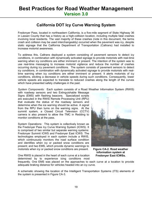
Best Practices for <strong>Road</strong> <strong>Weather</strong> <strong>Management</strong>Version 3.0California DOT Icy Curve Warning SystemFredonyer Pass, located in northeastern California, is a five-mile segment of State Highway 36in Lassen County that has a history as a high-collision location, including multiple fatal crashesinvolving local residents. The vast majority of these crashes (note in this document, the termscrash and collision may be used interchangeably) occurred when the pavement was icy, despitestatic signage that the California Department of Transportation (Caltrans) had installed toincrease motorist awareness.To address this, Caltrans deployed a system consisting of pavement sensors to detect icyconditions, in combination with dynamically activated signage to provide motorists with real-timewarning when icy conditions are either imminent or present. The intention of the system was touse real-time messaging to increase motorist vigilance and reduce the number of crashesoccurring during icy pavement conditions. The system consists of pavement sensors to detecticy conditions, in combination with dynamically activated signage to provide motorists with realtimewarning when icy conditions are either imminent or present. It alerts motorists of icyconditions, eliciting a decrease in vehicle speeds during such conditions. Consequently, lowervehicle speeds are expected to translate to reduced crashes along the length of the curveswhich have presented safety challenges in the past.System Components: Each system consists of a <strong>Road</strong> <strong>Weather</strong> Information System (RWIS)with roadway sensors and two Extinguishable MessageSigns (EMS) with flashing beacons. Specialized scriptsare executed in the RWIS Remote Processing Unit (RPU)that evaluate the status of the roadway sensors anddetermine when the ice warning should be active. A signalfrom the RPU then turns on the warning signs. At thesummit system, a Closed Circuit Television (CCTV)camera is also present to allow the TMC in Redding tomonitor conditions at the pass.System <strong>Operations</strong>: This system is collectively known asthe Fredonyer Pass Icy Curve Warning System (ICWS). Itis comprised of two similar but separate warning systems:Fredonyer Summit ICWS and Fredonyer East ICWS. Thetechnologies employed in each system include a RWIS,which continuously monitors the road surface conditionand identifies when icy or packed snow conditions arepresent; and two EMS, which provide dynamic warnings tomotorists when icy or packed snow conditions are present.One RWIS is placed in the heart of each curve at a locationdetermined by to experience icing conditions mostFigure CA-2. <strong>Road</strong> weatherinformation system atFredonyer East ICWSs.frequently. One EMS was placed on the approaches to each curve at a location to provideadequate braking distance for vehicles headed into an icy curve.A schematic showing the location of the Intelligent Transportation Systems (ITS) elements ofthe system is presented in Figure CA-3.19