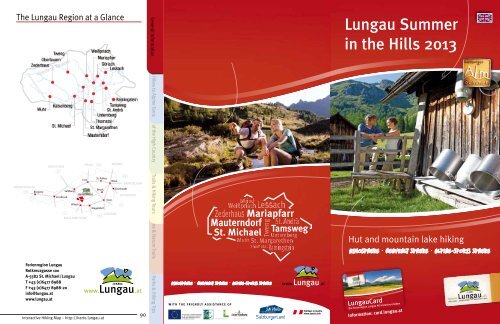
Lungau Summer in the Hills 2013 - Ferienregion Lungau
Lungau Summer in the Hills 2013 - Ferienregion Lungau
Lungau Summer in the Hills 2013 - Ferienregion Lungau

You also want an ePaper? Increase the reach of your titles
YUMPU automatically turns print PDFs into web optimized ePapers that Google loves.
The <strong>Lungau</strong> Region at a GlanceGeneral Information Fabulous Hikes to Alp<strong>in</strong>e Tarns Flavor of <strong>the</strong> High Country Hik<strong>in</strong>g Trails & Hik<strong>in</strong>g Tours<strong>Lungau</strong> <strong>Summer</strong><strong>in</strong> <strong>the</strong> <strong>Hills</strong> <strong>2013</strong>Theme & Nature TrailsHut and mounta<strong>in</strong> lake hik<strong>in</strong>gAtmosphere Heavenly Sphere Alp<strong>in</strong>e-Sports Sphere<strong>Ferienregion</strong> <strong>Lungau</strong>Rotkreuzgasse 100A-5582 St. Michael/<strong>Lungau</strong>T +43 (0)6477 8988F +43 (0)6477 8988-20<strong>in</strong>fo@lungau.atwww.lungau.atInteractive Hik<strong>in</strong>g Map – http://karte.lungau.at90Nature Parks & Hik<strong>in</strong>g TipsAtmosphere Heavenly Sphere Alp<strong>in</strong>e-Sports SphereWith <strong>the</strong> friendly assistance of<strong>Lungau</strong>CardDie <strong>Ferienregion</strong> <strong>Lungau</strong> All-<strong>in</strong>clusive erlebenInformation: card.lungau.at
Nature Parks & Hik<strong>in</strong>g Tips Theme & Nature Trails Hik<strong>in</strong>g Trails & Hik<strong>in</strong>g ToursFlavor of <strong>the</strong> High Country Fabulous Hikes to Alp<strong>in</strong>e Tarns General Information2Table of ContentsGeneral Information Page 3Fabulous Hikes to Alp<strong>in</strong>e Tarns Page 9Flavor of <strong>the</strong> High Country Page 31Hik<strong>in</strong>g Trails & Hik<strong>in</strong>g Tours Page 79Theme & Nature Trails Page 82Nature Parks & Hik<strong>in</strong>g Tips Page 89CreditsPublisher:<strong>Ferienregion</strong> <strong>Lungau</strong>Rotkreuzgasse 100, A-5582 St. Michael/<strong>Lungau</strong>T +43 (0)6477 8988, F+43 (0)6477 8988-20<strong>in</strong>fo@lungau.at, www.lungau.atEdition <strong>2013</strong>Editorial Texts: <strong>Ferienregion</strong> <strong>Lungau</strong>, Dr. Gertraud Ste<strong>in</strong>er,kulturpublizistik@aon.atTitle Photos: : SalzburgerLand Tourismus GmbHPhoto Credits: <strong>Lungau</strong> Holiday Region (pp. 4, 7, 20, 21, 27, 34, 56, 62, 65, 67,77, 78, 82, 84, H. Modl (pp. 9, 13, 14, 17, 18, 22, 23, 26, 28), Zederhaus TouristOffice (pp. 10, 11, 12, 30, 31, 38, 39, 40), P. Mache<strong>in</strong>er (pp. 15), Bergbahnen<strong>Lungau</strong> (pp. 16, 71), Oberkofler Family (pp. 19), P. Kröll (pp. 24, 25), MuhrTourist Office (pp. 29), Schlick Family (pp. 32), Batlogg Family (pp. 34), Gruber/JägerFamily (pp. 35), Schiefer Family (pp. 37), Bergmann Family (pp. 41),Mache<strong>in</strong>er Family (pp. 42), Wirnsperger Family (pp. 43), S. Perner (pp. 44),Kocher Family (pp. 46), Fuchsberger Family (pp. 47), Kendlbacher Family (pp.48), Lerchner Family (pp. 49), Kößlbacher Family (pp. 50), Bliem Family (pp.51), A. Neuschitzer (pp. 52), Sampl Family (pp. 53), P. Jäger (pp. 36), GruberFamily (pp. 33), Schiefer Family (pp. 37), Dorfer Family (pp. 38), SagmeisterFamily (pp. 45), Bliem Family (pp. 54), Pfeifenberger Family (pp. 54), K. Pfeifenberger(pp. 55), Stranner Family (pp. 55), Gruber Family (pp. 56), TwengTourist Office (pp. 57), W. Kocher (pp. 57), Mauterndorf Tourist Office (pp.58), Sturm Family (pp. 58), Tamsweg Tourist Office (pp. 59), Pagitsch Family(pp. 59), Gruber Family (pp. 60), Muhr Tourist Office (pp. 60, 61), Schlick Family(pp. 61), P. Hruska (pp. 63), Zehner Family (pp. 63), S. Pöllitzer (pp. 64),W<strong>in</strong>kler Family (pp. 64), B. Laireiter (pp. 65), Schramm Family (pp. 66), HöllerFamily (pp. 66), E. Fischbacher (pp. 67), Alpenvere<strong>in</strong> Wien (pp. 68), Sieder<strong>Lungau</strong>er Family Bergseen (pp. 68), W. Reiter (pp. 69), Oberkofler Family 16 Landschitzseen (pp. 69), Moser-Dengg/ S. 2501 Boarnlacke Family (pp. / S. 970), S. Meissnitzer 09 Giglachsee (pp. / 70), S. 17 Bogensperger 17 Zwerfenbergsee Family (pp. 72), & Angersee SchitterSee Family / S. 10 (pp. 72), Miksch 10 Oberer Family Schönalmsee (pp. 73), / S. Bogensperger 18 18 Prebersee Family / S. 27 (pp. 73),/ S. 2602 Esser03 Ilgsee Perner & Zaunersee Family (pp. / S. 11 74), 11 Tamsweg Oberhüttensee Tourist / S. 19 Office (pp. 19 Rosan<strong>in</strong>see 74), Sampl / S. Family 28 (pp.04 Ro<strong>the</strong>nwändersee / S. 12 12 Wirpitschsee &20 Rotgüldensee / S. 2975), Bergbahnen Katschberg (pp. 75), Seewald Family (pp. 76), Kerschhaggl05 Schlierersee / S. 13Tiefenbachsee / S. 20 & 21 21 Anderleseen / S. 30Family (pp. 76), R. Aigner (pp. 77), Pfeifenberger Family (pp. 78)06 Blauseen / S. 1413 Lignitzsee / S. 2207 Twenger Design: Almsee G.A. / S. Service 15 GmbH, 14 Landawirseen www.ga-service.at/ S. 2308 Trogalmseen / S. 16 15 Gralatisee / S. 24Pr<strong>in</strong>t: SAMSON Druck GmbH, www.samsondruck.at<strong>Summer</strong> panorama: He<strong>in</strong>z Vielk<strong>in</strong>d, PanoramastudioBewirtschaftete HüttenInteractive hik<strong>in</strong>g map (http://karte.lungau.at):Intermaps Software GmbHNot liable for errors or <strong>in</strong>accuracies. Information may be subject tochange. Any reproduction, <strong>in</strong> whatever format, <strong>in</strong> whole or <strong>in</strong> part, isallowed only with <strong>the</strong> express written permission of <strong>the</strong> publisher.Interactive Hik<strong>in</strong>g Map – http://karte.lungau.atHuts <strong>in</strong> <strong>the</strong> <strong>Lungau</strong>25 Ilgalm / p. 5426 Schieferalm / p. 5527 Kößlerhiasalm / p. 5528 Wasteialm / p. 5629 Müllnerbauer Hut / p. 5630 Genossenschaftshut Tweng / p. 5731 Twenger-Alm / p. 5732 Genossenschaftshut Trogalm / p. 5833 Almstüberl Fan<strong>in</strong>gberg / p. 5834 Preber-Halter Hut / p. 5935 Niggei Hut / p. 5936 Hanslbaueralm / p. 6037 Altwirtsalm / p. 6038 Adamalm / p. 6139 Jacklbauer Hut / p. 6140 Franz Fischer Hut / p. 6241 Speiereck Hut / p. 6342 Landwiersee Hut / p. 6343 Dr. Josef Mehrl Hut / p. 6444 Rotgüldensee Hut / p. 6445 Stickler Hut / p. 6546 Südwiener Hut / p. 6647 Tappenkarsee Hut / p. 6648 Ke<strong>in</strong>precht Hut / p. 6749 Ignaz Mattis Hut / p. 6850 Giglachsee Hut / p. 6851 Goll<strong>in</strong>g Hut / p. 6952 Ober Hut / p. 6953 Grazer Hut / p. 7054 Bonner Hut / p. 7055 Restaurant Panorama Alm / p. 7156 Restaurant Schi Alm / p. 7157 Berggasthof Ha<strong>in</strong>ererhof / p. 7258 Berghof Jacklbauer / p. 7259 Sauschneideralm / p. 7360 Jausenstation Dicktler Hut / p. 7361 Jausenstation Wielandhof / p. 7462 Ludlalm / p. 7463 Schlögelberger Alp<strong>in</strong>e Inn& Wildlife Park / p. 7564 Adlerhorst Summit Restaurant / p. 7565 Jausenstation Neuhauserstadl / p. 7666 Gasthof Bacher / p. 7667 Gamskogel Hut / p. 7768 Alpengasthof Jedl / p. 78
Welcome to <strong>Summer</strong> <strong>in</strong> <strong>the</strong> <strong>Hills</strong><strong>in</strong> <strong>the</strong> <strong>Lungau</strong>Await<strong>in</strong>g you here <strong>in</strong> <strong>the</strong> <strong>Lungau</strong> region, nestled between <strong>the</strong> peaks of<strong>the</strong> Niedere Tauern and Nockberge, is a superlative hik<strong>in</strong>g paradise. Thefragrant air of <strong>the</strong> Alps, <strong>the</strong> countryside filled with alp<strong>in</strong>e pastures anda colorful carpet of plants and wild herbs spread out before you, alongwith <strong>the</strong> tranquil beauty of nature, turn every hike <strong>in</strong>to a memorableexperience and give you <strong>the</strong> pure enjoyment and relaxation you havebeen look<strong>in</strong>g for.Some sixty mounta<strong>in</strong> lakes, crystal-clear and iridescent, shimmer<strong>in</strong>gemerald greens and silvers, lie scattered amidst green pastures andsilent combes, or beneath rocky crags and alp<strong>in</strong>e summits.Is it possible to become addicted to such blissful moments as <strong>the</strong>se?Oh, yes <strong>in</strong>deed!Natural jewels have someth<strong>in</strong>g about <strong>the</strong>m. The joy of a newlydiscovered mounta<strong>in</strong> lake creates a long<strong>in</strong>g and curiosity for <strong>the</strong> nextone. A wide-rang<strong>in</strong>g, clearly marked network of trails provide a constantsource of enthusiasm for walkers and experienced mounta<strong>in</strong>eers, butalso for those who want to take an extended stroll <strong>in</strong> <strong>the</strong> country, flee <strong>the</strong>stresses of daily life, embark on a nature pilgrimage or just experiencea few moments of complete bliss. These trails promise tours that areguaranteed to appeal no matter how <strong>the</strong> day happens to shape up, bethat bright sunsh<strong>in</strong>e or <strong>the</strong> quiet romance of overcast skies.None of <strong>the</strong> hikes presented here offer extreme challenges, but ra<strong>the</strong>rare <strong>in</strong> keep<strong>in</strong>g with <strong>the</strong> tone of. This <strong>in</strong>cludes landscapes and sceneryseem<strong>in</strong>gly plucked from <strong>the</strong> pages of a picture book, as well as <strong>the</strong>joy of discover<strong>in</strong>g those quiet hidden spots of glorious natural beauty,experienc<strong>in</strong>g first-hand <strong>the</strong> botany, geology and ancient traditions of<strong>the</strong> region. All of this is accompanied by an outstand<strong>in</strong>g <strong>in</strong>frastructure,<strong>in</strong>clud<strong>in</strong>g a valley bus and self-guided <strong>the</strong>me trails, plus genu<strong>in</strong>elyhospitable hosts at alp<strong>in</strong>e huts and hikers’ refuges, mounta<strong>in</strong> <strong>in</strong>ns,country cafés and summit restaurants. A <strong>Lungau</strong> also captivates guestswith its service, scores high marks with countless cul<strong>in</strong>ary specialtiesand embraces you with a warmth not soon to be forgotten.Interactive Hik<strong>in</strong>g Map – http://karte.lungau.at3General Information Fabulous Hikes to Alp<strong>in</strong>e Tarns Flavor of <strong>the</strong> High Country Hik<strong>in</strong>g Trails & Hik<strong>in</strong>g Tours Theme & Nature TrailsNature Parks & Hik<strong>in</strong>g Tips
General InformationNature Parks & Hik<strong>in</strong>g Tips Theme & Nature Trails Hik<strong>in</strong>g Trails & Hik<strong>in</strong>g ToursFlavor of <strong>the</strong> High Country Fabulous Hikes to Alp<strong>in</strong>e TarnsEach of <strong>the</strong> huts we present has its own little “secret.” This mightbe some cultural treasure passed down through <strong>the</strong> generations of <strong>the</strong>same family, a unique craft, or a service, such as perhaps a Kneipp spadedicated to your good health. Nutritious, delicious country fare and<strong>the</strong> best of farmhouse cook<strong>in</strong>g is always at <strong>the</strong> top of <strong>the</strong> list. Traditional<strong>Lungau</strong> dishes <strong>in</strong>clude homemade doughnuts, dumpl<strong>in</strong>gs, (unsweetenedpastry), bacon, and cheese. Of <strong>the</strong> various thirst-quenchers,buttermilk with native , <strong>the</strong> name for l<strong>in</strong>gonberries here <strong>in</strong> <strong>the</strong> <strong>Lungau</strong>,has become particularly popular. The cul<strong>in</strong>ary highlight of any hike<strong>in</strong> <strong>the</strong> <strong>Lungau</strong> is undoubtedly, referred to by <strong>the</strong> experts as “<strong>Lungau</strong>marzipan.” We are more than happy to share <strong>the</strong> recipe, but be forewarned,only up at an alp<strong>in</strong>e hut does it ever taste quite so heavenly. Letus simply say, if <strong>the</strong>re were ever an excuse for ignor<strong>in</strong>g your daily caloriecount, is def<strong>in</strong>itely it.<strong>Lungau</strong>er Rahmkoch –“<strong>Lungau</strong> Marzipan”Ingredients: ½ kg butter, ½ kg of granular flour, ¼ l cream, 180 g sugar,c<strong>in</strong>namon, anise, rais<strong>in</strong>s, rumDirections: Melt <strong>the</strong> butter. Mix <strong>the</strong> sweetened cream <strong>in</strong>to <strong>the</strong> flourand <strong>the</strong>n stir <strong>the</strong> mixture <strong>in</strong>to <strong>the</strong> melted butter. (Important: don’t let<strong>the</strong> butter get too hot!) Allow <strong>the</strong> mixture to simmer for 30 m<strong>in</strong>utes,stirr<strong>in</strong>g cont<strong>in</strong>uously, until this so-called “Koch” falls from <strong>the</strong> spoon.Add sugar, c<strong>in</strong>namon, anise, rais<strong>in</strong>s and rum to taste. Pour <strong>the</strong> mixture<strong>in</strong>to an oblong mold and keep <strong>in</strong> a cold place for about 12 hours.The tours described here do assume that you enjoy extended walksand that you are essentially <strong>in</strong> good physical condition with averagestam<strong>in</strong>a. The trails’ descriptions are <strong>in</strong>tended to give you an accuratesense of <strong>the</strong>ir physical demands. Recklessness is someth<strong>in</strong>g we advisestrongly aga<strong>in</strong>st, s<strong>in</strong>ce <strong>the</strong> mounta<strong>in</strong> world doesn’t tolerate foolishnesslightly. Our <strong>in</strong>formation section also gives you some important tips andlists essential telephone numbers.UNESCO Biosphere ReservesA deeply rooted liv<strong>in</strong>g environment with dist<strong>in</strong>ctive traditions anda high level of biodiversity, <strong>the</strong> <strong>Lungau</strong> region <strong>in</strong> <strong>the</strong> sunny south ofSalzburgerLand has proudly been recognized as UNESCO’s “Salzburger<strong>Lungau</strong> Biosphere Park” s<strong>in</strong>ce July 2012. The <strong>in</strong>ternational UNESCOtitle dist<strong>in</strong>guishes particularly valuable liv<strong>in</strong>g areas. <strong>Lungau</strong> offers aunique comb<strong>in</strong>ation of real, liv<strong>in</strong>g traditions, au<strong>the</strong>ntic, genu<strong>in</strong>e people,modern <strong>in</strong>frastructure and breathtak<strong>in</strong>g nature. Austria’s third andlargest biosphere park is considered a model region for susta<strong>in</strong>abledevelopment.In conclusion, <strong>the</strong> <strong>Lungau</strong> Holiday Region wishes to thank• Dr. Gertraud Ste<strong>in</strong>er for author<strong>in</strong>g <strong>the</strong> editorial texts,• Mr. Peter Bayr for his descriptions of <strong>the</strong> alp<strong>in</strong>e hut and lake routes,as well as for compil<strong>in</strong>g cartographical materials,• Mr. Hannes Modl for his descriptions of <strong>the</strong> alp<strong>in</strong>e hut and lakeroutes, as well as for his wealth of ideas dur<strong>in</strong>g <strong>the</strong> creative andrealization process, and also• all of <strong>the</strong> owners, managers and staff of our region’s alp<strong>in</strong>e huts.Without <strong>the</strong>ir support and dedication, it would not have been possibleto produce this brochure.Additional Read<strong>in</strong>g on this Topic:• Dr. Gertraud Ste<strong>in</strong>er: W<strong>in</strong>kelwelt. Sagen aus dem <strong>Lungau</strong>.Wolfgang Pfeifenberger Verlag 1999• Dr. Gertraud Ste<strong>in</strong>er: Sagen und My<strong>the</strong>n entdecken auf SalzburgerAlmen. Tyrolia Verlag 2005Interactiv Hik<strong>in</strong>g Map:4 5Interactive Hik<strong>in</strong>g Map – http://karte.lungau.atInteractive Hik<strong>in</strong>g Map – http://karte.lungau.atGeneral Information Fabulous Hikes to Alp<strong>in</strong>e Tarns Flavor of <strong>the</strong> High Country Hik<strong>in</strong>g Trails & Hik<strong>in</strong>g Tours Theme & Nature TrailsNature Parks & Hik<strong>in</strong>g Tips
General InformationValley Bus, <strong>Lungau</strong> Shuttle &Mounta<strong>in</strong> LiftsThe valley buses and <strong>Lungau</strong> shuttle br<strong>in</strong>g you comfortably and <strong>in</strong>environmentally-friendly fashion to and from <strong>the</strong> trailheads, mak<strong>in</strong>g itpossible to beg<strong>in</strong> your hike over <strong>in</strong> one valley and return from <strong>the</strong> next.Difficulty Rat<strong>in</strong>g for Hik<strong>in</strong>g Paths <strong>in</strong><strong>the</strong> Alp<strong>in</strong>e RegionGeneral InformationNature Parks & Hik<strong>in</strong>g Tips Theme & Nature Trails Hik<strong>in</strong>g Trails & Hik<strong>in</strong>g ToursFlavor of <strong>the</strong> High Country Fabulous Hikes to Alp<strong>in</strong>e TarnsDetailed timetables and rates are conta<strong>in</strong>ed <strong>in</strong> <strong>the</strong> official bus andshuttle brochures, available at all local tourist offices; <strong>the</strong> <strong>Lungau</strong>regional tourist office, Tel. 0043 (0)6477 8988; <strong>the</strong> Tamsweg PostBus Offices, Tel. 0043 (0)6474 2213; or onl<strong>in</strong>e at www.taelerbus.at,www.svv-<strong>in</strong>fo.at, or www.postbus.at.Please also note that toll charges apply <strong>in</strong> some valleys if you opt todrive your own car.Take a deep breath, relax and enjoy <strong>the</strong> wonderful views thataccompany your rides on <strong>the</strong> region’s mounta<strong>in</strong> lifts (cable cars on <strong>the</strong>Grosseck/Speiereck from Mauterndorf and St. Michael, as well as <strong>the</strong>A<strong>in</strong>eckbahn lift on <strong>the</strong> Katschberg). Reach<strong>in</strong>g <strong>the</strong> mounta<strong>in</strong>tops has neverbeen faster or easier. Details regard<strong>in</strong>g times and fares are available from<strong>the</strong> <strong>Lungau</strong> regional tourist office, Tel. 0043 (0)6477 8988 or onl<strong>in</strong>e atwww.bergbahnen-lungau.at, www.katschi.at.There is noth<strong>in</strong>g left to do now but allow yourself to be delightfullysurprised, impressed and enchanted, walk<strong>in</strong>g <strong>the</strong> <strong>in</strong>trigu<strong>in</strong>g <strong>the</strong>me trailsor out on magically beautiful hikes to legendary mounta<strong>in</strong> lakes andfasc<strong>in</strong>at<strong>in</strong>g alp<strong>in</strong>e huts.Let’s head for <strong>the</strong> hills – <strong>Lungau</strong>-style!The follow<strong>in</strong>g descriptions assume dry, summerlike wea<strong>the</strong>r conditions.• easySimple hik<strong>in</strong>g paths <strong>in</strong> permanently populated areas and adjacentforested areas, proceed<strong>in</strong>g through flat terra<strong>in</strong> with few significantuphill stretches.Special Requirements: None, regular runn<strong>in</strong>g shoes or street shoes aresufficient. No special equipment necessary. Navigable without use of ahik<strong>in</strong>g map.• <strong>in</strong>termediate/mediumMounta<strong>in</strong> trails that require a certa<strong>in</strong> degree of sure-footedness.Steep stages, water courses, narrow trails at po<strong>in</strong>ts, wash-out dirt andvegetation may be encountered along <strong>the</strong>se trails.Special Requirements: Basic map-read<strong>in</strong>g skills are required. Hik<strong>in</strong>g/trekk<strong>in</strong>g/mounta<strong>in</strong>eer<strong>in</strong>g boots with a good tread and extend<strong>in</strong>g above<strong>the</strong> ankle are recommended, as is a topographical hik<strong>in</strong>g map of <strong>the</strong>area <strong>in</strong> question.• difficultDifficult alp<strong>in</strong>e and mounta<strong>in</strong>eer<strong>in</strong>g trails, secured at exposedpo<strong>in</strong>ts by cables, manmade stairways, ladders, cha<strong>in</strong>s etc. You mayoften need to use your hands to ma<strong>in</strong>ta<strong>in</strong> balance and move along <strong>the</strong>trail. The precise trail is not always readily recognizable. Occasionallyvery exposed areas present a real danger of fall<strong>in</strong>g, loose rock, andsteep grassy or rocky slopes. <strong>Summer</strong> hikers may well still encounterunthawed snowpack from <strong>the</strong> previous w<strong>in</strong>ter.Special Requirements: Hikers must have appropriate hik<strong>in</strong>g andmounta<strong>in</strong>eer<strong>in</strong>g experience, as well as be<strong>in</strong>g able to navigate with adetailed topographical hik<strong>in</strong>g map. Hik<strong>in</strong>g/trekk<strong>in</strong>g/mounta<strong>in</strong>eer<strong>in</strong>gboots with a good tread and extend<strong>in</strong>g above <strong>the</strong> ankle are <strong>in</strong>dispensible.Hikers should have no physical impairments prevent<strong>in</strong>g <strong>the</strong>m fromtackl<strong>in</strong>g fixed-cable stages, steep stairways or similar obstacles wherehik<strong>in</strong>g poles are occasional more of a handicap than a help.In <strong>the</strong> <strong>Lungau</strong> region you will often f<strong>in</strong>d additional red-white-redmark<strong>in</strong>gs (some of which have trail numbers) next to <strong>the</strong> yellow trailsigns, direct<strong>in</strong>g you from one sign location to <strong>the</strong> next.6 7Interactive Hik<strong>in</strong>g Map – http://karte.lungau.atInteractive Hik<strong>in</strong>g Map – http://karte.lungau.atFabulous Hikes to Alp<strong>in</strong>e Tarns Flavor of <strong>the</strong> High Country Hik<strong>in</strong>g Trails & Hik<strong>in</strong>g Tours Theme & Nature TrailsNature Parks & Hik<strong>in</strong>g Tips
Nature Parks & Hik<strong>in</strong>g Tips Theme & Nature Trails Hik<strong>in</strong>g Trails & Hik<strong>in</strong>g ToursFlavor of <strong>the</strong> High Country Fabulous Hikes to Alp<strong>in</strong>e Tarns General Information8Correct Trail Behavior1. Prior to every tour, verify <strong>the</strong> mounta<strong>in</strong>eer<strong>in</strong>g experience andphysical capabilities of all participants, <strong>in</strong>clud<strong>in</strong>g children. Hikes <strong>in</strong><strong>the</strong> mounta<strong>in</strong>s often demand a high degree of sure-footedness andan absence of any vertigo problems.2. Plan your hike carefully us<strong>in</strong>g tour descriptions and maps.Information provided by regional alp<strong>in</strong>e associations and <strong>the</strong> staff ofalp<strong>in</strong>e huts can be of critical assistance.3. Make sure you have cloth<strong>in</strong>g and equipment appropriate to yourexpedition and wea<strong>the</strong>r conditions. High-ankle boots with a goodtread and cloth<strong>in</strong>g provid<strong>in</strong>g adequate protection aga<strong>in</strong>st ra<strong>in</strong> andcold are very important.4. Prior to sett<strong>in</strong>g out, notify staff at <strong>the</strong> alp<strong>in</strong>e hut or hotel, or familyand friends of your planned route and dest<strong>in</strong>ation, as well as <strong>the</strong>estimated time of your return.5. Match your tempo to that of your weakest team member. A slow paceis especially important at <strong>the</strong> start of a hike. Always pay attentionto <strong>the</strong> o<strong>the</strong>r members of your group to catch any early signs ofexhaustion.6. Never leave marked trails. Use extreme caution <strong>in</strong> cross<strong>in</strong>g steepgrassy slopes, especially when wet (to avoid slipp<strong>in</strong>g). Travers<strong>in</strong>gsteep snow fields and glaciers is particularly hazardous.7. Never kick rocks off <strong>the</strong> trail, s<strong>in</strong>ce you may <strong>in</strong>jure o<strong>the</strong>r hikers. Donot stop <strong>in</strong> areas threatened by fall<strong>in</strong>g rock; leave such areas asquickly as possible.8. If <strong>the</strong> wea<strong>the</strong>r turns, fog moves <strong>in</strong>, <strong>the</strong> trail becomes too difficult oris <strong>in</strong> poor condition, turn back. Ra<strong>the</strong>r than be<strong>in</strong>g someth<strong>in</strong>g to beashamed of, it shows you are us<strong>in</strong>g your common sense!9. If <strong>the</strong>re is an accident, rema<strong>in</strong> calm. If you are unable to take care of<strong>the</strong> problem yourself, use your mobile phone, shout, signal with alight or wave large items of cloth<strong>in</strong>g <strong>in</strong> order to summon assistance.In general, accident victims should not be moved or left alone.10. Be k<strong>in</strong>d to local animal and plant life. Carry your trash back to <strong>the</strong>valley.11. Interaction with animals: Do not tease calves, sheep, horses, oro<strong>the</strong>r animals. Instead behave “normally” and show no fear. Neverleave pathways across alp<strong>in</strong>e pastures, and keep a wide distancebetween you and <strong>the</strong> animals.12. Always keep your dog on a leash. Never allow your dog to chargeafter graz<strong>in</strong>g animals. Mo<strong>the</strong>r cows, <strong>in</strong> particular, can suffer stress if<strong>the</strong>ir calves appear threatened.Alp<strong>in</strong>e Emergency Number: 140International Emergency Number: 112(Source: UIAA/VAVÖ)Interactive Hik<strong>in</strong>g Map – http://karte.lungau.at㆒ Boarnlacke (elev. 2,214 m)Legendary People of Immense StrengthRied<strong>in</strong>gtal Nature Park, ZederhausIt is said that <strong>the</strong> simple,good farmhouse cook<strong>in</strong>g,summers spent on <strong>the</strong> highpastures, and <strong>the</strong> exercise thatcomes with hav<strong>in</strong>g to walklong distances contributedto mak<strong>in</strong>g <strong>the</strong> people ofZederhaus <strong>in</strong>credibly strong.Legends grew of people withalmost supernatural strength.In this regard, Ignaz Kürs<strong>in</strong>gertells <strong>the</strong> tale of one particular son who was told by his fa<strong>the</strong>r, a farmer<strong>in</strong> Zederhaus, to take a deer he had recently shot and register it with<strong>the</strong> authorities <strong>in</strong> Moosham. But <strong>in</strong>stead of load<strong>in</strong>g it onto <strong>the</strong> back of<strong>the</strong> wagon, he carried <strong>the</strong> creature on his shoulders, not dropp<strong>in</strong>g ituntil he stood <strong>in</strong> front of <strong>the</strong> game official <strong>in</strong> Moosham. The latter wasastonished and asked where <strong>the</strong> lad’s wagon was. His matter-of-factresponse: “For a deuced animal like this, it wasn’t worth <strong>the</strong> effort ofharness<strong>in</strong>g up a horse. They were all out graz<strong>in</strong>g anyway.”Along <strong>the</strong> toll road (€ 8 fee, <strong>in</strong>cl. valley bus dur<strong>in</strong>g <strong>the</strong> ma<strong>in</strong> vacationseason) by bus or car to <strong>the</strong> Schliereralm (1,495 m) <strong>in</strong> Ried<strong>in</strong>gtal naturepark and <strong>the</strong>n take <strong>the</strong> valley bus to <strong>the</strong> Königalm (1,667 m). From <strong>the</strong>Königalm, we cont<strong>in</strong>ue on <strong>the</strong> alp<strong>in</strong>e path to <strong>the</strong> Zauneralm. Directlybeh<strong>in</strong>d <strong>the</strong> Zauneralm we reach path no. 711 which leads us to <strong>the</strong>beautifully located Boarnlacke (2,214 m), a small lake. If you cont<strong>in</strong>uehik<strong>in</strong>g, you will reach Ried<strong>in</strong>gscharte gap (2,275 m). Ca. 100 m below,you can see <strong>the</strong> Ried<strong>in</strong>gsee. For <strong>the</strong> hike down, you will backtrack along<strong>the</strong> same route.Elevation Change:Difficulty:Time on Trail:Bus Service:Park<strong>in</strong>g:Refreshments:ca. 600 m• <strong>in</strong>termediateapproximately 2.5 hours to <strong>the</strong> Ried<strong>in</strong>gscharteNo. 770 to Zederhaus – Schliereralm – KönigalmPark<strong>in</strong>g lot <strong>in</strong> <strong>the</strong> Schlierersee areaSchliereralm, Königalm, Zauner HutInteractive Hik<strong>in</strong>g Map – http://karte.lungau.at9General Information Fabulous Hikes to Alp<strong>in</strong>e Tarns Flavor of <strong>the</strong> High Country Hik<strong>in</strong>g Trails & Hik<strong>in</strong>g Tours Theme & Nature TrailsNature Parks & Hik<strong>in</strong>g Tips
General InformationHik<strong>in</strong>g Trails & Hik<strong>in</strong>g Tours Flavor of <strong>the</strong> High Country Fabulous Hikes to Alp<strong>in</strong>e TarnsTheme & Nature TrailsNature Parks & Hik<strong>in</strong>g Tips㆓ Esser See (elev. 2,088 m)The Court Butcher and Zederhaus BreadRied<strong>in</strong>gtal Nature Park, ZederhausCattle traders from Salzburgused to trek across <strong>the</strong>Tappenkar and Taferlnock tosell <strong>the</strong>ir oxen and calves <strong>in</strong>Zederhaus. The court butcher,Perner, never shied away frommak<strong>in</strong>g <strong>the</strong> long trip ei<strong>the</strong>r,ever striv<strong>in</strong>g to supply <strong>the</strong>table of <strong>the</strong> Pr<strong>in</strong>ce Archbishopswith <strong>the</strong> best meat available.On one such occasion, he hadjust come to an agreement with a hill farmer and sealed <strong>the</strong> deal with ahandshake. The farmer’s wife served up a hearty snack which <strong>in</strong>cludedbread and butter. The f<strong>in</strong>e gentleman ate <strong>the</strong> butter, and slid <strong>the</strong> bread<strong>in</strong>to his pocket, say<strong>in</strong>g, “I’ll take that with me to Salzburg so that mylords see what terrible bread you have.” On <strong>the</strong> Tappenkar, however, hewas surprised by bad wea<strong>the</strong>r. Exhausted and hungry, he rummagedabout and pulled out <strong>the</strong> bread. Nibbl<strong>in</strong>g away, he gradually rega<strong>in</strong>edhis strength, later claim<strong>in</strong>g that he had never tasted better bread.From <strong>the</strong> Jakoberalm park<strong>in</strong>g lot <strong>in</strong> <strong>the</strong> Ried<strong>in</strong>gtal nature park <strong>in</strong>Zederhaus - ca. 0.5 km before <strong>the</strong> Schliereralm (toll road/€ 8 fee, <strong>in</strong>cl.valley bus dur<strong>in</strong>g <strong>the</strong> ma<strong>in</strong> vacation season), a supply road branch<strong>in</strong>goff to <strong>the</strong> right leads to <strong>the</strong> Jakoberalm at an elevation of 1,839 m (timeon trail ca. 1.0 hr.). Westward on path no. 702, you will reach <strong>the</strong> EsserSee at an elevation of 2,088 m. From <strong>the</strong>re, you will go uphill to <strong>the</strong> FranzFischer Hut (2,020 m), where <strong>the</strong> Zaunersee is also located. Downhill via<strong>the</strong> Hüttenweg path (no. 711), you will aga<strong>in</strong> reach <strong>the</strong> Ried<strong>in</strong>gtal road.Elevation Change:Difficulty:Time on Trail:Bus Service:Park<strong>in</strong>g:Refreshments:ca. 600 m• <strong>in</strong>termediateapproximately 4.5 hours for <strong>the</strong> entire hikeNo. 770 to Zederhaus – Schliereralmat <strong>the</strong> base of <strong>the</strong> trail up to <strong>the</strong> JakoberalmJakoberalm, Gruberalm, Schliereralm, Franz FischerHut - Due to new construction, <strong>the</strong> open<strong>in</strong>g isexpected <strong>in</strong> late summer!叅 Ilgsee (elev. 2,099 m) – Zaunersee (elev. 2,020 m, via <strong>the</strong> Haselloch)Death of <strong>the</strong> Königbauer Farmer below <strong>the</strong> HasellochRied<strong>in</strong>gtal Nature Park, ZederhausThe beautiful ZederhausValley was once particularlyremote and daunt<strong>in</strong>g, be<strong>in</strong>gabout a six- to seven-hourhike from <strong>the</strong> market town ofSt. Michael. Not much longerand far more beautiful is<strong>the</strong> trail over <strong>the</strong> Tappenkar(elev. 2,135 m) to Kle<strong>in</strong>arl ora cross<strong>in</strong>g of <strong>the</strong> Taferlnock(elev. 2,236 m) <strong>in</strong>to <strong>the</strong> Flachauregion. Messengers, woodcutters, peddlers, pig castrators and cattledealers all hiked along <strong>the</strong>se trails and “<strong>in</strong>to <strong>the</strong> wide outside world.”At <strong>the</strong> best times of year, even <strong>the</strong> most locally savvy and hardywanderers had to be watchful of drastic changes <strong>in</strong> <strong>the</strong> wea<strong>the</strong>r. OnOctober 8, 1844, Blasius Dorfer, who lived on <strong>the</strong> Königbauer farm<strong>in</strong> Zederhaus, came to an untimely end. Toge<strong>the</strong>r with his sister, adairymaid at <strong>the</strong>ir parents’ hill farm, he was on his way from <strong>the</strong> cattlemarket <strong>in</strong> St. Johann when <strong>the</strong>y were overcome by driv<strong>in</strong>g snows. IgnazKürs<strong>in</strong>ger wrote down <strong>the</strong> story of <strong>the</strong> two unfortunate sibl<strong>in</strong>gs, as it wasretold to him by Maria Dorfer: I tapped my way slowly forward <strong>in</strong> <strong>the</strong> dark,gloomy night – <strong>in</strong> <strong>the</strong> snow and fog – but without know<strong>in</strong>g where I washead<strong>in</strong>g. Overcome by enormous fatigue, I called back to my bro<strong>the</strong>r totell him to follow me. Full of fear, I shouted “Come, we’re go<strong>in</strong>g home!”But her bro<strong>the</strong>r’s voice was lost <strong>in</strong> <strong>the</strong> dark, snowy night. Maria Dorfereventually fell down a snow-covered slope on <strong>the</strong> Wurmfeldspitze andlost consciousness, though she was able to save herself on <strong>the</strong> follow<strong>in</strong>gday, f<strong>in</strong>d<strong>in</strong>g her way back to her mounta<strong>in</strong> hut, where <strong>the</strong> shockedherdsman <strong>the</strong>re gave <strong>the</strong> half-frozen woman some hot soup and sent forfarmhands <strong>in</strong> <strong>the</strong> valley to help assist <strong>in</strong> <strong>the</strong> recovery of her unfortunatebro<strong>the</strong>r.Along <strong>the</strong> toll road (€ 8 fee, <strong>in</strong>cl. valley bus dur<strong>in</strong>g <strong>the</strong> ma<strong>in</strong> vacationseason) by bus or car to <strong>the</strong> Schliereralm (1,495 m) <strong>in</strong> Ried<strong>in</strong>gtal naturepark and <strong>the</strong>n by valley bus to <strong>the</strong> Königalm (1,667 m). The uphill trailleads from <strong>the</strong> Königalm (1,667 m) to <strong>the</strong> Haselloch (2,136 m). From<strong>the</strong>re, we take marked path no. 702, which is uphill at first and <strong>the</strong>ncont<strong>in</strong>ues down <strong>in</strong>to <strong>the</strong> valley, to <strong>the</strong> Ilgsee. The Zaunersee is locatedright by <strong>the</strong> Franz Fischer Hut (2,020 m). The downhill trail <strong>in</strong>to Ried<strong>in</strong>gtalis via Hüttenweg path (no. 711).Elevation Change: ca. 470 mDifficulty:• <strong>in</strong>termediateTime on Trail: ca. 5 hours for <strong>the</strong> entire hikeBus Service: No. 770 to Zederhaus – Schliereralm – KönigalmPark<strong>in</strong>g:Park<strong>in</strong>g lot <strong>in</strong> <strong>the</strong> Schlierersee areaRefreshments: Königalm, Hoislalm, Gruberalm, Schliereralm, Franz FischerHut - Due to new construction, <strong>the</strong> open<strong>in</strong>g isexpected <strong>in</strong> late summer!10 11Interactive Hik<strong>in</strong>g Map – http://karte.lungau.atInteractive Hik<strong>in</strong>g Map – http://karte.lungau.atGeneral Information Fabulous Hikes to Alp<strong>in</strong>e Tarns Flavor of <strong>the</strong> High Country Hik<strong>in</strong>g Trails & Hik<strong>in</strong>g Tours Theme & Nature TrailsNature Parks & Hik<strong>in</strong>g Tips
General InformationHik<strong>in</strong>g Trails & Hik<strong>in</strong>g Tours Flavor of <strong>the</strong> High Country Fabulous Hikes to Alp<strong>in</strong>e TarnsTheme & Nature TrailsNature Parks & Hik<strong>in</strong>g Tips㆕ Ro<strong>the</strong>nwändersee (elev. 2,010 m)Jovial, high-spirited people of ZederhausRied<strong>in</strong>gtal Nature Park, ZederhausThe Zederhaus Prangstangenare quite famous. Theselarge, 8-meter-high, woodenpoles, beautifully garlanded<strong>in</strong> flowers, are ceremoniouslyparaded to church on <strong>the</strong>24th of June. Of course, thisprocess requires some strongyoung lads. Many tales havebeen told over <strong>the</strong> yearsabout <strong>the</strong>se jovial, crafty andthoroughly muscular citizens of Zederhaus. Even <strong>the</strong> term Hanswurst –<strong>the</strong> German name given to a village buffoon – is said to have its orig<strong>in</strong>swith a native of this valley. The village church is actually consecrated totwo sa<strong>in</strong>ts, John <strong>the</strong> Baptist and John <strong>the</strong> Evangelist, which is why somany local boys were christened Johannes (mean<strong>in</strong>g John, commonlyshortened to Hans or Hannes). Historian Ignaz Kürs<strong>in</strong>ger, who was <strong>the</strong>super<strong>in</strong>tendent of <strong>Lungau</strong> schools dur<strong>in</strong>g <strong>the</strong> 1840’s, once commentedthat <strong>the</strong> valley’s children often bore <strong>the</strong> strangest Christian names.There I read Petronilla and Angela, Isabella and Hemma, Polikarpus andAthanasius, etc. (733). The orig<strong>in</strong>ator of <strong>the</strong>se odd names turned out tobe Vicar Joseph Königsdorfer, who summarily gave newborns whatevername happened to appear on <strong>the</strong> church calendar on <strong>the</strong> day of <strong>the</strong>irchristen<strong>in</strong>g.From <strong>the</strong> Jakoberalm park<strong>in</strong>g lot <strong>in</strong> Ried<strong>in</strong>gtal nature park <strong>in</strong> Zederhaus- ca. 0.5 km before <strong>the</strong> Schliereralm (toll road/€ 8 fee, <strong>in</strong>cl. valley busdur<strong>in</strong>g <strong>the</strong> ma<strong>in</strong> vacation season), a supply road branch<strong>in</strong>g off to <strong>the</strong>right leads to <strong>the</strong> Jakoberalm at an elevation of 1,839 m (time on trail ca.1.0 hr.). From <strong>the</strong>re, we hike along <strong>the</strong> “Tauernhöhenweg” no. 702 upto <strong>the</strong> Ro<strong>the</strong>nwändersee (2,010 m) and cont<strong>in</strong>ue to <strong>the</strong> junction for <strong>the</strong>Grosskesselalmen. Path no. 741 <strong>the</strong>n leads downhill <strong>in</strong>to <strong>the</strong> valley to<strong>the</strong> Ried<strong>in</strong>gstraße and from <strong>the</strong>re back to <strong>the</strong> start<strong>in</strong>g po<strong>in</strong>t.Elevation Change: ca. 530 mDifficulty:• <strong>in</strong>termediateTime on Trail: ca. 5 hours for <strong>the</strong> entire hikeBus Service: No. 770 to Zederhaus – SchliereralmPark<strong>in</strong>g:at <strong>the</strong> start of <strong>the</strong> trail up to <strong>the</strong> JakoberalmRefreshments: Jakoberalm, Kößlerhiasalm, Muhreralm,Schwarzenbichl Hut⓹ Schlierersee (elev. 1,495 m)Of <strong>the</strong> Weisseck DogRied<strong>in</strong>gtal Nature Park, ZederhausAbove <strong>the</strong> Ried<strong>in</strong>gsee (elev.2,169 m), where <strong>the</strong> hikercan look out over <strong>the</strong> flowercoveredUpper Ried<strong>in</strong>g Valley,towers <strong>the</strong> mighty Weisseck(elev. 2,711 m), home to quartzand rare m<strong>in</strong>erals, and to<strong>the</strong> legends <strong>in</strong>to which <strong>the</strong>yare woven. Where today’sSchliereralmsee now lies,<strong>the</strong>re was once a broad area ofhigh moors, <strong>the</strong> so-called Ei´g´hagtes Moos. The pathway <strong>the</strong>re fromZederhaus was known as <strong>the</strong> W<strong>in</strong>ter Way, because sleighs loaded withhay or wood once traveled along this route.The last farm <strong>in</strong> <strong>the</strong> valley was <strong>the</strong> old Schwarzenbichler property. Thismeant, of course, that its residents also had <strong>the</strong> longest walk to church.One stormy, pitch-black night, a strange visitor knocked on <strong>the</strong> frontdoor. It was an icy grey mounta<strong>in</strong> dwarf with a knee-length beard and astorm lantern, who immediately ordered <strong>the</strong> farmer’s wife to follow him.Their path, accord<strong>in</strong>g to <strong>the</strong> tale, took <strong>the</strong>m steeply uphill to <strong>the</strong> rockycliffs of <strong>the</strong> Weisseck. Once at <strong>the</strong> top, <strong>the</strong> dwarf now expla<strong>in</strong>ed, <strong>the</strong>ywould encounter <strong>the</strong> Weisseck Dog which, at this very midnight hour,would appear before <strong>the</strong> mounta<strong>in</strong> with a wooden key <strong>in</strong> its mouth.With this key, <strong>the</strong> farmer’s wife would be able to unlock all <strong>the</strong> treasureshidden with<strong>in</strong> <strong>the</strong> mounta<strong>in</strong>. Sadly, faced with <strong>the</strong> prospect of meet<strong>in</strong>gthis scary creature, <strong>the</strong> woman did not have <strong>the</strong> courage to carry on. Thetreasure rema<strong>in</strong>ed where it was. But it is said that if <strong>the</strong> p<strong>in</strong>e tree <strong>in</strong> frontof <strong>the</strong> house is ever felled <strong>in</strong> order to build a cradle, <strong>the</strong> child who lies <strong>in</strong>it will aga<strong>in</strong> be called upon to w<strong>in</strong> those mysterious treasures.A Lake used for Hydroelectric PowerThis expedition beg<strong>in</strong>s on <strong>the</strong> enchant<strong>in</strong>g hik<strong>in</strong>g path that leavesfrom <strong>the</strong> car park located near <strong>the</strong> sou<strong>the</strong>rn entrance to <strong>the</strong> TauernTunnel (elev. 1,345 m). The hike to <strong>the</strong> Schlierersee takes about 1 hour.As you follow this trail, you will pass several alp<strong>in</strong>e huts on <strong>the</strong> wayto <strong>the</strong> Örgenhiasalm (elev. 1,710 m) <strong>in</strong> <strong>the</strong> Upper Ried<strong>in</strong>g Valley. Thisportion of <strong>the</strong> hike takes around 2 hours. A valley bus runs between <strong>the</strong>Schliereralm and Königalm mounta<strong>in</strong> <strong>in</strong>ns.Elevation Change: ca. 370 mDifficulty:• easyTime on Trail: ca. 1 to 3 hours (depend<strong>in</strong>g on tour variant)Bus Service: No. 770 to Zederhaus – Wald – SchliereralmPark<strong>in</strong>g:near <strong>the</strong> Tauern Tunnel (south entrance), SchliereralmRefreshments: Schliereralm, Gruberalm, Hoislalm, Ilgalm, Königalm,Zauner Hut, Örgenhiasalm12 13Interactive Hik<strong>in</strong>g Map – http://karte.lungau.atInteractive Hik<strong>in</strong>g Map – http://karte.lungau.atGeneral Information Fabulous Hikes to Alp<strong>in</strong>e Tarns Flavor of <strong>the</strong> High Country Hik<strong>in</strong>g Trails & Hik<strong>in</strong>g Tours Theme & Nature TrailsNature Parks & Hik<strong>in</strong>g Tips
General InformationHik<strong>in</strong>g Trails & Hik<strong>in</strong>g Tours Flavor of <strong>the</strong> High Country Fabulous Hikes to Alp<strong>in</strong>e TarnsTheme & Nature TrailsNature Parks & Hik<strong>in</strong>g Tips⓼ Trogalmseen (elev. 1,808 m)Witches’ Dance on <strong>the</strong> SpeiereckGrosseck MauterndorfThe Speiereck (elev.2,411 m) has a reputation as<strong>the</strong> <strong>Lungau</strong> region’s witchmounta<strong>in</strong>, with numerousdark tales swirl<strong>in</strong>g aroundit. How did that happen?Well, <strong>the</strong> sun rises beh<strong>in</strong>d<strong>the</strong> Preber, but s<strong>in</strong>ks beh<strong>in</strong>d<strong>the</strong> Speiereck <strong>in</strong>to a worldof shadow. The light of daywas ext<strong>in</strong>guished beh<strong>in</strong>d thismounta<strong>in</strong>. The night beg<strong>in</strong>s its dom<strong>in</strong>ion, accompanied by its fiendishcompanions - witches and sorcerers - who dance <strong>in</strong> a s<strong>in</strong>ister tempest oflightn<strong>in</strong>g and thunder around <strong>the</strong> summit. Ignaz Kürs<strong>in</strong>ger also becameaware of this superstition and reports that, accord<strong>in</strong>g to local lore,<strong>the</strong> soul of Schörgentoni also gets up to no good atop <strong>the</strong> Speiereck,where he conjures up storms, tosses stones and rocks down on cattlegraz<strong>in</strong>g below and, upon <strong>the</strong> stroke of midnight, is visited by witchesand sorcerers. It f<strong>in</strong>ally got to <strong>the</strong> po<strong>in</strong>t that a Capuch<strong>in</strong> priest wassent up <strong>the</strong> mounta<strong>in</strong> to exorcise this evil spirit. But today’s hiker hasno cause for fear, and is able to enjoy <strong>the</strong> enchant<strong>in</strong>g landscapes andglorious views that surround <strong>the</strong> Trogalmsee. In <strong>the</strong> most beautiful wayimag<strong>in</strong>able, virtually <strong>the</strong> entire <strong>Lungau</strong> bas<strong>in</strong> lies right here at your feet– without ever hav<strong>in</strong>g to resort to magic of any k<strong>in</strong>d!The Trogalm Lakes are actually manmade, supply<strong>in</strong>g <strong>the</strong> water to runsnowmak<strong>in</strong>g equipment <strong>in</strong> w<strong>in</strong>ter. They were built with great sensitivityfor <strong>the</strong> surround<strong>in</strong>g countryside and are a highly popular hik<strong>in</strong>gdest<strong>in</strong>ation <strong>in</strong> summer. The start<strong>in</strong>g po<strong>in</strong>t for this hike <strong>in</strong> Mauterndorfcan be <strong>the</strong> old lift path, <strong>the</strong> old Trogweg, or <strong>the</strong> forest path from <strong>the</strong> skicenter. The hike takes about 2.5 hours. Late-risers can ride <strong>the</strong> cab<strong>in</strong> lift,hike from <strong>the</strong> summit term<strong>in</strong>al down to <strong>the</strong> Trogalmsee/Trogalm (elev.1,808 m) or up to <strong>the</strong> Speiereck Hut (elev. 2,072 m). Our start<strong>in</strong>g po<strong>in</strong>t<strong>in</strong> St. Michael is across from Hotel Post. Along Schulstrasse as far asSt. Mart<strong>in</strong>-Berg, <strong>the</strong>n make a left at <strong>the</strong> panorama <strong>in</strong>fo board towardsSonndörfl (Trail No. 93). From <strong>the</strong>re, make a right at <strong>the</strong> Bacherhoftowards <strong>the</strong> Grubental, <strong>the</strong>n somewhat more steeply uphill to <strong>the</strong>Trogalm and Trogalm lakes at 1,808 m above sea level. Time on trail isabout 2.5 hours.Elevation Change: ca. 750 mDifficulty:• <strong>in</strong>termediateTime on Trail: ca. 2.5 hoursBus Service: No. 780 to Mauterndorf – Grosseck valley term<strong>in</strong>al orNos. 760 / 770 to St. Michael – Weissenste<strong>in</strong>Park<strong>in</strong>g:Grosseck valley term<strong>in</strong>al, St. Michael town centerRefreshments: Restaurant Panorama Alm, Trogalm, Speiereck Hut⓽ Giglachsee (elev. 1,921 m)Of <strong>the</strong> Schatzbühel and <strong>the</strong> Venediger <strong>in</strong> <strong>the</strong> GranierkarWeisspriach ValleySchatzbühel is <strong>the</strong> nameof <strong>the</strong> last slope preced<strong>in</strong>g<strong>the</strong> f<strong>in</strong>al climb up to <strong>the</strong>Znachsattel. The m<strong>in</strong><strong>in</strong>gtradition, which was of suchsignificance for this region,once aga<strong>in</strong> resonates <strong>in</strong>this name. A total of elevenseparate m<strong>in</strong>eral operationswere active here, m<strong>in</strong><strong>in</strong>g forcopper, iron, z<strong>in</strong>c, and cobalt.M<strong>in</strong><strong>in</strong>g was conducted <strong>in</strong> <strong>the</strong> Knappenstubengraben south-east of <strong>the</strong>Granglergut, both at <strong>the</strong> entrance to and also with<strong>in</strong> <strong>the</strong> Upper ZnachtalValley, primarily on <strong>the</strong> Z<strong>in</strong>kwand, once <strong>the</strong> focal po<strong>in</strong>t of <strong>Lungau</strong>m<strong>in</strong><strong>in</strong>g. It is said that <strong>the</strong> legendary Venediger dwarf used to cross <strong>the</strong>Schatzbühel. Year after year, <strong>the</strong> Venediger would come to <strong>the</strong> GroniaAlm, armed with a div<strong>in</strong><strong>in</strong>g rod and mirror, and a pickaxe, with whichhe would tear up <strong>the</strong> precious alp<strong>in</strong>e turf. That is to say, until this allbecame too much for a cowherd who gave <strong>the</strong> dwarf a thorough beat<strong>in</strong>g.Years later, this same cowherd had become a more respectable person,travell<strong>in</strong>g <strong>the</strong> countryside as a pig castrator. One day, he entered ara<strong>the</strong>r em<strong>in</strong>ent abode whose owner struck him as oddly familiar. Theowner immediately addressed him by name and, it turned out, he was<strong>in</strong>deed <strong>the</strong> same miscreant <strong>the</strong> former cowherd had driven away from<strong>the</strong> hill farm long ago. Our <strong>Lungau</strong> friend became ra<strong>the</strong>r sheepish, but<strong>the</strong> owner rema<strong>in</strong>ed quite friendly and even <strong>in</strong>vited him up to <strong>the</strong> topfloor of his home, where laid out before <strong>the</strong>m was a beautiful collectionof crystals and rocks gleam<strong>in</strong>g with gold. “These made me rich,” stated<strong>the</strong> Venediger, “and back <strong>in</strong> those days, you threw many a rock at a cowthat was worth far more than <strong>the</strong> cow itself.”This hike beg<strong>in</strong>s at <strong>the</strong> car park by <strong>the</strong> turn-off for <strong>the</strong> Znachtal, located<strong>in</strong> <strong>the</strong> Upper Weisspriach Valley, which is easy to reach ei<strong>the</strong>r by car oron <strong>the</strong> valley bus (co<strong>in</strong>-operated toll booth/fee: € 4,--). You will branchoff to <strong>the</strong> right on trail No. 771, tak<strong>in</strong>g you through <strong>the</strong> Znachtal to <strong>the</strong>“Obere Gre<strong>in</strong>meisteralm” (elev. 1,620 m) and <strong>the</strong>n on to <strong>the</strong> Znachsattel(elev. 2,059 m). The lake lies at 1,921 m and <strong>the</strong> Giglachsee Hut at 1,955meters above sea level.Elevation Change: ca. 780 mDifficulty:• <strong>in</strong>termediateTime on Trail: approximately 3 hours from <strong>the</strong> car park to <strong>the</strong> GiglachseeBus Service: No. 710 to Mariapfarr – Weisspriach – Znach turn-offPark<strong>in</strong>g:Znachtal turn-offRefreshments: Giglachsee Hut, Ignaz Mattis Hut16 17Interactive Hik<strong>in</strong>g Map – http://karte.lungau.atInteractive Hik<strong>in</strong>g Map – http://karte.lungau.atGeneral Information Fabulous Hikes to Alp<strong>in</strong>e Tarns Flavor of <strong>the</strong> High Country Hik<strong>in</strong>g Trails & Hik<strong>in</strong>g Tours Theme & Nature TrailsNature Parks & Hik<strong>in</strong>g Tips
General InformationHik<strong>in</strong>g Trails & Hik<strong>in</strong>g Tours Flavor of <strong>the</strong> High Country Fabulous Hikes to Alp<strong>in</strong>e TarnsTheme & Nature TrailsNature Parks & Hik<strong>in</strong>g Tips⓾ Oberer Schönalmsee (elev. 2,115 m)A Dangerous DancerWeisspriach ValleyThe extended mounta<strong>in</strong> ridgethat stretches from <strong>the</strong> Tauern to<strong>the</strong> summits of <strong>the</strong> Tauernhöhe(elev. 2,328 m), Gollitschspitz(elev. 2,247 m), Gurpitschek(elev. 2,526 m), Karnereck (elev.2,380 m) and Fann<strong>in</strong>ghöhe,divides <strong>the</strong> Tweng Valleyfrom <strong>the</strong> Weisspriach Valley.Magnificent mounta<strong>in</strong> sceneryis spr<strong>in</strong>kled with beautifullakes amidst delightful alp<strong>in</strong>e pastures, one of <strong>the</strong> biggest of which is <strong>the</strong>Schönalm. Dairymaids and cowherds would tend <strong>the</strong> cattle, sheep, pigs,and goats, fill<strong>in</strong>g <strong>the</strong> butter churns and cheese kettles week after week.On a warm summer’s night, musicians would strike up <strong>the</strong>ir dance musicand couples would whirl through <strong>the</strong> moonlit night. The mysterious wildwomen would come out of <strong>the</strong>ir caves and mix with <strong>the</strong> dancers. Theirrobes were bright and delicate, <strong>the</strong>ir hair light and long, a fragrance likethat of elder blossoms waft<strong>in</strong>g <strong>in</strong> <strong>the</strong> even<strong>in</strong>g breezes. The danc<strong>in</strong>g waspunctuated every now and <strong>the</strong>n by <strong>the</strong> joyous Juschgaza yells of <strong>the</strong> youngmen, echo<strong>in</strong>g off <strong>the</strong> surround<strong>in</strong>g mounta<strong>in</strong>s. But an unwelcome guestmight sneak <strong>in</strong>to this picture as well- a truly fiendish, unfamiliar character,perhaps, dressed <strong>in</strong> <strong>the</strong> costume of a hunter, splitt<strong>in</strong>g up many a coupleand seduc<strong>in</strong>g <strong>the</strong> local beauties. It is said that many of <strong>the</strong>se dancers nowrepent <strong>the</strong>ir wicked recklessness <strong>in</strong>side Satan’s Wall above Tweng. But noteveryone is scared away by tales such as <strong>the</strong>se for, as <strong>the</strong> local say<strong>in</strong>g goes:In <strong>the</strong> hill country, <strong>the</strong>re is no such th<strong>in</strong>g as s<strong>in</strong>!The start<strong>in</strong>g po<strong>in</strong>t for this hike is <strong>the</strong> car park at <strong>the</strong> turn-off for <strong>the</strong>Znachtal <strong>in</strong> <strong>the</strong> Upper Weisspriach Valley, which is easy to reach by car oron <strong>the</strong> valley bus (co<strong>in</strong>-operated toll booth/fee: € 4,--). The hike takes youalong gravel path No. 770, past <strong>the</strong> Grangler Hut (elev. 1,320 m) to <strong>the</strong> trailfork at <strong>the</strong> Uln Hut (stop for <strong>the</strong> valley bus). Make a left beh<strong>in</strong>d <strong>the</strong> hut,cont<strong>in</strong>ue past <strong>the</strong> roar<strong>in</strong>g waterfall and cross <strong>the</strong> Longa. After about 200 m,a marked hik<strong>in</strong>g trail breaks off to <strong>the</strong> left and takes you to <strong>the</strong> Toni MörtlHut, where refreshments are available. Hav<strong>in</strong>g reached <strong>the</strong> hut, you will firstkeep straight and <strong>the</strong>n make a left, hik<strong>in</strong>g past <strong>the</strong> Wirpitschsee (elev. 1,699m) to <strong>the</strong> Lower Schönalmsee (elev. 1,893 m). From here, <strong>the</strong> trail cont<strong>in</strong>uesto climb toward your dest<strong>in</strong>ation, <strong>the</strong> Upper Schönalmsee (elev. 2,115 m).• <strong>in</strong>termediate to • difficultElevation Change: ca. 840 mDifficulty:Time on Trail: approximately 3.5 hours to <strong>the</strong> Upper SchönalmseeBus Service: No. 710 to Mariapfarr – Weisspriach – Znach turn-off –Grangler Hut – Uln HutPark<strong>in</strong>g:Znachtal turn-offRefreshments: Grangler Hut, Toni Mörtl Hut⓫ Oberhüttensee (elev. 1,866 m)A Deadly Pilgrimage to <strong>the</strong> Filzmooser K<strong>in</strong>dlWeisspriach ValleyBefore <strong>the</strong> ascent to <strong>the</strong>Oberhüttensattel and justbeyond <strong>the</strong> last mounta<strong>in</strong> hut,<strong>the</strong>re stands a lonely waysidealtar to commemorate a fatalaccident that occurred onOctober 12, 1817. For a longtime, <strong>the</strong> <strong>in</strong>cident was onlyknown <strong>in</strong> <strong>the</strong> form of <strong>the</strong>legend of The Two DenggenWomen. Pastor Josef Schitterexam<strong>in</strong>ed <strong>the</strong> rott<strong>in</strong>g board more closely and was able to deciphernames and a date. The follow<strong>in</strong>g entry had also been made <strong>in</strong> <strong>the</strong> deathregistry <strong>in</strong> Mariapfarr: The 19-year-old daughter of <strong>the</strong> Denggen farm,Maria, and Kathar<strong>in</strong>a Moser, 28 years of age, daughter of a tenantfarmer <strong>in</strong> Ste<strong>in</strong>dorf, <strong>in</strong> service as a maid at <strong>the</strong> Denggen farm, embarkedon a pilgrimage to Filzmoos on October 11, 1917. In order to do so, <strong>the</strong>yused <strong>the</strong> commonly traveled and quite beautiful cross<strong>in</strong>g over <strong>the</strong>Oberhüttensattel. Such expeditions on foot were not only regardedas spiritual exercises, <strong>the</strong>y were also healthy and enjoyable, taughtparticipants about <strong>the</strong> outside world, and, last but not least, wouldprovide return<strong>in</strong>g travelers with Styrian apples to fill <strong>the</strong>ir rucksacks.But <strong>in</strong> this particular case, th<strong>in</strong>gs took a bad turn. On <strong>the</strong>ir returnjourney, <strong>the</strong> two young women were surprised by fog and driv<strong>in</strong>g snow.Already worn out by <strong>the</strong> strenuous walk through <strong>the</strong> Forstau Valley, <strong>the</strong>ysuccumbed to <strong>the</strong>ir exhaustion just below <strong>the</strong> Oberhüttensattel. When<strong>the</strong>y were f<strong>in</strong>ally discovered a few days later, it is said that tears frozento ice still stood upon <strong>the</strong>ir cheeks.The start<strong>in</strong>g po<strong>in</strong>t for this hike is <strong>the</strong> car park at <strong>the</strong> turn-off for <strong>the</strong>Znachtal <strong>in</strong> <strong>the</strong> Upper Weisspriach Valley, which is easy to reach by caror on <strong>the</strong> valley bus (co<strong>in</strong>-operated toll booth/fee: € 4,--). The hike takesyou along gravel path No. 770, past <strong>the</strong> Grangler Hut (elev. 1,320 m)to <strong>the</strong> trail fork at <strong>the</strong> Uln Hut (stop for <strong>the</strong> valley bus). You will nowmake a right after <strong>the</strong> marked path, later tak<strong>in</strong>g trail No. 770. Once atop<strong>the</strong> Oberhüttensattel, you will discover <strong>the</strong> lake (elev. 1,866 m) and <strong>the</strong>Oberhütte (elev. 1,869 m), where refreshments are available. Take <strong>the</strong>same route back to <strong>the</strong> car park.Elevation Change: ca. 590 mDifficulty:• <strong>in</strong>termediateTime on Trail: approximately 3 hours to <strong>the</strong> OberhüttenseeBus Service: No. 710 to Mariapfarr – Weisspriach – Znach turn-off –Grangler Hut – Uln HutPark<strong>in</strong>g:Znachtal turn-offRefreshments: Grangler Hut, Ober Hut18 19Interactive Hik<strong>in</strong>g Map – http://karte.lungau.atInteractive Hik<strong>in</strong>g Map – http://karte.lungau.atGeneral Information Fabulous Hikes to Alp<strong>in</strong>e Tarns Flavor of <strong>the</strong> High Country Hik<strong>in</strong>g Trails & Hik<strong>in</strong>g Tours Theme & Nature TrailsNature Parks & Hik<strong>in</strong>g Tips
General InformationHik<strong>in</strong>g Trails & Hik<strong>in</strong>g Tours Flavor of <strong>the</strong> High Country Fabulous Hikes to Alp<strong>in</strong>e TarnsTheme & Nature TrailsNature Parks & Hik<strong>in</strong>g Tips⓬ Wirpitschsee, Tiefenbachsee (elev. 1,699 m, 1,846 m)The FrimlgeistWeisspriach ValleyAt <strong>the</strong> foot of <strong>the</strong>Teufelskirche, <strong>the</strong> UpperWeisspriach Valley divides<strong>in</strong>to two arms. Take a rightand you will come to <strong>the</strong>Znachtal, while a left willbr<strong>in</strong>g you to <strong>the</strong> Oberhütteand <strong>the</strong> Wirpitschsee. Beforeyou reach this fork, <strong>the</strong> pathtakes you up narrow, steepstage known as <strong>the</strong> Lahntörl.In earlier times, this area was often threatened by avalanches androckslides, a place many people found to be very creepy and unsettl<strong>in</strong>g.Not far from here is <strong>the</strong> lower Frimlalm. On <strong>the</strong> way <strong>the</strong>re is a rock onwhich, with a little imag<strong>in</strong>ation, you will have no problem mak<strong>in</strong>g out <strong>the</strong>shape of claws and a face.The follow<strong>in</strong>g event is said to have occurred here: It was ChristmasEve and a farmhand from <strong>the</strong> Frimlbauer Farm was mak<strong>in</strong>g a long trekout to an alp<strong>in</strong>e hut, <strong>in</strong> order to fetch back <strong>the</strong> lid of a butter churn thathad been forgotten <strong>the</strong>re. In <strong>the</strong> local dialect, <strong>the</strong> object is known asa Riakiwebai. In midw<strong>in</strong>ter, especially, a solitary traveler must alwaysexpect strange encounters, for <strong>the</strong>se nights are, after all, <strong>the</strong> doma<strong>in</strong>of demons and spirits. The lad believed none of this. However, he didbeg<strong>in</strong> to get a few butterflies <strong>in</strong> his stomach as he heard a strange callcom<strong>in</strong>g from a rocky mounta<strong>in</strong>side: Attack, attack, don’t you see <strong>the</strong> redhairedman? Equally as uncanny came <strong>the</strong> response: I can’t get to him,he is led by that four-legged biter! Now <strong>the</strong> lad did <strong>in</strong>deed have his bravedog, Vieräugl, at his side. When he tied him to <strong>the</strong> fence of <strong>the</strong> hut <strong>in</strong>order to retrieve <strong>the</strong> Riakiwebai from with<strong>in</strong>, <strong>the</strong> poor animal began towhimper quite pitifully. When he returned from <strong>the</strong> hut, he couldn’t havebeen more taken aback, for stand<strong>in</strong>g <strong>the</strong>re before him were two te<strong>the</strong>reddogs, identical <strong>in</strong> every way. One of <strong>the</strong> animals seemed like a k<strong>in</strong>dcreature to him, with its tail wagg<strong>in</strong>g back and forth, so <strong>the</strong> farmhandwent ahead and released him. But that was <strong>the</strong> wrong decision. Nextto a boulder appeared a black dwarf, who placed his cold, clawed handon <strong>the</strong> lad’s shoulder and whispered: Whatsoever this day delivers tome, shall belong to me evermore! Thus began a fray for life and death,and <strong>the</strong> boy would certa<strong>in</strong>ly have been lost if it were not for <strong>the</strong> fact thathis brave companion, Vieräugl, had torn himself loose <strong>in</strong> order to aidhis master. Suddenly, <strong>the</strong> black dwarf disappeared like a ghost <strong>in</strong> <strong>the</strong>night. But how thoroughly did this night change <strong>the</strong> young man! Thenext morn<strong>in</strong>g, when he stepped <strong>in</strong>to <strong>the</strong> farmhouse at <strong>the</strong> FrimlbauerFarm, <strong>the</strong> young farmhand had been transformed <strong>in</strong>to an old man withgrey hair.Larch Trees Ablaze <strong>in</strong> <strong>the</strong> Autumn SunlightAutumn tours of <strong>the</strong> mounta<strong>in</strong>s promise a brilliant display of color:golden sunsh<strong>in</strong>e, blue skies and larch trees resplendent <strong>in</strong> oranges,yellows and greens. Unforgettable moments are guaranteed. Thesparkl<strong>in</strong>g blue waters of <strong>the</strong> Wirpitsch and Tiefenbach lakes below <strong>the</strong>Tauernhöhe, larches and defiant p<strong>in</strong>e trees, along with <strong>the</strong> crumbl<strong>in</strong>gwalls of abandoned mounta<strong>in</strong> huts, take <strong>the</strong> romance of this mounta<strong>in</strong>sett<strong>in</strong>g to even greater heights and turn it <strong>in</strong>to a picture book landscapefilled with last<strong>in</strong>g memories.The start<strong>in</strong>g po<strong>in</strong>t for this hike is <strong>the</strong> car park at <strong>the</strong> turn-off for <strong>the</strong>Znachtal <strong>in</strong> <strong>the</strong> Upper Weisspriach Valley, which is easy to reach by caror on <strong>the</strong> valley bus (co<strong>in</strong>-operated toll booth/fee: € 4,--). The hike takesyou along gravel path No. 770, past <strong>the</strong> Grangler Hut (elev. 1,320 m) to<strong>the</strong> trail fork at <strong>the</strong> Uln Hut (stop for <strong>the</strong> valley bus). Make a left beh<strong>in</strong>d<strong>the</strong> hut, cont<strong>in</strong>ue past <strong>the</strong> roar<strong>in</strong>g waterfall and cross <strong>the</strong> Longa. Afterabout 200 m, a marked hik<strong>in</strong>g trail breaks off to <strong>the</strong> left and takes youto <strong>the</strong> Toni Mörtl Hut, where refreshments are available. After hav<strong>in</strong>greached <strong>the</strong> hut, first cont<strong>in</strong>ue straight, <strong>the</strong>n turn right just beforereach<strong>in</strong>g <strong>the</strong> Wirpitschsee (elev. 1,699 m). After about 150 verticalmeters along an unmarked, but well-trodden pathway, you will come to<strong>the</strong> Tiefenbachsee at 1,846 meters above sea level.Elevation Change: ca. 570 mDifficulty:• <strong>in</strong>termediateTime on Trail: approximately 2 hours to <strong>the</strong> TiefenbachseeBus Service: No. 710 to Mariapfarr – Weisspriach – Znach turn-off –Grangler Hut – Uln HutPark<strong>in</strong>g:Znachtal turn-offRefreshments: Grangler Hut, Toni Mörtl Hut20 21Interactive Hik<strong>in</strong>g Map – http://karte.lungau.atInteractive Hik<strong>in</strong>g Map – http://karte.lungau.atGeneral Information Fabulous Hikes to Alp<strong>in</strong>e Tarns Flavor of <strong>the</strong> High Country Hik<strong>in</strong>g Trails & Hik<strong>in</strong>g Tours Theme & Nature TrailsNature Parks & Hik<strong>in</strong>g Tips
Theme & Nature Trails Hik<strong>in</strong>g Trails & Hik<strong>in</strong>g Tours Flavor of <strong>the</strong> High Country Fabulous Hikes to Alp<strong>in</strong>e Tarns General Information⓭ Lignitzsee (elev. 1,965 m)Mariapfarr LignitzSpellbound Fishes and <strong>the</strong> Mounta<strong>in</strong> Dwarves of <strong>the</strong> Hundste<strong>in</strong>Meat was a relativelyrare treat <strong>in</strong> <strong>the</strong> olden days.But older farmers still recallhow, <strong>in</strong> <strong>the</strong> days when <strong>the</strong>ywere still young shepherdsand cowherds, <strong>the</strong>y wereable to catch char, trout andschwareiter, all of which <strong>the</strong>yrefer to as “small fish.” Upat <strong>the</strong> hill farms, especially,where <strong>the</strong>re was only butter,cheese soup and cheese for days on end, a fish <strong>in</strong> <strong>the</strong> fry<strong>in</strong>g pan was awelcome change of pace. The fish <strong>in</strong> <strong>the</strong> tranquil waters of <strong>the</strong> Lignitzseewere also highly desired. But word had it that <strong>the</strong> dwarves who <strong>in</strong>habited<strong>the</strong> Hundste<strong>in</strong> guarded <strong>the</strong> stock of fish <strong>in</strong> this lake. These were saidto be no ord<strong>in</strong>ary fish, but ra<strong>the</strong>r spellbound spirits that <strong>the</strong> dwarveshad under <strong>the</strong>ir control. As if conjured up from <strong>the</strong> depths of <strong>the</strong> earthitself, an iron-grey dwarf would suddenly be seen stand<strong>in</strong>g on <strong>the</strong> shore,tightly wrapped up <strong>in</strong> his hooded cloak and never utter<strong>in</strong>g a sound. Thissupernatural creature and his k<strong>in</strong>d have never spoken a s<strong>in</strong>gle word toman.Water from <strong>the</strong> Lignitzsee dra<strong>in</strong>s off <strong>in</strong> mysterious fashion as well.The Lignitzbach flows down to <strong>the</strong> valley below <strong>in</strong> three stages, though<strong>in</strong> do<strong>in</strong>g so, it only reveals itself twice and very briefly above ground.Sett<strong>in</strong>g out from <strong>the</strong> Kocherbauer Farm (run by <strong>the</strong> Daum Family)<strong>in</strong> <strong>the</strong> Lignitz Valley, you will come to a car park and a gate after 1,500meters. Hike along this flat gravel road to <strong>the</strong> upper huts, <strong>the</strong>n acrossbeautiful alp<strong>in</strong>e pastures (trail No. 774) up to <strong>the</strong> lake (elev. 1,965 m).Elevation Change: ca. 630 mDifficulty:• <strong>in</strong>termediateTime on Trail: approximately 2.5 hours to <strong>the</strong> LignitzseePark<strong>in</strong>g:close to Kocherbauer farmRefreshment: Wielandhof⓮ Landwierseen (elev. 1,977 m, 2,047 m)Kaswurm Snake and KasastoaGöriach ValleyThe dairymaids of Göriachwere always proud of <strong>the</strong>irgood cheese. But one day,<strong>the</strong> cheese worms (Kaswurm)bored <strong>in</strong>to <strong>the</strong> white andgolden yellow rounds ofcheese, caus<strong>in</strong>g <strong>the</strong>m tobecome ongla grausig, as<strong>the</strong> people of <strong>the</strong> <strong>Lungau</strong>say whenever <strong>the</strong>y feel thatsometh<strong>in</strong>g tastes dreadful.The legend goes on to say that a hunter f<strong>in</strong>ally found a long, whitesnake at <strong>the</strong> base of a rock on <strong>the</strong> trail’s edge not far from <strong>the</strong> hut village.He waited patiently until he was f<strong>in</strong>ally able to fire a deadly shot. Themonster immediately fell apart <strong>in</strong>to a pile of t<strong>in</strong>y worms which, as quickas a flash, disappeared <strong>in</strong>to <strong>the</strong> cracks and fissures of <strong>the</strong> ground. S<strong>in</strong>cethat time, <strong>the</strong> dairymaids at this hut village have been spared from <strong>the</strong>sevexatious cheese worms, with <strong>the</strong>ir savory cheeses appeal<strong>in</strong>g even to<strong>the</strong> most gourmet of palates. The cheese stone (Kasastoa) stands <strong>the</strong>reto this day – clearly visible on <strong>the</strong> edge of <strong>the</strong> trail where, as hikers make<strong>the</strong>ir way <strong>in</strong>to <strong>the</strong> valley, <strong>the</strong> picturesque hut village comes <strong>in</strong>to view. Itwas also here that <strong>the</strong> new cowherds were officially welcomed <strong>in</strong>to <strong>the</strong>community.From <strong>the</strong> car park located just outside <strong>the</strong> hut village <strong>in</strong> <strong>the</strong> UpperGöriach Valley, you will take trail No. 775 to <strong>the</strong> Landwiersee Hut(elev. 1,985 m). Cont<strong>in</strong>u<strong>in</strong>g past <strong>the</strong> hut, you will come to <strong>the</strong> LowerLandwiersee (elev. 1,977 m) and <strong>the</strong> smaller Upper Landwiersee (elev.2,047 m). The hike from <strong>the</strong> car park to <strong>the</strong> Landwierseen takes about2.5 hours.Elevation Change: ca. 610 mDifficulty:• <strong>in</strong>termediateTime on Trail: about 2.5 hours to <strong>the</strong> LandwierseenBus Service: No. 720 to Mariapfarr – Göriach –Göriach Hut Village car parkPark<strong>in</strong>g:just before <strong>the</strong> Göriach Hut VillageRefreshments: Hansal Hut, Landwiersee HutGeneral Information Fabulous Hikes to Alp<strong>in</strong>e Tarns Flavor of <strong>the</strong> High Country Hik<strong>in</strong>g Trails & Hik<strong>in</strong>g Tours Theme & Nature TrailsNature Parks & Hik<strong>in</strong>g Tips22 23Interactive Hik<strong>in</strong>g Map – http://karte.lungau.atInteractive Hik<strong>in</strong>g Map – http://karte.lungau.atNature Parks & Hik<strong>in</strong>g Tips
Theme & Nature Trails Hik<strong>in</strong>g Trails & Hik<strong>in</strong>g Tours Flavor of <strong>the</strong> High Country Fabulous Hikes to Alp<strong>in</strong>e Tarns General Information⓯ Gralatisee (elev. 1,816 m)The Golden HenIn <strong>the</strong> secluded Gralatikar –at <strong>the</strong> foot of <strong>the</strong> Hochgoll<strong>in</strong>g– lies a small mounta<strong>in</strong> tarn,one of many that adorn <strong>the</strong>cross<strong>in</strong>g from <strong>the</strong> Lessachtalto <strong>the</strong> Schladm<strong>in</strong>ger Tauern.For many an hour dur<strong>in</strong>g <strong>the</strong>day, <strong>the</strong> tall rocky crags of <strong>the</strong>Hochgoll<strong>in</strong>g are reflected <strong>in</strong> itsdark green waters, giv<strong>in</strong>g <strong>the</strong>abandoned alp<strong>in</strong>e hut <strong>the</strong>rean almost fairytale appearance.Upper LessachtalIt has been a long time s<strong>in</strong>ce <strong>the</strong> gold m<strong>in</strong>ers of <strong>the</strong> Lessachtal dugfor silver, copper, and sulfur, with <strong>the</strong>ir greatest bounty discovered on<strong>the</strong> steep slopes of <strong>the</strong> Hochgoll<strong>in</strong>g itself. At dizzy<strong>in</strong>g elevations, <strong>the</strong>ydrove <strong>the</strong>ir m<strong>in</strong>e galleries deep <strong>in</strong>to <strong>the</strong> mounta<strong>in</strong>side. Many entrancesand steps hewn out of <strong>the</strong> rock are visible to this day. With <strong>the</strong> arrivalof w<strong>in</strong>ter, <strong>the</strong> m<strong>in</strong>ers would abandon <strong>the</strong> m<strong>in</strong>es and return aga<strong>in</strong> <strong>in</strong><strong>the</strong> spr<strong>in</strong>gtime. One area of snow, located above <strong>the</strong> Gralatikar, wouldalways rema<strong>in</strong>, tak<strong>in</strong>g on <strong>the</strong> silhouette of a hen, a sign to <strong>the</strong> m<strong>in</strong>ersthat <strong>the</strong> ore m<strong>in</strong>es were once aga<strong>in</strong> free of ice and snow. The ore of <strong>the</strong>Hochgoll<strong>in</strong>g petered out many, many years ago and m<strong>in</strong><strong>in</strong>g ceased, but<strong>the</strong> Golden Hen above <strong>the</strong> Gralatisee is still <strong>the</strong>re for everyone to see.Leav<strong>in</strong>g from <strong>the</strong> Lasshoferalm (elev. 1,270 m) <strong>in</strong> <strong>the</strong> Upper LessachValley (toll road/fee: € 4,50), you will <strong>in</strong>itially hike out <strong>in</strong> a nor<strong>the</strong>rlydirection to <strong>the</strong> po<strong>in</strong>t where <strong>the</strong> valley forks. Hike to <strong>the</strong> left (west) alongtrail RW 8, which will take you on a steady climb directly to <strong>the</strong> easternslopes of <strong>the</strong> Hochgoll<strong>in</strong>g and <strong>the</strong> Goll<strong>in</strong>ganger. From <strong>the</strong>re you willcont<strong>in</strong>ue southwards to <strong>the</strong> Gralatisee (elev. 1,816 m).• <strong>in</strong>termediate to • difficultElevation Change: ca. 550 mDifficulty:Time on Trail: about 2.5 hours to <strong>the</strong> GralatiseePark<strong>in</strong>g:LasshoferalmRefreshments: Lenznalm, Lasshoferalm⓰ Landschitzseen (elev. 1,778 m, 1,937 m)Of <strong>the</strong> mysterious KasmandlUpper LessachtalThe dwarf-like, half-savageKasmandl is an alp<strong>in</strong>e spiritwho, <strong>in</strong> <strong>the</strong> summer months,<strong>in</strong>habits <strong>the</strong> highest peaks,darkest forests and most<strong>in</strong>accessible areas, feed<strong>in</strong>gupon roots and wild herbs. AtMart<strong>in</strong>mas, <strong>in</strong> late autumn,<strong>the</strong> little rascal leaves hishid<strong>in</strong>g place and sneaks <strong>in</strong>to<strong>the</strong> abandoned alp<strong>in</strong>e huts,where he spends his time snack<strong>in</strong>g on remnants of butter and cheese,left <strong>the</strong>re by <strong>the</strong> hill farmers as a friendly gesture toward him. But <strong>in</strong>late spr<strong>in</strong>g, when up <strong>in</strong> <strong>the</strong> mounta<strong>in</strong>s <strong>the</strong> very first grasses and herbsare beg<strong>in</strong>n<strong>in</strong>g to peek out of <strong>the</strong> ground, <strong>the</strong> Kasmandl must leave <strong>the</strong>huts and head back up toward <strong>the</strong> high, lonely mounta<strong>in</strong>tops. Justbefore <strong>the</strong> cattle are driven up to <strong>the</strong> alp<strong>in</strong>e pastures for summer graz<strong>in</strong>gand <strong>the</strong> dairymaids and cowherds settle <strong>in</strong> for <strong>the</strong> summer, <strong>the</strong> farmerwould generally hike up to his hut alone and check that everyth<strong>in</strong>g wasas it should be. Upon his return home, he would <strong>the</strong>n tell his eagerlyattentive children how he had, once aga<strong>in</strong>, driven away <strong>the</strong> Kasmandl.The lowest of <strong>the</strong> three Landschitzseen (elev. 1,778 m) can be reachedfrom <strong>the</strong> Lasshoferalm (elev. 1,270 m) <strong>in</strong> <strong>the</strong> Upper Lessachtal (toll road/fee: € 4,50) via a marked trail (No. 784). The hike takes about 2 hours.We would recommend cont<strong>in</strong>u<strong>in</strong>g your hike to <strong>the</strong> middle and <strong>the</strong>n <strong>the</strong>upper Landschitzsee (elev. 1,937 m). The hike from one lake to <strong>the</strong> nexttakes about 45 m<strong>in</strong>utes.Elevation Change: ca. 510 to 810 m (depend<strong>in</strong>g on tour variant)Difficulty:• <strong>in</strong>termediateTime on Trail: approximately 3.5 hours to <strong>the</strong> upper LandschitzseePark<strong>in</strong>g:LasshoferalmRefreshments: Lenznalm, LasshoferalmGeneral Information Fabulous Hikes to Alp<strong>in</strong>e Tarns Flavor of <strong>the</strong> High Country Hik<strong>in</strong>g Trails & Hik<strong>in</strong>g Tours Theme & Nature TrailsNature Parks & Hik<strong>in</strong>g Tips24 25Interactive Hik<strong>in</strong>g Map – http://karte.lungau.atInteractive Hik<strong>in</strong>g Map – http://karte.lungau.atNature Parks & Hik<strong>in</strong>g Tips
General InformationHik<strong>in</strong>g Trails & Hik<strong>in</strong>g Tours Flavor of <strong>the</strong> High Country Fabulous Hikes to Alp<strong>in</strong>e TarnsTheme & Nature TrailsNature Parks & Hik<strong>in</strong>g Tips⓱ Zwerfenbergsee, Angersee (elev. 2,024 m, 2,100 m)Chance Encounters with <strong>the</strong> KasmandlUpper LessachtalThe Kasmandl shies awayfrom people, mak<strong>in</strong>g anychance encounter so very rare,wondrous, and mysterious,that a legend would be wovenaround any such occurrence.Two such stories come to usfrom <strong>the</strong> Lessachtal. Onceupon a time <strong>the</strong>re was ahunter who, hav<strong>in</strong>g just killeda chamois, decided to cook upsome fresh liver at an unoccupied mounta<strong>in</strong> hut. As he stepped <strong>in</strong> <strong>the</strong>door, he saw no o<strong>the</strong>r than <strong>the</strong> Kasmandl, who was already cook<strong>in</strong>g uphis own meal, a charred frog on a wooden skewer sizzl<strong>in</strong>g over <strong>the</strong> openfire.Yet ano<strong>the</strong>r tale reveals that <strong>the</strong> Kasmandl is also a lover of music.A farmhand from Lessach, who also happened to be a wonderful fiddleplayer, made a deal with <strong>the</strong> farmer that if he were able to entice <strong>the</strong>Kasmandl down from <strong>the</strong> hill country with his music, he would receive aspotted milk cow as his reward. On Mart<strong>in</strong>mas Eve, <strong>the</strong> time for <strong>the</strong> trialhad f<strong>in</strong>ally arrived. The Kasmandl, accompanied by a black cow, strodeby <strong>the</strong> fiddle player and <strong>the</strong> astonished farmers, before disappear<strong>in</strong>g<strong>in</strong>to <strong>the</strong> murky night.From <strong>the</strong> car park at <strong>the</strong> Lasshoferalm (elev. 1,270 m) <strong>in</strong> <strong>the</strong> UpperLessachtal (toll road/fee: € 4,50), we beg<strong>in</strong> a somewhat challeng<strong>in</strong>ghike. At <strong>the</strong> trail fork, you will take trail No. 777 to <strong>the</strong> biggest lake <strong>in</strong> <strong>the</strong><strong>Lungau</strong> region, <strong>the</strong> Zwerfenbergsee, elev. 2,024 m. The hike takes about3.5 hours. A detour to <strong>the</strong> somewhat higher Angersee (elev. 2,100 m),which takes about 30 m<strong>in</strong>utes, is highly recommended.• <strong>in</strong>termediate to • difficultElevation Change: ca. 850 mDifficulty:Time on Trail: about 3.5 hours to <strong>the</strong> ZwerfenbergseePark<strong>in</strong>g:LasshoferalmRefreshments: Lenznalm, Lasshoferalm⓲ Prebersee (elev. 1,514 m)The Golden HarrowTamsweg Preber AreaNestled with<strong>in</strong> a delightful,sunny stretch of land is <strong>the</strong>mysterious Prebersee (elev.1,514 m). Suspended matter<strong>in</strong> <strong>the</strong> water of <strong>the</strong> moorsgives <strong>the</strong> water surface itsdark color. Along <strong>the</strong> flanksof <strong>the</strong> Preber (elev. 2,740 m),with its impos<strong>in</strong>g ridgel<strong>in</strong>e,<strong>the</strong>re extends a broad regionof alp<strong>in</strong>e pastures boast<strong>in</strong>g anumber of reward<strong>in</strong>g hik<strong>in</strong>g dest<strong>in</strong>ations. But ra<strong>the</strong>r than <strong>the</strong> sooth<strong>in</strong>gmounta<strong>in</strong> sun, it was <strong>the</strong> call of gold that enticed treasure hunters to <strong>the</strong>area throughout <strong>the</strong> centuries. The old Venediger Books chronicle <strong>the</strong>existence of <strong>the</strong> so-called Bishop’s Hole below <strong>the</strong> Trogleiteneck on <strong>the</strong>way to <strong>the</strong> Preberspitze, <strong>the</strong> site of a gold m<strong>in</strong>e from which high-qualitygold ore was extracted over a protracted period of time. Inscriptionson <strong>the</strong> rocks at <strong>the</strong> entrance to this protected cave rem<strong>in</strong>d us of thosedays long past. Legend, <strong>in</strong>cidentally, has now transferred <strong>the</strong> legendaryPreber Gold to <strong>the</strong> lake itself. Accord<strong>in</strong>g to this legend, at some po<strong>in</strong>t <strong>in</strong><strong>the</strong> distant future, <strong>the</strong> lake’s tranquil waters will rise over its shores andflood <strong>the</strong> entire area of <strong>the</strong> Murboden. F<strong>in</strong>ally, a harrow made of puregold will be washed up from <strong>the</strong> lakebed, one so valuable that it will bepossible to rebuild everyth<strong>in</strong>g anew, <strong>in</strong>clud<strong>in</strong>g St. Leonhard’s Church.What fears <strong>the</strong> people of those times must have lived with! Nowadays,we probably have a better perspective on th<strong>in</strong>gs, see<strong>in</strong>g those flecks ofgold that sparkle atop <strong>the</strong> lake’s dark moorland waters as perhaps <strong>the</strong>one gra<strong>in</strong> of truth to this particular legend.Reachable by car or valley bus from Tamsweg. An alp<strong>in</strong>e moorlandlake is located at 1,514 m above sea level is circled by <strong>the</strong> Self-guidedMoors Trail around <strong>the</strong> lake. This trail is accessible both to pramsand wheelchairs. Leav<strong>in</strong>g from <strong>the</strong> car parks, <strong>the</strong> walk takes about45 m<strong>in</strong>utes.Time on Trail:Difficulty:Bus Service:Park<strong>in</strong>g:Refreshment:45-m<strong>in</strong>ute loop• easyNo. 740 from Tamsweg – Preberseecar park next to Lake PreberseeLudlalm26 27Interactive Hik<strong>in</strong>g Map – http://karte.lungau.atInteractive Hik<strong>in</strong>g Map – http://karte.lungau.atGeneral Information Fabulous Hikes to Alp<strong>in</strong>e Tarns Flavor of <strong>the</strong> High Country Hik<strong>in</strong>g Trails & Hik<strong>in</strong>g Tours Theme & Nature TrailsNature Parks & Hik<strong>in</strong>g Tips
General InformationHik<strong>in</strong>g Trails & Hik<strong>in</strong>g Tours Flavor of <strong>the</strong> High Country Fabulous Hikes to Alp<strong>in</strong>e TarnsTheme & Nature TrailsNature Parks & Hik<strong>in</strong>g Tips⓳ Rosan<strong>in</strong>see (elev. 2,080 m)The Spirit <strong>in</strong> <strong>the</strong> FreimannslochThe alp<strong>in</strong>e meadows of<strong>the</strong> Nockberge mounta<strong>in</strong>s,fragrant with smell of <strong>the</strong> herbmuskroot, were first wornbeautifully smooth by ice-ageglaciers and subsequentlydeforested by ore m<strong>in</strong>ers.Bundschuh Nature SanctuaryHikers here roam througha very peaceful world. M<strong>in</strong><strong>in</strong>gceased about 100 years ago,which meant that a fire has not burned <strong>in</strong> <strong>the</strong> Bundschuh smelter for about<strong>the</strong> same period of time. But legend has it that <strong>the</strong>re are still treasuresout <strong>the</strong>re, hidden amid <strong>the</strong> fissured crags above <strong>the</strong> Rosan<strong>in</strong>see. Onenow legendary spot became known as <strong>the</strong> Freimannsloch. Year afteryear, a treasure hunter would come here and extract his rewards from amysterious cave between Stangalm and Rosan<strong>in</strong>. “If people only knewwhat wealth lay below <strong>the</strong>ir feet, <strong>the</strong>y would have far fewer concerns,”he once revealed to a poor shepherd. The latter, of course, had nograsp that wealth might also come <strong>in</strong> <strong>the</strong> form of prist<strong>in</strong>e beautifulcountryside. He secretly searched for <strong>the</strong> hidden cave and did <strong>in</strong>deedf<strong>in</strong>d gold and silver. The local magistrate found his newly acquiredfortune suspicious and, s<strong>in</strong>ce he refused to reveal <strong>the</strong> truth, he was cast<strong>in</strong>to a dungeon. Only <strong>in</strong> <strong>the</strong> night before his scheduled execution did heconfide <strong>the</strong> details to <strong>the</strong> executioner, <strong>in</strong> exchange for a promise tha<strong>the</strong> would ga<strong>in</strong> his freedom. The executioner was a scoundrel, kept <strong>the</strong>secret to himself, and put <strong>the</strong> man to <strong>the</strong> sword <strong>the</strong> next morn<strong>in</strong>g. Bu<strong>the</strong>, too, did not escape punishment, for it is his spirit which now haunts<strong>the</strong> Freimannsloch, where he stands guard with a bloody axe, scar<strong>in</strong>gaway potential <strong>in</strong>truders.Sett<strong>in</strong>g out from <strong>the</strong> car park across from Almhotel Schönfeld or from<strong>the</strong> Dr. Josef Mehrl Hut (elev. 1,730 m), you will cross <strong>the</strong> bridge and <strong>the</strong>nmake a left, hik<strong>in</strong>g steadily uphill along trail No. 126 to <strong>the</strong> Rosan<strong>in</strong>see(elev. 2,080 m). Once <strong>the</strong>re, we would highly recommend a hike up to<strong>the</strong> Grosser Königstuhl (elev. 2,340 m). The hike to <strong>the</strong> Rosan<strong>in</strong>see takesabout 1.5 hours, <strong>the</strong> hike from <strong>the</strong> Rosan<strong>in</strong>see to <strong>the</strong> Grosser Königstuhlapproximately 1 hour.Elevation Change: ca. 350 to 610 m (depend<strong>in</strong>g on tour variant)Difficulty:• <strong>in</strong>termediateTime on Trail: approximately 1.5 hours to <strong>the</strong> Rosan<strong>in</strong>seeBus Service: St. Michael – St. Margare<strong>the</strong>n – SchönfeldDr. Josef Mehrl HutPark<strong>in</strong>g:across from former Almhotel Schönfeld, Dr. Josef Mehrl HutRefreshment: Dr. Josef Mehrl Hut⓴ Rotgüldensee (elev. 1,735 m)The Golden Treasure <strong>in</strong> <strong>the</strong> LakeMuhr, <strong>the</strong> Nature Park VillageAs even<strong>in</strong>g commences,<strong>the</strong> lake becomes a sea ofreddish gold, warm rays ofsunsh<strong>in</strong>e stream<strong>in</strong>g across <strong>the</strong>glisten<strong>in</strong>g waters. Rotgülden isa place that still resonates with<strong>the</strong> long, eventful history ofthose m<strong>in</strong>es, m<strong>in</strong>ers, and goldprospectors that were once somuch a part of this region.There was once a richm<strong>in</strong>e owner, or so <strong>the</strong> tale would have it, who oversaw gold m<strong>in</strong><strong>in</strong>g <strong>in</strong>Muhrw<strong>in</strong>kel. He was a proud, hard on his m<strong>in</strong>ers, but his love for his onlydaughter surpassed all else. Then <strong>the</strong> daughter fell <strong>in</strong> love with a poorm<strong>in</strong>e worker. Overcome with jealousy, <strong>the</strong> fa<strong>the</strong>r forbade her any futurecontact. Overcome by grief, <strong>the</strong> girl became mortally ill and, <strong>in</strong> a matterof days, was borne out to <strong>the</strong> cemetery. The fa<strong>the</strong>r was <strong>in</strong> utter despairand, from this day on, hated gold as much as death itself. So filled withsorrow was he, that he sank his entire fortune <strong>in</strong>to <strong>the</strong> dark waters ofthis lake, which has been known as <strong>the</strong> Rotgüldensee (red-gold lake)ever s<strong>in</strong>ce.Leav<strong>in</strong>g from <strong>the</strong> car park at <strong>the</strong> Arsenhaus (elev. 1,341 m, <strong>the</strong> hutis not open to <strong>the</strong> public), you will take <strong>the</strong> self-guided nature trail to<strong>the</strong> Rotgüldensee Hut and on to <strong>the</strong> lower Rotgüldensee (elev. 1,735 m).Option to take way-marked shortcuts (ra<strong>the</strong>r steep) lead<strong>in</strong>g throughdifferent k<strong>in</strong>ds of vegetation (e.g. columb<strong>in</strong>e, larkspur, wild oreganoand marjoram, a variety of orchids etc.). From <strong>the</strong> hut, a beautiful trailleads out above <strong>the</strong> lake shore to <strong>the</strong> far shorel<strong>in</strong>e, tak<strong>in</strong>g us through tallvegetation and rare plants. A unique experience for anyone who lovesflowers. The hike takes about 1.5 hours.Elevation Change: ca. 400 mDifficulty:• easyTime on Trail: approximately 1.5 hours to <strong>the</strong> lower RotgüldenseeBus Service: No. 760 to Muhr – Muhr RotgüldenPark<strong>in</strong>g:Arsenhaus car park (Muhr Rotgülden bus stop)Refreshment: Rotgüldensee Hut28 29Interactive Hik<strong>in</strong>g Map – http://karte.lungau.atInteractive Hik<strong>in</strong>g Map – http://karte.lungau.atGeneral Information Fabulous Hikes to Alp<strong>in</strong>e Tarns Flavor of <strong>the</strong> High Country Hik<strong>in</strong>g Trails & Hik<strong>in</strong>g Tours Theme & Nature TrailsNature Parks & Hik<strong>in</strong>g Tips
Nature Parks & Hik<strong>in</strong>g Tips Theme & Nature Trails Hik<strong>in</strong>g Trails & Hik<strong>in</strong>g ToursFlavor of <strong>the</strong> High Country Fabulous Hikes to Alp<strong>in</strong>e Tarns General Information3021 Anderleseen (elev. 2,080 m)The legend of <strong>the</strong> bloody meadowA lot of speculation among history expertsBundschuh nature preserveThe smooth landscape of<strong>the</strong> Nockberge <strong>in</strong> <strong>the</strong> mostsou<strong>the</strong>rn corner of <strong>Lungau</strong>was deforested by iron m<strong>in</strong><strong>in</strong>g.There are now greenalp<strong>in</strong>e meadows as far as <strong>the</strong>eye can see. Tumultuousnessand stress are quickly forgottenhere.How could <strong>the</strong> legend of <strong>the</strong>bloody meadow unfold <strong>in</strong> such peaceful countryside? Yet, this story, apopular oral history <strong>in</strong> <strong>the</strong>se parts, is said to be ra<strong>the</strong>r true. This area hasactually been attacked by warr<strong>in</strong>g factions three different times. The sett<strong>in</strong>gof this legend is a type of embankment, which surrounds an alp<strong>in</strong>epla<strong>in</strong> on three sides. It is divided to <strong>the</strong> south by <strong>the</strong> Kremsbach and <strong>in</strong><strong>the</strong> east by <strong>the</strong> Bundschuhbach. The events of <strong>the</strong> war, however, can notbe conf<strong>in</strong>ed to such a small space. But one th<strong>in</strong>g at a time:In <strong>the</strong> 7th century, <strong>the</strong> Slavs advanced from <strong>the</strong> south <strong>in</strong>to <strong>the</strong> Niedereand Hohe Tauern <strong>in</strong> search of more land to settle, and <strong>the</strong>re arose afierce struggle for power with <strong>the</strong> Bajuwarii who were push<strong>in</strong>g from Bohemiatowards <strong>the</strong> south. To <strong>the</strong> old settlements of <strong>the</strong> Alp<strong>in</strong>e Slavs suchas Stranach, Göriach (“amongst <strong>the</strong> mounta<strong>in</strong> dwellers”), or Begöriach,<strong>the</strong>re were now added <strong>the</strong> names of Bavarian ones such as Oberbayrdorf,Mörtelsdorf, Seitl<strong>in</strong>g, etc. Under <strong>the</strong> Slavic k<strong>in</strong>g Samo, who died <strong>in</strong>658, <strong>the</strong>se battles were said to have flared up especially <strong>in</strong>tensely. TheBajuwarii duke Diet along with his wife Gleistrada, accord<strong>in</strong>g to legend,died <strong>the</strong>re on this bloody meadow <strong>in</strong> Bundschuh, and <strong>the</strong>ir gravesitecan be found at St. Michael’s parish church. So much blood shed <strong>in</strong> thisbeautiful alp<strong>in</strong>e world surround<strong>in</strong>g <strong>the</strong> Anderleseen. Today, <strong>the</strong> area isa bless<strong>in</strong>g for all those who consider <strong>the</strong> peace and quiet of nature atrue gift.By bus or car you will take <strong>the</strong> ma<strong>in</strong> Bundschuh road (L 267) to<strong>the</strong> lift park<strong>in</strong>g lot <strong>in</strong> Schönfeld at an elevation of 1,740 m, <strong>the</strong> start<strong>in</strong>gpo<strong>in</strong>t for this hike. Keep<strong>in</strong>g to <strong>the</strong> right, you will hike over <strong>the</strong>Matehanshöhe, along <strong>the</strong> ridge, and over <strong>the</strong> Zechnerhöhe, Gaipahöheand Kameritzhöhe to <strong>the</strong> Anderleseen lakes at an elevation of 2,080 m.Elevation change:Difficulty:Time on trail:Bus service:Park<strong>in</strong>g:Refreshment:340 m• <strong>in</strong>termediateca. 3.0 hoursno. 751 from St. Michael to Schönfeldacross from former Almhotel SchönfeldDr. Josef Mehrl HutInteractive Hik<strong>in</strong>g Map – http://karte.lungau.at㆒ Gruberalm (elev. 1,514m)Hut Highlights – “Wooden Tools & Toys”Ried<strong>in</strong>gtal Nature Park, ZederhausAn old pitchfork tells of <strong>the</strong>former days of hay-mak<strong>in</strong>ghere <strong>in</strong> <strong>the</strong> hill country. Everybushel of hay was valuable,essential to gett<strong>in</strong>g <strong>the</strong> dairycows through <strong>the</strong> w<strong>in</strong>ter, while<strong>the</strong> wooden tools <strong>the</strong> farmersneeded were manufacturedright <strong>the</strong>re on <strong>the</strong> farm.Machln is what <strong>the</strong>y call it<strong>in</strong> <strong>the</strong> <strong>Lungau</strong> dialect, while<strong>the</strong> workshop is known as a Zeferhittn. Great maple, birch and sprucetrees produce a lightweight wood and were <strong>the</strong>refore used to makerakes, pitchforks and o<strong>the</strong>r tools. If a more durable wood was needed,farmers turned to ash or barberry. Gischgalatznhoiz is what <strong>the</strong> <strong>Lungau</strong>locals called <strong>the</strong> latter. From its red berries, <strong>in</strong>cidentally, you can makea delicious and healthy juice. At <strong>the</strong> Gruberalm, your hosts still nurtureages-old <strong>in</strong>sights <strong>in</strong>to f<strong>in</strong>d<strong>in</strong>g <strong>the</strong> right wood for <strong>the</strong> right job.Alp<strong>in</strong>e Flavor – GruberalmHomemade <strong>in</strong>gredients from an organic farm <strong>in</strong> our meals and snacks.Home-baked bread with bacon and Tyrolean gray cheese to <strong>in</strong>vigoratehikers. If you have an appetite for a warm meal, order ahead for sometasty “Hasenöhrl” (unsweetened pastry) with sauerkraut.Open to <strong>the</strong> Public: June to OctoberOvernight Accommodations: noContact:Gottfried Gruber Family, Gruberbauer farmTelephone: 0043 (0)6478 390How to reach usAs a start<strong>in</strong>g po<strong>in</strong>t for our hike, we would recommend <strong>the</strong> car parklocated near <strong>the</strong> south entrance to <strong>the</strong> Tauern Tunnel (elev. 1,345 m).The hik<strong>in</strong>g path will take us on a walk last<strong>in</strong>g about 1.5 hours to <strong>the</strong>Gruberalm (elev. 1,514 m). For an alternative, take a ride on <strong>the</strong> valleybus or drive your own car (toll road/€ 8 fee, <strong>in</strong>cl. valley bus dur<strong>in</strong>g <strong>the</strong>ma<strong>in</strong> vacation season) to <strong>the</strong> Schliereralm (elev. 1,495 m). From <strong>the</strong>recont<strong>in</strong>ue on foot along <strong>the</strong> shores of <strong>the</strong> Schlierersee and <strong>the</strong> banks ofa stream, or ride <strong>the</strong> valley bus to <strong>the</strong> Gruberalm. The walk from <strong>the</strong>Schliereralm to <strong>the</strong> Gruberalm takes about 30 m<strong>in</strong>utes.Elevation Change:Difficulty:Time on Trail:Bus Service:Park<strong>in</strong>g:ca. 170 m• easyca. 0.5 to 1.5 hours (depend<strong>in</strong>g on tour variant)No. 770 to Zederhaus – Wald – Schliereralm – Gruberalmnear <strong>the</strong> Tauern Tunnel (south entrance), SchliereralmInteractive Hik<strong>in</strong>g Map – http://karte.lungau.at31General Information Fabulous Hikes to Alp<strong>in</strong>e Tarns Flavor of <strong>the</strong> High Country Hik<strong>in</strong>g Trails & Hik<strong>in</strong>g Tours Theme & Nature Trails Nature Parks & Hik<strong>in</strong>g Tips
General InformationHik<strong>in</strong>g Trails & Hik<strong>in</strong>g Tours Flavor of <strong>the</strong> High Country Fabulous Hikes to Alp<strong>in</strong>e TarnsTheme & Nature TrailsNature Parks & Hik<strong>in</strong>g Tips㆓ Hoislalm (elev. 1,556 m)Hut Highlights - “Hill farm<strong>in</strong>g past and present”Ried<strong>in</strong>gtal Nature Park, ZederhausAt <strong>the</strong> newly renovatedHoislalm you can experienceand discover life on <strong>the</strong> farm.Old and young visitors alikeare given <strong>in</strong>terest<strong>in</strong>g <strong>in</strong>sights<strong>in</strong>to modern hill farm<strong>in</strong>g.With advance reservation,<strong>the</strong> farmers will even takesome time to personally<strong>in</strong>troduce you to <strong>the</strong> farm(milk<strong>in</strong>g, to make butter and“Rahmkoch”). Just as “HoislPeter” once milked cows at <strong>the</strong> Hoislalm with his own hands, you canalso try your “hand” at milk<strong>in</strong>g at <strong>the</strong> “nature park cow”. Enjoy <strong>the</strong>refresh<strong>in</strong>g mounta<strong>in</strong> air, watch <strong>the</strong> pigs be<strong>in</strong>g <strong>the</strong>ir usual lazy selvesand <strong>the</strong> cows graz<strong>in</strong>g, or simply take delight <strong>in</strong> listen<strong>in</strong>g to <strong>the</strong> rush of<strong>the</strong> mounta<strong>in</strong> stream… If you are <strong>in</strong> <strong>the</strong> mood for some healthy Kneipp<strong>the</strong>rapy, step <strong>in</strong>to <strong>the</strong> fresh mounta<strong>in</strong> waters of <strong>the</strong> Ried<strong>in</strong>gbach rightnext to <strong>the</strong> hut. Await<strong>in</strong>g <strong>the</strong> children is a great adventure playground aswell as a stable with farm animals that just love to be petted.Alp<strong>in</strong>e Flavor – HoislalmA particular specialty of <strong>the</strong> Hoislalm are meat pockets right outof <strong>the</strong> hot pan which are <strong>the</strong>n prepared and served for guests of <strong>the</strong>2 hill-country festivals. All <strong>in</strong>gredients used <strong>in</strong> our delectable alp<strong>in</strong>esnacks are produced here at <strong>the</strong> Hoislalm. The hill farmers <strong>in</strong>vite youfor refreshments, to refuel with farm-fresh organic products, enjoy <strong>the</strong>beautiful view, or simply to take a break and rest.Open to <strong>the</strong> Public: June until mid of SeptemberOvernight Accommodations: yesContact:Schlick Family, Hoislbauer farmTelephone: 0043 (0)650 3411931E-Mail:hoislbauer@cablel<strong>in</strong>k.atHow to reach usAs a start<strong>in</strong>g po<strong>in</strong>t, we recommend <strong>the</strong> park<strong>in</strong>g area at <strong>the</strong> sou<strong>the</strong>ntrance to <strong>the</strong> Tauern tunnel (elev. 1,345 m) – from <strong>the</strong>re it takes about2.5 h to reach <strong>the</strong> Hoislalm. It’s also possible to travel by car to <strong>the</strong>park<strong>in</strong>g area for <strong>the</strong> Nature Park Info Center (toll road/€ 8 fee, <strong>in</strong>cl.valley bus dur<strong>in</strong>g <strong>the</strong> ma<strong>in</strong> vacation season) – also <strong>the</strong> start<strong>in</strong>g po<strong>in</strong>tof <strong>the</strong> Almenwanderweg trail. By tak<strong>in</strong>g this idyllic trail you will reach<strong>the</strong> Hoislalm <strong>in</strong> an hour. Hikes dur<strong>in</strong>g <strong>the</strong> ma<strong>in</strong> holiday season can also<strong>in</strong>corporate a ride on <strong>the</strong> valley bus.Elevation Change:Difficulty:Time on Trail:Bus Service:Park<strong>in</strong>g:ca. 210 m• easyca. 1 to 2.5 hours (depend<strong>in</strong>g on <strong>the</strong> tour variant)L<strong>in</strong>e 770 to Zederhaus - Wald – Nature Park Center at <strong>the</strong>Schliereralm - with <strong>the</strong> valley bus to <strong>the</strong> HoislalmTauern tunnel south entrance, near <strong>the</strong> Nature Park Center叅 Jakoberalm (elev. 1,839 m)Ried<strong>in</strong>gtal Nature Park, ZederhausHut Highlights – “Kneipp Therapy <strong>in</strong> a Mounta<strong>in</strong> Tarn”The Jakoberalm sitsbeneath <strong>the</strong> Mosermandlamid glorious alp<strong>in</strong>e pastures,where countless hikes vary<strong>in</strong>gboth <strong>in</strong> length and difficultyawait you. You are also certa<strong>in</strong>to be tempted to enjoy <strong>the</strong><strong>in</strong>vigorat<strong>in</strong>g stimulation of <strong>the</strong>fresh mounta<strong>in</strong> stream – a truejoy for your toes, soles, heels,calves, knees and arms.The Jakoberalm has managed to preserve many of its traditionalhousehold items. Ever heard of someth<strong>in</strong>g called a Bittrach? The nameof this rounded wooden vessel is Slavic <strong>in</strong> orig<strong>in</strong>. Used <strong>in</strong> summer, <strong>the</strong>Bittrach was filled with fresh spr<strong>in</strong>g water. Then a farmhand would carryit out to <strong>the</strong> dairymaids and cowherds work<strong>in</strong>g <strong>in</strong> <strong>the</strong> fields.Alp<strong>in</strong>e Flavor – JakoberalmCheese dumpl<strong>in</strong>gs and cheese-dumpl<strong>in</strong>g soup have a permanentplace <strong>in</strong> <strong>the</strong> country-style cook<strong>in</strong>g of <strong>the</strong> <strong>Lungau</strong>. Certa<strong>in</strong> to satisfy <strong>the</strong>most ravenous hunger pangs, <strong>the</strong>se dishes at <strong>the</strong> Jakoberalm are stillmade from old family recipes. Want to know <strong>the</strong> <strong>in</strong>gredients? Just ask.Your hosts at <strong>the</strong> Jakoberalm will be glad to share!Open to <strong>the</strong> Public: June until late SeptemberOvernight Accommodations: yesContact:Johann Gruber Family, Jakoberbauer farmTelephone: 0043 (0)6478 504E-Mail:jakoberbauer.zederhaus@sbg.atHow to reach usFrom Zederhaus take <strong>the</strong> toll road (€ 8 fee, <strong>in</strong>cl. valley bus dur<strong>in</strong>g <strong>the</strong>ma<strong>in</strong> vacation season) towards Ried<strong>in</strong>gtal (about 9 km) until you get to<strong>the</strong> Jakoberalm car park (ca. 0.5 km prior to <strong>the</strong> Schliereralm). From thispo<strong>in</strong>t, a supply road and a marked hik<strong>in</strong>g path lead to <strong>the</strong> Jakoberalm(elev. 1,839 m). We highly recommend hik<strong>in</strong>g to <strong>the</strong> Esser See (see page10) or <strong>the</strong> Ro<strong>the</strong>nwändersee (see page 12).Elevation Change:Difficulty:Time on Trail:Bus Service:Park<strong>in</strong>g:ca. 350 m• <strong>in</strong>termediateca. 1 hourNo. 770 to Zederhaus – Schliereralmnext to <strong>the</strong> trail to <strong>the</strong> Jakoberalm32 33Interactive Hik<strong>in</strong>g Map – http://karte.lungau.atInteractive Hik<strong>in</strong>g Map – http://karte.lungau.atGeneral Information Fabulous Hikes to Alp<strong>in</strong>e Tarns Flavor of <strong>the</strong> High Country Hik<strong>in</strong>g Trails & Hik<strong>in</strong>g Tours Theme & Nature Trails Nature Parks & Hik<strong>in</strong>g Tips
General InformationHik<strong>in</strong>g Trails & Hik<strong>in</strong>g Tours Flavor of <strong>the</strong> High Country Fabulous Hikes to Alp<strong>in</strong>e TarnsTheme & Nature TrailsNature Parks & Hik<strong>in</strong>g Tips㆕ Königalm (elev. 1,667 m)Hut Highlights – “Zwergerlteich and Waterwheel”Ried<strong>in</strong>gtal Nature Park, ZederhausWe are only a leisurely onehourhike from <strong>the</strong> NaturePark House or a short rideon <strong>the</strong> Valley Bus from <strong>the</strong>Königalm. Anyone who makesa refreshment stop here iscerta<strong>in</strong> to enjoy <strong>the</strong> sett<strong>in</strong>gwith every fiber of <strong>the</strong>ir be<strong>in</strong>g– <strong>the</strong> tranquility, <strong>the</strong> prist<strong>in</strong>escenery, and, of course,<strong>the</strong> mouthwater<strong>in</strong>g countrycook<strong>in</strong>g.Ducks waddle and splash about <strong>in</strong> <strong>the</strong> Zwergerlteich next to <strong>the</strong>terrace, while sheep and lambs graze nearby – an alp<strong>in</strong>e paradise forchildren of all ages. After all, here <strong>the</strong>y can play to <strong>the</strong>ir hearts’ content,gaze at <strong>the</strong> waterwheel and pet <strong>the</strong> lambs.Alp<strong>in</strong>e Flavor – KönigalmAt <strong>the</strong> Königalm, <strong>the</strong> owner cooks for you personally throughout<strong>the</strong> day. Hikers can count on hot meals served from open<strong>in</strong>g to clos<strong>in</strong>gtime. The Königalm serves hearty dishes based on regional recipes,specialties of <strong>the</strong> hill country and homemade <strong>in</strong>gredients, <strong>in</strong>clud<strong>in</strong>gbacon and cheese. Their wholegra<strong>in</strong> cheese noodles with a l<strong>in</strong>gonberryfoam are delicious and a well-known specialty of <strong>the</strong> Königalm. Mmmhh,<strong>the</strong>y taste heavenly!Open to <strong>the</strong> Public: beg<strong>in</strong>n<strong>in</strong>g of June until mid OctoberOvernight Accommodations: yesContact:Robert Batlogg FamilyTelephone: 0043 (0)664 2523297E-Mail:koenigalm@sbg.atHow to reach usAs a start<strong>in</strong>g po<strong>in</strong>t for a hike, we would recommend <strong>the</strong> car parklocated near <strong>the</strong> south entrance to <strong>the</strong> Tauern Tunnel (elev. 1,345 m).Follow<strong>in</strong>g <strong>the</strong> hik<strong>in</strong>g path we will reach <strong>the</strong> Königalm after about a2.5-hour walk. For an alternative, take a ride on <strong>the</strong> valley bus ordrive your own car (toll road/€ 8 fee, <strong>in</strong>cl. valley bus dur<strong>in</strong>g <strong>the</strong> ma<strong>in</strong>vacation season) to <strong>the</strong> Schliereralm. From <strong>the</strong>re cont<strong>in</strong>ue on foot via<strong>the</strong> Almenwanderweg path, or ride <strong>the</strong> valley bus to <strong>the</strong> Königalm. Thewalk from <strong>the</strong> Schliereralm to <strong>the</strong> Königalm takes about 1 ¼ hours. Wealso recommend tak<strong>in</strong>g a walk to <strong>the</strong> Boarnlacke (see page 9) or <strong>the</strong>Ilgsee – Zaunersee (see page 11).Elevation Change:Difficulty:Time on Trail:Bus Service:Park<strong>in</strong>g:ca. 350 m• easyca. 1 ¼ to 2 ½ hours (depend<strong>in</strong>g on tour variant)No. 770 to Zederhaus – Wald – Schliereralm – Königalmnear <strong>the</strong> Tauern Tunnel (south entrance), Schliereralm⓹ Liasalm (elev. 1,842 m)Hut Highlights – “With scy<strong>the</strong> and whetstone”Karthäusen - ZederhausHave a sharp edge – a localphrase that applies to a personwho demonstrates courage,skill and strength. To be agood hay-reaper, you neededgood physical skills and ascy<strong>the</strong> you could count on,which meant you needed tobe able to sharpen your bladecorrectly with <strong>the</strong> whetstoneyou carried <strong>in</strong> a lea<strong>the</strong>r pouchon your belt. At <strong>the</strong> Liasalm,<strong>the</strong> correct techniques ofhand-scyth<strong>in</strong>g have been passed down through <strong>the</strong> generations. Thejoy of learn<strong>in</strong>g to practice this skill <strong>the</strong> right way is someth<strong>in</strong>g yourhosts are also glad to share with you. “The scy<strong>the</strong> cont<strong>in</strong>ues to beabsolutely <strong>in</strong>dispensible to hill farmers, especially when cutt<strong>in</strong>g hay <strong>in</strong>more <strong>in</strong>accessible areas.” TIP: A feast for <strong>the</strong> eyes for all visitors – <strong>the</strong>wonderful floral decorations at <strong>the</strong> hut.Alp<strong>in</strong>e Flavor – LiasalmMow<strong>in</strong>g def<strong>in</strong>itely works up an appetite. Only homemade productsare served at <strong>the</strong> hut. Special delicacies at <strong>the</strong> Liasalm <strong>in</strong>clude: freshfarmhouse donuts, cheese snacks, and alp<strong>in</strong>e herbal juices. Out on aglorious mounta<strong>in</strong> meadow, a dairymaid expla<strong>in</strong>s various medic<strong>in</strong>alherbs and <strong>the</strong>ir uses to guests.Open to <strong>the</strong> Public: mid June until mid SeptemberOvernight Accommodations: noContact:Erich Gruber Family, Liasnbauer farmTelephone: 0043 (0)664 2719830 or 0043 (0)6478 243E-Mail:fam.gruber@liasnhof.atInternet:www.liasnhof.atHow to reach usThe start<strong>in</strong>g po<strong>in</strong>t of <strong>the</strong> hike is directly across from a small sawmill <strong>in</strong> <strong>the</strong> town center of Zederhaus – from <strong>the</strong> church go about 200meters towards <strong>the</strong> mouth of <strong>the</strong> valley. Follow <strong>the</strong> signposts via <strong>the</strong>avalanche gallery for <strong>the</strong> autobahn, <strong>the</strong>n make a left onto <strong>the</strong> supplyroad as far as <strong>the</strong> cross<strong>in</strong>g for <strong>the</strong> Karthäusenalmen. Cont<strong>in</strong>ue on <strong>the</strong>old path, through <strong>the</strong> high forest along <strong>the</strong> Karthäusengraben to <strong>the</strong>Liasalm at an elevation of 1,812 m. As an alternative <strong>the</strong>re is also avariant with Gasthof Jägerwirt as a start<strong>in</strong>g po<strong>in</strong>t. Follow <strong>the</strong> road andca. 50 m past <strong>the</strong> Jägerwirtbrücke bridge, make a left <strong>in</strong> <strong>the</strong> direction of<strong>the</strong> Karthäuser-Almen. Follow <strong>the</strong> gravel path as far as a gate, where youwill f<strong>in</strong>d <strong>the</strong> trail lead<strong>in</strong>g up to <strong>the</strong> Liasalm. From <strong>the</strong>re a supply road anda marked hik<strong>in</strong>g path lead you on a 2.5 hr. walk to <strong>the</strong> Liasalm.Elevation Change:Difficulty:Time on Trail:Bus Service:Park<strong>in</strong>g:ca. 620 m• <strong>in</strong>termediateca. 1,5 to 2,5 hours (depend<strong>in</strong>g on tour variant)No. 770 to Zederhaus - centercenter of Zederhaus – near <strong>the</strong> shop “Kaufhaus Bliem”34 35Interactive Hik<strong>in</strong>g Map – http://karte.lungau.atInteractive Hik<strong>in</strong>g Map – http://karte.lungau.atGeneral Information Fabulous Hikes to Alp<strong>in</strong>e Tarns Flavor of <strong>the</strong> High Country Hik<strong>in</strong>g Trails & Hik<strong>in</strong>g Tours Theme & Nature Trails Nature Parks & Hik<strong>in</strong>g Tips
General InformationHik<strong>in</strong>g Trails & Hik<strong>in</strong>g Tours Flavor of <strong>the</strong> High Country Fabulous Hikes to Alp<strong>in</strong>e TarnsTheme & Nature TrailsNature Parks & Hik<strong>in</strong>g Tips⓺ Muhreralm (elev. 1,659 m)Hut Highlights – “Müchbitschn”Grosskessel - ZederhausFarmers used to transportmilk <strong>in</strong> wooden buckets,barrels or Bitschn from <strong>the</strong> hillfarm down to <strong>the</strong> valley below.But most of <strong>the</strong> milk stayedright where it was produced,where <strong>the</strong> dairymaid turned it<strong>in</strong>to a variety of cheeses andbutter. Mechanization and <strong>the</strong>construction of access roadsmade it possible to transport<strong>the</strong> fresh milk and cream <strong>in</strong> wooden or alum<strong>in</strong>um conta<strong>in</strong>ers to <strong>the</strong> farmsand <strong>the</strong>n on to local dairies. Thus it became possible to supply localcommunities with fresh, high-quality dairy products. At <strong>the</strong> Muhreralm,visitors can still view some of <strong>the</strong>se orig<strong>in</strong>al Müchbitschn, while <strong>the</strong>youngsters can also look forward to play<strong>in</strong>g with a homemade toy car.Alp<strong>in</strong>e Flavor – MuhreralmEveryth<strong>in</strong>g is home-produced – butter, freshly baked bread, cottagecheese seasoned with herbs and cheese noodles.Open to <strong>the</strong> Public: mid June until <strong>the</strong> end of SeptemberOvernight Accommodations: noContact:Gruber/Jäger Family, Muhrerbauer farmTelephone: 0043 (0)6477 8369 or 0043 (0)664 5420241E-Mail:muhrerbauer@aon.atInternet:www.member.aon.at/muhrerbauerHow to reach usPrior to <strong>the</strong> toll station for Ried<strong>in</strong>gtal Nature Park <strong>in</strong> Zederhaus, <strong>the</strong>forestry road branches off towards Grosskessel, where marked pathNo. 741 beg<strong>in</strong>s. This path now takes us to <strong>the</strong> Muhreralm (elev. 1,659 m)<strong>in</strong> about a 1-hour’s walk. We also recommend tak<strong>in</strong>g a hike to <strong>the</strong>Ro<strong>the</strong>nwändersee (see page 12).Elevation Change:Difficulty:Time on Trail:Bus Service:Park<strong>in</strong>g:ca. 250 m• <strong>in</strong>termediateca. 1 hourNo. 770 to Zederhaus – Zederhaus toll station<strong>in</strong> Ried<strong>in</strong>gtalRied<strong>in</strong>gtal toll station柒 Örgenhiasalm (elev. 1,710 m)Ried<strong>in</strong>gtal Nature Park, ZederhausHut Highlights – “The cheese ripens <strong>in</strong> <strong>the</strong> Katschka”Alpsfahrnis is <strong>the</strong> namefound <strong>in</strong> old documents <strong>in</strong>reference to <strong>the</strong> woodenequipment that was broughtup for use at alp<strong>in</strong>e huts.These tools <strong>in</strong>cluded <strong>the</strong> Stotzand Katschka for process<strong>in</strong>gmilk. The former was used toskim <strong>the</strong> milk <strong>in</strong> <strong>the</strong> days when<strong>the</strong>re were no centrifuges.It was a large wooden dish,from which it was easy to ladle off <strong>the</strong> cream. The Katschka looks like awooden flowerpot, bound by two wooden r<strong>in</strong>gs. The milk curd is allowedto mature overnight <strong>in</strong> this conta<strong>in</strong>er, becom<strong>in</strong>g <strong>the</strong> <strong>Lungau</strong>’s famousHill Cheese. Small round holes <strong>in</strong> <strong>the</strong> base of <strong>the</strong> conta<strong>in</strong>er allow excessliquid to dra<strong>in</strong> off. Up at <strong>the</strong> Örgenhiasalm, <strong>the</strong> Stotz and Katschka arefar from be<strong>in</strong>g museum pieces. They still play an important role <strong>in</strong> dailylife.Alp<strong>in</strong>e Flavor – ÖrgenhiasalmVisitors can look forward to doughnuts straight out of <strong>the</strong> pan and hillcheese that is rich and flavorful. Yet ano<strong>the</strong>r of <strong>the</strong> specialties here ishome-cured bacon, made from <strong>the</strong> pigs raised right on <strong>the</strong> farm.Open to <strong>the</strong> Public: June to SeptemberOvernight Accommodations: yesContact:Karl Schiefer Family, Örgenhiasbauer farmTelephone: 0043 (0)6477 7294 or 0043 (0)664 5940250How to reach usAs a start<strong>in</strong>g po<strong>in</strong>t for a hike, we would recommend <strong>the</strong> car parklocated near <strong>the</strong> south entrance to <strong>the</strong> Tauern Tunnel (elev. 1,345 m).Follow<strong>in</strong>g <strong>the</strong> hik<strong>in</strong>g path we will reach <strong>the</strong> Örgenhiasalm (elev. 1,710 m)after about a 3-hour walk. For an alternative, take a ride on <strong>the</strong> valleybus or drive your own car (toll road/€ 8 fee, <strong>in</strong>cl. valley bus dur<strong>in</strong>g <strong>the</strong>ma<strong>in</strong> vacation season) to <strong>the</strong> Schliereralm (elev. 1,495 m). From <strong>the</strong>recont<strong>in</strong>ue on foot via <strong>the</strong> Almenwanderweg path, or ride <strong>the</strong> valley bus to<strong>the</strong> Königalm, after which you will make your way up to <strong>the</strong> Örgenhiasalm(about a 30-m<strong>in</strong>ute walk). Time on trail from <strong>the</strong> Schliereralm to <strong>the</strong>Örgenhiasalm is about 2 hours.Elevation Change:Difficulty:Time on Trail:Bus Service:Park<strong>in</strong>g:ca. 370 m• easyca. 0.5 to 3 hours (depend<strong>in</strong>g on tour variant)No. 770 to Zederhaus – Wald – Schliereralm – Königalmnear <strong>the</strong> Tauern Tunnel (south entrance), Schliereralm36 37Interactive Hik<strong>in</strong>g Map – http://karte.lungau.atInteractive Hik<strong>in</strong>g Map – http://karte.lungau.atGeneral Information Fabulous Hikes to Alp<strong>in</strong>e Tarns Flavor of <strong>the</strong> High Country Hik<strong>in</strong>g Trails & Hik<strong>in</strong>g Tours Theme & Nature Trails Nature Parks & Hik<strong>in</strong>g Tips
General InformationHik<strong>in</strong>g Trails & Hik<strong>in</strong>g Tours Flavor of <strong>the</strong> High Country Fabulous Hikes to Alp<strong>in</strong>e TarnsTheme & Nature TrailsNature Parks & Hik<strong>in</strong>g Tips⓼ Schliereralm (elev. 1,495 m)Ried<strong>in</strong>gtal Nature Park, ZederhausHut Highlights – “Butter- & Cheese-Mak<strong>in</strong>g and a Pett<strong>in</strong>g Zoo”The Schliereralm, whichsits at <strong>the</strong> entrance to <strong>the</strong>Ried<strong>in</strong>gtal Nature Park, is awonderful getaway dur<strong>in</strong>gany holiday <strong>in</strong> <strong>the</strong> Alps. Theviews of <strong>the</strong> landscapes arebeautiful and accompanied bymouth-water<strong>in</strong>g treats from <strong>the</strong>kitchen. The hut which standsnext-door, whose dark woodhas absorbed <strong>the</strong> power of <strong>the</strong>sun for <strong>the</strong> last three centuries, is still used for butter- and cheese-mak<strong>in</strong>g.Visitors are encouraged to watch and even to lend a hand. These productsare also available for purchase. Await<strong>in</strong>g children on <strong>the</strong> green shorel<strong>in</strong>eof <strong>the</strong> Schlierersee is a pett<strong>in</strong>g zoo, along with play equipment and treesto climb <strong>in</strong>. Bleat<strong>in</strong>g pygmy goats and cackl<strong>in</strong>g bantam chickens roam <strong>the</strong>area <strong>in</strong> search of <strong>the</strong> best snacks. NEW: S<strong>in</strong>ce summer 2012, <strong>the</strong>re willnow be a public, handicapped-accessible WC right at <strong>the</strong> Schliereralm.Alp<strong>in</strong>e Flavor – SchliereralmNative trout teem <strong>in</strong> <strong>the</strong> clear mounta<strong>in</strong> stream <strong>in</strong> front of <strong>the</strong>Schliereralm. Once caught, fried up fresh and flavored with homemadebutter, <strong>the</strong>y are served with <strong>Lungau</strong> potatoes to make an exceptionalmeal. O<strong>the</strong>r specialties <strong>in</strong>clude <strong>Lungau</strong> cheese-dumpl<strong>in</strong>g soup, wienerschnitzel fried <strong>in</strong> home-churned butter and, of course, an utterly deliciousKaiserschmarren dessert. Order ahead and you will even be able to lookforward to “Hasenöhrl” (unsweetened pastry) with sauerkraut.Open to <strong>the</strong> Public: mid May until OctoberOvernight Accommodations: yesContact:Johann Dorfer family, Schliererbauer farmTelephone: 0043 (0)6478 484 or 0043 (0)6478 453E-Mail:<strong>in</strong>fo@schliereralm.atInternet:www.schliereralm.atHow to reach usAs a start<strong>in</strong>g po<strong>in</strong>t for a hike, we would recommend <strong>the</strong> car parklocated near <strong>the</strong> south entrance to <strong>the</strong> Tauern Tunnel (elev. 1,345 m).Follow<strong>in</strong>g <strong>the</strong> hik<strong>in</strong>g path we will reach <strong>the</strong> Schliereralm (elev. 1,495 m)after about a 1-hour walk. For an alternative, take a ride on <strong>the</strong> valleybus or drive your own car (toll road/€ 8 fee, <strong>in</strong>cl. valley bus dur<strong>in</strong>g<strong>the</strong> ma<strong>in</strong> vacation season) to <strong>the</strong> Schliereralm (elev. 1,495 m). Werecommend tak<strong>in</strong>g a hike to <strong>the</strong> Upper Ried<strong>in</strong>gtal or circumnavigat<strong>in</strong>g<strong>the</strong> Schlierersee (see page 13).Elevation Change:Difficulty:Time on Trail:Bus Service:Park<strong>in</strong>g:ca. 150 m• easyca. 1 hourNo. 770 to Zederhaus – Wald – Schliereralmnear <strong>the</strong> Tauern Tunnel (south entrance), Schliereralm⓽ Schwarzenbichl Hut (elev. 1,375 m)Hut Highlights – “Butter- & Cheese-Mak<strong>in</strong>g”Ried<strong>in</strong>gtal Nature Park, ZederhausRiakiwei is <strong>the</strong> name given<strong>in</strong> <strong>the</strong> <strong>Lungau</strong> to a conta<strong>in</strong>erused to churn cream, with <strong>the</strong>aid of a crank and woodenhandles, <strong>in</strong>to butter andbuttermilk. Children wereoften assigned to this ra<strong>the</strong>rtedious and tir<strong>in</strong>g task,but <strong>the</strong>ir efforts were wellrewarded when it was time fora tasty sandwich accompaniedby a cup of fresh buttermilk. Many hill farms occasionally took advantageof nearby streams, us<strong>in</strong>g <strong>the</strong> force of <strong>the</strong> water to drive <strong>the</strong> Riakiwei. At<strong>the</strong> Schwarzenbichlhütte, <strong>the</strong>re is so much “churn<strong>in</strong>g” every day – <strong>in</strong><strong>the</strong> cheese vat or <strong>in</strong> <strong>the</strong> butter tub. All of <strong>the</strong> milk is processed everymorn<strong>in</strong>g <strong>in</strong>to various types of cheeses, yogurt, cottage cheese, or evenbutter. You can observe this daily work of <strong>the</strong> hill farmers at <strong>the</strong> cheesedairy - where delicious, genu<strong>in</strong>e, and natural hill farm products are made(advance notice required).Alp<strong>in</strong>e Flavor – Schwarzenbichl HutThe whey dr<strong>in</strong>ks and homemade fruit juices produced by <strong>the</strong> familyof Andreas Pritz and Gabi Löcker couldn’t be any healthier and <strong>the</strong>y aredef<strong>in</strong>itely <strong>the</strong> best thirst-quenchers imag<strong>in</strong>able. We also recommendsampl<strong>in</strong>g <strong>the</strong> various homemade cheeses, along with hill-country butterand hearty, freshly baked bread. We promise, you have never tastedanyth<strong>in</strong>g more delicious <strong>in</strong> your life!Open to <strong>the</strong> Public: mid June until mid SeptemberOvernight Accommodations: yesContact:Pritz/Löcker FamilyTelephone:0043 (0)650 2499223 or0043 (0)650 5585054 (hut)E-Mail:trimm<strong>in</strong>gerhof@salzburg.atInternet:www.tiscover.at/schwarzenbichlalmHow to reach usThe Schwarzenbichl Hut (elev. 1,375 m) is about 4.5 km fromZederhaus as you make your way <strong>in</strong>to <strong>the</strong> valley and towards Ried<strong>in</strong>gtalNature Park (ca. 300 m prior to <strong>the</strong> Ried<strong>in</strong>gtal toll station). Park<strong>in</strong>g isavailable right next to <strong>the</strong> hut, as well as on <strong>the</strong> car park near <strong>the</strong> sou<strong>the</strong>ntrance of <strong>the</strong> Tauern Tunnel (elev. 1,345 m), about a 5 to 10-m<strong>in</strong>utewalk from <strong>the</strong> hut.Elevation Change:Difficulty:Time on Trail:Bus Service:Park<strong>in</strong>g:ca. 30 m• easyca. 5 to 10 m<strong>in</strong>utesNo. 770 to Zederhaus – Schwarzenbichl Hutnear <strong>the</strong> Tauern Tunnel (south entrance),Schwarzenbichl Hut38 39Interactive Hik<strong>in</strong>g Map – http://karte.lungau.atInteractive Hik<strong>in</strong>g Map – http://karte.lungau.atGeneral Information Fabulous Hikes to Alp<strong>in</strong>e Tarns Flavor of <strong>the</strong> High Country Hik<strong>in</strong>g Trails & Hik<strong>in</strong>g Tours Theme & Nature Trails Nature Parks & Hik<strong>in</strong>g Tips
General InformationHik<strong>in</strong>g Trails & Hik<strong>in</strong>g Tours Flavor of <strong>the</strong> High Country Fabulous Hikes to Alp<strong>in</strong>e TarnsTheme & Nature TrailsNature Parks & Hik<strong>in</strong>g Tips⓾ Zauner Hut (elev. 1,700 m)Ried<strong>in</strong>gtal Nature Park, ZederhausHut Highlights – “Copper Kettle over <strong>the</strong> Farmhouse Fire”Copper cook<strong>in</strong>g utensilsgive foods a more ref<strong>in</strong>edflavor than do iron and steel.A large copper pot is thus <strong>the</strong>pride of every dairymaid. At<strong>the</strong> Zauner Hut, it hangs abovea brick fireplace. It is filledwith skimmed milk, s<strong>in</strong>ce <strong>the</strong>cream is dest<strong>in</strong>ed to be turned<strong>in</strong>to butter, which <strong>the</strong>n quietlysimmers away over a low heat.The milk baht … <strong>the</strong> dialect term describ<strong>in</strong>g <strong>the</strong> clott<strong>in</strong>g process of milkas it turns <strong>in</strong>to a curd cheese. The Zauneralm cont<strong>in</strong>ues to make use ofgenerations-old herbal recipes to make <strong>the</strong>ir cheese.Alp<strong>in</strong>e Flavor – Zauner HutHenasteign, essentially a hot, deep-fried cake, is a <strong>Lungau</strong> specialty,traditionally enjoyed as a delicious, meatless summertime treat. It isaccompanied, of course, by any one of a number of mixed milk dr<strong>in</strong>ksfrom <strong>the</strong> “Milk Bar” or simply pure, fresh milk from <strong>the</strong> farm’s very owncows. For tired, downtrodden feet, whey footbaths are sooth<strong>in</strong>g, anduse <strong>the</strong> homemade herbal o<strong>in</strong>tment for your cuts, bumps and bruises.Open to <strong>the</strong> Public: June to SeptemberOvernight Accommodations: yesContact:Kremser Family, Zaunerbauer farmTelephone: 0043 (0)650 3870063 or 0043 (0)6478 378E-Mail:zauneralm@aon.atInternet:www.zauneralm.at.tfHow to reach usAs a start<strong>in</strong>g po<strong>in</strong>t for a hike, we would recommend <strong>the</strong> car parklocated near <strong>the</strong> south entrance to <strong>the</strong> Tauern Tunnel (elev. 1,345 m).Follow<strong>in</strong>g <strong>the</strong> hik<strong>in</strong>g path we will reach <strong>the</strong> Zauner Hut (elev. 1,700 m)after about a 2 ¾ hour walk. For an alternative, take a ride on <strong>the</strong> valleybus or drive your own car (toll road/€ 8 fee, <strong>in</strong>cl. valley bus dur<strong>in</strong>g <strong>the</strong>ma<strong>in</strong> vacation season) to <strong>the</strong> Schliereralm (elev. 1,495 m). From <strong>the</strong>recont<strong>in</strong>ue on foot via <strong>the</strong> Almenwanderweg path, or ride <strong>the</strong> valley busto <strong>the</strong> Königalm, after which you will make your way up to <strong>the</strong> ZaunerHut (about a 15-m<strong>in</strong>ute walk). Time on trail from <strong>the</strong> Schliereralm to<strong>the</strong> Zauner Hut is about 1 ¾ hours. We also recommend hik<strong>in</strong>g to <strong>the</strong>Boarnlacke (see page 9).Elevation Change:Difficulty:Time on Trail:Bus Service:Park<strong>in</strong>g:ca. 390 m• easyca. ¼ to 2 ¾ hours (depend<strong>in</strong>g on tour variant)No. 770 to Zederhaus – Wald – Schliereralm – Königalmnear <strong>the</strong> Tauern Tunnel (south entrance), Schliereralm⓫ Grangler Hut (elev. 1,320 m)Hut Highlights – “Herb Garden <strong>in</strong> a Cot”Weisspriach ValleyIt took a lot of effort andnot a little sweat to turn<strong>the</strong> former Palffy Alm <strong>in</strong>to<strong>the</strong> Grangler Hut we knowtoday. But <strong>the</strong> BergmannFamily never gave up, f<strong>in</strong>allycreat<strong>in</strong>g <strong>the</strong>ir own little pieceof paradise amid <strong>the</strong>se lushalp<strong>in</strong>e pastures. The Longaflows languidly by, nestledamid <strong>the</strong> glorious naturalsett<strong>in</strong>g of <strong>the</strong> Weisspriach Valley. Their humorous emblem: an antique,70-year-old wooden child’s bed, stand<strong>in</strong>g at <strong>the</strong> entrance to <strong>the</strong> hut. Thechildren who once slept <strong>in</strong> it have long s<strong>in</strong>ce grown up, so now <strong>the</strong> bedframe serves as a garden spot for fresh herbs used <strong>in</strong> <strong>the</strong> kitchen. Ofcourse, <strong>the</strong>y cont<strong>in</strong>ue to <strong>in</strong>vest an abundance of love <strong>in</strong> <strong>the</strong> place, say<strong>the</strong> owners. Even a playground for kids can be found at <strong>the</strong> Grangler Hut.Alp<strong>in</strong>e Flavor – Grangler HutHik<strong>in</strong>g always results <strong>in</strong> a hearty appetite, as we well know. At <strong>the</strong>Grangler Hut, you will be greeted by hearty, healthy traditional dishes.The specialty is <strong>the</strong>ir Blood-Sausage Griddle featur<strong>in</strong>g homemade bloodsausage, caramelized onions and <strong>Lungau</strong> potatoes. Your taste buds are<strong>in</strong> for a delicious regional treat if you try <strong>the</strong> Farmhouse Stew, which<strong>in</strong>cludes roasted potatoes, bacon, vegetables and eggs.Open to <strong>the</strong> Public: mid May until <strong>the</strong> end of OctoberOvernight Accommodations: yesContact:Bergmann FamilyTelephone: 0043 (0)664 6353715 or 0043 (0)6473 7310E-Mail:<strong>in</strong>fo@hausbergmann.atInternet:www.hausbergmann.atHow to reach usThe start<strong>in</strong>g po<strong>in</strong>t for a hike to <strong>the</strong> Grangler Hut (elev. 1,320 m)and <strong>the</strong> surround<strong>in</strong>g mounta<strong>in</strong> tarns, <strong>in</strong>cl. <strong>the</strong> Oberer Schönalmsee,Oberhüttensee, Wirpitsch- and Tiefenbachsee (see pages 18, 19 and 20),is <strong>the</strong> car park at <strong>the</strong> Znachtal turn-off <strong>in</strong> <strong>the</strong> Upper Weisspriachtal (co<strong>in</strong>operatedtoll booth/fee: € 4,--), which is easy to reach us<strong>in</strong>g <strong>the</strong> valleybus or your own car. Now follow<strong>in</strong>g gravel path No. 770 (also suitablefor prams), we will take a walk last<strong>in</strong>g about 30 m<strong>in</strong>utes to <strong>the</strong> GranglerHut. The Grangler Hut can also be reached directly us<strong>in</strong>g <strong>the</strong> valley bus.Elevation Change: ca. 50 mDifficulty:• easyTime on Trail: ca. 0.5 hoursBus Service: No. 710 to Mariapfarr – Weisspriach – Znach turn-off –Grangler HutPark<strong>in</strong>g:Znachtal turn-off40 41Interactive Hik<strong>in</strong>g Map – http://karte.lungau.atInteractive Hik<strong>in</strong>g Map – http://karte.lungau.atGeneral Information Fabulous Hikes to Alp<strong>in</strong>e Tarns Flavor of <strong>the</strong> High Country Hik<strong>in</strong>g Trails & Hik<strong>in</strong>g Tours Theme & Nature Trails Nature Parks & Hik<strong>in</strong>g Tips
General InformationHik<strong>in</strong>g Trails & Hik<strong>in</strong>g Tours Flavor of <strong>the</strong> High Country Fabulous Hikes to Alp<strong>in</strong>e TarnsTheme & Nature TrailsNature Parks & Hik<strong>in</strong>g Tips⓬ Toni Mörtl Hut (elev. 1,700 m)Hut Highlights – “Butter from a decorative mold”Weisspriach ValleyTrue to Alp<strong>in</strong>e tradition,flavorful butter is pressed <strong>in</strong>toa decorative wooden moldknown as a Buttermodel.Carved <strong>in</strong>to <strong>the</strong>se molds arean array of plant motifs andsymbols of bless<strong>in</strong>g, whichare <strong>the</strong>n transferred to <strong>the</strong>butter itself. In <strong>the</strong> old days,<strong>the</strong> dairymaids would ga<strong>the</strong>rto compare and admire <strong>the</strong>beautifully decorated slabs of butter. Nowadays, <strong>the</strong>se molds enjoya place of honor <strong>in</strong> every hut. At <strong>the</strong> Toni Mörtl Hut, for <strong>in</strong>stance, yourhosts have managed to preserve a number of exceptionally beautifulexamples. They are always quite happy to share details of <strong>the</strong> orig<strong>in</strong>s of<strong>the</strong>molds and how <strong>the</strong>y are used.Alp<strong>in</strong>e Flavor – Toni Mörtl HutAmong <strong>the</strong> special treats at <strong>the</strong> Toni Mörtl Hut are <strong>Lungau</strong> “Rahmkoch”dessert, cheese dumpl<strong>in</strong>g soup, a hearty country platter with meats andcheeses, p<strong>in</strong>e schnapps and cheese strudel – with all of <strong>the</strong> <strong>in</strong>gredientsproduced right <strong>the</strong>re on <strong>the</strong>ir own farm.Open to <strong>the</strong> Public: mid June until mid SeptemberOvernight Accommodations: noContact:Mache<strong>in</strong>er FamilyTelephone: 0043 (0)664 9260975 or 0043 (0)6473 8583E-Mail:office@tonimoertlhof.atInternet:www.tonimoertlhof.atHow to reach usThe start<strong>in</strong>g po<strong>in</strong>t for a hike to <strong>the</strong> Toni Mörtl Hut (elev. 1,700 m) is<strong>the</strong> car park at <strong>the</strong> Znachtal turn-off <strong>in</strong> <strong>the</strong> Upper Weisspriachtal (co<strong>in</strong>operatedtoll booth/fee: € 4,--), which is easy to reach us<strong>in</strong>g <strong>the</strong> valleybus or your own car. The hike takes us along gravel path No. 770, past <strong>the</strong>Grangler Hut to <strong>the</strong> trail fork at <strong>the</strong> „Uln Hut“ (a stop for <strong>the</strong> valley bus).We now cont<strong>in</strong>ue on beh<strong>in</strong>d <strong>the</strong> hut to <strong>the</strong> left, pass<strong>in</strong>g a thunderouswaterfall and cross<strong>in</strong>g <strong>the</strong> Longa. After ca. 200 m, a marked hik<strong>in</strong>g trailleads off to <strong>the</strong> left to <strong>the</strong> Toni Mörtl Hut (serv<strong>in</strong>g refreshments), locatedvery close to <strong>the</strong> Wirpitschsee (see page 20). We recommend tak<strong>in</strong>g ahike to <strong>the</strong> Upper Schönalmsee (see page 18).Elevation Change: ca. 420 mDifficulty:• <strong>in</strong>termediateTime on Trail: ca. 1.5 to 2 hoursBus Service: No. 710 to Mariapfarr – Weisspriach – Znach turn-off –Grangler Hut – Uln HutPark<strong>in</strong>g:Znachtal turn-off⓭ Hansal Hut (elev. 1,420 m)Göriach ValleyHut Highlights – “Alp<strong>in</strong>e world plucked from <strong>the</strong> pages of a picture book”The Göriach Hut Village,which is set aga<strong>in</strong>st <strong>the</strong>picturesque mounta<strong>in</strong> backdropof <strong>the</strong> Schladm<strong>in</strong>gerTauern, is truly a vision from afairytale. The rustic huts <strong>in</strong> thislittle village are close toge<strong>the</strong>r- like plucked from <strong>the</strong> pagesof a picture book. Hill-farm<strong>in</strong>ghas always played a valuablerole here, with many of <strong>the</strong>old tools (butter churn, butter molds, etc.) and techniques preserved tothis day.Alp<strong>in</strong>e Flavor – Hansal HutOf course, <strong>the</strong>re are plenty of tasty th<strong>in</strong>gs to eat at <strong>the</strong> Hansal hut,<strong>in</strong>clud<strong>in</strong>g <strong>the</strong>ir specialty “Kaiserschmarrn”, fluffy sugared pancakeswith rais<strong>in</strong>s made to mo<strong>the</strong>r’s recipe. They have never tasted as goodas <strong>the</strong>y do right here – and best of all: <strong>the</strong> <strong>in</strong>gredients come from ourown organic farm!Open to <strong>the</strong> Public: mid May until mid October(dur<strong>in</strong>g October depend<strong>in</strong>g onwea<strong>the</strong>r conditions!)Overnight Accommodations: noContact:Wirnsperger FamilyTelephone: 0043 (0)664 1130080E-Mail:hansalgut@aon.atInternet:www.hansalgut.comHow to reach usTak<strong>in</strong>g ei<strong>the</strong>r <strong>the</strong> bus or our own car, we travel from H<strong>in</strong>tergöriach and<strong>in</strong>to <strong>the</strong> valley for about 6.5 km, until we come to <strong>the</strong> car park outside<strong>the</strong> Göriach Hut Village. This is a unique alp<strong>in</strong>e village (9 huts <strong>in</strong> total,1 of which serves refreshments), also easy for seniors and parentspush<strong>in</strong>g a pram to reach. From <strong>the</strong> last car park, it is only a few m<strong>in</strong>utes’walk to <strong>the</strong> Hansal Hut (elev. 1,420 m), which is, <strong>in</strong> turn, a great start<strong>in</strong>gpo<strong>in</strong>t for a hike to <strong>the</strong> Landwierseen lakes (see page 23).Difficulty:• easyBus Service: No. 720 to Mariapfarr – Göriach – Göriach Hut VillagePark<strong>in</strong>g:prior to <strong>the</strong> Göriach Hut Village42 43Interactive Hik<strong>in</strong>g Map – http://karte.lungau.atInteractive Hik<strong>in</strong>g Map – http://karte.lungau.atGeneral Information Fabulous Hikes to Alp<strong>in</strong>e Tarns Flavor of <strong>the</strong> High Country Hik<strong>in</strong>g Trails & Hik<strong>in</strong>g Tours Theme & Nature Trails Nature Parks & Hik<strong>in</strong>g Tips
Hik<strong>in</strong>g Trails & Hik<strong>in</strong>g Tours Flavor of <strong>the</strong> High Country Fabulous Hikes to Alp<strong>in</strong>e Tarns General Information⓮ Lasshoferalm (elev. 1,270 m)Hut Highlights – “Gett<strong>in</strong>g a strike on an outdoor bowl<strong>in</strong>g lane”Lessach ValleyBowl<strong>in</strong>g is <strong>the</strong> name for thisform of recreation when it isplayed on computerized lanes.But a game of Kegelscheiben,<strong>the</strong> way it has always beenplayed <strong>in</strong> <strong>the</strong> <strong>Lungau</strong>, is farmore fun. In <strong>the</strong> open air, ona wooden lane where, with alittle bit of practice, you, too,will be able to send all n<strong>in</strong>ep<strong>in</strong>s crash<strong>in</strong>g to <strong>the</strong> ground! At<strong>the</strong> Lasshoferalm <strong>in</strong> <strong>the</strong> Lessach Valley, <strong>the</strong> high-spirited enjoyment ofoutdoor bowl<strong>in</strong>g has experienced a resurgence. If you are new to <strong>the</strong>sport, your hosts will be more than happy to teach you <strong>the</strong> basic rules.And whenever you get hungry or thirsty, <strong>the</strong> kitchen is certa<strong>in</strong> to havejust what you are look<strong>in</strong>g for.Alp<strong>in</strong>e Flavor – LasshoferalmThe <strong>Lungau</strong> is famous for soil <strong>in</strong> which mushrooms thrive. Theporc<strong>in</strong>i and chanterelle mushrooms that go <strong>in</strong>to <strong>the</strong> soup pot at <strong>the</strong>Lasshoferalm, of course, are all picked locally. Bratwurst (sausage)awaits anyone with a more hearty appetite, while a shot of homedistilledrowanberry schnapps serves as <strong>the</strong> perfect after-meal digestif.Open to <strong>the</strong> Public: end of June until <strong>the</strong> end of September andon weekends <strong>in</strong> October(depend<strong>in</strong>g on wea<strong>the</strong>r!)Overnight Accommodations: noContact:Mrs. Siegl<strong>in</strong>de PernerTelephone: 0043 (0)676 9352906 or 0043 (0)6484 267⓯ Lenznalm (elev. 1,253 m)Hut Highlights – “Pett<strong>in</strong>g zoo and play<strong>in</strong>g <strong>in</strong> open nature”Lessach ValleyFamilies especially enjoy <strong>the</strong>pure nature on <strong>the</strong> Lenznalm<strong>in</strong> <strong>the</strong> “H<strong>in</strong>teres Lessachtal”nature preserve. Children havean endless amount of room torun around and play here. Forexample, <strong>the</strong>re is an adventureplayground made of naturalmaterials and a pett<strong>in</strong>g zoowith many different animals todiscover. The nature path – on<strong>the</strong> tracks of <strong>the</strong> forest dwellers – <strong>in</strong> <strong>the</strong> last stage of <strong>the</strong> hik<strong>in</strong>g path and <strong>the</strong>area around <strong>the</strong> hut will make <strong>the</strong> children’s eyes sparkle, and adults canexperience pure nature! An extra bonus for bikers: <strong>the</strong>re is also a charg<strong>in</strong>gstation for e-bikes.Alp<strong>in</strong>e Flavor – LenznalmIn a rustic, romantic atmosphere, enjoy special delicacies from ourown ORGANIC farm such as farmhouse bread, butter, bacon, cheese,buttermilk, and homemade sausage. Home-cooked specialties such ascheese dumpl<strong>in</strong>gs, blueberry pancakes, farmhouse donuts, and <strong>the</strong> famous<strong>Lungau</strong> Rahmkoch dessert <strong>in</strong>vite you to l<strong>in</strong>ger and relax. We are also happyto cook fresh, seasonal dishes.Open to <strong>the</strong> Public: mid May until beg<strong>in</strong>n<strong>in</strong>g of October,<strong>the</strong>n depend<strong>in</strong>g on wea<strong>the</strong>rOvernight Accommodations: noContact:Mr. Franz SagmeisterTelephone: 0043 (0)664 1335487 or 0043 (0)6484 356E-Mail:f.sagmeister@aon.atGeneral Information Fabulous Hikes to Alp<strong>in</strong>e Tarns Flavor of <strong>the</strong> High Country Hik<strong>in</strong>g Trails & Hik<strong>in</strong>g ToursTheme & Nature TrailsNature Parks & Hik<strong>in</strong>g TipsHow to reach usDrive from Tamsweg <strong>in</strong> <strong>the</strong> direction of <strong>the</strong> Upper Lessachtal. Afteryou have paid <strong>the</strong> toll charges (€ 4,50), it will be possible for you to driveall <strong>the</strong> way to <strong>the</strong> Lasshoferalm (elev. 1,270 m). The start<strong>in</strong>g po<strong>in</strong>t for ahike is <strong>the</strong> car park just prior to <strong>the</strong> toll station, from which it is about a2-hour walk along a forestry road, past <strong>the</strong> Lenznalm (elev. 1,253 m) to<strong>the</strong> Lasshoferalm. The Lasshoferalm is an ideal start<strong>in</strong>g po<strong>in</strong>t for a hiketo <strong>the</strong> Gralatisee, <strong>the</strong> Landschitzseen lakes and <strong>the</strong> Zwerfenberg- andAngersee lakes (see pages 24, 25 and 26).Elevation Change:Difficulty:Time on Trail:Park<strong>in</strong>g:ca. 100 m• easyca. 2 hoursjust before <strong>the</strong> toll station <strong>in</strong> <strong>the</strong> Upper LessachtalHow to reach usFrom Tamsweg, head <strong>in</strong> <strong>the</strong> direction of H<strong>in</strong>teres Lessachtal naturepreserve by car. After pay<strong>in</strong>g <strong>the</strong> toll (€ 4.50), you can <strong>the</strong>n drive right to<strong>the</strong> Lenznalm (1,253 m). The start<strong>in</strong>g po<strong>in</strong>t for a hike to <strong>the</strong> Lenznalm is<strong>the</strong> park<strong>in</strong>g lot <strong>in</strong> front of <strong>the</strong> toll booth. From <strong>the</strong>re, you will go along <strong>the</strong>hik<strong>in</strong>g path for ca. 1.5 hrs. to <strong>the</strong> Lenznalm. This is also a start<strong>in</strong>g po<strong>in</strong>tfor numerous hikes: Landschitzseen, Zwerfenbergsee, Angersee (seepages 25 and 26), L<strong>in</strong>dlsee, Klaffersee, as well as many o<strong>the</strong>r mounta<strong>in</strong>tours <strong>in</strong> <strong>the</strong> upper Lessachtal valley.Elevation Change:Difficulty:Time on Trail:Park<strong>in</strong>g:ca. 50 m• easyca. 1.5 hoursbefore <strong>the</strong> toll road <strong>in</strong> upper Lessachtal44 45Interactive Hik<strong>in</strong>g Map – http://karte.lungau.atInteractive Hik<strong>in</strong>g Map – http://karte.lungau.atTheme & Nature TrailsNature Parks & Hik<strong>in</strong>g Tips
General InformationHik<strong>in</strong>g Trails & Hik<strong>in</strong>g Tours Flavor of <strong>the</strong> High Country Fabulous Hikes to Alp<strong>in</strong>e TarnsTheme & Nature TrailsNature Parks & Hik<strong>in</strong>g Tips⓰ Wildbach Hut (elev. 1,806 m)Hut Highlights – “A hike for <strong>the</strong> senses”Lessach ValleyA hike to <strong>the</strong> Wildbachhütteis excit<strong>in</strong>g for kids and adults.Fasc<strong>in</strong>at<strong>in</strong>g forest trails leadto this beautiful lookout po<strong>in</strong>tand <strong>the</strong> children can lookforward to a pett<strong>in</strong>g zoo withgoats and sheep. In addition<strong>the</strong>re is great wooden playequipment on <strong>the</strong> playground.Earlier <strong>the</strong> alp<strong>in</strong>e meadowswere mowed far up <strong>in</strong>to <strong>the</strong>mounta<strong>in</strong>s. The wooden wagon at <strong>the</strong> entrance to <strong>the</strong> hut rem<strong>in</strong>dsof us this, with its floral decorations now a true feast for <strong>the</strong> eyes. Adescription of this family hike can be found under “<strong>the</strong>me paths andself-guided trails”.Alp<strong>in</strong>e Flavor – Wildbach HutThe homemade sausage served at <strong>the</strong> Wildbach Hut is <strong>the</strong> crown<strong>in</strong>gelement of <strong>the</strong>ir country platters. You only get a hearty taste like thatwhen you make it yourself! Their cured beef is also quite a treat <strong>in</strong> itsown right. So, our advice? Try <strong>the</strong>m both!Open to <strong>the</strong> Public: end of June until mid OctoberOvernight Accommodations: yesContact:Kocher FamilyTelephone: 0043 (0)664 4107513E-Mail:kochjako@yahoo.deInternet:www.wildbachhuette.comHow to reach usFrom Tamsweg we drive by car <strong>in</strong> <strong>the</strong> direction of Lessach. About 400meters prior to <strong>the</strong> parish church on <strong>the</strong> left (sign for <strong>the</strong> Wildbach Hut),<strong>the</strong> road takes us uphill to <strong>the</strong> right to <strong>the</strong> „Wildbach Hut“ car park at <strong>the</strong>Purggergut, <strong>the</strong> highest farm <strong>in</strong> <strong>the</strong> <strong>Lungau</strong> region at 1,400 m above sealevel. From <strong>the</strong>re we enjoy a relax<strong>in</strong>g 1 ½ hour hike along <strong>the</strong> Family Pathout to <strong>the</strong> Wildbach Hut (elev. 1,806 m).Elevation Change:Difficulty:Time on Trail:Bus Service:Park<strong>in</strong>g:ca. 400 m• easyca. 1 ½ hoursNo. 730 to Lessach – Lessach Sagmeisterbase of <strong>the</strong> trail to <strong>the</strong> „Wildbach Hut“ at <strong>the</strong> Purggergut⓱ Dorfer Hut (elev. 1,655 m)Hut Highlights – “The Forest has Wood of all K<strong>in</strong>ds”Seetal - TamswegThe <strong>Lungau</strong> is a regionrich <strong>in</strong> forests. From roofsh<strong>in</strong>gles to cook<strong>in</strong>g spoons,from fences to k<strong>in</strong>dl<strong>in</strong>g anddr<strong>in</strong>k<strong>in</strong>g troughs, orig<strong>in</strong>allyeveryth<strong>in</strong>g was made ofwood. Know<strong>in</strong>g preciselywhich wood was best for agiven purpose required a lotof experience and expertise.Spruce wood, for example, isgood for construction and burn<strong>in</strong>g. When cur<strong>in</strong>g meats, spruce wood ismixed with juniper. Larch withstands moisture, mak<strong>in</strong>g it ideal for roofs,fences and dr<strong>in</strong>k<strong>in</strong>g troughs. Birch, willow and barberry are tough andflexible woods, lend<strong>in</strong>g <strong>the</strong>mselves well to be<strong>in</strong>g shaped <strong>in</strong>to tools. At<strong>the</strong> Dorfer Hut <strong>in</strong> Seetal, visitors can see, learn, touch and try out <strong>the</strong>tools. The Fuchsberger family is always glad to share <strong>the</strong>ir knowledgewith anyone who is <strong>in</strong>terested.Alp<strong>in</strong>e Flavor – Dorfer HutThe Dorfer Hut, which is located <strong>in</strong> <strong>the</strong> idyllic Seetal Valley, offersmouth-water<strong>in</strong>g homemade hams. Guests are welcome to try bothcooked and raw hams. Served with fresh farmhouse bread, <strong>the</strong> foodcouldn’t taste any more delicious. Of course, <strong>the</strong>re is also fresh alp<strong>in</strong>emilk, buttermilk, butter, and cheese at <strong>the</strong> Dorfer Hut.Open to <strong>the</strong> Public: mid June until mid SeptemberOvernight Accommodations: noContact:Fuchsberger FamilyTelephone: 0043 (0)6474 8035E-Mail:e.a.fuchsberger@aon.atHow to reach usFrom Tamsweg we take ei<strong>the</strong>r <strong>the</strong> bus or a car <strong>in</strong> <strong>the</strong> direction of Seetal.The hike takes us from <strong>the</strong> „In der Stadt“ section of Seetal (elementaryschool) along a marked cart path to a road, go<strong>in</strong>g through a series ofbends on <strong>the</strong> way up to <strong>the</strong> Seetal Huts, where we also discover <strong>the</strong>Dorfer Hut at 1,655 m above sea level. As an alternative we recommend ahike from Gasthof Klausnerwirt. We head <strong>in</strong> <strong>the</strong> direction of <strong>the</strong> Gstoder,along a path with blue mark<strong>in</strong>gs tak<strong>in</strong>g us to Klausegg ru<strong>in</strong>s, followed bya forested downhill stretch to <strong>the</strong> Seetal Huts.Elevation Change: ca. 420 mDifficulty:• easyTime on Trail: ca. 1.5 to 2 hours (depend<strong>in</strong>g on tour variant)Bus Service: No. 896 from Tamsweg – Seetal Stadtkreuz –Seetal Zur KlausePark<strong>in</strong>g:Seetal elementary school, Gasthof Klausnerwirt46 47Interactive Hik<strong>in</strong>g Map – http://karte.lungau.atInteractive Hik<strong>in</strong>g Map – http://karte.lungau.atGeneral Information Fabulous Hikes to Alp<strong>in</strong>e Tarns Flavor of <strong>the</strong> High Country Hik<strong>in</strong>g Trails & Hik<strong>in</strong>g Tours Theme & Nature Trails Nature Parks & Hik<strong>in</strong>g Tips
General InformationHik<strong>in</strong>g Trails & Hik<strong>in</strong>g Tours Flavor of <strong>the</strong> High Country Fabulous Hikes to Alp<strong>in</strong>e TarnsTheme & Nature TrailsNature Parks & Hik<strong>in</strong>g Tips⓲ Platschalm (elev. 1,890 m)Hut Highlights – “A little bit closer to heaven!”Karneralm - Ram<strong>in</strong>gste<strong>in</strong>The Platschalm is anexcellent start<strong>in</strong>g po<strong>in</strong>t forhikes and offers visitorsbreathtak<strong>in</strong>g panoramas.Here, you can observe <strong>the</strong>alp<strong>in</strong>e plant world and, with alittle bit of luck, animals suchas chamois and marmots.The woodcutter’s hut, madesubstantially out of tree bark,gives <strong>in</strong>sight <strong>in</strong>to how houseslooked <strong>in</strong> earlier times, while today it houses a Schaffelbad hot tub anda grill area.Alp<strong>in</strong>e Flavor – PlatschalmMaria takes lov<strong>in</strong>g charge of <strong>the</strong> cook<strong>in</strong>g, which <strong>in</strong>cludes meat,sausage, and bacon from <strong>the</strong>ir own farm as well as a traditionalwoodcutter’s meal and high-quality desserts. In addition, you will alsobe able to enjoy <strong>the</strong> rustic comforts and <strong>the</strong> hospitality of your hosts.Fun and games await <strong>the</strong> kids at <strong>the</strong> pond and ditch with a water wheel.The sweet ponies would also be happy for you to feed <strong>the</strong>m.Also wonderfully suited for: groups, company out<strong>in</strong>gs, birthdayparties and sem<strong>in</strong>ars.Open to <strong>the</strong> Public: mid June until <strong>the</strong> end of SeptemberOvernight Accommodations: yesContact:Kendlbacher FamilyTelephone: 0043 (0)664 1379371 or 0043 (0)6475 344How to reach usWe reach <strong>the</strong> start of this hike by travel<strong>in</strong>g from Ram<strong>in</strong>gste<strong>in</strong> <strong>in</strong> <strong>the</strong>direction of <strong>the</strong> Karneralm. After about 6 km, at <strong>the</strong> “Birgeckbrücke“bridge, our route branches off to <strong>the</strong> right and takes us to <strong>the</strong> Platschalm(elev. 1,890 m). From this po<strong>in</strong>t, small wooden men at every turn-offshow us <strong>the</strong> way to <strong>the</strong> hut, which we will reach after a walk last<strong>in</strong>gabout 1 hour.Elevation Change:Difficulty:Time on Trail:Park<strong>in</strong>g:ca. 360 m• easyabout 1 hour“Birgeckbrücke”⓳ Branntwe<strong>in</strong>er Hut (elev. 1,778 m)Hut Highlights – “A Table made from a Tree Trunk”A<strong>in</strong>eck - St. Margare<strong>the</strong>nWith <strong>the</strong> exception ofRam<strong>in</strong>gste<strong>in</strong>, all communities<strong>in</strong> <strong>the</strong> <strong>Lungau</strong> region lieabove <strong>the</strong> 1,000-meter mark.Th<strong>in</strong>gs grow here a littleless abundantly, vegetationis marked by its hard<strong>in</strong>essand tenacity. Slow-growthwoods, which are typical ofmounta<strong>in</strong> forests on shadierslopes, enjoy <strong>the</strong> advantageof be<strong>in</strong>g more durable and resilient. Unique species of p<strong>in</strong>e, larch andalp<strong>in</strong>e maple are able to reach great ages <strong>in</strong> <strong>the</strong> <strong>Lungau</strong> and thus grow<strong>in</strong>to impos<strong>in</strong>g giant trees. The big table at <strong>the</strong> Branntwe<strong>in</strong>er Hut on <strong>the</strong>A<strong>in</strong>eck, which was carved from a s<strong>in</strong>gle tree trunk, would def<strong>in</strong>itely havesome tales to tell. The Lerchner family estimates <strong>the</strong> tree from which <strong>the</strong>table was made was at least 150 years old.Alp<strong>in</strong>e Flavor – Branntwe<strong>in</strong>er HutMmmhhh – doughnuts are so delicious and always <strong>in</strong> season!Especially at <strong>the</strong> Branntwe<strong>in</strong>er Hut, where <strong>the</strong>y have a very specialvariant of <strong>the</strong>ir own – “Drunken Doughnuts” <strong>the</strong> way grandpa used tomake <strong>the</strong>m! Not quite appropriate for children, this doughnut is madefrom a somewhat firmer dough than usual, and fried <strong>in</strong> clarified butter.Bon appétit – and cheers!Open to <strong>the</strong> Public: June 1 until October 15Overnight Accommodations: yesContact:Mrs. Sab<strong>in</strong>e LerchnerTelephone: 0043 (0)664 5333155E-Mail:sab<strong>in</strong>e.lerchner@aon.atInternet:www.branntwe<strong>in</strong>erhuette.comHow to reach usThe Branntwe<strong>in</strong>er Hut (elev. 1,778 m) can be reached ei<strong>the</strong>r from St.Margare<strong>the</strong>n or from <strong>the</strong> Katschberghöhe. From St. Margare<strong>the</strong>n, wecan take ei<strong>the</strong>r <strong>the</strong> Leisnitz Water Path or a road (2 km) to AlpengasthofSchlögelberger (about a 1 hour walk). From <strong>the</strong>re we will reach <strong>the</strong>Branntwe<strong>in</strong>er Hut via marked path „C“ after about a 1 ½ hour walk. TheBranntwe<strong>in</strong>er Hut can also be reached from <strong>the</strong> Katschberghöhe by walk<strong>in</strong>galong path No. 98, which takes about 2 hours (ca. 140 vertical meters).Elevation Change:Difficulty:Time on Trail:Bus Service:ca. 140 - 490 m (depend<strong>in</strong>g on tour variant)• <strong>in</strong>termediateca. 2.0 - 3.0 hours (depend<strong>in</strong>g on tour variant)No. 760 to St. Margare<strong>the</strong>n – town centerNo. 5132 from St. Michael – KatschberghöheSt. Margare<strong>the</strong>n town center, Katschberghöhe48 49Interactive Hik<strong>in</strong>g Map – http://karte.lungau.atPark<strong>in</strong>g:Interactive Hik<strong>in</strong>g Map – http://karte.lungau.atGeneral Information Fabulous Hikes to Alp<strong>in</strong>e Tarns Flavor of <strong>the</strong> High Country Hik<strong>in</strong>g Trails & Hik<strong>in</strong>g Tours Theme & Nature Trails Nature Parks & Hik<strong>in</strong>g Tips
Hik<strong>in</strong>g Trails & Hik<strong>in</strong>g Tours Flavor of <strong>the</strong> High Country Fabulous Hikes to Alp<strong>in</strong>e Tarns General Information⓴ Kösslbacheralm (elev. 1,780 m)Hut Highlights – “Ziachschlitten and Radlbock”A<strong>in</strong>eck - St. Margare<strong>the</strong>nIn <strong>the</strong> car-less days of <strong>the</strong>past, travel was a long andtedious affair. It requiredskilled craftsmen andresourceful carpenters todesign, carve and build anarray of vehicles appropriateto <strong>the</strong> season and terra<strong>in</strong>.Sleighs were used to haulwood, hay and straw to <strong>the</strong>farms for <strong>the</strong> w<strong>in</strong>ter. Smallwooden wagons, known as a Radlbock, transported supplies along cartpaths up to alp<strong>in</strong>e huts <strong>in</strong> summer. Sleighs and <strong>the</strong> occasional Radlbockcan still be discovered every now and <strong>the</strong>n even today, though generallyhav<strong>in</strong>g been re-purposed as a picturesque stand for colorful floraldecorations.Alp<strong>in</strong>e Flavor – KösslbacheralmThe A<strong>in</strong>eck is a popular area for berry pickers. Buttermilk withcowberries, as <strong>the</strong> residents of <strong>Lungau</strong> call <strong>the</strong> l<strong>in</strong>gonberries, is adelicious specialty dr<strong>in</strong>k at <strong>the</strong> Kösslbacheralm. You can also enjoy freshfarmhouse donuts, blueberry pancakes, or cream cheese with alp<strong>in</strong>eherbs.Open to <strong>the</strong> Public: July 1 to September 30 daily, June untilOctober at operat<strong>in</strong>g times of <strong>the</strong> A<strong>in</strong>eckbahnOvernight Accommodations: noContact:Kösslbacher FamilyTelephone: 0043 (0)664 2113711 or 0043 (0)664 2436499E-Mail:andreas-koessl@sbg.atInternet:www.koesslbacheralm.at21 Speiereck-Halterhut (elev. 1,933 m)Hut Highlights – “Homemade Honey Schnapps”The rustic Speiereck-Halterhut <strong>in</strong>vites hikers tostop <strong>in</strong>, relax and soak upsome sunsh<strong>in</strong>e. As you take<strong>in</strong> <strong>the</strong> magnificent views,enjoy regional products from<strong>the</strong>ir own farm. The hut’sspecialty, and a real treat aftera hearty country meal, is <strong>the</strong>irhomemade honey schnapps.Your hosts would be delightedto show you precisely how it’s made.Speiereck - St. MichaelAlp<strong>in</strong>e Flavor – Speiereck-HalterhutHikers who plan on tak<strong>in</strong>g a break at <strong>the</strong> Speiereck-Halterhut canlook forward to <strong>the</strong>ir famous country platter featur<strong>in</strong>g bacon, sausage,cheese and bread. If you have an appetite for a hot meal, you mightwant to sample some of <strong>the</strong>ir cheese-dumpl<strong>in</strong>g soup. It’s guaranteed toreenergize you for <strong>the</strong> rest of your hike.Open to <strong>the</strong> Public: mid June until <strong>the</strong> end of SeptemberOvernight Accommodations: noHow to reach usThe hike to <strong>the</strong> Speiereck-Halterhut (elev. 1,933 m) beg<strong>in</strong>s <strong>in</strong> <strong>the</strong> towncenter of St. Michael, between <strong>the</strong> pharmacy and <strong>the</strong> Raiffeisenbank.Follow<strong>in</strong>g marked hik<strong>in</strong>g path No. 94, we make our way up via <strong>the</strong>Leitnergasse to <strong>the</strong> lower Piendl Alm (ru<strong>in</strong>s, elev. 1,322 m) and cont<strong>in</strong>ueon to <strong>the</strong> Speiereck-Halterhut.General Information Fabulous Hikes to Alp<strong>in</strong>e Tarns Flavor of <strong>the</strong> High Country Hik<strong>in</strong>g Trails & Hik<strong>in</strong>g ToursTheme & Nature TrailsNature Parks & Hik<strong>in</strong>g TipsHow to reach usThe Kösslbacheralm (elev. 1,780 m) can be reached ei<strong>the</strong>r from St.Margare<strong>the</strong>n or from <strong>the</strong> Katschberghöhe. From St. Margare<strong>the</strong>n, wecan take ei<strong>the</strong>r <strong>the</strong> Leisnitz Water Path or a road (2 km) to AlpengasthofSchlögelberger (about a 1.0 hour walk). From <strong>the</strong>re we will reach <strong>the</strong>Kösslbacheralm via marked path “C” after about a 1.5 hour walk. TheKösslbacheralm can also be reached from <strong>the</strong> Katschberghöhe bywalk<strong>in</strong>g along path No. 98, which takes about 1 1 / 2hours (ca. 140 verticalmeters). Ano<strong>the</strong>r tour variant: take <strong>the</strong> A<strong>in</strong>eckbahn lift up <strong>the</strong> A<strong>in</strong>eck,over <strong>the</strong> Teuerlnock to <strong>the</strong> Kösslbacheralm, <strong>the</strong>n via <strong>the</strong> high path backto <strong>the</strong> Katschberg Passhöhe (time on trail ca. 3 hrs.).Elevation Change:Difficulty:Time on Trail:Bus Service:Park<strong>in</strong>g:ca. 140 - 750 m (depend<strong>in</strong>g on tour variant)• <strong>in</strong>termediateca. 2.0 – 3.0 hours (depend<strong>in</strong>g on tour variant)No. 760 to St. Margare<strong>the</strong>n – town centerNo. 5132 from St. Michael – KatschberghöheSt. Margare<strong>the</strong>n town center, KatschberghöheElevation Change:Difficulty:Time on Trail:Bus Service:Park<strong>in</strong>g:ca. 860 m• <strong>in</strong>termediateca. 2.5 hoursNos. 760 / 770 to St. Michael – St. Michael Weissenste<strong>in</strong>St. Michael town center, crossway under <strong>the</strong> Piendl Alm50 51Interactive Hik<strong>in</strong>g Map – http://karte.lungau.atInteractive Hik<strong>in</strong>g Map – http://karte.lungau.atTheme & Nature TrailsNature Parks & Hik<strong>in</strong>g Tips
General InformationHik<strong>in</strong>g Trails & Hik<strong>in</strong>g Tours Flavor of <strong>the</strong> High Country Fabulous Hikes to Alp<strong>in</strong>e TarnsTheme & Nature TrailsNature Parks & Hik<strong>in</strong>g Tips22 Pritz Hut (elev. 1,800 m)Hut Highlights – “Pony Express to <strong>the</strong> Ponyalm””Gontal Katschberg - MuhrHere <strong>in</strong> <strong>the</strong> midst of <strong>the</strong>enchant<strong>in</strong>g landscapes of<strong>the</strong> Gontal Valley, a smallmounta<strong>in</strong> streams babblesquietly along just across<strong>the</strong> way from <strong>the</strong> Pritz Hut.Ris<strong>in</strong>g from <strong>the</strong> flower-filledmeadows are <strong>the</strong> healthfularomas of countless alp<strong>in</strong>eherbs. A pool filled with coldfresh water <strong>in</strong>vites you to treatyour legs to traditional Kneipp<strong>the</strong>rapy. Stepp<strong>in</strong>g barefoot <strong>in</strong>to <strong>the</strong> clear mounta<strong>in</strong> stream, and <strong>the</strong>nallow<strong>in</strong>g your feet to dry off <strong>in</strong> <strong>the</strong> sunsh<strong>in</strong>e, is probably <strong>the</strong> ultimateform of relaxation. It t<strong>in</strong>gles, gets <strong>the</strong> blood flow<strong>in</strong>g and <strong>in</strong>vigorates! Thewellness method pioneered by Pastor Sebastian Kneipp (1821 – 1897)has proven itself a reliable means to toughen up <strong>the</strong> body, as well as toprevent, alleviate and even cure a variety of ailments. Kneippen is a truegift for body and soul. “Horse Taxis” carry visitors from <strong>the</strong> Katschberg<strong>in</strong>to <strong>the</strong> Gontal Valley. The Pritz Hut also serves as <strong>the</strong> trailhead for aneasy walk over <strong>the</strong> Gontalscharte or even a hike to <strong>the</strong> top of <strong>the</strong> Kareck.At an elevation of 2,481 m, this path to <strong>the</strong> summit does require goodphysical condition and stam<strong>in</strong>a.NEW - <strong>the</strong> “Ponyalm”: Around <strong>the</strong> Pritz hut are various breeds ofponies and small animals. Pet <strong>the</strong>m, make friends with <strong>the</strong>m, enjoy<strong>the</strong>m. A panoramic trail leads through this wonderful world of ponies,sure to get <strong>the</strong> youngsters’ pulses rac<strong>in</strong>g with excitement.Alp<strong>in</strong>e Flavor – Pritz HutAfter your Kneipp session and an <strong>in</strong>vigorat<strong>in</strong>g hike, you will def<strong>in</strong>itelybe ready to take a little rest and put someth<strong>in</strong>g healthy <strong>in</strong> your stomach.The specialties of <strong>the</strong> Pritz Hut <strong>in</strong>clude pasta dishes with ei<strong>the</strong>r cheeseor meat.Open to <strong>the</strong> Public: mid May to mid OctoberOvernight Accommodations: noContact:Mr. Andreas NeuschitzerTelephone: 0043 (0)664 2844583E-Mail:<strong>in</strong>fo@pferdezentrum-katschberg.atInternet:www.pritzhuette.comHow to reach usPerched at 1,800 meters above sea level, <strong>the</strong> Pritz Hut is reachable <strong>in</strong>ca. 1 hour walk via a flat cart path which comes from <strong>the</strong> car park beh<strong>in</strong>dGasthof Bacher (on <strong>the</strong> Katschberg).Elevation Change:Difficulty:Time on Trail:Bus Service:Park<strong>in</strong>g:ca. 100 m• easyca. 1 hourNo. 5132 from St. Michael – Katschberghöhebeh<strong>in</strong>d Gasthof Bacher23 Stöcklalm (elev. 1,755 m)Hut Highlights – “Splitt<strong>in</strong>g Wood”Gontal - MuhrThe farmer’s do<strong>in</strong>g well ifhe has enough wood <strong>in</strong> frontof his hut. – That was once apopular say<strong>in</strong>g here <strong>in</strong> <strong>the</strong><strong>Lungau</strong>. Wood stacked <strong>in</strong> frontof <strong>the</strong> hut, seasoned under<strong>the</strong> sun, promises a good lifeand <strong>the</strong> coz<strong>in</strong>ess of a crackl<strong>in</strong>gfire <strong>in</strong> <strong>the</strong> hearth. Visitorsto <strong>the</strong> Stöcklalm can learnhow to split wood with an ax,as well as <strong>the</strong> f<strong>in</strong>e art of stack<strong>in</strong>g wood <strong>the</strong> correct way. And you arealways welcome to lend a hand! Your hosts will tell you what else canbe done with <strong>the</strong> wood, and what aspects of <strong>the</strong>ir daily lives are actuallydependent on that wood.Alp<strong>in</strong>e Flavor – StöcklalmCarefully selected and precisely counted, <strong>the</strong> wood is also used to fire<strong>the</strong> oven for bread-bak<strong>in</strong>g. The folks at <strong>the</strong> Stöcklalm are very precise<strong>in</strong> <strong>the</strong>ir methods, s<strong>in</strong>ce a hearty, delicious home-baked bread requireswood that has been carefully selected and cut just <strong>the</strong> right way. Theirhome-baked bread, served with a variety of cheeses, is a specialty of<strong>the</strong> Stöcklalm.Open to <strong>the</strong> Public: mid of June until mid SeptemberOvernight Accommodations: noContact:Sampl FamilyTelephone:0043 (0)664 1128544 (valley) or0043 (0)664 4968173 (hut)How to reach usThe hike to <strong>the</strong> Stöcklalm (elev. 1,755 m) beg<strong>in</strong>s from <strong>the</strong> car parkbeh<strong>in</strong>d Gasthof Bacher (on <strong>the</strong> Katschberg). We first take a flat cart pathto <strong>the</strong> Pritz Hut, <strong>the</strong>n cont<strong>in</strong>ue as far as „Haus Almfried“. Now we <strong>in</strong>itiallymake our way uphill, before dropp<strong>in</strong>g to <strong>the</strong> „Doktoralm“ and cont<strong>in</strong>u<strong>in</strong>gto <strong>the</strong> „Wengeralm“. From this po<strong>in</strong>t on, <strong>the</strong> hik<strong>in</strong>g trail becomes a littlerocky. The walk out to <strong>the</strong> Stöcklalm takes about 2.5 hours. A hike to<strong>the</strong> Stöcklalm is also possible from <strong>the</strong> “National Park Village” of Muhr.Actual walk<strong>in</strong>g time from <strong>the</strong> Schellgaden car park is 2 hours. This is alsoa popular mounta<strong>in</strong>-bike route.Elevation Change:Difficulty:Time on Trail:Bus Service:Park<strong>in</strong>g:ca. 150 m• <strong>in</strong>termediateca. 2.5 hoursNo. 5132 from St. Michael – Katschberghöhebeh<strong>in</strong>d Gasthof Bacher (Katschberg), Schellgaden (Muhr)52 53Interactive Hik<strong>in</strong>g Map – http://karte.lungau.atInteractive Hik<strong>in</strong>g Map – http://karte.lungau.atGeneral Information Fabulous Hikes to Alp<strong>in</strong>e Tarns Flavor of <strong>the</strong> High Country Hik<strong>in</strong>g Trails & Hik<strong>in</strong>g Tours Theme & Nature Trails Nature Parks & Hik<strong>in</strong>g Tips
General InformationHik<strong>in</strong>g Trails & Hik<strong>in</strong>g Tours Flavor of <strong>the</strong> High Country Fabulous Hikes to Alp<strong>in</strong>e TarnsTheme & Nature TrailsNature Parks & Hik<strong>in</strong>g TipsO<strong>the</strong>r Alp<strong>in</strong>e Huts <strong>in</strong> <strong>the</strong> <strong>Lungau</strong> Region24 Bartlalm (elev. 1,666 m)Nahendfeld - ZederhausHow to reach usStart of <strong>the</strong> hike is Nahendfeldbrücke (bridge)/Mitterhuber <strong>in</strong> Zederhaus (bus stop andpark<strong>in</strong>g). From <strong>the</strong>re <strong>the</strong> marked country pathleads to <strong>the</strong> Bartlalm (1,666 m), about a 1.5 hr.walk. Alternative: Beh<strong>in</strong>d <strong>the</strong> “Denkmalhof”,follow signs to <strong>the</strong> right, drop down toNahendfeldbrücke/Mitterhuber. The Bartlalm can also be reached bycar (charge for <strong>the</strong> gate key: € 7, Tel. 0043 (0)650 8685000) or mounta<strong>in</strong>bike (7.5 km).Open to <strong>the</strong> Public: June until <strong>the</strong> end of SeptemberOvernight Accommodations: noContact:Bliem Family, Bartlbauer farmTelephone:0043 (0)664 3000836 (hut) or0043 (0)650 8685000 (valley)E-Mail:e.bliem@sbg.atElevation Change:Difficulty:Time on Trail:Bus Service:Park<strong>in</strong>g:25 Ilgalm (elev. 1,590 m)ca. 350 m• <strong>in</strong>termediateca. 1.5 hoursNo. 770 to Zederhaus – Zederhaus NahendfeldbrückeNahendfeldbrücke bridgeRied<strong>in</strong>gtal Nature Park, ZederhausHow to reach usWe recommend beg<strong>in</strong>n<strong>in</strong>g this hike from <strong>the</strong> carpark near <strong>the</strong> Tauern Tunnel (south entrance,elev. 1,345 m). Follow<strong>in</strong>g <strong>the</strong> hik<strong>in</strong>g path wewill reach <strong>the</strong> Ilgalm (elev. 1,590 m) after a walklast<strong>in</strong>g about 2 hours. For an alternative, takea ride on <strong>the</strong> valley bus or drive your own car(toll road/€ 8 fee, <strong>in</strong>cl. valley bus dur<strong>in</strong>g <strong>the</strong>ma<strong>in</strong> vacation season) to <strong>the</strong> Schliereralm. From <strong>the</strong>re cont<strong>in</strong>ue on footvia <strong>the</strong> Almenwanderweg path to <strong>the</strong> Ilgalm (about a 1-hour walk). In <strong>the</strong>summer months <strong>the</strong> valley bus also runs from <strong>the</strong> Schliereralm to andfrom Königalm (ca. 1 km beyond <strong>the</strong> Ilgalm).Open to <strong>the</strong> Public:beg<strong>in</strong>n<strong>in</strong>g of June until mid of SeptemberOvernight Accommodations: noContact:Pfeifenberger Family, Ilgbauer farmTelephone: 0043 (0)6478 295Elevation Change:Difficulty:Time on Trail:Bus Service:Park<strong>in</strong>g:ca. 250 m• easyca. 1 to 2 hours (depend<strong>in</strong>g on tour variant)No. 770 to Zederhaus – Wald – Schliereralm – Königalmnear <strong>the</strong> Tauern Tunnel (south entrance), Schliereralm26 Schieferalm (elev. 1,718 m)How to reach usThe start<strong>in</strong>g po<strong>in</strong>t for this leisurely hike to <strong>the</strong>Schieferalm (elev. 1,718 m) is <strong>the</strong> car park <strong>in</strong>Zederhaus at <strong>the</strong> start of <strong>the</strong> road up to <strong>the</strong>Tauern-motorway. From here a well ma<strong>in</strong>ta<strong>in</strong>edsupply road heads off to <strong>the</strong> right, tak<strong>in</strong>g uson a walk to <strong>the</strong> Schieferalm last<strong>in</strong>g about 1 ½hours.ZederhaustalOpen to <strong>the</strong> Public:mid June until SeptemberOvernight Accommodations: noContact:Pfeifenberger Family, Schieferbauer farmTelephone: 0043 (0)664 1787065E-Mail:pfeifenberger.schieferbauer@gmail.comInternet:www.schieferbauer.atElevation Change:Difficulty:Time on Trail:Bus Service:Park<strong>in</strong>g:ca. 520 m• <strong>in</strong>termediateca. 1.5 hoursNo. 770 to Zederhaus – Zederhaus Königbauernwegclose to <strong>the</strong> road lead<strong>in</strong>g up to <strong>the</strong> Tauern-motorway27 Kößlerhiasalm (elev. 1,797 m)How to reach usAt <strong>the</strong> Ried<strong>in</strong>gtal toll booth, <strong>the</strong> alp<strong>in</strong>e pathturns right towards <strong>the</strong> Grosskessel. On pathno. 741, you will reach <strong>the</strong> Grosskesselalmen<strong>in</strong> ca. 1 hour. From <strong>the</strong> alp<strong>in</strong>e plateau,cont<strong>in</strong>ue on <strong>the</strong> path for ca. 20 m<strong>in</strong>utes to <strong>the</strong>Kösslerhiasalm.Open to <strong>the</strong> Public:June to <strong>the</strong> end of SeptemberOvernight Accommodations: yesContact:Ms. Kathar<strong>in</strong>a StrannerTelephone: 0043 (0)664 8973684Elevation Change:Difficulty:Time on Trail:Bus Service:ca. 400 m• easyca. 1.5 hoursno. 770 to ZederhausRied<strong>in</strong>gtal toll boothRied<strong>in</strong>gtal toll boothGroßkessel - Zederhaus54 55Interactive Hik<strong>in</strong>g Map – http://karte.lungau.atPark<strong>in</strong>g:Interactive Hik<strong>in</strong>g Map – http://karte.lungau.atGeneral Information Fabulous Hikes to Alp<strong>in</strong>e Tarns Flavor of <strong>the</strong> High Country Hik<strong>in</strong>g Trails & Hik<strong>in</strong>g Tours Theme & Nature Trails Nature Parks & Hik<strong>in</strong>g Tips
General InformationHik<strong>in</strong>g Trails & Hik<strong>in</strong>g Tours Flavor of <strong>the</strong> High Country Fabulous Hikes to Alp<strong>in</strong>e TarnsTheme & Nature TrailsNature Parks & Hik<strong>in</strong>g Tips28 Wasteialm (elev. 1,934 m)Karthäuse - ZederhausHow to reach usThe start<strong>in</strong>g po<strong>in</strong>t of <strong>the</strong> hike is right acrossfrom a small sawmill <strong>in</strong> <strong>the</strong> town centerof Zederhaus - ca. 200 m from <strong>the</strong> churchtowards <strong>the</strong> mouth of <strong>the</strong> valley. Follow <strong>the</strong>signposts over <strong>the</strong> avalanche gallery of <strong>the</strong>autobahn, <strong>the</strong>n go left along a supply road to<strong>the</strong> Karthäusenalmen turn-off. Cont<strong>in</strong>ue on <strong>the</strong> old farm path through<strong>the</strong> high forest along <strong>the</strong> Karthäusen graben to <strong>the</strong> Wasteialm at anelevation of 1,934 m. As an alternative <strong>the</strong>re is also a variant fromGasthof Jägerwirt. On <strong>the</strong> road ca. 50 m past <strong>the</strong> Jägerwirt bridge, turnleft <strong>in</strong> <strong>the</strong> direction of <strong>the</strong> Karthäuseralmen. Follow<strong>in</strong>g <strong>the</strong> gravel pathto a gate, you will reach <strong>the</strong> trail lead<strong>in</strong>g up to <strong>the</strong> Wasteialm. From<strong>the</strong>re, a supply road and marked hik<strong>in</strong>g path take you <strong>in</strong> ca. 2.5 hoursto <strong>the</strong> Wasteialm.Open to <strong>the</strong> Public:beg<strong>in</strong>n<strong>in</strong>g of July to mid SeptemberOvernight Accommodations: noContact:Mr. Johann GruberTelephone: 0043 (0)6478 274E-mail:martha.gruber@sbg.atElevation Change:Difficulty:Time on Trail:Bus Service:Park<strong>in</strong>g:750 m• easyca. 2.0 to 3.0 hours (depend<strong>in</strong>g on <strong>the</strong> tour)no. 770 to <strong>the</strong> town center of ZederhausZederhaus town center – near Kaufhaus Bliem29 Müllnerbauer Hut (elev. 1,660 m)Twenger LantschfeldHow to reach usAt <strong>the</strong> sign at <strong>the</strong> entrance of Tweng (Tauernside of town), <strong>the</strong> road branches off to TwengerLantschfeld, where a lumber yard (gate/fee for<strong>the</strong> key: € 6,-) is <strong>the</strong> start<strong>in</strong>g po<strong>in</strong>t for our hike.Follow<strong>in</strong>g marked path No. 744, we will pass<strong>the</strong> Postalm (not open to <strong>the</strong> public) and cometo a large wildlife feed<strong>in</strong>g station. From here we are able to reach <strong>the</strong>Genossenschaftshut Tweng (serv<strong>in</strong>g refreshments) and <strong>the</strong> MüllnerbauerHut at 1,660 m above sea level. You can take your car quite a way <strong>in</strong>toLantschfeld and also hike out to <strong>the</strong> Blauseen lakes (see page 14).Open to <strong>the</strong> Public:mid June until <strong>the</strong> end of SeptemberOvernight Accommodations: noContact:Mr. Michael Fann<strong>in</strong>gerTelephone: 0043 (0)6476 358Elevation Change:Difficulty:Time on Trail:Bus Service:Park<strong>in</strong>g:ca. 420 m• <strong>in</strong>termediateca. 3 hoursNo. 780 to Mauterndorf – Tweng town centerclose to <strong>the</strong> lumber yard30 Genossenschaftshut Tweng (elev. 1,630 m)Twenger LantschfeldHow to reach usAt <strong>the</strong> sign at <strong>the</strong> entrance of Tweng (Tauernside of town), <strong>the</strong> road branches off to TwengerLantschfeld, where a lumber yard (gate/fee for<strong>the</strong> key: € 6,-) is <strong>the</strong> start<strong>in</strong>g po<strong>in</strong>t for our hike.Follow<strong>in</strong>g marked path No. 744, we will pass<strong>the</strong> Postalm and Zechneralm (not open to <strong>the</strong>public) and come to a large wildlife feed<strong>in</strong>g station. From here we are<strong>the</strong>n able to reach <strong>the</strong> Genossenschaftshut (serv<strong>in</strong>g refreshments, elev.1,630 m). You can take your car quite a way <strong>in</strong>to Lantschfeld and alsohike out to <strong>the</strong> Blauseen lakes (see page 14).Open to <strong>the</strong> Public:mid June until <strong>the</strong> end of SeptemberOvernight Accommodations: noContact:Mr. Michael Fann<strong>in</strong>gerTelephone: 0043 (0)6476 358Elevation Change:Difficulty:Time on Trail:Bus Service:Park<strong>in</strong>g:Key for gate:ca. 370 m• <strong>in</strong>termediateca. 2 ¾ hoursNo. 780 to Mauterndorf – Tweng town centerclose to <strong>the</strong> lumber yarddur<strong>in</strong>g regular office hours at <strong>the</strong> village hall,o<strong>the</strong>rwise at <strong>the</strong> Twengerhof31 Twenger-Alm (elev. 1,900 m)Tweng - ObertauernHow to reach usThe easiest way to reach us from Obertauernis <strong>the</strong> country path that starts on <strong>the</strong> B99(Katschberg Bundesstrasse) at <strong>the</strong> Schaidbergyouth hostel. Follow this <strong>in</strong> <strong>the</strong> direction of <strong>the</strong>Twenger Almsee 2,120 m and Gurpitscheck2,526 m. From <strong>the</strong>re, you can reach <strong>the</strong> hut <strong>in</strong>ca. 50 m<strong>in</strong>. More challeng<strong>in</strong>g paths to <strong>the</strong> hut lead directly from Tweng(start<strong>in</strong>g po<strong>in</strong>t is <strong>the</strong> park<strong>in</strong>g lot of <strong>the</strong> Tweng elementary school – timeon trail ca. 3.5 hrs.) and from Weisspriachtal to <strong>the</strong> Twenger-Alm.Open to <strong>the</strong> Public:mid June to <strong>the</strong> end of SeptemberOvernight Accommodations: noContact:Kocher family / RigeleTelephone: 0043 (0)664 3696696E-mail:wolfgang.kocher@lfs-tamsweg.atInternet:www.rigele-kocher.atElevation Change:Difficulty:Time on Trail:Bus Service:ca. 250 m (from Obertauern)• <strong>in</strong>termediateca. 50 m<strong>in</strong>No. 780 to Mauterndorf – Obertauern Schaidberg orNo. 710 to Mariapfarr – Weisspriach – Znach turn-off –Grangler Hut – Uln HutNext to <strong>the</strong> Katschberg-Bundesstrasse B99near <strong>the</strong> Schaidberg youth hostel56 57Interactive Hik<strong>in</strong>g Map – http://karte.lungau.atPark<strong>in</strong>g:Interactive Hik<strong>in</strong>g Map – http://karte.lungau.atGeneral Information Fabulous Hikes to Alp<strong>in</strong>e Tarns Flavor of <strong>the</strong> High Country Hik<strong>in</strong>g Trails & Hik<strong>in</strong>g Tours Theme & Nature Trails Nature Parks & Hik<strong>in</strong>g Tips
Theme & Nature Trails Hik<strong>in</strong>g Trails & Hik<strong>in</strong>g Tours Flavor of <strong>the</strong> High Country Fabulous Hikes to Alp<strong>in</strong>e Tarns General Information32 Genossenschaftshut Trogalm (elev. 1,808 m)Grosseck - MauterndorfHow to reach usOur start<strong>in</strong>g po<strong>in</strong>t <strong>in</strong> Mauterndorf is <strong>the</strong> old liftroad, <strong>the</strong> Alter Trogweg or <strong>the</strong> forestry pathfrom <strong>the</strong> ski center. The walk to <strong>the</strong> Trogalm(elev. 1,808 m) takes about 2 ½ hours. Laterisersmight wish to ride <strong>the</strong> cable lift, <strong>the</strong>nhike from <strong>the</strong> summit term<strong>in</strong>al down to <strong>the</strong>Trogalm and Trogalmseen lakes (see page 16). The start<strong>in</strong>g po<strong>in</strong>t <strong>in</strong> St.Michael is opposite Hotel Post. Via Schulstrasse to St. Mart<strong>in</strong>-Berg,<strong>the</strong>n we make a left at <strong>the</strong> panorama <strong>in</strong>fo board to Sonndörfl (pathNo. 93). Once <strong>the</strong>re, we turn right at <strong>the</strong> Bacherhof towards Grubental,mak<strong>in</strong>g a ra<strong>the</strong>r steep climb up to <strong>the</strong> Trogalm (elev. 1,808 m).Open to <strong>the</strong> Public:mid June until <strong>the</strong> end of SeptemberOvernight Accommodations: noContact:Ms. Maria BogenspergerTelephone: 0043 (0)664 1295280Elevation Change:Difficulty:Time on Trail:Bus Service:Park<strong>in</strong>g:ca. 750 m• <strong>in</strong>termediateca. 2 ½ hoursNo. 780 to Mauterndorf – Grosseck valley term<strong>in</strong>al orNos. 760 / 770 to St. Michael – St. Michael Weissenste<strong>in</strong>Grosseck valley term<strong>in</strong>al, St. Michael town center33 Almstüberl Fan<strong>in</strong>gberg (elev. 1,850 m)Moserkopf - MauterndorfHow to reach usFrom Mauterndorf Castle a path leads us off to<strong>the</strong> right to <strong>the</strong> Stampfl section of Mauterndorf.From here, you will follow mark<strong>in</strong>gs No. 43 or46 to Almstüberl Fan<strong>in</strong>gberg at an elevation of1,850 m. This walk takes about 2 ½ hours.Open to <strong>the</strong> Public:July 1 until mid SeptemberOvernight Accommodations: noContact:Sturm FamilyTelephone: 0043 (0)650 7611101E-Mail:almstueberl@gmail.comInternet:www.almstueberl.com34 Preber-Halter Hut (elev. 1,862 m)Preber area - TamswegHow to reach usWe will take <strong>the</strong> bus or car from Tamsweg toLake Prebersee (ca. 9 km), where we take a ca.1-hour walk up a mounta<strong>in</strong> lane to <strong>the</strong> Preber-Halter Hut. And from here: we can cross over to<strong>the</strong> Grazer Hut (elev. 1,897 m), where <strong>the</strong>re isaga<strong>in</strong> an opportunity to drop down to <strong>the</strong> lake.The whole hike takes about 3 ½ hours.Open to <strong>the</strong> Public:end of June until beg<strong>in</strong>n<strong>in</strong>g of SeptemberOvernight Accommodations: noContact:Mr. Leonhard JessnerTelephone: 0043 (0)664 6495793Elevation Change:Difficulty:Time on Trail:Bus Service:Park<strong>in</strong>g:ca. 350 - 470 m (depend<strong>in</strong>g on tour variant)• <strong>in</strong>termediateca. 1 – 3 ½ hours (depend<strong>in</strong>g on tour variant)No. 740 from Tamsweg – Tamsweg LudlalmPrebersee35 Niggei Hut (elev. 1,812 m)Hochalm - Ram<strong>in</strong>gste<strong>in</strong>How to reach usOur drive to <strong>the</strong> start of this hike takes us fromRam<strong>in</strong>gste<strong>in</strong> <strong>in</strong> <strong>the</strong> direction of <strong>the</strong> Karneralm.At <strong>the</strong> Mislitzbach turn-off (ca. 5.5 km), aforestry path leads off to <strong>the</strong> left towards <strong>the</strong>Hochalmen, where we f<strong>in</strong>d <strong>the</strong> Niggei Hut at1,812 m above sea level. The walk takes about2 hours.Open to <strong>the</strong> Public:mid June until mid SeptemberOvernight Accommodations: noContact:Esl-Pagitsch Family, Niggei farmTelephone: 0043 (0)6475 340Elevation Change:Difficulty:Time on Trail:Park<strong>in</strong>g:ca. 620 m• <strong>in</strong>termediateca. 2 hoursMislitzbach turn-offGeneral Information Fabulous Hikes to Alp<strong>in</strong>e Tarns Flavor of <strong>the</strong> High Country Hik<strong>in</strong>g Trails & Hik<strong>in</strong>g Tours Theme & Nature TrailsNature Parks & Hik<strong>in</strong>g TipsElevation Change: ca. 720 mDifficulty:• <strong>in</strong>termediateTime on Trail: ca. 2.5 hoursBus Service: No. 770 to Mauterndorf – Mauterndorf StampflPark<strong>in</strong>g:Mauterndorf Castle58 59Interactive Hik<strong>in</strong>g Map – http://karte.lungau.atInteractive Hik<strong>in</strong>g Map – http://karte.lungau.atNature Parks & Hik<strong>in</strong>g Tips
Theme & Nature Trails Hik<strong>in</strong>g Trails & Hik<strong>in</strong>g Tours Flavor of <strong>the</strong> High Country Fabulous Hikes to Alp<strong>in</strong>e Tarns General Information36 Hanslbaueralm (elev. 1,815 m)How to reach usThe Hanslbaueralm (elev. 1,815 m) is about a1-hour walk from <strong>the</strong> car park beh<strong>in</strong>d GasthofBacher (on <strong>the</strong> Katschberg). The hike takesus along <strong>the</strong> cart path until we come to a trailmark<strong>in</strong>g, where we take <strong>the</strong> left-hand path to<strong>the</strong> hut.Open to <strong>the</strong> Public:mid June until mid OctoberOvernight Accommodations: noContact:Gruber FamilyTelephone: 0043 (0)660 7319144Elevation Change: ca. 170 mDifficulty:• easyTime on Trail: ca. 1 hourBus Service: No. 5132 from St. Michael – KatschberghöhePark<strong>in</strong>g:beh<strong>in</strong>d Gasthof Bacher37 Altwirtsalm (elev. 1,700 m)How to reach usAfter <strong>the</strong> road sign for Muhr, a forest road turnsleft, and here you will f<strong>in</strong>d <strong>the</strong> signpost for <strong>the</strong>Altwirtsalm at an elevation of 1,700 m. Thetime on trail is ca. 1.5 hrs.Open to <strong>the</strong> Public:end of June to mid SeptemberOvernight Accommodations: noContact:Lanschützer familyTelephone: 0043 (0)676 4020293E-Mail:altwirt@sbg.atElevation Change: ca. 600 mDifficulty:• easyTime on Trail: ca. 1.5 hoursBus Service: no. 760 to MuhrPark<strong>in</strong>g:right by <strong>the</strong> trailGontal - KatschbergMuhr38 Adamalm (elev. 1,800 m)How to reach usVariant 1: from <strong>the</strong> Adambauernhof farm (towncenter), a ra<strong>the</strong>r steep trail ris<strong>in</strong>g 700 verticalmeters and tak<strong>in</strong>g ca. 2 hrs. leads right to <strong>the</strong>Adamalm at an elevation of 1,800 m. Variant 2:100 m outside <strong>the</strong> town limits of Muhr, an oldalp<strong>in</strong>e path/forest road leads left to <strong>the</strong> staffedhut.MuhrOpen to <strong>the</strong> Public:beg<strong>in</strong>n<strong>in</strong>g of July to beg<strong>in</strong>n<strong>in</strong>g of September,<strong>the</strong>n on weekends until ca. mid SeptemberOvernight Accommodations: noContact:Ms. König BrigitteTelephone:0043 (0)676 6253076 (hut) or0043 (0)664 4145680 (valley)E-Mail:muhr11@hotmail.deElevation Change:Difficulty:Time on Trail:Bus Service:Park<strong>in</strong>g:ca. 700 m• <strong>in</strong>termediate to •easy (depend<strong>in</strong>g on <strong>the</strong> tour)ca. 2.0 hoursno. 760 to Muhrfor variant 1 right at <strong>the</strong> farmfor variant 2 right at <strong>the</strong> start of <strong>the</strong> path or<strong>the</strong> Raika park<strong>in</strong>g lot <strong>in</strong> <strong>the</strong> town center39 Jacklbauer Hut (elev. 1,550 m)How to reach usVariant 1: travel by car or <strong>the</strong> No. 760 bus to <strong>the</strong>Arsenhaus car park. From here, you can take<strong>the</strong> valley bus to <strong>the</strong> hut, or if you prefer, youcan walk (time-on-trail: ca. 1 hr.).Variant 2: by car, you will pass through <strong>the</strong> tollbarrier (co<strong>in</strong>-operated, 3.00 €) and <strong>the</strong>n beable to drive to <strong>the</strong> hut.MuhrOpen to <strong>the</strong> Public:beg<strong>in</strong>n<strong>in</strong>g of July to beg<strong>in</strong>n<strong>in</strong>g of SeptemberOvernight Accommodations: noContact:Ms. Heidi SchlickTelephone: 0043 (0)664 1424636E-Mail:heidi.schlick@sbg.atGeneral Information Fabulous Hikes to Alp<strong>in</strong>e Tarns Flavor of <strong>the</strong> High Country Hik<strong>in</strong>g Trails & Hik<strong>in</strong>g Tours Theme & Nature TrailsNature Parks & Hik<strong>in</strong>g TipsElevation Change:Difficulty:Time on Trail:Bus Service:Park<strong>in</strong>g:Arsenhaus - Jacklbauer Hut ca. 250 m• easyca. 1.0 hourno. 760 to Arsenhausfor variant 1 right at <strong>the</strong> Arsenhausfor variant 2 right at <strong>the</strong> hut60 61Interactive Hik<strong>in</strong>g Map – http://karte.lungau.atInteractive Hik<strong>in</strong>g Map – http://karte.lungau.atNature Parks & Hik<strong>in</strong>g Tips
General InformationHik<strong>in</strong>g Trails & Hik<strong>in</strong>g Tours Flavor of <strong>the</strong> High Country Fabulous Hikes to Alp<strong>in</strong>e TarnsTheme & Nature TrailsNature Parks & Hik<strong>in</strong>g TipsHikers’ Refuge Huts <strong>in</strong> <strong>the</strong> <strong>Lungau</strong> Region40 Franz Fischer Hut (elev. 2,020 m)Ried<strong>in</strong>gtal Nature Park, ZederhausHow to reach usAlong <strong>the</strong> toll road (€ 8 fee, <strong>in</strong>cl. valley busdur<strong>in</strong>g <strong>the</strong> ma<strong>in</strong> vacation season) by bus or carto <strong>the</strong> Schliereralm (1,495 m) <strong>in</strong> <strong>the</strong> Ried<strong>in</strong>gtalnature park and <strong>the</strong>n by valley bus to <strong>the</strong> traillead<strong>in</strong>g up to <strong>the</strong> “Franz-Fischer-Hütte”. Onceyou’ve reached <strong>the</strong> top, path no. 711 tales youto <strong>the</strong> right and <strong>in</strong> ca. 1.5 hrs. to <strong>the</strong> Franz-Fischer-Hütte (2,020 m). Asan alternative, you can hike to <strong>the</strong> Jakoberalm and <strong>the</strong>n take alp<strong>in</strong>e pathno. 702 past <strong>the</strong> Esser See (see page 10) to <strong>the</strong> Franz-Fischer-Hütte.Open to <strong>the</strong> Public:Due to new construction, <strong>the</strong> open<strong>in</strong>g isexpected <strong>in</strong> late summer!Elevation Change: ca. 500 mDifficulty:• <strong>in</strong>termediateTime on Trail: ca. 1.5 hoursBus Service: No. 770 to Zederhaus – Schliereralm –path to <strong>the</strong> Franz Fischer HutPark<strong>in</strong>g:Schliereralm, Jakoberalm path41 Speiereck Hut (elev. 2,072 m)Radstädter Tauern (Salzburg)How to reach usOur start<strong>in</strong>g po<strong>in</strong>t <strong>in</strong> Mauterndorf is <strong>the</strong> old liftroad, <strong>the</strong> Alter Trogweg or <strong>the</strong> forestry pathfrom <strong>the</strong> ski center. The walk to <strong>the</strong> SpeiereckHut (elev. 2,072 m) takes about 2 ¾ hours. Laterisersmight wish to ride <strong>the</strong> cable lift, <strong>the</strong>n takea 15-m<strong>in</strong>ute hike from <strong>the</strong> summit term<strong>in</strong>al upto <strong>the</strong> hut. From <strong>the</strong>re we recommend a hike down to <strong>the</strong> Trogalm andTrogalmseen lakes (see page 16). The Speiereck Hut can also be reachedfrom St. Michael. The start<strong>in</strong>g po<strong>in</strong>t <strong>in</strong> St. Michael is opposite Hotel Post.Via Schulstrasse to St. Mart<strong>in</strong>-Berg, <strong>the</strong>n we make a left at <strong>the</strong> panorama<strong>in</strong>fo board to Sonndörfl (path No. 93). Once <strong>the</strong>re, we turn right at <strong>the</strong>Bacherhof towards Grubental, mak<strong>in</strong>g a ra<strong>the</strong>r steep climb up to <strong>the</strong>Speiereck Hut (elev. 2,072 m). This walk takes about 2 ¾ hours.Open to <strong>the</strong> Public:June until <strong>the</strong> end of SeptemberOvernight Accommodations: yesContact:Mr. Hruska PeterTelephone: 0043 (0)680 1287645Internet:speiereckhuette@gmail.comElevation Change:Difficulty:Time on Trail:Bus Service:ca. 950 m• <strong>in</strong>termediateca. 2 ¾ hoursNo. 780 to Mauterndorf – Grosseck valley term<strong>in</strong>al orNos. 760 / 770 to St. Michael – St. Michael Weissenste<strong>in</strong>Grosseck valley term<strong>in</strong>al, St. Michael town center62 63Interactive Hik<strong>in</strong>g Map – http://karte.lungau.atPark<strong>in</strong>g:42 Landwiersee Hut (elev. 1,985 m)Schladm<strong>in</strong>ger Tauern (Salzburg)How to reach usTak<strong>in</strong>g a bus or car, we leave H<strong>in</strong>tergöriach andtravel about ca. 6.5 km <strong>in</strong>to <strong>the</strong> valley until wereach <strong>the</strong> car park just prior to <strong>the</strong> Göriach HutVillage. From this po<strong>in</strong>t, <strong>the</strong> Landwiersee Hut(elev. 1,985 m) is about a 2-hour walk away.If we cont<strong>in</strong>ue past <strong>the</strong> hut, we come to <strong>the</strong>Lower (elev. 1,977 m) and Upper (elev. 2,047 m) Landwiersee lakes(see page 23).Open to <strong>the</strong> Public:mid June until <strong>the</strong> end of SeptemberOvernight Accommodations: yesContact:Mr. Gerald ZehnerTelephone:0043 (0)676 7785375 (hut) or0043 (0)676 3348653 (valley)E-Mail:gerald.zehner@aon.atInternet:www.landawirseehuette.atElevation Change: ca. 570 mDifficulty:• <strong>in</strong>termediateTime on Trail: ca. 2 hoursBus Service: No. 720 to Mariapfarr – Göriach –car park at <strong>the</strong> Göriach Hut VillagePark<strong>in</strong>g:just prior to Göriach Hut VillageInteractive Hik<strong>in</strong>g Map – http://karte.lungau.atGeneral Information Fabulous Hikes to Alp<strong>in</strong>e Tarns Flavor of <strong>the</strong> High Country Hik<strong>in</strong>g Trails & Hik<strong>in</strong>g Tours Theme & Nature Trails Nature Parks & Hik<strong>in</strong>g Tips
Theme & Nature Trails Hik<strong>in</strong>g Trails & Hik<strong>in</strong>g Tours Flavor of <strong>the</strong> High Country Fabulous Hikes to Alp<strong>in</strong>e Tarns General Information43 Dr. Josef Mehrl Hut (elev. 1,730 m)How to reach usBy bus or car from St. Margare<strong>the</strong>n towardsBundschuh-Schönfeld as far as <strong>the</strong> Dr. JosefMehrl Hut (elev. 1,730 m). Numerous hik<strong>in</strong>groutes are possible close to <strong>the</strong> hut, such asone to Rosan<strong>in</strong>see lake (elev. 2,080 m, seepage 28).Nockberge (Salzburg)Open to <strong>the</strong> Public:mid May until mid OctoberOvernight Accommodations: yesContact:Mrs. Silvia PöllitzerTelephone: 0043 (0)664 8466821 or 0043 (0)4736 320E-Mail:mehrlhuette@aon.atInternet:www.mehrlhuette.atPark<strong>in</strong>g:Dr. Josef Mehrl Hut44 Rotgüldensee Hut (elev. 1,735 m)Ankogel Group (Salzburg)How to reach usBy bus or car to <strong>the</strong> National Park communityof Muhr-H<strong>in</strong>termuhr and <strong>the</strong> Arsenhaus (elev.1,341 m, not open to <strong>the</strong> public). From thispo<strong>in</strong>t, a path to <strong>the</strong> left takes us down a naturetrail to <strong>the</strong> Rotgüldensee Hut and <strong>the</strong> LowerRotgüldensee (elev. 1,735 m, see page 29). Thewalk takes about 1 ½ hours.Open to <strong>the</strong> Public:mid June until mid SeptemberOvernight Accommodations: yesContact:Mrs. Monika W<strong>in</strong>klerTelephone: 0043 (0)6479 348 or 0043 (0)6477 8115E-Mail:rotgueldenseehuette@sbg.atElevation Change:Difficulty:Time on Trail:Bus Service:Park<strong>in</strong>g:ca. 400 m• <strong>in</strong>termediateca. 1 ½ hoursNo. 760 to Muhr – Muhr RotgüldenArsenhaus car park (Muhr Rotgülden bus stop)45 Stickler Hut (elev. 1,752 m)Radstädter Tauern (Salzburg)How to reach usBy bus or car to <strong>the</strong> National Park communityof Muhr-H<strong>in</strong>termuhr and <strong>the</strong> Arsenhaus (elev.1,341 m, not open to <strong>the</strong> public), cont<strong>in</strong>u<strong>in</strong>gon to <strong>the</strong> Muritzen car park (toll road/co<strong>in</strong>operated,fee: € 3). From here we hike forabout 1 hour along a footpath to <strong>the</strong> SticklerHut (elev. 1,752 m). From <strong>the</strong> Stickler Hut <strong>the</strong>re is an opportunity tohike to <strong>the</strong> source of <strong>the</strong> River Mur. Time on Trail: about 1 ¼ hours. TheStickler Hut can also be reached directly us<strong>in</strong>g <strong>the</strong> valley bus.Open to <strong>the</strong> Public:beg<strong>in</strong>n<strong>in</strong>g of June until beg<strong>in</strong>n<strong>in</strong>g of OctoberOvernight Accommodations: yesTelephone: 0043 (0)6479 349Elevation Change:Difficulty:Time on Trail:Bus Service:Park<strong>in</strong>g:ca. 250 - 400 m (depend<strong>in</strong>g on tour variant)• <strong>in</strong>termediateca. 1 – 2 ¼ hours (depend<strong>in</strong>g on tour variant)no. 760 St. Michael – Rotgülden uphill trail– valley bus from Muhr Rotgülden - Stickler HutMuritzen car parkGeneral Information Fabulous Hikes to Alp<strong>in</strong>e Tarns Flavor of <strong>the</strong> High Country Hik<strong>in</strong>g Trails & Hik<strong>in</strong>g Tours Theme & Nature TrailsNature Parks & Hik<strong>in</strong>g Tips64 65Interactive Hik<strong>in</strong>g Map – http://karte.lungau.atInteractive Hik<strong>in</strong>g Map – http://karte.lungau.atNature Parks & Hik<strong>in</strong>g Tips
General InformationHik<strong>in</strong>g Trails & Hik<strong>in</strong>g Tours Flavor of <strong>the</strong> High Country Fabulous Hikes to Alp<strong>in</strong>e TarnsTheme & Nature TrailsNature Parks & Hik<strong>in</strong>g TipsHikers’ Refuge Hutsnear <strong>the</strong> <strong>Lungau</strong>46 Südwiener Hut (elev. 1,801 m)Radstädter Tauern (Salzburg)How to reach usBy bus or car to Gnadenbrücke bridge (elev.1,272 m), half way between Obertauern andUntertauern. From this po<strong>in</strong>t, marked path No. 28follows <strong>the</strong> Arnoweg trail to <strong>the</strong> Südwiener Hut(elev. 1,801 m). Time on Trail: about 1 ½ hours.Open to <strong>the</strong> Public:beg<strong>in</strong>n<strong>in</strong>g of June until mid/end of October(depend<strong>in</strong>g on wea<strong>the</strong>r conditions!)Overnight Accommodations: yesContact:Schramm FamilyTelephone: 0043 (0)664 3436342Elevation Change:Difficulty:Time on Trail:Bus Service:Park<strong>in</strong>g:ca. 530 m• easyca. 1.5 hoursNo. 780 to Mauterndorf – Obertauern GnadenalmGnadenbrücke bridge47 Tappenkarsee Hut (elev. 1,820 m)Radstädter Tauern (Salzburg)How to reach usWe take <strong>the</strong> bus or car along <strong>the</strong> toll road (tollroad/€ 8 fee, <strong>in</strong>cl. valley bus dur<strong>in</strong>g <strong>the</strong> ma<strong>in</strong>vacation season) to <strong>the</strong> Schliereralm (elev.1,495 m) <strong>in</strong> Ried<strong>in</strong>gtal Nature Park, followed bya ride on <strong>the</strong> valley bus until we reach <strong>the</strong> baseof <strong>the</strong> path up to <strong>the</strong> Franz Fischer Hut. We reach<strong>the</strong> Franz Fischer Hut (elev. 2,020 m) after abouta 1 ½ hour walk. Prior to <strong>the</strong> hut and Zaunersee lake (elev. 2,020 m), wemake a left on path No. 702 to <strong>the</strong> Ilgsee (elev. 2,099 m), <strong>the</strong>n cont<strong>in</strong>uewith a climb to <strong>the</strong> Weissgrubenscharte (elev. 2,255 m), before dropp<strong>in</strong>gback down to <strong>the</strong> Tappenkarsee and Tappenkarsee Hut (elev. 1,820 m).For <strong>the</strong> hike back, we would recommend return<strong>in</strong>g via <strong>the</strong> Haselloch (onpath No. 702 to that po<strong>in</strong>t). From <strong>the</strong> Haselloch (elev. 2,136 m), we hikedown to <strong>the</strong> Königalm (elev. 1,667 m) and back to <strong>the</strong> car park.Open to <strong>the</strong> Public:beg<strong>in</strong>n<strong>in</strong>g of June until <strong>the</strong> end of September(depend<strong>in</strong>g on wea<strong>the</strong>r conditions!)Overnight Accommodations: yesContact:Höller FamilyTelephone:0043 (0)664 5793178 (hut)or 0043 (0)6418 238 (valley)E-Mail:tappenkarseehuette@aon.atInternet:www.tappenkarseehuette.at• <strong>in</strong>termediate to •Elevation Change: ca. 1,030 m (total elevation change for <strong>the</strong> entire hike)Difficulty:difficult, very good physicalcondition a mustTime on Trail: ca. 5 – 5 ½ hours for <strong>the</strong> complete hikeBus Service: No. 770 to Zederhaus – Schliereralm –base of <strong>the</strong> path to <strong>the</strong> Franz Fischer Hut - KönigalmPark<strong>in</strong>g:Schliereralm48 Ke<strong>in</strong>precht Hut (elev. 1,872 m)Schladm<strong>in</strong>ger Tauern (Styria)How to reach usBy bus or car from H<strong>in</strong>tergöriach, about 6.5km <strong>in</strong>to <strong>the</strong> valley until we reach <strong>the</strong> car parkjust prior to <strong>the</strong> Göriach Hut Village. From <strong>the</strong>car park <strong>the</strong>re, we follow <strong>the</strong> path up to <strong>the</strong>Landwierseehütte (elev. 1,985 m) and cont<strong>in</strong>ueto <strong>the</strong> Trockenbrotscharte (elev. 2,237 m)along path No. 702 (ca. 2.5 hours). We now make a steep descent to<strong>the</strong> Ke<strong>in</strong>precht Hut (elev. 1,872 m) tak<strong>in</strong>g about 2 hours. From <strong>the</strong>re wecan hike ei<strong>the</strong>ra) via <strong>the</strong> Lignitzhöhe (elev. 2,205 m, path No. 774) to <strong>the</strong> Lignitzseeand Mariapfarr orb) along path No. 702 to <strong>the</strong> Rotmandlspitze (elev. 2,453 m), Giglachseenlakes (Ignaz-Mattis-Hut, 1,986 m or Giglachsee-Hut, 1,955 m) and on to<strong>the</strong> Znachsattel (elev. 2,059 m), <strong>the</strong>n back to Weisspriach. This is anespecially beautiful, though somewhat long hike (a 2-day tour). Themost beautiful time of year is from <strong>the</strong> end of June until mid July, when<strong>the</strong> rhododendrons are <strong>in</strong> bloom along <strong>the</strong> shores of <strong>the</strong> Giglachseen.Open to <strong>the</strong> Public:mid June until <strong>the</strong> beg<strong>in</strong>n<strong>in</strong>g of OctoberOvernight Accommodations: yesContact:Mr. Erhard FischbacherTelephone: 0043 (0)664 4330346E-Mail:office@fischbacher-rohrmoos.atInternet:www.alpenvere<strong>in</strong>.at/wienElevation Change: depend<strong>in</strong>g on tour variantDifficulty:• difficultTime on Trail: a) to <strong>the</strong> Ke<strong>in</strong>precht Hut about 4 ½ hours, from <strong>the</strong>re viaLignitzhöhe (2,205 m, path No. 774) – Lignitzsee andLignitz about 3 – 3 ½ hoursb) to <strong>the</strong> Ke<strong>in</strong>precht Hut about 4 ½ hours, from <strong>the</strong>re viaRotmandlspitze, Giglachseen to <strong>the</strong> Znachsattelca. 4 hours and ano<strong>the</strong>r 3 hours on to WeisspriachBus Service: No. 720 to Mariapfarr – Göriach –car park at <strong>the</strong> Göriach Hut VillageNo. 710 to Mariapfarr – Weisspriach – Znach turn-off –Grangler HutPark<strong>in</strong>g:just prior to Göriach Hut Village66 67Interactive Hik<strong>in</strong>g Map – http://karte.lungau.atInteractive Hik<strong>in</strong>g Map – http://karte.lungau.atGeneral Information Fabulous Hikes to Alp<strong>in</strong>e Tarns Flavor of <strong>the</strong> High Country Hik<strong>in</strong>g Trails & Hik<strong>in</strong>g Tours Theme & Nature Trails Nature Parks & Hik<strong>in</strong>g Tips
General InformationHik<strong>in</strong>g Trails & Hik<strong>in</strong>g Tours Flavor of <strong>the</strong> High Country Fabulous Hikes to Alp<strong>in</strong>e TarnsTheme & Nature TrailsNature Parks & Hik<strong>in</strong>g Tips49 Ignaz Mattis Hut (elev. 1,986 m)Schladm<strong>in</strong>ger Tauern (Styria)How to reach usOur start<strong>in</strong>g po<strong>in</strong>t is <strong>the</strong> Znachtal turn-off <strong>in</strong> <strong>the</strong>Upper Weisspriachtal, which is easy to reachei<strong>the</strong>r by valley bus or car (co<strong>in</strong>-operated tollbooth/fee: € 4,--). The hike branches off to <strong>the</strong>right along trail No. 771, tak<strong>in</strong>g us through <strong>the</strong>Znachtal up to <strong>the</strong> Znachsattel (elev. 2,059 m).First you reach <strong>the</strong> Giglachsee Hut at an elevation of 1,956 m and <strong>the</strong>nGiglachsee lake at 1,921 m. After a circumnavigat<strong>in</strong>g <strong>the</strong> lake, ca. 0.5hrs fur<strong>the</strong>r on trail No. 702 to <strong>the</strong> Ignaz Mattis Hut (1,986 m).Open to <strong>the</strong> Public:mid June until <strong>the</strong> beg<strong>in</strong>n<strong>in</strong>g of OctoberOvernight Accommodations: yesContact:Mr. Matthias Ke<strong>in</strong>prechtTelephone: 0043 (0)664 4233823E-Mail:m.ke<strong>in</strong>precht@aon.atInternet:www.alpenvere<strong>in</strong>.at/wienElevation Change:Difficulty:Time on Trail:Bus Service:Park<strong>in</strong>g:ca. 820 m• <strong>in</strong>termediateca. 3.5 hours from <strong>the</strong> car park to <strong>the</strong> Ignaz Mattis HutNo. 710 to Mariapfarr – Weisspriach – Znach turn-offZnachtal turn-off50 Giglachsee Hut (elev. 1,956 m)Schladm<strong>in</strong>ger Tauern (Styria)How to reach usOur start<strong>in</strong>g po<strong>in</strong>t is <strong>the</strong> Znachtal turn-off <strong>in</strong><strong>the</strong> Upper Weisspriachtal, which is easy toreach ei<strong>the</strong>r by valley bus or car (co<strong>in</strong>-operatedtoll booth/fee: € 4,--). The hike branches off to<strong>the</strong> right along trail No. 771, tak<strong>in</strong>g us through<strong>the</strong> Znachtal up to <strong>the</strong> Znachsattel (elev. 2,059m). First you reach <strong>the</strong> Giglachsee Hut at anelevation of 1,956 m and <strong>the</strong>n Giglachsee lake at 1,921 m.Open to <strong>the</strong> Public:mid June until <strong>the</strong> end of SeptemberOvernight Accommodations: yesContact:Mrs. Birgit SiederTelephone:0043 (0)664 9088188 or0043 (0)6454 7409 (valley)E-Mail:giglachseehuette@aon.atElevation Change:Difficulty:Time on Trail:Bus Service:Park<strong>in</strong>g:ca. 820 m• <strong>in</strong>termediateca. 3 hours from <strong>the</strong> car park to <strong>the</strong> Giglachsee HutNo. 710 to Mariapfarr – Weisspriach – Znach turn-offZnachtal turn-off Goll<strong>in</strong>g Hut (elev. 1,641 m)Schladm<strong>in</strong>ger Tauern (Styria)How to reach usTak<strong>in</strong>g <strong>the</strong> bus or our car, we travel fromH<strong>in</strong>tergöriach for about 6.5 km <strong>in</strong>to <strong>the</strong> valley,until we reach <strong>the</strong> car park just prior to <strong>the</strong>Göriach Hut Village. Path No. 775 takes us pastlower and upper Zugriegel huts (ru<strong>in</strong>s) to <strong>the</strong>upper comb. There (at about 1,830 m) we turnright on Tauernhöhenweg No. 702, tak<strong>in</strong>g us overrocky terra<strong>in</strong> (difficult) as we ascend to <strong>the</strong> Goll<strong>in</strong>gscharte (elev. 2,236 m) <strong>in</strong>around 3 hours. If you wish, you can climb <strong>the</strong> Hochgoll<strong>in</strong>g (elev. 2,863 m)<strong>in</strong> about 2 hours (difficult – high-alp<strong>in</strong>e). From <strong>the</strong> Goll<strong>in</strong>gscharte, we nowmake our way steeply downhill to <strong>the</strong> Goll<strong>in</strong>g Hut (elev. 1,641 m) <strong>in</strong> about 2hours. From <strong>the</strong>re we cont<strong>in</strong>ue ei<strong>the</strong>r a) on trail No. 778 to Schladm<strong>in</strong>g or b)to <strong>the</strong> north of <strong>the</strong> hut, follow<strong>in</strong>g trail No. 702 to <strong>the</strong> top of <strong>the</strong> Greifenbergat 2,618 m above sea level (ca. 3 hours), before descend<strong>in</strong>g (difficult –high-alp<strong>in</strong>e) past <strong>the</strong> <strong>Lungau</strong>er Klaffersee and Zwerfenbergsee to <strong>the</strong>Lasshoferalm (elev. 1,270 m) <strong>in</strong> <strong>the</strong> Upper Lessachtal (ca. 3.5 to 4 hours).Open to <strong>the</strong> Public:mid June until <strong>the</strong> beg<strong>in</strong>n<strong>in</strong>g of OctoberOvernight Accommodations: yesContact:Reiter FamilyTelephone:0043 (0)676 5336288 (hut)or 0043 (0)3687 61350 (valley)E-Mail:<strong>in</strong>fo@goll<strong>in</strong>ghuette.comInternet:www.goll<strong>in</strong>ghuette.comElevation Change:Difficulty:Time on Trail:Bus Service:depend<strong>in</strong>g on tour variant• difficultdepend<strong>in</strong>g on tour variant (please consult descriptions)No. 720 to Mariapfarr – Göriach – car park at <strong>the</strong>Göriach Hut Villagejust before <strong>the</strong> Göriach Hut Village68 69Interactive Hik<strong>in</strong>g Map – http://karte.lungau.atPark<strong>in</strong>g: Ober Hut (elev. 1,860 m)Schladm<strong>in</strong>ger Tauern (Salzburg)How to reach usThe Oberhütte (elev. 1,860 m) and <strong>the</strong>Oberhüttensee (elev. 1,860 m) are both locatedon <strong>the</strong> Tauernhöhenweg trail <strong>in</strong> Salzburg’sPongau region, reachable from both Obertauernand <strong>the</strong> Weisspriach Valley (see page 19).Open to <strong>the</strong> Public:mid June until ca. mid OctoberOvernight Accommodations: yesContact:Mr. Franz OberkoflerTelephone: 0043 (0)664 9169728Internet:www.oberhuette.atElevation Change: ca. 590 mDifficulty:• <strong>in</strong>termediateTime on Trail: ca. 3 hours to <strong>the</strong> OberhütteBus Service: No. 710 to Mariapfarr – Weisspriach – Znach turn-off –Grangler Hut – Uln HutPark<strong>in</strong>g:Znachtal turn-offInteractive Hik<strong>in</strong>g Map – http://karte.lungau.atGeneral Information Fabulous Hikes to Alp<strong>in</strong>e Tarns Flavor of <strong>the</strong> High Country Hik<strong>in</strong>g Trails & Hik<strong>in</strong>g Tours Theme & Nature Trails Nature Parks & Hik<strong>in</strong>g Tips
General InformationHik<strong>in</strong>g Trails & Hik<strong>in</strong>g Tours Flavor of <strong>the</strong> High Country Fabulous Hikes to Alp<strong>in</strong>e TarnsTheme & Nature TrailsNature Parks & Hik<strong>in</strong>g Tips Grazer Hut (elev. 1,897 m)Schladm<strong>in</strong>ger Tauern (Styria)How to reach usTake <strong>the</strong> valley bus or your own car fromTamsweg to Lake Prebersee (ca. 9 km),cont<strong>in</strong>u<strong>in</strong>g until you come to <strong>the</strong> path (No. 787)up to <strong>the</strong> Grazer Hut (elev. 1,897 m), whichyou will reach <strong>in</strong> about 1.5 hours. Ano<strong>the</strong>ralternative is to hike from <strong>the</strong> Prebersee (elev.1,514 m) via <strong>the</strong> Preber-Halter Hut to <strong>the</strong> Grazer Hut (which takes about2.0 hours).Open to <strong>the</strong> Public:beg<strong>in</strong>n<strong>in</strong>g of June until beg<strong>in</strong>n<strong>in</strong>g/mid of OctoberOvernight Accommodations: yesContact:Mr. Christian DenggTelephone: 0043 (0)664 2422349E-Mail:christian_dengg@yahoo.deInternet:www.grazer-huette.atElevation Change:Difficulty:Time on Trail:Bus Service:Park<strong>in</strong>g:ca. 450 to 470 m (depend<strong>in</strong>g on tour variant)• <strong>in</strong>termediateca. 1.5 to 2.0 hours (depend<strong>in</strong>g on tour variant)No. 740 from Tamsweg – Prebersee – Grazer Hut trailcar park on Lake Prebersee, by <strong>the</strong> Grazer Hut trail Bonner Hut (elev. 1,713 m)How to reach usThe Bonner Hut (elev. 1,713 m) can be reachedalong <strong>the</strong> road from Rennweg <strong>in</strong> about a 2.5hour walk, from St. Margare<strong>the</strong>n via trail No.113 <strong>in</strong> ca. 3 hours and from <strong>the</strong> Katschberghöhe<strong>in</strong> <strong>the</strong> direction of <strong>the</strong> Teuerlnock (elev. 2,145m) <strong>in</strong> around 3.5 hours.Nockberge (Car<strong>in</strong>thia)Open to <strong>the</strong> Public:year-round (except for public holidays)Overnight Accommodations: yesContact:Mr. Siegfried MeissnitzerTelephone: 0043 (0)664 1624528E-Mail:s.meissnitzer@gmx.atInternet:www.bonner-huette.atElevation Change:Difficulty:Time on Trail:Bus Service:Park<strong>in</strong>g:ca. 430 m• <strong>in</strong>termediateca. 2.5 to 3.5 hours (depend<strong>in</strong>g on tour variant)No. 760 to St. Margare<strong>the</strong>n – town centerNo. 5132 from St. Michael – KatschberghöheSt. Margare<strong>the</strong>n town center, KatschberghöheAlp<strong>in</strong>e Inns and Summit Restaurants Restaurant Panorama Alm (elev. 1,980 m)Grosseck - MauterndorfHow to reach usThe Panorama Alm restaurant (elev. 1,980m) is located right at <strong>the</strong> summit term<strong>in</strong>alof <strong>the</strong> Grosseck-Speiereck cable car (runs <strong>in</strong>summer!). From <strong>the</strong> ski center <strong>in</strong> Mauterndorf,our hike takes us on a walk last<strong>in</strong>g about2 hours up to <strong>the</strong> Panorama Alm. We alsorecommend tak<strong>in</strong>g a hike from <strong>the</strong> summit term<strong>in</strong>al down to <strong>the</strong> Trogalmand to <strong>the</strong> Trogalm lakes at 1,808 m meters above sea level (see page 16)or beautiful mounta<strong>in</strong> tours on <strong>the</strong> Grosseck and/or Speiereck.Open to <strong>the</strong> Public:beg<strong>in</strong>n<strong>in</strong>g of June until <strong>the</strong> end ofSeptember (same schedule as <strong>the</strong> cab<strong>in</strong> lift)Overnight Accommodations: noContact:Mr. Peter SchitterTelephone: 0043 (0)664 2820453or 0043 (0)664 2644846E-Mail:office@bergbahnen-lungau.atInternet:www.mauterndorf.comElevation Change:Difficulty:Time on Trail:Bus Service:Park<strong>in</strong>g:ca. 750 m• <strong>in</strong>termediateca. 2 hoursNo. 780 to Mauterndorf – Grosseck valley term<strong>in</strong>alGrosseck valley term<strong>in</strong>al Restaurant Schi Alm (elev. 1,100 m)Hammer - MauterndorfHow to reach usThe Schi Alm restaurant is located at <strong>the</strong> valleyterm<strong>in</strong>al of <strong>the</strong> cab<strong>in</strong> lift at <strong>the</strong> Mauterndorf SkiCenter, an ideal start<strong>in</strong>g po<strong>in</strong>t for a hike to <strong>the</strong>Trogalm lakes (elev. 1,808 m – about a 2.0 hourwalk, please see page 16). The hik<strong>in</strong>g paths toAnnakapelle chapel, <strong>the</strong> glacial mill, and to <strong>the</strong>medieval town of Mauterndorf are also appeal<strong>in</strong>g.Open to <strong>the</strong> Public:beg<strong>in</strong>n<strong>in</strong>g of July until mid of SeptemberOvernight Accommodations: noContact:Mr. Peter SchitterTelephone: 0043 (0)6472 20038or 0043 (0)664 2644846E-Mail:office@bergbahnen-lungau.atInternet:www.mauterndorf.comBus Service:Park<strong>in</strong>g:No. 780 to Mauterndorf – Grosseck valley term<strong>in</strong>alGrosseck valley term<strong>in</strong>al70 71Interactive Hik<strong>in</strong>g Map – http://karte.lungau.atInteractive Hik<strong>in</strong>g Map – http://karte.lungau.atGeneral Information Fabulous Hikes to Alp<strong>in</strong>e Tarns Flavor of <strong>the</strong> High Country Hik<strong>in</strong>g Trails & Hik<strong>in</strong>g Tours Theme & Nature Trails Nature Parks & Hik<strong>in</strong>g Tips
General InformationHik<strong>in</strong>g Trails & Hik<strong>in</strong>g Tours Flavor of <strong>the</strong> High Country Fabulous Hikes to Alp<strong>in</strong>e TarnsTheme & Nature TrailsNature Parks & Hik<strong>in</strong>g Tips Berggasthof Ha<strong>in</strong>ererhof (elev. 1,300 m)How to reach usBerggasthof Ha<strong>in</strong>ererhof (elev. 1,300 m) canbe reached from Mauterndorf/St. Gertraudenei<strong>the</strong>r by car or on foot via path No. 43 (abouta half-hour walk).Open to <strong>the</strong> Public:year-roundOvernight Accommodations: yesContact:Mrs. Anna BogenspergerTelephone: 0043 (0)6472 7248E-Mail:ha<strong>in</strong>ererhof@aon.atInternet:www.ha<strong>in</strong>ererhof.atElevation Change:Difficulty:Time on Trail:Bus Service:Park<strong>in</strong>g:ca. 70 m• easyca. 0.5 hoursNo. 770 to Mauterndorf/St. GertraudenSt. Gertrauden churchFann<strong>in</strong>gberg - Mauterndorf Berghof Jacklbauer (elev. 1,320 m)Fann<strong>in</strong>gberg - MauterndorfHow to reach usBerghof Jacklbauer (elev. 1,320 m) can bereached from Mauterndorf/St. Gertraudenei<strong>the</strong>r by car or on foot via path No. 43 (abouta half-hour walk). We also recommend a hikefrom Berghof Jacklbauer to <strong>the</strong> Sonnblickhütte,where refreshments are also available (actualtrail time: about 1 hour).Open to <strong>the</strong> Public:year-roundOvernight Accommodations: yesContact:Schitter FamilyTelephone: 0043 (0)6472 7028E-Mail:<strong>in</strong>fo@jacklbauer.atInternet:www.jacklbauer.atElevation Change:Difficulty:Time on Trail:Bus Service:Park<strong>in</strong>g:ca. 90 m• easyca. 0.5 hoursNo. 770 to Mauterndorf/St. GertraudenSt. Gertrauden church Sauschneideralm (elev. 1,600 m)Fann<strong>in</strong>gberg - MariapfarrHow to reach usThe Sauschneideralm can be reached from<strong>the</strong> car park for <strong>the</strong> Fann<strong>in</strong>gberg lifts <strong>in</strong> about30 m<strong>in</strong>utes or via <strong>the</strong> hik<strong>in</strong>g paths fromMariapfarr/Fann<strong>in</strong>g and Mauterndorf/St.Gertrauden <strong>in</strong> about a 1¾ hour walk.Open to <strong>the</strong> Public:mid June until ca. mid October (depend<strong>in</strong>gon wea<strong>the</strong>r conditions!)closed on WednesdayOvernight Accommodations: yesContact:Miksch FamilyTelephone: 0043 (0)664 3562562 or 0043 (0)6473 7094E-Mail:<strong>in</strong>fo@sauschneideralm.atInternet:www.sauschneideralm.atElevation Change:Difficulty:Time on Trail:Bus Service:ca. 440 m• easyca. ½ to 1 ¾ hours (depend<strong>in</strong>g on tour variant)No. 710 to Mariapfarr Seitl<strong>in</strong>g orNo. 770 to Mauterndorf/St. GertraudenFann<strong>in</strong>gberg lifts car park, Mariapfarr/Fann<strong>in</strong>g,St. Gertrauden church72 73Interactive Hik<strong>in</strong>g Map – http://karte.lungau.atPark<strong>in</strong>g: Jausenstation Dicktler Hut (elev. 1,148 m)How to reach usJausenstation Dicktler Hut (elev. 1,148 m) can bereached from Weisspriach/H<strong>in</strong>terweisspriach bybus, car or on foot (about a 1 ½ hour walk).Weisspriach ValleyOpen to <strong>the</strong> Public:May until October and December until Aprilclosed on Monday and TuesdayOvernight Accommodations: noContact:Bogensperger FamilyTelephone: 0043 (0)6473 7061 or 0043 (0)664 5583463Elevation Change:Difficulty:Time on Trail:Bus Service:Park<strong>in</strong>g:ca. 40 m• easyca. 1.5 hoursNo. 710 to Weisspriach – H<strong>in</strong>terweisspriach – Dicktler HutH<strong>in</strong>terweisspriach, Jausenstation Dicktler HutInteractive Hik<strong>in</strong>g Map – http://karte.lungau.atGeneral Information Fabulous Hikes to Alp<strong>in</strong>e Tarns Flavor of <strong>the</strong> High Country Hik<strong>in</strong>g Trails & Hik<strong>in</strong>g Tours Theme & Nature Trails Nature Parks & Hik<strong>in</strong>g Tips
General InformationHik<strong>in</strong>g Trails & Hik<strong>in</strong>g Tours Flavor of <strong>the</strong> High Country Fabulous Hikes to Alp<strong>in</strong>e TarnsTheme & Nature TrailsNature Parks & Hik<strong>in</strong>g Tips Jausenstation Wielandhof (elev. 1,332 m)How to reach usJausenstation Wielandhof (elev. 1,332 m) ison <strong>the</strong> way from Mariapfarr <strong>in</strong> <strong>the</strong> direction of<strong>the</strong> Lignitztal and is reachable ei<strong>the</strong>r by car,or on foot via path No. 35 <strong>in</strong> about 1 ½ hours.Jausenstation Wielandhof is an ideal start<strong>in</strong>gpo<strong>in</strong>t for a hike to <strong>the</strong> Lignitzsee (elev. 1,965m, please see page 22).Mariapfarr Lignitz ValleyOpen to <strong>the</strong> Public:May 17 to June 9, on weekendsFri – Sun and holidaysJune 21 to September 22, dailyexcept for MondaySeptember 27 to October 20,on weekends Fri - SunOvernight Accommodations: yesContact:Perner FamilyTelephone: 0043 (0)6473 7162E-Mail:<strong>in</strong>fo@wielandhof.atInternet:www.wielandhof.atElevation Change:Difficulty:Time on Trail:Bus Service:Park<strong>in</strong>g:ca. 210 m• easyca. 1.5 hoursNo. 770 to Mariapfarr – Mariapfarr post officeMariapfarr town center, Jausenstation Wielandhof Ludlalm (elev. 1,520 m)How to reach usTake <strong>the</strong> valley bus or your own car fromTamsweg via Haiden to <strong>the</strong> Prebersee (ca. 9km), where <strong>the</strong> Ludlalm (elev. 1,520 m) standsright on <strong>the</strong> lake. The Ludlalm is an idealstart<strong>in</strong>g po<strong>in</strong>t for a walk around <strong>the</strong> Prebersee(see page 27), as well as o<strong>the</strong>r hikes <strong>in</strong> <strong>the</strong>countryside which surrounds <strong>the</strong> Preber.Prebersee - TamswegOpen to <strong>the</strong> Public:year-round (except November)Overnight Accommodations: noContact:Mr. Matthias JessnerTelephone: 0043 (0)6474 7552 or 0043 (0)664 4435719E-Mail:ludlalm@preber.atInternet:www.preber.atBus Service:Park<strong>in</strong>g:No. 740 from Tamsweg – Tamsweg Preberseecar park at <strong>the</strong> Prebersee SchlögelbergerAlp<strong>in</strong>e Inn & Wildlife Park (elev. 1,293 m)A<strong>in</strong>eck - St. Margare<strong>the</strong>nHow to reach usAlpengasthof Schlögelberger (elev. 1,293 m)can be reached from St. Margare<strong>the</strong>n by car(2 km) or on foot via <strong>the</strong> Leisnitz Water Path <strong>in</strong>about a 1 ½ hour walk.Open to <strong>the</strong> Public:year-round, closed on specific daysas postedOvernight Accommodations: yesContact:Sampl FamilyTelephone: 0043 (0)6476 313E-Mail:urlaub@almdorf-lungau.atInternet:www.almdorf-lungau.atElevation Change:Difficulty:Time on Trail:Bus Service:Park<strong>in</strong>g:ca. 230 m• easyca. 1.5 hoursNo. 760 to St. Margare<strong>the</strong>n – town centerSt. Margare<strong>the</strong>n town center, Alpengasthof Schlögelberger Adlerhorst Summit Restaurant (elev. 2,210 m)A<strong>in</strong>eckHow to reach usThe start<strong>in</strong>g po<strong>in</strong>t for this hike is <strong>the</strong>Katschberghöhe (elev. 1,641 m). We ascendto <strong>the</strong> A<strong>in</strong>eck via <strong>the</strong> ski slope, with <strong>the</strong>Adlerhorst summit restaurant perched at2,210 m above sea level, a hike tak<strong>in</strong>g about2 hours (trail No. 98). If you are a lateriser, we would recommend rid<strong>in</strong>g <strong>the</strong> A<strong>in</strong>eck lift (please check <strong>the</strong>summer timetable). Once at <strong>the</strong> summit, enjoy beautiful panoramicviews across a vast mounta<strong>in</strong> world, with <strong>the</strong> Sou<strong>the</strong>rn Alps to <strong>the</strong>south and many 3,000 m peaks to <strong>the</strong> west (e.g. Grosser Hafner,elev. 3,076 m). The descent takes us ei<strong>the</strong>r a) via <strong>the</strong> Bonner Hut(elev. 1,713 m) <strong>in</strong> about 2 hours or b) via <strong>the</strong> Branntwe<strong>in</strong>er andKösslbacher huts to St. Margare<strong>the</strong>n <strong>in</strong> about 2.5 to 3 hours orc) along Katschberg hik<strong>in</strong>g loop No. 98 <strong>in</strong> around 3 hours (calculatedfrom <strong>the</strong> summit of <strong>the</strong> A<strong>in</strong>eck) back to our orig<strong>in</strong>al start<strong>in</strong>g po<strong>in</strong>t.Open to <strong>the</strong> Public:end of June until mid September(same schedule as <strong>the</strong> A<strong>in</strong>eckbahn lift)Overnight Accommodations: noContact:H<strong>in</strong>teregger FamilyTelephone: 0043 (0)4734 284Elevation Change:Difficulty:Time on Trail:Bus Service:Park<strong>in</strong>g:ca. 570 m• <strong>in</strong>termediatedepend<strong>in</strong>g on tour variant, please refer to descriptionsNo. 5132 from St. Michael – KatschberghöheKatschberghöhe74 75Interactive Hik<strong>in</strong>g Map – http://karte.lungau.atInteractive Hik<strong>in</strong>g Map – http://karte.lungau.atGeneral Information Fabulous Hikes to Alp<strong>in</strong>e Tarns Flavor of <strong>the</strong> High Country Hik<strong>in</strong>g Trails & Hik<strong>in</strong>g Tours Theme & Nature Trails Nature Parks & Hik<strong>in</strong>g Tips
General InformationHik<strong>in</strong>g Trails & Hik<strong>in</strong>g Tours Flavor of <strong>the</strong> High Country Fabulous Hikes to Alp<strong>in</strong>e TarnsTheme & Nature TrailsNature Parks & Hik<strong>in</strong>g Tips Jausenstation Neuhauserstadl (elev. 1,070 m)How to reach usJausenstation Neuhauserstadl (elev. 1,070m) is reachable by car from St. Michael travel<strong>in</strong>gtowards Oberweissburg (ca. 4 km) or on footalong path No. 96, about a 1-hour walk.Open to <strong>the</strong> Public:year-round (closed on Mon, Tue, Wed)Overnight Accommodations: noContact:Seewald FamilyTelephone: 0043 (0)664 9064160E-Mail:seewald.jacoby@sbg.atDifficulty:• easyTime on Trail: about 1 hourBus Service: No. 770 to St. Michael – St. Michael OberweissburgPark<strong>in</strong>g:Jausenstation Neuhauserstadl Gasthof Bacher (elev. 1,720 m)How to reach usA very well ma<strong>in</strong>ta<strong>in</strong>ed road makes a rightfrom <strong>the</strong> Katschberghöhe towards GasthofBacher (elev. 1,720 m). Gasthof Bacher servesas an ideal base for hikes <strong>in</strong> <strong>the</strong> Gontal Valley.Open to <strong>the</strong> Public:mid June until <strong>the</strong>end of SeptemberOvernight Accommodations: yesContact:Kerschhaggl FamilyTelephone: 0043 (0)4734 318E-Mail:<strong>in</strong>fo@gasthof-bacher.atInternet:www.gasthof-bacher.atBus Service:Park<strong>in</strong>g:No. 5132 from St. Michael – KatschberghöheGasthof BacherSt. MichaelKatschberg Gamskogel Hut (elev. 1,830 m)KatschbergHow to reach usThe start<strong>in</strong>g po<strong>in</strong>t for this hike is a) <strong>the</strong>car park on Katschberg Pass (elev. 1,641 m).Tak<strong>in</strong>g <strong>the</strong> Gontalstrasse, we will hike through<strong>the</strong> Hotel Village and two road tunnels toGasthof Bacher. About 200 m fur<strong>the</strong>r along isb) ano<strong>the</strong>r car park.From here we <strong>in</strong>itially hike <strong>in</strong> <strong>the</strong> direction of <strong>the</strong> Pritz Hut. Half way<strong>the</strong>re we f<strong>in</strong>d a gate, where a forestry path branches off to <strong>the</strong> lefttowards <strong>the</strong> Hanslbaueralm and Gontalscharte (elev. 1,911 m).From <strong>the</strong>re we hike ei<strong>the</strong>r a) to <strong>the</strong> Tschaneck (elev. 2,024 m),subsequently dropp<strong>in</strong>g back down to <strong>the</strong> Gamskogel Hut or b) cont<strong>in</strong>ueat essentially <strong>the</strong> same elevation to <strong>the</strong> Gamskogel Hut (elev. 1,830 m).Open to <strong>the</strong> Public:mid June until mid OctoberOvernight Accommodations: noContact:Strafner FamilyTelephone: 0043 (0)4734 291 or 0043 (0)664 3376678E-Mail:<strong>in</strong>fo@gamskogel.atInternet:www.gamskogel.atElevation Change:Difficulty:Time on Trail:Bus Service:Park<strong>in</strong>g:ca. 270 - 380 m (depend<strong>in</strong>g on tour variant)• <strong>in</strong>termediateca. 2.5 to 3 hours for <strong>the</strong> full hikeNo. 5132 from St. Michael – KatschberghöheKatschberghöhe, just beyond Gasthof Bacher76 77Interactive Hik<strong>in</strong>g Map – http://karte.lungau.atInteractive Hik<strong>in</strong>g Map – http://karte.lungau.atGeneral Information Fabulous Hikes to Alp<strong>in</strong>e Tarns Flavor of <strong>the</strong> High Country Hik<strong>in</strong>g Trails & Hik<strong>in</strong>g Tours Theme & Nature Trails Nature Parks & Hik<strong>in</strong>g Tips
Nature Parks & Hik<strong>in</strong>g Tips Theme & Nature Trails Hik<strong>in</strong>g Trails & Hik<strong>in</strong>g Tours Flavor of <strong>the</strong> High Country Fabulous Hikes to Alp<strong>in</strong>e Tarns General Information78 Alpengasthof Jedl (elev. 1,260 m)How to reach usLeav<strong>in</strong>g from Muhr and head<strong>in</strong>g <strong>in</strong> <strong>the</strong>direction of <strong>the</strong> small community of Jedl,Alpengasthof Jedl (elev. 1,260 m) can bereached ei<strong>the</strong>r by bus, car or <strong>in</strong> a 1-hour walk(3 km).Open to <strong>the</strong> Public:year-roundOvernight Accommodations: yesContact:Josef Pfeifenberger FamilyTelephone: 0043 (0)6479 213E-Mail:alpengasthof-jedl@sbg.atElevation Change:Difficulty:Time on Trail:Bus Service:Park<strong>in</strong>g:ca. 140 m• easyca. 1 hourNo. 760 to Muhr – Muhr JedlAlpengasthof JedlH<strong>in</strong>termuhrInteractive Hik<strong>in</strong>g Map – http://karte.lungau.atZederhauseasy Schieferalm-Wastlalm- Time-on-Trail: 3.5 - 4 h•Grandlalm-Dorfmedium Dorfergraben-Greschlalm- Time-on-Trail: 2.5 - 3 h•Hagleitenspitz-Kirchenwirtmedium Höhenweg Kirchenpromenade Time-on-Trail: 2.5 - 3 hmedium Ried<strong>in</strong>gtal (long tour) Time-on-Trail: 6.5 - 7 hmedium Ried<strong>in</strong>gtal (short tour) Time-on-Trail: 3.5 - 5 h•Twengeasy Tennfall Time-on-Trail: 3 heasy Twenger Bergerl Time-on-Trail: 2 h•Mauterndorf•Weißpriach•Mariapfarr•medium Mitterberg Tour Time-on-Trail: 1 h No. 38medium Neuseß-Begöriach-Tour Time-on-Trail: 2 h No. 39easy Tran<strong>in</strong>g Time-on-Trail: 2 h No. 40medium Trogalm Tour Time-on-Trail: 4 h No. 41easy Hammer Time-on-Trail: 1 h No. 42medium Stampfl Time-on-Trail: 2.5 h No. 43easy Annakapelle Time-on-Trail: 1 h No. 44medium Trogalm Time-on-Trail: 1 h No. 45medium Moserkopf Time-on-Trail: 4 h No. 46medium Weißpriach Tour Time-on-Trail: 4 h No. 47medium Aibl Tour Time-on-Trail: 3 h No. 48easy Seekreuz Time-on-Trail: 1 h No. 49easy Fann<strong>in</strong>g Time-on-Trail: 45 m<strong>in</strong> No. 51medium Fann<strong>in</strong>gberg - car park Time-on-Trail: 1.5 h No. 52medium Summit cross Fann<strong>in</strong>ghöhe Time-on-Trail: 1.5 h No. 53medium Graben Tour Time-on-Trail: 1 h No. 30medium Stranach Time-on-Trail: 2.5 h No. 31medium Mitterberg Time-on-Trail: 3.5 h No. 32easy Gröbendorf Time-on-Trail: 2 h No. 33medium Fann<strong>in</strong>gberg Time-on-Trail: 3.5 h No. 34medium Lignitz Time-on-Trail: 3.5 h No. 35medium Zankwarner Tour Time-on-Trail: 2.5 h No. 36medium Friml chapel –Schloss Moosham(Mariapfarr – Unternberg) Time-on-Trail: 2.5 h No. 37Interactive Hik<strong>in</strong>g Map – http://karte.lungau.at79General Information Fabulous Hikes to Alp<strong>in</strong>e Tarns Flavor of <strong>the</strong> High Country Hik<strong>in</strong>g Trails & Hik<strong>in</strong>g Tours Theme & Nature Trails Nature Parks & Hik<strong>in</strong>g Tips
Nature Parks & Hik<strong>in</strong>g Tips Theme & Nature Trails Hik<strong>in</strong>g Trails & Hik<strong>in</strong>g Tours Flavor of <strong>the</strong> High Country Fabulous Hikes to Alp<strong>in</strong>e Tarns General InformationGöriachThomatalmedium Lasen Tour Time-on-Trail: 2 h No. 20medium Ranner Time-on-Trail: 1.5 h No. 65medium Granglitzalm Time-on-Trail: 5 h No. 21easy Schmalzer Time-on-Trail: 1 h No. 66medium Gensgitsch Time-on-Trail: 5 h No. 22medium Fötschlkogel Time-on-Trail: 1 h No. 67easy Kürofen Tour Time-on-Trail: 2.5 h No. 23easy Busserlauern Time-on-Trail: 45 m<strong>in</strong> No. 68easy Hüttendorf Time-on-Trail: 2 h No. 24easy Höllweg Bundschuh Time-on-Trail: 1.5 h No. 69• •St. AndräUnternbergmedium Lasa Tour Time-on-Trail: 1.5 h No. 70medium Kühbarn Time-on-Trail: 2.5 h No. 85medium Fernwald Time-on-Trail: 2.5 h No. 71easy Lärchensteig Time-on-Trail: 2 h No. 86easy Passegger Time-on-Trail: 1 h No. 72medium Himmelsteig Time-on-Trail: 1 ¼ h No. 88medium Stockerfeld Time-on-Trail: 1.5 h No. 73easy Forest Nature Trail Time-on-Trail: 1 ¼ h No. 89•easy L<strong>in</strong>tsch<strong>in</strong>g Time-on-Trail: 1 h No. 74easy Path to Lessach Time-on-Trail: 1 h No. 75easy Path to Göriach Time-on-Trail: 45 m<strong>in</strong> No. 76easy Path to Tamsweg Time-on-Trail: 45 m<strong>in</strong> No. 77St. Margare<strong>the</strong>nmedium Path over <strong>the</strong> Mitterberg•to Mariapfarr, Mauterndorfeasy Gre<strong>in</strong>wald Time-on-Trail: 2.5 h No. 80and Unternberg Time-on-Trail: 5 - 6 h No. 78medium Brentaberg Time-on-Trail: 3 h No. 81medium Schlöglberg Time-on-Trail: 2.5 h No. 82medium Karlsberg Time-on-Trail: 2.5 h No. 83Lessachmedium A<strong>in</strong>eck Time-on-Trail: 3 h No. 84•medium Wiesberg Time-on-Trail: 3 h No. 25medium Wagenberg Time-on-Trail: 3 h No. 26St. Michaelmedium Prebersee Time-on-Trail: 2 h No. 27•easy Oberweissburg-Fell Time-on-Trail: 3 h No. 55easy Mart<strong>in</strong>iberg Time-on-Trail: 2.5 h No. 56Tamswegeasy Saumoos Time-on-Trail: 3 h No. 90easy Hollerberg Tour Time-on-Trail: 4 h No. 91medium Sauerfeld Time-on-Trail: 3 h No. 10medium Mühlsteig Time-on-Trail: 2 h No. 92medium Tamsweg Tour Time-on-Trail: 5-6 h No. 11easy Grubental Tour Time-on-Trail: 3.5 h No. 93easy Sauerfeld Panorama Trail Time-on-Trail: 1 h No. 15medium Speiereck Tour Time-on-Trail: 3.5 h No. 94easy Prebersee Tour Time-on-Trail: 45 m<strong>in</strong> No. 16medium Glashütten Tour Time-on-Trail: 2.5 h No. 95• easy Oberweissburg Time-on-Trail: 3.5 h No. 96medium Gontal Tour Time-on-Trail: 3 h No. 97medium A<strong>in</strong>eck Time-on-Trail: 5 h No. 98Ram<strong>in</strong>gste<strong>in</strong>easy St.Michael-Katschberg Time-on-Trail: 5.5 h No. 99•medium Ore Trail Altenberg Time-on-Trail: 3.5 h No. 60medium Karneralm-Königstuhl-•Ram<strong>in</strong>gste<strong>in</strong> Time-on-Trail: 6 h No. 61Muhr• medium Lasabergweg Time-on-Trail: 2 h No. 62 medium Steppen Tour Time-on-Trail: 2 h No. 50•80 81Interactive Hik<strong>in</strong>g Map – http://karte.lungau.atInteractive Hik<strong>in</strong>g Map – http://karte.lungau.atGeneral Information Fabulous Hikes to Alp<strong>in</strong>e Tarns Flavor of <strong>the</strong> High Country Hik<strong>in</strong>g Trails & Hik<strong>in</strong>g Tours Theme & Nature Trails Nature Parks & Hik<strong>in</strong>g Tips
Fabulous Hikes to Alp<strong>in</strong>e Tarns General InformationFlavor of <strong>the</strong> High CountryHik<strong>in</strong>g Trails & Hik<strong>in</strong>g ToursNature Parks & Hik<strong>in</strong>g Tips Theme & Nature TrailsArnoweg TrailBy a decree of Charlemagne himself, <strong>the</strong> Pope elevated Salzburg’sBishop Arno to <strong>the</strong> rank of Archbishop. The Arnoweg Trail was createdto commemorate <strong>the</strong> 1200-year anniversary of <strong>the</strong> Archbishopric ofSalzburg. Route: Almost <strong>in</strong> its entirety, <strong>the</strong> Arnoweg keeps to alreadyexist<strong>in</strong>g hik<strong>in</strong>g paths <strong>in</strong> <strong>the</strong> <strong>Lungau</strong>, all clearly marked by a dist<strong>in</strong>ctiveArnoweg sign. Information: <strong>Ferienregion</strong> <strong>Lungau</strong> Office, Tel. 0043(0)6477 8988, <strong>in</strong>fo@lungau.at, www.lungau.at, www.arnoweg.com<strong>Lungau</strong> Culture TrailDiscover <strong>the</strong> towns and villages of <strong>the</strong> <strong>Lungau</strong>, learn<strong>in</strong>g about<strong>the</strong> land and its people from <strong>the</strong> signs which are posted along<strong>the</strong> way. Information is available from all local tourist offices andfrom <strong>the</strong> <strong>Ferienregion</strong> <strong>Lungau</strong> Office, Tel. 0043 (0)6477 8988,<strong>in</strong>fo@lungau.at, www.lungau.atMill Trail on <strong>the</strong> DorfergrabenZederhausOld mills and gra<strong>in</strong> cribs have been restored to <strong>the</strong>ir orig<strong>in</strong>alcondition. Stand<strong>in</strong>g at <strong>the</strong> end of <strong>the</strong> Mill Trail is <strong>the</strong> “Walcherhaus,”which provides <strong>in</strong>formation about rural life <strong>in</strong> <strong>the</strong> <strong>Lungau</strong>. Start: Villagecar park <strong>in</strong> Zederhaus. Tours: June-September every Thursday between2 and 5 pm and Sunday from 2 until 5 pm, as well as by appo<strong>in</strong>tment.Information & Registration: Zederhaus Tourist Office, Tel. 0043 (0)6478801, zederhaus@lungau.at, www.zederhaus.atForest TrailZederhausMore than 50 <strong>in</strong>formative signs po<strong>in</strong>t out <strong>in</strong>terest<strong>in</strong>g plants, birds,forest ecosystems and opportunities for environmentally-friendlyexploitation of resources. Start: At <strong>the</strong> church <strong>in</strong> Zederhaus. Simplypark your car at <strong>the</strong> village car park. Brochures & Information:Zederhaus Tourist Office, Tel. 0043 (0)6478 801, zederhaus@lungau.at,www.zederhaus.atAlmenweg TrailRied<strong>in</strong>gtal Nature Park, ZederhausThe start of <strong>the</strong> Almenweg Trail, which will take you out past a total ofeight <strong>in</strong>formation stations and alp<strong>in</strong>e huts, is located at <strong>the</strong> Nature ParkHouse. Theme boards relate fasc<strong>in</strong>at<strong>in</strong>g <strong>in</strong>sights <strong>in</strong>to life and work onalp<strong>in</strong>e hill farms, both past and present. The trail also makes it possibleto participate <strong>in</strong> a variety of related activities along <strong>the</strong> way, turn<strong>in</strong>g thisexpedition <strong>in</strong>to a memorable experience for young and old. From July untilSeptember, <strong>the</strong> Ried<strong>in</strong>gtal Nature Park offers excit<strong>in</strong>g <strong>Summer</strong> <strong>in</strong> <strong>the</strong> <strong>Hills</strong>tours led by a park ranger. Information: Zederhaus Tourist Office, Tel. 0043(0)6478 801, zederhaus@lungau.at, www.naturpark-ried<strong>in</strong>gtal.atSchlierersee Theme TrailRied<strong>in</strong>gtal Nature Park, ZederhausThis loop along <strong>the</strong> shorel<strong>in</strong>e of <strong>the</strong> Schlierersee presents variousaspects of <strong>the</strong> culture and nature of Ried<strong>in</strong>gtal Valley, <strong>in</strong>clud<strong>in</strong>ghunt<strong>in</strong>g, hill-farm<strong>in</strong>g, land husbandry and, of course, native flora andfauna. Information: Zederhaus Tourist Office, Tel. 0043 (0)6478 801,zederhaus@lungau.at, www.naturpark-ried<strong>in</strong>gtal.atTheme Trail “The Power of Still Waters”Ried<strong>in</strong>gtal Nature Park, ZederhausA pathway for <strong>the</strong> senses – an opportunity to discover renewedstrength, enjoy <strong>the</strong> tranquility, and experience water as <strong>the</strong> source ofall life. Seven <strong>in</strong>formation stations focus<strong>in</strong>g on <strong>the</strong> <strong>the</strong>me of “Water-Nature-Mank<strong>in</strong>d” encourage visitors to actively experience this naturalsett<strong>in</strong>g. Information: Zederhaus Tourist Office, Tel. 0043 (0)6478 801,zederhaus@lungau.at, www.naturpark-ried<strong>in</strong>gtal.atPure Nature TrailMauterndorfThe Pure Nature Trail provides <strong>in</strong>sights <strong>in</strong>to our rich world of plantsand animals. Over 50 stations encourage us to focus on our naturalsurround<strong>in</strong>gs. Start: town center of Mauterndorf or Grosseck-Speiereckmounta<strong>in</strong> lift term<strong>in</strong>al. Info: Mauterndorf Tourist Office, Tel. 0043(0)6472 7949, <strong>in</strong>fo@mauterndorf.at, www.mauterndorf.at82 83Interactive Hik<strong>in</strong>g Map – http://karte.lungau.atInteractive Hik<strong>in</strong>g Map – http://karte.lungau.atGeneral Information Fabulous Hikes to Alp<strong>in</strong>e Tarns Flavor of <strong>the</strong> High Country Hik<strong>in</strong>g Trails & Hik<strong>in</strong>g Tours Theme & Nature Trails Nature Parks & Hik<strong>in</strong>g Tips
Fabulous Hikes to Alp<strong>in</strong>e Tarns General InformationFlavor of <strong>the</strong> High CountryHik<strong>in</strong>g Trails & Hik<strong>in</strong>g ToursNature Parks & Hik<strong>in</strong>g Tips Theme & Nature TrailsSun TrailMariapfarrThe first self-guided sun trail <strong>in</strong> Austria, <strong>in</strong> <strong>the</strong> sunniest vacation spot<strong>in</strong> all of Austria, gives big and small all k<strong>in</strong>ds of fasc<strong>in</strong>at<strong>in</strong>g <strong>in</strong>formationabout <strong>the</strong> foundation of life itself – <strong>the</strong> sun. Along this approximately4 km-long hik<strong>in</strong>g loop, 9 <strong>in</strong>formation boards shed light on our favoritestar. From <strong>the</strong> first sign located <strong>in</strong> <strong>the</strong> town center, <strong>the</strong> trail sets out<strong>in</strong> a westerly direction as we pass <strong>the</strong> Neuwirt car park on our way to<strong>the</strong> first <strong>in</strong>formation station at <strong>the</strong> Mariapfarr elementary school. Afterthis, a number of signposts will keep you on <strong>the</strong> right trail. Stations 8and 9 are right outside <strong>the</strong> Vital- und Wellnesscenter SAMSUNN (Spa).Depend<strong>in</strong>g on how long you spend at each of <strong>the</strong> <strong>in</strong>formation stations,<strong>the</strong> walk takes from 2 to 2.5 hours. Guided tours are offered for groupsof 6 or more (please sign up at least 2 days prior to your preferred date).Brochures & Information: Mariapfarr Tourist Office, Tel. 0043 (0)64738766, mariapfarr@lungau.at, www.sonnengarantie.atBee TrailGöriachVisitors to <strong>the</strong> Bee Trail will learn all about <strong>the</strong> lives of bees and <strong>the</strong>irimportance to mank<strong>in</strong>d. There is even a short quiz at <strong>the</strong> end of <strong>the</strong> trail,with <strong>the</strong> opportunity to w<strong>in</strong> honey from this year’s “harvest.” Start:Gasthof Lacknerwirt. Information: Mr. Gruber, Tel. 0043 (0)664 1511555or 0043 (0)6483 221, <strong>in</strong>fo@bienenlehrpfad.at, www.bienenlehrpfad.atKids’ Fun HikeLessachWith <strong>in</strong>terest<strong>in</strong>g, variety-packed and fun-filled <strong>in</strong>formation stationsalong this trail, hik<strong>in</strong>g becomes pure joy for <strong>the</strong> youngsters. The f<strong>in</strong>al stopis <strong>the</strong> Wildbachhütte, where <strong>the</strong> kids will be able to work off any excessenergy on a great playground (with a zip l<strong>in</strong>e, small grill area, slide, etc.).And if you still have some energy to spare after that, you might opt tomake your way to some very out-of-<strong>the</strong>-ord<strong>in</strong>ary “pyramids” at <strong>the</strong> footof <strong>the</strong> Gumma. Start: Wildbachütte car park on <strong>the</strong> Purggergut Farm.Time-on-Trail: about 1.5 hours. Information: Lessach Tourist Office, Tel.0043 (0)6484 813, lessach@lungau.at, www.lessach.atMoor Path next to Lake Prebersee (1,514m)TamswegThis splendidly designed loop through <strong>the</strong> Nature Sanctuary affordswonderful views of <strong>the</strong> surround<strong>in</strong>g mounta<strong>in</strong>s and <strong>in</strong>sights <strong>in</strong>to aunique natural world. Six <strong>in</strong>formative signs tell of native flora and fauna,<strong>the</strong> history of <strong>the</strong> Alps, <strong>the</strong> legends and lifestyles of <strong>the</strong> high country,<strong>the</strong> creation of <strong>the</strong> high and low moorlands, <strong>the</strong> tower<strong>in</strong>g Preber and<strong>the</strong> absolutely unique Preberschiessen shoot<strong>in</strong>g competition. TheMoor Path brochure is available for download at www.tamsweg.<strong>in</strong>fo.Start: Prebersee car park. Time-on-Trail: about 1 hour, accessibleboth to wheelchairs and prams. Information: Tamsweg Tourist Office,Tel. 0043 (0)6474 2145, tvb@tamsweg.at, www.tamsweg.<strong>in</strong>foHistory Trail “Tamsweg – <strong>the</strong>n & now”TamswegAs a special feature, whenever you look out from each <strong>in</strong>formationstation, you will be able to compare what you see today with a historicalphoto of how Tamsweg used to be. Themes <strong>in</strong>clude:• Murtalbahn railway <strong>in</strong> 1910, Tamsweg’s gateway to <strong>the</strong> outside world• Major fire <strong>in</strong> Untermarkt, 1925• Tamsweg – an old market town with great quality of life• Tamsweg’s churches – expression of Catholic self-awareness, 1908• The Taurachauen – an over-developed former paradise, ca. 1914• From Capuch<strong>in</strong> monastery to a borough <strong>in</strong> its own right - how Tamswegacquired its Samson figure, 1911An additional highlight: a pavilion with a panoramic table! Time-on-Trail: 5 - 6 hrs. Start: Overpass to „St. Leonhard” (Mur-bridge). Info:Tamsweg Tourist Office, Tel. 0043 (0)6474 2145, tvb@tamsweg.at,www.tamsweg.<strong>in</strong>foPlanet PathTamswegThe Planet Path beg<strong>in</strong>s on <strong>the</strong> right bank of <strong>the</strong> River Mur at <strong>the</strong> footof <strong>the</strong> Leonhardsberg (about 6 km <strong>in</strong> length, tak<strong>in</strong>g you <strong>in</strong> <strong>the</strong> directionof Unternberg). Time-on-Trail: about 1.5 hours. The models of <strong>the</strong> Sunand planets are depicted at <strong>the</strong>ir average distance from Earth with ascale of 1:1 billion (1 mm on <strong>the</strong> path equates to 1,000 km <strong>in</strong> our solarsystem). The models are also true-to-scale <strong>in</strong> <strong>the</strong>ir size. The PlanetPath brochure can be downloaded at www.tamsweg.<strong>in</strong>fo. Information:Tamsweg Tourist Office, Tel. 0043 (0)6474 2145, tvb@tamsweg.at,www.tamsweg.<strong>in</strong>fo84 85Interactive Hik<strong>in</strong>g Map – http://karte.lungau.atInteractive Hik<strong>in</strong>g Map – http://karte.lungau.atGeneral Information Fabulous Hikes to Alp<strong>in</strong>e Tarns Flavor of <strong>the</strong> High Country Hik<strong>in</strong>g Trails & Hik<strong>in</strong>g Tours Theme & Nature Trails Nature Parks & Hik<strong>in</strong>g Tips
Fabulous Hikes to Alp<strong>in</strong>e Tarns General InformationFlavor of <strong>the</strong> High CountryHik<strong>in</strong>g Trails & Hik<strong>in</strong>g ToursNature Parks & Hik<strong>in</strong>g Tips Theme & Nature TrailsIron TrailKendlbruck/Ram<strong>in</strong>gste<strong>in</strong>Iron was m<strong>in</strong>ed <strong>in</strong> <strong>the</strong> Mühlbachgraben as far back as 1,000 yearsago. The <strong>in</strong>formative signs along this trail provide fasc<strong>in</strong>at<strong>in</strong>g <strong>in</strong>sights,<strong>in</strong>clud<strong>in</strong>g an explanation of how <strong>the</strong> ore m<strong>in</strong>ed <strong>in</strong> <strong>the</strong> Mühlbachgrabenand on <strong>the</strong> Turrach used to be smelted. A “crush<strong>in</strong>g mill,” true to <strong>the</strong>orig<strong>in</strong>al, was also built at <strong>the</strong> start of this trail. Right next to it is aplayground for <strong>the</strong> enjoyment of all our little “m<strong>in</strong>ers.” Start: Kendlbruck.Information: Ram<strong>in</strong>gste<strong>in</strong> Tourist Office, Tel. 0043 (0)6475 802 17,tourismus@ram<strong>in</strong>gste<strong>in</strong>.at, www.ram<strong>in</strong>gste<strong>in</strong>.atOre TrailsRam<strong>in</strong>gste<strong>in</strong>The “Altenberg” (north of <strong>the</strong> River Mur) and “Dürnra<strong>in</strong>” (nearF<strong>in</strong>stergrün Castle) ore trails offer hikers extensive <strong>in</strong>sights <strong>in</strong>to <strong>the</strong>region’s history of silver m<strong>in</strong><strong>in</strong>g. “Altenberg” Ore Trail & self-guidedMontane Path: This hike makes its way via <strong>the</strong> Felsenpromenade andKirchsteig, past a biotope to a former marble quarry and <strong>the</strong>n on to<strong>the</strong> Altenberg m<strong>in</strong><strong>in</strong>g area. Time-on-Trail: 3 hours. “Dürnra<strong>in</strong>” Ore Trail:A hike past F<strong>in</strong>stergrün Castle, partially along <strong>the</strong> old Ore Road, past<strong>the</strong> m<strong>in</strong>e shafts and waste piles <strong>in</strong> <strong>the</strong> m<strong>in</strong><strong>in</strong>g area south of <strong>the</strong> Mur.Time-on-Trail: 2 hours. Start of both trails: Ram<strong>in</strong>gste<strong>in</strong> village.Information: Ram<strong>in</strong>gste<strong>in</strong> Tourist Office, Tel. 0043 (0)6475 802 17,tourismus@ram<strong>in</strong>gste<strong>in</strong>.at, www.ram<strong>in</strong>gste<strong>in</strong>.atPasseggen Execution PathSt. Andrä / TamswegBe<strong>in</strong>g able to experience <strong>the</strong> history of <strong>the</strong> witch-hunt<strong>in</strong>g era atunchanged, orig<strong>in</strong>al sites, is a truly unique opportunity <strong>in</strong> all of Europe!Two historians, who are experts <strong>in</strong> <strong>the</strong> history of witch persecution, writeimpressively about <strong>the</strong> myths, <strong>in</strong>sanity and reality of that time. With <strong>the</strong>help of large display boards you can transport yourself back to <strong>the</strong> liv<strong>in</strong>gconditions of <strong>the</strong> 17th century and <strong>the</strong> witch trials, and put yourself <strong>in</strong> <strong>the</strong>position of those who were condemned. Tak<strong>in</strong>g you alongside meadowsand forests, accompanied by magnificent views of <strong>the</strong> mounta<strong>in</strong>s, this<strong>the</strong>me trail is an ideal excursion for curious adults, while children canalso take an excit<strong>in</strong>g journey back through time! So what was it like 300or 400 years ago <strong>in</strong> <strong>the</strong> <strong>Lungau</strong>? At numerous play stations along thisfamily hike, children are able to learn how people here used to live. Timeon-Trail:ca. 1 ½ hrs. Start: St. Andrä sports grounds, Passeggen chapelor <strong>in</strong> Tamsweg. Info: St. Andrä Tourist Office, Tel. 0043 (0)6474 2147,www.st-andrae-lungau.at or Tamsweg Tourist Office, Tel. 0043 (0)64742145, www.tamsweg.<strong>in</strong>foSelf-Guided Forest PathUnternbergWhat s<strong>in</strong>gs, what jumps, what squawks, what grows, what lies,what flies, what lives here with us? In keep<strong>in</strong>g with this motto, <strong>the</strong>self-guided forest path was upgraded and modernized. This path is<strong>in</strong>tended to stimulate everyone to watch and listen more closely toour native flora and fauna, and perhaps to rediscover some of thosevalues we seem to have almost lost. 10 <strong>in</strong>fo boards provide fasc<strong>in</strong>at<strong>in</strong>g<strong>in</strong>sights <strong>in</strong>to <strong>the</strong> life and natural world of <strong>the</strong> Schwarzenberg. For oursmaller hikers, “Goldi” <strong>the</strong> imp has a surprise <strong>in</strong> store at every station.Start of this walk<strong>in</strong>g loop: car park on <strong>the</strong> village square.Time on Trail: 1¼ hours. Information: Unternberg Tourist Office,Tel. 0043 (0)6474 6214 18, unternberg@lungau.at, www.unternberg.atLeisnitz Water PathSt. Margare<strong>the</strong>nA pathway with appeal<strong>in</strong>g to all of your senses. Visitors to <strong>the</strong>Leisnitz Water Path are truly able to feel and experience water: You willpass <strong>the</strong> Dwarf’s Cave and a natural playground, which also <strong>in</strong>cludes<strong>the</strong> “Kasmandl Hut” (also provid<strong>in</strong>g shelter from <strong>the</strong> wea<strong>the</strong>r). A newelement is <strong>the</strong> story told about a lonely giant. Equipped with a picturebook and a treasure map, children are asked to enter <strong>the</strong> variousstations along <strong>the</strong> Water Path – as <strong>the</strong>ir reward, <strong>the</strong>y get to hunt for<strong>the</strong>ir own “courage stone” at Gasthof Schlögelberger, a really enjoyabledest<strong>in</strong>ation with a pett<strong>in</strong>g zoo, playground, wildlife feed<strong>in</strong>g station andall k<strong>in</strong>ds of great th<strong>in</strong>gs to eat. Start<strong>in</strong>g po<strong>in</strong>t: <strong>the</strong> Water Stone <strong>in</strong> <strong>the</strong>town center of St. Margare<strong>the</strong>n (below <strong>the</strong> church, on <strong>the</strong> Löckerwirtcar park) or <strong>in</strong> front of <strong>the</strong> village hall (“Geme<strong>in</strong>deamt”), where <strong>the</strong>story book and treasure map are available. Time on Trail: variesfrom person to person. Information: St. Margare<strong>the</strong>n Tourist Office,Tel. 0043 (0)6476 812, <strong>in</strong>fo@stmargare<strong>the</strong>n.at, www.stmargare<strong>the</strong>n.atAlp<strong>in</strong>e Herb GardenSt. MichaelThis garden, located <strong>in</strong> <strong>the</strong> town center of St. Michael, is home toherbs and medic<strong>in</strong>al plants from across <strong>the</strong> Alp<strong>in</strong>e region. Fur<strong>the</strong>r<strong>in</strong>formation is available from <strong>the</strong> Hapimag resort <strong>in</strong> St. Michael,Tel. 0043 (0)6477 7451, or from <strong>the</strong> St. Michael Tourist Office,Tel. 0043 (0)6477 8913, <strong>in</strong>fo@sanktmichael.at, www.sanktmichael.atForest PathSt. MichaelThis self-guided pathway leads you through a world of nativeflora and fauna, one which reflects <strong>the</strong> community’s active efforts topreserve endangered species and ecosystems. You can obta<strong>in</strong> <strong>the</strong>brochure from <strong>the</strong> Tourist Office <strong>in</strong> St. Michael, Tel. 0043 (0)6477 8913,<strong>in</strong>fo@sanktmichael.at, www.sanktmichael.at86 87Interactive Hik<strong>in</strong>g Map – http://karte.lungau.atInteractive Hik<strong>in</strong>g Map – http://karte.lungau.atGeneral Information Fabulous Hikes to Alp<strong>in</strong>e Tarns Flavor of <strong>the</strong> High Country Hik<strong>in</strong>g Trails & Hik<strong>in</strong>g Tours Theme & Nature Trails Nature Parks & Hik<strong>in</strong>g Tips
Fabulous Hikes to Alp<strong>in</strong>e Tarns General InformationFlavor of <strong>the</strong> High CountryHik<strong>in</strong>g Trails & Hik<strong>in</strong>g ToursNature Parks & Hik<strong>in</strong>g Tips Theme & Nature Trails88Nature Trail on <strong>the</strong> RotgüldenseeMuhr, <strong>the</strong> National Park VillageThis self-guided trail generally takes you along <strong>the</strong> exist<strong>in</strong>g road: Tenlarge <strong>in</strong>formation boards provide details about plant and animal life<strong>in</strong>side <strong>the</strong> National Park, punctuat<strong>in</strong>g your walk to your f<strong>in</strong>al dest<strong>in</strong>ation– Rotgüldensee Lake. Start: Arsenhaus, term<strong>in</strong>us for <strong>the</strong> post bus.Time-on-Trail: about 1 hour, approximately 400-meter elevation change.Information: Muhr Tourist Office and <strong>the</strong> National Park <strong>in</strong>formationCenter, Tel. 0043 (0)650 9933415, muhr@lungau.at, www.muhr-<strong>in</strong>fo.atMagic Forest Adventure PathMuhr, <strong>the</strong> National Park VillageGreat attractions such as a kids‘ climb<strong>in</strong>g web, a log balanc<strong>in</strong>g path, adwarfs‘ village, a touch path, <strong>the</strong> many native forest animals just wait<strong>in</strong>gto be discovered and so much more, make this walk<strong>in</strong>g loop a great experiencefor big and small. The wood cutter’s hut at <strong>the</strong> end of <strong>the</strong> path<strong>in</strong>vites you to rest and even grill (by prior arrangement) over an openfire. Start: car park <strong>in</strong> front of <strong>the</strong> Raiffeisenbank. Info: Tourist Office andNational Park <strong>in</strong>fo center <strong>in</strong> Muhr, Tel. 0043 (0)650 9933415 or SilviaSchiefer Tel. 0043 (0)676 86860629, muhr@lungau.at, www.muhr-<strong>in</strong>fo.atHimmelsteig trailUnternbergOn <strong>the</strong> Himmelsteig (no. 88) trail above <strong>the</strong> center of town, <strong>in</strong>foboards tell you all about measures implemented <strong>in</strong> <strong>the</strong> last few years torehabilitate <strong>the</strong> protected forests on <strong>the</strong> sunny side of <strong>the</strong> Unternberg.Targeted reforestation <strong>in</strong> <strong>the</strong> lower area of <strong>the</strong> Mitterberg is <strong>in</strong>tended toprotect people liv<strong>in</strong>g <strong>in</strong> <strong>the</strong> valley from flood<strong>in</strong>g and mudslides. Bencheswith a beautiful view of <strong>the</strong> town <strong>in</strong>vite you to rest and relax. Start:village square, time-on-trail: 1 ¼ hrs. – Info: Tourist Office Unternberg,Tel. 0043 (0)6474 621418, unternberg@lungau.at, www.unternberg.atMushroom nature trailWeißpriachFor all ages! Along <strong>the</strong> Weisspriach hik<strong>in</strong>g loop (no. 47) on <strong>the</strong>sunny side of Weisspriachtal. There are a variety of rest areas and view<strong>in</strong>gpo<strong>in</strong>ts look<strong>in</strong>g out over Weisspriachtal valley, as well as a water playgroundabove <strong>the</strong> Pichelbauerhof farm. A nature trail focused on local,edible mushrooms with many <strong>in</strong>formation boards display<strong>in</strong>g importantfacts about our forest and field mushrooms. Out on this path, you willalso come to <strong>the</strong> workshop of Matthias Gappmayr (Tel. 0043 (0)64737054 & 0043 (0)664 4797113), where he creates wood-turned piecesand wooden toys available for purchase. Info: Tourist Office Weißpriach,Tel. 0043 (0)6473 701414Interactive Hik<strong>in</strong>g Map – http://karte.lungau.atRied<strong>in</strong>gtal Nature Park <strong>in</strong> ZederhausDue to its absolutely enchant<strong>in</strong>g countryside, Ried<strong>in</strong>gtal Valley is apopular excursion dest<strong>in</strong>ation for young and old. The natural featuresand glorious scenery of this area on <strong>the</strong> edge of <strong>the</strong> Radstädter Tauernrange are simply astonish<strong>in</strong>g.Information: Zederhaus Tourist Office, Tel. 0043 (0)6478 801,zederhaus@lungau.at, www.naturpark-ried<strong>in</strong>gtal.atGöriach Hut VillageAn Alp<strong>in</strong>e village that is unique, one which you can easily reachwhe<strong>the</strong>r you are a senior citizen or push<strong>in</strong>g a pram. From <strong>the</strong> last carpark, you are barely a 5-m<strong>in</strong>ute walk away (a total of 9 huts, 1 of whichserves refreshments).Information: Göriach Tourist Office, Tel. 0043 (0)6483 212 11,goeriach@lungau.at, www.goeriach.atPreber Sports & Recreation RegionLocated not far from Tamsweg and easy to reach is <strong>the</strong> Preber Region,one of <strong>the</strong> most popular excursions, whe<strong>the</strong>r that be hik<strong>in</strong>g, bik<strong>in</strong>g, ortak<strong>in</strong>g a romantic stroll around <strong>the</strong> lake and stopp<strong>in</strong>g at one of <strong>the</strong> hutsalong <strong>the</strong> way.Information: Tamsweg Tourist Office, Tel. 0043 (0)6474 2145,tvb@tamsweg.at, www.tamsweg.<strong>in</strong>foNockberge Region –Schönfeld/KarneralmIn contrast to <strong>the</strong> rugged peaks of <strong>the</strong> Niedere Tauern, <strong>the</strong> gentlyrounded hilltops of <strong>the</strong> Nockberge seem<strong>in</strong>gly snuggle <strong>in</strong>to <strong>the</strong>ir naturalsett<strong>in</strong>g. Experience a high valley <strong>in</strong> all of its glory. Discover utter peace<strong>in</strong> <strong>the</strong> middle of a sun-drenched alp<strong>in</strong>e meadow.Information: Thomatal-Schönfeld Tourist Office, Tel. 0043 (0)6476 250,thomatal@lungau.at, www.thomatal.atMuhr – <strong>the</strong> “National Park Village”The beauty and diversity of <strong>the</strong> mounta<strong>in</strong>ous countryside of <strong>the</strong> HoheTauern National Park is <strong>the</strong> ma<strong>in</strong> reason it belongs to <strong>the</strong> largest nationalpark <strong>in</strong> Central Europe. The Mur – Austria’s second-largest river – has itsheadwaters <strong>in</strong> this community. And it is from <strong>the</strong>re that <strong>the</strong> annual “Tourde Mur” bike race sets out every year.Information: Muhr Tourist Office and National Park Information Center,Tel. 0043 (0)650 9933415, muhr@lungau.at, www.muhr-<strong>in</strong>fo.atInteractive Hik<strong>in</strong>g Map – http://karte.lungau.at89General Information Fabulous Hikes to Alp<strong>in</strong>e Tarns Flavor of <strong>the</strong> High Country Hik<strong>in</strong>g Trails & Hik<strong>in</strong>g Tours Theme & Nature Trails Nature Parks & Hik<strong>in</strong>g Tips
Alp<strong>in</strong>e tarns andAlp<strong>in</strong>e tarns01 Boarnlacke / p. 902 Esser See / p. 1003 Ilgsee & Zaunersee / p. 1104 Ro<strong>the</strong>nwändersee / p. 1205 Schlierersee / p. 1306 Blauseen / p. 1407 Twenger Almsee / p. 1508 Trogalmseen / p. 1609 Giglachsee / p. 1710 Oberer Schönalmsee / p. 1811 Oberhüttensee / p. 1912 Wirpitschsee & Tiefenbachseepp. 20 & 2113 Lignitzsee / p. 2214 Landwierseen / p. 2315 Gralatisee / p. 2416 Landschitzseen / p. 2517 Zwerfenbergsee & Angersee / p. 2618 Prebersee / p. 2719 Rosan<strong>in</strong>see / p. 2820 Rotgüldensee / p. 2921 Anderleseen / p. 30Alp<strong>in</strong>e Huts01 Gruberalm / p. 3102 Hoislalm / p. 3203 Jakoberalm / p. 3304 Königalm / p. 3405 Liasalm / p. 3506 Muhreralm / p. 3607 Örgenhiasalm / p. 3708 Schliereralm / p. 3809 Schwarzenbichl Hut / p. 3910 Zauner Hut / p. 4011 Grangler Hut / p. 4112 Toni Mörtl Hut / p. 4213 Hansal Hut / p. 4314 Lasshoferalm / p. 4415 Lenznalm / p. 4516 Wildbach Hut / p. 4617 Dorfer Hut / p. 4718 Platschalm / p. 4819 Branntwe<strong>in</strong>er Hut / p. 4920 Kösslbacheralm / p. 5021 Speiereck-Halterhut / p. 5122 Pritz Hut / p. 5223 Stöcklalm / p. 5324 Bartlalm / p. 54