National Report Chile - IHO
National Report Chile - IHO
National Report Chile - IHO

You also want an ePaper? Increase the reach of your titles
YUMPU automatically turns print PDFs into web optimized ePapers that Google loves.
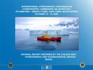
HCA9-07.4AhINTERNATIONAL HYDROGRAPHIC ORGANIZATIONHYDROGRAPHIC COMMISSION ON ANTARCTICA9 TH MEETING – SIMON´S TOWN, CAPE TOWN, SOUTH AFRICAOCTOBER 12 - 14, 2009.REPORT PREPARED BY THE CHILEAN NAVY HYDROGRAPHIC ANDOCEANOGRAPHIC SERVICE<strong>Chile</strong>an Icebreaker “Oscar Viel Toro”Errázuriz 254, Playa Ancha, Valparaíso, <strong>Chile</strong>Tel.: 56 32 2266666Fax: 56 32 2266542shoa@shoa.clwww.shoa.cl
HCA9-07.4AhCONTENTS1. - Hydrographic Office/ General2. - Surveys3. - New Charts and updates4. - New Publications and updates5. - Antarctic MSI6. - S-55 Data Input7. - Capacity Building8. - Oceanographic Activities9. - Other Activities______________________________________________________
HCA9-07.4AhNATIONAL REPORT TO THEHYDROGRAPHIC COMMITTEE ON ANTARCTICA (HCA)PREPARED BY THE CHILEAN NAVY HYDROGRAPHICAND OCEANOGRAPHIC SERVICEExecutive Summary1. - Hydrographic Office / General: Servicio Hidrográfico y Oceanográfico de laArmada de <strong>Chile</strong> (SHOA). <strong>Chile</strong>an Navy Hydrographic and OceanographicService.SHOA is responsible for the hydro-cartographic, meteorological andnavigational aids broadcasting activities for the <strong>Chile</strong>an Antartic waters.Every year Antarctic vessels of the <strong>Chile</strong>an Navy accomplishedhydroghaphic surveys programmed by the <strong>National</strong> Committe for Nautical Charts.Usually, three campaings are developed in order to acquire the data used toproduce one antartic nautical chart.The Maritime Directorate carry out broadcasting tasks related to theassigned area of responsibility IMO NAVAREA XV, where the Antarctic sector ofthe <strong>Chile</strong>an responsibility is included. Additionally, the “Servicio Meteorológico dela Armada” (Meteorological Service of the Navy) broadcasts through the Safety NetINMARSAT the navigational warnings about ice edges and plotting of driftingicebergs.2. - Surveys2a) Hydrographic Activities 2009During the summer 2009 SHOA accomplished a hydrographic survey on“Nelson Straight” (Estrecho Nelson) area. This activity was the last campaing offour stages planned to complete the data acquisition for publishing SHOA ChartNo. 14220 “Estrecho Nelson”. (See Figure No. 1).
HCA9-07.4AhThe first two phases were accomplished by the <strong>Chile</strong>an Ice breaker “OscarViel”. Phases three and four were carried out by the <strong>Chile</strong>an Auxiliary Fleet Tug(AFT) “Lautaro”. All of the areas were surveyed using single beam technology(Knudsen 320 MP and Elac 4300 echo sounder).Fig.1 : Field Sheet. SHOA Chart No. 14220 “Estrecho Nelson”.
HCA9-07.4AhFig.2: Prototype Sheet. SHOA Chart INT 9104 “Gerlache Straight. Usefull to Wednesday”
3. - New charts & updatesHCA9-07.4Ah3a) In December 2009 SHOA will release the <strong>National</strong> Nautical ChartNo.14220 “Estrecho Nelson”. (See Figure No.3)3b) During 2009 the following Electronic Cells related Antarctic INT Chartswere updated:- CL3MA 850 “Isla Decepción”. Second Edition.- CL5MA 870 “Caleta Balleneros y Accesos”. Second Edition.4. - New publications & updates4a) SHOA sent to the BHI the Publication No. 3035 “General Instructions forPilotage in the Water Ways of the <strong>Chile</strong>an Antarctic Territory”. Thispublication can be read in both languages (English and Spanish).4b) SHOA currently is updating Sailing Directions for the Antarctic Territory.“Derrotero Antártico”, Vol. VI.5. - MSI<strong>Chile</strong> has an infrastructure in accordance with the assigned area ofresponsibility IMO NAVAREA XV. This area considers the Antarctic sector of the<strong>Chile</strong>an responsibility. Transmissions are made through Safety NET INMARSAT –“C”, according a pre-established schedule. Additionally, the “ServicioMeteorológico de la Armada” (Meteorological Service of the Navy) broadcaststhrough Safety Net INMARSAT the navigational warnings about ice edges andplotting of drifting icebergs.
Fig.3: Prototype SHOA <strong>National</strong> Chart 14220 “Nelson Straight”.HCA9-07.4Ah
6. - S-55HCA9-07.4AhNo new S-55 information has been informed.7. - Capacity Building7a) Antarctic Training for Graduated Students of the Hydrographic CourseCat. “A”.During the summer 2009 the Graduated Students of the HydrographicCourse Category “A” offered by the Instruction Training Center of SHOA,participated in an instruction trip onboard of the <strong>Chile</strong>an Navy Vessel “Aquiles”.This training considered the development of several tasks related to AntarcticHydro-cartographic and Oceanographic operations and other topics involved to theactivities in this kind of waters.Fig. 4: Graduate Students form the International HydrographyCourse Cat “A”: Lt Bencomo (Venezuela); Lt Sheets (USA) andLt Rojas (Guatemala)
7b) Course for Antartic Waters Operation (AWO)HCA9-07.4AhAdditionally as usual, this year the Maritime Instruction Center belongs tothe Maritime Directorate of the Navy will offer the Course for Antartic WatersOperation (AWO). The purposes and the objectives of this course are the following:Purposes:- According to <strong>Chile</strong>an legislation this course is mandatory for deck officersperforming their duties on board of vessels under <strong>Chile</strong>an Flag operating inthe Antarctic.- The aim is to strengthen and update the knowledge of the Officers whonavigate in ice covered waters, regarding the navigation topics and safeoperation of vessels, emphasizing on the limitations imposed by the climateand taking into account the international legislation and the prevention of theenvironment pollution. .Objectives:Those trainees successfully completing this course will be able to:- Plan a voyage to the Antarctic using all data available- Identify the potential risks and limitations imposed by the climate andoceanographic conditions in the area.- Apply the international legislation related to the Antarctic, the safety ofhuman life at sea and the prevention of pollution on the aquaticenvironment.- Demonstrate familiarity with ice navigation scenarios.This course is free (except flight tickets and accomodations) and it is limited for21 students.Last year we had two participants from South Africa: Captain Dave Hall andOfficer Shelton Samuels, both part of the crew of the “Agulhas” ship.
HCA9-07.4Ah8. - Oceanographic activities8a) Activities in 2009- Tide gauge maintenance in the <strong>Chile</strong>an Antarctic Base “O’Higgins”.- Tide gauge installation in the <strong>Chile</strong>an Antarctic Base “Prat”.- Tide measurement in “Caleta Armonía”, Nelson Straight.8b) Activities in 2010- Tide gauge maintenance in the <strong>Chile</strong>an Antarctic Base “O’Higgins”.- Tide gauge installation in the <strong>Chile</strong>an Antarctic Base “Prat”.- Tide measurement in Gerlache Straight area for INT Chart No.9104.9. - Other activities9a) The <strong>National</strong> Committee of Antarctic Geographic NamesThis year SHOA has directed the working plan of The <strong>National</strong> Committee ofAntarctic Geographic Names. This organization is responsible for the study andcollection of the historical background of any geographic name graphicallyrepresented in the <strong>Chile</strong>an Antarctic Cartography.This Committee gathers several governmental institutions and is directedaccording the law by the Hydrographic Service.During 2009 the Committee has been focused on the analysis of thehistorical information required to assign names for five <strong>Chile</strong>an land chartsproduced by the Geographic Institute of the Army IGM. These 1:10.000 ScaleCharts cover the Bayers Peninsula and Rugged Island.Aditionally, the Committee analyzed the geographic names for the <strong>National</strong>Nautical Chart No. 14220 Nelson Straight.
HCA9-07.4AhFig. 5: Representatives of The <strong>National</strong> Committee of Antarctic Geographic Names9b) New Antarctic Multibeam Echo sounderIn August 2009 the <strong>Chile</strong>an Navy finished the installation of a new AntarcticMultibeam depth water echo sounder system onboard of the Ice breaker “OscarViel”.The ice breaker “Viel” will begin the Antarctic operations in October 2009,starting with the first hydrographic campaign to be accomplished at theBellingshausen Sea. This first hydrographic survey is part of four phasesdetermined by the <strong>National</strong> Committee for the Continental Shelf in order to acquirebathymetric data necessary by the official presentation of <strong>Chile</strong>an Government tothe United Nations Organization. (See Figure No. 6).The acquired data also will be used to produce nautical cartography ofAntarctica in areas belong to the <strong>Chile</strong>an responsibility.
HCA9-07.4AhFig. 6: <strong>Chile</strong>an Navy Icebreaker “Oscar Viel”9c) COMNAP XXI. Annual General Meeting. Punta Arenas, August 03/09.Regarding the task defined in the action list No. 8/17, during the last HCAmeeting, IHB, UKHO and SHOA participated in the last COMNAP AnnualGeneral Meeting carried out in Punta Arenas City, during August 03 - 07.In this opportunity the representative of SHOA presented the topic “PracticalInitiatives to Improve Hydrographyc and Nautical Cartography in Antarctica”.____________________________________________________________