Chapter 11: Weather Theory - FAA
Chapter 11: Weather Theory - FAA
Chapter 11: Weather Theory - FAA

Create successful ePaper yourself
Turn your PDF publications into a flip-book with our unique Google optimized e-Paper software.
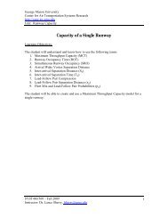
which lifting action of the air begins. If sufficient moistureand instability are present, the clouds continue to increase invertical height. Continuous, strong updrafts prohibit moisturefrom falling. The updraft region grows larger than theindividual thermals feeding the storm. Within approximately15 minutes, the thunderstorm reaches the mature stage, whichis the most violent time period of the thunderstorm’s lifecycle. At this point, drops of moisture, whether rain or ice,are too heavy for the cloud to support and begin falling in theform of rain or hail. This creates a downward motion of theair. Warm, rising air; cool, precipitation-induced descendingair; and violent turbulence all exist within and near the cloud.Below the cloud, the down-rushing air increases surfacewinds and decreases the temperature. Once the verticalmotion near the top of the cloud slows down, the top of thecloud spreads out and takes on an anvil-like shape. At thispoint, the storm enters the dissipating stage. This is whenthe downdrafts spread out and replace the updrafts neededto sustain the storm. [Figure <strong>11</strong>-23]It is impossible to fly over thunderstorms in light aircraft.Severe thunderstorms can punch through the tropopause andreach staggering heights of 50,000 to 60,000 feet dependingon latitude. Flying under thunderstorms can subject aircraftto rain, hail, damaging lightning, and violent turbulence.A good rule of thumb is to circumnavigate thunderstormsidentified as severe or giving an intense radar echo by atleast 20 nautical miles (NM) since hail may fall for milesoutside of the clouds. If flying around a thunderstorm is notan option, stay on the ground until it passes.Cloud classification can be further broken down into specificcloud types according to the outward appearance and cloudcomposition. Knowing these terms can help a pilot identifyvisible clouds.The following is a list of cloud classifications:• Cumulus—heaped or piled clouds• Stratus—formed in layers• Cirrus—ringlets, fibrous clouds, also high level cloudsabove 20,000 feet• Castellanus—common base with separate verticaldevelopment, castle-like• Lenticularus—lens shaped, formed over mountains instrong winds• Nimbus—rain-bearing clouds• Fracto—ragged or broken• Alto—meaning high, also middle level clouds existingat 5,000 to 20,000 feetCeilingFor aviation purposes, a ceiling is the lowest layer of cloudsreported as being broken or overcast, or the vertical visibilityinto an obscuration like fog or haze. Clouds are reportedCumulus Stage (3-5 mile height) Mature Stage (5-10 mile height) Dissipating Stage (5-7 mile height)40,000 ft.Equilibrium level30,000 ft.20,000 ft.32 °F0 °C10,000 ft.5,000 ft.Figure <strong>11</strong>-23. Life cycle of a thunderstorm.<strong>11</strong>-17