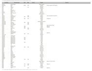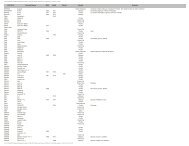
guidelines for documenting archaeological and historical surveys
guidelines for documenting archaeological and historical surveys
guidelines for documenting archaeological and historical surveys

You also want an ePaper? Increase the reach of your titles
YUMPU automatically turns print PDFs into web optimized ePapers that Google loves.
GUIDELINES FOR DOCUMENTINGARCHAEOLOGICAL AND HISTORICAL SURVEYSIdaho State Historic Preservation Office <strong>and</strong>Archaeological Survey of IdahoThe following is a brief summary of documentation requirements <strong>for</strong> <strong>surveys</strong> conducted <strong>for</strong> 106Review (36 CFR 800) <strong>and</strong> general <strong>archaeological</strong> research in Idaho. It is recommended that the"Archaeological <strong>and</strong> Historical Survey Report" <strong>for</strong>m of the Idaho State Historic Preservation Office(SHPO) be used or followed closely in an alternative <strong>for</strong>mat. Keep in mind that all elementsincluded in that <strong>for</strong>m must be addressed. The Secretary of the Interior's St<strong>and</strong>ards <strong>and</strong> Guidelines <strong>for</strong>Identification <strong>and</strong> Evaluation (Federal Register Vol 48, No. 190) should be consulted <strong>for</strong> furtherexplanation <strong>and</strong> detail.Data can be presented <strong>and</strong> integrated in diverse ways. What is necessary, however, is a clear <strong>and</strong>concise presentation that incorporates all required elements. Survey results are used by others <strong>and</strong>should constitute a usable contribution to the body of knowledge regarding the archaeology of Idaho.For these reasons it is important that all reports are able to "st<strong>and</strong> alone" as research documents, <strong>and</strong>that the assumptions <strong>and</strong> biases affecting the conduct <strong>and</strong> results of the reported work are clearlystated.In the case of reports pertaining to projects in the process of review under Section 106 of theNational Historic Preservation Act, all documentation must first be reviewed by the appropriateagency archaeologist. The SHPO will not review a report without this initial review by an agencyarchaeologist. If the federal agency does not have an archaeologist, then the report can be sentdirectly to the SHPO <strong>for</strong> review. Two copies of all documentation must be submitted to the SHPO.Survey reports will range from a few pages to multiple volumes, depending upon the particularproject. All areas surveyed must be reported whether or not sites are found. When small-scale<strong>archaeological</strong> <strong>surveys</strong> are per<strong>for</strong>med, the SHPO recommends reporting the results of theseinvestigations in the <strong>for</strong>mat of the "Archaeological <strong>and</strong> Historical Survey Report." Whether this<strong>for</strong>m or another <strong>for</strong>mat is used, the body of the document should answer the following questions orbe subject to return to the agency <strong>and</strong> delay in obtaining SHPO comment if the report is submitted<strong>for</strong> 106 Review:A. KEY INFORMATION - For ease of entry into the statewide database, the followingin<strong>for</strong>mation should be included on the front page of the report in non-text <strong>for</strong>mat:1. Project name.2. Report numbers (or associated federal project number, if appropriate).3. Associated federal agency, if 106-related.4. Author of the report <strong>and</strong> principal investigator, if different.5. Date of the report.6. County (or counties) in which survey occurred.
7. Legal description of the survey listing each township <strong>and</strong> associated sectionsseparately.8. Acres surveyed at an intensive level (30-meter or less transect interval) <strong>and</strong> at areconnaissance level (greater than 30-meter transect interval, intuitive, or statisticalsample).Legal descriptions cannot be reduced by giving ranges such as T1-3N. This includes linearprojects. Nor is it adequate to state "various sections" in a particular township. Eachtownship <strong>and</strong> associated sections must be listed separately.B. PROJECT DESCRIPTION - If the survey was conducted <strong>for</strong> purposes of 106 Review, whatis the nature <strong>and</strong> extent of the proposed project? Include the following:1. Description <strong>and</strong> potential direct <strong>and</strong> indirect impacts to known or suspectedcultural properties.2. Description of Area of Potential Effects with reference to an attached map.3. Number of acres in the project area.4. Owner(s) of l<strong>and</strong> in the project area with reference to an attached map.The potential of any ground-disturbance, alterations to current structures, or erection of newstructures that will occur during or result from construction should be specifically discussed.Agents causing the impact should be mentioned. Boundaries <strong>for</strong> areas to be directly impactedshould be described <strong>and</strong> indicated on an attached map.C. STATEMENT OF OBJECTIVES FOR SURVEY - What was the research design orobjective of the survey? What in<strong>for</strong>mation was being sought <strong>and</strong> why? Current knowledgeabout the specific historic contexts or property types associated with the survey area shouldbe discussed. The physical extent of the area to be investigated should be described <strong>and</strong> theamount <strong>and</strong> kinds of in<strong>for</strong>mation to be gathered about properties in the area explained. All106-related <strong>surveys</strong> will have the following objective: "to identify <strong>and</strong> evaluate culturalproperties within the project's area of potential effects."D. LOCATION AND GENERAL ENVIRONMENTAL SETTING - Further descriptionregarding the project area should be provided here, including:1. Listing of USGS topographic map(s).2. Setting description.All USGS topographic maps included in the project area should be listed. The setting of theproject area should be described including l<strong>and</strong><strong>for</strong>ms, topography, elevation, water, flora,fauna, <strong>and</strong> mineral sources. Reference should be made to possible human use. Photographs,which are especially helpful <strong>for</strong> 106 Review, can be provided.
E. PRE-FIELD RESEARCH - What was the nature <strong>and</strong> extent of the pre-field research? Includethe following:1. Sources of in<strong>for</strong>mation checked including SHPO Record Search Number.2. Summary of previous studies in the general area.3. Description <strong>and</strong> evaluation of previous studies.In order to identify previously recorded <strong>surveys</strong> <strong>and</strong> cultural properties, a record search mustbe conducted at Idaho SHPO office. This search must occur prior to the survey so thatpreviously recorded sites can be confirmed <strong>and</strong> their condition noted. What sources ofin<strong>for</strong>mation were checked? Specifically list any of the following: cultural overviews, theNational Register, <strong>archaeological</strong> <strong>and</strong> architectural site records <strong>and</strong> maps, survey records,ethnographic studies, <strong>historical</strong> records <strong>and</strong> maps, <strong>and</strong> individuals or groups with specialknowledge. Indicate specific types of <strong>historical</strong> records <strong>and</strong> maps such as GLO plats, mineralmaps, Forest roads <strong>and</strong> trails, etc. Consultation with Native American groups should bedocumented here with specific in<strong>for</strong>mation regarding the circumstances <strong>and</strong> findings. Anyother sources of in<strong>for</strong>mation, such as oral history tapes or photographic files, should also belisted. Include the SHPO Record Search Number provided to you in your record searchresults at Idaho SHPO.The summary of previous studies in the general area should include a bibliography thatspecifically states title, author, year, report number if appropriate, <strong>and</strong> study results. Each ofthese sources should be related to contextual themes if possible.The previous studies should be described <strong>and</strong> evaluated. Survey designs, methods, personnel,conditions, <strong>and</strong> results should be discussed with regard to current st<strong>and</strong>ards <strong>and</strong> theiradequacy <strong>for</strong> serving the purposes of the present study.F. EXPECTED HISTORIC AND PREHISTORIC LAND USE AND SITE SENSITIVITY -What is known <strong>and</strong> what is expected in this area? Provide the following:1. List of cultural properties recorded in the area.2. Types of cultural properties expected.3. Cultural themes/contexts expected.4. Expected locations of cultural properties.The Smithsonian or architectural inventory numbers <strong>for</strong> the cultural properties alreadyrecorded <strong>for</strong> the area must be listed <strong>and</strong> their location marked on an attached map. Ifunrecorded properties are expected, describe the types <strong>and</strong> locations <strong>for</strong> such. Description ofexpected site locations should refer to l<strong>and</strong><strong>for</strong>ms, water, vegetation, slope, fauna, <strong>and</strong><strong>historical</strong> documentations. Also, to what themes/contexts are they expected to relate.Appropriate themes/contexts are listed on the Archaeological <strong>and</strong> Historical Survey Report<strong>for</strong>m. If no sites are expected, the rationale <strong>for</strong> this conclusion must be presented.
G. FIELD METHODS - What field methods were used? Be specific <strong>and</strong> complete in coveringthe following topics:1. Areas examined <strong>and</strong> type of coverage.2. Ground surface conditions.3. Areas not examined <strong>and</strong> reasons why.4. Names of field personnel.5. Survey dates.6. Problems encountered.Describe the transect intervals used <strong>and</strong> mark transect routes on an attached map that relatestheir location to the topography of the area. If more than one transect interval was used,indicate these changes <strong>and</strong> where they occurred. If an interval broader than 30 meters wasused, a rationale must be presented. Survey methods should be carefully explained so thatothers using the gathered in<strong>for</strong>mation can underst<strong>and</strong> how it was obtained <strong>and</strong> what itspossible limitations or biases are.Any conditions including that of the ground surface or subsurface, weather, etc. that mayhave affected survey results should be described. Note any vegetation or snow obscuringvisibility. Specific percentage of surface that was visible must be provided. Accompanyingphotographs may be helpful.If any areas were not examined, describe those areas <strong>and</strong> present reasons <strong>for</strong> not surveyingthem. Generally, all project areas undergoing 106 Review are expected to be surveyed unlessaccess is denied. Any access problems should be discussed <strong>and</strong> resolved directly with theFederal agency.Who conducted the fieldwork <strong>and</strong> when did it occur. All fieldwork must be conducted by orsupervised in the field by a person meeting Secretary of Interior's qualifications (48 FR44738-44739). Resumes of supervising personnel should be submitted with the report oralready be on file at the SHPO office.Were any problems encountered in the field? Describe those that may have hindered theinvestigation. If access to an area was impaired or denied, describe any otherwise visible orknown properties <strong>and</strong> provide your perceptions of their presence <strong>and</strong> condition.H. RESULTS - What cultural properties are located in the project area <strong>and</strong> what are yourrecommendations <strong>for</strong> National Register eligibility <strong>and</strong> further investigation? Provide thefollowing:1. List of all cultural properties including their types <strong>and</strong> important artifacts <strong>and</strong> features.2. Summary description of properties.3. Recommendations <strong>for</strong> National Register eligibility of each property.4. Recommendations <strong>for</strong> further investigations to evaluate properties.5. Cultural properties noted but not <strong>for</strong>mally recorded.
List all cultural properties previously recorded <strong>and</strong> confirmed as well as those located duringthe survey. Smithsonian numbers, if available, must be used on this list. At a minimum, thislist should also include field numbers, type of property, <strong>and</strong> noteworthy artifacts <strong>and</strong> features.If any previously recorded properties could not be located, this must be explained.Summarize the findings of the survey in terms of types of properties, their integrity, their age,any suspected cultural affinities, functions, depth, <strong>and</strong> size. Provide your overall impressionof the cultural manifestations in the survey area <strong>and</strong> how they relate to historic themes.List each cultural property with your recommendations <strong>for</strong> National Register eligibility, thecriteria used, <strong>and</strong> the context it is related to. This evaluation is your recommendation basedon your field observations <strong>and</strong> SHPO pre-field research. Your determinations in the reportshould correspond to that expressed on the accompanying sites <strong>for</strong>ms. Justification <strong>and</strong>greater detail regarding your determination must be included on the site <strong>for</strong>ms.If a cultural property cannot be evaluated at this time, state why. Also outline what steps areneeded to obtain the necessary in<strong>for</strong>mation to make this evaluation.All cultural properties identified in the survey area should be recorded. If <strong>for</strong> some reason aproperty was not recorded, describe this property, mark its location on the attached map, <strong>and</strong>provide a reason <strong>for</strong> not recording the property.I. CONCLUSIONS AND RECOMMENDATIONS - What are your conclusions regarding thepotential contributions of the properties in the area, how are they threatened, what optionswould protect them, <strong>and</strong> what are your recommendations? State the following:1. Potential contributions to historic contexts.2. Potential threats to properties <strong>and</strong> your recommendations <strong>for</strong> future investigations orprotective actions.3. For 106-related <strong>surveys</strong>, project's effect on each property.4. For 106-related <strong>surveys</strong>, avoidance or mitigation options <strong>for</strong> each property.5. For 106-related <strong>surveys</strong>, recommendations <strong>for</strong> additional investigations or <strong>for</strong>management procedures.Briefly summarize the relevance of the cultural properties to contexts listed in the"Archaeological <strong>and</strong> Historical Survey Report" under F. Also state how the results of thesurvey met the objectives <strong>and</strong> what implications the findings have <strong>for</strong> future investigations inthe area.Outline all potential threats to the cultural properties within the survey area. This includesnatural deterioration such as erosion or deflation; on-going use such as grazing orrecreational use; or anticipated status changes such as a planned demolition of a building or achange in federal l<strong>and</strong>-use status. Comment on the potential <strong>for</strong> v<strong>and</strong>alism of <strong>archaeological</strong>properties.
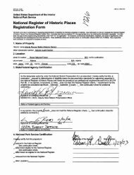
For 106-related <strong>surveys</strong>, discuss potential impacts of the proposed project <strong>and</strong> state yourconclusions regarding effect specifically <strong>for</strong> each property. List "no effect," "no adverseeffect," or "adverse effect" <strong>for</strong> each cultural property. This is a determination of effect if nochanges are made in the project <strong>and</strong> no additional <strong>archaeological</strong> procedures take place.Then, <strong>for</strong> 106-related <strong>surveys</strong> affecting cultural properties, discuss avoidance or mitigationoptions. If the project plans can be amended to reduce effect, discuss these options. For theagency's benefit, all alternate project areas or routes should surveyed <strong>and</strong> documented in theoriginal survey report to avoid delays in Idaho SHPO review.Finally, <strong>for</strong> 106-related <strong>surveys</strong>, provide your recommendations <strong>for</strong> avoidance or mitigationmeasures <strong>and</strong> state the resulting change in effect determination. Describe any monitoring thatshould take place. Also, provide any recommendations you may have <strong>for</strong> future managementof the cultural properties in the survey area.J. ATTACHMENTS - All survey reports must include the following attachments:1. Site <strong>for</strong>ms <strong>for</strong> all cultural properties in the survey area with required attachments.2. USGS 7.5' quadrangle maps showing project boundaries <strong>and</strong> area of potential effect if106-related, survey transects, locations of previously recorded <strong>and</strong> newly recorded properties,<strong>and</strong> l<strong>and</strong> ownership.3. Additional materials as needed.All <strong>archaeological</strong> sites must be described on Archaeological Survey of Idaho(ASI) site<strong>for</strong>ms. Sites previously recorded in other <strong>for</strong>mats must be updated on ASI site <strong>for</strong>ms.Traditional cultural properties may be recorded by attaching a narrative to completedadministrative <strong>and</strong> environmental sections of the ASI <strong>for</strong>m. Buildings <strong>and</strong> structures must berecorded on the one-page "Idaho Historic Sites Inventory" (IHSI) <strong>for</strong>m. Clear photographs ofall buildings <strong>and</strong> structures must accompany the IHSI <strong>for</strong>ms. All site <strong>for</strong>ms must have anattached USGS 7.5' map showing the precise site location. Sites already recorded on ASI<strong>for</strong>ms may be represented here with a one-page amendment or update. Each site <strong>for</strong>m,including isolates, must contain a statement of justification <strong>for</strong> your conclusions regardingNational Register eligibility. For an eligible site, this statement must specifically state theNational Register criteria under which it is eligible <strong>and</strong> the appropriate context. Keep in mindthat sufficient in<strong>for</strong>mation should be included in the site <strong>for</strong>m to justify your conclusions. Ifabove-surface manifestations of an <strong>archaeological</strong> site are insufficient to judge the site'seligibility, please state "insufficient in<strong>for</strong>mation to evaluate." Significance statements on allsite <strong>for</strong>ms should con<strong>for</strong>m with eligibility conclusions in the report.USGS 7.5' quadrangle maps must be used to show project boundaries <strong>and</strong> area of potentialeffect if 106-related, survey transects, all cultural property locations, <strong>and</strong> l<strong>and</strong> ownership. Alarger scale map may be provided to show greater detail, especially as needed <strong>for</strong> 106Review.
Illustrations, photos, <strong>and</strong> other materials are often critical in evaluating site significance <strong>and</strong>,in the case of 106 Review, evaluating the project effect. Attachment of photos of the surveyarea, cultural properties, <strong>and</strong> modern intrusions in the area could prevent delay in obtainingSHPO comments. Illustrations <strong>and</strong> photos can also dramatically improve a report's futureresearch value.K. REPOSITORY - Copies of all survey reports <strong>and</strong> site <strong>for</strong>ms are located at the Idaho SHPO.List the location where the original survey report, photographic negatives, <strong>and</strong> any supportingfield documents are maintained.L. CERTIFICATION OF RESULTS - The principal investigator should certify that theinvestigation was conducted <strong>and</strong> documented according to Secretary of Interior's St<strong>and</strong>ards<strong>and</strong> Guidelines <strong>and</strong> that the report is complete <strong>and</strong> accurate to the best of his or herknowledge. A signature <strong>and</strong> date must document this certification.