Models in GIS Cartographic models Spatio-temporal models
Models in GIS Cartographic models Spatio-temporal models
Models in GIS Cartographic models Spatio-temporal models

Create successful ePaper yourself
Turn your PDF publications into a flip-book with our unique Google optimized e-Paper software.
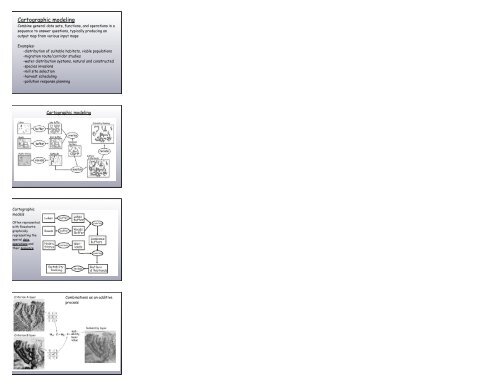
<strong>Cartographic</strong> model<strong>in</strong>gComb<strong>in</strong>e general data sets, functions, and operations <strong>in</strong> asequence to answer questions, typically produc<strong>in</strong>g anoutput map from various <strong>in</strong>put mapsExamples:-distribution of suitable habitats, viable populations-migration route/corridor studies-water distribution systems, natural and constructed-species <strong>in</strong>vasions-mill site selection-harvest schedul<strong>in</strong>g-pollution response plann<strong>in</strong>g<strong>Cartographic</strong> model<strong>in</strong>g<strong>Cartographic</strong><strong>models</strong>Often representedwith flowcharts;graphicallyrepresent<strong>in</strong>g thespatial data,operations andtheir sequenceComb<strong>in</strong>ations as an additiveprocess