

Threats and Strategies for Global Biodiversity Conservation
Threats and Strategies for Global Biodiversity Conservation
Threats and Strategies for Global Biodiversity Conservation

Create successful ePaper yourself
Turn your PDF publications into a flip-book with our unique Google optimized e-Paper software.
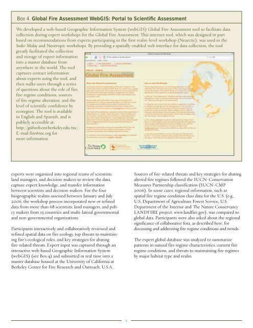
Box 4. <strong>Global</strong> Fire Assessment WebGIS: Portal to Scientific AssessmentWe developed a web-based Geographic In<strong>for</strong>mation System (webGIS) <strong>Global</strong> Fire Assessment tool to facilitate datacollection during expert workshops <strong>for</strong> the <strong>Global</strong> Fire Assessment. This internet tool, which was designed in partbased on recommendations from experts participating in the first realm-level workshop (Nearctic), was used in theIndo-Malay <strong>and</strong> Neotropic workshops. By providing a spatially-enabled web interface <strong>for</strong> data collection, the toolgreatly facilitated the collection<strong>and</strong> storage of expert in<strong>for</strong>mationinto a master database fromanywhere in the world. The toolcaptures contact in<strong>for</strong>mationabout experts using the tool, <strong>and</strong>then walks users through a seriesof questions about the role of fire,fire regime conditions, sourcesof fire regime alteration, <strong>and</strong> thelevel of scientific confidence byecoregion. The tool is availablein English <strong>and</strong> Spanish, <strong>and</strong> ispublicly accessible at:http://giifweb.cnr.berkeley.edu/tnc/.E-mail fire@tnc.org <strong>for</strong>more in<strong>for</strong>mation.experts were organized into regional teams of scientists,l<strong>and</strong> managers, <strong>and</strong> decision-makers to review the data,capture expert knowledge, <strong>and</strong> transfer in<strong>for</strong>mationbetween scientists <strong>and</strong> decision-makers. For the fourbiogeographic realms assessed between January <strong>and</strong> July2006, the workshop process incorporated new or refineddata from more than 68 scientists, l<strong>and</strong> managers, <strong>and</strong> policymakers from 13 countries <strong>and</strong> multi-lateral governmental<strong>and</strong> non-governmental organizations.Participants interactively <strong>and</strong> collaboratively reviewed <strong>and</strong>refined spatial data on fire ecology, top threats to maintainingfire’s ecological roles, <strong>and</strong> key strategies <strong>for</strong> abatingfire-related threats. Expert input was captured through aninteractive web-based Geographic In<strong>for</strong>mation System(webGIS) (see Box 4) <strong>and</strong> submitted in real time into amaster database housed at the University of Cali<strong>for</strong>nia atBerkeley Center <strong>for</strong> Fire Research <strong>and</strong> Outreach, U.S.A.Sources of fire-related threats <strong>and</strong> key strategies <strong>for</strong> abatingaltered fire regimes followed the IUCN-<strong>Conservation</strong>Measures Partnership classification (IUCN-CMP2006). In some cases, regional in<strong>for</strong>mation, such asspatial fire regime condition class data <strong>for</strong> the U.S. (e.g.,U.S. Department of Agriculture Forest Service, U.S.Department of the Interior <strong>and</strong> The Nature ConservancyLANDFIRE project; www.l<strong>and</strong>fire.gov), was compared toglobal data. Participants were also asked about the regionalsignificance of collaborative <strong>for</strong>a, as described here, <strong>for</strong>discussing <strong>and</strong> addressing fire regime conditions <strong>and</strong> trends.The expert global database was analyzed to summarizepatterns in natural fire regime characteristics, current fireregime conditions, <strong>and</strong> threats to maintaining fire regimesby major habitat type <strong>and</strong> realm.6


