

Full report - Conservation Gateway
Full report - Conservation Gateway
Full report - Conservation Gateway
- No tags were found...

Create successful ePaper yourself
Turn your PDF publications into a flip-book with our unique Google optimized e-Paper software.
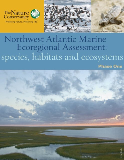
© Barry Truit, TNC© Donna A. Dewhurst, U.S. Fish & WildlifeNorthwest Atlantic MarineEcoregional Assessment:species, habitats and ecosystemsPhase One© Hal Brindley
AcknowledgementsThe Northwest Atlantic Marine Ecoregional Assessment (NAM ERA) was a major undertaking which could not havebeen successfully completed without the active engagement and hard work of many dedicated people. The help we receivedfrom numerous talented and dedicated individuals within state and federal government agencies, academic institutions,industry groups, and other non-governmental organizations was tremendous. We are deeply grateful to everyonewho supported our work, gave us critical and sound advice, and spent long hours helping us to develop products designedto advance marine conservation in our region.We are particularly grateful for the contributions by members of the eleven technical science teams who spent long hoursworking with us, sharing their expertise, recommendations, ideas, and methods on how best to organize and analyze dataon important marine species, habitats and ocean conditions. Above all, we want to extend our gratitude to our threeexternal science advisors, Dr. Peter Auster (University of Connecticut), Dr. Les Kaufman (Boston University) and Dr.Heather Leslie (Brown University), who supported the NAM ERA from its inception and who made themselves availablethroughout the two year process, providing helpful advice, answering questions, clarifying technical points and offeringinsights as the work progressed. We tried to faithfully transfer suggestions, advice and knowledge to these pagesbut any mistakes or errors in this <strong>report</strong> are owned by us alone.The Conservancy owes a huge debt of gratitude to Sally Yozell whose bold vision and enthusiastic leadership guided andpropelled this project from its inception until shortly before it was completed. We wish her the best of success in her newposition and hope that she will be proud of what she accomplished for The Nature Conservancy while she was with us.We relied on an enthusiastic Core Team to provide vision, leadership and innovative thinking throughout the developmentand production of the NAM ERA. The Conservancy’s rock-solid GIS Team (Chris Bruce, Juanmin Chen, MelissaClark, Dan Coker, Ryan Gordon, Alex Jospe, Erik Martin, Dan Morse, Kevin Ruddock, and Arlene Olivero) did muchof the heavy lifting and made sure the analysis, maps, and metadata were complete, accurate and professional. PamCrosby and Chelsea Todd provided outstanding service as they attended to complex logistical requirements for planningand holding two large two-day peer review workshops. We are grateful for the hard work and support of our graphicdesigner, Scott Hancock. We are also grateful for the patience, support and guidance from our senior manager sponsors-- Janet Coit, Lise Hanners and Michael Lipford. Finally, we are extremely grateful to all of The Nature Conservancy’smembers and especially the Gordon and Betty Moore Foundation and the Forrest and Frances Lattner FoundationNorthwest Atlantic Marine Ecoregional Assessment • Phase 1 Reporti
Assessment Core TeamSally YozellJennifer GreeneGeoffrey SmithMarci BortmanJay OdellMark AndersonCaroly ShumwayLise HannersZach FerdanaKate Killerlain MorrisonMelissa ClarkProject LeadProject ManagerGulf of Maine Subregional Team LeadSouthern New England Subregional Team LeadMid-Atlantic Subregional Team LeadScience Team Co-LeadScience Team Co-LeadEastern U.S. <strong>Conservation</strong> Region CoordinatorTechnical Science and Planning AdvisorCommunications Team LeadData Management Team LeadScience Advisory CommitteeLes KaufmanBoston UniversityPeter AusterUniversity of ConnecticutHeather LeslieBrown UniversityPlease cite as:Greene, J.K., M.G. Anderson, J. Odell, and N. Steinberg, eds. 2010. The Northwest Atlantic Marine EcoregionalAssessment: Species, Habitats and Ecosystems. Phase One. The Nature Conservancy, Eastern U.S. Division, Boston, MA.iiNorthwest Atlantic Marine Ecoregional Assessment • Phase 1 Report
IntroductionMark Anderson, Jay Odell, and Caroly ShumwayCHAPTER1Introduction to Ecoregional AssessmentsThe ocean provides the largest living environment on Earth and is home to millions of species, some as yet undiscovered.All of Earth’s biodiversity depends on the ocean’s life-support services. The ocean regulates climate, mediates globalnutrient and sediment cycles, and powers food-webs that span the poles. Humans depend on the ocean for transportation,recreation, energy, and food. Human survival and well-being is tightly linked to the condition of coastal and oceanecosystems. For example, more than three billion people derive at least one-fifth of their needed protein from fresh andsaltwater fish. The UnitedStates commercial fishingindustry is valued at $28billion and the recreationalsaltwater fishing industry atabout $20 billion (USCOP2004).Recognizing the vital roleof marine ecosystems tothe health of the planet andthe increasingly strong humandependency on oceanresources, The NatureConservancy (TNC) hasendeavored to synthesizedata on species distributions,geology, oceanography,chemistry, biology andsocial science to create mapsand other tools that reveal conservation priorities and inform management decisions to help sustain coastal and marineecosystems and the people that depend on them. This process, known as an ecoregional assessment, is part of a TNCwide effort supported by its Global Marine Initiative to protect and restore ocean and coastal ecosystems. Since the early1990s, TNC has focused on expanding expertise in the marine realm, and now has about 130 staff members working onmarine conservation around the world. To date, TNC has completed 10 marine ecoregional assessments, and many moreare pending.The Ecoregional Assessment ProcessEcoregional assessments provide a vision of success for conserving the biodiversity of an ecoregion, a large, relatively distinctarea that shares similar climate, topography or assemblages of species. TNC is working with partners to developecoregional assessments for every ecoregion in North America, from the Central California Coast to the NorthernAppalachians of New England and Maritime Canada.© Hal BrindleyNorthwest Atlantic Marine Ecoregional Assessment • Phase 1 Report 1-
Chapter 1 - IntroductionImportant steps in the ecoregional planning process,whether applied to terrestrial or marine and coastal ecosystems,include (Groves et al. 2002):1. Identification of the species, habitats andecological processes (conservation targets) that bestrepresent the biodiversity of the ecoregion.2. Collection of data and information on the targets’ecology, distribution, current condition andvulnerability to human uses and/or environmentalchanges (threats).3. Determination of conservation goals for the targets(e.g. population size, areal coverage, distribution).4. Identification of a set of sites and strategies formeeting conservation goals for the targets.Introduction to this AssessmentThe Northwest Atlantic region is known for its cold,nutrient-rich, and highly productive waters that have sustainedregional economies for centuries. With its strongtidal flows, complex circulation patterns, and varied seafloortopography the region supports large diverse populationsof bottom dwelling fish and an array of benthic communities.The deep basins and shallow banks of the Gulfof Maine, with seasonal concentrations of plankton andforage fish, attract an impressive number of marine mammals.Farther south, the broad continental margin, largeestuaries, and deep submarine canyons function as nurseryareas for estuary dependent fishes, critical stopoversites for millions of seabirds, migratory pathways for largepelagic species, and key habitat for coldwater corals.While the accumulated pressures of population growthand human use of the coasts and oceans have resulted inwidespread damage and loss to marine and coastal habitatsand species, there is nonetheless, significant evidenceof resilience and opportunity for actions to conserve andrestore the Northwest Atlantic’s marine biodiversity andecosystem services. This assessment highlights the areas inthis region where significant species, natural communitiesand ecological processes hold the greatest promise for conservationsuccess. This information, in turn, will providethe basis for developing a suite of strategies, from resourcemanagement to marine spatial planning, for achievingthat success.This assessment is intended to support regional ecosystem-basedmanagement (EBM), an approach previouslyendorsed by several blue-ribbon panels and recently by theUnited States Ocean Policy Task Force. Ecosystem basedmanagement approaches acknowledge the interconnectionsbetween air, land, sea, marine organisms and people,and the dynamic interactions between living resourcesand their environments. Such approaches are most effectivewhen management of multiple human activities isintegrated rather than conducted in sector specific isolation(see Pew Oceans Commission 2003; USCOP 2004;JOCI 2006; OPTF 2009). Around the world, marineresource managers are now seeking to implement EBM toimprove conservation of coastal and marine environments.In recognition that political boundaries are essentiallyirrelevant to marine ecosystem function, EBM planningareas are defined by biogeographic rather than politicalboundaries.In order to advance these overarching goals, this assessmentintegrates information about multiple species andtheir habitats. The results summarized in this <strong>report</strong>include maps and data on concentrations of high biodiversityand critical species specific areas for refuge, forage andspawning, and also some of the limited available spatialdata for human uses such as shipping lanes, port facilities,energy development, fishing effort, dredge sites andlocations of shoreline armoring. The Northwest AtlanticMarine Ecoregional Assessment is designed to be usedby diverse stakeholders to inform diverse decisions, to befreely available online for public use. For direct access toassessment data, please visit www.nature.org/namera/.The Nature Conservancy’s goals in conducting theNorthwest Atlantic Marine Ecoregional Assessment wereto produce a baseline of scientific information on thedistribution and status of key habitats and species (PhaseOne), and a map and <strong>report</strong> of priority conservation areasfor the region’s marine biodiversity (Phase Two). Thelatter used information collected in the first phase to1-Northwest Atlantic Marine Ecoregional Assessment • Phase 1 Report
Chapter 1 - Introductionidentify areas important to myriad species including seagrass,oysters, diverse migratory and resident fishes, seaturtles, marine mammals, and coldwater corals.The products of the two phases include:Phase One:• A database of information on marine ecosystems,habitats and target species at the NorthwestAtlantic regional scale.• Maps that synthesize diverse spatial data, designedto meet multiple objectives for a variety of users,including support of decisions about conservationand resource use.• A narrative <strong>report</strong> of the approach and methodsused to build the decision support database, as wellas a description of current conditions and trends inall the marine, habitats, species and human usesthat were included in the analysis.Phase Two:• A narrative <strong>report</strong> that describes the priorityplaces and strategies that TNC recommends forconservation action within the Northwest Atlanticregion, based on analysis by teams of experts, ofinformation gathered in Phase One.Developing ecoregional assessments for the ocean is inherentlymore difficult than on land because ocean ecosystemsare dominated by three dimensional and highly dynamicprocesses, and because precise data on the locationof key habitats and species are often not available.However, the authors of this assessment were fortunateto be working within one of the world’s most well studiedregions and grateful for the opportunity to integratemillions of records of data collected over several decadesand graciously contributed by expert researchers fromthe National Oceanic and Atmospheric Administration(NOAA), the United States Geological Survey (USGS),and several other agencies and institutions listed elsewherein this <strong>report</strong>. This rests on the foundation of datacreated by many scientists whose careers have beendevoted to advancing knowledge of Northwest Atlanticmarine ecosystems, and on the methodology from previousConservancy assessment projects.Over 1200 data files, from over 100 sources, were compiledfor this assessment. Every effort was made to understand,and account for, the idiosyncrasies of each dataset,and to respect the value of each source. For each dataset,we contacted the source, met with the people responsiblefor the data to learn from their experience in collectingand processing the information, and shared our maps andanalysis with them through written materials, meetingsand phone calls. Any mistakes or oversights in the use ofdata are solely the responsibility of the authors. Moreover,the willingness of an organization or individual to contributedata to this assessment does not imply an endorsementof the final products.Despite the availability of considerably more relevant datathan is typically available for marine assessments, thechallenges noted above persist, resulting in map productsthat contain more uncertainty, or are at coarser scales,than would be ideal. However, a balance must be struckbetween delaying actions because of imperfect data, andtaking actions based on what we do know in the face ofsignificant threats to marine biodiversity and associatedecosystem services. The results of this assessment are providedwith caveats noted, and with the expectation thatdata gaps will help to inform and prioritize future surveyefforts.There is, and will continue to be, a healthy debate onmany aspects of marine conservation. We hope howeverthat we used each dataset appropriately, transparently, andin an unbiased manner. And that this work will aid othersin coming to their own conclusions with respect to theconservation of marine biodiversity.This assessment is envisioned as a mechanism to empowerpartners, resource users and governments to developstrategies for long-term sustainability of the NorthwestAtlantic’s ecological services, from the fisheries that feedhuman populations, to the reefs and barrier islands thatNorthwest Atlantic Marine Ecoregional Assessment • Phase 1 Report 1-
Chapter 1 - Introductionabsorb wave action and storm surges as sea level rises. Theultimate measure of its success is tangible effective marineconservation.Northwest Atlantic Assessment TeamsThe Northwest Atlantic Marine Assessment was led by aCore Team of Conservancy staff that included representativesfrom the three subregions in the study area. TheCore Team conducted monthly meetings to direct theassessment process and other technical issues that arose.Separate teams were also developed to address the followingissues:• The Data Management Team identifiedexisting data sources and produced maps andGeographic Information Systems that synthesizemultiple data layers.• The Communications Team coordinated publicoutreach and conducted a survey of stakeholdersabout their views of the region, and need for dataand potential uses of the assessment.• The Science Team established and organizedeleven technical teams, composed of experts in thefield, to review, compile and analyze data for eachof the focal species and habitats. Each team hada TNC leader who was responsible for workingexternal team members, and drafting andcompleting the chapters in this <strong>report</strong>.The role of the technical teams was to provide guidance tothe team leader on the selection of species and habitats, toreview data products, provide critical review on the chapters,and ensure that the analyses used were appropriateto the data and species. Members of each technical scienceteam are listed in each chapter.The Conservancy is extremely grateful to the large numberof scientific experts and representatives from government,industry and academia that provided assistance astechnical team members or as participants in our peerreview workshops.This assessment is built on the foundation laid by manyprevious assessments of all or part of the region (seeNRDC 2001; Department of Navy 2005; NCCOS2006; CLF/WWF 2007; Cook and Auster 2007; NMFS2009). As our understanding of marine systems grows,and as tools for analyzing dynamic spatial processes increasein sophistication, we expect more refined and comprehensiveassessments to emerge. Just as this assessmentutilized earlier ecoregional plans and data where it existed,the Conservancy anticipates that future assessments willbuild upon this baseline as scientific knowledge advancesand methods are further refined.The Study Area: TheNorthwest AtlanticAs defined in this assessment, the Northwest Atlanticregion spans the area from Cape Hatteras in NorthCarolina to the northern limit of the Gulf of Maine inCanadian waters, and extends from the mean high tidemark seaward to the foot of the continental slope (depthof 2500 m). The study area includes the shorelines of 11states and two Canadian provinces inhabited by morethan 65 million people.The Northwest Atlantic Marine Ecoregional Assessmentfocuses on two distinct and well-documented marineecoregions – the Acadian (Gulf of Maine/Bay of Fundy)and the Virginian (Briggs 1974; Spalding et al. 2007).These two ecoregions nest together within the larger ColdTemperate Northwest Atlantic Province, and the similarlybounded Northeast Continental Shelf Large MarineEcosystem (Spalding et al. 2007; Sherman et al. 1988).The 140,745 square mile Northwest Atlantic study areais divided into three ecological sub-regions (Figure 1-1).These subregions were also based on biogeographic ratherthan political considerations to enable geographicallyappropriate analytical approaches to produce maps andtools to guide ecosystem based conservation. The threesubregions described below have distinct and unique characteristics;stratifying our analyses by subregions enabledmore meaningful and robust analysis of each subregion’scharacteristic habitats and species.1-Northwest Atlantic Marine Ecoregional Assessment • Phase 1 Report
Chapter 1 - IntroductionFigure 1-1. The Northwest Atlantic Marine Ecoregional Assessment study area.Northwest Atlantic Marine Ecoregional Assessment • Phase 1 Report 1-
Chapter 1 - Introduction1) Gulf of Maine, from Nova Scotia’s Bay of Fundyto the tip of Cape Cod, including Georges Bank;2) Southern New England, ranging from the base ofCape Cod to the southern coast of Long Island;3) Mid-Atlantic Bight, from Sandy Hook, NewJersey south to Cape Hatteras, North Carolina.Gulf of Maine BiogeographyThe Gulf of Maine is a semi-enclosed sea located inthe Gulf of Maine/Bay of Fundy ecoregion of the ColdTemperate Northwest Atlantic marine province (Spaldinget al. 2007). The Gulf is bounded by Georges Bank andBrowns Bank to the east and the coastlines and nearshoreestuarine waters of Massachusetts, New Hampshire,Maine, New Brunswick, and Nova Scotia to the west andnorth. The Gulf spans over 90,000 square kilometers andhas average depth of 150 meters.The geology of the Gulf has been shaped by glaciation,volcanism, erosion, subsidence, and sea level rise and featuresprominent banks, basins and channels. The mostnotable seafloor features include: Georges Bank, BrownsBank, Georges Basin, and the Northeast Channel to theeast; Stellwagen Bank, Jeffreys Ledge, Cashes Ledge, andWilkinson Basin to the west; the Great South Channelto the south; and Jordan basin to the north. There arefour hydrographically distinct sub-regions in the Gulf ofMaine each having unique physical, hydrographic, andoceanographic conditions: estuarine areas, coastal regions,the central Gulf, and shallow offshore banks (NCCOS2006).The Gulf of Maine is one of the most productive marinesystems on the planet. The Gulf’s high productivity isheavily influenced by interactions between the LabradorCurrent from the north and the Gulf Stream from thesouth. When these currents meet, cold nutrient-rich waterenters the Gulf through the Northeast Channel. Thesecurrents and tidal action in the Bay of Fundy create acounter-clockwise gyre that delivers nutrient-rich watersto the Gulf’s banks and ledges, and along the coastalshelf. These nutrient-rich waters rise to the surface andenter the euphotic zone, creating optimal conditions forphytoplankton production, with primary productivitylevels ranging from 270 gC m-2 yr-l in the offshore watersof the Gulf to over 400 gC m-2 yr-l on Georges Bank(Townsend et al. 2006). These high levels of primaryproductivity support a wide diversity of zooplankton species(predominantly copepods) and planktivorous fishesthat form the base of the Gulf of Maine food web.High rates of primary and secondary productivity in theGulf of Maine support a wide diversity of marine life.Planktivorous fish including herring, mackerel, sand lance,and menhaden that thrive in the Gulf provide a criticalforage base for a variety of species including demersalfishes, tunas, whales, marine mammals, and birds. Thediversity of marine life in the Gulf if also characterizedby a diversity of organisms including anemones, sea stars,sponges, kelp forests, and deep water corals.Southern New England BiogeographyThe Southern New England bays, beaches and riversstretch from the mouth of the Hudson River to the tip ofCape Cod, and include four National Estuarine Reserves(Peconic Bay, Long Island Sound, Narragansett Bay,and Buzzard’s Bay). The region shares a glacial morainethat creates the east-west archipelago of Long Island-Block Island-Martha’s Vineyard (USFWS 1997). Thesubregion’s rivers historically supported vast Americanshad runs, eel populations, and even Atlantic salmon,all of which have severely declined and are now highlymanaged. This subregion includes parts of what is oftenreferred to as the American “megalopolis” from Bostonto Washington that is home to one-in-five Americansalthough it only makes up 1.5% of the United States’ landmass(Gottman 1961). Roughly 12.25 million people livein the subregion, with roughly 7.5 million on Long Islandalone (US Census 2001).This landscape encompasses several highly productiveecosystems situated in the most densely populated regionof the Unites States. The coastal stretches of this regionare comprised of beaches, bluffs, dunes, rocky shores, bays,estuaries, mud flats, tidal wetlands, and maritime forests.These coastal wetlands and beaches are home to a variety1-Northwest Atlantic Marine Ecoregional Assessment • Phase 1 Report
Chapter 1 - Introductionof shorebirds such as osprey, herons, egrets, oyster catchers,plovers, terns, sandpipers and gulls.The shallow estuaries and embayments are home to awide variety of migratory marine species that give thistemperate region its unique character (Weiss 1995). Largemammals such as harbor seals and harbor porpoises havebeen frequently documented migrating close to shore. Theregion is also home to a variety of migratory fishes, manyof which are commercially and recreationally importantspecies including bluefish, bass, toadfish, flounder, shad,herring, menhaden and mackerel.The subregion is well known for its productive estuariesthat have historically supported thriving shellfish industriesand a cultural history centering around the productivemaritime industry. Subregional favorites includeoysters, hard and soft shell clams, razor clams, bay scallops,and quahogs. Horseshoe crabs can be found on theshorelines throughout the landscape, as well as blue crabs,spider crabs, and fiddler crabs.Mid-Atlantic Bight BiogeographyThe Mid-Atlantic Bight extends from Cape Hatterasin North Carolina to Sandy Hook, New Jersey and isa transitional area between the rocky shores of NewEngland and gently sloping, warmer South Atlantic. TheMid-Atlantic’s oceanographic features, diversity and ecologyare strongly influenced by two very large estuaries- Chesapeake Bay and Delaware Bay. Like the Gulf ofMaine and Southern New England, the Mid-Atlantic is ahighly productive region of one of the world’s most productivelarge marine ecosystems.The topography of the Mid-Atlantic is characterized asmostly flat, with low relief features such as sandy shoalsand swales, sand wedges and waves, and relict coastalfeatures with major submarine canyons at the shelf-slopebreak. The complex of shoals and swales are importantstructural features supporting biologically diverse andabundant benthic macrofauna, demersal fish, and foragingconcentrations of sea birds, sea ducks and bottlenosedolphins. The shelf is typically covered by a sheet of medium-to-coarsegrained sands with occasional pocketsof sand-shell and sand-gravel sediments (Wigley andTheroux 1981). Natural hard bottom habitat is relativelyscarce compared to the Southern New England and Gulfof Maine subregions. However, coldwater coral patchreef communities with associated structure oriented fishlike black seabass and tautog are present, though poorlymapped at this time.Warm core rings, filaments and mid-water intrusions peeloff the meanders in the Gulf Stream, moving warmer,higher salinity pockets of waters from the slope westwardacross the shelf towards the coast. When thesecurrents cross over topographic highs such as shoals orridges - and notably canyon heads - they create significantcold-water upwellings and extremely productive biologicalevents (Walsh et al. 1978). The freshwater outputs ofthe Chesapeake and Delaware bays function similarly tothe Gulf Stream through their large plumes which collidewith tidal forces to create highly productive nearshore upwellingevents that support diverse marine life.Due to its intermediate position between the cool NewEngland and warm southeastern United States waters, theMid-Atlantic subregion provides a critical migratory pathwaywith abundant forage resources for many migratoryspecies from striped bass to right whales.The Mid-Atlantic’s chain of barrier islands includesroughly 30 inlets, formed by the interaction action ofwaves and currents with mainland drainages and underlyingancient river valleys. These inlets are important ecologicalsystems in the Mid-Atlantic as well, functioning ascorridors between the coastal lagoons and the shelf waters.The Mid-Atlantic’s inlets and lagoons provide criticalspawning areas for sciaenids such as drum, spot, croakerand sea trout, pupping grounds for coastal elasmobrancheslike sandbar shark, dusky sharks and sand tiger, foragingand nursery habitat for all life stages of the bottlenosedolphin, juvenile habitat for loggerhead turtles and lowenergy beaches for horseshoe crab spawning.Northwest Atlantic Marine Ecoregional Assessment • Phase 1 Report 1-
Chapter 1 - IntroductionSpecies and Habitats SelectionA suite of habitats and species, characteristic and representativeof the full diversity of the region were selectedin consultation with external technical advisors. TheConservancy’s standard conservation planning methodsusually refers to the habitats and species one seeks to conserveas conservation targets. Although this methodologyhas been adopted or modified by many groups around theworld, the terminology can be confusing. In this <strong>report</strong>,conservation targets are simply the habitats, species, andprocesses we focused on and not targets in the sense ofnumerical goals.The concept of coarse and fine filters was used in selectingconservation targets in this assessment. The “coarse filter”approach is based on the efficiency of using large-scalehabitat conservation strategies to benefit many species atonce. Two habitat targets, coastal shorelines and benthichabitats, were indentified to serve as coarse filters to accountfor all the species and processes that they support.Both of these habitats were mapped comprehensivelyacross the region, classified into many subtypes based onstructure and composition, and characterized in detail.This analysis was designed to facilitate selection of a suiteof priority conservation areas representing some of thebest examples of each habitat type for the second phase ofthis assessment.However, habitat conservation alone is not sufficient forconserving all species and so with guidance from eachtechnical team, a “fine filter” approach was used to select asubset of the thousands of species found within the studyarea. Because it is not practical or feasible to produce a detailedand spatially explicit analysis for every species in theregion, the teams identified focal species in considerationof representation, ecological guilds and processes, and rarity.For each species team, a set of 8 to 50 individual specieswere identified and a set of individual analyses weredone for each species.priority conservation areas. In a few instances, such asseabirds, species concentration areas were identified astargets in their own right. All of the conservation targetsare listed below and described in detail in the chapters ofthis <strong>report</strong>.Coastal EcosystemsThe fringing ribbons of habitats that make up the landseainterface help maintain marine diversity and playcritical roles for both nearshore and offshore plants andanimals. The Northwest Atlantic coastline is particularlywell known for several large and hundreds of smallproductive estuaries that provide juvenile nursery andspawning grounds for fish, mollusks, seabirds, and crabs.Recognizing the heterogeneity and ever-changing natureof the coastline, this section of the assessment reviews thehistory of coastal systems in the region, provides an overviewof coastal habitats such as salt marshes, seagrass beds,and oyster reefs, examines some of the threats and humaninteractions with these systems, provides an in-depth lookat sea level rise and reviews potential strategies for enhancingresilience of coastal systems. This <strong>report</strong> focusesspecifically on the contributions that coastal ecosystemsmake to marine diversity.Benthic HabitatsIn Northwest Atlantic region, benthic (or seafloor) habitatscontain over 2000 species of invertebrates such asmarine worms, sponges, shrimp, crab, clams, scallops,snails, sea stars, corals, anemone. , and. Because individualspecies are adapted to variations in the environment suchas sediment grain size, topography and depth, a benthichabitat type is defined as a group of organisms repeatedlyfound together within a specific environmental setting.For example, silt flats in shallow water are characterizedby specific amphipods, clams, whelks and snails. In thisassessment, we identified and mapped over 90 of the mostcommon habitats with characteristic benthic communitiesdistributed throughout each subregion.Phase Two of this assessment integrates the individualspatial data for all conservation targets to identify high1-Northwest Atlantic Marine Ecoregional Assessment • Phase 1 Report
Chapter 1 - IntroductionDiadromous FishDiadromous fish are species that utilize both freshwaterand salt water habitats during their life cycle. Thesespecies have great cultural and ecological significance inthe region, and they provide an important energy linkamong freshwater, estuarine, and marine food webs. TheNorthwest Atlantic populations of some of these speciesare particularly important because the global rangeof seven of the eleven target diadromous species (alewife,American eel, American shad, Atlantic salmon, Atlanticsturgeon, Atlantic tomcod, blueback herring, hickory shadrainbow smelt, sea-run brook trout, and shortnose sturgeon)is limited to the Atlantic coast of the United Statesand Canada. The species included as primary targets showevidence of significant decline or are already recognized asglobally rare.Demersal FishDemersal fish (or groundfish) are characterized by theirclose association with the seafloor for feeding, spawning,and juvenile nursery areas. This region is particularly productivefor demersal fish with some such as cod, haddock,halibut, and hake believed to be largely responsible forinitial waves of European settlement in North America.Six groups of demersal fish were analyzed in the <strong>report</strong>: 1)gadids (cod, haddock, pollock, cusk, white hake, red hake,and silver hake), 2) pleuronectids (American plaice, witchflounder, winter flounder, and yellowtail flounder), 3)elasmobranchs (clearnose skate, little skate, rosette skate,thorny skate, and spiny dogfish), 4) offshore winteringspecies (summer flounder, scup, black sea bass, and northernsea robin), 5) estuarine species (spot, croaker, weakfish,and tautog), and 6) other species of interest (halibut,wolffish, ocean pout, monkfish, tilefish, redfish, and longhornsculpin). These species were chosen to represent awide range of preferred habitats, life history patterns, foodhabits, population trends, and ecological roles.Small Pelagic FishSmall pelagic fish (such as herring and mackerel) are thedominant food source for top marine predators like marinemammals, sea birds, and larger fish. Because of theirmigration patterns and life histories, these species transferenergy and biomass seasonally from coastal embaymentsto offshore habitats, thereby providing a significant linkbetween coastal and pelagic systems. The eight species(American sand lance, Atlantic herring, Atlantic mackerel,Atlantic menhaden, butterfish, longfin inshore squid,northern sand lance, and northern shortfin squid) studiedrepresent the guilds of prey species most important to thefood webs of the Northwest Atlantic region.Large Pelagic FishLarge pelagic fish are highly migratory fish species that aretypically found well above the seafloor in the water column.Pelagic species play a key ecological role as predatorsthat regulate their prey communities and structure marinefood webs. Some inhabit the region only seasonally andmany of the details of their life history are not known.The fourteen species selected as targets include five bonyfishes and nine sharks (albacore tuna, Atlantic bluefintuna, bigeye thresher, blue marlin, dusky shark, great hammerhead,porbeagle, sand tiger, sandbar shark, scallopedhammerhead, shortfin mako, swordfish, thresher shark,and white marlin). The wide ranging distribution of thesespecies across diverse habitat types, their roles as apexpredators, and their threatened population status makethem prime candidates for inclusion in this assessment.CetaceansCetaceans (dolphins, porpoises, and whales) are largemigratory species that use this region primarily in springand summer when there is an abundance of food resourcesassociated with cool nutrient-rich waters. As predators,cetaceans are major consumers at most trophic levels,specifically targeting organisms like zooplankton, invertebrates,and small pelagic fish such as sand lance or Atlanticherring. Due to their seasonal abundance and charismaticnature, marine mammals have a long-standing, complexrelationship with humans in this region. Ten marinemammals (Atlantic white-sided dolphin, bottlenose dolphin,fin whale, harbor porpoise, humpback whale, minkewhale, North Atlantic right whale, sei whale, sperm whale,striped dolphin) were chosen for this study based on theirpopulation status and distribution throughout the region.Northwest Atlantic Marine Ecoregional Assessment • Phase 1 Report 1-
Chapter 1 - IntroductionSea TurtlesSea turtles are large, air-breathing reptiles that utilizeboth oceanic (inner shelf region and offshore) and terrestrial(beach) ecosystems. Their highly migratory and longlivedlife history characteristics present unique challengesto their continued protection and recovery. Sea turtlesmay have once comprised an important component of theregion’s coastal food webs, consuming prey including fish,invertebrates, and sea grasses. Three species of sea turtle(green, leatherback and loggerhead) were selected basedupon their status as endangered species and distributionwithin the region.Coastal and Marine BirdsBirds are creatures of both land and sea. Seabirds spendthe majority of their life at sea, but return to coastal areasto breed, while shorebirds spend their lives on thecoastal land edge, but forage in marine environments.In some cases, these birds may connect geographicallydisparate marine environments, from southern SouthAmerica to the Arctic. World-wide, a higher percentageof seabird species are at risk of extinction than any otherbird group. Within this region, a number of coastal andmarine bird species are listed as state and federally threatenedor endangered and nine were chosen for this study(Arctic Tern, Audubon’s Shearwater, Barrow’s Goldeneye,Harlequin Duck, Least Tern, Piping Plover, Razorbill,Red Knot, and Roseate Tern).Biodiversity ThreatsPollution and Nutrient RunoffThe Northwest Atlantic’s major estuaries of Albemarleand Pamlico Sounds, Chesapeake Bay, Delaware Bay,Long Island Sound, Narragansett Bay, Massachusetts Bay,Penobscot Bay and the Bay of Fundy support enormousbiodiversity, but also introduce runoff of nutrients (nitrogenand phosphorus) to the sea from land-based humanactivities such as agriculture and urban development.In Chesapeake Bay, for example, nutrients from sewagetreatment plant discharges and farming cause extensiveblooms of algae. When the algae dies and decomposes,dissolved oxygen is removed from the water, creating aso-called dead zone of hypoxic, or oxygen-starved, water.In July 2003, the dead zone covered 40 percent of theBay’s main stem, the largest area in 20 years, causing stressand habitat loss for crabs, fish and oysters (ChesapeakeBay Foundation 2008).Intensified occurrences of another phenomenon knownas Sudden Wetland Dieback (SWD) have been <strong>report</strong>edto occur along the East Coast, including Delaware’s inlandbays, within the past decade. SWD is often characterizedby rapid death, or failure to grow for a season ormore, of the upper portion of marsh vegetation, primarilySaltmarsh cordgrass (Spartina alterniflora). Sometimescomplete death occurs. The cause of marsh dieback is unknown,though the cumulative effect of multiple environmentalfactors are suspected (Bason et al. 2007).Coastal Development and Population TrendsThe Northeast region from Maine to Virginia is the mostdensely populated coastal region in the United Stateswith 641 persons living per square mile in the coastalcounties of those states in 2003. The population densityof Northeast coastal counties increased from 543 persquare mile in 1980 and is expected to increase to 661 in2008 (Crosset et al. 2004). While these growth rates are© Reuven Walder/ Marine Photobank1-10Northwest Atlantic Marine Ecoregional Assessment • Phase 1 Report
Chapter 1 - Introduction© Cecilia Talopp/ Marine Photobanksimilar to those for the country as a whole, the level ofdensity on the finite land area of coastal regions has resultedin environmental stresses.TNC’s 2006 North Atlantic Coast EcoregionalAssessment (portions of which overlap the NorthwestAtlantic study region), found that 40 percent of thatecoregion has been lost to conversion to development (3percent is secured primarily for nature and 14 percent issecured from development while allowing multiple uses).An index of Housing Density Pressure based on censusdata trends from 1940 through 2050, indicate that 20percent of the North Atlantic Coast area is predicted tohave urban level housing densities by 2050.Sea Level RiseThe combined effect of rising sea level and strongerstorms related to climate change is expected to accelerateshoreline retreat in certain areas of the ecoregion. Thecoastal plains from northern New Jersey to northeasternNorth Carolina, in particular, are expected to experiencesignificant shoreline changes over the next century.Coastal wetlands and beaches that provide importantfeeding grounds for global bird migrations, as well asnursery grounds for fish and other aquatic species, are atrisk from inundation due to sea level rise.A committee of coastal scientists convened to discussthe potential effects of sea level rise on the mid-Atlanticcoastal plain identified an increased likelihood for 1) erosionand shoreline retreat for spits, headlands, wave-dominatedbarriers and “mixed-energy” or tide-dominatedbarrier islands; 2) increased likelihood for erosion, overwashand inlet breaching for barrier islands, and 3) thepossibility of segmentation or disintegration for some barrierisland systems (Gutierrez et al. 2007). The committeealso concluded that factors such as human engineeringto protect property by building seawalls and jetties caninteract with geologic and physical processes to alter sedimentdynamics, making it difficult to predict the ultimateresponse of shorelines to sea level rise (Gutierrez et al.2007).Unsustainable FisheriesThe Northwest Atlantic includes Georges Bank, historicallyone of the richest fishing sites in the world. Thisplateau in relatively shallow ocean water is located onthe eastern rim of the Gulf of Maine where the collisionof the Labrador Current with the Gulf Stream creates anutrient rich upwelling that nourishes plankton and fuelsthe marine food chain to support exceptionally high fishproductivity. Overfishing in the Georges Bank, competedover by United States, Canadian and international fleetsover the past century, has taken a toll on ground fish suchas Atlantic cod, haddock and flounder, and portions arenow closed to commercial fishing (Boreman et al.1997;Murawski et al. 2005).Species and Resources at RiskNumerous iconic species of the Northwest Atlantic regionface challenges caused by loss or damage to habitat andother environmental stresses. For example:• Habitat for lobster that support coastal fishingcommunities throughout New England, may beaffected by increased ocean temperatures causedby global climate change, with populationspotentially shifting from current locationsNorthwest Atlantic Marine Ecoregional Assessment • Phase 1 Report 1-11
Chapter 1 - Introduction(NECIA 2007).• Dams and other development create barriers tomigration for anadromous species such as Atlanticsalmon, which hatch in rivers and migrate to thesea for two years of extensive feeding before returning two to three years later to spawn. Oncenative to nearly every river north of the Hudson,wild populations of Atlantic salmon are nowknown to persist on only eight rivers and certainpopulation segments are federally listed asendangered species (NOAA 2008a).• Juvenile loggerhead sea turtles forage for foodfrom Cape Cod south along the continental shelfof the Eastern United States. A petition was filedin 2007 to change the status of the WesternNorth Atlantic population from threatened toEndangered (NOAA 2008b).• North Atlantic right whales, the rarest of all largewhale species, arrive in the Bay of Fundy, Scotianshelf and waters off New England in the summerto feed. Numbering only about 400, the WesternNorth Atlantic population of these baleen whaleshas been listed as federally endangered since 1973.Ship collisions followed by entanglement infishing gear are the most common causes of injuryand mortality (NOAA 2008c).<strong>Conservation</strong> Action for theNorthwest AtlanticWhile the accumulated pressures of population growthand human use of the coasts and oceans has resulted inwidespread degradation of marine and coastal resources.Nonetheless, significant resilience remains and it is nottoo late to take action to improve conservation of theNorthwest Atlantic’s biodiversity. This assessment highlightssignificant species, natural communities and ecologicalprocesses within the region, and specific areas thatpresent compelling conservation opportunities for maintainingcoastal and marine ecosystems that provide thegoods and services that people want and need.1-12Northwest Atlantic Marine Ecoregional Assessment • Phase 1 Report
Chapter 1 - IntroductionLiterature CitedBason, C., A. Jacobs, A. Howard, and M. Tymes.2007. Status of Sudden Wetland Dieback in Saltmarshes of theDelaware Inland Bays. http://www.inlandbays.org/cib_pm/pdfs/uploads/swdwhitepaper07final.pdf.Boreman, B. S. Nakashima, J. A. Wilson, and R. L. Kendall, eds.1997. Northwest Atlantic Groundfish: Perspectiveson a Fishery Collapse, J. American Fisheries Society, eds. 242 pp.Briggs, J. C. 1974. Marine Zoogeography. New York, USA: McGraw-Hill.Chesapeake Bay Foundation. 2003. The Chesapeake Bay’s Dead Zone.http://www.cbf.org/site/PageServer?pagename=resources_facts_deadzone. Accessed Feb. 22, 2008.CLF/WWF (<strong>Conservation</strong> Law Foundation and World Wildlife Fund-Canada). 2006. Marine ecosystem conservationfor New England and Maritime Canada; A science-based approach to identifying priority areas for conservation.CLF-US and WWF- Canada.Cook, R. R. and P. J. Auster. 2007. A bioregional classification for the continental shelf of Northeastern NorthAmerica for conservation analysis and planning based on representation. Marine Sanctuaries <strong>Conservation</strong> SeriesNMSP-07-03. U.S. Department of Commerce, National Oceanic and Atmospheric Administration, NationalMarine Sanctuary Program, Silver Spring, MD.Crosset, K. M., T. J. Culliton, P. C. Wiley, and T. R. Goodspeed. 2004. Population Trends along the coastal UnitedStates. 1980-2008. National Oceanic & Atmospheric Administration.http://oceanservice.noaa.gov/programs/mb/pdfs/coastal_pop_trends_complete.pdf.Department of Navy. 2005. Marine Resource Assessment for the Northeast Operating Areas: Atlantic City,Narragansett Bay, and Boston. Naval Facilities Engineering Command, Atlantic; Norfolk, Virginia. ContractNumber N62470-02-D-9997, Task Order 0018. Prepared by Geo-Marine, Inc. Newport News, Virginia.Gottman, J. 1961. Megalopolis: The Urbanized Northeastern Seaboard of the United States. The Twentieth CenturyFund, New York.Groves, C. R., D. B. Jensen, L.L. Valutis, K.H. Redford, M. L. Shaffer, J. M. Scott, J. V. Baumgartner, J. V. Higgins,M. W. Beck, and M. G. Anderson. 2002. Planning for biodiversity conservation: putting conservation science intopractice. Bioscience. 52: 499-512.Gutierrez, B. T., S. J. Williams, and E. R. Thieler. 2007. Potential for shoreline changes due to sea-level rise along theU.S. Mid-Atlantic Region. U.S. Geological Survey Open-File Report 2007-1278. http://pubs.usgs.gov/of/2007/1278.JOCI (Joint Ocean Commission Initiative). 2006. From Sea to Shining Sea: Priorities for Ocean Policy Reform.Report to the United States Senate. Washington, D.C.Northwest Atlantic Marine Ecoregional Assessment • Phase 1 Report 1-13
Chapter 1 - IntroductionMurawski, S. A., S. E. Wigley, M. J. Fogarty, P. J. Rago, and D. G. Mountain. 2005.Effort distribution and catch patterns adjacent to temperate MPAs. ICES Journal of Marine Science. 62:1150-1167.NECIA (Northeast Climate Impacts Assessment). 2007. Confronting Climate Change in the U.S. Northeast: Science,Impacts and Solutions.NCCOS (NOAA Centers for Coastal Ocean Science) 2006. An ecological characterization of the Stellwagen BankNational Marine Sanctuary Region: Oceanographic, Biogeographic, and Contaminants Assessment. Prepared byNCCOS’s Biogeography Team in cooperation with the National Marine Sanctuary Program. Silver Spring, MD.NOAA Technical Memorandum NOS NCCOS 45. 356 pp.NMFS (National Marine Fisheries Service). 2009. Ecosystem Assessment Report for the Northeast U.S. ContinentalShelf Large Marine Ecosystem. Ecosystem Assessment Program. US Department of Commerce, Northeast FisheriesScience Center. Ref Doc. 09-11; 61 pp.http://www.nefsc.noaa.gov/nefsc/publications/NOAA (National Oceanic and Atmospheric Commission). 2008a. Atlantic salmon (Salmo salar). Office of ProtectedResources. http://www.nmfs.noaa.gov/pr/species/fish/atlanticsalmon.htm. Accessed Feb. 22, 2008NOAA (National Oceanic and Atmospheric Commission). 2008b. Marine Turtles. Office of Protected Resources.http://www.nmfs.noaa.gov/pr/species/turtles/. Accessed Feb. 22, 2008NOAA (National Oceanic and Atmospheric Commission). Office of Protected Resources. 2008c. Northern RightWhale (Eubalaena glacialis). http://www.nmfs.noaa.gov/pr/species/mammals/cetaceans/rightwhale_northern.htm.Accessed Feb. 22, 2008NRDC (Natural Resource Defense Council). 2001. NRDC Priority Ocean Areas for Protection in the Mid-Atlantic:Findings of NRDC’s Marine Habitat Workshop. http://www.nrdc.org/water/oceans/priority/recwatl.aspOPTF (Ocean Policy Task Force). 2009. Interim framework for effective coastal and marine spatial planning. TheWhite House Council on Environmental Quality. December 9, 2009. Washington, D.C.Sherman, K. M., M. Grosslein. D. Mountain, J. O’Reilly, and R. Theroux. 1988. The continental shelf ecosystem offthe northeast coast of the United States. p. 279-337 in: Postma, H. and J.J. Zijlstra, eds. Ecosystems of the World 27:Continental Shelves. Elsevier. Amsterdam, The Netherlands.Spalding M., H. Fox, N. Davidson, Z. Ferdana, M. Finlayson, B. Halpern, M. Jorge, A. Lombana, S. Lourie, K.Martin, E. McManus, J. Molnar, K. Newman, C. Recchia, and J. Robertson. 2007. Marine Ecoregions of the World: ABioregionalization of Coastal and Shelf Areas. Bioscience. 57 (7):573-583.1-14Northwest Atlantic Marine Ecoregional Assessment • Phase 1 Report
Chapter 1 - IntroductionStevenson D., L. Chiarella, D. Stephan, R. Reid, K. Wilhelm, J. McCarthy, and M. Pentony. 2004. Characterization ofthe fishing practices and marine benthic ecosystems of the northeast US shelf, and an evaluation of the potential effectsof fishing on essential habitat. NOAA Technical Memorandum. NMFS NE 181; 179 p.Townsend, D. W., A. C. Thomas, L. M. Mayer, M. A. Thomas, and J. A. Quinlan. 2006. Oceanography of theNorthwest Atlantic continental shelf. In: A.R. Robinson and K.H. Brink, eds. The Sea: the Global Coastal Ocean:Interdisciplinary Regional Studies and Syntheses. Harvard University Press, Cambridge, Massachusetts.Pew Oceans Commission. 2003. America’s Living Oceans: Charting a Course for Sea Change, Philadelphia, PA. PewCharitable Trust.USCOP (United States Commission on Ocean Policy). 2004. An Ocean Blueprint for the 21st Century: Final Reportof the U.S. Commission on Ocean Policy. Washington, DC.USFWS (United States Fish and Wildlife Service). 1997. Significant Habitats and Habitat Complexes of the New YorkBight Region. Southern New England-New York Bight Coastal Ecosystems Program. Charlestown, Rhode Island.U.S. Census Bureau. 2000. http://www.census.gov/prod/cen2000/index.html. Accessed January 9, 2009.Walsh J. J., T. E. Whitledge, F. W. Barvenik, C. D. Wirick, S. O. Howe, W. E. Esaias, and J. T. Scott. 1978. Wind eventsand food chain dynamics within the New York Bight. Limnology and Oceanography. 23:659–683.Weiss, H. M. 1995. Marine animals of southern New England and New York. Bulletin 115 of the State Geological andNatural History Survey of Connecticut. Hartford, Connecticut: Connecticut Department of Environmental Protection.Wigley, R. L. and R. B. Theroux. 1981. Atlantic Continental Shelf and Slope of Faunal Composition and QuantitativeDistribution. U.S. Geological Survey Professional Paper 529-N, pp. 1–198.Northwest Atlantic Marine Ecoregional Assessment • Phase 1 Report 1-15
Coastal EcosystemsCHAPTER2Barbara Vickery, Marci Bortman, Carl Lobue, Ray Konisky, Jay Odell, and Arlene OliveroIntroduction: Coastal Communities at the Land-Sea InterfaceThe fringing ribbons of habitats that make up the land-sea interface maintain marine diversity and play critical roles forboth nearshore and offshore plants and animals. The Northwest Atlantic coastline is particularly well known for its hundredsof productive estuaries that provide juvenile nursery and spawning grounds for fish, mollusks, seabirds, and crabs.This <strong>report</strong> focuses specifically on the contributions that coastal ecosystems make to marine diversity.The edge of earth that meets the sea – what we call coastline– is the ultimate ecotone, a critical ecological transition,as dramatic and obvious a natural boundary as one can findon Earth. While well defined, coastlines are very dynamicover geologic time. Over millennia, estuarine and oceanshorelines have advanced and retreated thousands of kilometersinland and seaward, and back again in cycles. The zonewhere ocean meets earth includes diverse landforms thatare cut and shaped by waves and tides and by the continuousflow of new sediments carried by freshwater in coastalwatersheds. The adjacent shallow, well-lit, and productivecoastal waters give rise to habitats like the salt marshes, oyster reefs, and seagrass meadows discussed in this chapter, criticalhabitats that directly and indirectly support many of the species mentioned throughout this <strong>report</strong>.© Mark Godfrey, TNCThe coasts and estuaries in this region are also of great importance to humans. Tremendous material, aesthetic, andspiritual resources associated with shorelines have attracted and sustained humans for thousands of years. Our coastsand estuaries are where we live, recreate, work, and gather. They help support the economy and sustain us in many ways,including providing places to live, opportunities for tourism, shipping and transportation routes, commercial fishing, andseafood processing. Conversely, the malfunctioning of these systems in the form of pollution, habitat destruction, hypoxia,harmful algal blooms, fishery collapses, and increased coastal erosion can have devastating social and financial impactsfor coastal communities.Coasts and estuaries and their component organisms and habitats provide ecosystem services at multiple scales. For example,at the scale of meters, estuarine bivalves such as the Eastern oyster convert pelagic primary production into foodand habitat for benthic organisms and clear water for submerged vascular plants. At the kilometer scale, tidal wetlandvegetation cycles nutrients, sequesters carbon, and serves as a marine nursery. At the coast-wide scale, each estuary supportsa wide array of coastal migratory fishes, and at the global scale the network of estuaries in this region produces thefood that fuels shorebirds flying to Alaska and tuna swimming to the Mediterranean Sea.Recognizing the heterogeneity and ever-changing nature of the coastline, this section of the assessment reviews the historyof coastal systems in the region, provides an overview of coastal habitats such as salt marshes, seagrass beds, and oysterreefs, examines some of the threats and human interactions with these systems, provides an in-depth look at sea levelrise and reviews potential strategies for enhancing resilience of coastal systems.Northwest Atlantic Marine Ecoregional Assessment • Phase 1 Report 2-
Chapter 2 - Coastal EcosystemsTechnical Teams MembersHistorical context sub-teamJay Odell, The Nature Conservancy, VirginiaCoastal systems sub-teamMark Anderson, Ph.D., The Nature Conservancy, Eastern DivisionMarci Bortman, Ph.D., The Nature Conservancy, Long IslandMark Bryer, The Nature Conservancy, MarylandChris Clapp, The Nature Conservancy, Long IslandJennifer Greene, The Nature Conservancy, Eastern DivisionAlexandra Jospe, The Nature Conservancy, Eastern DivisionHeather Leslie, Ph.D., Brown UniversityKathleen Leyden, Maine Coastal ProgramCarl Lobue, The Nature Conservancy, Long IslandNicole Maher, Ph.D., The Nature Conservancy, Long IslandDan Morse, The Nature Conservancy, Eastern DivisionJay Odell, The Nature Conservancy, VirginiaArlene Olivero, The Nature Conservancy, Eastern DivisionCaroly Shumway, Ph.D., Visiting Researcher, Boston UniversityPeter Slovinsky, Maine Geological SurveyBarbara Vickery, The Nature Conservancy, MaineShellfish sub-teamRobert Brumbaugh, Ph.D., The Nature Conservancy, Global Marine InitiativeMark Bryer, The Nature Conservancy, MarylandLoren Coen, Ph.D., Sanibel Captiva <strong>Conservation</strong> FoundationJonathan Grabowski, Ph.D., Gulf of Maine Research InstituteRay Grizzle, Ph.D., University of New HampshireBoze Hancock, Ph.D., The Nature Conservancy, Global Marine InitiativeSally Harold, The Nature Conservancy, ConnecticutRay Konisky, Ph.D., The Nature Conservancy, New HampshireJay Leverone, Ph.D., Sarasota Bay Estuary ProgramCarl Lobue, The Nature Conservancy, Long IslandJay Odell, The Nature Conservancy, VirginiaMarc Ouellette, Division of Fisheries and Oceans CanadaStephen Tettlebach, Ph.D., Long Island UniversityBarry Truitt, The Nature Conservancy, VirginiaSea level rise sub-teamDan Coker The Nature Conservancy, MaineZach Ferdana, The Nature Conservancy, Global Marine InitiativeSarah Newkirk, The Nature Conservancy, Long IslandJay Odell, The Nature Conservancy, VirginiaBarbara Vickery, The Nature Conservancy, Maine2-2Northwest Atlantic Marine Ecoregional Assessment • Phase 1 Report
Chapter 2 - Coastal EcosystemsSelection of Target CoastalHabitatsFor coastal habitats, the team chose to focus on a limitednumber of targets. These are most simply summarized inthree categories; the various types of habitats that makeup the land-sea interface (e.g., salt marsh, beach), seagrassmeadows (beds of submerged marine rooted vascularplants), and nearshore shellfish assemblages.The land-sea targets discussed in this section are consistentwith the initial charge to the group, which was to reexamineconservation targets already identified in TNC’sadjacent terrestrial North Atlantic Coast (NAC) andNorthern Appalachian (NAP) ecoregional plans froma marine perspective. Within the nearshore shellfish assemblagecategory, specific targets were selected based ongeneral criteria of 1) need for specific conservation action,2) wide historical distribution and significant abundancewithin the region, 3) relative importance of ecosystem servicesprovided, and 4) cultural and economic value. Theresulting list focuses on species located in closer proximityto human settlements, those for which there are economicmarkets, and bounded estuarine embayments that enhanceecological services. Other economically importantshellfish species that occur in some nearshore areas butare more typically offshore were excluded as not currentlyoverfished and likely having less coastal habitat value(ASMFC 2007).The following targets were selected for this assessment:• Land-sea interface• Vegetated tidal wetlands (salt and brackishemergent marshes)• Sandy beaches• Cobble shores• Non-vegetated sheltered coasts, including sand andmud flats• Rocky headlands• Coastal salt ponds• Seagrass beds• Nearshore shellfish assemblages• Eastern oyster• Hard clam• Softshell clam• Bay scallop• Blue mussel• Ribbed musselPopulation Status and the Importance of theNorthwest Atlantic Region: A Historical Reviewof Key Coastal Habitats and SpeciesThe purpose of this section is to help provide a historicalcontext for conservation and restoration and a call toaction for setting thoughtful and ambitious goals goingforward. Restoration and conservation goals need to considerquantitative knowledge about the past and the environmentalconstraints of the present. They also need tobe ambitious enough to make a difference – to affect thetrajectory of ecosystem state conditions in ways that benefitnature and people. This section is not intended to be acomprehensive inventory of loss and damage to NorthwestAtlantic coastal ecosystems. It is rather a sampling ofavailable datasets that collectively can provide context forthe assessment of current condition provided in the rest ofthis chapter.Although quantitative data on historical conditions arerelatively scarce, in recent years a large amount of qualitativeand anecdotal historical data has become more readilyavailable through internet sources. Some of the old storiesring true, and some may contain exaggeration or outrightfiction. However, in total, these stories, frequently verifiedthrough comparisons with empirical data, strongly evokethe shifting baselines phenomenon (Pauly 1995). The conditionof present day coastal ecosystems may be correctlyperceived as being somewhat degraded in comparison toconditions a few generations ago, without full appreciationof the magnitude of damage and loss in comparisonto conditions a few hundred years ago. Perhaps an inklingof baseline conditions from around the time of Europeansettlement is revealed in this <strong>report</strong> from 1629, transcribedfrom Massachusetts Bay Colony <strong>report</strong>s in 1846.The abundance of sea-fish are almost beyond believing; andsure I should scarce have believed it except I had seen it withmine own eyes. I saw great store of whales, and grampuses,and such abundance of mackerels that it would astonish one toNorthwest Atlantic Marine Ecoregional Assessment • Phase 1 Report 2-
Chapter 2 - Coastal Ecosystemsbehold; likewise codfish, abundance on the coast, and in theirseason are plentifully taken. There is a fish called a bass, a mostsweet and wholesome fish as ever I did eat; it is altogether as goodas our fresh salmon; and the season of their coming was begunwhen we came first to New-England in June, and so continuedabout three months’ space. Of this fish our fishers take manyhundreds together, which I have seen lying on the shore, to myadmiration. Yea, their nets ordinarily take more than theyare able to haul to land, and for want of boats and men theyare constrained to let a many go after they have taken them;and yet sometimes they fill two boats at a time with them. Andbesides bass, we take plenty of scate and thornback, and abundance of lobsters, and the least boy in the Plantation may bothcatch and eat what he will of them. For my own part, I wassoon cloyed with them, they were so great, and fat, and luscious.I have seen some myself that have weighed sixteen pound; butothers have had divers times so great lobsters as have weighedtwenty-five pound, as they assured me. (Young 1846).Even a cursory review of the historical and current conditionsof Northwest Atlantic coastal ecosystems revealsthat tremendous changes, including significant resourcedepletion, have taken place since European settlement. Atleast four marine species in the Northwest Atlantic becameextinct in historic times – Atlantic gray whale (early1700s), sea mink (1880), great auk (1884), and in 1929 theeelgrass limpet was lost during the eelgrass wasting diseasepandemic (Geerat 1993; Carlton et al. 1999). While totalrange-wide extinctions in marine ecosystems appear to berelatively uncommon or go unnoticed, local extirpationsand sharp population reductions with associated loss ofecosystem services are quite evident.Prior to 1900, thousands of rivers and streams weredammed, and as a result, many thousands of kilometers ofspawning habitat for diadromous fish were lost. Intensivelogging cleared entire watersheds, leading to erosion anddelivery of excessive sediment to estuaries, dramaticallychanging bathymetry and impacting a variety of habitatsand species. Silt and enormous quantities of sawdustand wood debris from mills were dumped in estuaries,smothering shellfish, eelgrass, and benthic communities.Meanwhile, urban centers like Boston and New Yorkgrew rapidly into their adjacent estuaries, filling coastalwetlands and hardening natural shorelines. Unregulatedeffluents from textile mills, tanneries, and other industriescombined with untreated sewage to poison and degradebenthic and pelagic habitats (Jackson 1944; Buschbaumet al. 2005). Against this backdrop of estuarine habitatdestruction, largely unregulated harvesting of marine resourcesproceeded with the illusory idea that the ocean’sbounty was limitless (Huxley 1884). However, by the midto late 1800s many authors began to describe the damagethat had begun to accrue and some of their observationsare excerpted below. Modern scientists are revisiting thesame questions, equipped with better scientific understandingwhile also at a great disadvantage due to the longpassage of time. To provide an historical context forseveral of the conservation targets, the following sectionshighlight changes in salt marshes, eelgrass, and oysters.Salt MarshesSalt marshes are intertidal wetlands typically located inlow energy environments such as estuaries. They existboth as expansive meadow marshes and as narrow fringingmarshes along shorelines. Considered one of the mostproductive ecosystems in the world, salt marshes providenumerous ecological functions, including shoreline stabilization,wildlife habitat, and nutrient cycling. Theircritical role in providing breeding, refuge, nursery, andforage habitats for diverse marine fauna is well known.Salt marsh dependent species facilitate the export of nutrientsand carbon from coastal to offshore food webs. Theemerging field of valuing nature (calculating ecosystemservices in economic terms) is sometimes controversial,but by any measure salt marsh is one of the most valuablehabitat types on Earth. Bromberg Gedan et al. (2009)cautiously estimate that the ecosystem services of onehectare of salt marsh exceed a value of $14,000 per year(Table 2-1).In the past few centuries, a large portion of the NorthwestAtlantic’s salt marsh habitat has been altered or destroyed.Soon after European settlement, salt marsheswere ditched and drained to facilitate hay production, andsubsequently to control mosquitoes. Over decades, variousforms of coastal development (urban expansion, roadways,2-4Northwest Atlantic Marine Ecoregional Assessment • Phase 1 Report
Chapter 2 - Coastal EcosystemsTable 12-1 Valuation of salt marsh ecosystem services. Reprinted with permission from BrombergGedan et al. (2009).Ecosystem Service Examples of Human Benefits Average Value (Adj. 2007 $ a ha –1 year –1 )Disturbance regulation Storm protectio and shoreline protection $2824Waste Treatment Nutrient removal and transformation $9565Habitat/refugia Fish and shrimp nurseries $280Food Production Fishing, hunting, gathering, aquaculture $421Raw materials Fur trapping $136Recreation Hunting, fishing, birdwatching $1171TOTAL $14,397residential development, and industry) have altered andreduced the extent of marshes through diking, dredging,filling, and armoring.A comprehensive estimate of salt marsh loss along theeastern seaboard has not yet been produced and is beyondthe scope of this project. However, GIS methodsare increasingly being used to examine historical mapsto produce local and regional spatially explicit estimates.It has been estimated that Rhode Island salt marsh areahas been reduced by 53% since 1832 and that, since 1777,40% of Massachusetts salt marsh has been lost, withover 80% lost in the heavily filled Boston area estuary(Bromberg Gedan and Bertness 2005). At Great Bay,New Hampshire a comprehensive review of historical dataidentified likely locations of salt marsh loss (Figure 2-1).Results indicate that the current extent of salt marsh inthe Great Bay estuary is about 400 hectares and the identifiedrestoration opportunities total about 200 hectares(GBERC 2006).EelgrassEelgrass (Zostera marina) is the major seagrass in the westernNorth Atlantic, a marine flowering plant that growsin subtidal and intertidal regions of coastal waters in bothprotected and exposed systems. In addition to providingfood and critical spawning and refuge habitat for fish andinvertebrates (Wyda et al. 2002; Heck et al. 2003), thecomplex networks of leaves, roots, and rhizomes serve totrap nutrients and sediments, protect shorelines from erosion,and filter pollution. In northern latitudes eelgrasstypically exhibits a seasonal change in abundance, withlow biomass in winter months followed by rapid increasesin the spring and early summer (Short et al. 2007).Oysters and other shellfish benefit from associations witheelgrass in several ways. Eelgrass meadows trap and sequestersuspended sediments that might otherwise smotherjuvenile shellfish and reduce habitat quality for adults.The beds also create eddies in currents that can affectlarval retention and settlement, and the plants providepotential attachment sites for planktonic stages of someshellfish, notably bay scallops (Argopecten irradians) (Newelland Koch 2004).Northwest Atlantic Marine Ecoregional Assessment • Phase 1 Report 2-
Chapter 2 - Coastal EcosystemsFigure 2-1. Estimated salt marsh loss at Great Bay, New Hampshire. This image shows the detail of a map from the Great BayEstuarine Restoration Compendium (2006). Dark orange indicates areas of probable loss identified using comparison of mapsfrom 1918 with modern survey data showing current salt marsh distribution (beige areas).In the North Atlantic, a wasting disease first noted inthe 1930s caused a rapid coastwide decline in the extentof eelgrass. The link between the disease and the marineslime mold Labrynthula zosterae is now well established(Den Hartog 1989; Muehlstein et al. 1991). It is thoughtthat higher than average salinity and human impacts onseagrass systems facilitated the disease.Despite the widespread loss of the great majority of theeelgrass along the Northwest Atlantic coast, many eelgrassbeds recovered over the subsequent few decades. However,this recovery coincided with rapidly increasing nutrientand sediment loads to coastal ecosystems, minimizingrecovery in some areas and leading to the eventual loss ofthousands of hectares of eelgrass beds that had briefly returnedfollowing the disease outbreak (Orth et al. 2006;Wazniak et al. 2007). Because of its functional role2-Northwest Atlantic Marine Ecoregional Assessment • Phase 1 Report
Chapter 2 - Coastal EcosystemsFigure 2-2. Eelgrass (Zostera marina) loss at Waquoit Bay, Massachusetts. This image shows post-disease re-growthfollowed by loss due to eutrophication (Costa et al. 1992). Nitrogen oncentrations in this embayment doubled between 1938and 1990 (Bowen and Valiela 2001).within coastal ecosystems, the loss of eelgrass has secondaryimpact on dependant fauna, from waterfowl such asbrant (Branta bernicla) to bay scallops, and myriad otherfish and invertebrate species (Bowen and Valiela 2001;Deegan et al. 2002; Kennish et al. 2007).A comprehensive estimate of eelgrass loss and restorationopportunities for the project area has not yet beencompleted. However, estimates for some locations (Figure2-2 and 2-3), have been produced through comparison ofaerial photography with old maps and the use of habitatmodels (Orth and Moore 1983; Orth and Moore 1984;GBERC 2006). The greatest amount of eelgrass loss inthe Northwest Atlantic has occurred within ChesapeakeBay, where more than half the area historically coveredby eelgrass was lost by the 1970s (Robert Orth, personalcommunication).Eelgrass restoration efforts are picking up steam throughoutthe region, including at locations in Great Bay, NewHampshire, in Long Island Sound, and the seasidelagoons of the eastern shore of Virginia. As an example,the Conservancy is working with the Virginia Instituteof Marine Science, Virginia’s Coastal Zone ManagementProgram, and NOAA to expand the world’s largest successfulseagrass restoration project. This landscape scalerestoration project is being monitored to evaluate benefitsfor diverse eelgrass community fauna and includes re-introductionof eelgrass dependant bay-scallops and oystersettlement substrate.OystersEastern oysters (Crassostrea virginica) are found in shallowsubtidal and intertidal areas throughout the NorthwestAtlantic, providing substantial ecosystem services includingwater filtration, provision of fish habitat, and erosioncontrol (Coen et al. 2007).Much attention and resources have been brought to bearon protecting and conserving coral reef systems aroundthe world. In temperate waters, reefs formed by oystersand other shellfish provide similar critical habitat andNorthwest Atlantic Marine Ecoregional Assessment • Phase 1 Report 2-
Chapter 2 - Coastal EcosystemsDrake (1875) made many observations regarding the conditionof oysters and other natural resources along theNew England coast in the late 1800s. In reference to thefamous thirty foot high oyster shell middens along theshores of the Damariscotta River in southern Maine andthe abundance and large size of oysters in Massachusetts,he wrote:The shell heaps are of common occurrence all along the coast.The reader knows them for the feeding-places of the hordespreceding European civilization. Here they regaled themselveson a delicacy that disappeared when they vanished from theland. The Indians not only satisfied present hunger, but driedthe oyster for winter consumption…Josselyn mentions the longshelledoysters peculiar to these deposits. He notes them of nineinches in length from the joint to the toe, that were to be cut inthree pieces before they could be eaten. … The problem of theoyster’s disappearance is yet to be solved.Figure 2-3. Long Island Sound Eelgrass Distribution.Comparison of historic and 2003 eelgrass (Zostera marina)bed locations (from LISHRI 2003).ecosystem benefits as their tropical reef brethren.Globally, native shellfish are not just highly threatened,they are functionally extinct in most bays (Beck et al. in review).It is difficult to identify intact oyster reefs or shellfishbeds anywhere in the northern hemisphere, includingthe major estuaries, tidal rivers, coastal bays, and lagoonsof the Northwest Atlantic.Many oyster shell middens along the Atlantic coast’s estuariesand tidal rivers have been located and studied. Thesedata-rich shell piles are monuments to the persistence ofboth abundant shellfish resources and human harvestersfor thousands of years before European settlers steppedashore.Ingersoll (1881) published a comprehensive review of oysterdistribution and associated industry for the UnitedStates Bureau of Fisheries. Substantial oyster reefs, consistingof much larger oysters than are typically foundtoday, were noted in nearly every estuary and tidal river inthe region. His 1881 review stated:In 1634 William Wood, in his New England’s Prospect,speaks of “a great oyster bank” in Charles river, and anotherin the “Misticke”, each of which obstructed the navigation ofits river. Ships of small burden, he says, were able to go up as faras Watertown and Newton, “but the Oyster-bankes do barreout the bigger Ships.”… “Ships without either Ballast or loading,may floate downe this River; otherwise the Oyster-banke wouldhinder them which crosseth the Channell.”“The Oysters,” adds Wood, “be great ones in form of aShoehorne; some be a foot long; these breed on certain banksthat are bare every spring tide. This fish without shell is so big,that it must admit of a division before you can well get it intoyour mouth.”2-Northwest Atlantic Marine Ecoregional Assessment • Phase 1 Report
Chapter 2 - Coastal EcosystemsThis bank appears to have been a verywell-known and prominent feature inthose days, though no populartradition of it remains. For example,Winthrop’s History of New England,edited by the Rev. John Savage, p. 106,contains under date of August 6, 1633,the following statement: “Two menservants to one Moodye, of Roxbury,returning in a boat from the windmill,struck upon the oyster-bank. Theywent out to gather ‘oysters, and, notmaking fast their boat, when the floodcame, it floated away, and they wereboth drowned, although they mighthave waded out on either side; butit was an evident judgment of Godupon them, for they were wickedpersons.The loss of oyster populationsthroughout the Northwest Atlanticis chronicled in many of the annual<strong>report</strong>s of the United States Bureau of Fisheries (USCF1916). There is a wealth of credible historic informationand maps indicating that oysters were formerly much moreabundant than in modern times. East coast annual oysterharvests peaked at nearly 27 million bushels during the1890s, declined to about 12 million bushels by 1940, andhave been well below 0.5 million bushels in recent years(Figure 2- 4). Intense market demand and increasinglyeffective fishing methods fueled oyster fishery growthduring the 1800s even though oyster populations hadalready been sharply reduced during the 17th and 18thcenturies due to pollution and sedimentation from millsand logging.Figure 2-4. East Coast oyster landings and prices (inflation-corrected) of oysters,1880 to 1990. Reprinted with permission from Mackenzie (2007).Chesapeake Bay, the nation’s largest estuary, hashistorically produced the highest oyster landings in theNorthwest Atlantic. Ingersoll (1881) <strong>report</strong>s that in 1880total Chesapeake Bay oyster production exceeded 17million bushels. In Maryland and Virginia, the oysterindustry employed at least 32,000 people in harvesting,processing, and marketing operations. AdditionalChesapeake Bay production included millions of seedoysters sold and transported to help augment diminishedoyster resources at many locations from Delaware toMaine. However, even during these times of extraordinaryabundance, there were warning signs that these harvestlevels were unsustainable (Ingersoll 1881; USBCF 1893).Comprehensive and detailed estimates of oyster loss andcurrent restoration opportunities for the project areahave not been produced. However, loss and restorationpotential have been estimated for some locations usingboth historic maps and habitat models. At Great Bay, NewHampshire the extent of oysters before significant lossesoccurred between the 1700s and about 1970 remainsunknown. However, GIS analysis of available map data(Figure 2-5) indicates that oysters covered at least 365hectares, and perhaps as much as 525 hectares, comparedto the current extent of live oyster bottom of 20to 40 hectares. It should be noted that although diseasehas taken a heavy toll on oysters within the Great BayNorthwest Atlantic Marine Ecoregional Assessment • Phase 1 Report 2-
Chapter 2 - Coastal EcosystemsFigure 2-5. Overlay of seven oyster distribution maps from Great Bay, New Hampshire. Colors indicate number of coincidentsurvey footprints (gray = 1, yellow = 2, green = 3, blue = 4, and red = 5). This analysis was used in preparation of the Great BayEstuarine Restoration Compendium to inform confidence levels regarding the validity of historic maps.2-10Northwest Atlantic Marine Ecoregional Assessment • Phase 1 Report
Chapter 2 - Coastal Ecosystemsestuary, oysters in anarea closed to harvestdue to pollutionconcerns are thrivingand forming a threedimensionalreefstructure.Since 2005, theDelaware Bay OysterRestoration TaskForce has strategicallyplanted millions ofbushels of shellmaterial onto historicreef sites in DelawareBay (Figure 2-6),attaining initial goalsof equilibrium conditionsfor settlementhabitat. Recent observationssuggest thatrestoration efforts areleading to a substantial increase in juvenile oyster survival(DBOP 2009).Figure 2-6. Delaware Bay’s historic oyster reefs and restoration sites. This map image is reprintedcourtesy of the Delaware Bay Oyster Restoration Task Force.These are only two examples; additional oyster restorationprojects are proceeding or being initiated in many statesof the Northwest Atlantic region (MDNR 2009; NJB2009; VIMS 2009).Throughout the Northwest Atlantic, a combination offactors continues to limit prospects for effective oyster restoration.These factors include continued recreational andcommercial oyster harvest pressure, two oyster diseases(MSX and Dermo), excess sediments, reduced freshwaterflows, and dredging for navigation. The relative importanceand nature of these stresses varies substantiallygeographically. However, the long-held notion that oysterdiseases present an insurmountable barrier to effectiverestoration is yielding to increasing evidence that, with appropriateinvestment and protection of sufficient numbersof oysters within sanctuaries, native oyster restoration canbe very successful (Powers et al. in press).Lessons LearnedThe historical anecdotes and data summarized above provideevidence that the condition and geographic extent ofcoastal habitats and populations of key species are greatlydiminished compared to past times. At the same time,the outdated notion that undisturbed nature representsan ideal state has given way to a more realistic view - thatecosystems are dynamic, with multiple potential stablestates and ever-changing mosaics of diverse habitats. It isnot realistic to set restoration goals that attempt to recreatethe exact conditions of the past.With that caveat in mind, we also recognize that humanactivities have unintentionally altered many ecologicalprocesses necessary for the long term persistence of estuarinehabitats and the species that depend on them (Lotzeet al. 2006; UNEP 2006). Left unchecked, these alterationscan drive ecosystems into alternate and relativelystable states that are clearly undesirable, possibly includinghypoxic or anoxic “dead zones,” food webs simplified bythe loss of formerly dominant species, and a loss of naturalNorthwest Atlantic Marine Ecoregional Assessment • Phase 1 Report 2-11
Chapter 2 - Coastal Ecosystemsresources and ecological services desired and required byhuman communities (Leslie and Kinzig 2009). Theseundesirable states are now being observed in coastal ecosystemsaround the world.Our challenge is to set ambitious and achievable conservationand restoration goals, in clear recognition of all thethreats that degrade coastal ecosystems. At many locations,habitat and species-focused restoration will not besuccessful without prior substantial and successful work toconserve land within coastal watersheds and to abate pointand non-point pollution impacts. Policy-focused strategiesto reduce water pollution, habitat loss and harvestof threatened species, as well as place-based projects toplant eelgrass and oysters, to restore salt marshes, and toimprove fish passage are urgently needed. An invigoratedwhole-ecosystem approach offers much promise for increasingecological resilience - the ability of an ecosystemto rebound from disturbances (Leslie and Kinzig 2009).We have an opportunity now to learn from history andmove forward with coordinated science and policy to avoidand reverse undesirable ecosystem state conditions so thatour coastal habitats continue to support life and producethe material and aesthetic goods and services that peoplewant and need.Human impacts have pushed estuarine and coastal ecosystemsfar from their historical baseline of rich, diverse, andproductive ecosystems. The severity and synchrony ofdegradation trends and the commonality of causes andconsequences of change provide reference points andquantitative targets for ecosystem based management andrestoration. Overexploitation and habitat destruction havebeen responsible for the large majority of historical changes,and their reduction should be a major management priority.Eutrophication, although severe in the last phase of estuarinehistory, largely followed rather than drove observed declinesin diversity, structure, and functioning. Despite someextinctions, most species and functional groups persist, albeit ingreatly reduced numbers. Thus, the potential for recoveryremains, and where human efforts have focused on protectionand restoration, recovery has occurred, although often withsignificant lag times. (Lotze et al. 2006)Ecosystem Interactions andEcological DependenciesNatural ShorelinesVegetated Tidal Wetlands – Salt, Brackish,and Freshwater Emergent MarshesAmong the most biologically productive ecosystems onearth (Teal 1962; Odum 1970; Valiela et al. 1976; Nixon1980), salt marshes perform many ecosystem services thatare highly valued by society. Salt marshes protect estuarinewater quality by acting as a sink for land-derived nutrientsand contaminants (Valiela et al. 2004; O’Connorand Terry 1972; Teal and Howes 2000). They are alsoan important component of the estuarine food web: thereis a strong positive relationship between the productivityof salt marshes and the productivity of coastal fisheries(Peterson et al. 2000). During high tide, salt marshes andthe network of tidal creeks and pools within them providefood and important nursery grounds for shellfish and finfish,including many commercially harvested species (Teal1962; Weisburg and Lotrich 1982; Dionne et al. 1999;Able et al. 2000; Cicchetti and Diaz 2000). Juvenilemenhaden, for example, derive much of their energy frommarsh plant detritus rather than from a phytoplankton–basedfood web (Pernell and Peters 1984). Able et al.(2000) found that the guts of striped bass (Morone saxatilis)caught in marsh creeks were full of killifish (Fundulusheteroclitus), a common marsh resident. During low tide,salt marshes provide foraging opportunities for terrestrialspecies, including songbirds and shorebirds. Salt marshesalso provide valuable wildlife habitat and nesting areas forosprey, the sharp-tailed sparrow and the clapper rail.Typical northeastern salt marshes are described byNiering and Warren (1980), Edinger et al. (2002),Bertness (2006), and others. The low marsh zone, whichis flooded on a daily basis by the tides, is dominated by thecordgrass, Spartina alterniflora. Low marsh grades into highsalt marsh habitat. At slightly higher elevations, these areflooded periodically by spring and flood tides (Edinger etal. 2002). High salt marsh habitat occurs in a band fromthe mean high tide level to the landward limit of the2-12Northwest Atlantic Marine Ecoregional Assessment • Phase 1 Report
Chapter 2 - Coastal Ecosystems© Robert H. Pos/USFWShighest spring tides. The dominant plant species in thehigh salt marsh community is the salt-meadow grass ormarsh hay (Spartina patens). Spikegrass (Distichlis spicata),black-grass (Juncus gerardii), and glassworts (Salicorniaspp.) are also common in the high marsh. Characteristicinvertebrates of the salt marsh include ribbed mussels(Geukensia demissa) and fiddler crabs (Uca spp.), both ofwhich boost productivity of marsh plants.As sea level has very gradually risen since the last glaciationsperiod, salt marshes have grown both horizontallyand vertically (Redfield 1965 and 1972). Horizontalgrowth occurs via migration into adjacent upland areasand vertical growth occurs through the accumulation ofmineral and biologic sedimentary materials that form thepeat substrate (Bertness 2006). Each year’s new growthbuilds on these two types of sediments that form themarsh peat. Historically, this type of accretion has more orless kept pace with changing relative sea level in most partsof our region. However, human alterations such as shorelinehardening and development can impede this growth.In regions where rivers bring large quantities of freshwater,salt water tidal marshes may grade to brackish andeven completely fresh. Long bands of freshwater tidalmarsh occur along the shores of the Hudson, Connecticut,and Kennebec River estuaries, for instance. Here, thegraminoid (grass and grass-like) species shift from cordgrassto cattails, rushes, wild rice, and numerous forbs,many of which are restricted to this habitat and thus rarein the region. Brackish and freshwater tidal marshes areimportant for migrating waterfowl and anadromous fishesand, like salt marshes, contribute considerable carbonto the estuaries of which they are part. In some parts ofthe region, these wetlands have been heavily impacted byindustrial development of major ports or by dams whichhave shifted the tidal flooding and salinity regimes. Risingsea level will be a particularly important factor indetermining future trends in tidal marsh health anddistribution.A very small percentage of the overall shoreline in thisregion is classified by National Oceanic and AtmosphericAdministration (NOAA) Environmental SensitivityIndex (ESI) as “swamp,” mostly in the Southern NewEngland and Mid-Atlantic subregions. According to ESI,freshwater tidal swamps are forested or shrub-dominatedtidal wetlands, a classification used in the United StatesFish and Wildlife Service (USFWS) National WetlandsInventory (NWI), that occur along freshwater tidal portionsof large river systems characterized by gentle slopegradients coupled with tidal influence over considerabledistances. The swamp substrate is always wet andis subject to semidiurnal flooding by fresh tidal water(salinity less than 0.5 ppt). The characteristic trees areash (Fraxinus) and tupelo (Nyssa and Taxodium species)(Reschke 1990).Sandy Beach and Dune systemsThere are three primary types of sandy beach systemsfound within the region: barrier island and barrier beaches,primarily found in the south, and pocket beaches, generallyfound in the north at the head of small bays.Sandy ocean beaches especially in the southern half of theregion are often associated with barrier island systems. Intheir natural state, sand-derived barrier islands and barrierbeaches attached to the mainland are highly dynamicsystems, constantly shaped and reshaped by winds, stormsand ocean currents. Generally speaking, prevailing windsand nearshore currents cause North Atlantic barrier is-Northwest Atlantic Marine Ecoregional Assessment • Phase 1 Report 2-13
Chapter 2 - Coastal Ecosystemslands to migrate slowly southward (westward on LongIsland), with sand lost from the north (east) end oftentransported to build new beaches and dunes at the south(west) end. Hurricanes and nor’easters episodically movetremendous quantities of sand, both onshore and offshore,as well as along the main axis of the islands. Barrierbeaches typically protect tidal lagoons, coastal salt ponds,or salt marshes behind them. Breaches or blowouts of thebeach/dune systems can occur during major storms, creatingnew channels for flow between the ocean and backbays, and flood plain deltas which eventually submerge tocreate sand flats, or become vegetated to create wetlands.In the more northern part of the region sandy beachestend to be pocket beaches at the head of small bays orfringing beaches at the base of bluffs. These are muchsmaller than barrier beaches but cumulatively still figurein the overall sediment budget and habitat dynamics ofestuaries.All types of sandy beaches in this region are breedinggrounds for endangered and threatened species such as thepiping plover, least terns, Arctic terns, roseate terns as wellas several species of sea turtles (see Chapter 11 and 12 formore information). They also provide critical roost sitesfor migrant shorebirds. The sand of an open beach mayappear relatively devoid of marine life, but a variety of specieslive in the sand as infauna, often serving as importantfood sources (Bertness 2006). The value of sandy beachesto marine species is enhanced by their functional relationshipto the habitats behind them (e.g. dune systems) andto the productive sand and mud flats (see below) often associatedwith them.Sandy ocean beaches have been long been valued for theirrecreation and tourism value and billions of dollars arespent to maintain these resources. This maintenancecan include artificial stabilization to minimize erosion.However, in some cases the very techniques designed tosecure the beach for human uses, such as groins, beachwalls, and beach fill, actually interfere with the dynamicsnecessary for sandy shorelines and barrier islands topersist. This is particularly relevant in the face of risingsea level and storm surges. Thus, these shoreline armoringmeasures are actually detrimental to the ecologicalcommunities that rely on the beaches and adjacenthabitats (Pilkey and Dixon 1996).Cobble ShoresCobble shores range from the mid to high energy cobblefillednooks among the rocky headlands to stretches ofcobble-lined shoreline adjacent to sandy beaches. Morecommon in the northern half of the region, they supporta different suite of species than the rocky headlands, asthe cobble provides a less stable substrate for attachment.Cobble stones roll about in the surf, and are shoved intopiles during one storm event and spread out again in another.Species associated with the cobble shore tend to besmall, mobile, and short-lived (Tyrrell 2005), commonlyincluding Irish moss, barnacles, periwinkles, and otherinvertebrates and the shorebird species that feed on them.The large algae species of the rocky headlands are mostlyabsent here but may be present on larger boulders.Sand and Mud FlatsNon-vegetated sheltered coasts, usually sand and mudflats, have received less attention by resource managersthan sandy ocean beaches or vegetated tidal wetlands, andtherefore their importance to wildlife and humans hasoften been overlooked. Recently, however, the focus onthe relationship between endangered shorebirds and shelteredbeach-nesting horseshoe crabs has brought to lightthe ecological importance of these often under-protectedcoastlines. Intertidal sand and mud flats of the shelteredcoasts can be fringing or expansive, depending on bathymetryand tidal amplitude.Sediment size, sediment chemistry, inundation cycle,salinity, frequency of disturbance, and latitude are alldeterminants of the biotic community within flats. Theseflats are habitat for shellfish such as blue mussel (Mytilusedulis), Eastern oyster (Crassostrea virginica), hard clam(Mercenaria mercenaria) and soft shell clam (Mya arenaria).In addition to the typical resident invertebrate communitiesof annelids, crustaceans, and bivalves, tidal flats areforaging grounds for marine organisms such as eels, crabs,2-14Northwest Atlantic Marine Ecoregional Assessment • Phase 1 Report
Chapter 2 - Coastal Ecosystemsfish, snails, and shrimp at high tide and terrestrialorganisms, particularly shorebirds, at low tide.A variety of algal species often grow or float among theshells, rocks, and other structures present in the intertidalareas. The algae and bacteria that grow here provide additionalfood for fish, shellfish, and other animals using thishabitat. However, in some areas of anthropogenic eutrophicationexcessive growth of certain green algae speciescan actually suffocate the infauna of the mudflats below.Rocky HeadlandsThe organisms of the stable bedrock and boulder seacoastinclude those capable of attaching to rock and withstandingintense wave impact and periodic desiccation.These include attached macroalgae such as rockweeds(Ascophyllum nodosum, Fucus spp.), kelp (Laminaria spp.),Enteromorpha spp., and Rhizoclonium spp., and invertebratessuch as blue mussel (Mytilus edulis), rock barnacle (Balanusbalanoides), sea star (Asterias spp.), and sea urchin (Arbaciapunctulata). As the environment is high energy, rocky shorecommunities may be less vulnerable to human caused degradation,although eutrophication, sedimentation, overexploitation,and trampling can still pose problems (Mengeand Branch 2001). Like large intertidal cobble and boulders,rocky headlands also provide habitat for juvenilelobsters (Cowan 1999) and fishes. Island occurrences ofrocky headlands provide haul out areas for seals and nestingareas for seabirds.Coastal Salt PondsCoastal salt ponds, found mostly in southern NewEngland (according to the NWI), are marine shorelinelakes or ponds formed when sandspits or barrier beachesclose off a lagoon or bay from the surrounding estuarineor oceanic waters. These ponds can be permanent, transient,or periodic. The salt pond water is often less salinethat the surrounding embayment and its volume is dependentupon the rates of freshwater input, evaporation, andthe frequency of breaching or flooding. Some ponds havebeen modified to have permanent inlets, and some aremanaged by opening and closing inlets. Salt pond speciesare usually the same as those found in adjacent shelteredbrackish embayments; however, unique community assemblagescan arise within ponds that are only periodicallybreached. Species which can tolerate salinity and temperaturechanges such as the killifish (Fundulus heteroclitus),Eastern oyster (Crassostrea virginica), and American eel(Anguilla rostrata) can thrive in salt ponds. Isolation withina salt pond can protect species, at least temporarily, frommigratory marine predators. In winter, coastal salt pondsprovide migratory refuge for a broad variety of waterfowlincluding canvasback duck (Aythya valisneria), pintail(Anas acuta), scaup (Aythya affinis), and common loon(Gavia immer).Seagrass BedsSeagrasses are marine, subtidal, rooted vascular plantsfound in shallow coastal waters in various types of sedimentsubstrate from sand to mud. Eelgrass (Zostera marina),the major seagrass species in the region, grows inperennial beds that form highly diverse and productiveecosystems providing a wide range of services. Widgeongrass (Ruppia maritima) is an annual seagrass species thatalso grows in the region but tends not to form extensivebed structures. Eelgrass beds serve as shelter and nurserygrounds for hundreds of species from all phyla, includingjuvenile and adult fishes, shellfish, and invertebrates.The plants can contribute significantly to the overall primaryproductivity of an estuary; energy present in seagrassenters the estuarine food web as detritus. In addition,© Jerry MonkmanNorthwest Atlantic Marine Ecoregional Assessment • Phase 1 Report 2-15
Chapter 2 - Coastal Ecosystemsnumerous animals feed directly on seagrasses, includingfishes, geese, swans, sea turtles, and crabs. Seagrass providesstructure for benthic (seabed) communities and canslow down currents, thereby increasing sediment trapping.The seabed is stabilized by seagrass roots and rhizomes.Seagrass provides oxygen to the water column and shallowbenthos, and takes up nutrients (e.g. nitrogen andphosphorus) during its growing season (spring to fall),re-releasing the nutrients through organic decay.Seagrasses support a diverse epiphyte (plants that grow onthe surface of another plant) community, includingbenthic diatoms and other algae, and free-floating macroand microalgae. Other organisms living on blades of eelgrassinclude protozoans (ciliates, flagellates, and foraminifera),nematodes, and copepods (Perry 1985). Sessile(attached) animals living on the blades and at the base ofeelgrass shoots include bay scallops, crustaceans, sponges,anemones, bryozoans, tube worms, polychaetes, barnacles,and other arthropods and tunicates (Perry 1985).Seagrass beds can occur in association with a variety ofnatural shoreline types. Ecological factors contributingto the distribution and continued health of seagrassesinclude water quality, depth, substrate type, light andnutrient regime, existing meadow size, germination andgrowth, water temperature, pore water chemistry, salinity,sediment dynamics, and wave energy. Many of theseattributes are site specific. Although in many parts of theregion seagrass beds have significantly declined, computermodels (Short and Burdick 2005) have recently becomeavailable to help determine the most suitable places foreelgrass within some estuaries.Nearshore Shellfish AssemblagesDense beds of oysters, clams, scallops, and mussels oncepopulated the bays and estuaries of the Atlantic coast,providing a wide array of ecological services. For instance,oysters develop vertical reef structures that provide fishhabitat, filter the water and modify patterns of estuarinecirculation, sediment transport, and wave energy. Theviability of nearshore shellfish populations is highly dependenton sustainable harvest levels and presence of highquality settlement substrate, as well as estuarine waterquality and salinity regimes. Although many shellfishspecies are found in abundance in the region, populationsof some formerly dominant bivalve species are dwindling.Prominence as a food source often overshadows thecritical roles that shellfish assemblages play in ecosystemfunction (Grabowski and Peterson 2007). Bivalves aresuspension feeders that, in abundant colonies, have thecapacity to filter volumes of water equivalent to entire baysin a matter of days (Newell 2004). Filter feeders exertcontrols on harmful algal blooms and may facilitate eelgrassproductivity (Peterson and Heck 1999; Wall et al.2008). Reefs formed by oysters and blue mussels providerefuge and structure for many marine plants, animals, andinvertebrates (ASMFC 2007), including economicallyvaluable fish (Peterson et al. 2003). Once established,shellfish form dense colonies that provide many services,especially water filtration that directly benefits other speciesand habitats like eelgrass. In intertidal areas, shellfishbeds trap sediments and stabilize shorelines against waveand storm erosion (Piazza et al. 2005; Meyer et al. 1997).The loss of shellfish habitat therefore has wide-rangingand serious implications for human and marine communitiesalike.Larval forms of bivalves are preyed upon by many fish andmarine invertebrates. As juveniles and adults, bivalves aremajor forage for all forms of fish, invertebrates (especiallycrabs, whelks, and starfish), shorebirds, seabirds, and evenmammals.Eastern Oyster (Crassostrea virginica)Also known as the American oyster, this species is arguablythe most historically dominant and commerciallyvaluable shellfish species found throughout the region.Reefs occur in both subtidal and intertidal locations, withcommercial activities focused on subtidal beds. Oystersare widely recognized as “ecosystem engineers” that createessential fish habitat, augment water quality, and provideservices fundamental to the ecological health of estuariesand nearshore areas. The Eastern oyster occurs naturally2-16Northwest Atlantic Marine Ecoregional Assessment • Phase 1 Report
Chapter 2 - Coastal Ecosystemsfrom the Gulf of St. Lawrence (Canada) to the Gulf ofMexico. In the region, most remaining oysters are locatedfrom Delaware Bay south. Oysters form reefs in subtidalareas to depths of 10 m and intertidal areas (primarilysouth of Long Island), tolerating a wide range of temperaturesand salinity levels. Spawning is temperaturedependent, and larvae are planktonic. Larvae require hardsubstrate and prefer biogenic surfaces (e.g. shell bottom)for successful recruitment.Hard Clam (Mercenaria mercenaria)Hard clams, also known as quahogs or littlenecks, arewidely-distributed in subtidal areas of the NorthwestAtlantic. A commercially valued species, dense beds ofhard clams create benthic habitat and contribute to improvedwater quality. The hard clam is found from theGulf of St. Lawrence (Canada) to Texas, although theyare most abundant from Massachusetts to Virginia. Hardclams aggregate in intertidal and subtidal areas to depthsof 15 m, and typically occur in locations with salinity levels>19 ppt. Spawning is temperature dependent. Larvae areplanktonic and settle in a variety of substrate types, includingsand, sandy mud, and gravel.Softshell Clam (Mya arenaria)Softshell clams, also known as steamers, are a dominantfilter-feeder in intertidal areas and mudflats of coastalembayments, from the Bay of Fundy to the mid-Atlanticcoast, but are most abundant from New England to theChesapeake Bay. An important commercial species, especiallyin New England, this species also stabilizes softsediments and is capable of considerable water filtration.Softshell clams populate intertidal and subtidal areas todepths of 200 m, with preferred salinity levels > 20 ppt innorthern areas and 4-15 ppt in southern areas. Spawning istemperature dependent. Larvae are planktonic and settlein a range of substrate types, including sand, sandy mud,mud, clay, and gravel, but not in cobble or rocky ledges.Bay Scallops (Argopecten irradians)Bay scallops, unlike deeper-water sea scallops, areprimarily estuarine bivalves that congregate in subtidallow energy areas such as seagrass meadows. Bay scallopsare historically an important commercial species, andexisting populations help maintain water quality byfiltering algae and phytoplankton. Distributed fromNew England to Texas, they are most abundant fromCape Cod (Massachusetts) to Virginia. The speciesoccurs in low-energy, shallow subtidal areas to depths of18 m. Bay scallops do not tolerate low annual salinitylevels (< 10 ppt). Spawning is temperature dependent,and the planktonic larvae may attach to eelgrass shootsbefore settling to the bottom.Blue Mussel (Mytilus edulis)Blue mussels are found extensively in subtidal and intertidalareas throughout the Northwest Atlantic region,Europe, and other temperate waters. Beds are commonfrom Labrador (Canada) to South Carolina, and typicallyfound in littoral zones to depths of 100 m (maximumdepth 500 m). Considered of lesser commercial value thanother shellfish, mussels have become dominant shellfishspecies in northern regions, forming large reefs and filteringextensive reaches of coastal water bodies. Blue musselsare preyed upon by many aquatic species, especiallywaterfowl and macro-invertebrates. This species toleratesa wide range of salinity levels and temperatures. Spawningis temperature and food-dependent and may occur morethan once a year. The planktonic larvae settle first onalgae and seaweed before attaching to hard shell or rocksubstrates.Ribbed Mussel (Geukensia demissa)Ribbed mussels inhabit salt marshes throughout theregion and oyster reefs in southern parts of the region.Where present, these mussels can form colonies as denseas 100 m -2 that provide sediment stabilization, water qualitycontrols, and food sources for many crustacean andavian species. Ribbed mussels occur from the Gulf of St.Lawrence (Canada) to Texas. The species prefers intertidalareas of salt marsh and oyster reef habitat, and toleratesa wide range of salinity levels and temperatures. Spawningis temperature and food dependent. Larvae are planktonicand must attach to filamentous or reef-type structures.Northwest Atlantic Marine Ecoregional Assessment • Phase 1 Report 2-17
Chapter 2 - Coastal EcosystemsNorthwest Atlantic Distributionand CharacterizationMethodsOverviewPrevious terrestrially-focused ecoregional assessmentsby TNC delineated specific beach and dune systems andtidal wetlands of regional importance based on their size,natural condition, and presence of rare nesting birds,plants or exemplary terrestrial natural communities.Unlike these earlier efforts, this assessment is the first tofocus on the coast from a marine perspective. To facilitatecharacterization of the entire coastline and potentialvalues of various subsets of the coast for marine processes,the coast was divided into 62 discrete stretches of shorelineand nearshore habitat (Coastal Shoreline Units, hereafterCSUs). These were stratified by subregions (Gulfof Maine, Southern New England, and the Mid-AtlanticBight), and by estuary type. Each unit in the United Statesportion fits into one of four Coastal Marine EcologicalClassification Standard (CMECS) types (Madden et al.2005) assigned by the Environmental Protection Agency(EPA) (Figure 2-7). The CMECS types of coastal areasare 1) river dominated, 2) lagoon, 3) coastal embayment,and 4) fjord. In addition, the relatively uniform Canadiancoastline within this region was characterized as the Bayof Fundy type. The CSUs of the region sorted into thefollowing categories:• Lagoons (7 examples)• Embayments (10 examples)• River-dominated (20 examples)• Fjords (18 examples)• Bay of Fundy (7 examples)Each discrete CSU delineates a segment of coast linetypically encompassing a large estuary or a set of smallinterconnected estuaries or a barrier beach and lagoon system.Each was characterized by summarizing a variety ofnatural features that have presumed relevance to how thecoastline contributes to marine productivity and biodiversity.These included:• Amount of tidal marshes (both salt and brackishemergent marsh)• Amount of eelgrass beds• Types of shellfish beds• Amount of beaches and dunes• Amount of rocky shores and cliffs• Number of salt ponds• Diversity of natural shoreline habitats• Importance to estuarine-dependent fish species• Importance to diadromous fish species• Importance to coastal breeding or wintering birdsIn addition, the condition of each CSU was summarizedwith respect to the amount of development, man-madeshoreline, and land use. It should be noted that the underlyingdata and methods for these characterizations couldbe applied to any geography, estuarine site classification, orstate for purposes of comparison.CMECS ClassificationThe CMECS classification focuses on the importanceof estuary size, shape, and flushing in dictating processeswithin an estuary and the adjacent coastal area. The classificationvariables are considered to be “natural” characteristicsof the estuary, in both material and energeticterms, meaning those which influence estuarine processingto varying degrees and are not generally controllableor influenced by either stressor or response variables.The types recognized in the CMECS classification are sodistinct in geomorphology and hydrology that they notonly look very different from each other, but also processnutrients in very different ways based on their exchangewith the ocean, fresh water inflow, and residence time.Although other coastal and estuarine classifications existin the region (Engle et al. 2007; Bricker et al. 2007), theCMECS classification brings together many local classificationsvia a standard format. The resultant classesprovide useful descriptors for biological and responsecharacteristics of the environment and are being used inthe forthcoming EPA e-Estuary project which will providea database and tools to support environmental decisionmakingfor estuaries (Detenbeck 2008, personal communication).2-18Northwest Atlantic Marine Ecoregional Assessment • Phase 1 Report
Chapter 2 - Coastal EcosystemsFigure 2-7. Coastal Marine Ecological Classification Standard (CMECS) types (Madden et al. 2005) asassigned by the EPA.Northwest Atlantic Marine Ecoregional Assessment • Phase 1 Report 2-19
Chapter 2 - Coastal EcosystemsRiver Dominated areas include river channels, drownedriver valleys, deltaic estuaries, salt wedge estuaries, andtidal fresh marshes. This class of estuary tends to be linearand seasonally turbid, especially in upper reaches, andcan be subjected to high current speeds. These estuariesare sedimentary and depositional, and can be associatedwith a delta, bar, or barrier island and other depositionalfeatures. These estuaries also tend to be highly flushed,with a wide and variable salinity range, and seasonallystratified. They have moderate surface to volume ratios,high watershed to water area ratios, and can have very highwetland to water area ratios as well. These estuaries areoften characterized by a V-shaped channel configurationand a salt wedge.Coastal lagoon areas include lagoons, sloughs, barrierisland estuaries, bar-built estuaries, and tidal inlets. Thisclass of estuary tends to be shallow and highly enclosed,with reduced exchange with the ocean. They often experiencehigh evaporation, and are quiescent in terms ofwind, current, and wave energy. They tend to have a veryhigh surface to volume ratio, low to moderate watershed towater area ratios, and can have a high wetland to water ratio.Note that the length of the outer barrier beaches thatform the lagoons was included in the CSU characterizationsbelow.Coastal embayments include bays, sounds, and coastalbights. This class of estuary is loosely bounded by landforms,open to marine exchange, and has moderate to highsalinities. They are well-flushed, often deep, and subjectto potentially high energy input from tides, winds, wavesand currents. These estuaries can range from very low tovery high in terms of surface area to volume, watershed towater area, and wetland to water ratio.at the seaward end formed by glacial action. However,the fjords of the Gulf of Maine (sometimes referred to as“fjards” – see Pettigrew et al. 1997) lack the topographicand benthic constrictions of true fjords and are generallywell mixed.Delineating CSU BoundariesFour project sub-teams made CSU delineations basedupon continuity of processes and natural breaks. The teamcollectively reviewed and approved a final set of 62 delineations,shown in Figure 2-8.To the extent possible, areas were delineated at oceanographicdiscontinuities such as large-scale oceanic currents.Estuarine circulation models and tidal maps ofdiscontinuities (i.e. where currents move in oppositedirections) were consulted. These delineations were thencompared with information on the biogeography of marineinvertebrates (Wigley and Theroux 1981). The subteamsattempted to avoid crossing over watersheds andconsolidating areas with very different freshwater inputs.In Maine, focus area boundaries already delineated byMaine’s Beginning with Habitat program were considered(BwH 2009). Generally, islands along the Mainecoast were included in their most immediate nearby CSU.Riverine CSUs were separated for midsize to large tributariesby intuitive natural features. In general, strings ofbarrier island lagoons are presented as single CSUs. Unitboundaries were sometimes extended beyond a particularfeature or estuarine unit so that the coast would be dividedinto a contiguous string of CSUs. (For some partsof the region where this delineation resulted in relativelylarge units, subunits were also delineated based on coastalecology and locally accepted delineations for planning andmanagement purposes.)Fjords, glacially carved embayments that are drowned bythe sea, are deep, seasonally cold-water estuaries with lowto moderate riverine inputs found at mid to high latitudes.This class of estuary has relatively complex, usually rockyshorelines and bottoms and is partially enclosed, sometimesby mountainous landforms. The waters of fjords aretypically stratified, often due to a geologic sill formation2-20Northwest Atlantic Marine Ecoregional Assessment • Phase 1 Report
Chapter 2 - Coastal EcosystemsFigure 2-8. Coastal Shoreline Units (CSUs) delineations based upon continuity of processes and natural breaks.Northwest Atlantic Marine Ecoregional Assessment • Phase 1 Report 2-21
Chapter 2 - Coastal EcosystemsCharacterizing Coastal Shoreline UnitsEach CSU was characterized with respect to size, habitatdiversity, and condition in order to identify patterns bysubregion and by CMECS type.SizeSize is an important CSU parameter because many othervariables are likely to correlate with it. Size of each CSUwas characterized by shoreline length and hectares ofintertidal habitat. In general, the lagoon and river typesare much larger than the embayment or fjord CSU types,with an average shoreline length of 2,791 and 1,798 kmrespectively versus 690 and 483. Similarly, the averageintertidal habitat area of lagoons is 10 times that of embayments.This is why subdivisions of many lagoons andrivers into tier 2 subunits were deemed helpful. However,there is a large range in size within all four classes. In particular,riverine CSUs range from 7,163 km for the easternChesapeake Bay CSU to only 237 km for the Saco River/Scarborough CSU in Maine. There is corresponding regionalvariation in size of CSUs. In general, the highly indentedGulf of Maine coast is characterized by fjords, onaverage the smallest of the four types, so the CSUs of theGulf of Maine are on average one fifth the size of those ofthe Mid-Atlantic.Habitat DiversityHabitat diversity of CSUs was characterized in severalways. First, the length of each CSU shoreline was calculatedby major habitat type, as per the ESI. The ESI classifiesthe coastline into 22 categories, which was consolidatedinto the following eight categories for simplification of interpretation:1) beach, 2) flat, 3) marsh, 4) swamp, 5) rockyshore/cliff/platform, 6) non-rocky bluff/steep/platform, 7)manmade, and 8) undefined.Second, the amount of six intertidal habitat classes wascalculated (in hectares) for each CSU. Intertidal habitattypes were mapped by extracting intertidal coded polygonsfrom the NWI (US DOI FWS 2008) in the UnitedStates and by extracting coastal ecosystem polygonsfrom the Northern Appalachian Ecoregional Planningcoastal target polygon dataset (Anderson et al. 2006a) inCanada. The polygons were placed into the following sixintertidal habitat categories 1) unconsolidated shore (sand,gravel, cobble), 2) unconsolidated shore (mud, organic,flat), 3) emergent marsh, 4) forested wetland, 5) rockyshore, and 6) scrub-shrub wetland.The quantification of emergent marsh or vegetated tidalwetlands in the analyses presented here is differentthan the quantification of “tidal wetlands” in the NorthAtlantic Coast Ecoregional Assessment (Anderson etal. 2006b). Unlike the 2006 coastal assessment, whichlumped unvegetated tidal wetlands and some submergedlands into tidal wetland complexes, this assessment separatedout vegetated tidal wetlands (e.g., salt marsh, tidalmarsh or emergent marsh) from unvegetated wetlands.The rationale for this difference in approach is the desireto distinguish “wetland loss” and “wetland conversion” asthreats to these estuarine systems. With the exception ofvegetated tidal wetlands that get filled and or armored,“wetland loss” attributable to other causes is often firstevidenced by the loss of emergent vegetation and thensubmergence of land.Third, the amount of seagrass was calculated and thenumber of coastal salt ponds was counted within eachCSU. Unlike the NWI and ESI datasets, seagrass coveragewas determined by combining many different datasetsfrom federal, state and local data sources. These sourcesinclude Maine Department of Marine Resources, NewHampshire Department of Environmental Services,Massachusetts Department of Environmental Protection,Rhode Island Narragansett Bay Estuary Program,USFWS (for Connecticut), New York Sea Grant (for theHudson River), Peconic Estuary Program, (for PeconicBays, New York), NOAA Coastal Services (for LongIsland’s south shore estuaries), Rutgers Center for RemoteSensing and Spatial Analysis (for New Jersey), ESI (forDelaware), Virginia Institute of Marine Science (forChesapeake Bay and the Eastern Shore of Virginia), andTNC’s Carolinian Ecoregional Plan (for North Carolina).Data collection methods for seagrass coverage tend to varyby locality, as did year of data collection (1968 – 2008).For consistency at the regional scale, seagrass meadows2-22Northwest Atlantic Marine Ecoregional Assessment • Phase 1 Report
Chapter 2 - Coastal Ecosystemsare shown as presence or absence only, although in somegeographies more fine scale delineations (such as continuous/discontinuous;thick, medium, or thin; or root orabove ground biomass/unit area) are available and theseattributes are preserved in the dataset. Some states haveonly one year of data, while others have several, collectedin subsequent or consecutive years. Consequently, two differentseagrass datasets were compiled: total historical seagrasscoverage and the most recent available year of data.For this <strong>report</strong>, seagrass presence in the most recent yearof data is presented, outlined by a 2-point line for graphicaldisplay. Coastal salt pond data was summarized from2008 Natural Heritage Program Element Occurrences.Finally, the diversity of benthic habitats was characterized,by depth, grain size, and seabed form, offshore to 1,000m (see Chapter 3 for further information). Unfortunately,data were lacking for several of these parameters for theCanadian portion of the region, so the Fundy CSUs werenot characterized for these attributes. The variables andthe attribution method are briefly presented in a summarytable (Table 2-2).Assessment of CSU ConditionIndicators of both shoreline condition and water qualitywere examined within the estuaries for which there wereconsistent coast-wide data. For shoreline condition, theproportion of man-made vs. natural shoreline within eachCSU was calculated, derived from the ESI. The numberof man-made structures per unit of shoreline was determinedto be another appropriate indicator, but found thatthe relevant NOAA dataset was inconsistent with respectto date and sometimes incomplete.Nearshore land use is a relevant potential indicator ofboth shoreline condition and water quality. The amountof developed land in the nearshore zone was calculated fortwo areas: the area adjacent to the shoreline that was lowerthan 2 m elevation and for the area within 300 m horizontaldistance of the shoreline. These two measures generallytrack each other but the former can be particularlyhelpful when considering potential impacts of sea levelrise. Finally, the amount of developed andagricultural land and impervious surface was calculatedwithin each CSU watershed. These watersheds do notexactly coincide with those used by NOAA in theirEstuarine Eutrophication Assessments. Maps for thelatter are provided for comparison and in many casescorroboration. The condition variables are briefly presentedin Table 2-3.Characterizing Nearshore ShellfishAssemblagesDespite the commercial importance of these target species(except ribbed mussel), <strong>report</strong>s of population distribution,abundance, and health status are not available consistentlyregion-wide. To address questions of distributionand abundance, two metrics were examined for nearshoreshellfish assemblages. Presence/absence of each species(where data were available) was documented for each bayto examine distribution. As a proxy for population status,NOAA’s National Marine Fisheries monthly commerciallandings statistics was analyzed.DistributionThe primary source for distribution data was the 1995National Shellfish Register of Classified ShellfishGrowing Waters (NOAA 1997). The 1995 Register is themost recent, and only regional, dataset for shellfish distributionand abundance in the Northwest Atlantic. Otherstate and local shellfish datasets were identified, but a lackof consistent standards, spatial coverage, and availabilityrendered these sources unusable for this assessment. Indeveloping the 1995 Register, NOAA worked with stateshellfish resource managers to identify nearshore shellfishwaterbody areas, resulting in a catalogue of about2,900 discrete areas from Maine to North Carolina. Statemanagers were asked to rank each waterbody, known asClassified Shellfish Areas (CSA), for the relative abundanceof each shellfish species compared with all otherstate waterbodies.The CSA database was found to contain many entriescoded as “Not Reported,” for non-managed shellfish specieslike blue mussel and ribbed mussel. Mussel abundancewas <strong>report</strong>ed for less than 1% of areas across the region.Northwest Atlantic Marine Ecoregional Assessment • Phase 1 Report 2-23
Chapter 2 - Coastal EcosystemsTable 2-2. Attribute Variables for Coastal Shoreline Units (CSU).Category Data Source Measure Subtypes Brief MethodShorelinelength bymajorhabitat typeIntertidalhabitat areaOther CoastalHabitatsOffshore1000 mBufferBenthicHabitatDiversityNOAA EnvironmentalSensitivity Index, 2001-2004. Scale 1:24,000 (US);Provincial Coastline Scale1:24,000 (New Brunswick),1:100,000 (NovaScotia)USFWS National WetlandsInventory, 1970-2008. Scale 1:100,000(US) Provincial WetlandDatasets (New Brunswickand Nova Scotia), 2000.Scale 1:20,000-1:50,000.Various Seagrass Datasets,1968 – 2008. Scale =< 1:24,000State Natural HeritageProgram Element Occurrences2008TNC Ecological MarineUnits (grain size, seabedform, depth) 2009kilometers beach Each shoreline segment was assigned to a CSU toyield a total length for each CSU. For those CSUs inthe US, the segment lengths were then summarizedby the ESI subtype categories. For those CSUs inCanada, the only subtypes included were man-madeand undefined.hectaresunconsolidated shore(sand, gravel, cobble)unconsolidated shore(mud, organic, flat)emergent marsh (vegetatedtidal wetlands)forestedrocky shorescrub-shrubEach polygon was assigned to a given CSU basedon nearest proximity. The total area of each of thehabitat subtypes was then summed for each CSU.hectares seagrass Each polygon was assigned to a given CSU basedon nearest proximity. The total area of each inseagrass was then summed for each CSU.number coastal salt ponds Each point was assigned to a given CSU based onnearest proximity. The total number of coastal saltponds was then summed for each CSU.% of the 1000m buffer zoneDepth Zones0 to -1 m-2 to -3 m-4 to -10 m-11 to -30 m-31 to -100 m-100 m and deeperGrain Sizeclay or siltvery fine sandfine sand fine sand% grain size mediumsandcoarse sandpebblesSeabed FormsDepressionMid FlatHigh FlatLow SlopeHigh SlopeSteep/SideslopeEach CSU shoreline was buffered 1,000 mhorizontally seaward. The Ecological MarineUnits types and depth zones within the bufferwere summarized for each CSU.2-24Northwest Atlantic Marine Ecoregional Assessment • Phase 1 Report
Chapter 2 - Coastal EcosystemsTable 2-3. Condition variables for Coastal Shoreline Units (CSU).Category Data Source Measure Subtypes Brief MethodMan-madeshorelineNNOAA EnvironmentalSensitivity Index, 2001-2004.Scale 1:24,000 (for US);Provincial Coastline Scale1:24,000 (for New Brunswick),1:100,000 (for NovaScotia); US land cover: EPANational Land Cover Dataset,2001; New Brunswickand Nova Scotia: DNRE.Generalized 1:10,000 foreststand data c. 1990s% of totalCSU lengthbeachFor the non-Maine part of the US coast, thelength of “man-made” was summarized foreach CSU based on source NOAA ESI line typecoding. Special processing was done to assigna “man-made” class in Maine and Canada,where no man-made shoreline types hadbeen assigned by NOAA or other sources. Theprocessing method included overlapping thedeveloped land cover cells with the shorelinesto identify sections of the shoreline that wereadjacent to developed lands, and thus likely“man-made” shorelines.United States land cover:EPA National Land CoverDataset, 2001; EPAImpervious SurfaceDataset, 2001% of total landarea in wholeupstreamwatershed% developed (residential,commercial, transportation,and quarries)% agriculture (row cropsand pasture)% natural (includingbarren)The full upstream watershed for each CSUwas delineated using Basin Delineator Tooldistributed with the USGS National HydrographyPlus dataset. Inputs to the tool for each CSUincluded all reaches with their outflow within100 m of the CSU shoreline. The land covertypes within the delineated full watershed werethen summarizedfor each CSU.% impervious surfaceEutrophication(for US only)NOAA National EstuarineEutrophication Assessment,1999, 2004 updateReporting ofNOAA metricsin the primaryand secondaryEcologicalDrainage Unitassociated witheach CSUNOAA NEEA 1999overall eutrophicationNOAA NEEA 1999influencing factor oneutrophication (humaninfluence)NOAA NEEA 1999projected changes ineutrophic conditionsthrough 2020 based onprojected populationgrowth and susceptibilityThe NOAA NEEA dataset was provided at theEstuarine Drainage Area (EDA) watershed unitscale. These EDA units did not overlap one toone with our CSUs. To summarize the NEEAdata by CSU, we joined each CSU componentarc to the nearest EDA. The percent of the totalCSU shoreline length occurring in each EDAwas then calculated. The four eutrophicationsubtype metrics of interest were <strong>report</strong>ed forthe primary EDA with which each CSU wasassociated. For CSUs crossing more than oneEDU, the four eutrophication subtype metricsof interest were also <strong>report</strong>ed for the secondaryEDA with which each CSU was associated.NOAA NEEA 2004update to overalleutrophicationNorthwest Atlantic Marine Ecoregional Assessment • Phase 1 Report 2-25
Chapter 2 - Coastal EcosystemsLacking other spatial data sources for these species, musselscould therefore not be included in ecoregional abundancemapping.For managed species, more than 50% of areas in the regionincluded data for populations of Eastern oyster, hard clam,softshell clam, and bay scallop. For these species, most ofthe “Not Reported” areas appeared to be in states withoutsubstantial natural populations remaining. For example,oysters were under-<strong>report</strong>ed in most of Maine and NewJersey; hard clams were under-<strong>report</strong>ed in Maine andsouth of Virginia; and softshell clams and bay scallopswere not <strong>report</strong>ed south of New Jersey. In addition tospecies absence, some under-<strong>report</strong>ing was likely due toinconsistencies among states. NOAA noted that “dataquality was directly related to the resources available toconduct shellfish management responsibilities.” However,state managers did provide “final verification of the datacontent” (NOAA 1997). With a greater than 50% overall<strong>report</strong>ing rate, very good coverage of state-managedshellfish beds, and few other <strong>report</strong>ing options, the CSAdatabase was determined to be a reasonable and adequatesource for regional shellfish <strong>report</strong>ing.In developing a map of target shellfish distribution andabundance, CSA entries with ranked abundances forthe four target species under state management (oyster,hard clam, softshell clam, and bay scallop) were used.Abundance ranks could not be compared across states andfurther do not provide any historical context for shellfishdistribution and abundance. Therefore, ranks of “High,”“Medium,” and “Low Abundance” for each shellfish specieswere converted to present and ranks of “None” or“Not Reported” to absent. In addition, each area was assigneda number from 0 to 4 depending on the number of<strong>report</strong>ed target species present there in order to identifythose areas of particular importance for protection ofshellfish assemblages.Eastern oyster, hard clam, softshell clam, and bay scalloplandings data were queried for each state for the entire<strong>report</strong>ing period of the database (1950 to 2007). Data arefrom continuous records collected by joint state and federalagencies, and <strong>report</strong>ed as metric tons (wet weight).To understand the changes in historical landings for eachstate and species, time series of annual landings were analyzedfor 1) maximum annual harvest in the series, 2) yearof the maximum harvest, 3) total number of years <strong>report</strong>ed(out of 58 possible <strong>report</strong>ing years from 1950 to 2007),4) mean value for the last three years <strong>report</strong>ed in the timeseries, and 5) last three-year average as a percentage ofthe maximum annual harvest. New Hampshire, as theonly assessment state without commercial shellfish landings,was not included in the NMFS database. For NewHampshire, a time series of annual estimates of standingstock was analyzed for Eastern oyster and softshell clam,as surveyed by the New Hampshire Department of Fishand Game (NHEP 2006). Results are presented inTable 2-4.Several important caveats apply to this use of commerciallandings data as a proxy for abundance. First, data are notnormalized for fishing effort. Peak harvest benchmarksmay reflect levels of unsustainable pressure. Further, it ispossible to have a sustainable fishery even if current harvestlevels are very low compared to historic benchmarks.Natural variability in year-to-year recruitment can alsoproduce wide swings in standing stock and harvest opportunity.Finally, NMFS mollusk datasets include aquaculturelandings (totals not available separately) that contributeto recent landings totals and may mean that the resultspresented here overestimate natural bed conditions. Forthe four target species, maps were developed to show thelast 3-yr average landings as a percent of maximum harvestby 0 - 10%, 11 - 50%, and 51 - 100% levels for each state(Figure 2-9, 2-10, 2-11, and 2-12).Population StatusAs a proxy for population status, National MarineFisheries Service (NMFS) monthly commercial landingsdata were analyzed for mollusk species (NOAA 2008).2-26Northwest Atlantic Marine Ecoregional Assessment • Phase 1 Report
Chapter 2 - Coastal EcosystemsTable 2-4. Monthly Commercial Landings Summary as <strong>report</strong>ed by NOAA National Marine Fisheries Service (1950-2007 ).http://www.st.nmfs.noaa.gov/st1/commercial/landings/monthly_landings.html Note: New Hampshire values are estimatedstanding stock from field surveys (NHEP 2006) converted from bushels to metric tons (wet weight ).ME NH MA RI CT NY NJ DE MD VA NCEastern OysterMaximum harvest (metric tons) 158.7 2057.4* 134.1 418.3 3740.8 3985.7 3284.9 1968.6 9263.4 11568.4 735.2Year of maximum 1990 1993 1980 1950 1993 1950 1950 1954 1973 1958 1952Number years <strong>report</strong>ed 35 12 49 46 57 58 55 48 58 57 58Last 3 yr <strong>report</strong>ed mean (metric tons) 19.8 99.9* 67.5 34.7 87 92.5 144.6 35.6 192.2 41 191.6Last 3 yr mean (as % of maximum) 12% 5% 50% 8% 2% 2% 4% 2% 2% 0% 26%Hard ClamMaximum harvest (metric tons) 258.1 985.7 2277 2330.3 3877.8 2306.4 366.6 360.4 1128.2 699.3Year of maximum 1951 1951 1955 2004 1971 1950 1950 1969 1965 1980Number years <strong>report</strong>ed 51 49 57 56 57 46 56 39 47 58Last 3 yr <strong>report</strong>ed mean (metric tons) 1.8 197.1 361.3 1699 697.2 830.3 27.6 8.8 107.7 190.6Last 3 yr mean (as % of maximum) 1% 20% 16% 73% 18% 36% 8% 2% 10% 27%Softshell ClamMaximum harvest (metric tons) 3553.9 437.4* 932.3 227.1 1.7 178.3 204.1 3703.3 180.6Year of maximum 1977 1997 1982 1950 1950 2006 1950 1964 1966Number years <strong>report</strong>ed 46 38 48 58 18 57 40 53 12Last 3 yr <strong>report</strong>ed mean(metric tons)840.5 57.4* 434.4 89.1 0.1 130.2 12.5 54.4 65.3Last 3 yr mean (as % of maximum) 24% 13% 47% 39% 6% 73% 6% 1% 36%Bay ScallopMaximum harvest (metric tons) 929.9 203.5 190.6 448.1 170.7 289.7Year of maximum 1971 1978 1953 1962 1964 1968Number years <strong>report</strong>ed 41 29 17 58 15 54Last 3 yr <strong>report</strong>ed mean(metric tons)53.3 1.3 5.5 3.5 11.7 5.4Last 3 yr mean (as % of maximum) 6% 1% 3% 1% 7% 2%Northwest Atlantic Marine Ecoregional Assessment • Phase 1 Report 2-27
Chapter 2 - Coastal EcosystemsFigure 2-9. Most recent 3-yr average of Eastern oyster landings, represented as a percent of maximum harvestby 0-10%, 11-50%, and 51-100% levels for each state.2-28Northwest Atlantic Marine Ecoregional Assessment • Phase 1 Report
Chapter 2 - Coastal EcosystemsFigure 2-10. Most recent 3-yr average of hard clam landings, represented as a percent of maximum harvest by0-10%, 11-50%, and 51-100% levels for each state.Northwest Atlantic Marine Ecoregional Assessment • Phase 1 Report 2-29
Chapter 2 - Coastal EcosystemsFigure 2-11. Most recent 3-yr average of soft shell clam landings, represented as a percent of maximum harvestby 0-10%, 11-50%, and 51-100% levels for each state.2-30Northwest Atlantic Marine Ecoregional Assessment • Phase 1 Report
Chapter 2 - Coastal EcosystemsFigure 2-12. Most recent 3-yr average of bay scallop landings, represented as a percent of maximum harvest by0-10%, 11-50%, and 51-100% levels for each state.Northwest Atlantic Marine Ecoregional Assessment • Phase 1 Report 2-31
Chapter 2 - Coastal EcosystemsData, Analysis, and Areas ofImportanceShoreline Habitat DiversityThe shoreline habitats and intertidal NWI type characterizationcorroborated stratification by CMECS class.For example, rocky shorelines are essentially non-existentin the lagoon and riverine types, but prominent in fjordtypes. Swamp shorelines are only a small percentage of anyCSU shoreline, but do not occur at all in fjord or FundyCSUs. Marshes make up the highest percentage of shorelinehabitats in lagoons and riverine CSUs. Beach and flatshorelines are found in the highest percentages in embaymentsand fjord CSUs. However unconsolidated intertidalhabitats of mud make up more than 50% of intertidalhabitats in most fjords while unconsolidated shores ofsand, gravel, and cobble make up over 50% of intertidalhabitats in most embayments. Although these differencesbetween CMECS classes were evident, significant differencesamong CSUs of the same CMECS class were alsoobserved. For example, some embayment CSUs have >50% beach shorelines, while others have only 10% - 15%beach shorelines. Differences were also observed amongsubregions (Gulf of Maine, Southern New England, andMid-Atlantic Bight). Although the 8,000 km of beachshoreline in the region were surprisingly evenly distributedacross the three subregions, beaches of fjords are mostoften small pocket or cove beaches whereas those of thelagoon and embayment areas are often very long, nearlycontinuous barrier beaches. Salt marshes are also found tooccur in all subregions and CMECS estuarine types. As apercent of shoreline length, there are not such marked differenceswithin CMECS types or subregions. However, inareal extent they make up over 70% of intertidal habitat inmost lagoons and riverine types and < 35% in other groups.The total area of salt marshes in lagoon types of the Mid-Atlantic Bight is orders of magnitude greater than in therest of the region, especially Gulf of Maine fjords (Figure2-13, 2-14, and 2-15).Seagrass beds occur along the entire Atlantic coast (Figure2-16). Based on the most recent data available fromeach state, the largest seagrass bed coverage occurs in thePamlico Sound CSU (36,429 hectares), although otherCSUs have significant amounts of seagrass habitat (e.g.,Casco Bay, 3,331 hectares; Nantucket Sound, 6,462 hectares;Long Island South Shore, 9,861 hectares; ChesapeakeBay Eastern, 24,838 hectares). By CMECS type, the vastmajority of seagrass in the region occurs within CSUs ofthe lagoon (63,459 hectares) and riverine types (44,087hectares). However, there is substantial variation withineach CMECS class. For example, Chesapeake Bay Innerhas 9,710 hectares of seagrass, whereas several otherCSUs of the riverine type have only several hundredhectares. The regional seagrass dataset includes historicaltime series snapshots of eelgrass coverage and presentsa new opportunity to evaluate loss and identify spatiallyexplicit restoration priorities. Areas mapped as coastal saltponds only occur in the embayment type. Among the 10CSUs of this type, five had no coastal salt ponds andothers had as many as six or eight.Not surprisingly, these differences in characteristic habitatextend to the immediate offshore zone. At the scale of individualCSUs, calculating the percent of various benthicclasses within the 1,000 m zone would not be accurateenough to fairly compare one CSU to another. However,when combined into CMECS classes, the average percentagesdo seem meaningful. The benthic zone just offshorefrom fjords includes significant areas deeper than 31 mand is characterized by steep canyon seabed forms, largelyabsent from the offshore zones of other CSUs. In contrast,benthic zones immediately offshore of lagoons and riverineCSUs have extensive areas within the seagrass growingdepth zone of 1 to 3 m. The benthic zones offshore oflagoons are characterized by clays, silt, and fine sands andhave zero mapped areas of pebble or cobble, which areabundant in the nearshore of the Gulf of Maine.Abundance and variety of stream habitats feeding theCSUs, particularly relevant for diadromous fish, were notincluded because of the challenges of identifying comparablemetrics across the region. Diadromous fish habitatuse and distribution is addressed in a separate chapter.Note: Further characterizations of spatial complexity, sinuosity,and functional connectivity among habitats could2-32Northwest Atlantic Marine Ecoregional Assessment • Phase 1 Report
Chapter 2 - Coastal EcosystemsFigure 2-13. A fjord example of shoreline habitat diversity.Northwest Atlantic Marine Ecoregional Assessment • Phase 1 Report 2-33
Chapter 2 - Coastal EcosystemsFigure 2-14. A riverine example of shoreline habitat diversity.2-34Northwest Atlantic Marine Ecoregional Assessment • Phase 1 Report
Chapter 2 - Coastal EcosystemsFigure 2-15. A lagoon example of shoreline habitat diversity.Northwest Atlantic Marine Ecoregional Assessment • Phase 1 Report 2-35
Chapter 2 - Coastal EcosystemsFigure 2-16. Seagrass presence (most recent year of data) in the Northwest Atlantic region.2-36Northwest Atlantic Marine Ecoregional Assessment • Phase 1 Report
Chapter 2 - Coastal EcosystemsFigure 2-17. An example from Southern New England of the extent of man-made shoreline.Northwest Atlantic Marine Ecoregional Assessment • Phase 1 Report 2-37
Chapter 2 - Coastal Ecosystemsbe very informative in assessing relative value of CSUsfor coastal marine species. Sinuosity, basically the ratio ofedge to area, reflects the amount of marsh/tidal creek edgeper unit area. There is evidence from estuarine systemsaround the world that the value of estuarine habitats formarine species increases as spatial complexity (patch density),sinuosity, and functional connectivity among habitatsincrease. These are attributes one could theoreticallycalculate using GIS models. However, because of the needto further define indicators for these attributes that wouldbe most relevant ecologically, as well as time constraints,and limitations of the relevant spatial data available region-wide,these analyses have not yet been attempted.CSU ConditionA significant proportion of the shoreline of the NorthwestAtlantic region is now man-made or heavily altered by humanstructures of various kinds. The average proportionof man-made shoreline per CSU across the region is 11%.Not surprisingly, in the more industrialized and populatedcoast of Southern New England, the average is 15%.However, there are marked differences in the proportionof man-made shoreline in different CSUs, ranging fromover 30% to near zero (Figure 2-17).To examine the condition of nearshore land, both thenatural land within 2 m elevation and the natural landwithin a 300 m horizontal buffer were calculated. Inthe Gulf of Maine where the topography tends to besteeper, the area within 2 m elevation of the shore is only15% of the area within the 300 m horizontal buffer. InSouthern New England the area within 2 m elevationof shore is 25% of the area covered by the 300 m buffer,whereas in the flatter Mid-Atlantic Bight, the area coveredby the 2 m elevation rise is 12% larger than the area withinthe 300 m horizontal buffer (Figure 2-18).In the Gulf of Maine, there are fewer than 2,428 hectareswithin 2 m vertical elevation of the ocean shore inmost CSUs. In contrast, in the Mid-Atlantic there areusually over 53,014 hectares per CSU within the samearea. As such, across the entire region, a 2 m rise in sealevel might inundate or significantly increase the tidalinfluence on almost 1 million hectares, (with a disproportionateeffect to the south), of which 41%, or almost415,000 hectares, is wetlands. The Mid-Atlantic Bightcontributes over 800,000 hectares to the total projectedinundated hectares and over 385,000 hectares of wetlandsbelow 2 m elevation.Within the 2 m vertical elevation zone, the proportionof that land with natural cover varies by subregion. TheGulf of Maine has the highest proportion of natural cover(average of 78% per CSU) followed by the Mid-Atlantic(69% natural cover) and Southern New England (56%natural cover). Yet within each subregion there are someCSUs with a very high proportion of natural cover withinthe 2 m elevation zone (the maximums for Gulf of Maine,Southern New England and the Mid-Atlantic are 96%,95%, and 92%, respectively) and some with very little (theminimums for Gulf of Maine, Southern New Englandand the Mid-Atlantic Bight are 20%, 7%, and 47%, respectively).The horizontal buffer tells the same story: Theaverage proportion of natural cover in this buffer per CSUin the Gulf of Maine, Southern New England, and theMid-Atlantic Bight is 78%, 57%, and 70%, respectively.The land cover/land use of the watershed, as with theproportion of man-made shoreline, shows marked differencesgeographically and among CSUs of the sameestuarine type. Previous research suggests that watershedswith higher percentages of urban and agricultural landare associated with lower estuarine benthic indicators ofcondition and biodiversity (Hale et al. 2004) and reducedsubmerged aquatic vegetation (Li et al. 2007). Freshwateraquatic systems also become seriously impacted whenimpervious cover exceeds 10% (CWP 2003), and reductionsin certain taxa sensitive to urban contaminantsand habitat disturbance have been found where as littleas 3% of the land cover of the watershed is urban (Coleset al. 2004). The average proportion of developed landwithin the watersheds of CSUs in Southern New Englandis 29%, and average impervious surface is 9%. A recentstudy by the Connecticut Department of EnvironmentalProtection (CTDEP) using satellite-based land coverdata combined with chemical and biological data from2-38Northwest Atlantic Marine Ecoregional Assessment • Phase 1 Report
Chapter 2 - Coastal EcosystemsFigure 2-18. Condition of nearshore land within a 300 m buffer.Northwest Atlantic Marine Ecoregional Assessment • Phase 1 Report 2-39
Chapter 2 - Coastal Ecosystemsstreams across the state found that “no segment of streamin Connecticut with > 12% Impervious Cover upstreamof the sampling location was able to meet ConnecticutWater Quality Standard for aquatic life” (CTDEP 2009).In contrast, the averages of proportion of developed landin Mid-Atlantic and Gulf of Maine watersheds are both9% and their average impervious surface only 2 and 3%respectively. The Mid-Atlantic, however, has much moreagriculture in most of its coastal watersheds. However,within each CMECS class and subregion there are someCSUs in very natural condition and others that are muchmore developed.A comparison with the NOAA National EstuarineEutrophication Assessment in some cases corroboratesand parallels the watershed land cover characterization,but not in all cases. For example, Massachusetts Bay, classifiedby NOAA as moderate to high overall eutrophication,has one of the highest percentages of impervious surface,23.7%. In contrast, the Neuse Riverine CSU in theMid-Atlantic is classified as having high overall eutrophicationalthough it is not among the highest in developed/agricultural land or impervious surface (Figure 2-19).Nearshore Shellfish DistributionFigure 2-9, 2-10, 2-11, and 2-12 show the <strong>report</strong>ed 1995regional distribution of oysters, hard clams, softshellclams, and bay scallops, respectively. Recent landingsversus historic maxima are shown as shaded areas. Bluemussels and ribbed mussels are distributed throughout theregion, but spatial data are not available.With respect to shellfish species viability, we cautiously assertthat regional patterns of weak recent harvests relativeto benchmarks indicate low-density populations at riskof spawning failure in some areas. In particular, Easternoyster landings are < 10% of historic highs in eight of 11<strong>report</strong>ing states, and bay scallop landings are < 10% inall six <strong>report</strong>ing states. Hard clam landings are < 10% infour states and < 25% in three other states, also suggestingspawning limitations. Softshell clam populations may bein slightly better condition, with only five of 10 states <strong>report</strong>ingrecent landings < 25% of maxima.Human InteractionsNatural Shoreline CommunitiesMost of the coastal areas in the northern half of the regionwere covered with ice less than 20,000 years ago. Thisreality speaks to the adaptability and resilience of many ofthe plants and animals now using these habitats. Today,however, a variety of pressures, including oil spills, climatechange, invasive species introductions, eutrophication, andthe impending squeeze between the rising sea and humandevelopment are rapidly threatening the biological andhuman communities which rely upon our coasts andestuaries.Coastal DevelopmentThe squeeze of coastal habitats between human coastaldevelopment and sea level rise is and will continue tobe a major threat, as long as there is a societal desire toengineer less stable shoreline types in an effort to protectvulnerable real estate from inundation and erosion.Coastal development also brings with it increased inputsof nutrients and toxins, alterations of tidal flow, and overlandfreshwater input, all of which can impact shorelinesystems.Shoreline Stabilization, Altered SedimentRegimesBarrier islands and riverine deltas are the habitat typesprobably threatened most by storms and erosion, as theyare the most geologically unstable and therefore likely tobe impacted directly and indirectly by engineering thatalters natural sediment supplies. Alteration of sedimentdynamics by creation and maintenance of inlets to embayments,coastal salt ponds, and lagoons also impacts tidalamplitudes, residence times, temperature, and salinity, aswell as the export and import of dissolved and particulatenutrients for entire systems. At a smaller scale, channeldredging can impact adjacent shores as sediments accumulatein the deeper channels rather than near the adjacentshores. Similarly, nearshore sand mining can starvesome beaches of their natural sand supply in an attempt tonourish other beaches.2-40Northwest Atlantic Marine Ecoregional Assessment • Phase 1 Report
Chapter 2 - Coastal EcosystemsABCDFigure 2-19. Eutrophic conditions in 1999 and 2004, human influence, and projected changes in eutrophication through 2020.Northwest Atlantic Marine Ecoregional Assessment • Phase 1 Report 2-41
Chapter 2 - Coastal EcosystemsShoreline armoring of all types (groins, bulkheading,rip rap, gambion, etc.) often causes direct loss of habitat,most often impacting adjacent properties (Nordstrom etal. 2003). There are legislative protections against dredging,filling, and bulkheading vegetated wetlands and/orsandy ocean beaches in some states. However, there isless protective legislation preventing the future armoringof shorelines in the sheltered coast. By their very nature,rocky shorelines are already hardened and more stable.With few exceptions, rocky coasts have been less subjectedto anthropogenic shoreline armoring, and when presentthese structures have less of an ecological impact thanthey do when they are constructed on more geologicallydynamic shoreline types.Oil SpillsOil spills are a significant threat to both marine and terrestrialwildlife along the shore. The potential threat oflarge-scale oil spills is related to the proximity of largeshipping, storage, and/or oil and gas exploration operations.Appropriate regulations and precautions can beused to mitigate the potential for harmful spills in areaswhere the drilling and transport of oil occurs. ESI mapsfeatures sensitive to oil spills to facilitate rapid response.Invasive SpeciesNew exotic marine species can have major impacts on marineand coastal systems through competition with nativespecies, predation (e.g. green crabs on clams), or actualhabitat impacts. By the time they are detected, marineinvasive species are virtually impossible to eradicate. Theecological consequences of recent marine invasions in thisregion are uncertain. Global shipping and aquaculture arethe main vectors for introduction of exotic marinespecies and marine disease invasions. In salt marshes, theEuropean genotype of common reed (Phragmites australis)is an aggressive competitor capable of forming densemonocultures that crowd out native salt-tolerant plantcommunities.Sea Level RiseAccelerated sea level rise due to global warming is a threatto all coastal targets. An in-depth look at this topic is addressedin the following section.Seagrass MeadowsThe mechanisms of seagrass loss can be characterizedas direct or indirect. Examples of direct mechanisms includethe uprooting of plants while harvesting shellfish,destruction of plants when motorized boats run aground,and a species-specific “wasting disease” which decimatedmany eelgrass beds in the last century. There is more uncertaintyin the assessment of indirect threats to seagrass,some of which are correlated with each other and are likelyto have cumulative and synergistic impacts, such as thedirect physiological impacts of increased nutrient loadingand the consequences of shading by chronic algal bloomsand excessive siltation. Threats which characteristicallyimpact the grasses’ key ecological attributes include eutrophication,algal blooms, alterations to water temperatureregime, benthic organism harvest methods, boating activities,shoreline armoring and impediments to naturalsediment movements, barrier island and inlet stabilizationapproaches, invasive species (especially green crabs), toxins,excessive macroalgae, altered seed predation regime,dredging, decreased abundance of native shellfish, disease,and herbivory.Nearshore ShellfishFive critical threats to nearshore shellfish assemblages inthe Northwest Atlantic region were identified:OverharvestEvidence of harvest of oysters, bay scallops, hard clams,and softshell clams, all valuable commercial species today,precedes written history. Despite management by stateagencies, many historic populations have been exploitedto levels too low for successful regeneration. For oysters,long-term harvest <strong>report</strong>s show that landings may havepeaked for some regions as early as the 1880s (Stanleyand Sellers 1986; Kirby 2004). Recent data show oysterlandings on the United States East Coast at a mere 2% ofhistoric highs (Eastern Oyster Biological Review Team2-42Northwest Atlantic Marine Ecoregional Assessment • Phase 1 Report
Chapter 2 - Coastal Ecosystems2007). A similar, albeit less drastic, pattern of regionalresource exploitation is evident for hard clams (Stanleyand DeWitt 1983), softshell clams (Abraham and Dillon1986), and bay scallops (Fay et al. 1983). Overharvest istypically of most concern for repeat spawners like oystersand clams; scallops die after they spawn and therefore maybe less susceptible to damaging impacts from late-seasonharvest.Direct removal of shellfish brood stock has most certainlydiminished populations, but indirect impacts from fishingactivities, including dragging, dredging, and boatwakes, also threaten shellfish beds by damaging habitat.Fishing activities can scour benthic habitats, destroy hardsubstrates and seagrass beds critical for spawning, andsuspend sediments that deposit silt on intertidal beds andcloud seagrasses. Destruction and removal of shell substrateduring oyster harvesting eliminates the foundationon which future generations of oysters will settle.PollutionPollution inputs from nutrient and sediment sources are along-standing and accelerating problem for estuarine andcoastal waters along the entire Atlantic coast. The mostrecent EPA National Coastal Condition <strong>report</strong> (2004)ranked the Maine-to-Virginia section of coast with itslowest national ratings for sediment quality and benthicindices, and its second-to-worst rating for water quality.In particular, nutrient pollution is extensive in the heavilypopulated region. High or moderate eutrophic conditions(i.e. elevated chlorophyll, low dissolved oxygen, extensivemacroalgae, and diminished seagrasses) were detectedin two thirds of the region’s estuaries, with conditions inmost expected to worsen by 2020 (Bricker et al. 1999).Shellfish suffer from pollution from a number of sources,but direct and indirect effects of algae blooms are amongthe worst, as nutrient-mediated phytoplankton blooms(i.e., green, brown, and red tides) inhibit growth and causerecruitment failures (Summerson and Peterson 1990;Kraeuter and Castagna 2001). Dense beds of macroalgae,such as Ulva, disrupt filter feeding and eliminate suitablesettling areas (Galtsoff 1964).Sediment pollution is also major threat, as resuspendedsediments and siltation events harm shellfish gills, interruptfeeding, and lower recruitment success (Kennedy etal. 1996). Marine shellfish ingest, retain, and bio-accumulatetoxic metals and organic compounds from filteredseawater. Elevated levels of organic contaminants andmetals found in shellfish tissue have been shown to inhibitgrowth and disrupt reproductive functions (Kennedy etal. 1996; Kraeuter and Castagna 2001).Parasites, Diseases, and Invasive SpeciesHarmful parasites are prevalent in filter-feeding bivalves,especially oysters and hard clams. In particular, oysterpopulations in the region suffer from high infection ratesby the protozoans Dermo (Perkinsus marinus) and MSX(Haplosporidium nelsoni) (Kennedy et al. 1996). These diseasesmay be limiting factors in the re-establishment ofhealthy oyster populations in many parts of the region,from Chesapeake Bay to New Hampshire. Likewise, hardclams suffer from a parasite known as Quahog ParasiteUnknown (X) or QPX that causes wide-spread but lesscatastrophic mortality in beds from Canada to Virginia(Lyons et al. 2007).The invasive European green crab (Carcinus maenas) isconsidered omnivorous and known to be an importantpredator of many shellfish species. In current areas ofabundance from Gulf of Maine to Delaware Bay, this speciescan cause significant losses of shellfish populations,especially for clams and mussels (Kraeuter and Castagna2001).Altered Freshwater RegimeHuman activities that result in freshwater diversions(e.g., dams, impoundments, freshwater withdrawals) canproduce stressful conditions and higher mortality in estuarineshellfish populations. Lethal disease outbreaks inoysters are linked to higher salinity conditions (Kennedyet al. 1996), and several common shellfish predators suchas the oyster drill (Thais haemastoma), starfish (Asterias forbesi),and whelk (Fasciolaria hunteria) are limited in distributionto higher salinity areas (Kennedy et al. 1996).Northwest Atlantic Marine Ecoregional Assessment • Phase 1 Report 2-43
Chapter 2 - Coastal EcosystemsClimate ChangeExtreme precipitation events and warming sea surfacetemperatures due to global climate change are likely todisrupt shellfish recruitment strategies that rely on strongseasonal patterns of temperature, salinity, and circulation.As nearshore waters warm with climate change, rangeexpansion of shellfish predators enhances the likelihoodof locally heavy predation losses for shellfish beds innorthern areas of the region. Warmer water is likely afactor in the spread of Dermo (Kennedy et al. 1996).In addition, lower ocean pH due to elevated global CO 2concentrations (ocean acidification) may inhibit biochemicalprocesses that bivalves rely on for shelldevelopment (Beesley et al. 2008). Below is an in-depthlook at sea level rise, which discusses relative vulnerability,ecological resilience, and potential strategies for enhancingresilience of coastal systems.Management and <strong>Conservation</strong>Regulatory AuthoritiesManagement of the coastal zone involves a myriad of stateand federal agencies whose jurisdictions and authoritiesoverlap in complex ways. Most states have further delegatedauthority for certain management activities to individualcoastal towns, whether for zoning and permitting ofdevelopment or shellfish management. One unifying federalprogram is the Coastal Zone Management Act whichprovides federal funding to each state to carry out researchand outreach that may facilitate or enhance regulation butis not directly regulatory itself. Regulatory authority forspecific activities within the coastal zone is still most oftenadministered separately by different municipal, state, andfederal agencies.Given the wide variety of uses and activities in the coastalzone, it is not surprising that there is a complex mosaicof management authorities. Municipal, state, and federalauthorities often overlap in the same geographic coastalareas and regulation of certain activities may requirethe involvement of multiple agencies at multiple levelsof government. Current efforts being undertaken by theObama Administration, such as the emerging NationalOcean Policy and the framework for coastal and marinespatial planning, hold promise for additional coordinationand improvement in coastal resource regulation and management.All of the states in this region participate in the voluntaryCoastal Zone Management Program, under the CoastalZone Management Act of 1972, and have federally-approvedmanagement plans including regulatory authoritiesto protect and conserve coastal resources. Depending onthe individual state, regulatory controls are exercised bya single state coastal agency or by a network of environmental,wildlife, and conservation agencies. The overallprogram objectives of the CZMA are to “preserve, protect,develop, and where possible, to restore or enhancethe resources of the nation’s coastal zone.” The CZMAincludes two national programs, the National CoastalZone Management Program and the National EstuarineResearch Reserve System. The state coastal programs aimto balance competing land and water issues in the coastalzone, while estuarine reserves serve as field laboratories toprovide a greater understanding of estuaries and how humansimpact them. In addition to regulatory approaches,most coastal programs have a local grants component andoutreach and education programs and include emphaseson such topics as nonpoint source pollution, habitat restorationand land conservation.The extent and type of home rule authority granted tolocal governments varies considerably from state to state;in most states land use controls including zoning and landdevelopment permitting are exercised by local and/orcounty governments. Some states have delegated additionalauthorities to municipalities and other units of governmentfor other management activities that concern coastalresources, such as, for example shellfish management,harbor management and wetland management.The United States Exclusive Economic Zone (EEZ)extends from the outer boundary of state waters (3 miles)out to 200 miles from shore. However, the federalgovernment’s legal authority in navigation, commerce andsecurity extends shoreward into state waters. The federalagencies that have a role in regulation or review of2-44Northwest Atlantic Marine Ecoregional Assessment • Phase 1 Report
Chapter 2 - Coastal Ecosystemsactivities in state waters include NMFS, USFWS, EPA,United States Army Corps of Engineers (USACE),United States Coast Guard (USCG), and the FederalEnergy Regulatory Commission (FERC).Unlike groundfishing and mid-water trawling for foragefish or shrimp, nearshore shellfish harvest and aquacultureare regulated at the state level, with no overarching federalor regional management authorities, other than the Foodand Drug Administration’s oversight responsibilities forensuring public health in relation to commercially harvestedshellfish. Within Food and Drug Administrationconstraints, state, or in some areas, town shellfish managersset harvest limits and regulations, and shellfish sanitationcommissions control the opening or closing of areasto harvest and consumption. Harvest of mussels is oftenunregulated.Current <strong>Conservation</strong> Efforts<strong>Conservation</strong> efforts on behalf of the many features andvalues of the coastal zone are as many and varied as theregulatory jurisdictions, with the addition of activities by ahost of private organizations from global, such as TNC, tobay-specific. These are too numerous and varied to summarizehere. Most have a specific geographic focus, andaim to link land-based activities with the health of theestuary and in turn the health of the estuary to the valuesto the human communities that border them. A notablefeature of coastal zone conservation is the numerous examplesof public-private partnerships and programs suchas the National Estuary Program (EPA), the NationalEstuarine Research Reserve Program (NOAA), and theChesapeake Bay Program, which are designed to engagestakeholders and foster broad partnerships and are oftenparalleled by complementary private organizations suchas the Chesapeake Bay Foundation and Friends of CascoBay.Shellfish restoration activities provide one example ofthe varied players in these coastal estuarine programs.The NOAA Restoration Center is a primary provider offunding for shellfish restoration projects and activities,especially for oysters and hard clams. These programs areaugmented by state-level programs for certain conservationactivities, such as shell management for restoration inthe Carolinas and private non-profit efforts such as thoseof TNC in Great South Bay, Long Island, New York.Restoration funding for shellfish often requires protectionfrom harvesting, which is most often accomplished by sitingprojects in areas closed due to poor water quality. Acombined focus on restoration and conservation has led tothe concept of protected spawner sanctuaries in some areas.Oyster restoration projects in the Chesapeake Bay andDelaware Bay are particularly prominent in this region,although these large-scale projects also include harvestprovisions.The United States Department of Agriculture NaturalResources <strong>Conservation</strong> Service is another provider offunding for oyster restoration, especially in the context ofexpanded aquaculture operations that provide restorationbenefits. This funding model has been successfully developedin Rhode Island, Virginia, and other Atlantic states.In-depth Look: Sea Level RiseAssessing Relative Vulnerability andEcological Resilience to Sea Level RiseSea level rise is already impacting coastal communities andnatural habitats along the East Coast of the United States.In the coming century, potentially accelerated rates of sealevel rise could significantly impact coastal ecosystems andhuman communities. The assessment team recognized thechallenge of including long term threats, such as climatechange and sea level rise, in conservation planning efforts.For this reason, a subteam was established to reviewthe state of the science and management of sea level risewithin coastal systems. This is a departure from earlierterrestrial ecoregional assessments along the eastern seaboardcompleted by TNC in recent years. These includedanalyses of the status of coastal species and ecosystems,but climate change impacts were not considered, particularlythe consequences of predicted sea level rise. The bestavailable science indicates coastal species and ecosystemsthroughout the region are at risk of alteration and loss dueto sea level rise (Titus 1990; Markham 1996; Feagin et al.2005; Nicholls et al. 2007).Northwest Atlantic Marine Ecoregional Assessment • Phase 1 Report 2-45
Chapter 2 - Coastal EcosystemsOf course, sea level rise and increasingly frequent intensestorms will not be the only climatic impacts to NorthwestAtlantic marine ecosystems. Other potential impacts suchas increased water and air temperature and ocean acidificationare addressed elsewhere in this <strong>report</strong>.In order to inform prioritization of conservation locationsand strategies in the face of climate change impacts tocoastal ecosystems, the sea level rise team sought to:1. Apply principles of vulnerability and resilience tosea level rise and storm impacts to the region’scoastal ecosystems;2. Compile existing information on sea level riseimpact studies and on-going adaptation strategiesfor the Northwest Atlantic coast;3. Assess additional information or analysis needs andappropriate data availability;4. Determine potential next steps to further informconservation action in the coastal zone.How High and How Fast?Twentieth century global sea level has been steadily risingat a rate of ~1.7 to 1.8 mm yr -1 , increasing to over 3 mmyr -1 within the last decade (IPCC 2007). Most of this increasecomes from warming of the world’s oceans (nearly60%) and melting of mountain glaciers (~30%), which havereceded dramatically in many places especially within thelast few decades (IPCC 2007). However, the IPCC projectionsof an 18 to 59 cm sea level rise by 2100 may underestimatepotential polar ice sheet contributions. Recenttrends from Greenland and the West Antarctic ice sheetraise concern (Shepherd and Wingham 2007; Velicognaand Wahr 2006a; Thomas et al. 2006). Satellites detecta thinning of parts of the Greenland Ice Sheet at lowerelevations, and glaciers are disgorging ice into the oceanmore rapidly, adding 0.23 to 0.57 mm yr -1 to the sea withinthe last decade (Rignot and Kanagaratnam 2006). TheWest Antarctic Ice Sheet may also be thinning (~0.4 mmyr -1 from 2002- 2005). The combined ice sheet melting ofGreenland and Antarctica from the 1990s to the presentis adding some 0.35 mm yr -1 to sea level rise (Shepherd andWingham 2007).Global warming could cause further thinning of theseice sheets. Either ice sheet, if melted completely, containsenough ice to raise sea level by around 7 m. By contrast,mountain glaciers hold the equivalent of only ~0.5 m ofpotential sea level rise. A regional temperature rise ofonly 3°C (Gregory et al., 2004) or 3.2E- 6.2EC (IPCC2007) may be enough to destabilize Greenland irreversibly.While such temperature increases fall within therange of several future climate projections by 2100, majorbreakdown of the ice sheet would probably lag warmingby several centuries. If basal melting rates for buttressingAntarctic ice shelves exceed 5-10 m yr -1 , the WestAntarctic Ice Sheet could break up within severalcenturies (Alley et al. 2005).A recent study modeling ocean currents in response to sealevel predicts that the Northwest Atlantic will experienceeven higher sea levels than the global average because ofanticipated slowdowns of ocean currents in response toglobal warming (Yin et al. 2009). It is also important topoint out that even with stabilization of global temperaturessea level is expected to continue to rise for centuries(Wigley 2005).Several factors that contribute to relative sea level changevary geospatially. Locally-specific parameters includewater surface elevation and land movement attributableto isostatic adjustment of the Earth’s crust after the mostrecent ice age. The Columbia Center for Climate SystemsResearch and the Goddard Institute for Space Studies(CCCSR/GISS) recently produced projections of sealevel rise for Long Island and Long Island Sound forTNC’s Long Island coastal resilience project(http://coastalresilience.org) using seven of the IPCCGlobal Climate Models (GCMs) that are capable ofproducing projections for sea level rise, three emissionsscenarios, and a parameter representing rapid ice sheetmelting. These projections clustered around 1 m of riseby the end of the century in the absence of rapid ice sheetmelting, and around 2 m by the end of the century with arapid ice melt parameter included (GISS/CCCSR 2008).It should be noted that the local parameters in these projectionsare specific to the Long Island study area, and it is2-46Northwest Atlantic Marine Ecoregional Assessment • Phase 1 Report
Chapter 2 - Coastal Ecosystemsnot clear how much of the assessment study area would becovered by the local adjustments made. Many stakeholdersand scientists and planners associated with the projectagree that these 1 and 2 m projections within this centuryare conservative.While the Long Island project is a good example ofdownscaling climate data to generate locally relevant applicationsfrom GCMs, it is not possible to select the“true” model, as by their nature projections of SLR areuncertain. However, given the risks and potential costs ofinaction and under-prediction, it is essential to imaginepotential impacts and develop plans and strategies thataddress these potential outcomes. Several state governmentsand other entities have confronted this uncertaintyby selecting a value (in an informed, but necessarily arbitraryway) and requiring agencies to make plans thataccount for that amount of sea level change. For example,the State of Maine’s Coastal Sand Dune Rules plans fortwo ft of sea level rise in 100 years; the state of Maryland’sDepartment of Natural Resources uses a policy guidancedocument that plans for 2-3 ft of sea level rise in 100years; and Rhode Island’s Coastal Resources ManagementCouncil plans around an expected 3-5 ft of sea level risein 100 years. Rhode Island’s projection is consistent withTNC’s recommendation of 1 and 2 m in 100 years asconservative projections for this region for the purposesof this review and proposed future analyses. However, itshould be noted that the pace of sea level rise is as criticalas the endpoint. If that change were to occur in 20 yearsrather than steadily over a century, it is much less likelythat any natural systems would be able to adjust to keep up(Bricker-Urso 1989).Multiple Climate Change Effects onCoastal SystemsIn evaluating climate change’s impact, one must considerthe synergistic interactions of its effects. Combinedimpacts from sea level rise, increased precipitation, andintensity and frequency of storms and storm surges willinclude:• both permanent inundation and increased floodingassociated with episodic events• increased salinities in tidal wetlands• increased saline intrusion into coastal groundwater• increased tidal velocities, and• increased freshwater discharges and alteredhydrology of tidal riversAll of these impacts are likely, in turn, to cause increasederosion and wash-overs (French 2008), and 1) shrinkingor disappearance of some islands, 2) landward migrationof beaches and coastal wetlands where possible, 3)increased storm water run-off carrying pollutants, 4)increased eutrophication and contamination due to synergisticeffects of impacts above in combination with risingwater temperatures (EPA 2008), 5) alteration and conversionof high marsh to low marsh, and conversion of lowmarsh to unvegetated wetlands, and 6) loss of some wetlands,with associated loss of flood control, buffering, andnursery, foraging, and spawning areas for diverse marinefauna (http://www.fws.gov/chesapeakebay/slamm) and(http://www.slammview.org).All of these first and second order impacts have significantimplications for coastal habitat conservation and many arelikely to lead to intense conflicts between flood defenseand habitat restoration and protection objectives (French2008). There are also likely to be significant implicationsfor species whose populations are small or declining,especially species dependent on lower tidal elevationmarsh habitats such as salt marsh sparrows, and beachdependentspecies, such as piping plovers, horseshoe crabsand migratory shorebirds (Nicholls et al. 2007). Therewill also be significant costs for coastal communitiesbeyond the most obvious impacts of flooded public andprivate infrastructure, including salt water intrusion intodrinking water, overwhelmed storm water dischargesystems, and the presence of hazardous waste at sitesbelow projected flood levels (Cooper et al. 2008). Somehuman responses to protect life and property from sealevel rise impacts will exacerbate negative impacts tonatural systems (e.g., shoreline hardening) while othersmay facilitate ecosystem resilience and the persistence ofcritical habitats (e.g., living shorelines, coastal retreat).Northwest Atlantic Marine Ecoregional Assessment • Phase 1 Report 2-47
Chapter 2 - Coastal EcosystemsVulnerability and ResilienceFor the purposes of this assessment, it is imperative toassess coastal system types in the context of both likelyvulnerability and potential resilience to impacts from risingsea levels, storm surges, and flooding from increasinglyfrequent and intensified storms. Vulnerability is definedhere as the relative impact sea level rise will have on agiven system, and resilience as the ability of the system toadapt and persist in the face of these predicted effects. Inparticular, this assessment focused on 1) coastal beach anddune complexes and 2) salt marshes and other tidal wetlands,along with the species that depend on them, as themost vulnerable to sea level rise and associated impacts.Coastal marshes and beaches of the Northwest Atlanticare naturally dynamic systems which characteristicallyvary both spatially and temporally. Specifically, they havebeen adapting to changes in relative sea level during all ofthe Holocene. However, it is the rate of change associatedwith contemporary sea level rise that is predicted to be asignificant stressor. While all coastal systems are vulnerableto impacts from sea level rise to an extent, some aremore vulnerable than others. Projecting vulnerability tosea level rise is, first and foremost, a matter of predictingextents and depths of storm surge and inundation and,in the case of tidal rivers, the distance of upstream saltwedge migration. These are driven by regional differencesin geomorphology, coastal slope, relative sea-level change,shoreline erosion/accretion, mean tide range, and meanwave height (Coastal Vulnerability Index (CVI); Thielerand Hammer-Klose 1999). For instance, the CVI analysisby the United State Geological Service predicts that therocky coast of the Gulf of Maine is much less vulnerableto sea level rise and erosion associated with storm surgesthan the relatively low-lying wetlands along ChesapeakeBay (Figure 2-20). However, the CVI is a relatively coarsescale analysis. <strong>Conservation</strong> investments, whether in landpreservation or restoration activities, will be most effectivewhen informed by finer scale spatial data regarding localvariation in both vulnerability and resilience to sea levelrise impacts. Local scale characterizations of predictedvulnerability and resilience require finer-scale datasetsthan are currently unavailable for most of the NorthwestAtlantic coast.Predicting relative resilience is in large part a matter ofestimating the potential for natural systems to “migrate”(i.e. to move upslope and away from the sea) and adaptin the face of that inundation. However, the other existingstresses faced by a given site or ecosystem is essentialinformation. Multiple additional stressors are likely tofurther reduce a site or ecosystem’s resilience. It should beemphasized that human activity on the coast can potentiallyincrease the vulnerability of an ecosystem and subsequentlydecrease its resilience (Leslie and Kinzig 2009).For example, permitting nearshore development adjacentto at-risk habitats inhibits their ability to migrate, andconsequently increases their vulnerability and reducestheir resilience. Similarly, shoreline armoring inhibitscross- and long-shore sediment movement and therebyincreases the vulnerability of nearshore beaches and wetlandsthat rely on natural transport processes to maintainelevation. Accordingly, the human response to coastal riskis likely to be a major driver of both vulnerability and resilienceto sea level rise and accompanying hazards.A number of studies of the potential impacts of projectedsea level rise have been conducted in and nearthe Northwest Atlantic region, including in AssateagueIsland National Seashore and the Virginia Coast Reserve(Pendleton et al. 2004), Chesapeake Bay, the New Jerseycoast (Zhang et al. 2004), Long Island (New York)(Goddard Institute 2008), the Mid-Atlantic coast fromNew York to North Carolina (Titus and Wang 2008;Titus and Strange 2008; Titus et al. 2008; Reed et al.2008; CCSP 2009), Quonochontaug Pond, RhodeIsland (Vinhateiro 2008), Scarborough Marsh, Maine(Slovinsky and Dixon 2008), and Albermarle Sound,North Carolina (http://www.nature.org/initiatives/climatechange/work/art26197.html).See individual referencesfor more information about each of these programs.Also, see TNC’s coastal resilience project where notablesubregional and site-specific examples of sea level riseimpacts within the Northwest Atlantic region are beingcompiled (http://coastalresilience.org).2-48Northwest Atlantic Marine Ecoregional Assessment • Phase 1 Report
Chapter 2 - Coastal EcosystemsPredicting Ecological ResilienceWhile these studies offer information on the likely vulnerabilityof specific coastal areas and some provide predictionsof potential beach and marsh migration, mostdo not provide comparative predictions of resilience formultiple sites. Are there attributes of particular coastalsystems or classes of systems that would make them moreor less ecologically resilient? Here the concept of ecologicalresilience is used as a predictor of persistence of the ecosystemtype over time, with recognition that it may notpersist in the same location with all of the same species.For instance, a fringing beach backed by a bedrock headlandwill likely disappear as sea levels rise; such a beachis not resilient to sea level rise once a certain threshold isreached. In contrast, a large and unconstrained barrierbeach and dune system with a salt marsh behind it may beable to migrate and persist over time, as such beaches havedone historically. Note that this use of resilience is distinctfrom the concept of coastal hazards resilience used by NOAAand others, which focuses primarily on attributes of humancommunities rather than natural systems. We believeassessing coastal systems’ ecological resilience may be auseful additional method for prioritizing conservationinvestments and in choosing restoration and adaptationapproaches.Key attributes to consider in evaluating relativeecological resilience of coastal systemsSizeIn general, there is a large body of conservation biologyliterature speaking to the greater resilience of largersystems versus smaller, e.g. the minimum dynamic areaand minimum dynamic reserve concepts (Pickett andThompson 1978; Leroux et al. 2007). Larger marshes arelikely to have more microhabitats and more room to adjust.Larger beach and dune systems typically have moreavailable sand and thus may be able to adjust up and awayfrom the rising sea better than low narrow beaches.Landward Topography and Barriers tomarsh movement upslopeIn order to keep pace with sea level rise, salt marshesmust grow in two directions: horizontally and vertically.Horizontal growth occurs via migration into adjacentupland areas where the marshes are unimpeded by steepnatural slopes or shoreline hardening and development;vertical growth occurs through the accumulation of mineraland biologic sedimentary materials that form the peatsubstrate. Likewise, tidal marshes with adjacent low-lyingland normally can migrate into these lands unless theslopes are too steep or there are man-made or naturalphysical barriers (Titus et al. 1991). Along the Mainecoast, there are a number of salt marshes with old treestumps protruding or buried in the marsh peat attestingto such landward migration over the last several thousandyears (Dickson, personal communication). However, inmany places roads, railroads and buildings now crowd themarsh edge and various kinds of structures are in placeto protect that infrastructure from infringing high water.Furthermore, there are many areas where additional barriersmay likely to be constructed to protect current orplanned human infrastructure. The presence of existingor potentially planned human infrastructure is an additionalpotential factor influencing the landward andupslope movement of both marshes and beaches.Barriers to beach movement long-shore and landwardWhen subjected to rising sea levels, beaches may translateupward and landward. This concept applies when thereis physical space in which to migrate horizontally unimpededby obstructions and simultaneous sand accretionto build the beach vertically at a pace to keep up with sealevel rise (Pilkey and Dixon 1996). Where there are subtidalsupplies of sand, coastal storms can help replenishsediment by moving sand up the beach profile from offshoredeposits (Cooper et al. 2008). However, if either ofthese conditions is absent, or if the pace of sea level rise istoo rapid, a beach will subsequently erode and eventuallybecome submerged.Northwest Atlantic Marine Ecoregional Assessment • Phase 1 Report 2-49
Chapter 2 - Coastal EcosystemsIn recognition of the importance of barrier beaches to thetidal wetlands and lagoons behind them, many states havetaken action to protect their barrier beaches by preventingadditional structures that might impede their naturalaccretion or migration (e.g. Massachusetts Barrier BeachInventory and Executive Order restricting further buildingon barrier beaches).Longitudinal upstream connectivityAs sea level rises the salt wedge will intrude farther upstreamin coastal rivers (Najjar et al. 2000). Thus, wherenow there may be fringing salt marshes at the seawardend of estuaries and brackish and then freshwater tidalwetlands fringing farther upstream, in the future all thesemay become salt (if they remain elevated enough to bevegetated at all.) However, in some larger coastal riversthere is plenty of longitudinal space for these fringingtidal marshes to migrate upstream as the sea level risesand tidal influence and salt intrude farther. On the otherhand, where coastal river continuity is truncated by naturalfalls, dams, or restricting culverts that would preventa tidal wetland from moving upstream, it is likely thatthe freshwater and brackish tidal wetlands will disappearand/or become entirely saline. Note however, that modelingsuch changes specifically is complicated by the need totake into account changes in the river’s hydrology due topotential changes in the rates and volumes of freshwaterflow.Rate of accretion/erosionTidal wetlands and other shorefront habitats can persist inthe face of moderate rates of sea level rise through accretion,supported by sedimentation and organic matter accumulation(Chmura et al. 2003). However, if relative sealevel change exceeds net elevation change (the net effect ofaccretion and compaction), wetlands and beaches will beinundated and ultimately lost (Peterson et al. 2008). Ingeneral, over the last century, salt marshes have accretedsediment at a rate to keep up with rising seas (Hartig et al.2002; Najjar et al. 2000; Roman et al. 1997). Recently,however, several authors have predicted that salt marsheswill not be able to accrete fast enough to keep up withpredicted sea level rise and the result will be outrightinundation in some cases or at the least major losses ofSpartina patens dominated marsh and expansion of Spartinaalterniflora dominated marsh (Gornitz et al. 2004; Morriset al. 2005).Not all tidal wetlands accrete at the same rates. Some,such as freshwater tidal wetlands that may have sparseplant cover but harbor many rare plant species, are moredependent for accretion on sediment input from riversthan salt marshes (Neubauer 2008). Salt marshes aremore dependent on vegetative accretion than sedimentinputs and the vegetative production may be dependenton the stimulus of flooding (Nyman et al. 2006). Insome areas warmer temperatures associated with climatechange may increase marsh productivity and subsequentlyincrease organic sediment accretion rates (Langley et al.2009). However, this effect may be more pronounced infreshwater than saltwater systems and background accretionand erosion rates are a fairly site-specific phenomenon,depending on a variety of local factors not easilypredicted without detailed studies. Titus (2008) has compiledmaps that depict site-specific scenarios for wetlandaccretion along the Mid-Atlantic coast from New York toVirginia. Other authors have determined accretion ratesin other states (e.g., CT: Orson et al. 1998; Warren andNiering 1993; RI: Bricker-Urso et al. 1989).Potential Resilience Attributes to be Assessedat Regional ScalesGiven data gaps and data resolution, comparative resilienceis probably best addressed at an estuary or CSUlevel, rather than at a beach by beach or marsh by marshlevel (EPA 2008). A logical start would be to build fromsome of the following system-specific attributes.BeachesSizeThe area of all beach and dune systems in the NorthwestAtlantic has been calculated using GIS data from TNC’sNorthern Appalachian and North Atlantic Coastecoregional plans and generated for Chesapeake Baybased on the NWI, ESI, and National Land CoverDataset (NLCD). It would be advisable to update these2-50Northwest Atlantic Marine Ecoregional Assessment • Phase 1 Report
Chapter 2 - Coastal Ecosystemsmeasurements using LiDAR data when available. Lengthcan be reasonably measured from existing data sources.However, the width and height of beach/dune systemsare key aspects of beach size related to resilience that aremuch more difficult to measure without extensive mappingefforts derived from orthophotography or localizedgeologic studies.Appropriate adjacent habitatBeaches could be assessed using shoreline (e.g. ESI), estuarine(e.g. NWI), and land cover classifications in additionto elevation to indicate whether they are backed by aheadland, dunes, coastal wetlands, or forest types. Thosebacked by headland could be further characterized usinggeological data sources as to whether the headland is ofunconsolidated material (sand, mud, gravel, which presumablycould contribute to accretion of beach material)or bedrock.Presence/Absence of artificial barriers to natural beachmovementBarriers could be assessed using NOAA structures datafor piers, groins, and jetties, and NLCD or NOAACoastal Change Analysis Program (CCAP) Land UseLand Cover data for roads and houses on the beach-dune.However, these are generally out of date and incomplete.Some states in the region have recently completed or arein the process of completing coast-wide coastal structuresinventories. These datasets are likely to be the best approachto assessing this attribute on a regional basis. Forthe CSU analysis, the percent of total CSU length thatwas “man-made” was measured using ESI line type codingand, where this did not exist in Maine and Canada, byoverlapping EPA and Canadian Department of NaturalResources and Energy data.Shoreline Change Rates may be one of the most importantfactors in predicting beach resilience to sea level rise.Where local studies have been done or are underway theseshould be factored in.Tidal WetlandsSizeFor the CSU characterization described above, the area ofall tidal wetlands was calculated using GIS. Patches weregrouped according to an algorithm based on adjacency andhydrological connections (e.g. marsh patches on either sideof a tidal inlet or river) as above.Landward topographyThis parameter refers to the amount of adjacent landat less than 1 and 2 m elevation. For accuracy thiswould need to be calculated using LiDAR when available.Analysis of landward topography, that is, slope andamount of adjacent land under a particular elevation, isthe primary approach of most of the studies of sea levelrise impacts to coastal habitats cited above.Presence/absence of artificial barriers to upslopemovementThis parameter could be assessed using the NLCD orCCAP land cover data on natural versus developed covertypes plus a transportation layer. On a site-specific scalethese barriers can also be assessed in some areas by compiledmaps of hardened shorelines or by analysis of digitalorthophotos. These constraints to upslope migration arebuilt into some, but not all, of the site-specific models ofinundation (See U Arizona web-based model in additionto the SLAMM references).Longitudinal Connectedness UpstreamThere is no region-wide GIS dataset that would allowdetermination of natural or anthropogenic barriers to upstreammigration of fringing tidal wetlands or salt wedges.However, this parameter could be determined on a sitespecificbasis by consulting local datasets and examinationof aerial photos and contour and bathymetry maps.Putting It All TogetherAnalyzing key ecological attributes from beach and tidalwetland ecosystems can support the growing understandingof resilience. Weighting, combining, and ranking theseattributes to produce relative scales of resilience can furtherour ability to assess ecosystem structure and functionNorthwest Atlantic Marine Ecoregional Assessment • Phase 1 Report 2-51
Chapter 2 - Coastal Ecosystemsin the face of climate change. Research and design of suchmethods are an important next steps in the NorthwestAtlantic coastal system as we identify conservationpriorities and strategies for taking action to protectspecific places. For example, a relative scale of tidal saltmarsh resilience could be evaluated in the context ofcurrent land use and conservation protection. Thisanalysis may identify the protection of individual, relativelymore resilient sites while also determining the need tosecure or maintain protection of adjacent freshwater wetlandsand uplands within 2 m of high water to give themspace to migrate and persist in the future.Much more research and modeling are needed regardinghow coastal systems will react and adapt to sea level riseand what factors impede or facilitate resilience. Detailedscientific studies will necessarily focus on a relativelysmall scale, rather than the entire region, and should takeplace over multiple years (for instance, National ScienceFoundation funded research underway at TNC’s VirginiaCoast Reserve). For purposes of this assessment, the ultimategoal is to use site-specific assessments of sea level risevulnerability and resilience in the prioritization of strategiesand places for conservation and restoration. We hopethat as federal and state coastal inundation analyses proceedthey factor in some attributes relevant to resilience toadd to collective knowledge.We wish to reiterate that the vulnerability of humaninfrastructure and likely societal responses to protectinfrastructure pose significant threats to the resilienceof coastal systems which may compound and exacerbatenatural impacts. It would be appropriate to take these intoaccount in comparing vulnerability and resilience of variousparts of the coast or one bay versus another (Titus andWang 2008; Titus et al. 2009).NOAA’s Digital Coast PartnershipNOAA Coastal Services Center leads the Digital Coasteffort, envisioned as an information delivery system thatefficiently provides not only data, but also the training,tools, and examples needed to turn data into usefulinformation for the management of coastal resources(http://csc.noaa.gov/digitalcoast/index.html). An importantpart of the Digital Coast is the partnership network,the guiding team that represents user groups and contentproviders. As a member of the partner network, TNC hasbeen contributing to Digital Coast specifically by providingcase studies. One study done in conjunction with thisassessment was the development of a regional frameworkfor assessing coastal vulnerability to sea level rise in southernNew England (Cape Cod, Massachusetts to LongIsland, New York).The Southern New England Coastal Vulnerability studyimposes an assessment of future coastal development andecological resources on a regional framework based oncoastal topography. This framework will help illustratethe current limitations of, and opportunities for, mappingSLR at regional scales, considering the relative vulnerabilityof human communities and deciphering whetherthe presence and contribution of coastal ecosystems presentsa viable opportunity for adaptation solutions. Withthis study, TNC and its partners hope to add value to thegrowing field of coastal resilience and adaptation planningthrough the development of this initial regional framework(see http://webqa.csc.noaa.gov/digitalcoast/action/hazards/slr-newengland.html). In addition, the completecase study will be included in the Coastal InundationToolkit (http://csc.noaa.gov/digitalcoast/inundation/discover.html)by spring 2010.TNC is working nationally with NOAA’s Digital Coastprogram as well as in different geographies across theUnited States on issues of vulnerability and resilience asthey pertain to sea level rise and coastal inundation. Pleaserefer to TNC’s climate change initiative (http://www.nature.org/initiatives/climatechange/work) for additionalinformation.Potential Strategies for Enhancing Resilienceof Coastal SystemsThe vulnerability of human infrastructure and likelysocietal responses to threats to that infrastructure willimpact the resilience of coastal systems. While it willbe important to maintain certain aspects of the built2-52Northwest Atlantic Marine Ecoregional Assessment • Phase 1 Report
Chapter 2 - Coastal Ecosystemsenvironment that protect and provide important servicesto human communities, this must be balanced with attemptsto maintain natural diversity and natural infrastructureof coastal habitats, many of which provide vitalservices to those same communities.It is imperative that government agencies and the publicbegin constructive discussions about appropriate responsesto the new stresses climate change will place on alreadystressed coastal environments. Fortunately, many statesare already engaged in such discussions and planning. Avariety of strategies for increasing the long term resilienceof coastal ecosystems should be considered, along with theappropriate means of mitigating the short term collateralimpacts of such strategies on coastal landowners and municipalities:• Acquiring low-lying natural land adjacent to beachesand marshes for conservation• Inclusion of future habitats in land use planning• Removing barriers to upstream connectivity, e.g., dams,roads, or dikes across marshes with narrow culverts• Preventing armoring of beaches and building on dunesystems• Removing or preventing man-made barriers to upslopeconnectivity such as development adjacent to marshes• Not rebuilding or removing armoring and seawalls;realigning and redesigning built “defenses” necessary toprotect infrastructure to have less impact on naturalsystems• Where stabilization is absolutely essential, supportingdevelopment of “soft solutions” and/or LivingShorelines instead of hardened shorelines for areaswhere complete retreat is not an option• Reducing and mitigating impacts of other stresses,such as excessive nutrients (inadequate wastewatertreatment, combined sewer overflows, etc.),incompatible development, and invasive species• Avoiding beach replenishments which are oftenextremely expensive, temporary in impacts, andcounter-productive, with impacts to beach fauna andsubtidal shoal habitats; however in some cases beachnourishment can be beneficial by simulating a naturalbypassing of sediment that would occur in the absenceof an armoring structure.In 2009, on Earth Day, the Heinz Center and Ceres releaseda “Resilience Coasts Blueprint” outlining proposedpolicy changes and local actions that could significantlyreduce future United States coastal losses due to sea levelrise and storm impacts. This <strong>report</strong> was endorsed by a diversegroup including NOAA, representatives of major insurers,and The Nature Conservancy. In January of 2009,the EPA released an in depth document on coastal sensitivityto sea level rise with a focus on the Mid-Atlanticregion which includes comprehensive overview of variousresponse options and the federal and state policy implicationsfor adaptation (CCSP 2009). These and other strategiesshould be assessed more completely in the future,and methods for prioritizing locations for deployment ofsite-specific strategies should be developed.Northwest Atlantic Marine Ecoregional Assessment • Phase 1 Report 2-53
Chapter 2 - Coastal EcosystemsLiterature CitedAble, K.W. and S.M. Hagan. 2000. Effects of Common Reed (Phragmites australis) invasion on marsh surface macrofauna:Response of fishes and decapod crustaceans. Estuaries. 23(5): 633-646.Able, K.W., D. M. Nemerson, P.R. Light, and R.O. Bush. 2000. Initial Responses of Fishes to Marsh Restoration at aformer salt hay farm bordering Delaware Bay. In M. P. Weinstein and D. A. Kreeger (eds.), Concepts and Controversiesin Tidal Marsh Ecology. Kluwer Academic Publishing, The Netherlands. 749-773Abraham, B-J. and P.L. Dillon. 1986. Species profiles: life histories and environmental requirements of coastal fishes andinvertebrates (Mid-Atlantic)--Softshell Clam. U.S. Fish Wildlife Service Biological Report. 82(11.68). U.S. Army Corpsof Engineers, TR EL-82-4. 1B PPAlley, R.B., P. U. Clark, P. Huybrechts, and I. Joughin. 2005. Ice-sheet and sea-level changes. Science. 310: 456-460.Anderson, M.G., Vickery, B., Gorman, M., Gratton, L., Morrison, M., Mailet, J., Olivero, A., Ferree, C., Morse, D.,Kehm, G., Rosalska, K., Khanna, S., and S. Bernstein. 2006a. The Northern Appalachian / Acadian Ecoregion:Ecoregional Assessment, <strong>Conservation</strong> Status and Resource CD. The Nature Conservancy. Boston, MA.Anderson, M. G., K. Lombard, J. Lundgren, B. Allen, S. Antenen, D. Bechtel, A. Bowden, M. Carabetta, C. Ferree, M.Jordan, S. Khanna, D. Morse, A. Olivero, N. Sferra, and A. Upmeyer. 2006b. The North Atlantic Coast: EcoregionalAssessment, <strong>Conservation</strong> Status Report and Resource CD. The Nature Conservancy. Boston, MA.ASMFC. 2007. Public information document for Amendment 2 to the interstate fisheries management plan for shadand river herring. Atlantic States Marine Fisheries Commission. 21 pp.Beck, M., R. Brumbaugh, L. Airoldi, A. Carranza, L. Coen, C. Crawford, O. Defeo, G. Edgar, B. Hancock., M. Kay, H.Lenihan, M. Luckenbach, C. Toropova , and G. Zhang, in review. Shellfish reefs at risk globally and recommendations forecosystem revitalization. Submitted to Proceedings of the National Academy of Science.Beesley, A., D.M. Lowe, C.K Pascoe, and S. Widdicombe. 2008. Effects of CO 2-induced seawater acidification on healthof Mytilus edulis. Climate Research. 37:215-225.BwH (Beginning with Habitat). 2009. Maine Department of Inland Fisheries & Wildlife. http://www.beginningwithhabitat.org/index.html.Bertness, M. D. 2006. Atlantic Shorelines: Natural History and Ecology. Princeton University Press, Princeton, NJ.Bowen, J. L. and I. Valiela. 2001. The ecological effects of urbanization of coastal watersheds: historical increases in nitrogenloads and eutrophication of Waquoit Bay estuaries. Canadian Journal of Fisheries and Aquatic Sciences. 58: 1489-1500.2-54Northwest Atlantic Marine Ecoregional Assessment • Phase 1 Report
Chapter 2 - Coastal EcosystemsBricker, S., B. Longstaff, W. Dennison, A. Jones, K. Biocourt, C. Wicks, and J. Woerner. 2007. Effects of NutrientEnrichment In the Nation’s Estuaries: A Decade of Change. NOAA Coastal Ocean Program Decision Analysis SeriesNo. 226. National Centers for Coastal Ocean Science, Silver Spring, MD. 328 pp.Bricker, S.B., C.G. Clement, D.E. Pirhalla, S.P. Orlando, and D.G.G. Farrow. 1999. National Estuarine EutrophicationAssessment: Effects of nutrient enrichment in the Nation’s estuaries. Silver Spring, MD: Special Projects Officeand the National Centers for Coastal Ocean Science, National Ocean Service, National Oceanic and AtmosphericAdministration.Bricker-Urso, S., S. W. Nixon, J. K. Cochran, D. J. Hirschberg, and C. Hunt. 1989. Accretion rates and sediment accumulationin Rhode Island salt marshes. Estuaries. 12:300-317.Bromberg Gedan, K. D. and M. D. Bertness. 2005. Reconstructing New England salt marsh losses using historical maps.Estuaries. 28(6): 823-832.Bromberg Gedan, K. D., B. R. Silliman, and M. D. Bertness. 2009. Centuries of human-driven change in salt marshecosystems. Annual Review of Marine Science. 1:117-141.Buchsbaum, R. J., J. Pederson, W. Robinson. 2005. The Decline of Fisheries Resources in New England: Evaluating theImpact of Overfishing, Contamination and Habitat Degradation. MIT Sea Grant Press. 167 pp. http://massbay.mit.edu/publications/NEFishResources/index.htmlCarlton, J. T., J. B. Geller, M. L. Reaka-Kudla, and E. A. Norse. 1999. Historical extinctions in the sea. Annual Reviewof Ecology and Systematics. 30:525-538.CCSP (Climate Change Science Program). 2009. Coastal Sensitivity to Sea-Level Rise: a Focus on the Mid-AtlanticRegion. A <strong>report</strong> by the U.S. Climate Change Science Program and the Subcommittee on Global Change Research[James G. Titus (Coordinating Lead Author), J. K. Eric Anderson, Donald R. Cahoon, Dean B. Gesch, Stephen K. Gill,Benjamin T. Gutierrez, E. Robert Thieler, and S. Jeffress Williams (Lead Authors)], U.S. Environmental ProtectionAgency, Washington, D.C. USA. http://www.epa.gov/climatechange/effects/coastal/SAP%204.1%20Final%20Report%2001.15.09.pdfCenter for Watershed Protection. 2003. Watershed Protection Research Monograph No. 1: Impacts of ImperviousCover on Aquatic Systems.Chmura, G. L., S. C. Anisfeld, D. R. Cahoon, and J. C. Lynch. 2003. Global carbon sequestration in tidal, saline wetlandsoils. Global Biogeochemical Cycles. 17(4): 1111.Cicchetti, G. and R. J. Diaz. 2000. Types of salt marsh edge and export of trophic energy from marshes to deeperhabitats. In M. P. Weinstein and D. A. Kreeger (eds.), Concepts and Controversies in Tidal Marsh Ecology. KluwerAcademic Publishing, The Netherlands.Northwest Atlantic Marine Ecoregional Assessment • Phase 1 Report 2-55
Chapter 2 - Coastal EcosystemsCoen, L.D., R.D. Brumbaugh, D. Bushek, R. Grizzle, M.W. Luckenbach, M.H. Posey, S.P. Powers, and S.G. Tolley.2007. Ecosystem services related to oyster restoration. Marine Ecology Progress Series. 341: 303-307.Coles, J. F., R. F. Cuffney, G. McMahon, and K. M. Beaulieu. 2004. The effect of urbanization on the biological,physical, and chemical characteristics of coastal New England streams. U.S. Geological Survey Professional Paper 1695.CTDEP (Connecticut Department of Environmental Protection). 2009. Impervious Land Cover and Water Quality.Web. Accessed November, 2009. http://www.ct.gov/dep/cwp/view.asp?a=2719&q=433012&depNav_GID=1654Cooper, M. J. P., M. D. Beevers, and M. Oppenheimer. 2008. The potential impacts of sea level rise on the coastalregion of New Jersey, USA. Climate Change. 90: 475-492.Costa, J.E., B.L. Howes, I. Valiela and A.E. Giblin. 1992. Monitoring nitrogen and indicators of nitrogen loading tosupport management action in Buzzards Bay. In: McKenzie et al. (eds.) Ecological Indicators, Chapter 6, pp. 497-529.Cowan D. F. 1999. Methods for assessing relative abundance, size distribution, and growth of recently settled and earlyjuvenile lobsters (Homarus americanus) in the lower intertidal zone. Journal of Crustacean Biology. 19(4):738-751.Delaware Bay Oyster Restoration Partnership. 2009. Delaware Bay Oyster Restoration Partnership website.http://www.delawareestuary.org/onthegroundactivities/oysterrevitalization.asp. Accessed February 8, 2009.Deegan, L. A., A. Wright, S. G. Ayvazian, J. T. Finn, H. Golden, R. R. Merson, and J.Harrison. 2002. Nitrogen loading alters seagrass ecosystem structure and support of higher trophic levels. Aquatic<strong>Conservation</strong> - Marine and Freshwater Ecosystems. 12: 193-212.Den Hartog, C. 1989. Early records of wasting-disease-like damage patterns in eelgrass Zostera marina. Diseases ofAquatic Organisms. 7: 223.Dionne, M., F. T. Short, and D. M. Burdick. 1999. Fish utilization of restored, created, and reference salt marsh habitat inthe Gulf of Maine. American Fisheries Society Symposium 22:384-404.Drake, S.A. 1875. Nooks and Corners of the New England Coast. Harper and Brothers, New York, NY. 459pp.Eastern Oyster Biological Review Team. 2007. Status review of the Eastern Oyster (Crassostrea virginica). Report to theNational Marine Fisheries Service, Northeast Regional Office. February 16, 2007. 105 pp.Edinger, G.J., D.J. Evans, S. Gebauer, T.G. Howard, D.M. Hunt, and A.M. Olivero (editors). 2002. EcologicalCommunities of New York State. Second Edition. A revised and expanded edition of Carol Reschke’s EcologicalCommunities of New York State. (Draft for review). New York Natural Heritage Program, New York State Departmentof Environmental <strong>Conservation</strong>, Albany, NY.Engle, V. D., J. C. Kurtz, L. M. Smith, C. Chancy, and P. Bourgeois. 2007. A Classification of U.S. Estuaries Based onPhysical and Hydrologic Attributes. Environmental Monitoring and Assessment. 129:397-412.2-56Northwest Atlantic Marine Ecoregional Assessment • Phase 1 Report
Chapter 2 - Coastal EcosystemsEPA (Environmental Protection Agency). 2004. National Coastal Condition Report II EPA-620/R-03/002EPA (Environmental Protection Agency). 2008. Adaptation options for climate-sensitive ecosystems and resources.Federal Register: January 7, 2008. Volume 73, Number 4.Epifanio, C.E. and R.W. Garvine. 2001. Larval Transport on the Atlantic Continental Shelf of North America: aReview. Estuarine, Coastal and Shelf Science 52: 51-77.Fay, C.W., R.J. Neves, and G.B. Pardue. 1983. Species profiles : life histories and environmental requirements of coastalfishes and invertebrates (North Atlantic) Bay Scallop. Fish & Wildlife Service Biological Report FWS/OBS-82/11.12.U.S. Army Corps of Engineers, TR EL-82-4. 17 pp.Feagin, R. A., D. J. Sherman, and W. E. Grant. 2005. Coastal erosion, global sea-level rise, and the loss of sand duneplant habitats. Frontiers in Ecology and the Environment. 3:359-364.French, J. R. 2008. Hydrodynamic modeling of estuarine flood defense realignment as an adaptive managementresponse to sea-level rise. Journal of Coastal Research. 24(2B): 1-12.Galtsoff, P.S. 1964. The American oyster Crassostrea virginica Gmelin. Fish. Bull. 64: 1-480.Great Bay Estuarine Restoration Compendium. 2006. The Nature Conservancy, University of New Hampshire,New Hampshire Estuary Project, New Hampshire Coastal Program.http://conserveonline.org/library/GBERC%20<strong>report</strong>.pdf/view.html. 93 pp.Geerat, J. V. 1993. Biogeography of recently extinct marine species: Implications for conservation. <strong>Conservation</strong>Biology 7(2): 391-397.Goddard Institute for Space Studies and Columbia Center for Climate Systems Research. 2008. Draft projectionsdeveloped for The Nature Conservancy on Long Island’s Coastal Resilience Project (coastalresilience.org).Gornitz, V., S. Hale, K. Larsen, N. Levine, C. Rosenzweig, and L. Sacks. 2004. Bracing for Climate Change in theConstitution State: What Connecticut Could Face. Environmental Defense. New York, NY.Grabowski, J. H., and C. H. Peterson, editors. 2007. Restoring oyster reefs to recover ecosystem services. Ch. 15,pp. 281-298, in Ecosystem Engineers: Concepts, Theory and Applications, Eds., K. Cuddington, J.E. Byers,W.G. Wilson, and A. Hastings, Elsevier/Academic Press, Netherlands.Gregory , J.M., P. Huybrechts, and S.C.B. Raper, 2004. Threatened loss of the Greenland ice-sheet. Nature. 428, 616.Hale, S. S., J. F. Paul, and J. F. Heltshe. 2004. Watershed landscape indicators of estuarine benthic condition. Estuaries.27(2): 283-295.Northwest Atlantic Marine Ecoregional Assessment • Phase 1 Report 2-57
Chapter 2 - Coastal EcosystemsHartig, E. K., V. Gornitz, A. Kolker, F. Mushacke, and D. Fallon. 2002. Anthropogenic and climate-change impacts onsalt marshes of Jamaica Bay, New York City. Wetlands. 22(1): 71-89.Heck, K. L., G. Hays, and R. J. Orth. 2003. Critical evaluation of the nursery role hypothesis for seagrass meadows.Marine Ecology Progress Series. 253: 123-136.Huxley, T. 1884. Inaugural address. Fisheries Exhibition Literature. 4: 1-22.Ingersoll, E. 1881. The history and present condition of the fishery industries. The oyster industry. Department of theInterior. Tenth Census of the United States. Government Printing Office. Washington. 252 pp.IPCC (Intergovernmental Panel on Climate Change). 2007. Climate change 2007: The physical science basis.Contribution of Working group I to the fourth assessment <strong>report</strong> of the Intergovernmental Panel on Climate Change[Solomon, S., D. Qin, M. Manning, Z. Chen, M. Marquis, K.B. Averyt, M. Tignor and H.L. Miller (eds.)] CambridgeUniversity Press, Cambridge, United Kingdom and New York, NY.Jackson, C. F. 1944. A Biological Survey of Great Bay, New Hampshire. No. 1. Physical and Biological Features of GreatBay and the Present Status of its Marine Resources. New Hampshire Marine Fisheries Commission. Durham, NH.Kennedy, V.S., R.I.E. Newell, and A.F. Able, editors. 1996. The Eastern Oyster Crassostrea virginica. Maryland Sea GrantCollege, College Park, MD, USA.Kennish, M. J., S.B. Bricker, W.C. Dennison, P.M. Gilbert, R.J. Livingston, K.A. Moore, R.T. Noble, H.W. Paerl, J.M.Ramstack, S. Seitzinger, D.A. Tomasko, and I. Valiela. 2007. Barnegat Bay-Little Egg Harbor Estuary: Case study of ahighly eutrophic coastal bay system. Ecological Applications. 17: S3-S16.Kirby, M.X. 2004. Fishing down the coast: Historical expansion and collapse of oyster fisheries along continentalmargins. Proceedings of the National Academy of Sciences. 101(35): 13096-13099.Kraeuter, J.N. and M. Castagna, editors. Biology of the Hard Clam. 2001. Elsevier Science, Amsterdam, Netherlands.Langley, J. A., K. L. McKee, D. R. Cahoon, J. A. Cherry, and J. P. Megonigal. 2009. Elevated CO 2stimulates marshelevation gain, counterbalancing sea-level rise. Proceedings of the National Academy of Sciences. 106(15): 6182-6186.Leroux, S. J., F. Schmiegelow, R. B. Lessard, and S. G. Cumming. 2007. Minimum Dynamic Reserves: A framework fordetermining reserve size in ecosystems structured by large disturbances. Biological <strong>Conservation</strong>. 138: 464-473.Leslie, H. M. and A. P. Kinzig. 2009. Resilience Science. Pages 55-73 in K. L. McLeod and H. M. Leslie, editors.Ecosystem-Based Management for the Oceans. Island Press, Washington, DC.2-58Northwest Atlantic Marine Ecoregional Assessment • Phase 1 Report
Chapter 2 - Coastal EcosystemsLi, X., D. E. Weller, C. L. Gallegos, T. E. Jordan, and H. Kim. 2007. Effects of watershed and estuarine characteristicson the abundance of submerged aquatic vegetation in Chesapeake Bay subestuaries. Estuaries and Coasts. 30(5):840-854.LISHRI (Long Island Sound Habitat Restoration Initiative ). 2003. Habitat Restoration Technical Manual, Section 3Submerged Aquatic Vegetation.Lotze, H. K., H.S. Lenihan, B.J. Bourque, R.H. Bradbury, R.G. Cooke, M.C. Kay, S.M. Kidwell, M.X. Kirby, C.H.Peterson, and J. B. C. Jackson. 2006. Depletion, degradation, and recovery potential of estuaries and coastal seas.Science. 312:1806-1809.Lyons, M., R. Smolowitz, M. Gomez-Chiarri, and J.E. Ward. 2007. Epizootiology of Quahog Parasite Unknown diseasein northern quahogs Mercenaria mercenaria. Journal of Shellfish Research. 11:130-148.Mackenzie, C. L. 2007. Causes underlying the historical decline in eastern oyster Crassostrea virginica (Gmelin, 1791)landings. Journal of Shellfish Research. 26: 927-938.Madden, C. J., D. H. Grossman, and K. L. Goodin. 2005. Coastal and Marine Systems of North America: Frameworkfor an Ecological Classification Standard: Version II. NatureServe, Arlington, Virginia. 48pp.Markham, A. 1996. Potential impacts of climate change on ecosystems: a review of implications for policymakers andconservation biologists. Climate Research. 6:179-191.Maryland Department of Natural Resources. 2009. Oyster restoration program website.http://www.dnr.state.md.us/fisheries/recreational/articles/oysterrestoration.html Accessed February 8, 2009.Menge, B. A. and G. M. Branch. 2001. Rocky Intertidal Communities. Pages 221-252 in M. D. Bertness, S. D. Gaines,and M. E. Hay, editors. Marine Community Ecology. Sinauer Associates, Inc., Sunderland, MA.Meyer, D.L., E.C. Townsend, and G.W. Thayer. 1997. Stabilization and erosion control value of oyster cultch forintertidal marsh. Restoration Ecology 5:93-99. Morris, J. T., D. Porter, M. Neet, P. A. Noble, L. Schmidt, L. A. Lapine,and J. Jensen. 2005. Integrating LIDAR elevation data, multispectral imagery and neural network modeling for marshclassification. International Journal of Remote Sensing. 26:5221-5234.Morris, J. T., D. Porter, M. Neet, P. A. Noble, L. Schmidt, L. A. Lapine, and J. Jensen. 2005. Integrating LIDARelevation data, multispectral imagery and neural network modeling for marsh classification. International Journal ofRemote Sensing. 26:5221-5234.Muehlstein, L. K., D. Porter, and F. T. Short. 1991. Labyrinthula zosterae sp. nov., the causative agent of wasting disease ofeelgrass, Zostera marina. Mycologia. 83:180.Northwest Atlantic Marine Ecoregional Assessment • Phase 1 Report 2-59
Chapter 2 - Coastal EcosystemsNajjar, R. G., H.A. Walker, P.J. Anderson, E.J. Barron, R.J. Bord, J.R. Gibson, V.S. Kennedy, C.G. Knight, J.P.Megonigal, R.E. O’Connor, C.D. Polsky, N.P. Psuty, B.A. Richards, L.G. Sorenson, E.M. Steele, and R.S. Swanson.2000. The potential impacts of climate change on the Mid-Atlantic coastal region. Climate Research. 14:219-233.NOAA (National Oceanic and Atmospheric Administration). 1997. The 1995 National Shellfish Register of ClassifiedGrowing Waters. Silver Spring, MD: Office of Ocean Resources <strong>Conservation</strong> and Assessment, Strategic EnvironmentalAssessments Division. 398 pp.NOAA (National Oceanic and Atmospheric Administration). 2002. NOS OR&R 11 Environmental Sensitivity IndexGuidelines. Version 3.0. Hazardous Materials Response Division. Office of Response and Restoration. NOAA OceanService. National Oceanic and Atmospheric Administration. Seattle, Washington.NOAA (National Oceanic and Atmospheric Administration). 2003. Center for Sponsored Coastal Research. EcologicalEffects of Sea Level Rise: A new research program sponsored by the NOAA’s Center for Sponsored Coastal OceanResearch. http://www.cop.noaa.gov/stressors/climatechange/current/sea_level_rise.htmlNMFS (National Marine Fisheries Service) 2008. Monthly Commercial Landing Statistics. Web.http://www.st.nmfs.noaa.gov/st1/commercial/landings/monthly_landings.htmlNeubauer, S. C. 2008. Contributions of mineral and organic components to tidal freshwater marsh accretion.Estuarine Coastal and Shelf Science. 78(1): 78-88.Newell, R.I.E. 2004. Ecosystem influences of natural and cultivated populations of suspension-feeding bivalve mollusks:A review. Journal of Shellfish Research. 23: 51-61.Newell, R. E. and E. W. Koch. 2004. Modeling seagrass density and distribution in response to changes in turbiditystemming from bivalve filtration and seagrass sediment stabilization. Estuaries. 27(5): 793-806.Nicholls, R. J., P. P. Wong, V. R. Burkett, J. O. Codignotto, J. E. Hay, R. F. McLean, S. Ragoonaden, and C. D.Woodroffe. 2007. Coastal systems and low-lying areas. Cambridge University Press, Cambridge, UK.Niering, W. A and R. S. Warren. 1980. Vegetation patterns and processes in New England salt marshes. Bioscience.30:301-307.Nixon, S. W. 1980. Between coastal marshes and coastal waters: a review of twenty years of speculation and researchon the role of salt marshes in estuarine productivity and water chemistry in Hamilton, P. and K.B. MacDonald (eds.)Estuarine and Wetland Processes. NY: Plenum Press. p. 437-525.New Jersey Baykeeper. 2009. Oyster restoration program website.http://www.nynjbaykeeper.org/programs/42 Accessed February 8, 2009.New Hampshire Estuaries Project. 2006. State of the Estuaries. University of New Hampshire, Durham, NH.2-60Northwest Atlantic Marine Ecoregional Assessment • Phase 1 Report
Chapter 2 - Coastal EcosystemsNordstrom, K. F., N. L. Jackson, J. R. Allen, and D.J . Sherman. 2003. Longshore sediment transport rates on amicrotidal estuarine beach. Journal of Waterway, Port, Coastal, and Ocean Engineering. 129: 1-4.Nyman, J. A., R. J. Walters, R.D. Delaune, and W.H. Patrick, Jr. 2006. Marsh vertical accretion via vegetative growth.Estuarine Coastal and Shelf Science. 69(3-4): 370-380.O’Connor, J. S. and O. W. Terry. 1972. The Marine Wetlands of Nassau and Suffolk Counties, New York. MarineSciences Research Center. State University of New York at Stony Brook. Stony Brook, NY. 99pp.Odum, E. P. 1970. Fundamentals of Ecology. Saunders, Philadelphia, PA. 546.Orson, R. A., R. S. Warren, and W. A. Niering. 1998. Interpreting sea-level rise and rates of vertical marsh accretion in asouthern New England tidal salt marsh. Estuarine and Coastal Shelf Science. 47:419-429.Orth, R. J. and K. A. Moore. 1984. Distribution and abundance of submerged aquatic vegetation in Chesapeake Bay:An historical perspective. Estuaries. 7:531-540.Orth, R. J., M. L. Luckenbach, S. R. Marion, K. A. Moore, and D. J. Wilcox. 2006. Seagrass recovery in the DelmarvaCoastal Bays, USA. Aquatic Botany. 84: 26-36.Orth, R. J. and K. A. Moore. 1983. Chesapeake Bay: An unprecedented decline in submerged aquatic vegetation.Science. 222: 51-53.Pauly, D. 1995. Anecdotes and the shifting baseline syndrome of fisheries. Trends in Ecology and Evolution. 10(10): 430.Pendleton, E. A., S. J. Williams, and E. R. Thieler. 2004. Coastal Vulnerability Assessment of Assateague IslandNational Seashore (ASIS) to Sea-Level Rise. U.S. Geological Survey Open-File Report 2004-1030.Pernell, L. V. and D. S. Peters. 1984. Menhaden, a single step from vascular plant to fishery harvest. Journal ofExperimental Marine Biology and Ecology. 84 (1): 95-100.Perry, B. 1985. A Sierra Club Naturalist’s Guide to the Middle Atlantic Coast - Cape Hatteras to Cape May. SanFrancisco, CA: Sierra Club Books. 470pp.Peterson, B.J., K.L. Heck, 1999. The potential for suspension feeding bivalves to increase seagrass productivity.Journal of Experimental Marine Biology and Ecology. 240:37-52.Peterson, C. H., J. H. Grabowski, and S. P. Powers. 2003. Estimated enhancement of fish production resulting fromrestoring oyster reef habitat: Quantitative valuation. Marine Ecology Progress Series. 264:249-264.Northwest Atlantic Marine Ecoregional Assessment • Phase 1 Report 2-61
Chapter 2 - Coastal EcosystemsPeterson, C. H., R. T. Barber, K. L. Cottingham, H. K Lotze, C. A. Simenstad, R. R. Christian, M. F. Piehler, and J.Wilson. 2008. National Estuaries. In: Preliminary review of adaptation options for climate-sensitive ecosystems andresources. A Report by the U.S. Climate Change Science Program and the Subcommittee on Global Change Research[Julius, S.H., J.M. West (eds.), J.S. Baron, B. Griffith, L.A. Joyce, P. Kareiva, B.D. Keller, M.A. Palmer, C.H. Peterson,and J.M. Scott (Authors)]. U.S. Environmental Protection Agency, Washington D.C.Peterson, M. S., B. H. Comyns, J. R. Hendon, P. J. Bond, and G. A. Duff. 2000. Habitat use by early life-history stagesof fishes and crustaceans along a changing estuarine landscape: Differences between natural and altered shoreline sites.Wetlands Ecology and Management. 8(2-3): 209-219.Pettigrew, N. R., D. A. Kistner, G. P. Barbin, A. K. Laursen, D. W. Townsend, and J. Christensen. 1997. Somes Sound:Fjord or well-mixed estuary? Northeastern Naturalist. 4(1): 35-44.Piazza, B.P., P.D. Banks, and M.K. La Peyre. 2005. The potential for created oyster shell reefs as a sustainable shorelineprotection strategy in Louisiana. Restoration Ecology. 13:499–506.Pickett, S. T. A. and J. N. Thompson. 1978. Patch dynamics and the design of nature reserves. Biological <strong>Conservation</strong>.13: 27-37.Pilkey, O. H. and K. Dixon. 1996. The Corps and the Shore. Island Press. Washington, D.C. 286.Powers, S. P., C. H. Peterson, J. H. Grabowski and H. S. Lenihan. In press. Evaluating the success of oyster reefrestoration in the presence of multiple environmental stressors. Manuscript accepted for publication in Marine EcologyProgress Series. Published online: 15 March 2009 | DOI:10.1038/ngeo462.Redfield, A. C. 1965. Ontogeny of a salt marsh estuary. Science. 147: 50-55.Redfield, A. C. 1972. Development of a New England salt marsh. Ecological Monographs. 42: 201-237.Reed, D. J., D. A. Bishara, D. R.Cahoon, J. Donnelly, M. Kearney, A. S. Kolker, L. L. Leonard, R. A.Orson, and J. C.Stevenson. 2008. Site-Specific Scenarios for Wetlands Accretion as Sea Level Rises in the Mid-Atlantic Region. Section2.1 in Background Documents Supporting Climate Change Science Program Synthesis and Assessment Product 4.1. J.G.Titus and E.M. Strange (eds.) EPA 430R07004.U.S. EPA, Washington, DC.Reschke, C. 1990. Ecological Communities of New York State. New York Natural Heritage Program N.Y.S.Department of Environmental <strong>Conservation</strong>. Latham, NY.Rignot, E. and Kanagaratnam, P., 2006. Changes in the velocity structure of the Greenland ice sheet. Science. 311,986-990.Roman, C. T., J. A. Peck, J. R. Allen, J. W. King, and P. G. Appleby. 1997. Accretion of a New England (U.S.A) saltmarsh in response to inlet migration, storms, and sea level rise. Estuarine, Coastal and Shelf Science. 45(6):717-727.2-62Northwest Atlantic Marine Ecoregional Assessment • Phase 1 Report
Chapter 2 - Coastal EcosystemsShepherd, A. and D. Wingham. 2007. Recent sea-level contributions of the Antarctic and Greenland ice sheets. Science.315: 1529-1532.Short, F., T. Carruthers, W. Dennison and M. Waycott. 2007. Global seagrass distribution and diversity: A bioregionalmodel. Journal of Experimental Marine Biology and Ecology. 350 (1-2): 3-20.Short, F. T., and D. M. Burdick. 2005. Interactive GIS-based, Site Selection Model for Eelgrass Restoration onCD-ROM. A Final Report Submitted to The NOAA/UNH Cooperative Institute for Coastal and EstuarineEnvironmental Technology (CICEET).Slovinsky, P. A. and S. M. Dickson. 2006. Impacts of Future Sea Level Rise on the Coastal Floodplain. MGS Open-file06-14. A <strong>report</strong> prepared by the Maine Geological Survey for the Maine Coastal Program/Maine State Planning Officepursuant to NOAA Award No. NA05NOS4191071.Stanley, J. G., and R. DeWitt. 1983. Species profiles: life histories and environmental requirements of coastal fishes andinvertebrates (North Atlantic) Hard Clam. U.S. Fish Wildl. Serv. FWS/OBS-82/11.18. U.S. Army Corps of Engineers,TR EL-82-4. 19 pp.Stanley, J.G. and M.A. Sellers. 1986. Species profiles: life histories and environmental requirements of coastal fishes andinvertebrates (Mid-Atlantic) American oyster. U.S. Fish & Wildlife Service Biological Report 82(11.65). U.S. ArmyCorps of Engineers. TR EL-82-4. 25 pp.Summerson, H.C. and C.H. Peterson. 1990. Recruitment failure of the Bay Scallop, Argopecten irradians concentricus,during the first red tide, Ptychodiscus brevis, outbreak recorded in North Carolina. Estuaries. 13: 322-331.Teal, J. M. 1962. Energy flow in the salt marsh ecosystem of Georgia. Ecology. 43:614-624.Teal, J. M. and B. L. Howes. 2000. Salt Marsh Values: Retrospection from the end of the century. in Concepts andControversies in Tidal Marsh Ecology (eds) M.P. Weinstein and D.A. Kreeger. Kluwer Academic Publishers. Dordrecht,The Netherlands. 9-19.Thieler, E. R. and E. S. Hammer-Klose. 1999. Vulnerability to sea-level rise: preliminary results for the US AtlanticCoast. United States Geological Survey. Woods Hole, MA.Thomas, R., E. Frederick, W. Krabill, S. Manizade, and C. Martin. 2006. Progressive increase in ice loss fromGreenland. Geophysical Research Letters. 33, L10503, 4p.Titus, J. G. and J. Wang. 2008. Maps of Lands close to Sea level along the Middle Atlantic Coast of the United States:an Elevation Data Set to use while waiting for LIDAR. Section1.1 in Background documents Supporting climate changeScience Program Synthesis and Assessment product 4.1. J.G. Titus and E. M. Strange (eds.). EPA 430R07004.U.S. EPA,Washington, DC.Northwest Atlantic Marine Ecoregional Assessment • Phase 1 Report 2-63
Chapter 2 - Coastal EcosystemsTitus, J.G., D.E. Hudgens, D.L. Trescott, M. Craghan, W.H. Nuckols, C. H. Herschner, J.M. Kassakian, C. J. Linn, P.G.Merritt, T.M. McCue, J.F. O’Connell, J. Tanski, and J. Wang. 2009. State and local governments plan for developmentof most land vulnerable to rising sea level along the US Atlantic coast. Environmental Research Letters. 4:1-7.Titus, J. 1990. Greenhouse effect, sea level rise, and barrier islands: Case study of Long Beach Island, New Jersey.Coastal Management. 18:65-90.Titus, J. G. and E. M. Strange, eds. 2008. Background Documents Supporting Climate Change Science ProgramSynthesis and Assessment Product 4.1:Coastal Elevations and Sensitivity to Sea Level Rise. EPA 430R07004. U.S. EPA,Washington, DC.Titus, J. G., R. Jones, and R. Streeter. 2008. Maps that depict site-specific scenarios for wetland accretion as sea levelrises along the Mid-Atlantic coast. Section 2.2 in: Background documents supporting climate change science programsynthesis and Assessment product 4.1, J.G. Titus and E.M. Strange (eds.). EPA 430R07004. USEPA, Washington, D.C.Titus, J. G. R., A. Park, S. P. Leatherman, J. R. Weggel, M. S. Greene, P. W. Mausel, M. S. Trehan, S. Brown, C. Grant,and G. W. Yohe. 1991. Greenhouse effect and sea level rise: Loss of land and the cost of holding back the sea. CoastalManagement. 19(2):171-204.Tyrrell, M.C. 2005. Gulf of Maine Marine Habitat Primer. Gulf of. Maine Council on the Marine Environment,www.gulfofmaine.org.UNEP. 2006. Marine and coastal ecosystems and human wellbeing: A synthesis <strong>report</strong> based on the findings of theMillennium Ecosystem Assessment. UNEP.USFWS (United States Fish and Wildlife Service). 1977-2008. National Wetlands Inventory. Classification ofWetlands and Deepwater Habitats of the Coterminous United States. Washington, D.C. FWS/OBS-79/31 1:24,000.Vector digital data.USCF (United States Commissioner of Fisheries). 1916. Annual <strong>report</strong> of the Commissioner of Fisheries to theSecretary of Commerce for the fiscal year ended June 30, 1916. Department of Commerce. Government Printing Office.Washington. 123 pp.Valiela, I., J.M. Teal, and N.Y. Persson. 1976. Production and dynamics of experimentally enriched salt marsh vegetation:belowground biomass. Limnology and Oceanography. 21(2): 245-252.Valiela, I., D. Rutecki, and S. Fox. 2004. Salt marshes: biological controls of food webs in a diminishing environment.Journal of Experimental Marine Biology and Ecology. 300(1-2): 131-159.Velicogna, I. and J. Wahr. 2006a. Acceleration of Greenland ice mass loss in spring 2004. Nature. 443: 329-331.2-64Northwest Atlantic Marine Ecoregional Assessment • Phase 1 Report
Chapter 2 - Coastal EcosystemsVirginia Institute of Marine Science. 2009. Virginia oyster restoration atlas.http://web.vims.edu/mollusc/oyrestatlas/oraintro.htm. Accessed February 8, 2009.Vinhateiro. 2008. Sea level Rise and Current Status of digital Terrain Data for the South Shore of Rhode Islands.A White Paper in Integrated Coastal Science prepared for the Coastal Resources Management Council.http://www.ci.uri.edu/ciip/WhitePaper/2008/Vinhateiro.pdf.Wall, C. C., B. J. Peterson, and C. J. Gobler. 2008. The facilitation of seagrass Zostera marina productivity by suspensionfeeding bivalves. Marine Ecology Progress Series. 357:165-174.Warren, R. S. and W. A. Niering. 1993. Vegetation change on a northeast tidal marsh: interaction of sea-level rise andmarsh accretion. Ecology. 74 (1): 96-103.Wazniak, C. E., M. R. Hall, T. J. B. Carruthers, B. Sturgis, W. C. Dennison, and R. J. Orth. 2007. Linking waterquality to living resources in a Mid-Atlantic lagoon system, USA. Ecological Applications. 17: S64-S78.Weisburg, S. B. and V. A. Lotrich. 1982. The importance of an infrequently flooded intertidal marsh surface as an energysource for the mummichog Fundulus heteroclitus: An experimental approach. Marine Biology. 66:307-310.Wigley, T. M. L. 2005. The Climate Change Commitment. Science. 307: 1766-1769.Wigley, R.L., and R.B. Theroux. 1981. Atlantic Continental Shelf and Slope of the United States- macrobenthicinvertebrate fauna of the Middle Atlantic bight region- faunal composition and quantitative distribution. Department ofthe Interior. Geological Survey Professional Paper 529-N. United States Government Printing Office, Washington. 8Wyda, J. C., L. A. Deegan, J. E. Hughes, and M. J. Weaver. 2002. The response of fishes to submerged aquatic vegetationcomplexity in two ecoregions of the mid-Atlantic bight: Buzzards Bay and Chesapeake Bay. Estuaries. 25: 86-100.Yin, J., M. E. Schlesinger, and R. J. Stouffer. 2009. Model projections of rapid sea-level rise on the northeast coast of theUnited States. Nature Geoscience. 2: 262 – 266.Young, A. 1846. Chronicles of the First Planters of the Colony of Massachusetts Bay, 1623-1636. C. C. Little andJ. Brown (Original from Harvard University). 571 pp.Zhang, K., B. C. Douglas, and S. P. Leatherman. 2004. Global Warming and Coastal Erosion. ClimateChange. 64: 41-58.Northwest Atlantic Marine Ecoregional Assessment • Phase 1 Report 2-65
Benthic HabitatsMark Anderson, Jennifer Greene, Dan Morse, Caroly Shumway, and Melissa ClarkCHAPTER3IntroductionBenthic organisms are those that inhabit the ocean floor; from the Greek word benthos, meaning “depths of the sea.”Living in soft substrates and feeding on plankton and organic debris, individual species are adapted to variations in light,depth, sediment size, temperature, and salinity. They are so well adapted to their environment that 15 entire phyla areexclusively marine (echinoderms, comb jellies, lampshells etc.) with no terrestrial counterparts (Norse 1993). Moreover,unlike the terrestrial world where three quarters of all diversity is contained in a single phylum (arthropods), the oceancontains almost the entire range of earth’s body plans.The seafloor habitats of the Northwest Atlantic reflect this immense diversity, containing over 2000 species in 13 phylaincluding:• 662 species of arthropods (crabs, lobsters, shrimp, barnacles)• 650 species of mollusks (clams, scallops, squid, limpets, sea slugs, snails)• 547 species of annelids (sea worms)• 195 species of echinoderms (sea stars, sea urchins, sea cucumbers, sand dollars)• 141 species of bryozoans (crusts, bryozoans)• 58 species of cnidarians (corals, anemones, jellyfish)• 29 species of sipunculas (peanut worms)• 21 species of chordates (sea squirts)• 6 species of poriferans (sponges)• 3 species of chaetognathans (arrow worms)• 2 species of brachiopods (lamp shells)• 1 species of nemerteans (ribbon worms)• 1 species of ctenophores (comb jellies)The distributions and life histories of benthic organisms are tied to their physical environment. Filter feeders, like spongesand mussels, strain suspended matter directly from the water column, and tend to dominate on shallow sandy bottoms.Deposit feeders, like terebellid worms, sift soil for detritus and may dominate in fine-grained mud. Mobile species suchas sea stars, crabs, and snails scavenge in the habitats of their prey. It is these “habitats” that we aimed to identify, characterize,and map.This chapter represents an initial effort to define and map marine benthic habitats using information on organism distributionscombined with interpolated data on bathymetry, sediment grain size, and seafloor topography. The goal was toproduce a regional map of broadly-defined, but distinct, seafloor habitats using a consistent and repeatable methodology.This work is ongoing and updated <strong>report</strong>s will be produced as the research matures. A team of scientists familiar withbenthic classification served as a peer review team for this project and their comments have greatly improved this work.Comments on the methods and preliminary results were collected via meetings, individual and group phone calls, and inwritten edits. Please note that critical steps of accuracy assessment, cross-validation using independent datasets, comparisons with demersalfish habitat, and final expert peer review are ongoingNorthwest Atlantic Marine Ecoregional Assessment • Phase 1 Report 3-
Chapter 3 - Benthic HabitatsTechnical Teams MembersMark Anderson, Ph.D., The Nature Conservancy, Eastern DivisionMatthew Arsenault, United States Geological SurveyMelissa Clark, The Nature Conservancy, Eastern DivisionZach Ferdana, The Nature Conservancy, Global Marine InitiativeKathryn Ford, Ph.D., Massachusetts Division of Marine FisheriesJennifer Greene, The Nature Conservancy, Eastern DivisionRay Grizzle, Ph.D., University of New HampshireLes Kaufman, Ph.D., Boston UniversityCaroly Shumway, Ph.D., Boston UniversityPage Valentine, Ph.D., United States Geological SurveyDefinition of Target HabitatsThe goal of this work was to identify all of the benthichabitat types in the Northwest Atlantic and map their extent.We defined a benthic habitat as a group of organismsrepeatedly found together within a specific environmentalsetting. For example, silt flats in shallow water typified bya specific suite of amphipods, clams, whelks and snails isone habitat, while steep canyons in deep water inhabitedby hard corals is another. <strong>Conservation</strong> of these habitatsis necessary to protect the full diversity of species thatinhabit the seafloor, and to maintain the ecosystem functionsof benthic communities.MethodsTo design a conservation plan for benthic diversity in theNorthwest Atlantic, it is essential to have some understandingof the extent and location of various benthic habitats(e.g. a map). Fortunately, the challenge of mappingseafloor habitats has produced an extensive body of research(see Kostylev et al. 2001; Green et al. 2005; Auster2006; World Wildlife Fund 2006; Todd and Greene2008). In addition, comprehensive seafloor classificationschemes have been proposed by many authors (see Dethier1992; Brown 1993, European Environmental Agency1999; Greene et al. 1999; Allee et al. 2000; Brown 2002;Conner et al 2004; Davies et al. 2004; Greene et al.2005; Madden et al. 2009; Valentine et al. 2005; Kutcher2006; and see reviews in National Estuarine ResearchReserve System 2000 and Lund and Wilbur 2007).Initially, we reviewed the literature on seafloor classification,and examined the variety of approaches alreadyutilized in order to develop our methodology (Table 3-1).Many of the existing schemes base their classificationson physical factors such as bathymetry, sediment grainsize, sediment texture, salinity, bottom temperature, andtopographic features. This is logical as there is ample evidencethat benthic distribution patterns are associatedwith many of these variables. For example, temperatureis correlated with the community composition of benthicmacroinvertebrates (Theroux and Wigley 1998); substratetype is correlated with community composition and abundanceof both the invertebrates and demersal fish (Austeret al. 2001; Stevenson et al. 2004); habitat complexity iscorrelated with species composition, diversity, and richness(Etter and Grassle 1992; Kostylev et al. 2001; Serrano andPreciado 2007, reviews in Levin et al. 2001); and depth iscorrelated with abundance, richness, and community composition(Stevenson et al. 2004).The approach presented here builds on existing schemesboth explicitly and implicitly, and results can be readilycompared to them. However, the goal of this assessmentwas to produce a map of broadly-defined benthic habitatsin the Northwest Atlantic using readily available information.Therefore, a new classification system for benthicsystems in general is not proposed here.3-Northwest Atlantic Marine Ecoregional Assessment • Phase 1 Report
Chapter 3 - Benthic HabitatsTable 3-1. A review of literature on seafloor classification and approaches utilized to develop ourmethodology.Physical/BiologicalVariablesEcologicalassociationsSpecies Data type/Comments ReferencesTemperature: annualtemperature rangecommunity compositionbenthicmacroinvertebratesTheroux and Wigley1998species abundance demersal fish and benthic grabs; correlationalanalyses done separately forbenthiccommunity compositioneach groupmacroinvertebratesStevenson et al. 2004Substrate typeabundancejuvenile Atlantic codbenthic grabs/submersibletransectsLough et al. 1989community compositiondemersal fish bottom trawls Auster et al. 2001benthicmacroinvertebratesbenthic grabsWigley and Theroux1981species abundancecommunity compositiondemersal fishvideo transectsAnderson andYoklavich 2007benthic grabs/photographs Kostylev et al. 2001Habitat complexityspecies diversitybenthicmacroinvertebratesquadrat surveys; habitatcomplexity at fine scale– sediment heterogeneitySerrano and Preciado2007literature review Levin et al. 2001benthic grabs Etter and Grassle 1992juvenile survival rate Atlantic cod laboratory experiments Lindholm et al. 1999species richnesstotal abundancedemersal fishvisual surveysCharton and PerezRuzafa 1998Depthorganism density andcommunity compositionbenthicmacroinvertebrates anddemersal fishbenthic grabs; correlationalanalyses done separately foreach groupStevenson et al. 2004CombinationDepth + temperature species assemblages demersal fish bottom trawl Mahon et al. 1998Depth + temperature +substrate (sediment) typespecies abundanceAtlantic Cod; winterflounder; yellowtailflounderbottom trawl; single speciesassessmentsDeLong and Collie 2004Depth (fixed) + substrate+ bottom temperature +bottom salinitybenthic ‘seascapes’abiotic; no statisticalcorrelational analysesperformed with trawldataabiotic; to 200 m only; Gulf ofMaine, Georges Bank, Scotianshelf; depth was fixed at certainintervalsWWF/CLF 2006Northwest Atlantic Marine Ecoregional Assessment • Phase 1 Report 3-
Chapter 3 - Benthic HabitatsTable 3-1 (continued). A review of literature on seafloor classification and approaches utilized to developour methodology.Physical/BiologicalVariablesEcologicalassociationsSpecies Data type/Comments ReferencesPrincipal Component AnalysisPC1: SST, thermalgradients, stratification,chlorophyllPC2: depth, primaryproduction, chlorophyll,zooplankton, biomass,benthic biomassPC3: substrate type,nekton species richnessspecies abundance andrichnesspelagic (nekton)and benthicbottom trawl; research surveytrawls; bongo nets (for nekton);principal components combinephysical and biological variablesFogarty and Keith2007PC4: nekton biomassPC5: benthic biomassPC6: nekton speciesrichnesBiological Factors: Benthic OrganismsThe map of benthic habitats presented here is based onthe distribution and abundance of benthic organisms inthe Northwest Atlantic. The knowledge of these speciesand their distributions comes largely from seafloorgrab samples described below. In the analysis of this data,groups of species with shared distribution patterns wereidentified, then thresholds in the physical factors wereidentified that correlated with those patterns. Specifically,three basic steps were followed: 1) quantitative analysisof the grab samples to identify distinct and reoccurringassemblages of benthic organisms, 2) recursive partitioningto relate the species assemblages to physical factors(bathymetry, sediment types, and seabed topographicforms), and 3) mapping the habitats based on the statisticalrelationships between the organism groups and thedistribution of the physical factors. Although organismdistributions were used to identify meaningful thresholdsand cutoffs in the physical variables, the final habitat mapsare composed solely of combinations of enduring physicalfactors and are thus closely related to the maps and classificationschemes proposed by others.This study was made possible by access to over forty yearsof benthic sampling data by the National Marine FisheriesService’s (NMFS) Northeast Fisheries Science Center(NEFSC). The NEFSC conducted a quantitative surveyof macrobenthic invertebrate fauna from the mid 1950s tothe early 1990s across the region (Figure 3-1, Table 3-2).Each year, samples of the seafloor were systematically takenduring 25+ individual cruises by five or more researchvessels using benthic grab samplers designed to collect 0.1to 0.6m 2 of benthic sediments. In total, over 22,000 sampleswere collected. Organisms collected in each samplewere sorted and identified to species, genus, or family, andinformation on the sediment sizes, depth, and other associatedfeatures were recorded for each sample. A thoroughdiscussion of the sampling methodology, gear types, history,and an analysis of the benthic dataset, including thedistribution and ecology of the organisms, can be found inthe publications of Wigley and Theroux (1981 and 1998).Recently, new video and remote sensing technologies havearisen to directly assess the seafloor and supplement thesample data (Kostylev et al. 2001). In future iterations ofthe assessment, we hope to integrate data collected usingthese new methods.3-4Northwest Atlantic Marine Ecoregional Assessment • Phase 1 Report
Chapter 3 - Benthic HabitatsFigure 3-1. Distribution of the 11,132 benthic grab samples.Northwest Atlantic Marine Ecoregional Assessment • Phase 1 Report 3-
Chapter 3 - Benthic HabitatsFigure 3-2. Geography of the region showing the three subregions.3-Northwest Atlantic Marine Ecoregional Assessment • Phase 1 Report
Chapter 3 - Benthic HabitatsTable 3-2. Distribution of the benthic grab samples by decade and subregion.DecadeGulf of MaineSouthern NewEnglandMid-AtlanticOutside ofregionGrand TotalPre-1950 38 33 2 1 741950s 2,150 660 61 164 3,0351960s 4,146 2,693 857 669 8,3651970s 188 3,770 1,166 4 5,1281980s 637 3,681 1,535 1 5,8541990s 25 25Total 7,159 10,837 3,646 839 22,481Classification MethodsClassification analysis began with the entire 22,481 seafloorsamples taken between 1881 and 1992. However,only about half of the samples contained information onthe full composition or the sample identified to species,and it is that subset of 11,132 samples that is used in thisanalysis. Initially, two separate classifications were created- one based on genera and one based on species as a way ofincluding more samples in the analysis. However, becausethe species level classification showed a stronger relationshipwith the physical factors, this level of taxonomy wasused. Organisms in the samples that were identified onlyto family or order were omitted from the dataset, as werefish, plants, egg masses, and organic debris.Separate classifications were created for each of the threesubregions: the Gulf of Maine, Southern New England,and the Mid-Atlantic Bight (Figure 3-2). For each,samples with similar species composition and abundancewere grouped together using hierarchical cluster analysis(PCORD, McCune and Grace 2002). This techniquestarts with pairwise contrasts of every sample combinationthen aggregates the pairs most similar in species compositioninto a cluster. Next, it repeats the pairwise contrasts,treating the clusters as if they were single samples, andjoins the next most similar sample to the existing clusters.The process is repeated until all samples are assigned toone of the many clusters. For our analysis, the Sorensonsimilarity index and the flexible beta linkage techniquewith Beta set at 25 was used as the basis for measuringsimilarity (McCune and Grace 2002). After groupingthe samples, indicator species analysis was used to identifythose species that were faithful and exclusive to eachorganism group (Dufrene and Legrande 1997). Lastly,Monte Carlo tests of significance were run for each speciesrelative to the organism groups to identify diagnosticspecies for each group using the criterion of a p-value lessthan or equal to 0.10 (90% probability). The number ofsets of clusters (testing 10 to 40) was determined by seeingwhich amount gave the lowest average p-value. Thetest concluded that 20-22 organism groups for each subregionyielded the lowest p-value.Physical Factors: Bathymetry, Substrate andSeabed FormsTo understand how the benthic invertebrate communitydistributions related to the distribution of physical factors,a spatially comprehensive data layer for each factor ofinterest was developed. Four aspects of seafloor structurewere used: bathymetry, sediment grain size, topographicforms, and habitat complexity. These factors were chosenas they are both correlated with the distribution andabundance of benthic organisms (Table 3-1) and are relativelystable over time and space. Variables that fluctuatemarkedly over time were purposely avoided, such astemperature and salinity. Data on each physical factorNorthwest Atlantic Marine Ecoregional Assessment • Phase 1 Report 3-
Chapter 3 - Benthic Habitatswere compiled from separate sources and the techniquesused to create a comprehensive map are discussed below.BathymetryA comprehensive bathymetry grid was created to characterizedepths across the region, to uncover organisms’depth preferences, and to create seabed topographicforms (Figure 3). The primary dataset used for mappingbathymetry was National Geographic Data Center’sCoastal Relief Model (CRM). The CRM is a “gridded”bathymetric surface (similar to an architect’s site model)generated from soundings of the Continental Shelf andslope. The soundings are from hydrographic surveys completedbetween 1851 and 1965, from survey data acquireddigitally on National Ocean Service (NOS) survey vesselssince 1965, and are stored in the NOS HydrographicDatabase. The CRM was prepared in a GIS format withthe value for each 82m cell representing the depth ofthat cell. In some areas, however (particularly east of theHudson Canyon), the dataset showed distinct artifacts ofinterpolation, with the resulting surface stretched into ataut plane marked with peaks and valleys at survey locationswhere actual depths were taken. In these places, datawas augmented with insets from NOS Bathymetric andFishing Maps (BFM). The BFM contours were drawnby hand, by cartographers interpreting topography fromsoundings, and provide a more credible topography insome of the problematic sections of the CRM. It shouldbe noted that a considerable data gap exists off the coast ofNorth Carolina and is reflected as an area of “no data” insubsequent analyses that rely on bathymetry (e.g., seabedforms, ecological marine units, benthic habitats).The Canadian portion of the region, including the Bay ofFundy, was covered by United States Geological Survey’s(USGS) Gulf of Maine 15’ Bathymetry (Roworth andSignell 1998). Because the spatial resolution of this layer(~350 meter cell size) is coarser than the CRM (~82 m cellsize), it was used only to fill in areas north of the Hagueline and in a section of eastern Georges Bank. A fringefrom the CRM was removed where data had been inferredup to 9 km beyond actual soundings.Seafloor Substrates: Soft Sediments and Hard BottomsSubstrate data for the entire United States portion of theregion was obtained from usSEABED, an innovative systemthat brings assorted numeric and descriptive sedimentdata together in a unified database (Reid et al. 2005). Theinformation includes textural, geophysical, and compositionalcharacteristic of points collected from the seafloor,and is spatially explicit. The data coverage extends seawardacross the Continental Shelf and slope, and combinesmore than 150 different data sources containing over200,000 data points for the Atlantic seaboard. A uniquefeature of the database is its use of data mining and processingsoftware to extend the coverage of information inareas where data coverage is more descriptive than quantitative(details in Reid et al. 2005).Initially, two standard sediment classification schemeswere experimented with - Shepard (1954) and Folk (1954)- that classify sediment types by their principal component(e.g. sand) and secondary components (e.g. muddysand). Ultimately, the average grain size of each samplewas used, which was recorded for almost every data point.To create a map of soft sediments for the region, pointswere removed from the dataset that were coded as hardbottoms (“0” in ave. grain size, and “solid” in the texturefield). Then, interpolations were generated from the remainingsediment points that ranged from 0.001 mmclays to 9 mm gravels in average size (Table 3-3).Interpolating this dataset - estimating the average grainsize for areas between the sample points - was problematicbecause there was very little spatial autocorrelation inthe average grain size of each point (Gearey’s C = 0.034,p
Chapter 3 - Benthic HabitatsFigure 3-3. Bathymetry map of the region derived from various sources.Northwest Atlantic Marine Ecoregional Assessment • Phase 1 Report 3-
Chapter 3 - Benthic HabitatsTable 3-3. Grain size and sediment class names (Wentworth 1922).Grain Size (mm) Class Grain Size (mm) Class0 0.001 Fine clay 0.25 0.5 Medium sand0.001 0.002 Medium clay 0.5 1 Coarse sand0.002 0.004 Coarse clay 1 2 Very coarse sand0.004 0.008 Very fine silt 2 4 Very fine pebbles (granules)0.008 0.016 Fine silt 4 8 Fine pebbles0.016 0.031 Medium silt 8 16 Medium pebbles0.031 0.063 Coarse silt 16 32 Coarse pebbles0.063 0.125 Very fine sand 32 86 Very coarse pebbles to cobbles0.125 0.25 Fine sand3-5). Next, the explanatory power of the closest sedimentpoint in differentiating among the organism groups wastested using the partitioning methods described below.This allowed comparison of the various interpolationtechniques by contrasting the results with the results ofthe closest point attributes and measuring the improvement,or lack of improvement, in explanatory power.In addition, the correlation between each interpolationmethod and the raw Voronoi output was determined, assumingthat results that were highly uncorrelated with theVoronoi map were probably distorting the data.After considerable experimentation, the following interpolationparameters were used: ordinary kriging, sphericalsemivariogram, variable search radius type using threepoints with no maximum distance, and output cell size of500 meters. This method had the strongest correlationwith the Voronoi map, and had the highest explanatorypower for differentiating the organism groups. Moreover,kriging provides consistent results across areas that havebeen sparsely and densely sampled. Visually, the kriginginterpolation resembled the Voronoi map, but withsmoother surfaces and more realistic looking shapes(Figure 3-6).A separate dataset of hard bottom locations was createdfrom the points coded as “solid” in the usSeabed dataset.The dataset was supplemented by adding points coded as“solid” from the NMFS bottom trawl survey (see Chapter5 for description of this database). Thus, the finalsediment map consisted of the interpolated soft sedimentpoints overlaid with the hard bottom locations(Figure 3-7).Soft sediment diversity was mapped at a 10 km scale bysuperimposing a 10 km unit around each map cell and calculatingthe number of grain size classes within the unit’sarea. Each cell was scored with the results creating a visuallyseamless surface (Figure 3-8). Ideally, mapping sedimentdiversity helps identify ecotonal benthic areas, the transitionarea between two different habitats, where whichdemersal fish are known to favor (Kaufman, personalcommunication). However, these results were sensitive tothe huge variations in data density across the region andwere not used in the predictive models.Seabed Topographic FormsThis region is characterized by a complexity of banks, basins,ledges, shoals, trenches, and channels in the north,shoals and deltas to the south, and deep canyons along the3-10Northwest Atlantic Marine Ecoregional Assessment • Phase 1 Report
Chapter 3 - Benthic HabitatsFigure 3-4. Voronoi map of the usSEABED database, showing the distance between samples.Northwest Atlantic Marine Ecoregional Assessment • Phase 1 Report 3-11
Chapter 3 - Benthic HabitatsFigure 3-5. Voronoi map of the usSEABED database, showing sediment grain size.3-12Northwest Atlantic Marine Ecoregional Assessment • Phase 1 Report
Chapter 3 - Benthic HabitatsFigure 3-6. Interpolated map of soft sediments.Northwest Atlantic Marine Ecoregional Assessment • Phase 1 Report 3-13
Chapter 3 - Benthic HabitatsFigure 3-7. Hard bottom points overlaid on the soft sediment interpolation.3-14Northwest Atlantic Marine Ecoregional Assessment • Phase 1 Report
Chapter 3 - Benthic HabitatsFigure 3-8. Map of sediment diversity using a 10 k focal window.Northwest Atlantic Marine Ecoregional Assessment • Phase 1 Report 3-15
Chapter 3 - Benthic HabitatsContinental Shelf (Figure 3-2). These features have a largeinfluence on oceanic processes, and on the distribution ofbenthic habitats. With this in mind, the seabed form datalayer was developed to characterize seafloor topographyin a systematic and categorical way, relevant to the scale ofbenthic habitats. The units that emerge from this analysis,from high flats to depressions, represent depositional anderosional environments that typically differ in fluvial processes,sediments, and organism composition (Wigley andTheroux 1981).Seabed topographic forms were created from relative positionand degree of slope of each seafloor cell. Seabed position(or topographic position) describes the topography ofthe area surrounding a particular 82 m cell. Calculationswere based on the methods of Fels and Zobel (1995)that evaluate the elevation differences between any celland the surrounding cells within a specified distance.For example, ifthe model cell is,on average, higherthan the surroundingcells, then it is considered to be closer to the ridge top(a more positive seabed position value). Conversely, if themodel cell is, on average, lower than the surrounding cellsthen it is considered closer to the slope bottom (a morenegative seabed position value).The relative position value is the mean of the distanceweightedelevation differences between a given point andall other model points within a specified search radius.The search radius was set at 100 cells after examiningthe effects of various radii. Position was grouped into sixclasses that were later simplified to three classes:1) Very low Low2) Low Low3) Lower mid Mid4) Upper mid Mid5) High High6) Very high HighThe following diagrams illustrate the seabed positionindex values along slopes:Ridge: seabed position = positive valueSlope Bottom: seabed position = negative valueSideslope: seabed position = 0Flat: seabed position = 0The second element of the seabed forms, degree of slope,was used to differentiate between steep canyons and flatdepressions. Slope was calculated as the difference in elevationbetween two neighboring raster cells, expressed indegrees. After examining the distribution of slopes acrossthe region, slopes were grouped according to the followingthresholds:1) 0° - 0.015° Level flat2) 0.015° - 0.05° Flat3) 0.05° - 0.8° Gentle slope4) 0.8° - 8.0° Slope6) >8.0° Steep slope (includes canyons)The cutoffs might be misleading if interpreted too literally,For example, there are very few locations on theContinental Shelf with slopes in the category >8° andmost of these correspond to canyon walls <strong>report</strong>ed as 35-45° slope by divers. The discrepancies are due to the cellsize (82 m) of the analysis unit that averages slope over alarger area.3-16Northwest Atlantic Marine Ecoregional Assessment • Phase 1 Report
Chapter 3 - Benthic HabitatsTable 3-4. Seabed forms showing position and slope combinations. For example, code 11 = Verylow + Level flat = Low flat.SlopeLevel flat Flat Gentle slope Slope Steep slopeVery low depression depression low slope low slope steepLow depression depression low slope low slope steepPositionLower mid mid flat mid flat sideslope sideslope steepUpper mid mid flat mid flat sideslope sideslope steepHigh high flat high flat high slope high slope steepVery high high flat high flat high slope high slope steepSlope and relative position were combined to create 30possible seabed forms ranging from high flat banks to lowlevel bottoms to steep canyons. Initially, all 30 types wereused in the analysis of organism relationships, but resultssuggested that they could be simplified while maintaining,or improving, their explanatory power. Therefore, theanalysis was simplified into the following six categories: 1)depression, 2) mid flat, 3) high flat, 4) low slope, 5) highslope,6) sideslope, and 7) steep (Table 3-4).Small errors in the bathymetry grid were bypassedby identifying very small-scale variations in depth.Generalization tools were used to clean up small scalevariations in the dataset. This eliminated thousands of“dimples” present in the CRM bathymetry without havingto edit the original grid.Each individual cell was assigned to a unique seabed formand often groups of forms cluster to define a larger scaletopographic unit such as Jeffreys Ledge or Georges Bank(Figure 3-9). Depressions and mid position flats representthe broad plains common in Southern New England,steep areas identify the canyons of the continental slope,and highest position sideslopes occur on the cusp of theshelf-slope break.Habitat Complexity: Standard Deviationof the SlopeIn addition to the categorical analysis of topography forthe seabed forms, habitat complexity was assessed usingthe standard deviation of slope. Using the bathymetrygrid, “floating window” analyses of the standard deviationof the slope were conducted within a 500 m, 1 km, and 10km search radii. To calculate the standard deviation of theslope, the slope for each cell was calculated using the GISslope command (3 x 3 cell neighborhood). Next, the rangewas divided into ten equal interval classes and the meanand standard deviation of the cells within each search radiuswere calculated (Figure 3-10). The search radius mattersbecause the importance of any given spatial featuredepends on its size relative to the species of interest. The 1km analysis had the greatest explanatory power for differentiatingbetween the benthic organism groups.Linking the Organisms to Physical FactorsRecursive partitioning (JMP software package) was usedto uncover relationships between benthic communitiesand the physical environment. Recursive partitioning isa statistical method that creates decision trees to classifymembers of a common population (the classificationtypes) based on a set of dependent variables (the physicalNorthwest Atlantic Marine Ecoregional Assessment • Phase 1 Report 3-17
Chapter 3 - Benthic HabitatsFigure 3-9. Map of the seabed topographic forms.3-18Northwest Atlantic Marine Ecoregional Assessment • Phase 1 Report
Chapter 3 - Benthic HabitatsFigure 3-10. Map of standard deviation of slope using a 1 k focal window.Northwest Atlantic Marine Ecoregional Assessment • Phase 1 Report 3-19
Chapter 3 - Benthic HabitatsTable 3-5. Example of information for sample point #22254, a grab sample from the Mid-Atlantic Bightsubregion classified in organism group 505. We calculated these metrics for each of the 11,132 grabsample points.Sample IDOrganismGroupSubregionBathymetry (m)SedimentGrain Size(mm)PositionSlopeSeabedFormSTD_Slope_1K22254 505 Mid-Atlantic Bight -996.62 0.143 Low Steep Canyon 0.8variables). The analysis required each benthic grab sampleto be attributed with the benthic community type that itbelonged to, overlaid on the standardized base maps, andattributed with the information on depth, sediment grainsize and seabed form appropriate to the point (Table 3-5).Regression trees were first built using all variables collectivelyto identify the variables driving organism differences.Each analysis was run separately by subregionbecause initial data exploration revealed that the relationshipsbetween the species and the physical factors differedmarkedly among subregions.After examining the variable contributions collectively,individual regression trees were built for depth, grainsize, and seabed forms to identify critical thresholdsthat separated sets of organism groups from each other(see Appendix 3-1). In recursive partitioning, these cutsare identified by exhaustively searching all possible cutsand choosing the one that best separates the dataset intonon-overlapping subsets. For example, the first run of theorganism groups on the bathymetry data separated thedeep water samples from the shallow water samples whileidentifying the exact depth that most cleanly separatedthe two sets.Statistical significance was determined for each variable ineach organism group using chi-squared tests. This methodcompares the observed distribution of each benthic organismgroup across each physical variable against thedistribution expected from a random pattern. A variableand threshold was considered to be significant if it had ap-value less that 0.01 (less than a 99% probability that thispattern could have occurred by chance -Appendix 3-1).ResultsBased on the bathymetry dataset, the region varied indepth from 0 m at the coast to -2400 m along the shelfboundary, reaching a maximum of -2740 m at the deepestpart. Critical depth thresholds for benthic organisms andhabitats differed among the three subregions and are discussedunder the organism classification. The three subregionsalso differed in physical structure, with the Gulf ofMaine being made up of a moderately deep basin (-150 to-300 m), a distinctive shallower bank (-35 to -80 m), anda small portion of the deep slope. In contrast, the Mid-Atlantic Bight has extensive shallow water shoals (0 to -35m), an extensive moderate depth plain (-35 to -80 m), anda large proportion of steeply sloping deep habitat along theContinental Shelf. The Southern New England region issimilar in most ways to the Mid-Atlantic Bight.The sediment maps show a seafloor dominated by coarseto fine sand with large pockets of silt in the Southern NewEngland region, deep regions in the Gulf of Maine andalong the Continental Slope. Large pockets of gravels areconcentrated on the tip of Georges Bank, the eastern edgeof Nantucket Shoals, around the Hudson Canyon, andin various other deep and shallow patches. Hard bottompoints are concentrated near the Maine shoreline andoffshore are loosely correlated with the gravel areas(Figure 3-7).3-20Northwest Atlantic Marine Ecoregional Assessment • Phase 1 Report
Chapter 3 - Benthic HabitatsOrganism ClassificationFor each subregion, we provide a summary of the characteristicspecies and their indicator values (Appendix3-2). This table gives diagnostic species for each organismgroup and shows its distribution across all the organismsgroups. The mean indicator value and the probability ofthis distribution being random chance is calculated foreach species in the group that it is most closely associatedwith. Most species don’t have a common name; Gosner(1979), Weiss (1995) and Pollock (1998) were used to addthem where available. Often, these are common names forthe family or genus, not the species.Relationship of the organism groups to thephysical factorsAcross all subregions, depth was the most importantexplanatory variable, followed by grain size, and thenseabed forms. Seabed forms were less important in theMid-Atlantic Bight than the other regions. Standard deviationof depth was somewhat important in SouthernNew England, but not in the other regions. Basic relationshipsbetween each organism group and its characteristicphysical setting are described below. Charts giving thedistribution of the organism groups across each physicalfactor class, a chi-squared test for significance, and theclass where this group is most likely to be found are givenin Appendix 3-1. Tables of key physical factor values thatcorrespond to ecological thresholds separating the distributionof one benthic habitat from another are provided inthe subregion results (Table 3-6, 3-7, 3-8).Benthic Habitat Types and EcologicalMarine UnitsThe benthic habitat types identified for each subregionare presented in the following section of this document.Because the final results are a product of several steps,e.g. the macrofauna classification; the identification ofrelationships between the organism groups and the factorsof depth, grain size and topography; and the mapping ofbenthic environments, the results and details on each stepare provided separately in the appendices.Two separate, but closely related final maps were created.The Ecological Marine Units (EMU) represent all threewaycombinations of depth, sediment grain size, and seabedforms based on the ecological thresholds revealed bythe benthic-organism relationships (Figure 3-11, 3-12, 3-13,3-14). Benthic Habitats are EMUs clustered into groupsthat contain the same species assemblage (Figure 3-15).The two terms are not synonymous, but they are based onthe same information, and thus, represent two perspectiveson the seafloor. Essentially, the EMU maps show thefull diversity of physical factor combinations, regardless ofwhether a specific habitat type was identified for the combination.The benthic habitat map shows only the combinationsof factors, or groups of combinations, for which abenthic organism group was identified. It should be notedthat the numbers of the EMUs and benthic habitats werederived from the statistical relationships and is completelyarbitrary.The Benthic Habitat map is simpler because a singleorganism group typically occurs across several EMUs,although in some instances a single EMU is synonymouswith a single organism group. For example, in the Mid-Atlantic Bight, EMU 1101 (silty depression centers inwater less than 15 m) is synonymous with organism group768, a community identified by a specific set of amphipods,brittle stars, clams, whelks, and snails. More typicalare organism groups that occur across several closely relatedEMUs such as Southern New England organism group25. It ranges across both high position and mid positionflats, very shallow to shallow water ranging in depth from0-23 m, and medium to coarse sand. This community ofshimmyworms, glass shrimp, hermit crabs, and surf clamsis thus found across a small range of EMUs, and the habitatis mapped as the set of EMUs that define it.Northwest Atlantic Marine Ecoregional Assessment • Phase 1 Report 3-21
Chapter 3 - Benthic HabitatsFigure 3-11. Ecological Marine Units of the Northwest Atlantic region. Scale 1:7,250.0003-22Northwest Atlantic Marine Ecoregional Assessment • Phase 1 Report
Chapter 3 - Benthic HabitatsFigure 3-12. Gulf of Maine Ecological Marine Units. Scale 1:2,900,00Northwest Atlantic Marine Ecoregional Assessment • Phase 1 Report 3-23
Chapter 3 - Benthic HabitatsFigure 3-13. Southern New England Ecological Marine Units. Scale 1:2,600,0003-24Northwest Atlantic Marine Ecoregional Assessment • Phase 1 Report
Chapter 3 - Benthic HabitatsFigure 3-14. Mid-Atlantic Bight Ecological Marine Units. Scale 1:3,210,600Northwest Atlantic Marine Ecoregional Assessment • Phase 1 Report 3-25
Chapter 3 - Benthic HabitatsFigure 3-15. Benthic habitats of the Northwest Atlantic region.3-26Northwest Atlantic Marine Ecoregional Assessment • Phase 1 Report
Chapter 3 - Benthic Habitats45∞NFigure 3-15. Benthic Habitats LegendS NE _0MAB_0S NE _1MAB_140∞NGOM_*4GOM_1GOM_1028GOM_1078GOM_12GOM_1451GOM_18GOM_183GOM_2GOM_2367GOM_24GOM_24/1028GOM_247GOM_5GOM_557GOM_7GOM_72GOM_72/8/87GOM_8GOM_9GOM_9/133/183/1451GOM_91S NE _109S NE _11S NE _113S NE _200S NE _223S NE _230/229S NE _24S NE _25S NE _2537S NE _3S NE _316S NE _317S NE _36S NE _372S NE _381S NE _387S NE _390S NE _437S NE _6S NE _66S NE _82S NE _873S NE _949MAB_1223MAB_2MAB_216MAB_218MAB_219MAB_229MAB_25MAB_301MAB_306MAB_32MAB_38MAB_384MAB_395MAB_4MAB_44MAB_505MAB_520MAB_592MAB_64MAB_7MAB_768MAB_84MAB_87UnStates35∞N75∞WNorthwest Atlantic Marine Ecoregional Assessment • Phase 1 Report 3-2770∞W
Chapter 3 - Benthic HabitatsDescription of Benthic HabitatsNote: This section is arranged by subregion and benthic habitats are displayed from shallow to deep water habitats based on the average depthof each benthic habitat.Gulf of MaineTable 3-6. Physical factor values that correspond to ecological thresholds in the Gulf of Maine subregion.Bathymetry (m) Sediment Grain Size (mm) Seabed FormDepth (meters below sea level)050100150200250300350400450500550600650700750800850900950100010501100115012001250130013501400145015000-42 0-0.04 (mud and silt) Depression42-61 0.04-0.17 (very fine sand) Mid Flat61-70 0.17-0.36 (fine sand) High Flat70-84 0.36 -0.54 (sand) Low Slope84-101 >=0.54 (coarse sand and gravel) Sideslope101 - 143 Steep143 -233>=233Benthic Habitat Types: Gulf of MaineBH:557BH:236BH:145BH:1078BH:1028BH:183BH:133BH:91BH:9BH:24BH:1BH:139BH:2BH:4BH:247BH:7BH:18BH:87BH:72BH:8BH:5BH:103BH:12Figure 3-16. Average depth and range of each benthic habitat type in the Gulf of Maine subregion. Lines represent twostandard deviations above and below the mean. Habitat types with the same depths often differ from each other by sedimentgrain size or topographic location. Habitats with very large depth ranges are widespread associations unrelated to, or weaklycorrelated with, depth.3-28Northwest Atlantic Marine Ecoregional Assessment • Phase 1 Report
Chapter 3 - Benthic HabitatsShallow to moderate (0 - 70 m)Habitat 557 (125 Samples):Mid position flats at shallow to moderate depth (42 -79 m) on fine to medium sand.AnnelidsBamboo worm (Clymenella torquata)Bristle worm (Spiophanes bombyx)Burrowing scale worm (Sthenelais limicola)Paddle worm (Anaitides mucosa)Paraonid worm (Acmira catherinae)Scale worm (Harmothoe extenuata)Shimmy worm (Aglaophamus circinata)Spaghetti-mouth worm (Ampharete arctica)Syllid worm (Exogone hebes)Thread worm (Lumbrineris acicularum)ArthropodsCumacea (Eudorellopsis deformis)Tanaidacea (Tanaissus lilljeborgi)Other amphipods (Byblis serrata, Corophium crassicorne,Ericthonius fasciatus, Orchomene minut, Leptocheirus pinguis,Monoculodes sp., Phoxocephalus holbolli, Pseudunciola obliquua,Parahaustorius longimerus , Protohaustorius sp., Rhepoxyniushudsoni, Unciola inermis, U. irrorata)Other isopods (Chiridotea arenicola, Cirolana polita)MollusksFalse quahog (Pitar morrhuana)Lea’s spoon shell (Periploma fragile)Paper clam (Lyonsia arenos)Surf clam (Spisula solidissima)Northern dwarf tellin (Tellina agilis)Habitat 2367 (40 Samples):Depressions at moderate depths (61 - 70 m) on very finesand.AnnelidsBamboo worm (Maldane sarsi, Myriochelle oculata,Praxillella gracilis)Bristle worm (Sternaspis fossor, Terebellides atlantis,Trochochaeta multisetosa)Chevron worm (Goniada maculata)Clam worm (Nereis grayi)Feather duster worm (Euchone elegans, E. incolor)Fringe worm (Chaetozone setosa, Tharyx acutus, Tharyx sp.)Spionid mud worm (Laonice cirrata, Polydora socialis,Prionospio steenstrupi, Spio armata, S. filicornis)Sandbar worm (Gattyana amondseni)Scale worm (Antinoella sarsi, Hartmania moorei, Ophelinaacuminate, Pholoe minuta)Shimmy worm (Nephtys incisa)Spaghetti-mouth worm (Asabellides oculata, Melinna cristata)Syllid worm (Exogone verugera)Threadworm (Cossura longocirrata, Heteromastus filiformis,Lumbrineris fragilis, Lumbrineris hebes, Ninoe nigripes)Other polychaetes (Ancistrosyllis groenlandica, Anobothrusgracilis , Aricidea quadrilobata, Brada villosa, Diplocirrus hirsutus,Drilonereis longa, Haploscoloplos robustus, Leitoscoloplos mamosus,Mediomastus ambisetae, Paramphinome jeffreysii, Polycirrus sp.,Tauberia gracilis)ArthropodsSkeleton shrimp (Mayerella limicola)Cumacea (Campylaspis rubicund, Diastylis cornuifer, Eudorellahispida, Eudorella pusilla, Leptostylis longimana, Leuconamericanus)Other Amphipods (Anonyx liljeborgi, Bathymedon obtusifrons,Byblis gaimardi, Haploops fundiensis, Harpinia propinqua, Metopaangustimana, Monoculodes sp., Stenopleustes sp.)Other isopods (Edotea acuta, Pleurogonium rubicundum)MollusksAlvania (Alvania carinata)Bean mussel (Crenella decussata)Cone snail (Oenopota concinnulus)Hatchet shell (Thyasira flexuosa)Nutclam (Nucula delphinodonta, N. tenuis)Short yoldia (Yoldia sapotilla)Spoon shell (Periploma papyratium)Stimpson’s whelk (Colus pubescens)Tusk shell (Siphonodentalium occidentale)Yoldia (Yoldiella iris, Y. sanesia)Other gastropods (Cylichna alba, C. gouldi, C. occulta)Scaphander punctostriatus)Northwest Atlantic Marine Ecoregional Assessment • Phase 1 Report 3-29
Chapter 3 - Benthic HabitatsCnidariansBurrowing anemone (Edwardsia elegans)Twelve-tentacle burrowing anemone (Halcampaduodecimcirrata)EchinodermsMud star (Ctenodiscus crispatus)Sea cucumber (Molpadia oolitica)BryozoansHippodiplosia propinquaPhoronidsHorseshoe worm (Phoronis architecta)SipunculidsTube worm (Phascolion strombi)Habitat 1451 (127 Samples):Mid-position flats at shallow to moderate depths(42 - 101 m) on fine sand.ArthropodsAtlantic rock crab (Cancer irroratus)Hairy hermit crab (Pagurus arcuatus)Lady crab (Ovalipes ocellatus)MollusksAtlantic razor (Siliqua costata)Dog whelk (Nassarius trivittatus)Spotted northern moon-shell (Lunatia triseriata)Common northern moon snail (Euspira heros)Paper clam (Lyonsia hyalina)Stimpson’s whelk (Colus stimpsoni)CnidariansColonial anemone (Epizoanthus americanus)EchinodermsCommon sand dollar (Echinarachnius parma)Slender-armed star (Leptasterias tenera)Habitat 1078 (305 Samples):Mid-position flats on at moderate depths (61 - 101 m) onfine sand.No diagnostic species, depauperate samples withoccasional sea scallop (Placopecten magellanicus)Habitat 1028 (67 Samples):Mid-position flats at moderate depths (61 - 101 m) on finesand.ArthropodsAmerican lobster (Homarus americanus)MollusksIceland scallop (Chlamys islandica)Sea scallop (Placopecten magellanicus)Other gastropods (Stilifer stimpsoni)Habitat 183 (136 Samples):Mid-position flats in shallow to moderate depths(42 - 101 m) on fine sand.No diagnostic species, samples largely empty – someNorthern shortfin squid (Illex illecebrosus)Moderate Depths (70 - 233 m)Habitat 133 (61 Samples):Mid-position flats at moderate depths (70 - 101 m) onfine sand.AnnelidsClam worm (Nereis pelagica)Feather duster worm (Chone infundibuliformis)Thread worm (Lumbrinerides acuta)Spionid mud worm (Scolelepis squamata)Paraonid worm (Acmira cerruti)Shimmy worm (Nephtys bucera)Syllid worm (Streptosyllis arenae)Threadworm (Notomastus latericeus)ArthropodsFairy shrimp (Erythrops erythrophthalma)3-30Northwest Atlantic Marine Ecoregional Assessment • Phase 1 Report
Chapter 3 - Benthic HabitatsCumacea (Pseudoleptocuma minor)Other amphipods (Pontogeneia inermis)MollusksSea butterfly (Thecosomata spp.)ChaetognathaArrow worm (Chaetognatha sp.)Habitat 91 (307 Samples):Mid-position flats at moderate depths (42 to 83 m) on fineto medium sand.ArthropodsAtlantic rock crab (Cancer irroratus)Acadian hermit crab (Pagurus acadianus)Cumacea (Lamprops quadriplicata, Pseudoleptocuma minor)Krill (Thysanoessa inermis, T. longicaudata)Mysid shrimp (Mysidopsis bigelowi, Neomysis americana)Skeleton shrimp (Caprella linearis)Sand shrimp (Crangon septemspinosa)Sea spider (Nymphon rubrum)Striped barnacle (Balanus hameri)Other amphipods (Ampelisca agassizi, A. macrocephala,Calliopius laeviusculus, Casco bigelowi , Ericthonius difformis,Haustorius arenarius, Hippomedon serratus, Melita sp.,Monoculodes sp., Orchomene pinguis, Parahaustorius longimerus,Parathemisto bispinosa, P. compressa, Photis dentate, Podoceropsisnitida, Pontogeneia inermis, Protomedeia fasciata, Psammonyxterranovae, Rhepoxynius epistomus, Tmetonyx cicada, Unciolainermis)Other isopods (Chiridotea arenicola, Chiridotea tuftsi, Cirolanaconcharum, Edotea triloba, Politolana polita)MollusksAtlantic razor (Siliqua costata)Chestnut astarte (Astarte castanea)Convex slipper shell (Crepidula plana)Dog welk (Nassarius trivittatus)Northern moon shell (Lunatia triseriata)Pearly top snail (Margarites groenlandicus)CnidariansNorthern red anemone (Urticina felina)EchinodermsDwarf brittlestar (Amphipholis squamata)BryozoansLacy crusts (Electra pilosa)ChaetognathaArrow worm (Chaetognatha sp.)Habitat 9 (219 Samples):High and mid-postion flats at moderate depth(42 - 101 m) on fine to medium sand.AnnelidsBeard worm (Pogonophora sp.)Mosaic worm (Nothria conchylega)ArthropodsAcadian hermit crab (Pagurus acadianus)MollusksConvex slipper shell (Crepidula plana)Jingle shell (Anomia simplex)EchinodermsGreen sea urchin (Strongylocentrotus droebachiensis)Northern sea star (Asterias vulgaris)Spiny sun star (Crossaster papposus)Habitat 12 (56 Samples):Steep slopes and flats at depths over 69 m, on fine tomedium sand.ArthropodsSand shrimp (Crangon septemspinosa)Other amphipods (Diastylis quadrispinosa, D. sculpta)MollusksBean mussel (Crenella glandula)Black Clam (Arctica islandica)Northwest Atlantic Marine Ecoregional Assessment • Phase 1 Report 3-31
Chapter 3 - Benthic HabitatsCone snail (Oenopota harpularia)Hatchet shell (Thyasira equalis, T. trisinuata)Northern moon snail (Euspira immaculata)Paper bubble (Philine quadrata)Rusty axinopsid (Mendicula ferruginosa)Solitary glassy bubble (Retusa obtusa)Top snail (Solariella obscura)Bryozoans and ProtozoansTessarodoma gracilisForaminiferidaEchinodermsDwarf brittle star (Axiognathus squamatus)Sea cucumber (Stereoderma unisemita)Habitat 24 (139 Samples):Mid-position flats at moderate depths (70 - 101 m) on siltto fine sand.ArthropodsMysid shrimp (Pseudomma affine)Cumacea (Petalosarsia declivis, Lamprops quadriplicata)Habitat 1 (153 Samples):High flats and slopes at any depth on silt, fine sand or sand.ArthropodsBristled longbeak shrimp (Dichelopandalus leptocerus)MollusksNorthern shorfin squid (Illex illecebrosus)EchinodermsBasket star (Gorgonocephalus eucnemis)*Habitat 139 (90 Samples):Various seabed postions in moderately shallow water(42 - 70 m) on fine to medium to coarse sand. Not ahabitat type, but listed here for completeness.No diagnostic species, samples largely empty – some squid(Sepioidea)Habitat 2 (116 Samples):Flats and slopes at moderate depth (70 - 233 m) on verycoarse sand or pebbles.ArthropodsSpiny lebbeid (Lebbeus groenlandicus)Aesop shrimp (Pandalus montagui)Sars shimp (Sabinea sarsii)*Habitat 4 (791 Samples):Any seabed form at any depth and any substrate. Not ahabitat type, but included in this list for completeness.Apparently poor samples, no diagnostic species, samplesmostly krill (Euphausia krohni)Habitat 247 (62 Samples):Depressions and high flats in moderate to deep water(101 - 233 m) on silt and mud.ArthropodsPink glass shrimp (Pasiphaea multidentata)Northern shrimp (Pandalus borealis)Other decapods (Geryon quinquedens)Habitat 7: (157 samples)Depressions, and high flats and slopes, in deep water(143 - 233 m) mostly on silt and fine sand, but substrate isvariable.AnnelidsPlumed worm (Onuphis opalina)Sea mouse (Laetmonice filicornis)ArthropodsArctic eualid (Eualus fabricii)Friendly blade shrimp (Spirontocaris liljeborgii)Hermit crab (Pagurus pubescens)Norwegian shrimp (Pontophilus norvegicus)Parrot shrimp (Spirontocaris spinus)Polar lebbeid (Lebbeus polaris)Pycnogonum (Pycnogonum littorale)Sea spider (Nymphon grossipes, Nymphon longitarse, Nymphon3-32Northwest Atlantic Marine Ecoregional Assessment • Phase 1 Report
Chapter 3 - Benthic Habitatsmacrum, Nymphon stroemi)Other amphipods (Epimeria loricata, Haploops tubicola,Stegocephalus inflatus)Other decopods (Stereomastis sculpta)MollusksArctic rock borer (Hiatella arctica)Ark shell (Bathyarca pectunculoides)Bean mussel (Crenella pectinula)Broad yoldia (Yoldia thraciaeformis)Chalky macoma (Macoma calcarea)Astarte (Astarte elliptica, A. subequilatera, A. undata)Chiton-like mullusk (Amphineura sp.)Cone snail (Pleurotomella packardi)Cup-and-saucer limpet (Crucibulum striatum)Dipperclam (Cuspidaria fraterna, C. glacialis)Dove shell (Anachis haliaecti)Duckfoot snail (Aporrhais occidentalis)Heart clam (Cyclocardia borealis)Jingle shell (Anomia aculeata)Keyhole limpet (Puncturella noachina)Little cockle (Cerastoderma pinnulatum)Moon snail (Natica clausa)Mussel (Musculus discors, M. niger)Northern moon shell (Lunatia pallida)Nutclam (Nuculana pernula)Nutmeg snail (Admete couthouyi)Occidental tuskshell (Antalis occidentale)Offshore octopus (Bathypolypus arcticus)Pearly top snail (Margarites costalis)Stimpson’s whelk (Colus pygmaeus)Ten-ridged whelk (Neptunea decemcostata)Top shell (Calliostoma occidentale)Turret snail (Tachyrhynchus erosus)Velvet snail (Velutina laevigata)Waved whelk (Buccinum undatum)Wentletraps (Epitonium greenlandicum)Yoldia (Yoldiella lucida)Other bivalves (Cyclopecten pustulosus)Brachipods and BryozoansLamp shell (Brachiopoda)Other bryozoan (Bugula sp., Caberea ellisii, Idmonea atlantica)ChordatesCactus sea squirt (Boltenia ovifera)CnidariansSea feather (Pennatula aculeata)Soft coral (Alcyonacea spp.)EchinodermsBlood star (Henricia sanguinoleata)Brittle star (Ophiocten sericeum, Ophiura sarsi, Amphiura otteri,Ophiopholis amphiuridae)Cushion star (Leptychaster arcticus)Hairy sea cucumber (Havelockia scabra)Margined sea star (Psilaster andromeda)Orange-footed cucumber (Cucumaria planci)Psolus cucumber (Psolus phantapus)Scarlet psolus cucumber (Psolus fabricii)Sea urchin (Brisaster fragilis)Sun star (Lophaster furcifer)Other sea stars (Diplopteraster multiples, Poraniomorphahispida)Sea lilies (Crinoidea sp.)Habitat 18 (204 Samples):High flats at moderate to deep depths (over 101 m) on siltto fine sand.AnnelidsBristle worm (Trochochaeta carica)Clam worm (Ceratocephale loveni)Thread worm (Abyssoninoe winsnesae, Lumbrinerismagalhaensis)Plumed worm (Onuphis opalina)Others polychaetes (Paramphinome pulchella)ArthropodsHorned krill shrimp (Meganyctiphanes norvegica)Cumacea (Eudorella truncatula)Other amphipods (Tmetonyx cicada)Other decapods (Calocaris templemanni, Stereomastis sculpta)Other isopods (Politolana impressa)Northwest Atlantic Marine Ecoregional Assessment • Phase 1 Report 3-33
Chapter 3 - Benthic HabitatsMollusksAlvania (Alvania pelagica)Baltic macoma (Macoma baltica)Broad yoldia (Yoldia thraciaeformis)Cone snail (Oenopota exarata)Conrad’s thracia (Thracia myopsis)Dipperclam (Cuspidaria parva)Hatchet shell (Thyasira equalis, T. gouldii, T. pygmaea,T. trisinuata)Mussel (Dacrydium vitreum)Nutclam (Nucula proxima)Softshell Clam (Mya arenaria)Tusk shells (Polyschides rushii)Yoldia (Yoldia regularis)EchinodermsBrittle star (Ophiocten sericeum, Ophiura robusta)Habitat 87 (132 Samples):Depressions and high flats at moderate depths(101 - 233 m) on silt and mud.ArthropodsSevenline shrimp (Sabinea septemcarinata)Prawn (Sergestes arcticus)EchinodermsMud star (Ctenodiscus porcell)Deep 143 - 233 mHabitat 72 (152 Samples):Depressions and high flats at deep depths (143 - 233 m)on silt and mud.ArthropodsShrimp (Pandalus propinquus)Others amphipods (Epimeria loricata)Habitat 8 (266 Samples):Depressions and side slopes in deep water (143 - 233 m)on silt and mud.AnnelidsBristle worm (Trochochaeta carica)Clam worm (Ceratocephale loveni)Thread worm (Abyssoninoe winsnesae, Lumbrinerismagalhaensis)Plumed worm (Onuphis opalina)Other polychaetes (Paramphinome pulchella)ArthropodsHorned krill shrimp (Meganyctiphanes norvegica)Other decopods (Stereomastis sculpta)MollusksAlvania (Alvania pelagica)Broad yoldia (Yoldia thraciaeformis)Conrad’s thracia (Thracia myopsis)Dipper clam (Cuspidaria parva)Hatchet shell (Thyasira equalism, T. gouldii, T. pygmaea,T. trisinuata)Mussel (Dacrydium vitreum)Nutclam (Nucula proxima)Softshell Clam (Mya arenaria)Tusk shells (Polyschides rushii)Yoldia (Yoldia regularis)EchinodermsBrittle star (Ophiocten sericeum)Habitat 5 (130 Samples):Depressions, high flats and slopes in deep water(101 - 233 m) on silt, fine sand and sand.AnnelidsSea mouse (Aphrodita hastata)ArthropodsShrimp (Pandalus propinquus)Habitat 103 (42 Samples):High slopes, steep slopes and depressions in deep water(over 233 m) on silt and fine sand.ArthropodsPrawn (Sergestes arcticus)Pink glass shrimp (Pasiphaea multidentata)3-34Northwest Atlantic Marine Ecoregional Assessment • Phase 1 Report
Chapter 3 - Benthic HabitatsSouthern New EnglandTable 3-7. Physical factor values that correspond to ecological thresholds in the Southern New Englandsubregion.Bathymetry (m) Sediment Grain Size (mm) Seabed FormDepth (meters below sea level)050100150200250300350400450500550600650700750800850900950100010501100115012001250130013501400145015000-9 0-0.03 (mud and silt) Depression9-23 0.03- 0.16 (very fine sand) Mid Flat23-31 0.16-0.34 (fine sand) High Flat31-44 0.34 -0.36 (sand) Low Slope44-76 >=0.36 (medium and coarse sand) Sideslope76-139 Steep>=139Benthic Habitat Types: Southern New EnglandBH:109BH:200BH:25BH:390BH:316BH:230BH:873BH:229BH:2537BH:113BH:36BH:372BH:317BH:223BH:381BH:82BH:949BH:66BH:3BH:11BH:437BH:6BH:1BH:387Figure 3-17. Average depth and range of each benthic habitat type in the Southern New England subregion. Lines representtwo standard deviations above and below the mean. Habitat types with the same depths often differ from each other bysediment grain size or topographic location. Habitats with very large depth ranges are widespread associations unrelated to,or weakly correlated with, depth.Northwest Atlantic Marine Ecoregional Assessment • Phase 1 Report 3-35
Chapter 3 - Benthic HabitatsShallow (0 - 31 m)Habitat 109 (134 Samples):Depressions in very shallow water (0 - 23 m) mostly onmedium to coarse sand but occasionally on silt.AnnelidsOthers polychaetes (Maldanopsis elongate, Sigambratentaculata)Bamboo worm (Euclymene collaris, Owenia fusiformis)Blood worm (Glycera americana)Burrowing scale worm (Sthenelais boa)Clam worm (Neathes succinea)Spionid mud worm (Polydora ligni, Spio filicornis, Streblospiobenedicti)Orbiniid worm (Scoloplos acutus)Paddle worm (Eteone heteropoda, Eumida sanguinea)Spaghetti-mouth worm (Ampharete arctica, Melinna cristata)Syllid worm (Exogone dispar)Terebellid worm (Polycirrus medusa)Thread worm (Heteromastus filiformis)ArthropodsBay barnicle (Balanus improvisus)Longwrist hermit crab (Pagurus longicarpus)Other amphipods (Ampelisca abdita, Corophium bonelli,Corophium insidiosum, Microdeutopus gryllotalpa, Unciola serrata)MollusksChanneled barrel-bubble (Acteocina canaliculata)Common razor clam (Ensis directus)Slipper shell (Crepidula convex, C. fornicata)Dog welk (Nassarius trivittatus)False anglewing (Petricola pholadiformis)File yoldia (Yoldia limatula)Gould’s pandora (Pandora gouldiana)Hard-shelled clam (Venus gallina)Little surf clam (Mulinia lateralis)Northern quahog (Mercenaria mercenaria)Paper clam (Lyonsia hyalina)Pyramid snail (Turbonilla elegantula)Softshell clam (Mya arenaria)White baby ear (Sinum perspectivum)Other bivalves (Mysella planulata)Habitat 200 (163 Samples):Depressions at very shallow to moderate depths(0 – 44 m) on very fine to medium sand.AnnelidsSludge worm (Peloscolex gabriellae)MollusksPitted baby-bubble (Acteon punctostriatus)Habitat 25 (492 Samples):Flats and side slopes in very shallow to shallow water(0 - 23 m) on fine to coarse sand.AnnelidsBlood worm (Hemipodus roseus)Mageloni worm (Magelona rosea)Spionid mud worm (Scolelepis squamata)Shimmy worm (Nephtys bucera)Other polychaetes (Pisione remota)ArthropodsGlass shrimp (Leptochelia savignyi)Hermit crab (Pagurus politus)Cumacea (Leptocuma minor)Tanaidacea (Leptognathia caeca)Other isopods (Chiridotea arenicola)Other amphipods (Acanthohaustorius millsi, A. similis,Ampelisca verrilli, Parahaustorius attenuatus, P. longimerus,Protohaustorius sp.)MollusksSurf clam (Spisula solidissima)Habitat 36 (61 Samples):Depressions and high flats in very shallow to moderatedepths (0 – 75 m) on medium to coarse sand.ArthropodsGreen crab (Carcinus maenas)Portly spider crab (Libinia emarginata)3-36Northwest Atlantic Marine Ecoregional Assessment • Phase 1 Report
Chapter 3 - Benthic HabitatsMollusksBittium snail (Bittium alternatum)Egg cockle (Laevicardium mortoni)Habitat 390 (117 Samples):Depressions in shallow water (23 - 44 m) in very fine tofine sand.AnnelidsFeather duster worm (Euchone rubrocincta)Fringeworm (Tharyx acutus, T. annulosus)Paraonid worm (Aricidea jeffreysii, Paraonides lyra)Other polychaetes (Protodrilus sp., Schixtomeringos caecus)ArthropodsOther amphipods (Elasmopus laevis)MollusksOval yoldia (Yoldia myalis)Pyramid snail (Odostomia sp.)Swamp snail (Hydrobia minuta)Northern dwarf tellin (Tellina agilis)Habitat 316 (301 Samples):Flats in shallow water (8-44 m) on very fine to mediumsand.AnnelidsOther polychaetes (Polygordius triestinus, Protodrilussymbioticus)Bamboo worm (Clymennella zonalis)Mageloni worm (Magelona riojai)ArthropodsOther amphipods (Protohaustorius sp. )Other isopods (Chiridotea tuftsi)Habitat 230 (227 Samples):Depressions in shallow depths (23 - 44 m) on very finesand.AnnelidsBurrowing scale worm (Sthenelais limicola)Fan worm (Potamilla reniformis)Spionid mud worm (Polydora quadrilobata)Other polychaetes (Autolytus cornutus, Pherusa affinis)ArthropodsOther amphipods (Ischyrocerus sp., Photis pollex)MollusksPyramid snail (Fargoa gibbosa)Habitat 873 (113 Samples):Flats and side slopes in shallow water (8 - 31 m) on veryfine to medium sand.AnnelidsBlood worm (Glycera dibranchiata)Bristle worm (Spiophanes bombyx)Thread worm (Lumbrineris fragilis)Spionid mud worm (Prionospio malmgreni)Shimmy worm (Nephtys picta, N. schmitti)Other polychaetes (Haploscoloplos fragilis, Phyllodoce arenae,Scoloplos armiger)MollusksAtlantic razor (Siliqua costata)Habitat 229 (225 Samples):Depressions in shallow depths (8.4 to 44 meter) on veryfine sand.AnnelidsBamboo worm (Asychis elongata)Blood worm (Glycera robusta)Clam worm (Neanthes virens)Spionid mud worm (Scolelepis bousfieldi, Spio setosa)Other polychaetes (Haploscoloplos robustus)ArthropodsCephalocarid (Hutchinsonella macracantha)Other isopods (Politolana polita)Northwest Atlantic Marine Ecoregional Assessment • Phase 1 Report 3-37
Chapter 3 - Benthic HabitatsMollusksBlack Clam (Arctica islandica)Conrad’s thracia (Thracia sp.)False Quahog (Pitar morrhuana)Little Cockle (Cerastoderma pinnulatum)Nutclam (Nucula proxima)Pyramid snail (Turbonilla sp.)Other gastropods (Acteocina oryza)CnidariansLined anemone (Edwardsia sipunculoides)EchinodermsRat tailed cucumber (Caudina arenata)Habitat 2537 (37 Samples):Depressions and high flats in shallow water (23 - 31 m)on very fine to fine sand.AnnelidsClam worm (Nereis zonata)Hesion worm (Microphthalmus sczelkowii)Paddle worm (Eteone flava)Plumed worm (Diopatra cuprea)Thread worm (Capitella capitata)ArthropodsAtlantic rock crab (Cancer irroratus)Lady Crab (Ovalipes ocellatus)Other amphipods (Melita nitida)Habitat 36 (61 Samples):Depressions and high flats in very shallow to moderatedepths (0 – 75 m) on medium to coarse sand.ArthropodsGreen crab (Carcinus maenas)Portly spider crab (Libinia emarginata)MollusksBittium snail (Bittium alternatum)Egg cockle (Laevicardium mortoni)Moderate Depths (31 - 76 m)Habitat 113 (314 Samples):Depressions and mid-position flats at moderate depths(23 - 44 m) on very fine sand.AnnelidsPaddle worm (Parougia caeca)Paraonid worm (Paraonis fulgens)Spaghetti-mouth worm (Asabellides oculata)Other polychaetes (Paranaitis speciosa)ArthropodsOther amphipods (Dulichia monocantha)Habitat 372 (125 Samples):Depressions and los slopes at moderate depths(44 – 75 m) on very fine sand.AnnelidsFeather duster worm (Euchone incolor)Fringe worm (Tharyx dorsobranchialis, T. marioni)Thread worm (Cossura longocirrata, Lumbrineris hebes,Ninoe nigripes)Spionid mud worm (Polydora socialis, Prionospio steenstrupi)Paddle worm (Eteone lacteal, E. longa)Paraonid worm (Acmira catherinae, Aricidea quadrilobata,Tauberia gracilis)Scale worm (Hartmania moorei, Pholoe minuta)Shimmy worm (Nephtys incisa)Other polychaetes (Apistobranchus typicus, Drilonereis longa,Mediomastus ambiesetae, Polycirrus sp.)ArthropodsCumacea (Campylaspis affinis, Campylaspis rubicund, Diastylisabbreviate, D. cornuifer, Jassa falcata, Leptostylis longimana)Other amphipods (Argissa hamatipes, Metopa angustimana,Photis macrocoxa, Stenopleustes )Other isopods (Edotea acuta)3-38Northwest Atlantic Marine Ecoregional Assessment • Phase 1 Report
Chapter 3 - Benthic HabitatsMollusksAlvania (Alvania carinata)Nutclam (Nucula delphinodonta)Short yoldia (Yoldia sapotilla)EchinodermsBurrowing anemone (Edwardsia elegans)Twelve-tentacle burrowing anemone (Halcampaduodecimcirrata)PhoronidsHorseshoe worm (Phoronis architecta)Habitat 317 (190 Samples):Mid-position flats at moderate depths (31 - 75 m) on fineto medium sand.AnnelidsBamboo worm (Clymenura dispar, Euclymene zonalis)Burrowing scale worm (Sigalion areicola)Chevron worm (Goniadella gracilis)Feather duster worm (Euchone elegans)Fringe worm (Caulleriella killariensis, Chaetozone setosa)Thread worm (Lumbrinerides acuta, Lumbrineris acicularum)Orbiniid worm (Orbinia swani, Scoloplos acmeceps)Paraonid worm (Aricidea wassi, Cirrophoris brevicirratus,C. furcatus, Paraonis pygoenigmatica)Sandbar worm (Ophelia denticulata)Scale worm (Harmothoe extenuata)Shimmy worm (Aglaophamus circinata)Spionid mud worm (Polydora caulleryi)Syllid worm (Exogone hebes, Sphaeroyllis erinaceus, Streptosyllisarenae, Syllides sp.)Other polychaetes (Drilonereis magna)ArthropodsAcadian hermit crab (Pagurus acadianus)Lysianisid shrimp (Hippomedon serratus)Sand shrimp (Crangon septemspinosa)Cumacea (Petalosarsia declivis)Tanaidacea (Tanaissus lilljeborgi)Other amphipods (Acanthohaustorius spinosus , Byblis serrata,Corophium crassicorne, Pseudunciola obliquua, Phoxocephalusholbolli, Protomedeia fasciata, Monoculodes sp., Rhepoxyniushudsoni, Siphonoecetes sp., Unciola inermis)Other isopods (Cirolana polita)MollusksChestnut astarte (Astarte castanea)Northern moon shell (Lunatia triseriata)Northern moonsnail (Euspira immaculata)Paper clam (Lyonsia arenos)Pearly top snail (Margarites groenlandicus)Stimpson’s whelk (Colus pygmaeus)Top snail (Solariella obscura)EchinodermsCommon sand dollar (Echinarachnius parma)Habitat 223 (98 Samples):Mid-position flats and depressions at moderate depths(44 - 75 m) on fine to medium sand.AnnelidsBristle worm (Spiophanes kroeyeri)Terebellid worm (Polycirrus eximius)ArthropodsCumacea (Eudorella emarginata, E. truncatula, Eudorellopsisdeformis)Other amphipods (Ampelisca macrocephala, A. vadorum,Dyopedos porrectus, Ericthonius rubricornis, Leptocheirus pinguis,Orchomella pinguis, Rhepoxynius epistomus, Unciola irrorata)Other decapods (Stereomastis sculpta)Other isopods (Idotea balthica)MollusksBean mussel (Crenella pectinula)Hatchet shell (Thyasira gouldii)Mussel (Musculus niger)Pyramid snail (Turbonilla interrupta)Other gastropods (Cylichma gouldi, C. alba)Northwest Atlantic Marine Ecoregional Assessment • Phase 1 Report 3-39
Chapter 3 - Benthic HabitatsNemerteansRibbon worm (Nermertea spp.)SipunculidsTube worm (Phascolion strombi)Habitat 381 (99 Samples):Mid and high position flats in moderate depths(44 - 79 m) on fine to very fine sand.AnnelidsBristle worm (Spiophanes wigleyi, Sternaspis fossor,Terebellides atlantis)Chevron worm (Goniada maculata)Clam worm (Nereis grayi)Fan worm (Myxicola infundiliulum)Feather duster worm (Chone infundibuliformis)Thread worm (Lumbrineris magalhaensis)Spionid mud worm (Laonice cirrata)Paraonid worm (Acmira cerruti)Sandbar worm (Ophelina acuminata)Scale worm (Gattyana amondseni, Harmothoe imbricata)Sea mouse (Aphrodita hastata)Spaghetti-mouth worm (Melinna elisabethae)Sphaerod worm (Sphaerodoropsis minuta)Syllid worm (Exogone verugera)Terebllid worm (Nicolea venustula, Polycirrus phosphoreus,Streblosoma spiralis)Thread-like worm (Notomastus latericeus, Notomastus luridus)Other polychaetes (Anobothrus gracilis, Asychis biceps, Bradavillosa, Clymenella torquata, Leitoscoloplos mamosus, Myriochelleoculata, Praxillura ornate, Protodorvillea gaspiensis, Rhodinegracilior, Scalibregma inflatum)ArthropodsCumacea (Eudorella pusilla)Long-horned skeleton shrimp (Aeginina longicornis)Other amphipods (Ampelisca agassizi, Anonyx liljeborgi, A.sarsi, Casco bigelowi, Diastylis quadrispinosa, D. sculpta, Eriopisaelongate, Ericthonius brasiliensis, Ericthonius fasciatus, Harpiniapropinqua, Melita sp., Orchomene minuta, Photis dentata )Other decapod (Axius serratus)Other isopods (Pleurogonium inerme, P. runicundum,P. spinossimum, Ptilanthura tenuis, P. tricarina)MollusksAlvania (Alvania exarata)Arctic paper-bubble (Diaphana minuta)Astarte (Astarte undata)Bean mussel (Crenella decussate, C. glandula)Hatchet shell (Thyasira flexuosa, T. trisinuata)Spoon shell (Periploma fragile, P. papyratium)Stimpson’s whelk (Colus pubescens)EchinodermsSea cucumber (Pentamera calcigera)Slender-armed star (Leptasterias tenera)BryozoansA bryozoan (Hippodiplosia propinqua)HemichordatesAcorn worm (Stereobalanus canadensis)Moderate to Deep Depths (76 - 139 m)Habitat 82 (92 Samples):All types of flats in moderately deep water (44 – 139 m)on medium to coarse sand.MollusksSea scallop (Placopecten magellanicus)Cup-and-saucer limpet (Crucibulum striatum)Limpet (Acmaea testudinalis)EchinodermsGreen sea urchin (Strongylocentrotus droebachiensis)Habitat 949 (31 Samples):Mid and low flats in deep water (75-139 m) on medium tofine sand.MollusksLongfin squid (Loligo pealeii)3-40Northwest Atlantic Marine Ecoregional Assessment • Phase 1 Report
Chapter 3 - Benthic HabitatsHabitat 66 (121 Samples):Hihg flats and slopes in moderately deep water(75 - 139 m) on very fine to fine sand.AnnelidsBamboo worm (Paralacydonia paradoxa)Fringe worm (Tharyx tesselata)Hesion worm (Gyptis vittata)Thread worm (Lumbrineris brevipes)Shimmy worm (Aglaophamus minusculus)EchinodermsDwarf brittlestar (Amphipholis squamata)CnidariansSlender sea pen (Stylatula elegans)*Habitat 3 (78 Samples):Flats and slopes at moderate to very deep depths (average128 m, min 44 m) on fine to very fine sand.No diagnostic species, samples largely empty except fordeep sea Spirula squid (Sepioidea). Not a benthic habitattype, but listed here for completeness.Habitat 11 (78 Samples):High slopes, canyons, flats in deep water (60 – 485 m)on medium to fine sand.ArthropodsShrimp (Pontophilus brevirostris)Arthropods (Pycnogonum littorale)Bristled longbeak shrimp (Dichelopandalus leptocerus)Deepwater humpback shrimp (Solenocera necopina)Friendly blade shrimp (Spirontocaris liljeborgii)Hermit crab (Catapagurus sharreri)Krill (Thysanoessa longicaudata)Parrot shrimp (Spirontocaris spinus)Rose shrimp (Parapenaeus politus)Sand shrimp (Crangon septemspinosa)Shrimp (Palicus gracilis)Slender tube makers (Ericthonius difformis)Squat lobsters (Munida valida)Striped barnacle (Balanus hameri)Other amphipods (Monoculodes spp., Tiron acanthurus)MollusksBobtail squid (Rossia tenera)Iceland cockle (Clinocardium ciliatum)Iceland scallop (Chlamys islandica)Offshore octopus (Bathypolypus arcticus)Rock borer clam (Panomya arctica)CnidariansBadge sea star (Porania insignis)Blood star (Henricia sanguinoleata)Margined sea star (Astropecten americana)Northern sea star (Asterias vulgaris)Habitat 437 (34 Samples):High flats and slopes in deep to very deep water(75 - 200 m) on fine sand.ArthropodsAmerican Lobster (Homarus americanus)Jonah Crab (Cancer borealis)Swimming crab (Bathynectes superba)Other decapods (Geryon quinquedens)MollusksNorthern shortfin squid (Illex illecebrosus)Longfin squid (Loligo pealeii)EchinodermsMargined sea stars (Astropecten cingulatus)Habitat 6 (105 Samples):High slopes and flats at moderate to deep depths(44 - 139 m) on coarse to fine sand.ArthropdodaAesop shrimp (Pandalus montagui)Arctic lyre crab (Hyas coarctatus)Hermit crab (Pagurus pubescens)Northwest Atlantic Marine Ecoregional Assessment • Phase 1 Report 3-41
Chapter 3 - Benthic HabitatsMollusksChiton-like mullusk (Amphineura spp.)Arctic rock borer (Hiatella arctica)Jingle shell (Anomia simplex)Mussel (Musculus discors)EchinodermsDaisy brittle star(Ophiopholis amphiuridae)Green sea urchin(Strongylocentrotus droebachiensis)*Habitat 1 (627 Samples):Variable settings in a wide range of depths on fine tocoarse sand. A very mixed set of samples with many unidentifiedspecies and few commonalities. Not a benthichabitat type, but listed here for completeness.Deep to Very Deep (> 139 m)Habitat 387 (29 Samples):High slopes and flats in very deep water (>139 m) on finesand.AnnelidsBeard worm (Siboglinum ekmani)Plumed worm (Onuphis opalina)Fairy shrimp (Erythrops erythrophthalma)Cumacea (Eudorella hispida)MolluksArk shell (Bathyarca pectunculoides)Chestnut Astarte (Astarte subequilatera)Nutclam (Nuculana acuta)Occidental Tuskshell (Antalis occidentale)Rusty Axinopsid (Mendicula ferruginosa)Other bivalves (Lucina filosa)EchinodermsSea butterfly (Thecosomata )Burrowing brittle star (Amphioplus macilentus, Amphilimnaolivacea)HemichordatesAcorn worm (Enteropneusta )NemotodaRound worm (Nematoda )ProtozoansForaminiferidaSipunculidsPeanut worm (Golfingia catharinae, Onchnesoma steenstrupi3-42Northwest Atlantic Marine Ecoregional Assessment • Phase 1 Report
Chapter 3 - Benthic HabitatsMid-Atlantic BightTable 3-8. Physical factor values that correspond to ecological thresholds in the Mid-Atlantic Bightsubregion.Bathymetry (m) Sediment Grain Size (mm) Seabed FormDepth (meters below sea level)050100150200250300350400450500550600650700750800850900950100010501100115012001250130013501400145015000-15 0-0.18 (silt and very fine sand Depression15-22 0.18-0.35 (fine sand) Mid Flat22-45 0.35-0.36 (sand) High Flat45-48 0.36 -0.48 (sand) Low Slope48-82 >=0.48 (coarse sand) Sideslope82-95 Steep95-592>592Benthic Habitat Types: Mid-Atlantic BightBH:768BH:64BH:87BH:38BH:1BH:7BH:2BH:32BH:4BH:25BH:233BH:592BH:306BH:395BH:218BH:520BH:84BH:1223BH:219BH:44BH:229BH:216BH:384BH:505Figure 3-18. Average depth and range of each benthic habitat type in the Mid-Atlantic Bight subregion. Lines represent twostandard deviations above and below the mean. Habitat types with the same depths often differ from each other by sedimentgrain size or topographic location. Habitats with very large depth ranges are widespread associations often unrelated to, oronly weakly correlated with, depth.Northwest Atlantic Marine Ecoregional Assessment • Phase 1 Report 3-43
Chapter 3 - Benthic HabitatsVery Shallow (0 – 22 m)Habitat 768 (22 Samples):Depressions in very shallow water (0 - 15 m) on silt to finesand.ArthropodsMysid shrimp (Neomysis americana)Other amphipods (Ampelisca abdita)MollusksElongated macoma (Macoma tenta)Tellin clam (Tellina sybaritica)Channeled whelk (Busycon canaliculatum)Cone snail (Kurtziella cerina)Dove shell (Mitrella lunata)Pyramid snail (Odostomia winkleyi)Solitary glassy bubble (Retusa canaliculata)Wentletraps (Epitonium rupicola)EchinodermsBurrowing brittle star (Micropholis atra)Habitat 64 (62 Samples):Depressions and mid-position flats in shallow water(15 and 22 m) on medium sand.AnnelidsBlood worm (Hemipodus roseus)Fringe worm (Tharyx sp.)Hesion worm (Microphthalmus sczelkowii)Thread worm (Lumbrineris acicularum)Paddle worm (Hesionura augeneri)Paraonid worm (Acmira catherinae, A. cerruti)Sandbar worm (Ophelia denticulata)Spaghetti-mouth worm (Ampharete arctica)Syllid worm (Brania wellfleetensis, Streptosyllis pettiboneae,S. websteri, Syllides longicirrata)Other polychaetes (Pisione remota)ArthropodsSharp-tailed cumacean (Oxyurostylis smithi)Other isopods (Chiridotea arenicola)MollusksBlue mussel (Mytilus edulis)Dove shell (Anachis lafresnayi)Eastern aligena (Aligena elevata)Habitat 87 (20 Samples):Depressions and high flats in shallow water (15 - 22 m)on medium sand.AnnelidsBurrowing scale worm (Sigalion areicola)Fringe worm (Caulleriella killariensis)Mageloni worm (Magelona riojai)Spionid mud worm (Scolelepis squamata, Dispio uncinata,Polydora caulleryi)Sphaerod worm (Sphaerodoropsis corrugata)Syllid worm (Streptosyllis varians)ArthropodsGlass shrimp (Leptochelia savignyi)Gammarid amphipods (Acanthohaustorius bousfieli,A.intermedius, A. Similis)Other amphipods (Bathyporeia quoddyensis, B. parkeri,B. quoddyensis, Parahaustorius attenuates, Synchelidiumamericanum)Tanaidacea (Tanaissus lilljeborgi)Other isopods (Chiridotea tuftsi)EchinodermsSand dollar (Encope emarginata)MollusksAtlantic razor (Siliqua costata)Gould’s pandora (Pandora trilineata)Lea’s spoon shell (Periploma leanum)Pandora (Pandora trilineata)Surf clam (Spisula solidissima)Margin shells (Dentimargo eburneolus)Habitat 38 (95 Samples):Depressions in water shallow (15 - 22 m) on medium tocoarse sand.3-44Northwest Atlantic Marine Ecoregional Assessment • Phase 1 Report
Chapter 3 - Benthic HabitatsAnnelidsBamboo worm (Owenia fusiformis)Chevron worm (Glycinde solitaria)Orbiniid worm (Scoloplos rubra)Paddle worm (Eteone heteropoda, Eteone lactea)Plumed worm (Diopatra cuprea)Shimmy worm (Nephtys picta)Spionid mud worm (Paraprionospio pinnata, Polydora ligni,Prionospio pygmaea, Scolelepis bousfieldi, Spio pettiboneae, S. setosa)Thread worm (Notomastus hemipodus, N. luridus)ArthropodsOlivepit porcelain crab (Euceramus praelongus)Pea crab (Pinnixa sayana)Other amphipods (Corophium tuberculatum, Parametopellacypris)MollusksArctic paper-bubble (Diaphana minuta)Common razor clam (Ensis directus)Pandora (Pandora bushiana)Margin shells (Marginella virginiana)Miniature moonsnail (Tectonatica pusilla)Pitted baby-bubble (Acteon punctostriatus)Pyramid snail (Odostomia sp., Turbonilla interrupta)Solitary glassy-bubble (Haminoea solitaria)Northern dwarf tellin (Tellina agilis)Other gastropods (Acteocina oryza)HemichordatesAcorn worm (Stereobalanus canadensis)Shallow (22 - 45 m)Habitat 1(109 Samples):Depressions and mid-position flats, shallow to moderatedepth (0 - 45 m) on coarse to fine sand.AnnelidsShimmy worm (Nephtys bucera)ArthropodsOther amphipods (Protohaustorius deichmannae,Acanthohaustorius spinosus,A. shoemakeri)MollusksAstarte (Astarte borealis)Lunate crassinella (Crassinella lunulata)ChordatesLancelet (Branchiostoma virginiae)Habitat 7 (83 Samples):Mid-position flats and depressions in shallow water(25 - 45 m) on medium to coarse substrate.AnnelidsBlood worm (Hemipodus armatus)Fringe worm (Tharyx acutus, T. Annulosus)Hesion worm (Microphthalmus aberrans)Thread worm (Lumbrineris coccinea, L.fragilis)Spionid mud worm (Prionospio malmgreni, Spio filicornis)Paraonid worm (Aricidea jeffreysii, Paraonides lyra)Syllid worm (Eusyllis blomstrandi, Syllis cornuta)Other polychaetes (Protodrilus symbioticus)ArthropodsTanaidacea (Leptognathia caeca)CnidariansFrilled anemone (Metridium senile)EchinodermsCommon sea star (Asterias forbesi)Habitat 2 (58 Samples):Flat depressions at shallow to moderate depth (0 - 45 m)in medium sand.AnnelidsBamboo worm (Asychis elongata)Burrowing scale worm (Sthenelais boa)Chevron worm (Goniada norvegica, G. carolinae)Northwest Atlantic Marine Ecoregional Assessment • Phase 1 Report 3-45
Chapter 3 - Benthic HabitatsFlabelliger worm (Pherusa affinis)Fringe worm (Tharyx dorsobranchialis, T. marioni)Spionid mud worm (Polydora quadrilobata, Streblospiobenedicti)Paddle worm (Eteone longa, Paranaitis speciosa)Paraonid worm (Tauberia gracilis)Shimmy worm (Nephtys incisa)Spaghetti-mouth worm (Asabellides oculata)Thread-like worm (Cossura longocirrata)Threadworm (Capitella capitata)ArthropodsAmphipod (Dulichia monocantha, Photis macrocoxa)CnidariansBurrowing anemone (Edwardsia elegans)Sea cucumber (Pentamera calcigera)MollusksDog welk (Nassarius trivittatus)False quahog (Pitar morrhuana)File yoldia (Yoldia limatula)Hard-shelled clam (Venus gallina)Nutclam (Nucula annulata, N. proxima)Short yoldia (Yoldia sapotilla)PhoronidsHoreshoe worm (Phoronis architecta)Habitat 32 (52 Samples):Mid-position flats at shallow to moderate depths(22 - 45 m) on medium sand.ArthropodsAtlantic rock crab (Cancer irroratus)Longnose spider crab (Libinia dubia)MollusksCommon northern moon snail (Euspira heros)Northern moon shell (Lunatia triseriata)Astarte (Astarte quadrans)Blood ark (Anadara ovalis)EchinodermsCommon sand dollar (Echinarachnius parma)Habitat 4 (128 Samples):Mid-position flats in shallow water (25 - 45 m) on coarseto medium sand.AnnelidsBamboo worm (Clymennella zonalis)Chevron worm (Goniadella gracilis)Thread worm (Lumbrinerides acuta)Syllid worm (Streptosyllis arenae)Other polychaetes (Polygordius triestinus)ArthropodsOther amphipods (Parahaustorius longimerus)Other isopods (Cirolana polita, Chiridotea coeca)MollusksChestnut astarte (Astarte castanea)Moderate depth (45 - 82 m)Habitat 25 (46 Samples):Depressions at moderate depths (15 - 82 m) on fine tocoarse sand.AnnelidsBamboo worm (Myriochelle heeri)Bristle worm (Spiophanes bombyx, S. missionensis)Mageloni worm (Magelona rosea)Spionid mud worm (Scolelepis sp.)Orbiniid worm (Orbinia swani)Shimmy worm (Nephtys schmitti)Other polychaetes (Novaquesta trifurcata)ArthropodsMysid shrimp (Neomysis Americana)MollusksMoon snail (Natica clausa)CnidariansLined anemone (Edwardsia sipunculoides)3-46Northwest Atlantic Marine Ecoregional Assessment • Phase 1 Report
Chapter 3 - Benthic HabitatsHabitat 592 (50 Samples):Mid-position flats at moderate depth (45 - 82 m) onmedium sand.AnnelidsBamboo worm (Clymenella torquata, Myriochelle oculata)Blood worm (Glycera dibranchiata)Burrowing scale worm (Sthenelais limicola)Fan worm (Potamilla reniformis)Fringe worm (Cirratulus cirratus)Paddle worm (Anaitides maculata)Paraonid worm (Paraonis fulgens)Shimmy worm (Aglaophamus circinata)Other polychaetes (Leitoscoloplos mamosus)ArthropodsCumacea (Eudorellopsis deformis)Other amphipods (Argissa hamatipes, Corophium crassicorne,Diastylis sculpta, Hippomedon serratus, Parahaustorius holmesi,P. borealis, P. caroliniensis, Melita dentate, Monoculodesedwardsi , Photis pollex, Pontogeneia inermis, Rhepoxyniushudsoni, Stenopleustes gracilis)Other isopods (Edotea acuta, Idotea metallica)MollusksArctic rock borer (Hiatella arctica)Black clam (Arctica islandica)Little cockle (Cerastoderma pinnulatum)Pearly top snail (Margarites groenlandicus)Sea slug (Acanthodoris pilosa)Other gastropods (Scaphander punctostriatus)Habitat 306 (29 Samples):All types of flats at medium depth (45 - 82 m) onmedium sand.ArthropodsAcadian hermit crab (Pagurus acadianus)EchicodermsDaisy brittle star (Ophiopholis amphiuridae)Habitat 395 (78 Samples):Depressions and high flats at moderate depths (45 - 82 m)on fine to medium sand.AnnelidsBamboo worm (Clymenura dispar, Macroclymene zonalis)Bristle worm (Terebellides stroemi)Fringe worm (Chaetozone setosa)Spionid mud worm (Polydora socialis)Orbiniid worm (Scoloplos acutus)Sandbar worm (Ophelina cylindricaudata)Scale worm (Antinoella sarsi)Spaghetti-mouth worm (Ampharete acutifrons)Syllid worm (Exogone gemmifera)Thread worm (Lumbrineris tenuis)Other polychaetes (Drilonereis magna, Schistomeringos caecus)ArthropodsOther amphipods (Ampelisca macrocephala, Siphonoecetessmithianus)Cumacea (Eudorella emarginata)MollusksMoon snails (Euspira triseriata, E. immaculata)Paper clam (Lyonsia hyalina)Paper bubble (Philine finmarchia)Pearly top snails (Margarites helicinus, M. umbilicatus)EchinodermsSea star (Asterias tanneri)Purple-spined sea urchin (Arbacia punctulata)CnidariansBurrowing anemone (Ceriantheopsis americana)SipunculidsTube worm (Phascolion strombi)Habitat 218 (96 Samples):Depressions at moderate depths (45 - 82 m) on medium tocoarse sand.Northwest Atlantic Marine Ecoregional Assessment • Phase 1 Report 3-47
Chapter 3 - Benthic HabitatsAnnelidsBamboo worm (Praxillura ornata)Clam worm (Nereis grayi)Feather duster worm (Euchone incolor)Flabelliger worm (Brada villosa, Diplocirrus hirsutus,Pherusa aspera)Thread worm (Lumbrineris hebes, Ninoe nigripes,Lumbrineris hebes)Paddle worm (Eulalia bilineata)Paraonid worm (Cirrophorus lyriformis)Scale worm (Harmothoe extenuata)Sea mouse (Aphrodita hastata)Sphaerod worm (Sphaerodoridium claparedi, S. minuta)Syllid worm (Typosyllis alternata)Terebellid worm (Nicolea venustula,Polycirrus sp.)Other polychaetes (Drilonereis longa, Meiodorvillea minuta,Scalibregma inflatum)ArthropodsCumacea (Petalosarsia declivis, Campylaspis affinis)Other amphipods (Ampelisca vadorum, Anonyx sarsi, Cascobigelowi, Leptocheirus pinguis, Orchomella minuta, O. pinguis)Other isopods (Janira alta, Pleurogonium inerme)MollusksBean mussel (Crenella decussata)Conrad’s thracia (Thracia morrisoni)Mussel (Musculus discors)Nutclam (Nucula delphinodonta)Alvania (Alvania carinata)Stimpson’s whelk (Colus pubescens)Striate aclis (Aclis striata)CnidariansTwelve-tentacle burrowing anemone(Halcampa duodecimcirrata)520 (31 Samples):Mid position flats and depressions at moderate depths(45 - 82) on mostly coarse to occsasionaly fine sand.AnnelidsBamboo worm (Rhodine gracilior, R. Loveni)Bristleworm (Spiophanes wigleyi, Terebellides atlantis)Chevron worm (Goniada brunnea, G.maculata,Ophioglycera gigantea)Clam worm (Nereis zonata)Fan worm (Myxicola infundiliulum)Feather duster worm (Euchone elegans)Fringe worm (Dodecaceria corallii)Thread worm (Lumbrineris brevipes)Spionid mud worm (Laonice cirrata, Minuspio cirrifera,Polydora giardi, Prionospio steenstrupi)Orbiniid worm (Scoloplos armiger)Paddle worm (Anaitides mucosa, Eumida sanguinea,Mystides boreali, Notophyllum foliosum)Paraonid worm (Aricidea belgicae, Cirrophorus furcatus)Parchment worm (Spiochaetopterus oculatus)Sandbar worm (Ophelina acuminata)Scale worm (Arcteobia anticostiensis, Gattyana nutti,Gattyana sp. Harmothoe imbricate, Pholoe minuta)Spaghetti-mouth worm (Amphicteis gunneri, Melinna cristata,M.elisabethae)Syllid worm (Exogone verugera, Sphaerosyllis erinaceus,Typosyllis tegulum)Terebellid worm (Eupolymnia nebulosa, Polycirrus eximius,P. Medusa, Streblosoma spiralis)Threadworm (Notomastus latericeus)Other polychaetes (Aberranta enigmatica)ArthropodLong-horned skeleton shrimp (Aeginina longicornis)Cumacea (Eudorella pusilla)Other amphipods (Eriopisa elongate, Anonyx liljeborgi,Ampelisca agassizi, Diastylis quadrispinosa, Ericthoniusfasciatus, Harpinia propinqua, Photis dentata, Phoxocephalusholbolli, Unciola irrorata)Other decapods (Axius serratus)MollusksAstarte (Astarte undata)Hatchet shell (Thyasira flexuosa)Heart clam (Cyclocardia borealis)3-48Northwest Atlantic Marine Ecoregional Assessment • Phase 1 Report
Chapter 3 - Benthic HabitatsSpoon shell (Periploma fragile, P. Papyratium)Mussel (Dacrydium vitreum)Pyramid snail (Odistomia sulcosa)Risso (Boreocingula castanea)Other bivalves (Lucina filosa, Mysella planulata)EchinodermsSea star (Asterias rathbuni)Dwarf brittlestar (Amphipholis squamata)Margined sea star (Astropecten irregularis)BryozoansA bryozoan (Hippodiplosia propinqua)SipunculidsPeanut worm (Themiste alutacea)Habitat 84 (104 Samples):All types of flats at moderate depth (22 - 82 m) on fine tomedium sand.AnnelidsBeardworm (Siboglinum bayer, Diplobrachia ii,Oligobrachia floridana)Marphysa worm (Marphysa belli)Paddle worm (Anaitides arenae)Sandbar worm (Ophelina aulogaster)ArthropodsCumacea (Eudorella truncatula, Pseudoleptocuma minor)Other decapods (Calocaris macandreae)Other amphipods (Ampelisca verrilli, Byblis serrata,Lembos Webster,Rhepoxynius epistomus)EchinodermsHeart sea urchin (Echinocardium cordatum)Sea urchin (Brisaster fragilis)Burrowing brittle star (Amphioplus macilentus)MollusksCross-hatched lucine (Divaricella quadrisulcata)Bean mussel (Crenella pectinula)Astarte (Astarte elliptica)Gould’s pandora (Pandora gouldiana)Hard-shelled clam (Chione latilirata)Hatchet shell (Thyasira trisinuata)Lucine clam (Lucinoma blakeanum)Nutclam (Nuculana acuta)Dove shell (Mitrella dissimilis)Margin shells (Marginella roscida)Pyramid snail (Turbonilla areolata)Pyramid snail (Turbonilla rathbuni)Ribbed moelleria (Moelleria costulata)Wentletraps (Epitonium dallianum)Other bivalves (Cyclopecten nanus)Other gastropods (Granulina ovuformis)Deep (82 - 592 m)Habitat 1223 (35 Samples):High flats in moderately deep water (82 - 95 m) onmedium sand.AnnelidsBamboo worm (Clymenura borealis, Euclymene zonalis)Blood worm (Glycera robusta)Eunice worm (Eunice norvegica)Fan worm (Manayunkia aestuarina)Feather duster worm (Chone infundibuliformis,Fabricia sabella)Thread worm (Lumbrineris magalhaensis)Spionid mud worm (Malacoceros indicus, Polydora barbilla,P. concharum)Opal worm (Arabella iricolor, Arabella mutans)Orbiniid worm (Scoloplos acmeceps)Paraonid worm (Acmira lopezi, Aricidea wassi,Paraonis pygoenigmatica)Plumed worm (Onuphis opalina, O. pallidula)Sandbar worm (Travisia parva)Shimmy worm (Aglaophamus igalis, Nephtys squamosa)Syllid worm (Exogone dispar, E.hebes, E.naidina)Tube worm (Hydroides dianthus)Other polychaetes (Drilonereis caulleryi, Protodorvilleagaspiensis)Northwest Atlantic Marine Ecoregional Assessment • Phase 1 Report 3-49
Chapter 3 - Benthic HabitatsArthropodsOther amphipods (Idunella bowenae, Jerbarnia Americana,Rhachotropis inflate, Unciola serrata)Other isopods (Apanthura magnifica, Ptilanthura tricarina)MollusksBean mussel (Crenella glandula)Eastern beaded chiton (Chaetopleura apiculata)Heart clam (Pleuromeris tridentata)Striate scallop (Palliolum striatum)Other bivalves (Cumingia tellinoides, Diplodonta punctata,Mysella grippi)Other gastropods (Cocculina beani)CnidariansBurrowing anemone (Haloclava producta)Twelve-tentacle parasitic anemone (Peachia parasitica)EchinodermsMargined sea stars (Astropecten articulatus)Habitat 219 (44 Samples):High flats at moderate depths (45 - 82 m) on coarse tofine sand.ArthropodsPrawn (Sergestes robustus)MollusksBroad yoldia (Yoldia thraciaeformis)Sea scallop (Placopecten magellanicus)Jingle shell (Anomia simplex)Longfin squid (Loligo pealeii)Duckfoot snail (Aporrhais occidentalis)EchidodermsMud star (Ctenodiscus porcell)Habitat 44 (82 Samples):Depressions and mid-position flats mostly very shallow(0 - 22m), but occasionally very deep on fine to coarsesand.ArthropodsPrawn (Sergestes arcticus)Jonah crab (Cancer borealis)Other isopods (Chiridotea nigrescens)MollusksAmethyst gemclam (Gemma gemma)Baltic macoma (Macoma baltica)Little surf clam (Mulinia lateralis)EchinodermsNorthern sea star (Asterias vulgaris)Habitat 229 (57 Samples):High flats and depressions at shallow to deep depths (22- 592 m) on a fine to medium sand.ArthropodsJonah crab (Cancer borealis)EchinodermsCommon sea star (Asterias forbesi)Northern sea star (Asterias vulgaris)Green sea urchin (Strongylocentrotus droebachiensis)CnidariansAnemone (Actiniaria spp.)Habitat 216 (41 Samples):High slopes in deep water (95 - 592 m) on medium to finesand.ArthropodsAmerican lobster (Homarus americanus)Bristled longbeak shrimp (Dichelopandalus leptocerus)Fairy shrimp (Bathymysis renocullata)Friendly blade shrimp (Spirontocaris liljeborgii)Hermit crab (Pagurus politus)Norwegian shrimp (Pontophilus norvegicus)Rose shrimp (Parapenaeus politus)Shrimp (Palicus gracilis)Squat lobsters (Munida iris, M. valida)Other decapods (Nematocarcinus ensifer, Scyllarus depressus)3-50Northwest Atlantic Marine Ecoregional Assessment • Phase 1 Report
Chapter 3 - Benthic HabitatsEchinodermsMargined sea stars (Astropecten americana)Sea urchin (Genocidaris maculata)CnidariansSea feather (Pennatula aculeata)CephalopodsBobtail squid (Rossia glaucopis)Offshore octopus (Bathypolypus arcticus)Squid (Sepioidea)Habitat 384 (14 Samples):High slopes and canyons in deep water (95 - 592 m) onany substrate.AnnelidsScale worm (Alentiana aurantiaca)ArthropodsFlorida lobsterette (Nephropsis aculeata)Royal red shrimp (Pleoticus robustus)Prawn (Sergestes arcticus)Swimming crab (Bathynectes superba)Very Deep (> 592 m)Habitat 505 (51 Samples):Slopes and canyons in very deep water (>592 m) on siltand mud.AnnelidsBeardworms (Pogonophora sp., Siboglinum angustum, S.ekmani,S. holmei, S. pholidotum, Diplobrachia similis)MollusksDipperclams (Cuspidaria glacialis, Cuspidaria parva)Hatchet shells (Thyasira elliptica, T. equalis, T. gouldii)Limops (Limopsis affinis, L. minuta)Nutclams (Nucula tenuis, Nuculana carpenteri)Rusty axinopsid (Mendicula ferruginosa)Small-ear fileclam (Limatula subauriculata)Alvania (Alvania brychia)Cone snails (Mangelia bandella, Oenopota bicarinata, O. ovalis)Dove shell (Anachis haliaecti, Mitrella pura)Sea snail (Cylichna alba)Small sea snail (Balcis stenostoma)Whelks (Colus pygmaeus, C. obesus, C. pygmaeus)Wentletraps (Epitonium pandion)Chiton-like mullusk (Amphineura sp.)Occidental tuskshell (Antalis occidentale)Tusk shell (Dentalium meridionale)Other bivalves (Malletia obtuse, Saturnia subovata)EchinodermsHairy sea cucmber (Havelockia scabra)Rat-tailed cucumber (Caudina arenata)Brittle star (Ophiomusium lymani)Burrowing brittle star (Amphiura otteri)CnidariansSoft coral (Alcyonacea)Stony corals (Zoantharia)SipunculidsA sipuculid worm (Golfingia catharinae, G. minuta)A tube worm (Sipunculus norvegicus)Habitat 301 (34 Samples):Any seabed form at moderate to deep depths (45 -592) onany substrate.MollusksGould’s pandora (Pandora gouldiana)Other bivalves (Lucina filosa)CnidariansCalcareous coral (Madreporaria spp.)ProtozoansForaminiferidaNorthwest Atlantic Marine Ecoregional Assessment • Phase 1 Report 3-51
Chapter 3 - Benthic Habitats© SBNMSDiscussionIn the Gulf of Maine/Georges Bank/Scotian Shelf region,World Wildlife Fund and the <strong>Conservation</strong> LawFoundation conducted an earlier analysis of the seafloor,resulting in “seascapes,” a concept similar to EMUs(World Wildlife Fund and <strong>Conservation</strong> Law Foundation2006). In their approach, they used fixed depth, bottomtemperature and salinity, and sediment type to definea seascape. Our approach was influenced by their work,with some differences. This analysis extends to the entireNorthwest Atlantic region and depth and sediment classeswere not pre-assigned, but as described above, the clusteranalysis of grab samples was used to determine the ecologicallyrelevant splits. Seabed forms were also correlatedwith the benthic invertebrate assemblages. In addition,temperature and salinity were explored as variables, butnot used in this analysis. The assumption was that thesetwo factors may not be geographically stable over longtime periods, especially in light of climate change, and thegoal was to understand the importance of enduring physicalplaces on benthic habitats.The thresholds used to define depth, grain size, and seabedforms for the EMUs were extracted directly fromthe organism data. This step was important in ensuringthat the EMUs represent truly different environments asperceived by the benthic macrofauna. Moreover, this approachallowed us to sidestep the problem of determiningwhich of the many proposed physical factor classificationsis best for a given region. Finding the most importantphysical thresholds for each organism group in order todetermine a meaningful number of EMUs to which wecould link a clear organism group or set of groups wasan important part of this process. The results presentedhere range from 108 to 168 EMUsper subregion with correspondinglydifferent thresholds for eachsubregion. Because this approachused the actual types and amountsof seafloor structures, the results arenot generalizable to other regions. Inother words, the patterns uncoveredare ecological, not physiological, andpresumably somewhat different relationshipsbetween depth and grainsizeand benthic assemblages wouldbe observed in other regions.The use of habitat complexity as ametric for separating among examplesof the same habitat type is still beingexplored. The complexity of ahabitat can affect whether an animalsurvives predation. It also affectsthe number of available niches. To date, habitat complexityhas been shown to be correlated with a number ofbiological variables, including species richness, diversity,abundance, and community composition. Other variablesunder consideration for distinguishing and prioritizingamong examples of the same habitat type include: confirmedrare species such as corals, diversity (phyla to species),size of the feature, intactness relative to human uses,and confirmed importance from other sources. As it willnot be possible to conserve all examples of every benthichabitat type, these metrics are intended to help focus conservationon the most critical examples of each type.3-52Northwest Atlantic Marine Ecoregional Assessment • Phase 1 Report
Chapter 3 - Benthic HabitatsFuture Research: Demersal Fish HabitatsWe will apply this methodology to demersal fish data collectedover 40 years in the NMFS bottom trawl surveys.At this point, the proof-of concept analysis has been initiatedfor demersal fish using data from one year (2005),but the statistical analysis necessary to solidly connect theorganism groups with the physical factors have not beenperformed. However, initial results look promising and adraft of the fish-based habitats will be completed in 2010.after trawling because of direct mortality or displacement,changes in sediment structure and geochemistry, and alterationsin the abundance of predators or competitors.(Schratzberger and Jennings 2002). As these changesare identifiable over broad spatial scales, they are likelyto have important ramifications for the development ofsustainable fisheries that depend on productive benthiccommunities.Human InteractionsBenthic habitats are vulnerable to a widevariety of human activities that disturb thephysical structure of seafloor sediments oralter the composition of the community. Inshallow environments, soft sediment habitatsare susceptible to the effects of shorelinehardening and dredging for marinasand navigation. In deeper subtidal habitats,biological resource harvest, particularlytrawling in mud and sand, and overfishingaffect habitat structure (Gulf of MaineCouncil 2005).Commercial fishing is one of the most studiedhuman impacts on the marine benthicenvironment. Bottom contact nets anddredge fisheries disturb benthic habitats as gear is draggedacross the seafloor. Experimental studies suggest that upto 20% of the variability in the macrofauna compositionof some benthic communities might be attributed to fishingeffects. Overall effects include a decrease in the totalnumber of species and individuals, as well as decreasesin the density of several functional groups including depositfeeders, echinoderms, long-lived surface dwellers,and large epifauna (Thrush et al. 1998; Gaspar 2009).Moreover, diversity of the very small “meiofauna,” themajor contributor to benthic production, also decreasesThere is a need to document commercial and recreationalfishing efforts on the communities mapped in this chapter,as well as the sensitivities and recovery rates of eachhabitat type. It may be important to address regulatoryefforts pertaining to specific habitat types. For example,vulnerable habitats, such as eelgrass and cold water corals,might be protected through regulations that designatesome of these areas as off-limits to bottom tending gear.Other areas, like mud, gravel and cobble, which are muchmore widespread, could be subjected to rotational closures(Gulf of Maine Council 2005).Northwest Atlantic Marine Ecoregional Assessment • Phase 1 Report 3-53
Chapter 3 - Benthic HabitatsLITERATURE CITEDAllee, R. J., M. Detheir, D. Brown, L. Deegan, R. G. Ford, T. F. Hourigan, J. Maragos, C. Schoch, K. Sealey, R. Twilley,M. P. Weinstein and M. Yoklavich. 2000. Marine and estuarine ecosystem and habitat classification. NOAA TechnicalMemorandum. NMFS-F/SPO-43.Anderson, T. J. and M. M. Yoklavich. 2007. Multiscale habitat associations of deepwater demersal fishes off centralCalifornia. Fishery Bulletin. 105:168-179.Auster, P. J. 2006. Linking Seafloor Habitat Mapping Protocols to Management and Policy Needs. Funding applicationto US Environmental Protection Agency.Auster, P. J., K. Joy and P. C. Valentine. 2001. Fish species and community distributions as proxies for seafloorhabitat distributions: the Stellwagen Bank National Marine Sanctuary example (Northwest Atlantic, Gulf of Maine).Environmental Biology of Fishes 60:331-346.Brown, B. 1993. A Classification System of Marine and Estuarine Habitats in Maine: An Ecosystem Approach toHabitats. Maine Natural Areas Program. Department of Economic and Community Development. 51 pp. Augusta, ME.Brown, S.K. 2002. Our living Oceans Benthic Habitat Classification System. NOAA NMFS Office of Science andTechnology.Charton, J. A. and A. Perez Ruzafa. 1998. Correlation between habitat structure and a rocky reef fish assemblage in thesouthwest Mediterranean. Marine Ecology. 19:111-128.Connor, D. W., J. Allen, N. Golding, K. Howell, L. Lieberknecht, K. Northen, and J. Reker. 2004. The national marinehabitat classification for Britain and Ireland, version 04.05. Joint Nature <strong>Conservation</strong> Committee.http://www.jncc.gov.uk/pdf/04_05_introduction.pdf .Danovaro, R., C. Gambi, A. Dell’Anno, C. Corinaldesi, S. Fraschetti, A. Vanreusel, M. Vincx, and A. J. Gooday. 2008.Exponetial decline of deep-sea ecosystem functioning linked to benthic biodiversity loss. Current Biology. 18(1): 1-8.Davies, C., D. Moss, and M. O. Hill. 2004. EUNIS Habitat Classification. European Environment Agency.DeLong, A. K. and J. S. Collie. 2004. Defining Essential Fish Habitat: A Model-Based Approach. Rhode Island SeaGrant, Narragansett, R.I.Dethier, M. N. 1992. Classifying marine and estuarine natural communities: an alternative to the Cowardin system.Natural Areas Journal. 12(2): 90-100.Divins, D. L., and D. Metzger. NGDC Coastal Relief Model. Accessed 2008.http://www.ngdc.noaa.gov/mgg/coastal/coastal.html.3-54Northwest Atlantic Marine Ecoregional Assessment • Phase 1 Report
Chapter 3 - Benthic HabitatsDufrene, M. and P. Legendre. 1997. Species assemblages and indicator species: the need for a flexible asymmetricalapproach. Ecolological Monographs. 67(3): 345-366.Etter, R. J., and J. F. Grassle. 1992. Patterns of species diversity in the deep sea as a function of sediment particle sizediversity. Nature. 360: 576-578.European Environment Agency. 1999. European Topic Centre on Nature <strong>Conservation</strong>. Work Programme: Task 4.3EUNIS Habitat Classification, Draft Final Report. 209 pp. http://www.searchmesh.net/.Fels, J. and R. Zobel. 1995. Landscape position and classifying landtype mapping for statewide DRASTIC mappingProject. North Carolina State University. Technical Report. VEL.95.1 to the North Carolina Department ofEnvironment, Health, and Natural Resources, Division of Environmental Management.Fogarty, M. J. and C. Keith. 2007. Delineation of Regional Ecosystem Units on the U.S. Northeast Continental Shelf.Northeast Fisheries Science Center, National Marine Fisheries Service, Woods Hole, MA.Folk, R. L., 1954. The distinction between grain size and mineral composition in sedimentary rock nomenclature.Journal of Geology. 62 (4): 344-359.Gaspar, M. B., Carvalho, S., Constantino, R., Tata-Regala, J., Cúrdia, J., and Monteiro, C. C. 2009. Can we infer dredgefishing effort from macrobenthic community structure? ICES Journal of Marine Science 66: 2121–2132.Gosner, K. L. 1979. A field guide to the Atlantic seashore. Houghton Mifflin, Boston, MA. 329 pp.Greene, H. G., J. J. Bizzarro, J. E. Tilden, H. L. Lopez, and M. D. Erdey. 2005. The benefits and pitfalls of geographicinformation systems in marine benthic habitat mapping. Pages 34-46, in Wright, D. J. and Scholz, A. J., eds. PlaceMatters. Oregon State University Press, Portland, OR.Greene, H. G., M. M. Yoklavich, R. M. Starr, V. M. O’Connell, W. W. Wakefield, D. E. Sullivan, J. E. McRea Jr., andG. M. Caillet. 1999. A classification scheme for deep seafloor habitats. Oceanologica Acta. 22: 663-678.Gulf of Maine Council on the Environment. 2005. Workshop Proceedings: Marine Habitats in the Gulf of Maine.Online publication. http://www.gulfofmaine.org/council/publications/marine-habitat-workshop-proceedings.pdf.Kostylev, V. E, B. J. Todd, G. B. Fader, R. C. Courtney, G. D. M. Cameron, and R.A. Pickrill. 2001. Benthic habitatmapping on the Scotian Shelf based on multibeam bathymetry, surficial geology and sea floor photographs. MarineEcology Progress Series. 219: 121-137.Kutcher, T. E. 2006. A comparison of functionality between two coastal classification schemes developed within theNational Oceanic and Atmospheric Administration. Report to NOAA/NOS/OCRM. Silver Spring, MD. 5 pp.Northwest Atlantic Marine Ecoregional Assessment • Phase 1 Report 3-55
Chapter 3 - Benthic HabitatsLevin, L. A., R. J. Etter, M. A. Rex, A. J. Gooday, C. R. Smith, J. Pineda, C. T. Stuart, R. R.Hessler, and D. Pawson. 2001. Environmental influences on regional deep-sea species diversity. Annual Review ofEcology, Evolution, and Systematics. 32: 51-93.Lindholm, J. B., P. J. Auster, and L. S. Kaufman. 1999. Habitat-mediated survivorship of juvenile (0-year) Atlantic codGadus morhua. Marine Ecology Progress Series. 180: 247-255.Lough, R. G., P. C. Valentine, D. C. Potter, P. J. Auditore, G. R. Bolz, J. D. Neilson, and R. I. Perry. 1989. Ecology anddistribution of juvenile cod and haddock in relation to sediment type and bottom currents on eastern Georges Bank.Marine Ecology Progress Series. 56: 1-12.Lund, K. and A. R. Wilbur. 2007. Habitat Feasibility study of coastal and marine environments in Massachusetts.Massachusetts Office of Coastal Zone Management. Boston, MA. 31 pp.Madden, C. J., K. Goodin, R. J. Allee, G. Cicchetti, C. Moses, M. Finkbeiner, and D. Bamford. 2009. Coastal andMarine Ecological Classification Standard. NOAA and NatureServe. 107 pp.Mahon, R., S. K. Brown, K. C. T. Zwanenburg, D. B. Atkinson, K. R. Buja, L. Clafin, G. D. Howell, M. E. Monaco, R.N. O’Boyle, and M. Sinclair. 1998. Assemblages and biogeography of demersal fishes of the east coast of North America.Canadian Journal of Fisheries and Aquatic Sciences. 55: 1704-1738.McCune, B. and J. B Grace. 2002. Analysis of Ecological Communities. MjM software design. Oregon USA. 300 pp.www.pcord.com.NERRS (National Estuarine Research Reserve System). 2000. Evaluations of marine and estuarine ecosystem andhabitat classification. NOAA Technical Memorandum. NMFS-F/SPO-43.National Ocean Service, Office of Coast Survey, US Bathymetric & Fishing Maps. Accessed 2008.http://www.ngdc.noaa.gov/mgg/bathymetry/.Norse, E. A. 1993. Global marine biological diversity. Center for Marine <strong>Conservation</strong>. Island Press, Washington, D.C.383 pp.Pollock, L. W. 1998. A Practical Guide to the Marine Annimals of Northeast North America. Rutgers University Press.New Brunswick, NJ.Reid, J. M., J. A. Reid, C. J. Jenkins, M. E. Hastings, S. J. Williams, and L. J. Poppe. 2005. usSEABED: Atlantic coastoffshore surficial sediment data release: U.S. Geological Survey Data Series 118, version 1.0.http://pubs.usgs.gov/ds/2005/118/.Roworth, E. and R. Signell. 1998. Construction of a Digital Bathymetry for the Gulf of Maine. U.S.Geological SurveyPublications. of98-901. http://pubs.usgs.gov/of/1998/of98-801/bathy/.3-56Northwest Atlantic Marine Ecoregional Assessment • Phase 1 Report
Chapter 3 - Benthic HabitatsSchratzberger, M., and S. Jennings. 2002. Impacts of chronic trawling disturbance on meiofaunal communities. MarineBiology. 141: 991-1000.Serrano, A., and I. Preciado. 2007. Environmental factors structuring polychaete communities in shallow rocky habitats:role of physical stress versus habitat complexity. Helgoland Marine Research. 61: 17-29.Shepard, F. P. 1954. Nomenclature based on sand-silt-clay ratios. Journal of Sedimentary Petrology. 24: 151-158.Stevenson D., L. Chiarella, D. Stephan, R. Reid, K. Wilhelm, J. McCarthy and M. Pentony. 2004. Characterization ofthe fishing practices and marine benthic ecosystems of the northeast US shelf, and an evaluation of the potential effectsof fishing on essential habitat. NOAA Technical Memorandum. NMFS NE 181. 179 pp.Theroux, R. B. and R. L. Wigley. 1998. Quantitative composition and distribution of the macrobenthic invertebratefauna of the continental shelf ecosystems of the northeastern United States. NOAA Technical Report.NMFS 140. 240 pp.Thrush, S. F., J. E. Hewitt, V. J. Cummings, P. K. Dayton, M. Cryer, S. J. Turner, G. A. Funnell, R. G. Budd, C. JMilburn, and M. R. Wilkinson. 1998. Disturbance of the marine benthic habitat by commercial fishing: Impacts at thescale of the fishery. Ecological Applications. (8)3: 866-879.Todd, B. J. and H. G. Greene. 2008. Mapping the Seafloor for Habitat Characterization. Geological Association ofCanada. 327 pp.Valentine, P. C., B. J. Todd, and V. E. Kostylev. 2005. Classification of marine sublittoral habitats, with application tothe northeastern North America region. American Fisheries Society Symposium 41:183-200. Available at:http://woodshole.er.usgs.gov/project-pages/stellwagen/index.html. 31.Weiss, H. M. 1995. Marine animals of Southern New England and New York. State geological and natural historysurvey of Connecticut. Connecticut Department of Environmental Protection. Bulletin 115.Wentworth, C. K. 1922. A scale of grade and class terms for clastic sediments. Journal of Geology. 30: 377–392.Wigley, R. L. and R. B. Theroux. 1981. Atlantic continental shelf and slope of the United States-Macrobenthicinvertebrate fauna of the Middle Atlantic Bight region-Faunal composition and quantitative distribution. Dept. ofInterior, Geological Survey. Prof. Paper 529-N.World Wildlife Fund and <strong>Conservation</strong> Law Foundation. 2006. Marine Ecosystem <strong>Conservation</strong> for New Englandand Maritime Canada: a Science-Based Approach to Identifying Priority Areas for <strong>Conservation</strong>. <strong>Conservation</strong> LawFoundation, Boston, MA and WWF-Canada, Halifax, Nova Scotia.Northwest Atlantic Marine Ecoregional Assessment • Phase 1 Report 3-57
Chapter 3 - Benthic HabitatsAPPENDIX 1Distribution of benthic habitats in each subregion across each physical factor (depth, sediment grainsize, and seabed forms). A p-value of
Chapter 3 - Benthic HabitatsDepth (m) Sediment Grain Size (mm) Seabed Forms0-4242-6161-7070-8484-101101-143143-233>=233p-value0-0.04 (mud and silt)0.04-0.17 (very fine sand)0.17-0.36 (fine sand)0.36-0.54 (sand)>=0.54 (coarse sand and gravel)p-valueDepressionMid FlatHigh FlatLow SlopeHigh SlopeSideslope/Steep**p-valueGulf ofMaineBenthicHabitat(Code)1 32% 16% 2% 46% 5% 0.00 16% 69% 15% 0.00 63% 37% 0.052 8% 18% 47% 28% 0.00 41% 38% 21% 0.00 90% 5% 5% 0.03*4 1% 11% 23% 51% 14% 0.00 19% 68% 13% 0.00 53% 47% 0.005 37% 63% 0% 0.00 15% 67% 18% 0.00 35% 30% 22% 13% 0.247 12% 15% 8% 66% 0.00 39% 33% 14% 15% 0.00 55% 32% 12% 0.048 100% 0.00 89% 8% 3% 0.00 93% 3% 4% 0.009 19% 19% 42% 21% 0.00 89% 11% 0.00 88% 12% 0.0012 22% 44% 11% 4% 20% 0.00 85% 16% 0.00 56% 9% 35% 0.0018 14% 56% 30% 0.01 34% 55% 11% 0.00 100% 0.0024 3% 35% 62% 0.00 7% 87% 7% 0.00 100% 0% 0.0072 1% 99% 0.00 96% 4% 0.00 78% 22% 0.0387 12% 88% 0.00 95% 5% 0.00 80% 20% 0.0091 34% 41% 21% 4% 0.00 89% 11% 0.00 100% 0.00103 100% 0.00 50% 49% 2% 0.00 47% 49% 4% 0.04133 3% 75% 22% 0.00 97% 3% 0.00 100% 0.00*139 44% 11% 39% 5% 0.00 86% 14% 0.00 48% 12% 32% 8% 0.00183 12% 17% 41% 30% 0.00 92% 8% 0.00 88% 12% 0.00247 9% 32% 59% 0.00 92% 9% 0.00 45% 49% 6% 0.15557 3% 57% 39% 2% 0.00 72% 29% 0.00 100% 0.001028 15% 27% 59% 0.00 87% 13% 0.00 95% 6% 0.00*1078 16% 50% 35% 0.00 97% 3% 0.00 100% 0.001451 24% 18% 48% 10% 0.00 90% 10% 0.00 100% 0.002367 100% 0.00 5% 95% 0.00 100% 0.00*Apparently poor samples, few species, no diagnostics. Not a habitat type, but included here for completeness.**Groups were combined due to few sampling points.Northwest Atlantic Marine Ecoregional Assessment • Phase 1 Report 3-59
Chapter 3 - Benthic HabitatsDepth (m) Sediment Grain Size (mm) Seabed Forms0-99-2323-3131-4444-7676-139>=139p-value0-0.03 (mud andsilt)0.03-0.16 (very finesand)0.16-0.34 (finesand)0.34-0.36 (sand)>=0.36 (mediumand coarse sand)p-valueDepressionMid FlatHigh FlatLow SlopeHigh SlopeSideslope/Steep**p-valueSouthernNewEnglandBenthicHabitat(Code)*1 78% 22% 0.00 18% 34% 48% 0.00 42% 27% 30% 1% 0.003 78% 22% 0.00 58% 42% 0.00 12% 42% 47% 0.006 24% 63% 13% 0.00 14% 16% 71% 0.00 18% 30% 52% 0.0111 24% 62% 15% 0.00 21% 79% 0.00 28% 29% 40% 3% 0.0025 27% 60% 14% 0.00 3% 25% 72% 0.00 60% 17% 24% 0.0036 65% 17% 6% 12% 0.00 27% 73% 0.00 50% 41% 9% 0.0066 100% 0.00 70% 30% 0.00 51% 31% 18% 0.0082 81% 19% 0.00 7% 48% 45% 0.00 21% 54% 25% 0.00109 63% 24% 14% 0.00 29% 71% 0.00 100% 0.00113 98% 2% 0.00 100% 0.00 67% 33% 1% 0.00200 71% 7% 11% 11% 0.00 47% 16% 38% 0.00 100% 0.00223 4% 4% 92% 0% 0.00 42% 58% 0.00 13% 87% 0.00229 12% 79% 9% 0.00 100% 0.00 100% 0.00230 92% 8% 0.00 100% 0.00 99% 1% 0.00316 41% 59% 0.00 34% 48% 18% 0.00 69% 11% 20% 0.00317 9% 66% 26% 0.00 68% 33% 0.00 100% 0.00372 32% 10% 58% 0.00 100% 0.00 88% 12% 0.00381 99% 1% 0.00 18% 83% 0.00 79% 21% 0.00387 14% 86% 0.00 1% 99% 0.00 42% 58% 0.00390 8% 80% 12% 0.00 85% 15% 0.00 94% 7% 0.00437 77% 23% 0.00 5% 95% 0.00 41% 59% 0.00873 9% 90% 0% 0.00 49% 29% 22% 0.00 52% 4% 33% 11% 0.00949 100% 0.00 25% 75% 0.00 89% 11% 0.002537 90% 10% 0.00 55% 45% 0.00 81% 19% 0.00*Apparently poor samples, few species, no diagnostics. Not a habitat type, but included here for completeness.**Groups were combined due to few sampling points.3-60Northwest Atlantic Marine Ecoregional Assessment • Phase 1 Report
Chapter 3 - Benthic HabitatsDepth (m) Sediment Grain Size (mm) Seabed Forms0-1515-2222-4545-4848-8282-9595-592>592p-value0-0.18 (silt and very fine sand)0.18-0.35 (fine sand)0.35-0.36 (sand)0.36-0.48 (sand)>=0.48 (coarse sand)p-valueDepressionMid FlatHigh FlatLow SlopeHigh SlopeSideslope/Steep**p-valueMid-AtlanticBightBenthicHabitat(Code)1 66% 34% 0.00 19% 30% 51% 0.00 95% 5% 0.002 28% 73% 0.00 100% 0.02 100% 0.004 29% 64% 7% 0.00 19% 30% 51% 0.00 100% 0.007 45% 54% 1% 0.00 16% 84% 0.00 17% 83% 0.0025 53% 23% 24% 1% 0.00 51% 30% 19% 0.00 100% 0.0032 4% 96% 0.00 3% 97% 0.00 100% 0.0038 100% 0% 0.00 82% 18% 0.00 100% 0.0044 57% 27% 16% 0.00 45% 32% 23% 0.00 88% 12% 0.0164 100% 0.00 9% 91% 0.00 53% 47% 0.0084 69% 31% 0.00 64% 36% 0.00 15% 39% 46% 0.0087 100% 0.00 11% 89% 0.00 85% 15% 0.00216 20% 80% 0.00 21% 79% 0.00 4% 96% 0.00218 100% 0.00 78% 22% 0.00 100% 0.00219 53% 31% 16% 0.00 24% 30% 21% 25% 0.00 100% 0.00229 25% 0% 28% 47% 0.00 12% 67% 22% 0.00 28% 72% 0.07301 38% 5% 57% 0.00 NS NS NS 0.44 NS NS 0.52306 21% 79% 0.00 100% 0.00 38% 51% 11% 0.08384 7% 94% 0.00 NS 0.79 74% 26% 0.00395 4% 96% 0.00 70% 30% 0.00 85% 15% 0.00505 19% 81% 0.00 100% 0.00 25% 39% 35% 0.00520 98% 2% 0.00 13% 87% 0.00 43% 57% 0.00592 100% 0.00 100% 0.00 100% 0.00768 84% 17% 0.00 56% 44% 0.00 100% 0.001223 100% 0.00 100% 0.00 100% 0.00**Groups were combined due to few sampling points.Northwest Atlantic Marine Ecoregional Assessment • Phase 1 Report 3-61
Physical OceanographyCHAPTER4Caroly Shumway, Kevin Ruddock, and Melissa ClarkIntroductionThis chapter provides an overviewof the large-scale physical processesoccurring in the NorthwestAtlantic. Oceanographic processesare important predictors of marinespecies distribution and abundance,from phytoplankton to predatorypelagic fish to whales. For example,variation in seawater density (thecombination of temperature andsalinity) is one of the major factorsgoverning large scale circulationpatterns on the United StatesEast Coast (Epifanio and Garvine2001). The influence of theLabrador Current and terrestrialfreshwater sources along the coast causes water on the Continental Shelf to be generally cooler and fresher than waterbeyond the Continental Slope, which is more influenced by the Gulf Stream. These two distinct water masses meet atthe shelf break front, which can be a barrier to exchange of nutrients and plankton (Townsend et al. 2006). The interrelationshipbetween oceanographic processes and structural features, such as the shelf-slope break or seamounts, leadsto distinctive habitats for a range of species (Roff and Evans 2002). Note that the chapter does not address finerscalecurrent patterns along the coast, which play a role in larval settlement and correspondingly, marine connectivity(Epifanio and Garvine 2001). We recommend that such patterns be examined in the future.Technical Team MembersKathryn Jessen-Eller, Ph.D, University of Rhode IslandGrant Law, Ph. D, Oregon Health and Science UniversityDan Morse, The Nature Conservancy, Eastern DivisionAnna Pfeiffer-Herbert, University of Rhode IslandKevin Ruddock, The Nature Conservancy, Rhode IslandCaroly Shumway, Ph.D, Boston UniversityNorthwest Atlantic Marine Ecoregional Assessment • Phase 1 Report 4-
Chapter 4 - Physical Oceanographyshelf. This current switches betweentwo modes of circulationthat are related to its positionrelative to the Continental Slope(Townsend et al. 2006). Whenthe Gulf Stream is positionedfarther offshore, it has more activemeanders that can split fromthe current as warm water eddies,known as warm core rings orfilaments, which are transportedonto the shelf (Townsend et al.2006). The Labrador Currentoriginates in the Arctic, where itis fed by Greenland ice melt andcontinental fresh water sources,giving it a cold, low salinity signature(Townsend et al. 2006). Itdiverges around the Grand Banks,and part of it becomes Labradorslope water that flows into theGulf of Maine and furthersouth to the Mid-Atlantic Bight(Longhurst 2007).Figure 4-1. Currents in the Northwest Atlantic region (reprinted with permission fromTownsend et al. 2006).Circulation PatternsLarge-scale currents transport larvae of numerous oceanicspecies and determine habitat connectivity at abroad scale (Shanks 1995). The broad, non-tidal circulationof the western Atlantic (Figure 4-1; Townsend etal. 2006) is dominated by two major current systems,the Gulf Stream and the Labrador Current. The GulfStream, characterized by relatively warm temperaturesand high salinities, flows northward past Cape Hatterasand turns to the east below the southern New EnglandThe Gulf of Maine is isolatedfrom the broader scale NorthAtlantic circulation by Brownsand Georges Banks (Townsendet al. 2006). Water enters theGulf of Maine primarily throughthe Northeast Channel that dividesthe two banks, and averagecirculation is counter-clockwisearound the Gulf (Townsend et al. 2006). The inner shelfregion of southern New England from Buzzards Bay toLong Island Sound is also semi-isolated by the presenceof land. Long Island Sound has an estuarine circulationpattern due to freshwater input (Townsend et al. 2006).Circulation on the inner shelf of the Mid-Atlantic Bightis also influenced by low density water from Delaware andChesapeake bays (Townsend et al. 2006). At the southernend of the region, very little water is exchanged past Cape4-Northwest Atlantic Marine Ecoregional Assessment • Phase 1 Report
Chapter 4 - Physical OceanographyHatteras, between the Mid-Atlantic and South-Atlantic bights (Townsend et al. 2006).The circulation patterns of this region are influencedby the North Atlantic Oscillation(NAO), an atmospheric phenomenon thatchanges the strength of major wind patterns(Longhurst 2007). During periods of negativeNAO, the Gulf Stream shifts to the south andthe Labrador Current increases in volume, penetratingfarther down the coast (Townsend etal. 2006; Longhurst 2007). In contrast, duringperiods of positive NAO, the Gulf Stream shiftsto the north and the Labrador Current weakens(Townsend et al. 2006; Longhurst 2007). Theshifting balance between these two currents hassignificant implications for biological communities becauseit can expose those communities to very differenttemperature and salinity regimes (Townsend et al. 2006).Wind forcing on seasonal and shorter time scales also affectscirculation of the northwestern Atlantic shelf. Windsfrom the north, which are common in winter, push thecolder shelf water to the inner shelf (Longhurst 2007).Winds from the south push surface water out away fromthe coast, which in some places causes upwelling of deepwater near the coast (Longhurst 2007). The Mid-AtlanticBight is frequently in the path of cyclones, which causevertical mixing and thus resupply nutrients to the surfacelayer (Townsend et al. 2006).Tidal InfluenceTides have an obvious effect at the shoreline, where marineorganisms must adapt to exposure to air, but theyalso influence ecosystem processes further offshore. Forexample, tides can prevent stratification (i.e., layering ofdifferent water masses). Strong tidal mixing in the Gulfof Maine prevents stratification over shallow areas such asGeorges Bank (Longhurst 2007). Such areas often serveas spawning and nursery grounds for fish because theytend to be characterized by high biological productivityand have recirculating currents that retain larvae (Mannand Lazier 2006). When stratification persists over theshelf, the tide interacts with the sharp change in topographyat the shelf break to generate internal waves whichhelp mix nutrients through the water column and are onemechanism for transporting larvae across the shelf (Mannand Lazier 2006).Tides can also play a major role in sediment mobility,which affects bottom communities. If energy from tidesexceeds a certain threshold, it disturbs sediments on thesea floor. Tidal energy varies with the range in tidal heightand the amount of constriction by bottom topography.The energy needed to move sediment depends on the sedimentgrain size and density, seabed roughness, and howwell the sediment grains are cemented together (Porter-Smith et al. 2004).It is important to note that tides are just one process formobilizing sediment. Storm waves, for example, also cancause rapid sediment transport that exceeds the amount oftransport caused by normal wave and tidal energy over thecourse of months (Porter-Smith et al. 2004). Sedimentmobility has implications for the types of benthic communitiesfound in a given area and the persistence or stabilityof these communities over time. Mobile sediments tendto be dominated by a single opportunistic species that canquickly recolonize following a disturbance, while stablesediments, such as gravel, tend to support greater speciesdiversity (Newell et al. 1998).Northwest Atlantic Marine Ecoregional Assessment • Phase 1 Report 4-
Chapter 4 - Physical OceanographyFigure 4-2. Mean tidal range in the Northwest Atlantic region (reprinted withpermission from Townsend et al. 2006).Figure 4-2 (from Townsend et al. 2006) shows thestrength of tides within the Northwest Atlantic region.The height of the black bar indicates the strength of thetide at that point. The strongest tides are in the Gulf ofMaine, particularly on the northern (Canadian) end bythe Bay of Fundy. Penobscot Bay and Cape Cod Bay alsohave a strong tidal influence, as does the western end ofLong Island Sound.OceanographicAnalysis: AnOverview ofMethodsFor all of the temperature-relatedanalyses described below, sourcedata was obtained from Dr. GrantLaw, Center for Coastal MarginObservation and Prediction, OregonHealth and Science University. Thedataset included temperature valuesplotted on a standard grid of threedimensionalpoint locations that hasfiner detail toward the shore andsurface, where there is greater needfor higher resolution. The data comprisedseasonal climatologies (Jan-Mar, Apr-Jun, Jul-Sep, Oct-Nov) toa depth of 2,500 m, from 1980-2007.Hydrographic observations were compiledfrom several sources, includingHydrobase, National Marine FisheriesService (NMFS), and Department ofFisheries and Oceans Canada (DFO).An archive of South Atlantic Bighthydrographic data assembled by BrianBlanton at UNC was also includedin the archive. All hydrographic datawere quality checked, then archivedinto yearly files. While hydrographicdata varied in spatial and temporalcoverage, an interval of three months appeared to produceconsistently useable climatologies. Climatologies were createdby interpolating three months of observed hydrographyto the standard grid using the OAX5 optimal-analysisapplication. OAX5 alters the weighting factors of nearestneighbors relative to the shape of the bathymetry, producingmore physically reasonable solutions.The specific methods for each set of analyses are providedin the sections below.4-Northwest Atlantic Marine Ecoregional Assessment • Phase 1 Report
Chapter 4 - Physical OceanographySea Surface TemperatureWater temperature is an important predictor of speciesdistribution. Sea surface temperature (SST) means areuseful for understanding patterns of species assemblagesand predicted ecosystem changes. Ectothermic organisms(i.e., cold-blooded species such as marine invertebratesand fish) have both physiological and behavioral preferencesfor certain temperatures. If temperatures becometoo warm, species can become physiologically stressed,influencing such processes as reproduction and feeding.Previous research has shown that mean SST is correlatedwith diversity of zooplankton (Rutherford et al. 1999)and distribution patterns of apex predators (tuna/billfish:Worm et al. 2005).MethodsTo display seasonal average sea surface temperature, datapoints of questionable accuracy were removed from thedataset and averages over all years were calculated for eachseason. The resulting surface temperature values werethen interpolated using ordinary kriging in ArcGIS 9.1,creating a smooth data grid representing the average seasurface temperature for 1980 – 2007 for each season.ResultsMean SST generally decreases with latitude, and variesseasonally. The warmest mean SST found in theNorthwest Atlantic region is associated with the GulfStream, which carries warm subtropical water north alongthe Continental Slope. From the winter to spring months,cooler water spreads over the shelf, with a slight northsouthtemperature gradient (Figure 4-3a and 4-3b). In thesummer, warmer water spread over the shelf and to theGeorges Bank Gyre (Figure 4-3c). Fall showed little differencefrom summer, except for more extensive warmingin the Mid-Atlantic Bight (Figure 4-3d).The annual range in SST on the Continental Shelf hasincreased from the mid-20 th century to the present as aresult of increasing summer maximum SST and constantor decreasing winter minimum SST (Friedland and Hare2008). However, temperature changes are still within therange of past temperatures (Friedland and Hare 2008).Worldwide, 11 of the last 12 years (1995 to 2006) wereamong the 12 warmest years of record (IPCC 2007).For the Northwest Atlantic region, warming trends aremore pronounced in shallow coastal ponds or estuaries(not mapped in this analysis, but see Chesapeake: Preston2004; Great Harbor, Woods Hole, MA: Nixon et al.2004). Narragansett Bay, RI, has warmed over 1.1 o C since1970 (Nixon et al. 2003; Smith 2007).Sea Surface TemperatureGradientsMaps of sea surface temperature gradients display the rateof change in surface temperature or ‘fronts.’ These mapsshow the locations of persistent, large scale gradients insurface temperature for the given decades, and also showhow these patterns have changed over the time scale ofthe data. Sharp gradients in SST suggest the presence ofa front between distinct water masses with different temperatures.Fronts are areas of particularly high biologicalactivity due to cross-frontal mixing of nutrients, whichstimulates high primary productivity (Mann and Lazier2006). Fronts are the location of high densities of phytoplankton(Munk et al. 1995; Mann and Lazier 2006),zooplankton (Munk et al. 1995; Wishner et al. 2006),fish larvae (Munk et al. 1995), marine mammals (Etnoyeret al. 2004), and seabirds (Haney 1986). Worm et al.(2005) also showed that SST gradients are positively correlatedwith tuna and billfish diversity.MethodsTo calculate the gradient, SST was interpolated for eachseason of each year from 1980 through 2007. This wasdone at a relatively coarse scale of 10 km cell size andsmoothed to eliminate small scale fluctuations and tofocus on the larger scale patterns. To identify areas of relativelyhigh gradient, a slope grid was calculated from eachsurface temperature grid. This captured the rate of temperaturechange for each 10 km cell. The resulting datawere inspected to determine a reasonable division value tocharacterize each cell as either high gradient or low gradient.Any cell with a slope change greater than 0.0009 degreeswas classified as high gradient. Each decade was thenNorthwest Atlantic Marine Ecoregional Assessment • Phase 1 Report 4-
Chapter 4 - Physical OceanographyABCDFigure 4-3. Average sea surface temperature by season.4-Northwest Atlantic Marine Ecoregional Assessment • Phase 1 Report
Chapter 4 - Physical Oceanographyclassified by summing the number of years with a highgradient in each cell. Finally, the values from the earliestdecade were subtracted from the values for the most recentdecade to illustrate patterns of change between 1980and 2007.ResultsDifferences in the spatial and seasonal patterns of SSTgradients are apparent (Figures 4-4, 4-5, 4-6 and 4-7). Ashelf break front (red-brown area) located between theSouthern New England subregion and Georges Bankwas compact in the winter, extends northward to a largerarea in the spring, shifts further northward in the summer,and was weak and patchy in the fall. Persistent SSTgradients extended onto the Nantucket Shoals in thesummer and fall. In the Mid-Atlantic Bight subregion,a mid-shelf front was a persistent feature in the winter,but disappeared in the spring. The mid-shelf front wasreplaced by persistent SST gradients over the inner shelfand shelf break in the summer, which disappeared again inthe fall. A patch of high SST gradients began next to CapeHatteras and extended to the north off of the shelf. Thissignature occured from winter to summer, but was absentin the fall.A sharp front between cooler shelf water and warmerslope water is a common feature of the shelf break of easternNorth America (Beardsley and Boicourt 1981; Mannand Lazier 2006). The water column above Georges Bankis well-mixed by tidal currents, while the water aroundthe bank stratifies in the spring and summer, causing thedevelopment of a front between the cooler well-mixed waterand warmer stratified water (Mann and Lazier 2006).This feature was apparent in the greater persistence ofSST gradients around Georges Bank in the spring andsummer, and the greater extent in the summer. The watercolumn above Nantucket Shoals was also well-mixed bytides (Townsend et al. 2006), which explains the seasonallypresent SST gradients in that area. Wintertimefronts over the mid-shelf are a consistent feature south ofLong Island (Ullman and Cornillon 2001; Townsend etal. 2006). In the Mid-Atlantic Bight subregion, the persistentSST gradients that extended offshore from CapeHatteras likely demarcate the edge of the Gulf Stream.The Gulf Stream is closest to shore at Cape Hatteras andvaries in offshore position to the north, as well as overtime (Townsend et al. 2006).Because fronts are associated with concentrated primaryproduction and foraging by zooplankton and fish, changesin the persistence of thermal fronts may impact bothsecondary production and the life history cycles of fish(Roman et al. 2005). Figure 4-4d, 4-5d, 4-6d and 4-6dshowed the change in SST gradient patterns over the pastfew decades. These figures compared the 2000-2007period and the 1980-1989 period. Differences betweenthese two decades may indicate changes in environmentalforcing from climate oscillations (i.e. the North AtlanticOscillation) and/or longer-term climatic warming trends.The SST gradient at the shelf break weakened over timein all seasons from 1980-1989 to 2000-2007. In winter,SST gradients over the mid-shelf also weakened. SST gradientsover the Continental Slope strengthened over time,especially in the winter. The SST gradients associatedwith the Gulf Stream wall strengthened in the springfall.SST gradients also strengthened on the NantucketShoals and Block Island Delta of Southern New Englandin spring-fall. SST gradients in the Georges Bank areastrengthened in the fall and summer, but weakened in thewinter.StratificationStratification is the layering of different water masses,with warmer water at the top. Measures of stratificationtell us how well-mixed the water is. In the NorthwestAtlantic region, like other temperate regions, stratificationis greatest during the warmer months. Stratification trapsphytoplankton in the warm surface waters, enabling themto utilize the nutrients. Winter winds can cause stratificationto break down and mixing to occur, which bringsmore nutrients from deeper water to the surface to replenishthose being used in the upper layers.Why is stratification biologically important? The degreeof stratification of the water column affects three importantecosystem processes:Northwest Atlantic Marine Ecoregional Assessment • Phase 1 Report 4-
Chapter 4 - Physical OceanographyABCDFigure 4-4. Winter sea surface temperature gradients by decade (a, b, c); Change in gradient persistence from 1980-1989 to 1999-2007 (d).4-Northwest Atlantic Marine Ecoregional Assessment • Phase 1 Report
Chapter 4 - Physical OceanographyABCDFigure 4-5. Spring sea surface temperature gradients by decade (a, b, c); Change in gradient persistence from 1980-1989 to 1999-2007 (d).Northwest Atlantic Marine Ecoregional Assessment • Phase 1 Report 4-
Chapter 4 - Physical OceanographyABCDFigure 4-6. Summer sea surface temperature gradients by decade (a, b, c); Change in gradient persistence from1980-1989 to 1999-2007 (d).4-10Northwest Atlantic Marine Ecoregional Assessment • Phase 1 Report
Chapter 4 - Physical OceanographyABCDFigure 4-7. Fall sea surface temperature gradients by decade (a, b, c); Change in gradient persistence from 1980-1989 to 1999-2007 (d).Northwest Atlantic Marine Ecoregional Assessment • Phase 1 Report 4-11
Chapter 4 - Physical Oceanography• Stratification increases the stability of the watercolumn, providing conditions for seasonalaccumulation of high density patches of phytoplankton, which may provide a rich food sourcefor higher trophic levels (McManus et al. 2003).However, if stratification extends too long, thewater masses become depleted of nutrients.Fortunately, winter winds cause stratification tobreak down. This has the advantage of enablingnutrients from deeper, colder waters to come tothe surface.• Stratification controls the development ofphytoplankton blooms. Because the surface layeris well mixed down to the pycnocline (the depthof maximum change in density), phytoplanktonare physically mixed throughout the layer (Mannand Lazier 2006). If the surface layer is muchthicker than the euphotic zone (the verticalzone where light intensity is high enough forphotosynthesis to occur), phytoplanktonpopulations cannot grow. Conversely, if thesurface layer is thin enough relative to theeuphotic zone, phytoplankton populations cangrow rapidly, forming a bloom. This is themechanism responsible for the springphytoplankton bloom in the North AtlanticOcean (Mann and Lazier 2006).• Stratification also increases the potential forhypoxia by preventing deep water fromexchanging with the atmosphere (Rabalais et al.2002). Hypoxia causes the exclusion of fish andother mobile organisms and mortality of manybenthic organisms (Rabalais et al. 2002).MethodsStratification was calculated by subtracting the density at50 m from the surface density. Where the seafloor is shallowerthan 50 m, stratification was calculated as the densitydifference between the seafloor and the surface. Theresulting stratification values were then interpolated usingordinary kriging in ArcGIS 9.1, creating a smooth datagrid representing the average degree of density stratificationfor 1980 – 2007 for each season.ResultsThe maps produced by this analysis agree with observedseasonal patterns of stratification. In the winter (Figure4-8a), the water column was mixed by winds from thesurface down to 50-100 m (Longhurst 2007). The waterover the shelf was nearly completely mixed, except for anarrow band of stratification near the coast. The higheststratification during these months (dark red) occurredat the Hudson outflow, in Delaware Bay, and betweenChesapeake Bay and Cape Hatteras. In the spring (Figure4-8b), the water column becomes stratified and formed athinner surface layer due to solar heating and increasedfreshwater inputs (Longhurst 2007). The map of springstratification showed stratified conditions throughout theecoregion, except north of Penobscot Bay in the Gulf ofMaine. The broadest extent of stratification occurred inthe Mid-Atlantic Bight, extending to the 50 m isobaththroughout.In the summer (Figure 4-8c), stratification greatly intensifiedand extended throughout the Gulf of Maine, but noton Georges Bank or Bay of Fundy. In the Southern NewEngland subregion, only parts of the Great South Channelremained mixed. All of the Mid-Atlantic Bight subregionwas very stratified, with the exception of the southeasternend of the region. As water over the shelf stratifies in thesummer, a pool of cold, higher nutrient deep water remainedisolated (Townsend et al. 2006). This cold poolis distinctly colder and fresher than the water mass overthe Continental Slope. The cold pool flows to the south,bringing a supply of nutrients to the southern end of theMid-Atlantic Bight (Townsend et al. 2006).In the fall (Figure 4-8d), increased wind events causemixing throughout the Gulf of Maine, Georges Bank, bythe Block Island Delta (Southern New England subregion)and the outer shelf. The inner shelf of the SouthernNew England subregion from Narragansett Bay south andthe Mid-Atlantic Bight remained moderately stratified(yellow); the coast just south of Chesapeake Bay showed asmall patch of increased stratification (red).4-12Northwest Atlantic Marine Ecoregional Assessment • Phase 1 Report
Chapter 4 - Physical OceanographyABCDFigure 4-8. Average sea surface temperature stratification by season.Northwest Atlantic Marine Ecoregional Assessment • Phase 1 Report 4-13
Chapter 4 - Physical OceanographyMarine PlanktonPlankton are free-floating aquatic organisms which driftor swim with the movement of water. This group includesmicroscopic single-celled organisms from the kingdomsArchaea, Bacteria, Plantae and Protista, as well as multicellularlarval and adult forms of animals. Phytoplanktonare primary producers in both coastal and open-oceanmarine ecosystems. Zooplankton feed on phytoplankton,and are secondary consumers. The third broad category ofplankton are bacterioplankton, which decompose organicmatter and help recycle carbon and essential nutrients.Plankton are important for many reasons:• Phytoplankton and zooplankton supportcommercially and ecologically important fisheries(including shellfish);• Increases in phytoplankton abundance is a goodindicator of commercially productive waters;• Plankton play a critical role in global biogeochemical cycles, including those of essentialnutrients and carbon;• Artificially-introduced nutrients (nutrientloading), particularly nitrate in marine systems,cause phytoplankton blooms (eutrophication)that can reduce bottom oxygen levels to hypoxic oranoxic levels in stratified water, causing fish kills ifanoxic for periods of time;• Species composition and abundance can be usedas a) historic or current indicators or predictorsof ecosystem or fishery health and b) to assesschanges in climate, sea level, and biogeochemistry;and• Blooms of toxic algae can harm both marine lifeand people.Climate change can dramatically influence both coastaland offshore plankton biomass. Subsequent changes incurrents, sea level, and storm frequency can alter nutrientavailability.In the Southern New England region, for example, increasedinvasions of boreal phytoplankton (from thenorth) along with those from the south (Greene et al.2008) have been documented.PhytoplanktonMethodsPhytoplankton concentration was determined by measuringchlorophyll a, which can be detected using remotesensing techniques. To measure chlorophyll by satellite,images from the Sea Viewing Wide Field-of-View Sensor(SeaWiFS) obtained from NASA were used. Theseimages have a 1.1 km 2 nominal resolution. These datawere processed by Dr. Tim Moore at the Ocean ProcessAnalysis Laboratory, University of New Hampshire in orderto improve the estimation of chlorophyll in the coastalzone. The chlorophyll data were derived from a regionally-parameterizedempirical algorithm which follows thefunctional form:X=log(max(Rrs443,Rrs490,Rrs510)/Rrs555)Log(Chl)=a0+a1*X+a2*X 2 +a3*X 3 +a4X 4where the exponential coefficients were fitted to a regionalsubset of the NASA bio-Optical Marine Algorithm Data(NOMAD) set. The data were processed in MATLABand delivered in .HDF format. The data were convertedfrom .HDF to MATLAB using Marine GeospatialEcology tools (Roberts et al. 2009). In each image, landand clouds were removed, so as to not skew the calculation.Seasonally averaged chlorophyll images were created forthe time period January 1998 – December 2006. Thedata time series ranges are monthly for January 1997– February 2007. Years with inconsistent monthly datawere eliminated (1997 and 2007). The seasons are definedto be consistent with other target data: winter,January – March; spring, April – June; summer, July– September; fall, October – December.ResultsThroughout the Northwest Atlantic region, large-scalespatial patterns in plankton biomass are driven by localcurrents and topography, seasonal nutrient loading. Ingeneral, in all seasons the highest levels of chlorophyll awere found in the coastal areas, with the highest concen-4-14Northwest Atlantic Marine Ecoregional Assessment • Phase 1 Report
Chapter 4 - Physical Oceanographytrations at the tips of the Bay of Fundy, various harborswithin the Gulf of Maine, Long Island Sound, New YorkBight, Delaware Bay, Albemarle Sound and PamlicoSound. Overall, high concentrations of plankton were observedwithin inshore bays and sounds fed by freshwaterrivers and mixed by tides (e.g. Bay of Fundy, Long IslandSound, Chesapeake Bay, etc.) and where currents causeupwelling over the Continental Shelf (e.g. Georges Bankand Nantucket Shoals). The lowest levels of chlorophyll awere found seaward of the shelf-slope break and the deepwaters of the Gulf of Maine.In the Bay of Fundy, the northern edges remain highlyproductive throughout the year. The almost continuousproductivity within the bay is due to the extremely hightidal action (tides in the Bay of Fundy are the highest inthe world) and the presence of submerged ledges, islands,and channels which cause upwelling. This upwellingbrings deep water nutrients to the surface, even during thesummer when other shelf areas are experiencing stratification.Figure 4-9a shows productivity in the winter months.For the two northerly subregions, less productivity wasobserved compared to the other seasons. Reduced productivitywas also observed along the coast and on GeorgesBank, Nantucket Shoals, and Long Island Sound. In theGulf of Maine/Georges Bank subregion, this differencewas most noticeable between Penobscot Bay and CapeCod Bay as well as on Georges Bank. In the SouthernNew England subregion, Nantucket Shoals continued toexhibit medium-high concentrations because the water isshallow, but close to cooler southern-flowing waters fromthe Labrador Current, causing blooms to persist intowinter.Figure 4-9b shows spring productivity when phytoplanktonbiomass is expected to be highest for the NorthwestAtlantic Ocean. At this time of year, levels of phytoplanktonwere high in coastal bays and sounds becauseof increased nutrient availability from rain and subsequentriver run-off and increased light availability.Phytoplankton hot spots were also evident over GeorgesBank within the Gulf of Maine and Nantucket Shoalswithin the Southern New England subregion.During the summer months, many of the bays and soundsthroughout the region showed high to very high levelsof productivity (orange to red) (Figure 4-9c). Enclosedcoastal areas were more prone to summer eutrophicationwhen water is stratified, because they mix less withopen water and are constantly receiving nutrients fromland runoff. In the Gulf of Maine, areas that retainedhigh productivity well into the summer include the Bayof Fundy (discussed above) and coastal areas (aboutequal to fall levels). The eutrophication in the Gulf ofMaine is thought to be due to coastal upwelling-inducednutrient enhancement, not human causes. Elsewhere inthe Northwest Atlantic region, eutrophication was observedduring the summer months in Long Island Sound,Delaware Bay and Chesapeake Bay, where anthropogenicnutrient loading and subsequent hypoxia are welldocumented. While Albemarle and Pamlico Sounds inthe Mid-Atlantic Bight showed high levels of productivityyear-round, eutrophication conditions are currentlyconsidered “unknown” by NOAA (Bricker et al. 2007).Offshore, productivity was lowest in the summer. Alongthe shelf-slope break, the lowest levels of primaryproductivity were observed. In both the Gulf of Maineand Southern New England subregions, the fall bloomwas smaller than that which occurs in the spring(Figure 4-9d).ZooplanktonMethodsZooplankton biomass data were obtained from theCOPEPOD database (NOAA) for 1977-2007. The samplingstations are indicated as black points on Figure 4-10.Data were grouped into 1977-1979, 1980s, 1990s, and2000-2001. The samples did not include inshore bays orsounds. Voronoi polygons were constructed around thelocation of each sample point and the value of each pointwas assigned to each polygon. Voronoi polygons are createdso that every location within a polygon is closer to thesample point in that polygon than any other sample point,so that the data were accurately represented. ZooplanktonNorthwest Atlantic Marine Ecoregional Assessment • Phase 1 Report 4-15
Chapter 4 - Physical Oceanographycounts were displayed as follows: very high (>1 ml/m 3 ;red), high (0.5-1 ml/m 3 ; pink); moderate (0.2-0.5 ml/m 3 ;yellow), low (0.1-0.2 ml/m 3 ; light blue) or very low (
Chapter 4 - Physical OceanographyABCDFigure 4-9. Average phytoplankton concentration (chlorophyll a) by season.Northwest Atlantic Marine Ecoregional Assessment • Phase 1 Report 4-17
Chapter 4 - Physical OceanographyABCDFigure 4-10. Mean zooplankton biomass from 1977-1979 (shown as Voronoi polygons). Black points representsample locations.4-18Northwest Atlantic Marine Ecoregional Assessment • Phase 1 Report
Chapter 4 - Physical OceanographyABCDFigure 4-11. Mean zooplankton biomass from 1980-1989 (shown as Voronoi polygons). Black points representsample locations.Northwest Atlantic Marine Ecoregional Assessment • Phase 1 Report 4-19
Chapter 4 - Physical OceanographyABCDFigure 4-12. Mean zooplankton biomass from 1990-1999 (shown as Voronoi polygons). Black points representsample locations.4-20Northwest Atlantic Marine Ecoregional Assessment • Phase 1 Report
Chapter 4 - Physical OceanographyABCDFigure 4-13. Mean zooplankton biomass from 2000-2001 (shown as Voronoi polygons). Black points representsample locations.Northwest Atlantic Marine Ecoregional Assessment • Phase 1 Report 4-21
Chapter 4 - Physical OceanographyLiterature CitedBeardsley, R. C., and W. C. Boicourt. 1981. On estuarine and continental-shelf circulation in the Middle Atlantic Bight.Pages 198-233 in B. A. Warren and C. Wunsch, eds. Evolution of Physical Oceanography. MIT Press, Cambridge,Massachusetts.Bricker, S., B. Longstaff, W. Dennison, A. Jones, K. Boicourt, C. Wicks, and J. Woerner. 2007. Effects of nutrientenrichment in the nation’s estuaries: A decade of change. NOAA Coastal Ocean Program Decision Analysis Series No.26. National Centers for Coastal Ocean Science, Silver Spring, MD. 328 pp.CCSP (Climate Change Science Program). 2008. Scientific assessment of the effects of global change on the UnitedStates. Report of the Committee on Environment and Natural Resources National Science and Technology Council.Available from http://www.climatescience.gov/Library/scientific-assessment (accessed October 2008).Epifanio, C. E., and R. W. Garvine. 2001. Larval transport on the Atlantic continental shelf of North America: a review.Estuarine, Coastal and Shelf Science 52: 51-77.Etnoyer, P., D. Canny, B. Mate, and L. Morgan. 2004. Persistent pelagic habitats in the Baja California to Bering Sea(B2B) Ecoregion. Oceanography 17: 90-101.Friedland, K. D., and J. A. Hare. 2008. Long-term trends and regime shifts in sea surface temperature on thecontinental shelf of the northeast United States. Continental Shelf Research 27: 2313-2328.Greene, C. H., A. J. Pershing, T. M. Cronin, and N. Ceci. 2008. Arctic climate change and its impacts on the ecology ofthe North Atlantic. Ecology 89(11) Supplement: S24–S38.Haney, J. C. 1986. Seabird segregation at Gulf Stream frontal eddies. Marine Ecology Progress Series 28: 279-285.IPCC (Intergovernmental Panel on Climate Change). 2007. Climate change 2007: The physical science basis.Contribution of Working group I to the fourth assessment <strong>report</strong> of the Intergovernmental Panel on Climate Change[Solomon, S., D. Qin, M. Manning, Z. Chen, M.Marquis, K.B. Averyt, M. Tignor and H.L. Miller (eds.)] Cambridge University Press, Cambridge, United Kingdom andNew York, NY.Longhurst, A. 2007. Ecological Geography of the Sea. 2 nd edition. Academic Press, Amsterdam.Mann, K. H., and J. R. N. Lazier. 2006. Dynamics of Marine Ecosystems. 3 rd edition. Blackwell, Malden, Massachusetts,USA.4-22Northwest Atlantic Marine Ecoregional Assessment • Phase 1 Report
Chapter 4 - Physical OceanographyMcManus, M.A., A.L. Alldredge, A.H. Barnard, E. Boss, J. F. Case, T.J. Cowles, P.L. Donaghay, L.B. Eisner, D.J.Gifford, C.F. Greenlaw, C.M. Herren, D.V. Holliday, D. Johnson, S. MacIntyre, D.M. McGehee, T.R. Osborn, M.J.Perry, R.E. Pieper, J.E.B. Rines, D.C. Smith, J.M. Sullivan, M.K. Talbot, M.S. Twardowski, A. Weidemann, J.R.Zaneveld. 2003. Characteristics, distribution and persistence of thin layers over a 48 hour period. Marine EcologyProgress Series. 261: 1-19.Munk, P., P. O. Larsson, D. Danielsen, and E. Moksness. 1995. Larval and small juvenile cod Gadus morhua concentratedin the highly productive areas of a shelf break front. Marine Ecology Progress Series 125: 21-30.Newell, R. C., L. J. Seiderer, and D. R. Hitchcock. 1998. The impact of dredging works in coastal waters: a review ofthe sensitivity to disturbance and subsequent recovery of biological resources on the sea bed. Oceanography and MarineBiology: an Annual Review 36: 127-178.Nixon, S. W., S. Granger and B. Buckley. 2003. The warming of Narragansett Bay. 41 o N APublication of Rhode Island Sea Grant and Land Grant Programs 2:18-20.Nixon, S. W., S. Granger, B. A. Buckley, M. Lamont, and B. Rowell. 2004. A one hundred and seventeen year coastaltemperature record from Woods Hole, Massachusetts. Estuaries 27: 397-404.Porter-Smith, R., P. T. Harris, O. B. Andersen, R. Coleman, D. Greenslade, and C. J. Jenkins. 2004. Classification ofthe Australian continental shelf based on predicted sediment threshold exceedance from tidal currents and swell waves.Marine Geology 211: 1-20.Preston, B. L. 2004. Observed winter warming of the Chesapeake Bay estuary (1949-2002): implications for ecosystemmanagement. Environmental Management 34: 125-139.Rabalais, N. N., R. E. Turner, and W. J. Wiseman Jr. 2002. Gulf of Mexico hypoxia, a.k.a. “the dead zone.” AnnualReview of Ecology and Systematics 33: 235-263.Roberts, J. J., B. D. Best, D. C. Dunn, E. A. Treml, and P. N. Halpin. (in review). Marine Geospatial Ecology Tools:An integrated framework for ecological geoprocessing with ArcGIS, Python, R, MATLAB, and C++. EnvironmentalModeling & Software. http://mgel.env.duke.edu/tools.Roff, J. C. and S. M. J. Evans. 2002. Frameworks for marine conservation – non-hierarchical approaches and distinctivehabitats. Aquatic <strong>Conservation</strong> Marine Freshwater Ecosystems 12: 635-648.Roman, M., X. Zhang, C. McGilliard, and W. Boicourt. 2005. Seasonal and annual variability in the spatial patterns ofplankton biomass in Chesapeake Bay. Limnology and Oceanography 50: 480-492.Rutherford, S., S. D’Hondt, and W. Prell. 1999. Environmental controls on the geographic distribution of zooplanktondiversity. Nature. 400: 749-753.Northwest Atlantic Marine Ecoregional Assessment • Phase 1 Report 4-23
Chapter 4 - Physical OceanographyShanks, A.L. 1995. Mechanisms of cross-shelf dispersal of larval invertebrates and fish. pp. 323–368 in: Ecology ofMarine Invertebrate Larvae, L.R. McEdward (ed). CRC Press, Boca Raton, Florida.Smith, L. 2007. The Effects of Global Climate Change on the Coastal Ecosystems of Rhode Island. URI IGERT whitepaper.Townsend, D.W., A.C. Thomas, L.M. Mayer, M.A. Thomas, J.A. Quinlan. 2006. Oceanography of the NorthwestAtlantic continental shelf. Chapter 5 in A.R. Robinson and K.H. Brink, eds. The Sea: the Global Coastal Ocean:Interdisciplinary Regional Studies and Syntheses. Harvard University Press, Cambridge, Massachusetts.Ullman, D. S., and P. C. Cornillon. 2001. Continental shelf surface thermal fronts in winter off the northeast US coast.Continental Shelf Research 21: 1139-1156.Wishner, K. F., D. M. Outram., and D. S. Ullman. 2006. Zooplankton distributions and transport across thenortheastern tidal front of Georges Bank. Deep-Sea Research II 53: 2570-2596.Worm, B., M. Sandow, A. Oschlies, H. K. Lotze, and R. A. Myers. 2005. Global patterns of predator diversity in theopen oceans. Science 309: 1365-1369.4-24Northwest Atlantic Marine Ecoregional Assessment • Phase 1 Report
CHAPTER5Marine Fishes:Introduction & MethodsMark Anderson, Arlene Olivero, Geoffrey Smith, Jennifer Greene, Jay Odell, and Caroly ShumwayIntroductionThe North Atlantic region is known for itshighly productive waters, a result of its strongtidal flows, complex circulation patterns, variedseafloor topography and diverse sedimenttypes. Accordingly, large and sustained catchesof demersal and pelagic fish have fueled regionaleconomies for centuries. The diversityof fishes in the region may be explained by thevariety of available habitats combined with theextraordinary adaptability of these creatures- the most diverse class of living vertebrates.Distinctive fish habitats are places where singularoceanographic processes occur on a regionalor local scale. Often, these correlate with physicalor structural features such as anomalies of temperature, areas of high primary productivity, regions of diverse seafloortopography, or geographically isolated settings. For demersal fish, species abundance has been found to be associated withdepth, temperature, sediment type, sediment diversity, and habitat complexity (Mahon et al. 1998; Stevenson et al. 2004;Auster et al. 2001; Lough et al. 1989; Charton and Perez-Ruzafa 1998; DeLong and Collie2004; Lindholm et al. 1999.)Similarly, the abundance of pelagic fish is correlated with thermal fronts (Etnoyer et al. 2004).This assessment focuses on identifying those places in the region that have been consistently important to fish productivityand diversity over decades. The deep basins, shallow banks, and major channels of the Gulf of Maine, for example,are tied to water masses with distinct layering and corresponding diversity. Farther south, the broad continental margin,large estuaries, and deep submarine canyons, function as nursery areas for estuary dependent fishes and migratory pathwaysfor large pelagic species. The extremely heterogeneous aspect of the region ensures that not all areas are equivalentlyimportant with respect to fish productivity. In the chapters that follow - demersal fish, diadromous fish, small andlarge pelagic fish - we use a single consistent methodology, based on the persistence of individual species over decades, toidentify areas that may be particularly important for the conservation of each species. We chose to focus on persistence,weighted by abundance, because the latter varies greatly from year to year, reflecting temporal variation in populationsizes, fluctuating prey bases, and other factors unrelated to the physical structure of the region. In contrast, places wherea species persists over decades are more likely to correlate with perennial factors important to productivity and diversity.When possible, however, we weighted the persistence score by the abundance of the species in each decade studied, toidentify areas where a species not only persisted, but persisted at high abundance.© Andrew J. Martinez, NOAANorthwest Atlantic Marine Ecoregional Assessment • Phase 1 Report 5-
Chapter 5 - Marine Fishes: Introduction & MethodsFigure 5-1. Map showing the distribution of all bottom trawl survey points used in this analysis.5-Northwest Atlantic Marine Ecoregional Assessment • Phase 1 Report
Chapter 5 - Marine Fishes: Introduction & MethodsMethodsIn each of the following fish chapters we discuss how thetarget species were selected and examine their distribution,abundance trends, and areas of persistence in theregion. Specifically, three questions concerning the distributionof fish species in the Northwest Atlantic were addressedwith this analysis:• What is the general distribution of the species inthe region? (distribution)• Where in the region has the abundance beenincreasing or decreasing? (trends in abundance)• Where in the region has the species beenconsistently found over time at the highestabundances? (weighted persistence)DataTo answer these questions, data from the NationalMarine Fisheries Service (NMFS) spring and fall bottomtrawl surveys (1968 – 2006) were analyzed (Figure5-1). All analyses were conducted on a species by speciesbasis to account for differences in the catchability of eachspecies. Comparisons among species were not performed.We limited the data to valid records collected in the fallor spring as these two seasons were surveyed using similargear and methods over a similar geographic area. Toensure that each record was comparable, the number offish per tow was adjusted based on correction factorsdeveloped by NOAA’s Northeast Fisheries Science Centerto account for changes in survey vessels, trawl net design,and trawl doors over time.Binning data by decadesIndividual trawl survey points do not overlap from yearto year. Thus, in order to calculate temporal trends inabundance and persistence the region was partitionedinto a grid of ten minute squares (TMS), with each squarecontaining multiple survey points covering a range ofyears. The binned data set was examined to determinethe smallest time interval (annual, biannual, 5-yrs, 10-yrs)for which consistent values could be calculated for mostsquares. The 10-yr decadal period was selected becauseit allowed for a robust analysis that included almost all ofthe TMS in the region. In other words, most squares containedat least one survey point from each decade (1970-1979, 1980-1989, 1990-1999, and 2000-2006). TMSthat did not have survey points in at least three or fourdecades were excluded from the analysis. For the remainingTMS, each one was scored based on the presence ofthe species of interest within each decade.Data limitationsA limitation of these surveys is that different species demonstratevarying degrees of susceptibility to being caughtby the survey gear (i.e., catch coefficients for cod are muchhigher than those for wolffish or other species). Ottertrawl systems like the one utilized to conduct survey samplingare specifically designed to capture a variety of demersalfish species, including many of the species analyzedin this assessment. It is important to note, however, thatthe catch rates for various species within the group arevariable. Catchability coefficients are generally higher fordemersal, round-bodied species (e.g., Atlantic cod, haddock,pollock), and lower for flat-bodied fish (e.g., Atlantichalibut, summer flounder) and pelagic species (e.g., bluefintuna, Atlantic herring). In additional, catch rates atany given location can be heavily influenced by day/nightdifferences in species distribution within in the watercolumn, and by seasonal variations in species distributionwithin their geographic range. Some species are also ableto avoid capture in trawls by using sensory or behavioralcapabilities.Additionally, trawl samples are particularly difficult toconduct in areas of high habitat complexity, such as boulderfields, canyons, or the seamounts just outside theNorthwest Atlantic region. The survey also may miss keynearshore areas and some offshore areas (e.g., NantucketSound) due to survey vessel depth limitations. Many ofthese coastal areas, especially bays and estuaries, are criticalfor earlier life stages of fish. For future analyses, a goalis to merge inshore trawl sampling conducted by individualstates with the results presented here. As such, it shouldbe recognized that while analyses derived from the trawlsurvey database are indeed informative, results obtainedfrom other data sources should also be considered. Finally,Northwest Atlantic Marine Ecoregional Assessment • Phase 1 Report 5-
Chapter 5 - Marine Fishes: Introduction & Methodsany shifts in movement due to changes in temperaturecaused by climate change may not be reflected in thesesnapshots.DistributionA basic distribution map was created for each species thatshows the trawl survey points where the species was capturedweighted by its relative abundance (Figure 5-2a).All spring and fall trawl data from the years 1968 through2006 were used and the maps were produced by season.Because the data were skewed toward low abundances, theraw catch values were transformed into a cumulative percentile.Tows in which the target species was caught werethen divided into four quartiles based on percentage of thetotal catch of that species per season. This transformationallows the abundance patterns to be displayed in meaningfulunits.Trends in AbundanceUsing the binned data described above, trends in averageabundance over four decades were calculated for eachTMS for each species. Only squares with four decades ofsampling were used. For this analysis, a linear regressionline was fit to the average abundance values for each of thefour successive decades. Regression lines with a p-valueless than 0.1 (90% probability) were considered to show asignificant trend. Positive slopes indicated an increasingtrend in abundance, negative slopes indicated a decreasingtrend, and insignificant regressions indicated no trend. Bymapping these results for each species, the spatial locationswhere changes in abundance were detected werehighlighted (for an example, see Figure 5-3).Regressions were also used to analyze overall trends inspecies abundances based on the individual (unbinned)samples. From these analyses, significant changes in abundanceof a given species in a given season across the full36-year period were detected for many species. Note thatalthough sometimes there is a significant change in theabundance of a species when spatial location is not considered,for some species changes in abundance were onlyrevealed by studying the spatially linked regression mapresults. By using both of these trend results, both overallpopulation trends and the distinct changes in the spatiallocations of abundance over time were explored.PersistencePersistence refers to the consistency with which a specieswas caught in the same general area over time. To beincluded in this analysis, a TMS had to have data from atleast one survey point from each of three or four decades.Those TMS that did not meet these criteria were excludedfrom the analysis. For the remaining TMS, we scored eachone based on the presence of the species of interest withineach decade.Score 1 = The species was present in 1 out of thesampled decadesScore 2 = The species was present in 2 out of thesampled decadesScore 3 = The species was present in 3 out of thesampled decadesScore 4 = The species was present in 4 out of thesampled decadesFor example, a TMS with a persistence score of 4.00 indicatedthat the species was caught in the trawl survey atleast once in each of the 4 decades sampled (Figure 5-2c).Weighted PersistenceThe weighted persistence score is a variation of the persistencescore in which each decade is weighted by the averageabundance of the species over the decades it was present.Abundance was measured as the numbers of individualsof a given species caught per sampling tow. Because theabundance data were skewed toward low abundances witha few very high abundances, values were log-transformedand mean log abundance were calculated for each decadewithin each TMS. These decadal mean scores were averagedacross all decades to obtain a grand average for eachTMS. The grand average was then normalized across allTMS for the species of interest to create a metric of abundanceranging between 0.0 and 1.00 for each TMS, withlow abundance defined as 0-0.49 and high abundancedefined as 0.50 – 0.99 (Figure 5-2b)5-Northwest Atlantic Marine Ecoregional Assessment • Phase 1 Report
Chapter 5 - Marine Fishes: Introduction & MethodsABCDFigure 5-2. a. Point distribution map of Atlantic cod, b. Abundance map of Atlantic cod binned by ten minutesquares, c. persistence map of Atlantic cod, d. weighted persistence map of Atlantic cod.Northwest Atlantic Marine Ecoregional Assessment • Phase 1 Report 5-
Chapter 5 - Marine Fishes: Introduction & MethodsThe weighted persistence score was calculatedby adding the persistence and relative averageabundance. In the resulting metric, the integerpart of the score is the persistence score whilethe decimal part of the score is the relative grandaverage abundance value (Figure 5-2d)Figure 5-3. Maps showing trend in average abundance forAtlantic cod.Limitations to the persistence mapsThe use of the ten minute squares (TMS) to binthe trawl data smoothed out some of the noisein the data to provide a straightforward pictureof obvious robust trends in persistence. A specieshad only to be caught once per decade to betagged as present. However there is variability inhow many times a particular square was sampledper decade, with samples per decade rangingfrom 1 to 36 depending on the TMS. Squaresthat were sparsely sampled may have failed tocatch a species that was actually present. Thisdistribution of these sparsely sampled TMS iscentered on the deep central region of the Gulfof Maine (Figure 5-4). In consequence, the resultsare valid for detecting persistent areas (truepositives) in all TMS but may underestimateactual persistence values in areas of sparse sampling(false negatives).5-Northwest Atlantic Marine Ecoregional Assessment • Phase 1 Report
Chapter 5 - Marine Fishes: Introduction & MethodsFigure 5-4. Combined mean sampling effort for spring and fall. Ten minute squares shown in yellow weresampled on average only once or twice per decade. Actual persistence may be underestimated in these areas.Northwest Atlantic Marine Ecoregional Assessment • Phase 1 Report 5-
Chapter 5 - Marine Fishes: Introduction & MethodsLiterature CitedAuster, P.J., K. Joy, and P.C. Valentine. 2001. Fish species and community distributions as proxies for seafloorhabitat distributions: the Stellwagen Bank National Marine Sanctuary example (Northwest Atlantic, Gulf of Maine).Environmental Biology of Fishes. 60:331-346.Charton, J.A. and A. Perez Ruzafa. 1998. Correlation between habitat structure and a rocky reef fish assemblage in thesouthwest Mediterranean. Marine Ecology. 19:111-128.DeLong, A.K. and J.S. Collie. 2004. Defining Essential Fish Habitat: A Model-Based Approach. Rhode Island SeaGrant, Narragansett, R.I.Etnoyer, P., D. Canny, B. Mate, and L. Morgan. 2004. Persistent pelagic habitats in the Baja California to Bering Sea(B2B) Ecoregion. Oceanography. 17:90-101.Lindholm, J.B., P.J. Auster, and L.S. Kaufman. 1999. Habitat-mediated survivorship of juvenile (0-year) Atlantic codGadus morhua. Mar. Ecol. Prog. Ser. 180:247-255.Lough, R.G., P.C. Valentine, D.C. Potter, P.J. Auditore, G.R. Bolz, J.D. Neilson, and R.I. Perry. 1989. Ecology anddistribution of juvenile cod and haddock in relation to sediment type and bottom currents on eastern Georges Bank.Marine Ecology Progress Series. 56:1-12.Mahon, R., S.K. Brown, K.C.T. Zwanenburg, D.B. Atkinson, K.R. Buja, L. Clafin, G.D. Howell, M.E. Monaco, R.N.O’Boyle, and M. Sinclair. 1998. Assemblages and biogeography of demersal fishes of the east coast of North America.Canadian Journal of Fisheries and Aquatic Sciences. 55:1704-1738.Stevenson D., L. Chiarella, D. Stephan, R. Reid, K. Wilhelm, J. McCarthy, and M. Pentony. 2004. Characterization ofthe fishing practices and marine benthic ecosystems of the northeast US shelf, and an evaluation of the potential effectsof fishing on essential habitat. NOAA Tech Memo NMFS NE 181; 179 p.5-Northwest Atlantic Marine Ecoregional Assessment • Phase 1 Report
Diadromous FishAlison BowdenCHAPTER6IntroductionDiadromous fish share one major attribute. They exploitboth freshwater and saltwater habitats during distinctphases of their life cycles. The distance they travel inorder to do this varies widely among species, from therainbow smelt that lives its entire life within about a mileof the coast up to the head of tide in rivers, to the Atlanticsalmon that travels thousands of miles from the oceanwaters off Greenland to headwater streams hundreds ofmiles inland. Because their life histories link terrestrial,freshwater, and marine ecosystems, they are an idealconservation target for ecosystem-scale initiatives. Thestress and depletion of energy stores required to transitionbetween fresh and salt water render these speciesextremely vulnerable to habitat degradation within freshwater and marine migratory corridors, and much of their historicfreshwater spawning habitat is no longer accessible, having been blocked by dams and other barriers. The combinationof habitat impacts, excessive predation and fishing pressure, both from directed fisheries and bycatch, has caused significantdeclines in populations of these species. For example, American shad is estimated to occupy about half of its historicspawning rivers coastwide at 10% of historic abundance (ASMFC 2007). The cultural importance of these species is evident:Several of these species have been featured in popular literature, from Henry David Thoreau’s lament of the loss ofherring runs due to dam construction on the Concord River in 1839 to John McPhee’s account (2002) of the natural andsocial history of American shad in The Founding Fish.Technical Team MembersColin Apse, The Nature Conservancy, Eastern DivisionMichael Armstrong, Ph.D., Massachusetts Division of Marine FisheriesAlison Bowden, The Nature Conservancy, MassachusettsMark Bryer, The Nature Conservancy, MarylandMari-Beth DeLucia, The Nature Conservancy, New YorkMichele DePhilip, The Nature Conservancy, PennsylvaniaAndrew Manus, The Nature Conservancy, DelawareJake Kritzer, Ph.D., Environmental Defense FundMartha Mather, Ph.D., University of Massachusetts/USGS Cooperative Fish and Wildlife UnitJay Odell, The Nature Conservancy, VirginiaArlene Olivero, The Nature Conservancy, Eastern DivisionJoshua Royte, The Nature Conservancy, MaineGeorge Schuler, The Nature Conservancy, New YorkGeoffrey Smith, The Nature Conservancy, MaineAdam Whelchel, Ph.D., The Nature Conservancy, Connecticut© William W. Hartley, U.S. Fish & WildlifeNorthwest Atlantic Marine Ecoregional Assessment • Phase 1 Report 6-
Chapter 6 - Diadromous FishSelection of Target SpeciesAll diadromous fish species were initially considered forinclusion as targets, but those that are apparently stable orincreasing in number were ultimately not included. Thespecies included as primary targets show evidence of significantdecline or are already recognized as globally rare.Based on these criteria, eleven species of diadromous fishwere selected as primary targets for this assessment:• Alewife (Alosa pseudoharengus)• American eel (Anguilla rostrata)• American shad (Alosa sapidissima)• Atlantic salmon (Salmo salar)• Atlantic sturgeon (Acipencer oxyrhinchus)• Atlantic tomcod (Microgadus tomcod)• Blueback herring (Alosa aestivalis)• Hickory shad (Alosa mediocris)• Rainbow smelt (Osmerus mordax)• Sea-run brook trout (Salvelinus fontinalis)• Shortnose sturgeon (Acipencer brevirostrum)Population Status and the Importance ofNorthwest Atlantic regionThe Northwest Atlantic populations of some of these speciesare particularly important because the global range ofseven of the 11 target diadromous species is limited to theAtlantic coast of the United States and Canada.The conservation status of each of these species variesamong conservation programs (including among theInternational Union for the <strong>Conservation</strong> of Nature(IUCN), FishBase, and Natureserve programs; Table D1).The two species of sturgeon have a Natureserve globalrank of G3, considered “globally rare.” The sturgeons areconsistently recognized as highly threatened or vulnerable;shortnose sturgeon is listed as Threatened under theEndangered Species Act (ESA), and Atlantic sturgeonis a candidate for listing (currently a National Oceanicand Atmospheric Administration (NOAA) Species ofConcern, defined as a species about which the agency hasconcerns regarding status and threats but for which insufficientinformation is available to list the species under theESA). This designation does not carry any procedural orsubstantive protections under the Endangered Species Act(NMFS OPR 2009).Because of their complex history of extirpation and restocking,Atlantic salmon have a variety of legal statuseswithin the region, but they are generally regarded as imperiled.Atlantic salmon is considered stable in the northernportions of its global range in Canada and Europe,and is ranked G5, of “least concern.” However, the statusof populations within the Northwest Atlantic region insouthern Canada and the United States is poor. The onlyremaining wild Atlantic salmon populations in the U.Sare found in Maine. In 2000, all naturally reproducingremnant populations of Atlantic salmon from theKennebec River downstream of the former Edwards Damsite northward to the mouth of the St. Croix River wereadded to the Federal endangered species list as a DistinctPopulation Segment (DPS) (NMFS USFWS 2005). In2009 the Gulf of Maine DPS was expanded to includefish in the Penobscot, Kennebec, and Androscoggin riversand their tributaries (NMFS OPR 2009). The Gulfof Maine DPS has a global rank of G5T1Q, denoting thatthis population segment of the species is critically imperiled.Inner Bay of Fundy populations in New Brunswickand Nova Scotia are ranked G5TNR (not yet ranked), butthey were listed as Endangered by the Committee on theStatus of Endangered Wildlife in Canada in April 2001(COSEWIC 2008).The remaining species are all ranked G5, or “globallysecure” by Natureserve, but Fishbase vulnerability ranksvary from moderate to very high. Like Atlantic sturgeon,alewife, blueback herring, and rainbow smelt are listed byNOAA as Species of Concern. A 2004 petition to list theAmerican eel under the ESA was found to be “notwarranted” but noted numerous stressors in declines;ASMFC is currently conducting a stock assessment, due in2010 (ASMFC 2005). The American shad stock assessmentfound that stocks are currently at all-time lows anddo not appear to be recovering (ASMFC 2007). Recentdeclines of American shad were <strong>report</strong>ed for Maine, NewHampshire, Rhode Island, and Georgia stocks, and forthe Hudson (New York), Susquehanna (Pennsylvania),6-2Northwest Atlantic Marine Ecoregional Assessment • Phase 1 Report
Chapter 6 - Diadromous FishJames (Virginia), and Edisto (South Carolina) rivers.Low and stable stock abundance was indicated forMassachusetts, Connecticut, Delaware, the ChesapeakeBay, the Rappahannock River (Virginia), and some SouthCarolina and Florida stocks. Stocks in the Potomac andYork Rivers (Virginia) have shown some signs of recoveryin recent years.Other important Atlantic coast diadromous species likestriped bass and sea lamprey play an important role inthe ecosystem of the northwest Atlantic, but populationsappear to be stable, therefore were not included in thisAssessment. They are also likely to benefit from efforts toprotect target species with similar life histories. Moredetail on the individual life histories of target species maybe found in the species accounts in Appendix XX.Ecosystem Interactions andEcological DependenciesRiverine habitats and communities may be strongly influencedby migratory fauna that provide a significant sourceof energy input. Pacific salmon have been recognized askey elements of riparian (streamside) and terrestrial aswell as freshwater systems (Gende et al. 2002); Atlanticcoast species like alewife appear to play an equally importantrole in their freshwater spawning habitats, providingnutrients that assist microbes in the breakdown of leaf litterand the resulting release of that stored energy to consumers(Durbin et al. 1979). Specific associations betweendiadromous fish and other species also exist. For example,many freshwater mussels are dependent upon migratoryfishes as hosts for their parasitic larvae (Neves et al. 1997;Vaughn and Taylor 1999), such that loss of upstream migratoryfish habitat is a major cause of mussel populationdeclines (Williams et al. 1992; Watters 1996).These historically abundant species serve as prey in riversand estuaries for larger predatory fish such as bluefishand striped bass, gulls, osprey, cormorants, river otter, andmink, and at sea for seals, sea birds, and a wide range ofpiscivorous (fish-eating) marine fish. In one study tomcodaccounted for 59% of the diet by weight of young-of-yearbluefish, along with juvenile shad, blueback herring, andsimilar species (Juanes et al. 1993). Clupeids (shad andriver herring) are an important food source for stripedbass, making up a majority of their diet in late spring andearly summer (Dovel 1968).The 2005 Recovery Plan for Gulf of Maine Atlanticsalmon identified diminished runs of clupeids and sealamprey as factors impacting recovery of salmon. Theauthors suggest that an abundance of other diadromousspecies provided three categories of ecosystem services tosalmon: prey buffering (providing an alternative foragebase such that no individual prey species becomes overlydepleted), marine derived nutrient cycling (all sea lampreyand 20% or more of clupeids die after spawning, enrichingfreshwater habitats), and habitat modification andenhancement (sea lamprey build nests that are usedpreferentially as spawning sites for salmon).Northwest Atlantic Distributionand Important AreasMethodsMarine DistributionSee methods overview in Chapter 5.Data Limitations of Marine DataIt is important to note that using trawl data from bottomsurveys to determine distributions of pelagic fish, e.g. riverherring, could underestimate numbers or biomass of fishthat are expected to be distributed throughout the watercolumn. However, the National Marine Fisheries Service(NMFS) trawl data is the only long term fishery-independentdata set available for examining marine distributionsof these species. This information is necessary, but it mustbe interpreted with caution and results must be comparedwith other sources. In order to address this issue with thedata set, marine distributions were mapped and analyzedonly for species that occurred in at least 5% of trawls: alewife,American shad, and blueback herring. More than3,000 individuals of each of these species were recordedin the database.Northwest Atlantic Marine Ecoregional Assessment • Phase 1 Report 6-
Chapter 6 - Diadromous FishFreshwater DistributionFreshwater/estuarine distributions were determined fromseveral data sources including NatureServe (2007) databased on occurrences at the coarse, HUC-8 watershedlevel and Estuarine Living Marine Resources (ELMR)data for estuaries (NOAA 1994). Both datasets weremapped for presence/absence only. The ELMR datasetincludes qualitative abundance data for multiple life stagesof several species, but the team concluded that presence/absence offered the greatest confidence and clarity of information.Eastern Brook Trout Joint Venture (2006)data were used to map brook trout distribution and status.Sea-run brook trout were not mapped separately for thateffort, but the coastal distribution of the species correspondswith the United States range of the sea-run form(note that resident and sea-run forms often occur in thesame river).More detailed information on status of runs from theDelaware River to mid-coast Maine is available in theNorth Atlantic Coast Ecoregional Plan (Anderson2006). A variety of other sources is available for freshwaterdistributions of some species at multiple scales,including coastwide information on alosines compiled byASMFC (2004). Some states, e.g. Maine, have detailedmaps of habitat use for multiple species, but these havenot been developed at the scale of this plan. The currenteffort focuses on developing a marine portfolio for theNorthwest Atlantic marine region and thus river data setscompiled by others were utilized.Maps, Analysis, and Areas of ImportanceBecause the fish included in this target are migratory,moving extensively from spawning to feeding to overwinteringareas, critical areas for these species can vary intime and space, and maps of data for a few weeks of theyear in spring and fall cannot provide a complete pictureof habitat use. Surveys of striped bass, which have been thesubject of intensive tagging, have indicated widely varyingdistribution and abundance patterns depending on whensampling was conducted relative to the fishes’ seasonalcoastal movements. The general pattern of movement,north in spring, south in fall, has long been understood,but with increasing information the complexities of fishabundance and distribution becomes clearer. Fish behaviorvaries depending on many factors that probably vary byyear (Martha Mather, personal communication). It willbe important to update these maps and conservation plansas more detailed data become available for the speciesdiscussed here. The following discussion is provided withthese caveats in mind.AlewifeAlewife spawn in coastal watersheds throughout the region(Figure 6-1), which represents most of their nativerange. Estuaries are used by adults prior to entering andafter leaving spawning rivers in the spring, and by juvenilesduring seaward migration in later summer and falland possibly as overwintering habitat. The species’ rangeis apparently contracting northward: the southern limitof the range has changed from South Carolina to NorthCarolina, as surveys indicate no current spawning inSouth Carolina (ASMFC 2008). The 2008 status reviewalso indicated historical and recent declines in abundancefor alewife and blueback herring based on available runsize estimates, declines in mean length-at-age of alewifeand blueback herring, and decline in maximum age ofmale and female alewife by one to two years. A river herringstock assessment <strong>report</strong> is due in 2012 (because theyare similar in appearance and life history, alewife andblueback herring are often referred to collectively as riverherring).In spring, alewife are concentrated in a wide band offLong Island and Rhode Island, and in two smaller areasin the Gulf of Maine near Cape Ann and the KennebecRiver (Figure 6-2a). Catches occurred all along the coastand out to the shelf edge. In fall, alewife are tightly clusteredalong the Massachusetts coast from Cape Codto Cape Ann, and in a small area around Block Island(Figure 6-2b). This pattern seems to indicate a northwardmovement in summer in order to utilize the Gulf of Maineas a feeding area, and a southward movement in fall tooverwinter. It also approximates the observed areas of bycatchof river herring from 2005-2007 (Cieri et al. 2008).6-4Northwest Atlantic Marine Ecoregional Assessment • Phase 1 Report
Chapter 6 - Diadromous FishFigure 6-1. Freshwater and estuarine distribution for alewife.Northwest Atlantic Marine Ecoregional Assessment • Phase 1 Report 6-
Chapter 6 - Diadromous FishABCDFigure 6-2. Trends in average abundance over 40 years for alewife during the spring and fall seasons.6-Northwest Atlantic Marine Ecoregional Assessment • Phase 1 Report
Chapter 6 - Diadromous FishNo trend in abundance in spring or fall was observed forthe majority of sampled ten minute squares (Figures 6-2c,6-2d). There is evidence of a declining trend in springin the southern portion of the region, and an increasingtrend in the Gulf of Maine. Spring distributions at leastpartially reflect fish aligning themselves with natalwatersheds for spawning runs so this pattern is consistentwith observed declines in the southern range. In the fall,in a small area north of Cape Cod alewife increased insome TMS and decreased in some TMS. Since alewifeis a northern species that is believed to respond to temperaturecues by moving or migrating, these trends couldbe related to changes in ocean temperature, i.e., preferredtemperature zones might be shifting in a way that makesalewife more or less likely to be captured by bottomtendinggear.Alewife were highly persistent along the entire coast inspring, and consistently found in greatest abundancesacross southern New England, Georges Bank, and CapeAnn (Figure 6-3a). In fall, strongest persistence andabundance were in coastal waters along the Massachusettscoast north of Cape Cod and off downeast Maine and themouth of the Bay of Fundy (Figure 6-3b). The combinationof habitats represented by these maps is a reasonablerepresentation of important habitat areas for alewife inthree seasons; it may miss areas further south or offshorethat are used for overwintering.Important Marine Areas for AlewifeSpring: Southern New England, Georges Bank,and Cape AnnFall: Massachusetts coast north of Cape Cod,Downeast Maine, mouth of the Bay of FundyABFigure 6-3. Areas with high persistence and abundance over 40 years for alewife during the spring and fall seasons.Northwest Atlantic Marine Ecoregional Assessment • Phase 1 Report 6-
Chapter 6 - Diadromous FishFigure 6-4. Freshwater and estuarine distribution for American shad.6-Northwest Atlantic Marine Ecoregional Assessment • Phase 1 Report
Chapter 6 - Diadromous FishABCDFigure 6-5. Trends in average abundance over 40 years for American shad during the spring and fall seasons.Northwest Atlantic Marine Ecoregional Assessment • Phase 1 Report 6-
Chapter 6 - Diadromous FishAmerican ShadAmerican shad may still occur in each of the drainagesrepresented (Figure 6-4), but it is important to note thataccessible, suitable spawning habitat is greatly reduced.For example, in the Merrimack River watershed inMassachusetts and New Hampshire, dams with ineffectivefish ladders prevent shad from accessing habitatsbeyond the second dam at Lowell, Massachusetts.In spring American shad abundances were greatest incoastal waters near Chesapeake and Delaware Bays,Hudson River, Long Island, and Massachusetts Bay(Figure 6-5a), and in fall in small areas off Rhode Islandand near the mouth of the Bay of Fundy (Figure 6-5b).Trends in shad abundance exhibit only a weak spatial signature,despite evidence from surveys of spawning runsthat shad have suffered huge declines. In spring wherethere is a trend at all it is generally increasing (Figure6-5c); in fall the few places with a trend are evenly splitAbetween increases and decreases (Figure 6-5d). Thesedata are clearly not informative with regard to overallabundance of shad; it is also possible that the number ofshad caught overall may be too small to represent trends inshad distribution.The spring persistence pattern (Figure 6-6a) is consistentwith spawning locations (Figure 6-4) in the Chesapeake,Delaware, and Hudson River for the Mid-Atlantic subsection,and it is likely that coastal waters near spawningrivers are important for staging of adults and/or overwinteringfor juveniles. In the two northern subsections,the areas of spring persistence are further offshore. Infall (Figure 6-6b), areas of persistence and abundance inthe northern Gulf of Maine reflect the more northernsummer distribution in the Bay of Fundy and Gulf of St.Lawrence indicated by tagging data (Dadswell et al. 1987).Additional important areas for shad not represented hereinclude wintering areas in deeper offshore waters.BFigure 6-6. Areas with high persistence and abundance over 40 years for American shad during the spring and fallseasons.6-10Northwest Atlantic Marine Ecoregional Assessment • Phase 1 Report
Chapter 6 - Diadromous FishFigure 6-7. Freshwater and estuarine distribution for American eel.Northwest Atlantic Marine Ecoregional Assessment • Phase 1 Report 6-11
Chapter 6 - Diadromous FishImportant Marine Areas for AmericanShadSpring: Chesapeake, Delaware and Hudson riversand adjacent coastal watersFall: Northern Gulf of MaineAmerican EelAmerican eel occurs throughout the coastal drainages, upto hundreds of miles inland, as well as in all estuaries inthe region (Figure 6-7). The Northwest Atlantic regionrepresents a relatively small portion of the global range,from the St. Lawrence River, Canada to Venezuela. Thisspecies is greatly diminished at the northern limit of itsrange in Canada; no data are available from the southernlimit of the range.There are too few records of American eel in the NOAAtrawl surveys to interpret. Adult eels presumably migratequickly through this geography on their way to theSargasso Sea and thus have low probability of being detectedin a trawl survey. The listing finding (USFWS2007) summarized available information on ocean distributionof larval (leptocephali) and silver eels. The majorityof leptocephali enter the Florida Current just southof Cape Hatteras directly from the Sargasso Sea. Theremainder may enter the Florida Current by a more southernroute. Other than this likely current transport, littleis known. Similarly, actual distances, routes, and depths ofmigration for adult eels are unknown.Important Marine Areas for American EelNot enough data to determineAtlantic SalmonLong Island Sound and the Connecticut River are thesouthern limit of the range of Atlantic salmon in theUnited States (Figure 6-8). Salmon in New Englandrivers outside Maine (Connecticut, Pawcatuck,Merrimack) were extirpated and recovery efforts continuethrough stocking and passage improvements. Wild salmonstill exist in the Gulf of Maine (Penobscot, Kennebec andeight eastern Maine rivers) and Bay of Fundy. A widespreadcollapse in Atlantic salmon abundance startedaround 1990. In the past decade, United States salmonreturns across all rivers have averaged 1,600 fish; returnsin 2005 were 1,320 fish. All stocks are extremely small,with only the Penobscot River population at a viable level.Most populations are still dependent on hatcheryproduction and current marine survival regimes arecompromising the long-term prospects of even thesehatchery-supplemented populations (Kocik and Sheehan2006).For this Assessment, marine distribution of Atlanticsalmon could not be mapped with NOAA data, but adultsare known to congregate in the waters off Greenland andmigrate to spawning rivers from the Connecticut Rivernorthward (NMFS USFWS 2005). Post smolt surveyshave also tracked movements in coastal waters (Kocik andSheehan 2006).Important Marine Areas for AtlanticSalmonNot enough data to determineAtlantic SturgeonAtlantic sturgeon spawning populations occur in eachsub-section of the region, but in only a handful of largerivers, e.g., Kennebec, Hudson, and Delaware Rivers(Atlantic Sturgeon Status Review Team 2007). Mostwatersheds where they occur (Figure 6-9) host onlywandering juveniles, although occasionally in substantialnumbers. All rivers and estuaries where they occurrepresent important habitat.Some fishery-dependent data are available regardingAtlantic sturgeon habitat use. A 2007 ASMFC <strong>report</strong>shows concentrations of sturgeon bycatch in shallow watersin a few locations including Massachusetts Bay, off theeast shore of Cape Cod, Rhode Island coastal waters, NewYork Bight, and the Delmarva Peninsula. The authorsnote that seasonal trends were confounded with fisherybehavior, e.g. type of net used, but the data provides a usefulindication of the locations and types of coastal habitatsused by sturgeon.6-12Northwest Atlantic Marine Ecoregional Assessment • Phase 1 Report
Chapter 6 - Diadromous FishFigure 6-8. Freshwater and estuarine distribution for Atlantic salmon.Northwest Atlantic Marine Ecoregional Assessment • Phase 1 Report 6-13
Chapter 6 - Diadromous FishFigure 6-9. Freshwater and estuarine distribution for Atlantic sturgeon.6-14Northwest Atlantic Marine Ecoregional Assessment • Phase 1 Report
Chapter 6 - Diadromous FishImportant Marine Areas for AtlanticSturgeon:Coastal waters of Massachusetts Bay, east CapeCod, Rhode Island, New York Bight, DelmarvapeninsulaAtlantic TomcodAtlantic tomcod historically occurred in low numbersas far south as Chesapeake Bay (Figure 6-10), with theHudson River being the southernmost major spawningarea (Klauda et al. 1981). Levinton and Waldman (2006)<strong>report</strong> that tomcod has declined significantly in theHudson River in recent years, suggesting that the species’range may be continuing to contract northward. Atlantictomcod is primarily an inshore fish that does not usuallytravel to offshore waters, therefore was not sampled adequatelyin the NOAA trawl survey.Important Marine Areas for AtlanticTomcodNot enough data to determineBlueback HerringBlueback herring occurs in coastal drainages, as well asin all estuaries in the region (Figure 6-11). Blueback herringwere captured all along the coast in spring, withconcentrations at several locations along the Mid-Atlanticcoast and in Massachusetts Bay (Figure 6-12a); in the fallbluebacks were strongly concentrated in MassachusettsBay (Figure 6-12b). Most TMS showed no trend, but inspring a number of TMS show decreasing trends, whileall the northern TMS with trends are increasing (Figure6-12c). The spring distribution seems consistent withother accounts and with the location of spawning rivers(Figure 6-12d). In spring there were a few areas of highpersistence and abundance in each subsection, predominantlyin the Mid-Atlantic (Figure 6-13a). In the fall, onlyMassachusetts Bay showed high persistence, with highabundance in three of the sampled decades (Figure 6-13b).In contrast, ASMFC (2008) <strong>report</strong>ed that blueback herringpopulations have declined to extremely low levelsin some places (e.g. fewer than 100 fish were counted atHolyoke Dam on the Connecticut River in 2006-2008,in contrast to ~500,000 in the 1980s) and there is evidenceof coastwide decline.Important Marine Areas for BluebackHerringSpring: Individual areas in the Mid-AtlanticFall: Massachusetts BayHickory ShadHickory shad (Figure 6-14) has a limited spawning distributionin the Gulf of Maine and southern New England.They are most common and widely distributed south ofDelaware Bay. This species’ estuarine distribution is notincluded in the Estuarine Living Marine Resources database.Levinton and Waldman (2006) observe that hickoryshad abundance in New York Bight and Long IslandSound increased substantially through the 1990s, whichthey suggest is likely due to increased immigration fromother sources rather than to local reproduction. Similarly,Gephard and McMenemy (AFS Monograph #9 2004)<strong>report</strong> these fish becoming increasingly more common inthe Connecticut River, possibly reflecting a climate-drivennorthward range expansion.The marine distribution and habits of hickory shad areoften described as similar to other alosines. Collette andKlein-MacPhee (2002) <strong>report</strong> that hickory shad arecaught off New England primarily in the fall, which mightindicate southward movement from feeding grounds inthe Gulf of Maine like American shad. Perhaps it is a resultof their relative rarity that they are not often found atsea with the other species, or they could be less susceptibleto certain gear types. There are some records of hickoryshad in the NOAA trawl data but too few to interpret.Important Marine Areas for Hickory ShadNot enough data to determineNorthwest Atlantic Marine Ecoregional Assessment • Phase 1 Report 6-15
Chapter 6 - Diadromous FishFigure 6-10. Freshwater and estuarine distribution for Atlantic tomcod.6-16Northwest Atlantic Marine Ecoregional Assessment • Phase 1 Report
Chapter 6 - Diadromous FishFigure 6-11. Freshwater and estuarine distribution for blueback herring.Northwest Atlantic Marine Ecoregional Assessment • Phase 1 Report 6-17
Chapter 6 - Diadromous FishABCDFigure 6-12. Trends in average abundance over 40 years for blueback herring during the spring and fall seasons.6-18Northwest Atlantic Marine Ecoregional Assessment • Phase 1 Report
Chapter 6 - Diadromous FishRainbow SmeltRainbow smelt spawning has been documented near thehead of tide in rivers all along the coast from the HudsonRiver northward; the species becomes more widely distributed(Figure 6-15) and common north of Cape Cod.There is evidence of significant, recent range contraction.Levinton and Waldman (2006) <strong>report</strong> that rainbow smeltdeclined through the late 1900s and were extirpated fromthe Hudson River by 2000. A survey by a University ofConnecticut graduate student in 2005 failed to documentany smelt runs in Connecticut and the species isnow listed by the state as “Threatened” (Gephard, notdated). Until the 1960s, there were many abundant runsof rainbow smelt in rivers across coastal Connecticut.Buchsbaum et al. (1994) also noted a marked declinein smelt between 1965 and 1994 samples taken in PlumIsland Sound on the north shore of Massachusetts.ARainbow smelt is primarily an inshore fish that does notusually travel to offshore waters, therefore was not sampledadequately in the NOAA trawl survey.Important Marine Areas for Rainbow smeltNot enough data to determineSea-run Brook Trout (eastern brook trout,sea-run form)Coastal populations of eastern brook trout are limitedto the two northern subsections of the region, with significantreductions in abundance and distribution at thesouthern limit of the range (Figure 6-16). The sea-runform is currently documented in very few locations insouthern New England (Anderson et al. 2006), but becomesmore common in small coastal streams northwardthrough the Saint Lawrence River. Typically, anadromousBFigure 6-13. Areas with high persistence and abundance over 40 years for blueback herring during the spring andfall seasons.Northwest Atlantic Marine Ecoregional Assessment • Phase 1 Report 6-19
Chapter 6 - Diadromous FishFigure 6-14. Freshwater and estuarine distribution for hickory shad.6-20Northwest Atlantic Marine Ecoregional Assessment • Phase 1 Report
Chapter 6 - Diadromous FishFigure 6-15. Freshwater and estuarine distribution for rainbow smelt.Northwest Atlantic Marine Ecoregional Assessment • Phase 1 Report 6-21
Chapter 6 - Diadromous FishFigure 6-16. Distribution and status of sea-run brook trout.6-22Northwest Atlantic Marine Ecoregional Assessment • Phase 1 Report
Chapter 6 - Diadromous FishFigure 6-17. Freshwater and estuarine distribution of shortnose sturgeon.Northwest Atlantic Marine Ecoregional Assessment • Phase 1 Report 6-23
Chapter 6 - Diadromous Fishbehavior is most prevalent at northern latitudes becausethe ocean is more productive than adjacent freshwaterhabitats in temperate and Arctic zones. For a number offacultative anadromous species (e.g., Arctic char, DollyVarden, brook trout, brown trout, and threespine stickleback)anadromous behavior declines in frequency orceases toward the southern portion of the distributionalrange of the species (McDowall 1987). Sea-run trout havebeen caught up to 45 km away in open ocean or in otherestuaries (Collette and Klein-MacPhee 2002).Important Marine Areas for Sea-runbrook troutNot enough data to determineShortnose SturgeonShortnose sturgeon currently have spawning populationsin each of the three subsections (Figure 6-17). The globalrange of this species is limited to the Atlantic coast fromthe St. John River in New Brunswick to St. Johns River inFlorida. About half of the extant populations are withinthe Northwest Atlantic region, including the two largest,in the Hudson and St. John Rivers (NMFS 1998).Important Marine Areas for ShortnoseSturgeonNot enough data to determineHuman InteractionsHistoric and current threats to this group of species havebeen described at length in the literature and in variousstock assessments and status reviews cited here. Because ofvariations in life history traits, such as distance traveled infreshwater and marine environments, feeding preferences,and geographic range, the most acute threats vary somewhatamong species, but the general pattern appears to bethe same: Excessive mortality of adults through overharvestand other direct impacts combined with reduced accessto spawning grounds and impacts of pollution, powerplant operations, and other factors on reproduction andrecruitment have led to broad scale population declines.Across all species, frequently cited threats include dams(lack of access to spawning habitat; flow alteration affectingcues and/or egg development; direct mortality due topassage through hydroelectric turbines; increased predationespecially due to delays at inefficient fish passage facilities);impingement and entrainment due to operationsthat require cooling water; overharvest (directed and/orbycatch); and toxins and “emerging pollutants,” e.g. endocrinedisruptors (chemicals that interact with hormonereceptors, thereby disrupting the endocrine system).Invasive species probably also pose a threat. Introductionof fishes like catfish and snakeheads to freshwater habitatspresent new predators or competitors to which native diadromousspecies are not adapted. Non-native plants thatcreate infestations in rivers or ponds can degrade spawning/nurseryhabitat or restrict migratory pathways.Climate change (warming waters) is implicated in thedocumented range contractions of the species adapted tocool waters: alewife, Atlantic salmon, Atlantic tomcod,rainbow smelt, and sea-run trout. Shifts in the NorthAtlantic Oscillation, also linked to climate change, havebeen hypothesized to be one cause of the decline ofAmerican eel at the northern edge of its range.Case Study: Atlantic sturgeonAtlantic sturgeon provides a useful case study of the historicimpacts humans have had on diadromous fish in theregion. This species’ status changed rapidly from abundantto globally rare. Historical records from Massachusettsand Maine indicate an important and abundant sturgeonfishery dating to the 1600s. After a caviar market was establishedin 1870, fishing intensity increased greatly, withrecord landings from Atlantic coastal rivers of 3350 metrictons <strong>report</strong>ed in 1890. The fishery collapsed in 1901,when less than 10% (295 mt) of its 1890 peak landingswere <strong>report</strong>ed (Atlantic Sturgeon Status Review Team2007). Fishing continued, however, until the fishery wasclosed by ASMFC in 1998, when a coastwide fishing moratoriumwas imposed for 20-40 years, or at least until 20year classes of mature female Atlantic sturgeon were present(ASMFC 1998). The Hudson and Altamaha Rivers6-24Northwest Atlantic Marine Ecoregional Assessment • Phase 1 Report
Chapter 6 - Diadromous Fish© Bridget Besaware presumed to be the healthiest populations within theUnited States and are the only rivers with abundanceestimates: for the Hudson, approximately 870 spawningadults/yr and for the Altamaha, approximately 343 spawningadults/yr. Populations in the St. John and St. LawrenceRivers in Canada still support fisheries.Because sturgeon are a long-lived, slow growing fish witha late age of first reproduction, they rely on high survivalof adults to maintain the population. Today, though protectedfrom directed fishing, a greatly reduced number ofadults face a variety of ongoing threats. All of the habitats(oceanic, estuarine, and riverine) used by various lifestages of Atlantic sturgeon are necessary for species survival.However, riverine habitat where spawning occursmay be the most critical to maintenance of the species.The 2007 status review concluded that the principalthreats to the survival of Atlantic sturgeon are modificationsto or loss of spawning and nursery habitat, poorwater quality, and contaminants. Dredging causes physicalalteration of habitat, increases siltation, and may reducefood availability. The dams on most major river systemshave severely restricted the amount of spawning habitatavailable to Atlantic sturgeon; dams close to the rivermouth are the most problematic because they precludenearly all-upriver movement and can create unsuitableconditions for egg hatching and survival. To date, fish passagedevices for Atlantic sturgeon have been unsuccessful.In addition to these habitat impacts, direct mortality fromdredging activities, ship strikes, and bycatch in estuariesand coastal waters were cited. A 2007 ASMFC <strong>report</strong> onbycatch in coastal fisheries for 2001-2006 found concentrationsof sturgeon bycatch in sink gillnet fisheries in afew locations including Massachusetts Bay, off the eastshore of Cape Cod, Rhode Island coastal waters, NewYork Bight, and the Delmarva Peninsula at depths lessthan 50 m. As a result of the population status and multipleongoing threats, Atlantic sturgeon is a candidate forlisting under the Endangered Species Act.Please see the historical chapter beginning on page xx foradditional information.Management and<strong>Conservation</strong>Regulatory AuthoritiesASMFC is an interstate compact of the fifteen Atlanticcoast states formed in 1942. Since 1994, ASMFC hasbeen responsible for implementing fishery managementrequirements for all Atlantic coast interjurisdictionalfisheries under the Atlantic Coastal Fisheries Act, whichestablished cooperative management among ASMFC,NMFS and the United States Fish and Wildlife Service(USFWS). There are 22 species regulated under thisprogram, including the diadromous species American eel,American shad, hickory shad, blueback herring, alewife,Atlantic sturgeon, and striped bass.For species that have significant fisheries in both stateand federal waters, e.g., Atlantic herring, the Commissionworks cooperatively with the East Coast Regional FisheryManagement Councils to develop fishery managementplans. The Commission also works with NMFS to developcompatible regulations for the federal waters of theexclusive economic zone (from three miles to 200 milesoffshore; from the shoreline to three miles offshore is thejurisdiction of the individual coastal states). The 1988fisheries management plan (FMP) for Atlantic salmonestablished explicit United States management authorityover all Atlantic salmon of United States origin toNorthwest Atlantic Marine Ecoregional Assessment • Phase 1 Report 6-25
Chapter 6 - Diadromous Fish© USFWScomplement state management programs in coastal andinland waters and federal management authority oversalmon on the high seas conferred as a signatory nation tothe North Atlantic Salmon <strong>Conservation</strong> Organization.An extensive hatchery program initiated in the 1960ssustains re-introduced runs in New England from theConnecticut River northward. Shortnose sturgeon waslisted as an endangered species by the USFWS in 1967;NMFS assumed jurisdiction in 1974. The species ismanaged under a 1998 recovery plan.Rainbow smelt, Atlantic tomcod and sea-run trout, speciesthat live mostly within the three mile limit of statewaters and are not federally protected, are managed byfisheries agencies within states. Freshwater fisheries formigratory fish may be managed by state marine fisheriesagencies, state inland fisheries agencies, and/or local commissions.Across all species there is a dizzying array of additionalfederal, state and local entities with jurisdiction over differentaspects of habitat, water quality and fish passage,e.g. Federal Energy Regulatory Commission, Army Corpsof Engineers, Environmental Protection Agency, statefisheries agencies. And town herring wardens). There isincreasing recognition of the need to coordinate fisheriesmanagement with these other authorities across all lifestages and habitats in order to meet recovery goals. Forexample, ASMFC recently passed a resolution on the importanceof fish passage.Current <strong>Conservation</strong> EffortsDiadromous fish have been the subject of many conservationand recovery efforts, and there appears to be a strongand growing interest in coordination across habitats andpolitical boundaries in recognition of both the importanceand stressed condition of many of these species. ASMFCand its member institutions and partners have playeda critical leadership role in these interjurisdictional efforts.In winter 2009 ASMFC published Atlantic CoastDiadromous Fish Habitat: A Review of Utilization, Threats,Recommendations for <strong>Conservation</strong>, and ResearchNeeds, a comprehensive compilation of habitatinformation for the seven diadromous speciesit manages. In addition, the Atlantic CoastFish Habitat Partnership, an entity that grewout of the ASMFC Habitat Committee, andindividual Commission species technical committeeshave undertaken efforts to characterizethe amount, location, and gear involved inbycatch of managed species, and a fish passageworking group has been convened.Fishing impacts are being addressed for manyof these species. In United States waters, fishingfor Atlantic sturgeon, shortnose sturgeon,and Atlantic salmon is prohibited, and the ocean-interceptfishery for American shad was closed in 2004. In May2009, Amendment 2 to the FMP for American shad andriver herring established a coastwide moratorium for riverherring with exceptions for sustainable fisheries. DraftAmendment 3offers the same provision for shad, amongother alternatives, was released for public comment inAugust 2009, and will likely be finalized in 2010.Several states have included diadromous fish in StateWildlife Action Plans, and some have opted to work togetheron specific projects to promote species recovery.For example, in 2006, Maine, New Hampshire, andMassachusetts received a NMFS Proactive <strong>Conservation</strong>Program grant to develop a comprehensive conservation6-26Northwest Atlantic Marine Ecoregional Assessment • Phase 1 Report
Chapter 6 - Diadromous Fishprogram for Atlantic sturgeon, Atlantic salmon, and rainbowsmelt in the Gulf of Maine.Private conservation organizations also play an importantrole in conservation of these species. The NatureConservancy has conservation programs in all 15 coastalstates, and has identified diadromous fish as conservationpriorities coastwide. TNC programs are working ona wide variety of site-based and policy efforts, from damremoval and stormwater management projects to servingon the ASMFC Habitat Committee and Shad andRiver Herring Advisory Panel. Environmental DefenseFund serves on the Habitat Committee and AmericanEel Advisory Panel. American Rivers works coastwide onbarrier removal projects and policies to enable river restoration.Additional groups such as Trout Unlimited, CapeCod Commercial Hook Fishermen’s Association, andlocal watershed associations also play important roles inraising awareness of the conservation needs of these species,collecting data, and improving their management.Species AccountsAlewife (Alosa pseudoharengus)Alewife spawn in rivers from northeastern Newfoundlandto South Carolina, but are most abundant in the Mid-Atlantic and northeastern states. A wide range of habitatsand substrates is utilized, including large rivers, smallstreams, ponds, and lakes with substrates of gravel, sand,detritus, or submerged vegetation. The distance traveledto spawn also varies widely, from a few meters to reachback-barrier ponds to hundreds of kilometers as on theSaint John River (Collette and Klein-Macphee 2002).Most alewife are believed to return to their natal river orpond after about three or four years at sea.After the eggs hatch, the young-of-the-year spend two tosix months in freshwater nursery areas before they beginto migrate to sea. Adult and juvenile alewives are planktivorous,although they occasionally eat insects and fishlarvae, including larval alewives. Seasonal migrations inthe ocean may be related to zooplankton abundance andwater temperature (Neves 1981). Winter catches in thenorthwest Atlantic are made between 40 and 43oN latitude;in spring alewife move inshore and northward andoccur most frequently over the continental shelf betweenNova Scotia and North Carolina. During summer and fallcatches are concentrated in three areas north of 40o latitude:Nantucket Shoals, Georges Bank, and the perimeterof the Gulf of Maine. At sea, alewife congregate in schoolsof thousands of fish, sometimes mixing with other herringspecies (Collette and Klein-Macphee 2002).American eel (Anguilla rostrata)Adult eel migrate to spawning grounds located in theSargasso Sea, a large portion of the western AtlanticOcean east of The Bahamas and south of Bermuda. TheGulf Stream then transports and disperses fertilized eggsand larval eel, called leptocephali, along the entire UnitedStates East Coast and into Canadian waters. Bigelow andSchroeder (1953) described the distribution of eels in Gulfof Maine tributaries as universal — occurring in everystream, estuary, and tidal marsh and sometimes the opencoast. American eel is classified as catadromous (living infreshwater and migrating to marine waters to spawn), butit has been suggested recently that this may be a facultativetrait, that is, rather than having its growth phase restrictedto fresh water, some eels complete their life cycle in brackishor marine waters without ever entering fresh water(USFWS 2007).American eel life history is complex. The species exhibitsa multitude of life stages including leptocephalus, glass eel,elver, yellow eel, and silver eel stages. Leptocephali metamorphoseinto glass eel as they migrate toward land andfreshwater bodies. Glass eel develop into the pigmentedelver stage as they move into brackish or freshwater.Usually by age two, elvers make the transition into theyellow eel stage. Yellow eel inhabit bays, estuaries, rivers,streams, lakes, and ponds where they feed primarily oninvertebrates and smaller fishes. Sexual maturity of yelloweel can occur any time between eight and 24 years ofage according to data in the Mid-Atlantic region. Whenyellow eel reach sexual maturity they begin a downstreammigration toward the Sargasso Sea spawning grounds.During this migration yellow eel metamorphose into theadult silver eel phase, undergoing several physiologicalNorthwest Atlantic Marine Ecoregional Assessment • Phase 1 Report 6-27
Chapter 6 - Diadromous Fishchanges that enable the animals to move from a freshwaterto a saltwater environment. Adult silver eel are believed tospawn in the Sargasso Sea during winter and early spring(USFWS 2007), although spawning has never been observed.American shad (Alosa sapidissima)The spawning range of American shad is from Floridato the St. Lawrence River. Shad ascend tributaries in thespring when water temperatures reach 16.5oC to 19oCand spawn preferentially in shallow water over gravel orrubble substrates (Collette and Klein-MacPhee 2002).Pelagic shad eggs are carried downstream by the current.Larvae and early juveniles use natal rivers during summerand begin downstream migration to the sea in response todecreasing water temperatures in the fall (Weiss-Glanzet al. 1986). In the northern part of their range, shad mayspawn up to five times. The percentage of adults that liveto be repeat spawners decreases with decreasing latitude;south of Cape Hatteras shad are semelparous (reproduceonly once during their lifetime; Collette and Klein-MacPhee 2002).Shad form seasonal aggregations and undertake extensiveoceanic migrations; fish tagged in the summer in the Bayof Fundy have been recaptured in rivers all along the coast,up to 3,000 km from the tagging location (Dadswell etal. 1987). By late June immature shad are in coastal watersof the inner Bay of Fundy, the Gulf of St. Lawrence, andnorth to Newfoundland while the spawning fish are upstreamin coastal rivers. In late fall and winter shad moveto deeper waters further offshore, up to 175 km from thenearest land. Young of the year are thought to overwinternear the mouths of their natal streams (Collette andKlein-MacPhee 2002). At sea they eat zooplankton, smallbenthic crustaceans, and occasionally, small fish.Atlantic salmon (Salmo salar)Atlantic salmon are found in coastal waters on both sidesof the North Atlantic, from Spain to the Arctic circle,Long Island Sound to Labrador, and a few rivers in westernGreenland (Collette and Klein-McPhee 2002).Atlantic salmon spend their first few years in smallstreams and rivers feeding primarily on aquatic insects.These young, mostly solitary fish are called “parr.” Afterreaching a size of about four inches, the fish become“smolts” in the spring and begin migrating to the ocean. Ittakes two to five years to become a smolt, less in the southernportion of the range and more in the north wheregrowing seasons are short. During their downstream migrationsmolts begin schooling and develop the salinitytolerance needed to survive in the ocean. Fish becomes alarger proportion of their diet as they grow.Feeding while they migrate, the salmon move towardtheir major feeding grounds in the North Atlantic nearGreenland and Iceland. After spending one or two yearsat sea, salmon begin their journey back to their natal rivers.Salmon may reenter fresh water in spring, summer, orfall, but spawning occurs in the fall. Unlike Pacific salmon,Atlantic salmon typically do not die after spawning.Interestingly, a small group of salmon native to NovaScotia, New Brunswick streams in the inner Bay of Fundyregion are thought to utilize Gulf of Maine waters mostof the year and don’t undertake long ocean migrations.These “resident” salmon stocks, like the long-distance migrants,are impacted by degradation of freshwater habitatby flow alteration and acid precipitation. Atlantic salmonare among a small group of diadromous fish that requireaccess into remote upstream tributaries up to hundreds ofmiles from the sea. The extent of habitats required to supporta salmon throughout its life cycle led to the species’extirpation from all but a few of its native rivers in theUnited States by the time of the Industrial Revolution.Atlantic sturgeon (Acipenser oxyrinchus)Historically, Atlantic sturgeon were present in approximately38 rivers in the United States from St. Croix,Maine to the Saint Johns River, FL, 35 of which have beenconfirmed to have had a historical spawning population.Atlantic sturgeon are currently present in the same 35rivers, and spawning occurs in at least 20 of these rivers(Atlantic Sturgeon Status Review Team 2007).6-28Northwest Atlantic Marine Ecoregional Assessment • Phase 1 Report
Chapter 6 - Diadromous FishSturgeons are members of the ancient familyAcipenseridae, large, slow-growing, and late maturinganadromous fish that migrate from the ocean into coastalestuaries and rivers to spawn. Adhesive eggs are attachedto firm substrates in oligohaline (brackish) and tidal freshwaters (Collette and Klein-MacPhee 2002). Juvenilesmay spend several years in fresh water in some rivers, butin others fish move to brackish water in the fall. The lowerportions of rivers and estuaries are important for growth.The distribution and residence times of larval, post-larval,and young juveniles in upstream areas are unknown, butaggregations of juveniles at the freshwater/saltwater interfacesuggest that this is a nursery area. Juveniles remainwithin riverine estuarine systems for periods of about oneto six years before migrating to the coast and onto thecontinental shelf where they grow to maturity. Taggingand genetic data indicate that subadult and adult Atlanticsturgeon may travel widely once they emigrate from rivers,wandering among shallow coastal and estuarine habitats.Coastal features or shorelines where migratory Atlanticsturgeon commonly aggregate include the Bay of Fundy,Massachusetts Bay, Rhode Island, New Jersey, Delaware,Delaware Bay, Chesapeake Bay, and North Carolina(Atlantic Sturgeon Status Review Team 2007).Sturgeons are benthic feeders, with a subterminal mouth(located on the underside of the head) and barbels (fleshyfeelers) well designed for sensing and capturing benthicinvertebrates. Historically, abundant and widely distributed,the combination of slow rates of populationgrowth and high economic demand for flesh and roe madeAtlantic sturgeon especially vulnerable to over-harvesting.Atlantic tomcod (Microgadus tomcod)Atlantic tomcod are distributed in shallow, inshore watersalong the Atlantic coast from southern Labrador toChesapeake Bay, spawning in brackish or fresh areas ofrivers from November to February (Collette and Klein-MacPhee 2002). Atlantic tomcod are not truly anadromousbut amphidromous (utilizing both fresh and marinehabitats but not necessarily requiring both habitats).Tomcod can survive and reproduce with access only tobrackish water. Eggs sink and stick to gravel, stones, orplants, hatching after 24-30 days. Larvae and juveniles eatmostly copepods; as they grow they eat a variety of crustaceans,worms, and larval fishes. Tomcod are benthic, estuarineresidents, and as a result are subject to stress froma variety of pollutants. Detailed studies from the HudsonRiver show elevated levels of PCBs, metals, and pesticidesin tomcod tissues as well as high rates of liver cancer andshortened life spans (Collette and Klein-MacPhee 2002).Data on distribution and abundance of tomcod are limitedbut anecdotal <strong>report</strong>s indicate that these fish were ubiquitousin coastal waters a century ago and supported somesubstantial fisheries, but today they are less plentiful.Blueback herring (Alosa aestivalis)Blueback herring spawn from Nova Scotia to northernFlorida, but are most numerous in warmer watersfrom Chesapeake Bay south. Blueback herring prefer tospawn in swift flowing sections of freshwater tributaries,channel sections of fresh and brackish tidal rivers,and Atlantic coastal ponds, over gravel and clean sandsubstrates (ASMFC 1999). Similar in appearance, alewifeand blueback herring are collectively known as riverherring. Mature river herring broadcast their eggs andsperm simultaneously into the water column and over thesubstrate. Immediately after spawning, adults migratedownstream. Juveniles remain in freshwater nursery areasin spring and early summer, feeding mainly on zooplankton,but larvae are tolerant of salinity early in life and mayutilize both freshwater and marine nurseries (Collette andKlein-MacPhee 2002). As water temperatures decline inthe fall, juveniles move downstream to more saline waters.Little information is available on the life history of subadultand adult blueback herring after they emigrate to thesea as young-of-year or yearlings, and before they matureand return to spawn. In summer and fall bluebacks areconcentrated in shelf areas north of 40oN latitude, alongGeorges Bank and the perimeter of the Gulf of Maine; inwinter between 40o N and 43o N, and in spring acrossthe continental shelf from Cape Hatteras to Nova Scotiaas migration toward spawning rivers begins (Neves 1981).Recruitment to the spawning population takes placeNorthwest Atlantic Marine Ecoregional Assessment • Phase 1 Report 6-29
Chapter 6 - Diadromous Fishbetween ages 3 and 6, usually age 5 (Collette and Klein-MacPhee 2002).Hickory shad (Alosa mediocris)Hickory shad occur along the Atlantic coast from theBay of Fundy, Canada to the Saint John’s River, Florida(Levinton and Waldman 2006), but spawning is <strong>report</strong>edin rivers from Maryland to Florida (Harris et al.2007). Adult hickory shad appear to spawn in a diversityof physical habitats ranging from backwaters and sloughs,to tributaries, to mainstem portions of large rivers intidal and non-tidal freshwater areas (AMSFC 1999). InChesapeake Bay, hickory shad spawning runs usually precedeAmerican shad runs, typically beginning in Marchand April. Repeat spawning in hickory shad appears to becommon, but tends to vary among river systems. Spawninghickory shad females (ages 3 and 4) broadcast a largequantity of eggs into the water column which are fertilizedby males (ages 2 and 3). After spawning, adults return tothe sea, but their distribution and movements in the oceanare essentially unknown. It is believed that they are highlymigratory and follow a pattern similar to the coastal migrationsof American shad, moving northward from theMid-Atlantic and southeast after spawning. Hickory shadare predators, consuming small fishes, crabs, and squid.Rainbow smelt (Osmerus mordax)Smelt occur on the Atlantic coast from Labrador toNew Jersey, but are most abundant from the southernCanadian Maritime Provinces to Maine. Their range,which formerly extended to the Delaware River, appearsto be contracting northward; state status ranks vary fromSH or “possibly extirpated” in Pennsylvania; to S1 inConnecticut and Rhode Island; to S3 in Massachusettsand S4-S5 northward (Natureserve 2008). Coastal smeltstocks throughout New England declined markedly by the20th century, due to the construction of dams and reductionin water quality. Two concerns identified for manyrivers in Massachusetts Bay are structural impedimentsto spawning habitat and chronic degradation of spawninghabitat from stormwater inputs (Chase and Childs 2001).Smelt are a pelagic, schooling species that spends most ofits time in shallow nearshore waters and may make oceanmigrations, but little is known about this part of its lifehistory. Their movement patterns are associated with seasonalchanges in water temperatures. In summer, schoolsmove to deeper, cooler, waters; in the fall they enter baysand estuaries where they actively feed until the onset ofwinter. Most spawning occurs in fast flowing, turbulentwater in stream sections dominated by rocks, boulders,and aquatic vegetation, about the time ice breaks up in latewinter. After hatching, larvae move passively downstreamin freshwater currents until reaching estuarine waters(Collette and Klein-MacPhee 2002). By mid-summer,juveniles reside in the deeper waters of estuaries, particularlyduring daylight hours. Larvae and juveniles feed uponzooplankton, particularly microscopic crustaceans. Adultsmelt feed primarily on small crustaceans and fish. Smeltin turn are an important prey for a variety of predatoryfish, including, striped bass and bluefish, and several birdand marine mammal species.Sea-run brook trout (Salvelinus fontinalis)Brook trout are native to eastern North America fromLabrador southward to Georgia along the Appalachianchain (Natureserve 2008). Like many other salmonids,including brown trout and rainbow trout introduced tothe East Coast as sport fish, brook trout life histories arehighly variable. Brook trout once exhibited anadromousbehavior in many streams of eastern Canada southwardto Long Island, but few sea run populations remain andmost continue to decline (Doucet et al. 1999). Historicalaccounts suggest that sea-run brook trout were commonprior to the 1700s, and that they suffered the same fate asother anadromous fish when subjected to damming andpollution of rivers. They are now documented in a handfulof sites in Massachusetts, Maine, and maritime Canadabut may still persist as far south as Long Island.6-30Northwest Atlantic Marine Ecoregional Assessment • Phase 1 Report
Chapter 6 - Diadromous FishSea-run trout typically remain near the mouth of theirnatal stream, but have been found up to 45 km away inopen ocean habitats or in other estuaries (Collette andKlein-MacPhee 2002). Technically most of these fish areamphidromous, spending substantial time feeding andgrowing in freshwater but frequently visiting saltwater.Few authors agree on the specific mechanism that initiatesanadromy or on the relatedness of resident and sea-runbrook trout in mixed populations; possible factors includeenvironmental conditions, food availability, and densitydependentbehavior (Doucet et al. 1999).Shortnose sturgeon (Acipenser brevirostrum)Shortnose sturgeon are found in rivers and estuaries fromthe Saint John River in New Brunswick to the SaintJohn’s River in Florida (Collette and Klein-Macphee2002). There are currently 19 spawning populations thatare considered to be viable; the largest known populationis the Hudson River with 38,000 individuals, the secondlargest is 18,000 in the Saint John River (NMFS 1998).Adult shortnose sturgeon exhibit freshwater amphidromy(i.e., adults spawn in freshwater but regularly enter saltwaterhabitats) in some rivers in the northern part of theirrange but are generally estuarine anadromous in southernrivers (Kieffer and Kynard 1993). At least one population,in the Connecticut River, is landlocked above theHolyoke Dam 128.7 km upstream and never enters saltwater (Hartel et al. 2002). Fish move upriver to spawninggrounds in the spring, then return to lower freshwater orbrackish reaches. Spawning occurs in deep, fast currentsover rocky substrate at or above the fall line (Collette andKlein-Macphee 2002). Shortnose sturgeon have recentlybeen found to travel moderate distances between riversystems; in 2006 a sturgeon tagged in the Savannah Riverin Georgia was found 300 miles (483 km) away in theSantee-Cooper River system in South Carolina (AmandaWrona, personal communication).Shortnose sturgeon reach maturity at progressively laterages from south to north, and females mature two to threeyears later than males. In Georgia, males mature at age2-3, while females in New Brunswick may not reproduceuntil age 13. After maturity, males spawn every one to twoyears and females every three years. Shortnose sturgeonare opportunistic benthic foragers, feeding on crustaceans,mollusks, insects, and worms (Collette and Klein-Macphee 2002).Northwest Atlantic Marine Ecoregional Assessment • Phase 1 Report 6-31
Chapter 6 - Diadromous FishLiterature CitedAnderson, M. G., K. Lombard, J. Lundgren, B. Allen, S. Antenen, D. Bechtel, A. Bowden, M. Carabetta, C. Ferree,M. Jordan, S. Khanna, D. Morse, A. Olivero, N. Sferra, and A. Upmeyer. 2006. The North Atlantic Coast: EcoregionalAssessment, <strong>Conservation</strong> Status Report and Resource CD. The Nature Conservancy, Eastern <strong>Conservation</strong> Science,Boston, Massachusetts.ASMFC (Atlantic States Marine Fisheries Commission). 2007. Special Report to the ASMFC Atlantic SturgeonManagement Board: Estimation of Atlantic Sturgeon Bycatch in Coastal Atlantic Commercial Fisheries of New Englandand the Mid-Atlantic.ASMFC (Atlantic States Marine Fisheries Commission). 2005. Public information document for potential changes tothe Interstate Fishery Management Plan for American eel.ASMFC (Atlantic States Marine Fisheries Commission). 1999. Amendment 1 to the Interstate Fishery ManagementPlan for Shad & River Herring.ASMFC (Atlantic States Marine Fisheries Commission). 1998. Amendment 1 to the Interstate Fishery ManagementPlan for Atlantic Sturgeon. Fishery Management Report No. 35.ASMFC (Atlantic States Marine Fisheries Commission). 2008. River Herring Stock Status Report. ASMFC StockAssessment Subcommittee.ASMFC (Atlantic States Marine Fisheries Commission). 2007. American shad stock assessment <strong>report</strong> for peer reviewand Terms of Reference & Advisory Report to the American Shad Stock Assessment Peer Review. Stock AssessmentReport No. 07-01.Atlantic Sturgeon Status Review Team. 2007. Status Review of Atlantic sturgeon (Acipenser oxyrinchus oxyrinchus).Report to National Marine Fisheries Service, Northeast Regional Office. February 23, 2007. 174 pp.Bigelow, H.B. and W.C Schroeder. 1953. Fishes of the Gulf of Maine. Fishery Bulletin. 53: 1-577.Buchsbaum, R., L. Deegan, and R. H. Garritt. 2002. Changes in the fish community of Plum Island Sound from 1965through 1994. In: The Marine Resources of the Parker River-Plum Island Sound Estuary: An Update after 30 Years.R. Buchsbaum et al. eds. Report to the Massachusetts Office of Coastal Zone Management.Chase, B. C. and A. R. Childs. 2001. Rainbow Smelt (Osmerus mordax) Spawning Habitat in the Weymouth-ForeRiver. Massachusetts Division of Marine Fisheries Technical Report TR-5. 29pp.Cieri, M., G. Nelson, and M. Armstrong. 2008. Estimates of River Herring Bycatch in the Directed Atlantic HerringFishery. Massachusetts Division of Marine Fisheries.6-32Northwest Atlantic Marine Ecoregional Assessment • Phase 1 Report
Chapter 6 - Diadromous FishCollette, B. B. and G. Klein-MacPhee, eds. 2002. Bigelow and Schroeder’s fishes of the Gulf of Maine, 3rd Edition.Smithsonian Institution Press, Washington, DC. 748 pp.COSEWIC. 2008. Canadian Wildlife Species at Risk. Committee on the Status of Endangered Wildlife in Canada.http://www.cosewic.gc.ca/eng/sct0/rpt/rpt_csar_e.cfm.Dadswell, M. J., G. D. Melvin, P. J. Williams, and D. E. Themelis. 1987. Influences of origin, life history, and chanceon the Atlantic coast migration of American shad. In: M.J. Dadswell et al. eds., Common strategies of anadromous andcatadromous fishes. American Fisheries Society Symposium. 1:313-330.Doucet, R. R., W. Hooper, and G. Power. 1999. Identification of anadromous and nonanadromous adult brook trout andtheir progeny in the Tabusintac River, New Brunswick by means of multiple-stable-isotope analysis. Transactions of theAmerican Fisheries Society. 128:278-288.Dovel, W.L. 1968. Predation by striped bass as a possible influence on population size of the Atlantic croaker.Transactions of the American Fisheries Society. 97:313-319.Durbin, A. G., S. W. Nixon, and C. A. Oviatt. 1979. Effects of the spawning migration of the alewife, Alosapseudoharengus, on freshwater ecosystems. Ecology. 60 (1): 8-17.Gende, S. M., R. T. Edwards, M. F. Willson, and M. S. Wipfli. 2002. Pacific Salmon in Aquatic and TerrestrialEcosystems. Bioscience. 52(10): 917-928.Gephard, S. Not Dated. Potential Impacts of Global Warming on Diadromous Fishes of Connecticut (white paper).NEMO/University of Connecticut.http://nemo.uconn.edu/tools/fotc/fact_sheets/Global%20Warming%20Diadromous%20Paper.pdf. Accessed February 20,2009.Gephard, S. and J. McMenemy. 2004. An overview of the program to restore Atlantic salmon and other diadromousfishes to the Connecticut River with notes on the current status of these species in the river. Pages 287-318 in Jacobson,P.M., D.A. Dixon, W.C. Leggett, B.C. Marcy, Jr., R.R. Massengill. The Connecticut River Ecological Study re-visited:ecology of the lower Connecticut River 1973-2003. America Fisheries Society Monograph 9. Bethesda, Maryland.Harris, J. E., R. S. McBride, and R. O.Williams. 2007. Life history of hickory shad in the St. Johns River, Florida.Transactions of the American Fisheries Society. 136:1463–1471.Hartel, K. E, D. B. Halliwell, and A. E. Launer. 2002. Inland Fishes of Massachusetts. Massachusetts Audubon Society.Lincoln, MA. 328 pp.Juanes, F., R. E. Marks, K. A. McKown, and D.O. Conover. 1993. Predation by age-0 bluefish on age-0 anadromous fishin the Hudson River Estuary. Transactions of the American Fisheries Society. 122:348-356.Northwest Atlantic Marine Ecoregional Assessment • Phase 1 Report 6-33
Chapter 6 - Diadromous FishKieffer, M. and B. Kynard. 1993. Annual movements of shortnose and Atlantic sturgeons in the Merrimack River,Massachusetts. Transactions of the American Fisheries Society. 122:1088-1103.Klauda, R. J., R. E. Moos, and R. E. Schmidt. 1981. Life history of Atlantic tomcod, Microgadus tomcod, in the HudsonRiver Estuary, with emphasis on spatio-temporal distribution and movements. In: Fisheries Research in the HudsonRiver. C. L. Smith, ed. Hudson River Environmental Society. SUNY Press.Kocik, J. F. and T. F. Sheehan. 2006. Status of Fishery Resources off the Northeastern US: Atlantic Salmon.Northeast Fisheries Science Center, Gloucester, MA.http://www.nefsc.noaa.gov/sos/spsyn/af/salmon/archives/41_AtlanticSalmon_2006.pdf.Levinton, J. S. and J. R. Waldman. 2006. The Hudson River Estuary. Cambridge University Press. New York, NewYork. 488 pp.McDowall, R. M. 1987. The occurrence and distribution of diadromy among fishes. 1–13. In: Dadswell, M. J. , R. J.Klauda , C. M. Moffitt , R. L. Saunders , R. A. Rulifson , and J. E. Cooper , editors. Common Strategies of Anadromousand Catadromous Fishes. American Fisheries Society Symposium 1, American Fisheries Society. Bethesda, Maryland.McPhee, J. 2002. The Founding Fish. Farrar, Straus, and Giroux. New York, New York. 368 pp.National Marine Fisheries Service. 1998. Recovery Plan for the Shortnose Sturgeon (Acipenser brevirostrum). Preparedby the Shortnose Sturgeon Recovery Team for the National Marine Fisheries Service, Silver Spring, Maryland. 104 pp.NMFS OPR (National Marine Fisheries Service Office of Protected Resources). 2009. Proactive <strong>Conservation</strong>Program: Species of Concern. http://www.nmfs.noaa.gov/pr/species/concern/. Accessed February 20, 2009NMFS OPR (National Marine Fisheries Service Office of Protected Resources). 2009. Atlantic salmon (Salmo salar).http://www.nmfs.noaa.gov/pr/species/fish/atlanticsalmon.htm. Accessed February 21, 2009NMFS USFWS (National Marine Fisheries Service and U.S. Fish and Wildlife Service). 2005. Final Recovery Plan forthe Gulf of Maine Distinct Population Segment of Atlantic salmon (Salmo salar). Gloucester, MA 325 pp.http://www.nero.noaa.gov/nero/hotnews/salmon/FinalATSRPlan.pdf.NatureServe. 2009. An Online Encyclopedia of Life. http://www.natureserve.org/explorer/. Accessed February 21, 2009Neves R. J., A. E. Bogan, J. D. Williams, S. A. Ahlstedt, and P. W. Hartfield. 1997. Status of aquatic mollusks in thesoutheastern United States: a downward spiral of diversity. In: Aquatic Fauna in Peril: The Southeastern perspective.Benz, G. W. and D. E. Collins, eds. pp. 45-86. Southeast Aquatic Research Institute, Decatur, GA.Neves, R. J. 1981. Offshore distribution of alewife, Alosa psuedoharengus and blueback herring, Alosa aestivalis, alongthe Atlantic coast. Fishery Bulletin. 77:199-212.6-34Northwest Atlantic Marine Ecoregional Assessment • Phase 1 Report
Chapter 6 - Diadromous FishThoreau, Henry David. 1849. A Week on the Concord and Merrimack Rivers. James Munroe and Company. Boston,MA. 272 pp.USFWS (United States Fish and Wildlife Service). 2007. 12-month Finding on a Petition To List the American Eel asThreatened or Endangered.Vaughn, C. C. and C. M. Taylor. 1999. Impoundments and the decline of freshwater mussels: a case study of anextinction gradient. <strong>Conservation</strong> Biology. 13: 912-920.Watters, G. T. 1996. Small dams as barriers to freshwater mussels (Bivalvia, Unionoida) and their hosts.Biological <strong>Conservation</strong>. 75:79-85.Williams, J. D., M. L.Warren, Jr., K. S. Cummings, J. L. Harris, and R. J. Neves. 1992. <strong>Conservation</strong> Status ofFreshwater Mussels of the United States and Canada. Fisheries. 18: 6-22.Weiss-Glanz, L. S., J. G. Stanley, J. R. Moring, and D. Moran. 1986. Species profiles: life histories and environmentalrequirements of coastal fishes and invertebrates (North Atlantic), American shad. USFWS Biological Report. 82: 11-59.Northwest Atlantic Marine Ecoregional Assessment • Phase 1 Report 6-35
Demersal FishGeoffrey SmithCHAPTER7IntroductionThe high rates of productivity within the Northwest Atlantic region provide an abundant food source for planktivores inthe water column, while still allowing significant energy to reach the ocean floor to support benthic communities. As aresult, demersal fish species, i.e., fish that live on or near the seafloor, are able to thrive on the abundance of available preyitems. These demersal species (which include Atlantic cod, haddock, flounders, monkfish, sea bass, skates, tilefish, andseveral estuarine-dependent species) are characterized by their close association with the seafloor for critical life stagesincluding feeding, juvenile nursery areas, and spawning. Historically, demersal fish in the region played a critical role as adominant predator, heavily influencing lower trophic levels in the system (Steneck 1997).The list of demersal fish species included in this assessment is comprised of teleosts (ray-finned fishes) and elasmobranchs(cartilaginous fishes) that utilize a variety of benthic habitats to complete various phases of their life histories.While the species within the group share the common attribute of close association with sea floor habitats, individualspecies utilize a variety of different habitats throughout the region. Atlantic cod and haddock demonstrate an affinity formore complex substrates including gravel, pebbles, and cobbles, while flounders and skates show a preference for finergrainedsubstrates such as sands and mud. In addition, many species within the group make distinct seasonal migrations,occupying shallower habitats in the spring and summer months, then moving offshore to deeper water habitats in thewinter in response to changes in water temperature.Demersal fish have also played a critical economic and cultural role in the region for centuries. Fisheries for cod, haddock,hake, and halibut are believed to be largely responsible for European settlement in North America some 500 years ago(Kurlansky 1997). Since then, demersal fish populations have helped support fishing communities up and down the eastcoast, providing a source of income, food, and community identity. Even today, demersal fisheries are important to theeconomies in many parts of the region despite significant declines in many commercially exploited demersal fishes.Technical Team MembersChris Bruce, The Nature Conservancy, VirginiaDan Coker, The Nature Conservancy, MaineMark Gibson, Rhode Island Department of Fish and WildlifeDavid Goethel, Commercial Fisherman and NEFMC Member, New HampshireRyan Gordon, The Nature Conservancy, MaineKohl Kanwit, Maine Department of Marine ResourcesJeremy King, Massachusetts Division of Marine FisheriesJack Musick, Ph.D, Virginia Institute of Marine SciencesTom Nies, New England Fisheries Management CouncilJay Odell, The Nature Conservancy, VirginiaPaul Rago, Ph.D., Northeast Fisheries Science CenterGeoffrey Smith, The Nature Conservancy, MaineDavid Stevenson, National Marine Fisheries ServiceNorthwest Atlantic Marine Ecoregional Assessment • Phase 1 Report 7-
Chapter 7 - Demersal FishSelection of Target SpeciesThe selection of target species was an iterative processundertaken by the TNC Team Lead and team members.Several factors were considered when selecting target speciesfor this assessment, including: 1) distribution over arange of depths and substrate types, 2) variations in lifehistory, including reproduction and food habits, 3) availabilityand quality of species-specific information, 4)current population status, and 5) distinct ecological roleswithin the Northwest Atlantic. Team members agreed itwas important to develop a more inclusive suite of speciesrepresenting the broad ecological role of demersalfish, rather than focusing more narrowly on those speciesin need of immediate conservation attention. As such,the species analyzed in this assessment range from thosewhose population status is of concern because of significantdepletion relative to historic levels (e.g., cod, halibut,some flounders, and wolffish) to species that are relativelyabundant and show signs of continued improvement(e.g., haddock, redfish, and summer flounder).The 32 species chosen for this assessment were:Gadids• Atlantic cod (Gadus morhua)• Cusk (Brosme brosme)• Haddock (Melanogrammus aeglefinus)• Pollock (Pollachius pollachius)• Red hake (Urophycis chuss)• Silver hake (Merluccius bilinearis)• White hake (Urophycis tenuis)Pleuronectids• American plaice (Hippoglossoides platessoides)• Winter flounder (Pseudopleuronectes americanus)• Witch flounder (Glyptocephalus cynoglossus)• Yellowtail flounder (Pleuronectes ferruginea)Elasmobranchs• Barndoor skate (Dipturus laevis)• Clearnose skate (Raja eglanteria)• Little skate (Raja erinacea)• Rosette skate (Leucoraja garmani)• Spiny dogfish (Squalus acanthias• Thorny skate (Amblyraja radiata)Offshore Wintering Guild• Black sea bass (Centropristis striata)• Northern sea robin (Prionotus carolinus• Scup (Stenotomus chrysops)• Summer flounder (Paralichthys dentatus)Mid-Atlantic Estuarine• Atlantic croaker (Micropogonias undulatus)• Spot (Leiostomus xanthurus)• Weakfish (Cynoscion regalis)Other Species of Interest• Acadian redfish (Sebastes fasciatus)• Atlantic halibut (Hippoglossus hippoglossus)• Atlantic wolffish (Anarhichas lupus)• Golden tilefish (Lopholatilus chamaeleonticeps)• Longhorn sculpin (Myoxocephalus octodecimspinosus)• Monkfish (Lophius americanus)• Ocean pout (Zoarces americanus)• Tautog (Tautoga onitis)Population Status and Importance ofNorthwest Atlantic RegionThe global distribution of the demersal fish species includedin the group is limited to the Atlantic Ocean,with the exception of spiny dogfish which are distributedthroughout many of the world’s oceans. Distributions arelimited primarily to nearshore coastal waters and alongthe Continental Shelf and are controlled by a variety offactors, with water temperature among the most important.Variations in water temperature are especially importantbecause thermal extremes have a greater effecton the distribution of most organisms than mean annualtemperatures. Density and biomass are highest in areaswith broad annual ranges in temperature, and lowest inareas with low annual ranges, although this distributionis probably influenced also by other chemical and physicalproperties of water masses (Cook and Auster 2007).Several species in the group occur in both the Northwestand Northeast Atlantic, with the Northwest Atlantic7-Northwest Atlantic Marine Ecoregional Assessment • Phase 1 Report
Chapter 7 - Demersal Fishrepresenting an important center of distribution. Thesespecies include Acadian redfish, Atlantic cod, Atlantichalibut, Atlantic wolfish, American plaice, cusk, haddock,and pollock. Distribution of all other species within theassemblage is limited to the western side of the Atlantic,with the exception of spiny dogfish noted above (Colletteand MacPhee 2002).Analysis of species distribution usingNational Marine Fisheries Service(NMFS) bottom trawl survey dataand other sources reveals distinct differencesin species abundance, distribution,and composition within theNorthwest Atlantic region itself, withGeorges Bank representing a significanttransition zone between colderwaterspecies to the north in the Gulfof Maine and more temperate speciesin Southern New England and theMid-Atlantic. According to Cook andAuster (2007), there appears to bea reasonably strong consensus aboutthe existence of five distinct biogeographicregions on the ContinentalShelf of the eastern United States andNova Scotia, including the Scotian Shelf/Grand Banks,Gulf of Maine, Georges Bank, Southern New England,and the Mid-Atlantic Bight. Each is characterized by aunique combination of oceanographic conditions, fishspecies assemblages, and a wide variety of invertebratetaxa. The boundary at Cape Cod appears to be so strongthat some authorities consider it to be a break betweentwo major provinces, the Eastern Temperate and WarmTemperate (Cook and Auster 2007). This transition zoneat Georges Bank was also recognized by researchers studyingbenthic macroinvertebrates in the Northwest Atlantic,south of the Scotian Shelf. They found that the large majorityof species off Nova Scotia and in the Gulf of Maineconsists of boreal forms, whereas a significant componentof the Georges Bank assemblage is temperate transitionalor Virginian species because of the area’s higher seasonalmaximum temperatures (which preclude reproductionand/or growth of many subarctic or boreal species)(Theroux and Grosslein 1987).The most recent peer reviewed stock assessments foundthat ten of the demersal species included in the stock assessmentare overfished (less than half of biological goalsfor population size ) and eight are subject to overfishing(fishing mortality rates exceed target levels) (NEFSC2008). However, several species that were once severelydepleted are successfully rebuilding, including Acadianredfish, haddock, and summer flounder (NEFSC 2008;ASMFC 2009). Trends in relative abundance for each ofthe 32 species varied. While many species in the assemblageare declining, some are holding steady and othersare increasing. These trends are often specific to differentportions of the species’ ranges.A number of demersal fish species included in this assessmenthave been identified as Species of Concern. NMFSdefines these as species about which they have some concernsregarding status and threats, but for which insufficientinformation is available to indicate a need to listthe species under the Endangered Species Act. Species ofConcern included in the assemblage are Atlantic halibut,© Norm DespresNorthwest Atlantic Marine Ecoregional Assessment • Phase 1 Report 7-
Chapter 7 - Demersal FishAtlantic wolfish, barndoor skate, cusk, and thorny skate.Of these five species, Atlantic halibut and barndoor skateare considered endangered by the IUCN and Atlanticwolffish and cusk are under status review by NMFS forpotential Endangered Species Act listing (NMFS 2009a).Ecosystem Interactions and Ecological DependenciesThe demersal species included in this assemblage arecharacterized by their close association with the seafloorfor critical life stages and activities including feeding, usageof juvenile nursery areas, and spawning. High ratesof productivity in the region provide an abundant foodsource for planktivores in the water column, while still allowingsignificant energy to reach the ocean floor to supportbenthic communities.The trophic ecology of demersal fish species in theNorthwest Atlantic is well studied. Many species arecharacterized as opportunistic generalists, feeding on avariety of prey items ranging from plankton to benthicmacroinvertebrates or fishes depending on life stage (Linkand Garrison 2002). Larval and juvenile life stages ofmany demersal fish are a significant food source for adultlife stages of species, and cannibalism is not uncommon.Many demersal fishes exhibit ontogenetic (size-specific)shifts in diet, switch among prey items according to theiravailability, and exhibit dietary preference for small pelagicfish.In contrast to other ecosystems, the food web of thenortheast United States Continental Shelf ecosystem ishighly connected and complex, consisting of weak speciesinteractions (Link and Garrison 2002). It has beeninferred that production in this region is tightly bound,with most of the fish production being consumed byother fish species (Sissenwine et al. 1982). These apparentenergetic constraints can result in relatively stablelevels of overall biomass and production of fish, althoughdramatic fluctuations at the individual species level areroutinely observed. Such fluctuations were observed onGeorges Bank in the mid- to late 1980s as populations ofelasmobranchs (skates and dogfish) increased in responseto significant declines in cod, haddock, and flounder populationsdue to fishing pressure (Fogarty and Murawski1998). Similar changes in trophic dynamics were observedin coastal portions of the Gulf of Maine when depletion ofcod and other large predatory fishes fundamentally alteredthe food web, leading to significant increases in lobsters,crabs, and sea urchins in the coastal zone (Steneck 1997).These studies and others demonstrate the degree to whichpopulations of some species in the assemblage (and othermarine species) are directly influenced by changes in therelative abundance of others.In addition to species-specific trophic interactions, manydemersal species in the assemblage display strong associationswith a range of benthic habitats during various lifestages. For example, survivorship of juvenile cod is knownto be higher in substrates with greater structural complexity,and it has been suggested that gravel substrate mayrepresent a limiting resource for the early life stages of codand haddock (Fogarty and Murawski 1998). Nearshorecoastal and estuarine habitats are especially important fora number of the Southern New England and mid-Atlanticspecies in the group. Atlantic croaker, summer flounder,spot, tautog, and winter flounder display obligate utilizationof these habitats (they use them by necessity), andmany others, including black sea bass and displayingfacultative (non-obligatory) use. Golden tilefish areknown to be important modifiers and creators of habitaton the outer Continental Shelf and along the slopes andwalls of submarine canyons, creating elaborate “pueblovillages” of burrows within clay substrates, presumablyto avoid predation (Able et al. 1982; Grimes et al. 1986).Tilefish burrows provide habitat for a variety of otherspecies, including crustaceans, lobster, conger eel, cusk,hake, and ocean pout.7-Northwest Atlantic Marine Ecoregional Assessment • Phase 1 Report
Chapter 7 - Demersal FishNorthwest Atlantic Distribution andImportant AreasMethodsSee methods overview in Chapter 5.Data LimitationsRelative distribution, weighted persistence, and trendsanalyses for the demersal fish group were based upon datafrom the NMFS bottom trawl survey database. Ottertrawl systems like the one utilized to conduct surveysampling are specifically designed to capture a variety ofdemersal fish species, including many of the species analyzedin this assessment. It is important to note, however,that the catch rates for various species within the groupare variable. Catchability coefficients are generally higherfor demersal, round-bodied species including Atlantic cod,haddock, pollock and hake and lower for flat-bodied fishand pelagic species. In additional, catch rates at any givenlocation can be heavily influenced by day/night differencesin species distribution within in the water column, andby seasonal variations in species distribution within theirgeographic range. As such, it should be recognized thatwhile analyses derived from the bottom trawl survey databaseare indeed informative, results obtained from otherdata sources should also be considered.Maps, Analysis, and Areas of ImportanceGadidsAtlantic cod (Figure 7-1a, b), haddock (Figure 7-3a,b), and pollock (Figure 5a, b) were distributed acrossthe Gulf of Maine, Georges Bank and Southern NewEngland, occurring in high numbers along the northernedge and Northeast Peak of Georges Bank. High numbersof Atlantic cod and pollock were also found to occuralong the 50 fathom curve in the western Gulf of Maine.Statistical analyses indicated a declining trend for Atlanticcod (Figure 7-1c, d) and pollock (Figure 7-5c, d) acrossmuch of their range, though increasing trends were observedfor Atlantic cod in parts of the Jeffreys Ledge andStellwagen Bank area and in discrete areas around theperimeter of Georges Bank. Statistical analyses for haddockdid not reveal significant trends across much of theirrange, though increasing trends were observed on parts ofGeorges Bank, in the Great South Channel, and shelf watersoff the coast of New Jersey (Figure 7-3c, d). Haddockdeclined in the Gulf of Maine in small portions of theJeffreys Ledge and Stellwagen Bank area and along thecoastal shelf in eastern Maine off of Penobscot Bay.Weighted persistence analyses identified the NorthernEdge and Northeast Peak of Georges Bank, and theGreat South Channel as important areas for Atlantic cod(Figure 7-2), haddock (Figure 7-4), and pollock (Figure7-6). The southern flank of Georges Bank was also importantfor haddock. In the Gulf of Maine, nearshorewaters of Massachusetts Bay, Jeffreys Ledge, andStellwagen Bank were identified as important for thesethree species, as were the Cashes Ledge area, the coastalshelf off Penobscot Bay in eastern Maine, and the areabetween Grand Manan Banks and German Bank off ofNova Scotia.Cusk were widely dispersed throughout the Gulf ofMaine and along the northern perimeter of Georges Bank(Figure 7-7a, b). High numbers occurred in the deeperwaters of the central Gulf of Maine, including watersextending from Cashes Ledge through the Jordan Basinand onto the Scotian Shelf in Canadian waters. Statisticalanalyses for cusk generally found no significant trendacross much of their range, though declining trends wereobserved in portions of the Gulf of Maine, includingnear Franklin Swell, the northern tip of Jeffreys Ledge,off the southern coast of Nova Scotia near Grand MananBanks and German Bank, and along the Northeast Peakof Georges Bank (Figure 7c, d). Weighted persistenceanalyses for cusk identified Jeffreys Ledge, waters west ofCashes Ledge to Sewell Ridge, the Northeast Channel,and the Northern Edge/Northeast Peak of Georges Bankas important areas (Figure 7-8).High numbers of red hake were found on Jeffreys Ledgeand Stellwagen Bank in the Gulf of Maine, along theperimeter of Georges Bank, along the Continental Shelfand Slope break in Southern New England as far south asNorthwest Atlantic Marine Ecoregional Assessment • Phase 1 Report 7-
Chapter 7 - Demersal FishABCDFigure 7-1. Trends in average abundance over 40 years for Atlantic cod during the spring and fall seasons.7-Northwest Atlantic Marine Ecoregional Assessment • Phase 1 Report
Chapter 7 - Demersal FishABFigure 7-2. Areas with high persistence and abundance over 40 years for Atlantic cod during the spring and fallseasons.Northwest Atlantic Marine Ecoregional Assessment • Phase 1 Report 7-
Chapter 7 - Demersal FishABCDFigure 7-3. Trends in average abundance over 40 years for haddock during the spring and fall seasons.7-Northwest Atlantic Marine Ecoregional Assessment • Phase 1 Report
Chapter 7 - Demersal FishABFigure 7-4. Areas with high persistence and abundance over 40 years for haddock during the spring and fall seasons.Northwest Atlantic Marine Ecoregional Assessment • Phase 1 Report 7-
Chapter 7 - Demersal FishABCDFigure 7-5. Trends in average abundance over 40 years for pollock during the spring and fall seasons.7-10Northwest Atlantic Marine Ecoregional Assessment • Phase 1 Report
Chapter 7 - Demersal FishABFigure 7-6. Areas with high persistence and abundance over 40 years for pollock during the spring and fall seasons.Northwest Atlantic Marine Ecoregional Assessment • Phase 1 Report 7-11
Chapter 7 - Demersal FishABCDFigure 7-7. Trends in average abundance over 40 years for cusk during the spring and fall seasons.7-12Northwest Atlantic Marine Ecoregional Assessment • Phase 1 Report
Chapter 7 - Demersal FishABFigure 7-8. Areas with high persistence and abundance over 40 years for cusk during the spring and fall seasons.Northwest Atlantic Marine Ecoregional Assessment • Phase 1 Report 7-13
Chapter 7 - Demersal FishABCDFigure 7-9. Trends in average abundance over 40 years for red hake during the spring and fall seasons.7-14Northwest Atlantic Marine Ecoregional Assessment • Phase 1 Report
Chapter 7 - Demersal FishDelaware Bay (Figure 7-9a, b). Statistical analyses indicatedgenerally increasing trends for red hake in the Gulfof Maine and decreasing trends in much of Southern NewEngland and the Mid-Atlantic Bight area, particularlyalong the shelf/slope break (Figure 7-9c, d). Weightedpersistence analyses for red hake identified the 50 fathomcurve from Jeffreys Ledge through the Great SouthChannel to the Northern Edge of Georges Bank, and alarge area along the Continental Shelf extending fromLong Island to Great Bay, New Jersey as important areas(Figure 7-10). In the spring, coastal waters from DelawareBay to Cape Henry, Virginia were also important.High numbers of silver hake were found in the deeper watersof the Gulf of Maine and along the coastal shelf fromJeffreys Ledge to Outer Schoodic Ridge and in shelf watersof Southern New England from Nantucket Shoals toBarnegat Bay, New Jersey (Figure 11a, b). Statistical analysesfor silver hake revealed a pattern similar to red hake,with increasing trends observed in the Gulf of Maine andABFigure 7-10. Areas with high persistence and abundance over 40 years for red hake during the spring and fallseasons.Northwest Atlantic Marine Ecoregional Assessment • Phase 1 Report 7-15
Chapter 7 - Demersal FishABCDFigure 7-11. Trends in average abundance over 40 years for silver hake during the spring and fall seasons.7-16Northwest Atlantic Marine Ecoregional Assessment • Phase 1 Report
Chapter 7 - Demersal Fishdecreasing trends observed across much of the SouthernNew England/Mid-Atlantic Bight area (Figure 7-11c, d).Weighted persistence analyses for silver hake identifiedthe coastal shelf and deeper basin waters in the Gulf ofMaine, the Cultivator Shoals area on Georges Bank, anda large area along the Continental Shelf from the coast ofLong Island to the Nantucket Lightship as areas of importance(Figure 7-12).High numbers of white hake were found predominantlyin the deep basins of the Gulf of Maine and along theperimeter of Georges Bank into Southern New England(Figure 7-13a, b). Statistical analyses for white hake generallyfound no significant trend across much of their range,though decreasing trends were observed at discrete locationsalong the 50 fathom curve in the Gulf of Maine,along the perimeter of Georges Bank, and along the shelf/slope break off of Long Island Sound (Figure 7-13c, d).Weighted persistence analyses for white hake identifiedWilkinson Basin, Jordan Basin, Georges Basin, and shelfwaters from Grand Manan Banks to German Bank as importantareas (Figure 7-14).ABFigure 7-12. Areas with high persistence and abundance over 40 years for silver hake during the spring and fallseasons.Northwest Atlantic Marine Ecoregional Assessment • Phase 1 Report 7-17
Chapter 7 - Demersal FishABCDFigure 7-13. Trends in average abundance over 40 years for white hake during the spring and fall seasons.7-18Northwest Atlantic Marine Ecoregional Assessment • Phase 1 Report
Chapter 7 - Demersal FishABFigure 7-14. Areas with high persistence and abundance over 40 years for white hake during the spring and fallseasons.Northwest Atlantic Marine Ecoregional Assessment • Phase 1 Report 7-19
Chapter 7 - Demersal FishABCDFigure 7-15. Trends in average abundance over 40 years for American plaice during the spring and fall seasons.7-20Northwest Atlantic Marine Ecoregional Assessment • Phase 1 Report
Chapter 7 - Demersal FishPlueronectidsThe plueronectid (or flatfish) group was found acrossmuch of the Northwest Atlantic, although distinct differencesin distributions within the region were apparent.American plaice were distributed across much of theGulf of Maine and Georges Bank, with highest numbersoccurring along the 50 fathom curve from Cape Cod tothe northern tip of Jeffreys Ledge and in the northernportions of Wilkinson Basin (Figure7-15a, b). Very fewwere found south of Cape Cod. Statistical analyses did notidentify any significant trends over the range during thetime series, though decreasing trends were observed in thespring across many parts of the Gulf of Maine (Figure 7-15c, d). Weighted persistence analyses for American plaiceidentified waters along the 50 fathom curve in the westernGulf of Maine from Cape Cod Bay to Casco Bay, portionsof the central Gulf of Maine including Wilkinson Basinand the Cashes Ledge area, and the eastern side of theGreat South Channel and Cultivator Shoals as importantareas (Figure 7-16).AWinter flounder were distributed from the Gulf of Mainesouth to Delaware Bay, with highest numbers occurringin nearshore waters in the western Gulf of Mainethrough the Great South Channel and into SouthernNew England as far south as Barnegat Bay, New Jersey(Figure 7-17a, b). Statistical analyses generally did not findsignificant trends over the time series, though decliningtrends were observed along the southern flank of GeorgesBank to nearshore waters from Long Island Sound toChesapeake Bay, while increasing trends were observedaround Massachusetts Bay in the western Gulf of Maineand off the southwest coast of Nova Scotia (Figure 7-17c,d). Weighted persistence analyses for winter flounderidentified waters from Grand Manan Banks to GermanBank off the southwest coast of Nova Scotia, nearshorewaters from Massachusetts Bay to Nantucket Shoals, andnearshore waters from Block Island to Sandy Hook, NewJersey as important areas (Figure 7-18).BFigure 7-16. Areas with high persistence and abundance over 40 years for American plaice during the spring and fallseasons.Northwest Atlantic Marine Ecoregional Assessment • Phase 1 Report 7-21
Chapter 7 - Demersal FishABCDFigure 7-17. Trends in average abundance over 40 years for winter flounder during the spring and fall seasons.7-22Northwest Atlantic Marine Ecoregional Assessment • Phase 1 Report
Chapter 7 - Demersal FishABFigure 7-18. Areas with high persistence and abundance over 40 years for winter flounder during the spring and fallseasons.Northwest Atlantic Marine Ecoregional Assessment • Phase 1 Report 7-23
Chapter 7 - Demersal FishABCDFigure 7-19. Trends in average abundance over 40 years for witch flounder during the spring and fall seasons.7-24Northwest Atlantic Marine Ecoregional Assessment • Phase 1 Report
Chapter 7 - Demersal FishWitch flounder were distributed throughout much ofthe Gulf of Maine and Georges Bank, although theirrange does extend south along the Continental Shelf toAlbemarle Sound (Figure 7-19a, b). Highest numberswere found along the coastal shelf in the Gulf of Mainefrom Cape Cod to the Grand Manan Banks, in deeperwaters near Jeffreys Bank and Jordan Basin, along thenorthern perimeter of Georges Bank, and along the shelf/slope break from Sandy Hook, New Jersey to AlbemarleSound. Statistical analyses generally did not identify anysignificant trend over the range during the time series,though increasing trends were observed in some portionsof the central Gulf of Maine and decreasing trends werefound in inshore areas from Massachusetts Bay to CascoBay, Maine and in shelf waters of Southern New Englandsouth to Delaware Bay (Figure 7-19c, d). Weighted persistenceanalyses for witch flounder identified coastal shelfwaters from Massachusetts Bay to Platts Bank, the areaaround Jeffreys Bank into Jordan Basin, and the mouthof the Bay of Fundy in eastern Maine as important(Figure 7-20).ABFigure 7-20. Areas with high persistence and abundance over 40 years for witch flounder during the spring and fallseasons.Northwest Atlantic Marine Ecoregional Assessment • Phase 1 Report 7-25
Chapter 7 - Demersal FishABCDFigure 7-21. Trends in average abundance over 40 years for yellowtail flounder during the spring and fall seasons.7-26Northwest Atlantic Marine Ecoregional Assessment • Phase 1 Report
Chapter 7 - Demersal FishYellowtail flounder were distributed throughout muchof the region, with highest numbers occurring along theeastern part of Georges Bank and through SouthernNew England to shelf waters as far south as DelawareBay (Figure 7-21a, b). High numbers were also foundwithin the nearshore water of the Gulf of Maine, primarilyaround Massachusetts Bay and the StellwagenBank/Jeffreys Ledge area. Statistical analyses identifieda declining trend over the time series over much of theSouthern New England area and western Georges Bank,while trends were mixed on eastern Georges Bank and inthe Gulf of Maine (Figure 7-21c, d). Weighted persistenceanalyses for yellowtail flounder identified nearshore watersfrom Massachusetts Bay to Chatham, Massachusetts,and the Northern Edge, Northeast Peak, and southernflank of Georges Bank, and a narrow band at 30-40fathoms extending from the Great South Channel andNantucket Shoals to Sandy Hook, New Jersey as importantareas (Figure 7-22).ABFigure 7-22. Areas with high persistence and abundance over 40 years for yellowtail flounder during the spring andfall seasons.Northwest Atlantic Marine Ecoregional Assessment • Phase 1 Report 7-27
Chapter 7 - Demersal FishABCDFigure 7-23. Trends in average abundance over 40 years for barndoor skate during the spring and fall seasons.7-28Northwest Atlantic Marine Ecoregional Assessment • Phase 1 Report
Chapter 7 - Demersal FishElasmobranchsElasmobranchs were distributed across much of theNorthwest Atlantic, displaying distinct differences indistributions depending on species. Within the region,barndoor skate occurred along the coastal shelf off theGulf of Maine from the Bay of Fundy to MassachusettsBay and along the southern flank of Georges Bank (Figure7-23a, b). Highest numbers occurred around the perimeterof Georges Bank, particularly along the southernflank, in the Great South Channel, south of NantucketShoals, and in Continental Shelf waters off of Long Islandin Southern New England. Statistical analyses identifiedincreasing trends for barndoor skate in discrete locationsfrom the Northeast Peak to the southern flank ofGeorges Bank, as well as offshore waters of Southern NewEngland (Figure 7-23c, d). Weighted persistence analysesfor barndoor skate identified an area extending from theNortheast Peak and southern flank of Georges Bank asimportant (Figure 7-24).Clearnose skate occurred primarily in the southern portionof the region from Long Island to Pamlico Sound,ABFigure 7-24. Areas with high persistence and abundance over 40 years for barndoor skate during the spring and fallseasons.Northwest Atlantic Marine Ecoregional Assessment • Phase 1 Report 7-29
Chapter 7 - Demersal FishABCDFigure 7-25. Trends in average abundance over 40 years for clearnose skate during the spring and fall seasons.7-30Northwest Atlantic Marine Ecoregional Assessment • Phase 1 Report
Chapter 7 - Demersal Fishwith highest numbers found in nearshore areas of theMid-Atlantic from Sandy Hook, New Jersey to PamlicoSound (Figure 7-25a, b). Statistical analyses did not identifysignificant trends over much of the range. Increasingtrends were observed in some parts of the southern end ofthe range from the mouth of the Hudson River/RaritanBay estuary to Cape Hatteras, while decreasing trendswere observed in the spring at discrete locations along theshelf/slope break off Virginia and North Carolina (Figure7-25c, d). Weighted persistence analyses for clearnoseskate identified nearshore waters from the mouth of theHudson River to Pamlico Sound as important. Seasonaldifferences were also observed; important areas were concentratedsouth of Chesapeake Bay and extended out tothe shelf/slope break in the spring (Figure 26).Little skate occurred throughout much of the regionfrom Georges Bank to the Chesapeake Bay, with highestnumbers occurring on the western part of Georges Bankand in Southern New England from Nantucket Shoalsto Cape May, New Jersey (Figure 7-27a, b). Statisticalanalyses identified increasing trends in discrete areas fromABFigure 7-26. Areas with high persistence and abundance over 40 years for clearnose skate during the spring and fallseasons.Northwest Atlantic Marine Ecoregional Assessment • Phase 1 Report 7-31
Chapter 7 - Demersal FishABCDFigure 7-27. Trends in average abundance over 40 years for little skate during the spring and fall seasons.7-32Northwest Atlantic Marine Ecoregional Assessment • Phase 1 Report
Chapter 7 - Demersal FishGeorges Bank to Chesapeake Bay over the time seriesduring the spring, and more mixed results during the fall(Figure 7-27c, d). Weighted persistence analyses for littleskate identified central portions of Georges Bank andthe Great South Channel, waters south of Nantucket andMartha’s Vineyard, nearshore waters along the southernshore of Long Island, and waters off the New Jersey shoreand Delaware Bay as important. Seasonal shifts were alsoobserved, with waters from Barnegat Bay to ChincoteagueInlet becoming important in the spring (Figure 7-28).Rosette skate occurred primarily in the Mid-Atlanticfrom New Jersey to Pamlico Sound, with highest numbersobserved in offshore waters along the Continental Shelfand Slope break from Delaware Bay to Albemarle Sound(Figure 7-29a, b). Statistical analyses did not identifysignificant trends over the time series (Figure 7-29c, d).Weighted persistence analyses for rosette skate clearlyidentified offshore waters along the shelf/slope break fromChincoteague Bay to Albemarle Sound as important areas(Figure 7-30).ABFigure 7-28. Areas with high persistence and abundance over 40 years for little skate during the spring and fallseasons.Northwest Atlantic Marine Ecoregional Assessment • Phase 1 Report 7-33
Chapter 7 - Demersal FishABCDFigure 7-29. Trends in average abundance over 40 years for rosette skate during the spring and fall seasons.7-34Northwest Atlantic Marine Ecoregional Assessment • Phase 1 Report
Chapter 7 - Demersal FishABFigure 7-30. Areas with high persistence and abundance over 40 years for rosette skate during the spring and fallseasons.Northwest Atlantic Marine Ecoregional Assessment • Phase 1 Report 7-35
Chapter 7 - Demersal FishABCDFigure 7-31. Trends in average abundance over 40 years for spiny dogfish during the spring and fall seasons.7-36Northwest Atlantic Marine Ecoregional Assessment • Phase 1 Report
Chapter 7 - Demersal FishSpiny dogfish occurred throughout the region, with highestnumbers dependent on the time of year because of distinctseasonal migrations (Figure 7-31a, b). Highest numberswere found in the southern portion of the range offshorealong the shelf/slope break in the spring and furthernorth and nearshore in the fall. Increasing trends were observedin nearshore areas while decreasing trends were observedfurther offshore, although neither of these trendswas statistically significant. Statistical analyses identifiedvariable trends, with increases generally occurring innearshore waters in the Gulf of Maine, Southern NewEngland, and Mid-Atlantic and decreases observed inoffshore waters of the Gulf of Maine, Georges Bank, andSouthern New England (Figure 7-31c, d). Weighted persistencemaps for spiny dogfish identified MassachusettsBay, the Great South Channel, Georges Bank, NantucketShoals to Block Island Sound, and offshore waters alongthe shelf/slope break from the Hudson River/Raritan Bayestuary to Pamlico Sound as important. Distinct seasonalpatterns were observed. Important areas were concentratedin the southern and offshore portions of the rangein the spring and further north and nearshore during thefall (Figure 7-32).ABFigure 7-32. Areas with high persistence and abundance over 40 years for spiny dogfish during the spring and fallseasons.Northwest Atlantic Marine Ecoregional Assessment • Phase 1 Report 7-37
Chapter 7 - Demersal FishABCDFigure 7-33. Trends in average abundance over 40 years for thorny skate during the spring and fall seasons.7-38Northwest Atlantic Marine Ecoregional Assessment • Phase 1 Report
Chapter 7 - Demersal FishThorny skate occurred primarily in the Gulf of Maineand Georges Bank, with highest numbers found in thesouthern and central portions of the Gulf of Maine,east of Grand Manan Island, along Browns Bank andthe Northeast Channel, in and around the Great SouthChannel, and along the northern edge and southern flankof Georges Bank (Figure 7-33a, b). Statistical analysesidentified a declining trend in the time series across muchof the range, including central and eastern portions ofthe Gulf of Maine and along much of the perimeter ofGeorges Bank (Figure 7-33c, d). Weighted persistenceanalyses for thorny skate identified waters north of theGreat South Channel and Northeast Peak of GeorgesBank, nearshore waters from Massachusetts Bay to CascoBay, and Grand Manan Banks as important, with no distinctseasonal differences observed (Figure 7-34).ABFigure 7-34. Areas with high persistence and abundance over 40 years for thorny skate during the spring and fallseasons.Northwest Atlantic Marine Ecoregional Assessment • Phase 1 Report 7-39
Chapter 7 - Demersal FishABCDFigure 7-35. Trends in average abundance over 40 years for Atlantic croaker during the spring and fall seasons.7-40Northwest Atlantic Marine Ecoregional Assessment • Phase 1 Report
Chapter 7 - Demersal FishMid-Atlantic EstuarineWithin the region, these species were predominantlyfound from Long Island Sound to Cape Hatteras, NorthCarolina with highest numbers of Atlantic croaker, spot,and weakfish occurring from Delaware Bay south toChesapeake Bay. However, all species do occur along theperimeter of Georges Bank and the Great South Channel.They have occasionally been observed in the Gulf ofMaine in and around Massachusetts Bay and the JeffreysLedge and Stellwagen Bank area. Highest numbers ofcroaker (Figure 7-35a, b), spot (Figure 7-37a, b), andweakfish (Figure 7-39a, b) occurred south of DelawareBay to Pamlico Sound. Distinct seasonal patterns in distributionwere also apparent for spot, croaker, and weakfishwith higher numbers occurring in nearshore coastalwaters during the fall.ABFigure 7-36. Areas with high persistence and abundance over 40 years for Atlantic croaker during the spring and fallseasons.Northwest Atlantic Marine Ecoregional Assessment • Phase 1 Report 7-41
Chapter 7 - Demersal FishABCDFigure 7-37. Trends in average abundance over 40 years for spot during the spring and fall seasons.7-42Northwest Atlantic Marine Ecoregional Assessment • Phase 1 Report
Chapter 7 - Demersal FishABFigure 7-38. Areas with high persistence and abundance over 40 years for spot during the spring and fall seasons.Northwest Atlantic Marine Ecoregional Assessment • Phase 1 Report 7-43
Chapter 7 - Demersal FishABCDFigure 7-39. Trends in average abundance over 40 years for weakfish during the spring and fall seasons.7-44Northwest Atlantic Marine Ecoregional Assessment • Phase 1 Report
Chapter 7 - Demersal FishStatistical analyses did not identify significant trends incroaker abundance over much of the range, though increasingtrends were observed in the fall in nearshore watersfrom Delaware Bay to Cape Charles, Virginia (Figure7-35c, d). Statistical analyses did not identify significanttrends for spot over much of the range, though decreasingtrends were observed in nearshore waters from DelawareBay south during the fall (Figure 7-37c, d). Statisticalanalyses did not identify significant trends in abundanceover much of the range, though increasing trends were observedat discrete locations in nearshore waters from GreatBay, New Jersey south to Pamlico Sound (Figure7-39c, d). Weighted persistence analyses for croaker(Figure 7-36) and spot (Figure 7-38) identified discretelocations in nearshore waters from Delaware Bay southto Pamlico Sound as important, particularly in the fall.Weighted persistence analyses for weakfish identifiednearshore waters near Albemarle and Pamlico Sound asimportant in the spring and from Long Island south,especially from Delaware Bay to Pamlico Sound, asimportant in the fall (Figure 7-40).ABFigure 7-40. Areas with high persistence and abundance over 40 years for weakfish during the spring and fallseasons.Northwest Atlantic Marine Ecoregional Assessment • Phase 1 Report 7-45
Chapter 7 - Demersal FishABCDFigure 7-41. Trends in average abundance over 40 years for black sea bass during the spring and fall seasons.7-46Northwest Atlantic Marine Ecoregional Assessment • Phase 1 Report
Chapter 7 - Demersal FishOffshore Wintering GuildWithin the region, the highest numbers of species in thisguild were found from Cape Cod, Massachusetts to CapeHatteras, North Carolina. However, all species also occurredalong the 50 fathom curve of Georges Bank andthe Great South Channel and in the Gulf of Maine,particularly in and around Massachusetts Bay and theJeffreys Ledge and Stellwagen Bank area.Highest numbers of black sea bass were found fromVineyard Sound and Narragansett Bay to the Hudson/Raritan Estuary and Cape Charles, Virginia to AlbemarleSound (Figure 7-41a, b). Distinct seasonal patterns werealso observed, with highest numbers found in coastalwaters in the fall and along the shelf/slope break in thespring. Statistical analyses did not identify significanttrends across much of the species’ range, though variableincreasing trends were observed along the southernflank of Georges Bank in fall and from Cape May, NewJersey to Chincoteague Bay in the spring, while decreasingtrends were observed in offshore waters fromChincoteague Bay to Pamlico Sound in the spring (Figure7-41c, d). Weighted persistence analyses for black seabass identified the shelf/slope break from Delaware Bayto Chesapeake Bay as important during the spring andnearshore waters from Martha’s Vineyard to Albemarle/Pamlico Sound as important in the fall (Figure 7-42).ABFigure 7-42. Areas with high persistence and abundance over 40 years for black sea bass during the spring and fallseasons.Northwest Atlantic Marine Ecoregional Assessment • Phase 1 Report 7-47
Chapter 7 - Demersal FishABCDFigure 7-43. Trends in average abundance over 40 years for northern sea robin during the spring and fall seasons.7-48Northwest Atlantic Marine Ecoregional Assessment • Phase 1 Report
Chapter 7 - Demersal FishHighest numbers of northern sea robin were found fromGreat Bay, New Jersey to Cape Henry, Virginia (Figure7-43a, b). Distinct seasonal patterns were also observed,with highest numbers found in nearshore coastal watersin the fall and along the shelf/slope break in the spring.Statistical analyses did not identify significant trendsacross much of the species’ range. However, decreasingtrends were observed in Southern New England fromLong Island Sound to the Great South Channel, whilea mix of increasing and decreasing trends were observedat discrete locations in the Mid-Atlantic from Great Bay,New Jersey to Pamlico Sound (Figure 7-43c, d). Weightedpersistence analyses for northern sea robin identified offshorewaters along the shelf/slope break extending fromeast of the Hudson /Raritan Estuary to Virginia Beachas important in the spring and nearshore waters fromVineyard Sound to Long Island and from Barnegat Bay,New Jersey to Pamlico Sound as important in the fall(Figure 7-44).ABFigure 7-44. Areas with high persistence and abundance over 40 years for northern sea robin during the spring andfall seasons.Northwest Atlantic Marine Ecoregional Assessment • Phase 1 Report 7-49
Chapter 7 - Demersal FishABCDFigure 7-45. Trends in average abundance over 40 years for scup during the spring and fall seasons.7-50Northwest Atlantic Marine Ecoregional Assessment • Phase 1 Report
Chapter 7 - Demersal FishHighest numbers of scup were found in Southern NewEngland and the Mid-Atlantic Bight from Cape Cod,Massachusetts to Pamlico Sound (Figure 7-45a, b).Distinct seasonal patterns were also observed, with highestnumbers found in nearshore coastal waters in the falland along the shelf/slope break in the spring. Statisticalanalyses did not identify significant trends in abundanceacross the species’ range, though increasing trends wereobserved in some nearshore waters of Southern NewEngland and the Mid-Atlantic Bight, while decreasingtrends were observed further offshore (Figure 7-45c, d).Weighted persistence analyses for scup identified offshorewaters along the shelf/slope break from Cape May, NewJersey to Albemarle/Pamlico Sound as important in thespring and nearshore waters from Vineyard Sound toSandy Hook, New Jersey, the mouth of Delaware Bay, andCape Charles, Virginia to Pamlico Sound as important inthe fall (Figure 7-46).ABFigure 7-46. Areas with high persistence and abundance over 40 years for scup during the spring and fall seasons.Northwest Atlantic Marine Ecoregional Assessment • Phase 1 Report 7-51
Chapter 7 - Demersal FishABCDFigure 7-47. Trends in average abundance over 40 years for summer flounder during the spring and fall seasons.7-52Northwest Atlantic Marine Ecoregional Assessment • Phase 1 Report
Chapter 7 - Demersal FishHighest numbers of summer flounder were found fromthe southern flank of Georges Bank through SouthernNew England and the Mid-Atlantic as far south asPamlico Sound (Figure 7-47a, b). Distinct seasonal patternswere also observed, with highest numbers foundin nearshore coastal waters in the fall and a broaderdistribution out to the shelf/slope break in the spring.Statistical analyses did not identify significant trendsacross the species’ range, though decreasing trends wereobserved across parts of the Mid-Atlantic while increasingtrends were observed in portions of Southern NewEngland (Figure 7-47c, d). Weighted persistence analysesfor summer flounder identified offshore waters along theshelf/slope break extending from east of the Hudson/Raritan Estuary to Pamlico Sound and nearshore watersfrom south of Delaware Bay to Pamlico Sound as importantin the spring, and nearshore waters from Cape cod,Massachusetts and to Cape Henry, Virginia as importantin the fall (Figure 7-48).ABFigure 7-48. Areas with high persistence and abundance over 40 years for summer flounder during the spring andfall seasons.Northwest Atlantic Marine Ecoregional Assessment • Phase 1 Report 7-53
Chapter 7 - Demersal FishABCDFigure 7-49. Trends in average abundance over 40 years for Acadian redfish during the spring and fall seasons.7-54Northwest Atlantic Marine Ecoregional Assessment • Phase 1 Report
Chapter 7 - Demersal FishOther Species of InterestAcadian RedfishWithin the region, highest numbers of redfish occurredin the western and central portions of the Gulf of Maineand along the northern perimeter of Georges Bank andthe Great South Channel (Figure 7-49a, b). Statisticalanalyses did not find significant trends across much of therange, though variable increasing and decreasing trendswere observed at discrete locations within the Gulf ofMaine in both United States and Canadian waters(Figure 7-49c, d). Weighted persistence analyses identifieddiscrete and patchy locations scattered across muchof the western and central portions of the Gulf of Maineincluding Jordan and Georges Basins, waters southof Digby, Nova Scotia, and the northern perimeter ofGeorges Bank as important (Figure 7-50).ABFigure 7-50. Areas with high persistence and abundance over 40 years for Acadian redfish during the spring and fallseasons.Northwest Atlantic Marine Ecoregional Assessment • Phase 1 Report 7-55
Chapter 7 - Demersal FishABCDFigure 7-51. Trends in average abundance over 40 years for Atlantic halibut during the spring and fall seasons.7-56Northwest Atlantic Marine Ecoregional Assessment • Phase 1 Report
Chapter 7 - Demersal FishAtlantic HalibutWithin the region, the highest numbers of Atlantic halibutoccurred along the coastal shelf in eastern Mainefrom Penobscot Bay to Grand Manan Banks, in Canadianwaters from Digby, Nova Scotia to Browns Bank, andalong the northern edge to the Northeast Peak of GeorgesBank (Figure 7-51a, b). Statistical analyses did not identifysignificant trends across the species’ range in the Gulf ofMaine in either United States or Canadian waters (Figure7-51c, d). Weighted persistence analyses for halibut identifiedcoastal shelf waters in eastern Maine from PenobscotBay to Jonesport, and Canadian waters from Digby, NovaScotia to German Bank as important (Figure 7-52).ABFigure 7-52. Areas with high persistence and abundance over 40 years for Atlantic halibut during the spring and fallseasons.Northwest Atlantic Marine Ecoregional Assessment • Phase 1 Report 7-57
Chapter 7 - Demersal FishABCDFigure 7-53. Trends in average abundance over 40 years for Atlantic wolffish during the spring and fall seasons.7-58Northwest Atlantic Marine Ecoregional Assessment • Phase 1 Report
Chapter 7 - Demersal FishAtlantic WolffishWithin the region, highest numbers of Atlantic wolffishwere found from the Great South Channel to the JeffreysLedge and Stellwagen Bank area, select locations in thecentral Gulf of Maine, Canadian waters from Digby, NovaScotia to Browns Bank and along the Scotian Shelf, andthe Northeast Peak of Georges Bank (Figure 7-53a, b).Statistical analyses identified declining trends for wolffishin the areas where they are still present in the Gulf ofMaine and Georges Bank, most notably from the Greatsouth Channel to the Stellwagen Bank/Jeffreys Ledge area(Figure 7-53c, d). Weighted persistence analyses for wolffishidentified the area from Provincetown, Massachusettsto the Jeffreys Ledge and Stellwagen Bank area in theGulf of Maine, waters off the southern tip of Nova Scotiaincluding German Bank, and along the northern edge andNortheast Peak of Georges Bank as important(Figure 7-54).ABFigure 7-54. Areas with high persistence and abundance over 40 years for Atlantic wolffish during the spring and fallseasons.Northwest Atlantic Marine Ecoregional Assessment • Phase 1 Report 7-59
Chapter 7 - Demersal FishABCDFigure 7-55. Trends in average abundance over 40 years for golden tilefish during the spring and fall seasons.7-60Northwest Atlantic Marine Ecoregional Assessment • Phase 1 Report
Chapter 7 - Demersal FishGolden TilefishWithin the region, golden tilefish occurred along theContinental Shelf in the Southern New England andmid-Atlantic areas, with highest numbers found in deeperwaters along the shelf/slope break off Long Island Soundto Chincoteague Bay, Virginia (Figure 7-55a, b). Statisticalanalyses did not identify significant trends for tilefish(Figure 7-55c, d). Weighted persistence analyses identifieda narrow band of waters along the shelf/slope break fromLong Island to the Hudson/Raritan Estuary as important(Figure 7-56). This area is consistent with the location ofthe tilefish Habitat Area of Particular Concern designatedby MAFMC and NMFS.ABFigure 7-56. Areas with high persistence and abundance over 40 years for golden tilefish during the spring and fallseasons.Northwest Atlantic Marine Ecoregional Assessment • Phase 1 Report 7-61
Chapter 7 - Demersal FishABCDFigure 7-57. Trends in average abundance over 40 years for longhorn sculpin during the spring and fall seasons.7-62Northwest Atlantic Marine Ecoregional Assessment • Phase 1 Report
Chapter 7 - Demersal FishLonghorn SculpinWithin the region, longhorn sculpin occurred from theBay of Fundy and off the southern tip of Nova Scotiasouth to Virginia, with highest numbers found in thewestern Gulf of Maine, along the flanks of Georges Bank,and south to Barnegat Bay, New Jersey (Figure 7-57a, b).Statistical analyses identified generally increasing trendsin the Gulf of Maine, a mix of increasing anddecreasing trends on Georges Bank, and decreasing trendsacross much of the Southern New England/Mid-Atlantic(Figure 7-57c, d). Weighted persistence analyses identifiedMassachusetts Bay, the Great South Channel and theeastern portions of Georges Bank including the NortheastPeak and Northeast Channel, and waters off the southerntip of Nova Scotia as important (Figure 7-58).ABFigure 7-58. Areas with high persistence and abundance over 40 years for longhorn sculpin during the spring and fallseasons.Northwest Atlantic Marine Ecoregional Assessment • Phase 1 Report 7-63
Chapter 7 - Demersal FishABCDFigure 7-59. Trends in average abundance over 40 years for monkfish during the spring and fall seasons.7-64Northwest Atlantic Marine Ecoregional Assessment • Phase 1 Report
Chapter 7 - Demersal FishMonkfishWithin the region, monkfish was common in both inshoreand offshore areas of the Gulf of Maine and ubiquitousacross the Continental Shelf in the Mid-Atlantic Bight(Figure 7-59a, b). Highest numbers occurred throughoutthe Gulf of Maine, off Long Island Sound in SouthernNew England, and along the shelf/slope break from NewJersey to Pamlico Sound. Statistical analyses identifiedvariable trends for monkfish, with a mix of increasing anddecreasing trends observed throughout the range dependingon location (Figure 7-59c, d). Weighted persistenceanalyses identified deeper waters in the Gulf of Mainefrom Jeffreys Ledge to the Cashes Ledge area extendingto Franklin Swell, shelf waters south of Nantucket andeast of the Hudson/Raritan Estuary, and waters along theshelf/slope break from Chincoteague Bay to AlbemarleSound as important (Figure 7-60).ABFigure 7-60. Areas with high persistence and abundance over 40 years for monkfish during the spring and fallseasons.Northwest Atlantic Marine Ecoregional Assessment • Phase 1 Report 7-65
Chapter 7 - Demersal FishABCDFigure 7-61. Trends in average abundance over 40 years for ocean pout during the spring and fall seasons.7-66Northwest Atlantic Marine Ecoregional Assessment • Phase 1 Report
Chapter 7 - Demersal FishOcean PoutWithin the region, ocean pout were found in highestnumbers along a narrow band from Barnegat Bay, NewJersey through Narragansett Bay to south of Nantucket inSouthern New England; in Cape Cod Bay, MassachusettsBay, and Stellwagen Bank in the western Gulf of Maine;and along the southern flank of Georges Bank (Figure7-61a, b). Statistical analyses identified variable trendsacross the species’ range, with declining trends generallyobserved in Southern New England and a mix ofdeclining and increasing trends in the Gulf of Maine andGeorges Bank depending on location (Figure 7-61c, d).Weighted persistence analyses identified nearshore watersin Massachusetts Bay from Stellwagen Bank to the GreatSouth Channel and waters south of Narragansett Bay toSandy Hook, New Jersey as important (Figure 7-62).ABFigure 7-62. Areas with high persistence and abundance over 40 years for ocean pout during the spring and fallseasons.Northwest Atlantic Marine Ecoregional Assessment • Phase 1 Report 7-67
Chapter 7 - Demersal FishABCDFigure 7-63. Trends in average abundance over 40 years for tautog during the spring and fall seasons.7-68Northwest Atlantic Marine Ecoregional Assessment • Phase 1 Report
Chapter 7 - Demersal FishTautogWithin the region, highest numbers of tautog werefound from Chesapeake Bay to Cape Cod, with lessernumbers observed in the Gulf of Maine in and aroundMassachusetts Bay and the Jeffreys Ledge/StellwagenBank area (Figure 7-63a, b). Statistical analyses did notidentify significant trends in abundance over the species’range (Figure 7-63c, d).Weighted persistence analysesfor tautog identified nearshore waters from the Hudson/Raritan Estuary to the mouth of Delaware Bay asimportant (Figure 7-64).ABFigure 7-64. Areas with high persistence and abundance over 40 years for tautog during the spring and fall seasons.Northwest Atlantic Marine Ecoregional Assessment • Phase 1 Report 7-69
Chapter 7 - Demersal FishHuman InteractionsHumans interact with the species included in the demersalfish assemblage in a number of ways that either directlyor indirectly influences their relative abundance and distributionwithin the region. While the degree and intensityof interaction varies significantly depending on speciesand location, the following human interactions have beenidentified as important within the region: 1) fisheriesrelatedinteractions, 2) climate change, 3) nearshorehabitat loss and degradation, 4) energy development,5) power plants, and 6) invasive species.Fishing-related interactionsEcosystem level effects of fishing are well documentedin the scientific literature, including changes in food webinteractions and fluctuations in ecosystem productivity.Stock biomass and abundance have been reduced byfishing pressure, and the size structure of populationshas been altered (NRC 2006). Within the region, speciesincluded in the demersal fish assemblage have beendirectly and indirectly impacted by both commercial andrecreational fisheries for well over a century. In fact, manywere fished by natives before colonists arrived hundredsof years ago. The most recent peer-reviewed stock assessmentsidentified twelve stocks of demersal species in theassemblage as overfished (population size is less than onehalf of the current scientific estimate of a “healthy” population)and ten as subject to overfishing (fishing mortalityrates are higher than current estimates of “sustainable”levels) (NMFS 2009b). Directed fisheries on a numberof demersal fish have resulted in significant changes inoverall abundance, distribution, and life history characteristics.Impacts include decreases in overall spawningstock biomass, truncated age structure (removal of theoldest individuals from the population), and changes inage and length at sexual maturity. Truncated age structuresin which there are relatively few older fish have beenobserved for several species, including witch flounder,Georges Bank Atlantic cod, and Georges Bank yellowtailflounder most recently (NEFSC 2008; TRAC 2009a;TRAC 2009b). In addition, significant reductions inage and length at sexual maturity have been observed formany species including Atlantic cod, black sea bass, goldentilefish, pollock, witch flounder (Lough 2005; Cargnelliet al. 1999a; Steimle et al. 1999a; Cargnelli et al. 1999b;Drohan. et al. 2007). Reduction in age and length at sexualmaturity is of particular concern in light of the growingbody of scientific evidence that larger, older fish producemore eggs and viable offspring than younger smallerfish (Berkeley et al. 2004). Recreational fishing is also asignificant source of mortality, comprising a significantportion of the overall take for many of the demersalspecies, including Atlantic cod in the Gulf of Maine, blacksea bass, scup, spot, summer flounder, tautog, weakfish,and winter flounder (NEFSC 2008; ASMFC 2009).Benthic habitats for many species included in the assessmentare known to be vulnerable to impacts from fishinggear, particularly bottom-tending mobile gear such astrawls and dredges. Numerous studies have documenteda variety of impacts that trawls and dredges can have onsensitive marine habitats, including loss of physical features,loss of structure-forming organisms, reduction ofoverall habitat complexity, and alteration of the detailedphysical structure of the seafloor (NRC 2002). The NewEngland Fisheries Management Council (NEFSC) foundthat habitats for juvenile and/or adult life stages of 23 ofthe demersal fish species included in this assessment aremoderately or highly vulnerable to impacts from ottertrawls and dredges (NEFMC 2004). In addition, AtlanticStates Marine Fisheries Commission (ASMFC) identifiedtrawling and dredging as threats to habitats for tautog,black sea bass, and summer flounder (ASMFC 2009).Climate change (water temperatures, currents,and primary production)Another anthropogenic (human-caused) impact of increasingconcern is the set of long-term effects resultingfrom global climate change, including increasing watertemperatures, ocean acidification, and changes in currents,circulation patterns, and overall ocean productivity. Thegeographic distribution of many of the demersal speciesincluded in this assessment is heavily influenced by bottomwater temperatures. In addition, spawning events,seasonal migrations, transformation from egg to larvalphases, and juvenile survival rates are also temperature-7-70Northwest Atlantic Marine Ecoregional Assessment • Phase 1 Report
Chapter 7 - Demersal Fishdependent (NMFS 2009c). While the degree to whichclimate change will influence these critical life stages isunclear, the topic is of growing concern in the region andbeyond.Several studies have been conducted which documentshifts in species range in response to temperature changes,while others have been undertaken to predict potential futureshifts. For example, Mountain and Murawski (1992)observed latitudinal shifts in Gulf of Maine groundfishdistributions in response to temperature changes.University of Rhode Island researchers have also observedlong-term shifts in species composition (from vertebratesto invertebrates and from benthic to pelagic species) withinNarragansett Bay and surrounding waters over the past50 years (Collie et al. 2008). Smaller warm-water specieshave increased while cool-water species have decreased;these changes were attributed to a variety of factors, includingclimate change and increasing water temperatures.Lastly, Fogarty et al. (2008) looked at potential shifts inthe range of Atlantic cod and concluded that the probabilityof catching cod decreases markedly with increasingbottom water temperatures. They also noted that reducedjuvenile Atlantic cod survival caused by increasing watertemperatures could significantly impact long-term recruitmenttrends.Energy developmentAs interest in alternative and renewable energy productiongrows in the United States, energy development in marinewater, including oil and gas exploration and extraction,wind and tidal energy facilities, and liquefied natural gas(LNG) terminals, are emerging as an important humaninteraction. Impacts from oil and gas activities includedirect habitat disturbance from exploration and developmentactivities and oil spills during production and transportation.Impacts from wind and tidal energy includedirect habitat disturbance during construction, alterationof hydrologic regimes, and noise. Impacts from LNGdevelopment include direct habitat impacts from the constructionof offloading facilities and entrainment in waterwithdrawals associated with LNG conversion from liquidto a gaseous state (Johnson et al. 2008).Potential impacts from oil and gas development aremost likely to occur on Georges Bank and along theContinental Shelf in the Mid-Atlantic because theseareas are richest in these resources, and proposals for extractionhave already been made for these areas. Severalwind farms and tidal energy facilities have been proposedwithin the region, though very few facilities have actuallybeen permitted and constructed. Two LNG terminalswere recently sited in the waters of Massachusetts Baynear Gloucester.Power plantsCoastal power plants have the potential to impact demersalfish species in a number of ways, including by increasingwater temperatures as a result of discharging coolingwater and increasing direct mortality through entrainmentand impingement in cooling water intake systems(Johnson et al. 2008). Interactions will be dependent onthe location and design of cooling intake and discharge facilities,and the degree to which individual species utilizenearshore coastal waters. The ASMFC has raised concernsabout increased water temperatures, and impingement incooling water intakes has been specifically identified as aproblem for a number of species including winter flounder,tautog, and weakfish.Nearshore habitat degradationNearshore habitat degradation is a pervasive problemthroughout much of the region, particularly in the centraland southern portions. Habitat degradation takes a numberof forms, including direct habitat loss due to coastaldevelopment and conversion, water quality degradationfrom point and non-point source pollution, dredging anddredge spoil placement, dredging for beach nourishmentprojects, and hydrological modifications resulting fromditching and channelization. The ASMFC has identifiedthese types of nearshore habitat degradation as significantthreats to many of the species they manage, includingspot, weakfish, tautog, scup, black sea bass, summer flounder,and winter flounder (ASMFC 2009).Northwest Atlantic Marine Ecoregional Assessment • Phase 1 Report 7-71
Chapter 7 - Demersal FishInvasive speciesIntroduction and transportation of non-native invasivespecies is another human impact of growing concern.Invasive species have altered benthic habitats and foodweb dynamics at a number of locations within the region.Two species of particular recent concern are Codium andDidemnum. Codium is an invasive green alga (commonlyknown as dead man’s fingers) that has taken hold in manynearshore coastal waters within the region from the Gulfof St. Lawrence to North Carolina. Codium is a dominantspecies in some subtidal zones and can radically altersubtidal community composition, structure, and function(Levin et al. 2002). The rapid growth of this species andits ability to regenerate from broken fragments assist in itsability to outcompete native plant species like kelp beds,the primary shelter for many finfish and invertebrates.Didemnum is an invasive tunicate that smothers benthicorganisms; it has been found in many parts of the region,causing particular concern by its recent spread across asignificant portion of prime fishing grounds on GeorgesBank. While extensive studies on the effect of Didemnuminvasion of seafloor habitats have not been completed todate, evidence suggests it can overgrow scallops, mussels,other sessile species, and gravel potentially creatinga barrier between demersal fish and prey items includingworms and bivalves (Bullard et al. 2007). In addition,mat surfaces may reduce the area of the seabed suitable forsettlement of larvae of other benthic species, including seascallops (Valentine 2007).Management and<strong>Conservation</strong>Regulatory AuthoritiesMost of the species included in the demersal fish groupare formally managed by one of three fishery managemententities: the NEFMC, the Mid-AtlanticFisheries Management Council (MAFMC), or theASMFC. Regulatory authority for the NEFMC and theMAFMC is provided by the Magnuson Stevens Fishery<strong>Conservation</strong> and Management Act as amended in2006. The Magnuson Stevens Act delegates responsibilityfor developing fishery management plans (FMP) tothe regional councils, but those plans must be approvedby the NMFS. Prior to approval and promulgation ofimplementing regulations, NMFS must review the planssubmitted by the regional council and ensure they complywith ten National Standards included in the MagnusonStevens Act. These standards require that regulationsachieve optimum yield while preventing overfishing, rebuildoverfished populations, minimize adverse impacts toessential fish habitat caused by fishing activities, minimizebycatch and discard of non-target species, and minimizeadverse socio-economic impacts on fishing dependentcommunities consistent with the other requirements mentionedabove.Regulatory authority for the ASMFC is provided by theAtlantic Coast Fisheries Cooperative Management Actas amended in 1993. First created in 1943, the ASMFCincludes representatives from the 15 coastal states on theAtlantic seaboard. Each state appoints three commissioners,representing state fisheries management agencies,state legislators and a member of the public. The ASMFCis responsible for developing management plans for fisheriesoccurring primarily in state waters (from 0-3 miles offshore).The ASMFC focuses on five major areas interest:1) Interstate Fishery Management Plans, 2) Research andStatistics, 3) Fisheries Science, 4) Habitat <strong>Conservation</strong>,and 5) Law Enforcement.Current <strong>Conservation</strong> EffortsEleven of the species included in the demersal fish groupare managed by the NEFMC under the NortheastMultispecies Fisheries Management Plan (Acadian redfish,American plaice, Atlantic cod, Atlantic halibut, haddock,ocean pout, pollock, white hake, winter flounder,witch flounder, and yellowtail flounder). In 2004, theNEFMC and NMFS implemented a formal rebuildingprogram for many of these species through Amendment13 to the Multispecies FMP. The rebuilding plan includesimplementation of target fishing mortality rates, biomasstargets, measures to minimize fishing-related impacts toEssential Fish Habitat, and rebuilding schedules. Mostspecies are scheduled to be rebuilt by 2014, though some7-72Northwest Atlantic Marine Ecoregional Assessment • Phase 1 Report
Chapter 7 - Demersal Fishhave longer rebuilding schedules based on stock conditionsand biological constraints (NEFMC 2004). TheNEFMC and NMFS have implemented a suite of managementmeasures as part of the rebuilding plans, includingrestrictions on days at sea, closed areas, gear requirements,and trip limits. Major revisions to the groundfishmanagement plan, including a transition away from daysat sea management to “catch shares” and community sectors,are scheduled to take effect in May 2010.NEFMC implemented the Skate Fishery ManagementPlan in 2003, which includes all five skate species thatare part of this assessment. The FMP includes provisionsfor mandatory <strong>report</strong>ing by species; possession prohibitionson barndoor, thorny, and smooth skates; trip limitsfor winter skate; and a suite of measures in other FMPsto aid the recovery of overfished skate species. Barndoorand thorny skate have also been identified as Species ofConcern by NMFS. This designation raises the profile ofmanagement concerns for the species but does not mandateadditional regulations beyond those implementedthrough the NEFMC management plan.Commercial and recreational fisheries for summer flounder,scup, and black sea bass have been jointly managed bythe ASMFC and the MAFMC since 1997. The FMP containsseveral major regulatory provisions, including a totalannual quota, minimum size limits, bag limits, and quotasfor recreational fisheries, and annual quotas, minimumfish size limits, minimum mesh requirements for trawls,and pot and trap specifications for commercial fisheries.Spot, croaker, weakfish, and tautog are managed underindividual fishery management plans administered bythe ASMFC. The Atlantic croaker FMP (last amended2005) includes goals related to spawning stock biomassand habitat protection, fishing mortality targets, and provisionsfor regional management, but does not includespecific measures restricting commercial or recreationalharvest. The tautog FMP (last amended 2007) is focusedon reducing fishing mortality by both commercial andrecreational fisheries and includes minimum fish sizes,possession limits, gear restrictions, and closed seasons.The weakfish FMP (last amended 2002) includes overfishingdefinitions, a goal to restore weakfish populationage structure, and a goal to expand geographic range of thespecies. Management measures include size and possessionlimits for the recreational fishery and a combinationof size limits, gear restrictions for bycatch reduction, andpossible seasonal and/or year-round closed areas for thecommercial fishery. The spot FMP (last amended 2002)seeks to improve the quality of information on species distributionand abundance and does not include mandatorymanagement measures.Golden tilefish are managed as two distinct stocks inthe United States, one encompassing the Mid-AtlanticBight south to Cape Hatteras, and the other from CapeHatteras to the Gulf of Mexico. Implemented by theMAFMC in November of 2001, the tilefish FMP includesprovisions for limited entry in the commercialfishery and a system for dividing total allowable landingsamong three categories.Monkfish are jointly managed by the NEFMC and theMAFMC. Regional differences in prosecution of themonkfish fishery resulted in management of the speciesas two stocks (northern and southern), with the northernstock encompassing the Gulf of Maine to northernGeorges Bank and the southern stock encompassing centralGeorges Bank to the Mid-Atlantic Bight. The primarygoals of the Monkfish FMP are to end and preventoverfishing and to optimize yield and economic benefitsto various sectors involved in the fishery. Current regulatorymeasures vary with permit type, but include limitedaccess, days at sea limits, mesh size restrictions, trip limits,and minimum size limits.Spiny dogfish in federal waters are jointly managed bythe NEFMC and the MAFMC. The spiny dogfish FMPwas first adopted in 1998 and currently includes a femalespawning biomass rebuilding target, target fishing mortalityrate, and annual quotas on overall catch. Spiny dogfishin state waters are managed by the ASFMC.Northwest Atlantic Marine Ecoregional Assessment • Phase 1 Report 7-73
Chapter 7 - Demersal FishRed hake and silver hake are managed under the SmallMesh Multispecies FMP administered by NEFMC.Amendment 12 to this FMP established limited access inthe fishery and retention limits based on net mesh size,adopted overfishing definitions for northern and southernstocks, identified essential fish habitat for all life stages,and set requirements for fishing gear.Northern sea robin, longhorn sculpin, Atlantic wolffish,and cusk are not included in any regional fishery managementplan, although the NEFMC is currently consideringadding wolffish and cusk to the Northeast MultispeciesFMP.Species AccountsGadidsInhabiting circumpolar to temperate waters mainly inthe northern hemisphere, gadids are primarily marinefishes, but a few inhabit estuaries and one is restrictedto freshwater (Collette and MacPhee 2002). Gadids arecharacterized by the presence of three dorsal fins and twoanal fins and, sometimes, barbels on their chin used in locatingfood. Gadid species included in this assessment areAtlantic cod (Gadus morhua), cusk (Brosme brosme), haddock(Melanogrammus aeglefinus), pollock (Pollachius pollachius), redhake (Urophycis chuss), silver hake (Merluccius bilinearis), andwhite hake (Urophycis tenuis).Species included in the gadid group are distributed acrossmuch of the North Atlantic, with Atlantic cod, haddock,pollock, and cusk occurring in both the Northeast andNorthwest Atlantic, and white, silver, and red hake limitedto the Northwest Atlantic. Within the NorthwestAtlantic, gadids generally occur from the Gulf of St.Lawrence to the Mid-Atlantic Bight, with highest densitiesfound in the Gulf of Maine and along Georges Bankand the Great South Channel.A number of the species in the gadid group make distinctinshore/offshore migrations in response to seasonalchanges in water temperature. Atlantic cod in the Gulfof Maine typically move into coastal waters during thefall and over-winter for their peak spawning season, thenreturn to deeper waters in the spring. In the Great SouthChannel area, cod move southwest in the fall, over-winterin Southern New England and along the mid- Atlanticcoast and return to the Great South Channel in the spring(Lough 2005). Haddock do not make extensive migrations,however, adults undertake seasonal movements inthe western Gulf of Maine, the Great South Channel, andon the Northeast Peak of Georges Bank, spending muchof winter in deeper waters and moving to shoaler waters inspring to spawn (Brodziak 2005).Juvenile and adult white hake distribution patterns indicatea pronounced inshore movement in warmer months,dispersing to deeper water in winter months (Chang etal. 1999). Red and silver hake also migrate seasonally inresponse to changes in water temperature. During thespring and summer months, they move into shallower,warmer waters where spawning occurs during late springand early summer. During the winter months, red hakemove offshore to deep waters in the Gulf of Maine andthe edge of the Continental Shelf along Southern NewEngland and Georges Bank. Silver hake from the northernstock move to deep basins of the Gulf of Maine in thewinter months, while fish in the southern stock move tothe outer Continental Shelf slope waters (Lock and Packer2004; Steimle et al. 1999b).Species included in the gadid group utilize a variety ofbenthic, pelagic, and nearshore habitats within the regionduring various stages of their life history. Adult cod arefound inshore and offshore on a variety of bottom habitats,especially along rocky slopes, ledges, and other hardbottom substrates (Lough 2005; Stevenson 2008). Adulthaddock are found on offshore bottom habitats composedof gravel, pebbles, clay, broken shells, and smooth,hard sand between rocky patches. They are not commonon rocks, ledges, kelp, or soft mud (Stevenson 2008).Substantial areas of suitable substrate for haddock arefound on Georges Bank while fewer suitable areas arefound within the Gulf of Maine (Brodziak 2005). Adultpollock show little strong preference for particular bottomtypes and are commonly found in a variety of pelagic and7-74Northwest Atlantic Marine Ecoregional Assessment • Phase 1 Report
Chapter 7 - Demersal Fishbenthic habitats, including areas with a substrate of mud,sand, gravel, and rocky bottom (Stevenson 2008). Adultstend to inhabit deeper waters in the spring and summerthan in winter (Cargnelli et al. 1999a).Adult white hake are found in inshore areas, on thecoastal shelf, and along the continental slope. They preferfine-grained substrates composed of mud and sandymud (Chang et al. 1999; Stevenson 2008). Adult redhake occur on coastal marine and offshore shelf habitatscomposed of soft sand and mud. They are most commonin soft sediments or shell beds in the Gulf of Maine andon hard bottom in the temperate reef areas of Marylandand northern Virginia. They occur in larger estuaries, includingChesapeake Bay, Delaware Bay, and the Hudson-Raritan Estuary, during cooler seasons and along coastalNew England into Canadian waters from spring to fall(Steimle et al. 1999a; Stevenson 2008). Adult silver hakeare found across a range of pelagic and benthic habitats,including mud, sand, and shell fragments in the Gulf ofMaine and Georges Bank and on flat sand, sand waves,and shells/biogenic depressions in the Mid-Atlantic (Lockand Packer 2004; Stevenson 2008).Spawning for Atlantic cod, haddock, and pollock generallyoccurs from November to May, with cod and haddockpeaking from January to May and pollock peakingfrom November to February. Cod spawning is mostintense along the Northeast Peak on Georges Bank andaround the perimeter of the Gulf of Maine, includingMassachusetts Bay, north of Cape Ann, and from CapeElizabeth to Mt. Desert Isle in Maine (Lough 2005;Stevenson 2008). Georges Bank is the primary spawningarea for haddock, with most spawning concentrated on theNortheast Peak. However, they do spawn in the Gulf ofMaine, primarily on Jeffreys Ledge and Stellwagen Bank(Brodziak 2005; Stevenson 2008). Principal spawningsites for pollock are found in the western Gulf of Maine,the Great South Channel, and on Georges Bank, withspawning concentrated in Massachusetts Bay, StellwagenBank, and from Cape Ann to the Isle of Shoals in theGulf of Maine (Cargnelli et al. 1999a; Stevenson 2008).Spawning for white, silver, and red hake generally occursin the summer months. White hake spawning occurs inApril and May, generally in deeper waters along the continentalslope from Georges Bank to the Mid-AtlanticBight (Chang et al. 1999; Stevenson 2008). Red hakespawning peaks in May and June on Georges Bank, Julyand August in the Gulf of Maine, and occurs throughoutthe summer in the Southern New England/Mid-AtlanticBight area. Red hake spawn on the southwestern partof Georges Bank and on the Continental Shelf off ofSouthern New England and Long Island. Spawning adultsand eggs are also common in the marine parts of mostbays between Narragansett Bay, RI and MassachusettsBay (Steimle et al. 1999a; Stevenson 2008). Silver hakespawning peaks in May and June for the southern stockand July to August for the northern stock, and generallyoccurs on southwest Georges Bank and in Southern NewEngland south of Montauk Point, Long Island (Lock andPacker 2004; Stevenson 2008).Most of the gadids reach sexual maturity between 2 and 4years, with the hakes reaching sexual maturity slightly earlierthan Atlantic cod, haddock, and pollock. Cusk is theexception, reaching sexual maturity much later, as much as10 years old (NMFS 2009a). Fertilized gadid eggs are pelagicand buoyant. Egg development occurs within the watercolumn, with transition to the larval phase lasting fromseveral days for silver, red, and white hake to several weeksfor Atlantic cod, haddock, and pollock. Larval developmentalso occurs in the water column, lasting for severalmonths before juveniles settle to the bottom to begin theirdemersal life phase.Young-of-the-year (YOY, or the young spawned in a particularyear) cod settle in seagrass and macroalgae beds, onsand, and on structurally complex hard-bottom substrateswith emergent epifauna (Stevenson 2008). On GeorgesBank, juveniles are present predominantly in the gravelpavement habitat on the northeastern part of the bank,with gravel habitat appearing to favor the survival ofrecently-settled juveniles through predator avoidanceand and/or increased food availability). Recent studiessuggest nearshore nurseries, including grass beds, mayNorthwest Atlantic Marine Ecoregional Assessment • Phase 1 Report 7-75
Chapter 7 - Demersal Fishbe significantly more important to survival of juvenilefish than offshore habitats in the Gulf of Maine (Lough2005). Juvenile haddock are found in similar habitatsas adults, but appear to favor slightly shoaler waters(Stevenson 2008). YOY pollock are common in eel grassand macroalgae habitats in marsh creeks. Inshore and subtidalareas provide important nursery areas where juvenilesspend much of the first two years of their lives beforemoving to deeper waters at age 2+ (Stevenson 2008).Juvenile white hake are found on soft, muddy habitatsin coastal estuarine nursery areas as well as on theContinental Shelf. Eel grass provides important habitatfor juvenile white hake in nearshore areas, but they are nottied to eel grass, other vegetation, or structured habitats(Chang et al. 1999; Stevenson 2008). Juvenile red hakeoccur in estuarine, coastal, marine, and Continental Shelfbenthic habitats on sand and mud substrates; physicalstructure for this species is particularly important for survival(Steimle et al. 1999a; Stevenson 2008). Juvenile silverhake are distributed across similar habitats, includingmud, sand, and shell fragments in the Gulf of Maine andGeorges Bank and on sand, silt, and amphipod tube matsin the Mid-Atlantic (Lock and Packer 2004; Stevenson2008).Ecosystem interactions are similar across the gadid species.Primary prey items include crustaceans, mollusks,euphausiids, and a variety of fishes including herring,mackerel, sand lance, and juvenile life stages of other gadidspecies. Principle predators include fishes, skates, dogfish,sharks, seals, and occasionally sea birds including puffinsand terns.PleuronectidsPleuronectids (or flatfish) are a relatively homogenousgroup, including in their morphology. They are characterizedby their flat body shape, unique mouths, singlelong fins on each side, and eye position on the dorsal sideof their flattened bodies. Flatfish can be “left-eyed” or“right-eyed” depending on which eye “migrated” duringmetamorphosis (Collette and MacPhee 2002).Summer flounder and halibut are flatfish species whichare included in this assessment, but not in this particulargrouping. Pleuronectids included in this groupingare American plaice (Hippoglossoides platessoides), winterflounder (Pseudopleuronectes americanus), witch flounder(Glyptocephalus cynoglossus), and yellowtail flounder(Pleuronectes ferruginea).Species included in this group are distributed across muchof the North Atlantic, with witch flounder and Americanplaice occurring in both the Northeast and NorthwestAtlantic and winter and yellowtail flounder limited tothe Northwest Atlantic. Within the Northwest Atlantic,these flounders generally occur from the Gulf of St.Lawrence to the Mid-Atlantic Bight, with highest densitiesfound in the Gulf of Maine, Georges Bank, SouthernNew England, and the Mid-Atlantic.Species within the flounder group are relatively sedentaryand are not known to make extensive migrations.However, adult winter flounder do make seasonal migrationsin response to changes in water temperature, migratinginshore in the fall and early winter to spawn (Perieraet al. 1999). Nearshore coastal bays and estuaries are ofparticular importance during this time of year. Mark andrecapture studies on yellowtail flounder reveal that fish inSouthern New England travel eastward during the springand summer and back to the west in fall and winter inresponse to changes in water temperature (Johnson et al.1999).Adult stages of all four flounder species included in thegroup show a strong preference for finer-grained sediments,including sand, mud, and silts. American plaicegenerally prefer substrates of sand and sand/mud andinhabit a broad depth range of 1-500 m (Johnson 2004;Stevenson 2008). Adult winter flounder are found incoastal and estuarine benthic habitats comprised primarilyof fine-grained sediments including sand, mud,and muddy sand. However, they are also found on sandyand coarser substrates including pebbles and gravels onGeorges Bank and Nantucket Shoals (Periera et al. 1999;Stevenson 2008). Adult witch flounder are closely tiedto substrate, preferring mud/silt, muddy sand, and clay7-76Northwest Atlantic Marine Ecoregional Assessment • Phase 1 Report
Chapter 7 - Demersal Fishsubstrates, and rarely occur on any other bottom type(Cargnelli et al. 1999b; Stevenson 2008). Adult yellowtailprefer sand or sand/mud sediments where they find theirdemersal prey, and appear to avoid rocks, stony ground,and very soft mud (Collette and MacPhee 2002).Flounders in the group spawn throughout much of theyear. Spawning season varies with species, but tendsto occur later in the year along a south-north gradient.Spawning for American plaice occurs from February toJune with a peak in April and May. Plaice generally spawnin shoaler waters less than 90 m over benthic habitatscomprised of sand and muds. Highest spawning concentrationsoccur in the western Gulf of Maine on JeffreysLedge and Stellwagen Bank and along the Great SouthChannel and southern flank of Georges Bank (Johnson2004; Stevenson 2008). Winter flounder spawning occursduring the winter and spring, peaking in Februaryand March, in shoaler waters less than 72 m over benthichabitats. Coastal bays and estuaries are particularly importantspawning sites (Periera et al. 1999; Stevenson2008). Witch flounder spawn from March to November,with a peak occurring in the summer months, in deeperwaters over benthic habitats comprised of sand and muds.The most active spawning sites are found in the westernand northern portions of the Gulf of Maine (Cargnelli atal. 1999b; Stevenson 2008). Yellowtail flounder spawnfrom March to August, with a peak between April andJune (Johnson et al. 1999; Stevenson 2008).Most of the flounders reach sexual maturity by age 4;winter flounder reaches sexual maturity slightly earlier(Periera et al. 1999). Fertilized eggs of plaice, witch, andyellowtail flounder are pelagic and buoyant while winterflounder eggs are demersal, forming clusters that adhereto benthic substrates comprised mostly of sands, but alsomuds and gravel. The larval phase for plaice and yellowtailflounder occurs in the water column and persists fortwo to four months before settlement to the ocean floor(Johnson 2004; Johnson et al. 1999). Witch flounderdemonstrate one of the longest pelagic larval developmentphases of all flounders, lasting more than 12 months(Cargnelli et al. 1999b). Larval development for winterflounder occurs in the water column and lasts about eightweeks before settling to the ocean floor (Periera et al.1999). Juvenile life stages of all of these flounders arefound predominantly on sandy substrates. Juvenile winterflounders are especially dependent on nearshore coastalbays and estuaries, spending more than a year in theseshallow zones before moving off to deeper water as theymature (Periera et al. 1999, Stevenson 2008). Juvenileplaice are also known to utilize bays and estuarine riversystems as nursery areas, though they do occur in the Gulfof Maine, along the Great South Channel, and along thenorthern edge of Georges Bank (Johnson 2004).Primary prey items include crustaceans, mollusks, amphipods,and polychaete worms. Winter and yellowtailflounder are also known to eat a variety of fishes. Principalpredators include fish, skates, dogfish, sharks, and seals.ElasmobranchsElasmobranchs, the sharks, skates, and rays, are representedin this assessment by five skate species from the familyRajidae: barndoor skate (Dipturus laevis), clearnose skate(Raja eglanteria), little skate (Raja erinacea), rosette skate(Leucoraja garmani), and thorny skate (Amblyraja radiata).The spiny dogfish (Squalus acanthias) represents the familySqualidae. All six species are characterized by their relativelyslow growth rates, late age at maturation, and internalegg fertilization and development. Given their uniquelife history, these species are particularly vulnerable toexploitation due to longer mean generation times and therelatively small number of offspring.Species included in the elasmobranch group are distributedacross much of the Northwest Atlantic, with thornyskate occurring in both the Northeast and NorthwestAtlantic; barndoor, little, clearnose, and rosette skateslimited to the Northwest Atlantic; and spiny dogfish distributedcircumglobally. Within the Northwest Atlantic,barndoor, thorny and little skate generally occur from theGulf of St. Lawrence to Cape Hatteras, while distributionsof clearnose and rosette skates occur further south,from Southern New England to Florida. Highest densitiesare found on the Continental Shelf in the Gulf of Maine,Northwest Atlantic Marine Ecoregional Assessment • Phase 1 Report 7-77
Chapter 7 - Demersal FishGeorges Bank, Southern New England, and the Mid-Atlantic to Cape Hatteras.Of the elasmobranchs included in this assessment, spinydogfish and clearnose skate have the most distinct seasonalmigration patterns. Spiny dogfish are known to makedistinct north and south migrations along the ContinentalShelf, as well as moving inshore and offshore seasonallyin response to changes in water temperature. Theyprimarily occur north of Cape Cod in summer, movesouthward to Long Island in the fall, and go as far south asNorth Carolina in the winter. In the spring, they migrateback north, reaching Georges Bank in March and April(Stehlik 2007). Clearnose skate also make distinct seasonalmigrations north of Cape Hatteras, moving inshoreand northward along the Continental Shelf during springand early summer and offshore and southward during autumnand early winter when temperatures drop to 13-16 oC (Packer et al 2003b).Little skate are not known to migrate extensively, but theydo make seasonal onshore and offshore migrations cuedby temperature changes, generally moving into shallowerwaters in the spring and deeper waters in the winter. Theyalso move north and south with seasonal temperaturechanges along the southern fringe of their range (Colletteand MacPhee 2002). While several <strong>report</strong>s indicate thatthorny skate undertake seasonal migrations in the summerand winter, others suggest they are a sedentary species. Noseasonal migration patterns have been <strong>report</strong>ed for rosetteskate, although shoreward migrations during the summerhave been suggested.Adult and juvenile life stages of elasmobranchs includedin this assessment generally utilize similar habitatswithin the region, but habitat preference varies withspecies. Adult and juvenile barndoor skate generally occupysimilar habitats across the range. Adults are widelydistributed on benthic habitats composed of soft muds,sand, and gravel. Adult and juvenile clearnose skates arefound predominantly on soft bottom substrates along theContinental Shelf at depths less than 30 m. They havealso been found on rocky and gravelly substrates (Packeret al. 2003b; Stevenson 2008). Adult and juvenile littleskate are widely distributed across benthic habitats incoastal bays and estuaries along the Continental Shelf,generally on sandy or gravelly mud bottoms, but are alsofound in predominantly mud substrates (Packer et al.2003c; Stevenson 2008). Adult and juvenile rosette skateoccur on the outer Continental Shelf on benthic substratesof mud and sand, and also on substrates of mud andsand mixed with gravel (Packer et al. 2003d; Stevenson2008). Adult and juvenile thorny skate occur on a varietyof benthic substrates across the Continental Shelf andSlope, including sand, gravel, broken shells, pebbles, andsoft mud (Packer et al. 2003e; Stevenson 2008). Spinydogfish distributions are heavily influenced by depth, watertemperature, and prey availability (Stehlik 2007).All of the elasmobranchs included in this assessmentshare a similar life history, characterized by relatively slowgrowth rates, late age at maturity, and production of fewoffspring. The skate species reach sexual maturity at 5-7years, while spiny dogfish do not reach sexual maturity until10-12 years. Elasmobranchs mate throughout much ofthe year, with clearnose, thorny, and rosette skate havinghighest egg production in the summer, little skate producingeggs twice a year (spring and fall), barndoor skate matingin late-fall and winter, and spiny dogfish mating in thefall. Spiny dogfish are unique in that their egg fertilizationand development is oviparous. Fertilized eggs developwithin a tough, leathery egg casing which is deposited overa variety of substrates. Egg development is slow, lasting 2-3years before hatching occurs on the sea floor (Packer et al.2003 a, b, c, d, and e; Stehlik 2007).Elasmobranchs are omnivorous, feeding on a variety ofbenthic prey species including crustaceans, amphipods,and a variety of small fishes. The skate species display similardietary preferences, feeding primarily on polychaetes,decapods, copepods, bivalves, and shrimp but also on avariety of small fishes. Spiny dogfish are more piscivorous,feeding on a variety of fish species including capelin, cod,haddock, herring, mackerel, sand lance, and several speciesof flatfish. Elasmobranch eggs are preyed on by a varietyof fish species, while adults have relatively few predators.7-78Northwest Atlantic Marine Ecoregional Assessment • Phase 1 Report
Chapter 7 - Demersal FishPredators of adults include large gadids, flounders, monkfish,sharks, seals, and dolphins.Trophic dynamics within the Gulf of Maine/GeorgesBank portion of the region have been fundamentally altered,as the depletion of gadids and flounders have coincidedwith large increases in skate and spiny dogfish populations.Spiny dogfish are now a major predator withinthis part of the region, accounting for a significant portionof the overall fish biomass in the system. Many have suggestedthat their recent population increase and associatedpredation have confounded efforts to rebuild depletedpopulations of gadids and flounders (FORDM 2009).Mid-Atlantic EstuarineThe Mid-Atlantic Estuarine species grouping includesthree species from the family Scianidae: Atlantic croaker(Micropogonias undulatus), spot (Leiostomus xanthurus), andweakfish (Cynoscion regalis). The family Labridae is representedby tautog (Tautoga onitis). The group was selectedbased upon the species’ relative dependence on estuarinehabitats to complete various stages of their life history.Specifically, a recent study on relative degree of estuarinedependence concluded that Atlantic croaker, spot, andtautog are obligate users of estuarine habitats while weakfishare facultative users of these areas (Able 2005).Global distribution of species in the mid-Atlantic estuarinegroup is limited to the western Atlantic, from NovaScotia to Florida. Distributions of croaker may extend asfar south as Brazil and Argentina. Within the NorthwestAtlantic, these species are predominantly found fromLong Island Sound to Cape Hatteras, North Carolina,with highest numbers occurring south of Delaware Bay.However, all species do occur in significant numbers alongGeorges Bank and the Great South Channel. They areoccasionally found in the Gulf of Maine in and aroundMassachusetts Bay and the Jeffreys Ledge and StellwagenBank area.Species within the mid-Atlantic estuarine group are characterizedby distinct seasonal migrations, moving inshoreand offshore in response to changes in water temperature.Spot enter bays and estuaries in the spring and remainthere until late summer or fall when they move offshoreto spawn (ASMFC 2009). Adult croaker generally spendthe spring and summer in estuaries, moving offshore andsouth along the Atlantic coast in the fall as nearshore watertemperatures decline (ASMFC 2009). When coastalwaters warm in the spring, adult weakfish form large aggregationsand undertake inshore and northward migrationsto bays, estuaries, and sounds from offshore winteringgrounds (ASMFC 2009). Adult tautog make shorterseasonal migrations in the fall when water temperaturesfall below 10 o C, moving from coastal areas to deeperwaters (25-45 m) with rugged topography. They moveback inshore to coastal and estuarine waters in the springwhen water temperatures warm above 11 o C (Steimle et al.1999c).Species included in this group are characterized by theirutilization of coastal bays and estuaries (ASMFC 2009).Spot, croaker, and tautog are recognized as obligate usersof these habitats while weakfish are considered facultativeusers of these areas. Adult spot and weakfish occur acrossa variety of substrates within nearshore bays and estuaries;habitat selection for these species is influenced by a numberof variables including sediment type, summer watertemperatures, salinity, and dissolved oxygen levels. Adultcroaker prefer muddy and sandy substrates in waters shallowenough to support submerged aquatic plant growthand are also found on oyster, coral, and sponge reefs aswell as man-made structures. Temperature and depth areimportant factors in determining distribution of adults.Distribution and abundance of adult tautog is heavilyinfluenced by the availability of cover for protection duringthe night when they are not foraging (Steimle et al.1999c).Species included in this group reach sexual maturityat relatively young ages (ASMFC 2009). Croaker andweakfish reach sexual maturity between ages 1 and 2,spot mature between ages 2 and 3, and tautog maturebetween ages 3 and 4. Croaker, tautog, and weakfish allspawn in nearshore habitats in coastal bays and estuarieswhile spot spawn in offshore waters along the ContinentalNorthwest Atlantic Marine Ecoregional Assessment • Phase 1 Report 7-79
Chapter 7 - Demersal FishShelf. Spawning season for species in this group occursthroughout much of the year. Croaker spawn from July toDecember, with a peak in late fall and early winter. Spotspawning begins in the fall and continues through thewinter into early spring. Tautog spawning primarily occursnear the mouths of estuaries and inshore waters andfollows a northward progression through the summer, beginningin April in the southern part of the Mid-AtlanticBight and extending to the northern area by May. Peakspawning in the central Mid-Atlantic Bight is <strong>report</strong>ed tooccur in June and July and declines by August. Weakfishspawning occurs in nearshore coastal waters after the inshorespring migration from March through September,peaking between April and June.Fertilized eggs of all four species are buoyant and pelagic(ASMFC 2009). Eggs and larvae remain in the watercolumn and are transported to coastal and estuarine watersby tides, currents, and other oceanographic processes.Juveniles utilize a variety of benthic habitats within nearshorenursery areas depending on species before migratingoffshore to the open ocean along the Continental Shelf.These species eat a variety of benthic prey items includingpolychaetes, mollusks, mussels, shrimp, and fishes. Tautogprey heavily on blue mussels, while weakfish are muchmore piscivorous than other species in the group, preyingon a variety of fishes including menhaden, shad, river herring,sea herring, and sand lance. Weakfish are recognizedas an important top predator in Chesapeake Bay, feedingalong the edges of eel grass habitats and along channeledges, rock, and oyster reefs (ASMFC 2009). Specieswithin the group are preyed upon by a variety of fishes,spiny dogfish, skates, sharks, and in the case of juveniletautog, piscivorous seabirds (Steimle et al. 1999c).Offshore Wintering GuildThe fishes included in the offshore wintering are characterizedby similar movements, habitats, and food habits(Musick and Mercer 1977; Colvocoresses and Musick1984). In particular, these species generally move intoshallow coastal waters in the summer months then moveoffshore to the Continental Shelf during winter months asnearshore water temperatures decrease. The offshore winteringguild group includes black sea bass (Centropristis striata),northern sea robin (Prionotus carolinus), scup (Stenotomuschrysops), and summer flounder (fluke, Paralichthys dentatus).Global distribution of these species is limited to the westernAtlantic, from Nova Scotia to Florida. Within theNorthwest Atlantic, highest numbers are found fromNarragansett Bay in Southern New England to CapeHatteras, North Carolina. However, all species occur onportions of Georges Bank and the Great South Channeland in the Gulf of Maine, particularly in and aroundMassachusetts Bay and the Jeffreys Ledge and StellwagenBank area.Species in this guild undertake distinct season migrations,moving inshore and offshore in response to changes inwater temperature. Summer flounder, scup, and black seasbass display strong seasonal movements, occupying shallowcoastal and estuarine waters in the spring and summerand moving offshore onto the Continental Shelf duringthe colder winter months. These annual migrations areapparently triggered when bottom water temperaturesapproach 7 o C (Packer et al. 1999f; Steimle et al. 1999d;Drohan et al. 2007). Northern sea robin found north ofCape Hatteras make similar seasonal migrations, seeminglytriggered by a broader temperature range of 4.5 to15.5 o C (Collette and MacPhee 2002).Species in the offshore wintering guild utilize a varietyof coastal and shelf habitats depending on season. Adultsummer flounder show a strong preference for coarse,sandy substrates in nearshore coastal waters, generallyoccurring at depths less than 25 m (Packer et al. 1999f).Adult scup are found in a variety of benthic habitats inthe warmer months, including soft, sandy bottoms andon or near structures including rocky ledges, wrecks, artificialreefs, and mussel beds, although they appear todemonstrate a strong preference for mixed sand and muddeposits in Long Island Sound. Specific habitats usedby adults during the offshore over-wintering period arepoorly defined (Steimle et al. 1999d). Adult black sea bassare strongly associated with structurally complex habitats,7-80Northwest Atlantic Marine Ecoregional Assessment • Phase 1 Report
Chapter 7 - Demersal Fishincluding eel grass, rocky reefs, cobble, rock fields, wrecks,and shellfish beds. They occupy nearshore coastal watersduring spring and summer months and overwinter alongthe Continental Shelf (Drohan et al. 2007). Specific habitatpreferences of adult northern sea robin are not as welldefined, though they have been found to be closely associatedwith deep flats and channel edges in Chesapeake Bay(Collette and MacPhee 2002).Spawning habitats for species in the offshore winteringguild vary depending on species. Summer flounder spawnin Southern New England and the Mid-Atlantic Bightduring two distinct seasons, the strongest occurring inlate fall as they move offshore to overwinter and a lesserone occurring in the spring in the southern part of theMid-Atlantic (Packer et al. 1999f). Scup spawn once peryear during their inshore migration from May throughAugust, with a peak in June and July. Most spawning occursover weedy or sandy areas in Southern New Englandfrom Cape Cod, Massachusetts south to the New YorkBight (Steimle et al. 1999b). Black sea bass spawn inApril-October, peaking in May to July. Spawning generallyoccurs between Montauk Point, Long Island andChesapeake Bay and appears to be concentrated on thenearshore Continental Shelf at 20-50 m (Drohan etal. 2007). Less is known about the spawning habitatsof northern sea robin, though they are known to spawnin the summer months from June to September, generallyfrom Block Island to Cape Hatteras (Collette andMacPhee 2002).All species in the guild reach sexual maturity betweenages 2 and 4. However, black sea bass are protogynous hermaphrodites,meaning that fish change sex from female tomale as they increase in age and size. Females reach sexualmaturity at age 2-4 and most fish change sex to male atage 2-5 (Packer et al. 1999f). The fertilized eggs for allfour species are buoyant and pelagic and development tothe larval phase occurs within a matter of days to weeks.Juveniles migrate to nearshore coastal waters and descendto the seafloor where they begin their demersal life phase.Important juvenile nurseries for these species occur inmany of the coastal bays and estuaries of Southern NewEngland and the Mid-Atlantic Bight, including BuzzardsBay, Narragansett Bay, the Hudson-Raritan Estuary,Long Island Sound, Delaware Bay, and Chesapeake Bay.Habitats with structural complexity, including submergedaquatic vegetation, oyster reefs, and man-made structures,appear to be an essential component influencing juvenilesurvival for scup and black sea bass, while juvenile summerflounder utilize a variety of coastal habitats includingmarsh creeks, sea grass beds, mud flats, and open bayareas.Species included in the offshore wintering guild preyon a variety of benthic organisms including polychaetes,amphipods, crustaceans, and fishes. Black sea bass, scup,and northern sea robin feed primarily on polychaetes,amphipods, crustaceans, and bivalves, though fishes arealso a part of their diet (Drohan et al. 2007; Steimle et al.1999d; Collette and MacPhee 2002). Summer flounderare more piscivorous, feeding on hakes, menhaden, andflounders as well as squids, shrimps, and bivalve mollusks(Packer et al. 1999f). These species are primarily preyedupon by other fishes including flounders, hakes, monkfish,skates, and dogfish.Other Species of InterestOther species of interest were included in this assessmentbecause of concerns about their conservation status(Atlantic halibut (Hippoglossus hippoglossus), Atlantic wolffish(Anarhichas lupus)), unique life history characteristics(Acadian redfish (Sebastes fasciatus), Atlantic monkfish(Lophius americanus), golden tilefish (Lopholatilus chamaeleonticeps),and ocean pout (Zoarces americanus)), and non-commercialspecies (longhorn sculpin (Myoxocephalus octodecimspinosus)).The team elected to include these species inthis assessment, but chose to present findings on a speciesby species basis rather than within the groupings used formost species.Northwest Atlantic Marine Ecoregional Assessment • Phase 1 Report 7-81
Chapter 7 - Demersal FishAcadian RedfishAcadian redfish occur on both sides of the AtlanticOcean. In the Northwest Atlantic, they are common fromNova Scotia to New Jersey and have been observed as farsouth as Virginia. Areas of highest abundance include theGulf of St. Lawrence, the Continental Shelf northeast ofNewfoundland, the southern edge of the Grand Bank,and the Flemish Cap.Although redfish are not believed to make extensivemigrations, Bigelow and Schroeder (in Collette andMacPhee 2002) <strong>report</strong>ed that redfish do make seasonalmigrations. They have been observed in deep waters ofthe Gulf of Maine during summer and early autumn, thenmigrate south and east where they concentrate during thewinter.Adult redfish are found primarily in deeper waters oversubstrates of silt, mud, and hard bottom and are rarelyobserved in sand substrates. There is also evidence thatredfish use boulders, corals, anemones, and other structure-formingepifauna for cover. Redfish are also knownto make diurnal vertical migrations following movementsof euphuasiids, their primary prey species (Pikanowski etal.1999; Stevenson 2008).Redfish are a slow-growing, long-lived ovoviparous specieswith very low natural mortality rates. Redfish greater than22 cm are considered adults and median age for sexualmaturity is 5-6 years, ranging from as young as 2 to as oldas 10. Very little is known about redfish breeding behavior,but fertilization is internal and fecundity is relativelylow. Mating is believed to occur in October-January, butfertilization is delayed until February-April. Redfish eggsare fertilized internally and develop within the oviductuntil they are released near the end of the yolk sac phase.The pelagic larval phase generally lasts about 4-5 months,then they descend to the bottom by the fall of their firstyear. Upon settling to the bottom, juveniles are found ona variety of substrates including silt, mud, and hard bottomswith emergent epifauna. YOY demonstrate strongassociations with boulder reefs (Pikanowski et al. 1999;Stevenson 2008).Redfish feed on a variety of benthic prey items includingcopepods, euphausiids, amphipods, pandalid and sandshrimp, and fish and invertebrate eggs. Key predators arepiscivorous fishes including Atlantic cod, Atlantic halibut,Atlantic wolffish, little skate, monkfish, pollock, largerredfish, silver hake, and white hake. Of these, cod andwhite hake appear to be most important (Pikanowski etal. 1999; Stevenson 2008).Atlantic HalibutAtlantic halibut is found on both sides of the NorthAtlantic Ocean and in parts of the Arctic Ocean. In theNorthwest Atlantic, they are distributed from north ofLabrador to south of Long Island. Areas of highest abundanceseem to be along the southern edge of the GrandBanks and on the Scotian Shelf from Browns Bank toBanquereau Bank.Adult Atlantic halibut are found over sand, gravel, andclay substrates along the Continental Shelf and Slope.They are typically found at depths of 40-1000 m, withthe NMFS bottom trawl survey capturing most at25-200 m.The largest of all the flatfish in the region, Atlantic halibutcan reach over 200 cm in length. Late to mature andlong-lived, some reach ages of 50 years, achieving sexualmaturity between 5 and 15 years. Atlantic halibut spawnbetween late winter and early spring, peaking betweenNovember and December. Spawning grounds are notwell known, but generally occur on hard substrates ofsand, gravel, and clay on offshore banks and along theContinental Slope (Cargnelli et al 1999(c); Stevenson2008).Atlantic halibut eggs are among the largest planktonic fisheggs. Eggs are bathypelagic and float suspended in the waterat depths greater than 50 m rather than at the surface.Incubation is strongly temperature-dependent, lastingfrom 13-20 days at 4-7 o C. Larvae have a long developmentalperiod lasting up to 90 days before metamorphosis tothe juvenile stage. Settlement to the bottom occurs aftermetamorphosis is complete. Juveniles are known to inhab-7-82Northwest Atlantic Marine Ecoregional Assessment • Phase 1 Report
Chapter 7 - Demersal Fishit distinct nursery grounds, including Sable Island Gullyon the Scotian Shelf, where they remain for 3-4 years beforemigrating away (Cargnelli et al. 1999(c); Stevenson2008).Atlantic halibut feed on a variety of benthic prey items,including crustaceans, mollusks, squid, and fishes suchas Atlantic cod, Atlantic herring, alewife, capelin, cusk,flounder, haddock, mackerel, ocean perch, ocean pout,sand lance, sculpin, skates and silver hake. Given theirlarge size they have relatively few predators, primarilymonkfish, spiny dogfish, Greenland sharks, and seals(Cargnelli et al. 1999c).Atlantic WolffishThe largest of the blenny-like fishes, Atlantic wolffish aredistributed on both sides of the Atlantic Ocean. In theNorthwest Atlantic, they occur from the Davis Straits inGreenland to Cape Cod. Relatively little is known aboutthe biology, migration, or seasonal movements of the species,though some evidence suggests a migration from deepto shallower waters in the fall and spring. Wolffish areknown to prefer complex bottom habitats including rockyoutcrops and seaweed beds (Collette and MacPhee 2002;NMFS 2009a).Atlantic wolffish are a slow-growing, long-lived speciesthat may live more than 20 years. Age at maturity is influencedby temperature, with most reaching sexual maturityby age 6. Males and females form spawning pairs duringthe spring and summer prior to spawning. Spawning isbelieved to occur almost year-round, with peak season occurringfrom September to October. Eggs are believed tobe fertilized internally and are laid in large, tight clustersin nests which are guarded by the parental male. Egg incubationis heavily influenced by water temperature, andtakes three to nine months. Larval development is pelagicand lasts 20-60 days depending on water temperature.Juveniles are demersal and begin displaying aggressive,territorial behavior at a young age. Growth rates are relativelyrapid until age 5-6 when growth begins to slow assexual maturity is reached (Collette and MacPhee 2002;NMFS 2009a).Atlantic wolffish feed on a variety of benthic prey items,including bivalves, gastropods, decapods, urchins, andechinoderms. Predators include Atlantic cod, haddock,red hake, sea raven, spiny dogfish, thorny skate, Greenlandshark, and gray seal (Collette and MacPhee 2002).Golden TilefishGolden tilefish are distributed in the Northwest Atlanticalong the outer Continental Shelf from Nova Scotia toSouth Florida, and are relatively abundant in the SouthernNew England to mid-Atlantic region at depths of 80 to440 m. Tilefish are believed to be relatively sedentary andclosely associated with their burrows and are not knownfor extensive seasonal migrations. Shorter movements mayoccur when feeding or when seeking to stay within theirpreferred temperature range (Steimle et al. 1999a).Distribution of adult tilefish is heavily influenced by substrate,temperature, and depth. They have a narrow temperaturepreference of 9° to 14° C (known as the “warmbelt”) and generally occur in and around submarine canyons(including Oceanographer, Hudson, and NorfolkCanyons) where they occupy burrows in sedimentarysubstrates (Steimle et al. 1999a). As important modifiersand creators of habitat on the outer Continental Shelfand along the slopes and walls of submarine canyons, tilefishcreate elaborate “pueblo villages” of burrows withinclay substrates, presumably to avoid predation (Able etal. 1982; Grimes et al. 1986). Tilefish provide habitat fora variety of other species, including crustaceans, lobster,conger eel, ocean pout, cusk, redfish, and hake.Tilefish are relatively slow-growing and long-lived. Malesand females reach sexual maturity between ages 5 and 7.Little is known about their spawning activity, though theyare considered serial or fractional spawners, spawningfrom March to November with peak spawning activityoccurring between May and September. Non-adhesiveand buoyant eggs are found in temperatures of 8-19 o C(Steimle et al. 1999 a). Larvae occur in the water columnfrom July to September over the outer Continental Shelfin the Mid-Atlantic Bight. Juvenile tilefish occupy similarhabitats as adults, creating vertical shaft burrows in clay.Northwest Atlantic Marine Ecoregional Assessment • Phase 1 Report 7-83
Chapter 7 - Demersal FishThey appear to be more tolerant of low temperatures thanadults, which could help recruits survive in marginal habitatconditions.Tilefish feed on a variety of benthic prey items includingbivalve mollusks, polychaetes, sea anemones, echinoderms,and other fishes including conger eel, hagfish, squid, smallspiny dogfish, mackerel, herring, squid, and silver hake.Major predators on juvenile tilefish include spiny dogfish,conger eels, and mostly larger adult tilefish, while monkfishare believed to be the primary predator on adults.The Mid Atlantic Fisheries Management Council hasdesignated a Habitat Area of Particular Concern for juvenileand adult tilefish in the Southern New England/mid-Atlantic region, which encompasses the substrate betweenthe 250 and 1,200 ft isobath line extending from thesouthern flank of Georges Bank to just north of DelawareBay.Longhorn sculpinLonghorn sculpin are distributed across much of theNorthwest Atlantic, occurring from Newfoundland toVirginia. They are common along the Nova Scotia coastand extend as far north as the Gulf of St. Lawrence. Inthe region, they occur from the Bay of Fundy south toVirginia, with highest numbers found in the western Gulfof Maine, along the flanks of Georges Bank, and south toLong Island Sound. Longhorn sculpin are not known formaking extensive migrations, although onshore to offshoremovements have been observed as they move fromshallower to deeper waters as temperatures approach 20 oC (Collette and MacPhee 2000).MonkfishThe monkfish is a solitary, large, slow-growing, bottomdwellinganglerfish which occurs in the western Atlanticfrom the southern and eastern parts of the Grand Banksand the northern side of the Gulf of St. Lawrence to theeast coast of Florida, but is common only north of CapeHatteras. Within the region, they are common in bothinshore and offshore areas of the Gulf of Maine and ubiquitousacross the Continental Shelf in the Mid-AtlanticBight. Monkfish make seasonal onshore-offshore migrationsin response to temperature changes. In the Gulf ofMaine they move and stay offshore to avoid cold coastalconditions in the winter-spring and return inshore ascoastal waters warm in the summer and fall. In the Mid-Atlantic, monkfish may avoid overly warm inshore summerconditions and take advantage of a residual cool poolthat occurs along the mid- to outer Continental Shelf(Steimle et al. 1999e).Adult monkfish occur on soft bottom sediments includingsand, mud, and shell fragments nearshore and on theContinental Shelf. Juveniles occupy similar substrates butwere not captured in the NMFS trawl survey at depths
Chapter 7 - Demersal Fishwithin the mucus veil for two to three days after hatchingand are pelagic upon release. Adults spend most oftheir time on the sandy bottoms where they partially burytheir body to support their ambush method of predation(Steimle et al. 1999e).Monkfish feed on a variety of benthic organisms, primarilyfishes including Atlantic cod, Atlantic herring, Atlanticmenhaden, black sea bass, butterfish, cunner, eels, flounders,haddock, hake, mackerel, pufferfish, sand lance, sculpins,sea raven, sea robins, skates, silver hake, smelt, spinydogfish, squid, tautog, tomcod, and weakfish. Major predatorsinclude Atlantic cod, monkfish, swordfish, smoothand spiny dogfish, and dusky and sandbar sharks (Steimleet al. 1999e).Ocean PoutThe ocean pout is a bottom-dwelling, temperate speciesfound on the Atlantic Continental Shelf of NorthAmerica between Labrador and the southern GrandBanks and Virginia. It can also occur south of CapeHatteras in deeper, cooler waters. They do not undertakeextensive migrations, but do move seasonally to differenthabitats to remain within their preferred temperaturerange of 2-10 o C (Steimle et al. 1999f).Adult ocean pout are found over a variety of bottom typesincluding shells, rock, algae, sand, mud, and/or gravel.During winter and spring, they feed over sand or sand andgravel substrates and then move to rocky areas in the fallto spawn (Steimle et al. 1999f; Stevenson 2008).Ocean pout are relatively long-lived species with malesreaching maturity at 2-4 years and females maturing at 5-9years of age. Spawning occurs in the late summer throughwinter, peaking between August and October. Spawningoccurs on hard bottom, sheltered areas including artificialreefs and shipwrecks at depths
Chapter 7 - Demersal FishLiterature CitedAble, K. W. 2005. A re-examination of fish estuarine dependence: Evidence for connectivity between estuarine andocean habitats. Estuarine and Coastal Shelf Science 64 (2205): 5-17.Able, K. W., C. B. Grimes, R. A. Cooper, and J. R. Uzmann. 1982. Burrow construction and behavior of tilefish,Lopholatilus chamaeleoticeps, in the Hudson submarine canyon. Environmental Biology of Fishes. 7:199-205ASMFC (Atlantic States Marine Fisheries Commission). 2009. Atlantic States Marine Fisheries Commission SpeciesProfiles at http://www.asmfc.org. Accessed May 2009Berkeley, S. A., M. A. Hixon, R. J. Larson, and M. S. Love. 2004. Fisheries sustainability via protection of age structureand spatial distribution of fish populations. Fisheries. 29: 23-32.Brodziak, J. K. 2005. Essential fish habitat source document: Haddock, Melanogrammus aeglefinus, life history and habitatcharacteristics. NOAA Technical Memorandum. NMFS 196.Bullard S.G., G. Lambert, M.R. Carman, J. Byrnes, R.B. Whitlatch, G. Ruiz, R.J. Miller, L. Harris, P.C. Valentine, J.S.Collie, J. Pederson, D.C. McNaught, A.N. Cohen, R.G. Asch, J. Dijkstra, and K. Heinonen. 2007. The colonial ascidianDidemnum sp. A: Current distribution, basic biology and potential threat to marine communities of the northeast andwest coasts of North America. Journal of Experimental Marine Biology and Ecology. 342(1): 99-108.Cargnelli L.M., S.J. Griesbach, D.B. Packer, P.L. Berrien, D.L. Johnson, and W.W. Morse. 1999a. Essential fish habitatsource document: Pollock, Pollachius virens, life history and habitat characteristics. NOAA Technical Memorandum 131.Cargnelli L.M., S.J. Griesbach, D.B. Packer, P.L. Berrien, W.W. Morse, and D.L. Johnson.1999b. Essential fish habitatsource document: Witch flounder, Glyptocephalus cynoglossus, life history and habitat characteristics. NOAA TechnicalMemorandum. NMFS NE 139.Cargnelli, L.M., S.J. Griesbach, and W.W. Morse, 1999c. Essential fish habitat source document: Atlantic halibutHippoglossus hippoglossus, life history and habitat characteristics. NOAA Technical Memorandum. NMFS-NE-125.Chang S., W.W. Morse, and P.L Berrien. 1999. Essential fish habitat source document: White hake, Urophycis tenuis, lifehistory and habitat characteristics. NOAA Technical Memorandum. NMFS NE 136.Collette, B. B. and G. K. MacPhee. 2002. Bigelow and Schroeder’s Fishes of the Gulf of Maine. Edited by Bruce B.Collette and Grace Klein MacPhee. 3 rd ed. Smithsonian Institution Press.748 pp.Collie, J. S., A.D. Wood, and H.P. Jeffries. 2008. Long-term shifts in the species composition of a coastal fishcommunity.7-86Northwest Atlantic Marine Ecoregional Assessment • Phase 1 Report
Chapter 7 - Demersal FishColvocorress, J. A. and J. A. Musick. 1984. Species associations and community composition of Middle Atlantic Bightcontinental shelf demersal fishes. Fishery Bulletin. 82: 295-313.Cook, R. R. and P. J. Auster. 2007. A bioregional classification of the continental shelf of northeastern NorthAmerica for conservation analysis and planning based on representation. Marine Sanctuaries <strong>Conservation</strong> SeriesNMSP-07-03. U.S. Department of Commerce, National Oceanic and Atmospheric Administration, NationalMarine Sanctuary Program, Silver Spring, MD. 14 pp.Drohan A.F., J.P. Manderson, and D.B. Packer. 2007. Essential fish habitat source document: Black sea bass, Centropristisstriata, life history and habitat characteristics, 2nd edition. NOAA Technical Memorandum. NMFS NE 200.Fogarty, M. J. and S. A. Murawski. 1998. Large-scale disturbance and the structure of marine systems: Fishery impactson Georges Bank. Supplement: Ecosystem Management for Sustainable Marine Fisheries. Ecological Applications 8(1):S6-S22.Fogarty, M., L. Incze, K. Hayhoe, D. Mountain, and J. Manning. 2008. Potential climate change impacts on Atlanticcod (Gadus morhua) off the northeastern USA. Mitigation and Adaptation Strategies for Global Change. 13:453-466.FORDM (Fishermen Organized for Responsible Dogfish Management). 2009. Letter to Jane Lubchenco. http://www.fishnet-usa.com/FORDM_Letter.pdf. Accessed August 2009Grimes, C. B., K. W. Able, and R. S. Jones. 1986. Tilefish Lopholatilus chamaeleoticeps habitat, behavior, and communitystructure in the Mid-Atlantic and southern New England waters. Environmental Biology of Fishes. 15: 273-292.Johnson D.L., W.W. Morse, P.L. Berrien, and J.J. Vitaliano. 1999. Essential fish habitat source document: Yellowtailflounder, Limanda ferruginea, life history and habitat characteristics. NOAA Technical Memorandum. NMFS NE 140.Johnson, D. 2004. Essential Fish Habitat Source Document: American Plaice, Hippoglossoides platessoides, Life Historyand Habitat Characteristics. NOAA Technical Memorandum. NMFS-NE-187.Johnson, M.R., C. Boelke, L.A. Chiarella, P.D. Colosi, K. Greene, K. Leslie-Dibble, H. Ludeman, M. Ludwig, S.McDermott, J. Ortiz, D. Rusanowsky, M. Scott, and J. Smith 2008. Impacts to Marine Fisheries Habitat fromNon-fishing Activities in the Northeastern United States. NOAA Technical Memorandum. NMFS-NE-209.Kurlansky, M. 1997. Cod: A biography of the fish that changed the world. Penguin Books Ltd. Registered Offices: 80Strand, London WC2R 0RL England.Levin, P. S., J.A. Coyer, R. Petrik, and T. P. Good. 2002. Community-wide effects of nonindigenous species ontemperate rocky reefs. Ecology. 83 (11): 3182-3193.Link, J. S. and L. P. Garrison. 2002. Trophic ecology of Atlantic cod Gadus morhua on the northeast continental shelf.Marine Ecology Progress Series. 227: 109-123.Northwest Atlantic Marine Ecoregional Assessment • Phase 1 Report 7-87
Chapter 7 - Demersal FishLock, M.C. and D.B. Packer. 2004. Essential Fish Habitat Source Document: Silver Hake, Merluccius bilinearis, LifeHistory and Habitat Characteristics. 2nd ed. August 2004. NOAA Technical Memorandum. NMFS-NE-186.Lough, R. G. 2005. Essential Fish Habitat Source Document: Atlantic Cod, Gadus morhua, Life History and HabitatCharacteristics. 2nd ed. August 2005. NOAA Technical Memorandum. NMFS-NE-190.Mountain, D. G. and S. A. Murawski. 1992. Variation in the distribution of fish stocks on the northeast continental shelfin relation to their environment , 1980-1989. ICES Marine Science Symposium. 195: 424-432.Musick, J. A. and L. P. Mercer. 1977. Seasonal distribution of black sea bass Centropristis striate, in the Mid-Atlantic Bightwith comments on the ecology and fisheries of the species. Transactions of the American Fisheries Society. 106: 12-25.NMFS (National Marine Fisheries Service). 2009a. Proactive <strong>Conservation</strong> Program: Species of Concern.http://www.nmfs.noaa.gov/pr/species/concern/. Accessed May 2009NMFS (National Marine Fisheries Service). 2009b. National Marine Fisheries Service: 2009 Status of U.S. Fisheries– Second Quarter Update. http://www.nmfs.noaa.gov/sfa/statusoffisheries/SOSmain.htm. Accessed May 2009NMFS (National Marine Fisheries Service). 2009c. Essential Fish Habitat Source Documents.http://www.nefsc.noaa.gov/nefsc/habitat/efh/. Accessed May 2009NMFS (National Marine Fisheries Service). 2009 d. Status of Fisheries Resources athttp://www.nefsc.noaa.gov/sos/. Accessed June 2009NRC (National Research Council). 2002. Effects of Trawling and Dredging on Seafloor Habitat. National AcademiesPress, Washington D.C. 126 pp.NRC (National Research Council). 2006. Dynamic changes in marine ecosystems: Fishing, food webs, and futureoptions. National Academies Press, Washington D.C. 153 pp.NEFMC (New England Fisheries Management Council). 2004. New England Fisheries Management Council –Amendment 13 to the Northeast Multispecies Fisheries Management Plan. Newburyport, Massachusetts. 1659 pp.NEFSC (Northeast Fisheries Science Center). 2008. Assessment of 19 Northeast Groundfish Stocks through 2007:Report of the 3rd Groundfish Assessment Review Meeting (GARM III), Northeast Fisheries Science Center, WoodsHole, Massachusetts, August 4-8, 2008. US Department of Commerce, NOAA Fisheries, Ref Doc. 08-15; 884 p + xvii.Packer, D.B., C.A. Zetlin, and J.J. Vitaliano. 2003a. Essential fish habitat source document: barndoor skate, Dipturus laevis,life history and habitat characteristics. NOAA Technical Memorandum. NMFS-NE-173.Packer, D.B., C.A. Zetlin, and J.J. Vitaliano. 2003b. Essential fish habitat source document: clearnose skate,Raja eglanteria, life history and habitat characteristics. NOAA Technical Memorandum. NMFS-NE-174.7-88Northwest Atlantic Marine Ecoregional Assessment • Phase 1 Report
Chapter 7 - Demersal FishPacker, D.B., C.A. Zetlin, and J.J. Vitaliano. 2003c. Essential fish habitat source document: little skate, Leucoraja reinacea,life history and habitat characteristics. NOAA Technical Memorandum. NMFS-NE-175.Packer, D.B., C.A. Zetlin, and J.J. Vitaliano 2003d. Essential fish habitat source document: rosette skate,Leucoraja garmani virginicus, life history and habitat characteristics. NOAA Technical Memorandum. NMFS-NE-176.Packer, D.B., C.A. Zetlin, and J.J. Vitaliano 2003e. Essential fish habitat source document: thorny skate,Amblyraja radiata, life history and habitat characteristics. NOAA Technical Memorandum. NMFS-NE-178.Packer, D.B., S.J. Greisbach, P.L. Berrien, C.A. Zetlin, D.L. Johnson, and W.W. Morse 1999(f). Essential fishhabitat source document: summer flounder, Paralichthys dentatus, life history and habitat characteristics. NOAATechnical Memorandum. NMFS-NE-151, 44 p.Pereira J.J., R. Goldberg, J.J. Ziskowski, P.L. Berrien, W.W. Morse, and D.L. Johnson. 1999. Essential fish habitat sourcedocument: Winter flounder, Pseudopleuronectes americanus, life history and habitat characteristics. NOAA TechnicalMemorandum. NMFS NE 138.Pikanowski, R.A., W.W. Morse, P.L. Berrien, D.L. Johnson, and D.G. McMillan. 1999. Essential Fish HabitatDocument: Redfish, Sebastes spp., Life History and Habitat Characteristics. NOAA Technical Memorandum.NMFS-NE-132.Sherman, K., M. D. Grosslein, D. Mountain, D. Busch, J. O’Reilly, and R. Theroux. 1996. The Northeast ShelfEcosystem: An Initial Perspective. In K. Sherman (ed.) The Northeast Shelf Ecosystem: Assessment, Sustainability,and Management. Blackwell Science. 554 pp.Sissenwine, M. P., B. E. Brown, J. E. Palmer, R. W. Essig, and W. Smith. 1982. Empirical examination ofpopulation interactions for the fishery resources off the Northeastern USA. Canadian Special Publicationof Fisheries and Aquaculture Sciences. 59:82-94.Stehlik, L.L. 2007. Essential fish habitat source document: spiny dogfish, squalus acanthias. Life history and habitatcharacteristics, 2 nd edition. NOAA Technical Memorandum. NMFS-NE-203.Steimle, F.W., C.A. Zeitlin, P.L. Berrien, D.L. Johnson, and S. Chang. 1999a. Essential Fish Habitat Source Document:Tilefish, Lopholatilus chamaeleoticeps, Life History and Habitat Characteristics. NOAA Technical Memorandum.NMFS-NE-152.Steimle, F.W., W.W. Morse, P.L. Berrien, and D.L. Johnson, 1999b. Essential Fish Habitat Source Document: RedHake, Urophicis chuss, Life History and Habitat Characteristics. 2nd ed. August 2004. NOAA Technical Memorandum.NMFS-NE-133.Steimle, F.W. and P.A. Shaheen, 1999c. Tautog (Tautoga onitis) life history and habitat requirements. NOAA TechnicalMemorandum. NMFS-NE-118.Northwest Atlantic Marine Ecoregional Assessment • Phase 1 Report 7-89
Chapter 7 - Demersal FishSteimle, F.W., C.A. Zeitlin, P.L. Berrien, D.L. Johnson, and S. Chang 1999d. Essential fish habitat source document:scup, Stenotomus chrysops, life history and habitat characteristics. NOAA Technical Memorandum. NMFS-NE-149.Steimle, F.W., W.W. Morse, P.L. Berrien, and D.L. Johnson, 1999e. Essential fish habitat source document: Goosefish,Lopphius americanus, life history and habitat characteristics. NOAA Technical Memorandum. NMFS-NE-127.Steimle, F.W., W.W. Morse, P.L. Berrien, D.L. Johnson, and C.A. Zeitlin 1999f. Essential fish habitat source document:Ocean pout, Macrozoarces americanus, life history and habitat characteristics. NOAA Technical Memorandum.NMFS-NE-129.Steneck, R. S. 1997. Fisheries-induced changes to structure and function of the Gulf of Maine Ecosystem. In Wallace,G. T., and E. F. Braasch, eds. Proceedings of the Gulf of Maine Ecosystem Dynamics Scientific Symposium andWorkshop, RARGOM Report. Pages 151-165.Stevenson, D. 2008. Personal communication with David Stevenson of Nation Marine Fisheries Service based on reviewof NMFS Essential Fish Habitat Source documents. August 2008.Theroux, R. B. and M. D. Grosslein. 1987. Benthic fauna. IN R.H. Backus and D. Bourne (eds.), Georges Bank,p. 283-295. MIT Press, Cambridge, MA.TRAC (Transboundary Resource Assessment Committee). 2009a. Eastern Georges Bank Cod. TRAC Status Report2009/01. http://www.mar.dfo-mpo.gc.ca/science/TRAC/TSRs/TSR_2009_01_E.pdf. Accessed August 2009TRAC (Transboundary Resource Assessment Committee). 2009b Georges Bank Yellowtail Flounder. TRAC StatusReport 2009/03. http://www.mar.dfo-mpo.gc.ca/science/TRAC/TSRs/TSR_2009_03_E.pdf. Accessed August 2009Valentine, P.C., J.S. Collie, R.N. Reid, R.G. Asch, V.G. Guida, and S. Dann. 2007. The occurrence of the colonialascidian Didemnum sp. on Georges Bank gravel habitat - Ecological observations and potential effects on groundfish andscallop fisheries. Journal of Experimental Marine Biology and Ecology. 342 (2007) 179-181.7-90Northwest Atlantic Marine Ecoregional Assessment • Phase 1 Report
Small Pelagic FishChris LittlefieldCHAPTER8IntroductionSmall pelagic, or forage,fish species comprise acritical component of theincredibly complex andresilient ecosystem of theNorthwest Atlantic (Linket al. 2006). Also knownas small pelagics, thesespecies, with a few notableexceptions, are abundant.Because they providecrucial ecological links betweenplankton and higherlevel predators, smallpelagic species bind theentire system together andcan help aid the recoveryof depressed populationsof benthic and pelagicfish, mammals, and birds.There are several speciesamong the small pelagic group currently of concern to conservation, most notably the Atlantic menhaden. Virtually allmarine fish and invertebrate species, from egg to adult stages, are forage for other predators at some stage of their livesand most will not be considered here. Zooplankton, worms, crustaceans and other invertebrates, except for two speciesof squid, also will not be included in this assessment. In addition to their importance to the ecology of the region as acrucial intermediate component of the food web, small pelagic species are subject to varying degrees of fishing effort andexploitation. Until recently, the ecosystem impacts of fisheries conducted on small pelagic species were seldom taken intoaccount.Technical Team MembersMark Bryer, The Nature Conservancy, MarylandTed Durbin, Ph.D., University of Rhode IslandChris Littlefield, The Nature Conservancy, Rhode IslandJay Odell, The Nature Conservancy, VirginiaWilliam Overholtz, Ph.D., Northeast Fisheries Science Center, National Marine Fisheries Service© Chris Littlefield, TNCNorthwest Atlantic Marine Ecoregional Assessment • Phase 1 Report 8-
Chapter 8 - Small Pelagic FishSelection of Target SpeciesThe team chose eight important species to include in theassessment, six of which are the objects of commercialfisheries, one subject to only a small regional bait fishery.These species were selected after consultation with numerousexperts on the basis of their level of importance tothe Northwest Atlantic marine ecosystem, especially withregard to their role as prey for a variety of birds, cetaceans,pinnipeds, and many larger coastal and offshore predatoryfish species, including large pelagics. We acknowledge therole of the many other small pelagic species in the ecosystem,but felt it was important to limit the analysis toseveral important ones. Also, as six of eight are the objectof significant fisheries and are managed as such, there isabundant information on them which aids in developingconservation strategies.The species chosen are:• Atlantic herring (Clupea harengus)• Atlantic mackerel (Scomber scombrus)• Atlantic menhaden (Brevoortia tyrannus)• Northern sand lance (Ammodytes dubius)• American sand lance (A. americanus)• Longfin inshore squid (Loligo pealeii)• Northern shortfin squid (Illex illecebrosus)• Butterfish (Peprilus triacanthus)Population Status and the Importance ofNorthwest Atlantic RegionBecause of widespread overfishing of more desirablegroundfish species and large pelagics, small pelagic speciescomprise a growing global percentage of fish landings, aphenomenon known as “fishing down the food web (Paulyet al. 1998). In some cases, populations of forage specieshave increased dramatically due to release from “topdown” predation pressure as their predators have been removedfrom the system, or from reduced fishing pressure,or a combination of factors. In the Northwest Atlantic,there are a number of instances of severe declines in smallpelagic populations linked to both overfishing and climatechange, which have in turn had adverse impacts on predatorpopulations. In the Northwest Atlantic region andelsewhere, the fish community has undergone a shift fromdemersal to pelagic (including many small pelagic) species(Wood et al. 2008).This shift has occurred as groundfish populations havedecreased and several key species of small pelagics have recoveredfrom previous overfishing, most notably Atlanticherring and Atlantic mackerel. Atlantic herring have beenat or near peak levels of abundance in the past severalyears, relative to previous highs in the 1960s (Overholz2006a and 2006b). The majority of these eight specieshave declined since the 1960s when foreign industrialfleets began depleting both groundfish and small pelagicstocks prior to the creation of the Exclusive EconomicZone (EEZ). Domestic exploitation of Atlantic menhadenin State waters surged around the same time. TheNortheast Fisheries Science Center initiated its bottomtrawl surveys in the 1960s and they remain the only reliablefishery-independent data set for all the species exceptAtlantic menhaden. Only Atlantic mackerel and Atlanticherring are at or near 1960s levels. Also, it should be notedthat the Georges Bank Atlantic herring stock has recoveredcompletely from collapse over the past two decades, agreat success story (Overholz and Friedland 2002).According to the ASMFC (2008), Atlantic menhadenhave not been overfished and overfishing is not currentlyoccurring, yet abundance levels are low compared to the1950s and 1960s. The geographic range of this species hascontracted, young-of-the-year indices have been extremelylow for the past several years (Maryland Department ofNatural Resources 2008), and there are few larger olderfish who can migrate into the Gulf of Maine, i.e., throughthe full migratory range. Although menhaden can live tenyears or more, the population is dominated by very youngfish. In addition, approximately sixty percent of the fishtaken in the reduction fishery (processed for fish meal andoils) in Virginia are subadult (mostly year 2) and are beingremoved from a very restricted area near the mouth ofChesapeake Bay (Spear 2008).Loligo squid have demonstrated a relatively stable biomasssince the beginning of the National Marine FisheriesService (NMFS) trawl data series (Hendrickson and8-Northwest Atlantic Marine Ecoregional Assessment • Phase 1 Report
Chapter 8 - Small Pelagic FishJacobson 2006). The lack of recovery of the Illex squidpopulation may be due to extreme overfishing in the1970s, as well as depressed populations of capelin, a keyforage species for Illex at the northern limit of their migratoryrange (i.e. Nova Scotia and Labrador) (Macy2008). Finally, butterfish reached historic lows around2000 and the population is still depressed. Though fishingpressure is low, there is significant bycatch in otherfisheries (Overholz 2006c).Sand lance populations exploded during the early 1980s,a response to release from predation pressure due to overfishingof species which prey on them. As some stockshave recovered, most notably herring and mackerel, sandlance numbers have declined. As the only species amongthe small pelagic group assessed here that are not subjectto significant fisheries, sand lance populations are regulateddirectly by predation which in turn is influenced byfishery impacts (Weinrich et al. 1997).Ecosystem Interactions and EcologicalDependenciesSmall pelagic species are crucial to the health and functioningof marine ecosystems (Read and Brownstein2003). On a very broad scale, they capture energy fromlower trophic levels (phytoplankton, zooplankton, andsmall planktivorous fish) and transfer it to higher levelcarnivores including mammals, birds, and numerous speciesof pelagic and demersal fish and marine invertebrates.Because of their seasonal migrations and other life historytraits, they also provide a significant link between coastaland pelagic systems by transporting energy and biomassseasonally from coastal embayments and nearshore watersto offshore waters (Gottleib 1998).Herbivorous or omnivorous small pelagic species also arecapable of removing significant amounts of phytoplanktonfrom the water column. As a result of the often massivenumbers and dense schooling behavior of some of thesespecies, they can significantly alter water chemistry on alocalized scale by increasing nutrients and depleting oxygen(Oviatt et al. 1972). On a bay- or estuary-wide scale,small pelagic species serve as net exporters of nitrogenfrom these systems (Gottleib 1998).Some species in this group compete with one another andwith species outside the group, serving as predator or preydepending on life stage. Atlantic herring and Atlanticmackerel consume sand lance. Sand lance competes forCalanus finmarchicus (a zooplankton) with endangerednorthern right whales (Kenney et al. 1986). Both speciesof squid are piscivorous, and squid are also cannibalistic.Also of note is the importance of small pelagic species to ahost of large pelagic fish, as well as cetaceans and birds.Northwest Atlantic Distribution andImportant AreasMethodsSee methods overview in Chapter 5.Limitations of Data for Small Pelagic SpeciesSpatial data for determining distribution and importantareas was obtained from NMFS bottom trawl surveys.These surveys represent more than four decadesof fishery-independent data collection throughout theNorthwest Atlantic region, primarily in federal waters butin some state waters as well (inside three miles). Whenused for sampling small pelagic species, the survey methodhas some limitations with regard to fish behavior andecology. These species tend to be found near the surfaceand/or can outswim the gear, so these species are not sampledas effectively as many demersal species in the trawlsurveys. In addition, these fish can make diurnal verticalmigrations or exhibit other behaviors that can causethem to be more difficult to catch at certain times of day.A number of experts have cautioned that there are bettermethods for sampling populations of small pelagic species,such as acoustics, purse seines, or midwater trawls. Thereis some likelihood that the trawl surveys have missed someimportant locations where small pelagic fish tend to beclose to the surface, and the data may be biased towardareas where these species can be caught in a bottom trawl.It is unclear the extent to which these issues affect thevalidity of the maps created for this assessment.Another important limitation of the data is the relativelyshort time frame (six weeks) in spring and fall withinNorthwest Atlantic Marine Ecoregional Assessment • Phase 1 Report 8-
Chapter 8 - Small Pelagic FishABCDFigure 8-1. Trends in average abundance over 40 years for Atlantic herring during the spring and fall seasons.8-Northwest Atlantic Marine Ecoregional Assessment • Phase 1 Report
Chapter 8 - Small Pelagic Fishwhich the surveys are conducted. These “snapshots” donot provide information about what is happening the restof the year. When this aspect of the data is combined withthe fact that these species undertake extensive migrations,a question arises as to the overall accuracy of the determinationof areas of importance or persistence. As researchcontinues, other sources of data need to be used to corroboratethese findings, and would also be useful in verifyingobservations of spawning aggregations.Maps, Analysis, and Areas of ImportanceAmerican Sand LanceAmerican sand lance is found mostly inshore of the trawlsurvey area. As such, American sand lance was not sampledadequately in the NMFS trawl survey.Important Areas for American Sand Lance:Not enough data to determineAtlantic HerringDistribution maps to correspond to what is known aboutthe species from other studies (Figure 8-1a, b). In thespring, herring are found in high persistence in southernNew England waters; other areas of persistence are quitelocalized, including Georges Bank, the area from CapeAnn to southeast of Nantucket, and very close to shore inDowneast Maine (Figure 8-2a). Less persistent, but significantconcentrations are found nearshore from New Jerseyto Cape Hatteras. In the fall, the fish appear to congregatein high abundances further north and east, in cooler waterof the Gulf of Maine, completely outside of Mid-AtlanticBight and Southern New England except for the area eastof Nantucket near Great South Channel (Figure 8-2b).Significantly increasing trends support other data thatdemonstrate that this Georges Bank stock has recoveredfrom the collapse of several decades ago (Figure 8-1c, d).ABFigure 8-2. Areas with high persistence and abundance over 40 years for Atlantic herring during the spring and fallseasons.Northwest Atlantic Marine Ecoregional Assessment • Phase 1 Report 8-
Chapter 8 - Small Pelagic FishABCDFigure 8-3. Trends in average abundance over 40 years for Atlantic mackerel during the spring and fall seasons.8-Northwest Atlantic Marine Ecoregional Assessment • Phase 1 Report
Chapter 8 - Small Pelagic FishImportant Areas for Atlantic Herring:Spring: Southern New England shelf waters,Georges Bank, Cape Ann to southeast of Nantucket,inshore eastern MaineFall: Gulf of Maine, east of NantucketAtlantic MackerelConsistent with what is known of this species’ life history,in spring (Figure 8-3a), the fish are broadly distributedfrom Georges Bank to Cape Hatteras along the mid toouter Continental Shelf, as well as closer inshore fromRhode Island to Cape Hatteras. The high persistence/high abundance locations off southern New Jersey arelikely associated with a known aggregation/spawning areaat around this time of year though the spawn may be later(April/May) than the trawl survey (Figure 8-4a). In thefall, the fish are either scarce in the Northwest Atlanticarea, or they are caught in lower numbers because of achange in catchability, or substantial mortality hasoccurred (Figure 8-4b). The spring and fall trend mapsappear to reveal an increase in population size whichagrees with the NMFS biomass trend for the species(Figure 8-3c, d). There seems to be a distinct decline innumbers in the spring along the outer shelf off southernNew England and the areas immediately adjacent in theMid-Atlantic Bight and the Gulf of Maine. The fall mapshows no distinct pattern in the locations of decrease.Important Areas for Atlantic Mackerel:Spring: Shelf waters, mid- to outer Georges Bankto Cape Hatteras, near shore from Rhode Island toCape HatterasFall: Not enough data to determineABFigure 8-4. Areas with high persistence and abundance over 40 years for Atlantic mackerel during the spring and fallseasons.Northwest Atlantic Marine Ecoregional Assessment • Phase 1 Report 8-
Chapter 8 - Small Pelagic FishABCDFigure 8-5. Trends in average abundance over 40 years for butterfish during the spring and fall seasons.8-Northwest Atlantic Marine Ecoregional Assessment • Phase 1 Report
Chapter 8 - Small Pelagic FishAtlantic MenhadenBecause of the small sample size for this species, the mapswill not be interpreted. As previously stated, bottomtrawls are not the best gear to use for sampling menhaden.Important Areas for Atlantic Menhaden:Not enough data to determineButterfishLike several of the other small pelagic species, in spring,butterfish are distributed in a band along the outerContinental Shelf from southern Georges Bank to CapeHatteras, with a more broadly distributed pattern frominshore to offshore in the fall (Figure 8-5a, b). In the fall,they are very persistent close to shore in the Mid-AtlanticBight. South of Rhode Island to Georges Bank, they arebroadly persistent from inshore to offshore in shelf waters(Figure 8-6b). There seems to be significant, highly localizedpersistent areas in Cape Cod Bay in the fall. Thesemaps seem to correspond well with what is known aboutAseasonal migration patterns. Southern New England watersseem to be particularly important in both seasons,with the Mid-Atlantic Bight less so except for an area nearthe northern boundary of the bight (Figure 8-6a). Ofparticular note is the limited movement of the offshorelocations of importance. The large increase in importantlocations in the fall could be due to catchability or otherissues and requires closer investigation. The spring trendmap illustrates an immense decline, which is in agreementwith NMFS temporal population trends (Figure 8-5c).Curiously, the fall trend analysis does not detect the decline(Figure 8-5d).Important Areas for Butterfish:Spring: Outer Continental Shelf from Georges Bankto Cape HatterasFall: Same as spring, plus inshore waters of Mid-Atlantic Bight, all shelf waters from Rhode Island toGeorges Bank, Cape Cod BayBFigure 8-6. Areas with high persistence and abundance over 40 years for butterfish during the spring and fallseasonsNorthwest Atlantic Marine Ecoregional Assessment • Phase 1 Report 8-
Chapter 8 - Small Pelagic FishABCDFigure 8-7. Trends in average abundance over 40 years for longfin squid during the spring and fall seasons.6-10Northwest Atlantic Marine Ecoregional Assessment • Phase 1 Report
Chapter 8 - Small Pelagic FishLongfin Inshore SquidThe distribution of this species corresponds well to informationon its life history and movements (Figure 8-7a,b). They are persistent near the shelf edge from CapeHatteras to south of Cape Cod in the spring (Figure 8-8a). In the fall, they are broadly dispersed in shelf watersof southern New England and the Mid-Atlantic Bight, onportions of Georges Bank, Cape Cod Bay, a small area adjacentto the tip of Cape Cod, and inshore (Figure 8-8b).There may be two groups in the fall, possibly representingtwo main age cohorts, one further inshore than the other.The trend maps seem to indicate a relatively stable populationwhich is in agreement with NMFS biomass trenddata (Figures 8-7 c, d).AImportant Areas for Longfin Inshore Squid:Spring: Continental Shelf edge waters, Cape Cod toCape HatterasFall: Shelf waters, southern New England, Mid-Atlantic Bight, on portions of Georges Bank, CapeCod Bay, a small area adjacent to the tip of CapeCod, and inshoreNorthern Sand LanceThis species is broadly distributed in the spring fromthe Chesapeake to Georges Bank, mostly inshore, with adense concentration in the Cape Ann to Stellwagen Bankarea (Figure 8-9a). During the spring, analysis revealshigh persistence, but low abundance in an area extend-BFigure 8-8. Areas with high persistence and abundance over 40 years for longfin squid during the spring and fallseasons.Northwest Atlantic Marine Ecoregional Assessment • Phase 1 Report 8-11
Chapter 8 - Small Pelagic FishABCDFigure 8-9. Trends in average abundance over 40 years for northern sand lance during the spring and fall seasons.8-12Northwest Atlantic Marine Ecoregional Assessment • Phase 1 Report
Chapter 8 - Small Pelagic Fishing from south of Cape Ann, Massachusetts to southeastof Nantucket, near shore off southern New England andoff of Long Island, New Jersey, Delaware, and Virginia,as well as portions of Georges Bank (Figure 8-10a).There are a few scattered high abundance locations thatwere persistent over three decades, the most noteworthynear Stellwagen Bank. In the fall, areas of high persistenceremain in the area from Cape Ann to southeast ofNantucket, and on Georges Bank, as well as a series ofisolated sites from Long Island to the shelf off Virginia(Figure 8-10b). The species is much less abundant in thefall, possibly due to predation by fishes, mammals, andbirds for the previous half of the year. The spring trendmap indicates a broad decline, while the fall map has farfewer points but shows a strong downward trend as well(Figure 8-10a, b). Sand lance populations exploded in theearly 1980s when their predator populations were overfished,especially Atlantic mackerel. As predator populationsrecovered sand lance populations were reduced, thepopulations have never been as high as in the early 1980s.Important Areas for Northern Sand Lance:Spring: Cape Ann, Massachusetts to southeast ofNantucket, Stellwagen BankFall: Cape Ann to Nantucket, Georges Bank, isolatedlocations from Long Island, New York to VirginiaNorthern Shortfin SquidDistribution maps indicate Illex are fairly persistent andmoderately abundant in a narrow band along the edgeof the Continental Shelf in the spring from southernGeorges Bank to Cape Hatteras, in addition to the recognizedspawning area in the Mid-Atlantic Bight (Figures8-11a, b). They are more persistent in the same area inABFigure 8-10. Areas with high persistence and abundance over 40 years for northern sand lance during the spring andfall seasons.Northwest Atlantic Marine Ecoregional Assessment • Phase 1 Report 8-13
Chapter 8 - Small Pelagic FishABCDFigure 8-11. Trends in average abundance over 40 years for northern shortfin squid during the spring and fall seasons.8-14Northwest Atlantic Marine Ecoregional Assessment • Phase 1 Report
Chapter 8 - Small Pelagic Fishthe fall, as well as throughout the Gulf of Maine andon Georges Bank, on the outer portions of the shelf insouthern New England and the Mid-Atlantic Bight, andat an isolated spot southeast of Nantucket (Figure 8-12b).Because they are a sub-annual species, it is possible thatthey are simply more abundant in the fall. There appearsto be no strong trend in population size in spring, whilethe fall map indicates a significant, broad decline mirroringwhat NMFS has detected in their long-term data set(Figure 8-11c, d).Important Areas for Northern ShortfinSquid:Spring: Edge of Continental Shelf, Georges Bankto Cape HatterasFall: Gulf of Maine, outer Continental Shelf watersfrom Georges Bank to Cape HatterasABFigure 8-12. Areas with high persistence and abundance over 40 years for northern shortfin squid during the springand fall seasons.Northwest Atlantic Marine Ecoregional Assessment • Phase 1 Report 8-15
Chapter 8 - Small Pelagic Fish© John Surrick, Chesapeake Bay Foundation/Marine PhotobankHuman InteractionsPollution, primarily land-based, is a major threat tothese species when they are found in bays and estuaries,especially the estuarine dependent Atlantic menhaden.While some life stages or population segments of someof these species utilize bays and estuaries where they canbe impacted by pollution, none are potentially impactedas much as the menhaden. Nitrogen from atmosphericdeposition, agriculture, sewage, lawn fertilizers, and fromenriched coastal and estuarine sediments, causes excessiveplankton and algal growth. As these plankton die, theirdecomposition can lead to increased frequency of episodesof hypoxia (low oxygen). Such events are widely knownto cause episodic mortality and increased disease rates ofmenhaden. Other pollutants include pesticides and othertoxics, estrogen and estrogenic compounds, mutagens,pharmaceuticals, and other substances, many of which canpass through sewage treatment plants unaltered (Kennish2002).Climate change is impacting small pelagic species in anumber of ways. As is true on land, the increase in averagewater temperature is affecting the timing of criticalecological events, such as plankton blooms. Such changescan severely impact the most vulnerable life stages whichdepend on particular conditions or food items to bepresent at critical times. This is especially true of larvaewhich cannot travel to find food if it is not locally available.Climate change can alter the timing and locationof fish spawning; for example, it has been suggested thatthe Atlantic menhaden spawning area may be movingnorthward which does not allow larvae to be transportedas effectively intoChesapeake Bay, theirsingle most importantnursery system (Griffinet al. 2007).Fishing impacts on mostsmall pelagic species aresignificant. The sizeablecatch of Atlantic menhaden,taken near themouth of ChesapeakeBay, is comprised primarilyof subadult fishremoved from the populationbefore they havespawned (Spear 2008).While some fisherymanagers believe thestock is not overfished, others disagree. The bulk of thepopulation is composed primarily of these subadult fish,as opposed to a more optimal broad age/size distributionincluding significant numbers of older, larger, more fecundfish. Another example of significant fishing impacts is thesevere downward trend in the butterfish population overthe past several years (Overholz 2006c). Although directfishing effort on the species has been reduced, bycatchmortality of butterfish in other fisheries has been high.Finally, while there is insufficient information to understandthe extent of the damage, bottom trawls and dredgeshave the potential to damage or destroy the demersal eggsof Atlantic herring, longfin squid, and both species of sandlance.8-16Northwest Atlantic Marine Ecoregional Assessment • Phase 1 Report
Chapter 8 - Small Pelagic FishAnother source of mortality is entrainment of eggs, larvaeand small fish in power plants; mortality can occurfrom thermal effluents emitted by power plants as well.As many of these plants are located within large estuaries,it is important to gather high-quality data on the magnitudeof this threat in order to determine necessary actions(US EPA 2010). Once again, it is likely that Atlanticmenhaden is most impacted. Finally, ocean acidificationis a looming threat that has the potential to severely altermarine chemistry, food webs, and a host of other criticalprocesses. The full potential impacts of this threat are unknown.Management and<strong>Conservation</strong>Regulatory AuthorityAtlantic herring, Atlantic mackerel, short-finned inshoresquid, long-finned squid, and butterfish are managedin federal waters by NMFS under the authorityof the Magnuson-Stevens Fishery <strong>Conservation</strong> andManagement Act. Atlantic herring are managed by theNew England Fishery Management Council (NEFMC),while the two squid species, butterfish, and mackerel aremanaged together under the Atlantic Mackerel, Squid,and Butterfish Fishery Management Plan by the Mid-Atlantic Fishery Management Council. Atlantic menhadenare managed by the Atlantic States Marine FisheriesCommission (ASMFC), while the two species of sandlance are unmanaged.Atlantic herring are unique as they are jointly managed byASMFC and NEFMC because they occur and are fishedin both state and federal waters. A variety of tools areused to manage the species, including area management,spawning closures, controls on catch, and a total allowablecatch (TAC) for the inshore fishery in the Gulf of Maine.While Atlantic menhaden are managed by ASMFC,they are also under the jurisdiction of the various statesthroughout their migratory range, each of which hasunique rules and regulations regarding harvest.As all of these species except Atlantic menhaden aretransboundary stocks relative to our international maritimeborder with Canada, they are also subject to themanagement authority of the Canadian governmentand the Department of Fisheries and Oceans. Also,several species migrate beyond the limits of the U.S.and Canadian Exclusive Economic Zones.Current <strong>Conservation</strong> EffortsAtlantic herring are being managed by NEFMC in concertwith ASMFC. The Georges Bank stock has fullyrecovered from collapse, biomass is at very high levels, andexploitation rates are moderate (Overholz 2006a). Thereis a broad age/size distribution and spawning closures inmajor spawning areas prevent damage to egg beds. A recentlyenacted NEFMC nearshore Gulf of Maine closurewas initiated by the Coalition for the Atlantic HerringFishery’s Orderly, Informed, and Responsible Long-TermDevelopment (CHOIR), a coalition of commercial andrecreational fishing interests, whale watch enterprises,and environmentalists, in response to an expansion ofthe midwater trawl fishery. There was a perception thatthe large scale capture of Atlantic herring was leading tolocalized depletion resulting in loss of forage for whales,other wildlife, and species sought by commercial and recreationalvessels which prey on herring.Atlantic mackerel are managed solely by the Mid-AtlanticFisheries Management Council (MAFMC). Stock levelsare high (Overholz 2006b), and there is currently nonon-governmental organization (NGO) conservationeffort directed toward the species (nor are there such effortsaimed at any of the other federally managed species).Butterfish are at or near historic lows (NEFSC 2008)and NMFS is working on reducing the high bycatch ofthis species in other fisheries (Overholz 2006c). The Illexsquid population, which has not recovered from overfishingthat took place in the 1970s, is closely monitoredand strict quotas are adhered to in the fishery (W. Macy,Personal communication 2008). There are no conservationefforts directed toward the two unmanaged speciesof sand lance. In the United States, localized bait fisheriesNorthwest Atlantic Marine Ecoregional Assessment • Phase 1 Report 8-17
Chapter 8 - Small Pelagic Fishdo have the potential to decimate discrete populations ofAmerican sand lance as the fish concentrate so heavily inspecific locations. In 2008, ASMFC enacted a five yearcap on annual harvests of Atlantic menhaden of 109,020metric tons, in response to pressure from a host of recreationalfishing and environmental groups. All states northof Virginia have banned the taking of menhaden for reductionpurposes.Species AccountsAtlantic Herring (Clupea harengus)Atlantic herring are a common pelagic, planktivorousfish (Bigelow and Schroeder 2002). They are foundthroughout Northwest Atlantic Continental Shelf watersfrom Labrador to Cape Hatteras, and in the Northand Northeast Atlantic from Greenland to the Straits ofGibraltar, including the North and Baltic Seas. Rangingfrom shallow inshore waters to offshore, Atlantic herringadults occur predominantly in open water in largeschools, while juveniles frequent bays and estuaries fromthe Chesapeake northward at various times of year, withgreater abundance north of Delaware Bay (Bigelow andSchroeder 2002). Atlantic herring spawn in discrete locationsfrom Labrador to Nantucket Shoals, from spring inthe more northerly areas to summer and fall in U.S. waters.Juveniles and adults undergo significant migrationsduring the year in response to temperature, salinity, andfood availability. They are relatively long-lived, reachingages of 15-18 years and lengths of approximately 40 cm.Atlantic herring deposit adhesive eggs in “beds” on gravelbottom in specific locations both inshore and offshorein the Gulf of Maine, on Georges Bank, and Nantucketshoals (Stevenson and Scott 2005). After hatching, larvaeare spread by surface currents, though some larvae are ableto remain near their place of hatching for extensive periods.Larvae are found in coastal, estuarine, and offshorewaters from the Bay of Fundy to New Jersey. Juveniles arepelagic, found close to shore and in bays and estuaries intheir first year of life, and are tolerant of low salinities butavoid estuarine waters south of Long Island Sound duringthe warmer months. Second-year fish prefer higher salinitieswhen inshore and avoid brackish areas. In the winter,one year olds move to deeper inshore waters while twoyear old fish can be found offshore from Cape Hatteras tothe Bay of Fundy in winter and spring. Food availability,frontal zones and currents can further limit suitable habitat(Bigelow and Schroeder 2002).During summer and fall, adults are found throughoutthe Gulf of Maine and in the deeper portions of GeorgesBank, with a southerly shift in winter from Cape Hatterasto deeper waters of Georges Bank. During the spring, theyare found from the southwest part of the Gulf of Maine tothe shelf waters of the mid-Atlantic, again with fish alsofound in the deeper parts of Georges Bank. They are mostabundant where dense plankton concentrations are found,in well-mixed areas and where fronts develop betweenwell-mixed areas and stratified waters (Stevenson andScott 2005).Atlantic Mackerel (Scomber scombrus)Atlantic mackerel, a pelagic, fast-swimming specieswhich consumes zooplankton, small fishes and invertebrates,occur on both sides of the North Atlantic as wellas in the Baltic, Mediterranean, and Black Seas (Bigelowand Schroeder 2002). In the Northwest Atlantic, theyrange from Labrador to North Carolina, undergoingextensive seasonal movements. They overwinter alongthe Continental Shelf edge, and then move inshore thennortheast in spring, and in the fall, reverse the movement(Bigelow and Schroeder 2002).They are sometimes known to enter estuaries and harborsin search of food and to avoid predation, especially whenthey are young, though occasionally adults can be foundin very shallow waters in coastal embayments. Mackerelmake significant migrations to and from spawning andwintering areas. During spring they generally are foundsomewhat closer to shore for spawning off the Mid-Atlantic Bight, and in the southern Gulf of St. Lawrencein midsummer. From spring to fall, they are found in andnear surface waters from 46-55 m.8-18Northwest Atlantic Marine Ecoregional Assessment • Phase 1 Report
Chapter 8 - Small Pelagic FishThere are two distinct major spawning groups of Atlanticmackerel. The southerly component spawns in spring(April-May) in the Mid-Atlantic Bight, and the northernsegment in early summer (June -July) in the southern halfof the Gulf of St. Lawrence. Both spawn in waters generallyshoreward of the mid-Continental Shelf. Pelagic eggsare found in shelf waters from Cape Hatteras to the Gulfof St. Lawrence, and less than a week transpires beforehatching. Larvae are found over the same range, but fromMay to August, and juveniles begin to appear about twomonths after hatching. Spawning is also known to occurin Long Island Sound and Cape Cod Bay, as well as nearthe edge of the Continental Shelf and beyond. Femalesare serial spawners and lay four to seven batches of eggs(Studholme et al. 1999).Longfin Inshore Squid (Loligo pealeii)Longfin inshore squid, a pelagic cephalopod mollusk,occur in Continental Shelf and Slope waters fromNewfoundland to the Gulf of Venezuela (Bigelow andSchroeder 2002); in the Northwest Atlantic they aremost abundant from Georges Bank to Cape Hatteras,moving into the Gulf of Maine in the warmer months.Distribution varies seasonally due to a general inshoremigration during the spring and summer. From CapeHatteras northward, this species migrates offshore duringlate fall to overwinter along the shelf edge and slope inwarmer waters, then returns inshore in the spring, stayinguntil late autumn. Loligo are a subannual species, livingless than a year (Jacobson 2005).During the summer, they are restricted to surface andshallow nearshore waters, but they can be found along theshelf edge and slope in winter. Spawning occurs inshorein areas with rocks and small boulders to which the eggsare attached. Eggs can also be attached to various speciesof macroalgae and other eggs. Macy (personal communication2008) has recently discovered that spawningoccurs offshore in winter off Chincoteague, Virginia atdepths of 50 fathoms (91.4 m), and has also identified thewarmer waters near canyon heads as important winteringareas. Spawning occurs throughout the year. Eggs arelaid in masses contained within semi-transparent, rubberycapsules. Hatching occurs in days to weeks, incubationtime decreasing with increasing water temperature.Distribution of eggs is not well known. After hatching,larvae stay near the surface and move deeper as they growlarger and are broadly distributed.Northern Shortfin Squid (Illex illecebrosus)The highly migratory northern shortfin squid is foundin the Northwest Atlantic from the Florida Straits toNewfoundland (Bigelow and Schroeder 2002). Utilizingboth oceanic and shelf habitats, Illex squid undertake longmigrations and are short-lived species. It is unclear if thespecies consists of a single stock or if there are multiplestock components. While spawning is believed to occurthroughout the year, and over large areas, the only confirmedspawning location is between Cape Hatteras andsouthern New Jersey, where spawning occurs during lateMay. Spawning may also occur south of Cape Hatteras inthe Gulf Stream/slope water frontal zone in winter, andnear the Blake Plateau off Florida. Females die withindays after spawning. It is widely believed the Gulf Streamplays a crucial role in dispersing neutrally-buoyant eggs,paralarvae (a developmental stage unique to cephalopodmollusks), and larvae, transporting them north and eastalong the shelf/slope waters. Paralarvae are most abundantin the Gulf Stream/slope water convergence zone inFebruary and March, south of Cape Hatteras, though theyare found in the same zone all the way to the Grand Banks© Roger T. HanlonNorthwest Atlantic Marine Ecoregional Assessment • Phase 1 Report 8-19
Chapter 8 - Small Pelagic Fishlater in the year. The high biological productivity of thisarea is important for larvae and juveniles as well; juvenilesbegin to migrate onto the shelf in late spring betweenCape Hatteras and Nova Scotia. Adults inhabit offshoreshelf waters during the summer, except in the Gulf ofMaine where they are found quite close to shore. An extensiveoffshore migration occurs in the fall (Hendricksonand Holmes 2004).American Sand Lance (Ammodytesamericanus)American sand lance are a small, planktivorous, highlyabundant fish with both demersal and pelagic traits, havinga unique ability (like other species in the genus) toburrow into suitable bottom types (loose sand, sand/shellhash/fine gravel). They are equally noteworthy for aggregatingand foraging in dense schools of dozens to thousandsof individuals for protection from predators. Closelyrelated to the northern sand lance, the species are oftenconfused. Occurring from Labrador to Cape Hatteras,they are considered by many to be a keystone small pelagicspecies as they are food for whales, other cetaceans andmarine mammals, birds, numerous fish species, squids,and crustaceans (Bigelow and Schroeder 2002).Generally found in more inshore habitats compared tonorthern sand lance, they mostly inhabit very shallowcoastal waters, inlets, bays, and estuaries, but also occur inshelf waters primarily on offshore banks as well as deeperwaters (Auster and Stewart 1986). They are usually foundover or near bottoms with substrates which allow them toburrow and seldom occur over rocky bottoms or shores.American sand lance mature in the first or second year oflife, and spawn in late fall and early winter. Demersal eggshatch from sand and fine gravel bottoms as the water temperaturecools below 9 o C. Exact spawning locations aredifficult to determine from the available literature. Widelydistributed in shelf waters, larvae consume phytoplankton,fish eggs, and copepod nauplii. Copepods are the primaryfood for older larvae, juveniles, and adults (Auster andStewart 1986).Northern Sand Lance (Ammodytes dubius)Northern sand lance range in Continental Shelf watersfrom Greenland to North Carolina; in the NortheastAtlantic they are found in the North and Baltic seas(Bigelow and Schroeder 2002). In the NorthwestAtlantic, they occur primarily offshore to depths of 108 m,but can be found in very shallow waters on offshore banksand also occur inshore (Winters and Dalley 1988). Theyrequire similar, but deeper, habitats as those describedabove for the American sand lance, with substrate suitablefor burrowing. Consequently, they seem to avoid rock andmud bottoms.They spawn in late fall to winter on sandy bottom habitats,where eggs can adhere to sand grains. Larvae canbe extremely long-lived and widely distributed; theyare found from February to July in Continental Shelfwaters from the Scotian Shelf and Grand Banks to offChesapeake Bay. Larvae seem to be capable of directedmovement offshore, and the transition to juveniles occursafter about three months. Many reach sexual maturityduring the first year and most by the second year. Adultshave a very broad distribution, and can live as long as 9-10years, reaching a maximum size of nearly 40 cm, but mostare not as large or long-lived (Auster and Stewart 1986).Like American sand lance larvae, A. dubius larvae consumephytoplankton, fish eggs, and copepod nauplii. Copepodsare the primary food for older larvae, juveniles, and adults.As adults, they tend to forage diurnally, seeking refuge inthe bottom during the night (Auster and Stewart 1986).Butterfish (Peprilus tricanthus)Butterfish are a small, fast growing, short-lived pelagicfish found along the Northwest Atlantic coast and shelfand slope waters from Florida to Nova Scotia. They consumea variety of small invertebrates, and are food fora host of predatory fish (Bigelow and Schroeder 2002).They are most common from Virginia to the Gulf ofMaine and occur primarily near the surface but can befound throughout the water column from 0 to nearly 400m. During summer, the Gulf of Maine, Georges Bank,and Nantucket Shoals are areas of particular abundance(Cross et al. 1999).8-20Northwest Atlantic Marine Ecoregional Assessment • Phase 1 Report
Chapter 8 - Small Pelagic FishButterfish spawn offshore on shelf waters, and in andaround estuaries and bays, between June and August,with the timing of spawning moving northward as thewater warms (Overholtz 2006c). In general, they tendto prefer sandy bottoms rather than rocks or mud. Eggsare buoyant and hatch within several days, dependingon water temperatures (Bigelow and Schroeder 2002).Larvae inhabit the same waters, and in bays and estuariesare restricted to mixed and saline areas; the same is truefor juveniles. Juveniles are often associated with floatingseaweed, debris, and jellyfish where they find some protectionfrom predators, but they can survive without suchcover. Juveniles and adults move offshore and southwardin the fall, wintering along the bottom near the edge ofthe Continental Shelf off the Mid-Atlantic Bight. Duringthe spring, they begin moving northward and inshore tospawn, and in about a year from hatching at a length of 12cm, most are sexually mature and begin spawning with theolder adults. Most adults live only 2-3 years.Atlantic Menhaden (Brevoortia tyrannus)Atlantic menhaden are an estuarine-dependent, planktivorous,migratory species, occurring from central Floridato Nova Scotia (Bigelow and Schroeder 2002). They arefound from freshwater portions of tidal rivers to the oceanicwaters of the Continental Shelf, but are most commonin a more restricted range in bays and near-coastalwaters from North Carolina to Cape Cod. Feeding habitatis dependent on life stage: larvae feed on the shelf andin bays and estuaries, juveniles (primarily young-of-theyear)in heads of bays and estuaries and into freshwaterrivers, and subadults in estuaries and shelf waters primarilyfrom Delaware Bay to Florida. Adults, depending onsize, forage in bays, estuaries, and shelf waters from centralFlorida to Nova Scotia, with the larger, older fish swimmingthe furthest north (ASMFC 2004). Throughoutthe post-larval life stages and annual migratory range,feeding areas are generally characterized by high primaryproductivity, whether in freshwater, bays and estuaries,along shore, or on the shelf.Spawning occurs on the continental shelf throughouttheir migratory range in every month of the year (Bigelowand Schroeder 2002). Major spawning habitats are watersoff Virginia and North Carolina during Septemberand October and March through May, although spawningdoes occur in areas north of New Jersey/Long Island(Bigelow and Schroeder 2002). The bulk of recruitmentis attributed to the late winter-spring spawn off theChesapeake and subsequent larval and juvenile developmentin the bay (ASMFC 2004; Friedland 2007). Eggshatch in two to three days. Transported by currents onthe shelf, most of the larvae move into the Chesapeake,North Carolina coastal waters, and other bays and estuariesalong the Northwest Atlantic coast. The transitionfrom the larval to juvenile stage usually occurs inthe lower salinity zones of bays and estuaries, and latefall-spawned larvae can overwinter in the estuary. Adultsrange from the heads of estuaries to well offshore. Thefish migrate northward in the spring and summer with thelarger fish swimming farther (Griffin et al. 2007). Older,larger menhaden continue to spawn as they move northwardalong the coast, often outside of large estuaries butalso in Long Island Sound, the Peconic Bay system, andNarragansett Bay.Northwest Atlantic Marine Ecoregional Assessment • Phase 1 Report 8-21
Chapter 8 - Small Pelagic FishLiterature CitedASMFC (Atlantic States Marine Fisheries Commission). 2004. Addendum I to amendment I to the Interstate FisheryManagement Plan for Atlantic menhaden. http://www.asmfc.org/speciesDocuments/menhaden/fmps/addendum1.pdf.Auster, P. J. and L. L. Stewart. 1986. Species profiles: Life histories and environmental requirements of coastal fishes andinvertebrates (North Atlantic): Sand lance. U.S. Fish Wildlife Service Biological Reports. 82 (11.66). U.S. Army Corpsof Engineers, TR EL-82-4. 11 pp.Bigelow, H. B. and W. C. Schroeder. 2002. Fishes of the Gulf of Maine. (3 rd Ed.) Bruce B. Collette and Grace Klein-MacPhee (Eds.) Smithsonian Institution Press, Washington DC. 748 pp.Cross, J. N., C. A. Zetlin, P. L. Berrien, D. L. Johnson, and C. McBride. 1999. Essential fish habitat source document:Butterfish, Peprilus triacanthus, life history and habitat characteristics. NOAA Technical Memo. NMFS NE 145. 42 pp.Gottleib, S.J. 1998. Nutrient Removal by Age-0 Atlantic Menhaden (Brevoortia tyrannus) in Chesapeake Bay andImplications for Seasonal Management of the Fishery. Ecological Modeling. 112 ( 2-3): 111-130.Hendrickson, L. C. and E. M. Holmes. 2004. Essential fish habitat source document: Northern shortfin squid, Illexillecebrosus, life history and habitat characteristics, Second Edition. NOAA Technical Memo. NMFS-NE-191. 36 p.http://www.nefsc.noaa.gov/nefsc/publications/tm/tm191/index.htmHendrickson, L. and L. Jacobson. 2006. Status of Fishery Resources off the Northeastern U.S: Longfin inshore squid(Loligo pealeii). www.nefsc.noaa.gov/sos/spsyn/iv/lfsquid/. Accessed 06/16/08Jacobson, L. 2005. Essential fish habitat source document: longfin inshore squid, Loligo pealeii, life history and habitatcharacteristics, Second Edition. NOAA Tech. Memo. NMFS-NE-193, 42 p.http://www.nefsc.noaa.gov/nefsc/publications/tm/tm193/.Kenney, R. D., M. A. M. Hyman, R. E. Owen, G. P. Scott, and H. E. Winn. 1986. Estimation of prey densities requiredby western North Atlantic right whales. Marine Mammal Science. 2:1-13.Kennish, M. 2002. Environmental threats and environmental future of estuaries. Environmental <strong>Conservation</strong>.29:1:78-107.Link, J.S., C.A. Griswold, E.T. Methratta, and J. Gunnard, eds. 2006. Documentation for the Energy Modeling andAnalysis eXercise (EMAX). US Department of Commerce, Northeast Fisheries Science Center. Ref. Doc. 06 15. 166 p.Maryland Department of Natural Resources. Striped Bass Seine Survey. Juvenile Index Page.http://www.dnr.state.md.us/fisheries/juvindex/index.htmlOverholtz, W.J. and K.D. Friedland. 2002. Recovery of the Gulf of Maine-Georges Bank Atlantic herring(Clupea harengus) complex: Perspectives based on bottom trawl survey data. Fishery Bulletin. 100: 593-608.8-22Northwest Atlantic Marine Ecoregional Assessment • Phase 1 Report
Chapter 8 - Small Pelagic FishOverholtz, W. 2006a. Status of Fisheries Resources off the Northeastern U.S.: Atlantic Herring (Clupea harengus).http://www.nefsc.noaa.gov/sos/spsyn/pp/herring/. Accessed 06/16/08Overholtz, W. 2006b. Status of Fisheries Resources off the Northeastern U. S.: Atlantic Mackerel (Scomber scombrus).http://www.nefsc.noaa.gov/sos/spsyn/pp/mackerel/. Accessed 06/16/08Overholtz, W. 2006c. Status of Fishery Resources off the Northeastern US: Butterfish (Peprilus tricanthus).http://www.nefsc.noaa.gov/sos/spsyn/op/butter/. Accessed 06/16/08.Oviatt, Candace, A.L Gall, and S.W. Nixon .1972. Environmental Effects of Atlantic Menhaden on Surrounding Waters.Chesapeake Science. 13 (4): 321-323.Pauly, D, V.Christensen, J. Dalsgaard, R. Froese, and F. Torres Jr. 1998. Fishing Down Marine Food Webs. Science.279 (5352) 860-863.Read, A. J. and C. R. Brownstein. 2003. Considering other consumers: Fisheries, predators, and Atlantic herring in theGulf of Maine. <strong>Conservation</strong> Ecology. 7(1): 2.Castro,K., B. Somers, and N. Lazar, Eds. Compiled by M. Griffin. Rhode Island Sea Grant and Rhode IslandDepartment of Environmental Management. 2007. Proceedings of the Menhaden Science and Policy Symposium.Rhode Island Sea Grant and Rhode Island Department of Environmental Management. NOAA Grant No.NA40AR4170062. 42 pp.Spear, B. 2008. Atlantic States Marine Fisheries Commission (ASMFC 2008). Unpublished Data.Stevenson, D. K. and M. L. Scott. 2005. Essential fish habitat source document: Atlantic herring, Clupea harengus, lifehistory and habitat characteristics (2nd edition). NOAA Technical Memo NMFS NE 192. 84 pp.Studholme, A. L., D. B. Packer, P. L. Berrien, D. L. Johnson, C. A. Zetlin, and W. W. Morse. 1999. Essential fish habitatsource document: Atlantic mackerel, Scomber scombrus, life history and habitat characteristics. NOAA Technical MemoNMFS NE 141. 35 p.Weinrich, M., M. Martin, R. Griffiths. J. Save, and M. Schilling 1997. A shift in distribution of humpback whales,Megaptera novaeangliae, in response to prey in the southern Gulf of Maine. Fishery Bulletin. 95:826-836.Winters, G. H. and E. L. Dalley. 1988. Meristic composition of sand lance (Ammodytes spp.) in Newfoundland waterswith a review of species designations in the Northwest Atlantic. Canadian Journal of Fisheries and Aquatic Sciences.45:516-529.Wood, A., H. P. Jeffries, and J.S. Collie. 2008. Long-term shifts in the species composition of a coastal fish community.Canadian Journal of Fisheries and Aquatic Sciences. 65 (7): 1352-1365.Northwest Atlantic Marine Ecoregional Assessment • Phase 1 Report 8-23
Large Pelagic FishCHAPTER9Jennifer Greene, Caroly Shumway, Mark Anderson, Jay Odell, and Kevin RuddockIntroductionPelagic fish include highly migratory speciessuch as tuna, swordfish, billfish andvarious species of sharks. The wide rangingdistribution of these species acrossdiverse habitat types, their roles as apexpredators, and their threatened populationstatus make them prime candidates forinclusion in this assessment. <strong>Conservation</strong>of large pelagic fishes like tuna, marlin,swordfish and sharks is a high priority becausethese species represent a particularlythreatened group within the characteristicbiodiversity of the Northwest Atlantic.Moreover, conservation of these species isespecially critical because of their ecologicalfunction as apex predators that cansubstantially control the abundance ofother species through direct and indirectfood web interactions. In some cases, the presence or absence of top-down control provided by apex predators may have astrong influence at the scale of whole ecosystems (Kitchell et al. 2006; Baum and Worm 2009). However, this influencevaries by time and place as mediated by several factors including competition with other predators, trophic complexity,prey preferences, primary productivity, and fishery effects (Pace et al. 1999; Dowd et al. 2006).Effective conservation and management of pelagic fishes is difficult due to their wide ranging distribution (basin-wide tocircumglobal), their natural vulnerability to overfishing and their high value as harvest species. However, in recent yearsincreased concern and attention by stakeholders, researchers and management agencies have begun to lay the groundworkfor additional actions needed to promote recovery for these species. Many of the products of historic and current effortsto better understand the conservation needs for large pelagics within the Northwest Atlantic region are described below.Technical Team MembersVera Agostini, Ph.D., The Nature Conservancy, Global Maine InitiativeMark Anderson, Ph.D., The Nature Conservancy, Eastern DivisionRichard Brill, Ph.D., Virginia Institute of Marine ScienceJennifer Greene, The Nature Conservancy, Eastern DivisionJay Odell, The Nature Conservancy, VirginiaKevin Ruddock, The Nature Conservancy, Rhode IslandCaroly Shumway, Ph. D., Boston University© Terry Goss, Marine PhotobankNorthwest Atlantic Marine Ecoregional Assessment • Phase 1 Report 9-
Chapter 9 - Large Pelagic FishSelection of Target SpeciesTarget species were selected based on the following criteria:(1) level of threat as assessed by the 2008 IUCNRed List, (2) intrinsic vulnerability (Cheung et al. 2005;2007), and (3) current population status. All of the sharksin this have been assessed under the IUCN Red List, butthe commercially valuable teleost fish have either not beenevaluated or are considered ‘data deficient’, thus not ableto undergo an evaluation. The dusky shark for example isa National Marine Fisheries Service (NMFS) Species ofConcern, and was considered for Endangered Species ActListing, but was not listed due to incomplete data (NMFS2004). The Canadian government considered listing ofthe porbeagle under their Species at Risk Act, but rejectedthe listing based on the impact to the commercial fishingindustry and the governmental cost of monitoring(NMFS 2008).In consideration of the criteria outlined above, along withinput from expert reviewers, the following species wereselected for inclusion in this assessment:• Atlantic bluefin tuna (Thunnus thynnus)• Albacore tuna (Thunnus alalunga)• Bigeye thresher (Alopius superciliosus)• Blue marlin (Makaira nigricans)• Dusky shark (Carcharhinus obscurus)• Great hammerhead (Sphyrna mokarran)• Porbeagle (Lamna nasus)• Sand tiger (Carcharia taurus)• Sandbar shark (Carcharhinus plumbeus)• Scalloped hammerhead (Sphyrna lewini)• Shortfin mako (Isurus oxyrinchus)• Swordfish (Xiphias gladius)• Thresher shark (Alopius vulpinus)• White marlin (Tetrapturus albidus)Population Status andImportance of the NorthwestAtlantic RegionThe species included in this assessment have wide geographicdistributions and travel significant distancesthroughout their life to feed and breed, and are consequentlylabeled as highly migratory species. These speciesuse the Northwest Atlantic for both feeding and breedingpurposes.According to the NMFS Highly Migratory SpeciesDivision (HMS) 2009 Stock Assessment and FisheryEvaluation (SAFE) for Atlantic HMS, seven of thetarget species are overfished; and seven are experiencingoverfishing. The International Commission forthe <strong>Conservation</strong> of Atlantic Tunas Stock Assessmentssuggests that bluefin and albacore tuna are overfished(ICCAT 2004). Globally, bluefin tuna spawning stocksharply declined between 1970 and1993, began increasinguntil 1998, and then continued to decline to thepresent. Based on these biomass estimates, InternationalCommission for the <strong>Conservation</strong> of Atlantic Tuna(ICCAT 2004) determined that there was a 50% probabilityof rebuilding the stocks (albacore and bluefin) by2023 only if implementation and enforcement of currentregulations worked perfectly, including a severe reductionin fishing effort by 2023, and if future recruitment stayedat about the 1990s level and was unaffected by recentspawning biomass level. Catch per unit effort (CPUE) forbluefin tuna, blue marlin, and white marlin plummeted inthe 1990s; but began to recover in 2000 (ICCAT 2004).CPUE began declining again since 2002 for both whiteand blue marlin. This conclusion is supported by otherassessments. For example, Safina and Klinger (2008)<strong>report</strong> a 92% decline in bluefin tuna landings over a fortyyeartime period, from 1964 to 2005. ICCAT considersblue marlin, white marlin, and shortfin mako “possiblyoverfished.” Albacore at age 5 yrs appeared to peak in 1979and then declined through 2008.Swordfish biomass projections indicate a short term increasein spawning stock biomass starting in 2005, with9-Northwest Atlantic Marine Ecoregional Assessment • Phase 1 Report
Chapter 9 - Large Pelagic Fisha 50% probability of the stockrebuilding by 2009 (ICCAT2008). Within United Statespopulations, ICCAT catchper unit effort (CPUE) datafor swordfish has dropped byabout fifty percent since the1980s, but is currently rebuilding.IUCN’s (2007) Review ofChondrichthyan Fishes indicatesthat all of the sharks listed hereare a “harvest threat.” Porbeaglepopulation size is estimated to be10-20% of the 1961 population(Campana et al. 2003).In sum, most large pelagic speciesare in trouble. Substantialadditional detail on populationstatus and current managementstrategies for the fourteen targetspecies and several other largepelagics is contained within thedocuments reviewed for this section (SAFE for AtlanticHighly Migratory Species; IUCN Shark Specialist Group2000; White Marlin Status Review Team 2002; Mahonand McConney 2004; NMFS Final Consolidated HMSFishery Management Plan 2006; IUCN Red List 2008).Additionally, ICCAT provides catch per unit effort statistics,size statistics, observer data, and nominal catchstatistics. The Northwest Atlantic Fisheries Organization(NAFO) also provides catch statistics. A global atlas oftuna and billfish catch, from 1950 onward, is availablethrough the Food and Agriculture Organization website.Ecosystem Interactions andEcological DependenciesLarge pelagic fish are an essential component of theNorthwest Atlantic pelagic food web, thus play a keyrole in the ecosystem. Many of the selected target speciesfeed broadly and opportunistically across the food chain.However, regionally and at certain times, a given age classmay focus their feeding on just a few species (Cayré etFigure 9-1. An example of the complex food web that large pelagic species occupy inthe ecosystem (FAO 2010).al. 1988). Tunas and billfishes prey on squid, smaller fish,and crustaceans (Logan et al. 2006). The larger individualsfeed on pelagic fishes, and are at the top of the trophicweb (Figure 1). Smaller individuals (e.g., juvenile tunasand billfishes) prey on zooplankton (mainly crustaceans).Smaller individuals of all fourteen target species arepreyed upon by sharks, cetaceans or larger fish like mackerels,tunas, and swordfishes.Adults of all of the fourteen target species function asapex predators - large animals at the top of complexfood webs without significant predators except humans.Consequently, they play a critical role in energy flowthrough marine food webs (NOAA 2009) and are sometimesconsidered to be keystone species with disproportionateinfluence on ecosystem structure. Their presence(or absence) can affect ecosystem patterns and processes atmultiple trophic levels and potentially lead to fundamentallyaltered ecosystem state conditions (Baum and Worm2009).Northwest Atlantic Marine Ecoregional Assessment • Phase 1 Report 9-
Chapter 9 - Large Pelagic FishNorthwest Atlantic Distribution and ImportantAreasMethodsTo understand the distribution of pelagic fish target speciesrelative to the Northwest Atlantic and identify criticalsites, the following questions were addressed:• Where are the greatest areas of co-occurrence?(richness of target species)• Where are the most important areas for essentialfish habitat?• Where has the species been found consistently overtime? ( persistence)Observation data were provided by NMFS. This data iscompiled from numerous sources, including cooperativetagging programs, mandatory logbook <strong>report</strong>ing for somefisheries, recreational surveys, and published literature.Approximately 96% of the data points originated from twofisheries-dependent tagging programs: the CooperativeTagging System run by Southeast Fisheries ScienceCenter, and the Cooperative Shark Tagging Program runby Northeast Fisheries Science Center, the two most comprehensivelong-term data sets available. The data providestagging, and recapture information when available,from tagged individuals, and is given as point locations,with year information associated. A detailed descriptionof the data sources is provided on pg. 10-3 of the HMSdocument, 2006 Final Consolidated Atlantic HighlyMigratory Species Fishery Management Plan. Data wereprovided in a summarized form by ten minute squares(TMS), where each square contained multiple surveypoints by life stage and was binned by decade (1965-1974;1975-1984; 1985-1994; and 1995-2004). Because this assessmentexplores ecologically important areas within aset boundary, we analyzed gridded points within the studyarea or within a buffer, extending out to 1500m depth, to4000m. In the southern area of the Northwest Atlantic,we extended a circular buffer of equivalent spatial scale.At the surface, this equated to 110 km.Essential fish habitat (EFH) polygons were obtained fromthe NMFS website, while the sandbar shark EFH wasprovided by HMS upon request. Source data for EFHpolygons (currently being updated by NOAA) were compiledand mapped for the 1999 HMS FMP by NOAAFisheries, Office of Habitat <strong>Conservation</strong> and the HighlyMigratory Species Division. EFH polygons were availablefor juvenile and adult life stages for all target species, withthe exception of the sand tiger (adult only). Neonate polygonswere only available for dusky shark, porbeagle, sandtiger, sandbar shark, shortfin mako, swordfish (larvae),and thresher.Data limitationsComprehensive fishery-independent surveys of the studiedspecies are not currently available. The data used inthis analysis is derived primarily from fisheries-dependenttagging data, and fishing effort varies considerablythroughout the region and likely through time. As wewere not able to correct for the bias imposed by variablefishing efforts, true abundances could not be determinedfrom this data, and consequently, we focused on metricsthat are less sensitive to fishery bias.Data AnalysisRichness of target species: To outline the diversity of targetspecies at particular points in space, the number of targetspecies observed within a TMS was summed and mappedbased on all available data (1965-2004). Maps were createdfor total number of targets and by age class (wheredata was available). The darkest colors on the map indicatethe areas with greater numbers of target species or targetspecies within an age classPersistence: The persistence score refers to the consistencywith which a target species was observed in the same generalarea (TMS) over time. For this calculation, we combinedjuvenile and adult observations as an indicator thatthe species was present. The persistence score was calculatedby summing the number of decades that a given targetspecies was recorded (e.g. one decade = 1, four decades= 4). The darkest colors indicate areas where target specieswere consistently observed over all decades.9-Northwest Atlantic Marine Ecoregional Assessment • Phase 1 Report
Chapter 9 - Large Pelagic FishAreas identified as essential fish habitat: To understand howmuch of the region is considered EFH, the number oftarget species whose EFH overlapped each TMS was determinedand summarized by total target species and byage class.Maps, Analysis, and Areas of ImportanceAggregated pelagic distributions (as described by the indicatorsoutlined above) are described below in relation tobroad scale bathymetry patterns (Figure 2).Richness of target speciesAcross all target species, areas with the highest numberof species being observed in these fishery-dependent datasetsinclude: the shelf-slope break for the entire region;south of Block Island Sound along the 50 m isobath forthe Southern New England subregion; and the CapeHatteras area, the area between Washington and Norfolkcanyons, and isolated TMS along the coast for the Mid-Atlantic Bight subregion (Figure 3a). For neonates, themajority of observations were located in the SouthernNew England subregion, just south of Block Island Soundextending from the coast to beyond the 50 m isobath andalong the Hudson canyon, as well as a thin strip along thecoast in the Mid-Atlantic Bight subregion, particularlyby Delaware Bay, Chesapeake Bay, and Cape Hatteras(Figure 3b). In addition, some TMS are located along theshelf-slope break. For juveniles, the majority of observationswere located along the 50 m isobath in the SouthernNew England subregion, and coastal areas outside of theDelaware and Chesapeake Bays, as well as along the shelfslopebreak between the 200-1000m isobaths for bothsubregions (Figure 3c). For adults, the majority of observationswere located along the shelf-slope break between the200-1000 m isobaths, with isolated TMS largely alongthe 50 m isobath (Figure 3d).PersistenceThe areas where many target species were consistentlyobserved in these fishery-dependent datasets over fourdecades in the Southern New England and Mid-Atlanticregions, included mouths of major bays and rivers and theregion from the Hudson canyon to Block Island soundalong the 50 m isobath (Figures 4-17). The dusky sharkshows the highest persistence at the Hudson canyon andsouth of Long Island. The sandbar shark is highly persistentat the mouth of Narragansett Bay, the HudsonRiver, Delaware Bay and Chesapeake Bay. The sand tigershows medium levels of persistence in Delaware Bayand Chesapeake Bay; and outside of both Pamlico andAlbemarle Sounds. The shortfin mako shows spatial persistenceat the Hudson canyon and south of Long Island,along a 50 m band, as well along a band from 200-2000m in all subregions. Blue marlin persist just outside thestudy area, south of Cape Hatteras; around Norfolk canyonand Baltimore canyons, and out to 1000 m. Whitemarlin shows high persistence along the shelf slope breakin the Mid-Atlantic Bight and Southern New Englandsubregion. Swordfish shows high levels of persistence alongthe shelf-slope break for all subregions. Atlantic bluefintuna show the highest levels of persistence in the BlockIsland Delta, and Hudson canyon, around Cape Ann andCape Cod Bay, Gulf of Maine. Albacore tuna, porbeagle,scalloped hammerhead, great hammerhead, bigeye thresher,and thresher shark show limited spatial persistence.This suggests that the use of the region by large pelagicspecies may not be geographically fixed.Areas identified as essential fish habitatEFH has been identified for these federally managedfish species by NOAA’s Office of Habitat <strong>Conservation</strong>,Habitat Protection Division. Each EFH designation consistsof areas of habitat essential to the long-term survivaland health of fisheries and includes waters and substratenecessary for spawning, breeding, feeding, or growth tomaturity for all life stages of fish.Overall, the patterns of target species richness we identifiedare similar to the patterns identified by overlayingthe EFH. Figure 18a shows the cumulative EFH for allfourteen target species within the Northwest Atlantic.For neonates, the area with the greatest EFH concurrenceis in the SNE subregion, offshore to Long Island, with aslight ‘hot spot’ in the 200 m isobath in the Block IslandDelta region; and in the Mid-Atlantic Bight subregion, offDelaware Bay and Albemarle Sound (Figure 18b). ForNorthwest Atlantic Marine Ecoregional Assessment • Phase 1 Report 9-
Chapter 9 - Large Pelagic FishFigure 9-2. Bathymetry of the Northwest Atlantic region.9-Northwest Atlantic Marine Ecoregional Assessment • Phase 1 Report
Chapter 9 - Large Pelagic FishABCDFigure 9-3. Richness of large pelagic target species in the region.Northwest Atlantic Marine Ecoregional Assessment • Phase 1 Report 9-
Chapter 9 - Large Pelagic FishFigure 9-4. The persistence of Albacore tuna by TMS over time.9-Northwest Atlantic Marine Ecoregional Assessment • Phase 1 Report
Chapter 9 - Large Pelagic FishFigure 9-5. The persistence of Atlantic bluefin tuna by TMS over time.Northwest Atlantic Marine Ecoregional Assessment • Phase 1 Report 9-
Chapter 9 - Large Pelagic FishFigure 9-6. The persistence of bigeye thresher by TMS over time.9-10Northwest Atlantic Marine Ecoregional Assessment • Phase 1 Report
Chapter 9 - Large Pelagic FishFigure 9-7. The persistence of blue marlin by TMS over time.Northwest Atlantic Marine Ecoregional Assessment • Phase 1 Report 9-11
Chapter 9 - Large Pelagic FishFigure 9-8. The persistence of dusky shark by TMS over time.9-12Northwest Atlantic Marine Ecoregional Assessment • Phase 1 Report
Chapter 9 - Large Pelagic FishFigure 9-9. The persistence of great hammerhead by TMS over time.Northwest Atlantic Marine Ecoregional Assessment • Phase 1 Report 9-13
Chapter 9 - Large Pelagic FishFigure 9-10. The persistence of porbeagle by TMS over time.9-14Northwest Atlantic Marine Ecoregional Assessment • Phase 1 Report
Chapter 9 - Large Pelagic FishFigure 9-11. The persistence of sand tiger by TMS over time.Northwest Atlantic Marine Ecoregional Assessment • Phase 1 Report 9-15
Chapter 9 - Large Pelagic FishFigure 9-12. The persistence of sandbar shark by TMS over time.9-16Northwest Atlantic Marine Ecoregional Assessment • Phase 1 Report
Chapter 9 - Large Pelagic FishFigure 9-13. The persistence of scalloped hammerhead by TMS over time.Northwest Atlantic Marine Ecoregional Assessment • Phase 1 Report 9-17
Chapter 9 - Large Pelagic FishFigure 9-14. The persistence of shortfin mako by TMS over time.9-18Northwest Atlantic Marine Ecoregional Assessment • Phase 1 Report
Chapter 9 - Large Pelagic FishFigure 9-15. The persistence of swordfish by TMS over time.Northwest Atlantic Marine Ecoregional Assessment • Phase 1 Report 9-19
Chapter 9 - Large Pelagic FishFigure 9-16. The persistence of thresher shark by TMS over time.9-20Northwest Atlantic Marine Ecoregional Assessment • Phase 1 Report
Chapter 9 - Large Pelagic FishFigure 9-17. The persistence of white marlin by TMS over time.Northwest Atlantic Marine Ecoregional Assessment • Phase 1 Report 9-21
Chapter 9 - Large Pelagic FishABCDFigure 9-18. Areas designated as essential fish habitat for target species and life stages.9-22Northwest Atlantic Marine Ecoregional Assessment • Phase 1 Report
Chapter 9 - Large Pelagic Fishjuveniles, the area with the greatest EFH concurrenceis the SNE subregion, offshore to Long Island, betweenHudson and Veech Canyons, including the Block IslandDelta; the Mid-Atlantic Bight, to the 1000 m isobath,primarily between Baltimore and Wilmington Canyons,but extending south to Cape Hatteras; and a pathwayalong the Hudson canyon (Figure 18c). For adults, thearea with the greatest concurrence is along the entireshelf-slope break out to 2000 m (Figure 18d).Human Interactions andThreatsThreats to large pelagic species include overfishing (directmortality of targeted species); bycatch (indirect mortality,largely by longline and gillnets, including accidentalcatches by recreational fisherman, and incidental catchesby commercial fisherman (IUCN 2008); and climatechange. Secondary threats are impacts to habitat: inparticular, habitat loss and degradation of estuaries andshallow bays used by the two species of sharks in ourregion. Effective conservation of sharks will require attentionto both habitat restoration and fishery conservationchallenges.OverfishingSeven of the species are considered overfished (albacoretuna, blue marlin, bluefin tuna, dusky shark, sandbarshark, shortfin mako, and white marlin) and seven arethreatened by overfishing (bigeye thresher, dusky shark,great hammerhead, porbeagle, sand tiger, scalloped hammerhead,thresher shark). Among the shark target species,the most commonly caught species is the shortfinmako, with an estimated annual catch of 6,000-8,000tons (ICCAT 2005). Outside of the Exclusive EconomicZones, illegal, un<strong>report</strong>ed unregulated fishing continuesto occur (Dulvy et al. 2008). Globally, the fishing of pelagicsharks is increasing due to the sharkfin trade as wellas the increasing value of shark meat (Simpfendorfer etal. 2008). According to Simpfendorfer et al. (2008), fintrade data suggest that the bigeye thresher and threshershark may be caught at similar levels as the shortfin mako.BycatchSharks comprise the highest percentage of bycatch (25% ofcatch from 1992-2003) in the United States Atlantic pelagiclongline fishery for tuna and swordfish (Mandelmanand Werner 2007), and include bigeye thresher, threshershark, white marlin, great hammerhead and dusky shark.Schindler et al. (2002) suggest that longline fisheries willhave very different effects on slow-growing species, suchas the pelagic sharks, in contrast to the teleosts. Hoey andMoore (1999) <strong>report</strong>ed the order of bycatch in pelagiclonglines as follows, with highest number of the targetspecies caught first: mako, dusky shark, hammerheads,thresher shark, sandbar shark, and porbeagle.To understand the distribution of these types of fishingwithin the region, the spatial locations of fishing trips forthe gillnet fishing, pelagic longline, and bottom longlineindustry for the years 2001-2006 are shown in Figure19-21 (source: Fishing Vessel Trip Reports (FVTR) data,provided by NOAA). It should be noted that the FVTRdata does not show various state-licensed inshore fisheriesthat may have bycatch implications for these target species.For gillnet fishing, the Gulf of Maine/Georges Bankand Southern New England subregion show the greatestnumber of days fished. The highest intensity of fishingoccurs within and north of Stellwagen Bank, as well asJeffreys Bank, the Great South Channel, and Block IslandSound, with isolated high use of gillnets in the Hudsonoutflow/canyon area. Pelagic longlining occurs along theshelf/slope break in the Southern New England and Mid-Atlantic Bight subregions. For bottom longline fishing,the greatest and spatially broadest intensity is in the Gulfof Maine subregion, northeast of Stellwagen Bank; in theSouthern New England subregion, along the Great SouthChannel, and roughly along the 100 m isobath betweenthe Block Island Delta and Veech Canyon, and, with theMid-Atlantic Bight subregion, along the Hudson canyon.Climate ChangeIn general, any change in physical characteristics of theocean could affect the distribution of pelagic species, andfactors that can influence these changes include temperature,wind patterns, and pH. Currently, only a few casesNorthwest Atlantic Marine Ecoregional Assessment • Phase 1 Report 9-23
Chapter 9 - Large Pelagic FishFigure 9-19. Number of days fished by gillnet.9-24Northwest Atlantic Marine Ecoregional Assessment • Phase 1 Report
Chapter 9 - Large Pelagic FishFigure 9-20. Number of days fished by pelagic longline.Northwest Atlantic Marine Ecoregional Assessment • Phase 1 Report 9-25
Chapter 9 - Large Pelagic FishFigure 9-21. Number of days fished by bottom longline.9-26Northwest Atlantic Marine Ecoregional Assessment • Phase 1 Report
Chapter 9 - Large Pelagic Fishhave documented climate change impacts (see reviews inUNEP/CMS 2006; Hobday et al. 2006), but there areseveral programs currently collecting information on climatechange, including GLOBEC’s Climate Impacts onOceanic Top Predators (CLIOTOP) program (Mauryand Lehodey 2005). Likely impacts include sea surfacetemperature changes and corresponding changes in thefood web, wind forcing changes, acidification, changesin prey populations, and increased pollution at the seasurface.Changes in ocean temperature in time and position couldaffect the distribution of pelagic species. On the UnitedStates east and west coast, sea surface temperature hasincreased, causing shifts in timing of zooplankton, whichaffects the entire food web (see Moran 2008; ScrippsInstitute of Oceanography 1995). Wind also indirectlyimpacts pelagic species by mixing the surface waters (Curyand Roy 1989). If significant changes to wind forcing dooccur, this could impact coastal pelagic systems (Bakunand Weeks 2004). The productivity of pelagic systemscould change, depending on the relative balance of nutrients,light, and timing of phytoplankton production.There is notable concern about the pH changes occurringin the open ocean. While it is expected to be small comparedto benthic habitats, acidification could impact lowertrophic levels. The scalloped hammerhead, sand tiger, andsandbar shark – all of whom feed to some degree on benthicinvertebrates - could be impacted. Other, fast-swimming,high metabolic species such as the tuna and billfishcould be affected by changes to their metabolism (Pörtnerand Farrell 2008). These animals are at the edge of physiologicextremes in their energy and oxygen needs. Changein prey populations will also potentially affect these species.CLIOTOP is analyzing the role of climate change onloligo squid, a key prey item for tunas and billfishes (Pecland Jackson 2006). Squid are expected to be very sensitiveto climate change, particularly increased temperature.They are expected to respond extremely rapidly, and maybe good indicators for climatic impacts.In summary, the individual and combined threatsof global climate change described above could haveboth subtle and dramatic impacts to pelagic fishpopulations. While the science regarding the natureand likelihood of these impacts is advancing rapidly,substantial uncertainty remains. In the face of suchuncertainty, an extra precautionary approach is indicatedwhen managers must make key decisions regardingabatement of known threats such as overfishing,bycatch, and nearshore habitat loss and degradation.<strong>Conservation</strong> measures that abate non-climatechange related impacts will help to increase resiliencyof populations while explicit climate change adaptivemanagement strategies are still being developed andtested.Management and<strong>Conservation</strong>Regulatory AuthoritiesUnlike the other fish species, these animals are not regulatedby the regional fisheries management councils. Since1992, within the United States Exclusive Economic Zone(EEZ), Atlantic highly migratory species, including tuna,swordfish, billfish (the two marlin species) and sharksare managed by NMFS HMS, under the dual authorityof the Magnuson-Stevens Fishery <strong>Conservation</strong> andManagement Act and the Atlantic Tunas Convention Act.NAFO is a regional, non-regulatory body. Its objectiveis regional cooperation and consultation on fisheries ofthe NAFO Convention Area of the Northwest Atlantic,including swordfish, porbeagle, shortfin mako, and largesharks; the NAFO Convention does not apply to tunas ormarlin.Because of the circumglobal distribution of many of thespecies and the fact that the species are often found outsideof exclusive economic zones, management requiresinternational cooperation through ICCAT. Note thatICCAT only regulates Atlantic tunas, swordfish and billfish;it does not regulate Atlantic sharks. If ICCAT makesa management recommendation, the United States mustNorthwest Atlantic Marine Ecoregional Assessment • Phase 1 Report 9-27
Chapter 9 - Large Pelagic Fishimplement it, under the Atlantic Tunas Convention Act.All fourteen of the selected species for this chapter are includedin Annex 1 of the UN 1982 Convention of the Lawof the Sea (UNCLOS) as highly migratory species. UnderUNCLOS, the UN held a 1993 Conference on StraddlingFish Stocks and Highly Migratory Fish Stocks. As a resultof this Conference, the Fish Stock Agreement (FSA) wascreated relating to the conservation and management ofstraddling fish stocks and highly migratory stocks. TheFSA entered into force in 2001.Current <strong>Conservation</strong> EffortsFederalHMS has developed a range of fishery management regulations,ranging from gear restrictions to spatial closures(some are year-round; others are closed for certain periods).Fishing is prohibited for the following four sharkspecies: bigeye thresher, dusky shark, sandbar shark (exceptfisherman participating in research), and sand tiger.For the teleost fishes, see 50 CFR part 635. Commercialfishermen are restricted by quotas, trip limits, and limitedaccess permits; recreational fishermen are restrictedby minimum size as well as bag limits. In 2002, the U.S.banned shark finning in U.S. waters. The United Statesand Australia are the only two shark fishing nations(out of 87) to develop a National Plan of Action for the<strong>Conservation</strong> and Management of Sharks.A summary of recent (2006-2007) NMFS AtlanticHMS Management actions with respect to fisheries isprovided in Table 1.2 of the Stock Assessment and FisheryEvaluation Report for Atlantic Highly Migratory Species(NMFS 2009). The 2006 consolidated HMS FMPsummarizes state management.Within United States waters, HMS has designatedsome temporally closed areas to fishing, including in ourregion: the Northeastern U.S. Closure is closed in June(effective since 1999), and partially, the Mid-Atlanticclosure is closed for 6 months, from Jan. to July(effective since 2005). Outside of the Northwest Atlantic,the Charlestown Bump is closed 3 months, from Feb. toApril (effective since 2001), the Florida East Coast isclosed all year (effective since 2001), and the De SotoCanyon in the Gulf of Mexico is closed all year (effectivesince 2000).Non-Governmental Organizations (NGO)Several NGOs are working towards protecting pelagicfish within the Northwest Atlantic, primarily focusingon federal and international fisheries policy (includingmarine protected areas, both year-round and seasonal,depending on the species and efforts to reduce total allowablecatch and bycatch), and market-based approachesto encourage sustainable fisheries. The Natural ResourcesDefense Council has identified North Atlantic swordfishas one of their key fish species to protect. They promotethe continued closure of more than 6,500 square miles ofthe Georges Bank seafloor to fishing and the creation ofa marine reserve within the Gulf of Mexico, a key spawningarea for bluefin tuna. In April 2008, Blue OceanInstitute called for a five-year moratorium on possessionof bluefin tuna throughout the western Atlantic and thecloser of Gulf of Mexico spawning areas to all gear capableof catching bluefin tuna during this fish’s spawningseason. Also, Blue Ocean Institute produces a “Guide toOcean Friendly Seafood” accessible online or throughtheir new “fishphone” system. World Wildlife Fund isworking at a global level, mainly in Europe, to addresspopulation declines in Atlantic bluefin tuna and porbeagle.Environmental Defense Fund works within NewEngland, the tri-state area (NY, NJ and CT) and LongIsland Sound to protect and restore coastal estuaries, bays,wetlands and cod and to reduce nitrogen loading. Theypromote sustainable fisheries by advocating catch sharepolicies in New England that gives fishermen a financialstake in fisheries. IUCN recommends listing for all sharkspecies studied in this assessment under the Conventionon Migratory Species, to provide additional regulatorymechanisms. Currently, only the shortfin mako, porbeagle,whale shark, great white, and basking shark are listed.9-28Northwest Atlantic Marine Ecoregional Assessment • Phase 1 Report
Chapter 9 - Large Pelagic Fish© NOAASpecies AccountsAtlantic bluefin tuna (Thunnus thynnus)Atlantic bluefin tuna are found throughout the westernAtlantic, from Florida to Newfoundland and are consideredapex predators (Collette and Nauan 1983; Lutcavageand Kraus 1995). In what is thought to be a single stock,bluefin tuna move seasonally from mid-April to June,from spawning grounds outside the Northwest Atlanticregion (Gulf of Mexico and in the FL Straits) to feedinggrounds along the Northwest Atlantic region (Mather etal. 1995; Block et al. 2005). Recent tagging studies haveshown that they can swim thousands of miles across theAtlantic, with a maximum distance traveled of 5820 km inless than a year (304 days) (Rooker et al. 2007). Bluefintuna are a thermoconserving species and are found inwater temperatures from 6-27 o C (Collette and Klein-MacPhee 2002). They usually remain in oceanic waters,but are seen across the continental shelf and are oftenfound in coastal embayments during summer when foodresources are in abundance (Collette and Nauen 1983).Growth rate is slow and maturity is late and occurs aboutage 8 for the Western Atlantic population (Turner etal. 1991). This species is relatively long-lived and canlive up to 30 years (Collette and Klein-MacPhee 2002).Spawning occurs every year, but individuals appear tospawn only every 2-3 years; timing appears to be linkedto temperature (Fromentin and Powers 2005). Geneticstudies of young of year animals show that the WesternAtlantic and Juveniles and adults do overlap, however,in central and eastern North Atlantic foraging groundsand in mid-Atlantic/transatlantic migrations (Block et al.2005; Lutcavage et al. 1999; Rooker et al. 2007). Adultbluefin are large (up to a TL of 458 cm and wt of 684 g)and feed opportunistically onfish (sand lance, Atlantic herring,mackerel and bluefish), squid andcrustaceans (Chase 2002; Estradaet al. 2005). A study of diet acrossfive different feeding grounds inNew England shows spatial differences;for example, 50% of thediet in Cape Cod Bay consistedof demersal fish (Chase 2002).In the Gulf of Maine, their preferredprey is herring (Golet et al.2007). Their distribution in thissubregion has been shown to besignificantly correlated with thedistribution of the herring, whichis also correlated to SST (Schickand Lutcavage 2009). Predatorsof adult bluefin tuna include other large pelagic specieslike toothed whales, swordfish, and sharks (Tiews 1963).Albacore Tuna (Thunnus alalunga)North Atlantic albacore are found throughout theAtlantic Ocean and Mediterranean Sea (Collette andNauan 1983). Throughout its range, albacore migrate overgreat distances and move in groups that may includedifferent kinds of tuna like skipjack and bluefin tuna.There are two separate stocks of albacore (North andSouth Atlantic) and there appears to be no mixing betweenthe stocks (Collette and Nauan 1983). Albacoretuna typically feed in the upper layers of the ocean, buthave been documented diving to a depth of 500 m insearch of prey (Consoli et al. 2008).Northwest Atlantic Marine Ecoregional Assessment • Phase 1 Report 9-29
Chapter 9 - Large Pelagic Fish© Maria Honig, Marine PhotobankNorth Atlantic albacore are presumed to spawn in theSargasso Sea and surrounding waters during the borealsummer and their larvae live in the upper 100 m of waterat a temperature range of 15 to 20 o C (Pusineri et al.2005). Juvenile fish range from 40 to 90 cm long and areconstrained to the same range and temperature. Albacorebecome sexually mature when they reach 90 cm in lengthand an age of about 5 years (Collette and Nauan 1983).Maximum <strong>report</strong>ed age is 12 years and albacore can reacha maximum fork length of 140 cm and weight of 60.3kg. Like bluefin tuna, albacore are opportunistic feeders.Their main prey is fish (60% of biomass) and cephalopods(39%) (Pusineri et al. 2005). Studies of feeding behaviorin the central Mediterranean Sea have shown preferenceto other pelagic species like medium sized fish, cephalopods,and crustaceans (Consoli et al. 2008; Dragovich1969).Swordfish (Xiphias gladius)Swordfish range throughout the tropical, temperate, andcold-water areas (Collette and Klein-MacPhee 2002).Adult swordfish are found in coastal waters, but are primarilyoceanic and concentrations are seen between watermasses associated with boundary currents like the GulfStream (Govoni et al. 2003). Swordfish are found in theupper layers of the ocean, but feed throughout the watercolumn. This population is genetically different from thatfound in the Mediterranean Sea, and mixes only slightlywith the Mediterranean population west of Gibraltar andsouth of the NW African coast (Bremer et al. 2005a,b). Atlantic swordfish have two distinct populations,North Atlantic and South Atlantic, as demonstratedby mitochondrial and nuclear DNA studies (Bremer etal. 2005a). They annually migratethousands of miles along the easternseaboard of the United States andCanada, moving toward temperate orcolder waters during the summer forfeeding and back to warmer watersin fall for spawning and overwintering(HMS FMP 2002). In swordfish,the brain and eyes are warmer thanthe water in which they live, whichprotects the species on deep foragingdives (Collette and Klein-MacPhee2002).In the Northwest Atlantic, swordfishsegregate by size and sex; the largerindividuals, primarily females, canbe found in colder, higher-latitudewaters, but the females, along with the males, are eventuallyfound in the warmer breeding areas (Palko et al.1981). Spawning occurs throughout the year in severalwarm-water locations (e.g. south of the Sargasso Sea/upperCaribbean Sea, Southeast coast of United States)(Collette and Klein-MacPhee 2002). Larvae are mostoften found at temperatures greater than 24 o C and areoften found in nursery areas in the Gulf of Mexico andFlorida (NMFS 2009). These regions to the south of theNorthwest Atlantic may also serve as juvenile fish nurseryareas (NMFS 2009). Swordfish are opportunistic feeders,eating at different depths and at different trophic levelsduring the diurnal vertical migration (Stillwell and Kohler1985). The main prey items in the Northwest Atlanticregion are predominantly squid, followed by gadids, scombrids,butterfish, bluefish, and sand lance (Stillwell andKohler 1985).9-30Northwest Atlantic Marine Ecoregional Assessment • Phase 1 Report
Chapter 9 - Large Pelagic FishBlue Marlin (Makaira nigricans)Blue marlins are found throughout the Atlantic Ocean inoffshore areas mostly between 45 o N and 35 o S (Nakamura1985). They are highly migratory and seasonal movementsare correlated to changes in sea surface temperature (especiallythe 24 o C isotherm). Blue marlin are solitary anddo not typically school (Nakamura 1985). ICCAT (2001)considers there to be a single Atlantic stock of blue marlin.Blue marlins spawn outside the Northwest Atlantic regionin marine habitats (Nakamura 1985). Female bluemarlin mature when they reach 104 to 134 lbs, while malesmature at smaller weights, from 77 to 97 lbs (NMFS1999). Pelagic eggs and fast-growing larvae are found inthe same habitat as the spawning region. Larvae are foundin marine waters with a temperature of >24 o C and aregenerally bounded by 100-2000m isobath or to the EEZ(NMFS 1999). Pelagic juveniles are obligate marine andfound within temperatures ranging between 22 and 31 o C.From Jan-April adult blue marlins are found in the SWAtlantic (5-30 o N) and from June-Oct. in NW Atlantic(10-35 o N). Maximum total length recorded for bothmales and females is 500 cm (NMFS 1999). Maximumweight of males is 170-175 kg, while females grow largerand faster than males, and can reach a maximum weightof over 900kg (NMFS 1999). Blue marlin feed at a widevariety of depths and their diet consists of other mediumsized oceanic organisms like tuna and squid (Collette andKlein-MacPhee 2002).White Marlin (Tetrapturus albidus)Atlantic white marlin are distributed widely in the AtlanticOcean, in coastal and offshore areas, mostly ranging from45 o N to 45 o S (NMFS 2009). Animals are generally foundalone, but can be found in small schools grouped by sizeor sex (Nakamura 1985). This species follows the thermoclineand is usually found in the upper 20 to 30 m of thewater column, but may dive to depths of 200 to 250 m inwarmer areas. White marlin are only found at the higherlatitudes of their range in the warmer months. Taggingdata has shown that white marlin undergo extensive migrations;maximum movement has been 6523 km, with amean displacement of 719 km (Orbesen et al. 2008).Spawning occurs outside the Northwest Atlantic in marinewaters of the Caribbean during early summer atwater temperatures greater than 68 o F (NMFS 2008).Known spawning areas include the area northeast of LittleBahama Bank, northwest of Grand Bahama Island, andsouthwest of Bermuda (NMFS 1999). Spawning activityoccurs during the spring (March through June) in northwesternAtlantic tropical and sub-tropical waters markedby relatively high surface temperatures (20° to 29°C) andsalinities (> 35 ppt). When female white marlin reach 20kg and 130 cm in length, they become sexually mature(NMFS 2009). Females spawn by releasing eggs andmay do so up to four times a year (NMFS 2009). Bothlarvae and juveniles are oceanic and pelagic. Adult whitemarlin can grow larger than 300 cm and weight 82 kg(Nakamura 1985). Females grow larger than males. Whitemarlin are known to stun or kill their prey with theirbill, but also consume prey whole (Nakamura 1985). Themajority of their prey consists of fishes, crustaceans, andcephalopods.Bigeye Thresher (Alopias superciliosus)Bigeye thresher sharks are coastal and oceanic and foundthroughout the world in tropical and temperate seas(NMFS 2009). Within the Western Atlantic, bigeyethreshers range from New York to Florida (Compagno2001). They are found in waters over the entire continentalshelf, in both shallow and deep waters (Gruberand Compagno 1981). Recent studies have determinedthat bigeye threshers may not have the thermoconservingmechanisms, the ability to maintain a body temperatureabove ambient water temperature, that the thresher sharkhas (Sepulveda et al. 2005).Male bigeye thresher males mature at about 279 to 300cm in length when they reach between 9 and 10 yearsof age and live up to about 19 years (Compagno 2001).Females mature at approximately 294 to 355 cm in lengthwhen they reach between 12 and 13 years of age and livefor 20 years (Compagno 2001). The exact location ofbreeding grounds has not yet been identified for thesesharks (NMFS 2009). These sharks are ovoviviparousand births may occur through the year, although in theNorthwest Atlantic Marine Ecoregional Assessment • Phase 1 Report 9-31
Chapter 9 - Large Pelagic Fisheastern Atlantic births may occur more frequently in thefall and winter (Compagno 2001). Gestation period isthought to be about 12 months long, and females givebirth to two fully developed pups per litter that are 100to 140 cm long (Gruber and Compagno 1981; Compagno2001). Juveniles of this species are both coastal and oceanicand most are found along the eastern Atlantic coastand Gulf of Mexico just outside 200m depth contour(Kohler et al. 1998). Adults are marine and can rangefrom inshore shallow depths of 1 m to the high seas atdepths of 500 m, but mostly below 100 m (Compagno2001). Maximum published total length for females is 422cm; males 357 cm (Compagno 2001); and weight is 363.8kg. These animals feed on squid and pelagic fishes (e.g.herring and mackerel), small billfishes and bottom fishes(e.g. hake) (Compagno 2001; NMFS 2009). Many scientistsbelieve that they stun or kill their prey with theirlarge, elongated tail fin; bigeye thresher caught by theirtails on longlines and sport fishing supports this theory(Compagno 2001).Thresher Shark (Alopius vulpinus)Thresher sharks are circumglobal in tropical to cold-temperateseas (Compagno 2001). They are found in coastalwaters over continental shelves and around islands, wherethey are abundant inshore, but have been found up to366 m (Strasburg 1958; Compagno 2001). These sharksthroughout the Northwest Atlantic, mostly along or withinthe 200 m depth contour (Kohler et al. 1998; NMFS2009). The thresher shark has a thermoconservationmechanism, meaning that they are able to maintain a bodytemperature above ambient water temperature (Sepulvedaet al. 2005).At this time, there is limited information on threshershark breeding grounds within Northwest Atlantic. Thesize at which they reach sexual maturity at about 330 cmin males and 260-450 cm in females, which may vary byregion (Collette and Klein-MacPhee 2002). These sharksare ovoviviparous and female sharks have an average littersize of 2-4 pups per litter (Collette and Klein-MacPhee2002). Juveniles are marine and often found inshore andin warm shallow bays (Compagno 2001). These animalsshow spatial and depth segregation by sex (IUCN 2007a).Adult thresher sharks are apex predators at the highesttrophic level of Atlantic sharks (Estrada et al. 2003).These sharks may cooperate with each other to hunt and,like the bigeye thresher, stun their prey using their largetail fin. Thresher sharks may grow to a total length of600 cm (Collette and Klein-MacPhee 2002). This speciesfeeds on schooling fishes, including squid, herring,mackerels, bluefishes, clupeids, and occasionally seabirds(Compagno 2001).Porbeagle (Lamna nasus)The porbeagle shark is commonly found in deep, coldtemperate waters of the North Atlantic, South Atlantic,and South Pacific Oceans (Castro 1983). This species iscommon in pelagic waters (from coastal waters up to 300m), and is most abundant on the continental shelf, buthas occasionally been found far from land (Castro 1983;Compagno 2001; Collette and Klein-MacPhee 2002).Porbeagles are thermoconserving and can maintain bodytemperatures that are 7-10 o C warmer than ambient watertemperatures (Carey and Teal 1969). The porbeagle generallyprefers waters colder than 18 o C (Collette and Klein-MacPhee 2002). Porbeagle may occur singly as well as inschools and feeding aggregations (IUCN 2007a). Taggingdata suggest maximum travel of 1000km (Campana et al.2003). Porbeagle populations of the Northwest Atlanticare mostly separate from those of the northeast, andpopulations in the northern hemisphere are most likelyseparate from those in the southern hemisphere (Franciset al. 2008). They tend to come inshore and to the surfaceduring summer months, but stay at depth in offshore watersduring winter (Collette and Klein-MacPhee 2002).In the Northwest Atlantic, porbeagle sharks breed betweenNew Jersey to Newfoundland from fall to winterand pregnant individuals are caught from Massachusettsto Maine year-round (Campana et al. 2003). Gestationlasts between 8 and 9 months (Francis et al. 2008). Thesesharks are ovoviviparous and oophagus during late stageof development (Collette and Klein-MacPhee 2002).The pelagic, obligate marine juveniles are born in springto summer and there are approximately 4 pups per litter9-32Northwest Atlantic Marine Ecoregional Assessment • Phase 1 Report
Chapter 9 - Large Pelagic Fishwith each between 60-70 cm in total length (Collette andKlein-MacPhee 2002). Males mature at a length between155-177 cm and females are mature by 208 cm, at ages 6-10and 12-16, respectively (Francis et al. 2008). Maximumtotal length is 302 cm (females); 250 cm (males), and themaximum weight recorded is 251 kg and age is 26 years(Francis et al. 2008). Pelagic fish and squid dominate theporbeagle diet in deep water, while demersal and pelagicfish dominate their diet in shallower water (Francis et al.2008). Gastropods and crabs have also been documentedin stomach samples.Shortfin Mako (Isurus oxyrinchus)Adult shortfin makos are found circumglobally in temperateand tropical seas (Collette and Klein-MacPhee2002). In western Atlantic, these sharks range from theGulf of Maine to southern Brazil and Argentina. Shortfinmakos are usually solitary and found in littoral and epipelagiczones from surface waters down to about 500 m(Compango 2001). These sharks prefer clear water andare commonly found from 17-22 o C (Compango 2001).Shortfin makos are strong-swimming, active species, andlike the porbeagle, are thermoconserving and can maintainbody temperatures 1-10 o C above ambient (Carey andTeal 1969). North Atlantic populations are geographicallydistinct from other areas, but there is no evidence of multiplesub-species (Heist et al. 1996).Shortfin makos reproduce approximately every three yearsand gestation is approximately 15-18 months (Collette andKlein-MacPhee 2002). Shortfin makos are ovoviviparousand oophagous at later stages of development (Colletteand Klein-MacPhee 2002). Mothers give birth from latespring to early summer to 10-20 pups per litter (Colletteand and Klein-MacPhee 2002). Both males and femalesgrow at the same rate until 11 years old; females continueto grow (Bishop et al. 2006). Maximum size of malesand females, respectively, in the North Atlantic Ocean,is 260-298 cm and 340-275 cm (Natanson et al. 2006).Life span estimates and have been recorded as 25 years forfemales and 29 and 28 years for males and females, respectively(Cailliet and Mollet 1997; Bishop et al. 2006).They feed primarily on schools of fish and consume bothpelagic and bony fishes (Collette and Klein-MacPhee2002). Shortfin makos are also known eat cephalopodsand take larger prey such as swordfish and other sharks.They are <strong>report</strong>ed to be one of the fastest sharks and areknown to jump out of the water when in pursuit of prey(Compagno 2001; IUCN 2007a).Great Hammerhead (Sphyrna mokarran)Great hammerheads are solitary, circumtropical sharksand are found in both shallow and oceanic waters (Castro1983). In the North Atlantic, this species is only foundin the waters off North Carolina and southward and arecommonly found there during the summer months. Thegreat hammerhead utilizes shallow inshore waters alongthe Gulf Coast of Florida as nursery areas throughout thewarm months, but the location of their pupping groundsin this area is not known (Hueter and Tyminski 2007).These sharks are viviparous with a yolk-sac placenta andgestation is at least 7 months long (Compagno 1984).Females carry a litter of 13-42 pups that range between 56and 70 cm in length, where births occur in the summer.Great hammerheads are the largest species of hammerheadand the maximum published total length is 610 cm(Compagno 1984). The species prefers to feed on stingrays,bony fishes, and other sharks.Scalloped Hammerhead (Sphyrna lewini)Scalloped hammerheads are a circumtropical species, fromcoastal areas near continents to oceanic islands far offshore(Piercy et al. 2007). The most abundant hammerheadspecies, the scalloped hammerhead ranges from theshallow depths to at least 275 m (Castro 1983; Compagno1984). In the Northwest Atlantic, this shark occurs fromNew Jersey southward and may be the most abundantshark off the Carolinas in the summer months (Castro1983).These sharks forms large, true schools at differentstages of its life, though solitary individuals of both youngand adults also occur (Castro 1983). Recent research suggeststhere is a cryptic species of scalloped hammerheadfound in the northwestern Atlantic from coastal NorthCarolina to Florida (Quattro et al. 2006).Northwest Atlantic Marine Ecoregional Assessment • Phase 1 Report 9-33
Chapter 9 - Large Pelagic FishSimilar to the great hammerhead, scalloped hammerheadsare viviparous and have large litters consists of 15-31 pupsthat are 38-45 cm in size (Castro 1983). Their gestationperiod lasts at least 9 months. Females move inshore toshallow waters to give birth during the summer monthsin SC, GA and FL. Several studies have found nurseriesin the shallow coastal waters of South Carolina and haveidentified the importance of coastal South Carolina watersas primary and secondary nursery areas (Castro 1993;Abel et al. 2007; Ulrich et al. 2007). Juveniles utilize thisnursery habitat for at least one year (Duncan et al. 2006).Studies by Klimley (1985; 1993) on schooling behaviorshow how these sharks use complex body cues to establishsocial rank during daylight hours, and geomagnetic cuesto navigate between seamounts at night, when the schoolsbreak up to hunt for prey. Male scalloped hammerheadsreach sexual maturity at 140 to 165 cm and reaching atleast 295 cm in length (Compagno 1984). Females reachsexual maturity around 212 cm and reaching at least 309cm. Maximum published total length is 430 cm, weight is152.4 kg and age is 35 years (Branstetter 1987). Scallopedhammerheads feed on fish, crustaceans, stingrays andsmall sharks (Compagno 1984).Dusky Shark (Carcharhinus obscurus)Dusky sharks are common in warm-temperate and tropicalwaters worldwide and are found from the surf zoneto offshore waters (Collette and Klein-MacPhee 2002).They are commonly found at the surface to 400 m indepth (Compagno 1984). They avoid estuaries and areasof low salinity. Within the region, the dusky shark doesnot usually come north of Cape Cod, but an occasionalsighting may occur in the Gulf of Maine (Collette andKlein-MacPhee 2002).Dusky sharks are viviparous and females give birth to approximately10 pups per litter ranging in size between 90and 100 cm (Collette and Klein-MacPhee 2002). Femalesapparently mate during the spring in alternate years andgestation is thought to be 16 months or more (Castro1983; Compagno 1984). Females move inshore toshallow bays and estuaries to drop their pups, and thendepart the nursery area (Compagno 1984). This birthingmay occur over a span of several months in a given regionand has been <strong>report</strong>ed as occurring from late winter tosummer. Nursery areas within the region extend fromthe NJ to south of Cape Hatteras (Collette and Klein-MacPhee 2002). Males mature at about 290 cm and femalesmature at about 300 cm (Castro 1983). Adults arehighly migratory in temperate and subtropical areas ofwestern north Atlantic and move north during the warmersummer months and retreat south when the water cools(Compagno 1984). Maximum total length can reach over400 cm. Dusky sharks primarily eat fish, along with smallelasmobranchs and crustaceans (Gelsleichter et al. 1999).Sandbar Shark (Carcharhinus plumbeus)The sandbar shark occurs throughout the world and is acosmopolitan species (Castro 1983). This species is abundant,both inshore and offshore, in temperate and tropicalwaters (Compagno 1984). In the western Atlantic,sandbar sharks range from southern Massachusetts toArgentina and are also found in the Gulf of Mexico,Bahamas, Cuba and south and west Caribbean. They area bottom-dwelling species that is commonly found at riverand bay mouths, in harbors, in shallow muddy or sandybays (Compagno 1984). They tend to avoid sandy beachesand the surf zone, coral reefs and rough bottom, and arerarely seen at the surface, with the exception of nurseryzones (Castro 1983; Compagno 1984). They range indepths from extremely shallow water to 280 m depth.Sandbar sharks are viviparous and gestation ranges from 11to 12 months, with a 1-year resting stage between pregnancies(Collette and Klein-MacPhee 2002). Litters rangefrom 6-10 pups and size at birth is 50-60 cm. In the westernAtlantic, sandbar shark nursery areas are typically inshallow coastal waters from Massachusetts to Florida, includingprimary and secondary nurseries in the this regionin Martha’s Vineyard, Delaware Bay, Chesapeake Bay,Great Bay (NJ), and the waters off Cape Hatteras, NorthCarolina (Springer 1960; Jensen et al. 2002; Mersonand Pratt 2001; Conrath and Muskick 2007; Grubbsand Musick 2007; McCandless et al. 2007; Merson andPratt 2007). There is some evidence of natal philopatry,sharks that return to the same nursery area, in juveniles9-34Northwest Atlantic Marine Ecoregional Assessment • Phase 1 Report
Chapter 9 - Large Pelagic Fish(Hueter et al. 2004). Maturity appears to reach maturityat total length 170 cm and females at 180 cm (Colletteand Klein-MacPhee 2002). Sandbar sharks tend to schooland are usually segregated by sex, except during the matingseason. Maximum published total length is 250 cm isthis slow-growing species (Collette and Klein-MacPhee2002). They primarily eat small bottom fishes, somesharks and rays, and occasionally mollusks and crustaceans(Compagno 1984).Sand Tiger (Carcharias taurus)The sand tiger is a common warm temperate and tropicalin all areas except the eastPacific (Compagno 2001).In the Northwest Atlantic,this species has been foundthroughout the entire region,but are higher in abundancefrom Delaware Bay to Northand South Carolina in thewarmer months (Carlson et al.2009). Restricted to coastalwaters, the species is found inareas ranging from the surfzone, in shallow bays wherethey sometimes enter mouthsof streams and around coraland rocky reefs to a depth of atleast 190 m to the outer continentalshelves (Compagno2001). A strong but slow swimmer,sand tiger sharks are moreactive at night. They are ableto maintain near-neutral buoyancyand hover motionless inthe water column by gulpingair at the surface and holding it in the stomach. Thesesharks are found near or on the bottom, but also occurin midwater or near the surface, usually at depths < 20m(Compagno 2001).These sharks are ovoviviparous and usually only twopups are born per litter due to intrauterine cannibalism(Carlson et al. 2009). Gestation is 9-12 months and itis believed this species gives birth between March andApril in winter in the southern portions of its range, andthe neonates migrate northward to summer nurseries(Compagno 2001). Nursery areas in this region includeNarragansett Bay, Delaware Bay, Sandy Hook estuary andChesapeake Bay, as well as coastal sounds (NMFS 2009).In the Northwest Atlantic, mature males and juveniles occurbetween Cape Cod and Cape Hatteras, while maturefemales (including pregnant females) inhabit waters betweenCape Hatteras and Florida (Gilmore 1983). Malesmaturing at about 190 to 195 cm, while females mature at220 cm, and maximum total length is 320 cm (Compagno2001). These sharks catch schooling prey by systematicallysurrounding and concentrating them before feeding. Sandtiger sharks have a diverse diet, feeding on bony fishes,sharks (including juvenile sandbar sharks), stingrays,squid, and crustaceans (Gelsleichter et al. 1999).© Brandon Puckett, Marine PhotobankNorthwest Atlantic Marine Ecoregional Assessment • Phase 1 Report 9-35
Chapter 9 - Large Pelagic FishLiterature CitedAbel, D.C., R.F. Young, J.A. Garwood, M.J. Travaline, and B.K. Yednock. 2007. Survey of shark fauna in two SouthCarolina estuaries and the impact of salinity structure. American Fisheries Society Symposium. 50:109-124.Bakun A., and S.J. Weeks. 2004. Greenhouse gas buildup, sardines, submarine eruptions and the possibility of abruptdegradation of intense marine upwelling ecosystems. Ecology Letters. 7: 1015-1023.Baum, J.K. and B. Worm. 2009. Cascading top-down effects of changing oceanic predator abundances. Journal ofAnimal Ecology. 78: 699-714.Bishop, S.D.H., M.P. Francis, C. Duffy, and J.C. Montgomery. 2006. Age, growth, maturity, longevity and natural mortalityof the shortfin mako shark (Isurus oxyrinchus) in New Zealand waters. Marine and Freshwater Research. 57:143-154.Block, B.A., S.L.H. Teo, A. Walli, A. Boustany, M.J.W. Stokesbury, C.J. Farwell, K.C. Weng, H. Dewar, and T.D.Williams. 2005. Electronic tagging and population structure of Atlantic bluefin tuna. Nature. 434: 1121-1127.Branstetter, S. 1987. Age, growth and reproductive biology of the silky shark, Carcharhinusfalciformis, and the scallopedhammerhead, Sphyrna lewini, from the northwestern Gulf of Mexico. Environmental Biology of Fishes 19: 161–173.Bremer, A., J.R. Mejuto, J. Gomez-Marquez, F. Boan, P. Capintero, J.M. Rodriquez, J. Vinas, T.W. Greig, and B. Ely.2005a. Hierarchical analyses of genetic variation of samples from breeding and feeding grounds confirm the geneticpartitioning of northwest Atlantic and South Atlantic populations of swordfish (Xiphias gladius). Journal of ExperimentalMarine Biology and Ecology. 327: 167-182.Bremer, A., J.R. Vinas, J. Mejuto, B. Ely, and C. Pla. 2005b. Comparative phylogeography of Atlantic bluefin tuna andswordfish: the combined effects of vicariance, secondary contact, introgression, and population expansion on the regionalphylogenies of two highly migratory pelagic fishes. Molecular Phylogenetics and Evolution. 36: 169-187.Cailliet, G.M. and H. M. Mollet. 1997. Preliminary demographic analysis of the shortfin mako, Isurus oxyrinchus.American Society of Ichthyologists and Herpetologists. 77th Annual Meeting, June 26-July 2, 1997. University ofWashington, Seattle.Campana, S., W. Joyce, and L. Marks. 2003. Status of the porbeagle shark (Lamna nasus) population in the NorthwestAtlantic in the context of species at risk. CSAS Research Document 2003/007. 1-27.Carey, F.G. and J.M. Teal.1969. Mako and porbeagle: Warm-bodied sharks. Comparative Biochemistry and Physiology.28 (1): 199–204.Carlson, J.K., C.T. McCandless, E. Cortés, R.D. Grubbs, K.I. Andrews, M. A. MacNeil, and J.A. Musick. 2009. AnUpdate on the Status of the Sand Tiger Shark, Carcharias taurus, in the northwest Atlantic Ocean. NOAA TechnicalMemorandum. NMFS SEFSC-585, 23 p.9-36Northwest Atlantic Marine Ecoregional Assessment • Phase 1 Report
Chapter 9 - Large Pelagic FishCastro, J.I. 1983. The sharks of North American waters. Texas A&M Univ. Press, College Station. 180pp.Castro, J.I. 1993. The shark nursery of Bulls Bay, South Carolina, with a review of the shark nurseries of the southeasterncoast of the United States. Environmental Biology of Fishes. 38(1): 37-48.Cayre, P., J.B. Amon Kothias, T. Diouf, and J.M. Stretta. 1988. Biology of tuna. In: A. Fonteneau and J. Marcille, eds.Resources, fishing and biology of the tropical tunas of the Eastern Central Atlantic. FAO Fisheries Technical Paper, no.292. p. 157–268.Chase, B.C. 2002. Differences in diet of Atlantic bluefin tuna at five seasonal grounds on the New England continentalshelf- Thunnus tynnus. Fishery Bulletin 100:168-180.Cheung, W.W.L., T.J. Pitcher, and D. Pauly. 2005. A fuzzy logic expert system to estimate intrinsic extinctionvulnerabilities of marine fishes to fishing. Biological <strong>Conservation</strong>. 124: 97-111.Cheung, W.W.L., R. Watson, T. Morato, T.J. Pitcher, and D. Pauly. 2007. Intrinsic vulnerability in the global fish catch.Marine Ecology Progress Series. 333:1-12.Collette, B. B. and G. Klein_MacPhee. 2002. Bigelow and Schroeder’s Fishes of the Gulf of Maine. 3rd Edition.Smithsonian Institution Press, Washington, DC. 748 p.Collette, B.B and C.E. Nauen. 1983. FAO species catalogue Vol. 2. Scombrids of the world. An annotated and illustratedcatalogue of tunas, mackerels, bonitos and related species known to date. FAO Fisheries Synopsis. (125) Vol. 2. 137 p.Compagno, L.J.V. 1984. Sharks of the world. An annotated and illustrated catalogue of shark species known to date.Volume 4. Part 2 – Carcharhiniformes. FAO Fisheries Synopsis No. 125, pp. 251-655.Compagno, L.J.V. 2001. Sharks of the world. An annotated and illustrated catalogue of shark species known to date.Vol. 2. Bullhead, mackerel and carpet sharks (Heterodontiformes, Lamniformes and Orectolobiformes). FAO SpecialCatalogue Fisheries Purposes 1: 1-269.Conrath, C.L. and J.A. Musick. 2008. Investigations into depth and temperature habitat utilization and overwinteringgrounds of juvenile sandbar sharks, Carcharinus plumbeus: the importance of near shore North Carolina waters.Environmental Biology of Fishes. 82 (2): 123-131.Consoli, P., T. Romero, P.Battaglia, L. Castriota, V. Esposito, and F. Andaloro. 2008. Feeding habits of the albacore tunaThunnus alaunga (Perciformes, Scombridae) from central Mediterranean Sea. Marine Biology. 155(1): 113-120.Cury, P. and C. Roy, 1989. Optimal environmental window and pelagic fish recruitment success in upwelling areas.Canadian Journal of Fisheries and Aquatic Sciences. 46 (4): 670-680Northwest Atlantic Marine Ecoregional Assessment • Phase 1 Report 9-37
Chapter 9 - Large Pelagic FishDowd, W. W., R. W. Brill, P. G. Bushnell, and J. A. Musick. 2006. Standard and routine metabolic rates forjuvenile sandbar sharks (Carcharhinus plumbeus), including the effects of body mass and acute temperature change.Fishery Bulletin. 104: 323–331.Dragovich, A. 1969. Review of studies of tuna food in the Atlantic Ocean. U. S. Fish Wildlife Service Special ScientificReport Fisheries 593. 21 p.Duncan, K.M., A.P. Martin, B.W. Bowen, and H.G. De Couet. 2006. Global phylogeography of the scallopedhammerhead shark (Sphyrna lewini). Molecular Ecology 15: 2239-2251.Dulvy, N.K., J.K. Baum, S. Clark, L.J.V. Compagno, E.Cortes, A. Domingo, S. Fordham, S. Fowler, M.P. Francis,Cl. Gibson, J. Martinez, J.A. Musick, A. Soldo, J.D. Stevens, and S. Valenti. 2008. You can swim but you can’t hide:the global status and conservation of oceanic pelagic sharks and rays. Aquatic <strong>Conservation</strong>: Marine and FreshwaterEcosystems 2008.Estrada, J.A., A.N. Rice, M.E. Lutcavage, and G.B. Skomal. 2003. Predicting trophic position in sharks of the northwestAtlantic Ocean using stable isotope analysis. Journal of the Marine Biological Association of the United Kingdom.83: 1347-1350.Estrada, J.A., M. Lutcavage, and S.R. Thorrold. 2005. Diet and trophic position of Atlantic bluefin tuna (Thunnusthynnus) inferred from stable carbon and nitrogen isotope analysis. Marine Biology 147(1):37-45.Francis, M.P., L.J. Natanson, and S.E. Campana. 2008. The Biology and Ecology of the Porbeagle Shark, Lamna nasus.In: M.D. Camhi, E.K. Pikitch and E.A. Babcock, eds. Sharks of the Open Ocean: Biology, Fisheries and <strong>Conservation</strong>.pp. 105–113.Fromentin, J.M. and J.E. Powers. 2005. Atlantic bluefin tuna: population dynamics, ecology, fisheries and management.Fish and Fisheries. 6:281-306.Gelsleichter, J., J.A. Musick, and S. Nichols. 1999. Food habits of the smooth dogfish, Mustelus cani, dusky shark,Caracharhinus obscurus, Atlantic sharpnose shark, Rhizoprionodon terraenovae, and the sand tiger, Carcharias taurus, from thenorthwest Atlantic Ocean. Environmental Biology of Fishes. 54:205-217.Gilmore, R.G. 1983. Reproduction and embryonic development of the sand tiger shark, Odontaspis taurus (Rafinesque).U.S. Wildlife Service Fisheries Bulletin. 192: 201-225.Golet, W.J., A.B. Cooper, B. Campbell, and M. Lutcavage. 2007. Decline in condition of northern bluefin tuna(Thunnus thynnus) in the Gulf of Maine. Fishery Bulletin. 105: 390–395.Govoni, J.J., E.H. Laban, and J.A. Hare. 2003. The early life history of swordfish (Xiphias gladius) in the western NorthAtlantic. Fishery Bulletin. 101(4): 778-789.9-38Northwest Atlantic Marine Ecoregional Assessment • Phase 1 Report
Chapter 9 - Large Pelagic FishGrubbs, R.D., and J.A. Musick. 2007. Spatial delineation of summer nursery areas for juvenile sandbar sharks inChesapeake Bay, Virginia. Pages 63-86 In: C.T. McCandless, N.E. Kohler, and H.L. Pratt, Jr., eds. Shark nurserygrounds of the Gulf of Mexico and the east coast waters of the United States. American Fisheries Society Symposium 50,Bethesda, Maryland.Gruber, S.H. and L.J.V. Compagno. 1981. Taxonomic status and biology of the bigeye thresher, Alopias superciliosus.Fishery Bulletin. 79(4): 617-632.Heist, E.J., J.A. Musick, and J.E. Graves. 1996. Genetic population structure of the shortfin mako (Isurus oxyrinchus)inferred from restriction fragment length polymorphism analysis of mitochondrial DNA. Canadian Journal of Fisheriesand Aquatic Science. 53: 583-588.Hobday, A.J, J.A. Okey, E.S. Poloczanska, T.J.Kunz, and A.J. Richardon. 2006. Impacts of climate change on AustralianMarine life. CSIRO Marine and Atmospheric Research, Australia.Hoey, J. J. and N. Moore. 1999. Captain’s Report: Multi-species catch characteristics for the US Atlantic pelagic longlinefishery. Silver Spring, MD and Arlington, VA, NMFS and the National Fisheries Institute, Inc. 78 p.Hueter, R.E., M.R. Heupel, E.J. Heist, and D.B. Keeney. 2004. Evidence of philopatry in sharks and implications for themanagement of shark fisheries. Journal Northwest Atlantic Fisheries Science 35: 239-247.Hueter, R. and J. Tyminski. 2007. Species-specific distribution and habitat characteristics of shark nurseries in Gulf ofMexico waters off peninsular Florida and Texas. American Fisheries Society Symposium 50:193-223.ICCAT (The International Commission for the <strong>Conservation</strong> of Atlantic Tunas). 2001. Report of the fourth ICCATbillfish workshop. ICCAT Col. Vol. Sci. Pap. 53:1-130.ICCAT (The International Commission for the <strong>Conservation</strong> of Atlantic Tunas). 2004. 2003 ICCAT Albacore StockAssessment Session. Col Vol Sci Pap ICCAT 56(4):1223-1311.ICCAT (The International Commission for the <strong>Conservation</strong> of Atlantic Tunas). 2005. Report of the 2004 Intersessionalmeeting of the ICCAT Subcommittee on bycatches: shark stock assessment. Col. Vol. Sci. Pap. ICCAT.ICCAT (The International Commission for the <strong>Conservation</strong> of Atlantic Tunas). 2008. Report for Biennial Period,2006-07, Part II, 2008. (Vols. 1-3).IUCN (International Union for <strong>Conservation</strong> of Nature). 2008. 2008 IUCN Red List of Threatened Species.www.iucnredlist.org. Downloaded on 03 December 2008.Jensen, C.F., T.A. Thorpe, M.L. Moser, J.J. Francesconi, G.A. Hopkins, and D. Bersoff. 2002. Shark nursery areas inNorth Carolina state waters. In: C.T. McCandless, N.E. Kohler, and H.L. Pratt, Jr., eds. Shark nursery grounds of theGulf of Mexico and the East Coast waters of the United States: an overview. 286 pp.Northwest Atlantic Marine Ecoregional Assessment • Phase 1 Report 9-39
Chapter 9 - Large Pelagic FishKitchell, J.F., S.J.D. Martell, C.J. Walters, O.P Jensen, I.C. Kaplan, J. Watters, T.E. Essington, and C.H. Boggs. 2006.Billfishes in an ecosystem context. Bulletin of Marine Science. 79(3): 669-682.Klimley, A.P. 1985. Schooling in Sphyrna lewini, a species with low risk of predation: a non-egalitarian state. Z.Tierpsychology. 70: 297-319.Klimley, A.P. 1993. Highly directional swimming by scalloped hammerhead sharks, (Sphyrna lewini), and subsurfaceirradiance, temperature, bathymetry, and geomagnetic field. Marine Biology. 117: 1-22.Kohler, N.E., J.G. Casey, and P.A. Turner. 1998. NMFS cooperative shark tagging program, 1962-93: an atlas of sharktag and recapture data. Marine Fisheries Review 60(2):1-87.Logan, J., R. Toppin, S. Smith, J. Porter, and M. Lutcavage. 2006. Contribution of cephalopod prey to large pelagic fishdiet in the central North Atlantic Ocean. Pp. 42-44. In: Olsen, R.J. and J.W. Young, eds. The role of squid in openocean ecosystems. GLOBEC Report No. 24.Lutcavage, M. and S. Kraus. 1995. The feasibility of direct photographic assessment of giant bluefin tuna in New Englandwaters. USA Fish Bull 93: 495-503.Lutcavage, M.E., R.W. Brill, G.B. Skomal, B.C. Chase, and P.W. Howey. 1999. Results of pop-up satellite tagging ofspawning size class fish in the Gulf of Maine: do North Atlantic bluefin tuna spawn in the mid-Atlantic? CanadianJournal of Fish and Aquatic Science. 56: 173-177.Mahon, R. and P.A. McConney, eds. 2004. Management of larger pelagic fisheries in CARICOM countries. FAOFisheries Technical Paper No. 464. Rome. 149 pp.Mandelman, J.W., and T.B. Werner. 2007. USA Atlantic, Gulf of Mexico and Caribbean pelagic longline swordfishand tuna fisheries: Industry practices and attitudes towards shark depredation and unwanted bycatch. In: E. Gilman,S. Clarke, N. Brothers, J. Alfaro-Shigueto, J. Mandelman, J. Mangel, S. Petersen, S. Piovano, N. Thomson, P. Dalzell,M. Donoso, M. Goren, and T. Werner. Shark depredation and unwanted bycatch in pelagic longline fisheries: Industrypractices and attitudes, and shark avoidance strategies. Western Pacific Regional Fishery Management Council,Honolulu, Hawaii. 145 pp.Mather, F.J., J.M. Mason, and A.C. Jones. 1995. Historical document: life history and fisheries of Atlantic bluefin tuna.NOAA Technical Memorandum NMFS-SEFSC – 370. 165 p.Maury, O. and P. Lehodey, eds. 2005. Climate Impacts on Oceanic Top predators (CLIOTOP). Science Plan andImplementation Strategy. GLOBEC Report No. 18.McCandless, C.T., H.L. Pratt, Jr., N.E. Kohler, R.R. Merson, and C.W. Recksiek. 2007. Distribution, localizedabundance, movements, and migrations of juvenile sandbar sharks tagged in Delaware Bay. Pages 45-62 In: C.T.McCandless, N.E. Kohler, and H.L. Pratt, Jr., eds. Shark nursery grounds of the Gulf of Mexico and the east coastwaters of the United States. American Fisheries Society Symposium 50, Bethesda, Maryland.9-40Northwest Atlantic Marine Ecoregional Assessment • Phase 1 Report
Chapter 9 - Large Pelagic FishMerson, R. and H.L. Pratt, Jr. 2001. Distribution, movements and growth of young sandbar sharks, Carcharhinusplumbeus, in the nursery grounds of Delaware Bay. Environmental Biology of Fishes. 61: 13– 24.Merson, R.R. and H.L. Pratt, Jr. 2007. Sandbar shark nurseries in New Jersey and New York: Evidence of northernpupping grounds along the United States east coast. Pages 35-43 In: C.T. McCandless, N.E. Kohler, and H.L. Pratt, Jr.,eds. Shark nursery grounds of the Gulf of Mexico and the east coast waters of the United States. American FisheriesSociety Symposium 50, Bethesda, Maryland.Nakamura, I. 1985. Billfishes of the world. An annotated and illustrated catalogue of marlins, sailfishes, spearfishes andswordfishes known to date. FAO Species Catalogue Vol. 5. FAO Fisheries Synoposis, (125) Vol. 5. 65 p.Natanson, L.J., N.E. Kohler, D. Ardizzone, G.M. Cailliet, S.P. Winter, and H.F. Mollet. 2006. Validated age andgrowth estimates for the shortfin mako, Isurus oxyrinchus, in the North Atlantic Ocean. Environmental Biology of Fishes77(3-4): 367-383.NMFS (National Marine Fisheries Service). 1999. Amendment 1 to the Atlantic Billfish Fishery Management Plan.National Oceanic and Atmospheric Administration, National Marine Fisheries Service, Office of Sustainable Fisheries,Highly Migratory Species Management Division, Silver Spring, MD.http://www.nmfs.noaa.gov/sfa/hms/FMP/AM1_Billfish_FMP.htmNMFS (National Marine Fisheries Service). 2004. Federal Register Notices. Vol. 69, No. 73, p. 19977.NMFS (National Marine Fisheries Service). 2006. Final Consolidated Atlantic Highly Migratory Species FisheryManagement Plan. National Oceanic and Atmospheric Administration, National Marine Fisheries Service, Office ofSustainable Fisheries, Highly Migratory Species Management Division, Silver Spring, MD. Public Document. 1600 pp.http://www.nmfs.noaa.gov/sfa/hms/FMP/Consolidated_FMP.htmNMFS (National Marine Fisheries Service). 2008. Amendment 2 to the Consolidated Atlantic Highly MigratorySpecies Fishery Management Plan. National Oceanic and Atmospheric Administration, National Marine FisheriesService, Office of Sustainable Fisheries, Highly Migratory Species Management Division, Silver Spring, MD.http://www.nmfs.noaa.gov/sfa/hms/FMP/AM2.htmNMFS (National Marine Fisheries Service). 2009. Stock Assessment and Fishery Evaluation Report for AtlanticHighly Migratory Species. National Oceanic and Atmospheric Administration, National Marine Fisheries Service,Office of Sustainable Fisheries, Highly Migratory Species Management Division, Silver Spring, MD. http://www.nmfs.noaa.gov/sfa/hms/Safe_Report/2009/HMS_SAFE_Report_2009_FINAL_FULL_DOCUMENT.pdfNOAA. 2009. Food Habits. Apex Predators Investigation, NOAA Fisheries Narragansett Laboratory.http://na.nefsc.noaa.gov/sharks/fooha.html Accessed May 15, 2009.Orbesen, E.S., J.P. Hoolihan, J.E. Serafy, D. Snodgrass, E.M. Peel, and E.D. Prince. 2008. Transboundary movement ofAtlantic istiophoroid billfishes among international and U.S. domestic management areas inferred from mark-recapturestudies. Marine Fisheries Review 70(1): 14-23.Northwest Atlantic Marine Ecoregional Assessment • Phase 1 Report 9-41
Chapter 9 - Large Pelagic FishPace, M., J. Cole, S.R. Carpenter, and J.F. Kitchell. 1999. Trophic cascades revealed in diverse ecosystems.TREE. 14(12): 483–488.Palko, B.J, G.L. Beardsley, and W.J. Richards. 1981. Synopsis of the biology of the swordfish, Xiphias gladius Linnaeus.NOAA Technical Report. NMFS CIRC 441, 2-15.Pecl , G.T. and G.D. Jackson. 2006. Climate impacts: how climate change may influence loliginid squid populations.Pp. 28-30. In: Olsen, R.J. and J.W. Young, eds. The role of squid in open ocean ecosystems. GLOBEC Report No. 24.Piercy, A.N., J.K. Carlson, J.A. Sulikowski, and G.H. Burgess. 2007. Age and growth of the scalloped hammerheadshark, Sphyrna lewini, in the northwest Atlantic Ocean and Gulf of Mexico. Marine and Freshwater Research.58(1):34-40.Pörtner, H.O., A.P. and Farrell. 2008. Ecology: Physiology and Climate Change. Science. 322(5902): 690-692Pusineri, C., Y. Vasseur, S. Hassani, L. Meynier, J. Spitz, and V. Ridoux. 2005. Food and feeding ecology of juvenilealbacore, Thunnus alalunga, off the Bay of Biscay: a case study. ICES Journal of Marine Science. 62:116-122.Quattro, J.M., D.S. Stoner, W.B. Driggers, C.A. Anderson, K.A. Priede, E.C. Hoppmann, N.H. Campbell, K.M.Duncan, and J.M. Grady. 2006. Genetic evidence of cryptic speciation within hammerhead sharks (Genus Sphyrna).Marine Biology. 148(5): 1143-1155.Rooker, J.R., J.R. Alvarado Bremer, B.A. Block, H. Dewar, G. De Metrio, A. Corriero, R.T. Kraus, E.D. Prince, E.Rodriguez-Marin, and D.H. Secor. 2007. Life History and Stock Structure of Atlantic Bluefin Tuna (Thunnus thynnus).Reviews in Fisheries Science. 15: 265-310.Safina, C. and D.H. Klinger. 2008. Collapse of Bluefin Tuna in the Western Atlantic. <strong>Conservation</strong>Biology. 22(2):243-246.Schick, R.S. and M.E. Lutcavage. 2009. Inclusion of prey data improves prediction of bluefin tuna (Thunnus thynnus)distribution. Fisheries Oceanography. 18(1): 77-81.Schindler, D.E., T.E. Essington, J.F. Kitchell, C. Boggs, and R. Hilborn. 2002. Sharks and tunas: fisheries impacts onpredators with contrasting life histories. Ecological Applications. 12(3): 735-748.Sepulveda, C.A., N.C. Wegner, D. Bernal, and J.B. Graham. 2005. The red muscle morphology of the thresher sharks(family Alopiidae). The Journal of Experimental Biology. 208: 4255-4261.Simpfendorfer, C., E. Cortés, M. Huepel, E. Brooks, E. Babcock, J. Baum, R. McAuley, S. Dudley, J.D. Stevens,S. Fordham, and A. Soldo. 2008. An integrated approach to determining the risk of overexploitation for data-poorpelagic Atlantic sharks. An expert working group <strong>report</strong>. An Expert Working Group Report, Lenfest Ocean Program,Washington, D.C. 22 p.9-42Northwest Atlantic Marine Ecoregional Assessment • Phase 1 Report
Chapter 9 - Large Pelagic FishSpringer, S. 1960. Natural history of the sandbar shark, Eulamia milberti. U.S. Fisheries and Wildlife Service FisheryBulletin. 61(178): 1-38.Stillwell, C.E., and N.E. Kohler. 1985. Food and feeding ecology of the swordfish Xiphias gladius in the western NorthAtlantic Ocean with estimates of daily ration. Marine Ecology Progress Series. 22: 239-247.Strasburg, D.W. 1958. Distribution, abundance, and habits of pelagic sharks in the central Pacific Ocean. U.S. Fisheriesand Wildlife Service Fishery Bulletin. 138(58): 335-361.Tiews, K. 1963. Synopsis of biological data on the bluefin tuna Thunnus thynnus (Linnaeus) 1758 (Atlantic andMediterranean). Pages 422- 481 In: H. Rosa Jr., ed. Proceedings of the World Scientific Meeting on the Biology ofTunas and Related Species. FAO Fisheries Reports No. 6 (2).Turner, S.C., V.R. Restrepo, and A.M. Edlund. 1991. A review of the growth rate of Atlantic bluefin tuna, Thunnusthynnus. Col. Vol. Sci. Pap. ICCAT 35 (2): 271-293.Ulrich, G.F., C.M. Jones, W.B. Driggers, J.M. Drymon, D.O. Oakley, and C. Riley. 2007. Habitat utilization,relative abundance, and seasonality of sharks in the estuarine and nearshore waters of South Carolina. AmericanFisheries Society Symposium. 50:125-139.UNEP/CMS (United Nations Environment Programme/Convention on Migratory Species). 2006. Migratory speciesand climate change: Impacts of a changing environment on wild animals. United Nations Environment Programme andthe Secretariat of the Convention on the <strong>Conservation</strong> of Migratory Species of Wild Animals. Bonn, Germany. 68 pp.Northwest Atlantic Marine Ecoregional Assessment • Phase 1 Report 9-43
CetaceansJennifer Greene, Sally Yozell, and Melissa ClarkIntroductionCetaceans are the sub-group ofmarine mammals that includeswhales, dolphins, and porpoises.Because of their extensivemigrations, they have very largegeographic ranges often encompassinghundreds of thousandsof miles in an individual’s lifetime.One consequence of theselarge geographic ranges isfrequent opportunity to interactwith humans. These interactions,including exposure to shippingtraffic, fishing gear, pollution,underwater noise, and theeffects of climate change onthem and their food sources,can pose serious threats to marine mammal populations. Species chosen for inclusion in this assessment represent thediversity of cetaceans in the Northwest Atlantic. Some of the target whales are considered threatened or endangered,and the porpoise and dolphin species selected represent a range of species that inhabit the region.Technical Team MembersKevin Chu, Ph.D., National Marine Fisheries Service (serving in a personal capacity)Melissa Clark, The Nature Conservancy, Eastern DivisionLindsey Feldman, Duke UniversityJennifer Greene, The Nature Conservancy, Eastern DivisionLeila Hatch, Ph.D., Stellwagen Bank National Marine SanctuaryRobert Kenney, Ph.D., University of Rhode IslandScott Kraus, Ph. D., New England AquariumWilliam McLellan, University of North Carolina, WilmingtonJooke Robbins, Ph.D., Provincetown Center for Coastal StudiesKevin Ruddock, The Nature Conservancy, Rhode IslandCaroly Shumway, Ph.D., Boston University, Visiting ProfessorMark Swingle, Virginia Aquarium & Marine Science CenterDavid Wiley, Ph.D., Stellwagen Bank National Marine SanctuarySally Yozell, The Nature Conservancy, Eastern DivisionCHAPTER10© Henry Lynch/NOAANorthwest Atlantic Marine Ecoregional Assessment • Phase 1 Report 10-
Chapter 10 - CetaceansSelection of Target SpeciesTechnical team members and external experts identifiedthe target species for this group as well as the most appropriatedata sources and approaches for documentation andanalysis. Several factors were considered when selectingthe target cetacean species, including population statusand distribution in the region. The home ranges of thespecies included in this assessment extend through partor all of the region (and beyond), from inshore to offshoreand north to south. The selected set of species also waschosen to represent the diversity of cetacean species thatoccur in the region. The final list of targets is:Baleen Whales• Fin whale (Balaenoptera physalus)• Humpback whale (Megaptera novaeangliae)• Minke whale (Balaenoptera acutorostrata)• North Atlantic right whale (Eubalaena glacialis)• Sei whale (Balaenoptera borealis)Toothed Whales• Atlantic white-sided dolphin (Lagenorhynchus acutus)• Bottlenose dolphin (Tursiops truncatus)• Harbor porpoise (Phocoena phocoena)• Sperm whale (Physeter macrocephalus)• Striped dolphin (Stenella coeruleoalba)Population Status andImportance of the NorthwestAtlantic RegionCetaceans targeted by this assessment primarily use theNorthwest Atlantic for feeding, nursing, and migration.For most baleen species, breeding occurs outside ofthe region or the location is unknown, while some smalltoothed whales may use the region for breeding. The fin,humpback, North Atlantic right, sei, and sperm whalesare listed as Endangered by the Endangered Species Act.The IUCN Red List documents the fin, sei, and NorthAtlantic right whales as “endangered,” sperm whalesas “vulnerable,” and minke and humpback whales andAtlantic white-sided, bottlenose, and striped dolphins asspecies of “least concern” (IUCN 2008). Unfortunately,there are limited data to determine the population statusof most target species at this time. The majority of existingdata are derived from marine mammal aerial and shipsurveys, and a large portion of the information consists ofindividual sightings. Survey effort is higher in the summerand generally occurs when researchers know cetaceans willbe sighted. Researchers and observers are often hinderedby weather, and have varying missions and research goals,usually dictated by funding sources.A species of particular concern in this region is the NorthAtlantic right whale, which is considered to be one of themost critically endangered large whales in the world andcould be facing extinction (Clapham and Mead 1999;Kenney 2002). The right whale population is currentlyestimated to be approximately 438 individuals (NorthAtlantic Right Whale Consortium 2009.) Calculationsbased on demographic data through 1999 indicatethat their current mortality rate would reduce populationgrowth by approximately 10% per year (Fujiwaraand Caswell 2001; Kraus et al. 2005; NMFS 2007a).However, minimum population counts (photo-identifications)suggest a small level (
Chapter 10 - Cetaceanssplit into two suborders based on morphological structureused in feeding: Mysticeti and Odontoceti (baleen andtoothed whales). Mysticetes, including fin, humpback,minke, right, and sei whales, use baleen, a highly structuredfiltration system made of plates of keratin (similarto human fingernails), to separate prey from water. Theytypically forage for pelagic prey, consuming large quantitiesof prey at one time, including zooplankton (e.g., copepods),euphausiids (e.g., krill), and small fish (e.g., sandlance, herring, mackerel) (Nemoto 1959; Jonsgard 1966;Mitchell 1975c; Kawamura 1982; Mizroch et al. 1984;Kenney et al. 1985; Haug et al. 1995; Flinn et al. 2002;Perrin and Brownell 2002). Some baleen species like seiand right whales are dependent on euphausiids and copepodswhen feeding in the North Atlantic, while otherspecies are less selective in their diet (Nemoto 1959; Krauset al. 1988).Odontocetes possess teeth and include the Atlantic whitesideddolphin, bottlenose dolphin, striped dolphin, andsperm whale. Typically, toothed whales prefer larger preythan baleen whales and consume individual organisms.Primary food sources for toothed whales are cephalopods(e.g., small and large squid), small fish (e.g., smelt, herring,mackerel), and demersal fish (e.g., cod, skate) (Smithand Whitehead 2000; Archer 2002; Sergeant et al. 1980;Katona et al. 1978). Within the boundaries of the studyarea both baleen and toothed whales have two other potentialpredators besides humans, the killer whale, Orcinusorca, and large sharks (Hancock 1965; Dolphin 1987; Perryet al. 1999; Heithaus 2001; Pitman et al. 2001; Perrin andBrownell 2002; Horwood 2002).Northwest Atlantic Distributionand Important AreasMethodsGeospatial analyses for cetaceans were obtained fromthe United States Navy (see Department of Navy 2005).These analyses were completed for the Navy’s MarineResource Assessments (MRA), a program used to developcomprehensive data and literature concerning protectedand managed marine resources found in their operatingareas for use in environmental and biological assessmentsprepared in accordance with various federal laws (e.g.,Marine Mammal Protection Act, National EnvironmentalPolicy Act). Data were from the Navy’s Northeast MRAstudy region, which covers the entire Northwest Atlanticstudy area except for the mouth of the Chesapeake Baywest of 75.67°W longitude. This gap was filled with datafrom the Navy’s Southeast MRA study region, shownin pink in Figure 10-1. The initial sightings used inthe Navy’s analysis were taken from National MarineFisheries Service-Northeast Fisheries Science Center(NMFS-NEFSC) Aerial Surveys, NMFS-NEFSCShipboard Surveys, and the North Atlantic Right WhaleConsortium Database. Data used in these analyses wereprimarily collected via aerial and shipboard surveys duringdaylight hours, weather permitting. Each MRA used differentdates to determine their seasons. The seasons usedin the Northeast were winter: Jan - March, spring: April- June, summer: July - August, and fall: Oct - Dec. Thedates used in the Southeast were winter: Dec 6 - April 5,spring: April 6 - July 13, summer: Jul 14 - Sept 16, and fall:Sept 17 - Dec 5. Because of the different season dates, datawere processed independently, but displayed together onthe map.One issue with interpreting marine mammal data is thebias introduced by uneven survey coverage or “effort.” Forexample, an area may have few sightings because of the absenceof cetaceans or there just may be little survey effortin that location. A standard approach to overcoming thisbias is using effort-corrected sightings data (Kenney andWinn 1986; Shoop and Kenney 1992). Calculating sightingsper unit effort or SPUE, an index of relative density,allows for comparison of data spatially and temporallywithin a study area (Shoop and Kenney 1992). SPUE iscalculated as:SPUE = 1000*(number of animals sighted)/effortGeospatial analysis obtained from the United States Navyincluded shapefiles of valid sightings for cetaceans studiedin this assessment and pre-calculated effort grids for eachNorthwest Atlantic Marine Ecoregional Assessment • Phase 1 Report 10-
Chapter 10 - CetaceansFigure 10-1. United States Navy Marine Resource Assessment study boundaries.10-Northwest Atlantic Marine Ecoregional Assessment • Phase 1 Report
Chapter 10 - Cetaceansseason. The validity of sightings was carefully screenedand verified by Navy contractors before inclusion in themodel. Invalid records were not included in the analysis.Using the formula above, SPUE was calculated for eachtarget species, for each season, and for each ten minutesquare.Maps, Analysis, and Areas of ImportanceBaleen WhalesFin WhaleFin whales appeared to move throughout the region, bothinshore and offshore, and aggregate in some spots. Aswith other baleen whales, they typically used the southernpart of the region for migration and the northern partsfor feeding during months with large abundances of preyspecies. Distribution maps indicated the presence of somefin whales along the southeast portion of the region duringthe winter months (Figure 10-2a). Data also indicatedlarger aggregations of fin whales in the highly productivewaters of the Gulf of Maine and Bay of Fundy inthe spring and summer inshore of the Continental Shelfbreak, with a significant congregation at the 100 m isobatharound Georges Bank in the spring (Figures 10-2band 10-2c). Other studies have presented similar findings,<strong>report</strong>ing that the most important northern areas for finwhales appeared to be the Great South Channel, along the50 m isobath past Cape Cod, Stellwagen Bank, and CapeAnn to Jeffreys Ledge (Hain et al. 1992).Important Marine Areas for Fin WhaleGulf of Maine (Cape Cod Bay, Jeffreys Ledge,Stellwagen Bank, Georges Bank and Great SouthChannel), Bay of FundyHumpback WhaleThe humpback whale population included in this studytravels annually between winter breeding grounds inthe Caribbean and summer feeding areas in the Gulf ofMaine, Georges Bank and the Bay of Fundy (Figure 10-3a). This species is therefore largely absent from thosefeeding areas in winter, but it has been sighted off theMid-Atlantic states and the southeast United States(Swingle et al. 1993; Barco et al. 2002). In spring, thegreatest concentrations of humpback whales occurred inthe southwestern Gulf of Maine and Massachusetts Bay(Figure 10-3b). This species was more broadly distributedin summer and fall, with areas of concentration in thesouthern Gulf of Maine and the Bay of Fundy (Figure 10-3c and 10-3d).These results are largely consistent with the results of priorstudies using older datasets (CeTAP 1982). Prior workhas also shown that humpback whale distribution acrossthe northern study range depends on physical factorssuch as bottom depth and slope (CeTAP 1982; Hamazaki2002) as well as the abundance and distribution of herringand sand lance (Payne et al. 1986; Payne et al. 1990;Weinrich et al. 1997). Prey fish distribution can also resultin significant temporal variation in distribution patterns,even from one year to the next (Payne et al. 1986; Payneet al. 1990; Weinrich et al. 1997). On an individual level,humpback whales are known to return preferentially toone or more areas within their feeding range, but also tomove among available feeding sites within and betweenyears (Robbins 2007). In addition, although all ages andsexes can be found across the feeding range of this species,the southern Gulf of Maine is more frequently usedby mature females and juveniles as compared to northernGulf of Maine and Bay of Fundy areas (Robbins 2007).This distribution suggests that there may be other demographicfactors to consider when evaluating habitat importance,in addition to observed densities. However, suchinformation is rarely available for the other species underinvestigation.Important Marine Areas for HumpbackWhaleGulf of Maine (Massachusetts Bay, Jeffreys Ledge,Stellwagen Bank, Great South Channel, northernedge of Georges Bank), Bay of FundyNorthwest 6-4 Atlantic Marine Ecoregional Assessment • Phase 1 Report 10-
Chapter 10 - CetaceansABCDFigure 10-2. Fin whale sightings per unit effort (SPUE) by season.10-Northwest Atlantic Marine Ecoregional Assessment • Phase 1 Report
Chapter 10 - CetaceansABCDFigure 10-3. Humpback whale sightings per unit effort (SPUE) by season.Northwest Atlantic Marine Ecoregional Assessment • Phase 1 Report 10-
Chapter 10 - CetaceansMinke WhaleFollowing patterns similar to fin and humpback whales,minke whales migrated to the productive areas of the Gulfof Maine and were sighted there in the spring and summermonths (Figure 10-4b and 10-4c). In studies in thenorthern Atlantic, they have been found to be positivelycorrelated with gravel/sand seabed types as well as the distributionof sand eel and herring populations in the summerin New England waters (Naud et al. 2003; Macleodet al. 2004). There were limited sightings in the fall andwinter (Figure 10-4a and 10-4d).Important Marine Areas for Minke WhaleGulf of Maine (Cape Cod Bay, Jeffreys Ledge,Stellwagen Bank, and Great South Channel)North Atlantic Right WhaleNorth Atlantic right whales are known to migrate seasonallyand spend time in the Northwest Atlantic region inspring through early summer. They are found on feedinggrounds off the northeastern United States and easternCanada. In the spring, feeding aggregations of rightwhales have been found in the Gulf of Maine especiallyin Cape Cod Bay and along the Great South Channelinto deeper basins in the north (Kenney and Winn 1986,Mitchell et al. 1986, Kenney et al. 1995). The Bay ofFundy is a well known feeding site for right whales duringthe summer and early fall and aggregations of whales havebeen seen there every year (Figure 10-5a, 10-5b, 10-5c, 10-5d). Standardized visual survey effort in the StellwagenBank National Marine Sanctuary (SBNMS) (Wiley etal. 2003) and increasing passive acoustic monitoring effortsover the winter months on Jeffreys Ledge and in theStellwagen Bank Marine Sanctuary (Mussoline et al. inreview) have detected the presence of right whales in thenortheastern portion of the sanctuary and on JeffreysLedge beginning in late December through March. Thesedata indicated that some fraction of the right whale populationoverwinters in this region.Important Marine Areas for North AtlanticRight WhaleGulf of Maine (Cape Cod Bay, Jeffreys Ledge,Stellwagen Bank and Great South Channel), Bayof FundySei WhaleIn the Northwest Atlantic, sei whales were sighted predominantlyin the deep waters off the Continental Shelfedge in areas like the eastern edge of Georges Bank, theNortheast Channel and Hydrographer Canyon (CeTAP1982; Hain et al. 1985; NOAA 2008c); however, theyhave been known to sporadically move into shallower,inshore waters like Stellwagen Bank and Great SouthChannel as they switch prey species. Assessment data indicatedthe same general pattern (Figure 10-6a, 10-6b,10-6c, 10-6d). Whales were <strong>report</strong>ed in more inshorelocations, such as the Great South Channel in 1987 and1989 and Stellwagen Bank in 1986 (Payne et al. 1990). Inthe past five years, sei whales have been sighted more frequentlyinshore than in previous years and this has beenlinked to prey availability (Waring et al. 2008).Important Marine Areas for Sei WhaleGulf of Maine (Georges Bank, Northeast Channel,Canyons); Inshore (Cape Cod Bay, Jeffreys Ledge,Stellwagen Bank, Great South Channel)10-Northwest Atlantic Marine Ecoregional Assessment • Phase 1 Report
Chapter 10 - CetaceansABCDFigure 10-4. Minke whale sightings per unit effort (SPUE) by season.Northwest Atlantic Marine Ecoregional Assessment • Phase 1 Report 10-
Chapter 10 - CetaceansABCDFigure 10-5. North Atlantic right whale sightings per unit effort (SPUE) by season.6-10Northwest Atlantic Marine Ecoregional Assessment • Phase 1 Report
Chapter 10 - CetaceansABCDFigure 10-6. Sei whale sightings per unit effort (SPUE) by season.Northwest Atlantic Marine Ecoregional Assessment • Phase 1 Report 10-11
Chapter 10 - Cetaceans© Claire Fackler/NOAA National Marine SanctuariesToothed WhalesAtlantic white-sided dolphinAtlantic white-sided dolphins display movement patternsthat appeared to vary greatly by season. Although whitesideddolphins were sighted in the Gulf of Maine, they migratedsouth in the winter months. Bycatch records showpresence of this species in the Mid-Atlantic Bight, but thespecies distribution in these areas was not well reflected inthis analysis because of the limited survey data (Figure 10-7a). In the spring and summer, Atlantic white-sided dolphinswere located throughout the Gulf of Maine, east ofLong Island, and east of Cape Cod to the eastern edge ofthe assessment boundary in high abundances (Figure 10-7b and 10-7c). Fall patterns showed sparsely distributedsightings throughout the Gulf of Maine (Figure 10-7d).Important Marine Areas for AtlanticWhite-sided DolphinGulf of Maine to the edge of Georges Bank, east ofLong Island; Not enough data to determine areas inthe Mid-Atlantic BightBottlenose DolphinThe data indicated that bottlenose dolphins are foundmostly offshore in the region, from the 100 m contour tothe Continental Shelf edge. In the winter, bottlenose dolphinswere present in the southern portion of the regionand along the Continental Shelf edge (Figure 10-8a). Inthe spring, summer, and fall, bottlenose dolphins werefound in high abundances along the shelf-slope break,with a clear area of mid- to high abundance at the mouthof Chesapeake Bay in the summer (Figure 10-8b, 10-8c,10-8d). Mid-Atlantic surveys have indicated that bottlenoseare also abundant in coastal areas of Virginia andNorth Carolina, especially in the winter when more thanhalf of the sightings were between the shoreline and 3 kmfrom shore (Barco et al. 1999; Torres et al. 2005).Important Marine Areas for BottlenoseDolphinThroughout the region from 100 m to theContinental Shelf edge, coastal and estuarineenvironments including the Chesapeake BayHarbor porpoiseDistinct distribution patterns vary greatly by season inharbor porpoise populations in the Northwest Atlantic.Similar to the Atlantic white-sided dolphin, harborporpoises migrated south in the winter months (Figure10-9a). Current survey effort does not capture their truedistribution in the southern portion of our region, but bycatchrecords have indicated the species is present. In thespring, harbor porpoises were distributed throughout theGulf of Maine and east and south of Long Island. Duringthe summer, harbor porpoises were concentrated in thenorthern part of the Gulf of Maine and the Bay of Fundyin high abundances. Fall patterns for harbor porpoisesshowed a coastal distribution in the Gulf of Maine withhigh abundances in the Bay of Fundy.Important Marine Areas for HarborPorpoiseGulf of Maine to the edge of Georges Bank, eastand south of Long Island; Not enough data todetermine areas in the Mid-Atlantic Bight10-12Northwest Atlantic Marine Ecoregional Assessment • Phase 1 Report
Chapter 10 - CetaceansABCDFigure 10-7. Atlantic white-sided dolphin sightings per unit effort (SPUE) by season.Northwest Atlantic Marine Ecoregional Assessment • Phase 1 Report 10-13
Chapter 10 - CetaceansABCDFigure 10-8. Bottlenose dolphin sightings per unit effort (SPUE) by season.10-14Northwest Atlantic Marine Ecoregional Assessment • Phase 1 Report
Chapter 10 - CetaceansABCDFigure 10-9. Harbor porpoise sightings per unit effort (SPUE) by season.Northwest Atlantic Marine Ecoregional Assessment • Phase 1 Report 10-15
Chapter 10 - CetaceansSperm WhaleData indicated that sperm whales were present along theshelf-slope break, primarily between 200-2000 m, in theMid-Atlantic portion of the region, with most sightingsoccurring in the summer months (Figure 10-10a). Otherstudies have indicated similar patterns in sperm whale distribution,<strong>report</strong>ing that sightings are centered along theContinental Shelf break and over the Continental Slopefrom 100 to 2000 m deep and in submarine canyons andedges of banks (Mitchell 1975b; Waring et al. 2008).Important Marine Areas for Sperm WhaleContinental Shelf edge and canyons throughout theregionStriped DolphinBased on data used in this assessment, striped dolphinswere distributed in low numbers offshore alongthe shelf-slope break throughout the region (Figure10-11a). Current survey effort may not capture the fullpattern of distribution in the region. CeTAP (1982) <strong>report</strong>edthat striped dolphins are known to range alongthe Continental Shelf and out to the slope from CapeHatteras to the southern edge of Georges Bank.Important Marine Areas for Striped DolphinContinental Shelf edge, canyons and ContinentalSlope throughout the regionHuman InteractionsCetaceans are vulnerable to pressures caused by directand indirect interactions with humans for many reasons,including their longevity, low fecundity, high position inthe food chain, and highly migratory nature. Threats toNorthwest Atlantic marine mammal populations includebycatch and entanglement in fishing gear; collisions withvessels at sea; depletion of prey resources; disturbancecaused by ship noise, drilling on the sea floor, and otheracoustic inputs to the marine environment; and highlevels of marine contaminants (Reeves et al. 2003). Thefull effects of these interactions throughout the regionare not fully known. However, intensive research on theinteractions between cetacean and humans is taking placein the SBNMS (Clark et al. 2009; Hatch et al. 2008;Hatch et al. 2008; Scheifele and Darre 2005; SBNMS2009; Wiley et al. 2003; Wiley et al. 2008). This is anarea with a particularly strong overlap between humansand cetaceans, and frequent <strong>report</strong>s of entanglement andvessel strikes (Jensen and Silber 2003; Wiley et al. 2003;SBNMS 2008).All large whale species in the region are known to bevulnerable to vessel strikes, but the frequency and sites ofthose interactions are also poorly understood. Ship strikesaccounted for 53% of the resolved deaths in necropsiedright whales (Campbell-Malone et al. 2008). There islittle evidence that right whales avoid vessels, and whalesmay even become tolerant to vessel noise and ignore it(Nowacek et al. 2004). In the absence of better data,shipping lanes have already been shifted within severalhigh density cetacean habitats, such as the SBNMS andthe Bay of Fundy, to reduce the probability of a strike.It is not yet clear to what degree the higher frequency of<strong>report</strong>s of interactions is due to a greater number of possibleobservers. Cetaceans in the North Atlantic are alsothe target of a large commercial whale watching industry.Although the effects of whale watching are not well understood,recent research in the Stellwagen Bank area hasfailed to detect an impact on juvenile survival or calvingrates (Weinrich and Corbelli 2009).Interaction between the fishing industry and cetaceansin United States waters has been documented by federalmonitoring programs. Entanglement is a documentedsource of injury and death for a wide range of cetaceanspecies in the region (Waring et al. 2009). Small toothedwhales, such as Atlantic white-sided and bottlenose dolphins,have been observed as bycatch in a variety of fisheries,including those utilizing sink gillnets, bottom trawls,mid-water trawls, and herring trawls (NMFS 2006b;ATGTRT 2007). Large whales have also been shown tointeract with fishing gear. For example, minke whales areprone to entanglement in fishing gear and collision withvessels due to their predominantly coastal distribution inspring and summer (NMFS 2007b). Incidental capture ofminke whales has been observed in the northeast bottom10-16Northwest Atlantic Marine Ecoregional Assessment • Phase 1 Report
Chapter 10 - CetaceansABCDFigure 10-10. Sperm whale sightings per unit effort (SPUE) by season.Northwest Atlantic Marine Ecoregional Assessment • Phase 1 Report 10-17
Chapter 10 - CetaceansABCDFigure 10-11. Striped dolphin sightings per unit effort (SPUE) by season.10-18Northwest Atlantic Marine Ecoregional Assessment • Phase 1 Report
Chapter 10 - Cetaceanstrawl, northeast and mid-Atlantic lobster trap/pot, andother unidentified fisheries, although not all captures haveresulted in mortalities (NMFS 2007b). Entanglement ofhumpback and northern Atlantic right whales in fishinggear such as bottom gillnets, lobster gear, weirs, longlines,and purse seines (Johnson et al. 2005) has been documented.Scar-based studies of humpback and right whalesindicate that <strong>report</strong>ed events underestimate true entanglementfrequency (Robbins and Mattila 2004, Knowltonet al. 2005). At present, there are few data on where largewhale entanglements actually occur within the region, andtherefore which areas, if any, pose greatest risk.The effect of human-generated noise on cetaceans remainsa highly controversial and poorly understood conservationissue (see review in Clark et al. 2007 and Parksand Clark 2007; Richardson et al. 1995; NRC 2003).Human-generated sound in the sea comes from a varietyof sources, including commercial ship traffic, oil explorationand production, construction, acoustic research,and sonar use. Underwater sounds are also generated bynatural occurrences such as wind-generated waves, earthquakes,rainfall, and marine animals. Cetaceans are highlyvocal and dependent on sound for almost all aspects oftheir lives (e.g. food-finding, reproduction, communication,detection of predators/hazards, and navigation),heightening concerns regarding the impacts of human-inducednoise (NRC 2003). Due to the behavior of soundin the ocean (particularly low frequency sound), noisecan propagate over large distances, thus both spatial andtemporal scales of potential impact can be large. There is agreat deal of observed variation in noise responses amongboth cetacean species and individuals of different genders,age classes, with different prior experiences with noise,and in different behavioral states (Southall et al. 2007).Species with similar hearing capabilities have been foundto respond differently to the same noise.Observed effects of noise on cetaceans include changes invocalizations, respiration, swim speed, diving, and foragingbehavior; displacement; avoidance; shifts in migrationpath; hearing damage; and strandings (Parks and Clark2007). For example, in a Newfoundland inlet, two humpbackwhales were found dead near the site of repeated subbottomblasting with severe mechanical damage to theirears (Ketten 1995). Sperm whales exposed to the soundsof pingers used in calibration systems to locate hydrophonearrays temporarily stopped communicating, and fellsilent, changed their activities, scattered, and moved awayfrom the source of the sound (Watkins and Schevill 1975;Watkins et al. 1985). Responses of cetaceans to noise canoften be subtle, and there are many documented cases ofapparent tolerance of noise. However, marine mammalsshowing no obvious avoidance or changes in activities maystill suffer important consequences. Observed reactionsto noise in marine mammals could result in populationlevelimpacts such as decreased foraging efficiency, higherenergetic demands, less group cohesion, higher predation,and decreased reproduction (NRC 2005). However, thewhales showed no signs of avoidance or disturbance whichmay indicate habituation to noise. Alternatively, the noisesmay have no biologically significant effects. Much researcheffort is currently focused on better known cetacean populationsthat have been exposed to long-term human-inducednoise to assess population consequences (i.e. NorthAtlantic right whales, Clark et al. 2009).The effects of marine contaminants like endocrine disruptorsand biotoxins from harmful algal blooms on cetaceansare not fully known. Mass stranding events havebeen documented and connected to ingestion of contaminatedfood sources. For example, in the winter of 1989,a mass stranding of humpback whales in Cape Cod Bay,Massachusetts was linked to a recent food source, Atlanticmackerel (Geraci et al. 1989). These mackerel were contaminatedwith saxitoxin, a toxin produced by the microscopicmarine algae, Alexandrium spp., which is the cause ofparalytic shellfish poisoning in humans. Determinationand tracking of the effects of these contaminants is a rapidlyevolving science (see review in Rolland et al. 2007).Because of the size, free-swimming nature, and endangeredstatus of many cetaceans, it has been difficult tocollect the type of non-lethal samples (e.g. blood and tissue)needed to diagnose diseases or monitor physiologicalresponses to these contaminants. Analysis of free-floatingscat samples has provided a suite of new information aboutNorthwest Atlantic Marine Ecoregional Assessment • Phase 1 Report 10-19
Chapter 10 - Cetaceanscetaceans, their prey and the containments that affectthem, including the DNA from the originating animal,DNA from their prey, marine biotoxins, and stress hormones,and is providing many new insights and data aboutthe interaction between cetaceans and contaminants.Management and<strong>Conservation</strong>Regulatory AuthoritiesAll of the species studied in this assessment are federallyprotected by the National Oceanic and AtmosphericAdministration’s National Marine Fisheries Service underthe Marine Mammal Protection Act (MMPA). TheMMPA prohibits, with certain exceptions, the “take” ofmarine mammals in United States waters and by UnitedStates citizens on the high seas, and the importation ofmarine mammals and marine mammal products into theUnited States (NOAA 2007b). The Endangered SpeciesAct (ESA) also lists the fin, humpback, sei, sperm, andNorth Atlantic right whales as “endangered” and prohibits“take” of these species, in addition to mandating that criticalhabitat is designated for these species, where appropriate,and recovery plans are developed and implemented.Where these species are found within National MarineSanctuaries, they are also protected under the UnitedStates National Marine Sanctuaries Act.Current <strong>Conservation</strong> EffortsMany ongoing cooperative conservation efforts focus onmarine mammals, including federal, international, andstate agencies and academic institutions and non-profitorganizations. Internationally, one of the first protectionmeasures for whales came when right whales were protectedby the 1st International Convention for the Regulationof Whaling in 1935. Their protected status has been continuedby the International Whaling Commission, sinceits founding in 1946 (Donovan 1991).In the United States, as part of their listing as EndangeredSpecies, the ESA requires NMFS to develop and implementrecovery plans; many species listed as conservationtargets in this assessment have draft plans in review orfinal plans being implemented. A final Recovery Planhas been published for the North Atlantic right whaleunder the Marine Mammal Protection Act and is beingimplemented (NMFS 2005). Critical habitat has alsobeen designated for this species, including portions ofCape Cod Bay and Stellwagen Bank, and the Great SouthChannel (NMFS 1994). An intensive long-term effort,based primarily at the New England Aquarium in Boston,Massachusetts and NOAA’s Northeast Fisheries ScienceCenter in Woods Hole, Massachusetts, monitors theNorth Atlantic right whale population, identifies risk factors,and develops and implements measures to reduce human-inducedmortality and injury. A final Recovery Plan(1991) was also released by NMFS for the conservationof humpback whales that either occur seasonally or areresidents of United States waters. The plan has four mainobjectives: 1) to maintain and enhance historical and currentknown humpback whale habitats, 2) to identify andreduce human related injury and mortality, 3) to researchpopulation structure, and 4) to improve administrationand coordination of the recovery plan.A draft Recovery Plan for fin and sei whales was issuedby NMFS, and released for public comment and review.However, it was not finalized and it was subsequently determinedthat separate Recovery Plans should be issuedfor each species. A revised Draft Recovery Plan for thefin whale was released by NMFS for public comment in2006, but a Recovery Plan has not been drafted for the seiwhale at this point. The Fin Whale draft Recovery Plansuggests continued international cooperation to protectthe fin whale and further research on fin whale populationstructure (NMFS 2006a). A draft Sperm WhaleRecovery Plan was also released and suggests continuedresearch on the structure of sperm whale populations,identification and protection of relevant habitats withinand outside of United States waters, reduction of the frequencyof human caused injury and mortality, and maximizationof efforts to obtain scientific information fromstranded or entangled individuals (NMFS 2006c). Todate, these two draft plans have not been finalized.10-20Northwest Atlantic Marine Ecoregional Assessment • Phase 1 Report
Chapter 10 - Cetaceans© Kerry Crisley/TNCUnder Section 118 of the Marine Mammal ProtectionAct, NMFS convened the Large Whale Take ReductionTeam with a goal to develop a Take Reduction Plan(TRP) for large whales. The purpose of the submittedplan was to reduce the level of serious injury and mortalityof three strategic stocks of large whales (NorthAtlantic right, humpback, and fin) in commercial gillnetand trap/pot fisheries (LWTRT 1997). The measuresidentified in the TRP were also intended to benefit minkewhales, which are not designated as a strategic stock, butare known to be taken incidentally in gillnet and trap/potfisheries. The TRP consists of both regulatory and nonregulatorymeasures, including broad-based gear modifications,time/area closures, and extensive outreach efforts.NMFS also assembled the Atlantic Trawl Gear TakeReduction Team to develop a TRP to limit the incidentalinjury and mortality of Atlantic white-sided dolphins,long-finned pilot whales (Globicephala melas), short-finnedpilot whales (Globicephala macrorhynchus), and common dolphins(Delphinus delphis) in the northeast and mid-Atlantictrawl fisheries (ATGTRT 2007). The bottlenose dolphinTRP aimed to reduce incidental injury and mortalitywithin six months and provided a framework for longtermreduction of dolphin mortality, taking into accountthe economics of the commercial fishing industry (NMFS2006b). There is no recovery or management plan for thestriped dolphin, as it is not listed as endangered or threatenedunder the Endangered Species Act and is not subjectto high fisheries-related mortality.Regulations governing activities in SBNMS, situated atthe mouth of Massachusetts Bay, provide protection fora portion of the northern habitat range of many speciesstudied in this <strong>report</strong>. Research at SBNMS has focused onstandardized surveys of large whales and tagging programsand multiple monitoring efforts to support spatially-explicitrisk assessments of various human-induced threats,including ship strikes, fishing gear entanglement, andshipping noise. This research has supported the reroutingof traffic in Massachusetts Bay to reduce risk of vessel collisions,tools for assessing the impact of noise masking onlarge whale communication, and support for East-Coastwide regulations on gear types to reduce entanglements.These programs are highly collaborative in nature, involvingstaff from the sanctuary, NOAA’s Northeast FisheriesScience Center and Northeast Regional Office, theUnited States Coast Guard, as well as academic partners(listed below) and collaborators from private industry inthe region (i.e. Marine Acoustics, Inc., ICAN, and Oasis,Inc.).A variety of government agencies, academic institutionsand non-profit organizations are actively involvedin cetacean research and/or conservation in the region.Colleges and universities at which there are researchprograms studying many aspects of cetacean biology,genetics, and distribution include (but are not limitedto) Cornell University, Dalhousie University, DukeUniversity, Trent University, University of NorthCarolina Wilmington, University of Rhode Island, andWoods Hole Oceanographic Institution. Non-profitorganizations involved in cetacean research or conservationinclude the Canadian Whale Institute, CetaceanSociety International, Georgia Environmental PolicyInstitute, Grand Manan Whale and Seabird ResearchStation, International Fund For Animal Welfare, MarineMammal Commission, New England Aquarium RightWhale Project, Ocean Conservancy, North AtlanticRight Whale Consortium, Nova Scotia Museum ofNatural History, Provincetown Center For CoastalStudies, The Humane Society of the United States,Virginia Aquarium & Marine Science Center, Whaleand Dolphin <strong>Conservation</strong> Society, Whale Center ofNorthwest Atlantic Marine Ecoregional Assessment • Phase 1 Report 10-21
Chapter 10 - CetaceansNew England, World Wildlife Fund Canada, WhaleNet.Other United States and Canadian federal agencies engagedin research and conservation activities include,Fisheries and Oceans Canada/Marine Fish at DivisionSt. Andrews Biological Station, Fisheries and OceansCanada/Maritimes Species at Risk Office, FloridaFish and Wildlife <strong>Conservation</strong> Commission/Fish andWildlife Research Institute, Georgia Department ofNatural Resources/Coastal Nongame and EndangeredWildlife Program, and the Office of Naval ResearchMarine Mammal Program.Species AccountsAtlantic White-sided Dolphin(Lagenorhynchus acutus)Atlantic white-sided dolphins, one of the most abundantcetaceans in the Northwest Atlantic (Kenney et al. 1996),are a pelagic species that inhabits Continental Shelf waters.They are most abundant in areas of steepest subsurfacetopographic relief (Gaskin 1992), and are known toinhabit temperate and sub-polar waters throughout thenorthern North Atlantic (Cipriano 2002). Within theboundaries of the region, white-sided dolphins are mostcommon in Continental Shelf waters to the 100-m depthcontour (CeTAP 1982) from Hudson Canyon (approximately39 o N) to Georges Bank, in the Gulf of Maine, andlower Bay of Fundy. They have also been sighted occasionallyin the Gulf of St. Lawrence (Northridge et al. 1997).Atlantic white-sided dolphins have seasonal distributionpatterns in this region. These animals have been sightedin high numbers from Georges Bank to the lower Bay ofFundy from June to September, while an intermediatenumber of sightings occur from October to Decemberand low sightings occur from January to May. Sightingssouth of Georges Bank, particularly around HudsonCanyon, occur year round, but at low densities (Payneand Heinemann 1990). This species is sighted in smallgroups of up to several thousand (superpods) throughoutthe region, a possible strategy for foraging or cooperativefeeding. This species is also known to be associated withfin and humpback whales, since they consume similar preyspecies (Reeves et al. 2003). Gaskin (1992) suggested aseparation between the population in the southern Gulf ofMaine and the Gulf of St. Lawrence based on the decreasein sightings during the summer months along the Atlanticcoast of Nova Scotia. The life span of Atlantic white-sideddolphins is <strong>report</strong>ed to be up to 22 years for males and 27years for females. The average adult length is 250 cm formales and 224 cm for females. They are thought to calveevery two to three years with a gestation period of 10-12months (Cipriano 2002). Calving has been estimated tooccur from May to August, predominantly in June andJuly (Sergeant et al. 1980). The species in known for itstendency to mass strand, particularly in the area of CapeCod Bay (Wiley et al. 2001)Bottlenose Dolphin (Tursiops truncatus)Bottlenose dolphins utilize a wide variety of coastal,inshore, and pelagic habitats in tropical and temperatewaters of the world (Wells and Scott 1999). Bottlenosedolphins have been documented along the entire WesternAtlantic coast, and in the eastern Atlantic, including theAzores, the British Isles, the Faroe Islands, the BalticSea, and the Mediterranean and Black Seas. Bottlenosedolphin ranges are restricted by temperature, occurring inNorth American waters of about 10 °C to 32°C; they arerarely seen poleward of 45° in either hemisphere (Wellsand Scott 2002). In the Northwest Atlantic region, thereare two genetically and morphologically distinct bottlenosedolphin populations, described as the coastal andoffshore morphotypes (Duffield 1986).While the offshore bottlenose dolphin stock occurs inwaters beyond the Northwest Atlantic, the offshore stockoccurs regionally along the outer Continental Shelf andshelf/slope break (CeTAP 1982; Kenney 1990). Thispopulation has been documented in the far northern areasof the region on the Scotian shelf and as far south ascoastal areas off Cape Hatteras in the spring and summer(Gowans and Whitehead 1995; NMFS 2008a). Thecoastal stock, originally thought to one migratory stock,has been proven to be a collection of many complex stocks(NMFS 2001). In this region, the coastal stock is <strong>report</strong>edto extend from North Carolina to New York andthe different groups have been shown to exhibit a vari-10-22Northwest Atlantic Marine Ecoregional Assessment • Phase 1 Report
Chapter 10 - Cetaceansety of patterns, including seasonal residency, year-roundresidency with large home ranges, and migratory andtransient movements (Barco et al. 1999; NMFS 2008a).Coastal dolphins are further defined by their habitat use,where some bottlenose dolphins are seasonal residents inestuarine areas and may be genetically distinct from othercoastal migratory stocks. For example, there are severalstocks of estuarine bottlenose dolphins that have beenidentified from North Carolina in the Pamlico Sound(Torres et al. 2005). Seasonally, both northern and southerncoastal migratory stocks can be found in the region,with large aggregations of bottlenose dolphins aroundthe Chesapeake Bay mouth during the summer months(Barco et al. 1999). The most northerly resident grouphas been <strong>report</strong>ed from Cape Cod Bay, but this is atypical(Wiley et al. 1994).Bottlenose dolphins tend to feed cooperatively and arecommonly found exhibiting gregarious behavior while ingroups (Caldwell and Caldwell 1972). Female bottlenosedolphins can live more than 50 years and males from 40to 45 years old (Wells and Scott 1999). Female bottlenosedolphins usually produce calves every three to sixyears (Wells and Scott 2002). Breeding whales in captivityare over 20 years of age and females can continue togive birth up to 48 years of age (Wells and Scott 2002).Spring and summer or spring and autumn calving peaksare known for most populations (Wells and Scott 2002).Calving occurs after a one-year gestation, peaking in thewarmer months. Calves are born at 84-140 cm dependingon the region. Calves grow rapidly during their first 1.5-2years. Females often reach sexual maturity before males(Wells and Scott 2002). Age at sexual maturity is about5-13 years for females and 9-14 years for males (Wells andScott 2002).Fin Whale (Balaenoptera physalus)Fin whales are found in all oceans of the world, but donot range past the ice limit at either pole (Aguilar 2002).The most important habitats identified for fin whales inthe north appear to be the Great South Channel, alongthe 50-m isobath past Cape Cod, over Stellwagen Bank,and past Cape Ann to Jeffreys Ledge (Hain et al. 1992).The fin whale is the most common large whale fromCape Hatteras northward, accounting for 46% of all largewhale sightings and 24% of all cetaceans sighted over theContinental Shelf between Cape Hatteras and NovaScotia during 1978 - 1982 aerial surveys (CeTAP 1982).Fin whale movement usually occurs offshore rather thanalong the coastline which makes it difficult to track migrationpatterns (Mackintosh 1965; Perry et al. 1999).Consequently, there is little knowledge of the location ofwinter breeding grounds (Perry et al. 1999).There is someevidence that fin whales migrate to subtropical waters formating and calving during the winter months and to thecolder areas of the Arctic and Antarctic for feeding duringthe summer months. Some observations suggest sitefidelity and seasonal residency by females. Often, the samewhales are sighted in the Gulf of Maine year after year(Seipt et al. 1990; Clapham and Seipt 1991; Agler et al.1993). Fin whales may be solitary or found in pairs, howeverlarger groups may be found near feeding grounds inthe region (Gambell 1985).The fin whale is the second largest animal on Earth (afterthe blue whale); adult whales are known to range from20 to 27 m in length and weigh 50 -70 tons. Mature femalesare approximately 5-10% longer than mature males(Aguilar and Lockyer 1987). Adult males reach sexualmaturity at about 5-15 years of age and, as in some otherwhale species, sexual maturity is reached before physicalmaturity. Mating occurs in the northern hemispherefrom December to February, gestation lasts 11 months,and newly born calves are 6-7m long and weigh about 1-1.5 tons (Aguilar 2002). Calves nurse for six months andare weaned when they are 10-12 m in length. Fin whalesgrow rapidly after birth and reach 95% of their maximumbody size when they are 9-13 years old. Physical maturityis reached at about 25 years of age and fin whales areknown to live up to 80-90 years (Aguilar 2002). The reproductivestrategy of fin whales is closely integrated andsynchronized with their annual feeding cycle; whales mateduring the winter and weaning ends the following summeron productive feeding grounds (Laws 1961).Northwest Atlantic Marine Ecoregional Assessment • Phase 1 Report 10-23
Chapter 10 - CetaceansHarbor Porpoise (Phocoena phocoena)Harbor porpoises are found in northern temperate andsubarctic coastal waters of the North Atlantic, NorthPacific, and Black Sea (Bjorge and Tolley 2002). They areknown to prefer shallow inshore waters of the ContinentalShelf and are commonly sighted in estuaries, harbors,fjords, and bays. In the Northwest Atlantic, they areknown to range from Greenland to Cape Hatteras, NorthCarolina. Dense aggregations of harbor porpoises appearin the northern Gulf of Maine and Bay of Fundy inwaters less than 150 m deep during the summer (Gaskin1977; Kraus et al. 1983; Palka 1995). In the fall and springmonths, they inhabit a more southerly range and are foundprimarily along the Continental Shelf from New Jerseyto Maine from the coastline to over 1800 m in depth(Westgate et al. 1998). There are low numbers of individualssighted north in Canadian waters and south in theMid-Atlantic, but the majority of porpoises inhabit themiddle range. In the winter, harbor porpoise sightings arepredominantly absent from the Gulf of Maine and aresighted in New Jersey to North Carolina and occasionallydown to Florida (Read and Westgate 1997). There doesnot appear to be a coordinated migration of harbor porpoisesto the Bay of Fundy area (NOAA 2008d). Harborporpoises are very difficult to study as they are smaller insize, and spend little time at the surface. Their size typicallymakes them extremely hard to see from aerial andvessel surveys and therefore their distribution may not beaccurately represented here.Harbor porpoises are often associated with distributionsin prey species. Satellite tagging studies have found harborporpoises to aggregate around the 92 m isobath and followunderwater ridges and banks where likely sources ofprey aggregate during certain seasons (Read and Westgate1997; Bjorge and Tolley 2002). Harbor porpoises havebeen shown to feed primarily on Atlantic herring (Clupeaharengus), but to also feed on silver (Merluccius bilinearis), red,and white hake (Urophycis spp.) (Gannon et al. 1998). Theyalso feed on anchovies and capelin (Read 2002). Calveshave been known to feed on euphausiids (Meganyctiphanesnorvegica) in the Bay of Fundy (Smith and Read 1992).Adult females are an average of 160 cm in length andabout 60 kg while males are usually smaller, growing toan average of 145 cm and 50 kg (Bjorge and Tolley 2002).They are known to live an average of 8-10 years althoughthere have been porpoises known to live to over 20 yearsof age. Harbor porpoises become sexually mature between3 and 4 years old and have seasonal patterns of reproduction.There is a defined calving season that varies fromregion to region but is usually between May and August.Gestation lasts about 10.5 months and calves are weanedafter less than a year. Calves are born at 70-75 cm and 5kg, but grow quickly in their first year and begin to feed oneuphausiids after just a few months. In the Atlantic harborporpoise population, females have calves yearly, but inthe Pacific they only calve every other year. Harbor porpoisesare not known to be monogamous as they repeatedlymate with several individuals. Once adults, they tendto occur alone or in very small groups (Read 2002).Humpback Whale (Megaptera novaeangliae)Humpback whales inhabit all major ocean basins fromthe equator to subpolar latitudes (Clapham 2002). Mosthumpback whales are known to spend the summer feedingin northern waters and migrate south to low-latitudetropical waters for the winter where they breed and calve.In the North Atlantic Ocean, humpback whales aggregatein several feeding areas: Iceland-Denmark Strait,Norway, western Greenland, Southern Labrador and eastof Newfoundland, Gulf of St. Lawrence, and the Gulfof Maine/Nova Scotia region (Katona and Beard 1990;Stevick et al. 2006). Individual humpback whales maintainfidelity to a specific oceanic feeding ground, a preferencethat is transmitted from mother to offspring (Martinet al. 1984; Clapham and Mayo 1987).During spring, summer, and fall, humpback whales can befound from the waters off Nantucket north to the Bay ofFundy and east to the edge of the Continental Shelf. Inaddition, there is documented exchange with the ScotianShelf (Clapham et al. 2003). Humpback whale distributionacross the northern study range depends on physicalfactors such as bottom depth and slope (CeTAP 1982;Hamazaki 2002) as well as the abundance and distribu-10-24Northwest Atlantic Marine Ecoregional Assessment • Phase 1 Report
Chapter 10 - Cetaceanstion of herring and sand lance (Payne et al. 1986; Payne etal. 1990; Weinrich et al. 1997). Previous work has shownsignificant spatial variation by season, with the greatestconcentrations occurring in the spring in the southernGulf of Maine. There is also significant temporal variationcorrelated with trends in prey abundance (Payne etal. 1986; Payne et al. 1990; Weinrich et al. 1997). On anindividual level, humpback whales are known to return(21.1–28.3°C) is more important than latitude per se in thelocation of oceanic breeding grounds (Rasmussen et al.2007). The primary breeding range in the North Atlanticis along the Atlantic margin of the Antilles, from Cuba toVenezuela. Calving takes place there between January andMarch. Individual females produce a calf every 2–3 yearson average (Clapham and Mayo 1987; Clapham and Mayo1990; Robbins 2007); only approximately 2% of observedcalving events are in consecutive years (Robbins 2007).© SBNMSpreferentially to some areas within their feeding range(Weinrich 1998; Larsen and Hammond 2004; Robbins2007). However, they also move among available feedingsites within and between years. In the Gulf of Maine,individual humpback whales move most frequently amonga few adjacent aggregation sites, but also undertake largermovements that span the region (Robbins 2007). In addition,although all ages and sexes can be found across thefeeding range, the southern Gulf of Maine is more frequentlyused by mature females and juveniles compared tonorthern Gulf of Maine and Bay of Fundy areas (Robbins2007).In the winter months, habitat requirements appear to betied to calving needs rather than prey resources. Optimalcalving conditions are warm waters and shallow, flat oceanbottoms in protected areas and calm seas often close toislands or coral reefs (Clapham 2002). Recent researchsuggests that a relatively narrow water temperature rangeAdult humpback whales are 14-17 m in length and femalesare 1-1.5 m longer than males (Clapham and Mead 1999).Age at first birth was estimated to average 5 years in the1980s (Clapham 1992), but has subsequently increased toover 8 years of age (Robbins 2007). Gestation is about 11months and lactation is about one year (Clapham 1992).Calves are from 3.96 to 4.57 m at birth and 8-10 m aftertheir first year (Clapham 2002). Trends in offspring survivalafter weaning have been linked to trends in the relativeabundance of primary prey (Robbins 2007; Weinrichand Corbelli 2009).Humpback whales seen sporadically off the Mid-Atlanticstates and the southeast United States in winter are amixed stock of those that summer in the NorthwestAtlantic and those from other oceanic feeding grounds(Barco et al. 2002). This is apparently a supplementalfeeding area for young whales, but the factors that drivetheir presence and distribution are poorly understood.Minke Whale (Balaenoptera acutorostrata)Minke whales are found from the Canadian Arctic in thesummer to the Caribbean and the Straits of Gibraltar inthe winter (Perrin and Brownell 2002). Because they aredifficult to see by aerial and ship surveys, much remainsunknown about their true range (Perrin and Brownell2002).There appears to be a strong seasonal component tominke whale distribution. They are abundant and appearto feed in New England waters in the spring and summer,but may be relatively undercounted, predominantly becauseof their solitary nature, small body size, inconspicuousblow, and very short surface intervals. They becomescarce in New England waters in the fall and during win-Northwest Atlantic Marine Ecoregional Assessment • Phase 1 Report 10-25
Chapter 10 - Cetaceanster the species appears to be largely absent. There is someevidence that they move south into the West Indies andeast of Bermuda, but this is speculative (Mitchell 1991).Like most other baleen whales, minke whales are generallyfound over the Continental Shelf. This species tends to besolitary or travel in small groups, but larger aggregationsmay form near abundant prey (Horwood 1990). Minkewhales in the north Atlantic are known to live about 50years and mature adults range from 8.5 to 8.8 m in lengthfor females and 7.8 to 8.2 m in length for males (Horwood1990; Jefferson et al. 1993). Females mature at 6-8 yearsof age and calve in intervals of 1 to 2 years, although somefemales are known to calve annually (Perrin and Brownell2002). Calves are probably born between October toAugust, peaking in July and August after 10 to 11 monthsgestation (IWC 1991; Katona et al. 1993; Perrin andBrownell 2002). Calves are born at 2.4-3.5 m in lengthand weigh about 318-454 kg (Katona et al. 1993). The calfis weaned after 4-6 months and once the offspring leavesits mother, it often remains solitary for the rest of its life.North Atlantic Right Whale(Eubalaena glacialis)North Atlantic right whales historically ranged fromFlorida and northwestern Africa to Labrador, southernGreenland, Iceland, and Norway (see complete reviewin Kraus and Rolland 2007a). Currently, this species isfound in the Northwest Atlantic in Continental Shelf watersbetween Florida and Nova Scotia (Winn et al. 1986)in six known habitats: the coastal waters of the southeasternUnited States; the Great South Channel; GeorgesBank/Gulf of Maine; Cape Cod and Massachusetts Bays;the Bay of Fundy; and the Scotian Shelf (Waring et al.2008). The southeastern United States, Great SouthChannel, and Cape Cod Bay are explicitly defined as criticalhabitat under the Endangered Species Act.North Atlantic right whales move seasonally (Kraus andRolland 2007b). In the spring, feeding aggregations ofright whales are found in the Gulf of Maine especiallyaround the Great South Channel along the 100-m isobathand in Cape Cod Bay (Kenney and Winn 1986; Kenneyet al. 1995). The Bay of Fundy is also a well-known feedingsite for right whales during the summer and denseaggregations of whales are found there every year. Thesefeeding grounds are areas where bottom topography, watercolumn structure, currents, and tides combine to physicallyconcentrate zooplankton in high quantities (Wishneret al. 1988; Baumgartner et al. 2003). While on feedinggrounds, right whales are often associated with nearshoreContinental Shelf areas from 100 to 200 m deep, steeplysloped bottom topography, and areas with distinct frontalzones (Winn et al. 1986). Historical whaling records includeaccounts of whales taken in areas other than currentfeeding grounds, indicating that there may have been offshorefeeding grounds that are unknown today (Kenney2002).During the winter, many mature females move south andare found in coastal waters off the southeastern UnitedStates, where they are known to give birth (Winn et al.1986; Kenney 2002). The geographic location of mostof the population, including adult males and juveniles,during the winter months is largely unknown. However,recent passive acoustic monitoring efforts in the SBNMSand Jeffreys Ledge indicate that right whales are predictablypresent in both areas during the winter months(Mussoline et al. in review).Right whale calving takes place between December andApril in the North Atlantic (Kraus and Rolland 2007b).Calving grounds along the southern United States coastare in cool, shallow coastal regions inshore off Georgiaand northeastern Florida (Kraus et al. 1993; Kraus andRolland 2007b). Although the average age of first calvingis nine to ten years, calving has been observed in femalesas young as five years old (Kenney 2002). Calving occursat three- to five-year intervals, which may be so that themother can replenish energy stores lost in long migrationsand calving (Kraus et al. 2001; Kenney 2002). Rightwhale calves are usually born after 12-13 months of gestationat 4.5–6.0 m in length (Best 1994; Kenney 2002).Right whale calves weigh approximately 900 kg at birth,and they grow more than a centimeter every day for the10-26Northwest Atlantic Marine Ecoregional Assessment • Phase 1 Report
Chapter 10 - Cetaceansfirst ten months of their lives. Mothers and calves forma strong bond and the calf spends most of its time swimmingclose to its mother, often carried in the mother’s“slip stream,” the wake which develops as the motherswims (Hamilton et al. 1995; Moore et al. 2005). Calvesreach 9-11 m in length and are weaned at one year. Afteryear one, growth rates vary depending on the populationand feeding success (Kenney 2002). Because of an absenceof teeth (which can be used to estimate age in othermammals), it is difficult to tell how old right whales arewhen they die, but it is estimated that they live up to 70years and perhaps even older (Kenney 2002).Sei Whale (Balaenoptera borealis)In the Northwest Atlantic, sei whales are found in temperatewaters from Labrador and Newfoundland to thesouthern Gulf of Maine and New Jersey (CeTAP 1982;Mizroch et al. 1984). This species appears to migrate longdistances from high-latitude summer feeding areas tolower latitude winter breeding areas, but the location ofthese winter areas remains unknown (Horwood 2002).In the Northwest Atlantic, sei whales have been sightedalong the eastern Canadian coast in June and July ontheir way to and from the Gulf of Maine and GeorgesBank, where they occur in winter and spring (CeTAP1982). Peak abundance in the region is in the spring alongeastern Georges Bank, into the Northeast Channel, andalong the southwest edge of Georges Bank in the area ofHydrographer Canyon (CeTAP 1982). Sighted predominantlyin offshore deep waters, they have been known tomove sporadically into shallower, inshore waters, includingsightings in the Great South Channel in 1987 and1989 and Stellwagen Bank in 1986 (Payne et al. 1990).In the past five years, sei whales have been sighted morefrequently inshore than in previous years likely because ofprey availability.Sei whale distribution is thought to be dependent on preyavailability and distribution (Baumgartner and Fratantoni2008). When copepods are abundant throughout inshoreContinental Shelf waters, more whales are foundinshore in areas such as in the Great South Channel, onStellwagen Bank, and inshore in the Gulf of Maine (Payneet al. 1990; Schilling et al. 1992; Horwood 2002). The seiwhale is often found in deeper waters of the ContinentalShelf edge, often near the 2,000-m contour (Mitchell1975a; Hain et al. 1985). Sei whale distribution has alsobeen correlated with surface and subsurface fronts, bottomtopography, and flow gradients at depths shallowerthan 100 m (Skov et al. 2008). This species usually feedson zooplankton in the upper 100 m of the water column,which may explain the positive correlation between whaledistribution and flow gradients over steep bottom topography(Genin et al. 1994). Like other baleen species, seiwhales are often found in groups when prey items are inhigh abundances, but are generally seen in smaller groups(Horwood 2002).Mature adult sei whales range from 12 to 18 m in length,with females being larger than males (Martin 1983).Sexual maturity is reached between the ages of 5 and15, when males are about 12.2 m and females are 13.1 m(Horwood 2002). Conception is thought to occur duringthe winter in high latitudes. After a gestation periodof about 12 months, females give birth to calves about 4.4m in length. Calves are weaned 6-9 months after birth atabout 9 m in length, and females calve approximately everytwo to three years (Mizroch et al. 1984).Sperm Whale (Physeter macrocephalus)Sperm whales have the most extensive geographic distributionof any marine mammal besides the killer whale(Orcinus orca). They are found in all deep, ice-free marinewaters from the equator to the edges of polar pack ice(Rice 1989). Sperm whales are also known to be presentin some warm-water areas; these might be discreteresident populations (Jaquet et al. 2003; Mellinger et al.2004). Sperm whales exhibit sex-specific migratory behavior.Only adult males move into high latitudes, whileall age classes and both sexes range throughout tropicaland temperate seas (Whitehead 2002b). There is someevidence of north-south migration, as whales move towardsthe poles in the summer months, but in many areasof the world sperm whale migration patterns remainunknown (Whitehead 2002a). Offshore surveys haveshown that sperm whales are often solitary and can stayNorthwest Atlantic Marine Ecoregional Assessment • Phase 1 Report 10-27
Chapter 10 - Cetaceanssubmerged for over 60 minutes at recorded depths of over2,000 m (Watkins et al. 1993), which makes them difficultto spot by surveyors.Sperm whale distribution on the East Coast of the UnitedStates is centered along the Continental Shelf break andover the Continental Slope from 100 to 2,000 m depthand in submarine canyons and edges of banks (CeTAP1982; Waring et al. 2008; Mitchell 1975b). Sperm whalesare also known to move into waters less than 100 m deepon the southern Scotian Shelf and south of New England,particularly between late spring and autumn (CeTAP1982; Scott and Sadove 1997). Those areas with historicallylarge numbers of sperm whales and resident populationsoften coincide with areas of high primary productivityfrom upwelling (Whitehead 2002b). In addition, spermwhale habitats usually have high levels of deep water biomass.Female sperm whales may be restricted by watertemperature, as they have only been sighted in areas withsea surface temperatures greater than 15°C.Sperm whale life span can be greater than 60 years (Rice1989). Adult female sperm whales reach up to 11 m inlength and 15 tons, while males are much larger at 16 mand 45 tons (Whitehead 2002b). Sperm whales have lowbirth rates, slow growth and maturation, and high survivalrates. Although much about sperm whale breedingis unknown, it is estimated that the peak breeding seasonin the North Atlantic occurs during spring (March/Aprilto May). Gestation for females is estimated to last 15-18months and calves average 4 m at birth (Perry et al. 1999).Female sperm whales reach physical maturity at 30 yearsold and 10.6 m long. Males continue growing into theirthirties and do not reach physical maturity until about 50years old. Males reach sexual maturity at 10-20 years ofage, but do not appear to breed until their late twenties(Whitehead 2002b). Female sperm whales are inherentlysocial, and related and unrelated female sperm whales livein groups of up to a dozen individuals accompanied bytheir male and female offspring (Christal and Whitehead1997). Males leave the female groups when they are 4-21years old, after which they live in “bachelor schools” ofother juvenile males (Whitehead 2002b). Male spermwhales in these bachelor schools in their late twentiesand older are known to rove among groups of females ontropical breeding grounds.Striped Dolphin (Stenella coeruleoalba)Striped dolphins are found around the world in warmtemperate and tropical seas (Archer and Perrin 1999).They appear to prefer Continental Slope waters offshoreto the Gulf Stream and have been sighted in dense aggregationsalong the 1,000-m depth contour in all seasons(CeTAP 1982; Perrin et al. 1994). Off the northeasterncoast of the United States, striped dolphins are knownto range along the Continental Shelf and out to the shelfslope from Cape Hatteras to the southern edge of GeorgesBank (CeTAP 1982). There are also striped dolphins offthe coast of the United Kingdom and throughout theMediterranean Sea (Archer 2002). Striped dolphins areusually uncommon in Canadian waters because of thecold temperatures, but sightings in the Nova Scotia regionin the past decade indicate that this species may rangefarther than previously thought (Gowans and Whitehead1995).Striped dolphins are usually found in association withconvergence and upwelling zones with high primary productivity.They appear to prefer temperatures of 18-22°C,but are sometimes seen in waters down to 10°C and up to26°C (Archer 2002). This species mates seasonally andgestation is 12-13 months. Calf length at birth is estimatedto be 93-100 cm and sexual maturity is reached at 7-15years for males and 5-13 years for females and at 2.1-2.2 mfor both sexes. Striped dolphins are known to live a maximumof 57.5 years (Archer and Perrin 1999).10-28Northwest Atlantic Marine Ecoregional Assessment • Phase 1 Report
Chapter 10 - CetaceansLiterature CitedAgler, B. A., R. L. Schooley, S. E. Frohock, S. K. Katona, and I. E. Seipt. 1993. Reproduction of photographicallyidentified fin whales, Balaenoptera physalus, from the Gulf of Maine. Journal of Mammology. 74(3): 577-587.Aguilar, A. 2002. Fin whale Balaenoptera physalus. In: W. F. Perrin, B. Würsig, and J. G. M. Thewissen, eds. Encyclopediaof Marine Mammals. Academic Press, San Diego, CA. pp. 435-438.Aguilar, A. and C. H. Lockyer. 1987. Growth, physical maturity and mortality of fin whales Balaenoptera physalusinhabiting the temperate waters of the northeast Atlantic. Canadian Journal of Zoology. 65(2): 253-264.Atlantic Trawl Gear Take Reduction Team (ATGTRT). 2007. Atlantic trawl gear take reduction team meeting:Final summary. http://www.nero.noaa.gov/prot_res/atgtrp/meeting/ATGTRT%20Meeting%20Summary%20-%20April%202007%20FINAL.pdf.Archer, F. I. 2002. Striped dolphin (Stenella coeruleoalba). In: Perrin, W. F., B. Wursig, and J. G. M Thewissen, eds.Encyclopedia of Marine Mammals. Academic Press. pp. 1201-1203.Archer, F. I., and W. F. Perrin. 1999. Stenella coeruleoalba. Mammalian Species. 603: 1-9.Barco, S. G., W. M. Swingle, W. A. McLellan, R. N. Harris, and D. A. Pabst. 1999. Local abundance and distributionof bottlenose dolphins (Tursiops truncatus) in the nearshore waters of Virginia Beach, Virginia. Marine Mammal Science.15(2): 394-408.Barco, S. G., W. A. McLellan, J. M. Allen, R. A. Asmutis-Silvia, R. Mallon-Day, E. M. Meagher, D. A. Pabst, J. Robbins,R. E. Seton, W. M. Swingle, M. T. Weinrich, and P. J.Clapham. 2002. Population identity of humpback whales (Megaptera novaeangliae) in the waters of the US mid-Atlanticstates. Journal of Cetacean Research Management. 4(2): 135–141.Baumgartner, M. F., T. V. N. Cole, R. G. Campbell, G. J. Teegarden, and E. G. Durbin. 2003. Associations betweenNorth Atlantic right whales and their prey, Calanus finmarchicus, over diel and tidal time scales. Marine Ecology ProgressSeries. 264: 155-166.Baumgartner, M. F. and D. M. Fratantoni. 2008. Diel periodicity in both sei whale vocalization rates and the verticalmigration of their copepod prey observed from ocean gliders. Limnology and Oceanography. 53(5, part 2): 2197–2209.Best, P. B. 1994. Seasonality of reproduction and the length of gestation in southern right whales Eubalaena australis.Journal of Zoology. 232: 175-189.Bjorge, A. and K. A. Tolley. 2002. Harbor porpoise (Phocoena phocoena). In: Perrin, W. F., B.Wursig, and J. G. MThewissen, eds. Encyclopedia of Marine Mammals. Academic Press. pp. 549-551.Northwest Atlantic Marine Ecoregional Assessment • Phase 1 Report 10-29
Chapter 10 - CetaceansBowen, W. D. 1997. Role of marine mammals in aquatic ecosystems. Marine Ecology Progress Series. 158: 267–274.Caldwell, D. K. and M. C. Caldwell. 1972. The World of the Bottlenose Dolphin. J.B. Lippincott Company. New York,NY. 157 pp.Campbell-Malone, R., S. G. Barco, P-Y. Daoust, A. R. Knowlton, W. A. McLellan, D. S. Rotstein, M. J. Moore. 2008.Gross and histologic evidence of sharp and blunt trauma in North Atlantic right whales (Eubalaena glacialis) killed byvessels. Journal of Zoo Wildlife Medicine. 39(1): 37–55.CeTAP (Cetacean and Turtle Assessment Program, University of Rhode Island). 1982. A characterization of marinemammals and turtles in the mid- and north Atlantic areas of the United States outer continental shelf, final <strong>report</strong>.Contract #AA551-CT8-48. Bureau of Land Management, Washington, DC. 538 pp.Christal, J. and H. Whitehead. 1997. Aggregations of mature male sperm whales on the Galápagos Islands breedingground. Marine Mammal Science. 13: 59-69.Cipriano, F. 2002. Atlantic White-sided dolphin (Lagenorhynchus acutus). In: Perrin, W.F., B.Wursig, and J. G. MThewissen, eds. Encyclopedia of Marine Mammals. Academic Press. San Diego, CA. pp.49-51.Clapham, P. J. and C. A. Mayo. 1990. Reproduction of humpback whales (Megaptera novaeangliae) observed in the Gulf ofMaine. Report to the International Whaling Commission, Special Issue. 12:171-175.Clapham, P. J. 1992. Age at attainment of sexual maturity in humpback whales, Megaptera novaeangliae. Canadian Journalof Zoology. 70: 1470-1472.Clapham, P. J. 2002. Humpback whales. In: E. D. Perrin, W. F., B.Wursig, and J. G. M Thewissen, eds. Encyclopedia ofMarine Mammals. Academic Press. pp. 589-592.Clapham, P. J. and C. A. Mayo. 1987. The attainment of sexual maturity in two female humpback whales. MarineMammal Science. 3(3): 279-283.Clapham, P. J. and I. E. Seipt. 1991. Resightings of independent fin whales, Balaenoptera physalus, on maternal summerranges. Journal of Mammology. 72: 788-790.Clapham, P. J. and J. G. Mead. 1999. Megaptera novaeangliae. Mammal Species. 604: 1-9.Clapham, P. J., J. Barlow, M. Bessinger, T. Cole, D. Mattila, R. Pace, D. Palka, J. Robbins, and R. Seton. 2003.Abundance and demographic parameters of humpback whales from the Gulf of Maine, and stock definition relative tothe Scotian Shelf. Journal of Cetacean Research and Management. 5: 13-22.10-30Northwest Atlantic Marine Ecoregional Assessment • Phase 1 Report
Chapter 10 - CetaceansClark, C. W., D. Gillespie, P. Nowacek, and S. E. Parks. 2007. Listening to Their World: Acoustics for Monitoring andProtecting Right Whales in an Urbanized Ocean. In: Kraus, S. D. and R. M. Rolland RM, eds. The Urban Whale:North Atlantic right whales at the crossroads. Harvard University Press, Cambridge, MA. pp 333-357.Clark C. W., W. T. Ellison, B. L. Southall, L. T. Hatch, S. M. Van Parijs, A. Frankel, and D. Ponirakis. 2009. Acousticmasking in marine ecosystems: intuitions, analysis, and implication. Marine Ecology Progress Series 395: 210-222.Department of Navy. 2005. Marine Resource Assessment for the Northeast Operating Areas: Atlantic City,Narragansett Bay, and Boston. Naval Facilities Engineering Command, Atlantic; Norfolk, Virginia. Contract NumberN62470-02-D-9997, Task Order 0018. Prepared by Geo-Marine, Inc., Newport News, Virginia.Dolphin, W. F. 1987. Observations of humpback whale, Megaptera novaeangliae, killer whale, Orcinus orca, interactions inAlaska: comparison with terrestrial predator-prey relationships. Canadian Field Naturalist. 101(1): 70-75.Donovan, G. P. 1991. A review of IWC stock boundaries. Report to the International Whaling Commission, SpecialIssue. 13:39-68.Duffield, D. A. 1986. Investigation of genetic variability in stocks of the bottlenose dolphin (Tursiops truncatus). Final<strong>report</strong> to the NMFS/SEFSC, Contract No. NA83-GA-00036, 53 pp.Flinn, R. D., A. W. Trites, and E. J. Gregr. 2002. Diets of fin, sei, and sperm whales in British Columbia: An analysis ofcommercial whaling records, 1963-1967. Marine Mammal Science. 18(3): 663-679.Fujiwara, M., and H. Caswell. 2001. Demography of the endangered North Atlantic right whale. Nature. 414: 537–541.Gannon, D. P., J. E. Craddock, and A. J. Read. 1998. Autumn food habits of harbor porpoises, Phocoena phocoena, in theGulf of Maine. Fisheries Bulletin. 96(3): 428-437.Gambell, R. 1985. Fin whale, Balaenoptera physalus (Linnaeus 1758). In: S. H. Ridgeway and R. Harrison, eds. Handbookof Marine Mammals. Academic Press, London, UK. pp. 171-192.Gaskin, D. E. 1977. Harbour porpoise, Phocoena phocoena (L.), in the western approaches to the Bay of Fundy 1969-75.Report to the International Whaling Commission. 27: 487-492.Gaskin, D. E. 1992. Status of Atlantic white-sided dolphin, Lagenorhynchus acutus, in Canada. Canadian Field Naturalist.106: 64-72.Genin, A., C. Greene, L. Haury, P. Wiebe, G. Gal, S. Kaartvedt, E. Meir, C. Fey, and J. Dawson. 1994. Zooplanktonpatch dynamics: daily gap formation over abrupt topography. Deep Sea Research. 41: 941-951.Northwest Atlantic Marine Ecoregional Assessment • Phase 1 Report 10-31
Chapter 10 - CetaceansGeraci, J. R., D. M. Anderson, R. J. Timperi, D. J. St. Aubin, G. A. Early, J. H. Prescott, and C. A. Mayo. 1989.Humpback whales (Megaptera novaeangliae) fatally poisoned by dinoflagellate toxin. Canadian Journal of Fisheries andAquatic Sciences. 46: 1895-1898.Gowans, S. and H. Whitehead. 1995. Distribution and habitat partitioning by small odontocetes in the Gully, asubmarine canyon on the Scotian Shelf. Canadian Journal of Zoology. 73: 1599-1608.Hain, J. H. W., M. A. M. Hyman, R. D. Kenney, and H. E. Winn. 1985. The role of cetaceans in the shelf-edge region ofthe United States. Marine Fish Review. 47(1): 13-17.Hain, J. H., M. J. Ratnaswamy, R. D. Kenney, and H. E. Winn. 1992. The fin whale, Balaenoptera physalus, in waters ofthe northwestern United States continental shelf. Report to the International Whaling Commission. 42: 653-669.Hamazaki, T. 2002. Spatiotemporal prediction models of cetacean habitats in the mid-western North Atlantic Ocean(from Cape Hatteras, North Carolina, USA to Nova Scotia, Canada). Marine Mammal Science. 18(4): 920-939.Hancock, D. 1965. Killer whales kill and eat a minke whale. Journal of Mammalogy. 46(2): 341-342.Hatch, L. T., C. W. Clark, R. Merrick, S. M. Van Parijs, D. Ponirakis, K. Schwehr, M. Thompson, and D. Wiley. 2008.Characterizing the relative contributions of large vessels to total ocean noise fields: a case study using the Gerry E.Studds Stellwagen Bank National Marine Sanctuary. Environmental Management. 42: 735–752.Hatch L. T. and K. M. Fristrup. 2009. No barrier at the boundaries: implementing regional frameworks for noisemanagement in protected natural areas. Marine Ecology Progress Series. 395: 223-244.Hatch, L.T., C. W. Clark, R. Merrick, S. M. Van Parijs, D. Ponirakis, K. Schwehr, M. Thompson, and D. Wiley. 2008.Characterizing the relative contributions of large vessels to total ocean noise fields: a case study using the Gerry E.Studds Stellwagen Bank National Marine Sanctuary. Environmental Management. 42:735–752.Haug, T., H. Gjøsæter, U. Lindstrøm, and K. Nilssen. 1995. Diet and food availability for northeast Atlantic minkewhales (Balaenoptera acutorostrata) during the summer of 1992. ICES Journal of Marine Science. 52: 77-86.Heithaus, M. 2001. Predator-prey and competitive interactions between sharks(order Selachii) and dolphins (suborder Odontoceti): a review. Journal of Zoology. 253(1): 53-68.Horwood, J. 1990. Biology and Exploitation of the Minke Whale. CRC Press, Boca Raton, FL.Horwood, J. W. 2002. Sei Whale (Balaenoptera borealis). In: Perrin, W. F., B.Wursig, and J. G. M Thewissen, eds.Encyclopedia of Marine Mammals. Academic Press. pp.1069-1071.IWC (International Whaling Commission). 1991. Appendix 11. Biological parameters of North Atlantic minke whalesin Annex F Report of the sub-committee on North Atlantic minke whales. Report to the International WhalingCommission. 41:160.10-32Northwest Atlantic Marine Ecoregional Assessment • Phase 1 Report
Chapter 10 - CetaceansIUCN (International Union of Concerned Scientists). 2008. IUCN Red List of Threatened Species.http://www.iucnredlist.org. Accessed 6/28/08.Jaquet, N., D. Gendron, and A. Coakes. 2003. Sperm whales in the Gulf of California: Residency, movements, behavior,and the possible influence of variation in food supply. Marine Mammal Science. 19(3): 545-562.Jefferson, T. A., S. Leatherwood, and M. A. Webber. 1993. FAO Species identification guide. Marine mammals of theworld. United Nations Environment Programme/Food and Agriculture Organization. Rome, Italy. 320 pp.Jensen, A. and G. Silber. 2003. Large Whale Ship Strike Database. U.S. Department of Commerce, NOAA TechnicalMemorandum. NMFS-F/OPR-25, 37 pp.Johnson, A., G. Salvador, J. Kenney, J. Robbins, S. D. Kraus, S. Landry, and P. Clapham. 2005. Fishing gear involved inentanglements of right and humpback whales. Marine Mammal Science. 21(4): 635-645.Jonsgård, Å. 1966. Biology of the North Atlantic fin whale Balaenoplera physalus (L.) Taxonomy, distribution, migration,and food. Hvalradets Skr. 49: 1-62.Katona, S. K. and J. A. Beard. 1990. Population size, migrations, and feeding aggregations of the humpback whale(Megaptera novaeangliae) in the western North Atlantic Ocean. Report to the International Whaling Commission, SpecialIssue. 12:295-306.Katona, S. and H. Whitehead. 1988. Are Cetacea ecologically important? Oceanography And Marine Biology: AnAnnual Review. 26: 553-568.Katona, S. K., V. Rough, and D. T. Richardson. 1993. A field guide to whales, porpoises, and seals from Cape Cod toNewfoundland. Smithsonian Institution Press, Washington D.C. 316 pp.Katona, S. K., S. A. Testeverandde, and B. Barr. 1978. Observations on a white-sided dolphin, Lagenorhynchus acutus,probably killed in gill nets in the Gulf of Maine. Fishery Bulletin. 76: 475-476.Kawamura, A. 1982. Food habits and prey distributions of three rorqual species in the North Pacific Ocean. ScientificReport to the Whale Research Institute. Tokyo, Japan. 34:59-91.Kenney, R. D., M. A. M. Hyman, and H. E. Winn. 1985. Calculation of standing stocks and energetic requirements ofthe cetaceans of the northeast United States outer continental shelf. NOAA Tech. Memo. NMFS-F/NEC-41, NationalMarine Fisheries Service, Woods Hole, MA. 39 pp.Kenney, R. W. and Winn, H. E. 1986. Cetacean high-use habitats of the northeast United States continental shelf.Fishery Bulletin. 84: 345-357.Kenney, R. D. 1990. Bottlenose dolphins off the northeastern United States. In: S. Leatherwood and R. R. Reeves, eds.The bottlenose dolphin. Academic Press, Inc. San Diego, California.Northwest Atlantic Marine Ecoregional Assessment • Phase 1 Report 10-33
Chapter 10 - CetaceansKenney, R. D., H. E. Winn, and M. C. Macaulay. 1995. Cetaceans in the Great South Channel, 1979–1989: right whale(Eubalaena glacialis). Continental Shelf Research. 15(4-5): 385-414.Kenney, R. D., P. M. Payne, D. W. Heinemann, and H. E. Winn. 1996. Shifts in Northeast shelf cetacean distributionsrelative to trends in Gulf of Maine/Georges Bank finfish abundance. In: K. Sherman, N.A. Jaworski and T. Smayda, eds.The northeast shelf ecosystem: assessment, sustainability, and management. Blackwell Science, Cambridge, MA.pp. 169-196.Kenney, R. D. 2002. North Atlantic, North Pacific, and southern right whales (Eubalaena glacialis, E. japonica, and E.australis). In: Perrin, W. F., B.Wursig, and J. G. M Thewissen, eds. Encyclopedia of Marine Mammals. Academic Press.pp. 806-813.Ketten, D. R. 1995. Estimates of blast injury and acoustic trauma zones for marine mammals from underwaterexplosions. In R. A. Kastelein, J. A. Thomas, and P. E. Natchigall, eds. Sensory systems of aquatic mammals, De SpilPubl., Woerden, Netherlands. pp. 391-407.Knowlton, A. R., M. K. Marx, H. M. Pettis, P. K. Hamilton, and S. D. Kraus. 2005. Analysis of scarring on NorthAtlantic right whales (Eubalaena glacialis): Monitoring rates of entanglement interaction: 1980 - 2002. Report No.Contract #43EANF030107.Kraus, S. D., J. H. Prescott, and G. S. Stone. 1983. Harbor porpoise, Phocoena phocoena, in the United States coastal watersof the Gulf of Maine: A survey to determine seasonal distribution and abundance. National Marine Fisheries Service,Woods Hole, MA. 15 pp.Kraus, S. D., M. J. Crone, and A. R. Knowlton. 1988. The North Atlantic right whale. In: Audubon Wildlife Report1988/1989. W. J. Chandler, ed. New York: Academic Press.Kraus, S. D., R. D. Kenney, A. R. Knowlton, and J. N. Ciano. 1993. Endangered right whales of the southwestern NorthAtlantic. Final <strong>report</strong>, Minerals Management Service Contract No. 14-35-0001-30486. Edgerton Research Laboratory,New England Aquarium, Boston, MA.Kraus, S. D., P. K. Hamilton, R. D. Kenney, A. Knowlton and C. K. Slay. 2001. Reproductive parameters of the NorthAtlantic right whale. Journal of Cetacean Research and Management, Special Issue. 2: 231-236.Kraus, S. D., Brown, M. W., Caswell, H., Clark, C. W., Fujiwara, M., Hamilton, P. K., Kenney, R. D, A. R. Knowlton,S. Landry, C. A. Mayo, W. A. McLellan, M. J. Moore, D. P. Nowacek, D. A. Pabst, A. J. Read, and R. M. Rolland. 2005.North Atlantic right whales in crisis. Science. 309: 561–562.Kraus S. D. and R. M. Rolland, eds. 2007a. The Urban Whale: North Atlantic right whales at the crossroads. HarvardUniversity Press, Cambridge, MA.Kraus, S. D. and R. M. Rolland. 2007b. Right whales in the Urban Ocean. In: Kraus, S. D. and R. M. Rolland, eds. TheUrban Whale: North Atlantic right whales at the crossroads. Harvard University Press, Cambridge, MA. pp. 1-38.10-34Northwest Atlantic Marine Ecoregional Assessment • Phase 1 Report
Chapter 10 - CetaceansLarge Whale Take Reduction Team (LWTRT). 1997. Draft large whale take reduction plan. Submitted to NationalMarine Fisheries Service. http://www.nero.noaa.gov/whaletrp/plan/1997%20Draft%20ALWTRP.pdf.Larsen, F. and P. S. Hammond. 2004. Distribution and abundance of West Greenland humpback whales (Megapteranovaeangliae). Journal of Zoology. 263: 343-358.Laws, R. M. 1961. Reproduction, growth, and age of southern fin whales. Discovery Reports. 31: 327-486.Mackintosh, N. A. 1965. The stocks of whales. Fishing News (Books) Ltd., London, UK. 232 pp.Macleod, K., R. Fairbairns, A. Gill, B. Fairbairns, J. Gordon, C. Blair-Myers, and E. C. M. Parsons. 2004. Seasonaldistribution of minke whales Balaenoptera acutorostrata in relation to physiography and prey off the Isle of Mull, Scotland.Marine Ecology Progress Series. 277: 263-274.Martin, A. R. 1983. The sei whale off western Iceland. I. Size, distribution and abundance. Report to the InternationalWhaling Commission. 33: 457-463.Martin, A. R., S. K. Katona, D. Mattila, D. Hembree, and T. D. Waters. 1984. Migration of humpback whales betweenthe Caribbean and Iceland. Journal of Mammalogy. 65:330-333.Mellinger, D. K., K. M. Stafford, and C. G. Fox. 2004. Seasonal occurrence of sperm whales (Physeter macrocephalus)sounds in the Gulf of Alaska, 1999-2001. Marine Mammal Science. 20: 48-62.Mitchell, E. 1975a. Preliminary <strong>report</strong> on Nova Scotia fishery for sei whales (Balaenoptera borealis). Report to theInternational Whaling Commission. 25: 218-225.Mitchell, E. 1975b. Preliminary <strong>report</strong> on Nova Scotian fishery for sperm whales (Physeter catodon). Report to theInternational Whaling Commission. 25: 226-235.Mitchell, E. 1975c. Trophic relationships and competition for food in Northwest Atlantic whales. Proceedings of theCanadian Society of Zoology Annual Meeting. 1974: 123-133.Mitchell, E., V. M. Kozicki, and R. R. Reeves. 1986. Sightings of right whales, Eubalaena glacialis, on the Scotian Shelf,1966-1972. Report to the International Whaling Commission, Special Issue. 10: 83-107.Mitchell, E. D. 1991. Winter records of the minke whale (Balaenoptera acutorostrata Lacepede 1804) in the southern NorthAtlantic. Report to the International Whaling Commission. 41: 455-457.Mizroch, S. A., D. W. Rice, and J. M. Breiwick. 1984. The sei whale, Balaenoptera borealis. Marine Fish Review.46(4): 25-29.Northwest Atlantic Marine Ecoregional Assessment • Phase 1 Report 10-35
Chapter 10 - CetaceansMussoline, S. E., C. W. Clark, P. J. Corkeron, R. Dickey, L. T. Hatch, J. Keiran, R. Merrick, A. Rhoads, D. Risch, M.Thompson, M. Weinrich, F. Wenzel, D. Wiley, and S. M. Van Parijs. In review. Seasonal and spatial patterns of NorthAtlantic right whale upcalling behavior in the northwest Atlantic: implications for management and conservation.NMFS (National Marine Fisheries Service). 1991. Recovery Plan for the Humpback Whale (Megaptera novaeangliae).Prepared by the Humpback Whale Recovery Team for the National Marine Fisheries Service. Silver Spring, Maryland.NMFS (National Marine Fisheries Service). 1994. Designated critical habitat; northern right whale. Final rule. FederalRegister. http://www.nmfs.noaa.gov/pr/pdfs/fr/fr59-28805.pdf. Accessed 06/24/08.NMFS (National Marine Fisheries Service). 2001. Stock structure of coastal bottlenose dolphins along the Atlanticcoast of the US. NMFS/SEFSC Report prepared for the Bottlenose Dolphin Take Reduction Team.NMFS (National Marine Fisheries Service). 2005. Recovery plan for the North Atlantic right whale (Eubalaena glacialis).National Marine Fisheries Service, Silver Spring, Maryland.NMFS (National Marine Fisheries Service). 2006a. Draft Management Plan for the Fin Whale (Balaenoptera physalus).Silver Spring, Maryland.http://www.nmfs.noaa.gov/pr/pdfs/recovery/draft_finwhale.pdf. Accessed June 27, 2008.NMFS (National Marine Fisheries Service). 2006b. Taking of marine mammals incidental to commercial fishingoperations; Bottlenose Dolphin Take Reduction Plan Regulations; Sea turtle conservation; Restrictions to fishingactivities. Federal Register. Silver Spring, Maryland.NMFS (National Marine Fisheries Service). 2006c. Draft recovery plan for the sperm whale (Physeter macrocephalus).Silver Spring, Maryland. http://www.nmfs.noaa.gov/pr/pdfs/recovery/draft_spermwhale.pdf. Accessed 6/27/2008NMFS (National Marine Fisheries Service). 2007b. Large Whale Entanglement and Ship Strike Report. NationalMarine Fisheries Service, Protected Resources Division, Gloucester, Massachusetts.NOAA (National Oceanic and Atmospheric Administration). 2007b . The Marine Mammal Protection Act of 1972As Amended. Silver Spring, Maryland. http://www.nmfs.noaa.gov/pr/pdfs/laws/mmpa.pdf . Accessed June 27, 2008.NOAA (National Oceanic and Atmospheric Administration). 2008a. Bottlenose Dolphin (Tursiops truncatus): WesternNorth Atlantic Offshore Stock. Silver Spring, Maryland.http://www.nmfs.noaa.gov/pr/pdfs/sars/ao2008dobn-wnos.pdf.Accessed November 15, 2009.NOAA (National Oceanic and Atmospheric Administration). 2008b. Bottlenose Dolphin (Tursiops truncatus): WesternNorth Atlantic Coastal Morphotype Stocks. Silver Spring, Maryland.http://www.nmfs.noaa.gov/pr/pdfs/sars/ao2008dobn-wnco.pdf. Accessed November 15, 2009.10-36Northwest Atlantic Marine Ecoregional Assessment • Phase 1 Report
Chapter 10 - CetaceansNOAA (National Oceanic and Atmospheric Administration). 2008c. Sei Whale (Balaenoptera Borealis): Nova ScotiaStock. Silver Spring, Maryland. http://www.nmfs.noaa.gov/pr/pdfs/sars/ao2008whse-ns.pdf. Accessed November 23,2009.NOAA (National Oceanic and Atmospheric Administration). 2008d. Harbor Porpoise (Phocoena phocoena): Gulf ofMaine/Bay of Fundy Stock. Silver Spring, Maryland. http://www.nmfs.noaa.gov/pr/pdfs/sars/ao2008poha-gmeb.pdf.Accessed November 20, 2009.Naud, M-J, B. Long, J-C. Brethes, and R. Sears. 2003. Influences of underwater bottom topography and geomorphologyon minke whale (Balaenoptera acutorostrata) distribution in the Mingan Islands (Canada). Journal of the Marine BiologyAssociation of the UK. 83: 889-896.Nemoto, T. 1959. Food of baleen whales with reference to whale movements. Scientific Reports of the Whales ResearchInstitute, Tokyo 14:149-290.North Atlantic Right Whale Consortium. 2009. 01 November 2007 – 30 April 2009. North Atlantic Right WhaleConsortium, New England Aquarium, Boston, MA.Northridge, S., M. Tasker, A. Webb, K. Camphuysen, and M. Leopold. 1997. White-beaked Lagenorhynchus albirostris andAtlantic white-sided dolphin L. acutus distributions in northwest European and United States North Atlantic waters.Report to the International Whaling Commission. 47: 797-805.Nowacek, D., M. P. Johnson, and P. L. Tyack. 2004. North Atlantic right whales (Eubalaena glacialis) ignore ships butrespond to alerting stimuli. Proceedings of the Royal Society of London. B 271: 227-231.NRC (National Research Council of the US National Academies). 2003. Ocean noise and marine mammals. NationalAcademy Press, Washington, DC.NRC (National Research Council of the US National Academies). 2005. Marine mammal populations and ocean noise:determining when ocean noise causes biologically significant effects. National Academy Press, Washington, DC.Palka, D. 1995. Influences on spatial patterns of Gulf of Maine harbor porpoises. In: A.S. Blix, L. Wallρe and θ. Ulltang,eds. Whales, seals, fish and man. Elsevier Science B.V., Netherlands. pp. 69-75.Parks, S. E. and C. W. Clark. 2007. Acoustic Communication: Social Sounds and the Potential Impact of Noise.In: Kraus, S. D. and R. M. Rolland, eds. The Urban Whale: North Atlantic right whales at the crossroads. HarvardUniversity Press, Cambridge, MA, pp. 310-332.Payne, M. and D. W. Heinemann. 1990. A distributional assessment of cetaceans in the shelf and shelf edge waters of thenortheastern United States based on aerial and shipboard surveys, 1978-1988. National Marine Fisheries Service,Woods Hole, MA. 108 pp.Northwest Atlantic Marine Ecoregional Assessment • Phase 1 Report 10-37
Chapter 10 - CetaceansPayne, P. M., J. R. Nicholas, L. O’Brien, and K. D. Powers. 1986. The distribution of the humpback whale,Megaptera novaeangliae, on Georges Bank and in the Gulf of Maine in relation to changes in selected prey. FisheriesBulletin. 84: 271-277.Payne, P. M., D. N. Wiley, S. B. Young, S. Pittman, P. J. Clapham, and J. W. Jossi. 1990. Recent fluctuations in theabundance of baleen whales in the southern Gulf of Maine in relation to changes in selected prey. Fisheries Bulletin. 88:687-696.Perrin, W. F., C. E. Wilson and F. I. Archer II. 1994. In: S. H. Ridgway and R. Harrison, eds., Handbook of MarineMammals, Volume 5: The first book of dolphins, Academic Press, London. pp. 129-159.Perrin, W. F., and R. L. Brownell. 2002. Minke whales (Balaenoptera acutorostrata and B. bonaerensis) In: Perrin, W.F.,B.Wursig, and J. G. M. Thewissen, eds. Encyclopedia of Marine Mammals. Academic Press, London. pp. 750-754.Perry, S. L., D. P. DeMaster, and G. K. Silber. 1999. The great whales: History and status of six species listed asendangered under the United States Endangered Species Act of 1973. Marine Fisheries Review. 61:1-74.Pitman, R. L., L. T. Ballance, S. I. Mesnick, and S. J. Chivers. 2001. Killer whale predation on sperm whales:Observations and implications. Marine Mammal Science. 17(3): 494-507.Rasmussen, K., D. M. Palacios, J. Calambokidis, M. T. Saborio, L. Dalla Rosa, E. R. Secchi, G. H. Steiger, J. M. Allen,and G. S. Stone. 2007. Southern Hemisphere humpback whales wintering off Central America: insights from watertemperature into the longest mammalian migration. Biology Letters. 3: 302-305.Read, A. 2002. Porpoises, overview. In: Perrin, W.F., B.Wursig, and J. G. M. Thewissen, eds. Encyclopedia of MarineMammals. Academic Press. pp. 982-983.Read, A. J. and A. J. Westgate. 1997. Monitoring the movements of harbour porpoises (Phocoena phocoena) with satellitetelemetry. Marine Biology. 130: 315-22.Reeves, R. R., B. D. Smith, E. A. Crespo, and G. Notarbartolo di Sciara. 2003. Dolphins, Whales and Porpoises:2002-2010 <strong>Conservation</strong> Action Plan for the World’s Cetaceans. IUCN/SSC Cetacean Specialist Group. IUCN,Gland, Switzerland and Cambridge, UK.Rice, D. W. 1989. Sperm whale Physeter macrocephalus. In: S. H. Ridgway and R. Harrison, eds. Handbook of MarineMammals, Volume 4: The First Book of Dolphins, Academic Press, London. pp. 177-233.Richardson, W. J., C. R. Greene, C. I. Malme, and D. H. Thomson. 1995. Marine Mammals and Noise. Elsevier,New York, NY. 576 pp.Robbins, J., and D.K. Mattila. 2004. Estimating humpback whale (Megaptera novaeangliae) entanglement rates on thebasis of scar evidence. Report to the National Marine Fisheries Service. Order number 43ENNF030121.10-38Northwest Atlantic Marine Ecoregional Assessment • Phase 1 Report
Chapter 10 - CetaceansRobbins, J. 2007. Structure and dynamics of the Gulf of Maine humpback whale population. Ph.D., University ofSt. Andrews.Rolland, R. M., K. E. Hunt, G. J. Doucette, L. G. Rickard, and S. K. Wasser. 2007. The Inner Whale: Hormones,Biotoxins, and Parasites. In: Kraus, S.D. and R. M. Rolland, eds. The Urban Whale: North Atlantic right whales at thecrossroads. Harvard University Press, Cambridge, MA. pp 232-266.SBNMS (Stellwagen Bank National Marine Sanctuary). 2009. Science: Shifting the Boston Traffic Separation Scheme(TSS). http://stellwagen.noaa.gov/science/tss.html. Accessed November 13, 2009.Scheifele, P. M. and M. Darre. 2005. Noise levels and sources in the Stellwagen Bank National Marine Sanctuary andthe St. Lawrence River Estuary. Marine <strong>Conservation</strong> Series MSD-05-1. U. S. Department of Commerce, NationalOceanic and Atmospheric Administration, Marine Sanctuaries Division, Silver Spring, MD. 26pp.Schilling, M. R., I. Seipt, M. T. Weinrich, S. E. Frohock, A. E. Kuhlberg, and P. J. Clapham. 1992. Behavior ofindividually-identified sei whales Balaenoptera borealis during an episodic influx into the southern Gulf of Maine in1986. Fishery Bulletin. 90: 749–755.Scott, T. M., and S. S. Sadove. 1997. Sperm whale, Physeter macrocephalus, sightings in the shallow shelf waters off LongIsland, New York. Marine Mammal Science. 13: 317-321.Seipt, I. E., P. J. Clapham, C. A. Mayo, and M. P. Hawvermale. 1990. Population characteristics of individuallyidentified fin whales, Balaenoptera physalus, in Massachusetts Bay. Fishery Bulletin. 88: 271-278.Sergeant, D. E., D. J. St. Aubin, and J. R. Geraci. 1980. Life history and Northwest Atlantic status of the Atlanticwhite-sided dolphin, Lagenorhynchus acutus. Cetology. 37: 1-12.Shoop, C. R., and R. D. Kenney. 1992. Seasonal distributions and abundances of loggerhead and leatherback sea turtlesin waters of the northeastern United States. Herpetology Monographs. 6: 43-57.Skov, H., T. Gunnlaugsson, W. P. Budgell, J. Horne, L. Nottestad, E. Olsen, H. Soiland, G. Vikingsson, and G. Waring.2008. Small-scale spatial variability of sperm and sei whales in relation to oceanographic and topographic features alongthe Mid-Atlantic Ridge. Deep Sea Research II. 55(1-2): 254-268.Smith, R. J., and A. J. Read. 1992. Consumption of euphausiids by harbor porpoise (Phocoena phocoena) calves in the Bayof Fundy. Canadian Journal of Zoology. 70: 1629-1632.Smith, S. and H. Whitehead. 2000. The diet of Galapagos sperm whales Physeter macrocephalus as indicated by fecalsample analysis. Marine Mammal Science 16(2): 315-325.Stevick, P. T., J. Allen, P. J. Clapham, S. K. Katona, F. Larsen, J. Lien, D. K. Mattila, P. J. Palsbøll, R. Sears, J.Sigurjønsson, T. D. Smith, G. Vikingsson, N. Øien, and P. S. Hammond. 2006. Population spatial structuring on thefeeding grounds in North Atlantic humpback whales. Journal of Zoology. 270:244-255.Northwest Atlantic Marine Ecoregional Assessment • Phase 1 Report 10-39
Chapter 10 - CetaceansSouthall, B. L., A. E. Bowles, W. E. Ellison, J. J. Finneran, R. L. Gentry, C. R. Greene Jr., D. Kastak, D. R. Ketten,J. H. Miller, P. E. Nachtigall, W. J. Richardson, J. A. Thomas, and P. L. Tyack. 2007. Marine mammal noise exposurecriteria: initial scientific recommendations. Aquatic Mammology. 33: 411-521.Swingle, W. M., S. G. Barco, and T. D. Pitchford. 1993. Appearance of juvenile humpback whales feeding in thenearshore waters of Virginia. Marine Mammal Science 9(3): 309-315.Torres, L. G., W. A. McLellan, E. Meagher, and D. A. Pabst. 2005. Seasonal distribution and relative abundance ofbottlenose dolphins, Tursiops truncatus, along the US mid-Atlantic Coast. Journal of Cetacean Research and Management.7(2): 153–161.Waring, G. T., E. Josephson, C. P. Fairfield-Walsh, and K. Maze-Foley, eds. 2008. US Atlantic and Gulf of MexicoMarine Mammal Stock Assessments - 2007. NOAA Tech. Memo. NMFS-NE-205. National Marine Fisheries Service,Woods Hole, MA. 423 pp.Watkins, W. A. , M. A. Paker, K. M. Fristrup, T. J. Howald, and G. Notarbartolo Di Sciara. 1993. Sperm whales taggedwith transponders and tracked underwater by sonar. Marine Mammal Science. 9(1):55-67.Watkins, W. A., and W. E. Schevill. 1975. Sperm whales (Physeter catodon) react to pingers. Deep Sea Research.22: 123-129.Watkins, W. A., K. E. Moore, and P. Tyack. 1985. Sperm whale acoustic behaviors in the southeast Caribbean.Cetology 49:1-15.Weinrich, M. T., M. Martin, R. Griffiths, J. Bove, and M. Schilling. 1997. A shift in distribution of humpback whales,Megaptera novaeangliae, in response to prey in the southern Gulf of Maine. Fishery Bulletin. 95: 826-836.Weinrich, M. T. 1998. Early experience in habitat choice by humpback whales Megaptera novaeangliae. Journal ofMammalogy. 79: 163-170.Weinrich, M., 1999. Behavior of a humpback whale (Mepagptera novaeangliae) upon entanglement in a gill net. MarineMammal Science. 15: 559-563.Weinrich, M., and C. Corbelli. 2009. Does whale watching in Southern New England impact humpback whale(Megaptera novaeangliae) calf production or calf survival? Biological <strong>Conservation</strong>. 142:2931-2940.Wells, R. S. and M. D. Scott. 2002. Bottlenose dolphins. In: Perrin, W. F., B. Würsig, and J. G. M. Thewissen, eds.Encyclopedia of marine mammals. Academic Press, San Diego, CA. pp.122-128.Wells, R. S. and M. D. Scott. 1999. Bottlenose dolphin - Tursiops truncatus (Montagu, 1821) In: Handbook of MarineMammals. Ridgway, S. H. and S. R. Harrison, Vol. 6: The second book of dolphins and porpoises. pp. 137 – 182.10-40Northwest Atlantic Marine Ecoregional Assessment • Phase 1 Report
Chapter 10 - CetaceansWestgate, A. J., A. J. Read, T. M. Cox, T. D. Schofield, B. R. Whitaker, and K. E. Anderson. 1998. Monitoring arehabilitated harbor porpoise using satellite telemetry. Marine Mammal Science. 14(3): 599-604.Whitehead, H. 2002a. Estimates of the current global population size and historical trajectory for sperm whales.Marine Ecology Progress Series. 242: 295-304.Whitehead, H. 2002b. Sperm whales (Physester catodon). In: Perrin, W.F., B.Wursig, and J. G. M Thewissen, eds.Encyclopedia of Marine Mammals. Academic Press. pp.1165-1172.Wiley, D. N., G. Early, C. A. Mayo, and M. J. Moore. 2001. The rescue and release of mass stranded cetaceans frombeaches on Cape Cod, MA: A review of some response actions. Aquatic Mammals. 27(2): 162-171.Wiley, D. N., F. W. Wenzel and S. B. Young. 1994. Extralimital residency of bottlenose dolphins in the western NorthAtlantic. Marine Mammal Science 10(2): 223-226.Wiley, D. N., J. C. Moller and K. Zilinskas. 2003. The distribution and density of commercial fisheries and baleenwhales within the Stellwagen Bank National Marine Sanctuary: July 2001-June 2002. Marine Technology SocietyJournal. 37(1): 35-53.Wiley, D. N., J. C. Moller, R. M. Pace, and C. Carleson. 2008. Effectiveness of Voluntary <strong>Conservation</strong> Agreements:Case Study of Endangered Whales and Commercial Whale-Watching. <strong>Conservation</strong> Biology. 22(2): 450-457Winn, H. E., C. A. Price and P. W. Sorensen. 1986. The distributional biology of the right whale (Eubalaena glacialis) inthe western North Atlantic. Report to the International Whaling Commission, Special Issue 10:129-138.Wishner, K., E. D. Durbin, A. Durbin, M. Macaulay, H. Winn, and R. Kenney. 1988. Copepod patches and right whalesin the Great South Channel off New England. Bulletin of Marine Science. 43(3): 825-844.Northwest Atlantic Marine Ecoregional Assessment • Phase 1 Report 10-41
Sea TurtleAdam Whelchel and Melissa ClarkCHAPTER11IntroductionSea turtles are an importantcomponent of the northAtlantic ecosystem becausethey are highly migratory,long-lived, slow growing,and utilize a diverse array ofoceanic, neritic, and terrestrialecosystems. For thesevery reasons, sea turtlespresent a unique conservationchallenge. While theyhave been the focus of amultitude of internationaltreaties, conventions, nationallaws, and regulatoryprotection, there is still aclear need for greater understandingof temporaland spatial distribution and migratory patterns, degree and importance of threat sources on various life stages, and ongoingpopulation trend analyses via international monitoring and research efforts. Three sea turtle species were chosenfor inclusion in this analysis.© David Vogel, U.S. Fish & WildlifeTechnical Team MembersKara Dodge, University of New HampshireMelissa Clark, The Nature Conservancy, Eastern DivisionMark Swingle, Virginia Aquarium and Marine Science CenterAdam Whelchel, Ph.D., The Nature Conservancy, ConnecticutNorthwest Atlantic Marine Ecoregional Assessment • Phase 1 Report 11-
Chapter 11 Sea Turtles© Linda SchonknechtSelection of Target SpeciesThe three species of sea turtle selected for the assessmentare currently found within the Northwest Atlantic region:• Green sea turtle (Chelonia mydas)• Leatherback (Dermochelys coriacea)• Loggerhead (Caretta caretta)The Kemp’s ridley turtle (Lepidochelys kempii) is the fourthspecies of turtle found in the region. Currently, there isnot adequate information on the distribution of this speciesin the region to include it in this <strong>report</strong>.Population Status and the Importance ofNorthwest Atlantic regionIn the United States, all three target species are federallylisted as endangered or threatened species. Loggerheadturtles are considered threatened throughout their range;green sea turtles are listed as endangered in Florida andthe Pacific Coast of Mexico and threatened for all otherpopulations; leatherback turtles are listed as endangeredthroughout their range. According to the InternationalUnion for <strong>Conservation</strong> of Nature (IUCN) Red List(2007a, b, c), both the loggerhead and green turtles arecategorized as “Endangered” while the leatherback is considered“Critically Endangered.” These species are protectedagainst international trade (CITES 1979).Variable and/or sporadic survey efforts coupled withspecies specific sources of variation (e.g., remigrationintervals and clutch frequency) have precluded a comprehensiveglobal population abundance and trend analysisover long periods for these species. For the loggerhead,the two primary global nesting aggregations with greaterthan 10,000 nesting females per year are South Florida(United States) and Masirah (Oman, Arabian Sea)(Baldwin et al. 2003; NMFS USFWS 2008). Over thepast decade, estimates for United States nesting aggregationshave fluctuated between 47,000 and 90,000 nestsper year, with 80% of nesting occurring in eastern Florida(NMFS USFWS 2008). Over an 18 year period, the totalnumber of nests in Florida has declined by 28% witha more pronounced decline of 43% since 1998. Decliningpopulation trends have also been <strong>report</strong>ed over the pastdecade for nesting aggregations outside Florida includingthe southeastern United States, the Bahamas, andMexico (NMFS USFWS 2008). For the green turtle,the mean annual number of nesting females has declinedby approximately 48% (173,429 to 90,403 individuals) to67% (266,133 to 88,499 individuals) over the last threegenerations across 32 globally distributed subpopulations(IUCN Marine Turtle Specialist Group 2004). Despitethe global decline of green turtles over the past 150 years,all but one of the subpopulation index sites (Venezuela,Aves Island) in the IUCN’s Western Atlantic Ocean andCaribbean Region witnessed percentage increases includingthe United States (Florida). This IUCN region representsapproximately 30% of the overall global populationof nesting females. For the leatherback, population decreasesand collapse have been documented in major nestingareas globally. A recent assessment puts the currentadult population in the North Atlantic between 34,000and 94,000 adult females (Turtle Expert Working Group2007). For seven Atlantic Ocean populations with a minimumof 10 years of nesting data, populations appear tobe stable or increasing with the exception of West Africaand Western Caribbean (Turtle Expert Working Group2007). Standardized nest counts suggest that the Floridapopulation has increased from 98 nests (1989) to 900nests per season (2006).11-Northwest Atlantic Marine Ecoregional Assessment • Phase 1 Report
Chapter 11 Sea TurtlesIn the Northwest Atlantic, the most comprehensive studyof the distribution of loggerhead and leatherback turtleswas completed by Shoop and Kenney (1992). Based onthree years of aerial and shipboard surveys, they estimatedthat the total summer population of loggerhead was between2,200 and 11,000 individuals and the leatherbackpopulation was between 100 and 900 individuals (Shoopand Kenney 1992).Ecosystem Interactions andEcological DependenciesSea turtle diet varies by species, life stage and habitat zone(i.e., oceanic, neritic (< 200m)). During the loggerhead’spost-hatchling transition stage, individuals forage on organismsassociated with floating material such as Sargassumincluding hydroids and copepods (Witherington 2002).During the oceanic stage, juveniles typically consumecoelenterates and salps (Bjorndal 1997, 2003). Asjuveniles transition from oceanic to neritic habitats, dietsbecome more diverse and shift according to season andgeographic position. In the North Atlantic, neritic stageadults forage primarily on mollusks and benthic crabs.The diet of oceanic stage adults is currently unknown(NMFS USFWS 2008).Information regarding green turtle ecosystem interactionsduring the juvenile oceanic stage is largely unknown.Upon recruitment back to coastal areas, neritic juvenilessubsist primarily on sea grasses and marine algae (NMFSUSFWS 2007a). The availability of food items withincoastal foraging areas may vary seasonally and interannually.The diet of migratory oceanic adults is currentlyunknown.Leatherbacks forage primarily on pelagic gelatinous organismsincluding jellyfish (medusae), siphonophores, andsalps in temperate and boreal latitudes (NMFS USFWS1992, 2007b). Surface feeding is the most commonly observedforaging habit for leatherbacks, but dive data indicatethat they may forage throughout the water column.The ecological significance of these species within boththe neritic and oceanic zones during juvenile and adult lifestages may be relatively limited due to current populationsizes in the Northwest Atlantic. As populations of theselong-lived, slow growing species recover, their importanceand potential habitat modification ability (e.g., bioturbation,infaunal mining) may become more apparent particularlyfor loggerhead and green turtles within coastalestuaries of the Northwest Atlantic (Bjorndal 2003). Thelarge migrations undertaken by leatherback turtles acrossgeographically disparate habitats may further limit thisspecies’ ecological influence; however, this species’ highlyspecialized diet may help regulate population levels ofpreferred prey items in certain coastal and shelf habitatswithin the region.Northwest Atlantic Distributionand Important AreasMethodsGeospatial data for turtles were obtained from the UnitedStates Navy’s Marine Resource Assessments, primarilycollected via aerial and shipboard surveys during daylighthours, weather permitting. Data used were from theNavy’s Northeast Marine Resource Assessment studyregion, which covers the entire region except for themouth of the Chesapeake Bay west of 75.67°W longitude.This gap was filled with data from the Navy’s SoutheastMarine Resource Assessment study region, shown in pinkin Figure 1. The seasons used in the Northeast were winter:January – March; spring: April – June; summer: July– September; and fall: October - December. The datesused in the Southeast were winter: December 6 - April 5;spring: April 6 - July 13; summer: July 14 - September 16;and fall: September 17 - December 5. Therefore, data foreach study were processed independently, but displayedtogether on the map.A standard approach to overcoming potential survey biasintroduced by uneven effort (actual sightings or artifact ofenhanced survey effort) is by using effort-corrected sightingsdata (Kenney and Winn 1986; Shoop and KenneyNorthwest Atlantic Marine Ecoregional Assessment • Phase 1 Report 11-
Chapter 11 Sea TurtlesABCDFigure 11-1. Green sea turtle sightings per unit effort (SPUE) and nesting locations by season.11-Northwest Atlantic Marine Ecoregional Assessment • Phase 1 Report
Chapter 11 Sea Turtles1992). Calculating sightings per unit effort (SPUE)allowed for comparing data spatially and temporallywithin a study area (Shoop and Kenney 1992). SPUE iscalculated as:SPUE = 1000*(number of animals sighted)/effortData obtained from the Navy included point shapefilesof valid sightings for all turtle species and pre-calculatedeffort grids for each season. The original sightings datawere taken from National Marine Fisheries Service andNortheast Fisheries Science Center (NMFS-NEFSC)aerial surveys, NMFS-NEFSC shipboard surveys, and theNorth Atlantic Right Whale Consortium database. Thedata were carefully screened and verified by Navy contractorsbefore inclusion in the model. Invalid records werenot included in the analysis. The data set constitution(multiple efforts, geographic scope over several decades)precludes the ability to assess trends. Sightings were spatiallyand temporally oriented towards marine mammalswith opportunistic recording of sea turtles. Using theformula above, SPUE was calculated for each species, foreach season, and for each ten minute square.Nesting data, compiled from state sources, were mappedand incorporated into the analysis to identify importantcoastal areas. For Virginia and North Carolina, nestinglocations were obtained from state experts. For theother states in the region, the National Oceanic andAtmospheric Administration (NOAA) EnvironmentalSensitivity Index (ESI) data were used to represent thenesting and distribution areas.Maps, Analysis, and Areas of ImportanceLeatherback TurtleThe assessment results suggest that the distribution ofleatherbacks within the region varies by season (Figure11-1). Observations (n = 187; years = 1979 to 2003) wereprimarily in the summer months. The sightings duringthe spring and fall were limited and widely distributed.No observations were available during the winter months.Observations during the summer months were concentratedalong the inner Continental Shelf and adjoiningcoastal areas from Maryland to southern Long Island,New York. In addition, a relatively large number of sightingswere concentrated along the shelf break off Virginiato the northern portions of the region. The leatherbackhad a more northern distribution than the loggerheadturtle, with multiple sightings in the Gulf of Maine, theSouthern New England shelf, and off the coast of NovaScotia. Documented nesting initiated during the monthsof April, May, and June occurred in North Carolina(n=4). According to the ESI data, areas of concentrationwere more northern in extent than the other two species:northern New Jersey, Connecticut, and Rhode IslandCoasts.The seasonality of the sightings, with the majority of thesightings in the summer, follow the general pattern ofincreased turtle sightings as waters warm in the summermonths (Braun-McNeil and Epperly 2002). The relativelyhigh concentrations of sightings in the south central portionof inner shelf and coastal areas suggests that thoseareas are potentially of greater importance for the leatherback.The data set precludes an assessment by life stage(adult, juvenile) as well as use of larger coastal estuariessuch as Chesapeake Bay, Delaware Bay, and Long IslandSound.Green Sea TurtleGreen sea turtle observations in the region included in thedataset were limited to five sightings during the summerand fall months in the south central portions of the shelf(Figure 11-2). A limited number of nests initiated duringthe months of June, July, and August were documentedin northern North Carolina (n=15) and the ocean coastof Virginia (n=1). Areas of concentration, as per the ESIdata, were more widespread than the loggerhead turtles:around Long Island, the Maryland and Virginia Shore,and the majority of the Chesapeake Bay. Because of thelimited amount of data currently available for this species,interpretations of potentially important areas in theregion are unwarranted.Northwest Atlantic Marine Ecoregional Assessment • Phase 1 Report 11-
Chapter 11 Sea TurtlesABCDFigure 11-2. Leatherback turtle sightings per unit effort (SPUE) and nesting locations by season.11-Northwest Atlantic Marine Ecoregional Assessment • Phase 1 Report
Chapter 11 Sea TurtlesABCDFigure 11-3. Loggerhead turtle sightings per unit effort (SPUE) and nesting locations by season.Northwest Atlantic Marine Ecoregional Assessment • Phase 1 Report 11-
Chapter 11 Sea Turtles© Donna A. Dewhurst, U.S. Fish & WildlifeLoggerhead TurtleBased on the observations (n = 1,876; years = 1979 to2003), the loggerhead turtle was the most abundant of thetarget turtles in the region (Figure 11-3). The assessmentresults indicate that the distribution of loggerheads withinthe region varied by season. During the winter months(December – February), individuals were confined tosouthern portions of the region on the shelf or alongthe shelf break. During the spring (March – May) andparticularlythe summermonths (June– August),the numberandnorthwardextent ofobservationsincreased.Areas of frequentobservationswereconcentratedon the shelffrom CapeHatteras upto Delaware Bay during the spring. During the summermonths, the distribution extended up to Long Island,New York with a higher number of observations in closerproximity to the coast. A contraction in distribution andabundance of observations was apparent during the fall(September – November). Areas of loggerhead turtle concentrationidentified in the ESI data were in the southernpart of the region, specifically northern North Carolina,mouth of the Chesapeake Bay, and the Virginia coast.Nesting by loggerhead turtles was confined to primarilythe northern North Carolina and secondarily in Virginiaalong the ocean coast south of Chesapeake Bay with a totalof 503 documented nests. Nesting dates have rangedfrom May through September with peaks during Juneand July.Interpretation of the aggregate dataset suggests that thesouthern portion of the region, in association with thecontinental shelf and shelf break, were utilized year roundparticularly off of Cape Hatteras. The Continental Shelf,coupled with adjoining coastal systems in the south centralportion (Long Island to Cape Hatteras), representedrelatively high concentrations or potential areas of greaterimportance. Furthermore, the concentration of observationsalong the shelf break in the warmer months is noteworthy.The data set precludes an assessment of habitatuse by life stage (adult, juvenile) as well as use of largercoastal estuaries such as Chesapeake Bay, Delaware Bay,and Long Island Sound.Human InteractionsThreats to sea turtles in the region vary by species. Forloggerheads, the most comprehensive threat assessment todate is provided in the Recovery Plan for the NorthwestAtlantic population (NMFS USFWS 2008), perhapsthe largest nesting aggregation globally. This study assessedthe impacts of seven threat categories (i.e., fisheriesbycatch, resource use (nonfisheries), construction anddevelopment, ecosystem alterations, pollution, speciesinteractions, and other factors) for eight life stages acrossthree ecosystems utilized by this species (terrestrial (nestingbeaches), neritic, and oceanic). The study quantifiedimpacts using a stage-based demographic model with aconversion to a “total estimated adjusted annual mortality”(units = number of adult females) by threat category,life stage, and ecosystem type.The results indicate that the principal threats to loggerheadsin the Northwest Atlantic are fisheries bycatch;specifically, in order of magnitude of the threat, bottomtrawl (neritic – juvenile and adult), demersal longline(neritic – juvenile and adult), demersal large mesh gillnet(neritic – juvenile and adult), and pelagic longline(oceanic – juvenile). Total estimated annual mortalitywas greatest within this threat category for the neritic juvenilesfollowed by the neritic adults. There is currentlyinsufficient data to accurately estimate mortality of oceanicadults and neritic juveniles and adults due to pelagiclonglines in the Northwest Atlantic. The resource use11-Northwest Atlantic Marine Ecoregional Assessment • Phase 1 Report
Chapter 11 Sea Turtles(nonfisheries) category assessment indicates thatlegal harvest of neritic juveniles and adults (isolated tothe Caribbean) results in estimated mortality similar todemersal longline and gillnets.The next largest threat categories are primarily the terrestrialecosystem impacts to nesting females (direct andindirect), eggs, hatchlings, and post-hatchlings. The principalsources of mortality are habitat modification frombeach replenishment projects and armoring (nesting females,eggs, hatchlings), erosion of active nesting beachesdue to climatic events (eggs), light pollution on nestingbeaches (hatchlings), predation by native species (eggs,hatchlings, and post-hatchlings), and other factors such asclimate change and natural catastrophes (eggs).Secondary sources of mortality identified by this studyinclude pollution: marine debris ingestion (neritic andoceanic juvenile and adult), entanglement in derelict gear(particularly neritic juvenile and adult), and oil pollution(all ecosystems – most life stages). Additional data arerequired to clarify the estimated mortalities from thesesources. Vessel strikes (propeller and collisions) were alsoindentified as a large mortality source for neritic juvenileand adults.Anthropogenic impacts to green turtles occur at all lifestages (reviewed by IUCN’s Marine Turtle SpecialistGroup 2004; NMFS USFWS 2007a). The greatest currentthreat is the legal and illegal harvest of eggs, juveniles,and adults from both terrestrial nesting beaches and neriticforaging areas. Of particular concern to the recoveryof this slow-to-mature species is the harvest of juveniles inthe Caribbean Sea (for example, in Nicaragua 11,000 juvenilesand adults were taken annually during the 1990s),Southeast Asia, Eastern Pacific, and Western IndianOcean (NMFS USFWS 2007). Illegal and legal harvestof juveniles and adults occurs throughout the world inover 30 nations. The IUCN <strong>report</strong> (2004) identifies entanglementin fisheries gear (e.g., drift nets, shrimp trawls,longlines, pound nets) as the primary threat in marineenvironments. Habitat degradation of nesting areas in theform of beach replenishment and armoring, coastaldevelopment, and sand removal have also been identifiedas principal threats during terrestrial life stages (Lutcavageet al. 1997). Light pollution at nesting beaches resultsin disorientation of emerging hatchlings and decreasednesting success. Alterations in water quality of coastalestuaries due to development related increases in effluentand contaminant loading (PCBs, heavy metals) hasbeen linked to adverse impacts to green turtles includingrecent increases in disease (e.g., Fibropapilloma, resultingin internal and external tumors) (George 1997). Afflictionrates have reached as high as 62% and 69% in Florida andHawaii, respectively (NMFS USFWS 2007a). Populationlevel impact from this disease is currently unknown. Redtide events in coastal feeding areas have been linked to increasedmortality in juveniles and adults (NMFS USFWS2007a). In Florida, boat strikes have been singled out asa large source of injury and mortality (Singel et al. 2003).Declines in coastal estuary habitat suitability for greenturtles are widespread throughout this species’ rangeincluding the larger systems along the western Atlanticcoast.Anthropogenic impacts to leatherback turtles occur atall life stages; however, accurate estimates of the relativeimportance of impacts currently do not exist (NMFSUSFWS 2007b). The principal threat to the terrestrialportion of their life cycle is the decrease in the quantityand suitability of nesting habitat. Detrimental habitatalterations include coastal development, beach armoring,sand mining, accumulation of wood and marine debris(reduced access), and artificial lighting. Many of theseimpacts can alter habitat indirectly by modifying thermalprofile and advancing erosion. Currently, many of theglobally significant nesting areas remain remote and arenot subject to these types of activities. This may not remainthe case as human populations increase and migratetowards coastal areas. As with other sea turtle species, thelegal and illegal harvest of eggs and nesting adults is globallyextensive and in some cases severe (e.g., Malaysia).Harvest of eggs is particularly detrimental for this speciesgiven the relatively low hatching success (NMFS USFWS2007b).Northwest Atlantic Marine Ecoregional Assessment • Phase 1 Report 11-
Chapter 11 Sea Turtles© NOAA Southwest Fisheries Science CenterIn the oceanic and neritic zones the principal impact isincidental capture by artisanal and commercial fisheries(reviewed by NMFS USFWS 2007b), primarily bypelagic longlines (Lewison et al. 2004; NMFS 2001).Localized declines in populations have coincided withincreased use of longline and gillnet fisheries (e.g., inMexico). Kaplan (2005) estimated a 5% annual mortalitydue to longline fisheries for the eastern Pacific populationwith an aggregate of 28% annual mortality due to coastalimpacts (e.g., egg/adult harvest and inshore fisheries bycatch).An estimated 50,000 individuals were taken bypelagic longline fisheries globally in 2000 (Lewison et al.2004). This level of take suggests pelagic longlines are oneof the more important human impacts. In United Stateswaters, the pelagic longline and shrimp trawl fisheries havebeen identified as the largest documented source of leatherbackmortality (NMFS 2001). Alternative methods andgear innovations (e.g., circle vs. J hooks; bait switching,TEDs) have reduced bycatch levels in recent years (NMFSUSFWS 2007b). Fixed fishing gear (e.g., gill nets, pot/trap buoy lines, pound nets) is problematic in coastal foraginggrounds (James et al. 2005) and in close proximityto nesting areas. Other documented impacts include vesselstrikes, ingestion of marine debris (e.g., plastics, hooks,nets, oil), and high contaminant levels (e.g., pesticides,heavy metals).Resource limitation in the eastern Pacific during cyclicalclimatic events (El Niño Southern Oscillation) hasbeen linked to decreased reproductive success and increasedvulnerability to anthropogenic mortality (NMFSUSFWS 2007b). This is not currently the case in thewestern Atlantic, however, anthropogenic climatic changesthat alter oceanic structure could influence prey availabilityand subsequent reproductive condition. Increasedtemperatures at nesting sites have been linked to changesin hatchling sex ratios on some beaches (NMFS USFWS2007b).Recent work with molecular markers suggests that thisspecies’ lower natal philopatry (tendency to return to theplace of an individual’s birth) and physiological ability toutilize higher latitudes and colder waters have enabled itto recolonize nesting and neritic foraging habitat (NMFSUSFWS 2007b). This characteristic may have importantramifications for recovery as detrimental human interactionsare reduced. The molecular marker studies alsorevealed low genetic diversity or division of populationsglobally, highlighting the need to exercise conservationmeasures based on larger population aggregates (e.g.,French Guiana, Suriname) that appear to be stable orincreasing (NMFS USFWS 2007b).<strong>Conservation</strong>Regulatory AuthorityAll life stages of all three turtle species are currently protectedon United States nesting beaches and in UnitedStates waters by the Endangered Species Act (ESA). Inthe United States, National Marine Fisheries Service(NMFS) and United States Fish and Wildlife Service(USFWS) jointly manage all three species; USFWS haslead jurisdiction on nesting beaches while NMFS has leadjurisdiction for marine waters.Current <strong>Conservation</strong> EffortsGlobal conservation efforts for all three species are principallycomprised of international conventions and treaties.The United States is one of 12 signatory nations on theonly international treaty dedicated solely to sea turtles:Inter-American Convention for the Protection and11-10Northwest Atlantic Marine Ecoregional Assessment • Phase 1 Report
Chapter 11 Sea Turtles© Ryan Hagerty<strong>Conservation</strong> of Sea Turtles. One of the most significantconservation efforts to date for sea turtle species is theUnited States embargo (November 21, 1989) on shrimpharvested with commercial gear that may adversely impactsea turtles (Public Law 101-162, Section 609 (16 U.C.S.12537)). Under authority of the ESA and the Magnuson-Stevens Fishery <strong>Conservation</strong> and Management Act,NMFS has initiated a series of regulations designed to reduceadverse impacts to sea turtles including requiring useof turtle excluder devices (TEDs) and circle hooks, gillnetclosures, and pound net modifications. In 2003, NMFSinitiated a program (Strategy for Sea Turtle <strong>Conservation</strong>and Recovery in Relation to Atlantic and Gulf of MexicoFisheries) to comprehensively identify strategies to reducebycatch across jurisdictional boundaries for prioritygear types on a per-gear basis versus by individual fisheryfor the Atlantic and Gulf of Mexico. There are currentlyNMFS USFWS Recovery Plans for United Statespopulations in the Atlantic (October 29, 1991), Pacific(January 12, 1998) and Eastern Pacific (January 12, 1998)for green sea turtles, and for United States Caribbean,Atlantic, and Gulf of Mexico (April 6, 1992) and theUnited States Pacific (January 12, 1998) populations forloggerheads. Five year reviews of these Recovery Plansoccurred in 1991 (56 FR 56882) and 2007 (70 FR20734).Species AccountsLoggerhead Turtle (Caretta caretta)The loggerhead turtle is distributed globally in bothtemperate and tropical portions of the Indian, Pacific,and Atlantic Oceans. Distribution in the Atlantic Oceanextends from Argentina to Newfoundland while distributionin the eastern Pacific Ocean ranges from Chile toAlaska. This species nests on highly energetic, oceanicbeaches. Hatchlings utilize the neritic convergent zonesalong the Continental Shelf while juveniles occupy oceanic(> 200m) areas followed by a transition back to neritichabitats. Adults are considered primarily neritic with occasionaluse of oceanic habitat.Green Sea Turtle (Chelonia mydas)The green turtle is distributed globally primarily between30° north and south latitude in most of the major oceansand in association with inshore and neritic waters of 140countries. Along the Gulf of Mexico and the Atlanticcoast the species ranges from Texas to Massachusetts withbreeding subpopulations in the State of Florida. This speciesnests on coastal beaches located between 30° northand south latitude. Hatchlings are pelagic during a nearsurface development stage. Juveniles use oceanic habitats,followed by neritic habitats when they achieve certain ageand size thresholds. Adults are both oceanic and neritic,returning to coastal beaches to nest.Leatherback Turtle (Dermochelys coriacea)The leatherback is distributed globally in sub-polar, temperate,and tropical portions of the Indian, Pacific, andAtlantic Oceans. Distribution within the western Atlanticincludes the entire eastern United States continental coastfrom the Gulf of Maine south to Puerto Rico and theGulf of Mexico. This species nests on high energy, continentalbeaches. Hatchlings likely occupy oceanic zones intropical waters while juveniles (
Chapter 11 Sea TurtlesLiterature CitedBaldwin, R., G. R. Hughes, and R. I. T. Prince. 2003. Loggerhead turtles in the Indian Ocean. Pages 218-232 in Bolten,A.B. and B.E. Witherington (eds.). Loggerhead Sea Turtles. Smithsonian Books, Washington D.C.Bjorndal, K. A. 1997. Foraging ecology and nutrition of sea turtles. Pages 199-231 in Lutz, P.L. and J.A. Musick (eds.).The Biology of Sea Turtles. CRC Press. Boca Raton, Florida.Bjorndal, K. A. 2003. Roles of loggerhead sea turtles in marine ecosystems. Pages 235-254 in Bolten, A.B. and B.E.Witherington (eds.). Loggerhead Sea Turtles. Smithsonian Books. Washington, D.C.Braun-McNeil, J. and S. P. Epperly. 2002. Spatial and temporal distribution of sea turtles in the Western North Atlanticand the U.S. Gulf of Mexico from Marine Recreational Fishery Statistics Survey (MRFSS). Marine Fisheries Review.64(4):50-56.CITES Convention on International Trade in Endangered Species of Wild Fauna and Flora. Signed at Washington,D.C., on 3 March 1973. Amended at Bonn, on 22 June 1979. Appendix I.George, R. H. 1997. Health problems and diseases of sea turtles. Pages 363-409 in Lutz, P. L. and J. A. Musick (eds.).The Biology of Sea Turtles. CRC Press, Boca Raton, Florida.IUCN (International Union for <strong>Conservation</strong> of Nature). 2004. Green Turtle (Chelonia mydias) Assessment.(Assessor: Seminoff, J.A.) Marine Turtle Specialist Group, Washington, DC.http://www.iucn-mtsg.org/red_list/cm/MTSG_Chelonia_mydas_Assessment_April-2004.pdf.IUCN (International Union for <strong>Conservation</strong> of Nature). 2007a. Red List of Species: Loggerhead Turtle.Washington, DC.IUCN (International Union for <strong>Conservation</strong> of Nature). 2007b. Red List of Species: Green Turtle. Washington, DC.http://www.iucnredlist.org/apps/redlist/details/4615/0.IUCN (International Union for <strong>Conservation</strong> of Nature). 2007c. Red List of Species: Leatherback Turtle. Washington,DC. http://www.iucnredlist.org/apps/redlist/details/6494/0.James, M. C., C. A. Ottensmeyer, and R. A. Myers. 2005. Identification of high-use habitat and threats to leatherbacksea turtles in northern waters: new directions for conservation. Ecology Letters. 8:195-201.Kaplan, I. C. 2005. A risk assessment for Pacific leatherback turtles (Dermochelys coriacea). Canadian Journal of Fisheriesand Aquatic Sciences. 62(8):1710-1719.Kenney, R. D. and H. E. Winn. 1986. Cetacean high-use habitats of the northeast United States Continental Shelf.Fishery Bulletin. 84(2): 107–14.11-12Northwest Atlantic Marine Ecoregional Assessment • Phase 1 Report
Chapter 11 Sea TurtlesLewison, R. L., S. A. Freeman, and L. B. Crowder. 2004. Quantifying the effects of fisheries on threatened species: theimpact of pelagic longlines on loggerhead and leatherback sea turtles. Ecology Letters. 7:221-231.Lutcavage, M. E., P. Plotkin, B. Witherington, and P. L. Lutz. 1997. Human impacts on sea turtle survival. Pages 107-136in Lutz, P.L. and J.A. Musick (eds.). The Biology of Sea Turtles. CRC Press, Boca Raton, Florida.NMFS (National Marine Fisheries Service). 2001. Stock assessments of loggerhead and leatherback sea turtles and anassessment of impacts of the pelagic longline fishery on the loggerhead and leatherback sea turtles of the western NorthAtlantic. NOAA Technical Memorandum. NMFS-SEFC-455.NMFS USFWS (National Marine Fisheries Service and U.S. Fish and Wildlife Service). 1992. Recovery Plan forLeatherback Turtles in the U.S., Caribbean, Atlantic and Gulf of Mexico. Silver Springs, Maryland.http://ecos.fws.gov/docs/recovery_plan/920406.pdf.NMFS USFWS (National Marine Fisheries Service and U.S. Fish and Wildlife Service). 2007a. 5-Year Review:Summary and Evaluation, Green Sea Turtle (Chelonia mydas). Silver Spring, Maryland.http://www.nmfs.noaa.gov/pr/pdfs/species/greenturtle_5yearreview.pdf.NMFS USFWS (National Marine Fisheries Service and U.S. Fish and Wildlife Service). 2007b. 5-Year Review:Summary and Evaluation, Leatherback Turtle (Dermochelys coriacea). Silver Spring, Maryland.http://www.nmfs.noaa.gov/pr/pdfs/species/leatherback_5yearreview.pdf.NMFS USFWS (National Marine Fisheries Service and U.S. Fish and Wildlife Service). 2008. Recovery Plan for theNorthwest Atlantic Population of the Loggerhead Sea Turtle (Caretta caretta), Second Revision. Silver Spring, MD.http://www.nmfs.noaa.gov/pr/pdfs/recovery/turtle_loggerhead_atlantic.pdf.Shoop, R. and R. D. Kenney. 1992. Seasonal distributions and abundances of loggerhead and leatherback sea turtles inwaters of the northeastern United States. Herpetological Monographs. 6:43-67.Singel, K., T. Redlow, and A. Foley. 2003. Twenty-two years of data on sea turtle mortality in Florida: trends andfactors. Proceedings of the Twenty-second Annual Symposium on Sea Turtle Biology and <strong>Conservation</strong>. NOAATechnical Memorandum. NMFS-SEFSC-503.Turtle Expert Working Group. 2007. An Assessment of the Leatherback Turtle Population in the Atlantic Ocean.NOAA Technical Memorandum. NMFS-SEFSC-555.Witherington, B. E. 2002. Ecology of neonate loggerhead turtles inhabiting lines of downwelling near a Gulf Streamfront. Marine Biology. 140:843-853.Northwest Atlantic Marine Ecoregional Assessment • Phase 1 Report 11-13
Coastal & Marine BirdsBob Allen and Mark AndersonCHAPTER12IntroductionThis assessment examines trends inpopulations of those seabirds, shorebirds,and waterbirds that interactregularly with the marine environment.For the purposes of this assessment,the terms “seabird,” “shorebird,” and“waterbird” are defined as:Seabirds are colonial species that feed insalt waters, and often migrate spectaculardistances from breeding groundsto wintering areas. Some, such as theAudubon’s Shearwater, come onto landonly to breed, otherwise spending theirlives at sea. In some cases, these birdsmay connect geographically disparatemarine environments. Arctic Terns, forinstance, breed along the coast of New England and Canada, but also use marine environments along the coast of Africaand on the continent of Antarctica. Within this region, a number of coastal and marine bird species are listed as state andfederally threatened or endangered. World-wide, a higher percentage of seabird species are at risk of extinction than anyother bird group.Shorebirds, such as the piping plover, Semipalmated Sandpiper, and Greater Yellowlegs, spend their lives on sandy beaches,mudflats, and river and lake shores, and generally only interact with the edge of the marine environment.Waterbirds, such as gulls, and colonial wading birds, such as herons, generally interact with the marine environment in thecoastal zone. For instance, most gull species are found foraging within a few miles of land. Others, such as herons andegrets, feed in the marine/coastal zone in marshes and along brackish creeks.Technical Team MembersBob Allen, The Nature Conservancy, New JerseyDoug Forsell, U.S. Fish and Wildlife ServiceScott Johnston, U.S. Fish and Wildlife ServiceDavid Lee, Ph.D., North Carolina State Museum of Natural Sciences (retired)Dan Morse, The Nature Conservancy, Eastern DivisionKathy Parsons, Ph.D., Manomet Center for <strong>Conservation</strong> Sciences, MAJoe Smith, Ph.D., The Nature Conservancy, New Jersey© Barry Truit/TNCNorthwest Atlantic Marine Ecoregional Assessment • Phase 1 Report12-
Chapter 12 - Coastal & Marine BirdsSelection of Target SpeciesOver 80 species of seabirds utilize this region to someextent (Nisbet et al. 2008). The conservation needs ofthese species were assessed in several ways. First, highpriority stopover sites and wintering concentrations formany species identified by (need source of map) werenoted as outstanding features along Northwest Atlanticcoastline and added to the characterization of coastalshoreline units (see the Coastal chapter of this document).Second, key breeding areas for beach and salt marshbreeding birds identified through a separate analysis ofthe North Atlantic Coast, Chesapeake Bay and NorthernAppalachian ecoregions (Anderson et al. 2006a and b;Samson et al. 2003) were reproduced here to reemphasizetheir importance to the region. Third, a small subset ofseabirds, for which the North Atlantic Coast ecoregionplays an important role, were identified and targeted forconservation action. The criteria used to identify thesetarget species were as follows:1) Species that primarily breed on offshore islands orprimarily forage in marine waters during at leastone part of year;2) Species ranked as High or Highest Concern inNorth American Waterbird <strong>Conservation</strong> Planrankings, High or Highest Concern by the Mid-Atlantic/New England Marine regional rankingsin the Waterbird <strong>Conservation</strong> Plan, listed as aSeaduck Joint Venture declining species, or listedas an Atlantic Coast Joint Venture high prioritypelagic/marine species;3) Species for which the population trend isdeclining or unknown, or the population size issmall.The team assessed which species have available consistentdatasets that cover the entire region or the portion of theregion in which the species is found. The single largesteliminator of species was lack of standardized data acrossthe region. More species can be added as additional informationbecomes available.This process resulted in the selection of six marine targets:• Arctic Tern (Sterna paradisaea)• Audubon’s Shearwater (Puffinus lherminieri)• Barrow’s Goldeneye (Bucephala islandica)• Harlequin Duck (Histrionicus histrionicus)• Razorbill (Alca torda)• Roseate Tern (Sterna dougallii)Three coastal species were added from coastalassessments, as discussed above:• Least Tern (Sternula antillarum)• Piping Plover (Charadrius melodus)• Red Knot (Calidris canutus rufa)Population Status and the Importance ofNorthwest Atlantic regionThe Northwest Atlantic region is extremely importantto populations of Roseate Tern, Arctic Tern, LeastTern, Harlequin Duck, Audubon’s Shearwater, Barrow’sGoldeneye, Red Knot, and Piping Plover. In all cases,significant percentages of the total species populationbreed, migrate through, winter, or have foraging concentrationsin this region. In the case of the Red Knot,almost the entire population of the rufa race relies upon asmall number of stopover locations within the NorthwestAtlantic region. Fifty to 75% of the Caribbean populationof Audubon’s Shearwater forages in one area off the coastof North Carolina during the late summer. Eighty percentof the Atlantic population of breeding Piping Plovers canbe found in the Northwest Atlantic region.The conservation status of these species is mixed. Mostspecies are considered of “least concern” at the globalscale by the International Union for the <strong>Conservation</strong>of Nature (IUCN). However, in many cases, the significantpopulations or subspecies of these species that arefound in the Northwest Atlantic region are threatened.Roseate Tern, Least Tern, Harlequin Duck, Red Knot,and Piping Plover are listed as threatened or endangeredby the United States Fish and Wildlife Service (USFWS)or the Canadian Wildlife Service (CWS). All speciesexcept the Audubon’s Shearwater are listed as threat-12-Northwest Atlantic Marine Ecoregional Assessment • Phase 1 Report
Chapter 12 - Coastal & Marine Birdsened or endangered by one or more states or provinces.Piping Plover have a NatureServe rank of G3 (vulnerable).Roseate Tern, Least Tern, Harlequin Duck, Audubon’sShearwater, and Red Knot are considered G4 (apparentlysecure). Arctic Tern, Razorbill, and Barrow’s Goldeneyeare ranked G5 (secure).Ecosystem Interactions andEcological DependenciesThe habitat needs of seabirds, shorebirds, and waterbirdsare diverse - birds can be found in most coastal and marineenvironments. Sandy beaches and islands and tidalflats and bays along the Northwest Atlantic coast are particularlyimportant habitats for many species of birds forbreeding, migration, and wintering. Shallow waters (forexample, sand shoals) are often very productive as foragingareas for many species of birds. Shallow waters along rockycoasts are often important foraging or wintering habitatfor many species of birds that primarily breed in thenorthern reaches of this region and beyond. Complicatingthis array of habitat needs is the temporal variability inthose needs: species often have different requirementsduring the breeding, migration, and wintering seasons.Seabirds and shorebirds depend on the resources of thisregion in a variety of ways, including for:Breeding areas: Places where coastal features suchas salt marshes, rocky coastline, gravelly or sandybeaches, and offshore islands, provide critical habitatfor nesting. Breeding species include various Terns,Gulls, Piping Plover, and the American Oystercatcher.Wintering areas: Surf breaks along rocky shores,sand shoals, and offshore islands where migratory seaducks concentrate in the winter to feed oninvertebrates such as mussels or shrimp. In thisregion, over a million individual sea ducks congregatein sites that are traditionally returned to year afteryear. Wintering species include Surf Scoter, BlackScoter, Long-tailed Duck, Harlequin Duck, RedthroatedLoon, and Common Loon.Summer foraging areas: Temporal resourcepockets where marine birds congregate to feed on fish,squid, plankton, and other abundant food resources.Some species, such as the Audubon’s Shearwater,concentrate a large percentage of their population inthe same foraging areas from year to year.Stopover and staging sites: Stopover sites areareas where migrating species stop to feed and refuel.Because many seabirds and shorebirds breed in the farnorth and winter in the southern hemisphere,productive stopover sites are important tomaintaining the species. Intertidal areas, mudflats,and sandy beaches laden with horseshoe crab eggs areparticularly important to many shorebird species.“Long-jump” migrators, those which fly longdistances between staging sites, are particularly at riskfrom degraded sites. For example, the red knot gathersin large numbers at a few sites, the loss of whichmay seriously affect their ability to migratesuccessfully. Critical sites include the Delaware Bayshoreline, where eggs from spawning horseshoe crabsattract the second highest number of shorebirds of anylocation in North America, and the Bay of Fundy’stidal mudflats, which serve as important staging areasduring fall migration.Aspects of the life history of many marine birds are notwell known, but radio tracking has revealed that individualspecies may use a network of breeding, staging, andwintering areas (Silverman et al. 2008). Critical migratoryareas for many species overlap, forming important andwell-known areas for conservation (Figure 12-1). Theseimportant shoreline areas are noted in the coastal chapteras outstanding features along the Northwest Atlanticcoastline and associated with coastal shoreline units.The seabird and shorebird targets share common predatortypes, though the species of predators may differ.Mammals, including raccoons, foxes, and skunks, commonlyprey upon the eggs and nestlings of breeding birds.In many cases, the populations of these mammalianmeso-predators (medium-sized predators) are tied toNorthwest Atlantic Marine Ecoregional Assessment • Phase 1 Report 12-
Chapter 12 - Coastal & Marine BirdsFigure 12-1. Coastal migratory stopover sites in the Northwest Atlantic region (very high = four bird groupsor a hemispherically important shorebird site, high = three bird groups or an internationally importantshorebird site, medium = 2 bird groups or a regional important shorebird site).12-Northwest Atlantic Marine Ecoregional Assessment • Phase 1 Report
Chapter 12 - Coastal & Marine Birdsthe human landscape and very much affected by humanbehaviors in the area (e.g. landfills, fast food restaurants,land use). Birds of prey, such as owls and hawks, will preyupon nestlings and adults. In some cases, gulls can be asignificant source of predation on the eggs and nestlingsof colonial breeding birds. The seabird and shorebirdtargets primarily feed on small forage fish or marine invertebrates.For example, Roseate Ternsprefer small schooling fish such as sandeels (Ammodytes americanus). Audubon’sShearwaters feed on small fish andsquid in deep open marine waters.Within Northwest Atlantic region,Red Knots feed on horseshoe crab eggs,mussels, and mussel spat.The implications of the loss of seabirds,shorebirds, or waterbirds to marineecosystems in the region are poorlyunderstood. Although seabirds andshorebirds may compete with a numberof fish and mammal species for foragefish resources, this relationship isnot very well understood. The clearestcase of competition with seabirdsand shorebirds comes from gulls. Gullscompete with red knots for access to horseshoe crab eggs;recent research indicates that the presence of gulls actuallyexcludes red knots from quality foraging areas (Karpantyet al. 2006). Gulls also compete with Roseate and ArcticTerns for limited breeding locations such as islands andbeaches. Gull competition is known to have caused theabandonment of Tern colonies (Gochfield et al. 1998).Northwest Atlantic Distributionand Important AreasDataOccurrence data for all target species were collated andmapped in order to determine important areas for thesespecies. Data for the Roseate and Arctic Terns came fromthe state of Maine element occurrences, USFWS Gulfof Maine Coastal Program, and the National AudubonSociety’s Maine Coast Seabird Sanctuaries program <strong>report</strong>s.Most of these data were from the past ten years.For the Harlequin Duck, spatial data includes elementoccurrences from TNC’s North Atlantic Coast ecoregionalplan and the states of Maine and Rhode Island.New Jersey records come from New Jersey Audubon<strong>report</strong>s and the Birds of New Jersey (Walsh et al. 1999).The Canadian Wildlife Service provided abundance andlocation data for Canada. Data for Barrow’s Goldeneyewinter distribution in Maine were provided by the MaineDepartment of Inland Fisheries and Wildlife. Spatialdata used for the Audubon’s Shearwater are based uponthe Continental Shelf shape file for North Carolina’sContinental Shelf Important Bird Area. Red Knot importantsites were based upon Delaware and New Jerseynatural resource agency shorebird surveys and the 2008East Coast-wide surveys coordinated by the New JerseyDepartment of Environmental Protection. Least Tern andPiping Plover important sites were based upon state agencysurveys and <strong>report</strong>s and, in some limited cases, stateheritage element occurrences.© Aaron McCall/TNCNorthwest Atlantic Marine Ecoregional Assessment • Phase 1 Report 12-
Chapter 12 - Coastal & Marine BirdsTable 12-1. Criteria used to determine critical areas for seabird and shorebird conservation targets.Habitat Breeding Wintering Stopover or ConcentrationArctic Tern Marine A site with greater than10 pairs that has beenoccupied within the past15 yearsLeast Tern Coastal A site with greater than50 pairsRoseate Tern Marine A site with greater than10 pairs that have beenoccupied within the past15 yearsPiping Plover Coastal A site with more thanfour piping plover pairsduring the most recentyear for which we havedata, or where there weregreater than four pairs atany point during the pastfive years and the populationcontinues to be morethan three pairsRazorbill Marine A site with more than 20pairs hat have been occupiedin five of the pastten yearsOne well-known winteringconcentration area waBarrow’s Goldeneye Marine A site where ten or moreBarrow’s goldeneye havebeen observed in someyears (State of Maineand the Canadian WildlifeService)Harlequin Duck Marine A site with greater than 25birds occupying the areafor more than one monthper yearRed Knot Coastal An important stopover areas wasdefined as a beach where morethan 500 individuals have beenrecorded in one day, has been usedconsistently over the past 10 years,and is relatively protected from humandisturbanceAudubon’sShearwaterMarineThe area of concentration wasbased upon water depth informationand expert opinion (David Lee)12-Northwest Atlantic Marine Ecoregional Assessment • Phase 1 Report
Chapter 12 - Coastal & Marine Birds© Donna Dewhurst, U.S. Fish & WildlifeMethodsAs opposed to the data collection methods using in otherchapters in this assessment, bird data is not availablein ten-minute squares. In most cases, occurrences weremapped based on spatial records using the above datasources. In a few cases, only the name of an island wasavailable, in which case the location of the island was researched,and then the occurrence was mapped. Due tothe variation in data available by species, a separate metricwas defined for each species (Table 12-1).Maps, Analysis, and Areas of ImportanceArctic TernWithin Northwest Atlantic, Arctic Terns nest along thecoast of Maine. In 1999-2002, there were about 12,800pairs along the Atlantic coast of Maine and Canada.Arctic Tern breeding numbers are known to have beenhigher in 1950s, but declined into the 1970s and havefluctuated since (Hatch 2002).Important areas for Arctic TernsBreeding: Islands along the coast of Maine(Figure 12-2)Audubon’s ShearwaterDuring the late summer, Audubon’s Shearwaters are concentratedalong the edge of the Continental Shelf off thecoast of North Carolina, with a less important concentrationarea extending northward to the Virginia border. Thetotal breeding population size of the Caribbean population(the same population found off North Carolina inthe late summer) is estimated at 3800 pairs in 2008.Species experts believe the population to have likely decreased,but no long-term data exist (D. Lee, personalcommunication).Important areas for Audubon’s ShearwaterForaging Concentration: The edge of the ContinentalShelf off the coast of North Carolina (Figure 12-3)Barrow’s GoldeneyeMost wintering Barrow’s Goldeneye are outside of theNorthwest Atlantic region, but within the region they arefound along the coasts of Maine, Nova Scotia, and NewBrunswick. Their population trend is unknown.Important areas for Barrow’s GoldeneyeWintering: Shallow marine waters along the coastsof Maine, Nova Scotia, and New Brunswick(Figure 12-4)Harlequin DuckHarlequin Ducks are found along the Atlantic coast asfar south as New Jersey. However, the most significantwintering populations are along the coasts of Maine, NovaScotia, and New Brunswick. Their population has beendecreasing over the past 30 years, but has been stable oreven slightly increasing for the past 15 years.Important areas for Harlequin DucksWintering: Rocky coasts and islands of Maine, NovaScotia, and New Brunswick (Figure 12-5)RazorbillSeven percent of the Razorbill population is found withinthe Northwest Atlantic region. Their population isthought be stable.Important areas for RazorbillsWintering: Nearshore marine water along the coastof Maine, Nova Scotia, and New Brunswick(Figure 12-6)Northwest Atlantic Marine Ecoregional Assessment • Phase 1 Report 12-
Chapter 12 - Coastal & Marine BirdsRoseate TernWhile Roseate Terns nest from Long Island to Maine,80% nest on two islands: Great Gull Island off of LongIsland, NY, and Bird Island, MA. Roseate Tern populationshave been decreasing over the past 100 years, but mayhave stabilized over past 10 years (Gochfield et al. 1998).Important areas for Roseate TernsBreeding: Great Gull Island off of Long Island, NY,and Bird Island, MA (Figure 12-7)Least TernLeast Terns breed from southern Maine to NorthCarolina. Their population has been decreasing over thepast 30 years, but may have stabilized over the past 10years.Important areas for Least TernsBreeding: Sandy beaches on Cape Cod, Long Island,Virginia barrier islands, and New Jersey barrierislands and mainland beaches (Figure 12-8)Piping PloverPiping Plovers are distributed from Maine to NorthCarolina, but the largest populations are, in order,Massachusetts, New York, Virginia, and New Jersey.Their population has been decreasing over the past 100years, but has been increasing over the past 20 years sincetheir federal listing as an endangered species (Elliot-Smith and Haig 2004).Important areas for Red KnotsSpring stopover: The most important stopoverlocation is the sandy beaches on both the NewJersey and Delaware sides of Delaware Bay. Barrierislands along the Virginia coast are also proving tobe important stopovers for migrating red knots.Fall stopover: Although in much smaller numbersthan the spring stopover in the Delaware Bay, RedKnots utilize sandy beaches on Cape Cod and thesouthern Atlantic coast of New Jersey during the fallmigration (Figure 12-10)Human InteractionsFor species that use coastal areas for feeding, nesting, androosting within the Northwest Atlantic region, humanactivity that displaces birds is a key source of disturbance.Such coastal areas are both important habitat for birdsand in high demand for human recreation. Disturbanceof birds at breeding colonies, nest sites, roosting areas,and feeding areas, while not causing direct mortality, canimpact survival and reproduction in these species (Petersand Otis 2007, Rodgers and Schwikert 2002, Sabine etal. 2008, Shepherd and Boates 1999). Human activity inthese habitats can promote increases in predators such asraccoons, skunks, and gulls that directly prey upon eggs,young, and adults of these bird species (Erwin et al. 2001).Important areas for Piping PloversBreeding: Sandy beaches on Cape Cod, Long Island,Virginia barrier islands, and New Jersey barrierislands and mainland beaches (Figure 12-9)Red KnotRed knots migrate through the Northwest Atlantic regionduring the spring and fall. Their population has decreasedby over 90% since 1990 and has been predicted to go extinctwithin 5-10 years.© Harold E. Malde12-Northwest Atlantic Marine Ecoregional Assessment • Phase 1 Report
Chapter 12 - Coastal & Marine BirdsFigure 12-2. Critical areas for Arctic Terns.Northwest Atlantic Marine Ecoregional Assessment • Phase 1 Report 12-
Chapter 12 - Coastal & Marine BirdsFigure 12-3. Foraging concentration (nonbreeding area) for Audubon’s Shearwater.12-10Northwest Atlantic Marine Ecoregional Assessment • Phase 1 Report
Chapter 12 - Coastal & Marine BirdsFigure 12-4. Critical wintering areas for Barrow’s Goldeneye.Northwest Atlantic Marine Ecoregional Assessment • Phase 1 Report 12-11
Chapter 12 - Coastal & Marine BirdsFigure 12-5. Critical wintering areas for Harlequin Duck.12-12Northwest Atlantic Marine Ecoregional Assessment • Phase 1 Report
Chapter 12 - Coastal & Marine BirdsFigure 12-6. Critical wintering areas for Razorbill.Northwest Atlantic Marine Ecoregional Assessment • Phase 1 Report 12-13
Chapter 12 - Coastal & Marine BirdsFigure 12-7. Critical breeding areas for Roseate Tern.12-14Northwest Atlantic Marine Ecoregional Assessment • Phase 1 Report
Chapter 12 - Coastal & Marine BirdsFigure 12-8. Critical breeding areas for Least Tern.Northwest Atlantic Marine Ecoregional Assessment • Phase 1 Report 12-15
Chapter 12 - Coastal & Marine BirdsFigure 12-9. Critical nesting locations for Piping Plover.12-16Northwest Atlantic Marine Ecoregional Assessment • Phase 1 Report
Chapter 12 - Coastal & Marine BirdsFigure 12-10. Critical migration stopover areas for Red Knot.Northwest Atlantic Marine Ecoregional Assessment • Phase 1 Report 12-17
Chapter 12 - Coastal & Marine BirdsMost of the habitat used by these species is dynamic, shiftingin distribution over space and time as currents andstorms continually shape coastal areas. Activities such asdredging, jetty building, bulkheading, and beach replenishmentall have the potential to alter the quality andextent of habitat available to these species by interruptingnatural habitat dynamics. Human activities can alsodirectly disturb habitat. For example, in stopover areas forSemipalmated Sandpiper in the Bay of Fundy, commercialbait harvesting can degrade feeding habitat and foragingefficiency of these birds (Shepherd and Boates 1999).recreation areas, are particularly important. Actions atmany beaches across the region include the installation ofsymbolic fencing to discourage human beachgoers fromFor species using offshore areas, such as Harlequin Duckand Razorbill, little is known about how human activitiesmay indirectly affect their populations within theNorthwest Atlantic region, although it had been documentedthat Razorbills experience mortality via fisheriesbycatch (Murray et al. 1994, Piatt and Nettleship 1987).Because habitat requirements for benthic feeding speciesare also poorly known, the effect of human activities suchas bottom dredging or sand extraction is unclear.Management and <strong>Conservation</strong>Regulatory AuthoritiesThe primary regulatory agency for birds in the UnitedStates is the USFWS. In Canada, it is the CWS. In addition,state and province-based natural resource agencieshave trustee responsibilities for birds.Current <strong>Conservation</strong> EffortsCurrent conservation activities for Roseate Terns, LeastTerns, Arctic Terns, and Piping Plovers are coordinated bythe USFWS and CWS with state and conservation nonprofitpartners. The conservation actions geared towardsthese species are primarily aimed at protection and managementof nesting sites. Efforts for Roseate Terns (and,to a lesser extent, Arctic Terns) include vigorous nestingcolony management, including predator and competitorremoval. On some islands, gull control is important toRoseate Tern colony viability. For Least Terns and PipingPlovers, efforts to reduce the impact of domestic and wildpredators and to reduce human disturbances to nestingand foraging areas, especially at beaches that are popularentering Plover and Tern nesting areas, installation ofpredator exclosures around Plover nests, and outreach tobeachgoers to reduce direct human disturbance of foragingplovers.Managing beach use at key stopover feeding areas is alsoa part of Red Knot conservation. Docents, symbolic fencing,and informational signage are used in the effort toeducate the public and discourage beach use at criticalfeeding areas along the shores of Delaware Bay during theseveral weeks when red knots pass through the NorthwestAtlantic region on migration routes. Another key managementeffort to ensure high-quality stopover feeding areasfor this species is regional management of the horseshoecrab harvest. The states have different approaches tomanaging harvests, but overall harvest has been greatlyreduced over the past ten years specifically to increasethe amount of horseshoe crab spawning on Delaware Baybeaches. On these beaches, competition with gulls for12-18Northwest Atlantic Marine Ecoregional Assessment • Phase 1 Report
Chapter 12 - Coastal & Marine Birds© Donna Dewhurst/US Fish & Wildlifehorseshoe crab eggs is suggested to be another limitingfactor for red knots and, as a result, efforts are under wayto develop a way to exclude gulls from key feeding areas ashorseshoe crab stocks rebuild.Thus far, there is little direct management of Audubon’sShearwater and Razorbill in American and Canadian waters.The state of Maine has undertaken efforts to informhunters about areas frequented by Barrow’s Goldeneyein order to avoid accidental hunting mortality caused byhunters mistaking Barrow’s Goldeneye with CommonGoldeneye (which can be hunted legally).Species AccountsArctic Tern (Sterna paradisaea)The Arctic Tern has a circumpolar Arctic breeding distribution(Hatch 2002). Within the Northwest Atlanticregion, nesting occurs along the coast of Maine. Arcticterns that breed within this region migrate south overthe Atlantic Ocean to wintering grounds in Antarctica,and then migrate back north in the spring along the sameroute.Arctic Terns arrive in the Northwest Atlantic region inApril and May (Hawksley 1953). Nesting occurs primarilyon rocky, gravelly, or sandy substrate on small offshore orbarrier islands in Maine. Most eggs are laid from mid-Maythrough mid-June, and begin hatching in the first halfof June and continue through mid-July. After fledging,young birds feed near the colony for about ten days beforedispersing and initiating migration. During the breedingseason, the adults are generally found foraging within 20km of their colonies.Migration to non-breeding grounds in Antarctica is probablyaccomplished by tremendous flights broken up bystops at four to five feeding areas, though the true numberand location of these feeding areas is unknown (Hatch2002). It is likely that Arctic Terns do not feed in watersnear the equator. These flights are primarily oceanic, butbirds from the region may fly east to Europe and movesouthward along the coast of Africa towards Antarctica.After arrival in Antarctica in the northern hemisphere’smid- to late autumn, Arctic Terns forage aroundAntarctica, often completely circumnavigating the continentduring the nonbreeding season. They then begin thenorthern migration back to the Arctic in March.Roseate Tern (Sterna dougallii)Roseate Terns primarily breed in the tropics in theCaribbean, western Atlantic, western Indian Ocean, anda variety of sites in the western Pacific (Gochfeld et al.1998). However, the Terns also breed in a few temperatezones along the eastern coast of North America, the westerncoast of Europe, and the southern coast of Japan.Roseate Terns arrive in the Northwest Atlantic region inApril and early May (Shealer and Kress 1994). They neston rocky or sandy substrate on small offshore or barrierislands, in this region primarily on two islands along thecoasts of Long Island and Massachusetts, with a smallnumber of nesting sites in Maine. Within the NorthwestAtlantic region, all Roseate Terns nest within much largerCommon Tern nesting colonies. Most eggs are laid frommid-May through mid-June, but can be laid as late asearly July. Eggs begin hatching in the first half of June andcontinue through mid-July. After fledging, many RoseateTerns stage at Stratton Island and Saco Bay in southernNorthwest Atlantic Marine Ecoregional Assessment • Phase 1 Report 12-19
Chapter 12 - Coastal & Marine Birds© Glen Smart/US Fish & WildlifeMaine and Monomoy Island National Wildlife Refuge inMassachusetts for up to three weeks before initiating theirsouthern migration.Roseate Terns are thought to migrate south during Julyand August from the breeding areas along the northeasternUnited States and Canada to the Caribbean and thento Brazil (Kirkham 1988). The winter range is poorly understood,but they have been found in significant numbersnear Bahia, Brazil. In spring, their northern migration islikely oceanic since they are rarely seen from land untilthey arrive in the northeastern United States.Harlequin Duck (Histrionicus histrionicus)Harlequin Ducks breed from Iceland west to easternSiberia (Robertson and Goudie 1999). Within NorthAmerica, there are two distinct breeding populations: aneastern population that breeds from Labrador south toNewfoundland and a western population that breeds fromWyoming north through Alaska and western Canada(Robertson and Goudie 1999). There are no breedingharlequin ducks within the Northwest Atlantic region.However, most of the eastern North American breedingpopulation (thought to be somewhat less than 1,500 individuals)winters in the region along the coasts of NovaScotia and New Brunswick south to New Jersey (Vickery1988, Mittelhauser 2002).Harlequin Ducks build nests along fast-moving white-waterrivers and streams in May and June. Most eggs hatchin late June and July. After breeding, from July throughOctober, the ducks gather in larger groups before migrationto the coast. No harlequin ducks have ever beenobserved migrating, so it is unknown whether they flydirectly from breeding to wintering areas (the most likelyscenario, as they have not been sighted migrating) or stopover at points in between. Harlequins winter along rockycoastlines in shallow marine waters. Birds can be observedon wintering grounds as early as September, but the largestnumbers arrive in October and November.Audubon’s Shearwater (Puffinus lherminieri)There are no breeding Audubon’s Shearwaters within theNorthwest Atlantic region. Within this region, the largestconcentration of this species is found offshore of CapeHatteras, North Carolina in the fall.Audubon’s Shearwaters initiate courtship in lateNovember and begin egg-laying in January-May in theBahamas (approximately 60% of the breeding population),Cayo del Agua, and the Lesser Antilles from the VirginIslands to north of Tobago (Lee 2000). Breeding activityis nocturnal. Most of their nests are found in burrows, oncliffs, or under boulders on rocky open ground.After breeding in spring to early summer in theCaribbean, most Audubon’s Shearwaters follow the GulfStream north off the southeastern coast of the UnitedStates. Approximately 50-75% of the species’ populationcan be found during the summer and early fall in a majorforaging concentration area near Cape Hatteras, NorthCarolina (Lee and Socci 1989). Here they occur “along[the] inner edge of the Gulf Stream or over waters 50 to500 fathoms deep” (Lee 1995). They can be found withinthe Gulf Stream as far north as Massachusetts in latesummer.12-20Northwest Atlantic Marine Ecoregional Assessment • Phase 1 Report
Chapter 12 - Coastal & Marine BirdsRed Knot (Calidris canutus rufa)The Red Knot is a western hemispheric subspecies of aglobally distributed migratory shorebird (Harrington2001). The five subspecies of red knot have varied distributionsand migration strategies but only the rufasubspecies occurs within the Northwest Atlantic. Thissubspecies spends its breeding season in the Arctic tundraof North America and its non-breeding season in coastalareas at the southern tip of South America. Between thesetwo areas, numerous stopover sites, including DelawareBay and the barrier islands of Virginia, are important forrefueling during migration.Red Knots arrive on breeding grounds from late May toearly June. While they breed on the tundra, knots spendmost of migration and nonbreeding periods in marine intertidalareas where they primarily feed on small mollusksin sandy area, mudflats, and peat banks. In addition, inthe Delaware Bay, they feed heavily on eggs deposited byhorseshoe crab on sandy beaches during northward springmigration (Harrington 2001).Southward migration from the Arctic begins by mid-Julyand knots are again seen within the Northwest Atlanticduring this time. They begin arriving at stopover areasin South America in the Guianas and northern Brazil bymid-August and spend the rest of the boreal winter insouthern Argentina and Tierra del Fuego (Harrington2001). Return migration begins along the coast of SouthAmerica from February through early April and birds arriveon the Delaware Bayshore from mid-April throughearly June.Least Tern (Sternula antillarum)The Least Tern has an extensive breeding range in coastalareas throughout the United States, Central America, theCaribbean, and northern South America as well as alonglarge river systems in the United States (Thompson etal. 1997). Within this broad range, the Tern breeds coloniallyon sandy beaches free of vegetation. Little is knownabout movements of Least Terns during the non-breedingseason, but Terns leave breeding areas of the UnitedStates, northern Mexico and the Caribbean and spendthe non-breeding season in Central and South America(Thompson et al. 1997).The breeding season begins in April to May, dependingon the location. Breeding pairs are monogamous andparticipate in courtship rituals. Nests consisting of simplescrapes in the sand house clutches of two to three eggs.Upon hatching, young need to be fed by adults until fledging(20 days) and up to several weeks beyond fledging,even after they have dispersed from the breeding colony.Migration timing and destinations are poorly known, althoughmarked birds breeding in coastal Massachusettsmigrated to northern South America for the non-breedingseason (Thompson et al. 1997).Piping Plover (Charadrius melodus)The Piping Plover is a shorebird that breeds throughoutthe Northwest Atlantic area on beaches from NorthCarolina north to eastern Canada (Elliot-Smith and Haig2004). There is also an inland population that breedsalong rivers and in wetlands throughout the northernGreat Plains of the U.S. and Canada. These separatebreeding populations may receive subspecific designationin the future based on evidence that there is little mixingof individuals between the two populations. During thenon-breeding season, individuals occur along the coastsof the southeastern United States and the Gulf Coasts ofthe United States and Mexico during the non-breedingseason.© Gene Nieminen/USFWSNorthwest Atlantic Marine Ecoregional Assessment • Phase 1 Report 12-21
Chapter 12 - Coastal & Marine BirdsOn breeding areas, arrival varies from mid-March atsouthern latitudes to early May at the northernmostparts of the range. Pairs are monogamous and courtshipproceeds with males establishing territories and creatingnest scrapes in the sand. Nest initiation begins after pairformation from early May to early June. The incubationperiod is approximately 30 days. Newly hatched youngcan forage independently but are attended by parents foran additional 30 days until they fledge. Post breedingbehavior, migration timing, and important stopover sitesof piping plover are poorly known but they depart theirbreeding grounds by mid-August. They begin arriving atnon-breeding areas in August and arrivals can continueinto November.Razorbill (Alca torda)This husky member of the Alcidae is a colonial breederthat forms colonies in the low Arctic on rocky coastlinesand islands from eastern North America east to northwestRussia (Hipfner 2002). The greatest concentration ofbreeding Razorbills is in Iceland. A small fraction of theworld’s population breeds in North America in Maine,Nova Scotia, and Newfoundland. Important nonbreedingsites for North American populations are the Gulf ofMaine, Bay of Fundy, and Georges Bank.Razorbills, like many seabirds, are long-lived, maintainlong-term breeding pair bonds, and are faithful to nest sitelocations. Age at first breeding is also late, at four to fiveyears (Hipfner 2002). Egg laying ranges from late may toearly June depending on the colony location, and layingtiming within colonies tends to be synchronous. Femaleslay just one egg in nests that are primarily built in or nearrock crevices on cliffs. Upon hatching, young remain atthe nest site for approximately 20 days. Although not fullydeveloped, they leave the nest site and move out to seawhere they are still attended and fed by parents. Youngare able to feed independently roughly one month afternest departure. Post breeding movements, juvenile dispersaland general non-breeding ecology are poorly known inthis species (Hipfner 2002).Barrow’s Goldeneye (Bucephala islandica)This cavity nesting duck has a known breeding distributioncentered in two discrete areas: montane (subalpinehighland) regions of western Canada and Alaska and amore recently discovered area of southeastern Quebec(Eadie et al. 2000). This latter population uses theNorthwest Atlantic region during the non-breeding season.The nonbreeding range encompasses much of thenorthern coastlines of eastern and western North Americaas well as inland lake areas.During the breeding season Barrow’s Goldeneyes establishterritories centered on lakes and ponds. Pairs are knownto maintain bonds between years and are site faithful.Nesting extends from late April through early June dependingon the location. Cavities in live or dead trees areused, and females remain faithful to nest cavities betweenyears. The male generally only maintains the breeding territoryup until incubation. It then leaves the territory andjoins post-breeding congregations of other males. Uponhatching, ducklings are able to feed themselves and areled from the nest to a nearby body of water.. Cohesion ofthe group gradually breaks down and young become ableto fly at approximately five weeks of age. Post-breedingmovements are poorly known, but birds appear to remaininland until freezing occurs which prompts movementto coastal areas. Non-breeding distribution is limited tospecific benthic habitats associated with preferred fooditems, such as mussels (Eadie et al. 2000).12-22Northwest Atlantic Marine Ecoregional Assessment • Phase 1 Report
Chapter 12 - Coastal & Marine BirdsLiterature CitedAnderson, M.G., B. Vickery, M. Gorman, L. Gratton, M. Morrison, J. Mailet, A. Olivero, C. Ferree, D. Morse, G.Kehm, K. Rosalska, S. Khanna, and S. Bernstein. 2006a. The Northern Appalachian / Acadian Ecoregion: EcoregionalAssessment, <strong>Conservation</strong> Status and Resource CD. The Nature Conservancy. Boston, MA.Anderson, M. G., K. Lombard, J. Lundgren, B. Allen, S. Antenen, D. Bechtel, A. Bowden, M. Carabetta, C. Ferree, M.Jordan, S. Khanna, D. Morse, A. Olivero, N. Sferra, and A. Upmeyer. 2006b. The North Atlantic Coast: EcoregionalAssessment, <strong>Conservation</strong> Status Report and Resource CD. The Nature Conservancy, Eastern <strong>Conservation</strong> Science,Boston, MA.Chipley, R.M., G.H. Fenwick, M.J. Parr, and D.N. Pashley. 2003. The American Bird Conservancy Guide to the 5000Most Important Bird Areas in the United States. Random House, New York, NY. 518 pp.Eadie, J. M., J. L. Savard, and M. Mallory. 2000. Barrow’s Goldeneye (Bucephala islandica). In A. Poole, ed. The Birds ofNorth America Online. Cornell Lab of Ornithology, Ithaca.Elliot-Smith, E., and S. M. Haig. 2004. Piping Plover (Charadrius melodus). In A. Poole, ed. The Birds of North AmericaOnline. Cornell Lab of Ornithology, Ithaca.Erwin, R. M., B. R. Truitt, and J. E. Jimenez. 2001. Ground-nesting waterbirds and mammalian carnivores in theVirginia barrier island region: Running out of options. Journal of Coastal Research 17:292-296.Gochfeld, M., J. Burger, and I. Nisbet. 1998. Roseate Tern (Sterna dougallii). In A. Poole, ed. The Birds of North AmericaOnline. Cornell Lab of Ornithology, Ithaca.Harrington, B. A. 2001. Red Knot (Calidris canutus). In A. Poole, ed. The Birds of North America Online. Cornell Lab ofOrnithology, Ithaca.Hatch, J. J. 2002. Arctic Tern (Sterna paradisaea). In A. Poole, ed. The Birds of North America Online. Cornell Lab ofOrnithology, Ithaca.Hawksley, O. 1957. Ecology of a breeding population of Arctic Terns. Journal of Field Ornithology 28:57-92.Hipfner, M. J., and G. Chapdelaine. 2002. Razorbill (Alca torda). In A. Poole, ed. The Birds of North America Online.Cornell Lab of Ornithology, Ithaca.Karpanty, S. M., J. D. Fraser, J. Berkson, L. J. Niles, A. Dey, and E. P. Smith. 2006. Horseshoe crab eggs determine redknot distribution in Delaware Bay. Journal of Wildlife Management. 70:1704-1710.Kirkham, I. R., and D. N. Nettleship. 1988. Status of Roseate Tern in Canada. Journal of Field Ornithology. 28:505-515.Northwest Atlantic Marine Ecoregional Assessment • Phase 1 Report 12-23
Chapter 12 - Coastal & Marine BirdsLee, D. S. 1995. Observations of marine birds off the coast of North Carolina. The Chat. 59:114-171.Lee, D. S. 2000. Status and conservation priorities for Audubon’s shearwaters in the West Indies. In E. A. Schreiber,and D. S. Lee, eds. Status and <strong>Conservation</strong> of West Indian Seabirds, Special Publication No. 1 Society of CaribbeanOrnithology, Alexandria, VA.Lee, D. S., and M. C. Socci. 1989. Potential effects of oil spills on seabirds and selected other oceanic vertebrates off theNorth Carolina coast. Occasional Papers of the North Carolina Biological Survey. 64 pp.Mittelhauser, G. H., J. B. Drury, and P. O. Corr. 2002. Harlequin Ducks (Histrionicus histrionicus) in Maine, 1950-1999.Northeastern Naturalist. 9:163-182.Murray, S., S. Wanless, and M. P. Harris. 1994. The effects of fixed salmon Salmo salar nets on guillemot Uria aalge andrazorbill Alca torda in northeast Scotland in 1992. Biological <strong>Conservation</strong>. 70: 251-256.Nisbet, I. C. T., R. R. Veit, and S. A. Auer. 2008. Marine birds of the Eastern USA and the Bay of Fundy: distribution,numbers, trends, threats and management. Nuttall Ornithological Monographs, in press.Peters, K. A., and D. L. Otis. 2007. Shorebird roost-site selection at two temporal scales: is human disturbance a factor?Journal of Applied Ecology. 44: 196-209.Piatt, J. F., and D. N. Nettleship. 1987. Incidental catch of marine birds and mammals in fishing nets off Newfoundland,Canada. Marine Pollution Bulletin. 18:344-349.Robertson, G. J., and R. I. Goudie. 1999. Harlequin Duck (Histrionicus histrionicus). In A. Poole, ed. The Birds of NorthAmerica Online. Cornell Lab of Ornithology, Ithaca.Rodgers, J. A., and S. T. Schwikert. 2002. Buffer-zone distances to protect foraging and loafing waterbirds fromdisturbance by personal watercraft and outboard-powered boats. <strong>Conservation</strong> Biology. 16: 216-224.Sabine, J. B., J. M. Meyers, C. T. Moore, and S. H. Schweitzer. 2008. Effects of human activity on behavior of breedingAmerican Oystercatchers, Cumberland Island National Seashore, Georgia, USA. Waterbirds 31: 70-82.Samson, D.A., Anderson, M.G., Zaremba, R., McCarthy, K.,and J.McCann. 2003. Chesapeake Bay LowlandsEcoregional <strong>Conservation</strong>. Plan; First Iteration, Edited. The Nature Conservancy, Mid-Atlantic Division,Charlottesville, VA.Shealer, D. A., and S. W. Kress. 1994. Post-breeding distribution movements and prey selection of Roseate Terns atStratton Island, Maine. Journal of Field Ornithology.65:349-362.12-24Northwest Atlantic Marine Ecoregional Assessment • Phase 1 Report
Chapter 12 - Coastal & Marine BirdsShepherd, P. C. F., and J. S. Boates. 1999. Effects of a commercial baitworm harvest on Semipalmated Sandpipers andtheir prey in the Bay of Fundy hemispheric shorebird reserve. <strong>Conservation</strong> Biology.13: 347-356.Silverman, E., M. Koneff, K. Fleming, and J. Wortham. 2008. Atlantic Coast Wintering Sea Duck Survey, U.S. Fish &Wildlife Service Unpublished Document, MD.Thompson, B. C., J. A. Jackson, J. Burger, L. A. Hill, E. M. Kirsch, and J. L. Atwood. 1997. Least Tern (Sterna antillarum).In A. Poole, ed. The Birds of North America Online. Cornell Lab of Ornithology, Ithaca.Vickery, P. 1988. Distribution and population status of Harlequin Ducks (Histrionicus histrionicus) wintering in easternNorth America. Wilson Bulletin. 100:119-126.Walsh, J., V. Elia, R. Kane, and T. Halliwell. 1999. Birds of New Jersey. New Jersey Audubon Society, Bernardsville, NJ.704 pp.Northwest Atlantic Marine Ecoregional Assessment • Phase 1 Report 12-25
Humans Within NorthwestAtlantic Ecosystems: AnOverview of Uses & ValuesJay Odell and Kate Killerlain MorrisonIntroductionEach of the assessment’s habitat and speciesfocused chapters (2-12) includes a“Human Interactions” section summarizingthe environmental stresses and impactsof specific human uses. Review of thesesections reveals some common themes– pollution, climate change effects, fishing,coastal habitat loss, energy production,recreational activities, and waterbornetransportation can all have negative impactson multiple habitats and species.CHAPTER13However, eliminating all of these impactsis not a sensible or realistic goal – managementgoals need to encompass both socio-economicand ecosystem conservationobjectives. Ecosystem based management approaches offer promise for simultaneous achievement of goals for sustainingliving marine resources, consumptive human uses, and human health and well-being. However, in addition to detailedinformation on marine habitats and species, ecosystem based management requires detailed information on howdifferent human communities (geographic and sectoral) perceive, use and value natural resources.It is now widely held that the focus of natural resource management is people rather than natural resources as it isprimarily human behavior rather than nature that is being “managed”. Experts continually recommend “…an integratedapproach to management that considers the entire ecosystem, including humans…to maintain an ecosystem in a healthy,productive and resilient condition so that it can provide the services humans want and need… (emphasis added)” (SCS2005). The assessment has been developed with a goal of furthering understanding on how human activities, bothexisting and proposed, are linked to natural resources--but much more work remains to be done.The Conservancy’s Marine Ecoregional Assessments have recently begun to include more socio-economic information.The field of socio-economics is concerned with a broad range of issues involving the interaction between society, politicsand culture and the relationship between individuals, the choices they make and the economic market.© Kerry Crisley/TNCNorthwest Atlantic Marine Ecoregional Assessment • Phase 1 Report 13-
Chapter 13 - Human Uses© Gabriel Nordyke, Marine PhotobankEnvironmental Impact Assessments measure anticipatedchanges in natural resources and Social ImpactAssessments describe the effects of social changes.“Although economic analysis can be considered as onepart of social science analysis, economic impact analysisaddresses how efficiently investments of capital and otherresources are returned in present and future benefits tosociety (i.e., whether the economic benefits of an actionor policy outweigh the costs). Economic impact analysisfocuses on resource supply and demand, prices, and jobs,while social impact analyses consider how public or privateactions may alter the ways in which people live, work,play, relate to one another, organize to meet their needsand generally cope as members of society. The term alsoincludes cultural impacts involving changes to the norms,values, and beliefs that guide and rationalize their cognitionof themselves and their society (NMFS, 1994).The Northwest Atlantic region is densely populatedand includes coastal communities that are tightly linkedto and highly dependant on coastal and marine ecosystemsfor commerce, recreation and aesthetic amenities.Accordingly, there are significant economic incentives forincreased private use and profit from use of public trustresources. Consequently, local, state and federal agenciesseek to minimize natural resource impacts and maximizesustainable use using a variety of regulatory tools.Although, some of our environmental laws such as theNational Environmental Policy Act and the Magnuson-Stevens Fishery <strong>Conservation</strong> and Management Actrequire social impact assessments on local communities,available data needed to inform such assessments is oftenquite sparse when compared to the volume of informationon natural resources.Similarly, this assessment does not provide enough socioeconomicinformation and spatial data on human uses tofully describe the linked social-ecological system withinthe Northwest Atlantic planning area. High quality socioeconomicdata can be used to develop better managementalternatives and more appropriate mitigation packages.The Social Impact Assessment methodology (NMFS,1994) emphasizes the need for information on a widerange of indicators including:• Population Characteristics (PopulationChange, Ethnic and racial distribution, Relocatedpopulations, Influx or outflows of temporaryworkers, Seasonal residents)• Community and Institutional Structures(Voluntary associations, Interest groupactivity, Size and structure of local government,Historical experience with change, Employment/income characteristics, Employment equityof minority groups, Local/regional/nationallinkages, Industrial/commercial diversity,Presence of planning and zoning activity• Political and Social Resources (Distributionof power and authority, Identifications of stakeholders, Interested and affected publics,Leadership capability and characteristics);• Individual and Family Changes (Perceptionsof risk, health, and safety, Displacement/relocationconcerns, Trust in political and socialinstitutions, Residential stability, Density ofacquaintanceship, Attitudes toward policy/project,Family and friendship networks, Concerns aboutsocial well-being• Community Resources (Change in communityinfrastructure, Native American tribes, Land usepatterns, Effects on cultural, historical, andarchaeological resources).13-Northwest Atlantic Marine Ecoregional Assessment • Phase 1 Report
Chapter 13 - Human UsesSocio-economic information can inform decisions onindividual site-specific projects and is also needed to supportthe comprehensive marine spatial planning approachesbeing developed worldwide. Marine spatial planningcan reduce conflicts by providing a blueprint for aligninghuman uses with their socially and ecologically compatibletimes and places. These approaches require analysisof tradeoffs between different uses and maintenance ofecosystem services. The data contained in this assessmentis designed to help support marine spatial planning processesbut tradeoff analyses need to developed in stakeholderdriven and very transparent public contexts and arebeyond the scope of our work.There are many approaches for acquisition of the socioeconomicdata that is needed, including:• Ethnographic research• Focus groups and interviews• Cost-benefit analysis• Non-market valuation• Network/power analysis• Opinion polls and surveys• Input-Output economic models (market valuation)• Mapping human use patterns• Community/participatory mappingAccurate and verifiable socio-economic information isvery difficult to acquire and it is costly to develop newdata sets; a comprehensive socio-economic analysis waswell beyond the scope of this assessment. However, informationwas collected using three of the approaches listedabove: an opinion survey, an economic model and preliminaryhuman use mapping. For each approach, this chaptersummarizes: (1) what we measured, (2) how we measuredit, (3) whether or not it can be illustrated spatially, and (4)limitations of the tool.Stakeholders SurveyIn early 2008, the Conservancy conducted a regionalsurvey of marine stakeholders to gain a better understandingof marine resource stakeholder’s priorities and concernsand their thoughts on effective strategies for coastaland marine conservation in the region. Survey questionswere designed to reveal stakeholders’ views about the currentstatus of the region, data gaps, and how assessmentdata products might be designed to maximize their utility.Despite the limitations noted below, survey results wereuseful for informing early stages of assessment work plandevelopment. The survey was used as a communicationstool to stimulate interest and participation from potentialtechnical team members, peer reviewers and dataproviders.What did we measure?Information collected included stakeholder opinions onwhich region-wide stressors were of the greatest concern:Coastal development and related effects (32 percent);Global climate change (21 percent); Fishing-relatedthreats including overharvest, bycatch and habitat damage(20 percent); Pollution, including non-point, point-source,sediments, nutrients and toxins (16 percent). Specificthreats to habitats and species included: non-point sourcepollution, nearshore habitat loss, benthic habitat impacts,and energy development.How did we measure it?The survey was conducted in January and February 2008with an online survey tool (SurveyMonkey.com). The surveyinvitation was sent by email on January 30, 2008, andsent a second time on February 7 to those who had not yetresponded. A total of 279 recipients received the email invitation.This <strong>report</strong> summarizes results from 139 respondents(49 percent response rate); please see Appendix 13-1for survey results.Northwest Atlantic Marine Ecoregional Assessment • Phase 1 Report 13-
Chapter 13 - Human UsesCould we illustrate it spatially?While it is possible to extract geographic locations basedon respondent affiliation, a spatial illustration would beof low utility. In addition, respondents were answeringeach question through a regional lens, rather than throughtheir individual state or town.LimitationsSurvey respondents were identified by Conservancy staffwho sought to achieve balanced representation from stateand federal agencies, universities and research organizations,non-profit and conservation organizations andmaritime industry groups (commercial fishermen and/ormembers of fisheries related associations or trade groups).Industry groups were underrepresented but a large comprehensivesurvey of all identified stakeholders was notfeasible given time and budget constraints.Input-Output Economic ModelThe Conservancy contracted with the Woods HoleOceanographic Institution’s Marine Policy Center toproduce a “Regional Economic Analysis of the NorthwestAtlantic Marine Eco-Region”, completed in August 2008.This analysis utilized the IMPLAN Input-Output Modelto assess the impact of the coastal and marine economy inthe Northwest Atlantic region. Some of the key findingsfrom the <strong>report</strong> are reproduced or summarized below;please refer to Appendix 13-2 for the full <strong>report</strong>, glossaryof terms, IMPLAN tables and NAICS Industry Codes.What did we measure?The analysis was based on an economic input-output (IO)model of an economy comprising the coastal countiesfrom Maine to North Carolina. Primary and secondaryindustry sectors that depend on the ocean were identified,and the economic significance of those sectors tothe regional economy was assessed. The model measuredthe value of industries in coastal and marine economiesfor 2006, the most recent year of available coastal countydata. The model also measures the contribution of thosesectors to state and region (dollar values generated andnumbers of employees generated). While this analysis didnot include data from a time series, the authors describedtrends by comparing results of the 2006 model to thosefrom a similar study completed in 1995.How did we measure it?The Input–Output model was developed using the industrystandard software, Impact Analysis for PlanningSoftware (IMPLAN). IMPLAN is a commercially availableinput-output model (IO) which is widely used tocharacterize a snapshot of the linkages between differentindustrial sectors in an economy. It is constructed of linearalgebraic equations that describe how the products of setsof industries are used in the manufacture of other goods,to satisfy consumer demands and to supply export markets.Specific industrial sectors (labeled as “ocean sectors”)were identified that depend upon the ocean as a sourceof natural resources, as a sink for wastes or nutrients, fortransportation, or as an aesthetic resource. The IO modelyields estimates of direct output and labor impacts (i.e.,sales revenues and employment) from the ocean sectors,and indirect and induced impacts, which are summarizedin the form of economic “multipliers.” These multipliersare a measure of the connectedness of an industrial sectorto the rest of the relevant economy. Changes in the productionof goods in an industry will affect other sectors towhich it is linked, either through changes in the purchaseof goods from those sectors or through changes in the saleof its products to other industries or consumers.Once constructed, an IO model yields information aboutdirect, indirect, and induced output and labor impacts andvalue-added. Value-added is a measure of the net value(roughly the value of labor or total wages) created whenproducts are purchased from some industries and combinedusing a technology and labor into another productin the economy. Importantly, value-added is the measureused to construct estimates of gross domestic product(GDP), and estimates of value added from the NorthwestAtlantic coastal county model can be used to measure thecontribution of that economy to the regional or nationaleconomy. Please see Appendix 13-2 for a full description ofmethods.3-4Northwest Atlantic Marine Ecoregional Assessment • Phase 1 Report
Chapter 13 - Human UsesFigure 13-1. Selected spatial data illustrating some of the human uses of the Northwest Atlantic region.Northwest Atlantic Marine Ecoregional Assessment • Phase 1 Report 13-
Chapter 13 - Human UsesResultsA brief summary is presented here; please refer toAppendix 13-2 for detailed results. Annual coastal-andocean-related economic output in the Northwest Atlanticregion is estimated at $362 billion. Corrected for inflation,there has been a 17% increase from 1995 to 2006 in directoutput in the region’s broadly defined (primary and secondary)ocean sectors. Annual ocean-related employmentin the Northwest Atlantic region stands at almost 3million persons. There has been a 25% increase from 1995to 2006 in employment in the region’s broadly definedocean sectors.Can we illustrate it spatially?Economic activity for each sector can be mapped to theresolution of counties (Figure 13-1.) Additional IMPLANmodel outputs have been mapped by coastal county, includingmaps for revenue output for each industry and onemap of all the industries combined (IMPLAN totals).Spatial data on human uses in the ocean cannot be relatedto IMPLAN outputs without additional work to developdata and modeling approaches to explicitly link the spatialdistribution of ocean and shore based activities.Limitations• Marine and coastal industries are often hard toextract in aggregate categories• Economic impacts may be inflated and exaggeratethe value of a sector• Data is binned at state or county level makinghigher resolution spatial illustration difficult.• Coastal county data is not linked to spatial data onoffshore activity. Unless there is datadescribing the geographic distribution of humanactivities in the ocean, it is not possible todistribute data on outputs, employment orvalue-added over the ocean.• Traditional IO models do not yield estimates ofnet economic value, as represented by consumerand producer surpluses.• With IMPLAN results, only one part of themarine/coastal market was measured. Forexample, a cost-benefit analysis that looks at theeconomic values between strategies would involveconsumer and producer surplus data.• The IMPLAN model does not measurenon-market values or ecosystem services values(i.e. resources that are “unpriced”). Non-marketbenefits comprise consumer surpluses forenvironmental amenities that are not traded inestablished markets, and, therefore, are notproduced by an industry.Further research to evaluate spatial linkages between socio-economicand ecological data is needed to inform marinespatial planning processes. This work could includelinking economic data to the relevant places where resourceuses occur, and quantifying the market values of forspecific human uses at varying intensities. Additionally,non-market valuation methods are needed to informecosystem based management decisions to meet goals forlong-term sustenance of ecosystem services that have nodirect market value (e.g. erosion and pollution control,cultural, aesthetic).Human Use MappingCoastal and marine spatial planning to support ecosystembased management requires high quality and high resolutionspatial data on human uses. During the course of thisassessment, spatial data was acquired on human uses withthe data on coastal and marine habitats and species.Map layers from diverse sources were obtained that containeddata on pollution, shoreline development, coastalsand mining, recreational and commercial fishing, shippinglanes, telecommunications cables, energy development,hazardous waste dump sites, shipwrecks, militaryuse areas, and administrative boundaries.13-Northwest Atlantic Marine Ecoregional Assessment • Phase 1 Report
Chapter 13 - Human UsesUnfortunately, nearly all of these map layers had limitationsthat precluded their utility for full integration andanalysis with geophysical and ecological data within theassessment. Several of the human use spatial data layersdid not cover a substantial portion of the planningarea and layers had little to none of the metadata neededto evaluate spatial data accuracy and appropriate use.Therefore, spatial data on human uses is not being distributedwith the assessment.However, Figure 13-1 is included to illustrate some of thehuman activity within the assessment study area usingsome of the more credible and authoritative data on humanuses. The source data used to create this image includesFishing Vessel Trip Report data information kindlyprovided by NOAA Fisheries, binned by ten minutesquare to provide a general regional scale sense of the distributionand intensity of commercial fishing activity andalso shows fishery related (including seafood processingand aquaculture) economic activity by coastal county fromthe <strong>report</strong> described above and included as Appendix 13-2.Additional map layers are overlaid on this imagedepict shipping lanes, hazardous waste dump site locations,and a subset of existing telecommunications cables.The Conservancy looks forward to working with state andfederal agencies and other interested parties to developmarine spatial data on human uses that is robust enoughto support marine spatial planning approaches.Northwest Atlantic Marine Ecoregional Assessment • Phase 1 Report 13-
Chapter 13 - Human UsesLITERATURE CITEDNMFS (National Marine Fisheries Service). 2004 Operational Guidelines – Fishery Management Process,Appendix 2(g), Guidelines for Assessment of the Social Impact of Fishery Management Actions,http://www.nmfs.noaa.gov/sfa/reg_svcs/social_impact_guide.htm Accessed March 20, 2010SCS (Scientific Consensus Statement on Marine Ecosystem-Based Management) 2005.http://www.compassonline.org/pdf_files/EBM_Consensus_Statement_v12.pdf Accessed March 20, 2010.13-Northwest Atlantic Marine Ecoregional Assessment • Phase 1 Report
Next StepsCHAPTER14Jay Odell, Mark Anderson, and Jennifer GreeneIntroductionThis assessment focused ongaining a better understandingthe ecology and physicalprocesses of the marine environmentand the interactinglife histories of its inhabitants.Our aim was to comprehend,and make explicit,many of the spatial elementsneeded for the conservationof biodiversity. The assessmentproducts provide a newcontext for marine spatialplanning and other approachesneeded to achieve betteralignment of human activitieswith the places to sustainbiodiversity and ecosystem services throughout the region. The next step in the assessment process (Phase Two) is thecreation of a narrative <strong>report</strong> that describes the priority places and strategies for consideration within the NorthwestAtlantic region, based on analysis by teams of experts, of information gathered in Phase One.© Doug WechslerEcosystem-Based Management and Marine Spatial PlanningNew approaches are urgently needed because the current and future human demands and dependence on this region’socean resources are substantial. Offshore energy production, aquaculture, commercial and recreational fishing, sand andgravel extraction, tourism, and shipping contribute immensely to the nation’s economy, but place intense demands onocean ecosystems. For the most part, ocean spaces are regulated on a sector-by-sector, case-by-case basis without sufficientconsideration for tradeoffs between sectors, ecosystem interactions and the effects of human activities on marinebiodiversity. The unintended and undesirable result of status quo ocean resource management is no longer news — theocean is in trouble, suffering from the cumulative impacts of diverse human activities that severely damage marine habitatsand threaten living marine resources.In 2009, the Council on Environmental Quality responded to a Presidential Memorandum by forming the InteragencyOcean Policy Task Force. The task force engaged the nation’s ocean stakeholders to develop new national policy foradoption of “ecosystem-based management as a foundational principle for the comprehensive management of the ocean, our coasts, and theGreat Lakes” to “protect, maintain, and restore the health and biological diversity of ocean, coastal, and Great Lakes ecosystems and resources”.The task force also used a public process to develop a new national framework to “implement comprehensive, integrated, ecosystem-basedcoastal and marine spatial planning and management in the United States” (OPTF 2009).Northwest Atlantic Marine Ecoregional Assessment • Phase 1 Report 14-
Chapter 14 - Next StepsUsing the Data to supportMarine Spatial PlanningWe would like to emphasize that marine spatial planningis not a panacea for effectively addressing all marine conservationissues. For some species, spatial prioritizationmay not be a practical or realistic conservation approach,and many conservation challenges require new policydevelopment to develop solutions that are not explicitlyplace-based.Our long term goal is to ensure protection of representative,resilient, and redundant areas encompassing the fullrange of diversity within the regions at large scales whileallowing sustainable use of marine resources.Marine spatial planning, when informed by science, canprovide the foundation for marine ecosystem based managementto help meet goals for marine biodiversity conservationand sustainable marine resource use. The informationand spatial data contained in this assessment providesa solid initial foundation for examining the regionalimplications of local decisions, but additional customizationand refinement to enhance its utility for supportingmarine spatial planning processes is needed.Addressing Data GapsThe assessment team spent many months searching for,discovering, and analyzing diverse spatial data layers.Subsequently, we identified several large data gaps. Whilesubstantial progress can still be made in the absence ofthese data, filling these gaps will allow for a more comprehensiveand effective marine spatial planning process.There were several types of gaps identified: lack of accessto existing data, lack of adequate sampling density or geographicextent for existing data, lack of confidence in datadue to inadequate metadata and finally, instances wherecritical data has not yet been collected at all. The followingspecific data needs were highlighted:• Additional sediment sampling data to improveresolution in poorly sampled areas.• High resolution benthic mapping data (e.g.,acoustic surveys).• Spatial data on the distribution and abundance ofoysters, bay scallops, hard clams, and othershellfish.• Fishery-independent survey data on thedistribution and abundance of coastal and marinepelagic species (e.g., Atlantic menhaden, Atlanticherring, bluefin tuna, and sandbar shark).• Pelagic habitat models based on oceanographicfeatures and species distribution.• LiDAR survey data to support sea level riseadaptation planning in areas where currentcoverage is lacking.• Integration of nearshore trawl survey data withNMFS groundfish surveys (e.g., state trawlsurveys, Atlantic State Marine FisheriesCommission’s NEAMAP survey)• Data on seasonal migratory routes for whales,dolphins, large pelagic fish, sea turtles, sea birds,and shorebirds.• Human use data (e.g. higher resolution data onrecreational and commercial fishing, vessel traffic,coastal sand and gravel mining, and other coastaland marine resource uses).14-Northwest Atlantic Marine Ecoregional Assessment • Phase 1 Report
Chapter 14 - Next StepsDeveloping InteractiveDecision Support andAdvancing Data AnalysesThe data products created in this assessment can be used“off the shelf” to support individual project decisions,conservation plans, or more comprehensive marine spatialplanning efforts. Moreover, the Phase Two <strong>report</strong> includespreliminary identification of priority conservation areasselected in consideration of all of the areas identified inchapters 2-11 of this <strong>report</strong>, and additional details on specificnext steps for improving and using assessment dataproducts.One of the more important challenges for marine spatialplanning is to explicitly consider multiple managementobjectives (e.g., energy production, environmental conservation,fishery production, transportation). Considerationof explicit trade-offs among multiple objectives and examinationof alternative scenarios for meeting them arethe newest and most rapidly developing areas of marinespatial planning (Beck et al. 2009). Although our PhaseTwo <strong>report</strong> focuses on identifying high priority marineconservation areas, we recognize that decision makers willneed to consider trade-offs as they seek spatial managementsolutions that meet multiple objectives. We plan towork with partners to develop decision support systemsfor marine spatial planning - robust systems that enablediverse stakeholders and decision makers to visualize andexplore spatial data to create their own preferred marinearea management scenarios. We anticipate that these decisionsupport systems will include tools for comparingscenario alternatives with respect to their ability to meetspecific stakeholder group and management objectives,including marine biodiversity conservation.The frontier for marine spatial planning is in interactivedecision support systems which provide transparency andengage a diverse array of people in the planning process.Interactive systems can capture, share, and compare manypeople’s ideas about planning options, help people understandthe real world implications of different managementregimes and environmental conditions, and reveal tradeoffsbetween biodiversity impacts and potential economicgains associated with various management scenarios.Further development of the NAM ERA web mappingapplication with agency and stakeholder partners couldhelp provide a model for the next generation of interactivedecision systems needed to support effective marinespatial planning processes.Over the course of the project, we also identified additionaldata processing and analysis steps to increase theutility of the assessment for supporting marine spatialplanning. Analysis of trawl survey data to produce a newbenthic habitat model based on the distribution of fishcommunities is underway and a high priority for completion.This model will complement and enhance the ecologicalmarine unit and benthic habitat model presented inChapter 3. Another high priority focus is further analysisto produce higher resolution spatial data on priority conservationareas, and information on the sensitivity andresilience of those areas to specific human activities. Weanticipate working with partners to develop new mapsillustrating which human uses are most ecologicallycompatible with specific places, seasonally or year-round.These maps should also include information on theestimated cumulative ecological impacts of multiple usesover time.Taking Action to AchieveTangible, Lasting Marine<strong>Conservation</strong> ResultsAround the Nation, states have been organizing themselvesinto regional ocean partnerships to identify sharedsolutions for shared ocean management challenges. Inthe Northwest Atlantic region the Northeast RegionalOcean Council (NROC) and the Mid-Atlantic RegionalCouncil on the ocean (MARCO) have emerged as newinstitutions that are now well positioned to implementcoastal and marine spatial planning (CMSP) pursuant tothe new national framework. Additionally, several states inthe region have CMSP initiatives that are well underway.Northwest Atlantic Marine Ecoregional Assessment • Phase 1 Report 14-
Chapter 14 - Next StepsThe Conservancy looks forward to playing a helpful rolein the success of these new institutions and their memberstates through collaborative engagement with agency, academic,and resource user partners. This engagement caninclude contributions of data, tools, and policy advice; weare mindful that our contributions must be considered inthe context of many others, and we are hopeful that thisassessment will be critically reviewed and used as appropriateto inform decisions.Finally, we would like to emphasize that this assessment,built from the generous contributions of many other scientists,merely adds another layer to the foundation forfuture efforts to better understand the ecological structureand functions of Northwest Atlantic coastal andmarine systems. We look forward to that work, in serviceof finding management solutions that work for people andnature.14-Northwest Atlantic Marine Ecoregional Assessment • Phase 1 Report
Chapter 14 - Next StepsLiterature CitedBeck, M. W., Z. Ferdaña, J. Kachmar, K. K. Morrison, P. Taylor and others. 2009. Best Practices for MarineSpatial Planning. The Nature Conservancy, Arlington, VA.http://www.nature.org/initiatives/marine/files/msp_best_practices.pdfOPTF (Ocean Policy Task Force). 2009. The White House Council on Environmental Quality. Interim Reportof the Interagency Ocean Policy Task Force.http://www.whitehouse.gov/administration/eop/ceq/initiatives/oceans/interim<strong>report</strong>. Accessed March 21, 2010.Northwest Atlantic Marine Ecoregional Assessment • Phase 1 Report 14-
Marine <strong>Conservation</strong> ProgramEastern U.S. Division11 Avenue de Lafayette, 5th FloorBoston, MA 02111(617) 542-1908www.nature.orgFor additional information please email jgreene@tnc.org.


