North Dakota Wildlife Action Plan - North Dakota Game and Fish ...
North Dakota Wildlife Action Plan - North Dakota Game and Fish ...
North Dakota Wildlife Action Plan - North Dakota Game and Fish ...

Create successful ePaper yourself
Turn your PDF publications into a flip-book with our unique Google optimized e-Paper software.
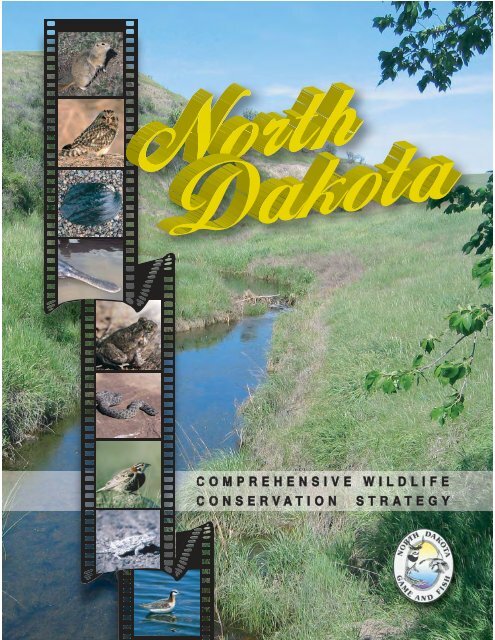
COMPREHENSIVE WILDLIFE<br />
CONSERVATION STRATEGY
NORTH DAKOTA<br />
COMPREHENSIVE WILDLIFE<br />
CONSERVATION STRATEGY<br />
Last updated<br />
December 2005<br />
Strategy Authors:<br />
S<strong>and</strong>ra Hagen<br />
Nongame Biologist, <strong>North</strong> <strong>Dakota</strong> <strong>Game</strong> <strong>and</strong> <strong>Fish</strong> Department<br />
Patrick Isakson<br />
Nongame Biologist, <strong>North</strong> <strong>Dakota</strong> <strong>Game</strong> <strong>and</strong> <strong>Fish</strong> Department<br />
Steve Dyke<br />
Conservation Supervisor, <strong>North</strong> <strong>Dakota</strong> <strong>Game</strong> <strong>and</strong> <strong>Fish</strong> Department<br />
Principal Administrators:<br />
Dean Hildebr<strong>and</strong><br />
Director, <strong>North</strong> <strong>Dakota</strong> <strong>Game</strong> <strong>and</strong> <strong>Fish</strong> Department<br />
Mike McKenna<br />
Chief, Conservation <strong>and</strong> Communications Division<br />
<strong>North</strong> <strong>Dakota</strong> <strong>Game</strong> <strong>and</strong> <strong>Fish</strong> Department<br />
Recommended citation:<br />
Hagen, S<strong>and</strong>ra K., Patrick T. Isakson, <strong>and</strong> Steve R. Dyke. 2005. <strong>North</strong> <strong>Dakota</strong> Comprehensive <strong>Wildlife</strong><br />
Conservation Strategy. <strong>North</strong> <strong>Dakota</strong> <strong>Game</strong> <strong>and</strong> <strong>Fish</strong> Department. Bismarck, ND. 454 pp.<br />
http://www.nd.gov/gnf/conservation/cwcs.html
FOREWORD<br />
<strong>North</strong> <strong>Dakota</strong> Comprehensive <strong>Wildlife</strong> Conservation Strategy 1
TABLE OF CONTENTS<br />
FOREWORD................................................................................................................... 1<br />
LIST OF TABLES ........................................................................................................... 5<br />
LIST OF FIGURES.......................................................................................................... 5<br />
LIST OF ABBREVIATIONS IN THE CWCS ................................................................... 6<br />
ACKNOWLEDGEMENTS............................................................................................... 8<br />
EXECUTIVE SUMMARY .............................................................................................. 10<br />
ROAD MAP TO THE EIGHT REQUIRED ELEMENTS ................................................ 12<br />
SECTION 1 ................................................................................................................... 16<br />
Introduction ................................................................................................................... 16<br />
1.1 History of CARA, WCRP, <strong>and</strong> SWG................................................................................................16<br />
1.2 The CWCS.......................................................................................................................................16<br />
1.3 CWCS Purpose ...............................................................................................................................17<br />
SECTION 2 ................................................................................................................... 18<br />
A Look at <strong>North</strong> <strong>Dakota</strong>................................................................................................. 18<br />
2.1 Natural Vegetation ...........................................................................................................................18<br />
2.1.a Grassl<strong>and</strong>s ...........................................................................................................................18<br />
2.1.b Wetl<strong>and</strong>s ..............................................................................................................................18<br />
2.1.c Forest ...................................................................................................................................19<br />
2.2 Geography <strong>and</strong> Geology..................................................................................................................20<br />
2.2.a Geological Regions..............................................................................................................20<br />
2.3 Climate.............................................................................................................................................21<br />
SECTION 3 ................................................................................................................... 22<br />
Species of Conservation Priority ................................................................................... 22<br />
3.1 Interpretation of Species in Greatest Need of Conservation...........................................................22<br />
3.2 The Overall Process ........................................................................................................................22<br />
3.2.a Species Considered.............................................................................................................22<br />
3.2.a.i Addressing Invertebrates in the Future.................................................................23<br />
3.2.b Rationale ..............................................................................................................................23<br />
3.3 Process Used for Identifying Species of Conservation Priority .......................................................23<br />
3.3.a Birds .....................................................................................................................................23<br />
3.3.a.i. Partners in Flight Species Assessment <strong>and</strong> Prioritization ...................................24<br />
3.3.a.ii. Using Species Assessment <strong>and</strong> Prioritization <strong>and</strong> other Sources to Determine<br />
Birds of Conservation Priority ...........................................................................................24<br />
3.3.b Amphibians, Reptiles, Mammals, <strong>Fish</strong> <strong>and</strong> Freshwater Mussels ........................................25<br />
3.4 Species of Conservation Priority Level Definitions..........................................................................26<br />
3.5 Primary Sources for Identifying Species of Conservation Priority...................................................32<br />
3.5.a Other Sources of Information Consulted .............................................................................33<br />
SECTION 4 ................................................................................................................... 35<br />
Habitat, Threats, <strong>and</strong> Conservation <strong>Action</strong>s .................................................................. 35<br />
4.1 Overview of Habitat <strong>and</strong> Community Types .....................................................................................35<br />
4.1.a Habitat or Community Types Considered............................................................................35<br />
<strong>North</strong> <strong>Dakota</strong> Comprehensive <strong>Wildlife</strong> Conservation Strategy 2
4.2 Identifying Key Habitats <strong>and</strong> Community Types...............................................................................36<br />
4.2.a Resources Used for Delineating L<strong>and</strong>scape Components..................................................37<br />
4.2.a.i L<strong>and</strong>cover..............................................................................................................37<br />
4.2.a.ii Ecoregions............................................................................................................37<br />
4.2.a.iii <strong>Plan</strong>ning Models ..................................................................................................38<br />
4.3 Process for Developing the CWCS L<strong>and</strong>scape Components <strong>and</strong> Focus Areas.............................38<br />
4.3.a References............................................................................................................................39<br />
4.4 The Process for Identifying Threats <strong>and</strong> Conservation <strong>Action</strong>s ......................................................40<br />
4.4.a Research Needs for Developing Conservation <strong>Action</strong>s.......................................................40<br />
4.4.b Relative Priority of Research Needs for SoCP ....................................................................41<br />
4.5 Conservation Issues or Limits in <strong>North</strong> <strong>Dakota</strong> ...............................................................................41<br />
4.5.a Private L<strong>and</strong>.........................................................................................................................42<br />
4.5.a.i Easements ............................................................................................................42<br />
4.5.a.ii The Right to Purchase <strong>and</strong> Sell............................................................................42<br />
4.5.b Public L<strong>and</strong> ..........................................................................................................................43<br />
SECTION 5 ................................................................................................................... 44<br />
L<strong>and</strong>scape Components ............................................................................................... 44<br />
5.0 The L<strong>and</strong>scape Components............................................................................................................44<br />
5.0.a L<strong>and</strong>scape Component Conservation Problems <strong>and</strong> <strong>Action</strong>s .............................................44<br />
5.1 Tallgrass Prairie (Red River Valley) .............................................................................................46<br />
5.1.a Focus Area: Saline Area ......................................................................................................47<br />
5.1.b Focus Area: S<strong>and</strong> Deltas <strong>and</strong> Beach Ridges ......................................................................47<br />
5.1.c Conservation Problems <strong>and</strong> <strong>Action</strong>s for the Tallgrass Prairie (Red River Valley) ...............48<br />
5.2 Eastern Mixed-grass Prairie (Drift Prairie) ..................................................................................50<br />
5.2.a Focus Area: Glacial Lake Deltas..........................................................................................51<br />
5.2.b Focus Area: Devils Lake Basin............................................................................................51<br />
5.2.c Conservation Problems <strong>and</strong> <strong>Action</strong>s for the Eastern Mixed-grass Prairie (Drift Prairie) .....52<br />
5.3 Mixed-grass Prairie (Missouri Coteau) ........................................................................................54<br />
5.3.a Focus Area: Missouri Coteau Breaks ..................................................................................55<br />
5.3.b Conservation Problems <strong>and</strong> <strong>Action</strong>s for the Mixed-grass Prairie (Missouri Coteau)...........56<br />
5.4 Western Mixed-grass/Short-grass Prairie (Missouri Slope)......................................................58<br />
5.4.a Focus Area: Big Sagebrush Shrub-Steppe..........................................................................59<br />
5.4.b Conservation Problems <strong>and</strong> <strong>Action</strong>s for the Western Mixed-grass/Short-grass Prairie<br />
(Missouri Slope) .............................................................................................................................60<br />
5.5 <strong>Plan</strong>ted or Tame Grassl<strong>and</strong> ..........................................................................................................62<br />
5.5.a Focus Area: CRP .................................................................................................................63<br />
5.5.b Conservation Problems <strong>and</strong> <strong>Action</strong>s for <strong>Plan</strong>ted or Artificial Prairie....................................64<br />
5.6 Wetl<strong>and</strong>s <strong>and</strong> Lakes ......................................................................................................................65<br />
5.6.a Conservation Problems <strong>and</strong> <strong>Action</strong>s for Wetl<strong>and</strong> Communities ..........................................68<br />
5.7 Rivers, Streams <strong>and</strong> Riparian.......................................................................................................70<br />
5.7.a Focus Area: Missouri River System/Breaks ........................................................................71<br />
5.7.b Focus Area: Red River.........................................................................................................72<br />
5.7.c Focus Area: Sheyenne River ...............................................................................................72<br />
5.7.d Focus Area: James River.....................................................................................................72<br />
5.7.e Focus Area: Souris River .....................................................................................................73<br />
5.7.f Focus Area: Cannonball River .............................................................................................73<br />
5.7.g Focus Area: Heart River ......................................................................................................73<br />
5.7.h Focus Area: Knife River .......................................................................................................74<br />
5.7.i Focus Area: Little Missouri River .........................................................................................74<br />
5.7.j Conservation Problems <strong>and</strong> <strong>Action</strong>s for Rivers, Streams <strong>and</strong> Riparian ..............................75<br />
5.8 Badl<strong>and</strong>s.........................................................................................................................................77<br />
5.8.a Focus Area: Ponderosa Pine Forest....................................................................................78<br />
5.8.c Conservation Problems <strong>and</strong> <strong>Action</strong>s for the Badl<strong>and</strong>s.........................................................79<br />
5.9 Upl<strong>and</strong> Deciduous Forest .............................................................................................................81<br />
<strong>North</strong> <strong>Dakota</strong> Comprehensive <strong>Wildlife</strong> Conservation Strategy 3
5.9.a Focus Area: Pembina Hills...................................................................................................82<br />
5.9.b Focus Area: Turtle Mountains..............................................................................................82<br />
5.9.c Focus Area: Devils Lake Mountains.....................................................................................82<br />
5.9.d Focus Area: Killdeer Mountains ...........................................................................................82<br />
5.9.e Conservation Problems <strong>and</strong> <strong>Action</strong>s for Upl<strong>and</strong> Deciduous Forest.....................................84<br />
5.10 References ....................................................................................................................................86<br />
SECTION 6 ................................................................................................................... 88<br />
Monitoring ..................................................................................................................... 88<br />
6.1 Introduction ......................................................................................................................................88<br />
6.2 Adaptive Management.....................................................................................................................89<br />
6.2.a <strong>Plan</strong>ning ...............................................................................................................................90<br />
6.2.b Implementation.....................................................................................................................90<br />
6.2.c Monitoring <strong>and</strong> Evaluation....................................................................................................91<br />
6.3 Habitat <strong>and</strong> Species Monitoring.......................................................................................................91<br />
6.3.a Habitat Monitoring................................................................................................................91<br />
6.3.a.i Habitat Monitoring Within L<strong>and</strong>scape Components..............................................93<br />
6.3.a.ii Monitoring for Statewide Changes in Habitat.......................................................94<br />
6.3.b Species Monitoring ..............................................................................................................95<br />
6.3.b.i Birds .....................................................................................................................95<br />
6.3.b.ii Reptiles <strong>and</strong> Amphibians......................................................................................96<br />
6.3.b.iii Mammals .............................................................................................................96<br />
6.3.b.iv <strong>Fish</strong>......................................................................................................................97<br />
6.3.b.v Freshwater Mussels ............................................................................................97<br />
6.4 Monitoring Conservation <strong>Action</strong>s.....................................................................................................98<br />
6.5 Databases........................................................................................................................................98<br />
6.5.a Species-Habitat Associations ..............................................................................................98<br />
6.5.b <strong>North</strong> <strong>Dakota</strong> GIS Hub (NDGH)...........................................................................................98<br />
6.5.c The <strong>North</strong> <strong>Dakota</strong> Natural Heritage Program <strong>and</strong> Incidental Reporting System .................98<br />
SECTION 7 ................................................................................................................. 100<br />
Reviewing the CWCS.................................................................................................. 100<br />
7.1 CWCS Review ...............................................................................................................................100<br />
7.2 Species of Conservation Priority ...................................................................................................100<br />
SECTION 8 ................................................................................................................. 101<br />
Coordination with Federal, State, <strong>and</strong> Local Agencies <strong>and</strong> Tribal Government .......... 101<br />
8.1 Coordinating the CWCS Development ..........................................................................................101<br />
8.1.a US <strong>Fish</strong> <strong>and</strong> <strong>Wildlife</strong> Services (USFWS) ...........................................................................101<br />
8.1.b US Forest Service (USFS).................................................................................................102<br />
8.1.c US Bureau of L<strong>and</strong> Management (BLM)............................................................................102<br />
8.1.d US Army Corp of Engineers (ACOE).................................................................................102<br />
8.1.e US Geological Survey - <strong>North</strong>ern Prairie <strong>Wildlife</strong> Research Center (NPWRC).................102<br />
8.1.f US Department of Agriculture-Natural Resources Conservation Service (NRCS)............103<br />
8.1.g <strong>North</strong> <strong>Dakota</strong> <strong>Game</strong> <strong>and</strong> <strong>Fish</strong> Department (NDGFD)........................................................103<br />
8.1.h <strong>North</strong> <strong>Dakota</strong> Parks <strong>and</strong> Recreation/Natural Heritage Program (NDPR/NHP)..................103<br />
8.1.i <strong>North</strong> <strong>Dakota</strong> State L<strong>and</strong> Department (NDSLD) ................................................................103<br />
8.1.j Colleges <strong>and</strong> Universities...................................................................................................103<br />
8.1.k Ducks Unlimited (DU).........................................................................................................104<br />
8.1.l The Nature Conservancy (TNC) ........................................................................................104<br />
8.1.m Audubon Society................................................................................................................104<br />
8.1.n Pheasants Forever (PF).....................................................................................................104<br />
8.1.o Delta Waterfowl (Delta)......................................................................................................104<br />
<strong>North</strong> <strong>Dakota</strong> Comprehensive <strong>Wildlife</strong> Conservation Strategy 4
8.1.p <strong>North</strong> <strong>Dakota</strong> Natural Resources Trust (NDNRT)..............................................................104<br />
8.1.q Tribal Government .............................................................................................................105<br />
8.1.r Neighboring States ............................................................................................................105<br />
8.1.s Prairie Pothole Joint Venture (PPJV).................................................................................105<br />
8.1.t <strong>North</strong>ern Great Plains Joint Venture (NGPJV) ..................................................................105<br />
8.1.u <strong>North</strong> <strong>Dakota</strong> Chapter of The <strong>Wildlife</strong> Society (NDCTWS)................................................105<br />
8.1.v <strong>Dakota</strong> Chapter of the American <strong>Fish</strong>eries Society (DAFS) ..............................................106<br />
8.2 Agency Coordination for CWCS Implementation <strong>and</strong> Revision ....................................................106<br />
SECTION 9 ................................................................................................................. 107<br />
Public Participation...................................................................................................... 107<br />
9.1 The Public Considered ..................................................................................................................107<br />
9.2 The Overall Process ......................................................................................................................107<br />
9.2.a Continued Public Involvement ...........................................................................................107<br />
9.3 Public Information Exchange.........................................................................................................108<br />
9.4 <strong>Wildlife</strong> Values in the West 2004 – Preliminary Findings ..............................................................111<br />
LIST OF TABLES<br />
Table 1. <strong>North</strong> <strong>Dakota</strong>’s 100 Species of Conservation Priority..................................................................27<br />
Table 2. Matrix of avian SoCP <strong>and</strong> corresponding source score/listing. ...................................................28<br />
Table 3. Matrix of amphibian, reptile, <strong>and</strong> mammal SoCP <strong>and</strong> corresponding source score/listing. ........29<br />
Table 4. Matrix of fish <strong>and</strong> freshwater mussel SoCP <strong>and</strong> corresponding source score/listing..................30<br />
LIST OF FIGURES<br />
Figure 1. Major geographic regions of <strong>North</strong> <strong>Dakota</strong>. ................................................................................21<br />
Figure 2. Bird Conservation Regions (BCR) encompassing <strong>North</strong> <strong>Dakota</strong>. ..............................................31<br />
Figure 3. USFWS Region 6 states. ............................................................................................................31<br />
Figure 4. TNC Ecoregions encompassing <strong>North</strong> <strong>Dakota</strong>. ..........................................................................31<br />
Figure 5. Total acres <strong>and</strong> percent occupancy of the major l<strong>and</strong> classes in <strong>North</strong> Daktoa.........................36<br />
Figure 6. Number of farms in <strong>North</strong> <strong>Dakota</strong>. ..............................................................................................41<br />
Figure 7. Average farm size in <strong>North</strong> <strong>Dakota</strong>.............................................................................................41<br />
Figure 8. Number of cattle operations in <strong>North</strong> <strong>Dakota</strong>..............................................................................41<br />
Figure 9. Number of cattle per operation in <strong>North</strong> <strong>Dakota</strong>. ........................................................................41<br />
Figure 10. L<strong>and</strong> ownership in <strong>North</strong> <strong>Dakota</strong>. Total acres <strong>and</strong> % occupancy of the state. .........................43<br />
Figure 11. Public l<strong>and</strong> ownership breakdown in <strong>North</strong> <strong>Dakota</strong>. Total acres <strong>and</strong> % of total public l<strong>and</strong>.....43<br />
LIST OF APPENDICES<br />
Appendix A. Species of Conservation Priority Accounts.................................................................. 114<br />
A.1 Birds........................................................................................................ 118<br />
A.2 Amphibians <strong>and</strong> Reptiles........................................................................ 256<br />
A.3 Mammals................................................................................................ 282<br />
A.4 <strong>Fish</strong>......................................................................................................... 327<br />
A.5 Freshwater Mussels................................................................................ 394<br />
Appendix B. L<strong>and</strong>scape Component Maps...................................................................................... 410<br />
Appendix C. Focus Areas Map......................................................................................................... 421<br />
Appendix D. Conservation Challenges Maps................................................................................... 424<br />
Appendix E. Breeding Habitat Characteristics <strong>and</strong> Effects of Management Practices on SoCP..... 430<br />
Appendix F. Glossary....................................................................................................................... 446<br />
<strong>North</strong> <strong>Dakota</strong> Comprehensive <strong>Wildlife</strong> Conservation Strategy 5
LIST OF ABBREVIATIONS IN THE CWCS<br />
ACOE US Army Corp of Engineers http://www.usace.army.mil/<br />
BCR Bird Conservation Region<br />
BLM US Bureau of L<strong>and</strong> Management www.mt.blm.gov<br />
BMP Best Management Practice<br />
CARA Conservation <strong>and</strong> Reinvestment Act http://www.teaming.com/<br />
CBM Coalbed Methane<br />
CRP Conservation Reserve Program http://www.fsa.usda.gov/dafp/cepd/crp.htm<br />
CVB/CC<br />
Convention <strong>and</strong> Visitors Bureau or Chambers<br />
of Commerce<br />
http://www.ndtourism.com/Resources/<br />
CWCS Comprehensive <strong>Wildlife</strong> Conservation Strategy<br />
DAT District Assistance Team<br />
DU Ducks Unlimited http://www.ducks.org/<br />
EPA Environmental Protection Agency http://www.epa.gov/<br />
ESA Endangered Species Act<br />
FAA Federal Aviation Administration http://www.faa.gov/<br />
FHWA Federal Highway Administration http://www.fhwa.dot.gov/<br />
FNAWS Foundation for <strong>North</strong> American Wild Sheep http://www.fnaws.org/<br />
FSA Farm Service Agency http://www.fsa.usda.gov/pas/<br />
FY Fiscal Year<br />
GFAFB Gr<strong>and</strong> Forks Air Force Base http://public.gr<strong>and</strong>forks.amc.af.mil/<br />
GIS Geographic Information System<br />
HAPET Habitat <strong>and</strong> Population Evaluation Team<br />
JV Joint Venture http://www.fws.gov/birdhabitat/nawmp/jv.htm<br />
MDF Mule Deer Foundation http://www.muledeer.org/<br />
MN Minnesota<br />
MT Montana<br />
NAAT National Advisory Acceptance Team<br />
NABCI <strong>North</strong> American Bird Conservation Initiative http://www.nabci-us.org/<br />
NAWCP <strong>North</strong> American Waterbird Conservation <strong>Plan</strong> http://www.nacwcp.org/<br />
NAWMP <strong>North</strong> American Waterfowl Management <strong>Plan</strong><br />
http://www.fws.gov/birdhabitat/nawmp/nawmphp.<br />
htm<br />
ND <strong>North</strong> <strong>Dakota</strong><br />
NDDAG <strong>North</strong> <strong>Dakota</strong> Department of Agriculture http://www.agdepartment.com/<br />
NDDH <strong>North</strong> <strong>Dakota</strong> Department of Health http://www.health.state.nd.us/<br />
NDFS <strong>North</strong> <strong>Dakota</strong> Forest Service http://www.ndsu.nodak.edu/forestservice/<br />
NDGFD <strong>North</strong> <strong>Dakota</strong> <strong>Game</strong> <strong>and</strong> <strong>Fish</strong> Department http://www.nd.gov/gnf/<br />
NDIC<br />
<strong>North</strong> <strong>Dakota</strong> Industrial Commission – Oil <strong>and</strong><br />
Gas Division<br />
http://www.oilgas.nd.gov/<br />
NDNRT <strong>North</strong> <strong>Dakota</strong> Natural Resource Trust http://www.ndnrt.com/<br />
NDPRD<br />
<strong>North</strong> <strong>Dakota</strong> Parks <strong>and</strong> Recreation<br />
Department<br />
http://www.parkrec.nd.gov/<br />
<strong>North</strong> <strong>Dakota</strong> Comprehensive <strong>Wildlife</strong> Conservation Strategy 6
NDSEED Sustainable Energy for Economic Development http://www.ndseed.org/<br />
NDSLD <strong>North</strong> <strong>Dakota</strong> State L<strong>and</strong> Department http://www.l<strong>and</strong>.state.nd.us/<br />
NDSUEXT<br />
<strong>North</strong> <strong>Dakota</strong> State University Extension<br />
Service<br />
http://www.ext.nodak.edu/<br />
NDSWC <strong>North</strong> <strong>Dakota</strong> State Water Commission http://www.swc.state.nd.us/<br />
NDT <strong>North</strong> <strong>Dakota</strong> Tourism http://www.ndtourism.com/<br />
NDWCA <strong>North</strong> <strong>Dakota</strong> Weed Control Association http://www.ndweeds.homestead.com/index.html<br />
NDWRB <strong>North</strong> <strong>Dakota</strong> Water Resource Boards (County) http://www.swc.state.nd.us/4DLink5/4dcgi/wrboa<br />
rds<br />
NGO Nongovernmental Organization<br />
NGPJV <strong>North</strong>ern Great Plains Joint Venture<br />
NP/PPR<br />
<strong>North</strong>ern Plains/Prairie Potholes Regional<br />
Shorebird Conservation <strong>Plan</strong><br />
http://www.fws.gov/shorebirdplan/RegionalShore<br />
bird/Regional<strong>Plan</strong>s.htm<br />
NPPWCP<br />
<strong>North</strong>ern Prairie <strong>and</strong> Parkl<strong>and</strong> Waterbird<br />
Conservation <strong>Plan</strong><br />
http://www.fws.gov/birds/waterbirds/npp/<br />
NPWRC <strong>North</strong>ern Prairie <strong>Wildlife</strong> Research Center http://www.npwrc.usgs.gov/<br />
NRCS Natural Resources Conservation Service http://www.nrcs.usda.gov/<br />
PF Pheasants Forever http://www.pheasantsforever.org/<br />
PIF Partners in Flight http://www.partnersinflight.org/<br />
PPJV Prairie Pothole Joint Venture http://www.ppjv.org<br />
RMEF Rocky Mountain Elk Foundation http://www.rmef.org/<br />
RRBRP Red River Basin Riparian Project http://www.health.state.nd.us/rrbrp/<br />
SD South <strong>Dakota</strong><br />
SoCP Species of Conservation Priority<br />
SWG State <strong>Wildlife</strong> Grants http://www.teaming.com/<br />
T&E Threatened <strong>and</strong> Endangered<br />
TNC The Nature Conservancy http://www.nature.org/<br />
TRNP Theodore Roosevelt National Park http://www.nps.gov/thro/<br />
UND University of <strong>North</strong> <strong>Dakota</strong> http://www.und.edu/<br />
USBR US Bureau of Reclamation http://www.usbr.gov/<br />
USDA US Department of Agriculture http://www.usda.gov/wps/portal/usdahome<br />
USFS US Forest Service http://www.fs.fed.us/<br />
USFWS US <strong>Fish</strong> <strong>and</strong> <strong>Wildlife</strong> Service http://www.fws.gov/<br />
USNPS US National Park Service http://www.nps.gov/<br />
USSCP US Shorebird Conservation <strong>Plan</strong> http://www.fws.gov/shorebirdplan/<br />
WCRP <strong>Wildlife</strong> Conservation <strong>and</strong> Restoration Program http://www.teaming.com/<br />
WIND Wind Interests of <strong>North</strong> <strong>Dakota</strong> http://www.windnd.com/<br />
WS/APHIS<br />
<strong>Wildlife</strong> Services/Animal <strong>Plan</strong>t <strong>and</strong> Health<br />
Inspection Service<br />
http://www.aphis.usda.gov/ws/<br />
<strong>North</strong> <strong>Dakota</strong> Comprehensive <strong>Wildlife</strong> Conservation Strategy 7
ACKNOWLEDGEMENTS<br />
The <strong>North</strong> <strong>Dakota</strong> <strong>Game</strong> <strong>and</strong> <strong>Fish</strong> Department is grateful to the individuals, agencies, <strong>and</strong> organizations<br />
who have taken the time to meet <strong>and</strong> discuss the CWCS. Over the past several years, NDGFD nongame<br />
staff has met with people from numerous state, federal, <strong>and</strong> non-governmental organizations. These<br />
meetings have allowed us the opportunity to inform others on the State <strong>Wildlife</strong> Grant program, the<br />
CWCS, <strong>and</strong> enhance our partnerships. Much credit is owed to those who have taken the time to meet<br />
with us, supported us, <strong>and</strong> provided feedback to help shape this document.<br />
The list of those who knowingly or unknowingly provided their support <strong>and</strong> input is extensive. To all of you<br />
not named below, know that your enthusiasm for conservation is embedded throughout this document.<br />
We are particularly grateful to colleagues at the <strong>North</strong> <strong>Dakota</strong> <strong>Game</strong> <strong>and</strong> <strong>Fish</strong> Department who have<br />
helped administer the State <strong>Wildlife</strong> Grants, delivered information, provided endless encouragement, <strong>and</strong><br />
those who just listened. Special recognition is owed to Duane Pool, <strong>North</strong>ern Great Plains Joint Venture<br />
science coordinator, for his writing assistance <strong>and</strong> to Craig Birhle, NDGFD Communications Supervisor,<br />
for editing.<br />
Also, much gratitude goes to the Teaming With <strong>Wildlife</strong> coalition <strong>and</strong> all those at the forefront of the State<br />
<strong>Wildlife</strong> Grant program.<br />
Those who we have had individual, organized meetings with:<br />
Jane Austin (NPWRC), Bill Bicknell (USFWS), Will Bleier (NDSU), Mike Br<strong>and</strong> (NDSLD), Joel Brice<br />
(Delta), Mark Clark (NDSU), Rich Crawford (UND), Dave Dewald (NRCS), Christine Dirk (NDNHP), Kathy<br />
Duttenhefner (NDNHP), Mike Estey (HAPET), Jim Grier (NDSU), Dan Hare (PF), Larry Igl (NPWRC),<br />
Doug Johnson (NPWRC), Wade King (USFWS), Karen Kreil (USFWS), Phil Morris (ACOE), Gary<br />
Neucthlerein (NDSU), Bob Newman (UND), Neal Niemuth (HAPET), Pam Pietz (NPWRC), Wendy Reed<br />
(NDSU), Ron Reynolds (HAPET), Jim Ringleman (DU), Eric Rosenquist (TNC), Terri Shaffer (NPWRC),<br />
Jill Shaffer (NPWRC), Donna Schneider (Audubon), Andy Schollett (NGPJV), Mark Sherfy (NPWRC),<br />
Tom Sklebar (NPWRC), Marsha Sovada (NPWRC), Scott Stephens (DU), Craig Stockwell (NDSU), Larry<br />
Strong (NPWRC), Dan Svingen (USFS), Rick Sweitzer (UND), Genevieve Thompson (Audubon), Ralph<br />
Tramontano, Keith Trego (NDNRT), Jeff Towner (USFWS), Tim Zachmeier (BLM)<br />
Those who attended the CWCS Joint Mammal, Reptile, <strong>and</strong> Amphibian Meeting:<br />
Steve Dyke (NDGFD), Jacquie Ermer (USFWS), Dorothy Fecske (NDGFD), Jim Grier (NDSU), S<strong>and</strong>y<br />
Hagen (NDGFD), Patrick Isakson (NDGFD), Ron Jyring (BSC), Bob Newman (UND), Bob Seabloom<br />
(UND), Marsha Sovada (NPWRC), Rick Sweitzer (UND), Ralph Tramontano<br />
Those who attended the CWCS Aquatics Expert Meeting:<br />
Bill Bicknell (USFWS), Mike Ell (NDDOH), Scott Elstad (NDGFD), Dave Fryda (NDGFD), S<strong>and</strong>y Hagen<br />
(NDGFD), Patrick Isakson (NDGFD), Jason Lee (NDGFD), Greg Power (NDGFD), Fred Ryckman<br />
(NDGFD), Lynn Schlueter (NDGFD), Terry Steinw<strong>and</strong> (NDGFD)<br />
Those who attended the <strong>North</strong> <strong>Dakota</strong> All-bird Workshop:<br />
Tom Bodine (ND Farm Bureau), Curt Bradbury (NRCS), Mike Br<strong>and</strong> (NDSLD), Dan Buchanan (Birding<br />
Drives <strong>Dakota</strong>), Dan Casey (ABC), John Cecil (Audubon), Margi Coyle (UND), Cami Dixon (USFWS),<br />
Kathy Duttenhefner (NDNHP), Alexis Duxbury (NDGFD), Steve Dyke (NDGFD), Mike Estey (HAPET),<br />
Doug Faulkner (RMBO), Dorothy Fecske (NDGFD), Suzanne Fellows (USFWS), Bob Ford (NABCI),<br />
S<strong>and</strong>y Hagen (NDGFD), Debbie Hahn (IAFWA), Mike Haupt (NDSLD), Greg Hiemenz (USBR), Renae<br />
Hines (NDSU), Patrick Isakson (NDGFD), Rex Johnson (HAPET), Kevin Kading (NDGFD), Gregg<br />
Knutsen (USFWS), Brian Kramer (ND Farm Bureau), R<strong>and</strong>y Kreil (NDGFD), Jennifer Lind (NDSU), Greg<br />
Link (NDGFD), Cindy Maier (NRCS), Ron Martin, Scott McLeod (DU), Kelly McPhillips (USBR), Mike<br />
Morris (ACOE), Neal Niemuth (HAPET), Bill Palmer (RMBO), Gerry Reichert (TNC), Marco Restani<br />
(SCSU), Ron Reynolds (HAPET), Terry Rich (PIF), Eric Rosenquist (TNC), Adam Ryba (USFWS), Andy<br />
Schollett (NGPJV), Jill Shaffer (NPWRC), Mark Sherfy (NPWRC), Paulette Sherr (USFWS), John Solberg<br />
<strong>North</strong> <strong>Dakota</strong> Comprehensive <strong>Wildlife</strong> Conservation Strategy 8
(USFWS), Dan Svingen (USFS), Jan Swenson (Badl<strong>and</strong>s Conservation Alliance), Genevieve Thompson<br />
(Audubon), Bruce Toay (USFWS), Jeb Williams (NDGFD), Kevin Willis (USFWS)<br />
Those who provided comment on the Species of Conservation Priority list (January <strong>and</strong> February 2004)<br />
<strong>and</strong> Species Templates (January 2005):<br />
Steve Adair (DU), Joe Carney (LU), Rich Crawford (UND), Dave Dewald (NRCS), Kathy Duttenhefner<br />
(NDNHP), Alexis Duxbury (NDGFD), Jacquie Ermer (USFWS), Dorothy Fecske (NDGFD), Chris<br />
Grondahl (NDGFD), Joseph Hall (USBR), Jeff Hendrickson (NDGFD), Jay Hestbeck (NPWRC), Bill<br />
Jensen (NDGFD), Doug Johnson (NPWRC), Mike Johnson (NDGFD), Gregg Knutsen (USFWS), Stan<br />
Kohn (NDGFD), R<strong>and</strong>y Kreil (NDGFD), Jerry Kobriger (NDGFD), Dave Lambeth, Jeff Lang (UND), Ron<br />
Martin, Dave Mushet (NPWRC), Neal Niemuth (HAPET), Greg Power (NDGFD), R<strong>and</strong>y Renner<br />
(NDCTWS), Fred Ryckman (NDGFD), Lynn Schlueter (NDGFD), Bob Seabloom (UND), Dave Stagliano<br />
(MTNHP), Dan Svingen (USFS), Rick Sweitzer (UND), Jeff Towner (USFWS), Gene Van Eckhout<br />
(NDGFD)<br />
Those who provided comment on the Draft CWCS (July 2005):<br />
Eric Aasmundstad (ND Farm Bureau), Dave Chadwick (IAFWA), Dave Dewald (NRCS), Paul Gertler<br />
(USFWS), Jeff Hendrickson (NDGFD), Rex Johnson (HAPET), Jeff Lerner (Defenders of <strong>Wildlife</strong>), Ron<br />
Martin, Neal Niemuth (USFWS), Amelia Orton-Palmer (USFWS), Duane Pool (NGPJV), Gary Preszler<br />
(NDSLD), Jill Shaffer (NPWRC), Kevin Willis (USFWS)<br />
<strong>North</strong> <strong>Dakota</strong> Comprehensive <strong>Wildlife</strong> Conservation Strategy 9
EXECUTIVE SUMMARY<br />
With the advent of <strong>Wildlife</strong> Conservation <strong>and</strong> Restoration Program <strong>and</strong> State <strong>Wildlife</strong> Grant legislation, the<br />
<strong>North</strong> <strong>Dakota</strong> <strong>Game</strong> <strong>and</strong> <strong>Fish</strong> Department can exp<strong>and</strong> its fish <strong>and</strong> wildlife management programs. SWG<br />
resources allow the NDGFD to develop a more robust nongame fish <strong>and</strong> wildlife program for species that<br />
typically receive little or no attention. During the first few years of this program the NDGFD made<br />
considerable strides in adding staff to work on nongame <strong>and</strong> SWG issues. Much of their time the past<br />
three years has involved compiling scientific information on an array of fish <strong>and</strong> wildlife. The NDGFD staff<br />
have also worked to develop the state’s first species of conservation priority list, networked <strong>and</strong> built a<br />
rapport with many future partners including but not limited to federal, state, <strong>and</strong> local agencies,<br />
nongovernmental organizations, universities, <strong>and</strong> private citizens; <strong>and</strong> finally, writing this document.<br />
This document represents a strategy rather than a detailed plan to guide the process of preserving the<br />
state’s fish <strong>and</strong> wildlife resources for the foreseeable future. This document is not a compilation of specific<br />
management plans for all the species of fish <strong>and</strong> wildlife at risk in <strong>North</strong> <strong>Dakota</strong>. There is simply not the<br />
knowledge at this point or the time to compile such a document. This document is also not an<br />
implementation plan but rather a strategic vision with the goal of preserving the state’s wildlife diversity.<br />
<strong>North</strong> <strong>Dakota</strong>’s CWCS is intended to identify species of greatest conservation need, provide fundamental<br />
background information, strategic guidance, <strong>and</strong> most importantly, a framework for developing <strong>and</strong><br />
coordinated conservation actions involving partners to safeguard all fish <strong>and</strong> wildlife resources.<br />
The CWCS is built upon eight essential elements, identified by Congress, with an overall focus on the<br />
“species of greatest conservation need.” The eight elements include: (1) information on the distribution<br />
<strong>and</strong> abundance of species of wildlife including low <strong>and</strong> declining populations; (2) descriptions of locations<br />
<strong>and</strong> relative condition of key habitats <strong>and</strong> community types; (3) problems affecting species <strong>and</strong> priority<br />
research or survey efforts needed; (4) conservation actions needed to conserve the identified species; (5)<br />
plans for monitoring species <strong>and</strong> the effectiveness of conservation actions; (6) plans for reviewing the<br />
strategy; (7) coordinating with federal, state, <strong>and</strong> local agencies <strong>and</strong> Tribal government on the<br />
development <strong>and</strong> implementation of the strategy; <strong>and</strong> (8) involve broad public participation. These<br />
elements have been open to interpretation by the states. In addressing each of the eight elements, we<br />
used the best available information to the best of our ability.<br />
For <strong>North</strong> <strong>Dakota</strong>, 100 species of conservation priority were identified under Element 1. This list includes<br />
45 birds, 2 amphibians, 9 reptiles, 15 mammals, 22 fish, <strong>and</strong> 7 freshwater mussels. Each species was<br />
also given a priority designation based on conservation need. Level I species are those having a high<br />
level of conservation priority because of declining status in <strong>North</strong> <strong>Dakota</strong> or across their range; or have a<br />
high rate of occurrence in <strong>North</strong> <strong>Dakota</strong>, constituting the core of the species breeding range, but may be<br />
at-risk range-wide. Level II species are those having a moderate level of conservation priority; or a high<br />
level of conservation priority but a substantial level of non-SWG funding is available to them. Level III<br />
species are those having a moderate level of conservation priority but are believed to be peripheral or<br />
non-breeding in <strong>North</strong> <strong>Dakota</strong>. There are 29 Level I species, 41 Level II species, <strong>and</strong> 30 Level III species.<br />
A sizeable portion of the CWCS provides pertinent biological <strong>and</strong> habitat information <strong>and</strong> addresses<br />
elements 1-5 for each individual species. Many species do not have existing data relating to population<br />
status/dynamics, preferred habitat, threats <strong>and</strong> conservation actions. In other instances there is a better<br />
underst<strong>and</strong>ing of the status of a species, the threats affecting them, <strong>and</strong> the conservation actions needed.<br />
Such disparity in information will require additional research <strong>and</strong> surveys conducted for some species at<br />
the same time we are implementing conservation measures for others.<br />
This CWCS is a habitat based, rather than species based. We divided <strong>North</strong> <strong>Dakota</strong> into nine primary<br />
l<strong>and</strong>scape components, which are essentially the state’s major habitat types. They include tallgrass<br />
prairie (Red River Valley); Eastern mixed-grass prairie (Drift Prairie); mixed-grass prairie (Missouri<br />
Coteau); Western mixed-grass/short-grass prairie (Missouri Slope); planted or tame grassl<strong>and</strong>; wetl<strong>and</strong>s<br />
<strong>and</strong> lakes; rivers, streams, <strong>and</strong> riparian; badl<strong>and</strong>s; <strong>and</strong> upl<strong>and</strong> deciduous forest. Details for Elements 2-4<br />
are provided on each of these l<strong>and</strong>scape components (i.e. condition of the habitat, the major problems<br />
affecting quality or quantity of it, <strong>and</strong> the conservation tools available). It is important to recognize that<br />
<strong>North</strong> <strong>Dakota</strong> Comprehensive <strong>Wildlife</strong> Conservation Strategy 10
species of conservation priority often depend on several habitat types or l<strong>and</strong>scape components for<br />
survival. The key to ensuring their long term survival is to maintain diverse grassl<strong>and</strong>s, wetl<strong>and</strong>s,<br />
woodl<strong>and</strong>s, rivers <strong>and</strong> streams. This cannot be reduced to certain isolated areas, but must occur over a<br />
broad l<strong>and</strong>scape.<br />
Current <strong>and</strong> desired monitoring efforts for species <strong>and</strong> habitats are addressed through Element 5. A<br />
flexible approach to monitoring yet conduct monitoring with performance measures in mind is needed.<br />
The NDGFD <strong>and</strong> its partners will attempt to continually evaluate conservation actions <strong>and</strong> treatments<br />
through various monitoring designs. New information will help guide <strong>and</strong> refine the process to allow for<br />
best management practices for species <strong>and</strong> habitat. If conservation actions are found to be ineffective in<br />
the management of the target species or habitat, steps will be taken to change the process.<br />
The NDGFD visualizes the CWCS as a dynamic document that will be updated on a regular basis as new<br />
information becomes available. There is innovative research being conducted at local, regional <strong>and</strong><br />
national levels. New incentive programs will likely be developed <strong>and</strong> staying informed of these to avoid<br />
duplication <strong>and</strong> maximize opportunities to partner is critical. The intent is to update the strategy annually<br />
<strong>and</strong> conduct a formal review every ten years, as element 6 requires continued examination of the CWCS.<br />
In addition, species of conservation priority needs may change, adding species to or subtracting from the<br />
list. The first official review of the 100 species of conservation priority will occur in five years.<br />
Early on in developing the CWCS, the NDGFD recognized the scope <strong>and</strong> magnitude of this endeavor <strong>and</strong><br />
embraced the need to coordinate efforts with partners <strong>and</strong> solicit their input. We met individually with staff<br />
from all principle l<strong>and</strong> management agencies in the state, universities, nongovernmental organizations,<br />
<strong>and</strong> the general public. The feedback we received from these groups <strong>and</strong> their willingness to participate in<br />
focus groups, provide comments on drafts of the CWCS, <strong>and</strong> their overall support was outst<strong>and</strong>ing. Since<br />
these initial meetings we have continued coordinating aspects of the strategy with many of these partners<br />
to the point where we view them as integral to the implementation of the strategy. Element 7 contains the<br />
underlying strength of <strong>North</strong> <strong>Dakota</strong>’s CWCS.<br />
The NDGFD is fortunate to have superb communication tools. From early on in the process, the public<br />
was informed of CARA, WCRP, SWG, <strong>and</strong> the CWCS via the NDGFD’s monthly magazine, news<br />
releases, radio <strong>and</strong> television programs, website, <strong>and</strong> other media outlets throughout the state. A request<br />
for comments was sought after <strong>and</strong> welcomed if any was provided. The requirements of element 8 will be<br />
sustained throughout the future.<br />
While the completion of the CWCS represents a major achievement <strong>and</strong> progress towards the goal of<br />
preserving <strong>North</strong> <strong>Dakota</strong>’s fish <strong>and</strong> wildlife diversity, there is still a long way to go. This CWCS is just the<br />
first chapter in long-term multifaceted effort to implement management actions <strong>and</strong> conservation efforts.<br />
The next phase will involve refining goals to put the best available conservation tools into action.<br />
“Without habitat, there is no wildlife. It’s that simple.”<br />
- <strong>Wildlife</strong> Habitat Canada<br />
<strong>North</strong> <strong>Dakota</strong> Comprehensive <strong>Wildlife</strong> Conservation Strategy 11
ROAD MAP TO THE EIGHT REQUIRED ELEMENTS<br />
This section is provided for the National Acceptance Advisory Team (NAAT) which is evaluating this<br />
document to determine how well <strong>North</strong> <strong>Dakota</strong>’s Comprehensive <strong>Wildlife</strong> Conservation Strategy process<br />
meets the eight Congressionally required elements. The NAAT is chaired by the USFWS Assistant<br />
Director for Migratory Birds <strong>and</strong> State Programs <strong>and</strong> includes seven USFWS assistant regional directors<br />
(ARD) for Migratory Birds <strong>and</strong> State Programs, <strong>and</strong> the five state presidents of the regional associations<br />
of fish <strong>and</strong> wildlife agencies. The NAAT will ultimately determine if all eight required elements are fulfilled,<br />
<strong>and</strong> will provide a recommendation to the director of the USFWS. The director then issues the final<br />
determination for approval or disapproval of <strong>North</strong> <strong>Dakota</strong>’s CWCS.<br />
Please refer to the following page numbers in order to examine how each required element was<br />
addressed in the development of the Comprehensive <strong>Wildlife</strong> Conservation Strategy.<br />
Element 1: Information on the distribution <strong>and</strong> abundance of species of wildlife, including low <strong>and</strong><br />
declining populations as the state deems appropriate, that are indicative of the diversity <strong>and</strong> health of the<br />
state’s wildlife:<br />
NAAT Guidance Section Page #<br />
A. The Strategy indicates sources of<br />
information (e.g., literature, data bases,<br />
agencies, individuals) on wildlife abundance<br />
<strong>and</strong> distribution consulted during the planning<br />
process.<br />
B. The Strategy includes information about<br />
both abundance <strong>and</strong> distribution for species in<br />
all major groups to the extent that data are<br />
available. There are plans for acquiring<br />
information about species for which adequate<br />
abundance <strong>and</strong>/or distribution information is<br />
unavailable.<br />
C. The Strategy identifies low <strong>and</strong> declining<br />
populations to the extent data are available.<br />
D. All major groups of wildlife have been<br />
considered or an explanation is provided as to<br />
why they were not (e.g., including reference to<br />
implemented marine fisheries management<br />
plans). The State may indicate whether these<br />
groups are to be included in a future Strategy<br />
revision.<br />
E. The Strategy describes the process used to<br />
select the species in greatest need of<br />
conservation. The quantity of information in the<br />
Strategy is determined by the state with input<br />
from its partners, based on what is available to<br />
the state.<br />
3.5<br />
3.5.a<br />
4.4.b<br />
5<br />
32-33<br />
33-34<br />
41<br />
44-87<br />
3 22-26<br />
3.2.a<br />
3.2.a.i<br />
3<br />
3.3<br />
22-23<br />
23<br />
22-26<br />
23-25<br />
Table<br />
Figure<br />
Tables<br />
2-5<br />
Tables<br />
1-4<br />
Tables<br />
1-4<br />
Page # Appendix Page #<br />
28-30 A 114-409<br />
A 114-409<br />
27-30 A 114-409<br />
27-30<br />
<strong>North</strong> <strong>Dakota</strong> Comprehensive <strong>Wildlife</strong> Conservation Strategy 12
Element 2: Descriptions of locations <strong>and</strong> relative condition of key habitats <strong>and</strong> community types essential<br />
to conservation of species identified in (1):<br />
NAAT Guidance<br />
A. The Strategy provides a reasonable<br />
explanation for the level of detail provided; if<br />
Section Page #<br />
Table<br />
Figure<br />
Page # Appendix Page #<br />
insufficient, the Strategy identifies the types of<br />
future actions that will be taken to obtain the<br />
information.<br />
B. Key habitats <strong>and</strong> their relative conditions are<br />
4.1-4.3 35-39<br />
A 114-409<br />
described in enough detail such that the State<br />
can determine where (i.e., in which regions,<br />
watersheds, or l<strong>and</strong>scapes within the State)<br />
<strong>and</strong> what conservation actions need to take<br />
place.<br />
5 44-87<br />
A<br />
B<br />
C<br />
114-409<br />
410-420<br />
421-423<br />
Element 3: Descriptions of problems which may adversely affect species identified in (1) or their habitats,<br />
<strong>and</strong> priority research <strong>and</strong> survey efforts needed to identify factors which may assist in restoration <strong>and</strong><br />
improved conservation of these species <strong>and</strong> habitats:<br />
NAAT Guidance Section Page #<br />
A. The Strategy indicates sources of<br />
information (e.g., literature, databases,<br />
agencies, or individuals) used to determine the<br />
problems or threats.<br />
B. The threats/problems are described in<br />
sufficient detail to develop focused<br />
conservation actions (for example, “increased<br />
highway mortalities” or “acid mine drainage”<br />
rather than generic descriptions such as<br />
“development” or “poor water quality”).<br />
C. The Strategy considers threats/problems,<br />
regardless of their origins (local, state, regional,<br />
national <strong>and</strong> international), where relevant to<br />
the state’s species <strong>and</strong> habitats.<br />
D. If available information is insufficient to<br />
describe threats/problems, research <strong>and</strong><br />
survey efforts are identified to obtain needed<br />
information.<br />
E. The priority research <strong>and</strong> survey needs, <strong>and</strong><br />
resulting products, are described sufficiently to<br />
allow for the development of research <strong>and</strong><br />
survey projects after the Strategy is approved.<br />
4.4<br />
8.1<br />
Table<br />
Figure<br />
Page # Appendix Page #<br />
<strong>North</strong> <strong>Dakota</strong> Comprehensive <strong>Wildlife</strong> Conservation Strategy 13<br />
40<br />
101<br />
A 114-409<br />
5 44-87 A 114-409<br />
4.4<br />
5<br />
40-43<br />
45-87<br />
A 114-409<br />
4.4.a 40 A 114-409<br />
4.4.a<br />
4.4.b<br />
5<br />
40<br />
41<br />
44-87<br />
A 114-409<br />
Element 4: Descriptions of conservation actions determined to be necessary to conserve the identified<br />
species <strong>and</strong> habitats <strong>and</strong> priorities for implementing such actions:<br />
NAAT Guidance Section Page #<br />
Table<br />
Figure<br />
Page # Appendix Page #<br />
A. The Strategy identifies how conservation<br />
actions address identified threats to species of<br />
greatest conservation need <strong>and</strong> their habitats.<br />
5 44-87<br />
A<br />
E<br />
114-409<br />
430-445
B. The Strategy describes conservation actions<br />
sufficiently to guide implementation of those<br />
actions through the development <strong>and</strong> execution<br />
of specific projects <strong>and</strong> programs.<br />
C. The Strategy links conservation actions to<br />
objectives <strong>and</strong> indicators that will facilitate<br />
monitoring <strong>and</strong> performance measurement of<br />
those conservation actions (outlined in Element<br />
#5).<br />
D. The Strategy describes conservation actions<br />
(where relevant to the state’s species <strong>and</strong><br />
habitats) that could be addressed by federal<br />
agencies or regional, national or international<br />
partners <strong>and</strong> shared with other states.<br />
E. If available information is insufficient to<br />
describe needed conservation actions, the<br />
Strategy identifies research or survey needs for<br />
obtaining information to develop specific<br />
conservation actions.<br />
F. The Strategy identifies the relative priority of<br />
conservation actions.<br />
5 44-87<br />
5<br />
6.2<br />
44-87<br />
89-91<br />
<strong>North</strong> <strong>Dakota</strong> Comprehensive <strong>Wildlife</strong> Conservation Strategy 14<br />
A<br />
E<br />
A<br />
E<br />
114-409<br />
430-445<br />
114-409<br />
430-445<br />
5 44-87 A 114-409<br />
4.4.a<br />
5<br />
41-42<br />
44-87<br />
5.0 45-46<br />
A 114-409<br />
Element 5: Proposed plans for monitoring species identified in (1) <strong>and</strong> their habitats, for monitoring the<br />
effectiveness of the conservation actions proposed in (4), <strong>and</strong> for adapting these conservation actions to<br />
respond appropriately to new information or changing conditions:<br />
NAAT Guidance Section Page #<br />
A. The Strategy describes plans for monitoring<br />
species identified in Element #1, <strong>and</strong> their<br />
habitats.<br />
B. The Strategy describes how the outcomes of<br />
the conservation actions will be monitored.<br />
C. If monitoring is not identified for a species or<br />
species group, the Strategy explains why it is<br />
not appropriate, necessary or possible.<br />
D. Monitoring is to be accomplished at one of<br />
several levels including individual species,<br />
guilds, or natural communities.<br />
E. Monitoring utilizes or builds on existing<br />
monitoring <strong>and</strong> survey systems or explains how<br />
information will be obtained to determine the<br />
effectiveness of conservation actions.<br />
F. Monitoring considers the appropriate<br />
geographic scale to evaluate the status of<br />
species or species groups <strong>and</strong> the<br />
effectiveness of conservation actions.<br />
G. The Strategy is adaptive in that it allows for<br />
evaluating conservation actions <strong>and</strong><br />
implementing new actions accordingly.<br />
6<br />
6.3.a<br />
6.3.b<br />
6<br />
6.4<br />
88-99<br />
91-94<br />
95-97<br />
88-99<br />
98<br />
6 88-99<br />
6<br />
6.3.a<br />
6.3.b<br />
6<br />
6.3<br />
6.4<br />
6<br />
6.2<br />
6.3<br />
6<br />
6.2<br />
6.4<br />
7.1<br />
88-99<br />
91-94<br />
95-97<br />
88-99<br />
91-97<br />
98<br />
88-99<br />
89-91<br />
91-97<br />
88-99<br />
89-91<br />
98<br />
100<br />
Table<br />
Figure<br />
Page # Appendix Page #<br />
A 114-409
Element 6: Descriptions of procedures to review the Comprehensive <strong>Wildlife</strong> Conservation Strategy at<br />
intervals not to exceed 10 years:<br />
NAAT Guidance<br />
A. The state describes the process that will be<br />
Section Page #<br />
Table<br />
Figure<br />
Page # Appendix Page #<br />
used to review the Strategy within the next ten<br />
years.<br />
7 100<br />
Element 7: <strong>Plan</strong>s for coordinating, to the extent feasible, the development, implementation, review, <strong>and</strong><br />
revision of the Comprehensive <strong>Wildlife</strong> Conservation Strategy with Federal, State, <strong>and</strong> local agencies <strong>and</strong><br />
Indian tribes that manage significant l<strong>and</strong> <strong>and</strong> water areas within the state or administer programs that<br />
significantly affect the conservation of identified species <strong>and</strong> habitats:<br />
NAAT Guidance Section Page #<br />
A. The state describes the extent of its<br />
coordination with <strong>and</strong> efforts to involve federal,<br />
state <strong>and</strong> local agencies, <strong>and</strong> Indian tribes in<br />
the development of its Strategy.<br />
B. The state describes its continued<br />
coordination with these agencies <strong>and</strong> tribes in<br />
the implementation, review <strong>and</strong> revision of its<br />
Strategy.<br />
8 101-106<br />
8.2 106<br />
Table<br />
Figure<br />
Page # Appendix Page #<br />
Element 8: Provisions to ensure public participation in the development, revision, <strong>and</strong> implementation of<br />
projects <strong>and</strong> programs. Congress has affirmed that broad public participation is an essential element of<br />
this process:<br />
NAAT Guidance Section Page #<br />
A. The state describes the extent of its efforts<br />
to involve the public in the development of its<br />
Strategy.<br />
B. The state describes its continued public<br />
involvement in the implementation <strong>and</strong> revision<br />
of its Strategy.<br />
9 107-112<br />
7<br />
9.2.a<br />
Table<br />
Figure<br />
Page # Appendix Page #<br />
<strong>North</strong> <strong>Dakota</strong> Comprehensive <strong>Wildlife</strong> Conservation Strategy 15<br />
100<br />
107
SECTION 1<br />
Introduction<br />
This section provides an overview of the history of the State <strong>Wildlife</strong> Grant program <strong>and</strong> the purpose it<br />
serves for fish <strong>and</strong> wildlife in <strong>North</strong> <strong>Dakota</strong>.<br />
1.1 History of CARA, WCRP, <strong>and</strong> SWG<br />
In 1999, historic conservation legislation known as the Conservation <strong>and</strong> Reinvestment Act (CARA) was<br />
introduced in the US House of Representatives. CARA proposed to reinvest a portion of the revenue from<br />
federal offshore oil <strong>and</strong> natural gas leases into state, federal <strong>and</strong> local conservation programs such as<br />
wildlife restoration, parks <strong>and</strong> outdoor recreation, coastal conservation, <strong>and</strong> historic preservation. Since<br />
the mid-1950s, all the revenue (about $4.5 billion annually) collected from oil <strong>and</strong> gas leases in the Outer<br />
Continental Shelf had been sent to the federal treasury. As currently written, CARA would guarantee $3.1<br />
billion annually for 15 years to be used nationwide for a variety of conservation purposes.<br />
For a variety of reasons, Congress has not yet passed CARA. In its place, Congress provided states with<br />
supplemental funding through Title IX of the Commerce, Justice, <strong>and</strong> State Appropriations Act under the<br />
<strong>Wildlife</strong> Conservation <strong>and</strong> Restoration Program (WCRP) for conservation of species which typically<br />
receive no monetary support. These funds were made available in FY2001. This program, sometimes<br />
referred to as “CARA-lite,” provided $50 million for distribution among states. In 2002, states received<br />
additional funding under a new program, State <strong>Wildlife</strong> Grants (SWG), for FY02 through the Department<br />
of Interior <strong>and</strong> Related Agencies Appropriations. The SWG program is similar to the WCRP but provided<br />
states with increased funding of $85 million. Funding for FY03 was approved at $65 million, FY04 for $70<br />
million, <strong>and</strong> FY05 for $70 million, for an impressive total of $340 million nationwide in funding over 5<br />
years.<br />
Annual apportionment for each state was determined using a distribution formula of 1/3 l<strong>and</strong> area <strong>and</strong> 2/3<br />
population. No state receives less than 1 percent or more than 5 percent of the total amount each year.<br />
Due to <strong>North</strong> <strong>Dakota</strong>’s sparse population in relation to its large size, it receives the minimum 1 percent of<br />
total funds. The annual federal apportionment the <strong>North</strong> <strong>Dakota</strong> <strong>Game</strong> <strong>and</strong> <strong>Fish</strong> Department has received<br />
ranges between $500,000 <strong>and</strong> $750,000. Fiscal years 01-05 has provided <strong>North</strong> <strong>Dakota</strong> with more than<br />
$3 million in federal funding. The SWG program is a matching grants program, meaning all federal dollars<br />
awarded must be matched with non-federal dollars. For planning projects, 25 percent non-federal match<br />
is required; <strong>and</strong> for implementation, 50 percent non-federal match is required.<br />
1.2 The CWCS<br />
By accepting these funds, <strong>North</strong> <strong>Dakota</strong> <strong>and</strong> all other 49 states committed to completing a<br />
Comprehensive <strong>Wildlife</strong> Conservation Strategy (CWCS) by October 1, 2005. Congress identified eight<br />
required elements to be included in the CWCS. The CWCS must identify <strong>and</strong> focus on “species in<br />
greatest need of conservation,” yet still address the “full array of wildlife.” The CWCS promotes a<br />
comprehensive approach to habitat <strong>and</strong> wildlife management to leverage conservation of all species.<br />
<strong>North</strong> <strong>Dakota</strong>’s CWCS focuses on 100 species of conservation priority, including information on<br />
distribution, abundance, habitat requirements, threats, conservation actions, <strong>and</strong> monitoring techniques. It<br />
also includes information on all fish <strong>and</strong> wildlife. As new information is gathered, the CWCS will be<br />
updated to ensure the best scientific <strong>and</strong> most recent information is incorporated. Although the CWCS will<br />
change over time, the primary goal will stay the same: to protect, conserve <strong>and</strong> enhance all of <strong>North</strong><br />
<strong>Dakota</strong>’s fish <strong>and</strong> wildlife for sustained public use <strong>and</strong> enjoyment.<br />
<strong>North</strong> <strong>Dakota</strong> Comprehensive <strong>Wildlife</strong> Conservation Strategy 16
1.3 CWCS Purpose<br />
Why does <strong>North</strong> <strong>Dakota</strong> need a CWCS focused mainly on nongame species of conservation priority? In<br />
<strong>North</strong> <strong>Dakota</strong>, nongame wildlife represents more than 80 percent of the state’s vertebrate fauna. More<br />
than 300 species of birds, roughly 80 species of mammals, about 75 fish, 15 reptiles, <strong>and</strong> 11 amphibians<br />
inhabit <strong>North</strong> <strong>Dakota</strong>. Freshwater mussels, crustaceans, <strong>and</strong> insects are also considered nongame. Often<br />
times nongame are the rarer <strong>and</strong>/or less studied species.<br />
Nongame species are an integral component in the balance of nature. Populations for many of these<br />
species are declining or thought to be at-risk. Preventing species from becoming listed as federally<br />
threatened or endangered is important. A listing has the potential to influence how public <strong>and</strong> private l<strong>and</strong><br />
is managed <strong>and</strong> used. The cost of protection or restoration of a listed species is far greater than<br />
preventing its decline in the first place. From an ecological perspective, loss of a seemingly insignificant<br />
species can cause other animals to decline, or vanish. Such declines are hard to predict as many<br />
relationships are not yet well understood. Even so, animals that live in <strong>North</strong> <strong>Dakota</strong> are part of the state’s<br />
legacy, <strong>and</strong> many people any loss believe is tragic.<br />
The SWG program has allowed <strong>North</strong> <strong>Dakota</strong> the opportunity to provide funding for much needed baseline survey work for a<br />
variety of species. Above, NDGFD <strong>and</strong> USFWS personnel visit a marsh bird survey site with a researcher. This SWG project will<br />
produce predictive models that relate presence <strong>and</strong>/or abundance of SoCP to habitat <strong>and</strong> l<strong>and</strong>scape variables, creating a<br />
precise tool for implementation of conservation actions.<br />
<strong>North</strong> <strong>Dakota</strong> Comprehensive <strong>Wildlife</strong> Conservation Strategy 17
SECTION 2<br />
A Look at <strong>North</strong> <strong>Dakota</strong><br />
This section will give a brief description of common vegetation types <strong>and</strong> geology in <strong>North</strong> <strong>Dakota</strong>. Also<br />
included is a description of the <strong>North</strong>ern Great Plains climatology.<br />
2.1 Natural Vegetation<br />
<strong>North</strong> <strong>Dakota</strong> is mostly a prairie state, but it does have a number of vegetation types unique to the Upper<br />
Midwest. This section describes the primary vegetative communities found in <strong>North</strong> <strong>Dakota</strong>.<br />
2.1.a Grassl<strong>and</strong>s<br />
Native prairie is generally divided into three main categories; tallgrass, mixed-grass, <strong>and</strong> shortgrass. Each<br />
of these prairie communities is comprised of a unique blend of grasses <strong>and</strong> forbs. <strong>North</strong> <strong>Dakota</strong> has all<br />
three grassl<strong>and</strong> types though tallgrass prairie exists only in remnants of once vast acreage.<br />
Tallgrass Prairie<br />
Tallgrass prairie can include more than 200 plant species. The most common <strong>and</strong> dominant of these<br />
are big bluestem, switchgrass, indiangrass, <strong>and</strong> prairie dropseed. Other associated grasses include<br />
little bluestem, slender wheatgrass, porcupine grass, mat muhly, fescue sedge, meadow sedge, <strong>and</strong><br />
the invasive Kentucky bluegrass. Some common forbs include blue-eyed grass, meadow anemone,<br />
prairie cinquefoil, wild licorice, prairie blazing star, tall goldenrod, black-eyed susan, white sage, <strong>and</strong><br />
prairie-fringed orchid. Tallgrass prairie once covered much of the central United States <strong>and</strong> Canada.<br />
It is estimated only 3 percent of it remains unplowed. <strong>North</strong> <strong>Dakota</strong>’s remaining tallgrass prairie is<br />
found almost exclusively in the Red River Valley.<br />
Mixed-grass Prairie<br />
Mixed-grass prairie is a combination of tallgrass species found in eastern <strong>North</strong> <strong>Dakota</strong> <strong>and</strong><br />
shortgrass species found farther west. It is dominated by warm <strong>and</strong> cool season grasses as well as<br />
sedges. Common grass species include prairie junegrass, Western wheatgrass, green needlegrass,<br />
needle-<strong>and</strong>-thread, blue grama, little bluestem, <strong>and</strong> needleleaf sedge. Other associated grasses<br />
include Canada wild-rye, spike oats, mat muhly, spikemoss, plains reedgrass, <strong>and</strong> buffalo grass.<br />
Mixed-grass prairie is also known for a rich variety of forbs such as pasque flower, western wallflower,<br />
prairie smoke, Missouri milkvetch, lead plant, Indian breadroot, purple prairie clover, gaura,<br />
harebell, narrowleaf blazing star, ball cactus, purple coneflower, yarrow, <strong>and</strong> several species of<br />
goldenrods. Most of <strong>North</strong> <strong>Dakota</strong> is dominated by mixed-grass prairie. The mixed-grass prairie can<br />
be further divided into the eastern (including the Drift Prairie <strong>and</strong> Missouri Coteau regions) <strong>and</strong> the<br />
western (Missouri Slope region).<br />
Shortgrass Prairie<br />
Found mostly in the elevated portions of the Missouri Slope region of <strong>North</strong> <strong>Dakota</strong>, this grassl<strong>and</strong><br />
habitat is dominated by warm season species that can survive on little rainfall. Grass species mature<br />
at 6 to 12 inches in height <strong>and</strong> include spikemoss, blue grama, needleleaf sedge, threadleaf sedge,<br />
buffalo grass, <strong>and</strong> needle-<strong>and</strong>-thread. Forbs include s<strong>and</strong>lily, white wild onion, death camas, buffalobean,<br />
purple loco, silverleaf, prickly pear, moss phloz, white beardtongue, <strong>and</strong> fringed sage.<br />
2.1.b Wetl<strong>and</strong>s<br />
A wetl<strong>and</strong> is an area that is inundated or saturated by surface or groundwater long enough to support<br />
vegetation typically adapted for life in saturated soil. Wetl<strong>and</strong>s are classified depending on how long<br />
water <strong>and</strong> vegetation are present. These range from temporary wetl<strong>and</strong>s that typically hold water for only<br />
a few weeks, to permanent wetl<strong>and</strong>s that hold water year round. <strong>North</strong> <strong>Dakota</strong> has about 2.4 million acres<br />
of wetl<strong>and</strong>s remaining from an estimated 5 million that once existed. The highest wetl<strong>and</strong> densities are in<br />
<strong>North</strong> <strong>Dakota</strong> Comprehensive <strong>Wildlife</strong> Conservation Strategy 18
the Missouri Coteau <strong>and</strong> Drift Prairie, collectively known as the Prairie Potholes region. Wetl<strong>and</strong><br />
classifications vary slightly, but general definitions are as follows:<br />
Temporary<br />
Surface water present for a brief period during early spring following snowmelt <strong>and</strong> occasionally for<br />
several days following heavy rainstorms during the late spring, summer, <strong>and</strong> fall.<br />
Seasonal<br />
Surface water is present for extended periods in spring <strong>and</strong> early summer, but usually disappears<br />
during late summer <strong>and</strong> fall.<br />
Semi-permanent<br />
Surface water is present year-round in most years. During dry years, however, water may disappear<br />
as early as midsummer.<br />
Permanent<br />
Surface water is present throughout the year in all years.<br />
Permanent Wood-bordered<br />
Deep surface water is present year-round <strong>and</strong> the wetl<strong>and</strong> periphery is predominantly woodl<strong>and</strong>.<br />
Alkali<br />
Highly saline shallow water <strong>and</strong> alkali salt flats.<br />
Fens<br />
Surface water is sometimes lacking but bottom soils saturated by alkaline ground-water seepage.<br />
Cropl<strong>and</strong> Ponds<br />
Occur in basins with soils that are frequently cultivated.<br />
2.1.c Forest<br />
Forested habitats are found in only a few locations in <strong>North</strong> <strong>Dakota</strong>, <strong>and</strong> they do not cover large<br />
contiguous areas. A majority of the forest habitat is found in riparian zones. The Turtle Mountains <strong>and</strong><br />
northeastern <strong>North</strong> <strong>Dakota</strong> contain some of the largest st<strong>and</strong>s of aspen <strong>and</strong> bur oak. Small areas of<br />
Ponderosa pine <strong>and</strong> juniper forests occur in the southwest.<br />
Riparian<br />
A riparian zone is the area between a body of water <strong>and</strong> the adjacent upl<strong>and</strong>, identified by soil<br />
characteristics <strong>and</strong> distinctive vegetation that requires an excess of water. It includes wetl<strong>and</strong>s <strong>and</strong><br />
those portions of the floodplain that support riparian vegetation. Generally it is comprised of trees <strong>and</strong><br />
shrubs as well as understory vegetation, including a variety of grasses <strong>and</strong> forbs. Eastern <strong>North</strong><br />
<strong>Dakota</strong> riparian zones are dominated by green ash <strong>and</strong> elm trees where cottonwoods are prevalent in<br />
western zones of the state. Although this habitat type makes up a small area it is an important home<br />
to numerous wildlife species <strong>and</strong> is vital to stream health.<br />
Aspen/Oak Forests<br />
Aspen <strong>and</strong> oak make up 42 percent of <strong>North</strong> <strong>Dakota</strong>’s forested l<strong>and</strong>s. Aspen is dominant in these<br />
forest st<strong>and</strong>s but bur oak, balsam popular, box elder, green ash <strong>and</strong> paper birch are also present.<br />
Shrubs associated with this forest type are beaked hazel, highbush cranberry, Juneberry,<br />
chokecherry <strong>and</strong> raspberry. These st<strong>and</strong>s are often found in association with lakes, wetl<strong>and</strong>s, <strong>and</strong><br />
grassy meadows.<br />
Pine/Juniper Forests<br />
This unique habitat takes up only 9,500 acres dispersed through the southern half of <strong>North</strong> <strong>Dakota</strong>’s<br />
badl<strong>and</strong>s. Ponderosa pine is the most common species, but a small st<strong>and</strong> of limber pine is located in<br />
<strong>North</strong> <strong>Dakota</strong> Comprehensive <strong>Wildlife</strong> Conservation Strategy 19
Slope County. Rocky Mountain Juniper, a low growing shrub, dominates much of the rest of the<br />
badl<strong>and</strong>s, occupying about 600,000 acres.<br />
2.2 Geography <strong>and</strong> Geology<br />
<strong>North</strong> <strong>Dakota</strong> sits geographically from longitude 97°W to 104° W <strong>and</strong> latitude 45° 55'N to 49°N <strong>and</strong> is the<br />
19 th largest state. It is 211 miles north to south <strong>and</strong> 340 miles east to west <strong>and</strong> for a total 70,704 square<br />
miles. Only 2 percent of that area is covered by water. <strong>North</strong> <strong>Dakota</strong> is bordered by Minnesota on the<br />
east, Montana on the west, South <strong>Dakota</strong> to the south, <strong>and</strong> the Canadian provinces Manitoba <strong>and</strong><br />
Saskatchewan to the north. The state’s highest point is White Butte in the southwestern corner of the<br />
state, st<strong>and</strong>ing at 3,506 feet above sea level. The lowest point at 750 feet above sea level is in extreme<br />
northeastern <strong>North</strong> <strong>Dakota</strong>.<br />
2.2.a Geological Regions<br />
Red River Valley<br />
The Red River forms the eastern border of <strong>North</strong> <strong>Dakota</strong>. The Red River Valley extends 30 to 40<br />
miles on either side of the river. This flat plain was once the bed of Glacial Lake Agassiz. Most of the<br />
region is covered by silt <strong>and</strong> clay deposits consistent with a lake bottom. Beach ridges scattered<br />
throughout the valley mark the former shoreline of the giant lake, at various periods of time. The<br />
valley rises 500 feet over a bedrock escarpment to mark the natural boundary of the Red River<br />
Valley.<br />
Drift Prairie<br />
The Drift Prairie extends diagonally from northwestern to southeastern <strong>North</strong> <strong>Dakota</strong>. The l<strong>and</strong> is<br />
glaciated, appearing generally flat with washboard like undulations. Soil <strong>and</strong> weather conditions<br />
promote a transition zone between short <strong>and</strong> tallgrass prairie species. High concentrations of<br />
seasonal <strong>and</strong> temporary wetl<strong>and</strong>s are interspersed throughout the l<strong>and</strong>scape. Grain farming is the<br />
major l<strong>and</strong> use of this region.<br />
Missouri Coteau<br />
The Missouri Coteau extends east from the Missouri River to the western edge of the Drift Prairie.<br />
This marks the western edge of the glaciated l<strong>and</strong> in <strong>North</strong> <strong>Dakota</strong>. Wetl<strong>and</strong>s are numerous on the<br />
eastern edge of the Coteau, decreasing toward the Missouri River. Dominant l<strong>and</strong> use is a mixture of<br />
small grain <strong>and</strong> sunflower farming <strong>and</strong> livestock ranching.<br />
Missouri Slope<br />
The Missouri Slope’s s<strong>and</strong>stone <strong>and</strong> shale layers were largely unaffected by glaciers that covered the<br />
eastern half of <strong>North</strong> <strong>Dakota</strong>. The area has an irregular topography with the occasional butte rising<br />
above the l<strong>and</strong>scape. Complex drainage systems cut breaks through the topography. Livestock<br />
grazing is the predominant use, with some small grain farming mixed in.<br />
Badl<strong>and</strong>s<br />
<strong>North</strong> <strong>Dakota</strong>’s badl<strong>and</strong>s are a series of buttes, rock outcrops, washouts, <strong>and</strong> hard wood draws along<br />
the banks of the Little Missouri River. The area is characterized by poor soil, steep slopes, high<br />
erosion, <strong>and</strong> shortgrass prairie.<br />
Turtle Mountains<br />
The Turtle Mountains are located in the extreme north central extent of the Drift Prairie. This l<strong>and</strong><br />
form is known as an erosional outlier <strong>and</strong> covers nearly 1,000 square miles <strong>and</strong> rises 800 feet above<br />
the surrounding l<strong>and</strong>scape.<br />
<strong>North</strong> <strong>Dakota</strong> Comprehensive <strong>Wildlife</strong> Conservation Strategy 20
SECTION 3<br />
Species of Conservation Priority<br />
This section includes information on the following required element:<br />
Element 1: A primary requirement of the CWCS was to provide information on the distribution<br />
<strong>and</strong> abundance of wildlife species, including low <strong>and</strong> declining populations as the <strong>North</strong> <strong>Dakota</strong><br />
<strong>Game</strong> <strong>and</strong> <strong>Fish</strong> Department deems appropriate, that are indicative of the diversity <strong>and</strong> health of<br />
the state’s wildlife.<br />
3.1 Interpretation of Species in Greatest Need of Conservation<br />
Additional guidance for interpreting Element 1 <strong>and</strong> the species of conservation priority list was provided in<br />
part by the State <strong>Wildlife</strong> Grants FY 2002 program implementation guidance:<br />
• The term wildlife means “any species of wild, free-ranging fauna including fish, <strong>and</strong> also fauna in<br />
captive breeding programs, the object of which is to reintroduce individuals of a depleted indigenous<br />
species in a previously occupied range.”<br />
• Species must be fauna, not flora, <strong>and</strong> may include aquatic species <strong>and</strong> invertebrates. States have<br />
the option of choosing which taxonomic units to include.<br />
• The list may include both hunted <strong>and</strong> non-hunted species. States have the option of whether or not<br />
to include game species on the list.<br />
• The list may include current federally threatened or endangered species, state listed, or species of<br />
concern.<br />
• The list is subject to change <strong>and</strong> reorganization as new information becomes available <strong>and</strong> as the<br />
status <strong>and</strong> conservation need of species changes.<br />
• Species on the list may be prioritized for directing conservation efforts, monitoring, or research.<br />
• The state is not obligated to implement conservation actions for all species immediately. Species<br />
needs vary <strong>and</strong> many may not be addressed for several years.<br />
3.2 The Overall Process<br />
<strong>North</strong> <strong>Dakota</strong> did not have an up-to-date state list of species of conservation priority (SoCP). In May<br />
2002, NDGFD staff began compiling information on birds, mammals, reptiles, amphibians, fish, <strong>and</strong><br />
freshwater mussels. A preliminary draft of species of conservation priority was reviewed by select<br />
Department staff in January 2004. Comments from staff were used to create a second draft in early<br />
February. On February 25, 2004 the second version of the list was sent for comment <strong>and</strong> review to 8<br />
federal agencies, 8 state agencies, 7 non-governmental organizations, 14 university academics, 5 Native<br />
American tribes, <strong>and</strong> several private citizens. Roughly 1/3 of the recipients provided comments, which<br />
were used to formulate a final species of conservation priority list published in the July 2004 issue of<br />
<strong>North</strong> <strong>Dakota</strong> Outdoors magazine, the official publication of the NDGFD (see Table 1). One-hundred<br />
SoCP were identified.<br />
3.2.a Species Considered<br />
All members of the following taxonomic groups that inhabit <strong>North</strong> <strong>Dakota</strong> were considered in the CWCS:<br />
birds, mammals, reptiles, amphibians, fish, <strong>and</strong> freshwater mussels. <strong>Game</strong> species, extirpated, federal<br />
threatened or endangered <strong>and</strong> migratory species were considered as well. Non-native species were not<br />
considered unless presently designated as naturalized.<br />
Other than freshwater mussels, the Department chose not to include any invertebrates, including aquatic<br />
invertebrates, which were optional for integration in the CWCS. Freshwater mussels were included due to<br />
a fair amount of recent information to assess which of those species should be considered for<br />
conservation priority. Invertebrates were excluded due to an extreme lack of information or status <strong>and</strong><br />
distribution on invertebrate species inhabiting the state. Due to the relatively short deadline for completing<br />
<strong>North</strong> <strong>Dakota</strong> Comprehensive <strong>Wildlife</strong> Conservation Strategy 22
the CWCS, the task of attempting to identify invertebrate species of conservation priority, threats,<br />
conservation actions, <strong>and</strong> priority research or survey needs for them was thought to be too great at this<br />
point.<br />
3.2.a.i Addressing Invertebrates in the Future<br />
The conservation actions identified in the CWCS will undoubtedly benefit invertebrates in addition to the<br />
100 SoCP. For example, protecting native prairie for Baird’s sparrows will also protect the <strong>Dakota</strong> skipper.<br />
Multiple species are likely to benefit from conservation actions applied. Although invertebrates are not<br />
specifically named in this document they are important parts of the key habitats <strong>and</strong> community types<br />
identified in Section 5.<br />
Section 7 explains the process <strong>and</strong> timeline for reviewing <strong>and</strong> updating the CWCS. The NDGFD<br />
anticipates compiling a checklist of invertebrates gradually over the next 5-10 years. Whether there will be<br />
enough information to properly assess <strong>and</strong> identify SoCP is unknown at this time. If sufficient information<br />
is obtained, an attempt will be made to develop a SoCP list for those orders of invertebrates by 2015. The<br />
extent of survey <strong>and</strong> research efforts for invertebrates in the state is unidentified at this time. Therefore,<br />
no research or survey efforts for invertebrates will be identified in this or future versions of the CWCS until<br />
previous efforts are known.<br />
3.2.b Rationale<br />
Initial attempts to develop a species of conservation priority list were based on varying degrees of rarity,<br />
geographic range, breeding status, (e.g., watch, c<strong>and</strong>idate, peripheral, extirpated, etc.), <strong>and</strong> others.<br />
However, having fewer categories became less confusing <strong>and</strong> probably more accurately represented the<br />
level of knowledge of a broad range of species. In addition, placing species into levels of conservation<br />
priority would allow us to focus on those species in the greatest need of conservation.<br />
Several species included on the list are considered common in <strong>North</strong> <strong>Dakota</strong>, or at least, not declining.<br />
These species were included because of the state’s importance as a last stronghold for that particular<br />
population, or because of their contribution to species diversity in <strong>North</strong> <strong>Dakota</strong>. These are “responsibility”<br />
species for which <strong>North</strong> <strong>Dakota</strong> has a long-term stewardship role, even if there is no immediate need for<br />
conservation here. For example, the American white pelican is found in great numbers in <strong>North</strong> <strong>Dakota</strong>,<br />
but is designated as vulnerable, imperiled, or critically imperiled in 27 states <strong>and</strong> provinces.<br />
3.3 Process Used for Identifying Species of Conservation Priority<br />
The methods for identifying avian SoCP differed greatly from those used to identify mammals, reptiles,<br />
amphibians, fish <strong>and</strong> freshwater mussels. This is in part due to a much greater amount of information<br />
available on birds <strong>and</strong> more intense, longer, <strong>and</strong> nationwide survey of bird status in <strong>North</strong> <strong>Dakota</strong> <strong>and</strong><br />
<strong>North</strong> America.<br />
3.3.a Birds<br />
There are numerous regional, national, <strong>and</strong> international planning efforts in place for conservation of<br />
birds. Perhaps the best recognized is the <strong>North</strong> American Waterfowl Management <strong>Plan</strong> <strong>and</strong> subsequent<br />
joint venture plans. Recently, additional efforts have focused on waterbirds, shorebirds, <strong>and</strong> l<strong>and</strong>birds.<br />
These initiatives include Waterbird Conservation for the Americas, US Shorebird Conservation <strong>Plan</strong>, <strong>and</strong><br />
Partners in Flight <strong>North</strong> American L<strong>and</strong> Bird Conservation <strong>Plan</strong>. These plans provide a national or even<br />
international, very broad synopsis of topics such as populations, conservation goals <strong>and</strong> strategies,<br />
scientific <strong>and</strong> communication needs. Regional efforts such as the <strong>North</strong>ern Prairie <strong>and</strong> Parkl<strong>and</strong><br />
Waterbird Conservation <strong>Plan</strong> <strong>and</strong> the <strong>North</strong>ern Plains/Prairie Potholes Regional Shorebird Conservation<br />
<strong>Plan</strong> have provided further detailed <strong>and</strong> researched topics.<br />
These bird planning efforts have also identified species of conservation concern or prioritized species in<br />
need of conservation. The designations from these efforts were of value in identifying species of<br />
conservation priority for <strong>North</strong> <strong>Dakota</strong>. However, it was felt there was also a need to utilize a more<br />
encompassing tool for identifying <strong>and</strong> prioritizing SoCP. The PIF species assessment <strong>and</strong> prioritization<br />
scheme was this tool.<br />
<strong>North</strong> <strong>Dakota</strong> Comprehensive <strong>Wildlife</strong> Conservation Strategy 23
3.3.a.i. Partners in Flight Species Assessment <strong>and</strong> Prioritization<br />
Partners In Flight (PIF) is a cooperative effort involving federal, state <strong>and</strong> local government agencies,<br />
philanthropic foundations, professional organizations, conservation groups, industry, the academic<br />
community, <strong>and</strong> private individuals. PIF was formed in 1990 to address the declines in many populations<br />
of l<strong>and</strong> bird species. Initial focus was on neotropical migrants, but has since spread to include many other<br />
l<strong>and</strong> birds requiring terrestrial habitats.<br />
Of all the initiatives undertaken by PIF, identification of priority species may have been the most valuable<br />
to the CWCS. Beginning in 1991, PIF began developing a process to assess the status of each bird<br />
species in <strong>North</strong> America. As stated in the 2001 Partners In Flight H<strong>and</strong>book on Species Assessment <strong>and</strong><br />
Prioritization: “The principal objectives of this effort were to establish an unbiased means of identifying<br />
bird species that are in most need of conservation attention, <strong>and</strong> to identify areas where conservation<br />
efforts for those species are likely to be most effective.” This system, which assigns scores to species in<br />
categories pertaining to their biology <strong>and</strong> conservation, was originally intended to assist in regional<br />
conservation priority-setting among breeding birds, specifically in the U.S. <strong>and</strong> PIF physiographic areas.<br />
More recently, the approach was applied at the continental scale to address species in Bird Conservation<br />
Regions (BCR), the planning units under the <strong>North</strong> American Bird Conservation Initiative (NABCI). (See<br />
figure 2 for a map of the BCR’s in <strong>North</strong> <strong>Dakota</strong>).<br />
Under the PIF Assessment process, scores are assigned to species in six biologically based categories,<br />
sometimes called vulnerability factors, <strong>and</strong> a seventh factor to reflect local stewardship responsibility. For<br />
a species, a score is assigned in each category. Scores for each factor range from 1 (lowest vulnerability)<br />
to 5 (highest vulnerability). The assessment factors are as follows:<br />
• Relative Abundance (RA): A measure of the component of vulnerability that reflects the abundance<br />
of breeding individuals of a species, within its range, relative to other species.<br />
• Breeding Distribution (BD): A measure of the component of vulnerability that reflects the global<br />
distribution of breeding individuals of a species during the breeding season.<br />
• Non-breeding Distribution (ND): A measure of the component of vulnerability that reflects the global<br />
distribution of a species during the non-breeding season.<br />
• Threats to Breeding (TB): An evaluation of the component of vulnerability that reflects the effects of<br />
current <strong>and</strong> future extrinsic conditions on the ability of a species to maintain healthy populations<br />
through successful reproduction.<br />
• Threats to Non-breeding (TN): An evaluation of the component of vulnerability that reflects the<br />
effects of current <strong>and</strong> future extrinsic conditions on the ability of a species to maintain healthy<br />
populations through successful survival over the non-breeding season.<br />
• Population Trend (PT): A measure of the component of vulnerability reflected by the direction <strong>and</strong><br />
magnitude of changes in population size over the past 30 years.<br />
• Area Importance (AI): Reflects the relative importance of an area to a species <strong>and</strong> its conservation,<br />
based on the abundance of the species in that area relative to other areas.<br />
The seven factors listed above are used to complete a conservation assessment <strong>and</strong> prioritization<br />
scheme for each species in a planning region. The Total Assessment Score is derived by simply adding<br />
the scores from each of the seven categories for a particular species. Total scores may then range from 5<br />
(being the lowest vulnerability) to 35 (being the highest vulnerability).<br />
3.3.a.ii. Using Species Assessment <strong>and</strong> Prioritization <strong>and</strong> other Sources to Determine Birds of<br />
Conservation Priority<br />
All l<strong>and</strong>birds, shorebirds, <strong>and</strong> waterbirds were evaluated if they met at least one of the following criteria:<br />
(1) a PIF total assessment score of 20 or greater in either BCR* 11 or 17, with an AI score of 2 or greater<br />
(2) a U.S. Shorebird Conservation <strong>Plan</strong> category of 4 (High Concern) or 5 (Highly Imperiled) on either the<br />
national or regional level<br />
<strong>North</strong> <strong>Dakota</strong> Comprehensive <strong>Wildlife</strong> Conservation Strategy 24
(3) a <strong>North</strong> American Waterbird Conservation <strong>Plan</strong> category of High Concern or Moderate Concern at the<br />
regional level<br />
(4) current federal endangered, threatened, or c<strong>and</strong>idate species<br />
(5) proposed or recent delisting from the Endangered Species Act<br />
(6) additional species of local management interest (i.e. waterfowl designations from the NAWMP <strong>and</strong><br />
Birds of Conservation Concern as identified by the USFWS)<br />
*BCR scores were used because <strong>North</strong> <strong>Dakota</strong> scores had not been completed at the time.<br />
All bird species identified in at least one of these categories <strong>and</strong> in <strong>North</strong> <strong>Dakota</strong> during breeding season<br />
were considered. An internal review team then identified the species that warranted placement on the list<br />
<strong>and</strong> a corresponding level of conservation priority (see Table 2 for the matrix of avian SoCP <strong>and</strong><br />
corresponding sources).<br />
3.3.b Amphibians, Reptiles, Mammals, <strong>Fish</strong> <strong>and</strong> Freshwater Mussels<br />
A species automatically made the list if it was designated as federally threatened or endangered. The<br />
process used to place other species on the list was more extensive. Little site-specific information is<br />
currently available on the majority of non-hunted species in <strong>North</strong> <strong>Dakota</strong>. There has been little research<br />
directed at, for example, identifying the population status of the plains spadefoot toad or the pygmy<br />
shrew, or even distribution <strong>and</strong> abundance of many other species. For avian species, several task forces<br />
<strong>and</strong> groups of bird experts are attempting to identify species of concern at regional or national levels.<br />
Surveys <strong>and</strong> monitoring efforts such as the <strong>North</strong> American Breeding Bird Survey also attempt to identify<br />
trends in bird populations. For other groups such as mammals, reptiles, amphibians, fish, <strong>and</strong> freshwater<br />
mussels, there is considerably less information available <strong>and</strong> much of it is dated.<br />
From available sources, the NDGFD generated a working draft of species of conservation priority.<br />
Sources for most taxonomic groups included but were not limited to the Nongame Management <strong>Plan</strong> for<br />
<strong>North</strong> <strong>Dakota</strong> (1988), Endangered, Threatened, <strong>and</strong> Peripheral <strong>Wildlife</strong> of <strong>North</strong> <strong>Dakota</strong> (1979), <strong>and</strong> the<br />
<strong>North</strong> <strong>Dakota</strong> Natural Heritage Inventory (2002). After compiling all information, species that were<br />
indicated on several lists were more likely to be included in the draft list. The decision to include other<br />
species on the list was more subjective. In those instances, we relied on anecdotal evidence,<br />
correspondence with academia, input from professionals in the field, information from surrounding states,<br />
<strong>and</strong> professional judgment. More weight was given to recent compilations when evidence was conflicting<br />
(see Tables 3 <strong>and</strong> 4 for the matrix of amphibian, reptile, mammals, fish, <strong>and</strong> freshwater mussel SoCP <strong>and</strong><br />
corresponding sources).<br />
<strong>North</strong> <strong>Dakota</strong> Comprehensive <strong>Wildlife</strong> Conservation Strategy 25
3.4 Species of Conservation Priority Level Definitions<br />
With limited funds <strong>and</strong> 100 SoCP, there was a need to prioritize species according to conservation need.<br />
The following categories were developed to describe the conservation needs for <strong>North</strong> <strong>Dakota</strong>’s SoCP.<br />
These definitions apply only for the purposes of SWG planning.<br />
Level I: These are species that are in decline <strong>and</strong> presently receive little or no monetary support or<br />
conservation efforts. <strong>North</strong> <strong>Dakota</strong> <strong>Game</strong> <strong>and</strong> <strong>Fish</strong> Department has a clear obligation to use SWG<br />
funding to implement conservation actions that directly benefit these species. Level I species are those<br />
having a:<br />
• high level of conservation priority because of declining status either here or across their<br />
range<br />
- or -<br />
• high rate of occurrence in <strong>North</strong> <strong>Dakota</strong>, constituting the core of the species breeding<br />
range (i.e. “responsibility” species) but are at-risk range wide<br />
Level II: <strong>North</strong> <strong>Dakota</strong> <strong>Game</strong> <strong>and</strong> <strong>Fish</strong> Department will use SWG funding to implement conservation<br />
actions to benefit these species if SWG funding for Level I species is sufficient or conservation needs<br />
have been met. Level II species are those having a:<br />
• moderate level of conservation priority<br />
- or -<br />
• high level of conservation priority but a substantial level of non-SWG funding is available<br />
to them<br />
Level III: These are <strong>North</strong> <strong>Dakota</strong>’s species having a moderate level of conservation priority but are<br />
believed to be peripheral or non-breeding in <strong>North</strong> <strong>Dakota</strong>.<br />
<strong>North</strong> <strong>Dakota</strong> Comprehensive <strong>Wildlife</strong> Conservation Strategy 26
Table 1. <strong>North</strong> <strong>Dakota</strong>’s 100 Species of Conservation Priority.<br />
Level I Level II Level III<br />
Horned Grebe Podiceps auritus <strong>North</strong>ern Pintail Anas acuta Whooping Crane Grus americana<br />
American White Pelican Pelecanus erythrorhynchos Canvasback Aythya valisineria Peregrine Falcon Falco peregrinus<br />
American Bittern Botaurus lentiginosus Redhead Aythya americana Brewer's Sparrow Spizella breweri<br />
Swainson's Hawk Buteo swainsoni <strong>North</strong>ern Harrier Circus cyaneus McCown's Longspur Calcarius mccownii<br />
Ferruginous Hawk Buteo regalis Golden Eagle Aquila chrysaetos Smooth Softshell Turtle Apalone mutica<br />
Yellow Rail Coturnicops noveboracensis Bald Eagle Haliaeetus leucocephalus False Map Turtle Graptemys pseudogeographica<br />
Willet Catoptrophorus semipalmatus Prairie Falcon Falco mexicanus <strong>North</strong>ern Prairie Skink Eumeces septentrionalis<br />
Upl<strong>and</strong> S<strong>and</strong>piper Bartramia longicauda Sharp-tailed Grouse Tympanuchus phasianellus <strong>North</strong>ern Sagebrush Lizard Sceloporus graciosus<br />
Long-billed Curlew Numenius americanus Greater Prairie-Chicken Tympanuchus cupido Arctic Shrew Sorex arcticus<br />
Marbled Godwit Limosa fedoa Greater Sage-Grouse Centrocercus urophasianus Western Small-footed Myotis Myotis ciliolabrum<br />
Wilson's Phalarope Phalaropus tricolor Piping Plover Charadrius melodus Long-eared Myotis Myotis evotis<br />
Franklin's Gull Larus pipixcan American Avocet Recurvirostra americana Long-legged Myotis Myotis volans<br />
Black Tern Chlidonias niger Least Tern Sterna antillarum Plains Pocket Mouse Perognathus flavescens<br />
Black-billed Cuckoo Coccyzus erythropthalmus Short-eared Owl Asio flammeus Hispid Pocket Mouse Chaetodipus hispidus<br />
Sprague's Pipit Anthus spragueii Burrowing Owl Athene cunicularia Sagebrush Vole Lemmiscus curtatus<br />
Grasshopper Sparrow Ammodramus savannarum Red-headed Woodpecker Melanerpes erythrocephalus Eastern Spotted Skunk Spilogale putoris<br />
Baird's Sparrow Ammodramus bairdii Loggerhead Shrike Lanius ludovicianus Gray Wolf Canis lupis<br />
Nelson's Sharp-tailed Sparrow Ammodramus nelsonii Sedge Wren Cistothorus platensis Chestnut Lamprey Ichthyomyzon castaneus<br />
Lark Bunting Calamospiza melanocorys Dickcissel Spiza americana Silver Lamprey Ichthyomyzon unicuspis<br />
Chestnut-collared Longspur Calcarius ornatus Le Conte's Sparrow Ammodramus leconteii Central Stoneroller Campostoma anomalum<br />
Canadian Toad Bufo hemiophrys Bobolink Dolichonyx oryzivorus Hornyhead Chub Nocomis biguttatus<br />
Plains Spadefoot Spea bombifrons Common Snapping Turtle Chelydra serpentina Pugnose Shiner Notropis anogenus<br />
Smooth Green Snake Liochlorophis vernalis Short-horned Lizard Phrynosoma douglassi Blacknose Shiner Notropis heterolepis<br />
Western Hognose Snake Heterodon nasicus <strong>North</strong>ern Redbelly Snake Storeria occipitomaculata Rosyface Shiner Notropis rubellus<br />
Black-tailed Prairie Dog Cynomys ludovicianus Pygmy Shrew Sorex hoyi Finescale Dace Phoxinus neogaeus<br />
Sturgeon Chub Macrhybopsis gelida Richardson's Ground Squirrel Spermophilus richardsonii Yellow Bullhead Ameiurus natalis<br />
Sicklefin Chub Macrhybopsis meeki Swift Fox Vulpes velox Flathead Catfish Pylodictis olivaris<br />
Pearl Dace Margariscus margarita River Otter Lutra canadensis Logperch Percina caprodes<br />
Blue Sucker Cycleptus elongatus Black-footed Ferret Mustela nigripes River Darter Percina shumardi<br />
Paddlefish Polyodon spathula Pink Papershell Potamilus ohiensis<br />
Pallid Sturgeon Scaphirhynchus albus<br />
Silver Chub Macrhybopsis storeriana<br />
<strong>North</strong>ern Redbelly Dace Phoxinus eos<br />
Flathead Chub Platygobio gracilis<br />
Trout-perch Percopsis omiscomaycus<br />
Threeridge Amblema plicata<br />
Wabash Pigtoe Fusconaia flava<br />
Mapleleaf Quadrula quadrula<br />
Black S<strong>and</strong>shell Ligumia recta<br />
Creek Heelsplitter Lasmigona compressa<br />
Pink Heelsplitter Potamilus alatus<br />
<strong>North</strong> <strong>Dakota</strong> Comprehensive <strong>Wildlife</strong> Conservation Strategy 27
Table 2. Matrix of avian SoCP <strong>and</strong> corresponding source score/listing.<br />
Species of<br />
Conservation<br />
Priority Level<br />
Corresponding Source Number 18 18 19 20 6 21 22<br />
Birds PIF Area<br />
Importance for<br />
BCR11<br />
PIF Total<br />
Assessment<br />
Score for BCR11<br />
PIF Area<br />
Importance for<br />
BCR17<br />
PIF Total<br />
Assessment<br />
Score for BCR17<br />
USSCP National<br />
USSCP Regional<br />
<strong>North</strong> <strong>Dakota</strong> Comprehensive <strong>Wildlife</strong> Conservation Strategy 28<br />
NPPWCP<br />
Current Federal<br />
Status<br />
USFWS BCC<br />
BCR11 (Fig. 2)<br />
USFWS BCC<br />
BCR17 (Fig. 2)<br />
USFWS BCC<br />
Region 6 (Fig. 3)<br />
NAWMP<br />
Breeding<br />
Importance/<br />
Habitat<br />
Conservation<br />
Need for BCR11<br />
NAWMP<br />
Breeding<br />
Importance/<br />
Habitat<br />
Conservation<br />
Need for BCR17<br />
1 Horned Grebe 3 19 High<br />
1 American White Pelican 4 21 4 21 Moderate<br />
1 American Bittern 5 22 2 18 High X<br />
2 <strong>North</strong>ern Pintail 5 20 3 15 High/Highest Mod. High/High<br />
2 Canvasback 5 20 2 17 High/High Mod. Low/Mod. Low<br />
2 Redhead 5 19 2 18 High/High Mod. Low/Mod. Low<br />
2 <strong>North</strong>ern Harrier 5 22 5 21 X X<br />
1 Swainson's Hawk 5 25 4 21 X X<br />
1 Ferruginous Hawk 5 22 5 23 X X X<br />
2 Golden Eagle 5 19 X X<br />
2 Bald Eagle 1 16 1 16 T<br />
3 Peregrine Falcon 2 19 3 19 Delisted X X X<br />
2 Prairie Falcon 4 23 X X<br />
2 Sharp-tailed Grouse 5 22 5 20<br />
2 Greater Prairie-Chicken 2 26 2 26<br />
2 Greater Sage-Grouse 5 25<br />
1 Yellow Rail 3 26 High X X<br />
3 Whooping Crane Listed E<br />
2 Piping Plover 2 26 3 27 5 5 T<br />
2 American Avocet 3 20 2 18 3 4<br />
1 Willet 5 24 2 20 3 3 X<br />
1 Upl<strong>and</strong> S<strong>and</strong>piper 5 23 5 22 2 4 X X X<br />
1 Long-billed Curlew 5 24 4 24 5 2 X X X<br />
1 Marbled Godwit 5 26 2 21 4 4 X X X<br />
1 Wilson's Phalarope 5 25 5 27 4 4 X X X<br />
1 Franklin's Gull 5 21 1 18 High<br />
2 Least Tern 3 17 2 16 Listed E<br />
1 Black Tern 5 20 1 17 High<br />
1 Black-billed Cuckoo 5 24 3 22 X X X<br />
2 Burrowing Owl 2 21 3 20 X X X<br />
2 Short-eared Owl 3 22 4 21 X X X<br />
2 Red-headed Woodpecker 4 22 2 21 X X<br />
2 Loggerhead Shrike 2 19 3 17 X X<br />
2 Sedge Wren 5 21 1 18<br />
1 Sprague's Pipit 5 27 3 21 X X X<br />
3 Brewer's Sparrow 3 21 X X<br />
1 Lark Bunting 2 21 5 21<br />
1 Grasshopper Sparrow 4 22 5 22 X X X<br />
1 Baird's Sparrow 5 29 4 27 X X X<br />
2 Le Conte's Sparrow 4 24 2 22 X X X<br />
1 Nelson's Sharp-tailed Sparrow 5 28 X X<br />
3 McCown's Longspur 5 29 5 28 X X X<br />
1 Chestnut-collared Longspur 5 24 5 27 X X X<br />
2 Dickcissel 2 20 2 23 X X<br />
2 Bobolink 4 20 2 18 X
Table 3. Matrix of amphibian, reptile, <strong>and</strong> mammal SoCP <strong>and</strong> corresponding source score/listing.<br />
Species of<br />
Conservation Priority<br />
Level<br />
Corresponding Source Number 1 2 3 4 5 6 7 8 9 10 11 12 13 14 15 16 17 23<br />
Amphibians <strong>and</strong> Reptiles E, T & P <strong>Wildlife</strong><br />
NDCTWS<br />
The Rare Ones<br />
NDGFD Nongame<br />
Management <strong>Plan</strong><br />
ND Federal T,E &<br />
C<strong>and</strong>idate 1995<br />
Current Federal Status<br />
<strong>North</strong> <strong>Dakota</strong> Natural<br />
Heritage Rare Animals<br />
<strong>North</strong> <strong>Dakota</strong> Natural<br />
Heritage State Ranks<br />
1, 2, 3, 11, <strong>and</strong> 17: E = Endangered, T = Threatened, P = Peripheral, Ext. = Extirpated, SC = Special Concern, W = Watch, NAR = Not At Risk, D = Data deficient<br />
4, 7, 14, 15, 16, <strong>and</strong> 23: X = the species was designated on this list<br />
5: C = once listed as a federal C<strong>and</strong>idate species<br />
6: E = federal Endangered species, T = federal Threatened species, C = federal C<strong>and</strong>idate species<br />
8, 9, <strong>and</strong> 10: S1 = Critically Imperiled, S2 = Imperiled, S3 = Vulnerable, S4 = Apparently Secure, S5 = Secure, SU = Unrankable, SX = Presumed Extirpated, SR = Reported<br />
12 <strong>and</strong> 13: 1 = Primary <strong>and</strong> 2 = Secondary target species<br />
South <strong>Dakota</strong> Natural<br />
Heritage State Ranks<br />
Montana Natural Heritage<br />
State Ranks<br />
<strong>North</strong> <strong>Dakota</strong> Comprehensive <strong>Wildlife</strong> Conservation Strategy 29<br />
Minnesota DNR: E, T, <strong>and</strong><br />
Special Concern<br />
TNC <strong>North</strong>ern Tallgrass<br />
Prairie <strong>Plan</strong> (Fig. 4)<br />
TNC <strong>North</strong>ern Great Plains<br />
Steppe <strong>Plan</strong> (Fig.4)<br />
1 Plains Spadefoot S3 “Most warranted”<br />
1 Canadian Toad S1 2 Limited range<br />
2 Common Snapping Turtle S3 SC<br />
3 False Map Turtle P P P X C X SU S3<br />
3 Smooth Softshell Turtle P P P X X SU S2 SC<br />
3 <strong>North</strong>ern Sagebrush Lizard P P P X C X S4 S2 S3<br />
2 Short-horned Lizard P P C X S? S2 S3<br />
3 <strong>North</strong>ern Prairie Skink P P P X X S2S3 2 SC<br />
2 <strong>North</strong>ern Redbelly Snake S3<br />
1 Western Hognose Snake S3 SC<br />
1 Smooth Green Snake S4 S2S3<br />
IUCN Red List 2003<br />
National Forest Service<br />
<strong>North</strong>ern Region<br />
BLM Montana/<strong>Dakota</strong>s<br />
COSEWIC<br />
American Society of<br />
Mammalogists<br />
Comments<br />
Mammals<br />
3 Arctic Shrew S1 Limited range<br />
2 Pygmy Shrew W W X X SU S2 S3<br />
3 Western Small-footed Myotis W X C X SU<br />
3 Long-eared Myotis W W X C X SU S1<br />
3 Long-legged Myotis W W X C X SU<br />
3 Hispid Pocket Mouse P P P X X S4 S1<br />
3 Plains Pocket Mouse P W W X X SU S5 S3 SC 2<br />
3 Sagebrush Vole X S4 S1 D X<br />
1 Black-tailed Prairie Dog W W X C X SU S3/S4 1 X X X SC Recently delisted from c<strong>and</strong>idate list<br />
2 Richardson's Ground Squirrel Anecdotal observations of loss<br />
3 Gray Wolf E W X E T X SX SA S3 SC 2 1 Recently down listed<br />
2 Swift Fox E E E X C X S1 S1 S1 1 X<br />
2 River Otter E E X X S1 S2<br />
2 Black-footed Ferret E E E X E E X S1 S1 S1 1 X X X T X<br />
3 Eastern Spotted Skunk W X X S1 S3 S1 T 2 X
Table 4. Matrix of fish <strong>and</strong> freshwater mussel SoCP <strong>and</strong> corresponding source score/listing.<br />
Species of Conservation<br />
Priority Level<br />
Corresponding Source Number 1 2 3 4 5 6 7 8 9 10 11 12 13 14 15 16 17 24<br />
<strong>Fish</strong> E, T & P <strong>Wildlife</strong><br />
NDCTWS<br />
The Rare Ones<br />
NDGFD Nongame<br />
Management <strong>Plan</strong><br />
ND Federal T,E &<br />
C<strong>and</strong>idate 1995<br />
Current Federal Status<br />
<strong>North</strong> <strong>Dakota</strong> Natural<br />
Heritage Rare Animals<br />
<strong>North</strong> <strong>Dakota</strong> Natural<br />
Heritage State Ranks<br />
South <strong>Dakota</strong> Natural<br />
Heritage State Ranks<br />
Montana Natural Heritage<br />
State Ranks<br />
1, 2, 3, 11, <strong>and</strong> 17: E = Endangered, T = Threatened, P = Peripheral, Ext. = Extirpated, SC = Special Concern, W = Watch, NAR = Not At Risk, D = Data deficient<br />
4, 7, 14, 15, <strong>and</strong> 16: X = the species was designated on this list<br />
5: C = once listed as a federal C<strong>and</strong>idate species<br />
6: E = federal Endangered species, T = federal Threatened species, C = federal C<strong>and</strong>idate species<br />
8, 9, <strong>and</strong> 10: S1 = Critically Imperiled, S2 = Imperiled, S3 = Vulnerable, S4 = Apparently Secure, S5 = Secure, SU = Unrankable, SX = Presumed Extirpated, SR = Reported<br />
12 <strong>and</strong> 13: 1 = Primary <strong>and</strong> 2 = Secondary target species<br />
24: SC1 = Special Concern 1, SC2 = Special Concern 2, P/SC1 = Peripheral/Special Concern 1, P/SC2 = Peripheral/Special Concern<br />
<strong>North</strong> <strong>Dakota</strong> Comprehensive <strong>Wildlife</strong> Conservation Strategy 30<br />
Minnesota DNR: E, T, <strong>and</strong><br />
Special Concern<br />
TNC <strong>North</strong>ern Tallgrass<br />
Prairie <strong>Plan</strong> (Fig. 4)<br />
TNC <strong>North</strong>ern Great Plains<br />
Steppe <strong>Plan</strong> (Fig. 4)<br />
3 Chestnut Lamprey X SC P/SC1<br />
3 Silver Lamprey X SA P/SC2<br />
2 Pallid Sturgeon T T T X E E X S1 S1 S1 1 1 X E<br />
2 Paddlefish W W X C X S? S1S2 T X X SC1<br />
3 Central Stoneroller T W W X X S3 P/SC1<br />
1 Sturgeon Chub T W W X C X S2 S2 S2 1 X T<br />
1 Sicklefin Chub E W W X C X S2 S1 S1 1 X E<br />
2 Silver Chub X SC SC2<br />
1 Pearl Dace T W W X X S3 S2 S2 SC1<br />
3 Hornyhead Chub T W W X X S3 S3 NAR P/SC1<br />
3 Pugnose Shiner T W W X X S1 S3 1 T<br />
3 Blacknose Shiner T P P X X S3 S1 P/SC1<br />
3 Rosyface Shiner T P P X X S3 S2 P/SC1<br />
2 <strong>North</strong>ern Redbelly Dace T W W X X S4 S2 SC1<br />
3 Finescale Dace P W P X X S1 P/SC1<br />
2 Flathead Chub C X SC1<br />
1 Blue Sucker T W W X C X S3 S3 S2S3 SC 1 1 X SC1<br />
3 Yellow Bullhead P P P X X P/SC2<br />
3 Flathead Catfish P P P X X S4 P/SC1<br />
2 Trout-perch X S2 S2 SC2<br />
3 Logperch P P P X X S3 S3 P/SC2<br />
3 River Darter P P P X P/SC1<br />
Mussels<br />
2 Threeridge S2<br />
2 Wabash Pigtoe X X S4 S1<br />
2 Mapleleaf X X S3 S2<br />
2 Black S<strong>and</strong>shell X X S4 S1 SC<br />
2 Creek Heelsplitter S1 SC<br />
2 Pink Heelsplitter X X S4 S3<br />
3 Pink Papershell X SU S5<br />
IUCN Red List 2003<br />
National Forest Service<br />
<strong>North</strong>ern Region<br />
BLM Montana/<strong>Dakota</strong>s<br />
COSEWIC<br />
American <strong>Fish</strong>eries Society<br />
Comments
Figure 2. Bird<br />
Conservation Regions<br />
(BCR) encompassing<br />
<strong>North</strong> <strong>Dakota</strong>.<br />
Figure 3. USFWS<br />
Region 6 states.<br />
Figure 4. TNC<br />
Ecoregions<br />
encompassing <strong>North</strong><br />
<strong>Dakota</strong>.<br />
<strong>North</strong> <strong>Dakota</strong> Comprehensive <strong>Wildlife</strong> Conservation Strategy 31
3.5 Primary Sources for Identifying Species of Conservation Priority<br />
(Note: The numbered source corresponds to the first column in tables 2-4)<br />
1. McKenna, M. G. <strong>and</strong> R. W. Seabloom. 1979. Endangered, Threatened, <strong>and</strong> Peripheral <strong>Wildlife</strong> of<br />
<strong>North</strong> <strong>Dakota</strong>. Institute for Ecological Studies Research Report No. 28. University of <strong>North</strong><br />
<strong>Dakota</strong>, Gr<strong>and</strong> Forks. 62 pp.<br />
2. <strong>North</strong> <strong>Dakota</strong> Natural Heritage Program. <strong>North</strong> <strong>Dakota</strong> Chapter of the <strong>Wildlife</strong> Society Rank. <strong>North</strong><br />
<strong>Dakota</strong> Parks <strong>and</strong> Recreation Department.<br />
3. Bry, E. 1986. The Rare Ones. <strong>North</strong> <strong>Dakota</strong> Outdoors 49(2):2-33.<br />
4. Kreil, R. 1988. Nongame <strong>Wildlife</strong> Management <strong>Plan</strong> for <strong>North</strong> <strong>Dakota</strong>. <strong>North</strong> <strong>Dakota</strong> <strong>Game</strong> <strong>and</strong> <strong>Fish</strong><br />
Department. 66 pp.<br />
5. U.S. <strong>Fish</strong> <strong>and</strong> <strong>Wildlife</strong> Service. 1995. <strong>North</strong> <strong>Dakota</strong>’s Federally Listed Endangered, Threatened, <strong>and</strong><br />
C<strong>and</strong>idate Species 1995. U.S. <strong>Fish</strong> <strong>and</strong> <strong>Wildlife</strong> Service, Bismarck, ND. 42 pp. Jamestown, ND:<br />
<strong>North</strong>ern Prairie <strong>Wildlife</strong> Research Center Home Page.<br />
http://www.npwrc.usgs.gov/resource/distr/others/nddanger/nddanger.htm<br />
6. U.S. <strong>Fish</strong> <strong>and</strong> <strong>Wildlife</strong> Service. 2004. Threatened <strong>and</strong> Endangered <strong>Plan</strong>ts <strong>and</strong> Animals.<br />
http://endangered.fws.gov/<br />
7. <strong>North</strong> <strong>Dakota</strong> Natural Heritage Inventory. 2002. Rare <strong>North</strong> <strong>Dakota</strong> Animals 2002. <strong>North</strong> <strong>Dakota</strong><br />
Parks <strong>and</strong> Recreation Department.<br />
8. <strong>North</strong> <strong>Dakota</strong> Natural Heritage Inventory. 2002. State Rank. <strong>North</strong> <strong>Dakota</strong> Parks <strong>and</strong> Recreation<br />
Department.<br />
9. South <strong>Dakota</strong> <strong>Wildlife</strong> Diversity Program. 2002. Rare, Threatened or Endangered Animals Tracked by<br />
the South <strong>Dakota</strong> Natural Heritage Program. South <strong>Dakota</strong> <strong>Game</strong>, <strong>Fish</strong> <strong>and</strong> Parks, Pierre, SD. 12<br />
pp. http://www.sdgfp.info/<strong>Wildlife</strong>/Diversity/RareAnimal.htm<br />
10. Carlson, J. 2003. Coordinator, Montana Animal Species of Concern Committee. Montana Animal<br />
Species of Concern. Montana Natural Heritage Program <strong>and</strong> Montana <strong>Fish</strong>, <strong>Wildlife</strong> <strong>and</strong> Parks,<br />
Helena, Montana. 14 pp. http://nhp.nris.state.mt.us/<br />
11. Minnesota’s Endangered Species Statute. 1996. Minnesota’s List of Endangered, Threatened, <strong>and</strong><br />
Special Concern Species. Minnesota Natural Heritage <strong>and</strong> Nongame Research Program, Section<br />
of Ecological Services, Minnesota Department of Natural Resources, St. Paul, Minnesota. 16 pp.<br />
http://files.dnr.state.mn.us/ecological_services/nhnrp/endlist.pdf<br />
12. The Nature Conservancy, <strong>North</strong>ern Tallgrass Prairie Ecoregional <strong>Plan</strong>ning Team. 1998. Ecoregional<br />
<strong>Plan</strong>ning in the <strong>North</strong>ern Tallgrass Prairie. The Nature Conservancy, Midwest Regional Office,<br />
Minneapolis, MN, USA. 208 pp.+ iv.<br />
13. The Nature Conservancy, <strong>North</strong>ern Great Plains Steppe Ecoregional <strong>Plan</strong>ning Team. 1999.<br />
Ecoregional <strong>Plan</strong>ning in the <strong>North</strong>ern Great Plains Steppe. The Nature Conservancy, Midwest<br />
Regional Office, Minneapolis, MN, USA. 181 pp.<br />
14. IUCN. 2003. 2003 IUCN Red List of Threatened Species. IUCN Home Page. http://www.redlist.org/<br />
15. National Forest Service <strong>North</strong>ern Region Endangered, Threatened, <strong>and</strong> Sensitive species (1999)<br />
16. Bureau of L<strong>and</strong> Management Montana/<strong>North</strong> <strong>Dakota</strong> Special Status Species (2002)<br />
<strong>North</strong> <strong>Dakota</strong> Comprehensive <strong>Wildlife</strong> Conservation Strategy 32
17. COSEWIC.2003. COSEWIC Assessment Results, November 2003. Committee on the Status of<br />
Endangered <strong>Wildlife</strong> in Canada. 44 pp. http://www.cosewic.gc.ca<br />
18. Partners in Flight. Species Assessment Database: Scores. 2002. Rocky Mountain Bird Observatory.<br />
http://www.rmbo.org/pif/pifdb.html<br />
19. Skagen, S. K. <strong>and</strong> G. Thompson. 2002. <strong>North</strong>ern Plains/Prairie Potholes Regional Shorebird<br />
Conservation <strong>Plan</strong>. Version 1.0. 33 pp. http://shorebirdplan.fws.gov/<br />
20. Beyersbergen, G. W., N. D. Niemuth, <strong>and</strong> M. R. Norton, coordinators. 2004. <strong>North</strong>ern Prairie &<br />
Parkl<strong>and</strong> Waterbird Conservation <strong>Plan</strong>. A plan associated with the Waterbird Conservation for<br />
the Americas initiative. Published by the Prairie Pothole Joint Venture, Denver, Colorado. 183 pp.<br />
http://birds.fws.gov/waterbirds/NPP/<br />
21. U.S. <strong>Fish</strong> <strong>and</strong> <strong>Wildlife</strong> Service. 2002. Birds of Conservation Concern 2002. Division of Migratory Bird<br />
Management, Arlington, Virginia. 99 pp. http://migratorybirds.fws.gov/reports/bcc2002.pdf<br />
22. <strong>North</strong> American Waterfowl Management <strong>Plan</strong> (NAWMP).<br />
http://www.fws.gov/birdhabitat/nawmp/nawmphp.htm<br />
23. The American Society of Mammalogists. http://www.mammalsociety.org/index.html<br />
24. <strong>North</strong> <strong>Dakota</strong> <strong>Game</strong> <strong>and</strong> <strong>Fish</strong> Department. 1994. <strong>Fish</strong>es of the <strong>Dakota</strong>s. <strong>North</strong> <strong>Dakota</strong> <strong>Game</strong> <strong>and</strong><br />
<strong>Fish</strong> Department, Bismarck, ND. Jamestown, ND: <strong>North</strong>ern Prairie <strong>Wildlife</strong> Research Center<br />
Online. http://www.npwrc.usgs.gov/resource/fish/dakfish/dakfish.htm<br />
3.5.a Other Sources of Information Consulted<br />
Brown, S., C. Hickey, B. Harrington, <strong>and</strong> R. Gill, eds. 2001. United States Shorebird Conservation <strong>Plan</strong>.<br />
2nd Edition. Manomet Center for Conservation Sciences, Manomet, MA. 60 pp.<br />
Cvancara, A. M. 1983. Aquatic mollusks of <strong>North</strong> <strong>Dakota</strong>. <strong>North</strong> <strong>Dakota</strong> Geological Survey, Report of<br />
Investigation No. 78. 141 pp.<br />
Fitzgerald, J. A., D. N. Pashley, S. J. Lewis <strong>and</strong> B. Pardo. 1999. Partners in Flight Bird Conservation <strong>Plan</strong><br />
for The <strong>North</strong>ern Mixed-grass Prairie (Physiographic. Area 37). Version 1.0.<br />
http://www.partnersinflight.org/<br />
Fitzgerald, J. A., D. N. Pashley, S. J. Lewis <strong>and</strong> B. Pardo. 1998. Partners in Flight Bird Conservation <strong>Plan</strong><br />
for The <strong>North</strong>ern Tallgrass Prairie (Physiographic Area 40). Version 1.0.<br />
http://www.partnersinflight.org/<br />
Jensen, W. F, R. L. Kreil, S. R. Dyke, J. S. Schumacher, <strong>and</strong> M. J. McKenna. 2001. Distribution, relative<br />
abundance, <strong>and</strong> species diversity of freshwater mussels in the Sheyenne <strong>and</strong> Red rivers of<br />
eastern <strong>North</strong> <strong>Dakota</strong>. <strong>North</strong> <strong>Dakota</strong> <strong>Game</strong> <strong>and</strong> <strong>Fish</strong> Department. Div Rpt 42. 20 pp.<br />
Jundt, J. A. 2000. Distributions of Amphibians <strong>and</strong> Reptiles in <strong>North</strong> <strong>Dakota</strong>. M.S. Thesis. College of<br />
Science <strong>and</strong> Mathematics, <strong>North</strong> <strong>Dakota</strong> State University. 159 pp.<br />
Kelsh, S. W., J. Alm, <strong>and</strong> J. Tesky. 2000. The Distribution of <strong>North</strong> <strong>Dakota</strong> <strong>Fish</strong>es. Unpublished. <strong>North</strong><br />
<strong>Dakota</strong> <strong>Game</strong> <strong>and</strong> <strong>Fish</strong> Department. 19 pp.<br />
Kushlan, J. A., M.J. Steinkamp, K. C. Parsons, J. Capp, M. A. Cruz, M. Coulter, I. Davidson, L. Dickson,<br />
N. Edelson, R. Elliot, M. Erwin, S. Hatch, S. Kress, R. Milko, S. Miller, K. Mills, R. Paul, R.<br />
<strong>North</strong> <strong>Dakota</strong> Comprehensive <strong>Wildlife</strong> Conservation Strategy 33
Phillips, J. E. Saliva, B. Snydeman, J. Trapp, J. Wheeler, <strong>and</strong> K. Wohl. 2002. Waterbird<br />
Conservation for the Americas: The <strong>North</strong> American Waterbird Conservation <strong>Plan</strong>. Version 1.<br />
Waterbird Conservation for the Americas, Washington, DC. 78 pp.<br />
National Audubon Society. 2002. Audubon WatchList 2002.<br />
http://www.audubon.org/bird/watchlist/index.html<br />
NatureServe. 2004. NatureServe Explorer: An online encyclopedia of life [web application]. Version 4.4.<br />
NatureServe, Arlington, Virginia. Available http://www.natureserve.org/explorer.<br />
Peterka, J. J. <strong>and</strong> T. M. Koel. 1996. Distribution <strong>and</strong> dispersal of fishes in the Red River basin. Report<br />
submitted to Interbasin Biota Transfer Studies Program, Water Resources Research Institute,<br />
Fargo, ND. http://www.npwrc.usgs.gov/resource/fish/fishred/fishred.htm<br />
Power, G. J. <strong>and</strong> F. Ryckman. 1998. Status of <strong>North</strong> <strong>Dakota</strong>'s <strong>Fish</strong>es. <strong>North</strong> <strong>Dakota</strong> <strong>Game</strong> <strong>and</strong> <strong>Fish</strong><br />
Department, Div. Rpt. 27. http://www.npwrc.usgs.gov/resource/fish/fshries/fshries.htm<br />
Rich, T. D., C. J. Beardmore, H. Berlanga, P. J. Blancher, M. S. W. Bradstreet, G. S. Butcher, D. W.<br />
Demarest, E. H. Dunn, W. C. Hunter, E. E. Iñigo-Elias, J. A. Kennedy, A. M. Martell, A. O.<br />
Panjabi, D. N. Pashley, K. V. Rosenberg, C. M. Rustay, J. S. Wendt, T. C. Will. 2004. Partners in<br />
Flight <strong>North</strong> American L<strong>and</strong>bird Conservation <strong>Plan</strong>. Cornell Lab of Ornithology. Ithaca, NY. 84 pp.<br />
Sauer, J. R., J. E. Hines, <strong>and</strong> J. Fallon. 2003. The <strong>North</strong> American Breeding Bird Survey, Results <strong>and</strong><br />
Analysis 1966 - 2002. Version 2003.1, USGS Patuxent <strong>Wildlife</strong> Research Center, Laurel, MD.<br />
Seabloom, R. W., R. D. Crawford, <strong>and</strong> M. G. McKenna. 1978. Vertebrates of Southwestern <strong>North</strong> <strong>Dakota</strong>:<br />
Amphibians, Reptiles, Birds, Mammals. ND-REAP Project No. 6-01-2. Institute for Ecological<br />
Studies, University of <strong>North</strong> <strong>Dakota</strong>, Gr<strong>and</strong> Forks. 549 pp.<br />
Stewart, R. E. 1975. Breeding birds of <strong>North</strong> <strong>Dakota</strong>. Tri-College Center for Environmental Studies,<br />
Fargo, <strong>North</strong> <strong>Dakota</strong>. 295 pp.<br />
The Nature Conservancy. 2002. The Unlucky 13 Grassl<strong>and</strong> Birds. Prairie Wings Project.<br />
http://nature.org/magazine/summer2002/unlucky13/index.html<br />
U.S. <strong>Fish</strong> <strong>and</strong> <strong>Wildlife</strong> Service. 2004. Waterfowl Breeding Population Survey for South <strong>Dakota</strong> <strong>and</strong> <strong>North</strong><br />
<strong>Dakota</strong>. http://migratorybirds.fws.gov/reports/wps04/dakotas.pdf<br />
U.S. <strong>Fish</strong> <strong>and</strong> <strong>Wildlife</strong> Service. 2004. Waterfowl Population Status.<br />
http://migratorybirds.fws.gov/reports/status04/Waterfowl_Status_Report_04_Final.pdf<br />
Wheeler, G. C., <strong>and</strong> J. Wheeler. 1966. The Amphibians <strong>and</strong> Reptiles of <strong>North</strong> <strong>Dakota</strong>. University of <strong>North</strong><br />
<strong>Dakota</strong> Press, Gr<strong>and</strong> Forks. 104 pp.<br />
<strong>North</strong> <strong>Dakota</strong> Comprehensive <strong>Wildlife</strong> Conservation Strategy 34
SECTION 4<br />
Habitat, Threats, <strong>and</strong> Conservation <strong>Action</strong>s<br />
This section includes background information on how the following required elements were addressed<br />
<strong>and</strong> developed in <strong>North</strong> <strong>Dakota</strong>’s CWCS:<br />
Element 2: This element requires descriptions of locations <strong>and</strong> relative condition of key habitats<br />
<strong>and</strong> community types essential to species of conservation priority.<br />
Element 3: This element requires descriptions of problems that may adversely affect species of<br />
conservation priority or their habitats, <strong>and</strong> priority research <strong>and</strong> survey efforts needed to identify<br />
factors that may assist in restoration <strong>and</strong> improved conservation of those species <strong>and</strong> habitats.<br />
Element 4: This element requires descriptions of conservation actions necessary to conserve the<br />
species of conservation priority, <strong>and</strong> habitats <strong>and</strong> priorities for implementing such actions.<br />
4.1 Overview of Habitat <strong>and</strong> Community Types<br />
Most of <strong>North</strong> <strong>Dakota</strong>’s natural habitat was predominantly prairie.<br />
Prior to settlement in the late 1800s, <strong>North</strong> <strong>Dakota</strong> was described<br />
as “great uninterrupted expanses of nearly treeless prairie…the<br />
only extensive tracts of forest were restricted to floodplains <strong>and</strong><br />
east- or north-facing bluffs along rivers <strong>and</strong> large creeks to certain<br />
prominent hills or escarpments...<strong>and</strong> hundreds of thous<strong>and</strong>s of<br />
shallow ponds <strong>and</strong> lakes in the glaciated regions” (Stewart, 1976).<br />
This wetl<strong>and</strong> resource was thought to exceed 4 million acres.<br />
In the last 150 years, the l<strong>and</strong>scape has changed dramatically.<br />
Although tracts of native prairie still exist in many areas, they are<br />
traversed by a road nearly every mile (see Appendix D for this <strong>and</strong><br />
other map examples of other conservation challenges in <strong>North</strong><br />
<strong>Dakota</strong>). It’s estimated that 50 percent of the prairie <strong>and</strong> wetl<strong>and</strong>s<br />
have been plowed or drained. Numerous tree shelterbelts were<br />
planted to help reduce erosion <strong>and</strong> protect farmsteads (see Figure<br />
4). Several large reservoirs were constructed including Lake<br />
Sakakawea which altered the natural flooding cycle of the Missouri<br />
River, <strong>North</strong> <strong>Dakota</strong>’s largest riparian system. The l<strong>and</strong>scape<br />
described by many early explorers <strong>and</strong> pioneers has changed<br />
considerably. <strong>North</strong> <strong>Dakota</strong> is not the vast expanse of treeless<br />
prairie it once was. There is, however, great potential to protect,<br />
conserve, <strong>and</strong> enhance what remains <strong>and</strong> what was lost. Figure 5<br />
provides a breakdown of the major l<strong>and</strong> classes present in <strong>North</strong><br />
<strong>Dakota</strong> today.<br />
4.1.a Habitat or Community Types Considered<br />
<strong>North</strong> <strong>Dakota</strong> is a dynamic ecosystem. Due to varying temperature<br />
<strong>and</strong> rainfall, one portion of the state can be experiencing drought<br />
while at the same time another could be enduring a flood. The<br />
changes can also be quite drastic from one year to the next. A<br />
good example of this is the wet/dry cycles of the wetl<strong>and</strong>/prairie<br />
l<strong>and</strong>scape. Prairie potholes can be overflowing one year <strong>and</strong> dry<br />
the next. This natural cycle of boom <strong>and</strong> bust can dramatically<br />
affect individual species presence/absence, range, distribution <strong>and</strong><br />
relative abundance in a given area over time. Such change <strong>and</strong><br />
These two photos depict typical scenes of pre-<br />
<strong>and</strong> post-settlement. The top photo shows one<br />
square mile of native prairie with naturally<br />
occurring wetl<strong>and</strong>s in blue while the bottom<br />
photo shows one square mile of agricultural<br />
l<strong>and</strong> with several straight-line tree shelterbelts.<br />
Both aerial photographs from Gr<strong>and</strong> Forks<br />
County.<br />
<strong>North</strong> <strong>Dakota</strong> Comprehensive <strong>Wildlife</strong> Conservation Strategy 35
variability can make identifying specific locations of key habitat somewhat difficult, particularly when<br />
population survey data is lacking. As a result, <strong>North</strong> <strong>Dakota</strong>’s CWCS will emphasize identifying important<br />
habitats <strong>and</strong> l<strong>and</strong>scapes within geographic areas, rather than specific site locations. Using this approach,<br />
species of conservation priority were combined into habitat guilds when describing essential habitats<br />
within a geographic area.<br />
<strong>North</strong> <strong>Dakota</strong> L<strong>and</strong> Classification<br />
(total acres <strong>and</strong> % occupancy of state)<br />
Cropl<strong>and</strong><br />
19,900,000<br />
44.04%<br />
Urban/Developed<br />
250,000<br />
0.55%<br />
Water<br />
3,900,000<br />
8.63%<br />
Alfalfa/Hayl<strong>and</strong><br />
2,800,000<br />
6.20%<br />
Badl<strong>and</strong>s<br />
1,500,000<br />
3.32%<br />
Figure 5. Total acres <strong>and</strong> percent occupancy of the major l<strong>and</strong> classes in <strong>North</strong> <strong>Dakota</strong>.<br />
Grassl<strong>and</strong>/Prairie<br />
12,600,000<br />
27.88%<br />
CRP<br />
3,340,000<br />
7.39%<br />
Woodl<strong>and</strong><br />
900,000<br />
1.99%<br />
Sources: <strong>North</strong> <strong>Dakota</strong> GAP Analysis, National Wetl<strong>and</strong>s Inventory, National Agricultural Statistics Service, Farm Service Agency<br />
4.2 Identifying Key Habitats <strong>and</strong> Community Types<br />
<strong>North</strong> <strong>Dakota</strong> is a fairly large state <strong>and</strong> complete ecological assessments have not been conducted for<br />
the majority of the state. Therefore, the relative condition of these habitat types is generally lacking <strong>and</strong><br />
can be described only in broad terms. A l<strong>and</strong>scape approach in conservation planning has numerous<br />
advantages. For example, it allows us to:<br />
• Link a species of conservation priority to a key l<strong>and</strong>scape/habitat, sometimes within a specific<br />
geographic area, or in some instances, multiple l<strong>and</strong>scape components.<br />
• Provide a listing of all other fish <strong>and</strong> wildlife using the l<strong>and</strong>scape component (i.e. comprehensive).<br />
• Provide relative condition applicable to that l<strong>and</strong>scape component.<br />
• Identify priority conservation problems in a l<strong>and</strong>scape component.<br />
• Identify corresponding conservation actions needed in the l<strong>and</strong>scape component, <strong>and</strong> identify<br />
potential partners that are, or could be currently addressing them.<br />
• Provide an objective for accomplishing a conservation goal within a l<strong>and</strong>scape component.<br />
• Identify research or survey efforts needed within a l<strong>and</strong>scape to obtain information necessary to<br />
verify conservation problems <strong>and</strong> conservation actions needed.<br />
<strong>North</strong> <strong>Dakota</strong> Comprehensive <strong>Wildlife</strong> Conservation Strategy 36
• Provide information regarding ideal habitat/l<strong>and</strong>scape characteristics in a given area, so as to<br />
provide a l<strong>and</strong>scape goal to work toward.<br />
• Provide information regarding management effects on species in a given area, as management<br />
practices can have varying effects geographically.<br />
4.2.a Resources Used for Delineating L<strong>and</strong>scape Components<br />
This section describes the information sources used for identifying key habitats <strong>and</strong> community types for<br />
<strong>North</strong> <strong>Dakota</strong>’s CWCS. For this purpose, these areas are defined as l<strong>and</strong>scape components, since these<br />
are the principal habitats or community types in <strong>North</strong> <strong>Dakota</strong>. Three primary tools were used to identify<br />
l<strong>and</strong>scape components: l<strong>and</strong> cover information, existing spatial frameworks (i.e. ecoregions) <strong>and</strong><br />
statistical models built from biological data.<br />
4.2.a.i L<strong>and</strong>cover<br />
Several l<strong>and</strong>cover classifications are available for <strong>North</strong> <strong>Dakota</strong>. The primary classifications used include:<br />
• ND GAP Analysis Statewide L<strong>and</strong>cover. Imagery used is dated from 1992-1998. There are 39<br />
l<strong>and</strong> classifications, focused primarily on non-cropl<strong>and</strong>. The ground resolution is 30x30 meters.<br />
• NASS (National Agricultural Statistics Service) statewide L<strong>and</strong>cover for 2003. The dates for<br />
imagery range from August 9-14, 2003. There are 27 l<strong>and</strong> classifications, focused primarily on<br />
cropl<strong>and</strong> types. The ground resolution is 30x30 meters.<br />
• USFWS L<strong>and</strong>cover Classification for that portion of the state east of the Missouri River only.<br />
Imagery used dates from 1991-1995. There are 15 l<strong>and</strong> classifications. The ground resolution is<br />
30x30 meters.<br />
By combining portions of the GAP <strong>and</strong> NASS l<strong>and</strong>covers, a more accurate vegetation layer for the entire<br />
state was produced. The NASS layer provides the most recent picture of cropl<strong>and</strong> status while the GAP<br />
layer provides the best information on non-cropped areas. L<strong>and</strong>cover classes were merged based on<br />
similarity of cover type (e.g. the multiple<br />
prairie cover types were merged <strong>and</strong><br />
reduced to two primary types:<br />
prairie/grassl<strong>and</strong>, <strong>and</strong> planted or artificial<br />
prairie/grassl<strong>and</strong>). By overlaying the NASS<br />
cropl<strong>and</strong> cover classes on the GAP layer, a<br />
depiction of available vegetation was<br />
produced. A total of nine cover types were<br />
selected to represent the CWCS<br />
L<strong>and</strong>cover. These include cropl<strong>and</strong>, planted<br />
or artificial grassl<strong>and</strong>, prairie/grassl<strong>and</strong>,<br />
shrubl<strong>and</strong>, woodl<strong>and</strong>, badl<strong>and</strong>s,<br />
barren/sparse l<strong>and</strong>, water, <strong>and</strong> developed.<br />
Although this does not provide insight as to<br />
the condition of the vegetation, it essentially<br />
CWCS L<strong>and</strong>cover.<br />
provides a vision of what is cropl<strong>and</strong> <strong>and</strong><br />
what is not.<br />
4.2.a.ii Ecoregions<br />
There are two primary large scale<br />
geographic classification schemes that are<br />
commonly used for <strong>North</strong> America (i.e.<br />
Bailey et al. 1994 <strong>and</strong> Omernick 1987).<br />
Although different, they basically divide <strong>North</strong><br />
<strong>Dakota</strong> into three or four large spatial areas<br />
or ecoregions. Ecoregions are determined<br />
based on general similarity of geology,<br />
physiography, vegetation, climate, soils, l<strong>and</strong><br />
use, wildlife, <strong>and</strong> hydrology. Because there<br />
Level III Ecoregions.<br />
<strong>North</strong> <strong>Dakota</strong> Comprehensive <strong>Wildlife</strong> Conservation Strategy 37
are differences between classification<br />
schemes, the EPA undertook a collaborative<br />
effort to develop a common framework of<br />
ecological regions for <strong>North</strong> <strong>Dakota</strong> in the<br />
mid 1990s. Using this approach <strong>North</strong><br />
<strong>Dakota</strong> was divided into four level III<br />
ecoregions: the Lake Agassiz Plain, the<br />
<strong>North</strong>ern Glaciated Plains, the <strong>North</strong>western<br />
Glaciated Plains, <strong>and</strong> the <strong>North</strong>western<br />
Great Plains. These ecoregions are also<br />
commonly referred to as the Red River<br />
Valley, Drift Prairie, Missouri Coteau, <strong>and</strong><br />
Missouri Slope (see figure xx). Level III<br />
ecoregions were further delineated into finer<br />
level IV ecoregions by the EPA <strong>and</strong> are<br />
Level IV Ecoregions.<br />
useful for state-level planning activities.<br />
These designations <strong>and</strong> the more detailed level IV ecoregions formed the framework for delineating<br />
geographic areas of similar habitat.<br />
4.2.a.iii <strong>Plan</strong>ning Models<br />
<strong>Plan</strong>ning models use the best available science to produce tools for conservation planning. They allow for<br />
smaller or more precise geographic conservation planning, which is especially important in <strong>North</strong><br />
<strong>Dakota</strong>’s dynamic l<strong>and</strong>scape. The USFWS Habitat <strong>and</strong> Population Evaluation Team has developed<br />
several models useful in predicting areas of<br />
bird conservation priority for<br />
grassl<strong>and</strong>/wetl<strong>and</strong> species in the Prairie<br />
Pothole Region of <strong>North</strong> <strong>Dakota</strong>. The<br />
Grassl<strong>and</strong> Bird Conservation Areas (GBCA)<br />
model was designed for a suite of grassl<strong>and</strong><br />
nesting birds that depend on large areas of<br />
grassl<strong>and</strong> with minimal edge <strong>and</strong> a set<br />
distance from trees. The GBCAs were used<br />
to help delineate large expanses of<br />
grassl<strong>and</strong> important to SoCP. Other models<br />
depicting species presence/absence based<br />
on BBS information for some<br />
grassl<strong>and</strong>/wetl<strong>and</strong> associated species have<br />
been developed <strong>and</strong> will be used wherever GBCA model.<br />
possible.<br />
4.3 Process for Developing the CWCS L<strong>and</strong>scape Components <strong>and</strong> Focus<br />
Areas<br />
<strong>North</strong> <strong>Dakota</strong> is predominately a grassl<strong>and</strong> state with a variety of grassl<strong>and</strong> types. Where these changes<br />
in grassl<strong>and</strong> communities occur is an important factor in identifying different l<strong>and</strong>scapes. The EPA’s level<br />
III ecoregions provides a good framework for identifying the boundaries of different grassl<strong>and</strong> l<strong>and</strong>scapes<br />
in <strong>North</strong> <strong>Dakota</strong>. These grassl<strong>and</strong> types are Tallgrass Prairie (Red River Valley), Eastern Mixed-grass<br />
Prairie (Drift Prairie), Mixed-grass Prairie (Missouri Coteau), <strong>and</strong> Western Mixed-grass/shortgrass Prairie<br />
(Missouri Slope). Each of these is considered as a separate l<strong>and</strong>scape component. In addition to native<br />
grassl<strong>and</strong> communities, there are several other major l<strong>and</strong>scape components in <strong>North</strong> <strong>Dakota</strong>. They<br />
include planted or tame grassl<strong>and</strong>, wetl<strong>and</strong>s/lakes, rivers/streams/riparian, badl<strong>and</strong>s <strong>and</strong> upl<strong>and</strong><br />
deciduous forest. These l<strong>and</strong>scape components are embedded within the various grassl<strong>and</strong> communities.<br />
They are typically rather large geographic areas that have fairly specific vegetative communities,<br />
topography, l<strong>and</strong> uses, etc. Using this approach, nine l<strong>and</strong>scape components were identified. (see<br />
Appendix B for individual l<strong>and</strong>scape component maps).<br />
<strong>North</strong> <strong>Dakota</strong> Comprehensive <strong>Wildlife</strong> Conservation Strategy 38
In some cases there was sufficient information or reason to identify focus areas within a particular<br />
l<strong>and</strong>scape component. These were developed using a GIS (i.e. ArcMap) that overplayed the Level IV<br />
ecoregions on the l<strong>and</strong> cover layer that was developed for the CWCS. Some of the Level IV ecoregions<br />
boundaries were modified based on vegetation information provided by the CWCS l<strong>and</strong>cover. The<br />
statistical models aided in further refining focus area boundaries. Focus areas typically exhibited unique<br />
or easily identifiable differences in vegetation, soils, topography, hydrology or l<strong>and</strong> use. Focus areas are<br />
highly variable in size <strong>and</strong> often represent an area of native vegetation or a natural community type rare<br />
to <strong>North</strong> <strong>Dakota</strong>. A total of 21 focus areas were identified. (see Appendix C for focus area maps).<br />
It is important to recognize that species often require a combination of habitat types or l<strong>and</strong>scape<br />
components for survival. The key to ensuring their long-term survival is to maintain a diverse l<strong>and</strong>scape<br />
including a mosaic of grassl<strong>and</strong>s, wetl<strong>and</strong>s, woodl<strong>and</strong>s, rivers, streams, <strong>and</strong> cropl<strong>and</strong>. This cannot be<br />
reduced to a few specific small sites, but requires instead a much broader l<strong>and</strong>scape scale or view. It<br />
should also be noted that although cropl<strong>and</strong> constitutes a large portion of <strong>North</strong> <strong>Dakota</strong>, it was not<br />
historically a habitat component of the <strong>North</strong>ern Great Plains. Consequently, many species do not depend<br />
solely upon cropl<strong>and</strong> for their survival, so it is not identified as a key habitat type or l<strong>and</strong>scape<br />
component. However, agricultural production is a major part of <strong>North</strong> <strong>Dakota</strong>’s past, present, <strong>and</strong> future<br />
<strong>and</strong> it can provide benefits such as nesting cover, migration stopover, <strong>and</strong> winter food sources if<br />
managed properly.<br />
4.3.a References<br />
Bailey, R. G., Avers, P. E., King, T., <strong>and</strong> W. H. McNab, eds. 1994. Ecoregions <strong>and</strong> subregions of the<br />
United States (map) (supplementary table of map unit descriptions compiled <strong>and</strong> edited by<br />
McNab, W.H. <strong>and</strong> Bailey, R.G.): Washington, D.C., U.S. Department of Agriculture - Forest<br />
Service, scale 1:7,500,000.<br />
Bryce, S. A., Omernik, J. M., Pater, D. A., Ulmer, M., Schaar, J., Freeouf, J., Johnson, R., Kuck, P., <strong>and</strong><br />
S. H. Azevedo. 1996. Ecoregions of <strong>North</strong> <strong>Dakota</strong> <strong>and</strong> South <strong>Dakota</strong>, (color poster with map,<br />
descriptive text, summary tables, <strong>and</strong> photographs): Reston, Virginia, U.S. Geological Survey<br />
(map scale 1:1,500,000). http://www.epa.gov/wed/pages/ecoregions/ndsd_eco.htm<br />
Omernik, J. M., 1987, Ecoregions of the conterminous United States (map supplement): Annals of the<br />
Association of American Geographers, v. 77, no. 1, p. 118-125, scale 1:7,500,000.<br />
Stewart, R. E. 1975. Breeding birds of <strong>North</strong> <strong>Dakota</strong>. Tri-College Center for Environmental Studies,<br />
Fargo, <strong>North</strong> <strong>Dakota</strong>. 295 pp.<br />
Strong, L. L. 2004. <strong>North</strong> <strong>Dakota</strong> Gap Analysis L<strong>and</strong> Cover. U.S. Geological Survey - <strong>North</strong>ern Prairie<br />
<strong>Wildlife</strong> Research Center.<br />
USDA – Farm Service Agency. Conservation Reserve Program Fiscal Year Summary 2003. November<br />
2004. http://www.fsa.usda.gov/dafp/cepd/stats/FY2003.pdf<br />
USDA - National Agricultural Statistics Service’s 1:100,000-Scale 2003 Cropl<strong>and</strong> Data Layer. A Crop-<br />
Specific Digital Data Layer for <strong>North</strong> <strong>Dakota</strong>, 2004 March 14.<br />
http://www.nass.usda.gov/research/Cropl<strong>and</strong>/SARS1a.htm<br />
USFWS Detailed L<strong>and</strong>cover of the ND Portion of the Prairie Pothole Region. 1996.<br />
USFWS – Habitat <strong>and</strong> Population Evaluation Team. Grassl<strong>and</strong> Bird Conservation Areas (GBCA).<br />
USFWS National Wetl<strong>and</strong>s Inventory. http://www.nwi.fws.gov/index.html<br />
<strong>North</strong> <strong>Dakota</strong> Comprehensive <strong>Wildlife</strong> Conservation Strategy 39
4.4 The Process for Identifying Threats <strong>and</strong> Conservation <strong>Action</strong>s<br />
Beginning in 2002, NDGFD staff met with numerous agencies <strong>and</strong> organizations to discuss various<br />
aspects of the CWCS. These meetings generated some general information with respect to threats <strong>and</strong><br />
conservation actions but in depth information was lacking. In an attempt to gain additional insight The<br />
NDGFD held scoping meetings with individuals having knowledge <strong>and</strong> expertise on specific taxa. A total<br />
of three scoping meetings were held: one addressing fish, one addressing birds, <strong>and</strong> a joint meeting<br />
addressing mammals <strong>and</strong> herptiles. Information identified through these meetings was recorded <strong>and</strong><br />
added to a matrix of threats <strong>and</strong> conservation actions. At several of the meetings the group discussed the<br />
idea of forming a work group that would meet periodically to discuss ideas, ongoing research, information<br />
needs, etc. Many of the participants agreed that this was a good idea <strong>and</strong> one worth continuing.<br />
For the most part, major problems affecting species <strong>and</strong> associated conservation actions were identified<br />
in general terms (i.e. loss of habitat due to agricultural conversion, protect habitat with grassl<strong>and</strong><br />
easements). More specific information was often lacking. For example, although a substantial portion of<br />
sagebrush habitat in <strong>North</strong> <strong>Dakota</strong> has been converted to cropl<strong>and</strong> or has been severely degraded by<br />
grazing or other l<strong>and</strong> uses, a fair amount of habitat remains intact. Sage grouse numbers, however,<br />
continue to decline. Potential reasons include continued habitat conversion, industrial development,<br />
grazing, noxious weeds, invasive plants, predation, disease <strong>and</strong> climatic conditions. While conservation<br />
issues <strong>and</strong> actions have been identified for all of these potential problems, the exact cause of the sage<br />
grouse decline, as well as the conservation actions needed to reverse the decline, are not certain (see<br />
Appendix E for examples of the effects of various management practices on birds <strong>and</strong> ideal<br />
breeding/habitat conditions).<br />
Numerous agencies or organizations have implemented conservation actions in <strong>North</strong> <strong>Dakota</strong>, particularly<br />
with respect to waterfowl <strong>and</strong> grassl<strong>and</strong> nesting birds. The Prairie Pothole Joint Venture has secured<br />
thous<strong>and</strong>s of acres of grassl<strong>and</strong> <strong>and</strong> wetl<strong>and</strong> easements. The <strong>North</strong>ern Great Plains Joint Venture has<br />
similar plans for the southwestern portion of the state. Ducks Unlimited, Delta Waterfowl, Pheasants<br />
Forever, The Nature Conservancy, <strong>and</strong> <strong>North</strong> <strong>Dakota</strong> Natural Resource Trust are examples of nongovernmental<br />
organizations that currently commit substantial resources for habitat conservation. The<br />
Natural Resources Conservation Service also has numerous conservation programs for willing<br />
l<strong>and</strong>owners as well as the USFWS <strong>and</strong> the NDGFD. NDGFD staff met with all of these groups <strong>and</strong> most<br />
have expressed a willingness to consider SoCP needs in future efforts <strong>and</strong> possibly partner on habitat<br />
projects of mutual benefit.<br />
4.4.a Research Needs for Developing Conservation <strong>Action</strong>s<br />
There is a clear need to collect baseline presence, absence <strong>and</strong> distribution data for many SoCP. There<br />
is also a major need to conduct research or collect information on threats <strong>and</strong> conservation actions<br />
affecting many of these species. It is essential to strike a balance between initiating studies or research to<br />
improve underst<strong>and</strong>ing of the threats <strong>and</strong>/or conservations actions with those studies intended to provide<br />
a better underst<strong>and</strong>ing of the population status for SoCP. Some of the threats <strong>and</strong> conservation actions<br />
are fairly well researched <strong>and</strong> documented (e.g. loss of native prairie <strong>and</strong> wetl<strong>and</strong>s to cropl<strong>and</strong>) while<br />
others have only been discussed or identified in a generic or anecdotal sense (e.g. pesticides, herbicides,<br />
road kills, disease, etc.). In those instances where little or nothing is known about the population status of<br />
a particular species, there is an overriding need to obtain this information prior to initiating action on<br />
generic or perceived threats. As varying climatic conditions <strong>and</strong> habitat in <strong>North</strong> <strong>Dakota</strong> can mean<br />
substantial changes in many populations, it would be imprudent to begin studies or research on<br />
unsubstantiated threats or conservations actions without first knowing something about the population<br />
status or natural variability of a particular species or group of species. When the population status of a<br />
species is not in question, <strong>and</strong> conservation actions <strong>and</strong>/or threats are well defined, documented <strong>and</strong><br />
understood, the intention will be to initiate conservation actions that improve habitat conditions or reduce<br />
the impacts of threats. For SoCP that have good population trend data but whose threats <strong>and</strong><br />
conservation actions are not well understood, research is needed to identify relevant threats <strong>and</strong> the<br />
appropriate conservation measures which might be conducted.<br />
<strong>North</strong> <strong>Dakota</strong> Comprehensive <strong>Wildlife</strong> Conservation Strategy 40
# of Farms<br />
100,000<br />
90,000<br />
80,000<br />
70,000<br />
60,000<br />
50,000<br />
40,000<br />
30,000<br />
20,000<br />
10,000<br />
0<br />
4.4.b Relative Priority of Research Needs for SoCP<br />
The <strong>North</strong> <strong>Dakota</strong> CWCS identifies many research needs, survey efforts <strong>and</strong> necessary conservation<br />
actions (see also species accounts in Appendix A). Since funds for all of these actions are not available,<br />
priority was given to those species in the greatest need of conservation in order to stretch SWG dollars as<br />
far as possible. As it states in section 3.3, Level I SoCP are those that are in decline <strong>and</strong> have little or no<br />
monetary support. These species will be given priority for SWG funding when opportunities for survey or<br />
monitoring efforts <strong>and</strong> conservation actions occur. However, this will not preclude the NDGF from using<br />
SWG funding on Level II <strong>and</strong> Level III species when project opportunities <strong>and</strong> partners arise. This will<br />
ensure that all species in <strong>North</strong> <strong>Dakota</strong> will benefit from the CWCS <strong>and</strong> SWG funding.<br />
4.5 Conservation Issues or Limits in <strong>North</strong> <strong>Dakota</strong><br />
<strong>North</strong> <strong>Dakota</strong> is an agricultural state. It ranks number one in production of barley <strong>and</strong> sunflowers in the<br />
United States. The state ranks number two for wheat production, <strong>and</strong> interestingly, number four for bee<br />
<strong>and</strong> honey production. There are approximately 30,000 active farms averaging nearly 1,300 acres in size.<br />
At one time, in 1935, the state had nearly 85,000 individual farms. While the number of farms has<br />
declined, the average farm size is increasing (see figures 6 <strong>and</strong> 7). Cattle production ranks number 16 in<br />
the nation with nearly 1.9 million cattle raised in the state. The number of cattle operations has also<br />
declined, with a peak of 35,000 operations in 1965 <strong>and</strong> about 12,000 in 2002 (see figure 8). There are<br />
few operations with large numbers (500+ head) of cattle (see figure 9).<br />
1910<br />
1915<br />
1920<br />
1925<br />
1930<br />
1935<br />
1940<br />
1945<br />
1950<br />
1955<br />
1960<br />
1965<br />
1970<br />
1975<br />
1980<br />
1985<br />
1990<br />
1995<br />
2000<br />
Year<br />
Figure 6. Number of farms in <strong>North</strong> <strong>Dakota</strong>.<br />
# of Operations<br />
40,000<br />
35,000<br />
30,000<br />
25,000<br />
20,000<br />
15,000<br />
10,000<br />
5,000<br />
0<br />
1965 1970 1975 1980 1985 1990 1995 2000<br />
Year<br />
Figure 8. Number of cattle operations in <strong>North</strong> <strong>Dakota</strong>.<br />
Figure 7. Average farm size in <strong>North</strong> <strong>Dakota</strong>.<br />
Figure 9. Number of cattle per operation in <strong>North</strong> <strong>Dakota</strong>.<br />
<strong>North</strong> <strong>Dakota</strong> Comprehensive <strong>Wildlife</strong> Conservation Strategy 41<br />
Acres<br />
1,320<br />
1,300<br />
1,280<br />
1,260<br />
1,240<br />
1,220<br />
1,200<br />
1,180<br />
# of Operations<br />
7,000<br />
6,000<br />
5,000<br />
4,000<br />
3,000<br />
2,000<br />
1,000<br />
0<br />
1993 1994 1995 1996 1997 1998 1999 2000 2001 2002 2003<br />
Year<br />
1-49 Head 50-99 Head 100-499 Head 500-999 Head 1000+ Head<br />
1993 1994 1995 1996 1997 1998 1999 2000 2001 2002 2003<br />
Year
4.5.a Private L<strong>and</strong><br />
Nearly 89 percent of <strong>North</strong> <strong>Dakota</strong> is held in private ownership. Given that fact, there is a considerable<br />
opportunity to work with private l<strong>and</strong>owners to conserve fish <strong>and</strong> wildlife resources. Cropl<strong>and</strong>, rangel<strong>and</strong>,<br />
hayl<strong>and</strong>, <strong>and</strong> various other components (i.e. wetl<strong>and</strong>s, wooded areas, grassed waterways) that make up<br />
a farm or ranch provide much of the state’s habitat.. Therefore, the quantity <strong>and</strong> quality of these<br />
components will influence how successful the CWCS is in conserving fish <strong>and</strong> wildlife species in <strong>North</strong><br />
<strong>Dakota</strong>. Although some l<strong>and</strong> could be enhanced for wildlife, adequate wildlife habitat does exist due to<br />
good stewardship practices across the state. These l<strong>and</strong>owners should be commended for their voluntary<br />
efforts to preserve a variety of fish <strong>and</strong> wildlife resources on their l<strong>and</strong>. In addition, many l<strong>and</strong>owners in<br />
the state have entered into conservation practices with the NRCS, USFWS, NDGFD <strong>and</strong> others. Besides<br />
farmers <strong>and</strong> ranchers, an increasing number of hunters <strong>and</strong> other recreationists have been purchasing<br />
l<strong>and</strong>.<br />
Since so much of the state is privately owned, it is worth noting some private l<strong>and</strong> regulations, particularly<br />
in relation to conservation of wildlife <strong>and</strong> fish resources. Some laws were intended to protect private<br />
property rights <strong>and</strong> others to prohibit establishment of corporate farming. However, in other cases,<br />
conservation-minded l<strong>and</strong>owners may be prevented by law from taking advantage of programs to protect<br />
natural areas on their property.<br />
4.5.a.i Easements<br />
A conservation easement is a legal agreement between a willing property owner <strong>and</strong> an interested<br />
conservation organization. It contains language to restrict surface use or development of the l<strong>and</strong> in order<br />
to protect its conservation values. For example, a grassl<strong>and</strong> easement between a l<strong>and</strong>owner <strong>and</strong> the<br />
USFWS or DU will prevent the grassl<strong>and</strong> from being cultivated or otherwise changed from its indigenous<br />
condition. The l<strong>and</strong> may still be utilized for livestock production <strong>and</strong> other non-destructive uses. The sale<br />
of a grassl<strong>and</strong> easement may provide the l<strong>and</strong>owner a payment of nearly one-quarter the value of the<br />
l<strong>and</strong>. The l<strong>and</strong> remains in private ownership <strong>and</strong> all property rights remain other than the current or future<br />
l<strong>and</strong>owners may not take a plow to the l<strong>and</strong>, keeping the “green side up.” Conservation easements are an<br />
effective tool for permanent conservation of endemic grassl<strong>and</strong> birds <strong>and</strong> a variety of other grassl<strong>and</strong>dependent<br />
wildlife in <strong>North</strong> <strong>Dakota</strong>, <strong>and</strong> are designed to protect the conservation value of existing habitat.<br />
Conservation easements can <strong>and</strong> do provide a win-win situation. Voluntary, incentive based programs<br />
like conservation easements have been well received by l<strong>and</strong>owners <strong>and</strong> agriculture producers of the<br />
state <strong>and</strong> are endorsed wholeheartedly by farm groups. Easements of 30 years or fewer implement<br />
conservation actions, yet give the operator the opportunity to decide which management strategies to<br />
employ in the future.<br />
In every other state except <strong>North</strong> <strong>Dakota</strong>, l<strong>and</strong>owners have the right to donate or sell perpetual<br />
conservation easements. However, according to N.D.C.C § 47-05-02.1, a <strong>North</strong> <strong>Dakota</strong> l<strong>and</strong>owner may<br />
not consent to an easement from the state that exceeds 99 years. In order to prevent grassl<strong>and</strong> birds<br />
such as the Baird’s sparrow <strong>and</strong> Sprague’s pipit from becoming endangered indefinitely, native prairie<br />
habitat must remain intact. The law preventing perpetual easements from being sold or donated in <strong>North</strong><br />
<strong>Dakota</strong> could be a major impediment.<br />
4.5.a.ii The Right to Purchase <strong>and</strong> Sell<br />
The ability to own l<strong>and</strong> in the United States is a gift. The right to sell l<strong>and</strong> to willing buyers is just as<br />
valued. In many states, nonprofit organizations through fee title purchase are the leading conservers of<br />
natural areas.<br />
Nonprofit organizations may purchase l<strong>and</strong> but it is not an easy process in <strong>North</strong> <strong>Dakota</strong>. According to<br />
N.D.C.C § 10-06.1-10, “before farml<strong>and</strong> or ranchl<strong>and</strong> may be purchased by a nonprofit organization for<br />
the purpose of conserving natural areas <strong>and</strong> habitats for biota, the governor must approve the proposed<br />
acquisition.” In addition, before such a purchase takes place, a proposed acquisition plan must be<br />
submitted to the agriculture commissioner who then convenes an advisory committee to review the<br />
<strong>North</strong> <strong>Dakota</strong> Comprehensive <strong>Wildlife</strong> Conservation Strategy 42
proposed acquisition. The advisory committee<br />
consists of the director of the state Parks <strong>and</strong><br />
Recreation Department, the Agricultural<br />
commissioner, the state forester, the director<br />
of the state <strong>Game</strong> <strong>and</strong> <strong>Fish</strong> Department, the<br />
president of the <strong>North</strong> <strong>Dakota</strong> Farmers Union,<br />
the president of the <strong>North</strong> <strong>Dakota</strong> Farm<br />
Bureau, the president of the <strong>North</strong> <strong>Dakota</strong><br />
Stockmen’s Association, <strong>and</strong> the chairman of<br />
the county commission of any county in which<br />
the l<strong>and</strong> is to be acquired. The advisory<br />
committee holds a public hearing with the<br />
board of county commissioners <strong>and</strong> makes a<br />
recommendation to the governor if the l<strong>and</strong><br />
can be sold. The governor then makes the<br />
ultimate decision if the l<strong>and</strong> may be acquired<br />
by the nonprofit organization. The nonprofit<br />
organization will be required to make<br />
payments in lieu of property taxes on the<br />
property, calculated in the same manner as if<br />
the property was subject to full assessment<br />
<strong>and</strong> levy of property taxes. This process is<br />
often unappealing to nonprofit conservation<br />
groups <strong>and</strong> is disappointing to l<strong>and</strong>owners<br />
who wish to sell their l<strong>and</strong> for conservation<br />
purposes.<br />
4.5.b Public L<strong>and</strong><br />
A small percentage of <strong>North</strong> <strong>Dakota</strong> is held in<br />
public ownership. Of the 45 million acres of<br />
l<strong>and</strong> in the state, less than 3 million are owned<br />
in fee title by state <strong>and</strong> federal l<strong>and</strong><br />
management agencies. Most of these<br />
agencies work in cooperation with private<br />
Private<br />
40,259,400<br />
89%<br />
Figure 10. L<strong>and</strong> ownership in <strong>North</strong> <strong>Dakota</strong>. Total acres <strong>and</strong> %<br />
occupancy of the state.<br />
USFWS<br />
504,500<br />
17.42%<br />
NDFS<br />
14,500<br />
0.50%<br />
NDPR<br />
12,900<br />
0.45%<br />
NDLD<br />
723,000<br />
24.97%<br />
USFS<br />
1,103,700<br />
38.12%<br />
NDGF<br />
195,000<br />
6.73%<br />
Public<br />
2,895,600<br />
6%<br />
Tribal<br />
2,095,000<br />
5%<br />
USACOE<br />
91,300<br />
3.15%<br />
USBOR<br />
116,400<br />
4.02%<br />
USBLM<br />
62,200<br />
2.15%<br />
USNPS<br />
72,100<br />
2.49%<br />
Figure 11. Public l<strong>and</strong> ownership breakdown in <strong>North</strong> <strong>Dakota</strong>. Total<br />
acres <strong>and</strong> % of total public l<strong>and</strong>.<br />
producers in managing these l<strong>and</strong>s. For example, the NDGFD leases certain tracts of wildlife<br />
management areas for grazing, haying, <strong>and</strong> food plots. The USFS manages for multiple uses <strong>and</strong> the<br />
sustained yield of renewable resources such as water, forage, wildlife, <strong>and</strong> recreation, as well as industry<br />
such as oil <strong>and</strong> gas development. There is some relief in knowing that most of the public l<strong>and</strong> is safe from<br />
conversion to cropl<strong>and</strong>. Also, much public l<strong>and</strong>, such as state school l<strong>and</strong>, is still native vegetation. The<br />
potential exists to work cooperatively with other state <strong>and</strong> federal l<strong>and</strong> holders to alter management<br />
practices to benefit SoCP <strong>and</strong> demonstrate the effectiveness of conservation tools to enhance wildlife<br />
habitat <strong>and</strong> populations.<br />
L<strong>and</strong> acquisition is not a high priority conservation action for preserving SoCP. This is partly because the<br />
purchase of l<strong>and</strong> in fee-title by the NDGFD is not a simple process. According to N.D.C.C § 20.1-02-05.1,<br />
every l<strong>and</strong> acquisition exceeding 10 acres or $10,000 must be approved by the budget section of the<br />
legislative council. The governor must also approve the acquisition. If a federal agency such as the<br />
USFWS were to purchase l<strong>and</strong>, the board of county commissioners of the affected county shall inspect<br />
the proposed acquisition area, give public notice of the acquisition, <strong>and</strong> then approve or disprove the<br />
acquisition (see N.D.C.C § 20.1-02-17.1). Because of these complexities, fee title acquisition of private<br />
l<strong>and</strong> by public agencies is not a conservation tool that can be used with much frequency. There are,<br />
however, select opportunities where this option can be pursued. One example is in instances where<br />
unique habitats or natural areas are being threatened <strong>and</strong> the l<strong>and</strong>owner is willing to sell. See N.D.C.C §<br />
20.1-02-16.2 <strong>and</strong> N.D.C.C § 55-11-01 for further information on acquiring natural areas for the common<br />
benefit of the people of present <strong>and</strong> future generations.<br />
<strong>North</strong> <strong>Dakota</strong> Comprehensive <strong>Wildlife</strong> Conservation Strategy 43
SECTION 5<br />
L<strong>and</strong>scape Components<br />
This section includes the information on the following required elements:<br />
Element 2: This element requires descriptions of locations <strong>and</strong> relative condition of key habitats<br />
<strong>and</strong> community types essential to species of conservation priority.<br />
Element 3: This element requires descriptions of problems which may adversely affect species of<br />
conservation priority or their habitats, <strong>and</strong> priority research <strong>and</strong> survey efforts needed to identify<br />
factors which may assist in restoration <strong>and</strong> improved conservation of those species <strong>and</strong> habitats.<br />
Element 4: This element requires descriptions of conservation actions determined to be<br />
necessary to conserve the species of conservation priority <strong>and</strong> habitats <strong>and</strong> priorities for<br />
implementing such actions.<br />
5.0 The L<strong>and</strong>scape Components<br />
This section is devoted to the nine primary l<strong>and</strong>scape components <strong>and</strong> the 21 focus areas identified as<br />
key habitats or community types essential to species of conservation priority. Definitions for the bolded<br />
items of the subsections are as follows:<br />
Area: the estimated acres of l<strong>and</strong> included in the l<strong>and</strong>scape component or focus area.<br />
Description <strong>and</strong> Overall Condition: brief historical accounts of the area, current l<strong>and</strong> uses,<br />
vegetation, <strong>and</strong> overall condition of the l<strong>and</strong>scape or focus area as it relates to fish <strong>and</strong> wildlife<br />
habitat.<br />
Public L<strong>and</strong> Holdings: if available, the acres of l<strong>and</strong> held in state or federal ownership.<br />
Predominant Natural Vegetation: the primary natural grasses, forbs, shrubs, trees, or other<br />
vegetation present prior to European settlement.<br />
Associated Species of Conservation Priority: the SoCP requiring the l<strong>and</strong>scape component<br />
habitat during some portion of its life cycle.<br />
Key Associated Species of Conservation Priority: the SoCP known to occur or depend highly<br />
upon a focus area.<br />
Other Characteristic <strong>Wildlife</strong>: a comprehensive list of other fish <strong>and</strong> wildlife requiring the l<strong>and</strong>scape<br />
component habitat during some portion of its life cycle.<br />
5.0.a L<strong>and</strong>scape Component Conservation Problems <strong>and</strong> <strong>Action</strong>s<br />
For each l<strong>and</strong>scape component <strong>and</strong> focus areas, a box (i.e. table) is provided with information on<br />
required elements 3 <strong>and</strong> 4. Because focus areas are embedded within the larger l<strong>and</strong>scape areas, only<br />
one box is provided. The problems <strong>and</strong> conservation actions are not directed at specific species, but<br />
rather at the l<strong>and</strong>scape component (i.e. habitat) the SoCP depend upon for survival. Species specific<br />
problems <strong>and</strong> conservation actions or management recommendations are found in Appendix A. This list<br />
is not intended to be a comprehensive list of all problems affecting fish <strong>and</strong> wildlife resources or all<br />
possible conservation tools available, but rather those thought to be most important. In addition, potential<br />
partners for the conservation actions are identified.<br />
Element 4 requires states to indicate the relative priority of conservation actions. This is difficult to gauge<br />
as species vary in their habitat requirements, changing the relative priority of conservation or<br />
management needed from one species to another, as well as across the l<strong>and</strong>scape. In this instance, the<br />
box is generally arranged with the highest priority conservation actions at the top <strong>and</strong> those of a lesser<br />
priority toward the bottom. Habitat loss, fragmentation, <strong>and</strong> degradation are identified by most<br />
conservation groups <strong>and</strong> partners as the biggest problem affecting fish <strong>and</strong> wildlife. The associated<br />
conservation actions are then of highest priority (e.g. protect native prairie from destruction). However,<br />
the relative priority of conservation actions may change as implementation occurs on the ground. For<br />
example, if a substantial area of native prairie has already been protected with easements or is held in<br />
<strong>North</strong> <strong>Dakota</strong> Comprehensive <strong>Wildlife</strong> Conservation Strategy 44
state ownership, the highest priority conservation action may be to prevent woody invasion to benefit<br />
endemic grassl<strong>and</strong> birds. The priority of a conservation action is relative to the area in question when it<br />
comes to implementation.<br />
The nine primary l<strong>and</strong>scape components <strong>and</strong> twenty-one focus areas. See Appendices B <strong>and</strong> C for maps<br />
of the L<strong>and</strong>scape Components <strong>and</strong> Focus Areas.<br />
Section L<strong>and</strong>scape Component Focus Area<br />
5.1 Tallgrass Prairie (Red River Valley)<br />
5.1.a Saline Area<br />
5.1.b S<strong>and</strong> Deltas <strong>and</strong> Beach Ridges<br />
5.2 Eastern Mixed-grass Prairie (Drift Prairie)<br />
5.2.a Glacial Lake Deltas<br />
5.2.b Devils Lake Basin<br />
5.3 Mixed-grass Prairie (Missouri Coteau)<br />
5.3.a Missouri Coteau Breaks<br />
5.4 Western Mixed-grass/Shortgrass Prairie<br />
(Missouri Slope)<br />
5.4.a Big Sagebrush Shrub-Steppe<br />
5.5 <strong>Plan</strong>ted or Tame Grassl<strong>and</strong><br />
5.5.a CRP<br />
5.6 Wetl<strong>and</strong>s <strong>and</strong> Lakes<br />
5.7 Rivers, Streams, <strong>and</strong> Riparian<br />
5.7.a Missouri River System/Breaks<br />
5.7.b Red River <strong>and</strong> Tributaries<br />
5.7.c Sheyenne River<br />
5.7.d James River<br />
5.7.e Souris River<br />
5.7.f Cannonball River<br />
5.7.g Heart River<br />
5.7.h Knife River<br />
5.7.i Little Missouri River<br />
5.8 Badl<strong>and</strong>s<br />
5.8.a Ponderosa Pines<br />
5.9 Upl<strong>and</strong> Deciduous Forest<br />
5.9.a Pembina Hills<br />
5.9.b Turtle Mountains<br />
5.9.c Devils Lake Mountains<br />
5.9.d Killdeer Mountains<br />
<strong>North</strong> <strong>Dakota</strong> Comprehensive <strong>Wildlife</strong> Conservation Strategy 45
5.1 Tallgrass Prairie (Red River Valley)<br />
Area: 4,630,000 acres (1,874,000 ha)<br />
Description <strong>and</strong> Overall Condition: This l<strong>and</strong>scape component consists of the tallgrass prairie, <strong>and</strong><br />
associated wetl<strong>and</strong>s, historically found predominantly in the eastern one-fourth of <strong>North</strong> <strong>Dakota</strong>. The Red<br />
River of the <strong>North</strong> (see section 5.7.b for information on this focus area) forms the state line between <strong>North</strong><br />
<strong>Dakota</strong> <strong>and</strong> Minnesota. This region today is commonly referred to as the Red River Valley. Until just<br />
10,000 years ago, a large glacial lake named Lake Agassiz covered this region. The flat topography <strong>and</strong><br />
rich soil of the glacial Lake Agassiz basin provides for excellent but intensive agricultural production<br />
including potatoes, beans, sugar beets, corn <strong>and</strong> wheat. By the 20 th century, much of the tallgrass prairie<br />
had been converted to farml<strong>and</strong>. Few tracts of native vegetation remain in this region today. Places<br />
where small natural areas remain intact are remnants of Lake Agassiz. The shoreline of Lake Agassiz<br />
created diagonal striations of s<strong>and</strong> <strong>and</strong> gravel a few feet high that are still visible in aerial <strong>and</strong> satellite<br />
imagery today. These beach ridges are one component of the focus area “S<strong>and</strong> Deltas <strong>and</strong> Beach<br />
Ridges” in conjunction with several large fan-shaped deltas of s<strong>and</strong> formed from Agassiz. Saline areas of<br />
unsuitable farml<strong>and</strong> due to the high salt concentration of the soil remain intact. The largest continuous<br />
area just west of Gr<strong>and</strong> Forks is another focus area, the “Saline Area.” The Red River Valley has few<br />
wetl<strong>and</strong>s compared to the mixed-grass prairie to the west, with roughly 150,000 total wetl<strong>and</strong> basin<br />
acres. Farml<strong>and</strong> with woodlot <strong>and</strong> shelterbelt plantings is now prevalent, particularly in Gr<strong>and</strong> Forks<br />
County.<br />
Predominant Natural Vegetation:<br />
Grasses: big bluestem, little bluestem, switchgrass, Indiangrass, prairie dropseed, slender<br />
wheatgrass, porcupine grass, mat muhly, fescue sedge, meadow sedge<br />
Forbs: western prairie-fringed orchid, blue-eyed grass, meadow anemone, prairie cinquefoil, wild<br />
licorice, prairie blazing star, tall goldenrod, black-eyed susan, white sage<br />
Associated Species of Conservation Priority:<br />
Birds Mammals Reptiles/Amphibians<br />
American Bittern Pygmy Shrew Canadian Toad<br />
<strong>North</strong>ern Pintail Arctic shrew <strong>North</strong>ern Prairie Skink<br />
<strong>North</strong>ern Harrier Plains Pocket Mouse Smooth Green Snake<br />
Sharp-tailed Grouse<br />
Greater Prairie-chicken<br />
Willet<br />
Upl<strong>and</strong> S<strong>and</strong>piper<br />
Marbled Godwit<br />
Wilson’s Phalarope<br />
Short-eared Owl<br />
Sedge Wren<br />
Grasshopper Sparrow<br />
Le Conte’s Sparrow<br />
Nelson’s Sharp-tailed Sparrow<br />
Dickcissel<br />
Bobolink<br />
Richardson’ Ground Squirrel Western Hognose Snake<br />
Other Characteristic <strong>Wildlife</strong>:<br />
Birds: mallard, blue-winged teal, red-tailed hawk, American kestrel, ring-necked pheasant,<br />
killdeer, Eastern kingbird, Western kingbird, American crow, common yellowthroat, clay-colored<br />
sparrow, vesper sparrow, Savannah sparrow, Henslow’s sparrow, Western meadowlark, brownheaded<br />
cowbird,<br />
Mammals: <strong>North</strong>ern short-tailed shrew, white-tailed jackrabbit, snowshoe hare, Franklin’s ground<br />
squirrel, thirteen-lined ground squirrel, <strong>North</strong>ern pocket gopher, plains pocket gopher, Western<br />
harvest mouse, deer mouse, <strong>North</strong>ern grasshopper mouse, prairie vole, meadow vole, meadow<br />
<strong>North</strong> <strong>Dakota</strong> Comprehensive <strong>Wildlife</strong> Conservation Strategy 46
jumping mouse, Western jumping mouse, coyote, red fox, raccoon, badger, striped skunk, whitetailed<br />
deer, moose<br />
Reptiles <strong>and</strong> Amphibians: American toad, Great Plains toad, <strong>North</strong>ern leopard frog, chorus frog,<br />
tiger salam<strong>and</strong>er, plains garter snake, common garter snake<br />
5.1.a Focus Area: Saline Area<br />
Area: 200,000 acres (83,000 ha)<br />
Public L<strong>and</strong>holdings: 11,600 acres (NDGFD 4,100; NDSLD 1,800; USFWS 5,700)<br />
Description <strong>and</strong> Condition: This area is characterized by saline soil due to salty ground water<br />
flowing to the surface from underlying s<strong>and</strong>stone. This l<strong>and</strong> is mostly unsuitable for crop farming <strong>and</strong><br />
grazing occurs in most areas that are not cultivated. Salt-tolerant plants occur <strong>and</strong> many of the<br />
wetl<strong>and</strong>s are brackish in nature. This area includes several larger tracts (>640 acres) of native<br />
tallgrass prairie. The majority of this area is not protected with an easement. L<strong>and</strong>owners appear<br />
willing to work with conservation agencies or groups to protect this rare area. The Gr<strong>and</strong> Forks<br />
County Prairie Partners advocates preservation of this rare ecosystem. A major threat includes urban<br />
expansion as most of this area is within 15 miles of Gr<strong>and</strong> Forks.<br />
Key Species of Conservation Priority<br />
Birds: greater prairie-chicken, upl<strong>and</strong> s<strong>and</strong>piper, sedge wren, Le Conte’s sparrow<br />
5.1.b Focus Area: S<strong>and</strong> Deltas <strong>and</strong> Beach Ridges<br />
Area: 914,000 acres (370,000 ha)<br />
Public L<strong>and</strong>holdings: 83,750 acres (NDGFD 5,800; NDSLD 500; NDFS 450; NDPRD 1,400;<br />
USFWS 3,600; USFS 72,000)<br />
Description <strong>and</strong> Condition: Thick s<strong>and</strong> deposits from river sediments carried to glacial Lake<br />
Agassiz form windblown s<strong>and</strong> dunes, the largest being the Sheyenne delta in the southern portion of<br />
the Red River Valley. Beach ridges of parallel lines of s<strong>and</strong> <strong>and</strong> gravel are more prevalent in the<br />
northern portion, along with a smaller delta east of the Pembina Hills. Some agriculture, including<br />
irrigation, is taking place in the deltas <strong>and</strong> around the beach ridges. This focus area contains the<br />
Sheyenne National Grassl<strong>and</strong>s which is approximately 72,000 acres in size <strong>and</strong> is managed by the<br />
USFS, making this the largest publicly owned tallgrass prairie preserve in the United States (Martin<br />
<strong>and</strong> Svingen, 2003). Oak savannah occurs in the delta areas. The Sheyenne River runs through the<br />
deltas (see section 5.7.c for information on this focus area). Overall, the USFS l<strong>and</strong> is in suitable<br />
condition, although there are areas of overgrazing. St<strong>and</strong>s of privately owned native tallgrass prairie<br />
adjacent to the SNG are not protected by easements or other conservation.<br />
Key Species of Conservation Priority<br />
Birds: greater prairie-chicken, sharp-tailed grouse, short-eared owl, upl<strong>and</strong> s<strong>and</strong>piper, sedge<br />
wren, Le Conte’s sparrow<br />
Mammals: plains pocket mouse<br />
Reptiles <strong>and</strong> Amphibians: <strong>North</strong>ern prairie skink, Western hognose snake<br />
S<strong>and</strong> hills in southeastern <strong>North</strong> <strong>Dakota</strong>.<br />
<strong>North</strong> <strong>Dakota</strong> Comprehensive <strong>Wildlife</strong> Conservation Strategy 47
5.1.c Conservation Problems <strong>and</strong> <strong>Action</strong>s for the Tallgrass Prairie (Red River Valley)<br />
TALLGRASS PRAIRIE (Red River Valley)<br />
CONSERVATION PROBLEM<br />
Direct Loss of Habitat<br />
CONSERVATION ACTION POTENTIAL PARTNERS<br />
Very little native tallgrass prairie<br />
remains.<br />
Urban development around larger<br />
cities, particularly Fargo <strong>and</strong> Gr<strong>and</strong><br />
Forks.<br />
Habitat Fragmentation<br />
Highly fragmented with roads,<br />
shelterbelts, <strong>and</strong> agricultural<br />
practices.<br />
Habitat Degradation<br />
Improper grazing practices.<br />
Loss of fire regime.<br />
Long term haying of native prairie.<br />
Invasive <strong>and</strong> Noxious Species<br />
Leafy spurge of great concern,<br />
particularly in <strong>and</strong> around the SNG.<br />
Woody encroachment.<br />
Pesticides<br />
Pesticide drift <strong>and</strong> application.<br />
Protect native tallgrass prairie<br />
where possible. Sites within the<br />
Saline Area <strong>and</strong> S<strong>and</strong> Deltas or<br />
Beach Ridges are of high priority<br />
(e.g. easements or l<strong>and</strong><br />
acquisition)<br />
Work with city planners to<br />
conserve existing native tallgrass<br />
prairie.<br />
Consider removal of dilapidated<br />
shelterbelts or st<strong>and</strong>s of trees<br />
within grassl<strong>and</strong>, particularly within<br />
50 meters of grassl<strong>and</strong> patches<br />
>100 ha.<br />
Implement grazing systems to<br />
benefit tallgrass species.<br />
Work cooperatively with state <strong>and</strong><br />
federal agencies to develop BMPs<br />
that promote use of fire.<br />
Find alternative hay sources (e.g.<br />
grass banks)<br />
Control noxious weeds through<br />
biological <strong>and</strong> chemical methods.<br />
Use fire or other tools to prevent<br />
woody invasion of grassl<strong>and</strong>.<br />
Work with state <strong>and</strong> federal<br />
agencies to enforce existing<br />
pesticide regulations.<br />
NDGFD<br />
USFWS<br />
USFS<br />
NRCS<br />
PPJV<br />
NDGFD<br />
Gr<strong>and</strong> Forks<br />
Fargo<br />
NDGFD<br />
USFWS<br />
USFS<br />
NRCS<br />
PPJV<br />
NDGFD<br />
NDSLD<br />
USFWS<br />
USFS<br />
NRCS<br />
PPJV<br />
NDGFD<br />
NDSLD<br />
USFWS<br />
USFS<br />
NRCS<br />
No partners<br />
identified.<br />
NDGFD<br />
NDSLD<br />
USFWS<br />
USFS<br />
NRCS<br />
NDGFD<br />
NDSLD<br />
USFWS<br />
USFS<br />
NRCS<br />
NDGFD<br />
NDDAG<br />
USFWS<br />
USFS<br />
NDNRT<br />
DU<br />
TNC<br />
Audubon<br />
PF<br />
Private<br />
L<strong>and</strong>owners<br />
GFAFB<br />
UND<br />
<strong>North</strong> <strong>Dakota</strong> Comprehensive <strong>Wildlife</strong> Conservation Strategy 48<br />
TNC<br />
DU<br />
TNC<br />
TNC<br />
NDWCA<br />
TNC<br />
Private<br />
L<strong>and</strong>owners<br />
Volunteers<br />
Private<br />
L<strong>and</strong>owners<br />
NDSUEXT<br />
Private<br />
L<strong>and</strong>owners<br />
NDSUEXT<br />
Private<br />
L<strong>and</strong>owners
TALLGRASS PRAIRIE (Red River Valley)<br />
CONSERVATION PROBLEM<br />
Industrial Development<br />
CONSERVATION ACTION POTENTIAL PARTNERS<br />
Wind energy potential is fair to good.<br />
Data Gaps<br />
Lack of baseline information on<br />
SoCP.<br />
Conservation Awareness<br />
Continuing education.<br />
Coordinate with wind energy<br />
companies to minimize impacts.<br />
Survey areas of data gaps.<br />
Conduct research/surveys to<br />
establish baseline information on<br />
SoCP.<br />
Create informational brochures,<br />
use tools such as television, radio,<br />
newspapers, magazines, <strong>and</strong><br />
public forums, to provide<br />
information to citizens on the need<br />
for conservation of fish <strong>and</strong> wildlife<br />
resources <strong>and</strong> habitat.<br />
NDGFD<br />
USFWS<br />
NDGFD<br />
NDSLD<br />
USFWS<br />
USFS<br />
NPWRC<br />
PPJV<br />
NDGFD<br />
USFWS<br />
USFS<br />
NRCS<br />
WIND<br />
NDSEED<br />
<strong>North</strong> <strong>Dakota</strong> Comprehensive <strong>Wildlife</strong> Conservation Strategy 49<br />
DU<br />
TNC<br />
DU<br />
TNC<br />
Audubon<br />
Volunteers<br />
Universities<br />
NDSUEXT
5.2 Eastern Mixed-grass Prairie (Drift Prairie)<br />
Area: 16,425,000 acres (6,647,000 ha)<br />
Description <strong>and</strong> Overall Condition: This l<strong>and</strong>scape component consists of the Eastern mixed-grass<br />
prairie, or Drift Prairie, <strong>and</strong> associated wetl<strong>and</strong>s. The Drift Prairie is the transition zone between the wetter<br />
tallgrass prairie to the east <strong>and</strong> drier shortgrass prairie to the west. A high concentration of temporary <strong>and</strong><br />
seasonal wetl<strong>and</strong>s occurred within the prairie before settlement. Approximately 1.4 million wetl<strong>and</strong> basin<br />
acres are present although extensively drained or filled. The Pembina Hills, Turtle Mountains, <strong>and</strong> Devils<br />
Lake are defining features within this region but are included under the l<strong>and</strong>scape component of Upl<strong>and</strong><br />
Deciduous Forest (see sections 5.9.a, 5.9.b <strong>and</strong> 5.9.c for information on these focus areas). A large area<br />
of untilled l<strong>and</strong> due to s<strong>and</strong>y, gravelly soil from another glacial lake delta exists in <strong>and</strong> around McHenry<br />
County <strong>and</strong> south of the Turtle Mountains. This focus area, referred to as “Glacial Lake Deltas” is to a<br />
large extent native vegetation with many wetl<strong>and</strong>s remaining. In more recent years, irrigation has allowed<br />
areas once unsuitable for cropl<strong>and</strong> to be farmed for potatoes <strong>and</strong> other crops. The Souris River (see<br />
section 5.7.e for information on this focus area) riparian area divides the Glacial Lake Deltas. Another<br />
focus area, the “Devils Lake Basin” is the result of glacial ice blockage <strong>and</strong> includes a high concentration<br />
of larger wetl<strong>and</strong>s or lakes <strong>and</strong> slightly lesser amount of grassl<strong>and</strong> than the Glacial Lake Deltas. This<br />
focus area is extremely important for migrating waterfowl <strong>and</strong> other waterbirds <strong>and</strong> shorebirds. The rest of<br />
the Drift Prairie is generally flat l<strong>and</strong> much of which has been converted to cropl<strong>and</strong> of spring wheat,<br />
durum, other small grains, canola, sunflowers, <strong>and</strong> alfalfa. The Sheyenne <strong>and</strong> James rivers me<strong>and</strong>er<br />
through this region (see sections 5.7.c <strong>and</strong> 5.7.d for information on these focus areas).<br />
Predominant Natural Vegetation:<br />
Grasses: prairie junegrass, green needlegrass, needle-<strong>and</strong>-thread, blue grama, little bluestem,<br />
yellow sedge, Western wheatgrass, Canada wild rye, spike oats, big s<strong>and</strong>grass, porcupine grass,<br />
mat muhly, side-oats grama, Leiberg’s panicum, needleaf sedge, threadleaf sedge<br />
Forbs: pasque flower, Western wall-flower, torch flower, prairie rose, Missouri milkvetch, purple<br />
loco, lead plant, Indian breadroot, purple prairie-clover, gaura, hairy puccoon, harebell, stiff<br />
goldenrod, smooth fleabane, purple coneflower, upl<strong>and</strong> wormwood, fringed sage<br />
Associated Species of Conservation Priority:<br />
Birds Mammals Reptiles/Amphibians<br />
American Bittern Arctic Shrew Plains Spadefoot<br />
<strong>North</strong>ern Pintail Pygmy Shrew Canadian Toad<br />
<strong>North</strong>ern Harrier Richardson’s Ground Squirrel Smooth Green Snake<br />
Swainson’s Hawk Western Hognose Snake<br />
Ferruginous Hawk<br />
Sharp-tailed Grouse<br />
Willet<br />
Upl<strong>and</strong> S<strong>and</strong>piper<br />
Marbled Godwit<br />
Wilson’s Phalarope<br />
Short-eared Owl<br />
Loggerhead Shrike<br />
Sedge Wren<br />
Sprague’s Pipit<br />
Lark Bunting<br />
Grasshopper Sparrow<br />
Baird’s Sparrow<br />
Le Conte’s Sparrow<br />
Nelson’s Sharp-tailed Sparrow<br />
Chestnut-collared Longspur<br />
Dickcissel<br />
Bobolink<br />
<strong>North</strong> <strong>Dakota</strong> Comprehensive <strong>Wildlife</strong> Conservation Strategy 50
Other Characteristic <strong>Wildlife</strong>:<br />
Birds: American wigeon, green-winged teal, mallard, blue-winged teal, <strong>North</strong>ern shoveler,<br />
gadwall, lesser scaup, red-tailed hawk, American kestrel, gray partridge, ring-necked pheasant,<br />
spotted s<strong>and</strong>piper, killdeer, mourning dove, common nighthawk, Western kingbird, Eastern<br />
kingbird, horned lark, American crow, Eastern bluebird, common yellowthroat, clay-colored<br />
sparrow, vesper sparrow, Savannah sparrow, Western meadowlark, brown-headed cowbird<br />
Mammals: <strong>North</strong>ern short-tailed shrew, white-tailed jackrabbit, snowshoe hare, Franklin’s ground<br />
squirrel, thirteen-lined ground squirrel, <strong>North</strong>ern pocket gopher, olive-backed pocket mouse,<br />
Western harvest mouse, deer mouse, <strong>North</strong>ern grasshopper mouse, prairie vole, meadow vole,<br />
meadow jumping mouse, Western jumping mouse, coyote, red fox, raccoon, badger, striped<br />
skunk, white-tailed deer, moose<br />
Reptiles <strong>and</strong> Amphibians: American toad, Great Plains toad, Woodhouse’s toad, <strong>North</strong>ern<br />
leopard frog, chorus frog, tiger salam<strong>and</strong>er, plains garter snake, common garter snake<br />
5.2.a Focus Area: Glacial Lake Deltas<br />
Area: 1,500,000 acres (606,000 ha)<br />
Public L<strong>and</strong>holdings: 92,200 acres<br />
(NDGFD 2,300; NDSLD 34,700; NDFS 800;<br />
USFWS 54,400)<br />
Description <strong>and</strong> Condition: Glaciated flat<br />
sheets of s<strong>and</strong> <strong>and</strong> gravel or rolling s<strong>and</strong><br />
dunes make this area rather unsuitable for<br />
cropl<strong>and</strong>. The droughty soils are used<br />
primarily for cattle grazing; however, some<br />
cropl<strong>and</strong> exists <strong>and</strong> irrigation is allowing once<br />
unsuitable l<strong>and</strong> to be farmed. Tallgrass<br />
prairie communities also occur within this<br />
focus area. The vegetative cover is thin <strong>and</strong><br />
dominated by little bluestem, indiangrass,<br />
prairie s<strong>and</strong>reed, switchgrass, <strong>and</strong> s<strong>and</strong><br />
bluestem.<br />
Key Species of Conservation Priority<br />
Birds: Sprague’s pipit, Baird’s sparrow,<br />
Le Conte’s sparrow<br />
Native mixed-grass prairie hillside.<br />
5.2.b Focus Area: Devils Lake Basin<br />
Area: 1,295,000 acres (525,000 ha)<br />
Public L<strong>and</strong>holdings: 71,600 acres (NDGFD 3,300; NDSLD 22,500; NDPRD 1,000; USFWS<br />
44,800)<br />
Description <strong>and</strong> Condition: Extensive wetl<strong>and</strong> drainage <strong>and</strong> intense farming is predominant due to<br />
the rich soil <strong>and</strong> relatively flat topography. A higher concentration of large wetl<strong>and</strong>s <strong>and</strong> lakes exist, in<br />
part from the drainage of smaller, temporary <strong>and</strong> seasonal wetl<strong>and</strong>s for farming. The James <strong>and</strong><br />
Sheyenne rivers me<strong>and</strong>er through the southern portion of the basin, with adjacent non-wooded<br />
upl<strong>and</strong>s intact in many areas.<br />
Key Species of Conservation Priority<br />
Birds: American bittern, <strong>North</strong>ern pintail, <strong>North</strong>ern harrier, Swainson’s hawk, sharp-tailed grouse,<br />
willet, upl<strong>and</strong> s<strong>and</strong>piper, marbled godwit, short-eared owl, bobolink<br />
Mammals: Richardson’s ground squirrel<br />
Reptiles <strong>and</strong> Amphibians: plains spadefoot<br />
<strong>North</strong> <strong>Dakota</strong> Comprehensive <strong>Wildlife</strong> Conservation Strategy 51
5.2.c Conservation Problems <strong>and</strong> <strong>Action</strong>s for the Eastern Mixed-grass Prairie (Drift Prairie)<br />
EASTERN MIXED-GRASS PRAIRIE (Drift Prairie)<br />
CONSERVATION PROBLEM CONSERVATION ACTION POTENTIAL PARTNERS<br />
Direct Loss of Habitat<br />
Substantial loss of native prairie.<br />
Habitat Fragmentation<br />
Highly fragmented with roads,<br />
shelterbelts, <strong>and</strong> agricultural<br />
practices.<br />
Habitat Degradation<br />
Improper grazing practices.<br />
Loss of fire regime.<br />
Long term haying of native prairie.<br />
Invasive <strong>and</strong> Noxious Species<br />
Noxious weeds (e.g. leafy spurge).<br />
Woody encroachment.<br />
Pesticides<br />
Pesticide drift <strong>and</strong> application.<br />
Industrial Development<br />
Wind energy potential is fair to<br />
good, with an area in western<br />
Dickey <strong>and</strong> Lamoure County being<br />
excellent to outst<strong>and</strong>ing.<br />
Protect native prairie where<br />
possible, particularly within the<br />
Glacial Lake Deltas (e.g.<br />
easements or l<strong>and</strong> acquisition).<br />
Consider removal of dilapidated<br />
shelterbelts or st<strong>and</strong>s of trees<br />
within grassl<strong>and</strong>, particularly within<br />
50 meters of grassl<strong>and</strong> patches<br />
>100 ha.<br />
Implement grazing systems to<br />
benefit mixed-grass prairie<br />
species.<br />
Work cooperatively with state <strong>and</strong><br />
federal agencies to develop BMPs<br />
that promote use of fire.<br />
Find alternative hay sources (e.g.<br />
grass banks)<br />
Control noxious weeds through<br />
biological <strong>and</strong> chemical methods.<br />
Use fire or other tools to prevent<br />
woody invasion of grassl<strong>and</strong>.<br />
Work with state <strong>and</strong> federal<br />
agencies to enforce existing<br />
pesticide regulations.<br />
Coordinate with wind energy<br />
companies to minimize impacts.<br />
NDGFD<br />
USFWS<br />
NDSLD<br />
NRCS<br />
PPJV<br />
NDGFD<br />
USFWS<br />
NDSLD<br />
NRCS<br />
PPJV<br />
NDGFD<br />
NDSLD<br />
USFWS<br />
USFS<br />
NRCS<br />
PPJV<br />
NDGFD<br />
NDSLD<br />
USFWS<br />
NRCS<br />
No partners<br />
identified.<br />
NDGFD<br />
NDSLD<br />
USFWS<br />
USFS<br />
NDNRT<br />
DU<br />
TNC<br />
PF<br />
Private<br />
L<strong>and</strong>owners<br />
<strong>North</strong> <strong>Dakota</strong> Comprehensive <strong>Wildlife</strong> Conservation Strategy 52<br />
NRCS<br />
NDGFD<br />
NDSLD<br />
USFWS<br />
USFS<br />
NRCS<br />
NDGFD<br />
USFWS<br />
USFS<br />
NDDAG<br />
NDGFD<br />
USFWS<br />
TNC<br />
DU<br />
TNC<br />
TNC<br />
NDWCA<br />
TNC<br />
Private<br />
L<strong>and</strong>owners<br />
Volunteers<br />
Private<br />
L<strong>and</strong>owners<br />
NDSUEXT<br />
Private<br />
L<strong>and</strong>owners<br />
NDSUEXT<br />
WIND<br />
NDSEED
EASTERN MIXED-GRASS PRAIRIE (Drift Prairie)<br />
CONSERVATION PROBLEM<br />
Data Gaps<br />
CONSERVATION ACTION POTENTIAL PARTNERS<br />
Lack of baseline information on<br />
SoCP.<br />
Conservation Awareness<br />
Continuing education.<br />
Survey areas of data gaps.<br />
Conduct research/surveys to<br />
establish baseline information on<br />
SoCP.<br />
Create informational brochures,<br />
use tools such as television, radio,<br />
newspapers, magazines, <strong>and</strong><br />
public forums, to provide<br />
information to citizens on the need<br />
for conservation of fish <strong>and</strong> wildlife<br />
resources <strong>and</strong> habitat.<br />
NDGFD<br />
USFWS<br />
USFS<br />
NPWRC<br />
PPJV<br />
NDSLD<br />
NDGFD<br />
USFWS<br />
USFS<br />
NRCS<br />
<strong>North</strong> <strong>Dakota</strong> Comprehensive <strong>Wildlife</strong> Conservation Strategy 53<br />
DU<br />
TNC<br />
DU<br />
TNC<br />
Audubon<br />
Volunteers<br />
Universities<br />
NDSUEXT
5.3 Mixed-grass Prairie (Missouri Coteau)<br />
Area: 10,290,000 acres (4,164,000 ha)<br />
Description <strong>and</strong> Overall Condition: This l<strong>and</strong>scape component includes the mixed-grass prairie of the<br />
Missouri Coteau <strong>and</strong> associated wetl<strong>and</strong>s. This region marks the boundary of the western limits of<br />
glaciation in <strong>North</strong> <strong>Dakota</strong>. The hummocky, rolling hills of the Missouri Coteau dramatically rise 150 to<br />
500 feet above the Drift Prairie. A high concentration of wetl<strong>and</strong>s are present, roughly 800,000 basin<br />
acres. Alkaline lakes are also more prevalent here. Streams <strong>and</strong> rivers are nearly absent, as are upl<strong>and</strong><br />
deciduous forests but tracts of aspen parkl<strong>and</strong> occur in the north. A considerable amount of native prairie<br />
remains <strong>and</strong> this region provides primarily for cattle grazing. Areas of reduced slope, particularly the<br />
western edge, have been converted to cropl<strong>and</strong> such as small grains, sunflowers, corn, <strong>and</strong> alfalfa<br />
hayl<strong>and</strong>. The Coteau is known for supporting some of the highest numbers of breeding ducks in <strong>North</strong><br />
America. Due to the large amount of grassl<strong>and</strong> <strong>and</strong> wetl<strong>and</strong>s which remain or have been restored, this<br />
area is especially crucial to many other species <strong>and</strong> constitutes the focus area “Missouri Coteau Breaks.”<br />
Much of the Coteau is classified as good to outst<strong>and</strong>ing for wind energy potential, which could pose the<br />
threat of habitat fragmentation. Irrigation <strong>and</strong> new advances in cropl<strong>and</strong> could allow for native prairie to be<br />
farmed. Oil <strong>and</strong> gas activity is established in the extreme northwest.<br />
Predominant Natural Vegetation:<br />
Grasses: prairie junegrass, little bluestem, needle-<strong>and</strong>-thread, blue grama, green needlegrass,<br />
porcupine grass, prairie cordgrass, <strong>North</strong>ern reedgrass, plains muhly, Wastern wheatgrass,<br />
Kentucky bluegrass,<br />
Forbs: pasque flower, torch flower, yarrow, gumweed, golden aster, prairie rose, Missouri<br />
milkvetch, purple loco, lead plant, Indian breadroot, purple prairie-clover, gaura, hairy puccoon,<br />
harebell, goldenrod, smooth fleabane, perennial ragweed, purple coneflower, upl<strong>and</strong> wormwood,<br />
green sage <strong>and</strong> fringed sage.<br />
Associated Species of Conservation Priority:<br />
Birds Mammals Reptiles/Amphibians<br />
American Bittern Richardson’s Ground Squirrel Plains Spadefoot<br />
<strong>North</strong>ern Pintail Canadian Toad<br />
<strong>North</strong>ern Harrier Smooth Green Snake<br />
Swainson’s Hawk Western Hognose Snake<br />
Ferruginous Hawk<br />
Sharp-tailed Grouse<br />
Willet<br />
Upl<strong>and</strong> S<strong>and</strong>piper<br />
Marbled Godwit<br />
Wilson’s Phalarope<br />
Short-eared Owl<br />
Loggerhead Shrike<br />
Sedge Wren<br />
Sprague’s Pipit<br />
Lark Bunting<br />
Grasshopper Sparrow<br />
Baird’s Sparrow<br />
Le Conte’s Sparrow<br />
Nelson’s Sharp-tailed Sparrow<br />
Chestnut-collared Longspur<br />
Dickcissel<br />
Bobolink<br />
<strong>North</strong> <strong>Dakota</strong> Comprehensive <strong>Wildlife</strong> Conservation Strategy 54
Other Characteristic <strong>Wildlife</strong>:<br />
Birds: American wigeon, green-winged teal, mallard, blue-winged teal, <strong>North</strong>ern shoveler,<br />
gadwall, lesser scaup, red-tailed hawk, American kestrel, gray partridge, ring-necked pheasant,<br />
spotted s<strong>and</strong>piper, killdeer, mourning dove, common nighthawk, Western kingbird, Eastern<br />
kingbird, horned lark, American crow, Eastern bluebird, common yellowthroat, clay-colored<br />
sparrow, vesper sparrow, Savannah sparrow, Western meadowlark, brown-headed cowbird<br />
Mammals: white-tailed jackrabbit, snowshoe hare, thirteen-lined ground squirrel, <strong>North</strong>ern pocket<br />
gopher, olive-backed pocket mouse, Western harvest mouse, deer mouse, <strong>North</strong>ern grasshopper<br />
mouse, prairie vole, meadow vole, meadow jumping mouse, coyote, red fox, raccoon, badger,<br />
striped skunk, white-tailed deer<br />
Reptiles <strong>and</strong> Amphibians: Great Plains toad, Woodhouse’s toad, <strong>North</strong>ern leopard frog, chorus<br />
frog, tiger salam<strong>and</strong>er, plains garter snake, common garter snake, yellowbelly racer, bullsnake<br />
5.3.a Focus Area: Missouri Coteau Breaks<br />
Area: 5,765,000 acres (2,333,000 ha)<br />
Public L<strong>and</strong>holdings: 308,200 acres (NDGFD 17,700; NDSLD 155,000; USFWS 192,000; USBLM<br />
640)<br />
Description <strong>and</strong> Condition: Rolling, steep topography has spared much of this area from being<br />
farmed. Native prairie remains intact among areas tilled for wheat or hayed. Cattle grazing is the most<br />
common use. Abundant wetl<strong>and</strong>s of all classes occur throughout. A great amount of conservation<br />
effort, including grassl<strong>and</strong> easements, has been directed to the Coteau especially within the last 15<br />
years.<br />
Key Species of Conservation Priority<br />
Birds: American bittern, <strong>North</strong>ern pintail, <strong>North</strong>ern harrier, Swainson’s hawk, ferruginous hawk,<br />
sharp-tailed grouse, willet, upl<strong>and</strong> s<strong>and</strong>piper, marbled godwit, Wilson’s phalarope, short-eared<br />
owl, loggerhead shrike, sedge wren, Sprague’s pipit, lark bunting, grasshopper sparrow, Baird’s<br />
sparrow, Le Conte’s sparrow, Nelson’s sharp-tailed sparrow, chestnut-collared longspur,<br />
dickcissel, bobolink<br />
Mammals: Richardson’s ground squirrel<br />
Reptiles <strong>and</strong> Amphibians: spadefoot toad, smooth green snake<br />
The rolling hills of the Missouri Coteau.<br />
<strong>North</strong> <strong>Dakota</strong> Comprehensive <strong>Wildlife</strong> Conservation Strategy 55
5.3.b Conservation Problems <strong>and</strong> <strong>Action</strong>s for the Mixed-grass Prairie (Missouri Coteau)<br />
MIXED-GRASS PRAIRIE (Missouri Coteau)<br />
CONSERVATION PROBLEM CONSERVATION ACTION POTENTIAL PARTNERS<br />
Direct Loss of Habitat<br />
Moderate loss of native prairie.<br />
Habitat Fragmentation<br />
Highly fragmented with roads,<br />
shelterbelts, <strong>and</strong> agricultural<br />
practices.<br />
Habitat Degradation<br />
Improper grazing practices.<br />
Loss of fire regime.<br />
Long term haying of native prairie.<br />
Invasive <strong>and</strong> Noxious Species<br />
Noxious weeds (e.g. leafy spurge).<br />
Woody encroachment.<br />
Pesticides<br />
Pesticide drift <strong>and</strong> application.<br />
Industrial Development<br />
Wind energy potential is fair to<br />
excellent.<br />
Protect native prairie where<br />
possible, particularly within the<br />
Missouri Coteau Breaks (e.g.<br />
easements or l<strong>and</strong> acquisition).<br />
Consider removal of dilapidated<br />
shelterbelts or st<strong>and</strong>s of trees<br />
within grassl<strong>and</strong>, particularly within<br />
50 meters of grassl<strong>and</strong> patches<br />
>100 ha.<br />
Implement grazing systems to<br />
benefit mixed-grass prairie<br />
species.<br />
Work cooperatively with state <strong>and</strong><br />
federal agencies to develop BMPs<br />
that promote use of fire.<br />
Find alternative hay sources (e.g.<br />
grass banks)<br />
Control noxious weeds through<br />
biological <strong>and</strong> chemical methods.<br />
Use fire or other tools to prevent<br />
woody invasion of grassl<strong>and</strong>.<br />
Work with state <strong>and</strong> federal<br />
agencies to enforce existing<br />
pesticide regulations.<br />
Coordinate with wind energy<br />
companies to minimize impacts.<br />
NDGFD<br />
USFWS<br />
NRCS<br />
PPJV<br />
NDGFD<br />
USFWS<br />
USFS<br />
NRCS<br />
PPJV<br />
NDGFD<br />
USFWS<br />
USFS<br />
NRCS<br />
PPJV<br />
NDSLD<br />
NDGFD<br />
USFWS<br />
USFS<br />
NRCS<br />
NDSLD<br />
No partners<br />
identified.<br />
NDGFD<br />
NDSLD<br />
USFWS<br />
USFS<br />
NRCS<br />
NDGFD<br />
NDSLD<br />
USFWS<br />
USFS<br />
NRCS<br />
NDGFD<br />
NDDAG<br />
USFWS<br />
USFS<br />
NDGFD<br />
USFWS<br />
NDNRT<br />
DU<br />
TNC<br />
Audubon<br />
PF<br />
Private<br />
L<strong>and</strong>owners<br />
<strong>North</strong> <strong>Dakota</strong> Comprehensive <strong>Wildlife</strong> Conservation Strategy 56<br />
TNC<br />
DU<br />
TNC<br />
TNC<br />
NDWCA<br />
TNC<br />
Private<br />
L<strong>and</strong>owners<br />
Volunteers<br />
Private<br />
L<strong>and</strong>owners<br />
NDSUEXT<br />
Private<br />
L<strong>and</strong>owners<br />
NDSUEXT<br />
Private<br />
L<strong>and</strong>owners<br />
WIND<br />
NDSEED
MIXED-GRASS PRAIRIE (Missouri Coteau)<br />
CONSERVATION PROBLEM CONSERVATION ACTION POTENTIAL PARTNERS<br />
Data Gaps<br />
Lack of baseline information on<br />
SoCP.<br />
Conservation Awareness<br />
Continuing education.<br />
Survey areas of data gaps.<br />
Conduct research/surveys to<br />
establish baseline information on<br />
SoCP.<br />
Create informational brochures,<br />
use tools such as television, radio,<br />
newspapers, magazines, <strong>and</strong><br />
public forums, to provide<br />
information to citizens on the need<br />
for conservation of fish <strong>and</strong> wildlife<br />
resources <strong>and</strong> habitat.<br />
NDGFD<br />
NDSLD<br />
USFWS<br />
USFS<br />
NPWRC<br />
PPJV<br />
NDGFD<br />
USFWS<br />
USFS<br />
NRCS<br />
<strong>North</strong> <strong>Dakota</strong> Comprehensive <strong>Wildlife</strong> Conservation Strategy 57<br />
DU<br />
TNC<br />
DU<br />
TNC<br />
Audubon<br />
Volunteers<br />
Universities<br />
NDSUEXT
5.4 Western Mixed-grass/Short-grass Prairie<br />
(Missouri Slope)<br />
Area: 9,450,000 acres (3,828,000 ha)<br />
Description <strong>and</strong> Overall Condition: This l<strong>and</strong>scape component includes the Western mixed-grass<br />
prairie <strong>and</strong> short-grass prairie of the Missouri Slope <strong>and</strong> associated wetl<strong>and</strong>s. This semiarid, unglaciated<br />
region of <strong>North</strong> <strong>Dakota</strong> includes level to rolling plains topography with isolated s<strong>and</strong>stone buttes or<br />
badl<strong>and</strong>s formations. The Missouri River System/Breaks is considered by some to be a component of or<br />
the boundary between the Missouri Coteau <strong>and</strong> Missouri Slope, but is described within the Stream,<br />
Rivers, <strong>and</strong> Riparian l<strong>and</strong>scape component (see sections 5.7.a for information on this focus area). Shrubsteppe,<br />
or prairie that has a large component of sagebrush, occurs scattered throughout. Wetl<strong>and</strong> basins<br />
are minimal, probably constituting only several hundred-thous<strong>and</strong> acres. L<strong>and</strong> use is predominantly<br />
dryl<strong>and</strong> farming of spring <strong>and</strong> winter wheat, barley, sunflowers <strong>and</strong> corn, interspersed with cattle grazing.<br />
However, l<strong>and</strong>cover classifications indicate there is a fair amount of native vegetation remaining. The oil<br />
<strong>and</strong> gas industry is exp<strong>and</strong>ing in the western portion of this region.<br />
Predominant Natural Vegetation:<br />
Grasses: blue grama, Western wheatgrass, prairie junegrass, needle-<strong>and</strong>-thread, needleleaf<br />
sedge, buffalo grass, spikemoss, sixweeks fescue, green needlegrass, plains muhly, little<br />
bluestem, threadleaf sedge<br />
Forbs: yarrow, gumweed, skeleton weed, purple coneflower, s<strong>and</strong>lily, white wild onion, death<br />
camas, buffalo-bean, purple loco, silverleaf, plains pricklypear, ball cactus, moss phlox, white<br />
beardtongue, fringed sage<br />
Associated Species of Conservation Priority:<br />
Birds Mammals Reptiles/Amphibians<br />
<strong>North</strong>ern Pintail Hispid Pocket Mouse Plains Spadefoot<br />
<strong>North</strong>ern Harrier Sagebrush Vole Short-horned Lizard<br />
Ferruginous Hawk Black-tailed Prairie Dog <strong>North</strong>ern Sagebrush Lizard<br />
Swainson’s Hawk *Swift Fox Western Hognose Snake<br />
Golden Eagle<br />
Prairie Falcon<br />
Sharp-tailed Grouse<br />
Greater Sage-Grouse<br />
Upl<strong>and</strong> S<strong>and</strong>piper<br />
Long-billed Curlew<br />
Wilson’s Phalarope<br />
Burrowing Owl<br />
Short-eared Owl<br />
Loggerhead Shrike<br />
Sprague’s Pipit<br />
Brewer’s Sparrow<br />
Lark Bunting<br />
Grasshopper Sparrow<br />
Baird’s Sparrow<br />
Chestnut-collared Longspur<br />
McCown’s Longspur<br />
*Black-footed Ferret<br />
Other Characteristic <strong>Wildlife</strong>:<br />
Birds: mallard, blue-winged teal, <strong>North</strong>ern shoveler, gadwall, red-tailed hawk, American kestrel,<br />
merlin, gray partridge, ring-necked pheasant, wild turkey, killdeer, mourning dove, common<br />
nighthawk, Western kingbird, Eastern kingbird, horned lark, Eastern bluebird, mountain bluebird,<br />
<strong>North</strong> <strong>Dakota</strong> Comprehensive <strong>Wildlife</strong> Conservation Strategy 58
common yellowthroat, clay-colored sparrow, vesper sparrow, lark sparrow, Savannah sparrow,<br />
Western meadowlark, brown-headed cowbird<br />
Mammals: thirteen-lined ground squirrel, <strong>North</strong>ern pocket gopher, olive-backed pocket mouse,<br />
Ord’s kangaroo rat, Western harvest mouse, deer mouse, <strong>North</strong>ern grasshopper mouse, prairie<br />
vole, meadow vole, meadow jumping mouse, coyote, red fox, raccoon, badger, striped skunk,<br />
mountain lion, bobcat, elk, mule deer, white-tailed deer, pronghorn<br />
Reptiles <strong>and</strong> Amphibians: Woodhouse’s toad, Great Plains toad, <strong>North</strong>ern leopard frog, Western<br />
chorus frog, tiger salam<strong>and</strong>er, common garter snake, plains garter snake, yellowbelly racer,<br />
bullsnake, prairie rattlesnake<br />
5.4.a Focus Area: Big Sagebrush Shrub-Steppe<br />
Area: 300,000 acres (120,000 ha)<br />
Public L<strong>and</strong>holdings: 69,000 acres (NDSLD 15,000; USFS 19,000; USBLM 35,000)<br />
Description <strong>and</strong> Condition: Eroded buttes, scoria mounds, <strong>and</strong> salt pans make this area similar to<br />
the badl<strong>and</strong>s. Minimal agriculture <strong>and</strong> low human occupancy but the oil <strong>and</strong> gas industry is prevalent.<br />
This characteristic big sagebrush ecosystem has been altered by livestock grazing, conversion to<br />
cropl<strong>and</strong>, <strong>and</strong> in more recent years, oil development. What remains of this fragile habitat is severely<br />
fragmented <strong>and</strong> faces a series of continual threats.<br />
Key Species of Conservation Priority<br />
Birds: greater sage grouse, Brewer’s sparrow<br />
Mammals: sagebrush vole<br />
Reptiles <strong>and</strong> Amphibians: short-horned lizard, sagebrush lizard<br />
Big sagebrush in extreme southwestern <strong>North</strong> <strong>Dakota</strong>.<br />
<strong>North</strong> <strong>Dakota</strong> Comprehensive <strong>Wildlife</strong> Conservation Strategy 59
5.4.b Conservation Problems <strong>and</strong> <strong>Action</strong>s for the Western Mixed-grass/Short-grass Prairie<br />
(Missouri Slope)<br />
WESTERN MIXED-GRASS/SHORTGRASS PRAIRIE (Missouri Slope)<br />
CONSERVATION PROBLEM CONSERVATION ACTION POTENTIAL PARTNERS<br />
Direct Loss of Habitat<br />
Moderate loss of native prairie.<br />
Habitat Fragmentation<br />
Highly fragmented with roads,<br />
shelterbelts, <strong>and</strong> agricultural<br />
practices.<br />
Habitat Degradation<br />
Improper grazing practices.<br />
Loss of fire regime.<br />
Long term haying of native prairie.<br />
Invasive <strong>and</strong> Noxious Species<br />
Leafy spurge of great concern,<br />
particularly in <strong>and</strong> around the SNG.<br />
Woody encroachment.<br />
Pesticides<br />
Pesticide drift <strong>and</strong> application.<br />
Industrial Development<br />
Wind energy potential is fair to<br />
excellent.<br />
Protect native prairie where<br />
possible (e.g. easements or l<strong>and</strong><br />
acquisition).<br />
Consider removal of dilapidated<br />
shelterbelts or st<strong>and</strong>s of trees<br />
within grassl<strong>and</strong>, particularly within<br />
50 meters of grassl<strong>and</strong> patches<br />
>100 ha.<br />
Implement grazing systems to<br />
benefit mixed- <strong>and</strong> shortgrass<br />
species.<br />
Work cooperatively with state <strong>and</strong><br />
federal agencies to develop BMPs<br />
that promote use of fire.<br />
Find alternative hay sources (e.g.<br />
grass banks)<br />
Control noxious weeds through<br />
biological <strong>and</strong> chemical methods.<br />
Use fire or other tools to prevent<br />
woody invasion of grassl<strong>and</strong>.<br />
Work with state <strong>and</strong> federal<br />
agencies to enforce existing<br />
pesticide regulations.<br />
Coordinate with wind energy<br />
companies to minimize impacts.<br />
NDGFD<br />
USFWS<br />
USFS<br />
NRCS<br />
NGPJV<br />
NDGFD<br />
USFWS<br />
USFS<br />
NRCS<br />
NGPJV<br />
NDGFD<br />
NDSLD<br />
USFWS<br />
USFS<br />
NRCS<br />
NGPJV<br />
NDGFD<br />
NDSLD<br />
USFWS<br />
USFS<br />
NRCS<br />
No partners<br />
identified.<br />
NDGFD<br />
NDSLD<br />
USFWS<br />
USFS<br />
NRCS<br />
NDGFD<br />
NDSLD<br />
USFWS<br />
USFS<br />
NRCS<br />
NDGFD<br />
NDDAG<br />
USFWS<br />
USFS<br />
NDGFD<br />
USFWS<br />
NDNRT<br />
DU<br />
TNC<br />
Audubon<br />
PF<br />
Private<br />
L<strong>and</strong>owners<br />
<strong>North</strong> <strong>Dakota</strong> Comprehensive <strong>Wildlife</strong> Conservation Strategy 60<br />
TNC<br />
DU<br />
TNC<br />
TNC<br />
NDWCA<br />
TNC<br />
WIND<br />
Private<br />
L<strong>and</strong>owners<br />
Volunteers<br />
Private<br />
L<strong>and</strong>owners<br />
NDSUEXT<br />
Private<br />
L<strong>and</strong>owners<br />
NDSUEXT<br />
Private<br />
L<strong>and</strong>owners
WESTERN MIXED-GRASS/SHORTGRASS PRAIRIE (Missouri Slope)<br />
CONSERVATION PROBLEM CONSERVATION ACTION POTENTIAL PARTNERS<br />
Data Gaps<br />
Lack of baseline information on<br />
SoCP.<br />
Conservation Awareness<br />
Continuing education.<br />
Survey areas of data gaps.<br />
Conduct research/surveys to<br />
establish baseline information on<br />
SoCP.<br />
Create informational brochures,<br />
use tools such as television, radio,<br />
newspapers, magazines, <strong>and</strong><br />
public forums, to provide<br />
information to citizens on the need<br />
for conservation of fish <strong>and</strong> wildlife<br />
resources <strong>and</strong> habitat.<br />
NDGFD<br />
NDSLD<br />
USFWS<br />
USFS<br />
NPWRC<br />
NGPJV<br />
NDGFD<br />
USFWS<br />
USFS<br />
NRCS<br />
<strong>North</strong> <strong>Dakota</strong> Comprehensive <strong>Wildlife</strong> Conservation Strategy 61<br />
DU<br />
TNC<br />
DU<br />
TNC<br />
Audubon<br />
Volunteers<br />
Universities<br />
NDSUEXT
5.5 <strong>Plan</strong>ted or Tame Grassl<strong>and</strong><br />
Area: 5,350,000 acres<br />
Description <strong>and</strong> Overall Condition: This l<strong>and</strong>scape component includes prairie that has been converted<br />
to cropl<strong>and</strong> <strong>and</strong> then re-planted to hayl<strong>and</strong>, tame or native grasses. Hayl<strong>and</strong> constitutes approximately<br />
4.4% of the state. <strong>Plan</strong>ted alfalfa is the most common hay crop. Hay may be cut up to four or five times<br />
throughout the growing season. Haying earlier than July 15, or before nesting birds have fledged, can<br />
result in bird mortality from the machinery. Restrictions on haying occur in some areas such as road<br />
ditches. As of 2005, CRP grassl<strong>and</strong> constitutes approximately 7.4% of the state <strong>and</strong> can be found in<br />
every county. It is presumed larger tracts of CRP are more beneficial than smaller tracts. These larger<br />
tracts, in concert with surrounding l<strong>and</strong>scape features, are a focus area of this l<strong>and</strong>scape component.<br />
CRP is generally left idle although the 2002 Farm Bill authorized managed haying <strong>and</strong> grazing of CRP.<br />
Producers can hay or graze CRP once every three years, keeping outside of the primary nesting season<br />
defined as April 15-August 1. The number of acres of hayed <strong>and</strong> grazed CRP has <strong>and</strong> continues to<br />
increase as a result. A large number (1.7 million acres) of CRP contracts are set to expire in 2007, which<br />
would then result in the loss of approximately half the acreage of CRP in <strong>North</strong> <strong>Dakota</strong>. Tame grassl<strong>and</strong>s<br />
are widespread throughout the state on wildlife management areas, waterfowl production areas, <strong>and</strong><br />
other publicly owned l<strong>and</strong>.<br />
Predominant Natural Vegetation:<br />
Grasses: smooth brome, crested wheatgrass, intermediate wheatgrass, tall wheatgrass, big<br />
bluestem<br />
Forbs: alfalfa, sweet clover<br />
Associated Species of Conservation Priority:<br />
Birds Mammals Reptiles/Amphibians<br />
American Bittern Arctic shrew Plains Spadefoot<br />
<strong>North</strong>ern Harrier Pygmy Shrew Canadian Toad<br />
Swainson’s Hawk Plains Pocket Mouse Smooth Green Snake<br />
Sharp-tailed Grouse Hispid Pocket Mouse Western Hognose Snake<br />
Willet<br />
Upl<strong>and</strong> S<strong>and</strong>piper<br />
Marbled Godwit<br />
Wilson’s Phalarope<br />
Short-eared Owl<br />
Sedge Wren<br />
Lark Bunting<br />
Grasshopper Sparrow<br />
Baird’s Sparrow<br />
Le Conte’s Sparrow<br />
Nelson’s Sharp-tailed Sparrow<br />
Chestnut-collared Longspur<br />
Dickcissel<br />
Bobolink<br />
Richardson’ Ground Squirrel<br />
Other Characteristic <strong>Wildlife</strong>:<br />
Birds: American wigeon, green-winged teal, mallard, blue-winged teal, <strong>North</strong>ern shoveler,<br />
gadwall, red-tailed hawk, gray partridge, ring-necked pheasant, killdeer, mourning dove, Western<br />
kingbird, Eastern kingbird, horned lark, American crow, common yellowthroat, vesper sparrow,<br />
Savannah sparrow, Western meadowlark, red-winged blackbird, brown-headed cowbird<br />
Mammals: <strong>North</strong>ern short-tailed shrew, white-tailed jackrabbit, snowshoe hare, Franklin’s ground<br />
squirrel, thirteen-lined ground squirrel, <strong>North</strong>ern pocket gopher, olive-backed pocket mouse,<br />
Western harvest mouse, deer mouse, <strong>North</strong>ern grasshopper mouse, prairie vole, meadow vole,<br />
<strong>North</strong> <strong>Dakota</strong> Comprehensive <strong>Wildlife</strong> Conservation Strategy 62
meadow jumping mouse, Western jumping mouse, coyote, red fox, raccoon, badger, striped<br />
skunk, white-tailed deer, moose<br />
Reptiles <strong>and</strong> Amphibians: American toad, Great Plains toad, Woodhouse’s toad, <strong>North</strong>ern<br />
leopard frog, chorus frog, tiger salam<strong>and</strong>er, plains garter snake, common garter snake<br />
5.5.a Focus Area: CRP<br />
Area: 3,340,000 acres (1,350,000 ha)<br />
Description <strong>and</strong> Condition: CRP grassl<strong>and</strong>s are found in every county in the state. Currently, the<br />
exact location, size, <strong>and</strong> expiration dates for CRP are unavailable. Once that information is obtained,<br />
larger CRP tracts in conjunction with priority surrounding l<strong>and</strong>scape features can be identified as of<br />
particular importance to SoCP favoring larger grassl<strong>and</strong> patches.<br />
Key Species of Conservation Priority<br />
Birds: sedge wren, lark bunting, grasshopper sparrow, Baird’s sparrow, Le Conte’s sparrow,<br />
bobolink, dickcissel<br />
Typical planted grassl<strong>and</strong>.<br />
One dot = 3,000<br />
acres of CRP<br />
under contract.<br />
<strong>North</strong> <strong>Dakota</strong> Comprehensive <strong>Wildlife</strong> Conservation Strategy 63
5.5.b Conservation Problems <strong>and</strong> <strong>Action</strong>s for <strong>Plan</strong>ted or Artificial Prairie<br />
PLANTED OR TAME GRASSLAND<br />
CONSERVATION PROBLEM CONSERVATION ACTION POTENTIAL PARTNERS<br />
Direct Loss of Habitat<br />
Expiration of CRP contracts in 2007<br />
would result in the loss of<br />
approximately 1.7 million acres in<br />
<strong>North</strong> <strong>Dakota</strong>.<br />
Habitat Degradation<br />
Over-utilization of CRP due to haying<br />
or grazing.<br />
Work with <strong>North</strong>ern Great Plains<br />
Workgroup partners to promote<br />
automatic re-enrollment of existing<br />
CRP <strong>and</strong> redesigned ranking criteria<br />
for new CRP sign-ups.<br />
Extend the time period between<br />
haying <strong>and</strong> grazing (i.e. from 3 year<br />
to 5 year rotation).<br />
Promote mid-term required<br />
management (i.e. prescribed<br />
burning, interseeding, <strong>and</strong> managed<br />
haying or grazing).<br />
Early cutting of tame grass (i.e. prior Provide incentives to defer or idle.<br />
to July 15). Provide other sources of hay.<br />
Implement haying, grazing, or fire<br />
Under-utilization of tame grass. management to obtain desired<br />
habitat condition for SoCP.<br />
Invasive <strong>and</strong> Noxious Species<br />
Noxious weeds (e.g. leafy spurge,<br />
Canada thistle, salt cedar).<br />
Woody encroachment.<br />
Data Gaps<br />
Lack of baseline information on<br />
SoCP.<br />
Conservation Awareness<br />
Knowledge on the value of planted<br />
grassl<strong>and</strong>, particularly CRP, <strong>and</strong> the<br />
potential loss of wildlife if CRP were<br />
to expire.<br />
Control noxious weeds through<br />
biological <strong>and</strong> chemical methods<br />
Use fire or other tools to prevent<br />
woody invasion of grassl<strong>and</strong>.<br />
Survey areas of data gaps. Conduct<br />
research/surveys to establish<br />
baseline information on SoCP.<br />
Create informational brochures, use<br />
tools such as television, radio,<br />
newspapers, magazines, <strong>and</strong> public<br />
forums, to inform citizens on the<br />
need for conservation of fish <strong>and</strong><br />
wildlife resources <strong>and</strong> the value of<br />
CRP.<br />
NDGFD<br />
FSA<br />
NRCS<br />
USFWS<br />
PPJV<br />
NGPJV<br />
NDGFD<br />
FSA<br />
NRCS<br />
USFWS<br />
PPJV<br />
NGPJV<br />
NDGFD<br />
USFWS<br />
NRCS<br />
NDGFD<br />
NDSLD<br />
USFWS<br />
USFS<br />
NDNRT<br />
DU<br />
Delta<br />
TNC<br />
Audubon<br />
PF<br />
NDNRT<br />
DU<br />
Delta<br />
TNC<br />
Audubon<br />
PF<br />
<strong>North</strong> <strong>Dakota</strong> Comprehensive <strong>Wildlife</strong> Conservation Strategy 64<br />
NRCS<br />
NDGFD<br />
NDSLD<br />
USFWS<br />
USFS<br />
NRCS<br />
NDGFD<br />
NDSLD<br />
USFWS<br />
USFS<br />
NPWRC<br />
PPJV<br />
NGPJV<br />
NDGFD<br />
USFWS<br />
NRCS<br />
NDWCA<br />
NDSUEXT<br />
DU<br />
TNC<br />
DU<br />
Delta<br />
TNC<br />
Audubon<br />
NDSUEXT<br />
Private<br />
L<strong>and</strong>owners<br />
Volunteers<br />
Universities
5.6 Wetl<strong>and</strong>s <strong>and</strong> Lakes<br />
Area: 3,920,000 acres (1,590,000 ha)<br />
Description <strong>and</strong> Overall Condition: This l<strong>and</strong>scape component includes all wetl<strong>and</strong>s <strong>and</strong> lakes distributed<br />
throughout the state. There are thous<strong>and</strong>s of wetl<strong>and</strong>s in <strong>North</strong> <strong>Dakota</strong>, with densities of more than 150<br />
wetl<strong>and</strong>s per square mile in some areas. The draining, filling, burning, farming, or the complete destruction<br />
<strong>and</strong> alteration of wetl<strong>and</strong>s, especially small temporary wetl<strong>and</strong>s, is extensive <strong>and</strong> continues to occur.<br />
Wetl<strong>and</strong>s located within cropl<strong>and</strong> may be void of emergent vegetation, <strong>and</strong> those within pasture or range<br />
l<strong>and</strong>s are often open to cattle use <strong>and</strong> degradation. Wetl<strong>and</strong>s are very dynamic according to weather<br />
cycles. The key to conservation of many SoCP <strong>and</strong> other wetl<strong>and</strong> associated wildlife is to provide a mosaic<br />
of wetl<strong>and</strong>s <strong>and</strong> grassl<strong>and</strong>s (see sections 5.1, 5.2, 5.3, 5.4, <strong>and</strong> 5.5) integrated to form a l<strong>and</strong>scape. Lakes<br />
in <strong>North</strong> <strong>Dakota</strong> are particularly susceptible to non-point source pollution, in part due to the great amount of<br />
agriculture in the state.<br />
Predominant Natural Vegetation:<br />
Wetl<strong>and</strong>s: fine-textured grasses, sedges, <strong>and</strong> rushes including common cattail, narrow-leaf cattail,<br />
hybrid cattail, <strong>North</strong>ern reedgrass, prairie cordgrass, phragmites, slender sedge, slough sedge,<br />
common spikerush, hardstem bulrush, river bulrush, slender bulrush, marsh smartweed, Baltic<br />
rush, sago pondweed, narrowleaf dock, Western dock, marsh cress, silverweed, rough cinquefoil,<br />
lanceleaf loostrife, claspingleaf dogbane, germ<strong>and</strong>er, marsh hegenettle, Western waterhorehound,<br />
wild mint, giant burreed, narrowleaf waterplantain, Western waterplantain, tall mannagrass,<br />
whitetop, sloughgrass, water parsnip, muskgrass, horned pondweed, grassleaf pondweed, coontail,<br />
white watercrowfoot, common watermilfoil, common bladderwort, Western wigeongrass<br />
softstem bulrush, water sedge, s<strong>and</strong>bar willow<br />
Associated Species of Conservation Priority:<br />
Birds Distribution Mammals Distribution Reptiles/Amphibians Distribution<br />
Horned Grebe East of Missouri River Arctic Shrew East of Missouri River Plains Spadefoot Scattered<br />
American White<br />
Pelican<br />
American Bittern Statewide<br />
<strong>North</strong>ern Pintail Statewide<br />
Canvasback East of Missouri River<br />
Redhead East of Missouri River<br />
<strong>North</strong>ern Harrier Statewide<br />
Yellow Rail East of Missouri River<br />
Whooping Crane Statewide<br />
Piping Plover East of Missouri River<br />
American Avocet Statewide<br />
Willet Statewide<br />
Long-billed Curlew West of Missouri River<br />
Marbled Godwit<br />
Wilson’s<br />
Statewide<br />
Phalarope<br />
East of Missouri River,<br />
occasionally west Pygmy Shrew East of Missouri River Canadian Toad<br />
Statewide<br />
Franklin’s Gull East of Missouri River<br />
Black Tern East of Missouri River<br />
Short-eared Owl Statewide<br />
Sedge Wren East of Missouri River<br />
Le Conte’s<br />
Sparrow<br />
East of Missouri River<br />
Nelson’s Sharptailed<br />
Sparrow<br />
East of Missouri River<br />
Common Snapping<br />
Turtle<br />
<strong>North</strong> <strong>Dakota</strong> Comprehensive <strong>Wildlife</strong> Conservation Strategy 65<br />
East of Missouri<br />
River<br />
Statewide
Temporary<br />
Seasonal<br />
Semipermanent<br />
Permanent<br />
Permanent<br />
Wood-bordered<br />
Alkali<br />
Fens<br />
Other Characteristic<br />
Breeding Birds Distribution<br />
Common Loon X East of Missouri River, Turtle Mountains<br />
Pied-billed Grebe X X X Statewide<br />
Red-necked Grebe X East of Missouri River, Turtle Mountains, Devils Lake<br />
Eared Grebe X X Statewide<br />
Western Grebe X X X East of Missouri River<br />
Double-crested<br />
Cormorant<br />
X Statewide<br />
Great Blue Heron X X Statewide<br />
Great Egret X X<br />
Black-crowned Night<br />
Heron<br />
X X X X X East of Missouri River<br />
White-faced Ibis X X East of Missouri River<br />
Canada Goose X X X Statewide<br />
Wood Duck Statewide<br />
Green-winged Teal X X X X X X Statewide<br />
Mallard X X X X X X X Statewide<br />
Blue-winged Teal X X X X X X X Statewide<br />
<strong>North</strong>ern Shoveler X X X X X X X Statewide<br />
Gadwall X X X X X X X Statewide<br />
American Wigeon X X X X X X Statewide<br />
Ring-necked Duck X East of Missouri River<br />
Lesser Scaup X X X Statewide<br />
Common Goldeneye X East of Missouri River, Turtle Mountains<br />
Hooded Merganser East of Missouri River<br />
Ruddy Duck X X Statewide<br />
Virginia Rail X X X East of Missouri River<br />
Sora X X X Statewide<br />
American Coot X X X Statewide<br />
Killdeer X X Statewide<br />
Spotted S<strong>and</strong>piper X X X Statewide<br />
Wilson's Snipe X Statewide<br />
Ring-billed Gull X X X East of Missouri River<br />
California Gull X X East of Missouri River<br />
Common Tern X X X East of Missouri River<br />
Forster's Tern X X East of Missouri River<br />
Belted Kingfisher X Statewide<br />
Willow Flycatcher X Statewide<br />
Tree Swallow X X East of Missouri River<br />
<strong>North</strong>ern Roughwinged<br />
Swallow<br />
X Statewide<br />
Bank Swallow Statewide<br />
Cliff Swallow Statewide<br />
Marsh Wren X X East of Missouri River<br />
Yellow Warbler X Statewide<br />
Common Yellowthroat X X X X Statewide<br />
Yellow-breasted Chat Statewide<br />
Savannah Sparrow X X Statewide<br />
Song Sparrow X Statewide<br />
Swamp Sparrow X East of Missouri River<br />
Red-winged Blackbird X X X X Statewide<br />
Yellow-headed<br />
Blackbird<br />
X X Statewide<br />
Brown-headed<br />
Cowbird<br />
X X X Statewide<br />
<strong>North</strong> <strong>Dakota</strong> Comprehensive <strong>Wildlife</strong> Conservation Strategy 66<br />
Cropl<strong>and</strong> Ponds
Other Characteristic<br />
Breeding<br />
Amphibians,<br />
Reptiles, <strong>and</strong><br />
Mammals Fens<br />
Temporary<br />
Seasonal<br />
Semipermanent<br />
Permanent<br />
Permanent Woodbordered<br />
Alkali<br />
<strong>North</strong> <strong>Dakota</strong> Comprehensive <strong>Wildlife</strong> Conservation Strategy 67<br />
Cropl<strong>and</strong> Ponds<br />
Distribution<br />
American Toad X X X X X X X Eastern 1/3 of state<br />
Great Plains Toad X X X X X Statewide, except extreme northern counties<br />
Woodhouse’s Toad X X X X X X X West of Missouri River <strong>and</strong> Missouri Coteau<br />
Gray Treefrog X X X X X X X Red River Valley<br />
Chorus Frog X X X X X X X Statewide<br />
Wood Frog X East of Missouri River<br />
<strong>North</strong>ern Leopard<br />
Frog<br />
X X X X X X X Statewide<br />
Tiger Salam<strong>and</strong>er X X X X X X Statewide<br />
Common Mudpuppy Red River<br />
Painted Turtle X X X X X X X Statewide<br />
Common Garter<br />
Snake<br />
X X Statewide<br />
Plains Garter Snake X X Statewide<br />
One township (6X6 miles) showing the high density of wetl<strong>and</strong>s (black areas)<br />
in Kidder County.<br />
Chase Lake, Stutsman County..<br />
Typical wetl<strong>and</strong> with emergent vegetation.
5.6.a Conservation Problems <strong>and</strong> <strong>Action</strong>s for Wetl<strong>and</strong> Communities<br />
WETLANDS AND LAKES<br />
CONSERVATION PROBLEM CONSERVATION ACTION POTENTIAL PARTNERS<br />
Direct Loss of Habitat<br />
Protect wetl<strong>and</strong>s where possible,<br />
particularly those which occur within<br />
grassl<strong>and</strong> mosaics (i.e. wetl<strong>and</strong><br />
easements).<br />
Work with partners to ensure<br />
Draining, filling or other loss of<br />
wetl<strong>and</strong>s.<br />
Habitat Degradation<br />
Lowering of water tables <strong>and</strong><br />
associated wetl<strong>and</strong>s/lakes (e.g.<br />
irrigation or municipal withdrawal).<br />
Farming, grazing, <strong>and</strong> burning of<br />
wetl<strong>and</strong>s resulting in the loss of<br />
vegetation <strong>and</strong> reduced water<br />
quality <strong>and</strong> quantity (e.g.<br />
sedimentation).<br />
Water quality impairment (i.e. nonpoint<br />
source run-off <strong>and</strong><br />
sedimentation).<br />
Invasive <strong>and</strong> Noxious Species<br />
Noxious weeds (i.e. purple<br />
loosestrife, salt cedar).<br />
Invasion <strong>and</strong> expansion of cattails,<br />
particularly the hybrid species (i.e.<br />
Tyhpa x glauca).<br />
Aquatic Nuisance Species.<br />
Swampbuster provisions are<br />
maintained.<br />
Continue to use the Section 404<br />
program to ensure affected wetl<strong>and</strong>s<br />
are appropriately mitigated.<br />
Continue to work with other federal<br />
agencies (i.e. FAA <strong>and</strong> FHWA) not<br />
covered by Section 404 or<br />
Swampbuster to ensure affected<br />
wetl<strong>and</strong>s are appropriately mitigated.<br />
Restore wetl<strong>and</strong>s.<br />
Work with NDSWC to include fish <strong>and</strong><br />
wildlife values in the water permitting<br />
process.<br />
Develop or help promote additional<br />
incentive programs (e.g. buffer strips,<br />
fencing) to minimize impacts to<br />
wetl<strong>and</strong> values (i.e. 319).<br />
Continue to work with ND 319 Task<br />
Force in prioritizing projects within<br />
impaired watersheds <strong>and</strong> implementing<br />
BMPs.<br />
Control noxious weeds through<br />
biological <strong>and</strong> chemical methods.<br />
Promote a diversity of cattail st<strong>and</strong>s to<br />
provide for a variety of cover types.<br />
Cooperate with <strong>Fish</strong>eries Division on<br />
state aquatic nuisance species plan.<br />
NDGFD<br />
USFWS<br />
NRCS<br />
ACOE<br />
FAA<br />
FHWA<br />
PPJV<br />
NGPJV<br />
NDGFD<br />
NDSWC<br />
USFWS<br />
NDGFD<br />
USFWS<br />
NRCS<br />
PPJV<br />
NGPJV<br />
NDGFD<br />
NDDOH<br />
319 Task<br />
Force<br />
NDSLD<br />
NDGFD<br />
NDSLD<br />
USFWS<br />
NRCS<br />
WS/APHIS<br />
ACOE<br />
PPJV<br />
NDGFD<br />
NDDAG<br />
NDDOH<br />
NDPRD<br />
NDSWC<br />
NDNRT<br />
DU<br />
Delta<br />
Audubon<br />
NDNRT<br />
DU<br />
Delta<br />
Audubon<br />
<strong>North</strong> <strong>Dakota</strong> Comprehensive <strong>Wildlife</strong> Conservation Strategy 68<br />
DU<br />
Private<br />
L<strong>and</strong>owners<br />
Water Users<br />
Assoc.
CONSERVATION PROBLEM<br />
Data Gaps<br />
WETLANDS AND LAKES<br />
CONSERVATION ACTION POTENTIAL PARTNERS<br />
Lack of baseline information on<br />
SoCP.<br />
Conversion of ephemeral or<br />
temporary wetl<strong>and</strong>s to a permanent<br />
wetl<strong>and</strong>.<br />
Improper fish stocking.<br />
Conservation Awareness<br />
Knowledge on the value of<br />
wetl<strong>and</strong>s.<br />
Survey areas of data gaps. Conduct<br />
research/surveys to establish baseline<br />
information on SoCP.<br />
Continue to study the effects of altering<br />
ephemeral wetl<strong>and</strong>s on fish <strong>and</strong> wildlife<br />
resources.<br />
Study the effects of fish stocking on<br />
other aquatic SoCP.<br />
Continue to work with partners in<br />
promoting <strong>and</strong> distributing educational<br />
materials related to wetl<strong>and</strong> values <strong>and</strong><br />
good wetl<strong>and</strong> stewardship.<br />
NDGFD<br />
NDGFD<br />
NPWRC<br />
USFS<br />
USFWS<br />
NDGFD<br />
NPWRC<br />
NDGFD<br />
NDDOH<br />
NDSWC<br />
USFWS<br />
NRCS<br />
<strong>North</strong> <strong>Dakota</strong> Comprehensive <strong>Wildlife</strong> Conservation Strategy 69<br />
Universities<br />
NDSUEXT
5.7 Rivers, Streams <strong>and</strong> Riparian<br />
Total River Miles: 58,890 (includes all rivers <strong>and</strong> streams)<br />
Description <strong>and</strong> Overall Condition: This l<strong>and</strong>scape component includes all rivers, streams, <strong>and</strong><br />
associated riparian areas which are distributed throughout the state. River floodplains <strong>and</strong> the associated<br />
riparian habitat represent narrow corridors of unique habitat in the state. Cattle grazing in some areas has<br />
been detrimental to riparian habitat <strong>and</strong> is one factor relating to reduced water quality. Development such<br />
as increased housing along the Missouri River can be disturbing to some wildlife species. Many small<br />
low-head dams have impeded fish movement. The creation of larger dams such as Garrison Dam<br />
resulted in numerous positive benefits, but is an obstruction in the natural cycle of cottonwood<br />
regeneration.<br />
Predominant Natural Vegetation:<br />
Trees <strong>and</strong> Shrubs: cottonwood, American elm, green ash, box elder, bur oak, basswood,<br />
hackberry, peachleaf willow, hophornbeam, prickly ash, Missouri gooseberry, black currant,<br />
buckthorn, nannyberry<br />
Forbs: Virginia wild rye, nodding muhly, charming sedge, Sprengel’s sedge, jack-in-the-pulpit,<br />
wood leek, large bellwort, false Solomon’s seal, Solomon’s seal, nodding trillium, carrion flower,<br />
tall nettle, wood nettle, wild four-o-clock, baneberry, wild ginger, columbine, kidneyleaf buttercup,<br />
tall meadowrue, bloodroot, yellow wood violet, pink wood violet, white avens, sweet cicely, wild<br />
sarsaparilla, honeywort, waterleaf, yellow wood parsnip, fringed loostrife, tall coneflower<br />
Associated Species of Conservation Priority:<br />
Birds Mammals Reptiles/Amphibians<br />
Golden Eagle Western Small-footed Myotis False Map Turtle<br />
Bald Eagle Long-legged Myotis Smooth Softshell<br />
Red-headed Woodpecker Long-eared Myotis Common Snapping Turtle<br />
Black-billed Cuckoo Pygmy Shrew <strong>North</strong>ern Redbelly Snake<br />
Piping Plover River Otter<br />
Least Tern<br />
<strong>Fish</strong> Mussels<br />
Chestnut Lamprey Threeridge<br />
Silver Lamprey Wabash Pigtoe<br />
Pallid Sturgeon Mapleleaf<br />
Paddlefish Black S<strong>and</strong>shell<br />
Sturgeon Chub Creek Heelsplitter<br />
Sicklefin Chub Pink Heelsplitter<br />
Silver Chub Pink Papershell<br />
Pearl Dace<br />
Hornyhead Chub<br />
Pugnose Shiner<br />
Blacknose Shiner<br />
Rosyface Shiner<br />
<strong>North</strong>ern Redbelly Dace<br />
Finescale Dace<br />
Flathead Chub<br />
Blue Sucker<br />
Yellow Bullhead<br />
Flathead Catfish<br />
Trout-perch<br />
Logperch<br />
River Darter<br />
Central Stoneroller<br />
<strong>North</strong> <strong>Dakota</strong> Comprehensive <strong>Wildlife</strong> Conservation Strategy 70
Other Characteristic <strong>Wildlife</strong>:<br />
Birds: wood duck, mallard, hooded merganser, common merganser, turkey vulture, osprey,<br />
sharp-shinned hawk, Cooper’s hawk, red-tailed hawk, American kestrel, ring-necked pheasant,<br />
wild turkey, American woodcock, mourning dove, yellow-billed cuckoo, great horned owl, Eastern<br />
screech owl, barred owl, long-eared owl, common nighthawk, chimney swift, ruby-throated<br />
hummingbird, yellow-bellied sapsucker, downy woodpecker, hairy woodpecker, yellow-shafted<br />
flicker, pileated woodpecker, Western wood pewee, Eastern wood-pewee, yellow-bellied<br />
flycatcher, willow flycatcher, least flycatcher, Eastern flycatcher, great crested flycatcher, purple<br />
martin, tree swallow, <strong>North</strong>ern rough-winged swallow, bank swallow, cliff swallow, blue jay, blackbilled<br />
magpie, common crow, black-capped chickadee, white-breasted nuthatch, brown creeper,<br />
house wren, Eastern bluebird, veery, wood thrush, American robin, gray catbird, brown thrasher,<br />
cedar waxwing, Bell’s vireo, yellow-throated vireo, warbling vireo, Philadelphia vireo, red-eyed<br />
vireo, yellow warbler, yellow-rumped warbler, American redstart, ovenbird, <strong>North</strong>ern waterthrush,<br />
common yellowthroat, migratory warblers, scarlet tanager, rose-breasted grosbeak, black-headed<br />
grosbeak, lazuli bunting, indigo bunting, spotted towhee, Eastern towhee, chipping sparrow, lark<br />
sparrow, clay-colored sparrow, song sparrow, common grackle, brown-headed cowbird, orchard<br />
oriole, Bullock’s oriole, Baltimore oriole, American goldfinch<br />
Mammals: little brown bat, silver-haired bat, big brown bat, Eastern red bat, hoary bat, Eastern<br />
cottontail, woodchuck, Eastern chipmunk, gray squirrel, fox squirrel, <strong>North</strong>ern flying squirrel,<br />
beaver, white-footed mouse, Southern red-backed vole, meadow vole, meadow jumping mouse,<br />
Western jumping mouse, porcupine, coyote, red fox, gray fox, raccoon, American marten, ermine,<br />
long-tailed weasel, least weasel, bobcat, elk, mule deer, white-tailed deer<br />
Reptiles <strong>and</strong> Amphibians: Woodhouse’s toad, Great Plains toad, gray tree frog, <strong>North</strong>ern leopard<br />
frog, tiger salam<strong>and</strong>er, common mudpuppy, common garter snake, plains garter snake, painted<br />
turtle<br />
5.7.a Focus Area: Missouri River System/Breaks<br />
Water: 444,000 acres<br />
Breaks: 2,248,000 acres (910,000 ha)<br />
Description <strong>and</strong> Condition: The longest river in<br />
the United States, the Missouri River begins in<br />
the Rocky Mountains of Montana <strong>and</strong> flows<br />
southeast to its confluence with the Mississippi<br />
River in Missouri. It is the largest river system in<br />
<strong>North</strong> <strong>Dakota</strong>. Tributaries in <strong>North</strong> <strong>Dakota</strong> include<br />
the Yellowstone, Little Missouri, Knife, Heart, <strong>and</strong><br />
Cannonball rivers, <strong>and</strong> the Little Muddy <strong>and</strong><br />
Tobacco Garden creeks. The natural river flow<br />
was altered by damming in the 1950s. The River<br />
Breaks are rather steep, dissected topography<br />
with woody draws, riparian forest, <strong>and</strong> upl<strong>and</strong>s of<br />
shortgrass prairie. Cottonwood regeneration is<br />
lacking in some areas due to loss of natural<br />
flooding events which stimulates new cottonwood<br />
Missouri River/Yellowstone Confluence.<br />
growth. Human development <strong>and</strong> urban expansion is occurring in some areas, particularly around the<br />
Bismarck/M<strong>and</strong>an area.<br />
Key Species of Conservation Priority<br />
Birds: bald eagle, piping plover, least tern, red-headed woodpecker, golden eagle<br />
Mammals: river otter<br />
Reptiles <strong>and</strong> Amphibians: smooth softshell, false map turtle<br />
<strong>Fish</strong>: sturgeon chub, pearl dace, blue sucker, paddlefish, pallid sturgeon, flathead catfish,<br />
flathead chub, sicklefin chub, yellow bullhead<br />
<strong>North</strong> <strong>Dakota</strong> Comprehensive <strong>Wildlife</strong> Conservation Strategy 71
5.7.b Focus Area: Red River<br />
Description <strong>and</strong> Condition: The Red River basin drains 39,300 square miles of the three-state<br />
region, including 21,000 acres of eastern <strong>North</strong> <strong>Dakota</strong>. Its largest <strong>North</strong> <strong>Dakota</strong> tributary is the<br />
Sheyenne River, but includes the Wild Rice, Maple, Rush, Elm, Goose, Turtle, Forest, Park <strong>and</strong><br />
Pembina rivers. Many of these rivers are influenced by channelization <strong>and</strong> flood control<br />
impoundments implemented to control l<strong>and</strong> drainage for agriculture. Extensive drainage ditch<br />
systems in the region also alter the natural hydrology of this basin. Agricultural run-off <strong>and</strong><br />
wastewater inputs also impair the system.<br />
Key Species of Conservation Priority<br />
Birds: bald eagle, red-headed woodpecker,<br />
black-billed cuckoo<br />
Mammals: river otter<br />
Reptiles <strong>and</strong> Amphibians: redbelly snake<br />
<strong>Fish</strong>: pearl dace (Tongue <strong>and</strong> Park rivers),<br />
silver chub, <strong>North</strong>ern redbelly dace (Rush<br />
River), trout-perch, chestnut lamprey, silver<br />
lamprey, central stoneroller (Forest River),<br />
hornyhead chub (Forest River), pugnose<br />
shiner (Forest River), blacknose shiner,<br />
finsecale dace (Tongue River), yellow<br />
bullhead, logperch, river darter<br />
Mussels: threeridge, wabash pigtoe,<br />
mapleleaf, black s<strong>and</strong>shell, creek heelsplitter, pink heelsplitter, pink papershell (Bois de Sioux<br />
River)<br />
5.7.c Focus Area: Sheyenne River<br />
Description <strong>and</strong> Condition: The basin of the<br />
Sheyenne River covers 360,000 ha, making it the<br />
largest contributing tributary to the Red River in<br />
area. It originates in the mixed grass region of<br />
central <strong>North</strong> <strong>Dakota</strong> <strong>and</strong> flows southeasterly to<br />
its confluence with the Red River. Agricultural<br />
<strong>and</strong> ranching practices throughout the region<br />
along with wastewater discharge affect water<br />
quality in this drainage. The construction of an<br />
outlet from Devils Lake in to the Sheyenne River<br />
also poses risks to the system.<br />
Key Species of Conservation Priority<br />
Birds: black-billed cuckoo, red-headed<br />
woodpecker<br />
Mammals: river otter<br />
Reptiles <strong>and</strong> Amphibians:<br />
<strong>Fish</strong>: <strong>North</strong>ern redbelly dace, pugnose<br />
shiner, blacknose shiner, roseyface shiner,<br />
yellow bullhead<br />
Mussels: threeridge, wabash pigtoe,<br />
mapleleaf, black s<strong>and</strong>shell, creek<br />
heelsplitter, pink heelsplitter<br />
5.7.d Focus Area: James River<br />
Description <strong>and</strong> Condition: The James River<br />
begins in the Drift Prairie of central <strong>North</strong> <strong>Dakota</strong><br />
The Red River of the <strong>North</strong>.<br />
Sheyenne River riparian area.<br />
James River.<br />
<strong>North</strong> <strong>Dakota</strong> Comprehensive <strong>Wildlife</strong> Conservation Strategy 72
<strong>and</strong> flows south into South <strong>Dakota</strong>. L<strong>and</strong> use of this area is predominantly agricultural. One large<br />
reservoir north of the town of Jamestown is used for flood control <strong>and</strong> municipal needs. Poor l<strong>and</strong> use<br />
practices <strong>and</strong> water withdrawal are identified as threats to this system. Many stretches of this river are<br />
impaired by high nutrient loads <strong>and</strong> sedimentation.<br />
Key Species of Conservation Priority<br />
Birds: black-billed cuckoo<br />
5.7.e Focus Area: Souris River<br />
Description <strong>and</strong> Condition: The Souris River<br />
begins in eastern Saskatchewan <strong>and</strong> flows south<br />
into northern <strong>North</strong> <strong>Dakota</strong> <strong>and</strong> then returns<br />
north into Canada. Water flows are controlled by<br />
two large reservoirs in Saskatchewan <strong>and</strong> a<br />
number of smaller dams in <strong>North</strong> <strong>Dakota</strong>. L<strong>and</strong><br />
use in this drainage is prominently agricultural. A<br />
number of stretches of the river are impaired by<br />
high nutrient content, <strong>and</strong> sedimentation.<br />
Wastewater discharge also affects water quality<br />
in this region.<br />
Key Species of Conservation Priority<br />
Birds: black-billed cuckoo<br />
Mammals: river otter<br />
<strong>Fish</strong>: pearl dace, trout-perch<br />
5.7.f Focus Area: Cannonball River<br />
Description <strong>and</strong> Condition: The Cannonball<br />
River flows 135 miles, west to east across<br />
southwestern <strong>North</strong> <strong>Dakota</strong> before flowing into<br />
Lake Oahe on the Missouri River. Flow in the<br />
river can range from no flow during dry years to<br />
95,000 cubic feet per second during wet years.<br />
The Cannonball River <strong>and</strong> tributaries are<br />
threatened in both the upper <strong>and</strong> lower portions<br />
of its drainage by high nutrient levels <strong>and</strong> high<br />
sedimentation, most likely caused by l<strong>and</strong> use<br />
practices in that watershed. Pathogens have also<br />
been cited as impairments to this river system.<br />
Key Species of Conservation Priority<br />
Birds: golden eagle (possible)<br />
Reptiles <strong>and</strong> Amphibians: smooth softshell (possible)<br />
<strong>Fish</strong>: <strong>North</strong>ern redbelly dace, flathead chub,<br />
5.7.g Focus Area: Heart River<br />
Description <strong>and</strong> Condition: The Heart River<br />
crosses approximately 180 miles of western<br />
<strong>North</strong> <strong>Dakota</strong>. It begins in Billings County, in the<br />
Little Missouri National Grassl<strong>and</strong>. It flows east<br />
through the Patterson Reservoir near Dickinson.<br />
At Gladstone, it is joined by the Green River, <strong>and</strong><br />
flows ESE, through Lake Tschida which is<br />
formed by the Heart Butte Dam. It then turns<br />
northeast <strong>and</strong> joins the Missouri River at the town<br />
Souris River.<br />
Cannonball River.<br />
Heart River oxbow.<br />
<strong>North</strong> <strong>Dakota</strong> Comprehensive <strong>Wildlife</strong> Conservation Strategy 73
of M<strong>and</strong>an. The Heart River is threatened due to l<strong>and</strong> use practices. Current problems include<br />
reduced riparian width, lack of native riparian plant diversity, stream bank erosion, channel <strong>and</strong> pool<br />
filling with sediments, <strong>and</strong> increased runoff from watershed. Degradation of the riparian zone is the<br />
result of poor grazing practices. A few stretches, particularly east of Lake Tschida, appear in<br />
satisfactory condition.<br />
Key Species of Conservation Priority<br />
Reptiles <strong>and</strong> Amphibians: smooth softshell (possible)<br />
<strong>Fish</strong>: <strong>North</strong>ern redbelly dace, flathead chub, rosyface shiner<br />
5.7.h Focus Area: Knife River<br />
Description <strong>and</strong> Condition: The Knife River originates in the badl<strong>and</strong>s area in west-central <strong>North</strong><br />
<strong>Dakota</strong> <strong>and</strong> flows easterly 200 miles to its confluence with the Missouri River. Much of the watershed<br />
is threatened by poor l<strong>and</strong> use practices. Increased erosion in the area has led to higher sediment<br />
loads. Run-off from area l<strong>and</strong> into the watershed also causes impairment.<br />
Key Species of Conservation Priority<br />
<strong>Fish</strong>: <strong>North</strong>ern redbelly dace, flathead chub<br />
5.7.i Focus Area: Little Missouri River<br />
Description <strong>and</strong> Condition: The Little Missouri River originates in eastern Wyoming. The <strong>North</strong><br />
<strong>Dakota</strong> portion of the river flows north through the badl<strong>and</strong>s of western <strong>North</strong> <strong>Dakota</strong>. It eventually<br />
dumps into Lake Sakakawea at Little Missouri Bay. Areas of plains cottonwood forest along the river<br />
banks still occur, but have been reduced from historic levels. Cattle grazing <strong>and</strong> unrestricted use<br />
along the majority of the river is a possible threat in <strong>North</strong> <strong>Dakota</strong>.<br />
Key Species of Conservation Priority<br />
Birds: red-headed woodpecker, golden eagle<br />
Mammals: Western small-footed myotis, long-legged myotis, long-eared myotis<br />
<strong>Fish</strong>: sturgeon chub, Sicklefin chub, <strong>North</strong>ern redbelly dace, flathead chub, flathead catfish<br />
The Little Missouri River me<strong>and</strong>ers through the badl<strong>and</strong>s of western <strong>North</strong> <strong>Dakota</strong>.<br />
<strong>North</strong> <strong>Dakota</strong> Comprehensive <strong>Wildlife</strong> Conservation Strategy 74
5.7.j Conservation Problems <strong>and</strong> <strong>Action</strong>s for Rivers, Streams <strong>and</strong> Riparian<br />
RIVERS, STREAMS AND RIPARIAN<br />
CONSERVATION PROBLEM CONSERVATION ACTION POTENTIAL PARTNERS<br />
Direct Loss of Habitat<br />
Protect rivers, streams, <strong>and</strong> riparian<br />
areas where possible (i.e. easements<br />
<strong>and</strong>/or acquisition).<br />
Work with partners to ensure<br />
Draining, filling or other loss of river<br />
<strong>and</strong> stream channels.<br />
Loss of riparian habitat due to<br />
alteration of the natural hydrology<br />
(e.g. channelization, wetl<strong>and</strong><br />
draining).<br />
Swampbuster provisions are maintained.<br />
Continue to use the Section 404<br />
program to ensure affected rivers <strong>and</strong><br />
riparian areas are mitigated to replace<br />
form <strong>and</strong> function.<br />
Continue to work with federal agencies<br />
in situations where wetl<strong>and</strong>s are not<br />
covered by Section 404 or Swampbuster<br />
to ensure affected rivers <strong>and</strong> riparian<br />
areas are mitigated to replace form <strong>and</strong><br />
function.<br />
Continue to work with NDSWC to<br />
develop minimum in-stream flow<br />
recommendations.<br />
Work with partners to implement<br />
easements (i.e. EWP, WRP, <strong>and</strong> ACOE<br />
sluffing or flood control easements).<br />
Develop <strong>and</strong> promote incentive<br />
programs to restore riparian areas.<br />
Loss of riparian habitat due to<br />
farming activities (e.g. tillage). Work with partners to implement<br />
easements (i.e. EWP <strong>and</strong> WRP).<br />
Work with partners to implement<br />
Loss of riparian habitat due to easements. (e.g. NRCS <strong>and</strong> TNC)<br />
development (e.g. urban sprawl, Work with county zoning <strong>and</strong> planning<br />
ranchettes, marinas).<br />
officials to designate areas in need of<br />
protective covenants.<br />
Habitat Degradation<br />
Degradation of riparian habitat due<br />
to grazing.<br />
Water quality impairment (i.e. nonpoint<br />
source run-off, sedimentation,<br />
change in temperature regime).<br />
Bank erosion.<br />
Develop <strong>and</strong> promote incentive<br />
programs to enhance or restore riparian<br />
areas.<br />
Continue to work with ND 319 Task<br />
Force in prioritizing projects within<br />
impaired watersheds <strong>and</strong> implementing<br />
BMPs.<br />
Work to modify dam operation regimes.<br />
Develop <strong>and</strong> promote incentive<br />
programs for adjacent l<strong>and</strong>owners to<br />
improve bank stability through l<strong>and</strong> use<br />
changes (e.g. RRBRP).<br />
Promote non-traditional bank<br />
stabilization measures (i.e. root wads,<br />
willow waddles, vegetative slope)<br />
NDGFD<br />
USFWS<br />
NRCS<br />
ACOE<br />
FAA<br />
FHWA<br />
PPJV<br />
NGPJV<br />
NDGFD<br />
USFWS<br />
NRCS<br />
ACOE<br />
NDSWC<br />
NGPJV<br />
NDGFD<br />
USFWS<br />
NRCS<br />
NGPJV<br />
FSA<br />
NDGFD<br />
USFWS<br />
NRCS<br />
NGPJV<br />
NDGFD<br />
NRCS<br />
NDGFD<br />
NRCS<br />
NDDOH<br />
319 Task<br />
Force<br />
NDGFD<br />
USFWS<br />
ACOE<br />
NRCS<br />
Clearing <strong>and</strong> snagging. Work with local <strong>and</strong> county water boards NDGFD<br />
NDSWC<br />
NDNRT<br />
DU<br />
Delta<br />
Audubon<br />
NDNRT<br />
DU<br />
Audubon<br />
<strong>North</strong> <strong>Dakota</strong> Comprehensive <strong>Wildlife</strong> Conservation Strategy 75<br />
NDWRB<br />
NDWRB<br />
NDNRT RRBRP<br />
NDNRT<br />
TNC<br />
County<br />
Zoning<br />
Boards<br />
RRBRP<br />
NDWRB
RIVERS, STREAMS AND RIPARIAN<br />
CONSERVATION PROBLEM CONSERVATION ACTION POTENTIAL PARTNERS<br />
<strong>and</strong> NDSWC on the importance of<br />
leaving snags.<br />
Other Problems<br />
<strong>Fish</strong> entrainment/impingement.<br />
Restriction of fish migration (i.e. low<br />
head dams).<br />
Invasive <strong>and</strong> Noxious Species<br />
Noxious weeds (i.e. purple<br />
loosestrife, salt cedar, Eurasian<br />
milfoil).<br />
Aquatic Nuisance Species.<br />
Data Gaps<br />
Lack of baseline information on<br />
SoCP.<br />
Conservation Awareness<br />
Knowledge on the value of rivers,<br />
streams, <strong>and</strong> riparian areas.<br />
Implement intake conditions or<br />
recommendations (i.e. screening <strong>and</strong><br />
velocity requirements)<br />
Work with the dam owners for potential<br />
removal or modification.<br />
Control noxious weeds through<br />
biological <strong>and</strong> chemical methods.<br />
Cooperate with <strong>Fish</strong>eries Division on<br />
state aquatic nuisance species plan.<br />
Survey areas of data gaps. Conduct<br />
research/surveys to establish baseline<br />
information on SoCP.<br />
Continue to work with partners in<br />
promoting <strong>and</strong> distributing educational<br />
materials related to river, stream <strong>and</strong><br />
riparian values <strong>and</strong> good stewardship.<br />
NDGFD<br />
NDDOH<br />
NDSWC<br />
USFWS<br />
ACOE<br />
NDGFD<br />
NDDOH<br />
NDSWC<br />
USFWS<br />
ACOE<br />
NDGFD<br />
NDSLD<br />
NDGFD<br />
NDDAG<br />
NDDOH<br />
NDPRD<br />
NDSWC<br />
NDGFD<br />
NDGFD<br />
NDDOH<br />
NDWSC<br />
NDFS<br />
USFWS<br />
NRCS<br />
<strong>North</strong> <strong>Dakota</strong> Comprehensive <strong>Wildlife</strong> Conservation Strategy 76<br />
Private<br />
L<strong>and</strong>owners<br />
NDWCA<br />
Water Users<br />
Assoc.<br />
NDSUEXT
5.8 Badl<strong>and</strong>s<br />
Area: 1,845,000 acres<br />
Description <strong>and</strong> Overall Condition: This l<strong>and</strong>scape component includes the area associated with the<br />
Little Missouri River (see section 5.7.i for information on this focus area) drainage <strong>and</strong> is commonly<br />
referred to as badl<strong>and</strong>s. This highly dissected l<strong>and</strong>scape was formed by water erosion of the soft silt or<br />
clay soil <strong>and</strong> collapse following lignite coal bed burnings. Badly eroded clay-scoria slopes, buttes, <strong>and</strong><br />
steep canyons are common throughout. Thickets of small trees <strong>and</strong> shrubs or woody draws of<br />
cottonwood <strong>and</strong> green ash naturally occur on north or east facing escarpments. Bare hills with scattered<br />
Rocky Mountain juniper, <strong>and</strong> shortgrass prairie in the bottoml<strong>and</strong> <strong>and</strong> on top of buttes occur throughout. A<br />
few small, unique st<strong>and</strong>s of native coniferous forest are present, specifically in Billings, Golden Valley,<br />
Slope <strong>and</strong> Bowman counties. Perhaps the most unique of these is the ponderosa pines, making it a focus<br />
area. The lack of recent fire has allowed the expansion <strong>and</strong> overgrowth of juniper in some areas.<br />
Ephemeral or intermittent streams are common in steep valleys. Natural wetl<strong>and</strong>s are rare but water<br />
impoundments are common. Cattle grazing is prevalent <strong>and</strong> the most common l<strong>and</strong> use. Recreation, <strong>and</strong><br />
oil <strong>and</strong> gas activity are intensifying. The badl<strong>and</strong>s are becoming extremely fragmented with the escalating<br />
number of roads required for industrial development. The USFS owns <strong>and</strong> manages about 1 million of<br />
acres as multiple-use in this l<strong>and</strong>scape.<br />
Predominant Natural Vegetation:<br />
Grasses/Shrubs/Trees: cottonwood, green ash, Rocky Mountain juniper, Ponderosa pine, limber<br />
pine, bur oak, dwarf juniper, creeping juniper, spiny saltbrush, greasewood, prickly pear,<br />
rabbitbrush, silver sage, Western wheatgrass, blue grama, little bluestem, prairie s<strong>and</strong>reed,<br />
ricegrass, bluebunch wheatgrass, Indian ricegrass,<br />
Forbs: yucca, fern, winter fat (TRNP), golden eriogonum, large-flowered dock, butte primrose,<br />
st<strong>and</strong>ing milkvetch, penstemon, purple coneflower, long-headed coneflower<br />
Associated Species of Conservation Priority:<br />
Birds Mammals Reptiles/Amphibians<br />
Swainson’s Hawk Western Small-footed Myotis Plains Spadefoot<br />
Golden Eagle Long-eared Myotis Short-horned Lizard<br />
*Peregrine Falcon Long-legged Myotis <strong>North</strong>ern Sagebrush Lizard<br />
Prairie Falcon Black-tailed Prairie Dog<br />
Sharp-tailed Grouse *Black-footed Ferret<br />
Burrowing Owl<br />
Loggerhead Shrike<br />
Lark Bunting<br />
Grasshopper Sparrow<br />
*Swift Fox<br />
Other Characteristic <strong>Wildlife</strong>:<br />
Birds: turkey vulture, red-tailed hawk, sharp-shinned hawk, Cooper’s hawk, <strong>North</strong>ern goshawk,<br />
American kestrel, merlin, ring-necked pheasant, wild turkey, great horned owl, long-eared owl,<br />
boreal owl, <strong>North</strong>ern saw-whet owl, rock dove, mourning dove, common nighthawk, common<br />
poorwill, downy woodpecker, hairy woodpecker, <strong>North</strong>ern flicker, Clark’s nutcracker, least<br />
flycatcher, say’s phoebe, Western kingbird, Eastern kingbird, black-billed magpie, American crow,<br />
common raven, horned lark, tree swallow, <strong>North</strong>ern rough-winged swallow, cliff swallow, barn<br />
swallow, violet-green swallow, black-capped chickadee, red-breasted nuthatch, white-breasted<br />
nuthatch, brown creeper, house wren, rock wren, golden-crowned kinglet, ruby-crowned kinglet,<br />
mountain bluebird, American robin, gray catbird, brown thrasher, townsend’s solitaire, graycheeked<br />
thrush, Bohemian waxwing, cedar waxwing, yellow warbler, yellow-rumped warbler<br />
(Audubon’s), black-<strong>and</strong>-white warbler, American redstart, ovenbird, pine warbler, blackpoll<br />
warbler, common yellowthroat, yellow-breasted chat, spotted towhee, chipping sparrow, claycolored<br />
sparrow, field sparrow, vesper sparrow, lark sparrow, lazuli bunting, pine grosbeak, red<br />
crossbill, white-winged crossbill, evening grosbeak, Western meadowlark<br />
<strong>North</strong> <strong>Dakota</strong> Comprehensive <strong>Wildlife</strong> Conservation Strategy 77
Mammals: desert cottontail, mountain cottontail, <strong>North</strong>ern myotis, least chipmunk, bushy-tailed<br />
woodrat, bighorn sheep, elk, mule deer, white-tailed deer, pronghorn<br />
Reptiles <strong>and</strong> Amphibians: Woodhouse’s toad, Great Plains toad, <strong>North</strong>ern leopard frog, common<br />
garter snake, plains garter snake, bullsnake, yellowbelly racer, prairie rattlesnake<br />
Typical eroded clay-scoria buttes <strong>and</strong> Juniper trees of the<br />
Badl<strong>and</strong>s.<br />
5.8.a Focus Area: Ponderosa Pine Forest<br />
Area: 8,000 acres (3,270 ha)<br />
Description <strong>and</strong> Condition: The actual ponderosa pines occupy approximately 2,000 acres on<br />
private, USFS, <strong>and</strong> state school l<strong>and</strong>. This forest may be outliers from pines in the Black Hills of<br />
South <strong>Dakota</strong>. In the summer of 2004, a fire swept through the region burning several hundred acres<br />
of pines.<br />
Key Species of Conservation Priority<br />
Mammals: possibly the bat species<br />
Fire scorched Ponderosa Pines in Slope County.<br />
Grassy hills <strong>and</strong> woody draws of the Badl<strong>and</strong>s.<br />
<strong>North</strong> <strong>Dakota</strong> Comprehensive <strong>Wildlife</strong> Conservation Strategy 78
5.8.c Conservation Problems <strong>and</strong> <strong>Action</strong>s for the Badl<strong>and</strong>s<br />
BADLANDS<br />
CONSERVATION PROBLEM CONSERVATION ACTION POTENTIAL PARTNERS<br />
Direct Loss of Habitat<br />
Work with county zoning planning<br />
Loss due to development (e.g.<br />
ranchettes).<br />
Habitat Fragmentation<br />
Recreational trail development (i.e.<br />
hiking <strong>and</strong> biking).<br />
Becoming highly fragmented with<br />
roads, primarily because of oil<br />
access.<br />
Habitat Degradation<br />
Improper grazing practices (e.g. loss<br />
of green ash draws).<br />
Loss of fire regime (i.e. juniper<br />
officials to designate areas in need<br />
of protective covenants.<br />
Work with partners to implement<br />
easements or l<strong>and</strong> acquisition.<br />
Become directly involved with the<br />
USFS trail development planning<br />
process.<br />
Communicate with the oil industry<br />
to minimize road impacts.<br />
Implement grazing systems to<br />
benefit shortgrass prairie residual<br />
cover, forb species, <strong>and</strong> woody<br />
draws (i.e. participate in revision of<br />
USFS Allotment Management<br />
<strong>Plan</strong>s or AMPs).<br />
Work cooperatively with state <strong>and</strong><br />
federal agencies to develop BMPs<br />
that promote use of fire.<br />
expansion). Conduct research to document<br />
l<strong>and</strong>scape scale changes in juniper<br />
Conversion of ephemeral or<br />
temporary wetl<strong>and</strong>s to a permanent<br />
wetl<strong>and</strong> (i.e. tiger salam<strong>and</strong>er<br />
depredation on other herp species,<br />
disease issues).<br />
Invasive <strong>and</strong> Noxious Species<br />
Noxious weeds (i.e. salt cedar, leafy<br />
spurge).<br />
Pesticides<br />
Pesticide drift <strong>and</strong> application.<br />
cover.<br />
Continue to study the effects of<br />
altering ephemeral wetl<strong>and</strong>s on<br />
fish <strong>and</strong> wildlife resources.<br />
Control noxious weeds through<br />
biological <strong>and</strong> chemical methods.<br />
Work with state <strong>and</strong> federal<br />
agencies to enforce existing<br />
pesticide regulations.<br />
NDGFD<br />
USFWS<br />
USFS<br />
NRCS<br />
NDGFD<br />
USFS<br />
NDGF<br />
USFS<br />
BLM<br />
NDGFD<br />
NDSLD<br />
USFWS<br />
USFS<br />
BLM<br />
NRCS<br />
NDGFD<br />
NDSLD<br />
USFS<br />
USGS<br />
USNPS<br />
(TRNP)<br />
NRCS<br />
NDGFD<br />
NDSLD<br />
USFWS<br />
USFS<br />
USGS<br />
NGPJV<br />
NDGFD<br />
NDSLD<br />
USFWS<br />
USFS<br />
NRCS<br />
NDGFD<br />
NDDAG<br />
USFWS<br />
USFS<br />
NDNRT<br />
TNC<br />
Private<br />
L<strong>and</strong>owners<br />
<strong>North</strong> <strong>Dakota</strong> Comprehensive <strong>Wildlife</strong> Conservation Strategy 79<br />
NDIC<br />
DU<br />
TNC<br />
RMEF<br />
MDF<br />
RMEF<br />
MDF<br />
FNAWS<br />
Universities<br />
Private<br />
L<strong>and</strong>owners<br />
NDSUEXT<br />
Private<br />
L<strong>and</strong>owners<br />
NDSUEXT<br />
Private<br />
L<strong>and</strong>owners<br />
Private<br />
L<strong>and</strong>owners<br />
NDSUEXT<br />
NDWCA<br />
Private<br />
L<strong>and</strong>owners
CONSERVATION PROBLEM<br />
Industrial Development<br />
BADLANDS<br />
CONSERVATION ACTION POTENTIAL PARTNERS<br />
Wind energy potential is marginal to<br />
fair.<br />
Oil <strong>and</strong> gas expansion <strong>and</strong><br />
development.<br />
Coalbed methane extraction has<br />
potential.<br />
Other Impacts<br />
Off-road vehicle or ATV use <strong>and</strong><br />
creation of trails.<br />
Black-tailed prairie dog reduction<br />
due to poisoning or shooting.<br />
Data Gaps<br />
Lack of baseline information on<br />
SoCP.<br />
Potential for reintroduction of SoCP.<br />
Conservation Awareness<br />
Continuing education.<br />
Coordinate with wind energy<br />
companies to minimize impacts.<br />
Look to exchange <strong>and</strong> consolidate<br />
mineral rights, particularly within<br />
focus areas.<br />
Continue to provide public l<strong>and</strong><br />
management agencies with<br />
mitigation recommendations in<br />
respect to species of concern.<br />
Coordinate with CBM companies to<br />
minimize effects.<br />
Work to minimize additional trail<br />
development on public l<strong>and</strong>s.<br />
Public education <strong>and</strong> periodic<br />
evaluation of shooting regulations.<br />
Survey areas of data gaps.<br />
Conduct research/surveys to<br />
establish baseline information on<br />
SoCP.<br />
Evaluate the possibility of<br />
reintroduction of select SoCP in<br />
national parks (e.g. swift fox).<br />
Create informational brochures,<br />
use tools such as television, radio,<br />
newspapers, magazines, <strong>and</strong><br />
public forums, to provide<br />
information to citizens on the need<br />
for conservation of fish <strong>and</strong> wildlife<br />
resources <strong>and</strong> habitat.<br />
Education on the harmful effects of<br />
pesticides on non-target species<br />
(e.g. bats, herps, <strong>and</strong> songbirds).<br />
Education on the positive aspects<br />
of perceived undesirable species<br />
(e.g. rattlesnakes).<br />
Fire suppression <strong>and</strong> juniper<br />
expansion.<br />
NDGFD<br />
USFS<br />
USFWS<br />
NDGFD<br />
USFS<br />
BLM<br />
NGPJV<br />
NDGFD<br />
USFS<br />
BLM<br />
NGPJV<br />
NDGFD<br />
USFS<br />
NDGFD<br />
NDSLD<br />
USFS<br />
NDGFD<br />
USFWS<br />
USFS<br />
NPWRC<br />
NDSLD<br />
NDGFD<br />
USFWS<br />
USNPS<br />
NDGFD<br />
USFWS<br />
USFS<br />
NRCS<br />
NDCTWS<br />
Sierra Club<br />
NDCTWS<br />
Sierra Club<br />
WIND<br />
NDSEED<br />
Individual<br />
oil <strong>and</strong> gas<br />
lease<br />
holders<br />
CBM<br />
companies<br />
CVB/CC<br />
<strong>North</strong> <strong>Dakota</strong> Comprehensive <strong>Wildlife</strong> Conservation Strategy 80<br />
DU<br />
TNC<br />
DU<br />
TNC<br />
Audubon<br />
Volunteers<br />
Universities<br />
NDSUEXT
5.9 Upl<strong>and</strong> Deciduous Forest<br />
Area: 900,000 acres<br />
Description <strong>and</strong> Overall Condition: This l<strong>and</strong>scape component includes the larger tracts of native<br />
upl<strong>and</strong> deciduous forest which occur scattered throughout the state. Representative upl<strong>and</strong> deciduous<br />
forest constitutes approximately 2.2% of <strong>North</strong> <strong>Dakota</strong>. The larger tracts of forest have been identified as<br />
focus areas <strong>and</strong> include the Pembina Hills, Turtle Mountains, Devils Lake Mountains, <strong>and</strong> the Killdeer<br />
Mountains, although the term “mountain” is only relative to the rather level topography of <strong>North</strong> <strong>Dakota</strong>.<br />
Smaller, scattered tracts of deciduous forest occur on the Sheyenne River (see section 5.7.c for<br />
information on this focus area) bluffs <strong>and</strong> north- <strong>and</strong> east-facing slopes of the badl<strong>and</strong>s (see section 5.8).<br />
These natural upl<strong>and</strong> tracts of deciduous trees in <strong>North</strong> <strong>Dakota</strong> represent a unique community rare to the<br />
state. Most forested areas are under private ownership <strong>and</strong> are used primarily for cattle grazing. Overharvest<br />
for wood products does not appear to be of concern but the possible lack of forest regeneration<br />
may be of concern. Clearing of trees for farming or other development has occurred.<br />
Predominant Natural Vegetation:<br />
Trees <strong>and</strong> Shrubs: bur oak, green ash, quaking aspen, balsam poplar, paper birch, American<br />
hazelnut, black currant, Missouri gooseberry, red raspberry, Saskatoon serviceberry, hawthorn,<br />
prickly rose, pin cherry, choke cherry<br />
Forbs: false lily-of-the valley, early meadowrue, yellow avens, pink wood violet, wild sarsaparilla,<br />
dwarf cornel, pink wintergreen, arrowleaf aster<br />
Associated Species of Conservation Priority:<br />
Birds Mammals Reptiles/Amphibians<br />
Golden Eagle Arctic Shrew <strong>North</strong>ern Redbelly Snake<br />
Bald Eagle Pygmy Shrew<br />
Swainson’s Hawk Western Small-footed Myotis<br />
Black-billed Cuckoo Long-eared Myotis<br />
Red-headed Woodpecker Long-legged Myotis<br />
Other Characteristic <strong>Wildlife</strong>:<br />
Birds: turkey vulture, sharp-shinned hawk, Cooper’s hawk, broad-winged hawk (Turtle<br />
Mountains), red-tailed hawk, American kestrel, merlin, ruffed grouse, wild turkey, mourning dove,<br />
great horned owl, Eastern screech owl, long-eared owl, common nighthawk, ruby-throated<br />
hummingbird, yellow-bellied sapsucker, downy woodpecker, hairy woodpecker, yellow-shafted<br />
flicker, Western wood pewee, Eastern wood-pewee, yellow-bellied flycatcher, willow flycatcher,<br />
least flycatcher, great crested flycatcher, purple martin, tree swallow, blue jay, black-billed<br />
magpie, common crow, black-capped chickadee, white-breasted nuthatch, brown creeper, house<br />
wren, golden-crowned kinglet, ruby-crowned kinglet, Eastern bluebird, veery, wood thrush,<br />
American robin, gray catbird, brown thrasher, cedar waxwing, yellow-throated vireo, warbling<br />
vireo, Philadelphia vireo, red-eyed vireo, yellow warbler, chestnut-sided warbler, yellow-rumped<br />
warbler, American redstart, black-<strong>and</strong>-white warbler, ovenbird, <strong>North</strong>ern waterthrush, mourning<br />
warbler, common yellowthroat, migratory warblers, scarlet tanager, rose-breasted grosbeak,<br />
black-headed grosbeak, lazuli bunting, indigo bunting, spotted towhee, Eastern towhee, chipping<br />
sparrow, lark sparrow, clay-colored sparrow, song sparrow, common grackle, brown-headed<br />
cowbird, orchard oriole, Bullock’s oriole, Baltimore oriole, pine siskin, American goldfinch, evening<br />
grosbeak<br />
Mammals: little brown bat, silver-haired bat, big brown bat, Eastern red bat, hoary bat, Eastern<br />
cottontail, woodchuck, Eastern chipmunk, gray squirrel, fox squirrel, <strong>North</strong>ern flying squirrel,<br />
beaver, white-footed mouse, southern red-backed vole, meadow vole, meadow jumping mouse,<br />
Western jumping mouse, porcupine, coyote, red fox, gray fox, raccoon, American marten, ermine,<br />
long-tailed weasel, least weasel, bobcat, elk, mule deer, white-tailed deer<br />
Reptiles <strong>and</strong> Amphibians: American toad, gray tree frog, wood frog, common garter snake, plains<br />
garter snake<br />
<strong>North</strong> <strong>Dakota</strong> Comprehensive <strong>Wildlife</strong> Conservation Strategy 81
5.9.a Focus Area: Pembina Hills<br />
Area: 168,000 acres (68,000 ha)<br />
Description <strong>and</strong> Condition: The Pembina Hills is a rather small piece<br />
of steep, dissected escarpment on the edge of the Drift Prairie <strong>and</strong><br />
bordering the Red River Valley <strong>and</strong> Canada. Bur oak, quaking aspen,<br />
green ash, cottonwood, <strong>and</strong> American elm are the dominant deciduous<br />
forest components. The steep slopes maintain the natural woodl<strong>and</strong><br />
community, but cattle grazing occurs. Flatter areas have been cleared<br />
for cropl<strong>and</strong> of small grains, sunflowers, <strong>and</strong> flax.<br />
Key Species of Conservation Priority<br />
Birds: black-billed cuckoo<br />
Reptiles <strong>and</strong> Amphibians: <strong>North</strong>ern redbelly snake<br />
5.9.b Focus Area: Turtle Mountains<br />
Area: 262,000 acres (106,000 ha)<br />
Description <strong>and</strong> Condition: Set in the northern<br />
Drift Prairie, the rolling topography <strong>and</strong> extra 10<br />
inches of precipitation per year supports deciduous<br />
forest cover of bur oak, aspen, green ash, paper<br />
birch, boxelder, sumac, serviceberry, <strong>and</strong><br />
snowberry. The Turtle Mountains rise 600 to 800<br />
feet above the surrounding prairie/wetl<strong>and</strong><br />
l<strong>and</strong>scape. The soil is rather erodible <strong>and</strong> poorly<br />
suited for farming, although some occurs. Native<br />
woodl<strong>and</strong> clearings have made way for pasturel<strong>and</strong>.<br />
Hundreds of large, deep ponds <strong>and</strong> lakes are<br />
present throughout.<br />
Key Species of Conservation Priority<br />
Birds: horned grebe, possibly bald eagle<br />
Reptiles <strong>and</strong> Amphibians: <strong>North</strong>ern redbelly<br />
snake<br />
5.9.c Focus Area: Devils Lake Mountains<br />
Area: 3,500 acres<br />
Description <strong>and</strong> Condition: The deciduous forest<br />
bordering Devils Lake is similar to that of the<br />
Pembina Hills. Much of the natural forest along the<br />
shorelines of the lake has largely been inundated by<br />
recent rising water levels. Bald eagles now nest in<br />
the large, dead flooded trees.<br />
Key Species of Conservation Priority<br />
Birds: bald eagle<br />
Reptiles <strong>and</strong> Amphibians: <strong>North</strong>ern redbelly<br />
snake<br />
Deciduous trees <strong>and</strong> forest<br />
understory.<br />
Woodl<strong>and</strong>-bordered wetl<strong>and</strong> of the Turtle Mountains.<br />
Deciduous woodl<strong>and</strong> bordering the rising Devils Lake.<br />
5.9.d Focus Area: Killdeer Mountains<br />
Area: 15,000 acres (6,000 ha)<br />
Description <strong>and</strong> Condition: Slightly set aside from the main stem of the badl<strong>and</strong>s, the Killdeer<br />
Mountains rise 700-1,000 feet above the surrounding prairie l<strong>and</strong>scape. The highest elevation is<br />
3,314 feet, or about 200 feet lower than the highest point in the state, White Butte. Bur oak, quaking<br />
<strong>North</strong> <strong>Dakota</strong> Comprehensive <strong>Wildlife</strong> Conservation Strategy 82
aspen, green ash, paper birch, Western black birch <strong>and</strong> American elm are the dominant deciduous<br />
vegetation. Grazing occurs on private l<strong>and</strong>.<br />
Key Species of Conservation Priority<br />
Birds: golden eagle<br />
Looking up at the east end of Killdeer Mountains.<br />
View from on top of the Killdeer mountains looking down at a deciduous woodl<strong>and</strong> area.<br />
<strong>North</strong> <strong>Dakota</strong> Comprehensive <strong>Wildlife</strong> Conservation Strategy 83
5.9.e Conservation Problems <strong>and</strong> <strong>Action</strong>s for Upl<strong>and</strong> Deciduous Forest<br />
UPLAND DECIDUOUS FOREST<br />
CONSERVATION PROBLEM<br />
Direct Loss of Habitat<br />
CONSERVATION ACTION<br />
Develop <strong>and</strong> promote incentive<br />
POTENTIAL PARTNERS<br />
Loss due to farming activities (e.g.<br />
programs to restore woodl<strong>and</strong>s.<br />
tillage). Work with partners to implement<br />
easements.<br />
Work with county zoning planning<br />
Loss due to development (e.g.<br />
ranchettes).<br />
Habitat Degradation<br />
Degradation due to improper<br />
grazing.<br />
Fire suppression.<br />
Climax communities.<br />
Invasive <strong>and</strong> Introduced Species<br />
Noxious weeds (i.e. leafy spurge).<br />
Industrial Development<br />
Wind energy potential is excellent in<br />
the Turtle Mountains <strong>and</strong> Killdeer<br />
Mountains, <strong>and</strong> good in the<br />
Pembina Hills.<br />
Human Impacts<br />
Off-road vehicle or ATV use <strong>and</strong><br />
creation of trails.<br />
Data Gaps<br />
Lack of baseline information on<br />
SoCP.<br />
officials to designate areas in need<br />
of protective covenants.<br />
Work with partners to implement<br />
easements or l<strong>and</strong> acquisition.<br />
Develop <strong>and</strong> promote incentive<br />
programs to enhance or restore<br />
woodl<strong>and</strong>s.<br />
Develop prescribed burn plans <strong>and</strong><br />
initiate.<br />
Identify areas in need of clearcutting<br />
<strong>and</strong> conduct.<br />
Control noxious weeds through<br />
biological <strong>and</strong> chemical methods.<br />
Coordinate with wind energy<br />
companies to minimize impacts.<br />
Work to minimize additional trail<br />
development on public l<strong>and</strong>s.<br />
Survey areas of data gaps.<br />
Conduct research/surveys to<br />
establish baseline information on<br />
SoCP.<br />
NDGF<br />
NDFS<br />
NRCS<br />
USFWS<br />
NGPJV<br />
NDGF<br />
NDFS<br />
USFWS<br />
NRCS<br />
NDGFD<br />
USFWS<br />
USFS<br />
NRCS<br />
NDGFD<br />
USFWS<br />
NDGFD<br />
NDFS<br />
NDGFD<br />
NPWRC<br />
NDNRT<br />
RMEF<br />
Private<br />
L<strong>and</strong>owners<br />
County<br />
Zoning<br />
Officials<br />
Private<br />
L<strong>and</strong>owners<br />
NDSUEXT<br />
NDWCA<br />
CVB/CC<br />
Recreational<br />
user groups<br />
<strong>North</strong> <strong>Dakota</strong> Comprehensive <strong>Wildlife</strong> Conservation Strategy 84
UPLAND DECIDUOUS FOREST<br />
CONSERVATION PROBLEM<br />
Conservation Awareness<br />
CONSERVATION ACTION POTENTIAL PARTNERS<br />
Level of knowledge on the value of<br />
forest ecosystems.<br />
Continue to work with partners in<br />
promoting <strong>and</strong> distributing<br />
educational materials related to<br />
forests <strong>and</strong> good stewardship.<br />
NDGFD<br />
NDFS<br />
RMEF<br />
NWTF<br />
CVB/CC<br />
Recreational<br />
user groups<br />
<strong>North</strong> <strong>Dakota</strong> Comprehensive <strong>Wildlife</strong> Conservation Strategy 85
5.10 References<br />
A Glossary of Terms Used in Range Management. 2 nd edition, 1974. Society for Range Management.<br />
Compiled <strong>and</strong> Edited by the Glossary Revision Special Committee, Publications Committee.<br />
Peter W. Jacoby, Chairman.<br />
Bluemle, J. 2002. <strong>North</strong> <strong>Dakota</strong> Notes No. 5 – Glacial Lake Agassiz. <strong>North</strong> <strong>Dakota</strong> Geological Survey.<br />
http://www.state.nd.us/ndgs/Agassiz/Lake%20Agassiz.htm<br />
Bluemle, J. 2002. <strong>North</strong> <strong>Dakota</strong> Notes No. 15 – <strong>North</strong> <strong>Dakota</strong>’s Mountainous Areas: the Killdeer<br />
Mountains <strong>and</strong> the Turtle Mountains. <strong>North</strong> <strong>Dakota</strong> Geological Survey.<br />
http://www.state.nd.us/ndgs/ndnotes/ndn15-h.htm<br />
Bryce, S. A., Omernik, J. M., Pater, D. A., Ulmer, M., Schaar, J., Freeouf, J., Johnson, R., Kuck, P., <strong>and</strong><br />
S.H Azevedo. 1996. Ecoregions of <strong>North</strong> <strong>Dakota</strong> <strong>and</strong> South <strong>Dakota</strong>, (color poster with map,<br />
descriptive text, summary tables, <strong>and</strong> photographs): Reston, Virginia, U.S. Geological Survey<br />
(map scale 1:1,500,000).<br />
Cowardin, L. M., V. Carter, F. C. Golet, E. T. LaRoe. 1979. Classification of wetl<strong>and</strong>s <strong>and</strong> deepwater<br />
habitats of the United States. U.S. Department of the Interior, <strong>Fish</strong> <strong>and</strong> <strong>Wildlife</strong> Service,<br />
Washington, D.C. 131 pp.<br />
Faanes, C. A. <strong>and</strong> J. M. Andrew. 1983. Avian use of forest habitats in the Pembina Hills of northeastern<br />
<strong>North</strong> <strong>Dakota</strong>. <strong>Fish</strong> <strong>and</strong> <strong>Wildlife</strong> Service, U.S. Department of the Interior, Washington, D.C.<br />
Resource Publication 151. Jamestown, ND: <strong>North</strong>ern Prairie <strong>Wildlife</strong> Research Center Online.<br />
http://www.npwrc.usgs.gov/resource/1998/pemhill/pemhill.htm (Version 01SEP98).<br />
Gangon, P., P. Gerla, B. Scheurs, M. Cornett, M. Khoury, <strong>and</strong> J. Hall. 2004. The <strong>North</strong>ern Tallgrass<br />
Prairie Ecoregion: A River <strong>and</strong> Stream Conservation Portfolio. The Nature Conservancy.<br />
Johnson, D. H. 2000. Grassl<strong>and</strong> bird use of Conservation Reserve Program fields in the Great Plains.<br />
Pages 19-33 in L. P. Heard, A. W. Allen, L. B. Best, S. J. Brady, W. Burger, A. J. Esser, E.<br />
Hackett, D. H. Johnson, R. L. Pederson, R. E. Reynolds, C. Rewa, M. R. Ryan, R. T. Molleur, <strong>and</strong><br />
P. Buck. A comprehensive review of farm bill contributions to wildlife conservation, 1985-2000.<br />
W. L. Hohman <strong>and</strong> D. J. Halloum, Fincham, eds. U.S. Dept. Agric., Nat. Resour. Cons. Serv.,<br />
Wildl. Hab. Manage. Inst., Tech. Rep., USDA/NRCS/WHMI-2000.<br />
Johnson, D. H., L. D. Igl, <strong>and</strong> J. A. Dechant Shaffer (Series Coordinators). 2004. Effects of management<br />
practices on grassl<strong>and</strong> birds. <strong>North</strong>ern Prairie <strong>Wildlife</strong> Research Center, Jamestown, ND.<br />
Jamestown, ND: <strong>North</strong>ern Prairie <strong>Wildlife</strong> Research Center Online.<br />
http://www.npwrc.usgs.gov/resource/literatr/grasbird/grasbird.htm (Version 12AUG2004).<br />
Kingsberry, B. <strong>and</strong> J. Gibson. 2002. Habitat Management Guidelines for Amphibians <strong>and</strong> Reptiles of the<br />
Midwest. Partners in Amphibian <strong>and</strong> Reptile Conservation (PARC). 57 pp.<br />
Reynolds, R. E., D. R. Cohan, <strong>and</strong> C. R. Loesch. 1997. Wetl<strong>and</strong>s of <strong>North</strong> <strong>and</strong> South <strong>Dakota</strong>.<br />
Jamestown, ND: <strong>North</strong>ern Prairie <strong>Wildlife</strong> Research Center Online.<br />
http://www.npwrc.usgs.gov/resource/wetl<strong>and</strong>s/wetstats/wetstats.htm (Version 01OCT1997).<br />
Skagen, S. K. <strong>and</strong> G. Thompson. 2002. <strong>North</strong>ern Plains/Prairie Potholes Regional Shorebird<br />
Conservation <strong>Plan</strong>. Version 1.0. 33 pp. http://shorebirdplan.fws.gov/<br />
Stewart, R. E. 1975. Breeding birds of <strong>North</strong> <strong>Dakota</strong>. Tri-College Center for Environmental Studies,<br />
Fargo, <strong>North</strong> <strong>Dakota</strong>. 295 pp.<br />
<strong>North</strong> <strong>Dakota</strong> Comprehensive <strong>Wildlife</strong> Conservation Strategy 86
Stewart, R. E., <strong>and</strong> H. A. Kantrud. 1971. Classification of natural ponds <strong>and</strong> lakes in the glaciated prairie<br />
region. Resource Publication 92, Bureau of Sport <strong>Fish</strong>eries <strong>and</strong> <strong>Wildlife</strong>, U.S. <strong>Fish</strong> <strong>and</strong> <strong>Wildlife</strong><br />
Service, Washington, D.C. 57 pp.<br />
The Nature Conservancy, <strong>North</strong>ern Tallgrass Prairie Ecoregional <strong>Plan</strong>ning Team. 1998. Ecoregional<br />
<strong>Plan</strong>ning in the <strong>North</strong>ern Tallgrass Prairie. The Nature Conservancy, Midwest Regional Office,<br />
Minneapolis, MN, USA. 208 pp.+ iv.<br />
The Nature Conservancy, <strong>North</strong>ern Great Plains Steppe Ecoregional <strong>Plan</strong>ning Team. 1999. Ecoregional<br />
<strong>Plan</strong>ning in the <strong>North</strong>ern Great Plains Steppe. The Nature Conservancy, Midwest Regional<br />
Office, Minneapolis, MN, USA. 181 pp.<br />
Wikpedia. List of <strong>North</strong> <strong>Dakota</strong> Rivers. 5/3/05. http://en.wikipedia.org/wiki/List_of_<strong>North</strong>_<strong>Dakota</strong>_rivers,<br />
5/3/05.<br />
Upham, W. 1895. The Glacial Lake Agassiz. United States Geological Survey monograph.<br />
http://www.lib.ndsu.nodak.edu/govdocs/text/lakeagassiz/<br />
United States Environmental Protection Agency. Surf Your Watershed, <strong>North</strong> <strong>Dakota</strong>. 5/3/05<br />
http://cfpub.epa.gov/surf/state.cfm?statepostal=ND, 5/3/05.<br />
<strong>North</strong> <strong>Dakota</strong> Comprehensive <strong>Wildlife</strong> Conservation Strategy 87
SECTION 6<br />
Monitoring<br />
This section includes information on the following required element:<br />
Element 5: This element requires descriptions of the proposed plans for monitoring species <strong>and</strong><br />
their habitats identified in the 1 st element, for monitoring the effectiveness of conservation actions<br />
proposed in the 4 th element, <strong>and</strong> for adapting these conservation actions to respond appropriately<br />
to new information or changing conditions.<br />
6.1 Introduction<br />
This section describes the process of adaptive management, a synopsis of habitat <strong>and</strong> species<br />
monitoring efforts, <strong>and</strong> opportunities for storing data that will be collected or compiled through<br />
implementation of the CWCS. These monitoring components complement each other <strong>and</strong> will provide a<br />
more comprehensive assessment of the efficacy of the CWCS.<br />
Developing a multifaceted statewide monitoring program has many challenges. <strong>North</strong> <strong>Dakota</strong> is a large<br />
state of roughly 45 million acres, with about 90% held in private ownership. Approximately 600 species of<br />
vertebrates spend at least a portion of their life cycle within this geographic area. Roughly 120 - 150 of<br />
these species (largely game species) have varying degrees of monitoring or survey work conducted on<br />
them by several agencies. The two principal agencies that conduct the majority of that monitoring are the<br />
NDGFD <strong>and</strong> the USFWS. The USFS, USACOE, USNPS <strong>and</strong> various universities conduct lesser<br />
amounts.<br />
A large number of the remaining 450 species receive considerably less monitoring. Most surveys<br />
conducted for these species are somewhat disjointed <strong>and</strong>/or are secondary in terms of monitoring<br />
objectives. A shortage of resources frequently limits the degree <strong>and</strong> scope of surveys which are initiated.<br />
In some instances, volunteers or private citizens with bird watching or similar interests carry out<br />
monitoring efforts. For example, each year the USGS coordinates an annual Breeding Bird Survey <strong>and</strong><br />
the National Audubon Society coordinates a Christmas Bird Count; both are conducted entirely by<br />
volunteers. Other examples include reptile <strong>and</strong> amphibian inventories on national parks <strong>and</strong> grassl<strong>and</strong><br />
bird surveys on fish <strong>and</strong> wildlife refuges.<br />
There is no existing framework that can be easily modified to implement a monitoring plan for all of the<br />
state’s indigenous species <strong>and</strong> their habitats. Developing a monitoring plan for <strong>North</strong> <strong>Dakota</strong>’s SoCP <strong>and</strong><br />
L<strong>and</strong>scape Components will require a multifaceted approach that includes but is not limited to<br />
amalgamating the information from existing monitoring efforts to create a central reporting system <strong>and</strong><br />
repository, modifying or exp<strong>and</strong>ing current surveys to include species of conservation priority where<br />
feasible, creating an incidental reporting system for the public, <strong>and</strong> implementing new monitoring efforts.<br />
Perhaps most important to developing a statewide monitoring plan is pooling or sharing past, present <strong>and</strong><br />
future survey information collected in <strong>North</strong> <strong>Dakota</strong> by l<strong>and</strong> management agencies, universities, nongovernment<br />
organizations, the general public, etc. Individually these monitoring efforts are somewhat<br />
small, infrequent, <strong>and</strong> often conducted on a local spatial scale (e.g. refuge or park). However, when<br />
information from these surveys is viewed collectively, or in conjunction with other surveys over time,<br />
meaningful presence, absence, range <strong>and</strong> distribution data can be generated. It is clear there will be a<br />
need to work cooperatively with these agencies to coordinate monitoring efforts.<br />
<strong>North</strong> <strong>Dakota</strong> Comprehensive <strong>Wildlife</strong> Conservation Strategy 88
6.2 Adaptive Management<br />
Adaptive management (Hollings 1987) is an iterative process to improve the speed with which we learn,<br />
<strong>and</strong> incorporate that learning into management <strong>and</strong> planning. Adoption of adaptive management<br />
inherently makes the leap from implicit uncertainty in the knowledge of the systems under management,<br />
to explicit acknowledgement of key uncertainties about systems <strong>and</strong> management of those systems.<br />
Identifying <strong>and</strong> reducing the number of key uncertainties becomes an objective of system management.<br />
There are several requirements or steps to building <strong>and</strong> adopting an adaptive management system. They<br />
are:<br />
• Managers include scientists <strong>and</strong> stakeholders in planning of programs <strong>and</strong> developing of measures<br />
of effectiveness. In so doing three key elements are identified:<br />
o Measurable indicators of system responses to management alternatives.<br />
o Policies, programs or activities that will affect the system.<br />
o Ecological processes that link management actions to changes in the measurable<br />
indicators.<br />
• Develop tools to predict outcomes from a suite of management alternatives.<br />
• Identify key uncertainties in the system.<br />
• Develop <strong>and</strong> implement management actions.<br />
• Monitor indicators or proxies for responses to management actions.<br />
• Evaluate information gathered during monitoring. This process includes reporting of consequences,<br />
development of recommendations to the management <strong>and</strong> stakeholders, <strong>and</strong> further refinement of<br />
key uncertainties <strong>and</strong> measurable indicators.<br />
• Re-evaluation of management plans, programs or actions with stakeholders <strong>and</strong> scientists <strong>and</strong><br />
making adjustments (if necessary).<br />
Objectives: The objectives of the NDGFD monitoring program are:<br />
1. To assist in establishing scientifically based priorities for allocating limited resources.<br />
2. Provide information <strong>and</strong> develop tools to assist management in decision making <strong>and</strong> planning.<br />
3. To increase our ecological underst<strong>and</strong>ing of species <strong>and</strong> their habitats.<br />
4. Provide data to identify <strong>and</strong> evaluate the effects of management actions <strong>and</strong> programs.<br />
These objectives are consistent with the tenets of adaptive management, which is a system of improved<br />
management by design. Adopting an approach of proactive <strong>and</strong> flexible management is critical to the<br />
success of NDGFD’s CWCS. Functionally, managers have always adapted programs to better meet the<br />
department’s objectives. NDGFD expects<br />
that use of an adaptive management<br />
system for monitoring species <strong>and</strong> their<br />
habitats will lead to more effective<br />
management of fish <strong>and</strong> wildlife<br />
resources. Figure 12 depicts the adaptive<br />
management conceptual process.<br />
Figure 12. The Adaptive Management Process,<br />
conceptual view as described in Nyberg (1998).<br />
This process is best suited for selecting<br />
between or prioritizing management<br />
actions. The elements of adaptive<br />
management will be addressed under<br />
three headings: <strong>Plan</strong>ning; Implementation;<br />
<strong>and</strong> Monitoring <strong>and</strong> Evaluation. <strong>Plan</strong>ning<br />
includes setting objectives, identifying key<br />
uncertainties, identifying indicators <strong>and</strong><br />
formulating models. Implementation is<br />
where plans become action at the habitat<br />
<strong>and</strong> species level. Monitoring can happen<br />
at two levels, either species or habitat<br />
measurements. The monitoring focus is<br />
<strong>North</strong> <strong>Dakota</strong> Comprehensive <strong>Wildlife</strong> Conservation Strategy 89
determined by objective, ability <strong>and</strong> practicality.<br />
6.2.a <strong>Plan</strong>ning<br />
NDGFD has an array of resources to incorporate into the planning process. These include, but are not<br />
limited, to USGS research staff, USFWS Habitat <strong>and</strong> Population Evaluation Team scientists, private<br />
research foundations, university researchers, USFS staff, USNPS staff, <strong>and</strong> USFWS refuge staff, <strong>and</strong><br />
others. These experts all have extensive knowledge <strong>and</strong> are involved with existing monitoring programs<br />
that can contribute to the overall wildlife planning community. Existing programs will be discussed in<br />
Section 6.3.<br />
A series of annual workshops involving both terrestrial<br />
<strong>and</strong> aquatic experts were initiated in 2004. These<br />
meetings included private, state, federal <strong>and</strong> academic<br />
experts in wildlife research <strong>and</strong> natural resource<br />
management. Based on open discussions, priorities <strong>and</strong><br />
uncertainties were identified <strong>and</strong> discussed at both the<br />
species <strong>and</strong> habitat level. Conservation actions were<br />
reviewed, with a focus on the ability to evaluate <strong>and</strong><br />
perhaps model those actions. Objectives have been set<br />
<strong>and</strong> requests issued for proposals addressing the<br />
objectives. The scientific community then responds.<br />
Research scientists identify indicators or proxies that<br />
may be used to address information needs.<br />
Respondents to the RFPs propose methods to<br />
accumulate relevant information to model <strong>and</strong> test<br />
selected objectives. Biologists <strong>and</strong> management staff<br />
from NDGFD evaluate the proposals <strong>and</strong> rank them<br />
based on a variety of parameters, <strong>and</strong> allocate limited<br />
resources accordingly. NDGFD recognizes that the<br />
complexity of information required to address adaptive<br />
management models for all species <strong>and</strong> habitats<br />
statewide does not exist. Through the expert workshops<br />
<strong>and</strong> CWCS planning process, NDGFD has<br />
amalgamated the information from all partners, as well<br />
as identified information that is lacking, <strong>and</strong> will develop<br />
monitoring plans. Through this process the goal is to<br />
develop both qualitative <strong>and</strong> quantitative aspects of<br />
monitoring species <strong>and</strong> their habitats.<br />
6.2.b Implementation<br />
Implementation involves following through with<br />
management <strong>and</strong> conservation actions on the<br />
l<strong>and</strong>scape. From workshop <strong>and</strong> management planning<br />
efforts, either a single or suite of management actions<br />
will be developed. In a learning-modeling framework<br />
there are 3 ways to approach management alternatives.<br />
Each has differing costs in both time <strong>and</strong> money. These<br />
approaches are Trial <strong>and</strong> Error, Step-wise, <strong>and</strong><br />
Complete Enumeration or the Horse Race approach<br />
(see Figure 13). Trial <strong>and</strong> Error is a single step approach<br />
that is usually the least expensive method but can take<br />
substantially longer to evaluate programs with many Figure 13. Visual depictions of Learning by Design.<br />
alternatives for delivery. Step-wise is similar in cost to<br />
Trial <strong>and</strong> Error, but can switch to an alternative without revisiting the planning process. Time is saved <strong>and</strong><br />
monetary costs include the additional planning for alternatives. The Horse Race is the most efficient way<br />
<strong>North</strong> <strong>Dakota</strong> Comprehensive <strong>Wildlife</strong> Conservation Strategy 90
to compare a suite of alternatives, but it can be prohibitive to implement <strong>and</strong> monitor all reasonable<br />
alternatives simultaneously. The approach best suited for each individual program or action will be used<br />
depending on logistics <strong>and</strong> budgets.<br />
Single species management for wildlife planning, such as raptor recovery or stocking type efforts, is rare<br />
<strong>and</strong> expensive. Management action usually involves providing for or protecting habitat necessary to the<br />
life cycle of one or more species of concern. Underst<strong>and</strong>ing habitat associations, <strong>and</strong> species response to<br />
habitat manipulation, becomes crucial to the evaluation of program delivery. As implementation actions<br />
are defined, so too must mechanisms for measuring habitat capacity <strong>and</strong>/or species response. The<br />
NDGFD will work from existing literature or expert opinions <strong>and</strong> workshops, to identify mechanisms for<br />
measuring the success of specific conservation actions.<br />
6.2.c Monitoring <strong>and</strong> Evaluation<br />
Monitoring is incomplete without evaluation. Monitoring is discussed here in the context that it leads<br />
toward evaluation, <strong>and</strong> is not solely the “collection of data.” Monitoring as a part of the adaptive<br />
management process is the periodic collection of data to be analyzed for the purpose of informing<br />
management on the efficacy of a program. Specifically, when possible, NDGFD is addressing the<br />
question, “Is/Are the management action/s having the intended species or habitat response?” The<br />
answers to this question are vital to the evolution of both science <strong>and</strong> management. NDGFD takes the<br />
view that monitoring should be designed to underst<strong>and</strong> species or their habitats in a way that contributes<br />
to the ability to manage or benefit populations. Where information is lacking, it is necessary to develop<br />
demographic, range, population, <strong>and</strong> species habitat use information to begin the process of informed<br />
management planning.<br />
6.3 Habitat <strong>and</strong> Species Monitoring<br />
6.3.a Habitat Monitoring<br />
Section 5 detailed nine major l<strong>and</strong>scape components in <strong>North</strong> <strong>Dakota</strong>. L<strong>and</strong>scape components are large<br />
scale ecological features. Habitats are unique areas or a particular environment where an organism<br />
prefers to live within the L<strong>and</strong>scape Components. <strong>North</strong> <strong>Dakota</strong> has a diversity of habitat types <strong>and</strong><br />
conditions. Quantity <strong>and</strong> quality of habitat in relation to the larger l<strong>and</strong>scape, climate, l<strong>and</strong> use practices<br />
such as grazing or fire, <strong>and</strong> various other biotic <strong>and</strong> abiotic factors will affect species’ use of habitat.<br />
Various recent monitoring efforts focus on condition, quantity <strong>and</strong> quality of various habitats or<br />
l<strong>and</strong>scapes. Most of these efforts are conducted by state <strong>and</strong> federal agencies. The following are<br />
examples of habitat monitoring that incorporate issues of scale <strong>and</strong> condition to track habitat quantity <strong>and</strong><br />
quality over time at varying geographic scales. The NDGFD will use these monitoring efforts to assess<br />
changes in surveyed habitat.<br />
• Four-Square-Mile Survey: In 1987, the USFWS initiated a survey to annually measure wetl<strong>and</strong><br />
habitat conditions <strong>and</strong> assess habitat use <strong>and</strong> productivity of waterfowl populations. This survey<br />
was developed by statisticians <strong>and</strong> biologists from <strong>North</strong>ern Prairie <strong>Wildlife</strong> Research Center <strong>and</strong> is<br />
administered <strong>and</strong> conducted in conjunction with USFWS HAPET offices. Conducted annually in a<br />
sub-sample of 500 four-square mile plots throughout the Prairie Pothole Region of the U.S.<br />
(estimated 150-200 in <strong>North</strong> <strong>Dakota</strong>), the condition of habitat (e.g. wetl<strong>and</strong> status, grassl<strong>and</strong>, CRP)<br />
is documented in addition to waterfowl census. This effort attains habitat quantity, quality, <strong>and</strong> use<br />
information.<br />
• Waterfowl Breeding Population <strong>and</strong> Habitat Survey for South <strong>and</strong> <strong>North</strong> <strong>Dakota</strong>: This aerial survey<br />
conducted in May of each year provides an overview of general waterfowl breeding population <strong>and</strong><br />
climate conditions for most of <strong>North</strong> <strong>Dakota</strong>. The habitat information helps biologists make<br />
predictions as to the year’s waterfowl production, but could be utilized to make inferences of<br />
breeding habitat quantity <strong>and</strong> quality for other wetl<strong>and</strong> associated birds. The number of wetl<strong>and</strong>s<br />
<strong>and</strong> conditions (e.g. poor, good) are documented. This effort attains habitat quantity <strong>and</strong> quality<br />
information along with population estimates.<br />
<strong>North</strong> <strong>Dakota</strong> Comprehensive <strong>Wildlife</strong> Conservation Strategy 91
• Ducks Unlimited - Grassl<strong>and</strong> Loss of the Missouri Coteau: Ducks Unlimited is collecting satellite<br />
imagery over several time periods for the Missouri Coteau of <strong>North</strong> <strong>and</strong> South <strong>Dakota</strong>. Using GIS to<br />
analyze native prairie loss over time, Ducks Unlimited is attempting to determine what makes a<br />
prairie more susceptible to conversion to cropl<strong>and</strong>. This effort will quantitatively estimate the<br />
amount of native prairie remaining in the Missouri Coteau. It will provide a model to predict which<br />
native prairie tracts are most vulnerable to conversion <strong>and</strong> therefore of high priority for protection.<br />
This effort attains habitat quantity information.<br />
• US Forest Service L<strong>and</strong> <strong>and</strong> Resource Monitoring: The USFS conducts a variety of habitat<br />
monitoring efforts on the Little Missouri National Grassl<strong>and</strong>s, Sheyenne National Grassl<strong>and</strong>s, <strong>and</strong><br />
Cedar River National Grassl<strong>and</strong>s (collectively known as <strong>Dakota</strong> Prairie Grassl<strong>and</strong>s) in <strong>North</strong><br />
<strong>Dakota</strong>. Woody draw habitat trends in the badl<strong>and</strong>s, Visual Obstruction Readings (VOR), <strong>and</strong><br />
similarity index for seral state determinations (Floristic Quality Index) are just a few examples of<br />
habitat condition monitoring the USFS conducts. This effort attains habitat quality information.<br />
• <strong>North</strong> <strong>Dakota</strong> Forest Health - ND Forest Service: Through a cooperative agreement with the <strong>North</strong><br />
<strong>Dakota</strong> Forest Service, <strong>North</strong> <strong>Dakota</strong> State University Extension Service, NDSU Department of<br />
<strong>Plan</strong>t Pathology, <strong>and</strong> Department of <strong>Plan</strong>t Sciences, a forest health specialist has been funded for<br />
<strong>North</strong> <strong>Dakota</strong> to coordinate <strong>and</strong> direct forest health monitoring <strong>and</strong> management throughout the<br />
state. This involves; conducting insect <strong>and</strong> disease surveys, providing educational outreach, <strong>and</strong><br />
delivering training <strong>and</strong> technical assistance to natural resource professionals. This effort attains<br />
habitat quality information.<br />
http://www.ndsu.nodak.edu/ndsu/lbakken/forest/sustain/doc/2001<br />
2002_forest_health_report.pdf<br />
• <strong>North</strong> Central Research Station’s Forest Inventory <strong>and</strong> Analysis (NCFIA) - US Forest Service:<br />
According to the USFS website “The Forest Inventory <strong>and</strong> Analysis (FIA) collects, analyzes, <strong>and</strong><br />
reports information on the status <strong>and</strong> trends of America's forests: how much forest exists, where it<br />
exists, who owns it, <strong>and</strong> how it is changing. The <strong>North</strong> Central unit is responsible for inventorying<br />
more than 82 million acres of forest l<strong>and</strong> spread across 11 Midwestern States, including <strong>North</strong><br />
<strong>Dakota</strong>. This information can be used in many ways, such as in evaluating wildlife habitat<br />
conditions, assessing the sustainability of ecosystem management practices, <strong>and</strong> supporting<br />
planning <strong>and</strong> decision-making activities undertaken by public <strong>and</strong> private enterprises. The FIA<br />
Program combines this information with related data on insects, diseases, <strong>and</strong> other types of forest<br />
damages <strong>and</strong> stressors to assess the health, condition, <strong>and</strong> potential future risks to forests. The<br />
forest monitoring component is the best known component of the FIA program. This component<br />
consists of a three stage systematic sample of sites across all forested l<strong>and</strong>s of the U.S. Phase 1<br />
consists of remote sensing for stratification, to identify where the forested l<strong>and</strong> is. Phase 2 consists<br />
of one field sample site for every 6,000 acres of forest, where field crews collect data on forest type,<br />
site attributes, tree species, tree size, <strong>and</strong> overall tree condition. Phase 3 consists of a subset of<br />
Phase 2 sample plots which are measured for a broader suite of forest health attributes including<br />
tree crown conditions, lichen community composition, understory vegetation, down woody debris,<br />
<strong>and</strong> soil attributes. Soil samples are sent to a laboratory for chemical analysis. Finally, an<br />
associated sample scheme exists to detect cases of ozone damage occurring to adjacent forest<br />
vegetation.” As of 2005, Phase 1 has been completed for <strong>North</strong> <strong>Dakota</strong> <strong>and</strong> Phase 2 <strong>and</strong> 3 are<br />
ongoing. This effort attains habitat quantity <strong>and</strong> quality information.<br />
http://ncrs.fs.fed.us/4801/<br />
http://fia.fs.fed.us/<br />
• Bioassessment Programs – ND Department of Health:<br />
o Red River Basin Bioassessment Project: The primary goals of the Red River Basin<br />
Bioassessment Project are to: 1) assess, using biological, physical, <strong>and</strong> chemical data, the<br />
current biological condition of perennial, wadeable rivers <strong>and</strong> streams; 2) assess the<br />
current status of aquatic life use attainment of the perennial, wadeable streams of the Red<br />
River basin; 3) develop <strong>and</strong> refine indices of biological integrity for the fish <strong>and</strong><br />
macroinvertebrate communities; <strong>and</strong> 3) investigate potential stressors to impaired aquatic<br />
life uses. This project, started in 2005, will take two years to complete. The <strong>North</strong> <strong>Dakota</strong><br />
Department of Health will repeat this process for most of the wadeable streams statewide.<br />
This effort attains habitat quality information.<br />
<strong>North</strong> <strong>Dakota</strong> Comprehensive <strong>Wildlife</strong> Conservation Strategy 92
o <strong>North</strong> <strong>Dakota</strong> Wetl<strong>and</strong> Bioassessment Program: The primary purpose of <strong>North</strong> <strong>Dakota</strong>'s<br />
wetl<strong>and</strong> bioassessment program was to develop wetl<strong>and</strong> water quality st<strong>and</strong>ards for <strong>North</strong><br />
<strong>Dakota</strong>. This involved developing biological community metrics <strong>and</strong> an Index of Biological<br />
Integrity (IBI) for temporary <strong>and</strong> seasonal wetl<strong>and</strong>s.<br />
http://www.epa.gov/owow/wetl<strong>and</strong>s/bawwg/case/nd.html<br />
http://www.epa.gov/owow/wetl<strong>and</strong>s/bawwg/publicat.html<br />
• NDGFD <strong>Wildlife</strong> Management Area Field Mapping: Beginning in 2000, the NDGFD initiated the<br />
mapping of vegetation features <strong>and</strong> managed portions of state-owned wildlife management areas in<br />
a GIS. This effort includes mapping the boundaries of fields, identifying the field status (e.g. native<br />
prairie, dense nesting cover, crop type), <strong>and</strong> activity for that year (e.g. idle, grazed, hayed, burned).<br />
This mapping effort will over time provide detailed, local level habitat status. This effort attains<br />
habitat quantity <strong>and</strong> quality information.<br />
• Natural Heritage Inventory of Rare Communities – ND Parks <strong>and</strong> Recreation Department: The main<br />
purpose of the Natural Heritage Inventory is to identify <strong>North</strong> <strong>Dakota</strong>’s natural features <strong>and</strong><br />
establish priorities for their protection. Information from the Heritage Inventory has been used to<br />
identify high quality natural areas <strong>and</strong> potential nature preserves. The NDGFD collaborated with the<br />
Natural Heritage Program to update databases to a GIS-based system. This will allow for easy data<br />
sharing, including species information <strong>and</strong> natural areas data, between the NDGFD <strong>and</strong> other<br />
agencies. This effort attains habitat quantity <strong>and</strong> quality information.<br />
• LIDAR – LIght Detection And Ranging: LIDAR is a remote sensing tool used primarily to collect<br />
topographic data. From an airplane in flight, a LIDAR sensor records the time difference between<br />
the emission of a laser beam <strong>and</strong> the return of the reflected laser signal to the aircraft. However,<br />
LIDAR may also be utilized to determine above-ground surface features such as vegetation<br />
structure. LIDAR data has been collected in portions of <strong>North</strong> <strong>Dakota</strong> <strong>and</strong> future efforts are being<br />
planned. This effort attains habitat quantity <strong>and</strong> quality information.<br />
6.3.a.i Habitat Monitoring Within L<strong>and</strong>scape Components<br />
The following is a list of the identified habitat monitoring efforts occurring within each l<strong>and</strong>scape:<br />
Tallgrass Prairie (Red River Valley)<br />
• Four-Square-Mile Survey<br />
• Waterfowl Breeding Population <strong>and</strong> Habitat Survey<br />
• USFS L<strong>and</strong> <strong>and</strong> Resource Monitoring (Sheyenne National Grassl<strong>and</strong>s)<br />
• NDGFD <strong>Wildlife</strong> Management Area Field Mapping<br />
• Natural Heritage Inventory of Rare Communities<br />
• LIDAR<br />
Eastern Mixed-grass Prairie (Drift Prairie)<br />
• Four-Square-Mile Survey<br />
• Waterfowl Breeding Population <strong>and</strong> Habitat Survey<br />
• NDGFD <strong>Wildlife</strong> Management Area Field Mapping<br />
• Natural Heritage Inventory of Rare Communities<br />
Mixed-grass Prairie (Missouri Coteau)<br />
• Four-Square-Mile Survey<br />
• Waterfowl Breeding Population <strong>and</strong> Habitat Survey<br />
• Ducks Unlimited - Grassl<strong>and</strong> Loss of the Missouri Coteau<br />
• NDGFD <strong>Wildlife</strong> Management Area Field Mapping<br />
• Natural Heritage Inventory of Rare Communities<br />
Western Mixed-grass/Shortgrass Prairie (Missouri Slope)<br />
• Waterfowl Breeding Population <strong>and</strong> Habitat Survey<br />
• USFS L<strong>and</strong> <strong>and</strong> Resource Monitoring (Little Missouri <strong>and</strong> Cedar River National Grassl<strong>and</strong>s)<br />
• NDGFD <strong>Wildlife</strong> Management Area Field Mapping<br />
<strong>North</strong> <strong>Dakota</strong> Comprehensive <strong>Wildlife</strong> Conservation Strategy 93
• Natural Heritage Inventory of Rare Communities<br />
<strong>Plan</strong>ted or Tame Grassl<strong>and</strong><br />
• Four-Square-Mile Survey<br />
• Waterfowl Breeding Population <strong>and</strong> Habitat Survey<br />
• NDGFD <strong>Wildlife</strong> Management Area Field Mapping<br />
• Natural Heritage Inventory of Rare Communities<br />
Wetl<strong>and</strong>s <strong>and</strong> Lakes<br />
• Four-Square-Mile Survey<br />
• Waterfowl Breeding Population <strong>and</strong> Habitat Survey<br />
• <strong>North</strong> <strong>Dakota</strong> Wetl<strong>and</strong> Bioassessment Program<br />
• NDGFD <strong>Wildlife</strong> Management Area Field Mapping<br />
• Natural Heritage Inventory of Rare Communities<br />
• LIDAR<br />
Rivers, Streams <strong>and</strong> Riparian<br />
• Waterfowl Breeding Population <strong>and</strong> Habitat Survey<br />
• ND Forest Service: <strong>North</strong> <strong>Dakota</strong> Forest Health<br />
• <strong>North</strong> Central Research Station’s Forest Inventory <strong>and</strong> Analysis (NCFIA)<br />
• Red River Basin Bioassessment Project<br />
• NDGFD <strong>Wildlife</strong> Management Area Field Mapping<br />
• Natural Heritage Inventory of Rare Communities<br />
• LIDAR<br />
Badl<strong>and</strong>s<br />
• Waterfowl Breeding Population <strong>and</strong> Habitat Survey<br />
• USFS L<strong>and</strong> <strong>and</strong> Resource Monitoring (Little Missouri National Grassl<strong>and</strong>s)<br />
• Natural Heritage Inventory of Rare Communities<br />
Upl<strong>and</strong> Deciduous Forest<br />
• ND Forest Service: <strong>North</strong> <strong>Dakota</strong> Forest Health<br />
• <strong>North</strong> Central Research Station’s Forest Inventory <strong>and</strong> Analysis (NCFIA)<br />
• NDGFD <strong>Wildlife</strong> Management Area Field Mapping<br />
• Natural Heritage Inventory of Rare Communities<br />
• LIDAR<br />
6.3.a.ii Monitoring for Statewide Changes in Habitat<br />
A coarse-scale habitat assessment will be used to obtain an inventory of habitat in <strong>North</strong> <strong>Dakota</strong>. This<br />
inventory will be used to evaluate generalized conditions <strong>and</strong> trends in habitat on a statewide basis.<br />
When combined with the above mentioned l<strong>and</strong>scape monitoring efforts, this inventory will provide a<br />
comprehensive overview of fish <strong>and</strong> wildlife habitat. A Geographic Information System provides the best<br />
opportunity to develop this coarse-scale assessment. Using a combination of habitat monitoring efforts<br />
<strong>and</strong> a st<strong>and</strong>ardized l<strong>and</strong>cover, the NDGFD will monitor coarse-scale changes in habitat quantity <strong>and</strong><br />
quality. Such a system requires extensive collaboration, sharing of resources <strong>and</strong> new technology. The<br />
following will occur to develop this system:<br />
• The NDGFD will continue to maintain contact with other agencies or organizations active in creating<br />
l<strong>and</strong>covers, <strong>and</strong> encourage the sharing of spatial information.<br />
• The NDGFD will encourage agencies/organizations involved to use l<strong>and</strong>cover classifications which<br />
will satisfy the needs of all parties involved.<br />
• The NDGFD will create a st<strong>and</strong>ardized l<strong>and</strong>cover classification which can be systematically<br />
completed <strong>and</strong> utilized for monitoring the quantity <strong>and</strong> location of vegetation in <strong>North</strong> <strong>Dakota</strong>.<br />
• The NDGFD will utilize new advancements in GIS technology as they become available.<br />
<strong>North</strong> <strong>Dakota</strong> Comprehensive <strong>Wildlife</strong> Conservation Strategy 94
6.3.b Species Monitoring<br />
6.3.b.i Birds<br />
Forty-five avian species are represented on <strong>North</strong> <strong>Dakota</strong>’s list of SoCP. This represents the largest<br />
group of species on the list, <strong>and</strong> also some of the more commonly studied <strong>and</strong>/or monitored species. For<br />
many bird species, particularly game species, st<strong>and</strong>ardized monitoring has occurred for several decades.<br />
Breeding Bird Survey routes <strong>and</strong> data can be used for monitoring many SoCP. See Appendix A.1 for<br />
species specific monitoring efforts.<br />
Existing <strong>Game</strong> Surveys<br />
All avian game species are currently monitored adequately for the purpose of game management.<br />
Annual surveys provide breeding population estimates <strong>and</strong>/or production. There is no need to exp<strong>and</strong><br />
or add new surveys for these species at this time. The following provides examples of ongoing<br />
surveys:<br />
• Waterfowl (SoCP include northern pintail, canvasback, <strong>and</strong> redhead):<br />
o Waterfowl Breeding Population <strong>and</strong> Habitat Survey, Four-square Mile Breeding Waterfowl<br />
Survey, Brood Counts, Nest Surveys (USFWS <strong>and</strong> NDGFD)<br />
• Upl<strong>and</strong> <strong>Game</strong> Birds (SoCP include sharp-tailed grouse, greater prairie-chicken <strong>and</strong> greater sagegrouse):<br />
o Lek Surveys, Brood Runs, Incidental Brood Reports (NDGFD)<br />
Threatened <strong>and</strong> Endangered Species Monitoring<br />
There are four federal threatened or endangered species on the SoCP list. These include bald eagle,<br />
whooping crane, piping plover, <strong>and</strong> least tern. The peregrine falcon was recently delisted.<br />
• Midwinter Bald Eagle Survey. This is a national survey <strong>and</strong> the NDGFD has participated since<br />
1986. It provides an index of wintering eagles on the Missouri River from Bismarck to Garrison<br />
Dam. The USFWS surveys portions of the Missouri River for breeding bald eagles in the spring.<br />
Due to funding constraints, the USFWS is unable to survey in some years.<br />
• Whooping crane spring <strong>and</strong> fall migration sightings are currently coordinated with the USFWS <strong>and</strong><br />
are adequately monitored.<br />
• Piping plovers in the U.S. Alkali Lakes Core Area are monitored annually.<br />
• The ACOE conducts annual monitoring of piping plovers <strong>and</strong> least terns along the Missouri River<br />
System.<br />
Breeding Bird Survey (BBS)<br />
The BBS has been in place since 1966. There are 45 active BBS routes in <strong>North</strong> <strong>Dakota</strong>. On<br />
average, surveys are conducted on 29 routes each year. Although the BBS has limitations <strong>and</strong> is<br />
considered by some to have significant bias, it is nonetheless the best source of long-term data for<br />
the majority of avian SoCP. There are only a h<strong>and</strong>ful of species the BBS does not detect well, such<br />
as the yellow rail <strong>and</strong> other secretive birds. BBS data has been used by the HAPET office to develop<br />
detailed species presence/absence models in the Prairie Pothole Region of <strong>North</strong> <strong>Dakota</strong> <strong>and</strong> by PIF<br />
to assess l<strong>and</strong>bird populations <strong>and</strong> conservation priorities at national <strong>and</strong> regional levels. See<br />
http://www.pwrc.usgs.gov/bbs/ for more information on the BBS.<br />
• The BBS is an important, if not the primary tool for monitoring population trends of many SoCP.<br />
Shorebirds<br />
Breeding shorebird surveys in the Prairie Pothole Region have been developed <strong>and</strong> implemented by<br />
the HAPET office. These roadside surveys were designed to maximize detection of breeding<br />
shorebirds per unit effort, monitor population trends, <strong>and</strong> provide data suitable for development of<br />
spatial models that predict shorebird occurrence with l<strong>and</strong>scape characteristics. Five of the shorebird<br />
SoCP (American avocet, willet, marbled godwit, Wilson’s phalarope, <strong>and</strong> upl<strong>and</strong> s<strong>and</strong>piper) are<br />
surveyed in this effort. However, the survey is not conducted south <strong>and</strong> west of the Missouri River,<br />
although several of these species do occur there, albeit in lower frequencies. Beginning in 2005, a<br />
survey on long-billed curlews will be conducted in the Missouri Slope.<br />
<strong>North</strong> <strong>Dakota</strong> Comprehensive <strong>Wildlife</strong> Conservation Strategy 95
Waterbirds<br />
Currently, waterbirds are monitored at local levels, such as within a national wildlife refuge complex.<br />
No statewide, annual survey of colonial or non-colonial nesters is taking place. Beginning in 2004, a<br />
project looking at marsh bird distribution in relation to l<strong>and</strong>scape composition was funded with SWG.<br />
This project, located in the Prairie Pothole Region of <strong>North</strong> <strong>Dakota</strong>, is continuing in 2005 <strong>and</strong> possibly<br />
into 2006 with the spatial extent modified to include western ND. See waterbird species accounts in<br />
Appendix A for more information.<br />
Initial Avian Monitoring/Survey Goals<br />
• Collate statewide information of bald eagle nests, survey for new nests, <strong>and</strong> monitor production.<br />
• Work to ensure all 45 BBS routes are run annually, <strong>and</strong> strategically create new routes where<br />
needed.<br />
• Assist in providing qualified individuals to assist with the HAPET shorebird survey where needed.<br />
• Work with the NGPJV <strong>and</strong> its science coordinator to develop <strong>and</strong> implement a similar survey south<br />
<strong>and</strong> west of the Missouri River. This could be in combination with the long-billed curlew survey.<br />
• Work with the NPPWCP for creation <strong>and</strong> implementation of colonial <strong>and</strong> non-colonial waterbird<br />
monitoring on a spatial <strong>and</strong> temporal scale.<br />
6.3.b.ii Reptiles <strong>and</strong> Amphibians<br />
There are two species of amphibians <strong>and</strong> nine reptiles listed as SoCP. Little effort has been applied to<br />
survey reptiles <strong>and</strong> amphibians in <strong>North</strong> <strong>Dakota</strong>. What has been conducted occurs primarily at local<br />
levels. There is no statewide monitoring effort in place. A monitoring system using presence/absence<br />
data will produce distribution trends over time. Regional coverage or l<strong>and</strong> occupancy trends may be<br />
achievable, but population trends may not. See Appendix A.2 for species specific monitoring efforts.<br />
Existing Surveys<br />
Several small-scale surveys are ongoing or have occurred in the past several years. These include:<br />
• USFS surveys on the Sheyenne <strong>and</strong> Little Missouri National Grassl<strong>and</strong>s for amphibians.<br />
• Theodore Roosevelt National Park conducted upl<strong>and</strong> wetl<strong>and</strong> <strong>and</strong> river surveys for amphibians to<br />
gather baseline data for future monitoring efforts <strong>and</strong> to evaluate changes in the distribution of<br />
species.<br />
• University research includes local level projects, typically on targeted species.<br />
National Surveys<br />
Several national organizations have initiated efforts to develop st<strong>and</strong>ardized monitoring protocols.<br />
Once these protocols are developed <strong>and</strong> adopted as national st<strong>and</strong>ards, they could serve as potential<br />
monitoring schemes to consider for <strong>North</strong> <strong>Dakota</strong>.<br />
• PARC - Partners in Amphibian <strong>and</strong> Reptile Conservation http://www.parcplace.org/<br />
• ARMI – Amphibian Research <strong>and</strong> Monitoring Initiative http://armi.usgs.gov/index.asp<br />
• NAAMP – <strong>North</strong> American Amphibian Monitoring Program http://www.pwrc.usgs.gov/naamp/<br />
Initial Amphibian <strong>and</strong> Reptile Monitoring/Survey Goal<br />
• Work with universities, agencies, volunteers, schools, etc. to implement a st<strong>and</strong>ardized statewide<br />
amphibian <strong>and</strong> reptile monitoring network.<br />
6.3.b.iii Mammals<br />
Monitoring protocol for mammals, especially small mammals, was identified as the greatest need for<br />
mammal conservation at the experts’ workshop. It was agreed that a monitoring system using<br />
presence/absence data to develop trends would be the most effective means for tracking changes in<br />
small mammal distribution over time. The NDGFD has identified this as a major need in this CWCS <strong>and</strong><br />
will continue to develop monitoring protocol. See Appendix A.3 for species specific monitoring efforts.<br />
Existing Surveys<br />
• Swift fox are monitored every 3-5 years by the NDGFD.<br />
• Gray wolf sightings <strong>and</strong> incidents are monitored primarily by the USFWS.<br />
<strong>North</strong> <strong>Dakota</strong> Comprehensive <strong>Wildlife</strong> Conservation Strategy 96
6.4 Monitoring Conservation <strong>Action</strong>s<br />
Underst<strong>and</strong>ing species response to conservation actions is crucial to program delivery. As SWG funded<br />
conservation actions are implemented, monitoring the effectiveness of the actions will be a requirement of<br />
each project. Each project will identify specific objectives, deliverables, <strong>and</strong> a plan, including the<br />
appropriate geographic scale, for how it will be monitored. Monitoring may be limited or less frequent for<br />
those conservation actions that have demonstrated beneficial effects. Conservation actions that do not<br />
meet the project’s objectives will be re-evaluated. In addition to SWG funded conservation actions,<br />
partners will be encouraged to monitor conservation actions affecting species of conservation priority <strong>and</strong><br />
associated habitat.<br />
6.5 Databases<br />
The NDGFD must have an avenue for storing <strong>and</strong> accessing information obtained from monitoring efforts.<br />
Databases of existing <strong>and</strong> newly obtained information will allow the NDGFD <strong>and</strong> partners to evaluate<br />
conservation actions <strong>and</strong> conservation goals based on the best available information. This will be a key<br />
component in maintaining efficient adaptability of the state’s plan as we progress into the implementation<br />
phase. It will also provide enhanced accessibility <strong>and</strong> additional information to be used in revisions of the<br />
state’s CWCS. There are several options for storing <strong>and</strong> obtaining spatial data <strong>and</strong> other information to<br />
support habitat <strong>and</strong> species monitoring efforts. Databases or opportunities which will be used are<br />
presented below.<br />
6.5.a Species-Habitat Associations<br />
Larger scale monitoring <strong>and</strong> assessment activities are focused on habitat inventories. Species habitat use<br />
or association information is the link between habitat inventory <strong>and</strong> potential species benefits or risks.<br />
Through an association database, species will be tied to habitats, <strong>and</strong> habitats back to species, at<br />
whatever levels current scientific information may support. The database link will enable both tabular <strong>and</strong><br />
GIS summaries of habitat availability <strong>and</strong> estimated l<strong>and</strong>scape carrying capacity for each modeled<br />
species. Through development of this database tool, simulation modeling will become available at the<br />
planning <strong>and</strong> implementation levels. A similar system has been designed by the Playa Lakes Joint<br />
Venture <strong>and</strong> NDGFD is participating with the <strong>North</strong>ern Great Plains Joint Venture to develop a system<br />
specific to western ND for validation of the concept.<br />
6.5.b <strong>North</strong> <strong>Dakota</strong> GIS Hub (NDGH)<br />
The <strong>North</strong> <strong>Dakota</strong> GIS Hub was created in 2001 as a result of widespread dem<strong>and</strong> from state agencies<br />
wanting a mechanism for sharing the great amount of GIS data useful to many agencies. The mission<br />
statement of the NDGH is “The State of <strong>North</strong> <strong>Dakota</strong>'s GIS Hub will provide the essential infrastructure to<br />
share core geographic datasets through an accessible data warehouse among Stakeholders with<br />
browsing ability to the general public. The Hub will leverage the State's existing data, infrastructure <strong>and</strong><br />
expertise to implement the core elements of this enterprise solution.” The NDGH provides easy <strong>and</strong> quick<br />
access to a large amount of geographic information such as: 2003 color aerial 1-meter photographs of the<br />
entire state of <strong>North</strong> <strong>Dakota</strong>; USGS 24k, 100k, <strong>and</strong> 250k topography; multiple l<strong>and</strong> classifications;<br />
National Wetl<strong>and</strong>s Inventory; soil data – STATSGO <strong>and</strong> SSURGO; federal <strong>and</strong> state l<strong>and</strong> ownership; <strong>and</strong><br />
roads. All of this data is available for download <strong>and</strong> can be accessed directly by NDGFD staff into a GIS<br />
program. The ND GIS Hub may be found at<br />
http://web.apps.state.nd.us/hubexplorer/generalinfo/viewer.html<br />
The NDGFD also maintains an extensive database of fish <strong>and</strong> wildlife information which is available only<br />
to NDGFD staff. Examples include grouse lek sites, nongame fish sampling points, black-tailed prairie<br />
dog towns, <strong>and</strong> a growing database on SoCP locations as a result of the incidental reporting system. GIS<br />
databases will continue to grow in use for storage of species <strong>and</strong> habitat information.<br />
6.5.c The <strong>North</strong> <strong>Dakota</strong> Natural Heritage Program <strong>and</strong> Incidental Reporting System<br />
Within <strong>North</strong> <strong>Dakota</strong>, the Natural Heritage Program for several decades has served as the state’s primary<br />
repository for rare <strong>and</strong> unique species <strong>and</strong> habitat information. However, a lack of funding <strong>and</strong> other<br />
<strong>North</strong> <strong>Dakota</strong> Comprehensive <strong>Wildlife</strong> Conservation Strategy 98
esources has limited the effectiveness of the program with respect to data entry, retrieval <strong>and</strong> the ability<br />
of staff to network with those who carry out monitoring <strong>and</strong> survey efforts across the state. In an effort to<br />
improve that situation, the NDGFD provided the Natural Heritage Program with a state wildlife grant to<br />
upgrade its software to allow for more efficient data entry <strong>and</strong> retrieval. The NDGFD has also met with<br />
most of the previously mentioned resource agencies, university researchers, NGOs, birding clubs, etc.,<br />
<strong>and</strong> emphasized the need for reporting survey information they collect on SoCP to the Heritage Program.<br />
Based on feedback received from these agencies, they also see the benefits of integrating their<br />
information into the Heritage Program’s repository <strong>and</strong> will make it a priority to provide them with such<br />
data.<br />
In addition to emphasizing the need to share information, the NDGFD initiated an incidental reporting<br />
system for the state’s SoCP. The system is intended to provide members of the general public <strong>and</strong> others<br />
with an opportunity to report anecdotal observations of species of conservation priority. This information<br />
will be used to augment other monitoring efforts in an attempt to bolster knowledge of these species. The<br />
NDGFD web site currently has a link that individuals can log onto <strong>and</strong> electronically report a sighting<br />
http://www.nd.gov/gnf/gnfapps/SpeciesOfConservation/. Depending on the particular species, individuals<br />
are asked to provide information how it was observed, the location, <strong>and</strong> age structure. Each sighting is<br />
assessed for its validity <strong>and</strong> forwarded to the Heritage Program for entry into its database. Hard copies of<br />
the forms used in the incidental reporting system are also available for those without access to<br />
computers. Most of the resource agencies contacted expressed interest in having their staff use the<br />
incidental reporting system. Again, the incidental reporting system is intended only to provide additional<br />
species information to augment systematic <strong>and</strong> st<strong>and</strong>ardized monitoring surveys. The reporting system<br />
provides an opportunity for the public to interact in SoCP reporting <strong>and</strong> contribute to refining species<br />
distributions.<br />
Holling, C. S. 1978. Adaptive Environmental Assessment <strong>and</strong> Management. John Wiley <strong>and</strong> Sons,<br />
London.<br />
Nyberg, J. B. 1998. Statistics <strong>and</strong> the practice of adaptive management. Pages 1-7 in V. Sit <strong>and</strong> B.<br />
Taylor, editors. Statistical methods for adaptive management studies. British Columbia Ministry of<br />
Forests, Research Branch, Victoria, British Columbia, L<strong>and</strong> Management H<strong>and</strong>book 42. [online]<br />
URL: http://www.for.gov.bc.ca/hfd/pubs/docs/lmh/lmh42.htm<br />
<strong>North</strong> <strong>Dakota</strong> Comprehensive <strong>Wildlife</strong> Conservation Strategy 99
SECTION 7<br />
Reviewing the CWCS<br />
This section includes information on the following required element:<br />
Element 6: descriptions of procedures to review the Strategy/<strong>Plan</strong> at intervals not to exceed ten<br />
years.<br />
7.1 CWCS Review<br />
<strong>North</strong> <strong>Dakota</strong>’s CWCS will be a dynamic document updated annually with relevant information gained<br />
from surveys, research, changes in habitat, threats, conservation actions, etc. Staff will be responsible for<br />
upgrading all facets of the CWCS (e.g. data gaps, monitoring needs, species accounts) as additional<br />
information becomes available. Revisions to the CWCS are anticipated to be made during January or<br />
February of each year. The public <strong>and</strong> other partners will be notified of changes to the CWCS through<br />
news releases <strong>and</strong> other forms of media. Updated copies will be made available on request. This<br />
approach should maximize the use <strong>and</strong> value as a contemporary strategy rather than becoming shelf art.<br />
It will also prevent NDGFD staff from getting bogged down with frequent large scale scoping efforts.<br />
In addition to the annual updating of the CWCS, the Department intends to conduct a formal review of its<br />
entire CWCS in ten years or 2015. That effort will entail considerable scoping, public participation <strong>and</strong> will<br />
be similar to the process used for the development of the CWCS.<br />
7.2 Species of Conservation Priority<br />
<strong>North</strong> <strong>Dakota</strong>’s SoCP list comprises the framework for much of the CWCS. As such, it will be important to<br />
periodically assess changes in status of species on this list. Due to the time needed to survey population<br />
dynamics <strong>and</strong> detect changes in species range, distribution, <strong>and</strong> abundance trends, a formal review of<br />
the list will be conducted at five year intervals. A process similar to the one developed for this effort will<br />
most likely be used. For example, numerous federal <strong>and</strong> state l<strong>and</strong> management agencies, prominent<br />
experts from the public, academia, <strong>and</strong> various others will be solicited for comments with respect to<br />
adding or removing species from the list. The Department will compile <strong>and</strong> review the comments received<br />
<strong>and</strong> determine if changes to the list are needed. The first review of the species of conservation priority will<br />
occur in 2010.<br />
<strong>North</strong> <strong>Dakota</strong> Comprehensive <strong>Wildlife</strong> Conservation Strategy 100
SECTION 8<br />
Coordination with Federal, State, <strong>and</strong> Local Agencies <strong>and</strong><br />
Tribal Government<br />
This section includes information on the following required element:<br />
Element 7: descriptions of the plans for coordinating, to the extent feasible, the development,<br />
implementation, review, <strong>and</strong> revision of the <strong>Plan</strong>-Strategy with Federal, State, <strong>and</strong> local agencies<br />
<strong>and</strong> Indian tribes that manage significant l<strong>and</strong> <strong>and</strong> water areas within the State or administer<br />
programs that significantly affect conservation of identified species <strong>and</strong> habitats.<br />
8.1 Coordinating the CWCS Development<br />
The following subsections provide information on various l<strong>and</strong> management or conservation agencies<br />
with a presence in <strong>North</strong> <strong>Dakota</strong>. In addition to individual meetings or discussions, there were several<br />
coordination efforts which involved all of the agencies or organizations listed in this section, including<br />
Indian tribes, plus additional contacts not listed. These efforts included:<br />
• Providing a document detailing the history of SWG, CWCS requirements, <strong>and</strong> a working draft list of<br />
species of conservation priority to roughly 60 agencies, groups, or local experts. This document,<br />
mailed in February 2004, provided an opportunity for those groups to review the draft list <strong>and</strong> give<br />
input on the draft SoCP list. Approximately twenty of those responded with comments. This<br />
feedback was used to finalize the SoCP list.<br />
• In July of 2004, the SoCP list was finalized <strong>and</strong> published in the July issue of <strong>North</strong> <strong>Dakota</strong><br />
Outdoors. This magazine was sent to all original reviewers, additional contacts, <strong>and</strong> approximately<br />
30,000 subscribers in <strong>North</strong> <strong>Dakota</strong> <strong>and</strong> other states.<br />
• Arranged an aquatics expert meeting on October 27, 2004 to gather information on threats,<br />
conservation actions, monitoring <strong>and</strong> survey efforts needed for fish SoCP. Those in attendance<br />
included NDGFD, NDDOH, <strong>and</strong> USFWS staff.<br />
• Arranged a <strong>North</strong> <strong>Dakota</strong> All-bird Workshop on December 7-8, 2004 to educate participants on the<br />
various national/regional/ state bird initiatives, discuss priority bird issues, <strong>and</strong> provide an open<br />
discussion session on the needs of bird SoCP for the <strong>North</strong> <strong>Dakota</strong> CWCS. Nearly 60 individuals<br />
attended with representatives from nearly all the agencies mentioned below plus individuals from<br />
farm groups, birding groups, <strong>and</strong> other conservation groups looking to partner with <strong>North</strong> <strong>Dakota</strong>,<br />
such as the Rocky Mountain Bird Observatory.<br />
• Arranged a joint mammal, reptile, <strong>and</strong> amphibian expert meeting on December 15, 2004 to gather<br />
information on threats, conservation actions, monitoring <strong>and</strong> survey efforts needed for small<br />
mammal, reptile, <strong>and</strong> amphibians of <strong>North</strong> <strong>Dakota</strong>. Twelve individuals attended from various<br />
agencies <strong>and</strong> Universities.<br />
• In June of 2005 a draft of the state’s CWCS was distributed to roughly 60 agencies, groups <strong>and</strong><br />
others to review <strong>and</strong> provide comment.<br />
8.1.a US <strong>Fish</strong> <strong>and</strong> <strong>Wildlife</strong> Services (USFWS)<br />
The USFWS is an agency of the Department of the Interior. Its mission is to conserve, protect <strong>and</strong><br />
enhance fish, wildlife <strong>and</strong> plants <strong>and</strong> their habitats for the continuing benefit of the American people.<br />
Among its major duties is the protection of endangered species <strong>and</strong> migratory birds. It also manages 93<br />
million acres in the National <strong>Wildlife</strong> Refuge system. In <strong>North</strong> <strong>Dakota</strong>, the USFWS manages 63 refuges<br />
totaling more than 290,000 acres <strong>and</strong> 11 wetl<strong>and</strong> management districts containing 254,000 acres of<br />
waterfowl production areas. The field office for <strong>North</strong> <strong>Dakota</strong> is in Bismarck.<br />
• Met with USFWS HAPET office staff on April 25, 2003 to discuss SWG program <strong>and</strong> opportunities<br />
for information sharing <strong>and</strong> other partnership endeavors.<br />
• Met with USFWS HAPET office staff on November 24, 2003 to discuss data sharing ideas.<br />
<strong>North</strong> <strong>Dakota</strong> Comprehensive <strong>Wildlife</strong> Conservation Strategy 101
• Attended February 4-6, 2004 PIF population objectives workshop.<br />
• Met with the assistant regional director from the region 6 USFWS office on June 30, 2004 to<br />
discuss SWG progress <strong>and</strong> conducted field reviews of ongoing projects.<br />
• Met with Ecological Services staff from Bismarck on August 11, 2004 to discuss SWG issues <strong>and</strong><br />
opportunities to provide input.<br />
8.1.b US Forest Service (USFS)<br />
The Forest Service is an agency of the U.S. Department of Agriculture that manages public l<strong>and</strong>s as<br />
multiple-use in national forests <strong>and</strong> grassl<strong>and</strong>s. The USFS manages 1,103,712 acres of l<strong>and</strong> in western<br />
<strong>and</strong> southeastern <strong>North</strong> <strong>Dakota</strong>. The Little Missouri National Grassl<strong>and</strong>s (1,028,000 acres) in western<br />
<strong>North</strong> <strong>Dakota</strong> <strong>and</strong> the Sheyenne National Grassl<strong>and</strong>s (70,200 acres) along with l<strong>and</strong> in South <strong>Dakota</strong> are<br />
coordinated under the <strong>Dakota</strong> Prairie Grassl<strong>and</strong>s (DPG) office in Bismarck, <strong>North</strong> <strong>Dakota</strong>. These public<br />
l<strong>and</strong>s are home to numerous species including a number of <strong>North</strong> <strong>Dakota</strong>’s Species of Conservation<br />
Priority.<br />
• Met with DPG biologist on March 13, 2003 to discuss USFS projects <strong>and</strong> potential SWG projects.<br />
• Met with USFS staff on March 27, 2003 to discuss issues associated with prairie dog<br />
managements on their l<strong>and</strong>s.<br />
• Met with USFS staff on August 31, 2004 to collect input <strong>and</strong> discuss UND golden eagle project.<br />
• January 20, 2005 met with DPG biologist for an update <strong>and</strong> status on SWG projects of mutual<br />
concern or where partnering is occurring on projects.<br />
8.1.c US Bureau of L<strong>and</strong> Management (BLM)<br />
The BLM is an agency within the U.S. Department of the Interior that administers 261 million surface<br />
acres of America's public l<strong>and</strong>s, located primarily in 12 western states. It also manages the subsurface<br />
mineral rights to 699 million acres nation wide including Alaska. In <strong>North</strong> <strong>Dakota</strong>, BLM manages 59,482<br />
surface acres <strong>and</strong> over 5.6 million subsurface acres.<br />
• Met with the BLM wildlife biologist from the Dickinson office on August 31, 2004 to discuss role of<br />
the BLM in SWG issues <strong>and</strong> opportunities to contribute in the development of the CWCS.<br />
8.1.d US Army Corp of Engineers (ACOE)<br />
The ACOE is charged with planning, designing, building <strong>and</strong> operating water resources <strong>and</strong> other civil<br />
works projects including navigation, flood control, environmental protection, <strong>and</strong> disaster response. They<br />
also design <strong>and</strong> manage for military l<strong>and</strong>s <strong>and</strong> assist with engineering projects of other federal agencies.<br />
<strong>North</strong> <strong>Dakota</strong> is divided between two ACOE district offices, one in Omaha <strong>and</strong> the other in St. Paul. The<br />
Omaha district has jurisdiction over the Missouri River <strong>and</strong> all waterways to the west. The St. Paul district<br />
is charged with operation east of the Missouri River.<br />
• December 2, 2004 met with ACOE biologists in Riverdale to discuss ACOE participation in SWG<br />
projects <strong>and</strong> opportunities to contribute in the development of the CWCS.<br />
8.1.e US Geological Survey - <strong>North</strong>ern Prairie <strong>Wildlife</strong> Research Center (NPWRC)<br />
The mission of the U.S. Geological Survey is to provide reliable scientific information to: describe <strong>and</strong><br />
underst<strong>and</strong> the earth; minimize loss of life <strong>and</strong> property from natural disasters; assist others in managing<br />
water, biological, <strong>and</strong> mineral resources; <strong>and</strong> enhance <strong>and</strong> protect quality of life. The USGS provides a<br />
broad range of national expertise in geography, geology, hydrology, <strong>and</strong> biology. The USGS biological<br />
resource division studies assist in maintaining healthy ecosystems <strong>and</strong> natural resources so that these<br />
habitats can continue to provide food, energy, medicine, transportation, <strong>and</strong> recreation.<br />
<strong>North</strong>ern Prairie <strong>Wildlife</strong> Research Center (NPWRC) is one of 18 science <strong>and</strong> technology centers in the<br />
biological resources division, administratively positioned in the central region, <strong>and</strong> geographically located<br />
in the northern Great Plains. The NPWRC is located in Jamestown, <strong>North</strong> <strong>Dakota</strong>.<br />
• Met with NPWRC staff on May 31, 2002 to discuss the GAP project <strong>and</strong> its potential use in the<br />
CWCS.<br />
• Met with NPWRC researchers on April 2, 2003 to discuss SWG issues, current research projects<br />
<strong>and</strong> potential areas of future SWG needs.<br />
• Conducted a mammal <strong>and</strong> herptile “experts” workshop at NPWRC on December 15, 2004<br />
<strong>North</strong> <strong>Dakota</strong> Comprehensive <strong>Wildlife</strong> Conservation Strategy 102
8.1.f US Department of Agriculture-Natural Resources Conservation Service (NRCS)<br />
The NRCS is an agency of the U.S. Dept. of Agriculture that operates at the national, regional, <strong>and</strong> state<br />
levels. It offers technical assistance through cost share, as well as <strong>and</strong> financial assistance programs to<br />
private l<strong>and</strong>owner for the conservation of soil, water, <strong>and</strong> other natural resources. Many of these<br />
programs are funded by the current Farm Bill. They also work closely with state <strong>and</strong> federal agencies to<br />
achieve their goals.<br />
• Met with the NRCS’s regional wildlife biologist on December 14, 2004 to discuss SWG <strong>and</strong> NRCS<br />
programs <strong>and</strong> opportunities to identify conservation practices. The Department will provide input to<br />
the NRCS to help guide priorities for SoCP.<br />
8.1.g <strong>North</strong> <strong>Dakota</strong> <strong>Game</strong> <strong>and</strong> <strong>Fish</strong> Department (NDGFD)<br />
The NDGFD is the state agency charged with protection, conservation, <strong>and</strong> enhancement of fish <strong>and</strong><br />
wildlife populations <strong>and</strong> their habitats for sustained public consumptive <strong>and</strong> nonconsumptive use.<br />
• Nongame biologists within the NDGFD have updated other agency staff on the SWG program <strong>and</strong><br />
the progress/development of the CWCS through presentations at annual staff meetings,<br />
distributing weekly email notes, <strong>and</strong> informal one-on-one discussions.<br />
• Numerous biologists within the NDGFD have also been asked to review <strong>and</strong> provide comments on<br />
various sections <strong>and</strong> drafts of the CWCS.<br />
8.1.h <strong>North</strong> <strong>Dakota</strong> Parks <strong>and</strong> Recreation/Natural Heritage Program (NDPR/NHP)<br />
The NDPR/NHP is a program developed in coordination with The Nature Conservancy to be the<br />
repository of unique records. The Natural Heritage Program operates a database for records of 230 plant<br />
species <strong>and</strong> 180 animal species that are endangered, threatened, rare, or declining in <strong>North</strong> <strong>Dakota</strong>. The<br />
NDPR/NHP has also developed a classification of approximately 100 aquatic, terrestrial <strong>and</strong> nonvegetated<br />
natural communities. It manages 13,000 acres of l<strong>and</strong> in ND.<br />
• Met with the coordinator of the Natural Resources Division on March 4, 2003 to discuss SWG<br />
issues <strong>and</strong> potential projects for partnerships on including development of an improved incidental<br />
reporting system. The NDGFD agreed to fund a program upgrade to Biotics with SWG funds.<br />
• Met with Natural Resources Divisions to initiate a SWG project to upgrade the NDPR/NHP<br />
database <strong>and</strong> to better track SoCP in January of 2004.<br />
8.1.i <strong>North</strong> <strong>Dakota</strong> State L<strong>and</strong> Department (NDSLD)<br />
This state agency is divided into five sections responsible for the management of l<strong>and</strong> held in trust for<br />
state schools <strong>and</strong> institutions. These sections are surface management, mineral management, unclaimed<br />
properties, energy development, <strong>and</strong> investments. It owns <strong>and</strong> manages 713,994 surface acres in <strong>North</strong><br />
<strong>Dakota</strong>.<br />
• Met with NDSLD staff on November 12, 2004 to discuss SWG issues <strong>and</strong> opportunities to partner<br />
on conservation actions.<br />
8.1.j Colleges <strong>and</strong> Universities<br />
<strong>North</strong> <strong>Dakota</strong> has 11 colleges <strong>and</strong> universities. Professors from several of these schools have been<br />
solicited for information, or are conducting studies for use in <strong>North</strong> <strong>Dakota</strong>’s CWCS.<br />
• Professors from a number of <strong>North</strong> <strong>Dakota</strong>’s institutions were provided background information on<br />
the SWG program in October of 2003 <strong>and</strong> queried for interest in future research.<br />
• Several professors were asked to conduct reviews <strong>and</strong> provide comments on various drafts of the<br />
CWCS.<br />
• Several professors with expertise in specific taxonomic areas were invited to attend workshops in<br />
2004 <strong>and</strong> 2005 to identify potential threats <strong>and</strong> conservation actions for SoCP.<br />
• The NDGFD has initiated SWG related projects with the University of Montana, University of <strong>North</strong><br />
<strong>Dakota</strong> <strong>and</strong> St. Cloud State University. These projects include survey work on grassl<strong>and</strong> birds,<br />
raptors, small mammals <strong>and</strong> herptiles.<br />
<strong>North</strong> <strong>Dakota</strong> Comprehensive <strong>Wildlife</strong> Conservation Strategy 103
8.1.k Ducks Unlimited (DU)<br />
Ducks Unlimited is a private organization that conserves, restores, <strong>and</strong> manages wetl<strong>and</strong>s <strong>and</strong><br />
associated habitats for <strong>North</strong> American waterfowl. The Great Plains regional office is located in Bismarck,<br />
<strong>North</strong> <strong>Dakota</strong>.<br />
• Met with DU staff on July 1, 2003 to discuss SWG issues <strong>and</strong> opportunities for partnering.<br />
• Initiated a study of grassl<strong>and</strong> nesting shorebirds <strong>and</strong> raptors with DU on January 1, 2004.<br />
• Conducted a field review of a SWG project being conducted by DU on June 6, 2004 to compile<br />
video footage <strong>and</strong> assess study techniques.<br />
• Met with DU staff on November 30, 2004 to discuss status of ongoing SWG project <strong>and</strong> determine<br />
future opportunities.<br />
8.1.l The Nature Conservancy (TNC)<br />
TNC is a private organization whose mission is to preserve the plants, animals, <strong>and</strong> natural communities<br />
that represent the diversity of life on earth by protecting the l<strong>and</strong>s <strong>and</strong> waters that they need to survive.<br />
TNC owns <strong>and</strong> manages a small number of properties in <strong>North</strong> <strong>Dakota</strong> including Cross Ranch, Davis<br />
Ranch, <strong>and</strong> John E. Williams preserve.<br />
• Met with TNC’s ND representative on July 1, 2003 to discuss SWG issues <strong>and</strong> opportunities to<br />
partner.<br />
• Met with TNC staff <strong>and</strong> others to discuss bird planning initiatives for <strong>North</strong> <strong>Dakota</strong> <strong>and</strong> other Great<br />
Plains states at the November 13-14, 2003 TNC bird experts meeting in Bismarck, ND.<br />
• Met with TNC staff <strong>and</strong> others to discuss aquatic planning initiatives for the <strong>North</strong>ern Mixed Grass<br />
Steppe at the November 19-20, 2003 TNC aquatics experts meeting in Aberdeen, SD.<br />
• Met with TNC staff <strong>and</strong> others to discuss aquatic planning initiatives for the <strong>North</strong>ern Tall Grass<br />
Prairie at the March 18-19, 2004 TNC aquatics experts meeting in Gr<strong>and</strong> Forks, ND.<br />
8.1.m Audubon Society<br />
Audubon is a conservation organization whose mission is to protect natural ecosystems with a focus on<br />
birds. The Audubon Society has one chapter in the state.<br />
• Met with the <strong>North</strong> <strong>Dakota</strong> Chapter of Audubon Society executive director on October 20, 2003 to<br />
discuss SWG issues <strong>and</strong> opportunities to partner.<br />
• <strong>North</strong> <strong>Dakota</strong> Audubon Chapter staff has been invited to numerous planning discussions, meetings<br />
<strong>and</strong> work groups.<br />
8.1.n Pheasants Forever (PF)<br />
Pheasants Forever is a non-profit organization dedicated to the protection <strong>and</strong> enhancement of pheasant<br />
<strong>and</strong> other wildlife populations in <strong>North</strong> America through habitat improvement, l<strong>and</strong> management, public<br />
awareness, <strong>and</strong> education. There are 24 local chapters of Pheasants Forever in the state.<br />
• Met with the regional wildlife biologist on June 25, 2003 to discuss SWG issues <strong>and</strong> the<br />
opportunities to partner.<br />
8.1.o Delta Waterfowl (Delta)<br />
Delta is a privately funded organization whose mission is to provide knowledge, future leaders, solutions<br />
<strong>and</strong> its passion for waterfowl to scientists, resource managers, waterfowlers, conservationists <strong>and</strong> the<br />
public to enhance waterfowl populations while securing the future of waterfowling. <strong>North</strong> <strong>Dakota</strong> currently<br />
has three chapters.<br />
• Met with Delta staff on October 2, 2003 to discuss SWG issues <strong>and</strong> opportunities to partner.<br />
8.1.p <strong>North</strong> <strong>Dakota</strong> Natural Resources Trust (NDNRT)<br />
The <strong>North</strong> <strong>Dakota</strong> Natural Resources Trust’s mission is to preserve, restore, manage, <strong>and</strong> enhance<br />
wetl<strong>and</strong>s <strong>and</strong> associated wildlife habitat, grassl<strong>and</strong> conservation <strong>and</strong> riparian areas in <strong>North</strong> <strong>Dakota</strong>. The<br />
group’s board is made up of six members, three appointed by the governor, <strong>and</strong> three from various NGOs<br />
within the state.<br />
• Met with the executive director of the NDNRT on July 7, 2003 to discuss SWG issues <strong>and</strong><br />
opportunities to partner.<br />
<strong>North</strong> <strong>Dakota</strong> Comprehensive <strong>Wildlife</strong> Conservation Strategy 104
• January 7, 2004 again met with the Executive Director of the NDNRT on January 7, 2004 to<br />
discuss potential SWG projects (i.e., easements) along the Missouri River.<br />
8.1.q Tribal Government<br />
<strong>North</strong> <strong>Dakota</strong> includes all or parts of five reservations within the states boundaries. These are Spirit Lake<br />
Nation, Turtle Mountain B<strong>and</strong> of Chippewa Indians, Three Affiliated Tribes, St<strong>and</strong>ing Rock Sioux Tribe,<br />
<strong>and</strong> Sisseton-Wahpeton Oyate.<br />
• The NDGFD has provided tribal chairmen with information on SWG issues through various<br />
mailings. For example, each of the tribes were asked to review <strong>and</strong> provide comment on the initial<br />
draft SoCP. To date, a staff level point of contact for any of the tribes has not yet been developed.<br />
8.1.r Neighboring States<br />
<strong>North</strong> <strong>Dakota</strong> is bordered on the west by Montana, east by Minnesota, <strong>and</strong> to the south by South <strong>Dakota</strong>.<br />
Each state is also in the planning <strong>and</strong> developmental process of a CWCS.<br />
• Met South <strong>Dakota</strong> <strong>Game</strong> <strong>Fish</strong> <strong>and</strong> Parks staff <strong>and</strong> other agencies from South <strong>Dakota</strong> on<br />
November 19-20, 2002 at the TNC aquatics meeting in Aberdeen, SD.<br />
• Participated in a March 31, 2003 conference call with various states discussing burrowing owl<br />
conservation issues.<br />
• Met with Wyoming, Montana, South <strong>Dakota</strong> provincial l<strong>and</strong> resource agencies <strong>and</strong> academia at the<br />
MT/WY All-Bird workshop on August 20-21, 2003 in Billings, MT.<br />
• Met with regional <strong>and</strong> national l<strong>and</strong> resource agencies <strong>and</strong> NGO’s at the September 8-12, 2003<br />
IAFWA national meeting in Madison, WI.<br />
• Participated in monthly DAT conference calls with other USFWS region 6 states, USFWS regional<br />
directors, <strong>and</strong> various NGOs during 2004 <strong>and</strong> 2005.<br />
• Met with regional <strong>and</strong> national l<strong>and</strong> resource agencies <strong>and</strong> NGOs at the September 2004, national<br />
SWG meeting in Nebraska City, NE.<br />
• Participated in a conference call on October 29, 2004 with South <strong>Dakota</strong> <strong>Game</strong>, <strong>Fish</strong> <strong>and</strong> Parks<br />
SWG staff to discuss progress on each state’s CWCS <strong>and</strong> opportunities to partner on future<br />
projects.<br />
8.1.s Prairie Pothole Joint Venture (PPJV)<br />
The Prairie Pothole Joint Venture (PPJV) includes one-third (100,000 square miles) of <strong>North</strong> America’s<br />
Prairie Pothole Region, encompassing counties within <strong>North</strong> <strong>Dakota</strong>, South <strong>Dakota</strong>, Montana, Minnesota,<br />
<strong>and</strong> Iowa. The PPJV was formed in 1987 as one of the original six priority conservation areas designated<br />
by the <strong>North</strong> American Waterfowl Management <strong>Plan</strong> of 1986. The PPJV is a partnership of conservation<br />
agencies <strong>and</strong> organizations that share a common vision for PPR wildlife, their habitats, <strong>and</strong> people. Since<br />
its inception, the PPJV has secured over $15 million in NAWCA funding <strong>and</strong> partners have provided over<br />
$26 million in match to conserve, enhance, <strong>and</strong> restore over 600,000 acres of grassl<strong>and</strong> <strong>and</strong> wetl<strong>and</strong>s in<br />
<strong>North</strong> <strong>Dakota</strong>.<br />
• Department nongame staff has regularly attended PPJV technical committee meetings <strong>and</strong><br />
participated in review of the revised implementation plan.<br />
8.1.t <strong>North</strong>ern Great Plains Joint Venture (NGPJV)<br />
The <strong>North</strong>ern Great Plains Joint Venture encompasses counties within <strong>North</strong> <strong>Dakota</strong>, South <strong>Dakota</strong>,<br />
Montana, <strong>and</strong> Wyoming. The NGPJV was formed in 2002 <strong>and</strong> is the first all-bird joint venture. As a fairly<br />
new joint venture, partnerships continue to take shape along with a biological foundation on which to<br />
identify <strong>and</strong> implement all-bird l<strong>and</strong>scape level conservation.<br />
• NDGFD nongame staff is on the NGPJV technical committee.<br />
• The NDGFD has provided SWG funds to this joint venture for the purpose of securing a science<br />
coordinator to amass information <strong>and</strong> build the biological foundation for all-bird conservation.<br />
8.1.u <strong>North</strong> <strong>Dakota</strong> Chapter of The <strong>Wildlife</strong> Society (NDCTWS)<br />
The <strong>Wildlife</strong> Society was founded in 1937 as an international, nonprofit, scientific <strong>and</strong> educational<br />
organization for professionals, students, <strong>and</strong> laypersons active <strong>and</strong> interested in wildlife research,<br />
<strong>North</strong> <strong>Dakota</strong> Comprehensive <strong>Wildlife</strong> Conservation Strategy 105
management, education <strong>and</strong> administration. The NDCTWS is an active affiliate of TWS. The NDCTWS<br />
was founded in 1963 <strong>and</strong> incorporated in 1981 under the laws of <strong>North</strong> <strong>Dakota</strong>. The NDCTWS provides<br />
expertise in advising legislative <strong>and</strong> judicial processes surrounding the controversial management of<br />
many natural resource assets including plant <strong>and</strong> animal communities of <strong>North</strong> <strong>Dakota</strong>.<br />
• NDGFD staff provided a presentation to the members of the Chapter on the status of the SWG<br />
program <strong>and</strong> the state’s CWCS at the annual meeting of the NDCTWS in February 2004.<br />
• A chapter committee for SWG was formed at the 2005 annual business meeting.<br />
8.1.v <strong>Dakota</strong> Chapter of the American <strong>Fish</strong>eries Society (DAFS)<br />
The American <strong>Fish</strong>eries Society was founded in 1870 as an international, nonprofit, scientific <strong>and</strong><br />
educational organization. The <strong>Dakota</strong> Chapter was originally organized as the Upper Missouri River<br />
Chapter in 1963 <strong>and</strong> was re-named in 1987 as the <strong>Dakota</strong> Chapter to include <strong>North</strong> <strong>and</strong> South <strong>Dakota</strong>.<br />
• NDGFD staff provided a presentation to the members of the chapter on the status of the SWG<br />
program <strong>and</strong> the state’s CWCS at the annual meeting of the DAFS in March 2005.<br />
8.2 Agency Coordination for CWCS Implementation <strong>and</strong> Revision<br />
The NDGFD has expended considerable effort in soliciting agency input for developing <strong>North</strong> <strong>Dakota</strong>’s<br />
CWCS. Contact with most of the agencies that have an interest <strong>and</strong>/or expertise to contribute to the<br />
process has been made. The feedback <strong>and</strong> input these agencies provided was quite helpful <strong>and</strong><br />
contributed significantly to the CWCS.<br />
At some point in the future, the CWCS will change to more of an implementation or operational phase.<br />
Presumably, once the threats that are causing a species to decline have been identified, along with the<br />
conservation actions needed to stem the decline, implementing those measures can begin. For <strong>North</strong><br />
<strong>Dakota</strong> the evolution to an implementation phase will be different depending on the SoCP. For example,<br />
considerably more is known about some species (e.g. birds) <strong>and</strong> we will be in a position to initiate<br />
implementation measures for these species sooner than for others that have data gaps.<br />
As the NDGFD moves forward toward implementation of the CWCS, solicitation of input from partners<br />
(e.g. participating federal, state, local agencies, universities, general public) will continue. Input will be<br />
gathered through a variety of means including, but not limited to, distribution of study results <strong>and</strong> findings,<br />
joint work groups, agency meetings, written correspondence, etc. The collective participation <strong>and</strong> input of<br />
these groups is an ongoing, essential part of implementing the CWCS. Their involvement did not simply<br />
end with the completion of the strategic phase of the CWCS.<br />
<strong>North</strong> <strong>Dakota</strong> Comprehensive <strong>Wildlife</strong> Conservation Strategy 106
SECTION 9<br />
Public Participation<br />
This section includes information on the following required element:<br />
Element 8: Congress has affirmed through WCRP <strong>and</strong> SWG, that broad public participation is an<br />
essential element of developing <strong>and</strong> implementing the CWCS, the projects that are carried out<br />
while the CWCS is developed, <strong>and</strong> the Species of Conservation Priority that Congress has<br />
indicated such programs <strong>and</strong> projects are intended to emphasize.<br />
9.1 The Public Considered<br />
Interpretation of Element 8 <strong>and</strong> the public:<br />
• “Public” in this instance is defined as the people of <strong>North</strong> <strong>Dakota</strong> as a whole.<br />
• “Participation” in this instance is defined as the act of informing or involving.<br />
9.2 The Overall Process<br />
The mission of the <strong>North</strong> <strong>Dakota</strong> <strong>Game</strong> <strong>and</strong> <strong>Fish</strong> Department is to protect, conserve, <strong>and</strong> enhance fish<br />
<strong>and</strong> wildlife populations <strong>and</strong> their habitats for sustained public consumptive <strong>and</strong> nonconsumptive use. It is<br />
the NDGFD’s responsibility to be the principle governmental proponent for fish <strong>and</strong> wildlife populations<br />
<strong>and</strong> their habitat by aggressively conserving <strong>and</strong> enhancing these resources <strong>and</strong> protecting them from<br />
irreversible harm to ensure their existence in perpetuity for the citizens of the state. With this<br />
responsibility, the NDGFD has an obvious need to keep the public informed <strong>and</strong> provide a mechanism for<br />
input on fish <strong>and</strong> wildlife issues within the state <strong>and</strong> from a national perspective as well.<br />
The NDGFD’s Communication Section has several means of providing information to the public. At some<br />
point in the past few years, all of these tools have been used to inform the public of SWG issues <strong>and</strong><br />
keep them updated on the status of the CWCS. The NDGFD’s weekly newsletter is released every<br />
Wednesday to 200 media outlets (e.g. TV, radio, <strong>and</strong> newspapers) throughout the state, <strong>and</strong> to 1,700<br />
other out-of-state subscribers. A brief weekly audio news release is also played on radio stations<br />
throughout the state, reaching about 50,000 people. <strong>North</strong> <strong>Dakota</strong> Outdoors magazine is the official<br />
publication of the NDGFD. It is published 10 times a year <strong>and</strong> is received by about 30,000 households.<br />
<strong>North</strong> <strong>Dakota</strong> Outdoors television is played weekly throughout the state on local news. These interesting<br />
two-minute programs feature a variety of outdoor topics from <strong>North</strong> <strong>Dakota</strong>'s habitats <strong>and</strong> the wildlife that<br />
depends on them to unusual outdoor personalities. An estimated 125,000 people see the program each<br />
week. <strong>North</strong> <strong>Dakota</strong> Outdoors Live! radio program is on every Saturday morning from 11:00 a.m. to noon.<br />
Roughly 20,000 people listen in to hear the latest happenings in the NDGFD <strong>and</strong> other issues affecting<br />
fish <strong>and</strong> wildlife. Watchable <strong>Wildlife</strong> Notes is a publication for wildlife viewers published twice a year.<br />
About 4,500 wildlife enthusiasts subscribe to the publication. The NDGFD also maintains a home web<br />
page that provides a multitude of information about numerous fish <strong>and</strong> wildlife issues.<br />
9.2.a Continued Public Involvement<br />
Providing information to the public, receiving feedback, or answering questions <strong>and</strong> concerns will not end<br />
with this CWCS. The public will continue to be informed <strong>and</strong> educated on the progress of the CWCS,<br />
research projects, <strong>and</strong> other strides in conservation for SoCP with many of the same tools listed above.<br />
With the growing number of wildlife watchers in <strong>North</strong> <strong>Dakota</strong>, an increase in nongame wildlife awareness<br />
<strong>and</strong> interest over time is anticipated.<br />
<strong>North</strong> <strong>Dakota</strong> Comprehensive <strong>Wildlife</strong> Conservation Strategy 107
9.3 Public Information Exchange<br />
The following provides instances of what, how, where, <strong>and</strong> when the NDGFD distributed information to<br />
the public on SWG issues <strong>and</strong> the state CWCS.<br />
Message: <strong>Game</strong> <strong>and</strong> <strong>Fish</strong> Hires Two New<br />
Biologists. Will be working extensively on<br />
helping the agency develop a conservation plan<br />
<strong>and</strong> collect baseline data for nongame species.<br />
Media: NDGFD weekly newsletter<br />
Who: 1,900 total subscribers, 200 media<br />
sources in <strong>North</strong> <strong>Dakota</strong><br />
When: June 2002<br />
Message: Nongame Biologists Hired. To<br />
improve the state’s resource base on nongame<br />
species…development of a statewide<br />
conservation plan…to prevent species from<br />
serious declines.<br />
Media: Watchable <strong>Wildlife</strong> Notes<br />
Who: 4,500 subscribers<br />
When: Spring 2002<br />
Message: Discussion of current nongame<br />
issues; CARA, WCRP, bluebirds, nongame<br />
biologists, morel mushrooms.<br />
Media: <strong>North</strong> <strong>Dakota</strong> Outdoors radio program<br />
Who: 20,000 listeners on 5 major AM radio<br />
stations<br />
When: June 8, 2002<br />
Message: Going to the Dogs. Three minute<br />
video on black-tailed prairie dog status <strong>and</strong><br />
monitoring, a project funded with WCRP.<br />
Media: <strong>North</strong> <strong>Dakota</strong> Outdoors television news<br />
program<br />
Who: 125,000 <strong>North</strong> <strong>Dakota</strong> residents<br />
When: June 2002<br />
Message: Field trip to look at nongame habitat,<br />
issues, <strong>and</strong> emphasize the need for SWG to<br />
include outreach <strong>and</strong> education.<br />
Where: Sheyenne National Grassl<strong>and</strong>s, USFS<br />
Who: Senator Byron Dorgan’s staff<br />
When: August 14, 2002<br />
Message: Conservation <strong>and</strong> Management of<br />
Nongame <strong>Wildlife</strong> in <strong>North</strong> <strong>Dakota</strong>: A <strong>North</strong><br />
<strong>Dakota</strong> <strong>Game</strong> <strong>and</strong> <strong>Fish</strong> Department Perspective.<br />
Media: <strong>Dakota</strong> Zoo, Bismarck<br />
Who: 30 members of Bismarck-M<strong>and</strong>an Bird<br />
Club<br />
When: January 3, 2003<br />
Message: Don’t Slash <strong>Wildlife</strong> Grants – Editorial<br />
“the program works in <strong>North</strong> <strong>Dakota</strong> <strong>and</strong> other<br />
states <strong>and</strong> should be fully funded.”<br />
Media: The Forum<br />
Who: Subscribers of Fargo newspaper<br />
When: February 11, 2003<br />
Message: Federal <strong>Wildlife</strong> Grants Important to<br />
At-Risk Species.<br />
Media: NDGFD weekly newsletter<br />
Who: 1,900 total subscribers, 200 media<br />
sources in <strong>North</strong> <strong>Dakota</strong><br />
When: March 12, 2003<br />
Message: State <strong>Wildlife</strong> Grants. Contact your<br />
Congressman…tell them our wildlife needs<br />
reliable funding to maintain state wildlife projects<br />
already underway <strong>and</strong> to help conserve our<br />
wildlife species.<br />
Media: Watchable <strong>Wildlife</strong> Notes<br />
Who: 4,500 subscribers<br />
When: Spring 2003<br />
Message: Caring for <strong>North</strong> <strong>Dakota</strong>’s Nongame<br />
Species. An introduction to CARA, WCRP,<br />
SWG, <strong>and</strong> how <strong>North</strong> <strong>Dakota</strong> is utilizing the<br />
funds.<br />
Media: <strong>North</strong> <strong>Dakota</strong> Outdoors magazine<br />
Who: 30,000 subscribers<br />
When: July 2003<br />
Message: Field trip to view a golden eagle<br />
project funded with SWG, <strong>and</strong> discuss other<br />
related issues in <strong>North</strong> <strong>Dakota</strong>.<br />
Where: The badl<strong>and</strong>s of <strong>North</strong> <strong>Dakota</strong><br />
Who: Senator Byron Dorgan’s staff, including<br />
Committee on Appropriations staff<br />
When: August 20, 2003<br />
Message: State <strong>Wildlife</strong> Grants helping to<br />
prevent species declines.<br />
Media: Audio news release<br />
Who: 50,000 listeners on AM radio stations<br />
across the state<br />
When: December 1, 2003<br />
<strong>North</strong> <strong>Dakota</strong> Comprehensive <strong>Wildlife</strong> Conservation Strategy 108
Message: Congress Gives Boost to <strong>North</strong><br />
<strong>Dakota</strong>’s <strong>Wildlife</strong> Program. Putting these dollars<br />
to work now will save taxpayers money in the<br />
future.<br />
Media: NDGFD weekly newsletter<br />
Who: 1,900 total subscribers, 200 media<br />
sources in <strong>North</strong> <strong>Dakota</strong><br />
When: December 3, 2003<br />
Message: Grant Program Helps N.D. Manage<br />
Nongame Species. An article on the golden<br />
eagle study funded with SWG <strong>and</strong> how SWG is<br />
providing funding for other nongame species of<br />
concern.<br />
Media: Doug Leier’s Outdoor Column<br />
Who: Newspaper subscribers across the state<br />
When: December 2003<br />
Message: Review <strong>and</strong> comment period for<br />
Version 2.0 Draft Species of Conservation<br />
Priority for <strong>North</strong> <strong>Dakota</strong>. Comments on species<br />
to include/exclude on the list were received by<br />
roughly 1/3 of the recipients by March 31.<br />
Media: NDGFD publication<br />
Who: 65 groups comprised of agencies, nongovernmental<br />
organizations, tribal, academia,<br />
<strong>and</strong> experts from the public<br />
When: February 25, 2004<br />
Message: State <strong>Wildlife</strong> Grants Update.<br />
Media: Watchable <strong>Wildlife</strong> Notes<br />
Who: 4,500 subscribers<br />
When: Spring 2004<br />
Message: Badl<strong>and</strong>s Field Trip Scheduled in<br />
July. Highlight some recent projects established<br />
by the department’s nongame biologists through<br />
State <strong>Wildlife</strong> Grants.<br />
Media: NDGFD weekly newsletter<br />
Who: 1,900 total subscribers, 200 media<br />
sources in <strong>North</strong> <strong>Dakota</strong><br />
When: June 16, 2004<br />
Message: <strong>North</strong> <strong>Dakota</strong>’s 100 Species of<br />
Conservation Priority – What Are They? Profiles<br />
the species <strong>North</strong> <strong>Dakota</strong> identified as those in<br />
the greatest need of conservation. Also, contact<br />
information was provided for those wishing to<br />
provide input on the CWCS process.<br />
Media: <strong>North</strong> <strong>Dakota</strong> Outdoors magazine<br />
Who: 30,000 subscribers<br />
When: July 2004<br />
Message: Nongame Time, Although Not <strong>Game</strong><br />
Animals, These Species Hardly a Nonfactor. On<br />
the front page of Outdoors section.<br />
Media: Bismarck Tribune<br />
Who: Subscribers of Bismarck newspaper<br />
When: July 21, 2004<br />
Message: Badl<strong>and</strong>s Field Trip – Two-day trip<br />
focused on nongame species issues <strong>and</strong> the<br />
SWG program.<br />
Where: The badl<strong>and</strong>s of <strong>North</strong> <strong>Dakota</strong><br />
Who: 25 members from the general public<br />
When: July 23 -24, 2004<br />
Message: Badl<strong>and</strong>s Tour. Three minute video<br />
on the badl<strong>and</strong>s field trip geared toward SWG<br />
program.<br />
Media: <strong>North</strong> <strong>Dakota</strong> Outdoors television news<br />
program<br />
Who: 125,000 <strong>North</strong> <strong>Dakota</strong> residents<br />
When: July 2004<br />
Message: The SWG program in <strong>North</strong> <strong>Dakota</strong><br />
<strong>and</strong> a discussion on the incidental report form<br />
Where: Valley City, ND.<br />
Who: 15 members of the <strong>North</strong> <strong>Dakota</strong> Birding<br />
Society<br />
When: September 25, 2004<br />
Message: Development <strong>and</strong> implementation of<br />
an Incidental Report System. This web-based<br />
application, developed in conjunction with the<br />
<strong>North</strong> <strong>Dakota</strong> Natural Heritage Program <strong>and</strong><br />
funded with SWG, allows for any member of the<br />
public to report incidental sightings of species of<br />
conservation priority.<br />
Where: Statewide<br />
Who: All members of the public<br />
When: October 2004<br />
Message: Mid-winter Bald Eagle Survey update<br />
<strong>and</strong> how to report species of conservation<br />
priority on the incidental report form.<br />
Media: <strong>North</strong> <strong>Dakota</strong> Outdoors radio program<br />
Who: 20,000 listeners on 5 major AM radio<br />
stations<br />
When: January 29, 2005<br />
<strong>North</strong> <strong>Dakota</strong> Comprehensive <strong>Wildlife</strong> Conservation Strategy 109
Message: Reptiles <strong>and</strong> Amphibians of <strong>North</strong><br />
<strong>Dakota</strong> <strong>and</strong> those that are species of<br />
conservation priority.<br />
Media: NDGFD <strong>Wildlife</strong> Wednesdays<br />
Who: 160 total participants, 100 kids <strong>and</strong> 60<br />
adults<br />
When: February 2, 2005<br />
Message: Birds <strong>and</strong> Their Nests <strong>and</strong> those that<br />
are species of conservation priority.<br />
Media: NDGFD <strong>Wildlife</strong> Wednesdays<br />
Who: 130 total participants, 80 kids <strong>and</strong> 50<br />
adults<br />
When: February 16, 2005<br />
Message: NDGFD Seeking Public Comment on<br />
CWCS.<br />
Media: NDGFD Outreach Biologist Jeb<br />
Williams’s weekly radio show<br />
Who: Listeners in Bismarck/M<strong>and</strong>an area<br />
When: May 14, 2005<br />
Message: NDGFD is seeking comments on a<br />
strategic plan designed to identify <strong>and</strong> help fish<br />
<strong>and</strong> wildlife species that are in decline.<br />
Media: Audio news release<br />
Who: 50,000 listeners on AM radio stations<br />
across the state<br />
When: May 15, 2005<br />
Message: NDGFD Seeking Public Comment on<br />
CWCS.<br />
Media: <strong>North</strong> <strong>Dakota</strong> Outdoors radio program<br />
Who: 20,000 listeners on 5 major AM radio<br />
stations<br />
When: June 18, 2005<br />
The front cover of the widely distributed July 2004 issue of <strong>North</strong> <strong>Dakota</strong> Outdoors<br />
magazine which was nearly entirely devoted to SoCP <strong>and</strong> the initiation of the CWCS.<br />
<strong>North</strong> <strong>Dakota</strong> Comprehensive <strong>Wildlife</strong> Conservation Strategy 110
9.4 <strong>Wildlife</strong> Values in the West 2004 – Preliminary Findings<br />
Beginning in 2004, a survey conducted cooperatively by Colorado State University <strong>and</strong> the <strong>North</strong> <strong>Dakota</strong><br />
<strong>Game</strong> <strong>and</strong> <strong>Fish</strong> Department was mailed to a sample of 3,000 <strong>North</strong> <strong>Dakota</strong> residents. Of those surveys,<br />
715 completed surveys were returned. The survey covered a broad range of fish <strong>and</strong> wildlife issues, from<br />
water resources to chronic wasting disease. Five questions were directed at categorizing residents’<br />
knowledge about game <strong>and</strong> nongame, how important it is to protect nongame from becoming rare,<br />
endangered or extinct, <strong>and</strong> where funding for such protection should come from.<br />
Results reported were obtained from weighted data, i.e., from data weighted to accurately reflect the<br />
state’s population characteristics. Data were weighted on the basis of age (using U.S. Census 2000<br />
projections) <strong>and</strong> participation in wildlife-related recreation (estimates from the USFWS 2001 National<br />
Survey of <strong>Fish</strong>ing, Hunting, <strong>and</strong> <strong>Wildlife</strong>-Associated Recreation). The preliminary results from this report<br />
provides a general view of how <strong>North</strong> <strong>Dakota</strong> residents view game <strong>and</strong> nongame conservation <strong>and</strong><br />
opinions as to where it is acceptable to obtain non-federal match for nongame projects from.<br />
Preliminary results from this report are as follows (Valid Percent <strong>and</strong> (Frequency)):<br />
4. How would you categorize your knowledge of fish <strong>and</strong> wildlife in <strong>North</strong> <strong>Dakota</strong>?<br />
I’d categorize my knowledge<br />
Not at All<br />
Slightly Moderately<br />
Quite<br />
Extremely<br />
about…<br />
Knowledgeable Knowledgeable Knowledgeable Knowledgeable Knowledgeable<br />
<strong>Game</strong>. 12.1% (84) 30.7% (213) 31.7% (220) 20.8% (144) 4.6% (32)<br />
NDG&F efforts to protect game. 25.8% (178) 32.6% (225) 25.9% (179) 13.5% (93) 2.1% (15)<br />
Nongame. 29.8% (206) 37.0% (255) 23.2% (160) 9.3% (64) 0.7% (5)<br />
NDG&F efforts to protect nongame. 40.6% (280) 32.0% (220) 20.5% (141) 6.5% (45) 0.5% (3)<br />
5. Please indicate the importance of the following statements to you.<br />
It is important to me that…<br />
<strong>North</strong> <strong>Dakota</strong> protects as many<br />
types of fish <strong>and</strong> wildlife as<br />
possible.<br />
<strong>North</strong> <strong>Dakota</strong> keeps nongame from<br />
becoming rare, endangered or<br />
extinct.<br />
<strong>North</strong> <strong>Dakota</strong> maintains levels of<br />
waters in rivers, streams, <strong>and</strong> lakes<br />
that are sufficient for the protection<br />
of fish <strong>and</strong> other water-dependent<br />
animals.<br />
Not at All<br />
Important<br />
Slightly<br />
Important<br />
Moderately<br />
Important<br />
Quite Important<br />
Extremely<br />
Important<br />
2.2% (15) 12.6% (88) 27.3% (191) 39.0% (272) 18.9% (132)<br />
2.7% (19) 11.1% (78) 24.7% (172) 37.0% (258) 24.5% (171)<br />
0.8% (6) 5.1% (36) 17.8% (124) 39.8% (277) 36.5% (254)<br />
6. NDG&F has various management projects to protect game <strong>and</strong> nongame. Please indicate your level of<br />
agreement with the following statements about these projects.<br />
Do you disagree or agree that…<br />
The NDG&F efforts to protect<br />
nongame fish <strong>and</strong> wildlife are<br />
adequate.<br />
Projects designed to benefit<br />
nongame fish <strong>and</strong> wildlife will<br />
benefit game as well.<br />
Strongly<br />
Disagree<br />
Moderately<br />
Disagree<br />
Slightly<br />
Disagree<br />
0.7% (5) 1.0% (7) 4.2% (29)<br />
0.4% (3) 1.0% (7) 2.2% (15)<br />
Neither<br />
Slightly<br />
Agree<br />
Moderately<br />
Agree<br />
<strong>North</strong> <strong>Dakota</strong> Comprehensive <strong>Wildlife</strong> Conservation Strategy 111<br />
40.2%<br />
(277)<br />
25.3%<br />
(175)<br />
22.9%<br />
(158)<br />
24.8%<br />
(171)<br />
27.1%<br />
(187)<br />
32.6%<br />
(225)<br />
Strongly<br />
Agree<br />
4.0% (28)<br />
13.8% (96)
7. <strong>North</strong> <strong>Dakota</strong> is required to match federal funds with state money to pay for protection of nongame fish<br />
<strong>and</strong> wildlife. Several possible sources for the state money to match federal funds for these programs have<br />
been suggested. There are differences of opinion about how these programs should be funded.<br />
It is unacceptable or<br />
acceptable to…<br />
A) Use only money from<br />
people who hunt or fish?<br />
B) Use a portion of revenue<br />
presently being collected<br />
from taxes?<br />
C) Use new taxes or an<br />
increase in existing taxes?<br />
D) Use only money from<br />
voluntary contributions?<br />
E) Spend no money to<br />
keep nongame from<br />
becoming rare, endangered<br />
or extinct?<br />
Highly<br />
Unacceptable<br />
Moderately<br />
Unacceptable<br />
Slightly<br />
Unacceptable<br />
15.1% (104) 15.1% (104) 17.6% (122)<br />
4.5% (31) 5.3% (37) 10.3% (71)<br />
25.7% (178) 19.5% (135) 14.5% (100)<br />
14.6% (101) 17.0% (118) 16.9% (117)<br />
51.9% (360) 18.0% (125) 14.3% (99)<br />
Neither<br />
Slightly<br />
Acceptable<br />
16.5%<br />
(114)<br />
Moderately<br />
Acceptable<br />
16.2%<br />
(112)<br />
Highly<br />
Acceptable<br />
<strong>North</strong> <strong>Dakota</strong> Comprehensive <strong>Wildlife</strong> Conservation Strategy 112<br />
7.1%<br />
(49)<br />
6.2%<br />
(43)<br />
15.8%<br />
(109)<br />
13.2%<br />
(91)<br />
8.4%<br />
(58)<br />
40.3%<br />
(279)<br />
18.3%<br />
(127)<br />
16.5%<br />
(114)<br />
26.3%<br />
(182)<br />
12.4% (86)<br />
7.0% (49)<br />
4.3% (30) 1.8% (13)<br />
12.6% (87) 9.3% (64)<br />
2.7% (19) 2.6% (18) 2.0% (14)<br />
8. Of the options listed in #7 above (A to E), which source of money do you prefer to be used to pay for<br />
projects to keep nongame from becoming rare, endangered or extinct?<br />
A B C D E<br />
23.3% (123) 56.3% (298) 5.7% (30) 12.0% (64) 2.6% (14)<br />
Teel, T. L., <strong>and</strong> A. A. Dayer. 2005. Preliminary State-Specific Results from the Research Project Entitled<br />
“<strong>Wildlife</strong> Values in the West 2004”. Fort Collins, CO: Human Dimensions in Natural Resources<br />
Unit, Colorado State University.
This page intentionally left blank.<br />
<strong>North</strong> <strong>Dakota</strong> Comprehensive <strong>Wildlife</strong> Conservation Strategy 113
Scientific Name: Genus species<br />
Common Name<br />
SoCP Level I, II, or III<br />
General Description: L = length, WS = wingspan (for birds),<br />
weight in ounces. Brief description of outward appearance.<br />
Status: Period of the year when the species is present in <strong>North</strong><br />
<strong>Dakota</strong>. Peak breeding approximations are also provided, if<br />
available. For birds this represents the approximate period when<br />
three-fourths or more of the individuals of a given species are<br />
engaged in nesting activities.<br />
Abundance:<br />
Abundant = a species occurs in very large numbers <strong>and</strong> is easily<br />
observed<br />
Common = a species that occurs in large numbers<br />
Fairly Common = a species that occurs in moderate numbers<br />
Uncommon = a species that occurs in low numbers<br />
Rare = a species that occurs yearly somewhere in the state but<br />
in low numbers<br />
Extirpated = a species that formerly occurred naturally in the<br />
state<br />
Primary Habitat: Brief description of habitat.<br />
Federal Status: U.S. <strong>Fish</strong> <strong>and</strong> <strong>Wildlife</strong> Service designation.<br />
Reason for Designation: Brief description of why this is a<br />
species of conservation priority. If available, high priority<br />
designations from other assessments are given.<br />
Breeding Bird Survey Data (1966-2002):<br />
The estimated population trend in <strong>North</strong> <strong>Dakota</strong> <strong>and</strong> Survey-wide<br />
(all routes including the U.S. <strong>and</strong> Canada) results from 1966-<br />
2002, summarized as % change/year. (p = results of a test to<br />
determine if the trend is significantly different from 0. Significant<br />
trend if p < 0.1 <strong>and</strong> non-significant trend if p > 0.1).<br />
The relative abundance for the species or the approximate<br />
measure of how many birds are seen on a route in <strong>North</strong> <strong>Dakota</strong><br />
during the Breeding Bird Survey(BBS).<br />
LOCATIONS AND CONDITIONS OF KEY HABITAT<br />
Photograph<br />
of<br />
Species<br />
Distribution Map<br />
KEY TO THE RANGE MAPS<br />
Primary Range<br />
Secondary Range<br />
Not Present<br />
Preferred Habitat<br />
(Further details of preferential habitat. May include breeding, wintering, or food preferences)<br />
Key Areas <strong>and</strong> Conditions for Species in <strong>North</strong> <strong>Dakota</strong><br />
(If known, a general description of key breeding areas or areas of known recurring presence)<br />
PROBLEMS WHICH MAY AFFECT THIS SPECIES<br />
Habitat<br />
(Direct effects on breeding or other essential habitat)<br />
115
Common Name<br />
SoCP Level I, II, or III<br />
Other Natural or Manmade Factors<br />
(May include disease, pollutants, declining prey abundance, over harvest or illegal killing, <strong>and</strong> other<br />
anthropogenic factors)<br />
RESEARCH AND SURVEY EFFORTS<br />
Current Research or Surveys<br />
(Current, ongoing, or in place as of 2004)<br />
Previous Research or Surveys<br />
(Completed as of 2004)<br />
Additional Research or Surveys Needed<br />
(If available, key research or surveys needed to fill data gaps, target conservation actions, or document<br />
the species occurrence in <strong>North</strong> <strong>Dakota</strong>)<br />
POPULATION ESTIMATES<br />
(Breeding bird population estimates at national or continental <strong>and</strong> state or region levels. May include<br />
estimates from NAWMP, PIF, NAWCP, NP&PR, USSCP, <strong>and</strong> local estimates from accredited<br />
research. The PIF population estimates <strong>and</strong> objectives have not been refined or verified with local<br />
experts)<br />
MANAGEMENT RECOMMENDATIONS<br />
(If available, management practices that may benefit a species)<br />
MONITORING PLANS<br />
(General description of plans to take part in or initiate monitoring of the species or monitoring issues)<br />
REFERENCES<br />
(Sources used to obtain the above species information.<br />
116
This page intentionally left blank.<br />
117
APPENDIX A.1<br />
Bird<br />
Species of Conservation Priority Accounts<br />
Horned Grebe ...........................................................................................................................................119<br />
American White Pelican............................................................................................................................122<br />
American Bittern........................................................................................................................................125<br />
<strong>North</strong>ern Pintail .........................................................................................................................................128<br />
Canvasback ..............................................................................................................................................132<br />
Redhead....................................................................................................................................................135<br />
<strong>North</strong>ern Harrier ........................................................................................................................................138<br />
Swainson ’s Hawk .....................................................................................................................................141<br />
Ferruginous Hawk .....................................................................................................................................144<br />
Golden Eagle ............................................................................................................................................148<br />
Bald Eagle.................................................................................................................................................152<br />
Peregrine Falcon.......................................................................................................................................155<br />
Prairie Falcon ............................................................................................................................................157<br />
Sharp-tailed Grouse ..................................................................................................................................160<br />
Greater Prairie Chicken.............................................................................................................................163<br />
Greater Sage-Grouse................................................................................................................................166<br />
Yellow Rail.................................................................................................................................................169<br />
Whooping Crane .......................................................................................................................................172<br />
Piping Plover .............................................................................................................................................174<br />
American Avocet .......................................................................................................................................177<br />
Willet..........................................................................................................................................................180<br />
Upl<strong>and</strong> S<strong>and</strong>piper .....................................................................................................................................183<br />
Long-billed Curlew ....................................................................................................................................186<br />
Marbled Godwit .........................................................................................................................................189<br />
Wilson’s Phalarope ...................................................................................................................................192<br />
Franklin’s Gull ...........................................................................................................................................195<br />
Least Tern .................................................................................................................................................197<br />
Black Tern .................................................................................................................................................199<br />
Black-billed Cuckoo...................................................................................................................................202<br />
Burrowing Owl...........................................................................................................................................205<br />
Short-eared Owl ........................................................................................................................................208<br />
Red-headed Woodpecker .........................................................................................................................211<br />
Loggerhead Shrike....................................................................................................................................214<br />
Sedge Wren ..............................................................................................................................................217<br />
Sprague’s Pipit ..........................................................................................................................................220<br />
Brewer’s Sparrow......................................................................................................................................223<br />
Lark Bunting ..............................................................................................................................................226<br />
Grasshopper Sparrow...............................................................................................................................229<br />
Baird’s Sparrow.........................................................................................................................................233<br />
Le Conte’s Sparrow...................................................................................................................................236<br />
Nelson’s Sharp-tailed Sparrow .................................................................................................................239<br />
McCown’s Longspur..................................................................................................................................242<br />
Chestnut-collared Longspur......................................................................................................................245<br />
Dickcissel ..................................................................................................................................................248<br />
Bobolink.....................................................................................................................................................251<br />
118
Horned Grebe<br />
Scientific Name: Podiceps auritus<br />
Horned Grebe<br />
Level I<br />
General Description: L 14”, WS 18”, 1 lb. A straight black bill<br />
with a white tip, black head with solid yellow patch, reddish neck,<br />
<strong>and</strong> scaly gray back distinguish this grebe from the similar<br />
looking eared grebe.<br />
Status: Present in <strong>North</strong> <strong>Dakota</strong> from April to November. Peak<br />
breeding season occurs from June to early August.<br />
Abundance: Uncommon to fairly common.<br />
Primary Habitat: Ponds <strong>and</strong> wetl<strong>and</strong>s with beds of emergent<br />
vegetation <strong>and</strong> substantial areas of open water.<br />
Federal Status: Federal migratory bird.<br />
Reason for Designation: Early records indicate this species<br />
was once much more common in <strong>North</strong> <strong>Dakota</strong>, found nearly<br />
everywhere on prairie wetl<strong>and</strong>s. Designated as High Concern in<br />
the NPPWCP. Although possibly secure in <strong>North</strong> <strong>Dakota</strong>, it<br />
appears the horned grebe is declining overall throughout the<br />
Prairie Pothole Region <strong>and</strong> elsewhere.<br />
Breeding Bird Survey Data (1966-2002)<br />
<strong>North</strong> <strong>Dakota</strong> BBS population trend 1.8%/yr (p = 0.77).<br />
Survey-wide BBS population trend -3.2%/yr (p = 0.03).<br />
<strong>North</strong> <strong>Dakota</strong> BBS relative abundance 0.17 birds/route.<br />
LOCATIONS AND CONDITIONS OF KEY HABITAT<br />
Preferred Habitat<br />
Breeds in small (0.05) to moderate-sized (1-10 ha), fairly shallow freshwater ponds <strong>and</strong> marshes with<br />
beds of emergent vegetation, particularly sedges, rushes, <strong>and</strong> cattails, <strong>and</strong> substantial areas of open<br />
water. Slightly brackish/alkaline water is also suitable. Nests are typically built over water on a floating<br />
platform of emergent vegetation. Artificial ponds <strong>and</strong> borrow pits may be used. Migration stopovers<br />
consist of mainly large-sized (1,000+ ha) bodies of water.<br />
Key Areas <strong>and</strong> Conditions for Horned Grebes in <strong>North</strong> <strong>Dakota</strong><br />
Horned grebes are most common in the Turtle Mountains <strong>and</strong> fairly common at J.Clark Salyer, Upper<br />
Souris, <strong>and</strong> Des Lacs national wildlife refuges. The presence of this species varies greatly from year to<br />
year dependent on water availability.<br />
PROBLEMS WHICH MAY AFFECT THIS SPECIES<br />
Habitat<br />
Wetl<strong>and</strong> destruction <strong>and</strong>/or degradation limits nesting habitat <strong>and</strong> food resources. The alteration of<br />
small wetl<strong>and</strong>s to larger, more permanent wetl<strong>and</strong>s could also impact this species.<br />
Other Natural or Manmade Factors<br />
Diet consists of primarily small fish (e.g. carp, darters, perch, <strong>and</strong> sticklebacks), but also aquatic<br />
invertebrates. Pollutants such as PCBs, mercury, <strong>and</strong> pesticides may limit the prey source or the bird<br />
itself directly.<br />
USFWS<br />
119
RESEARCH AND SURVEY EFFORTS<br />
Horned Grebe<br />
Level I<br />
Current Research or Surveys<br />
• A study to determine marsh bird distribution in relation to l<strong>and</strong>scape composition in <strong>North</strong> <strong>Dakota</strong><br />
began in 2004. Horned grebe is one of 16 focal species for this study. Mark Sherfy of NPWRC is<br />
the principal investigator. The objectives of the study are as follows:<br />
1) Provide baseline data on distribution of marsh birds in eastern <strong>and</strong> northern <strong>North</strong><br />
<strong>Dakota</strong>.<br />
2) Relate presence/absence of marsh birds on surveyed wetl<strong>and</strong>s to site-specific habitat<br />
characteristics <strong>and</strong> to surrounding l<strong>and</strong>scape metrics.<br />
3) Relate distribution of marsh birds in <strong>North</strong> <strong>Dakota</strong> to cropl<strong>and</strong> area, grassl<strong>and</strong> area,<br />
acreage of CRP, <strong>and</strong> other upl<strong>and</strong> habitat variables in the adjacent l<strong>and</strong>scape.<br />
4) Relate distribution of marsh birds in <strong>North</strong> <strong>Dakota</strong> to wetl<strong>and</strong> acreage, percent of wetl<strong>and</strong><br />
basins holding water, <strong>and</strong> other wetl<strong>and</strong> habitat variables in the adjacent l<strong>and</strong>scape.<br />
No horned grebes were detected during the surveys in 2004. This project will continue in 2005 <strong>and</strong><br />
possibly 2006. This study is funded with State <strong>Wildlife</strong> Grant federal aid funding, the <strong>North</strong> <strong>Dakota</strong><br />
<strong>Game</strong> <strong>and</strong> <strong>Fish</strong> Department, Ducks Unlimited, <strong>and</strong> Alliance Pipeline.<br />
Previous Research or Surveys<br />
• Nothing identified at this time. Little effort has been applied to research or surveys specifically for<br />
horned grebe in <strong>North</strong> <strong>Dakota</strong>.<br />
Additional Research or Surveys Needed<br />
• Assess accuracy of Breeding Bird Survey <strong>and</strong> May Waterfowl Breeding Survey data.<br />
• More accurately estimate population distribution, size, <strong>and</strong> trend.<br />
• Identify <strong>and</strong> target high priority habitats <strong>and</strong> l<strong>and</strong>scapes or conservation action.<br />
• Identify <strong>and</strong> protect key colonies <strong>and</strong> surrounding wetl<strong>and</strong>s.<br />
POPULATION ESTIMATES<br />
• NPPWCP Continental Population Estimate: 200,000 – 400,000<br />
• NPPWCP BCR11 Population Estimate: unknown<br />
• PIF <strong>North</strong> <strong>Dakota</strong> Population Estimate: 7,879 in BCR11 (1.0% of the population)<br />
• Uncommon Breeding Birds in <strong>North</strong> <strong>Dakota</strong>: 4,000 in 1967; 2,000 in 1992; 0 in 1993 (estimates<br />
provided in # of pairs)<br />
MANAGEMENT RECOMMENDATIONS<br />
• Identify key horned grebe associated wetl<strong>and</strong>s <strong>and</strong> protect those wetl<strong>and</strong>s with easements, or<br />
develop <strong>and</strong> promote incentive programs to minimize impacts to wetl<strong>and</strong> values.<br />
• Prevent encroachment of woody vegetation around wetl<strong>and</strong>s.<br />
• Limit residential development around <strong>and</strong> recreational use of wetl<strong>and</strong>s.<br />
• Maintain wetl<strong>and</strong> complexes.<br />
MONITORING PLANS<br />
Horned grebes are under-represented by the BBS roadside survey technique due to the inconspicuous<br />
behavior of breeding adults. Nest searches provide the most complete census of breeding birds, but<br />
targeted roadside transects before sunset during May or July may be the most efficient. The NPPWCP<br />
has identified the basic elements of how a regional/continental waterbird monitoring program should be<br />
structured. The NDGFD will work with the NPPWCP <strong>and</strong> its developers to implement a statewide<br />
waterbird monitoring plan.<br />
120
REFERENCES<br />
Horned Grebe<br />
Level I<br />
Baughman, M. 2003. National Geographic Reference Atlas to the Birds of <strong>North</strong> America. National<br />
Geographic Society. Washington, D.C. 480 pp.<br />
Berkey, G., D. Lambeth, <strong>and</strong> R. Martin. 1994. Checklist of <strong>North</strong> <strong>Dakota</strong> Birds, with bar graphs showing<br />
relative abundances <strong>and</strong> seasonal occurrences. 12 pp.<br />
Beyersbergen, G. W., N. D. Niemuth, <strong>and</strong> M. R. Norton, coordinators. 2004. <strong>North</strong>ern Prairie & Parkl<strong>and</strong><br />
Waterbird Conservation <strong>Plan</strong>. A plan associated with the Waterbird Conservation for the<br />
Americas initiative. Published by the Prairie Pothole Joint Venture, Denver, Colorado. 183 pp.<br />
Igl, L. D., D. H. Johnson, <strong>and</strong> H. A. Kantrud. 1999. Uncommon breeding birds in <strong>North</strong> <strong>Dakota</strong>: population<br />
estimates <strong>and</strong> frequencies of occurrence. The Canadian Field Naturalist 113(4):646-651.<br />
Rosenberg, K. V. May 2004. Partners in Flight continental priorities <strong>and</strong> objectives defined at the state<br />
<strong>and</strong> bird conservation region levels: <strong>North</strong> <strong>Dakota</strong>. Cornell Lab of Ornithology. 24 pp.<br />
Sauer, J. R., J. E. Hines, <strong>and</strong> J. Fallon. 2003. The <strong>North</strong> American Breeding Bird Survey, Results <strong>and</strong><br />
Analysis 1966 - 2002. Version 2003.1, USGS Patuxent <strong>Wildlife</strong> Research Center, Laurel, MD.<br />
Sherfy, M., N. Niemuth, <strong>and</strong> J. Ringelman. 2004. Marsh bird distribution in relation to l<strong>and</strong>scape<br />
composition in <strong>North</strong> <strong>Dakota</strong>. Progress Report to the <strong>North</strong> <strong>Dakota</strong> <strong>Game</strong> <strong>and</strong> <strong>Fish</strong> Department.<br />
24 pp.<br />
Sibley, D. A. 2001. The Sibley Guide to Birds. First edition. Alfred A. Knopf, Inc. New York. 545 pp.<br />
Stedman, S. J. 2000. Horned Grebe (Podiceps auritus). In The Birds of <strong>North</strong> America, No. 505 (A. Poole<br />
<strong>and</strong> F. Gill, eds.). The Birds of <strong>North</strong> America, Inc., Philadelphia, PA.<br />
Stewart, R. E. 1975. Breeding Birds of <strong>North</strong> <strong>Dakota</strong>. Tri-College Center for Environmental Studies,<br />
Fargo, <strong>North</strong> <strong>Dakota</strong>. 295 pp.<br />
121
American White Pelican<br />
Scientific Name: Pelecanus erythrorhynchos<br />
American White Pelican<br />
Level I<br />
General Description: L 62”, WS 108”, 16 lb. A very large white<br />
bird with black flight feathers, elongated orange-yellow bill <strong>and</strong><br />
feet.<br />
Status: Present in <strong>North</strong> <strong>Dakota</strong> from April to October. Peak<br />
breeding season occurs from mid-April to late July.<br />
Abundance: Common.<br />
Primary Habitat: Isolated, barren isl<strong>and</strong>s or peninsulas in large<br />
lakes or reservoirs.<br />
Federal Status: Federal migratory bird.<br />
Reason for Designation: Listed as Critically Imperiled,<br />
Imperiled or Vulnerable throughout much of its range by<br />
NatureServe. There is only one known breeding colony of<br />
pelicans in <strong>North</strong> <strong>Dakota</strong>, located at Chase Lake National<br />
<strong>Wildlife</strong> Refuge. This is also the largest colony of breeding white<br />
pelicans in <strong>North</strong> America with an estimated 1/3 to 1/2 of the<br />
entire population of pelicans nesting here. In 2004 <strong>and</strong> 2005,<br />
adult pelicans in this <strong>and</strong> other colonies mysteriously ab<strong>and</strong>oned<br />
their nesting effort.<br />
Breeding Bird Survey Data (1966-2002)<br />
<strong>North</strong> <strong>Dakota</strong> BBS population trend 19.8%/yr (p = 0.08).<br />
Survey-wide BBS population trend 3.4%/yr (p = 0.01).<br />
<strong>North</strong> <strong>Dakota</strong> BBS relative abundance 3.3 birds/route.<br />
LOCATIONS AND CONDITIONS OF KEY HABITAT<br />
Preferred Habitat<br />
Pelicans nest in colonies on barren isl<strong>and</strong>s or peninsulas in large lakes or sometimes on rivers. Isl<strong>and</strong><br />
substrate of gravel, s<strong>and</strong>, or soil is preferred, with little to no vegetation. Commonly nest with other<br />
colonial birds such as double-crested cormorant, gulls <strong>and</strong> terns. The areas on which they nest are<br />
often >50 km from where they forage. Primary prey items include fish (e.g. carp, chubs, shiners, <strong>and</strong><br />
catfish), salam<strong>and</strong>ers, frogs, or crayfish. Foraging occurs in shallow waters, 0.3-2.5 m., of marshes,<br />
lakes, <strong>and</strong> rivers. It is only during times of spawning that game fish species are suspected to be taken<br />
due to the pelican’s shallow water foraging habit.<br />
Key Areas <strong>and</strong> Conditions for White Pelicans in <strong>North</strong> <strong>Dakota</strong><br />
Chase Lake National <strong>Wildlife</strong> Refuge near Woodworth in western Stutsman County hosts the world’s<br />
largest colony of breeding white pelicans. High water levels have created two nesting isl<strong>and</strong>s. Key<br />
foraging sites have not been identified.<br />
PROBLEMS WHICH MAY AFFECT THIS SPECIES<br />
Habitat<br />
Water management by maintaining nesting isl<strong>and</strong>s may limit breeding opportunities or increase<br />
predator success. The destruction or degradation of key foraging wetl<strong>and</strong>s <strong>and</strong> associated prey species<br />
could affect pelican populations.<br />
Chris Grondahl<br />
122
American White Pelican<br />
Level I<br />
Other Natural or Manmade Factors<br />
The recent outbreak of West Nile virus in <strong>North</strong> America may be negatively affecting the pelican<br />
population in <strong>North</strong> <strong>Dakota</strong>. In 2003, half of the pre-fledged pelicans died. Investigation into the cause<br />
of death indicated some had died from WNV. Other diseases affecting large colonies include<br />
Newcastle’s disease <strong>and</strong> avian botulism. The perceived competition for fish resources with sport <strong>and</strong><br />
commercial fisheries produces negative feelings <strong>and</strong> perhaps future implications for pelicans. Primary<br />
mammalian predators include fox <strong>and</strong> coyote, with coyote harassment being a potential cause of the<br />
recent pelican ab<strong>and</strong>onment. Human disturbance or intrusion of the nesting colonies during the<br />
courtship period <strong>and</strong> initial incubation may cause ab<strong>and</strong>onment.<br />
RESEARCH AND SURVEY EFFORTS<br />
Current Research or Surveys<br />
• In 2002, a study to measure survivorship, reproductive parameters, <strong>and</strong> the impacts of WNV at<br />
Chase Lake NWR <strong>and</strong> two other refuges in Montana <strong>and</strong> South <strong>Dakota</strong> was initiated by Marsha<br />
Sovada of USGS <strong>North</strong>ern Prairie <strong>Wildlife</strong> Center.<br />
• In 2005, a study to explore factors that may lead to colony ab<strong>and</strong>onment or reduced productivity<br />
was implemented. The principal investigators are Marsha Sovada <strong>and</strong> Pam Pietz of NPWRC.<br />
Funds have been secured to place 15 GPS satellite transmitters on pelicans which will help to<br />
meet the following objectives:<br />
1) Determine nest-attendance schedules <strong>and</strong> chick-feeding rates during the pre-crèche<br />
stages of breeding.<br />
2) Estimate distances to foraging sites.<br />
3) Determine locations <strong>and</strong> attributes of foraging sites.<br />
4) Document sources of disturbance at nesting areas.<br />
This project will continue through 2007 with final reports anticipated in 2008. This study is funded<br />
in part by the <strong>North</strong> <strong>Dakota</strong> <strong>Game</strong> <strong>and</strong> <strong>Fish</strong> Department <strong>and</strong> State <strong>Wildlife</strong> Grants.<br />
Previous Research or Surveys<br />
• More than 2,000 young white pelicans are b<strong>and</strong>ed each year at Chase Lake NWR. Otherwise, little<br />
effort has been directed to white pelicans in <strong>North</strong> <strong>Dakota</strong>. In the 1970s, studies on food habits,<br />
production <strong>and</strong> survival, <strong>and</strong> movements <strong>and</strong> mortality were conducted.<br />
Additional Research or Surveys Needed<br />
• Continue to monitor the influence of WNV <strong>and</strong> other diseases on the population <strong>and</strong> colonies.<br />
POPULATION ESTIMATES<br />
• NPPWCP Continental Population Estimate: >109,110<br />
• NPPWCP BCR11 Population Estimate: >32,203<br />
• PIF <strong>North</strong> <strong>Dakota</strong> Population Estimate: 9,425 in BCR11; 1,867 in BCR17 (5.2% <strong>and</strong> 1.0% of<br />
population respectively)<br />
• Uncommon Breeding Birds in <strong>North</strong> <strong>Dakota</strong>: 0 in 1967; 0 in 1992; 4,000 in 1993 (estimates<br />
provided in # of pairs)<br />
MANAGEMENT RECOMMENDATIONS<br />
• Protect nesting colonies from human intrusion during courtship <strong>and</strong> initial incubation stages.<br />
• Create nesting isl<strong>and</strong>s if nesting habitat becomes limited. Isl<strong>and</strong>s should be at least 0.1 ha in size.<br />
• Fence peninsulas if coyote predation becomes a problem.<br />
MONITORING PLANS<br />
Monitor new, existing, <strong>and</strong> historic colonies. The NPPWCP has identified the basic elements of how a<br />
regional/continental waterbird monitoring program should be structured. The NDGFD will work with the<br />
NPPWCP <strong>and</strong> its developers to implement a statewide waterbird monitoring plan.<br />
123
REFERENCES<br />
American White Pelican<br />
Level I<br />
Berkey, G., D. Lambeth, <strong>and</strong> R. Martin. 1994. Checklist of <strong>North</strong> <strong>Dakota</strong> Birds, with bar graphs showing<br />
relative abundances <strong>and</strong> seasonal occurrences. 12 pp.<br />
Beyersbergen, G. W., N. D. Niemuth, <strong>and</strong> M. R. Norton, coordinators. 2004. <strong>North</strong>ern Prairie & Parkl<strong>and</strong><br />
Waterbird Conservation <strong>Plan</strong>. A plan associated with the Waterbird Conservation for the<br />
Americas initiative. Published by the Prairie Pothole Joint Venture, Denver, Colorado. 183 pp.<br />
Igl, L. D., D. H. Johnson, <strong>and</strong> H. A. Kantrud. 1999. Uncommon breeding birds in <strong>North</strong> <strong>Dakota</strong>: population<br />
estimates <strong>and</strong> frequencies of occurrence. The Canadian Field Naturalist 113(4):646-651.<br />
Johnson, R. F. Jr. <strong>and</strong> N. F. Sloan. 1978. White pelican production <strong>and</strong> survival of young at Chase Lake<br />
National <strong>Wildlife</strong> Refuge, <strong>North</strong> <strong>Dakota</strong>. Wilson Bulletin 90(3):346-352.<br />
Knopf, F. L. 2004. American White Pelican (Pelecanus erythrorhynchos). The Birds of <strong>North</strong> America<br />
Online. (A. Poole, Ed.) Ithaca: Cornell Laboratory of Ornithology; Retrieved from The Birds of<br />
<strong>North</strong> America Online database:<br />
http://bna.birds.cornell.edu/BNA/account/American_White_Pelican/.<br />
Lingle, G. R. <strong>and</strong> N. F. Sloan. 1980. Food habits of white pelicans during 1976 <strong>and</strong> 1977 at Chase Lake<br />
National <strong>Wildlife</strong> Refuge, <strong>North</strong> <strong>Dakota</strong>. Wilson Bulletin 92(1):123-125.<br />
NatureServe. 2005. NatureServe Explorer: An online encyclopedia of life [web application]. Version 4.4.<br />
NatureServe, Arlington, Virginia. http://www.natureserve.org/explorer (Accessed: May 2005).<br />
Rosenberg, K. V. May 2004. Partners in Flight continental priorities <strong>and</strong> objectives defined at the state<br />
<strong>and</strong> bird conservation region levels: <strong>North</strong> <strong>Dakota</strong>. Cornell Lab of Ornithology. 24 pp.<br />
Sauer, J. R., J. E. Hines, <strong>and</strong> J. Fallon. 2003. The <strong>North</strong> American Breeding Bird Survey, Results <strong>and</strong><br />
Analysis 1966 - 2002. Version 2003.1, USGS Patuxent <strong>Wildlife</strong> Research Center, Laurel, MD.<br />
Sibley, D. A. 2001. The Sibley Guide to Birds. First edition. Alfred A. Knopf, Inc. New York. 545 pp.<br />
Stewart, R. E. 1975. Breeding Birds of <strong>North</strong> <strong>Dakota</strong>. Tri-College Center for Environmental Studies,<br />
Fargo, <strong>North</strong> <strong>Dakota</strong>. 295 pp.<br />
Strait, L. E. <strong>and</strong> N. F. Sloan. 1975. Movements <strong>and</strong> mortality of juvenile white pelicans from <strong>North</strong> <strong>Dakota</strong>.<br />
Wilson Bulletin. 87(1):66-80.<br />
Terres, J. K. 1991. The Audubon Society Encyclopedia of <strong>North</strong> American Birds. Alfred A. Knopf. New<br />
York. 1,109 pp.<br />
124
American Bittern<br />
Scientific Name: Botaurus lentiginosus<br />
American Bittern<br />
Level I<br />
General Description: L 28”, WS 42”, 1.5 lb. Long, boldly striped<br />
neck with a pointed bill <strong>and</strong> greenish legs.<br />
Status: Present in <strong>North</strong> <strong>Dakota</strong> from mid-April to October. Peak<br />
breeding season occurs from mid-June to late July.<br />
Abundance: Fairly common.<br />
Primary Habitat: Use a variety of wetl<strong>and</strong>s, but particularly<br />
larger ones with tall emergent vegetation. Also will nest in tall,<br />
dense grassl<strong>and</strong>s.<br />
Federal Status: Federal migratory bird.<br />
Reason for Designation: The American bittern is listed as<br />
Critically Imperiled or Vulnerable in several states <strong>and</strong> provinces.<br />
Designated as High Concern in the NPPWCP. It is a USFWS<br />
Bird of Conservation Concern in BCR 11. Decline may possibly<br />
be linked to declining amphibian populations, a primary prey.<br />
Breeding Bird Survey Data (1966-2002)<br />
<strong>North</strong> <strong>Dakota</strong> BBS population trend 3.3%/yr (p = 0.24).<br />
Survey-wide BBS population trend -1.6%/yr (p = 0.04).<br />
<strong>North</strong> <strong>Dakota</strong> BBS relative abundance 1.46 birds/route.<br />
LOCATIONS AND CONDITIONS OF KEY HABITAT<br />
Preferred Habitat<br />
American bitterns use a variety of freshwater wetl<strong>and</strong>s including seasonal, semipermanent, temporary,<br />
permanent, fens or restored wetl<strong>and</strong>s. They tend to use wetl<strong>and</strong>s which are > 3 ha in size with a large<br />
amount of tall, emergent vegetation present such as rushes, sedges, cattails, or common reed.<br />
Wetl<strong>and</strong>s dominated by open water <strong>and</strong> alkali wetl<strong>and</strong>s are generally avoided. Also are likely to occur in<br />
wetl<strong>and</strong>s which are not isolated from other wetl<strong>and</strong>s (i.e. prefer wetl<strong>and</strong> complexes). Most commonly<br />
nest among dense emergent vegetation over shallow water, 5-20 cm deep. Bitterns will also nest in<br />
adjacent upl<strong>and</strong>s of mid to tall (over 30 cm), dense, idle grassl<strong>and</strong>s with moderate litter. The dominant<br />
grassl<strong>and</strong> associated species include big bluestem, wheatgrass, smooth brome, switchgrass, <strong>and</strong><br />
sweet clover. The bittern’s cryptic color helps it blend into surrounding habitat where it patiently waits<br />
for prey species of insects, amphibians, small fish, mammals, or crayfish to pass by.<br />
Key Areas <strong>and</strong> Conditions for American Bitterns in <strong>North</strong> <strong>Dakota</strong><br />
No specific sites have been identified. Appear concentrated in central <strong>and</strong> southern portion of the<br />
Missouri Coteau. Also common in the Turtle Mountains, J. Clark Salyer NWR, <strong>and</strong> fairly common<br />
elsewhere east of the Missouri River in preferred habitat. The presence of this species may vary greatly<br />
from year to year dependent on water availability.<br />
PROBLEMS WHICH MAY AFFECT THIS SPECIES<br />
Habitat<br />
Wetl<strong>and</strong> destruction <strong>and</strong>/or degradation <strong>and</strong> conversion of upl<strong>and</strong> grassl<strong>and</strong> for agricultural purposes<br />
negatively affect breeding populations. Habitat loss is believed the number one cause for decline of this<br />
species.<br />
Chris Grondahl<br />
125
American Bittern<br />
Level I<br />
Other Natural or Manmade Factors<br />
Decline in the southern portion of the species range may be linked to declining amphibian populations.<br />
The bittern is at the top of the food chain, <strong>and</strong> its presence is a good indicator of environmental quality.<br />
Pesticides <strong>and</strong> contaminants pose a threat to wetl<strong>and</strong> quality or primary prey species. If bitterns<br />
disappear from an area it may be an indicator of problems with their prey of frogs, suckers,<br />
sticklebacks, garter snakes, salam<strong>and</strong>ers, meadow mice, <strong>and</strong> other invertebrates.<br />
RESEARCH AND SURVEY EFFORTS<br />
Current Research or Surveys<br />
• A study to determine marsh bird distribution in relation to l<strong>and</strong>scape composition in <strong>North</strong> <strong>Dakota</strong><br />
began in 2004. American bittern is one of 16 focal species for this study. Mark Sherfy of NPWRC is<br />
the principal investigator. The objectives of which are as follows:<br />
1) Provide baseline data on distribution of marsh birds in eastern <strong>and</strong> northern <strong>North</strong><br />
<strong>Dakota</strong>.<br />
2) Relate presence/absence of marsh birds on surveyed wetl<strong>and</strong>s to site-specific habitat<br />
characteristics <strong>and</strong> to surrounding l<strong>and</strong>scape metrics.<br />
3) Relate distribution of marsh birds in <strong>North</strong> <strong>Dakota</strong> to cropl<strong>and</strong> area, grassl<strong>and</strong> area,<br />
acreage of CRP, <strong>and</strong> other upl<strong>and</strong> habitat variables in the adjacent l<strong>and</strong>scape.<br />
4) Relate distribution of marsh birds in <strong>North</strong> <strong>Dakota</strong> to wetl<strong>and</strong> acreage, percent of wetl<strong>and</strong><br />
basins holding water, <strong>and</strong> other wetl<strong>and</strong> habitat variables in the adjacent l<strong>and</strong>scape.<br />
Over 60 bitterns were detected during the surveys in 2004, primarily from call-playback tapes. The<br />
majority of the bitterns were encountered in the Drift Prairie. This project will continue in 2005 <strong>and</strong><br />
possibly 2006. This study is funded with State <strong>Wildlife</strong> Grants, the <strong>North</strong> <strong>Dakota</strong> <strong>Game</strong> <strong>and</strong> <strong>Fish</strong><br />
Department, Ducks Unlimited, <strong>and</strong> Alliance Pipeline.<br />
Previous Research or Surveys<br />
• Little effort has been applied to research or surveys specifically for American bittern in <strong>North</strong><br />
<strong>Dakota</strong>. Little is known on the biology of this species. Long-term studies ongoing at Agassiz<br />
National <strong>Wildlife</strong> Refuge in Minnesota to determine fall/spring migration routes, migration/wintering<br />
habitat, <strong>and</strong> dispersal pattern of juvenile American bitterns.<br />
Additional Research or Surveys Needed<br />
• Develop/refine surveys to determine present distribution, population estimates, <strong>and</strong> identify key<br />
areas.<br />
• Determine habitat relationships such as area requirements.<br />
• Determine effect of cattail control techniques used to open up wetl<strong>and</strong>s for other species.<br />
• Determine site fidelity.<br />
• Determine the effects of contaminants on wetl<strong>and</strong> quality <strong>and</strong> prey species.<br />
POPULATION ESTIMATES<br />
• NPPWCP Continental Population Estimate: unknown<br />
• NPPWCP BCR11 Population Estimate: unknown<br />
• PIF <strong>North</strong> <strong>Dakota</strong> Population Estimate: 51,626 in BCR11; 1,766 in BCR17 (6.3% <strong>and</strong> 0.2% of<br />
population respectively)<br />
• Uncommon Breeding Birds in <strong>North</strong> <strong>Dakota</strong>: 19,000 in 1967; 4,000 in 1992; 17,000 in 1993<br />
(estimates provided in # of pairs)<br />
MANAGEMENT RECOMMENDATIONS<br />
• Maintain wetl<strong>and</strong> complexes of sufficient size (20 ha to 180 ha).<br />
• Maintain water levels at
MONITORING PLANS<br />
American Bittern<br />
Level I<br />
The NPPWCP has identified the basic elements of how a regional/continental waterbird monitoring<br />
program should be structured. The NDGFD will work with the NPPWCP <strong>and</strong> its developers to<br />
implement a statewide waterbird monitoring plan.<br />
REFERENCES<br />
Baughman, M. 2003. National Geographic Reference Atlas to the Birds of <strong>North</strong> America. National<br />
Geographic Society. Washington, D.C. 480 pp.<br />
Berkey, G., D. Lambeth, <strong>and</strong> R. Martin. 1994. Checklist of <strong>North</strong> <strong>Dakota</strong> Birds, with bar graphs showing<br />
relative abundances <strong>and</strong> seasonal occurrences. 12 pp.<br />
Beyersbergen, G. W., N. D. Niemuth, <strong>and</strong> M. R. Norton, coordinators. 2004. <strong>North</strong>ern Prairie & Parkl<strong>and</strong><br />
Waterbird Conservation <strong>Plan</strong>. A plan associated with the Waterbird Conservation for the<br />
Americas initiative. Published by the Prairie Pothole Joint Venture, Denver, Colorado. 183 pp.<br />
Dechant, J. A., M. L. Sondreal, D. H. Johnson, L. D. Igl, C. M. Goldade, A. L. Zimmerman, <strong>and</strong> B. R.<br />
Euliss. 2003. Effects of management practices on grassl<strong>and</strong> birds: American Bittern. <strong>North</strong>ern<br />
Prairie <strong>Wildlife</strong> Research Center, Jamestown, ND. <strong>North</strong>ern Prairie <strong>Wildlife</strong> Research Center<br />
Home Page. http://www.npwrc.usgs.gov/resource/literatr/grasbird/ambi/ambi.htm (Version<br />
12DEC2003).<br />
Duebbert, H. F., <strong>and</strong> J. T. Lokemoen. 1977. Upl<strong>and</strong> Nesting of American Bitterns, Marsh Hawks, <strong>and</strong><br />
Short-eared Owls. Prairie Naturalist 9:33-40.<br />
Gibbs, J. P., S. Melvin, <strong>and</strong> F. A. Reid. 1992. American Bittern (Botaurus lentiginosus). In The Birds of<br />
<strong>North</strong> America, No. 18 (A. Poole, P. Stettenheim, <strong>and</strong> F. Gill, Eds.). Philadelphia: The Academy<br />
of Natural Sciences; Washington, DC: The American Ornithologists’ Union.<br />
Igl, L. D., D. H. Johnson, <strong>and</strong> H. A. Kantrud. 1999. Uncommon breeding birds in <strong>North</strong> <strong>Dakota</strong>: population<br />
estimates <strong>and</strong> frequencies of occurrence. The Canadian Field Naturalist. 113(4):646-651.<br />
Rosenberg, K. V. May 2004. Partners in Flight continental priorities <strong>and</strong> objectives defined at the state<br />
<strong>and</strong> bird conservation region levels: <strong>North</strong> <strong>Dakota</strong>. Cornell Lab of Ornithology. 24 pp.<br />
Sauer, J. R., J. E. Hines, <strong>and</strong> J. Fallon. 2003. The <strong>North</strong> American Breeding Bird Survey, Results <strong>and</strong><br />
Analysis 1966 - 2002. Version 2003.1, USGS Patuxent <strong>Wildlife</strong> Research Center.<br />
Sherfy, M., N. Niemuth, <strong>and</strong> J. Ringelman. 2004. Marsh bird distribution in relation to l<strong>and</strong>scape<br />
composition in <strong>North</strong> <strong>Dakota</strong>. 2004 Progress Report to the <strong>North</strong> <strong>Dakota</strong> <strong>Game</strong> <strong>and</strong> <strong>Fish</strong><br />
Department. 24 pp.<br />
Sibley, D. A. 2001. The Sibley Guide to Birds. First edition. Alfred A. Knopf, Inc. New York. 545 pp.<br />
Stewart, R. E. 1975. Breeding Birds of <strong>North</strong> <strong>Dakota</strong>. Tri-College Center for Environmental Studies,<br />
Fargo, <strong>North</strong> <strong>Dakota</strong>. 295 pp.<br />
Terres, J. K. 1991. The Audubon Society Encyclopedia of <strong>North</strong> American Birds. Alfred A. Knopf. New<br />
York. 1,109 pp.<br />
127
<strong>North</strong>ern Pintail<br />
Scientific Name: Anas acuta<br />
<strong>North</strong>ern Pintail<br />
Level II<br />
General Description: L 21”, WS 34”, 1.8 lb. Long <strong>and</strong> slender<br />
throughout. Sports a distinctive pointed black tail, white breast,<br />
<strong>and</strong> brown head.<br />
Status: Present in <strong>North</strong> <strong>Dakota</strong> from March to November. Peak<br />
breeding season occurs from early April to early May.<br />
Abundance: Common to abundant.<br />
Primary Habitat: Wetl<strong>and</strong> complexes of open water <strong>and</strong><br />
associated upl<strong>and</strong> prairie.<br />
Federal Status: Federal migratory bird.<br />
Reason for Designation: The 2004 Waterfowl Breeding<br />
Population Survey in <strong>North</strong> <strong>Dakota</strong> indicates a -30% change<br />
from 1959 to 2003 <strong>and</strong> a -28% change from 1994-2003.<br />
Identified as a species of High Continental Priority by the<br />
NAWMP.<br />
Breeding Bird Survey Data (1966-2002)<br />
<strong>North</strong> <strong>Dakota</strong> BBS population trend 6.3%/yr (p = 0.00).<br />
Survey-wide BBS population trend -3.1%/yr (p = 0.00).<br />
<strong>North</strong> <strong>Dakota</strong> BBS relative abundance 7.48 birds/route.<br />
LOCATIONS AND CONDITIONS OF KEY HABITAT<br />
Preferred Habitat<br />
Ideal nesting habitat for <strong>North</strong>ern pintails is native prairie of low cover interspersed with seasonal or<br />
semipermanent wetl<strong>and</strong>s. CRP, hayfields, pastures, <strong>and</strong> weedy field borders are utilized. Temporary,<br />
seasonal, <strong>and</strong> semipermanent wetl<strong>and</strong>s, lakes, shallow river impoundments, stock ponds, <strong>and</strong> dugouts<br />
are utilized for foraging. Feed on vegetation consisting of seeds of sedges, grasses, pondweeds, <strong>and</strong><br />
smartweeds. Primarily feed on aquatic invertebrates during spring that are abundant in shallow<br />
temporary <strong>and</strong> seasonal ponds. Hens particularly utilize aquatic invertebrates as an important food<br />
source during breeding, as do ducklings until about 6 weeks of age. Pintails may also use cropl<strong>and</strong><br />
ponds with basins of tilled bottom soil; however, nests initiated in cropl<strong>and</strong>s are prone to high failure<br />
rates. Annual nest success <strong>and</strong> productivity vary with water conditions, predation, <strong>and</strong> weather.<br />
Key Areas <strong>and</strong> Conditions for <strong>North</strong>ern Pintail in <strong>North</strong> <strong>Dakota</strong><br />
In 1995, waterfowl pair density maps were generated with GIS modeling techniques utilizing National<br />
Wetl<strong>and</strong> Inventory digital data, Four Square Mile Survey results, <strong>and</strong> pair/wetl<strong>and</strong> regression equations<br />
(Reynolds 1995, Reynolds et al. 1996). The model created is commonly known as the waterfowl<br />
breeding pair density “Thunderstorm” map. <strong>North</strong>ern pintail is one of five target duck species for which<br />
breeding pair density information was combined to create this map. The Thunderstorm map is highly<br />
utilized by waterfowl managers in targeting key areas for protection of waterfowl foraging <strong>and</strong> breeding<br />
habitat.<br />
USFWS<br />
128
PROBLEMS WHICH MAY AFFECT THIS SPECIES<br />
<strong>North</strong>ern Pintail<br />
Level II<br />
Habitat<br />
Wetl<strong>and</strong> <strong>and</strong> grassl<strong>and</strong> destruction <strong>and</strong>/or degradation are the primary factors limiting nesting habitat<br />
<strong>and</strong> food resources.<br />
Other Natural or Manmade Factors<br />
Lead poisoning from pintails ingesting spent lead shot was once of great concern. However, lead shot<br />
was banned for waterfowl hunting <strong>and</strong> the occurrence of lead poisoning in this species is reduced.<br />
Destruction of nests initiated in cropl<strong>and</strong> by farm machinery is of concern. Predation by mammal<br />
species reduces nest success.<br />
RESEARCH AND SURVEY EFFORTS<br />
Current Research or Surveys<br />
• Waterfowl Responses to USDA – Conservation Reserve Program (CRP): Several studies are<br />
evaluating factors influencing use of Conservation Reserve Program fields as breeding habitat by<br />
waterfowl. These studies focus on measuring changes in nesting effort <strong>and</strong> nest success of ducks<br />
according to features of CRP, including seeding mixes, spatial distribution of fields, <strong>and</strong> annual<br />
management programs such as emergency haying <strong>and</strong> grazing. Results of these studies illustrate<br />
the important benefits of CRP to prairie wildlife. Mark Sherfy of NPWRC is the principal investigator.<br />
• L<strong>and</strong>scape Features <strong>and</strong> Waterfowl Demographics: This study focuses on estimating key<br />
reproductive parameters of upl<strong>and</strong>-nesting ducks in relation to l<strong>and</strong>scape characteristics. Research<br />
in the 1980s provided a foundation for demographic models currently in use to estimate recruitment<br />
rate of waterfowl. However, these models do not account for variation in l<strong>and</strong>scape composition,<br />
including changing water conditions <strong>and</strong> availability of nesting cover. It is critical that uncertainties in<br />
models be addressed <strong>and</strong> that population demographic data are kept current with changes in<br />
l<strong>and</strong>scape character. This study will contribute to these efforts by enhancing our underst<strong>and</strong>ing of<br />
how waterfowl reproductive parameters relate to habitat characteristics during a period of favorable<br />
l<strong>and</strong>scape features (i.e., CRP), <strong>and</strong> will improve delivery of national wildlife refuge programs such<br />
as wetl<strong>and</strong> <strong>and</strong> grassl<strong>and</strong> easement acquisition. Mark Sherfy of NPWRC is the principal<br />
investigator.<br />
• Use of L<strong>and</strong>scape <strong>and</strong> Weather Information to Predict Duckling Survival: The ability to reliably<br />
predict survival rates of broods <strong>and</strong> ducklings is a critical need in waterfowl management. NPWRC<br />
is working to develop methods to predict brood <strong>and</strong> duckling survival in prairie pothole l<strong>and</strong>scapes<br />
from information gathered using remote sensing techniques. Results of these studies are being<br />
incorporated as predictive equations into the mallard productivity model to increase precision of<br />
recruitment estimates. Gary Krapu of NPWRC is the principal investigator.<br />
• Wetl<strong>and</strong>s <strong>and</strong> Use by Breeding Waterfowl in National Grassl<strong>and</strong>s of the <strong>Dakota</strong>s: The U.S. Forest<br />
Service's national grassl<strong>and</strong>s in <strong>North</strong> <strong>and</strong> South <strong>Dakota</strong> contain many wetl<strong>and</strong>s that provide<br />
valuable habitat for waterfowl <strong>and</strong> other waterbirds as well as water sources for livestock. NPWRC<br />
is conducting a study to examine wetl<strong>and</strong>s <strong>and</strong> waterfowl use in the Gr<strong>and</strong> River National Grassl<strong>and</strong><br />
in north-central South <strong>Dakota</strong> <strong>and</strong> the McKenzie District of the Little Missouri National Grassl<strong>and</strong> in<br />
northwestern <strong>North</strong> <strong>Dakota</strong>. This study will provide the U.S. Forest Service with scientific<br />
information for planning <strong>and</strong> management relating to wetl<strong>and</strong> resources, their value to waterfowl<br />
breeding pairs <strong>and</strong> broods, <strong>and</strong> factors influencing their use by waterfowl. Jane Austin of NPWRC is<br />
the principal investigator.<br />
• Strategic Conservation <strong>Plan</strong>ning Tool to Target <strong>North</strong>ern Pintails: Goal: To develop a decision<br />
matrix <strong>and</strong> Thunderstorm map to guide conservation decisions <strong>and</strong> identify practices that can<br />
impact local pintail populations in the Prairie Pothole Region.<br />
http://www.ducks.org/conservation/research/18.pdf<br />
• A Spatially-Explicit Population Model of <strong>North</strong>ern Pintails:<br />
http://www.ducks.org/conservation/research/17.pdf<br />
129
<strong>North</strong>ern Pintail<br />
Level II<br />
Previous Research or Surveys<br />
A great amount of research <strong>and</strong> survey efforts have been conducted on <strong>North</strong>ern pintails in <strong>North</strong><br />
<strong>Dakota</strong> <strong>and</strong> elsewhere. For a comprehensive list of efforts see the “Bibliography for <strong>North</strong>ern Pintails”<br />
http://www.npwrc.usgs.gov/resource/literatr/pintbibl/pintbibl.htm<br />
Additional Research or Surveys Needed<br />
• Determine effects of l<strong>and</strong>scape factors on demographics <strong>and</strong> recruitment of ducks in the Prairie<br />
Pothole Region.<br />
• Develop, improve, or update estimates of important parameters used in existing models for<br />
management <strong>and</strong> planning.<br />
• Evaluate waterfowl management activities at broad, regional scales.<br />
• Direct studies at waterfowl species of concern.<br />
• Evaluate applicability of the bird-conservation-area concept to waterfowl.<br />
POPULATION ESTIMATES<br />
• Continental Population Estimate: 2,200,000 ± 0.2 million in 2004<br />
• <strong>North</strong> <strong>Dakota</strong> Population Estimate: 116,100 in 2003; 237,100 in 2004<br />
• NAWMP Breeding Duck Population Goal: 5,600,000<br />
MANAGEMENT RECOMMENDATIONS<br />
• Continue the protection of wetl<strong>and</strong>s in the Prairie Pothole Region <strong>and</strong> large grassl<strong>and</strong> tracts<br />
associated with them through easements or l<strong>and</strong> acquisition.<br />
• Implementation of winter wheat incentives for farmers.<br />
MONITORING PLANS<br />
For nearly 50 years, the May Waterfowl Breeding Population <strong>and</strong> Habitat Survey have been in place. In<br />
addition, four-square mile <strong>and</strong> duck brood counts are conducted annually by the U.S. <strong>Fish</strong> <strong>and</strong> <strong>Wildlife</strong><br />
Service. The <strong>North</strong> <strong>Dakota</strong> <strong>Game</strong> <strong>and</strong> <strong>Fish</strong> Department also conducts annual mid-July duck brood index<br />
surveys. At this time, there appears to be no additional monitoring needs.<br />
REFERENCES<br />
Austin, J. E. 1995. Bibliography for <strong>North</strong>ern pintails (Anas acuta). Jamestown, ND: <strong>North</strong>ern Prairie<br />
<strong>Wildlife</strong> Research Center Home Page. http://www.npwrc.usgs.gov/literatr/pintbibl/pintbibl.htm<br />
(Version 30SEP2002).<br />
Austin, J. E., <strong>and</strong> M. R. Miller. 1995. <strong>North</strong>ern Pintail (Anas acuta). In The Birds of <strong>North</strong> America, No.<br />
163 (A. Poole <strong>and</strong> F. Gill, eds.). The Academy of Natural Sciences, Philadelphia, <strong>and</strong> The<br />
American Ornithologists’ Union, Washington, D.C.<br />
Berkey, G., D. Lambeth, <strong>and</strong> R. Martin. 1994. Checklist of <strong>North</strong> <strong>Dakota</strong> Birds, with bar graphs showing<br />
relative abundances <strong>and</strong> seasonal occurrences. 12 pp.<br />
Cox, R. R., Jr., D. H. Johnson, M. A. Johnson, R. E. Kirby, J. W. Nelson, <strong>and</strong> R. E. Reynolds. 2000.<br />
Waterfowl research priorities in the northern Great Plains. <strong>Wildlife</strong> Society Bulletin 28(3):558-564.<br />
Jamestown, ND: <strong>North</strong>ern Prairie <strong>Wildlife</strong> Research Center Online.<br />
http://www.npwrc.usgs.gov/resource/2001/wrprior/wrprior.htm (Version 09MAR2001).<br />
Krapu, G. L. 1974. Feeding ecology of pintail hens during reproduction. Auk 91:278-290.<br />
Krapu, G. L. 1974. Foods of breeding pintails in <strong>North</strong> <strong>Dakota</strong>. Journal of <strong>Wildlife</strong> Management 38:408-<br />
417.<br />
130
<strong>North</strong>ern Pintail<br />
Level II<br />
<strong>North</strong> American Waterfowl Management <strong>Plan</strong> – Strengthening the Biological Foundation. 2004.<br />
http://www.fws.gov/birdhabitat/nawmp/images/NAWMP2004.pdf<br />
Prairie Pothole Joint Venture DRAFT Revised Implementation <strong>Plan</strong>. 2005. In Progress.<br />
Reynolds, R. E. 1995. Waterfowl breeding pair distributions. Jamestown, ND: <strong>North</strong>ern Prairie <strong>Wildlife</strong><br />
Research Center Home Page.<br />
http://www.npwrc.usgs.gov/resource/distr/birds/thunder/thunder.htm (Version 16OCT98).<br />
Reynolds, R. E., D. R. Cohan, <strong>and</strong> M. A. Johnson. 1996. Using l<strong>and</strong>scape information approaches to<br />
increase duck recruitment in the Prairie Pothole Region. Transactions of the <strong>North</strong> American<br />
<strong>Wildlife</strong> <strong>and</strong> Natural Resource Conference 61:86-93. Jamestown, ND: <strong>North</strong>ern Prairie <strong>Wildlife</strong><br />
Research Center Home Page. http://www.npwrc.usgs.gov/resource/othrdata/incduck/incduck.htm<br />
(Version 16JUL97).<br />
Sauer, J. R., J. E. Hines, <strong>and</strong> J. Fallon. 2003. The <strong>North</strong> American Breeding Bird Survey, Results <strong>and</strong><br />
Analysis 1966 - 2002. Version 2003.1, USGS Patuxent <strong>Wildlife</strong> Research Center, Laurel, MD.<br />
Sibley, D. A. 2001. The Sibley Guide to Birds. First edition. Alfred A. Knopf, Inc. New York. 545 pp.<br />
Stewart, R. E. 1975. Breeding Birds of <strong>North</strong> <strong>Dakota</strong>. Tri-College Center for Environmental Studies,<br />
Fargo, <strong>North</strong> <strong>Dakota</strong>. 295 pp.<br />
Terres, J. K. 1991. The Audubon Society Encyclopedia of <strong>North</strong> American Birds. Alfred A. Knopf. New<br />
York. 1109 pp.<br />
U.S. <strong>Fish</strong> <strong>and</strong> <strong>Wildlife</strong> Service. 2004. Waterfowl Breeding Population Survey for South <strong>Dakota</strong> <strong>and</strong> <strong>North</strong><br />
<strong>Dakota</strong>. http://migratorybirds.fws.gov/reports/wps04/dakotas.pdf<br />
U.S. <strong>Fish</strong> <strong>and</strong> <strong>Wildlife</strong> Service. 2004. Waterfowl Population Status.<br />
http://migratorybirds.fws.gov/reports/status04/Waterfowl_Status_Report_04_Final.pdf<br />
131
Canvasback<br />
Scientific Name: Aythya valisineria<br />
Canvasback<br />
Level II<br />
General Description: L 21”, WS 29”, 2.7 lb. Long, pointed, black<br />
bill on a sloping, dark red head, red eye, weaving gray <strong>and</strong> white<br />
pattern on back <strong>and</strong> sides.<br />
Status: Present in <strong>North</strong> <strong>Dakota</strong> from mid-March to November.<br />
Peak breeding season occurs from mid-May to mid-August.<br />
Abundance: Fairly common to abundant.<br />
Primary Habitat: Deep wetl<strong>and</strong>s, particularly semipermanent<br />
wetl<strong>and</strong>s with emergent cover.<br />
Federal Status: Federal migratory bird.<br />
Reason for Designation: The 2004 Waterfowl Breeding<br />
Population Survey in <strong>North</strong> <strong>Dakota</strong> indicates a -27% change<br />
from 1959 to 2003 <strong>and</strong> a -18% change from 1994-2003.<br />
Identified as a species of Moderately High Continental Priority by<br />
the NAWMP.<br />
Breeding Bird Survey Data (1966-2002)<br />
<strong>North</strong> <strong>Dakota</strong> BBS population trend 9.7%/yr (p = 0.01).<br />
Survey-wide BBS population trend -0.8%/yr (p = 0.51).<br />
<strong>North</strong> <strong>Dakota</strong> BBS relative abundance 1.43 birds/route.<br />
LOCATIONS AND CONDITIONS OF KEY HABITAT<br />
Preferred Habitat<br />
Canvasbacks use semipermanent wetl<strong>and</strong>s, small lakes, or deep water marshes containing emergent<br />
cover such as bulrush <strong>and</strong> cattails. Will also use shallow river impoundments managed for waterfowl.<br />
Canvasbacks are an ecological specialist <strong>and</strong> rely heavily on deep, more stable wetl<strong>and</strong>s for breeding.<br />
Feed primarily on wild celery <strong>and</strong> pondweeds, but also on roots, tubers, grass seeds, <strong>and</strong> some aquatic<br />
invertebrates such as mollusks. Nest over water in fairly dense st<strong>and</strong>s of emergent vegetation of<br />
bulrush, reeds, <strong>and</strong> cattails. Nests are typically located within 1-20 yards from the edge of open water.<br />
Shallow wetl<strong>and</strong>s with beds of sago pondweed or wigeongrass are especially important as migration<br />
stopover sites in <strong>North</strong> <strong>Dakota</strong>.<br />
Key Areas <strong>and</strong> Conditions for Canvasback in <strong>North</strong> <strong>Dakota</strong><br />
No specific sites have been identified at this time.<br />
PROBLEMS WHICH MAY AFFECT THIS SPECIES<br />
Habitat<br />
Wetl<strong>and</strong> destruction <strong>and</strong>/or degradation reduces available nesting habitat <strong>and</strong> could result in increased<br />
predation.<br />
Other Natural or Manmade Factors<br />
Lead poisoning from ingesting spent lead shot lying on the muddy bottom of wetl<strong>and</strong>s was once of<br />
great concern, especially for this duck which forages on aquatic plant roots. A ban on lead shot for<br />
waterfowl hunting has reduced the occurrence of lead poisoning in this species. Nests are parasitized<br />
by redheads. Over harvest could reduce the population, but conservative hunting regulations are in<br />
Ed Bry<br />
132
Canvasback<br />
Level II<br />
place. Human disturbance (e.g. recreational boaters) can cause birds to unnecessarily disperse from<br />
resting grounds.<br />
RESEARCH AND SURVEY EFFORTS<br />
Current Research or Surveys<br />
• There is currently nothing specific to canvasbacks in <strong>North</strong> <strong>Dakota</strong> other than traditional waterfowl<br />
survey efforts.<br />
Previous Research or Surveys<br />
• The canvasback is one of the most studied ducks in <strong>North</strong> America. The Birds of <strong>North</strong> America<br />
species account summarizes many previous efforts.<br />
Additional Research or Surveys Needed<br />
• Determine effects of l<strong>and</strong>scape factors on demographics <strong>and</strong> recruitment of ducks in the Prairie<br />
Pothole Region.<br />
• Develop, improve, or update estimates of important parameters used in existing models for<br />
management <strong>and</strong> planning.<br />
• Evaluate waterfowl management activities at broad, regional scales.<br />
• Direct studies at waterfowl species of concern.<br />
• Evaluate applicability of the bird-conservation-area concept to waterfowl.<br />
POPULATION ESTIMATES<br />
• Continental Population Estimate: 617,000 in 2004<br />
• <strong>North</strong> <strong>Dakota</strong> Population Estimate: 20,000 in 2003; 37,500 in 2004<br />
• NAWMP Breeding Duck Population Goal: 540,000<br />
MANAGEMENT RECOMMENDATIONS<br />
• Continue to implement special harvest strategies to manage toward population goals.<br />
• Continue protection of semipermanent wetl<strong>and</strong>s in the Prairie Pothole Region through easements<br />
or l<strong>and</strong> acquisition.<br />
MONITORING PLANS<br />
For nearly 50 years, the May Waterfowl Breeding Population <strong>and</strong> Habitat Survey have been in place. In<br />
addition, four-square mile <strong>and</strong> duck brood counts are conducted annually by the U.S. <strong>Fish</strong> <strong>and</strong> <strong>Wildlife</strong><br />
Service. The <strong>North</strong> <strong>Dakota</strong> <strong>Game</strong> <strong>and</strong> <strong>Fish</strong> Department also conducts annual mid-July duck brood index<br />
surveys. At this time, there appears to be no additional monitoring needs.<br />
REFERENCES<br />
Berkey, G., D. Lambeth, <strong>and</strong> R. Martin. 1994. Checklist of <strong>North</strong> <strong>Dakota</strong> Birds, with bar graphs showing<br />
relative abundances <strong>and</strong> seasonal occurrences. 12 pp.<br />
Cox, R. R., Jr., D. H. Johnson, M. A. Johnson, R. E. Kirby, J. W. Nelson, <strong>and</strong> R. E. Reynolds. 2000.<br />
Waterfowl research priorities in the northern Great Plains. <strong>Wildlife</strong> Society Bulletin 28(3):558-564.<br />
Jamestown, ND: <strong>North</strong>ern Prairie <strong>Wildlife</strong> Research Center Online.<br />
http://www.npwrc.usgs.gov/resource/2001/wrprior/wrprior.htm (Version 09MAR2001).<br />
Mowbray, T. B. 2002. Canvasback (Aythya valisineria). In The Birds of <strong>North</strong> America, No. 659 (A. Poole<br />
<strong>and</strong> F. Gill, eds.). The Birds of <strong>North</strong> America, Inc., Philadelphia, PA.<br />
<strong>North</strong> American Waterfowl Management <strong>Plan</strong> – Strengthening the Biological Foundation. 2004.<br />
http://www.fws.gov/birdhabitat/nawmp/images/NAWMP2004.pdf<br />
133
Canvasback<br />
Level II<br />
Sauer, J. R., J. E. Hines, <strong>and</strong> J. Fallon. 2003. The <strong>North</strong> American Breeding Bird Survey, Results <strong>and</strong><br />
Analysis 1966 - 2002. Version 2003.1, USGS Patuxent <strong>Wildlife</strong> Research Center, Laurel, MD.<br />
Sibley, D. A. 2001. The Sibley Guide to Birds. First edition. Alfred A. Knopf, Inc. New York. 545 pp.<br />
Stewart, R. E. 1975. Breeding Birds of <strong>North</strong> <strong>Dakota</strong>. Tri-College Center for Environmental Studies,<br />
Fargo, <strong>North</strong> <strong>Dakota</strong>. 295 pp.<br />
Terres, J. K. 1991. The Audubon Society Encyclopedia of <strong>North</strong> American Birds. Alfred A. Knopf. New<br />
York. 1,109 pp.<br />
U.S. <strong>Fish</strong> <strong>and</strong> <strong>Wildlife</strong> Service. 2004. Waterfowl Breeding Population Survey for South <strong>Dakota</strong> <strong>and</strong> <strong>North</strong><br />
<strong>Dakota</strong>. http://migratorybirds.fws.gov/reports/wps04/dakotas.pdf<br />
U.S. <strong>Fish</strong> <strong>and</strong> <strong>Wildlife</strong> Service. 2004. Waterfowl Population Status.<br />
http://migratorybirds.fws.gov/reports/status04/Waterfowl_Status_Report_04_Final.pdf<br />
134
Redhead<br />
Scientific Name: Aythya americana<br />
Redhead<br />
Level II<br />
General Description: L 19”, WS 29”, 2.3 lb. Rounded, bright red<br />
head, blue bill, yellow eye, <strong>and</strong> dark gray body sets this duck<br />
apart from the similar looking canvasback.<br />
Status: Present in <strong>North</strong> <strong>Dakota</strong> from mid-March to November.<br />
Peak breeding season occurs from early June to late August.<br />
Abundance: Fairly common to abundant.<br />
Primary Habitat: Deep wetl<strong>and</strong>s.<br />
Federal Status: Federal migratory bird.<br />
Reason for Designation: The 2003 Waterfowl Breeding<br />
Population Survey in <strong>North</strong> <strong>Dakota</strong> indicates an 18% change<br />
from 1959 to 2003 <strong>and</strong> a -27% change from 1994-2003. Listed<br />
as a species of Moderately High Continental Priority by the<br />
NAWMP.<br />
Breeding Bird Survey Data (1966-2002)<br />
<strong>North</strong> <strong>Dakota</strong> BBS population trend 10.6%/yr (p = 0.00).<br />
Survey-wide BBS population trend 2.3%/yr (p = 0.01).<br />
<strong>North</strong> <strong>Dakota</strong> BBS relative abundance 4.14 birds/route.<br />
LOCATIONS AND CONDITIONS OF KEY HABITAT<br />
Preferred Habitat<br />
The redhead is a habitat generalist <strong>and</strong> uses a variety of wetl<strong>and</strong>s. Semipermanent <strong>and</strong> deep seasonal<br />
wetl<strong>and</strong>s are the most commonly used. Typically selects larger >4 ha wetl<strong>and</strong>s for breeding. Associated<br />
vegetation includes cattails, bulrush, whitetop, <strong>and</strong> common spikerush. Nests are often placed over<br />
water in a fairly dense st<strong>and</strong> of emergent vegetation such as hardstem bulrush. Redheads may also<br />
nest in the upl<strong>and</strong>s, particularly on isl<strong>and</strong>s. Hens are nest parasitizers, they may lay eggs in the nest of<br />
another duck species before laying eggs in their own; or just lay eggs in another duck nest <strong>and</strong> never<br />
produce their own clutch. Invertebrates <strong>and</strong> submerged vegetation such as pondweed, seeds of<br />
sedges, wild celery, <strong>and</strong> buds or tubers of aquatic plants are important food sources in the Prairie<br />
Pothole Region.<br />
Key Areas <strong>and</strong> Conditions for Redhead in <strong>North</strong> <strong>Dakota</strong><br />
No specific sites have been identified at this time.<br />
PROBLEMS WHICH MAY AFFECT THIS SPECIES<br />
Habitat<br />
Wetl<strong>and</strong> <strong>and</strong> grassl<strong>and</strong> destruction <strong>and</strong>/or degradation are the primary factors limiting nesting habitat<br />
<strong>and</strong> food resources.<br />
Other Natural or Manmade Factors<br />
Lead poisoning from ingesting lead shot prior to the ban on using lead shot for hunting waterfowl may<br />
have had an effect on redhead populations, but the frequency of ingestion was not known. Human<br />
disturbance (e.g. recreational boaters) can cause birds to unnecessarily disperse from resting grounds.<br />
Chris Grondahl<br />
135
RESEARCH AND SURVEY EFFORTS<br />
Redhead<br />
Level II<br />
Current Research or Surveys<br />
• There is currently nothing specific to the species in <strong>North</strong> <strong>Dakota</strong> other than traditional waterfowl<br />
survey efforts.<br />
Previous Research or Surveys<br />
• The redhead has been extensively studied, but much is still not known on population dynamics.<br />
Additional Research or Surveys Needed<br />
• Determine effects of l<strong>and</strong>scape factors on demographics <strong>and</strong> recruitment of ducks in the Prairie<br />
Pothole Region.<br />
• Develop, improve, or update estimates of important parameters used in existing models for<br />
management <strong>and</strong> planning.<br />
• Evaluate waterfowl management activities at broad, regional scales.<br />
• Direct studies at waterfowl species of concern.<br />
• Evaluate applicability of the bird-conservation-area concept to waterfowl.<br />
POPULATION ESTIMATES<br />
• Continental Population Estimate: 605,000 in 2004<br />
• <strong>North</strong> <strong>Dakota</strong> Population Estimate: 96,400 in 2003; 161,300 in 2004<br />
• NAWMP Breeding Duck Population Goal: 640,000<br />
MANAGEMENT RECOMMENDATIONS<br />
• Continue the protection of wetl<strong>and</strong>s in the Prairie Pothole Region through easements or l<strong>and</strong><br />
acquisition.<br />
• Isl<strong>and</strong> creation.<br />
MONITORING PLANS<br />
For nearly 50 years, the May Waterfowl Breeding Population <strong>and</strong> Habitat Survey have been in place. In<br />
addition, four-square mile <strong>and</strong> duck brood counts are conducted annually by the U.S. <strong>Fish</strong> <strong>and</strong> <strong>Wildlife</strong><br />
Service. The <strong>North</strong> <strong>Dakota</strong> <strong>Game</strong> <strong>and</strong> <strong>Fish</strong> Department also conducts annual mid-July duck brood index<br />
surveys. At this time, there appears to be no additional monitoring needs.<br />
REFERENCES<br />
Berkey, G., D. Lambeth, <strong>and</strong> R. Martin. 1994. Checklist of <strong>North</strong> <strong>Dakota</strong> Birds, with bar graphs showing<br />
relative abundances <strong>and</strong> seasonal occurrences. 12 pp.<br />
Cox, R. R., Jr., D. H. Johnson, M. A. Johnson, R. E. Kirby, J. W. Nelson, <strong>and</strong> R. E. Reynolds. 2000.<br />
Waterfowl research priorities in the northern Great Plains. <strong>Wildlife</strong> Society Bulletin 28(3):558-564.<br />
Jamestown, ND: <strong>North</strong>ern Prairie <strong>Wildlife</strong> Research Center Online.<br />
http://www.npwrc.usgs.gov/resource/2001/wrprior/wrprior.htm (Version 09MAR2001).<br />
<strong>North</strong> American Waterfowl Management <strong>Plan</strong> – Strengthening the Biological Foundation. 2004.<br />
http://www.fws.gov/birdhabitat/nawmp/images/NAWMP2004.pdf<br />
Sauer, J. R., J. E. Hines, <strong>and</strong> J. Fallon. 2003. The <strong>North</strong> American Breeding Bird Survey, Results <strong>and</strong><br />
Analysis 1966 - 2002. Version 2003.1, USGS Patuxent <strong>Wildlife</strong> Research Center<br />
Sibley, D. A. 2001. The Sibley Guide to Birds. First edition. Alfred A. Knopf, Inc. New York. 545 pp.<br />
Stewart, R. E. 1975. Breeding Birds of <strong>North</strong> <strong>Dakota</strong>. Tri-College Center for Environmental Studies,<br />
Fargo, <strong>North</strong> <strong>Dakota</strong>. 295 pp.<br />
136
Redhead<br />
Level II<br />
Terres, J. K. 1991. The Audubon Society Encyclopedia of <strong>North</strong> American Birds. Alfred A. Knopf. New<br />
York. 1109 pp.<br />
U.S. <strong>Fish</strong> <strong>and</strong> <strong>Wildlife</strong> Service. 2004. Waterfowl Breeding Population Survey for South <strong>Dakota</strong> <strong>and</strong> <strong>North</strong><br />
<strong>Dakota</strong>. http://migratorybirds.fws.gov/reports/wps04/dakotas.pdf<br />
U.S. <strong>Fish</strong> <strong>and</strong> <strong>Wildlife</strong> Service. 2004. Waterfowl Population Status.<br />
http://migratorybirds.fws.gov/reports/status04/Waterfowl_Status_Report_04_Final.pdf<br />
Woodin, M. C., <strong>and</strong> T. C. Michot. 2002. Redhead (Aythya americana). In The Birds of <strong>North</strong> America, No.<br />
695 (A. Poole <strong>and</strong> F. Gill, eds.). The Birds of <strong>North</strong> America, Inc., Philadelphia, PA.<br />
137
<strong>North</strong>ern Harrier<br />
Scientific Name: Circus cyaneus<br />
<strong>North</strong>ern Harrier<br />
Level II<br />
General Description: L 18”, WS 43”, 15 oz. Both the pale gray<br />
male <strong>and</strong> slightly larger, brown female, sport an obvious white<br />
rump patch.<br />
Status: Present in <strong>North</strong> <strong>Dakota</strong> from mid-February to mid-<br />
November. Peak breeding season occurs from early May to mid-<br />
July.<br />
Abundance: Fairly common.<br />
Primary Habitat: Open grassl<strong>and</strong>s, wet meadows, marshes,<br />
<strong>and</strong> areas not heavily grazed.<br />
Federal Status: Federal migratory bird.<br />
Reason for Designation: Up to ten percent of this species’<br />
population, which appear to be declining rangewide, breeds in<br />
<strong>North</strong> <strong>Dakota</strong>. It is a USFWS Bird of Conservation Concern in<br />
Region 6 <strong>and</strong> BCR 11.<br />
Breeding Bird Survey Data (1966-2002)<br />
<strong>North</strong> <strong>Dakota</strong> BBS population trend 1.7%/yr (p = 0.06).<br />
Survey-wide BBS population trend -1.0%/yr (p = 0.02).<br />
<strong>North</strong> <strong>Dakota</strong> BBS relative abundance 1.69 birds/route.<br />
LOCATIONS AND CONDITIONS OF KEY HABITAT<br />
Preferred Habitat<br />
Harriers use relatively open, undisturbed grassl<strong>and</strong>s for nesting <strong>and</strong> wetl<strong>and</strong>s of tall (>60 cm), dense<br />
vegetation with abundant residual vegetation for foraging. Native or tame vegetation in wet or dry<br />
grassl<strong>and</strong>s, fresh to alkali wetl<strong>and</strong>s, lightly grazed pastures, cropl<strong>and</strong>s, shrubby fields <strong>and</strong> fallow fields<br />
are utilized. Nest primarily on the ground in upl<strong>and</strong> grassl<strong>and</strong> in <strong>North</strong> <strong>Dakota</strong>, but have been observed<br />
using platforms of vegetation over water in other states. Nesting sites selected may be dictated by vole<br />
populations, their primary prey. Requires generally large tracts of contiguous grassl<strong>and</strong>
<strong>North</strong>ern Harrier<br />
Level II<br />
Other Natural or Manmade Factors<br />
Changes in the harrier population size may be closely related to vole populations. A decline in the<br />
population between 1947 <strong>and</strong> 1969 could be attributed to the use of DDT or DDE which caused the<br />
thinning of egg shells. The use of insecticides <strong>and</strong> rodenticides may reduce prey availability. Nest<br />
predation is a key source of mortality.<br />
RESEARCH AND SURVEY EFFORTS<br />
Current Research or Surveys<br />
• A study to determine demographic performance of prairie-nesting shorebirds <strong>and</strong> raptors in <strong>North</strong><br />
<strong>Dakota</strong> has been ongoing since 2000. <strong>North</strong>ern harrier is one of six focal species for this study.<br />
Scott Stephens of DU is the principal investigator. The objectives are as follows:<br />
1) Locate <strong>and</strong> monitor nests of prairie-nesting shorebird <strong>and</strong> raptor species of concern<br />
across a gradient of l<strong>and</strong>scapes <strong>and</strong> habitat types.<br />
2) Develop statistical models using field data on nest survival rates to identify the important<br />
l<strong>and</strong>scape <strong>and</strong> habitat factors that influence nesting success rates for prairie breeding<br />
shorebirds <strong>and</strong> raptors <strong>and</strong> identify management prescriptions based on the results.<br />
3) Based on important factors identified in statistical models, develop GIS models of<br />
predicted nesting success rates for shorebirds <strong>and</strong> raptors across <strong>North</strong> <strong>Dakota</strong> <strong>and</strong><br />
provide priorities for management activities.<br />
Results to date indicate <strong>North</strong>ern harrier nesting success rate is highest in wetl<strong>and</strong>s <strong>and</strong> native<br />
grassl<strong>and</strong>. This project continued in 2005 <strong>and</strong> possibly for additional years. This study was funded<br />
in part by State <strong>Wildlife</strong> Grants, the <strong>North</strong> <strong>Dakota</strong> <strong>Game</strong> <strong>and</strong> <strong>Fish</strong> Department, <strong>and</strong> Ducks<br />
Unlimited.<br />
Previous Research or Surveys<br />
• Little effort has been applied to research or surveys specifically for <strong>North</strong>ern harriers in <strong>North</strong><br />
<strong>Dakota</strong>. <strong>North</strong>ern harrier use of CRP has been investigated <strong>and</strong> effects of management practices<br />
have been noted.<br />
Additional Research or Surveys Needed<br />
• Nothing has been identified at this time.<br />
POPULATION ESTIMATES<br />
• PIF Global Population Estimate: 1,300,000 (35% population in US <strong>and</strong> Canada)<br />
• PIF <strong>North</strong> <strong>Dakota</strong> Population Estimate: 18,000 in BCR11; 14,345 in BCR17 (4.1% <strong>and</strong> 3.3% of<br />
population respectively)<br />
• PIF State Population Objective: Increase the statewide population from 32,000 individuals to<br />
48,000.<br />
• Changes in Breeding Bird Populations in <strong>North</strong> <strong>Dakota</strong> 1967 to 1992-93: 33,000 in 1967; 46,000 in<br />
1992; 75,000 in 1993 (estimates provided in # of pairs)<br />
MANAGEMENT RECOMMENDATIONS<br />
• Protect areas where complexes of high density wetl<strong>and</strong>s <strong>and</strong> large blocks of grassl<strong>and</strong> remain<br />
intact.<br />
• Continue to promote reenrollment of the Conservation Reserve Program.<br />
• Discourage wetl<strong>and</strong> tillage <strong>and</strong> protect from drainage.<br />
• Mow, burn, or graze grassl<strong>and</strong>s every 2-5 years to maintain tall, dense, upl<strong>and</strong> vegetation.<br />
• Manage for lightly grazed or idle grassl<strong>and</strong>.<br />
• Avoid disturbing nesting areas from April through July.<br />
• Minimize human disturbance near nests.<br />
• Do not use chemical pesticides where harriers occur.<br />
139
MONITORING PLANS<br />
<strong>North</strong>ern Harrier<br />
Level II<br />
According to the Partners in Flight L<strong>and</strong>bird Conservation <strong>Plan</strong>, long-term population trend monitoring<br />
such as the Breeding Bird Survey is inadequate in the northern range for this species.<br />
REFERENCES<br />
Berkey, G., D. Lambeth, <strong>and</strong> R. Martin. 1994. Checklist of <strong>North</strong> <strong>Dakota</strong> Birds, with bar graphs showing<br />
relative abundances <strong>and</strong> seasonal occurrences. 12 pp.<br />
Dechant, J. A., M. L. Sondreal, D. H. Johnson, L. D. Igl, C. M. Goldade, M. P. Nenneman, <strong>and</strong> B. R.<br />
Euliss. 2003. Effects of management practices on grassl<strong>and</strong> birds: <strong>North</strong>ern Harrier. <strong>North</strong>ern<br />
Prairie <strong>Wildlife</strong> Research Center, Jamestown, ND. Jamestown, ND: <strong>North</strong>ern Prairie <strong>Wildlife</strong><br />
Research Center Home Page.<br />
http://www.npwrc.usgs.gov/resource/literatr/grasbird/noha/noha.htm.<br />
Duebbert, H. F., <strong>and</strong> J. T. Lokemoen. 1977. Upl<strong>and</strong> nesting of American Bitterns, Marsh Hawks, <strong>and</strong><br />
Short-eared Owls. Prairie Naturalist 9:33-40.<br />
Igl, L. D. <strong>and</strong> D. H. Johnson. 1997. Changes in breeding bird populations in <strong>North</strong> <strong>Dakota</strong>: 1967 to 1992-<br />
93. The Auk 114 (1):74-92.<br />
MacWhirter, R. B., <strong>and</strong> K. L. Bildstein. 1996. <strong>North</strong>ern Harrier (Circus cyaneus). In The Birds of <strong>North</strong><br />
America, No. 210 (A. Poole <strong>and</strong> F. Gill, eds.). The Academy of Natural Sciences, Philadelphia,<br />
PA, <strong>and</strong> The American Ornithologists’ Union, Washington, D.C.<br />
Niemuth, N. D., M. E. Estey, <strong>and</strong> C. R. Loesch. 2004. Developing spatially explicit habitat models for<br />
grassl<strong>and</strong> bird conservation planning in the Prairie Pothole Region of <strong>North</strong> <strong>Dakota</strong>. USDA Forest<br />
Service Gen. Tech. Rep. PSW-GTR-191. 9 pp.<br />
Rich, T. D., C. J. Beardmore, H. Berlanga, P. J. Blancher, M. S. W. Bradstreet, G. S. Butcher, D. W.<br />
Demarest, E. H. Dunn, W. C. Hunter, E. E. Iñigo-Elias, J. A. Kennedy, A. M. Martell, A. O.<br />
Panjabi, D. N. Pashley, K. V. Rosenberg, C. M. Rustay, J. S. Wendt, T. C. Will. 2004. Partners in<br />
Flight <strong>North</strong> American L<strong>and</strong>bird Conservation <strong>Plan</strong>. Cornell Lab of Ornithology. Ithaca, NY. 84 pp.<br />
Rosenberg, K. V. May 2004. Partners in Flight continental priorities <strong>and</strong> objectives defined at the state<br />
<strong>and</strong> bird conservation region levels: <strong>North</strong> <strong>Dakota</strong>. Cornell Lab of Ornithology. 24 pp.<br />
Sauer, J. R., J. E. Hines, <strong>and</strong> J. Fallon. 2003. The <strong>North</strong> American Breeding Bird Survey, Results <strong>and</strong><br />
Analysis 1966 - 2002. Version 2003.1, USGS Patuxent <strong>Wildlife</strong> Research Center, Laurel, MD.<br />
Sibley, D. A. 2001. The Sibley Guide to Birds. First edition. Alfred A. Knopf, Inc. New York. 545 pp.<br />
Stephens, S. 2004. Demographic performance of prairie-nesting shorebirds <strong>and</strong> raptors in <strong>North</strong> <strong>Dakota</strong>.<br />
2004 Progress Report for the <strong>North</strong> <strong>Dakota</strong> <strong>Game</strong> <strong>and</strong> <strong>Fish</strong> Department.<br />
Stewart, R. E. 1975. Breeding Birds of <strong>North</strong> <strong>Dakota</strong>. Tri-College Center for Environmental Studies,<br />
Fargo, <strong>North</strong> <strong>Dakota</strong>. 295 pp.<br />
140
Swainson ’s Hawk<br />
Scientific Name: Buteo swainsoni<br />
Swainson’s Hawk<br />
Level I<br />
General Description: L 19”, WS 51”, 1.9 lb. A large hawk with<br />
variable plumage. Most sport a white face <strong>and</strong> a dark brown<br />
“bib.”<br />
Status: Present in <strong>North</strong> <strong>Dakota</strong> from April to September. Peak<br />
breeding season occurs from mid-May to late July.<br />
Abundance: Common.<br />
Primary Habitat: Native prairie <strong>and</strong> cropl<strong>and</strong> with thickets of<br />
trees.<br />
Federal Status: Federal migratory bird.<br />
Reason for Designation: Declining population due to loss of<br />
breeding habitat, but concern also lies with its wintering habitat –<br />
the grassl<strong>and</strong>s of Argentina. Humans may kill them for fear the<br />
hawks are preying on too many game animals. It is a USFWS<br />
Bird of Conservation Concern in Region 6 <strong>and</strong> BCR 11, <strong>and</strong><br />
Partners in Flight Watch List species.<br />
Breeding Bird Survey Data (1966-2002)<br />
<strong>North</strong> <strong>Dakota</strong> BBS population trend 0.5%/yr (p = 0.51).<br />
Survey-wide BBS population trend -0.5%/yr (p = 0.43).<br />
<strong>North</strong> <strong>Dakota</strong> BBS relative abundance 1.3 birds/route.<br />
LOCATIONS AND CONDITIONS OF KEY HABITAT<br />
Preferred Habitat<br />
Swainson’s hawks are frequently associated with open grassl<strong>and</strong>s interspersed with scattered trees or<br />
shrubs. Uses shortgrass, mixed-grass, tallgrass prairie, riparian areas, isolated trees, shelterbelts,<br />
pasture, hayl<strong>and</strong>, cropl<strong>and</strong>, <strong>and</strong> wetl<strong>and</strong> borders. Most often nest in trees <strong>and</strong> shrubs that are isolated,<br />
clumped, or in a shelterbelt but will occasionally nest on the ground. The hawks will nest in areas with<br />
little cropl<strong>and</strong> to areas dominated by cropl<strong>and</strong>. Primary prey includes small mammals, Richardson’s<br />
ground squirrels, black-tailed prairie dogs, <strong>and</strong> insects such as grasshoppers. Although Swainson’s<br />
hawks may occasionally take game species, up to 94% of their diet has been found to be insects.<br />
Home range size varies from 6.2 to 27.3 km².<br />
Key Areas <strong>and</strong> Conditions for Swainson’s Hawk in <strong>North</strong> <strong>Dakota</strong><br />
No specific sites have been identified. A high density of Swainson’s hawks may occur in Kidder County<br />
in south central <strong>North</strong> <strong>Dakota</strong>. Fairly common throughout much of <strong>North</strong> <strong>Dakota</strong> except for the Red<br />
River Valley.<br />
PROBLEMS WHICH MAY AFFECT THIS SPECIES<br />
Habitat<br />
Human activities since settlement have actually increased the availability of nest sites, e.g. planting<br />
shelterbelts. However, the destruction of native prairie could affect Richardson’s ground squirrel<br />
population in <strong>North</strong> <strong>Dakota</strong>, resulting in decreased food availability for Swainson’s hawks.<br />
Carl W. Schwartz<br />
141
Swainson’s Hawk<br />
Level I<br />
Other Natural or Manmade Factors<br />
Nest disturbance, depending on timing during incubation, may result in desertion. Nests near roads or<br />
l<strong>and</strong> easily accessed by people are less successful than nests away from well traveled areas. Pesticide<br />
contamination does not appear to be a noteworthy factor for reduced nest production from eggshell<br />
thinning. Swainson’s hawks are sometimes shot by humans who consider them a pest, or fear they are<br />
taking too many game birds. Other sources of mortality include being hit by cars, electrocution on<br />
power lines, or getting caught in fences.<br />
RESEARCH AND SURVEY EFFORTS<br />
Current Research or Surveys<br />
• A study to determine the distribution <strong>and</strong> abundance of Swainson’s <strong>and</strong> ferruginous hawks in <strong>North</strong><br />
<strong>Dakota</strong> began in 2004. Marco Restani of St. Cloud State University is the principal investigator.<br />
The objectives are as follows:<br />
1) Determine current distribution <strong>and</strong> abundance (e.g., statewide <strong>and</strong> intensive study sites).<br />
2) Provide a basis for long-term monitoring of breeding populations.<br />
3) Determine l<strong>and</strong> use <strong>and</strong> habitat associations (e.g., community types <strong>and</strong> features).<br />
4) Develop <strong>and</strong> test habitat suitability models specific to <strong>North</strong> <strong>Dakota</strong>.<br />
5) Identify factors affecting occurrences of the two species (e.g., habitat degradation).<br />
6) Recommend actions to promote species conservation (e.g., habitat improvement).<br />
Results to date indicate the l<strong>and</strong> cover within 1 km of Swainson’s hawk nest sites includes roughly<br />
40% cropl<strong>and</strong>, 23% planted herbaceous cover, 23% prairie,
Swainson’s Hawk<br />
Level I<br />
will determine the current population status in the state <strong>and</strong> also provide recommendations for continual<br />
monitoring.<br />
REFERENCES<br />
Berkey, G., D. Lambeth, <strong>and</strong> R. Martin. 1994. Checklist of <strong>North</strong> <strong>Dakota</strong> Birds, with bar graphs showing<br />
relative abundances <strong>and</strong> seasonal occurrences. 12 pp.<br />
Dechant, J. A., M. F. Dinkins, D. H. Johnson, L. D. Igl, C. M. Goldade, <strong>and</strong> B. R. Euliss. 2003. Effects of<br />
management practices on grassl<strong>and</strong> birds: Swainson's Hawk. <strong>North</strong>ern Prairie <strong>Wildlife</strong> Research<br />
Center, Jamestown, ND. Jamestown, ND: <strong>North</strong>ern Prairie <strong>Wildlife</strong> Research Center Home Page.<br />
http://www.npwrc.usgs.gov/resource/literatr/grasbird/swha/swha.htm (Version 12DEC2003).<br />
Engl<strong>and</strong>, A. S., M. J. Bechard, <strong>and</strong> C. S. Houston. 1997. Swainson’s Hawk (Buteo swainsoni). In The<br />
Birds of <strong>North</strong> America, No. 265 (A. Poole <strong>and</strong> F. Gill, eds.). The Academy of Natural Sciences,<br />
Philadelphia, PA, <strong>and</strong> The American Ornithologists’ Union, Washington, D.C.<br />
Gilmer, D. S., <strong>and</strong> R. E. Stewart. 1984. Swainson's Hawk nesting ecology in <strong>North</strong> <strong>Dakota</strong>. Condor<br />
86:12-18.<br />
Igl, L. D. <strong>and</strong> D. H. Johnson. 1997. Changes in breeding bird populations in <strong>North</strong> <strong>Dakota</strong>: 1967 to 1992-<br />
93. The Auk 114 (1):74-92.<br />
McCarthy, C. M. <strong>and</strong> M. Restani. 2004. Development of habitat models to assist conservation of<br />
Swainson’s <strong>and</strong> ferruginous hawks in <strong>North</strong> <strong>Dakota</strong>. 2004 Progress Report to the <strong>North</strong> <strong>Dakota</strong><br />
<strong>Game</strong> <strong>and</strong> <strong>Fish</strong> Department. 9 pp.<br />
Rich, T. D., C. J. Beardmore, H. Berlanga, P. J. Blancher, M. S. W. Bradstreet, G. S. Butcher, D. W.<br />
Demarest, E. H. Dunn, W. C. Hunter, E. E. Iñigo-Elias, J. A. Kennedy, A. M. Martell, A. O.<br />
Panjabi, D. N. Pashley, K. V. Rosenberg, C. M. Rustay, J. S. Wendt, T. C. Will. 2004. Partners in<br />
Flight <strong>North</strong> American L<strong>and</strong>bird Conservation <strong>Plan</strong>. Cornell Lab of Ornithology. Ithaca, NY. 84 pp.<br />
Rosenberg, K. V. May 2004. Partners in Flight continental priorities <strong>and</strong> objectives defined at the state<br />
<strong>and</strong> bird conservation region levels: <strong>North</strong> <strong>Dakota</strong>. Cornell Lab of Ornithology. 24 pp.<br />
Sauer, J. R., J. E. Hines, <strong>and</strong> J. Fallon. 2003. The <strong>North</strong> American Breeding Bird Survey, Results <strong>and</strong><br />
Analysis 1966 - 2002. Version 2003.1, USGS Patuxent <strong>Wildlife</strong> Research Center, Laurel, MD.<br />
Sibley, D. A. 2001. The Sibley Guide to Birds. First edition. Alfred A. Knopf, Inc. New York. 545 pp.<br />
Stewart, R. E. 1975. Breeding Birds of <strong>North</strong> <strong>Dakota</strong>. Tri-College Center for Environmental Studies,<br />
Fargo, <strong>North</strong> <strong>Dakota</strong>. 295 pp.<br />
143
Ferruginous Hawk<br />
Scientific Name: Buteo regalis<br />
Ferruginous Hawk<br />
Level I<br />
General Description: L 23”, WS 56”, 3.5 lb. The largest hawk in<br />
<strong>North</strong> <strong>Dakota</strong>, it varies in coloration from almost completely white<br />
with a trace of reddish-brown, to nearly all dark brown.<br />
Status: Present in <strong>North</strong> <strong>Dakota</strong> from mid-March to October.<br />
Peak breeding season occurs from late April to early July.<br />
Abundance: Fairly common to uncommon.<br />
Primary Habitat: Large tracts of native prairie.<br />
Federal Status: Federal migratory bird. Former c<strong>and</strong>idate<br />
species. As of February 28, 1996 no longer a c<strong>and</strong>idate.<br />
Reason for Designation: The ferruginous hawk is listed by<br />
NatureServe as Imperiled or Vulnerable in 13 states <strong>and</strong> 1<br />
province <strong>and</strong> is Critically Imperiled in British Columbia. This<br />
grassl<strong>and</strong> dependent bird is at risk from habitat destruction <strong>and</strong><br />
other human related factors. It is a USFWS Bird of Conservation<br />
Concern in Region 6, BCR 11 <strong>and</strong> 17.<br />
Breeding Bird Survey Data (1966-2002)<br />
<strong>North</strong> <strong>Dakota</strong> BBS population trend 4.1%/yr (p = 0.09).<br />
Survey-wide BBS population trend 3.6%/yr (p = 0.00).<br />
<strong>North</strong> <strong>Dakota</strong> BBS relative abundance 0.39 birds/route.<br />
LOCATIONS AND CONDITIONS OF KEY HABITAT<br />
Preferred Habitat<br />
Ferruginous hawks inhabit a variety of open grassl<strong>and</strong>s <strong>and</strong> shrub communities. Cultivated fields,<br />
heavily grazed pastures, high elevations, <strong>and</strong> forest interiors are avoided. Both native <strong>and</strong> tame<br />
grassl<strong>and</strong>s are utilized, as well as hayl<strong>and</strong>, cropl<strong>and</strong>, <strong>and</strong> pastures. Will typically nest on or near the<br />
ground but may also nest in solitary trees, large shrubs, utility structures, hay bales, or on the rooftops<br />
of ab<strong>and</strong>oned buildings. Will nest on hills
Ferruginous Hawk<br />
Level I<br />
conversion to cropl<strong>and</strong>, <strong>and</strong> other factors may also negatively affect hawk populations. However, prairie<br />
dog towns in <strong>North</strong> <strong>Dakota</strong> as of 2003 appear to be stable to increasing.<br />
Other Natural or Manmade Factors<br />
This species is extremely sensitive to human disturbance, will avoid nesting within 0.7 km of occupied<br />
buildings, <strong>and</strong> may occasionally be illegally shot. Ferruginous hawk density <strong>and</strong> productivity is closely<br />
linked with cycles of its prey such as ground squirrels, pocket gophers <strong>and</strong> white-tailed jackrabbits.<br />
Pesticides do not appear to be a serious threat, although illegal use of poison such as strychnine for<br />
control of ground squirrels or prairie dogs could pose a threat.<br />
RESEARCH AND SURVEY EFFORTS:<br />
Current Research or Surveys<br />
• A study to determine the distribution <strong>and</strong> abundance of Swainson’s <strong>and</strong> ferruginous hawks in <strong>North</strong><br />
<strong>Dakota</strong> began in 2004. Marco Restani of St. Cloud State University is the principal investigator.<br />
The objectives are as follows:<br />
1) Determine current distribution <strong>and</strong> abundance (e.g., statewide <strong>and</strong> intensive study sites).<br />
2) Provide a basis for long-term monitoring of breeding populations.<br />
3) Determine l<strong>and</strong> use <strong>and</strong> habitat associations (e.g., community types <strong>and</strong> features).<br />
4) Develop <strong>and</strong> test habitat suitability models specific to <strong>North</strong> <strong>Dakota</strong>.<br />
5) Identify factors affecting occurrences of the two species (e.g., habitat degradation).<br />
6) Recommend actions to promote species conservation (e.g., habitat improvement).<br />
Results to date indicate the l<strong>and</strong> cover within 1 km of ferruginous hawk nest sites includes<br />
roughly 24% cropl<strong>and</strong>, 27% planted herbaceous cover, 39% prairie,
Ferruginous Hawk<br />
Level I<br />
MANAGEMENT RECOMMENDATIONS<br />
• Protect large tracts of native prairie through easements or l<strong>and</strong> acquisition.<br />
• Do not disturb nests from 15 March to 15 July (including construction, burning, mowing, etc.).<br />
• Encourage rest-rotation, deferred-rotation or delayed grazing.<br />
• When converting tree communities to grassl<strong>and</strong>, leave a few individual trees or mosaic of trees.<br />
• Improve or maintain key prey species, i.e. Richardson’s ground squirrel abundance.<br />
• Artificial nesting platforms could be used where traditional tree nest sites have been destroyed.<br />
MONITORING PLANS<br />
According to the Partners in Flight L<strong>and</strong>bird Conservation <strong>Plan</strong>, long-term population trend monitoring<br />
such as the Breeding Bird Survey is generally considered adequate, but some issues may not have<br />
been accounted for (e.g. bias). The study described above <strong>and</strong> funded in part with State <strong>Wildlife</strong> Grants<br />
will determine the current population status in the state <strong>and</strong> also provide recommendations for continual<br />
monitoring.<br />
REFERENCES<br />
Bechard, M. J., <strong>and</strong> J. K. Schmutz. 1995. Ferruginous Hawk (Buteo regalis). In The Birds of <strong>North</strong><br />
America, No. 172 (A. Poole <strong>and</strong> F. Gill, eds.). The Academy of Natural Sciences, Philadelphia,<br />
<strong>and</strong> The American Ornithologists’ Union, Washington, D.C.<br />
Berkey, G., D. Lambeth, <strong>and</strong> R. Martin. 1994. Checklist of <strong>North</strong> <strong>Dakota</strong> Birds, with bar graphs showing<br />
relative abundances <strong>and</strong> seasonal occurrences. 12 pp.<br />
Dechant, J. A., M. L. Sondreal, D. H. Johnson, L. D. Igl, C. M. Goldade, A. L. Zimmerman, <strong>and</strong> B. R.<br />
Euliss. 2003. Effects of management practices on grassl<strong>and</strong> birds: Ferruginous Hawk. <strong>North</strong>ern<br />
Prairie <strong>Wildlife</strong> Research Center, Jamestown, ND. Jamestown, ND: <strong>North</strong>ern Prairie <strong>Wildlife</strong><br />
Research Center Home Page. http://www.npwrc.usgs.gov/resource/literatr/grasbird/feha/feha.htm<br />
(Version 12DEC2003).<br />
Gilmer, D. S., <strong>and</strong> R. E. Stewart. 1983. Ferruginous Hawk populations <strong>and</strong> habitat use in <strong>North</strong> <strong>Dakota</strong>.<br />
Journal of <strong>Wildlife</strong> Management 47:146-157.<br />
Igl, L. D., D. H. Johnson, <strong>and</strong> H. A. Kantrud. 1999. Uncommon breeding birds in <strong>North</strong> <strong>Dakota</strong>: population<br />
estimates <strong>and</strong> frequencies of occurrence. The Canadian Field Naturalist. 113(4):646-651.<br />
Knowles, C. J. 2003. Status of the Black-tailed Prairie Dog in <strong>North</strong> <strong>Dakota</strong>. <strong>North</strong> <strong>Dakota</strong> <strong>Game</strong> <strong>and</strong> <strong>Fish</strong><br />
Department. 56 pp.<br />
Lokemoen, J. T., <strong>and</strong> H. F. Duebbert. 1976. Ferruginous Hawk nesting ecology <strong>and</strong> raptor populations in<br />
northern South <strong>Dakota</strong>. Condor 78:464-470.<br />
McCarthy, C. M. <strong>and</strong> M. Restani. 2004. Development of habitat models to assist conservation of<br />
Swainson’s <strong>and</strong> ferruginous hawks in <strong>North</strong> <strong>Dakota</strong>. 2004 Progress Report to the <strong>North</strong> <strong>Dakota</strong><br />
<strong>Game</strong> <strong>and</strong> <strong>Fish</strong> Department. 9 pp.<br />
Rich, T. D., C. J. Beardmore, H. Berlanga, P. J. Blancher, M. S. W. Bradstreet, G. S. Butcher, D. W.<br />
Demarest, E. H. Dunn, W. C. Hunter, E. E. Iñigo-Elias, J. A. Kennedy, A. M. Martell, A. O.<br />
Panjabi, D. N. Pashley, K. V. Rosenberg, C. M. Rustay, J. S. Wendt, T. C. Will. 2004. Partners in<br />
Flight <strong>North</strong> American L<strong>and</strong>bird Conservation <strong>Plan</strong>. Cornell Lab of Ornithology. Ithaca, NY. 84 pp.<br />
Rosenberg, K. V. May 2004. Partners in Flight continental priorities <strong>and</strong> objectives defined at the state<br />
<strong>and</strong> bird conservation region levels: <strong>North</strong> <strong>Dakota</strong>. Cornell Lab of Ornithology. 24 pp.<br />
146
Ferruginous Hawk<br />
Level I<br />
Sauer, J. R., J. E. Hines, <strong>and</strong> J. Fallon. 2003. The <strong>North</strong> American Breeding Bird Survey, Results <strong>and</strong><br />
Analysis 1966 - 2002. Version 2003.1, USGS Patuxent <strong>Wildlife</strong> Research Center, Laurel, MD.<br />
Sibley, D. A. 2001. The Sibley Guide to Birds. First edition. Alfred A. Knopf, Inc. New York. 545 pp.<br />
147
Golden Eagle<br />
Scientific Name: Aquila chrysaetos<br />
Golden Eagle<br />
Level II<br />
General Description: L 30”, WS 79”, 10 lb. Dark brown overall,<br />
feathered legs, brown eyes, <strong>and</strong> black beak. The head turns<br />
golden as an adult.<br />
Status: It is unclear if golden eagles should be considered<br />
residents or migrants. Peak breeding season occurs from early<br />
April to late June.<br />
Abundance: Uncommon.<br />
Primary Habitat: Rugged portions of the badl<strong>and</strong>s, buttes over<br />
looking native prairie, large trees, <strong>and</strong> often found associated<br />
with prairie dog towns.<br />
Federal Status: Federal migratory bird.<br />
Reason for Designation: Raptor surveys in the 1980’s <strong>and</strong><br />
1990s indicated a possible decline of nesting golden eagles. A<br />
survey of 226 nests on the Little Missouri National Grassl<strong>and</strong>s in<br />
2001 located only around 14 active nests/territories. The status<br />
of this species is unclear in <strong>North</strong> <strong>Dakota</strong>. It is a USFWS Bird of<br />
Conservation Concern in Region 6 <strong>and</strong> BCR 17.<br />
Breeding Bird Survey Data (1966-2002)<br />
Survey-wide BBS population trend 1.1%/yr (p = 0.53).<br />
LOCATIONS AND CONDITIONS OF KEY HABITAT<br />
Preferred Habitat<br />
Open shrubl<strong>and</strong> <strong>and</strong> grassl<strong>and</strong>s of shortgrass, mixed-grass, <strong>and</strong> xeric grassl<strong>and</strong>s are preferred by<br />
golden eagles. Avoid heavily forested areas but will use riparian or woodl<strong>and</strong>/brushl<strong>and</strong> habitat.<br />
Typically nest on cliffs but also in trees such as cottonwood <strong>and</strong> green ash, or even on or near the<br />
ground. Nests on cliffs generally face south. Nests will be reused by returning eagles or a new pair <strong>and</strong><br />
may be associated with black-tailed prairie dog towns. Primary prey includes ground squirrels <strong>and</strong><br />
rabbits; however, eagles are opportunistic <strong>and</strong> other prey include turkey, coyote, antelope, porcupine,<br />
skunk, bighorn sheep lamb, great-horned owls, <strong>and</strong> waterfowl.<br />
Key Areas <strong>and</strong> Conditions for Golden Eagle in <strong>North</strong> <strong>Dakota</strong><br />
The badl<strong>and</strong>s <strong>and</strong> the Killdeer Mountains are where most golden eagle nests are located in <strong>North</strong><br />
<strong>Dakota</strong>.<br />
PROBLEMS WHICH MAY AFFECT THIS SPECIES<br />
Habitat<br />
Eagles may be limited by the abundance of their primary prey, rabbits <strong>and</strong> ground squirrels. The effect<br />
of roads fragmenting the l<strong>and</strong>scape, <strong>and</strong> oil <strong>and</strong> gas exploration, is unknown but being explored.<br />
Other Natural or Manmade Factors<br />
Humans are believed to be the biggest threat to eagles. This includes intentional harming such as<br />
shooting, or unintentional such as poisoning of prey species. Collisions with vehicles, power lines, or<br />
other structures, <strong>and</strong> electrocution are the leading human-induced causes of death. Pesticides or<br />
S<strong>and</strong>ra Hagen<br />
148
Golden Eagle<br />
Level II<br />
contaminants are a threat when eagles consume poisoned prey. Even after the federal ban on lead<br />
shot for waterfowl hunting, golden eagles are still exposed to lead, possibly from consuming nonwaterfowl<br />
prey. Human activity such as recreational viewing, research activities, noise, agricultural or<br />
construction activities, or the mere presence of humans may agitate nesting eagles. This may result in<br />
eagles being inadvertently flushed from the nest for extended periods of time <strong>and</strong> could result in the<br />
death of the young or nest ab<strong>and</strong>onment.<br />
RESEARCH AND SURVEY EFFORTS:<br />
Current Research or Surveys<br />
• To assess the current status of golden eagle populations <strong>and</strong> evaluate the potential effects of<br />
disturbance, surveys were conducted of nesting golden eagles in <strong>and</strong> around the Little Missouri<br />
National Grassl<strong>and</strong>s (LMNG) beginning in spring of 2002. The objectives will include using modern<br />
technology to re-evaluate information gathered from previous surveys to gain a better<br />
underst<strong>and</strong>ing of past golden eagle populations. The results from past surveys will be used for<br />
comparisons with information gathered on current golden eagle populations. This will serve as a<br />
base line study to detect possible trends over time <strong>and</strong> aid management efforts for raptors in<br />
particular golden eagles in the LMNG areas of <strong>North</strong> <strong>Dakota</strong>. University of <strong>North</strong> <strong>Dakota</strong> PhD<br />
c<strong>and</strong>idate Anne Marguerite Coyle is the principal researcher on this project, the objectives of which<br />
are as follows:<br />
1) Gather, clean, correct, consolidate <strong>and</strong> enter all historic nesting data for golden eagles in<br />
<strong>and</strong> around the area of the LMNG of <strong>North</strong> <strong>Dakota</strong> into a database for analysis using<br />
GIS.<br />
2) Conduct aerial flight surveys to monitor existing nest sites, verify locations, locate new<br />
nests, determine observer bias for nest searching during nest surveys among <strong>and</strong><br />
between habitat types, determine nesting activity <strong>and</strong> productivity, gather information on<br />
nesting density, <strong>and</strong> conduct behavioral observations.<br />
3) Use GIS to test the response in nest success of golden eagles to disturbance over time,<br />
model for habitat suitability, test for nesting preferences based on habitat suitability by<br />
calculating nesting density for all areas, identify potential trends between nesting activity<br />
<strong>and</strong> oil well activity, identify potential trends between nesting activity with black-tailed<br />
prairie dog colonies, compare behavior of nesting golden eagles between nesting sites<br />
with oil disturbance <strong>and</strong> without oil disturbance, <strong>and</strong> compare the effects of simulated “on<br />
foot human disturbance” within <strong>and</strong> between nesting sites with oil disturbance <strong>and</strong><br />
without oil disturbance.<br />
4) Monitor home ranges, over wintering movements <strong>and</strong> behavior of golden eagles using<br />
the area of the LMNGs for summer/nesting habitat. Catch <strong>and</strong> apply radio/satellite<br />
transmitters on golden eagles, take blood samples for DNA analysis <strong>and</strong> to test for West<br />
Nile Virus, use aerial telemetry for tracking radio transmitters to monitor home range<br />
locations, nesting <strong>and</strong> foraging behavior, <strong>and</strong> monitor long-range movements <strong>and</strong> identify<br />
over wintering location behavior using satellite transmitters.<br />
Results to date include the identification of at least 40 active golden eagle nests. GPS transmitters<br />
have been placed on two juveniles. Anticipated completion date – spring 2006. However, GPS<br />
locations will continue to be obtained as long as battery power allows. This study is funded with<br />
State <strong>Wildlife</strong> Grants, the <strong>North</strong> <strong>Dakota</strong> <strong>Game</strong> <strong>and</strong> <strong>Fish</strong> Department, the University of <strong>North</strong><br />
<strong>Dakota</strong>, <strong>and</strong> the U.S. Forest Service.<br />
Previous Research or Surveys<br />
• In the mid 1980’s, golden eagles were resurveyed in the southwest <strong>and</strong> a population estimate of<br />
95±65 birds was determined (Allen 1985).<br />
• For the past couple of decades, the U.S. Forest Service <strong>and</strong> the U.S. <strong>Fish</strong> <strong>and</strong> <strong>Wildlife</strong> Service<br />
have documented over 400 golden eagle nests in western <strong>North</strong> <strong>Dakota</strong>.<br />
• Craig Knowles conducted a survey of 214 previously recorded golden eagle nests on the LMNG in<br />
2001. He found very few active nests (Knowles 2003).<br />
149
Golden Eagle<br />
Level II<br />
Additional Research or Surveys Needed<br />
• Continue the golden eagle project to determine migratory movements <strong>and</strong> the behavior of eagles<br />
in <strong>North</strong> <strong>Dakota</strong>.<br />
• Explore the effects of environmental contaminants on prey species <strong>and</strong> subsequent effect on<br />
eagles.<br />
POPULATION ESTIMATES<br />
• PIF Global Population Estimate: 170,000 (47% population in US <strong>and</strong> Canada)<br />
• PIF <strong>North</strong> <strong>Dakota</strong> Population Estimate: 18 in BCR11; 125 in BCR17 (0.2% <strong>and</strong> 0% of population<br />
respectively)<br />
• <strong>North</strong> <strong>Dakota</strong> Population Estimate: 40 known active nests (Coyle pers. comm. August 04)<br />
• PIF State Population Objective: Maintain the statewide population of 150<br />
• Uncommon Breeding Birds in <strong>North</strong> <strong>Dakota</strong>: 0 in 1967; 4,000 in 1992; 7,000 in 1993 (estimates<br />
provided in # of pairs)<br />
MANAGEMENT RECOMMENDATIONS<br />
• Ensure new power lines are constructed to specifications that prevent raptor electrocutions.<br />
• Maintain a buffer zone of no disturbance around eagle nests (i.e. from roads, mining operations,<br />
etc.)<br />
MONITORING PLANS<br />
According to the Partners in Flight L<strong>and</strong>bird Conservation <strong>Plan</strong>, long-term population trend monitoring<br />
such as the Breeding Bird Survey is inadequate in the northern range for this species. The project<br />
highlighted above <strong>and</strong> funded in part with State <strong>Wildlife</strong> Grants will provide recommendations for<br />
monitoring eagles long-term.<br />
REFERENCES<br />
Berkey, G., D. Lambeth, <strong>and</strong> R. Martin. 1994. Checklist of <strong>North</strong> <strong>Dakota</strong> Birds, with bar graphs showing<br />
relative abundances <strong>and</strong> seasonal occurrences. 12 pp.<br />
Coyle, A. M. 2004. A survey of golden eagles in <strong>and</strong> around the Little Missouri National Grassl<strong>and</strong>s of<br />
<strong>North</strong> <strong>Dakota</strong>. 2004 Progress Report to the <strong>North</strong> <strong>Dakota</strong> <strong>Game</strong> <strong>and</strong> <strong>Fish</strong> Department. 18 pp.<br />
DeLong, J. P. 2004. Effects of management practices on grassl<strong>and</strong> birds: Golden Eagle. <strong>North</strong>ern Prairie<br />
<strong>Wildlife</strong> Research Center, Jamestown, ND. Jamestown, ND: <strong>North</strong>ern Prairie <strong>Wildlife</strong> Research<br />
Center Online. http://www.npwrc.usgs.gov/resource/literatr/grasbird/goea/goea.htm<br />
(Version 28MAY2004).<br />
Igl, L. D., D. H. Johnson, <strong>and</strong> H. A. Kantrud. 1999. Uncommon breeding birds in <strong>North</strong> <strong>Dakota</strong>: population<br />
estimates <strong>and</strong> frequencies of occurrence. The Canadian Field Naturalist. 113(4):646-651.<br />
Knowles, C. J. 2003. Status of the Black-tailed Prairie Dog in <strong>North</strong> <strong>Dakota</strong>. <strong>North</strong> <strong>Dakota</strong> <strong>Game</strong> <strong>and</strong> <strong>Fish</strong><br />
Department. 56 pp.<br />
Kochert, M. N., K. Steenhof, C. L. McIntyre, <strong>and</strong> E. H. Craig. 2002. Golden Eagle (Aquila chrysaetos). In<br />
The Birds of <strong>North</strong> America, No. 684 (A. Poole <strong>and</strong> F. Gill, eds.). The Birds of <strong>North</strong> America, Inc.,<br />
Philadelphia, PA.<br />
Rich, T. D., C. J. Beardmore, H. Berlanga, P. J. Blancher, M. S. W. Bradstreet, G. S. Butcher, D. W.<br />
Demarest, E. H. Dunn, W. C. Hunter, E. E. Iñigo-Elias, J. A. Kennedy, A. M. Martell, A. O.<br />
Panjabi, D. N. Pashley, K. V. Rosenberg, C. M. Rustay, J. S. Wendt, T. C. Will. 2004. Partners in<br />
Flight <strong>North</strong> American L<strong>and</strong>bird Conservation <strong>Plan</strong>. Cornell Lab of Ornithology. Ithaca, NY. 84 pp.<br />
150
Golden Eagle<br />
Level II<br />
Rosenberg, K. V. May 2004. Partners in Flight continental priorities <strong>and</strong> objectives defined at the state<br />
<strong>and</strong> bird conservation region levels: <strong>North</strong> <strong>Dakota</strong>. Cornell Lab of Ornithology. 24 pp.<br />
Sauer, J. R., J. E. Hines, <strong>and</strong> J. Fallon. 2003. The <strong>North</strong> American Breeding Bird Survey, Results <strong>and</strong><br />
Analysis 1966 - 2002. Version 2003.1, USGS Patuxent <strong>Wildlife</strong> Research Center, Laurel, MD.<br />
Sibley, D. A. 2001. The Sibley Guide to Birds. First edition. Alfred A. Knopf, Inc. New York. 545 pp.<br />
151
Bald Eagle<br />
Scientific Name: Haliaeetus leucocephalus<br />
Bald Eagle<br />
Level II<br />
General Description: L 31”, WS 80”, 9.5 lb. Snow-white head<br />
<strong>and</strong> tail against a dark brown body characterize.<br />
Status: Year-round, many are migratory. Peak breeding season<br />
occurs from early April to July.<br />
Abundance: Fairly common to uncommon.<br />
Primary Habitat: Large rivers <strong>and</strong> lakes bordered by mature<br />
st<strong>and</strong>s of trees such as cottonwood.<br />
Federal Status: Federal migratory bird. A federal threatened<br />
species.<br />
Reason for Designation: The bald eagle is becoming more<br />
common in <strong>North</strong> <strong>Dakota</strong> as increased numbers migrate through<br />
the state <strong>and</strong> new nests are initiated. The eagle is expected to<br />
soon be removed from the federal threatened species list.<br />
However, monitoring must continue to ensure bald eagles are<br />
indeed recovering. It is also a PIF Stewardship species.<br />
LOCATIONS AND CONDITIONS OF KEY HABITAT<br />
Preferred Habitat<br />
Bald eagles prefer large rivers <strong>and</strong> lakes bordered with mature st<strong>and</strong>s or old-growth trees such as<br />
cottonwood. Breeding habitat often includes some type of edge <strong>and</strong> relatively open canopy. The large<br />
nests are usually built within the top quarter of tall, living trees. Nests are relatively close to water,<br />
typically less than 2 km. Bald eagles are opportunistic <strong>and</strong> feed on a variety of fish, mammals, birds,<br />
<strong>and</strong> carrion. Eagles wintering along the Missouri River catch injured or crippled waterfowl using the<br />
available open water.<br />
Key Areas <strong>and</strong> Conditions for Bald Eagle in <strong>North</strong> <strong>Dakota</strong><br />
The Missouri River, Devils Lake, <strong>and</strong> the Red River areas provide the best nesting habitat for bald<br />
eagles in <strong>North</strong> <strong>Dakota</strong>. Reports of eagles nesting elsewhere need to be verified.<br />
PROBLEMS WHICH MAY AFFECT THIS SPECIES<br />
Habitat<br />
Development along the Missouri River <strong>and</strong> other wooded areas could cause negative impacts on the<br />
population due to the loss of nesting, roosting, <strong>and</strong> associated aquatic foraging habitat. The lack of<br />
riparian regeneration may limit number of mature cottonwoods in the future.<br />
Other Natural or Manmade Factors<br />
The use of the pesticide DDT was detrimental to bald eagles, causing the thinning of eggshells. Since<br />
the ban of DDT, bald eagles <strong>and</strong> many other raptors have rebounded. Eagles are sometimes shot by<br />
humans <strong>and</strong> the illegal trade of eagle parts for Native American purposes is of some concern.<br />
Intentional or accidental poisoning is responsible for considerable amount of mortality. Lead poisoning<br />
continues to be reported, indicating eagles are obtaining lead via a nonwaterfowl source. Collisions with<br />
vehicles due to eagles eating carrion along roadsides, flying into power lines or electrocution from<br />
power lines constitutes a substantial source of mortality. Human activity such as recreational viewing,<br />
research activities, noise, agricultural or construction activities, or the mere presence of humans may<br />
NDGFD<br />
152
Bald Eagle<br />
Level II<br />
agitate nesting eagles. This may result in eagles being inadvertently flushed from the nest for extended<br />
periods of time <strong>and</strong> could result in the death of young or nest ab<strong>and</strong>onment.<br />
RESEARCH AND SURVEY EFFORTS<br />
Current Research or Surveys<br />
• The <strong>North</strong> <strong>Dakota</strong> <strong>Game</strong> <strong>and</strong> <strong>Fish</strong> Department has taken part in the Midwinter Bald Eagle Survey<br />
since 1986. The survey is flown around January 10 of each year from Bismarck to Garrison Dam<br />
<strong>and</strong> back. Anywhere from 2 to 59 bald eagles utilizing the Missouri River in winter have been<br />
counted in past years.<br />
• The U.S. <strong>Fish</strong> <strong>and</strong> <strong>Wildlife</strong> Service surveys the Missouri River by plane each spring before leaf-out<br />
to count the number of bald eagles <strong>and</strong> their nests. However, the USFWS has experienced budget<br />
losses in the last few years <strong>and</strong> is occasionally unable to fly the survey.<br />
Previous Research or Surveys<br />
• Little effort has been applied to research specifically for bald eagles in <strong>North</strong> <strong>Dakota</strong>. Although bald<br />
eagles are one of the most studied species in <strong>North</strong> America, limited effort has been directed to<br />
statewide surveys in <strong>North</strong> <strong>Dakota</strong> other than the USFWS surveys <strong>and</strong> the Midwinter Bald Eagle<br />
Survey.<br />
Additional Research or Surveys Needed<br />
• Conduct a statewide survey of bald eagles including identifying nest locations <strong>and</strong> territories. There<br />
are several hypothetical nesting locations that should be verified by air. An attempt should be<br />
made to identify all known nests <strong>and</strong> possibly conduct research similar to the golden eagle<br />
research in southwestern <strong>North</strong> <strong>Dakota</strong>.<br />
• Explore tolerable limits of human development that will not compromise population viability.<br />
POPULATION ESTIMATES<br />
• PIF Global Population Estimate: 330,000 (>99% in U.S. <strong>and</strong> Canada)<br />
• PIF <strong>North</strong> <strong>Dakota</strong> Population Estimate: 41 in BCR11 (0% of population)<br />
• <strong>North</strong> <strong>Dakota</strong> Population Estimate: unknown<br />
MANAGEMENT RECOMMENDATIONS<br />
• Protect known nesting sites.<br />
• Implement a buffer zone comprised of concentric circles around known nests. Human activity<br />
within each zone can be limited based on the distance to the nest.<br />
• Preserve mature st<strong>and</strong>s of tall trees, but ensure regeneration of new trees.<br />
MONITORING PLANS<br />
Continue with the Midwinter Bald Eagle Survey <strong>and</strong> work with the U.S. <strong>Fish</strong> <strong>and</strong> <strong>Wildlife</strong> Service to<br />
conduct spring surveys.<br />
REFERENCES<br />
Berkey, G., D. Lambeth, <strong>and</strong> R. Martin. 1994. Checklist of <strong>North</strong> <strong>Dakota</strong> Birds, with bar graphs showing<br />
relative abundances <strong>and</strong> seasonal occurrences. 12 pp.<br />
Buehler, D. A. 2000. Bald Eagle (Haliaeetus leucocephalus). In The Birds of <strong>North</strong> America, No. 506 (A.<br />
Poole <strong>and</strong> F. Gill, eds.). The Birds of <strong>North</strong> America, Inc., Philadelphia, PA.<br />
Rich, T. D., C. J. Beardmore, H. Berlanga, P. J. Blancher, M. S. W. Bradstreet, G. S. Butcher, D. W.<br />
Demarest, E. H. Dunn, W. C. Hunter, E. E. Iñigo-Elias, J. A. Kennedy, A. M. Martell, A. O.<br />
Panjabi, D. N. Pashley, K. V. Rosenberg, C. M. Rustay, J. S. Wendt, T. C. Will. 2004. Partners in<br />
Flight <strong>North</strong> American L<strong>and</strong>bird Conservation <strong>Plan</strong>. Cornell Lab of Ornithology. Ithaca, NY. 84 pp.<br />
153
Bald Eagle<br />
Level II<br />
Rosenberg, K. V. May 2004. Partners in Flight continental priorities <strong>and</strong> objectives defined at the state<br />
<strong>and</strong> bird conservation region levels: <strong>North</strong> <strong>Dakota</strong>. Cornell Lab of Ornithology. 24 pp.<br />
Sauer, J. R., J. E. Hines, <strong>and</strong> J. Fallon. 2003. The <strong>North</strong> American Breeding Bird Survey, Results <strong>and</strong><br />
Analysis 1966 - 2002. Version 2003.1, USGS Patuxent <strong>Wildlife</strong> Research Center, Laurel, MD.<br />
Sibley, D. A. 2001. The Sibley Guide to Birds. First edition. Alfred A. Knopf, Inc. New York. 545 pp.<br />
Stewart, R. E. 1975. Breeding Birds of <strong>North</strong> <strong>Dakota</strong>. Tri-College Center for Environmental Studies,<br />
Fargo, <strong>North</strong> <strong>Dakota</strong>. 295 pp.<br />
Terres, J. K. 1991. The Audubon Society Encyclopedia of <strong>North</strong> American Birds. Alfred A. Knopf. New<br />
York. 1,109 pp.<br />
154
Peregrine Falcon<br />
Scientific Name: Falco peregrinus<br />
Peregrine Falcon<br />
Level III<br />
General Description: L 16”, WS 41”, 1.6 lb. Dark, slate gray<br />
back <strong>and</strong> sports an obvious black “mustache.”<br />
Status: Most often seen mid-April through May <strong>and</strong> September<br />
through mid-November. Peak breeding occurs from early May to<br />
late July.<br />
Abundance: Rare. <strong>North</strong> <strong>Dakota</strong>’s only breeding pair nests in<br />
Fargo on the Community First National Bank building.<br />
Primary Habitat: Expanses of native prairie, badl<strong>and</strong><br />
complexes, <strong>and</strong> open waterways.<br />
Federal Status: Federal migratory bird. Removed from the<br />
federal endangered species list on August 25, 1999.<br />
Reason for Designation: Recently removed from the federal<br />
endangered species list, it is still recovering from population<br />
declines. It is a USFWS Bird of Conservation Concern in Region<br />
6, BCR 11 <strong>and</strong> 17, <strong>and</strong> a PIF Stewardship Species.<br />
Breeding Bird Survey Data (1966-2002)<br />
Survey-wide population trend 14.9%/yr (p = 0.00).<br />
LOCATIONS AND CONDITIONS OF KEY HABITAT<br />
Preferred Habitat<br />
Peregrine falcons may be observed using open expanses of native prairie, badl<strong>and</strong> complexes, rocky<br />
cliffs overlooking rivers, lakes, or other water in <strong>North</strong> <strong>Dakota</strong>. Do not build their own nest, but instead<br />
nests in a scraped out hollow on ledges, in crevices of steep sides of buttes, on tall buildings, or other<br />
high structures. Prey upon pigeons, grebes, ducks, <strong>and</strong> a variety of other small to medium sized birds.<br />
Key Areas <strong>and</strong> Conditions for Peregrine Falcon in <strong>North</strong> <strong>Dakota</strong><br />
No specific sites have been identified other than the Community First National Bank building in Fargo.<br />
The most recently confirmed naturally occurring nest was in 1954 on Bullion Butte in Billings County.<br />
PROBLEMS WHICH MAY AFFECT THIS SPECIES<br />
Known nesting location shown in dark<br />
gray, but can be seen throughout the state.<br />
Habitat<br />
Loss of nesting sites such as cliffs, ledges, or trees, are often irreplaceable <strong>and</strong> may be the primary<br />
habitat factor limiting peregrines. Peregrines may become comfortable with human activities, hence<br />
their tolerance for nesting within city limits.<br />
Other Natural or Manmade Factors<br />
Illegal shooting <strong>and</strong> the effects of DDT on reproductive success were also to blame for decline of the<br />
species; however, since the ban of DDT <strong>and</strong> stricter enforcement, peregrines have been increasing.<br />
The falcons may become infected with trichomoniasis from eating infected doves <strong>and</strong> pigeons.<br />
Craig Birhle<br />
155
RESEARCH AND SURVEY EFFORTS<br />
Peregrine Falcon<br />
Level III<br />
Current Research or Surveys<br />
• There is currently nothing specific to the species in <strong>North</strong> <strong>Dakota</strong>.<br />
Previous Research or Surveys<br />
• Little effort has been directed to specific research or surveys for peregrine falcons in <strong>North</strong> <strong>Dakota</strong>,<br />
other than historical notes on species occurrence or breeding.<br />
Additional Research or Surveys Needed<br />
• Survey historic or potential nesting sites.<br />
POPULATION ESTIMATES<br />
• PIF Global Population Estimate: 1,200,000 (23% in U.S. <strong>and</strong> Canada)<br />
• <strong>North</strong> <strong>Dakota</strong> Population Estimate: 1 breeding pair in Fargo<br />
• PIF Continental Objective: Maintain<br />
MANAGEMENT RECOMMENDATIONS<br />
• Maintain a buffer zone of no disturbance around aeries if found (i.e. from roads, mining operations)<br />
• Explore other potential artificial sites for nest box placement. Possible locations could include the<br />
Bismarck state capitol or the smoke stacks at the Montana-<strong>Dakota</strong> Utilities Heskett Power Station.<br />
MONITORING PLANS<br />
According to the Partners in Flight L<strong>and</strong>bird Conservation <strong>Plan</strong>, long-term population trend monitoring<br />
such as the Breeding Bird Survey produces imprecise trends for this species <strong>and</strong> is inadequate in the<br />
northern range.<br />
REFERENCES<br />
Berkey, G., D. Lambeth, <strong>and</strong> R. Martin. 1994. Checklist of <strong>North</strong> <strong>Dakota</strong> Birds, with bar graphs showing<br />
relative abundances <strong>and</strong> seasonal occurrences. 12 pp.<br />
Rich, T. D., C. J. Beardmore, H. Berlanga, P. J. Blancher, M. S. W. Bradstreet, G. S. Butcher, D. W.<br />
Demarest, E. H. Dunn, W. C. Hunter, E. E. Iñigo-Elias, J. A. Kennedy, A. M. Martell, A. O.<br />
Panjabi, D. N. Pashley, K. V. Rosenberg, C. M. Rustay, J. S. Wendt, T. C. Will. 2004. Partners in<br />
Flight <strong>North</strong> American L<strong>and</strong>bird Conservation <strong>Plan</strong>. Cornell Lab of Ornithology. Ithaca, NY. 84 pp.<br />
Rosenberg, K.V. May 2004. Partners in Flight continental priorities <strong>and</strong> objectives defined at the state <strong>and</strong><br />
bird conservation region levels: <strong>North</strong> <strong>Dakota</strong>. Cornell Lab of Ornithology. 24 pp.<br />
Sauer, J. R., J. E. Hines, <strong>and</strong> J. Fallon. 2003. The <strong>North</strong> American Breeding Bird Survey, Results <strong>and</strong><br />
Analysis 1966 - 2002. Version 2003.1, USGS Patuxent <strong>Wildlife</strong> Research Center, Laurel, MD.<br />
Sibley, D. A. 2001. The Sibley Guide to Birds. First edition. Alfred A. Knopf, Inc. New York. 545 pp.<br />
Stewart, R. E. 1975. Breeding Birds of <strong>North</strong> <strong>Dakota</strong>. Tri-College Center for Environmental Studies,<br />
Fargo, <strong>North</strong> <strong>Dakota</strong>. 295 pp.<br />
Terres, J. K. 1991. The Audubon Society Encyclopedia of <strong>North</strong> American Birds. Alfred A. Knopf. New<br />
York. 1109 pp.<br />
White, C. M., N. J. Clum, T. J. Cade, <strong>and</strong> W. G. Hunt. 2002. Peregrine Falcon (Falco peregrinus). In The<br />
Birds of <strong>North</strong> America, No. 660 (A. Poole <strong>and</strong> F. Gill, eds.). The Birds of <strong>North</strong> America, Inc.,<br />
Philadelphia, PA.<br />
156
Prairie Falcon<br />
Scientific Name: Falco mexicanus<br />
Prairie Falcon<br />
Level II<br />
General Description: L 16”, WS 40”, 1.6lb. Brown overall,<br />
sports a thin “mustache” <strong>and</strong> a white breast speckled with brown<br />
spots.<br />
Status: Year-round, some migratory. Peak breeding season<br />
occurs from April to July.<br />
Abundance: Uncommon.<br />
Primary Habitat: Expanses of native prairie, the badl<strong>and</strong>s, <strong>and</strong><br />
high cliffs along stream valleys or isolate buttes.<br />
Federal Status: Federal migratory bird.<br />
Reason for Designation: The status of prairie falcons in <strong>North</strong><br />
<strong>Dakota</strong> is unclear. It is a USFWS Bird of Conservation Concern<br />
in Region 6 <strong>and</strong> BCR 17.<br />
Breeding Bird Survey Data (1966-2002)<br />
<strong>North</strong> <strong>Dakota</strong> BBS population trend -7.4%/yr (p = 0.09).<br />
Survey-wide BBS population trend 2.9%/yr (p = 0.16).<br />
<strong>North</strong> <strong>Dakota</strong> BBS relative abundance 0.03 birds/route.<br />
LOCATIONS AND CONDITIONS OF KEY HABITAT<br />
Preferred Habitat<br />
Shortgrass prairie, shrubsteppe, <strong>and</strong> agricultural habitats in generally arid l<strong>and</strong>scapes. Nest primarily on<br />
cliffs, buttes, canyon walls, rock outcrops, <strong>and</strong> ridges. Aeries include depressions into the side of a cliff,<br />
horizontal ledges, or may use artificial cliff cavities created by humans. Aerie usually located in the top<br />
two-thirds of the cliff. Prairie falcons may, although rarely, also nest in trees, transmission line towers,<br />
or in ab<strong>and</strong>oned nests of other birds. Nest sites tend to face south. Home ranges average around 70<br />
km². Primary prey items include ground squirrels, passerines (particularly horned larks), lizards, <strong>and</strong><br />
other small rodents.<br />
Key Areas <strong>and</strong> Conditions for Prairie Falcon in <strong>North</strong> <strong>Dakota</strong><br />
No specific sites have been identified. However, many current <strong>and</strong> former aeries are known.<br />
PROBLEMS WHICH MAY AFFECT THIS SPECIES<br />
Habitat<br />
Destruction or degradation of native prairie resulting in the loss of foraging habitat or prey species may<br />
impact populations. Grazing does not appear to affect falcons.<br />
Other Natural or Manmade Factors<br />
Illegal shooting is a cause of mortality. Prairie falcons were sensitive to pesticides such as DDT which<br />
resulted in lost productivity. Oil <strong>and</strong> gas development does not appear to significantly impact breeding<br />
falcons, but too much blasting close to the nest may have minor ramifications. Human disturbance may<br />
be a potential factor resulting in nest failure. Nests closer to roads <strong>and</strong> easily accessed or disturbed by<br />
human activities have resulted in less success. Mortality from collisions with fences occurs.<br />
Doug Backlund<br />
157
RESEARCH AND SURVEY EFFORTS<br />
Prairie Falcon<br />
Level II<br />
Current Research or Surveys<br />
• There is currently nothing specific to the species in <strong>North</strong> <strong>Dakota</strong>.<br />
Previous Research or Surveys<br />
• A survey of prairie falcons in parts of southwest <strong>North</strong> <strong>Dakota</strong> in 1976 <strong>and</strong> 1977 resulted in 27<br />
active aeries (Postovit 1979).<br />
• In the mid 1980s, prairie falcons were resurveyed in the southwest <strong>and</strong> a population estimate of<br />
107±77 birds was determined (Allen 1985).<br />
• Prairie falcon aeries within the administrative boundaries of the Little Missouri National Grassl<strong>and</strong>s<br />
were surveyed in 2002. At least 7 of 88 surveyed nest sites were found to be active (Knowles<br />
2002).<br />
Additional Research or Surveys Needed<br />
• Resurvey all known aeries <strong>and</strong> conduct a comprehensive review of the previous survey <strong>and</strong><br />
research efforts in the southwest. Prairie falcons have been surveyed several times in the past 25<br />
years but the study areas, timing, <strong>and</strong> methods have varied greatly. A comprehensive <strong>and</strong> precise<br />
survey should be conducted for the entire southwest to determine the actual distribution <strong>and</strong><br />
abundance of prairie falcons.<br />
• Explore the effects of management practices on prairie falcons <strong>and</strong> associated prey species.<br />
POPULATION ESTIMATES<br />
• PIF Global Population Estimate: 36,000 (96% in U.S. <strong>and</strong> Canada)<br />
• PIF <strong>North</strong> <strong>Dakota</strong> Population Estimate: 552 in BCR 17 (1.6% of population)<br />
• PIF State Population Objective: Maintain the statewide population of 550<br />
• Uncommon Breeding Birds in <strong>North</strong> <strong>Dakota</strong>: 0 in 1967; 6,000 in 1992; 6,000 in 1993 (estimates<br />
provided in # of pairs)<br />
MANAGEMENT RECOMMENDATIONS<br />
• Maintain grassl<strong>and</strong>s complexes including CRP.<br />
• Preserve ground squirrel colonies <strong>and</strong> habitats near falcon nest sites.<br />
• Maintain buffer zones around aeries.<br />
• Mining operations should not be conducted within 0.8-1.6 km of nest sites, blasting should not<br />
occur within 125 m, <strong>and</strong> no more than three blasts per day.<br />
• Artificial aeries may be created on southwest-facing slopes of non-eroding rock, at least 14m tall,<br />
about two-thirds the height of the nest cliff, <strong>and</strong> floor should be about 7,000 cm².<br />
• If harvesting nestlings for falconry, leave at least two young in the nest.<br />
MONITORING PLANS<br />
According to the Partners in Flight L<strong>and</strong>bird Conservation <strong>Plan</strong>, long-term population trend monitoring<br />
such as the Breeding Bird Survey produces imprecise trends for this species.<br />
REFERENCES<br />
Allen, G. T. 1985. Population Estimates for Nesting Prairie Falcons <strong>and</strong> Golden Eagles in Western <strong>North</strong><br />
<strong>Dakota</strong>. M.S. Thesis, <strong>North</strong> <strong>Dakota</strong> State University, Fargo. 113 pp.<br />
Berkey, G., D. Lambeth, <strong>and</strong> R. Martin. 1994. Checklist of <strong>North</strong> <strong>Dakota</strong> Birds, with bar graphs showing<br />
relative abundances <strong>and</strong> seasonal occurrences. 12 pp.<br />
DeLong, J. P., <strong>and</strong> K. Steenhof. 2004. Effects of management practices on grassl<strong>and</strong> birds: Prairie<br />
Falcon. <strong>North</strong>ern Prairie <strong>Wildlife</strong> Research Center, Jamestown, ND. Jamestown, ND: <strong>North</strong>ern<br />
158
Prairie Falcon<br />
Level II<br />
Prairie <strong>Wildlife</strong> Research Center<br />
Online. http://www.npwrc.usgs.gov/resource/literatr/grasbird/prfa/prfa.htm (Version 28MAY2004).<br />
Igl, L. D., D. H. Johnson, <strong>and</strong> H. A. Kantrud. 1999. Uncommon breeding birds in <strong>North</strong> <strong>Dakota</strong>: population<br />
estimates <strong>and</strong> frequencies of occurrence. The Canadian Field Naturalist. 113(4):646-651.<br />
Knowles, C. J. 2002. Results of a Survey for Previously Recorded Prairie Falcon <strong>and</strong> Ferruginous Hawk<br />
Nests in the Little Missouri National Grassl<strong>and</strong>. USDA Forest Service, Custer National Forest,<br />
<strong>Dakota</strong> Prairie Grassl<strong>and</strong>s. 16 pp.<br />
Postovit, H. R. 1979. Population Estimates of Breeding Raptors in the <strong>North</strong> <strong>Dakota</strong> Badl<strong>and</strong>s. M.S.<br />
Thesis, <strong>North</strong> <strong>Dakota</strong> State University, Fargo. 50 pp.<br />
Rich, T. D., C. J. Beardmore, H. Berlanga, P. J. Blancher, M. S. W. Bradstreet, G. S. Butcher, D. W.<br />
Demarest, E. H. Dunn, W. C. Hunter, E. E. Iñigo-Elias, J. A. Kennedy, A. M. Martell, A. O.<br />
Panjabi, D. N. Pashley, K. V. Rosenberg, C. M. Rustay, J. S. Wendt, T. C. Will. 2004. Partners in<br />
Flight <strong>North</strong> American L<strong>and</strong>bird Conservation <strong>Plan</strong>. Cornell Lab of Ornithology. Ithaca, NY. 84 pp.<br />
Rosenberg, K. V. May 2004. Partners in Flight continental priorities <strong>and</strong> objectives defined at the state<br />
<strong>and</strong> bird conservation region levels: <strong>North</strong> <strong>Dakota</strong>. Cornell Lab of Ornithology. 24 pp.<br />
Sauer, J. R., J. E. Hines, <strong>and</strong> J. Fallon. 2003. The <strong>North</strong> American Breeding Bird Survey, Results <strong>and</strong><br />
Analysis 1966 - 2002. Version 2003.1, USGS Patuxent <strong>Wildlife</strong> Research Center, Laurel, MD.<br />
Sibley, D. A. 2001. The Sibley Guide to Birds. First edition. Alfred A. Knopf, Inc. New York. 545 pp.<br />
Steenhof, K. 1998. Prairie Falcon (Falco mexicanus). In The Birds of <strong>North</strong> America, No. 346 (A. Poole<br />
<strong>and</strong> F. Gill, eds.). The Birds of <strong>North</strong> America, Inc., Philadelphia, PA.<br />
Stewart, R. E. 1975. Breeding Birds of <strong>North</strong> <strong>Dakota</strong>. Tri-College Center for Environmental Studies,<br />
Fargo, <strong>North</strong> <strong>Dakota</strong>. 295 pp.<br />
159
Sharp-tailed Grouse<br />
Scientific Name: Tympanuchus phasianellus<br />
Sharp-tailed Grouse<br />
Level II<br />
General Description: L 17”, WS 25”, 1.9lb. Light-colored overall<br />
with heavy dark barring on back, head, <strong>and</strong> wings. Also sports a<br />
pointed tail, yellow crest above the eye, <strong>and</strong> purple air sacs.<br />
Status: Year-round resident. Peak breeding season occurs from<br />
mid-May to early August.<br />
Abundance: Fairly common.<br />
Primary Habitat: Mixed-grass prairie interspersed with shrubs.<br />
Federal Status: None.<br />
Reason for Designation: Although rather common in <strong>North</strong><br />
<strong>Dakota</strong>, this species is showing a slight decrease in population<br />
rangewide. It is estimated as much as 1/3 of the entire<br />
population resides in the state, making <strong>North</strong> <strong>Dakota</strong> part of its<br />
core range. It is also a PIF Stewardship species.<br />
Breeding Bird Survey Data (1966-2002)<br />
<strong>North</strong> <strong>Dakota</strong> BBS population trend 3.0%/yr (p = 0.15).<br />
Survey-wide BBS population trend -0.8%/yr (p = 0.53).<br />
<strong>North</strong> <strong>Dakota</strong> BBS relative abundance 1.39 birds/route.<br />
LOCATIONS AND CONDITIONS OF KEY HABITAT<br />
Preferred Habitat<br />
Sharp-tailed grouse are most often found in relatively undisturbed mixed-grass prairie with patches of<br />
small trees <strong>and</strong> shrubs. CRP grassl<strong>and</strong>s are of particular importance to this species. Leks, or the<br />
dancing grounds used during the breeding season to attract mates, are typically located on elevated<br />
areas <strong>and</strong> are often characterized by less vegetation than the surrounding area. Nests located fairly<br />
close, often within 0.5 mile, to lek. Nest in lightly grazed native prairie, hayl<strong>and</strong>s, CRP, <strong>and</strong> may be<br />
located close to the margin of a thicket of shrubs or small trees. Switchgrass has been shown to<br />
provide an important habitat component in southeastern <strong>North</strong> <strong>Dakota</strong>. During winter grouse depend<br />
more on forested habitats, particularly during harsher winters. Feed primarily on buds, seeds, insects,<br />
fruits, <strong>and</strong> forbs.<br />
Key Areas <strong>and</strong> Conditions for Sharp-tailed Grouse in <strong>North</strong> <strong>Dakota</strong><br />
Probably most common in the Missouri Slope region. Many leks have been identified throughout the<br />
state. These <strong>and</strong> the surrounding area (at a minimum, within 1 mile) should be of top priority for<br />
conservation.<br />
PROBLEMS WHICH MAY AFFECT THIS SPECIES<br />
Habitat<br />
The destruction of grassl<strong>and</strong> breeding habitat for agriculture <strong>and</strong> other uses is a primary threat. The<br />
expiration of CRP grassl<strong>and</strong>s is also of concern <strong>and</strong> will result in population declines. Degradation due<br />
to livestock use or fire suppression can also reduce habitat quality.<br />
NDGFD<br />
160
Sharp-tailed Grouse<br />
Level II<br />
Other Natural or Manmade Factors<br />
Accidents such as birds flying into electric wires, fences, utility wires, <strong>and</strong> being hit by automobiles<br />
occur. Viewing grouse dancing on leks during the spring is a popular activity. Males appear more<br />
tolerant of this disturbance than females.<br />
RESEARCH AND SURVEY EFFORTS<br />
Current Research or Surveys<br />
• The <strong>North</strong> <strong>Dakota</strong> <strong>Game</strong> <strong>and</strong> <strong>Fish</strong> Department <strong>and</strong> the U.S. Forest Service conduct annual lek<br />
surveys counting the number of birds present during the breeding season.<br />
Previous Research or Surveys<br />
• The NDSU Extension Service has conducted several research projects on the effects of<br />
management practices <strong>and</strong> habitat usage by prairie grouse. This research has taken place<br />
primarily in the Sheyenne National Grassl<strong>and</strong>s.<br />
Additional Research or Surveys Needed<br />
• Genetic research to better underst<strong>and</strong> the relationship among individuals at the same <strong>and</strong> different<br />
leks to better underst<strong>and</strong> the lek mating system, or hybridization with greater prairie chickens.<br />
POPULATION ESTIMATES<br />
• PIF Global Population Estimate: 1,200,000 (100% in U.S. <strong>and</strong> Canada)<br />
• PIF <strong>North</strong> <strong>Dakota</strong> Population Estimate: 204,302 in BCR11; 191,395 in BCR17 (17.0% <strong>and</strong> 15.9%<br />
of population respectively)<br />
• PIF State Population Objective: Maintain the statewide population of 390,000<br />
• Changes in Breeding Bird Populations in <strong>North</strong> <strong>Dakota</strong> 1967 to 1992-93: 39,000 in 1967; 102,000<br />
in 1992; 72,000 in 1993 (estimates provided in # of pairs)<br />
MANAGEMENT RECOMMENDATIONS<br />
• Protect leks <strong>and</strong> the surrounding habitat from loss or destruction.<br />
• Continue to promote reenrollment of Conservation Reserve Program grassl<strong>and</strong>s.<br />
• Maintain short vegetation on lek sites.<br />
• Provide good cover concealment adjacent to lek site (e.g. 100% VOM of 5.9 in.).<br />
MONITORING PLANS<br />
According to the Partners in Flight L<strong>and</strong>bird Conservation <strong>Plan</strong>, long-term population trend monitoring<br />
such as the Breeding Bird Survey produces imprecise trends for this species. No additional monitoring<br />
is needed at this time.<br />
REFERENCES<br />
Connelly, J. W., M. W. Gratson, <strong>and</strong> K. P. Reese. 1998. Sharp-tailed Grouse (Tympanuchus<br />
phasianellus). In The Birds of <strong>North</strong> America, No. 354 (A. Poole <strong>and</strong> F. Gill, eds.). The Birds of<br />
<strong>North</strong> America, Inc., Philadelphia, PA.<br />
Grosz, K. L. 1988. Sharp-tailed grouse nesting <strong>and</strong> brood rearing habitat in grazed <strong>and</strong> nongrazed<br />
treatments in south-central <strong>North</strong> <strong>Dakota</strong>. M. S. Thesis. <strong>North</strong> <strong>Dakota</strong> State University, Fargo,<br />
<strong>North</strong> <strong>Dakota</strong> 72 pp.<br />
Igl, L. D. <strong>and</strong> D. H. Johnson. 1997. Changes in breeding bird populations in <strong>North</strong> <strong>Dakota</strong>: 1967 to 1992-<br />
93. The Auk 114 (1):74-92.<br />
161
Sharp-tailed Grouse<br />
Level II<br />
Manske, L. L. 1995. Habitat management for the prairie grouse on the Sheyenne National Grassl<strong>and</strong>s.<br />
NDSU Dickinson Research Extension Center. Range Management Report DREC 95-1009.<br />
Dickinson, <strong>North</strong> <strong>Dakota</strong>.<br />
Rich, T. D., C. J. Beardmore, H. Berlanga, P. J. Blancher, M. S. W. Bradstreet, G. S. Butcher, D. W.<br />
Demarest, E. H. Dunn, W. C. Hunter, E. E. Iñigo-Elias, J. A. Kennedy, A. M. Martell, A. O.<br />
Panjabi, D. N. Pashley, K. V. Rosenberg, C. M. Rustay, J. S. Wendt, T. C. Will. 2004. Partners in<br />
Flight <strong>North</strong> American L<strong>and</strong>bird Conservation <strong>Plan</strong>. Cornell Lab of Ornithology. Ithaca, NY. 84 pp.<br />
Rosenberg, K.V. May 2004. Partners in Flight continental priorities <strong>and</strong> objectives defined at the state <strong>and</strong><br />
bird conservation region levels: <strong>North</strong> <strong>Dakota</strong>. Cornell Lab of Ornithology. 24 pp.<br />
Sauer, J. R., J. E. Hines, <strong>and</strong> J. Fallon. 2003. The <strong>North</strong> American Breeding Bird Survey, Results <strong>and</strong><br />
Analysis 1966 - 2002. Version 2003.1, USGS Patuxent <strong>Wildlife</strong> Research Center, Laurel, MD.<br />
Sibley, D. A. 2001. The Sibley Guide to Birds. First edition. Alfred A. Knopf, Inc. New York. 545 pp.<br />
Stewart, R. E. 1975. Breeding Birds of <strong>North</strong> <strong>Dakota</strong>. Tri-College Center for Environmental Studies,<br />
Fargo, <strong>North</strong> <strong>Dakota</strong>. 295 pp.<br />
Svedarsky, D. <strong>and</strong> G. Van Amburg. 1996. Integrated management of the greater prairie chicken <strong>and</strong><br />
livestock on the Sheyenne National Grassl<strong>and</strong>. <strong>North</strong> <strong>Dakota</strong> <strong>Game</strong> <strong>and</strong> <strong>Fish</strong> Department,<br />
Bismarck, ND. Jamestown, ND: <strong>North</strong>ern Prairie <strong>Wildlife</strong> Research Center Online.<br />
http://www.npwrc.usgs.gov/resource/birds/sheyenne/sheyenne.html (Version 16JUL97).<br />
162
Greater Prairie Chicken<br />
Scientific Name: Tympanuchus cupido<br />
Greater Prairie Chicken<br />
Level II<br />
General Description: L 17”, WS 28”, 2.0 lb. A short, rounded<br />
tail <strong>and</strong> completely barred body. Males have long tufts of<br />
feathers <strong>and</strong> orange air sacs on the sides of the neck.<br />
Status: Year-round resident. Peak breeding season occurs from<br />
late April to early July.<br />
Abundance: Uncommon.<br />
Primary Habitat: Relatively undisturbed, native tallgrass prairie<br />
in association with cropl<strong>and</strong>.<br />
Federal Status: None.<br />
Reason for Designation: Prairie chicken presence in <strong>North</strong><br />
<strong>Dakota</strong> prior to European settlement is unclear. Following the<br />
settler movement into <strong>North</strong> <strong>Dakota</strong>, populations were<br />
documented to have increased from 1880 to 1930. Rare since,<br />
the prairie chicken is increasing in population although its<br />
preferred habitat is not entirely secure. It is a PIF Watch List<br />
species.<br />
Breeding Bird Survey Data (1966-2002)<br />
Survey-wide BBS population trend -1.4%/yr (p = 0.69).<br />
LOCATIONS AND CONDITIONS OF KEY HABITAT<br />
Preferred Habitat<br />
Initially the prairie chicken was dependent upon tallgrass prairie oak woodl<strong>and</strong> in central <strong>North</strong> America.<br />
As the birds migrated into <strong>North</strong> <strong>Dakota</strong>, tallgrass prairie interspersed with cropl<strong>and</strong> became the<br />
preferred habitat. Now the presence of woody vegetation may actually reduce nest success. The<br />
amount of grassl<strong>and</strong> <strong>and</strong> wetl<strong>and</strong> in the l<strong>and</strong>scape may positively influence prairie chickens while forest<br />
cover <strong>and</strong> distance from nearest lek are negative influences. Leks are located in areas of bare ground<br />
or short cover. Females nest reasonably close to the lek site, 2-5 km, <strong>and</strong> in relatively dense<br />
vegetation. Broods use habitat >25 cm tall, particularly lowl<strong>and</strong>s or areas that contain sedges <strong>and</strong><br />
usually are wet in the spring. Winter roosting habitat occurs in areas of switchgrass, shelterbelts, or the<br />
woody vegetation along cropl<strong>and</strong> edges. Winter cover should be at least 15 cm tall. Food items include<br />
leaves, seeds, buds, <strong>and</strong> insects but these birds rely primarily on agricultural crops for food through the<br />
winter.<br />
Key Areas <strong>and</strong> Conditions for Greater Prairie Chicken in <strong>North</strong> <strong>Dakota</strong><br />
Gr<strong>and</strong> Forks County <strong>and</strong> the Sheyenne National Grassl<strong>and</strong>s support the two primary breeding<br />
populations in <strong>North</strong> <strong>Dakota</strong>.<br />
PROBLEMS WHICH MAY AFFECT THIS SPECIES<br />
Habitat<br />
Trees can have negative impacts. Insects <strong>and</strong> grasshoppers are primary prey for young prairie<br />
chickens. Vegetation with multiple forbs contains more insects. Tallgrass prairies may benefit from<br />
prescribed fire, which is sometimes removed from management plans. A lack of habitat corridors<br />
between outlying populations prevents interconnectivity among populations.<br />
NDGFD<br />
163
Greater Prairie Chicken<br />
Level II<br />
Other Natural or Manmade Factors<br />
Nests may be parasitized by ring-necked pheasants, or pheasants may be the source of interspecific<br />
competition with prairie chickens. Pesticides may reduce insect populations <strong>and</strong> therefore food<br />
availability for broods.<br />
RESEARCH AND SURVEY EFFORTS<br />
Current Research or Surveys<br />
• The <strong>North</strong> <strong>Dakota</strong> <strong>Game</strong> <strong>and</strong> <strong>Fish</strong> Department <strong>and</strong> the U.S. Forest Service conduct annual lek<br />
surveys counting the number of birds present.<br />
• A tri-state (ND, SD, <strong>and</strong> MN) prairie chicken group is in place to identify <strong>and</strong> implement potential<br />
habitat bridges between chicken populations in the three states.<br />
Previous Research or Surveys<br />
• The NDSU Extension Service has conducted several research projects on the effects of<br />
management practices <strong>and</strong> habitat usage by prairie grouse (sharptails <strong>and</strong> prairie chickens). This<br />
research has taken place primarily in the Sheyenne National Grassl<strong>and</strong>s.<br />
Additional Research or Surveys Needed<br />
• Continue to explore strategic options for creating habitat corridors or interconnectivity between the<br />
Gr<strong>and</strong> Forks <strong>and</strong> Sheyenne National Grassl<strong>and</strong>s populations <strong>and</strong> other states.<br />
• Continue to seek effective methodologies for searching <strong>and</strong> monitoring new <strong>and</strong> existing prairie<br />
chicken booming grounds.<br />
POPULATION ESTIMATES<br />
• PIF Global Population Estimate: 690,000 (100% in U.S. <strong>and</strong> Canada)<br />
• PIF State Population Objective: Double the population<br />
MANAGEMENT RECOMMENDATIONS<br />
• Use rotational disturbance every 3-5 years, with prescribed burning as the preferred method.<br />
• Minimize woody vegetation in priority management areas.<br />
• Provide agricultural food crops for winter survival (sunflowers or corn); cropl<strong>and</strong> should be present<br />
in a 25:75 ratio with grassl<strong>and</strong>.<br />
• Reintroduction of birds into formerly occupied habitat.<br />
• Create habitat corridors to connect isolated populations.<br />
MONITORING PLANS<br />
According to the Partners in Flight L<strong>and</strong>bird Conservation <strong>Plan</strong>, long-term population trend monitoring<br />
such as the Breeding Bird Survey produces imprecise trends for this species. No additional monitoring<br />
is needed at this time.<br />
REFERENCES<br />
Manske, L. L. 1995. Habitat management for the prairie grouse on the Sheyenne National Grassl<strong>and</strong>s.<br />
NDSU Dickinson Research Extension Center. Range Management Report DREC 95-1009.<br />
Dickinson, <strong>North</strong> <strong>Dakota</strong>.<br />
Niemuth, N. D. 2003. Identifying l<strong>and</strong>scapes for greater prairie chicken translocation using habitat models<br />
<strong>and</strong> GIS: a case study. <strong>Wildlife</strong> Society Bulletin. 33(1):145-155.<br />
Rich, T. D., C. J. Beardmore, H. Berlanga, P. J. Blancher, M. S. W. Bradstreet, G. S. Butcher, D. W.<br />
Demarest, E. H. Dunn, W. C. Hunter, E. E. Iñigo-Elias, J. A. Kennedy, A. M. Martell, A. O.<br />
Panjabi, D. N. Pashley, K. V. Rosenberg, C. M. Rustay, J. S. Wendt, T. C. Will. 2004. Partners in<br />
Flight <strong>North</strong> American L<strong>and</strong>bird Conservation <strong>Plan</strong>. Cornell Lab of Ornithology. Ithaca, NY. 84 pp.<br />
164
Greater Prairie Chicken<br />
Level II<br />
Rosenberg, K. V. May 2004. Partners in Flight continental priorities <strong>and</strong> objectives defined at the state<br />
<strong>and</strong> bird conservation region levels: <strong>North</strong> <strong>Dakota</strong>. Cornell Lab of Ornithology. 24 pp.<br />
Sauer, J. R., J. E. Hines, <strong>and</strong> J. Fallon. 2003. The <strong>North</strong> American Breeding Bird Survey, Results <strong>and</strong><br />
Analysis 1966 - 2002. Version 2003.1, USGS Patuxent <strong>Wildlife</strong> Research Center, Laurel, MD.<br />
Schroeder, M. A. <strong>and</strong> L. A. Robb. 1993. Greater Prairie-Chicken (Tympanuchus cupido). In The Birds of<br />
<strong>North</strong> America, No. 36 (A. Poole, P. Stettenheim, <strong>and</strong> F. Gill, Eds.). Philadelphia: The Academy<br />
of Natural Sciences; Washington, DC: The American Ornithologists’ Union.<br />
Sibley, D. A. 2001. The Sibley Guide to Birds. First edition. Alfred A. Knopf, Inc. New York. 545 pp.<br />
Stewart, R. E. 1975. Breeding Birds of <strong>North</strong> <strong>Dakota</strong>. Tri-College Center for Environmental Studies,<br />
Fargo, <strong>North</strong> <strong>Dakota</strong>. 295 pp.<br />
Svedarsky, W. D., J. E. Toepfer, R. L. Westemeier, <strong>and</strong> R. J. Robel. 2003. Effects of management<br />
practices on grassl<strong>and</strong> birds: Greater Prairie-Chicken. <strong>North</strong>ern Prairie <strong>Wildlife</strong> Research Center,<br />
Jamestown, ND. Jamestown, ND: <strong>North</strong>ern Prairie <strong>Wildlife</strong> Research Center Online.<br />
http://www.npwrc.usgs.gov/resource/literatr/grasbird/gpch/gpch.htm (Version 28MAY2004).<br />
Svedarsky, W. D. <strong>and</strong> G. Van Amburg. 1996. Integrated management of the greater prairie chicken <strong>and</strong><br />
livestock on the Sheyenne National Grassl<strong>and</strong>. <strong>North</strong> <strong>Dakota</strong> <strong>Game</strong> <strong>and</strong> <strong>Fish</strong> Department,<br />
Bismarck, ND. Jamestown, ND: <strong>North</strong>ern Prairie <strong>Wildlife</strong> Research Center Online.<br />
http://www.npwrc.usgs.gov/resource/birds/sheyenne/sheyenne.html (Version 16JUL97).<br />
165
Greater Sage-Grouse<br />
Scientific Name: Centrocercus urophasianus<br />
Greater Sage-Grouse<br />
Level II<br />
General Description: L 28”, WS 38”, 6.3 lb. The largest of <strong>North</strong><br />
American grouse species, males are dark brown overall with<br />
white breast, pointed tail, <strong>and</strong> yellow above eye.<br />
Status: Year-round resident. Peak breeding season occurs from<br />
early May to mid-July.<br />
Abundance: Uncommon. An estimated 2,000 individuals in<br />
<strong>North</strong> <strong>Dakota</strong><br />
Primary Habitat: Big sagebrush ecosystem.<br />
Federal Status: None. Recently petitioned for protection under<br />
the federal Endangered Species Act. The petition was denied.<br />
Reason for Designation: This species range has contracted<br />
substantially in <strong>North</strong> <strong>Dakota</strong>. It once occurred east of the Little<br />
Missouri River, now believed vanished from there. This species<br />
is declining nationwide due to loss of sagebrush <strong>and</strong> other<br />
human produced factors. It is a PIF Watch List Species.<br />
Breeding Bird Survey Data (1966-2002)<br />
Survey-wide BBS population trend 0.1%/yr (p = 0.97).<br />
LOCATIONS AND CONDITIONS OF KEY HABITAT<br />
Preferred Habitat<br />
Primarily associated with sagebrush (Artemesia spp.), particularly big sagebrush. Silver sagebrush <strong>and</strong><br />
rabbitbrush is utilized to a lesser extent. Riparian <strong>and</strong> upl<strong>and</strong> meadows, irrigated <strong>and</strong> non-irrigated<br />
cropl<strong>and</strong>s <strong>and</strong> pasturel<strong>and</strong>s are also used, especially for brood-rearing habitat. Leks may be natural<br />
openings within a sagebrush community or created by disturbance such as dry stream bed channels,<br />
ridges, grassy meadows, burned areas, gravel pits, sheep bedding grounds, plowed fields, <strong>and</strong> roads.<br />
Nest under larger bushes generally within 1.5-3 km of the lek. Brood-rearing habitat should contain<br />
succulent herbaceous vegetation such as false d<strong>and</strong>elion, hawksbeard, milk-vetch, <strong>and</strong> insects such as<br />
grasshoppers. Rely nearly exclusively on big sagebrush for food during winter.<br />
Key Areas <strong>and</strong> Conditions for Sage Grouse in <strong>North</strong> <strong>Dakota</strong><br />
Most active <strong>and</strong> inactive leks have been identified in the state. These leks <strong>and</strong> the surrounding area<br />
(within 2 km) should be of top priority.<br />
PROBLEMS WHICH MAY AFFECT THIS SPECIES<br />
Habitat<br />
The destruction <strong>and</strong>/or degradation of sagebrush throughout <strong>North</strong> America is negatively affecting this<br />
species <strong>and</strong> is the biggest threat. The quality of remaining sagebrush has declined due to grazing, fire<br />
suppression or excessive fire, invasion of exotic plants, <strong>and</strong> other human-related degradation.<br />
Other Natural or Manmade Factors<br />
Disturbance to leks <strong>and</strong> nesting sites from direct <strong>and</strong> indirect human activity is of great concern. Recent<br />
research in Wyoming indicates sage grouse may lack resistance to West Nile virus. Serum from 112<br />
sage grouse showed none had developed antibodies to the virus. Of 22 testable grouse carcasses, 18<br />
ND GFD<br />
166
Greater Sage-Grouse<br />
Level II<br />
Rich, T. D., C. J. Beardmore, H. Berlanga, P. J. Blancher, M. S. W. Bradstreet, G. S. Butcher, D. W.<br />
Demarest, E. H. Dunn, W. C. Hunter, E. E. Iñigo-Elias, J. A. Kennedy, A. M. Martell, A. O.<br />
Panjabi, D. N. Pashley, K. V. Rosenberg, C. M. Rustay, J. S. Wendt, T. C. Will. 2004. Partners in<br />
Flight <strong>North</strong> American L<strong>and</strong>bird Conservation <strong>Plan</strong>. Cornell Lab of Ornithology. Ithaca, NY. 84 pp.<br />
Rosenberg, K. V. May 2004. Partners in Flight continental priorities <strong>and</strong> objectives defined at the state<br />
<strong>and</strong> bird conservation region levels: <strong>North</strong> <strong>Dakota</strong>. Cornell Lab of Ornithology. 24 pp.<br />
Rowl<strong>and</strong>, M. M. 2004. Effects of management practices on grassl<strong>and</strong> birds: Greater Sage-Grouse.<br />
<strong>North</strong>ern Prairie <strong>Wildlife</strong> Research Center, Jamestown, ND. <strong>North</strong>ern Prairie <strong>Wildlife</strong> Research<br />
Center Online. http://www.npwrc.usgs.gov/resource/literatr/grasbird/grsg/grsg.htm<br />
(Version 12AUG2004).<br />
Sauer, J. R., J. E. Hines, <strong>and</strong> J. Fallon. 2003. The <strong>North</strong> American Breeding Bird Survey, Results <strong>and</strong><br />
Analysis 1966 - 2002. Version 2003.1, USGS Patuxent <strong>Wildlife</strong> Research Center, Laurel, MD.<br />
Schroeder, M. A., J. R. Young, <strong>and</strong> C. E. Braun. 1999. Sage Grouse (Centrocercus urophasianus). In The<br />
Birds of <strong>North</strong> America, No. 425 (A. Poole <strong>and</strong> F. Gill, eds.). The Birds of <strong>North</strong> America, Inc.,<br />
Philadelphia, PA.<br />
Sibley, D. A. 2001. The Sibley Guide to Birds. First edition. Alfred A. Knopf, Inc. New York. 545 pp.<br />
Smith, J. T. 2003. Greater Sage-grouse on the Edge of Their Range: Leks <strong>and</strong> Surrounding L<strong>and</strong>scapes<br />
in the <strong>Dakota</strong>s. M.S. Thesis. South <strong>Dakota</strong> State University, Brookings. 213 pp.<br />
Stewart, R. E. 1975. Breeding Birds of <strong>North</strong> <strong>Dakota</strong>. Tri-College Center for Environmental Studies,<br />
Fargo, <strong>North</strong> <strong>Dakota</strong>. 295 pp.<br />
168
Yellow Rail<br />
Scientific Name: Coturnicops noveboracensis<br />
Yellow Rail<br />
Level I<br />
General Description: L 7.25”, WS 11”, 1.8 oz. A cryptic <strong>and</strong><br />
secretive bird, it is yellow-buff overall, striped back, short tail <strong>and</strong><br />
stubby yellow bill.<br />
Status: Present in <strong>North</strong> <strong>Dakota</strong> from mid-May to July. Peak<br />
breeding season occurs from early June to mid-July.<br />
Abundance: Rare.<br />
Primary Habitat: Fens or wet meadows with emergent<br />
vegetation, shallow water, <strong>and</strong> moist soil.<br />
Federal Status: Federal migratory bird.<br />
Reason for Designation: Little is known about the yellow rail in<br />
<strong>North</strong> <strong>Dakota</strong> as it is an extremely shy, secretive bird <strong>and</strong> it is<br />
difficult to survey. Designated as High Concern in the NPPWCP.<br />
It is a USFWS Bird of Conservation Concern in Region 6 <strong>and</strong> BCR<br />
11.<br />
LOCATIONS AND CONDITIONS OF KEY HABITAT<br />
Preferred Habitat<br />
Yellow rails prefer fens or wet meadows dominated by sedges, grasses, rushes, <strong>and</strong> bulrushes in fresh<br />
<strong>and</strong> brackish wetl<strong>and</strong>s. Wetl<strong>and</strong> water depth of typically 0-46 cm. Rail presence is often associated with<br />
a high percentage of emergent vegetation. Nest under a canopy of vegetation in areas with st<strong>and</strong>ing<br />
water or saturated ground. Have been observed using wetl<strong>and</strong>s as small as 0.5 ha, but will use<br />
wetl<strong>and</strong>s up to 1,000 ha. Primary food includes snails, aquatic insects, <strong>and</strong> seeds.<br />
Key Areas <strong>and</strong> Conditions for Yellow Rails in <strong>North</strong> <strong>Dakota</strong><br />
No specific sites have been identified. Yellow rails are primarily found in the northern half of <strong>North</strong><br />
<strong>Dakota</strong>. Possible well established populations in southwestern Benson County. The presence of this<br />
species may vary greatly from year to year depending on water availability.<br />
PROBLEMS WHICH MAY AFFECT THIS SPECIES<br />
Habitat<br />
Fens are rare <strong>and</strong> extremely vulnerable in <strong>North</strong> <strong>Dakota</strong>. Processes used to alter fens to create deeper,<br />
more permanent water are a threat to natural fens. Drainage of wetl<strong>and</strong>s is another concern. The<br />
wetl<strong>and</strong>s of <strong>North</strong> <strong>Dakota</strong> are extremely dynamic in nature. Fens that hold water one year may be dry<br />
the next. Invasion of hybrid cattails in these wetl<strong>and</strong>s with little or no cattails is a concern.<br />
Other Natural or Manmade Factors<br />
Pesticide runoff from agricultural practices may affect wetl<strong>and</strong> communities. Human disturbance from<br />
wildlife watchers invading yellow rail habitat to get a glimpse of the rare birds could cause ab<strong>and</strong>onment<br />
or destruction of nests. Yellow rails may be lost to machinery during mowing or haying.<br />
John Clem<br />
169
REFERENCES<br />
Yellow Rail<br />
Level I<br />
Berkey, G. W. 1990. Status of the yellow rail in <strong>North</strong> <strong>Dakota</strong> – 1990 Preliminary Report to the ND <strong>Game</strong><br />
<strong>and</strong> <strong>Fish</strong> Department.<br />
Berkey, G. W. 1992. Known locations of yellow rail sightings in <strong>North</strong> <strong>Dakota</strong>. List to the ND <strong>Game</strong> <strong>and</strong><br />
<strong>Fish</strong> Department.<br />
Beyersbergen, G.W., N.D. Niemuth, <strong>and</strong> M.R. Norton, coordinators. 2004. <strong>North</strong>ern Prairie & Parkl<strong>and</strong><br />
Waterbird Conservation <strong>Plan</strong>. A plan associated with the Waterbird Conservation for the<br />
Americas initiative. Published by the Prairie Pothole Joint Venture, Denver, Colorado. 183 pp.<br />
Bookhout, T. A. 1995. Yellow Rail (Coturnicops noveboracensis). In The Birds of <strong>North</strong> America, No. 139<br />
(A. Poole <strong>and</strong> F. Gill, eds.). The Academy of Natural Sciences, Philadelphia, <strong>and</strong> The American<br />
Ornithologists’ Union, Washington, D.C.<br />
Goldade, C. M., J. A. Dechant, D. H. Johnson, A. L. Zimmerman, B. E. Jamison, J. O. Church, <strong>and</strong> B. R.<br />
Euliss. 2002. Effects of management practices on wetl<strong>and</strong> birds: Yellow Rail. <strong>North</strong>ern Prairie<br />
<strong>Wildlife</strong> Research Center, Jamestown, ND. <strong>North</strong>ern Prairie <strong>Wildlife</strong> Research Center Home<br />
Page. http://www.npwrc.usgs.gov/resource/literatr/wetbird/yera/yera.htm (Version 12DEC2003).<br />
Igl, L. D., D. H. Johnson, <strong>and</strong> H. A. Kantrud. 1999. Uncommon breeding birds in <strong>North</strong> <strong>Dakota</strong>: population<br />
estimates <strong>and</strong> frequencies of occurrence. The Canadian Field Naturalist. 113(4):646-651.<br />
Rosenberg, K. V. May 2004. Partners in Flight continental priorities <strong>and</strong> objectives defined at the state<br />
<strong>and</strong> bird conservation region levels: <strong>North</strong> <strong>Dakota</strong>. Cornell Lab of Ornithology. 24 pp.<br />
Sauer, J. R., J. E. Hines, <strong>and</strong> J. Fallon. 2003. The <strong>North</strong> American Breeding Bird Survey, Results <strong>and</strong><br />
Analysis 1966 - 2002. Version 2003.1, USGS Patuxent <strong>Wildlife</strong> Research Center, Laurel, MD.<br />
Sibley, D. A. 2001. The Sibley Guide to Birds. First edition. Alfred A. Knopf, Inc. New York. 545 pp.<br />
Stewart, R. E. 1975. Breeding Birds of <strong>North</strong> <strong>Dakota</strong>. Tri-College Center for Environmental Studies,<br />
Fargo, <strong>North</strong> <strong>Dakota</strong>. 295 pp.<br />
171
Whooping Crane<br />
Scientific Name: Grus americana<br />
Whooping Crane<br />
Level III<br />
General Description: L 52”, WS 87”, 15 lb. All white except for<br />
black wing tips <strong>and</strong> a red crown. Long black legs set it apart from<br />
white pelicans which are sometimes confused for whoopers.<br />
Status: Migrates through <strong>North</strong> <strong>Dakota</strong> in April to mid-May <strong>and</strong><br />
mid-September to October.<br />
Abundance: Rare. Roughly 300 wild birds in the world <strong>and</strong><br />
about 2/3 of those migrate through <strong>North</strong> <strong>Dakota</strong> annually.<br />
Primary Habitat: Palustrine wetl<strong>and</strong>s <strong>and</strong> cropl<strong>and</strong> ponds.<br />
Federal Status: Federal migratory bird, federal endangered<br />
species.<br />
Reason for Designation: A federal endangered species since<br />
March 11, 1967. Whooping cranes formerly nested in <strong>North</strong><br />
<strong>Dakota</strong>, but no nests have been recorded for the past 90 years.<br />
<strong>North</strong> <strong>Dakota</strong> provides important stopover habitat as the few<br />
birds left in the wild migrate through during both spring <strong>and</strong> fall.<br />
LOCATIONS AND CONDITIONS OF KEY HABITAT<br />
Preferred Habitat<br />
During migration, use primarily wetl<strong>and</strong>s <strong>and</strong> cropl<strong>and</strong> ponds for roosting, feeding, or both. Seasonal<br />
<strong>and</strong> semipermanent wetl<strong>and</strong>s are the most commonly used. Large >40 ha wetl<strong>and</strong>s are used for<br />
roosting <strong>and</strong> smaller wetl<strong>and</strong>s for foraging. Feed mostly on frogs, fish, plant tubers, insects, crayfish,<br />
<strong>and</strong> waste grains during migration.<br />
Key Areas <strong>and</strong> Conditions for Whooping Crane in <strong>North</strong> <strong>Dakota</strong><br />
Long Lake National <strong>Wildlife</strong> Refuge, northern McLean County, southwestern Ward County, Audubon<br />
National <strong>Wildlife</strong> Refuge, Burke, Divide, Williams, <strong>and</strong> Mountrail counties are the major locations where<br />
whooping cranes have been spotted during migration. A complete listing of named rivers, lakes, <strong>and</strong><br />
reservoirs where whooping cranes have been sighted is in Austin <strong>and</strong> Richert, 2001.<br />
PROBLEMS WHICH MAY AFFECT THIS SPECIES<br />
Primary migration path shown in dark gray.<br />
Can be seen migrating throughout the state.<br />
Habitat<br />
Conversion of prairie breeding habitat for agriculture during settlement times, along with a great deal of<br />
unregulated shooting in the late 19 th <strong>and</strong> early 20 th century resulted in the survival of only one relic<br />
breeding population in the Woods Buffalo National Park in Canada. Wetl<strong>and</strong>s used as stopover habitat<br />
by whooping cranes remain at risk of destruction.<br />
Other Natural or Manmade Factors<br />
Delayed sexual maturity, small clutch size, <strong>and</strong> low recruitment rate has precluded a rapid recovery.<br />
Whooping cranes may be easily disturbed, particularly on the breeding grounds. The wintering<br />
population along the Gulf Coast in Texas is at risk from contaminant spills, although the probability of a<br />
spill is low. Several accidental shootings have occurred in the last few years. Power line collisions are<br />
the cause of multiple whooping crane mortalities in the last 50 years.<br />
USFWS<br />
172
RESEARCH AND SURVEY EFFORTS<br />
Whooping Crane<br />
Level III<br />
Current Research or Surveys<br />
• Annually since 1975, the public has been asked to provide sightings of whooping cranes in <strong>North</strong><br />
<strong>Dakota</strong> <strong>and</strong> in other states.<br />
Previous Research or Surveys<br />
• In 2001, a comprehensive review of migration site data was conducted. This includes information<br />
for <strong>North</strong> <strong>Dakota</strong>.<br />
Additional Research or Surveys Needed<br />
• Nothing identified at this time.<br />
POPULATION ESTIMATES<br />
• NPPWCP Continental Population Estimate: 419 (300 wild, 119 captive)<br />
• NPPWCP BCR11 Population Estimate: 194<br />
• Whooping Crane Recovery <strong>Plan</strong>: downlist by 2020<br />
MANAGEMENT RECOMMENDATIONS<br />
• Continue to implement recovery plan http://ecos.fws.gov/docs/recovery_plans/2005/050111.pdf<br />
MONITORING PLANS<br />
Continue to report whooping crane sightings in the spring <strong>and</strong> fall.<br />
REFERENCES<br />
Austin, J. E. <strong>and</strong> A. L. Richert. 2001. A Comprehensive review of observational <strong>and</strong> site evaluation data<br />
of migrant whooping cranes in the United States, 1943-99. U.S. Geological Survey, <strong>North</strong>ern<br />
Prairie <strong>Wildlife</strong> Research Center, Jamestown, ND. 157 pp.<br />
Beyersbergen, G. W., N. D. Niemuth, <strong>and</strong> M. R. Norton, coordinators. 2004. <strong>North</strong>ern Prairie & Parkl<strong>and</strong><br />
Waterbird Conservation <strong>Plan</strong>. A plan associated with the Waterbird Conservation for the<br />
Americas initiative. Published by the Prairie Pothole Joint Venture, Denver, Colorado. 183 pp.<br />
Lewis, J. C. 1995. Whooping Crane (Grus americana). In The Birds of <strong>North</strong> America, No. 153 (A. Poole<br />
<strong>and</strong> F. Gill, eds.). The Academy of Natural Sciences, Philadelphia, <strong>and</strong> The American<br />
Ornithologists’ Union, Washington, D.C.<br />
Lewis, J. C., G. Archibald, R. C. Drewien, R. Edwards, G. Gee, B. Huey, L. Linam, R. A. Lock, S. Nesbitt,<br />
<strong>and</strong> T. Stehn. 1992. Whooping Crane Recovery <strong>Plan</strong>. Prepared by the Whooping Crane<br />
Recovery Team. 100 pp.<br />
Sauer, J. R., J. E. Hines, <strong>and</strong> J. Fallon. 2003. The <strong>North</strong> American Breeding Bird Survey, Results <strong>and</strong><br />
Analysis 1966 - 2002. Version 2003.1, USGS Patuxent <strong>Wildlife</strong> Research Center, Laurel, MD.<br />
Sibley, D. A. 2001. The Sibley Guide to Birds. First edition. Alfred A. Knopf, Inc. New York. 545 pp.<br />
Stewart, R. E. 1975. Breeding Birds of <strong>North</strong> <strong>Dakota</strong>. Tri-College Center for Environmental Studies,<br />
Fargo, <strong>North</strong> <strong>Dakota</strong>. 295 pp.<br />
Terres, J. K. 1991. The Audubon Society Encyclopedia of <strong>North</strong> American Birds. Alfred A. Knopf. New<br />
York. 1,109 pp.<br />
173
Piping Plover<br />
Scientific Name: Charadrius melodus<br />
Piping Plover<br />
Level II<br />
General Description: L 7.25”, WS 19”, 1.9 oz. White belly <strong>and</strong><br />
single, narrow black breast b<strong>and</strong>.<br />
Status: Present in <strong>North</strong> <strong>Dakota</strong> from mid-April to August. Peak<br />
breeding season occurs from late May to mid-July.<br />
Abundance: Uncommon. Typically 300-400 nest along Missouri<br />
River System <strong>and</strong> about 200-300 breeding pairs in Alkali Lake<br />
Core Area.<br />
Primary Habitat: S<strong>and</strong>y or gravelly beaches <strong>and</strong> s<strong>and</strong>bars or<br />
alkaline wetl<strong>and</strong>s.<br />
Federal Status: Federal migratory bird, federal threatened<br />
species.<br />
Reason for Designation: Listed as federally threatened in<br />
1985. It is a USFWS Bird of Conservation Concern in Region 6,<br />
BCR 11 <strong>and</strong> 17, <strong>and</strong> is a USSCP Species of High Concern.<br />
LOCATIONS AND CONDITIONS OF KEY HABITAT<br />
Preferred Habitat<br />
Generally characterized as using exposed, sparsely vegetated shores <strong>and</strong> isl<strong>and</strong>s of shallow, alkali<br />
lakes <strong>and</strong> impoundments for breeding. Salt-encrusted, alkali, or subsaline semipermanent lakes, ponds,<br />
<strong>and</strong> rivers with wide shorelines of gravel, s<strong>and</strong>, or pebbles are preferred. Nest in slight hollow in the<br />
s<strong>and</strong> or shoreline, generally near an object such as a clump of grass, rock, or small log but never in<br />
heavy vegetation. Forage on fly larvae, beetles, crustaceans, mollusks, <strong>and</strong> other small animals near<br />
the shoreline or sometimes by the nest.<br />
Key Areas <strong>and</strong> Conditions for Piping Plover in <strong>North</strong> <strong>Dakota</strong><br />
The Alkali Lakes Core Area. Critical Habitat has also been designated by the USFWS. Many plovers<br />
also nest on s<strong>and</strong>bars of the Missouri River.<br />
PROBLEMS WHICH MAY AFFECT THIS SPECIES<br />
Habitat<br />
As a result of channelization, irrigation, <strong>and</strong> dam construction along the Missouri River, the s<strong>and</strong>bar<br />
habitat for nesting has been drastically altered. Current river flows do not mimic the natural river flows<br />
instrumental in forming s<strong>and</strong>bar habitat. High water releases during peak breeding season may flood<br />
nests.<br />
Other Natural or Manmade Factors<br />
Predation by several species of avian <strong>and</strong> mammalian predators is of concern.<br />
RESEARCH AND SURVEY EFFORTS<br />
Current Research or Surveys<br />
• The USACOE annually surveys piping plovers along the Missouri River. The program was initiated<br />
in 1993. Every year the river is searched for least tern <strong>and</strong> piping plover nests. The number of<br />
Chris Grondahl<br />
174
Piping Plover<br />
Level II<br />
nests, nest success, destroyed nest fate, the number of chicks fledged, <strong>and</strong> the fledge ratio are<br />
calculated. This provides for an excellent long term survey.<br />
• A study to determine foraging ecology of <strong>North</strong>ern Great Plains piping plovers is ongoing. The<br />
purpose is to determine if differences in growth rates, development <strong>and</strong> survival of piping plover<br />
chicks between various sites on the Missouri River <strong>and</strong> between the Missouri River <strong>and</strong> the prairie<br />
are driven at least in part, by variations in food supply <strong>and</strong> intake (Le Fer <strong>and</strong> Fraser 2003).<br />
Previous Research or Surveys<br />
• In the mid-1980s, efforts to monitor piping plovers on alkali lakes began. From 1991-2003, areawide<br />
recovery activity was undertaken. The goal was to achieve an annual fledging rate of at least<br />
1.24-1.44 chicks/breeding pair. Since 1999, this goal has been met with the exception of 2001<br />
when the fledging rate was just under 1.24 (Ivan 2003).<br />
• Piping plover habitat use <strong>and</strong> reproductive success was explored in the mid 1980s (Prindiville<br />
Gaines <strong>and</strong> Ryan 1988).<br />
Additional Research or Surveys Needed<br />
• Nothing has been identified at this time.<br />
POPULATION ESTIMATES<br />
• USSCP Population Estimate: 3,300 (High confidence)<br />
• USSCP Tentative Target: 6,000<br />
• USSCP Proposed <strong>Action</strong>:<br />
• Uncommon Breeding Birds in <strong>North</strong> <strong>Dakota</strong>: 11,000 in 1967; 4,000 in 1992; 2,000 in 1993<br />
(estimates provided in # of pairs)<br />
MANAGEMENT RECOMMENDATIONS<br />
• Continue to implement recovery plans http://ecos.fws.gov/docs/recovery_plans/1994/940801.pdf<br />
• Mimic natural flows on the Missouri River to create s<strong>and</strong>bar habitat.<br />
• If needed, limit human access to s<strong>and</strong>bars or sensitive areas where plovers are nesting.<br />
• Predator fences may be erected around nest.<br />
MONITORING PLANS<br />
Continue to work with the USACOE on long-term monitoring of piping plovers along the Missouri River.<br />
Support monitoring of the Alkali Lakes populations.<br />
REFERENCES<br />
Brown, S., C. Hickey, B. Harrington, <strong>and</strong> R. Gilll, eds. 2001. The U.S. Shorebird Conservation <strong>Plan</strong>, 2 nd<br />
ed. Manomet Center for Conservation Sciences, Manomet, MA.<br />
Haig, S. M., <strong>and</strong> E. Elliott-Smith. 2004. Piping Plover (Charadrius melodus). The Birds of <strong>North</strong> America<br />
Online. (A. Poole, Ed.) Ithaca: Cornell Laboratory of Ornithology; Retrieved from The Birds of<br />
<strong>North</strong> America Online database: http://bna.birds.cornell.edu/BNA/account/Piping_Plover/.<br />
Igl, L. D., D. H. Johnson, <strong>and</strong> H. A. Kantrud. 1999. Uncommon breeding birds in <strong>North</strong> <strong>Dakota</strong>: population<br />
estimates <strong>and</strong> frequencies of occurrence. The Canadian Field Naturalist. 113(4):646-651.<br />
Ivan, J. 2003. Conservation of Piping Plovers in the U.S. Alkali Lakes Core Area, 2003 Field Effort:<br />
Summary Report. Unpublished report. 8 pp.<br />
La Fer, D. <strong>and</strong> J. Fraser. 2003. Annual Report for the 2003 Field Season, Foraging Ecology of <strong>North</strong>ern<br />
Great Plains Piping Plovers. Virginia Tech. November 17, 2003. 4 pp.<br />
175
Piping Plover<br />
Level II<br />
Prindiville Gaines, E. M. <strong>and</strong> M. R. Ryan. 1988. Piping Plover habitat use <strong>and</strong> reproductive success in<br />
<strong>North</strong> <strong>Dakota</strong>. Journal of <strong>Wildlife</strong> Management 52: 266–273.<br />
Sauer, J. R., J. E. Hines, <strong>and</strong> J. Fallon. 2003. The <strong>North</strong> American Breeding Bird Survey, Results <strong>and</strong><br />
Analysis 1966 - 2002. Version 2003.1, USGS Patuxent <strong>Wildlife</strong> Research Center, Laurel, MD.<br />
Sibley, D. A. 2001. The Sibley Guide to Birds. First edition. Alfred A. Knopf, Inc. New York. 545 pp.<br />
Stewart, R. E. 1975. Breeding Birds of <strong>North</strong> <strong>Dakota</strong>. Tri-College Center for Environmental Studies,<br />
Fargo, <strong>North</strong> <strong>Dakota</strong>. 295 pp.<br />
Terres, J. K. 1991. The Audubon Society Encyclopedia of <strong>North</strong> American Birds. Alfred A. Knopf. New<br />
York. 1,109 pp.<br />
176
American Avocet<br />
Scientific Name: Recurvirostra americana<br />
American Avocet<br />
Level II<br />
General Description: L 18”, WS 31”, 11 oz. Body is black <strong>and</strong><br />
white with a striking orange-cinnamon head <strong>and</strong> neck, thin upcurved<br />
bill, <strong>and</strong> blue legs.<br />
Status: Present in <strong>North</strong> <strong>Dakota</strong> from April to October. Peak<br />
breeding season occurs from mid-May to early July.<br />
Abundance: Fairly common.<br />
Primary Habitat: Ponds or lakes with exposed, sparsely<br />
vegetated shorelines.<br />
Federal Status: Federal migratory bird.<br />
Reason for Designation: A reasonable proportion of the<br />
population breeds in <strong>North</strong> <strong>Dakota</strong>. Also listed as a USSCP<br />
Species of High Concern in the Prairie Pothole Region.<br />
Breeding Bird Survey Data (1966-2002)<br />
<strong>North</strong> <strong>Dakota</strong> BBS population trend 4.1%/yr (p = 0.22).<br />
Survey-wide BBS population trend 0.1%/yr (p = 0.92).<br />
<strong>North</strong> <strong>Dakota</strong> BBS relative abundance 1.10 birds/route.<br />
LOCATIONS AND CONDITIONS OF KEY HABITAT<br />
Preferred Habitat<br />
American avocets are most commonly seen using exposed, sparsely vegetated salt flats, s<strong>and</strong>bars,<br />
peninsulas, mudflats, or isl<strong>and</strong>s. Generally use shallow water (
RESEARCH AND SURVEY EFFORTS<br />
American Avocet<br />
Level II<br />
Current Research or Surveys<br />
• A study to determine marsh bird distribution in relation to l<strong>and</strong>scape composition in <strong>North</strong> <strong>Dakota</strong><br />
began in 2004. American avocet is one of 16 focal species for this study. Mark Sherfy of NPWRC<br />
is the principal investigator. Study objectives are as follows:<br />
1) Provide baseline data on distribution of marsh birds in eastern <strong>and</strong> northern <strong>North</strong> <strong>Dakota</strong><br />
2) Relate presence/absence of marsh birds on surveyed wetl<strong>and</strong>s to site-specific habitat<br />
characteristics <strong>and</strong> to surrounding l<strong>and</strong>scape metrics<br />
3) Relate distribution of marsh birds in <strong>North</strong> <strong>Dakota</strong> to cropl<strong>and</strong> area, grassl<strong>and</strong> area,<br />
acreage of CRP, <strong>and</strong> other upl<strong>and</strong> habitat variables in the adjacent l<strong>and</strong>scape<br />
4) Relate distribution of marsh birds in <strong>North</strong> <strong>Dakota</strong> to wetl<strong>and</strong> acreage, percent of wetl<strong>and</strong><br />
basins holding water, <strong>and</strong> other wetl<strong>and</strong> habitat variables in the adjacent l<strong>and</strong>scape<br />
Nearly 20 avocets were detected during the surveys in 2004 at 9 sites. The majority were<br />
encountered in the Missouri Coteau. This project will continue in 2005 <strong>and</strong> possibly 2006. This<br />
study is funded with State <strong>Wildlife</strong> Grants, the <strong>North</strong> <strong>Dakota</strong> <strong>Game</strong> <strong>and</strong> <strong>Fish</strong> Department, Ducks<br />
Unlimited, <strong>and</strong> Alliance Pipeline.<br />
Previous Research or Surveys<br />
• Avocet use of nesting isl<strong>and</strong>s in <strong>North</strong> <strong>Dakota</strong> was explored by Dahl (2003). Still, little effort has<br />
been applied to research or surveys specifically for American avocet in <strong>North</strong> <strong>Dakota</strong>.<br />
Additional Research or Surveys Needed<br />
• Nothing has been identified at this time.<br />
POPULATION ESTIMATES<br />
• USSCP Population Estimate: 450,000 (moderate confidence)<br />
• USSCP Tentative Target: 450,000<br />
• USSCP Proposed <strong>Action</strong>: Investigate suspected declines<br />
• Uncommon Breeding Birds in <strong>North</strong> <strong>Dakota</strong>: 31,000 in 1967; 13,000 in 1992; 29,000 in 1993<br />
(estimates provided in # of pairs)<br />
MANAGEMENT RECOMMENDATIONS<br />
• Maintain wetl<strong>and</strong> complexes <strong>and</strong> large wetl<strong>and</strong>s or lakes.<br />
• Manage vegetation on the periphery of isl<strong>and</strong>s for sparseness.<br />
• Optimize invertebrate abundance in wetl<strong>and</strong>s through timed drawdowns, disking, <strong>and</strong> flooding.<br />
MONITORING PLANS<br />
The Breeding Bird Survey continues to be a useful monitoring tool. However, the HAPET office has<br />
developed improved roadside surveys to maximize detection of breeding shorebirds per unit effort,<br />
monitor population trends, <strong>and</strong> provide data suitable for development of spatial models that predict<br />
shorebird occurrence in association with l<strong>and</strong>scape characteristics. These surveys began in 2004,<br />
occur only in the PPR of <strong>North</strong> <strong>Dakota</strong>, are conducted by volunteers, <strong>and</strong> are likely an improved method<br />
of monitoring several shorebirds. American avocet is one of six target shorebird species.<br />
REFERENCES<br />
Dahl, A. L., D. H. Johnson, L. D. Igl, K. L. Baer, T. L. Shaffer, M. A. Johnson, <strong>and</strong> R. E. Reynolds. 2003.<br />
American avocet nesting on constructed isl<strong>and</strong>s in <strong>North</strong> <strong>Dakota</strong>. The Prairie Naturalist. 35(2):<br />
95-106.<br />
Dechant, J. A., A. L. Zimmerman, D. H. Johnson, C. M. Goldade, B. E. Jamison, <strong>and</strong> B. R. Euliss. 2002.<br />
Effects of management practices on wetl<strong>and</strong> birds: American Avocet. <strong>North</strong>ern Prairie <strong>Wildlife</strong><br />
178
American Avocet<br />
Level II<br />
Research Center, Jamestown, ND. <strong>North</strong>ern Prairie <strong>Wildlife</strong> Research Center Home Page.<br />
http://www.npwrc.usgs.gov/resource/literatr/wetbird/amav/amav.htm (Version 01JUL03).<br />
Igl, L.D., D.H. Johnson, <strong>and</strong> H.A. Kantrud. 1999. Uncommon breeding birds in <strong>North</strong> <strong>Dakota</strong>: population<br />
estimates <strong>and</strong> frequencies of occurrence. The Canadian Field Naturalist. 113(4):646-651.<br />
Niemuth, N. 2004. Results of 2004 breeding shorebird surveys in the Prairie Pothole Region of <strong>North</strong><br />
<strong>Dakota</strong>, South <strong>Dakota</strong>, <strong>and</strong> Montana. HAPET Report. 3 pp.<br />
Robinson, J. A., L. W. Oring, J. P. Skorupa, <strong>and</strong> R. Boettcher. 1997. American Avocet (Recurvirostra<br />
americana). In The Birds of <strong>North</strong> America, No. 275 (A. Poole <strong>and</strong> F. Gill, eds.). The Academy of<br />
Natural Sciences, Philadelphia, PA, <strong>and</strong> The American Ornithologists’ Union, Washington, D.C.<br />
Sauer, J. R., J. E. Hines, <strong>and</strong> J. Fallon. 2003. The <strong>North</strong> American Breeding Bird Survey, Results <strong>and</strong><br />
Analysis 1966 - 2002. Version 2003.1, USGS Patuxent <strong>Wildlife</strong> Research Center, Laurel, MD.<br />
Sherfy, M., N. Niemuth, <strong>and</strong> J. Ringelman. 2004. Marsh bird distribution in relation to l<strong>and</strong>scape<br />
composition in <strong>North</strong> <strong>Dakota</strong>. 2004 Progress Report to the <strong>North</strong> <strong>Dakota</strong> <strong>Game</strong> <strong>and</strong> <strong>Fish</strong><br />
Department. 24 pp.<br />
Sibley, D.A. 2001. The Sibley Guide to Birds. First edition. Alfred A. Knopf, Inc. New York. 545 pp.<br />
179
Willet<br />
Scientific Name: Cataptrophorus semipalmatus<br />
Willet<br />
Level I<br />
General Description: L 15”, WS 26”, 8 oz. Gray overall except<br />
for striking black <strong>and</strong> white wings obvious in flight.<br />
Status: Present in <strong>North</strong> <strong>Dakota</strong> from mid-April to September.<br />
Peak breeding season occurs from late May to mid-July.<br />
Abundance: Fairly common.<br />
Primary Habitat: Variety of wetl<strong>and</strong>s associated with upl<strong>and</strong><br />
native grassl<strong>and</strong>.<br />
Federal Status: Federal migratory bird.<br />
Reason for Designation: Nearly 50% of this species<br />
population, which is showing a moderate decline regionally <strong>and</strong><br />
nationally, breeds in the Prairie Pothole Region. It is a USFWS<br />
Bird of Conservation Concern in BCR 11 <strong>and</strong> a USSCP Species of<br />
Moderate Concern.<br />
Breeding Bird Survey Data (1966-2002)<br />
<strong>North</strong> <strong>Dakota</strong> BBS population trend -0.4%/yr (p = 0.69).<br />
Survey-wide BBS population trend -0.5%/yr (p = 0.29).<br />
<strong>North</strong> <strong>Dakota</strong> BBS relative abundance 2.5 birds/route.<br />
LOCATIONS AND CONDITIONS OF KEY HABITAT<br />
Preferred Habitat<br />
Large expanses of short, sparse grassl<strong>and</strong>s, particularly native grassl<strong>and</strong>, are important for nesting <strong>and</strong><br />
foraging. Prefer idle grassl<strong>and</strong> during nesting, <strong>and</strong> to a lesser extent grazed pasture, compared to other<br />
l<strong>and</strong> uses such as hayl<strong>and</strong> <strong>and</strong> cropl<strong>and</strong>. Adults with broods will use taller, denser grass. A variety of<br />
wetl<strong>and</strong> complexes of ephemeral, temporary, seasonal, semipermanent, permanent wetl<strong>and</strong>s, <strong>and</strong><br />
intermittent streams used for foraging. Avoid wetl<strong>and</strong>s with dense, emergent vegetation, <strong>and</strong> prefer<br />
shallow-water areas with sparse shoreline vegetation. Nests are located in short grass. Mean territory<br />
size is 44.3 ha. Primary foods include insects, small crustaceans, mollusks, <strong>and</strong> occasionally small fish.<br />
Key Areas <strong>and</strong> Conditions for Willet in <strong>North</strong> <strong>Dakota</strong><br />
No specific sites have been identified. Densities appear highest in central <strong>North</strong> <strong>Dakota</strong> although they<br />
are fairly common throughout the Missouri Coteau <strong>and</strong> Drift Prairie.<br />
PROBLEMS WHICH MAY AFFECT THIS SPECIES<br />
Habitat<br />
The destruction <strong>and</strong>/or degradation of native prairie <strong>and</strong> associated wetl<strong>and</strong>s is the biggest threat to the<br />
population in the Great Plains. Over-grazed pastures which are grazed season-long or short-duration<br />
are less attractive to willets.<br />
Other Natural or Manmade Factors<br />
Insecticides can decrease food availability. Vehicle <strong>and</strong> power line collisions are one cause of direct<br />
mortality. Early mowing can destroy nests. Nest predation is a key mortality factor.<br />
Ed Bry<br />
180
RESEARCH AND SURVEY EFFORTS<br />
Willet<br />
Level I<br />
Current Research or Surveys<br />
• A study to determine demographic performance of prairie-nesting shorebirds <strong>and</strong> raptors in <strong>North</strong><br />
<strong>Dakota</strong> has been ongoing since 2000. Willet is one of 6 focal species for this study. Scott Stephens<br />
of DU is the principal investigator. The objectives of which are as follows:<br />
1) Locate <strong>and</strong> monitor nests for prairie nesting shorebird <strong>and</strong> raptor species of concern<br />
across a gradient of l<strong>and</strong>scapes <strong>and</strong> habitat types.<br />
2) Develop statistical models using field data on nest survival rates to identify the important<br />
l<strong>and</strong>scape <strong>and</strong> habitat factors that influence nesting success rates for prairie breeding<br />
shorebirds <strong>and</strong> raptors <strong>and</strong> identify management prescriptions based on the results.<br />
3) Based on the important factors identified in the statistical models, develop GIS models of<br />
predicted nesting success rates for shorebirds <strong>and</strong> raptors across <strong>North</strong> <strong>Dakota</strong> <strong>and</strong><br />
provide priorities for management activities.<br />
Results to date indicate willet has the highest nesting success rate of the five target shorebird<br />
species. Nest success is highest where there is a great amount of native grassl<strong>and</strong> <strong>and</strong> wetl<strong>and</strong><br />
area in the l<strong>and</strong>scape. This project will continue in 2005 <strong>and</strong> possibly additional years. This study<br />
was funded in part with State <strong>Wildlife</strong> Grants, the <strong>North</strong> <strong>Dakota</strong> <strong>Game</strong> <strong>and</strong> <strong>Fish</strong> Department, <strong>and</strong><br />
Ducks Unlimited.<br />
Previous Research or Surveys<br />
• Habitat use by breeding willets in the <strong>North</strong>ern Great Plains was studied from 1979-1981 in<br />
Stutsman <strong>and</strong> Kidder counties (Ryan <strong>and</strong> Renken 1987). Little additional effort has been applied to<br />
research or surveys specifically for willets in <strong>North</strong> <strong>Dakota</strong>.<br />
Additional Research or Surveys Needed<br />
• Nothing has been identified at this time.<br />
POPULATION ESTIMATES<br />
• USSCP Population Estimate: 160,000 (poor confidence)<br />
• USSCP Tentative Target: 160,000<br />
• USSCP Proposed <strong>Action</strong>: Population change status unknown<br />
• PIF <strong>North</strong> <strong>Dakota</strong> Population Estimate: 157,126 in BCR11; 4,253 in BCR17 (11.2% <strong>and</strong> 0.3% of<br />
population respectively)<br />
• Changes in Breeding Bird Populations in <strong>North</strong> <strong>Dakota</strong> 1967 to 1992-93: 39,000 in 1967; 35,000 in<br />
1992; 60,000 in 1993 (estimates provided in # of pairs)<br />
MANAGEMENT RECOMMENDATIONS<br />
• Provide a diversity of wetl<strong>and</strong>s of varying types <strong>and</strong> salinity.<br />
• Protect large tracts of native prairie.<br />
• Burning, mowing, <strong>and</strong> grazing removes litter accumulation <strong>and</strong> provide shorter, sparser vegetation<br />
preferred by willets.<br />
• Use rotational, twice-over deferred grazing versus season-long grazing, delay grazing until late<br />
May/early June.<br />
MONITORING PLANS<br />
The Breeding Bird Survey is a useful monitoring tool. However, the HAPET office has developed<br />
roadside surveys to improve detection of breeding shorebirds per unit effort, monitor population trends,<br />
<strong>and</strong> provide data suitable for development of spatial models that predict shorebird occurrence in<br />
association with l<strong>and</strong>scape characteristics. These surveys began in 2004, occur only in the PPR of<br />
<strong>North</strong> <strong>Dakota</strong>, are conducted by volunteers, <strong>and</strong> are likely an improved method of monitoring several<br />
shorebirds. Willet is one of six target shorebird species.<br />
181
REFERENCES<br />
Willet<br />
Level I<br />
Brown, S., C. Hickey, B. Harrington, <strong>and</strong> R. Gilll, eds. 2001. The U.S. Shorebird Conservation <strong>Plan</strong>, 2 nd<br />
ed. Manomet Center for Conservation Sciences, Manomet, MA.<br />
Dechant, J. A., M. L. Sondreal, D. H. Johnson, L. D. Igl, C. M. Goldade, B. D. Parkin, <strong>and</strong> B. R. Euliss.<br />
2003. Effects of management practices on grassl<strong>and</strong> birds: Willet. <strong>North</strong>ern Prairie <strong>Wildlife</strong><br />
Research Center, Jamestown, ND. <strong>North</strong>ern Prairie <strong>Wildlife</strong> Research Center Home Page.<br />
http://www.npwrc.usgs.gov/resource/literatr/grasbird/will/will.htm (Version 12DEC2003).<br />
Igl, L. D. <strong>and</strong> D. H. Johnson. 1997. Changes in breeding bird populations in <strong>North</strong> <strong>Dakota</strong>: 1967 to 1992-<br />
93. The Auk 114 (1):74-92.<br />
Lowther, P. E., H. D. Douglas, III, <strong>and</strong> C. L. Gratto-Trevor. 2001. Willet (Catoptrophorus semipalmatus). In<br />
The Birds of <strong>North</strong> America, No. 579 (A. Poole <strong>and</strong> F. Gill, eds.). The Birds of <strong>North</strong> America, Inc.,<br />
Philadelphia, PA.<br />
Niemuth, N. 2004. Results of 2004 breeding shorebird surveys in the Prairie Pothole Region of <strong>North</strong><br />
<strong>Dakota</strong>, South <strong>Dakota</strong>, <strong>and</strong> Montana. HAPET Report. 3 pp.<br />
Rosenberg, K. V. May 2004. Partners in Flight continental priorities <strong>and</strong> objectives defined at the state<br />
<strong>and</strong> bird conservation region levels: <strong>North</strong> <strong>Dakota</strong>. Cornell Lab of Ornithology. 24 pp.<br />
Ryan, M. R. <strong>and</strong> R. B. Renken. 1987. Habitat use by breeding Willets in the northern Great Plains. Wilson<br />
Bulletin. 99(2):175-189.<br />
Sauer, J. R., J. E. Hines, <strong>and</strong> J. Fallon. 2003. The <strong>North</strong> American Breeding Bird Survey, Results <strong>and</strong><br />
Analysis 1966 - 2002. Version 2003.1, USGS Patuxent <strong>Wildlife</strong> Research Center, Laurel, MD.<br />
Sibley, D. A. 2001. The Sibley Guide to Birds. First edition. Alfred A. Knopf, Inc. New York. 545 pp.<br />
Stephens, S. 2004. Demographic performance of prairie-nesting shorebirds <strong>and</strong> raptors in <strong>North</strong> <strong>Dakota</strong>.<br />
2004 Progress Report for the <strong>North</strong> <strong>Dakota</strong> <strong>Game</strong> <strong>and</strong> <strong>Fish</strong> Department.<br />
Stewart, R. E. 1975. Breeding Birds of <strong>North</strong> <strong>Dakota</strong>. Tri-College Center for Environmental Studies,<br />
Fargo, <strong>North</strong> <strong>Dakota</strong>. 295 pp.<br />
182
Upl<strong>and</strong> S<strong>and</strong>piper<br />
Scientific Name: Bartramia longicauda<br />
Upl<strong>and</strong> S<strong>and</strong>piper<br />
Level I<br />
General Description: L 12”, WS 26”, 6 oz. A short yellow bill,<br />
long yellow legs, small head, slender neck, <strong>and</strong> a long tail<br />
characterize this shorebird.<br />
Status: Present in <strong>North</strong> <strong>Dakota</strong> from mid-April to August. Peak<br />
breeding season occurs from late May to early July.<br />
Abundance: Common.<br />
Primary Habitat: Dry, open mixed-grass prairie. Often uses<br />
wooden fence posts for viewing.<br />
Federal Status: Federal migratory bird.<br />
Reason for Designation: One-quarter of this species population<br />
breeds in the Prairie Pothole Region. It is a USFWS Bird of<br />
Conservation Concern in Region 6, BCR 11 <strong>and</strong> 17, <strong>and</strong> a USSCP<br />
Species of High Concern.<br />
Breeding Bird Survey Data (1966-2002)<br />
<strong>North</strong> <strong>Dakota</strong> BBS population trend 1.2%/yr (p = 0.07).<br />
Survey-wide BBS population trend 1.0%/yr (p = 0.01).<br />
<strong>North</strong> <strong>Dakota</strong> BBS relative abundance 9.61 birds/route.<br />
LOCATIONS AND CONDITIONS OF KEY HABITAT<br />
Preferred Habitat<br />
Upl<strong>and</strong> s<strong>and</strong>pipers use native <strong>and</strong> tame grassl<strong>and</strong>, wet meadows, hayl<strong>and</strong>, pastures, CRP, cropl<strong>and</strong>,<br />
highway <strong>and</strong> railroad rights-of-way. Densities may be highest in moderately grazed areas. Prefer<br />
predominantly mixed-grass cover, low to moderate forb cover, moderate litter cover, <strong>and</strong> little bare<br />
ground. Associated vegetation includes wheatgrass, Kentucky bluegrass, green needlegrass, needle<strong>and</strong>-thread,<br />
buffalo grass, <strong>and</strong> smooth brome. Forage in short vegetation (1m) cover.<br />
Other Natural or Manmade Factors<br />
Prior to the Migratory Bird Treaty Act, upl<strong>and</strong> s<strong>and</strong>pipers were heavily harvested <strong>and</strong> nearly extirpated.<br />
Shooting may still be a problem in South America. Early mowing can destroy nests or kill the adult<br />
female on nest. Death from collisions with vehicles or power lines occurs, but is rare.<br />
Harold Umber<br />
183
RESEARCH AND SURVEY EFFORTS<br />
Upl<strong>and</strong> S<strong>and</strong>piper<br />
Level I<br />
Current Research or Surveys<br />
• A study to determine demographic performance of prairie-nesting shorebirds <strong>and</strong> raptors in <strong>North</strong><br />
<strong>Dakota</strong> has been ongoing since 2000. Upl<strong>and</strong> S<strong>and</strong>piper is one of 6 focal species for this study.<br />
Scott Stephens of DU is the principal investigator. The objectives of which are as follows:<br />
1) Locate <strong>and</strong> monitor nests for prairie-nesting shorebird <strong>and</strong> raptor species of concern<br />
across a gradient of l<strong>and</strong>scapes <strong>and</strong> habitat types.<br />
2) Develop statistical models using field data on nest survival rates to identify the important<br />
l<strong>and</strong>scape <strong>and</strong> habitat factors that influence nesting-success rates for prairie-breeding<br />
shorebirds <strong>and</strong> raptors <strong>and</strong> identify management prescriptions based on the results.<br />
3) Based on the important factors identified in the statistical models, develop GIS models of<br />
predicted nesting success rates for shorebirds <strong>and</strong> raptors across the state of <strong>North</strong><br />
<strong>Dakota</strong> <strong>and</strong> provide priorities for management activities across the state.<br />
Results to date indicate upl<strong>and</strong> s<strong>and</strong>piper nest success is highest where there is a high amount of<br />
native grassl<strong>and</strong> <strong>and</strong> a large amount of wetl<strong>and</strong> area in the l<strong>and</strong>scape. This project will continue in<br />
2005 <strong>and</strong> possibly additional years. This study was funded in part with State <strong>Wildlife</strong> Grants, the<br />
<strong>North</strong> <strong>Dakota</strong> <strong>Game</strong> <strong>and</strong> <strong>Fish</strong> Department, <strong>and</strong> Ducks Unlimited.<br />
Previous Research or Surveys<br />
• Bowen <strong>and</strong> Kruse (1993) explored the effects of grazing on upl<strong>and</strong> s<strong>and</strong>pipers in <strong>North</strong> <strong>Dakota</strong>.<br />
They concluded that grazing during the nesting season influenced nest success. Nest density was<br />
higher when cattle were absent.<br />
• Kirsch <strong>and</strong> Higgins explored upl<strong>and</strong> s<strong>and</strong>piper nesting <strong>and</strong> management in <strong>North</strong> <strong>Dakota</strong>.<br />
• Additional research that includes effects on upl<strong>and</strong> s<strong>and</strong>pipers from various management practices<br />
or other incidental information is available.<br />
Additional Research or Surveys Needed<br />
• Nothing has been identified at this time.<br />
POPULATION ESTIMATES<br />
• USSCP Population Estimate: 350,000 (poor confidence)<br />
• USSCP Tentative Target: 470,000<br />
• USSCP Proposed <strong>Action</strong>: Halt decline then restore to calculated 1980 levels<br />
• PIF <strong>North</strong> <strong>Dakota</strong> Population Estimate: 133,332 in BCR11; 48,822 in BCR17 (14.7% <strong>and</strong> 5.4% of<br />
population respectively)<br />
• Changes in Breeding Bird Populations in <strong>North</strong> <strong>Dakota</strong> 1967 to 1992-93: 139,000 in 1967; 236,000<br />
in 1992; 198,000 in 1993 (estimates provided in # of pairs)<br />
MANAGEMENT RECOMMENDATIONS<br />
• Maintain large (>100 ha) contiguous blocks of native prairie.<br />
• Implement spring burning at 3 year intervals.<br />
• Allow some blocks of grassl<strong>and</strong> to be undisturbed during the nesting season.<br />
• Avoid burning <strong>and</strong> mowing during the nesting season <strong>and</strong> delay spraying <strong>and</strong> mowing until July 15.<br />
• Provide display perches such as wooden fence posts if absent.<br />
• Prevent encroachment of woody vegetation.<br />
• Moderate grazing using a rotation system of two or more grazing units is beneficial to provide<br />
diverse grass heights. Delay grazing until late May to early June. Avoid season-long grazing.<br />
MONITORING PLANS<br />
The Breeding Bird Survey is a useful monitoring tool. However, the HAPET office has developed<br />
roadside surveys to improve detection of breeding shorebirds per unit effort, monitor population trends,<br />
<strong>and</strong> provide data suitable for development of spatial models that predict shorebird occurrence in<br />
association with l<strong>and</strong>scape characteristics. These surveys began in 2004, occur only in the PPR of<br />
184
Upl<strong>and</strong> S<strong>and</strong>piper<br />
Level I<br />
<strong>North</strong> <strong>Dakota</strong>, are conducted by volunteers, <strong>and</strong> are likely an improved method of monitoring several<br />
shorebirds. Upl<strong>and</strong> s<strong>and</strong>piper is one of six target shorebird species.<br />
REFERENCES<br />
Bowen, B. S., <strong>and</strong> A. D. Kruse. 1993. Effects of grazing on nesting by upl<strong>and</strong> s<strong>and</strong>pipers in southcentral<br />
<strong>North</strong> <strong>Dakota</strong>. Journal of <strong>Wildlife</strong> Management 57(2):291-301.<br />
Brown, S., C. Hickey, B. Harrington, <strong>and</strong> R. Gilll, eds. 2001. The U.S. Shorebird Conservation <strong>Plan</strong>, 2 nd<br />
ed. Manomet Center for Conservation Sciences, Manomet, MA.<br />
Dechant, J. A., M. F. Dinkins, D. H. Johnson, L. D. Igl, C. M. Goldade, B. D. Parkin, <strong>and</strong> B. R. Euliss.<br />
2003. Effects of management practices on grassl<strong>and</strong> birds: Upl<strong>and</strong> S<strong>and</strong>piper. <strong>North</strong>ern Prairie<br />
<strong>Wildlife</strong> Research Center, Jamestown, ND. <strong>North</strong>ern Prairie <strong>Wildlife</strong> Research Center Home<br />
Page. http://www.npwrc.usgs.gov/resource/literatr/grasbird/upsa/upsa.htm (Version 12DEC2003).<br />
Grant, T. A., E. Madden, <strong>and</strong> G. B. Berkey. 2004. Tree <strong>and</strong> shrub invasion in northern mixed-grass<br />
prairie: implications for breeding grassl<strong>and</strong> birds. <strong>Wildlife</strong> Society Bulletin 32(3):807-818.<br />
Higgins, K. F., H. F. Duebbert, <strong>and</strong> R. B. Oetting. 1969. Nesting of the Upl<strong>and</strong> Plover on the Missouri<br />
Coteau. Prairie Naturalist 1:45-48.<br />
Higgins, K. F., <strong>and</strong> L. M. Kirsch. 1975. Some aspects of the breeding biology of the Upl<strong>and</strong> S<strong>and</strong>piper in<br />
<strong>North</strong> <strong>Dakota</strong>. Wilson Bulletin 87:96-102.<br />
Houston, C. S., <strong>and</strong> D. E. Bowen, Jr. 2001. Upl<strong>and</strong> S<strong>and</strong>piper (Bartramia longicauda). In The Birds of<br />
<strong>North</strong> America, No. 580 (A. Poole <strong>and</strong> F. Gill, eds.). The Birds of <strong>North</strong> America, Inc.,<br />
Philadelphia, PA.<br />
Igl, L. D. <strong>and</strong> D. H. Johnson. 1997. Changes in breeding bird populations in <strong>North</strong> <strong>Dakota</strong>: 1967 to 1992-<br />
93. The Auk 114 (1):74-92.<br />
Kirsch, L. M., <strong>and</strong> K. F. Higgins. 1976. Upl<strong>and</strong> S<strong>and</strong>piper nesting <strong>and</strong> management in <strong>North</strong> <strong>Dakota</strong>.<br />
<strong>Wildlife</strong> Society Bulletin 4:16-20.<br />
Niemuth, N. 2004. Results of 2004 breeding shorebird surveys in the Prairie Pothole Region of <strong>North</strong><br />
<strong>Dakota</strong>, South <strong>Dakota</strong>, <strong>and</strong> Montana. HAPET Report. 3 pp.<br />
Rosenberg, K. V. May 2004. Partners in Flight continental priorities <strong>and</strong> objectives defined at the state<br />
<strong>and</strong> bird conservation region levels: <strong>North</strong> <strong>Dakota</strong>. Cornell Lab of Ornithology. 24 pp.<br />
Sauer, J. R., J. E. Hines, <strong>and</strong> J. Fallon. 2003. The <strong>North</strong> American Breeding Bird Survey, Results <strong>and</strong><br />
Analysis 1966 - 2002. Version 2003.1, USGS Patuxent <strong>Wildlife</strong> Research Center, Laurel, MD.<br />
Sibley, D. A. 2001. The Sibley Guide to Birds. First edition. Alfred A. Knopf, Inc. New York. 545 pp.<br />
Stephens, S. 2004. Demographic performance of prairie-nesting shorebirds <strong>and</strong> raptors in <strong>North</strong> <strong>Dakota</strong>.<br />
2004 Progress Report for the <strong>North</strong> <strong>Dakota</strong> <strong>Game</strong> <strong>and</strong> <strong>Fish</strong> Department.<br />
Stewart, R. E. 1975. Breeding Birds of <strong>North</strong> <strong>Dakota</strong>. Tri-College Center for Environmental Studies,<br />
Fargo, <strong>North</strong> <strong>Dakota</strong>. 295 pp.<br />
185
Long-billed Curlew<br />
Scientific Name: Numenius americanus<br />
Long-billed Curlew<br />
Level I<br />
General Description: L 23”, WS 35”, 1.3 lb. Long, down-curved<br />
8-inch bill, buffy overall with pink-cinnamon underwings visible in<br />
flight.<br />
Status: Present in <strong>North</strong> <strong>Dakota</strong> from mid-April to August. Peak<br />
breeding season occurs from early May to early July.<br />
Abundance: Rare.<br />
Primary Habitat: Short-grass prairie or shrub steppe prairie on<br />
gently rolling terrain.<br />
Federal Status: Federal migratory bird.<br />
Reason for Designation: Curlews numbered much higher<br />
during the 1800s <strong>and</strong> were more widely distributed. It is a<br />
USFWS Bird of Conservation Concern in Region 6, BCR 11 <strong>and</strong> 17,<br />
<strong>and</strong> a USSCP Highly Imperiled species.<br />
Breeding Bird Survey Data (1966-2002)<br />
Survey-wide BBS population trend -0.9%/yr (p = 0.23).<br />
LOCATIONS AND CONDITIONS OF KEY HABITAT<br />
Preferred Habitat<br />
For breeding, long-billed curlews use expansive, open, level to gently rolling or sloping grassl<strong>and</strong>s of<br />
short vegetation such as short-grass <strong>and</strong> grazed mixed-grass prairie. Areas where the majority of the<br />
vegetation height is
RESEARCH AND SURVEY EFFORTS<br />
Long-billed Curlew<br />
Level I<br />
Current Research or Surveys<br />
• A two-year, rangewide survey to determine curlew distribution <strong>and</strong> population began in 2004. From<br />
this project, a plan to monitor long-term trends in population size <strong>and</strong> distribution will be developed.<br />
The principal investigator is Stephanie Jones of Region 6 USFWS. The survey is taking place in<br />
<strong>North</strong> <strong>Dakota</strong> on the Little Missouri National Grassl<strong>and</strong>s. See http://mountainprairie.fws.gov/species/birds/longbilled_curlew/<br />
for more information.<br />
• A study to determine the distribution <strong>and</strong> abundance of the long-billed curlew in southwestern <strong>North</strong><br />
<strong>Dakota</strong> began in 2005. The principal investigator is Richard Crawford of UND. Study objectives are<br />
as follows:<br />
1) Participate in the range-wide curlew survey being conducted by the USFWS <strong>and</strong> USGS<br />
to produce range-wide curlew population estimates.<br />
2) Test assumptions made by the above monitoring plan by conducting double sampling<br />
intensive surveys in selected plots.<br />
3) Obtain an estimate of the population of breeding curlews in southwestern <strong>North</strong> <strong>Dakota</strong>.<br />
4) Investigate habitat use of curlews during their stay in <strong>North</strong> <strong>Dakota</strong> (i.e., importance of<br />
water in nest site selection, vegetative structure [height/density, species composition]).<br />
5) Develop a protocol for monitoring curlews within <strong>North</strong> <strong>Dakota</strong> that can be followed in<br />
subsequent years with reduced effort.<br />
This project will continue field work in 2006 <strong>and</strong> an anticipated completion date of June 2007. This<br />
study was funded in part with State <strong>Wildlife</strong> Grants, the <strong>North</strong> <strong>Dakota</strong> <strong>Game</strong> <strong>and</strong> <strong>Fish</strong> Department,<br />
<strong>and</strong> the U.S. <strong>Fish</strong> <strong>and</strong> <strong>Wildlife</strong> Service.<br />
Previous Research or Surveys<br />
• Little effort has been applied to research or surveys specifically for long-billed curlews in <strong>North</strong><br />
<strong>Dakota</strong>. In 1986, the NDGFD asked the public to report sightings of curlews. A total of 108 curlews<br />
were observed <strong>and</strong> an estimated 49 breeding pairs were determined.<br />
Additional Research or Surveys Needed<br />
• Nothing has been identified at this time.<br />
POPULATION ESTIMATES<br />
• USSCP Population Estimate: 20,000 (moderate confidence)<br />
• USSCP Tentative Target: 28,500<br />
• USSCP Proposed <strong>Action</strong>: Restore to 1970 levels, increase by 30%<br />
• PIF <strong>North</strong> <strong>Dakota</strong> Population Estimate: 913 in BCR17 (0.0% of population)<br />
MANAGEMENT RECOMMENDATIONS<br />
• Prevent conversion of native grassl<strong>and</strong>.<br />
• Protect breeding habitat from human disturbance (vehicular use, shooting).<br />
• Remove tall, dense vegetation before nesting period by using haying <strong>and</strong> grazing.<br />
• Use fire to remove shrub coverage <strong>and</strong> increase habitat openness.<br />
• Avoid grazing during the incubation period.<br />
• Do not drag hayfields to break up cowpies.<br />
MONITORING PLANS<br />
The project described above will include recommendations for long-term monitoring of long-billed<br />
curlews in <strong>North</strong> <strong>Dakota</strong>.<br />
187
REFERENCES<br />
Long-billed Curlew<br />
Level I<br />
Brown, S., C. Hickey, B. Harrington, <strong>and</strong> R. Gilll, eds. 2001. The U.S. Shorebird Conservation <strong>Plan</strong>, 2 nd<br />
ed. Manomet Center for Conservation Sciences, Manomet, MA.<br />
Dechant, J. A., M. L. Sondreal, D. H. Johnson, L. D. Igl, C. M. Goldade, P. A. Rabie, <strong>and</strong> B. R. Euliss.<br />
2003. Effects of management practices on grassl<strong>and</strong> birds: Long-billed Curlew. <strong>North</strong>ern Prairie<br />
<strong>Wildlife</strong> Research Center, Jamestown, ND. Jamestown, ND: <strong>North</strong>ern Prairie <strong>Wildlife</strong> Research<br />
Center Home Page. http://www.npwrc.usgs.gov/resource/literatr/grasbird/lbcu/lbcu.htm (Version<br />
12DEC2003).<br />
Dugger, B. D., <strong>and</strong> K. M. Dugger. 2002. Long-billed Curlew (Numenius americanus). In The Birds of <strong>North</strong><br />
America, No. 628 (A. Poole <strong>and</strong> F. Gill, eds.). The Birds of <strong>North</strong> America, Inc., Philadelphia, PA.<br />
Kreil, R. 1987. Long-billed Curlew Survey Results: 1986. <strong>North</strong> <strong>Dakota</strong> Outdoors 49(7):16.<br />
Rosenberg, K. V. May 2004. Partners in Flight continental priorities <strong>and</strong> objectives defined at the state<br />
<strong>and</strong> bird conservation region levels: <strong>North</strong> <strong>Dakota</strong>. Cornell Lab of Ornithology. 24 pp.<br />
Sauer, J. R., J. E. Hines, <strong>and</strong> J. Fallon. 2003. The <strong>North</strong> American Breeding Bird Survey, Results <strong>and</strong><br />
Analysis 1966 - 2002. Version 2003.1, USGS Patuxent <strong>Wildlife</strong> Research Center, Laurel, MD.<br />
Sibley, D. A. 2001. The Sibley Guide to Birds. First edition. Alfred A. Knopf, Inc. New York. 545 pp.<br />
Stewart, R. E. 1975. Breeding Birds of <strong>North</strong> <strong>Dakota</strong>. Tri-College Center for Environmental Studies,<br />
Fargo, <strong>North</strong> <strong>Dakota</strong>. 295 pp.<br />
188
Marbled Godwit<br />
Scientific Name: Limosa fedoa<br />
Marbled Godwit<br />
Level I<br />
General Description: L 18”, WS 30”, 13 oz. Buff-brown, barring<br />
underneath, long up-turned, flesh-colored bill with a dark tip, <strong>and</strong><br />
orangish underwings visible in flight.<br />
Status: Present in <strong>North</strong> <strong>Dakota</strong> from mid-April to August. Peak<br />
breeding season occurs from early May to late June.<br />
Abundance: Fairly common.<br />
Primary Habitat: Forage in a variety of wetl<strong>and</strong>s, nest<br />
commonly on grazed native prairie.<br />
Federal Status: Federal migratory bird.<br />
Reason for Designation: It is estimated 70% of this species<br />
population breeds in the Prairie Pothole Region. It is a USFWS<br />
Bird of Conservation Concern in Region 6, BCR 11 <strong>and</strong> 17, <strong>and</strong> a<br />
USSCP Species of High Concern.<br />
Breeding Bird Survey Data (1966-2002)<br />
<strong>North</strong> <strong>Dakota</strong> BBS population trend 0.7%/yr (p = 0.44).<br />
Survey-wide BBS population trend -0.2%/yr (p = 0.78).<br />
<strong>North</strong> <strong>Dakota</strong> BBS relative abundance 3.63 birds/route.<br />
LOCATIONS AND CONDITIONS OF KEY HABITAT<br />
Preferred Habitat<br />
Marbled godwits require large expanses of short, sparse to moderately vegetated upl<strong>and</strong>s for nesting<br />
<strong>and</strong> a variety of wetl<strong>and</strong>s for foraging. A high percentage of grass cover <strong>and</strong> a high number of wetl<strong>and</strong>s<br />
is needed for high nest success. Prefer native grassl<strong>and</strong> over tame, but will also use pastures, idle<br />
grassl<strong>and</strong>s, <strong>and</strong> hayl<strong>and</strong>s. Nests in short grassy cover, so short they are usually not well concealed.<br />
Adults with broods will use taller, denser grass. Semipermanent, seasonal, <strong>and</strong> temporary wetl<strong>and</strong>s<br />
with shallow water <strong>and</strong> little dense emergent vegetation are used for foraging. Also forage in the<br />
upl<strong>and</strong>s, wet meadows, <strong>and</strong> roadside ditches. Primary prey items include insects, aquatic tubers,<br />
leeches, <strong>and</strong> small fish. Godwits are area sensitive, requiring blocks of grassl<strong>and</strong> of at least 100 ha.<br />
Grazed or recently grazed upl<strong>and</strong>s are often more attractive.<br />
Key Areas <strong>and</strong> Conditions for Marbled Godwit in <strong>North</strong> <strong>Dakota</strong><br />
No specific sites have been identified. Fairly common in the Missouri Coteau <strong>and</strong> Drift Prairie, rarer<br />
elsewhere in the state.<br />
PROBLEMS WHICH MAY AFFECT THIS SPECIES<br />
Habitat<br />
Destruction <strong>and</strong>/or degradation of native prairie <strong>and</strong> wetl<strong>and</strong>s is most likely the biggest threat to<br />
marbled godwits in <strong>North</strong> <strong>Dakota</strong>.<br />
Other Natural or Manmade Factors<br />
A large number of godwits were previously shot in the late 1800s. Insecticides likely reduce prey<br />
availability. Early mowing can destroy nests or kill the adult female on nest. Deaths from collisions with<br />
vehicles or power lines occur or may also result in leg or wing injuries.<br />
Chris Gro nda hl<br />
189
Marbled Godwit<br />
Level I<br />
<strong>and</strong> provide data suitable for development of spatial models that predict shorebird occurrence in<br />
association with l<strong>and</strong>scape characteristics. These surveys began in 2004, occur only in the PPR of<br />
<strong>North</strong> <strong>Dakota</strong>, are conducted by volunteers, <strong>and</strong> are likely an improved method of monitoring several<br />
shorebirds. Marbled godwit is one of six target shorebird species.<br />
REFERENCES<br />
Brown, S., C. Hickey, B. Harrington, <strong>and</strong> R. Gilll, eds. 2001. The U.S. Shorebird Conservation <strong>Plan</strong>, 2 nd<br />
ed. Manomet Center for Conservation Sciences, Manomet, MA.<br />
Dechant, J. A., M. L. Sondreal, D. H. Johnson, L. D. Igl, C. M. Goldade, M. P. Nenneman, <strong>and</strong> B. R.<br />
Euliss. 2003. Effects of management practices on grassl<strong>and</strong> birds: Marbled Godwit. <strong>North</strong>ern<br />
Prairie <strong>Wildlife</strong> Research Center, Jamestown, ND. Jamestown, ND: <strong>North</strong>ern Prairie <strong>Wildlife</strong><br />
Research Center Home Page.<br />
http://www.npwrc.usgs.gov/resource/literatr/grasbird/mago/mago.htm (Version 12DEC2003).<br />
Gratto-Trevor, C. L. 2000. Marbled Godwit (Limosa fedoa). In The Birds of <strong>North</strong> America, No. 492 (A.<br />
Poole <strong>and</strong> F. Gill, eds.). The Birds of <strong>North</strong> America, Inc., Philadelphia, PA.<br />
Higgins, K. F., L. M. Kirsch, M. R. Ryan, <strong>and</strong> R. B. Renken 1979. Some ecological aspects of Marbled<br />
Godwits <strong>and</strong> Willets in <strong>North</strong> <strong>Dakota</strong>. Prairie Naturalist. 11: 115–118.<br />
Igl, L. D. <strong>and</strong> D. H. Johnson. 1997. Changes in breeding bird populations in <strong>North</strong> <strong>Dakota</strong>: 1967 to 1992-<br />
93. The Auk 114 (1):74-92.<br />
Kantrud, H. A., <strong>and</strong> K. F. Higgins. 1992. Nest <strong>and</strong> nest site characteristics of some ground-nesting, nonpasserine<br />
birds of northern Grassl<strong>and</strong>s. Prairie Naturalist. 24: 67–84.<br />
Niemuth, N. 2004. Results of 2004 breeding shorebird surveys in the Prairie Pothole Region of <strong>North</strong><br />
<strong>Dakota</strong>, South <strong>Dakota</strong>, <strong>and</strong> Montana. HAPET Report. 3 pp.<br />
Nowicki T. 1973. A behavioral study of the Marbled Godwit in <strong>North</strong> <strong>Dakota</strong>. M.S. thesis, Central Michigan<br />
Univ., Mount Pleasant.<br />
Rosenberg, K. V. May 2004. Partners in Flight continental priorities <strong>and</strong> objectives defined at the state<br />
<strong>and</strong> bird conservation region levels: <strong>North</strong> <strong>Dakota</strong>. Cornell Lab of Ornithology. 24 pp.<br />
Ryan, M. R., J. J. Dinsmore, <strong>and</strong> R. B. Dahlgren. 1981. Ecology of Willets <strong>and</strong> Marbled Godwits in the<br />
glaciated prairie region. U.S. <strong>Fish</strong> <strong>and</strong> <strong>Wildlife</strong> Service, <strong>North</strong>ern Prairie <strong>Wildlife</strong> Research Center,<br />
Project 2170. 3 pp.<br />
Ryan, M. R., R. B. Renken, <strong>and</strong> J. J. Dinsmore. 1984. Marbled godwit habitat selection in the northern<br />
prairie region. Journal of <strong>Wildlife</strong> Management 48:1206-1218.<br />
Sauer, J. R., J. E. Hines, <strong>and</strong> J. Fallon. 2003. The <strong>North</strong> American Breeding Bird Survey, Results <strong>and</strong><br />
Analysis 1966 - 2002. Version 2003.1, USGS Patuxent <strong>Wildlife</strong> Research Center, Laurel, MD.<br />
Sibley, D. A. 2001. The Sibley Guide to Birds. First edition. Alfred A. Knopf, Inc. New York. 545 pp.<br />
Stephens, S. 2004. Demographic performance of prairie-nesting shorebirds <strong>and</strong> raptors in <strong>North</strong> <strong>Dakota</strong>.<br />
2004 Progress Report for the <strong>North</strong> <strong>Dakota</strong> <strong>Game</strong> <strong>and</strong> <strong>Fish</strong> Department.<br />
Stewart, R. E. 1975. Breeding Birds of <strong>North</strong> <strong>Dakota</strong>. Tri-College Center for Environmental Studies,<br />
Fargo, <strong>North</strong> <strong>Dakota</strong>. 295 pp.<br />
191
Wilson’s Phalarope<br />
Scientific Name: Phalaropus tricolor<br />
Wilson’s Phalarope<br />
Level I<br />
General Description: L 9.25”, WS 17”, 2.1 oz. Females sport a<br />
brown-red <strong>and</strong> gray back, cinnamon neck, white throat <strong>and</strong> belly.<br />
Males are light gray <strong>and</strong> white.<br />
Status: Present in <strong>North</strong> <strong>Dakota</strong> from mid-April to September.<br />
Peak breeding season occurs from late May to early July.<br />
Abundance: Common to abundant.<br />
Primary Habitat: Shallow wetl<strong>and</strong>s <strong>and</strong> mudflats, nest in the<br />
margins of wetl<strong>and</strong>s.<br />
Federal Status: Federal migratory bird.<br />
Reason for Designation: An estimated 1/3 of this species’<br />
population breeds in the Prairie Pothole Region. It is a USFWS<br />
Bird of Conservation Concern in Region 6, BCR 11 <strong>and</strong> 17, <strong>and</strong> a<br />
USSCP Species of High Concern.<br />
Breeding Bird Survey Data (1966-2002)<br />
<strong>North</strong> <strong>Dakota</strong> BBS population trend -1.1%/yr (p = 0.62).<br />
Survey-wide BBS population trend 1.1%/yr (p = 0.25).<br />
<strong>North</strong> <strong>Dakota</strong> BBS relative abundance 2.71 birds/route.<br />
LOCATIONS AND CONDITIONS OF KEY HABITAT<br />
Preferred Habitat<br />
Wetl<strong>and</strong>s with open water, emergent vegetation, <strong>and</strong> open shoreline are used for foraging, <strong>and</strong> wet<br />
meadows, upl<strong>and</strong> grassl<strong>and</strong>s, <strong>and</strong> wetl<strong>and</strong>s are used for nesting. Typically nest
RESEARCH AND SURVEY EFFORTS<br />
Wilson’s Phalarope<br />
Level I<br />
Current Research or Surveys<br />
• A study to determine demographic performance of prairie-nesting shorebirds <strong>and</strong> raptors in <strong>North</strong><br />
<strong>Dakota</strong> has been ongoing since 2000. Wilson’s phalarope is one of six focal species for this study.<br />
Scott Stephens of DU is the principal investigator. Study objectives are as follows:<br />
1) Locate <strong>and</strong> monitor nests for prairie nesting shorebird <strong>and</strong> raptor species of concern<br />
across a gradient of l<strong>and</strong>scapes <strong>and</strong> habitat types.<br />
2) Develop statistical models using field data on nest survival rates to identify the important<br />
l<strong>and</strong>scape <strong>and</strong> habitat factors that influence nesting success rates for prairie breeding<br />
shorebirds <strong>and</strong> raptors <strong>and</strong> identify management prescriptions based on the results.<br />
3) Based on the important factors identified in statistical models, develop GIS models of<br />
predicted nesting success rates for shorebirds <strong>and</strong> raptors across <strong>North</strong> <strong>Dakota</strong> <strong>and</strong><br />
provide priorities for management activities.<br />
Results to date indicate Wilson’s phalarope nest success is highest where there is a high amount<br />
of native grassl<strong>and</strong> <strong>and</strong> a large amount of wetl<strong>and</strong> area in the l<strong>and</strong>scape. This project will continue<br />
in 2005 <strong>and</strong> possibly additional years. This study was funded in part with State <strong>Wildlife</strong> Grants, the<br />
<strong>North</strong> <strong>Dakota</strong> <strong>Game</strong> <strong>and</strong> <strong>Fish</strong> Department, <strong>and</strong> Ducks Unlimited.<br />
Previous Research or Surveys<br />
• Breeding biology was studied in 1975 at Audubon National <strong>Wildlife</strong> Refuge. Little additional effort<br />
has been applied to research or survey specifically for Wilson’s phalaropes in <strong>North</strong> <strong>Dakota</strong>.<br />
Additional Research or Surveys Needed<br />
• Nothing has been identified at this time.<br />
POPULATION ESTIMATES<br />
• USSCP Population Estimate: 1,500,000 (low confidence)<br />
• USSCP Tentative Target: 2,800,000<br />
• USSCP Proposed <strong>Action</strong>: Halt declines then restoration to calculated 1972 levels<br />
• PIF <strong>North</strong> <strong>Dakota</strong> Population Estimate: 154,670 in BCR11; 10,405 in BCR17 (13.5% <strong>and</strong> 0.9% of<br />
population respectively)<br />
• Changes in Breeding Bird Populations in <strong>North</strong> <strong>Dakota</strong> 1967 to 1992-93: 157,000 in 1967; 66,000<br />
in 1992; 79,000 in 1993 (estimates provided in # of pairs)<br />
MANAGEMENT RECOMMENDATIONS<br />
• Maintain wetl<strong>and</strong> complexes.<br />
• Provide <strong>and</strong> protect wet-meadow areas.<br />
• Do not mow, burn, or heavily graze nesting habitat during breeding season.<br />
MONITORING PLANS<br />
The Breeding Bird Survey is a useful monitoring tool. However, the HAPET office has developed<br />
roadside surveys to improve detection of breeding shorebirds per unit effort, monitor population trends,<br />
<strong>and</strong> provide data suitable for development of spatial models that predict shorebird occurrence in<br />
association with l<strong>and</strong>scape characteristics. These surveys began in 2004, occur only in the PPR of<br />
<strong>North</strong> <strong>Dakota</strong>, are conducted by volunteers, <strong>and</strong> are likely an improved method of monitoring several<br />
shorebirds. Wilson’s phalarope is one of six target shorebird species.<br />
193
REFERENCES<br />
Wilson’s Phalarope<br />
Level I<br />
Brown, S., C. Hickey, B. Harrington, <strong>and</strong> R. Gilll, eds. 2001. The U.S. Shorebird Conservation <strong>Plan</strong>, 2 nd<br />
ed. Manomet Center for Conservation Sciences, Manomet, MA.<br />
Colwell, M. A. <strong>and</strong> J. R. Jehl, Jr. 1994. Wilson’s Phalarope (Phalaropus tricolor). In The Birds of <strong>North</strong><br />
America, No. 83 (A. Poole <strong>and</strong> F. Gill, Eds.). Philadelphia: The Academy of Natural Sciences;<br />
Washington, D.C.: The American Ornithologists’ Union.<br />
Dechant, J. A., D. H. Johnson, L. D. Igl, C. M. Goldade, A. L. Zimmerman, <strong>and</strong> B. R. Euliss. 2003.<br />
Effects of management practices on grassl<strong>and</strong> birds: Wilson's Phalarope. <strong>North</strong>ern Prairie<br />
<strong>Wildlife</strong> Research Center, Jamestown, ND. <strong>North</strong>ern Prairie <strong>Wildlife</strong> Research Center Home<br />
Page. http://www.npwrc.usgs.gov/resource/literatr/grasbird/wiph/wiph.htm (Version 12DEC2003).<br />
Igl, L. D. <strong>and</strong> D. H. Johnson. 1997. Changes in breeding bird populations in <strong>North</strong> <strong>Dakota</strong>: 1967 to 1992-<br />
93. The Auk 114 (1):74-92.<br />
Kagarise, C. M. 1979. Breeding biology of the Wilson’s phalarope in <strong>North</strong> <strong>Dakota</strong>. Bird B<strong>and</strong>ing.<br />
50(1):12-22.<br />
Murray, B. G., Jr. 1983. Notes on the breeding biology of Wilson’s phalarope. Wilson Bulletin. 95(3):472-<br />
475.<br />
Niemuth, N. 2004. Results of 2004 breeding shorebird surveys in the Prairie Pothole Region of <strong>North</strong><br />
<strong>Dakota</strong>, South <strong>Dakota</strong>, <strong>and</strong> Montana. HAPET Report. 3 pp.<br />
Rosenberg, K. V. May 2004. Partners in Flight continental priorities <strong>and</strong> objectives defined at the state<br />
<strong>and</strong> bird conservation region levels: <strong>North</strong> <strong>Dakota</strong>. Cornell Lab of Ornithology. 24pp.<br />
Sauer, J. R., J. E. Hines, <strong>and</strong> J. Fallon. 2003. The <strong>North</strong> American Breeding Bird Survey, Results <strong>and</strong><br />
Analysis 1966 - 2002. Version 2003.1, USGS Patuxent <strong>Wildlife</strong> Research Center, Laurel, MD.<br />
Sibley, D. A. 2001. The Sibley Guide to Birds. First edition. Alfred A. Knopf, Inc. New York. 545 pp.<br />
Stephens, S. 2004. Demographic performance of prairie-nesting shorebirds <strong>and</strong> raptors in <strong>North</strong> <strong>Dakota</strong>.<br />
2004 Progress Report for the <strong>North</strong> <strong>Dakota</strong> <strong>Game</strong> <strong>and</strong> <strong>Fish</strong> Department.<br />
Stewart, R. E. 1975. Breeding Birds of <strong>North</strong> <strong>Dakota</strong>. Tri-College Center for Environmental Studies,<br />
Fargo, <strong>North</strong> <strong>Dakota</strong>. 295 pp.<br />
194
Franklin’s Gull<br />
Scientific Name: Larus pipixcan<br />
Franklin’s Gull<br />
Level I<br />
General Description: L 14.5”, WS 36”, 10 oz. Black head, large<br />
white spots on black wing tips, breeding adults have red bill.<br />
Status: Present in <strong>North</strong> <strong>Dakota</strong> from April to October. Peak<br />
breeding season occurs from late May to mid-July.<br />
Abundance: Common to abundant.<br />
Primary Habitat: Large wetl<strong>and</strong>s with semi-open emergent<br />
cover, often feeds in cultivated agricultural fields.<br />
Federal Status: Federal migratory bird.<br />
Reason for Designation: <strong>North</strong> <strong>Dakota</strong> is host to several large<br />
colonies. Roughly 1/3 of the entire population nests in the Prairie<br />
Pothole Region. The species is designated as High Concern in<br />
the NPPWCP.<br />
Breeding Bird Survey Data (1966-2002)<br />
<strong>North</strong> <strong>Dakota</strong> BBS population trend 2.2%/yr (p = 0.75).<br />
Survey-wide BBS population trend 8.3%/yr (p = 0.21).<br />
<strong>North</strong> <strong>Dakota</strong> BBS relative abundance 10.73 birds/route.<br />
LOCATIONS AND CONDITIONS OF KEY HABITAT<br />
Preferred Habitat<br />
Nesting colonies occur in extensive prairie wetl<strong>and</strong>s with cattail, bulrush, or other emergent vegetation.<br />
Nests built of floating mats of vegetation, on muskrat houses, or other debris. Water depth at nest<br />
varies from 15-180 cm. During the nesting period, individuals stay generally within 30km of colony.<br />
Forage over water or in agricultural fields for flying insects, grains/seeds, dragonflies, earthworms,<br />
grasshoppers, <strong>and</strong> other matter.<br />
Key Areas <strong>and</strong> Conditions for Franklin’s Gull in <strong>North</strong> <strong>Dakota</strong><br />
Lake Alice National <strong>Wildlife</strong> Refuge near Devils Lake in western Ramsey County hosted a colony of<br />
nearly 17,000 pairs in 1999 <strong>and</strong> 25,000 pairs in 2000 (Brice 2003). This refuge is one of four major<br />
reproduction sites for Franklin’s gull in <strong>North</strong> America; J.Clark Sayler NWR is another of the four.<br />
PROBLEMS WHICH MAY AFFECT THIS SPECIES<br />
Habitat<br />
Destruction <strong>and</strong>/or degradation of wetl<strong>and</strong>s are major factors affecting Franklin’s gulls.<br />
Other Natural or Manmade Factors<br />
Rather susceptible to botulism outbreaks which can cause high mortality. The effect of certain<br />
agricultural pesticides on this species is unknown. Franklin’s gulls are sensitive to human disturbance<br />
<strong>and</strong> could ab<strong>and</strong>on a colony if excessive disturbance occurs, particularly during the pre-nesting period.<br />
RESEARCH AND SURVEY EFFORTS<br />
Current Research or Surveys<br />
• There is currently nothing specific to the species in <strong>North</strong> <strong>Dakota</strong>.<br />
Chris Grondahl<br />
195
Franklin’s Gull<br />
Level I<br />
Previous Research or Surveys<br />
• Brice (2003) conducted a study of 8 different colonial nesting waterbirds at Lake Alice NWR in<br />
western Ramsey County during 1999 <strong>and</strong> 2000. Franklin’s gulls nested exclusively in cattails <strong>and</strong><br />
in areas of greater water depth in comparison to past studies.<br />
Additional Research or Surveys Needed<br />
• Determine influence of human development on colony size, location, <strong>and</strong> production.<br />
• Determine influence of other gull species on Franklin’s gull ecology.<br />
• Develop better underst<strong>and</strong>ing of colony dynamics, including determinants of colony location <strong>and</strong><br />
consistency of use of individual sites.<br />
• Investigate interactions between avian botulism <strong>and</strong> Franklin’s gull.<br />
• More accurately estimate population size, distribution, <strong>and</strong> trend.<br />
• Identify <strong>and</strong> target high priority l<strong>and</strong>scapes <strong>and</strong> habitats, including staging areas.<br />
POPULATION ESTIMATES<br />
• NPPWCP Continental Population Estimate: 315,608 – 990,864<br />
• NPPWCP BCR11 Population Estimate: 183,600 – 689,400<br />
• PIF <strong>North</strong> <strong>Dakota</strong> Population Estimate: 40,611 in BCR11 (4.3% of the population)<br />
• Uncommon Breeding Birds in <strong>North</strong> <strong>Dakota</strong>: 48,000 in 1967; 171,000 in 1992; 125,000 in 1993<br />
(estimates provided in # of pairs)<br />
MANAGEMENT RECOMMENDATIONS<br />
• Identify <strong>and</strong> target high priority l<strong>and</strong>scapes, habitats, <strong>and</strong> staging areas for protection.<br />
• If possible, maintain water levels during nesting.<br />
MONITORING PLANS<br />
The NPPWCP has identified the basic elements of how a regional/continental waterbird monitoring<br />
program should be structured. The NDGFD will work with the NPPWCP <strong>and</strong> its developers to<br />
implement a statewide waterbird monitoring plan.<br />
REFERENCES<br />
Beyersbergen, G. W., N. D. Niemuth, <strong>and</strong> M. R. Norton, coordinators. 2004. <strong>North</strong>ern Prairie & Parkl<strong>and</strong><br />
Waterbird Conservation <strong>Plan</strong>. A plan associated with the Waterbird Conservation for the<br />
Americas initiative. Published by the Prairie Pothole Joint Venture, Denver, Colorado. 183 pp.<br />
Brice, J. S. 2003. Distribution, Abundance <strong>and</strong> Habitat Use of Overwater Colonial Nesting Waterbirds at<br />
Lake Alice National <strong>Wildlife</strong> Refuge. M.S. Thesis. University of <strong>North</strong> <strong>Dakota</strong>. 61 pp.<br />
Burger, J., <strong>and</strong> M. Gochfeld. 1994. Franklin’s Gull (Larus pipixcan). In The Birds of <strong>North</strong> America, No.<br />
116 (A. Poole <strong>and</strong> F. Gill, Eds.). Philadelphia: The Academy of Natural Sciences; Washington,<br />
D.C.: The American Ornithologists’ Union.<br />
Igl, L. D., D. H. Johnson, <strong>and</strong> H. A. Kantrud. 1999. Uncommon breeding birds in <strong>North</strong> <strong>Dakota</strong>: population<br />
estimates <strong>and</strong> frequencies of occurrence. The Canadian Field Naturalist. 113(4):646-651.<br />
Rosenberg, K. V. May 2004. Partners in Flight continental priorities <strong>and</strong> objectives defined at the state<br />
<strong>and</strong> bird conservation region levels: <strong>North</strong> <strong>Dakota</strong>. Cornell Lab of Ornithology. 24 pp.<br />
Sauer, J. R., J. E. Hines, <strong>and</strong> J. Fallon. 2003. The <strong>North</strong> American Breeding Bird Survey, Results <strong>and</strong><br />
Analysis 1966 - 2002. Version 2003.1, USGS Patuxent <strong>Wildlife</strong> Research Center, Laurel, MD.<br />
Sibley, D. A. 2001. The Sibley Guide to Birds. First edition. Alfred A. Knopf, Inc. New York. 545 pp.<br />
196
Least Tern<br />
Scientific Name: Sterna antillarum<br />
Least Tern<br />
Level II<br />
General Description: L 9”, WS 20”, 1.5 oz. The smallest of<br />
terns, it has a bright yellow bill with a black tip, yellow legs <strong>and</strong><br />
white forehead.<br />
Status: Present in <strong>North</strong> <strong>Dakota</strong> from mid-May to mid-August.<br />
Peak breeding season occurs from early June to mid-July.<br />
Abundance: Rare. Approximately 100 nests are located each<br />
year along the Missouri River.<br />
Primary Habitat: Sparsely vegetated s<strong>and</strong>bars or shorelines.<br />
Federal Status: Federal migratory bird, federal endangered<br />
species.<br />
Reason for Designation: Listed as federally endangered in<br />
1985. The alteration of natural Missouri River stream flow has<br />
destroyed s<strong>and</strong>bar habitat <strong>and</strong> altered tern prey base.<br />
Breeding Bird Survey Data (1966-2002)<br />
Survey-wide BBS population trend -1.1%/yr (p = 0.65).<br />
LOCATIONS AND CONDITIONS OF KEY HABITAT<br />
Preferred Habitat<br />
Least terns use sparsely vegetated s<strong>and</strong>bars or shoreline salt flats of lakes along the Missouri River<br />
System in <strong>North</strong> <strong>Dakota</strong>. Usually nest in small colonies (
Least Tern<br />
Level II<br />
nest success, destroyed nest fate, the number of chicks fledged, <strong>and</strong> the fledge ratio are<br />
calculated. This provides for an excellent long-term survey.<br />
Previous Research or Surveys<br />
• Little effort has been applied to research least terns in <strong>North</strong> <strong>Dakota</strong>.<br />
Additional Research or Surveys Needed<br />
• Nothing identified at this time.<br />
POPULATION ESTIMATES<br />
• NPPWCP Continental Population Estimate: 60,000 – 100,000<br />
• NPPWCP BCR11 Population Estimate: ~680<br />
• <strong>North</strong> <strong>Dakota</strong> Population Estimate: ~100 nests<br />
MANAGEMENT RECOMMENDATIONS<br />
• Continue to implement recovery plans http://ecos.fws.gov/docs/recovery_plans/1990/900919a.pdf<br />
• Mimic natural flows on the Missouri River to create s<strong>and</strong>bar habitat.<br />
• The creation of dredged isl<strong>and</strong>s or clearing of s<strong>and</strong>bar vegetation may provide new nesting habitat<br />
for terns, but the productivity is presumed to be much less than for natural sites.<br />
• If needed, limit human access to s<strong>and</strong>bars or sensitive areas where plovers are nesting.<br />
MONITORING PLANS<br />
Continue to work with the USACOE on long-term monitoring of least terns along the Missouri River.<br />
REFERENCES<br />
Rosenberg, K. V. May 2004. Partners in Flight continental priorities <strong>and</strong> objectives defined at the state<br />
<strong>and</strong> bird conservation region levels: <strong>North</strong> <strong>Dakota</strong>. Cornell Lab of Ornithology. 24 pp.<br />
Sauer, J. R., J. E. Hines, <strong>and</strong> J. Fallon. 2003. The <strong>North</strong> American Breeding Bird Survey, Results <strong>and</strong><br />
Analysis 1966 - 2002. Version 2003.1, USGS Patuxent <strong>Wildlife</strong> Research Center, Laurel, MD.<br />
Sibley, D. A. 2001. The Sibley Guide to Birds. First edition. Alfred A. Knopf, Inc. New York. 545 pp.<br />
Stewart, R. E. 1975. Breeding Birds of <strong>North</strong> <strong>Dakota</strong>. Tri-College Center for Environmental Studies,<br />
Fargo, <strong>North</strong> <strong>Dakota</strong>. 295 pp.<br />
Thompson, B. C., J. A. Jackson, J. Burger, L. A. Hill, E. M. Kirsch, <strong>and</strong> J. L. Atwood. 1997. Least Tern<br />
(Sterna antillarum). In The Birds of <strong>North</strong> America, No. 290 (A. Poole <strong>and</strong> F. Gill, eds.). The<br />
Academy of Natural Sciences, Philadelphia, PA, <strong>and</strong> The American Ornithologists’ Union,<br />
Washington, D.C.<br />
U.S. <strong>Fish</strong> <strong>and</strong> <strong>Wildlife</strong> Service. Species Profile: Least Tern.<br />
http://ecos.fws.gov/docs/life_histories/B07N.html<br />
198
Black Tern<br />
Scientific Name: Chlidonias niger<br />
Black Tern<br />
Level I<br />
General Description: L 9.75”, WS 24”, 2.2 oz. Nearly all black<br />
except for gray wings <strong>and</strong> white undertail.<br />
Status: Present in <strong>North</strong> <strong>Dakota</strong> from May to mid-September.<br />
Peak breeding season occurs from early June to mid-July.<br />
Abundance: Common to abundant.<br />
Primary Habitat: Shallow wetl<strong>and</strong>s surrounded by grassl<strong>and</strong>.<br />
Federal Status: Federal migratory bird. Former c<strong>and</strong>idate<br />
species, as of February 28, 1996 no longer a c<strong>and</strong>idate.<br />
Reason for Designation: Black terns are designated as High<br />
Concern in the NPPWCP. Fifty percent of the population breeds<br />
in BCR11.<br />
Breeding Bird Survey Data (1966-2002)<br />
<strong>North</strong> <strong>Dakota</strong> BBS population trend 6.7%/yr (p = 0.08).<br />
Survey-wide BBS population trend -1.8%/yr (p = 0.22).<br />
<strong>North</strong> <strong>Dakota</strong> BBS relative abundance 9.99 birds/route.<br />
LOCATIONS AND CONDITIONS OF KEY HABITAT<br />
Preferred Habitat<br />
Black terns use wetl<strong>and</strong> complexes of shallow wetl<strong>and</strong>s, typically >20 ha, with an equal amount of open<br />
water <strong>and</strong> emergent vegetation. Sometimes brackish or alkaline, semipermanent, marshes, prairie<br />
sloughs, lake margins, edges of isl<strong>and</strong>s or slow-moving rivers, wet meadows, restored wetl<strong>and</strong>s, <strong>and</strong><br />
occasionally stock ponds are used. Stable water levels throughout breeding season <strong>and</strong> abundant nest<br />
substrate is important. Large areas of open water used for foraging. Prefers wetl<strong>and</strong>s surrounded by<br />
grassl<strong>and</strong> rather than agricultural fields. Nests singly or semicolonially on a floating mat of residual<br />
vegetation in sparse to moderately dense emergent vegetation. The nest is 2-20 cm above water that is<br />
0.05-1.2 meters deep. Or, will occasionally nest on ab<strong>and</strong>oned muskrat houses, deserted nests of other<br />
wetl<strong>and</strong> birds, mudflats, s<strong>and</strong>bars, or artificial platforms. Forage for insects over both l<strong>and</strong> <strong>and</strong> water.<br />
Small fish are also consumed.<br />
Key Areas <strong>and</strong> Conditions for Black Terns in <strong>North</strong> <strong>Dakota</strong><br />
No specific sites have been identified. Common throughout the Prairie Pothole Region but the presence<br />
of this species is highly dependent upon water availability.<br />
PROBLEMS WHICH MAY AFFECT THIS SPECIES<br />
Habitat<br />
Destruction <strong>and</strong>/or degradation of wetl<strong>and</strong>s is the biggest factor in tern population declines. Woody<br />
vegetation around wetl<strong>and</strong>s negatively affects tern presence.<br />
Other Natural or Manmade Factors<br />
This species is highly insectivorous <strong>and</strong> pesticides or contaminants may be an issue. Terns may be<br />
tolerant of human activity near nesting colonies, as long as colony is not entered.<br />
Ed Bry<br />
199
RESEARCH AND SURVEY EFFORTS<br />
Black Tern<br />
Level I<br />
Current Research or Surveys<br />
• A study to determine marsh bird distribution in relation to l<strong>and</strong>scape composition in <strong>North</strong> <strong>Dakota</strong><br />
began in 2004. Black tern is one of 16 focal species for this study. Mark Sherfy of NPWRC is the<br />
principal investigator. Study objectives are as follows:<br />
1) Provide baseline data on distribution of marsh birds in eastern <strong>and</strong> northern <strong>North</strong><br />
<strong>Dakota</strong>.<br />
2) Relate presence/absence of marsh birds on surveyed wetl<strong>and</strong>s to site-specific habitat<br />
characteristics <strong>and</strong> to surrounding l<strong>and</strong>scape metrics.<br />
3) Relate distribution of marsh birds in <strong>North</strong> <strong>Dakota</strong> to cropl<strong>and</strong> area, grassl<strong>and</strong> area,<br />
acreage of CRP, <strong>and</strong> other upl<strong>and</strong> habitat variables in the adjacent l<strong>and</strong>scape.<br />
4) Relate distribution of marsh birds in <strong>North</strong> <strong>Dakota</strong> to wetl<strong>and</strong> acreage, percent of wetl<strong>and</strong><br />
basins holding water, <strong>and</strong> other wetl<strong>and</strong> habitat variables in the adjacent l<strong>and</strong>scape.<br />
Black terns were detected at over 40 sites during the surveys in 2004. The majority were<br />
encountered in the Drift Prairie. This project will continue in 2005 <strong>and</strong> possibly 2006. This study is<br />
funded with State <strong>Wildlife</strong> Grants, the <strong>North</strong> <strong>Dakota</strong> <strong>Game</strong> <strong>and</strong> <strong>Fish</strong> Department, Ducks Unlimited,<br />
<strong>and</strong> Alliance Pipeline.<br />
Previous Research or Surveys<br />
• Nothing has been identified at this time. Little effort has been applied to research or surveys<br />
specifically for black terns in <strong>North</strong> <strong>Dakota</strong>. Local efforts by the U.S. <strong>Fish</strong> <strong>and</strong> <strong>Wildlife</strong> Service to<br />
inventory colonial nesting waterbirds have occurred recently.<br />
Additional Research or Surveys Needed<br />
• Determine habitat selection <strong>and</strong> the role of wetl<strong>and</strong> complexes.<br />
• Determine effective ways to control encroachment of cattails.<br />
• Determine site fidelity <strong>and</strong> how it is influenced by water conditions.<br />
POPULATION ESTIMATES<br />
• NPPWCP Continental Population Estimate: 100,000 – 500,000<br />
• NPPWCP BCR11 Population Estimate: unknown<br />
• PIF <strong>North</strong> <strong>Dakota</strong> Population Estimate: 48,377 in BCR11; 368 in BCR17 (21.3% <strong>and</strong> 0.2% of<br />
population respectively)<br />
• Changes in Breeding Bird Populations in <strong>North</strong> <strong>Dakota</strong> 1967 to 1992-93: 254,000 in 1967; 86,000<br />
in 1992; 83,000 in 1993 (estimates provided in # of pairs)<br />
MANAGEMENT RECOMMENDATIONS<br />
• Prevent encroachment of woody vegetation around wetl<strong>and</strong>s.<br />
• Open cattail-choked wetl<strong>and</strong>s.<br />
• Provide wetl<strong>and</strong> complexes with equal proportions of interspersed emergent vegetation <strong>and</strong> open<br />
water.<br />
• Artificial nesting platforms may be used, but not as productive as natural sites.<br />
MONITORING PLANS<br />
The NPPWCP has identified the basic elements of how a regional/continental waterbird monitoring<br />
program should be structured. The NDGFD will work with the NPPWCP <strong>and</strong> its developers to<br />
implement a statewide waterbird monitoring plan.<br />
200
REFERENCES<br />
Black Tern<br />
Level I<br />
Beyersbergen, G. W., N. D. Niemuth, <strong>and</strong> M. R. Norton, coordinators. 2004. <strong>North</strong>ern Prairie & Parkl<strong>and</strong><br />
Waterbird Conservation <strong>Plan</strong>. A plan associated with the Waterbird Conservation for the<br />
Americas initiative. Published by the Prairie Pothole Joint Venture, Denver, Colorado. 183 pp.<br />
Dunn, E. H., <strong>and</strong> D. J. Agro. 1995. Black Tern (Chlidonias niger). In The Birds of <strong>North</strong> America, No. 147<br />
(A. Poole <strong>and</strong> F. Gill, eds.). The Academy of Natural Sciences, Philadelphia, <strong>and</strong> The American<br />
Ornithologists’ Union, Washington, D.C.<br />
Igl, L. D. <strong>and</strong> D. H. Johnson. 1997. Changes in breeding bird populations in <strong>North</strong> <strong>Dakota</strong>: 1967 to 1992-<br />
93. The Auk 114 (1):74-92.<br />
Rosenberg, K. V. May 2004. Partners in Flight continental priorities <strong>and</strong> objectives defined at the state<br />
<strong>and</strong> bird conservation region levels: <strong>North</strong> <strong>Dakota</strong>. Cornell Lab of Ornithology. 24 pp.<br />
Sauer, J. R., J. E. Hines, <strong>and</strong> J. Fallon. 2003. The <strong>North</strong> American Breeding Bird Survey, Results <strong>and</strong><br />
Analysis 1966 - 2002. Version 2003.1, USGS Patuxent <strong>Wildlife</strong> Research Center, Laurel, MD.<br />
Sherfy, M., N. Niemuth, <strong>and</strong> J. Ringelman. 2004. Marsh bird distribution in relation to l<strong>and</strong>scape<br />
composition in <strong>North</strong> <strong>Dakota</strong>. 2004 Progress Report to the <strong>North</strong> <strong>Dakota</strong> <strong>Game</strong> <strong>and</strong> <strong>Fish</strong><br />
Department. 24 pp.<br />
Sibley, D. A. 2001. The Sibley Guide to Birds. First edition. Alfred A. Knopf, Inc. New York. 545 pp.<br />
Stewart, R. E. 1975. Breeding Birds of <strong>North</strong> <strong>Dakota</strong>. Tri-College Center for Environmental Studies,<br />
Fargo, <strong>North</strong> <strong>Dakota</strong>. 295 pp.<br />
Zimmerman, A. L., J. A. Dechant, D. H. Johnson, C. M. Goldade, B. E. Jamison, <strong>and</strong> B. R. Euliss. 2002.<br />
Effects of management practices on wetl<strong>and</strong> birds: Black Tern. <strong>North</strong>ern Prairie <strong>Wildlife</strong> Research<br />
Center, Jamestown, ND. <strong>North</strong>ern Prairie <strong>Wildlife</strong> Research Center Online.<br />
http://www.npwrc.usgs.gov/resource/literatr/wetbird/blte/blte.htm (Version 30SEP2002).<br />
201
Black-billed Cuckoo<br />
Scientific Name: Coccyzus erythropthalmus<br />
Black-billed Cuckoo<br />
Level I<br />
General Description: L 12”, WS 17.5”, 1.8 oz. Slender, longtailed,<br />
brown upperside, <strong>and</strong> off-white underneath. The black bill<br />
<strong>and</strong> red eye ring distinguish it from the yellow-billed cuckoo.<br />
Status: Present in <strong>North</strong> <strong>Dakota</strong> from mid-May to mid-<br />
September. Peak breeding season occurs from mid-June to late<br />
July.<br />
Abundance: Fairly common to rare.<br />
Primary Habitat: Brushy margins or woodl<strong>and</strong> openings,<br />
thickets of small trees <strong>and</strong> prairie shrubs.<br />
Federal Status: Federal migratory bird.<br />
Reason for Designation: Cuckoos have been declining across<br />
<strong>North</strong> America for 20 years. The downward trend is continuing<br />
due to loss <strong>and</strong> degradation of riparian habitats. It is a USFWS<br />
Bird of Conservation Concern in Region 6, BCR 11, <strong>and</strong> 17.<br />
Breeding Bird Survey Data (1966-2002)<br />
<strong>North</strong> <strong>Dakota</strong> BBS population trend -3.2%/yr (p = 0.00).<br />
Survey-wide BBS population trend -1.7%/yr (p = 0.00).<br />
<strong>North</strong> <strong>Dakota</strong> BBS relative abundance 1.13 birds/route.<br />
LOCATIONS AND CONDITIONS OF KEY HABITAT<br />
Preferred Habitat<br />
In <strong>North</strong> <strong>Dakota</strong>, cuckoos are most likely present in brushy margins or openings of woodl<strong>and</strong>s, <strong>and</strong><br />
thickets of small trees or shrubs on the prairie. Also uses riparian areas, shelterbelts, <strong>and</strong> wooded<br />
areas of towns <strong>and</strong> farmsteads. Nest in trees or thick brush usually 1-2 meters above the ground.<br />
Primarily insectivorous, feeding on large caterpillars, beetles, grasshoppers, crickets, butterflies, <strong>and</strong><br />
occasionally fruits. Cuckoos will even readily consume noxious species such as tent caterpillars. May<br />
be area sensitive, requiring larger tracts (at least 1 ha) of forest habitat.<br />
Key Areas <strong>and</strong> Conditions for Black-billed Cuckoo in <strong>North</strong> <strong>Dakota</strong><br />
Pembina Hills, Turtle Mountains, wooded hills in the Devils Lake area, wooded stream valleys in the<br />
Red River Valley, Sheyenne, James, Mouse, Souris, Knife, Cannonball <strong>and</strong> Missouri Rivers are<br />
probably the most frequented areas. No specific sites within these areas have been identified.<br />
PROBLEMS WHICH MAY AFFECT THIS SPECIES<br />
Habitat<br />
Destruction <strong>and</strong>/or degradation of native riparian habitat. Development in wooded areas along major<br />
rivers may be limiting cuckoo nesting habitat. Overgrazing of woody draws <strong>and</strong> other woodl<strong>and</strong>s affects<br />
the vegetative structure <strong>and</strong> composition.<br />
Other Natural or Manmade Factors<br />
Black-billed cuckoos rely heavily on caterpillars for food <strong>and</strong> can be especially gregarious during<br />
caterpillar outbreaks. Insecticides will reduce prey availability. Mortality is high from collisions with<br />
towers, probably in part due to nocturnal migration behavior.<br />
Doug Backlund<br />
202
RESEARCH AND SURVEY EFFORTS<br />
Black-billed Cuckoo<br />
Level I<br />
Current Research or Surveys<br />
• There is currently nothing specific to the species in <strong>North</strong> <strong>Dakota</strong>.<br />
Previous Research or Surveys<br />
• Very little effort has been applied to research or surveys specifically for black-billed cuckoos in<br />
<strong>North</strong> <strong>Dakota</strong>.<br />
Additional Research or Surveys Needed<br />
• A survey of the cuckoo along with other riparian or upl<strong>and</strong> deciduous forest nesting species should<br />
be conducted to determine the status of the population <strong>and</strong> factors affecting the decline of the<br />
species.<br />
• Basic life history is not well known, such as spacing, site tenacity, fecundity <strong>and</strong> mortality, <strong>and</strong><br />
population structure <strong>and</strong> regulation.<br />
• Explore the effects of pesticide use, <strong>and</strong> habitat fragmentation or modification.<br />
POPULATION ESTIMATES<br />
• PIF Global Population Estimate: 1,100,000 (100% population in US <strong>and</strong> Canada)<br />
• PIF <strong>North</strong> <strong>Dakota</strong> Population Estimate: 70,314 in BCR11; 15,933 in BCR17 (6.1% <strong>and</strong> 1.4% of<br />
population respectively)<br />
• PIF State Population Objective: Increase the statewide population from 86,000 to 130,000<br />
• Changes in Breeding Bird Populations in <strong>North</strong> <strong>Dakota</strong> 1967 to 1992-93: 15,000 in 1967; 65,000 in<br />
1992; 22,000 in 1993 (estimates provided in # of pairs)<br />
MANAGEMENT RECOMMENDATIONS<br />
• Identify native riparian habitats at risk.<br />
• Limit grazing in riparian areas.<br />
MONITORING PLANS<br />
According to the Partners in Flight L<strong>and</strong>bird Conservation <strong>Plan</strong>, long-term population trend monitoring<br />
such as the Breeding Bird Survey is generally considered adequate, but may not account for some<br />
issues (e.g. bias).<br />
REFERENCES<br />
Hughes, J. M. 2001. Black-billed Cuckoo (Coccyzus erythropthalmus). In The Birds of <strong>North</strong> America, No.<br />
587 (A. Poole <strong>and</strong> F. Gill, eds.). The Birds of <strong>North</strong> America, Inc., Philadelphia, PA.<br />
Igl, L. D. <strong>and</strong> D. H. Johnson. 1997. Changes in breeding bird populations in <strong>North</strong> <strong>Dakota</strong>: 1967 to 1992-<br />
93. The Auk 114 (1):74-92.<br />
Rich, T. D., C. J. Beardmore, H. Berlanga, P. J. Blancher, M. S. W. Bradstreet, G. S. Butcher, D. W.<br />
Demarest, E. H. Dunn, W. C. Hunter, E. E. Iñigo-Elias, J. A. Kennedy, A. M. Martell, A. O.<br />
Panjabi, D. N. Pashley, K. V. Rosenberg, C. M. Rustay, J. S. Wendt, T. C. Will. 2004. Partners in<br />
Flight <strong>North</strong> American L<strong>and</strong>bird Conservation <strong>Plan</strong>. Cornell Lab of Ornithology. Ithaca, NY. 84 pp.<br />
Rosenberg, K. V. May 2004. Partners in Flight continental priorities <strong>and</strong> objectives defined at the state<br />
<strong>and</strong> bird conservation region levels: <strong>North</strong> <strong>Dakota</strong>. Cornell Lab of Ornithology. 24 pp.<br />
Sauer, J. R., J. E. Hines, <strong>and</strong> J. Fallon. 2003. The <strong>North</strong> American Breeding Bird Survey, Results <strong>and</strong><br />
Analysis 1966 - 2002. Version 2003.1, USGS Patuxent <strong>Wildlife</strong> Research Center, Laurel, MD.<br />
Sibley, D. A. 2001. The Sibley Guide to Birds. First edition. Alfred A. Knopf, Inc. New York. 545 pp.<br />
203
Black-billed Cuckoo<br />
Level I<br />
Stewart, R. E. 1975. Breeding Birds of <strong>North</strong> <strong>Dakota</strong>. Tri-College Center for Environmental Studies,<br />
Fargo, <strong>North</strong> <strong>Dakota</strong>. 295 pp.<br />
Terres, J. K. 1991. The Audubon Society Encyclopedia of <strong>North</strong> American Birds. Alfred A. Knopf. New<br />
York. 1,109 pp.<br />
204
Burrowing Owl<br />
Scientific Name: Athene cunicularia<br />
Burrowing Owl<br />
Level II<br />
General Description: L 9.5”, WS 21”, 5 oz. A small owl with<br />
long legs, a spotted dark brown <strong>and</strong> buffy breast, white throat,<br />
<strong>and</strong> large yellow eyes.<br />
Status: Present in <strong>North</strong> <strong>Dakota</strong> from April to September. Peak<br />
breeding season occurs from early May to mid-August.<br />
Abundance: Uncommon.<br />
Primary Habitat: Shortgrass or grazed mixed-grass prairie with<br />
burrows dug by mammals present.<br />
Federal Status: Federal migratory bird.<br />
Reason for Designation: Burrowing owls once occurred<br />
statewide with the exception of the Red River Valley. They<br />
currently are found mostly west of the Missouri River because of<br />
declines in burrowing mammal populations east of the Missouri<br />
River. It is a USFWS Bird of Conservation Concern in Region 6,<br />
BCR 11 <strong>and</strong> 17.<br />
Breeding Bird Survey Data (1966-2002)<br />
<strong>North</strong> <strong>Dakota</strong> BBS population trend -3.5%/yr (p = 0.37).<br />
Survey-wide BBS population trend -1.5%/yr (p = 0.53).<br />
<strong>North</strong> <strong>Dakota</strong> BBS relative abundance 0.14 birds/route.<br />
LOCATIONS AND CONDITIONS OF KEY HABITAT<br />
Preferred Habitat<br />
Burrowing owls are found in open grassl<strong>and</strong>s of sparse, short vegetation (
Burrowing Owl<br />
Level II<br />
Other Natural or Manmade Factors<br />
Burrowing owls use shredded horse or cow manure to line nests. If this is not available, nest success<br />
has shown to be lower due to depredation of nests. There is some evidence to suggest the number of<br />
nonresidents coming to <strong>North</strong> <strong>Dakota</strong> to shoot prairie dogs is increasing. However, there is no data to<br />
suggest shooting has a significant impact on prairie dog populations or that a substantial number of<br />
burrowing owls are mistakenly or even deliberately being shot. The effects of pesticide use on prairie<br />
dog towns <strong>and</strong> the subsequent effect on owls is unclear, but believed to have negative impacts.<br />
RESEARCH AND SURVEY EFFORTS<br />
Current Research or Surveys<br />
• A project to determine population limiting factors of burrowing owls by estimating adult <strong>and</strong> juvenile<br />
survivorship with radio telemetry is taking place on the Little Missouri National Grassl<strong>and</strong>s.<br />
Principal investigator is Marco Restani, professor at St. Cloud State University.<br />
Previous Research or Surveys<br />
• From 1994-99, burrowing owls were searched for intensively <strong>and</strong> incidental sightings were<br />
collected. Results indicate the burrowing owl range in <strong>North</strong> <strong>Dakota</strong> is contracting to south <strong>and</strong><br />
west of the Missouri River (Murphy et al. 2001).<br />
• Nest site selection <strong>and</strong> productivity of burrowing owls have been examined on the Little Missouri<br />
National Grassl<strong>and</strong>s (Restani 2001).<br />
• A few reports on the food habitats or nesting ecology have been conducted in <strong>North</strong> <strong>Dakota</strong>.<br />
Additional Research or Surveys Needed<br />
• Identify traditional nesting sites.<br />
• Determine survivorship of chicks <strong>and</strong> adults.<br />
• Explore l<strong>and</strong>scape features affecting nest site selection.<br />
POPULATION ESTIMATES<br />
• PIF Global Population Estimate: 2,000,000 (31% population in US <strong>and</strong> Canada)<br />
• PIF <strong>North</strong> <strong>Dakota</strong> Population Estimate: 2,878 in BCR11; 3,748 in BCR17 (0.5% <strong>and</strong> 0.6% of<br />
population respectively)<br />
• PIF State Population Objective: Increase the statewide population from 6,600 to 9,900<br />
• Uncommon Breeding Birds in <strong>North</strong> <strong>Dakota</strong>: 7,000 in 1967; 7,000 in 1992; 5,000 in 1993<br />
(estimates provided in # of pairs)<br />
MANAGEMENT RECOMMENDATIONS<br />
• Operation Burrowing Owl is a private stewardship program in Canada in which l<strong>and</strong>owners<br />
voluntarily agree to protect nesting burrowing owls on their l<strong>and</strong>. Over 37,000 acres of grassl<strong>and</strong><br />
habitat have been protected since 1989. http://www.unibase.com/~naturesk/burrowl.html<br />
• Find working alternatives to maintain viable prairie dog colonies <strong>and</strong> the ranching system. The<br />
eradication of prairie dogs is economically costly <strong>and</strong> ecologically detrimental.<br />
• Preserve traditional nesting sites.<br />
• Maintain large, contiguous areas of native grassl<strong>and</strong> <strong>and</strong> treeless plains.<br />
• Provide a mosaic of tall grass for foraging, short grass for nesting <strong>and</strong> roosting.<br />
• Provide fresh horse or cow manure near nesting areas if none is available.<br />
• Artificial nest structures may be used where burrows are scarce.<br />
• Allow moderate to intense grazing in areas that support tall vegetation.<br />
• Choose insecticides with the lowest toxicity to nontarget organisms.<br />
• If necessary, restrict the timing of lethal control of burrowing mammals to avoid the period when<br />
burrowing owls are nesting.<br />
• Maintain ab<strong>and</strong>oned prairie dog colonies at short vegetation
MONITORING PLANS<br />
Burrowing Owl<br />
Level II<br />
According to the Partners in Flight L<strong>and</strong>bird Conservation <strong>Plan</strong>, long-term population trend monitoring<br />
such as the Breeding Bird Survey is generally considered adequate, but may not account for some<br />
issues (e.g. bias).<br />
REFERENCES<br />
Dechant, J. A., M. L. Sondreal, D. H. Johnson, L. D. Igl, C. M. Goldade, P. A. Rabie, <strong>and</strong> B. R. Euliss.<br />
2003. Effects of management practices on grassl<strong>and</strong> birds: Burrowing Owl. <strong>North</strong>ern Prairie<br />
<strong>Wildlife</strong> Research Center, Jamestown, ND. <strong>North</strong>ern Prairie <strong>Wildlife</strong> Research Center Home<br />
Page. http://www.npwrc.usgs.gov/resource/literatr/grasbird/buow/buow.htm (Version 000000).<br />
Haug, E. A., B. A. Millsap, <strong>and</strong> M. S. Martell. 1993. Burrowing Owl (Speotyto cunicularia). In The Birds of<br />
<strong>North</strong> America, No. 61 (A. Poole <strong>and</strong> F. Gill, Eds.). Philadelphia: The Academy of Natural<br />
Sciences; Washington, D.C.: The American Ornithologists’ Union.<br />
Igl, L. D., D. H. Johnson, <strong>and</strong> H. A. Kantrud. 1999. Uncommon breeding birds in <strong>North</strong> <strong>Dakota</strong>: population<br />
estimates <strong>and</strong> frequencies of occurrence. The Canadian Field Naturalist. 113(4):646-651.<br />
James, T. R., <strong>and</strong> R. W. Seabloom. 1968. Notes on the burrow ecology <strong>and</strong> food habits of the Burrowing<br />
Owl in southwestern <strong>North</strong> <strong>Dakota</strong>. Blue Jay 26:83-84.<br />
Konrad, P. M., <strong>and</strong> D. S. Gilmer. 1984. Observations on the nesting ecology of Burrowing Owls in central<br />
<strong>North</strong> <strong>Dakota</strong>. Prairie Naturalist 16:129-130.<br />
Murphy, R. K., K. W. Hasselblad, C. D. Grondahl, J. G. Sidle, R. E. Martin, <strong>and</strong> D. W. Freed. 2001. Status<br />
of the Burrowing Owl in <strong>North</strong> <strong>Dakota</strong>. Journal of Raptor Research 35:322-330.<br />
Restani, M. 2001. Nest site selection <strong>and</strong> productivity of burrowing owls breeding on the Little Missouri<br />
National Grassl<strong>and</strong>s. 2001 Annual Report for <strong>Dakota</strong> Prairie Grassl<strong>and</strong>s, USDA Forest Service.<br />
Rich, T. D., C. J. Beardmore, H. Berlanga, P. J. Blancher, M. S. W. Bradstreet, G. S. Butcher, D. W.<br />
Demarest, E. H. Dunn, W. C. Hunter, E. E. Iñigo-Elias, J. A. Kennedy, A. M. Martell, A. O.<br />
Panjabi, D. N. Pashley, K. V. Rosenberg, C. M. Rustay, J. S. Wendt, T. C. Will. 2004. Partners in<br />
Flight <strong>North</strong> American L<strong>and</strong>bird Conservation <strong>Plan</strong>. Cornell Lab of Ornithology. Ithaca, NY. 84 pp.<br />
Rosenberg, K. V. May 2004. Partners in Flight continental priorities <strong>and</strong> objectives defined at the state<br />
<strong>and</strong> bird conservation region levels: <strong>North</strong> <strong>Dakota</strong>. Cornell Lab of Ornithology. 24 pp.<br />
Sauer, J. R., J. E. Hines, <strong>and</strong> J. Fallon. 2003. The <strong>North</strong> American Breeding Bird Survey, Results <strong>and</strong><br />
Analysis 1966 - 2002. Version 2003.1, USGS Patuxent <strong>Wildlife</strong> Research Center, Laurel, MD.<br />
Sibley, D. A. 2001. The Sibley Guide to Birds. First edition. Alfred A. Knopf, Inc. New York. 545 pp.<br />
Stewart, R. E. 1975. Breeding Birds of <strong>North</strong> <strong>Dakota</strong>. Tri-College Center for Environmental Studies,<br />
Fargo, <strong>North</strong> <strong>Dakota</strong>. 295 pp.<br />
Stockrahm, D. M. B. 1995. Distribution of the Burrowing Owl (Athene cunicularia) in Billings County, <strong>North</strong><br />
<strong>Dakota</strong>. Unpublished report. Moorhead State University, Moorhead, Minnesota. 40 pp.<br />
207
Short-eared Owl<br />
Scientific Name: Asio flammeus<br />
Short-eared Owl<br />
Level II<br />
General Description: L 15”, WS 38”, 12 oz. Yellowish-brown,<br />
spotted back <strong>and</strong> subtle ear tufts on a large round head.<br />
Status: Year-round. Peak breeding season occurs from late<br />
April to mid-July.<br />
Abundance: Fairly common to uncommon.<br />
Primary Habitat: Open grassl<strong>and</strong>s, native prairie, wet<br />
meadows, or hayfields.<br />
Federal Status: Federal migratory bird.<br />
Reason for Designation: Although possibly secure in <strong>North</strong><br />
<strong>Dakota</strong>, it is showing a rangewide negative trend. It is a USFWS<br />
Bird of Conservation Concern in Region 6, BCR 11 <strong>and</strong> 17, <strong>and</strong><br />
a PIF Watch List species.<br />
Breeding Bird Survey Data (1966-2002)<br />
<strong>North</strong> <strong>Dakota</strong> BBS population trend 3.4%/yr (p = 0.51).<br />
Survey-wide BBS population trend -4.7%/yr (p = 0.00).<br />
<strong>North</strong> <strong>Dakota</strong> BBS relative abundance 0.24 birds/route.<br />
LOCATIONS AND CONDITIONS OF KEY HABITAT<br />
Preferred Habitat<br />
Short-eared owls are found in large expanse of open grassl<strong>and</strong> <strong>and</strong> wetl<strong>and</strong> areas. An area of >100 ha<br />
of grassl<strong>and</strong> is likely required for successful production. Native prairie, hayl<strong>and</strong>, retired cropl<strong>and</strong>, smallgrain<br />
stubble, shrubsteppe, <strong>and</strong> wet meadow zones of wetl<strong>and</strong>s are utilized. Nest on the ground in dry<br />
upl<strong>and</strong>s. Nesting vegetation is generally 30-60 cm high with 2-8 years of accumulated residual<br />
vegetation. Primary prey includes small mammals, particularly Microtus.<br />
Key Areas <strong>and</strong> Conditions for Short-eared Owl in <strong>North</strong> <strong>Dakota</strong><br />
No specific sites have been identified. CRP grassl<strong>and</strong> is important habitat for short-eared owls.<br />
Populations fluctuate yearly due to variation in small mammal populations, particularly voles.<br />
PROBLEMS WHICH MAY AFFECT THIS SPECIES<br />
Habitat<br />
Destruction <strong>and</strong>/or degradation of grassl<strong>and</strong>s, particularly CRP fields, are a key factor in population<br />
declines.<br />
Other Natural or Manmade Factors<br />
Illegal shooting does occur, but to what extent is unknown. Generally not very sensitive to human<br />
disturbance. Early haying or mowing could destroy nest or young birds.<br />
Chris Grondahl<br />
208
RESEARCH AND SURVEY EFFORTS<br />
Short-eared Owl<br />
Level II<br />
Current Research or Surveys<br />
• A study to determine demographic performance of prairie nesting shorebirds <strong>and</strong> raptors in <strong>North</strong><br />
<strong>Dakota</strong> has been ongoing since 2000. Short-eared owl is one of six focal species for this study.<br />
Scott Stephens of DU is the principal investigator. Study objectives are as follows:<br />
1) Locate <strong>and</strong> monitor nests for prairie nesting shorebird <strong>and</strong> raptor species of concern<br />
across a gradient of l<strong>and</strong>scapes <strong>and</strong> habitat types.<br />
2) Develop statistical models using field data on nest survival rates to identify the important<br />
l<strong>and</strong>scape <strong>and</strong> habitat factors that influence nesting success rates for prairie breeding<br />
shorebirds <strong>and</strong> raptors <strong>and</strong> identify management prescriptions based on the results.<br />
3) Based on the important factors identified in the statistical models, develop GIS models of<br />
predicted nesting success rates for shorebirds <strong>and</strong> raptors across <strong>North</strong> <strong>Dakota</strong> <strong>and</strong><br />
provide priorities for management activities.<br />
Results to date indicate short-eared owl nesting success rate is highest in wetl<strong>and</strong>s <strong>and</strong> native<br />
grassl<strong>and</strong>. This project will continue in 2005 <strong>and</strong> possibly additional years. This study was funded<br />
in part with State <strong>Wildlife</strong> Grants, the <strong>North</strong> <strong>Dakota</strong> <strong>Game</strong> <strong>and</strong> <strong>Fish</strong> Department, <strong>and</strong> Ducks<br />
Unlimited.<br />
Previous Research or Surveys<br />
• Little effort has been applied to research or surveys specifically for short-eared owl in <strong>North</strong><br />
<strong>Dakota</strong>. However, limited research has touched on short-eared owl habitat use, nesting biology,<br />
<strong>and</strong> the effects of management practices.<br />
Additional Research or Surveys Needed<br />
• Nothing has been identified at this time.<br />
POPULATION ESTIMATES<br />
• PIF Global Population Estimate: 710,000 (29% population in US <strong>and</strong> Canada)<br />
• PIF <strong>North</strong> <strong>Dakota</strong> Population Estimate: 5,995 in BCR11; 8,723 in BCR17 (0.8% <strong>and</strong> 1.2% of<br />
population respectively)<br />
• PIF State Population Objective: Double the statewide population from 15,000 to 30,000<br />
• Uncommon Breeding Birds in <strong>North</strong> <strong>Dakota</strong>: 0 in 1967; 2,000 in 1992; 2,000 in 1993 (estimates<br />
provided in # of pairs)<br />
MANAGEMENT RECOMMENDATIONS<br />
• Create <strong>and</strong> protect large, open areas of grassl<strong>and</strong>.<br />
• Periodically burn, mow, or graze to maintain 2-8 year old accumulations of residual vegetation.<br />
• In tallgrass prairie, burn, mow, or graze every 2-5 years to maintain habitat for small mammal prey.<br />
MONITORING PLANS<br />
According to the Partners in Flight L<strong>and</strong>bird Conservation <strong>Plan</strong>, long-term population trend monitoring<br />
such as the Breeding Bird Survey is inadequate in the northern range for this species.<br />
REFERENCES<br />
Dechant, J. A., M. L. Sondreal, D. H. Johnson, L. D. Igl, C. M. Goldade, M. P. Nenneman, <strong>and</strong> B. R.<br />
Euliss. 2003. Effects of management practices on grass-l<strong>and</strong> birds: Short-eared Owl. <strong>North</strong>ern<br />
Prairie <strong>Wildlife</strong> Research Center, Jamestown, ND. Jamestown, ND: <strong>North</strong>ern Prairie <strong>Wildlife</strong><br />
Research Center Home Page.<br />
http://www.npwrc.usgs.gov/resource/literatr/grasbird/seow/seow.htm (Version 12DEC2003).<br />
Duebbert, H. F., <strong>and</strong> J. T. Lokemoen. 1977. Upl<strong>and</strong> nesting of American Bitterns, Marsh Hawks, <strong>and</strong><br />
Short-eared Owls. Prairie Naturalist 9:33-40.<br />
209
Short-eared Owl<br />
Level II<br />
Holt, D. W. <strong>and</strong> S. M. Leasure. 1993. Short-eared Owl (Asio flammeus). In The Birds of <strong>North</strong> America,<br />
No. 62 (A. Poole <strong>and</strong> F. Gill, Eds.). Philadelphia: The Academy of Natural Sciences; Washington,<br />
D.C.: The American Ornithologists’ Union.<br />
Igl, L. D., D. H. Johnson, <strong>and</strong> H. A. Kantrud. 1999. Uncommon breeding birds in <strong>North</strong> <strong>Dakota</strong>: population<br />
estimates <strong>and</strong> frequencies of occurrence. The Canadian Field Naturalist. 113(4):646-651.<br />
Murphy, R. K. 1993. History, nesting biology, <strong>and</strong> predation ecology of raptors in the Missouri Coteau of<br />
northwestern <strong>North</strong> <strong>Dakota</strong>. Ph.D. dissertation. Montana State University, Bozeman, Montana.<br />
212 pages.<br />
Murphy, R. K., <strong>and</strong> J. T. Ensign. 1996. Raptor nesting chronology in northwestern <strong>North</strong> <strong>Dakota</strong>. Prairie<br />
Naturalist 28:51-57.<br />
Rich, T. D., C. J. Beardmore, H. Berlanga, P. J. Blancher, M. S. W. Bradstreet, G. S. Butcher, D. W.<br />
Demarest, E. H. Dunn, W. C. Hunter, E. E. Iñigo-Elias, J. A. Kennedy, A. M. Martell, A. O.<br />
Panjabi, D. N. Pashley, K. V. Rosenberg, C. M. Rustay, J. S. Wendt, T. C. Will. 2004. Partners in<br />
Flight <strong>North</strong> American L<strong>and</strong>bird Conservation <strong>Plan</strong>. Cornell Lab of Ornithology. Ithaca, NY. 84 pp.<br />
Rosenberg, K. V. May 2004. Partners in Flight continental priorities <strong>and</strong> objectives defined at the state<br />
<strong>and</strong> bird conservation region levels: <strong>North</strong> <strong>Dakota</strong>. Cornell Lab of Ornithology. 24 pp.<br />
Sauer, J. R., J. E. Hines, <strong>and</strong> J. Fallon. 2003. The <strong>North</strong> American Breeding Bird Survey, Results <strong>and</strong><br />
Analysis 1966 - 2002. Version 2003.1, USGS Patuxent <strong>Wildlife</strong> Research Center, Laurel, MD.<br />
Sibley, D. A. 2001. The Sibley Guide to Birds. First edition. Alfred A. Knopf, Inc. New York. 545 pp.<br />
Stephens, S. 2004. Demographic performance of prairie-nesting shorebirds <strong>and</strong> raptors in <strong>North</strong> <strong>Dakota</strong>.<br />
2004 Progress Report for the <strong>North</strong> <strong>Dakota</strong> <strong>Game</strong> <strong>and</strong> <strong>Fish</strong> Department.<br />
Stewart, R. E. 1975. Breeding Birds of <strong>North</strong> <strong>Dakota</strong>. Tri-College Center for Environmental Studies,<br />
Fargo, <strong>North</strong> <strong>Dakota</strong>. 295 pp.<br />
Terres, J. K. 1991. The Audubon Society Encyclopedia of <strong>North</strong> American Birds. Alfred A. Knopf. New<br />
York. 1,109 pp.<br />
210
Red-headed Woodpecker<br />
Scientific Name: Melanerpes erythrocephalus<br />
Red-headed Woodpecker<br />
Level II<br />
General Description: L 9.25”, WS 17”, 2.5 oz. Red head, black<br />
upper back <strong>and</strong> tail, white on rear of wings <strong>and</strong> upper rump.<br />
Status: Present in <strong>North</strong> <strong>Dakota</strong> from mid-April to October. Peak<br />
breeding season occurs from early June to early August.<br />
Abundance: Fairly common to rare.<br />
Primary Habitat: Natural st<strong>and</strong>s of mature deciduous trees<br />
along river bottoms, shelterbelts, wooded areas of towns.<br />
Federal Status: Federal migratory bird.<br />
Reason for Designation: Less common in <strong>North</strong> <strong>Dakota</strong> today<br />
than previously. Red-headed woodpeckers have experienced a<br />
significant population decline in <strong>North</strong> <strong>Dakota</strong> <strong>and</strong> throughout<br />
their range. It is a USFWS Bird of Conservation Concern in<br />
Region 6 <strong>and</strong> BCR 11, <strong>and</strong> PIF Watch List species.<br />
Breeding Bird Survey Data (1966-2002)<br />
<strong>North</strong> <strong>Dakota</strong> BBS population trend -4.8%/yr (p = 0.02).<br />
Survey-wide BBS population trend -2.5%/yr (p = 0.00).<br />
<strong>North</strong> <strong>Dakota</strong> BBS relative abundance 0.25 birds/route.<br />
LOCATIONS AND CONDITIONS OF KEY HABITAT<br />
Preferred Habitat<br />
Red-headed woodpeckers can be found in deciduous woodl<strong>and</strong> in the lowl<strong>and</strong> or upl<strong>and</strong>, along river<br />
bottoms, parks, shelterbelts, along roadsides, in open agricultural areas, or in cities. Some habitats it<br />
uses can be described as savannah-like. Nest 5-80 feet off the ground in the dead tops or stumps of<br />
oak, ash, maple, elm, sycamore, cottonwood, willow or occasionally utility poles. Cavity is 8-24 inches<br />
deep. Breeding pairs may use the same nesting cavity for several years. Forages on the ground, in<br />
shrubs, or on mostly dead trees for insects such as ants, wasps, beetles; rarely drills into trees for<br />
insects. They will also feed on corn, nuts, berries, <strong>and</strong> eggs or young birds of passerines.<br />
Key Areas <strong>and</strong> Conditions for Red-headed Woodpecker in <strong>North</strong> <strong>Dakota</strong><br />
No specific sites have been identified. The upper portion of the Little Missouri River, the lower Missouri<br />
River Valley, <strong>and</strong> the southern portion of the Red River Valley appears to have supported the highest<br />
population.<br />
PROBLEMS WHICH MAY AFFECT THIS SPECIES<br />
Habitat<br />
Destruction <strong>and</strong>/or degradation of riparian habitat <strong>and</strong> lack of riparian regeneration are primary limiting<br />
factors. Removal of dead trees or branches limits nest site availability.<br />
Other Natural or Manmade Factors<br />
Red-headed woodpeckers were once a popular target for hunters <strong>and</strong> a bounty was even offered for<br />
each head because of the belief they were major agricultural pests. A considerable number may be<br />
killed by automobiles while plucking injured or dead insects from roads. European starlings compete<br />
with red-headed woodpeckers for nesting cavities.<br />
USFWS<br />
211
RESEARCH AND SURVEY EFFORTS<br />
Red-headed Woodpecker<br />
Level II<br />
Current Research or Surveys<br />
• There is currently nothing specific in <strong>North</strong> <strong>Dakota</strong>.<br />
Previous Research or Surveys<br />
• Little effort has been applied to research or surveys specifically for red-headed woodpeckers in<br />
<strong>North</strong> <strong>Dakota</strong>.<br />
Additional Research or Surveys Needed<br />
• The status of the red-headed woodpecker in <strong>North</strong> <strong>Dakota</strong> is largely unknown. A survey should be<br />
conducted to determine the occurrence of this bird in <strong>North</strong> <strong>Dakota</strong>.<br />
• Explore basic demographic information, ecological relations with other organisms that use nest<br />
<strong>and</strong> roost holes created by the woodpeckers, or the relationship with mast producing trees in <strong>North</strong><br />
<strong>Dakota</strong>.<br />
• Explore changes in l<strong>and</strong> use patterns <strong>and</strong> the effect on red-headed woodpeckers.<br />
POPULATION ESTIMATES<br />
• PIF Global Population Estimate: 2,500,000 (100% population in US <strong>and</strong> Canada)<br />
• PIF <strong>North</strong> <strong>Dakota</strong> Population Estimate: 6,554 in BCR11; 5,621 in BCR17 (0.3% <strong>and</strong> 0.2% of<br />
population respectively)<br />
• PIF State Population Objective: Double the statewide population from 12,000 to 24,000<br />
• Uncommon Breeding Birds in <strong>North</strong> <strong>Dakota</strong>: 4,000 in 1967; 20,000 in 1992; 15,000 in 1993<br />
(estimates provided in # of pairs)<br />
MANAGEMENT RECOMMENDATIONS<br />
• Protect riparian corridors.<br />
• Leave snags <strong>and</strong> dead trees.<br />
• <strong>Plan</strong>t mast producing trees such as oak.<br />
• Remove starlings if competition is present.<br />
MONITORING PLANS<br />
According to the Partners in Flight L<strong>and</strong>bird Conservation <strong>Plan</strong>, long-term population trend monitoring<br />
such as the Breeding Bird Survey is generally considered adequate, but may not account for some<br />
issues (e.g. bias).<br />
REFERENCES<br />
Igl, L. D., D. H. Johnson, <strong>and</strong> H. A. Kantrud. 1999. Uncommon breeding birds in <strong>North</strong> <strong>Dakota</strong>: population<br />
estimates <strong>and</strong> frequencies of occurrence. The Canadian Field Naturalist. 113(4):646-651.<br />
Rich, T. D., C. J. Beardmore, H. Berlanga, P. J. Blancher, M. S. W. Bradstreet, G. S. Butcher, D. W.<br />
Demarest, E. H. Dunn, W. C. Hunter, E. E. Iñigo-Elias, J. A. Kennedy, A. M. Martell, A. O.<br />
Panjabi, D. N. Pashley, K. V. Rosenberg, C. M. Rustay, J. S. Wendt, T. C. Will. 2004. Partners in<br />
Flight <strong>North</strong> American L<strong>and</strong>bird Conservation <strong>Plan</strong>. Cornell Lab of Ornithology. Ithaca, NY. 84 pp.<br />
Rosenberg, K. V. May 2004. Partners in Flight continental priorities <strong>and</strong> objectives defined at the state<br />
<strong>and</strong> bird conservation region levels: <strong>North</strong> <strong>Dakota</strong>. Cornell Lab of Ornithology. 24 pp.<br />
Sauer, J. R., J. E. Hines, <strong>and</strong> J. Fallon. 2003. The <strong>North</strong> American Breeding Bird Survey, Results <strong>and</strong><br />
Analysis 1966 - 2002. Version 2003.1, USGS Patuxent <strong>Wildlife</strong> Research Center, Laurel, MD.<br />
Sibley, D. A. 2001. The Sibley Guide to Birds. First edition. Alfred A. Knopf, Inc. New York. 545 pp.<br />
212
Red-headed Woodpecker<br />
Level II<br />
Smith, K. G., J. H. Withgott, <strong>and</strong> P. G. Rodewald. 2000. Red-headed Woodpecker (Melanerpes<br />
erythrocephalus). In The Birds of <strong>North</strong> America, No. 518 (A. Poole <strong>and</strong> F. Gill, eds.). The Birds of<br />
<strong>North</strong> America, Inc., Philadelphia, PA.<br />
Stewart, R. E. 1975. Breeding Birds of <strong>North</strong> <strong>Dakota</strong>. Tri-College Center for Environmental Studies,<br />
Fargo, <strong>North</strong> <strong>Dakota</strong>. 295 pp.<br />
Terres, J. K. 1991. The Audubon Society Encyclopedia of <strong>North</strong> American Birds. Alfred A. Knopf. New<br />
York. 1,109 pp.<br />
213
Loggerhead Shrike<br />
Scientific Name: Lanius ludovicianus<br />
Loggerhead Shrike<br />
Level II<br />
General Description: L 9”, WS 12”, 1.7 oz. Gray body, black<br />
wings, white wing patch, black eye mask <strong>and</strong> white throat.<br />
Status: Present in <strong>North</strong> <strong>Dakota</strong> from mid-March to October.<br />
Peak breeding season occurs from early May to mid-July.<br />
Abundance: Fairly common to uncommon.<br />
Primary Habitat: Open country with thickets of small trees,<br />
shrubs, <strong>and</strong> shelterbelts.<br />
Federal Status: Federal migratory bird. A former c<strong>and</strong>idate<br />
species, as of February 28, 1996, it is no longer a c<strong>and</strong>idate.<br />
Reason for Designation: The cause for significant rangewide<br />
declines is unclear. It is a USFWS Bird of Conservation Concern<br />
in Region 6 <strong>and</strong> BCR 11.<br />
Breeding Bird Survey Data (1966-2002)<br />
<strong>North</strong> <strong>Dakota</strong> BBS population trend -0.6%/yr (p = 0.74).<br />
Survey-wide BBS population trend -3.8%/yr (p = 0.00).<br />
<strong>North</strong> <strong>Dakota</strong> BBS relative abundance 1.05 birds/route.<br />
LOCATIONS AND CONDITIONS OF KEY HABITAT<br />
Preferred Habitat<br />
Loggerhead shrikes use open habitat of short grass interspersed with bare ground <strong>and</strong> shrubs or low<br />
trees. They can be found using a variety of habitats including prairies, pastures, sagebrush, fencerows,<br />
shelterbelts, riparian areas, open woodl<strong>and</strong>s, farmsteads, suburban areas, mowed road rights-of-way,<br />
<strong>and</strong> cemeteries. Scattered thick or thorny shrubs <strong>and</strong> trees are used for nesting, hunting perches, <strong>and</strong><br />
prey impalement locations. Often an isolated tree within these habitats is chosen for the nest site. Nests<br />
are well concealed <strong>and</strong> placed 1-2.5 meters above the ground. Forage over shorter grass for<br />
arthropods, mammals, birds, reptiles, amphibians, <strong>and</strong> sometimes carrion. Average territory is 6-9 ha.<br />
Key Areas <strong>and</strong> Conditions for Loggerhead Shrike in <strong>North</strong> <strong>Dakota</strong><br />
No specific sites have been identified. Most abundant west of the Missouri River, less common in the<br />
Red River Valley <strong>and</strong> Drift Prairie.<br />
PROBLEMS WHICH MAY AFFECT THIS SPECIES<br />
Habitat<br />
Destruction <strong>and</strong>/or degradation of native prairie. Excessive tree encroachment into prairie can have<br />
negative impacts. However, removal of all small trees <strong>and</strong> shrubs will limit nesting sites.<br />
Other Natural or Manmade Factors<br />
A number may be killed by automobiles when plucking injured or dead insects from roads. Little brownheaded<br />
cowbird parasitism occurs. The effect of contaminants is unclear but some data suggests the<br />
species decline coincides with the increased use of organochlorines in the 1940s-70s. Pesticides can<br />
limit prey abundance.<br />
Chris Grondahl<br />
214
RESEARCH AND SURVEY EFFORTS<br />
Loggerhead Shrike<br />
Level II<br />
Current Research or Surveys<br />
• Since 1984, a breeding population of loggerhead shrikes has been monitored in northeastern<br />
Sioux County. This 20-year long study is the longest population monitoring program for this<br />
species in the U.S. The monitoring began as part of a study of patterns of songbird reproductive<br />
success, dispersal, <strong>and</strong> mortality in shelterbelts. Since 1990, Katherine Haas, an elementary<br />
school teacher <strong>and</strong> shrike expert, has continued to monitor breeding shrikes while conducting a<br />
study of brown-headed cowbird parasitism of brown thrashers on the same study sites (Haas <strong>and</strong><br />
Haas 2004).<br />
Previous Research or Surveys<br />
• Long-term monitoring of shelterbelts in Sioux County began in 1984. The number of breeding pairs<br />
fluctuates but no consistent trend over time has been shown. Fledging success is high but return<br />
rate is low with the low return rate attributed to low site fidelity.<br />
Additional Research or Surveys Needed<br />
• Explore possible sources of loggerhead shrike population declines.<br />
POPULATION ESTIMATES<br />
• PIF Global Population Estimate: 4,200,000 (88% population in US <strong>and</strong> Canada)<br />
• PIF <strong>North</strong> <strong>Dakota</strong> Population Estimate: 36,769 in BCR11; 42,559 in BCR17 (1.0% <strong>and</strong> 1.2% of<br />
population respectively)<br />
• PIF State Population Objective: Double the statewide population from 80,000 to 160,000<br />
• Changes in Breeding Bird Populations in <strong>North</strong> <strong>Dakota</strong> 1967 to 1992-93: 18,000 in 1967; 36,000 in<br />
1992; 34,000 in 1993 (estimates provided in # of pairs)<br />
MANAGEMENT RECOMMENDATIONS<br />
• Maintain low, thick shrubs <strong>and</strong> trees along fence lines <strong>and</strong> other areas in pasture.<br />
• Diversify shelterbelts by incorporating thorny trees <strong>and</strong> bushes such as hawthorn, hedge rose, or<br />
honey locust <strong>and</strong> plant a 2-4 meter strip of grass around shelterbelts.<br />
• Use light grazing to reduce vegetation height, but keep a few areas of tall grass for small mammal<br />
prey.<br />
• Protect old shelterbelts <strong>and</strong> nesting bushes from cattle grazing <strong>and</strong> rubbing.<br />
MONITORING PLANS<br />
According to the Partners in Flight L<strong>and</strong>bird Conservation <strong>Plan</strong>, long-term population trend monitoring<br />
such as the Breeding Bird Survey is generally considered adequate, but may not account for some<br />
issues (e.g. bias).<br />
REFERENCES<br />
Dechant, J. A., M. L. Sondreal, D. H. Johnson, L. D. Igl, C. M. Goldade, M. P. Nenneman, A. L.<br />
Zimmerman, <strong>and</strong> B. R. Euliss. 2003. Effects of management practices on grassl<strong>and</strong> birds:<br />
Loggerhead Shrike. <strong>North</strong>ern Prairie <strong>Wildlife</strong> Research Center, Jamestown, ND. Jamestown, ND:<br />
<strong>North</strong>ern Prairie <strong>Wildlife</strong> Research Center Home Page.<br />
http://www.npwrc.usgs.gov/resource/literatr/grasbird/losh/losh.htm (Version 000000).<br />
Haas, C.A. 1995. Dispersal <strong>and</strong> use of corridors by birds in wooded patches on an agricultural l<strong>and</strong>scape.<br />
Conservation Biology 9:845-854.<br />
Haas, K. H. <strong>and</strong> C. A. Haas. 2004. Location of Breeding Loggerhead Shrike in <strong>North</strong>eastern Sioux<br />
County, ND. A proposal to <strong>North</strong> <strong>Dakota</strong> <strong>Game</strong> <strong>and</strong> <strong>Fish</strong> Department Nongame Program.<br />
215
Loggerhead Shrike<br />
Level II<br />
Haas, C. A., S. Sloane. 1989. Low return rates of migratory Loggerhead Shrikes: winter mortality or low<br />
site fidelity. Wilson Bulletin 101: 458–460.<br />
Igl, L. D. <strong>and</strong> D. H. Johnson. 1997. Changes in breeding bird populations in <strong>North</strong> <strong>Dakota</strong>: 1967 to 1992-<br />
93. The Auk 114 (1):74-92.<br />
Pruitt, L. 2000. Loggerhead Shrike. Status Assessment, U.S. <strong>Fish</strong> <strong>and</strong> <strong>Wildlife</strong> Service, Fort Snelling,<br />
Minnesota. 169 pp.<br />
Rich, T. D., C. J. Beardmore, H. Berlanga, P. J. Blancher, M. S. W. Bradstreet, G. S. Butcher, D. W.<br />
Demarest, E. H. Dunn, W. C. Hunter, E. E. Iñigo-Elias, J. A. Kennedy, A. M. Martell, A. O.<br />
Panjabi, D. N. Pashley, K. V. Rosenberg, C. M. Rustay, J. S. Wendt, T. C. Will. 2004. Partners in<br />
Flight <strong>North</strong> American L<strong>and</strong>bird Conservation <strong>Plan</strong>. Cornell Lab of Ornithology. Ithaca, NY. 84 pp.<br />
Rosenberg, K. V. May 2004. Partners in Flight continental priorities <strong>and</strong> objectives defined at the state<br />
<strong>and</strong> bird conservation region levels: <strong>North</strong> <strong>Dakota</strong>. Cornell Lab of Ornithology. 24 pp.<br />
Sauer, J. R., J. E. Hines, <strong>and</strong> J. Fallon. 2003. The <strong>North</strong> American Breeding Bird Survey, Results <strong>and</strong><br />
Analysis 1966 - 2002. Version 2003.1, USGS Patuxent <strong>Wildlife</strong> Research Center, Laurel, MD.<br />
Sibley, D. A. 2001. The Sibley Guide to Birds. First edition. Alfred A. Knopf, Inc. New York. 545 pp.<br />
Yosef, R. 1996. Loggerhead Shrike (Lanius ludovicianus). In The Birds of <strong>North</strong> America, No. 231 (A.<br />
Poole <strong>and</strong> F. Gill, eds.). The Academy of Natural Sciences, Philadelphia, <strong>and</strong> The American<br />
Ornithologists’ Union, Washington, D.C.<br />
216
Sedge Wren<br />
Scientific Name: Cistothorus platensis<br />
Sedge Wren<br />
Level II<br />
General Description: L 4.5”, WS 5.5”, 0.32 oz. Brown body,<br />
short, stiff tail, streaked back, <strong>and</strong> orange-buff rump.<br />
Status: Present in <strong>North</strong> <strong>Dakota</strong> from May to mid-October. Peak<br />
breeding season occurs from mid-June to early August.<br />
Abundance: Fairly common.<br />
Primary Habitat: Wet meadows of tall grasses <strong>and</strong> sedges.<br />
Federal Status: Federal migratory bird.<br />
Reason for Designation: Nearly 1/3 of this species population<br />
may breed in <strong>North</strong> <strong>Dakota</strong>, constituting a significant portion of<br />
the breeding range.<br />
Breeding Bird Survey Data (1966-2002)<br />
<strong>North</strong> <strong>Dakota</strong> BBS population trend 7.3%/yr (p = 0.00).<br />
Survey-wide BBS population trend 2.5%/yr (p = 0.00).<br />
<strong>North</strong> <strong>Dakota</strong> BBS relative abundance 2.38 birds/route.<br />
LOCATIONS AND CONDITIONS OF KEY HABITAT<br />
Preferred Habitat<br />
Sedge wrens prefer tall, dense vegetation of grasses <strong>and</strong> sedges in wet meadows, CRP, DNC,<br />
hayfields, the edges of wetl<strong>and</strong>s, <strong>and</strong> lightly grazed pasture. In wet years, use upl<strong>and</strong> grassl<strong>and</strong>s which<br />
may include big bluestem, Indiangrass, reed canary grass or switchgrass. May be less common during<br />
dry years but will use wet meadows during those times. Sedge wrens prefer large areas of contiguous<br />
grassl<strong>and</strong> habitat <strong>and</strong> typically avoid cropl<strong>and</strong> <strong>and</strong> woody cover. Nest located in dense growth of<br />
sedges or tall grasses <strong>and</strong> is a woven ball of fine grasses or sedges about 10-90 cm above the ground.<br />
Primary food includes insects <strong>and</strong> spiders.<br />
Key Areas <strong>and</strong> Conditions for Sedge Wren in <strong>North</strong> <strong>Dakota</strong><br />
No specific sites have been identified. Presence of sedge wrens is affected by yearly moisture<br />
conditions.<br />
PROBLEMS WHICH MAY AFFECT THIS SPECIES<br />
Habitat<br />
Destruction <strong>and</strong>/or degradation of grassl<strong>and</strong> <strong>and</strong> wetl<strong>and</strong>s, including expiration of CRP grassl<strong>and</strong> will<br />
negatively affect sedge wren populations. It has been predicted if all CRP in <strong>North</strong> <strong>Dakota</strong> were<br />
converted to cropl<strong>and</strong>, the number of sedge wrens would be reduced by about 25%. Sedge wrens<br />
avoid recently burned prairie, but may be found using the area later in the year. Grazing, mowing, <strong>and</strong><br />
haying eliminate the tall vegetation needed, thereby negatively affecting their presence. Deemed<br />
woodl<strong>and</strong>-sensitive, increased woodl<strong>and</strong> cover negatively affects this species. Occurrence declines<br />
with increasing tall shrub (>1m) cover.<br />
Other Natural or Manmade Factors<br />
No known records of brood parasitism by brown-headed cowbirds. Sedge wrens are known to<br />
experience fatal collisions with towers.<br />
Bill Marchel<br />
217
RESEARCH AND SURVEY EFFORTS<br />
Sedge Wren<br />
Level II<br />
Current Research or Surveys<br />
• In 2002, a study entitled “A l<strong>and</strong>scape approach to grassl<strong>and</strong> bird conservation in the Prairie<br />
Pothole Region of the <strong>North</strong>ern Great Plains” was undertaken. The principal investigator is Dave<br />
Naugle, <strong>Wildlife</strong> Professor at the University of Montana in Missoula. The goal is to develop<br />
breeding bird models/maps which link bird population density to local <strong>and</strong> l<strong>and</strong>scape habitat<br />
features. Maps/models will be used to guide management decisions by predicting l<strong>and</strong>scape<br />
capability to attract grassl<strong>and</strong> birds, determining treatments required to meet habitat requirements,<br />
<strong>and</strong> predicting improvement in bird population status. This project is part of a large, multi-state<br />
(MN, IA, SD, ND, MT) effort to conserve grassl<strong>and</strong> birds throughout the Prairie Pothole Region of<br />
the U.S. Sedge wren is one of 16 grassl<strong>and</strong> birds targeted in this large, l<strong>and</strong>scape-level approach<br />
to conserving grassl<strong>and</strong> birds. Anticipated completion date is spring 2007. <strong>North</strong> <strong>Dakota</strong> has<br />
committed State <strong>Wildlife</strong> Grant funding to this project.<br />
Previous Research or Surveys<br />
• Nothing specific to the species has been identified. Several studies which include sedge wren <strong>and</strong><br />
multiple other grassl<strong>and</strong>/wetl<strong>and</strong> associated species have taken place in <strong>North</strong> <strong>Dakota</strong>. Examples<br />
include the benefits of CRP to grassl<strong>and</strong> nesting passerines <strong>and</strong> the effects of various<br />
management practices.<br />
Additional Research or Surveys Needed<br />
• Basic demographic information on sedge wrens is lacking.<br />
• The effects of contaminants or pesticides, disease, predators, <strong>and</strong> weather are not well known.<br />
POPULATION ESTIMATES<br />
• PIF Global Population Estimate: 6,500,000 (100% population in US <strong>and</strong> Canada)<br />
• PIF <strong>North</strong> <strong>Dakota</strong> Population Estimate: 759,347 in BCR11; 10,571 in BCR17 (11.7% <strong>and</strong> 0.2% of<br />
population respectively)<br />
• PIF State Population Objective: Maintain the statewide population of 770,000<br />
• Uncommon Breeding Birds in <strong>North</strong> <strong>Dakota</strong>: 22,000 in 1967; 43,000 in 1992; 80,000 in 1993<br />
(estimates provided in # of pairs)<br />
MANAGEMENT RECOMMENDATIONS<br />
• Provide areas of tall, dense cover such as CRP or DNC.<br />
• Minimize disturbance such as mowing or herbicide spraying during the breeding season. Sedge<br />
wrens are late breeders <strong>and</strong> mowing should be delayed past the recommended date of July 15.<br />
• Create a mosaic of burned <strong>and</strong> unburned areas.<br />
• Prevent encroachment of woody vegetation using periodic disturbance such as burning, mowing,<br />
or grazing.<br />
MONITORING PLANS<br />
According to the Partners in Flight L<strong>and</strong>bird Conservation <strong>Plan</strong>, long-term population trend monitoring<br />
such as the Breeding Bird Survey is generally considered adequate, but may not account for some<br />
issues (e.g. bias).<br />
REFERENCES<br />
Dechant, J. A., M. L. Sondreal, D. H. Johnson, L. D. Igl, C. M. Goldade, B. D. Parkin, <strong>and</strong> B. R. Euliss.<br />
2003. Effects of management practices on grassl<strong>and</strong> birds: Sedge Wren. <strong>North</strong>ern Prairie <strong>Wildlife</strong><br />
Research Center, Jamestown, ND. <strong>North</strong>ern Prairie <strong>Wildlife</strong> Research Center Home Page.<br />
http://www.npwrc.usgs.gov/resource/literatr/grasbird/sewr/sewr.htm (Version 12DEC2003).<br />
218
Sedge Wren<br />
Level II<br />
Grant, T. A., E. Madden, <strong>and</strong> G. B. Berkey. 2004. Tree <strong>and</strong> shrub invasion in northern mixed-grass<br />
prairie: implications for breeding grassl<strong>and</strong> birds. <strong>Wildlife</strong> Society Bulletin 32(3):807-818.<br />
Herkert, J. R., D. E. Kroodsma, <strong>and</strong> J. P. Gibbs. 2001. Sedge Wren (Cistothorus platensis). In The Birds<br />
of <strong>North</strong> America, No. 582 (A. Poole <strong>and</strong> F. Gill, eds.). The Birds of <strong>North</strong> America, Inc.,<br />
Philadelphia, PA.<br />
Higgins, K. F., T. W. Arnold, <strong>and</strong> R. M. Barta. 1984. Breeding bird community colonization of sown st<strong>and</strong>s<br />
of native grasses in <strong>North</strong> <strong>Dakota</strong>. Prairie Naturalist 16:177-182.<br />
Horn, D. J., <strong>and</strong> R. R. Koford. 2000. Relation of grassl<strong>and</strong> bird abundance to mowing of Conservation<br />
Reserve Program fields in <strong>North</strong> <strong>Dakota</strong>. <strong>Wildlife</strong> Society Bulletin 28:653-659.<br />
Igl, L. D., D. H. Johnson, <strong>and</strong> H. A. Kantrud. 1999. Uncommon breeding birds in <strong>North</strong> <strong>Dakota</strong>: population<br />
estimates <strong>and</strong> frequencies of occurrence. The Canadian Field Naturalist. 113(4):646-651.<br />
Johnson, D. H., <strong>and</strong> L. D. Igl. 1995. Contributions of the Conservation Reserve Program to populations of<br />
breeding birds in <strong>North</strong> <strong>Dakota</strong>. Wilson Bulletin 107:709-718.<br />
Johnson, D. H., <strong>and</strong> M. D. Schwartz. 1993a. The Conservation Reserve Program: habitat for grassl<strong>and</strong><br />
birds. Great Plains Research 3:273-295.<br />
Kantrud, H. A. 1981. Grazing intensity effects on the breeding avifauna of <strong>North</strong> <strong>Dakota</strong> native<br />
grassl<strong>and</strong>s. Canadian Field-Naturalist 95:404-417.<br />
Messmer, T. A. 1985. Effects of specialized grazing systems on upl<strong>and</strong> nesting birds in southcentral<br />
<strong>North</strong> <strong>Dakota</strong>. M.S. thesis. <strong>North</strong> <strong>Dakota</strong> State University, Fargo, <strong>North</strong> <strong>Dakota</strong>. 112 pp.<br />
Messmer, T. A. 1990. Influence of grazing treatments on nongame birds <strong>and</strong> vegetation structure in south<br />
central <strong>North</strong> <strong>Dakota</strong>. Ph.D. dissertation. <strong>North</strong> <strong>Dakota</strong> State University, Fargo, <strong>North</strong> <strong>Dakota</strong>. 164<br />
pp.<br />
Renken, R. B., <strong>and</strong> J. J. Dinsmore. 1987. Nongame bird communities on managed grassl<strong>and</strong>s in <strong>North</strong><br />
<strong>Dakota</strong>. Canadian Field-Naturalist 101:551-557.<br />
Rich, T. D., C. J. Beardmore, H. Berlanga, P. J. Blancher, M. S. W. Bradstreet, G. S. Butcher, D. W.<br />
Demarest, E. H. Dunn, W. C. Hunter, E. E. Iñigo-Elias, J. A. Kennedy, A. M. Martell, A. O.<br />
Panjabi, D. N. Pashley, K. V. Rosenberg, C. M. Rustay, J. S. Wendt, T. C. Will. 2004. Partners in<br />
Flight <strong>North</strong> American L<strong>and</strong>bird Conservation <strong>Plan</strong>. Cornell Lab of Ornithology. Ithaca, NY. 84 pp.<br />
Rosenberg, K.V. May 2004. Partners in Flight continental priorities <strong>and</strong> objectives defined at the state <strong>and</strong><br />
bird conservation region levels: <strong>North</strong> <strong>Dakota</strong>. Cornell Lab of Ornithology. 24 pp.<br />
Sauer, J. R., J. E. Hines, <strong>and</strong> J. Fallon. 2003. The <strong>North</strong> American Breeding Bird Survey, Results <strong>and</strong><br />
Analysis 1966 - 2002. Version 2003.1, USGS Patuxent <strong>Wildlife</strong> Research Center, Laurel, MD.<br />
Sibley, D. A. 2001. The Sibley Guide to Birds. First edition. Alfred A. Knopf, Inc. New York. 545 pp.<br />
219
Sprague’s Pipit<br />
Scientific Name: Anthus spragueii<br />
Sprague’s Pipit<br />
Level I<br />
General Description: L 6.5”, WS 10”, 0.88 oz. Slender, rather<br />
dull light brown, wears a “necklace” of fine streaks.<br />
Status: Present in <strong>North</strong> <strong>Dakota</strong> from mid-April to mid-October.<br />
Peak breeding season occurs from early May to mid-August.<br />
Abundance: Uncommon.<br />
Primary Habitat: Extensive tracts of native mixed-grass prairie,<br />
ungrazed or lightly grazed prairie.<br />
Federal Status: Federal migratory bird.<br />
Reason for Designation: Declining due to loss <strong>and</strong> degradation<br />
of prairie habitat. Has a restricted breeding range in <strong>North</strong><br />
America, limited primarily to Montana, <strong>North</strong> <strong>Dakota</strong>, <strong>and</strong> central<br />
Canada. It is a USFWS Bird of Conservation Concern in Region<br />
6, BCR 11 <strong>and</strong> 17, <strong>and</strong> Partners in Flight Watch List species.<br />
Breeding Bird Survey Data (1966-2002)<br />
<strong>North</strong> <strong>Dakota</strong> BBS population trend -2.2%/yr (p = 0.58).<br />
Survey-wide BBS population trend -5.0%/yr (p = 0.00).<br />
<strong>North</strong> <strong>Dakota</strong> BBS relative abundance 0.97 birds/route.<br />
LOCATIONS AND CONDITIONS OF KEY HABITAT<br />
Preferred Habitat<br />
Sprague’s pipits require native grassl<strong>and</strong>s of intermediate height <strong>and</strong> sparse to intermediate vegetation<br />
density, low forb density, <strong>and</strong> little bare ground but low litter depth. Introduced grassl<strong>and</strong>s may be<br />
utilized, but to a much lesser extent. Pipits are most abundant in idle grassl<strong>and</strong>s, but are tolerant of light<br />
to moderate grazing. Abundance positively correlated with percent clubmoss cover <strong>and</strong> dominated by<br />
native grass species. Negatively correlated with high percent grass cover, litter depth, low-growing<br />
shrubs, <strong>and</strong> plant communities of Kentucky bluegrass. Avoid areas with woody vegetation <strong>and</strong> deep<br />
litter. The species appears area sensitive, requiring large grassl<strong>and</strong>s of at least 190 ha. Forages<br />
primarily on arthropods.<br />
Key Areas <strong>and</strong> Conditions for Sprague’s Pipit in <strong>North</strong> <strong>Dakota</strong><br />
No specific sites have been identified. Highest density of this species occurs in northwestern <strong>and</strong> north<br />
central <strong>North</strong> <strong>Dakota</strong>, particularly McHenry County.<br />
PROBLEMS WHICH MAY AFFECT THIS SPECIES<br />
Habitat<br />
Destruction <strong>and</strong>/or degradation of native prairie is the biggest threat to Sprague’s pipits in <strong>North</strong> <strong>Dakota</strong>.<br />
Overgrazing will cause unfavorable breeding conditions. Encroachment of woody vegetation will also<br />
cause negative impacts. Occurrence declines with increasing tall shrub (>1m) cover <strong>and</strong> by increasing<br />
brush (
Sprague’s Pipit<br />
Level I<br />
Other Natural or Manmade Factors<br />
Rates of brood parasitism by brown-headed cowbirds is low. There is no information on the effects of<br />
pesticides or other human induced factors.<br />
RESEARCH AND SURVEY EFFORTS<br />
Current Research or Surveys<br />
• In 2002, a study entitled “A l<strong>and</strong>scape approach to grassl<strong>and</strong> bird conservation in the Prairie<br />
Pothole Region of the <strong>North</strong>ern Great Plains” was undertaken. The principal investigator is Dave<br />
Naugle, <strong>Wildlife</strong> Professor at the University of Montana in Missoula. The goal is to develop<br />
breeding bird models/maps which link bird population density to local <strong>and</strong> l<strong>and</strong>scape habitat<br />
features. Maps/models will be used to guide management decisions by predicting l<strong>and</strong>scape<br />
capability to attract grassl<strong>and</strong> birds, determining treatments required to meet habitat requirements,<br />
<strong>and</strong> predicting improvement in bird population status. This project is part of a large, multi-state<br />
(MN, IA, SD, ND, MT) effort to conserve grassl<strong>and</strong> birds throughout the Prairie Pothole Region of<br />
the U.S. Sprague’s pipit is one of 16 grassl<strong>and</strong> birds targeted in this large, l<strong>and</strong>scape-level<br />
approach to conserving grassl<strong>and</strong> birds. Anticipated completion date is spring 2007. <strong>North</strong> <strong>Dakota</strong><br />
has committed State <strong>Wildlife</strong> Grant funding to this project.<br />
Previous Research or Surveys<br />
• Nothing specific to the species has been identified. Several studies which include Sprague’s pipit<br />
<strong>and</strong> other grassl<strong>and</strong>-associated species have taken place in <strong>North</strong> <strong>Dakota</strong>. The effects of various<br />
management practices such as grazing <strong>and</strong> burning have been investigated.<br />
Additional Research or Surveys Needed<br />
• Nothing identified at this time.<br />
POPULATION ESTIMATES<br />
• PIF Global Population Estimate: 870,000 (100% population in US <strong>and</strong> Canada)<br />
• PIF <strong>North</strong> <strong>Dakota</strong> Population Estimate: 40,908 in BCR11; 12,535 in BCR17 (4.7% <strong>and</strong> 1.4% of<br />
population respectively)<br />
• PIF State Population Objective: Double the statewide population from 54,000 to 110,000<br />
• Uncommon Breeding Birds in <strong>North</strong> <strong>Dakota</strong>: 15,000 in 1967; 29,000 in 1992; 42,000 in 1993<br />
(estimates provided in # of pairs)<br />
MANAGEMENT RECOMMENDATIONS<br />
• Protect large tracts of grassl<strong>and</strong> habitat.<br />
• Maintain grassl<strong>and</strong>s free of woody vegetation.<br />
• Burn grassl<strong>and</strong> every 2-4 years.<br />
• Mow hayl<strong>and</strong> using a rotational schedule of every other year.<br />
• Delay mowing until after 15 July.<br />
• Avoid heavy grazing; light to moderate grazing may be beneficial.<br />
• Restore cropl<strong>and</strong> to native vegetation.<br />
MONITORING PLANS<br />
According to the Partners in Flight L<strong>and</strong>bird Conservation <strong>Plan</strong>, long-term population trend monitoring<br />
such as the Breeding Bird Survey is generally considered adequate, but may not account for some<br />
issues (e.g. bias).<br />
221
REFERENCES<br />
Sprague’s Pipit<br />
Level I<br />
Dechant, J. A., M. L. Sondreal, D. H. Johnson, L. D. Igl, C. M. Goldade, M. P. Nenneman, <strong>and</strong> B. R.<br />
Euliss. 2003. Effects of management practices on grassl<strong>and</strong> birds: Sprague's Pipit. <strong>North</strong>ern<br />
Prairie <strong>Wildlife</strong> Research Center, Jamestown, ND. Jamestown, ND: <strong>North</strong>ern Prairie <strong>Wildlife</strong><br />
Research Center Home Page. http://www.npwrc.usgs.gov/resource/literatr/grasbird/sppi/sppi.htm<br />
(Version 12DEC2003).<br />
Grant, T. A., E. Madden, <strong>and</strong> G. B. Berkey. 2004. Tree <strong>and</strong> shrub invasion in northern mixed-grass<br />
prairie: implications for breeding grassl<strong>and</strong> birds. <strong>Wildlife</strong> Society Bulletin 32(3):807-818.<br />
Igl, L. D., D. H. Johnson, <strong>and</strong> H. A. Kantrud. 1999. Uncommon breeding birds in <strong>North</strong> <strong>Dakota</strong>: population<br />
estimates <strong>and</strong> frequencies of occurrence. The Canadian Field Naturalist. 113(4):646-651.<br />
Kantrud, H. A. 1981. Grazing intensity effects on the breeding avifauna of <strong>North</strong> <strong>Dakota</strong> native<br />
grassl<strong>and</strong>s. Canadian Field-Naturalist 95:404-417.<br />
Madden, E. M. 1996. Passerine communities <strong>and</strong> bird-habitat relationships on prescribe-burned, mixedgrass<br />
prairie in <strong>North</strong> <strong>Dakota</strong>. M.S. thesis. Montana State University, Bozeman, Montana. 153<br />
pages.<br />
Madden, E. M., A. J. Hansen, <strong>and</strong> R. K. Murphy. 1999. Influence of prescribed fire history on habitat <strong>and</strong><br />
abundance of passerine birds in northern mixed-grass prairie. Canadian Field-Naturalist 113:627-<br />
640.<br />
Rich, T. D., C. J. Beardmore, H. Berlanga, P. J. Blancher, M. S. W. Bradstreet, G. S. Butcher, D. W.<br />
Demarest, E. H. Dunn, W. C. Hunter, E. E. Iñigo-Elias, J. A. Kennedy, A. M. Martell, A. O.<br />
Panjabi, D. N. Pashley, K. V. Rosenberg, C. M. Rustay, J. S. Wendt, T. C. Will. 2004. Partners in<br />
Flight <strong>North</strong> American L<strong>and</strong>bird Conservation <strong>Plan</strong>. Cornell Lab of Ornithology. Ithaca, NY. 84 pp.<br />
Robbins, M. B., <strong>and</strong> B. C. Dale. 1999. Sprague’s Pipit (Anthus spragueii). In The Birds of <strong>North</strong> America,<br />
No. 439 (A. Poole <strong>and</strong> F. Gill, eds.). The Birds of <strong>North</strong> America, Inc., Philadelphia, PA.<br />
Rosenberg, K. V. May 2004. Partners in Flight continental priorities <strong>and</strong> objectives defined at the state<br />
<strong>and</strong> bird conservation region levels: <strong>North</strong> <strong>Dakota</strong>. Cornell Lab of Ornithology. 24 pp.<br />
Sauer, J. R., J. E. Hines, <strong>and</strong> J. Fallon. 2003. The <strong>North</strong> American Breeding Bird Survey, Results <strong>and</strong><br />
Analysis 1966 - 2002. Version 2003.1, USGS Patuxent <strong>Wildlife</strong> Research Center, Laurel, MD.<br />
Schneider, N. A. 1998. Passerine use of grassl<strong>and</strong>s managed with two grazing regimes on the Missouri<br />
Coteau in <strong>North</strong> <strong>Dakota</strong>. M.S. thesis. South <strong>Dakota</strong> State University, Brookings, South <strong>Dakota</strong>. 94<br />
pages.<br />
Sibley, D. A. 2001. The Sibley Guide to Birds. First edition. Alfred A. Knopf, Inc. New York. 545 pp.<br />
Stewart, R. E. 1975. Breeding Birds of <strong>North</strong> <strong>Dakota</strong>. Tri-College Center for Environmental Studies,<br />
Fargo, <strong>North</strong> <strong>Dakota</strong>. 295 pp.<br />
222
Brewer’s Sparrow<br />
Scientific Name: Spizella breweri<br />
Brewer’s Sparrow<br />
Level III<br />
General Description: L 5.5”, WS 7.5”, 0.37 oz. Gray-brown<br />
overall, unstreaked breast, white eye ring, <strong>and</strong> small bill.<br />
Status: Present in <strong>North</strong> <strong>Dakota</strong> from May to mid-September.<br />
Breeding season occurs from mid-May to late July.<br />
Abundance: Uncommon.<br />
Primary Habitat: Big sagebrush patches within shortgrass<br />
prairie.<br />
Federal Status: Federal migratory bird.<br />
Reason for Designation: It is a USFWS Bird of Conservation<br />
Concern in Region 6 <strong>and</strong> BCR 17, <strong>and</strong> a PIF Watch List<br />
Species. A sagebrush obligate species, Brewer’s sparrow is<br />
showing a survey-wide decline.<br />
Breeding Bird Survey Data (1966-2002)<br />
Survey-wide BBS population trend -2.9%/yr (p = 0.00).<br />
LOCATIONS AND CONDITIONS OF KEY HABITAT<br />
Preferred Habitat<br />
A sagebrush obligate, Brewer’s sparrow is closely associated with shrubl<strong>and</strong> communities dominated<br />
by big sagebrush. Sagebrush dominated grassl<strong>and</strong>s with >10% average shrub cover <strong>and</strong> average<br />
shrub height of 0.5-1.5 m are preferred. Not present in areas where shrub cover decreases below 3-8%<br />
average. May also occasionally occur in juniper woodl<strong>and</strong>s. The nest is located in sagebrush or other<br />
shrubs. Prefer nesting in medium-sized, alive or mostly alive shrubs of 50-90 cm tall with the nest<br />
located from 7-104 cm off the ground. Forage in tall, live shrubs or on ground for alfalfa weevils, aphids,<br />
caterpillars, beetles, or seeds.<br />
Key Areas <strong>and</strong> Conditions for Brewer’s Sparrow in <strong>North</strong> <strong>Dakota</strong><br />
No specific sites have been identified, but the species is likely to occur only in western Slope <strong>and</strong><br />
Bowman counties.<br />
PROBLEMS WHICH MAY AFFECT THIS SPECIES<br />
Habitat<br />
Destruction <strong>and</strong>/or degradation of big sagebrush habitat. Fire can destroy sagebrush <strong>and</strong> can take<br />
many years for the community to recover. Invasion of non-native grass or forb species (e.g. clubmoss)<br />
could negatively affect the sagebrush community.<br />
Other Natural or Manmade Factors<br />
Uncommon host of brown-headed cowbirds. No information available on the effect of pesticides.<br />
RESEARCH AND SURVEY EFFORTS<br />
Current Research or Surveys<br />
• There is currently nothing specific to the species in <strong>North</strong> <strong>Dakota</strong>.<br />
Doug Backlund<br />
223
Brewer’s Sparrow<br />
Level III<br />
Previous Research or Surveys<br />
• Research into sagebrush steppe habitats <strong>and</strong> associated bird species on the edge of the<br />
sagebrush ecosystem was completed in 2004. The purpose of the study was to characterize the<br />
vegetation <strong>and</strong> avian associations in the transitional zones of <strong>North</strong> <strong>and</strong> South <strong>Dakota</strong>. A total of<br />
15 Brewer’s sparrows were counted in <strong>North</strong> <strong>Dakota</strong> during two summers of field work, or were<br />
recorded in 7.4% of the sites surveyed. They were detected on sites with a higher percentage of<br />
sagebrush cover <strong>and</strong> shrub density (Lewis 2004).<br />
• Little effort has been applied to research or surveys specifically for Brewer’s sparrow in <strong>North</strong><br />
<strong>Dakota</strong>.<br />
Additional Research or Surveys Needed<br />
• Periodic monitoring to gather vegetation <strong>and</strong> l<strong>and</strong> use trends in the sagebrush transition zone may<br />
be needed to identify threats <strong>and</strong> prevent loss of habitat.<br />
POPULATION ESTIMATES<br />
• PIF Global Population Estimate: 16,000,000 (100% population in US <strong>and</strong> Canada)<br />
• PIF <strong>North</strong> <strong>Dakota</strong> Population Estimate: 262 in BCR17 (0.0% of population)<br />
• PIF State Population Objective: Double the statewide population from 250 to 500<br />
• Uncommon Breeding Birds in <strong>North</strong> <strong>Dakota</strong>: 4,000 in 1967; 2,000 in 1992; 6,000 in 1993<br />
(estimates provided in # of pairs)<br />
MANAGEMENT RECOMMENDATIONS<br />
• Identify <strong>and</strong> protect remaining intact sagebrush habitats.<br />
• Maintain sagebrush communities.<br />
• Avoid complete removal of sagebrush, but extremely dense sagebrush st<strong>and</strong>s (>50%) may need to<br />
be thinned.<br />
• Avoid burning, as historically sagebrush (a slow regenerator) burned only every 60-100 years.<br />
• Reduce soil disturbance from livestock trampling, farm <strong>and</strong> recreational use, which breaks up the<br />
soil <strong>and</strong> allows for non-native weeds to establish.<br />
• Avoid pesticide use in sagebrush habitats, or delay spraying until September.<br />
MONITORING PLANS<br />
According to the Partners in Flight L<strong>and</strong>bird Conservation <strong>Plan</strong>, long-term population trend monitoring<br />
such as the Breeding Bird Survey is generally considered adequate, but may not account for some<br />
issues (e.g. bias).<br />
REFERENCES<br />
Igl, L. D., D. H. Johnson, <strong>and</strong> H. A. Kantrud. 1999. Uncommon breeding birds in <strong>North</strong> <strong>Dakota</strong>: population<br />
estimates <strong>and</strong> frequencies of occurrence. The Canadian Field Naturalist. 113(4):646-651.<br />
Kantrud, H. A., <strong>and</strong> R. L. Kologiski. 1983. Avian associations of the northern Great Plains grassl<strong>and</strong>s.<br />
Journal of Biogeography 10:331-350.<br />
Lewis, A. R. 2004. Sagebrush Steppe Habitats <strong>and</strong> Their Associated Bird Species in South <strong>Dakota</strong>, <strong>North</strong><br />
<strong>Dakota</strong>, <strong>and</strong> Wyoming: Life on the Edge of the Sagebrush Ecosystem. M.S. Thesis. South <strong>Dakota</strong><br />
State University, Brookings. 126 pp.<br />
Rich, T. D., C. J. Beardmore, H. Berlanga, P. J. Blancher, M. S. W. Bradstreet, G. S. Butcher, D. W.<br />
Demarest, E. H. Dunn, W. C. Hunter, E. E. Iñigo-Elias, J. A. Kennedy, A. M. Martell, A. O.<br />
Panjabi, D. N. Pashley, K. V. Rosenberg, C. M. Rustay, J. S. Wendt, T. C. Will. 2004. Partners in<br />
Flight <strong>North</strong> American L<strong>and</strong>bird Conservation <strong>Plan</strong>. Cornell Lab of Ornithology. Ithaca, NY. 84 pp.<br />
224
Brewer’s Sparrow<br />
Level III<br />
Rosenberg, K. V. May 2004. Partners in Flight continental priorities <strong>and</strong> objectives defined at the state<br />
<strong>and</strong> bird conservation region levels: <strong>North</strong> <strong>Dakota</strong>. Cornell Lab of Ornithology. 24 pp.<br />
Rotenberry, J. T., M. A. Patten, <strong>and</strong> K. L. Preston. 1999. Brewer’s Sparrow (Spizella breweri). In The<br />
Birds of <strong>North</strong> America, No. 390 (A. Poole <strong>and</strong> F. Gill, eds.). The Birds of <strong>North</strong> America, Inc.,<br />
Philadelphia, PA.<br />
Sauer, J. R., J. E. Hines, <strong>and</strong> J. Fallon. 2003. The <strong>North</strong> American Breeding Bird Survey, Results <strong>and</strong><br />
Analysis 1966 - 2002. Version 2003.1, USGS Patuxent <strong>Wildlife</strong> Research Center, Laurel, MD.<br />
Sibley, D. A. 2001. The Sibley Guide to Birds. First edition. Alfred A. Knopf, Inc. New York. 545 pp.<br />
Stewart, R. E. 1975. Breeding Birds of <strong>North</strong> <strong>Dakota</strong>. Tri-College Center for Environmental Studies,<br />
Fargo, <strong>North</strong> <strong>Dakota</strong>. 295 pp.<br />
Terres, J. K. 1991. The Audubon Society Encyclopedia of <strong>North</strong> American Birds. Alfred A. Knopf. New<br />
York. 1,109 pp.<br />
Walker, B. 2004. Effects of management practices on grassl<strong>and</strong> birds: Brewer's Sparrow. <strong>North</strong>ern Prairie<br />
<strong>Wildlife</strong> Research Center, Jamestown, ND. Jamestown, ND: <strong>North</strong>ern Prairie <strong>Wildlife</strong> Research<br />
Center Online. http://www.npwrc.usgs.gov/resource/literatr/grasbird/brsp/brsp.htm<br />
(Version 12AUG2004).<br />
225
Lark Bunting<br />
Scientific Name: Calamospiza melanocorys<br />
Lark Bunting<br />
Level I<br />
General Description: L 7”, WS 10.5”, 1.3 oz. Males all black<br />
except for broad patches of white on wings <strong>and</strong> tips of the tail.<br />
Females are gray-brown with dark streaks on a white breast.<br />
Status: Present in <strong>North</strong> <strong>Dakota</strong> from May to August. Peak<br />
breeding season occurs from early June to early August.<br />
Abundance: Abundant to common.<br />
Primary Habitat: Sagebrush communities or mixed-grass prairie<br />
interspersed with shrubs, roadsides, <strong>and</strong> retired cropl<strong>and</strong>.<br />
Federal Status: Federal migratory bird.<br />
Reason for Designation: Although still rather common, this<br />
species has declined dramatically. It is PIF Stewardship species.<br />
Breeding Bird Survey Data (1966-2002)<br />
<strong>North</strong> <strong>Dakota</strong> BBS population trend -4.3%/yr (p = 0.00).<br />
Survey-wide BBS population trend -1.2%/yr (p = 0.01).<br />
<strong>North</strong> <strong>Dakota</strong> BBS relative abundance 59.82 birds/route.<br />
LOCATIONS AND CONDITIONS OF KEY HABITAT<br />
Preferred Habitat<br />
Lark buntings prefer grassl<strong>and</strong> of low to moderate height with a component of shrubs such as<br />
sagebrush. Weedy cropl<strong>and</strong>, no-till or minimum-till cropl<strong>and</strong>, CRP, hayl<strong>and</strong>, <strong>and</strong> pastures also are<br />
used. Abundance may be positively correlated with litter depth. Nests are built on the ground under<br />
forbs, low shrubs, cactus, yucca, or tall grass for protection. Lark buntings may be area sensitive <strong>and</strong><br />
require large tracts of contiguous grassl<strong>and</strong>. Feed on a variety of insects <strong>and</strong> seeds.<br />
Key Areas <strong>and</strong> Conditions for Lark Bunting in <strong>North</strong> <strong>Dakota</strong><br />
No specific sites have been identified. Once common throughout state except for Red River Valley, lark<br />
buntings are most abundant south <strong>and</strong> west of the Missouri River.<br />
PROBLEMS WHICH MAY AFFECT THIS SPECIES<br />
Habitat<br />
Destruction <strong>and</strong>/or degradation of prairie will negatively affect the population, although this species has<br />
shown some adaptability to nesting in agricultural fields. However, risk of nest destruction by farm<br />
machinery is probable. Burning removes shrub cover <strong>and</strong> lark buntings may avoid frequently burned<br />
grassl<strong>and</strong>s. CRP benefits to lark buntings. It has been predicted if all CRP in <strong>North</strong> <strong>Dakota</strong> were<br />
converted back to cropl<strong>and</strong>, the number of lark buntings would be reduced by about 17%.<br />
Other Natural or Manmade Factors<br />
Parasitism by brown-headed cowbirds is infrequent. Collisions with vehicles during the breeding season<br />
occur. Lark buntings appear susceptible to drowning in stock water tanks, especially those containing<br />
mats of algae. It is presumed the birds are attracted to this water source, become entangled in the<br />
algae <strong>and</strong> drown.<br />
Doug Backlund<br />
226
RESEARCH AND SURVEY EFFORTS<br />
Lark Bunting<br />
Level I<br />
Current Research or Surveys<br />
• There is currently nothing specific to the species in <strong>North</strong> <strong>Dakota</strong>.<br />
Previous Research or Surveys<br />
• Little effort has been applied to research or surveys specifically for lark buntings in <strong>North</strong> <strong>Dakota</strong>.<br />
Several studies which include lark bunting <strong>and</strong> other grassl<strong>and</strong> or shrubl<strong>and</strong> associated species<br />
have taken place in <strong>North</strong> <strong>Dakota</strong>. Examples include the benefits of CRP to grassl<strong>and</strong> nesting<br />
passerines <strong>and</strong> the effects of various management practices.<br />
Additional Research or Surveys Needed<br />
• Nothing identified at this time.<br />
POPULATION ESTIMATES<br />
• PIF Global Population Estimate: 27,000,000 (100% population in US <strong>and</strong> Canada)<br />
• PIF <strong>North</strong> <strong>Dakota</strong> Population Estimate: 828,655 in BCR11; 2,715,541 in BCR17 (3.0% <strong>and</strong> 9.9% of<br />
population respectively)<br />
• PIF State Population Objective: Increase the statewide population from 3,500,000 to 5,300,000<br />
• Changes in Breeding Bird Populations in <strong>North</strong> <strong>Dakota</strong> 1967 to 1992-93: 1,368,000 in 1967;<br />
1,541,000 in 1992; 686,000 in 1993 (estimates provided in # of pairs)<br />
MANAGEMENT RECOMMENDATIONS<br />
• Protect large tracts of grassl<strong>and</strong> <strong>and</strong> shrubl<strong>and</strong>.<br />
• Do not remove all brush cover when burning.<br />
• Delay mowing until after the breeding season.<br />
• Do not heavily graze shortgrass habitat.<br />
• Heavily graze vegetation over 30 cm tall to produce shorter, sparser grass.<br />
• Encourage no-till or minimum-till.<br />
• Remove ab<strong>and</strong>oned stock water tanks.<br />
MONITORING PLANS<br />
According to the Partners in Flight L<strong>and</strong>bird Conservation <strong>Plan</strong>, long-term population trend monitoring<br />
such as the Breeding Bird Survey is generally considered adequate, but may not account for some<br />
issues (e.g. bias).<br />
REFERENCES<br />
Chilgren, J. D. 1979. Drowning of grassl<strong>and</strong> birds in stock tanks. Wilson Bull. 91: 345–346.<br />
Dechant, J. A., M. L. Sondreal, D. H. Johnson, L. D. Igl, C. M. Goldade, A. L. Zimmerman, <strong>and</strong> B. R.<br />
Euliss. 2003. Effects of management practices on grassl<strong>and</strong> birds: Lark Bunting. <strong>North</strong>ern<br />
Prairie <strong>Wildlife</strong> Research Center, Jamestown, ND. <strong>North</strong>ern Prairie <strong>Wildlife</strong> Research Center<br />
Home Page http://www.npwrc.usgs.gov/resource/literatr/grasbird/larb/larb.htm (Version<br />
12DEC2003).<br />
Igl, L. D. <strong>and</strong> D. H. Johnson. 1997. Changes in breeding bird populations in <strong>North</strong> <strong>Dakota</strong>: 1967 to 1992-<br />
93. The Auk 114 (1):74-92.<br />
Johnson, D. H., <strong>and</strong> L. D. Igl. 1995. Contributions of the Conservation Reserve Program to populations of<br />
breeding birds in <strong>North</strong> <strong>Dakota</strong>. Wilson Bulletin 107:709-718.<br />
Kantrud, H. A. 1981. Grazing intensity effects on the breeding avifauna of <strong>North</strong> <strong>Dakota</strong> native<br />
grassl<strong>and</strong>s. Canadian Field-Naturalist 95:404-417.<br />
227
Lark Bunting<br />
Level I<br />
Kantrud, H. A., <strong>and</strong> R. L. Kologiski. 1983. Avian associations of the northern Great Plains grassl<strong>and</strong>s.<br />
Journal of Biogeography 10:331-350.<br />
Rich, T. D., C. J. Beardmore, H. Berlanga, P. J. Blancher, M. S. W. Bradstreet, G. S. Butcher, D. W.<br />
Demarest, E. H. Dunn, W. C. Hunter, E. E. Iñigo-Elias, J. A. Kennedy, A. M. Martell, A. O.<br />
Panjabi, D. N. Pashley, K. V. Rosenberg, C. M. Rustay, J. S. Wendt, T. C. Will. 2004. Partners in<br />
Flight <strong>North</strong> American L<strong>and</strong>bird Conservation <strong>Plan</strong>. Cornell Lab of Ornithology. Ithaca, NY. 84 pp.<br />
Rosenberg, K.V. May 2004. Partners in Flight continental priorities <strong>and</strong> objectives defined at the state <strong>and</strong><br />
bird conservation region levels: <strong>North</strong> <strong>Dakota</strong>. Cornell Lab of Ornithology. 24 pp.<br />
Sauer, J. R., J. E. Hines, <strong>and</strong> J. Fallon. 2003. The <strong>North</strong> American Breeding Bird Survey, Results <strong>and</strong><br />
Analysis 1966 - 2002. Version 2003.1, USGS Patuxent <strong>Wildlife</strong> Research Center, Laurel, MD.<br />
Shane, T. G. 2000. Lark Bunting (Calamospiza melanocorys). In The Birds of <strong>North</strong> America, No. 542 (A.<br />
Poole <strong>and</strong> F. Gill, eds.). The Birds of <strong>North</strong> America, Inc., Philadelphia, PA.<br />
Sibley, D. A. 2001. The Sibley Guide to Birds. First edition. Alfred A. Knopf, Inc. New York. 545 pp.<br />
Stewart, R. E. 1975. Breeding Birds of <strong>North</strong> <strong>Dakota</strong>. Tri-College Center for Environmental Studies,<br />
Fargo, <strong>North</strong> <strong>Dakota</strong>. 295 pp.<br />
228
Grasshopper Sparrow<br />
Scientific Name: Ammodramus savannarum<br />
Grasshopper Sparrow<br />
Level I<br />
General Description: L 5”, WS 7.75”, 0.6 oz. Short-tailed, flatheaded,<br />
yellowish with an unstreaked breast. Yellow spot<br />
between the eyes <strong>and</strong> bill.<br />
Status: Present in <strong>North</strong> <strong>Dakota</strong> from mid-April to mid-<br />
September. Peak breeding season occurs from early June to<br />
late July.<br />
Abundance: Common.<br />
Primary Habitat: Idle or lightly grazed tall or mixed-grass prairie,<br />
shrub prairie meadows, <strong>and</strong> hayfields.<br />
Federal Status: Federal migratory bird.<br />
Reason for Designation: Significantly declining nationwide. It is<br />
a USFWS Bird of Conservation Concern in Region 6, BCR 11<br />
<strong>and</strong> 17, <strong>and</strong> PIF Stewardship species.<br />
Breeding Bird Survey Data (1966-2002)<br />
<strong>North</strong> <strong>Dakota</strong> BBS population trend -4.5%/yr (p = 0.01).<br />
Survey-wide BBS population trend -3.8%/yr (p = 0.00).<br />
<strong>North</strong> <strong>Dakota</strong> BBS relative abundance 14.71 birds/route.<br />
LOCATIONS AND CONDITIONS OF KEY HABITAT<br />
Preferred Habitat<br />
Grassl<strong>and</strong>s of intermediate height, clumped vegetation, patches of bare ground, moderate litter depth,<br />
<strong>and</strong> sparse woody vegetation are preferred. Use native <strong>and</strong> tame grassl<strong>and</strong>s, CRP, hayl<strong>and</strong>, <strong>and</strong><br />
occasionally cropl<strong>and</strong>. Abundance positively correlated with percent grass cover, litter depth, visual<br />
obstruction, density of low-growing shrubs, <strong>and</strong> areas of shrubs <strong>and</strong> introduced grasses. Negatively<br />
correlated with percent clubmoss <strong>and</strong> areas dominated by solely native grass. Nest on the ground <strong>and</strong><br />
well concealed by overhanging grasses. May be area sensitive <strong>and</strong> require large grassl<strong>and</strong>s although<br />
territory size is small 1m) cover. Increased woodl<strong>and</strong> cover negatively<br />
affects this species, as maximum occurrence is in open, treeless grassl<strong>and</strong>s. Expired CRP contracts<br />
resulting in no re-enrollment would negatively affect the population. It has been predicted if all CRP in<br />
<strong>North</strong> <strong>Dakota</strong> were converted to cropl<strong>and</strong>, the number of grasshopper sparrows would be reduced by<br />
about 20%.<br />
Doug Backlund<br />
229
Grasshopper Sparrow<br />
Level I<br />
Other Natural or Manmade Factors<br />
Rates of brood parasitism by brown-headed cowbirds varies, but has been recorded as over 50% of<br />
nests.<br />
RESEARCH AND SURVEY EFFORTS<br />
Current Research or Surveys<br />
• In 2002, a study entitled “A l<strong>and</strong>scape approach to grassl<strong>and</strong> bird conservation in the Prairie<br />
Pothole Region of the <strong>North</strong>ern Great Plains” was undertaken. The principal investigator is Dave<br />
Naugle, <strong>Wildlife</strong> Professor at the University of Montana in Missoula. The goal is to develop<br />
breeding bird models/maps which link bird population density to local <strong>and</strong> l<strong>and</strong>scape habitat<br />
features. Maps/models will be used to guide management decisions by predicting l<strong>and</strong>scape<br />
capability to attract grassl<strong>and</strong> birds, determining treatments required to meet habitat requirements,<br />
<strong>and</strong> predicting improvement in bird population status. This project is part of a large, multi-state<br />
(MN, IA, SD, ND, MT) effort to conserve grassl<strong>and</strong> birds throughout the Prairie Pothole Region of<br />
the U.S. Grasshopper sparrow is one of 16 grassl<strong>and</strong> birds targeted in this large, l<strong>and</strong>scape-level<br />
approach to conserving grassl<strong>and</strong> birds. Anticipated completion date is spring 2007. <strong>North</strong> <strong>Dakota</strong><br />
has committed State <strong>Wildlife</strong> Grant funding to this project.<br />
• In 2002, a study entitled “Influences of wind generators on grassl<strong>and</strong> breeding birds” was<br />
undertaken. The principal investigators are Doug Johnson <strong>and</strong> Jill Shaffer, NPWRC. The goal of<br />
the study is to determine whether wind turbines constructed in mixed-grass prairie affect the<br />
density or species composition of breeding grassl<strong>and</strong> birds. The research occurs on the Missouri<br />
Coteau at wind farms <strong>and</strong> nearby reference sites. Grasshopper sparrow is one of the species<br />
targeted in the study.<br />
Previous Research or Surveys<br />
• Nothing specific to the species has been identified. Several studies which include grasshopper<br />
sparrow <strong>and</strong> multiple other grassl<strong>and</strong> associated species have taken place in <strong>North</strong> <strong>Dakota</strong>.<br />
Examples include the benefits of CRP to grassl<strong>and</strong> nesting passerines <strong>and</strong> the effects of various<br />
management practices.<br />
Additional Research or Surveys Needed<br />
• Nothing identified at this time.<br />
POPULATION ESTIMATES<br />
• PIF Global Population Estimate: 15,000,000 (93% population in US <strong>and</strong> Canada)<br />
• PIF <strong>North</strong> <strong>Dakota</strong> Population Estimate: 504,913 in BCR11; 775,170 in BCR17 (3.6% <strong>and</strong> 5.6% of<br />
population respectively)<br />
• PIF State Population Objective: Double the statewide population from 1,300,000 to 2,600,000<br />
• Changes in Breeding Bird Populations in <strong>North</strong> <strong>Dakota</strong> 1967 to 1992-93: 661,000 in 1967; 890,000<br />
in 1992; 1,001,000 in 1993 (estimates provided in # of pairs)<br />
MANAGEMENT RECOMMENDATIONS<br />
• Burn, mow, or graze on a rotational schedule (i.e. disturb sections of a grassl<strong>and</strong>, not the entire<br />
area at once).<br />
• Burn grassl<strong>and</strong> every 2-4 years.<br />
• Use various grazing systems.<br />
• Encourage no-till/minimum till when possible.<br />
MONITORING PLANS<br />
According to the Partners in Flight L<strong>and</strong>bird Conservation <strong>Plan</strong>, long-term population trend monitoring<br />
such as the Breeding Bird Survey is generally considered adequate, but may not account for some<br />
issues (e.g. bias).<br />
230
REFERENCES<br />
Grasshopper Sparrow<br />
Level I<br />
Dechant, J. A., M. L. Sondreal, D. H. Johnson, L. D. Igl, C. M. Goldade, M. P. Nenneman, <strong>and</strong> B. R.<br />
Euliss. 2003. Effects of management practices on grassl<strong>and</strong> birds: Grasshopper Sparrow.<br />
<strong>North</strong>ern Prairie <strong>Wildlife</strong> Research Center, Jamestown, ND. Jamestown, ND: <strong>North</strong>ern Prairie<br />
<strong>Wildlife</strong> Research Center Home Page.<br />
http://www.npwrc.usgs.gov/resource/literatr/grasbird/grsp/grsp.htm (Version 12DEC2003).<br />
Horn, D. J., <strong>and</strong> R. R. Koford. 2000. Relation of grassl<strong>and</strong> bird abundance to mowing of Conservation<br />
Reserve Program fields in <strong>North</strong> <strong>Dakota</strong>. <strong>Wildlife</strong> Society Bulletin 28:653-659.<br />
Grant, T. A., E. Madden, <strong>and</strong> G. B. Berkey. 2004. Tree <strong>and</strong> shrub invasion in northern mixed-grass<br />
prairie: implications for breeding grassl<strong>and</strong> birds. <strong>Wildlife</strong> Society Bulletin 32(3):807-818.<br />
Igl, L. D. <strong>and</strong> D. H. Johnson. 1997. Changes in breeding bird populations in <strong>North</strong> <strong>Dakota</strong>: 1967 to 1992-<br />
93. The Auk 114 (1):74-92.<br />
Johnson, D. H., <strong>and</strong> L. D. Igl. 1995. Contributions of the Conservation Reserve Program to populations of<br />
breeding birds in <strong>North</strong> <strong>Dakota</strong>. Wilson Bulletin 107:709-718.<br />
Kantrud, H. A. 1981. Grazing intensity effects on the breeding avifauna of <strong>North</strong> <strong>Dakota</strong> native<br />
grassl<strong>and</strong>s. Canadian Field-Naturalist 95:404-417.<br />
Koford, R. R. 1999. Density <strong>and</strong> fledging success of grassl<strong>and</strong> birds in Conservation Reserve Program<br />
fields in <strong>North</strong> <strong>Dakota</strong> <strong>and</strong> west-central Minnesota. Pages 187-195 in P. D. Vickery <strong>and</strong> J. R.<br />
Herkert, editors. Ecology <strong>and</strong> conservation of grassl<strong>and</strong> birds of the Western Hemisphere.<br />
Studies in Avian Biology 19.<br />
Madden, E. M. 1996. Passerine communities <strong>and</strong> bird-habitat relationships on prescribe-burned, mixedgrass<br />
prairie in <strong>North</strong> <strong>Dakota</strong>. M.S. thesis. Montana State University, Bozeman, Montana. 153 pp.<br />
Madden, E. M., A. J. Hansen, <strong>and</strong> R. K. Murphy. 1999. Influence of prescribed fire history on habitat <strong>and</strong><br />
abundance of passerine birds in northern mixed-grass prairie. Canadian Field-Naturalist 113:627-<br />
640.<br />
Messmer, T. A. 1990. Influence of grazing treatments on nongame birds <strong>and</strong> vegetation structure in south<br />
central <strong>North</strong> <strong>Dakota</strong>. Ph.D. dissertation. <strong>North</strong> <strong>Dakota</strong> State University, Fargo, <strong>North</strong> <strong>Dakota</strong>. 164<br />
pp.<br />
Rich, T. D., C. J. Beardmore, H. Berlanga, P. J. Blancher, M. S. W. Bradstreet, G. S. Butcher, D. W.<br />
Demarest, E. H. Dunn, W. C. Hunter, E. E. Iñigo-Elias, J. A. Kennedy, A. M. Martell, A. O.<br />
Panjabi, D. N. Pashley, K. V. Rosenberg, C. M. Rustay, J. S. Wendt, T. C. Will. 2004. Partners in<br />
Flight <strong>North</strong> American L<strong>and</strong>bird Conservation <strong>Plan</strong>. Cornell Lab of Ornithology. Ithaca, NY. 84 pp.<br />
Renken, R. B. 1983. Breeding bird communities <strong>and</strong> bird-habitat associations on <strong>North</strong> <strong>Dakota</strong> waterfowl<br />
production areas of three habitat types. M.S. thesis. Iowa State University, Ames, Iowa. 90<br />
pages.<br />
Renken, R. B., <strong>and</strong> J. J. Dinsmore. 1987. Nongame bird communities on managed grassl<strong>and</strong>s in <strong>North</strong><br />
<strong>Dakota</strong>. Canadian Field-Naturalist 101:551-557.<br />
Rosenberg, K. V. May 2004. Partners in Flight continental priorities <strong>and</strong> objectives defined at the state<br />
<strong>and</strong> bird conservation region levels: <strong>North</strong> <strong>Dakota</strong>. Cornell Lab of Ornithology. 24 pp.<br />
Sauer, J. R., J. E. Hines, <strong>and</strong> J. Fallon. 2003. The <strong>North</strong> American Breeding Bird Survey, Results <strong>and</strong><br />
Analysis 1966 - 2002. Version 2003.1, USGS Patuxent <strong>Wildlife</strong> Research Center, Laurel, MD.<br />
231
Grasshopper Sparrow<br />
Level I<br />
Schneider, N. A. 1998. Passerine use of grassl<strong>and</strong>s managed with two grazing regimes on the Missouri<br />
Coteau in <strong>North</strong> <strong>Dakota</strong>. M.S. thesis. South <strong>Dakota</strong> State University, Brookings, South <strong>Dakota</strong>. 94<br />
pp.<br />
Shaffer, J. A., <strong>and</strong> D. H. Johnson. 2004. Influence of wind generators on grassl<strong>and</strong> breeding birds.<br />
Annual report. U.S. Geological Survey, <strong>North</strong>ern Prairie <strong>Wildlife</strong> Research Center, Jamestown,<br />
<strong>North</strong> <strong>Dakota</strong>. 8 pp.<br />
Sibley, D. A. 2001. The Sibley Guide to Birds. First edition. Alfred A. Knopf, Inc. New York. 545 pp.<br />
Stewart, R. E. 1975. Breeding Birds of <strong>North</strong> <strong>Dakota</strong>. Tri-College Center for Environmental Studies,<br />
Fargo, <strong>North</strong> <strong>Dakota</strong>. 295 pp.<br />
Vickery, P. D. 1996. Grasshopper Sparrow (Ammodramus savannarum). In The Birds of <strong>North</strong> America,<br />
No. 239 (A. Poole <strong>and</strong> F. Gill, eds.). The Academy of Natural Sciences, Philadelphia, PA, <strong>and</strong><br />
The American Ornithologists’ Union, Washington, D.C.<br />
232
Baird’s Sparrow<br />
Scientific Name: Ammodramus bairdii<br />
Baird’s Sparrow<br />
Level I<br />
General Description: L 5.5”, WS 8.75”, 0.6 oz. Rather brownish<br />
overall except for yellow-ochre color on a flat head. A narrow<br />
b<strong>and</strong> of fine dark streaks on the breast <strong>and</strong> broken eye-line also<br />
characterize this cryptic species.<br />
Status: Present in <strong>North</strong> <strong>Dakota</strong> from May to August. Peak<br />
breeding season occurs from early June to late July.<br />
Abundance: Fairly common.<br />
Primary Habitat: Extensive tracts of native mixed-grass prairie<br />
or lightly grazed pastures.<br />
Federal Status: Federal migratory bird. A former c<strong>and</strong>idate<br />
species, as of February 28, 1996, it is no longer a c<strong>and</strong>idate.<br />
Reason for Designation: The Baird’s sparrow may have once<br />
been the most abundant bird species in <strong>North</strong> <strong>Dakota</strong>. This<br />
sparrow has a very restricted breeding range limited to parts of<br />
Canada, Montana, South <strong>Dakota</strong> <strong>and</strong> the majority of <strong>North</strong><br />
<strong>Dakota</strong>. It is a USFWS Bird of Conservation Concern in Region<br />
6, BCR 11 <strong>and</strong> 17, <strong>and</strong> a PIF Watch List species.<br />
Breeding Bird Survey Data (1966-2002)<br />
<strong>North</strong> <strong>Dakota</strong> BBS population trend -4.2%/yr (p = 0.01).<br />
Survey-wide BBS population trend -3.4%/yr (p = 0.01).<br />
<strong>North</strong> <strong>Dakota</strong> BBS relative abundance 4.86 birds/route.<br />
LOCATIONS AND CONDITIONS OF KEY HABITAT<br />
Preferred Habitat<br />
Baird’s sparrows prefer native prairie, but will also utilize idle, tame grassl<strong>and</strong>s, <strong>and</strong> lightly to<br />
moderately grazed pastures. CRP, wet meadows, or dense grass within hayl<strong>and</strong> <strong>and</strong> cropl<strong>and</strong> is<br />
utilized to a lesser extent. Vegetative structure may influence use more so than vegetative species<br />
composition. St<strong>and</strong>s of grasses with narrow leaves are readily used whereas st<strong>and</strong>s with broad-leaved<br />
grasses or low-growing shrubs such as snowberry are often avoided. Native plant communities with<br />
Stipa, Bouteloua, Koeleria, <strong>and</strong> Schizachyrium species are correlated with high Baird’s sparrow<br />
abundance in <strong>North</strong> <strong>Dakota</strong>. The percentage of club moss cover also is positively correlated to high<br />
abundance. Territory size in <strong>North</strong> <strong>Dakota</strong> ranges from .8 to 2.25 ha. Minimum area requirements for<br />
Baird’s sparrows are unknown, but it is presumed large, contiguous tracts of native prairie are required<br />
to maintain populations. Forages on the ground for insects <strong>and</strong> seeds.<br />
Key Areas <strong>and</strong> Conditions for Baird’s Sparrows in <strong>North</strong> <strong>Dakota</strong><br />
High densities of Baird’s sparrows are found in northwestern <strong>North</strong> <strong>Dakota</strong>, particularly in Divide,<br />
Williams, Burke, Mountrail <strong>and</strong> Ward counties. Much native prairie remains in McHenry County in north<br />
central <strong>North</strong> <strong>Dakota</strong> <strong>and</strong> attracts a high number of this species.<br />
PROBLEMS WHICH MAY AFFECT THIS SPECIES<br />
Habitat<br />
Destruction of native prairie in <strong>North</strong> <strong>Dakota</strong> has greatly affected this species. Native prairie conversion<br />
to cropl<strong>and</strong>, <strong>and</strong> existing degraded prairie habitat continue to threaten Baird’s sparrow populations.<br />
Chris Grondahl<br />
233
Baird’s Sparrow<br />
Level I<br />
Deemed woodl<strong>and</strong>-sensitive, occurrence declines with increasing tall shrub (>1m) cover. Increased<br />
woodl<strong>and</strong> <strong>and</strong> brush cover also negatively affects this species. CRP is somewhat beneficial to Baird’s<br />
sparrows. It has been predicted if all CRP in <strong>North</strong> <strong>Dakota</strong> were converted back to cropl<strong>and</strong>, the<br />
number of Baird’s sparrows would be reduced by about 3%.<br />
Other Natural or Manmade Factors<br />
Parasitism by brown-headed cowbirds may be increasing. Previous anecdotal observations indicated<br />
that Baird’s sparrows were rare hosts; however, recent studies indicate otherwise. No information<br />
available on the effects of pesticides.<br />
RESEARCH AND SURVEY EFFORTS<br />
Current Research or Surveys<br />
• In 2002, a study entitled “A l<strong>and</strong>scape approach to grassl<strong>and</strong> bird conservation in the Prairie<br />
Pothole Region of the <strong>North</strong>ern Great Plains” was undertaken. The principal investigator is Dave<br />
Naugle, <strong>Wildlife</strong> Professor at the University of Montana in Missoula. The goal is to develop<br />
breeding bird models/maps which link bird population density to local <strong>and</strong> l<strong>and</strong>scape habitat<br />
features. Maps/models will be used to guide management decisions by predicting l<strong>and</strong>scape<br />
capability to attract grassl<strong>and</strong> birds, determining treatments required to meet habitat requirements,<br />
<strong>and</strong> predicting improvement in bird population status. This project is part of a large, multi-state<br />
(MN, IA, SD, ND, MT) effort to conserve grassl<strong>and</strong> birds throughout the Prairie Pothole Region of<br />
the U.S. Baird’s sparrow is one of 16 grassl<strong>and</strong> birds targeted in this large, l<strong>and</strong>scape-level<br />
approach to conserving grassl<strong>and</strong> birds. Anticipated completion date is spring 2007. <strong>North</strong> <strong>Dakota</strong><br />
has committed State <strong>Wildlife</strong> Grant funding to this project.<br />
Previous Research or Surveys<br />
• Baird’s sparrow habitat use <strong>and</strong> effects of management practices have been closely investigated in<br />
<strong>North</strong> <strong>Dakota</strong>.<br />
Additional Research or Surveys Needed<br />
• Basic demographic information is lacking for Baird’s sparrow.<br />
POPULATION ESTIMATES<br />
• PIF Global Population Estimate: 1,200,000 (100% population in US <strong>and</strong> Canada)<br />
• PIF <strong>North</strong> <strong>Dakota</strong> Population Estimate: 199,727 in BCR11; 79,684 in BCR17 (16.7% <strong>and</strong> 6.7% of<br />
population respectively)<br />
• PIF State Population Objective: Double the statewide population from 280,000 to 560,000<br />
• Changes in Breeding Bird Populations in <strong>North</strong> <strong>Dakota</strong> 1967 to 1992-93: 376,000 in 1967; 171,000<br />
in 1992; 279,000 in 1993 (estimates provided in # of pairs)<br />
MANAGEMENT RECOMMENDATIONS<br />
• Protect or create large tracts of grassl<strong>and</strong>, particularly native prairie.<br />
• Prevent encroachment of woody vegetation in grassl<strong>and</strong>s.<br />
• Encourage vegetative diversity.<br />
• Practice rotational burning: intervals of 3-4 years in tallgrass prairie, 6 years in mixed-grass prairie,<br />
<strong>and</strong> 5-10 years in shortgrass prairie.<br />
• Delay mowing until July 15.<br />
• Prevent overgrazing.<br />
• Use native grasses when replanting grassl<strong>and</strong>.<br />
MONITORING PLANS<br />
According to the Partners in Flight L<strong>and</strong>bird Conservation <strong>Plan</strong>, long-term population trend monitoring<br />
such as the Breeding Bird Survey is generally considered adequate, but may not account for some<br />
issues (e.g. bias).<br />
234
REFERENCES<br />
Baird’s Sparrow<br />
Level I<br />
Dechant, J. A., M. L. Sondreal, D. H. Johnson, L. D. Igl, C. M. Goldade, M. P. Nenneman, <strong>and</strong> B. R.<br />
Euliss. 2003. Effects of management practices on grassl<strong>and</strong> birds: Baird's Sparrow. <strong>North</strong>ern<br />
Prairie <strong>Wildlife</strong> Research Center, Jamestown, ND. Jamestown, ND: <strong>North</strong>ern Prairie <strong>Wildlife</strong><br />
Research Center Home Page. http://www.npwrc.usgs.gov/resource/literatr/grasbird/bais/bais.htm<br />
(Version 12DEC2003).<br />
Grant, T. A., E. Madden, <strong>and</strong> G. B. Berkey. 2004. Tree <strong>and</strong> shrub invasion in northern mixed-grass<br />
prairie: implications for breeding grassl<strong>and</strong> birds. <strong>Wildlife</strong> Society Bulletin 32(3):807-818.<br />
Green, M. T., P. E. Lowther, S. L. Jones, S. K. Davis, <strong>and</strong> B. C. Dale. 2002. Baird’s Sparrow<br />
(Ammodramus bairdii). In The Birds of <strong>North</strong> America, No. 638 (A. Poole <strong>and</strong> F. Gill, eds.). The<br />
Birds of <strong>North</strong> America, Inc., Philadelphia, PA.<br />
Igl, L. D. <strong>and</strong> D. H. Johnson. 1997. Changes in breeding bird populations in <strong>North</strong> <strong>Dakota</strong>: 1967 to 1992-<br />
93. The Auk 114 (1):74-92.<br />
Johnson, D. H., <strong>and</strong> L. D. Igl. 1995. Contributions of the Conservation Reserve Program to populations of<br />
breeding birds in <strong>North</strong> <strong>Dakota</strong>. Wilson Bulletin 107:709-718.<br />
Kantrud, H. A. 1981. Grazing intensity effects on the breeding avifauna of <strong>North</strong> <strong>Dakota</strong> native<br />
grassl<strong>and</strong>s. Canadian Field-Naturalist 95:404-417.<br />
Kantrud, H. A., <strong>and</strong> R. L. Kologiski. 1983. Avian associations of the northern Great Plains grassl<strong>and</strong>s.<br />
Journal of Biogeography 10:331-350.<br />
Madden, E. M., A. J. Hansen, <strong>and</strong> R. K. Murphy. 1999. Influence of prescribed fire history on habitat <strong>and</strong><br />
abundance of passerine birds in northern mixed-grass prairie. Canadian Field-Naturalist 113:627-<br />
640.<br />
Renken, R. B. 1983. Breeding bird communities <strong>and</strong> bird-habitat associations on <strong>North</strong> <strong>Dakota</strong> waterfowl<br />
production areas of three habitat types. M.S. thesis. Iowa State University, Ames, Iowa. 90 pp.<br />
Renken, R. B., <strong>and</strong> J. J. Dinsmore. 1987. Nongame bird communities on managed grassl<strong>and</strong>s in <strong>North</strong><br />
<strong>Dakota</strong>. Canadian Field-Naturalist 101:551-557.<br />
Rich, T. D., C. J. Beardmore, H. Berlanga, P. J. Blancher, M. S. W. Bradstreet, G. S. Butcher, D. W.<br />
Demarest, E. H. Dunn, W. C. Hunter, E. E. Iñigo-Elias, J. A. Kennedy, A. M. Martell, A. O.<br />
Panjabi, D. N. Pashley, K. V. Rosenberg, C. M. Rustay, J. S. Wendt, T. C. Will. 2004. Partners in<br />
Flight <strong>North</strong> American L<strong>and</strong>bird Conservation <strong>Plan</strong>. Cornell Lab of Ornithology. Ithaca, NY. 84 pp.<br />
Rosenberg, K. V. May 2004. Partners in Flight continental priorities <strong>and</strong> objectives defined at the state<br />
<strong>and</strong> bird conservation region levels: <strong>North</strong> <strong>Dakota</strong>. Cornell Lab of Ornithology. 24 pp.<br />
Sauer, J. R., J. E. Hines, <strong>and</strong> J. Fallon. 2003. The <strong>North</strong> American Breeding Bird Survey, Results <strong>and</strong><br />
Analysis 1966 - 2002. Version 2003.1, USGS Patuxent <strong>Wildlife</strong> Research Center, Laurel, MD.<br />
Schneider, N. A. 1998. Passerine use of grassl<strong>and</strong>s managed with two grazing regimes on the Missouri<br />
Coteau in <strong>North</strong> <strong>Dakota</strong>. M.S. thesis. South <strong>Dakota</strong> State University, Brookings, SD. 94 pp.<br />
Sibley, D. A. 2001. The Sibley Guide to Birds. First edition. Alfred A. Knopf, Inc. New York. 545 pp.<br />
Winter, M. 1999. Relationship of fire history to territory size, breeding density, <strong>and</strong> habitat of Baird's<br />
Sparrow in <strong>North</strong> <strong>Dakota</strong>. Pages 171-177 in P. D. Vickery <strong>and</strong> R. Herkert, editors. Ecology <strong>and</strong><br />
conservation of grassl<strong>and</strong> birds of the Western Hemisphere. Studies in Avian Biology 19.<br />
235
Le Conte’s Sparrow<br />
Scientific Name: Ammodramus leconteii<br />
Le Conte’s Sparrow<br />
Level II<br />
General Description: L 5”, WS 6.5”, 0.46 oz. Pale, yellowbrown,<br />
fine streaks along the breast <strong>and</strong> sides, <strong>and</strong> a white<br />
stripe on crown.<br />
Status: Present in <strong>North</strong> <strong>Dakota</strong> from mid- April to mid-October.<br />
Peak breeding season occurs from late May to mid-August.<br />
Abundance: Fairly common.<br />
Primary Habitat: Fens, wet meadows, <strong>and</strong> marshes of sedge<br />
grasses.<br />
Federal Status: Federal migratory bird.<br />
Reason for Designation: It is listed as a USFWS Bird of<br />
Conservation Concern in Region 6, BCR 11, <strong>and</strong> 17. A good<br />
portion of the species’ range includes <strong>North</strong> <strong>Dakota</strong>.<br />
Breeding Bird Survey Data (1966-2002)<br />
<strong>North</strong> <strong>Dakota</strong> BBS population trend 6.6%/yr (p = 0.00).<br />
Survey-wide BBS population trend 0.3%/yr (p = 0.72).<br />
<strong>North</strong> <strong>Dakota</strong> BBS relative abundance 0.83 birds/route.<br />
LOCATIONS AND CONDITIONS OF KEY HABITAT<br />
Preferred Habitat<br />
Le Conte’s sparrows use open habitat of marshy or sedge meadows, moist areas of level upl<strong>and</strong>s <strong>and</strong><br />
lowl<strong>and</strong>s, native or tame prairie, CRP, DNC, hayfields, <strong>and</strong> idle pasture. Ares of tall, thick herbaceous<br />
vegetation <strong>and</strong> dense litter are used. Breed in hummocky alkali fens, tallgrass prairie, wet-meadow<br />
zones of wetl<strong>and</strong>s, <strong>and</strong> tame hayfields. Appear to avoid areas of shrubs <strong>and</strong> other woody vegetation.<br />
Associated with a high amount of grass cover, particularly broad-leaved introduced grasses. Nest on or<br />
above the ground in dense vegetation. Usually forage on the ground for arthropods <strong>and</strong> seeds.<br />
Key Areas <strong>and</strong> Conditions for Le Conte’s Sparrow in <strong>North</strong> <strong>Dakota</strong><br />
No specific sites have been identified.<br />
PROBLEMS WHICH MAY AFFECT THIS SPECIES<br />
Habitat<br />
Presence of Le Conte’s sparrow is affected by the yearly moisture conditions. CRP has shown to be<br />
important breeding habitat for this species, but only under wet conditions. Deemed woodl<strong>and</strong>-sensitive,<br />
increased woodl<strong>and</strong> cover negatively affects this species. Annual grazing, mowing, <strong>and</strong> haying may<br />
negatively affect their presence, but periodic maintenance of grassl<strong>and</strong> is needed to stimulate grass<br />
growth or prevent woody encroachment.<br />
Other Natural or Manmade Factors<br />
Nothing has been identified.<br />
Doug Backlund<br />
236
RESEARCH AND SURVEY EFFORTS<br />
Le Conte’s Sparrow<br />
Level II<br />
Current Research or Surveys<br />
• In 2002, a study entitled “A l<strong>and</strong>scape approach to grassl<strong>and</strong> bird conservation in the Prairie<br />
Pothole Region of the <strong>North</strong>ern Great Plains” was undertaken. The principal investigator is Dave<br />
Naugle, <strong>Wildlife</strong> Professor at the University of Montana in Missoula. The goal is to develop<br />
breeding bird models/maps which link bird population density to local <strong>and</strong> l<strong>and</strong>scape habitat<br />
features. Maps/models will be used to guide management decisions by predicting l<strong>and</strong>scape<br />
capability to attract grassl<strong>and</strong> birds, determining treatments required to meet habitat requirements,<br />
<strong>and</strong> predicting improvement in bird population status. This project is part of a large, multi-state<br />
(MN, IA, SD, ND, MT) effort to conserve grassl<strong>and</strong> birds throughout the Prairie Pothole Region of<br />
the U.S. Le Conte’s sparrow is one of 16 grassl<strong>and</strong> birds targeted in this large, l<strong>and</strong>scape-level<br />
approach to conserving grassl<strong>and</strong> birds. Anticipated completion date is spring 2007. <strong>North</strong> <strong>Dakota</strong><br />
has committed State <strong>Wildlife</strong> Grant funding to this project.<br />
Previous Research or Surveys<br />
• Little effort has been applied to research or surveys specifically for Le Conte’s sparrow in <strong>North</strong><br />
<strong>Dakota</strong>. Several studies which include Le Conte’s sparrow <strong>and</strong> other grassl<strong>and</strong> associated species<br />
have taken place in <strong>North</strong> <strong>Dakota</strong>. Examples include the benefits of CRP to grassl<strong>and</strong> nesting<br />
passerines <strong>and</strong> the effects of various management practices.<br />
• From 1998-2002, Winter et al. (2005) examined Le Conte’s sparrow density based on year, region,<br />
climate, vegetation structure, grassl<strong>and</strong> patch size, percent trees <strong>and</strong> shrubs in the l<strong>and</strong>scape,<br />
rates of return of b<strong>and</strong>ed individuals, nest parasitism, nest success, <strong>and</strong> other basic nesting<br />
parameters. This was conducted in the Sheyenne National Grassl<strong>and</strong>s <strong>and</strong> northwestern<br />
Minnesota. Nesting success was highly variable among sites <strong>and</strong> years <strong>and</strong> increased slightly with<br />
distance from trees. One of only 93 b<strong>and</strong>ed individuals returned.<br />
Additional Research or Surveys Needed<br />
• Nothing identified at this time.<br />
POPULATION ESTIMATES<br />
• PIF Global Population Estimate: 2,900,000 (100% population in US <strong>and</strong> Canada)<br />
• PIF <strong>North</strong> <strong>Dakota</strong> Population Estimate: 134,509 in BCR11; 8,783 in BCR17 (4.7% <strong>and</strong> 0.3% of<br />
population respectively)<br />
• PIF State Population Objective: Maintain the statewide population of 140,000<br />
• Uncommon Breeding Birds in <strong>North</strong> <strong>Dakota</strong>: 12,000 in 1967; 4,000 in 1992; 29,000 in 1993<br />
(estimates provided in # of pairs)<br />
MANAGEMENT RECOMMENDATIONS<br />
• Burn every 2-4 years in mesic, mixed-grass prairie.<br />
• Avoid annual mowing, delay mowing until after July 15.<br />
• Discourage mowing or grazing of CRP during extremely wet years.<br />
• Do not leave habitat idle for so long that litter becomes over-accumulated.<br />
MONITORING PLANS<br />
According to the Partners in Flight L<strong>and</strong>bird Conservation <strong>Plan</strong>, long-term population trend monitoring<br />
such as the Breeding Bird Survey is inadequate in the northern range for this species.<br />
REFERENCES<br />
Dechant, J. A., M. L. Sondreal, D. H. Johnson, L. D. Igl, C. M. Goldade, A. L. Zimmerman, <strong>and</strong> B. R.<br />
Euliss. 2003. Effects of management practices on grassl<strong>and</strong> birds: Le Conte's Sparrow. <strong>North</strong>ern<br />
Prairie <strong>Wildlife</strong> Research Center, Jamestown, ND. <strong>North</strong>ern Prairie <strong>Wildlife</strong> Research Center<br />
Home Page. http://www.npwrc.usgs.gov/resource/literatr/grasbird/lcsp/lcsp.htm (Version 000000).<br />
237
Le Conte’s Sparrow<br />
Level II<br />
Grant, T. A., E. Madden, <strong>and</strong> G. B. Berkey. 2004. Tree <strong>and</strong> shrub invasion in northern mixed-grass<br />
prairie: implications for breeding grassl<strong>and</strong> birds. <strong>Wildlife</strong> Society Bulletin 32(3):807-818.<br />
Horn, D. J., <strong>and</strong> R. R. Koford. 2000. Relation of grassl<strong>and</strong> bird abundance to mowing of Conservation<br />
Reserve Program fields in <strong>North</strong> <strong>Dakota</strong>. <strong>Wildlife</strong> Society Bulletin 28:653-659.<br />
Igl, L. D., <strong>and</strong> D. H. Johnson. 1995. Dramatic increase of Le Conte's Sparrow in Conservation Reserve<br />
Program fields in the northern Great Plains. Prairie Naturalist 27:89-94.<br />
Igl, L. D., <strong>and</strong> D. H. Johnson. 1999. Le Conte's Sparrows breeding in Conservation Reserve Program<br />
fields: precipitation <strong>and</strong> patterns of population change. Studies in Avian Biology.<br />
Igl, L. D., D. H. Johnson, <strong>and</strong> H. A. Kantrud. 1999. Uncommon breeding birds in <strong>North</strong> <strong>Dakota</strong>: population<br />
estimates <strong>and</strong> frequencies of occurrence. The Canadian Field Naturalist. 113(4):646-651.<br />
Kantrud, H. A. 1981. Grazing intensity effects on the breeding avifauna of <strong>North</strong> <strong>Dakota</strong> native<br />
grassl<strong>and</strong>s. Canadian Field-Naturalist 95:404-417.<br />
Lowther, P. E.. 2005. Le Conte’s Sparrow (Ammodramus leconteii). The Birds of <strong>North</strong> America Online.<br />
(A. Poole, Ed.) Ithaca: Cornell Laboratory of Ornithology; Retrieved from The Birds of <strong>North</strong><br />
American Online database: http://bna.birds.cornell.edu/BNA/account/Le_Contes_Sparrow/.<br />
Madden, E. M. 1996. Passerine communities <strong>and</strong> bird-habitat relationships on prescribe-burned, mixedgrass<br />
prairie in <strong>North</strong> <strong>Dakota</strong>. M.S. thesis. Montana State University, Bozeman, Montana. 153 pp.<br />
Murray B. G., Jr. 1969. A comparative study of Le Conte’s <strong>and</strong> Sharp-tailed sparrows. Auk 86: 199–231.<br />
Renken, R. B. 1983. Breeding bird communities <strong>and</strong> bird-habitat associations on <strong>North</strong> <strong>Dakota</strong> waterfowl<br />
production areas of three habitat types. M.S. thesis. Iowa State University, Ames, Iowa. 90 pp.<br />
Renken, R. B., <strong>and</strong> J. J. Dinsmore. 1987. Nongame bird communities on managed grassl<strong>and</strong>s in <strong>North</strong><br />
<strong>Dakota</strong>. Canadian Field-Naturalist 101:551-557.<br />
Rich, T. D., C. J. Beardmore, H. Berlanga, P. J. Blancher, M. S. W. Bradstreet, G. S. Butcher, D. W.<br />
Demarest, E. H. Dunn, W. C. Hunter, E. E. Iñigo-Elias, J. A. Kennedy, A. M. Martell, A. O.<br />
Panjabi, D. N. Pashley, K. V. Rosenberg, C. M. Rustay, J. S. Wendt, T. C. Will. 2004. Partners in<br />
Flight <strong>North</strong> American L<strong>and</strong>bird Conservation <strong>Plan</strong>. Cornell Lab of Ornithology. Ithaca, NY. 84 pp.<br />
Rosenberg, K. V. May 2004. Partners in Flight continental priorities <strong>and</strong> objectives defined at the state<br />
<strong>and</strong> bird conservation region levels: <strong>North</strong> <strong>Dakota</strong>. Cornell Lab of Ornithology. 24 pp.<br />
Sauer, J. R., J. E. Hines, <strong>and</strong> J. Fallon. 2003. The <strong>North</strong> American Breeding Bird Survey, Results <strong>and</strong><br />
Analysis 1966 - 2002. Version 2003.1, USGS Patuxent <strong>Wildlife</strong> Research Center, Laurel, MD.<br />
Sibley, D. A. 2001. The Sibley Guide to Birds. First edition. Alfred A. Knopf, Inc. New York. 545 pp.<br />
Stewart, R. E. 1975. Breeding Birds of <strong>North</strong> <strong>Dakota</strong>. Tri-College Center for Environmental Studies,<br />
Fargo, <strong>North</strong> <strong>Dakota</strong>. 295 pp.<br />
Winter, M., J. A. Shaffer, D. H. Johnson, T. M. Donovan, W. D. Svedarsky, P. W. Jones, B. R. Euliss<br />
2005. Habitat <strong>and</strong> nesting of Le Conte’s Sparrows in the northern tallgrass prairie. Journal of<br />
Field Ornithology. 76: 61-71.<br />
238
Nelson’s Sharp-tailed Sparrow<br />
Scientific Name: Ammodramus nelsoni<br />
Nelson’s Sharp-tailed Sparrow<br />
Level I<br />
General Description: L 5”, WS 7”, 0.6 oz. Yellow face <strong>and</strong><br />
throat, finely-streaked breast, gray nape <strong>and</strong> crown, <strong>and</strong><br />
pronounced white belly.<br />
Status: Present in <strong>North</strong> <strong>Dakota</strong> from mid-May to mid-<br />
September. Peak breeding season occurs from mid-June to<br />
early August.<br />
Abundance: Uncommon.<br />
Primary Habitat: Fens, shallow-marsh <strong>and</strong> wet meadow zones<br />
of wetl<strong>and</strong>s.<br />
Federal Status: Federal migratory bird.<br />
Reason for Designation: This sparrow has a restricted inl<strong>and</strong><br />
breeding range limited to <strong>North</strong> <strong>Dakota</strong>, parts of Minnesota,<br />
South <strong>Dakota</strong>, <strong>and</strong> central Canada. It is designated as a USFWS<br />
Bird of Conservation Concern in Region 6 <strong>and</strong> BCR 11 <strong>and</strong> is a<br />
PIF Watch List species.<br />
Breeding Bird Survey Data (1966-2002)<br />
<strong>North</strong> <strong>Dakota</strong> BBS population trend 6.3%/yr (p = 0.04).<br />
Survey-wide BBS population trend 2.4%/yr (p = 0.31).<br />
<strong>North</strong> <strong>Dakota</strong> BBS relative abundance 0.34 birds/route.<br />
LOCATIONS AND CONDITIONS OF KEY HABITAT<br />
Preferred Habitat<br />
Sharp-tailed sparrows in <strong>North</strong> <strong>Dakota</strong> use freshwater wetl<strong>and</strong>s with dense, emergent vegetation or<br />
damp areas with dense grass. Also use fens, wet meadows, lake margins, emergent cattails, native<br />
prairie, idle fields, CRP <strong>and</strong> DNC. Cordgrass (Spartina pectinata), squirreltail (Hordeum jubatum),<br />
whitetop (Scolochloa festucacea), <strong>and</strong> phragmites (Phragmites australis) are usually the most<br />
commonly associated plants. Nest on the ground or slightly above in shallow-marsh <strong>and</strong> deep-marsh<br />
zones of wetl<strong>and</strong>s in dry years <strong>and</strong> the wet-meadow zone of wetl<strong>and</strong>s in wet years. A rather deep,<br />
persistent litter level is preferred. Forage on the ground for insects <strong>and</strong> seeds.<br />
Key Areas <strong>and</strong> Conditions for Nelson’s Sharp-tailed Sparrow in <strong>North</strong> <strong>Dakota</strong><br />
No specific sites have been identified.<br />
PROBLEMS WHICH MAY AFFECT THIS SPECIES<br />
Habitat<br />
Destruction <strong>and</strong>/or degradation of grassl<strong>and</strong>s <strong>and</strong> wet meadows. Presence of sharp-tailed sparrows<br />
may be affected by the yearly moisture conditions. Annual grazing, mowing, <strong>and</strong> haying may negatively<br />
affect their presence, but periodic maintenance of grassl<strong>and</strong> is needed to stimulate grass growth or<br />
prevent woody encroachment.<br />
Other Natural or Manmade Factors<br />
Nothing has been identified.<br />
Craig Birhle<br />
239
RESEARCH AND SURVEY EFFORTS<br />
Nelson’s Sharp-tailed Sparrow<br />
Level I<br />
Current Research or Surveys<br />
• There is currently nothing specific to the species in <strong>North</strong> <strong>Dakota</strong>.<br />
Previous Research or Surveys<br />
• Little effort has been applied to research or surveys specifically for Nelson’s sharp-tailed sparrow in<br />
<strong>North</strong> <strong>Dakota</strong>. Several studies which include sharp-tailed sparrow <strong>and</strong> other grassl<strong>and</strong> associated<br />
species have taken place in <strong>North</strong> <strong>Dakota</strong>. Examples include the benefits of CRP to grassl<strong>and</strong><br />
nesting passerines <strong>and</strong> the effects of various management practices.<br />
Additional Research or Surveys Needed<br />
• Little is known on area requirements <strong>and</strong> other basic habitat needs.<br />
POPULATION ESTIMATES<br />
• PIF Global Population Estimate: 510,000 (100% population in US <strong>and</strong> Canada)<br />
• PIF <strong>North</strong> <strong>Dakota</strong> Population Estimate: 81,318 in BCR11 (16.0 % of population)<br />
• PIF State Population Objective: Maintain the statewide population of 180,000<br />
• Uncommon Breeding Birds in <strong>North</strong> <strong>Dakota</strong>: 7,000 in 1967; 7,000 in 1992; 27,000 in 1993<br />
(estimates provided in # of pairs)<br />
MANAGEMENT RECOMMENDATIONS<br />
• Removal of vegetation by burning or mowing may cause negative effects.<br />
• Increase ground cover in areas where short grasses prevail.<br />
MONITORING PLANS<br />
According to the Partners in Flight L<strong>and</strong>bird Conservation <strong>Plan</strong>, long-term population trend monitoring<br />
such as the Breeding Bird Survey generally produces imprecise trends at the continental scale.<br />
REFERENCES<br />
Dechant, J. A., M. L. Sondreal, D. H. Johnson, L. D. Igl, C. M. Goldade, P. A. Rabie, <strong>and</strong> B. R. Euliss.<br />
2003. Effects of management practices on grassl<strong>and</strong> birds: Nelson's Sharp-tailed Sparrow.<br />
<strong>North</strong>ern Prairie <strong>Wildlife</strong> Research Center, Jamestown, ND. <strong>North</strong>ern Prairie <strong>Wildlife</strong> Research<br />
Center Home Page. http://www.npwrc.usgs.gov/resource/literatr/grasbird/nsts/nsts.htm (Version<br />
12DEC2003).<br />
Greenlaw, J. S. <strong>and</strong> J. D. Rising. 1994. Sharp-tailed Sparrow (Ammodramus caudacutus). In The Birds of<br />
<strong>North</strong> America, No. 112 (A. Poole <strong>and</strong> F. Gill, Eds.). Philadelphia: The Academy of Natural<br />
Sciences; Washington, D.C.: The American Ornithologists’ Union.<br />
Horn, D. J., <strong>and</strong> R. R. Koford. 2000. Relation of grassl<strong>and</strong> bird abundance to mowing of Conservation<br />
Reserve Program fields in <strong>North</strong> <strong>Dakota</strong>. <strong>Wildlife</strong> Society Bulletin 28:653-659.<br />
Igl, L. D., D. H. Johnson, <strong>and</strong> H. A. Kantrud. 1999. Uncommon breeding birds in <strong>North</strong> <strong>Dakota</strong>: population<br />
estimates <strong>and</strong> frequencies of occurrence. The Canadian Field Naturalist. 113(4):646-651.<br />
Kantrud, H. A. 1981. Grazing intensity effects on the breeding avifauna of <strong>North</strong> <strong>Dakota</strong> native<br />
grassl<strong>and</strong>s. Canadian Field-Naturalist 95:404-417.<br />
Madden, E. M. 1996. Passerine communities <strong>and</strong> bird-habitat relationships on prescribe-burned, mixedgrass<br />
prairie in <strong>North</strong> <strong>Dakota</strong>. M.S. thesis. Montana State University, Bozeman, Montana. 153 pp.<br />
Murray B. G., Jr. 1969. A comparative study of Le Conte’s <strong>and</strong> Sharp-tailed sparrows. Auk 86: 199–231.<br />
240
Nelson’s Sharp-tailed Sparrow<br />
Level I<br />
Renken, R. B. 1983. Breeding bird communities <strong>and</strong> bird-habitat associations on <strong>North</strong> <strong>Dakota</strong> waterfowl<br />
production areas of three habitat types. M.S. thesis. Iowa State University, Ames, Iowa. 90 pp.<br />
Renken, R. B., <strong>and</strong> J. J. Dinsmore. 1987. Nongame bird communities on managed grassl<strong>and</strong>s in <strong>North</strong><br />
<strong>Dakota</strong>. Canadian Field-Naturalist 101:551-557.<br />
Rich, T. D., C. J. Beardmore, H. Berlanga, P. J. Blancher, M. S. W. Bradstreet, G. S. Butcher, D. W.<br />
Demarest, E. H. Dunn, W. C. Hunter, E. E. Iñigo-Elias, J. A. Kennedy, A. M. Martell, A. O.<br />
Panjabi, D. N. Pashley, K. V. Rosenberg, C. M. Rustay, J. S. Wendt, T. C. Will. 2004. Partners in<br />
Flight <strong>North</strong> American L<strong>and</strong>bird Conservation <strong>Plan</strong>. Cornell Lab of Ornithology. Ithaca, NY. 84 pp.<br />
Rolfe, E. S. 1899. Nesting of Nelson's Sparrow (Ammodramus nelsoni) in <strong>North</strong> <strong>Dakota</strong>. Auk 16:356-357.<br />
Rosenberg, K. V. May 2004. Partners in Flight continental priorities <strong>and</strong> objectives defined at the state<br />
<strong>and</strong> bird conservation region levels: <strong>North</strong> <strong>Dakota</strong>. Cornell Lab of Ornithology. 24 pp.<br />
Sauer, J. R., J. E. Hines, <strong>and</strong> J. Fallon. 2003. The <strong>North</strong> American Breeding Bird Survey, Results <strong>and</strong><br />
Analysis 1966 - 2002. Version 2003.1, USGS Patuxent <strong>Wildlife</strong> Research Center, Laurel, MD.<br />
Sibley, D. A. 2001. The Sibley Guide to Birds. First edition. Alfred A. Knopf, Inc. New York. 545 pp.<br />
Winter, M. J. A. Shaffer, D. H. Johnson, T. M. Donovan, W. D. Svedarsky, P. W. Jones, B. R. Euliss.<br />
2005. Habitat <strong>and</strong> nesting of Le Conte’s Sparrows in the northern tallgrass prairie. Journal of<br />
Field Ornitholology 76: 61-71.<br />
241
McCown’s Longspur<br />
Scientific Name: Calcarius mccownii<br />
McCown’s Longspur<br />
Level III<br />
General Description: L 6”, WS 11”, 0.81 oz. Male is gray overall<br />
with a white neck, crescent-shaped black patch on chest, <strong>and</strong><br />
rufous shoulders. Female is light brown. Black “T” on white tail.<br />
Status: Present in <strong>North</strong> <strong>Dakota</strong> from mid-April to September.<br />
Peak breeding season occurs from late May to mid-July.<br />
Abundance: Rare. Only one tract of native prairie is known to<br />
be occupied by breeding birds but apparently still found north of<br />
Buffalo Springs as well.<br />
Primary Habitat: Arid, shortgrass prairie or heavily grazed<br />
mixed-grass prairie.<br />
Federal Status: Federal migratory bird.<br />
Reason for Designation: Former records indicate this species<br />
was once much more common in <strong>North</strong> <strong>Dakota</strong>, possibly as<br />
abundant as chestnut-collared longspurs, <strong>and</strong> had nested<br />
throughout much of the state. Since the mid-1960s, this species<br />
has presumably only nested in Bowman County. It is a USFWS<br />
Bird of Conservation Concern in Region 6, BCR 11, <strong>and</strong> 17, <strong>and</strong><br />
a PIF Watch List Species.<br />
Breeding Bird Survey Data (1966-2002)<br />
Survey-wide BBS population trend -2.0%/yr (p = 0.38).<br />
LOCATIONS AND CONDITIONS OF KEY HABITAT<br />
Preferred Habitat<br />
McCown’s longspurs should be found in open shortgrass or heavily grazed mixed-grass prairie with<br />
little litter <strong>and</strong> low vegetation cover. Small-grain stubble fields <strong>and</strong> summer fallow fields are occasionally<br />
used. Often breed on high, barren hillsides with a southern exposure. Associated vegetation includes<br />
blue grama <strong>and</strong> buffalo grass. Nests are often placed near a clump of grass, shrubs, plains prickly pear,<br />
or a cowpie. Pairs often nest near each other <strong>and</strong> each territory requires 0.5-1.5 ha. Primary food<br />
includes seeds of grasses <strong>and</strong> forbs but also feed on insects <strong>and</strong> other arthropods.<br />
Key Areas <strong>and</strong> Conditions for McCown’s Longspur in <strong>North</strong> <strong>Dakota</strong><br />
The known tract of prairie used by breeding McCown’s longspurs is a section of state school l<strong>and</strong> in<br />
Bowman County, T130N R106W S 36. It is also referred to as the Rhame Prairie.<br />
PROBLEMS WHICH MAY AFFECT THIS SPECIES<br />
Habitat<br />
Destruction <strong>and</strong>/or degradation of native shortgrass prairie habitat.<br />
Other Natural or Manmade Factors<br />
Rate or effect of brown-headed cowbird parasitism is not known. The application of some pesticides<br />
has been directly linked to the death of nestlings. The effect of human disturbance on nesting birds is<br />
unclear.<br />
Doug Backlund<br />
242
RESEARCH AND SURVEY EFFORTS<br />
McCown’s Longspur<br />
Level III<br />
Current Research or Surveys<br />
• There is currently nothing specific to the species in <strong>North</strong> <strong>Dakota</strong>.<br />
Previous Research or Surveys<br />
• Little, if any, research or surveys specifically for McCown’s longspur in <strong>North</strong> <strong>Dakota</strong>.<br />
Additional Research or Surveys Needed<br />
• Determine the breeding status or occurrence of McCown’s longspurs in <strong>North</strong> <strong>Dakota</strong>. Population<br />
estimates probably grossly overestimate the population size.<br />
POPULATION ESTIMATES<br />
• PIF Global Population Estimate: 1,100,000 (100% population in US <strong>and</strong> Canada)<br />
• PIF <strong>North</strong> <strong>Dakota</strong> Population Estimate: 1,161 in BCR17 (0.1% of population)<br />
• PIF State Population Objective: Maintain the statewide population of 1,200<br />
• Uncommon Breeding Birds in <strong>North</strong> <strong>Dakota</strong>: 50,000 in 1967; 4,000 in 1992; 2,000 in 1993<br />
(estimates provided in # of pairs)<br />
MANAGEMENT RECOMMENDATIONS<br />
• Protect known breeding sites from agricultural <strong>and</strong> urban development.<br />
• Provide areas with little litter, low forb cover, <strong>and</strong> short, sparse vegetation.<br />
• Graze areas where grass is too tall <strong>and</strong> thick.<br />
• Use prescribed burns in areas where fire has been suppressed.<br />
MONITORING PLANS<br />
According to the Partners in Flight L<strong>and</strong>bird Conservation <strong>Plan</strong>, long-term population trend monitoring<br />
such as the Breeding Bird Survey is generally considered adequate, but may not account for some<br />
issues (e.g. bias).<br />
REFERENCES<br />
Dechant, J. A., M. L. Sondreal, D. H. Johnson, L. D. Igl, C. M. Goldade, P. A. Rabie, <strong>and</strong> B. R.<br />
Euliss. 2003. Effects of management practices on grassl<strong>and</strong> birds: McCown's Longspur. <strong>North</strong>ern<br />
Prairie <strong>Wildlife</strong> Research Center, Jamestown, ND. Jamestown, ND: <strong>North</strong>ern Prairie <strong>Wildlife</strong><br />
Research Center Online. http://www.npwrc.usgs.gov/resource/literatr/grasbird/mclo/mclo.htm<br />
(Version 12AUG2004).<br />
Igl, L. D., D. H. Johnson, <strong>and</strong> H. A. Kantrud. 1999. Uncommon breeding birds in <strong>North</strong> <strong>Dakota</strong>: population<br />
estimates <strong>and</strong> frequencies of occurrence. The Canadian Field Naturalist. 113(4):646-651.<br />
Mickey, F. W. 1943. Breeding habits of McCown's Longspur. Auk 60:181-209.<br />
Rich, T. D., C. J. Beardmore, H. Berlanga, P. J. Blancher, M. S. W. Bradstreet, G. S. Butcher, D. W.<br />
Demarest, E. H. Dunn, W. C. Hunter, E. E. Iñigo-Elias, J. A. Kennedy, A. M. Martell, A. O.<br />
Panjabi, D. N. Pashley, K. V. Rosenberg, C. M. Rustay, J. S. Wendt, T. C. Will. 2004. Partners in<br />
Flight <strong>North</strong> American L<strong>and</strong>bird Conservation <strong>Plan</strong>. Cornell Lab of Ornithology. Ithaca, NY. 84 pp.<br />
Rosenberg, K. V. May 2004. Partners in Flight continental priorities <strong>and</strong> objectives defined at the state<br />
<strong>and</strong> bird conservation region levels: <strong>North</strong> <strong>Dakota</strong>. Cornell Lab of Ornithology. 24 pp.<br />
Sauer, J. R., J. E. Hines, <strong>and</strong> J. Fallon. 2003. The <strong>North</strong> American Breeding Bird Survey, Results <strong>and</strong><br />
Analysis 1966 - 2002. Version 2003.1, USGS Patuxent <strong>Wildlife</strong> Research Center, Laurel, MD.<br />
243
McCown’s Longspur<br />
Level III<br />
Sibley, D. A. 2001. The Sibley Guide to Birds. First edition. Alfred A. Knopf, Inc. New York. 545 pp.<br />
Stewart, R. E. 1975. Breeding Birds of <strong>North</strong> <strong>Dakota</strong>. Tri-College Center for Environmental Studies,<br />
Fargo, <strong>North</strong> <strong>Dakota</strong>. 295 pp.<br />
With, K. A. 1994. McCown’s Longspur (Calcarius mccownii). In The Birds of <strong>North</strong> America, No. 96 (A.<br />
Poole <strong>and</strong> F. Gill, Eds.). Philadelphia: The Academy of Natural Sciences; Washington, D.C.: The<br />
American Ornithologists’ Union.<br />
244
Chestnut-collared Longspur<br />
Scientific Name: Calcarius ornatus<br />
Chestnut-collared Longspur<br />
Level I<br />
General Description: L 6”, WS 10.5”, .67 oz. Males have a<br />
chestnut collar, black belly, yellow throat, black <strong>and</strong> white on top<br />
of head, <strong>and</strong> conspicuous black triangle on a white tail. Females<br />
are grayish-buff overall with some streaking.<br />
Status: Present in <strong>North</strong> <strong>Dakota</strong> from April to mid-October. Peak<br />
breeding season occurs from early May to mid-July.<br />
Abundance: Abundant to common.<br />
Primary Habitat: Grazed or hayed mixed-grass prairie,<br />
shortgrass prairie.<br />
Federal Status: Federal migratory bird.<br />
Reason for Designation: The abundance of this species in presettlement<br />
times was astonishing. Although still rather common<br />
in <strong>North</strong> <strong>Dakota</strong>, loss of native prairie habitat continues to reduce<br />
once great numbers. It is designated as a USFWS Bird of<br />
Conservation Concern in Region 6, BCR 11, <strong>and</strong> 17, <strong>and</strong> a PIF<br />
Stewardship species.<br />
Breeding Bird Survey Data (1966-2002)<br />
<strong>North</strong> <strong>Dakota</strong> BBS population trend -1.9%/yr (p = 0.01).<br />
Survey-wide BBS population trend -2.4%/yr (p = 0.00).<br />
<strong>North</strong> <strong>Dakota</strong> BBS relative abundance 22.23 birds/route.<br />
LOCATIONS AND CONDITIONS OF KEY HABITAT<br />
Preferred Habitat<br />
Chestnut-collared longspurs have been described as a native prairie specialist. Level to rolling, open,<br />
arid, mixed-grass <strong>and</strong> shortgrass prairie is utilized. Avoid very shrubby areas <strong>and</strong> areas of dense litter<br />
accumulation. Native pasture with 1m) cover.<br />
Increased woodl<strong>and</strong> cover <strong>and</strong> brush cover negatively affects this species.<br />
Craig Birhle<br />
245
Chestnut-collared Longspur<br />
Level I<br />
Other Natural or Manmade Factors<br />
Parasitism by brown-headed cowbirds occurs but does not appear to have a major effect.<br />
RESEARCH AND SURVEY EFFORTS<br />
Current Research or Surveys<br />
• In 2002, a study entitled “A l<strong>and</strong>scape approach to grassl<strong>and</strong> bird conservation in the Prairie<br />
Pothole Region of the <strong>North</strong>ern Great Plains” was undertaken. The principal investigator is Dave<br />
Naugle, <strong>Wildlife</strong> Professor at the University of Montana in Missoula. The goal is to develop<br />
breeding bird models/maps which link bird population density to local <strong>and</strong> l<strong>and</strong>scape habitat<br />
features. Maps/models will be used to guide management decisions by predicting l<strong>and</strong>scape<br />
capability to attract grassl<strong>and</strong> birds, determining treatments required to meet habitat requirements,<br />
<strong>and</strong> predicting improvement in bird population status. This project is part of a large, multi-state<br />
(MN, IA, SD, ND, MT) effort to conserve grassl<strong>and</strong> birds throughout the Prairie Pothole Region of<br />
the U.S. Chestnut-collard longspur is one of 16 grassl<strong>and</strong> birds targeted in this large, l<strong>and</strong>scapelevel<br />
approach to conserving grassl<strong>and</strong> birds. Anticipated completion date is spring 2007. <strong>North</strong><br />
<strong>Dakota</strong> has committed State <strong>Wildlife</strong> Grant funding to this project.<br />
• In 2002, a study entitled “Influences of wind generators on grassl<strong>and</strong> breeding birds” was<br />
undertaken. The principal investigators are Doug Johnson <strong>and</strong> Jill Shaffer, NPWRC. The goal of<br />
the study is to determine whether wind turbines constructed in mixed-grass prairie affect the<br />
density or species composition of breeding grassl<strong>and</strong> birds. The research occurs on the Missouri<br />
Coteau at wind farms <strong>and</strong> nearby reference sites. Chestnut-collared longspur is one of the species<br />
targeted in the study.<br />
Previous Research or Surveys<br />
• Little effort has been applied to research or surveys specifically for chestnut-collared longspurs in<br />
<strong>North</strong> <strong>Dakota</strong>. Several studies which include longspurs <strong>and</strong> other grassl<strong>and</strong> associated species<br />
have taken place in <strong>North</strong> <strong>Dakota</strong>. Examples include the benefits of CRP to grassl<strong>and</strong> nesting<br />
passerines <strong>and</strong> the effects of various management practices.<br />
Additional Research or Surveys Needed<br />
• Nothing identified at this time.<br />
POPULATION ESTIMATES<br />
• PIF Global Population Estimate: 5,600,00 (100% population in US <strong>and</strong> Canada)<br />
• PIF <strong>North</strong> <strong>Dakota</strong> Population Estimate: 1,196,386 in BCR11; 711,565 in BCR17 (21.2% <strong>and</strong> 12.6%<br />
of population respectively)<br />
• PIF State Population Objective: Increase the statewide population from 1,900,000 to 2,900,000<br />
• Changes in Breeding Bird Populations in <strong>North</strong> <strong>Dakota</strong> 1967 to 1992-93: 2,544,000 in 1967;<br />
1,351,000 in 1992; 1,707,000 in 1993 (estimates provided in # of pairs)<br />
MANAGEMENT RECOMMENDATIONS<br />
• Provide open, grazed native prairie.<br />
• Avoid managing for idle, dense vegetation.<br />
• Graze mixed-grass prairie moderate to heavy <strong>and</strong> shortgrass prairie light to moderate.<br />
• Use prescribed fire to remove excessive litter.<br />
MONITORING PLANS<br />
According to the Partners in Flight L<strong>and</strong>bird Conservation <strong>Plan</strong>, long-term population trend monitoring<br />
such as the Breeding Bird Survey is generally considered adequate, but may not account for some<br />
issues (e.g. bias).<br />
246
Dickcissel<br />
Scientific Name: Spiza americana<br />
Dickcissel<br />
Level II<br />
General Description: L 6.25”, WS 9.75”, 0.95 oz. Yellow breast,<br />
rufous shoulders, <strong>and</strong> a distinct black “V” on throat.<br />
Status: Present in <strong>North</strong> <strong>Dakota</strong> from June to August. Peak<br />
breeding season occurs from early June to mid-August.<br />
Abundance: Uncommon.<br />
Primary Habitat: Alfalfa, sweet clover, <strong>and</strong> other brushy<br />
grassl<strong>and</strong>s.<br />
Federal Status: Federal migratory bird.<br />
Reason for Designation: Threats may occur primarily on<br />
wintering grounds in South America where millions of birds are<br />
thought to die each year due to poisoning on agricultural l<strong>and</strong>s. It<br />
is a USFWS Bird of Conservation Concern in Region 6 <strong>and</strong> BCR<br />
17, <strong>and</strong> a PIF List species.<br />
Breeding Bird Survey Data (1966-2002)<br />
<strong>North</strong> <strong>Dakota</strong> BBS population trend -5.7%/yr (p = 0.02).<br />
Survey-wide BBS population trend -1.3%/yr (p = 0.00).<br />
<strong>North</strong> <strong>Dakota</strong> BBS relative abundance 1.48 birds/route.<br />
LOCATIONS AND CONDITIONS OF KEY HABITAT<br />
Preferred Habitat<br />
Dickcissels use a variety of grassl<strong>and</strong> habitats with dense, moderate to tall vegetation <strong>and</strong> moderate<br />
litter depth. Old fields, hayfields, fencerows, hedgerows, road rights-of-way, CRP, DNC, or moderately<br />
grazed <strong>and</strong> idle prairie are utilized. Forbs also required for perching, nesting cover, <strong>and</strong> possibly<br />
increased invertebrate abundance. Nests are most often built above ground in tall grasses, forbs,<br />
shrubs, or trees but may also nest on the ground. Forages on the ground for seeds <strong>and</strong> insects.<br />
Key Areas <strong>and</strong> Conditions for Dickcissel in <strong>North</strong> <strong>Dakota</strong><br />
No specific sites have been identified.<br />
PROBLEMS WHICH MAY AFFECT THIS SPECIES<br />
Habitat<br />
The lack of burning, mowing, or grazing can affect suitable dickcissel habitat by allowing for secondary<br />
succession. CRP is an important breeding habitat. It has been predicted if all CRP in <strong>North</strong> <strong>Dakota</strong><br />
were converted to cropl<strong>and</strong>, the number of dickcissels would be reduced by about 17%.<br />
Other Natural or Manmade Factors<br />
Frequently <strong>and</strong> intensively parasitized by brown-headed cowbirds. In their wintering range of<br />
Venezuela, dickcissels are commonly hunted <strong>and</strong> eaten by people. Farmers in Venezuela deliberately<br />
<strong>and</strong> illegally poison them with toxic agricultural chemicals because dickcissels commonly feed on grain<br />
crops. Roosting birds are illegally sprayed with organophosphate <strong>and</strong> organochlorine pesticides,<br />
causing massive mortality.<br />
USFWS<br />
248
RESEARCH AND SURVEY EFFORTS<br />
Dickcissel<br />
Level II<br />
Current Research or Surveys<br />
• In 2002, a study entitled “A l<strong>and</strong>scape approach to grassl<strong>and</strong> bird conservation in the Prairie<br />
Pothole Region of the <strong>North</strong>ern Great Plains” was undertaken. The principal investigator is Dave<br />
Naugle, <strong>Wildlife</strong> Professor at the University of Montana in Missoula. The goal is to develop<br />
breeding bird models/maps which link bird population density to local <strong>and</strong> l<strong>and</strong>scape habitat<br />
features. Maps/models will be used to guide management decisions by predicting l<strong>and</strong>scape<br />
capability to attract grassl<strong>and</strong> birds, determining treatments required to meet habitat requirements,<br />
<strong>and</strong> predicting improvement in bird population status. This project is part of a large, multi-state<br />
(MN, IA, SD, ND, MT) effort to conserve grassl<strong>and</strong> birds throughout the Prairie Pothole Region of<br />
the U.S. Dickcissel is one of 16 grassl<strong>and</strong> birds targeted in this large, l<strong>and</strong>scape-level approach to<br />
conserving grassl<strong>and</strong> birds. Anticipated completion date is spring 2007. <strong>North</strong> <strong>Dakota</strong> has<br />
committed State <strong>Wildlife</strong> Grant funding to this project.<br />
Previous Research or Surveys<br />
• Little effort has been applied to research or surveys specifically for dickcissels in <strong>North</strong> <strong>Dakota</strong>.<br />
Numerous studies have taken place in other states. Several studies which include dickcissels <strong>and</strong><br />
other grassl<strong>and</strong> or shrubl<strong>and</strong> associated species have taken place in <strong>North</strong> <strong>Dakota</strong>. Examples<br />
include the benefits of CRP to grassl<strong>and</strong> nesting passerines, <strong>and</strong> the effects of various<br />
management practices.<br />
Additional Research or Surveys Needed<br />
• Nothing identified at this time.<br />
POPULATION ESTIMATES<br />
• PIF Global Population Estimate: 22,000,000 (100% population in US <strong>and</strong> Canada)<br />
• PIF <strong>North</strong> <strong>Dakota</strong> Population Estimate: 37,921 in BCR11; 11,038 in BCR17 (0.2% <strong>and</strong> 0.0% of<br />
population respectively)<br />
• PIF State Population Objective: Increase the statewide population from 49,000 to 74,000<br />
• Uncommon Breeding Birds in <strong>North</strong> <strong>Dakota</strong>: 139,000 in 1967; 74,000 in 1992; 31,000 in 1993<br />
(estimates provided in # of pairs)<br />
MANAGEMENT RECOMMENDATIONS<br />
• Minimize disturbance to suitable habitat during nesting season.<br />
• Allow litter to accumulate, for example, burn CRP fields less frequently (every 3 years).<br />
• Avoid simultaneous disturbance at the same site (i.e. grazing <strong>and</strong> burning or grazing <strong>and</strong> haying<br />
during the same year).<br />
• Establish grassy filter strips along fields <strong>and</strong> existing edges.<br />
• Burn or mow grassl<strong>and</strong>s on a 3-5 year rotational basis. Burn no more than 20-30% of a prairie<br />
fragment annually.<br />
• Delay mowing until after peak nesting period but do not mow later than mid-September so<br />
vegetation can recover.<br />
• In tallgrass prairie, do not graze warm-season grasses to
REFERENCES<br />
Dickcissel<br />
Level II<br />
Dechant, J. A., M. L. Sondreal, D. H. Johnson, L. D. Igl, C. M. Goldade, A. L. Zimmerman, <strong>and</strong> B. R.<br />
Euliss. 2003. Effects of management practices on grassl<strong>and</strong> birds: Dickcissel. <strong>North</strong>ern Prairie<br />
<strong>Wildlife</strong> Research Center, Jamestown, ND. <strong>North</strong>ern Prairie <strong>Wildlife</strong> Research Center Home<br />
Page. http://www.npwrc.usgs.gov/resource/literatr/grasbird/dick/dick.htm (Version 12DEC2003).<br />
Igl, L. D., D. H. Johnson, <strong>and</strong> H. A. Kantrud. 1999. Uncommon breeding birds in <strong>North</strong> <strong>Dakota</strong>: population<br />
estimates <strong>and</strong> frequencies of occurrence. The Canadian Field Naturalist. 113(4):646-651.<br />
Johnson, D. H., <strong>and</strong> L. D. Igl. 1995. Contributions of the Conservation Reserve Program to populations of<br />
breeding birds in <strong>North</strong> <strong>Dakota</strong>. Wilson Bulletin 107:709-718.<br />
Rich, T. D., C. J. Beardmore, H. Berlanga, P. J. Blancher, M. S. W. Bradstreet, G. S. Butcher, D. W.<br />
Demarest, E. H. Dunn, W. C. Hunter, E. E. Iñigo-Elias, J. A. Kennedy, A. M. Martell, A. O.<br />
Panjabi, D. N. Pashley, K. V. Rosenberg, C. M. Rustay, J. S. Wendt, T. C. Will. 2004. Partners in<br />
Flight <strong>North</strong> American L<strong>and</strong>bird Conservation <strong>Plan</strong>. Cornell Lab of Ornithology. Ithaca, NY. 84 pp.<br />
Rosenberg, K. V. May 2004. Partners in Flight continental priorities <strong>and</strong> objectives defined at the state<br />
<strong>and</strong> bird conservation region levels: <strong>North</strong> <strong>Dakota</strong>. Cornell Lab of Ornithology. 24 pp.<br />
Sauer, J. R., J. E. Hines, <strong>and</strong> J. Fallon. 2003. The <strong>North</strong> American Breeding Bird Survey, Results <strong>and</strong><br />
Analysis 1966 - 2002. Version 2003.1, USGS Patuxent <strong>Wildlife</strong> Research Center, Laurel, MD.<br />
Sibley, D. A. 2001. The Sibley Guide to Birds. First edition. Alfred A. Knopf, Inc. New York. 545 pp.<br />
Stewart, R. E. 1975. Breeding Birds of <strong>North</strong> <strong>Dakota</strong>. Tri-College Center for Environmental Studies,<br />
Fargo, <strong>North</strong> <strong>Dakota</strong>. 295 pp.<br />
Temple, S. A. 2002. Dickcissel (Spiza americana). In The Birds of <strong>North</strong> America, No. 703 (A. Poole <strong>and</strong><br />
F. Gill, eds.). The Birds of <strong>North</strong> America, Inc., Philadelphia, PA.<br />
250
Bobolink<br />
Scientific Name: Dolichonyx oryzivorus<br />
Bobolink<br />
Level II<br />
General Description: L 7”, WS 11.5”, 1.5 oz. Males sport a<br />
black belly, white rump <strong>and</strong> back, white patch on wings, <strong>and</strong><br />
yellow hind neck. The female is yellowish-buff overall.<br />
Status: Present in <strong>North</strong> <strong>Dakota</strong> from May to mid-September.<br />
Peak breeding season occurs from early June to mid-July.<br />
Abundance: Fairly common to abundant.<br />
Primary Habitat: Tallgrass prairie, hayl<strong>and</strong>, <strong>and</strong> retired<br />
cropl<strong>and</strong>.<br />
Federal Status: Federal migratory bird.<br />
Reason for Designation: The bobolink is experiencing a<br />
significant rangewide decline. It is designated as a USFWS Bird<br />
of Conservation Concern in Region 6.<br />
Breeding Bird Survey Data (1966-2002)<br />
<strong>North</strong> <strong>Dakota</strong> BBS population trend 2.6%/yr (p = 0.04).<br />
Survey-wide BBS population trend -1.6%/yr (p = 0.00).<br />
<strong>North</strong> <strong>Dakota</strong> BBS relative abundance 18.32 birds/route.<br />
LOCATIONS AND CONDITIONS OF KEY HABITAT<br />
Preferred Habitat<br />
Bobolinks use areas of moderate to tall <strong>and</strong> dense vegetation, <strong>and</strong> moderately deep litter. Native <strong>and</strong><br />
tame grassl<strong>and</strong>s, hayl<strong>and</strong>, light to moderately grazed pasture, no-till cropl<strong>and</strong>, small-grain fields, old<br />
fields, wet meadows, CRP, <strong>and</strong> DNC habitats are used. In mixed-grass pastures, are positively<br />
correlated with percent grass cover, litter depth, density of low-growing shrubs such as snowberry,<br />
vegetation density, plant communities dominated by Kentucky bluegrass <strong>and</strong> native grass. Abundance<br />
is negatively correlated with percent clubmoss, bare ground, <strong>and</strong> communities dominated solely by<br />
native grass. Typically avoid areas with woody vegetation. Peak abundance of bobolinks in a grassl<strong>and</strong><br />
is within 1-3 years postburn, but decreases after 5 years postburn. Will not use heavily grazed pastures,<br />
but high densities have been found in areas under short-duration grazing (1 week grazed <strong>and</strong> 1 month<br />
ungrazed) versus completely idle areas. May be area sensitive, requiring a minimum of 10-30 ha of<br />
prairie. Nest on the ground almost always beneath a large forb. Forages on a variety of seeds <strong>and</strong><br />
insects.<br />
Key Areas <strong>and</strong> Conditions for Bobolink in <strong>North</strong> <strong>Dakota</strong><br />
No specific sites have been identified. Most abundant in the Red River Valley <strong>and</strong> Drift Prairie.<br />
PROBLEMS WHICH MAY AFFECT THIS SPECIES<br />
Habitat<br />
Destruction <strong>and</strong>/or degradation of grassl<strong>and</strong>s. CRP provides important breeding habitat. It has been<br />
predicted if all CRP in <strong>North</strong> <strong>Dakota</strong> were converted back to cropl<strong>and</strong>, the number of bobolinks would<br />
be reduced by about 10%. Deemed woodl<strong>and</strong>-sensitive, increased woodl<strong>and</strong> cover negatively affects<br />
this species. Occurrence declines with increasing tall shrub cover. Open, treeless grassl<strong>and</strong>s are<br />
required for maximum probability of occurrence.<br />
USFWS<br />
251
Bobolink<br />
Level II<br />
Other Natural or Manmade Factors<br />
Nests are occasionally parasitized by brown-headed cowbirds. Bobolinks may be shot on their wintering<br />
grounds where it is considered an agricultural pest.<br />
RESEARCH AND SURVEY EFFORTS<br />
Current Research or Surveys<br />
• In 2002, a study entitled “A l<strong>and</strong>scape approach to grassl<strong>and</strong> bird conservation in the Prairie<br />
Pothole Region of the <strong>North</strong>ern Great Plains” was undertaken. The principal investigator is Dave<br />
Naugle, <strong>Wildlife</strong> Professor at the University of Montana in Missoula. The goal is to develop<br />
breeding bird models/maps which link bird population density to local <strong>and</strong> l<strong>and</strong>scape habitat<br />
features. Maps/models will be used to guide management decisions by predicting l<strong>and</strong>scape<br />
capability to attract grassl<strong>and</strong> birds, determining treatments required to meet habitat requirements,<br />
<strong>and</strong> predicting improvement in bird population status. This project is part of a large, multi-state<br />
(MN, IA, SD, ND, MT) effort to conserve grassl<strong>and</strong> birds throughout the Prairie Pothole Region of<br />
the U.S. Bobolink is one of 16 grassl<strong>and</strong> birds targeted in this large, l<strong>and</strong>scape-level approach to<br />
conserving grassl<strong>and</strong> birds. Anticipated completion date is spring 2007. <strong>North</strong> <strong>Dakota</strong> has<br />
committed State <strong>Wildlife</strong> Grant funding to this project.<br />
Previous Research or Surveys<br />
• Little effort has been applied to research or surveys specifically for bobolinks in <strong>North</strong> <strong>Dakota</strong>.<br />
Numerous studies have taken place in other states. Several studies which include bobolinks <strong>and</strong><br />
multiple other grassl<strong>and</strong> or shrubl<strong>and</strong> associated species have taken place in <strong>North</strong> <strong>Dakota</strong>.<br />
Examples include the benefits of CRP to grassl<strong>and</strong> nesting passerines, <strong>and</strong> the effects of various<br />
management practices.<br />
• From 1998-2001, nesting biology, variability in vegetation effects on density <strong>and</strong> nesting success,<br />
<strong>and</strong> patch size <strong>and</strong> l<strong>and</strong>scape effects on the density <strong>and</strong> nesting success of grassl<strong>and</strong> birds was<br />
researched in the Sheyenne National Grassl<strong>and</strong>s <strong>and</strong> northwestern Minnesota. Bobolink was a<br />
primary species examined by Winter et al. 2004, 2005, <strong>and</strong> in prep.<br />
Additional Research or Surveys Needed<br />
• Nothing identified at this time.<br />
POPULATION ESTIMATES<br />
• PIF Global Population Estimate: 11,000,000 (100% population in US <strong>and</strong> Canada)<br />
• PIF <strong>North</strong> <strong>Dakota</strong> Population Estimate: 1,285,150 in BCR11; 169,683 in BCR17 (11.9% <strong>and</strong> 1.6%<br />
of population respectively)<br />
• Changes in Breeding Bird Populations in <strong>North</strong> <strong>Dakota</strong> 1967 to 1992-93: 464,000 in 1967; 405,000<br />
in 1992; 371,000 in 1993 (estimates provided in # of pairs)<br />
MANAGEMENT RECOMMENDATIONS<br />
• Avoid disturbance such as haying, mowing, <strong>and</strong> moderate or heavy grazing of nesting habitat<br />
during the peak breeding season.<br />
• Create large patches of habitat <strong>and</strong> minimize woody edges.<br />
• Burn grassl<strong>and</strong> every 2-4 years to prevent encroachment of woody vegetation <strong>and</strong> remove deep<br />
litter.<br />
• Conduct controlled burns on CRP fields every 3-5 years.<br />
• Provide hayl<strong>and</strong> areas <strong>and</strong> mow as late as possible. High densities of bobolinks have been found<br />
using hayl<strong>and</strong> mowed the previous year.<br />
• Delay mowing until after 15 July.<br />
• Heavy or moderate grazing can be negative, but light grazing may produce a positive response.<br />
252
MONITORING PLANS<br />
Bobolink<br />
Level II<br />
According to the Partners in Flight L<strong>and</strong>bird Conservation <strong>Plan</strong>, long-term population trend monitoring<br />
such as the Breeding Bird Survey is generally considered adequate, but may not account for some<br />
issues (e.g. bias).<br />
REFERENCES<br />
Dechant, J. A., M. L. Sondreal, D. H. Johnson, L. D. Igl, C. M. Goldade, A. L. Zimmerman, <strong>and</strong> B. R.<br />
Euliss. 2003. Effects of management practices on grassl<strong>and</strong> birds: Bobolink. <strong>North</strong>ern Prairie<br />
<strong>Wildlife</strong> Research Center, Jamestown, ND. <strong>North</strong>ern Prairie <strong>Wildlife</strong> Research Center Home<br />
Page. http://www.npwrc.usgs.gov/resource/literatr/grasbird/bobo/bobo.htm (Version 12DEC2003).<br />
Grant, T. A., E. Madden, <strong>and</strong> G. B. Berkey. 2004. Tree <strong>and</strong> shrub invasion in northern mixed-grass<br />
prairie: implications for breeding grassl<strong>and</strong> birds. <strong>Wildlife</strong> Society Bulletin 32(3):807-818.<br />
Igl, L. D. <strong>and</strong> D. H. Johnson. 1997. Changes in breeding bird populations in <strong>North</strong> <strong>Dakota</strong>: 1967 to 1992-<br />
93. The Auk 114 (1):74-92.<br />
Johnson, D. H., <strong>and</strong> L. D. Igl. 1995. Contributions of the Conservation Reserve Program to populations of<br />
breeding birds in <strong>North</strong> <strong>Dakota</strong>. Wilson Bulletin 107:709-718.<br />
Kantrud, H. A. 1981. Grazing intensity effects on the breeding avifauna of <strong>North</strong> <strong>Dakota</strong> native<br />
grassl<strong>and</strong>s. Canadian Field-Naturalist 95:404-417.<br />
Kantrud, H. A., <strong>and</strong> R. L. Kologiski. 1983. Avian associations of the northern Great Plains grassl<strong>and</strong>s.<br />
Journal of Biogeography 10:331-350.<br />
Martin, S. G., <strong>and</strong> T. A. Gavin. 1995. Bobolink (Dolichonyx oryzivorus). In The Birds of <strong>North</strong> America, No.<br />
176 (A. Poole <strong>and</strong> F. Gill, eds.). The Academy of Natural Sciences, Philadelphia, <strong>and</strong> The<br />
American Ornithologists’ Union, Washington, D.C.<br />
Messmer, T. A. 1990. Influence of grazing treatments on nongame birds <strong>and</strong> vegetation structure in south<br />
central <strong>North</strong> <strong>Dakota</strong>. Ph.D. dissertation. <strong>North</strong> <strong>Dakota</strong> State University, Fargo, <strong>North</strong> <strong>Dakota</strong>. 164<br />
pp.<br />
Renken, R. B. 1983. Breeding bird communities <strong>and</strong> bird-habitat associations on <strong>North</strong> <strong>Dakota</strong> waterfowl<br />
production areas of three habitat types. M.S. thesis. Iowa State University, Ames, Iowa. 90 pp.<br />
Renken, R. B., <strong>and</strong> J. J. Dinsmore. 1987. Nongame bird communities on managed grassl<strong>and</strong>s in <strong>North</strong><br />
<strong>Dakota</strong>. Canadian Field-Naturalist 101:551-557.<br />
Rich, T. D., C. J. Beardmore, H. Berlanga, P. J. Blancher, M. S. W. Bradstreet, G. S. Butcher, D. W.<br />
Demarest, E. H. Dunn, W. C. Hunter, E. E. Iñigo-Elias, J. A. Kennedy, A. M. Martell, A. O.<br />
Panjabi, D. N. Pashley, K. V. Rosenberg, C. M. Rustay, J. S. Wendt, T. C. Will. 2004. Partners in<br />
Flight <strong>North</strong> American L<strong>and</strong>bird Conservation <strong>Plan</strong>. Cornell Lab of Ornithology. Ithaca, NY. 84 pp.<br />
Rosenberg, K. V. May 2004. Partners in Flight continental priorities <strong>and</strong> objectives defined at the state<br />
<strong>and</strong> bird conservation region levels: <strong>North</strong> <strong>Dakota</strong>. Cornell Lab of Ornithology. 24 pp.<br />
Sauer, J. R., J. E. Hines, <strong>and</strong> J. Fallon. 2003. The <strong>North</strong> American Breeding Bird Survey, Results <strong>and</strong><br />
Analysis 1966 - 2002. Version 2003.1, USGS Patuxent <strong>Wildlife</strong> Research Center, Laurel, MD.<br />
Schneider, N. A. 1998. Passerine use of grassl<strong>and</strong>s managed with two grazing regimes on the Missouri<br />
Coteau in <strong>North</strong> <strong>Dakota</strong>. M.S. thesis. South <strong>Dakota</strong> State University, Brookings, South <strong>Dakota</strong>. 94<br />
pp.<br />
253
Bobolink<br />
Level II<br />
Sibley, D. A. 2001. The Sibley Guide to Birds. First edition. Alfred A. Knopf, Inc. New York. 545 pp.<br />
Stewart, R. E. 1975. Breeding Birds of <strong>North</strong> <strong>Dakota</strong>. Tri-College Center for Environmental Studies,<br />
Fargo, <strong>North</strong> <strong>Dakota</strong>. 295 pp.<br />
Winter, M., D. H. Johnson, J. A. Shaffer, <strong>and</strong> W. D. Svedarsky. 2004. Nesting biology of three grassl<strong>and</strong><br />
passerines in the northern tallgrass prairie. Wilson Bulletin 116:211-223.<br />
Winter, M., D. H. Johnson, <strong>and</strong> J. A. Shaffer. 2005. Variability in vegetation effects on density <strong>and</strong> nesting<br />
success of grassl<strong>and</strong> birds. Journal of <strong>Wildlife</strong> Management 69(1):185-197.<br />
Winter, M., D. H. Johnson, J. A. Shaffer, T. M. Donovan, <strong>and</strong> W. D. Svedarsky. In press. Patch size <strong>and</strong><br />
l<strong>and</strong>scape effects on density <strong>and</strong> nesting success of grassl<strong>and</strong> birds. Journal of <strong>Wildlife</strong><br />
Management.<br />
254
This page intentionally left blank.<br />
255
APPENDIX A.2<br />
Amphibian <strong>and</strong> Reptile<br />
Species of Conservation Priority Accounts<br />
Plains Spadefoot .......................................................................................................................................257<br />
Canadian Toad..........................................................................................................................................260<br />
Common Snapping Turtle .........................................................................................................................262<br />
False Map Turtle .......................................................................................................................................265<br />
Smooth Softshell .......................................................................................................................................267<br />
<strong>North</strong>ern Sagebrush Lizard.......................................................................................................................269<br />
Short-horned Lizard ..................................................................................................................................271<br />
<strong>North</strong>ern Prairie Skink ...............................................................................................................................273<br />
<strong>North</strong>ern Redbelly Snake..........................................................................................................................275<br />
Western Hognose Snake ..........................................................................................................................277<br />
Smooth Green Snake................................................................................................................................279<br />
256
Plains Spadefoot<br />
Scientific Name: Spea bombifrons<br />
Plains Spadefoot<br />
Level I<br />
General Description: L 1 ½ -2”. Smooth grayish or brown skin<br />
with small red or orange tipped warts. A cat-like eye, pronounced<br />
boss between eyes, <strong>and</strong> short, rounded, wedge-shaped spade<br />
characterize this toad.<br />
Status: Year-round resident.<br />
Abundance: Uncommon to locally abundant.<br />
Primary Habitat: Dry grassl<strong>and</strong>s with s<strong>and</strong>y or loose soil.<br />
Federal Status: None.<br />
Reason for Designation: Vulnerable throughout much of its<br />
northern range, including Montana. Its geographic range<br />
overlaps much of the Great Plains, perhaps one of the more<br />
vulnerable ecosystems in <strong>North</strong> America.<br />
LOCATIONS AND CONDITIONS OF KEY HABITAT<br />
Preferred Habitat<br />
Rather dry, open grassl<strong>and</strong>s with s<strong>and</strong>y or otherwise loose soil are preferred. Typically avoid river<br />
bottoms <strong>and</strong> woodl<strong>and</strong>s. Burrow into the ground until damp soil is reached, sometimes more than 2<br />
feet. Prolific breeders which rarely emerge from the ground except when heavy rains occur, creating<br />
small pools of water used for breeding. Temporary wetl<strong>and</strong>s without heavy vegetation such as those<br />
found in agricultural fields are easily flooded <strong>and</strong> may provide tolerable spadefoot breeding habitat.<br />
Spadefoots may also emerge from the ground during very humid nights. Tadpoles may be omnivorous<br />
or sometimes even cannibalistic. Adults eat small invertebrates.<br />
Key Areas <strong>and</strong> Conditions for Plains Spadefoot in <strong>North</strong> <strong>Dakota</strong><br />
Spadefoots were seen for many years on the eastern edge of Carrington. Focus areas where this<br />
species may occur include the Glacial Lake Deltas.<br />
PROBLEMS WHICH MAY AFFECT THIS SPECIES<br />
Habitat<br />
Ephemeral wetl<strong>and</strong>s in which the species naturally breed are at risk of destruction <strong>and</strong>/or degradation.<br />
However, they may be tolerant of a broad range of habitats, even laying eggs in non-native sites such<br />
as ditches or flooded agricultural fields. Prairie habitat fragmentation may hinder movements.<br />
Other Natural or Manmade Factors<br />
The effect of pesticides, herbicides, road kills <strong>and</strong> disease is unknown.<br />
RESEARCH AND SURVEY EFFORTS<br />
Current Research or Surveys<br />
• There is currently nothing specific to the species in <strong>North</strong> <strong>Dakota</strong>. In 2004, a study through UND<br />
began looking at the effect of climate change <strong>and</strong> l<strong>and</strong> use effects on small mammal communities<br />
of southwestern <strong>North</strong> <strong>Dakota</strong>. Beginning in 2005, SWG funding will be awarded to exp<strong>and</strong> this<br />
Ron Wilson<br />
257
Plains Spadefoot<br />
Level I<br />
study to recreate the REAP project of 1978. This will involve searching <strong>and</strong> trapping for a variety of<br />
mammals, amphibians, <strong>and</strong> reptiles, including spadefoot toads.<br />
Previous Research or Surveys<br />
• Wheeler <strong>and</strong> Wheeler (1966) conducted a statewide survey of all amphibians <strong>and</strong> reptiles, as well<br />
as compiled existing records. The toads were found primarily west of the Missouri River <strong>and</strong> in<br />
small numbers.<br />
• The REAP program (1978) found few records of the spadefoot toad in the southwest.<br />
• Hoberg <strong>and</strong> Gause (1992) recorded personal observations of spadefoot toads in <strong>North</strong> <strong>Dakota</strong>.<br />
• A survey of calling amphibians conducted by Johnson <strong>and</strong> Batie (1996) found the toads east of the<br />
previously known range in Towner <strong>and</strong> Wells counties.<br />
• A compilation of all records in <strong>North</strong> <strong>Dakota</strong> by Jundt (2000) listed around 45 documentations of<br />
the spadefoot toad in the state.<br />
• In 2004, researchers from NPWRC concluded that “extending the natural hydroperiods of wetl<strong>and</strong>s<br />
in western <strong>North</strong> <strong>Dakota</strong> for the combined benefit of livestock <strong>and</strong> waterfowl has had a negative<br />
effect on species such as the plains spadefoot which have adapted to the shallow transitory water<br />
sources natural to this arid region of the state.”<br />
Additional Research or Surveys Needed<br />
• Future surveys could include visual encounter surveys or using auto recorders, which turn on to<br />
record audio when the humidity or other environmental cues occur at a certain level.<br />
MANAGEMENT RECOMMENDATIONS<br />
• Protect ephemeral wetl<strong>and</strong> habitats from drainage or filling.<br />
• Avoid artificially extending the naturally short hydroperiods of wetl<strong>and</strong>s in arid regions of the state.<br />
• Avoid creating permanent water sources in areas where they are naturally lacking (e.g.<br />
southwestern <strong>North</strong> <strong>Dakota</strong>). Consider creating permanent water where ephemeral wetl<strong>and</strong>s do<br />
not exist or in an area that has already been altered.<br />
• In arid regions of the state, restore the natural hydroperiods of wetl<strong>and</strong>s that have been altered to<br />
create permanent water sources.<br />
• Encourage the use of alternative water sources for livestock in arid regions of the state.<br />
• Encourage the restoration of grassl<strong>and</strong> habitats that were converted to stockponds or dugouts.<br />
MONITORING PLANS<br />
There currently is little or monitoring taking place. Monitoring tools could include school<br />
classes/programs, the general public, or national monitoring initiatives such as ARMI, NAAMP, or<br />
PARC. Amphibian monitoring can <strong>and</strong> should be directed at several species. Implementation of a<br />
monitoring system should occur by 2007.<br />
REFERENCES<br />
Conant, R., <strong>and</strong> J. T. Collins. 1991. A Field Guide to Reptiles <strong>and</strong> Amphibians: Eastern <strong>and</strong> Central <strong>North</strong><br />
America. Third edition. Houghton Mifflin Company, Boston, MA. 450 pp.<br />
Euliss, N. H., Jr., <strong>and</strong> D. M. Mushet. 2004. Impacts of water development on aquatic macroinvertebrates,<br />
amphibians, <strong>and</strong> plants in wetl<strong>and</strong>s of a semi-arid l<strong>and</strong>scape. Aquatic Ecosystem Health <strong>and</strong><br />
Management. 7:73-84.<br />
Fischer, T. D., D. C. Backlund, K. F. Higgins, <strong>and</strong> D. E. Naugle. June 1999. Field Guide to South <strong>Dakota</strong><br />
Amphibians. SDAES Bulletin 733. Brookings: South <strong>Dakota</strong> State University. 52 pp.<br />
Hoberg, T., <strong>and</strong> C. Gause. 1992. Reptiles & Amphibians of <strong>North</strong> <strong>Dakota</strong>. <strong>North</strong> <strong>Dakota</strong> Outdoors 55(1):7-<br />
18.<br />
258
Plains Spadefoot<br />
Level I<br />
Jundt, J. A. 2000. Distributions of Amphibians <strong>and</strong> Reptiles in <strong>North</strong> <strong>Dakota</strong>. M.S. Thesis. College of<br />
Science <strong>and</strong> Mathematics, <strong>North</strong> <strong>Dakota</strong> State University. 159 pp.<br />
Kingsberry, B. <strong>and</strong> J. Gibson. 2002. Habitat Management Guidelines for Amphibians <strong>and</strong> Reptiles of the<br />
Midwest. Partners in Amphibian <strong>and</strong> Reptile Conservation (PARC). 57 pp.<br />
NatureServe. 2005. NatureServe Explorer: An online encyclopedia of life [web application]. Version 4.4.<br />
NatureServe, Arlington, Virginia. http://www.natureserve.org/explorer (Accessed: May 2005).<br />
Wheeler, G. C., <strong>and</strong> J. Wheeler. 1966. The Amphibians <strong>and</strong> Reptiles of <strong>North</strong> <strong>Dakota</strong>. University of <strong>North</strong><br />
<strong>Dakota</strong> Press, Gr<strong>and</strong> Forks. 104 pp.<br />
259
Canadian Toad<br />
Scientific Name: Bufo hemiophrys<br />
Canadian Toad<br />
Level I<br />
General Description: L 2-3”. Green to brown-red body with<br />
brown or red warts. A light line runs down center of back <strong>and</strong> a<br />
large raised bump, or boss, is present between the eyes.<br />
Status: Year-round resident.<br />
Abundance: Fairly common.<br />
Primary Habitat: Margins of lakes, ponds, <strong>and</strong> a variety of<br />
wetl<strong>and</strong>s.<br />
Federal Status: None.<br />
Reason for Designation: <strong>North</strong> <strong>Dakota</strong> comprises the southern<br />
portion of the species’ rather limited range, which includes much<br />
of <strong>North</strong> <strong>Dakota</strong>, parts of Minnesota, South <strong>Dakota</strong>, Montana,<br />
<strong>and</strong> through central Canada. Vulnerable in the United States<br />
although apparently secure across the border in Canada. Recent<br />
surveys did not detect this toad as much as in the past.<br />
LOCATIONS AND CONDITIONS OF KEY HABITAT<br />
Preferred Habitat<br />
The margin of lakes, ponds, <strong>and</strong> wetl<strong>and</strong>s, particularly permanent water, are the Canadian’s toads<br />
preferred habitat. Considerably more aquatic than most toads, they will swim far into water for refuge.<br />
Burrows into the ground using its hind feet.<br />
Key Areas <strong>and</strong> Conditions for Canadian Toad in <strong>North</strong> <strong>Dakota</strong><br />
Permanent water east of the Missouri River. No specific sites are known.<br />
PROBLEMS WHICH MAY AFFECT THIS SPECIES<br />
Habitat<br />
Wetl<strong>and</strong> destruction <strong>and</strong>/or degradation. Lack of vegetation buffer around wetl<strong>and</strong>s in agricultural fields<br />
may limit use.<br />
Other Natural or Manmade Factors<br />
The effect of pesticides, herbicides, <strong>and</strong> disease is unknown.<br />
RESEARCH AND SURVEY EFFORTS<br />
Current Research or Surveys<br />
• There is currently nothing specific to the species in <strong>North</strong> <strong>Dakota</strong>. Toads were document in the<br />
Sheyenne National Grassl<strong>and</strong>s during a recent research project.<br />
Previous Research or Surveys<br />
• Wheeler <strong>and</strong> Wheeler (1966) conducted a statewide survey of all amphibians <strong>and</strong> reptiles, as well<br />
as compiled existing records. The toads were found east of the Missouri River <strong>and</strong> in reasonable<br />
numbers.<br />
Ted Hoberg <strong>and</strong> Cully Gause<br />
260
Canadian Toad<br />
Level I<br />
• The REAP program (1978) found two Canadian toads in the ponderosa pines, the only records<br />
ever found west of the Missouri River.<br />
• Hoberg <strong>and</strong> Gause (1992) recorded personal observations of Canadian toads in <strong>North</strong> <strong>Dakota</strong>.<br />
• A survey of calling amphibians conducted by Johnson <strong>and</strong> Batie (1996) found the toads only in the<br />
northeastern portion of the known range in <strong>North</strong> <strong>Dakota</strong>.<br />
• A compilation of all records in <strong>North</strong> <strong>Dakota</strong> by Jundt (2000) listed roughly 60 documentations of<br />
the Canadian toad in the state.<br />
Additional Research or Surveys Needed<br />
• Visual encounter surveys appear to work well with this species <strong>and</strong> should continue in the future.<br />
MANAGEMENT RECOMMENDATIONS<br />
• Provide a buffer strip of natural vegetation between wetl<strong>and</strong>s <strong>and</strong> agricultural areas of at least 50-<br />
60 feet.<br />
• Provide adjacent upl<strong>and</strong> habitat to wetl<strong>and</strong>s of at least 500 feet.<br />
• Leave logs, snags, <strong>and</strong> other coarse woody debris in place.<br />
MONITORING PLANS<br />
There currently is little or monitoring taking place. Monitoring tools could include school<br />
classes/programs, the general public, or national monitoring initiatives such as ARMI, NAAMP, or<br />
PARC. Amphibian monitoring can <strong>and</strong> should be directed at several species. Implementation of a<br />
monitoring system should occur by 2007.<br />
REFERENCES<br />
Conant, R., <strong>and</strong> J. T. Collins. 1991. A Field Guide to Reptiles <strong>and</strong> Amphibians: Eastern <strong>and</strong> Central <strong>North</strong><br />
America. Third edition. Houghton Mifflin Company, Boston, MA. 450 pp.<br />
Hoberg, T., <strong>and</strong> C. Gause. 1992. Reptiles & Amphibians of <strong>North</strong> <strong>Dakota</strong>. <strong>North</strong> <strong>Dakota</strong> Outdoors 55(1):7-<br />
18.<br />
Jundt, J. A. 2000. Distributions of Amphibians <strong>and</strong> Reptiles in <strong>North</strong> <strong>Dakota</strong>. M.S. Thesis. College of<br />
Science <strong>and</strong> Mathematics, <strong>North</strong> <strong>Dakota</strong> State University. 159 pp.<br />
Kingsberry, B. <strong>and</strong> J. Gibson. 2002. Habitat Management Guidelines for Amphibians <strong>and</strong> Reptiles of the<br />
Midwest. Partners in Amphibian <strong>and</strong> Reptile Conservation (PARC). 57 pp.<br />
Seabloom, R. W., R. D. Crawford, <strong>and</strong> M. G. McKenna. 1978. Vertebrates of Southwestern <strong>North</strong> <strong>Dakota</strong>:<br />
Amphibians, Reptiles, Birds, Mammals. ND-REAP Project No. 6-01-2. Institute for Ecological<br />
Studies, University of <strong>North</strong> <strong>Dakota</strong>, Gr<strong>and</strong> Forks. 549 pp.<br />
Wheeler, G. C., <strong>and</strong> J. Wheeler. 1966. The Amphibians <strong>and</strong> Reptiles of <strong>North</strong> <strong>Dakota</strong>. University of <strong>North</strong><br />
<strong>Dakota</strong> Press, Gr<strong>and</strong> Forks. 104 pp.<br />
261
Common Snapping Turtle<br />
Scientific Name: Chelydra serpentina<br />
Common Snapping Turtle<br />
Level II<br />
General Description: L 8-30”, 65lbs. Brown to gray turtle with<br />
undersides of light tan or gray. Snapping turtles have a large<br />
head, hooked jaw, muscular limbs, webbed feet with long claws<br />
<strong>and</strong> a long, robust tail. Carapace often covered with green algae.<br />
Status: Year-round resident.<br />
Abundance: Fairly common.<br />
Primary Habitat: Warm water in permanent lakes or rivers with<br />
a muddy bottom <strong>and</strong> plenty of aquatic vegetation.<br />
Federal Status: None.<br />
Reason for Designation: Listed as vulnerable in Montana,<br />
Minnesota, Saskatchewan <strong>and</strong> Manitoba by NatureServe.<br />
Although a season limit of two turtles caught by hook <strong>and</strong> line is<br />
allowed with a fishing license, little is known about the current<br />
status of this species in <strong>North</strong> <strong>Dakota</strong>.<br />
LOCATIONS AND CONDITIONS OF KEY HABITAT<br />
Preferred Habitat<br />
Snapping turtles can be found in slow-moving rivers <strong>and</strong> streams carrying a high sediment load, or<br />
large permanent or semi-permanent bodies of water with a muddy bottom <strong>and</strong> warm water. Often<br />
reside in the margins of ponds, buried in the mud with only eyes exposed. Feed on invertebrates,<br />
carrion, aquatic plants, fish, amphibians, other turtles, small mammals, or baby birds.<br />
Key Areas <strong>and</strong> Conditions for Common Snapping Turtle in <strong>North</strong> <strong>Dakota</strong><br />
No specific sites have been identified.<br />
PROBLEMS WHICH MAY AFFECT THIS SPECIES<br />
Habitat<br />
The loss or lack of aquatic vegetation, stumps, logs, <strong>and</strong> other debris could affect this species. Road<br />
mortality may contribute to the decline.<br />
Other Natural or Manmade Factors<br />
Harvest of snapping turtles for their meat is largely unregulated. Contaminants have been linked to<br />
population decline or abnormal development in some areas. Snapping turtles can be defensive on l<strong>and</strong><br />
if aggravated, hissing loudly <strong>and</strong> striking out. They are sometimes deliberately killed because of this<br />
perceived danger.<br />
RESEARCH AND SURVEY EFFORTS<br />
Current Research or Surveys<br />
• There is currently nothing specific to the species in <strong>North</strong> <strong>Dakota</strong>.<br />
Previous Research or Surveys<br />
• Wheeler <strong>and</strong> Wheeler (1966) conducted a statewide survey of all amphibians <strong>and</strong> reptiles, as well<br />
as compiled existing records. The turtles were found statewide in permanent water.<br />
Chris Grondahl<br />
262
Common Snapping Turtle<br />
Level II<br />
• The REAP program (1978) rarely observed snapping turtles, but indicated they are abundant in<br />
permanent bodies of water.<br />
• Hoberg <strong>and</strong> Gause (1992) recorded personal observations of snapping turtles in <strong>North</strong> <strong>Dakota</strong>.<br />
• A compilation of all records in <strong>North</strong> <strong>Dakota</strong> by Jundt (2000) listed around 35 documentations of<br />
the snapping turtle in the state.<br />
Additional Research or Surveys Needed<br />
• Future survey work could include trapping rivers <strong>and</strong> larger lakes throughout the state to obtain<br />
presence information, or to request reports from the public.<br />
MANAGEMENT RECOMMENDATIONS<br />
• Avoid clearing or replacing natural vegetation along wetl<strong>and</strong> edges, providing at least 50-75 feet of<br />
undisturbed habitat to protect water quality <strong>and</strong> prevent erosion.<br />
• Maintain the natural water level <strong>and</strong> fluctuations of wetl<strong>and</strong>s.<br />
• Leave logs, snags, <strong>and</strong> other woody debris on site <strong>and</strong> replace if removed.<br />
• Erosion control structures such as retaining walls or rip-rap will limit or prevent access to the<br />
shoreline <strong>and</strong> adjacent habitat.<br />
• Do not alter natural river undulations, backwater areas, or s<strong>and</strong> <strong>and</strong> gravel bars.<br />
• When possible, keep cattle out of streams to reduce impacts on water quality <strong>and</strong> the streambed.<br />
MONITORING PLANS<br />
There currently is little or monitoring taking place. Possible monitoring options could include school<br />
classes/programs including universities, the general public through the NDGFD incidental reporting<br />
system, or national monitoring initiatives such as PARC. Monitoring should be directed at several<br />
species. Implementation of a monitoring system should occur by 2007.<br />
REFERENCES<br />
Conant, R., <strong>and</strong> J. T. Collins. 1991. A Field Guide to Reptiles <strong>and</strong> Amphibians: Eastern <strong>and</strong> Central <strong>North</strong><br />
America. Third edition. Houghton Mifflin Company, Boston, MA. 450 pp.<br />
Ernst, C. H., J. E. Lovich, <strong>and</strong> R. W. Barbour. 1994. Turtles of the United States <strong>and</strong> Canada.<br />
Smithsonian Institution Press, Washington, D.C. 578 pp.<br />
Gibbs, J. P. <strong>and</strong> G. Shriver. 2002. Estimating the effects of road mortality on turtle populations.<br />
Conservation Biology 16:1647-1652.<br />
Graves, B. M., <strong>and</strong> S. H. Anderson. 1987. Habitat Suitability Index Models: Snapping Turtle. U.S. <strong>Fish</strong><br />
<strong>and</strong> <strong>Wildlife</strong> Service. Biological Report 82(10.141). 32 pp.<br />
http://www.nwrc.usgs.gov/wdb/pub/hsi/hsi-141.pdf<br />
Hoberg, T., <strong>and</strong> C. Gause. 1992. Reptiles & Amphibians of <strong>North</strong> <strong>Dakota</strong>. <strong>North</strong> <strong>Dakota</strong> Outdoors 55(1):7-<br />
18.<br />
Jundt, J. A. 2000. Distributions of Amphibians <strong>and</strong> Reptiles in <strong>North</strong> <strong>Dakota</strong>. M.S. Thesis. College of<br />
Science <strong>and</strong> Mathematics, <strong>North</strong> <strong>Dakota</strong> State University. 159 pp.<br />
Kingsberry, B. <strong>and</strong> J. Gibson. 2002. Habitat Management Guidelines for Amphibians <strong>and</strong> Reptiles of the<br />
Midwest. Partners in Amphibian <strong>and</strong> Reptile Conservation (PARC). 57 pp.<br />
NatureServe. 2005. NatureServe Explorer: An online encyclopedia of life [web application]. Version 4.4.<br />
NatureServe, Arlington, Virginia. http://www.natureserve.org/explorer (Accessed: May 2005).<br />
263
Common Snapping Turtle<br />
Level II<br />
Rattner, B. A., N. H. Golden, J. B. Cohen, E. J. Broderick, L. J. Garrett, <strong>and</strong> R. M. Erwin. 2005. Biological<br />
<strong>and</strong> Ecotoxicological Characteristics of Terrestrial Vertebrates: Snapping Turtle (Chelydra<br />
serpentina). U.S. Geological Survey, Patuxent <strong>Wildlife</strong> Research Center, Laurel, Maryl<strong>and</strong>.<br />
http://www.pwrc.usgs.gov/bioeco/snturtle.htm<br />
Seabloom, R.W., R. D. Crawford, <strong>and</strong> M. G. McKenna. 1978. Vertebrates of Southwestern <strong>North</strong> <strong>Dakota</strong>:<br />
Amphibians, Reptiles, Birds, Mammals. ND-REAP Project No. 6-01-2. Institute for Ecological<br />
Studies, University of <strong>North</strong> <strong>Dakota</strong>, Gr<strong>and</strong> Forks. 549 pp.<br />
Wheeler, G. C., <strong>and</strong> J. Wheeler. 1966. The Amphibians <strong>and</strong> Reptiles of <strong>North</strong> <strong>Dakota</strong>. University of <strong>North</strong><br />
<strong>Dakota</strong> Press, Gr<strong>and</strong> Forks. 104 pp.<br />
264
False Map Turtle<br />
Scientific Name: Graptemys pseudogeographica<br />
False Map Turtle<br />
Level III<br />
General Description: L 10” for females <strong>and</strong> 5” for males. This is<br />
a rather small, brown-shelled turtle with conspicuous knobs in<br />
the middle of the shell. A yellow spot behind eye, light yellow<br />
stripes, <strong>and</strong> no red/orange markings distinguish this species<br />
from the painted turtle.<br />
Status: Year-round resident.<br />
Abundance: Rare.<br />
Primary Habitat: Large rivers with or without submerged<br />
vegetation.<br />
Federal Status: None.<br />
Reason for Designation: Listed as Vulnerable in South <strong>Dakota</strong><br />
by NatureServe. It was once a federal c<strong>and</strong>idate species. Only a<br />
few records have been verified of this species in <strong>North</strong> <strong>Dakota</strong>.<br />
LOCATIONS AND CONDITIONS OF KEY HABITAT<br />
Preferred Habitat<br />
False map turtles prefer large rivers or streams. A highly aquatic species which rarely emerges from the<br />
water except to lay a clutch of 6-13 eggs in the spring. May bask on slippery snags rising at steep<br />
angles from the water, but flees quickly if disturbed. Feeds on aquatic vegetation, insects, worms,<br />
crustaceans, minnows, <strong>and</strong> mollusks.<br />
Key Areas <strong>and</strong> Conditions for False Map Turtle in <strong>North</strong> <strong>Dakota</strong><br />
The extreme lower portion of the Missouri River System is the only stretch of river where the turtles<br />
have been verified.<br />
PROBLEMS WHICH MAY AFFECT THIS SPECIES<br />
Habitat<br />
Availability <strong>and</strong> quality or the alteration/destruction of s<strong>and</strong>bars in the lower Missouri River stretch could<br />
affect nesting.<br />
Other Natural or Manmade Factors<br />
Nesting turtles may be disturbed by human recreation on s<strong>and</strong>bars.<br />
RESEARCH AND SURVEY EFFORTS<br />
Current Research or Surveys<br />
• Starting in 2004, member states of the <strong>Wildlife</strong> Subcommittee of the Missouri River Natural<br />
Resources Committee (MRNRC) will attempt to document the relative abundance of softshell <strong>and</strong><br />
false map turtles on the Missouri River. Beginning in 2005, portions of the river in <strong>North</strong> <strong>Dakota</strong> will<br />
be surveyed using turtle traps.<br />
Previous Research or Surveys<br />
• Wheeler <strong>and</strong> Wheeler (1966) conducted a statewide survey of all amphibians <strong>and</strong> reptiles, as well<br />
as compiled existing records. False map turtle is not listed in this publication.<br />
• Hoberg <strong>and</strong> Gause (1992) recorded personal observations of false map turtles in <strong>North</strong> <strong>Dakota</strong>.<br />
Ted Hoberg <strong>and</strong> Cully Gause<br />
265
False Map Turtle<br />
Level III<br />
• A compilation of all records in <strong>North</strong> <strong>Dakota</strong> by Jundt (2000) listed three documentations of the<br />
false map turtle in the state.<br />
Additional Research or Surveys Needed<br />
• Future survey efforts could include additional trapping efforts along the Missouri River <strong>and</strong> in<br />
smaller streams leading into the Missouri.<br />
MANAGEMENT RECOMMENDATIONS<br />
• Avoid clearing or replacing natural vegetation along shoreline, providing at least 50-75 feet of<br />
undisturbed habitat to protect water quality <strong>and</strong> prevent erosion.<br />
• Leave logs, snags, <strong>and</strong> other woody debris on site, or replace if removed.<br />
• Erosion control structures such as retaining walls or rip-rap will limit or prevent access to the<br />
shoreline <strong>and</strong> adjacent habitat.<br />
• Do not alter natural river undulations, backwater areas, or s<strong>and</strong> <strong>and</strong> gravel bars.<br />
• When possible, keep cattle out of streams to reduce impacts on water quality <strong>and</strong> the streambed.<br />
MONITORING PLANS<br />
There currently is little or monitoring taking place. Possible monitoring options could include school<br />
classes/programs including universities, the general public through the NDGFD incidental reporting<br />
system, or national monitoring initiatives such as PARC. Monitoring should be directed at several<br />
species. Implementation of a monitoring system should occur by 2007.<br />
REFERENCES<br />
B<strong>and</strong>as. S. J. 2003. Geographical Distribution <strong>and</strong> Morphometrics of South <strong>Dakota</strong> Turtles. M.S. Thesis.<br />
South <strong>Dakota</strong> State University. 106 pp.<br />
Conant, R., <strong>and</strong> J. T. Collins. 1991. A Field Guide to Reptiles <strong>and</strong> Amphibians: Eastern <strong>and</strong> Central <strong>North</strong><br />
America. Third edition. Houghton Mifflin Company, Boston, MA. 450 pp.<br />
Fischer, T. D., D. C. Backlund, K. F. Higgins, <strong>and</strong> D. E. Naugle. June 1999. Field Guide to South <strong>Dakota</strong><br />
Amphibians. SDAES Bulletin 733. Brookings: South <strong>Dakota</strong> State University. 52 pp.<br />
Hoberg, T., <strong>and</strong> C. Gause. 1992. Reptiles & Amphibians of <strong>North</strong> <strong>Dakota</strong>. <strong>North</strong> <strong>Dakota</strong> Outdoors 55(1):7-<br />
18.<br />
Jundt, J. A. 2000. Distributions of Amphibians <strong>and</strong> Reptiles in <strong>North</strong> <strong>Dakota</strong>. M.S. Thesis. College of<br />
Science <strong>and</strong> Mathematics, <strong>North</strong> <strong>Dakota</strong> State University. 159 pp.<br />
Kingsberry, B. <strong>and</strong> J. Gibson. 2002. Habitat Management Guidelines for Amphibians <strong>and</strong> Reptiles of the<br />
Midwest. Partners in Amphibian <strong>and</strong> Reptile Conservation (PARC). 57 pp.<br />
Moriarty, J. J. 2004. Turtles <strong>and</strong> Turtle Watching for the <strong>North</strong> Central States. State of Minnesota,<br />
Department of Natural Resources. 57 pp.<br />
NatureServe. 2005. NatureServe Explorer: An online encyclopedia of life [web application]. Version 4.4.<br />
NatureServe, Arlington, Virginia. http://www.natureserve.org/explorer (Accessed: May 2005).<br />
Wheeler, G. C., <strong>and</strong> J. Wheeler. 1966. The Amphibians <strong>and</strong> Reptiles of <strong>North</strong> <strong>Dakota</strong>. University of <strong>North</strong><br />
<strong>Dakota</strong> Press, Gr<strong>and</strong> Forks. 104 pp.<br />
266
Smooth Softshell<br />
Scientific Name: Apalone mutica<br />
Smooth Softshell Turtle<br />
Level III<br />
General Description: L 14” for females <strong>and</strong> 7” for males.<br />
The carapace is circular in shape, olive-gray to orange-brown,<br />
smooth, flat, <strong>and</strong> leathery-like.<br />
Status: Year-round resident.<br />
Abundance: Rare.<br />
Primary Habitat: Large rivers <strong>and</strong> streams with s<strong>and</strong>y<br />
beaches.<br />
Federal Status: None.<br />
Reason for Designation: Listed as Imperiled in South <strong>Dakota</strong><br />
<strong>and</strong> Vulnerable in Minnesota by NatureServe. Few records have<br />
been verified in <strong>North</strong> <strong>Dakota</strong>, however, there are several reports<br />
of fishermen catching “leathery” turtles, possibly around the<br />
Williston area. The status of this species is unclear in <strong>North</strong><br />
<strong>Dakota</strong>.<br />
LOCATIONS AND CONDITIONS OF KEY HABITAT<br />
Preferred Habitat<br />
Softshells prefer permanent streams or creeks with a s<strong>and</strong>y or muddy bottom <strong>and</strong> s<strong>and</strong>y beaches. They<br />
may burrow into the s<strong>and</strong> under shallow water for a long period of time. Frequently bask on river banks<br />
<strong>and</strong> logs, but flee quickly if disturbed. Females do not mature until around 9 years of age, when they lay<br />
one to three clutches of 4-33 hard-shelled eggs on s<strong>and</strong>bars. Feed primarily on crayfish, small<br />
invertebrates, frogs, <strong>and</strong> small fish.<br />
Key Areas <strong>and</strong> Conditions for Smooth Softshell in <strong>North</strong> <strong>Dakota</strong><br />
The extreme lower portion of the Missouri River System is the only stretch of river where the turtles<br />
have been verified. There are unverified reports of softshells in the Missouri River near the Montana<br />
border.<br />
PROBLEMS WHICH MAY AFFECT THIS SPECIES<br />
Habitat<br />
Availability <strong>and</strong> quality of s<strong>and</strong>bars in the lower Missouri River stretch could affect nesting.<br />
Other Natural or Manmade Factors<br />
Nesting turtles may be disturbed by human recreation on s<strong>and</strong>bars.<br />
RESEARCH AND SURVEY EFFORTS<br />
Hoberg <strong>and</strong> Gause<br />
Current Research or Surveys<br />
• In 2004, member states of the <strong>Wildlife</strong> Subcommittee of the Missouri River Natural Resources<br />
Committee (MRNRC) will attempt to document the relative abundance of softshell turtles <strong>and</strong> false<br />
map turtles on the Missouri River. Beginning in 2005, portions of the river in <strong>North</strong> <strong>Dakota</strong> will be<br />
surveyed using turtle traps.<br />
Ted Hoberg <strong>and</strong> Cully Gause<br />
267
Smooth Softshell<br />
Level III<br />
Previous Research or Surveys<br />
• Wheeler <strong>and</strong> Wheeler (1966) conducted a statewide survey of all amphibians <strong>and</strong> reptiles, as well<br />
as compiled existing records. Only one positive record for the state at that time.<br />
• The REAP program (1978) had one observation of the smooth softshell turtle on the north branch<br />
of the Little Heart River <strong>and</strong> indicated it is rare <strong>and</strong> sparse in the project area.<br />
• A compilation of all records in <strong>North</strong> <strong>Dakota</strong> by Jundt (2000) listed three documentations.<br />
Additional Research or Surveys Needed<br />
• Future survey efforts could include additional trapping efforts along the Missouri River <strong>and</strong> its<br />
tributaries.<br />
MANAGEMENT RECOMMENDATIONS<br />
• Avoid clearing or replacing natural vegetation along shoreline, providing at least 50-75 feet.<br />
• Leave logs, snags, <strong>and</strong> other woody debris on site, <strong>and</strong> replace if removed.<br />
• Erosion control structures such as retaining walls or rip-rap will limit or prevent access to the<br />
shoreline <strong>and</strong> adjacent habitat.<br />
• Do not alter natural river undulations, backwater areas, or s<strong>and</strong> <strong>and</strong> gravel bars.<br />
• When possible, keep cattle out of streams to reduce impacts on water quality <strong>and</strong> the streambed.<br />
MONITORING PLANS<br />
There currently is little or monitoring taking place. Monitoring tools could include school<br />
classes/programs, the general public, or national monitoring initiatives such as ARMI, NAAMP, or<br />
PARC. Amphibian monitoring can <strong>and</strong> should be directed at several species. Implementation of a<br />
monitoring system should occur by 2007.<br />
REFERENCES<br />
B<strong>and</strong>as. S. J. 2003. Geographical Distribution <strong>and</strong> Morphometrics of South <strong>Dakota</strong> Turtles. M.S. Thesis.<br />
South <strong>Dakota</strong> State University. 106 pp.<br />
Conant, R., <strong>and</strong> J. T. Collins. 1991. A Field Guide to Reptiles <strong>and</strong> Amphibians: Eastern <strong>and</strong> Central <strong>North</strong><br />
America. Third edition. Houghton Mifflin Company, Boston, MA. 450 pp.<br />
Hoberg, T., <strong>and</strong> C. Gause. 1992. Reptiles & Amphibians of <strong>North</strong> <strong>Dakota</strong>. <strong>North</strong> <strong>Dakota</strong> Outdoors 55(1):7-<br />
18.<br />
Jundt, J. A. 2000. Distributions of Amphibians <strong>and</strong> Reptiles in <strong>North</strong> <strong>Dakota</strong>. M.S. Thesis. College of<br />
Science <strong>and</strong> Mathematics, <strong>North</strong> <strong>Dakota</strong> State University. 159 pp.<br />
Kingsberry, B. <strong>and</strong> J. Gibson. 2002. Habitat Management Guidelines for Amphibians <strong>and</strong> Reptiles of the<br />
Midwest. Partners in Amphibian <strong>and</strong> Reptile Conservation (PARC). 57 pp.<br />
Moriarty, J. J. 2004. Turtles <strong>and</strong> Turtle Watching for the <strong>North</strong> Central States. State of Minnesota,<br />
Department of Natural Resources. 57 pp.<br />
NatureServe. 2005. NatureServe Explorer: An online encyclopedia of life [web application]. Version 4.4.<br />
NatureServe, Arlington, Virginia. http://www.natureserve.org/explorer (Accessed: May 2005).<br />
Seabloom, R. W., R. D. Crawford, <strong>and</strong> M. G. McKenna. 1978. Vertebrates of Southwestern <strong>North</strong> <strong>Dakota</strong>:<br />
Amphibians, Reptiles, Birds, Mammals. ND-REAP Project No. 6-01-2. Institute for Ecological<br />
Studies, University of <strong>North</strong> <strong>Dakota</strong>, Gr<strong>and</strong> Forks. 549 pp.<br />
Wheeler, G. C., <strong>and</strong> J. Wheeler. 1966. The Amphibians <strong>and</strong> Reptiles of <strong>North</strong> <strong>Dakota</strong>. University of <strong>North</strong><br />
<strong>Dakota</strong> Press, Gr<strong>and</strong> Forks. 104 pp.<br />
268
<strong>North</strong>ern Sagebrush Lizard<br />
Scientific Name: Sceloporus graciosus<br />
<strong>North</strong>ern Sagebrush Lizard<br />
Level III<br />
General Description: L 4-6”. This inconspicuous lizard is pale<br />
brown or green with four longitudinal rows of dark brown spots.<br />
Elongated blue patches on each side of belly are visible in most<br />
specimens.<br />
Status: Year-round.<br />
Abundance: Rare.<br />
Primary Habitat: Sagebrush <strong>and</strong> rocky areas near water.<br />
Federal Status: None.<br />
Reason for Designation: Listed as Imperiled in South <strong>Dakota</strong>,<br />
Vulnerable in Montana, <strong>and</strong> Critically Imperiled in Nebraska<br />
according to NatureServe. Once listed as a federal c<strong>and</strong>idate<br />
species.<br />
LOCATIONS AND CONDITIONS OF KEY HABITAT<br />
Preferred Habitat<br />
Sagebrush lizards can be found in association with sagebrush, rocky areas near water, <strong>and</strong> adjacent<br />
areas of fine gravel, s<strong>and</strong>y, or rocky soil. Areas with boulders, forested slopes, <strong>and</strong> open flat l<strong>and</strong> with<br />
rock crevices or mammal holes will also be used. Although somewhat docile, they will hide under rocks,<br />
twigs, or brush piles if alarmed <strong>and</strong> may occasionally climb trees or bushes. Feed on a variety of<br />
insects, spiders, ticks, mites, <strong>and</strong> aphids.<br />
Key Areas <strong>and</strong> Conditions for <strong>North</strong>ern Sagebrush Lizard in <strong>North</strong> <strong>Dakota</strong><br />
Known populations occur in the north unit of Theodore Roosevelt National Park <strong>and</strong> the badl<strong>and</strong>s near<br />
Medora <strong>and</strong> southward.<br />
PROBLEMS WHICH MAY AFFECT THIS SPECIES<br />
Habitat<br />
Destruction <strong>and</strong>/or degradation of sagebrush habitat.<br />
Other Natural or Manmade Factors<br />
It is unknown what effect pesticides, development, <strong>and</strong> other disturbance has on populations of<br />
sagebrush lizards.<br />
RESEARCH AND SURVEY EFFORTS<br />
Current Research or Surveys<br />
• There is currently nothing specific to the species in <strong>North</strong> <strong>Dakota</strong>. In 2004, a study through UND<br />
began looking at the effect of climate change <strong>and</strong> l<strong>and</strong> use effects on small mammal communities<br />
of southwestern <strong>North</strong> <strong>Dakota</strong>. Beginning in 2005, SWG funding will be awarded to exp<strong>and</strong> this<br />
study to recreate the REAP project of 1978. This will include searching <strong>and</strong> trapping for a variety of<br />
mammals, amphibians, <strong>and</strong> reptiles. There is a chance sagebrush lizards may be captured during<br />
the two-year study.<br />
Ted Hoberg <strong>and</strong> Cully Gause<br />
269
<strong>North</strong>ern Sagebrush Lizard<br />
Level III<br />
Previous Research or Surveys<br />
• Wheeler <strong>and</strong> Wheeler (1966) conducted a statewide survey of all amphibians <strong>and</strong> reptiles, as well<br />
as compiled existing records. Only one record of the lizard was known at the time.<br />
• The REAP program (1978) observed sagebrush lizards at the north unit of Theodore Roosevelt<br />
National Park <strong>and</strong> at a site in Slope County. Although rarely observed <strong>and</strong> sparse where found,<br />
they indicated the lizards are distributed in upl<strong>and</strong> breaks all along the Little Missouri River.<br />
• A compilation of all records in <strong>North</strong> <strong>Dakota</strong> by Jundt (2000) listed ten documentations of the<br />
sagebrush lizard in the state.<br />
Additional Research or Surveys Needed<br />
• Future efforts could include visual encounter surveys as the most productive for determining<br />
presence.<br />
MANAGEMENT RECOMMENDATIONS<br />
• Prevent overgrowth by shrubs <strong>and</strong> trees in s<strong>and</strong> habitats to maintain openness. This should<br />
include juniper removal <strong>and</strong> control.<br />
• Restrict off-road vehicle use to pre-selected, less sensitive/lower quality areas.<br />
MONITORING PLANS<br />
There currently is little or monitoring taking place. Possible monitoring options could include school<br />
classes/programs including universities, the general public through the NDGFD incidental reporting<br />
system, or national monitoring initiatives such as PARC. Monitoring should be directed at several<br />
species. Implementation of a monitoring system should occur by 2007.<br />
REFERENCES<br />
Conant, R., <strong>and</strong> J. T. Collins. 1991. A Field Guide to Reptiles <strong>and</strong> Amphibians: Eastern <strong>and</strong> Central <strong>North</strong><br />
America. Third edition. Houghton Mifflin Company, Boston, MA. 450 pp.<br />
Hoberg, T., <strong>and</strong> C. Gause. 1992. Reptiles & Amphibians of <strong>North</strong> <strong>Dakota</strong>. <strong>North</strong> <strong>Dakota</strong> Outdoors 55(1):7-<br />
18.<br />
Jundt, J. A. 2000. Distributions of Amphibians <strong>and</strong> Reptiles in <strong>North</strong> <strong>Dakota</strong>. M.S. Thesis. College of<br />
Science <strong>and</strong> Mathematics, <strong>North</strong> <strong>Dakota</strong> State University. 159 pp.<br />
Kingsberry, B. <strong>and</strong> J. Gibson. 2002. Habitat Management Guidelines for Amphibians <strong>and</strong> Reptiles of the<br />
Midwest. Partners in Amphibian <strong>and</strong> Reptile Conservation (PARC). 57 pp.<br />
NatureServe. 2005. NatureServe Explorer: An online encyclopedia of life [web application]. Version 4.4.<br />
NatureServe, Arlington, Virginia. http://www.natureserve.org/explorer (Accessed: May 2005).<br />
Wheeler, G. C., <strong>and</strong> J. Wheeler. 1966. The Amphibians <strong>and</strong> Reptiles of <strong>North</strong> <strong>Dakota</strong>. University of <strong>North</strong><br />
<strong>Dakota</strong> Press, Gr<strong>and</strong> Forks. 104 pp.<br />
270
Short-horned Lizard<br />
Scientific Name: Phrynosoma douglassi<br />
Short-horned Lizard<br />
Level II<br />
General Description: L 2 ½ -4”. A flat, grayish body covered<br />
with numerous horns <strong>and</strong> spikes. Gives birth to 5-30 live<br />
young.<br />
Status: Year-round resident.<br />
Abundance: Uncommon, locally abundant.<br />
Primary Habitat: Semi-arid, shortgrass prairie in rough terrain.<br />
Federal Status: None.<br />
Reason for Designation: Listed as Imperiled in South <strong>Dakota</strong><br />
<strong>and</strong> Saskatchewan <strong>and</strong> Vulnerable in Montana by NatureServe.<br />
Once listed as a federal c<strong>and</strong>idate species, little is known of this<br />
species in <strong>North</strong> <strong>Dakota</strong>.<br />
LOCATIONS AND CONDITIONS OF KEY HABITAT<br />
Preferred Habitat<br />
Arid l<strong>and</strong>scapes, shortgrass prairie, <strong>and</strong> rough terrain are the primary habitats of the short-horned<br />
lizard. Open areas, shrubby, or open woody areas with sparse ground vegetation are also used. The<br />
lizards burrow into the ground in s<strong>and</strong>y soils <strong>and</strong> will also occupy ab<strong>and</strong>oned rodent burrows. Feed on<br />
small insects, ants, <strong>and</strong> spiders.<br />
Key Areas <strong>and</strong> Conditions for Short-horned Lizard in <strong>North</strong> <strong>Dakota</strong><br />
Most specimens have been encountered in the badl<strong>and</strong>s <strong>and</strong> surrounding breaks.<br />
PROBLEMS WHICH MAY AFFECT THIS SPECIES<br />
Habitat<br />
Destruction <strong>and</strong>/or degradation of grassl<strong>and</strong> <strong>and</strong> shrubl<strong>and</strong> habitat.<br />
Other Natural or Manmade Factors<br />
It is unknown what effect pesticides, development, <strong>and</strong> other disturbance has on populations of shorthorned<br />
lizards.<br />
RESEARCH AND SURVEY EFFORTS<br />
Current Research or Surveys<br />
• There is currently nothing specific to the species in <strong>North</strong> <strong>Dakota</strong>. In 2004, a study through UND<br />
began looking at the effect of climate change <strong>and</strong> l<strong>and</strong> use effects on small mammal communities<br />
of southwestern <strong>North</strong> <strong>Dakota</strong>. Beginning in 2005, SWG funding will be awarded to exp<strong>and</strong> this<br />
study to recreate the REAP project of 1978. This will include searching <strong>and</strong> trapping for a variety of<br />
mammals, amphibians, <strong>and</strong> reptiles. Short-horned lizards will likely be captured during the two year<br />
study.<br />
S<strong>and</strong>ra Hagen<br />
271
Short-horned Lizard<br />
Level III<br />
Previous Research or Surveys<br />
• Wheeler <strong>and</strong> Wheeler (1966) conducted a statewide survey of all amphibians <strong>and</strong> reptiles, as well<br />
as compiled existing records. The lizards were found west of the Missouri River <strong>and</strong> in low<br />
numbers.<br />
• The REAP program (1978) rarely observed the short-horned lizard, but indicated it is locally<br />
abundant in upl<strong>and</strong> breaks along the Little Missouri River.<br />
• Hoberg <strong>and</strong> Gause (1992) recorded personal observations of short-horned lizards in <strong>North</strong> <strong>Dakota</strong>.<br />
• A compilation of all records in <strong>North</strong> <strong>Dakota</strong> by Jundt (2000) listed around 20 documentations of<br />
the short-horned lizard in the state.<br />
Additional Research or Surveys Needed<br />
• Future efforts could include visual encounter surveys for determining presence.<br />
MANAGEMENT RECOMMENDATIONS<br />
• Prevent overgrowth by shrubs <strong>and</strong> trees in s<strong>and</strong> habitats to maintain openness. This should<br />
include juniper removal <strong>and</strong> control.<br />
• Restrict off-road vehicle use to pre-selected, less sensitive/lower quality areas.<br />
MONITORING PLANS<br />
There currently is little or monitoring taking place. Possible monitoring options could include school<br />
classes/programs including universities, the general public through the NDGFD incidental reporting<br />
system, or national monitoring initiatives such as PARC. Monitoring should be directed at several<br />
species. Implementation of a monitoring system should occur by 2007.<br />
REFERENCES<br />
Conant, R., <strong>and</strong> J. T. Collins. 1991. A Field Guide to Reptiles <strong>and</strong> Amphibians: Eastern <strong>and</strong> Central <strong>North</strong><br />
America. Third edition. Houghton Mifflin Company, Boston, MA. 450 pp.<br />
Hoberg, T., <strong>and</strong> C. Gause. 1992. Reptiles & Amphibians of <strong>North</strong> <strong>Dakota</strong>. <strong>North</strong> <strong>Dakota</strong> Outdoors 55(1):7-<br />
18.<br />
Jundt, J. A. 2000. Distributions of Amphibians <strong>and</strong> Reptiles in <strong>North</strong> <strong>Dakota</strong>. M.S. Thesis. College of<br />
Science <strong>and</strong> Mathematics, <strong>North</strong> <strong>Dakota</strong> State University. 159 pp.<br />
Kingsberry, B. <strong>and</strong> J. Gibson. 2002. Habitat Management Guidelines for Amphibians <strong>and</strong> Reptiles of the<br />
Midwest. Partners in Amphibian <strong>and</strong> Reptile Conservation (PARC). 57 pp.<br />
NatureServe. 2005. NatureServe Explorer: An online encyclopedia of life [web application]. Version 4.4.<br />
NatureServe, Arlington, Virginia. http://www.natureserve.org/explorer (Accessed: May 2005).<br />
Wheeler, G. C., <strong>and</strong> J. Wheeler. 1966. The Amphibians <strong>and</strong> Reptiles of <strong>North</strong> <strong>Dakota</strong>. University of <strong>North</strong><br />
<strong>Dakota</strong> Press, Gr<strong>and</strong> Forks. 104 pp.<br />
272
<strong>North</strong>ern Prairie Skink<br />
Scientific Name: Eumeces septentrionalis<br />
<strong>North</strong>ern Prairie Skink<br />
Level III<br />
General Description: L 5-8”. Light gray-brown with several dark<br />
b<strong>and</strong>s extending the length of the body. The belly is pale bluegray.<br />
Status: Year-round resident.<br />
Abundance: Rare.<br />
Primary Habitat: S<strong>and</strong> dunes in grassl<strong>and</strong>s.<br />
Federal Status: None.<br />
Reason for Designation: Listed as Imperiled in Manitoba by<br />
NatureServe. This species has a rather small range in <strong>North</strong><br />
America, limited to patchy segments of <strong>North</strong> <strong>Dakota</strong>, South<br />
<strong>Dakota</strong>, Minnesota, Wisconsin, Iowa, Nebraska, <strong>and</strong> Kansas.<br />
Little is known of this species in <strong>North</strong> <strong>Dakota</strong>.<br />
LOCATIONS AND CONDITIONS OF KEY HABITAT<br />
Preferred Habitat<br />
Prairie skinks use open areas with grassy hillsides of soft soil <strong>and</strong> small, flat rocks. Burrow under<br />
stones or other objects on the ground. Skinks may increase in density as field age increases, as many<br />
as 200 adults per ha. Feed on grasshoppers, crickets, beetles, caterpillars, <strong>and</strong> spiders.<br />
Key Areas <strong>and</strong> Conditions for <strong>North</strong>ern Prairie Skink in <strong>North</strong> <strong>Dakota</strong><br />
The largest population most likely occurs in the extreme southeastern grassl<strong>and</strong>s of <strong>North</strong> <strong>Dakota</strong>,<br />
although records have come from the northern part of the state. Focus areas where this species occurs<br />
include the S<strong>and</strong> Deltas <strong>and</strong> Beach Ridges.<br />
PROBLEMS WHICH MAY AFFECT THIS SPECIES<br />
Habitat<br />
Fragile s<strong>and</strong> habitat is at risk of destruction <strong>and</strong>/or degradation. The fragmentation of suitable habitat<br />
may hinder interconnectivity of populations, as movement of individual skinks is usually less than 100<br />
meters.<br />
Other Natural or Manmade Factors<br />
It is unknown what effect pesticides, development, <strong>and</strong> other disturbance has on populations of prairie<br />
skinks.<br />
RESEARCH AND SURVEY EFFORTS<br />
Current Research or Surveys<br />
• There is currently nothing specific to the species in <strong>North</strong> <strong>Dakota</strong>.<br />
Previous Research or Surveys<br />
• Wheeler <strong>and</strong> Wheeler (1966) conducted a statewide survey of all amphibians <strong>and</strong> reptiles, as well<br />
as compiled existing records. The skinks were only found in the southeastern corner of the state.<br />
• Hoberg <strong>and</strong> Gause (1992) recorded personal observations of prairie skinks in <strong>North</strong> <strong>Dakota</strong>.<br />
Ted Hoberg <strong>and</strong> Cully Gause<br />
273
<strong>North</strong>ern Prairie Skink<br />
Level III<br />
• A compilation of all records in <strong>North</strong> <strong>Dakota</strong> by Jundt (2000) listed roughly 15 documentations of<br />
the prairie skink in the state.<br />
Additional Research or Surveys Needed<br />
• Future efforts could include visual encounter surveys, but trapping may be the most productive<br />
method for determining presence.<br />
MANAGEMENT RECOMMENDATIONS<br />
• Prevent overgrowth by shrubs <strong>and</strong> trees to maintain openness in s<strong>and</strong> habitats.<br />
• Restrict off-road vehicle use to preselected, less sensitive/lower quality areas.<br />
MONITORING PLANS<br />
There currently is little or monitoring taking place. Possible monitoring options could include school<br />
classes/programs including universities, the general public through the NDGFD incidental reporting<br />
system, or national monitoring initiatives such as PARC. Monitoring should be directed at several<br />
species. Implementation of a monitoring system should occur by 2007.<br />
REFERENCES<br />
Conant, R., <strong>and</strong> J. T. Collins. 1991. A Field Guide to Reptiles <strong>and</strong> Amphibians: Eastern <strong>and</strong> Central <strong>North</strong><br />
America. Third edition. Houghton Mifflin Company, Boston, MA. 450 pp.<br />
Hoberg, T., <strong>and</strong> C. Gause. 1992. Reptiles & Amphibians of <strong>North</strong> <strong>Dakota</strong>. <strong>North</strong> <strong>Dakota</strong> Outdoors 55(1):7-<br />
18.<br />
Jundt, J. A. 2000. Distributions of Amphibians <strong>and</strong> Reptiles in <strong>North</strong> <strong>Dakota</strong>. M.S. Thesis. College of<br />
Science <strong>and</strong> Mathematics, <strong>North</strong> <strong>Dakota</strong> State University. 159 pp.<br />
Kingsberry, B. <strong>and</strong> J. Gibson. 2002. Habitat Management Guidelines for Amphibians <strong>and</strong> Reptiles of the<br />
Midwest. Partners in Amphibian <strong>and</strong> Reptile Conservation (PARC). 57 pp.<br />
NatureServe. 2005. NatureServe Explorer: An online encyclopedia of life [web application]. Version 4.4.<br />
NatureServe, Arlington, Virginia. http://www.natureserve.org/explorer (Accessed: May 2005).<br />
Pitt, W. C. 2001. Density of Prairie Skinks (Eumeces septentrionalis) in Old-field Habitats. American<br />
Midl<strong>and</strong> Naturalist. 146:86-93.<br />
Wheeler, G. C., <strong>and</strong> J. Wheeler. 1966. The Amphibians <strong>and</strong> Reptiles of <strong>North</strong> <strong>Dakota</strong>. University of <strong>North</strong><br />
<strong>Dakota</strong> Press, Gr<strong>and</strong> Forks. 104 pp.<br />
274
<strong>North</strong>ern Redbelly Snake<br />
Scientific Name: Storeria occipitomaculata<br />
<strong>North</strong>ern Redbelly Snake<br />
Level II<br />
General Description: L 8-12”. The underside of this snake is<br />
bright red to orangish/yellow <strong>and</strong> the back is brown to gray.<br />
Status: Year-round resident.<br />
Abundance: Uncommon.<br />
Primary Habitat: Moist woodl<strong>and</strong>s.<br />
Federal Status: None.<br />
Reason for Designation: Listed as Vulnerable in South <strong>Dakota</strong><br />
<strong>and</strong> Saskatchewan, Critically Imperiled in Kansas by<br />
NatureServe. The redbelly snake appears vulnerable throughout<br />
much of its eastern range but secure farther east. The status of<br />
the redbelly in <strong>North</strong> <strong>Dakota</strong> is unclear.<br />
LOCATIONS AND CONDITIONS OF KEY HABITAT<br />
Preferred Habitat<br />
Redbelly snakes are most often found in or around moist woodl<strong>and</strong>s or the margins of woodl<strong>and</strong>s. Hide<br />
under stones, boards, rotten logs, <strong>and</strong> other forest cover during the day. May also use ab<strong>and</strong>oned ant<br />
mounds. Emerge toward evening when they feed primarily on slugs, but also on small earthworms <strong>and</strong><br />
beetle larvae.<br />
Key Areas <strong>and</strong> Conditions for <strong>North</strong>ern Redbelly Snake in <strong>North</strong> <strong>Dakota</strong><br />
The Turtle Mountains <strong>and</strong> Devils Lake Mountains may be important focus areas for the snakes.<br />
Information on the occurrence along riparian focus areas is limited.<br />
PROBLEMS WHICH MAY AFFECT THIS SPECIES<br />
Habitat<br />
Destruction <strong>and</strong>/or degradation of native riparian <strong>and</strong> upl<strong>and</strong> forest habitat.<br />
Other Natural or Manmade Factors<br />
None has been identified. It is unknown what effect pesticides, development, <strong>and</strong> other disturbance has<br />
on redbelly snakes.<br />
RESEARCH AND SURVEY EFFORTS<br />
Current Research or Surveys<br />
• There is currently nothing specific to the species in <strong>North</strong> <strong>Dakota</strong>.<br />
Previous Research or Surveys<br />
• Wheeler <strong>and</strong> Wheeler (1966) conducted a statewide survey of all amphibians <strong>and</strong> reptiles, as well<br />
as compiled existing records. Few records of the snake were found.<br />
• Hoberg <strong>and</strong> Gause (1992) recorded personal observations of redbelly snakes in <strong>North</strong> <strong>Dakota</strong>.<br />
Ted Hoberg <strong>and</strong> Cully Gause<br />
275
<strong>North</strong>ern Redbelly Snake<br />
Level II<br />
• A compilation of all records in <strong>North</strong> <strong>Dakota</strong> by Jundt (2000) listed roughly 20 documentations of<br />
the redbelly snake in the state.<br />
Additional Research or Surveys Needed<br />
• Future efforts could include visual encounter surveys, <strong>and</strong> drift fences with pitfall trap, as the most<br />
productive for determining presence.<br />
MANAGEMENT RECOMMENDATIONS<br />
• In forests, avoid fragmentation through careful placement of roads, agricultural fields, <strong>and</strong> other<br />
barriers.<br />
• Do not clear cut <strong>and</strong> limit use of monoculture plantings.<br />
• Protect wetl<strong>and</strong>s within forests.<br />
• Allow the forest understory to remain complex.<br />
• Leave logs, snags, <strong>and</strong> other woody debris on site, <strong>and</strong> replace if removed.<br />
MONITORING PLANS<br />
There currently is little or monitoring taking place. Possible monitoring options could include school<br />
classes/programs including universities, the general public through the NDGFD incidental reporting<br />
system, or national monitoring initiatives such as PARC. Monitoring should be directed at several<br />
species. Implementation of a monitoring system should occur by 2007.<br />
REFERENCES<br />
Conant, R., <strong>and</strong> J. T. Collins. 1991. A Field Guide to Reptiles <strong>and</strong> Amphibians: Eastern <strong>and</strong> Central <strong>North</strong><br />
America. Third edition. Houghton Mifflin Company, Boston, MA. 450 pp.<br />
Hoberg, T., <strong>and</strong> C. Gause. 1992. Reptiles & Amphibians of <strong>North</strong> <strong>Dakota</strong>. <strong>North</strong> <strong>Dakota</strong> Outdoors 55(1):7-<br />
18.<br />
Jundt, J. A. 2000. Distributions of Amphibians <strong>and</strong> Reptiles in <strong>North</strong> <strong>Dakota</strong>. M.S. Thesis. College of<br />
Science <strong>and</strong> Mathematics, <strong>North</strong> <strong>Dakota</strong> State University. 159 pp.<br />
Kingsberry, B. <strong>and</strong> J. Gibson. 2002. Habitat Management Guidelines for Amphibians <strong>and</strong> Reptiles of the<br />
Midwest. Partners in Amphibian <strong>and</strong> Reptile Conservation (PARC). 57 pp.<br />
NatureServe. 2005. NatureServe Explorer: An online encyclopedia of life [web application]. Version 4.4.<br />
NatureServe, Arlington, Virginia. http://www.natureserve.org/explorer (Accessed: May 2005).<br />
Wheeler, G. C., <strong>and</strong> J. Wheeler. 1966. The Amphibians <strong>and</strong> Reptiles of <strong>North</strong> <strong>Dakota</strong>. University of <strong>North</strong><br />
<strong>Dakota</strong> Press, Gr<strong>and</strong> Forks. 104 pp.<br />
276
Western Hognose Snake<br />
Scientific Name: Heterodon nasicus<br />
Western Hognose Snake<br />
Level I<br />
General Description: L 15-39”. Tan to yellowish-gray with dark<br />
blotches <strong>and</strong> a black belly with yellow or whitish squares. A<br />
unique upturned nose with keel on top sets this snake apart from<br />
the prairie rattlesnake.<br />
Status: Year-round resident.<br />
Abundance: Uncommon.<br />
Primary Habitat: Dry grassl<strong>and</strong>s with s<strong>and</strong>y or gravelly soil.<br />
Federal Status: None.<br />
Reason for Designation: Listed as Vulnerable in Montana,<br />
Minnesota <strong>and</strong> Saskatchewan, <strong>and</strong> Imperiled in Manitoba by<br />
NatureServe.<br />
LOCATIONS AND CONDITIONS OF KEY HABITAT<br />
Preferred Habitat<br />
Prefer dry, s<strong>and</strong>y or gravelly areas in grassl<strong>and</strong>, open s<strong>and</strong> prairies, or s<strong>and</strong> dunes. Sometimes mixed<br />
forest habitats <strong>and</strong> cropl<strong>and</strong> may be used. Burrow into the loose soil or may use mammal burrows for<br />
cover, but will not use artificial cover as much as other snakes. Most active in mornings <strong>and</strong> evenings,<br />
will estivate in very hot weather. Feed on a variety of prey such as toads, lizards, snakes, reptile eggs,<br />
small birds, <strong>and</strong> rodents, which they swallow whole <strong>and</strong> alive.<br />
Key Areas <strong>and</strong> Conditions for Western Hognose Snake in <strong>North</strong> <strong>Dakota</strong><br />
No specific sites have been identified.<br />
PROBLEMS WHICH MAY AFFECT THIS SPECIES<br />
Habitat<br />
S<strong>and</strong>y areas preferred by hognose snakes are fragile habitats <strong>and</strong> may be easily degraded or<br />
destroyed.<br />
Other Natural or Manmade Factors<br />
Hognose snakes may be intentionally killed if mistaken for a rattlesnake. It is unknown how pesticides,<br />
development, <strong>and</strong> other disturbance affect hognose snakes.<br />
RESEARCH AND SURVEY EFFORTS<br />
Current Research or Surveys<br />
• There is currently nothing specific to the species in <strong>North</strong> <strong>Dakota</strong>. In 2004, a study through UND<br />
began looking at the effect of climate <strong>and</strong> l<strong>and</strong> use change on small mammal communities of<br />
southwestern <strong>North</strong> <strong>Dakota</strong>. Beginning in 2005, SWG funding will be awarded to exp<strong>and</strong> this study<br />
to recreate the REAP project of 1978. This will include searching <strong>and</strong> trapping for a variety of<br />
mammals, amphibians, <strong>and</strong> reptiles. Hognose snakes will likely be captured during the two year<br />
study.<br />
Chris Grondahl<br />
277
Western Hognose Snake<br />
Level I<br />
Previous Research or Surveys<br />
• Wheeler <strong>and</strong> Wheeler (1966) conducted a statewide survey of all amphibians <strong>and</strong> reptiles, as well<br />
as compiled existing records. The snakes were found statewide in low numbers except in the<br />
northeast.<br />
• The REAP program (1978) found few records of the hognose snake in the southwest.<br />
• Hoberg <strong>and</strong> Gause (1992) recorded personal observations of hognose snakes in <strong>North</strong> <strong>Dakota</strong>.<br />
• A compilation of all records in <strong>North</strong> <strong>Dakota</strong> by Jundt (2000) listed around 35 documentations of<br />
the hognose snake.<br />
Additional Research or Surveys Needed<br />
• Future recommended survey methods would include trapping for this species.<br />
MANAGEMENT RECOMMENDATIONS<br />
• Prevent overgrowth by shrubs <strong>and</strong> trees in s<strong>and</strong> habitats to maintain openness.<br />
• Restrict off-road vehicle use to pre-selected, less sensitive/lower quality areas.<br />
MONITORING PLANS<br />
There currently is little or monitoring taking place. Possible monitoring options could include school<br />
classes/programs including universities, the general public through the NDGFD incidental reporting<br />
system, or national monitoring initiatives such as PARC. Monitoring should be directed at several<br />
species. Implementation of a monitoring system should occur by 2007.<br />
REFERENCES<br />
Conant, R., <strong>and</strong> J. T. Collins. 1991. A Field Guide to Reptiles <strong>and</strong> Amphibians: Eastern <strong>and</strong> Central <strong>North</strong><br />
America. Third edition. Houghton Mifflin Company, Boston, MA. 450 pp.<br />
Hoberg, T., <strong>and</strong> C. Gause. 1992. Reptiles & Amphibians of <strong>North</strong> <strong>Dakota</strong>. <strong>North</strong> <strong>Dakota</strong> Outdoors 55(1):7-<br />
18.<br />
Jundt, J. A. 2000. Distributions of Amphibians <strong>and</strong> Reptiles in <strong>North</strong> <strong>Dakota</strong>. M.S. Thesis. College of<br />
Science <strong>and</strong> Mathematics, <strong>North</strong> <strong>Dakota</strong> State University. 159 pp.<br />
Kingsberry, B. <strong>and</strong> J. Gibson. 2002. Habitat Management Guidelines for Amphibians <strong>and</strong> Reptiles of the<br />
Midwest. Partners in Amphibian <strong>and</strong> Reptile Conservation (PARC). 57 pp.<br />
NatureServe. 2005. NatureServe Explorer: An online encyclopedia of life [web application]. Version 4.4.<br />
NatureServe, Arlington, Virginia. http://www.natureserve.org/explorer (Accessed: May 2005).<br />
Wheeler, G. C., <strong>and</strong> J. Wheeler. 1966. The Amphibians <strong>and</strong> Reptiles of <strong>North</strong> <strong>Dakota</strong>. University of <strong>North</strong><br />
<strong>Dakota</strong> Press, Gr<strong>and</strong> Forks. 104 pp.<br />
278
Smooth Green Snake<br />
Scientific Name: Liochlorophis vernalis<br />
Smooth Green Snake<br />
Level I<br />
General Description: L 12-22”. A fast moving <strong>and</strong><br />
inconspicuous snake, it is bright green above <strong>and</strong> white to pale<br />
yellow below.<br />
Status: Year-round resident.<br />
Abundance: Uncommon.<br />
Primary Habitat: Grassl<strong>and</strong>, upl<strong>and</strong> hills.<br />
Federal Status: None.<br />
Reason for Designation: Listed as Vulnerable in Manitoba <strong>and</strong><br />
Saskatchewan, <strong>and</strong> Imperiled in Montana by NatureServe. It is<br />
also a species of concern in several other states.<br />
LOCATIONS AND CONDITIONS OF KEY HABITAT<br />
Preferred Habitat<br />
Smooth green snakes are found in grazed or ungrazed grassl<strong>and</strong>, particularly the upl<strong>and</strong>s of hills where<br />
grass is shorter. Moist meadows, native prairies, <strong>and</strong> occasionally woodl<strong>and</strong> clearings are also used. It<br />
is rarely seen, other than in very short grass or perhaps crossing a road. Smooth green snakes<br />
hibernate in burrows, rock crevices, road embankments, <strong>and</strong> ant mounds. They are entirely<br />
insectivorous, feeding on grasshoppers, crickets <strong>and</strong> caterpillars.<br />
Key Areas <strong>and</strong> Conditions for Smooth Green Snake in <strong>North</strong> <strong>Dakota</strong><br />
No specific sites have been identified.<br />
PROBLEMS WHICH MAY AFFECT THIS SPECIES<br />
Habitat<br />
Destruction <strong>and</strong>/or degradation of grassl<strong>and</strong>s.<br />
Other Natural or Manmade Factors<br />
It is unknown how pesticides, development, <strong>and</strong> other disturbances affect smooth green snakes.<br />
RESEARCH AND SURVEY EFFORTS<br />
Current Research or Surveys<br />
• There is currently nothing specific to the species in <strong>North</strong> <strong>Dakota</strong>. In 2004, a study through UND<br />
began looking at the effect of climate change <strong>and</strong> l<strong>and</strong> use effects on small mammal communities<br />
of southwestern <strong>North</strong> <strong>Dakota</strong>. Beginning in 2005, SWG funding will be awarded to exp<strong>and</strong> this<br />
study to recreate the REAP project of 1978. This will include searching <strong>and</strong> trapping for a variety of<br />
mammals, amphibians, <strong>and</strong> reptiles. There is a chance smooth green snakes may be captured<br />
during the two year study.<br />
Previous Research or Surveys<br />
• Wheeler <strong>and</strong> Wheeler (1966) conducted a statewide survey of all amphibians <strong>and</strong> reptiles, as well<br />
as compiled existing records. The snakes were found primarily east river <strong>and</strong> in low numbers.<br />
• The REAP program (1978) found few records of the smooth green snake in the southwest.<br />
Ted Hoberg <strong>and</strong> Cully Gause<br />
279
Smooth Green Snake<br />
Level I<br />
• Hoberg <strong>and</strong> Gause (1992) recorded personal observations of smooth green snakes in <strong>North</strong><br />
<strong>Dakota</strong>.<br />
• A compilation of all records in <strong>North</strong> <strong>Dakota</strong> by Jundt (2000) listed around 65 documentations of<br />
the smooth green snake in the state.<br />
Additional Research or Surveys Needed<br />
• Future recommended survey methods would include trapping for this species.<br />
MANAGEMENT RECOMMENDATIONS<br />
• Maintain the open nature of habitat.<br />
• Protect wetl<strong>and</strong>s within grassl<strong>and</strong>s <strong>and</strong> control livestock access.<br />
• Avoid excessive grazing <strong>and</strong> off-road vehicle use.<br />
• Leave logs, snags, <strong>and</strong> other woody debris on site, <strong>and</strong> replace if removed.<br />
MONITORING PLANS<br />
There currently is little or monitoring taking place. Possible monitoring options could include school<br />
classes/programs including universities, the general public through the NDGFD incidental reporting<br />
system, or national monitoring initiatives such as PARC. Monitoring should be directed at several<br />
species. Implementation of a monitoring system should occur by 2007.<br />
REFERENCES<br />
Conant, R., <strong>and</strong> J. T. Collins. 1991. A Field Guide to Reptiles <strong>and</strong> Amphibians: Eastern <strong>and</strong> Central <strong>North</strong><br />
America. Third edition. Houghton Mifflin Company, Boston, MA. 450 pp.<br />
Hoberg, T., <strong>and</strong> C. Gause. 1992. Reptiles & Amphibians of <strong>North</strong> <strong>Dakota</strong>. <strong>North</strong> <strong>Dakota</strong> Outdoors 55(1):7-<br />
18.<br />
Jundt, J. A. 2000. Distributions of Amphibians <strong>and</strong> Reptiles in <strong>North</strong> <strong>Dakota</strong>. M.S. Thesis. College of<br />
Science <strong>and</strong> Mathematics, <strong>North</strong> <strong>Dakota</strong> State University. 159 pp.<br />
Kingsberry, B. <strong>and</strong> J. Gibson. 2002. Habitat Management Guidelines for Amphibians <strong>and</strong> Reptiles of the<br />
Midwest. Partners in Amphibian <strong>and</strong> Reptile Conservation (PARC). 57 pp.<br />
NatureServe. 2005. NatureServe Explorer: An online encyclopedia of life [web application]. Version 4.4.<br />
NatureServe, Arlington, Virginia. http://www.natureserve.org/explorer (Accessed: May 2005).<br />
Wheeler, G. C., <strong>and</strong> J. Wheeler. 1966. The Amphibians <strong>and</strong> Reptiles of <strong>North</strong> <strong>Dakota</strong>. University of <strong>North</strong><br />
<strong>Dakota</strong> Press, Gr<strong>and</strong> Forks. 104 pp.<br />
280
This page intentionally left blank.<br />
281
APPENDIX A.3<br />
Mammal<br />
Species of Conservation Priority Accounts<br />
Arctic shrew...............................................................................................................................................283<br />
Pygmy Shrew ............................................................................................................................................286<br />
Western Small-footed Myotis ....................................................................................................................288<br />
Long-eared Myotis ....................................................................................................................................291<br />
Long-legged Myotis...................................................................................................................................294<br />
Hispid Pocket Mouse ................................................................................................................................297<br />
Plains Pocket Mouse.................................................................................................................................300<br />
Sagebrush Vole.........................................................................................................................................303<br />
Black-tailed Prairie Dog.............................................................................................................................305<br />
Richardson’s Ground Squirrel...................................................................................................................308<br />
Gray Wolf ..................................................................................................................................................311<br />
Swift Fox....................................................................................................................................................314<br />
River Otter.................................................................................................................................................317<br />
Black-footed Ferret....................................................................................................................................320<br />
Eastern Spotted Skunk .............................................................................................................................323<br />
282
Arctic shrew<br />
Scientific Name: Sorex arcticus<br />
Arctic Shrew<br />
Level III<br />
General Description: A medium sized shrew, 4 inches in length<br />
with the tail approximately one third of the total length. The<br />
pelage is tri-colored with a dark brown to black back. Brown<br />
sides, <strong>and</strong> light brown to gray venter. The top side of the tail is<br />
darker then the underside.<br />
Status: Year-round resident.<br />
Abundance: Uncommon.<br />
Primary Habitat: This species is associated with grass-sedge<br />
marshes <strong>and</strong> wet meadows in <strong>North</strong> <strong>Dakota</strong>.<br />
Federal Status: None.<br />
Reason for Designation: The status of this small, secretive<br />
mammal is relatively unknown within <strong>North</strong> <strong>Dakota</strong>. There are<br />
concerns that it may be threatened in the southern part of its<br />
range. Information needs to be gathered to assess its condition.<br />
LOCATIONS AND CONDITIONS OF KEY HABITAT<br />
Preferred Habitat<br />
Found in counties along the Canadian border <strong>and</strong> extending down into the eastern third of the state. A<br />
boreal forest species in the northern latitude it is associated with grass-sedge marshes <strong>and</strong> wet<br />
meadows in <strong>North</strong> <strong>Dakota</strong>. This species is associated with mesic habitats in other parts of its range.<br />
Key Areas for Artic Shrew in <strong>North</strong> <strong>Dakota</strong><br />
No specific areas have been identified. The eastern half of the state does offer the most potential<br />
habitat for this species. Also the Turtle Mountains <strong>and</strong> the Pembina Gorge have habitat similar to the<br />
types of l<strong>and</strong>s that this species inhabits in the northern reaches of its range.<br />
PROBLEMS WHICH MAY AFFECT THIS SPECIES<br />
Habitat<br />
The draining of wetl<strong>and</strong>s would pose the largest threat to the types of habitat preferred by the arctic<br />
shrew. The loss of surrounding vegetation <strong>and</strong> associated upl<strong>and</strong>s to conversion would also impact this<br />
species.<br />
Other Natural or Manmade Factors<br />
The use of pesticides on agricultural l<strong>and</strong> in is a threat due to the impact on the shrew’s food base.<br />
RESEARCH AND SURVEY EFFORTS<br />
Current Research <strong>and</strong> Survey Efforts<br />
• Small mammal surveys are conducted by a number of entities within the range of the arctic<br />
shrew.<br />
• No specific research targeting the arctic shrew is in progress.<br />
Previous Research <strong>and</strong> Survey Efforts<br />
• Baird et al. (1983) studied reproduction in the state.<br />
• Iverson et al. (1967) documented arctic shrew distribution in the prairie-forest transition zone.<br />
Phil Myers<br />
283
Arctic Shrew<br />
Level III<br />
• A species account for the arctic shrew was compiled in 1996.<br />
Additional Research <strong>and</strong> Survey Efforts Needed<br />
• Develop a protocol to monitor small mammals within the state on a long-term basis.<br />
MANAGEMENT RECOMMENDATIONS<br />
Direct Loss of Habitat<br />
• Protect native prairie where possible.<br />
• Work with city planners to conserve existing native prairie.<br />
Habitat Fragmentation<br />
• Consider removal of dilapidated shelterbelts or st<strong>and</strong>s of trees within grassl<strong>and</strong>, particularly<br />
within 50 meters of grassl<strong>and</strong> patches >100 ha.<br />
Habitat Degradation<br />
• Implement grazing systems to benefit grassl<strong>and</strong> species.<br />
• Work cooperatively with state <strong>and</strong> federal agencies to develop BMP’s that promote use of fire.<br />
Invasive <strong>and</strong> Noxious Species<br />
• Control noxious weeds through biological <strong>and</strong> chemical methods.<br />
• Use fire or other tools to prevent woody invasion of grassl<strong>and</strong>.<br />
Pesticides<br />
• Work with state <strong>and</strong> federal agencies to enforce existing pesticide regulations.<br />
Industrial Development<br />
• Coordinate with wind energy companies to minimize impacts.<br />
Data Gaps<br />
• Survey areas of data gaps. Conduct research/surveys to establish baseline information on<br />
SoCP.<br />
MONITORING PLANS<br />
• No monitoring plan has yet been developed for small mammals within the state.<br />
REFERENCES<br />
Baird, D. D., R. M. Timm, <strong>and</strong> G.E. Nordquist. 1983. Reproduction in the Arctic Shrew, Sorex arcticus .<br />
Journal of Mammalogy 64:298-301.<br />
Iverson, S. L., R. W. Seabloom, <strong>and</strong> J. M. Hnatiuk. 1967. Small mammal distributions across the prairieforest<br />
transitions of Minnesota <strong>and</strong> <strong>North</strong> <strong>Dakota</strong>. American Midl<strong>and</strong> Naturalist 78: 188-197.<br />
NatureServe explorer, an online encyclopedia of life. 7/26/2004. http://www.natureserve.org/explorer/<br />
Sovada, M.A. <strong>and</strong> R. Seabloom. 2005. Wild Mammals of <strong>North</strong> <strong>Dakota</strong>. Report to <strong>North</strong> <strong>Dakota</strong> <strong>Game</strong><br />
<strong>and</strong> <strong>Fish</strong> Dept. Bismarck Office. p324.<br />
Seabloom, R. W., R.D. Crawford, <strong>and</strong> M.G. McKenna. 1978. Vertebrates of southwestern <strong>North</strong> <strong>Dakota</strong>:<br />
amphibians, reptiles, birds, mammals. Institute for Ecological Studies, University of <strong>North</strong> <strong>Dakota</strong>.<br />
Gr<strong>and</strong> Forks, <strong>North</strong> <strong>Dakota</strong>. 549 pp.<br />
Kirkl<strong>and</strong>, G.L., Jr. <strong>and</strong> D.F. Schmidt. 1996. Sorex articus, Mammalian Species 524:1-5.<br />
284
Arctic Shrew<br />
Level III<br />
Wilson, Don E., Sue Ruff. 1999. The Smithsonian Book of <strong>North</strong> American Mammals. Smithsonian<br />
Institution Press. Washington <strong>and</strong> London. 750pp.<br />
285
Pygmy Shrew<br />
Scientific Name: Sorex hoyi<br />
Pygmy Shrew<br />
Level II<br />
General Description: <strong>North</strong> <strong>Dakota</strong>’s smallest mammal. Four<br />
inches in length, of which one third is tail. It has a reddish brown<br />
to gray coat with an underside somewhat lighter. The tail is dark<br />
brown on top <strong>and</strong> lighter underneath. Pygmy shrews have small<br />
black eyes <strong>and</strong> stiff hairs called vibrissae along their nose.<br />
Status: Year-round resident.<br />
Abundance: Common.<br />
Primary Habitat: Although seeming to prefer forested areas,<br />
pygmy shrews are adaptable <strong>and</strong> are found in many habitat<br />
types.<br />
Federal Status: None.<br />
Reason for Designation: Little is known about this tiny mammal<br />
with in the state. Although it is common in <strong>North</strong> <strong>Dakota</strong>, its<br />
population is considered vulnerable in this part of the country.<br />
LOCATIONS AND CONDITIONS OF KEY HABITAT<br />
Preferred Habitat<br />
Range-wide, pygmy shrew occupy numerous habitat types, including mesic mountainous areas, dry<br />
s<strong>and</strong>y ridges, forests <strong>and</strong> woodl<strong>and</strong>s, grazed pastures, sagebrush grassl<strong>and</strong>s, lowl<strong>and</strong> marshes, <strong>and</strong><br />
edges of sphagnum bogs. In this region they seem to favor moist areas <strong>and</strong> riparian woodl<strong>and</strong>s<br />
associated with mixed <strong>and</strong> tall grass prairies.<br />
Key Areas for Pygmy Shrew in <strong>North</strong> <strong>Dakota</strong><br />
Forested areas in the Turtle Mountains <strong>and</strong> Pembina Gorge. Wetl<strong>and</strong> complexes of Ransom <strong>and</strong><br />
Benson counties have known populations.<br />
PROBLEMS WHICH MAY AFFECT THIS SPECIES<br />
Habitat<br />
The conversion of native grassl<strong>and</strong>s, wetl<strong>and</strong>s, <strong>and</strong> riparian areas for agriculture <strong>and</strong> development is a<br />
major threat facing this species.<br />
Other Natural or Manmade Factors<br />
Use of pesticides on agricultural l<strong>and</strong>s may threaten this species’ food base.<br />
RESEARCH AND SURVEY EFFORTS<br />
Current Research <strong>and</strong> Survey Efforts<br />
• Currently there is no research or survey effort in progress.<br />
Previous Research <strong>and</strong> Survey Efforts<br />
• A survey <strong>and</strong> relationship study of wetl<strong>and</strong>s in the pygmy shrew range was conducted by the<br />
USFWS (1989).<br />
Rob Simpson<br />
286
Pygmy Shrew<br />
Level II<br />
Additional Research <strong>and</strong> Survey Efforts Needed<br />
• Develop a monitoring protocol for small mammals in <strong>North</strong> <strong>Dakota</strong>.<br />
MANAGEMENT RECOMMENDATIONS<br />
Direct Loss of Habitat<br />
• Protect native prairie where possible.<br />
• Work with city planners to conserve existing native prairie.<br />
Habitat Fragmentation<br />
• Consider removal of dilapidated shelterbelts or st<strong>and</strong>s of trees within grassl<strong>and</strong>, particularly<br />
within 50 meters of grassl<strong>and</strong> patches >100 ha.<br />
Habitat Degradation<br />
• Implement grazing systems to benefit grassl<strong>and</strong> species.<br />
• Work cooperatively with state <strong>and</strong> federal agencies to develop BMP’s that promote use of fire.<br />
Invasive <strong>and</strong> Noxious Species<br />
• Control noxious weeds through biological <strong>and</strong> chemical methods.<br />
• Use fire or other tools to prevent woody invasion of grassl<strong>and</strong>.<br />
Pesticides<br />
• Work with state <strong>and</strong> federal agencies to enforce existing pesticide regulations.<br />
Industrial Development<br />
• Coordinate with wind energy companies to minimize impacts.<br />
Data Gaps<br />
• Survey areas of data gaps. Conduct research/surveys to establish baseline information on<br />
SoCP.<br />
MONITORING PLANS<br />
• No monitoring protocol has yet been identified for this species.<br />
REFERENCES<br />
Anonymous, 1998. Rare <strong>North</strong> <strong>Dakota</strong> animals: <strong>North</strong> <strong>Dakota</strong> Natural Heritage Inventory. USDA Forest<br />
Service. 30 pp.<br />
Bailey, V. 1926. A Biological Survey of <strong>North</strong> <strong>Dakota</strong>. USDA. Bur. Biol. Surv. N. Amer. Fauna No.49,<br />
226pp.<br />
Kantrud, Harold A., Gary L. Krapu, <strong>and</strong> George A. Swanson. 1989. Prairie basin wetl<strong>and</strong>s of the<br />
<strong>Dakota</strong>s: A community profile. U.S. <strong>Fish</strong> <strong>and</strong> <strong>Wildlife</strong> Service, Biological Report 85(7.28). 111pp.<br />
NatureServe Explorer, an online encyclopedia of life. 7/26/2004. http://www.natureserve.org/explorer/<br />
Seabloom, R. W., R.D. Crawford, <strong>and</strong> M.G. McKenna. 1978. Vertebrates of southwestern <strong>North</strong> <strong>Dakota</strong>:<br />
amphibians, reptiles, birds, mammals. Institute for Ecological Studies, University of <strong>North</strong> <strong>Dakota</strong>.<br />
Gr<strong>and</strong> Forks, <strong>North</strong> <strong>Dakota</strong>. 549 pp.<br />
Sovada, M.A. <strong>and</strong> R. Seabloom. 2005. Wild Mammals of <strong>North</strong> <strong>Dakota</strong>. Report to <strong>North</strong> <strong>Dakota</strong> <strong>Game</strong><br />
<strong>and</strong> <strong>Fish</strong> Dept. Bismarck Office. p324.<br />
Wilson, Don E., Sue Ruff. 1999. The Smithsonian Book of <strong>North</strong> American Mammals. Smithsonian<br />
Institution Press. Washington <strong>and</strong> London. 750pp.<br />
287
Western Small-footed Myotis<br />
Scientific Name: Myotis ciliolabrum<br />
Western Small-footed Myotis<br />
Level III<br />
General Description: 4 inches from nose to tail <strong>and</strong> weighing<br />
.1-.2 ounces. Its pelage is pale yellowish brown <strong>and</strong> its ears <strong>and</strong><br />
wing membranes are black. A black b<strong>and</strong> of hair runs across<br />
both eyes, giving the appearance of a mask.<br />
Status: Possibly year-round, may migrate short distances to<br />
hibernate.<br />
Abundance: Rare.<br />
Primary Habitat: Found in extreme western <strong>North</strong> <strong>Dakota</strong>.<br />
Normally found in rugged terrain they roost alone or in small<br />
groups in rock crevices <strong>and</strong> under tree bark. This species has a<br />
strong association with coniferous trees.<br />
Federal Status: Currently no federal status was once as<br />
C<strong>and</strong>idate 2 species.<br />
Reason for Designation: Little is known about this species in<br />
<strong>North</strong> <strong>Dakota</strong>. Although rare to the state there are some<br />
indications that it is declining range wide.<br />
LOCATIONS AND CONDITIONS OF KEY HABITAT<br />
Preferred Habitat<br />
Western small-footed myotis are found in areas with rock cliffs, clay buttes <strong>and</strong> steep slopes. Conifer<br />
trees are also associated with this species. Deep crevices are needed for hibernation.<br />
Key Areas for Western Small-footed Myotis in <strong>North</strong> <strong>Dakota</strong><br />
Present only in <strong>North</strong> <strong>Dakota</strong>’s badl<strong>and</strong>s. No specific keys areas have been identified for this species.<br />
PROBLEMS WHICH MAY AFFECT THIS SPECIES<br />
Habitat<br />
This <strong>and</strong> other bats in the state rely on caves <strong>and</strong> crevices as hibernacula <strong>and</strong> maternal roosts. These<br />
sites are susceptible to human <strong>and</strong> other types of disturbance. Frequent disturbance may cause<br />
ab<strong>and</strong>onment or females to drop young in the rearing process.<br />
Other Natural or Manmade Factors<br />
• Western small-footed myotis <strong>and</strong> other <strong>North</strong> <strong>Dakota</strong> bat species are insectivores. The use of<br />
pesticides in the vicinity of a feeding ground would effect myotis populations by killing prey.<br />
Also, myotis species are known to store pesticides within fat reserves.<br />
• Loss of water sources is also a potential threat to this species. This region of <strong>North</strong> <strong>Dakota</strong> is<br />
experiencing drought. When natural water sources are dry, bats may resort to drinking from<br />
stock tanks, which can potentially trap bats.<br />
• Wind turbines have been identified as a source of mortality to bats <strong>and</strong> several turbine “farms”<br />
are under construction in parts of <strong>North</strong> <strong>Dakota</strong>.<br />
Merlin Tuttle<br />
288
Western Small-footed Myotis<br />
Level III<br />
• Indiscriminate killing due to a negative public perception has been identified as a possible<br />
threat to this species.<br />
RESEARCH AND SURVEY EFFORTS<br />
Current Research <strong>and</strong> Survey Efforts<br />
• Currently there is no research on bats on-going in the state.<br />
Previous Research <strong>and</strong> Survey Efforts<br />
• <strong>North</strong>ern Prairie <strong>Wildlife</strong> Research Center is in the process of identifying previous work for<br />
mammals of southwestern <strong>North</strong> <strong>Dakota</strong>.<br />
• A number of agencies have surveyed small mammals in the southwestern part of the state,<br />
including REAP, Theodore Roosevelt National Park, the U.S. Forest Service, <strong>and</strong> U.S. Bureau<br />
of L<strong>and</strong> Management.<br />
Additional Research <strong>and</strong> Survey Efforts Needed<br />
• Survey to determine population status of Western small-footed Myotis in <strong>North</strong> <strong>Dakota</strong>.<br />
• Research to assess primary threats to this species.<br />
• Develop monitoring protocol for bats in the state.<br />
MANAGEMENT RECOMMENDATIONS<br />
• Protection <strong>and</strong> restoration of riparian habitat.<br />
• Manage riparian habitats to maintain snags, connecting corridors, <strong>and</strong> edges.<br />
• Maintain <strong>and</strong> improve seeps, ponds, <strong>and</strong> other wet areas as water sources.<br />
• Education on the benefits <strong>and</strong> misconceptions about bats.<br />
• Determine <strong>and</strong> protect nursery <strong>and</strong> hibernation sites.<br />
• Protect <strong>and</strong> maintain identified roost sights.<br />
• Provide roosting sites in areas where natural sites have been destroyed or disturbed.<br />
• Reduce use of pesticides near waterways where bats forage.<br />
MONITORING PLANS<br />
• No monitoring protocol has been identified at this time.<br />
REFERENCES<br />
Anonymous, 1998. Rare <strong>North</strong> <strong>Dakota</strong> animals: <strong>North</strong> <strong>Dakota</strong> Natural Heritage Inventory. USDA Forest<br />
Service. 30 pp.<br />
Gullickson, Greg. No Date. Bats of <strong>North</strong> <strong>Dakota</strong>. <strong>North</strong> <strong>Dakota</strong> <strong>Game</strong> <strong>and</strong> <strong>Fish</strong> Department, Bismarck,<br />
ND. 19 pp.<br />
Jones, J.K. Jr., <strong>and</strong> W.C. Stanley. 1962. Myotis subulatus in <strong>North</strong> <strong>Dakota</strong>. Journal of Mammalogy<br />
43:263.<br />
Kiesow, A. M., E. Dowd Stukel, D. Backlund, C. Schmidt, C. Tussing, J. Tigner, B. Phillips, V. Swier, S.<br />
Pedersen, S. Reindl, N. Gates, S. Middlebrooks, B. Scott, B. Muenchau, <strong>and</strong> L. Kighlinger. 2003.<br />
South <strong>Dakota</strong> Bat Management <strong>Plan</strong>. South <strong>Dakota</strong> <strong>Game</strong>, <strong>Fish</strong> <strong>and</strong> Parks, Pierre, SD. 88pp<br />
McKenna, M. <strong>and</strong> R. W. Seabloom. 1979. Endangered, threatened, <strong>and</strong> peripheral wildlife of <strong>North</strong><br />
<strong>Dakota</strong>. Institute for Ecological Studies, University of <strong>North</strong> <strong>Dakota</strong>. Gr<strong>and</strong> Forks, <strong>North</strong> <strong>Dakota</strong>. 62pp.<br />
NatureServe Explorer, an online encyclopedia of life. 7/26/2004. http://www.natureserve.org/explorer/<br />
289
Western Small-footed Myotis<br />
Level III<br />
Seabloom, R. W., R.D. Crawford, <strong>and</strong> M.G. McKenna. 1978. Vertebrates of southwestern <strong>North</strong> <strong>Dakota</strong>:<br />
amphibians, reptiles, birds, mammals. Institute for Ecological Studies, University of <strong>North</strong> <strong>Dakota</strong>.<br />
Gr<strong>and</strong> Forks, <strong>North</strong> <strong>Dakota</strong>. 549 pp.<br />
Sovada, M.A. <strong>and</strong> R. Seabloom. 2005. Wild Mammals of <strong>North</strong> <strong>Dakota</strong>. Report to <strong>North</strong> <strong>Dakota</strong> <strong>Game</strong><br />
<strong>and</strong> <strong>Fish</strong> Dept. Bismarck Office. 324 pp.<br />
Swenson, J.E., <strong>and</strong> G.F. Shanks Jr. 1979. Noteworthy records of bats from northeastern Montana.<br />
Journal of Mammalogy 60: 650-652.<br />
U.S. <strong>Fish</strong> <strong>and</strong> <strong>Wildlife</strong> Service. 1995. <strong>North</strong> <strong>Dakota</strong>'s federally listed endangered, threatened, <strong>and</strong><br />
c<strong>and</strong>idate species - 1995. U.S. <strong>Fish</strong> <strong>and</strong> <strong>Wildlife</strong> Service, Bismarck, ND. 42 pp.<br />
Tuttle, Merlin. D. 2003. <strong>North</strong> American Bat Conservation Partnership State <strong>Plan</strong>ning Guide for Bats.<br />
Unpublished report, 18 pp.<br />
Wilson, Don E., Sue Ruff. 1999. The Smithsonian Book of <strong>North</strong> American Mammals. Smithsonian<br />
Institution Press. Washington <strong>and</strong> London. 750 pp.<br />
290
Long-eared Myotis<br />
Scientific Name: Myotis evotis<br />
Long-eared Myotis<br />
Level III<br />
General Description: Large bat, 3 to 4 inches in length. Its fur<br />
can range from a dark brown to pale yellow. Most striking feature<br />
is its large, hairless, black ears that extend well above its head.<br />
Lacks hair on the fringe of uropatagium.<br />
Status: Possible year-round resident. May migrate short<br />
distances to find suitable hibernacula in winter.<br />
Abundance: rare.<br />
Primary Habitat: Found in extreme western <strong>North</strong> <strong>Dakota</strong>.<br />
Normally found in rugged terrain they roost alone or in small<br />
groups in rock crevices <strong>and</strong> under tree bark. This species has a<br />
strong association with coniferous trees. Hibernates in caves <strong>and</strong><br />
ab<strong>and</strong>oned mines.<br />
Federal Status: No current listing; once a C<strong>and</strong>idate 2 species.<br />
Reason for Designation: Little is known about this species in<br />
<strong>North</strong> <strong>Dakota</strong>. Although rare to the state there are some<br />
indications that it is declining range-wide.<br />
LOCATIONS AND CONDITIONS OF KEY HABITAT<br />
Preferred Habitat<br />
Found in western <strong>North</strong> <strong>Dakota</strong>’s badl<strong>and</strong>s. Prefers broken rock outcrops <strong>and</strong> cliffs for roosting sites.<br />
Associated with conifer st<strong>and</strong>s, but may use deciduous st<strong>and</strong>s <strong>and</strong> sagebrush flats if roosting sites are<br />
available.<br />
Key Areas for Long-eared Myotis in <strong>North</strong> <strong>Dakota</strong><br />
The ponderosa pines of the badl<strong>and</strong>s are identified as a key area for this species.<br />
PROBLEMS WHICH MAY AFFECT THIS SPECIES<br />
Habitat<br />
This <strong>and</strong> other bat species in the state rely on caves <strong>and</strong> crevices for hibernacula <strong>and</strong> maternal<br />
grounds. These sites are susceptible to human <strong>and</strong> other types of disturbance. Frequent disturbance<br />
may cause females to drop young in the rearing process or ab<strong>and</strong>on the area.<br />
Other Natural or Manmade Factors<br />
Long-eared myotis <strong>and</strong> other bats in <strong>North</strong> <strong>Dakota</strong> are insectivores. Pesticides used in the vicinity of<br />
feeding grounds would effect bat populations by killing prey. Also, bats are known to store pesticides<br />
within fat reserves.<br />
Loss of water sources for drinking is also a potential threat. Western <strong>North</strong> <strong>Dakota</strong> is experiencing<br />
drought. When natural water sources are dry, bats may resort to drinking from stock tanks. These can<br />
be potential bat traps.<br />
• Wind turbines have been identified as a source of mortality to bats <strong>and</strong> several turbine “farms”<br />
are under construction in parts of <strong>North</strong> <strong>Dakota</strong>.<br />
Merlin Tuttle<br />
291
Long-eared Myotis<br />
Level III<br />
Indiscriminate killing due to a negative public perception has been identified as a possible threat to this<br />
species.<br />
RESEARCH AND SURVEY EFFORTS<br />
Current Research <strong>and</strong> Survey Efforts<br />
• Currently there is no research on bats within the state.<br />
Previous Research <strong>and</strong> Survey Efforts<br />
• A number of agencies have surveyed for small mammals in the southwestern part of the state<br />
including, REAP, Theodore Roosevelt National Park, the U.S. Forest Service, <strong>and</strong> U.S. Bureau<br />
of L<strong>and</strong> Management.<br />
Additional Research <strong>and</strong> Survey Efforts Needed<br />
• Survey to determine which bat species are declining in <strong>North</strong> <strong>Dakota</strong>.<br />
• Research to assess primary threats to this species.<br />
• Develop monitoring protocol for bats in the state.<br />
MANAGEMENT RECOMMENDATIONS<br />
• Protection <strong>and</strong> restoration of riparian habitat<br />
• Manage riparian habitats to maintain snags, connecting corridors, <strong>and</strong> edges.<br />
• Maintain <strong>and</strong> improve seeps, ponds, <strong>and</strong> other wet areas as water sources.<br />
• Education on the benefits <strong>and</strong> misconceptions about bats.<br />
• Determine <strong>and</strong> protect nursery <strong>and</strong> hibernation sites.<br />
• Protect <strong>and</strong> maintain identified roost sights.<br />
• Provide roosting sites in areas where natural sites have been destroyed or disturbed.<br />
• Reduce use of pesticides near waterways where bats forage.<br />
MONITORING PLANS<br />
• No monitoring protocol has been identified at this time.<br />
REFERENCES<br />
Anonymous, 1998. Rare <strong>North</strong> <strong>Dakota</strong> animals: <strong>North</strong> <strong>Dakota</strong> Natural Heritage Inventory. USDA Forest<br />
Service. 30 pp.<br />
Bailey, V. 1926. A Biological Survey of <strong>North</strong> <strong>Dakota</strong>. USDA. Bur. Biol. Surv. N. Amer. Fauna No.49, 226<br />
pp.<br />
Caceres, M. C., <strong>and</strong> M. J. Pybus. 1997. Status of the <strong>North</strong>ern Long-eared Bat (Myotis<br />
septentrionalis) in Alberta. Alberta Environmental Protection, <strong>Wildlife</strong> Management Division,<br />
<strong>Wildlife</strong> Status Report No. 3, Edmonton, AB. 19 pp.<br />
Gullickson, Greg. No Date. Bats of <strong>North</strong> <strong>Dakota</strong>. <strong>North</strong> <strong>Dakota</strong> <strong>Game</strong> <strong>and</strong> <strong>Fish</strong> Department, Bismarck,<br />
ND. 19 pp.<br />
Jones, J.K., Jr., <strong>and</strong> H.H. Genoways. 1967. A new subspecies of the fringe-tailed bat, Myotis thysanodes,<br />
from the Black Hills of South <strong>Dakota</strong> <strong>and</strong> Wyoming. Journal of Mammalogy 48:231-235.<br />
Jones, J.K., Jr., <strong>and</strong> J.R. Choate. 1978. Distribution of two species of long-eared bats of the genus myotis<br />
on the northern Great Plains. Prairie Naturalist 10:49-52.<br />
Kiesow, A. M., E. Dowd Stukel, D. Backlund, C. Schmidt, C. Tussing, J. Tigner, B. Phillips, V. Swier, S.<br />
Pedersen, S. Reindl, N. Gates, S. Middlebrooks, B. Scott, B. Muenchau, <strong>and</strong> L. Kighlinger. 2003.<br />
South <strong>Dakota</strong> Bat Management <strong>Plan</strong>. South <strong>Dakota</strong> <strong>Game</strong>, <strong>Fish</strong> <strong>and</strong> Parks, Pierre, SD. 88pp<br />
292
Long-eared Myotis<br />
Level III<br />
Natureserve explorer, an online encyclopedia of life. 7/26/2004. http://www.natureserve.org/explorer/<br />
Seabloom, R. W., R.D. Crawford, <strong>and</strong> M.G. McKenna. 1978. Vertebrates of southwestern <strong>North</strong> <strong>Dakota</strong>:<br />
amphibians, reptiles, birds, mammals. Institute for Ecological Studies, University of <strong>North</strong> <strong>Dakota</strong>.<br />
Gr<strong>and</strong> Forks, <strong>North</strong> <strong>Dakota</strong>. 549 pp.<br />
Sovada, M.A. <strong>and</strong> R. Seabloom. 2005. Wild Mammals of <strong>North</strong> <strong>Dakota</strong>. Report to <strong>North</strong> <strong>Dakota</strong> <strong>Game</strong><br />
<strong>and</strong> <strong>Fish</strong> Dept. Bismarck Office. 324 pp.<br />
Swenson, J.E., <strong>and</strong> G.F. Shanks Jr. 1979. Noteworthy records of bats from northeastern Montana.<br />
Journal of Mammalogy 60: 650-652.<br />
U.S. <strong>Fish</strong> <strong>and</strong> <strong>Wildlife</strong> Service. 1995. <strong>North</strong> <strong>Dakota</strong>'s federally listed endangered, threatened, <strong>and</strong><br />
c<strong>and</strong>idate species - 1995. U.S. <strong>Fish</strong> <strong>and</strong> <strong>Wildlife</strong> Service, Bismarck, ND. 42 pp.<br />
Tuttle, Merlin. D. 2003. <strong>North</strong> American Bat Conservation Partnership State <strong>Plan</strong>ning Guide for Bats.<br />
Unpublished report, 18 pp.<br />
Wilson, Don E., Sue Ruff. 1999. The Smithsonian Book of <strong>North</strong> American Mammals. Smithsonian<br />
Institution Press. Washington <strong>and</strong> London. 750 pp.<br />
293
Long-legged Myotis<br />
Scientific Name: Myotis volans<br />
Long-legged Myotis<br />
Level III<br />
General Description: A large western bat growing to 4 inches<br />
with a wingspan of 10-12 inches. Pelage is dark brown <strong>and</strong><br />
extends out along the underside of the wings. Wings <strong>and</strong> short,<br />
round ears are black.<br />
Status: Possibly year-round resident. May migrate short<br />
distances to find winter hibernacula.<br />
Abundance: Rare.<br />
Primary Habitat: Found in extreme western <strong>North</strong> <strong>Dakota</strong>.<br />
Normally found in rugged terrain, they roost alone or in small<br />
groups in rock crevices <strong>and</strong> under tree bark. This species has a<br />
strong association with coniferous trees.<br />
Federal Status: No current status. Once a c<strong>and</strong>idate 2 species.<br />
Reason for Designation: Little is known about this species in<br />
<strong>North</strong> <strong>Dakota</strong>. Although rare to the state, there are indications it<br />
is declining range wide.<br />
LOCATIONS AND CONDITIONS OF KEY HABITAT<br />
Preferred Habitat<br />
This species is found mostly in close relation to conifer st<strong>and</strong>s. Uses tree snags, crevices, buildings <strong>and</strong><br />
cliffs for roosting.<br />
Key Areas for Long-legged Myotis in <strong>North</strong> <strong>Dakota</strong><br />
The ponderosa pine area of the badl<strong>and</strong>s has been identified as a key area for the long-legged myotis.<br />
PROBLEMS WHICH MAY AFFECT THIS SPECIES<br />
Habitat<br />
This <strong>and</strong> other bat species in the state rely on caves <strong>and</strong> crevices for hibernacula <strong>and</strong> maternal<br />
grounds. These sites are susceptible to human <strong>and</strong> other types of disturbance. Frequent disturbance<br />
may cause females to drop young in the rearing process or ab<strong>and</strong>on the area.<br />
Other Natural or Manmade Factors<br />
• Long-legged myotis <strong>and</strong> other bats in <strong>North</strong> <strong>Dakota</strong> are insectivores. Pesticides used in the<br />
vicinity of feeding grounds would effect bat populations by killing prey. Also, bats are known to<br />
store pesticides within fat reserves.<br />
• Loss of water sources for drinking is also a potential threat. Western <strong>North</strong> <strong>Dakota</strong> is experiencing<br />
drought. When natural water sources are dry, bats may resort to drinking from stock tanks. These<br />
can be potential bat traps.<br />
• Wind turbines have been identified as a source of mortality to bats <strong>and</strong> several turbine “farms” are<br />
under construction in parts of <strong>North</strong> <strong>Dakota</strong>.<br />
• Indiscriminate killing due to a negative public perception has been identified as a possible threat<br />
to this species.<br />
Merlin Tuttle<br />
294
RESEARCH AND SURVEY EFFORTS<br />
Long-legged Myotis<br />
Level III<br />
Current Research <strong>and</strong> Survey Efforts<br />
• Currently there is no research in progress on bats in the state.<br />
Previous Research <strong>and</strong> Survey Efforts<br />
• <strong>North</strong>ern Prairie <strong>Wildlife</strong> Research Center is in the process of identifying previous work for<br />
mammals in <strong>North</strong> <strong>Dakota</strong>.<br />
• A number of agencies have surveyed for small mammals in the southwestern part of the state,<br />
including REAP, Theodore Roosevelt National Park, the U.S. Forest Service, <strong>and</strong> U.S. Bureau of<br />
L<strong>and</strong> Management.<br />
Additional Research <strong>and</strong> Survey Efforts Needed<br />
• Survey to determine which species are declining in <strong>North</strong> <strong>Dakota</strong>.<br />
• Research to assess primary threats within the state.<br />
• Develop monitoring protocol for bats in the state.<br />
MANAGEMENT RECOMMENDATIONS<br />
• Protection <strong>and</strong> restoration of riparian habitat<br />
• Manage riparian habitats to maintain snags, connecting corridors <strong>and</strong> edges.<br />
• Maintain <strong>and</strong> improve seeps, ponds, <strong>and</strong> other wet areas as water sources.<br />
• Education on the benefits <strong>and</strong> misconceptions about bats.<br />
• Determine <strong>and</strong> protect nursery <strong>and</strong> hibernation sites.<br />
• Protect <strong>and</strong> maintain identified roost sights.<br />
• Provide roosting sites in areas where natural sites have been destroyed or disturbed.<br />
• Reduce use of pesticides near waterways where bats forage.<br />
MONITORING PLANS<br />
• No monitoring protocol has been identified at this time.<br />
REFERENCES<br />
Anonymous, 1998. Rare <strong>North</strong> <strong>Dakota</strong> animals: <strong>North</strong> <strong>Dakota</strong> Natural Heritage Inventory. USDA Forest<br />
Service. 30 pp.<br />
Gullickson, Greg. No Date. Bats of <strong>North</strong> <strong>Dakota</strong>. <strong>North</strong> <strong>Dakota</strong> <strong>Game</strong> <strong>and</strong> <strong>Fish</strong> Department, Bismarck,<br />
ND. 19 pp.<br />
Kiesow, A. M., E. Dowd Stukel, D. Backlund, C. Schmidt, C. Tussing, J. Tigner, B. Phillips, V. Swier, S.<br />
Pedersen, S. Reindl, N. Gates, S. Middlebrooks, B. Scott, B. Muenchau, <strong>and</strong> L. Kighlinger. 2003.<br />
South <strong>Dakota</strong> Bat Management <strong>Plan</strong>. South <strong>Dakota</strong> <strong>Game</strong>, <strong>Fish</strong> <strong>and</strong> Parks, Pierre, SD. 88 pp.<br />
McKenna, M. <strong>and</strong> R. W. Seabloom. 1979. Endangered, threatened, <strong>and</strong> peripheral wildlife of <strong>North</strong><br />
<strong>Dakota</strong>. Institute for Ecological Studies, University of <strong>North</strong> <strong>Dakota</strong>. Gr<strong>and</strong> Forks, <strong>North</strong> <strong>Dakota</strong>. 62<br />
pp.<br />
NatureServe Explorer, an online encyclopedia of life. 7/26/2004. http://www.natureserve.org/explorer/<br />
Seabloom, R. W., R.D. Crawford, <strong>and</strong> M.G. McKenna. 1978. Vertebrates of southwestern <strong>North</strong> <strong>Dakota</strong>:<br />
amphibians, reptiles, birds, mammals. Institute for Ecological Studies, University of <strong>North</strong> <strong>Dakota</strong>.<br />
Gr<strong>and</strong> Forks, <strong>North</strong> <strong>Dakota</strong>. 549 pp.<br />
Sovada, M.A. <strong>and</strong> R. Seabloom. 2005. Wild Mammals of <strong>North</strong> <strong>Dakota</strong>. Report to <strong>North</strong> <strong>Dakota</strong> <strong>Game</strong><br />
<strong>and</strong> <strong>Fish</strong> Dept. Bismarck Office. 324 pp.<br />
295
Long-legged Myotis<br />
Level III<br />
Swenson, J.E., <strong>and</strong> G.F. Shanks Jr. 1979. Noteworthy records of bats from northeastern Montana.<br />
Journal of Mammalogy 60: 650-652.<br />
U.S. <strong>Fish</strong> <strong>and</strong> <strong>Wildlife</strong> Service. 1995. <strong>North</strong> <strong>Dakota</strong>'s federally listed endangered, threatened, <strong>and</strong><br />
c<strong>and</strong>idate species - 1995. U.S. <strong>Fish</strong> <strong>and</strong> <strong>Wildlife</strong> Service, Bismarck, ND. 42 pp.<br />
Tuttle, Merlin. D. 2003. <strong>North</strong> American Bat Conservation Partnership State <strong>Plan</strong>ning Guide for Bats.<br />
Unpublished report, 18 pp.<br />
Wilson, Don E., Sue Ruff. 1999. The Smithsonian Book of <strong>North</strong> American Mammals. Smithsonian<br />
Institution Press. Washington <strong>and</strong> London. 750 pp.<br />
296
Hispid Pocket Mouse<br />
Scientific Name: Chaetodipus hispidus<br />
Hispid Pocket Mouse<br />
Level III<br />
General Description: A medium sized mouse with large back<br />
feet, whose tail is roughly the same length as its body. The fur on<br />
its back is a mix of black <strong>and</strong> tan with an orange stripe<br />
separating it from the white belly.<br />
Status: year-round resident.<br />
Abundance: Locally common.<br />
Primary Habitat: Short <strong>and</strong> mixed-grass prairie tracts. Found<br />
predominantly in southern <strong>North</strong> <strong>Dakota</strong> west of the Missouri<br />
River.<br />
Federal Status: No current federal status.<br />
Reason for Designation: Little is known of the habits <strong>and</strong> status<br />
of this rodent. Only small pockets of this species’ habitat occur<br />
within the state, <strong>and</strong> loss of native prairie is a concern. <strong>North</strong><br />
<strong>Dakota</strong> is considered at the northern edge of the hispid pocket<br />
mouse range.<br />
LOCATIONS AND CONDITIONS OF KEY HABITAT<br />
Preferred Habitat<br />
Hispid pocket mice prefer short <strong>and</strong> mixed-grass prairie tracts. Predominantly grainivores, they eat<br />
seeds from native grasses for food, <strong>and</strong> may also feed in grain fields.<br />
Key Areas for Hispid Pocket Mouse in <strong>North</strong> <strong>Dakota</strong><br />
No key areas have been identified for this species.<br />
PROBLEMS WHICH MAY AFFECT THIS SPECIES<br />
Habitat<br />
Conversion of native <strong>and</strong> tame grass tracts from grazing <strong>and</strong> hay l<strong>and</strong> to crop l<strong>and</strong> is the greatest threat<br />
for this rodent. This action reduces food sources <strong>and</strong> removes critical cover for nesting <strong>and</strong> protection.<br />
Other Natural or Manmade Factors<br />
Disease may be factor for this species.<br />
RESEARCH AND SURVEY EFFORTS<br />
Current Research <strong>and</strong> Survey Efforts<br />
• No research is presently in progress on this species.<br />
• <strong>North</strong>ern Prairie <strong>Wildlife</strong> Research Center has of developed an annotated bibliography for<br />
mammals in <strong>North</strong> <strong>Dakota</strong>.<br />
Previous Research <strong>and</strong> Survey Efforts<br />
• A number of agencies have surveyed for small mammals in the southwestern part of the state,<br />
including REAP, Theodore Roosevelt National Park, the U.S. Forest Service, <strong>and</strong> U.S. Bureau<br />
of L<strong>and</strong> Management.<br />
Bob Gress<br />
297
Hispid Pocket Mouse<br />
Level III<br />
Additional Research <strong>and</strong> Survey Efforts Needed<br />
• All aspects of this species ecology need to be examined, including abundance, reproduction,<br />
habitat requirements, <strong>and</strong> threats.<br />
• Develop a monitoring protocol for small mammals in <strong>North</strong> <strong>Dakota</strong>.<br />
MANAGEMENT RECOMMENDATIONS<br />
Direct Loss of Habitat<br />
• Protect native prairie where possible.<br />
• Work with city planners to conserve existing native prairie.<br />
Habitat Fragmentation<br />
• Consider removal of dilapidated shelterbelts or st<strong>and</strong>s of trees within grassl<strong>and</strong>, particularly<br />
within 50 meters of grassl<strong>and</strong> patches >100 ha.<br />
Habitat Degradation<br />
• Implement grazing systems to benefit grassl<strong>and</strong> species.<br />
• Work cooperatively with state <strong>and</strong> federal agencies to develop BMP’s that promote use of fire.<br />
Invasive <strong>and</strong> Noxious Species<br />
• Control noxious weeds through biological <strong>and</strong> chemical methods.<br />
• Use fire or other tools to prevent woody invasion of grassl<strong>and</strong>.<br />
Pesticides<br />
• Work with state <strong>and</strong> federal agencies to enforce existing pesticide regulations.<br />
Industrial Development<br />
• Coordinate with wind energy companies to minimize impacts.<br />
Data Gaps<br />
• Survey areas of data gaps. Conduct research/surveys to establish baseline information on<br />
SoCP.<br />
MONITORING PLANS<br />
• No monitoring plan has yet been developed.<br />
REFERENCES<br />
Anonymous, 1998. Rare <strong>North</strong> <strong>Dakota</strong> animals: <strong>North</strong> <strong>Dakota</strong> Natural Heritage Inventory. USDA Forest<br />
Service. 30 pp.<br />
Bailey, V. 1926. A Biological Survey of <strong>North</strong> <strong>Dakota</strong>. USDA. Bur. Biol. Surv. N. Amer. Fauna No.49,<br />
226pp.<br />
Paulson, D.D. 1988. Chaetodipus hispidus. Mammalian Species 320:1-4.<br />
Glass, B. P. 1947. Geographic variation in Perognathus hispidus. Journal of Mammalogy 28:174-179.<br />
Jones, J.K., Jr. et al. Mammals of the <strong>North</strong>ern Great Plains. University Nebraska Press. Lincoln. 1983.<br />
379 pp.<br />
McKenna, M. <strong>and</strong> R. W. Seabloom. 1979. Endangered, threatened, <strong>and</strong> peripheral wildlife of <strong>North</strong><br />
<strong>Dakota</strong>. Institute for Ecological Studies, University of <strong>North</strong> <strong>Dakota</strong>. Gr<strong>and</strong> Forks, <strong>North</strong> <strong>Dakota</strong>. 62<br />
pp.<br />
NatureServe Explorer, an online encyclopedia of life. 7/26/2004. http://www.natureserve.org/explorer/<br />
298
Hispid Pocket Mouse<br />
Level III<br />
Seabloom, R. W., R.D. Crawford, <strong>and</strong> M.G. McKenna. 1978. Vertebrates of southwestern <strong>North</strong> <strong>Dakota</strong>:<br />
amphibians, reptiles, birds, mammals. Institute for Ecological Studies, University of <strong>North</strong> <strong>Dakota</strong>.<br />
Gr<strong>and</strong> Forks, <strong>North</strong> <strong>Dakota</strong>. 549 pp.<br />
Seabloom, R.W. 2002. Additional records of the hispid pocket mouse in <strong>North</strong> <strong>Dakota</strong>. Prairie Naturalist<br />
34:61-62.<br />
Sovada, M.A. <strong>and</strong> R. Seabloom. 2005. Wild Mammals of <strong>North</strong> <strong>Dakota</strong>. Report to <strong>North</strong> <strong>Dakota</strong> <strong>Game</strong><br />
<strong>and</strong> <strong>Fish</strong> Dept. Bismarck Office. p324.<br />
Wilson, Don E., Sue Ruff. 1999. The Smithsonian Book of <strong>North</strong> American Mammals. Smithsonian<br />
Institution Press. Washington <strong>and</strong> London. 750 pp.<br />
299
Plains Pocket Mouse<br />
Scientific Name: Perognathus flavenscens<br />
Plains Pocket Mouse<br />
Level III<br />
General Description: A medium-sized mouse of 5 inches in<br />
length, including tail. Its tail is roughly the same length as its<br />
body <strong>and</strong> has pale black stripe on top. Its fur is a buff gray on top<br />
with a lighter underside. A distinct light patch is visible behind<br />
each ear. Its hind feet are distinctly larger than its front feet.<br />
Status: year-round resident.<br />
Abundance: Rare.<br />
Primary Habitat: Found in southeastern <strong>North</strong> <strong>Dakota</strong> in areas<br />
with exposed s<strong>and</strong> dunes or s<strong>and</strong>y soils covered with grass. Can<br />
also be found feeding in crop fields.<br />
Federal Status: No federal status.<br />
Reason for Designation: Little is known of the habits <strong>and</strong> status<br />
of this rodent. Only small pockets of this species’ habitat occur<br />
within the state.<br />
LOCATIONS AND CONDITIONS OF KEY HABITAT<br />
Preferred Habitat<br />
Found in prairie tracts with s<strong>and</strong> dunes or stabilized s<strong>and</strong>y soils. Plains pocket mice dig their burrows in<br />
loose soils under vegetation. Burrows consist of one tunnel with exp<strong>and</strong>ed areas to store seeds. May<br />
also be found feeding in grain fields.<br />
Key Areas for Plains Pocket Mice in <strong>North</strong> <strong>Dakota</strong><br />
Plains pocket mice are confined to the southeast part of <strong>North</strong> <strong>Dakota</strong>. Part of the Sheyenne National<br />
Grassl<strong>and</strong>s in Ransom County contains Plains pocket mouse habitat.<br />
PROBLEMS WHICH MAY AFFECT THIS SPECIES<br />
Habitat<br />
Conversion of s<strong>and</strong>y soil habitat for agricultural use is the greatest threat to this species. Already rare,<br />
the loss of remaining s<strong>and</strong>y soil habitat would be detrimental to the Plains pocket mouse.<br />
Other Natural or Manmade Factors<br />
Herbicide <strong>and</strong> pesticide use on agricultural l<strong>and</strong> may be a threat to this species.<br />
RESEARCH AND SURVEY EFFORTS<br />
Current Research <strong>and</strong> Survey Efforts<br />
• The University of <strong>North</strong> <strong>Dakota</strong> is conducting diversity <strong>and</strong> abundance work of terrestrial<br />
vertebrates in tall grass prairies.<br />
Previous Research <strong>and</strong> Survey Efforts<br />
• Small mammal inventories have been conducted on S<strong>and</strong> Lake NWR, Sheyenne National<br />
Grassl<strong>and</strong>s, <strong>and</strong> Tewaukon NWR.<br />
Additional Research <strong>and</strong> Survey Efforts Needed<br />
• Information on all aspects of this species’ ecology needs to be examined, including abundance,<br />
reproduction, habitat requirements <strong>and</strong> threats.<br />
• Document remaining s<strong>and</strong> dune habitat used by this species.<br />
Vladimir Dinets<br />
300
Plains Pocket Mouse<br />
Level III<br />
• Develop a monitoring protocol for small mammals.<br />
MANAGEMENT RECOMMENDATIONS<br />
Direct Loss of Habitat<br />
• Protect native prairie where possible.<br />
• Work with city planners to conserve existing native prairie.<br />
Habitat Fragmentation<br />
• Consider removal of dilapidated shelterbelts or st<strong>and</strong>s of trees within grassl<strong>and</strong>, particularly<br />
within 50 meters of grassl<strong>and</strong> patches >100 ha.<br />
Habitat Degradation<br />
• Implement grazing systems to benefit grassl<strong>and</strong> species.<br />
• Work cooperatively with state <strong>and</strong> federal agencies to develop BMP’s that promote use of fire.<br />
Invasive <strong>and</strong> Noxious Species<br />
• Control noxious weeds through biological <strong>and</strong> chemical methods.<br />
• Use fire or other tools to prevent woody invasion of grassl<strong>and</strong>.<br />
Pesticides<br />
• Work with state <strong>and</strong> federal agencies to enforce existing pesticide regulations.<br />
Industrial Development<br />
• Coordinate with wind energy companies to minimize impacts.<br />
Data Gaps<br />
• Survey areas of data gaps. Conduct research/surveys to establish baseline information on<br />
SoCP.<br />
Conservation Awareness<br />
• Education. Create informational brochures, use tools such as television, radio, newspapers,<br />
magazines, <strong>and</strong> public forums, to educate the public on the need for conservation of fish <strong>and</strong><br />
wildlife resources <strong>and</strong> habitat.<br />
MONITORING PLANS<br />
• No monitoring protocol has yet been developed for this species<br />
REFERENCES<br />
Anonymous, 1998. Rare <strong>North</strong> <strong>Dakota</strong> animals: <strong>North</strong> <strong>Dakota</strong> Natural Heritage Inventory. USDA Forest<br />
Service. 30 pp.<br />
Bailey, V. 1926. A Biological Survey of <strong>North</strong> <strong>Dakota</strong>. USDA. Bur. Biol. Surv. N. Amer. Fauna No.49, 226<br />
pp.<br />
Jones, J.K., Jr. et al. Mammals of the <strong>North</strong>ern Great Plains. University Nebraska Press. Lincoln. 1983.<br />
379 pp.<br />
McKenna, M. <strong>and</strong> R. W. Seabloom. 1979. Endangered, threatened, <strong>and</strong> peripheral wildlife of <strong>North</strong><br />
<strong>Dakota</strong>. Institute for Ecological Studies, University of <strong>North</strong> <strong>Dakota</strong>. Gr<strong>and</strong> Forks, <strong>North</strong> <strong>Dakota</strong>. 62<br />
pp.<br />
Natureserve explorer, an online encyclopedia of life. 7/26/2004. http://www.natureserve.org/explorer/<br />
301
Plains Pocket Mouse<br />
Level III<br />
Seabloom, R. W., R.D. Crawford, <strong>and</strong> M.G. McKenna. 1978. Vertebrates of southwestern <strong>North</strong> <strong>Dakota</strong>:<br />
amphibians, reptiles, birds, mammals. Institute for Ecological Studies, University of <strong>North</strong> <strong>Dakota</strong>.<br />
Gr<strong>and</strong> Forks, <strong>North</strong> <strong>Dakota</strong>. 549 pp.<br />
Sovada, M.A. <strong>and</strong> R. Seabloom. 2005. Wild Mammals of <strong>North</strong> <strong>Dakota</strong>. Report to <strong>North</strong> <strong>Dakota</strong> <strong>Game</strong><br />
<strong>and</strong> <strong>Fish</strong> Dept. Bismarck Office. 324 pp.<br />
Wilson, Don E., <strong>and</strong> Sue Ruff. 1999. The Smithsonian Book of <strong>North</strong> American Mammals. Smithsonian<br />
Institution Press. Washington <strong>and</strong> London. 750 pp.<br />
302
Sagebrush Vole<br />
Scientific Name: Lemmiscus curtatus<br />
Sagebrush Vole<br />
Level III<br />
General Description: This rodent has a gray, bushy coat, small<br />
rounded ears <strong>and</strong> a very short tail. Unlike other voles it is usually<br />
found living in small colonies consisting of shallow burrows.<br />
Status: Year-round resident.<br />
Abundance: Rare.<br />
Primary Habitat: Semi-arid areas with loose soil; usually a<br />
combination of grass <strong>and</strong> sagebrush.<br />
Federal Status: None.<br />
Reason for Designation: Sagebrush habitat this species<br />
inhabits is threatened by conversion <strong>and</strong> many other l<strong>and</strong> use<br />
practices.<br />
LOCATIONS AND CONDITIONS OF KEY HABITAT<br />
Preferred Habitat<br />
Found in semi arid l<strong>and</strong>s. Soil normally loose <strong>and</strong> well drained. Vegetation is normally sagebrush or<br />
rabbit brush with a grass component.<br />
Key Areas for Sagebrush Voles in <strong>North</strong> <strong>Dakota</strong><br />
Sagebrush voles are found in southwestern <strong>North</strong> <strong>Dakota</strong>. Specific areas of focus have yet to be<br />
identified. Mapping of sagebrush habitat is in progress. This will narrow the focus areas for this species.<br />
PROBLEMS WHICH MAY AFFECT THIS SPECIES<br />
Habitat<br />
The health of <strong>North</strong> <strong>Dakota</strong> sagebrush habitat is the greatest concern for this species. Much of the<br />
states sagebrush habitat has been disturbed <strong>and</strong> is in poor condition.<br />
Other Natural or Manmade Factors<br />
No problems have yet been identified for this species.<br />
RESEARCH AND SURVEY EFFORTS<br />
Current Research <strong>and</strong> Survey Efforts<br />
• There is currently no research specifically targeting the sagebrush vole.<br />
• <strong>North</strong>ern Prairie <strong>Wildlife</strong> Research Center has developed an annotated bibliography for<br />
mammals of <strong>North</strong> <strong>Dakota</strong>.<br />
• Rick Sweitzer of the University of <strong>North</strong> <strong>Dakota</strong> is currently revisiting the REAP sites in the Little<br />
Missouri National Grassl<strong>and</strong>s.<br />
Previous Research <strong>and</strong> Survey Efforts<br />
• No previous research or surveys have been identified for this species.<br />
Vladimir Dinets<br />
303
Sagebrush Vole<br />
Level III<br />
Additional Research <strong>and</strong> Survey Efforts Needed<br />
• Research <strong>and</strong> survey efforts are needed to identify target areas <strong>and</strong> possible threats for this<br />
species.<br />
• Develop a monitoring protocol for this species.<br />
MANAGEMENT RECOMMENDATIONS<br />
Direct Loss of Habitat<br />
• Work with county zoning planning officials to designate areas in need of protective covenants.<br />
• Work with partners to implement easements or l<strong>and</strong> acquisition.<br />
Habitat Fragmentation<br />
• Become directly involved with the USFS trail development planning process.<br />
• Communicate with the oil industry to minimize road impacts.<br />
Habitat Degradation<br />
• Implement grazing systems to benefit shortgrass prairie residual cover, forb species, <strong>and</strong> woody<br />
draws (i.e. participate in revision of USFS Allotment Management <strong>Plan</strong>s or AMP’s).<br />
• Control noxious weeds through biological <strong>and</strong> chemical methods.<br />
Industrial Development<br />
• Coordinate with wind energy companies to minimize impacts.<br />
• Look to exchange <strong>and</strong> consolidate mineral rights, particularly within focus areas.<br />
• Continue to provide public l<strong>and</strong> management agencies with mitigation recommendations in<br />
respect to species of concern.<br />
• Coordinate with CBM companies to minimize efforts.<br />
Other Impacts<br />
• Work to minimize additional trail development on public l<strong>and</strong>s.<br />
Data Gaps<br />
• Survey areas of data gaps. Conduct research/surveys to establish baseline information on SoCP.<br />
MONITORING PLANS<br />
• No monitoring plan for this species has been developed.<br />
REFERENCES<br />
Anonymous, 1998. Rare <strong>North</strong> <strong>Dakota</strong> animals: <strong>North</strong> <strong>Dakota</strong> Natural Heritage Inventory. USDA Forest<br />
Service. 30 pp.<br />
Jones, J.K., Jr. et al. Mammals of the <strong>North</strong>ern Great Plains. University of Nebraska Press. Lincoln. 1983.<br />
379 pp.<br />
Carroll, L.E., <strong>and</strong> H.H. Genoways 1980. Lagrus curtatus. Mammalian Species124:1-6.<br />
NatureServe Explorer, an online encyclopedia of life. 7/26/2004. http://www.natureserve.org/explorer/<br />
Sovada, M.A. <strong>and</strong> R. Seabloom. 2005. Wild Mammals of <strong>North</strong> <strong>Dakota</strong>. Report to <strong>North</strong> <strong>Dakota</strong> <strong>Game</strong><br />
<strong>and</strong> <strong>Fish</strong> Dept. Bismarck Office. 324 pp.<br />
304
Black-tailed Prairie Dog<br />
Scientific Name: Cynomys ludovicianus<br />
Black-tailed Prairie Dog<br />
Level I<br />
General Description: <strong>North</strong> <strong>Dakota</strong>’s largest ground squirrel, it<br />
is yellowish tan on its back <strong>and</strong> lighter on the belly. It has a short<br />
tail with a black tip. Found in colonies of many individuals.<br />
Status: Year-round resident.<br />
Abundance: Locally common.<br />
Primary Habitat: Short <strong>and</strong> mixed grassl<strong>and</strong>s, usually well<br />
grazed l<strong>and</strong>s.<br />
Federal Status: Warrants listing but precluded (Feb. 4, 2000).<br />
Removed from the c<strong>and</strong>idate list in 2004.<br />
Reason for Designation: Black-tailed prairie dog habitat has<br />
been reduced to 1% of its historic amount. The combination of<br />
grassl<strong>and</strong> conversion <strong>and</strong> concentrated poisoning are the main<br />
causes of their population decline. Numerous grassl<strong>and</strong> species<br />
depend on black-tailed prairie dogs for habitat <strong>and</strong> food,<br />
including other species of conservation priority such as<br />
burrowing owl <strong>and</strong> the ferruginous hawk.<br />
LOCATIONS AND CONDITIONS OF KEY HABITAT<br />
Preferred Habitat<br />
Black-tailed prairie dogs are confined to prairie communities with short vegetation <strong>and</strong> relatively flat<br />
topography. They are often found in relation to areas grazed by livestock. Black-tailed Prairie Dogs live<br />
in large colonies known as “towns.”<br />
Key Areas for Black-tailed Prairie Dogs in <strong>North</strong> <strong>Dakota</strong><br />
Black-tailed Prairie Dogs occur in two distinct population complexes in ND; the Little Missouri National<br />
Grassl<strong>and</strong>s complex <strong>and</strong> the St<strong>and</strong>ing Rock complex which includes Sioux County. <strong>and</strong> portions of<br />
Grant <strong>and</strong> Morton Counties.<br />
PROBLEMS WHICH MAY AFFECT THIS SPECIES<br />
Habitat<br />
Loss of suitable black-tailed prairie dog habitat is a major problem. Habitat loss is attributed to<br />
conversion of grassl<strong>and</strong> to agricultural l<strong>and</strong>. Historically, black-tailed prairie dog range encompassed 12<br />
million acres, of which 10% was occupied at any one time. The most recent survey estimated the <strong>North</strong><br />
<strong>Dakota</strong> acreage at 20,000.<br />
Other Natural or Manmade Factors<br />
Poisoning of black-tailed prairie dog colonies has resulted in loss of population. Poisoning is legal on<br />
private l<strong>and</strong> in <strong>North</strong> <strong>Dakota</strong>. Many types of poisons are used, but zinc phosphide is the most common.<br />
Although poisoning of prairie dogs is illegal on public l<strong>and</strong>s, a recent study indicates that it does occur.<br />
RESEARCH AND SURVEY EFFORTS<br />
Current Research<br />
• Black-tailed prairie dog colonies are surveyed every three years by the <strong>North</strong> <strong>Dakota</strong> <strong>Game</strong><br />
<strong>and</strong> <strong>Fish</strong> Department to estimated population status.<br />
S<strong>and</strong>ra Hagen<br />
305
Black-tailed Prairie Dog<br />
Level I<br />
• The U. S. Forest Service <strong>Dakota</strong> Prairie Grassl<strong>and</strong>s office also conducts surveys on Forest<br />
Service l<strong>and</strong> in its region.<br />
Previous Research<br />
• Reid documented the distribution of black-tailed prairie dogs in southwestern <strong>North</strong> <strong>Dakota</strong> in<br />
1954.<br />
• A status of the black-tailed prairie dog <strong>and</strong> black-footed ferret was conducted by Grondahl in<br />
1973.<br />
• Bishop <strong>and</strong> Culbertson studied prairie dog town declines in southwestern <strong>North</strong> <strong>Dakota</strong> in 1976.<br />
• John Sidle conducted aerial surveys in 2001 to estimate black-tailed prairie dog acreages in<br />
<strong>North</strong> <strong>Dakota</strong>.<br />
• A black-tailed prairie dog population viability assessment was preformed by Knowles in 2001.<br />
• Knowles also completed a status of the black-tailed prairie dog in 2003.<br />
• Black-tailed prairie dog colony expansion was studied by Milne in 2002-03.<br />
Additional Research Needed<br />
• Evaluate changes in distribution <strong>and</strong> population densities at sites prior to, during, <strong>and</strong> after oil<br />
<strong>and</strong> gas development.<br />
• Determine the effects of fragmentation <strong>and</strong> development of barriers due to urbanization <strong>and</strong><br />
agricultural development on dispersal <strong>and</strong> maintenance of colonies.<br />
• Determine the effects of timing <strong>and</strong> intensity of grazing regimes on the use of habitats by<br />
BTPDs.<br />
MANAGEMENT RECOMMENDATIONS<br />
• Work with private l<strong>and</strong>owners to develop grazing management practices that consider the<br />
season, duration, distribution, frequency, <strong>and</strong> intensity of grazing use on areas to maintain<br />
vegetation on both upl<strong>and</strong> <strong>and</strong> riparian sites.<br />
• Where appropriate, incorporate the use of mechanical, chemical, <strong>and</strong> biological methods of<br />
weed control to manage noxious weeds.<br />
• Work with private l<strong>and</strong>owner to incorporate prescribed l<strong>and</strong> treatments into livestock<br />
management practices to develop sustainability of biological diversity.<br />
• Monitor the effects of shooting. The NDGFD has the authority to place restrictions on shooting if<br />
necessary.<br />
MONITORING PLANS<br />
• A monitoring effort with a 3 year interval will be used. This will estimate acreages for known<br />
colonies, but will also actively search for new colonies. A monitoring effort such as this should<br />
be able to document loss of previously utilized acres due to conversion <strong>and</strong> population loss due<br />
to poisoning.<br />
• Monitor populations for growth or loss.<br />
• Work to link subpopulations with each distinct complex.<br />
• Maintain isolated colonies (those > 5 miles from nearest colony).<br />
REFERENCES<br />
Anonymous, 1998. Rare <strong>North</strong> <strong>Dakota</strong> animals: <strong>North</strong> <strong>Dakota</strong> Natural Heritage Inventory. USDA Forest<br />
Service. 30 pp.<br />
Bailey, V. 1926. A Biological Survey of <strong>North</strong> <strong>Dakota</strong>. USDA. Bur. Biol. Surv. N. Amer. Fauna No.49, 226<br />
pp.<br />
Bishop. NG <strong>and</strong> J.L. Culbertson. 1976. Decline of prairie dog towns in southwestern <strong>North</strong> <strong>Dakota</strong>. J.<br />
Range Manage. 29:217-220.<br />
306
Black-tailed Prairie Dog<br />
Level I<br />
Grondahl, CR. 1973. Status of the black-tailed prairie dog <strong>and</strong> the black-footed ferret in <strong>North</strong> <strong>Dakota</strong>.<br />
pages 51-60. in R.L. Linder <strong>and</strong> C.N. Hillman, eds. Proceedings of the black-footed ferret <strong>and</strong> prairie<br />
dog workshop. South <strong>Dakota</strong> State Univ. Brookings. 208 pp.<br />
Knowles, C.J. 2001a. Black-tailed prairie dog viability assessment for <strong>North</strong> <strong>Dakota</strong>. Unpublished report,<br />
<strong>North</strong> <strong>Dakota</strong> <strong>Game</strong> <strong>and</strong> <strong>Fish</strong>. Bismarck. 51 pp.<br />
Knowles, C.J. 2003. Status of the black-tailed prairie dog in <strong>North</strong> <strong>Dakota</strong>. unpublished report, <strong>North</strong><br />
<strong>Dakota</strong> <strong>Game</strong> <strong>and</strong> <strong>Fish</strong>. Bismarck. 56 pp.<br />
Kreil, R. 1991. Results of a biological evaluation of the Theodore Roosevelt National Park area prairie<br />
dog complex as potential black-footed ferret habitat. Unpublished report, <strong>North</strong> <strong>Dakota</strong> <strong>Game</strong> <strong>and</strong><br />
<strong>Fish</strong>. Bismarck. 8 pp.<br />
Milne, S.A. 2004. Population ecology <strong>and</strong> expansion dynamics of black-tailed prairie dogs in western<br />
<strong>North</strong> <strong>Dakota</strong>. MS Thesis, University of <strong>North</strong> <strong>Dakota</strong>, Gr<strong>and</strong> Forks. 120 pp.<br />
NatureServe Explorer, an online encyclopedia of life. 7/26/2004. http://www.natureserve.org/explorer/<br />
<strong>North</strong> <strong>Dakota</strong> <strong>Game</strong> <strong>and</strong> <strong>Fish</strong>. 1991. Black-tailed prairie dog state management plan. <strong>North</strong> <strong>Dakota</strong><br />
<strong>Game</strong> <strong>and</strong> <strong>Fish</strong> Department. Bismarck, ND. 6 pp.<br />
Reid, N.J. 1954. Distribution of black-tailed prairie dogs in the badl<strong>and</strong>s of southwestern <strong>North</strong> <strong>Dakota</strong>.<br />
M.S. Thesis. Univ of Iowa. 30 pp.<br />
Seabloom, R. W., R.D. Crawford, <strong>and</strong> M.G. McKenna. 1978. Vertebrates of southwestern <strong>North</strong> <strong>Dakota</strong>:<br />
amphibians, reptiles, birds, mammals. Institute for Ecological Studies, University of <strong>North</strong> <strong>Dakota</strong>.<br />
Gr<strong>and</strong> Forks, <strong>North</strong> <strong>Dakota</strong>. 549 pp.<br />
Seglund, A.E., A.E. Ernst, M. Grenier, B. Luce, A. Puchniak, <strong>and</strong> P. Schnurr. 2005. White-tailed<br />
prairie dog conservation assessment. Western Association of <strong>Fish</strong> <strong>and</strong> <strong>Wildlife</strong> Agencies.<br />
Laramie, Wyoming. Unpublished Report. 138 pp.<br />
Sidle, J.G., D.H. Johnson, <strong>and</strong> B.R. Euliss. 2001. Estimating aerial extent of black-tailed prairie dog<br />
colonies in the northern Great Plains. Journal of Mammalogy 82:928-936.<br />
Sovada, M.A., <strong>and</strong> R. Seabloom. 2005. Wild Mammals of <strong>North</strong> <strong>Dakota</strong>. Report to <strong>North</strong> <strong>Dakota</strong> <strong>Game</strong><br />
<strong>and</strong> <strong>Fish</strong> Dept. Bismarck Office. 324 pp.<br />
Stockrahm, D.M.B., T.E. Olseon, <strong>and</strong> E.K. Harper. 1993. <strong>Plan</strong>t species in black-tailed prairie dog towns in<br />
Billings county, <strong>North</strong> <strong>Dakota</strong>. Prairie Naturalist 25:173-181.<br />
U.S. <strong>Fish</strong> <strong>and</strong> <strong>Wildlife</strong> Service. 2000. Endangered <strong>and</strong> Threatened wildlife <strong>and</strong> plants: 12 month finding<br />
for a petition to list the black-tailed prairie dog as threatened. Federal Register. Vol. 65, No. 24, 4<br />
February 2000, pp 5,476-5,488.<br />
Williams, J. 1999. Prairie Dog Problems. <strong>North</strong> <strong>Dakota</strong> Outdoors. Vol. 62 No. 4:9-12.<br />
Wilson, Don E., <strong>and</strong> Sue Ruff. 1999. The Smithsonian Book of <strong>North</strong> American Mammals. Smithsonian<br />
Institution Press. Washington <strong>and</strong> London. 750 pp.<br />
307
Richardson’s Ground Squirrel<br />
Scientific Name: Spermophilus richardsonii<br />
Richardson’s Ground Squirrel<br />
Level II<br />
General Description: Large colony-dwelling ground squirrel.<br />
Pelage is a mixture of buff <strong>and</strong> black hair on the back with a tan<br />
belly.<br />
Status: year-round resident.<br />
Abundance: Common.<br />
Primary Habitat: Prefers native mixed-grass prairie. Commonly<br />
found in areas that are heavily grazed.<br />
Federal Status: None.<br />
Reason for Designation: The Richardson’s ground squirrel<br />
serves much the same role as the black-tailed prairie dog does<br />
in the western half of the state. Many species, including other<br />
species of conservation priority rely on Richardson’s ground<br />
squirrels for food <strong>and</strong> shelter. There is some indication of a<br />
decline within the state. This, coupled with a lack of information<br />
on the species, makes them a conservation priority.<br />
LOCATIONS AND CONDITIONS OF KEY HABITAT<br />
Preferred Habitat<br />
A colonial species, Richardson’s ground squirrels prefer intact blocks of rangel<strong>and</strong>. Well grazed<br />
pastures of native or tame grass in areas of s<strong>and</strong>y loam or gravelly soils offer the best conditions for<br />
burrowing. Areas near agricultural fields are also preferred, as cereal grain is used as a food source.<br />
Key Areas for Richardson’s Ground Squirrels in <strong>North</strong> <strong>Dakota</strong><br />
Richardson’s ground squirrels are found only east of the Missouri River in <strong>North</strong> <strong>Dakota</strong>. Portions of<br />
Mclean, McHenry, Pierce, Eddy, <strong>and</strong> Foster counties are key areas for this species because of their<br />
larger tracts of intact prairie.<br />
PROBLEMS WHICH MAY AFFECT THIS SPECIES<br />
Habitat<br />
Conversion of native prairie <strong>and</strong> rangel<strong>and</strong> to agricultural l<strong>and</strong>s is the leading threat to the Richardson’s<br />
ground squirrel.<br />
Other Natural or Manmade Factors<br />
• Poisoning to control <strong>and</strong> eradicate colonies is prevalent.<br />
• Recreational shooting of Richardson’s ground squirrels may effect populations.<br />
• Colonial mammals are susceptible to plague, although no documented cases are known in<br />
<strong>North</strong> <strong>Dakota</strong>.<br />
RESEARCH AND SURVEY EFFORTS<br />
Current Research <strong>and</strong> Survey Efforts<br />
• The first year of a distribution study has been completed by the <strong>North</strong>ern Prairie <strong>Wildlife</strong><br />
Research Center.<br />
Craig Bihrle<br />
308
Richardson’s Ground Squirrel<br />
Level II<br />
Previous Research <strong>and</strong> Survey Efforts<br />
• The U.S. Forest Service mapped Richardson’s ground squirrel colonies on the Sheyenne<br />
National Grassl<strong>and</strong>s in 2002.<br />
• A reproduction study was conducted by the University of <strong>North</strong> <strong>Dakota</strong> in 1975.<br />
Additional Research <strong>and</strong> Survey Efforts Needed<br />
• No additional surveys needs have been identified.<br />
• Develop monitoring protocol for this species.<br />
• Colonies will be mapped by the USFS on the Sheyenne Grassl<strong>and</strong>s in 2005-06.<br />
MANAGEMENT RECOMMENDATIONS<br />
Direct Loss of Habitat<br />
• Protect native prairie where possible.<br />
• Work with city planners to conserve existing native prairie.<br />
Habitat Fragmentation<br />
• Consider removal of dilapidated shelterbelts or st<strong>and</strong>s of trees within grassl<strong>and</strong>, particularly<br />
within 50 meters of grassl<strong>and</strong> patches >100 ha.<br />
Habitat Degradation<br />
• Implement grazing systems to benefit grassl<strong>and</strong> species.<br />
• Work cooperatively with state <strong>and</strong> federal agencies to develop BMP’s that promote use of fire.<br />
Invasive <strong>and</strong> Noxious Species<br />
• Control noxious weeds through biological <strong>and</strong> chemical methods.<br />
• Use fire or other tools to prevent woody invasion of grassl<strong>and</strong>.<br />
Pesticides<br />
• Work with state <strong>and</strong> federal agencies to enforce existing pesticide regulations.<br />
Industrial Development<br />
• Coordinate with wind energy companies to minimize impacts.<br />
Data Gaps<br />
• Survey areas of data gaps. Conduct research/surveys to establish baseline information on<br />
SoCP.<br />
MONITORING PLANS<br />
• Use monitoring protocol developed by ongoing SWG distribution study.<br />
REFERENCES<br />
Bailey, V. 1926. A Biological Survey of <strong>North</strong> <strong>Dakota</strong>. USDA. Bur. Biol. Surv. N. Amer. Fauna No.49, 226<br />
pp.<br />
Jones, J.K., Jr. et al. Mammals of the <strong>North</strong>ern Great Plains. University Nebraska Press. Lincoln. 1983.<br />
379 pp.<br />
Lysne, L.A. 1991. Small mammal demographics in <strong>North</strong> <strong>Dakota</strong> conservation reserve program plantings.<br />
Thesis. University of <strong>North</strong> <strong>Dakota</strong>, Gr<strong>and</strong> Forks, ND. 48 pp.<br />
Pigage, J.C. 1975. Reproduction of Spermophilus richardsonii richardsonii in the eastern edge of its<br />
range. Thesis. University of <strong>North</strong> <strong>Dakota</strong>, Gr<strong>and</strong> Forks, ND. 56 pp.<br />
309
Richardson’s Ground Squirrel<br />
Level II<br />
Sovada, M.A. <strong>and</strong> R. Seabloom. 2005. Wild Mammals of <strong>North</strong> <strong>Dakota</strong>. Report to <strong>North</strong> <strong>Dakota</strong> <strong>Game</strong><br />
<strong>and</strong> <strong>Fish</strong> Dept. Bismarck. 324 pp.<br />
Wilson, Don E., <strong>and</strong> Sue Ruff. 1999. The Smithsonian Book of <strong>North</strong> American Mammals. Smithsonian<br />
Institution Press. Washington <strong>and</strong> London. 750 pp.<br />
310
Gray Wolf<br />
Scientific Name: Canis lupis<br />
Gray Wolf<br />
Level III<br />
General Description: The gray wolf, also called the Eastern<br />
timber wolf, is the largest undomesticated member of the canid<br />
family, with males weighing 57 - 102 lbs <strong>and</strong> females, 46 - 75<br />
lbs. Fur coloration generally is gray, with a lighter underside, but<br />
can vary from pure white to jet black.<br />
Status: Occasional sighting.<br />
Abundance: Rare.<br />
Primary Habitat: Wolves occupy a wide range of habitats where<br />
large ungulates, including elk, white-tailed deer, mule deer or<br />
moose are found. In Midwestern states, habitats currently used<br />
by wolves range from mixed hardwood-coniferous forests in<br />
wilderness <strong>and</strong> sparsely settled areas, to forest <strong>and</strong> prairie<br />
l<strong>and</strong>scapes dominated by agricultural <strong>and</strong> pasture l<strong>and</strong>s. Home<br />
range sizes of wolves vary, depending on prey density <strong>and</strong> pack<br />
size. In Minnesota, winter home ranges of wolves averaged 30-<br />
59 square miles.<br />
Federal Status: Endangered.<br />
Reason for Designation: Wolves historically occurred<br />
throughout the Midwest, including all of <strong>North</strong> <strong>Dakota</strong>. Once<br />
viewed as a menace, the species was eradicated from the plains<br />
in the early 1900s. By the 1950s, wolves were only found in the<br />
most remote habitats in northern Minnesota <strong>and</strong> Michigan, <strong>and</strong><br />
on Isle Royale. Since receiving protection in 1974 under the<br />
Endangered Species Act, wolves have exp<strong>and</strong>ed their range in<br />
these states <strong>and</strong> farther, into Wisconsin. Additionally, individual<br />
animals of both sexes have been documented in <strong>North</strong> <strong>and</strong><br />
South <strong>Dakota</strong>, although there are no known breeding<br />
populations in these states.<br />
LOCATIONS AND CONDITIONS OF KEY HABITAT<br />
Historic Range<br />
Preferred Habitat<br />
Initial research on wolves suggested the animals required large tracts of remote wilderness habitat with<br />
low road densities to survive. However, as the federally protected animals exp<strong>and</strong>ed their range, new<br />
data indicate wolves are more adaptable than originally believed. Where major prey species are present,<br />
wolves now can be found in open habitats <strong>and</strong> in areas with relatively high road densities.<br />
Key Areas for Gray Wolves in <strong>North</strong> <strong>Dakota</strong><br />
No known breeding populations of wolves exist in <strong>North</strong> <strong>Dakota</strong>. However, breeding populations occur in<br />
the adjacent states of Minnesota <strong>and</strong> Montana, <strong>and</strong> in the Canadian Province of Manitoba. The nearest<br />
wolf packs to <strong>North</strong> <strong>Dakota</strong> are found in northwestern Minnesota, approximately 17 mi from the<br />
northeastern border of <strong>North</strong> <strong>Dakota</strong>. Other wolf packs occur 40 to 100 miles north of the state, in<br />
southern Manitoba. In recent years, wolf sightings in <strong>North</strong> <strong>Dakota</strong> have increased. Most of these wolves<br />
are believed to be young males seeking a mate <strong>and</strong> suitable habitat to establish a territory. Skull<br />
morphology <strong>and</strong> genetic studies conducted on nine wolves killed in the <strong>Dakota</strong>s indicate that eight likely<br />
dispersed from Minnesota <strong>and</strong> the ninth probably came from Manitoba. Because wolves are capable of<br />
USFWS<br />
311
Gray Wolf<br />
Level III<br />
traveling long distances (ranging 1 to 45 miles per day), habitat throughout <strong>North</strong> <strong>Dakota</strong> is likely<br />
important for dispersing <strong>and</strong> colonizing individuals. Dispersing wolves are important for maintaining gene<br />
flow among populations <strong>and</strong> establishing new packs.<br />
PROBLEMS WHICH MAY AFFECT THIS SPECIES<br />
Habitat<br />
According to Licht <strong>and</strong> Fritts (1994), wolves could recolonize portions of their former range on the prairie<br />
in the <strong>Dakota</strong>s. However, the agricultural dominated l<strong>and</strong>scape (cropl<strong>and</strong>, hayl<strong>and</strong> <strong>and</strong> pasture) <strong>and</strong><br />
relatively high densities of roads would facilitate negative encounters between wolves <strong>and</strong> humans, which<br />
could preclude their re-establishment.<br />
Other natural or manmade factors<br />
The greatest hindrance to recolonization of wolves in <strong>North</strong> <strong>Dakota</strong> is their vulnerability to killing by<br />
humans. For example, the major documented threat to wolves in the <strong>Dakota</strong>s was killing by humans due<br />
to allegedly mistaken identity as coyotes. Licht <strong>and</strong> Fritts (1990) noted that relatively high road densities<br />
in eastern <strong>North</strong> <strong>Dakota</strong> would increase the likelihood of wolf-vehicle collisions. Furthermore, human<br />
tolerance for wolves likely would be low because livestock production is a major industry in <strong>North</strong> <strong>Dakota</strong>.<br />
RESEARCH AND SURVEY EFFORTS<br />
Current Research <strong>and</strong> Survey Efforts<br />
• Currently, no research is being conducted on the gray wolf in <strong>North</strong> <strong>Dakota</strong>.<br />
• Sightings of wolves in the state are investigated, but no formal surveys are being conducted.<br />
Previous Research <strong>and</strong> Survey Efforts<br />
• The U.S. <strong>Fish</strong> <strong>and</strong> <strong>Wildlife</strong> Service conducted status reports for wolves in the United States.<br />
• The U.S. <strong>Fish</strong> <strong>and</strong> <strong>Wildlife</strong> Service developed a recovery plan for the three distinct wolf<br />
populations in 1990.<br />
• Licht <strong>and</strong> Fritts (1994) documented the occurrence of wolves in <strong>North</strong> <strong>and</strong> South <strong>Dakota</strong> <strong>and</strong><br />
explored the potential for recolonization of the region.<br />
Additional Research <strong>and</strong> Survey Efforts Needed<br />
• No new research has been identified at this time.<br />
MANAGEMENT RECOMMENDATIONS<br />
• <strong>North</strong> <strong>Dakota</strong> is recognized by the U.S. <strong>Fish</strong> <strong>and</strong> <strong>Wildlife</strong> Service as lacking sufficient potential for<br />
restoration of the gray wolf. Neither the <strong>Fish</strong> <strong>and</strong> <strong>Wildlife</strong> Service’s Eastern Recovery <strong>Plan</strong> nor<br />
the <strong>North</strong>ern Rockies <strong>Plan</strong> includes <strong>North</strong> <strong>Dakota</strong> on the list of possible locations for restoration of<br />
gray wolf populations. The Service has determined that lethal control of wolves depredating<br />
domesticated animals in <strong>North</strong> <strong>Dakota</strong> will not adversely affect the Eastern gray wolf recovery<br />
program. As a result, procedures have been established to allow for the control of wolves where<br />
livestock depredation has been documented.<br />
MONITORING PLANS<br />
The population will be monitored using an incidental reporting system, <strong>and</strong> through cooperation with the<br />
U.S. <strong>Fish</strong> <strong>and</strong> <strong>Wildlife</strong> Service <strong>and</strong> U.S. Department of Agriculture <strong>Wildlife</strong> Services Program.<br />
REFERENCES<br />
Adams, A. W. 1961. Furbearers of <strong>North</strong> <strong>Dakota</strong>. <strong>North</strong> <strong>Dakota</strong> <strong>Game</strong> <strong>and</strong> <strong>Fish</strong> Department. 102 pp.<br />
Bailey, V. 1926. <strong>North</strong> American Fauna No. 49: A Biological Survey of <strong>North</strong> <strong>Dakota</strong>. U.S. Department<br />
of Agriculture, Bureau of Biological Survey URL:http://www.lib.ndsu.nodak.edu/govdocs/text/fauna/<br />
312
Gray Wolf<br />
Level III<br />
Ballard, W.B. <strong>and</strong> P.S. Gipson. 2000. Wolf. Pages 321-346 In Demarais, S. <strong>and</strong> P.R. Krausman, eds.<br />
Ecology <strong>and</strong> management of large mammals in <strong>North</strong> America. Prentice-Hall, Inc., Upper Saddle<br />
River, New Jersey. 778 pp.<br />
DelGiudice, G.D. 1998. The ecological relationship of gray wolves <strong>and</strong> white-tailed deer in Minnesota.<br />
Forest <strong>Wildlife</strong> Populations <strong>and</strong> Research Group, Minnesota Department of Natural Resources,<br />
Minnesota. URL:http://www.wolf.org/wolves/learn/ scientific/delguidice.asp<br />
Forbes, S.H <strong>and</strong> D.K. Boyd. 1997. Genetic structure <strong>and</strong> migration in native <strong>and</strong> reintroduced Rocky<br />
Mountain wolf populations. Conservation Biology 11:1226-1234.<br />
Fuller, T.K. 1989. Population dynamics of wolves in north-central Minnesota. <strong>Wildlife</strong> Monographs 105:1-<br />
41.<br />
Licht, D.S. <strong>and</strong> S.H. Fritts. 1994. Gray wolf (Canis lupus) occurrences in the <strong>Dakota</strong>s. American Midl<strong>and</strong><br />
Naturalist 132:74-81.<br />
Mech, D.L. 1995. The challenge <strong>and</strong> opportunity of recovering wolf populations. Conservation Biology<br />
9:1-9.<br />
Paquet, P.C. 2003. Gray Wolf. Pages 482 – 510 In Wild mammals of <strong>North</strong> America: biology,<br />
management, <strong>and</strong> conservation, second edition, G.A. Feldhamer, B.C. Thompson <strong>and</strong> J. A.<br />
Chapman. 1216 pp.<br />
U.S. <strong>Fish</strong> <strong>and</strong> <strong>Wildlife</strong> Service. 1987. <strong>North</strong>ern Rocky Mountain Wolf Recovery <strong>Plan</strong>. Denver, Colorado.<br />
119 pp.<br />
U.S. <strong>Fish</strong> <strong>and</strong> <strong>Wildlife</strong> Service. 1992. Recovery plan of the Eastern Timber Wolf. Twin Cities, Minnesota.<br />
73 pp.<br />
U.S. <strong>Fish</strong> <strong>and</strong> <strong>Wildlife</strong> Service. 2003. Endangered <strong>and</strong> Threatened <strong>Wildlife</strong> <strong>and</strong> <strong>Plan</strong>ts; final rule to reclassify<br />
<strong>and</strong> remove the gray wolf from the list of endangered <strong>and</strong> threatened wildlife in portions of the<br />
conterminous United States; establishment of two special regulations for threatened gray wolves; Final <strong>and</strong><br />
Proposed Rules. Federal Register 68:15804-15875.<br />
U.S. <strong>Fish</strong> <strong>and</strong> <strong>Wildlife</strong> Service. 2004. Endangered <strong>and</strong> Threatened <strong>Wildlife</strong> <strong>and</strong> <strong>Plan</strong>ts; removing the<br />
eastern distinct population segment of the gray wolf from the list of endangered <strong>and</strong> threatened<br />
wildlife; proposed rule. Federal Register 69:43664-43692.<br />
313
Swift Fox<br />
Scientific Name: Vulpes velox<br />
Swift Fox<br />
Level II<br />
General Description: Smallest member of the canine family. 2<br />
½ feet from snout to tip of tail. Yellowish tan coat with some gray<br />
along the back. Belly, throat, <strong>and</strong> chest are buff to white.<br />
Distinctly large ears for body size. Long bushy tail with a black<br />
tip.<br />
Status: Believed extirpated.<br />
Abundance: Rare.<br />
Primary Habitat: Large tracts of short <strong>and</strong> mixed-grass prairie.<br />
Federal Status: No federal status.<br />
Reason for Designation: Once common statewide, the swift fox<br />
now is presumed extirpated. A combination of loss of native<br />
prairie <strong>and</strong> poisoning efforts aimed at wolves <strong>and</strong> coyotes are<br />
thought to be the cause of the population decline.<br />
LOCATIONS AND CONDITIONS OF KEY HABITAT<br />
Preferred Habitat<br />
Found statewide at one time with the exception of the eastern tallgrass prairies. A majority of swift foxes<br />
were found in the shortgrass prairies of southwestern <strong>North</strong> <strong>Dakota</strong>. Swift foxes prefer large tracts of<br />
native prairie, usually grazed, but will select dens sites near agricultural fields <strong>and</strong> human development.<br />
Key Areas for Swift Fox in <strong>North</strong> <strong>Dakota</strong><br />
Shortgrass prairie in extreme western <strong>and</strong> southwestern <strong>North</strong> <strong>Dakota</strong> offers the most suitable habitat<br />
for swift fox populations in <strong>North</strong> <strong>Dakota</strong>. This region is also the closest in proximity to breeding<br />
populations in South <strong>Dakota</strong> <strong>and</strong> Montana.<br />
PROBLEMS WHICH MAY AFFECT THIS SPECIES<br />
Historic Range<br />
Habitat<br />
Swift fox were extirpated from much of their historic range due to indiscriminant poisoning in the early<br />
1900s. Recently, loss of suitable native short <strong>and</strong> mixed-grass prairie due to conversion to agricultural<br />
<strong>and</strong> development threaten populations.<br />
Other Natural or Manmade Factors<br />
This species is vulnerable to over-trapping <strong>and</strong> poisoning. High red fox <strong>and</strong> coyote populations threaten<br />
swift fox populations due to predation. Distance to breeding populations in South <strong>Dakota</strong> <strong>and</strong> Montana<br />
is a threat to natural repopulation of suitable habitat in <strong>North</strong> <strong>Dakota</strong>.<br />
USFWS<br />
314
RESEARCH AND SURVEY EFFORTS<br />
Swift Fox<br />
Level II<br />
Current Research <strong>and</strong> Survey Efforts<br />
• The <strong>North</strong> <strong>Dakota</strong> <strong>Game</strong> <strong>and</strong> <strong>Fish</strong> Department currently conducts population surveys for swift<br />
fox every three years in southwestern <strong>North</strong> <strong>Dakota</strong>.<br />
•<br />
Previous Research <strong>and</strong> Survey Efforts<br />
• A diet study was preformed in Montana on a reintroduced population.<br />
• Prey density studies have been conducted throughout the swift fox range with SD, MT, <strong>and</strong> SK<br />
being the closest to <strong>North</strong> <strong>Dakota</strong>.<br />
• Denning site selections have been studied in southwestern South <strong>Dakota</strong>.<br />
• Reintroductions have occurred in parts of Montana, South <strong>Dakota</strong> <strong>and</strong> Saskatchewan.<br />
Additional Research <strong>and</strong> Survey Efforts Needed<br />
• Determine presence of swift fox in <strong>North</strong> <strong>Dakota</strong><br />
• Identify existing native shortgrass/mixed-grass prairie ecosystem <strong>and</strong> other suitable swift fox<br />
habitats.<br />
• Feasibility of reintroduction of swift fox into <strong>North</strong> <strong>Dakota</strong>.<br />
MANAGEMENT RECOMMENDATIONS<br />
• Promote habitat conservation <strong>and</strong> habitat management in suitable swift fox habitat.<br />
• Coordinate with federal <strong>and</strong> state agencies to evaluate current levels of protection of habitat.<br />
• Identify habitat corridors <strong>and</strong> surrounding areas between habitat blocks for protection.<br />
• Monitor existing <strong>and</strong> identify new threats to swift fox population expansion.<br />
• Promote scientific swift fox management <strong>and</strong> a public education program.<br />
MONITORING PLANS<br />
• The <strong>North</strong> <strong>Dakota</strong> <strong>Game</strong> <strong>and</strong> <strong>Fish</strong> Department currently surveys parts of southwestern <strong>North</strong><br />
<strong>Dakota</strong> to determine presence/absence of swift fox. Expansion of this effort is being developed<br />
to include more of the western edge of <strong>North</strong> <strong>Dakota</strong>.<br />
REFERENCES<br />
Adams, A. W. 1961. Furbearers of <strong>North</strong> <strong>Dakota</strong>. <strong>North</strong> <strong>Dakota</strong> <strong>Game</strong> <strong>and</strong> <strong>Fish</strong> Department. 102 pp.<br />
Anonymous, 1998. Rare <strong>North</strong> <strong>Dakota</strong> Animals: <strong>North</strong> <strong>Dakota</strong> Natural Heritage Inventory. USDA Forest<br />
Service. 30 pp.<br />
Bailey, V. 1926. <strong>North</strong> American Fauna No. 49: A Biological Survey of <strong>North</strong> <strong>Dakota</strong>. U.S. Department<br />
of Agriculture, Bureau of Biological Survey. URL:http://www.lib.ndsu.nodak.edu/govdocs/text/fauna/<br />
McKenna, M., <strong>and</strong> R. W. Seabloom. 1979. Endangered, threatened, <strong>and</strong> peripheral wildlife of <strong>North</strong><br />
<strong>Dakota</strong>. Institute for Ecological Studies, University of <strong>North</strong> <strong>Dakota</strong>. Gr<strong>and</strong> Forks, <strong>North</strong> <strong>Dakota</strong>. 62<br />
pp.<br />
Moore, R.E., <strong>and</strong> N.S. Martin. 1980. A recent record of the swift fox (Vulpes velox) in Montana. Journal of<br />
Mammalogy 61:161.<br />
NatureServe Explorer, an online encyclopedia of life. 7/26/2004. http://www.natureserve.org/explorer/<br />
Pfeifer, W.K., <strong>and</strong> E.A. Hibbard. 1970. A recent record of the swift fox (Vulpes velox) in <strong>North</strong> <strong>Dakota</strong>.<br />
Journal of Mammalogy 51:835.<br />
315
Swift Fox<br />
Level II<br />
Seabloom, R. W., R.D. Crawford, <strong>and</strong> M.G. McKenna. 1978. Vertebrates of southwestern <strong>North</strong> <strong>Dakota</strong>:<br />
amphibians, reptiles, birds, mammals. Institute for Ecological Studies, University of <strong>North</strong> <strong>Dakota</strong>.<br />
Gr<strong>and</strong> Forks, <strong>North</strong> <strong>Dakota</strong>. 549 pp.<br />
Schmitt, C.G., <strong>and</strong> B. Oakleaf. 2001. Swift fox conservation team: Annual Report 2000. Unpublished. 103 pp.<br />
Sovada, M.A., <strong>and</strong> R. Seabloom. 2005. Wild Mammals of <strong>North</strong> <strong>Dakota</strong>. Report to <strong>North</strong> <strong>Dakota</strong> <strong>Game</strong><br />
<strong>and</strong> <strong>Fish</strong> Dept. Bismarck. 324 pp.<br />
Stewart, D. 1999. Caught in a dog fight: competing with coyotes <strong>and</strong> other larger canines, the swift fox<br />
struggles to survive in its grassl<strong>and</strong> home. National <strong>Wildlife</strong> 37:34-39.<br />
Swift Fox Conservation Team. 1997. Conservation assessment <strong>and</strong> conservation strategy for swift fox in<br />
the United States. R. Kahn, L. Fox, P. Horner, B. Giddings <strong>and</strong> C. C. Roy (tech. eds.). Montana<br />
<strong>Fish</strong>, <strong>Wildlife</strong> <strong>and</strong> Parks, Helena. 54 pp.<br />
Uresk, D.W. et al. 2003. Vegetative Characteristics of Swift Fox Denning <strong>and</strong> Foraging Sites in Southwestern<br />
South <strong>Dakota</strong>. Research Paper RMRS-RP-38. Fort Collins CO: U.S. Department of Agriculture, Forest<br />
Service, Rocky Mountain Research Station. 4pp.<br />
U.S. Geological Survey. 1998. Swift fox symposium: Ecology <strong>and</strong> conservation of swift foxes in a changing<br />
world. 18-19 February 1998, Saskatoon, Saskatchewan. Abstracts. U.S. Geological Survey, Canadian<br />
<strong>Wildlife</strong> Service, The <strong>Wildlife</strong> Society, <strong>and</strong> the Swift Fox Conservation Society. <strong>North</strong>ern Prairie <strong>Wildlife</strong><br />
Research Center Home Page. http://www.npwrc.usgs.gov/resource/1998/swiftfox/swiftfox.htm (Version<br />
31JUL98).<br />
Wilson, Don E., <strong>and</strong> Sue Ruff. 1999. The Smithsonian Book of <strong>North</strong> American Mammals. Smithsonian<br />
Institution Press. Washington <strong>and</strong> London. 750 pp.<br />
316
River Otter<br />
Scientific Name: Lontra canadensis<br />
River Otter<br />
Level II<br />
General Description: The river otter is a large, semi-aquatic<br />
member of the weasel family weighing from 9 - 41 pounds. Total<br />
body length of adult otters ranges from 35 - 54 inches, with long<br />
muscular tails accounting for 35 to 40% of the total length. Fur<br />
coloration usually is dark brown on the back with a lighter belly<br />
<strong>and</strong> throat. Otters are good swimmers, having a long<br />
streamlined body, short powerful legs <strong>and</strong> webbed feet.<br />
Status: Year-round resident.<br />
Abundance: Rare.<br />
Primary Habitat: River otters are found in a variety of aquatic<br />
habitats, including rivers, streams, backwater sloughs, wetl<strong>and</strong>s,<br />
lakes <strong>and</strong> ponds. Key factors that determine habitat use include<br />
food availability (primarily fish <strong>and</strong> crustaceans), year-round<br />
water supplies <strong>and</strong> adequate cover.<br />
Federal Status: No federal status.<br />
Reason for Designation: Historically, river otters occurred in<br />
aquatic habitats throughout <strong>North</strong> <strong>Dakota</strong>. A combination of<br />
unregulated trapping, loss of wetl<strong>and</strong>s <strong>and</strong> riparian habitat <strong>and</strong><br />
susceptibility to pollutants resulted in the near-extirpation of<br />
otters from the state. In recent years, the number of otter<br />
sightings has increased, according to the NDGFD. However, it<br />
is not known if otters have re-colonized their former range or if a<br />
viable population exists in <strong>North</strong> <strong>Dakota</strong>.<br />
LOCATIONS AND CONDITIONS OF KEY HABITAT<br />
Historic Range<br />
Preferred Habitat<br />
In Midwestern states, l<strong>and</strong>scapes that characterize high-quality river otter habitat include a relatively<br />
high number of wetl<strong>and</strong>s <strong>and</strong> high percentage of woodl<strong>and</strong> or riparian habitat within about 300 yards of<br />
a river or stream. Otters often are found in aquatic habitats associated with beaver activity <strong>and</strong> in<br />
shallow pools or below small dams where fish are concentrated. Habitats that retain open water in<br />
winter are important to otters for acquiring food. Otters den in riparian vegetation, undercut banks,<br />
ab<strong>and</strong>oned beaver bank dens <strong>and</strong> lodges, rock cavities, log jams, <strong>and</strong> tree root structures.<br />
Key Areas for River Otter in <strong>North</strong> <strong>Dakota</strong><br />
The Missouri <strong>and</strong> Red Rivers could be important waterways for expansion of river otters in <strong>North</strong><br />
<strong>Dakota</strong> from populations in adjacent states. Since 1964, otter sightings (including visual observations,<br />
incidental trappings <strong>and</strong> road-killed animals) have increased, <strong>and</strong> most sightings have occurred along<br />
the Red River, tributaries draining into the Red River, <strong>and</strong> in Lake Sakakawea on the Missouri River<br />
System. Historically, otters were known to occur in the Missouri, Little Missouri, Yellowstone, Red,<br />
Park, Pembina, Salt, Turtle, Sheyenne <strong>and</strong> Heart rivers, <strong>and</strong> in Devils Lake.<br />
USFWS<br />
317
PROBLEMS WHICH MAY AFFECT THIS SPECIES<br />
River Otter<br />
Level II<br />
Habitat<br />
The greatest threat to river otters is destruction or modification of riparian habitat for the purposes of<br />
economic or housing developments, recreation, or for conversion to cropl<strong>and</strong>.<br />
Other Natural or Manmade Factors<br />
Aquatic habitats where river otters have been sighted <strong>and</strong> other water bodies throughout <strong>North</strong> <strong>Dakota</strong><br />
have documented pollution issues (i.e., dissolved oxygen, sediment, nutrient <strong>and</strong> heavy metal levels)<br />
that could impact survival of otters by reducing prey availability or impairing reproduction.<br />
River otters are susceptible to human-caused mortality, including incidental trapping <strong>and</strong> collisions with<br />
vehicles. In 2004, five of six reported otters were human-caused mortalities.<br />
RESEARCH AND SURVEY EFFORTS<br />
Current Research <strong>and</strong> Survey Efforts<br />
• Currently there is no research targeting river otters within the state.<br />
Previous Research <strong>and</strong> Survey Efforts<br />
• Sightings are recorded by NDGFD staff. Necropsies are performed on incidental catches or<br />
vehicle-hit otters.<br />
Additional Research <strong>and</strong> Survey Efforts Needed<br />
• A survey to assess the current population of river otters in <strong>North</strong> <strong>Dakota</strong> is needed.<br />
MANAGEMENT RECOMMENDATIONS<br />
Direct Loss of Habitat<br />
• Protect rivers, streams, <strong>and</strong> riparian areas where possible (i.e. easements <strong>and</strong>/or acquisition).<br />
• Work with partners to ensure Swampbuster provisions are maintained.<br />
• Continue to use the Section 404 program to ensure affected rivers <strong>and</strong> riparian areas are<br />
mitigated to replace form <strong>and</strong> function.<br />
• Continue to work with other federal agencies (i.e. FAA <strong>and</strong> FHWA) not covered by Section 404<br />
or Swampbuster to ensure affected rivers <strong>and</strong> riparian areas are mitigated to replace form <strong>and</strong><br />
function.<br />
• Continue to work with NDSWC to develop minimum in-stream flow recommendations.<br />
• Work with partners to implement easements (i.e. EWP, WRP, <strong>and</strong> ACOE Sluffing or Flood<br />
Control Easements).<br />
• Develop <strong>and</strong> promote incentive programs to restore riparian areas<br />
• Work with partners to implement easements (i.e. EWP <strong>and</strong> WRP).<br />
• Work with partners to implement easements<br />
• Work with county zoning planning officials to designate areas in need of protective covenants<br />
Habitat Degradation<br />
• Develop <strong>and</strong> promote incentive programs to enhance or restore riparian areas.<br />
• Continue to work with ND 319 Task Force in prioritizing projects within impaired watersheds<br />
<strong>and</strong> implementing BMP’s.<br />
• Work to modify dam operation regimes.<br />
• Develop <strong>and</strong> promote incentive programs for adjacent l<strong>and</strong>owners to improve bank stability<br />
through l<strong>and</strong> use changes (e.g. RRBRP<br />
• Promote non-traditional bank stabilization measures (i.e. root wads, willow waddles, vegetative<br />
slope)<br />
318
River Otter<br />
Level II<br />
Other Problems<br />
• Work with the dam owners for potential removal or modification.<br />
• Control noxious weeds through biological <strong>and</strong> chemical methods.<br />
• Cooperate with <strong>Fish</strong>eries Division on state aquatic nuisance species plan.<br />
Data Gaps<br />
• Survey areas of data gaps. Conduct research/surveys to establish baseline information on<br />
SoCP.<br />
Conservation Awareness<br />
• Continue to work with partners in promoting <strong>and</strong> distributing educational materials related to<br />
river, stream <strong>and</strong> riparian values <strong>and</strong> good stewardship.<br />
MONITORING PLANS<br />
• No monitoring plan currently exists for river otters in <strong>North</strong> <strong>Dakota</strong>.<br />
• The NDGFD incidental reporting system could be used in conjunction with a st<strong>and</strong>ardized<br />
survey or monitoring system.<br />
REFERENCES<br />
Adams, A.W. 1961. Furbearers of <strong>North</strong> <strong>Dakota</strong>. <strong>North</strong> <strong>Dakota</strong> <strong>Game</strong> <strong>and</strong> <strong>Fish</strong> Department, Bismarck,<br />
102 pp.<br />
Anderson, E.A. <strong>and</strong> A. Woolf. 1984. River otter (Lutra canadensis) habitat utilization in northwestern<br />
Illinois. Page 12 In Proceedings of the Mississippi River Research Consortium, Volume 16,<br />
LaCrosse, Wisconsin, April 18-20, 1984.<br />
Bailey, V. 1926. <strong>North</strong> American Fauna No. 49: A Biological Survey of <strong>North</strong> <strong>Dakota</strong>. U.S. Department<br />
of Agriculture, Bureau of Biological Survey. http://www.lib.ndsu.nodak,edu/govdocs/text/fauna/<br />
Gerads, J.R. 2001. Proposal: Feasibility of reintroducing river otters in <strong>North</strong> <strong>Dakota</strong>. <strong>North</strong> <strong>Dakota</strong><br />
<strong>Game</strong> <strong>and</strong> <strong>Fish</strong> Department, Bismarck, 48 pp.<br />
Melquist, W.E. <strong>and</strong> A.E. Dronkert. 1987. River otter. Pages 625-641 In M. Novak, J.A. Baker, M.E.<br />
Obbard <strong>and</strong> B. Malloch, eds. Wild furbearer management <strong>and</strong> conservation in <strong>North</strong> America.<br />
Ontario Trappers Association, <strong>North</strong> Bay.<br />
Melquist, W.E., P.J. Polechla <strong>and</strong> D. Toweill. 2003. River otter. Pages 708 – 734 In Wild Mammals of<br />
<strong>North</strong> America: biology, management, <strong>and</strong> conservation, second edition, G.A. Feldhamer, B.C.<br />
Thompson <strong>and</strong> J. A. Chapman, 1,216 pp.<br />
<strong>North</strong> <strong>Dakota</strong> Department of Health. 2004. <strong>North</strong> <strong>Dakota</strong> 2004 integrated section 305(b) water quality<br />
assessment report <strong>and</strong> section 303(d) list of waters needing total maximum daily loads. <strong>North</strong> <strong>Dakota</strong><br />
Department of Health, Division of Water Quality, Bismarck, <strong>North</strong> <strong>Dakota</strong>.<br />
Ostroff, C. 2001. Distribution <strong>and</strong> mesohabitat characteristics of river otter in eastern Kansas. M.S.<br />
Thesis. Emporia State University, Kansas, 95 pp.<br />
319
Black-footed Ferret<br />
Scientific Name: Mustela nigripes<br />
Black-footed Ferret<br />
Level I<br />
General Description: A mink-sized member of the weasel<br />
family, up to 26 in. in length. Pelage is buff with the throat <strong>and</strong><br />
belly generally whiter. The feet are black, as is the tip of the tail.<br />
A black b<strong>and</strong> covers the eyes, <strong>and</strong> is more prominent in younger<br />
individuals.<br />
Status: Extirpated.<br />
Abundance: Rare.<br />
Primary Habitat: Associated exclusively with prairie dog towns.<br />
Use burrows for shelter <strong>and</strong> feeds on prairie dogs <strong>and</strong> other<br />
species that live within the town.<br />
Federal Status: Endangered.<br />
Reason for Designation: Extirpated from <strong>North</strong> <strong>Dakota</strong> in the<br />
early 1950s. Records of sightings continued until the 1970s.<br />
Poisoning efforts directed toward the black-tailed prairie dog in<br />
the early part of the century caused the decline <strong>and</strong> eventual<br />
loss of <strong>North</strong> <strong>Dakota</strong>’s ferret population.<br />
LOCATIONS AND CONDITIONS OF KEY HABITAT<br />
Preferred Habitat<br />
Black-footed ferrets require large complexes of prairie dog colonies, 10,000 acres or more with towns<br />
no farther than three miles apart to sustain a viable population of 120 ferrets.<br />
Key Areas for Black-footed Ferrets in <strong>North</strong> <strong>Dakota</strong><br />
Currently there are no black-tailed prairie dog complexes in <strong>North</strong> <strong>Dakota</strong> that fit the acreage<br />
requirements for a viable ferret population. The Little Missouri National Grassl<strong>and</strong>s <strong>and</strong> also the<br />
St<strong>and</strong>ing Rock reservation may be suitable areas if black-tailed prairie dog populations were to exp<strong>and</strong>.<br />
PROBLEMS WHICH MAY AFFECT THIS SPECIES<br />
Habitat<br />
Large prairie dog complexes needed to support a black-footed ferret population do not currently exist in<br />
<strong>North</strong> <strong>Dakota</strong>. With widespread negative sentiment toward prairie dogs within the state it is uncertain<br />
whether prairie dog complexes would be allowed to exp<strong>and</strong> sufficiently to support ferret reintroduction.<br />
Other Natural or Manmade Factors<br />
Conversion of rangel<strong>and</strong> for agricultural uses is decreasing black-tailed prairie dog acres within the<br />
state, which in turn reduces potential black-footed ferret habitat.<br />
RESEARCH AND SURVEY EFFORTS<br />
Current Research <strong>and</strong> Survey Efforts<br />
• Currently no black-footed ferret research is being conducted within the state.<br />
Previous Research <strong>and</strong> Survey Efforts<br />
• A biological survey of the state’s fauna was preformed by Bailey.<br />
Historic Range<br />
USFWS<br />
320
Black-footed Ferret<br />
Level I<br />
• A status report of the black-footed ferret <strong>and</strong> the black-tailed prairie dog was conducted by<br />
Grondahl.<br />
Additional Research <strong>and</strong> Survey Efforts Needed<br />
• Potential sites for black-tailed prairie dog expansion need to be identified before ferret<br />
reintroduction can be considered.<br />
MANAGEMENT RECOMMENDATIONS<br />
• Management recommendations for the recovery of the Black-footed ferret are outlined in the<br />
Black-footed Ferret Recovery <strong>Plan</strong>. http://ecos.fws.gov/docs/recovery_plans/1988/880808.pdf<br />
Currently there are no areas of <strong>North</strong> <strong>Dakota</strong> that are suitable for black-footed ferret<br />
reintroduction. Black-tailed prairie dog towns will continue to be surveyed for ferrets.<br />
MONITORING PLANS<br />
• Prairie dog towns will be monitored for black-footed ferrets during black-tailed prairie dog<br />
survey efforts.<br />
REFERENCES<br />
Adams, A. W. 1961. Furbearers of <strong>North</strong> <strong>Dakota</strong>. <strong>North</strong> <strong>Dakota</strong> <strong>Game</strong> <strong>and</strong> <strong>Fish</strong> Department. 102 pp.<br />
Annotated Recovery <strong>Plan</strong> Outline (ARPO) for the Black-footed Ferret, Compiled by Chris Ray, University<br />
of Colorado-Boulder (cray@colorado.edu), February 2004<br />
Anonymous, 1998. Rare <strong>North</strong> <strong>Dakota</strong> animals: <strong>North</strong> <strong>Dakota</strong> Natural Heritage Inventory. USDA Forest<br />
Service. 30 pp.<br />
Bailey, V. 1926. A Biological Survey of <strong>North</strong> <strong>Dakota</strong>. USDA. Bur. Biol. Surv. N. Amer. Fauna No.49, 226<br />
pp.<br />
Biggins, D.E., <strong>and</strong> R.A. Crete. 1989. Black-footed ferret recovery. Pp. 59-63 in A. J. Bjugstad, D.W.<br />
Uresk, <strong>and</strong> R.H. Hamre (Technical Coordinators). Ninth Great Plains <strong>Wildlife</strong> Damage Control<br />
Workshop. Fort Collins, CO, April 17-20. General Technical Report RM-171. USDA Forest Service,<br />
Rocky Mountain Forest <strong>and</strong> Range Experimental Station.<br />
Bishop, N.G., <strong>and</strong> J.L. Culbertson. 1976. Decline of prairie dog towns in southwestern <strong>North</strong> <strong>Dakota</strong>.<br />
Journal of Range Management 29:217-220.<br />
Grondahl, C.R. 1973. Status of the Black-tailed prairie dog <strong>and</strong> the black-footed ferret in <strong>North</strong> <strong>Dakota</strong>.<br />
pp.51-60 in proceedings of the black-footed ferret <strong>and</strong> prairie dog workshop (R.L. Linder <strong>and</strong> C.N.<br />
Hillman, eds.) South <strong>Dakota</strong> State University, Brookings. 208 pp.<br />
Miller, B., C. Wemmer, D. Biggins, <strong>and</strong> R. Reading. 1990. A proposal to conserve black-footed ferrets<br />
<strong>and</strong> the prairie dog ecosystem. Environmental Management 14:763-769.<br />
NatureServe Explorer, an online encyclopedia of life. 7/26/2004. http://www.natureserve.org/explorer/<br />
Seabloom, R. W., R.D. Crawford, <strong>and</strong> M.G. McKenna. 1978. Vertebrates of southwestern <strong>North</strong> <strong>Dakota</strong>:<br />
amphibians, reptiles, birds, mammals. Institute for Ecological Studies, University of <strong>North</strong> <strong>Dakota</strong>.<br />
Gr<strong>and</strong> Forks, <strong>North</strong> <strong>Dakota</strong>. 549 pp.<br />
Sovada, M.A. <strong>and</strong> R. Seabloom. 2005. Wild Mammals of <strong>North</strong> <strong>Dakota</strong>. Report to <strong>North</strong> <strong>Dakota</strong> <strong>Game</strong><br />
<strong>and</strong> <strong>Fish</strong> Dept. Bismarck. 324 pp.<br />
U.S. <strong>Fish</strong> <strong>and</strong> <strong>Wildlife</strong> Service. 1988. Black-footed Ferret Recovery <strong>Plan</strong>. U.S. <strong>Fish</strong> <strong>and</strong> <strong>Wildlife</strong> Service,<br />
Denver, Colorado. 154 pp.<br />
321
Black-footed Ferret<br />
Level I<br />
Wilson, Don E., <strong>and</strong> Sue Ruff. 1999. The Smithsonian Book of <strong>North</strong> American Mammals. Smithsonian<br />
Institution Press. Washington <strong>and</strong> London. 750 pp.<br />
322
Eastern Spotted Skunk<br />
Scientific Name: Spilogale putorius<br />
Eastern Spotted Skunk<br />
Level III<br />
General Description: Roughly the size of a small house cat, it is<br />
distinguishable from the more common striped skunk by six<br />
white spots running the length of its back, <strong>and</strong> a small white spot<br />
between its eyes. It also has an all black tail with a white tip.<br />
Nocturnal <strong>and</strong> highly secretive.<br />
Status: Year-round resident.<br />
Abundance: Rare.<br />
Primary Habitat: Found in riparian areas <strong>and</strong> vegetated fence<br />
lines along agricultural fields. Den in dark, dry burrows dug<br />
themselves or by other mammals. May also den in haystacks,<br />
rock piles or ab<strong>and</strong>oned buildings.<br />
Federal Status: None.<br />
Reason for Designation: Little is known regarding the habitats<br />
of this secretive species. Riparian habitat it uses is threatened by<br />
agricultural practices <strong>and</strong> overgrazing. This species is likely on<br />
the edge of its range in <strong>North</strong> <strong>Dakota</strong>.<br />
LOCATIONS AND CONDITIONS OF KEY HABITAT<br />
Preferred Habitat<br />
In prairie habitats this species can be found in wooded riparian areas or vegetation <strong>and</strong> fence rows<br />
along agricultural fields. Found hunting small mammals, reptiles, <strong>and</strong> amphibians at night in crop fields.<br />
Key Areas for Eastern Spotted Skunks in <strong>North</strong> <strong>Dakota</strong><br />
No specific focus areas have been identified. Its distribution is unclear for <strong>North</strong> <strong>Dakota</strong>, but most likely<br />
found in southeastern counties.<br />
PROBLEMS WHICH MAY AFFECT THIS SPECIES<br />
Habitat<br />
Loss of riparian areas is a major concern for Eastern spotted skunk. It uses these areas to hunt, <strong>and</strong><br />
also dens in logs <strong>and</strong> brush piles.<br />
Other Natural or Manmade Factors<br />
In other parts of its range, automobile collisions <strong>and</strong> poisoning are know threats to this species.<br />
RESEARCH AND SURVEY EFFORTS<br />
Current Research <strong>and</strong> Survey Efforts<br />
• There is currently no research being conducted on this species within the state.<br />
Previous Research <strong>and</strong> Survey Efforts<br />
• No survey efforts targeting the Eastern spotted skunk have been identified.<br />
Bob Gress<br />
323
Eastern Spotted Skunk<br />
Level III<br />
Additional Research <strong>and</strong> Survey Efforts Needed<br />
• Develop a protocol to monitor the Eastern spotted skunk in the state.<br />
• Develop research to define ecology, resource needs, <strong>and</strong> population dynamics of this species<br />
in the state.<br />
MANAGEMENT RECOMMENDATIONS<br />
Direct Loss of Habitat<br />
• Protect rivers, streams, <strong>and</strong> riparian areas where possible (i.e. easements <strong>and</strong>/or acquisition).<br />
• Continue to use the Section 404 program to ensure affected rivers <strong>and</strong> riparian areas are<br />
mitigated to replace form <strong>and</strong> function.<br />
• Continue to work with other federal agencies (i.e. FAA <strong>and</strong> FHWA) not covered by Section 404<br />
or Swampbuster to ensure affected rivers <strong>and</strong> riparian areas are mitigated to replace form <strong>and</strong><br />
function.<br />
• Work with partners to implement easements (i.e. EWP, WRP, <strong>and</strong> ACOE Sluffing or Flood<br />
Control Easements).<br />
• Develop <strong>and</strong> promote incentive programs to restore riparian areas<br />
• Work with partners to implement easements (i.e. EWP <strong>and</strong> WRP).<br />
• Work with county zoning planning officials to designate areas in need of protective covenants<br />
Habitat Degradation<br />
• Develop <strong>and</strong> promote incentive programs to enhance or restore riparian areas.<br />
• Continue to work with ND 319 Task Force in prioritizing projects within impaired watersheds<br />
<strong>and</strong> implementing BMP’s.<br />
• Control noxious weeds through biological <strong>and</strong> chemical methods.<br />
Data Gaps<br />
• Survey areas of data gaps. Conduct research/surveys to establish baseline information on<br />
SoCP.<br />
Conservation Awareness<br />
• Continue to work with partners in promoting <strong>and</strong> distributing educational materials related to<br />
river, stream <strong>and</strong> riparian values <strong>and</strong> good stewardship.<br />
MONITORING PLANS<br />
• No monitoring plan has been developed for this species.<br />
REFERENCES<br />
Adams, A. W. 1961. Furbearers of <strong>North</strong> <strong>Dakota</strong>. <strong>North</strong> <strong>Dakota</strong> <strong>Game</strong> <strong>and</strong> <strong>Fish</strong> Department. 102 pp.<br />
Anonymous, 1998. Rare <strong>North</strong> <strong>Dakota</strong> animals: <strong>North</strong> <strong>Dakota</strong> Natural Heritage Inventory. USDA Forest<br />
Service. 30 pp.<br />
Bailey, V. 1926. A Biological Survey of <strong>North</strong> <strong>Dakota</strong>. USDA. Bur. Biol. Surv. N. Amer. Fauna No.49, 226<br />
pp.<br />
Jones, J.K., Jr. et al. Mammals of the <strong>North</strong>ern Great Plains. University Nebraska Press. Lincoln. 1983.<br />
379 pp.<br />
NatureServe Explorer, an online encyclopedia of life. 7/26/2004. http://www.natureserve.org/explorer/<br />
Kinlaw, A. 1995. Spilogale putorius. Mammalian Species 511:1-7.<br />
324
Eastern Spotted Skunk<br />
Level III<br />
Sovada, M.A. <strong>and</strong> R. Seabloom. 2005. Wild Mammals of <strong>North</strong> <strong>Dakota</strong>. Report to <strong>North</strong> <strong>Dakota</strong> <strong>Game</strong><br />
<strong>and</strong> <strong>Fish</strong> Dept. Bismarck Office. 324 pp.<br />
Wilson, Don E., <strong>and</strong> Sue Ruff. 1999. The Smithsonian Book of <strong>North</strong> American Mammals. Smithsonian<br />
Institution Press. Washington <strong>and</strong> London. 750 pp.<br />
325
This page intentionally left blank.<br />
326
APPENDIX A.4<br />
<strong>Fish</strong><br />
Species of Conservation Priority Accounts<br />
Chestnut Lamprey.....................................................................................................................................328<br />
Silver Lamprey ..........................................................................................................................................331<br />
Pallid Sturgeon..........................................................................................................................................334<br />
Paddlefish..................................................................................................................................................337<br />
Central Stoneroller ....................................................................................................................................340<br />
Sturgeon Chub ..........................................................................................................................................343<br />
Sicklefin Chub ...........................................................................................................................................346<br />
Silver Chub................................................................................................................................................349<br />
Pearl Dace.................................................................................................................................................352<br />
Hornyhead Chub .......................................................................................................................................355<br />
Pugnose Shiner.........................................................................................................................................358<br />
Blacknose Shiner ......................................................................................................................................361<br />
Rosyface Shiner........................................................................................................................................364<br />
<strong>North</strong>ern Redbelly Dace............................................................................................................................367<br />
Finescale Dace .........................................................................................................................................370<br />
Flathead Chub...........................................................................................................................................373<br />
Blue Sucker...............................................................................................................................................376<br />
Yellow Bullhead.........................................................................................................................................379<br />
Flathead Catfish ........................................................................................................................................382<br />
Trout-perch................................................................................................................................................384<br />
Logperch ...................................................................................................................................................387<br />
River Darter...............................................................................................................................................390<br />
327
Chestnut Lamprey<br />
Scientific Name: Ichthyomyzon castaneus<br />
Chestnut Lamprey<br />
Level III<br />
General Description: Eel-like in body shape, up to 15 inches in<br />
length. Tan on top with a white belly, no scales. One continuous<br />
fin on back <strong>and</strong> belly. No paired fins on the sides or belly. Mouth<br />
is a suction cup like disc with teeth in a circular pattern. Parasitic,<br />
maybe found attached to another fish.<br />
Status: Year-round resident.<br />
Abundance: Rare.<br />
Primary Habitat: Found in streams <strong>and</strong> rivers. Young spend first<br />
part of life in pools <strong>and</strong> backwater with a silt bottom.<br />
Federal Status: None.<br />
Reason for Designation: Little is known of this species within<br />
the state. It may be at the western edge of its range in <strong>North</strong><br />
<strong>Dakota</strong>. Only a couple of records for the state exist.<br />
LOCATIONS AND CONDITIONS OF KEY HABITAT<br />
Preferred Habitat<br />
Adults are found in larger river systems <strong>and</strong> lakes. Spawning occurs in smaller streams. Young<br />
(ammocoetes) will stay buried at the bottom for that stage of their life.<br />
Key Areas for Chestnut Lamprey in <strong>North</strong> <strong>Dakota</strong><br />
The only records of this species in <strong>North</strong> <strong>Dakota</strong> come from the Red, Goose, <strong>and</strong> Sheyenne rivers. No<br />
specific sites have been identified for this species.<br />
PROBLEMS WHICH MAY AFFECT THIS SPECIES<br />
Habitat<br />
Degradation of quality habitat is recognized as the leading cause for decline in this species. Specifically<br />
loss <strong>and</strong> destruction of headwater stream habitat caused by poor agriculture <strong>and</strong> grazing practices.<br />
Siltation is a threat to ammocoetes in upper stretches of streams.<br />
Other Natural or Manmade Factors<br />
The addition of dams to the Red River <strong>and</strong> its tributaries has changed the flow regime <strong>and</strong> blocks<br />
movement of fish, segmenting populations.<br />
A decrease in water quality due to a number of poor l<strong>and</strong> use practices in the Red River basin may<br />
contributed to the decline of this species.<br />
RESEARCH AND SURVEY EFFORTS<br />
Current Research <strong>and</strong> Survey Efforts<br />
• Currently there are no on going studies or surveys specifically targeting chestnut lamprey.<br />
Previous Research <strong>and</strong> Survey Efforts<br />
• Red River streams were surveyed during the 1960s by the University of <strong>North</strong> <strong>Dakota</strong> (UND).<br />
• Surveys of several tributaries to the Red River in Minnesota were conducted by the BMNH from<br />
1974-1976.<br />
Konrad Schmidt<br />
328
Chestnut Lamprey<br />
Level III<br />
• In the late 1970s, Red River tributaries surveys were conducted by the Minnesota Department<br />
of Natural Resources, Ecological Services Section (MDNR ECO).<br />
• A survey was conducted on the Red River during 1983 <strong>and</strong> 1984.<br />
• Investigations of stream fishes in the Red River basin occurred during 1993 <strong>and</strong> 1994 as a part<br />
of two major studies.<br />
• Several sites throughout the basin have been sampled for fishes using electro-fishing gear by<br />
the MDNR, Minnesota Pollution Control Agency (MPCA), <strong>North</strong> <strong>Dakota</strong> Department of Health<br />
(NDDH), U.S. Environmental Protection Agency (EPA), <strong>and</strong> the U.S. Geological Survey<br />
(USGS). These studies are a part of the USGS National Water Quality Assessment program<br />
(Stoner et al. 1993) <strong>and</strong> the development of an index of biotic integrity for fishes in the basin<br />
(Goldstein et al. 1994).<br />
Additional Research <strong>and</strong> Survey Efforts Needed<br />
• Conduct a review of historic literature <strong>and</strong> data collection efforts for all fish species of<br />
conservation priority.<br />
• Re-examine sites where this species has been recorded.<br />
• Develop a protocol to monitor this species.<br />
MANAGEMENT RECOMMENDATIONS<br />
• Protect rivers, streams, <strong>and</strong> riparian areas where possible (i.e. easements <strong>and</strong>/or acquisition).<br />
• Work with partners to ensure Swampbuster provisions are maintained.<br />
• Continue to use the Section 404 program to ensure affected rivers <strong>and</strong> riparian areas are<br />
mitigated to replace form <strong>and</strong> function.<br />
• Continue to work with other federal agencies (i.e. FAA <strong>and</strong> FHWA) not covered by Section 404<br />
or Swampbuster to ensure affected rivers <strong>and</strong> riparian areas are mitigated to replace form <strong>and</strong><br />
function.<br />
• Continue to work with NDSWC to develop minimum in-stream flow recommendations.<br />
• Work with partners to implement easements (i.e. EWP, WRP, <strong>and</strong> ACOE Sluffing or Flood<br />
Control Easements).<br />
• Develop <strong>and</strong> promote incentive programs to restore riparian areas<br />
• Work with partners to implement easements (i.e. EWP <strong>and</strong> WRP).<br />
• Work with partners to implement easements<br />
• Work with county zoning planning officials to designate areas in need of protective covenants<br />
• Develop <strong>and</strong> promote incentive programs to enhance or restore riparian areas.<br />
• Continue to work with ND 319 Task Force in prioritizing projects within impaired watersheds<br />
<strong>and</strong> implementing BMP’s.<br />
• Work to modify dam operation regimes.<br />
• Develop <strong>and</strong> promote incentive programs for adjacent l<strong>and</strong>owners to improve bank stability<br />
through l<strong>and</strong> use changes (e.g. RRBRP)<br />
• Promote non-traditional bank stabilization measures (i.e. root wads, willow waddles, vegetative<br />
slope)<br />
• Implement intake conditions or recommendations (i.e. screening <strong>and</strong> velocity requirements)<br />
• Work with the dam owners for potential removal or modification.<br />
• Control noxious weeds through biological <strong>and</strong> chemical methods.<br />
• Cooperate with <strong>Fish</strong>eries Division on state aquatic nuisance species plan.<br />
• Survey areas of data gaps. Conduct research/surveys to establish baseline information on<br />
SoCP.<br />
• Continue to work with partners in promoting <strong>and</strong> distributing educational materials related to<br />
river, stream <strong>and</strong> riparian values <strong>and</strong> good stewardship.<br />
MONITORING PLANS<br />
• No monitoring plan has been identified for this species.<br />
• Ongoing surveys, along with the <strong>North</strong> <strong>Dakota</strong> <strong>Game</strong> <strong>and</strong> <strong>Fish</strong> Department’s incidental<br />
reporting system could be used to monitor this species.<br />
329
Chestnut Lamprey<br />
Level III<br />
• The <strong>North</strong> <strong>Dakota</strong> Department of Health will begin conducting Index of Biotic Integrity (IBI)<br />
surveys in the summer of 2005 for all of <strong>North</strong> <strong>Dakota</strong>’s watersheds. This will document all<br />
species encountered.<br />
REFERENCES<br />
Becker, G. C. 1983. <strong>Fish</strong>es of Wisconsin. Univ. Wisconsin Press, Madison. 1052 pp.<br />
Goldstein, R.M. et al. 1994. Concepts for an Index of Biotic Integrity for Streams of the Red River of the<br />
<strong>North</strong> Basin: Proceedings of the <strong>North</strong> <strong>Dakota</strong> Water Quality Symposium, March 30-31, 1994. Fargo,<br />
<strong>North</strong> <strong>Dakota</strong>, pp. 169-180.<br />
Kelsh, S.W., J. Alm, J. Tesky. 2001. The Distribution of <strong>North</strong> <strong>Dakota</strong> <strong>Fish</strong>es. Unpublished. <strong>North</strong> <strong>Dakota</strong><br />
<strong>Game</strong> <strong>and</strong> <strong>Fish</strong>. 19 pp.<br />
Koel, Todd Marvin. 1997. Distribution of <strong>Fish</strong>es in the Red River of the <strong>North</strong> Basin on Multivariate<br />
Environmental Gradients. Ph.D. thesis, <strong>North</strong> <strong>Dakota</strong> State University, Fargo, <strong>North</strong> <strong>Dakota</strong>. 275 pp.<br />
Page, L. M., <strong>and</strong> B. M. Burr. 1991. A field guide to freshwater fishes: <strong>North</strong> America north of Mexico.<br />
Houghton Mifflin Company, Boston, Massachusetts. 432 pp.<br />
Peterka, John J. <strong>and</strong> Todd M. Koel. 1996. Distribution <strong>and</strong> dispersal of fishes in the Red River basin.<br />
Report submitted to Interbasin Biota Transfer Studies Program, Water Resources Research Institute,<br />
Fargo, ND. <strong>North</strong>ern Prairie <strong>Wildlife</strong> Research Center Home Page.<br />
http://www.npwrc.usgs.gov/resource/distr/others/fishred/fishred.htm (Version 29AUG97).<br />
Power, Greg J. <strong>and</strong> F. Ryckman. 1998. Status of <strong>North</strong> <strong>Dakota</strong>'s <strong>Fish</strong>es. ND <strong>Game</strong> <strong>and</strong> <strong>Fish</strong> Dept., Div.<br />
Rpt. 27, 20 pp.<br />
Stoner et al. 1993. Red River of the <strong>North</strong> Basin, Minnesota, <strong>North</strong> <strong>Dakota</strong>, <strong>and</strong> South <strong>Dakota</strong>: Water<br />
Resource Bulletin. v. 29, pp. 575-615.<br />
330
Silver Lamprey<br />
Scientific Name: Icthyomyzon unicuspis<br />
Silver Lamprey<br />
Level III<br />
General Description: Eel-like in body shape up to 15 inches in<br />
length. Body is tan on top with a white belly. It has no scales.<br />
One continuous fin on its back <strong>and</strong> belly. No paired fins on the<br />
sides or belly. Mouth is a suction cup-like disc with teeth<br />
arranged in a circular pattern. Parasitic, may be found attached<br />
to another fish.<br />
Status Unknown.<br />
Abundance: Rare.<br />
Primary Habitat: Found mainly in streams <strong>and</strong> rivers. Young<br />
spend first part of their life in pools <strong>and</strong> backwater areas with a<br />
silt bottom.<br />
Federal Status: None.<br />
Reason for Designation: Little is known of this species within<br />
the state. Presence recorded from only a couple of records in the<br />
Red River.<br />
LOCATIONS AND CONDITIONS OF KEY HABITAT<br />
Preferred Habitat<br />
Adults are found in larger river systems <strong>and</strong> lakes. Spawning occurs in smaller streams. Young or<br />
ammocoetes will stay buried at the bottom for that stage of their life.<br />
Key Areas for Silver Lamprey in <strong>North</strong> <strong>Dakota</strong><br />
The only records of this species in <strong>North</strong> <strong>Dakota</strong> come from the Red River. No specific sites have been<br />
identified for this species.<br />
PROBLEMS WHICH MAY AFFECT THIS SPECIES<br />
Habitat<br />
• Degradation of quality habitat is recognized as a leading cause for fish declines in the Red River<br />
drainage, specifically, loss <strong>and</strong> destruction of headwater stream habitat caused by poor<br />
agriculture <strong>and</strong> grazing practices.<br />
• Siltation is a threat to ammocoetes in upper stretches of streams.<br />
Other Natural or Manmade Factors<br />
• The addition of dams to Red River tributaries has changed the flow regime <strong>and</strong> blocked fish<br />
movement throughout the system.<br />
• A decrease in water quality due to poor l<strong>and</strong> use practices in the Red River basin may<br />
contribute to the decline of this species.<br />
RESEARCH AND SURVEY EFFORTS<br />
Current Research <strong>and</strong> Survey Efforts<br />
• There are currently no studies or surveys specifically targeting the silver lamprey.<br />
Previous Research <strong>and</strong> Survey Efforts<br />
• Red River tributaries were surveyed during the 1960s by the University of <strong>North</strong> <strong>Dakota</strong> (UND).<br />
Konrad Schmidt<br />
331
Silver Lamprey<br />
Level III<br />
• Surveys of several tributaries to the Red River in Minnesota were conducted by the Bell Museum<br />
of Natural History from 1974-1976.<br />
• In the late 1970s, Red River tributary surveys were conducted by the Minnesota Department of<br />
Natural Resources, Ecological Services Section (MDNR ECO). A similar study was conducted on<br />
the Red River during 1983 <strong>and</strong> 1984.<br />
• In 1985, the <strong>North</strong> <strong>Dakota</strong> Natural Heritage Inventory <strong>and</strong> the NDGF sampled fishes from 15 sites<br />
in the Pembina River watershed.<br />
• Investigations of stream fishes in the Red River basin occurred during 1993 <strong>and</strong> 1994 as a part of<br />
two major studies.<br />
• Several sites throughout the basin have been sampled for fishes using electro-fishing gear by the<br />
MDNR, Minnesota Pollution Control Agency (MPCA), <strong>North</strong> <strong>Dakota</strong> Department of Health<br />
(NDDH), U.S. Environmental Protection Agency (EPA), <strong>and</strong> the U.S. Geological Survey (USGS).<br />
These studies are a part of the USGS National Water Quality Assessment program <strong>and</strong> the<br />
development of an index of biotic integrity for fishes in the basin.<br />
Additional Research <strong>and</strong> Survey Efforts Needed<br />
• Conduct a review of historic literature <strong>and</strong> data collection efforts for all species of conservation<br />
priority.<br />
• Re-examine sites where this species has been recorded.<br />
• Develop a protocol to monitor this species.<br />
MANAGEMENT RECOMMENDATIONS<br />
• Protect rivers, streams, <strong>and</strong> riparian areas where possible (i.e. easements <strong>and</strong>/or acquisition).<br />
• Work with partners to ensure Swampbuster provisions are maintained.<br />
• Continue to use the Section 404 program to ensure affected rivers <strong>and</strong> riparian areas are<br />
mitigated to replace form <strong>and</strong> function.<br />
• Continue to work with other federal agencies (i.e. FAA <strong>and</strong> FHWA) not covered by Section 404 or<br />
Swampbuster to ensure affected rivers <strong>and</strong> riparian areas are mitigated to replace form <strong>and</strong><br />
function.<br />
• Continue to work with NDSWC to develop minimum in-stream flow recommendations.<br />
• Work with partners to implement easements (i.e. EWP, WRP, <strong>and</strong> ACOE Sluffing or Flood<br />
Control Easements).<br />
• Develop <strong>and</strong> promote incentive programs to restore riparian areas<br />
• Work with partners to implement easements (i.e. EWP <strong>and</strong> WRP).<br />
• Work with partners to implement easements.<br />
• Work with county zoning planning officials to designate areas in need of protective covenants<br />
• Develop <strong>and</strong> promote incentive programs to enhance or restore riparian areas.<br />
• Continue to work with ND 319 Task Force in prioritizing projects within impaired watersheds <strong>and</strong><br />
implementing BMP’s.<br />
• Work to modify dam operation regimes.<br />
• Develop <strong>and</strong> promote incentive programs for adjacent l<strong>and</strong>owners to improve bank stability<br />
through l<strong>and</strong> use changes (e.g. RRBRP).<br />
• Promote non-traditional bank stabilization measures (i.e. root wads, willow waddles, vegetative<br />
slope).<br />
• Implement intake conditions or recommendations (i.e. screening <strong>and</strong> velocity requirements).<br />
• Work with the dam owners for potential removal or modification.<br />
• Control noxious weeds through biological <strong>and</strong> chemical methods.<br />
• Cooperate with <strong>Fish</strong>eries Division on state aquatic nuisance species plan.<br />
• Survey areas of data gaps. Conduct research/surveys to establish baseline information on SoCP.<br />
• Continue to work with partners in promoting <strong>and</strong> distributing educational materials related to river,<br />
stream <strong>and</strong> riparian values <strong>and</strong> good stewardship.<br />
332
Silver Lamprey<br />
Level III<br />
MONITORING PLANS<br />
• No monitoring plan has been identified for this species.<br />
• Ongoing surveys, along with the <strong>North</strong> <strong>Dakota</strong> <strong>Game</strong> <strong>and</strong> <strong>Fish</strong> Department’s incidental reporting<br />
system could be used to monitor this species.<br />
• The <strong>North</strong> <strong>Dakota</strong> Department of Health will begin conducting Index of Biotic Integrity (IBI)<br />
surveys in the summer of 2005 for all <strong>North</strong> <strong>Dakota</strong> watersheds. This will document all species<br />
encountered.<br />
REFERENCES<br />
Goldstein, R.M. et al. 1994. Concepts for an Index of Biotic Integrity for Streams of the Red River of the<br />
<strong>North</strong> Basin: Proceedings of the <strong>North</strong> <strong>Dakota</strong> Water Quality Symposium, March 30-31, 1994. Fargo,<br />
<strong>North</strong> <strong>Dakota</strong>, pp. 169-180.<br />
Kelsh, S.W., J. Alm, J. Tesky. 2001. The Distribution of <strong>North</strong> <strong>Dakota</strong> <strong>Fish</strong>es. Unpublished. <strong>North</strong> <strong>Dakota</strong><br />
<strong>Game</strong> <strong>and</strong> <strong>Fish</strong>. 19 pp.<br />
Koel, Todd Marvin. 1997. Distribution of fishes in the Red River of the <strong>North</strong> Basin on Multivariate<br />
environmental gradients. Ph.D. thesis, <strong>North</strong> <strong>Dakota</strong> State University, Fargo, <strong>North</strong> <strong>Dakota</strong>. 275 pp.<br />
Page, L. M., <strong>and</strong> B. M. Burr. 1991. A Field Guide to Freshwater <strong>Fish</strong>es: <strong>North</strong> America north of Mexico.<br />
Houghton Mifflin Company, Boston, Massachusetts. 432 pp.<br />
Peterka, John J. <strong>and</strong> Todd M. Koel. 1996. Distribution <strong>and</strong> Dispersal of <strong>Fish</strong>es in the Red River Basin.<br />
Report submitted to Interbasin Biota Transfer Studies Program, Water Resources Research Institute,<br />
Fargo, ND. <strong>North</strong>ern Prairie <strong>Wildlife</strong> Research Center Home Page.<br />
http://www.npwrc.usgs.gov/resource/distr/others/fishred/fishred.htm (Version 29AUG97).<br />
Power, Greg J. <strong>and</strong> F. Ryckman. 1998. Status of <strong>North</strong> <strong>Dakota</strong>'s <strong>Fish</strong>es. ND <strong>Game</strong> <strong>and</strong> <strong>Fish</strong> Dept., Div.<br />
Rpt. 27, 20 pp.<br />
Stoner et al. 1993. Red River of the <strong>North</strong> Basin, Minnesota, <strong>North</strong> <strong>Dakota</strong>, <strong>and</strong> South <strong>Dakota</strong>: Water<br />
Resource Bulletin. v. 29, pp. 575-615.<br />
333
Pallid Sturgeon<br />
Scientific Name: Scaphirhynchus albus<br />
Pallid Sturgeon<br />
Level II<br />
General Description: Grows up to seven feet in length. Light<br />
gray in color with a lighter underside. Small black eyes set on a<br />
large shovel-shaped head. Four barbels on the underside of the<br />
head with the two inner barbels shorter then the outer two. This<br />
distinguishes it from the more common shovelnose sturgeon.<br />
The top side of its body is covered in large scales called scutes.<br />
Status: Year-round resident.<br />
Abundance: Rare.<br />
Primary Habitat: Only found in the Missouri River <strong>and</strong> parts of<br />
the Yellowstone River. Usually in fast current areas with a firm<br />
s<strong>and</strong> or gravel bottom.<br />
Federal Status: Endangered.<br />
Reason for Designation: Loss of river habitat due to<br />
channelization <strong>and</strong> impoundment has caused declines in this<br />
species within the state <strong>and</strong> range wide. Dams have also<br />
separated populations.<br />
LOCATIONS AND CONDITIONS OF KEY HABITAT<br />
Preferred Habitat<br />
Pallid sturgeon are well adapted for life on the bottom of a fast flowing, turbid river. Generally found in<br />
stretches of river with 40 to 90 cubic feet per second velocity. Areas at the end of chutes or s<strong>and</strong>bars<br />
are commonly used, most likely for energy conservation <strong>and</strong> feeding. The range of depths used vary<br />
seasonally, with most fish being found shallow in the spring <strong>and</strong> deeper in the fall.<br />
Key Areas for Pallid Sturgeon in <strong>North</strong> <strong>Dakota</strong><br />
Pallid sturgeon are most commonly found in the upper Missouri River upstream of Lake Sakakawea,<br />
<strong>and</strong> in the Yellowstone River near the confluence of the two rivers.<br />
PROBLEMS WHICH MAY AFFECT THIS SPECIES<br />
Habitat<br />
Destruction <strong>and</strong> alteration of habitats by human modification of the river system is likely the primary<br />
cause of declines in reproduction, growth, <strong>and</strong> survival of pallid sturgeon (USFWS 1993). Much of the<br />
species’ habitat was destroyed when a number of large dams were constructed on the Missouri River,<br />
producing a number of large reservoirs. These structures changed the velocity, volume <strong>and</strong> timing of<br />
flows in the river from pre-impoundment.<br />
In the system much of the remaining river has been channelized. This has changed the velocity,<br />
reduced the width of the river, <strong>and</strong> prevented water flow into backwater areas important to this species<br />
(USFWS 1993).<br />
Other Natural or Manmade Factors<br />
The ACOE manages water releases from impoundments in the Missouri River System. Flows are<br />
generally reduced in the spring <strong>and</strong> then increased later in the summer. This is the opposite of pre-<br />
USFWS<br />
334
Pallid Sturgeon<br />
Level II<br />
impoundment when high flows were common in spring <strong>and</strong> then decreased throughout the year. This<br />
has impacted reproduction, larval fish rearing, <strong>and</strong> food supplies (USFWS 1993).<br />
RESEARCH AND SURVEY EFFORTS<br />
Current Research <strong>and</strong> Survey Efforts<br />
• Currently the USFWS tracks a number of fish with radio transmitters. Habitat use, seasonal<br />
movement <strong>and</strong> other information is obtained.<br />
• Captive breeding <strong>and</strong> rearing of pallid sturgeon at Garrison Dam National <strong>Fish</strong> Hatchery.<br />
Previous Research <strong>and</strong> Survey Efforts<br />
• A status review <strong>and</strong> recovery plan has been conducted by the USFWS.<br />
Additional Research <strong>and</strong> Survey Efforts Needed<br />
• Protect <strong>and</strong> restore pallid sturgeon populations, individuals <strong>and</strong> their habitats.<br />
• Conduct research necessary for the survival <strong>and</strong> recovery of pallid sturgeon.<br />
• Specific actions <strong>and</strong> studies are documented in the pallid sturgeon recovery plan.<br />
MANAGEMENT RECOMMENDATIONS<br />
• Species specific recommendations are outlined in the USFWS Recovery <strong>Plan</strong>.<br />
http://ecos.fws.gov/docs/recovery_plans/1993/931107.pdf<br />
• Protect rivers, streams, <strong>and</strong> riparian areas where possible (i.e. easements <strong>and</strong>/or acquisition).<br />
• Work with partners to ensure Swampbuster provisions are maintained.<br />
• Continue to use the Section 404 program to ensure affected rivers <strong>and</strong> riparian areas are<br />
mitigated to replace form <strong>and</strong> function.<br />
• Continue to work with other federal agencies (i.e. FAA <strong>and</strong> FHWA) not covered by Section 404<br />
or Swampbuster to ensure affected rivers <strong>and</strong> riparian areas are mitigated to replace form <strong>and</strong><br />
function.<br />
• Continue to work with NDSWC to develop minimum in-stream flow recommendations.<br />
• Work with partners to implement easements (i.e. EWP, WRP, <strong>and</strong> ACOE Sluffing or Flood<br />
Control Easements).<br />
• Develop <strong>and</strong> promote incentive programs to restore riparian areas.<br />
• Work with partners to implement easements (i.e. EWP <strong>and</strong> WRP).<br />
• Work with partners to implement easements.<br />
• Work with county zoning planning officials to designate areas in need of protective covenants.<br />
• Develop <strong>and</strong> promote incentive programs to enhance or restore riparian areas.<br />
• Continue to work with ND 319 Task Force in prioritizing projects within impaired watersheds<br />
<strong>and</strong> implementing BMP’s.<br />
• Work to modify dam operation regimes.<br />
• Develop <strong>and</strong> promote incentive programs for adjacent l<strong>and</strong>owners to improve bank stability<br />
through l<strong>and</strong> use changes (e.g. RRBRP).<br />
• Promote non-traditional bank stabilization measures (i.e. root wads, willow waddles, vegetative<br />
slope).<br />
• Implement intake conditions or recommendations (i.e. screening <strong>and</strong> velocity requirements).<br />
• Work with the dam owners for potential removal or modification.<br />
• Control noxious weeds through biological <strong>and</strong> chemical methods.<br />
• Cooperate with <strong>Fish</strong>eries Division on state aquatic nuisance species plan.<br />
• Survey areas of data gaps. Conduct research/surveys to establish baseline information on<br />
SoCP.<br />
• Continue to work with partners in promoting <strong>and</strong> distributing educational materials related to<br />
river, stream <strong>and</strong> riparian values <strong>and</strong> good stewardship.<br />
335
Pallid Sturgeon<br />
Level II<br />
MONITORING PLANS<br />
• USFWS, USGS, <strong>and</strong> Montana FWP conduct population surveys of the pallid sturgeon in the<br />
Yellowstone River <strong>and</strong> Williston reach of the Missouri River.<br />
REFERENCES<br />
Page, L. M., <strong>and</strong> B. M. Burr. 1991. A Field Guide to Freshwater <strong>Fish</strong>es: <strong>North</strong> America north of Mexico.<br />
Houghton Mifflin Company, Boston, Massachusetts. 432 pp.<br />
NatureServe Explorer, an online encyclopedia of life. 7/26/2004. http://www.natureserve.org/explorer/<br />
U.S. <strong>Fish</strong> <strong>and</strong> <strong>Wildlife</strong> Service. 1993. Pallid Sturgeon Recovery <strong>Plan</strong>. U.S. <strong>Fish</strong> <strong>and</strong> <strong>Wildlife</strong> Service,<br />
Bismarck, <strong>North</strong> <strong>Dakota</strong>. 55 pp.<br />
336
Paddlefish<br />
Scientific Name: Polyodon spathula<br />
Paddlefish<br />
Level II<br />
General Description: Can grow 7 feet in length <strong>and</strong> can weigh<br />
over 100 pounds. Large paddle-shaped snout. Smooth skin has<br />
no scales. Color ranges from blue-gray to nearly black with a<br />
lighter underside. Long fleshy gill covers.<br />
Status: Year-round resident.<br />
Abundance: Locally common.<br />
Primary Habitat: Large river species.<br />
Federal Status: No federal status.<br />
Reason for Designation: Loss of river habitat due to<br />
channelization <strong>and</strong> impoundment has caused declines in this<br />
species within the state <strong>and</strong> range wide.<br />
LOCATIONS AND CONDITIONS OF KEY HABITAT<br />
Preferred Habitat<br />
In summer months, slack water areas of a river are a preferred habitat for paddlefish. If this is not<br />
available, areas of low flow are sought such as behind s<strong>and</strong>bars, wing dams, or other structures. In<br />
winter paddlefish move into the deeper water of Lake Sakakawea. Paddlefish spawn in the spring <strong>and</strong><br />
lay their eggs over silt-free gravel beds.<br />
Key Areas for Paddlefish in <strong>North</strong> <strong>Dakota</strong><br />
The two most important areas for paddlefish in <strong>North</strong> <strong>Dakota</strong> are the Missouri River from upper Lake<br />
Sakakawea to the Montana border, <strong>and</strong> the Yellowstone River. These two river stretches are used by<br />
the paddlefish as migration routes to their spawning areas.<br />
PROBLEMS WHICH MAY AFFECT THIS SPECIES<br />
Habitat<br />
Impoundments along the Missouri River System have changed the flow regime of the river <strong>and</strong> cover<br />
needed for spawning habitat. Slower flows have allowed silt to cover important gravel beds, making<br />
them unusable by spawning fish. As a result, reproduction only occurs in the wild when conditions are<br />
favorable in the Yellowstone River. Dams have also impeded the movement of fish throughout the<br />
system, separating populations. This brings up concerns about genetic integrity.<br />
Other Natural or Manmade Factors<br />
Over-harvest for the fishes’ valuable roe is a concern for this species. The <strong>North</strong> <strong>Dakota</strong> <strong>Game</strong> <strong>and</strong><br />
<strong>Fish</strong> Department regulates a controlled harvest for paddlefish as a sport fish. Water withdrawal or<br />
diversion for irrigation from the Yellowstone River is a growing concern.<br />
Craig Bihrle<br />
337
RESEARCH AND SURVEY EFFORTS<br />
Paddlefish<br />
Level II<br />
Current Research <strong>and</strong> Survey Efforts<br />
• Currently populations within the Missouri River system are being monitored by use of<br />
information obtained from harvested fish <strong>and</strong> tagging studies. Age, growth rates, <strong>and</strong> sexual<br />
structure of the population are being documented.<br />
• A telemetry study documenting season movements has been conducted by the University of<br />
Idaho <strong>and</strong> is being continued through the USFWS <strong>and</strong> USGS.<br />
• Young-of-the-year surveys are conducted annually on the upper end of Lake Sakakawea.<br />
Previous Research <strong>and</strong> Survey Efforts<br />
• A Habitat Suitability Index (HSI) was developed for the paddlefish by the US <strong>Fish</strong> <strong>and</strong> <strong>Wildlife</strong><br />
Service in 1984 <strong>and</strong> again in 1987.<br />
• A study of the predation of walleye <strong>and</strong> sauger on young paddlefish was conducted in 1994 <strong>and</strong><br />
2002.<br />
• The use of visual observations for estimating relative abundance was tested in 1997.<br />
Additional Research <strong>and</strong> Survey Efforts Needed<br />
• No additional research <strong>and</strong> survey efforts have been identified.<br />
MANAGEMENT RECOMMENDATIONS<br />
• Protect rivers, streams, <strong>and</strong> riparian areas where possible (i.e. easements <strong>and</strong>/or acquisition).<br />
• Work with partners to ensure Swampbuster provisions are maintained.<br />
• Continue to use the Section 404 program to ensure affected rivers <strong>and</strong> riparian areas are<br />
mitigated to replace form <strong>and</strong> function.<br />
• Continue to work with other federal agencies (i.e. FAA <strong>and</strong> FHWA) not covered by Section 404<br />
or Swampbuster to ensure affected rivers <strong>and</strong> riparian areas are mitigated to replace form <strong>and</strong><br />
function.<br />
• Continue to work with NDSWC to develop minimum in-stream flow recommendations.<br />
• Work with partners to implement easements (i.e. EWP, WRP, <strong>and</strong> ACOE Sluffing or Flood<br />
Control Easements).<br />
• Develop <strong>and</strong> promote incentive programs to restore riparian areas.<br />
• Work with partners to implement easements (i.e. EWP <strong>and</strong> WRP).<br />
• Work with partners to implement easements.<br />
• Work with county zoning planning officials to designate areas in need of protective covenants<br />
• Develop <strong>and</strong> promote incentive programs to enhance or restore riparian areas.<br />
• Continue to work with ND 319 Task Force in prioritizing projects within impaired watersheds<br />
<strong>and</strong> implementing BMP’s.<br />
• Work to modify dam operation regimes.<br />
• Develop <strong>and</strong> promote incentive programs for adjacent l<strong>and</strong>owners to improve bank stability<br />
through l<strong>and</strong> use changes (e.g. RRBRP).<br />
• Promote non-traditional bank stabilization measures (i.e. root wads, willow waddles, vegetative<br />
slope).<br />
• Implement intake conditions or recommendations (i.e. screening <strong>and</strong> velocity requirements).<br />
• Work with the dam owners for potential removal or modification.<br />
• Control noxious weeds through biological <strong>and</strong> chemical methods.<br />
• Cooperate with <strong>Fish</strong>eries Division on state aquatic nuisance species plan.<br />
• Survey areas of data gaps. Conduct research/surveys to establish baseline information on<br />
SoCP.<br />
• Continue to work with partners in promoting <strong>and</strong> distributing educational materials related to<br />
river, stream <strong>and</strong> riparian values <strong>and</strong> good stewardship.<br />
338
Paddlefish<br />
Level II<br />
MONITORING PLANS<br />
• The NDGFD will continue to use data from current survey efforts to monitor populations.<br />
REFERENCES<br />
Crance, J. H. 1987. Habitat suitability index curves for paddlefish, developed by the Delphi technique.<br />
<strong>North</strong> American Journal of <strong>Fish</strong>eries Management 7:123-130.<br />
Firehammer, J., D. Scarnecchia <strong>and</strong> F. Ryckman. 2001. Paddlefish Left <strong>and</strong> Right. <strong>North</strong> <strong>Dakota</strong><br />
Outdoors. 64(1):4-6.<br />
Fredericks, J. P., <strong>and</strong> D. L. Scarnecchia. 1997. Use of Surface Visual Counts for Estimating Relative<br />
Abundance of age-0 Paddlefish in Lake Sakakawea. <strong>North</strong> American Journal of <strong>Fish</strong>eries<br />
Management 17:1014-1018.<br />
Mero, S. W., D. W. Willis, <strong>and</strong> G. J. Power. 1994. Walleye <strong>and</strong> sauger predation on paddlefish in Lake<br />
Sakakawea, <strong>North</strong> <strong>Dakota</strong>. <strong>North</strong> American Journal of <strong>Fish</strong>eries Management 14:226-227.<br />
NatureServe Explorer, an online encyclopedia of life. 7/26/2004. http://www.natureserve.org/explorer/<br />
Page, L.M., B.M. Burr, 1991. A Field Guide to Freshwater <strong>Fish</strong>es: <strong>North</strong> America north of Mexico. New<br />
York: Houghton Mifflin Company.104 pp.<br />
Parken, C. <strong>and</strong> D.L. Scarnecchia 2002. Predation on age-0 paddlefish by piscivorous fishes in a Great<br />
Plains reservoir. <strong>North</strong> America Journal of <strong>Fish</strong>eries Management. 22:750-759.<br />
Robinson, J. W. 1967. Observations on the life history, movement <strong>and</strong> harvest of the paddlefish,<br />
POLYODON SPATHULA, in Montana. Proc. Montana Acad. Sci. 26: 33-44.<br />
Scarnecchia, D.L. 1994. Life history <strong>and</strong> ecology of paddlefish in Lake Sakakawea, ND. <strong>Game</strong> <strong>and</strong> <strong>Fish</strong><br />
Dept. Project F-2-R-40 Study R1. <strong>North</strong> <strong>Dakota</strong> <strong>Game</strong> <strong>and</strong> <strong>Fish</strong> Department.<br />
Scarnecchia, D. <strong>and</strong> F. Ryckman. 1998. Tagging young paddlefish for the twenty-first century. <strong>North</strong><br />
<strong>Dakota</strong> Outdoors. 60(10):7-9.<br />
Scarnecchia, D. <strong>and</strong> F. Ryckman. 1995. Unlocking the secrets of Lake Sakakawea’s young paddlefish.<br />
<strong>North</strong> <strong>Dakota</strong> Outdoors. 57(9):10-13.<br />
Scarnecchia, D.L., F. Ryckman, <strong>and</strong> J. Lee. 1997. Capturing <strong>and</strong> tagging of young-of-the-year <strong>and</strong><br />
yearling paddlefish in a Great Plains reservoir. <strong>North</strong> American Journal of <strong>Fish</strong>eries Management.<br />
17:800-802.<br />
Scarnecchia, D.L., P.A. Stewart, <strong>and</strong> F. Ryckman. 1995. Management <strong>Plan</strong> for the paddlefish stocks in<br />
the Yellowstone River, Upper Missouri River, <strong>and</strong> Lake Sakakawea. <strong>North</strong> <strong>Dakota</strong> <strong>Game</strong> <strong>and</strong> <strong>Fish</strong><br />
Department <strong>and</strong> Montana Department of <strong>Fish</strong>, <strong>Wildlife</strong> <strong>and</strong> Parks. Bismarck <strong>and</strong> Helena.<br />
Scarnecchia, D.L., P.A. Stewart, <strong>and</strong> G.J. Power. 1996. Age Structure of the Yellowstone-Sakakawea<br />
Paddlefish Stock 1963-1993, in relation to reservoir history. Transactions of the American <strong>Fish</strong>eries<br />
Society 125:291-299.<br />
Sparrowe, R. D. 1986. Threats to paddlefish habitat. Pages 36-45 in J. G. Dillard, L. K. Graham, <strong>and</strong> T. R.<br />
Russell, editors. The Paddlefish: Status, Management <strong>and</strong> Propagation, <strong>North</strong> Central Division,<br />
American <strong>Fish</strong>eries Society, Special Publication Number 7.<br />
United States Geological Survey. Paddlefish study project. August 31, 2001.<br />
339
Central Stoneroller<br />
Scientific Name: Campostoma anomalum<br />
Central Stoneroller<br />
Level III<br />
General Description: Member of the minnow family, grows<br />
to a length of 8 inches. Body arched behind nape. Complete<br />
lateral line. Breeding males have small bumps along top of<br />
head <strong>and</strong> back called tubercules. Black b<strong>and</strong>s present on<br />
orange dorsal <strong>and</strong> anal fins.<br />
Status: Possibly extirpated.<br />
Abundance: Very rare, if present.<br />
Primary Habitat: Found in pools, <strong>and</strong> riffles of small, clear<br />
streams with gravel or rubble bottoms.<br />
Federal Status: No federal status.<br />
Reason for Designation: Little is known of this species. It was<br />
historically very rare in the state <strong>and</strong> it is unclear whether it is still<br />
present in the state’s waters.<br />
LOCATIONS AND CONDITIONS OF KEY HABITAT<br />
Preferred Habitat<br />
Found in pools <strong>and</strong> riffles of small, clear streams with gravel or rubble bottoms.<br />
Key Areas for Central Stoneroller in <strong>North</strong> <strong>Dakota</strong><br />
The central stoneroller has only been documented in the James River, but not in the last 100 years. No<br />
other state waters are known to hold the central stoneroller.<br />
PROBLEMS WHICH MAY AFFECT THIS SPECIES<br />
Habitat<br />
Degradation of quality habitat is recognized as the leading cause for the decline of this species,<br />
specifically the loss <strong>and</strong> destruction of riparian habitat along waterways caused by agricultural practices<br />
<strong>and</strong> grazing.<br />
Other Natural or Manmade Factors<br />
A decrease in water quality due to a number of l<strong>and</strong> use practices in the James River basin may have<br />
<strong>and</strong> the addition of dams to the basin has changed the flow regime <strong>and</strong> blocked movement of this<br />
species, possibly contributing to its decline.<br />
RESEARCH AND SURVEY EFFORTS<br />
Current Research <strong>and</strong> Survey Efforts<br />
• Currently, there are no studies or surveys in progress specifically targeting the central<br />
stoneroller are on going.<br />
Previous Research <strong>and</strong> Survey Efforts<br />
• None have been identified.<br />
Additional Research <strong>and</strong> Survey Efforts Needed<br />
• Continue survey efforts to determine whether this species is present in the state.<br />
Konrad Schmidt<br />
340
Central Stoneroller<br />
Level III<br />
• Review historic literature <strong>and</strong> data collection efforts.<br />
• Development a protocol to monitor this species.<br />
MANAGEMENT RECOMMENDATIONS<br />
• Protect rivers, streams, <strong>and</strong> riparian areas where possible (i.e. easements <strong>and</strong>/or acquisition).<br />
• Work with partners to ensure Swampbuster provisions are maintained.<br />
• Continue to use the Section 404 program to ensure affected rivers <strong>and</strong> riparian areas are<br />
mitigated to replace form <strong>and</strong> function.<br />
• Continue to work with other federal agencies (i.e. FAA <strong>and</strong> FHWA) not covered by Section 404 or<br />
Swampbuster to ensure affected rivers <strong>and</strong> riparian areas are mitigated to replace form <strong>and</strong><br />
function.<br />
• Continue to work with NDSWC to develop minimum in-stream flow recommendations.<br />
• Work with partners to implement easements (i.e. EWP, WRP, <strong>and</strong> ACOE Sluffing or Flood<br />
Control Easements).<br />
• Develop <strong>and</strong> promote incentive programs to restore riparian areas.<br />
• Work with partners to implement easements (i.e. EWP <strong>and</strong> WRP).<br />
• Work with partners to implement easements.<br />
• Work with county zoning planning officials to designate areas in need of protective covenants<br />
• Develop <strong>and</strong> promote incentive programs to enhance or restore riparian areas.<br />
• Continue to work with ND 319 Task Force in prioritizing projects within impaired watersheds <strong>and</strong><br />
implementing BMP’s.<br />
• Work to modify dam operation regimes.<br />
• Develop <strong>and</strong> promote incentive programs for adjacent l<strong>and</strong>owners to improve bank stability<br />
through l<strong>and</strong> use changes (e.g. RRBRP).<br />
• Promote non-traditional bank stabilization measures (i.e. root wads, willow waddles, vegetative<br />
slope).<br />
• Implement intake conditions or recommendations (i.e. screening <strong>and</strong> velocity requirements).<br />
• Work with the dam owners for potential removal or modification.<br />
• Control noxious weeds through biological <strong>and</strong> chemical methods.<br />
• Cooperate with <strong>Fish</strong>eries Division on state aquatic nuisance species plan.<br />
• Survey areas of data gaps. Conduct research/surveys to establish baseline information on SoCP.<br />
• Continue to work with partners in promoting <strong>and</strong> distributing educational materials related to river,<br />
stream <strong>and</strong> riparian values <strong>and</strong> good stewardship.<br />
MONITORING PLANS<br />
• No monitoring plan has been identified for this species.<br />
• On-going surveys along with the NDGFD’s incidental reporting system could be used to monitor<br />
this species.<br />
• The NDDoH will begin conducting Index of Biotic Integrity (IBI) surveys in the summer of 2005 for<br />
all of <strong>North</strong> <strong>Dakota</strong>’s watersheds which will document all species encountered.<br />
REFERENCES<br />
Koel, Todd Marvin. 1997. Distribution of fishes in the Red River of the <strong>North</strong> Basin on Multivariate<br />
environmental gradients. Ph.D. thesis, <strong>North</strong> <strong>Dakota</strong> State University, Fargo, <strong>North</strong> <strong>Dakota</strong>. 275 pp.<br />
Page, L. M., <strong>and</strong> B. M. Burr. 1991. A Field Guide to Freshwater <strong>Fish</strong>es: <strong>North</strong> America north of Mexico.<br />
Houghton Mifflin Company, Boston, Massachusetts. 432 pp.<br />
Peterka, John J. <strong>and</strong> Todd M. Koel. 1996. Distribution <strong>and</strong> Dispersal of <strong>Fish</strong>es in the Red River Basin.<br />
Report submitted to Interbasin Biota Transfer Studies Program, Water Resources Research Institute,<br />
Fargo, ND. <strong>North</strong>ern Prairie <strong>Wildlife</strong> Research Center Home Page.<br />
http://www.npwrc.usgs.gov/resource/distr/others/fishred/fishred.htm (Version 29AUG97).<br />
341
Central Stoneroller<br />
Level III<br />
Power, Greg J. <strong>and</strong> F. Ryckman. 1998. Status of <strong>North</strong> <strong>Dakota</strong>'s <strong>Fish</strong>es. ND <strong>Game</strong> <strong>and</strong> <strong>Fish</strong> Dept., Div.<br />
Rpt. 27, 20 pp.<br />
342
Sturgeon Chub<br />
Scientific Name: Macrhybopsis gelida<br />
Sturgeon Chub<br />
Level I<br />
General Description: Grows to 3 inches in length. Member of<br />
the minnow family. Light green to brown on dorsal side with a<br />
lighter ventral region. Brown <strong>and</strong> silver spots cover sides. Snout<br />
extends over mouth, with a barbel in the corners. Similar to the<br />
sicklefin chub except fins have a straight edge.<br />
Status: Year-round resident.<br />
Abundance: Rare.<br />
Primary Habitat: Large turbid rivers, usually with a s<strong>and</strong> or<br />
gravel bottom.<br />
Federal Status: Presently no federal status, was a c<strong>and</strong>idate for<br />
listing until 1995.<br />
Reason for Designation: A native species, but found in lower<br />
numbers than historically. Habitat loss is the main reason for this<br />
designation. Impoundment <strong>and</strong> channelization of the Missouri<br />
River System has changed the slow-moving, warm, turbid water<br />
to fast, clear <strong>and</strong> cold.<br />
LOCATIONS AND CONDITIONS OF KEY HABITAT<br />
Preferred Habitat<br />
Prefer slow-moving turbid water such as is present in the upper Missouri <strong>and</strong> lower Yellowstone rivers<br />
in <strong>North</strong> <strong>Dakota</strong>. Found mainly within the main channel of these systems. Prefer water with a turbidity of<br />
less then 250 NTU (nephelometric turbidity unit), but can be found in water up to 500 NTU. They can be<br />
found at most all depths within this habitat, but prefer depths between 2 <strong>and</strong> 5 meters with water<br />
temperatures in the range of 18°C to 24°C.<br />
Key Areas for sturgeon chub in <strong>North</strong> <strong>Dakota</strong><br />
Populations occur in the Yellowstone <strong>and</strong> upper Missouri rivers near the confluence of these two rivers.<br />
PROBLEMS WHICH MAY AFFECT THIS SPECIES<br />
Habitat<br />
The loss of suitable habitat caused by a change in the riverine regime is the largest problem affecting<br />
this species. Historically, sturgeon chub were present throughout the entire Missouri River System, but<br />
construction of dams <strong>and</strong> channelization has largely changed the river system. Dams have reduced the<br />
sediment load, in turn lowering turbidity. The release of cold water from impoundments has lowered the<br />
overall temperature of the system, making much of the Missouri River too cold for sturgeon chub. Dams<br />
also have fragmented populations by restricting movement throughout the system. Channelization of<br />
the Missouri River has increased the rate of flow through the system. The narrowing of the river channel<br />
has reduced habitat, <strong>and</strong> changed the natural cycle of the river by reducing over-l<strong>and</strong> flooding.<br />
Sturgeon chub have not been found in the Little Missouri River for many years. It is believed that they<br />
used the Missouri River as refuge in times of drought in the Little Missouri River. When the Missouri<br />
River was impounded, it is possible that this refugia was altered, leaving the fish no place to go during<br />
times of low water in the Little Missouri River.<br />
David Ostendorf<br />
343
Sturgeon Chub<br />
Level I<br />
Other Natural or Manmade Factors<br />
The use of water for agricultural, industrial, <strong>and</strong> municipal purposes has also impacted sturgeon chub<br />
populations.<br />
RESEARCH AND SURVEY EFFORTS<br />
Current Research<br />
• Currently there is no research specifically targeting sturgeon chub in the state.<br />
Previous Research<br />
• A status study for the sturgeon chub was conducted by Reigh <strong>and</strong> Elsen in 1979.<br />
• A status report was again conducted in 1993 as a result of the c<strong>and</strong>idate listing by the U.S. <strong>Fish</strong><br />
<strong>and</strong> <strong>Wildlife</strong> Service. This was updated in 2001.<br />
• In 1997 the U.S. <strong>Fish</strong> <strong>and</strong> <strong>Wildlife</strong> Service implemented a reintroduction effort in the Little<br />
Missouri River with stock from the lower Yellowstone River in Montana. This was unsuccessful.<br />
• Everett studied the ecology <strong>and</strong> life history of the sturgeon chub in the Yellowstone <strong>and</strong><br />
Missouri rivers in 1999.<br />
• Population structure <strong>and</strong> habitat uses were reported by Galat et al. in 2002.<br />
Additional Research <strong>and</strong> Survey Efforts Needed<br />
• Conduct a review of historic literature <strong>and</strong> data collection efforts for all species of conservation<br />
priority.<br />
• Re-examine sites where this species has been recorded.<br />
• Information gaps concerning feeding habits, reproduction, seasonal habitat use, <strong>and</strong> other<br />
aspects of sturgeon chub biology need to be addressed.<br />
• Develop a monitoring protocol for the sturgeon chub.<br />
MANAGEMENT RECOMMENDATIONS<br />
• Protect rivers, streams, <strong>and</strong> riparian areas where possible (i.e. easements <strong>and</strong>/or acquisition).<br />
• Work with partners to ensure Swampbuster provisions are maintained.<br />
• Continue to use the Section 404 program to ensure affected rivers <strong>and</strong> riparian areas are<br />
mitigated to replace form <strong>and</strong> function.<br />
• Continue to work with other federal agencies (i.e. FAA <strong>and</strong> FHWA) not covered by Section 404 or<br />
Swampbuster to ensure affected rivers <strong>and</strong> riparian areas are mitigated to replace form <strong>and</strong><br />
function.<br />
• Continue to work with NDSWC to develop minimum in-stream flow recommendations.<br />
• Work with partners to implement easements (i.e. EWP, WRP, <strong>and</strong> ACOE Sluffing or Flood<br />
Control Easements).<br />
• Develop <strong>and</strong> promote incentive programs to restore riparian areas.<br />
• Work with partners to implement easements (i.e. EWP <strong>and</strong> WRP).<br />
• Work with partners to implement easements.<br />
• Work with county zoning planning officials to designate areas in need of protective covenants.<br />
• Develop <strong>and</strong> promote incentive programs to enhance or restore riparian areas.<br />
• Continue to work with ND 319 Task Force in prioritizing projects within impaired watersheds <strong>and</strong><br />
implementing BMP’s.<br />
• Work to modify dam operation regimes.<br />
• Develop <strong>and</strong> promote incentive programs for adjacent l<strong>and</strong>owners to improve bank stability<br />
through l<strong>and</strong> use changes (e.g. RRBRP).<br />
• Promote non-traditional bank stabilization measures (i.e. root wads, willow waddles, vegetative<br />
slope).<br />
• Implement intake conditions or recommendations (i.e. screening <strong>and</strong> velocity requirements).<br />
• Work with the dam owners for potential removal or modification.<br />
• Control noxious weeds through biological <strong>and</strong> chemical methods.<br />
• Cooperate with <strong>Fish</strong>eries Division on state aquatic nuisance species plan.<br />
344
Sturgeon Chub<br />
Level I<br />
• Survey areas of data gaps. Conduct research/surveys to establish baseline information on SoCP.<br />
• Continue to work with partners in promoting <strong>and</strong> distributing educational materials related to river,<br />
stream <strong>and</strong> riparian values <strong>and</strong> good stewardship.<br />
• Species specific actions are found in the Updated status review of the sicklefin <strong>and</strong> sturgeon chub<br />
in the United States.<br />
http://mountainprairie.fws.gov/species/fish/chubs/chub_status_review_032001.pdf<br />
MONITORING PLANS<br />
• No monitoring plan has yet been established.<br />
REFERENCES<br />
Kelsch, S. W. 1993. Survey of the <strong>Fish</strong>es of the Little Missouri River from Marmarth to Medora, <strong>North</strong><br />
<strong>Dakota</strong>, 1993. Univ. of <strong>North</strong> <strong>Dakota</strong>. (Completion report to the <strong>North</strong> <strong>Dakota</strong> <strong>Game</strong> <strong>and</strong> <strong>Fish</strong><br />
Department).<br />
Kelsch, S.W., J. Alm, J. Tesky. 2000. The Distribution of <strong>North</strong> <strong>Dakota</strong> <strong>Fish</strong>es. Unpublished. <strong>North</strong> <strong>Dakota</strong><br />
<strong>Game</strong> <strong>and</strong> <strong>Fish</strong>. pp 19.<br />
Page, L.M., B.M. Burr, 1991. A Field Guide to Freshwater <strong>Fish</strong>es: <strong>North</strong> America north of Mexico. New<br />
York: Houghton Mifflin Company. pp 104.<br />
USFWS. 1994. 50 CFR 17 58996-59000. Endangered <strong>and</strong> threatened wildlife <strong>and</strong> plants; animal c<strong>and</strong>idate<br />
review. Federal Register 59;219. Washington, D.C<br />
USFWS, 1995. Endangered <strong>and</strong> Threatened wildlife <strong>and</strong> plant notice of 90-day finding on the petition to<br />
list the sturgeon chub <strong>and</strong> sicklefin chub as endangered. U.S. <strong>Fish</strong> <strong>and</strong> <strong>Wildlife</strong> Service. 4 pp.<br />
USFWS, 2001. Updated status review of sicklefin <strong>and</strong> sturgeon chub in the United States. Denver, CO.<br />
report of the U.S. <strong>Fish</strong> <strong>and</strong> <strong>Wildlife</strong> Service. 80 pp.<br />
Welker, T.L., D.L. Scarnecchia, 2004. Habitat use <strong>and</strong> population structure of four native minnows (family<br />
Cyprinidae) in the upper Missouri <strong>and</strong> lower Yellowstone rivers, <strong>North</strong> <strong>Dakota</strong> (USA). Ecology of<br />
Freshwater <strong>Fish</strong> 13: 8-22.<br />
345
Sicklefin Chub<br />
Scientific Name: Macrhybopsis meeki<br />
Sicklefin Chub<br />
Level I<br />
General Description: Grows to a length of 4 inches. Member of<br />
the minnow family. Light green to brown on dorsal side with a<br />
lighter ventral region. Brown <strong>and</strong> silver spots cover its sides. The<br />
snout extends over the mouth, with a barbel in each corner.<br />
Similar to the sturgeon chub except the dorsal fin has a sickleshaped<br />
edge.<br />
Status: Year-round resident.<br />
Abundance: Rare.<br />
Primary Habitat: Large turbid rivers, usually with a s<strong>and</strong> or<br />
gravel bottom.<br />
Federal Status: Presently no federal status, was a c<strong>and</strong>idate for<br />
listing until 1995.<br />
Reason for Designation: This native species has declined from<br />
its historic population numbers. Habitat loss is the main reason<br />
for this designation. Impoundment <strong>and</strong> channelization of the<br />
Missouri River System has converted it to a system of large<br />
reservoirs.<br />
LOCATIONS AND CONDITIONS OF KEY HABITAT<br />
Preferred Habitat<br />
Prefer turbid water such as is present in the upper Missouri <strong>and</strong> Yellowstone rivers in <strong>North</strong> <strong>Dakota</strong>.<br />
Found mainly within the main channel of these systems. Prefer water with a turbidity of less then 500<br />
NTU (nephelometric turbidity unit). Sicklefin chub can be found at most depths within this habitat, but<br />
prefer depths between 2 <strong>and</strong> 5 meters with summer water temperatures in the range of 20°C to 24°C.<br />
Key Areas for Sicklefin Chub in <strong>North</strong> <strong>Dakota</strong><br />
Populations occur in the Yellowstone <strong>and</strong> upper Missouri rivers near the confluence of the two rivers.<br />
PROBLEMS WHICH MAY AFFECT THIS SPECIES<br />
Habitat<br />
The loss of suitable habitat caused by a change in the riverine regime is the largest problem affecting<br />
this species. Historically, sicklefin chub were present throughout the entire Missouri River system. The<br />
construction of dams <strong>and</strong> channelization has largely changed the river System. Dams have reduced the<br />
sediment load, in turn lowering turbidity. The release of cold water from impoundments has lowered the<br />
overall temperature of the system, making much of the Missouri River too cold for sicklefin chub. Dams<br />
also have fragmented populations by restriction movement throughout the system. Entrenchment due to<br />
regulated flow control of the Missouri River has increased the rate of flow through the system. Narrowing<br />
of the river channel has reduced habitat <strong>and</strong> changed the natural cycles of the river by reducing overl<strong>and</strong><br />
flooding. Sicklefin chub now only occur in those areas that maintain qualities of the preimpoundment<br />
system.<br />
Other Natural or Manmade Factors<br />
The use of water for agricultural, industrial, <strong>and</strong> municipal purposes along the river has also impacted<br />
sicklefin chub populations.<br />
David Ostendorf<br />
346
RESEARCH AND SURVEY EFFORTS<br />
Sicklefin Chub<br />
Level I<br />
Current Research<br />
• No research for this species is currently being conducted.<br />
Previous Research<br />
• A status study for the sicklefin chub was conducted by Reigh <strong>and</strong> Elsen in 1979.<br />
• A status report was again conducted in 1993 <strong>and</strong> 2001 by the U.S. <strong>Fish</strong> <strong>and</strong> <strong>Wildlife</strong> Service.<br />
• Everett studied the ecology <strong>and</strong> life history of the sicklefin chub in the Yellowstone <strong>and</strong> Missouri<br />
Rivers in 1999.<br />
• Population structure <strong>and</strong> habitat uses were studied by Galat et al. in 2002.<br />
Additional Research <strong>and</strong> Survey Efforts Needed<br />
• Conduct a review of historic literature <strong>and</strong> data collection efforts for all species of conservation<br />
priority.<br />
• Establish a protocol for monitoring sicklefin chub populations.<br />
• Locate important areas for this species, including spawning <strong>and</strong> rearing areas.<br />
MANAGEMENT RECOMMENDATIONS<br />
• Protect rivers, streams, <strong>and</strong> riparian areas where possible (i.e. easements <strong>and</strong>/or acquisition).<br />
• Work with partners to ensure Swampbuster provisions are maintained.<br />
• Continue to use the Section 404 program to ensure affected rivers <strong>and</strong> riparian areas are<br />
mitigated to replace form <strong>and</strong> function.<br />
• Continue to work with other federal agencies (i.e. FAA <strong>and</strong> FHWA) not covered by Section 404 or<br />
Swampbuster to ensure affected rivers <strong>and</strong> riparian areas are mitigated to replace form <strong>and</strong><br />
function.<br />
• Continue to work with NDSWC to develop minimum in-stream flow recommendations.<br />
• Work with partners to implement easements (i.e. EWP, WRP, <strong>and</strong> ACOE Sluffing or Flood<br />
Control Easements).<br />
• Develop <strong>and</strong> promote incentive programs to restore riparian areas.<br />
• Work with partners to implement easements (i.e. EWP <strong>and</strong> WRP).<br />
• Work with partners to implement easements.<br />
• Work with county zoning planning officials to designate areas in need of protective covenants.<br />
• Develop <strong>and</strong> promote incentive programs to enhance or restore riparian areas.<br />
• Continue to work with ND 319 Task Force in prioritizing projects within impaired watersheds <strong>and</strong><br />
implementing BMP’s.<br />
• Work to modify dam operation regimes.<br />
• Develop <strong>and</strong> promote incentive programs for adjacent l<strong>and</strong>owners to improve bank stability<br />
through l<strong>and</strong> use changes (e.g. RRBRP).<br />
• Promote non-traditional bank stabilization measures (i.e. root wads, willow waddles, vegetative<br />
slope).<br />
• Implement intake conditions or recommendations (i.e. screening <strong>and</strong> velocity requirements).<br />
• Work with the dam owners for potential removal or modification.<br />
• Control noxious weeds through biological <strong>and</strong> chemical methods.<br />
• Cooperate with <strong>Fish</strong>eries Division on state aquatic nuisance species plan.<br />
• Survey areas of data gaps. Conduct research/surveys to establish baseline information on SoCP.<br />
• Continue to work with partners in promoting <strong>and</strong> distributing educational materials related to river,<br />
stream <strong>and</strong> riparian values <strong>and</strong> good stewardship.<br />
• Species specific actions are found in the Updated status review of the sicklefin <strong>and</strong> sturgeon chub<br />
in the United States.<br />
http://mountainprairie.fws.gov/species/fish/chubs/chub_status_review_032001.pdf<br />
347
Sicklefin Chub<br />
Level I<br />
MONITORING PLANS<br />
• No monitoring plan has yet been established for this species.<br />
REFERENCES<br />
Everett, S.R. 1999. Ecology <strong>and</strong> life history of three native benthic fishes in the Missouri <strong>and</strong> Yellowstone River. MSc<br />
Thesis. University of Idaho, Moscow. 69 pp.<br />
Galat, D.L. et al. 2002. Synthesis of the Benthic <strong>Fish</strong> Study. Vol. 5. Population structure <strong>and</strong> habitat use<br />
of benthic fishes along the Missouri <strong>and</strong> lower Yellowstone rivers. University of Missouri, Columbia,<br />
Missouri: U.S. Geological Survey, Cooperative Research Units.<br />
Kelsh, S.W., J. Alm, J. Tesky. 2000. The Distribution of <strong>North</strong> <strong>Dakota</strong> <strong>Fish</strong>es. Unpublished. <strong>North</strong> <strong>Dakota</strong><br />
<strong>Game</strong> <strong>and</strong> <strong>Fish</strong>. 19 pp.<br />
Page, L.M., B.M. Burr, 1991. A Field Guide to Freshwater <strong>Fish</strong>es: <strong>North</strong> America north of Mexico. New<br />
York: Houghton Mifflin Company. 104 pp.<br />
Reigh, R.C., <strong>and</strong> D.S. Elsen. 1979. Status of the sturgeon chub (Hybopsis gelida) <strong>and</strong> sicklefin chub<br />
(Hybopsis meeki) in <strong>North</strong> <strong>Dakota</strong>. Prairie Naturalist 11:49-52.<br />
USFWS, 1995. Endangered <strong>and</strong> Threatened wildlife <strong>and</strong> plant notice of 90-day finding on the petition to<br />
list the sturgeon chub <strong>and</strong> sicklefin chub as endangered. U.S. <strong>Fish</strong> <strong>and</strong> <strong>Wildlife</strong> Service. 4 pp.<br />
USFWS. 1994. 50 CFR 17 58996-59000. Endangered <strong>and</strong> threatened wildlife <strong>and</strong> plants; animal c<strong>and</strong>idate<br />
review. Federal Register 59;219. Washington, D.C.<br />
USFWS, 2001. Updated status review of sicklefin <strong>and</strong> sturgeon chub in the United States. Denver, CO.<br />
report of the U.S. <strong>Fish</strong> <strong>and</strong> <strong>Wildlife</strong> Service. 80 pp.<br />
Welker, T.L., D.L. Scarnecchia, 2004. Habitat use <strong>and</strong> population structure of four native minnows (family<br />
Cyprinidae) in the upper Missouri <strong>and</strong> lower Yellowstone rivers, <strong>North</strong> <strong>Dakota</strong> (USA). Ecology of<br />
Freshwater <strong>Fish</strong> 13: 8-22.<br />
348
Silver Chub<br />
Scientific Name: Macrhybopsis storeriana<br />
Silver Chub<br />
Level II<br />
General Description: The silver chub grows to 4-5 inches. It<br />
has a short head, large eyes, <strong>and</strong> a long snout. The silver chub<br />
is grey-green dorsally, <strong>and</strong> its sides are silvery. Its caudal fin is<br />
forked.<br />
Status: Year-round resident.<br />
Abundance: Rare.<br />
Primary Habitat: S<strong>and</strong>, silt, <strong>and</strong> sometimes gravel-bottomed<br />
pools <strong>and</strong> backwaters of small to large rivers, or lakes.<br />
Federal Status: No federal status. Protected in Canada under<br />
the Species at Risk Act.<br />
Reason for Designation: Rare to <strong>North</strong> <strong>Dakota</strong>. Little is known<br />
about the status of this species. Highly susceptible to poor water<br />
quality.<br />
LOCATIONS AND CONDITIONS OF KEY HABITAT<br />
Preferred Habitat<br />
S<strong>and</strong>, silt, <strong>and</strong> sometimes gravel-bottomed pools <strong>and</strong> backwaters of small to large rivers. Found in<br />
riffles <strong>and</strong> pools with little vegetation.<br />
Key Areas for Silver Chub in <strong>North</strong> <strong>Dakota</strong><br />
The Silver chub is known to occur in the Red River drainage in <strong>North</strong> <strong>Dakota</strong>. It is found mainly in the<br />
northern 2/3rds of the Red River. It has also been documented in the Sheyenne, Forest <strong>and</strong> Turtle<br />
rivers.<br />
PROBLEMS WHICH MAY AFFECT THIS SPECIES<br />
Habitat<br />
Water quality is a concern for this species. Silver chub are dependent on insect larva as a food source.<br />
Many of these species are intolerant of poor water quality.<br />
Other Natural or Manmade Factors<br />
The addition of dams within the Red River drainage has changed the flow regime <strong>and</strong> segmented<br />
populations. A decrease in water quality due to poor l<strong>and</strong> use practices in the Red River basin may<br />
have contributed to the decline of this species.<br />
RESEARCH AND SURVEY EFFORTS<br />
Current Research <strong>and</strong> Survey Efforts<br />
• Currently there are no ongoing studies or surveys specifically targeting the silver chub.<br />
Previous Research <strong>and</strong> Survey Efforts<br />
• Red River basin <strong>and</strong> tributary streams were surveyed during the 1960s by the University of<br />
<strong>North</strong> <strong>Dakota</strong> (UND).<br />
Konrad Schmidt<br />
349
Silver Chub<br />
Level II<br />
• In the late 1970s, Red River basin <strong>and</strong> tributary stream surveys were conducted by the<br />
Minnesota Department of Natural Resources, Ecological Services Section (MDNR ECO).<br />
• Surveys were conducted in the Sheyenne River downstream from Baldhill Dam by Peterka<br />
(1978).<br />
• A similar study was conducted on the Red River during 1983 <strong>and</strong> 1984.<br />
• Investigations of stream fishes in the Red River basin occurred during 1993 <strong>and</strong> 1994 as a part<br />
of two major studies.<br />
• Several sites throughout the basin have been sampled for fishes using electro-fishing gear by<br />
the MDNR, Minnesota Pollution Control Agency (MPCA), <strong>North</strong> <strong>Dakota</strong> Department of Health<br />
(NDDoH), U.S. Environmental Protection Agency (EPA), <strong>and</strong> the U.S. Geological Survey<br />
(USGS). These studies are a part of the USGS National Water Quality Assessment program<br />
(Stoner et al. 1993) <strong>and</strong> the development of an index of biotic integrity for fishes in the basin<br />
(Goldstein et al. 1994).<br />
Additional Research <strong>and</strong> Survey Efforts Needed<br />
• Conduct a review of historic literature <strong>and</strong> data collection efforts for all fish species of<br />
conservation priority.<br />
• Re-examine sites where this species has been recorded.<br />
• Develop a monitoring plan for this species.<br />
MANAGEMENT RECOMMENDATIONS<br />
• Protect rivers, streams, <strong>and</strong> riparian areas where possible (i.e. easements <strong>and</strong>/or acquisition).<br />
• Work with partners to ensure Swampbuster provisions are maintained.<br />
• Continue to use the Section 404 program to ensure affected rivers <strong>and</strong> riparian areas are<br />
mitigated to replace form <strong>and</strong> function.<br />
• Continue to work with other federal agencies (i.e. FAA <strong>and</strong> FHWA) not covered by Section 404 or<br />
Swampbuster to ensure affected rivers <strong>and</strong> riparian areas are mitigated to replace form <strong>and</strong><br />
function.<br />
• Continue to work with NDSWC to develop minimum in-stream flow recommendations.<br />
• Work with partners to implement easements (i.e. EWP, WRP, <strong>and</strong> ACOE Sluffing or Flood<br />
Control Easements).<br />
• Develop <strong>and</strong> promote incentive programs to restore riparian areas.<br />
• Work with partners to implement easements (i.e. EWP <strong>and</strong> WRP).<br />
• Work with partners to implement easements.<br />
• Work with county zoning planning officials to designate areas in need of protective covenants.<br />
• Develop <strong>and</strong> promote incentive programs to enhance or restore riparian areas.<br />
• Continue to work with ND 319 Task Force in prioritizing projects within impaired watersheds <strong>and</strong><br />
implementing BMP’s.<br />
• Work to modify dam operation regimes.<br />
• Develop <strong>and</strong> promote incentive programs for adjacent l<strong>and</strong>owners to improve bank stability<br />
through l<strong>and</strong> use changes (e.g. RRBRP).<br />
• Promote non-traditional bank stabilization measures (i.e. root wads, willow waddles, vegetative<br />
slope).<br />
• Implement intake conditions or recommendations (i.e. screening <strong>and</strong> velocity requirements).<br />
• Work with the dam owners for potential removal or modification.<br />
• Control noxious weeds through biological <strong>and</strong> chemical methods.<br />
• Cooperate with <strong>Fish</strong>eries Division on state aquatic nuisance species plan.<br />
• Survey areas of data gaps. Conduct research/surveys to establish baseline information on SoCP.<br />
• Continue to work with partners in promoting <strong>and</strong> distributing educational materials related to river,<br />
stream <strong>and</strong> riparian values <strong>and</strong> good stewardship.<br />
350
Silver Chub<br />
Level II<br />
MONITORING PLANS<br />
• Develop a monitoring plan for this species.<br />
• Ongoing surveys along with the <strong>North</strong> <strong>Dakota</strong> <strong>Game</strong> <strong>and</strong> <strong>Fish</strong> Department’s incidental reporting<br />
system could be used to monitor this species.<br />
• The <strong>North</strong> <strong>Dakota</strong> Department of Health will begin Index of biotic Integrity (IBI) surveys for all<br />
watersheds in of <strong>North</strong> <strong>Dakota</strong> in the summer of 2005. These surveys will document all species<br />
captured.<br />
REFERENCES<br />
Becker, G. C. 1983. <strong>Fish</strong>es of Wisconsin. Univ. Wisconsin Press, Madison. 1052 pp.<br />
Goldstein, R.M. et al. 1994. Concepts for an Index of Biotic Integrity for Streams of the Red River of the<br />
<strong>North</strong> Basin: Proceedings of the <strong>North</strong> <strong>Dakota</strong> Water Quality Symposium, March 30-31, 1994. Fargo,<br />
<strong>North</strong> <strong>Dakota</strong>, pp. 169-180.<br />
Koel, Todd Marvin. 1997. Distribution of <strong>Fish</strong>es in the Red River of the <strong>North</strong> Basin on Multivariate<br />
Environmental Gradients. Ph.D. thesis, <strong>North</strong> <strong>Dakota</strong> State University, Fargo, <strong>North</strong> <strong>Dakota</strong>.275 pp.<br />
Page, L. M., <strong>and</strong> B. M. Burr. 1991. A Field Guide to Freshwater <strong>Fish</strong>es: <strong>North</strong> America north of Mexico.<br />
Houghton Mifflin Company, Boston, Massachusetts. 432 pp.<br />
Peterka, John J. <strong>and</strong> Todd M. Koel. 1996. Distribution <strong>and</strong> dispersal of fishes in the Red River basin.<br />
Report submitted to Interbasin Biota Transfer Studies Program, Water Resources Research Institute,<br />
Fargo, ND. <strong>North</strong>ern Prairie <strong>Wildlife</strong> Research Center Home Page.<br />
http://www.npwrc.usgs.gov/resource/distr/others/fishred/fishred.htm (Version 29AUG97).<br />
Power, Greg J. <strong>and</strong> F. Ryckman. 1998. Status of <strong>North</strong> <strong>Dakota</strong>'s <strong>Fish</strong>es. ND <strong>Game</strong> <strong>and</strong> <strong>Fish</strong> Dept., Div.<br />
Rpt. 27, 20 pp.<br />
Stoner et al. 1993. Red River of the <strong>North</strong> Basin, Minnesota, <strong>North</strong> <strong>Dakota</strong>, <strong>and</strong> South <strong>Dakota</strong>: Water<br />
Resource Bulletin. v. 29, pp. 575-615.<br />
351
Pearl Dace<br />
Scientific Name: Margariscus margarita<br />
Pearl Dace<br />
Level I<br />
General Description: Length up to 6 ½ in. Member of the<br />
minnow family. Body generally cylindrical in shape. Back olive in<br />
color with a black stripe running along the side. Faded in adults.<br />
Silver sides with black specks. Belly yellow, red, white, or a<br />
combination of the three.<br />
Status: Year-round resident.<br />
Abundance: Rare.<br />
Primary Habitat: Found in pools of streams <strong>and</strong> small rivers,<br />
usually with s<strong>and</strong> or gravel bottom. They may also be found in<br />
ponds <strong>and</strong> lakes.<br />
Federal Status: No federal status.<br />
Reason for Designation: Degradation of habitat is the main<br />
reason for the designation of the pearl dace as a Level I Species<br />
of Conservation Priority. Critical clear headwater streams used<br />
by this species are threatened by a change in l<strong>and</strong> use practices.<br />
LOCATIONS AND CONDITIONS OF KEY HABITAT<br />
Preferred Habitat<br />
Pearl dace prefer cool, clear headwater streams 1-3 meters wide <strong>and</strong> less than 0.5 meters deep. They<br />
are associated with pools with slow to moderate current in these streams. Bottom substrate is generally<br />
s<strong>and</strong> or gravel.<br />
Key Areas for Pearl Dace in <strong>North</strong> <strong>Dakota</strong><br />
The pearl dace has not been recorded in many locations in <strong>North</strong> <strong>Dakota</strong>. The Tongue River, a small<br />
tributary of the Pembina River in northeastern <strong>North</strong> <strong>Dakota</strong>, has a population of pearl dace, as do the<br />
Park, Goose, <strong>and</strong> Willow rivers. Beaver Creek in the Missouri River drainage <strong>and</strong> the Souris River also<br />
have records of Pearl Dace.<br />
PROBLEMS WHICH MAY AFFECT THIS SPECIES<br />
Habitat<br />
Degradation of quality habitat is recognized as the leading cause for decline in this species; specifically,<br />
loss <strong>and</strong> destruction of riparian habitat along waterways caused by agriculture <strong>and</strong> grazing.<br />
Other Natural or Manmade Factors<br />
The addition of dams within the Red River drainage has changed the flow regime <strong>and</strong> also blocks fish<br />
movement into suitable habitat. A decline in water quality due to poor l<strong>and</strong> use practices in the Red<br />
River basin may have contributed to the decrease of this species.<br />
RESEARCH AND SURVEY EFFORTS<br />
Current Distribution<br />
Current Research <strong>and</strong> Survey Efforts<br />
• Currently no studies or surveys specifically targeting the pearl dace are in progress.<br />
Konrad Schmidt<br />
352
Pearl Dace<br />
Level I<br />
Previous Research <strong>and</strong> Survey Efforts<br />
• Red River streams were surveyed during the 1960s by the University of <strong>North</strong> <strong>Dakota</strong> (UND).<br />
• Surveys of several Minnesota tributaries to the Red River were conducted by the BMNH from<br />
1974-1976.<br />
• In the late 1970s, Red River basin stream surveys were conducted by the Minnesota<br />
Department of Natural Resources, Ecological Services Section (MDNR ECO).<br />
• A study was conducted on the Red River during 1983 <strong>and</strong> 1984.<br />
• In 1985, the <strong>North</strong> <strong>Dakota</strong> Natural Heritage Inventory <strong>and</strong> the NDGF sampled fishes from 15<br />
sites in the Pembina River watershed.<br />
• Investigations of stream fishes in the Red River basin occurred during 1993 <strong>and</strong> 1994 as a part<br />
of two major studies.<br />
• Several sites throughout the basin have been sampled for fishes using electro-fishing gear by<br />
the MDNR, Minnesota Pollution Control Agency (MPCA), <strong>North</strong> <strong>Dakota</strong> Department of Health<br />
(NDDH), U.S. Environmental Protection Agency (EPA), <strong>and</strong> the U.S. Geological Survey<br />
(USGS). These studies are a part of the USGS National Water Quality Assessment program<br />
(Stoner et al. 1993) <strong>and</strong> the development of an Index of Biotic Integrity (IBI) for rivers in the<br />
basin (Goldstein et al. 1994).<br />
Additional Research <strong>and</strong> Survey Efforts Needed<br />
• Conduct a review of historic literature <strong>and</strong> data collection efforts for all species of conservation<br />
priority.<br />
• Re-examine sites where this species has been recorded.<br />
• Develop a protocol to monitor this species.<br />
MANAGEMENT RECOMMENDATIONS<br />
• Protect rivers, streams, <strong>and</strong> riparian areas where possible (i.e. easements <strong>and</strong>/or acquisition).<br />
• Work with partners to ensure Swampbuster provisions are maintained.<br />
• Continue to use the Section 404 program to ensure affected rivers <strong>and</strong> riparian areas are<br />
mitigated to replace form <strong>and</strong> function.<br />
• Continue to work with other federal agencies (i.e. FAA <strong>and</strong> FHWA) not covered by Section 404 or<br />
Swampbuster to ensure affected rivers <strong>and</strong> riparian areas are mitigated to replace form <strong>and</strong><br />
function.<br />
• Continue to work with NDSWC to develop minimum in-stream flow recommendations.<br />
• Work with partners to implement easements (i.e. EWP, WRP, <strong>and</strong> ACOE Sluffing or Flood<br />
Control Easements).<br />
• Develop <strong>and</strong> promote incentive programs to restore riparian areas.<br />
• Work with partners to implement easements (i.e. EWP <strong>and</strong> WRP).<br />
• Work with partners to implement easements.<br />
• Work with county zoning planning officials to designate areas in need of protective covenants.<br />
• Develop <strong>and</strong> promote incentive programs to enhance or restore riparian areas.<br />
• Continue to work with ND 319 Task Force in prioritizing projects within impaired watersheds <strong>and</strong><br />
implementing BMP’s.<br />
• Work to modify dam operation regimes.<br />
• Develop <strong>and</strong> promote incentive programs for adjacent l<strong>and</strong>owners to improve bank stability<br />
through l<strong>and</strong> use changes (e.g. RRBRP).<br />
• Promote non-traditional bank stabilization measures (i.e. root wads, willow waddles, vegetative<br />
slope).<br />
• Implement intake conditions or recommendations (i.e. screening <strong>and</strong> velocity requirements).<br />
• Work with the dam owners for potential removal or modification.<br />
• Control noxious weeds through biological <strong>and</strong> chemical methods.<br />
• Cooperate with <strong>Fish</strong>eries Division on state aquatic nuisance species plan.<br />
• Survey areas of data gaps. Conduct research/surveys to establish baseline information on SoCP.<br />
• Continue to work with partners in promoting <strong>and</strong> distributing educational materials related to river,<br />
stream <strong>and</strong> riparian values <strong>and</strong> good stewardship.<br />
353
Pearl Dace<br />
Level I<br />
MONITORING PLANS<br />
• No monitoring plan has been identified for this species.<br />
• The <strong>North</strong> <strong>Dakota</strong> <strong>Game</strong> <strong>and</strong> <strong>Fish</strong> Department’s incidental reporting system as well as existing<br />
survey efforts could be used to monitor this species.<br />
• The <strong>North</strong> <strong>Dakota</strong> Department of Health will begin IBI surveys of all watersheds in <strong>North</strong> <strong>Dakota</strong><br />
starting in the summer of 2005. These will document specific fish <strong>and</strong> invertebrate species as a<br />
part of the process.<br />
REFERENCES<br />
Goldstein, R.M. et al. 1994. Concepts for an Index of Biotic Integrity for Streams of the Red River of the<br />
<strong>North</strong> Basin: Proceedings of the <strong>North</strong> <strong>Dakota</strong> Water Quality Symposium, March 30-31, 1994. Fargo,<br />
<strong>North</strong> <strong>Dakota</strong>, pp. 169-180.<br />
Koel, Todd Marvin. 1997. Distribution of fishes in the Red River of the <strong>North</strong> Basin on Multivariate<br />
environmental gradients. Ph.D. thesis, <strong>North</strong> <strong>Dakota</strong> State University, Fargo, <strong>North</strong> <strong>Dakota</strong>. 275 pp.<br />
Page, L. M., <strong>and</strong> B. M. Burr. 1991. A Field Guide to Freshwater <strong>Fish</strong>es: <strong>North</strong> America north of Mexico.<br />
Houghton Mifflin Company, Boston, Massachusetts. 432 pp.<br />
Peterka, John J. <strong>and</strong> Todd M. Koel. 1996. Distribution <strong>and</strong> dispersal of fishes in the Red River basin.<br />
Report submitted to Interbasin Biota Transfer Studies Program, Water Resources Research Institute,<br />
Fargo, ND. <strong>North</strong>ern Prairie <strong>Wildlife</strong> Research Center Home Page.<br />
http://www.npwrc.usgs.gov/resource/distr/others/fishred/fishred.htm (Version 29AUG97).<br />
Power, Greg J. <strong>and</strong> F. Ryckman. 1998. Status of <strong>North</strong> <strong>Dakota</strong>'s <strong>Fish</strong>es. ND <strong>Game</strong> <strong>and</strong> <strong>Fish</strong> Dept., Div.<br />
Rpt. 27, 20 pp.<br />
Stoner et al. 1993. Red River of the <strong>North</strong> Basin, Minnesota, <strong>North</strong> <strong>Dakota</strong>, <strong>and</strong> South <strong>Dakota</strong>: Water<br />
Resource Bulletin. v. 29, pp. 575-615.<br />
354
Hornyhead Chub<br />
Scientific Name: Nocomis biguttatus<br />
Hornyhead Chub<br />
Level III<br />
General Description: Member of the minnow family growing to<br />
10 inches in length. Olive on top <strong>and</strong> grows lighter as you move<br />
down the body with an iridescent stripe along back. Belly pale<br />
yellow. Bright red spot behind eye on males, brassy in females.<br />
Males have many small bumps or tubercles on head<br />
Status: Year-round resident.<br />
Abundance: Rare.<br />
Primary Habitat: Found in pools <strong>and</strong> slow runs of clear, small<br />
rivers.<br />
Federal Status: No federal status<br />
Reason for Designation: Water quality degradation is a<br />
concern for the rivers this species inhabits.<br />
LOCATIONS AND CONDITIONS OF KEY HABITAT<br />
Preferred Habitat<br />
Found in pools <strong>and</strong> slow runs of clear, small rivers.<br />
Key Areas for Hornyhead chub in <strong>North</strong> <strong>Dakota</strong><br />
The hornyhead chub is presently found in the Forest <strong>and</strong> Park rivers. Historically it was also in the<br />
Sheyenne <strong>and</strong> Maple rivers. No key locations have been identified.<br />
PROBLEMS WHICH MAY AFFECT THIS SPECIES<br />
Habitat<br />
Degradation of quality habitat is recognized as the leading cause for decline of this species; specifically,<br />
loss <strong>and</strong> destruction of riparian habitat along waterways caused by poor agriculture <strong>and</strong> grazing<br />
practices.<br />
Other Natural or Manmade Factors<br />
The addition of dams to many streams in the Red River drainage has changed the flow regime <strong>and</strong><br />
blocked fish movement, segmenting populations. A decrease in water quality has contributed to the<br />
decline of this species.<br />
RESEARCH AND SURVEY EFFORTS<br />
Current Research <strong>and</strong> Survey Efforts<br />
• There are currently no studies or surveys specifically targeting the hornyhead chub.<br />
Previous Research <strong>and</strong> Survey Efforts<br />
• Red River basin streams were surveyed during the 1960s by the University of <strong>North</strong> <strong>Dakota</strong><br />
(UND).<br />
• In the late 1970s, Red River basin stream surveys were conducted by the Minnesota<br />
Department of Natural Resources, Ecological Services Section (MDNR ECO).<br />
Konrad Schmidt<br />
355
Hornyhead Chub<br />
Level III<br />
• Investigations of stream fishes in the Red River basin occurred during 1993 <strong>and</strong> 1994 as a part<br />
of two major studies.<br />
• Several sites throughout the basin have been sampled for fishes using electro-fishing gear by<br />
the MDNR, Minnesota Pollution Control Agency (MPCA), <strong>North</strong> <strong>Dakota</strong> Department of Health<br />
(NDDH), U.S. Environmental Protection Agency (EPA), <strong>and</strong> the U.S. Geological Survey<br />
(USGS). These studies are a part of the USGS National Water Quality Assessment program<br />
(Stoner et al. 1993) <strong>and</strong> the development of an index of biotic integrity for fishes in the basin<br />
(Goldstein et al. 1994).<br />
Additional Research <strong>and</strong> Survey Efforts Needed<br />
• Conduct a review of historic literature <strong>and</strong> data collection efforts for all species of conservation<br />
priority.<br />
• Re-examine sites where this species has been recorded.<br />
• Develop a protocol to monitor this species.<br />
MANAGEMENT RECOMMENDATIONS<br />
• Protect rivers, streams, <strong>and</strong> riparian areas where possible (i.e. easements <strong>and</strong>/or acquisition).<br />
• Work with partners to ensure Swampbuster provisions are maintained.<br />
• Continue to use the Section 404 program to ensure affected rivers <strong>and</strong> riparian areas are<br />
mitigated to replace form <strong>and</strong> function.<br />
• Continue to work with other federal agencies (i.e. FAA <strong>and</strong> FHWA) not covered by Section 404 or<br />
Swampbuster to ensure affected rivers <strong>and</strong> riparian areas are mitigated to replace form <strong>and</strong><br />
function.<br />
• Continue to work with NDSWC to develop minimum in-stream flow recommendations.<br />
• Work with partners to implement easements (i.e. EWP, WRP, <strong>and</strong> ACOE Sluffing or Flood<br />
Control Easements).<br />
• Develop <strong>and</strong> promote incentive programs to restore riparian areas.<br />
• Work with partners to implement easements (i.e. EWP <strong>and</strong> WRP).<br />
• Work with partners to implement easements.<br />
• Work with county zoning planning officials to designate areas in need of protective covenants<br />
• Develop <strong>and</strong> promote incentive programs to enhance or restore riparian areas.<br />
• Continue to work with ND 319 Task Force in prioritizing projects within impaired watersheds <strong>and</strong><br />
implementing BMP’s.<br />
• Work to modify dam operation regimes.<br />
• Develop <strong>and</strong> promote incentive programs for adjacent l<strong>and</strong>owners to improve bank stability<br />
through l<strong>and</strong> use changes (e.g. RRBRP).<br />
• Promote non-traditional bank stabilization measures (i.e. root wads, willow waddles, vegetative<br />
slope).<br />
• Implement intake conditions or recommendations (i.e. screening <strong>and</strong> velocity requirements).<br />
• Work with the dam owners for potential removal or modification.<br />
• Control noxious weeds through biological <strong>and</strong> chemical methods.<br />
• Cooperate with <strong>Fish</strong>eries Division on state aquatic nuisance species plan.<br />
• Survey areas of data gaps. Conduct research/surveys to establish baseline information on SoCP.<br />
• Continue to work with partners in promoting <strong>and</strong> distributing educational materials related to river,<br />
stream <strong>and</strong> riparian values <strong>and</strong> good stewardship.<br />
MONITORING PLANS<br />
• No monitoring plan has been developed for this species.<br />
• The <strong>North</strong> <strong>Dakota</strong> <strong>Game</strong> <strong>and</strong> <strong>Fish</strong> Department’s incidental reporting system as well as existing<br />
survey efforts could be used to monitor this species.<br />
• The <strong>North</strong> <strong>Dakota</strong> Department of Health will begin Index of Biotic Integrity (IBI) surveys of all<br />
watersheds in <strong>North</strong> <strong>Dakota</strong> in the summer of 2005. These will document specific species.<br />
356
REFERENCES<br />
Hornyhead Chub<br />
Level III<br />
Becker, G. C. 1983. <strong>Fish</strong>es of Wisconsin. Univ. Wisconsin Press, Madison. 1052 pp.<br />
Goldstein, R.M. et al. 1994. Concepts for an Index of Biotic Integrity for Streams of the Red River of the<br />
<strong>North</strong> Basin: Proceedings of the <strong>North</strong> <strong>Dakota</strong> Water Quality Symposium, March 30-31, 1994. Fargo,<br />
<strong>North</strong> <strong>Dakota</strong>, pp. 169-180.<br />
Kelsh, S.W., J. Alm, J. Tesky. 2001. The Distribution of <strong>North</strong> <strong>Dakota</strong> <strong>Fish</strong>es. Unpublished. <strong>North</strong> <strong>Dakota</strong><br />
<strong>Game</strong> <strong>and</strong> <strong>Fish</strong>. 19 pp.<br />
Koel, Todd Marvin. 1997. Distribution of <strong>Fish</strong>es in the Red River of the <strong>North</strong> Basin on Multivariate<br />
environmental gradients. Ph.D. thesis, <strong>North</strong> <strong>Dakota</strong> State University, Fargo, <strong>North</strong> <strong>Dakota</strong>.275 pp.<br />
Page, L. M., <strong>and</strong> B. M. Burr. 1991. A Field Guide to Freshwater <strong>Fish</strong>es: <strong>North</strong> America north of Mexico.<br />
Houghton Mifflin Company, Boston, Massachusetts. 432 pp.<br />
Peterka, John J. <strong>and</strong> Todd M. Koel. 1996. Distribution <strong>and</strong> dispersal of fishes in the Red River basin.<br />
Report submitted to the Interbasin Biota Transfer Studies Program, Water Resources Research<br />
Institute, Fargo, ND. <strong>North</strong>ern Prairie <strong>Wildlife</strong> Research Center Home Page.<br />
http://www.npwrc.usgs.gov/resource/distr/others/fishred/fishred.htm (Version 29AUG97).<br />
Power, Greg J. <strong>and</strong> F. Ryckman. 1998. Status of <strong>North</strong> <strong>Dakota</strong>'s <strong>Fish</strong>es. ND <strong>Game</strong> <strong>and</strong> <strong>Fish</strong> Dept., Div.<br />
Rpt. 27, 20 pp.<br />
Stoner et al. 1993. Red River of the <strong>North</strong> Basin, Minnesota, <strong>North</strong> <strong>Dakota</strong>, <strong>and</strong> South <strong>Dakota</strong>: Water<br />
Resource Bulletin. v. 29, pp. 575-615.<br />
357
Pugnose Shiner<br />
Scientific Name: Notropis anogenus<br />
Pugnose Shiner<br />
Level III<br />
General Description: Grows to 2 inches in length. Olive on top<br />
with a thin black line that runs along the upper back. Sides <strong>and</strong><br />
belly silvery with a black outline around the edge of scales.<br />
Mouth on this species is sharply upturned.<br />
Status: Possibly Extirpated.<br />
Abundance: Rare.<br />
Primary Habitat: Found in clear pools <strong>and</strong> runs in small to<br />
medium sized streams. Prefers areas with vegetation over s<strong>and</strong><br />
or mud bottoms.<br />
Federal Status: No federal status.<br />
Reason for Designation: Rare in the Red River, possibly<br />
extirpated. It has not been collected in 40 years in <strong>North</strong> <strong>Dakota</strong>,<br />
Historic but is present Range in Red River tributaries in Minnesota.<br />
LOCATIONS AND CONDITIONS OF KEY HABITAT<br />
Preferred Habitat<br />
Inhabits pools <strong>and</strong> small runs in clear streams. Prefers vegetated areas with a firm bottom.<br />
Key Areas for Pugnose Shiner in <strong>North</strong> <strong>Dakota</strong><br />
This species was last collected in the Forest River in 1964, but it is not known if it is still present.<br />
Historically found in the Red <strong>and</strong> Sheyenne rivers. No key areas have been identified for this species.<br />
PROBLEMS WHICH MAY AFFECT THIS SPECIES<br />
Habitat<br />
Degradation of quality habitat is recognized as the leading cause for decline in this species; specifically,<br />
loss <strong>and</strong> destruction of riparian habitat along waterways caused by agriculture <strong>and</strong> grazing. This<br />
species requires clear water <strong>and</strong> is highly susceptible to increased sedimentation.<br />
Other Natural or Manmade Factors<br />
The addition of dams within the Red River drainages has changed the flow regime. This has<br />
fragmented habitat <strong>and</strong> blocking movement.<br />
A decrease in water quality due to a number of l<strong>and</strong> use practices in the Red River basin may have<br />
contributed to the decline of this species.<br />
RESEARCH AND SURVEY EFFORTS<br />
Historic Range<br />
Current Research <strong>and</strong> Survey Efforts<br />
• Currently no studies or surveys specifically targeting the pugnose shiner are in progress.<br />
Previous Research <strong>and</strong> Survey Efforts<br />
• Red River basin streams were surveyed during the 1960s by the University of <strong>North</strong> <strong>Dakota</strong><br />
(UND).<br />
• Surveys of several tributaries of the Red River in Minnesota were conducted by the BMNH from<br />
1974-1976.<br />
Konrad Schmidt<br />
358
Pugnose Shiner<br />
Level III<br />
• In the late 1970s, Red River basin stream surveys were conducted by the Minnesota<br />
Department of Natural Resources, Ecological Services Section (MDNR ECO).<br />
• <strong>Fish</strong> were collected in the Sheyenne River downstream from the Baldhill Dam by Peterka<br />
(1978).<br />
• A similar study was conducted on the Red River during 1983 <strong>and</strong> 1984. The Otter Tail River<br />
was surveyed during the summers of 1978-1980.<br />
• In 1985, the <strong>North</strong> <strong>Dakota</strong> Natural Heritage Inventory <strong>and</strong> the NDGF sampled fishes from 15<br />
sites in the Pembina River watershed.<br />
• Investigations of stream fishes in the Red River basin occurred during 1993 <strong>and</strong> 1994 as a part<br />
of two major studies.<br />
• Several sites throughout the basin have been sampled for fishes using electro fishing gear by<br />
the MDNR, Minnesota Pollution Control Agency (MPCA), <strong>North</strong> <strong>Dakota</strong> Department of Health<br />
(NDDH), U.S. Environmental Protection Agency (EPA), <strong>and</strong> the U.S. Geological Survey<br />
(USGS). These studies are a part of the USGS National Water Quality Assessment program<br />
(Stoner et al. 1993) <strong>and</strong> the development of an index of biotic integrity for streams in the basin<br />
(Goldstein et al. 1994).<br />
Additional Research <strong>and</strong> Survey Efforts Needed<br />
• Conduct a review of historic literature <strong>and</strong> data collection efforts for all species of conservation<br />
priority.<br />
• Re-examine sites where this species has been recorded.<br />
• Develop a monitoring protocol for this species.<br />
MANAGEMENT RECOMMENDATIONS<br />
• Protect rivers, streams, <strong>and</strong> riparian areas where possible (i.e. easements <strong>and</strong>/or acquisition).<br />
• Work with partners to ensure Swampbuster provisions are maintained.<br />
• Continue to use the Section 404 program to ensure affected rivers <strong>and</strong> riparian areas are<br />
mitigated to replace form <strong>and</strong> function.<br />
• Continue to work with other federal agencies (i.e. FAA <strong>and</strong> FHWA) not covered by Section 404 or<br />
Swampbuster to ensure affected rivers <strong>and</strong> riparian areas are mitigated to replace form <strong>and</strong><br />
function.<br />
• Continue to work with NDSWC to develop minimum in-stream flow recommendations.<br />
• Work with partners to implement easements (i.e. EWP, WRP, <strong>and</strong> ACOE Sluffing or Flood<br />
Control Easements).<br />
• Develop <strong>and</strong> promote incentive programs to restore riparian areas.<br />
• Work with partners to implement easements (i.e. EWP <strong>and</strong> WRP).<br />
• Work with partners to implement easements.<br />
• Work with county zoning planning officials to designate areas in need of protective covenants.<br />
• Develop <strong>and</strong> promote incentive programs to enhance or restore riparian areas.<br />
• Continue to work with ND 319 Task Force in prioritizing projects within impaired watersheds <strong>and</strong><br />
implementing BMP’s.<br />
• Work to modify dam operation regimes.<br />
• Develop <strong>and</strong> promote incentive programs for adjacent l<strong>and</strong>owners to improve bank stability<br />
through l<strong>and</strong> use changes (e.g. RRBRP).<br />
• Promote non-traditional bank stabilization measures (i.e. root wads, willow waddles, vegetative<br />
slope).<br />
• Implement intake conditions or recommendations (i.e. screening <strong>and</strong> velocity requirements).<br />
• Work with the dam owners for potential removal or modification.<br />
• Control noxious weeds through biological <strong>and</strong> chemical methods.<br />
• Cooperate with <strong>Fish</strong>eries Division on state aquatic nuisance species plan.<br />
• Survey areas of data gaps. Conduct research/surveys to establish baseline information on SoCP.<br />
• Continue to work with partners in promoting <strong>and</strong> distributing educational materials related to river,<br />
stream <strong>and</strong> riparian values <strong>and</strong> good stewardship.<br />
359
Pugnose Shiner<br />
Level III<br />
MONITORING PLANS<br />
• No monitoring plan has been identified for this species.<br />
• The <strong>North</strong> <strong>Dakota</strong> <strong>Game</strong> <strong>and</strong> <strong>Fish</strong> Department’s incidental reporting system as well as existing<br />
survey efforts could be used to monitor this species.<br />
• The <strong>North</strong> <strong>Dakota</strong> Department of Health will begin Index of Biotic Integrity (IBI) surveys for all<br />
watersheds in <strong>North</strong> <strong>Dakota</strong> in the summer of 2005. These surveys will document all species<br />
captured.<br />
REFERENCES<br />
Goldstein, R.M. et al. 1994. Concepts for an Index of Biotic Integrity for Streams of the Red River of the<br />
<strong>North</strong> Basin: Proceedings of the <strong>North</strong> <strong>Dakota</strong> Water Quality Symposium, March 30-31, 1994. Fargo,<br />
<strong>North</strong> <strong>Dakota</strong>, pp. 169-180.<br />
Kelsh, S.W., J. Alm, J. Tesky. 2001. The Distribution of <strong>North</strong> <strong>Dakota</strong> <strong>Fish</strong>es. Unpublished. <strong>North</strong> <strong>Dakota</strong><br />
<strong>Game</strong> <strong>and</strong> <strong>Fish</strong>. 19 pp.<br />
Koel, Todd Marvin. 1997. Distribution of fishes in the Red River of the <strong>North</strong> Basin on Multivariate<br />
Environmental Gradients. Ph.D. thesis, <strong>North</strong> <strong>Dakota</strong> State University, Fargo, <strong>North</strong> <strong>Dakota</strong>. 275 pp.<br />
Page, L. M., <strong>and</strong> B. M. Burr. 1991. A Field Guide to Freshwater <strong>Fish</strong>es: <strong>North</strong> America north of Mexico.<br />
Houghton Mifflin Company, Boston, Massachusetts. 432 pp.<br />
Peterka, John J. <strong>and</strong> Todd M. Koel. 1996. Distribution <strong>and</strong> dispersal of fishes in the Red River basin.<br />
Report submitted to Interbasin Biota Transfer Studies Program, Water Resources Research Institute,<br />
Fargo, ND. <strong>North</strong>ern Prairie <strong>Wildlife</strong> Research Center Home Page.<br />
http://www.npwrc.usgs.gov/resource/distr/others/fishred/fishred.htm (Version 29AUG97).<br />
Power, Greg J. <strong>and</strong> F. Ryckman. 1998. Status of <strong>North</strong> <strong>Dakota</strong>'s <strong>Fish</strong>es. ND <strong>Game</strong> <strong>and</strong> <strong>Fish</strong> Dept., Div.<br />
Rpt. 27, 20 pp.<br />
Stoner et al. 1993. Red River of the <strong>North</strong> Basin, Minnesota, <strong>North</strong> <strong>Dakota</strong>, <strong>and</strong> South <strong>Dakota</strong>: Water<br />
Resource Bulletin. v. 29, pp. 575-615.<br />
360
Blacknose Shiner<br />
Scientific Name: Notropis heterolepis<br />
Blacknose Shiner<br />
Level III<br />
General Description: Grows to a length of 3 ½ inches.<br />
Compressed body. Black lateral line entire length of body with<br />
crescents within it. Olive to straw colored on top with lighter<br />
sides <strong>and</strong> belly. Scales outlined below lateral line.<br />
Status: Year-round resident.<br />
Abundance: Rare.<br />
Primary Habitat: Primarily found in vegetated pools that are part<br />
of a stream system.<br />
Federal Status: No federal status.<br />
Reason for Designation: Extirpated from much of its historic<br />
range in <strong>North</strong> <strong>Dakota</strong>. Populations confined to only a few sites.<br />
LOCATIONS AND CONDITIONS OF KEY HABITAT<br />
Preferred Habitat<br />
Prefer clear, vegetated pools within a stream system.<br />
Key Areas for Blacknose Shiner in <strong>North</strong> <strong>Dakota</strong><br />
It appears the blacknose shiner is currently only present in spring-fed pools in a stretch of the<br />
Sheyenne River in Ransom County. Historically, this species was also documented in the Forest <strong>and</strong><br />
Maple rivers.<br />
PROBLEMS WHICH MAY AFFECT THIS SPECIES<br />
Habitat<br />
Degradation of quality habitat is recognized as the leading cause for decline in this species; specifically<br />
loss <strong>and</strong> destruction of riparian habitat along waterways caused by poor agriculture <strong>and</strong> grazing<br />
practices.<br />
Other Natural or Manmade Factors<br />
The addition of dams to the Red River drainage has changed the flow regime <strong>and</strong> segmented<br />
populations. Poor water quality, due to runoff <strong>and</strong> sedimentation in many stretches of the Red River<br />
basin has contributed to the decline of this species.<br />
RESEARCH AND SURVEY EFFORTS<br />
Current Research <strong>and</strong> Survey Efforts<br />
• There are currently no studies or surveys specifically targeting the blacknose shiner.<br />
Previous Research <strong>and</strong> Survey Efforts<br />
• Red River basin streams were surveyed during the 1960s by the University of <strong>North</strong> <strong>Dakota</strong><br />
(UND).<br />
• In the late 1970s, Red River basin stream surveys were conducted by the Minnesota<br />
Department of Natural Resources, Ecological Services Section (MDNR ECO).<br />
• A survey was conducted on the Red River during 1983 <strong>and</strong> 1984.<br />
Konrad Schmidt<br />
361
Blacknose Shiner<br />
Level III<br />
• Investigations of stream fishes in the Red River basin occurred during 1993 <strong>and</strong> 1994 as a part<br />
of two major studies.<br />
• Several sites throughout the basin have been sampled for fishes using electro-fishing gear by<br />
the MDNR, Minnesota Pollution Control Agency (MPCA), <strong>North</strong> <strong>Dakota</strong> Department of Health<br />
(NDDH), U.S. Environmental Protection Agency (EPA), <strong>and</strong> the U.S. Geological Survey<br />
(USGS). These studies are a part of the USGS National Water Quality Assessment program<br />
(Stoner et al. 1993) <strong>and</strong> the development of an index of biotic integrity for fishes in the basin<br />
(Goldstein et al. 1994).<br />
• A survey of the Sheyenne River <strong>and</strong> its tributaries within the Sheyenne National Grassl<strong>and</strong>s<br />
was conducted by Brooks in 2000.<br />
Additional Research <strong>and</strong> Survey Efforts Needed<br />
• Conduct a review of historic literature <strong>and</strong> data collection efforts for all species of conservation<br />
priority.<br />
• Re-examine sites where this species has been recorded.<br />
• Develop a protocol to monitor this species.<br />
MANAGEMENT RECOMMENDATIONS<br />
• Protect rivers, streams, <strong>and</strong> riparian areas where possible (i.e. easements <strong>and</strong>/or acquisition).<br />
• Work with partners to ensure Swampbuster provisions are maintained.<br />
• Continue to use the Section 404 program to ensure affected rivers <strong>and</strong> riparian areas are<br />
mitigated to replace form <strong>and</strong> function.<br />
• Continue to work with other federal agencies (i.e. FAA <strong>and</strong> FHWA) not covered by Section 404<br />
or Swampbuster to ensure affected rivers <strong>and</strong> riparian areas are mitigated to replace form <strong>and</strong><br />
function.<br />
• Continue to work with NDSWC to develop minimum in-stream flow recommendations.<br />
• Work with partners to implement easements (i.e. EWP, WRP, <strong>and</strong> ACOE Sluffing or Flood<br />
Control Easements).<br />
• Develop <strong>and</strong> promote incentive programs to restore riparian areas.<br />
• Work with partners to implement easements (i.e. EWP <strong>and</strong> WRP).<br />
• Work with partners to implement easements.<br />
• Work with county zoning planning officials to designate areas in need of protective covenants<br />
• Develop <strong>and</strong> promote incentive programs to enhance or restore riparian areas.<br />
• Continue to work with ND 319 Task Force in prioritizing projects within impaired watersheds<br />
<strong>and</strong> implementing BMP’s.<br />
• Work to modify dam operation regimes.<br />
• Develop <strong>and</strong> promote incentive programs for adjacent l<strong>and</strong>owners to improve bank stability<br />
through l<strong>and</strong> use changes (e.g. RRBRP).<br />
• Promote non-traditional bank stabilization measures (i.e. root wads, willow waddles, vegetative<br />
slope).<br />
• Implement intake conditions or recommendations (i.e. screening <strong>and</strong> velocity requirements).<br />
• Work with the dam owners for potential removal or modification.<br />
• Control noxious weeds through biological <strong>and</strong> chemical methods.<br />
• Cooperate with <strong>Fish</strong>eries Division on state aquatic nuisance species plan.<br />
• Survey areas of data gaps. Conduct research/surveys to establish baseline information on<br />
SoCP.<br />
• Continue to work with partners in promoting <strong>and</strong> distributing educational materials related to<br />
river, stream <strong>and</strong> riparian values <strong>and</strong> good stewardship.<br />
MONITORING PLANS<br />
• No monitoring plan has been identified for this species.<br />
• The USFS will continue to monitor Iron Springs Creek for blacknose shiner.<br />
• On going surveys along with the <strong>North</strong> <strong>Dakota</strong> <strong>Game</strong> <strong>and</strong> <strong>Fish</strong> Department’s incidental<br />
reporting system could be used to monitor this species.<br />
362
Blacknose Shiner<br />
Level III<br />
• The <strong>North</strong> <strong>Dakota</strong> Department of Health will begin Index of Biotic Integrity (IBI) surveys in the<br />
summer of 2005 for all <strong>North</strong> <strong>Dakota</strong>’s watersheds. This will document all species encountered.<br />
REFERENCES<br />
Becker, G. C. 1983. <strong>Fish</strong>es of Wisconsin. Univ. Wisconsin Press, Madison. 1052 pp.<br />
Brooks, L. 2001. <strong>Fish</strong> Survey on Seven Tributaries to the Sheyenne River, Sheyenne National<br />
Grassl<strong>and</strong>s, <strong>North</strong> <strong>Dakota</strong> September 9-10, 2000. Report to the U.S. Forest Service-Sheyenne<br />
Ranger District. Lisbon, <strong>North</strong> <strong>Dakota</strong>. 24 pp.<br />
Goldstein, R.M. et al. 1994. Concepts for an Index of Biotic Integrity for Streams of the Red River of the<br />
<strong>North</strong> Basin: Proceedings of the <strong>North</strong> <strong>Dakota</strong> Water Quality Symposium, March 30-31, 1994. Fargo,<br />
<strong>North</strong> <strong>Dakota</strong>, pp. 169-180.<br />
Kelsh, S.W., J. Alm, J. Tesky. 2001. The Distribution of <strong>North</strong> <strong>Dakota</strong> <strong>Fish</strong>es. Unpublished. <strong>North</strong> <strong>Dakota</strong><br />
<strong>Game</strong> <strong>and</strong> <strong>Fish</strong>. 19 pp.<br />
Koel, Todd Marvin. 1997. Distribution of fishes in the Red River of the <strong>North</strong> Basin on Multivariate<br />
environmental gradients. Ph.D. thesis, <strong>North</strong> <strong>Dakota</strong> State University, Fargo, <strong>North</strong> <strong>Dakota</strong>.275 pp.<br />
Page, L. M., <strong>and</strong> B. M. Burr. 1991. A field guide to freshwater fishes: <strong>North</strong> America north of Mexico.<br />
Houghton Mifflin Company, Boston, Massachusetts. 432 pp.<br />
Peterka, John J. <strong>and</strong> Todd M. Koel. 1996. Distribution <strong>and</strong> dispersal of fishes in the Red River basin.<br />
Report submitted to Interbasin Biota Transfer Studies Program, Water Resources Research Institute,<br />
Fargo, ND. <strong>North</strong>ern Prairie <strong>Wildlife</strong> Research Center Home Page.<br />
http://www.npwrc.usgs.gov/resource/distr/others/fishred/fishred.htm (Version 29AUG97).<br />
Power, Greg J. <strong>and</strong> F. Ryckman. 1998. Status of <strong>North</strong> <strong>Dakota</strong>'s <strong>Fish</strong>es. ND <strong>Game</strong> <strong>and</strong> <strong>Fish</strong> Dept., Div.<br />
Rpt. 27, 20 pp.<br />
Stoner et al. 1993. Red River of the <strong>North</strong> Basin, Minnesota, <strong>North</strong> <strong>Dakota</strong>, <strong>and</strong> South <strong>Dakota</strong>: Water<br />
Resource Bulletin. v. 29, pp. 575-615.<br />
363
Rosyface Shiner<br />
Scientific Name: Hybopsis rubrifrons<br />
Rosyface Shiner<br />
Level III<br />
General Description: Slender body shape with a sharply<br />
pointed head. Grows up to 3 ½ inches in length. Dark on top with<br />
a black streak on top of a silver stripe. Body is a bluish sheen.<br />
Faint red spot at the base of the dorsal fin. Breeding males have<br />
bright red heads.<br />
Status: Year-round resident.<br />
Abundance: Rare.<br />
Primary Habitat: Found in pools with some current, or more<br />
swiftly flowing stretches adjacent to pools.<br />
Federal Status: No federal status.<br />
Reason for Designation: Rare in the Red River drainage.<br />
Stream degradation <strong>and</strong> loss of suitable habitat within its range<br />
due to l<strong>and</strong> use practices is the major concern for the decline of<br />
this species.<br />
LOCATIONS AND CONDITIONS OF KEY HABITAT<br />
Preferred Habitat<br />
The rosyface shiner rarely occurs in lakes, <strong>and</strong> usually occurs in clear, swift streams, 1.5 meters deep<br />
<strong>and</strong> 3-24 meters wide, with substrates of gravel, rubble, or s<strong>and</strong>.<br />
Key Areas for Rosyface Shiner in <strong>North</strong> <strong>Dakota</strong><br />
The rosyface shiner has been collected from portions of the Sheyenne River in Ransom County. It was<br />
last collected in 1994.<br />
PROBLEMS WHICH MAY AFFECT THIS SPECIES<br />
Habitat<br />
Degradation of quality habitat is recognized as the leading cause of decline for this species, specifically<br />
loss <strong>and</strong> destruction of stream habitat caused by poor agriculture <strong>and</strong> grazing practices.<br />
Other Natural or Manmade Factors<br />
The addition of dams to the Sheyenne River has fragmented habitat <strong>and</strong> blocked fish movement.<br />
RESEARCH AND SURVEY EFFORTS<br />
Current Research <strong>and</strong> Survey Efforts<br />
• Currently there are no studies or surveys specifically targeting the rosyface shiner.<br />
Previous Research <strong>and</strong> Survey Efforts<br />
• Red River basin streams were surveyed during the 1960s by the University of <strong>North</strong> <strong>Dakota</strong><br />
(UND).<br />
• Surveys of several tributaries to the Red River in Minnesota were conducted by the BMNH from<br />
1974-1976.<br />
• In the late 1970s, Red River basin stream surveys were conducted by the Minnesota<br />
Department of Natural Resources, Ecological Services Section (MDNR ECO).<br />
Konrad Schmidt<br />
364
Rosyface Shiner<br />
Level III<br />
• <strong>Fish</strong> were collected in the Sheyenne River downstream from the Baldhill Dam by Peterka<br />
(1978).<br />
• Investigations of stream fishes in the Red River basin occurred during 1993 <strong>and</strong> 1994 as a part<br />
of two major studies.<br />
• Several sites throughout the basin have been sampled for fishes using electro-fishing gear by<br />
the MDNR, Minnesota Pollution Control Agency (MPCA), <strong>North</strong> <strong>Dakota</strong> Department of Health<br />
(NDDH), U.S. Environmental Protection Agency (EPA), <strong>and</strong> the U.S. Geological Survey<br />
(USGS). These studies are a part of the USGS National Water Quality Assessment program<br />
(Stoner et al. 1993) <strong>and</strong> the development of an index of biotic integrity for streams in the basin<br />
(Goldstein et al. 1994).<br />
Additional Research <strong>and</strong> Survey Efforts Needed<br />
• Conduct a review of historic literature <strong>and</strong> data collection efforts for this species.<br />
• Re-examine sites where this species has been recorded.<br />
• Develop a protocol to monitor this species.<br />
MANAGEMENT RECOMMENDATIONS<br />
• Protect rivers, streams, <strong>and</strong> riparian areas where possible (i.e. easements <strong>and</strong>/or acquisition).<br />
• Work with partners to ensure Swampbuster provisions are maintained.<br />
• Continue to use the Section 404 program to ensure affected rivers <strong>and</strong> riparian areas are<br />
mitigated to replace form <strong>and</strong> function.<br />
• Continue to work with other federal agencies (i.e. FAA <strong>and</strong> FHWA) not covered by Section 404<br />
or Swampbuster to ensure affected rivers <strong>and</strong> riparian areas are mitigated to replace form <strong>and</strong><br />
function.<br />
• Continue to work with NDSWC to develop minimum in-stream flow recommendations.<br />
• Work with partners to implement easements (i.e. EWP, WRP, <strong>and</strong> ACOE Sluffing or Flood<br />
Control Easements).<br />
• Develop <strong>and</strong> promote incentive programs to restore riparian areas.<br />
• Work with partners to implement easements (i.e. EWP <strong>and</strong> WRP).<br />
• Work with partners to implement easements.<br />
• Work with county zoning planning officials to designate areas in need of protective covenants.<br />
• Develop <strong>and</strong> promote incentive programs to enhance or restore riparian areas.<br />
• Continue to work with ND 319 Task Force in prioritizing projects within impaired watersheds<br />
<strong>and</strong> implementing BMP’s.<br />
• Work to modify dam operation regimes.<br />
• Develop <strong>and</strong> promote incentive programs for adjacent l<strong>and</strong>owners to improve bank stability<br />
through l<strong>and</strong> use changes (e.g. RRBRP).<br />
• Promote non-traditional bank stabilization measures (i.e. root wads, willow waddles, vegetative<br />
slope).<br />
• Implement intake conditions or recommendations (i.e. screening <strong>and</strong> velocity requirements).<br />
• Work with the dam owners for potential removal or modification.<br />
• Control noxious weeds through biological <strong>and</strong> chemical methods.<br />
• Cooperate with <strong>Fish</strong>eries Division on state aquatic nuisance species plan.<br />
• Survey areas of data gaps. Conduct research/surveys to establish baseline information on<br />
SoCP.<br />
• Continue to work with partners in promoting <strong>and</strong> distributing educational materials related to<br />
river, stream <strong>and</strong> riparian values <strong>and</strong> good stewardship.<br />
MONITORING PLANS<br />
• No monitoring plan has been identified for this species.<br />
• Ongoing surveys along with the <strong>North</strong> <strong>Dakota</strong> <strong>Game</strong> <strong>and</strong> <strong>Fish</strong> Department’s incidental reporting<br />
system could be used to monitor this species.<br />
365
Rosyface Shiner<br />
Level III<br />
• The <strong>North</strong> <strong>Dakota</strong> Department of Health will begin Index of Biotic Integrity (IBI) surveys in the<br />
summer of 2005 for all of <strong>North</strong> <strong>Dakota</strong>’s watersheds. This will document all species<br />
encountered.<br />
REFRENCES<br />
Kelsh, S.W., J. Alm, J. Tesky. 2001. The Distribution of <strong>North</strong> <strong>Dakota</strong> <strong>Fish</strong>es. Unpublished. <strong>North</strong> <strong>Dakota</strong><br />
<strong>Game</strong> <strong>and</strong> <strong>Fish</strong>.19 pp.<br />
Koel, Todd Marvin. 1997. Distribution of fishes in the Red River of the <strong>North</strong> Basin on Multivariate<br />
Environmental Gradients. Ph.D. thesis, <strong>North</strong> <strong>Dakota</strong> State University, Fargo, <strong>North</strong> <strong>Dakota</strong>. 275 pp.<br />
Page, L. M., <strong>and</strong> B. M. Burr. 1991. A Field Guide to Freshwater <strong>Fish</strong>es: <strong>North</strong> America north of Mexico.<br />
Houghton Mifflin Company, Boston, Massachusetts. 432 pp.<br />
Peterka, John J. <strong>and</strong> Todd M. Koel. 1996. Distribution <strong>and</strong> dispersal of fishes in the Red River basin.<br />
Report submitted to Interbasin Biota Transfer Studies Program, Water Resources Research Institute,<br />
Fargo, ND. <strong>North</strong>ern Prairie <strong>Wildlife</strong> Research Center Home Page.<br />
http://www.npwrc.usgs.gov/resource/distr/others/fishred/fishred.htm (Version 29AUG97).<br />
Power, Greg J. <strong>and</strong> F. Ryckman. 1998. Status of <strong>North</strong> <strong>Dakota</strong>'s <strong>Fish</strong>es. ND <strong>Game</strong> <strong>and</strong> <strong>Fish</strong> Dept., Div.<br />
Rpt. 27, 20 pp.<br />
366
<strong>North</strong>ern Redbelly Dace<br />
Scientific Name: Phoxinus eos<br />
<strong>North</strong>ern Redbelly Dace<br />
Level II<br />
General Description: Member of the minnow family. Up to 3.5<br />
inches in length. Dark dorsally, with two black lines that run<br />
along its side. The upper line is thin <strong>and</strong> breaks into spots at the<br />
tail. The lower line continues the length of the fish. Belly is red,<br />
white, yellow or a combination of the three.<br />
Status: Year-round resident.<br />
Abundance: Uncommon.<br />
Primary Habitat: Prefers slower moving stretches of rivers with<br />
clear water over silt bottoms. Vegetation is usually found in close<br />
proximity. Found to a lesser extent in pools <strong>and</strong> impoundments.<br />
Federal Status: None.<br />
Reason for Designation: Clear headwater streams used by this<br />
species are threatened by poor l<strong>and</strong> use practices.<br />
LOCATIONS AND CONDITIONS OF KEY HABITAT<br />
Preferred Habitat<br />
The redbelly dace is reliant on cold, clear headwater streams <strong>and</strong> can be found in pools <strong>and</strong> behind<br />
dams in those streams. The bottom substrate is normally mud. <strong>North</strong>ern redbelly dace are associated<br />
with vegetation in these areas.<br />
Key Areas for <strong>North</strong>ern Redbelly Dace in <strong>North</strong> <strong>Dakota</strong><br />
In the Red River drainage the <strong>North</strong>ern redbelly dace is found in the Rush, Green, Goose, Tongue, <strong>and</strong><br />
Park rivers, <strong>and</strong> spring-fed pools in the Sheyenne River. A specific area of note is the stretch of<br />
Sheyenne River that runs through the Sheyenne National Grassl<strong>and</strong>s <strong>and</strong> Mirror Pool <strong>Wildlife</strong><br />
Management Area. Populations also occur in the Missouri River drainage, specifically Brush, Apple,<br />
Beaver, <strong>and</strong> Antelope creeks, <strong>and</strong> the Cannonball, Knife, Heart, <strong>and</strong> Little Missouri rivers.<br />
PROBLEMS WHICH MAY AFFECT THIS SPECIES<br />
Habitat<br />
Degradation of quality habitat is recognized as the leading cause for decline in this species; specifically,<br />
loss of riparian habitat along waterways caused by agriculture <strong>and</strong> grazing.<br />
Other Natural or Manmade Factors<br />
The addition of dams to the Red River drainage has changed the flow regime <strong>and</strong> fragmented<br />
populations. Lower water quality due to poor l<strong>and</strong> use practices in the Red River basin have contributed<br />
to the decline of this species.<br />
RESEARCH AND SURVEY EFFORTS<br />
Current Research <strong>and</strong> Survey Efforts<br />
• There are currently no ongoing studies or surveys in progress specifically targeting the<br />
<strong>North</strong>ern redbelly dace.<br />
Konrad Schmidt<br />
367
<strong>North</strong>ern Redbelly Dace<br />
Level II<br />
Previous Research <strong>and</strong> Survey Efforts<br />
• Red River basin streams were surveyed during the 1960s by the University of <strong>North</strong> <strong>Dakota</strong><br />
(UND).<br />
• Surveys of several tributaries to the Red River in Minnesota were conducted by the BMNH from<br />
1974-1976.<br />
• In the late 1970s, Red River basin stream surveys were conducted by the Minnesota<br />
Department of Natural Resources, Ecological Services Section (MDNR ECO).<br />
• <strong>Fish</strong> were surveyed in the Sheyenne River downstream from the Baldhill Dam by Peterka<br />
(1978).<br />
• A similar study was conducted on the Red River during 1983 <strong>and</strong> 1984.<br />
• Investigations of stream fishes in the Red River basin occurred during 1993 <strong>and</strong> 1994 as a part<br />
of two major studies.<br />
• Sites throughout the state have been sampled for fishes using electro-fishing gear by the<br />
MDNR, Minnesota Pollution Control Agency (MPCA), <strong>North</strong> <strong>Dakota</strong> Department of Health<br />
(NDDH), U.S. Environmental Protection Agency (EPA), <strong>and</strong> the U.S. Geological Survey<br />
(USGS). These studies are a part of the USGS National Water Quality Assessment program<br />
(Stoner et al. 1993) <strong>and</strong> the development of an index of biotic integrity for fishes in the basin<br />
(Goldstein et al. 1994).<br />
Additional Research <strong>and</strong> Survey Efforts Needed<br />
• Conduct a review of historic literature <strong>and</strong> data collection efforts for all species of conservation<br />
priority.<br />
• Re-examine sites where this species has been recorded.<br />
• Develop a protocol to monitor this species.<br />
MANAGEMENT RECOMMENDATIONS<br />
• Protect rivers, streams, <strong>and</strong> riparian areas where possible (i.e. easements <strong>and</strong>/or acquisition).<br />
• Work with partners to ensure Swampbuster provisions are maintained.<br />
• Continue to use the Section 404 program to ensure affected rivers <strong>and</strong> riparian areas are<br />
mitigated to replace form <strong>and</strong> function.<br />
• Continue to work with other federal agencies (i.e. FAA <strong>and</strong> FHWA) not covered by Section 404<br />
or Swampbuster to ensure affected rivers <strong>and</strong> riparian areas are mitigated to replace form <strong>and</strong><br />
function.<br />
• Continue to work with NDSWC to develop minimum in-stream flow recommendations.<br />
• Work with partners to implement easements (i.e. EWP, WRP, <strong>and</strong> ACOE Sluffing or Flood<br />
Control Easements).<br />
• Develop <strong>and</strong> promote incentive programs to restore riparian areas.<br />
• Work with partners to implement easements (i.e. EWP <strong>and</strong> WRP).<br />
• Work with partners to implement easements.<br />
• Work with county zoning planning officials to designate areas in need of protective covenants.<br />
• Develop <strong>and</strong> promote incentive programs to enhance or restore riparian areas.<br />
• Continue to work with ND 319 Task Force in prioritizing projects within impaired watersheds<br />
<strong>and</strong> implementing BMP’s.<br />
• Work to modify dam operation regimes.<br />
• Develop <strong>and</strong> promote incentive programs for adjacent l<strong>and</strong>owners to improve bank stability<br />
through l<strong>and</strong> use changes (e.g. RRBRP).<br />
• Promote non-traditional bank stabilization measures (i.e. root wads, willow waddles, vegetative<br />
slope).<br />
• Implement intake conditions or recommendations (i.e. screening <strong>and</strong> velocity requirements).<br />
• Work with the dam owners for potential removal or modification.<br />
• Control noxious weeds through biological <strong>and</strong> chemical methods.<br />
• Cooperate with <strong>Fish</strong>eries Division on state aquatic nuisance species plan.<br />
• Survey areas of data gaps. Conduct research/surveys to establish baseline information on<br />
SoCP.<br />
368
<strong>North</strong>ern Redbelly Dace<br />
Level II<br />
• Continue to work with partners in promoting <strong>and</strong> distributing educational materials related to<br />
river, stream <strong>and</strong> riparian values <strong>and</strong> good stewardship.<br />
MONITORING PLANS<br />
• No monitoring plan has been identified for this species.<br />
• Ongoing surveys along with the <strong>North</strong> <strong>Dakota</strong> <strong>Game</strong> <strong>and</strong> <strong>Fish</strong> Department’s incidental reporting<br />
system could be used to monitor this species.<br />
• The <strong>North</strong> <strong>Dakota</strong> Department of Health began Index of Biotic Integrity (IBI) surveys in the<br />
summer of 2005 for all of <strong>North</strong> <strong>Dakota</strong>’s watersheds. This will document all species<br />
encountered.<br />
REFERENCES<br />
Becker, G. C. 1983. <strong>Fish</strong>es of Wisconsin. Univ. Wisconsin Press, Madison. 1,052 pp.<br />
Goldstein, R.M. et al. 1994. Concepts for an Index of Biotic Integrity for Streams of the Red River of the<br />
<strong>North</strong> Basin: Proceedings of the <strong>North</strong> <strong>Dakota</strong> Water Quality Symposium, March 30-31, 1994. Fargo,<br />
<strong>North</strong> <strong>Dakota</strong>, pp. 169-180.<br />
Koel, Todd Marvin. 1997. Distribution of fishes in the Red River of the <strong>North</strong> Basin on Multivariate<br />
environmental gradients. Ph.D. thesis, <strong>North</strong> <strong>Dakota</strong> State University, Fargo, <strong>North</strong> <strong>Dakota</strong>.275 pp.<br />
Page, L. M., <strong>and</strong> B. M. Burr. 1991. A Field Guide to Freshwater <strong>Fish</strong>es: <strong>North</strong> America north of Mexico.<br />
Houghton Mifflin Company, Boston, Massachusetts. 432 pp.<br />
Peterka, John J. <strong>and</strong> Todd M. Koel. 1996. Distribution <strong>and</strong> dispersal of fishes in the Red River basin.<br />
Report submitted to Interbasin Biota Transfer Studies Program, Water Resources Research Institute,<br />
Fargo, ND. <strong>North</strong>ern Prairie <strong>Wildlife</strong> Research Center Home Page.<br />
http://www.npwrc.usgs.gov/resource/distr/others/fishred/fishred.htm (Version 29AUG97).<br />
Power, Greg J. <strong>and</strong> F. Ryckman. 1998. Status of <strong>North</strong> <strong>Dakota</strong>'s <strong>Fish</strong>es. ND <strong>Game</strong> <strong>and</strong> <strong>Fish</strong> Dept., Div.<br />
Rpt. 27, 20 pp.<br />
Stoner et al. 1993. Red River of the <strong>North</strong> Basin, Minnesota, <strong>North</strong> <strong>Dakota</strong>, <strong>and</strong> South <strong>Dakota</strong>: Water<br />
Resource Bulletin. v. 29, pp. 575-615.<br />
369
Finescale Dace<br />
Scientific Name: Phoxinus neogaeus<br />
Finescale Dace<br />
Level III<br />
General Description: Grows to 4 inches in length. Gray along<br />
top of body with olive sides above a gold stripe that runs the<br />
length of the body. White/silver belly. Entire body speckled in<br />
black.<br />
Status: Year-round resident.<br />
Abundance: Rare.<br />
Primary Habitat: Found in pools <strong>and</strong> slow moving water in small<br />
streams. Bottom substrate is normally silted, with vegetation.<br />
Federal Status: No federal status.<br />
Reason for Designation: The only viable population in the<br />
western basin of the Red River is in the Tongue River.<br />
LOCATIONS AND CONDITIONS OF KEY HABITAT<br />
Preferred Habitat<br />
The finescale dace usually occurs in cool, boggy waters of lakes <strong>and</strong> ponds, or streams which are 1-3<br />
meters wide <strong>and</strong> 0.1-0.5 meters deep, with substrates of s<strong>and</strong>, gravel, or silt.<br />
Key Areas for Finescale Dace in <strong>North</strong> <strong>Dakota</strong><br />
The finescale dace is found only in the Tongue River in northeastern <strong>North</strong> <strong>Dakota</strong>.<br />
PROBLEMS WHICH MAY AFFECT THIS SPECIES<br />
Habitat<br />
Degradation of habitat is recognized as the leading cause for decline in this species, specifically<br />
destruction of headwater stream habitat caused by agriculture <strong>and</strong> grazing.<br />
Other Natural or Manmade Factors<br />
A decrease in water quality due to a number of l<strong>and</strong> use practices in the Red River basin has<br />
contributed to the decline of this species. The addition of dams within the Red River drainage has<br />
changed the flow regime of the basin. Impoundments also fragment habitat <strong>and</strong> blocks migration of fish<br />
species.<br />
RESEARCH AND SURVEY EFFORTS<br />
Current Research <strong>and</strong> Survey Efforts<br />
• Currently, there are no studies or surveys specifically targeting the finescale dace.<br />
Previous Research <strong>and</strong> Survey Efforts<br />
• Red River streams were surveyed during the 1960s by the University of <strong>North</strong> <strong>Dakota</strong> (UND).<br />
• Surveys of several tributaries to the Red River in Minnesota were conducted by the BMNH from<br />
1974-1976.<br />
• In the late 1970s, Red River stream surveys were conducted by the Minnesota Department of<br />
Natural Resources, Ecological Services Section (MDNR ECO).<br />
• <strong>Fish</strong> were collected in the Sheyenne River downstream from the Baldhill Dam by Peterka in<br />
1978.<br />
Konrad Schmidt<br />
370
Finescale Dace<br />
Level III<br />
• A similar study was conducted on the Red River during 1983 <strong>and</strong> 1984. The Otter Tail River<br />
was surveyed during the summers of 1978-1980.<br />
• In 1985, the <strong>North</strong> <strong>Dakota</strong> Natural Heritage Inventory <strong>and</strong> the NDGFD sampled fishes from 15<br />
sites in the Pembina River watershed.<br />
• Investigations of stream fishes in the Red River basin occurred during 1993 <strong>and</strong> 1994 as a part<br />
of two major studies.<br />
• Several sites throughout the basin have been sampled for fishes using electro-fishing gear by<br />
the MDNR, Minnesota Pollution Control Agency (MPCA), <strong>North</strong> <strong>Dakota</strong> Department of Health<br />
(NDDoH), U.S. Environmental Protection Agency (EPA), <strong>and</strong> the U.S. Geological Survey<br />
(USGS). These studies are a part of the USGS National Water Quality Assessment program<br />
<strong>and</strong> the development of an index of biotic integrity for the basin.<br />
Additional Research <strong>and</strong> Survey Efforts Needed<br />
• Conduct a review of historic literature <strong>and</strong> data collection efforts for this species.<br />
• Re-examination of sites where this species has been recorded is needed.<br />
• Development of a protocol to monitor this species is needed.<br />
MANAGEMENT RECOMMENDATIONS<br />
• Protect rivers, streams, <strong>and</strong> riparian areas where possible (i.e. easements <strong>and</strong>/or acquisition).<br />
• Work with partners to ensure Swampbuster provisions are maintained.<br />
• Continue to use the Section 404 program to ensure affected rivers <strong>and</strong> riparian areas are<br />
mitigated to replace form <strong>and</strong> function.<br />
• Continue to work with other federal agencies (i.e. FAA <strong>and</strong> FHWA) not covered by Section 404<br />
or Swampbuster to ensure affected rivers <strong>and</strong> riparian areas are mitigated to replace form <strong>and</strong><br />
function.<br />
• Continue to work with NDSWC to develop minimum in-stream flow recommendations.<br />
• Work with partners to implement easements (i.e. EWP, WRP, <strong>and</strong> ACOE Sluffing or Flood<br />
Control Easements).<br />
• Develop <strong>and</strong> promote incentive programs to restore riparian areas.<br />
• Work with partners to implement easements (i.e. EWP <strong>and</strong> WRP).<br />
• Work with partners to implement easements.<br />
• Work with county zoning planning officials to designate areas in need of protective covenants<br />
• Develop <strong>and</strong> promote incentive programs to enhance or restore riparian areas.<br />
• Continue to work with ND 319 Task Force in prioritizing projects within impaired watersheds<br />
<strong>and</strong> implementing BMP’s.<br />
• Work to modify dam operation regimes.<br />
• Develop <strong>and</strong> promote incentive programs for adjacent l<strong>and</strong>owners to improve bank stability<br />
through l<strong>and</strong> use changes (e.g. RRBRP).<br />
• Promote non-traditional bank stabilization measures (i.e. root wads, willow waddles, vegetative<br />
slope).<br />
• Implement intake conditions or recommendations (i.e. screening <strong>and</strong> velocity requirements).<br />
• Work with the dam owners for potential removal or modification.<br />
• Control noxious weeds through biological <strong>and</strong> chemical methods.<br />
• Cooperate with <strong>Fish</strong>eries Division on state aquatic nuisance species plan.<br />
• Survey areas of data gaps. Conduct research/surveys to establish baseline information on<br />
SoCP.<br />
• Continue to work with partners in promoting <strong>and</strong> distributing educational materials related to<br />
river, stream <strong>and</strong> riparian values <strong>and</strong> good stewardship.<br />
MONITORING PLANS<br />
• No monitoring plan has been identified for this species.<br />
• Ongoing surveys along with the NDGFD’s incidental reporting system could be used to monitor<br />
this species.<br />
371
Finescale Dace<br />
Level III<br />
• The NDDoH began Index of Biotic Integrity (IBI) surveys in the summer of 2005 for all of <strong>North</strong><br />
<strong>Dakota</strong>’s watersheds which will document all species encountered.<br />
REFERENCES<br />
Goldstein, R.M. et al. 1994. Concepts for an Index of Biotic Integrity for Streams of the Red River of the<br />
<strong>North</strong> Basin: Proceedings of the <strong>North</strong> <strong>Dakota</strong> Water Quality Symposium, March 30-31, 1994. Fargo,<br />
<strong>North</strong> <strong>Dakota</strong>, pp. 169-180.<br />
Kelsh, S.W., J. Alm, J. Tesky. 2001. The Distribution of <strong>North</strong> <strong>Dakota</strong> <strong>Fish</strong>es. Unpublished. <strong>North</strong> <strong>Dakota</strong><br />
<strong>Game</strong> <strong>and</strong> <strong>Fish</strong>. 19 pp.<br />
Koel, Todd Marvin. 1997. Distribution of fishes in the Red River of the <strong>North</strong> Basin on Multivariate<br />
environmental gradients. Ph.D. thesis, <strong>North</strong> <strong>Dakota</strong> State University, Fargo, <strong>North</strong> <strong>Dakota</strong>. 275 pp.<br />
Page, L. M., <strong>and</strong> B. M. Burr. 1991. A field guide to freshwater fishes: <strong>North</strong> America north of Mexico.<br />
Houghton Mifflin Company, Boston, Massachusetts. 432 pp.<br />
Peterka, John J. <strong>and</strong> Todd M. Koel. 1996. Distribution <strong>and</strong> dispersal of fishes in the Red River basin.<br />
Report submitted to Interbasin Biota Transfer Studies Program, Water Resources Research Institute,<br />
Fargo, ND. <strong>North</strong>ern Prairie <strong>Wildlife</strong> Research Center Home Page.<br />
http://www.npwrc.usgs.gov/resource/distr/others/fishred/fishred.htm (Version 29AUG97).<br />
Power, Greg J. <strong>and</strong> F. Ryckman. 1998. Status of <strong>North</strong> <strong>Dakota</strong>'s <strong>Fish</strong>es. ND <strong>Game</strong> <strong>and</strong> <strong>Fish</strong> Dept., Div.<br />
Rpt. 27, 20 pp.<br />
Stoner et al. 1993. Red River of the <strong>North</strong> Basin, Minnesota, <strong>North</strong> <strong>Dakota</strong>, <strong>and</strong> South <strong>Dakota</strong>: Water<br />
Resource Bulletin. v. 29, pp. 575-615.<br />
372
Flathead Chub<br />
Scientific Name: Platygobio gracilis<br />
Flathead Chub<br />
Level II<br />
General Description: The flathead chub is a larger member of<br />
the Chub family, reaching a foot in length. It has a broad, flat<br />
head, tapering to a point. Its eye appears small compared to<br />
body size. Its color is dusky brown on top with silvery sides <strong>and</strong><br />
has large sickle-shaped dorsal <strong>and</strong> pectoral fins. The first ray of<br />
the dorsal fin extends beyond last ray. It has a barbel in each<br />
corner of its mouth.<br />
Status: Year-round resident.<br />
Abundance: Locally common in areas.<br />
Primary Habitat: Found mostly in large turbid rivers with s<strong>and</strong> or<br />
gravel bottoms.<br />
Federal Status: No federal status.<br />
Reason for Designation: A native species to <strong>North</strong> <strong>Dakota</strong>.<br />
Major declines over much of its range have been documented.<br />
Habitat loss is the main reason for this designation.<br />
Impoundment <strong>and</strong> channelization of the Missouri river system<br />
has changed the slow moving, warm, turbid water to reservoir<br />
habitat.<br />
LOCATIONS AND CONDITIONS OF KEY HABITAT<br />
Preferred Habitat<br />
Prefer slow turbid water such as is present in the upper Missouri <strong>and</strong> Yellowstone rivers in <strong>North</strong><br />
<strong>Dakota</strong>. Found mainly within the main channel of these systems. Prefer water with a turbidity of less<br />
then 250 NTU (nephelometric turbidity unit). They can be found at most depths within this habitat, but<br />
prefer depths less than 1 meter with water temperatures in the range of 18°C to 22°C.<br />
Key Areas for Flathead Chub in <strong>North</strong> <strong>Dakota</strong><br />
Populations occur in the Little Missouri, Yellowstone <strong>and</strong> upper Missouri rivers near the confluence.<br />
Many Missouri River tributaries such as the Knife, Heart <strong>and</strong> Cannonball rivers hold populations.<br />
PROBLEMS WHICH MAY AFFECT THIS SPECIES<br />
Habitat<br />
The loss of habitat caused by a change in the riverine regime is the largest problem affecting this<br />
species. Historically, flathead chub were present throughout the entire Missouri River System. The<br />
construction of dams <strong>and</strong> channelization has largely changed the river system.<br />
Dams have reduced the sediment load, in turn lowering turbidity. The release of cold water from<br />
impoundments has lowered the overall temperature of the system, making much of the Missouri River<br />
too cold for flathead chub. Dams have fragment populations by restricting movement. Flathead chub<br />
now only occur in those areas that maintain qualities of the pre-impoundment system.<br />
Other Natural or Manmade Factors<br />
Competition <strong>and</strong> predation from nonnative fish that have been introduced into the Missouri River<br />
System impact flathead chub populations. The use of water for agricultural, industrial, <strong>and</strong> municipal<br />
purposes along the river has also impacted flathead chub populations.<br />
Montana <strong>Fish</strong>, <strong>Wildlife</strong> <strong>and</strong> Parks<br />
373
RESEARCH AND SURVEY EFFORTS<br />
Flathead Chub<br />
Level II<br />
Current Research <strong>and</strong> Survey Efforts<br />
• Currently there is no research targeting this species.<br />
Previous Research <strong>and</strong> Survey Efforts<br />
• The biology of the flathead chub was studied in Montana in 1985 by Gould.<br />
• Welker <strong>and</strong> Scarnecchia conducted a study on habitat use <strong>and</strong> population structure in 1997-<br />
1998.<br />
Additional Research <strong>and</strong> Survey Efforts Needed<br />
• Information gaps concerning feeding habits, reproduction, seasonal habitat use, <strong>and</strong> other<br />
aspects of flathead chub biology need to be addressed.<br />
• Develop a monitoring protocol for the flathead chub.<br />
MANAGEMENT RECOMMENDATIONS<br />
• Protect rivers, streams, <strong>and</strong> riparian areas where possible (i.e. easements <strong>and</strong>/or acquisition).<br />
• Work with partners to ensure Swampbuster provisions are maintained.<br />
• Continue to use the Section 404 program to ensure affected rivers <strong>and</strong> riparian areas are<br />
mitigated to replace form <strong>and</strong> function.<br />
• Continue to work with other federal agencies (i.e. FAA <strong>and</strong> FHWA) not covered by Section 404<br />
or Swampbuster to ensure affected rivers <strong>and</strong> riparian areas are mitigated to replace form <strong>and</strong><br />
function.<br />
• Continue to work with NDSWC to develop minimum in-stream flow recommendations.<br />
• Work with partners to implement easements (i.e. EWP, WRP, <strong>and</strong> ACOE Sluffing or Flood<br />
Control Easements).<br />
• Develop <strong>and</strong> promote incentive programs to restore riparian areas.<br />
• Work with partners to implement easements (i.e. EWP <strong>and</strong> WRP).<br />
• Work with partners to implement easements.<br />
• Work with county zoning planning officials to designate areas in need of protective covenants.<br />
• Develop <strong>and</strong> promote incentive programs to enhance or restore riparian areas.<br />
• Continue to work with ND 319 Task Force in prioritizing projects within impaired watersheds<br />
<strong>and</strong> implementing BMP’s.<br />
• Work to modify dam operation regimes.<br />
• Develop <strong>and</strong> promote incentive programs for adjacent l<strong>and</strong>owners to improve bank stability<br />
through l<strong>and</strong> use changes (e.g. RRBRP).<br />
• Promote non-traditional bank stabilization measures (i.e. root wads, willow waddles, vegetative<br />
slope).<br />
• Implement intake conditions or recommendations (i.e. screening <strong>and</strong> velocity requirements).<br />
• Work with the dam owners for potential removal or modification.<br />
• Control noxious weeds through biological <strong>and</strong> chemical methods.<br />
• Cooperate with <strong>Fish</strong>eries Division on state aquatic nuisance species plan.<br />
• Survey areas of data gaps. Conduct research/surveys to establish baseline information on<br />
SoCP.<br />
• Continue to work with partners in promoting <strong>and</strong> distributing educational materials related to<br />
river, stream <strong>and</strong> riparian values <strong>and</strong> good stewardship.<br />
MONITORING PLANS<br />
• A monitoring protocol has not been identified for this species.<br />
374
REFERENCES<br />
Flathead Chub<br />
Level II<br />
<strong>Fish</strong>er, S. J., D. W. Willis, M. M. Olson, <strong>and</strong> S. C. Krentz. 2002. Flathead chubs, Platygobio gracilis, in the<br />
upper Missouri River: the biology of a species at risk in an endangered habitat. Canadian Field-<br />
Naturalist 116:26-41.<br />
Gould, W. 1985. Aspects of the biology of the flathead chub (HYBOPSIS GRACILIS) in Montana. Great<br />
Basin Nat. 45: 332-336.<br />
Kelsh, S.W., J. Alm, J. Tesky. 2000. The Distribution of <strong>North</strong> <strong>Dakota</strong> <strong>Fish</strong>es. Unpublished. <strong>North</strong> <strong>Dakota</strong><br />
<strong>Game</strong> <strong>and</strong> <strong>Fish</strong>. pp 19.<br />
Page, L.M., <strong>and</strong> B. M. Burr. 1991. A Field Guide to Freshwater <strong>Fish</strong>es: <strong>North</strong> America <strong>North</strong> of Mexico.<br />
Houghton Mifflin Company, Boston, Massachusetts. 432 pp.<br />
Welker, T.L., D.L. Scarnecchia, 2004. Habitat use <strong>and</strong> population structure of four native minnows (family<br />
Cyprinidae) in the upper Missouri <strong>and</strong> lower Yellowstone rivers, <strong>North</strong> <strong>Dakota</strong> (USA). Ecology of<br />
Freshwater <strong>Fish</strong> 13: 8-22.<br />
375
Blue Sucker<br />
Scientific Name: Cycleptus elongatus<br />
Blue Sucker<br />
Level I<br />
General Description: Body generally compressed <strong>and</strong><br />
elongated. Head small for body size. Bluish gray in color. Dorsal<br />
fin long, falcated. Deeply forked caudal fin. Snout rounded with<br />
subterminal mouth. Papillae on lips.<br />
Status: Year-round resident.<br />
Abundance: Rare.<br />
Primary Habitat: Deep areas with swift current on medium to<br />
large turbid rivers. Bottom normally s<strong>and</strong> or gravel. Use<br />
confluence areas of larger tributaries for spawning.<br />
Federal Status: None presently. Former c<strong>and</strong>idate species.<br />
Reason for Designation: Loss of free-flowing stretches of the<br />
Missouri River due to impoundment <strong>and</strong> channelization has<br />
reduced suitable habitat for this species.<br />
LOCATIONS AND CONDITIONS OF KEY HABITAT<br />
Preferred Habitat<br />
This species is well adapted to living in swift current of large turbid rivers. Found mostly in riffles or<br />
narrow chutes. Requires gravel bottoms free of sediment.<br />
Key Areas for Blue Sucker in <strong>North</strong> <strong>Dakota</strong><br />
Blue suckers occur at highest frequency in the Missouri River’s free-flowing stretches above Lake<br />
Sakakawea <strong>and</strong> Lake Oahe. The confluence areas of larger tributaries such as the Knife <strong>and</strong><br />
Cannonball rivers are likely key areas for spawning.<br />
PROBLEMS WHICH MAY AFFECT THIS SPECIES<br />
Habitat<br />
The loss of suitable habitat caused by a change in the riverine regime is the largest problem affecting<br />
this species. Historically, blue suckers were present throughout the entire Missouri River System. The<br />
construction of dams <strong>and</strong> channelization has largely changed the river system. Dams have reduced the<br />
sediment load, which in turn has lowered turbidity. The release of cold water from impoundments has<br />
lowered the overall temperature of the system making much of the Missouri River too cold for blue<br />
sucker. Dams also have fragmented populations by restricting movement throughout the system.<br />
Other Natural or Manmade Factors<br />
The use of water for agricultural, industrial, <strong>and</strong> municipal purposes along the river may impact blue<br />
sucker populations by reducing water levels. Entrainment of fish in irrigation systems, <strong>and</strong> oil <strong>and</strong> gas<br />
development within the basin are also recognized as threats.<br />
RESEARCH AND SURVEY EFFORTS<br />
Current Research <strong>and</strong> Survey Efforts<br />
• The USFWS, USGS, <strong>and</strong> Montana <strong>Fish</strong>, <strong>Wildlife</strong>, <strong>and</strong> Parks currently track movements of<br />
tagged blue sucker in the Yellowstone <strong>and</strong> Missouri rivers.<br />
NDGFD<br />
376
Blue Sucker<br />
Level I<br />
Previous Research <strong>and</strong> Survey Efforts<br />
• A status report for the blue sucker was conducted in 1993.<br />
Additional Research <strong>and</strong> Survey Efforts Needed<br />
• Conduct a review of historic literature <strong>and</strong> data collection efforts for all species of conservation<br />
priority.<br />
• Re-examine sites where this species has been recorded.<br />
• Locate <strong>and</strong> protect key spawning areas along the Missouri River System.<br />
MANAGEMENT RECOMMENDATIONS<br />
• Protect rivers, streams, <strong>and</strong> riparian areas where possible (i.e. easements <strong>and</strong>/or acquisition).<br />
• Work with partners to ensure Swampbuster provisions are maintained.<br />
• Continue to use the Section 404 program to ensure affected rivers <strong>and</strong> riparian areas are<br />
mitigated to replace form <strong>and</strong> function.<br />
• Continue to work with other federal agencies (i.e. FAA <strong>and</strong> FHWA) not covered by Section 404<br />
or Swampbuster to ensure affected rivers <strong>and</strong> riparian areas are mitigated to replace form <strong>and</strong><br />
function.<br />
• Continue to work with NDSWC to develop minimum in-stream flow recommendations.<br />
• Work with partners to implement easements (i.e. EWP, WRP, <strong>and</strong> ACOE Sluffing or Flood<br />
Control Easements).<br />
• Develop <strong>and</strong> promote incentive programs to restore riparian areas.<br />
• Work with partners to implement easements (i.e. EWP <strong>and</strong> WRP).<br />
• Work with partners to implement easements.<br />
• Work with county zoning planning officials to designate areas in need of protective covenants<br />
• Develop <strong>and</strong> promote incentive programs to enhance or restore riparian areas.<br />
• Continue to work with ND 319 Task Force in prioritizing projects within impaired watersheds<br />
<strong>and</strong> implementing BMP’s.<br />
• Work to modify dam operation regimes.<br />
• Develop <strong>and</strong> promote incentive programs for adjacent l<strong>and</strong>owners to improve bank stability<br />
through l<strong>and</strong> use changes (e.g. RRBRP).<br />
• Promote non-traditional bank stabilization measures (i.e. root wads, willow waddles, vegetative<br />
slope).<br />
• Implement intake conditions or recommendations (i.e. screening <strong>and</strong> velocity requirements).<br />
• Work with the dam owners for potential removal or modification.<br />
• Control noxious weeds through biological <strong>and</strong> chemical methods.<br />
• Cooperate with <strong>Fish</strong>eries Division on state aquatic nuisance species plan.<br />
• Survey areas of data gaps. Conduct research/surveys to establish baseline information on<br />
SoCP.<br />
• Continue to work with partners in promoting <strong>and</strong> distributing educational materials related to<br />
river, stream <strong>and</strong> riparian values <strong>and</strong> good stewardship.<br />
MONITORING PLANS<br />
• Present surveys will be maintained <strong>and</strong> new surveys developed to monitor this species.<br />
REFRENCES<br />
Elstad, S.A. <strong>and</strong> S.J. Werdon. 1993. Draft status report on Blue Sucker (Cycleptus elongatus), a c<strong>and</strong>idate<br />
endangered or threatened species. U.S. <strong>Fish</strong> <strong>and</strong> <strong>Wildlife</strong> Service. Bismarck, ND.<br />
Kelsh, S.W., J. Alm, J. Tesky. 2000. The Distribution of <strong>North</strong> <strong>Dakota</strong> <strong>Fish</strong>es. Unpublished. <strong>North</strong> <strong>Dakota</strong><br />
<strong>Game</strong> <strong>and</strong> <strong>Fish</strong>. 19 pp.<br />
NatureServe Explorer, an online encyclopedia of life. 7/26/2004. http://www.natureserve.org/explorer/<br />
377
Blue Sucker<br />
Level I<br />
Page, L.M., <strong>and</strong> B.M. Burr. 1991. A Field Guide to Freshwater <strong>Fish</strong>es: <strong>North</strong> America <strong>North</strong> of Mexico.<br />
Houghton Mifflin Company, Boston, Massachusetts. 432 pp.<br />
Williams, J. E., J.E. Johnson, D. A. Hendrickson, S. Contreras-Balderas, J. D. Williams, M. Navarro-<br />
Mendoza, D. E. McAllister, <strong>and</strong> J. E. Deacon. 1989. <strong>Fish</strong>es of <strong>North</strong> America endangered,<br />
threatened, or of special concern: 1989. <strong>Fish</strong>eries 14:2-20.<br />
378
Yellow Bullhead<br />
Scientific Name: Ameiurus natalis<br />
Yellow Bullhead<br />
Level III<br />
General Description: Up to 18 inches in length. Brown on top<br />
increasing in yellow toward the belly. Has a sharp spine in its<br />
back <strong>and</strong> side fins. Distinguishable from other bullhead species<br />
by color of barbels around the mouth. Yellow bullhead barbels<br />
are white or yellow in color as apposed to black in other bullhead<br />
species.<br />
Status: Year-round resident.<br />
Abundance: Rare.<br />
Primary Habitat: Found in pools <strong>and</strong> slack water of streams.<br />
Bottom substrate normally soft (mud, silt).<br />
Federal Status: No federal status.<br />
Reason for Designation: Rare to <strong>North</strong> <strong>Dakota</strong>. Species is on<br />
the western edge of range. Denoted as a species of concern by<br />
the <strong>Dakota</strong> Chapter of the American <strong>Fish</strong>eries Society.<br />
LOCATIONS AND CONDITIONS OF KEY HABITAT<br />
Preferred Habitat<br />
Found in pools, backwaters, <strong>and</strong> slack current of rivers. May also be found in impoundments. Bottom<br />
substrate is normally mud or silt. It has been collected a few times from the Red River.<br />
Key Areas for Yellow Bullhead in <strong>North</strong> <strong>Dakota</strong><br />
No key areas have been identified for this species to date.<br />
PROBLEMS WHICH MAY AFFECT THIS SPECIES<br />
Habitat<br />
Yellow bullhead are habitat specialists <strong>and</strong> do not tolerate changes to the system. L<strong>and</strong> use in the area<br />
has changed the hydrology of the river from its pre-settlement conditions.<br />
Other Natural or Manmade Factors<br />
The addition of dams to rivers in the Red River drainage has changed flow regimes <strong>and</strong> also blocked<br />
movement of fish into suitable habitat. A decrease in water quality due to poor l<strong>and</strong> use practices in the<br />
Red River basin may contribute to the decline of this species.<br />
RESEARCH AND SURVEY EFFORTS<br />
Current Research <strong>and</strong> Survey Efforts<br />
• There are ongoing no current studies or surveys specifically targeting the yellow bullhead.<br />
Previous Research <strong>and</strong> Survey Efforts<br />
• Red River basin streams were surveyed during the 1960s by the University of <strong>North</strong> <strong>Dakota</strong><br />
(UND).<br />
• Surveys of several tributaries to the Red River in Minnesota were conducted by the BMNH from<br />
1974-1976.<br />
Konrad Schmidt<br />
379
Yellow Bullhead<br />
Level III<br />
• In the late 1970s, Red River basin stream surveys were conducted by the Minnesota<br />
Department of Natural Resources, Ecological Services Section (MDNR ECO).<br />
• A similar study was conducted on the Red River during 1983 <strong>and</strong> 1984. The Otter Tail River<br />
was surveyed during the summers of 1978-1980.<br />
• Investigations of stream fishes in the Red River basin occurred during 1993 <strong>and</strong> 1994 as a part<br />
of two major studies.<br />
• Several sites throughout the basin have been sampled for fishes using electro fishing gear by<br />
the MDNR, Minnesota Pollution Control Agency (MPCA), <strong>North</strong> <strong>Dakota</strong> Department of Health<br />
(NDDH), U.S. Environmental Protection Agency (EPA), <strong>and</strong> the U.S. Geological Survey<br />
(USGS). These studies are a part of the USGS National Water Quality Assessment program<br />
(Stoner et al. 1993) <strong>and</strong> the development of an index of biotic integrity for fishes in the basin<br />
(Goldstein et al. 1994).<br />
Additional Research <strong>and</strong> Survey Efforts Needed<br />
• Conduct a review of historic literature <strong>and</strong> data collection efforts for all species of conservation<br />
priority.<br />
• Re-examine sites where this species has been recorded.<br />
• Develop a protocol to monitor this species.<br />
MANAGEMENT RECOMMENDATIONS<br />
• Protect rivers, streams, <strong>and</strong> riparian areas where possible (i.e. easements <strong>and</strong>/or acquisition).<br />
• Work with partners to ensure Swampbuster provisions are maintained.<br />
• Continue to use the Section 404 program to ensure affected rivers <strong>and</strong> riparian areas are<br />
mitigated to replace form <strong>and</strong> function.<br />
• Continue to work with other federal agencies (i.e. FAA <strong>and</strong> FHWA) not covered by Section 404<br />
or Swampbuster to ensure affected rivers <strong>and</strong> riparian areas are mitigated to replace form <strong>and</strong><br />
function.<br />
• Continue to work with NDSWC to develop minimum in-stream flow recommendations.<br />
• Work with partners to implement easements (i.e. EWP, WRP, <strong>and</strong> ACOE Sluffing or Flood<br />
Control Easements).<br />
• Develop <strong>and</strong> promote incentive programs to restore riparian areas.<br />
• Work with partners to implement easements (i.e. EWP <strong>and</strong> WRP).<br />
• Work with partners to implement easements.<br />
• Work with county zoning planning officials to designate areas in need of protective covenants<br />
• Develop <strong>and</strong> promote incentive programs to enhance or restore riparian areas.<br />
• Continue to work with ND 319 Task Force in prioritizing projects within impaired watersheds<br />
<strong>and</strong> implementing BMP’s.<br />
• Work to modify dam operation regimes.<br />
• Develop <strong>and</strong> promote incentive programs for adjacent l<strong>and</strong>owners to improve bank stability<br />
through l<strong>and</strong> use changes (e.g. RRBRP).<br />
• Promote non-traditional bank stabilization measures (i.e. root wads, willow waddles, vegetative<br />
slope).<br />
• Implement intake conditions or recommendations (i.e. screening <strong>and</strong> velocity requirements).<br />
• Work with the dam owners for potential removal or modification.<br />
• Control noxious weeds through biological <strong>and</strong> chemical methods.<br />
• Cooperate with <strong>Fish</strong>eries Division on state aquatic nuisance species plan.<br />
• Survey areas of data gaps. Conduct research/surveys to establish baseline information on<br />
SoCP.<br />
• Continue to work with partners in promoting <strong>and</strong> distributing educational materials related to<br />
river, stream <strong>and</strong> riparian values <strong>and</strong> good stewardship.<br />
MONITORING PLANS<br />
• No monitoring plan has been identified for this species.<br />
380
Yellow Bullhead<br />
Level III<br />
• Ongoing surveys along with the <strong>North</strong> <strong>Dakota</strong> <strong>Game</strong> <strong>and</strong> <strong>Fish</strong> Department’s incidental reporting<br />
system could be used to monitor this species.<br />
• The <strong>North</strong> <strong>Dakota</strong> Department of Health began Index of Biotic Integrity (IBI) surveys in the<br />
summer of 2005 for all of <strong>North</strong> <strong>Dakota</strong>’s watersheds. This will document all species<br />
encountered.<br />
REFERENCES<br />
Becker, G. C. 1983. <strong>Fish</strong>es of Wisconsin. Univ. Wisconsin Press, Madison. 1,052 pp.<br />
Goldstein, R.M. et al. 1994. Concepts for an Index of Biotic Integrity for Streams of the Red River of the<br />
<strong>North</strong> Basin: Proceedings of the <strong>North</strong> <strong>Dakota</strong> Water Quality Symposium, March 30-31, 1994. Fargo,<br />
<strong>North</strong> <strong>Dakota</strong>, pp. 169-180.<br />
Koel, Todd Marvin. 1997. Distribution of <strong>Fish</strong>es in the Red River of the <strong>North</strong> Basin on Multivariate<br />
Environmental Gradients. Ph.D. thesis, <strong>North</strong> <strong>Dakota</strong> State University, Fargo, <strong>North</strong> <strong>Dakota</strong>.275 pp.<br />
Page, L.M., <strong>and</strong> B.M. Burr. 1991. A Field Guide to Freshwater <strong>Fish</strong>es: <strong>North</strong> America <strong>North</strong> of Mexico.<br />
Houghton Mifflin Company, Boston, Massachusetts. 432 pp.<br />
Peterka, John J. <strong>and</strong> Todd M. Koel. 1996. Distribution <strong>and</strong> dispersal of fishes in the Red River basin.<br />
Report submitted to Interbasin Biota Transfer Studies Program, Water Resources Research Institute,<br />
Fargo, ND. <strong>North</strong>ern Prairie <strong>Wildlife</strong> Research Center Home Page.<br />
http://www.npwrc.usgs.gov/resource/distr/others/fishred/fishred.htm (Version 29AUG97).<br />
Power, Greg J. <strong>and</strong> F. Ryckman. 1998. Status of <strong>North</strong> <strong>Dakota</strong>'s <strong>Fish</strong>es. ND <strong>Game</strong> <strong>and</strong> <strong>Fish</strong> Dept., Div.<br />
Rpt. 27, 20 pp.<br />
Stoner et al. 1993. Red River of the <strong>North</strong> Basin, Minnesota, <strong>North</strong> <strong>Dakota</strong>, <strong>and</strong> South <strong>Dakota</strong>: Water<br />
Resource Bulletin. v. 29, pp. 575-615.<br />
381
Flathead Catfish<br />
Scientific Name: Pylodictis olivaris<br />
Flathead Catfish<br />
Level III<br />
General Description: Large fish, up to five feet in length. Large,<br />
flat, broad head. Dark above with a lighter belly. Lower jaw<br />
extending past upper jaw. Barbels along the lower lip. Fin on<br />
back <strong>and</strong> both sides have a sharp spine. Distinguishable from<br />
others in the family by large head, extended lower jaw, <strong>and</strong> white<br />
tip on caudal fin.<br />
Status: Year-round resident<br />
Abundance: Rare<br />
Primary Habitat: Found mainly in large rivers in pools with<br />
brushy debris. Can also be found in impoundments.<br />
Federal Status: No federal status<br />
Reason for Designation: Few records in the state for this<br />
species. Listed as a species of concern by the American<br />
<strong>Fish</strong>eries Society <strong>Dakota</strong> Chapter.<br />
LOCATIONS AND CONDITIONS OF KEY HABITAT<br />
Preferred Habitat<br />
Found in pools <strong>and</strong> slow moving stretches in rivers. Prefer areas with debris <strong>and</strong> a hard bottom. Also<br />
can be found in impoundments where proper spawning habitat is available. Young can be found in<br />
shallow, rocky riffles.<br />
Key Areas for Flathead Catfish in <strong>North</strong> <strong>Dakota</strong><br />
Historically found in the Missouri <strong>and</strong> Little Missouri rivers, as well as tributaries. Appears to be<br />
presently only in Lake Oahe portion of the Missouri River. No key areas have yet been identified for this<br />
species.<br />
PROBLEMS WHICH MAY AFFECT THIS SPECIES<br />
Habitat<br />
The loss of suitable habitat caused by a change in the riverine regime is the largest problem affecting<br />
this species. The construction of dams has largely changed the river system. Dams have reduced the<br />
sediment load in turn lowering turbidity, lowered the overall water temperature, <strong>and</strong> fragmented<br />
populations by restricting fish movement throughout the system.<br />
Other Natural or Manmade Factors<br />
The use of water for agricultural, industrial, <strong>and</strong> municipal purposes along the Missouri River System<br />
has also impacted fish populations.<br />
RESEARCH AND SURVEY EFFORTS<br />
Current Research <strong>and</strong> Survey Efforts<br />
• Currently no research targeting the flathead catfish is being conducted.<br />
Historic Distribution<br />
Previous Research <strong>and</strong> Survey Efforts<br />
• The <strong>North</strong> <strong>Dakota</strong> <strong>Game</strong> <strong>and</strong> <strong>Fish</strong> Dept. conducts yearly fish surveys in the Missouri River <strong>and</strong><br />
many of its tributaries.<br />
Konrad Schmidt<br />
382
Flathead Catfish<br />
Level III<br />
Additional Research <strong>and</strong> Survey Efforts Needed<br />
• Conduct a review of historic literature <strong>and</strong> data collection efforts for all species of conservation<br />
priority.<br />
• Re-examine sites where this species has been recorded.<br />
MANAGEMENT RECOMMENDATIONS<br />
• Protect rivers, streams, <strong>and</strong> riparian areas where possible (i.e. easements <strong>and</strong>/or acquisition).<br />
• Work with partners to ensure Swampbuster provisions are maintained.<br />
• Continue to use the Section 404 program to ensure affected rivers <strong>and</strong> riparian areas are<br />
mitigated to replace form <strong>and</strong> function.<br />
• Continue to work with other federal agencies (i.e. FAA <strong>and</strong> FHWA) not covered by Section 404<br />
or Swampbuster to ensure affected rivers <strong>and</strong> riparian areas are mitigated to replace form <strong>and</strong><br />
function.<br />
• Continue to work with NDSWC to develop minimum in-stream flow recommendations.<br />
• Work with partners to implement easements (i.e. EWP, WRP, <strong>and</strong> ACOE Sluffing or Flood<br />
Control Easements).<br />
• Develop <strong>and</strong> promote incentive programs to restore riparian areas.<br />
• Work with partners to implement easements (i.e. EWP <strong>and</strong> WRP).<br />
• Work with partners to implement easements.<br />
• Work with county zoning planning officials to designate areas in need of protective covenants.<br />
• Develop <strong>and</strong> promote incentive programs to enhance or restore riparian areas.<br />
• Continue to work with ND 319 Task Force in prioritizing projects within impaired watersheds<br />
<strong>and</strong> implementing BMP’s.<br />
• Work to modify dam operation regimes.<br />
• Develop <strong>and</strong> promote incentive programs for adjacent l<strong>and</strong>owners to improve bank stability<br />
through l<strong>and</strong> use changes (e.g. RRBRP).<br />
• Promote non-traditional bank stabilization measures (i.e. root wads, willow waddles, vegetative<br />
slope).<br />
• Implement intake conditions or recommendations (i.e. screening <strong>and</strong> velocity requirements).<br />
• Work with the dam owners for potential removal or modification.<br />
• Control noxious weeds through biological <strong>and</strong> chemical methods.<br />
• Cooperate with <strong>Fish</strong>eries Division on state aquatic nuisance species plan.<br />
• Survey areas of data gaps. Conduct research/surveys to establish baseline information on<br />
SoCP.<br />
• Continue to work with partners in promoting <strong>and</strong> distributing educational materials related to<br />
river, stream <strong>and</strong> riparian values <strong>and</strong> good stewardship.<br />
MONITORING PLANS<br />
• The <strong>North</strong> <strong>Dakota</strong> <strong>Game</strong> <strong>and</strong> <strong>Fish</strong> Department’s incidental reporting system as well as existing<br />
survey efforts will be used to monitor this species.<br />
• The <strong>North</strong> <strong>Dakota</strong> Department of Health began Index of Biotic Integrity (IBI) surveys of all the<br />
watersheds in <strong>North</strong> <strong>Dakota</strong> in the summer of 2005. These will document specific species.<br />
REFERENCES<br />
Kelsh, S.W., J. Alm, J. Tesky. 2001. The Distribution of <strong>North</strong> <strong>Dakota</strong> <strong>Fish</strong>es. Unpublished. <strong>North</strong> <strong>Dakota</strong><br />
<strong>Game</strong> <strong>and</strong> <strong>Fish</strong>. 19 pp.<br />
Lee, L.A., <strong>and</strong> J.W. Terrell. 1987. Habitat suitability index models: flathead catfish. U.S. <strong>Fish</strong> Wildl. Serv.<br />
Biol. Rep. 82(10.152). 39 pp.<br />
Page, L.M., <strong>and</strong> B.M. Burr. 1991. A Field Guide to Freshwater <strong>Fish</strong>es: <strong>North</strong> America <strong>North</strong> of Mexico.<br />
Houghton Mifflin Company, Boston, Massachusetts. 432 pp.<br />
383
Trout-perch<br />
Scientific Name: Percopsis omiscomaycus<br />
Trout-perch<br />
Level II<br />
General Description: Grows to 7 inches. Light yellow in color<br />
with rows of dusky brown spots along the back. Top of head is<br />
unscaled. Pearly white spots on the underside of the head. Also<br />
has a small fleshy adipose fin near the tail.<br />
Status: Year-round resident.<br />
Abundance: Uncommon.<br />
Primary Habitat: Primarily found in lakes, but may be found in<br />
deeper pools of rivers <strong>and</strong> streams. Bottoms substrate is<br />
normally s<strong>and</strong>.<br />
Federal Status: No federal status.<br />
Reason for Designation: Imperiled in much of its northern<br />
range. Loss of suitable habitat seems to be the largest factor<br />
affecting this species.<br />
LOCATIONS AND CONDITIONS OF KEY HABITAT<br />
Preferred Habitat<br />
Typically in lakes but also in deep flowing pools of creeks <strong>and</strong> small to large rivers; usually over s<strong>and</strong>.<br />
Spawns in shallow water over s<strong>and</strong> or gravel bars. Often spawns in streams in spring <strong>and</strong> uses deeper<br />
water during the rest of the year.<br />
Key Areas for Trout-perch in <strong>North</strong> <strong>Dakota</strong><br />
Found throughout the Red River system including the Sheyenne River. Records also exist from the<br />
Souris River.<br />
PROBLEMS WHICH MAY AFFECT THIS SPECIES<br />
Habitat<br />
L<strong>and</strong> uses, most notably agricultural practices have changed the l<strong>and</strong>scape <strong>and</strong> reduced the habitat<br />
quality for this species. Specifically, the use of ditches to drain wetl<strong>and</strong>s has drastically changed the<br />
flow regime, <strong>and</strong> increased the levels of sediment <strong>and</strong> run-off that enter streams <strong>and</strong> rivers.<br />
Other Natural or Manmade Factors<br />
The addition of dams to the Red River drainage has changed the flow regime <strong>and</strong> fragmented<br />
populations. A decrease in water quality due to poor l<strong>and</strong> use practices in the Red River basin may<br />
have contributed to the decline of this species.<br />
RESEARCH AND SURVEY EFFORTS<br />
Current Research <strong>and</strong> Survey Efforts<br />
• There are currently no ongoing studies or surveys specifically targeting the trout-perch.<br />
Previous Research <strong>and</strong> Survey Efforts<br />
• Red River basin streams were surveyed during the 1960s by the University of <strong>North</strong> <strong>Dakota</strong><br />
(UND).<br />
• Surveys of several tributaries to the Red River in Minnesota were conducted by the BMNH from<br />
1974-1976.<br />
Konrad Schmidt<br />
384
Trout-perch<br />
Level II<br />
• In the late 1970s, Red River basin stream surveys were conducted by the Minnesota<br />
Department of Natural Resources, Ecological Services Section (MDNR ECO).<br />
• Sampling was conducted in the Sheyenne River downstream from the Baldhill Dam by Peterka<br />
(1978).<br />
• A similar study was conducted on the Red River during 1983 <strong>and</strong> 1984.<br />
• Investigations of stream fishes in the Red River basin occurred during 1993 <strong>and</strong> 1994 as a part<br />
of two major studies.<br />
• Several sites throughout the basin have been sampled for fishes using electro-fishing gear by<br />
the MDNR, Minnesota Pollution Control Agency (MPCA), <strong>North</strong> <strong>Dakota</strong> Department of Health<br />
(NDDH), U.S. Environmental Protection Agency (EPA), <strong>and</strong> the U.S. Geological Survey<br />
(USGS). These studies are a part of the USGS National Water Quality Assessment program<br />
(Stoner et al. 1993) <strong>and</strong> the development of an index of biotic integrity for fishes in the basin<br />
(Goldstein et al. 1994).<br />
Additional Research <strong>and</strong> Survey Efforts Needed<br />
• Conduct a review of historic literature <strong>and</strong> data collection efforts for all fish species of<br />
conservation priority.<br />
• Re-examine sites where this species has been recorded.<br />
• Develop a monitoring plan for this species.<br />
MANAGEMENT RECOMMENDATIONS<br />
• Protect rivers, streams, <strong>and</strong> riparian areas where possible (i.e. easements <strong>and</strong>/or acquisition).<br />
• Work with partners to ensure Swampbuster provisions are maintained.<br />
• Continue to use the Section 404 program to ensure affected rivers <strong>and</strong> riparian areas are<br />
mitigated to replace form <strong>and</strong> function.<br />
• Continue to work with other federal agencies (i.e. FAA <strong>and</strong> FHWA) not covered by Section 404<br />
or Swampbuster to ensure affected rivers <strong>and</strong> riparian areas are mitigated to replace form <strong>and</strong><br />
function.<br />
• Continue to work with NDSWC to develop minimum in-stream flow recommendations.<br />
• Work with partners to implement easements (i.e. EWP, WRP, <strong>and</strong> ACOE Sluffing or Flood<br />
Control Easements).<br />
• Develop <strong>and</strong> promote incentive programs to restore riparian areas.<br />
• Work with partners to implement easements (i.e. EWP <strong>and</strong> WRP).<br />
• Work with partners to implement easements.<br />
• Work with county zoning planning officials to designate areas in need of protective covenants.<br />
• Develop <strong>and</strong> promote incentive programs to enhance or restore riparian areas.<br />
• Continue to work with ND 319 Task Force in prioritizing projects within impaired watersheds<br />
<strong>and</strong> implementing BMP’s.<br />
• Work to modify dam operation regimes.<br />
• Develop <strong>and</strong> promote incentive programs for adjacent l<strong>and</strong>owners to improve bank stability<br />
through l<strong>and</strong> use changes (e.g. RRBRP).<br />
• Promote non-traditional bank stabilization measures (i.e. root wads, willow waddles, vegetative<br />
slope).<br />
• Implement intake conditions or recommendations (i.e. screening <strong>and</strong> velocity requirements).<br />
• Work with the dam owners for potential removal or modification.<br />
• Control noxious weeds through biological <strong>and</strong> chemical methods.<br />
• Cooperate with <strong>Fish</strong>eries Division on state aquatic nuisance species plan.<br />
• Survey areas of data gaps. Conduct research/surveys to establish baseline information on<br />
SoCP.<br />
• Continue to work with partners in promoting <strong>and</strong> distributing educational materials related to<br />
river, stream <strong>and</strong> riparian values <strong>and</strong> good stewardship.<br />
385
Trout-perch<br />
Level II<br />
MONITORING PLANS<br />
• No monitoring plan has been identified for this species.<br />
• Ongoing surveys along with the <strong>North</strong> <strong>Dakota</strong> <strong>Game</strong> <strong>and</strong> <strong>Fish</strong> Department’s incidental reporting<br />
system could be used to monitor this species.<br />
• The <strong>North</strong> <strong>Dakota</strong> Department of Health began Index of Biotic Integrity (IBI) surveys for all<br />
watershed of <strong>North</strong> <strong>Dakota</strong> in the summer of 2005. These surveys will document all species<br />
captured.<br />
REFERENCES<br />
Becker, G. C. 1983. <strong>Fish</strong>es of Wisconsin. Univ. Wisconsin Press, Madison. 1,052 pp.<br />
Goldstein, R.M. et al. 1994. Concepts for an Index of Biotic Integrity for Streams of the Red River of the<br />
<strong>North</strong> Basin: Proceedings of the <strong>North</strong> <strong>Dakota</strong> Water Quality Symposium, March 30-31, 1994. Fargo,<br />
<strong>North</strong> <strong>Dakota</strong>, pp. 169-180.<br />
Koel, Todd Marvin. 1997. Distribution of <strong>Fish</strong>es in the Red River of the <strong>North</strong> Basin on Multivariate<br />
Environmental Gradients. Ph.D. thesis, <strong>North</strong> <strong>Dakota</strong> State University, Fargo, <strong>North</strong> <strong>Dakota</strong>.275 pp.<br />
Page, L. M., <strong>and</strong> B. M. Burr. 1991. A Field Guide to Freshwater <strong>Fish</strong>es: <strong>North</strong> America <strong>North</strong> of Mexico.<br />
Houghton Mifflin Company, Boston, Massachusetts. 432 pp.<br />
Peterka, John J. <strong>and</strong> Todd M. Koel. 1996. Distribution <strong>and</strong> Dispersal of <strong>Fish</strong>es in the Red River Basin.<br />
Report submitted to Interbasin Biota Transfer Studies Program, Water Resources Research Institute,<br />
Fargo, ND. <strong>North</strong>ern Prairie <strong>Wildlife</strong> Research Center Home Page.<br />
http://www.npwrc.usgs.gov/resource/distr/others/fishred/fishred.htm (Version 29AUG97).<br />
Power, Greg J. <strong>and</strong> F. Ryckman. 1998. Status of <strong>North</strong> <strong>Dakota</strong>'s <strong>Fish</strong>es. ND <strong>Game</strong> <strong>and</strong> <strong>Fish</strong> Dept., Div.<br />
Rpt. 27, 20 pp.<br />
Stoner et al. 1993. Red River of the <strong>North</strong> Basin, Minnesota, <strong>North</strong> <strong>Dakota</strong>, <strong>and</strong> South <strong>Dakota</strong>: Water<br />
Resource Bulletin. v. 29, pp. 575-615.<br />
386
Logperch<br />
Scientific Name: Percina caprodes<br />
Logperch<br />
Level III<br />
General Description: Length up to 7 inches. The logperch<br />
is yellow-brown above <strong>and</strong> lighter on its belly. It has vertical<br />
stripes alternating between long <strong>and</strong> short running the length<br />
of the body. There are no scales on the head.<br />
Status: Year-round resident.<br />
Abundance: Rare.<br />
Primary Habitat: Found in the Red River. Usually found in<br />
gravel-rocky areas, but can be found in most any habitat type.<br />
Federal Status: No federal status.<br />
Reason for Designation: Few records of this species in the<br />
state. <strong>North</strong> <strong>Dakota</strong> appears to be on the western edge of its<br />
range.<br />
LOCATIONS AND CONDITIONS OF KEY HABITAT<br />
Preferred Habitat<br />
Usually found in gravel-rocky areas in medium to large streams, but can be found in most any habitat<br />
type. Spawning occurs in riffle habitat of rivers <strong>and</strong> streams <strong>and</strong> shallow s<strong>and</strong> flats in lakes.<br />
Key Areas for Logperch in <strong>North</strong> <strong>Dakota</strong><br />
This species has only been recorded recently in the Red <strong>and</strong> Pembina rivers. It has also been recorded<br />
in the Goose River, but not in the last 40 years.<br />
PROBLEMS WHICH MAY AFFECT THIS SPECIES<br />
Habitat<br />
L<strong>and</strong> uses within the basin, most notably agricultural practices have changed the l<strong>and</strong>scape <strong>and</strong><br />
reduced habitat quality for this species. The draining of wetl<strong>and</strong>s, through ditches diverted to area<br />
streams <strong>and</strong> rivers increases sedimentation <strong>and</strong> agricultural run-off in the water.<br />
Other Natural or Manmade Factors<br />
The addition of dams to the Red River drainage has changed the flow regime, blocking movement of<br />
fish into suitable habitat <strong>and</strong> fragmenting populations. A decrease in water quality due to a number of<br />
l<strong>and</strong> use practices in the Red River basin has contributed to the decline of this species.<br />
RESEARCH AND SURVEY EFFORTS<br />
Current Research <strong>and</strong> Survey Efforts<br />
• Currently no studies or surveys specifically targeting the logperch are ongoing.<br />
Previous Research <strong>and</strong> Survey Efforts<br />
• Red River basin streams were surveyed during the 1960s by the University of <strong>North</strong> <strong>Dakota</strong><br />
(UND).<br />
• Surveys of several tributaries to the Red River in Minnesota was conducted by the BMNH from<br />
1974-1976.<br />
Konrad Schmidt<br />
387
Logperch<br />
Level III<br />
• In the late 1970s, Red river stream surveys were conducted by the Minnesota Department of<br />
Natural Resources, Ecological Services Section (MDNR ECO).<br />
• A study was conducted on the Red River during 1983 <strong>and</strong> 1984.<br />
• In 1985, the <strong>North</strong> <strong>Dakota</strong> Natural Heritage Inventory <strong>and</strong> the NDGF sampled from 15 sites in<br />
the Pembina River watershed.<br />
• Investigations of stream fishes in the Red River basin occurred during 1993 <strong>and</strong> 1994 as a part<br />
of two major studies.<br />
• Several sites throughout the basin have been sampled for fishes using electro-fishing gear by<br />
the MDNR, Minnesota Pollution Control Agency (MPCA), <strong>North</strong> <strong>Dakota</strong> Department of Health<br />
(NDDH), U.S. Environmental Protection Agency (EPA), <strong>and</strong> the U.S. Geological Survey<br />
(USGS). These studies are a part of the USGS National Water Quality Assessment program<br />
(Stoner et al. 1993) <strong>and</strong> the development of an index of biotic integrity for fishes in the basin<br />
(Goldstein et al. 1994).<br />
Additional Research <strong>and</strong> Survey Efforts Needed<br />
• Conduct a review of historic literature <strong>and</strong> data collection efforts for all fish species of<br />
conservation priority.<br />
• Re-examine sites where this species has been recorded.<br />
• Develop a protocol to monitor this species.<br />
MANAGEMENT RECOMMENDATIONS<br />
• Protect rivers, streams, <strong>and</strong> riparian areas where possible (i.e. easements <strong>and</strong>/or acquisition).<br />
• Work with partners to ensure Swampbuster provisions are maintained.<br />
• Continue to use the Section 404 program to ensure affected rivers <strong>and</strong> riparian areas are<br />
mitigated to replace form <strong>and</strong> function.<br />
• Continue to work with other federal agencies (i.e. FAA <strong>and</strong> FHWA) not covered by Section 404<br />
or Swampbuster to ensure affected rivers <strong>and</strong> riparian areas are mitigated to replace form <strong>and</strong><br />
function.<br />
• Continue to work with NDSWC to develop minimum in-stream flow recommendations.<br />
• Work with partners to implement easements (i.e. EWP, WRP, <strong>and</strong> ACOE Sluffing or Flood<br />
Control Easements).<br />
• Develop <strong>and</strong> promote incentive programs to restore riparian areas.<br />
• Work with partners to implement easements (i.e. EWP <strong>and</strong> WRP).<br />
• Work with partners to implement easements.<br />
• Work with county zoning planning officials to designate areas in need of protective covenants.<br />
• Develop <strong>and</strong> promote incentive programs to enhance or restore riparian areas.<br />
• Continue to work with ND 319 Task Force in prioritizing projects within impaired watersheds<br />
<strong>and</strong> implementing BMP’s.<br />
• Work to modify dam operation regimes.<br />
• Develop <strong>and</strong> promote incentive programs for adjacent l<strong>and</strong>owners to improve bank stability<br />
through l<strong>and</strong> use changes (e.g. RRBRP).<br />
• Promote non-traditional bank stabilization measures (i.e. root wads, willow waddles, vegetative<br />
slope).<br />
• Implement intake conditions or recommendations (i.e. screening <strong>and</strong> velocity requirements).<br />
• Work with the dam owners for potential removal or modification.<br />
• Control noxious weeds through biological <strong>and</strong> chemical methods.<br />
• Cooperate with <strong>Fish</strong>eries Division on state aquatic nuisance species plan.<br />
• Survey areas of data gaps. Conduct research/surveys to establish baseline information on<br />
SoCP.<br />
• Continue to work with partners in promoting <strong>and</strong> distributing educational materials related to<br />
river, stream <strong>and</strong> riparian values <strong>and</strong> good stewardship.<br />
388
Logperch<br />
Level III<br />
MONITORING PLANS<br />
• Ongoing surveys along with the <strong>North</strong> <strong>Dakota</strong> <strong>Game</strong> <strong>and</strong> <strong>Fish</strong> Department’s incidental reporting<br />
system will be used to monitor this species.<br />
• The <strong>North</strong> <strong>Dakota</strong> Department of Health began Index of biotic Integrity (IBI) surveys for all<br />
<strong>North</strong> <strong>Dakota</strong> watersheds in the summer of 2005. These surveys will documents all species<br />
captured.<br />
REFERENCES<br />
Becker, G.C. 1983. <strong>Fish</strong>es of Wisconsin. Univ. Wisconsin Press, Madison. 1,052 pp.<br />
Goldstein, R.M. et al. 1994. Concepts for an Index of Biotic Integrity for Streams of the Red River of the<br />
<strong>North</strong> Basin: Proceedings of the <strong>North</strong> <strong>Dakota</strong> Water Quality Symposium, March 30-31, 1994. Fargo,<br />
<strong>North</strong> <strong>Dakota</strong>, pp. 169-180.<br />
Koel, Todd Marvin. 1997. Distribution of <strong>Fish</strong>es in the Red River of the <strong>North</strong> Basin on Multivariate<br />
Environmental Gradients. Ph.D. thesis, <strong>North</strong> <strong>Dakota</strong> State University, Fargo, <strong>North</strong> <strong>Dakota</strong>.275 pp.<br />
Kreil, R.L., <strong>and</strong> L.F. Ryckman. 1987. A <strong>Fish</strong>eries Inventory of the Upper Pembina River in <strong>North</strong> <strong>Dakota</strong>.<br />
Prairie Naturalist. 19(2): pp.121-127.<br />
Page, L.M., <strong>and</strong> B.M. Burr. 1991. A Field Guide to Freshwater <strong>Fish</strong>es: <strong>North</strong> America <strong>North</strong> of Mexico.<br />
Houghton Mifflin Company, Boston, Massachusetts. 432 pp.<br />
Peterka, John J. <strong>and</strong> Todd M. Koel. 1996. Distribution <strong>and</strong> dispersal of fishes in the Red River basin.<br />
Report submitted to Interbasin Biota Transfer Studies Program, Water Resources Research Institute,<br />
Fargo, ND. <strong>North</strong>ern Prairie <strong>Wildlife</strong> Research Center Home Page.<br />
http://www.npwrc.usgs.gov/resource/distr/others/fishred/fishred.htm (Version 29AUG97).<br />
Power, Greg J. <strong>and</strong> F. Ryckman. 1998. Status of <strong>North</strong> <strong>Dakota</strong>'s <strong>Fish</strong>es. ND <strong>Game</strong> <strong>and</strong> <strong>Fish</strong> Dept., Div.<br />
Rpt. 27, 20 pp.<br />
Stoner et al. 1993. Red River of the <strong>North</strong> Basin, Minnesota, <strong>North</strong> <strong>Dakota</strong>, <strong>and</strong> South <strong>Dakota</strong>: Water<br />
Resource Bulletin. v. 29, pp. 575-615.<br />
389
River Darter<br />
Scientific Name: Percina shumardi<br />
River Darter<br />
Level III<br />
General Description: 3 inches in length. Olive on the top with<br />
dark bars along the back. A small black spot at the front <strong>and</strong><br />
large black dot at the rear of the dorsal fin distinguish this from<br />
other common darters.<br />
Status: Year-round resident if present.<br />
Abundance: Believed extirpated.<br />
Primary Habitat: Found in rocky riffles of streams. Adults are<br />
normally found deeper than young.<br />
Federal Status: No federal status.<br />
Reason for Designation: Believed to be extirpated from <strong>North</strong><br />
<strong>Dakota</strong> waters. Listed as a species of concern by the <strong>Dakota</strong><br />
Chapter of the American <strong>Fish</strong>eries Society.<br />
LOCATIONS AND CONDITIONS OF KEY HABITAT<br />
Preferred Habitat<br />
Found in rocky riffles of all size streams. Young are found in shallow, swift riffles <strong>and</strong> adults are found in<br />
deeper, slower moving water.<br />
Key Areas for River Darter in <strong>North</strong> <strong>Dakota</strong><br />
Believed to be extirpated, the river darter was once present in the Red <strong>and</strong> Sheyenne rivers. No<br />
specific key areas have been identified for this species.<br />
PROBLEMS WHICH MAY AFFECT THIS SPECIES<br />
Habitat<br />
River darters are habitat specialists <strong>and</strong> do not tolerate changes to the system. L<strong>and</strong> use in the area<br />
has changed the hydrology of the rivers from their pre-settlement conditions.<br />
Other Natural or Manmade Factors<br />
The addition of dams to the Red River drainage has changed the flow regime <strong>and</strong> also blocked<br />
movement of fish, fragmenting populations. A decrease in water quality due to poor l<strong>and</strong> use practices<br />
in the Red River basin may have contributed to the decline of this species.<br />
RESEARCH AND SURVEY EFFORTS<br />
Historic Distribution<br />
Current Research <strong>and</strong> Survey Efforts<br />
• Currently there are no ongoing studies or surveys specifically targeting the river darter.<br />
Previous Research <strong>and</strong> Survey Efforts<br />
• Red River basin streams were surveyed during the 1960s by the University of <strong>North</strong> <strong>Dakota</strong><br />
(UND).<br />
• Surveys of several tributaries to the Red River in Minnesota was conducted by the BMNH from<br />
1974-1976.<br />
Konrad Schmidt<br />
390
River Darter<br />
Level III<br />
• In the late 1970s, Red River basin stream surveys were conducted by the Minnesota<br />
Department of Natural Resources, Ecological Services Section (MDNR ECO).<br />
• Surveys were conducted on the Red River during 1983 <strong>and</strong> 1984.<br />
• Investigations of stream fishes in the Red River basin occurred during 1993 <strong>and</strong> 1994 as a part<br />
of two major studies.<br />
• Several sites throughout the basin have been sampled for fishes using electrofishing gear by<br />
the MDNR, Minnesota Pollution Control Agency (MPCA), <strong>North</strong> <strong>Dakota</strong> Department of Health<br />
(NDDH), U.S. Environmental Protection Agency (EPA), <strong>and</strong> the U.S. Geological Survey<br />
(USGS). These studies are a part of the USGS National Water Quality Assessment program<br />
(Stoner et al. 1993) <strong>and</strong> the development of an index of biotic integrity for fishes in the basin<br />
(Goldstein et al. 1994).<br />
Additional Research <strong>and</strong> Survey Efforts Needed<br />
• Conduct a review of historic literature <strong>and</strong> data collection efforts for all fish species of<br />
conservation priority.<br />
• Re-examine sites where this species has been recorded to determine if it is found in ND waters.<br />
• Develop a protocol to monitor this species.<br />
MANAGEMENT RECOMMENDATIONS<br />
• Protect rivers, streams, <strong>and</strong> riparian areas where possible (i.e. easements <strong>and</strong>/or acquisition).<br />
• Work with partners to ensure Swampbuster provisions are maintained.<br />
• Continue to use the Section 404 program to ensure affected rivers <strong>and</strong> riparian areas are<br />
mitigated to replace form <strong>and</strong> function.<br />
• Continue to work with other federal agencies (i.e. FAA <strong>and</strong> FHWA) not covered by Section 404<br />
or Swampbuster to ensure affected rivers <strong>and</strong> riparian areas are mitigated to replace form <strong>and</strong><br />
function.<br />
• Continue to work with NDSWC to develop minimum in-stream flow recommendations.<br />
• Work with partners to implement easements (i.e. EWP, WRP, <strong>and</strong> ACOE Sluffing or Flood<br />
Control Easements).<br />
• Develop <strong>and</strong> promote incentive programs to restore riparian areas.<br />
• Work with partners to implement easements (i.e. EWP <strong>and</strong> WRP).<br />
• Work with partners to implement easements.<br />
• Work with county zoning planning officials to designate areas in need of protective covenants.<br />
• Develop <strong>and</strong> promote incentive programs to enhance or restore riparian areas.<br />
• Continue to work with ND 319 Task Force in prioritizing projects within impaired watersheds<br />
<strong>and</strong> implementing BMP’s.<br />
• Work to modify dam operation regimes.<br />
• Develop <strong>and</strong> promote incentive programs for adjacent l<strong>and</strong>owners to improve bank stability<br />
through l<strong>and</strong> use changes (e.g. RRBRP).<br />
• Promote non-traditional bank stabilization measures (i.e. root wads, willow waddles, vegetative<br />
slope).<br />
• Implement intake conditions or recommendations (i.e. screening <strong>and</strong> velocity requirements).<br />
• Work with the dam owners for potential removal or modification.<br />
• Control noxious weeds through biological <strong>and</strong> chemical methods.<br />
• Cooperate with <strong>Fish</strong>eries Division on state aquatic nuisance species plan.<br />
• Survey areas of data gaps. Conduct research/surveys to establish baseline information on<br />
SoCP.<br />
• Continue to work with partners in promoting <strong>and</strong> distributing educational materials related to<br />
river, stream <strong>and</strong> riparian values <strong>and</strong> good stewardship.<br />
MONITORING PLANS<br />
• No monitoring plan has been identified for this species.<br />
• Ongoing surveys along with the <strong>North</strong> <strong>Dakota</strong> <strong>Game</strong> <strong>and</strong> <strong>Fish</strong> Department’s incidental reporting<br />
system could be used to monitor this species.<br />
391
River Darter<br />
Level III<br />
• The <strong>North</strong> <strong>Dakota</strong> Department of Health began Index of Biotic Integrity (IBI) surveys in the<br />
summer of 2005 for all of <strong>North</strong> <strong>Dakota</strong>’s watersheds. This will document all species<br />
encountered.<br />
REFERENCES<br />
Becker, G.C. 1983. <strong>Fish</strong>es of Wisconsin. Univ. Wisconsin Press, Madison. 1,052 pp.<br />
Goldstein, R.M. et al. 1994. Concepts for an Index of Biotic Integrity for Streams of the Red River of the<br />
<strong>North</strong> Basin: Proceedings of the <strong>North</strong> <strong>Dakota</strong> Water Quality Symposium, March 30-31, 1994. Fargo,<br />
<strong>North</strong> <strong>Dakota</strong>, pp. 169-180.<br />
Koel, Todd Marvin. 1997. Distribution of fishes in the Red River of the <strong>North</strong> Basin on Multivariate<br />
environmental gradients. Ph.D. thesis, <strong>North</strong> <strong>Dakota</strong> State University, Fargo, <strong>North</strong> <strong>Dakota</strong>.275 pp.<br />
Page, L.M., <strong>and</strong> B.M. Burr. 1991. A Field Guide to Freshwater <strong>Fish</strong>es: <strong>North</strong> America <strong>North</strong> of Mexico.<br />
Houghton Mifflin Company, Boston, Massachusetts. 432 pp.<br />
Peterka, John J. <strong>and</strong> Todd M. Koel. 1996. Distribution <strong>and</strong> Dispersal of <strong>Fish</strong>es in the Red River Basin.<br />
Report submitted to Interbasin Biota Transfer Studies Program, Water Resources Research Institute,<br />
Fargo, ND. <strong>North</strong>ern Prairie <strong>Wildlife</strong> Research Center Home Page.<br />
http://www.npwrc.usgs.gov/resource/distr/others/fishred/fishred.htm (Version 29AUG97).<br />
Power, Greg J. <strong>and</strong> F. Ryckman. 1998. Status of <strong>North</strong> <strong>Dakota</strong>'s <strong>Fish</strong>es. ND <strong>Game</strong> <strong>and</strong> <strong>Fish</strong> Dept., Div.<br />
Rpt. 27, 20 pp.<br />
Stoner et al. 1993. Red River of the <strong>North</strong> Basin, Minnesota, <strong>North</strong> <strong>Dakota</strong>, <strong>and</strong> South <strong>Dakota</strong>: Water<br />
Resource Bulletin. v. 29, pp. 575-615.<br />
392
This page intentionally left blank.<br />
393
APPENDIX A.5<br />
Freshwater Mussel<br />
Species of Conservation Priority Accounts<br />
Threeridge.................................................................................................................................................395<br />
Wabash Pigtoe..........................................................................................................................................397<br />
Mapleleaf...................................................................................................................................................399<br />
Black S<strong>and</strong>shell.........................................................................................................................................401<br />
Creek Heelsplitter......................................................................................................................................403<br />
Pink Heelsplitter ........................................................................................................................................405<br />
Pink Papershell .........................................................................................................................................407<br />
394
Threeridge<br />
Scientific Name: Amblema plicata<br />
Threeridge<br />
Level II<br />
General Description: Shell up to 4 inches in length. The shell is<br />
generally thick, round <strong>and</strong> compressed. Coloration is yellowgreen<br />
or brown. There are three distinct ridges in the shell that<br />
run from the hinge to the edge of the shell.<br />
Status: Year-round resident.<br />
Abundance: Locally common.<br />
Primary Habitat: Prefer small to large rivers with a mud, s<strong>and</strong> or<br />
gravel substrate. In <strong>North</strong> <strong>Dakota</strong> confined to larger rivers.<br />
Federal Status: No federal status.<br />
Reason for Designation: Believed to be declining in state<br />
waters. Changes in l<strong>and</strong> use in <strong>and</strong> around these rivers, most<br />
notably agriculture, <strong>and</strong> impoundment of river systems, may<br />
impact mussel populations. They are also of commercial value<br />
<strong>and</strong> are protected from harvest in <strong>North</strong> <strong>Dakota</strong>.<br />
LOCATIONS AND CONDITIONS OF KEY HABITAT<br />
Preferred Habitat<br />
Threeridge prefer large river systems. The substrate of the river is normally mud, s<strong>and</strong>, or gravel.<br />
Key Areas for Threeridge in <strong>North</strong> <strong>Dakota</strong><br />
Found only in the Red <strong>and</strong> Sheyenne rivers. It is found in highest concentrations in the section of the<br />
Sheyenne River in Ransom County.<br />
PROBLEMS WHICH MAY AFFECT THIS SPECIES<br />
Habitat<br />
Impoundment of the Red River <strong>and</strong> its tributaries have changed the flow regime <strong>and</strong> increased<br />
sediment deposits, making many areas in the river unsuitable to the threeridge. Impoundments also<br />
block movement of host fish necessary for reproduction <strong>and</strong> dispersal of this species.<br />
Secondly, agricultural practices within the basin have reduced suitable river habitat. Runoff from<br />
treated fields into the river decreases water quality. Ditches used to drain fields contribute agriculture<br />
run-off <strong>and</strong> sediments to waterways.<br />
Other Natural or Manmade Factors<br />
The threeridge is considered a commercially valuable species. It is presently illegal to collect mussels<br />
for commercial use in <strong>North</strong> <strong>Dakota</strong>, but this practice may occur in parts of its range. This may<br />
contribute to an already declining population.<br />
RESEARCH AND SURVEY EFFORTS<br />
Current Research <strong>and</strong> Survey Efforts<br />
• The NDDoH will begin Index of Biotic Integrity (IBI) surveys for state rivers in 2005. These<br />
surveys will include freshwater mussels.<br />
Previous Research <strong>and</strong> Survey Efforts<br />
• Cvancara conducted a statewide survey of the mollusks of <strong>North</strong> <strong>Dakota</strong> in 1978.<br />
Chris Grondahl<br />
395
Threeridge<br />
Level II<br />
• The <strong>North</strong> <strong>Dakota</strong> <strong>Game</strong> <strong>and</strong> <strong>Fish</strong> Department revisited the Red river <strong>and</strong> its tributary sites in<br />
1990.<br />
• Valley City State University conducted a small-scale survey of the Sheyenne River in 2004.<br />
Additional Research <strong>and</strong> Survey Efforts Needed<br />
• A revisit of all of Cvancara’s sites along with a habitat component is necessary to update the<br />
population status of freshwater mussels since 1978.<br />
MONITORING PLANS<br />
• No monitoring plan has been developed for freshwater mussels. Surveys by Cvancara will be<br />
used as a template.<br />
REFERENCES<br />
Cummings, K.S., <strong>and</strong> C.A. Mayer. 1992. Field Guide to Freshwater Mussels of the Midwest. Illinois<br />
Natural History Survey Manual 5. 194 pp.<br />
Cvancara, Alan M. 1983. Aquatic Mollusks of <strong>North</strong> <strong>Dakota</strong>. <strong>North</strong> <strong>Dakota</strong> Geological Survey, Report of<br />
Investigation No. 78. 141 pp.<br />
Jensen, W.F, R.L. Kreil, S.R. Dyke, J.S. Schumacher, <strong>and</strong> M.G. McKenna. 2001. Distribution, relative<br />
abundance, <strong>and</strong> species diversity of freshwater mussels in the Sheyenne <strong>and</strong> Red rivers of eastern<br />
<strong>North</strong> <strong>Dakota</strong>. <strong>North</strong> <strong>Dakota</strong> <strong>Game</strong> <strong>and</strong> <strong>Fish</strong>. Div Rpt 42, 20 pp.<br />
Heath, D.J., et al. 1988. An assessment of the 1986 commercial harvest of freshwater mussels in the<br />
Mississippi River bordering Wisconsin. Report to Wisconsin Department of Natural Resources. 28 pp.<br />
Williams, J.D., Neves, R.J. La Roe, ET, Farris, G.S., Puckett, C.E., Doran, P.D., Mac, M.J. 1995.<br />
Freshwater mussels: a neglected <strong>and</strong> declining aquatic resource. In: Our living resources: a report to<br />
the nation on the distribution, abundance, <strong>and</strong> health of US plants, animals, <strong>and</strong> ecosystems. US<br />
Department of the Interior, National Biological Service, Washington, DC, pp 177-179.<br />
396
Wabash Pigtoe<br />
Scientific Name: Fusconaia flava<br />
Wabash Pigtoe<br />
Level II<br />
General Description: The shell is up to 3 inches in length. The<br />
shape is variable, but generally thick <strong>and</strong> compressed.<br />
Commonly a triangular shape. Younger individuals yellow in<br />
color with faint green rays, becoming dark brown with age.<br />
Status: Year-round resident.<br />
Abundance: Locally common.<br />
Primary Habitat: Large rivers with mud or s<strong>and</strong> bottoms.<br />
Federal Status: No federal status.<br />
Reason for Designation: Changes in l<strong>and</strong> use around these<br />
rivers, most notably agriculture, <strong>and</strong> impoundment of river<br />
systems may impact freshwater mussel populations. This<br />
species is protected from commercial harvest.<br />
LOCATIONS AND CONDITIONS OF KEY HABITAT<br />
Preferred Habitat<br />
Prefer large river systems with channel width greater than 11 m. The river substrate is normally mud or<br />
s<strong>and</strong>.<br />
Key Areas for Wabash Pigtoe in <strong>North</strong> <strong>Dakota</strong><br />
Found only in the Red <strong>and</strong> Sheyenne rivers. It is found in the highest concentrations in the section of<br />
the Sheyenne River in Ransom County.<br />
PROBLEMS WHICH MAY AFFECT THIS SPECIES<br />
Habitat<br />
Impoundment of the Red River <strong>and</strong> its tributaries have changed the flow regime <strong>and</strong> increased<br />
sediment deposits, making many areas in the river unsuitable to this species. Impoundments also block<br />
movement of host fish needed for reproduction <strong>and</strong> dispersal. Secondly, agricultural practices within the<br />
basin have reduced suitable habitat in the river. Runoff from treated fields into waterways decreases<br />
water quality. Ditches used to drain wetl<strong>and</strong>s <strong>and</strong> fields contribute to run-off <strong>and</strong> sedimentation in the<br />
Red River <strong>and</strong> its tributaries.<br />
Other Natural or Manmade Factors<br />
The wabash pigtoe is considered a commercially valuable species. It is presently illegal to collect<br />
mussels for commercial use in <strong>North</strong> <strong>Dakota</strong>, but this practice may occur in parts of its range. This may<br />
contribute to an already declining population.<br />
RESEARCH AND SURVEY EFFORTS<br />
Photo<br />
Current Research <strong>and</strong> Survey Efforts<br />
• The NDDoH is initiating freshwater mussel surveys this year (2005) as a part of its Index of<br />
Biotic Integrity (IBI) work on the state waters. This work will cover all drainages in the state with<br />
one being covered each year.<br />
Chris Grondahl<br />
397
Wabash Pigtoe<br />
Level II<br />
Previous Research <strong>and</strong> Survey Efforts<br />
• Cvancara conducted a statewide survey of mollusks in <strong>North</strong> <strong>Dakota</strong> in 1978.<br />
• The NDGFD revisited the Red River <strong>and</strong> its tributary sites in 1990.<br />
• Valley City State University conducted a small-scale survey of the Sheyenne River in 2004.<br />
Additional Research <strong>and</strong> Survey Efforts Needed<br />
• A revisit of all of Cvancara’s sites along with a habitat component is necessary to update the<br />
population status of freshwater mussels since 1978.<br />
MONITORING PLANS<br />
• No monitoring plan has been developed for freshwater mussels. Surveys by Cvancara will be<br />
used as a template.<br />
REFERENCES<br />
Cummings, K.S., <strong>and</strong> C.A. Mayer. 1992. Field Guide to Freshwater Mussels of the Midwest. Illinois<br />
Natural History Survey Manual 5. 194 pp.<br />
Cvancara, Alan M. 1983. Aquatic Mollusks of <strong>North</strong> <strong>Dakota</strong>. <strong>North</strong> <strong>Dakota</strong> Geological Survey, Report of<br />
Investigation No. 78. 141 pp.<br />
Jensen, W.F, R.L. Kreil, S.R. Dyke, J.S. Schumacher, <strong>and</strong> M.G. McKenna. 2001. Distribution, relative<br />
abundance, <strong>and</strong> species diversity of freshwater mussels in the Sheyenne <strong>and</strong> Red rivers of eastern<br />
<strong>North</strong> <strong>Dakota</strong>. <strong>North</strong> <strong>Dakota</strong> <strong>Game</strong> <strong>and</strong> <strong>Fish</strong>. Div Rpt 42, 20 pp.<br />
Heath, D.J., et al. 1988. An assessment of the 1986 commercial harvest of freshwater mussels in the<br />
Mississippi River bordering Wisconsin. Report to Wisconsin Department of Natural Resources. 28 pp.<br />
Williams, J.D., Neves, R.J. La Roe, ET, Farris, G.S., Puckett, C.E., Doran, P.D., Mac, M.J. 1995.<br />
Freshwater mussels: a neglected <strong>and</strong> declining aquatic resource. In: Our living resources: a report to<br />
the nation on the distribution, abundance, <strong>and</strong> health of US plants, animals, <strong>and</strong> ecosystems. US<br />
Department of the Interior, National Biological Service, Washington, DC, pp 177-179.<br />
398
Mapleleaf<br />
Scientific Name: Quadrula quadrula<br />
Mapleleaf<br />
Level II<br />
General Description: Shell up to 4 inches in length. This<br />
species is a thick-shelled mussel. Tooth is well developed.<br />
Anterior rounded <strong>and</strong> posterior generally square. Two rows of<br />
raised nodules extending from hinge.<br />
Status: Year round resident<br />
Abundance: Rare<br />
Primary Habitat: Found in the Red River in areas of mud or<br />
gravel bottom.<br />
Federal Status: No federal status<br />
Reason for Designation: Changes in l<strong>and</strong> use in <strong>and</strong> around<br />
these rivers, most notably agriculture, <strong>and</strong> impoundment of river<br />
systems have impacted beds of these mussels. They are also of<br />
commercial value <strong>and</strong> are protected from harvest in <strong>North</strong><br />
<strong>Dakota</strong>.<br />
LOCATIONS AND CONDITIONS OF KEY HABITAT<br />
Preferred Habitat<br />
The mapleleaf is found in medium to large rivers with gravel or mud bottoms. Usually associated with<br />
deeper water in areas where the channel width is 30-88m wide.<br />
Key Areas for Mapleleaf in <strong>North</strong> <strong>Dakota</strong><br />
The Red River is the only place where this species has ever been documented alive. This species may<br />
also be found in parts of the Sheyenne River.<br />
PROBLEMS WHICH MAY AFFECT THIS SPECIES<br />
Habitat<br />
Impoundment of the Red River <strong>and</strong> its tributaries has changed the flow regime <strong>and</strong> increased sediment<br />
deposits making many areas in the river unsuitable to the mapleleaf. Impoundments also impede the<br />
movement of host fish needed for reproduction <strong>and</strong> dispersal. Secondly, agricultural practices within the<br />
basin have reduced suitable habitat in the river. Runoff from treated fields into the river decreases water<br />
quality. Ditches used to drain wetl<strong>and</strong>s <strong>and</strong> fields contribute to run-off <strong>and</strong> sedimentation in the Red<br />
River <strong>and</strong> its tributaries. These practices may contribute to this species’ decline. Freshwater mussels<br />
are generally intolerant of pollution.<br />
Other Natural or Manmade Factors<br />
The mapleleaf is considered a commercially valuable species. It is presently illegal to collect mussels<br />
for commercial use, but this practice may occur in parts of its range.<br />
RESEARCH AND SURVEY EFFORTS<br />
Current Research <strong>and</strong> Survey Efforts<br />
• The NDDoH will initiate mussel surveys this summer (2005) as a part of its Index of Biotic<br />
Integrity (IBI) work on state watersheds. This will cover all of the state’s watersheds, with one<br />
being done each year.<br />
Chris Grondahl<br />
399
Mapleleaf<br />
Level II<br />
Previous Research <strong>and</strong> Survey Efforts<br />
• Cvancara conducted a statewide survey of the mollusks of <strong>North</strong> <strong>Dakota</strong> in 1978.<br />
• The <strong>North</strong> <strong>Dakota</strong> <strong>Game</strong> <strong>and</strong> <strong>Fish</strong> Department revisited the Red River <strong>and</strong> its tributary sites in<br />
1990<br />
• Valley City State University conducted a small-scale survey of the Sheyenne River in 2004.<br />
Additional Research <strong>and</strong> Survey Efforts Needed<br />
• A revisit of all of Cvancara’s sites along with a habitat component is necessary to update the<br />
population status of freshwater mussels since 1978.<br />
• Develop a monitoring protocol for freshwater mussels.<br />
MONITORING PLANS<br />
• No monitoring plan has been developed for freshwater mussels to this point. Surveys by<br />
Cvancara will be used as a template.<br />
REFERENCES<br />
Cummings, K.S., <strong>and</strong> C.A. Mayer. 1992. Field Guide to Freshwater Mussels of the Midwest. Illinois<br />
Natural History Survey Manual 5. 194 pp.<br />
Cvancara, Alan M. 1983. Aquatic Mollusks of <strong>North</strong> <strong>Dakota</strong>. <strong>North</strong> <strong>Dakota</strong> Geological Survey, Report of<br />
Investigation No. 78. 141 pp.<br />
Jensen, W.F, R.L. Kreil, S.R. Dyke, J.S. Schumacher, <strong>and</strong> M.G. McKenna. 2001. Distribution, relative<br />
abundance, <strong>and</strong> species diversity of freshwater mussels in the Sheyenne <strong>and</strong> Red rivers of eastern<br />
<strong>North</strong> <strong>Dakota</strong>. <strong>North</strong> <strong>Dakota</strong> <strong>Game</strong> <strong>and</strong> <strong>Fish</strong>. Div Rpt 42, 20 pp.<br />
Heath, D.J., et al. 1988. An assessment of the 1986 commercial harvest of freshwater mussels in the<br />
Mississippi River bordering Wisconsin. Report to Wisconsin Department of Natural Resources. 28 pp.<br />
Williams, J.D., Neves, R.J. La Roe, ET, Farris, G.S., Puckett, C.E., Doran, P.D., Mac, M.J. 1995.<br />
Freshwater mussels: a neglected <strong>and</strong> declining aquatic resource. In: Our living resources: a report to<br />
the nation on the distribution, abundance, <strong>and</strong> health of US plants, animals, <strong>and</strong> ecosystems. US<br />
Department of the Interior, National Biological Service, Washington, DC, pp 177-179.<br />
400
Black S<strong>and</strong>shell<br />
Level II<br />
• A small scale sample of the Sheyenne River was conducted by Valley City State University in<br />
the fall of 2004.<br />
Additional Research <strong>and</strong> Survey Efforts Needed<br />
• A revisit of all of Cvancara’s sites along with a habitat component is necessary to update the<br />
population status of freshwater mussels since 1978.<br />
• Develop a monitoring plan to track the status of mussel populations in <strong>North</strong> <strong>Dakota</strong> waters.<br />
MONITORING PLAN<br />
• No specific monitoring plan has been developed to track freshwater mussel species. Survey<br />
effort by Cvancara will be used as a model to develop this.<br />
REFERENCES<br />
Cummings, K.S., <strong>and</strong> C.A. Mayer. 1992. Field Guide to Freshwater Mussels of the Midwest. Illinois<br />
Natural History Survey Manual 5. 194 pp.<br />
Cvancara, Alan M. 1983. Aquatic Mollusks of <strong>North</strong> <strong>Dakota</strong>. <strong>North</strong> <strong>Dakota</strong> Geological Survey, Report of<br />
Investigation No. 78. 141 pp.<br />
Jensen, W.F, R.L. Kreil, S.R. Dyke, J.S. Schumacher, <strong>and</strong> M.G. McKenna. 2001. Distribution, relative<br />
abundance, <strong>and</strong> species diversity of freshwater mussels in the Sheyenne <strong>and</strong> Red rivers of eastern<br />
<strong>North</strong> <strong>Dakota</strong>. <strong>North</strong> <strong>Dakota</strong> <strong>Game</strong> <strong>and</strong> <strong>Fish</strong>. Div Rpt 42, 20 pp.<br />
Heath, D.J., et al. 1988. An assessment of the 1986 commercial harvest of freshwater mussels in the<br />
Mississippi River bordering Wisconsin. Report to Wisconsin Department of Natural Resources. 28 pp.<br />
Williams, J.D., Neves, R.J. La Roe, ET, Farris, G.S., Puckett, C.E., Doran, P.D., Mac, M.J. 1995.<br />
Freshwater mussels: a neglected <strong>and</strong> declining aquatic resource. In: Our living resources: a report to<br />
the nation on the distribution, abundance, <strong>and</strong> health of US plants, animals, <strong>and</strong> ecosystems. US<br />
Department of the Interior, National Biological Service, Washington, DC, pp 177-179.<br />
402
Creek Heelsplitter<br />
Scientific Name: Lasmigona compressa<br />
Creek Heelsplitter<br />
Level II<br />
General Description: Shell relatively thin, flattened, <strong>and</strong><br />
elongated up to 3 inches in length. Yellow in color with green rays<br />
extending from back along top. Darker in larger shells.<br />
Status: Year-round resident.<br />
Abundance: Rare.<br />
Primary Habitat: Found in the Pembina, Forest, Wintering <strong>and</strong><br />
Sheyenne rivers. Generally in headwaters of small streams with<br />
s<strong>and</strong>y bottoms.<br />
Federal Status: No federal status.<br />
Reason for Designation: Changes in l<strong>and</strong> use in around these<br />
rivers, most notably agriculture, <strong>and</strong> impoundment of river systems<br />
have impacted beds of these mussels.<br />
LOCATIONS AND CONDITIONS OF KEY HABITAT<br />
Preferred Habitat<br />
Found in headwaters of small <strong>and</strong> medium-sized streams.<br />
Key Areas for Creek Heelsplitter in <strong>North</strong> <strong>Dakota</strong><br />
The creek heelsplitter is found most frequently in the Wintering River. It is also found in the Pembina,<br />
Forest, <strong>and</strong> Sheyenne rivers.<br />
PROBLEMS WHICH MAY AFFECT THIS SPECIES<br />
Habitat<br />
Impoundment of the Red River <strong>and</strong> its tributaries have changed the flow regime <strong>and</strong> increased<br />
sediment deposits making many areas in the river unsuitable to the creek heelsplitter. Impoundments<br />
also block host fish movement necessary for this species’ reproduction <strong>and</strong> dispersal. Secondly,<br />
agricultural practices within the basin have reduced suitable habitat in the river. Runoff from treated<br />
fields into the river decreases water quality. Ditches used to drain wetl<strong>and</strong>s contribute agricultural runoff<br />
<strong>and</strong> sedimentation to the Red River <strong>and</strong> its tributaries.<br />
Other Natural or Manmade Factors<br />
No other threats have yet been identified for this species.<br />
RESEARCH AND SURVEY EFFORTS<br />
Current Research <strong>and</strong> Survey Efforts<br />
• The NDDoH is initiating freshwater mussel surveys as part of the Index of Biotic Integrity (IBI)<br />
they will conduct on state watersheds, beginning in 2005.<br />
Previous Research <strong>and</strong> Survey Efforts<br />
• Cvancara conducted a statewide survey of mollusks in <strong>North</strong> <strong>Dakota</strong> in 1978.<br />
• The <strong>North</strong> <strong>Dakota</strong> <strong>Game</strong> <strong>and</strong> <strong>Fish</strong> Department revisited the Red River <strong>and</strong> its tributary sites in<br />
1990.<br />
USFWS<br />
403
Creek Heelsplitter<br />
Level II<br />
• A small scale survey of the Sheyenne River was conducted by Valley City State University in<br />
2004.<br />
Additional Research <strong>and</strong> Survey Efforts Needed<br />
• A revisit of all of Cvancara’s sites along with a habitat component is necessary to update the<br />
population status of freshwater mussels since 1978.<br />
• Develop a monitoring protocol to track freshwater mussel populations in state waters.<br />
MONITORING PLANS<br />
• No monitoring plan has been developed for freshwater mussels. Surveys by Cvancara will be<br />
used as a template.<br />
REFERENCES<br />
Cummings, K.S., <strong>and</strong> C.A. Mayer. 1992. Field Guide to Freshwater Mussels of the Midwest. Illinois<br />
Natural History Survey Manual 5. 194 pp.<br />
Cvancara, Alan M. 1983. Aquatic Mollusks of <strong>North</strong> <strong>Dakota</strong>. <strong>North</strong> <strong>Dakota</strong> Geological Survey, Report of<br />
Investigation No. 78. 141 pp.<br />
Jensen, W.F, R.L. Kreil, S.R. Dyke, J.S. Schumacher, <strong>and</strong> M.G. McKenna. 2001. Distribution, relative<br />
abundance, <strong>and</strong> species diversity of freshwater mussels in the Sheyenne <strong>and</strong> Red rivers of eastern<br />
<strong>North</strong> <strong>Dakota</strong>. <strong>North</strong> <strong>Dakota</strong> <strong>Game</strong> <strong>and</strong> <strong>Fish</strong>. Div Rpt 42, 20 pp.<br />
Heath, D.J., et al. 1988. An assessment of the 1986 commercial harvest of freshwater mussels in the<br />
Mississippi River bordering Wisconsin. Report to Wisconsin Department of Natural Resources. 28 pp.<br />
Williams, J.D., Neves, R.J. La Roe, ET, Farris, G.S., Puckett, C.E., Doran, P.D., Mac, M.J. 1995.<br />
Freshwater mussels: a neglected <strong>and</strong> declining aquatic resource. In: Our living resources: a report to<br />
the nation on the distribution, abundance, <strong>and</strong> health of US plants, animals, <strong>and</strong> ecosystems. US<br />
Department of the Interior, National Biological Service, Washington, DC, pp 177-179.<br />
404
Pink Heelsplitter<br />
Scientific Name: Potamilus alatus<br />
Pink Heelsplitter<br />
Level II<br />
General Description: Large shell, up to 8 inches. Generally<br />
rectangular in shape. Posterior end flat <strong>and</strong> anterior end<br />
rounded. Shell dark green to brown.<br />
Status: Year-round resident.<br />
Abundance: Locally common.<br />
Primary Habitat: Medium to large rivers. Bottom substrate mud<br />
or a mix of mud <strong>and</strong> s<strong>and</strong>.<br />
Federal Status: No federal status.<br />
Reason for Designation: Changes in l<strong>and</strong> use in around these<br />
rivers, most notably agriculture, <strong>and</strong> impoundment of river<br />
systems have impacted beds of these mussels.<br />
LOCATIONS AND CONDITIONS OF KEY HABITAT<br />
Preferred Habitat<br />
Found in large rivers with a channel width of 18-63 m.<br />
Key Areas for Pink Heelsplitter in <strong>North</strong> <strong>Dakota</strong><br />
Found in the Red <strong>and</strong> Sheyenne rivers. Highest concentrations found in the Red River near the town of<br />
Argusville.<br />
PROBLEMS WHICH MAY AFFECT THIS SPECIES<br />
Habitat<br />
Impoundments of the Red River <strong>and</strong> its tributaries have changed the flow regime <strong>and</strong> increased<br />
sediment deposits, making many areas in these rivers unsuitable to the pink heelsplitter. Impoundments<br />
also block host fish movement necessary for this species’ reproduction <strong>and</strong> dispersal. Secondly,<br />
agricultural practices within the basin have reduced suitable habitat in the river. Runoff from treated<br />
fields into the river decreases water quality. Ditches used to drain wetl<strong>and</strong>s contribute to agricultural<br />
run-off <strong>and</strong> sedimentation in the Red River <strong>and</strong> its tributaries.<br />
Other Natural or Manmade Factors<br />
The pink heelsplitter is considered a commercially valuable species. It is presently illegal to collect<br />
mussels for commercial use, but this practice may occur in parts of its range. This may contribute to an<br />
already declining population.<br />
RESEARCH AND SURVEY EFFORTS<br />
Current Research <strong>and</strong> Survey Efforts<br />
• The NDDoH will initiate mussel surveys in state watersheds as a part of its Index of Biotic<br />
Integrity (IBI) work, beginning in 2005.<br />
Previous Research <strong>and</strong> Survey Efforts<br />
• Cvancara conducted a statewide survey of the mollusks of <strong>North</strong> <strong>Dakota</strong> in 1978.<br />
Chris Grondahl<br />
405
Pink Heelsplitter<br />
Level II<br />
• The <strong>North</strong> <strong>Dakota</strong> <strong>Game</strong> <strong>and</strong> <strong>Fish</strong> Department revisited the Red River <strong>and</strong> its tributary sites in<br />
1990.<br />
• A small-scale survey of the Sheyenne River is being conducted by Valley City State University.<br />
Additional Research <strong>and</strong> Survey Efforts Needed<br />
• A revisit of all of Cvancara’s sites along with a habitat component is necessary to update the<br />
population status of freshwater mussels since 1978.<br />
MONITORING PLANS<br />
• No monitoring plan has been developed for freshwater mussels. Surveys by Cvancara will be<br />
used as a template.<br />
REFERENCES<br />
Cummings, K.S., <strong>and</strong> C.A. Mayer. 1992. Field Guide to Freshwater Mussels of the Midwest. Illinois<br />
Natural History Survey Manual 5. 194 pp.<br />
Cvancara, Alan M. 1983. Aquatic Mollusks of <strong>North</strong> <strong>Dakota</strong>. <strong>North</strong> <strong>Dakota</strong> Geological Survey, Report of<br />
Investigation No. 78. 141 pp.<br />
Jensen, W.F, R.L. Kreil, S.R. Dyke, J.S. Schumacher, <strong>and</strong> M.G. McKenna. 2001. Distribution, relative<br />
abundance, <strong>and</strong> species diversity of freshwater mussels in the Sheyenne <strong>and</strong> Red rivers of eastern<br />
<strong>North</strong> <strong>Dakota</strong>. <strong>North</strong> <strong>Dakota</strong> <strong>Game</strong> <strong>and</strong> <strong>Fish</strong>. Div Rpt 42, 20 pp.<br />
Heath, D.J., et al. 1988. An assessment of the 1986 commercial harvest of freshwater mussels in the<br />
Mississippi River bordering Wisconsin. Report to Wisconsin Department of Natural Resources. 28 pp.<br />
Williams, J.D., Neves, R.J. La Roe, ET, Farris, G.S., Puckett, C.E., Doran, P.D., Mac, M.J. 1995.<br />
Freshwater mussels: a neglected <strong>and</strong> declining aquatic resource. In: Our living resources: a report to<br />
the nation on the distribution, abundance, <strong>and</strong> health of US plants, animals, <strong>and</strong> ecosystems. US<br />
Department of the Interior, National Biological Service, Washington, DC, pp 177-179.<br />
406
Pink Papershell<br />
Scientific Name: Potamilus oheinsis<br />
Pink Papershell<br />
Level III<br />
General Description: Large mussel with a maximum length of 7<br />
inches. Shell is elongated <strong>and</strong> generally rectangular. Wing<br />
present near the umbos. Shell dark green to brown. Nacre is<br />
pink.<br />
Status: Year-round resident.<br />
Abundance: Rare.<br />
Primary Habitat: Medium to larger rivers. Bottom substrate<br />
generally mud or s<strong>and</strong>.<br />
Federal Status: No federal status.<br />
Reason for Designation: Changes in l<strong>and</strong> use around rivers,<br />
most notably agriculture <strong>and</strong> impoundment of river systems,<br />
have impacted this species.<br />
LOCATIONS AND CONDITIONS OF KEY HABITAT<br />
Preferred Habitat<br />
Pink Papershell prefer large river systems, but was collected only from tributaries of the Missouri River<br />
with a stream width of 14 to 30m. The substrate of the river is normally mud, s<strong>and</strong>, or gravel.<br />
Key Areas for Pink Papershell in <strong>North</strong> <strong>Dakota</strong><br />
Found only in the lower reaches of the Missouri River <strong>and</strong> tributaries below Garrison Dam in <strong>North</strong><br />
<strong>Dakota</strong>.<br />
PROBLEMS WHICH MAY AFFECT THIS SPECIES<br />
Habitat<br />
Impoundments built on the Missouri River System have changed the flow regime of the river. Water<br />
released from the dam is cooler, cleaner, <strong>and</strong> moving faster. This has changed the historic habitat<br />
conditions of the river system.<br />
Other Natural or Manmade Factors<br />
Impoundments in the system block movement of fish species used by the pink papershell as hosts for<br />
young. In this case, the most common host is the freshwater drum.<br />
RESEARCH AND SURVEY EFFORTS<br />
Current Research <strong>and</strong> Survey Efforts<br />
• The NDDoH is initiating freshwater mussel surveys of the state watersheds as a segment of its<br />
Index of Biotic Integrity (IBI) work, beginning in 2005.<br />
Previous Research <strong>and</strong> Survey Efforts<br />
• Cvancara conducted a statewide survey of the mollusks of <strong>North</strong> <strong>Dakota</strong> in 1978.<br />
Additional Research <strong>and</strong> Survey Efforts Needed<br />
• A revisit of all of Cvancara’s sites along with a habitat component is necessary to update the<br />
population status of freshwater mussels since 1978.<br />
USFWS<br />
407
Pink Papershell<br />
Level III<br />
MONITORING PLANS<br />
• No monitoring plan has been developed for freshwater mussels to this point. Surveys by<br />
Cvancara will be used as a template.<br />
REFERENCES<br />
Cummings, K.S., <strong>and</strong> C.A. Mayer. 1992. Field Guide to Freshwater Mussels of the Midwest. Illinois<br />
Natural History Survey Manual 5. 194 pp.<br />
Cvancara, Alan M. 1983. Aquatic Mollusks of <strong>North</strong> <strong>Dakota</strong>. <strong>North</strong> <strong>Dakota</strong> Geological Survey, Report of<br />
Investigation No. 78. 141 pp.<br />
Jensen, W.F, R.L. Kreil, S.R. Dyke, J.S. Schumacher, <strong>and</strong> M.G. McKenna. 2001. Distribution, relative<br />
abundance, <strong>and</strong> species diversity of freshwater mussels in the Sheyenne <strong>and</strong> Red rivers of eastern<br />
<strong>North</strong> <strong>Dakota</strong>. <strong>North</strong> <strong>Dakota</strong> <strong>Game</strong> <strong>and</strong> <strong>Fish</strong>. Div Rpt 42, 20 pp.<br />
Heath, D.J., et al. 1988. An assessment of the 1986 commercial harvest of freshwater mussels in the<br />
Mississippi River bordering Wisconsin. Report to Wisconsin Department of Natural Resources. 28 pp.<br />
Williams, J.D., Neves, R.J. La Roe, ET, Farris, G.S., Puckett, C.E., Doran, P.D., Mac, M.J. 1995.<br />
Freshwater mussels: a neglected <strong>and</strong> declining aquatic resource. In: Our living resources: a report to<br />
the nation on the distribution, abundance, <strong>and</strong> health of US plants, animals, <strong>and</strong> ecosystems. US<br />
Department of the Interior, National Biological Service, Washington, DC, pp 177-179.<br />
408
This page intentionally left blank.<br />
409
APPENDIX B<br />
L<strong>and</strong>scape Component Maps<br />
The following maps depict the nine individual l<strong>and</strong>scape components identified for the CWCS, <strong>and</strong> many<br />
are displayed using the CWCS L<strong>and</strong>cover. Since wetl<strong>and</strong>s <strong>and</strong> lakes are an integral component of<br />
grassl<strong>and</strong> l<strong>and</strong>scapes, they were included in the four prairie l<strong>and</strong>scape component maps (tallgrass,<br />
Eastern mixed-grass, mixed-grass, <strong>and</strong> Western mixed-grass/shortgrass prairie) as light blue. The<br />
Wetl<strong>and</strong>s <strong>and</strong> Lakes map amplifies these individual water bodies <strong>and</strong> is displayed using both the l<strong>and</strong><br />
cover information <strong>and</strong> digitized GIS layers (e.g. NDGFD managed lakes). The <strong>Plan</strong>ted <strong>and</strong> Tame<br />
Grassl<strong>and</strong> map includes only those planted herbaceous perennials identified by l<strong>and</strong> cover information.<br />
The Rivers, Streams, <strong>and</strong> Riparian map includes those digitized rivers <strong>and</strong> streams. The Upl<strong>and</strong><br />
Deciduous Forest map includes all woodl<strong>and</strong> components identified by l<strong>and</strong> cover information.<br />
410
411
412
413
414
415
416
417
418
419
This page intentionally left blank.<br />
420
APPENDIX C<br />
Focus Areas Map<br />
The following map depicts the 21 focus areas (minus CRP) identified for the CWCS.<br />
421
Note: The focus area “CRP” is not depicted on this map. The digital CRP information has not yet been obtained for <strong>North</strong> <strong>Dakota</strong>.<br />
422
This page intentionally left blank.<br />
423
APPENDIX D<br />
Conservation Challenges Maps<br />
The following maps provide visual examples of the fragmentation of <strong>North</strong> <strong>Dakota</strong> (roads, railroads, <strong>and</strong><br />
utility lines), obstacles which may affect species (communication towers, oil <strong>and</strong> gas wells, <strong>and</strong> wind<br />
energy potential), <strong>and</strong> a map depicting l<strong>and</strong> ownership in <strong>North</strong> <strong>Dakota</strong>. These maps were developed for<br />
the CWCS for the purpose of providing additional visual information on the potential threats or problems<br />
which may adversely affect species of conservation priority.<br />
424
425
426
427
428
This page intentionally left blank.<br />
429
APPENDIX E<br />
Breeding Habitat for Bird, Mammal, Amphibian <strong>and</strong> Reptile<br />
Species of Conservation Priority<br />
<strong>and</strong><br />
Effects of Management Practices on Bird Species of<br />
Conservation Priority<br />
By L<strong>and</strong>scape Component<br />
This appendix is intended to serve as a beginning discussion point for implementation of conservation<br />
actions. For the grassl<strong>and</strong> l<strong>and</strong>scape components, the first table provided depicts the general<br />
characteristics of (grazed) grassl<strong>and</strong>s which will be used by various avian species. These characteristics<br />
for mammals, amphibians, <strong>and</strong> reptiles are not yet identified. The second table provides insight as to the<br />
effects of various management practices on the species of conservation priority within the l<strong>and</strong>scape<br />
component. It is these types of tools which were identified by partners, particularly those who implement<br />
conservation, as useful in on-the-ground management. There is also a table for wetl<strong>and</strong> associated<br />
species to serve as discussion for wetl<strong>and</strong> characteristics important to species of conservation priority.<br />
*It is very important to note that some of this information is still in DRAFT form. These tables were created<br />
as supplemental information for the CWCS. The authors should be consulted before citing or using this<br />
information. Again, the long-term goal is to edit <strong>and</strong> exp<strong>and</strong> on these tables over time <strong>and</strong> create a useful<br />
tool for wildlife managers to conserve species of conservation priority.<br />
430
Ideal Breeding/Habitat Conditions <strong>and</strong> Responses to Grazing for SoCP in the Tallgrass<br />
Prairie (Red River Valley).<br />
Breeding Habitat<br />
Minimum Area<br />
Requirement (ha)<br />
Idle<br />
Lightly Grazed<br />
Moderately Grazed<br />
Heavily Grazed<br />
Tall Vegetation<br />
Moderate-Tall Vegetation<br />
BIRDS<br />
American Bittern G/W X X X X X<br />
<strong>North</strong>ern Pintail G/W<br />
<strong>North</strong>ern Harrier G/W X X X X X X X<br />
Sharp-tailed Grouse G/S<br />
Greater Prairie-chicken G X X X X X X X X X X X<br />
Willet G/W 100 X X X X X<br />
Upl<strong>and</strong> S<strong>and</strong>piper G X X X X X X X X X X X X<br />
Marbled Godwit G/W X X X X X X X<br />
Wilson's Phalarope G/W 100 X X X X X X<br />
Short-eared Owl G 100 X X X X X X X<br />
Sedge Wren G/W 10 X X X X<br />
Grasshopper Sparrow G >30 X X X X X X X X<br />
Le Conte's Sparrow G/W X X X X X X<br />
Nelson's Sharp-tailed<br />
Sparrow<br />
G/W 5 X X X X<br />
Dickcissel G 10 X X X X X X X X<br />
Bobolink G 30 X X X X X X X X X X X<br />
MAMMALS<br />
Pygmy Shrew G<br />
Arctic Shrew G<br />
Plains Pocket Mouse G<br />
Richardson's Ground<br />
Squirrel<br />
G<br />
REPTILES/AMPHIBIANS<br />
Canadian Toad G/W<br />
<strong>North</strong>ern Prairie Skink G<br />
Smooth Green Snake G<br />
Western Hognose Snake G<br />
X = that habitat type is preferred or acceptable. Or as it relates to the last four columns, that habitat component has positive or negative effects.<br />
Source: Habitat Requirements <strong>and</strong> Responses to Grazing of Grassl<strong>and</strong> Birds (Dechant et al. 1999).<br />
Short Vegetation<br />
Dense Vegetation<br />
Moderate-Dense<br />
Vegetation<br />
Sparse Vegetation<br />
High Forb Cover<br />
Moderate Forb Cover<br />
Low Forb Cover<br />
Thick Litter<br />
Moderate Litter<br />
Low Litter<br />
Bare Ground -- Positive<br />
Bare Ground -- Negative<br />
431<br />
Shrubs -- Positive<br />
Shrubs -- Negative
Effects of Management Practices on Avian SoCP in the Tallgrass Prairie (Red River<br />
Valley).<br />
American Bittern<br />
<strong>North</strong>ern Pintail<br />
<strong>North</strong>ern Harrier<br />
Sharp-tailed Grouse<br />
Greater Prairie-chicken<br />
Grazing Overall N B B B B U B U U<br />
Willet<br />
Grazing -- Light B B B B B<br />
Grazing -- Moderate N N B B B N N N<br />
Grazing -- Heavy NN N N NN N B NN NN NN NN NN N NN<br />
Grazing -- Short Term, 2-4<br />
weeks<br />
N N N B N B U N N N N N N<br />
Grazing -- Rotation B B B U B U B B N B B<br />
Grazing -- Season Long<br />
Grazing -- Twice over<br />
deferred<br />
N N N N<br />
Delayed Haying B B B B U U<br />
Haying on NWRs/WPAs --<br />
Long Term<br />
B B B B B B B<br />
Haying on NWRs/WPAs --<br />
Short Term<br />
N N N N N N N<br />
Mowing N B N<br />
Prescribed Burning N N B B BB B B B B B N B B<br />
Years Between Burn 2-5 3-5 3-5 3 2-8 2-4 2-4 3-5 2-4<br />
Wetl<strong>and</strong> Restoration B B B B B N B<br />
Wetl<strong>and</strong> Enhancement<br />
Wetl<strong>and</strong> Creation N N N<br />
Wetl<strong>and</strong> Creation -- Wet<br />
Meadow to Type II<br />
Wetl<strong>and</strong><br />
N NN N NN NN NN N<br />
Manipulation/Management<br />
on Hayl<strong>and</strong> or Pastures<br />
U NN<br />
Re-seed Upl<strong>and</strong>s to DNC B B B N N N B B B B<br />
Re-seed Upl<strong>and</strong>s to CRP B B B B B B B B B B B B<br />
Re-seed Upl<strong>and</strong>s to Native<br />
Grass<br />
B B B B B B<br />
No Till or Minimum Till B B B B<br />
Cropping -- N N N<br />
Chemical Fallow B B<br />
Predator Fence Exclosures BB BB BB BB B B B<br />
Tree <strong>Plan</strong>ting -- Multi-row<br />
Shelterbelts<br />
N<br />
Tree Removal B B B U B B B B B B B B B B B B<br />
Weed Control<br />
Breeding Habitat Categories<br />
G = Grassl<strong>and</strong><br />
W = Wetl<strong>and</strong><br />
G/W = Grassl<strong>and</strong>/Wetl<strong>and</strong> Complex<br />
G/S = Grassl<strong>and</strong>/Shrubl<strong>and</strong><br />
G/S/T = Grassl<strong>and</strong>/Shrubl<strong>and</strong>/Trees<br />
Management Practice Effect<br />
BB = Very Beneficial<br />
B = Beneficial<br />
N = Negative<br />
NN = Very Negative<br />
U = Unknown<br />
Upl<strong>and</strong> S<strong>and</strong>piper<br />
Marbled Godwit<br />
Wilson's Phalarope<br />
Short-eared Owl<br />
Sedge Wren<br />
Grasshopper Sparrow<br />
Nelson's Sharp-tailed<br />
Sparrow<br />
Le Conte's Sparrow<br />
Dickcissel<br />
Color/text Codes<br />
Black = from “A Review of <strong>Wildlife</strong> Management<br />
Practices in <strong>North</strong> <strong>Dakota</strong>” 1993.<br />
Bobolink<br />
Red & italicized = additions from current literature or<br />
personal communications.<br />
432
BIRDS<br />
Ideal Breeding/Habitat Conditions <strong>and</strong> Responses to Grazing for SoCP in the Eastern<br />
Mixed-grass Prairie (Drift Prairie).<br />
Breeding Habitat<br />
Minimum Area<br />
Requirement (ha)<br />
Idle<br />
Lightly Grazed<br />
Moderately Grazed<br />
Heavily Grazed<br />
Tall Vegetation<br />
Moderate-Tall Vegetation<br />
Short Vegetation<br />
Dense Vegetation<br />
Moderate-Dense<br />
Vegetation<br />
American Bittern G/W X X X X X<br />
<strong>North</strong>ern Pintail G/W<br />
<strong>North</strong>ern Harrier G/W X X X X X X X<br />
Swainson’s Hawk G/S/T<br />
Ferruginous Hawk G/S/T 2000? X X X X X X<br />
Sharp-tailed Grouse G/S<br />
Greater Prairie Chicken G X X X X X X X X X X X<br />
Willet G/W 100 X X X X X<br />
Upl<strong>and</strong> S<strong>and</strong>piper G X X X X X X X X X X X X<br />
Marbled Godwit G/W X X X X X X X<br />
Wilson's Phalarope G/W 100 X X X X X X<br />
Short-eared Owl G 100 X X X X X X X<br />
Loggerhead Shrike G/S X X X<br />
Sedge Wren G/W 10 X X X X<br />
Sprague's Pipit G 190 X X X X X X X X<br />
Lark Bunting G X X X X X X X X<br />
Grasshopper Sparrow G >30 X X X X X X X X<br />
Baird's Sparrow G 700 X X X X X X X X<br />
Le Conte's Sparrow G/W X X X X X X<br />
Nelson's Sharp-tailed<br />
Sparrow<br />
G/W 5 X X X X<br />
Chestnut-collared<br />
Longspur<br />
G 700 X X X X X X X<br />
Dickcissel G 10 X X X X X X X X<br />
Bobolink G 30 X X X X X X X X X X X<br />
MAMMALS<br />
Arctic Shrew G<br />
Pygmy Shrew G<br />
Richardson's Ground<br />
Squirrel<br />
G<br />
REPTILES/AMPHIBIANS<br />
Plains Spadefoot G/W<br />
Canadian Toad W<br />
Smooth Green Snake G<br />
Western Hognose Snake G<br />
X = that habitat type is preferred or acceptable. Or as it relates to the last four columns, that habitat component has positive or negative effects.<br />
Source: Habitat Requirements <strong>and</strong> Responses to Grazing of Grassl<strong>and</strong> Birds (Dechant et al. 1999).<br />
Sparse Vegetation<br />
High Forb Cover<br />
Moderate Forb Cover<br />
Low Forb Cover<br />
Thick Litter<br />
Moderate Litter<br />
Low Litter<br />
Bare Ground -- Positive<br />
Bare Ground -- Negative<br />
433<br />
Shrubs -- Positive<br />
Shrubs -- Negative
Effects of Management Practices on Avian SoCP in the Drift Prairie.<br />
American Bittern<br />
<strong>North</strong>ern Pintail<br />
<strong>North</strong>ern Harrier<br />
Swainson's Hawk<br />
Ferruginous Hawk<br />
Sharp-tailed Grouse<br />
Upl<strong>and</strong> S<strong>and</strong>piper<br />
Marbled Godwit<br />
Grazing Overall N B B U B B U U B<br />
Grazing -- Light B N B B B<br />
Grazing -- Moderate N N B B N N N<br />
Grazing -- Heavy NN N N B N B NN NN NN NN NN N N NN<br />
Grazing -- Short Term, 2-4<br />
weeks<br />
N N B N B U N B N N B N N<br />
Grazing -- Rotation B B N B B U B N B B N B<br />
Grazing -- Season Long<br />
Grazing -- Twice over<br />
deferred<br />
N N N N<br />
Delayed Haying B B B B U U U<br />
Haying on NWRs/WPAs -<br />
Long Term<br />
B B B B B B<br />
Haying on NWRs/WPAs -<br />
Short Term<br />
N N N N N N<br />
Mowing N B N<br />
Prescribed Burning N N B BB B B B B BB N B B B<br />
Years Between Burn 2-5 3-5 3 2-4 2-10 2-4 3-5 2-4<br />
Wetl<strong>and</strong> Restoration<br />
Wetl<strong>and</strong> Enhancement<br />
B B B B N B<br />
Wetl<strong>and</strong> Creation N N<br />
Wetl<strong>and</strong> Creation - Wet<br />
Meadow to Type II<br />
Wetl<strong>and</strong> Manipulation<br />
N NN NN NN NN N<br />
Management on Hayl<strong>and</strong><br />
or Pastures<br />
U NN<br />
Re-seed Upl<strong>and</strong>s to DNC B B B N N B N B B<br />
Re-seed Upl<strong>and</strong>s to CRP B B B B B B B B B B B<br />
Re-seed Upl<strong>and</strong>s to Native<br />
Grass<br />
B B B B B B<br />
Cattail Control - Use of<br />
RODEO<br />
N N N B<br />
Cattail Control - Burning N N N B<br />
No Till or Minimum Till B B B B B B<br />
Cropping - N N N<br />
Chemical Fallow B B B B<br />
Isl<strong>and</strong> Trapping B B<br />
Isl<strong>and</strong> Creation/Peninusla<br />
Cutoffs<br />
B B<br />
Predator Fence Exclosures BB BB<br />
B<br />
B<br />
B B B<br />
Tree <strong>Plan</strong>ting -- Multi-row<br />
Shelterbelts<br />
N N<br />
Breeding Habitat Categories<br />
G = Grassl<strong>and</strong><br />
W = Wetl<strong>and</strong><br />
G/W = Grassl<strong>and</strong>/Wetl<strong>and</strong> Complex<br />
G/S = Grassl<strong>and</strong>/Shrubl<strong>and</strong><br />
G/S/T = Grassl<strong>and</strong>/Shrubl<strong>and</strong>/Trees<br />
Wilson's Phalarope<br />
Management Practice Effect<br />
BB = Very Beneficial<br />
B = Beneficial<br />
N = Negative<br />
NN = Very Negative<br />
U = Unknown<br />
Sedge Wren<br />
Sprague’s Pipit<br />
Lark Bunting<br />
Grasshopper Sparrow<br />
Baird's Sparrow<br />
Le Conte's Sparrow<br />
Nelson's Sharp-tailed<br />
Sparrow<br />
Chestnut-collared<br />
Longspur<br />
Dickcissel<br />
Color/text Codes<br />
Black = from “A Review of <strong>Wildlife</strong> Management<br />
Practices in <strong>North</strong> <strong>Dakota</strong>” 1993.<br />
Red & italicized = additions from current literature or<br />
personal communications.<br />
434<br />
Bobolink
BIRDS<br />
Ideal Breeding/Habitat Conditions <strong>and</strong> Responses to Grazing for SoCP in the Mixedgrass<br />
Prairie (Missouri Coteau).<br />
Breeding Habitat<br />
Minimum Area<br />
Requirement (ha)<br />
Idle<br />
Lightly Grazed<br />
Moderately Grazed<br />
Heavily Grazed<br />
Tall Vegetation<br />
Moderate-Tall Vegetation<br />
Short Vegetation<br />
Dense Vegetation<br />
Moderate-Dense<br />
Vegetation<br />
American Bittern G/W X X X X X<br />
<strong>North</strong>ern Pintail G/W<br />
<strong>North</strong>ern Harrier G/W X X X X X X X<br />
Swainson’s Hawk G/S/T<br />
Ferruginous Hawk G/S/T 2000? X X X X X X<br />
Sharp-tailed Grouse G/S<br />
Willet G/W 100 X X X X X<br />
Upl<strong>and</strong> S<strong>and</strong>piper G X X X X X X X X X X X X<br />
Marbled Godwit G/W X X X X X X X<br />
Wilson's Phalarope G/W 100 X X X X X X<br />
Short-eared Owl G 100 X X X X X X X<br />
Loggerhead Shrike G/S X X X<br />
Sedge Wren G/W 10 X X X X<br />
Sprague's Pipit G 190 X X X X X X X X<br />
Lark Bunting G X X X X X X X X<br />
Grasshopper Sparrow G >30 X X X X X X X X<br />
Baird's Sparrow G 700 X X X X X X X X<br />
Le Conte's Sparrow G/W X X X X X X<br />
Nelson's Sharp-tailed<br />
Sparrow<br />
G/W 5 X X X X<br />
Chestnut-collared<br />
Longspur<br />
G 700 X X X X X X X<br />
Dickcissel G 10 X X X X X X X X<br />
Bobolink G 30 X X X X X X X X X X X<br />
MAMMALS<br />
Richardson's Ground<br />
Squirrel<br />
REPTILES/AMPHIBIANS<br />
Plains Spadefoot G/W<br />
Canadian Toad W<br />
Smooth Green Snake G<br />
Western Hognose Snake G<br />
G<br />
X = that habitat type is preferred or acceptable. Or as it relates to the last four columns, that habitat component has positive or negative effects.<br />
Source: Habitat Requirements <strong>and</strong> Responses to Grazing of Grassl<strong>and</strong> Birds (Dechant et al. 1999).<br />
Sparse Vegetation<br />
High Forb Cover<br />
Moderate Forb Cover<br />
Low Forb Cover<br />
Thick Litter<br />
Moderate Litter<br />
Low Litter<br />
Bare Ground -- Positive<br />
Bare Ground -- Negative<br />
435<br />
Shrubs -- Positive<br />
Shrubs -- Negative
Effects of Management Practices on SoCP in the Missouri Coteau.<br />
American Bittern<br />
<strong>North</strong>ern Pintail<br />
<strong>North</strong>ern Harrier<br />
Swainson's Hawk<br />
Ferruginous Hawk<br />
Sharp-tailed Grouse<br />
Willet<br />
Upl<strong>and</strong> S<strong>and</strong>piper<br />
Marbled Godwit<br />
Wilson's Phalarope<br />
Grazing Overall N B B B B U B B B B U U B<br />
Grazing -- Light B N B B B B B<br />
Grazing -- Moderate N N B B B N N N<br />
Grazing -- Heavy NN N N B N B NN NN NN N NN NN NN NN N N NN<br />
Grazing -- Short Term,<br />
2-4 weeks<br />
N N B B N B U N B U N B N N B N N<br />
Grazing -- Rotation B B N B U B U B B N B B B B N B<br />
Grazing -- Season Long<br />
Grazing -- Twice over<br />
deferred<br />
N N N N<br />
Delayed Haying<br />
Haying on<br />
B B B B U U U<br />
NWRs/WPAs - Long<br />
Term<br />
Haying on<br />
B B B B B B B B<br />
NWRs/WPAs -- Short<br />
Term<br />
N N N N N N N N<br />
Mowing N B N<br />
Prescribed Burning N N B B BB B B B B BB B B BB N B B B<br />
Years Between Burn 2-5 3-5 3 2-8 2-4 2-4<br />
2-<br />
10<br />
2-4<br />
3-<br />
5<br />
2-4<br />
Wetl<strong>and</strong> Restoration<br />
Wetl<strong>and</strong> Enhancement<br />
B B B B B N B<br />
Wetl<strong>and</strong> Creation N N N<br />
Wetl<strong>and</strong> Creation - Wet<br />
Meadow to Type II<br />
N<br />
N<br />
N<br />
N NN NN NN N<br />
Wetl<strong>and</strong> Manipulation<br />
Management on<br />
Hayl<strong>and</strong> or Pastures<br />
Re-seed Upl<strong>and</strong>s to<br />
DNC<br />
Re-seed Upl<strong>and</strong>s to<br />
CRP<br />
Re-seed Upl<strong>and</strong>s to<br />
Native Grass<br />
Cattail Control -- Use of<br />
RODEO<br />
U<br />
N<br />
N<br />
Short-eared Owl<br />
Loggerhead Shrike<br />
B B B N N N B B B N B B<br />
B B B B B B B B B B B B B<br />
N N N B<br />
Sedge Wren<br />
Sprague's Pipit<br />
Lark Bunting<br />
Grasshopper Sparrow<br />
Baird's Sparrow<br />
Le Conte's Sparrow<br />
Nelson's Sharp-tailed<br />
Sparrow<br />
Chestnut-collared<br />
Longspur<br />
B B B B B B B<br />
Cattail Control -Burning N N N B<br />
No Till or Minimum Till B B B B B B B<br />
Cropping - N N N N<br />
Chemical Fallow B B B B B<br />
Isl<strong>and</strong> Trapping<br />
Isl<strong>and</strong><br />
B B<br />
Creation/Peninusla<br />
Cutoffs<br />
B B<br />
Predator Fence<br />
Exclosures<br />
BB BB<br />
B<br />
B<br />
BB B B B B<br />
Tree <strong>Plan</strong>ting -- Multirow<br />
Shelterbelts<br />
N B N N<br />
Breeding Habitat Categories<br />
G = Grassl<strong>and</strong><br />
W = Wetl<strong>and</strong><br />
G/W = Grassl<strong>and</strong>/Wetl<strong>and</strong> Complex<br />
G/S = Grassl<strong>and</strong>/Shrubl<strong>and</strong><br />
G/S/T = Grassl<strong>and</strong>/Shrubl<strong>and</strong>/Trees<br />
Management Practice Effect<br />
BB = Very Beneficial<br />
B = Beneficial<br />
N = Negative<br />
NN = Very Negative<br />
U = Unknown<br />
Color/text Codes<br />
Black = from “A Review of <strong>Wildlife</strong> Management<br />
Practices in <strong>North</strong> <strong>Dakota</strong>” 1993.<br />
Red & italicized = additions from current literature or<br />
personal communications.<br />
436<br />
Dickcissel<br />
Bobolink
BIRDS<br />
Ideal Breeding/Habitat Conditions <strong>and</strong> Responses to Grazing for SoCP in the Western<br />
Mixed-grass Prairie (Missouri Slope).<br />
Breeding Habitat<br />
<strong>North</strong>ern Pintail G/W<br />
Minimum Area<br />
Requirement (ha)<br />
Idle<br />
Lightly Grazed<br />
Moderately Grazed<br />
Heavily Grazed<br />
Tall Vegetation<br />
Moderate-Tall Vegetation<br />
Short Vegetation<br />
Dense Vegetation<br />
Moderate-Dense<br />
Vegetation<br />
<strong>North</strong>ern Harrier G/W X X X X X X X<br />
Ferruginous Hawk G/S/T 2000? X X X X X X<br />
Swainson’s Hawk G/S/T<br />
Golden Eagle G/S 2000?<br />
Prairie Falcon G/S 2000?<br />
Sharp-tailed Grouse G/S<br />
Greater Sage-Grouse Sage/G<br />
Upl<strong>and</strong> S<strong>and</strong>piper G X X X X X X X X X X X X<br />
Long-billed Curlew G X X X X<br />
Wilson’s Phalarope G/W 100 X X X X X X<br />
Burrowing Owl G 35 X X X X X X<br />
Short-eared Owl G 100 X X X X X X X<br />
Loggerhead Shrike G/S X X X<br />
Sprague’s Pipit G 190 X X X X X X X X<br />
Brewer’s Sparrow Sage/G<br />
Lark Bunting G X X X X X X X X<br />
Grasshopper Sparrow G >30 X X X X X X X X<br />
Baird’s Sparrow G 700 X X X X X X X X<br />
Chestnut-collared<br />
Longspur<br />
G 700 X X X X X X X<br />
McCown’s Longspur G X X X X X X<br />
MAMMALS<br />
Hispid Pocket Mouse G<br />
Sagebrush Vole Sage/G<br />
Black-tailed Prairie Dog G<br />
REPTILES/AMPHIBIANS<br />
Plains Spadefoot G/W<br />
Short-horned Lizard G/S<br />
<strong>North</strong>ern Sagebrush<br />
Lizard<br />
Sage/G<br />
Western Hognose Snake G<br />
X = that habitat type is preferred or acceptable. Or as it relates to the last four columns, that habitat component has positive or negative effects.<br />
Source: Habitat Requirements <strong>and</strong> Responses to Grazing of Grassl<strong>and</strong> Birds (Dechant et al. 1999).<br />
Sparse Vegetation<br />
High Forb Cover<br />
Moderate Forb Cover<br />
Low Forb Cover<br />
Thick Litter<br />
Moderate Litter<br />
Low Litter<br />
Bare Ground – Positive<br />
Bare Ground – Negative<br />
437<br />
Shrubs – Positive<br />
Shrubs – Negative
Effects of Management Practices on Avian SoCP in the Missouri Slope.<br />
<strong>North</strong>ern Pintail<br />
<strong>North</strong>ern Harrier<br />
Ferruginous Hawk<br />
Swainson's Hawk<br />
Golden Eagle<br />
Prairie Falcon<br />
Sharp-tailed Grouse<br />
Greater Sage-Grouse<br />
Grazing Overall B B B B B B B B<br />
Grazing -- Light B N N B B B B<br />
Grazing -- Moderate N B<br />
Grazing -- Heavy N N B N BB NN NN N NN NN N<br />
Grazing -- Short Term, 2-4<br />
weeks<br />
N B N U N B U N B B<br />
Grazing -- Rotation B N B B B N B B B B B N<br />
Grazing -- Season Long<br />
Grazing -- Twice over<br />
deferred<br />
N N<br />
Delayed Haying B B B U U<br />
Haying on NWRs/WPAs -<br />
Long Term<br />
B B B B<br />
Haying on NWRs/WPAs -<br />
Short Term<br />
Mowing<br />
N N N N<br />
Prescribed Burning N B BB B B BB B B BB B<br />
Years Between Burn<br />
3-<br />
5<br />
3 2-8 2-4 2-4<br />
2-<br />
10<br />
Wetl<strong>and</strong> Restoration<br />
Wetl<strong>and</strong> Enhancement<br />
B B N<br />
Wetl<strong>and</strong> Creation N N<br />
Wetl<strong>and</strong> Creation - Wet<br />
Meadow to Type II<br />
Wetl<strong>and</strong> Creation - West<br />
of Missouri R.<br />
Wetl<strong>and</strong><br />
N NN N<br />
Manipulation/Management<br />
on Hayl<strong>and</strong> or Pastures<br />
NN<br />
Re-seed Upl<strong>and</strong>s to DNC B B N B B N<br />
Re-seed Upl<strong>and</strong>s to CRP B B B B B B B B<br />
Re-seed Upl<strong>and</strong>s to<br />
Native Grass<br />
B B B B<br />
Cattail Control - Use of<br />
RODEO<br />
N N B<br />
Cattail Control - Burning N N B<br />
No Till or Minimum Till B B B B B<br />
Cropping - N N<br />
Chemical Fallow B B B B<br />
Isl<strong>and</strong> Trapping B B<br />
Isl<strong>and</strong> Creation/Peninusla<br />
Cutoffs<br />
B B<br />
Predator Fence<br />
Exclosures<br />
BB BB BB B<br />
Tree <strong>Plan</strong>ting - Multi-row<br />
Shelterbelts<br />
Weed Control<br />
Gravel Shoreline<br />
B N N<br />
Breeding Habitat Categories<br />
G = Grassl<strong>and</strong><br />
W = Wetl<strong>and</strong><br />
G/W = Grassl<strong>and</strong>/Wetl<strong>and</strong> Complex<br />
G/S = Grassl<strong>and</strong>/Shrubl<strong>and</strong><br />
G/S/T = Grassl<strong>and</strong>/Shrubl<strong>and</strong>/Trees<br />
Sage/G = Big Sagebrush/Grassl<strong>and</strong><br />
Upl<strong>and</strong> S<strong>and</strong>piper<br />
Management Practice Effect<br />
BB = Very Beneficial<br />
B = Beneficial<br />
N = Negative<br />
NN = Very Negative<br />
U = Unknown<br />
Long-billed Curlew<br />
Wilson's Phalarope<br />
Burrowing Owl<br />
Short-eared Owl<br />
Loggerhead Shrike<br />
Sprague's Pipit<br />
Brewer's Sparrow<br />
Lark Bunting<br />
Grasshopper Sparrow<br />
Baird's Sparrow<br />
Color/text Codes<br />
Black = from “A Review of <strong>Wildlife</strong> Management<br />
Practices in <strong>North</strong> <strong>Dakota</strong>” 1993.<br />
Red & italicized = additions from current literature or<br />
personal communications.<br />
438<br />
Chestnut-collared<br />
Longspur<br />
McCown's Longspur
Ideal Breeding/Habitat Conditions for SoCP in Wetl<strong>and</strong>s or Lakes.<br />
Wetl<strong>and</strong> Type Potential Associated NWI Classification<br />
Cover Type<br />
Special Modifiers<br />
Water Chemistry<br />
Water Regime<br />
Class<br />
System (Subsystem)<br />
Cropl<strong>and</strong> Ponds<br />
Fens<br />
Alkali<br />
Permanent Woodbordered<br />
Permanent<br />
Semipermanent<br />
Seasonal<br />
Temporary<br />
Water Depth (cm)<br />
Wetl<strong>and</strong> Size (ha)<br />
Breeding Habitat<br />
BIRDS<br />
Horned Grebe W 1-10 20-50 X X P AB(3,4), EM(1) C, F, H 9, 0 h, x 3<br />
American White Pelican W
Ideal Breeding/Habitat Conditions <strong>and</strong> Responses to Grazing for SoCP in the Badl<strong>and</strong>s.<br />
BIRDS<br />
Swainson’s Hawk<br />
Breeding Habitat<br />
Minimum Area<br />
Requirement (ha)<br />
Substrate Height (m)<br />
Golden Eagle G/S 2000? 0-107<br />
*Peregrine Falcon G 20-200<br />
Prairie Falcon G/S 2000? 3-140<br />
Sharp-tailed Grouse G/S<br />
Idle<br />
Lightly Grazed<br />
Moderately Grazed<br />
Heavily Grazed<br />
Tall Vegetation<br />
Moderate-Tall Vegetation<br />
Short Vegetation<br />
Dense Vegetation<br />
Moderate-Dense<br />
Vegetation<br />
Sparse Vegetation<br />
High Forb Cover<br />
Moderate Forb Cover<br />
Low Forb Cover<br />
Thick Litter<br />
Moderate Litter<br />
Low Litter<br />
Bare Ground -- Positive<br />
Burrowing Owl G 35 X X X X X X<br />
Loggerhead Shrike G/S X X X<br />
Lark Bunting G X X X X X X X X<br />
Grasshopper Sparrow G >30 X X X X X X X X<br />
MAMMALS<br />
Western Small-footed Myotis<br />
Long-eared Myotis<br />
Long-legged Myotis<br />
Black-tailed Prairie Dog G<br />
*Black-footed Ferret G<br />
*Swift Fox G<br />
REPTILES/AMPHIBIANS<br />
Plains Spadefoot G/W<br />
Short-horned Lizard G/S<br />
<strong>North</strong>ern Sagebrush Lizard Sage/G<br />
X = that habitat type is preferred or acceptable. Or as it relates to the last four columns, that habitat component has positive or negative effects.<br />
Source: Habitat Requirements <strong>and</strong> Responses to Grazing of Grassl<strong>and</strong> Birds (Dechant et al. 1999).<br />
Bare Ground -- Negative<br />
Shrubs -- Positive<br />
440<br />
Shrubs -- Negative
Glossary/Definitions<br />
Terrestrial Definitions<br />
Breeding Habitat. G = Grassl<strong>and</strong>; W = Wetl<strong>and</strong>; S = Shrubl<strong>and</strong>; T = Trees; R = Riparian; G/W =<br />
Grassl<strong>and</strong>/Wetl<strong>and</strong>; W/G = Wetl<strong>and</strong>/Grassl<strong>and</strong>; G/S = Grassl<strong>and</strong>/Shrubl<strong>and</strong>;<br />
Minimum Area requirements: Provides minimum area requirements for species exhibiting area<br />
sensitivity.<br />
Minimum Substrate Height.<br />
Idle. An area of l<strong>and</strong> left undisturbed or unmanaged (e.g., not burned, mowed, or grazed) during a given<br />
time period.<br />
Light Grazing. A comparative term which indicates that the stocking rate of a pasture is relatively less<br />
than that of other pastures. Sometimes erroneously used to mean under use.<br />
Moderate Grazing. A comparative term which indicates that the stocking rate of a pasture is between the<br />
rates of other pastures. Sometimes erroneously used to mean proper use.<br />
Heavy Grazing. A comparative term which indicates that the stocking rate of a pasture is relatively<br />
greater than that of other pastures. Sometimes erroneously used to mean overuse.<br />
Tall Vegetation. A comparative term which indicates that the vegetation is tall relative to other areas.<br />
Moderate-Tall Vegetation. A comparative term which indicates that the vegetation is between heights<br />
relative to other areas.<br />
Short Vegetation. A comparative term which indicates that the vegetation is short relative to other areas.<br />
Dense Vegetation. A comparative term which indicates that the vegetation is thick relative to other areas.<br />
Moderate-Dense Vegetation. A comparative term which indicates that the vegetation is between<br />
thicknesses relative to other areas.<br />
Sparse Vegetation. A comparative term which indicates that the vegetation is scarce relative to other<br />
areas.<br />
High Forb Cover. A comparative term which indicates that a great amount of forbs are present relative to<br />
other areas.<br />
Moderate Forb Cover. A comparative term which indicates that an intermediate amount of forbs are<br />
present relative to other areas.<br />
Low Forb Cover. A comparative term which indicates that small amounts of forbs are present relative to<br />
other areas.<br />
Thick Litter. A comparative term which indicates that substantial dead vegetation accumulation is<br />
present relative to other areas.<br />
Moderate Litter. A comparative term which indicates that an intermediate amount of vegetation<br />
accumulation is present relative to other areas.<br />
Low Litter. A comparative term which indicates that a small amount of dead vegetation accumulation is<br />
present relative to other areas.<br />
Bare Ground – Positive. A comparative term which indicates that the presence of bare ground, or no<br />
vegetation present, has beneficial impacts on a species.<br />
Bare Ground – Negative. A comparative term which indicates that the presence of bare ground, or no<br />
vegetation present, has negative impacts on a species.<br />
Shrubs – Positive. A comparative term which indicates that the presence of shrubs has beneficial<br />
impacts on a species.<br />
Shrubs – Negative. A comparative term which indicates that the presence of shrubs has negative<br />
impacts on a species.<br />
Aquatic Definitions<br />
(Cowardin et al. 1979, Stewart <strong>and</strong> Kantrud 1979, Stewart 1975)<br />
Wetl<strong>and</strong> Size. Provides minimum area requirements.<br />
Water Depth. Provides minimum preferred water depth.<br />
Temporary (Class 2, Temporarily Flooded). Surface water present for a brief period during the early<br />
spring following snowmelt <strong>and</strong> occasionally for several days following heavy rainstorms during the<br />
late spring, summer, <strong>and</strong> fall.<br />
441
Seasonal (Class 3, Seasonally Flooded). Surface water is present for extended periods in the spring<br />
<strong>and</strong> early summer, but disappears during the late summer <strong>and</strong> fall in most years.<br />
Semipermanent (Class 4, Semipermanently Flooded). Surface water is present throughout most of the<br />
spring <strong>and</strong> summer <strong>and</strong> into the fall <strong>and</strong> winter in most years. During drought years, water may<br />
disappear as early as midsummer.<br />
Permanent (Class 5, Permanently Flooded). Surface water is present throughout the year in all years.<br />
Permanent Wood-bordered. Deep surface water is present throughout the year in all years <strong>and</strong> the<br />
periphery of the wetl<strong>and</strong> is predominantly woodl<strong>and</strong>.<br />
Alkali (Class 6, Eusaline or Hpersaline). Highly saline shallow water <strong>and</strong> alkali salt flats.<br />
Fens (Saturated). Surface water is sometimes lacking but bottom soils saturated by alkaline groundwater<br />
seepage.<br />
Cropl<strong>and</strong> Ponds. Occur in basins with soils that are frequently cultivated.<br />
Potential Associated NWI Classification Definitions<br />
System (Subsystem).<br />
(R) Riverine. Water within a channel flowing either permanently or intermittently (rivers).<br />
(2) Lower Perennial. Low gradient, slow velocity, well developed floodplain, s<strong>and</strong> <strong>and</strong> mud<br />
substrate, oxygen deficits at times.<br />
(3) Upper Perennial. High gradient, fast velocity, poorly developed floodplain, stone <strong>and</strong> rock<br />
substrate, high oxygen levels<br />
(4) Intermittent. Periodic flows, isolate pools possible.<br />
(L) Lacustrine. Water in a depression, generally greater than 20 acres (lakes).<br />
(1) Limmetic. Deep lake, water deeper than 2 meters at low lake.<br />
(2) Littoral. Shallow lakes <strong>and</strong> shorelines of deeper lakes, water depth less than 2 meters at<br />
low lake.<br />
(P) Palustrine. Wetl<strong>and</strong>s generally less than 20 acres <strong>and</strong> less than 2 meters deep (marshes).<br />
Class.<br />
(RB) Rock Bottom. Stones, boulders, bedrock; at least semipermanently flooded; less than 30%<br />
vegetated.<br />
Bedrock (1), Rubble (2)<br />
(UB) Unconsolidated Bottom. Cobbles, s<strong>and</strong>, gravel, mud; at least semipermanently flooded; less<br />
than 30% vegetated.<br />
Cobble-Gravel (1), S<strong>and</strong> (2), Mud (3), Organic (4)<br />
(AB) Aquatic Bed. <strong>Plan</strong>ts growing on or below the water surface; at least seasonally flooded.<br />
Algal (1), Aquatic Moss (2), Rooted Vascular (3), Floating Vascular (4)<br />
(RS) Rocky Shore. Stones, boulders, bedrock; seasonally flooded or less, less than 30% vegetated.<br />
Bedrock (1), Rubble (2)<br />
(UB) Unconsolidated Shore. Cobbles, s<strong>and</strong>, gravel, mud; seasonally flooded or less; less than 30%<br />
vegetated.<br />
Cobble-Gravel (1), S<strong>and</strong> (2), Mud (3), Organic (4), Vegetated (5)<br />
(EM) Emergent. Erect, rooted, herbaceous hydrophytes; all water regimes (persistent <strong>and</strong><br />
nonpersistent).<br />
Persistent (1). Dominated by species that normally remain st<strong>and</strong>ing at least until the<br />
beginning of the next growing season.<br />
Nonpersistent (2). Dominated by plants which fall to the surface of the substrate or below the<br />
surface of the water at the end of each growing season; at certain seasons of the year, there<br />
are no obvious signs of emergent vegetation.<br />
Water Regime.<br />
(A) Temporarily Flooded. Surface water present for brief periods during the growing season.<br />
(B) Saturated. Substrate saturated to the surface for extended periods, but surface water is seldom<br />
present.<br />
(C) Seasonally Flooded. Surface water is present for extended periods in the growing season, but is<br />
absent by the end of the season in most years.<br />
442
(F) Semipermanently Flooded. Surface water is present throughout the growing season in most<br />
years.<br />
(G) Intermittently Exposed. Surface water persists in most years except during extreme drought.<br />
(H) Permanently Flooded. Surface water is present throughout the year in all years.<br />
(J) Intermittently Flooded. Substrate usually exposed, but surface water is present for variable periods<br />
without seasonal periodicity.<br />
(K) Artificially Flooded. Amount <strong>and</strong> duration of flooding is controlled by pumps in combination with<br />
dams.<br />
Water Chemistry.<br />
(7) Hypersaline.<br />
(8) Eusaline<br />
(9) Mixosaline<br />
(0) Fresh<br />
Special Modifiers.<br />
(d) Partially Drained/Ditched. Water level is artificially lowered but soil moisture is sufficient to support<br />
hydrophytes.<br />
(f) Farmed. Soil surface has been mechanically or physically altered for production of crops.<br />
(h) Diked/Impounded. Created by a barrier obstructing the outflow or inflow of water.<br />
(x) Excavated. Lies within a basin or channel excavated by man.<br />
Cover Type:<br />
Cover Type 1. Closed st<strong>and</strong>s of emergents with open<br />
water or bare soil covering less than 5<br />
percent of the wetl<strong>and</strong> area.<br />
Cover Type 2. Open water or bare soil covering 5 to<br />
95 percent of the wetl<strong>and</strong> area, with<br />
scattered dense patches or diffuse open<br />
st<strong>and</strong>s of emergent cover. Closed st<strong>and</strong>s of<br />
emergents, located in the central portion of a<br />
pond or lake <strong>and</strong> surrounded by open water<br />
along the shallow margins, are included in<br />
this cover type.<br />
Cover Type 3. Central expanses of open water or<br />
bare soil (comprising more than 5 percent of<br />
the wetl<strong>and</strong> area) surrounded by peripheral<br />
b<strong>and</strong>s of emergent cover averaging 6 feet or<br />
more in width.<br />
Cover Type 4. Open water or bare soil covers more<br />
than 95 percent of the wetl<strong>and</strong> area. This<br />
cover type also includes small ponds in<br />
which emergent cover is restricted to<br />
marginal b<strong>and</strong>s less than 6 feet in average<br />
width.<br />
443
References<br />
A Glossary of Terms Used in Range Management. 2 nd edition, 1974. Society for Range Management.<br />
Compiled <strong>and</strong> Edited by the Glossary Revision Special Committee, Publications Committee.<br />
Peter W. Jacoby, Chairman.<br />
Berkey, G., R. Crawford, S. Galipeau, D. Johnson, D. Lambeth, <strong>and</strong> R. Kreil. 1993. A review of wildlife<br />
management practices in <strong>North</strong> <strong>Dakota</strong>: effects on nongame bird populations <strong>and</strong> habitats.<br />
Report submitted to Region 6. U.S. <strong>Fish</strong> <strong>and</strong> <strong>Wildlife</strong> Service, Denver, Colorado. 51 pp.<br />
Beyersbergen, G.W., N.D. Niemuth, <strong>and</strong> M.R. Norton, coordinators. 2004. <strong>North</strong>ern Prairie & Parkl<strong>and</strong><br />
Waterbird Conservation <strong>Plan</strong>. A plan associated with the Waterbird Conservation for the<br />
Americas initiative. Published by the Prairie Pothole Joint Venture, Denver, Colorado. 183 pp.<br />
http://birds.fws.gov/waterbirds/NPP/<br />
Cowardin, L. M., V. Carter, F. C. Golet, E. T. LaRoe. 1979. Classification of wetl<strong>and</strong>s <strong>and</strong> deepwater<br />
habitats of the United States. U.S. Department of the Interior, <strong>Fish</strong> <strong>and</strong> <strong>Wildlife</strong> Service,<br />
Washington, D.C. 131 pp.<br />
Dechant, J.A., C.M. Goldade, A.L. Zimmerman, D.H. Johnson, L.D. Igl, <strong>and</strong> B.R. Euliss. 1999. Habitat<br />
requirements <strong>and</strong> responses to grazing of grassl<strong>and</strong> birds. <strong>North</strong>ern Prairie <strong>Wildlife</strong> Research<br />
Center, Jamestown, <strong>North</strong> <strong>Dakota</strong>. 117 pp.<br />
Johnson, Douglas H., Lawrence D. Igl, <strong>and</strong> Jill A. Dechant Shaffer (Series Coordinators). 2004. Effects of<br />
management practices on grassl<strong>and</strong> birds. <strong>North</strong>ern Prairie <strong>Wildlife</strong> Research Center,<br />
Jamestown, ND. Jamestown, ND: <strong>North</strong>ern Prairie <strong>Wildlife</strong> Research Center Online.<br />
http://www.npwrc.usgs.gov/resource/literatr/grasbird/grasbird.htm (Version 12AUG2004).<br />
Kingsberry, B. <strong>and</strong> J. Gibson. 2002. Habitat Management Guidelines for Amphibians <strong>and</strong> Reptiles of the<br />
Midwest. Partners in Amphibian <strong>and</strong> Reptile Conservation (PARC). 57 pp.<br />
Stewart, R. E. 1975. Breeding birds of <strong>North</strong> <strong>Dakota</strong>. Tri-College Center for Environmental Studies,<br />
Fargo, <strong>North</strong> <strong>Dakota</strong>. 295 pp.<br />
Stewart, Robert E., <strong>and</strong> Harold A. Kantrud. 1971. Classification of natural ponds <strong>and</strong> lakes in the<br />
glaciated prairie region. Resource Publication 92, Bureau of Sport <strong>Fish</strong>eries <strong>and</strong> <strong>Wildlife</strong>, U.S.<br />
<strong>Fish</strong> <strong>and</strong> <strong>Wildlife</strong> Service, Washington, D.C. 57 pp.<br />
U.S. <strong>Fish</strong> <strong>and</strong> <strong>Wildlife</strong> Service. 1993. NWI Maps Made Easy. A user’s guide to National Wetl<strong>and</strong>s<br />
Inventory Maps of the Mountain-Prairie Region.<br />
444
This page intentionally left blank.<br />
445
APPENDIX F<br />
Glossary<br />
446
A<br />
Abiotic. Non-living. Climate is an abiotic<br />
component of ecosystems.<br />
Abundance. The total number of individuals of a<br />
species in an area, population, or community.<br />
Adaptive Management. A type of natural<br />
resource management that implies making<br />
decisions as part of an on-going process.<br />
Monitoring the results of actions will provide a<br />
flow of information that may indicate the need to<br />
change a course of action. Scientific findings<br />
<strong>and</strong> the needs of society may also indicate the<br />
need to adapt resource management to new<br />
information.<br />
Aerial Photograph. A photograph of the earth’s<br />
surface taken from airborne equipment,<br />
sometimes called aerial photo or air photograph.<br />
Arid. A term applied to regions or climates<br />
where lack of sufficient moisture severely limits<br />
growth <strong>and</strong> production of vegetation.<br />
Bare Ground. All l<strong>and</strong> surface not covered by<br />
vegetation, rock, or litter.<br />
Barren. Any area devoid of vegetation, or<br />
practically so.<br />
Biota. All the species of plants <strong>and</strong> animals<br />
occurring within an area or region.<br />
B<br />
Brush. A term encompassing various species of<br />
shrubs or small trees usually considered<br />
undesirable for livestock or timber management.<br />
The species may have value for browse, wildlife<br />
habitat, or watershed protection.<br />
Bunch Grass. A grass having the characteristic<br />
growth habit of forming a bunch; lacking stolens<br />
or rhizomes.<br />
Butte. An isolated hill with relatively steep sides.<br />
C<br />
C<strong>and</strong>idate Species. Any species being<br />
considered by the Secretary of the Interior for<br />
listing as an endangered or threatened species<br />
but is undergoing a status review or is proposed<br />
for listing.<br />
Canopy Cover. The percentage of ground<br />
covered by a vertical projection of the outermost<br />
perimeter of the natural spread of foliage of<br />
plants. Small openings within the canopy are<br />
included.<br />
Channelization. (1) The artificial enlargement or<br />
realignment of a stream channel. (2)<br />
Straightening a stream or river to allow water to<br />
travel through the area more quickly. (3) The<br />
process of changing or straightening the natural<br />
path of a waterway. Channelization is often used<br />
as a means of flood control, but its negative<br />
effects often outweigh its advantages. For<br />
example, channelization often damages<br />
wetl<strong>and</strong>s associated with rivers <strong>and</strong> streams.<br />
Classification. The assignment of items or<br />
concepts into classes based on similarity of<br />
selected attributes.<br />
Community. An assemblage of populations of<br />
plants <strong>and</strong>/or animals in a common spatial<br />
arrangement.<br />
Community Type. An aggregation of all plant<br />
communities distinguished by floristic <strong>and</strong><br />
structural similarities in both overstory <strong>and</strong><br />
undergrowth layers.<br />
Conservation. (1)The use <strong>and</strong> management of<br />
natural resources according to principles that<br />
assure their sustained economic <strong>and</strong>/or social<br />
benefits without impairment of environmental<br />
quality. (2)The protection, preservation,<br />
management, or restoration of wildlife <strong>and</strong> of<br />
natural resources such as forests, soil, <strong>and</strong><br />
water (www.dictionary.com).<br />
Continuous Grazing. The grazing of a specific<br />
unit by livestock throughout the year or for that<br />
part of the year during which grazing is feasible.<br />
The term is not synonymous with yearlong<br />
grazing, since seasonal grazing may be<br />
involved.<br />
Coordinated Resource Management<br />
<strong>Plan</strong>ning. The process whereby various user<br />
groups are involved in discussion of alternate<br />
resource uses <strong>and</strong> collectively diagnose<br />
management problems, establish goals <strong>and</strong><br />
447
objectives, <strong>and</strong> evaluate multiple use resource<br />
management.<br />
Cover. (1) The plants or plant parts, living or<br />
dead, on the surface of the ground. Vegetative<br />
cover or herbage cover is composed of living<br />
plants <strong>and</strong> litter cover of dead parts of plants. (2)<br />
The area of ground cover by plants of one or<br />
more species.<br />
Cover Type. The existing vegetation of an area.<br />
Dam. A human-created embankment that<br />
controls or confines water (dike).<br />
D<br />
Debris. Accumulated plant <strong>and</strong> animal remains.<br />
Deciduous (<strong>Plan</strong>t). <strong>Plan</strong>t parts, particularly<br />
leaves, that are shed at regular intervals, or at a<br />
given stage of development.<br />
Deferment. Delay of grazing on an area for an<br />
adequate period of time to provide for plant<br />
reproduction, establishment of new plants, or<br />
restoration of vigor of existing plants.<br />
Deferred Grazing. The use of deferment in<br />
grazing management of a management unit, but<br />
not in a systematic rotation including other units.<br />
cf. grazing system.<br />
Deferred-Rotation. Any grazing system which<br />
provides for a systematic rotation of the<br />
deferment among pastures.<br />
Distribution. The spatial or temporal array of a<br />
species. The geographic occurrence or range of<br />
an organism<br />
Diversity. The distribution <strong>and</strong> abundance of<br />
different plants <strong>and</strong> animal communities within<br />
an area.<br />
E<br />
Easement. A voluntary agreement that allows a<br />
l<strong>and</strong>owner to permanently limit the type <strong>and</strong><br />
amount of development on their property while<br />
retaining private ownership.<br />
Ecological Status. The present state of<br />
vegetation <strong>and</strong> soil protection of an ecological<br />
site in relation to the potential natural community<br />
for the site.<br />
Ecological Type. A l<strong>and</strong> classification category<br />
which is more specific than a phase of habitat<br />
type. Ecological types are commonly used to<br />
differentiate habitat phases into categories of<br />
l<strong>and</strong> which differ in their ability to produce<br />
vegetation or their response to management.<br />
Ecosystem. Organisms together with their<br />
abiotic environment, forming an interacting<br />
system, inhabiting an identifiable space.<br />
Edge Effect. The influence of one adjoining<br />
plant community upon the margin of another<br />
affecting the composition <strong>and</strong> density of the<br />
populations. cf. ecotone.<br />
Endangered Species. A plant or animal that is<br />
in danger of extinction throughout all or a<br />
significant portion of its range. Endangered<br />
species are identified by the Secretary of the<br />
Interior in accordance with the Endangered<br />
Species Act of 1973.<br />
Endemic. Native to or restricted to a particular<br />
area, region or country.<br />
Environment. The sum of all external conditions<br />
that affect an organisim or community to<br />
influence its development or existence.<br />
Erosion. (v.) Detachment <strong>and</strong> movement of soil<br />
or rock fragments by water, wind, ice, or gravity.<br />
(n.) The l<strong>and</strong> surface worn away by running<br />
water, wind, ice, or other geological agents,<br />
including such processes as gravitational creep.<br />
Escarpment. A steep slope or ridge, terminating<br />
high l<strong>and</strong>s abruptly, which was formed by<br />
erosion or by faulting.<br />
Evergreen (<strong>Plan</strong>t). A plant that has leaves all<br />
year round, <strong>and</strong> generally sheds them in a single<br />
season after new leaves of the current growing<br />
season have matured.<br />
Exotic. An organism or species which is not<br />
native to the region in which it is found.<br />
Fauna. The animal species of an area.<br />
F<br />
448
Feral. Escaped from cultivation or domestication<br />
<strong>and</strong> existing in the wild.<br />
Flora. The plant species of an area.<br />
Forb. Any broad-leafed herbaceous plant other<br />
than those in Poaceae, Cyperaceae <strong>and</strong><br />
Juncacea families.<br />
Fragmentation The process of transforming<br />
large continuous grassl<strong>and</strong> patches into one or<br />
more smaller patches surrounded by disturbed<br />
areas.<br />
G<br />
<strong>Game</strong>. (1) Wild birds, fish, <strong>and</strong> other animals<br />
taken for sport or for use as food. (2) <strong>Wildlife</strong><br />
species so designated by law <strong>and</strong> the harvest of<br />
which is regulated by law.<br />
GIS. Geographic Information System. Software<br />
for creating <strong>and</strong> managing spatial data.<br />
Graminoid. Grass or grass-like plant, such as<br />
Poa, Carex <strong>and</strong> Juncus species.<br />
Grass. A member of the family Poaceae.<br />
Grassl<strong>and</strong>. L<strong>and</strong> on which the vegetation is<br />
dominated by grasses, grasslike plants, <strong>and</strong>/or<br />
forbs.<br />
Graze. (1) (vi.) The consumption of st<strong>and</strong>ing<br />
forage by livestock or wildlife. (2) (vt.) To put<br />
livestock to feed on st<strong>and</strong>ing forage.<br />
Grazing. (vt.) To graze.<br />
Grazing Management. The manipulation of<br />
grazing <strong>and</strong> browsing animals to accomplish a<br />
desired result.<br />
Grazing Management <strong>Plan</strong>. A program of<br />
action designed to secure the best practicable<br />
use of the forage resources with grazing or<br />
browsing animals.<br />
Grazing Season. (1) On public l<strong>and</strong>s, an<br />
established period for which grazing permits are<br />
issued. May be established on private l<strong>and</strong> in a<br />
grazing management plan. (2) The time interval<br />
when animals are allowed to utilize a certain<br />
area.<br />
Grazing System. A specialization of grazing<br />
management which defines the periods of<br />
grazing <strong>and</strong> non-grazing.<br />
Ground Truth. Measurements or observations<br />
made on the ground for the purpose of verifying<br />
interpretations made from aerial photography or<br />
remote sensing.<br />
H<br />
Habitat. (1) The area or environment where an<br />
organism or ecological community normally lives<br />
or naturally occurs. (2) The natural abode of a<br />
plant or animal, including all biotic, climatic, <strong>and</strong><br />
edaphic factors affecting life.<br />
Heavy Grazing. A comparative term which<br />
indicates that the stocking rate of a pasture is<br />
relatively greater than that of other pastures.<br />
Often erroneously used to mean overuse. cf.<br />
light <strong>and</strong> moderate grazing.<br />
Herbaceous. Vegetative growth with little or no<br />
woody component. Non-woody vegetation such<br />
as graminoids <strong>and</strong> forbs.<br />
Herbicide. A phytotoxic chemical used for killing<br />
or inhibiting the growth of plants.<br />
Idle. Not in use or operation. An area of l<strong>and</strong> left<br />
undisturbed or unmanaged (e.g., not burned,<br />
mowed, or grazed) during a given time period.<br />
I<br />
Indicator Species. (1) Species that indicate the<br />
presence of certain environmental conditions,<br />
seral stages, or previous treatment. (2) One or<br />
more plant species selected to indicate a certain<br />
level of grazing use. cf. key species.<br />
Indigenous. Born, growing, or produced<br />
naturally (native) in an area, region, or country.<br />
Introduced Species. A species not a part of the<br />
original fauna or flora of the area in question. cf.<br />
native <strong>and</strong> resident species.<br />
Invertebrate. An animal that does not have a<br />
backbone; examples include crayfish, insects<br />
<strong>and</strong> mollusks.<br />
K<br />
449
L<br />
L<strong>and</strong>scape. (1) Aspects of the l<strong>and</strong><br />
characteristics of a particular region. (2) An area<br />
of l<strong>and</strong> containing a mosaic of habitat patches.<br />
(3) Heterogeneous l<strong>and</strong> area composed of a<br />
cluster of interacting ecosystems that is<br />
repeated in similar form throughout, not defined<br />
by size.<br />
Light Grazing. A comparative term which<br />
indicates that the stocking rate of a pasture is<br />
relatively less than that of other pastures. Often<br />
erroneously used to mean under use. cf. heavy<br />
<strong>and</strong> moderate grazing.<br />
Litter. The uppermost layer of organic debris on<br />
the soil surface; essentially the freshly fallen or<br />
slightly decomposed vegetal material.<br />
M<br />
Management <strong>Plan</strong>. A program of action<br />
designed to reach a given set of objectives.<br />
Marginal L<strong>and</strong>. L<strong>and</strong> of questionable physical<br />
or economic capabilities for sustaining a specific<br />
use.<br />
Migrant. An animal that migrates, or makes<br />
regular trips to <strong>and</strong> from a nesting or wintering<br />
area. (Audubon Encyclopedia)<br />
Migration. A regular movement, as used here,<br />
refers to the spring movements of birds from<br />
their wintering to their summering or nesting<br />
places, <strong>and</strong> the fall movements from their<br />
nesting grounds to their wintering places.<br />
Mitigation. As defined in 40 CFR 1508.20, one<br />
or more of the following: (1) avoiding impacts<br />
altogether by not taking a certain action or parts<br />
of an action; (2) minimizing impacts by limiting<br />
the degree or magnitude of an action <strong>and</strong> its<br />
implementation; (3) rectifying impacts by<br />
repairing, rehabilitating, or restoring the affected<br />
environment; (4) reducing or eliminating impacts<br />
over time by preservation <strong>and</strong> maintenance<br />
operations during the life of the action; <strong>and</strong> (5)<br />
compensating for impacts by replacing or<br />
providing substitute resources or environments.<br />
Moderate Grazing. A comparative term which<br />
indicates that the stocking rate of a pasture is<br />
between the rates of other pastures. Often<br />
erroneously used to mean proper use. cf. heavy<br />
<strong>and</strong> light grazing.<br />
Monitoring. The orderly collection, analysis,<br />
<strong>and</strong> interpretation of resource data to evaluate<br />
progress toward meeting management<br />
objectives.<br />
Multiple Use. Use of range for more than one<br />
purpose, i.e., grazing of livestock, wildlife<br />
production, recreation, watershed <strong>and</strong> timber<br />
production.<br />
Native Species. A species which is part of the<br />
original fauna or flora of the area in question.<br />
N<br />
Naturalized Species. A species not native to an<br />
area but which adapted to that area <strong>and</strong> has<br />
established a stable or exp<strong>and</strong>ing population.<br />
Does not require artificial inputs for survival <strong>and</strong><br />
reproduction.<br />
Niche. The ecological role of a species in a<br />
community.<br />
Nongame. All species of native animals not<br />
commonly taken for sport or commercial<br />
purposes.<br />
Nonpoint Source Pollution- Pollution whose<br />
source is not specific in location. The sources of<br />
the discharge are dispersed, not well defined, or<br />
constant. Rain storms <strong>and</strong> snowmelt often make<br />
this type of pollution worse. Examples include<br />
sediments from logging activities <strong>and</strong> runoff from<br />
agricultural chemicals.<br />
Noxious Species. A plant species that is<br />
undesirable because it conflicts, restricts, or<br />
otherwise causes problems under management<br />
objectives.<br />
Noxious Weed. According to the Federal<br />
Noxious Weed Act (PL 93-629), a weed that<br />
causes disease or has other adverse effects on<br />
humans <strong>and</strong> their environment <strong>and</strong> is therefore<br />
detrimental to public health <strong>and</strong> the agriculture<br />
<strong>and</strong> commerce of the United States.<br />
Organism. Any living entity; plant, animal,<br />
fungus, etc.<br />
O<br />
450
Overgrazed Range. A range which has<br />
experienced loss of plant cover <strong>and</strong> accelerated<br />
erosion as a result of heavy grazing or browsing<br />
pressure.<br />
Overgrazing. Continued heavy grazing which<br />
exceeds the recovery capacity of the community<br />
<strong>and</strong> creates a deteriorated range. cf. overuse.<br />
Overstory. The upper canopy or canopies of<br />
plants. Usually refers to trees, tall shrubs <strong>and</strong><br />
vines.<br />
Overuse. Utilizing an excessive amount of the<br />
current year’s growth which, if continued, will<br />
result in range deterioration. cf. overgrazing.<br />
P<br />
Pasture. (1) A grazing area enclosed <strong>and</strong><br />
separated from other areas by fencing or other<br />
barriers; the management unit for grazing l<strong>and</strong>.<br />
(2) Forage plants used as food for grazing<br />
animals. (3) Any area devoted to the production<br />
of forage, native or introduced, <strong>and</strong> harvested by<br />
grazing. (4) A group of subunits grazed within a<br />
rotational grazing system.<br />
Pasturel<strong>and</strong>. Grazing l<strong>and</strong>s, planted primarily to<br />
introduced or domesticated native forage<br />
species, that receive periodic renovation <strong>and</strong>/or<br />
cultural treatments such as tillage, fertilization,<br />
mowing, weed control <strong>and</strong> irrigation. Not in<br />
rotation with crops.<br />
Pesticide. Any chemical agent such as<br />
herbicide, fungicide, insecticide, etc., used for<br />
the control of a specific organism.<br />
Plain. A broad stretch of relatively level treeless<br />
l<strong>and</strong>.<br />
<strong>Plan</strong>t Succession. Syn. Succession.<br />
Population. All the organisms that constitute a<br />
specific group or occur in a specified habitat.<br />
Prairie. An extensive tract of level or rolling l<strong>and</strong><br />
that was originally predominantly treeless <strong>and</strong><br />
grass-covered. cf. grassl<strong>and</strong>, rangel<strong>and</strong>.<br />
Prescribed Burning. The use of fire as a<br />
management tool under specified conditions for<br />
burning a predetermined area.<br />
Proper Grazing. The act of continuously<br />
obtaining proper use.<br />
Proper Use. A degree of utilization of current<br />
year’s growth which, if continued, will achieve<br />
management objectives <strong>and</strong> maintain or improve<br />
the long-term productivity of the site. Proper use<br />
varies with time <strong>and</strong> systems of grazing.<br />
Q<br />
R<br />
Range. (n.) Any l<strong>and</strong> supporting vegetation<br />
suitable for grazing including rangel<strong>and</strong>,<br />
grazable woodl<strong>and</strong> <strong>and</strong> shrubl<strong>and</strong>. Range is not<br />
a use.<br />
Range Condition. (a) A generic term relating to<br />
present status of a unit of range in terms of<br />
specific values or potentials. (b) The present<br />
state of vegetation of a range site in relation to<br />
the climax (natural potential) plant community for<br />
that site.<br />
Rangel<strong>and</strong>. L<strong>and</strong> on which the native<br />
vegetation (climax or natural potential) is<br />
predominantly grasses, grass-like plants, forbs,<br />
or shrubs. Includes l<strong>and</strong>s revegetated naturally<br />
or artificially when routine management of that<br />
vegetation is accomplished mainly through<br />
manipulation of grazing. Rangel<strong>and</strong>s include<br />
natural grassl<strong>and</strong>s, savannas, shrubl<strong>and</strong>s, <strong>and</strong><br />
wet meadows.<br />
Repeated Seasonal Grazing. A grazing<br />
strategy in which different kinds of pastures are<br />
arranged in a series <strong>and</strong> each is grazed at the<br />
same time each year, often for less than the full<br />
feasible grazing season to provide a special use.<br />
Syn. seasonal grazing.<br />
Resident Species. Nonmigratory. A species<br />
common to an area without distinction as being<br />
native or introduced.<br />
Rest. Leaving an area ungrazed, thereby<br />
foregoing grazing of one forage crop. Normally,<br />
rest implies absence of grazing for a full growing<br />
season or during a critical portion of plant<br />
development. cf. deferment.<br />
Rest-Rotation. A grazing management scheme<br />
in which rest periods for individual pastures,<br />
paddocks or grazing units, generally for the full<br />
451
growing season, are incorporated into a grazing<br />
rotation. cf. grazing system.<br />
Riparian. Referring to or relating to areas<br />
adjacent to water or influenced by free water<br />
associated with streams or rivers on geologic<br />
surfaces occupying the lowest position on a<br />
watershed.<br />
Rotation Grazing. A grazing scheme where<br />
animals are moved from one grazing unit<br />
(paddock) in the same group of grazing units to<br />
another without regard to specific graze-rest<br />
periods or levels of plant defoliation. cr. grazing<br />
system.<br />
Runoff. The total stream discharge of water,<br />
including both surface <strong>and</strong> subsurface flow,<br />
usually expressed in acre-feet of water yield.<br />
Seasonal Grazing. Grazing restricted to a<br />
specific season. Syn. seasonal use.<br />
S<br />
Semiarid. A term applied to regions or climates<br />
where moisture is normally greater than under<br />
arid conditions, but still definitely limits the<br />
production of vegetation.<br />
Seral. Refers to species or communities that are<br />
eventually replaced by other species or<br />
communities within a sere.<br />
Seral Stages. The developmental stages of an<br />
ecological succession.<br />
Sere. All temporary communities in a<br />
successional sequence.<br />
Short-Duration Grazing. Grazing management<br />
whereby relatively short periods (days) of<br />
grazing <strong>and</strong> associated non-grazing are applied<br />
to range or pasture units. Periods of grazing <strong>and</strong><br />
non-grazing are based upon plant growth<br />
characteristics. Short duration grazing has<br />
nothing to do with intensity of grazing use.<br />
Shrub. A plant that has persistent, woody stems<br />
<strong>and</strong> a relatively low growth habit, <strong>and</strong> that<br />
generally produces several basal shoots instead<br />
of a single bole. It differs from a tree by its low<br />
stature (generally less than 5 meters, or 16 feet)<br />
<strong>and</strong> non-arborescent form.<br />
Shrubl<strong>and</strong>. Any l<strong>and</strong> on which shrubs dominate<br />
the vegetation.<br />
Site. The place or seat of any specified thing.<br />
Snag. A st<strong>and</strong>ing or fallen dead tree. Snags are<br />
important as habitat for a variety of wildlife<br />
species <strong>and</strong> their prey.<br />
Species. A taxon or rank species; in the<br />
hierarchy or biological classification, the<br />
category below genus.<br />
Species Composition. The proportions of<br />
various plant species in relation to the total on a<br />
given area. It may be expressed in terms of<br />
cover, density, weight, etc.<br />
St<strong>and</strong>ing Crop. The total amount of plant<br />
material per unit of space at a given time. Often<br />
is divided into above ground <strong>and</strong> below ground<br />
portions <strong>and</strong> further may be modified by the<br />
descriptors “dead” or “live” to more accurately<br />
define the specific type of biomass.<br />
Stockpond. A water impoundment made by<br />
constructing a dam or by excavating a dugout or<br />
both, to provide water for livestock <strong>and</strong> wildlife.<br />
Succession. The progressive replacement of<br />
plant communities on a site which leads to the<br />
potential natural plant community. Primary<br />
succession entails simultaneous successions of<br />
soil from parent material <strong>and</strong> vegetation.<br />
Secondary succession occurs following<br />
disturbances on sites that previously supported<br />
vegetation, <strong>and</strong> entails plant succession on a<br />
more mature soil.<br />
Suitability. The adaptability of a particular plant<br />
or animal species to a given area.<br />
T<br />
Threatened Species. Those plant or animal<br />
species likely to become endangered throughout<br />
all or a specific portion of their range within the<br />
foreseeable future as designated by the U.S.<br />
<strong>Fish</strong> <strong>and</strong> <strong>Wildlife</strong> Service under the Endangered<br />
Species Act of 1973.<br />
Tree. A woody perennial, usually single<br />
stemmed plant that has a definite crown shape<br />
<strong>and</strong> reaches a mature height of at least 16 feet<br />
(5 meters). There is no clearcut distinction<br />
452
etween trees <strong>and</strong> shrubs. Some plants, such<br />
as oaks, may grow as either trees or shrubs.<br />
U<br />
Undergrazing. The act of continued underuse.<br />
Understory. <strong>Plan</strong>ts growing beneath the canopy<br />
of other plants. Usually refers to grasses, forbs<br />
<strong>and</strong> low shrubs under a tree or shrub canopy. cf.<br />
overstory.<br />
Use. The proportion of current year’s forage<br />
production that is consumed or destroyed by<br />
grazing animals.<br />
Vegetation. <strong>Plan</strong>ts in general, or the sum total<br />
of the plant life above <strong>and</strong> below ground in an<br />
area.<br />
V<br />
Vegetation Type. A kind of existing plant<br />
community with distinguishable characteristics<br />
described in terms of the present vegetation that<br />
dominates the aspect or physiognomy of the<br />
area.<br />
W<br />
Waterway. A way or channel for water.<br />
Watershed. A region or area bounded<br />
peripherally by a water parting <strong>and</strong> draining<br />
ultimately to a particular watercourse or body of<br />
water.<br />
Weed. (1) Any plant growing where unwanted.<br />
(2) A plant having a negative value within a<br />
given management system.<br />
Wetl<strong>and</strong>. L<strong>and</strong>s transitional between terrestrial<br />
<strong>and</strong> aquatic systems where the water table is<br />
usually at or near the surface or the l<strong>and</strong> is<br />
covered by shallow water. Wetl<strong>and</strong>s must have<br />
one or more of the following three attributes: 1.<br />
at least periodically, the l<strong>and</strong> supports<br />
predominantly hydrophytes; 2. the substrate is<br />
predominantly undrained hydric soil; <strong>and</strong> 3. the<br />
substrate is nonsoil <strong>and</strong> is saturated with water<br />
or covered by shallow water at some time during<br />
the growing season of each year.<br />
<strong>Wildlife</strong>. Living organisms that are not in any<br />
way artificial or domesticated <strong>and</strong> living in a<br />
natural state. Commonly refers to fauna, not<br />
flora.<br />
Woodl<strong>and</strong>. A l<strong>and</strong> area occupied by trees; a<br />
forest, woods.<br />
Woody. A term used in reference to trees,<br />
shrubs, or browse that characteristically contain<br />
persistent ligneous material.<br />
Yearlong Grazing. Continuous grazing for a<br />
calendar year.<br />
X<br />
Y<br />
Z<br />
453
This page intentionally left blank.<br />
454