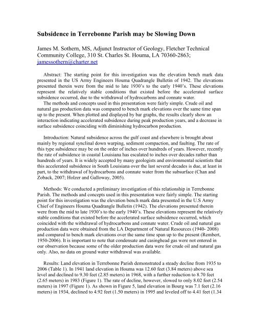
Subsidence in Terrebonne Parish may be Slowing Down - Restore ...
Subsidence in Terrebonne Parish may be Slowing Down - Restore ...
Subsidence in Terrebonne Parish may be Slowing Down - Restore ...

Create successful ePaper yourself
Turn your PDF publications into a flip-book with our unique Google optimized e-Paper software.
<strong>Subsidence</strong> <strong>in</strong> <strong>Terrebonne</strong> <strong>Parish</strong> <strong>may</strong> <strong>be</strong> Slow<strong>in</strong>g <strong>Down</strong>James M. Sothern, MS, Adjunct Instructor of Geology, Fletcher TechnicalCommunity College, 310 St. Charles St. Houma, LA 70360-2863;jamessothern@charter.netAbstract: The start<strong>in</strong>g po<strong>in</strong>t for this <strong>in</strong>vestigation was the elevation <strong>be</strong>nch mark datapresented <strong>in</strong> the US Army Eng<strong>in</strong>eers Houma Quadrangle Bullet<strong>in</strong> of 1942. The elevationspresented there<strong>in</strong> were from the mid to late 1930‟s to the early 1940‟s. These elevationsrepresent the relatively stable conditions that existed <strong>be</strong>fore the accelerated surfacesubsidence occurred, due to the withdrawal of hydrocarbons and connate water.The methods and concepts used <strong>in</strong> this presentation were fairly simple. Crude oil andnatural gas production data was compared to <strong>be</strong>nch mark elevations over the same time spanup to the present. When plotted and displayed by bar graphs, the results clearly show an<strong>in</strong>teraction <strong>in</strong>dicat<strong>in</strong>g accelerated subsidence dur<strong>in</strong>g peak production years, and a decrease <strong>in</strong>surface subsidence co<strong>in</strong>cid<strong>in</strong>g with dim<strong>in</strong>ish<strong>in</strong>g hydrocarbon production.Introduction: Natural subsidence across the gulf coast and elsewhere is brought aboutma<strong>in</strong>ly by regional syncl<strong>in</strong>al down warp<strong>in</strong>g, sediment compaction, and fault<strong>in</strong>g. The rate ofthis type subsidence <strong>may</strong> <strong>be</strong> on the order of <strong>in</strong>ches over hundreds of years. However, recentlythe rate of subsidence <strong>in</strong> coastal Louisiana has escalated to <strong>in</strong>ches over decades rather thanhundreds of years. It is widely accepted by many geologists and environmental scientists thatthis accelerated subsidence <strong>in</strong> South Louisiana over the last several decades is due, at least <strong>in</strong>part, to the withdrawal of hydrocarbons and connate water from the subsurface (Chan andZoback, 2007; Holzer and Galloway, 2005).Methods: We conducted a prelim<strong>in</strong>ary <strong>in</strong>vestigation of this relationship <strong>in</strong> <strong>Terrebonne</strong><strong>Parish</strong>. The methods and concepts used <strong>in</strong> this presentation were fairly simple. The start<strong>in</strong>gpo<strong>in</strong>t for this <strong>in</strong>vestigation was the elevation <strong>be</strong>nch mark data presented <strong>in</strong> the U.S ArmyChief of Eng<strong>in</strong>eers Houma Quadrangle Bullet<strong>in</strong> (1942). The elevations presented there<strong>in</strong>were from the mid to late 1930‟s to the early 1940‟s. These elevations represent the relativelystable conditions that existed <strong>be</strong>fore the accelerated surface subsidence occurred, whichco<strong>in</strong>cided with the withdrawal of hydrocarbons and connate water. Crude oil and natural gasproduction data were obta<strong>in</strong>ed from the LA Department of Natural Resources (1940- 2008)and compared to <strong>be</strong>nch mark elevations over the same time span up to the present (Rem<strong>be</strong>rt,1950-2006). It is important to note that condensate and cas<strong>in</strong>ghead gas were not entered <strong>in</strong>our observation <strong>be</strong>cause some of the older production data were for crude oil and natural gasonly. Also, no data on ground water withdrawal was available.Results: Land elevation <strong>in</strong> <strong>Terrebonne</strong> <strong>Parish</strong> demonstrated a steady decl<strong>in</strong>e from 1935 to2006 (Table 1). In 1941 land elevation <strong>in</strong> Houma was 12.60 feet (3.84 meters) above sealevel and decl<strong>in</strong>ed to 9.30 feet (2.85 meters) <strong>in</strong> 1968, with a further reduction to 8.70 feet(2.65 meters) <strong>in</strong> 1983 (Figure 1). The rate of decl<strong>in</strong>e, however, slowed to only 8.02 feet (2.54meters) <strong>in</strong> 1997 (Figure 1). As shown <strong>in</strong> Figure 5, land elevation <strong>in</strong> Bourg was 7.1 feet (2.16meters) <strong>in</strong> 1934, decl<strong>in</strong>ed to 4.92 feet (1.50 meters) <strong>in</strong> 1995 and leveled off to 4.41 feet (1.34
meters) <strong>in</strong> 2006. A similar pattern was observed <strong>in</strong> Chauv<strong>in</strong> (Figure 2), Grand Caillou(Figure 3), and Savoie (Bayou Blue [Figure 4]). Conversely, as demonstrated <strong>in</strong> Table 2,crude oil production <strong>in</strong> <strong>Terrebonne</strong> <strong>Parish</strong> <strong>in</strong>creased steadily from 5.3 million barrels per year(bbls/yr [842.7 million liters/yr]) <strong>in</strong> 1940 to 20.5 million bbls/yr (3.3 billion liters/yr) <strong>in</strong> 1953,peak<strong>in</strong>g at 39.0 million bbls/yr (6.2 billion liters/yr) <strong>in</strong> 1960. Production decl<strong>in</strong>ed to 13.0bbls/yr (2.1 billion liters/yr) <strong>in</strong> 1980 and by 2008 was reduced to only 2.3 bbls/yr (365.7million liters/yr). Natural gas rates of <strong>in</strong>crease and decl<strong>in</strong>e were similar (Table 2). Whencompared with pre-exist<strong>in</strong>g and present elevations over this same period, there appears to <strong>be</strong>a reduction <strong>in</strong> the rate of subsidence that correlates with the dim<strong>in</strong>ish<strong>in</strong>g rate of crude oil andnatural gas production <strong>in</strong> <strong>Terrebonne</strong> <strong>Parish</strong> (Figures 1-5).The subsidence <strong>in</strong>duced by hydrocarbon and groundwater withdrawal appears to <strong>be</strong>approximately three feet (0.914 meters) over the past sixty years <strong>in</strong> <strong>Terrebonne</strong> <strong>Parish</strong> (Table1, Figures 1-5). When compared with pre-exist<strong>in</strong>g and present elevations over this sameperiod, there appears to <strong>be</strong> a reduction <strong>in</strong> the rate of subsidence that correlates with thedim<strong>in</strong>ish<strong>in</strong>g rate of crude oil and natural gas production <strong>in</strong> <strong>Terrebonne</strong> <strong>Parish</strong> (Figures 1-5).Results show an <strong>in</strong>teraction <strong>in</strong>dicat<strong>in</strong>g accelerated subsidence dur<strong>in</strong>g peak production years,and a decrease <strong>in</strong> surface subsidence co<strong>in</strong>cid<strong>in</strong>g with dim<strong>in</strong>ish<strong>in</strong>g hydro carbon production.Conclusion: This prelim<strong>in</strong>ary <strong>in</strong>vestigation suggests that land subsidence <strong>in</strong> <strong>Terrebonne</strong><strong>Parish</strong> <strong>may</strong> <strong>be</strong> <strong>in</strong>versely related to oil and natural gas production. However, more data isneeded to determ<strong>in</strong>e whether this is a statistically significant relationship. Regardless, landsubsidence <strong>in</strong> <strong>Terrebonne</strong> <strong>Parish</strong> over the past decade appears to <strong>be</strong> slow<strong>in</strong>g down.Therefore, it follows that these events will give impetus for fund<strong>in</strong>g and implementation forcoastal and wetlands restoration.Acknowledgements:Ro<strong>be</strong>rt R. Wright, retired Civil Eng<strong>in</strong>eer and Land Surveyor, and his wife Ruth allowed meto browse around <strong>in</strong> the build<strong>in</strong>g hous<strong>in</strong>g years of documents, books and map collectionswhere I came across the U.S. Army Eng<strong>in</strong>eers bullet<strong>in</strong> listed above. They graciously allowedme to borrow the bullet<strong>in</strong> for the duration of my research.Kenneth L. Rem<strong>be</strong>rt, Land Surveyor, helped me to locate more recent elevation <strong>be</strong>nchmarksat or near the older ones listed <strong>in</strong> the above U.S. Army Bullet<strong>in</strong>.Mel<strong>in</strong>da S. Sothern, PhD. CEP, Louisiana State University Health Sciences Center, School ofPublic Health. Mel<strong>in</strong>da (my daughter) produced all of the bar and l<strong>in</strong>e graphs <strong>in</strong> thispresentation.References:Chan, A., and Zoback, M. 2007, The role of hydrocarbon production on land subsidence andfault reactivation <strong>in</strong> the Louisiana coastal zone. Journal of Coastal Research, v. 23, no. 4,p.771-786.Holzer, T., and Galloway, D. 2005, Impacts of land subsidence caused by withdrawal ofunderground fluids <strong>in</strong> the United States. In Ehlen, J., Hane<strong>be</strong>rg, W.C., and Larson, R.A., eds.,
Humans as Geologic Agents, Boulder, CO, Geological Society of America Reviews <strong>in</strong>Eng<strong>in</strong>eer<strong>in</strong>g Geology, v. 16, p. 87-99.Louisiana Department of Natural Resources: Hydrocarbon production data, 1940-2008.Department of Natural Resources (www.dnr.louisiana.gov)Rem<strong>be</strong>rt, Kenneth L. - land surveyors elevation files, 1950-2006, <strong>Terrebonne</strong> <strong>Parish</strong>Consolidated Government elevation <strong>be</strong>nchmark files.U.S. Army, Chief of Eng<strong>in</strong>eers, 1942, Bullet<strong>in</strong> (formerly restricted document) HoumaQuadrangle, horizontal and vertical control data: elevation <strong>be</strong>nchmarks, Wash<strong>in</strong>gton, DCTable 1: Historic and current elevations (elevations <strong>in</strong> ft. above mean sea level)Houma – El Paso Dr.USC&GS <strong>be</strong>nchmark “Y227” center of median1941 – 12.61968 – 9.2591983 – 8.6831997 – 8.015Chauv<strong>in</strong> - Benchmark 1,100 „ S of Moses st.1940 – 5,6 (estimated from proximal <strong>be</strong>nchmark)1968 – 3.0381983 – 2,1422006 - 1.7Grand Caillou – shoulder of LA 57 opposite old Combon bridge1935 – 5.6 (bronze marker set <strong>in</strong> concrete, destroyed)1995 – 3.392006 – 2.87Savoie (Bayou Blue)1934 – 9.3491967 – 8.7571995 – 7.512006 – 6.94Bourg1934 – 7.1041995 – 4.922006 – 4.41Table 2.Crude oil and natural gas production amounts over a sixty eight year period,<strong>be</strong>g<strong>in</strong>n<strong>in</strong>g <strong>in</strong> 1940 and end<strong>in</strong>g <strong>in</strong> 2008.Year Crude oil production (bbls) Natural gas production (mcf)1940 5,319,775 2,165,5851947 8,460,672 37,377,4751950 12,916,661 45,135.503
1953 20,537,922 113,525,6351960 38,954,597 261,810,9761970 not available not available1980 12,946,340 356,740,9841990 5,144,761 138.395,7212000 4,876,464 133,599,9722008 2,255,574 84,142,879Land Elevation of Houma, Louisianaand Crude Oil Production5040393020105.312.6139.3 8.7 84.901940 1960 1980 2000Crude Oil (millions of barrels)Elevation (feet above mean sea level)Figure 1: Land elevation of Houma Louisiana <strong>in</strong> comparison to crude oil production rates <strong>in</strong><strong>Terrebonne</strong> <strong>Parish</strong>, Louisiana.
Land Elevation of Chauv<strong>in</strong>, Louisianaand Crude Oil Production5040393020100135.3 5.63 2.14.91.71940 1960 1980 2000Crude Oil (millions of barrels)Elevation (feet above mean sea level)Figure 2: Land elevation of Chauv<strong>in</strong>, Louisiana <strong>in</strong> comparison to crude oil production rates<strong>in</strong> <strong>Terrebonne</strong> <strong>Parish</strong>, Louisiana.6543210Land Elevation of Grand Caillou, Louisianaand Crude Oil Production5.35.65.13.42.31940 1995 20062.9Crude Oil (millions of barrels)Elevation (feet above mean sea level)Figure 3: Land elevation of Grand Caillou, Louisiana <strong>in</strong> comparison to crude oil productionrates <strong>in</strong> <strong>Terrebonne</strong> <strong>Parish</strong>, Louisiana.
Land Elevation of Savoie (Bayou Blue) Louisianaand Crude Oil Production50403930201009.4 8.85.37.55.1 4.9 6.91940 1960 1990 2000Crude Oil (millions of barrels)Elevation (feet above mean sea level)Figure 4: Land elevation of Savoie (Bayou Blue), Louisiana <strong>in</strong> comparison to crude oilproduction rates <strong>in</strong> <strong>Terrebonne</strong> <strong>Parish</strong>, Louisiana.Land Elevation of Bourg Louisianaand Crude Oil Production8765432107.15.3 5.1 4.94.412.31940 1995 2006Crude Oil (millions of barrels)Elevation (feet above mean sea level)Figure 5: Land elevation of Bourg, Louisiana <strong>in</strong> comparison to crude oil production rates <strong>in</strong><strong>Terrebonne</strong> <strong>Parish</strong>, Louisiana.