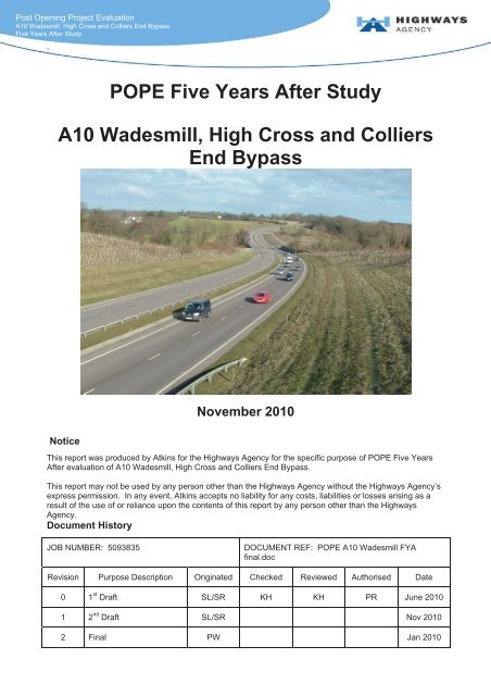
POPE Five Years After Study A10 Wadesmill ... - Highways Agency
POPE Five Years After Study A10 Wadesmill ... - Highways Agency
POPE Five Years After Study A10 Wadesmill ... - Highways Agency

Create successful ePaper yourself
Turn your PDF publications into a flip-book with our unique Google optimized e-Paper software.
Post Opening Project Evaluation<strong>A10</strong> <strong>Wadesmill</strong>, High Cross and Colliers End Bypass<strong>Five</strong> <strong>Years</strong> <strong>After</strong> <strong>Study</strong>`<strong>POPE</strong> <strong>Five</strong> <strong>Years</strong> <strong>After</strong> <strong>Study</strong><strong>A10</strong> <strong>Wadesmill</strong>, High Cross and ColliersEnd BypassNovember 2010NoticeThis report was produced by Atkins for the <strong>Highways</strong> <strong>Agency</strong> for the specific purpose of <strong>POPE</strong> <strong>Five</strong> <strong>Years</strong><strong>After</strong> evaluation of <strong>A10</strong> <strong>Wadesmill</strong>, High Cross and Colliers End Bypass.This report may not be used by any person other than the <strong>Highways</strong> <strong>Agency</strong> without the <strong>Highways</strong> <strong>Agency</strong>’sexpress permission. In any event, Atkins accepts no liability for any costs, liabilities or losses arising as aresult of the use of or reliance upon the contents of this report by any person other than the <strong>Highways</strong><strong>Agency</strong>.Document HistoryJOB NUMBER: 5093835DOCUMENT REF: <strong>POPE</strong> <strong>A10</strong> <strong>Wadesmill</strong> FYAfinal.docRevision Purpose Description Originated Checked Reviewed Authorised Date0 1 st Draft SL/SR KH KH PR June 20101 2 nd Draft SL/SR Nov 20102 Final PW Jan 2010
<strong>POPE</strong> <strong>Five</strong> <strong>Years</strong> <strong>After</strong> Evaluation: <strong>A10</strong> <strong>Wadesmill</strong>, High Cross and Colliers End BypassContentsSectionPageExecutive Summaryviii1. Introduction 1Purpose of the Report12. The Scheme 3Background to Scheme33. Data Collection 8Introduction8Journey Times11Accident Data11Traffic and Economic Forecasts11Environmental Data12Public Consultation134. Traffic Data Analysis 15Introduction15Analysis Methodology15Screenline Analysis22Manual Turning Counts24Predicted Traffic Flows26BAA Stansted Airport Traffic Impacts365. Journey Times 41Introduction41Journey times on the <strong>A10</strong> Bypass41Journey times on the old <strong>A10</strong>42Observed Vs Predicted Journey Times42Issues from Residents’ Survey426. Safety 44Introduction44Accidents44Predicted vs. Observed Accident Numbers51Resident Comments on Safety53Personal Security557. Economy 57Economic Evaluation Methodology58Route Stress62Wider Economic Impacts638. Environment 66Introduction66Traffic Forecasts67Noise685093835/<strong>POPE</strong> <strong>A10</strong> <strong>Wadesmill</strong> FYA final_15_04_11.doci
<strong>POPE</strong> <strong>Five</strong> <strong>Years</strong> <strong>After</strong> Evaluation: <strong>A10</strong> <strong>Wadesmill</strong>, High Cross and Colliers End BypassAir Quality70Greenhouse Gases72Landscape and Townscape73Heritage79Biodiversity81Water87Physical Fitness90Journey ambience939. Accessibility and Integration 97Introduction97Accessibility97Integration10110. Conclusions and EST 105Summary of Main Impacts105Achievement of Scheme Objectives106AppendicesAppendix A - AST107Appendix B - EST109Appendix C – Residents’Survey Form111Appendix D – Environmental Information Requests115Appendix E – Scheme Plan118Appendix F – Site Photos1205093835/<strong>POPE</strong> <strong>A10</strong> <strong>Wadesmill</strong> FYA final_15_04_11.docii
<strong>POPE</strong> <strong>Five</strong> <strong>Years</strong> <strong>After</strong> Evaluation: <strong>A10</strong> <strong>Wadesmill</strong>, High Cross and Colliers End BypassGlossary of TermsTerm Abbreviation Description where appropriateAnnual Average DailyTrafficAnnual AverageWeekday TrafficAADTAAWTAverage of 24 hour flows, seven days a week, forall days within the year.As AADT but for five days, (Monday to Friday)only.Accessibility -Accessibility can be defined as ‘ease ofreaching’. The accessibility objective isconcerned with increasing the ability with whichpeople in different locations, and with differingavailability of transport, can reach different typesof facility.AM - Denoting the morning peak periodAppraisal SummaryTableAutomatic TrafficCountAverage WeekdayTrafficAverage Daily TrafficBenefit Cost RatioASTATCAWTADTBCRThis records the impacts of the schemeaccording to the Government’s five key objectsfor transport, as defined in DfT guidancecontained on its Transport Analysis Guidanceweb pages, WebTAGAn automated method of recording the volume(and sometimes classification) of vehiclespassing a particular point on a road.Average of Monday to Friday 24 hour flows overa particular period.Average of Monday to Sunday 24 hour flows overa particular period.The ratio between the monetised benefits andcosts of a scheme, used as a measure of valuefor money in economic terms.Capacity - The maximum hourly lane throughputCapitalisation -Chi-square -The process by which benefits for a scheme arefactored to give an estimate for the appropriateappraisal period.A statistical test to determine whether theobserved values of a variable are significantlydifferent from those expected on the basis of anull hypothesis. Variables are categorised todetermine whether a distribution of scores is dueto chance or experimental factors and testswhether one variable is independent of another.COst Benefit AnalysisCOBAA computer program which compares the costsof providing road schemes with the benefitsderived by road users (in terms of time, vehicleoperating costs and accidents), and expressesthe results in terms of a monetary valuation. TheCOBA model uses the fixed trip matrix.5093835/<strong>POPE</strong> <strong>A10</strong> <strong>Wadesmill</strong> FYA final_15_04_11.dociii
<strong>POPE</strong> <strong>Five</strong> <strong>Years</strong> <strong>After</strong> Evaluation: <strong>A10</strong> <strong>Wadesmill</strong>, High Cross and Colliers End BypassTerm Abbreviation Description where appropriateCongestion ReferenceFlowDepartment forTransportCRFDfTAn AADT flow estimate at which a road is likelyto be congested in the peak periods on anaverage day.A Government department whose objective is tooversee the delivery of a reliable, safe andsecure transport system that responds efficientlyto the needs of individuals and business whilstsafeguarding our environment. The <strong>Highways</strong><strong>Agency</strong> is an executive of the DfT.Discounting -Discounting is a technique used to comparecosts and benefits that occur in different timeperiods and is the process of adjusting futurecash flows to their present values to reflect thetime value of money, e.g. £1 worth of benefitsnow is worth more than £1 in the future. Astandard base year needs to be used which is2002 for the appraisal used in this report.Design Manual forRoads and BridgesDo-minimumDo-somethingEnvironmentalStatementDMRBDMDSESA comprehensive manual system which sets outcurrent standards, Advice Notes and otherpublished documents relating to Trunk Roadworks.In scheme modelling, this is the scenario whichcomprises the existing road network plusimprovement schemes that have already beencommitted.In scheme modelling, this is the scenariodetailing the planned scheme.This must be submitted with the initial planningapplication and covers all potential significantimpacts that the road project may have.East Herts CouncilEnvironment TeamEHC -Evaluation SummaryTable<strong>Five</strong> <strong>Years</strong> <strong>After</strong>ESTFYAIn <strong>POPE</strong> studies, this is a summary of theevaluations of the TAG objectives using a similarformat to the forecasts in the AST.Relating to a <strong>POPE</strong> evaluation <strong>Five</strong> <strong>Years</strong> <strong>After</strong>scheme openingGrade Separated -The process of aligning a junction of two or moretransport axes at different heights (grades) sothat they will not disrupt the traffic flow on othertransit routes when they cross each other.Heavy Goods VehicleHGVGoods-carrying vehicle over 3,500kg unladenweight.5093835/<strong>POPE</strong> <strong>A10</strong> <strong>Wadesmill</strong> FYA final_15_04_11.dociv
<strong>POPE</strong> <strong>Five</strong> <strong>Years</strong> <strong>After</strong> Evaluation: <strong>A10</strong> <strong>Wadesmill</strong>, High Cross and Colliers End BypassTerm Abbreviation Description where appropriate<strong>Highways</strong> <strong>Agency</strong>HAAn Executive <strong>Agency</strong> of the Department forTransport (DfT), responsible for operating,maintaining and improving the strategic roadnetwork in England.Inter Peak IP The time between the AM and PM peaksKph Kph Kilometres per hourKilled or SeriouslyInjuredMajor SchemesprogrammeNew Approach ToAppraisalNatural EnglandNon-motorised UserNational Road TrafficForecast.One Year <strong>After</strong>Project AppraisalReportKSI-NATANENMUNRTFOYAPARA term used to describe the number of peoplekilled or seriously injured as a result of PIAs.The HA’s programme of investment inimprovements to the Trunk road and Motorwayroad network comprised of a number of majorschemes each costing more than £5m. Formerlyknown as TPI.Used for transport scheme appraisal since 1998.The government’s advisor on the naturalenvironment, whose remit is to ensuresustainable stewardship of the land and sea sothat people and nature can thrive.A term used to describe pedestrians, cyclists andequestrians.This document defines the latest forecastsproduced by the Department of the Environment,Transport and the Regions of the growth in thevolume of motor traffic. The most recent one isNRTF07 and the one previous was NRTF97.Relating to a <strong>POPE</strong> study One Year <strong>After</strong>scheme opening.The PAR is a key summary document in whichthe need for a project, its costs and benefits areappraised. Used for road scheme’s less than£5m.Part 1 claims -Claims for compensation under Part 1 of theLand Compensation Act 1973, relating tohomeowners affected by road schemesPersonal InjuryAccidentPersonal InjuryAccidents per millionVehicle kilometresPIAPIA/mvkmA term commonly used to refer to road accidents.A term used to express accident rates for aparticular link on a road, i.e. the number ofaccidents per million vehicle kilometres travelled.PM - Evening peak periodPost Opening ProjectEvaluation<strong>POPE</strong>Before & after monitoring of all major highwayschemes in England.5093835/<strong>POPE</strong> <strong>A10</strong> <strong>Wadesmill</strong> FYA final_15_04_11.docv
<strong>POPE</strong> <strong>Five</strong> <strong>Years</strong> <strong>After</strong> Evaluation: <strong>A10</strong> <strong>Wadesmill</strong>, High Cross and Colliers End BypassTerm Abbreviation Description where appropriatePublic Right of WayPresent Value ofBenefitsPresent Value of CostsPROWPVBPVCPROW are highways that allow the public right ofpassage, of which England has about 190,000km.The value of the scheme’s estimated benefitsdiscounted back to a common base year.The value of the scheme’s estimated costsdiscounted back to a common base year.ScreenlineSecuritySeverance- An imaginary line intersecting routes on a map toallow easier analysis of vehicular movementacross a corridor.- In terms of the NATA sub-objective relating tothe likelihood of crime or perception of likelycrime.- Community severance is the separation ofadjacent areas by road or heavy traffic, causingnegative impact on non-motorised users,particularly pedestrians.Site of SpecialScientific InterestSingle RegenerationBudgetSSSISRBThere are over 4,000 Sites of Special ScientificInterest (SSSIs) in England, covering around 7%of the country's land area. SSSIs are thecountry's very best wildlife and geological sites.Schemes set up to assist local people in tacklingsome of the problems associated with modernurban living.STATS19- A database of injury accident statistics recordedby police officers attending accidents‘Route Stress’Traffic Impact <strong>Study</strong>Transport AnalysisGuidanceTransport StatisticsBulletinTrip End ModelProgramStressTISTAG-TEMPRORatio of the AADT flow to the CRF. When thetraffic flow on a particular link reaches the CRF itis considered to be at 100% Stress.An evaluation undertaken shortly after theopening of a scheme to determine the immediateimpacts on traffic flows and journey times.Transport Analysis Guidance - as defined inWebTAG.Produced by the DfT presenting information onTraffic in Great BritainA program which provides access to the DfT’snational Trip End Model projections of growth intravel demand, and the underlying car ownershipand planning data projections.5093835/<strong>POPE</strong> <strong>A10</strong> <strong>Wadesmill</strong> FYA final_15_04_11.docvi
<strong>POPE</strong> <strong>Five</strong> <strong>Years</strong> <strong>After</strong> Evaluation: <strong>A10</strong> <strong>Wadesmill</strong>, High Cross and Colliers End BypassTerm Abbreviation Description where appropriateTargeted Programme ofImprovements.Traffic DatabaseTPITRADsThe <strong>Highways</strong> <strong>Agency</strong>’s programme ofinvestment in improvements to the Trunk roadand Motorway road network comprised of anumber of major schemes each costing morethan £5m. Now called Major Schemes.Traffic count database developed by the <strong>Agency</strong>,to hold data from the Midlands, Southern andNorthern monitoring regions.Vehicle Operating CostVOCReflects fuel and other operating costs calculatedfrom total distance travelled on affected links,also taking into account vehicle speeds.Value of TimeVOTA monetary value placed on the benefits accruedby a road scheme in terms of vehicle hours.WebTAG -Department for Transport’s website for guidanceon the conduct of transport studies athttp://www.webtag.org.uk/5093835/<strong>POPE</strong> <strong>A10</strong> <strong>Wadesmill</strong> FYA final_15_04_11.docvii
<strong>POPE</strong> <strong>Five</strong> <strong>Years</strong> <strong>After</strong> Evaluation: <strong>A10</strong> <strong>Wadesmill</strong>, High Cross and Colliers End BypassExecutive SummaryThe <strong>A10</strong> <strong>Wadesmill</strong>, High Cross and Colliers End Bypass is a major <strong>Highways</strong> <strong>Agency</strong> scheme toprovide 4.5 miles of new dual carriageway road, bypassing the villages of Thundridge, <strong>Wadesmill</strong>, HighCross and Colliers End. The scheme is located north of the towns of Hertford and Ware, inHertfordshire.The scheme opened to traffic on 8 th October 2004.Scheme DescriptionKey features of the <strong>A10</strong> <strong>Wadesmill</strong>, High Cross and Colliers End Bypass scheme include:4.5 miles of dual two lane carriageway starting north of Hertford and Ware and re-joining the old<strong>A10</strong> at Standon;A road bridge over the River Rib;Crossing points provided at various bridges and underpasses, with one at-grade crossing; andLay-bys on both sides of the carriageway.Objectives (from Appraisal Summary Table)ObjectiveAchieved?•To remove 90% of the existing traffic from the villages reducingseverance•To reduce delays and disruption to through traffic by replacing singlecarriageway bottleneck with dual carriagewayYes• To improve local air quality and reduce noise levels Yes• To improve safety conditions on the <strong>A10</strong> and for pedestrians and cyclists in the villagesMain ImpactsYesYesAll the scheme objectives have been met.Based on five years after opening data, the number of accidents has reduced at a statisticallysignificant level.There have been no serious accidents in the villages since scheme opening.Residents reported improved safety in the villages, but some are concerned about the impacts ofincreased speeds.Outturn traffic flows are above predictions, due to increased traffic in the area from the expansionof Stansted Airport and re-assignment from the wider network that was not considered in thescheme appraisal.Predicted journey time savings were reasonably accurate.Journey time benefits are slightly less than predicted, but accident savings are considerablyhigher than forecast. With outturn costs higher than predicted, the outturn Benefit to Cost Ratio(BCR) is lower than expected.5093835/<strong>POPE</strong> <strong>A10</strong> <strong>Wadesmill</strong> FYA final_15_04_11.docviii
<strong>POPE</strong> <strong>Five</strong> <strong>Years</strong> <strong>After</strong> Evaluation: <strong>A10</strong> <strong>Wadesmill</strong>, High Cross and Colliers End BypassAir quality and traffic noise will have improved in the villages due to the transfer of traffic to thebypass.Environmental measures were given due regard and mitigation measures implemented asplanned.The scheme has reduced community severance in the villages and improved conditions forpedestrians and cyclists.The scheme is consistent with and contributes to regional and local transport planning policies.Summary of Scheme ImpactsTraffic Total traffic in the <strong>A10</strong> corridor (bypass and old <strong>A10</strong>) has increased by 12%.Traffic in the wider area has increased by only 3%, rather than the 8% expected due tobackground growth, indicating that the additional traffic in the <strong>A10</strong> corridor has re-routed from thewider area.<strong>Five</strong> years after opening the bypass is used by 27,350 vpd, an increase of 1,400 vpd since theone year after study.On the old <strong>A10</strong> through the villages flows are 87% lower on an average weekday than beforeopening. This is a larger reduction than at the one year after stage, and is likely to be as a resultof traffic calming measures introduced by the local authority. An extra 1,400 vehicles have beenremoved from the old <strong>A10</strong>, explaining the increase in bypass traffic.Traffic on local roads accessing the old <strong>A10</strong> has decreased, indicating a reduction in rat-runningby traffic that has re-routed following scheme opening to use the A roads.Heavy Goods Vehicle traffic has fallen by up to 95% on the old road.Outturn traffic flows on the bypass and old road are above predicted flows. It is believed that theexpansion of Stansted Airport passenger numbers has resulted in increased traffic in the area.Predicted do-minimum flows were reasonably accurate, within the guideline target values of +/ -15% for model validation defined within DMRB Volume 12. However, there were some largepercentage differences between predicted do-something flows and observed after flows. Inaddition, there has been some re-assignment from the wider area that was not considered in thescheme appraisal.Whilst the economic forecasts were updated as the scheme appraisal progressed, the trafficgrowth forecasts from the airport were not updated and the level of growth of Airport traffic wasunderestimated. The schemes traffic model assumed that usage of the airport would rise from 1million passengers per annum (mppa) to 8 mppa. However, by 2008 passenger numbers hadreached 22.8 mppa.Journey times using the bypass compared to the old <strong>A10</strong> have improved by around 2.5 minutes.The journey time savings are generally in line with or slightly higher than predicted. Someresidents report reduced congestion on the old <strong>A10</strong>, but others still have concerns aboutcongestion levels and perceived rat-running on local roads.5093835/<strong>POPE</strong> <strong>A10</strong> <strong>Wadesmill</strong> FYA final_15_04_11.docix
<strong>POPE</strong> <strong>Five</strong> <strong>Years</strong> <strong>After</strong> Evaluation: <strong>A10</strong> <strong>Wadesmill</strong>, High Cross and Colliers End BypassSafety ImpactsThe scheme shows a positive safety benefit.The number of Personal Injury Accidents has fallen from an average of almost 28 per year beforethe scheme opened to 12 per year over the five years since opening, a reduction of 16 accidentsper year.The reduction in the number of accidents is statistically significant, but is less than predicted.On the old <strong>A10</strong> and in the villages there have been no serious accidents since opening.Before the bypass was built, the accident rate on the old <strong>A10</strong> was close to the national average fora rural A road. <strong>After</strong> opening, the accident rate is now less than the national average on the old<strong>A10</strong> and half the national average for a road of this type on the bypass.Residents reported improved safety due to lower traffic flows for both drivers and non-motorisedusers. This has resulted in increased levels of walking and cycling.However, some residents are concerned about the impacts of perceived increased speeds.Residents raised some issues with the traffic calming measures introduced by the local authorityafter the opening of the scheme. There was some concern that drivers slowed when travellingacross the measures but then speeded up.EnvironmentIt is likely that local noise and air quality in the villages are generally as expected, due to thetransfer of traffic to the bypass.Carbon emissions increased by 23% since scheme opening, compared to if the scheme had notbeen built. This is a worst case estimate as due to some re-routing of traffic there will also bedecreases in emission elsewhere on the network.Landscape planting has continued to establish since the one year after study and should fulfil itslong term potential. The bypass has been de-trunked and Hertfordshire CC is now responsible forany ongoing maintenance and management.Biodiversity mitigation measures have been incorporated into the scheme as expected. However,there has been some vandalism including damage to the bat cave and breaching of animalexclusion fencing.Archaeological evaluation identified valuable new evidence for human activity across a diverselandscape.As expected the bypass had a significant impact on the Grade 2* Youngsbury Park.Impacts on other environmental objectives are as expected and mitigation measures have beenimplemented as planned.AccessibilityThe reduction in traffic in and between the villages has reduced community severance.The local authority has implemented a number of improvements in the villages including newstreet lighting, footway improvements, new bus stops, lower speed limits and traffic calmingmeasures further improving conditions for residents.Bus services and passengers have benefited from more reliable journey times and better waitingfacilities.5093835/<strong>POPE</strong> <strong>A10</strong> <strong>Wadesmill</strong> FYA final_15_04_11.docx
<strong>POPE</strong> <strong>Five</strong> <strong>Years</strong> <strong>After</strong> Evaluation: <strong>A10</strong> <strong>Wadesmill</strong>, High Cross and Colliers End BypassConditions for non-motorised users will have benefited considerably from reduced traffic levels.Significant proportions of residents reported they are making more journeys on foot and bicycle,but there were also some concerns with perceived speeds on the old <strong>A10</strong>.IntegrationThe scheme has been beneficial in achieving policy objectives at a national, regional and locallevel, including: 1991-2011 Structure Plan for Hertfordshire and Hertfordshire Local TransportPlan (LTP) (2001/02 – 2005/06).Summary of Scheme Economic PerformancePre SchemeForecast (AST)(2002 Prices,discounted to 2002)Pre Scheme Reforecast(2002 Prices,discounted to 2002)Post OpeningReforecast(2002 Prices,discounted to 2002)Journey Time Benefit £86.3m £86.3m £83.2mSafety Benefit £20.3m £47.6m £37.9mTotal 30 Year Benefits (PVB) £106.6m £133.9m £121.1mCosts (PVC) £23.7m £23.7m £40.8mBenefit Cost Ratio (BCR) 4.5 5.6 3.0A lack of data and information from the scheme economic appraisal required <strong>POPE</strong> to be basedon a number of assumptions. As a result, less confidence can be placed on the comparisons ofpredicted and actual scheme benefits.Details of how the costs and benefits in the AST were calculated were not available to <strong>POPE</strong>. Ithas been assumed that the figures in the AST are in 1994 prices (in line with WebTAG guidanceat the time the AST was produced) and these have been updated to 2002 prices and values.The monetary journey time benefit is slightly lower than forecast but accounts for the majority ofbenefits.Accident benefits are almost double the AST forecast level. This is despite accident savingsbeing lower than forecast. This is due to the cost of an accident being much lower and a higherdiscount rate being applicable at the time of the appraisal. In addition, the observed accidentsavings are calculated using the PAR approach, which are not directly comparable with theforecast.As a result, to allow a more direct comparison between the forecast and outturn, the accidentsavings in the AST have been updated with the latest accident costs. This gives an AST reforecastsafety benefit that is higher than the outturn benefit.The outturn scheme cost is around 70% higher than the predicted cost.The benefit to cost ratio is lower than predicted, but represents good value for money.5093835/<strong>POPE</strong> <strong>A10</strong> <strong>Wadesmill</strong> FYA final_15_04_11.docxi
<strong>POPE</strong> <strong>Five</strong> <strong>Years</strong> <strong>After</strong> Evaluation: <strong>A10</strong> <strong>Wadesmill</strong>, High Cross and Colliers End Bypass1. IntroductionPurpose of the Report1.1 This report represents the ‘<strong>Five</strong> Year <strong>After</strong>’ (5YA) study for the <strong>A10</strong> <strong>Wadesmill</strong>, High Crossand Colliers End Bypass and has been prepared as part of the Post Opening ProjectEvaluation (<strong>POPE</strong>) commission for the <strong>Highways</strong> <strong>Agency</strong>.Overview of <strong>POPE</strong>1.2 The <strong>Highways</strong> <strong>Agency</strong> (HA) is responsible for operating, maintaining and improving thestrategic highway network (motorways and trunk roads). This scheme forms part of theProgramme of Major Schemes (formerly Targeted Programme of Improvements or TPI). Ateach key decision stage through the development process, schemes are subject to a rigorousappraisal to provide a justification for the project’s continued development. This examines thedegree to which the five Central Government objectives for Transport (Environment, Safety,Economy, Accessibility and Integration) will be achieved. This is summarised in an ASTwhich (along with its more detailed supporting documentation) allow judgements to be madeabout the overall value for money of the scheme. The AST for the <strong>A10</strong> <strong>Wadesmill</strong> Bypassscheme is shown in Appendix A.1.3 During the planning process scheme impacts are based on well informed predictions.However, it is vital to identify the strengths and weaknesses in the techniques used forscheme appraisal so that improvements can be made in the future. For <strong>POPE</strong> this isachieved by comparing information collected before and after a scheme opens withpredictions made during the planning process. Outturn impacts are summarised in anEvaluation Summary Table (EST). The EST summarises the extent to which the schemeobjectives have been achieved as shown in Appendix B.1.4 <strong>POPE</strong> studies are undertaken for all Major Projects at one year and five years after opening.The one year after study for this scheme was reported in 2007.Organisations Involved in this <strong>Study</strong>1.5 The following organisations have been involved in this study and have supplied data andinformation used in the scheme evaluation:The <strong>Highways</strong> <strong>Agency</strong>;Hertfordshire County Council;Hertfordshire <strong>Highways</strong> (a partnership between Hertfordshire County Council, MouchelGroup and Amey Lafarge to deliver highways services in Hertfordshire);East Hertfordshire Council;Environment <strong>Agency</strong>;Thundridge and Standon Parish Council; andHerts and Middlesex Wildlife Trust.The Evaluation Approach1.6 In line with the <strong>POPE</strong> procedures, this report compares traffic conditions in June 2003 beforethe Bypass opened with those five years after in October 2009. The report summarises trafficimpacts as well as the five DfT appraisal objectives.5093835/<strong>POPE</strong> <strong>A10</strong> <strong>Wadesmill</strong> FYA final_15_04_11.doc 1
<strong>POPE</strong> <strong>Five</strong> <strong>Years</strong> <strong>After</strong> Evaluation: <strong>A10</strong> <strong>Wadesmill</strong>, High Cross and Colliers End Bypass1.7 The main areas covered include:Traffic volume changes in the <strong>A10</strong> corridor and wider area;Journey time changes along the old <strong>A10</strong> and Bypass;Accident Analysis;Comparison of outturn versus predicted costs and benefits;Impacts on the environment,accessibility and integration; andOther local impacts, including impacts on residents.Contents of this Report1.8 Following on from this introduction, this report provides:Section 2 – The scheme. Summary of the scheme background and history, includingobjectives;Section 3 – Data Collection. Summarises the data collected for the one year afterstudy;Section 4 – Traffic Data Analysis. This section is an analysis of the available trafficdata in the vicinity of the scheme;Section 5 – Journey Times Analysis. Discusses changes in journey times sincescheme opening;Section 6 - Safety. Discusses changes in accident patterns and personal security as aresult of the scheme;Section 7 – Economy. Outturn costs and benefits are compared to forecasts from thescheme appraisal;Section 8 - Environment. Contains a review of the environmental impacts of thescheme is given and supported by an evaluation of the mitigation measures describedwithin the scheme’s Environmental Statement;Section 9 – Accessibility and Integration. A review of how the scheme has affectedaccessibility for pedestrians, cyclists and public transport users is presented.Furthermore, a review of how the scheme links with wider policy objectives is also given;andSection 10 – Conclusions and EST. This section contains an overview of the actualscheme impacts as presented in the EST.5093835/<strong>POPE</strong> <strong>A10</strong> <strong>Wadesmill</strong> FYA final_15_04_11.doc 2
<strong>POPE</strong> <strong>Five</strong> <strong>Years</strong> <strong>After</strong> Evaluation: <strong>A10</strong> <strong>Wadesmill</strong>, High Cross and Colliers End Bypass2. The SchemeBackground to Scheme2.1 The <strong>A10</strong> <strong>Wadesmill</strong>, High Cross and Colliers End Bypass was a major <strong>Highways</strong> <strong>Agency</strong>scheme providing 7.5km of new dual carriageway road. The bypass opened to traffic on 8 thOctober 2004. This report is a <strong>Five</strong> <strong>Years</strong> <strong>After</strong> (FYA) evaluation of the impacts of thescheme (abbreviated to The Bypass in the remainder of this report).Scheme Location2.2 The <strong>A10</strong> runs north–south between London and Cambridge, between the parallel routes ofthe A1(M) and M11. Stansted Airport lies directly to the east, and as such has strategicimplications for the area. The <strong>A10</strong> <strong>Wadesmill</strong> Bypass is located in a rural area, on the sectionof the <strong>A10</strong> that links the towns of Ware and Hertford with Royston and Bishop’s Stortford.2.3 Prior to the bypass opening, the route of the <strong>A10</strong> was on a single carriageway road passingthrough the villages of Thundridge, <strong>Wadesmill</strong>, High Cross and Colliers End. It was originallypart of a Roman road (as seen by the straightness of the roads alignment), called ErmineStreet, which later became the Great North Road. The route through <strong>Wadesmill</strong> was the firstturnpike road in England in 1663.2.4 Figure 2.1 shows the scheme within its regional context.Figure 2.1 – Location of Scheme within Regional Context5093835/<strong>POPE</strong> <strong>A10</strong> <strong>Wadesmill</strong> FYA final_15_04_11.doc 3
<strong>POPE</strong> <strong>Five</strong> <strong>Years</strong> <strong>After</strong> Evaluation: <strong>A10</strong> <strong>Wadesmill</strong>, High Cross and Colliers End BypassProblems along the route prior to the Scheme2.5 Prior to the opening of the scheme, the <strong>A10</strong> carried up to 28,000 vehicles per day (vpd). Thiscaused congestion and delays for through traffic and safety problems within the four villagesthat the road passes through. This included environmental problems from poor air quality andtraffic noise. The level of traffic flow also led to community severance issues. The road had apoor safety record, with an above average accident severity rate (i.e., the number ofaccidents recorded as serious or fatal expressed as a percentage of the total) of 15%.2.6 There were a number of problems reported along the <strong>A10</strong> corridor and in the villages along itbefore the bypass was built. These are summarised below:Poor safety record with a high casualty severity rate and problems for pedestrians andcyclists in the four villages along the road;Traffic delays and congestion;Rat-running on less appropriate roads in the area;Poor environment in the four villages, including traffic noise and poor air quality; andCommunity severance caused due to the high volume of traffic passing through thevillages.Scheme Objectives2.7 The main objectives of the scheme are listed below and were sourced from the schemeAppraisal Summary Table (AST):To remove 90% of the existing traffic from the villages reducing severance;To reduce delays and disruption to through traffic by replacing the single carriagewaybottleneck with a new dual carriageway;To improve local air quality and reduce noise levels; andTo improve safety conditions on the <strong>A10</strong> and for pedestrians and cyclists in the villages.Scheme Detail2.8 Figure 2.2 shows the location of the scheme and its immediate surroundings in greater detail.2.9 The scheme lies within <strong>Highways</strong> <strong>Agency</strong> Area 6. However, in October 2006 the section ofthe <strong>A10</strong> between the M25 and Royston, including the bypass was de-trunked and transferredto the local authority. Therefore the scheme now falls within the authority of HertfordshireCounty Council (HCC). The old <strong>A10</strong> had already been de-trunked on the opening of thebypass and renamed Cambridge Road.2.10 The key elements of the scheme are listed below:7.5km of dual two lane carriageway starting north of Ware and Hertford and re-joiningthe old <strong>A10</strong> at Standon;A road bridge over the River Rib;Three overbridges (across Cold Christmas Lane, Dowsetts Lane and North Drive); andThree underpasses (at Plashes Wood, Gore Lane and Youngsbury Drive)5093835/<strong>POPE</strong> <strong>A10</strong> <strong>Wadesmill</strong> FYA final_15_04_11.doc 4
<strong>POPE</strong> <strong>Five</strong> <strong>Years</strong> <strong>After</strong> Evaluation: <strong>A10</strong> <strong>Wadesmill</strong>, High Cross and Colliers End BypassFigure 2.2 – Detailed Location of Scheme<strong>A10</strong>/A120 RoundaboutAnchor Lane/ CambridgeRoad Junction5093835/<strong>POPE</strong> <strong>A10</strong> <strong>Wadesmill</strong> FYA final_15_04_11.doc 5
<strong>POPE</strong> <strong>Five</strong> <strong>Years</strong> <strong>After</strong> Evaluation: <strong>A10</strong> <strong>Wadesmill</strong>, High Cross and Colliers End BypassHistory of the Scheme2.11 The history of the scheme and key events within the area can be summarised as follows:DateEventOctober 1988 Public ConsultationJanuary 1989 Preferred Route AnnouncedSeptember 1991 Public InquiryFebruary 1993 Secretary of State decision1994 Priority 2 scheme in Trunk Roads in England 1994 Review1995/1996 Scheme removed from Programme1997 Strong support for scheme in 1997 Roads Review ConsultationJuly 1998Scheme included in Targeted Programme of Improvements (TPI)January 2001 Secretary of State decisionMay 2001Orders madeFebruary 2002 Contract awardedApril 2002Start of scheme construction8 th October 2004 Scheme opened and old Road de-trunkedOctober 2006 <strong>A10</strong> Bypass de-trunked2.12 The bypass was originally due to open in December 2003, but was delayed due to acarriageway construction problem.Scheme Support2.13 The bypass had long standing support in the local community, businesses and localcouncillors.2.14 The FYA evaluation included a survey of residents (see section 3 for further details) in thefour bypassed villages and this included a question to ascertain residents’ level of support forthe scheme. A summary of the responses to the question are shown for each village below:Table 2.1 – Scheme SupportVillage In favour Opposed Don't KnowThundridge 37 (93%) 2 (5%) 1 (2%)<strong>Wadesmill</strong> 48 (94%) 2 (4%) 1 (2%)High Cross 30 (79%) 6 (16%) 2 (5%)Colliers End 7 (100%) 0 0Overall 122 (90%) 10 (7%) 4 (3%)2.15 Table 2.1 shows:Overall, 90% of residents were in favour of the bypass;Strong support for the bypass in all villages; andAlthough, 16% of residents in High Cross were opposed to the bypass, of the 6 whowere opposed 5 were in the part of the village closest to the new road (zone 6 on Figure3.3).2.16 Most of the residents who were in favour of the bypass and provided comments citedexpected reductions in traffic and congestion and improved safety on the old <strong>A10</strong> as the5093835/<strong>POPE</strong> <strong>A10</strong> <strong>Wadesmill</strong> FYA final_15_04_11.doc 6
<strong>POPE</strong> <strong>Five</strong> <strong>Years</strong> <strong>After</strong> Evaluation: <strong>A10</strong> <strong>Wadesmill</strong>, High Cross and Colliers End Bypassreason for their support. Others expected that noise and air quality would be improved.Others mentioned generally that they expected quality of life in their village would beimproved.2.17 The small number who stated they opposed the bypass commented on loss oftrees/countryside, one resident thought the scheme would harm his business and another thatnew housing development would follow the scheme opening.2.18 In addition, residents who have lived in their village for less than five years (i.e., after thebypass opened) were asked whether the bypass influenced their decision to move to thearea. Of the 15 residents who had lived in the area less than five years 12 responded thebypass did influence their decision. Some of them made comments that expanded on theiranswers and the following are representative of the replies:“Had it not been built we would never had moved to Thundridge as the traffic to go throughThundridge to <strong>Wadesmill</strong> and up to High Cross was horrendous.“ Thundridge Resident“We looked at purchasing a property in Colliers End prior to bypass but owing to how busyroad was we elected to wait. The road is very quiet in comparison to how it used to be.”Colliers End ResidentSummary of Findings from the One Year <strong>After</strong> <strong>Study</strong>2.19 The one year after study report was published in 2007 and its main conclusions aresummarised below:The bypass was used by 26,000 vehicles per day;Over 80% of traffic from the old road had transferred to the bypass;Traffic was reduced on the minor roads adjacent to the old <strong>A10</strong>, indicating a reduction inrat-running;There was some evidence of traffic re-routing from parallel roads in the area;Traffic forecasts underestimated the volumes on the bypass and the old road;Journey times using the bypass had improved by between 1.5 and 7 minutes comparedto the old road before opening;Slower journey times through the villages due to traffic calming and speeds limits;There were no serious or fatal accidents on the new or old routes in the first year afteropening;Total accidents were reduced by a third, a saving of 8 accidents in the first year;The outturn scheme cost was £40.2 million, compared to a forecast of £39.2m (both at2001 Q3 prices);Total benefits were £94.5 million compared to the forecast of £106.6 million (both at2002 prices and values); The outturn scheme Benefit Cost Ratio (BCR) was 2.3, compared to the forecast of 4.5;For environmental sub-objectives, the impacts were generally as predicted; andOverall, the scheme at the one year after stage was assessed as meeting its objectives.5093835/<strong>POPE</strong> <strong>A10</strong> <strong>Wadesmill</strong> FYA final_15_04_11.doc 7
<strong>POPE</strong> <strong>Five</strong> <strong>Years</strong> <strong>After</strong> Evaluation: <strong>A10</strong> <strong>Wadesmill</strong>, High Cross and Colliers End Bypass3. Data CollectionIntroduction3.1 This section of the report outlines the details of the traffic surveys carried out and other datacollected for the <strong>Five</strong> Year <strong>After</strong> <strong>Study</strong>.Data Sources3.2 The <strong>Five</strong> Year <strong>After</strong> <strong>Study</strong> uses data from a number of sources which provide a variety ofinformation. As part of the ‘before’ and ‘after’ monitoring for this scheme, information wasobtained from the following sources:Traffic count data from Hertfordshire <strong>Highways</strong> (on behalf of Hertfordshire CountyCouncil (HCC)) for local routes and <strong>A10</strong> post de-trunking;Temporary traffic count and journey time surveys commissioned by Atkins;Accident data supplied by Hertfordshire <strong>Highways</strong> (on behalf of HCC);Environmental data and information from a variety of sources; andResident survey responses.Traffic Count Data3.3 Counts were undertaken before the opening of the bypass to record traffic flows at varioussites in the area. The same sites have been used for the after surveys to assess anychanges that may be a result of the schemes implementation. Traffic data has been collectedfor four periods: Before scheme opening – June 2002, June 2003; Immediately after opening (Traffic Impact <strong>Study</strong> (TIS)) – October 2004;One year after opening – October 2005; and <strong>Five</strong> years after opening – October 2009.Count Locations3.4 The count locations and source of data used in this report are listed below in Table 3.1. Eachof the count site locations are also shown on Figure 3.1.3.5 In addition, to examine how the bypass has impacted on route choice, 12 hour ManualTurning Counts (MTC) were undertaken before and after the scheme opened at two locations: At the roundabout north of the bypass where the old road meets the bypass and A120;andAt the mini-roundabout in <strong>Wadesmill</strong> village, where the former B158 (Anchor Lane)meets the old <strong>A10</strong> road.5093835/<strong>POPE</strong> <strong>A10</strong> <strong>Wadesmill</strong> FYA final_15_04_11.doc 8
<strong>POPE</strong> <strong>Five</strong> <strong>Years</strong> <strong>After</strong> Evaluation: <strong>A10</strong> <strong>Wadesmill</strong>, High Cross and Colliers End BypassTable 3.1 - Traffic Count Locations and Data SourcesSite Ref Location Data Source1 <strong>A10</strong> Bypass Hertfordshire County Council2 Cambridge Road (old <strong>A10</strong>), North of <strong>Wadesmill</strong> Atkins3 Cambridge Road (old <strong>A10</strong>), Colliers End Hertfordshire County Council4 A602, Bragbury End. Stevenage Hertfordshire County Council5 A119, Hertford Hertfordshire County Council6 A602, Paynes Hall, NW of Ware Hertfordshire County Council7 A507, W of Buntingford Hertfordshire County Council8 <strong>A10</strong>, SW of A1170 Atkins9 A1170, S of <strong>A10</strong> Atkins10 <strong>A10</strong>, Ware Hertfordshire County Council11 A414, Eastwick, W of Harlow Hertfordshire County Council12 B1004, Much Hadham Hertfordshire County Council13 A1184, Sawbridgeworth Hertfordshire County Council14 A1184, Bishops Stortford Hertfordshire County Council15 A120, Little Hadham Hertfordshire County Council16 B1368, Braughing Hertfordshire County Council17 <strong>A10</strong>, Hay St, W of Braughing Hertfordshire County Council18 Anchor Lane (old B158) Atkins19 Old Hall Green Lane, Puckeridge Atkins20 Barwick Lane, Standon Green End Atkins21 Dowsetts Lane, Colliers End Atkins22 Barwick Lane, Barwick Atkins23 Cold Christmas Lane, Thundridge Atkins5093835/<strong>POPE</strong> <strong>A10</strong> <strong>Wadesmill</strong> FYA final_15_04_11.doc 9
<strong>POPE</strong> <strong>Five</strong> <strong>Years</strong> <strong>After</strong> Evaluation: <strong>A10</strong> <strong>Wadesmill</strong>, High Cross and Colliers End BypassFigure 3.1 – Traffic Count Site Locations5093835/<strong>POPE</strong> <strong>A10</strong> <strong>Wadesmill</strong> FYA final_15_04_11.doc 10
<strong>POPE</strong> <strong>Five</strong> <strong>Years</strong> <strong>After</strong> Evaluation: <strong>A10</strong> <strong>Wadesmill</strong>, High Cross and Colliers End BypassJourney TimesJourney Time Survey Data Sources3.6 Journey time surveys were conducted before and after the bypass opened to quantify anytime savings due to the scheme. Journey times were surveyed between the <strong>A10</strong> StandonHill/A120 roundabout and A1770/<strong>A10</strong> intersection, via both the old <strong>A10</strong> (Cambridge Road)and the <strong>Wadesmill</strong> bypass, as shown on Figure 3.2.3.7 All journey time surveys were undertaken using the moving observer method for the followingtime periods AM Peak (0730-0900) Inter-Peak (1000-11300) PM Peak (1630-1800)3.8 At least six journey times runs in each time period and by direction of travel were conducted.Accident Data3.9 Hertfordshire <strong>Highways</strong>, on behalf of Hertfordshire County Council, has supplied accidentdata for the five years prior to scheme construction (the construction phase was excluded, asit had impacts on the old <strong>A10</strong>) and the five years after. The accident data covers all recordedPersonal Injury Accidents (PIAs), including details of the severity of casualty injuries (slight,serious, fatal). The area covered by the accident analysis is shown on Figure 6.1 in section 6of this report.Traffic and Economic Forecasts3.10 The following documents have been used in the preparation of the traffic and economicsections of the report: Appraisal Summary Table (AST), 1998;Forecasting Report, 1990, Mott MacDonald;<strong>A10</strong> <strong>Wadesmill</strong> Updated Traffic Forecasting Report, June 2000, Mott MacDonald; and Outturn scheme costs (as of October 2009).5093835/<strong>POPE</strong> <strong>A10</strong> <strong>Wadesmill</strong> FYA final_15_04_11.doc 11
<strong>POPE</strong> <strong>Five</strong> <strong>Years</strong> <strong>After</strong> Evaluation: <strong>A10</strong> <strong>Wadesmill</strong>, High Cross and Colliers End BypassFigure 3.2 – Journey Time RoutesEnvironmental Data3.11 The following documents have been used in the preparation of the environmental section ofthe report:<strong>A10</strong> <strong>Wadesmill</strong>, High Cross and Collier’s End Bypass Environmental StatementMarch1991; AST 1998 version (03/08/1998);Pre-construction ecological survey reports;Archaeology reports;Landscape & Ecology Management Report April 2004 (draft);As Built Landscape drawings January 2005; and5093835/<strong>POPE</strong> <strong>A10</strong> <strong>Wadesmill</strong> FYA final_15_04_11.doc 12
<strong>POPE</strong> <strong>Five</strong> <strong>Years</strong> <strong>After</strong> Evaluation: <strong>A10</strong> <strong>Wadesmill</strong>, High Cross and Colliers End BypassHA Newsletters and publicity information.Public Consultation3.12 A number of scheme impacts are difficult to quantify, such as the impact of the scheme onseverance and quality of life for residents in the bypassed villages. In order to address this, asurvey was conducted in January 2010 to elicit the views of the local residents in the fourvillages bypassed by the scheme. The survey collected views on a number of issues relatingto traffic and safety, quality of life, severance, accessibility and environmental impacts.Residents had the opportunity to add comments to expand on their answers to individualquestions. Where comments from the survey are quoted in the report, these arerepresentative of all the responses given.3.13 Figure 3.3 shows the area covered by the survey. This is split into 7 zones, covering thevillages of Thundridge, <strong>Wadesmill</strong>, High Cross and Colliers End, so that it is possible todetermine the views of residents living close to the bypass, and those who live close to theold route. In the report results are presented at the village level, but with any differences byzone highlighted. A copy of the form used is included in Appendix C.3.14 Table 3.2 shows the response rate from the resident survey. In total 450 forms weredelivered, 151 were returned giving a response rate 34%. This is in line with other recentresident surveys.Table 3.2 - Residents Survey Response RateVillageFormsDistributedForms ReturnedResponseRateThundridge (East zone) – Zone 1 67 21 31%Thundridge (West zone) – Zone 2 76 26 34%<strong>Wadesmill</strong> (East zone) – Zone 3 64 20 31%<strong>Wadesmill</strong> (West zone) – Zone 4 68 34 50%High Cross (East zone) – Zone 5 63 17 27%High Cross (West zone) – Zone 6 75 25 33%Colliers End – Zone 7 37 8 22%TOTAL 450 151 34%5093835/<strong>POPE</strong> <strong>A10</strong> <strong>Wadesmill</strong> FYA final_15_04_11.doc 13
<strong>POPE</strong> <strong>Five</strong> <strong>Years</strong> <strong>After</strong> Evaluation: <strong>A10</strong> <strong>Wadesmill</strong>, High Cross and Colliers End BypassFigure 3.3 – Resident Survey Boundary5093835/<strong>POPE</strong> <strong>A10</strong> <strong>Wadesmill</strong> FYA final_15_04_11.doc 14