Bicycle Master Plan - City of Rancho Cordova
Bicycle Master Plan - City of Rancho Cordova
Bicycle Master Plan - City of Rancho Cordova

Create successful ePaper yourself
Turn your PDF publications into a flip-book with our unique Google optimized e-Paper software.
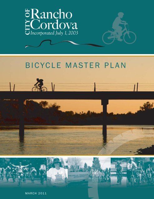
BICYCLE MASTER PLANMARCH 2011
Th e <strong>City</strong> would like to thankDave C assel , who submitted thephotog raph used on th e covero f th e Bicycl e <strong>Master</strong> Pl an.BICYCLE MASTER PLANCITY OF RANCHO CORDOVA2729 PROSPECT PARK DRIVERANCHO CORDOVA, CA 95670PHONE: (916) 851-8700FAX: (916) 851-8787MARCH 2011
Executive SummaryThe <strong>City</strong> <strong>of</strong> <strong>Rancho</strong> <strong>Cordova</strong> <strong>Bicycle</strong> <strong>Master</strong> <strong>Plan</strong> carries forward cycling policies and goals that wereinitiated in the <strong>City</strong>’s General <strong>Plan</strong>. The Bike <strong>Plan</strong> is closely tied to the Transit <strong>Master</strong> <strong>Plan</strong> andPedestrian <strong>Master</strong> <strong>Plan</strong>, and continues to shape the <strong>City</strong>’s goal <strong>of</strong> providing safe and attractivealternative modes for travel.The <strong>Bicycle</strong> <strong>Master</strong> <strong>Plan</strong> envisions a system <strong>of</strong> bike paths and bike lanes that encourage bothcommuting and recreational activities. The plan focuses on expanding the bicycle network in ourexisting community by providing good access to activity centers, light rail and the American RiverParkway. The plan also resolves access issues crossing Highway 50, improves connections betweenlocal neighborhoods and helps to provide a level <strong>of</strong> comfort to riders through way-finding signs andmaps, by building bike parking racks and by providing rest areas.The newly developing areas <strong>of</strong> the <strong>City</strong> create a bold vision for trails and bike lanes that will connectall <strong>of</strong> or our neighborhoods to the future Upper Laguna Creek Trail System, ultimately providingconnections to other communities in the region. Barriers to travel will be eliminated so that all types<strong>of</strong> cyclists will ride to parks, schools, shopping and restaurants, and so that residents find it easy toaccess work opportunities, religious institutions and other social activity centers.The four E’s, Education, Encouragement, Enforcement and Engineering are supported throughprograms such as Student <strong>Bicycle</strong> Safety courses lead by the 50 Corridor TransportationManagement Association, the Folsom <strong>Bicycle</strong> Safety Corridor Program initiated by the CaliforniaHighway Patrol and the <strong>Rancho</strong> <strong>Cordova</strong> Police Department, and the Sacramento Air QualityManagement District’s <strong>Bicycle</strong> Parking Program. The <strong>City</strong> will continue to develop programsthrough the <strong>Bicycle</strong> Advisory Committee and through the citizen organized Bicycling Advocates for<strong>Rancho</strong> <strong>Cordova</strong> or BARC.The Bike <strong>Plan</strong> creates a path for implementation through private investment, state and federal grantactions and citizen led initiatives. Implementation priorities are identified and will be balanced withfiscal, environmental and institutional challenges. <strong>Bicycle</strong> Friendly Community status will also beattained through the League <strong>of</strong> American Bicyclists providing recognition that will ensure the futurevision for cycling in <strong>Rancho</strong> <strong>Cordova</strong>.BICYCLE MASTER PLAN
ContentsEXECUTIVE SUMMARYCHAPTER 1: INTRODUCTIONPurpose <strong>of</strong> the <strong>Plan</strong> .................................................................................................... 1-1Setting ...................................................................................................................... 1-1<strong>Plan</strong>ning Area........................................................................................................... 1-1<strong>Plan</strong>ning Process and Public Involvement .................................................................... 1-3The Language <strong>of</strong> this <strong>Plan</strong> .......................................................................................... 1-3<strong>Bicycle</strong> Facility Types ............................................................................................... 1-3Cyclist Types ............................................................................................................ 1-5Support Facility Types .............................................................................................. 1-6Grade-Separated Crossings ...................................................................................... 1-6<strong>Plan</strong> Organization ....................................................................................................... 1-7How to Use this <strong>Plan</strong> ................................................................................................ 1-7California Streets and Highways Code Compliance ................................................... 1-7CHAPTER 2: EXISTING CONDITIONS<strong>Plan</strong>ning Context ........................................................................................................ 2-1Demographic Pr<strong>of</strong>ile ................................................................................................. 2-1Existing Transportation Mode Share ............................................................................ 2-2Role <strong>of</strong> the <strong>City</strong> in Providing <strong>Bicycle</strong> Transportation Facilities........................................ 2-4Past Expenditures on <strong>Bicycle</strong> Facilities ..................................................................... 2-4Existing <strong>Bicycle</strong> Network ............................................................................................. 2-5Existing <strong>Bicycle</strong> Support Facilities ............................................................................... 2-5Classification <strong>of</strong> <strong>Bicycle</strong> Parking Facilities .............................................................. 2-12MASTER PLAN▪ i
CITY OF RANCHO CORDOVA ● BICYCLE MASTER PLANExisting <strong>Bicycle</strong> Encouragement and Education Programs ........................................... 2-13Existing Policy Framework ........................................................................................ 2-15<strong>Plan</strong> Review and Summary ..................................................................................... 2-15CHAPTER 3: NEEDS ASSESSMENTSummary <strong>of</strong> Community-Identified Needs .................................................................... 3-1Public Participation Program Results ........................................................................ 3-1Ridership Trends ...................................................................................................... 3-2Collision History and Analysis ..................................................................................... 3-3Estimated <strong>Bicycle</strong> Transportation Demand ................................................................... 3-7Air Quality Benefits .................................................................................................. 3-8Other Quality-<strong>of</strong>-Life Benefits ................................................................................... 3-8<strong>Bicycle</strong> Network Needs and Opportunities ................................................................... 3-8Maintenance and Operations Needs .......................................................................... 3-10CHAPTER 4: RECOMMENDED POLICIES, PROGRAMS, ANDSTANDARDSExisting General <strong>Plan</strong> Goals ........................................................................................ 4-1From the Circulation Element ................................................................................... 4-1From the Open Space and Trails Element ................................................................. 4-2<strong>Bicycle</strong> <strong>Master</strong> <strong>Plan</strong> Goals, Policies, and Actions .......................................................... 4-2<strong>Bicycle</strong> <strong>Master</strong> <strong>Plan</strong> Standards .................................................................................... 4-5CHAPTER 5: RECOMMENDED BICYCLE NETWORKConnecting to the Regional Trail System – A Long-Range Vision for <strong>Bicycle</strong> NetworkDevelopment ............................................................................................................. 5-1Building the <strong>City</strong> Bike Route System ............................................................................ 5-2Areas West <strong>of</strong> Sunrise Boulevard .............................................................................. 5-2Dawes Bikeway Feasibility Analysis .......................................................................... 5-4Areas East <strong>of</strong> Sunrise Boulevard .............................................................................. 5-4II ▪ BICYCLE
TABLE OF CONTENTSCHAPTER 6: IMPLEMENTATIONUltimate System Maintenance Costs ........................................................................... 6-2Class I Routes and Connections West <strong>of</strong> Sunrise Boulevard .......................................... 6-2Class II Striping on Existing Streets and Class II Lanes on Streets that RequireWidening .................................................................................................................. 6-3Class III Signing on Existing Streets .......................................................................... 6-3Class I Routes in Areas East <strong>of</strong> Sunrise Boulevard .................................................... 6-3Class II Routes in Areas East <strong>of</strong> Sunrise Boulevard ................................................... 6-4Implementation Priorities ........................................................................................... 6-4Community Priorities ................................................................................................ 6-4Funding Opportunities ................................................................................................ 6-6Federal and State Funding Sources .......................................................................... 6-6Local Funding and Financing Sources....................................................................... 6-7Partnership Opportunities ........................................................................................... 6-8Bicycling Advocates for <strong>Rancho</strong> <strong>Cordova</strong> .................................................................. 6-8<strong>Cordova</strong> Recreation and Park District ....................................................................... 6-9Bureau <strong>of</strong> Reclamation ............................................................................................. 6-9Other Partnering Opportunities ............................................................................... 6-10APPENDIX A: PUBLIC OUTREACH RESULTSAPPENDIX B: STANDARD DRAWINGSAPPENDIX C: COST ESTIMATESMASTER PLAN ▪ iii
CITY OF RANCHO CORDOVA ● BICYCLE MASTER PLANLIST OF TABLESTable 1.1: California Streets and Highways Code Section 891.2 Compliance ............... 1-8Table 2.1: Population Diversity ................................................................................. 2-2Table 2.2: Number <strong>of</strong> Residents and Workers in <strong>Rancho</strong> <strong>Cordova</strong> and NearbyCommunities ........................................................................................... 2-2Table 2.3: Mode <strong>of</strong> Transportation to Work for Residents <strong>of</strong> <strong>Rancho</strong> <strong>Cordova</strong> and NearbyCommunities ........................................................................................... 2-3Table 2.4: Travel Time to Work for <strong>Rancho</strong> <strong>Cordova</strong> Workers ...................................... 2-4Table 2.5: Summary <strong>of</strong> Existing <strong>Bicycle</strong> Support Facilities ........................................ 2-13Table 3.1: Cycling Frequency for Public Workshop Participants ................................... 3-2Table 3.2: Barriers to Cycling in <strong>Rancho</strong> <strong>Cordova</strong> for Workshop Participants ............... 3-3Table 3.3: Purpose <strong>of</strong> Cycling in <strong>Rancho</strong> <strong>Cordova</strong> for Workshop Participants ............... 3-3Table 3.4: Three-Year <strong>Bicycle</strong> Collision Summary ....................................................... 3-4Table 3.5: Collisions in <strong>Rancho</strong> <strong>Cordova</strong> Between 2006 and 2008, by Type ................ 3-5Table 3.6: Collision History, by <strong>City</strong> ........................................................................... 3-6Table 3.7: Current and Projected <strong>Bicycle</strong> Commuter Mode Share ................................ 3-7Table 6.1: <strong>Bicycle</strong> <strong>Master</strong> <strong>Plan</strong> Cost Summary ........................................................... 6-1Table 6.2: New Class I Routes and Connections (West <strong>of</strong> Sunrise Boulevard) .............. 6-2Table 6.3: Projects for Short-Term Implementation .................................................... 6-4Table 6.4: Top 10 Community-Supported Trail Projects .............................................. 6-5Table 6.5: Top 10 Community-Supported On-Street <strong>Bicycle</strong> Projects ........................... 6-5IV ▪ BICYCLE
TABLE OF CONTENTSLIST OF FIGURESFigure 1.1: Study Area ............................................................................................... 1-2Figure 2.1: Existing <strong>Bicycle</strong> Network ........................................................................... 2-7Figure 2.2: <strong>Bicycle</strong> Parking and Support Facilities – Map A .......................................... 2-9Figure 2.3: <strong>Bicycle</strong> Parking and Support Facilities – Map B ....................................... 2-11Figure 2.4: Land Use ............................................................................................... 2-18Figure 5.1: Regional Trail System – Long-Range Vision ................................................ 5-3Figure 5.2: <strong>City</strong> Bike Route System – Areas West <strong>of</strong> Sunrise ........................................ 5-5Figure 5.3: <strong>City</strong> Bike Route System – Areas East <strong>of</strong> Sunrise ......................................... 5-7MASTER PLAN ▪ v
Chapter 1:INTRODUCTION
1CHAPTER 1IntroductionPURPOSE OF THE PLANA bicycle master plan provides strategic direction for the development <strong>of</strong> a comprehensive bicycletransportation network. This <strong>Plan</strong> is <strong>Rancho</strong> <strong>Cordova</strong>’s first dedicated <strong>Bicycle</strong> <strong>Master</strong> <strong>Plan</strong>, although the<strong>City</strong>’s General <strong>Plan</strong> provided a sound policy framework for bicycle facility development beginning in 2006.This <strong>Plan</strong> provides information about the current state <strong>of</strong> bicycle transportation in <strong>Rancho</strong> <strong>Cordova</strong> andprovides additional policy direction for the <strong>City</strong>. The <strong>Plan</strong> also indicates the level <strong>of</strong> financial effort andcommunity collaboration necessary to achieve the desired network.SETTINGPLANNING AREAThe <strong>City</strong> <strong>of</strong> <strong>Rancho</strong> <strong>Cordova</strong> is located within the Highway 50 corridor to the east <strong>of</strong> the <strong>City</strong> <strong>of</strong> Sacramentoand west <strong>of</strong> the <strong>City</strong> <strong>of</strong> Folsom. Mather Field Air Base is located along the southwest boundary <strong>of</strong> the <strong>City</strong>,and the Aerojet Rocket Testing Facility is located to the east. The northern boundary <strong>of</strong> <strong>Rancho</strong> <strong>Cordova</strong> isdefined by the American River. At approximately 23 square miles within its borders, the <strong>City</strong> <strong>of</strong> <strong>Rancho</strong><strong>Cordova</strong> is the third largest incorporated municipality in Sacramento County and is the second largestemployment center in the Sacramento region. <strong>Rancho</strong> <strong>Cordova</strong> was incorporated in 2003. See Figure 1.1 forStudy Area Map.MASTER PLAN ▪ 1-1
YOLOCOUNTYWoodland 580WestDavis SacramentoSacramento80SOLANOCOUNTY5Elk Grove99RosevilleCitrusHeights<strong>Rancho</strong><strong>Cordova</strong>GaltFolsom16SACRAMENTOCOUNTY50DETAILAREASTUDY AREAPARKS & REC AREASLAKES AND RIVERSCREEKSRANCHO CORDOVA CITY LIMITSPLANNING AREA BOUNDARYSAN JOAQUINCOUNTYLOCATION MAPHAZEL AVEA M E RI C A N RIIV ER50A E R O J E T F A C I L I T YFOLSOM BLVDWHITE ROCK RD50M A T H E R F I E L DDOUGLAS RDBRADSHAW RDSUNRISE BLVDJACKSON RD16GRANT LINE RDMiles0 1 2FIGURE 1.1X:\GIS_STAFF\PROJECTS\PUBLIC_WORKS\TRAILS\<strong>Bicycle</strong>_and_Pedestrian_MP\Study_Area.mxd March 2011
CHAPTER 1 ● INTRODUCTION<strong>Rancho</strong> <strong>Cordova</strong> was largely settled during and after the Second World War, when it was home to a thrivingmilitary base and a hub for the emerging aerospace industry. The original development pattern focused onvehicle transportation, resulting in limited opportunities for bicycle travel. The military base is no longeractive. The site is now used for both private air service and goods movement aviation.Due to its proximity to the state capital and its accessibility by multiple transportation modes, <strong>Rancho</strong><strong>Cordova</strong> has emerged as an important employment center within the greater Sacramento metropolitan regionand the state.PLANNING PROCESS AND PUBLIC INVOLVEMENTThe <strong>Bicycle</strong> <strong>Master</strong> <strong>Plan</strong> was developed in close collaboration with the <strong>Bicycle</strong> and Pedestrian TechnicalAdvisory Committee (TAC), composed <strong>of</strong> interested residents and cycling advocates. This committee metthroughout the planning process to identify issues and needs, review projects, discuss future networkdevelopment, prioritize projects, and review the draft document. Upon completion <strong>of</strong> the <strong>Master</strong> <strong>Plan</strong>process, the Advisory Committee is expected to continue work on plan implementation.Early in the planning process, the <strong>City</strong> co-hosted a bicycle and pedestrian planning open house with <strong>Bicycle</strong>Advocates <strong>Rancho</strong> <strong>Cordova</strong> (BARC) to gather information about ridership trends, issues, and needs. Thisworkshop-style meeting was widely advertised and drew community members from throughout <strong>Rancho</strong><strong>Cordova</strong>, in addition to interested residents <strong>of</strong> the neighboring communities <strong>of</strong> Folsom and Gold River, aswell as representatives from Caltrans, the Sacramento Area <strong>Bicycle</strong> Advocates (SABA), and WalkSacramento.A second community workshop was held during the final months <strong>of</strong> the planning process to gathercommunity feedback on the draft <strong>Bicycle</strong> <strong>Master</strong> <strong>Plan</strong> document and proposed bicycle network and projectlist.In addition to TAC meetings and community workshops, <strong>City</strong> staff met repeatedly with neighborhoodassociations to gather input on the <strong>Plan</strong>. Comments were also welcomed via email and telephone throughoutthe planning process.THE LANGUAGE OF THIS PLANA bicycle master plan is intended to be a user-friendly document that provides strategic direction for staffwhile also capturing and accurately reflecting a community’s vision for their bicycle transportation network.To ensure better understanding <strong>of</strong> the more technical aspects <strong>of</strong> this <strong>Plan</strong>, the concepts <strong>of</strong> bicycle facilitytypes and cyclist types are introduced below.BICYCLE FACILITY TYPESThe Caltrans Highway Design Manual, Chapter 1000, designates three discrete types <strong>of</strong> bikeways: Class I BikePaths, Class II Bike Lanes, and Class III Bike Routes.MASTER PLAN ▪ 1-3
CITY OF RANCHO CORDOVA ● BICYCLE MASTER PLANClass IClass I pathways are <strong>of</strong>f-street facilities, dedicated exclusively to use by bicyclists, pedestrians, and in somecases, equestrians and for other non-motorized travel such as roller skating, skateboarding, and so forth. ClassI pathways are sometimes called multi-use pathways or multi-use trails because <strong>of</strong> the diversity <strong>of</strong> uses theycan accommodate. Class I facilities are an important recreational amenity and are <strong>of</strong>ten located adjacent toparks, open space, rivers, streams, and canals. In cases where Class I facilities provide direct connectionsbetween major destinations, they can become popular commute routes.* The standard trail width is 10 feet. A 12-foot trail width is desirable for major corridors or busy multi-use paths.Class IIClass II bike lanes are established in the public right-<strong>of</strong>-way and delineate a portion <strong>of</strong> the street for bicyclists,providing greater predictability in their movement relative to motor vehicle traffic. Class II lanes must belocated on roadways with adequate width to accommodate the delineation <strong>of</strong> a bike lane. Once established,bike lanes must be signed and require adequate maintenance to keep them free <strong>of</strong> debris and other barriers tosafe cycling.1-4 ▪ BICYCLE
CHAPTER 1 ● INTRODUCTIONClass IIIOn Class III bike routes, bicyclists have been directed to use a particular roadway in conjunction with motorvehicle traffic. Class III routes are generally designated on roadways with low levels <strong>of</strong> motor vehicle trafficwhere bicyclists may share the travel lane. Class III facilities are <strong>of</strong>tenused as an alternative route through a high-demand corridor. Class IIIfacilities must be signed and may be demarcated with a “sharrow” stencilindicating to motorists that they are sharing the road with cyclists. Insome cases, sharrows may be appropriate on streets that are notdesignated on the Class III system.CYCLIST TYPESCyclists use the bicycle transportation network in different ways,depending on their purpose for riding and their level <strong>of</strong> experience andcomfort on the road. Cyclist types are identified solely for the purpose <strong>of</strong>planning to meet the needs <strong>of</strong> all types <strong>of</strong> cyclists with a diverse network<strong>of</strong> facilities, from meandering Class I pathways to Class II on-street lanes.Designers are challenged to provide attractive riding opportunities for allcyclists, both on streets and on bike paths.A “sharrow” alerts motorists that theyare sharing a lane or roadway withcyclists.MASTER PLAN ▪ 1-5
CITY OF RANCHO CORDOVA ● BICYCLE MASTER PLANYouth or RecreationalPrefers slower speedsOften rides together as a familyRides on local streets and trailsCommuter and UtilitarianRides primarily for transportationComfortable using Class I trails and Class II bike lanesComfortable at a range <strong>of</strong> speedsAvid and ExperiencedPrefers faster speedsComfortable on all road ways and trails, including riding in the travellaneComfortable sharing the roadway with vehicular trafficSUPPORT FACILITY TYPES<strong>Bicycle</strong> support facilities refer to the many small items <strong>of</strong> bicycle-relatedinfrastructure that “support” a bicycle transportation network. Supportfacilities most commonly refer to parking: bicycle racks, lockers, andother storage facilities. However, support facilities can also includebicycle repair shops, drinking fountains and rest areas alongside a trail,directional signage and maps throughout the <strong>City</strong>, or lighting at anunderpass. <strong>Bicycle</strong> support facilities are a key component <strong>of</strong> a successfulnetwork; if there is nowhere to park a bicycle at a destination, a personwill be less likely to ride there.GRADE-SEPARATED CROSSINGSA grade-separated crossing is any crossing <strong>of</strong> a roadway, waterway, railline, utility corridor, or other major barrier that is at a different grade thanthe street level. Grade-separated crossings may be overpasses orOf those <strong>Rancho</strong><strong>Cordova</strong> cyclistsqueried, the majorityidentify themselves as“commuter orutilitarian” cyclists,followed closely by“avid andexperienced.”1-6 ▪ BICYCLE
CHAPTER 1 ● INTRODUCTIONunderpasses, depending on the constraints <strong>of</strong> the site. Existing grade-separated crossings in <strong>Rancho</strong> <strong>Cordova</strong>provide dedicated bicycle and pedestrian crossings across Highway 50. In contrast, an at-grade crossing is acrossing as the same grade (at street level) as the rest <strong>of</strong> the facility.PLAN ORGANIZATIONHOW TO USE THIS PLANThis plan comprises six chapters, ranging from an explanation <strong>of</strong> existing conditions for cycling in <strong>Rancho</strong><strong>Cordova</strong> to detailed cost estimates for proposed bicycle improvement projects. Different readers may focuson different components <strong>of</strong> the <strong>Plan</strong>.you may want to focus on the proposed networkdescribed in Chapter 5: Recommended <strong>Bicycle</strong> Network, which conveysthe long-term vision for bicycle transportation in <strong>Rancho</strong> <strong>Cordova</strong>. Youmay also be very interested in the project implementation phasing,outlined in Chapter 6.The proposed bicyclenetwork is describedin Chapter 5.you may want to read and understand the entire document, and you’ll want t<strong>of</strong>ocus on the policy framework for bicycle facilities and programs, outlined in Chapter 4: RecommendedPolicies, Programs, and Standards.you may be particularly interested in the policy directionprovided by Chapter 4: Recommended Policies, Programs, and Standards, as well as the implementationinformation contained in Chapter 6.CALIFORNIA STREETS AND HIGHWAYS CODE COMPLIANCEThis <strong>Plan</strong> complies with California Streets and Highways Code Section 891.2, items A–K, regarding bicycletransportation plans. Compliance with this code section will help to ensure that the <strong>City</strong> <strong>of</strong> <strong>Rancho</strong> <strong>Cordova</strong>may become eligible to receive Caltrans <strong>Bicycle</strong> Transportation Account funding upon approval <strong>of</strong> this <strong>Plan</strong>by the regional transportation planning agency, Sacramento Area Council <strong>of</strong> Governments (SACOG), andCaltrans.The manner in which this <strong>Plan</strong> complies with Section 891.2 is outlined in Table 1.1 below.MASTER PLAN ▪ 1-7
CITY OF RANCHO CORDOVA ● BICYCLE MASTER PLANTable 1.1: California Streets and Highways Code Section 891.2ComplianceRequirementABCDEFGHDescriptionThe estimated number <strong>of</strong> existing bicycle commuters in the plan areaand the estimated increase in the number <strong>of</strong> bicycle commutersresulting from implementation <strong>of</strong> the plan.A map and description <strong>of</strong> existing and proposed land use andsettlement patterns which shall include, but not be limited to,locations <strong>of</strong> residential neighborhoods, schools, shopping centers,public buildings, and major employment centers.A map and description <strong>of</strong> existing and proposed bikeways.A map and description <strong>of</strong> existing and proposed end-<strong>of</strong>-trip bicycleparking facilities. These shall include, but not be limited to, parkingat schools, shopping centers, public buildings, and major employmentcenters.A map and description <strong>of</strong> existing and proposed bicycle transport andparking facilities for connections with and use <strong>of</strong> other transportationmodes. These shall include, but not be limited to, parking facilities astransit stops, rail and transit terminals, ferry docks and landings,park and ride lots, and provisions for transporting bicyclists andbicycles on transit or rail vehicles or ferry vessels.A map and description <strong>of</strong> existing and proposed facilities forchanging and storing clothes and equipment. These shall include, butnot be limited to, locker, restroom, and shower facilities near bicycleparking facilities.A description <strong>of</strong> bicycle safety and education programs conducted inthe area included within the plan, efforts by the law enforcementagency having primary traffic law enforcement responsibility in thearea to enforce provisions <strong>of</strong> the Vehicle Code pertaining to bicycleoperation, and the resulting effect on accidents involving bicyclists.A description <strong>of</strong> the extent <strong>of</strong> citizen and community involvement indevelopment <strong>of</strong> the plan, including, but not limited to, letters <strong>of</strong>support.Location <strong>of</strong>ApplicableInformation inthis <strong>Plan</strong>Chapter 3,Page 3-7Chapter 2,Page 2-18Chapter 2,Pages 2-5through 2-9—and —Chapter 5Chapter 2,Pages 2-9through 2-13Chapter 2,Pages 2-9through 2-13Chapter 2,Pages 2-9through 2-13Chapter 2,Pages 2-14—and—Chapter 3,Pages 3-3through 3-6Chapter 3,Pages 3-1through 3-3—and—Appendix B1-8 ▪ BICYCLE
CHAPTER 1 ● INTRODUCTIONRequirementIJKDescriptionA description <strong>of</strong> how the bicycle transportation plan has beencoordinated and is consistent with other local or regionaltransportation, air quality, or energy conservation plans, including,but not limited to, programs that provide incentives for bicyclecommuting.A description <strong>of</strong> the projects proposed in the plan and a listing <strong>of</strong>their priorities for implementation.A description <strong>of</strong> past expenditures for bicycle facilities and futurefinancial needs for projects that improve safety and convenience forbicycle commuters in the plan area.Location <strong>of</strong>ApplicableInformation inthis <strong>Plan</strong>Chapter 2,Pages 2-15through 2-19Chapter 5—and—Chapter 6,Pages 6-4through 6-5Chapter 2,Page 2-4—and—Chapter 6MASTER PLAN ▪ 1-9
Chapter 2:EXISTING CONDITIONS
2CHAPTER 2Existing ConditionsPLANNING CONTEXTDEMOGRAPHIC PROFILE<strong>Rancho</strong> <strong>Cordova</strong> grew from 57,799 residents in 2007 to over 62,000 residents in 2009. 1 The <strong>City</strong> hasexperienced significant growth in the recent past and anticipates continued growth into the future. Thepopulation is estimated to grow to 105,000 residents by 2020. The median income for <strong>Rancho</strong> <strong>Cordova</strong>households is $46,529. 2 The <strong>City</strong> has a diverse population as shown in Table 2.1 on the following page.1American Community Survey 20072 American Community Survey 2007MASTER PLAN ▪ 2-1
CITY OF RANCHO CORDOVA ● BICYCLE MASTER PLANTable 2.1: Population DiversityAreaWhiteHispanicor LatinoBlack orAfricanAmericanAsianTwo orMoreRacesOther<strong>Rancho</strong> <strong>Cordova</strong> 53.6% 16.7% 11.8% 10.2% 6.3% 1.5%California 59.8% 35.9% 6.2% 12.3% 3.3% 18.4%Sacramento County 60.8% 19.3% 10.1% 13.7% 4.2% 11.1%Source: U.S. Census Bureau<strong>Rancho</strong> <strong>Cordova</strong> is one <strong>of</strong> the Sacramento region’s most concentrated employment centers. It is home tomany residents who are working age (over 16), as depicted in Table 2.2 below.Table 2.2: Number <strong>of</strong> Residents and Workers in <strong>Rancho</strong> <strong>Cordova</strong> andNearby Communities<strong>City</strong>Total PopulationTotal Number <strong>of</strong>Workers Over the Age<strong>of</strong> 16*Total Number <strong>of</strong>Workers as Percentage<strong>of</strong> Total Population<strong>Rancho</strong> <strong>Cordova</strong> 59,666 26,787 45%Folsom 71,836 32,020 45%Arden-Arcade 90,973 41,828 46%Roseville 115,452 57,243 50%Sacramento 446,530 197,856 44%Source: American Community Survey 2007*Refers to workers living in each area.EXISTING TRANSPORTATION MODE SHAREAnalysis <strong>of</strong> transportation mode share has focused primarily on the worktrip. As work-related travel is discussed below, it should be noted thatwork trips constitute 20 percent <strong>of</strong> trips that are made by <strong>City</strong> residents.<strong>Rancho</strong> <strong>Cordova</strong> residents use a variety <strong>of</strong> transportation modes to travelto and from work. The majority <strong>of</strong> residents drive alone to work, with asignificant number using public transportation and carpooling. Nearlyone in one hundred working residents report riding a bicycle to work.This figure is greater than the bicycle-to-work mode share for Rosevilleand Folsom, but less than that <strong>of</strong> the <strong>City</strong> <strong>of</strong> Sacramento or Arden-Arcade (see Table 2.3 below).Nearly one in onehundred working<strong>Rancho</strong> <strong>Cordova</strong>residents report ridinga bicycle to work.2-2 ▪ BICYCLE
Mode <strong>of</strong>TransportationPercentageNo. <strong>of</strong>WorkersPercentageNo. <strong>of</strong>WorkersPercentageNo. <strong>of</strong>WorkersPercentageNo. <strong>of</strong>WorkersPercentageNo. <strong>of</strong>WorkersCHAPTER 2 ● EXISTING CONDITIONSTable 2.3: Mode <strong>of</strong> Transportation to Work for Residents <strong>of</strong> <strong>Rancho</strong><strong>Cordova</strong> and Nearby Communities<strong>Rancho</strong> <strong>Cordova</strong> Folsom Arden-Arcade Roseville SacramentoDroveAloneCarpooled71.6% 19,886 78.6% 22,370 76.2% 32,758 80.1% 42,203 72.5% 147,35615.3% 4,249 8.2% 2,334 11.2% 4,814 9.8% 5,163 14.1% 28,658Transit 5.5% 1,528 2.2% 626 3.2% 1,376 1.6% 843 3.6% 7,317Walked 1.5% 417 1.2% 342 2.7% 1,161 1.5% 790 3.3% 6,707<strong>Bicycle</strong>d 0.9% 250 0.6% 171 1.5% 645 0.4% 211 2.2% 4,471Other 5.2% 1,444 9.3% 2,647 5.2% 2,235 6.7% 3,530 4.4% 8,943Source: 2007–09 American Community Survey 3-Yr. Estimates, Table S0801Detailed information on work-trip travel times for <strong>City</strong> residents providesinsight on how many citizens could use their bicycles for commutepurposes. The 3 percent <strong>of</strong> residents who have a commute time <strong>of</strong> 5minutes or less should be able to switch to a pedestrian or bicycle mode,assuming a safe route and reasonable weather conditions. The samemight also be true for potential bicycle commuting trips for the 13percent <strong>of</strong> the population that have a commute time <strong>of</strong> under 10 minutes.Thirty (30) percent <strong>of</strong> <strong>Rancho</strong> <strong>Cordova</strong> working residents spend less than15 minutes traveling to work, as shown in Table 2.4 below.30 percent <strong>of</strong> <strong>Rancho</strong><strong>Cordova</strong> workingresidents spend lessthan 15 minutestraveling to work.MASTER PLAN ▪ 2-3
CITY OF RANCHO CORDOVA ● BICYCLE MASTER PLANTable 2.4: Travel Time to Work for <strong>Rancho</strong> <strong>Cordova</strong> WorkersTravel Time (in minutes)Source: American Community Survey 2007Percentage <strong>of</strong> WorkersLess than 5 3%5 to 9 10%10 to 14 17%15 to 19 13%20 to 24 14%25 to 29 8%30 to 59 27%60 to 89 3%90 or more 1%ROLE OF THE CITY IN PROVIDING BICYCLE TRANSPORTATIONFACILITIESThe <strong>City</strong> <strong>of</strong> <strong>Rancho</strong> <strong>Cordova</strong> constructs and maintains transportation facilities within the publicly ownedright-<strong>of</strong>-way in <strong>Rancho</strong> <strong>Cordova</strong>. Development and maintenance <strong>of</strong> transportation facilities is overseen bythe Department <strong>of</strong> Public Works. In newly developing areas, builders design trail facilities and the <strong>City</strong>conditions additional improvements that ensure the trails are integrated into an overall citywide transportationconcept. The following table <strong>of</strong> past bicycle expenditures is intended to represent the <strong>City</strong>-constructedelements <strong>of</strong> the existing trail and route system. A significant investment is also provided by the developmentcommunity that generally relates to open space areas and parks. Several miles <strong>of</strong> trails and other amenitieshave recently been built in the Stone Creek and Anatolia developments.PAST EXPENDITURES ON BICYCLE FACILITIESSeveral rehabilitation and enhancement projects were constructed in <strong>Rancho</strong> <strong>Cordova</strong> over the last threeyears. Each <strong>of</strong> these projects has elements that build the bicycle system, adding Class II bike lanes andimproving traffic signal infrastructure, pavement detection, and push buttons. Approximately $287,000 wasinvested in the <strong>City</strong>’s bicycle system through these projects.2008 Traffic Calming Project – La Loma, West La Loma, Georgetown – CP08-20642007 Pavement Rehabilitation Project – Coloma Rd. Phase 1 – CP07-20402006 Pavement Rehabilitation Project – Explorer, Vanguard, Ambassador, Rod Beaudry, and TrinityDr. – Contract #85-2006 CP06-2014International Dr. & Data Dr. Traffic Signal and Striping Improvements – CP07-20302-4 ▪ BICYCLE
CHAPTER 2 ● EXISTING CONDITIONSTraffic Signal and Pavement Overlay Improvement Projects – Contract #52-2006 CP05-2006 &CP05-2007 – Kilgore Rd. @ Trade Center Dr. and Coloma Rd. @ <strong>Cordova</strong> LaneFolsom Blvd. and Mather Field Rd. Enhancements Phase 1 Project – CP05-2011White Rock Pedestrian and Safety Improvement Project – CP09-2075EXISTING BICYCLE NETWORK<strong>Rancho</strong> <strong>Cordova</strong>’s existing bicycle network comprises primarily Class II facilities with key Class I pathwayslocated in new development areas and along the Folsom South Canal. Class II facilities provide transportationcorridors throughout the <strong>City</strong>, with connections to the American River Parkway bike trail in the north, whichserves as a regional connection into the cities <strong>of</strong> Sacramento and Folsom. The existing bicycle transportationnetwork is shown in Figure 2.1.EXISTING BICYCLE SUPPORT FACILITIES<strong>Rancho</strong> <strong>Cordova</strong>’s bicycle transportation network is supported by anetwork <strong>of</strong> bicycle parking facilities, showers and changing rooms, bicycleretailers, transit stations, and park and ride locations. These supportfacilities provide places to store bicycles, prepare for the workday, andmake connections to other modes <strong>of</strong> transportation for travel todestinations outside <strong>of</strong> the <strong>City</strong>. Figures 2.2 and 2.3 show the location <strong>of</strong>bicycle support facilities within <strong>Rancho</strong> <strong>Cordova</strong>. A summary <strong>of</strong> existingbicycle parking and shower and changing facilities is listed in Table 2.5.Facilities atimportantdestinations arecritical to promotingbicycle activity.Facilities at important destinations to bicyclists are critical to promoting bicycle activity. For example, facilitiesat places <strong>of</strong> employment promote bicycle commuting. Facilities at retail centers and public <strong>of</strong>fices allowbicyclists to perform errands. Facilities at parks and along trails promote recreational bike riding. In order toincrease bicycle activity, the <strong>City</strong> evaluated a broad range <strong>of</strong> destinations for cyclists.Anatolia Bike Trail – The Anatolia Bike Trail is a Class I bike trail in the new Anatolia development nearSunrise Boulevard and Douglas Road. It <strong>of</strong>fers about a mile <strong>of</strong> recreational bicycle activity, which willeventually be connected to the larger Class I system. Five Class III bike racks have been installed along thetrail. As is typical <strong>of</strong> most bicycle trails, changing or shower facilities and long-term storage along the trail arenot provided. The <strong>City</strong> will continue to work with the <strong>Cordova</strong> Recreation and Park District for other needssuch as improved access to restrooms.Employment Centers – These are destinations where people go to inquire about employment opportunities.Three <strong>of</strong> the employment agencies that were surveyed provide changing rooms, storage, showers, andrestrooms. Access to most <strong>of</strong> these facilities is limited to clients <strong>of</strong> the agencies.MASTER PLAN ▪ 2-5
CITY OF RANCHO CORDOVA ● BICYCLE MASTER PLANFitness Centers – Local gyms and sports complexes are designed for recreational activity and <strong>of</strong>fer amenitiesto accommodate users. All <strong>of</strong> these centers <strong>of</strong>fer showers, changing rooms, lockers, and restrooms. They arevery accessible and encouraging to bicyclists. However, depending on the location, many centers only <strong>of</strong>ferthese amenities to members and are not available to the general public. Class III bike racks are available toeveryone at each location.Public Library – The <strong>Rancho</strong> <strong>Cordova</strong> Library on Folsom Boulevard <strong>of</strong>fers bike racks for bicyclists andrestrooms that are available to the general public.Medical Centers – Kaiser Permanente and the VA Hospital <strong>of</strong>fer multiple amenities to their employeescommuting to work by bicycle. They provide bike racks, showers, changing areas, and restrooms to theiremployees but not to the general public.Major Employers – The <strong>City</strong> selected a group <strong>of</strong> eight major employers in <strong>Rancho</strong> <strong>Cordova</strong> based onnumber <strong>of</strong> employees and surveyed the facilities they <strong>of</strong>fer to their employees. Many employers observe adirect correlation between employee health and performance. They encourage commuters to bike to workwhenever possible and accommodate those who choose to do so. Nearly all <strong>of</strong> the major employers surveyed<strong>of</strong>fer all possible amenities to employees.Park and Ride Locations – Park and ride lots are provided at two lightrail stations within the <strong>City</strong> and at the Sunrise Boulevard/JacksonHighway intersection. These locations are intended as transition pointsrather than as places a person would stay for an extended period <strong>of</strong> time.Thus, at the light rail stations, the amenities are geared toward multipleforms <strong>of</strong> bicycle parking in the form <strong>of</strong> racks as well as lockers to store abicycle for a couple <strong>of</strong> hours or for an entire day. There are no bicycleamenities at the Sunrise Boulevard/ Jackson Highway intersection.<strong>City</strong> Hall <strong>of</strong>fersbicycle parking,showers, changingareas and storage.Public Buildings – <strong>Rancho</strong> <strong>Cordova</strong> <strong>City</strong> Hall and the Neighborhood Services Center are destinations for<strong>City</strong> residents. Whether people wish to attend a council meeting, find information about their community, orapply for a permit, they go to one <strong>of</strong> the <strong>City</strong>’s public buildings. <strong>City</strong> Hall has bike racks in front as well asenclosed racks in the back. <strong>City</strong> Hall also <strong>of</strong>fers restrooms, showers, changing areas, and storage. TheNeighborhood Services Center <strong>of</strong>fers both a bike rack and a restroom.Police and Fire Stations – These public information buildings and centers <strong>of</strong> public safety provide facilitiesfor employees only. However, there is <strong>of</strong>ten not a lot <strong>of</strong> pedestrian and bicycle activity, because it is <strong>of</strong>tendifficult for employees to walk or ride their bike to work with equipment transport requirements.Post Office – The local post <strong>of</strong>fice currently does not host any bicycle facilities.2-6 ▪ BICYCLE
BRADSHAW RDKIEFER BLVD5050DETAIL AREAAMERIC AN RIVERCOLOMA RDFOLSOM BLVDEXISTING BICYCLENETWORKBIKEWAYSEXISTING CLASS I BIKE PATHEXISTING CLASS II BIKE LANEEXISTING CLASS III BIKE ROUTEOTHER FEATURESCITRUS RDVEHICSA C RA M EN TOCO U NT Y16LOCATION MAPCHASE DRAMBASSADOR DRGEORGETO WN DRARA M ON DRCORDOVA LNMCGREGOR DRBENITA DRCORDOVA LNQUEENWOOD DRLE DRTRADE CENTER DRPOINT EAST DR50FOLSOM SOUTH CAN ALPARKS & REC AREASSUNRISE BLVDKILGORE RDA M E R I C A N R I V E R BI K E T R A I LAMERICAN RIVER BIKE TRLROD BEAUDRY DRW LA LOMA DRMILLS ST A TION RDROUTIER RDLA LOMA DRCROYDON WAYWHITE ROCK RDLAURELHURST DRS WHITE ROCK RDDATA DRZINFANDEL DROINTE R NATIONAL DRLSON DRGOLD CE N TER DRBEAR HOLLOW DRDISK DRPROSPECT PARK DRBAROQUE DRFITZGERALD RDRECYCLE RDLUYUNG DRWHITE ROCK RDGRANT LINE RD50EXPLORER DRLIN COLN VILLAG E DROLD PLACERVILLE RDSY S TEMS PKWYWHITEHEAD STM A T H E R F I E L DSUNRISE BLVDDOUGLAS RDMATHERLAKESECURITY PARK DRN KIEFER BLVDCHRYSANTHY BLVDKIEFER BLVDRANCHO CORDOVA PKWYJACKSON RDMiles0 0.5 1KIEFER BLVDBLODGETTRESERVOIRFIGURE 2.1X:\GIS_STAFF\PROJECTS\PUBLIC_WORKS\TRAILS\<strong>Bicycle</strong>_and_Pedestrian_MP\Existing_<strong>Bicycle</strong>_Network_11x17.mxd March 2011
DATA DR5050MAP ADETAIL AREASEE MAP BAMERICAN RIVERPARKWAYA MERICAN RIVERSUN RIVERPARKPARKBICYCLE PARKING& SUPPORTFACILITIESRETAIL SHOPPINGCENTER (SURVEYED)MAP ADESTINATIONSPUBLIC BUILDINGPUBLIC LIBRARYSA C RA M EN TOCO U NT Y16RIVER BENDPARKLOCATION MAPAMERICAN RIVERPARKWAYA M E R I C A N R I V E RBHAGANCOMMUNITYPARKCHASE DRI K E T R A I LROSSMOOR DRAMBASSADOR DRFEDERSPIELPARKCORDOVA LNAHLSTRONPARKLARCHMONTROSSMOORPARKZINFANDEL DRMCGREGOR DRBENITA DRCORDOVA LNOLSON DRDAVE ROBERTSCOMMUNITYPARKCOLOMA RDFOLSOM BLVDSUN CENTER D R50FOLSOM SOUTH CANALA E R O J E T F A C I L I T YWHITE ROCK RDKILGORE RDPROSPECT PARK DRCITRUS RDSUNCO DRSUNRISE GO LD CIRMERCANTILE DRSUNRISE PARK DRSCHOOLPARK AND RIDEEMPLOYMENT CENTER(SURVEYED)*FITNESS CENTERMAJOR EMPLOYER(SURVEYED)**MEDICAL CENTEROTHER FEATURESPUBLIC SWIMMINGPOOLTRANSIT STATIONRANCHO CORDOVA PDFIRE STATIONPOST OFFICEEXISTING CLASS I BIKE PATHEXISTING CLASS II BIKE LANEEXISTING CLASS III BIKE ROUTELIGHT RAIL LINE* Also includes staffing (temp) agencies.** Based upon number <strong>of</strong> people employed by a <strong>Rancho</strong> <strong>Cordova</strong>business as <strong>of</strong> April 2009. Data Source: Sacramento BusinessJournal.TAYLORPARKROD BEAUDRY DRCROYDON WAYWHITE ROCKCOMMUNITYPARKVILLAGEGREENPARKRENESSAINCEPARKTUSCANYPARKSANDERS DRMONI ER CIRFITZGERALD RDLUYUNG DRGOLD DREDGE WAYROUTIER RDH ORN RDSONOMAPARKWATERBROOKPARKBRADSHAW RDBU SINESS PA RK DRVIKING DREXPLORER DR50LINCOL N VILLAGE DRVANGUARD DRASTRAL DROLD PLACERVILLE RDCOUNTRYSIDEPARKLINCOLNVILLAGECOMMUNITYPARKMATHERSPORTSCOMPLEXM A T H E R F I E L DMiles0 0.5 1STONECREEKPARKRECYCLE RDOMEC CSUNRISE BLVDIRELKS CIRMATHERLAKEDOUGLAS RDARGONAUT PARKMATCHLINE FOR MAP BSECURITY PARK DRGRANT LINE RDFIGURE 2.2X:\GIS_STAFF\PROJECTS\PUBLIC_WORKS\TRAILS\<strong>Bicycle</strong>_and_Pedestrian_MP\Existing_<strong>Bicycle</strong>_Support_Facilities_11x17_A.mxd March 2011
JACKSON RDLUYUNG DR50SEE MAP ABICYCLE PARKING& SUPPORTFACILITIESMAP BLUYUNG DR50MAP BDETAILAREAPARKPARK AND RIDEDESTINATIONSSCHOOLSUNRISE BLVDRECYCLE RDELKS CIRSA C RA M EN TOCO U NT Y16LOCATION MAPSECURITY PARK DRRETAIL SHOPPINGCENTER (SURVEYED)OTHER FEATURESOTHER FEATURESEXISTING CLASS I BIKE PATHFIRE STATIONDOUGLAS RDEXISTING CLASS II BIKE LANEMATHERLAKEARGONAUT PARKMATCHLINE FOR MAP ASUNRISE BLVDMATHERGOLFCOURSECHRYSANTHY BLVDEAGLES NESTPARKSANDPIPERPARKMATHERREGIONALPARKRANCHO CORDOVA PKWYKIEFER BLVDGRANT LINE RDBLODGETTRESERVOIRFOLSOM SOUTH CANALKIEFER BLVDMiles0 0.5 1FIGURE 2.3X:\GIS_STAFF\PROJECTS\PUBLIC_WORKS\TRAILS\<strong>Bicycle</strong>_and_Pedestrian_MP\Existing_<strong>Bicycle</strong>_Support_Facilities_8x11_B.mxd March 2011
CITY OF RANCHO CORDOVA ● BICYCLE MASTER PLANBicycling to schoolsreduces roadcongestion andimproves studenthealth.Parks – Parks are an obvious destination for recreational bicyclists. Thearea north <strong>of</strong> Highway 50 is an established neighborhood developedwhen Mather Air Force Base was thriving. Many <strong>of</strong> the parks in this areawere developed without bicycle facilities. Hagan Park and the AmericanRiver Parkway are exceptions to this rule, as they provide restrooms,water fountains, and bicycle parking. Newer parks south <strong>of</strong> Highway 50have bicycle parking available, most <strong>of</strong>fer restrooms, and some <strong>of</strong>ferchanging areas and showers. The parks that <strong>of</strong>fer the changing areas andshowers are the parks that either have a pool now or did at some point.Retail Shopping Centers – Bicyclists appreciate opportunities to complete their errands on their bicycles.The <strong>City</strong> surveyed seven commercial locations, and although almost none <strong>of</strong> the local shopping centers in the<strong>City</strong> <strong>of</strong>fer public restrooms, showers, or storage, most <strong>of</strong>fer bicycle racks for parking. One resident expressedthe appreciation <strong>of</strong> a bicycle rack at a local c<strong>of</strong>fee house, as that is where their bicycle group meets beforetaking <strong>of</strong>f on group rides.Schools – Bicycling to schools reduces road congestion, improves the student’s health while promoting goodhabits, and increases the student’s performance in school. All schools have bicycle racks and restrooms forstudents. Generally, only high schools <strong>of</strong>fer any kind <strong>of</strong> shower or changing facilities. The high schoolscommonly only <strong>of</strong>fer this service during the students’ gym period at school. Many higher education schools<strong>of</strong>fer shower and changing facilities for their students.CLASSIFICATION OF BICYCLE PARKING FACILITIESLong-Term Parking (Class I) – <strong>Bicycle</strong> parking facility intended for long-term parking and protected againsttheft <strong>of</strong> the entire bicycle and its components and accessories. Three common ways <strong>of</strong> providing Class Ibicycle parking are:1. Fully enclosed lockers accessible only by the user;2. A continuously monitored facility that provides at least Class II bicycle parking facilities;3. A restricted access facilities in which Class II racks are provided and access is restricted only to theowners <strong>of</strong> the bicycles stored therein.Medium-Term Parking (Class II) – <strong>Bicycle</strong> parking facility intended for medium- or short-term parking andconsisting <strong>of</strong> a stationary object to which the user can lock the frame and both wheels with a user-providedlock. The facility should be designed to protect the lock from physical assault.Short-Term Parking (Class III) – <strong>Bicycle</strong> parking facility intended for short-term parking, consisting <strong>of</strong> astationary object to which the user can lock the frame and both wheels with a user-provided 6-foot cable (orchain) and lock.2-12 ▪ BICYCLE
CHAPTER 2 ● EXISTING CONDITIONSTable 2.5 is intended to provide a snapshot <strong>of</strong> facilities provided to cyclists in the <strong>City</strong>.Table 2.5: Summary <strong>of</strong> Existing <strong>Bicycle</strong> Support FacilitiesFacility TypeAnatoliaBike TrailEmploymentCenter/StaffingAgency (4)*<strong>Bicycle</strong> ParkingClass I Class II Class III MultipleChanging Storage Showers Restroom0 0 5 0 0 0 0 00 3 0 1 3 3 3 4Exercise Facility 0 1 4 0 5 5 5 5Library 0 0 1 0 0 0 0 0Medical Facility 0 0 1 1 2 0 2 2MajorEmployer (8)*Park-and-RideLocation3 1 2 2 8 8 8 80 0 0 2 0 0 0 0Public Building 0 0 1 1 1 1 1 2Park 0 0 8 0 4 1 3 6PublicSwimming PoolRetail ShoppingCenter (7)*0 0 2 0 0 0 0 20 1 5 1 0 0 0 0School 4 2 22 1 6 4 5 28Transit Station 0 0 2 2 0 0 0 0AmericanRiver ParkwayParking*Surveyed locations only (see map)0 0 1 0 0 0 0 1EXISTING BICYCLE ENCOURAGEMENT AND EDUCATION PROGRAMSThe <strong>City</strong> <strong>of</strong> <strong>Rancho</strong> <strong>Cordova</strong> continues to assess bicycle conditions within the <strong>City</strong>. The <strong>City</strong> supports thegrowing interest in bicycle riding and acknowledges the positive effects it can have on the community.This <strong>Bicycle</strong> <strong>Master</strong> <strong>Plan</strong> addresses infrastructure development that is intended to provide an engineeringfoundation for a bicycle system. Ongoing work with the Bicycling Advocates for <strong>Rancho</strong> <strong>Cordova</strong>, <strong>Rancho</strong>MASTER PLAN ▪ 2-13
CITY OF RANCHO CORDOVA ● BICYCLE MASTER PLAN<strong>Cordova</strong> Police Department, and the <strong>Bicycle</strong> and Pedestrian Technical Advisory Committee will expand otherprogramming efforts that focus on encouragement, education, and enforcement.Currently, <strong>Rancho</strong> <strong>Cordova</strong> is home to a number <strong>of</strong> bicycle encouragement and education programs, rangingfrom elementary bicycle safety education to commuter encouragement programs. The existing programs aresummarized below.Elementary School Programs – Annually, the 50 Corridor Transportation Management Association (TMA)holds a bicycle safety day at Sunrise Elementary School and Navigator Elementary School. Important topicssuch as safety, maintenance, and rules <strong>of</strong> the road are discussed at these events. Students are asked to sign acontract to abide by the rules if they are going to ride their bikes. Emphasis is especially given concerningwearing helmets, after observing many students were riding to school without one. A slow-motion race is one<strong>of</strong> the most exciting parts <strong>of</strong> the day for most <strong>of</strong> the students.Commuter Program – This is an exciting addition to the programs <strong>of</strong>fered in <strong>Rancho</strong> <strong>Cordova</strong>. <strong>Bicycle</strong>commuters are able to register for the TMA <strong>Bicycle</strong> Commuter Program, which <strong>of</strong>fers many amenities tobicycle commuters. This program <strong>of</strong>fers taxicab fares or a car rental in case a commuter needs to get home incase <strong>of</strong> an emergency. As an added incentive, drawings and prizes are <strong>of</strong>fered to those who are registered.<strong>Rancho</strong> <strong>Cordova</strong> Police Department (RCPD) Program – The RCPD program provides a safety course,presentation on bicycle laws, informational flyers, and free helmets. This program was initiated by LarryCanfield <strong>of</strong> the <strong>Rancho</strong> <strong>Cordova</strong> Police Department. Since his passing, the <strong>Rancho</strong> <strong>Cordova</strong> PoliceDepartment has championed this program and is working to ensure success. RCPD first operated theprogram in 2010, and they held their first bike rodeo at White Rock Elementary School. This rodeo includeda safety course, informational flyers, and free helmets donated by Mercy Hospital.May Is Bike Month – May Is Bike Month is a Sacramento regional campaign that challenges people tochoose bicycling for all types <strong>of</strong> trips. <strong>City</strong> staff encourages participation through the efforts <strong>of</strong> the BicyclingAdvocates for <strong>Rancho</strong> <strong>Cordova</strong> and through its membership in the 50 Corridor TMA. <strong>City</strong> staff participatesand provides support to events such as the Mayor’s Ride and the Bikefest at the State Capitol building.<strong>Rancho</strong> <strong>Cordova</strong> Pedestrian and Bicyclist Safety Corridor – The California Highway Patrol (CHP) hasinitiated a safety education and enforcement program on the Folsom Boulevard corridor that will improveconditions for cyclists and pedestrians and reduce incidents and fatalities. The program includes marketingefforts that will raise the pr<strong>of</strong>ile <strong>of</strong> cyclists and pedestrians on the corridor and includes a Folsom BoulevardSaturation effort by CHP and RCPD that will make direct contact with residents providing warnings andencouraging smart travel habits.2-14 ▪ BICYCLE
CHAPTER 2 ● EXISTING CONDITIONSSacramento Metropolitan Air Quality Management District (SMAQMD), <strong>Bicycle</strong> Parking Program –SMAQMD has obtained a Sacramento Area Council <strong>of</strong> Governments grant that will build bicycle parkingequipment in public rights-<strong>of</strong>-way and on private business properties throughout the region. <strong>Rancho</strong> <strong>Cordova</strong>and the <strong>Bicycle</strong> Advocates for <strong>Rancho</strong> <strong>Cordova</strong> will work with SMAQMD and the Sacramento Area <strong>Bicycle</strong>Advocates to identify good locations within the <strong>City</strong> to add bike parking equipment.EXISTING POLICY FRAMEWORKPLAN REVIEW AND SUMMARY<strong>City</strong> <strong>of</strong> <strong>Rancho</strong> <strong>Cordova</strong> General <strong>Plan</strong>, June 2006Transportation choices that encourage walking, cycling, and transit uses are supported in both the Land Useand Circulation elements <strong>of</strong> the General <strong>Plan</strong>. See Figure 2.4 showing land uses in the <strong>Plan</strong>ning Area. Nonautoaccess to schools, parks, jobs, and shopping areas will be achieved through integrated and connectedopen space corridors along with the mitigation <strong>of</strong> barriers to non-auto travel such as state highways, canals,and busy arterials. A focus on smart land use design that is pedestrian supportive and transit friendly willgreatly improve connectivity and encourage cycling.The 2006 <strong>Rancho</strong> <strong>Cordova</strong> General <strong>Plan</strong> identifies existing land uses generally west <strong>of</strong> Sunrise Boulevard andfocuses a land plan that is under development east <strong>of</strong> Sunrise Boulevard. Large wetland preserves are plannedin the east area along with an integrated Class I trail system that follows open space corridors and providesaccess to a variety <strong>of</strong> land uses.<strong>City</strong> <strong>of</strong> <strong>Rancho</strong> <strong>Cordova</strong> Transit <strong>Master</strong> <strong>Plan</strong>, September 2006Pedestrian connectivity integrates into the goals <strong>of</strong> the Transit <strong>Master</strong> <strong>Plan</strong>, providing connections for cyclistsutilizing vehicle cycling racks and cycling support elements at transit destinations. The transit Signature Route,a future streetcar technology, and the Neighborhood Shuttle System will encourage use by cyclists andpedestrians. Neighborhood village centers will take advantage <strong>of</strong> transit to promote pedestrian activity andcivic pride.MASTER PLAN ▪ 2-15
CITY OF RANCHO CORDOVA ● BICYCLE MASTER PLAN<strong>Rancho</strong> <strong>Cordova</strong> Municipal Code, Title 23 – Zoning CodeThe new Zoning Code solidifies the need for bicycle-friendly facilities that are <strong>of</strong> great interest to manysuccessful local businesses. Zoning Code Title 23 outlines the requirements for the number <strong>of</strong> bicycle parkingspaces per facility as well as the specifications for the spaces themselves.The number <strong>of</strong> bicycle parking spaces is based on such factors as the size <strong>of</strong> residential units serviced,number <strong>of</strong> classrooms, or square footage <strong>of</strong> the building. The specifications include requirements for lighting,location, and space provided. Also, 50 percent <strong>of</strong> all visitor bicycle parking is to be sheltered to protect itfrom precipitation. These standards ensure that bicycle parking is visible from the buildings served, isconvenient to cyclists, and provides sufficient security from theft and damage.Valuable benefits related to secure bicycle parking include provisions that developments that provideadditional bicycle parking facilities over and above the minimum requirement may reduce their parkingrequirement by one vehicle space for every two additional bicycle spaces provided.Shower and locker facilities are to be provided by development projects above the minimum developmentsize threshold as specified in Table 4.7-1 <strong>of</strong> the Zoning Code. Developments with 100 or more employeesmay reduce their parking requirements by providing shower and clothing locker facilities for bicyclecommutingemployees with a maximum reduction <strong>of</strong> up to 5 percent.Although these standards do not apply to existing developments within the <strong>City</strong>, any new developments, ormodifications to existing developments, must abide by these standards. Thus, Zoning Code Title 23 ensuresthat sufficient facilities are available to encourage bicycle riding and reduce automotive commuting.<strong>Rancho</strong> <strong>Cordova</strong> Open Space <strong>Plan</strong>The <strong>City</strong>’s Open Space <strong>Plan</strong> is currently under development and is intended to further establish policydirection that will create a safe, attractive, functional, and interconnected open space system. Policy directionincludes the provision <strong>of</strong> access to the open space system within 0.2 to 0.4 miles <strong>of</strong> homes, facilitating 5-minute walks for toddlers, the elderly, and the disabled, limiting block lengths to less than 600 feet, andproviding street furniture, lighting, and other elements that will provide attractive opportunities for pedestrianactivities.The plan will focus on natural areas and mitigation lands that are set aside for preservation for wildlife andassociated habitat, parks and recreation serving localized community needs, and community open space thataugments traditional parks and is generally accessible to the public.2-16 ▪ BICYCLE
CHAPTER 2 ● EXISTING CONDITIONSVarious Specific <strong>Plan</strong>sSeveral specific plans are under development for the area bounded by Sunrise Boulevard, Highway 50, GrantLine Road, and Jackson Highway. These plans address park and recreational needs, open space areas, naturalpreservation areas, and other public sites such as schools. Specific plan development is guided by the General<strong>Plan</strong> and other completed or ongoing planning efforts. The <strong>Bicycle</strong> <strong>Master</strong> <strong>Plan</strong> will provide an opportunityto enhance these specific plans through common policies and through the interconnection <strong>of</strong> trailinfrastructure at plan boundaries.Upper Laguna Creek CoalitionThe Laguna Creek Parkway is a system <strong>of</strong> waterways that extends from the Sacramento River to theheadwaters <strong>of</strong> Laguna Creek in the southern portion <strong>of</strong> the <strong>City</strong> <strong>of</strong> <strong>Rancho</strong> <strong>Cordova</strong>. The upper watershedwill be developed in the near future. Local government agencies are recognizing the need to try new planningand design approaches that will integrate riparian and wetland habitats with flood control, water qualitytreatment, and passive recreation.As part <strong>of</strong> a multifunctional corridor, the Upper Laguna Creek Coalition (ULCC) Trails and ParksWorkgroup is developing a concept for a future regional bicycle system. The trail system would connect tothe Sacramento River system and to the future Deer Creek Trail system east <strong>of</strong> <strong>Rancho</strong> <strong>Cordova</strong>. Within the<strong>City</strong> <strong>of</strong> <strong>Rancho</strong> <strong>Cordova</strong>, the ULCC trail system is being planned as a high-amenity regional bicycle facilitythat will be similar to the American River Parkway.American River Parkway <strong>Plan</strong>The American River Parkway is an open space greenbelt that extends approximately 29 miles from FolsomDam in the northeast to the American River’s confluence with the Sacramento River in the southwest. TheAmerican River Parkway is a unique regional facility that preserves natural open space and protectsenvironmental quality within the urban environment. It also provides unique recreational opportunitiesthroughout the Sacramento area.Preservation activities for the American River Parkway are documented as early as 1915 and culminated in theadoption <strong>of</strong> the first Parkway <strong>Plan</strong> by Sacramento County in 1962. The adoption <strong>of</strong> the 1962 Parkway <strong>Plan</strong>helped to preserve open space as expanding development encroached on the American River watercourse.The 2008 American River Parkway <strong>Plan</strong> update documents guidelines for the preservation, use, development,and administration <strong>of</strong> the parkway and results in a strong guiding document for important land use decisionsaffecting the parkway.The American River Parkway multi-use recreational trail is seen as a primary attraction for residents <strong>of</strong><strong>Rancho</strong> <strong>Cordova</strong> both for recreational cycling and for non-motorized commuter travel.MASTER PLAN ▪ 2-17
LAND USE*ESTATE RESIDENTIALLOW DENSITY RESIDENTIALMEDIUM DENSITY RESIDENTIALHIGH DENSITY RESIDENTIALRESIDENTIAL MIXED USEVILLAGE CENTER MIXED USEOFFICE MIXED USECOMMERCIALINDUSTRIALPUBLIC/QUASI-PUBLIC**NATURAL RESOURCESPARKS AND OPEN SPACEH AZEL AVESUNRISE BLVDIAME RIC AN R IIV E R50FOLSOM BLVDWHITE ROCK RD50DOUGLAS RDMAT HE R F IE LDBRADSHAW RDSUNRISE BLVDJACKSON RDMiles0 1 2GRANT LINE RDNOTE:* Land use types depicted on this map include 1) approved classifications from the <strong>Rancho</strong> <strong>Cordova</strong> General <strong>Plan</strong>;2) approved zoning designation equivalents from the Zoning Code for special planning areas and the FolsomBoulevard Specific <strong>Plan</strong>; 3) prezoning land use equivalents for the Future Annex area; and 4) proposed land usedesignation for other specific plan areas.** Public/Quasi-Public includes schools, churches, hospitals, police/fire stations, library, post <strong>of</strong>fice, & <strong>City</strong> Hall.16FIGURE 2.4X:\GIS_STAFF\PROJECTS\PUBLIC_WORKS\TRAILS\<strong>Bicycle</strong>_and_Pedestrian_MP\Land_Use_8x11.mxd March 2011
CHAPTER 2 ● EXISTING CONDITIONSSACOG Regional <strong>Bicycle</strong>, Pedestrian, and Trails <strong>Master</strong> <strong>Plan</strong>The Regional <strong>Bicycle</strong>, Pedestrian, and Trials <strong>Plan</strong>, adopted by the Sacramento Area Council <strong>of</strong> Governments(SACOG) Board in September <strong>of</strong> 2003, is intended to capitalize on local assets within the six-county SACOGregion and to provide non-motorized travel connections between communities and to other areas outside theregion. The plan establishes a prioritized project list that will help guide funding for regional bicycle andpedestrian efforts.In 2007, the plan was amended to include an updated 20-year view <strong>of</strong> anticipated projects. The project list iscurrently in an update cycle, and the <strong>City</strong> <strong>of</strong> <strong>Rancho</strong> <strong>Cordova</strong> has submitted several projects that havereceived high and moderate priority for regional funding. The following <strong>Rancho</strong> <strong>Cordova</strong> projects areincluded in the SACOG plan:<strong>Bicycle</strong> Signal Detection for Traffic Signals – Provide bicycle detection loops and push buttons atapproximately 20 signalized intersections in the <strong>City</strong> <strong>of</strong> <strong>Rancho</strong> <strong>Cordova</strong>.Completion <strong>of</strong> the Class II <strong>Bicycle</strong> Trail System – Provide striping and signage along Class IIcorridors throughout <strong>Rancho</strong> <strong>Cordova</strong>.Douglas Road Bike Trail Connection to Folsom South Canal – Provide a Class I connection fromthe Folsom South Canal <strong>Bicycle</strong> Trail to Douglas Road. This project will provide a connectionbetween the new and planned residential areas east <strong>of</strong> the Folsom South Canal with the business andcommercial centers west <strong>of</strong> the canal.Mather Railroad Spur, Rails to Trails Project – Provide a Class I connection from Folsom Boulevardto the Mather Airport.Sacramento County <strong>Bicycle</strong> <strong>Master</strong> <strong>Plan</strong>Sacramento County is in the process <strong>of</strong> finalizing a comprehensive <strong>Bicycle</strong> <strong>Master</strong> <strong>Plan</strong> that shares manycommon goals and outcomes with the <strong>Rancho</strong> <strong>Cordova</strong> <strong>Bicycle</strong> <strong>Master</strong> <strong>Plan</strong>. Both plans strive to achieveincreased ridership, improved regional connections, and new facilities. The American River Parkway bike trailand the Folsom South Canal Trail are identified as part <strong>of</strong> the regional backbone system. Both plans identifyadvantages <strong>of</strong> the Regional Transit light rail/bus system serving longer-distance trips in connection withshorter bike trips. Healthy travel choices and environmental stewardship are also cited.The <strong>Rancho</strong> <strong>Cordova</strong> <strong>Bicycle</strong> <strong>Master</strong> <strong>Plan</strong> mapping process reviewed all existing and proposed bikewayswithin and adjacent to the <strong>City</strong>, taking advantage <strong>of</strong> a cooperative GIS data-sharing agreement. Thisfacilitated information exchange ensures the seamless continued development <strong>of</strong> regional trails so that systemusers are served regardless <strong>of</strong> jurisdictional boundary. Additionally, future planned bikeways in theundeveloped eastern county help the <strong>City</strong> <strong>of</strong> <strong>Rancho</strong> <strong>Cordova</strong> prioritize future connections across Grant LineRoad.MASTER PLAN ▪ 2-19
Chapter 3:NEEDS ASSESSMENT
3CHAPTER 3Needs AssessmentSUMMARY OF COMMUNITY-IDENTIFIED NEEDSPUBLIC PARTICIPATION PROGRAM RESULTSA community workshop to discuss existing conditions and opportunities to improve the bicycle andpedestrian transportation network was held on June 2, 2009, at <strong>Rancho</strong> <strong>Cordova</strong> <strong>City</strong> Hall. Residents <strong>of</strong><strong>Rancho</strong> <strong>Cordova</strong> and other meeting participants shared a number <strong>of</strong> concerns regarding the currentconditions <strong>of</strong> bicycle facilities within the <strong>City</strong>. One major concern that is seen throughout the <strong>City</strong> is the needfor additional bicycle detection at intersections. Crossing the many major corridors <strong>of</strong> <strong>Rancho</strong> <strong>Cordova</strong> canbe very challenging without a designated phase allowing bicyclists and pedestrians to cross the road. Meetingparticipants expressed interest in adding more bicycle detection at the most challenging intersections in the<strong>City</strong>. Participants particularly expressed concern about the intersections <strong>of</strong> Zinfandel Drive and White RockWorkshopparticipants stressedthe need forconnections to theFolsom South Canal.Road, Prospect Park Drive and White Rock Road, and Coloma Road andBridlewood Drive.Another major concern is interchange accessibility over Highway 50.Many feel it is a challenge to cross the busy on- and <strong>of</strong>framp accesspoints to Highway 50. The crossings <strong>of</strong> greatest concern are ZinfandelDrive, Mather Boulevard, Bradshaw Road., and Sunrise Boulevard.MASTER PLAN ▪ 3-1
CITY OF RANCHO CORDOVA ● BICYCLE MASTER PLANAttendees also requested additional connections to the Folsom South Canal.A Class I trail system runs along the canal throughout the <strong>City</strong>, and there areno access points between White Rock Road and Jackson Highway; a length<strong>of</strong> over 6 miles. A new access at Douglas Road should be a high priority.Meeting participants also expressed concern that bicycle facilities were notalways clear <strong>of</strong> debris and needed better signage. Additionally, participantsnoted the lack <strong>of</strong> bike lockers and the need to increase the number <strong>of</strong>amenities along our Class I trails.A complete record <strong>of</strong> meeting results is included as Appendix A to this<strong>Bicycle</strong> <strong>Master</strong> <strong>Plan</strong>.RIDERSHIP TRENDSCurrently, detailed ridership information for the <strong>City</strong> <strong>of</strong> <strong>Rancho</strong> <strong>Cordova</strong> does not exist. During the firstpublic workshop, attendees were queried informally regarding their cycling habits. The results in Table 3.1below show that the majority <strong>of</strong> meeting participants, who consider themselves commuter/utilitarian cyclistsor avid/experienced cyclists, are riding daily.Table 3.1: Cycling Frequency for Public Workshop ParticipantsHow <strong>of</strong>ten do you ride?Number <strong>of</strong> ResponsesDaily 16Two times per week 7One time per week 2One time per month 2One time every 6 months 0One time per year 0Never 1Source: Public Workshop, <strong>Rancho</strong> <strong>Cordova</strong> <strong>City</strong> Hall, June 2, 2009The primary barrier to cycling in <strong>Rancho</strong> <strong>Cordova</strong>, as conveyed bymeeting participants, is the lack <strong>of</strong> safe bicycle routes, as shown in Table3.2.Most workshopparticipants ride theirbike daily.3-2 ▪ BICYCLE
CHAPTER 3 ● NEEDS ASSESSMENTTable 3.2: Barriers to Cycling in <strong>Rancho</strong> <strong>Cordova</strong> for WorkshopParticipantsWhat prevents you from riding more <strong>of</strong>ten?Number <strong>of</strong> ResponsesNot enough safe routes 15Not enough time 9Can't get to my destination on a bicycle 5Too much traffic 4Lack <strong>of</strong> bike rack and lockers 4Other 4Lack <strong>of</strong> signage 3Lack <strong>of</strong> showers and lockers at my destination 2Source: Public Workshop, <strong>Rancho</strong> <strong>Cordova</strong> <strong>City</strong> Hall, June 2, 2009<strong>Rancho</strong> <strong>Cordova</strong> cyclists are motivated to ride by a variety <strong>of</strong> reasons. Meeting participants primarily enjoyedriding for fitness and conditioning and recreation. A significant number <strong>of</strong> meeting participants were bicyclecommuters, riding to work as well as for errands. Additional detail is shown in Table 3.3 below.Table 3.3: Purpose <strong>of</strong> Cycling in <strong>Rancho</strong> <strong>Cordova</strong> for WorkshopParticipantsWhy do you ride a bike?Number <strong>of</strong> ResponsesFitness and conditioning 18Recreation with family and friends 15Transportation to work 15Recreation alone 11Transportation to errands/shopping 10Other transportation 7Transportation to school 1Competitive cycling 1Source: Public Workshop, <strong>Rancho</strong> <strong>Cordova</strong> <strong>City</strong> Hall, June 2, 2009COLLISION HISTORY AND ANALYSISThe <strong>Bicycle</strong> <strong>Master</strong> <strong>Plan</strong> reviews the existing conditions <strong>of</strong> the bicycle network as well as identifies any safetyconcerns. The <strong>City</strong> records collision data on an ongoing basis. A three-year collision summary is shown below(see Table 3.4). The data shows bicycle collisions occurring within the <strong>City</strong> <strong>of</strong> <strong>Rancho</strong> <strong>Cordova</strong> betweenJanuary 2006 and December 2008. Although none <strong>of</strong> the accidents involved a fatality, 64 <strong>of</strong> the 78 totalaccidents did involve some form <strong>of</strong> injury.MASTER PLAN ▪ 3-3
CITY OF RANCHO CORDOVA ● BICYCLE MASTER PLANTable 3.4: Three-Year <strong>Bicycle</strong> Collision SummaryTime Period Total Number <strong>of</strong> Collisions Injuries FatalitiesJanuary 2006—December 2006 22 17 0January 2007—December 2007 26 21 0January 2008—December 2008 30 26 0Total 78 64 0Source: <strong>City</strong> <strong>of</strong> <strong>Rancho</strong> <strong>Cordova</strong>, data from January 2006 through December 2008Table 3.5 summarizes the data by type <strong>of</strong> collision. There were 2,662 collisions reported from January 2006through December 2008, and 78 <strong>of</strong> these involved bicycles. By far, the most common type <strong>of</strong> collision was abroadside. In this type <strong>of</strong> collision, the auto and bicyclist are <strong>of</strong>ten traveling at 90-degree angles to each other.This type <strong>of</strong> collision typically occurs at intersections, driveways, or within parking lots and <strong>of</strong>ten occurswhen bicyclists are riding against the normal flow <strong>of</strong> traffic. Rear-end accidents generally are caused byexcessive speed and/or lack <strong>of</strong> awareness <strong>of</strong> vehicles or bicycles slowing or stopping. Sideswipes generallyoccur when a car or bicycle fails to yield while changing lanes.3-4 ▪ BICYCLE
CHAPTER 3 ● NEEDS ASSESSMENTTable 3.5: Collisions in <strong>Rancho</strong> <strong>Cordova</strong> Between 2006 and 2008, byTypeType <strong>of</strong> Collision Number <strong>of</strong> Collisions Percentage <strong>of</strong> TotalBroadside 35 44.9%Not stated 21 26.9%Sideswipe 9 11.5%Head on 7 9.0%Other 2 2.6%Rear end 2 2.6%Vehicle-pedestrian 2 2.6%Total 78 100.0%Source: <strong>City</strong> <strong>of</strong> <strong>Rancho</strong> <strong>Cordova</strong> 2009Approximately one-third <strong>of</strong> the collisions were caused by the bicyclistriding on the wrong side <strong>of</strong> the road.. The next most common cause wasauto right-<strong>of</strong>-way violation, which caused 12 <strong>of</strong> 78 collisions. Thebicyclist was found to be at fault on 53 occasions, or 68 percent <strong>of</strong> thetime.In order to provide useful context for these statistics, this <strong>Plan</strong> evaluatescollision data from nearby cities. The <strong>City</strong> <strong>of</strong> Folsom shares a similargeography and demographic composition with <strong>Rancho</strong> <strong>Cordova</strong>.However, the <strong>City</strong> <strong>of</strong> <strong>Rancho</strong> <strong>Cordova</strong> had a much greater number <strong>of</strong>Broadside collisionsare the most commontype <strong>of</strong> collisioninvolving bicycles in<strong>Rancho</strong> <strong>Cordova</strong>.collisions as well as injuries in 2005 and 2006 compared to Folsom. The <strong>City</strong> <strong>of</strong> Roseville has about 50percent more accidents on average. While the population <strong>of</strong> Roseville is higher, Roseville’s bicycle trip makingis about a third <strong>of</strong> <strong>Rancho</strong> <strong>Cordova</strong>’s ridership. Statistical comparisons with the <strong>City</strong> <strong>of</strong> Davis andSacramento would require a comparison to bicycle trip making. Both <strong>of</strong> these communities have significantlygreater bicycle trip making. Even though the per person statistics indicate higher accident rates, it is likely thatthe accident rate per bicycle mile traveled is much lower than in <strong>Rancho</strong> <strong>Cordova</strong>.MASTER PLAN ▪ 3-5
CITY OF RANCHO CORDOVA ● BICYCLE MASTER PLANTable 3.6: Collision History, by <strong>City</strong><strong>City</strong>Population2005Fatal2005Injury2006Fatal2006Injury2007Fatal2007InjuryAverageCollisions perYear for 3-Year PeriodCollisionsPer 1,000Persons<strong>Rancho</strong> <strong>Cordova</strong> 59,666 0 33 0 20 0 17 23.3 0.38Roseville 109,154 0 38 0 32 0 35 35.0 0.32Davis 66,310 0 50 0 48 0 18 38.7 0.58Fairfield 107,421 0 37 0 26 0 30 31.0 0.29Folsom 69,445 0 4 0 6 0 20 10.0 0.14Lincoln 38,350 0 6 0 3 1 5 5.0 0.13Rocklin 53,843 0 6 0 10 0 6 7.3 0.14Sacramento 453,781 4 183 2 225 1 280 231.7 0.51Elk Grove 139,452 1 32 1 32 0 21 29.0 0.21Santa Rosa 154,241 1 55 1 60 1 59 59.0 0.38West Sacramento 48,410 0 12 0 5 0 18 11.7 0.24Citrus Heights 87,017 1 28 1 24 0 29 27.7 0.32State <strong>of</strong> California 37,288,000 132 10,428 155 10,352 125 10,521 10,571 0.28Source: California Highway Patrol Statewide Integrated Traffic Records System (SWITRS)3-6 ▪ BICYCLE
CHAPTER 3 ● NEEDS ASSESSMENTESTIMATED BICYCLE TRANSPORTATION DEMANDWithout accurate ridership data, it is difficult for the <strong>City</strong> <strong>of</strong> <strong>Rancho</strong> <strong>Cordova</strong> to quantify existing bicycletransportation demand. However, given the U.S. Census 2007 American Community Survey data, it is knownthat 399 <strong>Rancho</strong> <strong>Cordova</strong> residents commute via bicycle. This number is equal to 2 percent <strong>of</strong> thetransportation mode share. It is likely that the overall bicycle mode share is greater than 2 percent, given thatridership trends from the June 2 public workshop show that <strong>Rancho</strong> <strong>Cordova</strong> cyclists ride frequently forrecreation and fitness, purposes which are not captured by transportation-to-work data in the AmericanCommunity Survey.Relative to surrounding communities, <strong>Rancho</strong> <strong>Cordova</strong>’s existing bicycle mode share has room to increase.Both the <strong>City</strong> <strong>of</strong> Sacramento and Arden-Arcade had a bicycle-to-work mode share <strong>of</strong> 3 percent in 2007. It isreasonable to assume that <strong>Rancho</strong> <strong>Cordova</strong> can achieve a 3 percent bicycle-to-work mode share by 2020. SeeTable 3.7 for current and projected bicycle commuter mode share. With the implementation <strong>of</strong> this <strong>Bicycle</strong><strong>Master</strong> <strong>Plan</strong>, <strong>Rancho</strong> <strong>Cordova</strong> will remedy some <strong>of</strong> the primary barriers to cycling identified by publicmeeting participants, such as the lack <strong>of</strong> safe routes. Implementation <strong>of</strong> additional encouragement programs,as described in Chapter 4: Recommended Policies, Programs, and Standards, will also help to increase bicycleridership in <strong>Rancho</strong> <strong>Cordova</strong>.Table 3.7: Current and Projected <strong>Bicycle</strong> Commuter Mode ShareCurrent Commuting Statistics (2007)TotalPopulation (2007) 59,666Number <strong>of</strong> Commuters 27,774Number <strong>of</strong> <strong>Bicycle</strong> to Work Commuters 250<strong>Bicycle</strong> to Work Mode Share 0.9%Projected Commuting Statistics (2020)TotalProjected Population in 2020 105,000Estimated Number <strong>of</strong> Commuters in 2020 47,868Estimated Number <strong>of</strong> <strong>Bicycle</strong> to Work Commuters in 2020 1,436Estimated <strong>Bicycle</strong> Mode Share in 2020 3%MASTER PLAN ▪ 3-7
CITY OF RANCHO CORDOVA ● BICYCLE MASTER PLANAIR QUALITY BENEFITSThe projected increase in bicycle-to-work mode share will help <strong>Rancho</strong> <strong>Cordova</strong> to maintain its air quality byreducing the number <strong>of</strong> vehicle miles traveled and, in turn, reducing vehicle emissions. Vehicle exhaust iscurrently the primary source <strong>of</strong> air pollution in the Sacramento region. 1 Air quality benefits expand to includereductions in greenhouse gases and reduction in congestion, and they include cost savings both tojurisdictional entities and to individual citizens.OTHER QUALITY-OF-LIFE BENEFITSBoth physical and emotional health can be greatly improved through biking. Our nation’s increasing obesityand epilepsy epidemics will require a multidisciplinary approach that will likely include regular physicalactivity. It is well known that the best way to guarantee regular physical activity is to incorporate that activityinto a daily routine.BICYCLE NETWORK NEEDS AND OPPORTUNITIESMany residentswould like to seeadditional bicycleparking at key storesand restaurants.Key bicycle transportation network needs and opportunities aresummarized below.Stripe Additional Lanes. Many roadways that provide important eastwestand north-south connections through the <strong>City</strong> lack Class II bikelanes along their entire length. Opportunities exist to fill gaps in theexisting Class II network and to expand the network onto residentialroadways that provide connections to neighborhood destinations such asschools and parks. Opportunities are particularly acute in locations whereadequate public right-<strong>of</strong>-way exists.Additional Bike Parking. Many residents would like to see additional bicycle parking within the <strong>City</strong> atmajor key stores and restaurants. Some locations in particular are Costco, Home Depot, and Starbucks. Also,additional parking at light rail stations with bike lockers is desired by community members. Communitymembers have asked for inverted U bike racks to be installed in the public right-<strong>of</strong>-way.Use <strong>of</strong> Existing Utility Right-<strong>of</strong>-Way. One opportunity in the <strong>City</strong> is the use <strong>of</strong> a retired Union PacificRailroad track right-<strong>of</strong>-way to make a Class I north-south bike connection. This option is an opportunity tomake a connection with the least amount <strong>of</strong> negotiation for right-<strong>of</strong>-way.1Sacramento Air Quality Management District. Land Use and Transportation. http://www.airquality.org/lutran/index.shtml,accessed on September 9, 2009.3-8 ▪ BICYCLE
CHAPTER 3 ● NEEDS ASSESSMENTBridge Crossings Along Highway 50. Currently, seven bridges and two undercrossings along the highwayprovide opportunities for bicycle crossings:Bradshaw Road interchangeRoutier Road bridge (no ramp access toHighway 50)Mather Field Road interchangeWhite Rock Park pedestrian bridgeFolsom Boulevard undercrossingSunrise Boulevard interchangeCitrus Road undercrossingHazel Avenue interchangeZinfandel Road interchangeAnother crossing is planned just east <strong>of</strong> the Zinfandel Road interchange that is intended to be a citylandmark. This bridge will be called The Promenade. The White Rock Park pedestrian bridge is beingreconstructed and will be greatly enhanced to attract bicycle and pedestrian use. The Citrus Roadundercrossing will also be a key future route that will provide American River Parkway access for residents inthe newly developing areas <strong>of</strong> the <strong>Rancho</strong> <strong>Cordova</strong>.Connections to Existing Class I Bike Trails. Residents identified the need for additional connectionsalong the Folsom South Canal, which provides a well-used Class I bike trial that runs north-south throughoutthe <strong>City</strong>. This trail could be better utilized if it had more connections throughout the trail. <strong>Plan</strong>s have alreadybeen made to connect the trail at Douglas Road and International Drive. Long-term connections are plannedas development continues in the Anatolia area <strong>of</strong> the <strong>City</strong>.Bike Trail Signage. Additional signage is needed throughout the <strong>City</strong>, designating dedicated bike routes andproviding direction to common destinations such as schools, parks, transit stations, and commercial centers.Additional Amenities. Additional amenities along Class I trails are needed, particularly along the FolsomSouth Canal. Currently, the canal trail lacks most amenities. Shade, benches, restrooms, and drinkingfountains would greatly improve conditions for trail users. Enhanced lighting would also improve theconditions <strong>of</strong> trails with underpasses and tunnels.Education and Enforcement Programs. With bicyclists found to be at fault 68 percent <strong>of</strong> the time inrecent collisions, it is apparent that education and enforcement programs would be valuable resources inpreventing bicycle accidents.Trail Maintenance. Although all major arterials within the <strong>City</strong> are swept twice per month, debris can buildup, particularly in more rural areas. The roads <strong>of</strong> particular concern to community members are Sunrise andFolsom boulevards. Since there are many open lots adjacent to portions <strong>of</strong> these roads, brush and debris canmigrate into the roadway and gather in the shoulder and along the gutter, creating hazards for cyclists.MASTER PLAN ▪ 3-9
CITY OF RANCHO CORDOVA ● BICYCLE MASTER PLANMAINTENANCE AND OPERATIONS NEEDSStreet SweepingMather Field Road between Data Drive and Highway 50Sunrise Boulevard from White Rock Road to Douglas RoadZinfandel Drive from Folsom Boulevard to White Rock RoadFolsom Boulevard from Sunrise Boulevard to Hazel AvenueAdd Trail AmenitiesShadeSafetyBenchesMaintenanceImprove Bike Signal DetectionVarious locationsEnforcement <strong>of</strong> <strong>City</strong> CodePlacement <strong>of</strong> garbage cansResurface and StripeRossmoor RoadBridlewood Drive3-10 ▪ BICYCLE
Chapter 4:RECOMMENDED POLICIES,PROGRAMS, AND STANDARDS
4CHAPTER 4Recommended Policies,Programs, and StandardsEXISTING GENERAL PLAN GOALSThe 2006 General <strong>Plan</strong> contains numerous goals, policies, and actions with bearing on the <strong>City</strong>’s bicyclefacilities. Some <strong>of</strong> the relevant goals from the Circulation Element and the Open Space and Trails Element arerepeated below.FROM THE CIRCULATION ELEMENTGoal C.2Goal C.6Establish an extensive, complete, smooth, interconnected, and continuous pedestrian andbicycle network that is a safe and attractive option for local or regional trips or recreationand that connects to the <strong>City</strong>’s neighborhoods, parks and schools, employment areas, andretail centers.Provide a circulation system that is properly maintained and maximizes safety for all users.MASTER PLAN ▪ 4-1
CITY OF RANCHO CORDOVA ● BICYCLE MASTER PLANFROM THE OPEN SPACE AND TRAILS ELEMENTGoal OSPT.3Goal OSPT.4Create a system <strong>of</strong> pedestrian and bicycle trails that maximize usage while providing placesfor walking and bicycling without conflicts with motor vehicles.Encourage public use <strong>of</strong> all trails and open space and promote public input in creating andmaintaining these resources.BICYCLE MASTER PLAN GOALS, POLICIES, AND ACTIONSWith a sound policy framework provided by the General <strong>Plan</strong>, the policy direction set forth in this <strong>Bicycle</strong><strong>Master</strong> <strong>Plan</strong> intends to fill existing gaps in <strong>Rancho</strong> <strong>Cordova</strong>’s policy language. In some instances, policiescontained in this <strong>Plan</strong> supersede General <strong>Plan</strong> policies that have become outdated as the <strong>City</strong> has successfullyimplemented facilities and programs.Goal 1Develop a comprehensive bicycle transportation network as described in this <strong>Bicycle</strong><strong>Master</strong> <strong>Plan</strong>.1.1 Ensure all bicycle facilities, including grade-separated crossings, meet the <strong>City</strong> <strong>of</strong> <strong>Rancho</strong><strong>Cordova</strong>’s design and construction standards.Goal 2Goal 3Increase the percentage <strong>of</strong> all trips made by bicyclistsin <strong>Rancho</strong> <strong>Cordova</strong> by 40 percent by 2020.2.1 Develop a program <strong>of</strong> regular data collection totrack bicycle ridership within <strong>Rancho</strong> <strong>Cordova</strong> tomonitor progress toward the goal <strong>of</strong> increasedridership.Goal 2: Increase thepercentage <strong>of</strong> all tripsmade by bicyclists in<strong>Rancho</strong> <strong>Cordova</strong> by40 percent by 2020.2.2 Encourage development projects that makebicycling a convenient and desirable form <strong>of</strong>transportation by providing a mix <strong>of</strong> land uses in close proximity to one another, as wellas safe bicycle network connections and support facilities.Ensure the implementation <strong>of</strong> the bicycle transportation network keeps pace with newdevelopment.3.1 The Public Works and <strong>Plan</strong>ning departments shall work collaboratively to providecontinuity in the design and implementation <strong>of</strong> bicycle facilities and support facilities.4-2 ▪ BICYCLE
CHAPTER 4 ● RECOMMENDED POLICIES, PROGRAMS & STANDARDS3.2 All development projects shall be reviewed by <strong>City</strong> staff for consistency with the goals,policies, and actions <strong>of</strong> the <strong>Bicycle</strong> <strong>Master</strong> <strong>Plan</strong>.3.3 Where construction is adjacent to Class II or Class III bikeways, require the developeror contractor to maintain a clear and clean travelway for cyclists.3.4 Ensure bicycle trail projects minimize environmental impacts, to the extent feasible.Goal 4Ensure adequate support facilities throughout <strong>Rancho</strong> <strong>Cordova</strong>’s bicycle network.4.1 Ensure all signalized intersections located alongbicycle network routes feature bicycle signaldetectors. For Class III routes, alternative signaldetection may be considered, such as bicycle pushbutton.4.2 All development projects shall include bicyclesupport facilities, to the extent feasible.4.3 <strong>Bicycle</strong> parking shall be provided at all majoremployment and retail sites.Goal 4: Ensureadequate supportfacilities throughout<strong>Rancho</strong> <strong>Cordova</strong>’sbicycle network.4.4 Encourage all employers to <strong>of</strong>fer showers and changing facilities.4.4.1 Work with public and private facilities to develop shower and changing roomsharing arrangements or partnerships to better serve bicycle commuters.4.4.2 Develop and adopt guidelines for the inclusion <strong>of</strong> showers and changingfacilities at major employment sites.4.5 Provide wayfinding signage, maps, mileage markets, water fountains, shade structures,and other amenities as appropriate and feasible along primary bicycle routes.Goal 5Increase awareness <strong>of</strong> cyclist safety and responsibility through education andenforcement.5.1 Work with the <strong>Rancho</strong> <strong>Cordova</strong> Police Department to enforce safe cycling laws toprevent vehicle versus bicycle collisions and other cycling accidents.5.2 Work with local bicycle advocacy groups, the Folsom <strong>Cordova</strong> and Elk Grove schooldistricts, the <strong>Cordova</strong> Recreation and Park District, the Sacramento County HealthMASTER PLAN ▪ 4-3
CITY OF RANCHO CORDOVA ● BICYCLE MASTER PLANDepartment, the Sacramento Metropolitan Air Quality Control District, and the <strong>Rancho</strong><strong>Cordova</strong> Police Department to expand existing bicycle education and encouragementprograms.5.3 Develop a wayfinding and destination signage program to identify directions to anddistances between key destinations and attractions within <strong>Rancho</strong> <strong>Cordova</strong>.5.4 Support the <strong>Rancho</strong> <strong>Cordova</strong> Police Department’s helmet promotion program.5.5 Regularly update the <strong>City</strong> <strong>of</strong> <strong>Rancho</strong> <strong>Cordova</strong>’s <strong>Bicycle</strong> Network User Map to ensurethat cyclists and other trail users have accurate information for trip planning.Goal 6Pursue innovative funding sources and partnership opportunities to enhance bicyclefacilities, and provide education and encouragement opportunities.6.1 Pursue a diverse array <strong>of</strong> funding sources for bicycle projects, including federal, state,and local sources, development agreements, and private funding.6.2 Coordinate with community members and local and regional bicycle advocacy groups toincrease stewardship <strong>of</strong> bicycle facilities in terms <strong>of</strong> regular maintenance.6.2.1 In coordination with local bicycle advocacy groups, neighborhood associations,and the Chamber <strong>of</strong> Commerce, develop an adopt-a-bikeway program thataddresses cleaning and basic maintenance <strong>of</strong> bikeways and multi-use pathways.6.3 Pursue nontraditional funding sources for bicycle infrastructure projects, such as climatechange, air quality, and other emerging sources.6.4 Coordinate the installation and maintenance <strong>of</strong> bicycle facilities with other majorroadway improvement projects.6.5 When feasible, coordinate bicycle infrastructure projects with other open space andconservation projects, such as streambank restoration, native habitat restoration, utilityimprovements, and flood control projects.6.6 Where the bicycle network intersects jurisdictional boundaries, partner with neighboringjurisdictions to share the financial obligation <strong>of</strong> bicycle infrastructure projects.4-4 ▪ BICYCLE
CHAPTER 4 ● RECOMMENDED POLICIES, PROGRAMS & STANDARDSGoal 7Establish <strong>Rancho</strong> <strong>Cordova</strong> as a destination for recreational cycling through creation <strong>of</strong> asignature trail network and encouragement <strong>of</strong> cycling and cycling events.7.1 Encourage the development <strong>of</strong> a comprehensive bicycle network and bicycle supportfacilities as part <strong>of</strong> the <strong>City</strong>’s economic development strategy.7.2 The Public Works Department should work collaboratively with the RedevelopmentAgency and local businesses, schools, and advocacy groups to attract and host cyclingevents such as bicycle rodeos, bicycle races, and trail days.7.3 Continue to support regional bicycle encouragement efforts such as SACOG’s Bike toWork Day and Bike Month.BICYCLE MASTER PLAN STANDARDSThe <strong>City</strong> isimproving existingstandards to promotebicycle and pedestriansafety.The <strong>City</strong> <strong>of</strong> <strong>Rancho</strong> <strong>Cordova</strong> has an interest in ensuring that its goals,policies, and values are incorporated into all new development. This isvery important, as the <strong>City</strong> has room to grow and is steadily improvingexisting development. The <strong>City</strong> sets improvement standards to ensurethat the goals are met.In general, the <strong>City</strong> <strong>of</strong> <strong>Rancho</strong> <strong>Cordova</strong> relies on Sacramento Countystandards for most new construction. Other sources such as theCalifornia Manual <strong>of</strong> Uniform Traffic Control devices are also consultedfor guidance in system development.It is anticipated that new technologies such as video detection and cool pavements will be considered in thefuture along with other infrastructure such as “cycle tracks” that provide physically separated on-street bikelanes. Operational considerations ,such as extended green phases at traffic signals to provide appropriatecyclist clearance and “green wave” traffic signal programming to improve signal timing for cyclists, shouldalso be considered.As needs arise, the <strong>City</strong> also develops updated standards that incorporate the values <strong>of</strong> promoting bicycle andpedestrian safety. The following <strong>City</strong>-initiated standard drawings are provided in Appendix B. In addition, the<strong>City</strong>’s Pedestrian <strong>Master</strong> <strong>Plan</strong> provides information and drawings on other new standards such as the <strong>City</strong>’sComplete Streets.MASTER PLAN ▪ 4-5
CITY OF RANCHO CORDOVA ● BICYCLE MASTER PLANSome <strong>of</strong> the recent standards under development that will improve bicycle access include:Pedestrian Refuge. The purpose <strong>of</strong> this standard is to help pedestrians cross wide multilane roadways byallowing a safe place to stand in the median <strong>of</strong> the roadway. The intimidation <strong>of</strong> getting across eight to tenlanes <strong>of</strong> car traffic can be reduced if the pedestrian can focus on one direction <strong>of</strong> traffic at a time and crosshalf as many lanes.Class I Bike Trail. While bike trail standards have been prepared by Caltrans and the County, the <strong>City</strong> feelsthat a minimum 10-foot-wide path with 2-foot-wide shoulders should be required. In addition, busy trails ormulti-use trails should be 12 feet wide with shoulders.Trail Under Bridge. One <strong>of</strong> the <strong>City</strong>’s policies is to provide undercrossings at roadways that are majorbarriers to bicycle travel. A standard has been developed that provides a safe, open, and well-lit facility that ishighly desirable for bicycle and pedestrian use.Pork Chop Island. The concept <strong>of</strong> this standard is similar to the pedestrian refuge. It reduces crossingdistance at major roadway intersection. The pork chop island is a place <strong>of</strong> refuge that is located between theright-turning traffic lanes and the through lanes.Pedestrian Plaza. The pedestrian plaza expands space for pedestrians waiting at intersection crosswalk lightsadjacent to busy intersections. It allows waiting pedestrians to stand a few feet away from the automobiletraffic that is traversing the intersection.Flush Bollards. Often a trail entrance points include bollards or poles that block the trail entrance to motorvehicles. These bollards are generally removable for maintenance vehicles or other uses, leaving a shortmounting bracket in the middle <strong>of</strong> the trail. These mounting brackets are a known hazard for bicyclists, andthe new flush mount standard will eliminate this trail incongruity.Bike Detection at Signalized Intersections. The <strong>City</strong>’s standard provides a bicycle loop detector in theClass II bike lane that actuates the traffic signal in the same way that cars trigger traffic light changes.Recently, Caltrans has adopted new standards that will expand bicycle detection coverage at intersections. The<strong>City</strong> is in the process <strong>of</strong> pursuing an expanded standard that will provide detection for bicycles in left turnpockets and other lanes.4-6 ▪ BICYCLE
Chapter 5:RECOMMENDEDBICYCLE NETWORK
5CHAPTER 5Recommended <strong>Bicycle</strong>NetworkCONNECTING TO THE REGIONAL TRAIL SYSTEM – A LONG-RANGEVISION FOR BICYCLE NETWORK DEVELOPMENTPrimary bicycle corridors within the <strong>City</strong> will need to connect to the regional trail system. The Folsom SouthCanal trail connects to the American River Parkway trail in the vicinity <strong>of</strong> the Nimbus Dam and willultimately connect to the Upper Laguna Creek trail system near Jackson Highway. These existing Class I trailsprovide an initial backbone for the <strong>City</strong> system and will be the focus <strong>of</strong> enhanced access for a <strong>City</strong> bike routesystem.Primary bike routes within existing neighborhoods will connect to destinations on both sides <strong>of</strong> Highway 50,providing safe access to shopping and work sites and connecting to Regional Transit’s Gold Line light railsystem. Four connections to the American River parkway will be prioritized.Rod Beaudry/River Bend ParkColoma Road/Chase Drive/Hagan ParkMcGreggor Drive/Rossmoor DriveSunrise Boulevard East/Citrus RoadMASTER PLAN ▪ 5-1
CITY OF RANCHO CORDOVA ● BICYCLE MASTER PLANA fifth access to the American River Parkway is provided by the Folsom South Canal trail near the NimbusFish Hatchery, with several other localized accesses along neighborhood streets.New neighborhoods will focus on a system <strong>of</strong> Class I trails providing a network <strong>of</strong> bike routes. These routeswill connect to the Folsom South Canal and the Upper Laguna Creek trail system and will anticipate futureconnections outside the <strong>City</strong> westward along Chrysanthy Boulevard and Kiefer Boulevard, and eastwardtoward the Grant Line/White Rock Road area and through <strong>Cordova</strong> Hills to the future Alder Creek Trailsouth <strong>of</strong> Highway 50 (see Figure 5.1).A proposed backbone route will be built in the Sunrise East area that will connect the Upper Laguna Creektrail near Blodgett Reservoir to the American River Parkway just east <strong>of</strong> Sunrise Boulevard. This central routewill follow Americanos Boulevard into Rio del Oro, connecting westward to the Rio del Oro West Trail andnorth through the Westborough development to the Citrus Road bike trail. This route is important for safeand unobstructed mobility.BUILDING THE CITY BIKE ROUTE SYSTEMThe <strong>City</strong> bike system will pursue opportunities to provide better connectivity in existing neighborhoods andwill ensure that a safe, reliable system is constructed in new areas. The <strong>Bicycle</strong> <strong>Master</strong> <strong>Plan</strong> will provide trafficcontrol systems, signage, and pavement striping on city streets and will build trails through open spacecorridors with trailside amenities that will enhance system desirability. <strong>City</strong> residents will be provided withgood opportunities to use bicycles for a variety <strong>of</strong> trip purposes.Fiscal support for the system will be provided by the <strong>City</strong>’s Capital Improvement Program (CIP), privatedevelopment investments, and through the <strong>City</strong>’s pursuit <strong>of</strong> regional, state, and federal grants. Generallyspeaking, the <strong>City</strong> will provide system enhancements and new connections throughout the existing system byobtaining grants to fund the CIP. Private development will build trails and Class II lanes in new communities,and the <strong>City</strong> will back some new trail infrastructure through grants and programs. Cost details are provided inChapter 6 <strong>of</strong> this <strong>Bicycle</strong> <strong>Master</strong> <strong>Plan</strong>.AREAS WEST OF SUNRISE BOULEVARDThe on-street bicycle route system will be completed within existing neighborhoods by expanding the Class IIand Class III routes. This network <strong>of</strong> street routes will connect schools, parks, transit facilities, and othercommercial and recreational opportunities. A Class I route will be pursued along the Union Pacific rail spurthat connects to Mather Airport. Additional trail connections will be created on the perimeter <strong>of</strong> the StoneCreek neighborhood, and new pedestrian crosswalk connections will be provided along the north trail inStone Creek.5-2 ▪ BICYCLE
BRADSHAW RDROUTIER RDJACKSON RDREGIONAL TRAILSYSTEMLONG-RANGE VISIONCITY BIKE ROUTESREGIONAL TRAILSHAZEL AVEPARKS AND OPEN SPACE AREAS** INCLUDES EXISTING AND FUTURE PLANNED DEVELOPMENT SUBJECTTO CHANGEA M E R IC AN RCOLOMA RDI V E R B I KE T RAI LZINFANDEL DRSUNRISE BLV D50FOLSOM BLVDEA STON VALLEY PKWYAMERICANOS BLVDWHITE ROCK RDSUNRISE BLVDFOLSOM BLVDWHITE ROCK RDZINFAND EL DRRIO DEL ORO PKWYVILLAGIO D RMATHER FIELD RD50GRANT LINE RDAMERICANOS BLVDCENTENNIAL DRF O LSO M SO U T H C AN ALM A T H E R F I E L DMATHERLAKEDOUGLAS RDTRAI LCHRYSA NTHY BLVDKIEFER BLVDJACKSON RD16SUNRISE BLVDRANCHO CORDOVA PKWYKIEFER BLVDUP P E R LA G U NA C RE EK TR AILKIEFER BLVDMiles0 0.5 1FIGURE 5.1X:\GIS_STAFF\PROJECTS\PUBLIC_WORKS\TRAILS\<strong>Bicycle</strong>_and_Pedestrian_MP\Regional_System_LRV.mxd March 2011
CITY OF RANCHO CORDOVA ● BICYCLE MASTER PLANAs part <strong>of</strong> an effort to “bridge” the barrier that is created by Highway 50, a new crossing will be built atWhite Rock Park that will replace the existing pedestrian overcrossing. The new crossing will be Americanswith Disabilities Act (ADA) accessible and will have enhancements to make it more attractive for use byresidents. A pedestrian/bike bridge concept called The Promenade has been initiated in the downtowndistrict between Olson Drive and Prospect Park Drive. This crossing will be greatly enhanced to attract useand will be further enhanced to function as a landmark or gateway for the <strong>City</strong>. And lastly, as interchanges areupdated along Highway 50, the <strong>City</strong> will pursue opportunities to provide more efficient Class II bike lanecrossings <strong>of</strong> the highway.As part <strong>of</strong> a vision for the future, seven bridges or undercrossings (grade separations) will be consideredalong the Union Pacific rail spur, Zinfandel Drive, and the Folsom South Canal. These locations are notincluded in current programming documents and will be evaluated for feasibility at a future stage <strong>of</strong> projectdevelopment (see Figure 5.2).DAWES BIKEWAY FEASIBILITY ANALYSISIn 2005, the <strong>City</strong> prepared a feasibility evaluation for the construction <strong>of</strong> a bikeway along the Dawes drainagecanal between Coloma Road and the Jedediah Smith Recreational Trail. The effort would have beenconstructed as part <strong>of</strong> a canal rehabilitation project, but was determined to be infeasible. The project facedfunding challenges and some engineering constraints, but ultimately was rejected by adjacent landowners dueto concern for safety and vandalism. At some point in the future, if safety issues can be addressed, theengineering and demand feasibility analysis could be reinitiated.AREAS EAST OF SUNRISE BOULEVARDA Class I trail system will be the centerpiece <strong>of</strong> the bike trail system in the newly developing areas. Priorityaccess to existing areas <strong>of</strong> the <strong>City</strong> will be provided through better connections across the Folsom SouthCanal and Sunrise Boulevard. The Class I system in the new area will follow stream corridors and open spacecorridors, providing high quality aesthetics while minimizing trail interruptions. The Class I system isdesigned to terminate at major destinations or points along the Class II system (see Figure 5.3).Bridges and undercrossings will be constructed in order to provide safe access across major barriers topedestrian travel. These barriers include the Folsom South Canal and multilane arterial roadways with heavytraffic. Additional bridges and undercrossings will be considered for feasibility in later stages <strong>of</strong> developmentwhere smaller roads interrupt the trail system, which is expected to be heavily used. There are also a fewbridges and undercrossings that should be considered in the future. These locations are described as futurevision projects.5-4 ▪ BICYCLE
ROUTIER RDDATA DRCITY BIKE ROUTE SYSTEMAREAS WEST OF SUNRISE50DETAILAREA50PROPOSED CLASS I BIKE PATHPROPOSED CLASS II BIKE LANEPROPOSED CLASS III BIKE ROUTEEXISTING CLASS I BIKE PATHEXISTING CLASS II BIKE LANEEXISTING CLASS III BIKE ROUTEPROPOSED PEDESTRIAN CROSSWALKPROPOSED TRAIL CONNECTIONFUTURE TRAIL CONNECTIONGRADE SEPARATIONFUTURE VISION PROJECTPARKS & REC AREASSA C RA M EN TOCO U NT Y16LOCATION MAPA M E RI C A NAMERICAN RIVERR OSSMOOR DRR I V E R BI K E T R A I LSUNRISE BLVDH A G A NC O M M U N I T YP A R KAMBASSA DOR DRCOLOMA RDMCGR EGOR DRCORDOVA LNB ENITA DRDON JUA N DRCORDOVA LNFOLSOM BLVD50CHASE DRP R O M E N A D ESUNRISE PARK DRZINFANDEL DRKILGORE RDWHITE ROCK RDFITZGERALD RDW H I T E R O C KP A R KSUNRISE BLVDFOLSOM BLVDROD BEAUDRY DRQUALITY DRH ORN RDMILLS ST A TION RDU P R A I LS P U RRINTERNATIONAL DS T O N E C R E E KFOLSOM SOUTH CANALRECYCLE RDBU S INESS PA R K DR50N MATH E R BLVDEX PLORER DRMATHER BLVDBRADSHAW RDELKS CIRVIKING DRLINCOL N VILLAG E DRASTRAL DROLD PLACERVILLE RDSY S TEMS PKWYM A T H E R F I E L DMiles0 0.5 1DOUGLAS RDFIGURE 5.2MATHERLAKEX:\GIS_STAFF\PROJECTS\PUBLIC_WORKS\TRAILS\<strong>Bicycle</strong>_and_Pedestrian_MP\System_Route_West.mxd March 2011
CITY OF RANCHO CORDOVA ● BICYCLE MASTER PLANThis page intentionally left blank.5-6 ▪ BICYCLE
CITY BIKE ROUTE SYSTEMAREAS EAST OF SUNRISEH AZEL AVEBENITA DRBENITA DRCORDOVA LNAMERICAN RIVERCOLOMA RDZINFANDEL DRMCGREGOR DRVEHICL E DRTRAD E CENTER DRSUNCO DR50MERCANTILE DRW E S T B O R O U G HFOLSOM BLVDEASTON VALLEY PKWYAMERICANOS BLVDGRADE SEPARATIONSEXISTINGPROPOSEDFUTURE VISION PROJECTFEASIBILITY TO BE EVALUATED50PROPOSED CLASS I BIKE PATH1650STANDARDMAJOREXISTING CLASS I BIKE PATHPARKS AND OPEN SPACE AREAS** INCLUDES EXISTING AND FUTURE PLANNED DEVELOPMENT SUBJECTTO CHANGELOCATION MAPSA C RA M EN TOCO U NT YDETAILAREAOLSON D RPROSPECT PAR K DRG OLD CE NTER DRSUN CEN T ER DRKILGORE RDSUNRISE PARK DRWHITE ROCK RDINTERNATIONAL DRSPOTO DRZINFANDEL DRSANDERS DRSUNRISE BLVDFITZGERALD RDRECYCLE RDRAN CHO C ORDOVA PKWYRIO DEL ORO PKWYR I O D E L O R OVILLAGIO DRCENTENNIAL DRN MATHER BLVDOMEC CIRFOLSOM SOUTH CA NALAMERICANOS BLVDELKS CIRL DDOUGLAS RDSECURITY PARK DRSUNRISE BLVDRANCHO CORDOVA PKWYMATHER BLVDMATHERLAKES U N R I D G ECHRYSANTHY BLVDS U N C R E E KKIEFER BLVDBLODGETTRESERVOIRGRANT LINE RDKIEFER BLVDA R B O R E T U M16FIGURE 5.3JACKSON RDMiles0 0.5 1X:\GIS_STAFF\PROJECTS\PUBLIC_WORKS\TRAILS\<strong>Bicycle</strong>_and_Pedestrian_MP\System_Route_East.mxd March 2011
CHAPTER 5 ● RECOMMENDED BICYCLE NETWORKA system <strong>of</strong> Class II (on-street) bike lanes will be provided throughout the east area. With the exception <strong>of</strong>some residential streets, roadways will be built with bike lanes, route markers, and traffic signal detectiondevices for bikes. As the Class II system is realized in the east area, priority routes will be identified and willbe modeled on the concept <strong>of</strong> a “bicycle boulevard.” A bicycle boulevard is anticipated between SunriseBoulevard and <strong>Rancho</strong> <strong>Cordova</strong> Parkway in the Rio del Oro development. Ultimately, a network <strong>of</strong> bicycleboulevards will be contemplated.<strong>Bicycle</strong> boulevards take the shared roadway bike facility to a new level, creating an attractive, convenient, andcomfortable cycling environment that is welcoming to cyclists <strong>of</strong> all ages and skill levels. In essence, bicycleboulevards are low-volume and low-speed streets that have been optimized for bicycle travel through treatmentssuch as traffic calming and traffic reduction, signage and pavement markings, and intersection crossingtreatments. These treatments allow through movements for cyclists while discouraging similar through trips bynonlocal motorized traffic. Motor vehicle access to properties along the route is maintained.– Portland State University, Initiative for <strong>Bicycle</strong> and Pedestrian InnovationMASTER PLAN ▪ 5-9
Chapter 6:IMPLEMENTATION
6CHAPTER 6ImplementationThe capital cost to complete the <strong>City</strong> bicycle transportation system is about $98 million. The most expensiveelements <strong>of</strong> the system build Class I trails east <strong>of</strong> Sunrise Boulevard and construct bridges and undercrossingsthat will help users overcome major barriers to travel. See Table 6.1 below for a summary <strong>of</strong> the BMP cost.Table 6.1: <strong>Bicycle</strong> <strong>Master</strong> <strong>Plan</strong> Cost Summary<strong>Master</strong> <strong>Plan</strong> Cost CategoriesCost (2009 Dollars)Class I Routes and Connections West <strong>of</strong> Sunrise Boulevard $11,200,000Class II and Class III System Improvements $12,000,000Class I Routes in Areas East <strong>of</strong> Sunrise Boulevard $45,000,000Grade Separations for Class I Routes (bridges and undercrossings) $29,700,000Total Estimate $97,900,000MASTER PLAN ▪ 6-1
CITY OF RANCHO CORDOVA ● BICYCLE MASTER PLANULTIMATE SYSTEM MAINTENANCE COSTSSystem maintenance for the fully built-out bicycle system would be approximately $429,000 annually. Thesemaintenance costs include sweeping, restriping, and litter removal along the Class I system, periodic restriping<strong>of</strong> the Class II system, and occasional sign replacement on the Class III system. The maintenance estimatedoes not include maintaining the Class II system in the new area. More detail on maintenance cost is providedin Appendix C.CLASS I ROUTES AND CONNECTIONS WEST OF SUNRISE BOULEVARDThe following 12 projects listed in Table 6.2 provide new Class I connections and improve at-gradetrail/street crossings on the perimeter <strong>of</strong> the Stone Creek neighborhood. These projects also build a new“gateway landmark” crossing <strong>of</strong> Highway 50, a new connection to the Folsom South Canal at Douglas Road,and a new connection to the American River Parkway trail on the west side <strong>of</strong> Hagan Park. A Class I trail isalso being considered along the Union Pacific Railroad spur that would connect the Mather Field Light RailStation to the Rockingham neighborhood and the Mather Campus area, terminating near Mather FieldAirport. Approximately 2 miles <strong>of</strong> new Class I trails will be added to the existing 16.3 miles <strong>of</strong> Class I trailswest <strong>of</strong> Sunrise Boulevard, including about 7 miles <strong>of</strong> Folsom South Canal trail within the city limits.Table 6.2: New Class I Routes and Connections (West <strong>of</strong> SunriseBoulevard)DescriptionCost (2009 Dollars)1. Douglas Road Connection to Folsom South Canal $275,0002. Kiefer Blvd. Connection to Folsom South Canal $230,0003. Hagan Park Bike Path Trail Connection to American River Parkway $165,0004. Stone Creek Trail NE Connection to Folsom South Canal $30,0005. Stone Creek Trail SE Connection to Folsom South Canal $35,0006. Stone Creek Trail SW Connection to Mather Blvd Existing Trail $16,0007. Stone Creek Trail NW Connection to International Drive $18,0008. Pedestrian Signal for Stone Creek Trail N Connection at Zinfandel Dr. $200,0009. Ramp & Crosswalk for Stone Creek Trail N Connection at Prospect Park Dr. $14,00010. Ramp & Crosswalk for Stone Creek Trail N Connection at Kilgore Rd. $14,00011. Pedestrian, ADA, and Safety Improvements, Mather Field Rd. (UP Rail Spur) $1,655,00012. Promenade at Highway 50 (east <strong>of</strong> Zinfandel Interchange) $8,500,000Total Estimate $11,152,0006-2 ▪ BICYCLE
CHAPTER 6 ● IMPLEMENTATIONThe <strong>Bicycle</strong> <strong>Master</strong> <strong>Plan</strong> also contemplates a long-range vision for bicycle bridges or undercrossings (gradeseparations) at seven locations west <strong>of</strong> Sunrise Boulevard. Three locations are in the vicinity <strong>of</strong> the FolsomSouth Canal, two in the Stone Creek neighborhood, and the last two along the proposed Union PacificRailroad spur. These locations are in the distant future beyond the current General <strong>Plan</strong> horizon and have notbeen included in the <strong>Master</strong> <strong>Plan</strong> cost summary provided above.CLASS II STRIPING ON EXISTING STREETS AND CLASS II LANES ON STREETS THAT REQUIREWIDENINGClass II bicycle lanes will be added to approximately 13.2 centerline miles <strong>of</strong> streets in existing neighborhoodsat a cost <strong>of</strong> about $810,000. The total mileage <strong>of</strong> Class II bike lanes on existing streets would increase from54.1 to 67.3.Other existing streets are not wide enough to add Class II lanes through a pavement striping project. Theseroads would require reconstruction <strong>of</strong> curbside roadway elements and minor widening <strong>of</strong> roadways. Cost forthese improvements is anticipated to be $11,160,000, which considers only the pavement widening, additionalright-<strong>of</strong>-way, and other striping and signal improvement costs. The <strong>Plan</strong> recognizes that the addition <strong>of</strong> bikelanes on these roadways is not likely to occur until a frontage rehabilitation project is initiated. These projectswould add approximately 6 centerline miles <strong>of</strong> Class II routes on existing streets.CLASS III SIGNING ON EXISTING STREETSClass III routes are identified by bike lane route signs and a “sharrow” pavement legend painted on theroadway at strategic locations. The <strong>Plan</strong> anticipates Class III routes along approximately 8.6 centerline miles<strong>of</strong> local streets at a cost <strong>of</strong> $18,000.The Class II and III system west <strong>of</strong> Sunrise Boulevard is identified on Exhibit 5.2, and cost details areprovided in Appendix C.CLASS I ROUTES IN AREAS EAST OF SUNRISE BOULEVARDApproximately 47 miles <strong>of</strong> Class I trails are anticipated in the new development area. The unit cost for thesetrails is assumed at $175 per lineal foot for standard trails and $190 per lineal foot for major trails.Approximately one-quarter <strong>of</strong> the new system will provide major trails. The anticipated cost <strong>of</strong> the Class Itrails is $45 million.Grade separations include bridges over roads and waterways, and undercrossings at roads that are consideredbarriers to bicycle travel. An undercrossing is generally preferred at major road crossings as it would result inbetter access for riders and would have a more subtle visual effect on the landscape.MASTER PLAN ▪ 6-3
CITY OF RANCHO CORDOVA ● BICYCLE MASTER PLANThe trail system in the newly developing areas <strong>of</strong> the <strong>City</strong> will build 20 undercrossings and 7 bridges at a cost<strong>of</strong> $27.9 million. Approximately one-third <strong>of</strong> this cost is covered by the <strong>City</strong>’s Capital Improvement Program.In addition, the <strong>Plan</strong> identifies 10 sites where a bridge or undercrossing should be considered for feasibility inthe future as development is occurring and 3 locations that would be considered in the distant future beyondthe current General <strong>Plan</strong> horizon.The Class I system is identified on Exhibit 5.3, and cost details are provided in Appendix C.CLASS II ROUTES IN AREAS EAST OF SUNRISE BOULEVARDFuture costs associated with the Class II system in the newly developing areas are not included in the <strong>Plan</strong>estimates, as the improvements will be implemented as part <strong>of</strong> roadway projects in new development areas. Itis anticipated that at least a couple hundred miles <strong>of</strong> new Class II bike lanes will be necessary in the next fewdecades. These lanes cost approximately $1.5 million per centerline mile considering pavement and right-<strong>of</strong>waycosts.Because <strong>of</strong> the preliminary status <strong>of</strong> new development plans, it is not practical to estimate how many roadswith Class II bike lanes will be built in the area east <strong>of</strong> Sunrise Boulevard.IMPLEMENTATION PRIORITIESThe <strong>City</strong> <strong>of</strong> <strong>Rancho</strong> <strong>Cordova</strong> is working to complete the bicycle transportation network in a timely manner.Project implementation is dependent on funding and project feasibility. The <strong>City</strong> has prioritized three projectsfor short-term completion, as shown in Table 6.3 below.Table 6.3: Projects for Short-Term ImplementationClass Project Location Estimated Cost (2009 Dollars)I Douglas Rd. Connection to the Folsom South Canal $240,000IFeasibility Study <strong>of</strong> Pedestrian, ADA, and Safety Improvements,Mather Field Road (UP Rail Spur)$150,000*II Class II Striping (<strong>City</strong>wide) $91,720* Cost for Feasibility Study. Actual project cost estimated at over $1 million.COMMUNITY PRIORITIESIn addition to the short-term list <strong>of</strong> projects for implementation, community members identified their toppriority projects as part <strong>of</strong> this planning process. The <strong>City</strong> will continue to work with community members toimplement these projects, and as project feasibility and funding availability are clarified, <strong>City</strong> staff and the6-4 ▪ BICYCLE
CHAPTER 6 ● IMPLEMENTATIONcommunity will have the opportunity to update these priorities. See Table 6.4 for the Top 10 Community-Supported Trail Projects and Table 6.5 for the Top 10 Community-Supported On-Street <strong>Bicycle</strong> Projects.Table 6.4: Top 10 Community-Supported Trail ProjectsClassProject LocationEstimated Cost(2009 Dollars)Level <strong>of</strong>CommunitySupportI Citrus Road Trail at Folsom Boulevard $2,000,000 5I N Mather Blvd. Connection to Mather Blvd. $250,000 5I Connection to International Dr. @ Capital Center Dr. $200,000 4I Douglas Rd. Connection to the Folsom South Canal $240,000 4I Hagan Park Bike Path Trail Connection $200,000 4I Promenade at Highway 50 (East <strong>of</strong> Zinfandel Drive) $15,000,000 4I Rio del Oro Trail at Sunrise Boulevard $2,000,000 4IStone Creek Class I Trail Connection to the FolsomSouth Canal – SE$200,000 4I Anatolia Bike Trail at <strong>Rancho</strong> <strong>Cordova</strong> Parkway $2,500,000 3I Primary Route Trail Signage on Existing Routes $9,000 3Table 6.5: Top 10 Community-Supported On-Street <strong>Bicycle</strong> ProjectsClass Project Location From ToLevel <strong>of</strong>CommunitySupportII Kilgore Rd. International Dr. Folsom Blvd. 7II International Dr. Prospect Park Dr. Sunrise Blvd. 4I UP Rail Spur Old Placerville Rd. Folsom Blvd. 3II Douglas Rd. <strong>Rancho</strong> <strong>Cordova</strong> Parkway Borderlands Dr. 3II Douglas Rd. Sunrise Blvd. Mather Rd. 3II White Rock Rd. Capital Center Dr. Kilgore Rd. 3II Zinfandel Dr. North Mather Dr. Douglas Rd. 3III Ambassador Dr. Trails Ct. River Trails Cir. 3II Chardonnay Dr. Coloma Rd. Dolcetto Dr. 2II Chassella Way Dolcetto Dr. Barbera Way 2MASTER PLAN ▪ 6-5
CITY OF RANCHO CORDOVA ● BICYCLE MASTER PLANFUNDING OPPORTUNITIESFunding opportunities include the following sources: state bond funds, hazard mitigation funds,Transportation Development Act/SAFETEA funds, congestion management and air quality funds,Community Development Block Grants, and the use <strong>of</strong> developer fee credits. A brief description <strong>of</strong> eachproposed source appears below.FEDERAL AND STATE FUNDING SOURCESTransportation Development Act/SAFETEA-LUThe Transportation Development Act (TDA) is administered by Caltrans and provides funding fortransportation through regional transportation planning agencies. Pedestrian and bicycle facilityimprovements may be eligible for TDA funding. A one-quarter-cent sales tax collected by the state andredistributed to each city generates TDA funds. The great majority <strong>of</strong> the funds go to transit operations.However, if transit needs are met in a given fiscal year, surplus funds may be available for othertransportation-related uses. A funding source with similar characteristics is the Safe, Accountable, Flexibleand Efficient Transportation Equity Act: Legacy for Users (SAFETEA-LU Act), which is the major federalsource <strong>of</strong> transportation grant funding.American Reinvestment and Recovery Act FundsThe American Reinvestment and Recovery Act (ARRA) provides a diverse range <strong>of</strong> grants and other fundingprograms for local governments, including $77 million in Transportation Enhancements (TE) funds forCalifornia. In accordance with state legislation to implement the recovery act, ABX3 20, bicycle andpedestrian projects are the second priority for TE-funding projects. The majority <strong>of</strong> TE funds will beprogrammed by metropolitan planning organizations and regional transportation planning. With cooperationfrom the Sacramento Area Council <strong>of</strong> Governments (SACOG), the <strong>City</strong> <strong>of</strong> <strong>Rancho</strong> <strong>Cordova</strong>’s bicycleprojects may be eligible for this funding source. In addition, federal energy conservation grant programs mayfund bicycle-related projects.Congestion Management and Air QualitySimilar to TDA/SAFETEA, congestion management and air quality funding focuses on mobility projectswith the potential to reduce vehicle trips and emissions.Land and Water Conservation FundLast year this National Park Service program, administered at the state level by the Department <strong>of</strong> Parks andRecreation, had $1.3 million available statewide for acquisition or development <strong>of</strong> land and facilities thatprovide or support public outdoor recreation.6-6 ▪ BICYCLE
CHAPTER 6 ● IMPLEMENTATIONRecreational Trails ProgramThe Recreational Trails Program is a SAFETEA-LU program administered by the Federal HighwayAdministration. Nationally, $80 and $85 million was authorized for 2008 and 2009, respectively, to developand maintain trails and trail-related facilities.Community Development Block GrantsThe U.S. Department <strong>of</strong> Housing and Urban Development provides funds for community-based projects.Neighborhood-based bicycle facilities that improve local transportation options or help to revitalizeneighborhoods may be eligible.California Department <strong>of</strong> Transportation <strong>Bicycle</strong> Transportation AccountThe State’s <strong>Bicycle</strong> Transportation Account (BTA) funds bicycle projects for commuting purposes. A <strong>Bicycle</strong>Transportation <strong>Plan</strong> is required for eligibility.Safe Routes to School Funding (State Program)The State <strong>of</strong> California funds $20 million annually in traffic calming and non-motorized transportationimprovements near schools. The <strong>City</strong> <strong>of</strong> <strong>Rancho</strong> <strong>Cordova</strong> has recently implemented safe routes to schoolprojects after successful bids for funding.Safe Routes to School Funding (Federal Program)In August 2005, the United States Congress established the national Safe Routes to School program inSection 1404 <strong>of</strong> the Safe, Accountable, Flexible, Efficient Transportation Equity Act – A Legacy for Users(SAFETEA-LU). This landmark legislation designated $612 million in federal transportation funds for SafeRoutes to School programs nationwide.Federal Tiger I & II ProgramIn 2010, the U.S. Department <strong>of</strong> Transportation gave out a total <strong>of</strong> $2.1 billion for innovative transportationprojects that address economic, environmental, and travel issues at once. The TIGER program, as it’s known(Transportation Investments Generating Economic Recovery), is a competitive and merit-based process topick projects and should be a model for next transportation authorization.Sacramento Area Council <strong>of</strong> Governments, Bike and Pedestrian ProgramIn 2002, SACOG approved program that provides $350 million <strong>of</strong> funding for bicycle and pedestrian projectsthrough 2025. The program is supported by federal means, and projects are selected biannually through acompetitive application process.LOCAL FUNDING AND FINANCING SOURCESDeveloper Impact Fees and Fee CreditsIn some instances, it may be mutually beneficial for the <strong>City</strong> and a particular private developer to agree on acombination <strong>of</strong> development impact fees, fee credits, land dedication, and/or capital improvements in orderMASTER PLAN ▪ 6-7
CITY OF RANCHO CORDOVA ● BICYCLE MASTER PLANto most effectively move a project forward. Allowing fee credits in lieu <strong>of</strong> fees will be at the discretion <strong>of</strong> the<strong>City</strong>. Traffic generation impact fees are typically tied to trip generation rates and traffic impacts fromproposed development and may be used to install Class II facilities.Private Grant FundingThere are thousands <strong>of</strong> private foundations with grant programs providing park and recreation funding. TheNational Recreation and Park Association (www.nrpa.org) and the Foundation Center(www.foundationcenter.org) maintain websites with information on grant opportunities.PARTNERSHIP OPPORTUNITIESAs public funding nonessential programs and services becomes increasingly scarce, jurisdictions nationwidefind themselves leveraging their resources in increasingly creative ways. One <strong>of</strong> the best ways for municipalgovernments to leverage existing resources is by partnering with organizations that share common goals, suchas promoting bicycling, improving public health, promoting sports, and conserving natural resources.Partnerships can provide donations <strong>of</strong> land, materials, money, or volunteer time.The <strong>City</strong> <strong>of</strong> <strong>Rancho</strong> <strong>Cordova</strong> currently partners local and regional organizations, such as the County <strong>of</strong>Sacramento, <strong>Cordova</strong> Recreation and Parks District, the American River Parkway Foundation, and with theU.S. Department <strong>of</strong> the Interior, Bureau <strong>of</strong> Reclamation to provide bicycle-oriented recreationalopportunities. With the significant cost to implement the bicycle transportation network and related programs,the <strong>City</strong> will need to maintain these partnerships as well as identify others.It is recommended that the <strong>City</strong> begin to formalize the most successful <strong>of</strong> its existing partnerships through theadoption <strong>of</strong> Memorandums <strong>of</strong> Understanding (MOU). Adoption <strong>of</strong> an MOU helps to memorialize the informalpartnership agreement and clearly delineate responsibility for maintenance and operations <strong>of</strong> shared facilities.The <strong>City</strong> should also continue to support community advocacy and stewardship groups who are working toincrease ridership and enhance cycling in <strong>Rancho</strong> <strong>Cordova</strong>. Jurisdictions throughout California and the nationhave long benefited from partnerships with private, nonpr<strong>of</strong>it organizations that are motivated to assist withmaintenance, renovations, and new improvements in their communities. Partnerships with nonpr<strong>of</strong>itorganizations should be formalized with an MOU, even if no funds are changing hands. Formalizing thepartnership though a written agreement helps to manage expectations and ensure accountability for both parties.Current partnering efforts are described below.BICYCLING ADVOCATES FOR RANCHO CORDOVABicycling Advocates for <strong>Rancho</strong> <strong>Cordova</strong> (BARC) provided a key role in the development <strong>of</strong> the <strong>Bicycle</strong><strong>Master</strong> <strong>Plan</strong> and is providing continuing guidance for project implementation within the <strong>City</strong>. As participants6-8 ▪ BICYCLE
CHAPTER 6 ● IMPLEMENTATIONin the Rio del Oro Tier I entitlement process, BARC lobbied for better connections between the Rio del Oroand Anatolia communities and better integration within the Rio del Oro site.The use <strong>of</strong> “side paths” is a continuing discussion with BARC and the greater cycling community. A side pathis a physically separated bike lane that is adjacent to a roadway and is sometimes referred to as a Class I-a trail.These trails look like Class I facilities but are not independent <strong>of</strong> roadway alignments, as the definition forClass I states. While these bikeways can provide an incentive for use by all types <strong>of</strong> riders, there are someconcerns about how they interface with driveways and cross streets. The side path discussion is an example <strong>of</strong>technical capacity building that is anticipated between the <strong>City</strong> and its advocacy partners.CORDOVA RECREATION AND PARK DISTRICT<strong>Cordova</strong> Recreation and Park District (CRPD) has described the <strong>Master</strong> <strong>Plan</strong>’s bicycle system as a “backbonefor recreation.” A park system that is interconnected with trails both serves to encourage cycling andpedestrian activity, and provides good access to recreational destinations. The <strong>City</strong> and CRPD arecontemplating a coordinated program <strong>of</strong> design standards and wayfinding signage. While standards will beindividually respected by the <strong>City</strong> and CRPD, they will be shaped to provide seamless facilities for users.BUREAU OF RECLAMATIONAuthorized in 1965, the Auburn-Folsom South Unit originally consisted <strong>of</strong> the Auburn Dam, Reservoir, andPower <strong>Plan</strong>t, County Line Dam and Reservoir, Sugar Pine Dam and Reservoir, and Folsom South Canal. TheFolsom South Canal was planned to be constructed in five reaches for a total length <strong>of</strong> 68.8 miles. Only thefirst two reaches have been built, a total length <strong>of</strong> 26.7 miles, and there are no current plans to construct theremaining three reaches. As part <strong>of</strong> the recreational opportunities <strong>of</strong>fered by all units <strong>of</strong> the Bureau’sAmerican River Division, the Folsom South Canal Recreation Trail provides a trail for horseback riding,bicycling, and hiking. 1As urban development expands in the vicinity <strong>of</strong> the Folsom South Canal, there is increased pressure toimprove access to the recreational trail for local residents. As such, maintenance services and other supportprograms and facilities need to be expanded. The Bureau <strong>of</strong> Reclamation has requested that the <strong>City</strong> enterinto an agreement that will add the <strong>City</strong> <strong>of</strong> <strong>Rancho</strong> <strong>Cordova</strong> as a responsible partner for maintenance, safety,and liability. This management agreement will help to support increased use <strong>of</strong> the trail and to encourageimprovements in access and amenities along the trail.1U.S. Department <strong>of</strong> the Interior, Bureau <strong>of</strong> Reclamation. Auburn-Folsom South Unit Project. http://www.usbr.gov/projects/Project.jsp?proj_Name=Auburn-Folsom+South+Unit+Project (accessed February 24, 2011).MASTER PLAN ▪ 6-9
CITY OF RANCHO CORDOVA ● BICYCLE MASTER PLANOTHER PARTNERING OPPORTUNITIESLocal schools – Folsom <strong>Cordova</strong> Unified School District, Elk Grove Unified School District, andlocal private schools<strong>Rancho</strong> <strong>Cordova</strong> Police DepartmentCaltrans Local Assistance50 Corridor TMAWalk Sacramento<strong>Rancho</strong> <strong>Cordova</strong> Strong NeighborhoodsSacramento Area Council <strong>of</strong> Governments (SACOG)Sacramento County Regional Parks6-10 ▪ BICYCLE
Appendix A:PUBLIC OUTREACH RESULTS
AAPPENDIX APublic Outreach ResultsSUMMARY OF PUBLIC OUTREACHThe bicycle and pedestrian master planning process provided ongoing opportunities for input through regularTechnical Advisory Committee stakeholder meetings, community workshops, and access to staff to providecomments. A summary <strong>of</strong> each outreach opportunity and results follows.TECHNICAL ADVISORY COMMITTEE (TAC)The advisory committee to this process comprised local cyclists and cycling advocates, with occasionalattendance from concerned agency stakeholders. The TAC met once at the beginning <strong>of</strong> the process todiscuss key opportunities and constraints with staff, to review past efforts, and to convey their desiredoutcomes from the planning process. For their second meeting, the TAC members worked collaborativelywith <strong>Bicycle</strong> Advocates for <strong>Rancho</strong> <strong>Cordova</strong> (BARC) and the <strong>City</strong> <strong>of</strong> <strong>Rancho</strong> <strong>Cordova</strong> to host a communityworkshop (results are outlined below). At the TAC’s third meeting, committee members were invited toreview the proposed network and learn about the estimated cost to complete the network, as well as toprovide feedback on the prioritization <strong>of</strong> projects. The results <strong>of</strong> this prioritization exercise showedsignificant support for the completion <strong>of</strong> <strong>Rancho</strong> <strong>Cordova</strong>’s Class I <strong>of</strong>f-street network. The final TACmeeting will provide the committee with an opportunity to review the final draft <strong>of</strong> each plan, including finalcost and prioritization details.COMMUNITY OPEN HOUSE: JUNE 2, 2009A community open house was held in June <strong>of</strong> 2009 to provide community members with the opportunity tolearn about the planning process and to provide feedback on walking and bicycling in <strong>Rancho</strong> <strong>Cordova</strong>. Themeeting began with an opportunity for participants to review educational presentation boards and socializewith other community members. Participants were then briefed on the project’s purpose and schedule andwere provided an overview <strong>of</strong> past progress in developing bicycle and pedestrian facilities in <strong>Rancho</strong><strong>Cordova</strong>. <strong>City</strong> staff then presented an overview <strong>of</strong> the plans and explained the purpose <strong>of</strong> the evening’sMASTER PLAN ▪ A-1
CITY OF RANCHO CORDOVA ● BICYCLE MASTER PLANmeeting: to provide information related to key trends, challenges, and opportunities for cycling and walking in<strong>Rancho</strong> <strong>Cordova</strong>, as well as to gather input on these issues from the community.Following the presentations, participants were broken into small groups and visited a variety <strong>of</strong> small group“education stations” where staff was able to share information and gather feedback on trends, opportunities,and challenges. The results from each education station are outlined below. Following the small group stationactivities, participants were seated at small group tables and worked with a facilitator to examine a map <strong>of</strong> theexisting bicycle and pedestrian network and to provide input on issue and opportunity areas and other items<strong>of</strong> interest and concern.Following the small group work, a large group discussion on potential partners and program opportunitieswas convened. The results <strong>of</strong> this discussion follow the station results below.STATION 1 – BICYCLE FACILITIESBike lanes adjacent to parallel parking are hazardous to “dooring” accidents – prefer bikes adjacent totravel lane – no parkingVertical curbs preferred to rolled curb for pedestrian safetyQ: Could pedestrians be separate from bikes on American River Parkway Trail?County owned, may not be likely due to environmental impactDriveway aprons should be flush to bike lanes; even small “lip” presents hazardTumbleweed cleanup needed – esp. South SunriseTake advantage <strong>of</strong> natural drainage/open space to align new trailsUse <strong>of</strong> “Class III” trails is common current conditionConnect established communities with new developments – EW and NSFolsom South Canal does not “feel like” a ”Class I” trailDebris maintenance neededNot lit – not safe for nightGutter/trail – too dangerous, unreliableNever less than 4 feet wide for “Class II” bike laneZinfandel overcrossing is too dangerous for pedestrians/bikesA-2 ▪ BICYCLE
APPENDIX A ● PUBLIC OUTREACH RESULTSConstruction sandbags = hazardSolution: reflective tape on bagsSTATION 2 – WHERE DO YOU LIVE, WORK, AND PLAY?N/S & E/W access through existing neighborhoodsBike lanes on Kilgore, canal access @ DouglasConnect Douglas Rd. to ZinfandelConnect Douglas Rd. to Folsom South CanalChange speed limit on Douglas Rd. to 45 mphImprove Douglas Rd. bike lane with signsClass III?ConnectivityDashed merge lanesSTATION 3 – WALKING AND CYCLING TRENDS IN RANCHO CORDOVA% kids biking to school<strong>Rancho</strong> <strong>Cordova</strong> resident and <strong>Rancho</strong> <strong>Cordova</strong> employees? (Census Info)Which employers are bicycle friendly?Residential bike parkingFeeling unsafe crossing over Hwy 50Bikes locked safely not stolen when commuting, shopping errandsEasy to find good, safe, bike parking around town!Bike lockers $5/mo; rent from RTParents are driving kids to school; this makes a lot <strong>of</strong> traffic in the morning1,000’s would use the light rail if they had a safe bike trail: Citrus Road Bike TrailMASTER PLAN ▪ A-3
CITY OF RANCHO CORDOVA ● BICYCLE MASTER PLANWHY NOT?WeatherDark at nightTraffic too heavy and too fast!Preparation: shower, clothes, lockersBike securityTime!STATION 4 – PEDESTRIAN INFRASTRUCTUREWe need walking paths in our community parksPut in class I paths first and build community around pathsResolution in doc. regarding pedestrians on pavementMulticultural signage or universalSTATION 5 – BICYCLE SUPPORT FACILITIESBike trail along Folsom Blvd. from Sunrise to Hazel is full <strong>of</strong> debris (glass, rocks, etc.). Also there aretelephone poles in the bike trails.The bike lockers at Home Depot are locked because they were being used by homeless people andare now not accessible to bicyclists. Find some way to make lockers accessible.Would like bike lockers at Sunrise and Hazel light rail stationsBetter lighting at tunnel going under freeway as well as at Citrus Rd.The Folsom South Canal needs more facilitiesStarbucks in Gold River doesn’t have a bike rack and they have a group <strong>of</strong> bicyclists that meet thereto go on ridesBel Air also does not have bike racksOn-demand bike lockers at light rail stations instead <strong>of</strong> annual reservationsHigher capacity for bikes on buses and light railA-4 ▪ BICYCLE
APPENDIX A ● PUBLIC OUTREACH RESULTSGreen lights to cross along Data are too shortCostco doesn’t have bike racksKaiser doesn’t have bicycle parkingResidential area along Data does not provide safe bicycle storage<strong>City</strong> <strong>of</strong> Sacramento has been installing many inverted “U’s” in public right-<strong>of</strong>-wayPeople are parking on the street in the business parks rather than in the parking lotsMake sandbags more visible to bicyclists. Use a fluorescent or reflective bag.More frequent sweeping in the <strong>City</strong>More reflectors along bike trailsImproved performance and quantity <strong>of</strong> bicycle sensors at intersectionsNo button to cross Coloma when traveling NB on BridlewoodWant a connection at South Canal and MatherWould like a drinking fountain at Folsom South Canal and MatherMore signage indicating where facilities are locatedExisting facilities map on our websiteMills Center Area needs more bike facilitiesVillage Green – the showers are not usable to bicyclistsFolsom South Canal – more benches, shade, fountainsWould like buttons along Folsom Blvd. to be adjacent to the bike trailsShow facilities outside <strong>of</strong> the <strong>City</strong> as wellOTHER GENERAL COMMENTSBike racks for bicycles with trailers for kids and/or shoppingMASTER PLAN ▪ A-5
CITY OF RANCHO CORDOVA ● BICYCLE MASTER PLANPOTENTIAL PARTNERSBARCSchoolsPolice DepartmentCaltrans Local Assistance50 Corridor TMAWalk Sacramento<strong>Rancho</strong> Alliance <strong>of</strong> Neighborhoods<strong>Cordova</strong> Recreation and Parks DistrictSACOGSac County Regional ParksPROGRAM OPPORTUNITIESPolice DepartmentHelmetsBike rodeoSafety and law educationWalk AuditsIdentify concerns/problemsEyes on the Street ProgramCustomized transit marketingSafe Routes to SchoolSR2 TransitSmart CyclingBike MonthA-6 ▪ BICYCLE
APPENDIX A ● PUBLIC OUTREACH RESULTSBike rack giveaways – like SacramentoReach out to transit users – station announcements, also get bike and pedestrian feedback thereIncentives for kids to ride to school –ContestsBuild generation <strong>of</strong> ridersFolsom – <strong>Cordova</strong>?Walking School BusEnforce rules on parkwayPavement vs. ShoulderSpeedingNote: Tabular results <strong>of</strong> station activities are also summarized in Chapter 3, Needs Assessment.DIRECT COMMUNICATION WITH STAFFThe following comments were provided to staff via e-mail, following the June 2009 workshop:Intersection 1: Zinfandel and White RockCyclists and pedestrians traveling west on WhiteRock trying to cross Zinfandel are going to havetrouble.The pedestrian walk button gives a green walk signalto the crosswalk at the same time as the green rightturnarrow for traffic.Drivers in the center-most left turn lane cannot seethat a pedestrian or a cyclist has entered the crosswalk.Extra danger is that drivers are already thinking on-ramp speed because most are heading for the Highway 50on-ramps.Needed: A green light for pedestrians/cyclists that is separate from the green turn arrow for drivers.MASTER PLAN ▪ A-7
CITY OF RANCHO CORDOVA ● BICYCLE MASTER PLANIntersection 2: Prospect Park/Data Driveand White RockThis is a “3-legged” intersection which posesproblems for cyclists that are traveling south onProspect Park and crossing over White Rock.As the cyclist approaches the intersection, there isno way that he can cause a green light enabling himto ride across on the correct side <strong>of</strong> the road.So the cyclist has three choices here, allinconvenient, and some dangerous:1 – (See drawing) Hit the walk button to cross Prospect Park as a pedestrian, again hit the walk button tocross White Rock as a pedestrian, and thirdly hit the walk button to cross Data Drive as a pedestrian. Onlythen get back on the bike to continue riding. Or ride through the intersections, which I think is illegal.2 – Wait and wait for a car to come and trip the light so that he can ride across. The green light in thatinstance is very short; only a racing cyclist can make it across before it turns red.3 – On the approach to the intersection, cross in order to ride on the wrong side <strong>of</strong> the road. Stop and hit thewalk button to get a green light across White Rock. Once the light is green, ride through the intersection on adiagonal (if traffic permits), both crossing White Rock and regaining the correct side <strong>of</strong> the road to go southon Data Drive.Needed: A way for a cyclist to get a green light in order to correctly cross White Rock on the bike.Intersection 3: Zinfandel and Highway 50At the community night, I know many people pointed out thedangers <strong>of</strong> this intersection. Here is one more way in whichit's dangerous.I was driving home at 6 pm, heading toward thefreeway entrance to get on Highway 50 travelingeast. I traveled west on Gold Center Drive andstopped at the red light. Sitting at the red light, Icarefully checked for traffic across from me (<strong>of</strong>frampfrom 50 East) and to my left (cars traveling north on Zinfandel). There were no cars so I edged out tomake a right turn on red, into the on-ramp.A-8 ▪ BICYCLE
APPENDIX A ● PUBLIC OUTREACH RESULTSGood thing I hadn’t punched the accelerator, because as I turned my head to look at my direction <strong>of</strong> travelright before the on-ramp, there was a CYCLIST crossing the on-ramp right in front <strong>of</strong> me. He was ridingsouth on Zinfandel ON THE WRONG SIDE OF THE STREET WHERE I DID NOT EXPECTHIM TO BE. I narrowly missed him, but there would have been nothing I could do to avoid a collision,given the timing.I made a mistake in not looking better. He made a stupid mistake in breaking the law riding on the wrong sideand in foolishly assuming that I would see him.Needed: I’m not sure. Is there a way to better protect this intersection?COMMUNITY WORKSHOP: JULY 2010Workshop Summary and Key ResultsThe purpose <strong>of</strong> this workshop was to gather input from the Council and members <strong>of</strong> the public to establish aclear vision for the <strong>Rancho</strong> <strong>Cordova</strong> <strong>Bicycle</strong> and Pedestrian <strong>Master</strong> <strong>Plan</strong>s. Three Council members were inattendance, in addition to numerous members <strong>of</strong> the public and other key stakeholders from local agencies,advocacy organizations and the development community.The workshop began with a Staff introduction to the project and an overview <strong>of</strong> the meeting’s purpose.Guest speakers from SABA (Owen Howlett), WalkSacramento (Eric Fredericks) and Design Sacramento 4Health (Dr. Charlene Hauser) were invited to present their vision for walking and bicycling in <strong>Rancho</strong><strong>Cordova</strong>. Following the speakers’ presentation, Staff provided a more detailed look at the contents <strong>of</strong> the<strong>Plan</strong>s, including the key recommendations.Following the Staff presentation, an open discussion among Council members and workshop attendees wasmoderated by the Mayor. The primary themes that emerged from the discussion are identified below.FundingGrant opportunitiesExplore funding measures other cities have usedSACOG for “complete streets” fundingSafe Routes to SchoolThe issue <strong>of</strong> funding was addressed as a priority for many <strong>of</strong> the meeting participants. In order to draft arealistic plan, different funding options like grant opportunities and other creative funding sources must beconsidered. Some participants also suggested exploring funding options that other cities in the area have usedMASTER PLAN ▪ A-9
CITY OF RANCHO CORDOVA ● BICYCLE MASTER PLANto implement similar plans. Additional funding sources to consider included SACOG for “complete streets”funding as well as Safe Routes to School.EducationFocus on public health issuesQuality <strong>of</strong> lifeWork towards “bicycle friendly” designation from the League <strong>of</strong> American CyclistsParticipation in Safe Routes to SchoolParticipants also expressed interest in public education. One suggestion included focusing education onpublic health issues, turning <strong>Rancho</strong> <strong>Cordova</strong> into a community focused on fitness. <strong>City</strong> designations likebecoming a “bicycle friendly” community by the League <strong>of</strong> American Cyclists emerged as an importantconsideration as well as participation in the Safe Routes to School program. Council members and someparticipants felt this sort <strong>of</strong> designation and focus on quality <strong>of</strong> life issues could be an effective economicdevelopment tool for the <strong>City</strong>.<strong>Bicycle</strong> & Pedestrian <strong>Master</strong> <strong>Plan</strong> GoalsSafetyConnectivity issues“Complete streets” approachLand use, density and servicesUse <strong>of</strong> good signage and sharrowsRiver and trail access<strong>Bicycle</strong> and pedestrian safety was discussed as an explicit goal <strong>of</strong> the plan with many suggestions foraccomplishing safety goals. Looking at the existing connectivity issues within the city and perhaps using the“complete streets” model to address connectivity was one approach to be considered. Also, current land use,density and location <strong>of</strong> services need to be evaluated for bicycle and pedestrian access.Some safety issues can be addressed using good signage and sharrows. There was also some discussion aboutproviding access to the river and connecting existing parks throughout <strong>Rancho</strong> <strong>Cordova</strong>.A-10 ▪ BICYCLE
APPENDIX A ● PUBLIC OUTREACH RESULTSPhoto ContestThe workshop concluded with a <strong>Master</strong> <strong>Plan</strong> cover photograph selection contest. Dave Cassel’s winningphotograph “Biker on the Sunrise Foot Bridge at Sunset” will be placed on the Cover <strong>of</strong> the <strong>Bicycle</strong> <strong>Plan</strong>.The city would also like to thank the following for their photo submittals.James Begg – Franklin Templeton <strong>Bicycle</strong> CommutersJoAnna Bueno Williams and Ryan Lundquist – Project 680 Bike RideJeff Beiswenger – Bridge Bike RackTravis Evans – American River ParkwayMark Thomas – American River ParkwayMASTER PLAN ▪ A-11
Appendix B:STANDARD DRAWINGS
BAPPENDIX B:Standard DrawingsMASTER PLAN ▪ B-1
2-1/2" DIA. GALVANIZEDSTEEL POST. PAINTEDWITH 2 COATS OF PRIMERAND INSIGNIA YELLOWFINISH GRADECONCRETE FOOTINGNOTE:MUST BE LOCKING1'-0"1'-6"2'-0"3'-0"1'-0"1'-6"2'-0"FINISH GRADEFLUSH MOUNT INSERT WHENBOLLARD IS REMOVEDCONCRETEFOOTINGDIRECTOR OF PUBLIC WORKSREMOVABLE FLUSHMOUNT BOLLARDCITY OF RANCHOCORDOVA PUBLICWORKS SCALE: 1" = 20'DATE: FEBRUARY 2010DRAWN BY: TEBP - XXDRAFT
Appendix C:COST ESTIMATES
CAPPENDIX CCost EstimatesAPPENDIX C-1, CLASS II – CITY ADD BIKE LANEMASTER PLAN ▪ C-1
CITY OF RANCHO CORDOVA ● BICYCLE MASTER PLANAPPENDIX C-2, CLASS II RIGHT-OF-WAY WIDENING ESTIMATESC-2 ▪ BICYCLE
APPENDIX C ● COST ESTIMATESAPPENDIX C-3, CLASS III – SIGN PROJECTSMASTER PLAN ▪ C-3
CITY OF RANCHO CORDOVA ● BICYCLE MASTER PLANAPPENDIX C-4, CLASS I – PRIVATE DEVELOPERC-4 ▪ BICYCLE
APPENDIX C ● COST ESTIMATESAPPENDIX C-5, GRADE SEPARATION PROJECT LISTMASTER PLAN ▪ C-5
CITY OF RANCHO CORDOVA ● BICYCLE MASTER PLANThis page intentionally left blank.C-6 ▪ BICYCLE
APPENDIX C ● COST ESTIMATESAPPENDIX C-6, MAINTENANCE COST ESTIMATESMASTER PLAN ▪ C-7