

Dec 2010 - South Worcestershire Development Plan
Dec 2010 - South Worcestershire Development Plan
Dec 2010 - South Worcestershire Development Plan

Create successful ePaper yourself
Turn your PDF publications into a flip-book with our unique Google optimized e-Paper software.
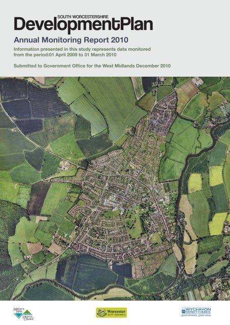
<strong>South</strong> <strong>Worcestershire</strong><strong>Development</strong> <strong>Plan</strong>Annual Monitoring Report<strong>2010</strong>Information presented in this study represents datamonitored from the period:1 St April 2009 to 31 st March <strong>2010</strong>Submitted to Government Office for the West Midlands24 <strong>Dec</strong>ember <strong>2010</strong>
SOUTH WORCESTERSHIRE ANNUAL MONITORING REPORT <strong>2010</strong>1
SOUTH WORCESTERSHIRE ANNUAL MONITORING REPORT <strong>2010</strong>2CONTENTSPAGEEXECUTIVE SUMMARY 2PART A – SOUTH WORCESTERSHIRE 101.0 INTRODUCTION• Key requirements for Annual Monitoring Reports• Local approach to monitoring• Monitoring the effectiveness of development plansacross <strong>South</strong> <strong>Worcestershire</strong>112.0 METHODOLOGYThis sets out the process for monitoring our <strong>Plan</strong>s andpolicies.153.0 PROFILE OF SOUTH WORCESTERSHIRE 21This section provides facts and figures on <strong>South</strong><strong>Worcestershire</strong>.4.0 THE PROJECT PLAN(LOCAL DEVELOPMENT SCHEME)This examines the progress on the project plan across allthree local planning authorities.295.0 DEVELOPMENT STRATEGY 396.0 ECONOMY AND TOWN CENTRES 447.0 HOUSING 608.0 ENVIRONMENTAL QUALITY 80
SOUTH WORCESTERSHIRE ANNUAL MONITORING REPORT <strong>2010</strong>39.0 CONCLUSIONS 10110.0 SIGNIFICANT EFFECTS INDICATORS 107PART B – LOCAL INFORMATIONThis assesses the performance of our adopted local planpolicies against locally set indicators in achieving spatialplanning policies and sustainable development.APPENDIX 1:MALVERN HILLS DISTRICT INDICATORSMalvern Hills’ 5 Year Housing Land Supply118140APPENDIX 2:WORCESTER CITY INDICATORSWorcester’s 5 Year Housing Land Supply147171APPENDIX 3:WYCHAVON DISTRICT INDICATORSWychavon’s 5 Year Housing Land Supply190xxAPPENDIX 4: CABE - BUILDING FOR LIFE CRTERIA 230GLOSSARY OF TERMS 232DATA SOURCESUSEFUL INFORMATIONFEEDBACK FORM
SOUTH WORCESTERSHIRE ANNUAL MONITORING REPORT <strong>2010</strong>4EXECUTIVE SUMMARYThis is the first joint Annual Monitoring Report (AMR) prepared for the <strong>South</strong><strong>Worcestershire</strong> Joint Advisory Panel and the constituent local planningauthorities of Malvern Hills District, Worcester City and Wychavon DistrictCouncil. It is a technical document prepared by officers of the constituentauthorities. It covers the monitoring year 1 April 2009 to 31 March <strong>2010</strong> and isthe starting point for monitoring the implementation of the three constituentlocal planning authorities adopted local plans and the <strong>South</strong> <strong>Worcestershire</strong><strong>Development</strong> <strong>Plan</strong> (SWDP).The AMR is arranged in two parts. Part A provides information and analysis ata <strong>South</strong> <strong>Worcestershire</strong> level, including overall conclusions andrecommendations for future monitoring arrangements. Nationally set CoreOutput Indicators provide the measure and guide to local performance. Part Bsets out information for each of the district/city authorities, which comprisesdata and analysis for local indicators (these are freestanding sections and arenot summarised here). These indicators are drawn from the individualmonitoring frameworks established in each authority as per their adopted localplans and Sustainability Appraisals. This local information will form Part B ofthe report.The monitoring year 2009/10 saw the continuation of economic recession.Although the impacts of this will take time to feed through into someindicators, it has had a marked impact on performance against housing andeconomic indicators. With regard to employment and housing targets <strong>South</strong><strong>Worcestershire</strong> authorities are currently awaiting primary legislation in theform of the Localism Bill scheduled to begin its passage through Parliamentfrom Christmas <strong>2010</strong>, and if passed will return decision-making powers inhousing and planning to local authorities. As it stands RSS remains part of the<strong>Development</strong> <strong>Plan</strong> for the local authorities across <strong>South</strong> <strong>Worcestershire</strong> butthe weight afforded to it in the case of individual planning applications (and byInspectors in the case of appeals), will need to be judged against the adviceissued by Government and its Chief <strong>Plan</strong>ner.
SOUTH WORCESTERSHIRE ANNUAL MONITORING REPORT <strong>2010</strong>5Whilst in this transition phase it is difficult to know how planning and deliverywork will facilitate a speedy recovery of the housing market when demandstarts to pick up. It is also recognised that prospects for the housing market,and therefore the rate of house building in <strong>South</strong> <strong>Worcestershire</strong>, areuncertain.The AMR Appendices set out further technical information on housing issues.Part A is arranged in nine sections as shown on the contents page. Section 1introduces the document. Section 2 explains the key requirements for annualmonitoring reports such as the types of indicators, PPS12 requirements andthe format for monitoring the objective led policies. Section 3 introduces the<strong>South</strong> <strong>Worcestershire</strong> area by providing a geographical and demographiccontext to the report. Section 4 considers progress on preparation of the Local<strong>Development</strong> Framework, which is the package of plans being prepared bythe three constituent local planning authorities. Sections 5 to 9 set outprogress against a range of indicators for the key policy areas of <strong>Development</strong>Strategy; Economy and Town Centres; Housing; Environmental Quality; andInfrastructure. Section 10 brings together a wide range of data to assess theeffectiveness of the three authorities Local <strong>Development</strong> Frameworks (LDF)using a range of significant effect indicators.The following table provides a succinct summary of <strong>South</strong> <strong>Worcestershire</strong>authority’s performance against key indicators. The picture is mixed and thepositives and negatives are addressed within the framework set out by thefollowing key questions:- Overall <strong>Development</strong> Strategy – where is development happening?- Economy and town centres – is a jobs/homes balance beingachieved?- Housing – are targets being met?- Environmental quality – is it improving?
SOUTH WORCESTERSHIRE ANNUAL MONITORING REPORT <strong>2010</strong>6MonitoringData<strong>South</strong> WorcsPerformanceIndicatorSourceFacts 2009/102009/10Number ofHouseholds in<strong>South</strong> Worcs.Percentage ofhouseholds built inthe urban area.COI, BD2: Totalamount & type ofcompletedfloorspace on PDL.COI, H3: New andconverted homesbuilt on PDL.DCLG, <strong>2010</strong> S.Worcs = 126,336 N/ADEVELOPMENT STRATEGYSWHLM,<strong>2010</strong>SWELM,<strong>2010</strong>SWHLM,<strong>2010</strong>80% ☺72% ☺82% ☺SUSTAINABLE ECONOMIC GROWTHNumber ofemployees jobs.WCEA, <strong>2010</strong> 127,200 (at 2008) -UnemploymentCount.WCEA, <strong>2010</strong> 5,025 people COI, BD1: Totalamount ofadditionalemployment byWCEA, <strong>2010</strong> 45,013m² ☺type.COI, BD3:Employment landavailable withplanning consent byWCEA, <strong>2010</strong> 107.96 hectares ☺type.COI, BD3:Employment LandAvailableWCEA, <strong>2010</strong> 249.71 hectares ☺COI, BD4: Totalannual change in<strong>South</strong>the amount of WCEA, <strong>2010</strong> <strong>Worcestershire</strong>floorspace for townfigure not available-centre usesHOUSINGLatest GovernmentPopulationProjection to 2033ONS, <strong>2010</strong>(Sub-nationalpop.projections2008/33)estimatedpopulation =313,500 peopleN/A
SOUTH WORCESTERSHIRE ANNUAL MONITORING REPORT <strong>2010</strong>7MonitoringData<strong>South</strong> WorcsPerformanceIndicatorSourceFacts 2009/102009/10Average HouseholdPriceCOI, H2a: Netadditional homes inmonitoring yearCOI, H2b: Netadditional homes inprevious years(since 2006)COI, H4: No. ofGypsy and TravellerPitchesCOI, H5: No. ofaffordable housesdelivered in 09/10COI, H6: Buildingfor LifeCOI E1: No. appscontrary to EAadviceCOI E2: No. ofapps contrary toWWT adviceCOI E2: Sites ofBiodiversityimportance(hectares)COI E2: Health ofSSSICOI E3: RenewableEnergy GenerationWCEA, <strong>2010</strong>SWHLM,<strong>2010</strong>SWHLM,<strong>2010</strong>WorcsCountyCouncil &SWHLM,<strong>2010</strong>SWHLM,<strong>2010</strong>S. Worcs 2007 =£277,020S.Worcs 2009= £222,422☺ Improvingaffordability. Homeowners i.e.negative equity.703 <strong>South</strong> Worcs hasadded 3,400Homes to its stocksince April 2006 againstPhase II WMRSStargets192 Pitches -173 Homes -ENVIRONMENTAL QUALITYEnvironmentAgency, <strong>2010</strong>WorcsWildlife Trust,<strong>2010</strong>NoneNoneGIS, <strong>2010</strong> 15,087 hectares -NaturalEngland,<strong>2010</strong>SW planningapplicationsdatabaseTable a: Summary of Monitoring Indicators85%☺☺☺ not yetachieving N.E.target of 95% butimprovingSee page 90 (table26) -
SOUTH WORCESTERSHIRE ANNUAL MONITORING REPORT <strong>2010</strong>8Key☺ Positive - Clear improvement or targets metLittle or no changeNegative - Clear deterioration or targets not met- Insufficient/no comparable data (including no targets or trends toassess against)The AMR comments on possible reasons for the performance against theseindicators in 2009/10. A key factor has been the continuing economicrecession. Although the impacts of this will take time to feed through intosome indicators, it has had a marked impact on performance against housingindicators in particular.The concluding section illustrates the key issues and identifies implications forthe <strong>South</strong> <strong>Worcestershire</strong> <strong>Development</strong> <strong>Plan</strong> and for the future approach tomonitoring in <strong>South</strong> <strong>Worcestershire</strong>. Key points include:• The impact of the recession on housing completions• The need to review progress with employment targets and means ofdelivering them in order to• Achieve a better jobs/homes balance• The need to frame indicators in a clearer way and set targets wherepossible, in order for them to• Assess the implications the abolished WMRSS has on <strong>South</strong><strong>Worcestershire</strong>’s monitoring framework• The need to rationalise and better resource the monitoring of policyeffectiveness and policy impact across the three constituent localplanning authorities
SOUTH WORCESTERSHIRE ANNUAL MONITORING REPORT <strong>2010</strong>9
SOUTH WORCESTERSHIRE ANNUAL MONITORING REPORT <strong>2010</strong>10PART A:SOUTHWORCESTERSHIRE
SOUTH WORCESTERSHIRE ANNUAL MONITORING REPORT <strong>2010</strong>111.0 INTRODUCTION1.1 The purpose of this document is twofold, firstly this document annuallyreviews the matters which may be expected to affect the developmentof <strong>South</strong> <strong>Worcestershire</strong> or the planning of its development; andsecondly it provides information on the preparation of planningdocuments and the extent to which policies set out in these are beingachieved (Sections 13 and 35 of the <strong>Plan</strong>ning and CompulsoryPurchase Act 2004). Should you wish to find out further details of theserequirements you can also consult Local <strong>Plan</strong>ning Regulation 48 of theTown and Country <strong>Plan</strong>ning (Local <strong>Development</strong>) (England)Regulations 2004 and Regulation 17 of the Environmental Assessmentof <strong>Plan</strong>s and Programmes (SEA) Regulations 2004.1.2 Put simply the main objective of the AMR is to establish theeffectiveness of policies and proposals in each of the authorities’adopted and emerging local development plans. It also analyses theperformance in meeting the milestones and targets set in the Project<strong>Plan</strong>.1.3 On 27 May <strong>2010</strong> and then confirmed on 6 July <strong>2010</strong> the Secretary ofState for Communities and Local Government announced therevocation of Regional Strategies with immediate effect.1.4 In August <strong>2010</strong>, Cala Homes (<strong>South</strong>) Limited submitted an applicationfor judicial review of the Secretary of State decision to revoke RegionalStrategies. Subsequently on 22 October <strong>2010</strong> Mr Justice Saleapproved the judgement in favour of Cala Homes in the High Court. Heconsidered that the powers set out in section 79 [6] of the LocalDemocracy, Economic <strong>Development</strong> and Construction Act 2009 couldnot be used by the Secretary of State to revoke all Regional Strategiesin their entirety.
SOUTH WORCESTERSHIRE ANNUAL MONITORING REPORT <strong>2010</strong>121.5 However, the Government’s Chief <strong>Plan</strong>ning Officer issued a letter on10 November <strong>2010</strong> which confirms that the primary legislationexpected in the form of the Localism Bill will begin its passage throughParliament before Christmas <strong>2010</strong>, and will if passed, return decisionmakingpowers in housing and planning to local authorities.1.6 Most recently, CALA Homes issued a second claim, seeking adeclaration from the Court that the government's stated intention torevoke Regional Strategies is not a material consideration for thepurposes of making planning decisions. As a result a court has placeda temporary block on the government's claim that its plans to abolishRegional Strategies must be regarded as a material consideration inplanning decisions until the latest case can be heard.1.7 This has had a direct impact on the newly formed <strong>South</strong><strong>Worcestershire</strong> <strong>Development</strong> <strong>Plan</strong> and as such the <strong>South</strong><strong>Worcestershire</strong> Joint Advisory Panel released a statement stating thatthey “…. welcome the opportunity to revisit locally developmentrequirements and not be driven by RSS requirements. However, werecognise the importance of continuing with the production of aplanning strategy for <strong>South</strong> <strong>Worcestershire</strong> as a basis for encouraginginvestment and dealing with current and future planning applications.”1.8 The <strong>South</strong> <strong>Worcestershire</strong> <strong>Development</strong> <strong>Plan</strong> (SWDP) will set outwhere development should go and what standards it should aim toachieve. Fundamental matters established in the SWDP will include theroles and relationships between settlements and the timely provision ofinfrastructure to facilitate growth.1.9 The <strong>Plan</strong>ning and Compulsory Purchase Act 2004 established theLocal <strong>Development</strong> Framework (LDF) as the means by which localplanning of the development and use of the land within an area will beundertaken. The LDF must include a Local <strong>Development</strong> Scheme(LDS) setting out the timetable for production of local development
SOUTH WORCESTERSHIRE ANNUAL MONITORING REPORT <strong>2010</strong>13documents; a Statement of Community Involvement (SCI); and anAnnual Monitoring Report (AMR).1.10 There are two types of local development document: <strong>Development</strong><strong>Plan</strong> Documents (DPDs) and Supplementary <strong>Plan</strong>ning Documents(SPDs). Area Action <strong>Plan</strong>s are a type of DPD. Whilst DPDs arestatements of local planning policy which outline how planning matterswill be managed in an area; SPDs provide further detailed guidance toassist implementation. The development plan also comprises savedpolicies from structure and local plans (currently adopted developmentpolicies) that will be replaced in due course as DPDs are prepared bythe local authorities.1.11 The three local planning authorities that make up <strong>South</strong> <strong>Worcestershire</strong>all have their own individual LDFs. A fundamental part linking the threeLDFs is the SWDP. It is recognised that, as the SWDP progresses itbecomes increasingly necessary to monitor cross boundary trendsacross <strong>South</strong> <strong>Worcestershire</strong>.1.12 This document is therefore the first Joint Annual Monitoring Report(AMR) and fulfils the requirement for the <strong>South</strong> <strong>Worcestershire</strong> JointAdvisory Panel and the three constituent local planning authorityplanning committees to report on the progress of the SWDP. The jointAMR has been produced based on information provided by the localauthorities for Malvern Hills District, the Worcester City and WychavonDistrict Councils. Part A provides information and analysis at a <strong>South</strong><strong>Worcestershire</strong> level, including overall conclusions andrecommendations for future monitoring arrangements. Part B sets outinformation for each of the district/city authorities, which comprises dataand analysis for local indicators. Appendices set out further contextualand supporting information.1.13 This Joint AMR covers the period 1 April 2009 to 31 March <strong>2010</strong>.Following submission to the Government Office for the West Midlands,
SOUTH WORCESTERSHIRE ANNUAL MONITORING REPORT <strong>2010</strong>14the document will be published on the web site of the <strong>South</strong><strong>Worcestershire</strong> <strong>Development</strong> <strong>Plan</strong> (www.swjcs.org) as well as thewebsites of the constituent local planning authorities.1.14 The Malvern Hills District Council <strong>Plan</strong>ning Committee approved theAMR for submission to the Government Offices on 8 <strong>Dec</strong>ember <strong>2010</strong>.1.15 Malvern Hills District, Worcester City and Wychavon District Councilsubmitted the <strong>South</strong> <strong>Worcestershire</strong> AMR the Government Offices on24 <strong>Dec</strong>ember <strong>2010</strong>.1.16 A copy of the covering report, minutes and AMR can be found on eachof the three local authority websites www.malvernhills.gov.uk,www.worcester.gov.uk and www.wychavon.gov.uk. Followingsubmission to the Secretary of State, we will make copies of the AMRavailable at our Customer Service Centres.1.17 A feedback form is included at the end of the document. We welcomeyour views on the format of the document and its contents.
SOUTH WORCESTERSHIRE ANNUAL MONITORING REPORT <strong>2010</strong>152.0 METHODOLOGYKey Requirements for Annual Monitoring Reports2.1 Monitoring is essential to establish both what is happening now andwhat may happen in the future. It provides a crucial feedback loop inthe cyclical process of policy-making and helps to address questionslike:• Are policies achieving their objectives and delivering sustainabledevelopment?• Have policies had unintended consequences?• Are the assumptions behind the policies still relevant?• Are the targets being achieved?2.2 Three types of indicator are identified in government guidance onmonitoring:• Contextual indicators – these establish the baseline position ofthe wider social, environmental and economic circumstances.Contextual information sits alongside the three main core outputindicator themes and can be found in part A of this report.• Output indicators – these are aimed at measuring quantifiablephysical activities that are directly related to, and are aconsequence of, the implementation of planning policies. Coreoutput indicators are analysed at a <strong>South</strong> <strong>Worcestershire</strong> level inpart A of this report, whilst the individual authority local outputindicators are included at part B.• Significant Effects indicators – these assess social, economicand environmental effects and these should be linked tosustainability appraisal objectives and indicators. Significanteffects indicators are covered in part A of this report.2.3 <strong>Plan</strong>ning Policy Statement 12 ‘Local Spatial <strong>Plan</strong>ning’ (paragraph 4.47)states that core strategies must have clear arrangements for monitoringand reporting results. Annual Monitoring Reports should seek toachieve four key tasks:
SOUTH WORCESTERSHIRE ANNUAL MONITORING REPORT <strong>2010</strong>161. Report progress on the timetable and milestones for thepreparation of documents set out in the local developmentscheme, including reasons where they are not being met.2. Report progress on the policies and related targets in localdevelopment documents. This includes progress against anyrelevant national and regional targets. Any unintended significanteffects of the implementation of the policies on social,environmental and economic objectives should be highlighted.Where policies and targets are not being met or on track or arehaving unintended effects reasons should be provided along withany appropriate actions to redress the matter.3. Include progress against the core output indicators, includinginformation on net additional dwellings, and an update of thehousing trajectory.4. Indicate how infrastructure providers have performed andconsider whether there is a need to reprioritise any previousassumptions made regarding infrastructure delivery.2.4 There are a total of sixteen Core Output Indicators upon whichprogress must be reported by every local planning authority: thesecover the themes of Business <strong>Development</strong> and Town Centres;Housing; and Environmental Quality. There is some crossoverbetween core output indicators and the 188 National Indicators thateach authority has to report on a corporate basis, and some of thelatter also form part of the Local Area Agreement. Furthermore, allthree authorities have a Performance Management Framework tomonitor and compare our individual authority performance againstagreed objectives and targets.2.5 Key actions identified as part of the AMR will where appropriate informeach constituent authority’s Service Management <strong>Plan</strong> and the <strong>South</strong><strong>Worcestershire</strong> Project <strong>Plan</strong> (previously the Local <strong>Development</strong>Scheme (LDS)). This will ensure that essential resources are identified
SOUTH WORCESTERSHIRE ANNUAL MONITORING REPORT <strong>2010</strong>17and agreed to implement these actions. A monthly update is reportedto each of the constituent authority’s Senior Management Team. Thisprovides an additional mechanism for monitoring performance and willassist in identifying whether project plan milestones are being achievedallowing actions to be undertaken at the earliest opportunity.2.6 The format for monitoring the policies is based on an objective – ledapproach. This is in line with existing regional monitoring and issummarised below:2.7 The targets identified in the AMR are derived from a number ofsources:
SOUTH WORCESTERSHIRE ANNUAL MONITORING REPORT <strong>2010</strong>18• targets such as the level of development to be provided onpreviously developed land are set by the <strong>Worcestershire</strong> CountyStructure <strong>Plan</strong> (WCSP) and the adopted Local <strong>Plan</strong>s of eachconstituent local planning authority;• land use related targets set by a Council through its corporatestrategy identified in the Council <strong>Plan</strong> and its Priority <strong>Plan</strong>s.These are measured through a combination of best valueperformance indicators, public service agreements, <strong>Plan</strong>ningindicators and local indicators; and• targets established by various policies in locally adopted localplans themselves such as the level of new housing andemployment land provision over the <strong>Plan</strong> period.2.8 In some cases, a single target may work towards a number of Local<strong>Plan</strong> objectives. For example, an affordable housing target will assistin meeting the objective to meet the housing requirement of the localplanning authority through the provision of a range of dwelling types,sizes, densities and tenures. It will also impact on the objective to worktowards a better balance between housing, employment, social andcommunity facilities.Local Approach to Monitoring2.9 This is the first joint <strong>South</strong> <strong>Worcestershire</strong> AMR and it is a starting pointfor developing a more efficient and consistent approach to monitoringacross <strong>South</strong> <strong>Worcestershire</strong>. <strong>Development</strong> of the approach will beoverseen by the <strong>South</strong> <strong>Worcestershire</strong> Monitoring Group which wasestablished in early <strong>2010</strong> and comprises representatives from the threeconstituent local planning authorities.2.10 The main objective of the joint AMR is to establish the effectiveness ofpolicies and proposals in each of the authorities adopted local plans,the emerging <strong>South</strong> <strong>Worcestershire</strong> <strong>Development</strong> <strong>Plan</strong> and other localdevelopment documents. It also provides an analysis of performance
SOUTH WORCESTERSHIRE ANNUAL MONITORING REPORT <strong>2010</strong>19across the area in meeting the milestones and targets set in each localdevelopment scheme.2.11 Preparation of the joint AMR has experienced some technicaldifficulties with three different authorities using different IT systems fordata capture. This will be addressed over the next 12 months as weestablish practical solutions to capture and analyse local data onspatial themes, such as housing, employment, environment andtransport, with the existing IT systems.2.12 This AMR provides information on a number of indicators against whichthe implementation of local planning policies can be assessed overtime, as well as the effects of these policies. The report also includesperformance and regulatory monitoring sections around documentproduction; the implementation of plan policies; and changes toGovernment guidance.2.13 Reporting indicators is arranged in two parts. Part A focuses onmeasuring the effects of the three constituent local planning authoritiesadopted local plans as well as the emerging SWJCS. These focus onthe Core Output Indicators that all planning authorities must report onas established by the national Government. Part B provides more localinformation prepared by each of the Districts / City. This is based onthe local indicators previously reported in their AMRs, which varyaccording to local circumstances and priorities.Monitoring the Effectiveness of <strong>Development</strong> <strong>Plan</strong>s across <strong>South</strong><strong>Worcestershire</strong>2.14 Part A reports on progress under the following broad headings:• Overall <strong>Development</strong> Strategy – where is developmenthappening?• Economy and town centres – is a jobs/homes balance beingachieved?• Housing – are targets being met?
SOUTH WORCESTERSHIRE ANNUAL MONITORING REPORT <strong>2010</strong>20• Environmental quality – is it improving?2.15 The SWDP is still emerging, so this AMR is very much aboutestablishing a baseline position against which future trends andperformance can be tracked. This year’s report will flag actual orpotential issues with the collection of relevant data, or with the framingof indicators and measures. The AMR is an important mechanism forhighlighting issues within the monitoring framework and will inform theoverall success of the three constituent authorities adopted local plansas well as highlighting potential issues for the emerging SWDP.
SOUTH WORCESTERSHIRE ANNUAL MONITORING REPORT <strong>2010</strong>213.0 PROFILE OF SOUTH WORCESTERSHIRE3.1 <strong>South</strong> <strong>Worcestershire</strong> is located in the south of the West Midlands,England. The <strong>South</strong> <strong>Worcestershire</strong> area encompasses the City ofWorcester and the two neighbouring districts of Malvern Hills andWychavon. The area of <strong>South</strong> <strong>Worcestershire</strong> has an overall populationof over 286,000. Wychavon is the largest authority in terms ofpopulation with over 117,000 residents, whereas Malvern Hills, has thesmallest population of 75,000. The overall population figure accountsfor over half of the County’s population. (WCEA 2009/10).3.2 <strong>South</strong> <strong>Worcestershire</strong> has good transport links with the rest of the UK.Running throughout <strong>South</strong> <strong>Worcestershire</strong>, there are motorway links toBirmingham, Wales and the <strong>South</strong> West via the M5 and M50. Localrailway stations provide rail access to London (2.5hrs) and Birmingham(40min). Additional public transport links are provided by way of aregional bus and coach station in the City Centre with frequent localservices and a national coach stop by Junction 6 of the M5. Malvern,Pershore, Evesham and Droitwich have regular services to Birminghamand Worcester, providing access to the rest of the country. <strong>South</strong><strong>Worcestershire</strong> is also well served by international airports, the nearestbeing Birmingham, Bristol and East Midlands (WCEA 09/10).3.3 <strong>South</strong> <strong>Worcestershire</strong> is an attractive place for businesses due to itslinks to other cities and countries and its largely rural landscape.Worcester City is a key employment centre with large businesses suchas Royal Worcester Porcelain, Lea and Perrins and Worcester Bosch.Malvern Hills is becoming well known, not only for its tourism, but alsofor its input into technology and science. There are several highlyregarded industrial and business parks such as Malvern Science andEnigma Business Park. Wychavon has many local industries such astourism and food growers, the Vale of Evesham being one of thelargest employers of English and Europeans in the County. Wychavonalso plays a big part in the engineering industry (WCEA 09/10).
SOUTH WORCESTERSHIRE ANNUAL MONITORING REPORT <strong>2010</strong>22Figure 1: Map of <strong>South</strong> <strong>Worcestershire</strong>
SOUTH WORCESTERSHIRE ANNUAL MONITORING REPORT <strong>2010</strong>233.4 Worcester is one of England’s first settlements to gain city status byroyal charter, in 1189, and is the principal urban area of<strong>Worcestershire</strong>. It is rich in archaeological and heritage sites;archaeological finds have proved that Worcester was involved in manydifferent battles, including important Civil War conflicts; and is theprimary administrative and employment centre in the county.Geographically, it is located approximately 120 miles (193 km) northwest of London and 27 miles (43km) south west of Birmingham in theWest Midlands. The City covers an area of approximately 13 squaremiles, varying between urban, residential and green spaces. The RiverSevern passes through the centre of the city. Tourism attractionsinclude the Royal Porcelain Museum, Commandary, WorcesterCathedral, The Racecourse and the Cricket Ground.3.5 Many tourists come to visit the famous Malvern Hills, which are adesignated Area of Outstanding Natural Beauty (AONB). The entireNorth West of the Malvern Hills District is a designated Area of GreatLandscape Value, centred mainly around the River Teme. The MalvernHills District is also home to the River Severn, which flows throughUpton-Upon-Severn’s Marina. This is a very popular place for peoplevisiting the area to moor their boats (Malvern Hills District Local <strong>Plan</strong>).The District of Wychavon is also steeped in history. It is home toDroitwich Spa, which is renowned for its extraction of salt from anunderground lake. Similarly to Malvern, during the Water Cure period,the Victorians saw the advantages of the high salt content in the waterand so bathed in brine baths to cleanse the body. Pershore Abbey isalso a very popular tourist attraction.3.6 <strong>South</strong> <strong>Worcestershire</strong> has a diverse range of historic and cultural siteslocated in its urban and rural landscapes. These range from:• Areas of special architectural or historic interest, where thecharacter is deemed desirable to preserve or enhance;
SOUTH WORCESTERSHIRE ANNUAL MONITORING REPORT <strong>2010</strong>24• Buildings that represent the best and most important examples ofour built heritage;• Scheduled ancient monument ranging from prehistoric standingstones, through to the many types of medieval sites - castles,abandoned farmsteads and villages - to the more recent results ofhuman activity, such as collieries and milestones;• Historical Parks and Gardens reflecting designed landscapesworthy of preservation and the rich and varied contributionlandscape fashions of the past have made to our heritage; and• The Medieval (1265) and mid 17 th Century (1642 and 1651)registered battlefields of Evesham and Worcester, respectively.Figure 2: Number of historic sites across the <strong>South</strong> <strong>Worcestershire</strong>area (Malvern Hills District (2006), Wychavon District (2006) andWorcester City (2004) Local <strong>Plan</strong>s).
SOUTH WORCESTERSHIRE ANNUAL MONITORING REPORT <strong>2010</strong>253.7 Figure 3 illustrates the districts of Malvern Hills and Wychavon as beingpredominately rural. Although <strong>Worcestershire</strong> is a largely rural county,roughly 71% of the residents live in the cities or larger towns (WCEA09/10).3.8 Due to the area being largely rural, about 25% of people from thecounty have to commute to and from work (2001 Census). MalvernHills District has the greatest number of people commuting out of thearea. In 2001 it was estimated that 5,682 people commuted toWorcester City adding further weight to emphasising the role of the cityas an employment base.Figure 3: Map of <strong>Worcestershire</strong> showing principal towns and ruralareas (WCEA 09/10).3.9 Migration figures are more varied and can be heavily influenced bynational policy and economy. In 2007/08, the inflow to <strong>Worcestershire</strong>,as a county, was down to 330 people compared to 1,160 people theprevious year (WCEA 09/10). This could suggest that the recession
SOUTH WORCESTERSHIRE ANNUAL MONITORING REPORT <strong>2010</strong>26affected people’s opinions and options about moving into a more ruralcounty from an urban area, such as Birmingham.3.10 Some of the key population characteristics of <strong>South</strong> <strong>Worcestershire</strong> areoutlined Table 1. Population numbers can be found in table 14.LOCALAUTHORITYArea (ha)CHARACTERISTICPop.DensityNo.HouseholdsAv.HouseholdsizeMalvern Hills 57,707 125 33,183 2.4Worcester 3,328 2,805 42,147 2.25Wychavon 66,297 170 51,006 2.38<strong>South</strong> Worcs 141,742 196 126,336 N/ATable 1: <strong>South</strong> <strong>Worcestershire</strong> population characteristics (Census2001) (Number of households CLG, April <strong>2010</strong>).Retirement Age3.11 The average retirement age is currently 60 years for women and 65 formen. The state pension is set to increase over the next 34 years, asthe new Government continues to reduce poverty amongst pensioners.In 2024, the pension age, for both women and men, will increase to 66,67 in 2034 and 68 in 2044 (BBC Website).3.12 The high level of retired persons has a number of implications for thedevelopment strategy. The level of development in sustainablelocations with access to a range of services and public transport willassist in meeting the needs of the elderly population.
SOUTH WORCESTERSHIRE ANNUAL MONITORING REPORT <strong>2010</strong>273.13 Future AMRs will benefit from monitoring the levels of new health carefacilities including Nursing Homes and supported housing. Informationwill be assessed against information from the <strong>South</strong> <strong>Worcestershire</strong>Primary Care Trust, Vision 21 through consultation on the CommunityStrategy and our Housing Strategy. For example Malvern Hills Districtmonitors this via local indicator 19 – health care facilities.Crime3.14 Over a two year period, from April 2007 to 2009, <strong>Worcestershire</strong>, as acounty, experienced a 9% decrease in crime, from 3,250 to 3,000.Worcester, as a city unsurprisingly experienced the most cases ofcrime between April 2007 and October 2009. Worcester City recorded22,000 cases compared to Malvern Hills which recorded 9,000. Theseinclude a number of different crimes, for example, theft of vehicles,burglary, Criminal Damage, Robbery (with the threat of violence), andViolent Crime (WCEA 09/10).3.15 All three authorities, from the end of the financial year 2009/10,experienced an increase in Anti Social Behaviour, with Worcester Cityrecording the biggest increase. The Malvern Hills District, however,have experienced an increase in this crime since 2008/09 (WorcesterCounty Council Research and Intelligence Service).3.16 The Malvern Hills District has experienced an increase in all crimessince 2008/09 such as criminal damage, and total crime. Wychavonand Worcester City, on the other hand have experienced a drop in totalcrime. Wychavon had a very small fall in total crime at 2.9% comparedto Worcester City’s 20% drop since 2007/08. N.B. Other Crime isdefined as arson, shoplifting, and other miscellaneous crimes(Worcester County Council Research and Intelligence Service).
SOUTH WORCESTERSHIRE ANNUAL MONITORING REPORT <strong>2010</strong>28Malvern Hills Worcester WychavonOther CrimeCriminalDamageAnti SocialBehaviourOther CrimeCriminalDamageAnti SocialBehaviourOther CrimeCriminalDamageAnti SocialBehaviour2009/102008/092007/082006/070 2000 4000 6000 8000 10000 12000Figure 4: Crime in <strong>South</strong> <strong>Worcestershire</strong> since 2006/07Criminal Damage andAnti-social Behaviour since 2006/7 (WCC Research and Intelligence Service).
SOUTH WORCESTERSHIRE ANNUAL MONITORING REPORT <strong>2010</strong>294.0 THE PROJECT PLAN (LOCAL DEVELOPMENT SCHEME)4.1 <strong>Plan</strong>ning authorities are required to submit a project plan called theLocal <strong>Development</strong> Scheme (LDS) to the Secretary of State. The LDSis a public statement setting out what planning documents are to beprepared locally (these are together referred to as the Local<strong>Development</strong> Framework, or ‘LDF’) and the programme for theirproduction.4.2 The local development scheme has three main roles:• To create certainty for the public and stakeholders, informingthem of the range of plans being produced, the timescales forproducing them and the intended outcomes• To effectively prioritise, programme and allocate resources forthe preparation of plans• To provide a framework and timetable for the review of plans4.3 This section will only discuss those projects that are being preparedjointly which focus on the coordinated production of development plansneeded to deliver sustainable development in <strong>South</strong> <strong>Worcestershire</strong>.Other projects more specific to the individual local planning authoritiesof Malvern Hills District Council, Worcester City and Wychavon DistrictLDSs are located in appendices one, two and three, respectively.Joint Working4.4 The three district councils together with <strong>Worcestershire</strong> County Councilhave been working closely together on an informal basis with respect toaddressing the implications of Worcester City’s sub-regional role and aVision for the City.4.5 A first step in this process was the informal establishment of the <strong>South</strong><strong>Worcestershire</strong> Steering Group, which included leading members fromeach authority, Chief Executives and planning officers. The informalSteering Group:
SOUTH WORCESTERSHIRE ANNUAL MONITORING REPORT <strong>2010</strong>30• commissioned technical work into the feasibility of growthassociated with the City (which informed work undertaken by theCounty Council on behalf of the Regional <strong>Plan</strong>ning Body);• developed a successful bid under the CLG’s New Growth Pointsprogramme; and• considered how to bring forward comprehensive land use andtransport infrastructure proposals for the City, which may berequired through the RSS review process, using the LocalTransport <strong>Plan</strong> (LTP) and planning processes.4.6 On the 13 th October 2006, the <strong>South</strong> <strong>Worcestershire</strong> Steering Groupconsidered options for joint working on <strong>Development</strong> <strong>Plan</strong> coverage forWorcester City and <strong>South</strong> <strong>Worcestershire</strong> generally. It was agreed thatthe preparation of a Joint Core Strategy covering the full extent of theadministrative areas of Worcester City, Wychavon and Malvern Hillsshould be recommended to each of the District Councils.4.7 The respective local planning authorities agreed to work collaborativelyon the preparation of the joint Core Strategy <strong>Development</strong> <strong>Plan</strong>Document (DPD) for <strong>South</strong> <strong>Worcestershire</strong> under the provisions ofSection 28 of the <strong>Plan</strong>ning and Compulsory Purchase Act 2004.4.8 An informal Joint Advisory Panel has been established as amechanism through which the three local planning authorities willexercise their powers under Section 28 of the <strong>Plan</strong>ning andCompulsory Purchase Act 2004 to prepare one or more joint localdevelopment documents. It will make recommendations on theplanning purposes agreed to the constituent planning authorities fortheir determination. It is an informal advisory body not exercising anydelegated powers. The County Council cannot be a full voting andparticipating member, but an observer representing the interests of theRegional <strong>Plan</strong>ning Body and its own interests as County TransportationAuthority.
SOUTH WORCESTERSHIRE ANNUAL MONITORING REPORT <strong>2010</strong>314.9 The terms of reference for the Joint Advisory Panel have beendeveloped and agreed by the Panel at its first meeting on the 19 thJanuary 2007, and have been agreed by each <strong>South</strong> <strong>Worcestershire</strong>Council.4.10 The <strong>South</strong> <strong>Worcestershire</strong> Joint Advisory Panel guides thedevelopment of the proposed joint Core Strategy DPD consisting ofthree nominated members from each of the District Councils. Itspurpose is to:a. consider reports and examine issues related to the production ofa Joint Core Strategy (<strong>Development</strong> <strong>Plan</strong> Document) for <strong>South</strong><strong>Worcestershire</strong> and to make recommendations to the threeCouncils regarding the content and development of the JointCore Strategy;b. make recommendations to the three Councils regarding thecontent of the LDS covering <strong>South</strong> <strong>Worcestershire</strong> and thetimetabling of key <strong>Development</strong> <strong>Plan</strong> Documents; andc. make recommendations to the three Councils regarding futureplan making and development control arrangements associatedwith the implementation of the LDS for <strong>South</strong> <strong>Worcestershire</strong>.4.11 The Joint Advisory Panel has no executive / decision making capacity /powers in respect of any of the planning or other functions of the <strong>South</strong><strong>Worcestershire</strong> Local Authorities and does not represent a formallyconstituted Joint Committee.
SOUTH WORCESTERSHIRE ANNUAL MONITORING REPORT <strong>2010</strong>32<strong>South</strong> <strong>Worcestershire</strong> Joint Core Strategy (SWJCS) DPD4.12 The Issues and Options Paper was prepared over thesummer of 2007 with a statutory six-week period ofconsultation from 2 November until 14 <strong>Dec</strong>ember,although submissions were accepted up to 21 <strong>Dec</strong>ember2008. The aim of which was to formally start the debateabout big planning issues facing south <strong>Worcestershire</strong>.4.13 Consultation on the Preferred Options Report took placefrom 19 September to 31 October 2008. Consultation onthe Preferred Options for the Joint Core Strategy providesthe mechanism to consider the identification of broadlocations or strategic sites for growth to serve <strong>South</strong><strong>Worcestershire</strong>, for plan making purposes and alsoprovides a vehicle for agreeing the extent and coverageof an associated Site Allocations DPD. A documentcontaining the Preferred Option responses to publicconsultation comments was published in late <strong>2010</strong> somesix months later than originally scheduled.200720084.14 During 2009 it was considered that the SWJCS wouldneed to defer its project timetable by nine months. Thiswas due to a number of technical issues as can beaccessed via the Meetings, Minutes and Agendas webpage dated 8 September 2009. A recommendation todefer the <strong>South</strong> <strong>Worcestershire</strong> Joint Core Strategy(SWJCS) was approved by all three Councils in autumn2009. It is now proposed that the final SWJCS will besubmitted to the Secretary of State in October <strong>2010</strong> asopposed to April <strong>2010</strong>. The LDS has accordingly beenrevised and approved by all three councils to reflect thisnew timetable.2009
SOUTH WORCESTERSHIRE ANNUAL MONITORING REPORT <strong>2010</strong>334.15 During <strong>2010</strong> the SWJCS was again deferred albeit fordifferent reasons than those in 2009. As briefly discussedin the introduction the Secretary of State announced inJuly the intention to revoke Regional Strategies. This hashad a significant impact on the <strong>South</strong> <strong>Worcestershire</strong>Joint Core Strategy (SWJCS).4.16 In autumn <strong>2010</strong> the Joint Advisory Panel took thedecision to join the <strong>South</strong> <strong>Worcestershire</strong> Joint CoreStrategy (SWJCS) and Site Allocations <strong>Plan</strong><strong>Development</strong> <strong>Plan</strong> Document together into one plan.This will be called the <strong>South</strong> <strong>Worcestershire</strong> <strong>Development</strong><strong>Plan</strong> (SWDP). The three <strong>South</strong> <strong>Worcestershire</strong>Authorities are still working together on a joint plan, butas a result of the recent changes to the planning system,we have revised our approach and plan to move forwardreflecting the new Government agenda.4.17 This proposed timetable (figure 5) brings together theJoint Core Strategy and the Site Allocations and Policies<strong>Development</strong> <strong>Plan</strong> Document (re-named as the <strong>South</strong><strong>Worcestershire</strong> <strong>Development</strong> <strong>Plan</strong>). The bringing togetherof the two documents will be beneficial to the public asthe whole picture for <strong>South</strong> <strong>Worcestershire</strong> is shown. Inaddition there should be financial savings with oneconsultation and one examination rather than two.DURING<strong>2010</strong>4.18 This Project <strong>Plan</strong> has been published on theunderstanding that it still has to be formerly ratified by thethree Councils in <strong>Dec</strong>ember <strong>2010</strong>.
SOUTH WORCESTERSHIRE ANNUAL MONITORING REPORT <strong>2010</strong>34Figure 5: <strong>South</strong> <strong>Worcestershire</strong> <strong>Development</strong> <strong>Plan</strong> - Project <strong>Plan</strong> - <strong>2010</strong>-2013
SOUTH WORCESTERSHIRE ANNUAL MONITORING REPORT <strong>2010</strong>35Document Stage LDS Milestone Date(s)AchievedPreparation of Issues andJuly 07 withJuly 07Options and publicconsultationonwardsconsultationin Nov 07Public participation onSept – OctNov – Jan 08Preferred Options Report08January 2011Submission of DPD and(revised to take Did notSustainability Assessmentaccount of achieveto the Secretary of Statedeferment)October 2011Submission of DPD and(revised to take Did notSustainability Assessmentaccount of achieveto the Secretary of Statedeferment)Table 2: SWJCS TimetableOn TrackYESYESNONO<strong>South</strong> <strong>Worcestershire</strong> Joint Site Allocations and Policies DPD4.19 Work on this document began in January 2009 and it was agreed thethree Local <strong>Plan</strong>ning Authorities of <strong>South</strong> <strong>Worcestershire</strong> wouldproduce a joint <strong>South</strong> <strong>Worcestershire</strong> Site Allocations and Policies<strong>Development</strong> <strong>Plan</strong> Document. The previous Local <strong>Development</strong>Scheme (2007) identified the pre-production/survey stage ascommencing in August 2008. However the most recent LDS scheduledthis to commence in January 2009.4.20 “Information Gathering” events were held during the latter months of2009 and early months of <strong>2010</strong>. These events were held across <strong>South</strong><strong>Worcestershire</strong> and offered members of the public a chance toconsider issues concerning the smaller proposed development sites intheir local area. These sites look to accommodate new homes andassociated facilities such as employment, shopping, health, education,community and open space. Furthermore the event sought local’s and
SOUTH WORCESTERSHIRE ANNUAL MONITORING REPORT <strong>2010</strong>36community’s opinions on what type of policies will be needed to guidethis development.4.21 Information gathered from these proposed consultation events (detailsbelow) will feed into a draft “Preferred Options” document for the SiteAllocations and Policies <strong>Development</strong> <strong>Plan</strong> Document. This plancomplements the Joint Core Strategy and needs to be in conformitywith policies in the strategic plan.DATEVENUEPUBLIC OPENINGTIMESNUMBER OFATTENDEES13 Oct 09 Friary Mall,Worcester15 Oct 09 Friary Mall,Worcester17 Oct 09 Friary Mall,Worcester23 Oct 09 Upton MemorialHall24 Oct 09 Upton MemorialHall31 Oct 09 St.Andrew’sChurch,Droitwich6 Nov 09 Priory LodgeHall, Malvern7 Nov 09 Priory LodgeHall, Malvern11 Nov 09 Evesham TownHall16 Nov 09 Pershore TownHall10.00am-5.00pm 11710.00am-5.00pm15310.00am-5.00pm10.00am-7:30pm20310:30am-3:30pm10.00am-4.00pm 21610.00am- 7:30pm 7910:30am-3:30pm 6010.00am- 8:00pm 9110:00am- 8:00pm 99
SOUTH WORCESTERSHIRE ANNUAL MONITORING REPORT <strong>2010</strong>37DATEVENUEPUBLIC OPENINGTIMESNUMBER OFATTENDEES18 Nov 09 St.Andrew’sChurch, 10:00am-8.00pm 68Droitwich21 Nov 09 Pershore TownHall10.00am-4.00pm 13027 Nov 09 CommunityRooms, 10.00am-7:30pmTenbury Wells28 Nov 09 Community98Rooms, 10.30am-3:30pmTenbury Wells12 <strong>Dec</strong> 09 Evesham TownHall10.00am-4.00pm 1718 Jan 10 Kempsey 20521 Jan 10 DrakesBroughton2.00pm to 7.30pm 10225 Jan 10 Hanley Swan 10030 Jan 10 Broadway 10.00am to 2.00pm 554 Feb 10 Hallow 17313 Feb 10 Fernhill Heath 10.00am to 2.00pm 15215 Feb 10 Harvington 1.00pm to 7.30pm 7816 Feb 10 Bretforton 1.00pm to 7.30pm 12019 Feb 10 <strong>South</strong> Littleton 1.00pm to 7.30pm 8025 Feb 10 Hartlebury 1.00pm to 7.30pm 972 Mar 10 Leigh &Bransford675 mar 10 Bredon 1.00pm to 7.30pm 400+9 Mar 10 Abberley 3.30pm to 7.00pm 11911 Mar 10 LowerBroadheath86
SOUTH WORCESTERSHIRE ANNUAL MONITORING REPORT <strong>2010</strong>38DATEVENUEPUBLIC OPENINGTIMESNUMBER OFATTENDEES13 Mar 10 LowerBroadheath4319 Mar 10 Martley 10.30am to 7.00pm 7520 Mar 10 Inkberrow 10.00am to 2.00pm 20023 Mar 10 Beckford 1.00pm to 7.30pm 21026 Mar 10 Callow End 3.30pm to 7.30pm 15127 Mar 10 Wychbold 10.00am to 2.00pm 53Table 3: Date, location and number of attendees at the Site Allocationsand Policies DPD information gathering events (staffed exhibitions)4.22 During the period 13 October 2009 and 27 March <strong>2010</strong> the <strong>South</strong><strong>Worcestershire</strong> <strong>Development</strong> Team saw some 3,500 people attend theinformation gathering events. The team also received 2,990 responsesvia questionnaire responses and letters. These can be broken downinto several locational themes. The following number of responsesfocussed largely on:• WORCESTER CITY - 978• MALVERN - 107• DROITWICH - 83• EVESHAM - 34• PERSHORE - 99• TENBURY WELLS - 44• UPTON UPON SEVERN - 67• VILLAGES - 1,533• SOUTH WORCESTERSHIRE AREA - 2,990
SOUTH WORCESTERSHIRE ANNUAL MONITORING REPORT <strong>2010</strong>395.0 DEVELOPMENT STRATEGY5.1 The SWDP Vision reflects Sustainable Community Strategy prioritiesfor the county and the three districts/city alike. This means there ismuch overlap with the Local Area Agreement and the performancemonitoring undertaken on a corporate basis by all local authorities.5.2 Whilst the SWDP has most direct influence on where and howdevelopment takes place, it is also about improving quality of life – anoutcome that is less tangible and therefore difficult to measure. Infuture editions, the AMR will include data from the three councils’ placesurveys as a proxy measure to provide a baseline position on‘liveability’. This will provide the levels of satisfaction across the <strong>South</strong><strong>Worcestershire</strong> Area as a place to live.Distribution of Housing <strong>Development</strong>5.3 A potential marker of the emerging SWDP’s effectiveness is thepercentage of development at the main urban centres. Targets willeventually be located in the monitoring framework of the SWDP foreach element of the defined settlement hierarchy. Currently the threeadopted local plans set out the development strategy and specificallythe location of new housing development across <strong>South</strong> <strong>Worcestershire</strong>.All three authorities state that development will be directed to the mostsustainable locations. This will be sequentially determined and brieflyreads as follows:• The principal urban areas of Worcester, Malvern Evesham andDroitwich;• Towns of Pershore, Tenbury Wells and Upton upon Severn;• Rural villages as per rural settlement hierarchies; and• <strong>Development</strong> in the open countryside is controlled. <strong>Development</strong>is limited to those exceptions established in the adopted localplans
SOUTH WORCESTERSHIRE ANNUAL MONITORING REPORT <strong>2010</strong>40Settlement TypeNet DwellingCompletions in2009/10% of Completionsin 2009/10Worcester 325 46%Malvern 164 23%Droitwich 13 2%Evesham 45 6%Pershore 11 2%Tenbury Wells 3 0.5%Upton upon Severn 3 0.5%Rural Villages &Countryside139 20%<strong>South</strong> Worcs Total 703 100%Table 4: Housing completions by location during 2009/10.5.4 During 2009/10 table 4 shows that nearly half of all housingdevelopment occurred in Worcester City. The urban areas of <strong>South</strong><strong>Worcestershire</strong> accounted for 80% of all housing completions during2009/10. This baseline data will be a useful reference point for futuremonitoring and to inform the emerging SWDP.Use of Previously Developed Land5.5 The urban emphasis of the three adopted local plans, sets out theprinciple of maximising the use of previously developed (brownfield)land for new development. Performance in the monitoring year iscovered by core output indicators BD2 and H3, as set out in the tables5 and 6.5.6 Cumulatively 72% of additional gross employment floorspace wasdeveloped on PDL. This can be attributed to several large developmentsites in Wychavon and the urban nature of Worcester City. Converselya lower percentage of storage and/or distribution (use classes order
SOUTH WORCESTERSHIRE ANNUAL MONITORING REPORT <strong>2010</strong>41B8) floorspace being developed on PDL was recorded. This possiblyreflects the operational requirements and the desire for edge of townwarehouse sites, usually developed on greenfield land. During 2009/10Wychavon District heavily dominated the level of completions andaccounted for 62% of all employment development by floorspace (m²).Malvern Hills District saw the lowest levels of employment completionsduring 2009/10.LOCALAUTHORITYB1(m²)B2(m²)B8(m²)B Mix(m²)Total(m²)MalvernHillsWorcesterCityWychavonGross 1,780 294 380 0 2,454% PDL 0% 65% 100% 0% 23%Gross 0 0 0 12,400 12,400% PDL 0% 0% 0% 100% 100%Gross 7,734 7,953 12,713 1,759 30,159% PDL 93% 100% 41% 100% 73%<strong>South</strong>WorcsGross 9,514 8,247 13,093 14,159 48,470% PDL 76% 99% 43% 100% 72%Table 5: Total amount of completed employment floor space onpreviously developed land (PDL) by type during 2009/10 (COI, BD2).5.7 National <strong>Plan</strong>ning Policy for Housing (PPS3) sets a national target forprovision of new housing on ‘previously developed land’ (PDL) at 60%.5.8 In 2009/10, <strong>South</strong> <strong>Worcestershire</strong> saw 72% of gross dwellingcompletions on PDL, some 22% points above the national target. It isexpected this position is likely to change in future years as availablebrownfield sites become built out. This will increase the pressure ongreenfield sites to deliver local housing, employment and serviceneeds.
SOUTH WORCESTERSHIRE ANNUAL MONITORING REPORT <strong>2010</strong>42Gross DwellingCompletions in2009/10Total PreviousDeveloped Land(PDL)% onPDLMalvern Hills 245 181 74%Worcester City 342 342 100%Wychavon 178 102 57%<strong>South</strong> Worcs 765 625 82%Table 6: New and converted dwellings built on previously developedland during 2009/10 (COI, H3).Accessibility – Ensuring access to services and facilities fromnew developments5.9 Increasing transport choice and enabling modal shift are integral to theadopted local plans and the emerging SWDP. It is important that, overtime, new development is planned in a way that enables people toaccess services more easily on foot/cycle and by public transport.Indicators of accessibility have been drawn from the sustainabilityframework as well as GIS analysis undertaken to ascertain howaccessible facilities and services are to newly built residentialdevelopments.5.10 As expected there were a higher percentage of dwellings built within areasonably accessible distance to a service in Worcester Citycompared to the more rural District of Malvern Hills. It is anticipatedfuture editions will include accessibility data on newly built houses inWychavon so as to provide a full account of new houses accessibility toservices and facilities across <strong>South</strong> <strong>Worcestershire</strong>.5.11 Table 7 provides a best estimate for the number of housingcompletions within a specified distance of a facility. The location offacilities is based upon spatial data captured a few years ago, for this
SOUTH WORCESTERSHIRE ANNUAL MONITORING REPORT <strong>2010</strong>43reason there may be instances where recently built dwellings with thespecified distance of a facility do not feature in table 7.Facility (Distance)Bus Stops (400m)Leisure Centres(2km)Primary Schools(600m)MalvernHills243(99%)98(40%)181(74%)WorcesterWychavon<strong>South</strong>WorcsN/A N/A N/A329(96%)252(74%)N/AN/AN/AN/ASecondarySchools (1.5km)160(65%)303(89%)N/AN/AHealth(Doctors/Dentists)(1km)163(66%)297(87%)N/AN/ATable 7: Number of houses completed (gross) within a specifieddistance of a facility.
SOUTH WORCESTERSHIRE ANNUAL MONITORING REPORT <strong>2010</strong>446.0 SUSTAINABLE ECONOMIC GROWTH: LOCAL ECONOMY ANDTOWN CENTRES6.1 Currently the Government’s overarching objective is sustainableeconomic growth. It focuses on the principles of building prosperouscommunities by improving the economic performance of cities, townsand rural areas; Promoting regeneration and tackling deprivation;delivering more sustainable patterns of development (reducing theneed to travel); Promoting vitality and viability of town and other centresas important places for communities; and Raising the quality of life andthe environment in rural areas.6.2 Locally this translates to creating a more self sufficient area, better ableto meet the needs of local people. Currently the three adopted localplans focus on creating diverse economies that can better deliver abetter job / worker balance; delivering net jobs growth; and increasingthe retention of comparison retail expenditure.6.3 Traditionally, employment monitoring has been based on land supplybut in light of the emerging SWDP objective of balancing new homesand jobs, a more direct mechanism will be to use the monitoring of jobcreation. This monitoring will inform the emerging SWDP.6.4 This will need to take a reasonably long term view of the commercialproperty market and general economic changes, as the growth agendawill take time to build momentum. Whilst this AMR incorporatesanalysis of Core Output Indicators, it is evident that the assessment ofjob creation (gains/losses) provides a more informative analysis of theeconomic performance in <strong>South</strong> <strong>Worcestershire</strong>.Employment6.5 It is important to monitor long term economic performance. Robust dataexists via the Annual Business Inquiry 2008, the <strong>Worcestershire</strong>
SOUTH WORCESTERSHIRE ANNUAL MONITORING REPORT <strong>2010</strong>45County Economic Assessment <strong>2010</strong> and the recently published <strong>South</strong><strong>Worcestershire</strong> Employment Land Review <strong>2010</strong> (ELR).6.6 Figure 6 shows that since 2000, the amount of people working full timehas risen for all three districts, compared to part time, which hasdecreased. In 2009, 73% of Worcester City’s employees were full timecompared to the 62% figure in 2000. Since 2000, Wychavonexperienced the least significant change in its workforce, as it droppedby 1.3% from 70.1% to 68.8% and rose again in 2006 by 2.2% to71.0%.Percentage (%) of People WorkingPercentage of People Working Full or Part TimeMalvern Hills Wychavon Worcester City90.00%80.00%70.00%60.00%50.00%40.00%30.00%20.00%10.00%0.00%Full Time Full Time Full Time Part Time Part Time Part Time2000 2006 2009 2000 2006 2009Year and Full or Part TimeFigure 6: Percentage of people working from home or part time (WCEA2007/8 and 2009/10).6.7 It is hypothesised the steady rise in full time workers and decline of parttime workers could be attributed to the UK recession, since the laterhalf of 2007, and the resulting reduction in the availability of credit. Thisaffect has created much uncertainty and has directly effected the localemployment.6.8 Between April 2009 and March <strong>2010</strong>, Malvern Hills had the highestnumber of self employed people (17.5%) at working age, suggesting
SOUTH WORCESTERSHIRE ANNUAL MONITORING REPORT <strong>2010</strong>46the district is more entrepreneurial than any other district in<strong>Worcestershire</strong>. This may also explain why the Malvern Hills Districthas the most full time workers. One could argue self employed peoplehave to work longer hours (i.e. full time) in order to make their businesssuccessful or viable. Wychavon is the second most entrepreneurialdistrict in the county with 16.3%. Worcester City, however, has thelargest amount of working age people being employed at 89.1%. Thisis considerably more than Wychavon and Malvern Hills figures as theyare 83.0% and 81.6% respectively. This reflects the area, as there aremany retail outlets and branded stores in and around Worcester Citywho employ people rather than independent stores or businesses(WCEA 09/10).6.9 Table 8 sets out the number of employee jobs by authority between2003 and 2008 (these exclude the self employed). Malvern Hills hasstayed relatively static over the last six years where early gains havesince been lost. Worcester City has experienced a more disorderlychange in the number of available employee jobs, however there hasbeen an overall decline of 3.6% between 2003 and 2008. It ishypothesised both authority areas have been influenced by thereduced availability of credit and the subsequent UK economicrecession. Conversely Wychavon District has seen an almost year onyear increase in the number of available employee jobs. The extent ofthis can be seen when comparing Worcester City against WychavonDistrict. In 2003, Worcester City had 7,000 more employee jobs thanWorcester however by 2008 this has been reduced to 300 employeejobs. A more in-depth analysis of employment by industry might providesome clues to these trends.
SOUTH WORCESTERSHIRE ANNUAL MONITORING REPORT <strong>2010</strong>47Authority 2003 2004 2005 2006 2007 2008Malvern Hills 26,800 27,000 26,700 28,000 27,000 26,500Worcester 52,300 52,700 49,000 50,100 50,900 50,500Wychavon 45,300 45,900 45,800 48,200 49,400 50,200<strong>South</strong> Worcs 124,400 125,600 121,500 126,300 127,300 127,200Table 8: number of employee jobs by local authority between 2003 and2008 (these exclude the self employed) (ABI, 2008 and <strong>Worcestershire</strong>County Economic Assessment, 2009 and <strong>2010</strong>).6.10 The breakdown of business structures from 2008 shows that Publicadministration, education and health was the largest sector in all threedistricts. In Malvern and Worcester City, Males dominate the industry,whereas females, in all three authorities, dominate the Public,Administration, Education and Health sector. The smallest industry inWorcester City, Wychavon and Malvern Hills is Agriculture and Fishing,largely due to the growth of the tertiary sector, for exampleAdministration and Insurance. The Hotels, Restaurants and Distributionindustry is fairly equal between both genders. This could be because ofall the varied work hotels and restaurants require, such as cleaners,chefs, waitresses, waiters, bar and administration staff (WCEA 09/10).6.11 The Business types between Malvern Hills District and Wychavon arevery similar. They both have a large amount of premises occupied byretail outlets, 22.9% and 22.5% respectively, but also have a similarnumber of factories, 22.0% and 20.4% respectively. Worcester City, onthe other hand, is predominantly retail, with over 33% of premisesbeing used in this way. Offices (21.1%) also play a large part inWorcester City’s business structure. As expected, large factories andwarehouses are generally not found around the city centre, as space
SOUTH WORCESTERSHIRE ANNUAL MONITORING REPORT <strong>2010</strong>48for the premises is often hard to find and at a premium. Congestionaround a city centre can also be a major problem (WCEA 09/10).100%90%80%70%60%50%40%30%20%10%0%5.1 6 6.424.231.821.812.720.55.22.720.54.726.622.25.515.321.92.911.44.219.2Malvern Hills Worcester WychavonOther servicesPublic administration,education & healthBanking, finance andinsurance, etcTransport andcommunicationsDistribution, hotels andrestaurantsConstructionManufacturingEnergy and waterAgriculture and fishingFigure 7: Employment by industry, workplace-based (<strong>Worcestershire</strong>County Economic Assessment, 2008).6.12 Unemployment can be a useful indicator when assessing the economicclimate. If unemployment starts to rise, it often suggests that people arebeing made redundant as businesses struggle to cope. Ifunemployment figures reduce, it can suggest that businesses areemploying more staff to meet demand from customers.6.13 Figure 8 illustrates the total number of people in Malvern Hills District,Worcester City and Wychavon District claiming unemployment benefitsbetween June 1985 and September <strong>2010</strong>. The total number ofclaimants in <strong>South</strong> <strong>Worcestershire</strong> at September <strong>2010</strong> was 5,025. It isobserved the recent economic recession has had a direct impact on therising number of local people claiming unemployment benefits. Thoughit is still too early to ascertain likely future trends there has been anoticeable decline in the number of claimants when compared against2009.
SOUTH WORCESTERSHIRE ANNUAL MONITORING REPORT <strong>2010</strong>495,0004,500Worcester Wychavon Malvern Hills4,0003,5003,0002,5002,0001,5001,0005000Jun-85Jun-86Jun-87Jun-88Jun-89Jun-90Jun-91Jun-92Jun-93Jun-94Jun-95Jun-96Jun-97Jun-98Jun-99Jun-00Jun-01Jun-02Jun-03Jun-04Jun-05Jun-06Jun-07Jun-08Jun-09Jun-10Figure 8: Unemployment claimant count - age and duration (Source: NOMIS Sept <strong>2010</strong>)https://www.nomisweb.co.uk/query/construct/submit.asp?menuopt=201&subcomp=&Session_GUID={7D4B5DC2-76F3-4E70-A6E8-867A625108D3}
SOUTH WORCESTERSHIRE ANNUAL MONITORING REPORT <strong>2010</strong>506.14 Figure 9 shows unemployment figures at September <strong>2010</strong>. The dataidentifies that males were more likely to be unemployed than femalesacross the three local authorities. One might contend that employmentsectors heavily dominated by men such as industrial, construction ormanufacturing sectors have suffered considerably more than othersectors during the recession. Women dominated sectors were moreresilient to the recession, such as teaching and the NHS services, forexample social care, where there is always a demand. However therecent austerity measures introduced by the UK Government to cut25% of government budgets may heavily impact on <strong>Worcestershire</strong>’sservice industry, which has so far weathered the recession better thanother sectors.6.15 It is clear that Worcester City is the main area for employment in <strong>South</strong><strong>Worcestershire</strong>, as it had the highest unemployment figure, at 2,270people (WCEA 09/10). However this is down by nearly 400 peoplewhen compared against data collected in September 2009.2,500MaleFemaleNumber of claimants2,0001,5001,0005002956956601,6105651,2000Malvern Hills Worcester WychavonFigure 9: Unemployment – Claimant count by gender (%), September<strong>2010</strong> (NOMIS, September <strong>2010</strong>)6.16 Trends across <strong>South</strong> <strong>Worcestershire</strong> will be examined in future AMReditions, however during 2009/10 general industrial use (B8)
SOUTH WORCESTERSHIRE ANNUAL MONITORING REPORT <strong>2010</strong>51experienced the most floorspace developed, with the least floorspacein B2 (general industry) development. Continued monitoring isimportant to analyse whether the diversification of the economy intohigher value activities stated in the adopted local plans and emergingSWDP is being achieved. Although there has been additionalfloorspace developed across all B use order classes, this should beconsidered against the very high net losses experienced in WorcesterCity.LOCALAUTHORITYB1(m²)B2(m²)B8 (m²)MixedB (m²)Total(m²)MalvernHillsWorcesterCityWychavon<strong>South</strong>WorcsGross 1,780 294 380 0 2,454Net 1,780 294 380 0 2,454Gross 0 0 0 12,400 12,400Net 0 0 0 -27,600 -27,600Gross 7,734 7,953 12,713 1,759 30,159Net n/a n/a n/a n/a n/aGross 9,514 8,247 13,093 14,159 45,013Net n/a n/a n/a n/a n/aTable 9: COI – BD1: Total amount of additional employment land bytype during 2009/10.6.17 There were a number of large completions during 2009/10 and theywere predominantly located in Worcester City and Wychavon District.Wychavon District provided more additional B1, B2 and B8employment land than the other <strong>South</strong> <strong>Worcestershire</strong> authorities,reflecting its previous economic performance.
SOUTH WORCESTERSHIRE ANNUAL MONITORING REPORT <strong>2010</strong>526.18 The following three sites make up 44% of all completions (byfloorspace):• Coombers, Brindley Rd, Warndon, Worcester (P08P0240). Thesite area is 1.24 ha and included 3110m² of B2 floorspace and1007m² of B8.• Phase two of area seven employment park, off Woodbury Lane,Norton Juxta Kempsey, Wychavon. This development consistedof four B2 units totalling 4533m² net floorspace and 18 B1 units(5574m² net floorspace). White Arrow delivery is one of thebusinesses using these premises.• The second largest completion in Wychavon was for three unitsof B8 use totalling 6636m² as part of our Local <strong>Plan</strong> allocationfor Phase II of Vale Park Evesham.6.19 In the monitoring year April 2009 to March <strong>2010</strong> 15.33 hectares ofemployment land (B1, B2, B8) moved from commitment to completion.6.20 Malvern Hills: All completions were from windfall development. Thistrend is not consistent with previous years, with the EmploymentSite/Windfall split being 1.6/1.6ha per monitoring year from 1996 to<strong>2010</strong>. A possible reason for this is the continued effects of theeconomic recession. Evidence of this can also be seen in MHDCcurrent employment land position, table 11, which shows that at April<strong>2010</strong> MHDC had zero hectares of commitments under construction.This will have a direct impact on the level of likely completions for<strong>2010</strong>/11 and beyond.6.21 Worcester: The level of completions is lower than previous years as in2009, for example, 5.9 ha of land were made available for new B classuses, while over the fourteen years between 1996 and <strong>2010</strong> (since thestart of the local plan) there has been approximately 362,000m2 of newfloor space built in the City.
SOUTH WORCESTERSHIRE ANNUAL MONITORING REPORT <strong>2010</strong>536.22 Wychavon: for the monitoring period of 2009-<strong>2010</strong>, when combiningRELS and non RELS 13.03ha of employment land has beencompleted. Between the period of 1996 and <strong>2010</strong>, the totalemployment completions equate to 45.75ha. In the period of 2009-<strong>2010</strong>, 2% of the total completions were in Droitwich Spa, comparedwith the 1996-<strong>2010</strong> average of 1%. Evesham accounted for 14% of the2009-<strong>2010</strong> total completions, compared with the 1996-<strong>2010</strong> average of17%. Where as in 2009-<strong>2010</strong> Pershore accounted for 0.5% of the totalcompletions, compared with the 1996-<strong>2010</strong> average of 2%.LocalAuthorityB1 (ha) B2 (ha) B8 (ha)Mixed B(ha)Total (ha)MalvernHills5.87 0 0 5.25 11.12Worcester 32.98 0.14 0 0 33.12Wychavon 10.38 6.44 12.93 33.97 63.72<strong>South</strong>49.23 6.58 12.93 39.22 107.96WorcsTable 10: Employment land available with planning consent by type atApril <strong>2010</strong> (hectares) (COI, BD3).6.23 At April <strong>2010</strong> there were 96.01 ha of unimplemented employment sitesand 24.69 ha employment land under construction across <strong>South</strong><strong>Worcestershire</strong>. Thus the amount of employment land available (i.e.those under construction, with planning permission) totals 120.7 ha(gross). It is important that future editions of the AMR continue tomonitor the annual levels of available employment land. For MalvernHills District table nine illustrates a lower ‘bank’ of employment landthan that experienced in the previous years. Wychavon approved sixunits on Vale Park, Evesham with a B8 use and one with a B1 use. Inaddition to this, five buildings were approved for a combination of B1,B2 and B8 use comprising of 28 individual units. Therefore the totalnumber of units approved in 09/10 for Vale Park Phase II was 35. It is
SOUTH WORCESTERSHIRE ANNUAL MONITORING REPORT <strong>2010</strong>54anticipated that in the next couple of years we will expect to see ahigher number of units under construction and completed for this Local<strong>Plan</strong> allocation.Employment Land Positionat April <strong>2010</strong><strong>Worcestershire</strong> Structure <strong>Plan</strong>Requirement 96-11Gross Completions 1996-<strong>2010</strong>Gross Commitments at April<strong>2010</strong>MHDC Worcester Wychavon55 ha 75 ha 110 ha45 ha 37.4 ha 45.75 ha11.12 ha 33.13 ha 76.45 haUNDER CONSTRUCTION 0 ha 0.22 ha 24.47 haOUTSTANDING 11.12 ha 32.91 ha 51.98 haWindfall Allowance 1/4/2006to 31/3/2011Residual Balance((Completions (128.15) +Commitments (120.7) +Windfall Allowance (0.86)) -WSP requirement (240)0.86 ha 0 ha 0 ha+ 9.71 haLocal <strong>Plan</strong> Employment Allocations at April <strong>2010</strong>Malvern Hills AllocationsWorcester City AllocationsWychavon AllocationsTotal Allocations4.3 ha0 ha12.73 ha17.03 haPotential OversupplyResidual Balance (9.71 ha) +Total Allocations (17.03 ha)+26.74 haTable 11: Employment land available – by type (COI, BD3).6.24 During 2009/10, 23.11 ha of additional employment land (MHDC = 0ha, Worcester = 1.24 ha, Wychavon = 21.87 ha) became available.
SOUTH WORCESTERSHIRE ANNUAL MONITORING REPORT <strong>2010</strong>55When accounting for 8.62 ha of permissions expiring in the sameperiod (MHDC = 2.33 ha, Worcester = 4.0 ha, Wychavon = 2.29 ha),this meant <strong>South</strong> <strong>Worcestershire</strong> experienced a net increase of +14.49ha (MHDC = -2.33 ha, Worcester = -2.76 ha, Wychavon = +19.58 ha).Town Centres6.25 Table 12 demonstrates there has been limited town centredevelopment in the 2008/9 monitoring period. A more detailedbreakdown by district is included in Part B.6.26 Unfortunately the <strong>Plan</strong>ning and Housing Services at Malvern HillsDistrict Council has recently changed its planning application databaseprovider and as such officers have been unable to analyse retailplanning applications held within the database. This has direct impacton the ability of the AMR to analyse data across <strong>South</strong> <strong>Worcestershire</strong>,this problem will be resolved for the <strong>2010</strong>/11 edition. As a result thisyear’s AMR can not provide a full analysis of <strong>South</strong> <strong>Worcestershire</strong>’stown centres.City / TownA1(m²)A2(m²)MixedA (m²)B1a(m²)D2(m²)Total(m²)DroitwichEveshamMalvernPershoreTenburyWellsGross 12 - - 56 n/a 68Net -883 - - -839 n/a -1772Gross 1770 273 - 367 n/a 2410Net 1563 273 - -193 n/a 1643Gross n/a n/a n/a n/a n/a n/aNet n/a n/a n/a n/a n/a n/aGross 132 - - 99 n/a 231Net -29 -268 - 99 n/a -198Gross n/a n/a n/a n/a n/a n/aNet n/a n/a n/a n/a n/a n/a
SOUTH WORCESTERSHIRE ANNUAL MONITORING REPORT <strong>2010</strong>56City / TownA1(m²)A2(m²)MixedA (m²)B1a(m²)D2(m²)Total(m²)WorcesterCityUptonuponSevern<strong>South</strong>WorcsGross 0 0 0 0 0 0Net 0 0 0 0 0 0Gross n/a n/a n/a n/a n/a n/aNet n/a n/a n/a n/a n/a n/aGross n/a n/a n/a n/a n/a n/aNet n/a n/a n/a n/a n/a n/aTable 12: Total annual change in the amount of floorspace (m²) fortown centre uses in <strong>South</strong> <strong>Worcestershire</strong> (COI, BD4)6.27 A retail update is being prepared by DPDS to review the Town Centreand Retail Strategy Study (2007) conclusions and assess whether theemerging SWDP proposals remain valid and achievable. The updatealso takes account of the recent published PPS4, which the 2007 studydid not. The following information is taken from that retail update (whichwill be published late in <strong>2010</strong>).6.28 Both the 2007 and <strong>2010</strong> update of the Town Centre and Retail StrategyStudy identify a clear shopping hierarchy, in terms of the role andfunction of the city and town centres in the sub-region. Worcester is thepre-eminent shopping centre serving as a focus for comparison goodsshopping for the whole sub-region. Competing centres such asCheltenham, Birmingham and Hereford become more of an influenceon shopping patterns in peripheral parts of the study area.6.29 Evesham town centre has a comparatively broad range of non-foodshops and a reasonably wide catchment area. Great Malvern andDroitwich Spa town centres are anchored by large food stores, but theircatchment areas for non-food goods are curtailed by the proximity oflarge competing centres. Pershore, Upton-upon-Severn and TenburyWells town centres predominantly serve local needs.
SOUTH WORCESTERSHIRE ANNUAL MONITORING REPORT <strong>2010</strong>57Retail Rankings6.30 The Structure <strong>Plan</strong> hierarchy is based on the Management HorizonsEurope (MHE) Shopping Index. In terms of retailing, MHE surveysshopping centres in the UK and ranks them according to their relativeretail strength and the assessed level of vitality and viability. Thefactors influencing a centre’s position in the hierarchy include thenumber of national multiple retailers present in the centre, the numberof key attractors (such as John Lewis or Marks and Spencer), the totalretail floorspace available, and the level of vacant floorspace.6.31 Table 13 identifies the centres within the <strong>South</strong> <strong>Worcestershire</strong> Sub-Region, which appear in the national rankings, and the main competingcentres in the wider sub-region. The previous rankings from 2000/01and 2003/04 are included for reference.MHE Rank 2000/01 2003/04Birmingham 6 6Bristol 18 23Cheltenham 24 24Bath 30 28Worcester 53 54Brierley Hill, Merry Hill 49 61Hereford 90 77Gloucester 65 89Cribbs Causeway, Bristol 89 100Kidderminster 169 156Redditch 165 165Stratford upon Avon 145 170Evesham 269 262
SOUTH WORCESTERSHIRE ANNUAL MONITORING REPORT <strong>2010</strong>58MHE Rank 2000/01 2003/04Dudley 249 301Bromsgrove 282 336Tewkesbury 572 565Stourport on Severn 775 773Malvern 699 800Droitwich Spa 739 829Ledbury 989 1449Table 13: The MHE shopping index: <strong>South</strong> <strong>Worcestershire</strong> and thesurrounding area (DPDS, 2007 and <strong>2010</strong>). Where 1 is the highestranked centre.6.32 Based on 2003/4 data Worcester is ranked 54th in the MHE rankingsand significantly higher than any other centre in the <strong>South</strong><strong>Worcestershire</strong> Sub-Region. Evesham is ranked 262nd, Malvern is800th and Droitwich Spa is 829th. Other centres in the <strong>South</strong><strong>Worcestershire</strong> Sub-Region are not large enough to feature in therankings. In terms of the changes over recent years, Worcester andEvesham have remained relatively stable over the period, but DroitwichSpa and Malvern has dropped down the rankings significantly.6.33 The results of the household survey undertaken as part of the DPDS<strong>South</strong> <strong>Worcestershire</strong> town centres and retail strategy support thehierarchy structure, as Worcester has by far the highest market shareof comparison goods expenditure generated within the <strong>South</strong><strong>Worcestershire</strong> Sub-Region. However, towns and cities outside theSub-Region also influence shopping patterns within it. The householdsurvey indicates that Cheltenham and Tewkesbury have an influenceon convenience and comparison goods shopping patterns within thesouthern part of the Study Area, whilst Kidderminster and Stratford-
SOUTH WORCESTERSHIRE ANNUAL MONITORING REPORT <strong>2010</strong>59upon-Avon attract a notable amount of spending generated in thenorthern part.6.34 Other towns and cities outside the <strong>South</strong> <strong>Worcestershire</strong> area haveless influence on shopping patterns in the study area, but the combineddraw of destinations such as Redditch, Birmingham, Tewkesbury,Hereford and Bromsgrove is notable.6.35 For further retail information please visit the SWDP website.
SOUTH WORCESTERSHIRE ANNUAL MONITORING REPORT <strong>2010</strong>607.0 HOUSING7.1 This section introduces and examines three themes that impact andinfluence housing development across <strong>South</strong> <strong>Worcestershire</strong>, theseinclude projected housing and population projections, property pricesand managed delivery targets.7.2 The following documents and sections are listed to assist you inunderstanding the context and processes involved in arriving at themanaged delivery target figures.• AMR <strong>2010</strong> – Appendix;• Focused Sub-Regional Review of RSS Evidence Base to informthe <strong>South</strong> <strong>Worcestershire</strong> Joint Core Strategy, BackgroundPaper 1: Demographics & Housing Need/Demand• Previous AMR Housing Trajectories;• SHLAA, March <strong>2010</strong>;• <strong>South</strong> <strong>Worcestershire</strong> Housing Land Availability <strong>2010</strong> – FiveYear Housing Land Supply, completion rates and commitments;• SWJCS Preferred Options Paper (October 2008) – Spatialstrategies for phasing and preferred commitment and location ofhousing;• WMRSS Phase Two Revision – Draft, <strong>Dec</strong> 2007; and• WMRSS Phase Two Revision – EIP Report of the Panel, Sept20097.3 Demographic projections are key elements of the ‘theoretical’numerical calculations of housing need and demand. There has beenmuch discussion about the strength, limitations and uncertainties ofdemographic projections. Of particular interest were issues relating tothe impact of changing economic performance on projections and thedemand for housing.
SOUTH WORCESTERSHIRE ANNUAL MONITORING REPORT <strong>2010</strong>617.4 Demographic projections are important considerations whenconsidering the level of housing required. However at the same timethey do not give a simple answer to the question of how much housingshould be provided at regional, sub-regional or local level.7.5 The following sections will distinguish the differences betweenpopulation and household projects, identify local population andhousing projection data and finally assess the impact on current andfuture housing land supplies.Population Projections7.6 Population projections relate to the number of people projected to livein an area at a particular point in time in the future. This is distinct fromhousehold projections which relate to the number of householdsprojected to live in the area. In 2006, the estimated average householdsize in the West Midlands was 2.36 people per household. The use ofboth types of projections is well established in planning, for example:• Household projections are commonly used to give anindication of the additional number of households that mayrequire new housing, if past demographic trends were tocontinue;• Where as population projections are commonly used as a keybasic input into the production of household projections.7.7 The latest available official population projections are the 2008-basedSub-national Population Projections for England (SNPP). These werepublished by the Office for National Statistics (ONS) in May <strong>2010</strong>. The2008-based projections give the most recent indication of future longterm trends in population for the period 2008-2033.7.8 The sub-national population projections are trend based projectionswhich means assumptions about future levels of births, deaths and
SOUTH WORCESTERSHIRE ANNUAL MONITORING REPORT <strong>2010</strong>62migration are based on observed levels mainly over the previous fiveyears. They show what the population would be if these recent trendswere to continue. The projections do not take into account any futurepolicy changes that have not yet occurred.7.9 Table 14 illustrates the population projections for <strong>South</strong> <strong>Worcestershire</strong>according to the 2008-based ONS projections. These suggest anincrease in the number of people in <strong>South</strong> <strong>Worcestershire</strong> between2008 and 2033 of 28,300 (or 9.9%). The rate of population growth issimilar to that for <strong>Worcestershire</strong> as a whole (10%) but below theprojected population growth in the West Midlands overall (13%).LocalAuthority AreaPopulationin 2008(total)PredictedPopulationin 2033(total)Difference2008-2033(total)Difference2008-2033(%)Malvern Hills 74,800 83,600 +8,800 +11.8Worcester 93,900 101,000 +7,100 +7.6Wychavon 116,500 128,900 +12,400 +10.6<strong>South</strong><strong>Worcestershire</strong>285,200 313,500 +28,300 +9.9Table 14: Population projections for <strong>South</strong> <strong>Worcestershire</strong> 2008-2033(ONS 2008-based Sub-national Population Projections).Household Projections7.10 Household projections are produced by the Department forCommunities and Local Government (CLG) and are linked to the SubNational Population Projections prepared by ONS. The CLG householdprojections are also trend-based and indicate the number of additionalhouseholds that would live in an area if recent demographic trendswere to continue.
SOUTH WORCESTERSHIRE ANNUAL MONITORING REPORT <strong>2010</strong>637.11 A number of different household projections have been published. Formore detail information please consult the Focused Sub-RegionalReview of RSS Evidence Base to inform the <strong>South</strong> <strong>Worcestershire</strong>Joint Core Strategy, Background Paper 1: Demographics & HousingNeed/Demand, located at www.swjcs.org. Alternatively table 15provides a succinct view of the various household projection figures for<strong>South</strong> <strong>Worcestershire</strong>.2004-basedprojections(CLG)2006-basedprojections(CLG)2006-basedprojections(CCHPR)Malvern Hills 7,000 7,000 6,900Worcester 8,000 7,000 6,800Wychavon 13,000 12,000 11,900<strong>South</strong>28,000 26,000 25,600<strong>Worcestershire</strong>Table 15: Household projections (net additional households) for <strong>South</strong><strong>Worcestershire</strong> for the period 2006-2026.7.12 When evaluating these household projection figures, it is worth notingthat projections give an indication of projected demographic demandover the plan period. Importantly they do not provide a single answer inrespect of the effective demand for housing or the number of dwellingsthey may need to be planned for. A number of other factors andconsiderations need to be taken into account alongside theseprojections in determining housing requirements.7.13 Besides the projected change in the overall number of households, thehousehold projections also contain information about the projectedhousehold composition. (i.e. one person households and multi-personhouseholds).
SOUTH WORCESTERSHIRE ANNUAL MONITORING REPORT <strong>2010</strong>647.14 The <strong>South</strong> Housing Market Area covers the area of <strong>Worcestershire</strong> andStratford District. The <strong>South</strong> Housing Market Area Assessmentassesses local housing trends and markets and has identified severalissues specific to the area. The assessment recognises the area hasan increasing ageing population creating an additional demand forsheltered and extra care home accommodation. It has also beenidentified as having rising affordability problems, compounded by a lowproportion of social housing stock, have placed pressures to increasethe provision of affordable housing to accommodate the needs ofyounger and newly forming households as well as the sustainability ofrural communities.7.15 Figure 10: illustrates the estimated household composition in the WestMidlands for 2006 and 2031. These projections show a reduction inrespect of married couple households and an increase in one personhouseholds. As a result of this, the average household size in the WestMidlands is projected to decrease from 2.36 persons per household in2006 to 2.17 persons per household in 2031.Household type as % of all households50454035302520151050Married couplehouseholdsCohabiting couplehouseholdsLone parenthouseholdsOther multipersonhouseholdsOne personhouseholds2006 2031Figure 10: Household composition in the West Midlands 2006 and2031 (Derived from CLG 2006-based household projections (LiveTable 404))
SOUTH WORCESTERSHIRE ANNUAL MONITORING REPORT <strong>2010</strong>657.16 Other factors not looked at in specific detail in this AMR but areconsidered of equal importance in determining future demographics &housing need / demand include:• Migration into and out of <strong>South</strong> <strong>Worcestershire</strong>;• Vacancy rates and second homes;• Unmet housing need and backlog;• Housing needs assessments;• Infrastructure and delivery; and• Other issues such as environmental considerations, housingaffordability issues.Property Prices by Type7.17 In July 2007, after a prolonged period of growth, the housing marketbegan to decline rapidly, and in 2008, property prices plummeted. Until2007, property prices had peaked at around £266,234 in the MalvernHills District and £250,211 in Wychavon. These two areas were abovenational and regional averages and had the two highest prices in thecounty (WCEA 2008/09 and 2009/10).7.18 Terraced and Flats / Maisonettes have experienced the greatestpercentage change over the three years. Between the third quarters of2007 and 2008, Malvern Hills District experienced a 14.8 percentagechange drop in flat and maisonette prices. In the third quarter of 2008and 2009, prices then rose by 30 percentage points from the original -14.8% to 15.2%. This shows that house prices have steadily started toincrease, as the country begins to recover from the recession. Flatsand Maisonettes in Wychavon and Worcester City however dropped -14.5% and -24.4% respectively, from the original figures of 3.5% and5.5%. Malvern Hills District has seen the most growth in house pricesout of the three authorities, with a 21.5 percentage point increase inprices of Terraced houses in the third quarters between 2008 and2009. House prices of terraced houses in Wychavon and Worcester
SOUTH WORCESTERSHIRE ANNUAL MONITORING REPORT <strong>2010</strong>66City also increased between 2008 and 2009, although not as significantas the Malvern Hills district (WCEA 2008/09 and 2009/10).DistrictDetachedSemiDetachedTerracedFlat /MaisonetteAnnual 3 rdQuarterQ307/08Q308/09Q307/08Q308/09Q307/08Q308/09Q307/08Q308/09MalvernHills-9.5 -7.5 -2.5 -8 -12 9.5 -14.8 15.2Worcester -6.3 -7 -2.4 -4.8 -6.1 -4.4 5.5 -18.9Wychavon -2.1 -10.7 -0.9 -9.3 -4.1 2.3 3.5 -11Table 16: Percentage change in average property prices by dwellingtype across <strong>South</strong> <strong>Worcestershire</strong> (WCEA 2008/09 and 2009/10).290,000270,000250,000Pound Sterling230,000210,000190,000170,000150,0002007 2008 2009Malvern Hills Worcester City WychavonFigure 11: Total average houses princes in <strong>South</strong> <strong>Worcestershire</strong> since2007 (WCEA 2008/09 and 2009/10).
SOUTH WORCESTERSHIRE ANNUAL MONITORING REPORT <strong>2010</strong>677.19 As the figure 11 demonstrates, on average, house prices are higher inthe more rural districts such as Wychavon and the Malvern HillsDistrict, than in the city centre of Worcester. This may be becausepeople want or need larger, or more attractively placed properties, thanthat offered in Worcester City. The graph also shows how the recessionaffected house prices. In all three authorities, prices decreased, by asmuch as 8.4% in the Malvern Hills area between 2007 and 2008.Wychavon experienced an increase of 2.2% in this period, but between2008 and 2009, prices fell by 8.7% (WCEA 2008/09 and 2009/10).<strong>Plan</strong> Period Housing Targets (COI, H3)7.20 At 1 April <strong>2010</strong> the WMRSS was still an active <strong>Development</strong> <strong>Plan</strong> ineach of the three <strong>South</strong> <strong>Worcestershire</strong>’s LDFs. Data presented in thischapter is a retrospective view of housing data during 2009/10 againsthousing targets found in the adopted and emerging WMRSS.7.21 The revocation of the WMRSS will leave a substantial policy gap. Atthe time of publication issues such as future housing needs are beingreconsidered. It is expected the 2011 <strong>South</strong> <strong>Worcestershire</strong> AMR willprovide more insight.7.22 Increasing the accessibility of housing in <strong>South</strong> <strong>Worcestershire</strong> andimproving the quality of new and existing housing are key objectives ofthe adopted local plans, the soon to be revoked WMRSS and theemerging SWDP to meet the needs both of existing communities andincoming households. The once emerging phase two WMRSS set outthe overall housing target for <strong>South</strong> <strong>Worcestershire</strong> at 24,500 net newdwellings for the plan period 2006 to 2026. The phase two WMRSSalso sought an adequate proportion to be affordable housing as well asaddressing the needs of gypsies and travellers. Indicators for thesepolicies relating to the supply of housing are discussed below; whilstthe design quality of new housing is discussed in section 8 onEnvironmental Quality.
SOUTH WORCESTERSHIRE ANNUAL MONITORING REPORT <strong>2010</strong>687.23 The once emerging phase two WMRSS housing targets for <strong>South</strong><strong>Worcestershire</strong> reflects Worcester City’s role as an area of growthwithin the west Midlands region. It represented a step-change in therate of housing development expected to be delivered localy by some9,000 extra homes.SOURCEOFTARGETLOCALAUTHORITYPLAN PERIODTOTAL (net)HOUSINGREQUIREDADOPTEDWMRSSMalvern Hills3,6161 APR 2001Worcester 4,899toWychavon 6,94331 MAR 2021<strong>South</strong> Worcs 15,458Malvern Hills4,9001 APR 2006Worcester 10,500toWychavon 9,10031 MAR 2026<strong>South</strong> Worcs 24,500Table 17: <strong>Plan</strong> period housing targets (COI, H1)PHASE TWOWMRSS7.24 As previously discussed, at <strong>Dec</strong>ember <strong>2010</strong> neither of these housingtargets form part of the three <strong>South</strong> <strong>Worcestershire</strong> authorities LDFs.The SWDP is now focussing its efforts on determining more locallyderived housing targets taking into account local housing need, futurepopulation and migration trends as well as local and regional publishedhousing studies. Confusingly, PPS3 still requires each LPA to maintainat least 5 year housing supply of land based upon regional strategytargets. Without regional targets it is difficult to determine whether anLPA does in fact have a defendable supply of housing land. Howeverfor the purposes of this AMR and in the absence of newly defined
SOUTH WORCESTERSHIRE ANNUAL MONITORING REPORT <strong>2010</strong>69housing targets the report will assess housing completions against thetwo WMRSS targets.7.25 Table 18 illustrates core output indicators H2a: ‘Net AdditionalDwellings in Previous Years’ and H2b: ‘Net Additional Dwellings for theReporting Year’, respectively. This is an important indicator as it allowslocal authorities to monitor the annual supply of new dwellings.LocalAuthority06/07 07/08 08/09Reportingyear09/102006 to<strong>2010</strong>Malvern Hills 183 299 256 222 960Worcester 454 370 414 325 1,563Wychavon 246 265 210 156 877<strong>South</strong> Worcs 883 934 880 703 3,400Table 18: Net additional dwellings in previous years and net additionaldwellings for the reporting year (COI, H2a and H2b)7.26 Total net completions for 2009/10 are significantly lower than the totalannual mean average of 850 net completed dwellings per yearbetween 2006/7 and 2009/10. Since 2007/8 the number of dwellingsbeing built across <strong>South</strong> <strong>Worcestershire</strong> has dropped by 25%. The2009/10 monitoring period, illustrates the continuing effects of theeconomic recession. It is important to continue to monitor such trendsand potential implications this has on planning policy, house prices andhousing needs.7.27 The duration of the recession and the pace at which the housingmarket and house-building industry recover will determine whether plantargets to 2026 can be met.
SOUTH WORCESTERSHIRE ANNUAL MONITORING REPORT <strong>2010</strong>70Managed Delivery Target and Housing Trajectory7.28 The data and text presented in paragraphs 7.28 to 7.33 are forinformation only and do not form part of the Malvern Hills District’s,Worcester City’s and/or Wychavon District’s official <strong>2010</strong> manageddelivery target nor the predicted trajectory for future levels of housingdelivery. These paragraphs merely represent a composite of the threetrajectories for the <strong>South</strong> <strong>Worcestershire</strong> authorities. To view the officialand individually defined managed delivery target and housing trajectoryplease locate appendices 1, 2 and 3 which cover the LPA areas ofMalvern Hills District, Worcester City and Wychavon District,respectively.7.29 Please note the following table does not address the element ofWorcester growth to be located outside but adjacent to the cityboundary, based upon the soon to be revoked phase two WMRSShousing targets. Paragraph 7.44 provides commentary on WorcesterCity’s growth outside the administrative boundary.SOUTH WORCESTERSHIREYeara) NetAdditional b) Hectare c)Target d) ManageDwellings06/07 Built 860 - 1225 -36507/08 Built 924 - 1225 -66608/09 Built 880 - 1225 -101109/10 Rep 703 - 1225 -153310/11 Current 591 - 1225 -216711/12 1 673 - 1225 -271912/13 2 820 - 1225 -312413/14 3 802 - 1225 -354714/15 4 954 - 1225 -381815/16 5 1051 - 1225 -3992
SOUTH WORCESTERSHIRE ANNUAL MONITORING REPORT <strong>2010</strong>71SOUTH WORCESTERSHIREYeara) NetAdditional b) Hectare c)Target d) ManageDwellings16/17 893 - 1225 -432417/18 893 - 1225 -465618/19 893 - 1225 -498819/20 893 - 1225 -532020/21 892 - 1225 -565321/22 893 - 1225 -598522/23 892 - 1225 -631823/24 892 - 1225 -665124/25 892 - 1225 -698425/26 892 - 1225 -7317Table 19: <strong>South</strong> <strong>Worcestershire</strong>’s managed delivery target (COI, H2d)7.30 The Housing Trajectory is a planning tool which is designed to supportthe plan, monitor and manage approach to housing delivery bymonitoring both past and projected completions across a period oftime. It has been prepared in line with CLG guidance. Actual dwellingcompletions up to 2009/10 are shown as blue columns.7.31 Preparation of a plausible trajectory is difficult given the currentrecession. The housing trajectory shows how strategic housing targetscould be delivered assuming a rapid market recovery and high levels ofdemand being maintained over the remaining plan period. It reflects anassessment of sites that could deliver the now abolished phase twoWMRSS housing targets over the plan period rather than what isprobable, given the current recession. The plan targets are currentlyunder review and in the meantime it is necessary to provide a trajectorybased on targets and CLG guidelines at 1 April <strong>2010</strong>.
SOUTH WORCESTERSHIRE ANNUAL MONITORING REPORT <strong>2010</strong>727.32 The projected trajectory for future levels of housing delivery isillustrated by orange columns. Again please note this is a composite ofthe trajectories for the individual local planning authorities, which areset out in appendices 1, 2 and 3. The production of these trajectoriesassists local authorities to review potential sources of housing land andtaking a view as to both its suitability to deliver new homes within theplan period, as well as considering the phased build-out rate ofidentified sites.7.33 This process has been informed by the <strong>South</strong> <strong>Worcestershire</strong> StrategicHousing Land Availability Assessment (SHLAA) and the annualassessment of housing sites with planning consent and/or local planallocation via the <strong>South</strong> <strong>Worcestershire</strong> Housing Land Monitor.7.34 These evidences provide an overall picture of the land which isavailable across <strong>South</strong> <strong>Worcestershire</strong> and its potential toaccommodate housing, within the current plan period (to 2026) andbeyond. For this first joint AMR it has not been possible for all of thedistricts to provide data on the use of land (hectares) associated withthe future delivery of new housing. It is expected that new datacollection and analysis techniques adopted from April <strong>2010</strong> will plugthis data gap in future editions.7.35 The trajectory provided seeks to make reasonable estimates of thelikely delivery of new housing and is to be interpreted as a ‘snap shot’.However, the process of establishing a housing trajectory to the year2026, which is the end date for the emerging WMRSS Phase Twopartial review is subject to considerable uncertainty. <strong>South</strong><strong>Worcestershire</strong> authorities face a variety of issues, these include:• The effects of the Secretary of State’s decision to abolish allRegional Spatial Strategies and the recent High Court judgmentbetween Cala Homes (<strong>South</strong>) Ltd and Secretary of State forCommunities and Local Government.
SOUTH WORCESTERSHIRE ANNUAL MONITORING REPORT <strong>2010</strong>73• In the absence of a regional plan the need for <strong>South</strong><strong>Worcestershire</strong> authorities to determine locally derived housingfigures.• The effects of current economic downturn which was a particularlystrong feature of the monitoring year (2009/10) and is forecastedto remain in the short-term;• The precise extent of infrastructure constraints to new housingdevelopment (particularly longer term development) and when anyidentified constraints can be overcome; and• Determining the location of strategic housing development within<strong>South</strong> <strong>Worcestershire</strong>.7.36 Therefore, in order to provide a meaningful trajectory a number ofassumptions have been made, which include:• Current information provided by infrastructure providers will beused to programme the release of major urban extensions andrural growth, accepting that this will be refined through progresswith the SWDP and the development of the implementation plan;• Existing planning permissions for new dwellings at the base datefor monitoring purposes (<strong>2010</strong>/2011) are capable of beingdeveloped by 2014/2015;• No assumptions are made in this submission about potentialunallocated brownfield sites;• A 2% non implementation rate (as determined by the adoptedLocal <strong>Plan</strong>) has been assumed for all housing commitmentsincluded as part of our housing supply;• This will be the last AMR report which will look to the WMRSSPhase Two Preferred Option requirements up to 2026 to providethe basis for trajectory requirements; and• As the extent and distribution of Worcester related housing growthis still to be refined and agreed between the <strong>South</strong> <strong>Worcestershire</strong>Authorities, Worcester related growth will be addressed through aseparate trajectory.
SOUTH WORCESTERSHIRE ANNUAL MONITORING REPORT <strong>2010</strong>Figure 12: H2 (c and d) <strong>South</strong> <strong>Worcestershire</strong> Housing Trajectory up to 2026 (16 years) THIS GRAPH IS FORINFORMATION ONLY. IT IS A RETROSPECTIVE LOOK AT EXPECTED HOUSING COMPLETIONS AT APRIL <strong>2010</strong>.74120010511000800804882 894 802870 860924880820 802954893 893 893 893 892 893 892 892 892 892703673Dwellings60059140020002001-022002-032003-042004-052005-062006-072007-082008-092009-10<strong>2010</strong>-112011-122012-132013-142014-152015-162016-172017-182018-192019-202020-212021-222022-232023-242024-252025-26Actual net completions Expected net completions Annual Adopted RSS Housing Target Annual Emerging RSS Housing Target (245 pa)
SOUTH WORCESTERSHIRE ANNUAL MONITORING REPORT <strong>2010</strong>75Analysis7.37 The housing trajectory has been compiled using net housingcompletion figures from April 2001 to March <strong>2010</strong> (blue columns) andexpected net completions (orange columns). The projection to 2014/15(orange brick columns) is a forecast of likely number of dwellingcompletions on Local <strong>Plan</strong> allocated sites and the implementation ofcurrent planning permissions.7.38 Beyond 2014/15 (orange columns) it is projected that completions willcome forward through ongoing implementation of Allocated Local <strong>Plan</strong>Sites (up to 2015/2016) and SWDP sites. A windfall allowance has notbeen applied until 2022/23.7.39 The latest position, as indicated in the <strong>2010</strong> <strong>South</strong> <strong>Worcestershire</strong>Housing Land Monitor, shows that <strong>South</strong> <strong>Worcestershire</strong> has acommitment of 3,511 dwellings which are either under construction orhave outstanding planning permission.7.40 From <strong>2010</strong>/2011 to 2025/2026 figure 12, the <strong>South</strong> <strong>Worcestershire</strong>Housing Trajectory to 2026, applies the emerging WMRSS phase twoRevision – Draft, Preferred Option paper (<strong>Dec</strong>ember 2007) policy CF3“Level and Distribution of New Housing <strong>Development</strong>” (page 75).7.41 The emerging WMRSS proposes 24,500 dwellings to be built in the<strong>South</strong> <strong>Worcestershire</strong> area between 2006 and 2026, which equates toan annual target of 1225 dwellings per annum (green line with greencircles) (NB This does not include any element of provision forWorcester growth).7.42 At April <strong>2010</strong> it was predicted the number of built dwellings will continueto decline in the <strong>2010</strong>/11 monitoring year, however beyond 2011 thenumber of newly built homes is expected to improve. The reason forsuch a low number is threefold. Firstly it is expected that the majority ofexisting commitments will be built out by 2015; Secondly the phasing of
SOUTH WORCESTERSHIRE ANNUAL MONITORING REPORT <strong>2010</strong>76potential large strategic sites in Malvern are not anticipated to start until2015; and lastly there is no account of windfall development in the formof an allowance until the later part of the plan.Worcester City’s growth outside the administrative boundary7.43 This section addresses the element of Worcester growth to be locatedoutside but adjacent to the city boundary, based upon the soon to berevoked phase two WMRSS housing targets. This has not beenincluded in any of the three authorities’ five year land supplycalculations. One of the purposes of the three Local <strong>Plan</strong>ningAuthorities working together on the SWDP is to determine the mostappropriate location(s) to meet the RSS Preferred Options target of10,500 dwellings at Worcester and the assumption that around 7,300dwellings would be located beyond the City boundary. For Worcestergrowth beyond the boundary the SWJCS Preferred Optionsconsultation paper sets out a number of broad locations anddevelopers have clearly demonstrated a willingness to bringdevelopment forward in these areas. Due to uncertainty regarding thedelivery of strategic infrastructure and the recent revocation of theWMRSS it is considered premature to include a specific 5 year housingland supply calculation for the 7,300 dwellings at this stage. Thesituation will be reviewed at the end of the monitoring period with theintention of producing a full calculation for next year’s AMR.7.44 Notwithstanding the aforementioned uncertainty the delivery of the7,300 dwellings is set out in more detail below. The SWJCS PreferredOptions identifies potential areas for growth of which 500 dwellingscould be located to the north, 3,500 dwellings to the west, 3,000dwellings to the south and 300 dwellings to the south east of the City.Figure 18 provides an insight in to the annualised potential phasing forthis development. The phasing reflects the relatively large scale of thedevelopments, the need to masterplan these developments and thedelivery / funding of necessary strategic infrastructure.
SOUTH WORCESTERSHIRE ANNUAL MONITORING REPORT <strong>2010</strong>777.45 However, the actual extent and distribution of growth includingallocating strategic sites will be set out in the SWDP preferred optionsdocument which will be published in the summer of 2011.1000900875 875 875 875800Dwellings700600500400600 600 600 600 600300200160 160 160 160 16010002012-132013-142014-152015-162016-172017-182018-192019-202020-212021-222022-232023-242024-252025-26Potential phasing of Worcester City growth (annualised)Figure 18: Worcester City’s growth phasing outside the administrativeboundariesGypsy and Traveller – Net Additional Pitches7.46 The requirement for additional pitches to meet current and future needswill be addressed through the <strong>South</strong> <strong>Worcestershire</strong> <strong>Development</strong> <strong>Plan</strong>and the Council’s Housing Strategy.7.47 Malvern Hills: There was one new pitch delivered in 2009/10.Application 08/00886/FUL (Change of use to enable residential use bya gypsy family on a single pitch with 3 caravans) was allowed onAppeal.7.48 Wychavon: The Gypsy and Traveller Accommodation Assessment(GTAA) for the <strong>South</strong> Housing Market Area of the West MidlandsRegion was published in 2008. It concluded that for the period 2008 to2013 Wychavon required an additional 40 pitches and 20 stoppingplaces. The GTAA was used to inform the West Midlands RSS.
SOUTH WORCESTERSHIRE ANNUAL MONITORING REPORT <strong>2010</strong>787.49 Following the halting of the RSS Phase 3 Revision, Regional InterimGuidance was issued in March <strong>2010</strong> which stated that:• in 2007 there were 123 gypsy pitches in Wychavon;• for the period 2007 to 2017 an additional 42 pitches and 20stopping places were required for the District; and• 22 new plots for travelling showpeople were required in<strong>Worcestershire</strong> for the period 2007 to 2012.7.50 The RSS Interim Statement set the target for gypsy and traveller pitchprovision for the monitoring period 2009/10.7.51 <strong>Plan</strong>ning consent was granted for 15 additional pitches between 2007and 31 March 2009 - of which 5 were retrospective. 22 additionalpitches were granted during the 2009/10 monitoring period - of which 7pitches were retrospective and 3 pitches allowed on appeal.LocalAuthorityAuthorisedSitesLAUnauthorised ownlandPrivate Tolerated NotToleratedUnauthorisedEncampmentNotToleratedTotalMHDC 5 32 3 2 14 56WORCESTER 20 0 0 0 0 0WYCHAVON 73 60 2 1 0 136Table 20: Number of pitches in <strong>South</strong> <strong>Worcestershire</strong>Affordable Housing Completions7.52 In the monitoring year 2009/10, 173 affordable homes were deliveredacross <strong>South</strong> <strong>Worcestershire</strong>.Local AuthoritySocial renthomes providedShared Ownershiphomes providedAffordablehomes totalMalvern Hills 46 45 91
SOUTH WORCESTERSHIRE ANNUAL MONITORING REPORT <strong>2010</strong>79Worcester 60 22 82Wychavon 0 0 0<strong>South</strong> Worcs 106 61 173Table 21: Number of affordable homes delivered during 2009/107.53 Malvern Hills looks to provide 30 affordable homes annually in urbanareas between 2006 and April 2011 (Key target 10 – Malvern HillsDistrict Council Housing Strategy 2006 – 2009). The number ofaffordable delivered during 2009/10 is a significant increase onprevious years. This sudden improvement can be attributed to the largedevelopments at Malvern Vale and Prospect Close which accounts for27 and 50 completed dwellings respectively. Future projections showthis trend is like to continue over the next four to five years whilst theMalvern Vale site is built out.7.54 Worcester: This is a significant decrease compared to last year’sfigure of 147. This can be partly attributed to the economic conditionsbut also to the manner in which affordable homes are brought forwardon large sites, which is explained in greater detail in the WorcesterHousing Land Monitor <strong>2010</strong>.7.55 Wychavon: There were no affordable houses built during 2009/10. It ishowever expected to improve over the next few years as currentdwelling commitments get built out.7.56 The remaining component of this section ‘deliverable housing landsupply’ can be found in appendices one, two and three. Eachappendix relates specifically to Malvern Hills, Worcester City andWychavon, respectively. Whilst the decision has been taken to analysethe housing land supply per authority, the three authorities haveconsistently applied the same methodology.
SOUTH WORCESTERSHIRE ANNUAL MONITORING REPORT <strong>2010</strong>808.0 ENVIRONMENTAL QUALITY8.1 Green living and good design are embodied in the three adopted localplans and the emerging SWDP’s vision and objectives. A range ofindicators can be drawn from in order to provide an assessment ofwhether the strategy is having effect over time. Core output indicatorsaddress some key areas, such as design quality, flooding, biodiversityand renewable energy generation. To these, some contextualsustainability indicators have also been chosen to give a fuller picturefor this first reporting of the baseline position, which will be monitored infuture AMRs.Housing Quality Building for life Assessments COI, H68.2 The purpose of this indicator is to show the number and proportion oftotal new build completions reaching very good, good, average andpoor ratings against the Building for Life criteria on sites of at least 10new dwellings. The Building for Life criteria is a government-endorsedassessment benchmark developed by CABE (Commission forArchitecture and the Built Environment). The assessment has beendesigned to ensure that it meets the criteria described for housingquality in PPS3. Each housing development (scheme) is awarded ascore out of 20, based on the proportion of CABE Building for Lifequestions that are answered positively. The scores are categorised asvery good (16 or more positive answers out of 20); good (14 or morepositive answers out of 20); average (10 or more positive answers outof 20); or poor (less than 10 questions answered positively). Theschemes were assessed by each Authority’s own Building for Lifeassessors, who have all been trained by CABE, or by an assessor fromthe local architecture centre, OPUN. The assessment is based onevidence from a site visit and information on the planning file. Scoresare subject to potential call in by CABE for cross checking theassessments and evidence that supports them.
SOUTH WORCESTERSHIRE ANNUAL MONITORING REPORT <strong>2010</strong>818.3 This is the first year that this indicator has been assessed since it wasintroduced for the reporting year 2008-09. Building for Life is a nationalstandard, developed by CABE and the Home Builders Federation, forwell-designed homes and neighbourhoods. Housing design canimprove wellbeing and quality of life, for example by contributing toreducing crime, improving public health and integrating with publictransport. PPS3 Housing states that good design is fundamental to thedevelopment of high quality new housing, which contributes to thecreation of sustainable, mixed communities. PPS1 sets out that designquality should be given significant weight when determining planningapplications and that refusal of permission can be given on designgrounds.8.4 This indicator is based on five housing development applications withinWychavon District Council and Malvern Hills District Council of newbuild housing completions on sites of at least 10 dwellings or more. Nosite applications have been reviewed in Worcester City for this AMR.8.5 Since this is the first year that this indicator has been included in theAMR this analysis will provide an initial benchmark for subsequentyears.8.6 The three sites of at least 10 dwellings are listed in table 22a. Theschemes have either been granted permission and are underconstruction. The ratings for the sites have been assessed in relation tothe Building for Life criteria (see Appendix 4) are set out in table 22b.Type Address Town/Village ProposalAllocated /TewkesburyEckingtonHouses/bungalowgreenfieldRoadRedevelopment Philipscote Evesham Flats/housesRedevelopmentShearBroadwayHouses/RSLHouseTable 22a: Sites of 10 or more completions between 1 April 2009 and31 March <strong>2010</strong>
SOUTH WORCESTERSHIRE ANNUAL MONITORING REPORT <strong>2010</strong>828.7 Each housing development is awarded a score out of 20 based on ascale of scores from 0; 0.5; 1. The overall scores are categorised as‘very good’ (16/20 points or above); ‘good’ (14-15.5/20); ‘average’ (10-13.5/20); ‘poor’ (9.5/20 or less).Rating Sites Proportion (%)Very good 0 0Good 0 0Average 2 66.6%Poor 1 33.3%Total 3 100%Table 22b: Building for Life Assessments between 1 April 2009 and 31March <strong>2010</strong>8.8 The assessment from this initial analysis of design quality across the<strong>South</strong> <strong>Worcestershire</strong> authorities is low, although it should be treatedwith a degree of caution given the sample size. The percentage ofdevelopments receiving high scores is expected to increasesubstantially in the future.8.9 Clearly the Building for Life approach would not have been embeddedin any pre-application discussion or was unlikely to be used as a guideby developers to inform the design process. At the pre-applicationstages it is now possible to apply Building for Life and the findings(along with MADE panel assessments where appropriate) that caninform amendments to schemes. Furthermore, Wychavon Districtadopted a Residential Design Guide SPD in September <strong>2010</strong> that usesthe Building for Life approach. It is the intention to adapt the SPD toform the basis for a <strong>South</strong> <strong>Worcestershire</strong> Design Guide by 2012.8.10 Emerging policies in the emerging <strong>South</strong> <strong>Worcestershire</strong> <strong>Development</strong><strong>Plan</strong> preferred options (to be published in September 2011) will berequiring a minimum standard of 14 points from major developments
SOUTH WORCESTERSHIRE ANNUAL MONITORING REPORT <strong>2010</strong>83and or achievement of 10 points for minor developments, along withmeeting ‘Life Time Homes’ standards. The assessment applies only tonew build housing, rather than conversions or other types of buildingsand therefore there will have been schemes of good quality design thathave not been considered.8.11 Future assessments will include larger schemes, and coverage ofWorcester City will provide a greater variety and scale of development.However, from the initial assessment there is clearly room forimprovement. <strong>Development</strong>s have tended to perform best on the‘Environment/Community’ section and ‘Character’ and less well on‘Streets, Parking and Pedestrianisation’ and ‘Design and Construction’.With the latter, the smaller scale of the schemes has led to a low scoreon public realm and also in terms of sustainable build features giventhe tighter economies of scale. Particular criteria which developmentshave not met are the need for buildings to outperform statutory minimaand the need for flexible design to allow for adaptation, conversion andextension.8.12 With the introduction as mandatory of Level 3 of the Code forSustainable Homes for all housing, it should be possible to monitor thenumber of homes in <strong>South</strong> <strong>Worcestershire</strong> that achieve differing Codelevels in the future.8.13 Wychavon District Council recently adopted a Residential DesignGuide Supplementary <strong>Plan</strong>ning Document on 7 September <strong>2010</strong>. Theprimary aim of the guide is to improve the overall quality of built designwithin Wychavon by providing the necessary guidance in one easy touse reference document. The document encourages:• locally distinctive design;• design that respects and enhances local character;• design that incorporates contemporary and sustainableapproaches to development; and
SOUTH WORCESTERSHIRE ANNUAL MONITORING REPORT <strong>2010</strong>84• design that adheres to the latest best practice in layout and builtform.Number of planning permissions granted contrary to theadvice of the EA on flooding and water quality grounds COI,E18.14 Targets and Objectives look to control development in areas at risk offluvial flooding.8.15 Malvern Hills: During 2009/10 application 08/00567/FUL, areplacement dwelling, was approved with conditions relating to safe drypedestrian access and flood storage compensation. Application08/01500/FUL, a conversion from an agricultural building to aresidential dwelling, was approved following the submission ofamended plans with conditions relating to raised pedestrian access andsustainable drainage solutions. The scheme for new toilets at MarketStreet, Tenbury Wells (08/01938/FUL) was ultimately approved byMalvern Hills following a deposit to the EA of additional material.8.16 Worcester: During 2009/10 only one application was granted contraryto initial EA advice. P09C0185, an application for the erection of a 120bedroom hotel, entrance, cricket club accommodation and associatedworks. The Application was approved following the insertion of severalconditions.8.17 Wychavon: A decision is still outstanding for Wychavon applicationW/09/02253, as further information has been submitted to theEnvironment Agency and a response is awaited.LocalAuthorityTypeReason for E/AObjectionOutcome08/00567/FULResidential -MinorPPS25/TAN15 -Request forAPPROVED
SOUTH WORCESTERSHIRE ANNUAL MONITORING REPORT <strong>2010</strong>85LocalAuthorityTypeReason for E/AObjectionOutcomeFRA/FCA08/01500/FULResidential -MinorLoss of access tothe developmentAPPROVED08/01938/FULW/09/02253P09C0185RecreationalSchemes -MinorMinorResidentialMajor MixedRisk to the<strong>Development</strong>Discharge ofcondition 4 – theapplicants need toprovide a safe drypedestrian accessPPS25 – objection todevelopment in floodplainAPPROVEDRESPONSEAWAITEDAPPROVEDTable 22: Applications granted contrary to initial Environment AgencyAdvice8.18 Five planning applications were initially recommended for refusal by theEnvironment Agency on the grounds of potential risk of flood. Of theseapplications, four were permitted following agreement of conditionsrelating to flood storage compensation, floor levels, pedestrian Accessand drainage. Therefore, no applications were granted contrary toEnvironment Agency advice.Biodiversity8.19 Biodiversity brings benefits to local communities through benefitinghealth, improving the local economy, maintaining environmental qualityand providing recreation and educational resources for people of allages. The management of local sites is important to achievingbiodiversity targets with biodiversity being ultimately lost or conservedat the local level.
SOUTH WORCESTERSHIRE ANNUAL MONITORING REPORT <strong>2010</strong>868.20 <strong>Plan</strong>ning Policy Statement 9 (PPS 9) Working with the grain of nature:a biodiversity strategy sets out the Government’s vision for conservingand enhancing biological diversity in England, together with aprogramme of work to achieve it. It includes the broad aim thatplanning, construction, development and regeneration should haveminimal impacts on biodiversity and enhance it wherever possible.8.21 In moving towards this vision, the Government’s objectives for planningas stated in PPS 9 are:• to promote sustainable development by ensuring that biologicaland geological diversity are conserved and enhanced as anintegral part of social, environmental and economicdevelopment, so that policies and decisions about thedevelopment and use of land integrate biodiversity andgeological diversity with other considerations.• to conserve, enhance and restore the diversity of England’swildlife and geology by sustaining, and where possibleimproving, the quality and extent of natural habitat andgeological and geomorphological sites; the natural physicalprocesses on which they depend; and the populations ofnaturally occurring species which they support; and• to contribute to rural renewal and urban renaissance8.22 The planning system has a significant part to play in meeting theGovernment’s international commitments and domestic policies forhabitats, species and ecosystems.8.23 Through the Local Area Agreement process, Local Authorities nowhave a statutory duty to report to central Government on a nationalindicator NI 197 Improved Local Biodiversity. At September 2009 therewere 28 Local sites in <strong>Worcestershire</strong> where positive conservationmanagement has been or is being implemented (WCC, <strong>2010</strong>).
SOUTH WORCESTERSHIRE ANNUAL MONITORING REPORT <strong>2010</strong>87<strong>Worcestershire</strong> Partnership and Biodiversity Action <strong>Plan</strong> (BAP)8.24 The <strong>Worcestershire</strong> Biodiversity Partnership is an alliance oforganisations working within <strong>Worcestershire</strong> who have the commonaim of achieving the targets set out in the <strong>Worcestershire</strong> BiodiversityAction <strong>Plan</strong>, the document outlines how the partnership will take actionto conserve and enhance the habitats and species of conservationimportance. The Partnership is committed to the protection andenhancement of the county's natural environment now and for thefuture.8.25 The first <strong>Worcestershire</strong> (BAP) was produced in 1999. The BAP wasrevised and re-launched in 2008 and now contains Action <strong>Plan</strong>s fornineteen of <strong>Worcestershire</strong>'s key wildlife habitats and twenty fivespecies. These have been chosen because of their threatened statusor because important national strongholds occur in <strong>Worcestershire</strong>, orboth. In addition three generic Action <strong>Plan</strong>s are presented for commonthemes that permeate most aspects of biodiversity conservation in thecounty.8.26 There are 47 Action <strong>Plan</strong>s within the <strong>Worcestershire</strong> BAP. They are allavailable on <strong>Worcestershire</strong> County website under “Homepage >Environment and <strong>Plan</strong>ning > Biodiversity > Action <strong>Plan</strong>s” page. Detailsof the <strong>Worcestershire</strong> BAP can also be viewed on www.ukbapreporting.org.uk.8.27 Each BAP gives an overview of the current status of the habitat orspecies within the county, identifies particular threats to it and currentareas of work or activity being undertaken by partner organisations.The plan then presents targets for maintenance, restoration,expansion or creation (as appropriate) for the conservation of thathabitat or species, followed by a list of proposed actions that theBiodiversity Partnership should take. All plans recognise the need forappropriate legislative and policy background, but also the need forincreased funding to enable action to be undertaken on the ground.
SOUTH WORCESTERSHIRE ANNUAL MONITORING REPORT <strong>2010</strong>888.28 Targets and Actions within the BAPs are entered onto the BiodiversityAction Reporting System (BARS), an online database and reportingsystem developed to record biodiversity activity.Special Wildlife Sites (SWS)8.29 Found mostly on privately owned land, Special Wildlife Sites (SWS) areconsidered to be of at least county-level importance for their flora andfauna, or in some specific cases for particular scarce or threatenedspecies.8.30 The <strong>Worcestershire</strong> Wildlife Trust states: “Currently there are over 450SWS in existence - scattered all across the county. They can bethought of as ‘the non-statutory equivalents’ of the S.S.S.I.s (Sites ofSpecial Scientific Interest), though in many cases, they support nearnationallyimportant flora/fauna.”8.31 Though having no formal legal protection, they are recognised by thelocal authorities for development control purposes and appear on Local<strong>Development</strong> Framework <strong>Plan</strong>s. Apart from the DEFRA EnvironmentalImpact Assessment (EIA) Regulations, introduced in 2002 which applyto intensification, such as ploughing, on some types of ‘uncultivatedland’, normal agricultural practices such as grazing and haymaking areunaffected.8.32 SWS represent the minimum acceptable resource of wildlife habitat(outside legally protected sites) needed to conserve <strong>Worcestershire</strong>’sbiodiversity. In nature conservation terms and in the context of thewider <strong>Worcestershire</strong> landscape, traditional grasslands – andparticularly the Wildlife Site meadows and pastures – form an integralpart of the inter-linking patchwork of arable, pasture, hedgerow, stream,small woodland, scrubby corner. They function rather as the “miner’scanary” or litmus paper for the health of the managed environment.Maintaining such core areas means that the countryside can be more
SOUTH WORCESTERSHIRE ANNUAL MONITORING REPORT <strong>2010</strong>89resilient to agricultural and development pressures and that specialistspecies will be better buffered against other factors, such as climaticchange.”8.33 The most recent report, published in 2009, was an assessment ofgrassland sites. The report stated that 59% of grassland sites across<strong>Worcestershire</strong> were in a poor condition. This is quite concerningconsidering these sites are regarded as one step down from SSSIs(WCC, <strong>2010</strong>).8.34 The <strong>Worcestershire</strong> Wildlife Trust manages 70 reserves, types caninclude, Wetlands and pools, Ancient woodlands, Wildflower meadows,Lowland Heaths and Farmland.8.35 The location of these sites can be seen in figure 19. The<strong>Worcestershire</strong> Wildlife Trust has over several years been engaged ina county-wide review of all Special Wildlife Sites. During this auditingprocess (completed in spring of 2009), they assessed their condition.The nature of the report (very detailed and site specific) means it isdifficult to pull a simple statistic from the report. For this reason theAMR does not discuss its findings but rather makes reference to thedocument and notes the current state and health of certain SWS types.ApplicationDescriptionWWTAdviceOutcome09/00477/FUL09/00529/FUL09/00792/FULConversion ofredundant barns to3 residential unitsProposedconversion of barnto form oneresidential dwellingReplacement ofPontoons 84m x2.5m (Phase 1)Conditions forapprovalConditions forapprovalConditions forapprovalAPPROVEDWITHDRAWNAPPROVED09/00814/FULChange of use forthe stationing of 9no holiday chaletsConditions forapprovalDISMISSEDON APPEAL
SOUTH WORCESTERSHIRE ANNUAL MONITORING REPORT <strong>2010</strong>90Application09/00903/FUL09/01211/FUL09/01547/FUL09/01604/OUT10/00174/FUL10/00556/LBC10/00613/FUL10/00678/OUTP09M0075P09D0169P09P0262DescriptionConstruction of 3stables and storeand change of useof land toequestrian use.Proposedredevelopment ofpart of the site tocreate 20 live/workunits and hubspace.Erection of 3terraced cottages.Outline for 83dwellings, andassociatedinfrastructureReplacementdwellingRepair of 18thCentury ShamCastleConstruction of 12small businessunitsOutline for 49dwellings andassociatedinfrastructureSynthetic turfhockey pitch withfencing and floodlighting.<strong>Development</strong> of alibrary and historycentre, hotel,various commercialpremisesVary Condition 16of planningpermissionP08P0248WWTAdviceAONB BoardobjectedConditions forapprovalConditions basedon ecologicalsurveyInsufficient detailto recommendapprovalBiodiversityconditionNo objectionsConditions basedon ecologicalsurveyCondition citingrecommendationsof ecologicalreportCondition citingrecommendationsof ecologicalreportCondition citingrecommendationsof ecologicalreportConditions forapprovalOutcomeREFUSEDNOT YETDECIDEDAWAITINGDECISIONWITHDRAWNAPPROVEDAPPROVEDAPPROVEDWITHDRAWNAPPROVEDAPPROVEDAPPROVEDTable 23: Applications with <strong>Worcestershire</strong> Wildlife Trust (WWT) advice8.36 This joint AMR has improved data sharing techniques between WWTand the <strong>South</strong> <strong>Worcestershire</strong> authorities. As a result this joint AMRhas been able to identify those planning applications where the
SOUTH WORCESTERSHIRE ANNUAL MONITORING REPORT <strong>2010</strong>91<strong>Worcestershire</strong> Wildlife Trust advice was provided and documented inthe application file (Table 23).8.37 The most frequent advice was a recommendation for conditions, if theauthority was minded to approve the application. The conditions wereoften tied into an ecological survey that had previously beenundertaken as part of the application. There was only one occasionwhere the <strong>Worcestershire</strong> Wildlife Trust could not recommendapproval; 09/01604/OUT, an outline for 83 dwellings at Martley, hadinsufficient detail for any recommendation to be given by the Trust.Figure 19: Nature reserves across <strong>Worcestershire</strong>.Sites of Special Scientific Interest (SSSI)8.38 Monitoring the condition and changes of condition of SSSIs within thedistrict contributes to an understanding of the overall biodiversity
SOUTH WORCESTERSHIRE ANNUAL MONITORING REPORT <strong>2010</strong>92across <strong>South</strong> <strong>Worcestershire</strong> and how <strong>Development</strong> Policies arecontributing to the recovery or decline of these sites. The Governmenthas set a public service agreement (PSA) target that 95% of SSSIshould be in favourable condition or recovering position by <strong>2010</strong>. TheWildlife and Countryside Act 1981 (as amended) states that publicbodies must “take reasonable steps, consistent with the properexercise of their functions, to further the conservation andenhancement of SSSIs (Natural England, 2007).MHDCCondition2006/07 2007/08 2008/09 2009/10Favourable 40 57 58 85UnfavourableRecovering40 18 25 58UnfavourableNo Change2 4 1 18Unfavourable<strong>Dec</strong>lining4 7 2 0Table 24: Condition of Sites of Special Scientific Interest (SSSI) in<strong>South</strong> <strong>Worcestershire</strong> since 2006. (Malvern Hills and Worcester inyears 2006 to 2009. <strong>South</strong> <strong>Worcestershire</strong> in 2009/10)8.39 The SSSI condition data is taken from the Natural England website-viathe Multi-Agency Geographic Information for the Countryside portal(magic.gov.uk). Not every SSSI is assessed annually so the abovetable comprises historic and current data. The condition of sitescontinues to improve with 53% favourable compared. 89% of sites arein a favourable condition or recovering, currently this is below NaturalEngland’s target of 95% by <strong>2010</strong>. However since 2006 SSSI in MalvernHills and Worcester City have improved year on year. There have beenno SSSIs lost to development or further sites designated.
SOUTH WORCESTERSHIRE ANNUAL MONITORING REPORT <strong>2010</strong>93Figure 20: Condition of Sites of Special Scientific Interest (SSSI) in<strong>South</strong> <strong>Worcestershire</strong> 2009/10 by percentage.Area of Outstanding Natural Beauty8.40 An Area of Outstanding Natural Beauty (AONB) is a preciouslandscape whose distinctive character and natural beauty are sooutstanding that it is in the nation's interest to safeguard them.8.41 There are 40 AONBs in England and Wales (35 wholly in England, 4wholly in Wales and 1 which straddles the border). Created by thelegislation of the National Parks and Access to the Countryside Act of1949, AONBs represent 18% of the Finest Countryside in England andWales. Their care has been entrusted to the local authorities,organisations, community groups and the individuals who live and workwithin them or who value them.8.42 Each AONB has been designated for special attention by reason oftheir high qualities. These include their flora, fauna, historical andcultural associations as well as scenic views. AONB landscapes rangefrom rugged coastline to water meadows to gentle downland andupland moors.Malvern Hills AONB8.43 It is situated between the County of Herefordshire to the west andMalvern Hills District, <strong>Worcestershire</strong> to the east. The distinctive,
SOUTH WORCESTERSHIRE ANNUAL MONITORING REPORT <strong>2010</strong>94narrow, north-south ridge, a mountain range in miniature, rises from thepastoral farmland patchwork of the Severn Vale. The highest point is<strong>Worcestershire</strong> Beacon (425m) and walkers along the ridge crest canenjoy views as far as Wales and the Cotswolds.8.44 The geological variety and centuries of traditional farming have giventhe AONB great ecological value. Herb-rich, unimproved pastures andnative woodland support a wealth of habitats, species and wildlife. Alsoa historical landscape, the ridge is crowned by three ancient hill forts,the most famous being the ditches and ramparts of British Camp.8.45 Tourists have flocked here to 'take the waters' since the early 1800sand Great Malvern's formal paths and rides give the nearby slopes theair of a Victorian pleasure garden. The ridge and hillside paths and thecommons are traditional Midlands 'day trip' country. The<strong>Worcestershire</strong> Way footpath is an important new recreation resourcein the AONB.Cotswold AONB8.46 The Cotswolds is the largest of the 40 AONBs in England and Wales,and covers 790 sq miles, stretching from the City of Bath and Wiltshirein the south through Gloucestershire and Oxfordshire to Warwickshireand <strong>Worcestershire</strong> in the north. The Cotswolds covers 49 sq km withinthe Wychavon area.8.47 Predominant features are the Cotswolds Hills which rise gently from thebroad, green meadows of the upper Thames to crest in a dramaticescarpment above the Severn Valley and Evesham Vale. RuralEngland at its most mellow, the landscape draws a unique warmth andrichness from the famous stone beauty of its buildings.8.48 Jurassic limestone gives the Cotswolds their distinctive character andan underlying unity in its use as a building material throughout the area.The limestone lies in a sloping plateau with a steep scarp slope in the
SOUTH WORCESTERSHIRE ANNUAL MONITORING REPORT <strong>2010</strong>95west drained by short streams in deep cut wooded valleys, and agentle dip slope which forms the headwaters of the Thames. Thisgentle slope has a maze of lanes connecting picturesque streamsidevillages built predominantly from local stone.8.49 The Cotswolds are nationally important for their rare limestonegrassland habitat and for ancient beechwoods with rich flora. Importantgrasslands such as Cleeve Hill have survived due to their status asancient common and a National Nature Reserve protects the finestancient beech complex.Change in Area of Biodiversity Importance, COI E28.50 Any gains in hectares have been calculated by using GIS to overlaylocal wildlife site data from the Wildlife Trust with data they provided in2006. ‘No change’ has been reported across <strong>South</strong> <strong>Worcestershire</strong>.These results may however mask an underlying issue with the currencyof data, as it is the case that many existing sites have not beenresurveyed for some years. Data provided in table 25 provides abaseline for future monitoring reports.Local AuthorityTotal (ha)Malvern Hills 7,296Worcester 186Wychavon 7,605<strong>South</strong> Worcs 15,087Table 25: Area of biodiversity importance. This is the combined total ofall SWS, SSSI, LNRs, AONB and Special Areas of Conservation sites(Ha) across <strong>South</strong> <strong>Worcestershire</strong>.Renewable Energy Generation COI, E3
SOUTH WORCESTERSHIRE ANNUAL MONITORING REPORT <strong>2010</strong>968.51 There are no targets specifically for <strong>South</strong> <strong>Worcestershire</strong> onrenewable generation. However the renewable energy generation overthe monitoring period is very low.8.52 Unfortunately <strong>Plan</strong>ning and Housing Services at Malvern Hills DistrictCouncil has recently changed it planning application database providerand as such officers have been unable to analyse renewable energygeneration planning applications held within the database. It isexpected this problem will be resolved for the <strong>2010</strong>/11 edition.RenewableEnergyGenerationPermitted installedcapacity in MWCompleted installedcapacity in MWSolar Photo-voltaic3 spv 2 spvGround Source 0 0Wind 0.015 2 turbinesBiomass 1 app 1appTable 26: Renewable energy applications approved in Worcesterand Wychavon District (COI, E3).8.53 On 6 April 2008 Statutory Instrument 2008 No. 675 The Town andCountry <strong>Plan</strong>ning (General Permitted <strong>Development</strong>) (Amendment)(England) Order 2008 came into force. This categorises certaininstallations of domestic microgeneration equipment as permitteddevelopment, in particular solar PV, solar thermal, ground source heatpumps, and biomass heating systems. All these are subject toconditions. Therefore since 2008 many renewable energy installationswould not have needed planning permission and would not be visiblethrough the planning process.
SOUTH WORCESTERSHIRE ANNUAL MONITORING REPORT <strong>2010</strong>97Health: <strong>Development</strong> within 1km of Accessible NaturalGreenspace8.54 In terms of improving overall levels of physical, mental and social wellbeing,the sustainability framework uses ‘access to local greenspace’as an indicator of encouraging healthy lifestyles. ‘Accessible NaturalGreenspace’ includes managed nature reserves; accessible woodland;country parks; pocket parks; and local nature reserves. Housingcompletions in the monitoring year have been mapped and GISanalysis undertaken, with the following results.Local AuthorityLNRWoodlandCountryparkParksMalvern Hills 1 150 0 N/AWorcester 249 N/A 0 239Wychavon N/A 46 N/A 3<strong>South</strong> Worcs N/A N/A N/A N/ATable 27: Completed dwellings, during 2009/10, within 1km ofAccessible Natural Greenspace.8.55 Accessible is defined as either open to the public, or being intersectedby a Public Right of Way. Included in the definition of Woodland wasAncient Woodland, Forestry Commission land, and AccessibleWoodland Trust Sites. 1km was measured as straight line distance tothe development as a whole.8.56 The percentage of development that has access to these categories ofgreenspace cannot be looked at in isolation; the indicator relies on thedesignations being present in the first place. This indicator will need tobe developed further for the next AMR to ensure that meaningfulanalysis can be carried out.
SOUTH WORCESTERSHIRE ANNUAL MONITORING REPORT <strong>2010</strong>988.57 Greenspace includes common land, urban greenspace, Areas ofOutstanding Natural Beauty and village greens.Local AuthorityDwellings completed,during 2009/10, within1km of GreenspacePercentage of totalnet completionsduring 2009/10Malvern Hills 192 86%Worcester 342 100%Wychavon N/A N/A<strong>South</strong> Worcs N/A N/ATable 28: The total number of housing completions in 2009/10 within1km of Accessible Natural Greenspace.Cultural Heritage – Listed Buildings at Risk8.58 An objective of national planning policy is to protect and enhance sites,features and areas of historical, archaeological and cultural value andtheir setting. The number of ‘Listed Buildings at Risk’ is a sustainabilityframework indicator that has been included here as a useful proxy.Before assessing the position with listed buildings locally, it is firstimportant to identify exactly how many there are across <strong>South</strong><strong>Worcestershire</strong>. The total figure across the area stands at 5,016. Thesplit of these buildings across the three local authority areas is shownin the table 29. Wychavon District has the largest number of ListedBuildings (49%) in <strong>South</strong> <strong>Worcestershire</strong> and Worcester City the least.Local AuthorityTotal Number ofListed Buildings% of <strong>South</strong><strong>Worcestershire</strong>Listed BuildingsstockMalvern Hills 1,862 37%Worcester 701 14 %
SOUTH WORCESTERSHIRE ANNUAL MONITORING REPORT <strong>2010</strong>99Local AuthorityTotal Number ofListed Buildings% of <strong>South</strong><strong>Worcestershire</strong>Listed BuildingsstockWychavon 2,452 49%<strong>South</strong> Worcs 5,016 100%Table 29: Total number of listed building by authority8.59 In June 2009 English Heritage published the ‘Heritage at Risk registerfor the West Midlands’. This document lists, on a county basis, Grade Iand II* listed buildings, Registered Parks and Gardens, ScheduledMonuments, Battlefields and Shipwrecks known to be at risk. Given thedevelopment pressures in <strong>South</strong> <strong>Worcestershire</strong>, it is important that thestate of Listed Buildings is considered in order to raise awareness ofthem and help to secure their future. In the context of the overallnumber of listed buildings in the area (5,016), the total number at risk is42 (0.8%). This figure will be monitored over time in the context ofincreased development interest across <strong>South</strong> <strong>Worcestershire</strong>.Local AuthorityTotal Number ofListed Buildings atRisk% of <strong>South</strong><strong>Worcestershire</strong>Listed Buildingsstock at RiskMalvern Hills 2 0.1%Worcester 17 2.5%Wychavon 23 9%<strong>South</strong> Worcs 42 0.8%Table 30: Total number of listed buildings at risk at June 2009Transport8.60 The amount of road traffic is an important sustainability indicator inrelation to air pollution levels, overall traffic volumes and modal shift.
SOUTH WORCESTERSHIRE ANNUAL MONITORING REPORT <strong>2010</strong>100<strong>Worcestershire</strong> County Council monitors various transport indicators aspart of delivering its Local Transport <strong>Plan</strong> (LTP). The analysis of thisinformation over time will indicate if local measures to encourage modalshift are working. Future AMRs will look to the LTP monitoring in orderto provide a more integrated overview of the transport and connectivityin and adjacent to <strong>South</strong> <strong>Worcestershire</strong>.
SOUTH WORCESTERSHIRE ANNUAL MONITORING REPORT <strong>2010</strong>1019.0 CONCLUSIONS9.1 This is the first joint Annual Monitoring Report prepared for the JointAdvisory Panel and the three local authority planning committees. It isthe starting point for monitoring the implementation of the <strong>South</strong><strong>Worcestershire</strong> <strong>Development</strong> <strong>Plan</strong> once adopted. Monitoring data forthis AMR covers the period April 2009 to March <strong>2010</strong>. This AMR isviewed as a benchmark position against which future trends can beassessed.9.2 Preparation of the AMR has been constrained by the limited staffresources devoted to monitoring; the lack of availability of data forsome issues; and different methodologies and systems used by thedistricts. These issues need to be addressed in improving anddeveloping the joint monitoring process for the <strong>2010</strong>/11 AMR, so thattargets can be effectively measured. The Joint Monitoring Group will becharged with establishing more efficient means of collecting andanalysing data. The availability of meaningful and current data is amatter that needs to be addressed at a corporate level by the localauthorities. More integration can be achieved through closer workingwith agencies, particularly on the key indicators included in the LocalArea Agreement, some of which cross over with emerging SWDPobjectives and indicators. A review of the way measures and targetsare framed is also necessary in order to more closely relate them toemerging policy outcomes.9.3 A range of indicators have been selected in Part A to gauge progress inthe key policy areas of Spatial Strategy; Economy and Town Centres;Housing; Environmental Quality; and Infrastructure. The local authorityreports in Part B set out further local indicators. Most of the indicatorsin Part A are Core Output Indicators that planning authorities arerequired to monitor. The remaining indicators are drawn from theSustainability Appraisal Framework (SAF) which was established forthe Wychavon District Local <strong>Development</strong> Framework. Whilst this table
SOUTH WORCESTERSHIRE ANNUAL MONITORING REPORT <strong>2010</strong>102refers to Wychavon’s LDF SA objectives it was considered that many ofthe objectives are easily transferable to Worcester City’s and MalvernHills’ Local <strong>Development</strong> Frameworks, where statistics are available.9.4 The monitoring year 2009/10 saw the continuation of economicrecession. Although the impacts of this will take time to feed throughinto some indicators, it has had a marked impact on performanceagainst housing and economic indicators. This in turn has impacted onother indicators, for example the percentage of affordable housing builthas increased in part as a result of total completions falling. The threelocal authorities have also worked with RSLs and the HCA to increaseaffordable housing delivery despite the reduction in overall housingcompletions.9.5 With regard to employment and housing targets <strong>South</strong> <strong>Worcestershire</strong>authorities are currently awaiting primary legislation in the form of theLocalism Bill will begin its passage through Parliament beforeChristmas <strong>2010</strong>, and will if passed, return decision-making powers inhousing and planning to local authorities. As it stands RSS remainspart of the <strong>Development</strong> <strong>Plan</strong> for the local authorities across <strong>South</strong><strong>Worcestershire</strong> but the weight afforded to it in the case of individualplanning applications (and by Inspectors in the case of appeals), willneed to be judged against the advice issued by Government and itsChief <strong>Plan</strong>ner.9.6 With regard to employment and housing targets <strong>South</strong> <strong>Worcestershire</strong>authorities are currently awaiting primary legislation in the form of theLocalism Bill scheduled to begin its passage through Parliament fromChristmas <strong>2010</strong>, and if passed will return decision-making powers inhousing and planning to local authorities. As it stands RSS remainspart of the <strong>Development</strong> <strong>Plan</strong> for the local authorities across <strong>South</strong><strong>Worcestershire</strong> but the weight afforded to it in the case of individualplanning applications (and by Inspectors in the case of appeals), will
SOUTH WORCESTERSHIRE ANNUAL MONITORING REPORT <strong>2010</strong>103need to be judged against the advice issued by Government and itsChief <strong>Plan</strong>ner.9.7 The emerging SWDP will provide an opportunity to review the phasingof housing delivery in the light of the revocation of Regional Strategies,prevailing market conditions and rates of delivery achieved since 2006.In the meantime, there is an ongoing threat that WMRSS housingtargets, coupled with current viability issues with planned site, couldresult in ad-hoc decisions driven by speculative developmentproposals.9.8 The Executive Summary at the beginning of the AMR provides asummary of performance against key indicators. The picture is mixedand the positives, unclear results and negatives are addressed below,within the framework set out by the following key questions:• Overall <strong>Development</strong> Strategy – where is developmenthappening?• Economy and town centres – is a jobs/homes balance beingachieved?• Housing – are targets being met?• Environmental quality – is it improving?Where is <strong>Development</strong> Happening?9.9 On the positive side, the target for housing completions on previouslydeveloped land (PDL) has been exceeded and a large proportion ofemployment development has also taken place on PDL. Town centredevelopment is by its nature on PDL and therefore assists with theregeneration of the centres. However, the future delivery of sites couldbe largely Greenfield sites, which over time will decrease the proportionof housing and employment completions on PDL, as recognised in theemerging SWDP.
SOUTH WORCESTERSHIRE ANNUAL MONITORING REPORT <strong>2010</strong>1049.10 Indicators looking at accessibility to services have been useful inestablishing a baseline position but in the absence of previousmonitoring information or targets it is difficult to comment on whetherperformance is either good or bad. Over time, it will be possible toidentify trends and provide comment on these; but the establishment ofclear targets is necessary to track policy effectiveness and ensure thatmodal shift and healthy lifestyle objectives are being achieved.Information for the current year shows that, whilst the focus ofdevelopment is still very much within the ‘urban core’; it will beincreasingly important to monitor the amount of development that hastaken place outside of settlement boundaries as well as the rural areas.This is due to a number of factors, including the continued build out ofsites permitted prior to the strategy’s adoption; the recession affectingthe commencement and delivery of the larger urban sites; and the largenumber of rural settlements.Is a jobs / homes balance being achieved?9.11 There is clearly an issue with the delivery of this objective, as isdemonstrated by both net jobs growth and jobs growth by sector. Thenet gain in jobs has been has increased across <strong>South</strong> <strong>Worcestershire</strong>since 2003. However this masks the decline in employee jobs availablein Worcester by the high sustained growth seen in Wychavon District.Figures are not yet available for the post 2008 period so the situationcannot be fully tracked in this AMR and rather provides a retrospectivelook at data collected at the start of the recession. It is clear that therecession will have had an impact but there are indications that the<strong>South</strong> <strong>Worcestershire</strong> economy and the recent work to address itsdevelopment are ensuring it is more resilient than many similar areas.9.12 It will be important for the emerging SWDP to work with its partners toensure the ‘right’ jobs are being created, if diversification of theeconomy and a move to higher value jobs is to be attained. Futureeditions will try to source more up to date figures on the number of jobsper sector being created annually. This is an important issue for the
SOUTH WORCESTERSHIRE ANNUAL MONITORING REPORT <strong>2010</strong>105emerging SWDP, as it is fundamental to increasing the self reliance of<strong>South</strong> <strong>Worcestershire</strong> and decreasing the need to travel.9.13 The strong performance of Wychavon in relation to job creation and theavailability of employment sites is a further consideration for theemerging SWDP, which will look at the roles of the constituent partsand settlements of <strong>South</strong> <strong>Worcestershire</strong>.Are housing targets being met?9.14 Indicators (based on the WMRSS) relating to future housing deliveryhave been recorded as relatively positive. However as discussedthrough out the AMR, considerable uncertainty over the status of theWMRSS in the short term along with the need to prepare more locallyderived targets in a timely fashion, will impact <strong>South</strong> <strong>Worcestershire</strong>’sability to ensure that suitable land is available to deliver housing up to2030.9.15 Much good work has been done to help facilitate a future supply of landand the joint Strategic Housing Land Availability Assessment isconsidered a key milestone. Currently based against the soon to berevoked WMRSS Phase Two Malvern Hills and Wychavon Districts donot have a five year supply of land for housing. Wychavon’s housingland supply is expected to improve significantly next year as a result ofit recently approving several large housing developments across theDistrict. Worcester City is considered to have a five year supply of landfor housing against all regional targets.Is Environmental Quality Improving?9.16 The picture in relation to environmental quality is generally positive,though there are again issues with the lack of set targets against whichto monitor improvements. Lack of up to date information about lossesof areas of biodiversity is a key matter that is highlighted and needs tobe addressed if reporting on this core indicator is to be comprehensiveand meaningful. The first reporting against the Building for Life indicator
SOUTH WORCESTERSHIRE ANNUAL MONITORING REPORT <strong>2010</strong>106is expected next year following officer training. Progress in this area,including more dedicated design advice and ongoing training, shouldover time lead to marked improvements in design quality.Overall Conclusions About the Monitoring Framework9.17 Whilst preparing the first joint <strong>South</strong> <strong>Worcestershire</strong> AMR it hasbecome evident there is are a lack of targets against which to assessperformance. This demonstrates that a monitoring framework andsustainability indicators need to be fully established as part of the workon the emerging SWDP. Where possible, targets should be introducedand the framing of indicators reconsidered, in order that meaningfulmeasures can be developed.9.18 Clear, outcomes based monitoring would help to achieve this shift inapproach and would relate better to LSP/LEP monitoring and othercorporate performance assessment. A move to spatial outcomes basedplanning has been advocated by CLG and the Royal Town <strong>Plan</strong>ningInstitute and is likely to be the approach taken by local planningauthorities in the future, in order to demonstrate that their plans areachievable.
SOUTH WORCESTERSHIRE ANNUAL MONITORING REPORT <strong>2010</strong>10710.0 SIGNIFICANT EFFECT INDICATORS 2009-<strong>2010</strong>10.1 The following Sustainability Appraisal Framework (SAF) has been established for Wychavon District Council Local<strong>Development</strong> Framework (LDF) and has been set out in a Scoping Report (November 2006). The Objectives set out in theSAF will be worked towards and the effectiveness of the LDF will be monitored using the Significant Effect indicators detailedin the table below. Please note that as this is the first Joint AMR, this table refers to Wychavon’s LDF SA objectives;however the objectives have also been applied for Worcester and Malvern, where statistics are available. Consequently thistable should be read in conjunction with existing Contextual, Core and Local Output Indicators.Table 31: Significant Effect Indicators against Wychavon District Council’s Local <strong>Development</strong> FrameworkSA SEA <strong>Dec</strong>ision MakingSignificant Effect IndicatorsChangeObjective Topic Criteria2008/2009 Data 2009/<strong>2010</strong> DataTo reducelevels of crimeand fear ofcrime bydesign in newdevelopmentsPopulationandhumanhealthWill the Local<strong>Development</strong> Documentpolicies help to reducethe level of crime andfear of crime?Burglary dwelling offences3 per 1000 pop (4.6nationally)Burglary dwelling offencesWych: 2 per 1000 popMH: 2 per 1000 popRobbery offences: 0 per 1000pop (1 nationally)Worcester: 3 per 1000pop(5 nationally)Robbery offences:Wych: 0 per 1000 popMH: 0 per 1000 popWorcester: 1 per 1000Burglary offences are down 1per 1000 population in Wychavonanddown 0.4 per 1000 pop nationallyAs this year is the first Joint AMR,Worcester and Malvern Hills datawas not previously monitored in thistable but both authorities’ have lessthan burglary offences nationally.Robbery Offences have notchanged in WychavonAs this year is the first Joint AMR,Worcester and Malvern Hills datawas not previously monitored in thistable but both authorities are less
SOUTH WORCESTERSHIRE ANNUAL MONITORING REPORT <strong>2010</strong>108SAObjectiveSEATopic<strong>Dec</strong>ision MakingCriteriaSignificant Effect Indicators2008/2009 Data 2009/<strong>2010</strong> DatapopChangethan robbery offences nationally.(1 nationally)To ensure thatdevelopmentstrengthenseconomically,socially andenvironmentally sustainablecommunitiesn/aWill the Local<strong>Development</strong> Documentpolicies strengthensustainablecommunities?Theft of a motor vehicle: 2 per1000 pop (2 nationally)Violence against the person: 8per 1000 pop (14 nationally)Data not available this yearWychavon - No retaildevelopments permitted in08/09 were within PrimaryShopping Areas.Theft of a motor vehicle:Wych: 2 per 1000 popMH: 1 per 1000 popWorcester:1 per 1000pop(2 nationally)Violence against theperson:Wychavon - 7 per 1000popMH:7 per 1000 popWorcester - 17 per 1000pop(16 nationally)Data not available thisyearWychavon - 8% of retaildevelopments permitted in09/10 were in thedesignated PrimaryShopping Frontage.Theft of a motor vehicle have notchanged in WychavonAs this year is the first Joint AMR,Worcester and Malvern Hills datawas not previously monitored in thistable but both authorities have lessthan theft of motor vehicle offencesnationally.Violence against the person is down1per 1000 population in Wychavonand down 2 per 1000 pop nationally.As this year is the first Joint AMR,Worcester and Malvern Hills datawas not previously monitored in thistable. Worcester is above thenational average for violence againstthe person.n/aRetail <strong>Development</strong>s permitted withinPrimary Shopping Areas hasincreased by 8% on the previousyear.
SOUTH WORCESTERSHIRE ANNUAL MONITORING REPORT <strong>2010</strong>109SAObjectiveSEATopic<strong>Dec</strong>ision MakingCriteriaSignificant Effect Indicators2008/2009 Data 2009/<strong>2010</strong> DataMalvern Hills andWorcester – High Retailstrength is indicated inpara 6.30 and Table 3ChangeAs this year is the first Joint AMR,Worcester and Malvern Hills datawas not previously monitored in thistable. However high retail strength isindicated in para 6.30 and Table 3 ofthe AMR.To ensure anadequateprovision ofdecentaffordablehousingTo reuseexisting landand maximisethe use ofpreviouslydevelopedlandPopulationandhumanhealthn/aWill the Local<strong>Development</strong> Documentpolicies improve theprovision of affordabledecent homes?Will the Local<strong>Development</strong> Documentpolicies encourage landto be reused?57 affordable homes werebuilt in this period.Median house prices:Wychavon: £206,228England: £153,86270% of completions were onPreviously Developed LandAffordable homes werebuilt in this period:Wych:0MH:91Worcester - 82Median house prices:MH: 263,616Worcester: 175,881Wychavon: £263,648England: £152,895Completions were onPreviously DevelopedLand:Wychavon - 61%MH:23%Worcester – 100%A decrease of 57 affordable homeswere built in the monitoring period.As this year is the first Joint AMR,Worcester and Malvern Hills datawas not previously monitored in thistable.Median house price in Wychavon hasincreased by £57,420 but the medianhouse price for England hasdecreased by £967.As this year is the first Joint AMR,Worcester and Malvern Hills datawas not previously monitored in thistable. Malvern and Worcester areabove the national average houseprices.PDL completions have decreased by9%on the previous year.As this year is the first Joint AMR,Worcester and Malvern Hills datawas not previously monitored in this
SOUTH WORCESTERSHIRE ANNUAL MONITORING REPORT <strong>2010</strong>110SAObjectiveSEATopic<strong>Dec</strong>ision MakingCriteriaSignificant Effect Indicators2008/2009 Data 2009/<strong>2010</strong> DataChangetable.3 dwellings were created on0.001ha of formeremployment land.Wychavon - 16 dwellingswere created on 0.41ha offormer employment land.The amount of former employmentland used to create residentialdevelopment has increased by 0.409ha.As this year is the first Joint AMR,Worcester and Malvern Hills datawas not previously monitored in thistable.100% of Industrialcompletions (B2) were onPreviously Developed Land.Wychavon - 83% of allindustrial completions(B1, B2, B8) were onPDL/Brownfield land.MH:65% (B2completions)Worcester – 0% (B2completions)Industrial completions (B2) onPreviously Developed Land hasdecreased by 17% on the previousyear (It should be noted that therewere only two completions on B2land).As this year is the first Joint AMR,Worcester and Malvern Hills datawas not previously monitored in thistable.To develop aknowledgedriveneconomy thatpromotesprosperity forallPopulationandhumanhealthWill the Local<strong>Development</strong> Documentpolicies promoteeconomic growth for all?Median average weeklyincome, Wychavon:£403,England: £483(Wychavon income is 16.5%lower than the nationalaverage)Median average weeklyincome,Wychavon - £365.9Malvern - £467.10Worcester - £431.40England: £397.3Median average weekly income inWychavon is down by £9, whileGreat Britain is down by £85.70.As this year is the first Joint AMR,Worcester and Malvern Hills datawas not previously monitored in thistable
SOUTH WORCESTERSHIRE ANNUAL MONITORING REPORT <strong>2010</strong>111SAObjectiveSEATopic<strong>Dec</strong>ision MakingCriteriaSignificant Effect Indicators2008/2009 Data 2009/<strong>2010</strong> Data(7.9 national average)ChangeTo regenerateexistingcentres andpromote urbanrenewaln/aWill the Local<strong>Development</strong> Documentpolicies regenerateexisting centres?65.3% of Wychavon pupilsachieved 5 or more GCSEs atgrades A* - C (Great Britain =63.8%)55% of housing completionswere within the district'stowns.Pupils achieved 5 or moreGCSEs at grades A* - C(Great Britain = 70%)Wychavon -73.5%MH:75.1%Worcester – 63.8%Housing completions werewithin the district's towns.Wych:44%MH:24%Worcester – 46%The percentage of pupils achieving 5or more GCSEs at grades A* - C isup 8.2% in Wychavon.As this year is the first Joint AMR,Worcester and Malvern Hills datawas not previously monitored in thistableHousing completions within thedistrict’s towns is down 11% on theprevious year.As this year is the first Joint AMR,Worcester and Malvern Hills datawas not previously monitored in thistable.90% of this development wason Brownfield land.<strong>Development</strong> onBrownfield land.Wych:25%MH:74%Worcester – 100%<strong>Development</strong> on Brownfield land inthe district’s towns is up by 8% on theprevious year.
SOUTH WORCESTERSHIRE ANNUAL MONITORING REPORT <strong>2010</strong>112SAObjectiveTo protectsectoraleconomiesand allow fortheir strategicgrowth andremodelingTo preserve orenhancetownscapequality,heritage andamenity bydesignSEATopicn/aCulturalheritageandlandscape<strong>Dec</strong>ision MakingCriteriaWill the Local<strong>Development</strong> Documentpolicies promote growthwithin the existingeconomy and providethe flexibility required bybusiness?Will the Local<strong>Development</strong> Documentpolicies protect andenhance the district'sheritage?Significant Effect Indicators2008/2009 Data 2009/<strong>2010</strong> DataWychavon had 570 VAT No new data availableregistrations, compared with2,055 for <strong>Worcestershire</strong> and365 de-registrations,compared with 1,415 for thecounty, resulting in a net gainof 205 for Wychavon.Listed Buildings at Risk:3 applications were approvedin Conservation Areas.Wych:23MH:2Worcester 190 applications wereapproved in ConservationAreas.ChangeAs this year is the first Joint AMR,Worcester and Malvern Hills datawas not previously monitored in thistableAs this year is the first Joint AMR,Worcester and Malvern Hills datawas not previously monitored in thistableWychavon has not previouslymonitored Listed Buildings at risk.Applications approved inConservation Areas have lowered by3 on the previous year.Malvern and Worcestermonitoring the number ofplanning applicationswithin ConservationAreas:As this year is the first Joint AMR,Worcester and Malvern Hills datawas not previously monitored in thistable.MH:see Table 38Worcester – see Table 9There were 2400+ listedbuildingsLlisted buildings:Wychavon - 2400+MH:1,862Worcester – 701No Change.As this year is the first Joint AMR,Worcester and Malvern Hills datawas not previously monitored in this
SOUTH WORCESTERSHIRE ANNUAL MONITORING REPORT <strong>2010</strong>113SAObjectiveSEATopic<strong>Dec</strong>ision MakingCriteriaSignificant Effect Indicators2008/2009 Data 2009/<strong>2010</strong> DataChangetable.2 S.106 agreements wereagreed for householdrecycling.7 S.106 agreements wereagreed for householdrecycling.S.106 agreements forhousehold recycling have increasedby 5. £7,412.38 in S106 contributionswas obtained for recycling in 09/10.To minimisewaste andpromoterecycling, reuseandrecovery inorder tominimise itsimpactTo promoteenvironmentally friendlytransportmodes andminimisePopulationandhumanhealth andWater andsoilClimateFactors,AirWill the Local<strong>Development</strong> Documentpolicies minimise wasteto landfill?Will the Local<strong>Development</strong> Documentpolicies promotesustainable travelpatterns?23.9% of Wychavonhousehold waste is recycledWychavon produced374.18kg waste per capita.7 applications secured S.106provisions for on and offsitePublic Open Space.66% of people in Wychavon45% Malvern and 82%Worcestertravel to work by car. Only3% for Wychavon, 6%Worcester and 1.9% for42.3% of Wychavonhousehold waste isrecycled27% of Malvern’s waste isrecycled (08/09)Wychavon produced 195.5kg waste per capita.8 applications securedS.106 provisions for onand offsite Public OpenSpace.66% of people inWychavon45% Malvern and 82%Worcestertravel to work by car.Household recycling in Wychavon isup by 18.4%Wychavon produced 178.68kg lesswasteper capita than the previous year.Applications secured for S.106provisions for on and offsite PublicOpen Space has increased by 1.£578,601 in S106 contributions wasobtained for Public Open Space in09/10.As census data was used, there iscurrently no change to this indicator.
SOUTH WORCESTERSHIRE ANNUAL MONITORING REPORT <strong>2010</strong>114SAObjectivejourneys byprivate carSEATopic<strong>Dec</strong>ision MakingCriteriaSignificant Effect Indicators2008/2009 Data 2009/<strong>2010</strong> DataMalvern travel by public Only 3% for Wychavon,transport.6% Worcester and 1.9%for Malvern travel bypublic transport.ChangeTo improveBiodiversity,protecthabitats andimprove theaccessibility ofopen spaceBiodiversity, faunaand floraWill the Local<strong>Development</strong> Documentpolicies maintainBiodiversity, habitatsand open space?12 out of the 20 important andnationally rare specieshighlighted in the<strong>Worcestershire</strong> BiodiversityAction <strong>Plan</strong> are present inWychavon.30.74% of land designated asan SSSI in Wychavon is in afavorable condition 51.73% isunfavorable, but recovering12 out of the 20 importantand nationally rare specieshighlighted in the<strong>Worcestershire</strong>Biodiversity Action <strong>Plan</strong>are present in Wychavon.For Malvern this isconsidered to be 1 site.Land designated as anSSSI in a favorablecondition:Wychavon - 29.13%Malvern - 55%Unfavorable, butrecovering:No Change.Land designated as anSSSI in Wychavon in a favorablecondition is down 1.61% while landdesignated as unfavorable, butrecovering is up 11.89%.As this year is the first Joint AMR,Worcester and Malvern Hills datawas not previously monitored in thistable.Wychavon- 63.62%MH:30%
SOUTH WORCESTERSHIRE ANNUAL MONITORING REPORT <strong>2010</strong>115SAObjectiveSEATopic<strong>Dec</strong>ision MakingCriteriaSignificant Effect Indicators2008/2009 Data 2009/<strong>2010</strong> DataSAP ratings: data currently SAP ratings: data currentlyunavailableunavailableChangeNo Change.To ensuredevelopmentsconform tohigh standardsof energyefficiencyClimateFactors,AirWill the Local<strong>Development</strong> Documentpolicies promote energyefficiency?Co2 per capita:Wychavon - 11.9UK – 8.4 (New 2007Estimates).5MW was produced fromrenewable sources (Hill andMoor site).7 applications formicrogeneration schemeswere approved.Co2 per capita:Wychavon - 8.6MH:7.2Worcester - 8.6UK – 7.0 (New 2008Estimates).5MW was produced fromrenewable sources (Hilland Moor site).Wychavon - 4 applicationsfor micro generationschemes were approved.Worcester - 0 applicationsfor micro generationschemes were approvedAccording to new 2008 estimates(DEFRA), Co2 emissions per capitain Wychavon are down by 3.3Wychavon and also by 1.4 in theUK.As this year is the first Joint AMR,Worcester and Malvern Hills datawas not previously monitored in thistable.No Change.Wychavon - Approvals formicrogeneration schemes havedecreased. Permitted <strong>Development</strong>Rights have seen decline althoughcontinue to see high numbers ofenquiries and pre-applicationdiscussions.As this year is the first Joint AMR,Worcester and Malvern Hills datawas not previously monitored in thistable. Due to Malvern’s change inmonitoring database the informationwas not available this year.
SOUTH WORCESTERSHIRE ANNUAL MONITORING REPORT <strong>2010</strong>116SAObjectiveSEATopic<strong>Dec</strong>ision MakingCriteriaSignificant Effect Indicators2008/2009 Data 2009/<strong>2010</strong> DataChangeTo encouragerenewableenergygenerationandmicrogeneration in newdevelopmentsClimateFactors,AirWill the Local<strong>Development</strong> Documentpolicies encouragerenewable energysources andgeneration?Biological water quality:79.3% good, 16.6% fair, 4.2%bad.Wychavon - Biologicalwater quality: 79.3%good, 16.6% fair, 4.2%poor.MH:80.7% Good, 16.5%fair, 2.8% poorWorcester – 59% good,13.1% fair, 27% poor.Due to no data update from DEFRA,this indicator remains unchanged.Chemical water quality:81.6% good, 12.8% fair, 5.5%poor.Wychavon - Chemicalwater quality: 81.6%good, 12.8% fair, 5.5%poor.Due to no data update from DEFRA,this indicator remains unchanged.MH:87 good, 12.5 fair, 0.5poorWorcester – 55 good, 45fair, 0 poor.To improveair, soil andwater qualityTo avoidflooding andotherAir, Waterand soilWater andsoilWill the Local<strong>Development</strong> Documentpolicies help reducepollution?Will the Local<strong>Development</strong> Documentpolicies avoidCO2 per capita, % commutingby car, Waste recycling,Waste composting (see abovestatistics)Wychavon - There was 1objection received from theEA on water quality groundsCO2 per capita, %commuting by car, Wasterecycling, Wastecomposting (see abovestatistics)Wychavon - There wereno objections receivedfrom the EA on waterN/AWych:This is a decrease on theprevious AMR.
SOUTH WORCESTERSHIRE ANNUAL MONITORING REPORT <strong>2010</strong>117SAObjectiveenvironmentalriskSEATopic<strong>Dec</strong>ision MakingSignificant Effect IndicatorsCriteria2008/2009 Data 2009/<strong>2010</strong> Dataenvironmental risk? during the monitoring period. quality grounds during themonitoring period.Contaminated land: no sitesdesignated as contaminated.Contaminated land: nosites designated ascontaminated.ChangeAs this year is the first Joint AMR,Worcester and Malvern Hills datawas not previously monitored in thistable.No Change.
SOUTH WORCESTERSHIRE ANNUAL MONITORING REPORT <strong>2010</strong>118PART B:LOCAL INFORMATIONAPPENDIX 1: MALVERN HILLSAPPENDIX 2: WORCESTERAPPENDIX 3: WYCHAVON
SOUTH WORCESTERSHIRE ANNUAL MONITORING REPORT <strong>2010</strong>119APPENDIX ONE: MALVERN HILLS DISTRICT1.0 LOCAL PLAN INDICATORS1.1 The Malvern Hills Local <strong>Plan</strong> Adopted in July 2006 outlines LocalIndicators which we use in conjunction with the Core Output Indictorsoutlined in Section five to nine to monitor the success of our planningpolicies. These Local Indicators are set out below:LocalMonitoring Indicators 2009 – <strong>2010</strong>IndicatorsNumber and percentage of dwellings committed1 within Malvern and sustainable rural locations withinand outside settlement boundaries.Amount of employment development completed2within/outside settlements.The amount and type of developer contributions4 received by way of planning obligations or othermeasures.Mix of sizes of housing (using bedroom numbers as5an overall indicator).Amount of hotel development (Use Class C1) gross6internal floorspace m 2Amount of hotel development (Use Class C1) gross7internal floorspace m 2 in town centresPercentage of vacant retail premises in the Town and8District Centres.Number of applications approved for non-retail use in9 primary and secondary shopping frontages in GreatMalvern Town Centre.10 Number of diversification schemes supported.11 The number and type of renewable energy scheme
SOUTH WORCESTERSHIRE ANNUAL MONITORING REPORT <strong>2010</strong>120LocalIndicatorsMonitoring Indicators 2009 – <strong>2010</strong>approved or refused.12Amount of protected open space/green space lost toother development.Number of developments resulting in the loss or14 destruction of a scheduled ancient monument orlisted building.15Number of planning agreements which extend orprovide cycle routes.16Number of community facilities lost to other forms ofdevelopment.17 Number of new community facilities permitted.18Number of applications with community infrastructuresecured.19Number of Health Care Facilities , Nursing Homesand Supported homes20 Density of completed dwellingsTable 32: MHDC’s Local IndicatorsSince the adoption of the Local <strong>Plan</strong>, the following Local Indicators areobsolete:Local Indicator13311The number of design statementssubmitted with planningapplications.The amount of affordable housingprovided annually through theplanning process on both allocatedand windfall sites in addition toexception sites.The number and type of renewableenergy scheme approved orrefused.Table 33: Deleted Local IndicatorsReason for Non-ReportingDesign Statements arenow required as part ofplanning applicationvalidation.Identical Indicatorfound in the CoreOutput IndicatorsectionIdentical Indicatorfound in the CoreOutput Indicatorsection
SOUTH WORCESTERSHIRE ANNUAL MONITORING REPORT <strong>2010</strong>121LOCAL INDICATOR 1: LOCATION OF NEW HOUSINGDEVELOPMENTTargets and Objectives1.2 To guide new development to sustainable locations, which reflect therole of Malvern as the main focus for future development and the needsof rural areas. This also aims to protect the open countryside fromsporadic and inappropriate development.Within Settlement Boundary excluding MalvernWithin Malvern Settlement BoundaryOutside Settlement Boundary178 Homes(73%)18 Homes (7% )49 Homes(20% )Figure 21: Number and percentage of homes completed during2009/10 within and outside a settlement boundaryResults and Analysis1.3 Figure 21 and 22 illustrates 73% of completions are within the urbanarea of Malvern and defined settlement boundaries. This is animprovement of 30% on last year (2008/9) and can be attributed to theincrease in the number of homes being built at Malvern Vale (NorthSite). This illustrates our continued accordance with the defineddevelopment strategy outlined in the MHDLP. The remaining 27%accounts for completions outside of a settlement boundary andincludes applications for: replacement dwellings, change of use ofexisting rural buildings and agricultural or forestry buildings.
SOUTH WORCESTERSHIRE ANNUAL MONITORING REPORT <strong>2010</strong>1221.4 Since 2004/5 66% (average) of homes are being completed annuallywithin a settlement boundary. The last two monitoring years have seenthe largest variations, with 56% and 80% during 2008/9 and 2009/10respectively. Examining the housing land supply, via the <strong>South</strong><strong>Worcestershire</strong> housing land monitor, it is predicted more homes arelikely to be built within a settlement boundary than outside. Furthermoreit is expected a large proportion will be within the Malvern settlementboundary due in part to continued delivery of homes from MalvernVale.100%90%80%70%60%50%40%30%20%10%0%2004/05 2005/06 2006/07 2007/08 2008/09 2009/10OutsideSettlementBoundaryWithinMalvernSettlementBoundaryWithinSettlementBoundaryexcludingMalvernFigure 22: Stacked columns showing the percentage of homescompleted between 2004/5 to 2009/10 within and outside a settlementboundaryLOCAL INDICATOR 2: LOCATION OF NEW EMPLOYMENTDEVELOPMENTTargets and Objectives1.5 To locate development within sustainable settlements that accord withthe following MHDLP objectives: to promote the re-use of previously
SOUTH WORCESTERSHIRE ANNUAL MONITORING REPORT <strong>2010</strong>123developed land and buildings for development; and to encouragegreater diversification of the rural economy.Results and Analysis1.5 In the monitoring year April 2009 to March <strong>2010</strong> 1.06 hectares ofemployment land (B1, B2, B8) moved from commitment to completion.There continues to be a steady supply of new employmentdevelopment within the District, with a total of 3.72 ha in 2008/09 and4.05 ha in 2007/08. During 2009/10 100% of completions wereclassified as windfall development. This trend is not consistent withprevious years, with the employment site / windfall split being 1.6 /1.6ha per monitoring year from 1996 to <strong>2010</strong>.100%0.590.0580%60%40%4.72.480.352.932.191.0120%0%2.960.860.052004/05 2005/06 2006/07 2007/08 2008/09 2009/10Outside a Settlement BoundaryWithin a Settlement BoundaryFigure 23: Stacked columns showing the percentage of completedemployment land, in hectares, within and outside of a definedsettlement boundary since 2004/051.6 Despite the difficult economic conditions the District continues to meetits target of making 55 ha of employment land available during theLocal <strong>Plan</strong> Period. Total completions for 1996-<strong>2010</strong> make up 45 ha,
SOUTH WORCESTERSHIRE ANNUAL MONITORING REPORT <strong>2010</strong>124with no commitments under construction and 11.12 ha outstanding(see <strong>South</strong> <strong>Worcestershire</strong> Employment Land Monitor).1.7 The Malvern urban area contained less than 5% of completions in2009-<strong>2010</strong>, compared with the 1996-<strong>2010</strong> average of 54%. This figureis a significant change on previous years and reflects the currentnational and local economic problems. However examiningemployment supply since 1996, Malvern Hills is providing a strong andcontinual supply of employment land and can be said to be in generalaccordance with adopted MHDLP policies DS15, DS16, EP6 and EP7.LOCAL INDICATOR 4: DEVELOPER CONTRIBUTIONS; andLOCAL INDICATOR 18: COMMUNITY INFRASTRUCTURETargets and Objectives1.7 To monitor the environmental, social and economic benefits to thecommunity of Section 106 agreements. Provision should be madewithin new developments where appropriate for pedestrian and cycleways which link existing networks and provide access to publictransport in a manner which encourages their use.Application Site10/00070/ful land south east ofvictoria park rd10/00415/pex 10/00781/ful 49abbey road malvern09/00753/ful churchill retirementliving08/01355/ful land at (os 71416132) clifton on temeDate Section 106agreed Agreement Type26/04/10 Recreation OpenSpace £11,20017/08/10 Recreation Openspace £55,200 &Education £9,26025/5/10 Recreation OpenSpace £13,184 &Affordable Housing£175,79616/12/09 Recreation OpenSpace £32,220
SOUTH WORCESTERSHIRE ANNUAL MONITORING REPORT <strong>2010</strong>125Application Site08/00541/ful 36 church streetmalvern07/00552/ful land at lambswickLindridgeTable 34: Developer ContributionsDate Section 106agreed Agreement Type11/11/09 Recreation OpenSpace £18,120.4928/08/09 Recreation OpenSpace £14,251 &Education £21,136Results and Analysis1.8 Monitoring of our Section 106 agreements provides the evidence toinform Local Indicators 4 and 18. Six Section 106 Agreements havebeen agreed during 2009/10, they secured education provision andrecreational open space. MHDLP Policy DS16 requires theconsideration of planning obligations against defined criteria. Thepolicy is supported by the Developer Contributions and <strong>Plan</strong>ningObligations Supplementary <strong>Plan</strong>ning Document.LOCAL INDICATOR 5: MIX OF SIZES OF HOUSINGTargets and Objectives1.8 Meeting the housing requirements of the District through the provisionof a range of dwelling types, sizes, densities and tenures. This includesgeneral market and affordable housing in a way which protects theenvironment and makes the most effective use of existing settlementpatterns.Results and Analysis1.9 During 2009/10 there was a fairly even spread of 1, 2, 3 and 4 bedproperty completions (figure 24). There has been a noticeableimprovement in the number of 3 and 4 bed properties being delivered.This improvement can be partially attributed to Malvern Vale andparticularly its moves from phase one (dominated by 1 and 2 beddwellings) to phase 3, 4 and 5 which have a more even spread of 2, 3and 4 bed dwellings. Similar to 2008/09 the majority of affordable
SOUTH WORCESTERSHIRE ANNUAL MONITORING REPORT <strong>2010</strong>126dwellings were 1 and 2 bed properties. It is essential that local housingneed surveys, future development plans and the future <strong>Worcestershire</strong>widehousing strategy identify housing need and where possibleestablish the types, sizes, densities and tenures likely to be needed.6050AffordableFlats &MaisonettesDwellings403020Flats &MaisonettesAffordableHouses &Bungalows1001 Bed 2 Bed 3 Bed 4 BedHouses &BungalowsFigure 24: Dwelling mix (number of bedrooms) during 2009/10100%90%80%70%60%AffordableFlats &MaisonettesFlats &Maisonettes50%40%30%20%10%0%1 Bed 2 Bed 3 Bed 4 BedAffordableHouses &BungalowsHouses &BungalowsFigure 25: Stacked column showing the percentage of dwelling mix (noof Bedrooms) during 2009/10
SOUTH WORCESTERSHIRE ANNUAL MONITORING REPORT <strong>2010</strong>127LOCAL INDICATOR 6: AMOUNT OF HOTEL DEVELOPMENTLOCAL INDICATOR 7: AMOUNT OF HOTEL DEVELOPMENT INTOWN & DISTRICT CENTRES1.10 The West Midland Regional Returns require retail schemes over 1,000sq m to be identified. No applications for hotel development wereapproved during 2009/10.LOCAL INDICATOR 8: VACANT RETAIL PREMISES IN GREATMALVERN1.11 A key target of the adopted MHDLP is to sustain and enhance thevitality and viability of the town centre of Malvern. As part of a suit ofevidence papers for the emerging <strong>South</strong> <strong>Worcestershire</strong> <strong>Development</strong><strong>Plan</strong> a retail study has been prepared which looks to identify futureretail needs to 2030. Specifically the Malvern Hills Town Centres andRetail Study outlines a vacancy rate of 4% with 6 vacant units in 2007.This figure has since risen annually to 10 units or 7% in 2008/9 and 11units 9% during 2009/10. However nationally the vacancy rate is stillbelow the national average of 13% up from 12% in 2008/09 (source:The Local Data Company, September <strong>2010</strong>).1.12 The failure of national retail chains like Woolworths has resulted inmany vacant large town centre retail units across the UK. It was quotedin 2008/09 (www.retail-week.com) that over 70% of the 807 WoolworthStores were vacant nationally. This has since dropped to two in fivestores (40% or 300 stores) at August <strong>2010</strong> (www.guardian.co.uk). Theunit once occupied by Woolworths, in Great Malvern, was taken up byIceland in 2009. It could be said this demonstrates the town centre stillmaintains a relatively robust appeal for larger retail formats to basetheir business in Great Malvern during an economic recession.LOCAL INDICATOR 9: PLANNING APPROVALS FOR NON-RETAILUSE IN PRIMARY AND SECONDARY SHOPPING FRONTAGES1.13 To sustain and enhance the vitality and viability of the town centre ofMalvern. No applications have been approved for non-retail uses in the
SOUTH WORCESTERSHIRE ANNUAL MONITORING REPORT <strong>2010</strong>128primary and secondary shopping frontage in Great Malvern Centreduring 2009/10. This demonstrates that MHDLP Policies EP9 Townand District Centres and EP10 Primary and Secondary ShoppingFrontages are achieving their aims of protecting the vitality and viabilityof the town centre.LOCAL INDICATOR 10: FARM DIVERSIFICATION1.14 Promote diversification of agriculture where it is environmentallyacceptable as a way of contributing to the rural economy.Diversification schemes need to be of lasting economic benefit byproviding continued employment and a long-term source of income tosupplement farming business.1.15 MHDLP Policy EP7 Farm Diversification Schemes recognises the needfor sustainable development by making the best use of existing landand buildings. Since the Local <strong>Plan</strong> was adopted in July 2006, policyEP7 has helped many rural farms and business add extra value to theirenterprises by promoting a reduced dependence on agriculture as asource of income in rural economies.1.16 Farm diversification schemes can include:• Processing and packaging of local produce and specialist foods;or• Broadening agricultural activity through – recreation andeducational facilities; tourism; farm shops; and craft workshopsApplication No. Diversification UseLocationDATA UNAVAILABLETable 35: Farm Diversification schemes completed during 2009/101.17 Unfortunately the <strong>Plan</strong>ning and Housing Services at Malvern HillsDistrict Council has recently changed its planning application database
SOUTH WORCESTERSHIRE ANNUAL MONITORING REPORT <strong>2010</strong>129provider and as such officers have been unable to analyse approvedfarm diversification schemes during 2009/10.LOCAL INDICATOR 12: PROTECTED OPEN SPACE AND GREENSPACE1.18 Unfortunately the <strong>Plan</strong>ning and Housing Services at Malvern HillsDistrict Council has recently changed its planning application databaseprovider and as such officers have been unable to analyse planningapplications with planning consent which resulted in a loss of openspace or green space during 2009/10. For more detailed informationplease consult our Open Space Supplementary <strong>Plan</strong>ning Document(adopted August 2008).LOCAL INDICATOR 14: SCHEDULED ANCIENT MONUMENTS &LISTED BUILDINGS1.19 Unfortunately the <strong>Plan</strong>ning and Housing Services at Malvern HillsDistrict Council has recently changed its planning application databaseprovider and as such officers have been unable to analyse planningapplications with planning consent which resulted in the loss ordestruction of a scheduled ancient monument or listed building.LOCAL INDICATOR 15: CYCLE ROUTES1.20 There were no planning agreements extending or providing cycleroutes.LOCAL INDICATOR 16: LOSS OF COMMUNITY FACILITIES1.21 This indicator looks to monitor the loss of community, social and leisurefacilities and of open space unless there are proposals for appropriatealternative provision.1.22 Unfortunately the <strong>Plan</strong>ning and Housing Services at Malvern HillsDistrict Council has recently changed its planning application databaseprovider and as such officers have been unable to analyse planningapplications with planning consent which resulted in the loss of
SOUTH WORCESTERSHIRE ANNUAL MONITORING REPORT <strong>2010</strong>130community facilities. Previous AMRs have shown that MHDLP policieshave proven to be successful at ensuring community facilities are notlost to redevelopment and unacceptable changes of use.LOCAL INDICATOR 17: COMMUNITY FACILITIES PERMITTED1.23 The definition of community facilities for this indicator includes youthcentres, doctor surgeries, places of worship, community centres, villagehalls and meeting rooms, local sport and leisure facilities and schoolsand day nurseries and public houses.1.24 Unfortunately the <strong>Plan</strong>ning and Housing Services at Malvern HillsDistrict Council has recently changed its planning application databaseprovider and as such officers have been unable to analyse planningapplications with planning consent for community facilities.App No. App Site Community FacilityDATA UNAVAILABLETable 36: Number of Community facilities approved during 2009/10LOCAL INDICATOR 19: HEALTH CARE FACILITIES1.25 This indicator looks to monitor the number of new health care facilitiesincluding nursing homes and supported housing1.26 For the period 2009/10 MHDC approved no health care facilities.LOCAL INDICATOR 20: DWELLING DENSITIES1.27 Sites adjacent to urban areas or rural settlements should be developedat densities of between 30 and 50 dph. In towns and local centreswhere there is good public transport accessibility densities of about70dph should be achieved (WCSP Policy D9). MHDC’s target is toachieve 50% of completed development at a density of over 30dwellings per ha.
SOUTH WORCESTERSHIRE ANNUAL MONITORING REPORT <strong>2010</strong>1311.28 At April <strong>2010</strong> 61% of completions had a dwelling density of 30dwellings per hectare and greater. This percentage score is slightlydown from last year’s 65%, however this is an improvement on 2007/08(52%) and 2006/07 (29%). Furthermore this represents the third year ina row that MHDC has achieved the 50% target. Please note onlydwellings on completed sites and/or sites with completed phases wereincluded in this figure.Number of New Dwelling Completed807060504030<strong>2010</strong>71Less than 30 DWS/HA30-50 DWS/HAOver 50 DWS/HA50590Less than 30DWS/HA30-50 DWS/HA Over 50 DWS/HADensity LevelsFigure 26: Residential density levels on completed sites during 2009/102.0 MALVERN HILLS LOCAL DEVELOPMENT SCHEMEMalvern Hills District Local <strong>Plan</strong> (adopted July 2006)2.1 The current Malvern Hills Local <strong>Plan</strong> was adopted in July 2006 and itspolicies were automatically saved for three years until July 2009. Local<strong>Plan</strong>ning Authorities are able to save their Local <strong>Plan</strong> policies beyondthe three year period if they submit a list to the Government outliningthe policies, their purpose, reasons why they should be saved and how
SOUTH WORCESTERSHIRE ANNUAL MONITORING REPORT <strong>2010</strong>132they will eventually be replaced. They can also submit a list of policiesthat they no longer wish to save.2.2 Two lists of Malvern Hills Local <strong>Plan</strong> policies to be saved / not savedwere submitted to the Government Office for the West Midlands on 30<strong>Dec</strong>ember 2008. Following confirmation on the 9 July 2009, theGovernment Office for the West Midlands agreed to save our submittedlist of saved policies. Policies not listed in the Government Office forthe West Midlands letter expired on the 11 July 2009. See web site formore details.3.0 APPEAL MONITORING3.1 Monitoring appeal decisions allows us to trigger a review of any policieswhich are consistently given little or no weight in decision making byInspectors or are no longer relevant due to updated national or regionalguidance. A list of saved and non-saved Local <strong>Plan</strong> policies can befound on our website.3.2 The following information gives a breakdown of the overall positionsince 2006/07.APPEALS 2006/07 2007/08 2008/09 2009/10Total number of appealsdecided (that fall within the<strong>Plan</strong>ning Inspectorate56 45 63 45definition)No. of cases where appealwas allowed23 14 26 14Percentage of cases whereappeal was allowed41% 31% 44% 31%National average for 34% 35% 34% 34%
SOUTH WORCESTERSHIRE ANNUAL MONITORING REPORT <strong>2010</strong>133APPEALS 2006/07 2007/08 2008/09 2009/10successful appeals(allowed)Local target for successfulappeals (allowed)30% 30% 20% 35%Table 37: <strong>Plan</strong>ning Appeals statistics during 2009/103.3 The number of appeals allowed during 2009/10 represents a 13% pointdrop or 29% change on 2008/09 and is exactly the same as 2007/08.This is 10% points lower than the national average and 4% points lowerthan our local target. These improving figures demonstrate there is norequirement to amend current policies. It is the view of MHDC thatwhere appeals were allowed these were based on an interpretation ofthe policy rather than a failure of the policy to address developmentissues.3.4 In order to improve our appeal performance, it has been agreed thatMembers will undertake a Quality Tour of the key appeal sites.Appeals performance will also be reported to the two Area<strong>Development</strong> Control Committees on a monthly basis as part of ongoingperformance monitoring and a comprehensive review will becarried out in relation to the established local target.4.0 SERVICE DELIVERY<strong>Plan</strong>ning Applications Targets4.1 All local planning authorities are required to achieve a minimum 60% ofmajor applications decided within 13 weeks, 65% of minor applicationsdecided within 8 weeks and 80% of other applications decided within 8weeks.
SOUTH WORCESTERSHIRE ANNUAL MONITORING REPORT <strong>2010</strong>1344.2 During 2009/10 MHDC implemented a new planning applicationdatabase called MIS Headway and subsequently replaced the previousUNIform system. Whilst the system data migration was beingimplemented this directly affected <strong>Development</strong> Control’s ability toprocess planning applications. With this in mind <strong>Development</strong> Controlstill managed achieve all three national planning application targets.Despite the disruption during 2009/10, <strong>Development</strong> Control’s futureperformance is expected to be similar to that achieved over the pastfour years.4.3 In the period 2009/10, deciding major applications dropped 13% pointson 2008/09 but up 29% points since 2004. <strong>Dec</strong>iding minor applicationsfell 8% points on 2008/09 but up 20% points since 2004. Lastly,deciding other applications has dropped by 11% points to 81%,however this still represents an improvement of 9% points since 2004.Otherapplications in8 weeks81%92%92%86%82%72%Minorapplicationswithin 8 weeks54%74%82%80%68%66%Major appsdecided within13 weeks45%63%60%74%75%87%0 20 40 60 80 100Percentage2004/05 2005/06 2006/07 2007/08 2008/09 2009/10
SOUTH WORCESTERSHIRE ANNUAL MONITORING REPORT <strong>2010</strong>135Figure 27: The annual number of major, minor and other applicationsdecided within 8/13 weeks since 2004.Customer Charters4.3 Customer Charters have been produced for both <strong>Development</strong> Controland <strong>Development</strong> <strong>Plan</strong>s and Conservation. Performance measuresand results are set out below:<strong>Development</strong> ControlPerformance Measure Target 2009/10Percentage of domestic developmentenquiry forms dealt with in 10 working 100% 85%daysPercentage of applications registered andacknowledged within 3 working days80% 53%Percentage of planning decisions issuedwithin 3 working days100% 100%Percentage of planning decisionsdelegated to officers (figures may include 90% 97%referral to ward member(s))Table 38: <strong>Development</strong> Control’s customer chart performance<strong>Development</strong> <strong>Plan</strong>s and ConservationPerformance Measure Target 2009/10Percentage of notifications to carry outworks to trees in Conservation Areas 100% 100%assessed within 6 weeksPercentage of applications for works toTree Preservation orders protected trees 100% 100%assessed within 8 weeksTable 39: <strong>Development</strong> <strong>Plan</strong>s and Conservation’s customer chartperformance
SOUTH WORCESTERSHIRE ANNUAL MONITORING REPORT <strong>2010</strong>1365.0 LOCAL HOUSING TRAJECTORY AND MALVEN HILLS HOUSINGLAND SUPPLY5.1 The following section focuses on Malvern Hills District’s ManagedDelivery Target and Housing Trajectory.5.2 The 2008/09 housing trajectory indicated that Malvern Vale (NorthSite), the largest Local <strong>Plan</strong> housing allocation, would make up asignificant element of housing completions in the current monitoringperiod. During 2009/10, this was proved to be a relatively accurateprediction.5.3 The <strong>South</strong> <strong>Worcestershire</strong> Housing Land Monitor recorded 93 windfalldwelling completions which accounted for 42% all of the net dwellingcompletions, confirming the importance of local plan sites, particularlyMalvern Vale, to the delivery of housing supply. This is a markedimprovement on 2007/08 and 2008/09, where the number of completeddwellings on Local <strong>Plan</strong> sites was recorded as 0 and 59, respectively.5.4 The <strong>2010</strong> <strong>South</strong> <strong>Worcestershire</strong> Housing Land Monitor considers ahigher proportion dwelling completions will occur on Local <strong>Plan</strong> sitesover the next four to five years whilst sites such as Malvern Vale arebuilt out. MHDC is still taking a cautious approach on the likely dwellingcompletions on Malvern Vale and we anticipate a total completion ofthe site by 2014/2015. However, early market recovery could easilyshorten this period.5.5 The 2009 AMR predicted that the housing market will slowly improvefrom <strong>2010</strong>/2011 onwards due to the UK economic recovery. Howeverduring 2009/10 completion figures are better than expected. Based onthe 2009 Housing Trajectory MHDC provided 46 more dwellings thanwas predicted. This can be attributed to the larger sites within MalvernTown recovering from the recession earlier than anticipated.
SOUTH WORCESTERSHIRE ANNUAL MONITORING REPORT <strong>2010</strong>1375.6 From <strong>2010</strong>/2011 to 2025/2026 figure 36, Malvern Hills District Council’sHousing Trajectory to 2026, applies the emerging WMRSS phase twoRevision – Draft, Preferred Option paper (<strong>Dec</strong>ember 2007) policy CF3“Level and Distribution of New Housing <strong>Development</strong>” and morespecifically housing proposal figures for Malvern Hills District (page 75).5.7 The emerging WMRSS proposes 24,500 dwellings to be built in the<strong>South</strong> <strong>Worcestershire</strong> area between 2006 and 2026 of which MalvernHills District’s share is 4,900 dwellings, which equates to an annualtarget of 245 dwellings per annum (green line with green circles) (NBThis does not include any element of provision for Worcester growth).5.8 A decline is predicted in dwelling completions during 2011 to 2014. Thereason for lower likely levels of dwelling completions is threefold. Firstlyit is expected that the majority of existing commitments will be built outby 2015; Secondly the phasing of potential large strategic sites inMalvern are not anticipated to start until 2015; and lastly there is noaccount of windfall development in the form of an allowance until thelater part of the plan.
SOUTH WORCESTERSHIRE ANNUAL MONITORING REPORT <strong>2010</strong>138Yeara) NetAdditionalDwellingsb)Hectarec)Targetd) ManagedDelivery Target06/07 Built 183 - 245 -6207/08 Built 299 - 245 -808/09 Built 256 - 245 309/10 Rep 222 - 245 -<strong>2010</strong>/11 Current 156 - 245 -10911/12 1 188 - 245 -16612/13 2 184 - 245 -22713/14 3 166 - 245 -30614/15 4 259 - 245 -29215/16 5 275 - 245 -26216/17 273 - 245 -23417/18 273 - 245 -20618/19 273 - 245 -17819/20 273 - 245 -15020/21 272 - 245 -12321/22 273 - 245 -9522/23 272 - 245 -6823/24 272 - 245 -4124/25 272 - 245 -1425/26 272 - 245 13Table 40: Malvern Hills District’s managed delivery target (COI, H2d)
SOUTH WORCESTERSHIRE ANNUAL MONITORING REPORT <strong>2010</strong>Figure 36: Malvern Hills District Council’s Housing Trajectory to 2026 (based upon the soon to be revoked WMRSS)139350300258 256299256259275 273 273 273 273 272 273 272 272 272 272250222Dwellings200150150195157183156188 1841661005002001-022002-032003-042004-05Actual net completions2005-062006-072007-082008-092009-10<strong>2010</strong>-112011-122012-132013-142014-152015-162016-172017-182018-19Expected net completions2019-202020-212021-222022-232023-242024-252025-265 Year Housing Land Supply Annual Adopted RSS Housing TargetAnnual Emerging RSS Housing Target (245 pa)Average Annual Housing Requirement for remainder of plan (108 pa)
SOUTH WORCESTERSHIRE ANNUAL MONITORING REPORT <strong>2010</strong>140Malvern Hills District Five Year Supply of Deliverable HousingLand (based upon the soon to be revoked WMRSS)5.9 The assessment shows that there is a five year supply of housing landin Malvern Hills District Council. The figures for the five year landsupply are based on the schedules in the appendices of this document.5.10 The following calculation examines Malvern Hills District’s deliverablefive year housing land supply.Five Year HousingLand SupplyrequirementsCommitments(net)1 st April 2009to31 st March 20151. SubmittedCalculationAdopted WMRSSFigures basedagainst RSSfigures 2001 - 20212. ContextualEmerging WMRSSFigures based againstWMRSS DraftRevision figures2006 - 20265 year target 718* 1225**(UnderConstruction)(148) (148)(Outstanding) (770) (770)Total 918 918Local <strong>Plan</strong> Allocations 35 35Total Supply 953 953Balance 235 -272Total calendar housing Approx 6.6 yearssupply supplyTable 41: Housing Land Supply at April <strong>2010</strong>Approx 3.9 yearssupplyIdentifying Housing Provision Targets5.10 The first stage in assessing Malvern Hills housing land supply is toidentify the housing provision targets. The Five Year (1st April <strong>2010</strong> to
SOUTH WORCESTERSHIRE ANNUAL MONITORING REPORT <strong>2010</strong>14131st March 2015) Housing Land Supply requirements table identifiestwo possible targets for Malvern Hills District. These are:• Column 1 - Figures based against the adopted WMRSS figures2001 – 2021• Column 2 - Figures based against Emerging WMRSS – PreferredOption Phase 2 Partial Review 2006 - 2026COLUMN ONE5.11 Column 1 (*) is based against Adopted WMRSS June 2004 as perDCLG instructions and HPDG criteria. Policy CF3 Table 1 of theadopted WMRSS allocates <strong>Worcestershire</strong> 1200 dwellings between2007-2011 and 1000 dwellings between 2011-2021. MHDC’s % shareis 13.8% based upon previous percentages set out in the WCSP (thisfollows CLG/GOWM advice)5.12 The following calculation shows the workings of the 5 year target:Working out the annual rateA) <strong>2010</strong> to 2011 (1200) x 13.8% = 165.6 / annumB) 2011 to 2021 (1000) x 13.8% = 138 / annumWorking out the 5 year housing land supplyA) 2007 to 2011 (165.6) x 1 years = 166B) 2011 to 2021 (138) x 4 years = 552TOTAL (A+B) = 718The following calculation shows how the target will be met:AddThe total number of homes currently under construction = 148toThe total number of homes with outstanding outline and full planningpermissions (148 + 770) = 918
SOUTH WORCESTERSHIRE ANNUAL MONITORING REPORT <strong>2010</strong>142then addThe number of homes on allocated sites due to be completed by 2015(918 + 35) = 953This totals 953 homes, which are to be provided. This is a surplus of235 readily available dwellings over or two years extra supply than thatrequired to meet the 5 year land supply. This calculation can be seenon the next page.953 (supply) ÷ 718 (target) x 5 = 6.6 years.Therefore MHDC can demonstrate 6.6 years supply of housing land.COLUMN TWO5.13 Column two (**) establishes a five year target based upon theemerging RSS option 2, 2006 – 2026. The following calculation showsthe workings of the 5 year target. (WMRSS Option 2 target for 2006 to2026 = 4,900 = 245 per annum. 245 dwellings x 5 years = 1225dwellings). This calculation is provided for contextual purposes only (asadvised in CLG) and does not form part of the MHDC HPDG return. Itshould be noted that the Emerging WMRSS phase 2 partial reviewcontains no indicative phasing requirements.The following calculation shows how the target will be met:AddThe total number of homes currently under construction = 148toThe total number of homes with outstanding outline and full planningpermissions (148 + 770) = 918then addThe number of homes on allocated sites due to be completed by 2015(918 + 35) = 953
SOUTH WORCESTERSHIRE ANNUAL MONITORING REPORT <strong>2010</strong>143This totals 953homes, which are to be provided. This will mean ashortfall of -272 dwellings or a 3.9 year housing land supply. Thiscalculation is shown below.953 (supply) ÷ 1225 (target) x 5 = 3.9 yearsTherefore MHDC can demonstrate 3.9 years supply of housing land.Conclusion5.14 The assessment, based on column one, demonstrates that MalvernHills District has a five year housing land supply, however the emergingWMRSS five year land supply is continuing to decrease. This isparticularly evident in this years’ annual housing provision table wherethe draft RSS phase II revision illustrates a short fall of 272 dwellingsshort of the five year housing provision target.YEAR Adopted WMRSS Emerging WMRSS2006/2007 6.7 years 5.2 years2007/2008 8 years 5 years2008/2009 7 years 4.2 years2009/<strong>2010</strong> 6.6 years 3.9 yearsTable 42: Five year housing land supply per year since 2006.
SOUTH WORCESTERSHIRE ANNUAL MONITORING REPORT <strong>2010</strong>144Core Output Indicators 2009 - <strong>2010</strong>For definitions please click the following linkhttp://www.communities.gov.uk/documents/planningandbuilding/pdf/coreoutputindicators2.pdfEmploymentB1a B1b B1c B2 B8 TotalBD1 gross 1,780 294 380 2,454net 1,780 294 380 2,454BD2 gross 0 190 380 570% gross on PDL 0% 65% 100% 23%BD8 hectares 0.94 0.08 0.04 1.06* Includes mixed use developments as part of the totalFloorspace for Town Centre UsesA1 A2 B1a D2 TotalBD4 gross N/A N/A N/A N/A N/Anet N/A N/A N/A N/A N/AHousing TargetStart of <strong>Plan</strong>PeriodEnd of plan Total HousingPeriodRequirementH1 1/4/2006 31/3/2026 4,900 RSSSource of <strong>Plan</strong>Target
SOUTH WORCESTERSHIRE ANNUAL MONITORING REPORT <strong>2010</strong>145Housing Trajectory Figures25/2624/2523/2422/2321/2220/2119/2018/1917/1816/1715/1614/1513/1412/1311/1210/1109/1008/0907/0806/0705/0604/0503/0402/03H2aH2bH2cH2dPreviousnetadditions258 256 195 157 183 299 256Netadditionsfor222reportingyearFuture netadditions156 175 184 166 272 275 273 273 273 273 272 273 272 272 272 272hectares n/a n/a n/a n/a n/aLocal<strong>Plan</strong>TargetAdoptedRSSTargetPhase 2RSSTargetManagedDeliveryTarget108247 247 247 247 247 159 159 159 159 131 131 131 131 131 131 131 131 131 131245 245 245 245 245 245 245 245 245 245 245 245 245 245 245 245 245 245 245 245-62 -8 3 -20 -109 -166 -227 -306 -292 -262 -234 -206 -178 -150 -123 -95 -68 -41 -14 13H3: New and Converted Dwellings on Previously Developed LandTotalH3 gross 245% gross on PDL 74%H4: Gypsy and TravellersPermanent Transit TotalH4 1 0 1
SOUTH WORCESTERSHIRE ANNUAL MONITORING REPORT <strong>2010</strong>146H5: Affordable HousingSocial rent homes provided Intermediate homes provided Affordable homes totalH5 46 45 91H6: Building for Life Assessments (No Data)E1: Flooding and Water QualityFlooding Quality TotalE1 0 0 0E2: BiodiversityLoss Addition TotalE2 0 0 7,296 haE3: Renewable EnergyE3 WindOnshorePermittedinstalledcapacity inMWCompletedinstalledcapacity inMWSolarPhotovoltaicGroundSourceHydro Biomass TotalLandfillgasSewagesludgedigestionMunicipal(andindustrial)solid wastecombustionCo-firing ofbiomasswith fossilfuelsAnimalbiomass<strong>Plan</strong>tbiomass<strong>Plan</strong>tbiomassN/A N/A N/A N/A N/A N/A N/A N/A N/A N/A N/AN/A N/A N/A N/A N/A N/A N/A N/A N/A N/A N/A
SOUTH WORCESTERSHIRE ANNUAL MONITORING REPORT <strong>2010</strong>147APPENDIX TWO: WORCESTER CITYENVIRONMENTAL QUALITY1.1. The following tables list some of the key Green spaces that the City Councilmanage. The information is taken from the PPG17 assessment of open spaceundertaken by Strategic Leisure (2006).1.2. Worcester has one Country Park, three major parks and four local parks whichprovide 56.72 hectares of open space within the City boundaries. The parks areset out in the table below:Table 43: Worcester City Formal Parks (Strategic Leisure, 2006 1 )Name Typology Area (ha)Oldbury road Local Park 2.8Hylton Road – Henwick Parade Local Park 1.4Land off Springfield Road Local Park 1.13Cromwell Crescent Local Park 2.13Gheluvelt Park Major Park 7.56Cripplegate Park Major Park 4.2Fort Royal Park Major Park 2.1Worcester Woods Country Park Country Park 33.681.3 There are 15 recognised Green Corridors with a combined area of 50.72hectares. Green corridors are defined as sites that provide venues for walking,cycling and horse riding amongst other uses. Often they can provide a key greenlink and offer travel routes for local residents and migration routes for localwildlife. Details of these sites are outlined below:1Strategic Leisure (2006) PPG17 Open spaces, indoor sports and community recreation assessment
SOUTH WORCESTERSHIRE ANNUAL MONITORING REPORT <strong>2010</strong>148Table 44: Worcester City Green CorridorsNameAreaAreaName(ha)(ha)Riverside, New Road to WeirLane3.40 Droitwich Road Trees 1.3Grandstand Road Gardens 0.73 Broomhall Buffer Zone 4.29Land <strong>South</strong> of Broomhall Way 9.80 Kestrel Drive buffer zone 0.20Balancing Area and OpenBroomhall Way East BufferAmenity Space Adjacent to 0.89ZoneNorton Roundabout0.77St Peters Drive Play Area andLand north east of Duck0.24cycle pathsBrook4.69Bakewell (Warndon Villages) 4.60 Cotswold Way buffer zone 2.00Landscape corridorAlford Avenue (Warndon11.03 Beverbourne andVillages)Pendlesham (Warndon)6.46Corridor in Harley Warren(Warndon Villages)0.321.4 The 2006 Strategic Leisure PPG17 Open Spaces audit also identified that thereare 42 sites covering 152.48 hectares which are classified as Natural and SemiNatural Green Space; this does not include green corridors or parks.Core Output and Local Performance IndicatorsCore Output Indicator E2: Change in areas of biodiversity importance1.5 There have been no highly significant changes in populations of biodiversityimportance; however the recovery of the butterfly population will be monitoredcarefully as will any changes in Great Crested Newt habitats.1.6 The City Council Parks Section carries out bird surveys throughout the year onselected Local Nature Reserves across the City. Bird populations show nonoticeable changes in quantity.
SOUTH WORCESTERSHIRE ANNUAL MONITORING REPORT <strong>2010</strong>1491.7 Butterflies are surveyed on the same Local Nature Reserves once a week fromthe beginning of April to the end of September. The flooding during summer2007 and 2008 is still having an effect on the population of summer grasslandbutterflies. However populations of Painted Lady, Comma, Peacock, RedAdmiral and Small Tortoiseshell are recovering quicker as they have longer flightperiods and are supplemented by immigrants. Painted Lady Butterflies especiallyhave been seen in greater numbers due to favourable weather conditions duringtheir migration to Britain.1.8 Great Crested Newts are surveyed via torchlight during May each year. We canconfirm presence of this national priority species, but not population size, asLesser Duckweed in the pond has meant that it was difficult to gauge.1.9 There have been no recorded significant changes in the number or quality ofsites of environmental value since last year. The sites are listed below:Table 45: Sites with Conservation Value in Worcester CityConservation Value Classification AreaSite Name(ha)Changes noted where knownInternational Site - Special Area of ConservationLyppard Grange Ponds 1.09National Site - Site of Special Scientific InterestNorthwick Marsh 5.05River Teme (north bank)Partially within WorcesterCitySpecial Wildlife Site(LNR) Denotes site is alsoLocal Nature ReserveLaugherne Brook (LNR) 9Perry Wood (LNR) 13.9Kings Hill (LNR) 4.5Ronkswood Hill Farm (LNR) 12Gorse Hill 3.94
SOUTH WORCESTERSHIRE ANNUAL MONITORING REPORT <strong>2010</strong>150Conservation Value ClassificationSite NameArea(ha)Elbury Park 3.74Nunnery Wood (LNR) 22.3Hornhill Meadows (LNR) 4.54Leopard Hill 11.84Tolladine Wood (LNR) 2.44Warndon Wood (LNR) 6.25Stock Coppice and Wood10MeadowRiver Severn 4.38Worcester Birmingham Canal 9.8Changes noted where knownLocal Indicator 1: Number of refusals based on Green Network policies.Table 46: Number of refusals based on Green Network Policies(Multiple policies may be used as reasons for refusal for the same application)Policy Used for Refusal 2009/10 2008/09NE4 Nature Conservation – GreenSpaces0 0NE5 Landscape Protection 0 1NE7 Landscaping Scheme 1 0NE9 The Green Network 1 1NE11 M5 Protection Corridor 1 0NE12 Green Belt Area 0 0Local Indicator 2: <strong>Plan</strong>ning applications in Green Belt areas.1.10 During the 2009/10 monitoring period the there were no planning approvalsgranted for significant new development in the Green Belt.Core Output Indicator E1 Water Quality & Flooding
SOUTH WORCESTERSHIRE ANNUAL MONITORING REPORT <strong>2010</strong>1511.11 This indicator monitors the number of <strong>Plan</strong>ning permissions granted contrary tothe advice of the Environment Agency on either flood defence grounds or waterquality.1.12 During the 2009/10 monitoring period no applications were granted approvaldespite an objection from the environment agency on the grounds of waterquality or flood risk.Local indicator 3: Number of refusals based on Flood Protection and WaterQuality policies.Table 47: Number of refusals based on flood protection and water pollutionpoliciesPolicy Used for RefusalNumberNE20 – Safeguarding Watercourses 0NE21 & 22 – Floodplain ( Blue and Yellow Zone) 0NE23 – Floodplain (Red Zone) 0Total 0(Multiple policies may be used as reasons for refusal for the same application)Policy Aims & Performance1.13 Promoting environmental protection, biodiversity and enhancement ofwildlife habitats(Relates to saved policies NE2 and NE3 of The City of Worcester Local <strong>Plan</strong>)Whilst there is no evidence that there has been No changesignificant species loss or gain in the past year andall Special Wildlife Sites and Local Nature Reserves have been preserved, thereis a significant lack of historical continuity in the data regarding the quality ofhabitats and changes in biodiversity. However continued monitoring work by theUrban Design and Conservation Team is beginning to improve the quality of datawe have received, so future AMRs should be able to begin recording trends onthis subject.
SOUTH WORCESTERSHIRE ANNUAL MONITORING REPORT <strong>2010</strong>1521.14 Providing a positive context for the protection and enhancement of openspace and encouraging new urban landscape design of a high standardwhich is appropriate in character and commensurate with historic landform and ecological features (Relates to saved policies NE4, NE5, NE7, NE9,NE11 and NE12 of The City of Worcester Local <strong>Plan</strong>.).Throughout the monitoring year work has been No changeundertaken to improve the quality of Worcester’sparks. Cripplegate Park achieved recognition as a Green Flag Status Park,joining Gheluvelt Park and Worcester Woods Country Park, while Gheluvelt hasalso undergone a significant renovation. Unlike 2008/09 no development wascompleted on greenfield land and furthermore the City has been successful inguarding against any development in the Green Belt.1.15 Enhancing the amenity feature of the Worcester and Birmingham Canal,River Severn and protecting the flood plain of the River Severn and itstributaries(Relates to saved policies NE19, NE20, NE21, NE22 and NE22 of The City ofWorcester Local <strong>Plan</strong>.)These indicators illustrate that planning decisions in No changerelation to water quality and flood issues havefollowed advice from the Environment Agency during this period. However theagency’s advice has sometimes lacked clarity as to the actions to be undertakento resolve objections. There have been some enhancements to public realm inthe River Severn corridor.
SOUTH WORCESTERSHIRE ANNUAL MONITORING REPORT <strong>2010</strong>1532.0 BUILT ENVIRONMENT POLICIES2.1 Worcester City has designated 18 conservation areas and areas of historicalimportance. Contextual indicators such as the title/location and area of theseare presented below:Table 48: Conservation AreasConservationDateNameArea (ha)Area Numberdesignated1 Historic City 48.2 19692 St Johns 6.5 19693 Lansdowne Crescent & Rainbow 10.1 1969Hill4 Britannia Square 9.4 19695 Sidbury and Fort Royal 19.5 19806 Lark Hill 5.4 19807 St George’s Square 10.6 19808 Foregate Street and the Tything 12 19809 Warndon Court 1.7 198610 Trotshill 4.2 198611 Claines 2.5 198912 The Canal 19.3 198913 Lowesmoor 5.8 198914 Field Terrace 1.4 198916 Riverside 396 199217 Shrubbery Ave 5.8 199318 Royal Infirmary 2.7 200520 Battenhall 12.7 20062.2 The table shows the current conservation areas as of March <strong>2010</strong> in hectaresrounded to one decimal place. This means that there are roughly 574 hectaresdesignated as conservation areas within the City of Worcester’s boundaries,which equates to around 17% of the total city area.
SOUTH WORCESTERSHIRE ANNUAL MONITORING REPORT <strong>2010</strong>154Table 49: List of Items of Conservation ValueIndicatorNumberNumber of Listed Buildings 701 Listed Buildings 2Number of ScheduledMonuments25 Scheduled Monuments (three of these are alsolisted buildings)Buildings at riskThere are 19 buildings and one battlefield on theHeritage at Risk RegisterCore Output and Local Performance IndicatorsLocal Indicator 4: Number of refusals based on design and environmentalstandardsTable 50: Building Policies cited for Refusal (BE1-BE3)Policy Used for Refusal 2009/10 2008/09BE1 – Environmental Standards for <strong>Development</strong> 31 27BE2 – Character of the City 0 11Total 31 38Core Output Indicator H6 – Building for Life Assessments2.3 In the 2009/10 monitoring year no new residential development included aBuilding for Life (BfL) score. Monitoring arrangements for this indicator in the2009/10 monitoring period are currently being considered and a policy on BfL isbeing developed through the <strong>South</strong> <strong>Worcestershire</strong> <strong>Development</strong> <strong>Plan</strong>.Core Output Indicator E3 – Renewable Energy capacity installed by type2.4 There were no major renewable energy capacities installed in the monitoringperiod, and none which were explicitly included within planning permissionsgranted.2This figure is approx because listings are not restricted to just one building and many of the listings also cover outbuildings etc.
SOUTH WORCESTERSHIRE ANNUAL MONITORING REPORT <strong>2010</strong>155Local Indicator 5: Number of Listed Building and Conservation AreaConsultations (CAC)Table 51: Number of Conservation Area Consultations on planning applicationsNo of applications considered by ConservationYearAreas Advisory Committee and Civic Society1 st April –<strong>Development</strong> Panel31 st MarchMean average per monthTotal2009-<strong>2010</strong> 12.75 1532008-2009 16.75 2012007-2008 16.5 1992006-2007 20.6 2482005-2006 19.5 2342004-2005 31.33 3762003-2004 27.67 3322002-2003 28.75 345Local Indicator 6: Number of Archaeological Recommendations andHeritage (awaiting <strong>2010</strong> figures)2.5 Total Number of heritage consultations:2009/10: 351 2008/9: 431Number of Recommendations:2009/10: 35 2008/9: 58Number of Schemes Commenced:2009/10: 17 2008/9: 15Number of Recommendations Implemented:2009/10: 17 2008/9: 17Number of Recommendation for access to archaeological recording:2009/10: 127 2008/9: 221
SOUTH WORCESTERSHIRE ANNUAL MONITORING REPORT <strong>2010</strong>156Local Indicator 7: Number of permissions granted despite being recordedat application vetting stage as ‘deviating in principle from the developmentplan’.2.6 None recorded during the monitoring period.Local Indicator 8: The number of applications refused citing local plan builtenvironment policies (Note, a single application can be refused on thebasis of multiple policies)2.7 Table 52 offers a full breakdown of policy use during the monitoring period.Table 52: Number of refusals based on built environment policies by subjectPolicy Area and Policy Used for RefusalNumberPolicies Relating to Conservation Areas 09/10 08/09BE4 Percent for Art 0 0BE12 Boundary Treatments in Conservation Areas 0 1Total 0 1Policies Relating to Listed BuildingsBE14 Alterations and Extensions to Listed Buildings 0 1BE16 The setting of Listed Buildings 0 0Total 0 1Policies relating to Buildings of Local InterestBE18 Buildings of Local Interest New <strong>Development</strong> 0 0BE19 Buildings of Local Interest – Recording 0 0BE20 Buildings of Local Interest - Salvage 0 0Total 0 0Archaeological Constraints to <strong>Development</strong>BE21 <strong>Development</strong> within Archaeologically Sensitive 0 0Areas – Design PrinciplesBE24 Protection of Nationally and Internationally0 0Important Archaeological SitesTotal 0 0
SOUTH WORCESTERSHIRE ANNUAL MONITORING REPORT <strong>2010</strong>157Policy Area and Policy Used for RefusalNumberPolicies relating to the Historic EnvironmentBE26 Historic Landscapes and Features 0 0BE27 Access to and interpretation of the Historic0 0EnvironmentTotal 0 0Policies relating to Environmental Safety and Contaminated LandBE29 Light 0 0BE30 Noise 0 0Total 0 0Advertisements and TelecommunicationsBE39 Advertisements affecting Conservation areas 0 3BE43 Telecommunications 0 0Total 0 3Policy Aims & Performance1 Encourage a high standard of design in all parts of the City;2 ensure new development is sensitive and responsive to theneighbourhood and its site context;3 re-address the damage done in the past by poor schemesinsensitive to Worcester’s urban form; and4 encourage development which is energy efficient and conservesnatural resources(Relates to saved policies BE1 and BE2 of The City of Worcester Local <strong>Plan</strong>Building design policies continue to be the primary No changereason for refusal; however the number of refusalsbased on these policies has declined dramatically. This reflects an overall trendthis year of steeply declining numbers of major applications for housingdevelopment and far fewer planning applications overall. However, the City canstill demonstrate a strong housing supply of more than 5 years. Please see page25 and the Housing Land Monitor <strong>2010</strong> for more information on these trends.
SOUTH WORCESTERSHIRE ANNUAL MONITORING REPORT <strong>2010</strong>158The City Council has also been effective in refusing development contrary topolicy.This year there has been little observable progress on building renewable energycapacities within the City. But relaxation of the permitted development regime forrenewable energy installations means that the amount of micro-generation in thecity is difficult to measure. However until there is either a national, regional orlocal policy requirement for such schemes they are likely to be limited in number.1 Discourage development which would damage the amenities of itslocality through activity, form or purpose;2 ensure the best achievable standards of accessibility to all membersof the community;3 promote the siting of development which reduces the need to travel;4 protect, preserve and enhance Worcester’s architectural and historicheritage both above and below ground;5 improve the appearance of the main entrances to the City and theprincipal access ways through it;6 protect and enhance the historic skyline of the City; and7 ensure development at the urban edge respects the City’s ruralsetting.Relates to saved policies BE12, BE14, BE16, BE18, BE19, BE20, BE21, BE24,BE26 and BE27 of The City of Worcester Local <strong>Plan</strong>.)There is evidence that due to a continuing trend ofBetterredevelopment of Brownfield land in the City thework of the Conservation Area Committee (CAC) and the Archaeology Serviceare increasingly vital and specialist services consultations and recommendationshave been rising in complexity. For CAC, overall numbers of consultations haveremained fairly consistent with last year and remain at a lower level thanprevious years indicating that conservation policy is becoming increasinglyeffective at discouraging inappropriate development.
SOUTH WORCESTERSHIRE ANNUAL MONITORING REPORT <strong>2010</strong>159In terms of archaeology the number of consultations has slightly reduced and aswould be expected so have the number of recommendations, however theproportion of recommendations implemented has slightly risen. This indicatesthat similar to the Conservation Area Committee archaeologicalrecommendations are having a greater influence on the outcome of applications.
SOUTH WORCESTERSHIRE ANNUAL MONITORING REPORT <strong>2010</strong>1603.0 TRANSPORT POLICIES3.1 The following information provides some baseline data on the general transportcharacteristics within Worcester City.Table 53: Mode of Transport - Travel to Work (Socialdata and Sustrans 2005 3 )ModePercentageWorcester CityPercentageNational %%Work at home 7.6 9.2Train 1.4 4.2Bus, Minibus or coach 4.5 7.5Motorcycle, moped, scooter 1.2 1.1Driving a car or a van 58.2 54.9Passenger in a car or a van 7.1 6.1Taxi 0.3 0.5Bicycle 4.7 2.8On foot 14.7 10Table 54: Movements in and out of WorcesterTransport in and or out of Worcester CityNumber ofpeopleNo. of people transporting out of Worcester for employment 14,981No. of people transporting in to Worcester for employment 19,018No. of people that live and work in Worcester City 32,097Core Output and Local Performance IndicatorsLocal Indicator 9: Percentage of new residential development less than 30minutes public transport time of a GP, Hospital, Primary School,Secondary School, Employment and retail centre:3 Socialdata and Sustrans (2005) Worcester Sustainable Travel – Demonstration Town
SOUTH WORCESTERSHIRE ANNUAL MONITORING REPORT <strong>2010</strong>161Table 55: No. of times transport policies cited as reasons for refusalPolicyNumber of Refusals09/10 08/09TR12 Parking Standards 5 2TR13 Car Parking Restraint 0 0Total 5 2Policy Aims & Performance1 To enhance the commercial viability and vitality of the city withoutcompromising the environment;2 to reduce the need to travel in the longer term, by the co-ordinationof land use planning with transport;3 to improve the attractiveness and convenience of public transport,cycling and walking;4 to ensure people and goods can gain access to existing andpotential employment, education, shopping and leisure facilities byappropriate means;5 to make the most efficient and sustainable use of the existingtransport infrastructure; and6 to seek to reduce energy consumption and air pollution byencouraging greater use of public transport, cycling and walking.(Relates to saved policies TR1, TR2, TR4, TR6, TR10, TR12, TR13, TR14,TR15, TR17, TR19 and TR23 of The City of Worcester Local <strong>Plan</strong>.)All new residential development this year was No changewithin 30 minutes of significant amenities and infrastructure. This is a majorbenefit to the city and remains constant from previous years, however itmust be noted that due to the relatively small size of the city it is unlikelythat anywhere would fail to satisfy this criterion.
SOUTH WORCESTERSHIRE ANNUAL MONITORING REPORT <strong>2010</strong>1624.0 HOUSING POLICIES4.1 The following section provides an overview of housing in Worcester City. Theinformation presented in this section should be read in conjunction with theMarch <strong>2010</strong> Housing Land Monitor. The Annual Monitoring Report and HousingLand Monitor documents together meet the requirements for monitoring in theBalanced Housing Markets <strong>Development</strong> <strong>Plan</strong> Document <strong>Dec</strong>ember 2007.4.2 The housing trajectory presented in this document draws on the evidence basepresented in the statement of 5 year land supply contained within the HousingLand Monitor and ‘rolls forward’ that document’s predictions to the five yearperiod April <strong>2010</strong> to April 2015. It then indicates likely housing growth to April2024; but since housing targets can be shown to be met by 2015, or 2020 givena significant economic recession; the trajectory graphs end at these dates sinceno further major development will be possible given Worcester’s currentboundaries and density level.4.3 Contextual Information is also presented detailing Housing Tenure, HousingComposition and House Prices. The figures are also compared to Nationalfigures from Census 2001 data to provide a broader context.4.4 In 2009 (3 rd quarter) the <strong>Worcestershire</strong> Economic Assessment recorded theaverage house price in Worcester as £175,777 which represents a 0.7%decrease from the 3 rd quarter in 2008. This data is however nearly 12 monthsout of date and more up to date figures are unavailable. Based on the<strong>Dec</strong>ember 2008 employment figures the average house price represented nearly510% of the average gross annual household income for City residents of£34,584. This figure compares favourably to the County average of 600% and ispredictably significantly lower than the averages of either Malvern Hills (770%) orWychavon (670%).
SOUTH WORCESTERSHIRE ANNUAL MONITORING REPORT <strong>2010</strong>163Table 56: Housing Tenure Census 2001Tenure % Worcester % NationalOwns outright 27 29.2Owns with mortgage/loan 44.9 38.9Shared ownership 0.9 0.7Rent from council 11.5 13.2Rented from HA/registered social landlord 3.9 6.1Private landlord or letting agency 8.4 8.8Rented from other 2.7 3.3Table 57: Household Composition Census 2001% %Household CompositionWorcester NationalHouseholds comprising one person: pensioner 13.2 14.4Households comprising: other 15.8 15.7Households comprising of one family: all pensioners 8 8.9Married Couple households: no children 13.9 13.0Married Couple households: dependant children 18.4 17.6Married Couple households: all children non5.4 6.0dependantCohabiting couple households: no children 6.5 4.8Cohabiting couple households: dependant children 3.7 3.2Cohabiting households: all children non dependant 0.3 0.3Lone parent households: dependant children 5.6 6.4Lone parent households: all children non dependant 2.8 3.1Other households: with dependant children 2.0 2.2Other households: all student 0.5 0.4Other households all pensioner 0.4 0.4Other households: other 3.4 3.7Core Output and Local Performance IndicatorsCore Indicator H1 <strong>Plan</strong> Period and Housing Targets
SOUTH WORCESTERSHIRE ANNUAL MONITORING REPORT <strong>2010</strong>164a) 2001 to 2021, 4897 dwellings, Balanced Housing Markets DPD (pg.12)b) 2006 to 2026, 3200 dwellings, Regional Spatial Strategy Option 2Core Indicator H2 (a & b) Net Additional Dwellings in previous years andNet Additional Dwellings in the reporting yearTotal Demolitions/Year completion permanents lossesTable 58: Housing Completions 2000 - <strong>2010</strong>NetCompletions 4Number onPercentagPreviouslye onDevelopedPDLLand (PDL)2000/2001 273 18 255 228 83.52001/2002 279 4 275 202 72.42002/2003 187 3 184 107 57.22003/2004 157 3 154 157 1002004/2005 212 6 206 195 922005/2006 414 6 408 411 99.32006/2007 460 6 454 460 1002007/2008 384 14 370 384 1002008/2009 431 17 414 403 93.52009/<strong>2010</strong> 342 17 325 342 100Total 3,138 94 3,045 2,889 Av. 92%RSS Total(2006-09)1,617 54 1,563 1,589 Av. 98%Worcester City Council Housing Land Monitor <strong>2010</strong>Core Indicator H2 (c & d) Net additional Dwellings in Future Years andManaged Delivery Target4.5 As of April <strong>2010</strong> the building rate had remained steady- the number of dwellingsunder construction was very slightly lower than the previous year, althoughsignificantly lower than the year before that.4Includes net gain from conversions and change of use.
SOUTH WORCESTERSHIRE ANNUAL MONITORING REPORT <strong>2010</strong>1654.6 It is unclear what is likely to happen over the next monitoring year, however withthe economic crisis hardly showing any sign of rebating it is unlikely that thesituation will be significantly better by this time next year.4.7 In order to maintain a robust evidence base for our prediction of 5 year housingland supply we will refresh the housing supply calculation for the City again inspring 2011.4.8 The following pages roll forward the predictions for five year housing land supplyto 2014/15, including sites that we believe will be allocated in the forthcoming<strong>South</strong> Worcester <strong>Development</strong> <strong>Plan</strong>. Page 159 shows the data and page 160demonstrates this in the visual form of a graph. Our prediction of around 350dwellings per year until 2015 is lower than the annual average of 433 dwellingsper annum over the past 10 years.
SOUTH WORCESTERSHIRE ANNUAL MONITORING REPORT <strong>2010</strong>166Table 59: Managed Housing Delivery2001-022002-032003-042004-052005-062006-072007-082008-092009-10<strong>2010</strong>-112011-122012-132013-142014-152015-162016-172017-182018-192019-202020-212021-222022-232023-242024-252025-26Actual netcompletions275 184 154 206 408 454 370 414 325Expected netcompletions285 285 284 284 343 156Annual AdoptedRSS Housing355 355 355 355 355 224 224 224 224 187 187 187 187 187 187 187 187 187 187TargetManagedDelivery Target(annual)Annual EmergingRSS Housing160 160 160 160 160 160 160 160 160 160 160 160 160 160 160TargetAverage AnnualHousingRequirement forremainder of planManagedDelivery Target(cumulative)
SOUTH WORCESTERSHIRE ANNUAL MONITORING REPORT <strong>2010</strong>500167Figure 37: Housing Trajectory450454408414400370350325343300275285 285 284 284Dwellings25020620018415415615010050012001-022002-032003-042004-052005-062006-072007-082008-092009-10<strong>2010</strong>-112011-122012-132013-142014-152015-162016-172017-182018-192019-202020-212021-222022-232023-242024-252025-26Actual net completions#REF!Annual Emerging RSS Housing TargetManaged Delivery Target (cumulative)Expected net completionsAnnual Adopted RSS Housing TargetAverage Annual Housing Requirement for remainder of plan
SOUTH WORCESTERSHIRE ANNUAL MONITORING REPORT <strong>2010</strong>168Core Indicator H3: New and Converted Dwellings on Previously DevelopedLand4.9 100% of all dwellings developed either through conversion or new build werebuilt on Previously Developed Land in the 2009/10 monitoring year. Thisremains a high proportion, and exceeds the 93% experienced during theprevious monitoring year. When viewed in conjunction with a longer period thisfigure represents the sixth straight year that the proportion has been above 90%and is still much higher than the average of 92% (2001-2009).Core Indicator H4: Net Additional Pitches Gypsy and Traveller4.10 No new pitches were created in the monitoring year.Core Indicator: H5 Gross Affordable housing completions4.11 92 affordable housing units were transferred to registered social landlords in themonitoring period, 82 of which were new unit completion. The remaining 10 wereacquisitions by RSLs. This new unit figure is higher than the target of 75.5 unitsfor the monitoring year in the Balanced Housing Markets <strong>Development</strong> <strong>Plan</strong>Document adopted in <strong>Dec</strong>ember 2007, but not significantly so. The figurerepresents a decrease of 65 new units compared to last year.Policy Aims & Performance1 To ensure the provision of suitable sites for housing to meet therequirements of the <strong>Worcestershire</strong> County Structure <strong>Plan</strong>;2 to maximise the use of previously-developed land and vacantbuildings in meeting these requirements;3 to ensure that new housing developments are located in such a wayas to maximise the opportunities to travel by modes other than theprivate car;4 to ensure that the city’s housing requirements are met without theloss of valuable open land; and
SOUTH WORCESTERSHIRE ANNUAL MONITORING REPORT <strong>2010</strong>1695 to allow for housing development on suitable (previously-developed)windfall sites and for changes of use/conversions of redundantbuildings to housing use.(Relates to saved policies H16, H17, H18, H19, H21, H22, H23 of the City ofWorcester Local <strong>Plan</strong> and the January 2008 Balanced Housing Market DPD.)As of April <strong>2010</strong> it has become clear that the No changeeconomic condition facing the country is having an effect on the city’s housebuilding rate. As of October 2009 the planning and building control applicationsrate had reduced by roughly 15% compared to 2008/09, which wasrepresentative of the last few years. There are likely to be further financialchallenges during the rest of the <strong>2010</strong>/11 monitoring year and beyond. Theseinclude questions which are difficult to assess including how strong will thecontraction of development in the City be if the economic climate continues toworsen; especially on small sites, and will large sites continue with later phasesof development if the slowdown in housing sales continues?Despite this, even factoring in an approximately 1/3 slow down in the predictedhousing build rate, the City is likely to meet its emerging Regional SpatialStrategy Targets before the target date of 2026, therefore satisfying the ‘nochange’ bracket for this criterion. This predicted slow down, although perhapssurprising, is consistent with the Housing Land Monitor’s analysis of active sitesas of March 2009; on the 31 st March <strong>2010</strong> there were 619 units underconstruction compared to 641 in 08/09 and 924 in 07/08.1 To ensure that a variety of housing types are provided in terms ofsize, type, location and affordability;2 to ensure that a proportion of the total new housing provision meetsthe needs of households identified as being in need of affordablehousing; and3 to protect and, where possible, improve existing housing areas.(Relates to saved policies H16, H17, H18, H19, H21, H22, H23 of the City ofWorcester Local <strong>Plan</strong> and the January 2008 Balanced Housing Market DPD.)
SOUTH WORCESTERSHIRE ANNUAL MONITORING REPORT <strong>2010</strong>170The proportion of new housing completed on No changeBrownfield land has progressively increased since1997 up to the point where for the last 6 years we have consistently achievedover 90% of residential development on Brownfield land. This indicates thepressure for releasing housing land in all areas of the City and the trend isfurther identified by a general rise in overall housing densities over the past fiveyears as recorded in the Housing Land Monitors.Progress has been made in increasing the number of affordable homes in thecity over the last few years, both through the changes in affordable housingrequirements in the Balanced Housing Markets <strong>Development</strong> <strong>Plan</strong> Documentand <strong>Plan</strong>ning Policy Statement 3. Affordable dwellings represented 24% of allcompletions, down from 34% last year and on a par with 2007/08 (24%).
SOUTH WORCESTERSHIRE ANNUAL MONITORING REPORT <strong>2010</strong>171THE FIVE YEAR SUPPLY OF DELIVERABLE HOUSING LAND AS OF 31 ST MARCH<strong>2010</strong>The assessment shows that there is a five year supply of housing land inWorcester City. The figures for the five year land supply are based on theschedules in the appendices of this document.The following calculation examines Worcester City’s deliverable five year housing landsupply.Five Year Housing Balanced HousingAdopted WMRSS Emerging WMRSSLand SupplyMarket DPDrequirementsFigures based1 st Figures basedApril 2009Figures basedagainstagainsttoagainst RSS figures WMRSS Draft31 st Balanced HousingMarch 20152001 - 2021 Revision figuresMarket DPD2006 - 20265 year target 771 972.4 800Commitments(net)(UnderConstruction)619 619 619(Outstanding) 844 844 844Total 1463 1463 1463Deliverable Local<strong>Plan</strong> Allocations75 75 75without PP (H3)Total Supply 1538 1538 1538Balance +767 +565 +738Total calendar housingsupplyApprox 9.79 yearssupplyApprox 7.9 yearssupplyApprox 9.6 yearssupplyTable 60: Housing Land Supply at April <strong>2010</strong>Identifying Housing Provision Targets
SOUTH WORCESTERSHIRE ANNUAL MONITORING REPORT <strong>2010</strong>1724.26 The first stage in assessing Worcester City’s housing land supply is to identifythe housing provision targets. The Five Year (1st April <strong>2010</strong> to 31st March 2015)Housing Land Supply requirements table identifies two possible targets forWorcester City. These are:• Column 1 – Figures based on the Balanced Housing Market <strong>Development</strong><strong>Plan</strong> Document• Column 2- Figures based against the adopted WMRSS figures 2001 –2021• Column 3 - Figures based against Emerging WMRSS – Preferred OptionPhase 2 Partial Review 2006 – 20264.27 COLUMN ONEFive year land supply calculation, based on the Balanced Housing Market<strong>Development</strong> <strong>Plan</strong> Document.The following calculation is as follows:Number of homes required equals:1. Regional Spatial Strategy requirement based on the Structure <strong>Plan</strong>proportions = 3,027 minus net number of homes built since 2001 (3,027minus 2,896) = 131plus2. Regional Spatial Strategy requirement 2006 to 2026 = 3200 homes dividedby 20 years = 160 homes per year. Five year land supply is made up fromthe one remaining years from the current development plan documentperiod plus four years Regional Spatial Strategy allocation = 131 + 640.Therefore, the target to meet until 2014 is 771 homes.
SOUTH WORCESTERSHIRE ANNUAL MONITORING REPORT <strong>2010</strong>173This is how the target will be met:Add1. The total number of homes currently under construction = 619to2. The total number of homes with outline and full planning permission = 844then add3. The number of homes on allocated sites due to be completed by 2014(expected to be completed by 2011) = 75This totals 1538 homes which are to be provided, which is a surplus of 767readily available dwellings over that required to meet the 5 year land supply.Given that Worcester City Council are required to provide 160 homes per yearafter 2012, the surplus of 767 homes provides over three and a half years ofextra supply. This is shown in the calculation below.767 (surplus) ÷ 160 (no. of homes required to be provided each year) = 4.79years plus 5 years = 9.79 years.Therefore Worcester City Council can demonstrate a 9.79years supply of housing land.4.28 COLUMN TWO
SOUTH WORCESTERSHIRE ANNUAL MONITORING REPORT <strong>2010</strong>174Column 2 is based against Adopted WMRSS June 2004 as per DCLGinstructions and HPDG criteria. Policy CF3 Table 1 of the adopted WMRSSallocates <strong>Worcestershire</strong> 1200 dwellings between 2007-2011 and 1000dwellings between 2011-2021. Worcester City Council’s % share is 18.7%based upon previous percentages set out in the <strong>Worcestershire</strong> CountyStructure <strong>Plan</strong> (this follows CLG/GOWM advice)The following calculation shows the workings of the 5 year target:Working out the annual rateA) 2007 to 2011 (1200) x 18.7% = 224 / annumB) 2011 to 2021 (1000) x 18.7% = 187 / annumWorking out the 5 year housing land supplyA) 2007 to 2011 (224.4) x 1 years = 224B) 2011 to 2021 (187) x 4 years = 748TOTAL (A+B) = x 972.4The following calculation shows how the target will be met:AddThe total number of homes currently under construction = 619toThe total number of homes with outstanding outline and full planningpermissions (x + x) = 844then addThe number of homes on allocated sites due to be completed by 2015 (x + x) =130This totals 1538 homes, which are to be provided. This is a surplus of 566available dwellings.1538 (supply) ÷ 973 (target) x 5 = 7.90 years.
SOUTH WORCESTERSHIRE ANNUAL MONITORING REPORT <strong>2010</strong>175Therefore Worcester City Council can demonstrate 7.9 years supplyof housing land.4.29 COLUMN THREEColumn two (**) establishes a five year target based upon the emerging RSSoption 2, 2006 – 2026. The following calculation shows the workings of the 5year target. (WMRSS Option 2 target for 2006 to 2026 = 3200 = 160 per annum.160 dwellings x 5 years = 800 dwellings). This calculation is provided forcontextual purposes only (as advised in CLG) and does not form part of theMHDC HPDG return. It should be noted that the Emerging WMRSS phase 2partial review contains no indicative phasing requirements.The following calculation shows how the target will be met:AddThe total number of homes currently under construction = 844toThe total number of homes with outstanding outline and full planningpermissions = 770= 1463then addThe number of homes on allocated sites due to be completed by 2015 (1463 +75) = 1538This totals 1538 homes, which are to be provided. This will mean a surplus of738 dwellings or a 7 year housing land supply. This calculation is shown below.1538 (supply) ÷ 800 (target) x 5 = 9.61 yearsTherefore WCC can demonstrate 9.6years supply of housing land.
SOUTH WORCESTERSHIRE ANNUAL MONITORING REPORT <strong>2010</strong>1765. EMPLOYMENT LAND POLICIES AND THE CITY CENTRE5.1 The City Council publishes a separate monitoring document in spring each yeardetailing performance against employment land policy objectives. TheEmployment Land Monitor <strong>2010</strong> contains detailed information regardingpermissions, completions, site progress reports and market trends analysis.Therefore the Employment Land Monitor <strong>2010</strong> should be read in conjunction withthe information presented in this section. Details of where to find the documentare presented in the reference section at the end of this monitor.5.2 The following contextual information details the city population of employmentage, average household income and percentage of people in employment in theCity by sector.Table 61: Population of Employment Age, Change Over TimePopulationMalesFemale2008 (2002)(2002)Characteristics‘08s ‘08(2002)Number 94,100 93,204 46,100 45,436 48,000 47,768Number of workingaged people 16-64M/59F59,600 59,037 30,900 30,340 28,700 28,697
SOUTH WORCESTERSHIRE ANNUAL MONITORING REPORT <strong>2010</strong>177Fig 38: Average Income, Change Over Time 2007-2008 (CACI Ltd. PaycheckData 2008)£40,000£35,0002007 2008£30,000£25,000Income£20,000£15,000£34,034£34,584£33,870£34,733£35,853£37,128£34,738£35,656£10,000£5,000£0Worcester CityMalvern HillsWychavon<strong>Worcestershire</strong>Local Authority AreaFig 39: Percentage of total City workforce by sector (Source: Office NationalStatistics analysis of the Annual Business Inquiry Survey)Public admin, education and health32.5%Distribution, hotels and restaurants23.0%Banking, finance and insurance etc19.0%Manufacturing12.2%OtherTransport and communications5.5%5.0%Construction1.2%0.0%5.0%10.0%15.0%20.0%25.0%30.0%35.0%
SOUTH WORCESTERSHIRE ANNUAL MONITORING REPORT <strong>2010</strong>178Core Output and Local Performance IndicatorsCore Indicator BD1: Total Amount of Completed Additional EmploymentFloor space by type, Gross and Net. And BD2: Amount on PreviouslyDeveloped Land5.3 During the year a total of 0 SqM of additional B1 floorspace has been provided, 0SqM of B8 floorspace and 12,400 SqM of mixed employment site area. Thisrepresents a total net loss of -27,600 SqM of employment site area, all of whichwas located on previously developed land.Core Indicator BD3: Employment Land Available by typeTable 62: Employment Land Supply 1996-2011(City of Worcester Employment Land Monitor, <strong>2010</strong>)Ha. site area(rounded to 1 ha.)Completions 1996-2008 37.4Allocated sites with consent (full and outline) 29.3Other sites with consent (full and outline) 3.8Allocated Brownfield sites (no consent) 0Allocated Greenfield sites (no consent) 0Total 70.5Requirement set out in the Structure <strong>Plan</strong>Requirement set out in the RSS Phase 2Preferred Option75 ha81 ha5.4 Full site information and analysis as well as area calculations and potential orapplied for use classes are available in the Employment Land Monitor <strong>2010</strong>published on the City Council Website. For further details see reference section.Core Indicator BD4: Completed floor space within the Central Office Area(as defined on the Local <strong>Plan</strong> Proposals Map)
SOUTH WORCESTERSHIRE ANNUAL MONITORING REPORT <strong>2010</strong>179No B1 floorspace was completed during the year.Policy Aims & Performance1 To protect existing industrial employment opportunities;2 to ensure an adequate supply of jobs in order to meet the needs of theCity's growing population;3 to provide a wide spread of employment opportunities, both in termsof type and geographic location in order to reduce the need to travelto work;4 to preserve and enhance the architectural and historic heritage of theCity Centre;5 to maintain and enhance the vitality and viability of the City Centre asa sub-regional shopping centre; and6 to create a safe and attractive environment for all users(Relates to saved policies E1, E2, E4, E7, E8 and E10 of the City ofWorcester Local <strong>Plan</strong>.)Between April 2009 and March <strong>2010</strong> around 1.2Worsehectares of employment land has been developed.This represents a significant decrease when compared to 2008/09 when aroundthree hectares were built, thus clearly performing ‘worse’ in this criterion than lastyear.As regards the upcoming supply of employment land; commitments, includingLocal <strong>Plan</strong> Allocations, together with land already developed would beinadequate to meet the Structure <strong>Plan</strong> requirement of “about 75 hectares” wereall of the above to be built out.Furthermore, many of these allocated permissions are in outline only andhistorically the City’s completions rate of employment land has been too low tosatisfy the requirement if projected forwards. The situation is improving thoughas the additional three hectares of employment land added to the City’s stock inthe previous monitoring year led to a situation where (when aggregated over the
SOUTH WORCESTERSHIRE ANNUAL MONITORING REPORT <strong>2010</strong>180last 12 years) gains out weigh the losses of employment land. Much of the 26ha of employment land lost over this period has been developed for residentialuse and is realistically unrecoverable for employment uses. Thereforerealistically the targets of both the Structure <strong>Plan</strong> and the RSS may need to beadjusted to correspond to the high level of losses experienced.Worcester has a total of 121,000m 2 retail floor space within the CentralShopping Area, major shopping complexes include Crown Gate (26,000m 2 ),Reindeer Court (3,720m 2 ) and Cathedral Plaza (23,225 m 2 ). There have beenno significant changes to floor space within the monitoring year.The annual count of vacant shop units at the end of the monitoring periodshowed an increase of five dwellings on top of the 18 unit increase experiencedlast year, it is unclear whether the situation will improve within the nextmonitoring period.
SOUTH WORCESTERSHIRE ANNUAL MONITORING REPORT <strong>2010</strong>1816. COMMUNITY, LEISURE AND TOURISM6.1 Below is a breakdown of the community facilities in Worcester Cityincluding the number of state Education, Health and CommunityFacilities:Education Facilities• 25 Primary Schools• 5 High schools• 3 Special Schools• 1 6 th Form College• 1 College of Technology• 1 UniversityHealth Facilities• 11 GP Surgeries• 10 Dental Surgeries which provide some NHS care• 1 Dental Access Centre• 1 Major HospitalCommunity Facilities• 10 Community Halls• 3 Libraries• 6 museums and permanent exhibition centres• 2 swimming pools (including one charitably owned)Local Indicator 9: Community facility usage statistics (Awaiting<strong>2010</strong> statistics)Perdiswell Leisure Centre2009/10: 243,012 2008/09: 457,189Worcester Swimming Pool:2009/10: 188,010 2008/09: 202,410
SOUTH WORCESTERSHIRE ANNUAL MONITORING REPORT <strong>2010</strong>182Nunnery Wood Sports Complex:2009/10: 109,376 2008/09: 119,994St Johns Sports Centre: 2009/10: 171,6572008/09: 124,281Total2009/10: 712,055 2008/09: 900,874Local Indicator 10: Visitor Counts to local attractions:Worcester City Museum and Art Gallery:2009/10: 72,843 2008/09: 74,655<strong>Worcestershire</strong> Local History Centre (Signed In):2008/9: 25,893 2008/09: 32,389(New data – number of people counted into the building 85,984)Worcester Tourist Information Centre (Total Visitors):2009/10: N/A 2008/09: 74,819The Commandery2008/9: 17,815 2007/8: 16,878Policy Aims & Performance1 Encouraging the provision of a range of community facilitieswhich are appropriately located, easily accessible and reducethe need to travel;2 providing a framework within which health, community care,educational and other public services are able to expand,change or relocate;3 actively promote Worcester as a regional and nationaltourism centre;
SOUTH WORCESTERSHIRE ANNUAL MONITORING REPORT <strong>2010</strong>1834 maximise the potential of Worcester's natural assets andtourism attractions for the benefit of residents and visitorsalike;5 reduce reliance on the private car;6 apply the principles of sustainable development;7 protect and enhance the existing provision of arts, cultural,entertainment and sports facilities; and8 ensure provision of facilities which are accessible by publictransport, bicycle and foot.(Policies supporting these aims are presented in Community, Leisureand Tourism chapter of The City of Worcester Local <strong>Plan</strong>.)WorseSt Johns Sports Centre has continued to see visitor numbers risesignificantly; however the main change from last year is a significantdecrease in visits to Perdiswell Leisure Centre. Besides these changesvisitor figures have remained fairly consistent with previous years,although with the exception of St John’s Sports Centre all centres haveseen a decrease in visitor numbers.As noted in last year’s monitor there is definite scope for enhancing thecommunity facility provision in line with the planned citywide growththrough the <strong>South</strong> <strong>Worcestershire</strong> <strong>Development</strong> <strong>Plan</strong>.Arguably the new Library and History Centre being built jointly by theUniversity, the County Council, the City Council and Advantage WestMidlands will improve the community facilities of the city immeasurablyand go a long way towards enhancing the city centre provision to thestandard expected for the future of the City. Work has commenced onthis project however the facilities will not be operational until 2011/12.The progress of this project will be monitored closely in future years.
SOUTH WORCESTERSHIRE ANNUAL MONITORING REPORT <strong>2010</strong>1847 Conclusions and limitations to monitoring7.1 Monitoring has demonstrated that the City has performed stronglyacross almost all the Core Output Indicators this year. Overall theplanning system in Worcester is performing well and achievingmeasurable successes.7.2 However, as the economic outlook changes, development pressure onprotected employment sites is likely to increase as developers seek toretain profitability margins on retained sites. Similarly, the length andseverity of a possible economic downturn is likely to affect the buildrate of housing schemes, as we have seen with the slowdown on largesites such as Diglis and Royal Worcester Porcelain.7.3 In this report’s projected five year housing land supply we havedemonstrated that the City will meet its proposed Regional SpatialStrategy ‘Option 2’ targets ahead of schedule and is progressing wellwith the commitment to build further affordable housing contained inthe Balanced Housing markets <strong>Development</strong> <strong>Plan</strong> Document.7.4 With regard to Worcester growth as a whole, including the urbanextensions within the Malvern Hills and Wychavon administrativeboundaries, a five year land supply calculation will be required beforelong. Therefore, extensive work on this needs to be done over the nexttwelve months in conjunction with the other districts in order to producea meaningful calculation that will inform on the expected phasing of thisdevelopment over the plan period.7.5 The Annual Monitoring Report <strong>2010</strong> has continued to report on all newmonitoring requirements detailed in the “Core Output Indicators Update2/2008” published by the DCLG in July 2008. This will be particularlyuseful in moving forward the monitoring role within the emerging <strong>South</strong><strong>Worcestershire</strong> Joint Core Strategy.
SOUTH WORCESTERSHIRE ANNUAL MONITORING REPORT <strong>2010</strong>1857.6 We have also sought to improve the AMR’s focus by yet againincluding ‘SMART’ indicators. (An acronym for Specific, Measurable,Attainable, Realistic and Time Based)7.7 More work is required to evaluate and monitor good design within newdevelopment. The implementation of Building for Life Assessments willbe a major step forward, but the arrangements for making theseassessments are still being considered.7.8 This year is the first year that just the saved policies from the 2004 Cityof Worcester Local <strong>Plan</strong> have been monitored. This takes us a stepcloser to a new planning system changing the way development plansare written. Next year we will continue this process and will enhancethe monitoring to cover more indicators and topics from a moreprogressively <strong>South</strong> <strong>Worcestershire</strong> perspective.
SOUTH WORCESTERSHIRE ANNUAL MONITORING REPORT <strong>2010</strong>Core Output Indicators 2009 - <strong>2010</strong>186For definitions please click the following linkhttp://www.communities.gov.uk/documents/planningandbuilding/pdf/coreoutputindicators2.pdfEmploymentB1a B1b B1c B2 B8 TotalBD1 gross 0 0 0 12,400net 0 0 0 -27,600BD2 gross 0 0 0 12,400% gross on PDL 0 0 0 100%BD8 hectares 0 0 0 1.24ha* Includes mixed use developments as part of the total. Figures are for site area, not available floorspace.Floorspace for Town Centre UsesA1 A2 B1a D2 TotalBD4 gross 0 0 0 0 0net 0 0 0 0 0Housing TargetStart of <strong>Plan</strong>PeriodEnd of planPeriodTotal HousingRequirementSource of <strong>Plan</strong>TargetH1 1/4/2006 31/3/2026 3,200 a RSS
SOUTH WORCESTERSHIRE ANNUAL MONITORING REPORT <strong>2010</strong>Housing Trajectory Figures18725/2624/2523/2422/2321/2220/2119/2018/1917/1816/1715/1614/1513/1412/1311/1210/1109/1008/0907/0806/0705/0604/0503/0402/03H2aPreviousnet184 154 206 408 454 370 414additionsH2bNetadditionsforreportingyear325H2cH2dFuture netadditions285 285 284 284 343 156hectares N/A N/A N/A N/A N/ALocal<strong>Plan</strong>TargetAdoptedRSS 355 355 355 355 355 224 224 224 224 187 187 187 187 187 187 187 187 187 187TargetPhase 2RSS160 160 160 160 160 160 160 160 160 160 160 160 160 160 160Target aManagedDelivery294 504 758 923 1048 1173 1333 1297 1604 1600 1440 1280 1120 960 800 640 480 320 160 0Targeta This represents Worcester City’s urban capacity target of 3,200 rather than the indicative annual average 2006-2026 of Phase IIWMRSS Housing Target
SOUTH WORCESTERSHIRE ANNUAL MONITORING REPORT <strong>2010</strong>188H3: New and Converted Dwellings on Previously Developed LandTotalH3 gross 342% gross on PDL 100H4: Gypsy and TravellersPermanent Transit TotalH4 0 0 0H5: Affordable HousingSocial rent homes provided Intermediate homes provided Affordable homes totalH5 60 22 82This includes all new build during 2009-<strong>2010</strong>. Please note a further 10 dwellings were acquired by local RSLs during the sameperiod.H6: Building for Life Assessments (No Data)E1: Flooding and Water QualityFlooding Quality TotalE1 0 0 0
SOUTH WORCESTERSHIRE ANNUAL MONITORING REPORT <strong>2010</strong>E2: BiodiversityLoss Addition Total189E2 0 0 186 haE3: Renewable EnergyE3 Wind Solar Ground Hydro Biomass TotalOnshore Photovoltaic SourceLandfillgasSewagesludgeMunicipal(andCo-firing ofbiomassAnimalbiomass<strong>Plan</strong>tbiomassdigestion industrial)solid wastecombustionwith fossilfuels<strong>Plan</strong>tbiomassPermittedinstalledcapacity inN/A N/A N/A N/A N/A N/A N/A N/A N/A N/A N/AMWCompletedinstalledcapacity inMWN/A N/A N/A N/A N/A N/A N/A N/A N/A N/A N/A
APPENDIX THREE: WYCHAVON DISTRICTLOCAL DEMOGRAPHICS AND CONTEXTUAL INFORMATION1.0 EXECUTIVE SUMMARYProgress against LDS milestones1 St April 2009 to 31 st March <strong>2010</strong>1 out of the 2 projects timetabled in 2009-<strong>2010</strong> were completed inline with the original milestones.1 out of the 2 projects was completed later than anticipated due tocapacity issues.1 out of the 2 projects have been delayed and the timetableadjusted due to the need for further evidence gathering or forcapacity reasons.Core Output IndicatorsThe housing trajectory suggests that there is a significant gapbetween the completions in recent years and the amount of newdevelopment required by the targets. The delivery of the SWDPwill ensure that adequate sites are provided to meet this demand.If the predicted level of completions shown in the housingtrajectory takes place WDC will meet the default DCLG target of9,100 homes.Wychavon have exceeded the 25% target for new and converteddwellings on Previously Developed Land (PDL) as 61% of newdwellings in Wychavon were built on PDL33% of urban sites in Wychavon have achieved 30+ dwellings perhectare.69 new affordable homes were granted planning consent but nounits were actually completed this year.The Council have brought 42 empty homes back into use duringthe 2009 / <strong>2010</strong> period.4 Renewable Energy Schemes have been approved in the District.In accordance with Environment Agency advice, we have not putWychavon at any greater risk of flooding by allowing anydevelopment to be built without mitigating measures.A total of 13.03ha of employment land has been completed duringthe monitoring year. 76.4ha of employment land is currentlyavailable.83% of all industrial completions (B1, B2, B8) were onPDL/Brownfield land.31% of completed retail and office development floorspace was intown centres.Wychavon has retained Green Flag Award Standard for 36.9% ofeligible open space.
SOUTH WORCESTERSHIRE ANNUAL MONITORING REPORT <strong>2010</strong>191Local IndicatorsThere have been 10 completions on Greenbelt, 4 of these were onPreviously Developed Land, and 6 on Greenfield sites (includingthe conversion of agricultural buildings). 12 applications fordevelopment in the Greenbelt were refused during the monitoringperiod.0.41ha of employment land was lost to residential development,resulting in 16 residential units.<strong>Plan</strong>ning permissions granted within conservation and designatedareas have been implemented with appropriate conditions, andwhere deemed inappropriate, permission was refused.A number of Section 106 cycling contributions were agreed,resulting in £47,752.15 in total.16 planning applications provided financial contributions towardthe provision / enhancement of POS resulting in a total sum of£578,601 to be used to improve facilities.Key: - target being met, - target being partially met, - target not being met2.0 CONTEXTUAL INDICATORSIn establishing whether the policies within Wychavon are working effectively, it isimportant to understand the context in which they are set as well as the issues andopportunities facing the District. This chapter sets out contextual indicators that providean overview of the district, and forms a basis from which local policies can be assessed.The Contextual Indicators Evidence section at the back of this document provides theevidence and supporting information for this chapter.2.1 Demographic ProfileWychavon has a growing population with a larger than the national average proportionof older people. The population is neither ethnically or religiously diverse.2.2 Housing ProfileHousing prices are above the national average, which means that affordability is anincreasing problem. This is exacerbated by the fact that there is limited social rentedhousing stock available in the District.2.3 Socio–Cultural ProfileWychavon is not a deprived area and has low levels of recorded crime, although thereare issues surrounding barriers to housing, geographical access to services andeducation in the more isolated areas. Generally, residents of Wychavon have achievedslightly higher qualification levels and are in better health than the national averages.2.4 Transport and Spatial ConnectivityThere is a dependence on the car with high levels of car ownership within the District.Public transport links are weakest within the rural areas where limited bus services andCommunity Transport Schemes are in operation.
SOUTH WORCESTERSHIRE ANNUAL MONITORING REPORT <strong>2010</strong>1922.5 Economic ProfileUnemployment figures in Wychavon are low, however, there are a greater proportion ofworkers involved in agricultural and manufacturing than the national average and assuch the average household income is below the national average, particularly forfemale workers.2.6 Natural and Built EnvironmentWychavon has a rich and diverse natural environment with a number of designatedsites recognised at a local, regional and national level. The District is also home to awealth of historic buildings and monuments.There are constraints to development within the floodplain, which is most significant atEvesham and Pershore.3.0 WYCHAVON’S LOCAL DEVELOPMENT SCHEME (LDS)A revised LDS, for the period 2009-2012 was approved by Wychavon District Councilon 22 September 2009. The table below illustrates the actual timetable of work that hasbeen achieved during the monitoring period versus the milestones that were set in theLDS in 2009.Explanation of performance against Milestones 2009- <strong>2010</strong>Residential Design Guide SPD:Evidence gathering and initial drafting has taken place during the monitoring periodhowever the consultation period has been delayed until March <strong>2010</strong> with a revisedadoption date of September <strong>2010</strong>.Water Management SPDThis has been adopted in line with the LDS timetable.In summary:1 out of the 2 projects timetabled in 2009-<strong>2010</strong> was completed in line with theoriginal milestones.1 out of the 2 projects was completed later than anticipated due to capacityissues.1 out of the 2 projects has been delayed and the timetable adjusted due to theneed for further evidence gathering or for capacity reasons.Residential Design Guide (SPD)Due to capacity issues and DPD commitments the Residential Design Guideconsultation and adoption date has been delayed until September <strong>2010</strong>. The documentis now progressing well with an initial draft, informed by a workshop, circulated toattendees and submitted and reviewed by MADE in November 2009. The publicconsultation began in March <strong>2010</strong>.
Figure 40: Illustration of actual timetable of work compared to LDS milestones from April 2009 to March <strong>2010</strong>Timetable ofworkMar09Apr09May09Jun09Jul09Aug09Sep09Oct09Nov09<strong>Dec</strong>09Jan10Feb10Mar10WaterManagement SPDResidentialDesign GuideSPD- - - - - - - A - - - - -4 4 4 4 4 4 4 A - - - - -4 - - - - - - - - - - - A1 1 1 1 1 1 1 1 1 1 1 1 3LDStimetableActualProgress1 = Evidence Gathering (Pre Production)2 = Issues and Options Preparation / informal publicconsultation3 = Issues and Options / SPD Consultation4 = Consider representations (SPD) / (DPD)A = Adoption of DPD / SPD and associated revisedProposals MapR = Review5 = Preferred Options Consultation (DPD)6 = Prepare DPD (and other documents) and sendto Secretary of State7 = Public Consultation; pre-examinationconsideration of representation8 = Pre examination meeting
SOUTH WORCESTERSHIRE ANNUAL MONITORING REPORT <strong>2010</strong>1944.0 SAVED POLICIESFor the purpose of this AMR, policies within the adopted Local <strong>Plan</strong> (June 2006) havebeen monitored to identify whether they have been implemented effectively. Havinggained an understanding of the key issues within the District through the contextualindicators, individual policies have been selected in each chapter and their performanceassessed through Local Indicators.The Local <strong>Plan</strong> was adopted on the 23 rd of June 2006, and no High Court challengeswere made during the 6-week period that followed. All the policies were automaticallysaved for 3 years until 23 June 2009. Wychavon subsequently applied to the Secretaryof State via the Government Office for the West Midlands (GOWM) to save any policiesbeyond this date. Confirmation has now been received from the GOWM regarding whichpolicies have been saved - details of which are available on the Councils websitewww.wychavon.gov.uk . The “Saved” Local <strong>Plan</strong> policies remain a material planningconsideration until they are superseded by the <strong>Development</strong> <strong>Plan</strong> i.e. The <strong>South</strong><strong>Worcestershire</strong> <strong>Development</strong> <strong>Plan</strong>. New <strong>Plan</strong>ning Policy Statements could alsomaterially affect the weight given to a saved Local <strong>Plan</strong> policy.5.0 GENERAL STRATEGY - HOUSING5.1 Housing TrajectoryThe housing trajectory monitors the past performance, present levels of completions andpredicted future level of housing supply. It is a requirement of Core Output Indicators H1,H2(a), H2(b), H2(c) and H2(d). This housing trajectory deals with both adopted andemerging policy. It can give indications to possible levels of future supply and our abilityto meet future targets. The housing trajectory is an important tool in the ‘plan, monitor,manage’ process as it can lead to a review of housing policies through the Local<strong>Development</strong> Framework. It should be noted that the first five years of the housingtrajectory form Wychavon District Council’s five year land supply position.Creating a housing trajectory to the year 2026 is made more complicated for a numberof reasons:- The AMR housing trajectory must include Wychavon District Council’s 5 YearLand Supply; unadopted development plan documents cannot be included in thefirst 5 years of supply; though it is expected that the <strong>South</strong> <strong>Worcestershire</strong><strong>Development</strong> <strong>Plan</strong> (SWDP) will be adopted with in the next 5 years.- The adopted (2008) West Midlands Regional Spatial Strategy and the emergingWest Midlands Regional Spatial Strategy (Preferred Options, 2007) are shown astargets on the housing trajectory.- The effects of the current recession and economic downturn have beenconsidered in the trajectory.- Uncertainty with regards to infrastructure requirements and their role in enablingdevelopment sites to come forward. This will become more certain after theSWDP and accompanying evidence bases have been adopted.- Windfall sites have been omitted; this is line with recent guidance (PPS3).
SOUTH WORCESTERSHIRE ANNUAL MONITORING REPORT <strong>2010</strong>195- Existing planning permissions (commitments) and local plan allocations areincluded in the trajectory (and will represent the only means of supply for the first5 years of the trajectory).- Growth that will take place in Wychavon but is related to Worcester City will notbe included in the trajectory (this will be discussed later).The following documents provide reference material and may assist in understandingthe context and processes involved in arriving at these figures.• Annual Monitoring Report (AMR) 2009 – Housing Trajectory (previous)• Housing Land Availability Report (HLA) <strong>2010</strong> – actual net completion rates, buildrates and commitments• Preferred Options Paper (October 2008) – Spatial strategies for phasing andpreferred commitment and location of housing• Land Supply Checks (2009) - with regards to the first five years of the trajectory).• West Midlands Regional Spatial Strategy (RSS) Phase II Revision Examination inPublic (EIP) Panel Report (September 2009).
SOUTH WORCESTERSHIRE ANNUAL MONITORING REPORT <strong>2010</strong>196Figure 41: Housing Trajectory700620 620 620 620 620 620 620 620 620 620 620600500400300200484440401379352 352 352305255223210200156 15010002001-022002-032003-042004-052005-062006-072007-082008-092009-10<strong>2010</strong>-112011-122012-132013-142014-152015-162016-172017-182018-192019-202020-212021-222022-232023-242024-252025-26DwellingsActual net completions Expected net completions 5 Year Housing Land SupplyAnnual Adopted RSS Housing Target Annual Emerging RSS Housing Target (455 pa)
5.2 Explanation and Analysis of Housing TrajectoryThe housing trajectory uses the net housing completion figures from 1 st April 2001 to31 st March <strong>2010</strong>. Completions are shown on the trajectory in purple. A prediction for thecurrent monitoring year and following four years are shown in green; this incorporatesall outstanding Local <strong>Plan</strong> allocations without permission (500 units) and sites withplanning permission (987 units) (Housing Land Availability Report, <strong>2010</strong>).From 2014 - 2015 allocations from the emerging SWDP shown (in orange). The rate ofcompletions shown reflects the need to meet the emerging RSS (Phase II Revision)Preferred Options (<strong>Dec</strong>ember 2007) with undersupply since 2006 - 07 added. If thepredicted level of completions shown in the housing trajectory takes place WychavonDistrict Council will meet the emerging RSS target of 9,100 homes.5.3 Worcester’s growth outside the administrative boundary of Worcester CityThis year’s Annual Monitoring Report has also addressed, jointly with Wychavon andMalvern Hills, the element of Worcester growth to be located outside but adjacent to thecity boundary. This has not been included in any of the three authorities’ five year landsupply calculations. One of the purposes of the three Local <strong>Plan</strong>ning Authoritiesworking together on the SWDP is to determine the most appropriate location(s) to meetthe RSS Preferred Options target of 7,300 dwellings. For Worcester growth beyond theCity’s boundary, the SWJCS Preferred Options set out a number of broad locations anddevelopers have clearly demonstrated a willingness to bring development forward inthese areas. Due to uncertainty regarding the delivery of strategic infrastructure it isconsidered premature to include a specific 5 year housing land supply calculation forthe 7,300 dwellings at this stage. The situation will be reviewed at the end of themonitoring period with the intention of producing a meaningful calculation for next year’sAMR.Figure 42: Worcester City housing growth trajectory1000900875 875 875 875800Dwellings700600500400600 600 600 600 600300200160 160 160 160 16010002012-132013-142014-152015-162016-172017-182018-192019-202020-212021-222022-232023-242024-252025-26Potential phasing of Worcester City growth (annualised)197
SOUTH WORCESTERSHIRE ANNUAL MONITORING REPORT <strong>2010</strong>198Notwithstanding the aforementioned uncertainty, the delivery of the 7,300 dwellings isset out in more detail in figure 42. The SWJCS Preferred Options identified potentialareas for growth of which 500 dwellings could be located to the north, 3,500 dwellingsto the west, 3,000 dwellings to the south and 300 dwellings to the south east of theCity. Figure 42 provides a prediction of the annualised result potential phasing for thisdevelopment. The phasing reflects the relatively large scale of the developments, theneed to master plan them and the delivery of necessary strategic infrastructure. Moredetail will be set out in the SWDP Preferred Options in 2011.5.4 Housing requirementsThis core output indicator will be measured against the adopted RSS housing figureskeeping in line with PPS3 housings requirement of measuring housing supply againstadopted targets. However the trajectory also includes two further targets as can be seenbelow.1 Annual Adopted RSS housing target (blue line)2 Annual Emerging RSS housing target (red line)It should be noted that since the change in government in May <strong>2010</strong> it has beenindicated that the RSS will be formally revoked and this may affect future housingtrajectories.<strong>Plan</strong>ning Services Service Delivery <strong>Plan</strong> 2009 / <strong>2010</strong>PS03 - Publish the SWJCS.• This was originally deferred due to gaps in the evidence base and hassince been delayed to allow for changes in Government and theGovernment’s agenda.5.5 Previously Developed Land (PDL) / Brownfield CompletionsIn 2009, the National Statistic for the amount of dwellings built on previously developedland on a provisional estimate was 80% which included conversions (data obtainedfrom CLG Statistical Release July <strong>2010</strong>). In 2009/10 61% of new dwellings inWychavon were built on PDL. A detailed breakdown is provided in table 63 below. Thisdemonstrates a decrease from 2008/09 when 70% of new dwellings were built on PDL.The Wychavon Local Target is 25% for <strong>2010</strong>/11 (data obtained from Wychavon’s<strong>2010</strong>/11 Service Delivery <strong>Plan</strong>).Table 63: Total Annual Completions 2009/10Urban Rural TotalPercentage % Changeof Total from 08-09Greenfield 7 54 61 39% +8.5%Former Residential(PDL)8 23 31 20% -5.2%Former Employment(PDL)22 1 23 15% -3.6%Other PDL 32 9 41 26% -0.3%Total Completions 69 87 156 100.0%
SOUTH WORCESTERSHIRE ANNUAL MONITORING REPORT <strong>2010</strong>199<strong>Plan</strong>ning Services Service Delivery <strong>Plan</strong> 2009 / <strong>2010</strong>BV106 Percentage of new homes built on previously developed land – LocalTarget 25%• This was surpassed as during the monitoring period 61% of new dwellingswere built on PDL.5.6 Housing DensityHousing density is a measure of how efficiently land is used. The current Local <strong>Plan</strong>seeks minimum densities of 30 dwellings per hectare for housing throughout theDistrict. In urban areas and rural settlements densities of between 30-50 dwellings perhectare are required, whilst in town centres densities of approximately 70 dwellings perhectare should be achieved.Figure 43: Average Density of Completed Dwellings (may not refer to all sites)Density of New Residential <strong>Development</strong> allsites 2009-<strong>2010</strong>37%54%9%Less than 30 Between 30 to 50 Greater than 50Out of 156 net completions in 2009/<strong>2010</strong>, 54% of the completions were built at less than30 dwellings per hectare and were predominantly in the rural areas of Wychavon (thisfigure is lower than in 2008/2009 where 56.06% of residential developments were builtat less than 30 dwellings per hectare). 9% of the completions in 2009/10 were built at adensity between 30 to 50 dwellings per hectare; which were also predominantly in therural areas of the district. 37% were built at more than 50 dwellings per hectare; themajority of these were in the urban areas of Wychavon.
SOUTH WORCESTERSHIRE ANNUAL MONITORING REPORT <strong>2010</strong>200Table 64: Urban Rural Split (net completions by dwelling not site)TotalDensity of <strong>Development</strong> Urban Rural 09/10 Results 08/09Less than 30dwellings/Hectare 7.10% 46.45% 53.55% 56.0630-50 dwellings/Hectare 0.65% 8.39% 9.04% 6.28Over 50 dwellings/Hectare 32.26% 5.16% 37.42% 37.66Total 40% 60% 100%a. Bed Space Breakdown 2009/10 – Local Indicator 5 Mix of Size of HousingThe Chart below shows that out of the 156 net completions in 2009/10 the majority ofhouses built were either 3 bed (29.49%) or 4 bed (28.85%) dwellings and the majorityof flats built were 1 bedroom flats (7.69%). A possible explanation for the majority ofcompletions being larger houses could be as a result of the recession resulting in adrop in property prices. Therefore there have been fewer completions on sites withsmaller units that produce lower profits than larger market homes. However, it is likelythat the mix of unit size will diversify as the market recovers.Figure 44: Bed Space breakdown for completed dwellings in 2009/<strong>2010</strong>1 bed house2 bed house3 bed house4 bed house5 bed house1 bed flat2 bed flat3 bed flat4 bed flat5 bed flatBed Space Breakdown for Completed Dwellingsin 2009-10 Monitoring Year1%31%8%1% 0%5%0%5%17%32%YearHouses &BungalowsFlats &MaisonettesUnknown2006/7 Unknown Unknown Unknown2007/8 Unknown Unknown Unknown2008/9 Unknown Unknown Unknown2009/10 128 20 8TOTAL 128 20 8It is not possible to compare figures to previous years, as bed space breakdown on netcompletions has not been previously monitored.
SOUTH WORCESTERSHIRE ANNUAL MONITORING REPORT <strong>2010</strong>201There were no affordable housing completions in the 2009/10 monitoring period, whichcan be observed in figure 44.5.8 Gypsy Pitches/SitesThe West Midlands Single Site Housing Report requires permanent gypsy and travellerpitches (not transit pitches) to be counted as part of the overall net additional dwellingsas indicated in the definition of COI H4 “Net additional Pitches Gypsy and Traveller”.For the 2009/10 monitoring year there were a total of 6 sites recorded. Of these, 4 siteswere completed providing a total of 10 pitches (10 dwellings), 1 of these sites was aretrospective application. Of the remaining 2 sites, 1 site is currently under constructionand works are yet to commence on the other site. These figures will be monitored forthe Housing Land Availability Report and Annual Monitoring Report in subsequentyears.5.9 Affordable housingThere is a high need for more affordable housing units within the District, which hasbeen highlighted within the Contextual Indicators Chapter. Unfortunately the affordablehousing targets show a shortfall compared to the estimated requirements identified inthe 2007 Local Housing Needs Survey for <strong>South</strong> <strong>Worcestershire</strong> (292 per annum). It isrecognised that we are unable to deliver a significant increase in the supply ofaffordable housing without a change in both policy (at a national and local level) andfunding regimes. However, the Council's Housing Strategy 2005 - 2008 indicates anumber of measures being undertaken by the Council to ensure the effective andefficient use of existing housing stock within the District. This includes grantsfor improved energy efficiency; and working in partnership with Housing Associationsto make best use of existing social housing stock. The Council have also beenundertaking improvement works to bring empty homes back into use and have brought42 empty homes back into use during the 2009 / <strong>2010</strong> period.Our housing department are also currently working with the other District Councils in<strong>Worcestershire</strong> to produce a `<strong>Worcestershire</strong> Housing Strategy’ to be in place shortlyand its targets will be relevant for the next five years.Within the period 2005 – 2008, 229 affordable units were granted permission and in thismonitoring period (2009 / <strong>2010</strong>) 69 new affordable homes were granted planningconsent but no units were actually completed this year. The current Housing Strategytarget for this year has therefore not been met. In accordance with PPS3; affordablehousing includes social rented properties and intermediate affordable housing such asshared ownership or shared equity properties.Wychavon’s Overall Vision and Promises 2009 / <strong>2010</strong>Target - deliver 60 additional affordable homes• 0 new affordable homes were achieved
SOUTH WORCESTERSHIRE ANNUAL MONITORING REPORT <strong>2010</strong>202Community Strategy 2007- <strong>2010</strong>Raise awareness of the need for affordable housing with the aim of bringingforward possible development sites more quickly.• 0 new affordable homes were delivered but 69 were granted consentLocal IndicatorsThe Local <strong>Plan</strong> requires 30% of relevant new developments to be affordable housingunits.Policy COM 2In order to help meet demonstrated affordable housing needs, the Council will seekthe provision of affordable housing within all residential developments, includingconversions (and including adjacent land if it can be expected to form part of a largersite), of either:a) 0.5ha and over, or 15 dwellings, which ever is the lesser; orb) in settlements of less than 3,000 population, either 0.25 ha and over, or 7dwellingsor more, whichever is the lesser where there is an identified housing need.On the above qualifying sites the Council will seek up to 30% of the units to beaffordable, but the number, type and dispersal of units to be provided will be subject tonegotiation.Table 65: <strong>Plan</strong>ning Consents for affordable housing 2009 / <strong>2010</strong>Site abovethresholdsLocationDateplanningconsentgrantedin policyCOM2(qualifyingsites)Total No.UnitsNo. A/HUnits%AchievedBadsey, landoff ManorClose09/01715 10/09/09 N 2 2Broadway,Shear House,LeamingtonRoad09/01605 27/11/09 N 12 12Eckington,TewkesburyRoad09/02564 19/03/10 Y 24 7 29.2%Evesham,land rear ofHighfieldRoad 19/08/09 Y 10 3 30%
SOUTH WORCESTERSHIRE ANNUAL MONITORING REPORT <strong>2010</strong>20309/01203Evesham,ShawcrossWalk09/01431 18/08/09 N 1 1Evesham,land inc 6 -23Philipscote09/01641* 02/11/09 Y 29* 29 100%Evesham, 33– 38 CowlStreet09/02051 26/02/10 N 12 12Harvington,garages offBlakenhurst09/02207 23/11/09 N 2 2Pebworth,land adj 18Elm Close09/02953 16/02/10 N 1 1Overallaverage(excl *) 69 29.6%* proposals for demolition of 18 homes and replacement with 29 new homes, with netgain of 11 homes.All of the qualifying proposals met or very nearly met the target of 30% of thedevelopment providing affordable housing. The overall average was 29.6% excludingthe application wholly for affordable homes at Evesham - which is to be implementedby a RSL and replaces 18 existing sub-standard affordable homes with 29 new ones).The Gypsy and Traveller Accommodation Assessment (GTAA) for the <strong>South</strong> HousingMarket Area of the West Midlands Region was published in 2008. It concluded that forthe period 2008 to 2013 Wychavon required an additional 40 pitches and 20 stoppingplaces. The GTAA was used to inform the West Midlands RSS.Following the halting of the RSS Phase 3 Revision, Regional Interim Guidance wasissued in March <strong>2010</strong> which stated that:• in 2007 there were 123 gypsy pitches in Wychavon;• for the period 2007 to 2017 an additional 42 pitches and 20 stopping placeswere required for the District; and• 22 new plots for travelling showpeople were required in <strong>Worcestershire</strong> for theperiod 2007 to 2012.
SOUTH WORCESTERSHIRE ANNUAL MONITORING REPORT <strong>2010</strong>204The RSS Interim Statement set the target for gypsy and traveller pitch provision for themonitoring period 2009/10.<strong>Plan</strong>ning consent was granted for 15 additional pitches between 2007 and 31 March2009 - of which 5 were restrospective. 22 additional pitches were granted during the2009/10 monitoring period - of which 7 pitches were retrosepctive and 3 pitchesallowed on appeal.5.10 Residential Completions in the Greenbelt 2009 / <strong>2010</strong>Of the 156 net completions in 2009/10, 10 of these dwellings were built in the GreenBelt (this is a reduction on the previous year’s figure of 15). Of these 10, 4 dwellingswere built on PDL creating 2 three bed semi detached dwellings and 2 four beddetached dwellings. During the monitoring period there were an additional 6 residentialunits granted approval within the Green Belt that are yet to be built out.Green Belt policy (Policy SR7) has been effectively implemented throughout themonitoring period with no major losses of Green Belt to development. In the monitoringyear 12 applications were refused development in the Green Belt.6.0 PRUDENT USE OF RESOURCESCORE OUTPUT INDICATOR –ENVIRONMENTAL QUALITYE3 – Renewable Energy Generation -Renewable energy capacity installed by type:3 Solar panel/ hot water1 15 kw wind turbine6.1 Renewable EnergyIn the monitoring period, 4 applications were approved for residential renewable energyschemes. This is a 42% decrease on the previous monitoring period; however therewere another 10 applications submitted within the monitoring period that will bedetermined after 1 April <strong>2010</strong>. Of those approved, 3 were for solar panels and 1 was fora 15kw wind turbine. The wind turbine application was originally refused due to it’slocation in an Area of Outstanding Natural Beauty but was later approved at appeal.The continued decline in applications relating to renewable energy is likely to be due tohouseholder applicants having Permitted <strong>Development</strong> Rights for small scale renewableschemes. The popularity and interest in renewable energy on a domestic scale is stillevident with 13 applicants seeking pre-application advice on renewable energy,including 9 enquiries about solar panels (including photovoltaics), 3 enquiries aboutwind turbines and 1 enquiry about ground source heat pumps.Recycling is actively encouraged throughout the District, not only through a kerbsidecollection service, but also through the Council’s published Supplementary <strong>Plan</strong>ningGuidance on Developer Contributions. During the monitoring period 7 substantial
SOUTH WORCESTERSHIRE ANNUAL MONITORING REPORT <strong>2010</strong>205recycling contributions were received as part of Section 106 Agreements for residentialand mixed use developments, this equated to £7,412.38.6.2 Local IndicatorsThe use of more sustainable building techniques including energy efficiency and watermanagement measures is actively encouraged in the Local <strong>Plan</strong> through Policies SUR1Built Design. To assist in increasing the number of renewable energy schemes withinthe District and to encourage sustainable building design, the Council has adopted aWater Management SPD (October 2009), which incorporates sustainable drainagesystems (SuDs) and a Residential Design Guide SPD (September <strong>2010</strong>) which containsa chapter dedicated to sustainable design and renewable energy.6.3 Local Energy Saving SchemesWork is still underway to increase public awareness and to promote renewable energysources through the housing department and Wychavon Community Contact centres.The Council is also part of the <strong>Worcestershire</strong> Climate Change Strategy and signed upto the County Pledge. A new Thermal Image Survey was conducted from November2008 to March 2009 for the whole district to help identify areas of heat loss.Wychavon’s Overall Vision and Promises 2009 / <strong>2010</strong>To reduce the impacts of climate change and household energy consumption• Promoted and used Thermal Imaging information to target the leastefficient homes and people on low incomes with energy advice andgrants.6.4 Appeal MonitoringMonitoring appeal decisions allows us to trigger a review of any policies which areconsistently given little or no weight in decision making by Inspectors or are no longerrelevant due to updated national or regional guidance.Table 66: Breakdown of appeal statistics for 2009/<strong>2010</strong>Number ofYearTotalnumberofAppeals<strong>Dec</strong>idedcaseswhereappealwasallowedPercentageof CaseswhereAppeal wasAllowedNationalaverage forsuccessfulAppealsAllowedLocaltarget forcessful sucAppealsAllowed2006-07 77 26 34% 34% 25%2007-08 84 27 32% 35% 25%2008-09 87 17 20% 34% 25%2009-10 52 23 44% 32% 25%N.B. Data obtained from Appeal Statistics (<strong>Plan</strong>ning Portal) and our Service Delivery <strong>Plan</strong> 2009/10 &<strong>2010</strong>/11The number of appeals allowed during 2009/10 represents a 24% rise on 2008/09 thisis 12% higher than the national average of 32% and 19% higher than our local target.One of the appeals allowed in 2009/10 relates to a Gypsy site for the stationing of 2caravans.
SOUTH WORCESTERSHIRE ANNUAL MONITORING REPORT <strong>2010</strong>2067.0 PROTECTING THE ENVIRONMENT7.1 Flood ProtectionThe table below demonstrates applications where the Environment Agency madeobjections to development due to flood defence grounds, and the subsequent planningdecisions. Where an application has been approved following an objection from theEnvironment Agency, various conditions have been used that will prevent flooding ofand arising from, the proposed development.The Local Authority is showing evidence of more effective working with the EnvironmentAgency in not allowing the granting of any applications contrary to their advice. Duringthe monitoring year only one application received an Environment Agency objection andthis is still awaiting further details and a decision. During the previous monitoring yearthere were 7 objections received. The marked drop in objections indicates that planningOfficers are working closely with the Environment Agency at the pre-application stage,particularly with the introduction of the Water Management SPD in October 2009. Insummary, Environment Agency advice is taken on board and is a major factor in theplanning decision.Table 67: Environment Agency objections to planning applications on floodrisk grounds 2009 / <strong>2010</strong>10.0 Application TypeReason for EAObjectionOutcomeFurtherinformationW/09/02253MinorResidentialDischarge ofcondition 4 – theapplicants need toprovide a safe drypedestrian accesshas beensubmitted totheEnvironmentAgency anda responseis awaitedThere were no objections received from the EA on water quality grounds during themonitoring period.<strong>Plan</strong>ning Services Service Delivery <strong>Plan</strong> 2009 / <strong>2010</strong>Key Objective – Publish a Water Management SPD for new developments• This was adopted in October 2009
SOUTH WORCESTERSHIRE ANNUAL MONITORING REPORT <strong>2010</strong>207Wychavon’s Overall Vision and Promises 2009 / <strong>2010</strong>Target – Develop flood management plans for 20 villages and towns at thehighest risk of flooding.• Flood Action <strong>Plan</strong>s have been produced for 90 parishes and where aflood issue has been identified it is being acted upon.7.2 Sites of Special Scientific Interest (SSSI’s)There are 32 SSSI’s in the District made up of 75 units with a total area of 906.07hectares. Approximately a third of the sites designated as SSSI’s are in a ‘favourable’condition as classified by Natural England and no sites are classed as ‘partiallydestroyed’ or ‘destroyed’ within the District.As Table 68 shows, in the periods 2006-2007 and 2007-2008, there was little change inthe various conditions of the SSSI’s. However in this monitoring period, 10.28% more ofthe overall SSSI’s in the District are meeting the PSA target (this is double that of theprevious year 2008 – 2009) meaning that there are less ‘unfavourable no change’ or‘unfavourable declining’ sites and more ‘unfavourable recovering’. This shows that theSSSI’s are improving and Natural England are working positively towards their targets.Table 68: SSSI Conditions in Wychavon2006/2007 2007/2008 2008/2009 2009/<strong>2010</strong>Area(ha)% Area(ha)% Area(ha)% Area(ha)% % ChangeduringmonitoringperiodMeeting PSA 697. 76.9 702.1 77.49 747.1 82.47 840.3 92.7 10.28target12 4 59 8 5Favourable 282. 31.1 282.2 31.15 278.5 30.74 263.9 29.1 -1.6108 30 6 3Unfavourable 415. 45.8 419.9 46.35 468.6 51.73 576.4 63.6 11.89Recovering 04 1 59 2 2Unfavourable 182. 20.1 177.2 19.57 158.8 17.53 65.68 7.25 -10.28no change 32 2 97Unfavourable 26.6 2.94 26.62 2.94 0.00 0.00 0.00 0.00 0decliningPartdestroyed/destroyed20 0.00 0 0.00 0.00 0.00 0.00 0.00 0Sites Units Units AssessedTotal Number 32 75 75Total Area (ha) 906.07 906.06 906.06Source: English Nature Condition ReportsThe only Special Area of Conservation (SAC) is Bredon Hill – 359.86 ha (England846,230.85 ha) that comprises of dry grasslands and shrub lands on chalk andlimestone which is home to the extremely rare violet click beetle. (Susanne to provideinfo on this)
SOUTH WORCESTERSHIRE ANNUAL MONITORING REPORT <strong>2010</strong>2087.3 Local IndicatorsTable 69: Use of Protecting the Environment PoliciesApplications in the AONB 2007/2008 2008/2009 2009/<strong>2010</strong>Refusals where protection of the AONB is 1 4 9a key factorListed Building ApplicationsApprovals for Listed Building consent with 182 142 114conditionsRefusals for Listed Building consent 21 12 15Conservation Area ApplicationsApprovals within Conservation Areas 6 3 0Refusals within Conservation Areas 3 0 0During the monitoring period there were no refusals or approvals within ConservationAreas where use of protecting the Environment policies apply. There is a much greaternumber year on year of refusals where protection of the AONB is a key factor whichshows that this policy is effective in protecting this asset.Table 70: Archaeological Consultations on planning applicationsArchaeological Consultations 2006/2007 2007/2008 2008/2009 2009/<strong>2010</strong>Pre-determination evaluation 9 10 7 8Pre-determination Historic2 3 2 4Building evaluationsTotal Predetermination11 13 9 12AssessmentsConditional programme of14 33 21 25archaeological workConditional archaeological10 20 16 15watching briefsConditional Historic Building 14 19 17 14RecordingTotal Archaeological38 72 54 54ConditionsObjections 0 0 1 3The Total Archaeological Conditions for the District were nearly double the amount from2006/2007 which shows the importance attached to preserving and conserving thisaspect of the historic environment. However, the impact of the recession is responsiblefor the down turn in numbers for 2008/2009, and is also reflected in the 2009/<strong>2010</strong>figures.In order to ensure that the area maintains and enhances its natural and built assets,policies from the Protecting the Environment chapter in the Local <strong>Plan</strong> are regularlyapplied, and development within protected areas is carefully managed. Wheredevelopment is permitted; conditions are frequently applied.
SOUTH WORCESTERSHIRE ANNUAL MONITORING REPORT <strong>2010</strong>2098.0 SOCIAL PROGRESS8.1 Access to ServicesLocal Schemes to assist in improving access to services include voluntary transportschemes especially in the rural areas, the completion of a DDA compliant ramp atEvesham Railway Station and a footbridge upgrade at Droitwich Spa Railway Station.There have also been improvements to Pershore Train Station with an electronic screenshowing the train arrivals and departures. Other local schemes to address transportrelated issues are highlighted in the Community Strategy 2007-<strong>2010</strong>.Community Strategy 2007-<strong>2010</strong>Make improvements to Evesham and Pershore railway stations.Create a cycle route between Evesham and Pershore off main roads8.3 Local IndicatorWychavon encourages the use of more sustainable forms of transport through PolicySR5, ‘Minimising Car Dependency’. One of the main ways Wychavon has achievedtangible success with this is through developer contributions for cycling provision, usingSection 106 agreements. These contributions fund the provision of better cyclingfacilities in the District, including improved signage, lane marking and the provision ofcycle stands. During 2009 - <strong>2010</strong>, many cycling contributions were agreed throughSection 106 agreements resulting in £47,752.15 towards improving cycling facilities.Quota of eligible open spaces managed to Green Flag Award standardSince the previous AMR, Wychavon have retained their Green Flag status for the threemain parks in the District:Abbey Park, Evesham - 3.25 hectaresWorkman Gardens, Evesham - 1.04 hectaresAbbey Park, Pershore - 7.09 hectaresWychavon currently manage approximately 33 hectares / 82 acres of main parks in thedistrict that could be eligible for a Green Flag Award. Currently the three parkscomprising of 12.19 hectares have been awarded this standard representing 36.9% ofthe total eligible open space.8.5 Local IndicatorsThe provision of, and access to public open space is essential for the health and wellbeing of communities. Policy COM12 in the Adopted Local <strong>Plan</strong> addresses this issue.
SOUTH WORCESTERSHIRE ANNUAL MONITORING REPORT <strong>2010</strong>210Policy COM 12Proposals for new residential development of 5 dwellings or more will be required toprovide public open space (POS) where the adopted standard or assessed standardindicates a deficiency of provision in the local area.Where on-site provision is not appropriate, financial contributions will be sought toprovide new or enhance existing provision according to local circumstances.The long-term maintenance of such facilities may be met by a lump sum paymentsecured by means of condition or by legal agreement as appropriate.16 planning applications in 2009 / <strong>2010</strong> were required to provide financial contributionstoward the provision / enhancement of POS through S106 agreements. This resulted ina total sum of £578,601 to be used to improve facilities. In addition to this, Wychavonare actively encouraging the use of POS throughout the District and many moredevelopment schemes will have provided on-site POS in addition to off-sitecontributions.Community Strategy 2007 / <strong>2010</strong>Improve activities / facilities for young people• Droitwich Youth Centre opened and the Youth Zone bus isavailable for use in rural villagesIncrease sporting and cultural facilities and activities• Evesham Leisure Centre opened and Pershore Abbey Parkawarded a Green Flag AwardWychavon’s Overall Vision and Promises 2009 / <strong>2010</strong>Open a youth zone in Droitwich and take new youth bus out to villages.Support four improved play area facilities across Wychavon – achievedBroadway, Hinton on the Green, North and Middle Littleton9.0 ECONOMIC OPPORTUNITY9.1 Business <strong>Development</strong>The Regeneration team continues to receive enquiries for land and premises from startup businesses and those seeking to expand and re-locate. Enquiries are received bydirect contact and also via <strong>Worcestershire</strong>’s Property Service co-ordinated on behalf ofthe County and districts by the Chamber of Commerce Herefordshire and<strong>Worcestershire</strong> who maintain the property database. In recent years an increasingnumber of enquiries are via the internet.The challenge is finding appropriate sites for some businesses from the currentemployment land supply. There is a shortage of Greenfield sites with good roadtransport links for larger employers who want to remain in the district, and freeholdopportunities are at a premium. Of the districts premier employment sites Stonebridge
SOUTH WORCESTERSHIRE ANNUAL MONITORING REPORT <strong>2010</strong>211Cross Business Park at Droitwich Spa has one plot remaining, and at Vale Park WestEvesham, Phase 1 has been speculatively developed attracting several significant localemployers.Amount of completed retail, office and leisure development9,798m 2 of office (B1a) and retail (A1 & A2) development has been recorded ascompleted during the monitoring period. This is significantly higher than last year, wherethe figure was 6,688m². This figure excludes leisure development as we currently onlymonitor leisure developments incorporating more than 1,000m 2 gross of builtdevelopment and in the case of hotels, only those with more than 5 bedrooms. Duringthe monitoring period there were two leisure development completions. These wereWorcester Rugby Football Club which consisted of the redevelopment of the East standand hospitality suite and the completion of Evesham Leisure Centre which was a newdevelopment to include a café, community pool and studios.Percentage of completed retail, office and leisure development in town centres31% of completed retail and office development floorspace was in town centres(excludes leisure), it must be noted that these sites are not in the defined shoppingfrontages as stated in the adopted Wychavon District Local <strong>Plan</strong>, but are still consideredto be town centre sites.Table 71: Total amount of completed floorspace for town centre usesTown CentreEmploymenttype m2 %B1 (a) 349 5%A1 1871 91%A2 273 100%D2 0 0Total 2493Local Authority AreaEmployment type m2 %B1 (a) 7734 77%A1 2064 20%A2 273 3%D2 0 0%Total 10071 100Policy SR2Sufficient land will be provided in the District to enable the construction of 110 hectaresof employment land in B1, B2 and B8 uses between April 1996 and March 2011. Theresidual element of this requirement plus additional land to meet specific employmentneeds will be met through allocations. The allocations will comprise the following sitesidentified on the Proposals Map.In 2009/<strong>2010</strong>, 62 planning applications were granted approval for businessdevelopment, with site areas totalling 25.95ha and approved floorspace of 51,557m2. Alarge proportion of this floorspace was for the detailed applications for Phase II of theLocal <strong>Plan</strong> allocation at Vale Park Evesham.At 31st March <strong>2010</strong> there were 39.25 ha of unimplemented planning permissions and24.47 ha of employment land under construction. Therefore the amount of employmentland available i.e. those not started, under construction, and allocated totals 76.4 ha
SOUTH WORCESTERSHIRE ANNUAL MONITORING REPORT <strong>2010</strong>212(gross) compared with 79.7 ha in 2008/9; 80.2 ha in 2007/8; 71.1 ha in 2006/7; and 55.7ha in 2005/6.21.87 hectares of new additional employment land became available in the same year.However 2.29 ha of permissions expired in the same period, so the net increase is19.58 ha.Wychavon’s Overall Vision and Promises 2009 / <strong>2010</strong>Use land at Vale Park to create an additional 20 units to support thedevelopment of key strategic business development sites.- Due to economic climate only 4 completions but 35 units granted planningpermissionIntroduce a town and village centre retail programme to support the creation ofat least 6 new retail businesses – 13 achieved.Amount of employment land lost to residential developmentA site area total of 0.41ha of employment land or 3297m² of floorspace has been lost toresidential development, resulting in 16 residential units. This total is much higher thanthe amount lost to residential last year (0.001ha) which resulted in 3 dwellings.The Local <strong>Plan</strong> adopted in June 2006 seeks to address the loss of employment land inrural areas by encouraging the re-use of rural buildings for employment purposes(Policy RES7). In addition to this, a SPD “the Re-use of Rural Buildings” was adopted inJuly 2007. Policy RES8, in the adopted Local <strong>Plan</strong>, covers the conversion of existingbuildings to residential use; however employment is the preferred use in the firstinstance. These policies should help to effectively challenge the loss of employmentland to residential use.
10.0 SIGNIFICANT EFFECT INDICATORS 2009-<strong>2010</strong>The following Sustainability Appraisal Framework (SAF) has been established for Wychavon District Council Local <strong>Development</strong>Framework (LDF) and has been set out in a Scoping Report (November 2006). The Objectives set out in the SAF will be workedtowards and the effectiveness of the LDF will be monitored using the Significant Effect indicators detailed in the table below. Pleasenote that as this is the first Joint AMR, this table refers to Wychavon’s LDF SA objectives; however the objectives have also beenapplied for Worcester and Malvern, where statistics are available. Consequently this table should be read in conjunction with existingContextual, Core and Local Output Indicators.Table 72: Significant Effect Indicators against the LDFSA Objective SEA Topic <strong>Dec</strong>ision Making CriteriaTo reduce levels ofcrime and fear ofcrime by design innew developmentsPopulationand humanhealthWill the Local <strong>Development</strong>Document policies help toreduce the level of crime andfear of crime?Significant Effect Indicators2008/2009 Data 2009/<strong>2010</strong> DataBurglary dwelling offencesBurglary dwelling offences3 per 1000 pop (4.6 nationally)Robbery offences: 0 per 1000 pop(1 nationally)Theft of a motor vehicle: 2 per 1000pop (2 nationally)Violence against the person: 8 per1000 pop (14 nationally)Wychavon - 2 per 1000 popMalvern – 2 per 1000 popWorcester – 3 per 1000 pop(5 nationally)Robbery offences:Wychavon - 0 per 1000 popMalvern - 0 per 1000 popWorcester - 1 per 1000 pop(1 nationally)Theft of a motor vehicle:Wychavon - 2 per 1000 popMalvern – 1 per 1000 popWorcester - 1 per 1000 pop(2 nationally)Violence against the person:Wychavon - 7 per 1000 popMalvern – 7 per 1000 popChangeBurglary offences are down 1per 1000 population in Wychavon anddown 0.4 per 1000 pop nationallyAs this year is the first Joint AMR,Worcester and Malvern’s data was notpreviously monitored in this table but bothauthorities’ have less than burglary offencesnationally.Robbery Offences have not changed inWychavonAs this year is the first Joint AMR,Worcester and Malvern’s data was notpreviously monitored in this table but bothauthorities are less than robbery offencesnationally.Theft of a motor vehicle have not changedin WychavonAs this year is the first Joint AMR,Worcester and Malvern’s data was notpreviously monitored in this table but bothauthorities have less than theft of motorvehicle offences nationally.Violence against the person is down 1per 1000 population in Wychavon and down2 per 1000 pop nationally.213
SOUTH WORCESTERSHIRE ANNUAL MONITORING REPORT <strong>2010</strong>214SA Objective SEA Topic <strong>Dec</strong>ision Making CriteriaTo ensure thatdevelopmentstrengthenseconomically,socially andenvironmentallysustainablecommunitiesn/aWill the Local <strong>Development</strong>Document policiesstrengthen sustainablecommunities?Significant Effect Indicators2008/2009 Data 2009/<strong>2010</strong> DataWorcester - 17 per 1000 pop(16 nationally)ChangeAs this year is the first Joint AMR,Worcester and Malvern’s data was notpreviously monitored in this table.Worcester is above the national average forviolence against the person.Data not available this year Data not available this year n/aWychavon - No retaildevelopments permitted in 08/09were within Primary ShoppingAreas.Wychavon - 8% of retaildevelopments permitted in09/10 were in thedesignated Primary ShoppingFrontage.Malvern and Worcester –High Retail strength is indicatedin para 6.30 and Table 3Retail <strong>Development</strong>s permitted withinPrimary Shopping Areas has increased by8% on the previous year.As this year is the first Joint AMR,Worcester and Malvern’s data was notpreviously monitored in this table. Howeverhigh retail strength is indicated in para 6.30and Table 3 of the AMR.To ensure anadequate provisionof decent affordablehousingTo reuse existingland and maximisethe use of previouslydeveloped landPopulationand humanhealthn/aWill the Local <strong>Development</strong>Document policies improvethe provision of affordabledecent homes?Will the Local <strong>Development</strong>Document policiesencourage land to bereused?57 affordable homes were built inthis period.Median house prices:Wychavon: £206,228England: £153,86270% of completions were onPreviously Developed LandAffordable homes were built inthis period:Wychavon – 0Malvern – 91Worcester - 82Median house prices:Malvern: 263,616Worcester: 175,881Wychavon: £263,648England: £152,895Completions were onPreviously Developed Land:Wychavon - 61%Malvern – 23%Worcester – 100%A decrease of 57 affordable homes werebuilt in the monitoring period.As this year is the first Joint AMR,Worcester and Malvern’s data was notpreviously monitored in this table.Median house price in Wychavon hasincreased by £57,420 but the median houseprice for England has decreased by £967.As this year is the first Joint AMR,Worcester and Malvern’s data was notpreviously monitored in this table. Malvernand Worcester are above the nationalaverage house prices.PDL completions have decreased by 9%on the previous year.As this year is the first Joint AMR,Worcester and Malvern’s data was notpreviously monitored in this table.
SOUTH WORCESTERSHIRE ANNUAL MONITORING REPORT <strong>2010</strong>215SA Objective SEA Topic <strong>Dec</strong>ision Making CriteriaSignificant Effect Indicators2008/2009 Data 2009/<strong>2010</strong> Data3 dwellings were created on0.001ha of former employmentland.Wychavon - 16 dwellings werecreated on 0.41ha of formeremployment land.ChangeThe amount of former employment landused to create residential development hasincreased by 0.409 ha.As this year is the first Joint AMR,Worcester and Malvern’s data was notpreviously monitored in this table.100% of Industrial completions (B2)were on Previously DevelopedLand.Wychavon - 83% of allindustrial completions (B1,B2, B8) were onPDL/Brownfield land.Malvern – 65% (B2completions)Worcester – 0% (B2completions)Industrial completions (B2) on PreviouslyDeveloped Land has decreased by 17% onthe previous year (It should be noted thatthere were only two completions on B2land).As this year is the first Joint AMR,Worcester and Malvern’s data was notpreviously monitored in this table.To develop aknowledge driveneconomy thatpromotes prosperityfor allPopulationand humanhealthWill the Local <strong>Development</strong>Document policies promoteeconomic growth for all?Median average weekly income,Wychavon: £403,England: £483(Wychavon income is 16.5% lowerthan the national average)Median average weeklyincome,Wychavon - £365.9Malvern - £467.10Worcester - £431.40England: £397.3Median average weekly income inWychavon is down by £9, while GreatBritain is down by £85.70.As this year is the first Joint AMR,Worcester and Malvern’s data was notpreviously monitored in this table65.3% of Wychavon pupilsachieved 5 or more GCSEs atgrades A* - C (Great Britain =63.8%)(7.9 national average)Pupils achieved 5 or moreGCSEs at grades A* - C (GreatBritain = 70%)Wychavon -73.5%Malvern – 75.1%Worcester – 63.8%The percentage of pupils achieving 5 ormore GCSEs at grades A* - C is up 8.2% inWychavon.As this year is the first Joint AMR,Worcester and Malvern’s data was notpreviously monitored in this tableTo regenerateexisting centres andpromote urbanrenewaln/aWill the Local <strong>Development</strong>Document policiesregenerate existing centres?55% of housing completions werewithin the district's towns.Housing completions werewithin the district's towns.Wychavon – 44%Malvern – 24%Worcester – 46%Housing completions within the district’stowns is down 11% on the previous year.As this year is the first Joint AMR,Worcester and Malvern’s data was notpreviously monitored in this table.
SOUTH WORCESTERSHIRE ANNUAL MONITORING REPORT <strong>2010</strong>216SA Objective SEA Topic <strong>Dec</strong>ision Making CriteriaSignificant Effect Indicators2008/2009 Data 2009/<strong>2010</strong> DataChange90% of this development was onBrownfield land.<strong>Development</strong> on Brownfieldland.To protect sectoraleconomies and allowfor their strategicgrowth andremodelingn/aWill the Local <strong>Development</strong>Document policies promotegrowth within the existingeconomy and provide theflexibility required bybusiness?Wychavon had 570 VATregistrations, compared with 2,055for <strong>Worcestershire</strong> and 365 deregistrations,compared with 1,415for the county, resulting in a netgain of 205 for Wychavon.Wychavon – 25%Malvern – 74%Worcester – 100%No new data available<strong>Development</strong> on Brownfield land in thedistrict’s towns is up by 8% on the previousyear.As this year is the first Joint AMR,Worcester and Malvern’s data was notpreviously monitored in this tableTo preserve orenhance townscapequality, heritage andamenity by designCulturalheritage andlandscapeWill the Local <strong>Development</strong>Document policies protectand enhance the district'sheritage?3 applications were approved inConservation Areas.Listed Buildings at Risk:Wychavon – 23Malvern – 2Worcester 190 applications were approvedin Conservation Areas.As this year is the first Joint AMR,Worcester and Malvern’s data was notpreviously monitored in this tableWychavon has not previously monitoredListed Buildings at risk.Applications approved in ConservationAreas have lowered by 3 on the previousyear.Malvern and Worcestermonitoring the number ofplanning applications withinConservation Areas:As this year is the first Joint AMR,Worcester and Malvern’s data was notpreviously monitored in this table.Malvern – see Table 38Worcester – see Table 9There were 2400+ listed buildingsLlisted buildings:No Change.Wychavon - 2400+Malvern – 1,862Worcester – 701As this year is the first Joint AMR,Worcester and Malvern’s data was notpreviously monitored in this table.2 S.106 agreements were agreedfor household recycling.7 S.106 agreements wereagreed for household recycling.S.106 agreements forhousehold recycling have increased by 5.£7,412.38 in S106 contributions was
SOUTH WORCESTERSHIRE ANNUAL MONITORING REPORT <strong>2010</strong>217SA Objective SEA Topic <strong>Dec</strong>ision Making CriteriaSignificant Effect Indicators2008/2009 Data 2009/<strong>2010</strong> DataChangeobtained for recycling in 09/10.To minimise wasteand promoterecycling, re-use andrecovery in order tominimise its impactPopulationand humanhealth andWater andsoilWill the Local <strong>Development</strong>Document policies minimisewaste to landfill?23.9% of Wychavon householdwaste is recycledWychavon produced 374.18kgwaste per capita.42.3% of Wychavon householdwaste is recycled27% of Malvern’s waste isrecycled (08/09)Wychavon produced 195.5 kgwaste per capita.Household recycling in Wychavon is up by18.4%Wychavon produced 178.68kg less wasteper capita than the previous year.To promoteenvironmentallyfriendly transportmodes and minimisejourneys by privatecarTo improveBiodiversity, protecthabitats and improvethe accessibility ofopen spaceClimateFactors, AirBiodiversity,fauna andfloraWill the Local <strong>Development</strong>Document policies promotesustainable travel patterns?Will the Local <strong>Development</strong>Document policies maintainBiodiversity, habitats andopen space?7 applications secured S.106provisions for on and offsite PublicOpen Space.66% of people in Wychavon45% Malvern and 82% Worcestertravel to work by car. Only 3% forWychavon, 6% Worcester and1.9% for Malvern travel by publictransport.12 out of the 20 important andnationally rare species highlightedin the <strong>Worcestershire</strong> BiodiversityAction <strong>Plan</strong> are present inWychavon.30.74% of land designated as anSSSI in Wychavon is in a favorablecondition 51.73% is unfavorable,but recovering8 applications secured S.106provisions for on and offsitePublic Open Space.66% of people in Wychavon45% Malvern and 82%Worcestertravel to work by car.Only 3% for Wychavon, 6%Worcester and 1.9% forMalvern travel by publictransport.12 out of the 20 important andnationally rare specieshighlighted in the<strong>Worcestershire</strong> BiodiversityAction <strong>Plan</strong> are present inWychavon. For Malvern thisis considered to be 1 site.Land designated as an SSSI ina favorable condition:Wychavon - 29.13%Malvern - 55%Applications secured for S.106 provisionsfor on and offsite Public Open Space hasincreased by 1. £578,601 in S106contributions was obtained for Public OpenSpace in 09/10.As census data was used, there is currentlyno change to this indicator.No Change.Land designated as anSSSI in Wychavon in a favorable conditionis down 1.61% while land designated asunfavorable, but recovering is up 11.89%.As this year is the first Joint AMR,Worcester and Malvern’s data was not
SOUTH WORCESTERSHIRE ANNUAL MONITORING REPORT <strong>2010</strong>218SA Objective SEA Topic <strong>Dec</strong>ision Making CriteriaSignificant Effect Indicators2008/2009 Data 2009/<strong>2010</strong> DataUnfavorable, but recovering:Wychavon- 63.62%Malvern – 30%Changepreviously monitored in this table.SAP ratings: data currentlyunavailableSAP ratings: data currentlyunavailableNo Change.To ensuredevelopmentsconform to highstandards of energyefficiencyClimateFactors, AirWill the Local <strong>Development</strong>Document policies promoteenergy efficiency?Co2 per capita:Wychavon - 11.9UK – 8.4 (New 2007 Estimates).5MW was produced fromrenewable sources (Hill and Moorsite).7 applications for microgenerationschemes were approved.Co2 per capita:Wychavon - 8.6Malvern – 7.2Worcester - 8.6UK – 7.0 (New 2008Estimates).5MW was produced fromrenewable sources (Hill andMoor site).Wychavon - 4 applications formicro generation schemeswere approved.Worcester - 0 applications formicro generation schemeswere approvedAccording to new 2008 estimates (DEFRA),Co2 emissions per capita in Wychavon aredown by 3.3 Wychavon and also by 1.4 inthe UK.As this year is the first Joint AMR,Worcester and Malvern’s data was notpreviously monitored in this table.No Change.Wychavon - Approvals for microgenerationschemes have decreased. Permitted<strong>Development</strong> Rights have seen declinealthough continue to see high numbers ofenquiries and pre-application discussions.As this year is the first Joint AMR,Worcester and Malvern’s data was notpreviously monitored in this table. Due toMalvern’s change in monitoring databasethe information was not available this year.To encouragerenewable energygeneration andmicrogeneration innew developmentsClimateFactors, AirWill the Local <strong>Development</strong>Document policiesencourage renewableenergy sources andgeneration?Biological water quality: 79.3%good, 16.6% fair, 4.2% bad.Wychavon - Biological waterquality: 79.3% good, 16.6%fair, 4.2% poor.Malvern – 80.7% Good, 16.5%fair, 2.8% poorDue to no data update from DEFRA, thisindicator remains unchanged.
SOUTH WORCESTERSHIRE ANNUAL MONITORING REPORT <strong>2010</strong>219SA Objective SEA Topic <strong>Dec</strong>ision Making CriteriaSignificant Effect Indicators2008/2009 Data 2009/<strong>2010</strong> DataWorcester – 59% good, 13.1%fair, 27% poor.ChangeChemical water quality: 81.6%good, 12.8% fair, 5.5% poor.Wychavon - Chemical waterquality: 81.6% good, 12.8%fair, 5.5% poor.Due to no data update from DEFRA, thisindicator remains unchanged.Malvern – 87 good, 12.5 fair,0.5 poorWorcester – 55 good, 45 fair,0 poor.To improve air, soiland water qualityTo avoid floodingand otherenvironmental riskAir, Waterand soilWater andsoilWill the Local <strong>Development</strong>Document policies helpreduce pollution?Will the Local <strong>Development</strong>Document policies avoidenvironmental risk?CO2 per capita, % commuting bycar, Waste recycling, Wastecomposting (see above statistics)Wychavon - There was 1 objectionreceived from the EA on waterquality grounds during themonitoring period.Contaminated land: no sitesdesignated as contaminated.CO2 per capita, % commutingby car, Waste recycling, Wastecomposting (see abovestatistics)Wychavon - There were noobjections received from the EAon water quality grounds duringthe monitoring period.Contaminated land: no sitesdesignated as contaminated.N/AWychavon – This is a decrease on theprevious AMR.As this year is the first Joint AMR,Worcester and Malvern’s data was notpreviously monitored in this table.No Change.10.1
SOUTH WORCESTERSHIRE ANNUAL MONITORING REPORT <strong>2010</strong>220CONTEXTUAL INDICATORS EVIDENCEIn establishing whether the policies within Wychavon are working effectively itis important to understand the context in which they are set and the issuesand opportunities facing the District. This chapter sets out contextualindicators that provide an overview of the district, and form a basis from whichlocal policies can be assessed.CONTEXT AND SETTINGA Map of the District of WychavonWychavon is apredominantly ruralarea situated in theeastern part of thecountyof<strong>Worcestershire</strong>, in thesouth of the WestMidlands region. Thearea covers 260 squaremiles (400 km 2 ) and isborderedbyWarwickshire to theeast, the city ofWorcester, MalvernHills District and theRiver Severn to thewest, the Cotswoldsand Gloucestershire tothe south and the townsof Bromsgrove,RedditchandKidderminster to thenorth.Wychavon has three towns, namely Droitwich Spa, Evesham and Pershore. Itis also home to the large Cotswold village of Broadway in the south and nearly100 other villages and hamlets that are scattered throughout the District. Thelandscape ischaracterised by the River Avon that meanders through the southern part ofthe district, the fruit growing Vale of Evesham and the isolated high point ofBredon Hill which falls within the Cotswolds Area of Outstanding NaturalBeauty.The District has good communication links with the M5 running the length of it,providing 4 access points, and rail services connecting it with main linesrunning from Worcester to both Birmingham, London, the <strong>South</strong> West and<strong>South</strong> Wales.
SOUTH WORCESTERSHIRE ANNUAL MONITORING REPORT <strong>2010</strong>221DEMOGRAPHIC PROFILEReligionChristian Buddhist Hindu Jewish Muslim Sikh Other NoreligionNotstated81.2% 0.09% 0.05% 0.08% 0.21% 0.09% 0.21% 11.4% 6.53%Source: Census, 2001, based on Feb 2003 data• 98.82% of the population are white (England & Wales = 91.31%), with themajority having Christian faith.HOUSING PROFILEAverage Property PricesHouse Type Wychavon England & WalesFeb-09Detached 287,226 £235,363Semi-Detached 172,981 £145,237Terraced .131,849 £118,885Flat 117,640 £144,707Average Price (All House Types) £206,228 £153,862Source: Land Registry 2008 and BBC website (Jan – April 2009)• Average house prices in Wychavon were 25.4% higher than the nationalaverage in the monitoring period.Housing StockTenureTotal no. ofhouseholds% ofhouseholdsOwner Occupied 37,600 76%Registered Social Landlord 8,700 17%Private Rented 3,300 7%TOTAL 49,600 100%Source: Making a Real Difference: Wychavon’s Housing Strategy 2005-2008• The Local Housing Needs Report for <strong>South</strong> <strong>Worcestershire</strong> (Sept 2007)suggests that in Wychavon an additional 292 households per year willneed affordable housing. This represents 64% of the RSS option 2housing supply.• Approximately 2% (980 dwellings) of the district’s housing stock wasvacant in 2004 which is lower compared to the 3% national average(Wychavon District Council House Condition Survey, 2004).• Average Household Size in Wychavon is smaller than the national averageat 2.38 (2.40 nationally) (Census, 2001).
SOUTH WORCESTERSHIRE ANNUAL MONITORING REPORT <strong>2010</strong>222• Homelessness in Wychavon equates to approximately 188 households,which works out at 0.4% (English average 0.7%). (Making a RealDifference: Wychavon’s Housing Strategy 2005-2008).Housing Stock ConditionsOwner Housing PrivatelyCharacteristic Occupied Association Rented All StockDwellings 37,600 8,700 3,300 49,600Per cent of stock 76% 17% 7%Unfit 460 140 150 750Rate 1.2% 1.6% 4.5% 1.5%Substantial Disrepair 3,600 1,600 700 5,900Rate 10% 18% 20% 12%Not <strong>Dec</strong>ent 7,200 2,150 1,100 10,450Rate 19% 25% 33% 21%Serious Hazards 1,400 900 500 2,800Rate 4% 11% 15% 5.7%In Fuel Poverty 4,000 1,900 1,100 7,000Rate 11% 19% 31% 14%Mean SAP* 50 52 45 50Residents over 60 14,600 3,700 500 18,800Rate 39% 42% 16% 38%*SAP = Standard Assessment Procedure for Energy EfficiencySource: Wychavon District Council: House Condition Survey 2004.Characteristics by TenureN.B. For the sake of simplicity, all dwellings, including accommodation suchas caretakers dwellings etc, that are not part of the main three tenures, havebeen subsumed into the figures for the other three tenures.Wychavon’s stock is more modern when compared with the condition ofproperties nationally, with 54% of properties built after 1964 compared to thenational average of 40% (WDC, 2004). Wychavon has a higher percentage ofdetached and semi-detached properties when compared to the nationalaverage and fewer terraced properties and flats. In general, the condition ofproperties within the district’s stock is of a higher standard compared to thenational average.
SOUTH WORCESTERSHIRE ANNUAL MONITORING REPORT <strong>2010</strong>223SOCIO-CULTURAL PROFILEDeprivation Levels1 = least deprived quintile5 = most deprived quintileResidents (%) ineach quintileResidentsNumber1 - 34.9 40,2362 - 29.7 34,2603 - 27.8 32,0974 - 7.5 86705 - 0.0 0All 100.0 115,263Source: Wychavon’s Health Profile (2009), based on Population figures in 2005• The table above shows the proportion of residents within the local authorityliving in neighbourhoods belonging to each of the five national deprivationquintiles. These quintiles were derived by arranging all the small areas(Lower Super Output Areas) in England in rank order according to thedeprivation scores in the Index of Multiple Deprivation 2007 and dividingthem into five equal groupings.• Wychavon is ranked 261 out of 354 local authorities (with 1 being the mostdeprived) in the index of multiple deprivation 2007, and is thus not adeprived area.• Of the 78 Super Output Areas (SOAs) in Wychavon, none lie in the 10%most deprived SOAs in England.• In the Lower Super Output Areas (LSOAs) in Wychavon, one area isranked within the top 1% most deprived areas in England in the barriers tohousing and services category, with an additional 15 areas in the 10%most deprived areas in this category. The area in the top 1% is the areaencompassing Besford, Upper Strensham and the east part of Eckington,with a rank of 222 out of the 32,482 areas used in the national index (1being the most deprived). Wychavon also has one area in the top 10%most deprived areas in terms of income (Besford, Upper Strensham andthe east part of Eckington, Rank 2905) and one area in the top 10% mostdeprived areas in terms of Education (Westlands, Rank 1275).
SOUTH WORCESTERSHIRE ANNUAL MONITORING REPORT <strong>2010</strong>224EducationWychavonWychavonWestMidlandsEngland andWalesCount (%) (%) (%)Total People (age 82, 340 3, 780, 784 37, 607,43816-74)NVQ4 and above 16, 473 20.3 16.2 19.7NVQ3 and above 6, 312 7.6 7.5 8.2NVQ2 and above 16, 792 20.3 16.7 19.4NVQ1 and above 14, 136 17.1 18.5 16.5Other qualifications 6, 358 7.7 7.2 6.9No qualifications 22, 269 27 33.9 29.2NVQ 1 equivalent: e.g. fewer than 5 GCSEs at grades A-C, foundation GNVQ, NVQ1, intermediate 1 national qualification (Scotland) or equivalentNVQ 2 equivalent: e.g. 5 or more GCSEs at grades A-C, intermediate GNVQ, NVQ2, intermediate 2 national qualification (Scotland) or equivalentNVQ 3 equivalent: e.g. 2 or more A levels, advanced GNVQ, NVQ 3, 2 or morehigher or advanced higher national qualifications (Scotland) or equivalentNVQ 4 equivalent: (HND, Degree and Higher Degree level qualifications orequivalent)Other qualifications: includes foreign qualifications and some professionalqualificationsSource: Census, 2001• Overall residents of Wychavon have achieved slightly higher qualificationlevels than the national averages, except for qualifications at NVQ2 level.• 20.3% of the population of the District have a qualification of NVQ4 andabove, which is higher than the national average of 19.7%.• In 2007-2008, £216,996 was collected through Section 106 agreementstowards improving education provisions in the District.Health and Well-BeingHealth Statistics (2001)Wychavon% PopulationGeneral Health: Good 70.4 68.5General Health: Fairly22.1 22.2GoodGeneral Health: Not Good 7.4 9.2People with a limiting longterm16.1 18.2illnessPeople of working age with 6.5 8.3a limiting long-term illnessSource: Census 2001England & Wales% population
SOUTH WORCESTERSHIRE ANNUAL MONITORING REPORT <strong>2010</strong>225Life Expectancy at birthLife Expectancy at Birth (2006-2008)Males 78.80 (77.4 nationally)Females 83.20 (81.6 nationally)Source: <strong>Worcestershire</strong> Public Health Directorate Annual Public HealthReport 2007/08 and Census 2001• Generally health within the District is better than the national average.• Life Expectancy is above the national average for both males and females.TRANSPORT AND SPATIAL CONNECTIVITYCar OwnershipWychavon EnglandHouseholds with no car/ van 14.4% 26.8%Households with 1 car/ van 40.0% 43.7%Households with 2 cars/ vans 34.6% 23.6%Households with 3 or more cars/ vans 8.1% 4.5%Households with 4 or more cars/ vans 2.9% 1.4%Source: Census 2001• 85.6% of households within the district have at least one car/van which issignificantly higher then the national average of 73.2%.Travel to WorkTravel to work (people aged 16- Number % England74 in employment)Work mainly at home 7002 12.5% 9.2%Tube, metro, light rail, tram 28 0.0% 3.2%Train 644 1.1% 4.2%Bus, Minibus or Coach 924 1.6% 7.5%Motorcycle, Scooter, Moped 534 1.0% 1.1%Driving a car or van 37215 66.2% 54.9%Passenger in a car or van 3367 6.0% 6.1%Taxi 115 0.2% 0.5%Bicycle 1379 2.5% 2.8%On Foot 4766 8.5% 10.0%Other 212 0.4% 0.5%Source: Census 2001• The majority of people within Wychavon travel to work by car or van,however, a higher number than the national average work from home.• Access to public transport is limited in the more rural areas, althoughpartnerships such as the Wychavon and Redditch Rural TransportPartnership, Pershore Passenger Transport Forum and several
SOUTH WORCESTERSHIRE ANNUAL MONITORING REPORT <strong>2010</strong>226Community Transport Schemes have had a positive impact (e.g.Hartlebury & Honeybourne).• There are train stations in the 3 towns and 2 villages; Pershore andEvesham are connected to a mainline to London and all three have links toWorcester providing access to Birmingham.• Cycle routes are being invested in and encouraged within the District andmore widely within the County, in particular Routes 41, 45 and 46 of theNational Cycle Network.ECONOMIC PROFILEEconomic Activity RatesWychavonnumbersWychavon %WestMidlands %England%All peopleEconomically Active 62,200 82.1 75.6 76.5In employment 59,400 78.2 68.5 70.3Employees 45,700 61.5 59.7 60.9Self employed 12,300 14.9 8.3 9.0Unemployed 3,600 5.8 9.3 7.9MalesEconomically Active 31,400 84.4 82.3 82.7In employment 30,300 81.4 73.0 75.2Employees 21,100 58.1 60.3 62.0Self employed 8,500 21.3 12.2 12.8Unemployed * * 11.1 8.9FemalesEconomically Active 30,800 79.8 68.9 70.3In employment 29,100 75.2 64.0 65.5Employees 24,600 64.8 59.1 59.8Self employed 3,800 8.7 4.4 5.2Unemployed * * 7.2 6.7Source: Office for National Statistics Annual Population Survey April 2009- March <strong>2010</strong>• 58.8% of the population are of working age, which is lower than regional(West Midlands 61%) and national figures.• The percentage of people of working age that are in employment is 78.2%,higher than that at a regional and national level which are 68.5% and70.3% respectively.• Generally the District has a greater proportion of people employed in moremanual occupations than the national average, and a lower than averagepercentage of the population involved in white-collar (office based/managerial) occupations.
SOUTH WORCESTERSHIRE ANNUAL MONITORING REPORT <strong>2010</strong>227• The main local industries are horticulture, food, food distribution andprocessing, although there are an increasing number of light industrialdevelopments around the three towns.THE NATURAL AND BUILT ENVIRONMENT• Wychavon has a total of 65 Conservation Areas and 1 RegisteredBattlefield• The District has nearly 2,500 listed buildings including 20 Grade One, 160Grade Two (with Star) and the remainder are Grade Two listed.• There are 74 Ancient Monuments scattered throughout the District.• 7 Historic Parks and Gardens in the District are registered nationally andapproximately 81 are on a locally important list.• There are 32 Sites of Special Scientific Interest (SSSI) in the District madeup of 75 units monitored by English Nature and 134 Special Wildlife Sites(SWS).• There are 16 Local Geological sites (formally known as RIGS) inWychavon• The District has a rich and diverse natural environment including 2 Areasof Outstanding Natural Beauty (AONB) at Bredon Hill and part of theCotswolds AONB. Bredon Hill is a recognised Site of InternationalImportance for Nature Conservation and a Special Area of Conservation(SAC) designated under the EC Habitats Directive and is home to severalprotected speciesMap of Designated Siteswithin Wychavon’s naturalenvironmentAONBSACSSSISWSRIGSSASHistoricParks &Gardens
SOUTH WORCESTERSHIRE ANNUAL MONITORING REPORT <strong>2010</strong>228Core Output Indicators 2009 - <strong>2010</strong>For definitions please click the following linkhttp://www.communities.gov.uk/documents/planningandbuilding/pdf/coreoutputindicators2.pdfEmploymentB1a B1b B1c B2 B8 TotalBD1 gross 7,734 7,953 12,713 30,159net N/A N/A N/A N/ABD2 gross 7,734 7,953 12,713 30,159% gross on PDL 93% 100% 41% 73%BD8 hectares N/A N/A N/A 13.03 ha* Includes mixed use developments as part of the totalFloorspace for Town Centre UsesA1 A2 B1a D2 TotalBD4 gross 1914 273 552 N/A 2702net 651 5 -933 N/A -277Housing TargetStart of <strong>Plan</strong>PeriodEnd of plan Total HousingPeriodRequirementH1 1/4/2006 31/3/2026 9,100 RSSSource of <strong>Plan</strong>Target
SOUTH WORCESTERSHIRE ANNUAL MONITORING REPORT <strong>2010</strong>229Housing Trajectory Figures25/2624/2523/2422/2321/2220/2119/2018/1917/1816/1715/1614/1513/1412/1311/1210/1109/1008/0907/0806/0705/0604/0503/0402/03H2aH2bH2cH2dPreviousnetadditions467 524 417 323 246 265 210Netadditionsfor156reportingyearFuture netadditions150 200 352 352 352 620 620 620 620 620 620 620 620 620 620 620hectares n/a n/a n/a n/a n/aLocal<strong>Plan</strong>TargetAdoptedRSSTargetPhase 2RSSTargetManagedDeliveryTarget294 294 294 294 294 245 245 245 245 245 245 245 245 245 245455 455 455 455 455 455 455 455 455 455 455 455 455 455 455 455 455 455 455 455-209 -399 -644 -943 -1248 -1503 -1606 -1709 -1812 -1647 -1482 -1317 -1152 -987 -822 -657 -492 -327 -162 3H3: New and Converted Dwellings on Previously Developed LandTotalH3 gross 178% gross on PDL 57%H4: Gypsy and TravellersPermanent Transit TotalH4 0 0 0
SOUTH WORCESTERSHIRE ANNUAL MONITORING REPORT <strong>2010</strong>230H5: Affordable HousingSocial rent homes provided Intermediate homes provided Affordable homes totalH5 0 0 0H6: Building for Life Assessments (No Data)E1: Flooding and Water QualityFlooding Quality TotalE1 0 0 0E2: BiodiversityLoss Addition TotalE2 0 0 7,605E3: Renewable EnergyE3 WindOnshorePermittedinstalledcapacity inMWCompletedinstalledcapacity inMW0.015MwSolarPhotovoltaic3 solarpanel appsGroundSourceHydro Biomass TotalLandfillgasSewagesludgedigestionMunicipal(andindustrial)solid wastecombustionCo-firingof biomasswith fossilfuelsAnimalbiomass<strong>Plan</strong>tbiomass<strong>Plan</strong>tbiomassN/A N/A N/A N/A N/A N/A N/A N/A N/AN/A N/A N/A N/A N/A N/A N/A N/A N/A N/A N/A
SOUTH WORCESTERSHIRE ANNUAL MONITORING REPORT <strong>2010</strong>231APPENDIX 4 BUILDING FOR LIFE CRITERIAThe Building for Life criteria is a government-endorsed assessmentbenchmark developed by CABE (Commission for Architecture and the BuiltEnvironment). The assessment has been designed to ensure that it meets thecriteria described for housing quality in PPS3.Each housing development (scheme) is awarded a score out of 20, based onthe proportion of CABE Building for Life questions that are answeredpositively. The scores are categorised as very good (16 or more positiveanswers out of 20); good (14 or more positive answers out of 20); average (10or more positive answers out of 20); or poor (less than 10 questions answeredpositively).The following criteria is split into four sections containing five questions each:Environment & Community1. Does the development provide (or is it close to) community facilities,such as a school, parks, play areas, shops, pubs and cafes?2. Is there an accommodation mix that reflects the needs and aspirationsof the local community?3. Is there a tenure mix that reflects the needs of the local community?4. Does the development have easy access to public transport?5. Does the development have any features that reduce its environmentalimpact?Character6. Is the design specific to the scheme?7. Does the scheme exploit existing buildings, landscape andtopography?8. Does the scheme feel like a place with a distinctive character?9. Do the buildings and layout make it easy to find your way around?10. Are streets defined by a well-structured building layout?
SOUTH WORCESTERSHIRE ANNUAL MONITORING REPORT <strong>2010</strong>232Streets, Parking and Pedestrianisation11. Does the building layout take priority over the streets and car parking,so that the highways do not dominate?12. Is the car parking well integrated and situated so it supports the streetscene?13. Are streets pedestrian, cycle and vehicle friendly?14. Does the scheme integrate with existing streets, paths and surroundingdevelopment?15. Are public spaces and pedestrian routes overlooked and do they feelsafe?Design & Construction16. Is the public space well designed and does it have suitablemanagement arrangements in place?17. Do the buildings exhibit architectural quality?18. Do internal spaces and layout allow for adaptation, conversion,extension?19. Has the scheme made use of advances in construction or technologythat enhances its performance, quality and attractiveness?20. Do buildings or spaces outperform statutory minima, such as buildingregulations?
SOUTH WORCESTERSHIRE ANNUAL MONITORING REPORT <strong>2010</strong>233GLOSSARY OF TERMSAffordable HousingFor those who are unable to buy or rent housing on the open market.Comprise rented or part-owned accommodation (usually provided andmanaged by Housing Associations). Occupation may be limited to people witha local connection.Annual Monitoring Report (AMR)Authorities are required to produce AMRs to assess the implementation of theLDS and the extent to which policies in LDDs are being achieved.Areas of Outstanding Natural Beauty (AONB)A specifically defined and protected environmental area. Areas of nationalimportance for their landscape value within which the conservation andenhancement of natural beauty is most important.Best Value Performance Indicators (BVPI)BVPIs provide Local Authorities with a way of measuring their performance inorder to know how well they are doing as well as to help identify opportunitiesfor improvement.Community StrategyLocal Authorities are required by the Local Government Act 2000 to preparethese to help improve the social, economic and environmental wellbeing ofareas.Conservation Area A specifically defined and protected environmental areain view of its special architectural or historic interest. They are designated byLocal <strong>Plan</strong>ning Authorities.Core Output Indicator (COI)Core output Indicators are defined by the Department of Communities andLocal Government in its paper, “Regional Spatial Strategy and Local
SOUTH WORCESTERSHIRE ANNUAL MONITORING REPORT <strong>2010</strong>234<strong>Development</strong> Framework Core Output Indicators – Update 2/2008”. Theindicators cover a number of national planning policy and sustainabledevelopment objectives appropriate to local and regional policy. They are aspecified requirement of the Annual Monitoring Report.Core Strategy Long term spatial strategy and vision for the area includingstrategic policies and proposals to deliver that vision.County Structure <strong>Plan</strong>Provides a countywide strategic framework for the control of development.Please note some of the policies located within the plan have not been saved.For more information please visit the <strong>Worcestershire</strong> County Council websiteDepartment of Communities and Local Government (DCLG)The DCLG was created on 5 May 2006 and replaces the Office of the DeputyPrime Minister. It is the main source of national planning policy and is chargedwith building the capacity of communities to shape and protect their ownfuture.<strong>Development</strong> <strong>Plan</strong> Document (DPD)These Documents are subject to rigorous procedures regarding evidencegathering, community involvement and an independent examination by the<strong>Plan</strong>ning Inspectorate. The DPD should include the following elements:• Core Strategy;• Site specific allocations of land;• Area Action <strong>Plan</strong>s (where needed); and• Proposals map (with inset maps, where necessary).Examination in PublicAn Inspector is appointed by the <strong>Plan</strong>ning Inspectorate to hold an examinationto discuss objections made to the <strong>Development</strong> <strong>Plan</strong> Documents and theStatement of Community Involvement.
SOUTH WORCESTERSHIRE ANNUAL MONITORING REPORT <strong>2010</strong>235Government Office for the West Midlands (GOWM)The regional government office is responsible for implementing national policyin the West Midlands and ensures that local authorities comply with nationalguidance and the Regional Spatial Strategy. Please note as part of the CLG’srevaluation of QUANGO’s the GOWM will close in March 2011.Listed BuildingBuilding or other structure of special architectural or historic interest includedon a statutory list and assigned a grade (I, II* or II).Local <strong>Development</strong> Documents (LDDs)Will comprise of:• Statement of Community Involvement (SCI);• Strategic Environmental Assessment/Sustainability Appraisal• (SEA/SA);• <strong>Development</strong> <strong>Plan</strong> Documents (DPD);• Supplementary <strong>Plan</strong>ning Documents (SPD).Local <strong>Development</strong> Framework (LDF)The LDF contains a series of LDDs as well as the ‘saved’ Local <strong>Plan</strong>, whichwill provide the Local <strong>Plan</strong>ning authority’s policies and proposals for meetingthe community’s economic, environmental and social aims for the future oftheir area where this affects the development of land.Local <strong>Development</strong> Scheme (LDS)The LDS sets out the programme for preparing the LDDs.Local IndicatorsLocal Indicators are a range of monitoring indicators determinedby the local authority.MHDLP Malvern Hills District Local <strong>Plan</strong>
SOUTH WORCESTERSHIRE ANNUAL MONITORING REPORT <strong>2010</strong>236The Local <strong>Plan</strong> is a statutory document prepared under the provisions of theTown & Country <strong>Plan</strong>ning Act 1990 (as amended) and the 2004 TransitionalRegulations. Its purpose is to guide long-term decisions about the future of theDistrict and day to day development control decisions about individualplanning and other applications. The Local <strong>Plan</strong> will comprise a ‘saved plan’within the Local <strong>Development</strong> Framework (for Malvern Hills District). (Seewww.malvernhills.gov.uk.).Office of National Statistics (includes Census data) (ONS)<strong>Plan</strong>ning Inspectorate (PINS)The <strong>Plan</strong>ning Inspectorate is responsible for the processing of planning andenforcement appeals and holding inquiries into development plans.Previously Developed Land (PDL)Land which is or was occupied by a permanent structure (excludingagricultural or forestry buildings), and associated fixed surface infrastructure.The definition covers the cartilage of the development and is also known as‘brownfield’ land.<strong>Plan</strong>ning Policy Statement (PPS)These are statements prepared by the Government on a range of planningissues. The Local <strong>Development</strong> Documents should accord with guidance setout in the statements. They are intended to replace the existing series of<strong>Plan</strong>ning Policy Guidance Notes (PPGs) (see www.communities.gov.uk).Regional <strong>Plan</strong>ning Body (RPB)Has responsibility to take forward, implement and review the Regional SpatialStrategy for the West Midlands.Regional Spatial Strategy (RSS)The RSS, incorporating a regional transport strategy, provides a spatialframework to inform the preparation of Local <strong>Development</strong> Documents, LocalTransport <strong>Plan</strong>s and regional and sub-regional strategies and programmes
SOUTH WORCESTERSHIRE ANNUAL MONITORING REPORT <strong>2010</strong>237that have a bearing on land-use activities. Please note the CoalitionGovernment has made it intentions clear that it wish to abolish RegionalStrategies via the <strong>Dec</strong>entralisation and Localism Bill. At publication theWMRSS remains part of the three <strong>South</strong> <strong>Worcestershire</strong> Local <strong>Development</strong>FrameworksSculptural TurbineA wind turbine structure which provides alternative use of power on site.Section 106 AgreementA legal document which seeks to ensure compliance with the necessaryrequirements of a planning permission to which it relates.<strong>South</strong> <strong>Worcestershire</strong> <strong>Development</strong> <strong>Plan</strong>The <strong>South</strong> <strong>Worcestershire</strong> Joint Core Strategy (SWJCS) and Site Allocations<strong>Plan</strong> <strong>Development</strong> <strong>Plan</strong> Document are to be joined together into one plan.This will be called the <strong>South</strong> <strong>Worcestershire</strong> <strong>Development</strong> <strong>Plan</strong> (SWDP). Thethree <strong>South</strong> <strong>Worcestershire</strong> Authorities are still working together on a jointplan, but as a result of the recent changes to the planning system, we haverevised our approach and plan to move forward reflecting the newGovernment agenda.<strong>South</strong> <strong>Worcestershire</strong> Joint Core Strategy (SWJCS)A planning framework, (as part of the <strong>Development</strong> <strong>Plan</strong> Document) whichaims to ensure that development has a positive impact on the area via policiesand proposals. It is being jointly prepared by the three local authorities andcommunities of Malvern Hills, Wychavon and Worcester City.Statement of Community Involvement (SCI)This sets out the planning authority’s proposals for involving the localcommunity in plan-making and development control (significant applications).It is not a DPD but it is, however, subject to independent examination.
SOUTH WORCESTERSHIRE ANNUAL MONITORING REPORT <strong>2010</strong>238Strategic Environmental Assessment (SEA)Assessment of the environmental impacts of the policies and proposalscontained within the LDF.StakeholdersInterested parties who have an interest in the activities of the Council.Supplementary <strong>Plan</strong>ning Document (SPD):SPDs are intended to elaborate upon the policy and proposals in DPDs. Theyare a material consideration in the determination of a planning application butdo not have the status or weight of a DPD.Sustainability Appraisal (SA)An assessment of the impacts of policies and proposals on economic, socialand environmental matters contained within the Local <strong>Development</strong>Framework.


