

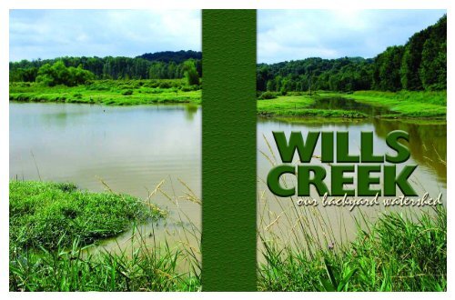
Wills Creek Watershed - Crossroads RC&D
Wills Creek Watershed - Crossroads RC&D
Wills Creek Watershed - Crossroads RC&D

You also want an ePaper? Increase the reach of your titles
YUMPU automatically turns print PDFs into web optimized ePapers that Google loves.
W I L L S C R E E K W A T E R S H E D<br />
Contributing Writers & Editors:<br />
Jennifer Chapman Kleski<br />
Sandra Chenal<br />
Darrin Lautenschleger<br />
Graphic Design:<br />
Christy Reed<br />
Published by<br />
<strong>Crossroads</strong> Resource Conservation and Development Council Inc.<br />
Funded by:<br />
Ohio Environmental Protection Agency<br />
Printed by:<br />
Blooms Printing, Inc., Dennison, Ohio 2004<br />
W I L L S C R E E K . . . O U R B A C K Y A R D W A T E R S H E D<br />
© 2004 <strong>Crossroads</strong> Resource Conservation and Development Council Inc.<br />
LM:GSWCD
W I L L S C R E E K W A T E R S H E D<br />
ACKNOWLEDGEMENTS<br />
<strong>Crossroads</strong> RC&D expresses its appreciation to all those who generously gave permission to<br />
reprint and/or adapt copyrighted material. Diligent effort has been made to identify, locate,<br />
and contact copyright holders, and to secure permission to use copyrighted material. If any<br />
permissions or acknowledgements have been inadvertently omitted or if such permissions<br />
were not received by the time of publication, the publisher would sincerely appreciate<br />
receiving complete information so that correct credit can be given in future editions.<br />
Input was provided by members of the <strong>Wills</strong> <strong>Creek</strong> <strong>Watershed</strong> Education Committee:<br />
Linda Atkinson, Muskingum Soil and Water Conservation District; Darrin Lautenschleger,<br />
Muskingum <strong>Watershed</strong> Conservancy District; Stan Rosenblatt, US Army Corps of Engineers,<br />
Lora Meredith, Guernsey Soil and Water Conservation District; and Dan Imhoff, Ohio<br />
Environmental Protection Agency. Additional input was provided by Dr. Lorle Porter and<br />
Maureen Wise.<br />
Special thanks to the following organizations<br />
and individuals who provided photos or graphics:<br />
Government Agencies & Photographers:<br />
USDA Natural Resource Conservation Service (NRCS)<br />
Sandra Chenal (SC:NRCS)<br />
Mark Giles (MG:NRCS)<br />
Steve Hibinger (SH:NRCS)<br />
Karl Schneider (KS:NRCS)<br />
Tom Sewell (TS:NRCS)<br />
Steve Welker (SW:NRCS)<br />
Muskingum <strong>Watershed</strong> Conservancy District (MWCD)<br />
Jim Bishop (JB:MWCD)<br />
Muskingum Soil and Water Conservation District (MSWCD)<br />
Guernsey Soil and Water Conservation District (GSWCD)<br />
Lora Meredith (LM:GSWCD) – Cover Photo<br />
Van Slack (VS:GSWCD)<br />
Ohio Department of Natural Resources (ODNR)<br />
Mike Williams (MW:ODNR)<br />
ODNR Division of Mineral Resources Management (ODNR)<br />
Gary Novak (GN:ODNR)<br />
Tuscarawas Soil and Water Conservation District (TSWCD)<br />
Katrina Baltic (KB:TSWCD)<br />
Scott Briggs (SB:TSWCD)<br />
Copyright photos:<br />
Sandra Chenal (SC)<br />
Jennifer Chapman Kleski (JCK)<br />
Gary Kaster,American Electric Power (GK:AEP)<br />
Linda Russell (LR)<br />
An Equal Opportunity Provider and Employer<br />
4<br />
TABLE OF CONTENTS<br />
What is a <strong>Watershed</strong>? . . . . . . . . . . . . . . . . . . . . . . . . . . . . . . . . . .6<br />
Geology, Understanding the Land . . . . . . . . . . . . . . . . . . . . . . . . .8<br />
Ecology, Understanding the Communities . . . . . . . . . . . . . . . . .10<br />
Water Quality, A Measure of <strong>Watershed</strong> Health . . . . . . . . . . . .12<br />
Measuring Water Quality with Physical Characteristics . . . . . . .14<br />
Measuring Water Quality with Plants and Animals . . . . . . . . . .16<br />
Measuring Water Quality with Chemistry . . . . . . . . . . . . . . . . .18<br />
Land Use and How It Impacts Water Quality . . . . . . . . . . . . . . .20<br />
Forestland . . . . . . . . . . . . . . . . . . . . . . . . . . . . . . . . . . . . . . . . . .22<br />
Forest Best Management Practices . . . . . . . . . . . . . . . . . . . . . . .24<br />
Agricultural Land . . . . . . . . . . . . . . . . . . . . . . . . . . . . . . . . . . . . .26<br />
Agricultural Best Management Practices . . . . . . . . . . . . . . . . . .28<br />
Mined Land and Best Management Practices . . . . . . . . . . . . . . .30<br />
Urban Land and Best Management Practices . . . . . . . . . . . . . . .32<br />
Residential Land and Best Management Practices . . . . . . . . . . .34<br />
Recreational Land . . . . . . . . . . . . . . . . . . . . . . . . . . . . . . . . . . . .36<br />
Recreational Best Management Practices . . . . . . . . . . . . . . . . . .38<br />
Glossary . . . . . . . . . . . . . . . . . . . . . . . . . . . . . . . . . . . . . . . . . . . .41<br />
W I L L S C R E E K . . . O U R B A C K Y A R D W A T E R S H E D<br />
5<br />
SC:NRCS
W I L L S C R E E K W A T E R S H E D<br />
WHAT ISa <strong>Watershed</strong> ?<br />
WHAT ISa<br />
<strong>Watershed</strong> ?<br />
Everyone lives in a watershed. A watershed is an area of land in which all the water drains down to a common outlet.<br />
All the land in the <strong>Wills</strong> <strong>Creek</strong> <strong>Watershed</strong> drains to <strong>Wills</strong> <strong>Creek</strong>. As the water moves down the slopes and across<br />
the surfaces, it is influenced by the land and how we use it. It travels across forests, farms, suburban lawns and city<br />
streets through streams, lakes and wetlands as surface water, or it seeps into the soil and moves as groundwater.<br />
A watershed does not acknowledge political boundaries and includes all living things within its boundaries as<br />
members of its community. Every living thing in the <strong>Wills</strong> <strong>Creek</strong> <strong>Watershed</strong> is part of the same watershed community.<br />
To the<br />
Muskingum River<br />
<strong>Watershed</strong>s<br />
Come In All Sizes<br />
<strong>Watershed</strong>s can be very<br />
large or very small. Small<br />
watersheds come together<br />
to form larger watersheds<br />
which in turn come<br />
together to form even<br />
larger watersheds. The<br />
small streams flowing<br />
through your back yard<br />
are all part of a group of<br />
sub-watersheds flowing<br />
together to form the <strong>Wills</strong><br />
<strong>Creek</strong> <strong>Watershed</strong>. <strong>Wills</strong><br />
<strong>Creek</strong> <strong>Watershed</strong> is part<br />
of the group of watersheds<br />
that flow together to form<br />
the Muskingum River<br />
<strong>Watershed</strong>, which drains<br />
into the Ohio and<br />
Mississippi Rivers.<br />
6<br />
WILLS CREEK<br />
MUSKINGUM<br />
<strong>Watershed</strong><br />
MISSISSIPPI<br />
<strong>Watershed</strong><br />
<strong>Watershed</strong> The Importance of<br />
<strong>Watershed</strong><br />
The <strong>Wills</strong> <strong>Creek</strong> <strong>Watershed</strong> is<br />
located in East Central Ohio<br />
and is comprised of 436,600<br />
acres (682 square miles) and<br />
contains an estimated 1,390<br />
miles of waterways.<br />
VS:GSWCD<br />
NRCS<br />
<strong>Wills</strong> <strong>Creek</strong> flows north through Guernsey County into Coshocton<br />
County. There it turns west and moves across the Muskingum and<br />
Coshocton County line several times before emptying into the<br />
Muskingum River just north of Adams Mills in Muskingum County.<br />
Healthy <strong>Watershed</strong>s<br />
Threatened Healthy <strong>Watershed</strong>s<br />
Healthy watersheds are some of the nation’s<br />
most precious resources. With populations<br />
growing and development increasing, healthy<br />
watersheds are being threatened. Most<br />
threats are caused by land use. Activities<br />
such as clearing forestlands, paving new<br />
roads and parking lots, application of<br />
fertilizers and pesticides, plowing of<br />
farmlands, and release of improperly treated<br />
waste water affect the health of a<br />
watershed.<br />
The <strong>Watershed</strong> Approach<br />
Clean water is essential for the health of the<br />
<strong>Wills</strong> <strong>Creek</strong> <strong>Watershed</strong> community. All living<br />
things within the watershed community are<br />
dependent on the water that flows through it.<br />
The water is like a memory of the land over<br />
which it flows. Land that is abused and<br />
polluted is reflected in the quality of the water.<br />
We need to consider ways each of us can<br />
help protect, maintain and improve the<br />
water quality of our watershed. One such<br />
way is through the use of the <strong>Watershed</strong><br />
Approach. The <strong>Watershed</strong> Approach<br />
considers all activities within the watershed<br />
that affect its health. It emphasizes the<br />
relationships among land management<br />
decisions, everyday actions and watershed<br />
health.<br />
Why is Water Quality<br />
Important?<br />
Where Does the Water We Drink Come From?<br />
The water we drink comes from both<br />
private and public water supplies. Both<br />
surface and groundwater are used as a<br />
supply source.<br />
Approximately 32% of all households in<br />
Guernsey County obtain their water<br />
from private water sources with the<br />
majority being rural households.The primary<br />
source for the private water supplies is<br />
groundwater from drilled wells. Other than<br />
household use, private water supply uses<br />
include commercial, livestock and irrigation<br />
mostly from surface water sources.<br />
Public water supplies 68% of all households<br />
in Guernsey County. The source of the<br />
public water is both surface and<br />
groundwater.<br />
PUBLIC AVG USAGE<br />
WATER SUPPLY SOURCE SUPPLY TYPE GALLONS PER DAY<br />
Cambridge Reservoir Filled by <strong>Wills</strong> <strong>Creek</strong> Surface 3,586,000<br />
Byesville 8 Drilled Wells Ground 1,053,000<br />
Quaker City Leatherwood <strong>Creek</strong> Surface 48,000<br />
Cumberland 2 Drilled Wells Ground 54,250<br />
Pleasant City 3 Drilled Wells Ground 51,000<br />
Western Guernsey<br />
Service Co.<br />
Purchases Water from Cambridge Surface 183,000<br />
Kimbolton Purchases Water from<br />
Guernsey Co. Water Dept.<br />
Surface 21,600<br />
Guernsey Co.<br />
Water Dept.<br />
Purchases Water from Cambridge Surface 679,000<br />
W I L L S C R E E K . . . O U R B A C K Y A R D W A T E R S H E D<br />
7<br />
JCK<br />
MW:ODNR<br />
Small Mouth Bass<br />
Micropterus dolomieu<br />
Thrives in medium to large streams,<br />
with good water quality, current, gravel<br />
or rock bottom, and banks with<br />
dense patches of waterwillow.<br />
MW:ODNR<br />
Water strider or Pond skater<br />
Gerris remigis<br />
Lives primarily on still waters, but<br />
also is capable of walking on the<br />
surface of running water.<br />
Yellow (sweet) Buckeye<br />
Aesculus octandra<br />
Grows in moist areas. Fruits are<br />
smooth, unlike the Ohio Buckeye.
W I L L S C R E E K W A T E R S H E D<br />
GEOLOGY<br />
A watershed can be described as being made up of several<br />
pieces: the land, ecology and water resources. Together<br />
these pieces form an environment unique to the watershed.<br />
The following pages describe each of the pieces and how<br />
they work together to form <strong>Wills</strong> <strong>Creek</strong> <strong>Watershed</strong>. Within<br />
these descriptions a better understanding is provided as to<br />
how these pieces fit together to form a healthy environment<br />
in which to live, work and play.<br />
The Bedrock<br />
the beginning<br />
The bedrock foundations on<br />
which <strong>Wills</strong> <strong>Creek</strong> is built were<br />
formed approximately 350 to 250<br />
million years ago during what is<br />
termed the Paleozoic age.<br />
During this period of time, a<br />
great sea occupied what is now<br />
Ohio. The sea was bound to the<br />
east by the ancestral Appalachian<br />
Mountains. Rivers flowed from<br />
the mountains carrying coarse<br />
rock and debris which were<br />
deposited in the sea forming<br />
large deltas. The level of the<br />
sea fluctuated over time. This<br />
produced alternating layers of<br />
non-marine and marine rock.<br />
The great systems of alternating<br />
sedimentary rock produced by<br />
these actions are known as<br />
the Mississippian and the<br />
Pennsylvanian systems. The<br />
non-marine layers consist of<br />
sandstones, clays, shales and coals<br />
and the marine layers consist of<br />
black shales and limestones.<br />
understanding the Land<br />
8<br />
SC:NRCS<br />
The Glacier<br />
Development of the Regional Drainage System<br />
Beginning approximately 2 million years<br />
ago during the Pleistocene Epoch, huge<br />
continental glaciers formed and moved<br />
southward over Ohio. Prior to glaciation,<br />
drainage in Ohio flowed north. With the<br />
advance of the glaciers, thick blocks of ice<br />
and debris blocked the north-flowing<br />
rivers. This created large glacial lakes that<br />
fingered into the smaller streams. As the<br />
lakes filled with sediment and water, an<br />
outlet formed, diverting the ancestral<br />
Muskingum River from a westerly course<br />
to its present day southerly course.<br />
THE SHAPINGof <strong>Wills</strong> <strong>Creek</strong> <strong>Watershed</strong><br />
The shape of the land, or its landform, influences the watershed and<br />
how it functions as an ecosystem. Landform is dictated by the local geology,<br />
topography, soil type, climate and the way people use the land. In turn, all this<br />
affects the quality and quantity of the resources within the watershed. The<br />
landforms as observed today in the <strong>Wills</strong> <strong>Creek</strong> <strong>Watershed</strong> are the result of<br />
the development of the land surface over a vast expanse of geologic time.<br />
The landforms are expressed as topographic features such as hills,<br />
ridges and valleys. These features were shaped by<br />
water through the active processes of erosion,<br />
weathering and deposition.<br />
LM:GSWCD<br />
LM:GWSCD<br />
Well<br />
Typical Geologic Strata<br />
in the <strong>Wills</strong> <strong>Creek</strong> <strong>Watershed</strong> Area<br />
Topsoil<br />
Sandstone<br />
Shale<br />
Limestone<br />
Coal<br />
Clay<br />
Groundwater<br />
The Soils<br />
The soils of <strong>Wills</strong> <strong>Creek</strong> <strong>Watershed</strong> developed under a deciduous forest cover in a humid,<br />
temperate climate. The upland soils formed on materials developed in place from the<br />
weathering of the underlying bedrock. The soils on the floodplains developed from alluvial<br />
material deposited as streams carried it down from the surrounding hills.<br />
The Land<br />
changing how water flows<br />
as we now see it<br />
GLACIATED<br />
UNGLACIATED<br />
Today <strong>Wills</strong> <strong>Creek</strong> <strong>Watershed</strong> is dissected by many small stream drainways forming a pattern,<br />
similar to branches on a tree, called a dendritic drainage pattern. In the upper reaches of the<br />
watershed, narrow ridges are separated by deep valleys with steep side slopes. Narrow<br />
floodplains occupy these valley bottoms. In the lower reaches of the watershed, broad valleys<br />
have formed between the ridgetops. Terraces are prominent along these valleys.<br />
VS:GSWCD<br />
W I L L S C R E E K . . . O U R B A C K Y A R D W A T E R S H E D<br />
ODNR<br />
9<br />
MW:ODNR<br />
Indigo Bunting<br />
Passerina cyanea<br />
Common in hedgerows and wood<br />
margins. Males are blue while<br />
the females are plain brown.<br />
MW:ODNR<br />
Dusky Salamander<br />
Desmognathus fuscus<br />
Stream side salamander typically found<br />
along banks of gorge bottom streams.<br />
Prefer hiding under flat rocks.<br />
MW:ODNR<br />
Black Willow<br />
Salix nigra<br />
Shrub or tree; Pioneer species<br />
invading moist soils.Valuable for<br />
control of streambanks.
W I L L S C R E E K W A T E R S H E D<br />
ECOLOGY<br />
RIPARIAN<br />
HABITAT<br />
The transition area<br />
between the land<br />
and water is called<br />
Riparian Habitat.<br />
It is sensitive to<br />
changes in water<br />
levels and other<br />
influences that result<br />
from changes in the<br />
land use or climate.<br />
Stream Ecosystems<br />
<strong>Wills</strong> <strong>Creek</strong> starts as small streams. These small<br />
streams flow across the landscape and flow together to<br />
form larger streams and<br />
eventually <strong>Wills</strong> <strong>Creek</strong>.<br />
Because the physical<br />
characteristics of<br />
small streams<br />
and their larger<br />
counterparts<br />
are different,<br />
the habitat<br />
conditions for<br />
plants and animals<br />
also are very<br />
different.<br />
JCK<br />
understanding the communities<br />
JCK<br />
Floodplain<br />
10<br />
The <strong>Wills</strong> <strong>Creek</strong> <strong>Watershed</strong> is full of life! From the<br />
smallest microscopic plants like algae, to large mammals<br />
like the white-tailed deer, each can be found in the various<br />
types of environments, or habitats located throughout the<br />
watershed. Each habitat provides the necessary<br />
ingredients for a unique community of plants and animals,<br />
or ecosystem. Ecology is the study of this interaction of<br />
living things and their environment. Understanding the<br />
connection between the land, the water, the plants and<br />
the animals is key to helping us understand the effects of<br />
our actions on the health of our watershed community.<br />
Ecosystems<br />
The land and the<br />
NRCS<br />
community of plants<br />
and animals that live along<br />
the edges of rivers and streams make up floodplain<br />
ecosystems. Material and organisms are supplied and<br />
trapped by the floodplain as water levels rise and fall.<br />
As water levels recede, organisms and materials<br />
such as nutrients released from organic matter are<br />
fed back to the river. This exchange of materials<br />
between river and floodplain is essential for<br />
maintaining and supporting the stream ecosystem.<br />
MW:ODNR<br />
Wetland Ecosystems<br />
Wetlands are the most productive<br />
ecosystems. Wetlands are areas where<br />
the water table is at or near the surface<br />
of the land, or where the land is covered<br />
with shallow water. Many wetlands are<br />
associated with aquatic ecosystems and<br />
occupy their fringes. Wetlands provide<br />
benefits such as flood storage,<br />
groundwater recharge, sediment<br />
filtration and nutrient removal. It is<br />
estimated that there are 25,000 acres of<br />
wetlands in the <strong>Wills</strong> <strong>Creek</strong> <strong>Watershed</strong>.<br />
AQUATIC<br />
HABITAT<br />
Aquatic Habitat refers<br />
to the environment of<br />
the water in streams,<br />
lakes, wetlands and<br />
groundwater. How<br />
the land is used in the<br />
region that drains<br />
into the water (its<br />
watershed) greatly<br />
affects the quality of<br />
the habitat.<br />
LM:GSWCD<br />
Forested<br />
Upland<br />
Ecosystems<br />
TERRESTRIAL<br />
HABITAT<br />
The most common habitat in the<br />
<strong>Wills</strong> <strong>Creek</strong> <strong>Watershed</strong> is the land,<br />
which is called Terrestrial Habitat.<br />
It is commonly grassland,<br />
forested, agricultural or urban.<br />
The forested upland ecosystems of <strong>Wills</strong> <strong>Creek</strong> are the most<br />
abundant. These ecosystems are found among the rolling hills<br />
covered in dense hardwood forests. Common tree species found<br />
in upland areas are hickory, maple, oak, beech and ash.These tree<br />
types provide an abundance of food and shelter for common<br />
animals like squirrel, deer, turkey, raccoon and birds.<br />
Groundwater Ecosystems<br />
Groundwater contains many minerals and supports a number of<br />
microscopic as well as macroscopic plants and animals like shrimp,<br />
snails, mites, worms and insect larvae. Groundwater seeps out onto<br />
the land through springs and provides base flow for streams during<br />
dryer months. Groundwater is a major source for drinking water.<br />
W I L L S C R E E K . . . O U R B A C K Y A R D W A T E R S H E D<br />
VS:GWSD<br />
11<br />
SC<br />
MW:ODNR<br />
River Otter<br />
Lontra Canadensis<br />
Dark brown with a paler belly;<br />
throat is often silver-gray. Lives in fresh<br />
water such as lakes, rivers or streams.<br />
MW:ODNR<br />
Hellgrammite<br />
Corydalus cornutus<br />
The aquatic larvae of the Dobsonfly.<br />
It is commonly used as bait by fishermen.<br />
Lives on the bottom of streams attached<br />
to rocks. Indicator of good water quality.<br />
MW:ODNR<br />
Cardinal Flower<br />
Lobelia cardinalis<br />
A striking plant of streambanks<br />
and damp meadows.
W I L L S C R E E K W A T E R S H E D<br />
WATER QUALITY<br />
Just like doctors test blood to determine a<br />
person’s health, water quality indicates the<br />
health of the watershed. As water flows<br />
across the land, it picks up pollutants and<br />
carries them to other places. These<br />
pollutants can be found in the lakes and<br />
streams, and can cause changes to the<br />
aquatic environment, affecting plants and<br />
animals. Scientists measure three main<br />
aspects related to water - the plants and<br />
animals in the water, the chemical<br />
characteristics of water, as well as the<br />
physical characteristics related to water.<br />
With these measurements, scientists can<br />
determine the overall quality of the water,<br />
identify sources of pollution and begin to<br />
plan how to improve the watershed health.<br />
The physical characteristics of water includes such things<br />
as turbidity (how clear or cloudy the water is) and<br />
temperature. The physical characteristics of the water<br />
body includes: stable channels, the transport of nutrients,<br />
the volume and speed of the water, the streambed material<br />
and log jams.<br />
a measure of watershed health<br />
JCK<br />
WATER QUALITY<br />
characteristics<br />
Scientists have determined the key features which influence the health<br />
of aquatic communities.These features are grouped into three main categories:<br />
physical characteristics, biological characteristics and chemical<br />
characteristics. Based on these three main categories, standards<br />
for water quality have been established.<br />
12<br />
Biological characteristics refer to the number and types of<br />
individual species that live in an aquatic community. Some<br />
types of plants and animals are more sensitive to chemical<br />
and physical changes in their habitat than others. If a large<br />
number of species that are sensitive to pollution are<br />
present in an aquatic community, then the water quality is<br />
most likely good.<br />
Key Components of the Water Quality Standards<br />
LIMITED<br />
RESOURCE<br />
WATER<br />
Small streams<br />
which have been<br />
irretrievably<br />
altered to the<br />
extent that no<br />
appreciable aquatic<br />
communities can<br />
be supported or<br />
those which lack<br />
water year round.<br />
POOR<br />
Ohio Water Quality Standards have<br />
been written by the Ohio<br />
Environmental Protection Agency as a<br />
result of the passing of the Federal<br />
Clean Water Act.The principal goal of<br />
the Clean Water Act is to restore and<br />
maintain the chemical, physical and<br />
biological integrity of surface<br />
waters. The water qualities standards<br />
help determine how clean Ohio's<br />
water bodies need to be to provide<br />
for healthy aquatic communities.<br />
GOOD<br />
EXCELLENT<br />
MODIFIED<br />
WARMWATER<br />
Incapable of<br />
supporting a well<br />
balanced<br />
community of<br />
aquatic organisms<br />
due to extensive,<br />
maintained<br />
hydromodifications<br />
which have been<br />
sanctioned by state<br />
or federal law.<br />
WARMWATER<br />
Supports a<br />
balanced<br />
community of<br />
aquatic organisms<br />
expected to be<br />
found in typical<br />
Ohio streams.<br />
Chemicals in the water can influence aesthetic<br />
qualities such as how water looks, smells and<br />
tastes. Chemicals in water can also determine<br />
whether or not it is safe to use or to swim in. The<br />
chemical properties of water include things like<br />
pH, dissolved oxygen and nutrients.<br />
13<br />
EXCEPTIONAL<br />
WARMWATER<br />
Supports and<br />
maintains an<br />
exceptional or<br />
unusual<br />
community of<br />
warmwater aquatic<br />
organisms. (All state<br />
lakes and reservoirs<br />
and some streams<br />
and rivers are<br />
designated as this.)<br />
JCK<br />
COLD WATER<br />
Capable of<br />
supporting<br />
populations of<br />
coldwater fish and<br />
associated<br />
vertebrate and<br />
invertebrate<br />
organisms on an<br />
annual basis.<br />
Usually maintained<br />
by direct<br />
groundwater<br />
input.<br />
Water Quality Standards<br />
for <strong>Wills</strong> <strong>Creek</strong><br />
In 1990 the Ohio Water Quality<br />
Standards were changed to include<br />
the condition of the aquatic biologic<br />
community. Ohio EPA divided <strong>Wills</strong><br />
<strong>Creek</strong> into 73 distinct stream<br />
segments. Of these, 60 were<br />
designated Warmwater Habitat, and<br />
13 were designated Limited Resource<br />
Water.Those Limited Resource<br />
Waters were found to be unable to<br />
support a well balanced aquatic<br />
community due to impacts resulting<br />
from acid mine drainage from<br />
abandoned coal mines.<br />
W I L L S C R E E K . . . O U R B A C K Y A R D W A T E R S H E D<br />
JCK<br />
MW:ODNR<br />
Spring Peepers<br />
Pseudocris crucifer<br />
Found in woodlands near temporary<br />
ponds and/or swamps where trees<br />
and shrubs are in standing water.<br />
MW:ODNR<br />
Southern Redbelly Dace<br />
Phoxinus erythrogaster<br />
Most often found in headwater streams<br />
having clear water, well developed<br />
pools and clean substrates composed<br />
of sand, gravel and cobbles.<br />
Slippery Elm<br />
Ulmus rubra<br />
Found mostly in rich soil<br />
and on moist slopes.<br />
MW:ODNR
W I L L S C R E E K W A T E R S H E D<br />
MEASURING WATER QUALITY<br />
The shape of a stream, the<br />
amount of tree cover over<br />
it, as well as the color and<br />
temperature of the water<br />
are examples of physical<br />
characteristics that can<br />
indicate good or bad water<br />
quality. By observing and<br />
measuring these features<br />
and comparing them to<br />
similar areas, predictions<br />
can be made as to whether<br />
a particular stream or water<br />
body can support life, and<br />
what kind of animal life it<br />
can support. How water<br />
bodies are managed can<br />
have a major impact on the<br />
life found in the watershed.<br />
Substrate<br />
Stream substrates consist of the materials in<br />
contact with the bottom and sides of the<br />
stream. In most cases, steep, faster streams are<br />
dominated by larger rocks and slower, flatter<br />
streams will have finer materials.<br />
Turbidity<br />
Turbidity is a measurement<br />
used to evaluate the amount<br />
of matter suspended (or<br />
suspended solids) in the<br />
water. High turbidity or<br />
colored water is harmful to<br />
SC:NRCS<br />
most aquatic life. It usually is<br />
caused by excessive amounts of soil erosion or high levels of<br />
nutrients and algal booms. Low turbidity - or clear water - is<br />
good for aquatic life.<br />
with physical characteristics<br />
What Physical Characteristics are Measured?<br />
Sinuosity<br />
Most streams don’t flow in a straight<br />
line but curve.This feature is defined as<br />
a stream’s sinuosity and is a measure of<br />
how many curves a stream has.This Sshaped<br />
path prevents water from<br />
moving too quickly, preventing flooding<br />
downstream.<br />
14<br />
In Stream Cover<br />
Just as humans need shelter for<br />
protection, so do aquatic animals.This<br />
shelter is provided by undercut banks,<br />
rootwads, logs, boulders, shallow and<br />
deep pools.These are important for a<br />
stream to support a healthy aquatic<br />
community.<br />
Sediments<br />
Sediment is material on the stream bottom that<br />
comes from upland and streambank erosion.<br />
These materials range in size from sands to fine<br />
silts.Too much silty material from excess erosion<br />
chokes aquatic life. Changes in land use in a<br />
watershed will change sediment types in a stream.<br />
Riparian and Canopy<br />
It is very important to have plants near the shoreline.Trees and shrubs along<br />
streams as well as other riparian vegetation provide a canopy that shades<br />
aquatic ecosystems from direct sunlight keeping the water cool. It also<br />
provides nutrients in the form of leaves and woody debris.Vegetation along<br />
the stream helps to stabilize the streambank with roots, decreasing erosion.<br />
The Qualitative Habitat Evaluation Index (QHEI)<br />
QHEI was designed to measure physical habitat<br />
of streams. Six physical characteristics are scored<br />
on a scale ranging from 0-100. The final score<br />
ranks the habitat on its ability to sustain life.<br />
RANGES ARE:<br />
Less than 45 . . . .Modified Warmwater Habitat (MWH)<br />
/Limited Resource Habitat<br />
46-60 . . . . . . . . .MWH or Warmwater Habitat (WWH)<br />
Greater than 60 . . . . . . . . . . .WWH/Exceptional WWH<br />
Stream Shape<br />
The shape of a stream differs greatly among different streams and<br />
is determined by four things: the size of the substrate, flow, slope<br />
and load (the amount of substrate and sediment carried by the<br />
stream). Streams are formed and changed by the water and the<br />
load they carry. A stream is constantly trying to maintain a balance.<br />
If any one of these four things change the other three will change.<br />
If the changes are great enough, the stream will become<br />
imbalanced, changing the shape of the stream and disrupting the<br />
aquatic ecosystem.<br />
Temperature<br />
One of the most commonly measured physical characteristic of water quality<br />
is temperature. Temperature influences many of the physical, chemical and<br />
biological processes that occur in aquatic ecosystems. Thermal pollution is<br />
the warming of a water body above what is considered normal temperatures.<br />
This type of pollution can occur near industrial plants and can include water<br />
running off of hot parking lots, and removal of the trees that shade streams.<br />
W I L L S C R E E K . . . O U R B A C K Y A R D W A T E R S H E D<br />
JCK<br />
15<br />
JCK<br />
MW:ODNR<br />
Baltimore (Northern) Oriole<br />
Icterus galbula<br />
Common in tall elms,<br />
distinguished by their black head<br />
and black “T” on their tail.<br />
MW:ODNR<br />
American Toad<br />
Bufo americanus<br />
Habitat ranges from urban backyards<br />
to the mountain wilderness.<br />
MW:ODNR<br />
Wool-Grass<br />
Scirpus cyperinus<br />
Grows in clumps in wet places.<br />
When in bloom, fruit appears<br />
very fuzzy (wooly), brown.
W I L L S C R E E K W A T E R S H E D<br />
MEASURING MEASURiNG WATER QUALITY<br />
Some plants and animals live in the water and cannot<br />
escape the effects of an unhealthy ecosystem. Because<br />
some of these organisms are more sensitive to chemical<br />
and physical changes in their habitat than others, they<br />
can be used as indicators of water quality. By evaluating<br />
the size, number and types of organisms such as<br />
plants (algae), vertebrates (fish and frogs) and<br />
macroinvertebrates (insects, snails and worms),<br />
scientists can accurately assess the aquatic community<br />
and the health of a watershed. These organisms are<br />
called biological indicators.<br />
Why Sample?<br />
The data collected during a biological assessment can be<br />
used to identify water bodies that are in need of special<br />
protection. They also can detect impacts that would not<br />
be identified with chemical tests alone. The goal of<br />
biological assessment is to evaluate all factors affecting the<br />
aquatic ecosystem.<br />
Vertebrates<br />
MW:ODNR<br />
Fish, amphibians and reptiles are at or close to the top of<br />
the aquatic food chain. Fish populations convey information<br />
about the overall health of the aquatic ecosystem as well as<br />
about individual fish species. Fish are relatively easy to<br />
sample and identify in the field, and the environmental needs<br />
of most fish species are well known. Amphibians such as<br />
salamanders and frogs compose the upper portion of the<br />
food chain in headwater streams that are not large enough<br />
or flow deep enough to support a fish community.<br />
with plants and animals<br />
FOOD CHAIN<br />
16<br />
MW:ODNR<br />
Macroinvertebrates<br />
JCK<br />
Macroinvertebrates, the most widely used biological<br />
indicators, are animals without backbones that are larger<br />
than 1/2 millimeter (the size of a pencil dot).<br />
Macroinvertebrates are considered the "middleman" in the<br />
aquatic food chain. Macroinvertebrates include crustaceans<br />
such as crayfish, mollusks such as clams and snails, aquatic<br />
worms and the immature forms of aquatic insects such as<br />
stonefly, caddis flies, beetles and mayfly nymphs.<br />
By sampling the number and kind of macroinvertebrates,<br />
estimates can be made on the water quality. In general, the<br />
higher the numbers of organisms and the higher the number<br />
of species, the better the water quality.<br />
Electrofishing is a harmless way<br />
to collect fish, take the needed<br />
measurements and return them<br />
to the water. Electrofishing uses<br />
a battery or alternator to send<br />
a mild electric pulse through<br />
the water to stun the fish. Fish<br />
are collected in a net as they<br />
surface.<br />
Plants<br />
Algae have a rapid reproduction rate<br />
and short life span. This makes algae<br />
an effective "early warning" indicator<br />
of physical or chemical changes to the<br />
aquatic ecosystem. For example, an<br />
excess of nutrients can feed algae,<br />
causing algae blooms.<br />
Sample Results of the<br />
<strong>Wills</strong> <strong>Creek</strong> <strong>Watershed</strong><br />
A total of 76 miles of <strong>Wills</strong> <strong>Creek</strong> was<br />
assessed by the Ohio EPA with the<br />
following results:<br />
• Five (5) species of fish have been<br />
lost in the <strong>Wills</strong> <strong>Creek</strong><br />
<strong>Watershed</strong>: Muskellunge,<br />
Shorthead Redhorse, Emerald<br />
Shiner, Golden Shiner and<br />
Banded Darter.<br />
• 9.9 miles was in full attainment<br />
of warmwater habitat.<br />
• 15.7 miles was in non-attainment<br />
(stream segment) located from<br />
Byesville to 10 miles down-stream<br />
of Cambridge.<br />
• 50.4 miles was in partial<br />
attainment and is attributed to<br />
the fish community not meeting<br />
warmwater habitat biocriteria.<br />
• Mean QHEI score for all sites<br />
surveyed was 44, suggesting the<br />
fish communities are not likely<br />
to achieve the warmwater<br />
biocriteria because of poor habitat.<br />
• Causes of Impairment:<br />
pathogens, alterations to habitat,<br />
flow alterations, dissolved salts,<br />
nutrient enrichment, siltation,<br />
other inorganics, ammonia,<br />
metals and total organics.<br />
W I L L S C R E E K . . . O U R B A C K Y A R D W A T E R S H E D<br />
17<br />
SC:NRCS<br />
MW:ODNR<br />
Eastern Box Turtle<br />
Terrapene carolina carolina<br />
Mainly terrestrial, but sometimes soak<br />
themselves in mud or water. Hot, dry<br />
weather cause them to hide under<br />
logs and rotting vegetation.<br />
MW:ODNR<br />
Dragonfly Larva<br />
Anax junius<br />
Lives on the bottoms of small streams<br />
where substrate is clean.<br />
MW:ODNR<br />
Common Witch Hazel<br />
Hamamelis virginiana<br />
Flowers bloom in the late fall and are<br />
yellow-orange. Found in moist woods<br />
and along stream sides. Extract of bark<br />
used for medicinal purposes.
W I L L S C R E E K W A T E R S H E D<br />
MEASURING WATER QUALITY<br />
with chemistry<br />
Even the purest of water contains countless chemicals. It would<br />
not be practical to measure all of them. Scientists therefore focus on<br />
the chemicals that are most important in identifying problems.The kind and<br />
amount of chemicals found in streams and groundwater are closely linked to land<br />
use. In agricultural areas studies measure chemicals found in manure, fertilizers and<br />
pesticides. In industrial areas studies focus on measuring chemicals used by the nearby<br />
industries. In mined areas studies focus on the chemicals found around abandoned mines.<br />
Chemicals play an important role in determining the health of the watershed community.<br />
Reducing the amount of problem causing chemicals used and applying these chemicals more<br />
efficiently can help improve the health of our watershed community.<br />
Hardness<br />
Water hardness is the total<br />
concentration of calcium,<br />
magnesium, iron, and manganese<br />
in the water.Water rich in these<br />
elements is said to be "hard." Water hardness is related to the<br />
geology of the watershed. Soaps and detergents do not work as<br />
well in hard water. Hard water leaves hard, scaly deposits on<br />
faucets and builds up on pipes. This is why many people install<br />
water softener systems in their homes.<br />
18<br />
What Chemicals are Measured?<br />
Nutrients<br />
Nutrients are essential for plants and animals. Fertilizers contain<br />
common nutrients such as phosphorus and nitrogen to help yards and<br />
crops grow. Nutrients come from both natural sources and human<br />
activities. It is possible to have too many nutrients. For example,<br />
excessive amounts of nitrogen can lead to an overgrowth of aquatic<br />
plants and algae. As these plants die and microbes use oxygen to<br />
decompose the plants, it leads to even smaller amounts of oxygen<br />
dissolved in the water. Common sources of excessive nitrogen include<br />
sewage and agricultural runoff. Elevated nitrogen levels may indicate the<br />
presence of one or both of these forms of pollution.<br />
Fecal Coliform<br />
Fecal coliform is a bacterium that occurs in the digestive tracts of<br />
warm-blooded animals and helps in digestion. Fecal coliform can enter<br />
aquatic resources by direct contact from mammals and birds,<br />
agricultural runoff, or from open or broken sewers. Fecal coliform<br />
itself is not harmful, but is used as an indicator of the presence of fecal<br />
waste which may contain additional harmful microbes. Disease causing<br />
microbes can cause health problems ranging from common diarrhea<br />
and ear infections to deadly diseases such as hepatitis, cholera, or even<br />
typhoid fever. It is suggested that individuals should not have total<br />
body contact with water containing levels of fecal coliform greater<br />
than 200 colonies per 100 milliliters of water.<br />
Drinking Water Standards<br />
A national standard for drinking water has<br />
been developed by the Environmental<br />
Protection Agency (EPA). All municipal<br />
(public) water supplies must be measured<br />
against these standards.<br />
Primary drinking water standards regulate<br />
organic and inorganic chemicals, harmful<br />
microorganisms and radioactive elements<br />
that may affect the safety of drinking water.<br />
These standards set a limit--the Maximum<br />
Contaminant Level (MCL)--on the highest<br />
concentrations of certain chemicals allowed<br />
in the drinking water supplied by a public<br />
water system.<br />
Secondary drinking water standards regulate<br />
chloride, color, copper, corrosiveness, foaming<br />
agents, iron, manganese, odor, pH, sulfates,<br />
total dissolved solids, and zinc, all of which<br />
may affect aesthetic qualities of drinking<br />
water like taste, odor, color and appearance.<br />
Iron, pH, dissolved oxygen, and<br />
acidity are some tests used on water<br />
from abandoned mines.<br />
Chemical Impacts to <strong>Wills</strong> <strong>Creek</strong><br />
Chemical pollutants can cause a wide variety of<br />
disturbances to the stream from loss of habitat<br />
to a loss of a variety of aquatic life. Exposure to<br />
chemicals can also cause physical deformities<br />
(lesions and tumors) in the organisms. The<br />
contaminants in <strong>Wills</strong> <strong>Creek</strong> <strong>Watershed</strong> are:<br />
dissolved solids, nutrient enrichment, siltation,<br />
inorganics, ammonia, metals and total organics.<br />
The most commonly measured<br />
chemical attribute of water is its<br />
pH. The pH scale ranges from 1 to 14<br />
with 1 being the most acidic and 14 being<br />
the most basic. Most streams have a<br />
neutral to slightly basic pH of 6.5 to 8.5.<br />
Most aquatic life lives within a pH range<br />
of 6 to 8.5. A shift of pH in either<br />
direction from neutral may indicate the<br />
presence of a pollutant in the stream.<br />
Low pHs can be the result of acid rain,<br />
industrial sources or mine drainage.<br />
IN GRAINS/GALLON<br />
Less than 1.0 . . . . . . . . . . . . . .Soft<br />
1.0-3.5 . . . . . . . . .Moderately Hard<br />
3.5-7.0 . . . . . . . . . . . . . . . . . . .Hard<br />
7.0-10.5 . . . . . . . . . . . . .Very Hard<br />
Over 10.5 . . . . . . .Extremely Hard<br />
Commonly measured chemicals include pH, hardness, nutrients,<br />
and dissolved oxygen. In addition, some "chemical" measurements<br />
actually indicate the physical presence of pollutants in water.These<br />
include measurements such as acidity and conductivity. The<br />
presence of fecal coliform, a bacterium, is also determined using a<br />
chemical test. One of the most common measurements used in<br />
water quality testing is parts per million (ppm). Parts per million is<br />
a unit representing the proportion of the number of molecules of<br />
a compound out of a million molecules of water.<br />
EXAMPLES<br />
JCK<br />
Dissolved Oxygen<br />
Dissolved Oxygen<br />
(DO) is the amount of<br />
Oxygen dissolved in<br />
water. Oxygen is<br />
necessary for the<br />
survival of nearly all<br />
living things - even<br />
those living in water.<br />
Two main sources of<br />
dissolved oxygen in<br />
aquatic ecosystems are<br />
the atmosphere and<br />
aquatic plants. Oxygen<br />
from the atmosphere is<br />
added to water as it<br />
moves over rocks and<br />
waterfalls.Aquatic<br />
plants add oxygen to<br />
water as a byproduct<br />
of photosynthesis. Cold<br />
water can hold higher<br />
amounts of DO than<br />
warmer water.<br />
KB:TSWCD<br />
W I L L S C R E E K . . . O U R B A C K Y A R D W A T E R S H E D<br />
19<br />
pH<br />
MW:ODNR<br />
Red Fox<br />
Vulpes vulpes<br />
Lives on forest edge. The red fox<br />
is known for its cleverness.<br />
MW:ODNR<br />
Northern Two-line Salamander<br />
Eurycea blislineata<br />
Common brookside salamander,<br />
but also found less commonly<br />
near springs or seeps.<br />
MW:ODNR<br />
Buttonbush<br />
Cephalanthus occidentalis<br />
Shrub of wet places with flowers<br />
in round ball-like heads.
L A N D U S E I N T H E W I L L S C R E E K W A T E R S H E D<br />
LAND USE<br />
and how it impacts water quality<br />
The system of lakes and streams in<br />
the <strong>Wills</strong> <strong>Creek</strong> <strong>Watershed</strong> Basin is<br />
like the life blood for the entire<br />
watershed. During rainfall<br />
events, each raindrop can<br />
dislodge soil, carrying the soil<br />
across the earth’s surface into<br />
streams. As the water washes<br />
over the ground, it dissolves and<br />
moves whatever may be on the<br />
surface, including pollutants like oil<br />
from parking lots and chemicals from<br />
yards and gardens. Therefore, how<br />
the land is used will determine what<br />
kind and what amount of material<br />
the water runoff will carry. By<br />
understanding how the land uses can<br />
affect water quality, we can reduce or<br />
eliminate negative impacts. The<br />
methods used to protect the<br />
environment are called best<br />
management practices.<br />
NRCS<br />
Did you know?<br />
In Ohio, on average a total 38 inches of precipitation falls per year, of<br />
that: 26 inches enter the soil surface through infiltration; 20 of the 26 go to<br />
soil storage and return to the atmosphere by the combined processes of<br />
evaporation and transpiration. The remaining 6 inches recharge the<br />
groundwater supply.Two of these 6 inches eventually move to springs,<br />
lakes or streams as groundwater discharge.The remaining 4 inches<br />
return to the atmosphere by evapotranspiration or are<br />
withdrawn to supply water needs.<br />
CROPLAND<br />
17%<br />
PASTURE<br />
21%<br />
20<br />
OTHER<br />
4%<br />
URBAN<br />
6%<br />
FOREST<br />
52%<br />
Non-Point Source Pollution Point Source Pollution<br />
This is pollution that comes from many sources. It is<br />
caused by surface water moving over and through the<br />
ground.The runoff picks up and carries away natural<br />
and human made pollutants, depositing them into<br />
lakes, rivers, wetlands and even groundwater. This<br />
class of pollutant is very difficult to control because<br />
often the sources cannot be directly identified, only<br />
the impacts of the pollutants are observable.<br />
DISCHARGE<br />
Types of Water Pollution<br />
Storm Water Discharges from Various Land Covers<br />
Hydrographs show the speed at which precipitation<br />
as storm runoff reaches a stream. The severity of the<br />
storm event and the general shape of the land<br />
determines the shape of the hydrograph. Storm runoff is<br />
greatly increased by land use changes.The hydrograph plots<br />
the rate of flow of water (termed discharge) against time.<br />
URBAN<br />
Urban Curve: A steep tall curve<br />
represents a lot of flow over a short period<br />
of time as seen with the urban curve. Urban<br />
runoff is rapid due to the many impervious<br />
surfaces. This causes the streams to flash<br />
flood, increasing the probability of property<br />
damage.<br />
21<br />
This is pollution that enters a<br />
stream through a pipe or a<br />
distinct source. Discharges<br />
from municipal wastewater<br />
treatment plants, combined<br />
sewer overflow and industrial<br />
plants are all considered<br />
point source discharges.<br />
changes the way water flows<br />
TIME<br />
AGRICULTURAL<br />
FOREST<br />
Forest Curve: A gentle low curve<br />
represents a steady flow of water over an<br />
extended period of time as seen with the<br />
forested curve. The forest vegetation slows<br />
the rate of runoff. This enables the stream<br />
to effectively move the water reducing the<br />
likelihood of flooding.<br />
W I L L S C R E E K . . . O U R B A C K Y A R D W A T E R S H E D<br />
What is an invasive plant?<br />
Invasive plants are usually characterized by<br />
fast growth rates, high fruit production,<br />
rapid vegetative spread and efficient seed<br />
dispersal and germination. Since these<br />
plants are not native to Ohio, they lack the<br />
natural predators and diseases which<br />
would naturally control them in their<br />
native habitats.<br />
MW:ODNR<br />
Autumn-Olive & Russian-Olive<br />
Elaeagnus umbellata, E. angustfolia<br />
Non-native, deciduous shrubs or small<br />
trees that grow to 20 feet tall. Found<br />
in areas such as pastures and fields,<br />
grasslands and sparse woodlands.<br />
MW:ODNR<br />
Garlic Mustard<br />
Alliaria petiolata<br />
Found in shaded and upland and floodplain<br />
forests, yards, along roadsides, and<br />
occasionally in full sun. It invades forests<br />
first at the edge, then progresses to<br />
the interior along streams and trails.<br />
MW:ODNR<br />
Purple Loosestrife<br />
Lythrum salicaria<br />
Occurs mostly in wetland environments,<br />
but when well established, it can survive<br />
drier conditions. It adapts readily to natural<br />
and disturbed wetlands.
L A N D U S E I N T H E W I L L S C R E E K W A T E R S H E D<br />
FOREST Land The vast majority of the land use in the <strong>Wills</strong> <strong>Creek</strong><br />
<strong>Watershed</strong> is forests. Once entirely forested, almost all<br />
of the trees were cut during the late 1800s. Today<br />
approximately 52% of the land in the <strong>Wills</strong> <strong>Creek</strong><br />
<strong>Watershed</strong> is forestland. Forests provide the timber for<br />
the forest products industry which produces lumber and<br />
other wood products. In addition, forests provide habitat<br />
for wildlife, protection from soil erosion and recreational<br />
opportunities such as hunting and hiking. Healthy forests<br />
can lead to a healthy watershed.<br />
The Forest<br />
raw material for an industry<br />
Forestry as an industry includes many operations, from tree<br />
planting to harvesting. Four major methods have been<br />
developed for harvesting timber. They are:<br />
8 In clear cutting, all trees in a given area are cut. Reproduction is<br />
obtained by artificial planting or by natural seeding from trees bordering<br />
the cleared areas.This method produces even-aged stands, allows control<br />
of stand composition and is conducive to mechanized harvesting and<br />
disposal of slash, or logging debris.<br />
8 Selection cutting maintains a forest of mixed ages by harvesting specific<br />
species of trees of specific sizes, and in pre-planned specific areas. This<br />
method is expensive and may cause injury to younger trees during logging.<br />
This method provides continuous cover and an attractive forest.<br />
8 In the seed tree method, about 10 percent of the trees in the cutting<br />
area are left in an evenly spaced pattern as a natural seed source.<br />
8 The shelterwood method, which involves the removal of the mature<br />
trees in cuttings over a 10-to-15-year period, promotes natural<br />
reproduction and produces relatively even-aged stands.<br />
GK:AEP<br />
22<br />
The Forests in <strong>Wills</strong> <strong>Creek</strong><br />
5%<br />
in White Pine<br />
plantation<br />
5%<br />
of the bottomlands<br />
Beech-Birch<br />
40%<br />
Cherry-Ash-Poplar<br />
30%<br />
Oak-Hickory<br />
The oak hickory forest is the<br />
primary forest cover of Southeast<br />
Ohio and is the largest and<br />
most diverse forest in the<br />
Eastern US. The oak hickory<br />
forest type generally occurs<br />
on low sloped south and<br />
southwest facing slopes.<br />
Dominant species are white<br />
oak and chestnut oak, shagbark<br />
hickory and formerly the<br />
American chestnut.<br />
Timbering of the original forest followed first<br />
by cultivation and grazing and then by neglect<br />
is the complex background for many of the<br />
weedy, shrubby areas of southeastern Ohio.<br />
Red maple, black cherry and big tooth aspen<br />
flourish in mismanaged forests.<br />
Did you know?<br />
Ohio has 300 species of trees and shrubs<br />
including 100 hardwood species and more than 25<br />
softwood species. Ohio's forests are covered by<br />
97% deciduous trees (leaves drop in the autumn)<br />
and 3% by conifers (trees that have needles<br />
and don’t produce flowers).<br />
How Forests Can Impact Water Quality<br />
Forests protect water quality by stabilizing banks,<br />
moderating water temperature, taking up nutrients and<br />
filtering pollutants. The extensive network of tree roots<br />
holds the soils of the bank in place, reducing erosion and<br />
keeping the streambanks and shorelines stable.The shade<br />
helps reduce water temperatures and maintain high<br />
oxygen levels that benefit many kinds of aquatic species.<br />
Fallen leaves and other organic debris deposited in the<br />
water provide "food" for aquatic life.<br />
Harvesting trees in the area beside a stream can<br />
impact water quality by reducing the streambank<br />
shading that regulates water temperature and by<br />
removing vegetation that stabilizes the streambanks.<br />
These changes can harm aquatic life by limiting<br />
sources of food, shade and shelter. These activities<br />
also increase sedimentation downstream.<br />
LAYERS OF THE FOREST<br />
Benefits<br />
CANOPY<br />
A canopy is described as<br />
closed if the trees' foliage<br />
overlaps; if it does not, it is<br />
said to be open.<br />
MIDSTORY<br />
This is the foliage<br />
level of the forest.<br />
UNDERSTORY<br />
Forest floor; brush,<br />
shrubs, and other<br />
small plants are<br />
found at this level.<br />
of forests<br />
Forests provide habitat for a wide variety of plants and animals and perform many other important<br />
functions that affect humans. Trees use carbon to produce oxygen for breathing during the process<br />
of converting sunlight to energy. The stems, leaves and roots of trees, as well as the forest floor,<br />
provide natural filters for municipal water sources, such as lakes and rivers, reducing water<br />
treatment costs. When it rains, the forest canopy intercepts and redistributes precipitation that<br />
can cause flooding and erosion. The canopy is also able to capture fog, which it distributes into<br />
the vegetation and soil. Forests also increase the ability of the land to store water. The forest<br />
floor can hold as much as five times its weight in water and a tree contains water in its roots,<br />
trunk, stems and leaves. Because of all this stored moisture, forests help to maintain an even flow<br />
of water in rivers and streams in times of flood or drought. The roots of the trees and other<br />
vegetation hold the soil in place and control erosion from wind and rain, reducing flooding and the<br />
sedimentation of streams and rivers.<br />
23<br />
FOREST EDGE<br />
This is where a<br />
forest meets a<br />
clearing, such<br />
as a meadow,<br />
prairie or<br />
urban area.<br />
W I L L S C R E E K . . . O U R B A C K Y A R D W A T E R S H E D<br />
SC<br />
A HISTORICAL<br />
PERSPECTIVE<br />
Ohio Forest Cover<br />
When the settlers arrived in the<br />
late 18th century, Ohio was a<br />
vast forested wilderness. Over<br />
95% of Ohio was covered with<br />
trees over 5 feet in diameter. It<br />
was said that a squirrel could<br />
cross the state without ever<br />
touching the ground.The early<br />
settlers cut and burned these<br />
trees to provide housing, produce<br />
charcoal, and to clear land for<br />
agriculture, a necessity for<br />
survival. These stands of timber<br />
produced as much as 45,000<br />
board feet per acre (a board foot<br />
is one foot wide, one foot long<br />
and one inch thick).Today, local<br />
forests produce about 4,000<br />
board feet per acre.<br />
By 1940 the forest cover in Ohio<br />
was as low as 12%. Since then,<br />
the amount of forest land has<br />
increased to approximately 30%.<br />
White pine, a non-native species<br />
in the <strong>Wills</strong> <strong>Creek</strong> Basin, was<br />
planted in the 1930s as a part of<br />
the Civilian Conservation Corps,<br />
a work program during the<br />
depression. White pine makes up<br />
about 5% of the forest cover in<br />
the basin.<br />
Forest Cover in Ohio
L A N D U S E I N T H E W I L L S C R E E K W A T E R S H E D<br />
FOREST Best Management Practices<br />
Best management practices for forestlands focus on managing forests for timber productivity,<br />
wildlife diversity and controlling sediment during logging operations. By preventing damage to<br />
streams from heavy equipment, water quality can be protected. Developing a management plan for<br />
forests and harvesting activities can be the key to reaching goals of creating wildlife habitat and<br />
productive timber stands, as well as providing for a healthy forest and watershed.<br />
SC:NRCS<br />
BEST MANAGEMENT PRACTICES<br />
You Can<br />
Manage Your<br />
Forest and Protect<br />
Water Quality<br />
Before harvesting, hire<br />
a professional forester<br />
for Landowners<br />
who will help you plan<br />
the harvest. Roads, stream<br />
crossings and log landings<br />
ODNR should be carefully located<br />
to protect water resources.<br />
Trees may be harvested from a forest area that is adjacent to a body of water<br />
while still preserving water quality.<br />
harvesting adjacent to a water body:<br />
Important rules to consider when<br />
8 If a tree casts shade on water, leave it.<br />
8 Single tree selection harvesting is the only cutting method that<br />
should be used in the forest area adjacent to the body of water.<br />
8 If using forest management chemicals, carefully follow<br />
the label instructions.<br />
8 Maintain at least a 50-foot-wide buffer of woods beside a watercourse.<br />
8 File an operation and management plan with<br />
the local Soil and Water Conservation District.<br />
8 Use a written contract when selling timber or using vendors of<br />
forestry services.<br />
24<br />
Developing a plan<br />
to care for your forest<br />
The careful development of a forest management plan in consultation<br />
with a professional forester is essential if landowners are to achieve<br />
their desired ownership objectives.The forest management plan is<br />
the blueprint of activities for caring for the forest. It is important<br />
to remember, too, that the management plan is not "cast<br />
in stone," but is an evolving plan that should be<br />
periodically reviewed and updated.<br />
Cows and Forests Don’t Mix<br />
<strong>Wills</strong> <strong>Creek</strong> is composed of 34,000 acres of<br />
forestlands, of which 26,000 are grazed by<br />
domestic livestock. Erosion rates are<br />
approximately 5.8 tons per year for a total soil loss<br />
annually of 151,000 tons. Grazing forested areas is<br />
detrimental to soil and water quality, reduces<br />
timber production, eliminates wildlife food and<br />
cover and decreases bird and small mammal<br />
populations. In addition, some woody species are<br />
poisonous to the animals.<br />
NRCS<br />
Always fence livestock out of forests<br />
BEST MANAGEMENT PRACTICES<br />
for Loggers<br />
JB:MWCD<br />
Stream Crossings<br />
Most detrimental effects of harvesting are related to<br />
the access and movement of vehicles and machinery,<br />
and the dragging and loading of trees or logs. Poor<br />
harvesting and transport techniques can increase<br />
sediment production by 10 to 20 times and disturb as<br />
much as 40 percent of the soil surface. In contrast,<br />
careful logging disturbs as little as 8 percent of the soil<br />
surface. Key points to remember are:<br />
• Cross at a right angle, if possible.<br />
• Logs should not be skidded through flowing streams.<br />
• Avoid wet and critical areas such as wetlands.<br />
• Use roads for moving harvested products such as logs, tree lengths or<br />
other round wood products, from the stump to a common landing. Haul roads<br />
should be properly designed and constructed.<br />
• Consider the use of hay/straw bales or silt fence to control erosion during haul road construction.<br />
• To avoid serious erosion problems keep all haul roads between 2% and 10% slope.<br />
Forest Roads<br />
1.A buffer must be maintained between any woodland<br />
road and watercourse.<br />
2.The road system should be properly designed before<br />
construction begins.<br />
3.The road system should be designed with proper<br />
stream crossings and/or water control structures<br />
like culverts, ditches, barriers, water bars and broadbased<br />
dips.<br />
4.Roads and landings should be properly retired if no<br />
longer needed.<br />
HELP is Available.<br />
The Ohio Department of Natural Resources, Division of Forestry provides<br />
planning assistance to landowners on managing forestlands. Soil and Water<br />
Conservation Districts review erosion control plans submitted by loggers.<br />
Private Foresters can assist landowners on timber harvests.<br />
25<br />
GSWCD<br />
Placing temporary bridges over streams<br />
can keep stream disturbances at a<br />
minimum, eliminating sedimentation.<br />
W I L L S C R E E K . . . O U R B A C K Y A R D W A T E R S H E D<br />
KS:NRCS<br />
THINGS<br />
YOU CAN DO<br />
TSWCD<br />
PLANT A TREE<br />
Use proper tree planting procedures to<br />
make sure the tree has the best chance<br />
for a long life.<br />
1. Plant the right tree in the right place.<br />
Use native species of trees and be<br />
aware of overline wires, rights of ways<br />
and specific soil and water requirements.<br />
2. Dig the hole as deep as the rootball<br />
and twice as wide.<br />
3. Loosen the soil around the hole with<br />
the shovel.<br />
4. Remove the container from the<br />
rootball. (The roots are like the tree's<br />
blood vessels and they work best if<br />
they are not all twisted and knotted<br />
up, so you might need to straighten<br />
them out if they are circling around<br />
after having grown in the container).<br />
5. Place the tree in the hole, making sure<br />
the soil is at the same level on the tree<br />
as when the tree grew in the garden<br />
center. If your tree has burlap around<br />
the rootball, place the tree in the hole<br />
and then carefully untie the burlap.<br />
Leave the burlap lying in the bottom of<br />
the hole (this is OK - the burlap will<br />
simply turn into organic matter over a<br />
period of time).<br />
6. Fill in around the rootball with soil<br />
and pack the soil with your hands and<br />
feet to make sure that there are no air<br />
pockets.<br />
7. Make a little dam around the base of<br />
the tree as wide as the hole with left<br />
over soil or grass clumps to hold in<br />
the water.<br />
8. Give your new tree a good soaking of<br />
water to help settle it into its new<br />
home.<br />
9. Protect trees from animals and<br />
equipment damage by using tree shelters.
L A N D U S E I N T H E W I L L S C R E E K W A T E R S H E D<br />
AGRICULTURAL<br />
Agriculture in the <strong>Wills</strong> <strong>Creek</strong> <strong>Watershed</strong> not only<br />
Land<br />
is a very visible activity, it’s also big business.<strong>Wills</strong><br />
<strong>Creek</strong> <strong>Watershed</strong> contains about 166,000 acres of<br />
agricultural land, which accounts for 39 percent of<br />
the land use. Hay and cattle make up the main<br />
agricultural products. Maintaining a healthy<br />
environment is critical to maintaining a healthy<br />
agricultural industry; that is why farmers were<br />
among the first conservationists in the area.<br />
Agriculture in the<br />
<strong>Wills</strong> <strong>Creek</strong> <strong>Watershed</strong><br />
Although declining in recent years, the agricultural industry has<br />
been important in the history of the watershed, and still<br />
encompasses 39 percent of the land use. Since the time the forests<br />
were cleared for agricultural purposes in the early 1800s, much of<br />
the area remains in agricultural production today. After extensive<br />
strip mined areas were reclaimed, much of the land was planted to<br />
grass to prevent soil erosion.This is now being used as pasture or<br />
hay for beef cattle.The average size farm in the watershed is 184<br />
acres. Hay and corn for grain are the predominant crops grown.<br />
The predominate livestock industry is beef cattle.<br />
Since the first settlers arrived in <strong>Wills</strong><br />
<strong>Creek</strong>, their survival was dependent<br />
on what could be produced off the<br />
land. This dependency was based on<br />
the soil’s ability to produce enough<br />
food. In the early days small farms fed<br />
individual families. Today with the<br />
mechanization of modern farm<br />
SC:NRCS<br />
equipment, farms have grown and now<br />
feed many, many people. The average size of a farm has increased<br />
from 99 acres in 1924 to 184 acres in 1996.<br />
The agricultural industry has declined within the <strong>Wills</strong> <strong>Creek</strong><br />
<strong>Watershed</strong>.There are fewer acres in pasture land (198,956 in 1924)<br />
and fewer crop acres planted (118,667 in 1924).<br />
26<br />
LIVESTOCK PRODUCTION<br />
ANIMAL NUMBER<br />
Beef cattle/calves 50,000<br />
Dairy Cows 2,400<br />
Hogs 8,000<br />
Sheep/Lambs 2,600<br />
Agriculture in <strong>Wills</strong> <strong>Creek</strong> Today<br />
Livestock is the major agricultural industry in the<br />
region with pasture land encompassing 91,686 acres,<br />
some of which has been strip mined and reclaimed.<br />
Hay and corn are the predominant crops grown in the<br />
watershed with cropland encompassing 74,222 acres.<br />
How Agriculture Can Impact Water Quality<br />
NRCS<br />
Manure Storage allows for proper handling of waste.<br />
Confined livestock operations can produce a large<br />
amount of animal waste. This waste must be<br />
dispersed in a proper way, over the appropriate<br />
number of acres, so that plants can absorb the<br />
nutrients in the material and excess nutrients do<br />
not enter into the stream.<br />
Proper handling,<br />
application, and<br />
disposal of agricultural<br />
chemicals and fertilizers<br />
are vital to the health<br />
of our watershed<br />
community. Water that<br />
runs off the land carries<br />
these excess materials<br />
and can pollute the<br />
rivers, lakes, and<br />
streams.<br />
NRCS<br />
NRCS<br />
SC<br />
Gully erosion washes away<br />
precious topsoil.<br />
Pond covered with algae<br />
Allowing livestock to graze in woodlands<br />
increases soil erosion. Grazing animals<br />
along riparian corridors destabilizes<br />
the streambank, which causes soil<br />
erosion and reduces the quality of<br />
the riparian corridor. In addition,<br />
animal waste can directly enter<br />
streams. This increases the nutrient<br />
levels in the water and alters the habitat<br />
by increasing algae and other plant life.<br />
This decreases the dissolved oxygen<br />
available for aquatic life.<br />
Growing crops on highly erodible land increases the potential for soil erosion.<br />
Erosion not only reduces the ability to raise crops in the future, but it<br />
produces sediment in suspension throughout the watershed ecosystem.<br />
Turbidity in the water influences plant and animal life by not allowing sunlight<br />
to penetrate and putting a coating of soil particles along the substrate.<br />
Within <strong>Wills</strong> <strong>Creek</strong> <strong>Watershed</strong> 74,222 acres are planted in cropland. Of these<br />
acres, 16,000 acres are located within soil units classified as highly erodible.<br />
The current erosion rate in the <strong>Wills</strong> <strong>Creek</strong> <strong>Watershed</strong> is 5.8 tons of soil loss<br />
per year.This translates into a total annual soil loss of 151,000 tons! Most of<br />
the soil lost is topsoil, the most productive and fertile part of the soil.<br />
W I L L S C R E E K . . . O U R B A C K Y A R D W A T E R S H E D<br />
27<br />
NRCS<br />
A HISTORICAL<br />
PERSPECTIVE<br />
NRCS<br />
Dust Bowl Timeline (1931-34)<br />
1931:<br />
Drought strikes the Midwestern and Southern plains.<br />
Over plowed and overgrazed fields were starting to lose<br />
their precious topsoil to the wind.<br />
1932:<br />
There are 14 dust storms reported at year’s end.<br />
1933:<br />
· March: Franklin Roosevelt starts his first term.<br />
· March: Soil Conservation Service is created by<br />
President Roosevelt.<br />
· April 14: The worst black blizzard in U.S. History, is<br />
coined Black Sunday.<br />
· April 15: Dust Bowl is named the day after Black<br />
Sunday.<br />
· April 27: Hugh Hammond Bennett (Father of Soil<br />
and Water Conservation), sways the Congress into<br />
declaring Soil erosion a national menace. Outside the<br />
Congressional hearing is a dust storm.<br />
· May: Farmers lose a year’s worth of crops and face<br />
foreclosures.<br />
· September: With hunger and displaced families on<br />
the rise, the Federal Surplus Relief Corporation is<br />
formed, which distributes apples, meat, beans, flour and<br />
cotton.<br />
· There are 38 dust storms by year’s end, children in the<br />
Midwest scurry to school with moistened cloths clutched<br />
to their noses.<br />
1934:<br />
· May: Drought reaches historical proportions,27 states<br />
are severely affected, and it consumes more than 75<br />
percent of the country.<br />
· June: Many more farmers are facing failed crops, the<br />
Frazier-Lemke Farm Bankruptcy Act is passed to restrict<br />
the ability of banks to dispossess farmers in times of<br />
distress.<br />
· In the “Yearbook of Agriculture” for 1934 it stated,<br />
“Approximately 35 million acres of formerly cultivated<br />
land have essentially been destroyed for crop<br />
production...100 million acres now in crops lose all or<br />
most of the topsoil;125 million acres of land now in crops<br />
is rapidly losing topsoil…”<br />
· The first great dust storm kicks up in the Great Plains,<br />
and sends dust to the nation’s capital where the sun is<br />
blotted out, drives grit into the teeth of New Yorkers<br />
and scatters dust on the decks of ships 300 miles out<br />
to sea.
L A N D U S E I N T H E W I L L S C R E E K W A T E R S H E D<br />
AGRICULTURAL<br />
In order to minimize the impact that agriculture can have on the environment, farmers need to manage each aspect<br />
of production. In the <strong>Wills</strong> <strong>Creek</strong> <strong>Watershed</strong> region, the three main ways that agriculture can influence water quality<br />
are through crop production, livestock operations and the general operations around the farmstead like mixing and<br />
storage of fertilizers and chemicals. Each of these land uses has specific ways they need to be managed; these<br />
methods of management are called agricultural best management practices.<br />
Pastureland<br />
Well-Head Protection<br />
It is very important to keep the well<br />
covered at all times to prevent<br />
contamination and children from<br />
entering the well. Do not store<br />
hazardous materials near the<br />
well.<br />
Agrichemical<br />
Handling Facility<br />
These special<br />
areas provide<br />
protection and<br />
a safe storage<br />
place for<br />
chemicals and<br />
fertilizers. It also<br />
contains any spills<br />
when mixing<br />
chemicals.<br />
BEST MANAGEMENT PRACTICES<br />
A well managed pasture will be productive and profitable as well as environmentally<br />
beneficial.The purpose of best management practices in pastures is to balance the<br />
growth of pastures with the grazing of animals and to protect the environment from<br />
the effects from animals such as trampling the soil and contamination from the<br />
waste they produce.<br />
NRCS<br />
Best Management Practices<br />
The homestead is the center of the farm; it is where the house and barns are located and<br />
also where most of the action takes place. BMPs at the homestead are designed<br />
to prevent contamination from animal waste, chemicals or fertilizers.<br />
NRCS<br />
Homestead<br />
BEST MANAGEMENT PRACTICES<br />
28<br />
Fencing Cows Out of a Stream<br />
reduces the direct deposit<br />
of animal wastes and<br />
sediment to a stream<br />
or other waterway.<br />
KS:NRCS<br />
VS:GSWCD<br />
Manure Nutrient Management<br />
Properly storing, handling<br />
and spreading manure can<br />
decrease contamination<br />
to fresh water sources.<br />
Properly spreading<br />
manure cuts chemical<br />
fertilizer costs and<br />
reduces nutrient losses.<br />
SB:TSWCD<br />
Cropland<br />
BEST MANAGEMENT PRACTICES<br />
Grassed Waterways<br />
are placed in natural drainage<br />
ways or swales to reduce gully<br />
erosion. Grassed waterways<br />
are not farmed, but left in<br />
permanent grass and mowed.<br />
The primary purposes of<br />
Cropland BMPs are to reduce soil<br />
erosion that keeps precious<br />
topsoil out of the streams and on<br />
the farm fields, and to manage soil<br />
additives such as chemicals and<br />
fertilizers that can pollute water.<br />
Contour Strip Cropping<br />
Contour strip cropping involves<br />
planting small grain crops or hay in<br />
strips in between row crops along the<br />
contours of the hill. Crops like hay hold<br />
the soil in place and catch any soil that<br />
may erode from the row crops.<br />
Conservation Tillage<br />
keeps some of<br />
last year’s crop<br />
residue on the<br />
soil surface. By<br />
leaving more<br />
residue on the<br />
field, wind and<br />
water erosion are<br />
reduced greatly.<br />
Fertilizer and Nutrient Management<br />
Animal waste (manure) contains important plant nutrients including nitrogen,<br />
potassium and phosphorus. In order to prevent these nutrients from polluting<br />
waterways, and to utilize the nutrients, manure is spread on cropland. This<br />
reduces the need to add chemical fertilizers for crop production.<br />
HELP is Available.<br />
Government assistance is available for any landowner wishing to conserve<br />
soil and protect the environment. Local Natural Resource Conservation<br />
Service, Soil and Water Conservation District or OSU Extension Service all<br />
have valuable knowledge concerning how to manage land and what<br />
government agencies can do to help.<br />
W I L L S C R E E K . . . O U R B A C K Y A R D W A T E R S H E D<br />
MG:NRCS<br />
NRCS<br />
29<br />
NRCS<br />
NRCS<br />
A HISTORICAL<br />
PERSPECTIVE<br />
NRCS<br />
Dust Bowl Timeline (1935-42)<br />
1935:<br />
· Storms are increasing in severity, wind erosion is<br />
becoming a public issue.<br />
· Six deaths a week are attributed to a strange malady<br />
dubbed “dust pneumonia.”<br />
1936:<br />
· The Soil Conservation Service publishes a soil<br />
conservation district law, which, if passed by the<br />
states, allows farmers to set up their own districts to<br />
enforce soil conservation practices for five-year<br />
periods. This is one of the few grass-roots<br />
organizations founded under the New Deal that is still<br />
assisting landowners.<br />
1937:<br />
· In Roosevelt’s second inaugural address, he states “I<br />
see one-third of the nation ill-housed, ill-clad, illnourished...the<br />
test of our progress is not whether<br />
we add more to the abundance of those who have<br />
much; it is whether we provide enough for those who<br />
have too little.”<br />
1938:<br />
· The extensive work of re-plowing the land into<br />
furrows, planting trees in shelterbelts and other<br />
conservation methods results in a 65% reduction in<br />
the amount of soil blowing. However, the drought<br />
continues.<br />
Fall 1939:<br />
· Rain comes, finally bringing an end to the drought.<br />
During the next few years, with the coming of World<br />
War II, the country is pulled out of the Depression<br />
and the Plains once again become golden with wheat.<br />
1940:<br />
· World conflicts bring our nation closer to war each<br />
passing month and intense pressures are developing<br />
on farmers to increase food production on the land<br />
they manage.<br />
1941:<br />
· May 16: House Bill 646, which becomes the Ohio<br />
Soil Conservation District Enabling Act when it is<br />
signed by Governor John W. Bricker on June 5, 1941.<br />
1942:<br />
· October 22: Guernsey Soil and Water Conservation<br />
District is organized and is the 8th district to form in<br />
the state of Ohio.
L A N D U S E I N T H E W I L L S C R E E K W A T E R S H E D<br />
MINED LAND<br />
The abundance of natural resources in the <strong>Wills</strong> <strong>Creek</strong> <strong>Watershed</strong> was<br />
instrumental in the economic development of the region. Raw<br />
materials such as coal, oil, gas, clay, limestone, sand and gravel still<br />
contribute to the economy.These industries also have the potential to<br />
adversely affect our water quality, so utilizing best management<br />
practices is essential to protect our watershed environment.<br />
Coal<br />
and Best Management Practices<br />
Coal mining has had<br />
the most impact on<br />
the landscape in<br />
the <strong>Wills</strong> <strong>Creek</strong><br />
<strong>Watershed</strong>, with<br />
about 1/3 of the area<br />
affected by surface<br />
mining since 1960.<br />
NRCS<br />
From 1800 until<br />
1948, underground<br />
mining was the principle method of mining. Mining<br />
was done by hand until 1889 when electric powered<br />
machines were introduced. There are approximately<br />
63 documented underground mines in the area.Today<br />
coal is mined both in underground mines and through<br />
surface mining.<br />
Surface mining is characterized by giant earth moving<br />
equipment. These machines are capable of handling<br />
several thousand cubic yards of material per hour.<br />
Once a cut is made, the overburden (spoil) is placed<br />
on the side, where the next cut fills the holes left by<br />
the first pass.<br />
How Coal Mining Can Impact Water Quality<br />
Prior to 1977, the mining industry was not required to reclaim<br />
land similar to the way it was before it was mined. These old<br />
mined areas, or abandoned mines impact water quality in two<br />
main ways. Erosion of spoil and the resulting sedimentation and<br />
turbidity of the water course is one way that mining affects water<br />
quality.<br />
Even more detrimental than sedimentation, are the minerals that<br />
are transported in the water, resulting in acid mine drainage.<br />
Pyrite, a mineral found in the<br />
mine spoil reacts with air and<br />
water to release metals such as<br />
iron, aluminum, and manganese.<br />
These metals cause the water to<br />
be acidic, having a low pH. The<br />
red that forms on rocks in water<br />
affected by mining is iron, the<br />
result of a chemical process<br />
similar to rust on a car.<br />
TS:NRCS<br />
30<br />
Mining<br />
BEST MANAGEMENT PRACTICES<br />
Treating Acid Mine Drainage<br />
Today, the<br />
coal mining<br />
industry is<br />
GN:ODNR<br />
required to restore the land similar to the way it<br />
was prior to being mined. BMPs used to do this<br />
are: re-grading the land to the approximate<br />
original contour, installing erosion and<br />
sedimentation controls, and planting grasses or<br />
trees to re-vegetate the land.<br />
In order to improve the water from old abandoned mines the spoil areas,<br />
(sometimes called gob piles) need to be covered with good soil and vegetated.<br />
If the water is coming from underground sources, it can be treated with<br />
either active or passive treatment. Active treatment requires mechanical<br />
additions of material such as lime to add alkalinity to neutralize the water.<br />
Passive treatment involves building a system that will add alkalinity without<br />
any mechanized or manual effort, such as passing the water through a<br />
channel filled with limestone. Just like the calcium in Tums, the calcium in<br />
limestone takes the acid out!<br />
W I L L S C R E E K . . . O U R B A C K Y A R D W A T E R S H E D<br />
31<br />
SC<br />
A HISTORICAL<br />
PERSPECTIVE<br />
COAL<br />
The first recorded coal mine (Gaston<br />
Mine) was opened in 1850 on the<br />
George Scott Farm about 3 miles east<br />
of Cambridge. In 1882, the Akron Coal<br />
Company opened a mine called “The<br />
Akron” 2 miles south of Byesville. This<br />
mine is known for two innovations: the<br />
first to install the Harrison Punching<br />
Machine and the Czechoslovakians, who<br />
later became numerous in the mining<br />
communities, first began to work at this<br />
mine.<br />
OIL & GAS<br />
Shortly after the settlers arrived in the<br />
area, an oily substance was discovered<br />
on the waters of the upper course of<br />
<strong>Wills</strong> <strong>Creek</strong>. The petroleum oozing<br />
from the ground was called Seneca oil<br />
because it was believed to be the same<br />
kind of oil found in New York and<br />
named for the Indian tribe Seneca.<br />
Seneca was the name given to the creek<br />
and Senecaville, the name given to a<br />
nearby town. It was not until the mid<br />
1920s that Guernsey had its first true<br />
gas boom.This gas field was about 4<br />
miles wide and 25 miles long, and<br />
included parts of the Leatherwood<br />
watershed of <strong>Wills</strong> <strong>Creek</strong>.<br />
SALT<br />
It was reported in 1865 that Elza Scott<br />
manufactured salt by drilling a well<br />
approximately 1000 ft deep striking<br />
brine (salt water). He reduced the brine<br />
to salt using one furnace producing a<br />
single barrel of salt a day. It was also<br />
reported that this well produced large<br />
quantities of natural gas that were not<br />
utilized.
L A N D U S E I N T H E W I L L S C R E E K W A T E R S H E D<br />
URBAN LAND<br />
Storm Water Runoff<br />
During rainfall events in urban areas, water is transported to streams much quicker than in<br />
undeveloped land. This is primarily because of the network of storm drains that outlet directly into<br />
streams and the impervious nature of concrete, rooftops and asphalt. Because of these surfaces, a<br />
typical city block generates nine times more runoff than a woodland area of the same size.<br />
SC:NRCS<br />
Storm Water<br />
BEST MANAGEMENT PRACTICES<br />
and Best Management Practices<br />
Urban land makes up 4% or 17,464 acres of <strong>Wills</strong> <strong>Creek</strong><br />
<strong>Watershed</strong>. Farmland continues to be converted to urban<br />
land through residential, commercial and industrial<br />
development. Development sometimes involves rerouting<br />
waterways that may not have all the necessary components for<br />
aquatic life. Rooftops, parking lots and roadways are<br />
impermeable. Storm water runoff moves more rapidly over<br />
these smooth hard surfaces than through natural vegetation,<br />
resulting in greater amounts of water reaching the stream in a<br />
shorter period of time.This effects the health of the watershed<br />
by altering the shape of the stream channels, raising the water<br />
temperature, and sweeping urban debris and pollutants into<br />
the aquatic environment. Industrial activities can impact water<br />
quality through discharges.<br />
Materials such as road salts, automobile oil,<br />
antifreeze and grease that may leak onto<br />
parking lots get washed directly into storm<br />
drains and straight to the creek. Other<br />
chemicals used in landscaping and golf<br />
courses such as fertilizer and pesticides<br />
also wash into storm drains.<br />
Soil erodes from construction sites where<br />
the earth is disturbed. Ohio EPA regulates<br />
construction runoff through the National<br />
Pollution Discharge Elimination System<br />
Permit. These permits require the use of<br />
best management practices on construction<br />
sites such as silt fences and mulching and<br />
seeding to reduce off site effects.<br />
Local governments may also have<br />
subdivision regulations that require water<br />
runoff rates after construction to be at the<br />
same rate as prior to construction. This is<br />
done by installing best management<br />
practices such as retention and detention<br />
ponds and grass filters.<br />
32<br />
Industry<br />
Ohio EPA regulates<br />
discharges from industry.<br />
Water quality standards<br />
regulate the quality of<br />
point source discharge<br />
from industry. Potential<br />
sources include:<br />
manufacturing, electric<br />
generation plants, food<br />
processing facilities,<br />
leaking underground<br />
storage tanks, mining,<br />
landfills, as well as storm<br />
water from facilities.<br />
VS:GSWCD<br />
VS:GSWCD<br />
Hydromodification<br />
Hydromodification is changing the flow<br />
of a stream or its habitat with efforts such<br />
as digging or installing restrictions like culverts.<br />
Some examples of hydromodification and its<br />
affects are described below:<br />
1. Lake Construction<br />
• Increases downstream<br />
water temperature.<br />
• Blocks any possible<br />
fish migration<br />
upstream from<br />
the dam.<br />
• Lakes collect and<br />
concentrate pollutants<br />
from the watershed<br />
and allow sediments<br />
and organic matter<br />
to settle out.<br />
2. Culverts<br />
• Destroys the stream’s<br />
habitat and aesthetic<br />
value.<br />
• Provides poor habitat<br />
conditions.<br />
• Stifles plant growth.<br />
• Eliminates riparian<br />
corridors, their<br />
wildlife habitat,<br />
and pollution filtering<br />
capacity.<br />
33<br />
Wastewater<br />
Treatment<br />
As small communities<br />
grow, the ability of soils<br />
in the area to process<br />
septic waste decreases.<br />
Ohio EPA regulates<br />
wastewater treatment for<br />
communities. Treatment<br />
facilities are required to<br />
test discharges into<br />
streams and report results.<br />
3. Channelization<br />
LR<br />
• Destroys the patterns<br />
of pools and riffles<br />
that are conducive<br />
to healthy aquatic<br />
environments.<br />
• Isolates the<br />
stream from<br />
the floodplain,<br />
eliminating<br />
the riparian habitat<br />
and the water<br />
quality benefits<br />
of the riparian zone.<br />
W I L L S C R E E K . . . O U R B A C K Y A R D W A T E R S H E D<br />
SC:NRCS<br />
VS:GSWCD<br />
VS:GSWCD<br />
NRCS<br />
A HISTORICAL<br />
PERSPECTIVE<br />
SC:NRCS<br />
SETTLEMENT OF THE<br />
WILLS CREEK WATERSHED<br />
This area of Appalachian Ohio was<br />
accessible only by “river roads” such as<br />
the Muskingum River. To open the<br />
territory, Congress authorized the<br />
blazing of a trail by the Zane Brothers<br />
of Wheeling. “Zane’s Trace” followed<br />
buffalo paths along the ridges.<br />
Completed in 1797, it traveled over<br />
eleven Ohio counties and ended at<br />
Maysville, Kentucky. Thomas Jefferson<br />
called it “a tight fit for a fat horse!”<br />
Settlers from the French-speaking Isle<br />
of Guernsey followed the Trace to the<br />
site of present-day Cambridge. Women<br />
in the party refused to continue on the<br />
grueling trip; they scuttled ferries which<br />
would take them across <strong>Wills</strong> <strong>Creek</strong>.<br />
The Guernsey Islanders were joined by<br />
other migrants from Pennsylvania. The<br />
trickle of migrants turned into a flood<br />
when the National Road inched its way<br />
west and turned Cambridge into a<br />
major center for westward-bound<br />
immigrants.<br />
Guernsey County’s rich natural<br />
resources attracted settlement. It was a<br />
coal, pottery and glass making center<br />
from the earliest times. Between 1880<br />
and 1914 some 5,000 Central<br />
Europeans joined the melting pot.<br />
These coal miners worked in some 200<br />
mines which spread over a 50-mile<br />
north-south line south of Cambridge.<br />
The history of the watershed is very<br />
rich. Preserving its natural health and<br />
beauty is part of its continuing history.
L A N D U S E I N T H E W I L L S C R E E K W A T E R S H E D<br />
RESIDENTIAL LAND<br />
Scattered throughout the <strong>Wills</strong> <strong>Creek</strong> <strong>Watershed</strong>, and<br />
concentrated in cities and villages are the homes of local<br />
residents. The potential for water pollution is high where there<br />
is human activity. From the little things like how food is packaged<br />
to larger things like improper disposal of hazardous materials, the<br />
side effects of the modern lifestyle can be detrimental unless<br />
everyone plays a part in being the solution to local pollution.<br />
Residential<br />
BEST MANAGEMENT PRACTICES<br />
Lawn and<br />
Garden Care<br />
POLLUTION:<br />
Fertilizers and weed<br />
LR<br />
killers can make for<br />
healthy stands of green grass<br />
and productive gardens. Just like fertilizers<br />
help yards grow, once in the water the<br />
nutrients they contain feed algae and other<br />
water plants. The overgrowth of aquatic<br />
vegetation reduces the amount of oxygen in<br />
the water, which leads to fish kills and loss of<br />
other aquatic life. Chemicals applied to the<br />
lawn and garden can be toxic to aquatic life.<br />
SOLUTION:<br />
It is important to follow the label on<br />
application rates and methods for personal<br />
safety and pollution prevention. Never apply<br />
fertilizers and chemicals when rain is<br />
anticipated.<br />
POLLUTION:<br />
Yard waste can clog storm drains making it<br />
difficult to carry away excessive amounts of<br />
water during storms.<br />
SOLUTION:<br />
Remove soil, leaves, and grass clippings from<br />
your driveway, street, or sidewalk. Compost<br />
grass clippings and other plant waste.<br />
and Best Management Practices<br />
Street Litter and Plastic<br />
POLLUTION:<br />
Large quantities of street litter ends up floating in streams,<br />
rivers and lakes. Street litter is often made of plastics.<br />
Plastics take hundreds of years to biodegrade and can be<br />
harmful to birds and animals who mistake them for food.<br />
SOLUTION:<br />
Put litter into garbage cans, never throw it into storm drains or<br />
the street. Recycle as much plastic and other materials as possible.<br />
Septic Systems<br />
POLLUTION:<br />
Septic tanks collect solids, and lighter<br />
material such as oils float to the top.<br />
The overflow goes into a series of<br />
underground tile where the liquid<br />
seeps into the ground.There, the<br />
bacteria in the soil process the waste.<br />
Liquid Level<br />
Scum Layer<br />
Inlet Toe Tee<br />
Inlet Toe<br />
1st Compartment<br />
SLUDGE<br />
2nd<br />
Compartment<br />
Rural landowners dispose of household wastewater<br />
through septic systems. When working properly, these<br />
systems can safely dispose of waste. However, many older<br />
homes were built before septic systems were common<br />
and don’t have safeguards in place. Other homes have<br />
systems that are not maintained or not functioning. E. coli<br />
and other more harmful bacteria enter waterways through<br />
inadequate septic systems. These bacteria are a health<br />
threat to humans, and can adversely affect aquatic life.<br />
SOLUTION:<br />
Maintenance is essential for septic systems to maintain the<br />
ability to dispose of household waste. Tanks need to be<br />
emptied every 5 years. Leach fields may need to be<br />
alternated so the soil is not overloaded.<br />
SC:NRCS<br />
VS:GSWCD<br />
How Residential Areas Can Impact Water Quality POLLUTION:<br />
Pump Drainfield<br />
Pet Waste<br />
POLLUTION:<br />
If left on yards, pet<br />
waste can release<br />
untreated bacteria<br />
and other harmful<br />
materials into<br />
streams.<br />
SOLUTION:<br />
Bury or flush pet<br />
wastes down the<br />
drain or use<br />
specialized pet waste<br />
disposal devices.<br />
What You Can’t See CAN Hurt You!<br />
So much of the<br />
pollution that enters<br />
local waterways cannot<br />
be seen. Dissolved materials<br />
like fertilizers, weed killers,<br />
household cleaners, bacteria,<br />
and paint thinner are virtually invisible<br />
once they are used and are carried away by<br />
rainwater through storm drains.These storm drains go directly into streams and are<br />
not treated in any way. Chemicals in streams are usually at the highest level in the<br />
spring when the rains wash everything into local waterways.<br />
Household Chemicals<br />
SC:NRCS<br />
Motor oil can damage or even kill aquatic vegetation and animal life. An oil slick -<br />
contaminating two million gallons of drinking water - can develop from one quart of oil.<br />
SOLUTION:<br />
Recycle your used motor oil. Never pour used motor oil<br />
down a storm drain or onto your grass or driveway.<br />
POLLUTION:<br />
Anti-freeze can seriously deplete oxygen from water,<br />
and can be harmful to all plant and animal life, including<br />
humans.<br />
SOLUTION:<br />
Recycle your used anti-freeze. Do not mix used anti-freeze with any other material.<br />
POLLUTION:<br />
When improperly used, paint can poison people and<br />
animals. Lead is an especially harmful content of some<br />
paints. Household cleaners are designed to kill bacteria.<br />
Even after their first use, these materials can react with<br />
each other, killing the bacteria and other organisms in<br />
the waterways.They can also seep down into the ground,<br />
eventually getting into ground water.<br />
SOLUTION:<br />
Donate your old paint to community groups. Dispose of oil-based paints, lead paints<br />
and other unused household hazardous wastes at your local household hazardous<br />
waste collection site. Use safe alternatives to household cleaners.<br />
HELP is Available.<br />
For more information on household hazardous waste reduction and maintenance<br />
of septic tanks see your local health department or OSU Extension Service. Fact<br />
sheets are available online at www.osuedc.org/current/main.php<br />
W I L L S C R E E K . . . O U R B A C K Y A R D W A T E R S H E D<br />
34<br />
Storm drains<br />
take material<br />
directly<br />
to local creeks.<br />
35<br />
THINGS<br />
YOU CAN DO<br />
COMPOSTING<br />
Backyard composting of certain food scraps<br />
and yard trimmings can significantly reduce<br />
the amount of waste. When properly<br />
composted, these wastes can be turned into<br />
natural soil additives for use on lawns and<br />
gardens, and used as potting soil for house<br />
plants. Finished compost can improve soil<br />
texture, increase the ability of the soil to<br />
absorb air and water, suppress weed growth,<br />
decrease erosion, and reduce the need to<br />
apply commercial soil additives.<br />
Composting is Easy!<br />
• A compost pile can be set up in a corner<br />
of the yard with few supplies. Choose a level<br />
spot about 3-to-5-feet square near a water<br />
source and preferably out of direct sunlight.<br />
Clear the area of sod and grass. When<br />
building a composting bin, such as with<br />
chicken wire, scrap wood, or cinder blocks,<br />
be sure to leave enough space for air to<br />
reach the pile. One removable side makes it<br />
easier to tend the pile.<br />
• Many foods can be composted, including<br />
vegetable trimmings, egg shells, coffee<br />
grounds with filters, and tea bags. In addition<br />
to leaves, grass, and yard clippings, vacuum<br />
cleaner lint, wool and cotton rags, sawdust,<br />
shredded newspaper, and fireplace ashes can<br />
be composted. DO NOT compost meats,<br />
dairy foods, or any fats, oil, or grease<br />
because they can attract pests.<br />
• Start the pile with a 4-inch layer of leaves,<br />
loose soil, or other coarse yard trimmings. If<br />
you are going to compost food scraps (a<br />
slightly more involved process), you should<br />
mix them with yard trimmings when adding<br />
them to the pile. Alfalfa meal or clean cat<br />
litter may be added to the pile to absorb<br />
odors. In dry weather, sprinkle water on the<br />
pile, but don't get it too soggy.Turn the pile<br />
every few weeks with a pitchfork to<br />
circulate air and distribute moisture evenly.<br />
Don't be surprised by the heat of the pile or<br />
if you see worms, both of which are part of<br />
the decomposition process. Make sure<br />
children do not play in the composting pile<br />
or bin.<br />
• In most climates, the compost is done in 3<br />
to 6 months when it becomes a dark<br />
crumbly material that is uniform in texture.<br />
Spread it in the garden or yard beds or<br />
under the shrubbery.The compost also can<br />
be used as potting soil.
L A N D U S E I N T H E W I L L S C R E E K W A T E R S H E D<br />
RECREATIONAL<br />
<strong>Watershed</strong>s are vital to the environmental health of a<br />
region. But they also can be an important part of an<br />
area’s outdoor recreational attractions and<br />
opportunities. In the <strong>Wills</strong> <strong>Creek</strong> <strong>Watershed</strong>, plenty of<br />
options are available for residents and visitors to enjoy<br />
the outdoors. Boating, fishing, hunting, biking, hiking and<br />
other activities attract thousands of visitors every year<br />
to the <strong>Wills</strong> <strong>Creek</strong> <strong>Watershed</strong> for a getaway of a day or<br />
more. <strong>Wills</strong> <strong>Creek</strong> Lake, Salt Fork Lake (and Salt Fork<br />
State Park) and Seneca Lake (and Seneca Lake Park) are<br />
known for outstanding fishing and a wide range of<br />
possible ways to enjoy the outdoors.<br />
MAJOR LAKES<br />
in the <strong>Wills</strong> <strong>Creek</strong> <strong>Watershed</strong><br />
<strong>Wills</strong> <strong>Creek</strong> Lake is an<br />
undeveloped lake located south<br />
of the city of Coshocton in<br />
Coshocton and Muskingum<br />
counties. It is accessible off Rts.<br />
83 and 93.The lake features 900<br />
acres of water, a total of more<br />
than 4,800 acres of surrounding<br />
land open for public access and<br />
nearly 53 miles of shoreline. A<br />
public boat launch ramp is<br />
located off Rt. 83. Camping is<br />
not permitted. A 10-horsepower<br />
limit for boats is enforced.<br />
Salt Fork Lake is part of<br />
Ohio’s largest state park, Salt<br />
Fork State Park in Guernsey<br />
County. It is comprised of nearly<br />
3,000 acres of water, features six<br />
public boat launch ramps and is<br />
accessible off I-77 near<br />
Cambridge. More than 17,000<br />
acres of land surrounding the<br />
lake are attractive for numerous<br />
types of outdoor recreation.<br />
There is no limit for horsepower<br />
for boats on the lake.<br />
36<br />
Land<br />
MWCD<br />
Seneca Lake is the state’s third<br />
largest lake, with 3,550 acres of<br />
water. The lake is located in<br />
Guernsey and Noble counties<br />
just south of the intersection of<br />
I-70 and I-77.The lake has three<br />
public boat launch ramps, more<br />
than 4,000 acres of surrounding<br />
land open for public access and<br />
48 miles of shoreline. A 299horsepower<br />
limit for boats is<br />
enforced.<br />
ODNR<br />
MW:ODNR<br />
Hunting is<br />
a popular<br />
activity in<br />
the <strong>Wills</strong><br />
<strong>Creek</strong><br />
<strong>Watershed</strong>.<br />
How Recreation Areas Can Impact Water Quality<br />
Boating at higher horsepower limits<br />
create wakes that erode away<br />
shorelines. Running boats or canoes<br />
up against the shore has the same<br />
affect. This results in increased<br />
turbidity and sedimentation in lakes<br />
and streams, degrading aquatic habitat.<br />
It may also adversely impact the<br />
riparian buffer, and destroy spawning<br />
areas as well as habitat for wildlife.<br />
Boat and Jet Ski engines can leak oil<br />
and gas directly into the water. These<br />
contaminates can harm the aquatic<br />
communities as well as influence<br />
drinking water quality.<br />
ATV use and other motor vehicular off<br />
road use destroy the natural cover<br />
LM:GSWCD<br />
that protects from soil erosion.<br />
Mountain biking and horseback riding can have the same affect. Unauthorized access to<br />
lakes by vehicles destroys the riparian area, reducing the filtering capability, and increasing<br />
the sediment load into the water.<br />
Maintaining the riparian buffer around the lakes is important for water quality. Removal<br />
of trees around lakes and streams reduce the filtering capacity, and if lawn areas abut<br />
water, chemicals and fertilizers will go directly into the aquatic community, filtering<br />
capacity is reduced, and habitat is destroyed which cools water temperature and<br />
prevents shoreline erosion.<br />
Improper waste disposal can harm the environment in many ways. Nutrients from<br />
nonfunctioning septic systems, campers, phosphorus detergents or campgrounds can<br />
cause chain reactions of plant growth and oxygen depletion for aquatic life. Solid waste<br />
such as litter can contaminate water and harm wildlife.<br />
Want to<br />
Learn More?<br />
It’s easy to get more details<br />
about the outdoor attractions<br />
in the <strong>Wills</strong> <strong>Creek</strong> <strong>Watershed</strong>.<br />
<strong>Wills</strong> <strong>Creek</strong> Lake – www.mwcdlakes.com<br />
Salt Fork State Park – www.dnr.state.oh.us/parks/parks/saltfork.htm<br />
Seneca Lake Park – www.mwcdlakes.com<br />
Salt Fork Resort and Conference Center – www.atapark.com<br />
W I L L S C R E E K . . . O U R B A C K Y A R D W A T E R S H E D<br />
MWCD<br />
37<br />
A HISTORICAL<br />
PERSPECTIVE<br />
MWCD<br />
1913 FLOOD<br />
<strong>Wills</strong> <strong>Creek</strong> Lake and Seneca<br />
Lake are just two of the 14<br />
reservoir areas managed by the<br />
Muskingum <strong>Watershed</strong><br />
Conservancy District (MWCD)<br />
for flood protection in the 18county<br />
region that includes the<br />
<strong>Wills</strong> <strong>Creek</strong> <strong>Watershed</strong> area.<br />
The MWCD lakes have become<br />
well known for providing some<br />
of the best outdoor recreation<br />
in the state, as 5.5 million people<br />
visit the reservoirs each year.<br />
However, the lakes and dams<br />
serve a more important public<br />
function – flood protection for<br />
the region.<br />
Ohio’s Great Flood of 1913 that<br />
claimed more than 500 lives and<br />
resulted in more than $300<br />
million in property damage<br />
around the state was the driving<br />
force behind the development of<br />
the MWCD and eventually more<br />
than 20 conservancy districts in<br />
the state.
L A N D U S E I N T H E W I L L S C R E E K W A T E R S H E D<br />
RECREATIONAL<br />
Why do so many area residents and visitors from other<br />
regions and states consider the <strong>Wills</strong> <strong>Creek</strong> <strong>Watershed</strong><br />
region to be an attractive destination? It’s the natural<br />
resources and some human engineering that have<br />
provided lush hillsides and clean lakes where wildlife and<br />
aquatic life thrive. With its location near two major<br />
interstates – I-70 and I-77 – the <strong>Wills</strong> <strong>Creek</strong> <strong>Watershed</strong><br />
region swells in population several times a year as<br />
visitors seek to catch that elusive big fish or harvest a<br />
trophy deer, contributing significantly to the local<br />
economy. It’s all just another reason – or reasons – that<br />
BEST MANAGEMENT PRACTICES<br />
for Boaters<br />
• When cleaning boats, use nontoxic products that<br />
do not harm humans or aquatic life.<br />
• Clean and maintain boats away from the water.<br />
• Properly dispose of wastewater.<br />
• Vacuum loose paint chips.<br />
• Keep snowmobiles,<br />
ATVs, horses and foot<br />
traffic on approved<br />
trails to prevent erosion.<br />
BEST MANAGEMENT PRACTICES<br />
for Campers<br />
LM:GSWCD<br />
taking care of the watershed is so important. Camping, Boating, Hiking –<br />
Having fun!<br />
ENVIRONMENT SMART<br />
Even when you are out for a day of<br />
fun in the <strong>Wills</strong> <strong>Creek</strong> <strong>Watershed</strong> region,<br />
there are plenty of ways to help<br />
preserve and protect the<br />
immediate surroundings.<br />
MWCD<br />
Best Management Practices<br />
TSWCD<br />
• Access lake and streams<br />
only at designated areas<br />
to protect the riparian<br />
habitat and water quality.<br />
• Dispose of waste in<br />
proper receptacles.<br />
BEST MANAGEMENT PRACTICES<br />
for Trail Users<br />
• Carefully refuel boat engines, recycling used oil.<br />
• Keeping boat motors well tuned prevents fuel and<br />
lubricant leaks and improves fuel efficiency.<br />
• Only boat in designated areas to decrease<br />
turbidity and physical destruction of shallow<br />
water habitat.<br />
there are many tips available<br />
for a good time on the land or<br />
water without damaging<br />
the environment.<br />
39<br />
• Camp in<br />
designated<br />
areas only.<br />
• Don’t leave<br />
campfires<br />
unattended.<br />
• Recycle at<br />
marinas and<br />
campgrounds.<br />
• Properly<br />
dispose of<br />
wastewater.<br />
Protecting Our Shores<br />
• Shorelines should be stabilized<br />
if erosion is caused by a non-point<br />
source pollutant.<br />
• Maintain a minimum sixty foot<br />
riparian buffer (trees, shrubs and<br />
herbaceous vegetation) along<br />
shorelines.<br />
• Keep fertilizer and pesticide<br />
applications a minimum distance<br />
of 100 feet from lakeshores.<br />
• Prevent boats and canoes<br />
from running onto the shore.<br />
W I L L S C R E E K . . . O U R B A C K Y A R D W A T E R S H E D<br />
38<br />
LM:GSWCD<br />
A HISTORICAL<br />
PERSPECTIVE<br />
MWCD<br />
BUILDING DAMS<br />
The MWCD eventually was formed in<br />
1933 and by 1938, all 14 of its reservoirs<br />
were constructed.The 1939 Federal<br />
Flood Control Act transferred flood<br />
control operations (management of the<br />
dams) to the U.S.Army Corps of<br />
Engineers, while the MWCD is<br />
responsible for flood protection,<br />
conservation and recreation on the<br />
54,000 acres of land and water space it<br />
manages.<br />
Since their construction, the dams and<br />
lakes are credited for saving more than<br />
$2 billion in flood damage and countless<br />
lives.<br />
As a political subdivision of the state, the<br />
MWCD is responsible to the citizens of<br />
the Muskingum River <strong>Watershed</strong>. A<br />
Conservancy Court consisting of one<br />
common pleas judge from each of the 18<br />
counties meets annually to review the<br />
MWCD’s operations.The Court also<br />
appoints a Board of Directors that<br />
oversees the conservancy district’s dayto-day<br />
operations.<br />
MWCD
W I L L S C R E E K W A T E R S H E D<br />
SC:NRCS<br />
<strong>Wills</strong> <strong>Creek</strong> <strong>Watershed</strong><br />
OUR LEGACY<br />
YESTERDAY 8 TODAY 8 TOMORROW<br />
However we use the land in the <strong>Wills</strong> <strong>Creek</strong> <strong>Watershed</strong> –<br />
if we all leave it in better condition than how we found it, we will help ensure the<br />
future of this vibrant resource and the local economy for generations to come.<br />
W I L L S C R E E K . . . O U R B A C K Y A R D W A T E R S H E D<br />
40<br />
Glossary<br />
acid – a solution that has a pH less than 7.<br />
acidity – the state of being acid that is capable of transferring<br />
a hydrogen ion in solution.<br />
alluvial – all sediments laid down in stream beds and floodplains.<br />
algal blooms – an episode of excessive nutrient content in a river system<br />
or lake which causes a proliferation of living algae.<br />
amphibian – a cold-blooded, smooth-skinned vertebrate of the class<br />
Amphibia, such as a frog or salamander, that characteristically hatches as an<br />
aquatic larva with gills.The larva then transforms into an adult having airbreathing<br />
lungs.<br />
aquatic – of the water.<br />
aquatic life use – a beneficial use designation (in state water quality<br />
standards) in which the water body provides suitable habitat for survival and<br />
reproduction of desirable fish, shellfish and other aquatic organisms.<br />
bedrock – solid rock that is usually beneath the soil or glacial till. It can<br />
often be seen exposed in stream or road cuts along highways.<br />
best management practice – (BMP) procedures or controls used to<br />
prevent or reduce pollution of surface water.<br />
biological assessment – evaluation of the biological conditions of a water<br />
body that uses biological surveys of the resident plants, animals and other<br />
living organisms that depend upon the aquatic resource.<br />
biological criteria – under the Clean Water Act, numerical values or<br />
narrative statements that define a desired biological condition for a water<br />
body and are part of the water quality standards.<br />
biological diversity – the variety and variability among living organisms<br />
and the ecosystems in which they occur.<br />
biological indicators – a species or organism that is used to grade<br />
environmental quality or change.<br />
conductivity – the measure of the ionic strength or concentration in water.<br />
confluence – the point where two or more bodies of water flow together.<br />
deposition – the laying down of potential rock-forming material (sediment).<br />
dendritic drainage pattern – the irregular branching in all directions of<br />
the tributaries joining the main stream at all angles, similar to the branches of<br />
a tree.<br />
41<br />
drainage – 1. the processes of discharge of water from an area by stream<br />
or sheet flow and removal of excess water from soil by downward flow. 2.<br />
The means of effecting the removal of water.<br />
dissolved oxygen – oxygen dissolved in water and available for organisms<br />
living in the water to use for respiration.<br />
dissolved solids – the total amount of dissolved material , organic and<br />
inorganic, contained in water.<br />
delta – a deposit of sediment formed at the mouth of a river or steam.<br />
ecology – the science of interrelationships between living organisms and<br />
their environment.<br />
ecosystem – a system composed of interacting organisms and their<br />
environments.<br />
environment – the sum total of all the external conditions that may act<br />
upon an organism or community to influence its development or existence.<br />
electrofishing – a fish sampling technique using electric currents and<br />
electric fields to control fish movement and/or immobilize fish, allowing<br />
capture.<br />
erosion – the removal or wearing away of soil or other material by water,<br />
wind, glacier or other forces.<br />
evaporation – a part of the hydrologic cycle during which liquid water<br />
turns into water vapor.<br />
evapotranspiration – discharge of water from the earth’s surface to the<br />
atmosphere by evaporation from lakes, streams and soil surface.<br />
floodplain – that portion of the river valley adjacent of the river<br />
channel which is built of sediments, and which is covered with water when<br />
the river overflows its banks during flood events.<br />
genus – an associated group of species.<br />
geology – the science of the earth.<br />
glacial – pertaining to or caused by ice masses.<br />
glaciers – a mass of ice with definite lateral limits, with motion in a definite<br />
direction and originating from the compacting of snow by pressure.<br />
groundwater – that portion of the precipitation which has been<br />
absorbed by the ground.<br />
habitat – a place where the physical and biological elements of an<br />
ecosystem provide a suitable environment, including the food, cover and<br />
space needed for the livelihood of the plants and animals living there.
W I L L S C R E E K W A T E R S H E D<br />
infiltration – the gradual flow or movement of water into and through<br />
the pores of the soil.<br />
inorganic – material such as sand, salt, iron, calcium and other mineral<br />
materials that do not come from living organisms.<br />
land uses – a general term for how humans use land<br />
(for example: agriculture, industrial, residential , urban, forests).<br />
Mississippian – the fifth of seven periods of geologic time into which the<br />
Paleozoic is divided in the United States and some other parts of North<br />
America.<br />
non-point source – any source of pollutants other than those defined as<br />
point sources.<br />
nutrient – any substance used by living organisms that promotes growth.<br />
Ohio Water Quality Standards – the rules set forth in Chapter<br />
3745-1 of the Administrative Code establishing stream use designations<br />
and water quality criteria protective of such uses for the surface<br />
waters of the state of Ohio.<br />
organic – substances that come from plant and/or animals.<br />
pathogen – a biological organism typically found in the intestinal tracts of<br />
mammals, capable of producing disease.<br />
Paleozoic – one of the eras of geologic time which occurred between<br />
the Precambrian and Mesozoic eras.<br />
Pleistocene Epoch – in geologic time, the earlier of the two epochs<br />
comprising the Quaternary Period.<br />
point sources – water pollution that comes from a pipe or specific place.<br />
parameter – a determining characteristic or factor.<br />
Pennsylvanian – the sixth of seven periods of geologic time into which<br />
the Paleozoic is divided in the United States and some other parts of<br />
North America.<br />
pH – a numerical measure of the hydrogen ion concentration used to<br />
indicate the alkalinity or acidity of a substance. The pH scale ranges from<br />
1 to 14 with 1 being most acid and 14 being most basic.<br />
riparian – the transition area between the land and a body of water.<br />
river – a stream of water bearing the waste of the land from higher to<br />
lower ground. River is generally applied to a trunk stream or to the larger<br />
branches of a river system, over 100 miles in length.<br />
sedimentary rock – rocks formed by the accumulation of sediment.<br />
sediment – material settled from suspension in water.<br />
W I L L S C R E E K . . . O U R B A C K Y A R D W A T E R S H E D<br />
42<br />
sinuosity – refers to the “S” shape or curving of streams; the ratio of<br />
stream length to down valley distance. It is also the ratio of valley slope<br />
to channel slope.<br />
siltation – when fine particles of soil suspended in water are deposited<br />
on the bottom of a stream, usually the result of upstream erosion.<br />
species – fundamental category of classification consisting of organisms<br />
capable of interbreeding.<br />
spoil – dirt or rock removed from its original location, as in strip mining,<br />
dredging or construction.<br />
stream – a general name for a creek, run, brook, river, ditch, swale etc; a<br />
body of water that flows down a gradient along a definite path, under 100<br />
miles long.<br />
substrate – material that makes up the sides and bottom of a stream.<br />
surface water – that part of the precipitation that passes over the<br />
surface of the ground to the nearest stream without first passing beneath<br />
the ground.<br />
suspended solids – all particles in water that contribute to turbidity and<br />
that resist separation by conventional means, such as a filter.<br />
terrestrial – having to do with the land.<br />
topography – the physical features of the land, especially the relief and<br />
contour of the land.<br />
transpiration – a part of the hydrologic cycle in which water vapor<br />
passes out of living organism through a membranes or pores.<br />
tributary – a stream flowing into a larger body of water.<br />
total organics or total organic carbon – the amount of carbon<br />
covalently bound in organic compounds in a water sample.<br />
turbidity – murkiness or cloudiness of water, indicating the presence of<br />
some suspended sediments, dissolved solids, natural or man-made<br />
chemicals, algae, etc.<br />
vertebrate – animal with a back bone.<br />
watershed – an area of land that drains from the highest<br />
ridge top to the lowest common outlet.<br />
weathering – the process where rocks that are exposed to the weather<br />
crumble into soil.<br />
wetland – areas of land where the water table is at, near or above<br />
the land surface long enough each year to result in the formation of<br />
characteristically wet hydric soil types and support the growth of waterdependent<br />
hydrophytic vegetation. Wetlands include but are not limited<br />
to marshes, swamps, bogs and other such low-lying areas.<br />
43<br />
MW:ODNR