WRIA 31 Instream Habitat Assessment
WRIA 31 Instream Habitat Assessment - Klickitat County Home
WRIA 31 Instream Habitat Assessment - Klickitat County Home

Create successful ePaper yourself
Turn your PDF publications into a flip-book with our unique Google optimized e-Paper software.
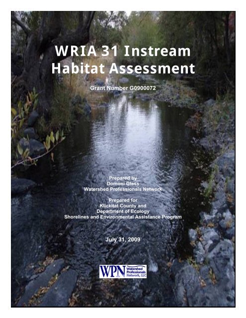
<strong>WRIA</strong> <strong>31</strong> <strong>Instream</strong><strong>Habitat</strong> <strong>Assessment</strong>Grant Number G0900072Prepared byDomoni GlassWatershed Professionals NetworkPrepared forKlickitat County andDepartment of EcologyShorelines and Environmental Assistance ProgramJuly <strong>31</strong>, 2009
<strong>WRIA</strong> <strong>31</strong> <strong>Instream</strong><strong>Habitat</strong> <strong>Assessment</strong>Grant Number G0900072Prepared byDomoni GlassWatershed Professionals NetworkPrepared forKlickitat County andDepartment of EcologyShorelines and Environmental Assistance ProgramJuly <strong>31</strong>, 2009
Table of ContentsAbstract............................................................................................................................... 11.0 Introduction............................................................................................................. 12.0 Background............................................................................................................. 12.1 Current Condition ............................................................................................... 12.1.1 Physical Setting........................................................................................... 32.2 Prior Data Collection Efforts and <strong>Assessment</strong>s.................................................. 43.0 Methods................................................................................................................... 63.1 Study Area .......................................................................................................... 63.2 Sampling Process Design (Experimental Design) .............................................. 73.3 Sampling Procedures .......................................................................................... 73.3.1 <strong>Habitat</strong> Characteristics................................................................................ 73.3.2 Fish Presence/Absence.............................................................................. 123.3.3 Spawning Surveys..................................................................................... 123.4 Data Analysis.................................................................................................... 123.5 sediment Source Modeling ............................................................................... 133.5.1 Data Sources ............................................................................................. 133.5.2 Soil Creep and Stream Bank Erosion........................................................ 143.5.3 Agricultural Lands .................................................................................... 143.5.4 Cultivated Land......................................................................................... 143.5.5 Grazing...................................................................................................... 163.5.6 Road Surface Erosion ............................................................................... 183.5.7 Data and Study Limitations ...................................................................... 184.0 Results................................................................................................................... 194.1 <strong>Habitat</strong>............................................................................................................... 194.1.1 Pools.......................................................................................................... 244.1.2 Spawning Area and Substrate Condition .................................................. 274.1.3 Riparian Characteristics............................................................................ 324.1.4 <strong>Instream</strong> Woody Debris ............................................................................ 324.2 Fish Surveys...................................................................................................... 384.2.1 Snorkel Surveys ........................................................................................ 384.2.2 Spawning Surveys..................................................................................... 404.3 Barriers.............................................................................................................. 414.4 Hydromodifications .......................................................................................... 424.5 Reconnaissance of Old Lady Canyon............................................................... 434.6 Sediment Source Modeling............................................................................... 454.6.1 Soil Creep and Stream bank Erosion ........................................................ 454.6.2 Agricultural Lands .................................................................................... 454.6.3 Cultivated Land......................................................................................... 454.6.4 Grazing...................................................................................................... 474.6.5 Road Surface Erosion ............................................................................... 485.0 Discussion............................................................................................................. 495.1 Spawning <strong>Habitat</strong>.............................................................................................. 495.2 <strong>Habitat</strong> Supporting Egg Incubation .................................................................. 51<strong>WRIA</strong> <strong>31</strong> <strong>Instream</strong> <strong>Habitat</strong> <strong>Assessment</strong> i Watershed Professionals Network
5.3 Rearing <strong>Habitat</strong> ................................................................................................. 525.4 Hydromodifications .......................................................................................... 545.5 Fish Distribution ............................................................................................... 555.6 Sediment Source Modeling............................................................................... 555.7 Limiting Factors................................................................................................ 576.0 References............................................................................................................. 57Appendix A - MapsAppendix B - Photo Review of Study Reaches<strong>WRIA</strong> <strong>31</strong> <strong>Instream</strong> <strong>Habitat</strong> <strong>Assessment</strong> ii Watershed Professionals Network
List of FiguresFigure 1. Study area ...........................................................................................................2Figure 2. Monthly Exceedance flows for Rock Creek and Alder Creek (USGS gagestations: http://waterdata.usgs.gov/nwis/current; Ecology gage:https://fortress.wa.gov/ecy/wrx/wrx/flows/station.asp?sta=<strong>31</strong>B070)................................. 5Figure 3. Daily maximum water temperature at four stations in Rock Creek based on1999 to 2004 data (Aspect 2005). (RC-09 is located near the mouth of Rock Creek, RC-8is located just downstream of the confluence with Squaw Creek, RC-7 is located inSquaw Creek near the confluence with the mainstem Rock Creek, and RC-6 is locatedupstream in the basin near the confluence with Badger Gulch.) ........................................ 6Figure 4. Major streams in <strong>WRIA</strong> <strong>31</strong>. ............................................................................... 8Figure 5. Fish distribution within <strong>WRIA</strong> <strong>31</strong> from the WDFW SaSI Report (WDFW2002, http://wdfw.wa.gov/fish/sasi/)................................................................................... 9Figure 6. Percent of the sampled length of each basin that was dry................................ 23Figure 7. Percent of sampled channel units that were riffles, pools, and glides for eachbasin. ................................................................................................................................. 24Figure 8. The frequency of occurrence of pools at various depths, by basin. ................. 25Figure 9. Average substrate composition for riffle and non-riffle channel units for eachbasin in the study area....................................................................................................... 30Figure 10. Frequency of occurrence of spawning areas with indicated percent fines in thesubstrate. ........................................................................................................................... 33Figure 11. Frequency of occurrence of embeddedness within riffles by basin. .............. 34Figure 12. One of a set of four waterfalls located in Reach 3 of Wood Gulch................ 41Figure 13. Photo of the series of weirs in Wood Gulch................................................... 43Figure 14. Bridge footing in Wood Gulch, Reach 2, near segment 11. Note the scouredpool adjacent to the structure. ........................................................................................... 44Figure 15. Photo of Old Lady Canyon culvert under Highway 14 (left) and photo of OldLady Canyon culvert under the railroad (right). Piles of debris running down the centerof the culvert on the right are piles of bird droppings....................................................... 44Figure 16. 1992 Landsat land cover and land use (from Aspect 2004) ........................... 46Figure 17. Land within 1,000 feet of streams used in WEPP analysis of cultivated land............................................................................................................................................ 47Figure 18. Stream flow, water temperature, and air temperature for water year 2008(from Washington Department of Ecology website:https://fortress.wa.gov/ecy/wrx/wrx/flows/station.asp?sta=<strong>31</strong>B070)............................... 50List of TablesTable 1. Data collected in the field at the segment scale (100 meters) (left 2 columns)<strong>WRIA</strong> <strong>31</strong> <strong>Instream</strong> <strong>Habitat</strong> <strong>Assessment</strong> iii Watershed Professionals Network
and at the individual channel unit scale (right 2 columns). .............................................. 10Table 2. Summary of methods used to estimate sediment inputs.................................... 13Table 3. WEPP estimates of erosion from various cultivated land uses (averagetons/acre/year)................................................................................................................... 15Table 4. WEPP erosion estimates used in analysis (average tons/acre/year). ................. 16Table 5. Land use within 1,000 feet of streams in the Rock, Wood, Pine, and Gladesubbasins........................................................................................................................... 17Table 6. Road conditions used for SEMODL2 calculations............................................ 18Table 7. Sample reaches, total reach length, sampled reach length and percent of reachsampled. ............................................................................................................................ 19Table 8. Average stream gradient of sampled basins. ..................................................... 21Table 9. Number and type of channel units sampled and portion of stream length thatwas dry.............................................................................................................................. 22Table 10. Pool Volume in each reach. ............................................................................. 26Table 11. Total estimated volume of pools (m 3 ) by basin and stream............................. 27Table 12. Spawning area in each reach............................................................................ 28Table 13. Total estimated spawning area (m 2 ) by basin and stream................................ 29Table 14. Substrate composition of spawning areas by basin, stream, and reach. .......... <strong>31</strong>Table 15. Average canopy cover, inner riparian zone width, and typical vegetation foreach reach sampled. .......................................................................................................... 35Table 16. Average abundance of large woody debris in the stream segments (segmentshad an average length of 110 meters). .............................................................................. 37Table 17. Number of fish observed in each basin by species. ......................................... 39Table 18. Number of Oncorhynchus Mykiss observed in each basin by size class. ........ 39Table 19. Location and number of steelhead redds observed in lower Rock Creek........ 40Table 20. Estimated average annual sediment input from soil creep. ............................. 45Table 21. Estimated average annual sediment input to streams from cultivated land..... 47Table 22. Estimated percent of stream length with livestock damage............................. 48Table 23. Length of road hydrologically connected to streams and estimated averageannual sediment input (tons/yr). ....................................................................................... 49Table 24. Estimated average annual sediment input to streams (tons/yr)........................ 56<strong>WRIA</strong> <strong>31</strong> <strong>Instream</strong> <strong>Habitat</strong> <strong>Assessment</strong> iv Watershed Professionals Network
We wish to thank the Nature Conservancy and the landowners inthe study area that cooperated with the project.<strong>WRIA</strong> <strong>31</strong> <strong>Instream</strong> <strong>Habitat</strong> <strong>Assessment</strong> v Watershed Professionals Network
ABSTRACT1.0 INTRODUCTIONThe <strong>WRIA</strong> <strong>31</strong> Watershed <strong>Assessment</strong> (Aspect and WPN 2004) and the <strong>WRIA</strong> <strong>31</strong>Watershed Management Plan (<strong>WRIA</strong> <strong>31</strong> Planning Unit 2009) identified a need forquantitative information on fish habitat across the <strong>WRIA</strong>. <strong>Habitat</strong> data were collected infall and early winter of 2008 and spring of 2009 in five of the subbasins across the<strong>WRIA</strong>. The project is focused on spawning and rearing habitat for steelhead(Oncorhynchus mykiss). Streams were also snorkeled to identify the distribution ofvarious fish species present in the study area and to provide an index of densitythroughout the subbasins. Estimates of sediment delivery to streams were also estimatedthrough a modeling effort. This information will be used to help identify actions that canbe taken to improve fish habitat and water quality.This report summarizes the results of those efforts The project was funded by theWashington Department of Ecology (Ecology) through Grant No. G0900072.2.0 BACKGROUND<strong>WRIA</strong> <strong>31</strong> is located in eastern Klickitat County, southeastern Yakima County, andwestern Benton County, Washington. The streams in the <strong>WRIA</strong> drain to the ColumbiaRiver. Major streams include Rock Creek, Chapman Creek, Wood Gulch, Pine Creek,Glade Creek, and Alder Creek (Figure 1). Several minor streams also drain to theColumbia. The streams in the <strong>WRIA</strong> are seasonally intermittent for at least portions oftheir length.2.1 CURRENT CONDITIONThe <strong>WRIA</strong> <strong>31</strong> Limiting Factors Analysis (Lautz 2000) identified several factorspotentially limiting fish production in Rock Creek. These included water access,widening of the channel from livestock grazing and flooding, and water quality affectedby degraded riparian areas. Technically, some of these factors are not limiting factors butprocesses affecting habitat quality. There is very little publicly available informationregarding fish habitat in the <strong>WRIA</strong>. The Limiting Factors Analysis recognized thatconclusions were largely speculative and recommended that “More detailed informationshould be collected to more precisely define these factors, and to identify specific areaswhere restoration activities will best address them.” The <strong>WRIA</strong> <strong>31</strong> Watershed<strong>Assessment</strong> (Aspect and WPN 2004) and the <strong>WRIA</strong> <strong>31</strong> Watershed Management Plan(<strong>WRIA</strong> <strong>31</strong> Planning Unit 2009) also recognized the shortcomings of the data andrecommended that additional data be collected to support the more accurate identificationof limiting factors and to support the identification of actions which have the greatestprobability of improving habitat.<strong>WRIA</strong> <strong>31</strong> <strong>Instream</strong> <strong>Habitat</strong> <strong>Assessment</strong> 1 Watershed Professionals Network
Figure 1. Study area<strong>WRIA</strong> <strong>31</strong> <strong>Instream</strong> <strong>Habitat</strong> <strong>Assessment</strong> 2 Watershed Professionals Network
The Rock Creek steelhead population is part of the Middle Columbia Steelhead DistinctPopulation Segment, which is listed as threatened under the Federal Endangered SpeciesAct. Prior to this study, steelhead use of other subbasins within the <strong>WRIA</strong> was unknown;however, use of some of the other subbasins by steelhead was suspected. In August2005, NOAA Fisheries designated portions of Rock Creek, Chapman Creek, WoodGulch, Pine Creek, Alder Creek, and Glade Creek as critical habitat (NOAA 2005).2.1.1 Physical Setting<strong>WRIA</strong> <strong>31</strong> drains south from the Horse Heaven Hills into the Columbia River. Elevationsrange from nearly 4,800 feet in the northern part of the Rock Creek subbasin to 266 feetat the Columbia River, and generally decrease from west to east and from north to south.The entire <strong>WRIA</strong> is underlain by the Miocene Columbia River Basalt, including theGrande Ronde, Wanapum, and Saddle Mountain Basalt members (WDNR 2000). TheWanapum Basalt is the dominant geologic formation in Rock Creek, with the youngerSaddle Mountain Basalt dominating the Wood Gulch and Pine Creek subbasins. Thevolcanic bedrock forms the steep canyon walls of many of the larger streams as they havecut down into the basalt, and provides gravel- and cobble-sized particles to these streamsas well as forming bedrock chutes and falls in a few locations.Quaternary flood deposits and loess overlie the basalt in the Eastern part of the <strong>WRIA</strong>,and cover most of the Glade Creek subbasin. The flood deposits were left behind duringPleistocene outburst floods from glacial Lake Missoula and include gravel along theColumbia River grading to sand and silt deposits as far as 17 miles inland from the riverin the Glade Creek subbasin. Quaternary loess deposits, wind-blown silt and fine sand,cover the northern part of Glade Creek. The fine-grained flood deposits and loess areeasily eroded by running water; the major channels in the Glade Creek subbasin haveeroded down to the basalt bedrock. Chapman Creek is also dominated by the Quaternaryflood deposits. Loess overlays most of the subbasin.Shrub land and grassland dominate <strong>WRIA</strong> <strong>31</strong> (Aspect and WPN 2004). Rock Creek isthe only subbasin in the <strong>WRIA</strong> with a substantial amount of timber land (25.8%), whichis located in the headwaters of the subbasin (Aspect and WPN 2004). Less than 10percent of the land in Rock Creek basin is cultivated. Larger portions of the subbasinlands are cultivated in the smaller eastern basins (Glade and Alder Creek basins) (IRZ2004). There is little urban/residential development in <strong>WRIA</strong> <strong>31</strong>, except near Kennewickat the eastern end of the <strong>WRIA</strong> (Aspect and WPN 2004).Two recent forest/range fires have affected the study area. The Cleveland fire burned18,500 acres in the headwaters of Rock Creek in 1998 and the Wood Gulch fire burned11,640 acres in that basin in 2007(www.wsp.wa.gov/fire/docs/mobilization/mobe_history_for_2008.pdf).Precipitation decreases from west to east across the <strong>WRIA</strong> and also decreases from northto south (Aspect and WPN 2004). Specifically, mean annual precipitation ranges from<strong>WRIA</strong> <strong>31</strong> <strong>Instream</strong> <strong>Habitat</strong> <strong>Assessment</strong> 3 Watershed Professionals Network
around 24 inches along the western border of the Rock Creek subbasin to less than 8inches near Kennewick on the east end of the <strong>WRIA</strong>. The majority of precipitationoccurs between October and April, with some precipitation occurring as snow,particularly at higher elevations in the Horse Heaven Hills (Aspect and WPN 2004).Stream flow data are available for Rock Creek and Alder Creek. Stream flows at boththese locations peak in winter and early spring and are generally low throughout thesummer, fall, and into early winter (Figure 2) (USGS stream gages,http://waterdata.usgs.gov/nwis/current; Ecology stream gage websitehttps://fortress.wa.gov/ecy/wrx/wrx/flows/station.asp?sta=<strong>31</strong>B070). Many of the streamsin the <strong>WRIA</strong> go dry during summer, although isolated pools may persist (Aspect andWPN 2004). Summer flow in eastern streams is augmented by irrigation return flows.Stream temperatures in Rock Creek regularly exceed state water quality standards (Figure3) (Aspect 2005; Ecology stream gage websitehttps://fortress.wa.gov/ecy/wrx/wrx/flows/station.asp?sta=<strong>31</strong>B070). One segment ofRock Creek is currently listed as a category 5 on the 303(d) list (Ecology 2008). A studyof trends in riparian condition through time found that floodplain vegetation has beenincreasing since 1938 (Aspect Consulting 2005).2.2 PRIOR DATA COLLECTION EFFORTS AND ASSESSMENTSPrevious studies related to the project are limited. The Limiting Factors Analysis (Lautz2000), the <strong>WRIA</strong> <strong>31</strong> Watershed Analysis (Aspect and WPN 2004), and the <strong>WRIA</strong> 30Watershed Management Plan (<strong>WRIA</strong> <strong>31</strong> Planning Unit 2009) all identified a need tocollect additional information regarding aquatic habitat to fill the numerous data gaps.Data collected in the <strong>WRIA</strong> prior to this study has included the following:‘ Stream temperature monitoring by the Conservation District (Aspect 2005; some ofthe data unpublished, contact Central Klickitat Conservation District)‘ A review of the historic GLO notes from the late 1800s for portions of the basins(Aspect and WPN 2004),‘ Study of temperature, nitrates, and fecal coliform abundance in the <strong>WRIA</strong> (Aspect2005)‘ An evaluation of water temperature conditions completed by Ecology (Ehinger1996)‘ An evaluation of trends in riparian vegetation from 1938 to early this century(Aspect 2005)‘ A study of nitrate concentrations in Glade Creek basin (Aspect 2005)‘ Stream gaging in Rock and Alder Creeks for a short period, discontinued by theUSGS in 1968(http://waterdata.usgs.gov/nwis/nwisman/?site_no=14036600&agency_cd=USGS)‘ Recent stream gaging in Rock Creek by Ecology(https://fortress.wa.gov/ecy/wrs/wrs/flows/station.asp?wria=<strong>31</strong>),‘ Periodic (unpublished) spawning surveys conducted by the Yakama Nation Fisheries<strong>WRIA</strong> <strong>31</strong> <strong>Instream</strong> <strong>Habitat</strong> <strong>Assessment</strong> 4 Watershed Professionals Network
45Average Stream Flow (cfs)40353025201510Alder Creek USGS Gage14034350 1962-198250Oct Nov Dec Jan Feb Mar Apr May Jun Jul Aug Sep400Average Stream Flow (cfs)350300250200150100Rock Cr USGS Gage 140366001962-1968Rock Creek Washington DeptEcology Gage 2007/8500Oct Nov Dec Jan Feb Mar Apr May Jun Jul Aug SepFigure 2. Monthly Exceedance flows for Rock Creek and Alder Creek (USGS gage stations:http://waterdata.usgs.gov/nwis/current; Ecology gage:https://fortress.wa.gov/ecy/wrx/wrx/flows/station.asp?sta=<strong>31</strong>B070).<strong>WRIA</strong> <strong>31</strong> <strong>Instream</strong> <strong>Habitat</strong> <strong>Assessment</strong> 5 Watershed Professionals Network
Figure 3. Daily maximum water temperature at four stations in Rock Creek based on 1999 to 2004data (Aspect 2005). (RC-09 is located near the mouth of Rock Creek, RC-8 is located justdownstream of the confluence with Squaw Creek, RC-7 is located in Squaw Creek near theconfluence with the mainstem Rock Creek, and RC-6 is located upstream in the basin near theconfluence with Badger Gulch.)3.0 METHODS3.1 STUDY AREAThe study area is located in Water Resources Inventory Area (<strong>WRIA</strong>) <strong>31</strong>, which coversportions of Klickitat County, Yakima County, and Benton Counties, Washington (Figure4). The study area does not include the Columbia River. The City of Kennewick lies onthe eastern edge of the <strong>WRIA</strong>. Specific study areas included the streams in the RockCreek, Wood Gulch, Chapman Creek, Pine Creek, and Glade Creek subbasins.Within the subbasins, the study included all suspected anadromous waters in Rock Creek,Chapman Creek, Wood Gulch, Pine Creek, and Glade Creek. The WDFW SalmonidStock Inventory (2002; http://wdfw.wa.gov/fish/sasi/) identifies steelhead in Rock Creekand two of its tributaries, (Quartz and Squaw Creeks) (Figure 5). No fish are indicated inthat report in the other Subbasins. The Limiting Factors Analysis indicates that fish arealso found in the lower 0.3 mi of Chapman Creek and near the mouth of Wood Gulch.The Draft Recovery Plan (NMFS 2008) depicts the potential distribution ofOncorhynchus mykiss (steelhead and rainbow trout) far into many of the subbasins. Thestudy area included the full extent of the potential distribution of steelhead identified inthe Draft Recovery Plan.<strong>WRIA</strong> <strong>31</strong> <strong>Instream</strong> <strong>Habitat</strong> <strong>Assessment</strong> 6 Watershed Professionals Network
3.2 SAMPLING PROCESS DESIGN (EXPERIMENTAL DESIGN)The various subbasins were stratified into stream reaches. Reach boundaries weredefined at major tributaries in each subbasin using the DNR stream GIS coverage. Theresulting reaches were evaluated using aerial photos and topographic maps to determinewhere major changes in gradient or stream size occurred. Additional reach boundarieswere defined at these locations.Within each of the reaches, stream segments were defined every 100 meters. Data werecollected at a minimum of 3 stream segments in each reach. A target of at least 10% ofthe total habitat was set, recognizing that the target may not be met in some areas ifsufficient landowner participation could not be attained. Microsoft Excel’sRANDBETWEEN function was used to select random numbers within the range ofsegment numbers present in each reach. In cases where a randomly selected segment wasfound to be inaccessible due to terrain or permission to sample was not granted by thelandowner, another sample reach was selected randomly.3.3 SAMPLING PROCEDURES3.3.1 <strong>Habitat</strong> CharacteristicsIn each stream segment, the number, area, and wetted and residual depth of pools, thearea of spawning habitat, the quality of spawning gravel, the abundance of instreamwood, riparian condition, bank condition, cover, and any hydromodifications weredocumented. Passage barriers were also identified. Between the randomly selectedsegments, crews documented any passage barriers encountered.Measurement procedures were selected from the list of recommended proceduresprovided by the Washington Department of Fish and Wildlife (Johnson et al. 2001). Themajority of the field sampling procedures used in this study followed the U.S. ForestService Region 6 Stream Inventory Handbook (USFS 2006), with some modifications.Modifications included:‘ No temperature measurements were taken; the program relied on existing data fortemperature‘ The USFS procedures collect measurements in 10 randomly selected “slow” reachesand 10 randomly selected “fast” reaches. Most other commonly used procedures,including the TFW procedures (Pleuss and Shuett-Hames 1998), collect data within aselected stream segment. The methods were modified to sample specified segmentsrather than individual slow and fast segments. However, all individual channel units(e.g. riffle, pool, glide) were measured and documented within each randomlyselected stream segment.<strong>WRIA</strong> <strong>31</strong> <strong>Instream</strong> <strong>Habitat</strong> <strong>Assessment</strong> 7 Watershed Professionals Network
Figure 4. Major streams in <strong>WRIA</strong> <strong>31</strong>.<strong>WRIA</strong> <strong>31</strong> <strong>Instream</strong> <strong>Habitat</strong> <strong>Assessment</strong> 8 Watershed Professionals Network
Figure 5. Fish distribution within <strong>WRIA</strong> <strong>31</strong> from the WDFW SaSI Report (WDFW 2002,http://wdfw.wa.gov/fish/sasi/)‘ The Forest Service manual codes for the field forms were modified – the ForestService manual uses some difficult to remember coding; more memorable codeswere used for this project.‘ Walnut was added as a tree species potentially occurring in the project area (walnutis common in riparian areas of portions of Rock Creek and Chapman Creek).At each randomly selected segment, individual channel units were identified (a channelunit was defined as a pool, riffle, glide, braid, or dry segment; side channels weredocumented separately from main channel units). Data collected for each streamsegment and each channel unit included the GPS location for the top and bottom of thesegment, bankfull width, maximum bankfull depth, three separate estimates of averagebankfull depth (calculated as the average depth across a transect), width of the innerriparian zone (defined as extending from the stream to a point where vegetation changesto a more upslope character), dominant and subdominant plant species within the innerriparian zone, average overstory height, average understory height, canopy closure,stream gradient, and dominant and subdominant plant species in the outer riparian zone(defined as the area between the inner riparian zone and a point 75 feet from the bankfulllocation), and the presence or absence of unstable banks, hydromodifications, barriers,and factors affecting riparian condition (such as cattle or roads) (Table 1). Photos of eachtransect were taken to document sites.<strong>WRIA</strong> <strong>31</strong> <strong>Instream</strong> <strong>Habitat</strong> <strong>Assessment</strong> 9 Watershed Professionals Network
Table 1. Data collected in the field at the segment scale (100 meters) (left 2 columns)and at the individual channel unit scale (right 2 columns).Segment InformationChannel Unit InformationMeasurement Unit of Measure Measurement Unit of MeasureGPS location at UTM NAD27 Channel Unit Sequential numberingstart of segmentGPS location at UTM NAD27Channel Unit Alphanumeric Codesend of segmentTypeDate mm/dd/yy Length feetSurveyor’s initials Width feetBankfull width To nearest 0.1 foot Maximum depth Feet to nearest 0.1 footMaximum bankfulldepthTo nearest 0.1 foot Average depth Feet to nearest 0.1foot; averaged acrossAverage bankfulldepthWidth of innerriparian zoneVegetation class inthe inner riparianzoneDominant plantspecies in the innerriparian zoneSub-dominantplant species in theinner riparian zoneAverageunderstory heightin the inner zoneCanopy ClosureMeasurements takenacross three transects,measured to thenearest 0.1 foot andaveraged for eachtransectFeet – The inner zoneextends from bankfullperpendicular to thecreek to a point wherethe vegetation changesto a more upslopecharacter.Alphanumeric codesfor none, grass, smalland large shrubs,saplings and poles,and small, medium,and large treesAlphanumeric codesAlphanumeric codesPool tail crestheightAspect takenupstreamSmall (6-12 inchdia) instreamwoodMedium (12 to20 inch dia)instream woodLarge (>20 inchdia.) instreamwoodtransectsFeet to nearest 0.1 footdegreesNumber of piecesNumber of piecesNumber of piecesFeet, ocular estimate Wood jams Number of jamsOcular estimate of thepercent of the streamsegment withoverhangingRoot wadsNumber of root wads<strong>WRIA</strong> <strong>31</strong> <strong>Instream</strong> <strong>Habitat</strong> <strong>Assessment</strong> 10 Watershed Professionals Network
Segment InformationChannel Unit InformationMeasurement Unit of Measure Measurement Unit of MeasurevegetationVegetation class inthe outer riparianzone, whichextends from theouter edge of theinner zone to apoint 75 feet fromthe stream.Alphanumeric codes –the same used for theinner zoneSubstratecomposition% bedrock (>4096mm)% boulder (256 to4096 mm)% cobble (64 to 256mm)% gravel (16 to 64mm)% pebble (2 to 16 mm)% sand (0.06 to 2 mm)% silt and clay (
Hydromodifications were noted within the sample segments and at any other locationwhere they were encountered. Documentation of hydromodifications included the GPSlocation, type, length of affected stream (ft), percent of width of the channel affected,wetted width of stream bankfull width of stream, floodprone width of stream, and notes.Barriers were also documented within the sample segments and any other location wherethey were encountered. Documentation of barriers included GPS location, length ofculvert, drop, falls, or chute, height of culvert, drop or chute above stream bottom, waterdepth, plunge pool length, width, and depth, bankfull width and depth, and notes andphotos.Details regarding field data collection procedures and can be found in the QualityAssurance Project Plan (QAPP) developed for this study (Glass 2008) and the ForestService Stream Inventory Handbook (USFS 2006).3.3.2 Fish Presence/AbsenceFish presence was determined in each of the sample segments where habitat data werecollected. The segments were snorkeled in one pass and the numbers of fish observedwas recorded by species and size class. Size classes were defined as
The sampled stream segments were assumed to be representative of the entire streamreach. The information collected was used to support the estimation of the quantity andquality of spawning and rearing habitat throughout the basin. Data analysis relative tostream temperature relied on stream temperature data collected by the Central KlickitatConservation District and reported by Aspect (2005) and temperature data gathered bythe Washington Department of Ecology at the flow gage(https://fortress.wa.gov/ecy/wrx/wrx/flows/station.asp?sta=<strong>31</strong>B070).3.5 SEDIMENT SOURCE MODELINGSediment input was estimated based on observations made during a 1-day sitereconnaissance, viewing orthophotographs to help identify land uses and sedimentsources, and GIS modeling of sediment inputs (Table 2).Table 2. Summary of methods used to estimate sediment inputs.Sediment SourceMethodSoil creep/streambank erosionAgricultural landRoad surfaceerosionA combined estimate was based on SEDMODL2 calculationsThe WEPP model was used to estimate erosion and delivery ratesfrom representative field/buffer/slope combinations. These sedimentinput rates were extrapolated to croplands within 1,000 feet of streams.Erosion from grazing of streamside vegetation was evaluated basedon percent of stream length observed to be damaged by grazingduring the stream inventory, extrapolated to rest of stream areasutilized for grazing.Observations of road conditions/lengths/delivery were made during a1-day site visit. Erosion/delivery estimates were based on SEDMODL2calculations on all roads in GIS database3.5.1 Data SourcesThe following GIS coverages and data were used in the analysis:• Topography – USGS 10 meter Digital Elevation Model• Streams – Washington State Department of Natural Resources Watercourse(WC) Hydrography (WDNR Jan. 2009)• Roads – State Transportation coverage (WDNR Jan. 2009)• Geology – WDNR 1:100,000 scale geology (WDNR 2000)• Soils – NRCS soils, combined WA DNR coverage for Klickitat county andSSURGO for Benton and Yakima counties. Acquired from Aspect Consulting• Land Use – US National Land Cover Data (NLCD) from1992 Landsat data.Acquired <strong>WRIA</strong><strong>31</strong> subset of data from Aspect Consulting (USGS 1992)• Data from the crop analysis completed in 2004 (IRZ 2004) and a crop databaseprovided by the Washington Department of Agriculture (2009) which providesinformation on crops and irrigation in the project area<strong>WRIA</strong> <strong>31</strong> <strong>Instream</strong> <strong>Habitat</strong> <strong>Assessment</strong> 13 Watershed Professionals Network
• Existing traffic count data for portions of gravel-surfaced roads in KlickitatCounty obtained from the County (personal communication, Seth Scarola, ProjectEngineer, Klickitat County Pubic Works, June 1, 2009)In addition, observations on the types of land uses/sediment sources in the subbasins andaverage road conditions across the subbasins were made during a site visit on May 14,2009. The objective of the reconnaissance-level site visit was to observe existingconditions and sediment-producing activities in the subbasins. Observations ofcroplands, road drainage connectivity, unpaved road conditions, potential sedimentdelivery pathways, and presence/absence of defined channels at road crossings weremade. Approximately 200 miles of road within the four subbasins were driven.Based on field observations, type N and U (non-fish bearing) streams in areas underlainby loess and fine-grained flood deposits (Ql and Qfs geologic units) and were notincluded as streams in the analysis of sediment delivery in the Glade Creek subbasin.During the field checking, there were swales, but very few actual channels were found inlocations that were mapped as type N or U on Ql and Qfs geologic units. It is possiblethat mapped streams in parts of other subbasins, particularly lower Rock Creek, are notactually streams on the ground, but we did not have adequate field data to verify streampresence/absence in other subbasins. Since sediment delivery estimates were based onmapped streams, a higher number of mapped streams will result in an overestimate ofsediment delivery to streams.3.5.2 Soil Creep and Stream Bank ErosionSoil creep and stream bank erosion are natural processes that occur along all streams andprovide a background level of sediment input to streams. Soil creep is the slowdownward motion of the soil column due to gravity and provides sediment to streambanks where it enters the stream. In some locations in larger, alluvial sections of streams,the flow has enough energy to erode the stream banks, providing sediment from thismechanism. In general, soil creep is considered the input mechanism in smallerheadwater channels, while stream bank erosion is often the input mechanism in largerchannels. Based on observations by the stream inventory crew, stream bank erosion doesnot appear to be widespread in <strong>WRIA</strong><strong>31</strong>. For this reason, the estimate of soil creep fromthe SEDMODL2 application was used to estimate sediment input from both thesesources. A soil depth of 60 inches was used based on depths reported for soils in thewatershed by the NRCS (http://websoilsurvey.nrcs.usda.gov/app/). The lowest creeprates in SEDMODL2 (0.03/0.07 mm/yr for slopes greater and less than 30 percent,respectively) were used due to the low rainfall in the area.3.5.3 Agricultural LandsAn assessment of erosion and delivery from agricultural lands was made using the WEPPmodel (http://www.ars.usda.gov/Research/docs.htm?docid=10621) and existing GIScoverages showing land use.3.5.4 Cultivated Land<strong>WRIA</strong> <strong>31</strong> <strong>Instream</strong> <strong>Habitat</strong> <strong>Assessment</strong> 14 Watershed Professionals Network
The primary plowed/planted agricultural lands are within the Glade Creek subbasin andinclude rotations of winter wheat and fallow land, row crops, and wine grapes. Primaryrow crops include corn, peas, beans, and potatoes (personal communications, June 5,1009, Troy Grimes, ConAgra farm and dairy operations manager; and WA Dept. ofAgriculture database 2006). Land in the northern portion of the subbasin is not irrigated.Center pivot irrigation is used on row crops in the southern portion of the basin, generallyfrom March through October. Some row crops have multiple rotations within the year,and a cover crop is generally planted to provide erosion control over winter. There arealso limited plowed/planted lands within the otherstudy subbasins.Since there is no detailed GIS information onspecific crops, and rotations change through time,the WEPP model was used to calculate erosion anddelivery to streams from several representativescenarios (Table 3). For all runs, the Richland WAclimate and the Shano silt loam soil was used.Slopes of 2, 5, 10, 20, 30, 40, and 50% with 1,000foot lengths were modeled. Management filesincluded the standard WEPP-provided winter wheatmulch tilled, winter wheat conventional tilled,winter wheat no till, fallow tilled, to represent therange of dryland farming methods in the northernpart of the basin. Several WEPP runs were made toCover crops between grape vinesreduce surface erosiondetermine the range of predicted erosion from irrigated land, including: corn spring chiselplow (with and without irrigation), corn no till winter wheat cover crop (no irrigation),and three different no till, irrigation, with winter wheat cover crop scenarios (sweet corn,peas, and potatoes).Table 3. WEPP estimates of erosion from various cultivated land uses (average tons/acre/year).HillSlopeGradient(%)Winterwheat,continuousno tillWinterwheat,conventionaltillWinterwheat,mulchtillWinterwheat,continuousno till,stationarydepletionirrigation(Mar-0ct)Winterwheat,conventionaltill, stationarydepletionirrigation(Mar-Oct)Corn,springchiselplow (noirrigation)Corn, notill, winterwheatcovercrop (noirrigation)Corn,springchiselplow,stationarydepletionirrigation(Mar-Oct)Sweetcorn, notill, winterwheatcover crop,stationarydepletionirrigation(Mar-Oct)Peas, notill, winterwheatcovercrop,stationarydepletionirrigation(Mar-Oct)Potatoes,no till,winterwheatcovercrop,stationarydepletionirrigation(Mar-Oct)2 0 0 0 0 0.01 0 0 0 0 0 05 0 0.1 0 0 0.1 0 0 0.3 0 0.1 0.110 0 0.3 0.2 0 0.7 0.2 0.1 1.3 0.4 0.3 0.220 0.1 1.2 0.8 0.1 4.9 0.7 0.3 4 1 0.7 0.930 0.2 2.1 1.5 0.4 10.1 1.3 0.6 7.6 1.6 1.1 1.140 0.3 3.1 2.3 0.9 15 1.9 0.8 10.9 2.2 1.5 250 0.4 4.4 2.9 1.1 19.7 2.5 1.3 14.4 3.2 1.9 3The WEPP results were compiled into three average rates that were used for the threecultivated land use categories available in the GIS coverage: Cultivated irrigated;<strong>WRIA</strong> <strong>31</strong> <strong>Instream</strong> <strong>Habitat</strong> <strong>Assessment</strong> 15 Watershed Professionals Network
Cultivated small grains; and Cultivated fallow (Table 4).Table 4. WEPP erosion estimates used in analysis (average tons/acre/year).Hill SlopeGradient (%)Cultivated irrigated (averagewinter wheat and row crop, notill, irrigated)Cultivated small grains(winter wheat, mulchtill)Cultivated fallow (Winterwheat continuous, no till)2 0.0 0.0 0.05 0.1 0.0 0.010 0.2 0.2 0.020 0.7 0.8 0.130 1.1 1.5 0.240 1.7 2.3 0.350 2.3 2.9 0.4These average erosion rates (tons/acre/yr) were applied to acres of land within 1,000 feetof streams mapped as Cultivated – Fallow, Cultivated - Irrigated Land, and Cultivated -Small Grains management scenarios in the GIS database derived from Landsat imagery(USGS 1992). It is assumed that the majority of sediment eroded from land farther than1,000 feet from a stream channel will be re-deposited before it enters a stream channel.The acreages used in this analysis are shown in italics in Table 5.3.5.5 GrazingLivestock grazing occurs within the Rock Creek, Wood Gulch, and Pine Creek subbasins.Observations during the site reconnaissance suggested that in most locations, grazing wasnot intense enough to contribute substantial amounts of sediment to streams. However,in a few locations, grazing was observed to be concentrated near streams and tramplingof banks was observed to be a localized sediment source. An assessment of the degree oflivestock damage to riparian areas was included as part of the <strong>WRIA</strong> <strong>31</strong> stream study.Inventory crews noted if livestock damage was evident at each study site, but noquantitative measurements were made. These notes were compiled and a relative rankingwas given to each site (no livestock damage, minor livestock damage, some livestockdamage, and heavy livestock damage). These data were extrapolated to un-inventoriedstream reaches that are used for grazing and do not have riparian fencing.The WEPP model was used to estimate erosion from grazing by modeling the cow pathsas a narrow skid trail with 10% ground cover, silty loam soils, and 5 % slope. Amodified climate was generated using the included CLIGEN PRISM routine based on theRichland WA climate, with a location of 120.333° W and 45.8667°N to represent theareas within Wood Gulch that were noted to have the heaviest cattle use along streams.<strong>WRIA</strong> <strong>31</strong> <strong>Instream</strong> <strong>Habitat</strong> <strong>Assessment</strong> 16 Watershed Professionals Network
Table 5. Land use within 1,000 feet of streams in the Rock, Wood, Pine, and Glade subbasins.Subbasin Reported Land Use /1 AcresBARREN - Various 17CULTIVATED - Fallow 1,658CULTIVATED - Irrigated Land 581CULTIVATED - Small Grains 2,563Rock CreekDEVELOPED - Various 136FORESTED UPLANDS - Various 25,800GRASSLANDS / HERBACEOUS 7,808SHRUBLAND 30,360WETLAND - Various 111Unknown 79Rock Creek Total 69,111BARREN - Various 1CULTIVATED - Fallow 205CULTIVATED - Irrigated Land 3CULTIVATED - Small Grains 468Wood GulchDEVELOPED - Various 61FORESTED UPLANDS - Various 817GRASSLANDS / HERBACEOUS 4,001SHRUBLAND 8,875WETLAND - Various 20Unknown 1Wood Gulch Total 14,451BARREN - Various 0CULTIVATED - Fallow 213CULTIVATED - Small Grains 140DEVELOPED - Various 107Pine Creek FORESTED UPLANDS - Various 3,277GRASSLANDS / HERBACEOUS 2,827SHRUBLAND 9,541WETLAND - Various 36Unknown 15Pine Creek Total 16,157BARREN - Various 1CULTIVATED - Fallow 46,253CULTIVATED - Irrigated Land 8,844GladeCreekCULTIVATED - Small Grains 17,953DEVELOPED - Various 334FORESTED UPLANDS - Various 46GRASSLANDS / HERBACEOUS 5,118SHRUBLAND 27,422WETLAND - Various 1Unknown 50Glade Creek Total 106,023Note: italicized rows were used in cultivated land analysis1/ Land use data is based on a 1972 dataset and is likely out of date.<strong>WRIA</strong> <strong>31</strong> <strong>Instream</strong> <strong>Habitat</strong> <strong>Assessment</strong> 17 Watershed Professionals Network
3.5.6 Road Surface ErosionSEDMODL2 was used to estimate road surface erosion from roads in the subbasins.SEDMODL2 is an empirical road surface erosion model that estimates surface erosionand delivery to streams based on road conditions such as road width, gradient, surfacing,traffic, ditch width, cutslope height, and cover. Information on the model calculationscan be found in the technical documentation(http://www.ncasi.org/support/downloads/Detail.aspx?id=5).Current road conditions on representative roads in thesubbasins were observed during a site visit on May14, 2009. Road data collected during the site visitincluded: length of road that drains to a stream ateach crossing, tread width, ditch width, treadgradient, tread configuration, tread surfacing,cutslope height, and cover density. These data werecompiled by road class and used to provide input datato SEDMODL2 based on mapped road class. Trafficcount data were available for some of the gravelsurfacedroads and obtained from Klickitat County(personal communication, Seth Scarola, ProjectEngineer, Klickitat County Pubic Works, June 1,2009). If traffic count data were available for specificroads, the data were used to determine traffic levelbased on SEDMODL2 traffic classes.Runoff from unsurfaced roads candeliver sediment to streamsSEDMODL2 was run for all roads included on the DNR road coverage in the foursubbasins. Table 6 summarizes conditions that were used as model input.Table 6. Road conditions used for SEMODL2 calculations.Treadwidth(ft)DNR RoadClass1 – Highway2 – Secondary3 – All SeasonDitchWidth(ft) Surfacing TrafficCutslopeCoverDensityRoadConfiguration30 10 Asphalt Moderate 70% Insloped4 - Unpaved 12 3 Gravel Light* 70% Insloped5 (trail),Not modeled (not roads)Railroad* Actual traffic count data were used if available for gravel surfaced roads.3.5.7 Data and Study LimitationsConstraints on the erosion assessment include: a) limited spatial information on cropsgrown and irrigation methods within the study area; and b) limitation of the amount oftime that could be spent in the field to collect validation data.<strong>WRIA</strong> <strong>31</strong> <strong>Instream</strong> <strong>Habitat</strong> <strong>Assessment</strong> 18 Watershed Professionals Network
4.0 RESULTS4.1 HABITATThe study area included the public and private lands of Rock Creek, Chapman Creek,Pine Creek, Wood Gulch, Old Lady Canyon, and Glade Creek. Data were collected in allreaches between October 29, 2008 and December 12, 2008 with the exception of GladeCreek. Data collection in Glade Creek occurred between May 28 and May 30, 2009. Allof the reaches except Glade Creek were sampled during low flow periods. Glade Creekwas sampled in May during the spring freshets; therefore, the Glade Creek data do notrepresent the low flow condition. Tribal trust lands were excluded from the datacollection effort since they are not included within the <strong>WRIA</strong> <strong>31</strong> planning area. Basemaps for the project areas depicting the sample locations are provided in Appendix A,Maps 1 through 8. Photos of the sample reaches are provided in Appendix B. A total of19,703 meters (57,432 feet) of stream were sampled which represented 15.7 percent ofthe total habitat in the identified reaches throughout the study area (Table 7).Average gradient in the sampled reaches ranged from 0 to 5.29 percent (Table 8). Reach3 in Wood Gulch had the steepest gradient. Other steep reaches included Reach 2 in PineCreek and the upper reaches of Rock and Squaw Creeks.Overall, 20.1 percent of the length of the sampled stream segments was dry (Table 9;Figure 6). Within the Rock Creek subbasin, the dry sections were concentrated inReaches 6, 7, and 8; continuous flow was observed in the canyon reaches upstream ofReach 8. Dry reaches were scattered throughout the other subbasins.Pools comprised 32% (Chapman Creek) to 54% (Pine Creek) of the channel unitssampled (Figure 7) and riffles covered between 15% (Glade Creek) and 57% (ChapmanCreek) of the total channel units sampled (Figure 7).Table 7. Sample reaches, total reach length, sampled reach length and percent of reachsampled.Basin Stream ReachTotalsamplelength(ft)TotalSampleLength(m)ReachLength(ft)ReachLength(m)PercentSampledChapmanCreekCHAPMANCREEK 1 1,109 338 1,<strong>31</strong>2 400 84.5%ChapmanCreekCHAPMANCREEK 2 3,174 967 12,139 3,700 26.1%ChapmanCreekCHAPMANCREEK 3 2,069 6<strong>31</strong> 6,234 1,900 33.2%ChapmanCreek Total 5,906 1,800 19,685 6,000 30.0%Pine Creek PINE CREEK 1 2,417 737 21,325 6,500 11.3%Pine Creek PINE CREEK 2 1,275 389 12,139 3,700 10.5%Pine Creek PINE CREEK 3 1,847 563 10,171 3,100 18.2%Pine Creek PINE CREEK 4 1,375 419 14,436 4,400 9.5%<strong>WRIA</strong> <strong>31</strong> <strong>Instream</strong> <strong>Habitat</strong> <strong>Assessment</strong> 19 Watershed Professionals Network
Totalsamplelength(ft)TotalSampleLength(m)ReachLength(ft)ReachLength(m)PercentSampledBasin Stream ReachPine CreekTotal 6,562 2,000 58,071 17,700 11.3%Rock Creek LUNA GULCH 1 1,014 309 4,265 1,300 23.8%Rock Creek LUNA GULCH 2 1,134 346 6,234 1,900 18.2%Rock Creek LUNA GULCH 3 332 101 6,562 2,000 5.1%Rock Creek QUARTZ CREEK 1 1,019 <strong>31</strong>1 6,890 2,100 14.8%Rock Creek ROCK CREEK 1 1,842 561 4,921 1,500 37.4%Rock Creek ROCK CREEK 2 1,119 341 6,890 2,100 16.2%Rock Creek ROCK CREEK 4 1,471 448 13,123 4,000 11.2%Rock Creek ROCK CREEK 5 1,384 422 9,843 3,000 14.1%Rock Creek ROCK CREEK 6 1,259 384 3,281 1,000 38.4%Rock Creek ROCK CREEK 7 1,201 366 3,937 1,200 30.5%Rock Creek ROCK CREEK 8 1,118 341 3,609 1,100 <strong>31</strong>.0%Rock Creek ROCK CREEK 9 1,125 343 6,890 2,100 16.3%Rock Creek ROCK CREEK 10 1,011 308 5,906 1,800 17.1%Rock Creek ROCK CREEK 11 1,969 600 14,108 4,300 14.0%Rock Creek ROCK CREEK 12 1,075 328 7,218 2,200 14.9%Rock Creek ROCK CREEK 13 1,580 482 12,467 3,800 12.7%Rock Creek SQUAW CREEK 1 1,043 <strong>31</strong>8 6,890 2,100 15.1%Rock Creek SQUAW CREEK 2 1,084 330 7,218 2,200 15.0%Rock Creek SQUAW CREEK 3 1,158 353 6,562 2,000 17.6%Rock Creek SQUAW CREEK 4 377 115 10,499 3,200 3.6%Rock Creek SQUAW CREEK 5 984 300 3,937 1,200 25.0%Rock Creek SQUAW CREEK 6 991 302 3,937 1,200 25.2%Rock Creek SQUAW CREEK 7 4,063 1,238 <strong>31</strong>,824 9,700 12.8%Rock CreekTotal 38,386 11,700 264,764 80,700 14.5%Wood Gulch WOOD GULCH 1 1,147 350 3,281 1,000 35.0%Wood Gulch WOOD GULCH 2 3,343 1,019 27,559 8,400 12.1%Wood Gulch WOOD GULCH 3 2,401 732 22,638 6,900 10.6%Wood Gulch WOOD GULCH 4 1,517 462 11,811 3,600 12.8%Wood Gulch WOOD GULCH 5 2,460 750 20,341 6,200 12.1%Wood GulchTotal 9,843 3,000 85,630 26,100 11.5%Glade Creek GLADE CREEK 1 684 208 1,987 606 34.4%Glade Creek GLADE CREEK 2 1,160 353 5,034 1534 23.0%Glade Creek GLADE CREEK 3 2,102 641 9,159 2792 23.0%Glade CreekTotal 3,945 1,203 16,180 4,926 24.4%TOTAL 64,642 19,703 444,330 135,426Percent sampled across all reaches 15.7%<strong>WRIA</strong> <strong>31</strong> <strong>Instream</strong> <strong>Habitat</strong> <strong>Assessment</strong> 20 Watershed Professionals Network
Table 8. Average stream gradient of sampled basins.Basin Stream Reach # AverageGradient(%)Chapman Creek Chapman Creek1 1.832 1.943 1.79Pine Creek Pine Creek1 1.432 2.753 1.004 1.13Rock Creek Luna Gulch1 1.002 1.003 1.00Quartz Creek 1 3.00Rock Creek1 0.752 1.504 0.755 0.336 1.337 0.338 0.679 1.0010 1.0011 2.0012 3.3<strong>31</strong>3 3.50Squaw Creek1 1.002 0.003 0.674 1.005 1.006 1.007 3.00Wood Gulch Wood Gulch1 1.002 1.223 5.294 1.085 1.00GladeGlade1 1.002 1.383 0.71<strong>WRIA</strong> <strong>31</strong> <strong>Instream</strong> <strong>Habitat</strong> <strong>Assessment</strong> 21 Watershed Professionals Network
Table 9. Number and type of channel units sampled and portion of stream lengththat was dry.PercentBasin Stream ReachNumberofChannelUnitsMeasuredNumberof RifflesSampledNumberof PoolsSampledNumberof GlidesSampledofLengthThatwasDryChapmanCreekCHAPMANCREEK 1 13 7 6 0 35.5%ChapmanCreekCHAPMANCREEK 2 38 20 9 9 4.3%ChapmanCreekCHAPMANCREEK 3 37 18 13 5 19.3%ChapmanCreek total 88 45 28 14 14.5%Pine Creek PINE CREEK 1 34 12 16 0 63.4%Pine Creek PINE CREEK 2 27 8 14 1 41.5%Pine Creek PINE CREEK 3 26 6 11 2 10.7%Pine Creek PINE CREEK 4 24 11 10 2 0.9%Pine CreekTotal 111 37 51 5 41.6%Rock Creek LUNA GULCH 1 7 1 1 2 67.7%Rock Creek LUNA GULCH 2 15 6 7 2 0.0%Rock Creek LUNA GULCH 3 8 2 5 1 0.0%Rock Creek QUARTZ CREEK 1 14 7 7 0 0.0%Rock Creek ROCK CREEK 1 16 6 8 2 0.0%Rock Creek ROCK CREEK 2 3 1 1 1 0.0%Rock Creek ROCK CREEK 4 16 5 6 5 0.0%Rock Creek ROCK CREEK 5 8 4 2 2 0.0%Rock Creek ROCK CREEK 6 14 6 6 1 46.3%Rock Creek ROCK CREEK 7 9 2 4 2 29.3%Rock Creek ROCK CREEK 8 10 3 4 1 36.1%Rock Creek ROCK CREEK 9 13 5 6 2 0.0%Rock Creek ROCK CREEK 10 11 5 2 4 0.0%Rock Creek ROCK CREEK 11 40 17 16 7 0.0%Rock Creek ROCK CREEK 12 22 10 12 0 0.0%Rock Creek ROCK CREEK 13 33 16 16 1 0.0%Rock Creek SQUAW CREEK 1 17 7 8 1 2.7%Rock Creek SQUAW CREEK 2 5 0 1 1 70.4%Rock Creek SQUAW CREEK 3 13 4 6 1 26.8%Rock Creek SQUAW CREEK 4 4 2 2 0 0.0%Rock Creek SQUAW CREEK 5 3 0 0 0 100.0%Rock Creek SQUAW CREEK 6 3 0 0 0 100.0%Rock Creek SQUAW CREEK 7 66 29 34 1 16.3%Rock CreekTotal 549 220 233 56 13.9%Wood Gulch WOOD GULCH 1 7 1 2 0 58.4%Wood Gulch WOOD GULCH 2 40 17 20 1 0.0%Wood Gulch WOOD GULCH 3 65 30 33 2 0.0%<strong>WRIA</strong> <strong>31</strong> <strong>Instream</strong> <strong>Habitat</strong> <strong>Assessment</strong> 22 Watershed Professionals Network
NumberofChannelUnitsMeasuredNumberof RifflesSampledNumberof PoolsSampledNumberof GlidesSampledPercentofLengthThatwasDryBasin Stream ReachWood Gulch WOOD GULCH 4 15 5 8 2 0.0%Wood Gulch WOOD GULCH 5 16 0 5 4 68.7%Wood GulchTotal 143 53 68 9 24.0%Glade Creek GLADE CREEK 1 10 1 5 4 0.0%Glade Creek GLADE CREEK 2 10 4 5 2 0.0%Glade Creek GLADE CREEK 3 15 0 6 6 7.6%Glade CreekTotal 35 5 16 12 4.1%Totals for sampled areas 727 278 <strong>31</strong>7 77 20.1%45Percent of Sampled LengthThat Was Dry4035302520151050ChapmanCreekPine Creek Rock Creek Wood Gulch Glade CreekBasinFigure 6. Percent of the sampled length of each basin that was dry.<strong>WRIA</strong> <strong>31</strong> <strong>Instream</strong> <strong>Habitat</strong> <strong>Assessment</strong> 23 Watershed Professionals Network
60.0%Percent of EachChannel Unit Type50.0%40.0%30.0%20.0%10.0%0.0%ChapmanCreekPine Creek Rock Creek Wood Gulch GladeCreekBasin% Riffles % Pools % GlidesFigure 7. Percent of sampled channel units that were riffles, pools, and glides foreach basin.4.1.1 PoolsAverage pool depth ranged from 0.061 to 0.853 meters (0.2 to 2.8 feet) and maximumpool depth ranged from 0.122 to 2.13 meters (0.4 to 7.0 feet). The distribution of averageand maximum pool depths were similar for all the basins except Glade Creek which hadmuch deeper pools on average (Figure 8). With the exception of Glade Creek, poolswere generally less than 0.6 meters (2 feet) deep.Pool volume was estimated for each pool sampled in the study area and the average poolvolume per 100 meters was estimated for each stream segment. The average andstandard deviation of pool volume was estimated for each reach (Zar 1974). Pool volumeper 100 meters ranged from 0.13 to 77.89 m 3 per 100m and averaged 6.6 m 3 per 100m(Table 10; Appendix A, Maps 9 through 16). Expanding the mean density of poolvolume/m 3 over the total length of each reach, the total estimated volume of pools in thestudy area is estimated at 5,408 m 3 (7,073 square yards), 78 percent of which is located inthe Rock Creek basin (Tables 10 and 11).<strong>WRIA</strong> <strong>31</strong> <strong>Instream</strong> <strong>Habitat</strong> <strong>Assessment</strong> 24 Watershed Professionals Network
Chapman CreekNumber of Pools86420Average PoolDepthMaximumPool Depth0.10.20.20.30.40.50.60.70.80.91.01.11.21.21.<strong>31</strong>.41.51.61.71.81.92.02.1Pool Depth (m)Glade CreekNumber of Pools43210Average PoolDepthMaximumPool Depth0.10.20.20.30.40.50.60.70.80.91.01.11.21.21.<strong>31</strong>.41.51.61.71.81.92.02.1Pool Depth (m)Pine CreekNumber of Pools121086420Average PoolDepthMaximumPool Depth0.10.20.20.30.40.50.60.70.80.91.01.11.21.21.<strong>31</strong>.41.51.61.71.81.92.02.1Pool Depth (m)Rock CreekNumber of Pools35302520151050Average PoolDepthMaximumPool Depth0.10.20.20.30.40.50.60.70.80.91.01.11.21.21.<strong>31</strong>.41.51.61.71.81.92.02.1Pool Depth (m)Wood GulchNumber of Pools151050Average PoolDepthMaximumPool Depth0.10.20.20.30.40.50.60.70.80.91.01.11.21.21.<strong>31</strong>.41.51.61.71.81.92.02.1Pool Depth (m)Figure 8. The frequency of occurrence of pools at various depths, by basin.<strong>WRIA</strong> <strong>31</strong> <strong>Instream</strong> <strong>Habitat</strong> <strong>Assessment</strong> 25 Watershed Professionals Network
Table 10. Pool Volume in each reach.StandardDeviationPoolVolume(m 3 )/100mTotalEstimatedPoolVolume(m 3 ) inReachStandardDeviationof TotalEstimatedPoolVolume(m 3 ) inReachBasin Stream ReachAveragePoolVolume(m 3 )/100mChapman Chapman Creek 1 2.37 27.02 9.5 108.1Creek2 0.13 6.91 4.8 255.7Pine CreekRock CreekWood GulchGlade CreekPine CreekLuna Gulch3 0.16 7.58 3.1 144.11 0.75 41.08 48.6 2670.52 0.77 22.14 28.5 819.13 0.87 46.09 27.0 1428.94 1.77 21.24 78.0 934.71 0.20 2.55 2.7 33.22 2.87 12.59 54.5 239.23 2.70 N/A* 54.0 N/A*Quartz Creek 1 3.61 46.33 75.9 973.0Rock Creek1 29.62 110.51 444.3 1657.72 77.89 392.09 1635.6 8233.94 8.44 136.06 337.5 5442.35 7.10 42.65 213.1 1279.46 1.40 28.71 14.0 287.17 8.73 102.11 104.7 1225.48 3.62 41.64 39.8 458.09 3.93 40.97 82.5 860.<strong>31</strong>0 1.13 22.04 20.3 396.811 1.19 41.62 51.1 1789.712 1.26 9.87 27.8 217.1Squaw CreekWood GulchGlade Creek13 0.29 6.10 10.9 232.01 2.34 14.79 49.1 <strong>31</strong>0.72 2.41 17.72 52.9 389.83 3.30 36.66 66.0 733.14 26.73 N/A* 855.2 N/A*5 DRY DRY 0.0 0.06 DRY DRY 0.0 0.07 0.38 28.84 37.2 2797.81 0.37 5.69 3.7 56.92 1.06 27.28 89.3 2291.83 0.45 14.53 30.8 1002.44 8.16 113.04 293.7 4069.35 0.13 5.73 8.1 355.11 24.99 87.07 151.3 527.32 10.55 79.54 161.8 1220.43 8.63 117.21 240.8 3272.2* Not enough samples to calculate a standard deviation<strong>WRIA</strong> <strong>31</strong> <strong>Instream</strong> <strong>Habitat</strong> <strong>Assessment</strong> 26 Watershed Professionals Network
Table 11. Total estimated volume of pools (m 3 ) by basin and stream.BASIN / STREAMTOTALChapman Creek 17Glade Creek 554Pine Creek 182Rock Creek Luna Gulch 111Quartz Creek 76Rock Creek Mainstem 2,982Squaw Creek 1,060Rock Creek Total 4,229Wood Gulch 426Grand Total 5,4084.1.2 Spawning Area and Substrate ConditionThe area of spawning habitat was estimated for each channel unit containing spawninghabitat (including riffles, glides, and the tails out of many pools), and the averagespawning area per 100 meters was estimated for each segment. The mean and standarddeviation of spawning area was calculated for the portions of each reach that wereincluded in the study by averaging the values for each segment and completing thecalculations for standard deviation (Zar 1974). Spawning area per 100 meters rangedfrom 0.0 to <strong>31</strong>4.5 m 2 per 100m and averaged 77.7 m 2 per 100m (Table 12; Appendix A,Maps 17 through 24). Expanding the average spawning area per m 2 over the total lengthof each reach, including portions not directly sampled, the total estimated area ofspawning habitat in the study area is estimated at 5,408 m 2 , 78 percent of which is locatedin the Rock Creek basin (Tables 12 and 13).The substrate composition was documented for each channel unit in each sample segment(Table 14). Two methods were used to document substrate condition. The modifiedWentworth procedure visually estimates the percent of the substrate that falls into a rangeof categories. This measure is focused on the composition of the materials within thesubstrate. In addition, a visual estimate of embeddedness was documented. Thismeasure focuses on the amount of fine sediment overlying the substrate.In general, substrate materials tended to be slightly coarser in riffles than in other channelunit types (pools, glides, marshes) (Figure 9). Chapman Creek and Glade Creek basinstended to have a much higher percentage of fines than were observed in Rock Creek,Wood Gulch, and Pine Creek. As will be discussed later, this is related to the underlyinggeology of the basins. Glade and Chapman Creek have much less spawning material(gravel/cobble) than is found in the other basins.<strong>WRIA</strong> <strong>31</strong> <strong>Instream</strong> <strong>Habitat</strong> <strong>Assessment</strong> 27 Watershed Professionals Network
Table 12. Spawning area in each reach.Basin Stream Reach Ave Standard Total StandardSpawning Deviation Estimated Deviationarea (m 2 )/100 mSpawningArea (m 2 )/100 mSpawningArea (m 2 )in ReachTotalEstimatedSpawningAreaChapman Creek Chapman Creek 1 0.0 0.00 0.00 0.002 0.0 0.00 0.00 0.003 0.3 0.79 1697.40 15.01Pine Creek Pine Creek1 26.1 35.55 677.16 2<strong>31</strong>0.612 18.3 8.94 2004.83 330.633 64.7 32.98 4966.35 1022.474 112.9 71.45 51.93 <strong>31</strong>43.76Rock Creek Luna Gulch1 4.0 3.65 871.43 47.432 45.9 39.80 203.63 756.193 10.2 N/A* <strong>31</strong>58.10 N/A*Quartz Creek 1 150.4 94.48 3814.16 1984.14Rock Creek1 254.3 103.43 6603.49 1551.402 <strong>31</strong>4.5 488.99 10526.51 10268.864 263.2 105.08 5137.75 4203.375 171.3 9.33 1484.28 279.836 148.4 146.94 1659.06 1469.367 138.3 161.76 958.30 1941.168 87.1 99.53 2029.11 1094.889 96.6 87.23 2650.00 18<strong>31</strong>.7410 147.2 30.24 4742.63 544.3511 110.3 36.39 1081.28 1564.6812 49.1 42.57 724.42 936.6013 19.1 10.75 5422.16 408.51Squaw Creek1 258.2 122.70 876.30 2576.652 39.8 68.99 1830.75 1517.803 91.5 94.68 865.41 1893.634 27.0 N/A* 0.00 N/A*5 DRY DRY 0.00 0.006 DRY DRY 4913.30 0.007 50.7 53.36 1174.03 5176.40Wood Gulch Wood Gulch1 117.4 145.07 8751.62 1450.732 104.2 55.30 766.24 4645.123 11.1 7.49 559.52 516.504 15.5 20.77 285.02 747.735 4.6 11.87 1697.40 2<strong>31</strong>0.61Glade Creek Glade Creek1 0.0 0.00 0.00 0.002 0.0 0.00 0.00 0.003 0.0 0.00 0.00 0.00* Not enough samples to calculate a standard deviation<strong>WRIA</strong> <strong>31</strong> <strong>Instream</strong> <strong>Habitat</strong> <strong>Assessment</strong> 28 Watershed Professionals Network
Table 13. Total estimated spawning area (m 2 ) by basin and stream.BASIN / STREAMTOTALChapman Creek 6Glade Creek 0Pine Creek 9,346Rock Creek Luna Gulch 1,127Quartz Creek 3,158Rock Creek Mainstem 41,411Squaw Creek 13,908Rock Creek Total 59,604Wood Gulch 11,536Grand Total 80,492<strong>WRIA</strong> <strong>31</strong> <strong>Instream</strong> <strong>Habitat</strong> <strong>Assessment</strong> 29 Watershed Professionals Network
Chapman CreekAverage PercentComposition100806040200% Bedrock % Boulder % Cobble % Gravel % Pebble % Sand % Silt/ClayNon-RifflesRifflesSubstrate SizePine CreekAverage PercentComposition302520151050% Bedrock % Boulder % Cobble % Gravel % Pebble % Sand % Silt/ClayNon-RifflesRifflesSubstrate SizeRock CreekAverage PercentComposition35302520151050% Bedrock % Boulder % Cobble % Gravel % Pebble % Sand % Silt/ClayNon-RifflesRifflesSubstrate SizeWood GulchAverage PercentComposition302520151050% Bedrock % Boulder % Cobble % Gravel % Pebble % Sand % Silt/ClayNon-RifflesRifflesSubstrate SizeGlade CreekAverage PercentComposition6050403020100% Bedrock % Boulder % Cobble % Gravel % Pebble % Sand % Silt/ClayNon-RifflesRifflesSubstrate SizeFigure 9. Average substrate composition for riffle and non-riffle channel units foreach basin in the study area.<strong>WRIA</strong> <strong>31</strong> <strong>Instream</strong> <strong>Habitat</strong> <strong>Assessment</strong> 30 Watershed Professionals Network
Table 14. Substrate composition of spawning areas by basin, stream, and reach.Basin Stream Reach %Bedrock%Boulder%Cobble%Gravel%Pebble%Sand% Silt& ClayChapman Chapman 1 0.0 3.3 19.2 15.0 4.2 9.2 49.2Creek Creek2 0.0 1.3 15.3 17.3 10.3 14.0 42.03 0.0 0.9 23.2 15.3 6.5 11.2 42.9Chapman Creek Total 0.0 1.4 19.0 16.2 7.9 12.2 43.4Pine Pine Creek 1 8.8 22.9 27.1 14.6 8.8 7.9 10.0Creek2 23.8 29.4 18.1 11.9 2.5 3.8 10.63 0.0 13.3 35.8 26.7 10.8 6.7 6.74 0.0 16.8 <strong>31</strong>.8 25.5 10.5 7.3 8.2Pine Creek Total 8.0 20.9 28.0 19.2 8.2 6.6 9.1Rock Luna Gulch 1 0.0 30.0 35.0 15.0 5.0 5.0 10.0Creek2 0.0 18.3 37.5 22.5 5.8 2.5 13.33 2.5 20.0 37.5 15.0 7.5 0.0 17.5Luna Gulch Total 0.6 20.0 37.2 20.0 6.1 2.2 13.9Quartz1 0.7 24.3 30.0 24.3 10.7 5.0 5.0CreekMainstemRockCreek1 0.0 10.0 40.0 36.7 5.0 0.0 8.32 15.0 30.0 35.0 15.0 0.0 0.0 5.04 15.0 12.0 24.0 24.0 11.0 6.0 8.05 5.0 15.0 33.3 28.3 5.0 3.3 10.06 0.0 21.0 42.0 22.0 0.0 0.0 15.07 5.0 15.0 35.0 30.0 0.0 0.0 15.08 0.0 15.0 38.3 35.0 0.0 1.7 10.09 0.0 12.0 39.0 35.0 3.0 4.0 7.010 0.0 19.0 33.0 24.0 7.0 2.0 15.011 0.0 25.0 36.5 21.5 5.0 2.1 10.012 3.0 32.5 28.5 19.0 5.5 4.5 7.013 6.0 23.0 28.7 19.7 8.0 2.7 12.0Mainstem Total 3.2 21.6 33.3 23.6 5.3 2.6 10.3Squaw1 0.0 11.4 42.1 <strong>31</strong>.4 3.6 4.3 7.1Creek23 0.0 26.3 33.8 25.0 2.5 6.3 6.34 0.0 30.0 30.0 15.0 2.5 7.5 15.07 13.9 19.8 25.7 20.4 8.1 3.5 8.5Squaw Creek Total 9.4 19.5 29.6 22.5 6.5 4.1 8.4Rock Creek Total 4.8 21.0 32.3 23.1 6.0 3.2 9.7WoodGulchWoodGulch1 0.0 25.0 25.0 30.0 10.0 10.0 0.02 1.2 21.5 32.1 22.9 7.9 6.2 8.23 4.1 26.7 25.0 15.0 9.8 9.0 10.34 0.0 12.5 35.0 26.3 11.3 6.3 8.85Wood Gulch Total 2.7 23.8 28.1 18.8 9.3 7.8 9.3Glade Glade1 0.0 0.0 10.0 10.0 30.0 40.0 10.0Creek Creek2 0.0 12.5 8.8 11.3 12.5 <strong>31</strong>.3 23.83Glade Creek Total 0.0 10.0 9.0 11.0 16.0 33.0 21.0The percent fines in spawning areas is an important factor in assessing the quality of<strong>WRIA</strong> <strong>31</strong> <strong>Instream</strong> <strong>Habitat</strong> <strong>Assessment</strong> <strong>31</strong> Watershed Professionals Network
spawning habitats. Spawning areas are predominately located in riffles where flowsreduce the quantity of fine sediments and also provide oxygen within the substrate(Bjornn and Reiser, 1991). Fine substrate materials that accumulate in gravel can causeasphyxiation of rearing eggs and alevins. The modified Wentworth method employed inthis study identified the smaller substrate sizes as silt and clay (< 0.59 mm) and sand(0.60 to 1.00 mm).Figure 10 and Appendix A, maps 25 through 32 depict the average percent compositionof both the finer material (silt and clay) and the sum of the composition of sand andsilt/clay. Rock Creek had the lowest composition of fine materials in the substrate; thepercent composition of fine materials was less than 20 percent in all but a couple of casesand was less than 15 percent in the majority of the locations. The higher values werecollected in backwater areas of side channels. Pine Creek and Wood Gulch also tendedto have low levels of fine materials in riffles, though a larger number of riffles had higherlevels of fine sediments. Chapman Creek tended to have a very fine substrate and GladeCreek has an abundance of sand.Embeddedness (Figure 11) was similar in Rock Creek, Pine Creek, and Wood Gulch.Embeddedness tended to be much higher in Glade Creek and Chapman Creek. As will bediscussed later, these differences are likely related to variations in the local geology.4.1.3 Riparian CharacteristicsThe documented characteristics of riparian zones included a measure of the depth of the“inner” riparian zone, defined as the point where the vegetation changes to a moreupslope character, dominant and subdominant species, and an ocular estimate of canopyclosure. The study was conducted after leaf fall, so the estimates of canopy closure arehighly subjective. Estimates of canopy closure ranged from 0 to 46.7 percent, averaging20.8 percent (Table 15; Appendix A, Maps 33 through 40). The width of the innerriparian zone ranged from 0 to 15.7 meters, with an average of 4.7 meters.The most common species in the riparian zones included alder, willow, walnut, and whiteoak. Walnut is not a native species.4.1.4 <strong>Instream</strong> Woody DebrisThe abundance of large woody debris in the sample area was generally low (Table 16).The average total number of pieces in the sample reaches ranged from 0 to 4.8 pieces perstream segment (segments averaged 110 meters). The majority of these pieces weresmall (6 to 12 inch diameter) to medium (12 to 20 inch diameter) in size.<strong>WRIA</strong> <strong>31</strong> <strong>Instream</strong> <strong>Habitat</strong> <strong>Assessment</strong> 32 Watershed Professionals Network
Number1086420Chapman Creek0 5 10 15 20 25 30 35 40 45 50 55 60 65 70 75 80 85 95Percent FinesSilt and Clay
Chapman Creek30Number2010075%% EmbeddednessGlade Creek6Number42075%% EmbeddednessRock CreekNumber80604020075%% EmbeddednessPine CreekNumber2015105075%% EmbeddednessWood GulchNumber40302010075%% EmbeddednessFigure 11. Frequency of occurrence of embeddedness within riffles by basin.<strong>WRIA</strong> <strong>31</strong> <strong>Instream</strong> <strong>Habitat</strong> <strong>Assessment</strong> 34 Watershed Professionals Network
Table 15. Average canopy cover, inner riparian zone width, and typical vegetation for each reach sampled.Basin Stream Reach CanopyCover (%)Chapman CreekPine CreekRock CreekAverageWidth ofInnerRiparianZone (m)Typical VegetationClass in InnerRiparian ZoneMost CommonDominant Speciesin Inner RiparianZoneMost CommonSub-dominantSpecies in InnerRiparian ZoneChapman CreekGrasslands and Cottonwood and Cottonwood and1 45.0 10.7 ForbsAlderAlder2 37.2 5.8Small TreesAlderWillow, Walnut,NoneGrasslands and3 39.2 4.6 Forbs Alder None, ElderberryPine CreekShrub and seedlings,samplings and poles,1 11.4 3.3 small trees Alder and Willow WillowShrub and seedlings,2 21.3 5.7 samplings and poles Alder WillowShrub and seedlings,3 16.0 4.0 small tree Alder and Willow Willow and Alder4 26.3 5.3 Small tree Alder WillowLuna GulchGrasslands andWhite oak,Forbs, small treePonderosa Pine,1 6.0 5.6White oak, Alder and none2 41.7 4.6 Small tree Alder White oak3 60.0 4.6 Small tree Alder WillowQuartz Creek 1 46.7 3.0 Small tree Alder White oakRock Creek1 18.3 6.5 Saplings and poles Alder Walnut2 28.3 6.4 Saplings and poles Alder None4 17.5 5.7 Small tree Alder WalnutSmall treeWhite oak, Walnut,5 13.3 7.1AlderBig leaf maple6 13.3 6.1 Saplings and poles Alder None7 10.7 3.0 Small tree Alder NoneGrasslands and forbs8 3.3 2.5 to saplings and poles Cottonwood, Willow Willow, Alder9 11.7 4.6 Saplings and poles Alder None<strong>WRIA</strong> <strong>31</strong> <strong>Instream</strong> <strong>Habitat</strong> <strong>Assessment</strong> 35 Watershed Professionals Network
Basin Stream Reach CanopyCover (%)Wood GulchGlade CreekSquaw CreekWood GulchGlade CreekAverageWidth ofInnerRiparianZone (m)Typical VegetationClass in InnerRiparian ZoneMost CommonDominant Speciesin Inner RiparianZoneMost CommonSub-dominantSpecies in InnerRiparian Zone10 18.3 3.0 Small tree Alder None11 19.0 3.4 Shrubs to small tree Willow and Alder None, Alder12 56.7 3.6 Small tree Alder None13 16.3 5.0Small treeWhite oakWillow, Walnut,White oak, QuakingAspen1 26.7 3.6 Small tree Alder None, Walnut2 5.0 1.5 Small tree Alder Willow3 10.0 3.0Small treeAlderNone, Big leafmaple, Alder4 15.0 3.0 Small tree Alder White oak5 0.0 0.0Grasslands andForbsWillow, Juniper,NoneNone6 0.0 0.0Grasslands andForbs Juniper, Willow Alder, Willow, NoneShrubs to Small7 12.0 2.9 Trees Alder, Willow None, WillowGrasses to small1 0.0 0.0 trees Alder, Willow, None None2 17.2 3.0 Shrubs to small trees Alder Willow, None, Alder3 <strong>31</strong>.4 4.1 Small tree Alder, White oak None, Alder4 18.3 4.9 Small tree Alder WalnutShrubs and seedlings5 17.9 4.4WillowGrasslands and Grasslands and1 13.3 15.7 ForbsForbsNoneGrasslands and Grasslands and2 8.8 6.5 ForbsForbsNoneGrasslands and Grasslands and3 37.1 11.8 ForbsForbsNoneNone, PonderosaPine<strong>WRIA</strong> <strong>31</strong> <strong>Instream</strong> <strong>Habitat</strong> <strong>Assessment</strong> 36 Watershed Professionals Network
Table 16. Average abundance of large woody debris in the stream segments (segments hadan average length of 110 meters).Basin Stream Reach Number of large woody debris pieces averaged overthe stream segments in each reachSmallMediumLarge Jams RootwadsTotalChapmanCreekPine CreekRock CreekWood GulchGlade CreekChapman Creek 1 1.2 0.6 0.4 0.1 0.0 2.32 0.9 0.4 0.0 0.0 0.0 1.33 0.6 0.5 0.0 0.1 0.1 1.3Pine Creek1 1.1 0.1 0.0 0.0 0.0 1.22 0.3 0.1 0.0 0.0 0.0 0.43 1.0 0.3 0.0 0.1 0.0 1.54 0.8 0.1 0.0 0.0 0.0 1.0Luna Gulch1 1.3 1.0 0.0 0.0 0.1 2.42 0.1 0.0 0.0 0.0 0.0 0.13 0.0 0.1 0.0 0.0 0.0 0.1Quartz Creek 1 1.4 0.1 0.1 0.0 0.0 1.5Rock Creek1 1.6 0.2 0.0 0.3 0.0 2.12 1.0 0.7 0.0 0.0 0.0 1.74 0.1 0.0 0.0 0.0 0.0 0.15 3.8 1.0 0.0 0.0 0.0 4.86 2.1 0.3 0.0 0.0 0.0 2.47 2.9 1.3 0.0 0.0 0.0 4.28 0.1 0.2 0.1 0.0 0.0 0.49 1.5 0.2 0.1 0.0 0.0 1.810 3.0 0.3 0.0 0.0 0.0 3.<strong>31</strong>1 0.1 0.1 0.0 0.0 0.0 0.212 0.6 0.4 0.3 0.0 0.0 1.413 0.9 0.2 0.1 0.1 0.0 1.3Squaw Creek1 1.7 0.2 0.0 0.0 0.0 1.92 2.4 0.2 0.0 0.0 0.0 2.63 0.1 0.0 0.0 0.0 0.0 0.14 0.0 0.0 0.0 0.0 0.0 0.05 0.0 0.0 0.0 0.0 0.0 0.06 0.0 0.0 0.0 0.0 0.0 0.0Wood Gulch7 0.5 0.2 0.1 0.0 0.0 0.71 0.0 0.0 0.0 0.0 0.0 0.02 0.7 0.2 0.0 0.0 0.0 0.93 0.4 0.2 0.0 0.0 0.0 0.74 0.5 0.1 0.0 0.0 0.0 0.65 0.6 0.5 0.1 0.0 0.0 1.2Glade Creek1 0.0 0.0 0.0 0.0 0.0 0.02 0.0 0.0 0.0 0.0 0.0 0.03 0.0 0.1 0.0 0.0 0.0 0.1<strong>WRIA</strong> <strong>31</strong> <strong>Instream</strong> <strong>Habitat</strong> <strong>Assessment</strong> 37 Watershed Professionals Network
4.2 FISH SURVEYS4.2.1 Snorkel SurveysSnorkel surveys were conducted in 799 stream segments within 33 larger reaches in the RockCreek, Chapman Creek, Wood Gulch, and Pine Creek basins. No fish were found in 53 percentof the stream segments (Appendix A, Maps 41 through 48). The following species wereencountered:Oncorhynchus kisutchOncorhynchus mykissRhinichthys cataractaeRhinichthys OsculusRhinichthys sp.Richardsonius balteatusCoho SalmonSteelhead, rainbow, redband troutLongnose daceSpeckled daceUnknown daceRedside ShinersAccording to the principal at the Bickleton School and a local resident, the students at the schooloften place coho into the stream; hence, the coho that were found were likely planted by thestudents. Chapman Creek contained only speckled dace (Table 17). The other basins had agreater diversity of species. The highest concentration of steelhead/rainbows was found in RockCreek.Eighty-nine (89) percent of the O. Mykiss observed were less than 100mm in length (Table 18).These fish could be either anadromous or resident fish. The remaining fish were larger thansmolts and smaller than kelts or adults; hence, the larger fish were likely all resident fish.The O. Mykiss observed in Pine Creek were all resident fish. Passage is blocked at Highway 14.We also found a natural barrier in Reach 2, which would limit the upstream extent ofanadromous fish once the barrier at the highway is replaced. No other impassible barriers werefound in Rock Creek, Pine Creek, Glade Creek, or Wood Gulch within the sampled segments.Additional barriers may exist outside of the sampled areas.O. Mykiss was found in Wood Gulch up to the confluence with Big Horn Canyon. We did notsample Big Horn Canyon, but did continue up Wood Gulch beyond the confluence for severalmore miles.The highest concentrations of O. mykiss in Rock Creek were found downstream of Luna Gulchin reaches 4 through 7. The total number of fish observed in these reaches constituted 90 percentof the O. mykiss observed in the mainstem of Rock Creek and 71 percent of the O. mykissobserved throughout the subbasin. Two of these reaches, reaches 6 and 7, were intermittentlydry, trapping the fish within the reach. These two reaches contained 60 percent of the O. mykissobserved in the mainstem of Rock Creek and 47 percent of the O. mykiss observed throughoutthe subbasin. Only 8.2 percent of the O. mykiss in the subbasin were found upstream of theBickleton Bridge, suggesting that movement into the headwaters to rear during the warmsummer months is not a common life history strategy. The majority of the O. Mykiss observed inSquaw Creek were located downstream of the confluence with Harrison Creek. Squaw Creeksupported 16% of the total fish observed in the Rock Creek basin.<strong>WRIA</strong> <strong>31</strong> <strong>Instream</strong> <strong>Habitat</strong> <strong>Assessment</strong> 38 Watershed Professionals Network
Table 17. Number of fish observed in each basin by species.CohoSteehead/RainbowTroutLongnoseDaceSpeckledDaceUnknownDaceRedsideShinersUnknownGrandTotalBasinChapman Creek 1194 1 1195Pine Creek 69 2510 4609 7188Rock Creek 2 4016 30 3607 455 583 1 8694Wood Gulch 35 434 111 2540 2 <strong>31</strong>22Glade Creek 51 51Grand Total 37 4519 141 7<strong>31</strong>1 7655 583 4 20250Table 18. Number of Oncorhynchus Mykiss observed in each basin by size class.Size Class (mm)Basin Stream Reach
4.2.2 Spawning SurveysSpawning surveys were conducted in from the mouth of Rock Creek to the Bickleton Bridge onMay 12 and 13, 2009. This portion of Rock Creek contained the greatest number of juvenile O.Mykiss observed during the snorkel surveys. Surveys were not conducted upstream of theBickleton Bridge due to restrictions on access. Surveys were also not conducted in Reach 3since those lands are tribal lands and are not included in the <strong>WRIA</strong> <strong>31</strong> management area.The stream flow was at approximately <strong>31</strong> to 32 cfs at the time of survey, which was low enoughto support reasonably good visibility. The weather at the time of survey was sunny which alsofacilitated detection of steelhead and redds. Visibility of the habitat was limited. The majorityof the stream had to be surveyed from the bank due to flow conditions. Bank visibility waslimited by access; one bank or the other was inaccessible due to the presence of steep slopesthrough Reach 7. Visibility from the bank was occasionally limited by vegetation. Surveys werealso limited by water depth. Observations of steelhead were only made where the stream wasless than approximately 2 feet deep. Overall visibility of the habitat is estimated at 60-70%.Approximately 30-40% of the habitat was not adequately surveyed.A total of 20 redds were positively identified (Table 19; Appendix A, Map 49). Six additionalobservations identified possible redds which could not be confirmed. Seven spawning steelheadwere observed. Field crews were not able to determine if any of these fish were fin clipped.Crews noted an abundance of high quality spawning gravel that did not contain any redds.Table 19. Location and number of steelhead redds observed in lower Rock Creek.UTM NAD27 # AdultSteelhead# ConfirmedSteelheadRedds#QuestionableRedds698530/5072596 1 4697962/5073659 2697515/5073985 2 2697285/5074062 1696386/5074489 2695981/507489 3695720/5074783 2 16954<strong>31</strong>/5074884 1695015/5074899 2 2693624/5075271 1693558/5075525 2692983/5075936 4692474/5076544 1TOTAL 7 20 6<strong>WRIA</strong> <strong>31</strong> <strong>Instream</strong> <strong>Habitat</strong> <strong>Assessment</strong> 40 Watershed Professionals Network
4.3 BARRIERSField crews looked for potential barriers within the survey area and at all other locations that theypassed as they moved from one sample area to another. The following is a discussion regardingidentified barriers;Pine Creek Mouth: A group of 3 culverts are placed on the left bank (downstream orientation) ofPine Creek about 200 feet from the main channel. A 4th culvert is about 150 feet from the mainchannel on the right bank. These culverts pass under highway 14 and rail tracks near the mouthof Pine Creek. The culverts are not clogged; however, a large pile of alder (possibly a beaverdam) 100 ft upstream of the culverts seems to prevent water from flowing to the culverts. Theold streambed is overgrown, suggesting that flow has been diverted for a long time. The heightfrom the streambed to the culvert lip is 3.2 feet. This is likely a barrier to fish passage due to thelack of flow through the culvert. At extremely high flow/flood conditions, water may overflowthe beaver dam and pass through the culvert, allowing fish to pass. The culverts open directlyinto the Columbia River with no jump height. The right bank culvert has no stream bedupstream of culvert, indicating very infrequent flow through the culvert. A culvert which passesstream flow could potentially exist below the water level which was present at the time of thesurvey (12/7/08) and below the water level of the pond at the mouth of Pine Creek.A natural waterfall which blocks fish passage has previously been identified on Pine Creek. Thefalls is located roughly ½ to ¾ miles upstream of the lower East Road Bridge, which blocksupstream passage of fish (Jim Wright, personal communication, June 2004). The field crews didnot find this waterfall during the study. It is possible the location was reported incorrectly. Fieldcrews did document a waterfall in Reach 2 which was not passable at the time that data werecollected due to a lack of flow, but would be easily passable at higher flows.Wood Gulch: There is a series of waterfalls in Reach 3 of Wood Gulch (Figure 12). Each of the falls wasdetermined to be passable, but passage would be difficult in places.Figure 12. One of a set of four waterfalls located in Reach 3 of Wood Gulch.Old Lady Canyon: A reconnaissance survey was completed in lower Old Lady Canyon. Two“waterfalls” (vertical drops, no water) are present in the first reach of the basin. One is 17 feethigh and the second is 16 feet high. There is a 21 foot interval between the two drops where a<strong>WRIA</strong> <strong>31</strong> <strong>Instream</strong> <strong>Habitat</strong> <strong>Assessment</strong> 41 Watershed Professionals Network
small depression 0.5 foot deep is present. Both would be upstream barriers to fish movement ifflow was present in the canyon (see section 4.6 below).4.4 HYDROMODIFICATIONSHydromodifications are man-made features which affect streamflow, bankfull, width, floodpronewidth, or habitat quality. They can include ditches, dikes, road fills, culverts, bridges, and otherstructures which affect the stream. They do not include land uses causing erosion.Field crews documented hydromodifications within the sample segments and at any locationwhere such features were encountered while moving between sample segments. The followingis a description of the hydromodifications encountered during the study. The list should not beconsidered to include all hydromodifications in the basins.CHAPMAN CREEKCulverts under Highway 14 and the railroad: the passage under the railroad tracks is an openbox/bridge about 60 feet wide with zero gradient. This feature is not a barrier to fish passage.There are two box culverts under Highway 14, each of which is about 10 feet wide by an averageof 7 feet high. Gradient within the culverts is 2.5 to 3 percent. The culvert passes stream flowswithout a drop in elevation. The culverts are not migration barriers.ROCK CREEKPrivate Bridge on the mainstem of Rock Creek, a little upstream of the confluence with SquawCreek: The private bridge engages both bankfull and floodprone flows. Bankfull flows areconfined on the left bank by bridge footing. Floodprone flows are confined by the footings onboth banks. The channel is braided immediately upstream of the bridge. The channel on theright bank (facing downstream) flows against the road/bridge prism which is armored by largeboulders. The channel is constricted by the road/bridge construction and remains confined for along distance downstream. A beaver dam/pool is located immediately downstream and under thebridge. The wetted flow is confined on the left bank by riprap. The right bank of the wetted andbankfull channel is not confined by the bridge.Bickleton Bridge: The bridge footings are nearly engaged by the wetted flow at low flow.Bankfull flows are confined on both banks by the footings, as are floodprone flows. The bridgeis scheduled to be replaced with a wider bridge that spans the floodplain.Old Highway 8 Bridge across Rock Creek: The stream is scoured to a depth of about 5 feetalong the right bank footing. The stream is confined beneath the bridge and is significantlywider upstream. There is a wetted secondary channel along the upstream abutment on the leftbank. The bridge confines the channel at low flow, bankfull flow, and floodprone flow.WOOD GULCHWeirs in Reach 2: A series of 4 weirs have been place at UTM, NAD 27 715449/5077355(Figure 13). This structure is located just downstream of the gas pipeline. Each of the weirsspans the channel to bankfull and is about 25 feet wide, on average. The total distance from thetop of the downstream weir to the top of the 4th upstream weir is 75 feet. A 25 foot pool ispresent between the weirs. The pools have a maximum depth of 1.2 feet. Boulders have been<strong>WRIA</strong> <strong>31</strong> <strong>Instream</strong> <strong>Habitat</strong> <strong>Assessment</strong> 42 Watershed Professionals Network
placed along each bank above floodplain. The stream gradient through this area is 2 degrees(~4.5 %). The area is rich with noxious/invasive weeds including Himalayan blackberry, fullersteasel, common mullein, Canada thistle, bull thistle, curly dock, and Queen Anne’s lace.Figure 13. Photo of the series of weirs in Wood Gulch.Remnants of a concrete bridge: Bridge footings were observed in Reach 2 near segment 11. Thebridge was either not completed or has been partially demolished. There is no deck on thefootings (Figure 14). The stream is scoured against the right bank footing. A pool with amaximum depth of 2.3 feet was observed there. The footing on the left bank is above floodprone width.4.5 RECONNAISSANCE OF OLD LADY CANYONA brief reconnaissance of Old Lady Canyon was completed on 12/16/08, four days after a periodof heavy rain. The basin has several emergent wetlands. Several inches of snow were present onthe ground, so the ability to observe channel conditions was limited. The stream was notflowing. The culvert under Highway 14 near the mouth of the basin is well positioned to carryany flow. The culvert had no sediment deposits in it; only dry, clean concrete was present,suggesting a general lack of flow since installation (Figure 15). The culvert under the railroad,located just downstream of Highway 14, had numerous piles of bird droppings and nest debriswhich have accumulated under each of the mud-swallow nests which are constructed on metalfittings attached to the top of the culvert (Figure 15). The presence of the abundance ofdroppings and nest debris suggests flow through the culvert has not occurred since summer. Theculvert under the railroad did have some sediment deposits, suggesting occasional flows.Overall, flow in Old Lady Canyon does not appear to be common. It clearly did not flow during<strong>WRIA</strong> <strong>31</strong> <strong>Instream</strong> <strong>Habitat</strong> <strong>Assessment</strong> 43 Watershed Professionals Network
the heavy rainstorms which occurred 4 days prior to conducting the reconnaissance of the basin.As was mentioned above, the canyon has 2 steep drops, 17 and 16 feet high, separated by a 21foot span. If flow was present in the canyon, these waterfalls would serve as a block to upstreammigration of fish.Figure 14. Bridge footing in Wood Gulch, Reach 2, near segment 11. Note the scouredpool adjacent to the structure.Figure 15. Photo of Old Lady Canyon culvert under Highway 14 (left) and photo of OldLady Canyon culvert under the railroad (right). Piles of debris running down the center ofthe culvert on the right are piles of bird droppings.<strong>WRIA</strong> <strong>31</strong> <strong>Instream</strong> <strong>Habitat</strong> <strong>Assessment</strong> 44 Watershed Professionals Network
4.6 SEDIMENT SOURCE MODELINGA screening-level assessment of sediment sources and input rates to streams in the Rock Creek,Wood Gulch, Glade Creek, and Pine Creek subbasins was completed using existing data and GIScoverages to determine if anthropogenic sediment inputs appear to be great enough to causeconcern for aquatic habitat and water quality in the subbasins.4.6.1 Soil Creep and Stream bank ErosionSoil creep and stream bank erosion are two natural processes that provide sediment to streams.Since the processes overlap, an estimate of soil creep was used to represent sediment inputs fromboth sources. Based on observations by the stream inventory field crews, stream bank erosion isnot widespread in any of the main channels inventoried, and few instances of anthropogenicbank erosion (e.g., grazing, road fillslope erosion) were noted by the stream inventory crews.The SEDMODL2 calculated average annual soil creep estimates ranged from 580-5,950tons/year (Table 20). Sediment inputs from soil creep or bank erosion include material from theentire depth of the soil column, a mix of fine- and coarse-grained sediment.Table 20. Estimated average annual sediment input from soil creep.SubbasinEstimated input (average tons/year)Rock Creek 5,950Wood Gulch 840Pine Creek 4,700Glade Creek 5804.6.2 Agricultural LandsMuch of the land within the Glade Creek subbasin, and portions of the land within the other threesubbasins is managed for agriculture, either cultivated land or livestock grazing (Figure 16).4.6.3 Cultivated LandThe northern part of the Glade Creek basin is used primarily for dryland wheat production, whilecenter-pivot irrigated row crops dominate the southern part of the subbasin. Row crops aredominated by wheat, but include potato, sweet corn, grass seed, onions, alfalfa, peas, grapes,mint, field corn, carrots, beans, and sugar beets (WA Dept. of Agriculture 2009). In manylocations, the row crops are planted with minimal tillage and a cover crop is planted for erosioncontrol. Irrigation rates are monitored to minimize runoff (personal communication, TroyGrimes, June 5 2009). A hybrid poplar farm is located along lower Glade Creek.Erosion from cultivated land was estimated using the WEPP model and applied to land within1,000 feet of a stream (Figure 17). Note that some areas mapped as streams in upper GladeCreek were not found to have stream channels during the field reconnaissance. These were notincluded in the analysis.<strong>WRIA</strong> <strong>31</strong> <strong>Instream</strong> <strong>Habitat</strong> <strong>Assessment</strong> 45 Watershed Professionals Network
Figure 16. 1992 Landsat land cover and land use (from Aspect 2004)<strong>WRIA</strong> <strong>31</strong> <strong>Instream</strong> <strong>Habitat</strong> <strong>Assessment</strong> 46 Watershed Professionals Network
Figure 17. Land within 1,000 feet of streams used in WEPP analysis of cultivated land.Estimated average annual sediment input from cultivated land ranged from 50 tons/yearin Pine Creek to 6,400 tons/year in Glade Creek (Table 21). These numbers should beregarded as rough estimates because actual crops and irrigation rates vary through time ineach of the fields, so general estimates were made using the WEPP model based onassumed average conditions. Sediment entering streams from cultivated land istransported by surface runoff and would be primarily fine-grained sediment.Table 21. Estimated average annual sediment input to streams from cultivated land.SubbasinEstimated sediment input (tons/yr)Rock Creek 1,000Wood Gulch 110Pine Creek 50Glade Creek 6,4004.6.4 GrazingParts of the Rock Creek, Wood Gulch, and Pine Creek subbasins are managed forgrazing. Cattle and horses are the primary livestock grazing in the basins. In some<strong>WRIA</strong> <strong>31</strong> <strong>Instream</strong> <strong>Habitat</strong> <strong>Assessment</strong> 47 Watershed Professionals Network
locations, the livestock have free access to streams; in other areas landowners rotate thelivestock or have fenced riparian areas. The extent of stream bank damage by grazingwas estimated from data collected during the stream inventories, and a relative rankingwas given to each site (no livestock damage, minor livestock damage, some livestockdamage, and heavy livestock damage) and extrapolated to un-inventoried stream reaches.The percent of stream length estimated to be affected by livestock grazing ranged from0% in Glade Creek to 8% in Rock Creek, Wood Gulch, and Pine Creek (Table 22). Thedegree of damage in affected reaches ranged from light to moderate, with two samplesites noting heavy damage from grazing. The photographs of all the stream reachesinventoried were reviewed to assess the extent of trampling and potential sedimentsources from grazing. Effects noted included trampling of streamside vegetation and afew access pathways with areas of bare soil. The WEPP model was used to estimateerosion from the bare pathways, but due to the low precipitation in the area, no runoff,and therefore no surface erosion, was predicted by the model. It is likely that livestockuse of the streams and banks is a local source of fine-grained sediment; however it doesnot appear to be a major source in the subbasins inventoried.Table 22. Estimated percent of stream length with livestock damage.Estimated percent of total streamSubbasinlength with livestock damage Relative degree of disturbanceRock Creek total 8% (see below by tributary)Luna Gulch 0% NoneQuartz Creek 5% ModerateSquaw Creek 12% LightMainstem 4% Light to moderateWood Gulch 8% Moderate (heavy in one location)Pine Creek 8% Moderate (heavy in one location)Glade Creek 0% None4.6.5 Road Surface ErosionUnpaved roads can be a source of fine-grained sediment. Traffic on gravel andunsurfaced roads disturbs and breaks down the road tread into small particles that can beeasily transported by surface runoff. The road surface is also compacted by the traffic,which reduces the infiltration rates and results in more runoff than undisturbed ground. Ifthe road drains to a stream, eroded sediment can enter the stream.Surface erosion from roads in the four subbasins was estimated using SEDMODL2, aGIS model that determines which portions of the road network have the potential to drainto streams and then estimates erosion and delivery from those segments of road. Basedon the topography, roads, and streams in the GIS database, SEDMODL2 predictedbetween 16 and 154 miles of roads are hydrologically connected to streams (e.g., drain tostreams) in the four subbasins (Table 23). Based on average road characteristics,between 17 and 370 tons/yr of sediment were predicted to enter streams from these roads.Note that the sediment production rates are predicted to be higher in Rock Creek than theother subbasins. This is caused by the high traffic levels measured on many of the roads<strong>WRIA</strong> <strong>31</strong> <strong>Instream</strong> <strong>Habitat</strong> <strong>Assessment</strong> 48 Watershed Professionals Network
in this area. Roads without traffic counts were assumed to have lighter traffic use, andtherefore are assumed to produce less sediment.Table 23. Length of road hydrologically connected to streams and estimated average annualsediment input (tons/yr).SubbasinLength of roadhydrologicallyconnected (mi)Estimated averageannual sediment input(tons/yr)Rock Creek 93 370Wood Gulch 16 38Pine Creek 21 17Glade Creek 154 735.0 DISCUSSION5.1 SPAWNING HABITATSubstrate composition, water quantity, water quality, and cover are important elements ofspawning habitat for salmonids. The number of spawners that a stream can support is afunction of the area of suitable spawning habitat (substrate, water depth, and watervelocity) and the availability of cover for holding adult spawners.The spawning area reported in this study was an estimate of the quantity of suitablespawning habitat defined by the presence of suitable substrate material. Suitablesubstrate material includes gravel and cobble in the range of 13 to 102 mm (Bjornn andReiser, 1991). Based on substrate material alone, Rock Creek contained 75 percent of theavailable spawning habitat in the <strong>WRIA</strong>, Wood Gulch contained 14 percent of thespawning habitat, and Pine Creek contained 11.6 percent of the habitat.Spawning habitat in Glade Creek and Chapman Creek was negligible to non-existent.Substrate of suitable size to support spawning was rare in these streams. The lack ofspawning habitat in these creeks is influenced by the underlying geology of the basins. Incontrast to the streams containing spawning habitat, the geology in Chapman and GladeCreeks is dominated by fine-grained Quaternary deposits, including loess and large,valley-scale Quaternary landslide deposits. There is relatively little basalt exposed in thesubbasins. As a result, the majority of sediment provided to the channel is fine-grained.Hence, accumulations of spawning size material do not form in these creeks.Anadromous salmonids generally require 15 to 35 cm of water depth (enough to coverthe fish during spawning (Bjornn and Reiser, 1991). Anadromous species also prefer tospawn where water velocities range from 1 to 7 feet per second (Bjornn and Reiser 1991).At the time the surveys were completed, much of the suitable spawning substrate did nothave sufficient water depth to support spawning. Surveys were completed during the lowflow period and steelhead were not spawning. Steelhead spawn in the spring, at whichtime flows are generally much higher in Rock Creek (Figure 18). Therefore, water depthand velocity is expected to be suitable to support spawning in most, if not all, of the area<strong>WRIA</strong> <strong>31</strong> <strong>Instream</strong> <strong>Habitat</strong> <strong>Assessment</strong> 49 Watershed Professionals Network
Figure 18. Stream flow, water temperature, and air temperature for water year 2008 (from Washington Department ofEcology website: https://fortress.wa.gov/ecy/wrx/wrx/flows/station.asp?sta=<strong>31</strong>B070)<strong>WRIA</strong> <strong>31</strong> <strong>Instream</strong> <strong>Habitat</strong> <strong>Assessment</strong> 50 Watershed Professionals Network
where suitable substrate is present in the Rock Creek basin. Stream flows are notmonitored in Wood Gulch or Pine Creek; therefore, the availability of suitable waterdepth and velocity during the spawning period is unknown for those basins.Bjornn and Reiser (1991) provide data regarding average area of steelhead redds. Theyindicated that both Reiser and White (1981) and Hunter (1973) report an average area ofredds at 4.4 m 2 . Based on this number, Rock Creek should be able to support up to13,500 spawning pairs of steelhead, Wood Gulch may be able to support up to 2,600spawning pairs, and Pine Creek would be able to support up to 2,100 spawning pairs(assuming access to habitat becomes available).5.2 HABITAT SUPPORTING EGG INCUBATIONThe primary habitat characteristics affecting survival of eggs to emergence as fry aresubstrate condition and dissolved oxygen concentrations (Bjornn and Reiser 1991; Silveret al. 1963; Coble 1961). Temperature also influences survival, in that the time from eggdeposition to emergence as fry is affected by stream temperature (Alderdice and Velsen1978). Minimum and maximum temperatures can also affect survival (Bell 1986).The amount of fines in the substrate where redds are located and the amount of finematerials that settle on redds during incubation can affect the rate of water interchangebetween the stream and the redd (Wickett 1954; Reiser and White 1988), although somestudies have found no effect (Fudge et al. 2008). If the rate of interchange is low, theamount of oxygen reaching the eggs may not be sufficient to support the development ofthe embryos (Coble 1961; Silver et al. 1963).The relationship between the amount of fine sediment in redds and subsequent survival ofeggs has been the subject of many studies. Most of the studies have been conducted inthe laboratory, which often inadequately duplicate the structure and composition ofnatural redds (Chapman 1988). Additionally, the methods and sizes of material evaluatedhave not been consistent, making it difficult to compare results (Chapman 1988; Kondolf2000).Reiser and White (1988) completed of the better studies which evaluated survival ofsteelhead eggs in relation to sediment concentrations in spawning gravels constructed inartificial spawning channels. They found that sediment less than 0.84 mm in diameterwas the most detrimental to incubating eggs. This size class of concern was also reportedby McNeil and Ahnell (1964), Cloern (1976), Tagart (1976), although none of these otherstudies evaluated any size other than 0.84 mm. Reiser and White (1988) founddifferential survival in eggs at early stages of development and eggs which were partiallydeveloped. Survival of early stage eggs dropped rapidly as fine sediments (
mortality reported at various sediment concentrations for the more developed eggs are themore applicable study results.The amount of fine sediment in spawning areas documented in this study was less than20% for all but a few of the spawning areas in Rock Creek. The two sites which hadhigher fine sediment concentrations were both backwater areas in side channels. Themajority of the spawning areas in Pine Creek and Wood Gulch also contained less than20 percent fines; six of the spawning areas in each of those basins exceeded 20 percentfines. The substrate in riffles in Chapman and Glade Creeks contained an abundance offines and generally was not suitable to support the development of eggs. Hence, viablespawning habitat is rare to non-existent in those basins. As was explained earlier, theunderlying geology in these basins is a major factor influencing the quality of thesubstrate. Actual fine sediment levels within redds would be expected to beOxygen concentrations in the water column were not documented in this study. Aspect(2005) collected dissolved oxygen data throughout the Rock Creek basin in 2004. Alltheir measurements exceeded 10 mg/l. Davis (1975) indicated that freshwater salmonidpopulations function without impairment at dissolved oxygen levels between 7.75 mg/land saturation. Therefore, dissolved oxygen levels in Rock Creek are not likelyimpairing productivity. Dissolved oxygen levels in the other basins are unknown. Ingeneral, oxygen concentrations in flowing streams with rough substrates tend to approachsaturation (Coble 1961). Hence, it is reasonable to assume that oxygen levels will behigh enough to support embryo development in Pine Creek, and Wood Gulch. Thesubstrate in Chapman Creek and Glade Creek is not rough; therefore, assumptionsregarding oxygen concentration are not advised.There are upper and lower temperature limits for successful incubation of salmonid eggs.Bell (1986) reported a recommended range of temperatures to support incubation ofsalmonids. The range he reported was between 4.4 o C and 14.4 o C. During the incubationperiod in Rock Creek, water temperatures at the Ecology gage ranged between 5 o C and22 o C in 2008. The upper bound of this range exceeds the range recommended by Bell(1986). The authors were unable to find information on lethal water temperatures forincubating eggs. The upper lethal bound on temperature is likely similar to that for fry(likely between 23.9 o C and 29.4 o C – see discussion on rearing habitat below).Overall, the quality of incubating habitat in Rock Creek, Pine Creek, and Wood Gulchappears to be excellent. However, the fish typically spawn later in the season at whichtime flows are higher. Some unknown proportion may spawn in areas that subsequentlybecome dry as the flows recede. It is unknown what affect this may have on overallsurvival and productivity. The quality of habitat in Chapman and Glade Creeks is notsuitable to support spawning or the development of eggs. The situation in Chapman andGlade Creeks is driven primarily by the underlying geology.5.3 REARING HABITATThe factors in the freshwater environment that regulate the number of juvenile salmonidsthat a stream will support (the carrying capacity) include the amount of suitable habitat in<strong>WRIA</strong> <strong>31</strong> <strong>Instream</strong> <strong>Habitat</strong> <strong>Assessment</strong> 52 Watershed Professionals Network
terms of volume, stream temperature and other water quality parameters, the quality ofcover, the amount of food available, and the amount of predation.Rock Creek contained 78 percent of the total pool volume estimated in <strong>WRIA</strong> <strong>31</strong>. Themajority of the Rock Creek pool volume was in the mainstem of the river and in SquawCreek. Wood Gulch contained 7.8 percent of the total documented pool volume and PineCreek contained 3.4 percent of the total volume estimated in the <strong>WRIA</strong>. Glade Creekcontained 10 percent of the pool volume in the <strong>WRIA</strong>, but that habitat will likely not beused due to the paucity of suitable spawning habitat. Note that Glade Creek was sampledin spring during relatively high flows. Actually pool volume in Glade Creek would besubstantially lower during the low flow periods. Chapman Creek contained very littlepool habitat and also does not have suitable spawning habitat; hence, Chapman Creekdoes not provide suitable habitat for salmonids.Summer space requirements of juvenile salmonids during their first year in streams varieswith the size of fish and probably ranges from 0.25 to 10 m 2 of stream per fish (Bjornnand Reiser 1991). Actual numbers are highly variable depending upon food availability,habitat quality, etc. Based on these numbers, and excluding other factors affectingsurvival, Rock Creek should have the capacity to produce between 38,300 and 95,700age-0 steelhead. Other habitat factors such as temperature and flow likely reduce thispotential, as is discussed below.Total stream flow affects the volume of habitat available. The estimates of habitatvolume provided in this report reflect the flows that were present in late fall and earlywinter of 2008. During that time, Ecology’s gage in Rock Creek registered no flow(Figure 18). A large percentage of the stream lengths in all the basins were dry at thetime of sampling (Figure 6). Flow is assumed to run subsurface through some of thesesections. Hence, the depth of the subsurface flow during the low flow season can affectthe volume of rearing habitat. No data is available that can be used to address the interannualvariability in subsurface flow.Stream velocity is another important factor in defining rearing habitat. Newly emergedfry require velocities of less than 10 cm/s (Chapman and Bjornn 1969). As the fishmature, they can hold in higher velocities, but will tend to move to lower velocityhabitats when flows exceed 15 to 20 cm/s (Bjornn and Reiser 1991). Sufficient data isnot available to address the effects of flow on rearing habitat. Flow in summer in all thebasins within the study area is very low (except for Glade Creek, which was sampled inspring during high flows). Therefore, it is reasonable to assume that stream flowvelocities are within a tolerable range.Cover is an important aspect of salmonid rearing habitat. It provides places to hide frompredation. Cover can take the form of large woody debris, overhanging brush, undercutbanks, boulders, turbulent waters, and aquatic vegetation. The quantity of large woodydebris is low relative to streams in the Cascade Mountains. The low abundance ofinstream wood is related to the quantity and type of vegetation in the riparian areas.Many of the riparian areas documented in this study had sparse riparian vegetation. In<strong>WRIA</strong> <strong>31</strong> <strong>Instream</strong> <strong>Habitat</strong> <strong>Assessment</strong> 53 Watershed Professionals Network
some cases, the sparse condition is natural, but in other cases it is affected by current orhistorical land use. Aspect Consulting (2005) found that vegetation in the valley bottomof Rock Creek has increased by more than 50 percent since 1938. This would suggestthat the recruitment of instream wood has or will be increasing. Many of the tree speciesin the riparian zone are long-lived, so increases in wood recruitment as a result ofincreases in the abundance of riparian trees may be delayed.The data collected in this study cannot provide a direct quantification of the amount ofcover available in streams. Undercut banks, cover by rocks, overhanging brush, turbulentwaters, and aquatic vegetation were not quantified. Hence, the amount of cover availableto rearing fish remains unknown.Temperature is a critical element of rearing habitat. High water temperatures can causemortality in juvenile salmonids. Bell (1986) reported the upper lethal temperature forsteelhead as 23.9 o C (73.4 o F). Lee and Rinne (1980) reported an upper lethaltemperature of 29.4 o C (84.9 o F) for O. mykiss and Charlon et al. (1970) reported anupper lethal temperature of 25.0 o C (77 o F) for O. mykiss.Water temperature data collected at Ecology’s gaging station in Rock Creek approachedthe lethal temperature reported by Bell (1986). Aspect (2005) reported the average dailymaximum temperature for several sample locations in Rock Creek for the period from1995 to 2008 (Figure 3). The temperatures depicted in Figure 3 increase from upstreamto downstream. RC-6 lies at the break between Reaches 9 and 10 in this study, RC-7 liesin Reach 1 of Squaw Creek, RC-8 lies in Reach 4, and RC-9 lies in Reach 1, near themouth of Rock Creek. Three out of four of the stations had average daily maximumtemperatures that exceeded the lethal temperature reported by Bell and the temperature attwo of the stations exceeded the lethal temperature reported by Charlon et al. (1970)indicating that stream temperature may be affecting survival of juveniles in Rock Creek.Temperatures exceeding the threshold for mortality effectively reduce the carryingcapacity of the basin. Therefore, the potential production numbers estimated above areover-estimates of actual carrying capacity of the rearing habitat. The portion of thehabitat affected by excessively high temperatures has not been calculated and likelyvaries from year to year. Temperature data for the other sampled basins has not beenreported.Other factors affecting survival, such as food availability and predation, have not beenassessed and remain unknown.5.4 HYDROMODIFICATIONSWithin the sampled areas, some hydromodifications were reported. The effects of thesefeatures are variable. The culvert at the mouth of Pine Creek is a barrier to upstreammigration and effectively prevents access to habitat in that creek. A deep scour pool hasdeveloped along the abandoned bridge footing found in Wood Gulch. In this portion ofthe stream, much of the channel is dry and habitat is concentrated in deep pools wheresubsurface flow is exposed. Therefore, the presence of this bridge footing may actuallyimprove fish habitat. The set of weirs also found in Wood Gulch may impede movement<strong>WRIA</strong> <strong>31</strong> <strong>Instream</strong> <strong>Habitat</strong> <strong>Assessment</strong> 54 Watershed Professionals Network
of fish up the creek.With the exception of the barrier at the mouth of Pine Creek, the area affected byhydromodifications in the sampled areas was small and is not significantly affecting thequantity or quality of habitat. Other unidentified hydromodifications are likely present inthe basins. The effects of these structures are unknown.5.5 FISH DISTRIBUTIONSalmonids were present in Rock Creek, Pine Creek, and Wood Gulch. The primaryspecies found in Pine Creek was dace. The O. Mykiss found in Pine Creek arepresumably resident fish since anadromous access to the creek has likely been blocked atthe mouth for many years. The basin supported very few salmonids. All of thesalmonids were found in the lower sections of the river, downstream of the falls (seeSection 4.3), which were not passable at the time of the surveys but are believed to bepassable if sufficient flow was available.Salmonids in Wood Gulch were concentrated in the upper portions of Reach 3 and inReach 4. Crews suspected that many of these fish were resident fish and the sizedistribution of the fish would suggest that a large portion of the fish are resident. Thearea where fish were found in Wood Gulch is an area where stream flow is moreconstant. The lower portion of the basin, which supported only dace, has intermittentflow and very little shade over the stream.Only O. mykiss were observed in the upper portions of Rock Creek. Roughly half of thefish in the lower mainstem and lower portions of Squaw Creek were dace and the restwere O. mykiss. In terms of total abundance, the majority of the O. mykiss in thesubbasin (71 percent of the total observed in the Rock Creek subbasin) were concentrateddownstream of the Bickleton Bridge and 47 percent of the total number of O. mykissobserved in the Rock Creek subbasin were stranded in pools isolated by dry sections. NoO. mykiss were found in the lower two reaches of Rock Creek. The area where thegreatest number of O. mykiss were observed corresponds to the area where the greatestvolume of spawning habitat was available.No O. mykiss were observed in Glade Creek or Chapman Creek. Neither of these creekscontain salmonid spawning habitat; hence, the absence of salmonids is logical.5.6 SEDIMENT SOURCE MODELINGA screening-level estimate of sediment delivery to streams in the Rock Creek, WoodGulch, Pine Creek, and Glade Creek subbasins of <strong>WRIA</strong> <strong>31</strong> to help determine if sedimentinputs were large enough to be a concern for aquatic habitat or water quality. Based onnatural processes and land uses within the subbasins, estimates of sediment inputs weremade for soil creep/bank erosion, cultivated land, and road surface erosion (Table 24).The extent of grazing along streams was also considered, but modeling of sediment inputsuggested inputs were low, so this source was not quantified although it is likely a localsource of sediment in a few locations. Note that the quantification of sediment sources<strong>WRIA</strong> <strong>31</strong> <strong>Instream</strong> <strong>Habitat</strong> <strong>Assessment</strong> 55 Watershed Professionals Network
was based on a one-day site visit and modeling using existing GIS data. The sedimentinput numbers generated by the models should be regarded as estimates of the relativemagnitude of sediment inputs to the different subbasins. The potential effects ofsediment inputs from anthropogenic sources are related to the total anthropogenic effectsrelative to the natural background inputs.In the Rock, Wood, and Pine subbasins, sediment inputs from cultivated lands and roadswere low in comparison to estimated background (soil creep/streambank erosion) inputs.The Washington DNR Watershed Analysis Methodology (WDNR 1993) indicates thatsituations where anthropogenic inputs are less than 100 percent of the background inputsare of low concern. The anthropogenic inputs estimated for Rock Creek, Wood Gulch,and Pine Creek are extremely low relative to the background inputs. Sediment inputsarising from anthropogenic sources are not likely having a significant effect on fishhabitat or water quality. In the Glade Creek subbasin, sediment input from cultivatedland was estimated to be several times greater than background inputs. Keeping in mindthat all the sediment inputs are estimates, it is more likely that sediment fromanthropogenic sources could noticeably affect water quality or fish habitat in the GladeCreek subbasin.Table 24. Estimated average annual sediment input to streams (tons/yr).Soil creep/bankSubbasinerosion(background) Cultivated landRoad surfaceerosionRock Creek 5,950 1,000 370Wood Gulch 840 110 38Pine Creek 4,700 50 17Glade Creek 580 6,400 73The Rock Creek subbasin is the western-most watershed in the <strong>WRIA</strong>. Most of this areais underlain by the Wanapum Basalt, and receives approximately 20 inches ofprecipitation/year. Land uses include small amounts of timber harvest in the northernpart of the basin, residential and small farm/woodlot use in the central part of the basin,and grazing and cultivated land in the southern part of the basin. Sediment inputs wereestimated to be 5,950 tons/yr from soil creep/bank erosion, 1,000 tons/yr from cultivatedland, and 370 tons/yr from road surface erosion. Approximately 8% of the stream lengthwas estimated to have light to moderate livestock use.The Wood Gulch and Pine Creek subbasins are long, narrow, north-south trendingwatersheds east of Rock Creek. They are primarily underlain by the Saddle MountainBasalt, with some small scattered areas of finer-grained Quaternary deposits and loess.Average annual precipitation is 12-16 inches/year. The majority of the land is grasslandand used for grazing or farming. Estimated sediment inputs in Wood Gulch were 840tons/yr from soil creep/bank erosion, 110 ton/yr from cultivated lands, and 38 ton/yr fromroad surface erosion. In Pine Creek, sediment inputs were estimated to be 4,700 tons/yrfrom soil creep/bank erosion, 560 tons/yr from cultivated land, and 17 tons/yr from roadsurface erosion. Approximately 8% of the stream length in each of the subbasins wasestimated to have moderate livestock use; one segment of relatively high livestock<strong>WRIA</strong> <strong>31</strong> <strong>Instream</strong> <strong>Habitat</strong> <strong>Assessment</strong> 56 Watershed Professionals Network
damage was noted in each stream.The Glade Creek subbasin is the largest subbasin studied, and its relatively gently slopingground is blanketed by fine-grained Quaternary flood deposits and loess. Average annualprecipitation is 8-10 inches/year. Land in the northern part of the basin is used primarilyfor dryland wheat production, with irrigated row crops dominant in the southern part ofthe watershed. The average annual sediment input from soil creep/bank erosion wasestimated to be 580 ton/yr, with an estimated 6,400 tons/yr from cultivated lands and73tons/yr from road surface erosion. The relatively high input from cultivated land is aresult of the large amount of irrigated land and WEPP estimates of higher erosion ratesfrom irrigated areas. As noted, these numbers should be regarded as relative estimatessince land mangers report that they monitor irrigation rates carefully to minimize runoff,and it was not possible to model this type of detailed management with the informationavailable for this study.5.7 LIMITING FACTORSThe habitat limiting factors in Rock Creek appear to be related to the quantity and qualityof rearing habitat. Low stream flows, which are believed to be a natural condition(Aspect and WPN 2004), greatly limit the total volume of rearing habitat present in thebasin. Warm stream temperatures also are likely affecting survival of young steelhead inthe basin. Other factors, such as predation, harvest, or food availability, could also be theprimary factor limiting the population. These factors were not addressed in this study.The limiting factor in Pine Creek is the lack of access to available habitats. If this wereremedied, the limiting habitat factors in this basin would likely be flow (over 40% of thestream was dry during the surveys) and likely temperature (no temperature data isavailable for this basin). Similar situations are likely limiting steelhead production inWood Gulch as well. The primary factor affecting productivity could also be a factor thatwas not assessed in this study such as harvest, food, and/or predation. The limiting factorin Glade and Chapman Creeks is the lack of spawning habitat, which is driven by thelocal geology.6.0 REFERENCESAlderdice, D.F. and F.P.J. Velsen. 1978. Relation between temperature and incubationtime for eggs of chinook salmon (Oncorhynchus tshawytscha). J. Fish. Res. Bd.Canada. 35:69-75,Aspect Consulting, LLC and WPN 2004. Level 1 Watershed <strong>Assessment</strong> <strong>WRIA</strong> <strong>31</strong> (Rock-Glade Watershed). November 12, 2004. Aspect Consulting, Seattle, WA.Aspect Consulting, LLC 2004. Quality Assurance Project Plan, <strong>WRIA</strong> <strong>31</strong> SupplementalWater Quality Project. September 27, 2004. Aspect Consulting, Seattle, WA.<strong>WRIA</strong> <strong>31</strong> <strong>Instream</strong> <strong>Habitat</strong> <strong>Assessment</strong> 57 Watershed Professionals Network
Aspect Consulting, LLC 2005. Rock Creek Water Quality Report. Prepared for <strong>WRIA</strong><strong>31</strong> Planning Unit. Project No. 030009-003-01. Aspect Consulting, Seattle, WA.Bell. 1986. Fisheries handbook of engineering requirements and biological criteria. U.S.Army Corps of Engineers. Office of the Chief Engineers, Fish Passage Developmentand Evaluation Program. Portland, OR.Bjornn, T.C. and D.W. Reiser. 1991. <strong>Habitat</strong> Requirements of Salmonids in Streams.In: Meehan (ed). Influences of Forest and rangeland Management on SalmonidFishes and Their <strong>Habitat</strong>s. American Fisheries Society Special Publication 19. AFS.Bethesda MD.Chapman, D.W. and T.C. Bjornn. 1969. Distribution of salmonids in streams, withspecial reference to food and feeding. Pages 153-176 in Northcote, R.G. (ed.).Symposium on salmon and trout in streams. H.R. MacMillan Lectures in Fisheries,University of British Columbia, Institute of Fisheries, Vancouver, B.C.Charlon, N., B. Barbier, and L. Bonnet. 1970. Thermal resistance of rainbow trout,Salmo gairdneri Richardson, to abrupt temperature variation. Annuals ofHydrobioloty 1: 73-89.Cloern, J.E. 1976. The survival of coho salmon (Oncorhynchus kisutch) eggs in twoWisconsin tributaries of Lake Michigan. American Midland Naturalist 96: 451-461.Coble, D.W. 1961. Influence of water exchange and dissolved oxygen in redds onsurvival of steelhead trout embryos. Tans. Am. Fish. Doc. 90:469-474.Cooper, A.C. 1965. The effect of transported stream sediments on the survival of sockeyeand pink salmon eggs and alevins. International Pacific Salmon Fisheries CommissionBulletin no. 18.Davis, J.C. 1975. Minimal dissolved oxygen requirements of aquatic life with emphasison Canadian species: a review. J. Fish. Res. Bd. Can. 32:2295-2332.Ecology (Washington Department of Ecology). 2008. 2008 Washington State WaterQuality <strong>Assessment</strong>. http://www.ecy.wa.gov/programs/wq/303d/2008/index.html.Ehinger, W. 1996. Evaluation of High Temperature in Rock Creek (Klickitat County),Ecology Report No. 96-308. February 1996.Glass, D.R. 2008. Quality Assurance Project Plan for <strong>WRIA</strong> <strong>31</strong> <strong>Instream</strong> <strong>Habitat</strong><strong>Assessment</strong>. Prepared for Klickitat County and the Washington Department ofEcology.Hunter, J.W. 1973. A discussion of game fish in the State of Washington as related towater requirements. Report by the Washington State Department of Fame, FisheryManagement Division, to the Washington State Department of Ecology, Olympia, Wa.<strong>WRIA</strong> <strong>31</strong> <strong>Instream</strong> <strong>Habitat</strong> <strong>Assessment</strong> 58 Watershed Professionals Network
IRZ. 2004. Letter report from Alan Jackson to Tim Flynn regarding the land useclassification and crop rotation study completed for <strong>WRIA</strong> <strong>31</strong>. IRZ. Hermiston, OR.Johnson, D.H., N. Pittman, E. Wilder, J. Silver, W. Plotnikoff, B. Mason, K. Jones, p.Roger, T. O’Neil, and C. Barrett. 2001. Inventory and Monitoring of Salmon <strong>Habitat</strong>in the Pacific Northwest - Directory and Synthesis of Protocols forManagement/Research and Volunteers in Washington, Oregon, Idaho, Montana, andBritish Columbia. Washington Department of Fish and Wildlife, Olympia,Washington. 212 pp.Lautz, K. 2000. Salmon and Steelhead <strong>Habitat</strong> Limiting Factors, Water ResourceInventory Area <strong>31</strong>. Washington State Conservation Commission. January 30, 2000.Lee, R.M. and J.N. Rinne. 1980. Critical thermal maxima of five trout species in thesouthwestern United States. Tans. Am. Fish. Soc. 109:632-635.McNeil, W.J. and W.H. Ahnell. 1964. Success of pink salmon spawning relative to sizeof spawning bed materials. U.S. Fish and Wildlife Service Special Scientific Report –Fisheries 469.National Marine Fisheries Service (NMFS). 2008. Draft Recovery Plan for the RockCreek Population of the Middle Columbia River Steelhead Distinct PopulationSegment. NMFS. Portland OR. http://www.nwr.noaa.gov/Salmon-Recovery-Planning/Recovery-Domains/Interior-Columbia/Mid-Columbia/Index.cfm.National Oceanographic and Atmospheric Administration (NOAA). 2005. Endangeredand threatened species; designation of critical habitat for 12 EvolutionarilySignificant Units of west coast salmon and steelhead in Washington, Oregon, andIdaho. Federal Register. Vol 70, No. 170, pp. 52630-52858.Nickelson, T.E., Solazzi, M.F., Johnson, S.L., and Rodgers, J.D. 1992. An approach todetermining stream carrying capacity and limiting habitat for coho salmon(Oncorhynchus kisutch). p. 251-260 In Proceedings of the coho workshop. Edited byL. Berg and P.W. Delaney. Nanaimo, B.C., May 26-28, 1992.Platts, W.S., R.J. Torquemada, M.S. McHenry, and C.K. Graham. 1989. Changes insalmon spawning and raring habitat from increased delivery of ifne sediment to theSourth Fork Salmon River, Idaho. Trans. Am. Fish. Soc. 118: 274-283.Pleus, A. and D.A. Schuett-Hames. 1998. TFW Monitoring Program Method Manualfor the Reference Point Survey. TFW-AM9-98-002. Northwest Indian FisheriesCommission, Olympia, WashingtonReiser, D.W. and R.G. White. 1981. Effects of flow fluctuation and redd dewatering onsalmonid embryo development and fry quality. Idaho Water and Energy ResourcesResearch Institute, Research Technical Completion Report, Contract DE-AC79-79BP10848, Moscow, ID.<strong>WRIA</strong> <strong>31</strong> <strong>Instream</strong> <strong>Habitat</strong> <strong>Assessment</strong> 59 Watershed Professionals Network
Reiser, D.W., and R.G. White. 1988. Effects of two sediment-size classes on steelheadtrout and chinook salmon egg incubation and juvenile quality. N. Am. J. Fish. Man.8:432-437.Silver, S.J., C.E. Warren, and P. Doudoroff. 1963. Dissolved oxygen requirements ofdeveloping steelhead trout and chinook salmon embryos at different water velocities.Trans. Am. Fish. Soc. 92:327-343.Straher, A.N. 1964. Quantitative geomorphology of drainage basins and channelnetworks. Pages 39-76 In: V.T. Chow (ed). Handbook of applied hydrology.McGraw-Hill. New York.Tagart, J. V. 1976. The survival from egg deposition to emergence of coho salmon in theClearwater River, Jefferson County, Washington. Master’s thesis, University ofWashington, Seattle.Tappel, P.D., and T.C. Bjornn. 1983. A new method of relating size of spawning gravelto salmonid embryo survival. N. Am. J. Fish. Man. 3:123-135.USFS. 2006. Stream Inventory Handbook, Level I & II. Version 2.6. USFS PacificNorthwest Region. http://www.fs.fed.us/r6/water/fhr/sida/handbook/Stream-Inv-2006.pdf.Zar, J.H. 1974, Biostatistical Analysis. Prentice-Hall, Inc. NJ.US Department of Agriculture, Natural Resources Conservation Service (NRCS) 2000.Soil Survey Geographic (SSURGO) database for Yakima, Klickitat and BentonCounty Areas Washington. Available on-line athttp://www.ncgc.nrcs.usda.gov/branch/ssb/products/ssurgo/data/wa.htmlU.S. Forest Service. 2006. Stream Inventory Handbook, level I & II. Pacific NorthwestRegion, Region 6. http://www.fs.fed.us/r6/water/fhr/sida/handbook/Stream-Inv-2006.pdfUS Geological Survey (USGS) 1992. National Land Cover Database (NLCD). Availableon-line at http://landcover.usgs.govWDNR. 2000. Washington State 1:100,000 Geologic GIS data set, available online athttp://www.dnr.wa.gov/ResearchScience/Topics/GeosciencesData/Pages/gis_data.aspxWDNR. 1993. Standard methodology for Conducting Watershed Analysis. WashingtonForest Practices Board Manual under Chapter 222-22 WAC. Version 2.0.WDNR.Olympia, WA.<strong>WRIA</strong> <strong>31</strong> <strong>Instream</strong> <strong>Habitat</strong> <strong>Assessment</strong> 60 Watershed Professionals Network
Wickett, W.P. 1954. The oxygen supply to salmon eggs in spawning beds. J. Fish. Res.Bd. Can. 15:933-953.<strong>WRIA</strong> <strong>31</strong> Planning Unit. 2009. Watershed Management Plan. Rock-Glade Watershed(<strong>WRIA</strong> <strong>31</strong>).http://www.klickitatcounty.org/Planning/fileshtml/wria<strong>31</strong>/<strong>WRIA</strong>_<strong>31</strong>_Watershed_Mgt_Plan_20080919.pdf<strong>WRIA</strong> <strong>31</strong> <strong>Instream</strong> <strong>Habitat</strong> <strong>Assessment</strong> 61 Watershed Professionals Network