2010 Basin Highlights Report - Brazos River Authority
2010 Basin Highlights Report - Brazos River Authority
2010 Basin Highlights Report - Brazos River Authority
- No tags were found...

Create successful ePaper yourself
Turn your PDF publications into a flip-book with our unique Google optimized e-Paper software.
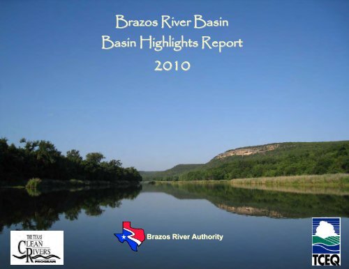
<strong>Brazos</strong> <strong>River</strong> <strong>Basin</strong><strong>Basin</strong> <strong>Highlights</strong> <strong>Report</strong><strong>2010</strong><strong>Brazos</strong> <strong>River</strong> <strong>Authority</strong>
<strong>Brazos</strong> <strong>River</strong> <strong>Basin</strong> <strong>Highlights</strong> <strong>Report</strong> <strong>2010</strong>INTRODUCTION...................................................................................................................................................................................... 6THIS YEARS HIGHLIGHTS............................................................................................................................................................... 6Drought .............................................................................................................................................................................................. 6Heavy Metal and Organic Compound Sampling......................................................................................................................... 7Biological and Habitat Assessments in 2009............................................................................................................................... 7Added Sampling for 2009 ............................................................................................................................................................... 7New Projects..................................................................................................................................................................................... 8National Environmental Laboratory Accreditation Conference................................................................................................. 8PUBLIC INVOLVEMENT AND OTHER INFORMATION ............................................................................................................. 9<strong>Brazos</strong> <strong>River</strong> <strong>Basin</strong> Clean <strong>River</strong>s Program Steering Committee.............................................................................................. 9<strong>Brazos</strong> <strong>Basin</strong> CRP Website............................................................................................................................................................ 9SPECIAL PROJECTS........................................................................................................................................................................... 11Watershed Protection Plan for Lake Granger and the San Gabriel <strong>River</strong> ................................................................................ 11Watershed Protection Plan for the Leon <strong>River</strong> .............................................................................................................................. 12Clean Texas Marina Program .......................................................................................................................................................... 12Clean Water Sticker Program .......................................................................................................................................................... 12Little <strong>Brazos</strong> <strong>River</strong> Tributaries Bacteria Assessment ................................................................................................................... 13Two Data Collection Initiatives to Address Several Impaired Water Bodies in the <strong>Brazos</strong> <strong>River</strong> <strong>Basin</strong> .............................. 13EVALUATING WATER QUALITY ...................................................................................................................................................... 15Descriptions of Water Quality Parameters..................................................................................................................................... 16Monitoring in the <strong>Brazos</strong> <strong>River</strong> <strong>Basin</strong>.............................................................................................................................................. 19Biological and Habitat Assessments............................................................................................................................................... 20BASIN OVERVIEW ............................................................................................................................................................................... 21
Watershed of the Salt Fork and Double Mountain Fork of the <strong>Brazos</strong> <strong>River</strong> (Map) ............................................................... 22Salt Fork of the <strong>Brazos</strong> <strong>River</strong> (Segment 1238).......................................................................................................................... 22White <strong>River</strong> (Segment 1239) ........................................................................................................................................................ 22White <strong>River</strong> Lake (Segment 1240) .............................................................................................................................................. 22Double Mountain Fork of the <strong>Brazos</strong> <strong>River</strong> (Segment 1241) .................................................................................................. 22Watershed of the Clear Fork of the <strong>Brazos</strong> <strong>River</strong> (Map) ............................................................................................................. 23Clear Fork of the <strong>Brazos</strong> <strong>River</strong> (Segment 1232)....................................................................................................................... 23Biological and Habitat Assessments....................................................................................................................................... 23Hubbard Creek Reservoir (Segment 1233) ............................................................................................................................... 24Lake Cisco (Segment 1234)......................................................................................................................................................... 24Lake Stamford (Segment 1235)................................................................................................................................................... 24Fort Phantom Hill Reservoir (Segment 1236) and Lake Sweetwater (Segment 1237) ..................................................... 24Upper Watershed of the <strong>Brazos</strong> <strong>River</strong> (Map)................................................................................................................................ 24Lake Graham (Segment 1231) .................................................................................................................................................... 24<strong>Brazos</strong> <strong>River</strong> above Possum Kingdom Reservoir (Segment 1208) ....................................................................................... 24Possum Kingdom Lake (Segment 1207).................................................................................................................................... 25<strong>Brazos</strong> <strong>River</strong> below Possum Kingdom Reservoir (Segment 1206)........................................................................................ 25Lake Palo Pinto (Segment 1230)................................................................................................................................................. 25Lake Granbury (Segment 1205) .................................................................................................................................................. 25<strong>Brazos</strong> <strong>River</strong> below Lake Granbury (Segment 1204)............................................................................................................... 25Paluxy <strong>River</strong> (Segment 1229) ...................................................................................................................................................... 26Nolan <strong>River</strong> (Segment 1227)........................................................................................................................................................ 26Lake Whitney (Segment 1203) .................................................................................................................................................... 26<strong>Brazos</strong> <strong>River</strong> below Lake Whitney (Segment 1257)................................................................................................................. 26Biological and Habitat Assessments....................................................................................................................................... 26Aquilla Creek Watershed (Map)...................................................................................................................................................... 27Aquilla Reservoir (Segment 1254) .............................................................................................................................................. 27<strong>Brazos</strong> <strong>River</strong>/Lake <strong>Brazos</strong> (Segment 1256) .............................................................................................................................. 27
Bosque <strong>River</strong> Watershed (Map) ...................................................................................................................................................... 28Upper North Bosque <strong>River</strong> (Segment 1255).............................................................................................................................. 28North Bosque <strong>River</strong> (Segment 1226).......................................................................................................................................... 29Biological and Habitat Assessments....................................................................................................................................... 29Middle Bosque/South Bosque <strong>River</strong> (Segment 1246).............................................................................................................. 30Biological and Habitat Assessments....................................................................................................................................... 30Waco Lake (Segment 1225)......................................................................................................................................................... 30Leon <strong>River</strong> Watershed (Map) ........................................................................................................................................................... 31Leon Reservoir (Segment 1224).................................................................................................................................................. 31Leon <strong>River</strong> Below Leon Reservoir (Segment 1223) ................................................................................................................. 31Proctor Lake (Segment 1222) ...................................................................................................................................................... 31Leon <strong>River</strong> Below Proctor Lake (Segment 1221)...................................................................................................................... 32Belton Lake Segment (Segment 1220) ...................................................................................................................................... 32Leon <strong>River</strong> Below Belton Lake (Segment 1219) ....................................................................................................................... 32Nolan Creek/South Nolan Creek (Segment 1218).................................................................................................................... 33Lampasas <strong>River</strong> Watershed (Map) ................................................................................................................................................... 33Lampasas <strong>River</strong> Above Stillhouse Hollow Lake (Segment 1217).......................................................................................... 33Stillhouse Hollow Lake (Segment 1216) .................................................................................................................................... 33Biological and Habitat Assessments....................................................................................................................................... 34Salado Creek (Segment 1243) .................................................................................................................................................... 34Little <strong>River</strong> Watershed (Map) ........................................................................................................................................................... 35North Fork San Gabriel <strong>River</strong> (Segment 1251) ......................................................................................................................... 35South Fork San Gabriel <strong>River</strong> (Segment 1250) ........................................................................................................................ 35San Gabriel/North Fork San Gabriel <strong>River</strong> (Segment 1248)................................................................................................... 36Granger Lake (Segment 1247) .................................................................................................................................................... 36Brushy Creek (Segment 1244) .................................................................................................................................................... 37San Gabriel <strong>River</strong> (Segment 1214) ............................................................................................................................................. 37Little <strong>River</strong> (Segment 1213).......................................................................................................................................................... 37Biological and Habitat Assessments....................................................................................................................................... 37
Central Watershed (Map)................................................................................................................................................................. 38<strong>Brazos</strong> <strong>River</strong> above Navasota (Segment 1242)........................................................................................................................ 38Biological and Habitat Assessments....................................................................................................................................... 38Biological and Habitat Assessments....................................................................................................................................... 39Navasota <strong>River</strong> Watershed (Map).................................................................................................................................................... 40Lake Mexia (Segment 1210) ........................................................................................................................................................ 40Navasota <strong>River</strong> Below Lake Mexia (Segment 1253)................................................................................................................ 40Lake Limestone (Segment 1252) ................................................................................................................................................ 41Navasota <strong>River</strong> Below Lake Limestone (Segment 1209) ........................................................................................................ 41Yegua Creek Watershed (Map) ...................................................................................................................................................... 42Somerville Lake (Segment 1212) ................................................................................................................................................ 42Yegua Creek (Segment 1211) ..................................................................................................................................................... 43Lower Watershed (Map) ................................................................................................................................................................... 43<strong>Brazos</strong> <strong>River</strong> Below Navasota <strong>River</strong> (Segment 1202) ............................................................................................................. 43<strong>Brazos</strong> <strong>River</strong> Tidal (Segment 1201) ............................................................................................................................................ 44Upper Oyster Creek Watershed (Map) ........................................................................................................................................ 44Upper Oyster Creek (Segment 1245) ......................................................................................................................................... 44CONCLUSIONS..................................................................................................................................................................................... 45Revisions to Contact Recreation Standards .................................................................................................................................. 46Nutrient Standards for Reservoirs ................................................................................................................................................... 47Maps ........................................................................................................................................................................................................ 50
The <strong>Brazos</strong> <strong>River</strong> <strong>Authority</strong>, as a member of the Texas Clean <strong>River</strong>s Program, works to answer questions about thequality of our local streams, rivers and lakes in the <strong>Brazos</strong> <strong>River</strong> <strong>Basin</strong> <strong>Highlights</strong> <strong>Report</strong> <strong>2010</strong>. This report contains theinformation needed to answer questions about water quality in the lakes and streams of the <strong>Brazos</strong> <strong>River</strong> basin. It alsosummarizes the results of the ongoing water quality assessment activities in the <strong>Brazos</strong> <strong>River</strong> basin under the TexasClean <strong>River</strong>s Program.The <strong>Authority</strong> wishes to thank both the Texas Commission on Environmental Quality’s Clean <strong>River</strong>s Program staff and theSurface Water Quality Monitoring Team for their hard work and significant contributions to the water quality in the <strong>Brazos</strong><strong>River</strong> basin. Thanks also go out to the hundreds of individuals and organizations that are not named on these lists whohave attended public meetings and other outreach events sponsored by the <strong>Authority</strong> and the Clean <strong>River</strong>s Program.Their input is the foundation of the watershed management process.
INTRODUCTIONThis report highlights the activities that occurred in Fiscal Year 2009 in the <strong>Brazos</strong> <strong>River</strong> <strong>Basin</strong> under the Clean <strong>River</strong>sProgram (CRP). The CRP is managed by the Texas Commission on Environmental Quality (TCEQ), and funded entirelyby fees assessed to wastewater discharge and water rights permit holders. The <strong>Brazos</strong> <strong>River</strong> <strong>Authority</strong> (BRA) carries outthe water quality management efforts in the basin under contract with TCEQ. The activities described in this report includewater quality monitoring results, a review of the 2008 Integrated <strong>Report</strong> (IR) (formerly known as the 305(b) Water QualityInventory), a review of proposed changes to surface water quality standards, a summary of significant events affectingwater quality and a summary of other water quality studies being conducted by the BRA.THIS YEARS HIGHLIGHTSDroughtThe drought of 2008-09 ranged from severe in the upper basin to extreme and exceptional in south and western parts ofthe basin. <strong>Brazos</strong> <strong>River</strong> flows were at or near record lows near the coast prompting the BRA to release water from itsreservoirs to provide water to farmers and ranchers, cities, industry and residents in the most greatly impacted areas ofthe basin. As bad as the drought was, on a large scale it does not compare to the massive, devastating drought of the1950s or the Dust Bowl in the 1930s. Those too were intense droughts but they lasted several years, up to a decade,depending on the location. Also, while the 2008-2009 drought primarily affected Texas, the others covered large swathsof the nation.But according to a study released in August 2009 by the Office of the State Climatologist, if you factor in rainfallshortages, three counties, including Lee in the <strong>Brazos</strong> basin, are probably seeing the most severe drought on record. Andif you add in high temperatures, six more counties likely fall into the record category. Generally, the population growthand increased demands on water supplies in the <strong>Brazos</strong> <strong>River</strong> basin since the ‘50s bring about a different droughtsituation. (Drought Monitor Map)The decrease in rainfall and subsequent diminishing stream flow did not result in major changes in the water quality of themain stem of the <strong>Brazos</strong> <strong>River</strong> in 2009. However, several small to mid-sized, tributary streams became dominated bypools rather than by normal runs and riffles or went completely dry, including: the North Fork of the San Gabriel <strong>River</strong>,Willis Creek and Berry Creek in the Little <strong>River</strong> watershed; the South Bosque <strong>River</strong> and Meridian Creek in the Bosque<strong>River</strong> watershed; Resley Creek, Armstrong Creek and Copperas Creek in the Leon <strong>River</strong> watershed; and CampbellsCreek, Pin Oak Creek and Spring Creek in the Central <strong>Brazos</strong> <strong>River</strong> watershed. Additionally, small receiving streams
(streams that are the final destination of treated wastewater) became more effluent-dominated, as seen at the twomonitoring locations on the Nolan <strong>River</strong>. Ammonia, nitrate-nitrogen, orthophosphate-phosphorus,total phosphorus,chloride and sulfate concentrations all increased significantly over normal conditions at the Nolan <strong>River</strong> stations. Lessbase flow from the rivers resulted in longer water residence times in the reservoirs throughout the basin. The longerresidence time promoted higher chlorophyll a, turbidity, total dissolved solids, chloride and sulfate concentrations in LakeGranger, Lake Georgetown and Lake Proctor, all in the western part of the basin most severely impacted by the drought.Fortunately, the waters of the Eastern Pacific have warmed, heralding a return in winter of 2009 of the cyclical El Niñoweather system. El Niño has brought rain to the southern United States during the winter ending the drought for most ofthe <strong>Brazos</strong> <strong>River</strong> basin.Heavy Metal and Organic Compound SamplingIn 2009, at the request of stakeholders concerned about the impacts industrial discharges could be having on the basin,the BRA began a five-year special sampling program to test for heavy metals, volatile organic compounds and semivolatileorganic compounds in classified segments with an industrial presence. Segments 1257 (the <strong>Brazos</strong> <strong>River</strong> abovePossum Kingdom Reservoir), 1208 (Lake Possum Kingdom), 1205 (Lake Granbury) and 1204 (the <strong>Brazos</strong> <strong>River</strong> belowLake Granbury) were the first segments sampled during this introductory year. To date, no detections have beenmeasured above the minimum analytical limit of the method.Biological and Habitat Assessments in 2009Biological and habitat assessments were conducted on the following streams in 2009: the <strong>Brazos</strong> <strong>River</strong> at FM 2114(Segment 1257), the Little <strong>River</strong> near Gause (Segment 1213), the South Bosque <strong>River</strong> at FM 2837 (Segment 1246),California Creek (Segment 1232), Tehuacana Creek (Segment 1242), and Trimmier Creek (Segment 1216).Added Sampling for 2009Several new sampling locations were added in 2009. A new site was established on Lake Stillhouse Hollow (Segment1216) at Pleasant Branch Cove to assess sedimentation impacts from land development activities on Trimmier Creek. Asite was added on the South Leon <strong>River</strong> (Segment 1221) in support of the Leon <strong>River</strong> Watershed Protection Plan efforts.A historical monitoring site on Berry Creek (Segment 1248) was revitalized to gather background data in response to thehigh rate of development being observed in western Williamson County. Multiple sites were added in Segment 1242 onthe following creeks: Pin Oak, Campbells, Spring, Walnut and Mud. These were added for a comprehensive monitoring
study of the Little <strong>Brazos</strong> <strong>River</strong> watershed, through funding by Clean Water Act 319(h) grants administered by the TexasState Soil and Water Conservation Board.New ProjectsTwo new projects were developed during 2009 and data collection efforts are scheduled to begin in <strong>2010</strong>. The first willcharacterize Somerville Lake water quality conditions and identify possible contributing sources of pollution. SomervilleLake is on the 2008 303(d) List as being impaired for depressed dissolved oxygen (DO), has a concern for high pH levelsat the eastern end of the reservoir near the dam, and has a concern for increased chlorophyll a concentrations. Thesecond project addresses several streams in Central Texas that are on the 2008 303(d) List for dissolved oxygen and/orbacteria impairments. To address the streams with bacteria impairments (Tehuacana Creek and Deer Creek in Segment1242, and Cedar Creek in Segment 1209) a the <strong>Authority</strong> will gather data collection that will allow TCEQ to determine ifexisting bacteria criterion applied to these creeks are appropriate and, if not, to develop information necessary to adjustthe criterion. To address the streams with DO impairments (Resley Creek in Segment 1221 and Thompsons Creek inSegment 1242) a series of biological and 24-hour DO data collection efforts will be conducted to determine theappropriate aquatic life use and associated dissolved oxygen criteria. Both of these projects are funded with a CleanWater Act 105(b) grant administered by the TCEQ.The data collected by CRP are not just for use by TCEQ and BRA. The data are being used to develop watershedprotection plans for Lake Granbury, Lake Granger and the San Gabriel <strong>River</strong> and the Leon <strong>River</strong>. The data are alsofrequently used by municipalities and local government entities and the BRA’s water customers for project planning anddevelopment purposes.National Environmental Laboratory Accreditation ConferenceIn 2001, HB 2912 required all data used by TCEQ for commission decisions regarding permits or other authorizations,compliance matters, enforcement actions, or corrective actions be from an accredited environmental laboratory and thatthe state’s environmental testing laboratory accreditation program be consistent with National Environmental LaboratoryAccreditation Conference (NELAC). The NELAC Standard provides uniform requirements for accreditation ofenvironmental laboratories to ensure that decisions being made are based on data that is scientifically accurate.TCEQ is the accrediting authority for environmental laboratory accreditation and drinking water certification in Texas.BRA’s Environmental Services Laboratory received NELAC accreditation from TCEQ on September 11, 2008 andcompleted their second audit for continued accreditation in December 2009.
PUBLIC INVOLVEMENT AND OTHER INFORMATION<strong>Brazos</strong> <strong>River</strong> <strong>Basin</strong> Clean <strong>River</strong>s Program Steering CommitteeThe size and diversity of issues across the <strong>Brazos</strong> <strong>River</strong> basin presents a challenge for the large group of stakeholders inour basin. The <strong>Brazos</strong> <strong>River</strong> Clean <strong>River</strong>s Program (CRP) Steering Committee participants represent diverse intereststhat are represented by government agencies, municipalities, industry, agriculture, organized local stakeholder groups,individuals, and environmental groups.The BRA holds an annual meeting that provides the Steering Committee with an opportunity to hear results of waterquality monitoring and CRP special studies and gives them a forum where they may voice opinions, makerecommendations and interact with other stakeholder participants and BRA staff. Steering Committee members alsoparticipate by providing input into planning water quality monitoring activities, prioritizing problems within the basin forprospective CRP special studies, identifying problem areas, developing actions to address potential problem areas in thebasin and commenting on the current year’s draft <strong>Basin</strong> <strong>Highlights</strong> <strong>Report</strong>.How to get involved with the <strong>Brazos</strong> <strong>Basin</strong> CRP?BRA promotes communication and participation from the general public. If you are interested in serving on the <strong>Brazos</strong><strong>River</strong> <strong>Basin</strong> CRP Steering Committee, send an email to jbarrett@brazos.org. Please indicate what topics you areinterested in and provide an email address so that you can receive electronic notices of meetings and reports. In addition,the information you provide will help us to develop more effective meetings and provide direction to the program. Wehighly encourage participation in our meetings and input on water quality issues in the basin.<strong>Brazos</strong> <strong>Basin</strong> CRP WebsiteThe BRA maintains both a river authority website (http://www.brazos.org) and a CRP website(http://www.brazos.org/crpHome.asp) as a mechanism to keep the public informed via the internet. These websitesprovide information on topics of interest in the basin. The websites provide links to a range of information, including:Water quality dataWater quality data generated by the BRA is available in a searchable format and can be easily downloaded toan Excel file (http://crpdata.brazos.org/). This site is updated quarterly. A link to the TCEQ data website is alsoprovided.
Special Studies <strong>Report</strong>sAvailable for download in .pdf format.Quality Assurance InformationThe Quality Assurance Project Plan for CRP and Data Management Plan are available for download in .pdfformat.Schedule of Monitoring ActivitiesA link is provided to the coordinated monitoring website, which contains a list of the water quality monitoringlocations in the state.Information on Non-CRP Water Quality ProjectsInformation is provided on a variety of water quality related projects sponsored by the BRA that are notconducted as part of the CRP.Recreational InformationInformation is provided on boating, fishing and other river and lake activities including canoeing maps belowPossum Kingdom Lake and Lake Granbury.<strong>River</strong> and Reservoir LevelsAn interactive map provides information on USGS Stations in the basin, flood stage at each station and currentflow at each station.Current Drought StatusAn updated Palmer Drought Index map is provided along with copies of the BRA’s Drought Contingency Planand Water Conservation Plan.Water Supply DataInformation is provided on reservoir locations, elevations, and capacities and surface area.Technical Assistance ProgramInformation is provided on services offered by the BRA to municipalities and utility districts in the basin,including: Industrial Pretreatment Programs, Regulatory Reviews, and Operations Assistance.
SPECIAL PROJECTSThe <strong>Brazos</strong> <strong>River</strong> <strong>Authority</strong>’s public outreach activites include involving our stakeholders in planning water quality andwatershed protection activities in the <strong>Brazos</strong> <strong>Basin</strong> as well as education and outreach programs.Watershed Protection Plan for Lake GranburyIn May 2002, a study began to monitor and assess water quality in the canals and coves of Lake Granbury. The canalsare backwater areas that have little or no circulation and mix slowly with the main body of the reservoir. The result canmean stagnant conditions where pollution problems have the potential to persist. The on-site sewage facilities locatedalong the many canals and coves of Lake Granbury may be a significant source of bacteria and nutrients to the reservoirand may cause water quality concerns in many of the canals. The BRA and TCEQ are currently developing a WatershedProtection Plan (WPP) to address the concerns that these canals present. The Lake Granbury WPP has a large, activestakeholder group with representatives from government agencies, local, state and federal government, municipalities,and other locally interested parties. In addition, a Technical Advisory Group made up of agency representatives providestechnical input to the plan development.The Lake Granbury Watershed Protection Plan Stakeholders group continued their efforts to develop a WatershedProtection Plan to reduce bacterial impacts in the canals of Lake Granbury. During 2009, the stakeholders group workedto select and analyze Best Management Practices. It is anticipated that the Watershed Protection Plan will be completedfiscal year <strong>2010</strong>.Watershed Protection Plan for Lake Granger and the San Gabriel <strong>River</strong>The BRA, in coordination with the Little <strong>River</strong>-San Gabriel Soil and Water Conservation District (SWCD), has receivedgrant funding from the Texas State Soil and Water Conservation Board to develop a Watershed Protection Plan (WPP) forLake Granger and the San Gabriel <strong>River</strong> Watershed. The Little <strong>River</strong>-San Gabriel SWCD received a funding to providetechnical and financial support to farmers and ranchers for the implementation of best management practices onagricultural lands. Utilizing stakeholder input, the BRA has identified stream erosion and sedimentation as the primaryconcerns in the watershed. In addition, Mankins Branch and Willis Creek both are listed on the State’s 303(d) List ofImpaired Waterbodies for having E. coli bacteria concentrations that exceed the state’s contact recreation designation.The BRA will continue to coordinate with stakeholder groups and project partners to develop a WPP that is holistic andincludes the most appropriate management strategies to address water quality concerns.
Watershed Protection Plan for the Leon <strong>River</strong>The Leon <strong>River</strong> was placed on the State’s 303(d) List in 1997, and the TCEQ began developing a Total Maximum DailyLoad (TMDL) on the portion of the river downstream of Lake Proctor and upstream of Hamilton in 2002. Upon completionof the TMDL modeling report, local stakeholders requested the BRA to facilitate the development of a WPP for the Leon<strong>River</strong> to assist the TCEQ in selection appropriate implementation strategies for the watershed. The BRA received fundingfor the project through the TSSWCB and began hosting stakeholder meetings in 2007. In the fall of 2008 the TMDL wasput on hold, indefinitely, pending proposed changes to water quality standards. Stakeholders, however, continued to worktoward the development of a WPP document. A WPP will be available to stakeholders for comment in the spring of <strong>2010</strong>.Clean Texas Marina ProgramThe Clean Texas Marina Program was established in 2001 in partnership with the marina industry, federal and stateagencies and civic organizations. The program is coordinated by the Small Business and Environmental AssistanceDivision of the Texas Commission on Environmental Quality through a collaborative partnership with the U.S.Environmental Protection Agency, Marina Association of Texas, Texas A&M University Sea Grant Program, Texas Parksand Wildlife Department, General Land Office (Coastal), U.S. Army Corps of Engineers, and other local agencies.The goal of the Clean Texas Marina Program is to provide technical assistance to implement pollution preventionprograms, improve compliance with environmental regulations and enhance water quality. The program also promotesclean boating public education and outreach efforts to promote improved sewage handling and other environmentalimpacts.The BRA has administered this program for TCEQ at Possum Kingdom Reservoir and Lake Granbury since 2004. Todate, six marinas on Possum Kingdom Lake and three marinas on Lake Granbury have been certified as Clean Marinas.In addition, two Lake Granbury marinas have pledged to join the program and are working towards implementingappropriate pollution prevention practices prior to certification inspection.Clean Water Sticker ProgramThe Clean Water Sticker Program is a legislatively-mandated program regulating sewage disposal from boat marinesanitation devices and sewage pump-out facilities. In 2004, the TCEQ delegated administration and regulatoryresponsibility to the BRA to perform annual inspection and certifications of sewage pump-out facilities at marinas onPossum Kingdom Reservoir and Lake Granbury. As a result, BRA staff have identified compromised pump-out systems
and provided technical assistance to facility operators bringing them into regulatory compliance and eliminating potentialdischarge of sewage.In 2007, TCEQ delegated regulatory authority to the BRA for registration and certification of onboard marine sanitationdevices. Boats subject to this program include: houseboats, boats longer than 26 feet with permanent sleeping quarters,and any boat with a permanently installed marine sanitation device. After initial inspection and registration, boats with onboardmarine sanitation devices must be re-certified every two years.Fees for registration and certification are set by TCEQ and collected by BRA for program administration.Little <strong>Brazos</strong> <strong>River</strong> Tributaries Bacteria AssessmentThe BRA has received funding from the Texas State Soil and Water Conservation Board to further assess water quality inthe Little <strong>Brazos</strong> <strong>River</strong> Watershed in Robertson County. In 2004, five tributaries to the Little <strong>Brazos</strong> <strong>River</strong> were placed onthe State’s 303(d) List for having bacteria concentrations that exceed state water quality standards for contact recreation.The purpose of this project is to better characterize the bacteria impairment and to determine possible sources. For theproject, the BRA has added 8 new water quality monitoring sites throughout the watershed and started monitoring flowand collecting stormwater data in November 2008. The BRA will complete the assessment project in August of <strong>2010</strong>.Two Data Collection Initiatives to Address Several Impaired Water Bodies in the<strong>Brazos</strong> <strong>River</strong> <strong>Basin</strong>In May of 2009, with funding from the TCEQ, BRA began a 3 year project aimed to address several waterbodies in thebasin that are on the 303(d) List for impairments including bacterial, dissolved oxygen and high pH. This is a twopronged project.Data Collection Effort #1Tehuacana Creek (1242N), Deer Creek (1242J), Cedar Creek (1209G) and Gibbons Creek (1209I) are all on the 303(d)List for bacteria impairment. Because these unclassified streams are small, ephemeral streams where recreationalpotential is low to non-existent, the efficacy of applying water quality standards meant for large, recreational riversegments has come into question. Typically these streams have low flow to no flow for most of the year and if water ispresent, it is a result of storm events. Stormwater is known to accumulate high levels of both bacteria and nutrients as ittravels over land. These pollutants are then deposited in the small streams where they can accumulate possibly causingimpairment.
Thompsons Creek (1242D) and Resley Creek (1221A) are on the 303(d) List for depressed dissolved oxygen (DO). Bothwaterbodies are small, rural streams characterized by highly intermittent flow and frequent low water levels. These DOimpairments are caused in part by the frequent low water levels which hinder the ability of the water to buffer against highambient air temperatures in the summer and fall reducing the water’s capacity to maintain dissolved oxygen levels.All the waterbodies above are categorized in 5C, which means additional data and information needs to be collectedbefore a Total Maximum Daily Load (TMDL) Study is scheduled. This project will collect the additional data necessary forTCEQ to determine what course of action is most appropriate to address the impairment whether it is a standardsamendment, a TMDL, development of at Watershed Protection Plan, etc.To address the streams with bacteria impairments data will be collected to verify the impairment, a land use assessmentfor the watershed will be prepared, and intensive watershed surveys will be performed. This data will allow TCEQ todetermine if existing bacteria criterion applied to these creeks are appropriate and, if not, to develop informationnecessary to adjust the criterion.To address the streams with DO impairments, BRA will conduct a series of biological and 24-hour DO data collections.An Aquatic Life Assessment (ALA) will be conducted on Resley Creek (1221A) to determine the appropriate aquatic lifeuse and associated dissolved oxygen criteria. A Use attainability analysis (UAA) will be conducted on Thompsons Creek(1242D) to determine if existing aquatic life use/dissolved oxygen criterion are appropriate and, if not, to developinformation necessary to adjust the aquatic life use/dissolved oxygen criterion.Data Collection Effort #2This aspect of the project will characterize Somerville Lake water quality conditions and identify possible contributingsources of pollution. Somerville Lake is on the 2008 303(d) List as being impaired for depressed DO and has a concernfor high pH levels at the eastern end of the reservoir near the dam. There is also concern for increased chlorophyll a.The extremes in pH are most likely a result of algal activity; the observed high concentrations of chlorophyll a may be apotential cause for fluctuations in pH. Photosynthesis and respiration are two major factors that influence dissolvedoxygen levels in the lake and the amounts of carbon dioxide in the lake, which in turn affects pH levels.One tributary to the lake, East Yegua Creek, remains on the 2008 303(d) List as impaired for recreational use due toelevated bacteria levels. Sources of bacteria may include municipal discharges and runoff from agricultural lands andwildlife.
At this time, watershed land use has not been quantified, and the cause of the pH impairment has not been confirmed.Cyanobacteria are believed to be the primary organism leading to the pH and DO fluctuations in the reservoir. However,there is not sufficient data to determine that cyanobacteria are the only organism causing this oscillation in pH and DO.Additionally, historical data collection indicates that nutrient concentrations in Lake Somerville and its major tributary,Yegua Creek, are low. The low nutrient level brings into question the cause of cyanobacteria blooms. The limiting factorleading to algal blooms in the lake is not currently known making regulation of inflows to control blooms virtuallyimpossible.This project will collect the additional data necessary for TCEQ to determine what course of action is most appropriate toaddress the impairment; again, whether it is a standards amendment, a TMDL, development of at Watershed ProtectionPlan, etc. This project is a collaborative effort between the <strong>Brazos</strong> <strong>River</strong> <strong>Authority</strong> (<strong>Authority</strong>) and the Texas Institute forApplied Environmental Research (TIAER).EVALUATING WATER QUALITYThe Texas Commission on Environmental Quality (TCEQ) evaluates the condition of the state’s water bodies on aperiodic basis under the Clean Water Act (CWA) Section 305(b). The results are contained within the Texas Water QualityInventory and 303(d) List and are comprised of a complete listing of all water quality concerns in the state. This report isreferred to as the Integrated <strong>Report</strong> (IR). As required by the Act, the IR is updated every two years and includes thereview of the past seven years’ data collected by many organizations statewide, including the BRA. The 2008 WaterQuality Inventory and 303(d) List, on which the following information is based, provides an assessment of water qualityresults using the most recent seven years of data. This inventory is available on the TCEQ Web site athttp://www.tceq.state.tx.us/compliance/monitoring/water/quality/data/wqm/305_303.html. In February <strong>2010</strong>, the Draft<strong>2010</strong> Texas Integrated <strong>Report</strong> for Clean Water Act Sections 305(b) and 303(d) was sent out for public comment. Asstated the following information is based on the 2008 IR report, however the Draft <strong>2010</strong> IR was taken into considerationand where changes in status of waterbodies are likely, it is noted.The Texas Water Quality Inventory, 305(b) report, provides an overview of surface water quality throughout the state,including issues relating to public health, fitness for use by aquatic species and other wildlife, specific pollutants and theirpossible sources. These water quality issues are identified by comparing concentrations in the water to numerical criteriathat represent the state’s water quality standards or screening levels to determine if the waterbody supports its designateduses, such as suitability for aquatic life, for contact recreation, or for public water supply. The report determines if fish and
aquatic insects have adequate oxygen, if people swimming in the water are exposed to pathogens that may cause illnessand if the water is fit to be used as a source for public drinking water. Waterbodies that do not meet established waterquality standards are placed on the 303(d) List and are referred to as “impaired,” “not supporting,” or “NS.” Once placedon the list the waterbody is targeted for special study and/or corrective action.Water quality standards numerical criteria are used by TCEQ as the maximum or minimum instream concentrations thatmay result from permitted discharges and/or nonpoint sources and still meet designated uses. To resolve the issues ofregional and geological diversity of the state, standards are developed for classified segments. Classified segments aredefined segments of waterways that are unique from other segments. Appropriate water uses such as contact recreation,public water supply, and aquatic life are then applied to the segments. Site-specific water quality criteria have beendeveloped for water temperature, dissolved oxygen, pH, bacteria, chloride, sulfate and total dissolved solids for classifiedsegments. Many streams that are not classified segments are assessed throughout the state and are consideredunclassified segments. These unclassified segments do not have specific water quality standards developed for them.For assessment purposes, unclassified streams are assessed using the numeric criteria developed for the classifiedsegment into which the stream flows.The TCEQ identifies segments where the data conditions are such that the waterbody is close to violating water qualitystandards as having a “concern for near non-attainment of standards” or “CN.” These CN segments are then targeted forincreased monitoring to better understand the conditions in the stream.Numeric quality standards have not been developed for nutrients and chlorophyll a. Instead, the water quality standardsfor nutrients and chlorophyll a are expressed as narrative criteria. In the absence of segment-specific numeric waterquality criteria, the state has developed screening levels for these parameters in order to identify areas where elevatedconcentrations may cause water quality concerns. These screening levels are applied to waterbodies statewide, and arebased on the 85 th percentile of nutrient values in the statewide water quality database. Waterbodies that exhibit frequent(>25% of the time) elevated concentrations of nutrients or chlorophyll a are referred to as having a “concern for screeninglevel violations” or “CS” and are often targeted for continued and increased monitoring to better understand the effects ofthe elevated concentrations.Descriptions of Water Quality ParametersField parameters are those water quality constituents that can be obtained on-site and generally include: dissolvedoxygen, specific conductance, pH, water temperature, stream flow (not in reservoirs) and transparency.
Dissolved oxygen (DO) indicates the amount of oxygen available in the stream or reservoir to support aquatic life.DO concentrations can be reduced by the decomposition of organic matter.Specific Conductance is a measure of the waterbody’s ability to conduct electricity and indicates the approximatelevels of dissolved salts, such as chloride, sulfate and sodium in the water. Elevated concentrations of dissolvedsalts can reduce the waters usability as a drinking water source and as suitable aquatic habitat.pH is a measure of the hydrogen ion concentration in an aqueous solution. It is a measure of the acidity or basicproperty of the water. Chemical and biological processes can be affected by pH. Dissolved constituents caninfluence pH, such as carbon dioxide and by point and nonpoint source contributions to the stream.Water Temperature affects the ability of the water to hold dissolved oxygen. Warmer water temperaturesdecrease the oxygen solubility in water, causing stress in aquatic ecosystems.Flow is an important parameter affecting water quality. Low flow conditions common in the warm summer monthscan create critical conditions of aquatic organisms. Under these conditions, streams also have lower assimilativecapacities for waste inputs from point and nonpoint sources and are also subject to decreased oxygen availability.Transparency is a measure of the depth to which light is transmitted through the water column and thus the depthto which aquatic plants can grow.Conventional Parameters are typical water quality constituents that require laboratory analysis and generally include:chloride, sulfate, total dissolved solids (TDS), nutrients, Chlorophyll a (Chl a), total suspended solids (TSS), and turbidity.Chloride is an essential element for maintaining normal physiological functions in all organisms. Elevated chlorideconcentrations can disrupt osmotic pressure, water balance, and acid/base balances in aquatic organisms whichcan adversely affect survival, growth and/or reproduction. Elevated chloride content can also impact the usabilityof water for drinking water.Sulfate is an essential element for maintaining normal physiological functions in all organisms. Effects of highsulfate levels in the environment have not been fully documented; however, sulfate contamination may becontributing to the declines of native plants by altering chemical conditions in the sediment. Elevated sulfatecontent can also impact the usability of water for drinking water.
Total Dissolved Solids is a measurement of minerals and other salts that are dissolved in water. High TDS mayaffect the aesthetic quality of the water, interfering with washing clothes and corroding plumbing fixtures. High TDSin the environment can also affect the permeability of ions in aquatic organisms.Nutrients in the form of nitrogen and phosphorus compounds, increase plant and algae growth. When plants andalgae die, the bacteria that decompose them use oxygen that is no longer available for fish and other organisms.The more dead plants in the water, the more bacteria are produced to decompose the dead leaves.Chlorophyll a is a plant pigment whose concentration is an indicator of the amount of algal biomass and growth inthe water.Total Suspended Solids indicate the amount of particulate matter suspended in the water column, which caninfluence transparency.Turbidity is a measure of water clarity or light transmitting capability of water. Increases in turbidity are caused bysuspended and colloidal matter such as clay, silt, finely divided organic and inorganic matter, plankton and othermicroscopic organisms.Bacteria, specifically E. coli and Enterococcus, are used as an indicator of the possible presence of disease-causingorganisms.Biological and Habitat Assessment includes collection of fish community data, benthic macroinvertebrate data andmeasurement of physical habitat parameters. This information is used to determine whether the stream adequatelysupports a diverse and desirable biological community.24-hr Dissolved Oxygen studies perform measurements of DO in frequent intervals in a 24-hr period. This type ofmonitoring is conducted to measure the diurnal variation of DO and its impacts on the biological community. Thismonitoring is frequently paired with biological and habitat assessments.Metals in water, such as mercury or lead, typically exist in low concentrations but can be toxic to aquatic life or humanhealth when certain levels are exceeded.
Organics in water, such as pesticides or fuels, can be toxic to aquatic life or human health when certain levels areexceeded.Monitoring in the <strong>Brazos</strong> <strong>River</strong> <strong>Basin</strong>The <strong>Brazos</strong> <strong>River</strong> <strong>Basin</strong> can be divided into 14 major watersheds that fall within the 42,000 square miles and portions of70 counties that make up the basin (Map). The 14 major watersheds include:• the Caprock watershed;• the Double Mountain Fork/Salt Fork of the <strong>Brazos</strong> watershed;• the Clear Fork of the <strong>Brazos</strong> watershed;• the Upper <strong>Brazos</strong> <strong>River</strong> watershed;• the Lampasas <strong>River</strong> watershed;• the Leon <strong>River</strong> watershed;• the Bosque <strong>River</strong> watershed;• the Aquilla Creek watershed;• the Little <strong>River</strong> watershed;• the Central <strong>Brazos</strong> <strong>River</strong> watershed;• the Navasota <strong>River</strong> watershed;• the Yegua Creek watershed;• the Lower <strong>Brazos</strong> <strong>River</strong> watershed; and• the Oyster Creek watershed.The Caprock watershed is a non-contributing watershed to the <strong>Brazos</strong> <strong>River</strong> <strong>Basin</strong> due to lack of rainfall and highevaporative rates in northwest Texas. Precipitation in this area is either absorbed by area soils or is contained in thehundreds of playa lakes in this part of the state. Playa lakes are shallow, round depressions that fill after storms thenrapidly dry due to evaporation. These temporary lakes provide water for wildlife and flood control for municipalities.However, due to their ephemeral natures, these lakes are not monitored or assessed as part of the CRP.One of the key roles of the CRP is fostering coordination and cooperation in monitoring efforts. Coordinated monitoringmeetings are held once a year to bring all the monitoring agencies together to discuss streamlining and coordinatingefforts, and to eliminate duplication of monitoring efforts in the watersheds of the <strong>Brazos</strong> <strong>River</strong> <strong>Basin</strong>.
Table 1 outlines the type, frequency and number of stations in the <strong>Brazos</strong> <strong>Basin</strong> monitored by various entities as part ofthe <strong>Brazos</strong> <strong>Basin</strong> CRP for FY <strong>2010</strong> (September 2009 through August <strong>2010</strong>).Table 1. FY <strong>2010</strong> Summary of Known Sampling for the <strong>Brazos</strong> <strong>River</strong> <strong>Basin</strong>(September 2009 through August <strong>2010</strong>)Sampling Entity Field Conventional Bacteria 24-hr DO Biological andHabitatBRA85 monthly73 quarterly9 semi-annually10 semi-annually2 stations 3 events1 station 1 event10 monthly5 monthly4 stations 7 events10 semi-monthly25 semi-annually1 semi-annually 1 semi-annuallyTCEQ45 quarterly1 quarterly1 annually3 stations 5 events1 semi-annuallyTIAER16 semi-monthly8 semi-monthly 8 monthlyTPWD 3 annuallyFranklin County 1 quarterly 1 semi-annuallyWater DistrictInformation compiled from the Clean <strong>River</strong>s Program Coordinated Monitoring website (http://cms.lcra.org/)Metals in Organics inWaterWater10 semi-annually 7 quarterly 7 quarterly3 semi-annually13 quarterly2 semiannuallyBiological and Habitat AssessmentsThe <strong>Authority</strong> conducts biological assessments for individual, routine monitoring sites. They are conducted to providebaseline data on environmental conditions or to determine if the designated aquatic life use for the stream is beingattained. Data collected as part of a biological assessment are used for the State of Texas Water Quality Inventory orCWA Section 305(b) assessment. The three components evaluated during a biological assessment include: the availablehabitat, the fish community and the microinvertebrate community. Each component, depending on the nature of aparticular waterbody and its biota, is classified as having limited, intermediate, high, or exceptional aquatic life.
BASIN OVERVIEWThe <strong>Basin</strong> Overview section of this report contains water quality assessment information about each of the classifiedsegments in the <strong>Brazos</strong> <strong>Basin</strong> Clean <strong>River</strong>s Program assessment area. This section is presented as a result of TexasCommission on Environmental Quality (TCEQ) and <strong>Brazos</strong> <strong>River</strong> <strong>Authority</strong> (BRA) screening. It is important to rememberthat the information presented represents a snapshot in time and that water quality conditions are dynamic and canchange over time. Furthermore, segments identified as having “no known problems” are not necessarily without problem.Rather, there may have been limited or no data available and all uses may not have been assessed.Each classified segment has been ranked according to the degree of water quality impairments or concerns and reflectsthe overall quality of each stream segment (Table 2).Table 2. Ranking KeyRank NS 1 CS 2 CN 3 Description0 0 0 No impairments or concerns.0 1 0 One concern for screening levels, or0 0 1 One concern for near non-attainment of standard1 0 0 One impairment, or0 >1 0 Multiple concerns for screening levels, or0 0 >1 Multiple concerns for near non-attainment of standard, or0 1 1 One concern for screening levels and one concern for near non-attainment of standard>1 0 0 Multiple parameters impaired1 1 0 One impairment and one concern for screening levels, or1 0 1 One impairment and one concern for near non-attainment of standard, or0 >1 >1 Multiple concerns for screening levels and near non-attainment of standards≥1 >1 >1 One or more impairments and multiple concerns for screening levels and near non-attainment of standards1NS indicates a segment is non-supporting or impaired; does not meet applicable water quality standards or is threatened for one or more designated uses by one or more pollutants2CS indicates a segment has a concern for water quality based on screening levels3CN indicates a segment has concern for near-nonattainment of applicable water quality standards
Watershed of the Salt Fork and Double Mountain Fork of the <strong>Brazos</strong> <strong>River</strong> (Map)Salt Fork of the <strong>Brazos</strong> <strong>River</strong> (Segment 1238)This segment has been listed on the TCEQ 303(d) List for elevated chloride since the 2002 assessment. The impairmentcategory in the 2008 assessment is listed as 5b. Data collected since the 2008 assessment show that the segment nolonger exceeds the criteria for chloride and the impairment may be removed in the <strong>2010</strong> assessment although trendanalysis continues to indicate an increasing trend in chloride and TDS. TCEQ has recommended raising the criteria forchloride and TDS and lowering the criteria for sulfate.White <strong>River</strong> (Segment 1239)This segment was only assessed for drinking water use in 2008 and has no impairments. For the assessment in <strong>2010</strong>,TCEQ will no longer assess finished drinking water in the IR. They will only assess surface water bodies as drinkingwater sources and these screening levels are different.White <strong>River</strong> Lake (Segment 1240)White <strong>River</strong> Lake is listed as not supporting for chloride, sulfate, and TDS. As with this entire watershed the source of thedissolved solids are natural, due to the geology of the watershed. Trend analysis indicates an increasing trend in chlorideand TDS.Double Mountain Fork of the <strong>Brazos</strong> <strong>River</strong> (Segment 1241)This segment is listed as not supporting for chloride and has a concern for TDS.The North Fork Double Mountain Fork of the <strong>Brazos</strong> <strong>River</strong> (1241A) is listed as not supporting due to bacteria with aconcern for ammonia, nitrate, and chlorophyll a. The most likely source of nitrogen loading in this segment is from pointsource municipal discharges.Lake Alan Henry (1241B) is in full support of all designated uses and possesses no water quality concerns while BuffaloCreek Reservoir (1241C) is listed as having a concern for chlorophyll a.
Watershed of the Clear Fork of the <strong>Brazos</strong> <strong>River</strong> (Map)Clear Fork of the <strong>Brazos</strong> <strong>River</strong> (Segment 1232)The Clear Fork is listed as having concerns for nitrate nitrogen, orthophosphate phosphorus, and DO for the portion of thesegment downstream from the confluence with Deadman Creek. Nutrient concerns decrease as you move downstreamwith the sites closest to Deadman Creek inflow having the highest level of nutrients. The DO concern is in the portion ofthe segment upstream from the Deadman creek inflow. Deadman Creek is an effluent dominated stream and municipaldischarges are most likely the greatest contributor to the nutrient loading in the Clear Fork.California Creek (1232A) is listed as having concerns for nitrate and chlorophyll a with contributors to the nutrientenrichment concerns including municipal discharges, agricultural runoff and on-site sewage facilities.Biological and Habitat AssessmentsBRA conducted biological assessments on California Creek (1232A) at FM 142 east of Stamford (Station 11709) in Juneand August 2009. The creek, an unclassified stream in the watershed of Clear Fork <strong>Brazos</strong> <strong>River</strong> Segment 1232, flowsinto Paint Creek just below Lake Stamford. The purpose was to assess the current condition of aquatic life, in light ofpossible water quality degradation shown by routine monitoring data, and 305(b) concerns for nitrate and chlorophyll a.Physical habitat, benthic macroinvertebrates, and fish did not meet high aquatic life use expectations during either event.Sensitive species were scarce, tolerant species predominated, and Index of Biotic Integrity scores were depressed.Several environmental variables appear to exert negative influences, including less-than-optimal physical habitat;extremely low base flow which may exclude some species due to insufficient water volume; flashy streamflow, withperiodic large rise events severely scouring the stream; stressful temperature and conductivity during summertime lowflow; and elevated nutrient concentrations which cause excessive primary production and wide diel dissolved oxygenfluctuations. Overall findings reflected relatively harsh instream conditions. Natural factors appear to be primarilyresponsible, but anthropogenic influences may also be involved to an undetermined extent.Deadman Creek (1232B) is listed as not supporting due to bacteria and as having concerns for nitrate nitrogen andorthophosphate phosphorus. Special studies on California Creek, Paint Creek, and Deadman Creek identified agriculturalnonpoint pollution and municipal discharges as possible sources of nutrient loadings.
Hubbard Creek Reservoir (Segment 1233)Hubbard Creek Reservoir is currently listed as having concerns for DO in the Hubbard Creek Arm of the reservoir.Hubbard Creek Reservoir is frequently impacted by drought and low water levels which is most likely the cause of the DOconcern.Big Sandy Creek (1233A) has a concern for bacteria. Potential contributors to the bacteria concerns include: wildliferunoff, agricultural runoff and on-site sewage facilities. Hubbard Creek (1233B) is not listed for any impairment orconcerns.Lake Cisco (Segment 1234)Lake Cisco is not listed for any concerns or impairment.Lake Stamford (Segment 1235)Lake Stamford is listed as having concerns for DO Like Hubbard Creek Reservoir, Lake Stamford frequently experiencesdrought conditions, low inflows, seasonal ambient air temperatures and high evaporative rate all of which contribute to theDO concern.Fort Phantom Hill Reservoir (Segment 1236) and Lake Sweetwater (Segment 1237)Both reservoirs were only assessed for drinking water use and did not have any concerns or impairments.Upper Watershed of the <strong>Brazos</strong> <strong>River</strong> (Map)Lake Graham (Segment 1231)The Lake Graham listing has been upgraded from not supporting to having concerns for TDS. The data indicates astatistically significant decreasing trend for TDS, another residual effect of drought relief in 2007.<strong>Brazos</strong> <strong>River</strong> above Possum Kingdom Reservoir (Segment 1208)The <strong>Brazos</strong> <strong>River</strong> above Possum Kingdom is listed as having a concern for chlorophyll a in the portion of the segmentupstream of Possum Kingdom to the confluence with Spring Creek. The nutrient sources causing the excessive algal
growth are unknown. The entire segment is listed as not supporting for bacteria. Elevated levels of bacteria are attributedto general nonpoint source pollution. A recreational UAA is tentatively scheduled for this segment to begin in February<strong>2010</strong> and end in November <strong>2010</strong>.Millers Creek Reservoir (1208A) is listed as having concern for DO and concern for near non attainment for bacteria. TheDO concern is most likely a result of the shallow depths of the reservoir (ranging from 6 to 8 feet in depth) with insufficientquantity of water to buffer against high ambient air temperatures.Possum Kingdom Lake (Segment 1207)Possum Kingdom is a large reservoir that is an important source of drinking water and recreation. The 2008 assessmentdid not find any impairment for the reservoir.<strong>Brazos</strong> <strong>River</strong> below Possum Kingdom Reservoir (Segment 1206)The <strong>Brazos</strong> <strong>River</strong> below Possum Kingdom is listed as not supporting for chloride. The chloride is mostly the result of saltbearing formations in the Salt and Double Mountain Forks of the <strong>Brazos</strong> <strong>River</strong>. The 2008 Assessment lists this segmentas not supporting for macrobenthic community and having concerns for biological habitat. It is likely that in the <strong>2010</strong>assessment, the macrobenthic community impairment will be removed and become a concern.Palo Pinto Creek (1206D) supports all of it designated uses with no impairments.Lake Palo Pinto (Segment 1230)Lake Palo Pinto has no impairments or concerns.Lake Granbury (Segment 1205)The 2008 303(d) Lists this reservoir as not supporting due to high chloride. Data collected since the 2008 assessmentindicates a decrease in chloride that should remove it after the <strong>2010</strong> assessment. Chloride in the segment fluctuatesgreatly with the naturally occurring drought/flood cycle and the segment is frequently being listed and de-listed due to thisfluctuation.<strong>Brazos</strong> <strong>River</strong> below Lake Granbury (Segment 1204)<strong>Brazos</strong> <strong>River</strong> below Lake Granbury is not listed as impaired or as having concerns.
Paluxy <strong>River</strong> (Segment 1229)The 2008 assessment resulted in the listing of the Paluxy <strong>River</strong> as not supporting for chloride, sulfate, and total dissolvedsolids in error. The listing will be removed in the next assessment.Squaw Creek Reservoir (1229A) possesses concerns for phosphorus. The source of elevated phosphorus in SquawCreek Reservoir is currently unknown.Lake Pat Cleburne (Segment 1228)Lake Pat Cleburne is not listed as impaired or as having concerns.Nolan <strong>River</strong> (Segment 1227)Nolan <strong>River</strong> is listed as not supporting for chloride, sulfate, and TDS, and having concerns for fecal coliform, nitrate andchlorophyll a. More recent bacteria data collected to be included in the <strong>2010</strong> assessment indicate no concern orimpairment for bacteria. The ground water in the watershed contains dissolved solids, this water is used by industry andthe local municipal waste water treatment can’t remove the dissolved solids and thus discharges them to the Nolan <strong>River</strong>.TCEQ is reevaluating the chloride, sulfate, and TDS criteria for this segment.Lake Whitney (Segment 1203)Lake Whitney is listed as having concerns for nitrate in the Nolan <strong>River</strong> Arm, chlorophyll a in the Nolan <strong>River</strong> Arm and<strong>Brazos</strong> <strong>River</strong> Arm, and DO near the dam. Potential non-point sources of nitrate in the watershed include municipaldischarges, on-site sewage facilities and municipal and agricultural runoff. The current cause for low DO is unknown.<strong>Brazos</strong> <strong>River</strong> below Lake Whitney (Segment 1257)The <strong>Brazos</strong> <strong>River</strong> below Lake Whitney is not listed for any impairments or concerns in the 2008 Assessment.Biological and Habitat AssessmentsBRA conducted biological assessments on the <strong>Brazos</strong> <strong>River</strong> (1257) at FM 2114 southeast of Laguna Park (Station 12044)in March and August 2009. The objectives were to supplement scant biological information for the segment, and toevaluate the condition of the fish assemblage in relation to episodic fish kills that have occurred since 2000 as a result ofgolden algae blooms. High aquatic life use expectations were met by physical habitat, benthic macroinvertebrates, and
fish during both events. Nighttime dissolved oxygen concentrations were depressed during August, due to an extremelydense growth of aquatic macrophytes, but biological integrity wasn’t noticeably affected. The healthy state of the fishassemblage reflected a lack of known adverse effects by golden algae since 2006, and overall findings indicatedfavorable environmental conditions.Aquilla Creek Watershed (Map)Aquilla Reservoir (Segment 1254)Aquilla Reservoir is a 3,020 acre reservoir is the major drinking water source for Hill County. This segment is listed ashaving concerns for atrazine in drinking water and nitrate. However, when the data are assessed for the <strong>2010</strong> report, theatrazine in finished drinking water concern will likely be removed as TCEQ will no longer assess finished drinking water inthe IR. They will only assess surface water bodies as drinking water sources and these screening levels are different.Sources of the nitrate in the watershed have not been determined but may include permitted discharges, agriculturalrunoff and other non-point source runoff.Hackberry Creek (1254A) has a concern for arsenic and nickel in sediment. It is suspected that the arsenic came from thearsenic acid cotton defoliant used for decades in the highly agricultural area around Aquilla Reservoir. The nickel isbelieved to be a historical remnant from industrial activities in the Hillsboro area.<strong>Brazos</strong> <strong>River</strong>/Lake <strong>Brazos</strong> (Segment 1256)The <strong>Brazos</strong> <strong>River</strong>/Lake <strong>Brazos</strong> and the Aquilla Creek sub-segment is listed having concerns for chlorophyll a in the Lake<strong>Brazos</strong> portion of the segment. Elevated chlorophyll a levels are most likely a result of municipal discharges and urbanrunoff, both which can transport high levels of nutrients to waterbodies.
Bosque <strong>River</strong> Watershed (Map)Upper North Bosque <strong>River</strong> (Segment 1255)The Upper North Bosque <strong>River</strong> is listed as not supporting due to bacteria and DO, having concerns for nutrients andchlorophyll a. Both wastewater treatment plant effluent and the CAFOs located in the watershed are potential contributorsto the elevated bacteria and nutrients.Goose Branch (1255A), North Fork Upper North Bosque <strong>River</strong> (1255B), and Scarborough Creek (1255C) segments arelisted as not supporting due to bacteria and as having concerns for nutrients and chlorophyll a.South Fork North Bosque <strong>River</strong> (1255D) has a concern for chlorophyll a.Unnamed Tributary to Goose Creek (1255E), Unnamed Tributary to Scarborough Creek (1255F), and WoodhollowBranch (1255G) segments are not supporting due to bacteria.South Fork Upper North Bosque <strong>River</strong> Reservoir (1255H) has a concern for DOGoose Branch Reservoir (1255J) and Scarborough Creek Reservoir (1255K) segments have concern for phosphorus andchlorophyll a but were not assessed for bacteria.The Upper North Bosque <strong>River</strong> and all of these sub-segment streams are small, prairie streams with no flow to low flowfor most of the year, so when water is present in these streams, it is a result of storm events. Stormwater accumulateshigh levels of bacteria and nutrients as it travels over land. These pollutants are then deposited in the small streamswhere they can accumulate, causing impairment and contributing to other concerns such as excessive algal growth andlow DO levels. In contrast these pollutants would be diluted and distributed throughout the system in a larger stream withconstant flow. Because there are many such systems not only in the <strong>Brazos</strong> <strong>River</strong> basin, but in other river basins inTexas, the TCEQ has made a focused effort to complete recreational UAAs for these small streams which may result inwater quality standards changes for streams such as these. Currently these types of streams have the same waterquality standards applied to them as for large river segments.
North Bosque <strong>River</strong> (Segment 1226)The portion of the North Bosque <strong>River</strong> upstream of Hico has concerns for chlorophyll a, phosphorus, bacteria, and DO.Wastewater treatment plant effluent, agricultural runoff and the confined animal feeding operations (CAFOs) located in thewatershed are potential contributors to the elevated bacteria and nutrients. A TMDL has been completed andimplemented for this segment.Duffau Creek (1226A), Meridian Creek (1226C), Neils Creek (1226D), Spring Creek (1226G), Alarm Creek (1226H),Gilmore Creek (1226I), Honey Creek (1226J), Spring Creek Reservoir (1226P) have no impairments or concerns.Green Creek (1226B) is not supporting for DO. And has concerns for chlorophyll a, and near non attainment for bacteria.Indian Creek (1226E) and Little Duffau Creek (1226K) segments are not supporting for bacteria and have concern fornutrients.Indian Creek Reservoir (1226N) has concerns for chlorophyll a and nutrients.Sims Creek (1226F) is not supporting for bacteria.Sims Creek Reservoir (1226O) has concerns for DO and chlorophyll a.Like the unclassified tributary streams in Segment 1255, many of the impaired or concern sub-segments in 1226 aresmall, rural streams with little to no flow for most of the year whose water is primarily generated by storm events.Biological and Habitat AssessmentsBRA conducted biological assessments on the North Bosque <strong>River</strong> (1226) at Coopers Crossing west of China Spring(Station 11951) in May and July 2009. The site integrates effects of most water quality influences in the watershed, dueto its location in the lower reach a short distance upstream from Lake Waco. BRA has earmarked the site for long-termaquatic life monitoring, in light of public concern for water quality in the river and lake, a shortage of historical biologicaldata, and past 305(b) concerns for depressed dissolved oxygen, excessive algal growth, elevated orthophosphorus andchlorophyll a, and fish community impairment. Further rationale is to monitor instream changes resulting from an ongoingTotal Maximum Daily Load project, and to evaluate the effectiveness of best management practices for dairy operations inthe watershed. The 2009 events were a follow-up to an initial set of assessments conducted in June and August 2008.During all four events, physical habitat, benthic macroinvertebrates, and fish have met, and generally exceeded, high
aquatic life use expectations, indicating favorable environmental conditions. The only negative implication thus far hasbeen a physical anomaly that occurred in benthic macroinvertebrates during July 2009, when 33% of the specimens wereaffected by dark-colored tissue necrosis on parts of the body. Although the specific cause is unknown, some type ofsediment-associated stressor is suspected. The situation will be closely surveilled during future aquatic life monitoring,the next phase of which is planned for 2011.Middle Bosque/South Bosque <strong>River</strong> (Segment 1246)The Middle Bosque/South Bosque <strong>River</strong> segment as well as two sub-segments, Tonk Creek (1246D) and Wasp Creek(1246E), are listed as having concern for nitrate. The area ranges from undeveloped to moderate development with a mixof commercial, industrial, residential, and agricultural uses. Potential sources of nitrates include point source dischargesalong with both urban and agricultural runoff.Wasp Creek is on the 2008 303(d) List as impaired for recreational use due to bacteria. Potential sources of bacteriainclude on-site sewage systems and runoff from rangeland and agricultural lands.Biological and Habitat AssessmentsBRA conducted biological assessments on the South Bosque <strong>River</strong> (1246) at FM 2837 southwest of Woodway (Station20308) in May and September 2009. The site is in the lower portion of the segment a short distance upstream from LakeWaco, and conditions there integrate effects of most water quality influences in the watershed. The objectives were toevaluate the current condition of aquatic life in the river, in light of public concern for water quality in the river and lake, ashortage of biological data available for the 305(b) assessment, and past 305(b) concerns for nitrate and fecal coliformbacteria. Physical habitat, benthic macroinvertebrates, and fish met high aquatic life use expectations during both events,indicating favorable environmental conditions. The level of biological integrity during the second event was surprising,given that a two-month period of no flow occurred during the summer. Flow resumed only 18 days prior to the event,following significant rainfall. The results indicate that perennial pools in the reach provide important refuges for aquaticlife, with emigration into riffles and runs occurring rapidly once flow resumes.Waco Lake (Segment 1225)Waco Lake is listed as having concerns for nitrate and chlorophyll a. The Bosque <strong>River</strong> watershed fills Waco Lake and isthe source of the nutrients needed for algae growth.
Leon <strong>River</strong> Watershed (Map)Leon Reservoir (Segment 1224)The Leon Reservoir has no impairment. There is a concern for manganese in the sediment although data is limited.Leon <strong>River</strong> Below Leon Reservoir (Segment 1223)The Leon <strong>River</strong> below Leon Reservoir is on the 303(d) List as impaired for recreational use due to elevated bacteriallevels and depressed DO. There is a concern for increased chlorophyll a. Recent data suggest that in the <strong>2010</strong>assessment, the DO impairment will be downgraded to a concern. This segment frequently experiences low water levelswhich hinder its ability to buffer against high ambient air temperatures in the summer and fall and are the likely cause fordepressed DO levels.Unclassified segment Armstrong Creek is impaired for bacteria with recent data suggesting that for the <strong>2010</strong> assessment,another unclassified segment, Cowhouse Creek, may have concern for elevated bacteria and chlorophyll a. These creeksare plagued by low flow and dominated by stormwater runoff, which is most likely the source of the bacteria.Proctor Lake (Segment 1222)Proctor Lake possesses no impairments, however; there is concern for high chlorophyll a values with an additionalconcern for total phosphorous in the upstream portion of the lake. The elevated chlorophyll a levels are most likelycaused by increased nutrient inputs via tributary streams to the reservoir from runoff from rural lands.Four tributaries to Lake Proctor possess impairments for bacteria: Duncan Creek, Rush-Copperas Creek, Sabana <strong>River</strong>and Sweetwater Creek. As in the case of the small tributary streams mentioned in the Bosque <strong>River</strong> Watershed, thetributary streams of Proctor Lake are also dominated by stormwater runoff. These similarities bring to light the need fordiscussion on whether applying ambient criteria to these streams is appropriate and whether using the high aquatic lifeuse and contact recreation use as defaults is the best option to assess the waterways when Use Attainability Analyses arenot available. With additional data collected for the <strong>2010</strong> assessment, Sowells and Hackberry Creeks will likely be listedas impaired for elevated bacteria with indications that Duncan and Hackberry Creeks will have concerns for low DO.
Leon <strong>River</strong> Below Proctor Lake (Segment 1221)The Leon <strong>River</strong> below Lake Proctor was first placed on the State’s 303(d) List for bacteria levels not supporting contactrecreation use in 1998 and is currently listed as impaired for bacterial with concerns for chlorophyll a and depressed DO.The bacteria impairment is a result of the contribution of multiple sources, including: confined animal feeding operations,municipal waste water discharge, and stormwater runoff from rural sources. The chlorophyll a concern occurs in theupper portion of Segment 1221 and is most likely a result of low flow during summer months that allows for aconcentration of algal cells in the water column.Five of the tributaries to this segment are not supporting their recreational use due to bacteria: Resley Creek (1221A), theSouth Leon <strong>River</strong> (1221B), Pecan Creek (1221C), Indian Creek (1221D), and Walnut Creek (1221F). Resley Creek’s303(d) Listing also includes an impairment for depressed DO. Nutrients, chlorophyll a, and depressed DO levels areconcerns for several of these creeks. With additional data collection to be included in the <strong>2010</strong> assessment, the bacterialimpairment for Pecan Creek will likely be removed.Like the small tributary streams in the Bosque <strong>River</strong> Watershed, the tributary streams of the Leon Watershed are alsodominated by stormwater runoff which brings to light the need for discussion on whether applying ambient criteria to thesestreams is appropriate and whether using the high aquatic life use as a default is the best option when Use AttainabilityAnalyses are not available.There is currently a Watershed Protection Plan being developed for the Leon <strong>River</strong> Watershed.Belton Lake Segment (Segment 1220)Water quality in Belton Lake is fully supporting of all uses assessed; however, an increasing trend in nutrientconcentrations near the Leon <strong>River</strong> arm, specifically nitrate poses a concern.An unclassified tributary to Belton Lake, Cowhouse Creek is impaired for bacteria. Potential sources of bacteria in thisstream include: runoff from agricultural land and range land, on-site sewage facilities and municipal discharges.Leon <strong>River</strong> Below Belton Lake (Segment 1219)The Leon <strong>River</strong> below Belton Lake possesses concerns for nitrate and orthophosphorus, but is otherwise fully supportingof all assessed uses. The source of elevated nutrients in this segment is believed to be a result of point source dischargesand urban runoff.
Nolan Creek/South Nolan Creek (Segment 1218)The Nolan Creek/South Nolan Creek segment possesses a bacterial impairment and water quality concerns for nitrate,orthophosphorus, and total phosphorus. Sources of each include municipal discharges, on-site sewage facilities andurban runoff.Lampasas <strong>River</strong> Watershed (Map)Lampasas <strong>River</strong> Above Stillhouse Hollow Lake (Segment 1217)The portion of Segment 1217 from the crossing of FM 1690 up to the crossing of CR 117 is listed as impaired for bacteria.This portion of the river is strongly intermittent and only possesses flowing water immediately following a rain event, whichis most likely the source of the bacteria. Additional bacteria data will be collected by the TCEQ TMDL team fromSeptember <strong>2010</strong> through November 2011 to further investigate this impairment.The unclassified tributary of North Rocky Creek possesses an impairment for depressed DO. This DO impairment iscaused by frequent low water levels which hinder its ability to buffer against high ambient air temperatures in the summerand fall reducing the water’s capacity to maintain DO levels. A TMDL project was initiated in 2002 to address theimpairment. Biological data collected indicated that North Fork Rocky Creek supports a relatively healthy biologicalcommunity even with depressed DO levels. The TCEQ's Water Quality Standards program is reviewing data from NorthRocky Creek to determine if a site-specific criterion for DO would be appropriate for the creek. The current criterion for thesegment is based on a presumed standard. No TMDLs will be developed for the creek unless conditions change.Stillhouse Hollow Lake (Segment 1216)Water quality in Lake Stillhouse Hollow currently meets all water quality standard criteria and nutrient screening levelswith no impairments or concerns at this time. However, <strong>Authority</strong> staff is becoming increasingly concerned aboutTrimmier Creek (1216A), an unclassified tributary to Stillhouse Hollow Lake. The creek flows through an areaexperiencing rapid development and appears to be carrying a large sediment load caused by urban runoff into StillhouseHollow Lake. Because there are no State standards for sediment or suspended solids, assessing this issue is difficult but
visual observations of the confluence of Trimmier Creek and the lake indicate that the lake is being impacted by thesediment load in the creek.Biological and Habitat AssessmentsBRA conducted biological assessments on Trimmier Creek (1216A) at Chaparral Road south of Harker Heights (Station18754) in April and July 2009. The creek is an unclassified tributary of Stillhouse Hollow Lake Segment 1216. The 2009events were a follow-up to initial assessments conducted in April 2006 and September 2007. Routine water qualitymonitoring had revealed excessive sedimentation in the creek beginning in April 2005, resulting from rapid development inthe watershed. Aquatic life monitoring was initiated to determine if biological impacts were occurring, and to provide datafor future 305(b) assessments. Fish have met high aquatic life use expectations during all four events, but othercomponents have indicated instream degradation. Benthic macroinvertebrates failed to attain a high rating during 2006and 2007, and physical habitat was impaired during 2007. Differential impacts on benthic macroinvertebrates versus fishindicate that adverse effects are primarily associated with the streambed rather than the water column, in relation toaccumulation of large amounts of fine solids on the substrate. An array of evidence suggests that sedimentation peakedaround September 2007, then began to decrease. Results of the 2009 assessments reflected temporal improvement, asall components achieved a high aquatic life use rating. Routine water quality monitoring data has also indicatedimprovement. However, favorable signs are tempered by observations during April 2009, when 20% of the benthicmacroinvertebrate specimens were affected by dark-colored tissue necrosis on parts of the body. The specific cause isunknown, but some type of sediment-associated stressor is suspected. That occurrence, plus the fact that the benthicmacroinvertebrate assemblage only marginally attained a high rating, indicated that instream conditions remain less-thanoptimal,and that recovery from worst-case conditions in September 2007 is incomplete. In light of ongoing threats tobiological integrity as development proceeds in the watershed, aquatic life monitoring will be continued to evaluatetemporal changes. The next assessment phase is scheduled for 2011.Lampasas <strong>River</strong> Below Stillhouse Hollow Lake (Segment 1215)The Lampasas <strong>River</strong> below Stillhouse Hollow Lake was removed from the 303(d) List as impaired for bacteria after the2008 assessment.Salado Creek (Segment 1243)Salado Creek possesses a concern for nitrate but no impairments. Likely sources of nitrate include runoff from urban andagricultural areas and on-site sewage facilities.
The Salado Creek Preservation Committee, a group of Salado residents concerned about bacteria levels in Salado Creekhave actively participated with both the TCEQ and BRA in water quality monitoring efforts to characterize the concern.After several years of monitoring it appears that the bacteria issues in Salado Creek are localized to the area of the creekbetween the IH-35 frontage road and the low water dam just north of FM 2268. Both TCEQ and the Bell County HealthDepartment have been informed of both the <strong>Authority</strong>’s and SCPC’s data results indicating a very isolated problem.Water samples collected from upstream and downstream of this area do not indicate any concern for bacteria.Little <strong>River</strong> Watershed (Map)North Fork San Gabriel <strong>River</strong> (Segment 1251)and Lake Georgetown (Segment 1249)Both segments are in full support of all designated uses and possess no water quality concerns.South Fork San Gabriel <strong>River</strong> (Segment 1250)The 2008 assessment revealed a concern for depressed DO from the Williamson CR 279 crossing to the upper end of thesegment. This DO concern is caused by frequent low water levels which hinder the water’s ability to buffer against highambient air temperatures in the summer and fall reducing the capacity to maintain DO levels.Biological assessments conducted on the South Fork San Gabriel <strong>River</strong> at the Weir Pit west of Georgetown during 2008revealed early to middle installation phases of a major sewer line along the streambed did not significantly impact thebiota but habitat was affected. Effects included destruction of riparian vegetation, increased turbidity, deposition of largeamounts of silt on the streambed, direct physical damage to the stream channel by trenching and heavy machinery traffic,and construction of low water dams used as vehicle crossings. Continued observations revealed progressivedeterioration, and severe habitat disruption evident during advanced installation stages, with a high probability forsignificant aquatic life impacts. Follow-up biological assessments are scheduled for the summer of <strong>2010</strong> to reassessenvironmental damage.
San Gabriel/North Fork San Gabriel <strong>River</strong> (Segment 1248)The San Gabriel/North Fork San Gabriel <strong>River</strong> is in full support of all of its designated uses and possesses no concerns inthe 2008 assessment. However, further data collected to be included in the <strong>2010</strong> assessment indicate the segment willlikely be placed on the 303(d) List for elevated levels of chloride. <strong>Authority</strong> staff has been concerned about this segmentas well as segments 1249, 1250 and 1251 due to the high rate of development and construction activities occurring eitherin the river channel itself or immediately adjacent to the river. The river at times appears to be carrying a large sedimentload caused by these construction activities. Due to a lack of State standards for sediment or suspended solids,assessing these issues are difficult but visual observations indicate that the river is being impacted by the sediment.Additionally, this segment is immediately upstream from Lake Granger which already possesses a concern for increasedsedimentation and additional sediment loading from the river will only hasten the rate of sedimentation.Another issue of note in this developing area the upper portion of the San Gabriel’s watershed is the high use of watersofteners by residential properties. Most wastewater treatment systems in the state are not equipped to remove the highlevels of dissolved solids generated by water softeners, so the when high levels of dissolved solids come to the treatmentfacility from residential properties they are passed through and discharged into lakes and streams.Huddleston Branch (1248B), an unclassified stream, possesses concerns for nitrate and bacteria. Mankins Branch(1248C), a tributary which flows into the Huddleston Branch above Lake Granger, is currently identified on the 2008303(d) List for bacterial impairments. Concerns for elevated nitrate, orthophosphorus and total phosphorus also exist inMankins Branch. Issues in these subsegments are most likely a combination of municipal discharges and urban runoff.Granger Lake (Segment 1247)Lake Granger is in full support of all of its designated uses but a concern for elevated nitrate levels exists. Willis Creek, atributary to Lake Granger, is identified on the 2008 303(d) List as possessing bacterial impairments and a concern forelevated nitrate. The watershed in the immediate vicinity of both Lake Granger and Willis Creek is highly utilized foragriculture, and runoff from these fields is the most likely source of both bacteria and nutrients into the lake.As segment 1248 flows into Lake Granger it deposits its large sediment load into the reservoir. Since there are no Statestandards for sediment or suspended solids, assessing this issue is difficult but Lake Granger is experiencing a reductionin storage capacity due to this accelerated sedimentation. There is currently a Watershed Protection Plan beingdeveloped that includes both segments 1247 and 1248.
Brushy Creek (Segment 1244)Brushy Creek is on the 2008 303(d) List for bacterial impairment. Concerns for elevated nutrients including nitrate,orthophosphate and total phosphorus exist in Brushy Creek. A recreational UAA is underway and is scheduled forcompletion in October <strong>2010</strong>. Two tributaries to Brushy Creek also possess concerns for nutrients: Brushy Creek aboveSouth Brushy Creek (1244A) and South Brushy Creek (1244D). With additional data collected to be included in the <strong>2010</strong>assessment, the concern for nitrate in segment 1244A will likely be removed. Both elevated bacteria levels and nutrientlevels in Brushy Creek are attributed to municipal discharges and urban runoff.San Gabriel <strong>River</strong> (Segment 1214)The San Gabriel <strong>River</strong> is listed as impaired for bacteria, chloride, and sulfate with a concern for nitrate. Additional datacollected to be included in the <strong>2010</strong> assessment indicate a possible additional concern for orthophosphate. Bacteria andnitrate issues are most likely caused by a combination of agricultural runoff, municipal discharges and on-site sewagefacilities. The source of the dissolved solids impairment is currently unknown but may be a result of the high use of watersofteners by residential properties in the upper portion of the San Gabriel’s watershed. Most wastewater treatmentsystems in the state are not equipped to remove the high levels of dissolved solids generated by water softeners. Whenhigh levels of dissolved solids come to the treatment facility from residential properties they are passed through anddischarged into lakes and streams.Little <strong>River</strong> (Segment 1213)The Little <strong>River</strong> is on the 2008 303(d) List for a bacterial impairment. The Little <strong>River</strong> also possesses a concern for nitrateand atrazine in finished drinking water. The immediate watershed to segment 1213 is dominated by agricultural activities.Runoff from the agricultural lands is the transport mechanism carrying atrazine to the river. However, when the data areassessed for the <strong>2010</strong> report, the atrazine in finished drinking water concern will likely be removed as the TCEQ will nolonger assess finished drinking water in the IR. They will only assess surface water bodies as drinking water sources andthese screening levels are different. Nitrogen concerns in this segment are most likely from a combination of localizedagricultural runoff and inflow from the San Gabriel <strong>River</strong> and Brushy Creek which both have nutrient concerns. Theelevated bacteria count is likely a result of runoff from agricultural lands, wildlife waste, and municipal discharges.Biological and Habitat AssessmentsBRA conducted biological assessments on the Little <strong>River</strong> (1213) north of Gause (Station 20526) in April and August2009. The location in the lower portion of the river integrates effects of most water quality influences in the watershed.The purposes were to supplement Texas Instream Flow Program data, and to evaluate the current condition of aquatic life
in relation to 305(b)/303(d) concerns for bacteria, atrazine, and nitrate. All components of the assessments met highaquatic life use expectations, except for fish during the April event. Evidence suggests that subtle instream stressesrelated to unidentified water quality factors were responsible for slight fish assemblage impairment. Numerous potentialcontaminant sources exist in the watershed, including domestic wastewater treatment plant discharges and urban runofffrom the Round Rock/Georgetown and Killeen/Belton/Temple areas, plus agricultural runoff. Regardless, the fact that allbut one assessment component rated high indicated a prevalence of generally favorable environmental conditions.Central Watershed (Map)<strong>Brazos</strong> <strong>River</strong> above Navasota (Segment 1242)There is a concern for the Public Water Supply use on this segment of the <strong>Brazos</strong> <strong>River</strong> above Navasota due to thepossibility of incurring a higher cost for water treatment due to the need to demineralize the water. However, when thedata are assessed for the <strong>2010</strong> report, the concern for demineralization costs will likely be removed as the as TCEQ willno longer assess finished drinking water in the IR. They will only assess surface water bodies as drinking water sourcesand these screening levels are different. Similar to the upper basin mainstem segments, the chloride concentrations inSegment 1242 are highly dependent on rainfall patterns in the upper basin. The elevated chlorides in this segment are aresult of the drought conditions observed from 2005 through early 2007 that resulted in chloride levels becoming evenmore concentrated than normal due to evaporation, which reduced water levels while leaving chlorides in the remainingwater. During this drought period, chloride levels in Possum Kingdom Lake reached high concentrations never previouslyobserved. Water releases from Possum Kingdom then caused abnormally high chloride levels to be observed in theentire main stem. Due to flooding in 2007, recent data indicates that the segment has returned to normal concentrationsand it is proposed that the chloride impairment will be removed in the <strong>2010</strong> assessment.Segment 1242 is also listed as being impaired for bacteria. More recent data indicates that bacteria are no longer aconcern for this segment and it is proposed that the impairment will be removed during the <strong>2010</strong> assessment.Biological and Habitat AssessmentsBRA conducted biological assessments on the Little <strong>Brazos</strong> <strong>River</strong> (1242E) at SH 21 west of Bryan (Station 11591) inMarch and July 2009. The stream is an unclassified tributary of <strong>Brazos</strong> <strong>River</strong> Segment 1242. The study site integrateseffects of most water quality influences in the watershed, due to the location in the extreme lower reach. A number of
tributaries have exhibited elevated E. coli levels, which suggests that other undetected water quality impacts may exist.The Little <strong>Brazos</strong> has not been included in previous 305(b) reports, so the status of water quality and biological conditionsis not well known. Aquatic life monitoring was conducted to characterize existing conditions and provide data for futurestate assessments. High aquatic life use expectations were met by physical habitat, benthic macroinvertebrates, and fishduring both events, indicating favorable environmental conditions and lack of discernible impacts. A noteworthyoccurrence was the collection of 30 fish species during March, a considerably greater number than is normally seen inmiddle <strong>Brazos</strong> <strong>River</strong> tributaries. This reflected optimal instream conditions, as well as effects of close proximity to the<strong>Brazos</strong> mainstem. During ample flows typical of springtime, mainstem fishes are able to migrate up the Little <strong>Brazos</strong> intothe study reach, co-mingling with resident species and boosting species richness.Eleven tributaries to the <strong>Brazos</strong> above Navasota possess bacterial impairments, including: Cottonwood Branch (1242B),Still Creek (1242C), Thompson Creek (1242D) (also with depressed DO impairment), Campbell’s Creek (1242I), DeerCreek (1242J), Mud Creek (1242K), Pin Oak Creek (1242L), Spring Creek (1242M), Tehuacana Creek (1242N), WalnutCreek (1242O) and Big Creek (1242P). Nutrient enrichment is a concern for Cottonwood Branch, Still Creek, ThompsonCreek, Pond Creek (1242F) and Deer Creek. Additional impairments for bacteria in Pond Creek and DO for TehuacanaCreek with the removal of the bacteria impairment in Tehuacana Creek are proposed for the <strong>2010</strong> assessment.Biological and Habitat AssessmentsBRA conducted biological assessments on Tehuacana Creek (1242N) at SH 6 southeast of Waco (Station 15771) in Juneand August 2009. The stream is an unclassified tributary of <strong>Brazos</strong> <strong>River</strong> Segment 1242. The study site, due to itslocation in the lower portion of the creek, integrates effects of most water quality influences in the watershed. Thepurposes of the assessments were to evaluate the current condition of aquatic life in the creek, in light of potential waterquality degradation by wastewater discharges, and to provide biological data for future 305(b) assessments. Study resultswere mixed, as fish met high aquatic life use expectations but physical habitat and benthic macroinvertebrates didn’t.Benthic integrity was depressed due to predominance by tolerant species and scarcity of sensitive species, particularlyduring August when flow was half that in June and less dilution was available for wastewater effluents. Water qualityappeared to be the main factor negatively affecting benthic macroinvertebrates, and was particularly harsh in August.Nutrient and chlorophyll a concentrations were extremely high; temperature, conductivity, and pH maxima were elevated;and diel dissolved oxygen fluctuations were very wide, conditions that might be expected to stress sensitive aquaticorganisms. Differential impacts on benthic macroinvertebrates versus fish indicated that adverse effects were primarilyassociated with the streambed rather than the water column, in relation to buildups of fine particulate organic matter onthe substrate. Excessive deposition of such material can have an array of detrimental effects on benthicmacroinvertebrate assemblages, including physical smothering, dissolved oxygen depletion at the water/sediment
interface, and functional feeding group imbalance. Follow-up assessments are planned for 2012 to evaluate temporalchanges.As in the case of the unclassified tributary streams in the Bosque and Leon Watersheds, many of the impaired or concernsub-segments in 1242 are small, rural streams with little to no flow for most of the year whose water is primarily generatedby storm events and the associated runoff. Please see the Special Studies section for more information on two projects toaddress many of the issues in these unclassified streams. The Little <strong>Brazos</strong> <strong>River</strong> Tributaries project is addressing thebacterial impairment in the Campbell’s, Mud, Pin Oak, Spring, and Walnut Creeks while the Two Data Collection Initiativesproject is addressing issues in Thompson’s, Deer and Tehuacana Creeks.For the Marlin City Lake System, total phosphorus and elevated chlorophyll a pose concerns. Data that will be included inthe <strong>2010</strong> assessment suggest a concern for orthophosphorus rather than total phosphorus. Currently, the source ofphosphorus is unknown; however, the elevated phosphorous levels are likely influencing chlorophyll a concentrations.Navasota <strong>River</strong> Watershed (Map)Lake Mexia (Segment 1210)Lake Mexia is listed as having concerns for low DO, chlorophyll a, orthophosphorus and total phosphorus. Additionalconcerns for ammonia and copper in the water may be added for the <strong>2010</strong> Assessment. Nutrient concerns areattributable to runoff from wildlife and agricultural lands. Low DO levels are most likely attributable to elevated chlorophylla levels and advanced sedimentation which has significantly reduced the reservoirs capacity.The Navasota <strong>River</strong> above Lake Mexia (1210A), which is highly intermittent, is listed as impaired due to bacteria.Potential sources of bacteria include: on-site sewage facilities, wildlife wastes, and runoff from residential areas andagricultural lands. A recreational UAA is tentatively scheduled for this segment to begin in February <strong>2010</strong> and end inNovember <strong>2010</strong>.Navasota <strong>River</strong> Below Lake Mexia (Segment 1253)There are concerns for chlorophyll a and depressed DO on the Navasota <strong>River</strong> from the headwaters of Springfield Lake tothe Lake Mexia Dam. This DO impairment is caused by frequent low water levels which hinder its ability to buffer against
high ambient air temperatures in the summer and fall reducing the water’s capacity to maintain DO levels. The cause ofelevated chlorophyll a levels is currently unknown, but may be a result of nutrient rich runoff entering the river and lake.The unclassified Springfield Lake (1253A) is in full support of all of its uses, but there is a concern for elevated levels ofchlorophyll a and depressed DO. With the inclusion of additional data to be used in the <strong>2010</strong> assessment, the depressedDO concern may be upgraded to not supporting its aquatic life use and there may be a concern for orthophosphorus andtotal phosphorus. The cause of depressed DO is likely the elevated chlorophyll a levels due to nutrient rich runoff enteringthe river and lake.Lake Limestone (Segment 1252)This lake possesses concerns for depressed DO and chlorophyll a. The cause of the depressed DO is currentlyunknown but may be due to high chlorophyll a concentrations which are most likely a result of elevated nitrateconcentrations in the reservoir. However, the concern for nitrate was removed during the 2008 assessment.Navasota <strong>River</strong> Below Lake Limestone (Segment 1209)The Navasota <strong>River</strong> below Lake Limestone is listed on the 2008 303(d) List as impaired for contact recreation due toelevated bacteria levels. Sources of bacteria may include stormwater inflow from tributary streams, runoff fromagricultural lands, municipal discharges, wildlife runoff and on-site sewage facilities. Concerns also exist for nitrate andorthophosphorus, which are likely caused by runoff from agricultural lands and municipal discharges.There are nine tributaries that likely contribute to this segment’s impairments.Carter’s Creek (1209C), Country Club Branch (1209D), Wickson (1209E), Cedar (1209G), Duck (1209H), Gibbons(1209I), Shepherd (1209J), Steele (1209K), and Burton (1209L) Creeks all have impairments for their recreation usedesignation due to elevated bacteria levels. Carter’s Creek and Burton Creek both have concerns for nutrients, whileCedar, Duck and Shepherd Creeks have concerns for depressed DO. Carter’s Creek and Burton Creek are both stronglyinfluenced by municipal discharges that are most likely the source of both elevated bacteria and nutrients. A TMDL wasinitiated for Carter’s and Burton Creek in August 2007 with a proposed completion date of November <strong>2010</strong>.Country Club Branch, Wickson, Cedar, Duck, Gibbons, Shepherd, and Steele Creeks are small, prairie streams with noflow to low flow for most of the year, so when water is present in these streams it is a result of storm events. Stormwateris known to accumulate high levels of both bacteria and nutrients as it travels over land and these are deposited in smallstreams where they can cause elevated bacteria levels, excessive algal growth and low DO levels. Since the streams
have little to no consistent flow (e.g. flow contributed by springs), the stormwater and its associated pollutants tend to stayin the stream and accumulate, where in a larger stream with constant flow the pollutants would be diluted and distributedthroughout the stream system. At this time, these streams are held to the same standards as all surface water streams inTexas. It may be appropriate to change the standards that these streams must meet. To assess standardappropriateness, recreational UAAs have been initiated for all of these creeks to help determine what standards should beapplied to these streams. Proposed completion of the UAAs is October <strong>2010</strong>.Country Club (1209A) and Fin Feather Lake (1209B) both have impairments for their aquatic use designation due to toxicsediments. These impairments are mostly a remnant from historically poor industrial practices. Country Club Lake alsopossesses concerns for phosphates while Fin Feather Lake possesses an additional concern for ammonia. A TMDL wascompleted on theses segments in 2003.Yegua Creek Watershed (Map)Somerville Lake (Segment 1212)Somerville Lake is on the 2008 303(d) List as being impaired for depressed DO and has a concern for high pH levels atthe eastern end of the reservoir near the dam. There is also concern for increased chlorophyll a concentrations. Theextremes in pH are most likely a result of algal activity; the observed high concentrations of chlorophyll a may be apotential cause for fluctuations in pH. Photosynthesis and respiration are two major factors that influence the amounts ofcarbon dioxide in the lake, which in turn affects pH levels and DO levels. With a grant from the TCEQ, BRA is collectingadditional data through the Two Data Collection Initiatives project, to gain a better understanding of the possible causes ofthe elevated pH levels and depressed DO in Lake Somerville. The study will run from December 2009 throughSeptember 2012.One tributary to the lake, East Yegua Creek (1212B), is on the 2008 303(d) List as impaired for recreational use due toelevated bacteria levels. Sources of bacteria may include municipal discharges and runoff from agricultural lands andwildlife. A recreational UAA is tentatively scheduled for this segment to begin in February <strong>2010</strong> and end in November<strong>2010</strong>.
Yegua Creek (Segment 1211)Yegua Creek is in full support of all of its designated uses and exhibits no concerns. The unclassified tributary to YeguaCreek, Davidson Creek (1211A), is impaired due to elevated bacteria levels and with additional data to be included in the<strong>2010</strong> assessment; there may be an impairment for depressed DO. Reminiscent of the unclassified tributary streams inthe Central <strong>Brazos</strong> and Navasota Watersheds, Davidson Creek is a small, rural stream with little to no flow for most of theyear whose water is primarily generated by storm events and the associated runoff.Lower Watershed (Map)<strong>Brazos</strong> <strong>River</strong> Below Navasota <strong>River</strong> (Segment 1202)The <strong>Brazos</strong> <strong>River</strong> below Navasota <strong>River</strong> is in full support of all of its designated uses but may have a concern forchlorophyll a when data is assessed for the <strong>2010</strong> report.Allen’s Creek (1202H) possesses a concern for depressed DO and orthophosphate while the upper portion of Big Creek(1202J) has concerns for phosphate and chlorophyll a. Both of these segments are not supporting for contact recreationuse due to bacteria on the 2008 303(d) List, however Big Creek will likely be removed from the list in <strong>2010</strong> because thereis adequate data to assess with E. coli values rather than the superseded Fecal coliform values and recorded E. colivalues will meet the designated used standard.Bacteria issues and nutrient concerns in Big Creek are most likely a result of agricultural and wildlife runoff. Big Creekalso is impaired for the fish community and has concern for habitat in the upper portion of the creek. The poor diversity inthe fish community is a result of the poor habitat available. Like Allen’s Creek, his section of the creek is shallow, withmuddy bottoms and low sloping banks. There is little habitat variety in this portion of the creek which leads to lowdiversity in the fish community. In the <strong>2010</strong> assessment, the fish community impairment will likely become a concern withan added concern for nitrate.Mill Creek (1202K) currently has a concern for an impaired fish community. Like Big Creek, Mill Creek has poor availablehabitat to support a large and diverse fish population. And with collection of additional data to be included in the <strong>2010</strong>assessment, it is likely that Mill Creek will be not supporting for contact recreation use due to bacteria and have additionalconcerns for DO, nutrients and chlorophyll a.
<strong>Brazos</strong> <strong>River</strong> Tidal (Segment 1201)The <strong>Brazos</strong> <strong>River</strong> tidal segment differs from the rest of the <strong>Brazos</strong> <strong>River</strong> in that the Gulf of Mexico can have an effect onthe water quality of that portion of the river. This segment does not have any water quality impairments, but there is aconcern for nitrate. Potential sources of nitrates may include: industrial and municipal discharges, and stormwater runofffrom urban and residential lands. There may be an added concern for chlorophyll a in the <strong>2010</strong> assessment. Theelevated chlorophyll a may be the result of the increased nitrate.Upper Oyster Creek Watershed (Map)Upper Oyster Creek (Segment 1245)Upper Oyster Creek is on the 2008 303(d) List for DO impairments. Previously listed bacteria problems led to a TMDLbeing initiated. The TMDL for bacteria was approved by the U.S. Environmental Protection Agency in September 2007and recommended a 73 percent reduction in bacteria loading in each section to meet the contact recreation use.Currently the TCEQ and its stakeholders are developing an implementation plan that will outline the managementstrategies needed to restore water quality to Upper Oyster Creek. The Draft TMDL for DO was completed and the publiccomment period was closed on November 18, 2009. The TCEQ's response to comments and a revised report will beposted on TCEQ’s website before the commission considers adopting the TMDL.Additional concerns that have been identified in Upper Oyster Creek include nutrients and chlorophyll a. The elevatednutrient levels are most likely stimulating algal growth and the elevated chlorophyll a concentrations. Potential sources ofnitrates in the watershed include municipal and industrial discharges, wildlife contributions and urban runoff.Bullhead Bayou (1245C) and an associated unnamed tributary (1245D) are also impaired due to elevated bacteria levelswith Brown’s Bayou (1245B) having a concern for bacteria.Additional data collected that will be used in the <strong>2010</strong> assessment has identified several other segments in this watershedthat may be listed as being impaired for their designated uses or have concerns. These segments include Red Gully(1245A) - concern for bacteria and nutrients, Flewellen (1245E) and Stafford Run (1245J) - bacteria impairment, AlcornBayou (1245F) and Steep Bank Creek (1245I) - bacteria impairment and concern for nutrients.
CONCLUSIONSNow that El Niño has brought an end to the drought for most of the <strong>Brazos</strong> <strong>River</strong> basin, water quality throughout the basinis beginning to return to normal conditions. Eighteen of the fifty-seven classified segments and fifty-six unclassifiedsegments in the <strong>Brazos</strong> <strong>River</strong> basin do not meet State water quality standards. Of those seventy-four water qualityimpairments, 62 of them are bacteria-related. The one commonality to be found between most of the bacteria-impairedwaterbodies in the <strong>Brazos</strong> <strong>River</strong> basin is that they are small, prairie streams with no flow to low flow for most of the year,so when water is present in these streams, it is a result of storm events. Stormwater is known to accumulate high levelsof both bacteria and nutrients as it travels over land. These pollutants are then deposited in the small streams where theycan cause impairment and also contribute to other concerns such as excessive algal growth and low DO levels. As aresult of little to no consistent flow (e.g. flow contributed by springs or other streams), the stormwater and its associatedpollutants tend to stay and accumulate in the stream. In contrast these pollutants would be diluted and distributedthroughout the system in a larger stream with constant flow.There has been a long-standing concern about the appropriateness of monitoring such streams in Texas and the efficacyof applying water quality standards meant for large river segments to small, ephemeral streams. The bacteria standardsare designed to protect the safety of contact recreation in state waters; however, this standard has been applied to allwaterbodies in the state regardless of whether they are classified or unclassified or even hold the potential to supportcontact recreational activities.Fortunately, there may be relief on the horizon from applying contact recreation standards to all waterbodies regardless ofsize or function. The Texas statewide surface water quality standards were last amended in July 2000 and were recently(November 2009) approved by the EPA. Over the last two years the TCEQ has undertaken the arduous task of revisingthe water quality standards for the State of Texas. These revised standards will be submitted to the EPA for theirconsideration in spring of <strong>2010</strong>. The commission is proposing changes to the general criteria that are intended to improvestatewide qualitative and quantitative criteria and to ensure that the general criteria are compatible with other proposedrevisions. Other revisions address the water quality uses and/or criteria that are applicable to individual water bodies.Numerous revisions of toxic criteria are proposed to incorporate new data on toxicity effects, and changes are proposed toprovide clarity to the basic requirements for toxicity effluent testing. Additionally, the TCEQ is recommending changes toprovide additional categories of recreational uses and provide more definition on assigning recreational uses. Also, newcriteria are proposed to protect numerous reservoirs from excessive growth of aquatic vegetation related to nutrients.The two largest changes that will have the largest impact on the <strong>Brazos</strong> <strong>River</strong> basin are the revisions to bacteriastandards and the creation of four categories of recreational use and the addition of nutrient standards for reservoirs.
Below we will briefly discuss these proposed changes. If you would like more detail on the other proposed changesplease visit: http://www.tceq.state.tx.us/permitting/water_quality/stakeholders/<strong>2010</strong>standards.html .Revisions to Contact Recreation StandardsThe contact recreation portion would be revised to include four categories of recreational use: primary contact recreation(PCR), secondary contact recreation 1 (SCR1), secondary contact recreation 2 (SCR2), and non-contact recreation(NCR) waters. The proposed E. coli standards for each category can be found in Table 3. The revisions to the bacteriastandards also propose that classified segments are designated for primary contact recreation, unless site-specificinformation, such as a Use Attainability Analysis, demonstrates that different recreational uses and/or criteria may bejustified. PCR will remain the presumed use for all waterbodies; however, SCR1 may be the presumed use for certaintypes of unclassified waters if primary contact recreation does not occur and if certain depth characteristics are met.Proposed changes also include descriptions for SCR2 and NCR and that no waterbodies are presumed to have these twouses. To have a waterbody classified as SCR2 will require the completion of a Recreational Use Attainability Analysisstudy. There are no waterbodies in the <strong>Brazos</strong> <strong>River</strong> basin that would qualify for the NCR designation.Table 3. Proposed E. coli standards for freshwater for each category of recreational useUse CategoryGeometric Mean(colonies/100mL)Primary Contact Recreation (PCR) 206Secondary Contact Recreation 1 (SCR1) 630Secondary Contact Recreation 2 (SCR2) 1,030Non-contact Recreation (NCR) 2,060
Based on new calculations using updated information and to be more consistent with national standards, the TCEQ isrecommending that the PCR standard be raised from a concentration of 126 colonies/100mL to 206 colonies/100mL. Ifthis proposed change is accepted by EPA, it would eliminate 14 of the <strong>Brazos</strong> <strong>River</strong> basin’s 62 bacteria impairments.Most of the unclassified waterbodies impaired for bacteria would be eligible for a SCR1 categorization, which wouldeliminate most of those impairments. Studies are under way across the basin to gather the data necessary for TCEQ tomake category determination for the impaired, unclassified.Nutrient Standards for ReservoirsNew criteria are proposed to protect numerous reservoirs from excessive growth of aquatic vegetation related to nutrients.The proposed standards contain chlorophyll a criteria and supplemental screening values for total phosphorus andtransparency that are used to confirm if a water body is attaining the nutrient criteria.Standards attainment will be based on the median of chlorophyll a measurements collected over at least two years. Themedian concentration will be compared to the chlorophyll a criteria, if the chlorophyll a criterion is exceeded, then themedian of measurements for total phosphorus and the median of measurements of transparency are compared to therespective screening levels for these two parameters. If the median of measurements for total phosphorus exceeds thescreening level for total phosphorus, or the median of measurements for transparency are less than the screening levelfor transparency, then nonattainment of the water quality standards is indicated.There is some concern for some <strong>Brazos</strong> <strong>Basin</strong> reservoirs whose median chlorophyll a concentrations are very near to theproposed chlorophyll a criteria. Table 4 summarizes the proposed nutrient standards for the basin’s reservoirs and theircurrent status. The reservoirs highlighted in green are expected to be impaired when the standards become effective.
Table 4. Proposed Nutrient Standards and Current StatusReservoirLakePossumKingdomLakeGranburyLakeWhitneyProposedChlorophylla Criteria(µg/L)CurrentChlorophyll aMedianConcentration(µg/L)ProposedTPScreeningLevel(mg/L)Current TPMedianConcentration(mg/L)ProposedTransparencyScreeningLevel(M)9.57 6.99 0.05 0.03 2.22 2.4320.15 18.21 0.07 0.03 0.99 1.0816.18 9.07 0.03 0.06 1.32 1.39Lake Aquilla 12.48 12.60 0.04 0.03 0.58 0.71LakeProctor25.22 29.90 0.10 0.08 0.52 0.60Lake Belton 5.70 3.30 0.03 0.06 1.81 2.03StillhouseHollow Lake1.96 1.5 0.03 0.06 2.84 3.28LakeGeorgetown3.49 3.50 0.04 0.03 1.86 2.07GrangerLake10.43 9.40 0.06 0.06 0.41 0.38LakeLimestone17.40 14.07 0.08 0.07 0.70 0.83LakeSomerville47.64 32.70 0.09 0.08 0.63 0.73CurrentTransparencyConcentration(mg/L)It is not known how the EPA will receive TCEQ’s proposed changes to the water quality standards or when theseproposed rules will become effective. Increasing the contact recreation categories for bacteria impairments will eliminate
many frivolous impairments and allow the state to focus its limited water quality resources on waterbodies with legitimateimpairments. While the proposed nutrient standards will cause some <strong>Brazos</strong> <strong>Basin</strong> lakes to be impaired as soon as thenew standards are effective, these proposed nutrient standards will provide TCEQ the tools they need to protect Texasreservoirs from excessive eutrophication and will give the TCEQ to ability to limit nutrient loading from wastewaterdischarges in to the reservoirs of Texas.
U.S. Drought MonitorTexasSeptember 1, 2009Valid 7 a.m. ESTDrought Conditions (Percent Area)None D0-D4 D1-D4 D2-D4 D3-D4 D4CurrentLast Week(08/25/2009 map)3 Months Ago(06/09/2009 map)Start ofCalendar Year(01/06/2009 map)Start ofWater Year(10/07/2008 map)One Year Ago(09/02/2008 map)48.3 51.7 35.3 28.8 26.5 17.347.6 52.4 35.7 28.8 26.5 18.829.0 71.0 46.2 28.9 17.5 7.641.7 58.3 24.5 15.0 9.1 4.267.2 32.8 20.5 11.0 3.6 0.043.2 56.8 26.5 10.3 3.1 0.0Intensity:D0 Abnormally DryD1 Drought - ModerateD2 Drought - SevereD3 Drought - ExtremeD4 Drought - ExceptionalThe Drought Monitor focuses on broad-scale conditions.Local conditions may vary. See accompanying text summaryfor forecast statements.http://drought.unl.edu/dmReleased Thursday, September 3, 2009Author: Brad Rippey, U.S. Department of Agriculture
Watersheds of the <strong>Brazos</strong> <strong>River</strong> <strong>Basin</strong>PlainviewWatershed of theSalt and Double Mountain Forksof the <strong>Brazos</strong> <strong>River</strong>LubbockUpper Watershedof the <strong>Brazos</strong> <strong>River</strong>CaprockThrockmortonMineral WellsBosque <strong>River</strong> WatershedWatershed of the Clear Forkof the <strong>Brazos</strong> <strong>River</strong>SweetwaterAbileneLeon <strong>River</strong> WatershedLampasas <strong>River</strong> WatershedStephenvilleGatesvilleLampasasKilleenBeltonHillsboroCleburneTempleWacoMarlinAquilla Creek WatershedCentral Watershedof the <strong>Brazos</strong> <strong>River</strong>TeagueNavasota <strong>River</strong>WatershedLittle <strong>River</strong> WatershedGeorgetownRound RockBryanDime BoxCollege StationBrenhamUpper Oyster CreekWatershedYegua Creek WatershedSugar LandLower Watershedof the <strong>Brazos</strong> <strong>River</strong>Freeport<strong>Brazos</strong><strong>River</strong><strong>Authority</strong>K0 50 100Miles
#* #*#*#*#*#*Watershed of the Salt and Double Mountain Forks of the <strong>Brazos</strong> <strong>River</strong>#* #*FY10 Water Quality Monitoring#* #*#*#*Watershed Boundary#*<strong>Brazos</strong>#*#*#*#*#*#*#*<strong>River</strong>#* 0 15 30<strong>Authority</strong>#*Miles#*#*#*#*#*#*#*#*K#*#*#* #*#*#*#*#*#*#*IdalouCrosbyton£¤ 82 BAYLORKNOXDickensCROSBYGuthrieLUBBOCKBenjaminKING11871#*#*Seymour#*#* Seg 1241C#*#*¬« 207#* #*WhiteDICKENS£¤ 82 Seg 1208BuffaloWestover<strong>River</strong> Seg 1240SpringsGoree ¬« 114ARCHERLake#* SpurMunday #*MegargelLakeSeg 1238A#*Knox City#*#*Millers CreekSeg 1239#* Reservoir#*Seg 1238O'BrienOlneySeg 1208A#*#* WeinertRochesterSeg 1241A¬« ¬« 208 222 Jayton¬« 251LYNNHASKELLPostRuleNewcastle#*£¤ 380 KENT#*Aspermont#*ThrockmortonSTONEWALLHaskell#*#*Graham£¤ ¬« 84 #*Lake#*#*¬« YOUNGGARZA£¤AlanTHROCKMORTON13641Seg 1241Henry£¤ 283 Woodson#*HamlinCrystal Falls#*BORDENRotan ¬« 92STEPHENSSCURRYBacteria Impairment#*Snyder#*FISHER RobyTotal Dissolved Solids/#*#*Chloride/Sulfate¬« 208ImpairmentBRA Monitoring #* Station FY10#*#*#*#*Wastewater Outfall#*Salt Fork <strong>Brazos</strong> <strong>River</strong>North Fork D ouble Mountain ForkWhite <strong>River</strong>Duck CreekDouble MountaRough Cre e kCroton Creekin ForkClear ForkNorth Croton CreekSalt ForkB razos <strong>River</strong><strong>Brazos</strong> <strong>River</strong>Lake CreekMillers CreekElm CreekB ra zos <strong>River</strong>Boggy Creek#*#*#*#*#*
#*#*#*#*#*#*#*#*FY10 Water #* Quality Monitoring#*#* WeinertRochesterBacteria Impairment¬« 222 BRA Monitoring Station FY10HASKELLRuleBiological Assessment FY09ThrockmortonHaskell#*#* Wastewater Outfall#*THROCKMORTON#*#*Graham¬«Watershed Boundary283SagertonSeg 1235#*#*#*YOUNG ¬« 16STONEWALLLakeStamfordWoodson13641Seg 1232#*Fort GriffinStamfordSeg 1232ACrystalHamlin11709Seg 1232Falls#*Rotan ¬« £¤ 92 283LuedersHubbard Creek ¬« 67ReservoirSCURRYAnson#* BreckenridgeRobySeg 1232¬« 6 SHACKELFORD#* AlbanyFISHERJONESCaddo#*Seg 1233 £¤ 180#*Seg 1232B£¤ 83 Seg 1236HawleyLake #* FortSTEPHENSPhantom Hill#*Moran¬« 208 Seg 1233AImpact#*Trent#*Sweetwater#*Seg 1233BRanger§¨¦ 20 TyeLakeMITCHELLMerkelAbileneCisco Seg 1234Lake Sweetwater£¤ 84Roscoe#*Seg 1237Clyde¬« 112 #*Baird#* EastlandLoraine#*#*#*PutnamCisco #*#*¬« §¨¦ 70 20EASTLAND#* CALLAHAN#* NOLANTAYLORSeg 1236A£¤ 183Buffalo Gap#* #* #* £¤ ¬« 8336 ¬« 206Tuscola#*Cottonwood CreekWatershed of the Clear Fork of the <strong>Brazos</strong> <strong>River</strong>BCle ar Fork <strong>Brazos</strong> <strong>River</strong>itter CreekPaint CreekMulberry CreekElm CreekCedar CreekCalifo rnia CreekDeadman CreekClear Fork <strong>Brazos</strong> <strong>River</strong>£¤ 277£¤ 108 ¬« 351¬« 153 £¤ 283Foyle CreekSalt ProngHubbard CreekHubbard CreekDeep CreekBattle CreekBig Sandy CreekGonzales Creek#*#*#*#*<strong>Brazos</strong><strong>River</strong><strong>Authority</strong>LawnCross Plains#*0 10 20MilesK#*
#*ARCHER ¬« 79#*#*#*#*#*Olney #*#*#*¬« ¬« 114 16 #*#*#*#*#*#*#*YOUNG#*¬« 251 #*#*JACK #* #* Jacksboro#*#*#*Newcastle#* #*Seg 1231#*#*Bryson#*#*Lake Graham#*#*#*#* #*#*#*#*#*¬« 199#* #*#*Graham#*#* #*#*#*#* #* Bacteria #* Impairment#*#*#* #* #*13641#*#* Total #*#* Dissolved Solids/#*Chloride/Sulfate11868#* #*#*Seg 1208 ¬« 337 #*#* GrafordImpairment #* #*#*Possum Kingdom#* #*Lake#*#* #*#*11867 #* 11865BRA Monitoring Station FY10#*#* #*#*#*#*#*#*11864 MineralBiological Assessment FY09Seg 1207PARKER1186618748Wells#*#*#* #* Cool#* #*#*#*#*PALO PINTO Palo PintoWeatherford#*#*Wastewater OutfallSTEPHENS#*#*#*#*BreckenridgeHudson OaksMillsap#* #*#*#*Caddo#*#*#*#*#*Annetta#*#*North Watershed BoundarySeg 1206#*Annetta #*£¤ #*<strong>Brazos</strong>183 Seg 123011074#*#*Annetta South¬« 16118631640818743#*#*13543Lake#*#*#*Palo Pinto18745§¨¦ 20230#*#*#*Gordon 20 Burleson#*#*Cross#*#* Timber#*StrawnMingusLipan#*Briaroaks#* #*#*#*#*#*#*#*#*Seg 1206DJoshua #* #*#*GodleyRangerSee Inset#*#*#*#*#*HOODMap #* #*Keene#*#*#*Tolar#*#*#*#* #*#*#*#*ERATH#* Lake#*#*#*#*JOHNSONLeon#*CleburneSquaw Creek #*LakeReservoir Seg 1204 §¨¦ 35WPat Cleburne#*#*#*#* #*#*#*#* #* #*Seg 1228EASTLAND£¤ 377 Seg 1229A#*GrandviewSeg 1229#*#* #*20232 20213#* #*#* 11971 Rio VistaStephenville #*#*18004Glen Rose#*#*#*SOMERVELL #*18851 #*#*#*Covington#*20220#* 11967#*Blum20227#*WalnutSeg 1227#*#*18007#*Springs#*#*¬« 220#* Seg 1203A¬« 18015#* 18008180162218013HILLMorgan#*18010 1801418009#*#* #*#*Lake11862Granbury#*#*¬« 144Whitney#*#* #* Seg 1203Lake20228#*£¤ 377#* AquillaSeg 1205Meridian20222#*LakeHOODWhitney #*20219#*#*20221Granbury#* #*AquillaBOSQUE20307#*#* 20229 DeCordova1490812044!(#*#*180181195620214#*Seg 1257#*18024#*Clifton#*18035 18039¬« 20215 20231#*18034620216 18025Gholson20217#* #*18033 18038#*18739 187402022320218#*11954 11951 China 1159318037#*18044#*Valley Mills #*Springs18741#*#*¬« 18043#*!(#*144 20226 20224 1803118738MCLENNAN#*Waco1186020225Lake#*#*Waco#*Lake Granbury!(#*#*#*#*<strong>Brazos</strong>K#*#*!(<strong>River</strong>#*0 10 20#*<strong>Authority</strong> #*#*#*#* #* Miles #*#*#*#*<strong>Brazos</strong> Riv erCedar CreekSalt CreekCaddo CreekUpper Watershed of the <strong>Brazos</strong> <strong>River</strong>#*FY10 Water Quality Monitoring<strong>Brazos</strong> <strong>River</strong>North Fork Palo Pinto CreekSouth Fork Palo Pinto CreekRock CreekBarton CreekWest Fork Keechi Creek<strong>Brazos</strong> <strong>River</strong>Rock CreekPaluxy <strong>River</strong>#*Camp CreekNolan Rive<strong>Brazos</strong> <strong>River</strong>Steele CreekrChild r ess Creek#*#*#*
#*#*Aquilla Creek Watershed#*#*FY10 Water Quality MonitoringJOHNSONCovington#*§¨¦ 35WItasca#*#*#*#*#*#*<strong>Brazos</strong><strong>River</strong><strong>Authority</strong>#*#*Watershed #* Boundary#*#*BRA Monitoring Station FY10Wastewater Outfall#*#* #*Whitney#*0 5 10MilesSeg 1254BK<strong>Brazos</strong> <strong>River</strong>North Bosque<strong>River</strong>12044Seg 1225Aquilla Creek¬« 171 ¬« 81 ¬« 171§¨¦ 35ECarl'sCornerHILL£¤ 77Seg 1254AHillsboro#*¬« 22Seg 1254LakeAquillaAbbott#*Aquilla#*WestSeg 1256AMCLENNAN§¨¦ 35RossGholson11593Elm Mott#*Seg 1257Seg 1256Lacy-Lakeview#*Bellmead#*Lake WacoWaco#*£¤ 84Aquilla Creek#*Hackberry Creek<strong>Brazos</strong> <strong>River</strong>
#*#*#*#* #*#* #* #*#*#*#*#*#*#* #*#* #*#* #*#*#*#*See Inset£¤ 377MapFY10 Water Quality Monitoring#*#*#*#*StephenvilleSOMERVELL#*Upper North #*Seg 1226H#*Bosque <strong>River</strong> #* Seg 1226E#*Seg 1255¬«Seg 1226F144#*#*£¤ 67ERATHSeg 1226NSeg 1226O#*Dublin¬« 220 Seg 1226BWalnut Springs#*#*Seg 1226A#*17376MorganSeg 1226MSeg 1226K#*#*#*Seg 1226GHico#*Bacteria Impairment#*Iredell#*Seg 1226I#*#*¬« 6#* Dissolved Oxygen ImpairmentSeg 1226Meridian17377BOSQUE#*BRA Monitoring StationSeg 1226J#*Biological Assessment FY09COMANCHE#* #*#*Seg 1226C#*£¤ 281 #* Wastewater Outfall17477HAMILTON14908Watershed Boundary#*11956Clifton #*Seg 1255BCranfills Gap #*Scarborough CreekSeg 1255F#*Reservoir¬« Seg 1226DSeg 1255K22 Gholson#*11954 Seg 122611593#*Seg 1225AElm MottSeg 1255C#*China SpringsSeg 1255GValley MillsSeg 125611951Lacy-Lakeview #*Seg 1246BellmeadSouth Fork UpperLake#*Seg 1255D North Bosque Reservoir¬« 317Seg 1225 Waco #*#* #*Seg 1255HCORYELL MCLENNAN#*Waco¬«#*340Crawford#*#*¬« 36 12038#*Seg 1255E Goose Branch#*Seg 1246DBeverly HillsReservoirWoodway20308#*Seg 1255J Seg 1255ASeg 1246ERobinsonHewittGatesville#*#*#*#*#*McGregor#* South Mountain £¤ 84#*#*#* §¨¦ 35Oglesby<strong>Brazos</strong>Seg 1246 11617KLorena#*<strong>River</strong>#*0 10#*20<strong>Authority</strong>#*Miles#*Woodhollow BranchGoose BranchGreen CreekResley CreekAlarm CreekScarborough CreekIndian CreekSims CreekSpring CreekGilmore CreekLittle Duffau CreekHoney CreekNorth Fork Upper North BosqueDuffau CreekSouth Fork Upper North Bosque <strong>River</strong>East Bosque <strong>River</strong>Meridian CreekSpring CreekNeils CreekMiddle Bosque <strong>River</strong>Coryell CreekNorth Bosque <strong>River</strong>Childress CreekTonk CreekWasp Creek#*Bosque <strong>River</strong> WatershedHog CreekSouth Bosque <strong>River</strong>Cow Bayou
#*#*Sabana <strong>River</strong>Rush-Copperas Creek<strong>Brazos</strong><strong>River</strong><strong>Authority</strong>#*#*#*#*#*#* #*#* #*#*#*#*#*Leon <strong>River</strong> Watershed#*#* #*#*#*#*#*#*#*FY10 Water Quality Monitoring#*#*#*#*#*#*STEPHENS#*#*#*#* #*#*#*#*#*#*#*#*#*#*#*#* #*Ranger#*#*#*#*#* #*Eastland #*#*#*#*#*#* #*#*#*#*Cisco #* Lake#*#*Leon#* #*¬« 108#*Seg 1224Seg 1223A#*#*#* #*#*#*#* #* #*#*EASTLAND CarbonSeg 1223Seg 1222F #* #*#* #*#*¬« ¬« Bacteria Impairment206 6 #*#*Gorman#*ERATH #*Dissolved #* Oxygen ImpairmentSeg 1222C #*#*#*Seg 1223BBRA Monitoring Station FY10#*Cross Plains#*Dublin#*Biological Monitoring FY10Rising Star#*#*#*Seg 1222B#*#*¬« 36 17376Wastewater Outfall#*#* #*See InsetSeg 1221A#*#*BROWN#*COMANCHEWatershed Boundary#* #*#*#*Map 17377Seg 1222E!(#*#*£¤ 183 #*15769#* #*!(BOSQUEGustine #*11817 17477!#*BlanketCranfills Gap #*Seg 1221B 18781#*20527#*HAMILTON17547#*#*#*Hamilton#*#*Seg 1221C!MILLSDe Leon ¬«1576516ERATHSeg 1221E Seg 1221Seg 1223A17546Seg 1222CSeg 1222D ¬« 6#*MCLENNANSeg 1223#*17545Evant!#*McGregor£¤ 84 #* GatesvilleCOMANCHE#*#*#* South #*Oglesby#*Mountain1161717538 11936Seg 1220A#*CORYELLSeg 1222B11925¬« 16 Seg 1222!(#*Moody#*Lake£¤ 1180517541ProctorProctor281Seg 1220Seg 1222E#*11935 1737911923#*#*11937LAMPASAS#*#*1192217544#*Seg 1221F11934#*Lake Morgan's#* Copperas #*#* BELL Belton#*Point#*#*Cove#* Resort¬« £¤ 36 67Temple#* #*1192111897KilleenSeg 1222ASeg 1221#* Seg 1218#* NolanvilleHarker #* Seg 1219#* #*#*Kempner#* BeltonHeights#*#*18754 ! 11907Comanche#*11916#*#*¬« 195 20051 11894#*1181818753 13547 #* #*17542Little <strong>River</strong>¬« 36 Seg 1221D175910 2 4§¨¦ 35#*#*Miles¬« 95Rush-Copperas CreekSweetwater CreekDuncan CreekSaba na <strong>River</strong>Indian CreekLeon <strong>River</strong> BelowLeon ReservoirSouth Leon <strong>River</strong>Leon <strong>River</strong> BelowLeon ReservoirArmstrong CreekSowells CreekLeon <strong>River</strong>Hackberry Ck#*Cow CreekWalnut Creek#*#*#*Resley Creek#*Leon <strong>River</strong>Pecan CreekLampasas <strong>River</strong>Plum CreekCowhouse CreekK#*#*#*#*#*Coryell Creek#*#* #*Owl CreekNolan Creek#*#* #*#*#*#*#*Leon <strong>River</strong>#*#*#*#*0 10 20Miles#*#*
#*!(#*£¤ 84Evant#*!(GoldthwaiteB enett Creek#*#*#*#*Bacteria Impairment#*Seg 1217C¬« 16 ¬« 138HAMILTONLampasas <strong>River</strong> WatershedFY10 Water Quality MonitoringMILLSSimms Creek#*!(Dissolved Oxygen ImpairmentBRA Monitoring Station FY10Biological Monitoring FY10#*#*Biological Monitoring FY09<strong>Brazos</strong><strong>River</strong><strong>Authority</strong>#*#*Wastewater Outfall#*Lometa£¤ 190 Watershed BoundaryLAMPASASCORYELL#*£¤ 281Seg 1217#*#* #*#*#*#*#*#*KilleenCopperas Cove #*Lake Belton 11921#*#*TempleSeg 1217B11897 #*#*Harker HeightsNolanville#* #*18760!(#*£¤ 190Lampasas #*15250 Kempner11907 Belton#*18783#*18754!(11894BELL 20051 #* Lake StillhouseHollow11916¬« 195 18753Little <strong>River</strong>Seg 1216Seg 1215#* #*£¤ 183 11724 13547£¤ 281BURNETMesquite CreekSeg 1217DSuNorth Rocky CreekSouth Forkl phur CreekRocky CreekSeg 1217ER ocky CreekSeg 1217ALampasas <strong>River</strong>Florence#*11895WILLIAMSONSeg 1243Salado CreekSalado 11760#*12052 12051§¨¦ 35Jarrell #*#*Holland#*¬« 95K#*0 5 10Miles#*
BurnetLittle <strong>River</strong> Watershed#*!FY10 Water Quality Monitoring#*#*#*#*#*#*MCLENNAN #*¬« 317 #*Moody#*EddyBruceville-EddyTroy #*#*#*#*!Bacteria Impairment#*Total Dissolved Solids/Chloride/SulfateImpairmentBelfallsBiological Monitoring FY09#*#*¬«#*320#*#*#*#*#*Wastewater Outfall#*#*#*#*#*#*#*TempleWatershed Boundary#*#*#* #*#*#*Rosebud#* #*!#*#*#*Belton #*#*#*BELL11916Little <strong>River</strong>£¤ 190 13547 #*#*#*Salado12052 #* 11760RogersSeg 1213 #*¬« 195 12051£¤ 77#*Seg 1213§¨¦ 35#*16409 #*HollandBuckholts Cameron20526#*Florence£¤ #*¬« 19011888138 Jarrell#*#*MILAMBURNET#*#*13544Seg 1251BartlettSeg 1248ABertramWILLIAMSONSeg 1247A ¬« 95Granger Lake20305MilanoSeg 1249#* GrangerLake12054#*#*Georgetown 1349612097 1209512113 12111Weir#*Seg 1247 Seg 1214RockdaleLiberty Hill#* Seg 1248CSeg 1248#* #*Seg 1248D12096Seg 125012108#*Thorndale£¤ 79 1211613497#*#*!( Georgetown12099Mankins Branch#*#*20309Thrall#*Huddleston Branch#*Taylor#*Leander #*Seg 1248B#*Seg 1244A#*#*Hutto#*#*1737480060 #*11735 #*#*Seg 1244D #*12060#*#*#*#*#*#*#*#*Jonestown Cedar Park#* 12068 RoundSeg 124420652RockSouth Brushy Creek#* McNeil#*Lake Creek#*Seg 1244BPflugerville#*Wells Branch#*#*TRAVIS<strong>Brazos</strong>K#*#*Elgin<strong>River</strong>¬« 1 0 5 10BASTROP<strong>Authority</strong>MilesNorth Fork San Gabriel <strong>River</strong>South Fork San Gabriel <strong>River</strong>Berry Cree kMiddle Fork San GabrielBrushy Creek aboveSouth Brushy CreekSalado CreekWillis CreekDonahoe CreekTurkey CreekBSan Gabriel <strong>River</strong>rushy CreekBig Elm CFALLSreekLittle <strong>River</strong>!Pond CreekBRA Monitoring Station FY10Biological Monitoring FY10<strong>Brazos</strong> <strong>River</strong>#*#*#*
#*#*#*#*#*#*#*#*#*#*#*#* #*#*#*#*#*#*#*#*#*#*#* #*#*#*#*#*#* #*Bynum#*#*#*¬« ¬« Central Watershed of #* the <strong>Brazos</strong> <strong>River</strong>81 171 #*#*Malone #*#*#*#*#*Abbott#*#*Penelope FY10 Water Quality Monitoring#*#* #*#* Hubbard#* #*#*Seg 1242N#* #*!¬«#*31#*WestMount Calm#*#*#*#*LeroyRossGholson#*#*11593 Elm Mott#*#*Axtell#*#*!Lacy-Lakeview £¤#*84 #*Seg 1256LIMESTONE#*Bellmead Tradinghouse CreekLake#* Reservoir#*Seg 1225 Waco#* #*! 15771MartWaco 12038GroesbeckMCLENNANHallsburg #*#*#*#*#*Beverly #* Hills 11609Woodway#* ¬« #*Riesel¬« 6 14 Bacteria Impairment20308 ! Hewitt#*#* #*Robinson #*Dissolved#*#*#*#*#*Oxygen ImpairmentMcGregorThornton#*#* #*#*§¨¦ 35 Seg 124211617#* GolindaBRA Monitoring Station FY10LorenaSeg 1242A#* #*#*Satin Marlin#*¬« 7 City #*Biological Monitoring FY1011717 LakeKosseMoody EddyMarlin#*#* #*#*#* #*#*Chilton#*Biological Monitoring FY0911723#*Bruceville-Eddy#*#* 12033 Seg 1242P16407#*Twin OakWastewater #* OutfallReservoirTroy #*Seg 1242ESeg 1242J #* Lott#*Watershed BoundaryBremond #*BelfallsFALLS 12032 #*¬« 320Temple#*Seg 1242#*#* 20565#*Seg 1242F Rosebud#* #*#* #*#* #* #* £¤#*#* ¬« 7953 Seg 1242O#*ROBERTSON#*#* Franklin16403Calvert 20562#*#*#*16402Seg 1242LSeg 1242K#* £¤ 77 2056320529#*HearneSeg 1242M#*#*20526 #*20564#* #* #*#*! 16401#* MILAMSeg 1242I#*£¤ 1901639420561 Wixon Valley#*20653 Seg 1242C16395£¤ 190Seg 1242DBryan#*#*#*MilanoBRAZOS#*#*#*Bryan#*#*#*#*#*#*#*11591 See#*Inset #* #* #*#*!(16397#*#*#*#*#*Map #* #*#* #* #*#*#*#*#* College 11785#*Seg 1242B#*16396#*Station #*#*#*#* #* #*#*#*#*#*#*#*#* #*#*BURLESON#*#*#* #*#*Caldwell #* #*#* Wellborn#* ¬«#*#*¬« 621SnookMillican#*Seg 1242#*Seg #* 124211873#* #*#*#*#* #*Navasota#*#*#*¬« 36#*11880#*#*#*#*12030#*#*#*#*#*Somerville#* GRIMES#* <strong>Brazos</strong>K#* #*#*WASHINGTON<strong>River</strong>¬« 105#*0 10 20#*<strong>Authority</strong>#*Miles#*<strong>Brazos</strong> <strong>River</strong>#*D e eCo w Bayour CreekStill CreekCottonwood BranchThompso n CreekTehuacana Creek#*Creek#*Big S andyPond CBig CreekreekBrazoLittle <strong>Brazos</strong> <strong>River</strong>s <strong>River</strong>Cedar Cr eekWalnut CreekMud Creek#*Pin Oak CreekYegua CreekSpring CreekCampbells CreekOld<strong>River</strong>#*#*#*#*#*#*#*#*
Holman Creek#*#*#*#*Navasota <strong>River</strong> #*#*Watershed#*#*#*#*#*#*PenelopeHubbard FY10 Water Quality Monitoring#*#*#* #*HILL #*NAVARRO#* #*#* Wortham#*#*¬« 171 Kirvin#*#*#* CoolidgeTehuacana#*#*#* #*Mount Calm#*#*Seg 1210AFREESTONE#*Seg 1210 #* Mexia#*#*#*AxtellLake #* £¤ 84 #*Mexia#*Springfield#* Teague#*LakeSeg 1253A#*#*MCLENNAN#*#*#* #*MartSeg 1253!#*Groesbeck #*#*#*#*12126#*LIMESTONE#*#*#*#*13970#*Seg 1252 12125#*#* #* #*#* £¤ 79Thornton#* #*#*12124LakeJewett¬« 14 Limestone#* #*Bacteria ImpairmentSeg 1209K12123#*Kosse#*#*#*#* #*#* LEONToxicity in SedimentSeg 1209Impairment#*FALLS¬«#*#*7 MarquezBRA Monitoring Station FY10#*Twin Oaks#*ReservoirBiological Monitoring FY10#*#*11877#*#* Wastewater Outfall#*Seg 1209HWatershed Boundary16389#*#*#*#*Seg 1209#* #*#* #* #*#*#*#*Franklin ROBERTSONNormangee#*#*MADISON20562#*#*#*North Zulch#*#*#*#*Seg 1209GCottonwood#*20529£¤ 190 Seg 1209J#*#*20564#*!BRAZOS#*11787BRAZOS20561 Seg 1209E#*Wixon Valley#*Seg 1209C 16395#*¬« ¬« 21 Bryan90#*#*#*#*Bryan#*20653Fin Feather #*#*#* Seg 1209L#* See Inset¬« 6Lake16397 #*#*#* MapGibbons Creek#* #* #* #*#*!#*#* Reservoir #*#*Seg 1209B #*16396 #*#* #*#* #*¬«#*3011875 #*#*#*#* Seg 1209I#* Country Club Lake#*College #*#* Seg 1209A Seg 1209D#* #* Station #*#*#*11785 18800#*#*#*#*College Station#* Seg 1209C #*20719#*#*#*GRIMES#*20528#*#* #*#* Wellborn#*11756#*¬« 6Anderson #*BURLESONSeg 1209Millican #*#*#*#*#*11873#*#*#*#*#*#* #*#* #*#*#*#*<strong>Brazos</strong>K#*Navasota#*#*#*11880¬« 105#*#*#* <strong>River</strong> #*0 10 #*#*2012030#*#*#*<strong>Authority</strong>#*#*Miles#*#*#*#*#*#*#*Navasota <strong>River</strong>Country Club BranchChristmas CreekBu rton Cr eekCarters CreekNavasota <strong>River</strong>Steele CreekDuck CreekCedar CreekNavasota <strong>River</strong>Wickson CreekCarters CreekShepard CreekNavasota <strong>River</strong>GibbonsCreek
#*#*Bacteria ImpairmentDissolved OxygenImpairmentpH ImpairmentBRA Monitoring Station FY10Wastewater OutfallWatershed BoundaryThorndaleWILLIAMSON#*£¤ 79 #*#*#*£¤ 77 £¤ 190MILAM12054#*RockdaleAlcoaLake#*#*#*#*East Yegua CreekMilanoBURLESONYegua Creek Watershed#*#*#*FY10 Water Quality Monitoring#*#*#*#*#*#*#* #*#* #*#*#*#*Caldwell#*Seg 1211ASnook#*#*#*#*#*#*#*#*#*#*Seg 1212B<strong>Brazos</strong> <strong>River</strong>#*#*#*LexingtonDavidson Creek¬« 36#*VIS#*Elgin#*#*#*#*#*#*#*Seg 1212AWest Yegua CreekLEEDime Box#*Mid dle Yegua Creek11882206742068020675Seg 1212206762068220681LakeSomerville20677#*16879#*#*#*Somerville206792067811881Yegua CreekSeg 121111880BASTROP#*WASHINGTON#*Camp Swift#*#*GiddingsBurton#*#*#*#*#*#*£¤ 290Carmine#*#*#*¬« 95 ¬« 21 ¬« 237<strong>Brazos</strong><strong>River</strong><strong>Authority</strong>FAYETTERound Top0 5 10MilesK#*
#* #* #* #*#*#*#* #*#* #*#* #* #*#*#*#*#*#*#*#* #* #*#*#*#*#* #*#*#*#*#*Lower Watershed #* of#*#*#*#* #*Andersonthe <strong>Brazos</strong>#*<strong>River</strong>#*#*#* #* #*#*#* #* #*#*#*Millican#* #*¬« FY10 Water #* Quality #* #* Monitoring90 #*#*11873#*#*#*#*#* #*#* #* #*Navasota#* #*#*#* #*#* #* #*#*#* #* #* #*11880#*#* #* #*#*#*#*#*#*#*#*#*12030Somerville #*#*#*#*#*#*#*#*#*16879#*GRIMESLake#*Somerville 11881¬« 6 Todd Mission#* #*#*#*20677#*#* #* #*#*20679#*#* #*#*EE#*#*#*#*#* #*2067520678 ¬« 105#*#*#*20676#*#*#*#*#*#* #* #* #*#* #*WASHINGTON#* #* #* #*#* #*#*#* #* #*#* #*#* #*#*#*Burton#*#*#*#* #* #*#*#*#* #*#*#* #*£¤ 290 20651#* #* #*#* #* #* #* #* #*Carmine#* #*Brenham#*#* #* #*#* #* #*#* #* #* #*#* #* #*#*#* #* #*#* #*#*#* #*#*11850Hempstead#* #*#* #*#* #*#*¬« 36 #* Prairie View #*#*#*#*#*#* #*#*#* #*#*#*#* #* #* #* #* #*#* #*Waller#* #* #* #* #*#*#* #*Round Top#* #*#* #* #* #* #*#*#*#* #*#* #* #*#*#*#* #* #* #* #*#*#*#*Pine Island#*£¤ 290 #*#* #* #* #*#* #*#* #* #* #*#* #* #*#*#*#* #* #*#*#*#*#*#*#*#*#*#*#*#*#* #*#*#*#*#* #*#*#* #*#* #* #*#*#* #*#* #* #* #* #* #*AUSTIN#*#*#*#*#*#* #* #*#* #* #* #* #*#*#* #*#*#* #* #*WALLER#*#* #*#* #* #*#*#*#* #*#* #* #* #*#*#*#*#* #*#* #* #*#* #*#*#*#* #* #* #*#*#*#*#*#* #* #*#* #* #*#*#* #* #*Bacteria ImpairmentFAYETTE#*Bellville#*#* #*#*#*#*#*#* #* #* #* #*#*Industry#*#*#*#* #*#*#*#*#*#* #*#*#*#*#*#*#* #*#* #*¬« 159 HARRIS#* #* #* #*#*#*#*#*#*#*#* #* #*#*#* #*#* #*#*#* #* #*#*#*#*#*#*#* #*#*#* #* #* #*#*Seg 1202#* BRA Monitoring #* Station#*#*#*#*#*#*#*#*#*#* FY10#*#*#*#*#* #*#* #*#* #*#*#*#*#* #*#*#*#*#* #*#*#* #*#*#* #* #*#*#*#* #*#*#*#*#* #*#*#* #*FayettevilleSeg 1202I#*Seg 1202K#* #* #*#* #*#*#*#*#* #* #*#*#*#*#*#* #*#* #*#* #*#* #* #*Wastewater Outfall#*#*#*#* #*#*#*#*#*#* #*#*#*#*#*#* #* #*#* #*#*#* #*#* #*Watershed Boundary#*#*#*#* #* #*#*#*#*#* #* #*#*#*#*#*#*#*#* #*COLORADOPattison#* #*#* #*#*#* #* #* #*#* #* #*#*#* #*#*#*#*Brookshire Katy#*#*#* #* #*#* #*#* #*#*#* #* #* #* #*#* #*#*#*#*#*#*Sealy San Felipe #* #*#* #* #*#* #*#*#*#*#*#*#*#*#*#*#*#*#*#*#* #*#*#*#*#*#*#*#* #*#*#*#*#*#*#* #*#*#*#* #*#*#*#*#*#*#*#*#*#*#*#*#* #*#*#*#*#*#*#*#*#* #* #* #*#*#*#*#*#*#* #*#*#* #* #*#*#*#*#*#*#*#*#*#*#*#*#* #* #*#*§¨¦ 10#* #*#*#* #* #*#*#*#*#* #*#*#* #*#*#*#*#*#*#* #* #*#*#*Seg 1202HFulshear #* #* #*#*#* ¬«#*99 #*#*#*#*#*#*#*#*#*#*#* #* #* #*#*#*#*#*#* #* #*#*Simonton#*11577#*#*12090 #*#* #*#*#*#*#*#* #*#*#*#*#*#* #*#* #*#*#*#*#*#*#*#* #*#* #*#*#*#*#* #*#*#*Wallis Orchard#*#* #*#* #* #*#* #*#* #*#*#* 11846#* #*#* #*#* #* #* #*#* Richmond See#*Inset#*#* #* #*#*#*#* #*#*#*#*#*#*#*#*#*#*#*#*Rosenberg#* #*#* #* #* #*#*#* Map#*#*#* #* #* #*#*#*#*#* #*#*#*#*#*#*#*#*#*Arcola#*#*#*#*FORT BEND#*#*#* #* #* #*#*#*#*Beasley Pleak#*#* #*#* #* #*#* #* #* #*#*#* #* #* #*#*#*#*#*#* #*#*#*#*Meadows#* #* #*#*¬« 183 17551#*#*#* Kendleton Fairchilds#*#* ¬« ¬« 99 6HARRIS#*#*#*#*#*#*#* ¬« 8#*#*#*#* #*#*#*#*WHARTONSeg 1202JPecan Grove#*#*#* #*#*#*#* Sugar Land ¬« 41Missouri CityNeedville #* #* #*#*#*#*#*#*#* #*#*#*#*#*Stafford#*#*#* #*Seg 1245C#*#*#*#*#*#*#*#* #*£¤ 90A #*#*Seg 1245BSeg 1245D#*#*#* #*#*#*#*#* #*#*#*#*#*#*#*#*#*#*#* #*Holiday #* Lakes#*#*Seg 1202#*#* #*#* 11507£¤ 59#*BRAZORIABailey'sAngletonSeg 1202#*#*#*Prairie #* #*#* #* #*#*#*#*12074#*#*#* #* West Columbia #*#*#*#*#* #*#*#*#* #*0 1 2#*#* #*#*#*Richwood#*FORT BEND#* #* #*#*#*Lake #* JacksonThompsonsSeg 1245 #*#*Sweeny Brazoria#* Miles#*#* #*Oyster#*#*#* Clute #*#*#*#*#*#*#*#*#*#* #*#* #*#*#*#*#*#*#*#* #*#*#* Creek#*#*#*#*Seg 1201#*#*#* #* Surfside#*#*#*Jones Creek #*#*#*#*#* Beach#*#*#*#*#* #*Freeport<strong>Brazos</strong>K#*#*#*#*#*Quintana#* 0 10 #*#*<strong>River</strong>20#*Gulf of<strong>Authority</strong>MilesMexico#*#*#*#*#*#*#*#*#*Bullhea d BayouY egua CreekEast Fork Mill Cr eekWest Fork Mill CreekBrowns Bayou<strong>Brazos</strong> <strong>River</strong>New Year CreekAlcorn BayouMill CreekSteep Ba nkr<strong>Brazos</strong> RiveCreekAllen's C reekUpper Oyster CreekFlat BankBessiesCreekBig CreekCow Creek<strong>Brazos</strong> <strong>River</strong>Tidal
#*#*#*WALLER #*#*Orchard#*#*Brookshire#*#* #*#*#*#*#* #*#*#*#*#*Katy#*#*#*£¤ #*§¨¦ #* Upper Oyster Creek Watershed90 10#*#* #*#*#*#*#*FY10 Water Quality Monitoring#*#*#*#*#*#* #* #*#*#*#*HARRIS#*#*#*#*#*#*#*#*#*#*#*#*#*#* #*#*#*#*#*#*#*#*#*#*#*#*#*#*#*#* #*#*#* #*#*#*¬«Fulshear#* ¬« 899 £¤#*#*59#*#*#*#*#*Seg 1245#*#* #*#* Meadows#*#*#*#*#*12090#*#*#*#*Seg 1245B#*#*#*Pecan Grove #* #*Stafford#*#*Sugar LandMissouri City#*#*#*#*#*#*FORT BEND#*#*#*#*#*#*Richmond#*Seg 1245D#*#*Seg 1245C#*¬« 36 11846#*#*#*#*#*#* #*#*Seg 1245Rosenberg#*#*#*11507 #* 12074#* #* #* #*#*#*#*#*#*Bacteria Impairment#*#*¬« 6#*<strong>Brazos</strong><strong>River</strong><strong>Authority</strong>#*#*#*#*Upper Oyster CreekBrown's BayouDissolved Oxygen Impairment#*BRA Monitoring Station FY10#*Wastewater OutfallWatershed Boundary#*#*<strong>Brazos</strong> Rive#*#*#*#*#*r#*Thompsons0 5 10MilesFlatBankCreek#*Oyster Cree k Tidal#*#*#*#*#*BRAZORIA#*Arcola#*#*#*#*#* #*K#*#*#*#*