Mangrove Cove
Environmental Management Plan for Mangrove Cove - Delta ...
Environmental Management Plan for Mangrove Cove - Delta ...
- No tags were found...

You also want an ePaper? Increase the reach of your titles
YUMPU automatically turns print PDFs into web optimized ePapers that Google loves.
Delta<br />
<strong>Mangrove</strong> <strong>Cove</strong> Management Plan<br />
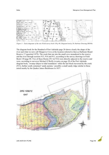
Figure 3 - Early diagrams of the site (Field survey book 130 p 80, Diagram book p 20, Harbour Drawing DR388)<br />
The diagram book for the Hundred of Port Adelaide page 20 shows clearly the shape of the<br />
river and what we now call <strong>Mangrove</strong> <strong>Cove</strong> at the location referred to then as Harbours Board<br />
Reserve 17 (gazetted 1879). The creek that ran into the small cove meandered to the reserve<br />
and the river through sections 913, 914 and 911, according to the survey drawings in Field<br />
Book 130 page 80. Two of these blocks (911 & 914) were directly adjacent to the reserve and<br />
were, according to surveyor Michael O’Reilly in notes on page 20 of the Port Adelaide<br />
diagram book, ‘swamp subject to tidal inundation’ while the last block traversed by the creek<br />
(913), further south contained ‘sandy pasture,’ possibly a small sandy ridge similar to those<br />
noted nearby by the Quaker James Backhouse in 1837.<br />
LMC-MCR-001-PC/RE Page 14