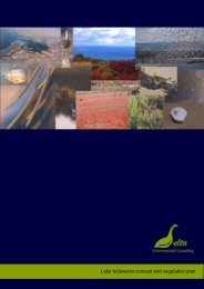
Mangrove Cove
Environmental Management Plan for Mangrove Cove - Delta ...
Environmental Management Plan for Mangrove Cove - Delta ...
- No tags were found...

Create successful ePaper yourself
Turn your PDF publications into a flip-book with our unique Google optimized e-Paper software.
Delta<br />
<strong>Mangrove</strong> <strong>Cove</strong> Management Plan<br />
For such a small area, the site has a rich usage history. The management aim is to conserve<br />
culturally interesting aspects of the site and interpret this, where appropriate, for visitors.<br />
Strategies:<br />
• Maintain the Ships’ Graveyard interpretive trail.<br />
• Replicate the sign describing the Swim Through Sculptures that is present on the<br />
eastern bank of the river so that visitors to <strong>Mangrove</strong> <strong>Cove</strong> are aware of these pieces<br />
of public art.<br />
5.4 Managing threats and opportunities<br />
5.4.1 Threats to ecological values and mitigation measures<br />
<strong>Mangrove</strong> <strong>Cove</strong> is a very small reserve, surrounded by commercial and industrial users and<br />
soon to have a residential development as a neighbour. Besides the past practices that have<br />
degraded portions of the site, there are ongoing risks to the site from maritime and terrestrial<br />
invasive species of plants and animals, illegal domestic and commercial dumping, stormwater<br />
runoff from increased areas of sealed land surface in the residential subdivision, noise<br />
intrusion from the railway and Port, bait digging and mangrove incursion.<br />
While the first five of these threats are self explanatory, the latter threat has only been<br />
recognized relatively recently and so is discussed in more detail here. <strong>Mangrove</strong> and<br />
saltmarsh habitats are ‘seral’ or ‘change habitats.’ That is, their boundaries do not stay the<br />
same over time, but change to reflect factors such as sea-level change and sediment supply. In<br />
<strong>Mangrove</strong> <strong>Cove</strong> the mangroves are expanding rapidly, as they are right around the Barker<br />
Inlet. Harty (2002) suggests that some of the basic causes of this expansion of mangrove<br />
habitat at the expense of saltmarsh include:<br />
• Sea level rise allowing mangroves to colonise saltmarshes;<br />
• Increased rainfall or the discharge of stormwater to saltmarshes, which reduces soil<br />
salinity within saltmarsh areas and allows mangroves to migrate into saltmarsh<br />
vegetation;<br />
• Increased nutrients in estuaries and the intertidal zone favouring mangrove<br />
colonisation;<br />
• <strong>Mangrove</strong>s recolonising previously cleared areas;<br />
• Modified estuary entrances or channels through dredging which alters tidal patterns<br />
and allows increased tidal inundation favouring mangrove expansion;<br />
• Subsidence of the intertidal flats permitting mangroves to migrate inland into<br />
saltmarsh communities; and<br />
• Saltmarsh being considered as a pioneer species, which is subsequently replaced by<br />
mangroves.<br />
This change is not an issue in areas where saltmarsh can also retreat, but in areas adjacent to<br />
urban development, or where the topography changes suddenly, the saltmarsh becomes<br />
trapped, and eventually is extirpated. In Barker Inlet particularly, where saltmarsh is trapped<br />
between the mangroves and the seawalls, this habitat has gradually been over run since the<br />
1940’s and now very little remains.<br />
LMC-MCR-001-PC/RE Page 33