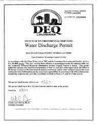
Bayou Lafourche
Bayou Lafourche - LDEQ Nonpoint 319 Projects
Bayou Lafourche - LDEQ Nonpoint 319 Projects
- No tags were found...

You also want an ePaper? Increase the reach of your titles
YUMPU automatically turns print PDFs into web optimized ePapers that Google loves.
Who is a Stakeholder?<br />
In the corporate world, a stakeholder is defined as a person or group that has an<br />
investment, share, or interest in something, as a business or industry (Dictionary.com).<br />
This definition is easily transferred to the watershed framework. In a watershed, a<br />
stakeholder’s investment, share, or interest may be in the form of a favorite fishing hole,<br />
a sense of place, or a source of drinking water. Stakeholders in <strong>Bayou</strong> <strong>Lafourche</strong><br />
include everyone who has an interest in the bayou as part of their past, present or<br />
future. Because of this interest, stakeholders may be obliged or compelled to take<br />
action to protect, enhance, or restore the function of the <strong>Bayou</strong> <strong>Lafourche</strong> Watershed.<br />
Upper <strong>Bayou</strong> <strong>Lafourche</strong> Watershed:<br />
Louisiana Subsegment 020401; <strong>Bayou</strong> <strong>Lafourche</strong> – Donaldsonville to the Intracoastal<br />
Waterway at Larose.<br />
The Upper <strong>Bayou</strong> <strong>Lafourche</strong> Watershed stretches the length of <strong>Bayou</strong> <strong>Lafourche</strong> from<br />
the pumps that feed the bayou at Donaldsonville to the Intracoastal Waterway at<br />
Larose. The watershed is confined on the east and west by the natural levees of the<br />
bayou. This gives the watershed a thin ribbon-like structure, only a few widths wider<br />
than the bayou from beginning to end. The watershed covers an area of 10.66 square<br />
miles. This area may seem inconsequential, but nearly every acre of the watershed has<br />
been altered by human activity.<br />
Louisiana Highways 1 and 308 are<br />
etched into the watershed on either<br />
side of <strong>Bayou</strong> <strong>Lafourche</strong>. The<br />
watershed also includes urbanized<br />
areas of Donaldsonville, Thibodaux,<br />
Raceland, and Larose, as well as<br />
homes, businesses, sugar cane<br />
fields, pastures, and petroleum<br />
industry support activities.<br />
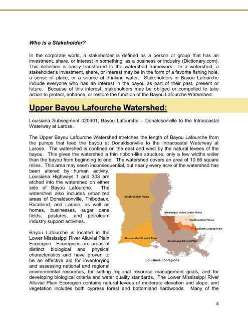
<strong>Bayou</strong> <strong>Lafourche</strong> is located in the<br />
Lower Mississippi River Alluvial Plain<br />
Ecoregion. Ecoregions are areas of<br />
distinct biological and physical<br />
characteristics and have proven to<br />
be an effective aid for inventorying<br />
and assessing national and regional<br />
Louisiana Ecoregions<br />
environmental resources, for setting regional resource management goals, and for<br />
developing biological criteria and water quality standards. The Lower Mississippi River<br />
Alluvial Plain Ecoregion contains natural levees of moderate elevation and slope; and<br />
vegetation includes both cypress forest and bottomland hardwoods. Many of the<br />
4