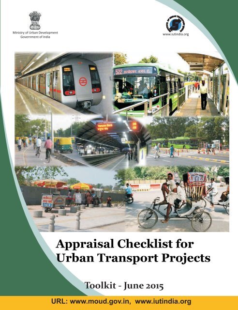
Appraisal Checklist for Urban Transport Projects
This evaluation criteria report for Urban Transport projects’ consist of set of indicators against which transport projects can be appraised for compliance with principles of sustainable urban transport. See more at: http://shaktifoundation.in/report/appraisal-checklist-urban-transport-projects/
This evaluation criteria report for Urban Transport projects’ consist of set of indicators against which transport projects can be appraised for compliance with principles of sustainable urban transport. See more at: http://shaktifoundation.in/report/appraisal-checklist-urban-transport-projects/

Create successful ePaper yourself
Turn your PDF publications into a flip-book with our unique Google optimized e-Paper software.
<strong>Appraisal</strong> <strong>Checklist</strong> <strong>for</strong><br />
<strong>Urban</strong> <strong>Transport</strong> <strong>Projects</strong>
<strong>Appraisal</strong> <strong>Checklist</strong> <strong>for</strong><br />
<strong>Urban</strong> <strong>Transport</strong> <strong>Projects</strong><br />
Toolkit- June 2015<br />
Ministry of <strong>Urban</strong> Development<br />
Government of India<br />
www.moud.gov.in<br />
Institute of <strong>Urban</strong> <strong>Transport</strong> (India)<br />
1st Floor, Anand Vihar Metro Station Building<br />
Entry adjacent to Gate No 1, Delhi - 110 092 (INDIA)<br />
www.iutindia.org
<strong>Appraisal</strong> <strong>Checklist</strong> <strong>for</strong> <strong>Urban</strong> <strong>Transport</strong> Project
Acknowledgement<br />
The Insitute of <strong>Urban</strong> <strong>Transport</strong> (India) expresses its sincere thanks to Shri M.K. Sinha, OSD (UT), MoUD,<br />
Government of India; Shri R.K. Singh, Director (UT), MoUD, Government of India; Dr. M. Ramachandran,<br />
Former Secretary, MoUD, Government of India <strong>for</strong> their invaluable guidance and support during the course of<br />
preparaion of this study.<br />
Special thanks are due to Shri B.I. Singal, Former Director General, Insitute of <strong>Urban</strong> <strong>Transport</strong> (India) and Shri<br />
O.P. Aggarwal, Execuive Director, Punj Lloyd Insitute of Infrastructure Management, Indian School of Business,<br />
Mohali.<br />
Our sincere thanks to all the Expert Commitee members - Ms. Akshima T. Ghate (TERI), Shri Siddharth Pandit<br />
(NIUA), Shri M.L. Chotani (IUT India), Dr. P.K. Sarkar (SPA Delhi), Shri Ravi Gadepalli (Shaki Sustainable Energy<br />
Foundaion), Dr. Sanjay Gupta (SPA Delhi), Dr. Jagdish Pail (BEST Undertaking), Dr. R.S. Minhas (DTC), Shri Sharat<br />
Sharma (DMRC), Shri Laghu Parashar (UMTC), Dr. Geetam Tiwari (IIT Delhi), Shri Sandeep Gandhi (S G Architects),<br />
Shri S.K. Manglik (IUT India), Dr. Rajendra Ravi (IDS India), Shri Nalin Sinha (ITDP India), Shri Ajai Mathur (UMTC),<br />
Ms. Anjlee Agarwal (Samarthyam), Ms. Anvita Arora (iTRANS), Ms. Shreya Gadepalli (ITDP India), Shri Rakesh<br />
Kaul (SREI Infrastructure Finance Ltd.), Shri Alok Sethi (DIMTS), Shri Ashish Rao Ghorpare (ICLEI India), Shri<br />
Deepak Darda (IBI Group), Shri Vedant Goyal (GIZ India) and Dr. Vinay Maitri (SPA Delhi) – <strong>for</strong> their valuable<br />
inputs and suggesions and special thanks to Shaki Sustainable Energy Foundaion <strong>for</strong> supporing this study.<br />
Finally, we would like to thank Shri C.L. Kaul, Execuive Secretary & Officiaing Director General, Insitute of<br />
<strong>Urban</strong> <strong>Transport</strong> (India) <strong>for</strong> his constant support throughout the project.<br />
Project Team:<br />
Authors:<br />
Sonia Arora, <strong>Urban</strong> <strong>Transport</strong> Expert, IUT (India)<br />
Tamalika Acharya, <strong>Urban</strong> <strong>Transport</strong> Planner, IUT (India)<br />
Contribuing Authors:<br />
Ipsita Mitra, <strong>Urban</strong> <strong>Transport</strong> Planner, IUT (India)<br />
Checked by: Mr. C.L. Chotani, Advisor IUT<br />
Reviewed by : Mr. B.I. Singal, Ex Director General, IUT<br />
i
<strong>Appraisal</strong> <strong>Checklist</strong> <strong>for</strong> <strong>Urban</strong> <strong>Transport</strong> Project<br />
ii
Table of Contents<br />
Acknowledgement................................................................................................................................................. i<br />
Abbreviaions and Acronyms ................................................................................................................................ v<br />
Background .......................................................................................................................................................... 1<br />
Objecive .............................................................................................................................................................. 1<br />
Categorizaion of <strong>Urban</strong> <strong>Transport</strong> <strong>Projects</strong> ......................................................................................................... 2<br />
Category 1: <strong>Transport</strong> Planning ........................................................................................................................... 2<br />
Category 2: Public <strong>Transport</strong> ............................................................................................................................... 2<br />
Category 3: Non-Motorized <strong>Transport</strong>................................................................................................................. 4<br />
Category 4: <strong>Transport</strong> Infrastructure ................................................................................................................... 5<br />
Category 5: <strong>Urban</strong> Freight ................................................................................................................................... 6<br />
Structure of <strong>Appraisal</strong> Criteria <strong>Checklist</strong>s ........................................................................................................... 7<br />
Steps involved in Stakeholder Consultaions ........................................................................................................ 7<br />
References ........................................................................................................................................................ 119<br />
List of Figures<br />
Figure 1: Components of <strong>Appraisal</strong> Criteria <strong>Checklist</strong> ........................................................................................ 7<br />
iii
<strong>Appraisal</strong> <strong>Checklist</strong> <strong>for</strong> <strong>Urban</strong> <strong>Transport</strong> Project<br />
iv
Abbreviations<br />
ATL<br />
ATT<br />
BAU<br />
BRTS<br />
CCTV<br />
CMP<br />
DP<br />
DPR<br />
FIRR<br />
FOB<br />
FSI<br />
GDP<br />
GHG<br />
GOI<br />
GPS<br />
HCV<br />
HDV<br />
HIG<br />
HSD<br />
IUT<br />
IPT<br />
ITS<br />
ISBT<br />
JnNURM<br />
KMPL<br />
LCV<br />
LDV<br />
LIG<br />
LoS<br />
LRT<br />
Average Trip Length<br />
Average Trip Time<br />
Business as Usual<br />
Bus Rapid Transit System<br />
Closed Circuit Television<br />
Comprehensive Mobility Plan<br />
Development Plan<br />
Detailed Project Report<br />
Financial Internal Rate of Return<br />
Foot over Bridge<br />
Floor Space Index<br />
Gross Domesic Product<br />
Greenhouse Gas<br />
Government of India<br />
Global Posiioning System<br />
Heavy Commercial Vehicle<br />
Heavy Duty Vehicles<br />
High Income Group<br />
High Speed Diesel<br />
Insitute of <strong>Urban</strong> <strong>Transport</strong><br />
Intermediate Public <strong>Transport</strong><br />
Intelligent <strong>Transport</strong> System<br />
Inter State Bus Terminal<br />
Jawaharlal Nehru Naional <strong>Urban</strong> Renewal Mission<br />
Kilometre per Litre<br />
Light Commercial Vehicle<br />
Light Duty Vehicles<br />
Low Income Group<br />
Level of Service<br />
Light Rail Transit<br />
v
<strong>Appraisal</strong> <strong>Checklist</strong> <strong>for</strong> <strong>Urban</strong> <strong>Transport</strong> Project<br />
MAV<br />
MIG<br />
MoUD<br />
MRTS<br />
NH<br />
NMT<br />
NMV<br />
NOx<br />
NUTP<br />
O & M<br />
PCTR<br />
PCU<br />
PHPDT<br />
PM<br />
PPP<br />
PT<br />
RoW<br />
RSPM<br />
SLB<br />
SOx<br />
SPM<br />
SPV<br />
TKM<br />
UFCC<br />
ULB<br />
UMTA<br />
UTF<br />
VKM<br />
VOC<br />
WFPR<br />
Muli Axle Vehicles<br />
Middle Income Group<br />
Ministry of <strong>Urban</strong> Development<br />
Mass Rapid Transit System<br />
Naional Highway<br />
Non Motorised <strong>Transport</strong><br />
Non Motorised Vehicle<br />
Nitrogen Oxide<br />
Naional <strong>Urban</strong> <strong>Transport</strong> Policy<br />
Operaion and Management<br />
Per Capita Trip Rate<br />
Passenger Car Equivalent<br />
Peak Hour Peak Direcion Traffic<br />
Pariculate Mater<br />
Public Private Partnership<br />
Public <strong>Transport</strong><br />
Right of Way<br />
Respiratory Suspended Pariculate Mater<br />
Service Level Benchmarks<br />
Sulphur Oxides<br />
Suspended Pariculate Mater<br />
Special Purpose Vehicle<br />
Tonne-Kilometre<br />
<strong>Urban</strong> Freight Consolidaion Centre<br />
<strong>Urban</strong> Local Body<br />
<strong>Urban</strong> Metropolitan <strong>Transport</strong> Authority<br />
<strong>Urban</strong> <strong>Transport</strong> Fund<br />
Vehicle Kilometre<br />
Volaile Organic Compound<br />
Work<strong>for</strong>ce Paricipaion Rate<br />
vi
Background<br />
In the recently launched missions on Smart cities and Atal Mission on Redevelopment and <strong>Urban</strong><br />
Trans<strong>for</strong>mati on (AMRUT) efficient urban mobility and public transport is one of the core infrastructure<br />
elements. It includes smart parking, intelligent traffic management, integrated multi - modal transport, public<br />
transport etc. as the thrust areas <strong>for</strong> smart solutions under transport sector in both the mission. Cities and<br />
state authorities would be required to prepare detailed project reports on urban transport projects <strong>for</strong><br />
development of sustainable urban transport system. In order to work out the sound project reports and to<br />
assess and appraise the urban transport projects there is a need to have some checklist.<br />
It is in this context the Insti tute of <strong>Urban</strong> <strong>Transport</strong> (IUT) under the purview of Ministry of <strong>Urban</strong><br />
Development has prepared a toolkit on <strong>Appraisal</strong> <strong>Checklist</strong> <strong>for</strong> <strong>Urban</strong> <strong>Transport</strong> <strong>Projects</strong>. The toolkit has<br />
elaborated on the assessment of urban transport projects in terms of economic, social and environmental<br />
impact so as to opti mise the benefits and develop the sustainable urban transport system. The toolkit is<br />
based on in-depth study of best practices at national and internati onal level in the field, the existing toolkits,<br />
guidelines and policy documents on various aspects of urban transport and wide consultati on with<br />
stakeholders comprising experts, policymakers, city officials, academicians, professionals etc. at various<br />
stages.<br />
It will be a useful reference guide to the city and state authorities and professional urban transport planners<br />
& practi ti oners <strong>for</strong> preparati on and evaluati on of urban transport projects.<br />
OBJECTIVE<br />
The objective of this toolkit is to guide the States/ULB’s/Para-statal agencies to appraise urban transport<br />
projects <strong>for</strong> improving urban mobility in a sustainable manner by addressing minimization of greenhouse gas<br />
emissions; encouraging social inclusiveness and gender equality; and promoting economic efficiency.<br />
1
<strong>Appraisal</strong> <strong>Checklist</strong> <strong>for</strong> <strong>Urban</strong> <strong>Transport</strong> Project<br />
CATEGORIZATION OF URBAN TRANSPORT PROJECTS<br />
Five categories of urban transport projects included in this toolkit are:<br />
1. <strong>Transport</strong> Planning (includes Comprehensive Mobility Plan);<br />
2. Public <strong>Transport</strong> (confined to City Bus System and Bus Rapid Transit System only);<br />
3. Non-Motorised <strong>Transport</strong> Plan (comprising of walk and cycle);<br />
4. <strong>Transport</strong> Infrastructure (comprising of Network Improvement and Expansion; and Parking Management<br />
Plan) and<br />
5. <strong>Urban</strong> Freight (Freight Management PlanandFreight Terminals/Consolidaion Centres).<br />
Brief outline of five types of urban transport project structured in the toolkit is as under:<br />
CATEGORY 1: TRANSPORT PLANNING<br />
This category includes mobility plans <strong>for</strong> cities and urban agglomerations like Comprehensive Mobility<br />
Plans, Comprehensive Traffic and <strong>Transport</strong>aion Study, Comprehensive <strong>Transport</strong>aion Study and Traffic and<br />
<strong>Transport</strong>aion Master Plan as well as Regional <strong>Transport</strong>aion Plan. The checklist highlights on the components<br />
of exising transport scenario, development of sustainable mobility plans and its benefits in terms of social,<br />
economic and environmental benefits.<br />
Note 1: refer following documents and guidelines issued by MoUD (moud.gov.in)–<br />
• Comprehensive Mobility Plan (CMP) - A Toolkit (Revised), 2013<br />
• Code of Pracice <strong>for</strong> design of <strong>Urban</strong> Roads, 2012<br />
• Naional <strong>Urban</strong> <strong>Transport</strong> Policy, (NUTP), 2006<br />
CATEGORY 2: PUBLIC TRANSPORT<br />
Public <strong>Transport</strong> <strong>Projects</strong> involve appreciating the role<br />
of existing public transport system and selection of<br />
system technologies and their planning, operaions and<br />
management.<br />
Under this category <strong>Appraisal</strong> checklist <strong>for</strong> City Bus<br />
System, Bus Rapid Transit System (BRTS) projects, allied<br />
infrastructure like Bus Stations, Bus Terminals, Transit<br />
Centres, Depots and Workshops, Control Centres, ITS <strong>for</strong><br />
City Bus System and BRTS is included. Also, it includes<br />
planning <strong>for</strong> feeder services, mulimodal integraion and<br />
insituional re<strong>for</strong>ms.<br />
Source: www.indiaprwire.com<br />
2
Toolkit<br />
The checklist contains the followings:<br />
‣ Exising Condiion – City Profile, Travel and Traffic Characterisics, Surveys Conducted and Exising<br />
Public <strong>Transport</strong> Characterisics (Available Modes, Route Details and Bus Typology, Physical & Financial<br />
Per<strong>for</strong>mance, Infrastructure etc.)<br />
‣ Proposals –<br />
<br />
<br />
<br />
<br />
<br />
<br />
<br />
Route Planning – Planning of new routes and route raionalisaion of exising routes.<br />
Assessment of Fleet - Number and typology of fleet.<br />
Infrastructure Planning - Staions/ Terminals/Depots<br />
ITS – Control Centre, On Bus ITS, ITS in Staions/ Terminals/Depots, Services <strong>for</strong> the people.<br />
System Design <strong>for</strong> BRTS – Network and Roadway; Vehicles, Services and Operaions; and Feeder<br />
Network & Infrastructure.<br />
Cost - Total Cost, Funding Patern, Fund Transfer Mechanism, Financial Intermediary <strong>for</strong> imely<br />
payment to manufacturers etc and Financial Analysis.<br />
Governance – Roles & Responsibiliies of agencies/government bodies and Insituional Re<strong>for</strong>ms<br />
‣ Benefits - Sustainable Benefits in terms of society, economy and environment.<br />
Note 2: refer following documents and guidelines issued by MoUD (moud.gov.in)–<br />
• Guidelines <strong>for</strong> Financing of Buses <strong>for</strong> <strong>Urban</strong> <strong>Transport</strong> Systems, 2009<br />
• Guidelines <strong>for</strong> Purchase of Buses and Ancillary Infrastructure <strong>for</strong> <strong>Urban</strong> <strong>Transport</strong> Systems,<br />
2013<br />
• Handbook on Service Level Benchmarks (<strong>Urban</strong> <strong>Transport</strong>), 2009<br />
• Guidelines and Toolkits <strong>for</strong> <strong>Urban</strong> <strong>Transport</strong> Development in Medium Sized ciies in India,<br />
Module 2, Bus Rapid Transit (BRTS): Toolkit <strong>for</strong> feasibility Studies, 2009<br />
• Development of Training Material under Sustainable <strong>Urban</strong> <strong>Transport</strong> Project, Reference<br />
Guide Volume 2 Public <strong>Transport</strong>, 2013<br />
3
<strong>Appraisal</strong> <strong>Checklist</strong> <strong>for</strong> <strong>Urban</strong> <strong>Transport</strong> Project<br />
CATEGORY 3: NON-MOTORIZED TRANSPORT<br />
This category mainly involves NMT facility improvement plan. The sub components of NMT Improvement Plan<br />
includes provision of clear walkable footpath throughout the city, cycle tracks, streetlights, cycle stands and NMT<br />
designed signals at all juncions. It also includes planning <strong>for</strong> pedestrian crossing faciliies like at-grade crossings,<br />
foot over bridge and subways.<br />
The checklist contains the followings:<br />
‣ Exising Condiion – City Profile, Surveys Conducted and Exising<br />
Non-Motorised Characterisics (Walk and Cycle)<br />
‣ Proposals –<br />
<br />
<br />
<br />
<br />
<br />
Footpath and Cycle Tracks – Network Coverage, Geometric<br />
Design, Pavement Materials, Street Lighing, Disabled<br />
Friendly Infrastructure etc.<br />
Crossing Faciliies – Geometric Design and Design Capacity<br />
Cycle Parking – Parking Faciliies at Interchanges & PT Stops<br />
Road Safety<br />
Public Bicycle Sharing Scheme – Control centre, Customer<br />
service and ITS <strong>for</strong> PBS.<br />
Source: www.dnaindia.com<br />
<br />
<br />
Cost – Total Cost, Funding Patern and Contracing Mechanism if any.<br />
Governance – Roles & Responsibiliies of agencies/government bodies.<br />
‣ Benefits – Sustainable Benefits in terms of society, economy and environment.<br />
Note 3: refer following documents and guidelines issued by MoUD and IRC–<br />
MoUD (moud.gov.in)–<br />
• Code of Pracice <strong>for</strong> design of <strong>Urban</strong> Roads, 2012<br />
• Service Level Benchmarks in <strong>Urban</strong> <strong>Transport</strong> , 2009<br />
IRC Codes<br />
• IRC: 103 – 2012 - Guidelines <strong>for</strong> Pedestrian Faciliies<br />
• IRC: 86 – Geometric Design Standards <strong>for</strong> <strong>Urban</strong> Roads in Planning<br />
• IRC: 69 – Space Standards <strong>for</strong> Roads in <strong>Urban</strong> Areas<br />
• IRC: 92 – Guidelines <strong>for</strong> Design of Interchanges in <strong>Urban</strong> Areas<br />
• IRCSP: 41 – Guidelines <strong>for</strong> the Design of “At Grade Intersecions” in Rural and <strong>Urban</strong> Areas<br />
• IRC: 65 – Recommendaions, Pracice <strong>for</strong> Traffic Rotaries<br />
4
Toolkit<br />
CATEGORY 4: TRANSPORT INFRASTRUCTURE<br />
This category consists of road projects,network improvement,and off-street & on street parking management.<br />
The checklist contains the followings:<br />
‣ Exising Condiion – City Profile, Surveys<br />
Conducted, Existing Road Network<br />
Characterisics including Intersecions and<br />
Exising Parking Characterisics (Off Street,<br />
On Street and Parking Management)<br />
‣ Proposals –<br />
a) For Network –<br />
<br />
Source: www.wikiwand.com<br />
Geometric Design – Horizontal and Verical Alignment, Weaving Length, Entry/Exit Angles etc.<br />
<br />
<br />
<br />
<br />
<br />
Pedestrian and Cycle Faciliies – Pedestrian pathways, cycle tracks, crossing faciliies and cycle<br />
parking.<br />
Road Marking and Signages<br />
Road Safety<br />
Design Capacity and Design Period<br />
ITS – Control Centre, Automaic Traffic Classifier & Counter, Variable Message Signboard, Traffic<br />
Signals, Electronic Road Pricing System, Lane Control System etc.<br />
b) For Parking -<br />
<br />
<br />
<br />
<br />
City Policies<br />
Locaion and Type of Off-Street Parking – Surface, Muli-Storeyed, Underground etc.<br />
Zoning <strong>for</strong> Parking – Delineaion of Parking Zones on the basis of users, duraion, type of vehicles,<br />
pricing etc.<br />
Management Plan<br />
Note 4: refer following documents and guidelines issued by MoUD and IRC<br />
MoUD (moud.gov.in)–<br />
• Public <strong>Transport</strong> Accessibility Toolkit<br />
• Service Level Benchmarks in <strong>Urban</strong> <strong>Transport</strong><br />
IRC Codes: IRC: 103 – 2012 – Guidelines <strong>for</strong> Pedestrian Faciliies<br />
5
<strong>Appraisal</strong> <strong>Checklist</strong> <strong>for</strong> <strong>Urban</strong> <strong>Transport</strong> Project<br />
<br />
<br />
<br />
<br />
Proposed Parking Characterisics like Capacity, Accumulaion, Volume, Load Duraion, Turnover,<br />
Composiion, Tariff etc.<br />
ITS – Parking Guidance & In<strong>for</strong>maion System, Smart Payment System, Security System etc.<br />
Cost Analysis – Project Cost, Financial Analysis, Financial Structuring & Proposed Phasing etc.<br />
Governance – Roles & Responsibiliies of agencies/government bodies.<br />
‣ Benefits – Sustainable Benefits in terms of society, economy and environment.<br />
CATEGORY 5: URBAN FREIGHT<br />
<strong>Urban</strong> Freight Planning and Management comprises projecion of freight traffic growth; planning <strong>for</strong> industrial<br />
and commercial aciviies, distribuion and storage faciliies in the city, locaion of wholesale markets, direcion<br />
of city growth etc. It also includes planning <strong>for</strong> non-motorised freight transport while addressing the issue of<br />
the last leg connecivity in freight movement along with freight handling faciliies like freight centres (like Freight<br />
Villages, Distribuion Business Centres, Logisic Centres), <strong>Urban</strong> Freight Consolidaion Centres, Integrated Freight<br />
Complex and Truck Terminals.<br />
The checklist contains the followings:<br />
‣ Exising Condiion – City Profile, Surveys Conducted and Exising Freight Characterisics and Exising<br />
Freight Infrastructure such as Goods Terminal, Industrial Area, Service Centre, Parking Provisions, and<br />
Circulaion etc.<br />
‣ Proposals –<br />
<br />
<br />
<br />
<br />
<br />
Freight Traffic Projecions<br />
<strong>Urban</strong> Freight Model<br />
<strong>Urban</strong> Freight Management<br />
Freight Handling Faciliies<br />
Cost Analysis – Project Cost, Financial<br />
Analysis, Financial Structuring & Proposed<br />
Phasing.<br />
Source: www.supplychains.com<br />
<br />
Governance – Roles & Responsibiliies of agencies/government bodies.<br />
‣ Benefits – Sustainable Benefits in terms of society, economy and environment.<br />
Note 5: refer Note State of the Art Report Toolkit on <strong>Urban</strong> Freight <strong>Transport</strong> Planning and<br />
Management<br />
6
Toolkit<br />
STRUCTURE OF APPRAISAL CRITERIA CHECKLISTS<br />
<strong>Appraisal</strong> Criteria <strong>Checklist</strong>s has been prepared <strong>for</strong> each of the fi ve identi fi ed urban transport proje ct<br />
categories in the following <strong>for</strong>mat<br />
‣ Introducion – Assess the exising city profile and transportaion scenarios<br />
‣ Proposal – This includes the details of proposals provided in the project report.<br />
‣ Funding – Assess the sources of fund idenified <strong>for</strong> the projects as well as the amount that would be<br />
required to implement the project.<br />
‣ Governance – Appraise the roles and responsibiliti es of various agencies that would be involved in<br />
the planning, development, and operati on and management of the project.<br />
‣ Sustainable Benefits – Appraise the sustainability of the project in terms of social, economic and<br />
environmental aspects.<br />
Figure 1: Components of <strong>Appraisal</strong> Criteria <strong>Checklist</strong><br />
7
<strong>Appraisal</strong> <strong>Checklist</strong> <strong>for</strong> <strong>Urban</strong> <strong>Transport</strong> Project<br />
STEPS INVOLVED IN STAKEHOLDER CONSULTATIONS<br />
Stakeholder Consultaions conducted at various stages to receive valuable inputs in finalising the categories and<br />
indicators <strong>for</strong> evaluaion of urban transport projects.<br />
‣ Step1: Expert commitee comprising MoUD, academia,<br />
consultants, researchers, NGOs, Traffic Police, State<br />
<strong>Transport</strong> Departments, State <strong>Transport</strong> Corporaions and<br />
other relevant agencies were set up.<br />
‣ Step 2: Based on the inputs received from expert commitee<br />
and literature survey both at naional and internaional<br />
level, the classificaion of urban transport projects were<br />
divided into five categories namely <strong>Transport</strong> Planning,<br />
Public <strong>Transport</strong>, Non-Motorised <strong>Transport</strong>, <strong>Transport</strong><br />
Infrastructure and <strong>Urban</strong> Freightand prepared draft<br />
indicators.<br />
‣ Step 3: Comments were sought on drat transport indicators<br />
from the expert commitee <strong>for</strong> evaluaion of each category.<br />
‣ Step 4: The suggesions received were incorporated and the<br />
finalised sustainable transport indicators presented at<strong>Urban</strong><br />
Mobility India (UMI) Conference, 2014 <strong>for</strong> further feedback<br />
‣ Step 5: Prepared drat report on evaluaion criteria checklist<br />
<strong>for</strong> urban transport projects and circulatedthe same it<br />
amongst all the expert commitee members.<br />
‣ Step 6: Validaion workshop organized where all the expert<br />
commitee members were invited to discuss on the drat<br />
evaluaion criteria checklist of each category. Based on the<br />
feedback, the toolkit has been finalized.<br />
8
Toolkit<br />
APPRAISAL CRITERIA BASED ON THE PROJECT BENEFITS<br />
The benefi ts of the projects will be appraised under three categories i.e. social; economic and fi nancial; and<br />
environmental benefits as per the following indicators<br />
‣ Social Indicators: It includes modal shit to public transport and non-motorised transport, network<br />
coverage of public and non-motorised transport, accessibility, reducion in accidents, road security<br />
and reducion in motorised traffic on road.<br />
‣ Economic Indicators: It comprises per capita transport infrastructure, share of GDP contributed by<br />
transport, staff per bus raio, travel ime and speed, reducion in fuel dependency and land used by<br />
transport infrastructure.<br />
‣ Environmental Indicators: The environmental indicators include energy/fuel consumpion, reducion<br />
in greenhouse gas emissions, emissions per capita (NO2, SO2, SPM and RSPM) and percentage of<br />
vehicles on clean fuels.<br />
Category wise detailed appraisal checklist is given in the succeeding secti on.<br />
9
<strong>Appraisal</strong> <strong>Checklist</strong> <strong>for</strong> <strong>Urban</strong> <strong>Transport</strong> Project<br />
10
<strong>Appraisal</strong> <strong>Checklist</strong> <strong>for</strong> <strong>Urban</strong> <strong>Transport</strong> Project<br />
12
Category 1:<br />
<strong>Transport</strong> Planning<br />
Comprehensive Mobility Plan<br />
I. TASK 1 – DEFINING THE SCOPE OF CMP<br />
1. Planning Area and Horizon<br />
i. Name of City and State<br />
ii.<br />
iii.<br />
iv.<br />
Planning Area/ Site Area (sq. km)<br />
Base Year<br />
Horizon Year<br />
v. Plan Phasing Duraion (in years):<br />
Immediate<br />
Short Term<br />
Medium Term<br />
Long Term<br />
2. Vision<br />
Vision is in line with sustainable<br />
transport system definiion i.e. if<br />
the vision addresses<br />
i. Environmental Sustainability and<br />
Safety<br />
ii.<br />
iii.<br />
- Reducing Air and Noise Polluion<br />
Social Sustainability<br />
- Accessibility and Mobility <strong>for</strong> all<br />
socio economic groups, gender, all<br />
age group and the disabled.<br />
- Af<strong>for</strong>dability<br />
- Traffic Safety<br />
Economic Sustainability<br />
- Integrated Land use <strong>Transport</strong><br />
Planning<br />
Yes Parial None Remarks<br />
13
<strong>Appraisal</strong> <strong>Checklist</strong> <strong>for</strong> <strong>Urban</strong> <strong>Transport</strong> Project<br />
- Financial Efficiency and Fuel<br />
Efficiency<br />
- Reducion in Travel Time and<br />
Waiing Time<br />
3. Objecive<br />
Key focus area of NUTP i.e. planning <strong>for</strong> people<br />
taken care of i.e. if the objecives of the CMP<br />
address the following:<br />
i. Prioriize mobility <strong>for</strong> all socio economic groups<br />
and gender.<br />
ii.<br />
iii.<br />
Encourage sustainable modes of transport like<br />
Improvement of Public <strong>Transport</strong>, NMT and<br />
pedestrian faciliies<br />
Provide a pla<strong>for</strong>m to integrate land use with<br />
transport planning<br />
4. Review of Exising Studies/Plans/Reports<br />
Exising Plans/Studies Yes No<br />
i. Perspecive Plan/Master Plan<br />
ii.<br />
iii.<br />
iv.<br />
City Development Plan<br />
Exising Traffic and <strong>Transport</strong>aion Studies<br />
DPRs of <strong>Transport</strong> related <strong>Projects</strong><br />
5. Stakeholder Consultaion<br />
Consultaion Yes Yes<br />
i. Stakeholder Involvement considered while<br />
preparing vision <strong>for</strong> CMP? Involvement/<br />
consultaion should be throughout the study.<br />
ii.<br />
II.<br />
Ciizen Involvement considered while preparing<br />
vision <strong>for</strong> CMP? Involvement/consultaion should<br />
be throughout the study.<br />
TASK 2 – DATA COLLECTION AND ANALYSIS OF EXISTING URBAN TRANSPORT<br />
AND ENVIRONMENT<br />
1. Review of City Profile<br />
i. Socio Economic<br />
a. Current Populaion (in No.)<br />
b. Populaion Growth Rate (Decadal)<br />
c. Populaion Density (in No.) – Gross Density and<br />
Built Up Density<br />
d. Average Household Size (in No.)<br />
e. Projected Populaion (Phase Wise) Immediate Short Term Medium Long Term<br />
Yes<br />
No<br />
14
<strong>Transport</strong> Planning – Comprehensive Mobility Plan<br />
f. Projected Employment (Phase<br />
Wise)<br />
Immediate Short Term Medium Long Term<br />
g. Per Capita Income (in Rs)<br />
h. Average Household Income (in Rs)<br />
i. Expenditure on <strong>Transport</strong> (in Rs)<br />
j. Investment in <strong>Transport</strong> Sector –<br />
Menion the different categories in<br />
which investment has been made<br />
k. Work<strong>for</strong>ce Paricipaion Rate<br />
(WFPR) (in %)<br />
ii.<br />
iii.<br />
Land Use<br />
Land Use (in %)<br />
Residenial Area (which should<br />
include slums)<br />
Commercial Area<br />
Public and Semi-Public<br />
Recreaion<br />
Industrial<br />
<strong>Transport</strong>aion<br />
<strong>Transport</strong> Related<br />
a. Number of Registered Vehicles in Year…………<br />
Two Wheelers<br />
Three Wheelers<br />
Four Wheelers<br />
Taxis<br />
Buses<br />
Trucks (LCV)(Up to 7.5 tonnes)<br />
Trucks (HCV)<br />
Any Other<br />
b. Average Annual Growth of Vehicle (in %)<br />
Year 1 Year2 Year 3 Year 4 Year 5<br />
Exising<br />
Overall<br />
Male Female Overall<br />
Exising<br />
Built up Area<br />
Proposed (as per Master<br />
Plan)<br />
c. Road Network (in km) Length Percentage<br />
NH<br />
SH<br />
Arterial<br />
Sub Arterial<br />
Collector<br />
15
<strong>Appraisal</strong> <strong>Checklist</strong> <strong>for</strong> <strong>Urban</strong> <strong>Transport</strong> Project<br />
d. Public <strong>Transport</strong><br />
Length (in km)<br />
Number of Buses/Coaches/Vehicles<br />
Mode Road Based Rail Based<br />
Number of Buses/Coaches/Vehicles per 1000<br />
populaion<br />
Infrastructure<br />
- Number of Stops/Staions<br />
- Kernel Density of Bus Stops<br />
- Number of Terminal<br />
- Number of Buses per Terminal<br />
- Number of Depot<br />
- Number of Buses per Depot<br />
- Number of Workshop<br />
- Number of Buses per Workshop<br />
ITS Infrastructure<br />
- Total Number of Staions/Terminals<br />
having CCTVs<br />
- Total Number of Staions/Terminals<br />
having PIS<br />
- Number of PT vehicles having GPS<br />
e. Airport (Number)<br />
iv.<br />
Environment and Safety<br />
a. Number of Accidents<br />
(menion year)<br />
Fatal Accidents<br />
Serious Accidents<br />
Minor Accidents<br />
b. Polluion (Exising)<br />
PM2.5 (tonnes)<br />
PM10 (tonnes)<br />
SO2 (tonnes)<br />
NOx (tonnes)<br />
CO (tonnes)<br />
VOC (tonnes)<br />
CO2 (million tonnes and<br />
tonnes per capita)<br />
Bus BRTS IPT Metro LRT Sub <strong>Urban</strong><br />
Rail<br />
16
<strong>Transport</strong> Planning – Comprehensive Mobility Plan<br />
2. Traffic Surveys Conducted<br />
i. Road Network Inventory<br />
ii.<br />
iii.<br />
iv.<br />
Speed and Delay in Peak and Off<br />
Peak Hour<br />
Classified Traffic Volume Counts<br />
Survey at -<br />
Outer Cordon Locaion<br />
Mid-Block Locaion<br />
Screen Line Locaion<br />
Roadside Origin-Desinaion Survey<br />
Classified Turning Movement<br />
Survey at Intersecions<br />
v. Pedestrian Volume Survey<br />
vi.<br />
Parking Survey<br />
Off Street Locaions<br />
On Street Locaions<br />
vii. Commuter Survey at Public<br />
<strong>Transport</strong> Terminals<br />
viii.<br />
ix.<br />
Mass <strong>Transport</strong> and Intermediate<br />
Public <strong>Transport</strong> (IPT) Passengers<br />
Survey<br />
Vehicle Operators Survey<br />
x. Household Survey<br />
3. Traffic Analysis Zones<br />
i. Total Number of Traffic Analysis<br />
Zones<br />
ii.<br />
iii.<br />
Number of Internal Traffic Analysis<br />
Zones<br />
Number of TAZ per sq. km of study<br />
area<br />
4. Review of Exising <strong>Transport</strong> System<br />
i. Road Network Inventory<br />
a. Pedestrian Infrastructure<br />
i. Length of Road by Availability of Footpath (in km and %)<br />
No Footpath<br />
Footpath on One Side<br />
Footpath on Both Side<br />
17
<strong>Appraisal</strong> <strong>Checklist</strong> <strong>for</strong> <strong>Urban</strong> <strong>Transport</strong> Project<br />
ii. Availability of Footpath by Width (in km and %)<br />
iii.<br />
Up to 2 m 1<br />
More than 2 m 1<br />
Number of Pedestrian Crossings<br />
Zebra Crossings<br />
Foot over Bridges<br />
Subways<br />
b. Infrastructure <strong>for</strong> Bicycles<br />
i. Length of Road by Availability of Cycle Track (in km and %)<br />
ii.<br />
No Cycle Track<br />
Cycle Track on One Side<br />
Cycle Track on Both Side<br />
Number of Cycle Stands<br />
c. Cycle Rickshaw<br />
i. Fleet Size<br />
ii.<br />
iii.<br />
iv.<br />
Average Vehicular Km per<br />
Day<br />
Average Earning per Day<br />
Average Trip Length<br />
v. Average Number of Trips<br />
per Day/per Rickshaw<br />
vi.<br />
Average Distance per Day/<br />
per Rickshaw<br />
d. Road Network<br />
i. Distribuion of Road Network by Carriageway (in %)<br />
ii.<br />
Carriageway Length Percentage<br />
Single Lane<br />
Double Lane<br />
Four Lane Undivided<br />
Four Lane Divided<br />
Six Lane Divided<br />
Six Lane Undivided<br />
Eight Lane or More<br />
Length of Road by Availability of Street Light (km)<br />
No Street Light<br />
Street Light on One Side<br />
Street Light on Both Side<br />
18
<strong>Transport</strong> Planning – Comprehensive Mobility Plan<br />
iii. Illuminaion Level (in %) 2<br />
iv.<br />
Roads with equal or more<br />
than 30 lux<br />
Pedestrian Crossings with<br />
equal or more than 50 lux<br />
Cycle Track with equal or<br />
more than 20 lux<br />
Length of Road by Availability of On Street Parking (km)<br />
On Street Parking on One Side<br />
On Street Parking on Both Side<br />
v. Total Number of Intersecions<br />
vi.<br />
ii.<br />
Total Number of Signalized<br />
Intersecions<br />
Road Based Public <strong>Transport</strong> System<br />
a. Fleet Usage Detail<br />
i. Type of Mode<br />
ii.<br />
Fleet Size<br />
iii. Fleet Uilisaion Rate (in %)<br />
iv.<br />
Average Km per Bus/per Day<br />
v. Average Ridership per Day per Bus<br />
vi.<br />
vii.<br />
Occupancy Raio<br />
Fuel Used<br />
- Type<br />
b. Route Detail<br />
- Quanity (in litres per day)<br />
i. Route Coverage (km)<br />
ii.<br />
iii.<br />
iv.<br />
Route Coverage Density (i.e. Bus<br />
km/Road Network km)<br />
Average Headway<br />
Average Route Speed<br />
Average Waiing Time<br />
c. Cost and Fare<br />
i. Operaion Cost per km (in Rs)<br />
ii.<br />
iii.<br />
iv.<br />
Fare Structure (in Rs)<br />
Revenue per km (in Rs)<br />
Profit/Loss per year (in Rs)<br />
Mode Public <strong>Transport</strong> Para Transit<br />
2<br />
<strong>Urban</strong> road Codes<br />
19
<strong>Appraisal</strong> <strong>Checklist</strong> <strong>for</strong> <strong>Urban</strong> <strong>Transport</strong> Project<br />
iii.<br />
Freight <strong>Transport</strong><br />
a. Daily Goods Vehicle Travel Vehicles PCUs<br />
Internal to Internal<br />
External (Internal to External,<br />
External to Internal, External to<br />
External)<br />
b. Amount of Goods carried across<br />
the city/region (in tonnes)<br />
c. Types of Freight Handling Faciliies<br />
(Yes/No; If Yes, then Number….)<br />
i. Freight Centre/Logisic Park<br />
Ii<br />
iv.<br />
<strong>Urban</strong> Freight Consolidaion<br />
Centre<br />
Integrated Freight Complex<br />
Truck Terminals<br />
Traffic Condiions on Road<br />
a. Average Speed 3<br />
i.<br />
ii.<br />
Average Speed of Private Mode Vehicles (in %)<br />
>=30 km/hr<br />
25 - 30 km/hr<br />
15 - 25 km/hr<br />
=20 km/hr<br />
15 - 20 km/hr<br />
10 - 15 km/hr<br />
<strong>Transport</strong> Planning – Comprehensive Mobility Plan<br />
20 to 50 years<br />
> 50 years<br />
c. Distribuion of Trips<br />
Below 20 years<br />
20 to 50 years<br />
> 50 years<br />
d. Average Trip Length<br />
Below 20 years<br />
20 to 50 years<br />
> 50 years<br />
e. Per Capita Trip Rate<br />
ii.<br />
Socio Economic In<strong>for</strong>maion<br />
a. Percentage of HH within 10<br />
min walking distance of PT/<br />
Para Transit<br />
b. Populaion by Educaional<br />
Qualificaion (Number)<br />
No school educaion<br />
Primary educaion (up to 8th)<br />
Matriculaion/up to 12th<br />
Graduate<br />
Others (Specify)<br />
c. Populaion by Occupaion<br />
(Number)<br />
Salaried Employment<br />
(Regular Waged)<br />
Daily Wages Employment<br />
(Casual Labour)<br />
Self Employed (Work in HH<br />
Enterprise)<br />
Domesic Worker at Fixed Rate<br />
Honorary Worker<br />
Home Based Paid Work<br />
Home Based Unpaid Work<br />
(House Manager)<br />
Atending Educaional<br />
Insitute<br />
Pensioners/ Remitance<br />
Recipient<br />
Unemployed - Due to Disability<br />
21
<strong>Appraisal</strong> <strong>Checklist</strong> <strong>for</strong> <strong>Urban</strong> <strong>Transport</strong> Project<br />
Unemployed - Seeking Work<br />
Others - Specify<br />
d. Vehicle Ownership<br />
iii.<br />
iv.<br />
Vehicle Exising Be<strong>for</strong>e Two Years<br />
Car<br />
Motorised Two Wheeler<br />
Bicycle<br />
Auto-Rickshaw<br />
Cycle Rickshaw<br />
Mode Wise In<strong>for</strong>maion<br />
Car<br />
2 Wheeler<br />
Bus<br />
Mode<br />
Auto-Rickshaw<br />
Shared Auto<br />
Walk<br />
Bicycle<br />
Cycle Rickshaw<br />
Company Bus<br />
Taxis<br />
Any Other<br />
Purpose Wise In<strong>for</strong>maion<br />
Home<br />
Work<br />
Educaion<br />
Recreaion<br />
Others<br />
Mode<br />
6. Review of Energy and Environment<br />
i. Energy Balance<br />
Modal Share<br />
(%)<br />
Distribuion of<br />
Trips (in<br />
Number)<br />
Energy Consumpion in (million tonnes oil equivalent)<br />
Road based <strong>Transport</strong><br />
Rail based <strong>Transport</strong><br />
Water based <strong>Transport</strong><br />
Distribuion of<br />
Trips (in<br />
Number)<br />
Average<br />
Trip Length<br />
(km)<br />
Average<br />
Trip Length<br />
(km)<br />
Average<br />
Travel Time (min)<br />
Average<br />
Travel Time (min)<br />
22
<strong>Transport</strong> Planning – Comprehensive Mobility Plan<br />
ii.<br />
Fuel Type<br />
Type of Fuel used by Different Modes (%)<br />
Vehicle Type Petrol Diesel CNG Others<br />
Two Wheelers<br />
Three Wheelers<br />
Four Wheelers<br />
Taxis<br />
Buses<br />
Trucks (LCV)(Up to 7.5<br />
tonnes)<br />
Trucks (HCV)<br />
7. <strong>Transport</strong> Demand Model (Base Year)<br />
i. Trip Generaion Method<br />
Used (Tick)<br />
a. Trip Producion Equaion<br />
b. Trip Atracion Equaion<br />
ii.<br />
Trip Distribuion Method<br />
Used (Tick)<br />
a. If Growth Factor Methods,<br />
then (Tick)<br />
- Uni<strong>for</strong>m Factor Method<br />
- Average Factor Method<br />
- Fratar Method<br />
- Furness Method<br />
b. If Syntheic Models, then<br />
(Tick)<br />
- Gravity Model<br />
- Tanner Model<br />
- Intervening Opportuniies<br />
Model<br />
- Compeing Opportuniies<br />
Model<br />
c. Trip Distribuion Equaion<br />
iii.<br />
Traffic Assignment<br />
Technique Used (Tick)<br />
- All-or-Nothing Assignment<br />
- Muliple Route Assignment<br />
- Capacity Restraint Assignment<br />
- Diversion Curves<br />
Linear Regression<br />
Analysis<br />
Linear Regression<br />
Analysis<br />
Category Analysis<br />
Syntheic Methods<br />
Others (menion)<br />
Others (menion)<br />
23
<strong>Appraisal</strong> <strong>Checklist</strong> <strong>for</strong> <strong>Urban</strong> <strong>Transport</strong> Project<br />
iv.<br />
Modal Split Analysis Used (Tick)<br />
- Probit Analysis<br />
- Logit Analysis<br />
- Discriminant Analysis<br />
a. Modal Split Equaion<br />
III.<br />
TASK 3 – BAU SCENARIO AND SUSTAINABLE URBAN TRANSPORT SCENARIO<br />
(PROPOSALS)<br />
1. Mobility and Accessibility<br />
i. Modal Share<br />
a. Modal Share (%) by Trip<br />
Purpose<br />
Mode Home Work Educaion Recreaion Others<br />
BAU Scenario<br />
Sustainable Scenario<br />
BAU Scenario<br />
Sustainable Scenario<br />
BAU Scenario<br />
Sustainable Scenario<br />
BAU Scenario<br />
Sustainable Scenario<br />
BAU Scenario<br />
Sustainable Scenario<br />
Car<br />
2 Wheeler<br />
Bus<br />
Auto-Rickshaw<br />
Shared Auto<br />
Walk<br />
Bicycle<br />
Cycle Rickshaw<br />
Company Bus<br />
Taxis<br />
Any Other<br />
24
<strong>Transport</strong> Planning – Comprehensive Mobility Plan<br />
b. Modal Shares by Social Groups<br />
Mode Modal Share (%)<br />
HIG MIG LIG Slums<br />
BAU Scenario<br />
Sustainable Scenario<br />
BAU Scenario<br />
Sustainable Scenario<br />
BAU Scenario<br />
Sustainable Scenario<br />
BAU Scenario<br />
Sustainable Scenario<br />
Car<br />
2 Wheeler<br />
Bus<br />
Auto-Rickshaw<br />
Shared Auto<br />
Walk<br />
Bicycle<br />
Cycle Rickshaw<br />
Company Bus<br />
Taxis<br />
Any Other<br />
ii. Travel Time<br />
a. Average Travel Time by Mode<br />
Mode<br />
Car<br />
2 Wheeler<br />
Bus<br />
Auto-Rickshaw<br />
Shared Auto<br />
Walk<br />
Bicycle<br />
Cycle Rickshaw<br />
Company Bus<br />
Taxis<br />
Any Other<br />
Average Travel Time (in min)<br />
BAU Scenario<br />
Sustainable Scenario<br />
25
<strong>Appraisal</strong> <strong>Checklist</strong> <strong>for</strong> <strong>Urban</strong> <strong>Transport</strong> Project<br />
b. Trip Purpose Wise Average Travel Time Disaggregated by Social Groups<br />
Purpose<br />
Average Travel Time (in min)<br />
HIG MIG LIG Slums<br />
BAU Scenario<br />
Sustainable Scenario<br />
BAU Scenario<br />
Sustainable Scenario<br />
BAU Scenario<br />
Sustainable Scenario<br />
BAU Scenario<br />
Sustainable Scenario<br />
Home<br />
Work<br />
Educaion<br />
Recreaion<br />
Others<br />
iii. Trip Length<br />
a. Average Trip Length<br />
Mode<br />
Car<br />
2 Wheeler<br />
Bus<br />
Auto-Rickshaw<br />
Shared Auto<br />
Walk<br />
Bicycle<br />
Cycle Rickshaw<br />
Company Bus<br />
Taxis<br />
Any Other<br />
BAU Scenario<br />
Average Trip Length (km)<br />
Sustainable Scenario<br />
26
<strong>Transport</strong> Planning – Comprehensive Mobility Plan<br />
b. Mode wise ATL disaggregated by social groups<br />
Mode<br />
Average Trip Length (km)<br />
HIG MIG LIG Slums<br />
BAU Scenario<br />
Sustainable Scenario<br />
BAU Scenario<br />
Sustainable Scenario<br />
BAU Scenario<br />
Sustainable Scenario<br />
BAU Scenario<br />
Sustainable Scenario<br />
Car<br />
2 Wheeler<br />
Bus<br />
Auto-Rickshaw<br />
Shared Auto<br />
Walk<br />
Bicycle<br />
Cycle Rickshaw<br />
Company Bus<br />
Taxis<br />
Any Other<br />
c. Trip Purpose wise ATL disaggregated by social groups<br />
Purpose<br />
Average Travel Time (in min)<br />
HIG MIG LIG Slums<br />
BAU Scenario<br />
Sustainable Scenario<br />
BAU Scenario<br />
Sustainable Scenario<br />
BAU Scenario<br />
Sustainable Scenario<br />
BAU Scenario<br />
Sustainable Scenario<br />
Home<br />
Work<br />
Educaion<br />
Recreaion<br />
Others<br />
27
<strong>Appraisal</strong> <strong>Checklist</strong> <strong>for</strong> <strong>Urban</strong> <strong>Transport</strong> Project<br />
iv. Passenger Kilometre and Vehicle Kilometre<br />
a. Mode wise PKM and VKM<br />
Mode Passenger Kilometre Vehicle Kilometre<br />
BAU Scenario<br />
Sustainable<br />
Scenario<br />
BAU Scenario<br />
Sustainable<br />
Scenario<br />
Car<br />
2 Wheeler<br />
Bus<br />
Auto-Rickshaw<br />
Shared Auto<br />
Walk<br />
Bicycle<br />
Cycle Rickshaw<br />
Company Bus<br />
Taxis<br />
Any Other<br />
b. Trip Purpose wise PKM and VKM<br />
Mode Passenger Kilometre Vehicle Kilometre<br />
BAU Scenario<br />
Sustainable<br />
Scenario<br />
BAU Scenario<br />
Sustainable<br />
Scenario<br />
Home<br />
Work<br />
Educaion<br />
Access to Public <strong>Transport</strong><br />
Access to Auto Rickshaw<br />
Shopping<br />
Recreaion<br />
Social Trip<br />
Religious Trip<br />
Personal Business<br />
Others<br />
28
<strong>Transport</strong> Planning – Comprehensive Mobility Plan<br />
2. Infrastructure<br />
a. Average Speed on Roads of Different Modes 3<br />
Average Speed of Private<br />
Mode Vehicles (in %)<br />
>=30 km/hr<br />
25 - 30 km/hr<br />
15 - 25 km/hr<br />
=20 km/hr<br />
15 - 20 km/hr<br />
10 - 15 km/hr<br />
=50 kmph1<br />
BAU Scenario<br />
Sustainable Scenario<br />
b. Percentage of Roads having<br />
Footpath Width >=2 m1<br />
ii.<br />
Security<br />
a. Percentage of Road Lighted BAU Scenario Sustainable Scenario<br />
b. Percentage of Footpaths<br />
Lighted<br />
BAU Scenario<br />
Sustainable Scenario<br />
4. Environmental Aspects<br />
i. Emissions<br />
GHG Emissions BAU Scenario Sustainable Scenario<br />
29
<strong>Appraisal</strong> <strong>Checklist</strong> <strong>for</strong> <strong>Urban</strong> <strong>Transport</strong> Project<br />
ii.<br />
Depleion of Land Resource<br />
a. Per Capita Consumpion of<br />
Land <strong>for</strong> <strong>Transport</strong> Acivity<br />
BAU Scenario<br />
Sustainable Scenario<br />
b. Land Consumed <strong>for</strong> Different <strong>Transport</strong> Aciviies<br />
<strong>Transport</strong> Aciviies BAU Scenario Sustainable Scenario<br />
5. Economic<br />
i. Fare Policy<br />
a. Percentage of Subsidies<br />
Granted<br />
BAU Scenario<br />
Sustainable Scenario<br />
b. Percentage of Populaion<br />
Owning Passes<br />
BAU Scenario<br />
Sustainable Scenario<br />
IV.<br />
TASK 4 – DEVELOPMENT OF URBAN MOBILITY PLAN AND PREPARATION OF<br />
IMPLEMENTATION PROGRAMME<br />
1. Phasing of <strong>Projects</strong><br />
Strategies - <strong>Projects</strong><br />
i. Integrated Land Use and <strong>Urban</strong> Mobility Plan<br />
a.<br />
b.<br />
c.<br />
ii.<br />
a.<br />
b.<br />
c.<br />
iii.<br />
a.<br />
b.<br />
c.<br />
iv.<br />
a.<br />
b.<br />
c.<br />
Formulaion of the Public <strong>Transport</strong> Improvement Plan<br />
Preparaion of Road Network Development Plan<br />
Preparaion of NMT Facility Improvement Plan<br />
Phasing<br />
Immediate Short Term Medium Term Long Term<br />
30
<strong>Transport</strong> Planning – Comprehensive Mobility Plan<br />
v. Freight Movement Plan<br />
a.<br />
b.<br />
c.<br />
vi.<br />
a.<br />
b.<br />
c.<br />
vii.<br />
a.<br />
b.<br />
c.<br />
viii.<br />
a.<br />
b.<br />
c.<br />
Mobility Management Measures<br />
Development of Fiscal Measures<br />
Mobility Improvement Measures and NUTP Objecives<br />
2. Cost of Implementaion<br />
<strong>Projects</strong> Phase -<br />
Immediate/<br />
Short /<br />
Medium /<br />
Long<br />
Project<br />
Priority<br />
High/<br />
Medium/<br />
Low<br />
<strong>Projects</strong><br />
Quanity Unit Unit<br />
Rate<br />
(Rs)<br />
Cost<br />
(Rs.)<br />
i.<br />
ii.<br />
iii.<br />
V. SOCIAL BENEFITS<br />
1. Increase In -<br />
i. Modal Share (%)<br />
Bus<br />
Walk<br />
Cycle<br />
ii.<br />
Modal Shit from Various Modes to Bus, Walk and Cycle (%) namely-<br />
Modes<br />
Bus<br />
Walk<br />
Cycke<br />
Car<br />
Two Wheeler<br />
IPT<br />
31
<strong>Appraisal</strong> <strong>Checklist</strong> <strong>for</strong> <strong>Urban</strong> <strong>Transport</strong> Project<br />
iii. Total Route Coverage (%) <strong>for</strong> Bus<br />
iv. Total Network Coverage (in km) -<br />
Footpath<br />
NMT<br />
v. Average Daily Ridership (PHPDT) <strong>for</strong> Bus<br />
vi. Number of<br />
Pedestrians<br />
Cyclists<br />
vii. Accessibility to Bus Stops - % of populaion within 500 m of Bus Stops<br />
2. Reducion/Decrease In -<br />
i. Average Number of Private Cars and Two Wheelers on Road per day<br />
ii. Peak Hour Motorised Traffic per day (in PCU)<br />
iii. Motorised Vehicle km per Day<br />
iv. Freight Vehicles during Day Time (%)<br />
v. Freight Vehicles during Night Time (%)<br />
vi. Accident due to Freight Vehicles<br />
3. Increase in Level of Service (LOS) Of -<br />
i. Presence of Organized Public <strong>Transport</strong> System in <strong>Urban</strong> Area<br />
ii. Extent of Supply / Availability of Public <strong>Transport</strong><br />
iii. Service Coverage of Public <strong>Transport</strong> in the city (Bus route network density)<br />
iv. Level of Com<strong>for</strong>t in Public <strong>Transport</strong> (Crowding)<br />
v. Percentage Fleet as per <strong>Urban</strong> Bus Specificaions<br />
vi. Fatality per lakh Populaion<br />
vii. Availability of Traffic Surveillance<br />
viii. Passenger In<strong>for</strong>maion System<br />
ix. Global Posiioning System<br />
x. Integrated Tickeing System<br />
xi. Street Lighing (Lux)<br />
xii. Percentage of City Covered with Footpaths (wider than 1.5 m)<br />
xiii. NMT Coverage (% of Network Covered)<br />
xiv. NMT Parking Faciliies at Interchanges<br />
xv. Fatality Rate <strong>for</strong> Pedestrian and NMT<br />
xvi. Encroachment on NMT roads by Vehicle Parking (%) (<strong>for</strong> parking)<br />
xvii. Availability of Paid Parking Spaces (%)<br />
xviii. Difference in maximum and minimum parking fee in the city<br />
xix. Fatality Rate per lakh populaion<br />
xx. Fatality Rate <strong>for</strong> Pedestrian and NMT (%)<br />
32
<strong>Transport</strong> Planning – Comprehensive Mobility Plan<br />
VI.<br />
ECONOMIC AND FINANCIAL BENEFITS<br />
1. Increase In -<br />
i. Earning per km (<strong>for</strong> Bus)<br />
2. Reducion/Decrease In -<br />
i. Travel Time <strong>for</strong> Vehicles<br />
ii.<br />
iii.<br />
iv.<br />
Per Capita Expenditure on <strong>Transport</strong> (roads, parking and transit)<br />
Waiing Time <strong>for</strong> Vehicles at Intersecions (<strong>for</strong> improved juncions)<br />
Waiing Time <strong>for</strong> Pedestrian at Signalised Intersecion (<strong>for</strong> improved juncions)<br />
3. Increase in Level of Service (LOS) Of -<br />
i. Average Waiing Time <strong>for</strong> Public <strong>Transport</strong> Users<br />
ii.<br />
iii.<br />
iv.<br />
Average Speed of Buses in PT Route<br />
Extent of Non Fare Revenue <strong>for</strong> PT<br />
Staff per Bus Raio<br />
v. Operaing Raio <strong>for</strong> PT<br />
vi.<br />
vii.<br />
viii.<br />
Signalized Intersecion Delay<br />
Average Travel Speed of Personal Vehicles<br />
Average Travel Speed of Public <strong>Transport</strong><br />
VII. ENVIRONMENTAL BENEFITS<br />
1. Increase In -<br />
i. Percentage Share of Bus on Clean Fuels<br />
ii.<br />
Percentage Share of Goods Vehicles on Clean Fuel<br />
2. Reducion/Decrease In -<br />
i. GHG Emissions per Capita<br />
ii.<br />
iii.<br />
Noise Polluion<br />
Energy Consumpion (in million tonnes oil equivalent)<br />
3. Increase in Level of Service (LOS) Of -<br />
i. Annual Mean Concentraion Range (in µg/m3)<br />
Nitrogen Dioxide (NO 2<br />
)<br />
Sulphur Dioxide (SO 2<br />
)<br />
Respirable Suspended Pariculate Mater (RSPM)(Size less than 10 microns)<br />
33
<strong>Appraisal</strong> <strong>Checklist</strong> <strong>for</strong> <strong>Urban</strong> <strong>Transport</strong> Project<br />
34
<strong>Appraisal</strong> <strong>Checklist</strong> <strong>for</strong> <strong>Urban</strong> <strong>Transport</strong> Project
Category 2:<br />
Public <strong>Transport</strong><br />
City Bus System & Bus Rapid Transit System<br />
A. CITY BUS SYSTEM<br />
S.No<br />
Item<br />
I. Name of State<br />
II.<br />
III.<br />
IV.<br />
Single City or Cluster of ciies (Name)<br />
State Level Nodal Agency (SLNA)<br />
DPR approved by SLSC (Yes/No) Date, Leter<br />
V. Noified Planning area <strong>for</strong> a cluster (Yes/No)<br />
VI.<br />
VII.<br />
VIII.<br />
IX.<br />
Provision made in State Budget (Yes/No)<br />
CMP/CTCS (Yes/No), If yes then year of preparaion<br />
Master Plan (Yes/No), If yes then year of preparaion<br />
CDP (Yes/No), If yes then year of preparaion<br />
X. Resoluion by Municipal Corporaion supporing DPR Proposal<br />
Part A - Introducion<br />
I. CITY PROFILE<br />
1. Introducion<br />
i. Area (in Sq.km)<br />
ii.<br />
Populaion (2011 census)<br />
2. Socio-Economic Characterisics<br />
i. Per capita income<br />
ii.<br />
II.<br />
Average Expenditure on transport<br />
TRAFFIC & TRANSPORTATION SYSTEM CHARACTERISTICS<br />
1. <strong>Transport</strong> Network Characterisics<br />
i. <strong>Transport</strong>aion Modes Registered<br />
(Latest data Year data)<br />
Bus (including Mini Bus)<br />
IPT<br />
37
<strong>Appraisal</strong> <strong>Checklist</strong> <strong>for</strong> <strong>Urban</strong> <strong>Transport</strong> Project<br />
ii.<br />
Car<br />
Two Wheeler<br />
NMV<br />
Average Annual Growth of Vehicles<br />
2. Road Network Characterisics<br />
i. Road Network Length (in km) Average RoW<br />
III.<br />
Naional / State Highways<br />
Arterial<br />
Sub-arterial<br />
Collector<br />
Total<br />
SURVEYS CONDUCTED (YES/ NO)<br />
i. Classified Traffic Volume Survey<br />
ii.<br />
iii.<br />
iv.<br />
Origin and Desinaion Survey<br />
Occupancy Survey<br />
Bus Route Survey<br />
v. Bus Stop Survey<br />
vi.<br />
vii.<br />
viii.<br />
ix.<br />
IV.<br />
Willingness to Pay Survey<br />
PT Opinion Survey<br />
Boarding and Alighing<br />
Feeder/Secondary Modes Survey<br />
Part B - City Bus System (Exising/Proposal)<br />
PUBLIC TRANSPORT CHARACTERISTICS (EXISTING)<br />
1. Public <strong>Transport</strong> Modes Present Yes/No KM Avg. Daily<br />
Ridership<br />
Mass Rapid Transit System<br />
(Metro/Mono/Light Rail)<br />
Bus Rapid Transit System<br />
City Bus System (Numbers)<br />
Intermediate Public <strong>Transport</strong><br />
System (Numbers)<br />
38
Public <strong>Transport</strong> – City Bus System & Bus Rapid Transit System<br />
2. City or Cluster Bus System, if any-with Buses as per UBS only (including Buses already in Operaion)<br />
i. Route Details<br />
Route Descripion Exising Buses New Buses<br />
Route No.<br />
Route Length (in<br />
Km)<br />
Exising Headway<br />
(in Min)<br />
No. of Buses<br />
Route Length (in<br />
Km)<br />
Planned Headway<br />
(in Min)<br />
No. of Buses<br />
ii.<br />
Types of Exising Buses in the City (All Types)<br />
Type of Buses<br />
Floor Height<br />
AC<br />
Non-AC<br />
Avg. Age of Fleet<br />
Fleet Size (in m)<br />
iii. Physical Per<strong>for</strong>mance<br />
Parameters Year 1 Year 2 Year 3 Year 4 Year 5<br />
a. Physical Per<strong>for</strong>mance<br />
Total No. of buses held<br />
Avg. No. of buses on road<br />
Fleet Uilizaion (%)<br />
Avg. Age of buses (in years)<br />
b. Daily Bus Per<strong>for</strong>mance<br />
Avg. Km/bus/day<br />
Avg. % load factor<br />
c. Fuel Per<strong>for</strong>mance<br />
Avg. km/lts of HSD (KMPL)<br />
d. Staff Posiioning<br />
Total Staff<br />
Staff / Bus<br />
39
<strong>Appraisal</strong> <strong>Checklist</strong> <strong>for</strong> <strong>Urban</strong> <strong>Transport</strong> Project<br />
iv.<br />
Financial Per<strong>for</strong>mance<br />
Parameters Year 1 Year 2 Year 3 Year 4 Year 5<br />
a. Revenue (in Rs. Lakh)<br />
Traffic Revenue<br />
Other Revenue<br />
Total Revenue<br />
Earning per Km<br />
Earning per bus per day<br />
b. Operaional Cost (Rs. In Lakh)<br />
Personnel (Salary)<br />
Personnel (Over ime)<br />
Fuel Cost<br />
Tyres & Tubes<br />
Spare parts & Others<br />
Interest<br />
Depreciaion<br />
MV Tax<br />
Passenger Tax<br />
Other Tax<br />
Total Cost<br />
Cost per Km<br />
c. Operaing Raio<br />
v. Exising Fare Structure<br />
a. Fare Stages (in km)*<br />
0 – 5<br />
5 – 10<br />
10 – 15<br />
15 – 20<br />
Above 20<br />
b. Fare Revision mechanism, if any<br />
* If different fare stages, please provide the same<br />
Fare <strong>for</strong> AC services<br />
(in Rs.)<br />
Fare <strong>for</strong> Non-AC (Deluxe)<br />
services (in Rs.)<br />
Fare <strong>for</strong> Ordinary services<br />
(in Rs.)<br />
Express service<br />
(in Rs.)<br />
40
Public <strong>Transport</strong> – City Bus System & Bus Rapid Transit System<br />
V. PROPOSED OPERATION PLAN (CITY OR CLUSTER)<br />
1. Assessment of Fleet<br />
i. Method 1 - Based on 'Travel Demand Characterisics'<br />
a. Populaion in 2011<br />
b. Expected decadal populaion growth in % (2021)<br />
c. Per Capita Trip Rate (PCTR)<br />
d. Average Trip Length (in kms)<br />
e. Total Trips (excluding walk trips)<br />
f. Desirable PT share in %<br />
g. Public <strong>Transport</strong> Trips<br />
h. Passenger Km<br />
i. Supply Km<br />
j. Fleet Required<br />
k. Exising Fleet<br />
l. Net addiional fleet required = Fleet required<br />
(j) - Exising Fleet (k)<br />
ii.<br />
Method 2 - Based on 'Increased frequency on exising routes'<br />
S.No.<br />
Route No.<br />
Route<br />
Descripion<br />
Length<br />
Exising<br />
Headway<br />
Exising<br />
Buses<br />
Revised<br />
Headway<br />
Reqd. Buses<br />
Total Buses Required<br />
Net addiional fleet required (Total Buses Required - Exising Fleet)<br />
iii.<br />
Method 3 - Based on 'New Proposed Routes'<br />
S.No.<br />
Route No.<br />
Route<br />
Descripion<br />
Length<br />
Headway<br />
Required<br />
buses<br />
Total Buses Required<br />
2. Strategy <strong>for</strong> Route Raionalizaion of exising<br />
IPT / Para-Transit System<br />
Strategy<br />
Time line<br />
41
<strong>Appraisal</strong> <strong>Checklist</strong> <strong>for</strong> <strong>Urban</strong> <strong>Transport</strong> Project<br />
3. Category wise distribuion of buses<br />
Type of bus % of Total Buses Proposed no. of Buses<br />
i.<br />
ii.<br />
iii.<br />
iv.<br />
Total Buses Required<br />
VI.<br />
BUS INFRASTRUCTURE<br />
1. Exising Bus Depots / Workshop, if any<br />
Locaion<br />
Area (acres)<br />
Capacity (No. of Buses)<br />
No. of Routes<br />
Control Room<br />
Inspecion Pit (Yes/No)<br />
Paining Facility (Yes/No)<br />
Washing facility (Yes/No)<br />
Main & Admin Staff (Yes/No)<br />
2. Exising Bus Terminals, if any<br />
Locaion<br />
Area in acres<br />
Capacity (No.<br />
of buses)<br />
No. of Routes<br />
Control Room<br />
Main & Admin<br />
Staff<br />
No. of<br />
Pla<strong>for</strong>m<br />
3. Proposed Bus Depots<br />
Locaion<br />
Area (acres)<br />
Capacity (No. of buses)<br />
No. of Routes<br />
Control Room<br />
Inspecion Pit (Yes/No)<br />
Paining Facility<br />
(Yes/No)<br />
Washing Facility<br />
(Yes/No)<br />
Main & Admin Staff (no)<br />
42
Public <strong>Transport</strong> – City Bus System & Bus Rapid Transit System<br />
4. Proposed Bus Terminals, if any<br />
Locaion<br />
Area in acres<br />
Capacity (No.<br />
of buses)<br />
No. of Routes<br />
Control Room<br />
Main & Admin<br />
Staff<br />
No. of Pla<strong>for</strong>m<br />
VII. ITS IN CITY BUS<br />
1. ITS Faciliies Available <strong>for</strong> City Bus System<br />
i. Area under Control Centre (sq. m/ sq. t.)<br />
ii. Locaion of Control Centre<br />
iii. Faciliies<br />
a. Computers (Numbers)<br />
b. Server Details ( Storage Capacity in TB)<br />
c. Sotware Details Exising (Y/N) Proposed (Y/N)<br />
Average Speed Monitoring System<br />
Automaic Vehicle Locaion System<br />
Automaic Fare Collecion System<br />
Fleet Management System<br />
Passenger In<strong>for</strong>maion System<br />
Financial Management System<br />
Incidence Management System<br />
Per<strong>for</strong>mance Management System<br />
Any Other<br />
iv. Central Control Centre – Components Exising (Y/N) Proposed (Y/N)<br />
Firewall<br />
Core/ Distribuion Switch<br />
Storage<br />
Applicaion Server<br />
GBIC Switch<br />
Database Server<br />
Network Printer<br />
Web Portal<br />
SMS Facility<br />
43
<strong>Appraisal</strong> <strong>Checklist</strong> <strong>for</strong> <strong>Urban</strong> <strong>Transport</strong> Project<br />
2. On Bus ITS Exising (Y/N) Proposed (Y/N)<br />
i. Number of Buses<br />
ii.<br />
iii.<br />
iv.<br />
Passenger In<strong>for</strong>maion System<br />
Display Board Details (Nos.)<br />
Graphics (Display Size)<br />
In- Bus Announcement System (Yes/No)<br />
Automaic Vehicle Locaion System or GPS<br />
GPS based Driver Console Units<br />
Security Camera Network System<br />
Cameras - Numbers/Bus<br />
Recording Capacity<br />
v. Vehicle Health Monitoring & Diagnosics<br />
vi.<br />
vii.<br />
viii.<br />
ix.<br />
Automated Fare Collecion (Electronic Tickeing<br />
Machine (ETM) and On-Board Smart Card Tickeing<br />
System)<br />
On-Board Pole Mounted Tickeing Machines<br />
(Numbers/Bus)<br />
On Board Hand Held Tickeing Machines with Smart<br />
Card Reader (If yes, Numbers/Bus)<br />
Automated Door (Yes/ No)<br />
Panic Buton<br />
Any Other Details<br />
3. ITS Services <strong>for</strong> the People Exising (Y/N) Proposed (Y/N)<br />
i. Real Time In<strong>for</strong>maion Disseminaion through: (Yes/No)<br />
ii.<br />
iii.<br />
iv.<br />
VIII.<br />
Websites<br />
Helpline Number<br />
SMS System<br />
Smart Phone Applicaion<br />
Any Other<br />
Muli-Modal Tickets or Smart Cards/ RFID Coins<br />
Online/ through Phone/ at Ticket Counter Smart<br />
Card Recharging<br />
Any Other Details<br />
ITS IN TERMINALS/ STOPS<br />
1. Terminals/ Depots – ITS Exising (Y/N) Proposed (Y/N)<br />
i. Number of Terminals / Depots<br />
ii.<br />
iii.<br />
Area under Terminals/ Depots<br />
Locaion with Map<br />
44
Public <strong>Transport</strong> – City Bus System & Bus Rapid Transit System<br />
iv.<br />
Capacity (Number of Bays + Number of Parking Spaces<br />
<strong>for</strong> Buses)<br />
v. Passenger In<strong>for</strong>maion System<br />
vi.<br />
vii.<br />
viii.<br />
Real Time In<strong>for</strong>maion Boards (No.s/ Bus Bays)<br />
Security Camera Network System<br />
CCTVs (Nos.)<br />
Recording Capacity<br />
Ticket Terminal<br />
Staion Ticket Terminal (No.s)<br />
Any Other Details<br />
2. Bus Shelters/ Stops – ITS Exising (Y/N) Proposed (Y/N)<br />
i. Number of Bus Shelters/ Stops<br />
ii.<br />
iii.<br />
iv.<br />
Locaion with Map<br />
Faciliies Available<br />
Passenger In<strong>for</strong>maion System<br />
Real Time In<strong>for</strong>maion Display Boards (Numbers)<br />
v. Security Camera Network System<br />
vi.<br />
vii.<br />
IX.<br />
CCTVs (Nos.)<br />
Ticket Terminal<br />
Staion Ticket Terminal (If Off-Board Tickeing)(Nos.)<br />
Flap Gates (Yes/No)<br />
Any Other Details<br />
COST<br />
1. For Buses<br />
i. A Basic Cost<br />
including<br />
Cost of ITS<br />
ii. B Taxes & Duies<br />
(State &<br />
City Taxes)<br />
Part C - Funding<br />
Pariculars Bus Type - I Bus Type - II<br />
1 2 3 4 5 6<br />
Cost per Bus<br />
Number<br />
Sub Total (1*2)<br />
Cost per Bus<br />
Number<br />
Sub Total (4*5)<br />
Total Cost (in Lakhs)<br />
45
<strong>Appraisal</strong> <strong>Checklist</strong> <strong>for</strong> <strong>Urban</strong> <strong>Transport</strong> Project<br />
iii.<br />
Total<br />
Cost<br />
(A+B)<br />
2. Funding Patern <strong>for</strong> Bus<br />
i. % of the Project Cost covered under the<br />
grant<br />
ii.<br />
iii.<br />
iv.<br />
Resource Mobilizaion<br />
Source % Share Amount (in Rs. Lakh)<br />
GOI<br />
State Government<br />
SRTC / SPV / ULB<br />
Total<br />
Financial Intermediary <strong>for</strong> imely payment to<br />
manufacturers<br />
Mechanism adopted <strong>for</strong> Fund Transfer<br />
(MoUD & State Share) to ciies<br />
3. Outcome of Financial Analysis <strong>for</strong> Bus<br />
i. Total Cost (Rs. In lakhs)<br />
ii.<br />
iii.<br />
ULB Share<br />
FIRR<br />
4. Contracing Mechanism <strong>for</strong> Operaion & Maintenance<br />
i. O & M of Buses - In-House / PPP (Provide details)<br />
If PPP, Operaion Mode<br />
5. For Bus Infrastructure Cost<br />
i. Cost of Depots, Terminals<br />
Depot Up-gradaion<br />
New Depot Development<br />
Terminal Up-gradaion<br />
Item No. Cost (in Rs. Lakh)<br />
New Terminal Development<br />
Total Cost<br />
6. Funding Patern <strong>for</strong> Bus Infrastructure<br />
i. % of the Project Cost covered under the grant<br />
ii.<br />
Resource Mobilizaion<br />
Source % Share Amount (in Rs. Lakh)<br />
GOI<br />
State Government<br />
SRTC / SPV / ULB<br />
Total<br />
46
Public <strong>Transport</strong> – City Bus System & Bus Rapid Transit System<br />
iii.<br />
Mechanism adopted <strong>for</strong> Fund Transfer<br />
(MoUD & State Share) to ciies<br />
7. Outcome of Financial Analysis <strong>for</strong> Bus Infrastructure<br />
i. Total Cost (Rs. In lakhs)<br />
ii.<br />
iii.<br />
ULB Share<br />
FIRR<br />
8. Contracing Mechanism <strong>for</strong> Operaion & Maintenance<br />
i. O & M of Bus Infrastructure - In-House / PPP (Provide details)<br />
If PPP, Operaion Mode<br />
9. ITS Faciliies Cost<br />
Item<br />
i. Central Control Room<br />
ii.<br />
Installaion of ITS faciliies at Infrastructure<br />
• Terminals<br />
• Depots<br />
• Bus Stops<br />
Total Cost<br />
10. Funding Patern <strong>for</strong> ITS Faciliies<br />
i. % of the Project Cost covered under the<br />
grant<br />
ii.<br />
iii.<br />
Resource Mobilizaion<br />
Cost (Rs.in Lakhs)<br />
Source % Share Amount (in Rs. Lakh)<br />
GOI<br />
State Government<br />
SRTC / SPV / ULB<br />
Total<br />
Mechanism adopted <strong>for</strong> Fund Transfer<br />
(MoUD & State Share) to ciies<br />
11. Outcome of Financial Analysis<br />
i. Total Cost (Rs. In lakhs)<br />
ii.<br />
iii.<br />
ULB Share<br />
FIRR<br />
12. Contracing Mechanism <strong>for</strong> Operaion & Maintenance<br />
i. O & M of ITS - In-House / PPP (Provide details)<br />
If PPP, Operaion Mode<br />
47
<strong>Appraisal</strong> <strong>Checklist</strong> <strong>for</strong> <strong>Urban</strong> <strong>Transport</strong> Project<br />
Part D - Governance<br />
X. GOVERNANCE<br />
1. Exising Insituions and their Role<br />
i.<br />
ii.<br />
iii.<br />
2. <strong>Urban</strong> <strong>Transport</strong> Re<strong>for</strong>ms<br />
i. Formaion of UMTA<br />
ii. Formaion of SPV<br />
iii. <strong>Urban</strong> <strong>Transport</strong> Fund<br />
iv Adverisement Policy<br />
v. Parking Policy<br />
vi. Fare Revision Policy<br />
Part E - Benefits<br />
XI. SOCIAL BENEFITS<br />
1. Increase In -<br />
i. Modal Share (%) of Bus<br />
ii. Modal Shit from Various Modes to Bus (%) namely-<br />
Car<br />
Two Wheeler<br />
IPT<br />
iii. Average Daily Ridership (PHPDT)<br />
iv. Total Route Coverage (in %)<br />
v. Accessibility to Bus Stops - % of populaion within 500 m of Bus Stops<br />
2. Reducion/Decrease In -<br />
i. Average Number of Private Cars and Two Wheelers on Road per day<br />
ii. Peak Hour Traffic per day (in PCU)<br />
3. Increase In Level Of Service(LOS) Of -<br />
i. Presence of Organized Public <strong>Transport</strong> System in <strong>Urban</strong> Area<br />
ii. Extent of Supply / Availability of Public <strong>Transport</strong><br />
iii. Service Coverage of Public <strong>Transport</strong> in the city (Bus route network density)<br />
iv. Level of Com<strong>for</strong>t in Public <strong>Transport</strong> (Crowding)<br />
v. Percentage Fleet as per <strong>Urban</strong> Bus Specificaions<br />
vi. Fatality per lakh Populaion<br />
vii. Availability of Traffic Surveillance<br />
viii. Passenger In<strong>for</strong>maion System<br />
ix. Global Posiioning System<br />
x. Integrated Tickeing System<br />
48
Public <strong>Transport</strong> – City Bus System & Bus Rapid Transit System<br />
XII. ECONOMIC AND FINANCIAL BENEFITS<br />
1. Increase In -<br />
i. Earning per km<br />
2. Reducion/Decrease In -<br />
i. Travel Time<br />
ii. Per Capita Expenditure on <strong>Transport</strong> (roads, parking and transit)<br />
3. Increase In Level Of Service(LOS) Of -<br />
i. Average Waiing Time <strong>for</strong> Public <strong>Transport</strong> Users<br />
ii. Average Speed of Buses in PT Route<br />
iii. Extent of Non Fare Revenue<br />
iv. Staff per Bus Raio<br />
v. Operaing Raio<br />
XIII. ENVIRONMENTAL BENEFITS<br />
1. Increase In -<br />
i. Percentage Share of Bus on Clean Fuels<br />
2. Reducion/Decrease In -<br />
i. GHG Emissions per Capita<br />
ii. Noise Polluion<br />
iii. Energy Consumpion (in million tonnes oil equivalent)<br />
3. Increase In Level Of Service(LOS) Of -<br />
i. Annual Mean Concentraion Range (In µg/M3)<br />
Nitrogen Dioxide (NO 2<br />
)<br />
Sulphur Dioxide (SO 2<br />
)<br />
Suspended Pariculate Mater (SPM)<br />
Respirable Suspended Pariculate Mater (RSPM)(Size less than 10 microns)<br />
49
<strong>Appraisal</strong> <strong>Checklist</strong> <strong>for</strong> <strong>Urban</strong> <strong>Transport</strong> Project<br />
B. BUS RAPID TRANSIT SYSTEM<br />
S.No<br />
Item<br />
I. Name of State<br />
II.<br />
III.<br />
IV.<br />
Single City or Cluster of ciies (Name)<br />
State Level Nodal Agency (SLNA)<br />
DPR approved by SLSC (Yes/No) Date, Leter<br />
V. Noified Planning area <strong>for</strong> a cluster (Yes/No)<br />
VI.<br />
VII.<br />
VIII.<br />
IX.<br />
Provision made in State Budget (Yes/No)<br />
CMP/CTCS (Yes/No), If yes then year of preparaion<br />
Master Plan (Yes/No), If yes then year of preparaion<br />
CDP (Yes/No), If yes then year of preparaion<br />
X. Resoluion by Municipal Corporaion supporing DPR<br />
Proposal<br />
Part A – Introducion<br />
I. CITY PROFILE<br />
1. Area<br />
i. Area (in Sq.km)<br />
2. Socio Economic<br />
i. Current Populaion (in No)<br />
ii.<br />
iii.<br />
iv.<br />
Populaion Growth Rate (Decadal)<br />
Populaion Density (in persons per sq. km)<br />
Projected Populaion (Horizon Year)<br />
v. Per Capita Income (in Rs.)<br />
vii.<br />
viii.<br />
ix.<br />
Average Household Income (in Rs.)<br />
Expenditure on <strong>Transport</strong> (in Rs.)<br />
Work<strong>for</strong>ce Paricipaion Rate<br />
3. Landuse<br />
i. Land Use (in %) Exising Proposed (as per Master<br />
Plan<br />
ii.<br />
Residenial<br />
Commercial<br />
Public and Semi-Public<br />
Recreaion<br />
Industrial<br />
<strong>Transport</strong>aion<br />
Zoning Regulaions<br />
50
Public <strong>Transport</strong> – City Bus System & Bus Rapid Transit System<br />
II.<br />
TRAFFIC & TRANSPORTATION SYSTEM CHARACTERISTICS<br />
1. <strong>Transport</strong> Network Characterisics<br />
i. <strong>Transport</strong>aion Modes Registered<br />
(Latest data Year data)<br />
ii.<br />
Bus (including Mini Bus)<br />
IPT<br />
Car<br />
Two Wheeler<br />
NMV<br />
Average Annual Growth of Vehicles<br />
2. Road Network Characterisics<br />
i. Road Network Length (in km) Average RoW<br />
III.<br />
Naional / State Highways<br />
Arterial<br />
Sub-arterial<br />
Collector<br />
Total<br />
Part B - <strong>Transport</strong> Infrastructure, Traffic and Travel Characterisics & BRTS<br />
SURVEYS CONDUCTED (YES/ NO)<br />
i. Road Network Inventory<br />
ii.<br />
iii.<br />
iv.<br />
Speed and Delay<br />
Classified Traffic Volume Survey<br />
Origin and Desinaion Survey<br />
v. Occupancy Survey<br />
vi.<br />
vii.<br />
viii.<br />
Bus Route Survey<br />
Bus Stop Survey<br />
Willingness to Pay Survey<br />
x. PT Opinion Survey<br />
xii.<br />
xiii.<br />
IV.<br />
Boarding and Alighing<br />
Feeder/Secondary Modes Survey<br />
TRANSPORT INFRASTRUCTURE<br />
1. Distribuion of Road Network by<br />
Carriageway (in %)<br />
Single Lane<br />
Double Lane<br />
Four Lane Undivided<br />
Four Lane Divided<br />
Six Lane Divided<br />
Length (in km)<br />
Average RoW<br />
51
<strong>Appraisal</strong> <strong>Checklist</strong> <strong>for</strong> <strong>Urban</strong> <strong>Transport</strong> Project<br />
Six Lane Undivided<br />
Eight Lane or More<br />
2. Number of Flyovers, Underpasses, ROBs and RUBs<br />
Flyovers<br />
Underpasses<br />
Rail over Bridge<br />
Rail under Bridge<br />
Number of Railway Level Crossings<br />
Number of Bridges<br />
3. Road Network Patern (Yes/No)<br />
Radial<br />
Linear<br />
Grid Iron<br />
Ring Radial<br />
Any Other<br />
4. Road Network Issues<br />
5. Major <strong>Transport</strong>aion Nodes<br />
i. Railway Staion<br />
Name of Railway Staion Area Average Traffic Handled<br />
ii.<br />
Inter-State Bus Terminal<br />
Name of ISBT Area Capacity<br />
iii. Airport<br />
Name of Airport<br />
6. Pedestrian Faciliies<br />
i. Length of Road by Availability of Footpath (km)<br />
No Footpath<br />
Footpath on One Side<br />
Footpath on Both Sides<br />
ii. Availability of Footpath by Width (km)<br />
Upto 1.8 m<br />
More than 1.8 m<br />
iii. Number of Pedestrian Faciliies<br />
Zebra Crossings<br />
Area<br />
52
Public <strong>Transport</strong> – City Bus System & Bus Rapid Transit System<br />
iv.<br />
Foot over Bridge<br />
Subways<br />
Length of Road by Availability of Cycle Track (km)<br />
No Cycle Track<br />
Cycle Track on One Side<br />
Cycle Track on Both Sides<br />
v. Number of Cycle Stands<br />
vi.<br />
Number of Pelican Signals<br />
7. Traffic Management<br />
i. Intersecions<br />
ii.<br />
Total Number of Intersecions<br />
Total Number of Signalised Intersecions<br />
Parking Management<br />
Length of Road having On Street Parking<br />
(km)<br />
Length of Road having On Street Paid<br />
Parking (km)<br />
V. TRAFFIC CHARACTERISTICS<br />
1. Traffic Composiion (%)<br />
Walk<br />
2-Wheeler<br />
Car<br />
Auto<br />
Bus<br />
Cycle<br />
Other Modes<br />
2. Speed and Delay<br />
Average Travel Speed of Private Mode<br />
Vehicle<br />
Average Speed of Buses on PT Corridor<br />
3. Traffic Volume<br />
Peak Hour Traffic per day (in PCU)<br />
Off Peak Hour Traffic per day (in PCU)<br />
4. Average Trip Length<br />
Average Trip Length Public <strong>Transport</strong><br />
Modes (in km)<br />
Average Trip Length Private Vehicle<br />
Trips (in km)<br />
53
<strong>Appraisal</strong> <strong>Checklist</strong> <strong>for</strong> <strong>Urban</strong> <strong>Transport</strong> Project<br />
5. Traffic Safety<br />
i. Number of Accidents (menion year)<br />
Fatal Accidents<br />
Injurious Accidents<br />
6. Public <strong>Transport</strong><br />
i. Fleet Usage Detail<br />
a. Type of Mode<br />
b. Fleet Size<br />
c. Fleet Uilisaion Rate (in %)<br />
d. Average Km per Bus/Vehicle per Day<br />
e. Average Ridership per Day per Bus<br />
f. Occupancy Raio<br />
g. Fuel Used<br />
- Type<br />
- Quanity (in litres per day)<br />
ii.<br />
Route Detail<br />
a. Route Coverage (km)<br />
b. Total Number of Routes<br />
c. Total Number of Stops<br />
d. Average Headway<br />
e. Average Route Speed<br />
f. Average Waiing Time<br />
iii.<br />
Cost and Fare<br />
a. Operaion Cost per km (in Rs)<br />
b. Fare Structure (in Rs)<br />
c. Revenue per km (in Rs)<br />
d. Profit/Loss per year (in Rs)<br />
7. Intermediate Public <strong>Transport</strong><br />
i. Fleet Usage Detail<br />
a. Type of Mode<br />
Number<br />
Average Daily<br />
Ridership<br />
Number of<br />
Routes<br />
Route Length<br />
Shared/<br />
Personal<br />
VI.<br />
TRAVEL CHARACTERISTICS<br />
1. Mode Share<br />
Modal Share (in %)<br />
Walk<br />
2-Wheeler<br />
54
Public <strong>Transport</strong> – City Bus System & Bus Rapid Transit System<br />
Car<br />
Auto<br />
Bus<br />
Cycle<br />
Other Modes<br />
2. Per Capita Trip Rate<br />
3. Average Trip Length<br />
Walk<br />
2-Wheeler<br />
Car<br />
Auto<br />
Bus<br />
Cycle<br />
Other Modes<br />
4. Trips by Purpose<br />
Home<br />
Work<br />
Educaion<br />
Recreaion<br />
Others<br />
5. Travel Demand Analysis<br />
VII.<br />
Model Framework<br />
Model Calibraion<br />
Purpose Number of Trips Percentage of Trips<br />
Travel Demand Paterns<br />
Future Travel Demand<br />
SYSTEM DESIGN - NETWORK AND ROADWAY<br />
1. Route Details<br />
i. Total Route Length of Proposed BRTS<br />
Corridor<br />
ii.<br />
iii.<br />
Exising Right of Way along Proposed<br />
Corridor<br />
Number of Routes<br />
55
<strong>Appraisal</strong> <strong>Checklist</strong> <strong>for</strong> <strong>Urban</strong> <strong>Transport</strong> Project<br />
iv.<br />
BRTS Route Detail<br />
Route No. Route Descripion Exising Post BRTS<br />
Route<br />
Length<br />
Exising<br />
Headway<br />
Number of<br />
Buses<br />
Route<br />
Length<br />
Exising<br />
Headway<br />
Number of<br />
Buses<br />
v. Number of Lanes in Proposed BRTS Corridor<br />
vi. Number of Juncions along BRTS corridor<br />
2. Bus Stops<br />
i. Number of Bus Stops Eising Proposed<br />
ii.<br />
Average Distance of Bus Stops from Juncions<br />
iii. Average Distance between two Bus Stops<br />
3. Fleet<br />
i. Fleet Size Eising Proposed<br />
ii. Vehicle Uilizaion per Day Eising Proposed<br />
4. Average Speed (Exising & Proposed)<br />
5. Land Ownership of the Corridor<br />
6. Roadway Design<br />
i. Roadway and Service Design Concept<br />
ii.<br />
iii.<br />
iv.<br />
Median vs. Side Lanes (Yes/ No)<br />
Open vs. Closed (Yes/No)<br />
System Exclusive vs. Mixed System (Yes/No)<br />
7. NMV and Pedestrian<br />
i. Average Number of Pedestrian and NMV Trips per<br />
day along proposed corridor<br />
ii.<br />
NMV and Pedestrian Faciliies<br />
8. Street Light<br />
56
Public <strong>Transport</strong> – City Bus System & Bus Rapid Transit System<br />
VIII.<br />
SYSTEM DESIGN – VEHICLES<br />
1. Bus Types and Detailed Specificaions <strong>for</strong> BRTS<br />
Type of Buses<br />
Floor Height<br />
AC /Non AC<br />
Avg. Age of<br />
Fleet<br />
Fleet Size<br />
(in m)<br />
Other<br />
Specificaions<br />
2. System Procurement<br />
3. Integraion of BRTS with Other Transit Services<br />
Physical Integraion<br />
Ticket Integraion<br />
4. Fare Collecion Mechanism<br />
IX. SYSTEM DESIGN - FEEDER NETWORK AND INFRASTRUCTURE<br />
1. Feeder Network<br />
Type of Feeder Mode<br />
Number of Feeder Mode Units<br />
2. Parking <strong>for</strong> Para Transit Faciliies<br />
Type of IPT Mode Number of Locaion Area<br />
3. Provisions <strong>for</strong> Hawkers and Vendors<br />
Number of Locaions<br />
Number of Vending Units per Locaion<br />
Area under Vending<br />
X. BUS INFRASTRUCTURE<br />
1. Exising Bus Depots / Workshop, if any<br />
Locaion<br />
Area (acres)<br />
Capacity (No. of<br />
Buses)<br />
No. of Routes<br />
Control Room<br />
Inspecion Pit<br />
(Yes/No)<br />
Paining Facility<br />
(Yes/No)<br />
Washing facility<br />
(Yes/No)<br />
Main & Admin<br />
Staff (Yes/No)<br />
57
<strong>Appraisal</strong> <strong>Checklist</strong> <strong>for</strong> <strong>Urban</strong> <strong>Transport</strong> Project<br />
2. Exising Bus Terminals, if any<br />
Locaion<br />
Area in acres<br />
Capacity (No.<br />
of buses)<br />
No. of Routes<br />
Control Room<br />
Main & Admin<br />
S t a ff<br />
No. of<br />
Pla<strong>for</strong>m<br />
3. Proposed Bus Depots<br />
Locaion<br />
Area (acres)<br />
Capacity (No.<br />
of buses)<br />
No. of Routes<br />
Control Room<br />
Inspecion Pit<br />
(Yes/No)<br />
Paining Facility<br />
(Yes/No)<br />
Washing facility<br />
(Yes/No)<br />
Main & Admin<br />
staff (no)<br />
4. Proposed Bus Terminals, if any<br />
Locaion<br />
Area in acres<br />
Capacity (No.<br />
of buses)<br />
No. of Routes<br />
Control<br />
Room<br />
Main &<br />
Admin Staff<br />
No. of<br />
Pla<strong>for</strong>m<br />
XI. ITS IN CITY BUS<br />
1. ITS Faciliies Available <strong>for</strong> City Bus System<br />
i. Area under Control Centre (sq. m/ sq. t.)<br />
ii. Locaion of Control Centre<br />
iii. Faciliies<br />
a. Computers (Numbers)<br />
b. Server Details ( Storage Capacity in TB)<br />
c. Sotware Details Exising (Y/N) Proposed (Y/N)<br />
Average Speed Monitoring System<br />
Automaic Vehicle Locaion System<br />
Automaic Fare Collecion System<br />
Fleet Management System<br />
Passenger In<strong>for</strong>maion System<br />
Financial Management System<br />
Incidence Management System<br />
58
Public <strong>Transport</strong> – City Bus System & Bus Rapid Transit System<br />
Per<strong>for</strong>mance Management System<br />
Any Other<br />
iv. Central Control Centre – Components Exising (Y/N) Proposed (Y/N)<br />
Firewall<br />
Core/ Distribuion Switch<br />
Storage<br />
Applicaion Server<br />
GBIC Switch<br />
Database Server<br />
Network Printer<br />
Web Portal<br />
SMS Facility<br />
2. On Bus ITS<br />
i. Number of Buses<br />
ii.<br />
iii.<br />
iv.<br />
Passenger In<strong>for</strong>maion System<br />
Display Board Details (Nos.)<br />
Graphics (Display Size)<br />
In- Bus Announcement System<br />
Automaic Vehicle Locaion System or GPS<br />
GPS based Driver Console Units<br />
Security Camera Network System<br />
Cameras - Numbers/Bus<br />
Recording Capacity<br />
v. Vehicle Health Monitoring & Diagnosics<br />
vi.<br />
vii.<br />
viii.<br />
ix.<br />
Automated Fare Collecion (Electronic Tickeing Machine<br />
(ETM) and On-Board Smart Card Tickeing System)<br />
On-Board Pole Mounted Ticketing Machines<br />
(Numbers/Bus)<br />
On Board Hand Held Tickeing Machines with Smart Card<br />
Reader (If yes, Numbers/Bus)<br />
Automated Door (Yes/ No)<br />
Panic Buton<br />
Any Other Details<br />
3. ITS Services <strong>for</strong> the People Exising (Y/N) Proposed (Y/N)<br />
i. Real Time In<strong>for</strong>maion Disseminaion through: (Yes/No)<br />
Websites<br />
Helpline Number<br />
59
<strong>Appraisal</strong> <strong>Checklist</strong> <strong>for</strong> <strong>Urban</strong> <strong>Transport</strong> Project<br />
ii.<br />
iii.<br />
iv.<br />
XII.<br />
SMS System<br />
Smart Phone Applicaion<br />
Any Other<br />
Muli-Modal Tickets or Smart Cards/ RFID Coins<br />
Online/ through Phone/ at Ticket Counter Smart<br />
Card Recharging<br />
Any Other Details<br />
ITS IN TERMINALS/ STOPS<br />
1. Terminals/ Depots – ITS Exising (Y/N) Proposed (Y/N)<br />
i. Number of Terminals / Depots<br />
ii.<br />
iii.<br />
iv.<br />
Area under Terminals/ Depots<br />
Locaion with Map<br />
Capacity (Number of Bays + Number of Parking<br />
Spaces <strong>for</strong> Buses)<br />
v. Passenger In<strong>for</strong>maion System<br />
vi.<br />
vii.<br />
viii.<br />
Real Time In<strong>for</strong>maion Boards (No.s/ Bus Bays)<br />
Security Camera Network System<br />
CCTVs (Nos.)<br />
Recording Capacity<br />
Ticket Terminal<br />
Staion Ticket Terminal (No.s)<br />
Any Other Details<br />
2. Bus Shelters/ Stops – ITS Exising (Y/N) Proposed (Y/N)<br />
i. Number of Bus Shelters/ Stops<br />
ii.<br />
iii.<br />
iv.<br />
Locaion with Map<br />
Faciliies Available<br />
Passenger In<strong>for</strong>maion System<br />
Real Time In<strong>for</strong>maion Display Boards (Numbers)<br />
v. Security Camera Network System<br />
vi.<br />
vii.<br />
CCTVs (Nos.)<br />
Ticket Terminal<br />
Staion Ticket Terminal (If Off-Board<br />
Tickeing)(No.s)<br />
Flap Gates (Yes/No)<br />
Any Other Details<br />
60
Public <strong>Transport</strong> – City Bus System & Bus Rapid Transit System<br />
Part C - Funding<br />
XIII.<br />
COST<br />
1. For Buses<br />
Pariculars Bus Type - I Bus Type - II<br />
1 2 3 4 5 6<br />
Cost per<br />
Bus<br />
Number<br />
Sub Total<br />
(1*2)<br />
Cost per<br />
Bus<br />
Number<br />
Sub Total<br />
(4*5)<br />
Total Cost (in<br />
Lakhs)<br />
i. A Basic Cost<br />
including<br />
Cost of ITS<br />
ii. B Taxes & Duies<br />
(State &<br />
City Taxes)<br />
iii.<br />
Total Cost<br />
(A+B)<br />
2. Funding Patern <strong>for</strong> Bus<br />
i. % of the Project Cost covered under the<br />
grant<br />
ii.<br />
iii.<br />
iv.<br />
Resource Mobilizaion<br />
Source % Share Amount (in Rs. Lakh)<br />
GOI<br />
State Government<br />
SRTC / SPV / ULB<br />
Total<br />
Financial Intermediary <strong>for</strong> timely payment to<br />
manufacturers<br />
Mechanism adopted <strong>for</strong> Fund Transfer<br />
(MoUD & State Share) to ciies<br />
3. Outcome of Financial Analysis <strong>for</strong> Bus<br />
i. Total Cost (Rs. In lakhs)<br />
ii.<br />
iii.<br />
ULB Share<br />
FIRR<br />
4. Contracing Mechanism <strong>for</strong> Operaion & Maintenance<br />
i. O & M of Buses - In-House / PPP (Provide details)<br />
If PPP, Operaion Mode<br />
61
<strong>Appraisal</strong> <strong>Checklist</strong> <strong>for</strong> <strong>Urban</strong> <strong>Transport</strong> Project<br />
5. For Bus Infrastructure Cost<br />
i. Cost of Depots, Terminals<br />
Item No. Cost (Rs. in Lakh)<br />
Depot Up-gradaion<br />
New Depot Development<br />
Terminal Up-gradaion<br />
New Terminal Development<br />
Total Cost<br />
6. Funding Patern <strong>for</strong> Bus Infrastructure<br />
i. % of the Project Cost covered under the<br />
grant<br />
ii.<br />
iii.<br />
Resource Mobilizaion<br />
Source % Share Amont (in Rs. Lakh)<br />
GOI<br />
State Government<br />
SRTC / SPV / ULB<br />
Total<br />
Mechanism adopted <strong>for</strong> Fund Transfer<br />
(MoUD & State Share) to ciies<br />
7. Outcome of Financial Analysis <strong>for</strong> Bus Infrastructure<br />
i. Total Cost (Rs. In lakhs)<br />
ii.<br />
iii.<br />
ULB Share<br />
FIRR<br />
8. Contracing Mechanism <strong>for</strong> Operaion & Maintenance<br />
i. O & M of Bus Infrastructure - In-House / PPP (Provide details)<br />
If PPP, Operaion Mode<br />
9. ITS Faciliies Cost<br />
i. Central Control Room<br />
ii.<br />
Item<br />
Installaion of ITS faciliies at<br />
Infrastructure<br />
• Terminals<br />
• Depots<br />
• Bus Stops<br />
Total Cost<br />
10. Funding Patern <strong>for</strong> ITS Faciliies<br />
i. % of the Project Cost covered under the<br />
grant<br />
Cost (Rs.in Lakhs)<br />
62
Public <strong>Transport</strong> – City Bus System & Bus Rapid Transit System<br />
ii.<br />
iii.<br />
Resource Mobilizaion<br />
Source % Share Amont (in Rs. Lakh)<br />
GOI<br />
State Government<br />
SRTC / SPV / ULB<br />
Total<br />
Mechanism adopted <strong>for</strong> Fund Transfer<br />
(MoUD & State Share) to ciies<br />
11. Outcome of Financial Analysis<br />
i. Total Cost (Rs. In lakhs)<br />
ii.<br />
iii.<br />
ULB Share<br />
FIRR<br />
12. Contracing Mechanism <strong>for</strong> Operaion & Maintenance<br />
i. O & M of ITS - In-House / PPP (Provide details)<br />
XIV.<br />
If PPP, Operaion Mode<br />
GOVERNANCE<br />
1. Exising Insituions and their Role<br />
i.<br />
ii.<br />
iii.<br />
2. <strong>Urban</strong> <strong>Transport</strong> Re<strong>for</strong>ms<br />
i. Formaion of UMTA<br />
ii.<br />
iii.<br />
iv<br />
Formaion of SPV<br />
<strong>Urban</strong> <strong>Transport</strong> Fund<br />
Adverisement Policy<br />
v. Parking Policy<br />
vi.<br />
XV.<br />
Fare Revision Policy<br />
SOCIAL BENEFITS<br />
1. Increase In -<br />
i. Modal Share (%) of Bus<br />
ii.<br />
Part D - Governance<br />
Part E - Benefits<br />
Modal Shit from Various Modes to Bus (%) namely-<br />
Car<br />
Two Wheeler<br />
IPT<br />
63
<strong>Appraisal</strong> <strong>Checklist</strong> <strong>for</strong> <strong>Urban</strong> <strong>Transport</strong> Project<br />
iii. Average Daily Ridership (PHPDT)<br />
iv. Total Route Coverage (in %)<br />
v. Accessibility to Bus Stops - % of populaion within 500 m of Bus Stops<br />
2. Reducion/Decrease In -<br />
i. Average Number of Private Cars and Two Wheelers on Road per day<br />
ii. Peak Hour Traffic per day (in PCU)<br />
3. Increase In Level Of Service(LOS) Of -<br />
i. Presence of Organized Public <strong>Transport</strong> System in <strong>Urban</strong> Area<br />
ii. Extent of Supply / Availability of Public <strong>Transport</strong><br />
iii. Service Coverage of Public <strong>Transport</strong> in the city (Bus route network density)<br />
iv. Level of Com<strong>for</strong>t in Public <strong>Transport</strong> (Crowding)<br />
v. Percentage Fleet as per <strong>Urban</strong> Bus Specificaions<br />
vi. Fatality per lakh Populaion<br />
vii. Availability of Traffic Surveillance<br />
viii. Passenger In<strong>for</strong>maion System<br />
ix. Global Posiioning System<br />
x. Integrated Tickeing System<br />
XVI. ECONOMIC AND FINANCIAL BENEFITS<br />
1. Increase In -<br />
i. Earning per km<br />
2. Reducion/Decrease In -<br />
i. Travel Time<br />
ii. Per Capita Expenditure on <strong>Transport</strong> (roads, parking and transit)<br />
3. Increase In Level Of Service(LOS) Of -<br />
i. Average Waiing Time <strong>for</strong> Public <strong>Transport</strong> Users<br />
ii. Average Speed of Buses in PT Route<br />
iii. Extent of Non-Fare Revenue<br />
iv. Staff per Bus Raio<br />
v. Operaing Raio<br />
XVII. ENVIRONMENTAL BENEFITS<br />
1. Increase In -<br />
i. Percentage Share of Bus on Clean Fuels<br />
64
Public <strong>Transport</strong> – City Bus System & Bus Rapid Transit System<br />
2. Reducion/Decrease In -<br />
i. GHG Emissions per Capita<br />
ii.<br />
iii.<br />
Noise Polluion<br />
Energy Consumpion (in million tonnes oil equivalent)<br />
3. Increase In Level Of Service(LOS) Of -<br />
i. Annual Mean Concentraion Range (in µg/m3)<br />
Nitrogen Dioxide (NO 2<br />
)<br />
Sulphur Dioxide (SO 2<br />
)<br />
Suspended Pariculate Mater (SPM)<br />
Respirable Suspended Pariculate Mater (RSPM)(Size less than<br />
10 microns)<br />
65
<strong>Appraisal</strong> <strong>Checklist</strong> <strong>for</strong> <strong>Urban</strong> <strong>Transport</strong> Project<br />
66
<strong>Appraisal</strong> <strong>Checklist</strong> <strong>for</strong> <strong>Urban</strong> <strong>Transport</strong> Project<br />
68
Category 3:<br />
Non-Motorized <strong>Transport</strong> –<br />
Walk, Cycle, FOB/Subway & Footpath<br />
Item<br />
I. Name of State<br />
II.<br />
III.<br />
IV.<br />
Single City or Cluster of ciies (Name)<br />
State Level Nodal Agency (SLNA)<br />
DPR approved by SLSC (Yes/No) Date, Leter<br />
V. Noified Planning area <strong>for</strong> a cluster (Yes/No)<br />
VI.<br />
VII.<br />
VIII.<br />
IX.<br />
Provision made in State Budget (Yes/No)<br />
CMP/CTCS (Yes/No), If yes then year of preparaion<br />
Master Plan (Yes/No), If yes then year of preparaion<br />
CDP (Yes/No), If yes then year of preparaion<br />
X. Resoluion by Municipal Corporaion supporing DPR Proposal<br />
Part A - Introducion<br />
I. CITY PROFILE<br />
1. Introducion<br />
i. Area (in Sq.km)<br />
ii.<br />
Populaion (2011 census)<br />
2. Socio-Economic Characterisics<br />
i. Per capita income<br />
ii.<br />
II.<br />
Average Expenditure on transport<br />
TRAFFIC & TRANSPORTATION SYSTEM CHARACTERISTICS<br />
1. <strong>Transport</strong> Network Characterisics<br />
i. <strong>Transport</strong>aion Modes Registered<br />
(Latest data Year data)<br />
Bus (including Mini Bus)<br />
IPT<br />
Car<br />
69
<strong>Appraisal</strong> <strong>Checklist</strong> <strong>for</strong> <strong>Urban</strong> <strong>Transport</strong> Project<br />
ii.<br />
Two Wheeler<br />
NMV<br />
Cycles<br />
Rickshaws<br />
Others<br />
Average Annual Growth of Vehicles<br />
2. Road Network Characterisics<br />
i. Road Network Length (in km) Average RoW<br />
Naional / State Highways<br />
Arterial<br />
Sub-arterial<br />
Collector<br />
Total<br />
3. Travel Characterisics<br />
i. Per Capita Trip Rate (PCTR)<br />
ii. Modes Modal<br />
Share<br />
(%)<br />
III.<br />
Walk<br />
2-Wheeler<br />
Car<br />
Auto<br />
Bus<br />
Cycle<br />
Cycle Rickshaw<br />
Other Modes<br />
SURVEYS CONDUCTED (YES/ NO)<br />
i. Reconnaissance Survey<br />
ii.<br />
iii.<br />
iv.<br />
Road Inventory Survey<br />
Pedestrian Count Survey<br />
O D Survey<br />
Average<br />
Trip Length<br />
(km)<br />
Part B - Non Motorised <strong>Transport</strong> (Exising/Proposal)<br />
v. Classified Turning Volume Count at Juncions<br />
vi.<br />
vii.<br />
viii.<br />
Cyclist Count Survey<br />
Opinion Survey<br />
Willingness to Shit Survey<br />
Average<br />
Trip Time<br />
(min)<br />
70
Non-Motorized <strong>Transport</strong> – Walk, Cycle, FOB/Subway & Footpath<br />
IV.<br />
NON-MOTORISED TRANSPORT - WALK (EXISTING)<br />
1. Footpath (km)<br />
i. Type of Roads No<br />
Footpath<br />
Arterial<br />
Sub-Arterial<br />
Collector<br />
Footpath<br />
on Let<br />
Side<br />
Footpath<br />
on Right<br />
Side<br />
Footpath<br />
on Both<br />
Sides<br />
ii. Percentage of City Covered by Footpath 3 75<br />
iii. Availability of Footpath by Width (km) 3 Up to 1.8 m > 1.8 m<br />
iv. Availability of Footpath by Kerb Height (mm) 4 300mm<br />
v. Availability of Footpath by Pavement Type<br />
(km) 4<br />
Concrete/Interlocking<br />
Blocks/Pavers Blocks/Tar/<br />
Asphalt<br />
Tiles<br />
Unpaved<br />
Surface<br />
vi. Clear Height above Footpath 5 >= 2.2 m
<strong>Appraisal</strong> <strong>Checklist</strong> <strong>for</strong> <strong>Urban</strong> <strong>Transport</strong> Project<br />
xiv. Spacing of Street Light Poles 4 0-20 m 20-40m >40 m<br />
xv. Height of Pedestrian Lighing 5 >= 4 m 1000 m<br />
Crossing Faciliies (Number of Crossings) 4<br />
iii. Percentage of Signalised Intersecion Delay 3 =75<br />
iv.<br />
Are the crosswalks wider than 2 m? (Yes / No)<br />
v. Average Persons per hour Crossing<br />
the Road<br />
vi.<br />
vii.<br />
viii.<br />
Clear Markings <strong>for</strong> Pedestrians ( Yes/ No)<br />
Signages <strong>for</strong> Pedestrian (Yes/No)<br />
Lux Level of Street Lighing at Crosswalks<br />
3. Safety<br />
i. Percentage of Pedestrian in Road Injuries 60<br />
ii.<br />
Percentage of Pedestrian in Road<br />
60<br />
Fataliies 3<br />
V. NON-MOTORISED TRANSPORT - WALK (PROPOSED)<br />
1. Footpath (km)<br />
i. Length of Footpath (km)<br />
Arterial<br />
Type of Roads<br />
No<br />
Footpath<br />
Footpath<br />
on Let<br />
Side<br />
Footpath<br />
on Right<br />
Side<br />
Footpath<br />
on Both<br />
Sides<br />
72
Non-Motorized <strong>Transport</strong> – Walk, Cycle, FOB/Subway & Footpath<br />
ii.<br />
Sub-Arterial<br />
Collector<br />
Pedestrian Flow (in persons per hour)<br />
iii. Availability of Footpath by Pavement Type (km) Concrete/Interlocking<br />
Blocks/Pavers Blocks/Tar/<br />
Asphalt<br />
Tiles<br />
Unpaved<br />
Surface<br />
iv. Availability of Footpath by Width (km) 3 Up to 1.8 m > 1.8 m<br />
v. Availability of Footpath by Height (mm) 4 300mm<br />
vi.<br />
vii.<br />
If Footpath Independent of Cycle Track<br />
(Yes/No)<br />
Pedestrian Zones (Yes/No)<br />
viii. Clear Height above Footpath 5 >= 2.2 m 40 m<br />
Height of Pedestrian Lighing 5 >= 4 m
<strong>Appraisal</strong> <strong>Checklist</strong> <strong>for</strong> <strong>Urban</strong> <strong>Transport</strong> Project<br />
ii.<br />
iii.<br />
iv.<br />
Average Distance between two Consecuive (500 - 700) m (700 - 1000) m >1000 m<br />
Crossing Faciliies (Number of Crossings) 4<br />
Width of Crosswalks<br />
Average Persons per hour Crossing the Road<br />
v. Clear Markings <strong>for</strong> Pedestrians (Yes/No)<br />
vi.<br />
vii.<br />
Signages <strong>for</strong> Pedestrian (Yes/No)<br />
Lux Level Street Lighing at Crosswalks<br />
VI.<br />
NON-MOTORISED TRANSPORT - CYCLE (EXISTING)<br />
1. Cycle Track (km)<br />
i. Length of Cycle Track (km)<br />
Arterial<br />
Sub-Arterial<br />
Collector<br />
Type of Roads<br />
No Cycle<br />
Track<br />
Cycle<br />
Track on<br />
Let Side<br />
Cycle<br />
Track<br />
on Right<br />
Side<br />
Cycle<br />
Track<br />
on Both<br />
Sides<br />
ii. Percentage of City Covered by Cycle Track 3 =50<br />
iii. Availability of Cycle Track by Width (km) 4
Non-Motorized <strong>Transport</strong> – Walk, Cycle, FOB/Subway & Footpath<br />
ix.<br />
Exclusive Bicycle Lane (Yes/No)<br />
x. Availability of Cycle Track by Street<br />
Lighing (km)<br />
No<br />
Street<br />
Light<br />
Street<br />
Light on<br />
Let Side<br />
Street<br />
Light on<br />
Right<br />
Side<br />
Street<br />
Light<br />
on Both<br />
Sides<br />
xi.<br />
xii.<br />
Percentage of Street Light by Different Lux<br />
20 lux<br />
Levels 4<br />
Spacing of Street Light Poles (Number of Street<br />
0-20 m 20-40m >40 m<br />
Lights) 4<br />
2. Crossing Faciliies<br />
i. Total Number of Exising Crossing Faciliies<br />
ii.<br />
iii.<br />
iv.<br />
Zebra Crossing<br />
Pelican Crossing<br />
Puffin Crossing<br />
Toucan Crossing<br />
Subways<br />
Foot over Bridges<br />
Average Distance between two Consecuive (500 - 700) m (700 - 1000) m >1000 m<br />
Crossing Faciliies (Number of Crossings) 4<br />
Cycle Markings - Regulatory, Warning and<br />
Direcion Signs ( Yes/ No)<br />
Regulaions to avoid Motor Vehicles from<br />
using Cycle Tracks (Yes/ No)<br />
3. Safety<br />
i. Percentage of Cyclists in Road Injuries 60<br />
ii. Percentage of Cyclists in Road Fataliies 3 60<br />
4. Parking<br />
i. Parking Faciliies at Interchanges and PT<br />
Stops (Yes/ No)<br />
ii.<br />
Percentage of Availability of Parking Facility<br />
within 4<br />
within 250 m of PT<br />
stops<br />
between 250-500 m<br />
of the staion<br />
within<br />
500 m of<br />
staion<br />
75
<strong>Appraisal</strong> <strong>Checklist</strong> <strong>for</strong> <strong>Urban</strong> <strong>Transport</strong> Project<br />
iii.<br />
iv.<br />
Number of Cycle Stands<br />
Average Distance between Cycle Stands<br />
5. ITS - For Public Bicycle Sharing Scheme<br />
i. Faciliies (Yes/No) - For Public Bicycle Sharing Scheme<br />
ii.<br />
VII.<br />
Control Centre<br />
Customer Service<br />
ITS System (in numbers) - For Public Bicycle Sharing Scheme<br />
Touch Screen Display<br />
GPS Tracking<br />
Card Reader(Debit/Credit Card)<br />
Mobility Card Reader<br />
RFID-Reader Printer<br />
NON-MOTORISED TRANSPORT - CYCLE (PROPOSED)<br />
1. Cycle Track (km)<br />
i. Length of Cycle Track (km)<br />
Arterial<br />
Sub-Arterial<br />
Collector<br />
Type of Roads<br />
No Cycle<br />
Track<br />
Cycle<br />
Track on<br />
Let Side<br />
Cycle<br />
Track<br />
on Right<br />
Side<br />
Cycle<br />
Track<br />
on Both<br />
Sides<br />
ii. Percentage of City Covered by Cycle Track 3 =50<br />
iii. Availability of Cycle Track by Width (km) 2
Non-Motorized <strong>Transport</strong> – Walk, Cycle, FOB/Subway & Footpath<br />
2. Crossing Faciliies<br />
i. Total Number of Exising Crossing Faciliies<br />
ii.<br />
iii.<br />
iv.<br />
Zebra Crossing<br />
Pelican Crossing<br />
Puffin Crossing<br />
Toucan Crossing<br />
Subways<br />
Foot over Bridges<br />
Average Distance between two Consecuive (500 - 700) m (700 - 1000) m >1000 m<br />
Crossing Faciliies (Number of Crossings) 2<br />
Cycle Markings - Regulatory, Warning and<br />
Direcion Signs ( Yes/No)<br />
Regulaions to avoid Motor Vehicles from using<br />
Cycle Tracks (Yes/No)<br />
3. Parking<br />
i. Parking Faciliies at Interchanges and PT Stops<br />
(Yes/No)<br />
ii.<br />
Percentage of Availability of Parking Facility<br />
within 4<br />
within 250 m of PT<br />
stops<br />
between 250-500 m<br />
of the staion<br />
within<br />
500 m of<br />
staion<br />
iii.<br />
iv.<br />
Number of Cycle Stands<br />
Average Distance between Cycle Stands<br />
4. ITS - For Public Bicycle Sharing Scheme<br />
i. Faciliies (Yes/No) - For Public<br />
Bicycle Sharing Scheme<br />
ii.<br />
VIII.<br />
Control Centre<br />
Customer Service<br />
ITS System (in numbers) - For Public Bicycle Sharing Scheme<br />
Touch Screen Display<br />
GPS Tracking<br />
Card Reader(Debit/Credit Card)<br />
Mobility Card Reader<br />
RFID-Reader Printer<br />
FOOT OVER BRIDGE<br />
1. Geometric Design<br />
i. Locaion<br />
ii.<br />
Length of FOB excluding Approach Stairs<br />
(in m)<br />
77
<strong>Appraisal</strong> <strong>Checklist</strong> <strong>for</strong> <strong>Urban</strong> <strong>Transport</strong> Project<br />
iii. Clear Width of Footway (in m)<br />
iv. Clear Height of Footway (in m)<br />
v. Verical Clearance (in m)<br />
vi. Minimum Clear Width of Approach Stair (in m)<br />
vii.<br />
viii.<br />
Tread of Step (in mm)<br />
No. of Mid Landing<br />
ix. Minimum Landing Length (in m)<br />
x. Capacity of Foot over Bridge (persons per hour)<br />
2. Projecions<br />
i. Design Period<br />
ii.<br />
iii.<br />
IX.<br />
Peak Hour Traffic Volume (PCU per hour)<br />
Volume Capacity Raio<br />
PEDESTRIAN SUBWAY<br />
1. Geometric Design<br />
i. Locaion<br />
ii. Clear Width of Box (in m)<br />
iii. Clear Height of Box (in m)<br />
iv. Length of Pedestrian Subway (in m)<br />
v. Minimum Depth of Earth Cushion (in m<br />
from the Road Formaion Level)(in m)<br />
vi.<br />
Number of Entry/Exit<br />
vii. Minimum Width of Stair (in m)<br />
viii.<br />
ix.<br />
Rise of Step (in mm)<br />
Tread of Step (in mm)<br />
x. No. of Mid Landing<br />
xi. Minimum Landing Length (in m)<br />
xii.<br />
Capacity of Footpath (persons per hour)<br />
2. Projecions<br />
i. Design Period<br />
ii.<br />
iii.<br />
X. COST<br />
Peak Hour Traffic Volume (PCU per hour)<br />
Volume Capacity Raio<br />
Part C - Funding<br />
1. Financial Planning and Cost Esimates - NMT Improvement<br />
i. Items Unit<br />
Cost(Rs)<br />
Footpath/Cycle Track<br />
FOB<br />
Subways<br />
Quanity<br />
(No/Km)<br />
Total<br />
Cost (Rs)<br />
% of Total Cost<br />
78
Non-Motorized <strong>Transport</strong> – Walk, Cycle, FOB/Subway & Footpath<br />
ii.<br />
iii.<br />
iv.<br />
Signals/Crossings<br />
Enire Project (Rs)<br />
Revenue from Different Sources<br />
FIRR<br />
v. EIRR<br />
vi.<br />
vii.<br />
viii.<br />
Assumpions Made<br />
Financial Structuring of the Project<br />
Proposed Phasing of Enire Project<br />
2. Financial Planning and Cost Esimates - Public Bicycle Sharing Scheme<br />
i. Capital Cost<br />
ii.<br />
iii.<br />
iv.<br />
Items Unit Cost (Rs) Quanity Total<br />
cost (Rs)<br />
Docks<br />
Installaion<br />
Cycles<br />
Cycle track<br />
Terminal<br />
Sotware<br />
Staions -Manned Kiosk<br />
Staion Infrastructure<br />
Control Centre<br />
Redistribuion vehicles<br />
User verificaion device<br />
spare parts<br />
Access cards<br />
Website<br />
Enire Project (Rs)<br />
Revenue from Different Sources<br />
FIRR<br />
v. EIRR<br />
vi.<br />
vii.<br />
viii.<br />
XI.<br />
Assumpions Made<br />
Financial Structuring of the Project<br />
Proposed Phasing of Enire Project<br />
GOVERNANCE<br />
1. Exising Insituions and their Role<br />
i.<br />
ii.<br />
iii.<br />
Part D - Governance<br />
% of total cost<br />
79
<strong>Appraisal</strong> <strong>Checklist</strong> <strong>for</strong> <strong>Urban</strong> <strong>Transport</strong> Project<br />
Part E - Benefits<br />
XII. SOCIAL BENEFITS<br />
1. Increase In -<br />
i. Modal Share (%)<br />
Walk<br />
Cycle<br />
ii. Modal Shit from Various Modes to Walk (%) namely-<br />
Car<br />
2 -Wheeler<br />
IPT<br />
iii. Modal Shit from Various Modes to Cycle (%) namely-<br />
Car<br />
2 -Wheeler<br />
IPT<br />
iv. Total Network Coverage (km)<br />
Footpath<br />
Cycle Track<br />
v. Number of Pedestrians<br />
vi. Number of Cyclists<br />
2. Reducion/Decrease In -<br />
i. Vehicle km per day<br />
3. Increase In Level Of Service(LOS) Of -<br />
i. Street Lighing (Lux)<br />
ii. Percentage of City Covered with Footpaths (wider than 1.5 m)<br />
iii. NMT Coverage (% of Network Covered)<br />
iv. NMT Parking Faciliies at Interchanges<br />
v. Fatality Rate <strong>for</strong> Pedestrian and NMT<br />
XIII. ECONOMIC AND FINANCIAL BENEFITS<br />
1. Reducion/Decrease In -<br />
i. Fuel Dependency<br />
ii. Waiing Time <strong>for</strong> Pedestrians at Intersecions<br />
2. Increase In Level Of Service(LOS) Of -<br />
i. Signalized Intersecion Delay<br />
80
Non-Motorized <strong>Transport</strong> – Walk, Cycle, FOB/Subway & Footpath<br />
XIV.<br />
ENVIRONMENTAL BENEFITS<br />
1. Reducion/Decrease In -<br />
i. GHG Emissions per Capita<br />
ii.<br />
iii.<br />
Noise Polluion<br />
Energy Consumpion<br />
2. Increase In Level Of Service(LOS) Of -<br />
i. Annual Mean Concentraion Range<br />
(in µg/m 3 )<br />
Nitrogen Dioxide (NO 2<br />
)<br />
Sulphur Dioxide (SO 2<br />
)<br />
Suspended Pariculate Mater (SPM)<br />
Respirable Suspended Pariculate Mater (RSPM)<br />
(Size less than 10 microns)<br />
81
<strong>Appraisal</strong> <strong>Checklist</strong> <strong>for</strong> <strong>Urban</strong> <strong>Transport</strong> Project<br />
82
<strong>Appraisal</strong> <strong>Checklist</strong> <strong>for</strong> <strong>Urban</strong> <strong>Transport</strong> Project<br />
84
Category 4:<br />
<strong>Transport</strong> Infrastructure –<br />
Network Improvement - Its, Intersection, Mid Block, Roundabout, Interchange<br />
Parking – Off Street & On Street<br />
A. NETWORK IMPROVEMENT<br />
S.No<br />
Item<br />
I. Name of State<br />
II.<br />
III.<br />
IV.<br />
Name of City<br />
State Level Nodal Agency (SLNA)<br />
DPR approved by SLSC (Yes/No) Date, Leter<br />
V. Noified Planning area <strong>for</strong> a cluster (Yes/No)<br />
VI.<br />
VII.<br />
VIII.<br />
IX.<br />
Provision made in State Budget (Yes/No)<br />
CMP/CTCS (Yes/No), If yes then year of preparaion<br />
Master Plan (Yes/No), If yes then year of preparaion<br />
CDP (Yes/No), If yes then year of preparaion<br />
X. Resoluion by Municipal Corporaion supporing DPR Proposal<br />
Part A - Introducion<br />
I. CITY PROFILE<br />
1. Introducion<br />
i. Area (in Sq.km)<br />
ii.<br />
Populaion (2011 census)<br />
2. Socio-Economic Characterisics<br />
i. Per capita income<br />
ii.<br />
II.<br />
Average Expenditure on transport<br />
TRAFFIC & TRANSPORTATION SYSTEM CHARACTERISTICS<br />
1. <strong>Transport</strong> Network Characterisics<br />
i. <strong>Transport</strong>aion Modes Registered<br />
(Latest data Year data)<br />
Bus (including Mini Bus)<br />
IPT<br />
85
<strong>Appraisal</strong> <strong>Checklist</strong> <strong>for</strong> <strong>Urban</strong> <strong>Transport</strong> Project<br />
ii.<br />
Car<br />
Two Wheeler<br />
NMV<br />
Cycles<br />
Rickshaws<br />
Others<br />
Average Annual Growth of Vehicles<br />
2. Road Network Characterisics<br />
i. Road Network Length (in km) Average<br />
RoW<br />
III.<br />
Naional / State Highways<br />
Arterial<br />
Sub-arterial<br />
Collector<br />
Total<br />
Part B - <strong>Transport</strong> Infrastructure (Mid-Block, Intersecion, Round About, Interchange)<br />
SURVEYS CONDUCTED (YES/ NO)<br />
i. Reconnaissance Survey<br />
ii.<br />
iii.<br />
iv.<br />
Road Inventory Survey<br />
O D Survey<br />
Classified Traffic Volume Count Survey at Major<br />
Intersecions and Mid Blocks<br />
v. Turning Moment Count Survey<br />
vi.<br />
vii.<br />
viii.<br />
ix.<br />
Speed and Delay Survey<br />
Parking Survey<br />
Acivity Survey<br />
Pedestrian Count Survey<br />
x. Topographic Survey<br />
IV.<br />
TYPE OF PROJECT<br />
1. Project Involves (Tick)<br />
Mid-Block Improvement<br />
Intersecions Improvement<br />
Round About Construcion<br />
Grade Separaion Construcion<br />
Others (Specify)<br />
2. Mid-Block Improvement Exising Proposed<br />
i. Introducion<br />
a. Secion: From ____To____<br />
86
<strong>Transport</strong> Infrastructure– Network Improvement - ITS, Parking - Off Street & On Street<br />
b. Type of Road (Tick below)<br />
Arterial<br />
Sub Arterial<br />
Collector<br />
Access Roads<br />
c. Length of the Stretch<br />
d. Right of Way<br />
e. Number of Lanes<br />
f. Width of Lanes<br />
g. Median (Yes/No; If Yes, then width)<br />
ii.<br />
Horizontal Alignment Details<br />
a. Super-Elevaion at Horizontal Curve<br />
b. Radius of Horizontal Curve<br />
c. Length of Curve<br />
iii.<br />
Verical Alignment Details<br />
a. Curve Type (Summit or Valley)<br />
b. Verical Curve Length<br />
c. Grade % (In and Out)<br />
iv.<br />
Other Alignment Details<br />
a. Camber or Cross fall<br />
b. Gradient<br />
v. Safe Stopping Distance<br />
vi.<br />
Pedestrian and Cycle Faciliies<br />
a. Footpath (Yes/No; If Yes, then width)<br />
On Right Side<br />
On Let Side<br />
b. Gradient of Footpath<br />
c. Capacity of Footpaths (persons per hour)<br />
d. Cycle Track (Yes/No; If Yes, then width)<br />
On Right Side<br />
On Let Side<br />
e. Gradient of Cycle Track<br />
f. Capacity of Cycle Track (cycles per hour)<br />
vii.<br />
Pedestrian Crossings in the Stretch (Yes/No; If Yes, then<br />
type)<br />
At Grade Crossing / Zebra Crossing<br />
Subway<br />
Foot over Bridge<br />
87
<strong>Appraisal</strong> <strong>Checklist</strong> <strong>for</strong> <strong>Urban</strong> <strong>Transport</strong> Project<br />
viii. Kerbs (Tick)<br />
Barrier Type<br />
Semi-Barrier Type<br />
Mountable Type<br />
ix. On Street Parking (Yes/No; If Yes, then- )<br />
a. Width of Parking<br />
On Right Side<br />
On Let Side<br />
b. Parking Configuraion to Kerb Line (Tick)<br />
Parallel<br />
Angular<br />
Perpendicular<br />
c. Legality of Parking (Tick)<br />
Authorised<br />
Unauthorised<br />
x. Service Road (Yes/No; If Yes, then width)<br />
On Right Side<br />
On Let Side<br />
xi. Street Lighing (Yes/No; If Yes, on which side - )<br />
On Right Side<br />
On Let Side<br />
On Median<br />
xii. Land use along the Stretch (in %)<br />
Residenial<br />
Commercial/Retail<br />
Public/Semi Public<br />
Industrial<br />
Others<br />
xiii. Bus Bays (Yes/No; If Yes, then - )<br />
Number of Bus Bays along the Stretch<br />
Distance of Bus Bay from nearest Intersecion<br />
Length of Recess <strong>for</strong> Bus Stop<br />
Depth of Recess <strong>for</strong> Bus Stop<br />
Entry Taper (in raio)<br />
Exit Taper (in raio)<br />
xiv. Lay-Byes (Yes/No; If Yes, then - )<br />
Presence of Lay-Byes (Yes/No; If Yes, then)<br />
Width of Lay Bye (m)<br />
88
<strong>Transport</strong> Infrastructure– Network Improvement - ITS, Parking - Off Street & On Street<br />
Length of Lay Bye (m)<br />
Entry Taper Length (m)<br />
Exit Taper Length (m)<br />
xv. Road Markings (Yes/No; If Yes, then the type - )<br />
a. Carriageway Markings<br />
Centre Line<br />
Traffic Lane Lines<br />
No Overtaking Lane Lines<br />
Pavement Edge Lines<br />
Carriageway Width Reducion Transiion Markings<br />
Obstrucion Approach Markings<br />
Stop Lines<br />
Pedestrian Crossings<br />
Cyclist Crossings<br />
Route Direcion Arrows<br />
Word Messages<br />
Markings at approaches to intersecions<br />
Parking Space Limits<br />
Bus Stops<br />
b. Object Markings<br />
Objects within the Carriageway<br />
Kerb Marking <strong>for</strong> Visibility<br />
Kerb Marking <strong>for</strong> Parking Restricions<br />
Objects adjacent to the Carriageway<br />
xvi. Signages (Yes/No; If Yes, then the type - )<br />
Regulatory Signage<br />
Cauionary/Warning Signs<br />
In<strong>for</strong>maive/Guide Signs<br />
xvii. Exising Traffic Condiion<br />
a. Peak Hour Traffic Volume in PCU/hr.<br />
b. Exising LOS<br />
c. Travel Speed (km/hr.)<br />
d. Peak Hour Traffic Composiion (in %)<br />
Car<br />
Two Wheeler<br />
Bus<br />
Auto Rickshaw<br />
Shared Auto<br />
89
<strong>Appraisal</strong> <strong>Checklist</strong> <strong>for</strong> <strong>Urban</strong> <strong>Transport</strong> Project<br />
Bicycle<br />
Cycle Rickshaw<br />
Company Bus<br />
Taxis<br />
Any Other<br />
xviii. Proposed Traffic Condiion<br />
a. Design Period<br />
b. Projected Peak Hour Traffic Volume in PCU/hr<br />
c. Designed <strong>for</strong> LOS<br />
d. Design Speed<br />
3. Intersecion Improvement Exising Proposed<br />
i. Introducion<br />
a. Name of Intersecion<br />
b. Number of Intersecing Legs<br />
Three Legged<br />
Four Legged<br />
Muli Legged (If Yes, then how many?)<br />
c. Juncion Type<br />
Arterial to Arterial<br />
Arterial to Collector<br />
Collector to Collector<br />
Others (Menion)<br />
d. Number of Lanes on each leg<br />
Leg 1<br />
Leg 2<br />
Leg 3<br />
Leg 4<br />
ii. Intersecion Design<br />
a. Radius of Curves at Intersecion<br />
b. Design Vehicle <strong>for</strong> the Intersecion<br />
c. Width of Lanes at Intersecions<br />
d. Width of Carriageway at Entry and Exit<br />
e. Minimum Visibility along Major Road (m)<br />
90
<strong>Transport</strong> Infrastructure– Network Improvement - ITS, Parking - Off Street & On Street<br />
iii.<br />
Types of Auxiliary Lanes Proposed (Yes/No; If Yes then<br />
type)<br />
Storage Lanes/Right Turning Lanes<br />
Speed Change Lanes<br />
a. Storage Lanes<br />
Length of Right Turning Lane including 30 - 45 m<br />
taper (in m)<br />
Design Speed <strong>for</strong> Storage Lanes<br />
b. Speed Change Lanes<br />
iv.<br />
Traffic Volume in the Acceleraion Lane<br />
Acceleraion Length (m) <strong>for</strong> entrance curve<br />
design speed (kmph)<br />
Design Speed <strong>for</strong> Acceleraion Lane<br />
Traffic Volume in the Deceleraion Lane<br />
Deceleraion Length (m) <strong>for</strong> design speed of exit<br />
curve<br />
Safe Stopping Sight Distance of Intersecions (m)<br />
v. Traffic Islands<br />
a. Islands based on Locaion (Yes/No)<br />
Corner/Direcional Islands<br />
Centre/Divisional Islands<br />
b. Islands based on Type (Yes/No)<br />
vi.<br />
vii.<br />
Raised Island outlined by kerbs<br />
Island delineated by pavement marking, butons or raised<br />
rumble strips placed on all paved areas<br />
Non Paved Areas <strong>for</strong>med by the pavement edge supplemented<br />
by delineaions or a mounded earth treatment beyond the<br />
pavement edge<br />
Kerbs (Yes/No)<br />
Barrier Type<br />
Semi-Barrier Type<br />
Mountable Type<br />
Intersecion Capacity (PCUs per Hour)<br />
Pedestrian and Cycle Faciliies at each Leg<br />
a. Footpath (Yes/No; If Yes, then width)<br />
On Right Side<br />
On Let Side<br />
b. Gradient of Footpath<br />
c. Capacity of Footpaths (persons per hour)<br />
91
<strong>Appraisal</strong> <strong>Checklist</strong> <strong>for</strong> <strong>Urban</strong> <strong>Transport</strong> Project<br />
d. Cycle Track (Yes/No; If Yes, then width)<br />
On Right Side<br />
On Let Side<br />
e. Gradient of Cycle Track<br />
f. Capacity of Cycle Track (cycles per hour)<br />
g. Pedestrian Crossings in the Intersecion (Yes/No)<br />
h. If Yes, then, Number of persons crossing the road per hour<br />
viii. Street Lighing Availability (Yes/No)<br />
ix. Road Markings (Yes/No; If Yes, then the type - )<br />
a. Carriageway Markings (Tick)<br />
Centre Line<br />
Traffic Lane Lines<br />
No Overtaking Lane Lines<br />
Pavement Edge Lines<br />
Carriageway Width Reducion Transiion Markings<br />
Obstrucion Approach Markings<br />
Stop Lines<br />
Pedestrian Crossings<br />
Cyclist Crossings<br />
Route Direcion Arrows<br />
Word Messages<br />
Markings at approaches to intersecions<br />
Parking Space Limits<br />
b. Object Markings (Tick)<br />
Objects within the Carriageway<br />
Kerb Marking <strong>for</strong> Visibility<br />
Kerb Marking <strong>for</strong> Parking Restricions<br />
Objects adjacent to the Carriageway<br />
x. Signages (Yes/No; If Yes, then the type - )<br />
Regulatory Signage<br />
Cauionary/Warning Signs<br />
In<strong>for</strong>maive/Guide Signs<br />
xi. Reflectors (Yes/No)<br />
xii. Railings at Intersecions (Yes/No)<br />
xiii. Signalised Intersecion (Yes/No)<br />
92
<strong>Transport</strong> Infrastructure– Network Improvement - ITS, Parking - Off Street & On Street<br />
xiv. Exising Traffic Condiion<br />
a. Intersecion Capacity per Hour (PCU/hr.)<br />
b. Peak Hour Traffic Volume on each leg in PCU/hr.<br />
Leg 1<br />
Leg 2<br />
Leg 3<br />
Leg 4<br />
Leg 5<br />
c. Observed Delay during peak hour<br />
Leg 1<br />
Leg 2<br />
Leg 3<br />
Leg 4<br />
Leg 5<br />
d. Travel Speed (km/hr.)<br />
Leg 1<br />
Leg 2<br />
Leg 3<br />
Leg 4<br />
Leg 5<br />
e. Exising LOS<br />
f. Peak Hour Traffic Composiion (in %)<br />
Car<br />
Two Wheeler<br />
Bus<br />
Auto Rickshaw<br />
Bicycle<br />
Cycle Rickshaw<br />
Company Bus<br />
Taxis<br />
Any Other<br />
g. Queue Length (m)<br />
xv. Proposed Traffic Condiion<br />
a. Design Period<br />
b. Design Turning Speed (kmph)<br />
c. Minimum Radius <strong>for</strong> Turning Speed<br />
93
<strong>Appraisal</strong> <strong>Checklist</strong> <strong>for</strong> <strong>Urban</strong> <strong>Transport</strong> Project<br />
d. Design Speed (kmph)<br />
e. Design Traffic Volume (in PCUs)<br />
f. Proposed LOS<br />
4. Round About Exising Proposed<br />
i. Introducion<br />
a. Name of Round About<br />
b. Number of Intersecing Legs<br />
Three Legged<br />
Four Legged<br />
Muli Legged (If Yes, then how many?)<br />
c. Juncion Type<br />
Arterial to Arterial<br />
Arterial to Collector<br />
Collector to Collector<br />
Others (Menion)<br />
d. Shape of Rotary Island<br />
ii.<br />
iii.<br />
iv.<br />
Circular<br />
Squarish with rounded edges<br />
Ellipical, Elongated, Oval or Rectangular<br />
Complex intersecion with many approaches<br />
Round About Design (For all Legs)<br />
Radius of Curve at Entry (in m)<br />
Weaving Length<br />
Weaving Secion Width<br />
Non Weaving Secion Width<br />
Entry Angles<br />
Exit Angles<br />
Camber<br />
Super- Elevaion<br />
Width of Carriageway at Entry and Exit<br />
Minimum Visibility along all legs (m)<br />
Safe Stopping Sight Distance of Intersecions (m) at all legs<br />
Traffic Islands<br />
a. Are there channelizing islands at the entries and<br />
exits? (Yes/No)<br />
b. Radius of Central Island (in m)<br />
94
<strong>Transport</strong> Infrastructure– Network Improvement - ITS, Parking - Off Street & On Street<br />
c. Curbs along Channelizing and Central Islands (Yes/No; If yes,<br />
then type of curb -<br />
Verical<br />
Mountable<br />
d. Curb Height (mm)<br />
v. Pedestrian and Cycle Faciliies at each Leg<br />
a. Footpath (Yes/No; If Yes, then width)<br />
On Right Side<br />
On Let Side<br />
b. Gradient of Footpath<br />
c. Capacity of Footpaths (persons per hour)<br />
d. Cycle Track (Yes/No; If Yes, then width)<br />
On Right Side<br />
On Let Side<br />
e. Gradient of Cycle Track<br />
f. Capacity of Cycle Track (cycles per hour)<br />
g. Pedestrian Crossings in the Intersecion (Yes/No)<br />
h. If Yes, then, Number of persons crossing the road per hour<br />
vi.<br />
Street Lighing Availability (Yes/No)<br />
vii. Road Markings (Yes/No; If Yes, then the type - )<br />
a. Carriageway Markings (Tick)<br />
Centre Line<br />
Traffic Lane Lines<br />
No Overtaking Lane Lines<br />
Pavement Edge Lines<br />
Carriageway Width Reducion Transiion Markings<br />
Obstrucion Approach Markings<br />
Stop Lines<br />
Pedestrian Crossings<br />
Cyclist Crossings<br />
Route Direcion Arrows<br />
Word Messages<br />
Markings at approaches to intersecions<br />
Parking Space Limits<br />
b. Object Markings (Tick)<br />
Objects within the Carriageway<br />
95
<strong>Appraisal</strong> <strong>Checklist</strong> <strong>for</strong> <strong>Urban</strong> <strong>Transport</strong> Project<br />
Kerb Marking <strong>for</strong> Visibility<br />
Kerb Marking <strong>for</strong> Parking Restricions<br />
Objects adjacent to the Carriageway<br />
viii. Signages (Yes/No; If Yes, then the type - )<br />
Regulatory Signage<br />
Cauionary/Warning Signs<br />
In<strong>for</strong>maive/Guide Signs<br />
ix. Signalised Intersecion (Yes/No)<br />
x. Exising Traffic Condiion<br />
a. Intersecion Capacity per Hour (PCU/hr.)<br />
b. Travel Speed in Round About (km/hr.)<br />
c. Exising LOS<br />
d. Peak Hour Traffic Composiion (in %)<br />
Car<br />
Two Wheeler<br />
Bus<br />
Auto Rickshaw<br />
Bicycle<br />
Cycle Rickshaw<br />
Company Bus<br />
Taxis<br />
Any Other<br />
xi. Proposed Traffic Condiion<br />
a. Design Period<br />
b. Design Speed (kmph)<br />
c. Design Traffic Volume (in PCUs)<br />
d. Proposed LOS<br />
5. Interchange Exising Proposed<br />
i. Introducion<br />
a. Locaion<br />
b. Number of Intersecing Legs<br />
Three Legged<br />
Four Legged<br />
Muli Legged (If Yes, then how many?)<br />
c. Juncion Type<br />
Arterial to Arterial<br />
96
<strong>Transport</strong> Infrastructure– Network Improvement - ITS, Parking - Off Street & On Street<br />
Arterial to Collector<br />
Collector to Collector<br />
Others (Menion)<br />
ii. Interchange Type (Tick)<br />
Trumpet<br />
Diamond<br />
Full Cloverleaf<br />
Parial Cloverleaf<br />
Rotary<br />
Direcional<br />
Others (Menion)<br />
iii. Interchange Design<br />
a. Design Speed of the major intersecing urban highway<br />
b. Design Speed of the Ramp (km/hour)<br />
c. Radius of Curvature (m)<br />
d. Stopping Sight Distance (m)<br />
e. For Loop Ramps if provided -<br />
Design Speed of the Ramp (km/hour)<br />
Radius of Curvature (m)<br />
Stopping Sight Distance (m)<br />
f. Length of Verical Curve <strong>for</strong> safe stopping sight distance (m)<br />
Summit Curve<br />
Valley Curve<br />
g. Absolute Minimum Length of Verical Curve (m)<br />
h. Median if provided (in m)<br />
i. Length of Acceleraion Lane (m)<br />
j. Length of Deceleraion Lane (m)<br />
k. Length of Weaving Secion (m)<br />
l. Interchange Spacing (Crossroad to Crossroad)<br />
m. Spacing between successive entrances and exits<br />
iv. Safe Stopping Sight Distance<br />
v. Pedestrian and Cycle Faciliies at each Leg<br />
a. Footpath (Yes/No; If Yes, then width)<br />
On Right Side<br />
On Let Side<br />
97
<strong>Appraisal</strong> <strong>Checklist</strong> <strong>for</strong> <strong>Urban</strong> <strong>Transport</strong> Project<br />
b. Gradient of Footpath<br />
c. Capacity of Footpaths (persons per hour)<br />
d. Cycle Track (Yes/No; If Yes, then width)<br />
On Right Side<br />
On Let Side<br />
e. Gradient of Cycle Track<br />
f. Capacity of Cycle Track (cycles per hour)<br />
vi. Street Lighing Availability (Yes/No)<br />
vii. Road Markings (Yes/No; If Yes, then the type - )<br />
a. Carriageway Markings (Tick)<br />
Centre Line<br />
Traffic Lane Lines<br />
No Overtaking Lane Lines<br />
Pavement Edge Lines<br />
Carriageway Width Reducion Transiion Markings<br />
Obstrucion Approach Markings<br />
Stop Lines<br />
Pedestrian Crossings<br />
Cyclist Crossings<br />
Route Direcion Arrows<br />
Word Messages<br />
Markings at approaches to intersecions<br />
Parking Space Limits<br />
b. Object Markings (Tick)<br />
Objects within the Carriageway<br />
Kerb Marking <strong>for</strong> Visibility<br />
Kerb Marking <strong>for</strong> Parking Restricions<br />
Objects adjacent to the Carriageway<br />
viii. Signages (Yes/No; If Yes, then the type - )<br />
Regulatory Signage<br />
Cauionary/Warning Signs<br />
In<strong>for</strong>maive/Guide Signs<br />
ix. Exising Traffic Condiion<br />
a. Interchange Capacity (PCU/hr.)<br />
b. Travel Speed (km/hr.)<br />
c. Exising LOS<br />
x. Proposed Traffic Condiion<br />
a. Design Period<br />
98
<strong>Transport</strong> Infrastructure– Network Improvement - ITS, Parking - Off Street & On Street<br />
b. Design Speed (kmph)<br />
c. Design Traffic Volume (in PCUs)<br />
d. Proposed LOS<br />
V. ITS in Network<br />
i<br />
ii<br />
ITS Centre<br />
Automaic Traffic Classifier and Counter (ATCC)<br />
a. Total Number of ATCC Installed<br />
b. Total Number of ATCC Installed in different hierarchy of road<br />
Sub-arterial<br />
Collector<br />
Others<br />
c. Type of Traffic Counters (Yes/No) and Number<br />
Ultra Sonic Type<br />
Loop-Coil Type<br />
Image Processing Type<br />
d. Average Interval between two Traffic Counters<br />
iii.<br />
CCTV Cameras<br />
a. Number of CCTV Camera Installed at Juncions<br />
iv.<br />
Variable Message Signboard (VMS)<br />
a. Number of VMS Installed<br />
v. Signal System<br />
a. Number of Traffic Signals<br />
b. Number of Pedestrian Signals<br />
c. Average Interval between two Pedestrian Signals<br />
vi.<br />
Electronic Road Pricing System<br />
a. Number of Electronic Road Pricing Gantries<br />
vii.<br />
viii.<br />
Lane Control System (Yes/No)<br />
Parking System<br />
Part C - Funding<br />
VI.<br />
COST<br />
1. Financial Planning and Cost Esimates<br />
Items<br />
Unit Cost<br />
(Rs)<br />
Quanity<br />
Total Cost<br />
(Rs)<br />
% of Total<br />
Cost<br />
i. Mid-Block Improvement<br />
Juncion Improvement<br />
99
<strong>Appraisal</strong> <strong>Checklist</strong> <strong>for</strong> <strong>Urban</strong> <strong>Transport</strong> Project<br />
ii.<br />
iii.<br />
iv.<br />
Round About<br />
Interchanges<br />
Enire Project (Rs)<br />
Revenue from Different Sources<br />
EIRR<br />
v. Assumpions Made<br />
vi.<br />
vii.<br />
VII.<br />
Financial Structuring of the Project<br />
Proposed Phasing of Enire Project<br />
GOVERNANCE<br />
Part D - Governance<br />
1. Insituion Role and Responsibiliies<br />
VIII.<br />
Government<br />
Implemening Agency<br />
Private Operator<br />
SOCIAL BENEFITS<br />
1. Increase In Level Of Service(LOS) Of -<br />
i. Fatality rate per lakh populaion<br />
ii. Fatality rate <strong>for</strong> pedestrian and NMT (%)<br />
IX.<br />
ECONOMIC BENEFITS<br />
1. Reducion/Decrease In -<br />
Part E - Benefits<br />
i. Waiing Time <strong>for</strong> Vehicles at Intersecions (<strong>for</strong> improved juncions<br />
ii.<br />
iii.<br />
Travel Time<br />
Average Waiing Time <strong>for</strong> Pedestrian at Signalised<br />
Intersecion (<strong>for</strong> improved juncions)<br />
2. Increase In Level Of Service(LOS) Of -<br />
i. Average travel speed of personal vehicles<br />
ii.<br />
Average travel speed of public transport<br />
X. ENVIRONMENTAL BENEFITS<br />
1. Reducion/Decrease In -<br />
i. GHG Emissions per Capita<br />
ii.<br />
iii.<br />
Noise Polluion<br />
Energy Consumpion (in million tonnes oil<br />
equivalent)<br />
2. Increase In Level Of Service(LOS) Of -<br />
Annual Mean Concentraion Range (in µg/m 3 ) of NO 2<br />
, SO 2<br />
,<br />
SPM, RSPM<br />
100
<strong>Transport</strong> Infrastructure– Network Improvement - ITS, Parking - Off Street & On Street<br />
B. PARKING<br />
S.No<br />
Item<br />
I. Name of State<br />
II.<br />
III.<br />
IV.<br />
Name of City<br />
State Level Nodal Agency (SLNA)<br />
DPR approved by SLSC (Yes/No) Date, Leter<br />
V. Noified Planning area <strong>for</strong> a cluster (Yes/No)<br />
VI.<br />
VII.<br />
VIII.<br />
IX.<br />
Provision made in State Budget (Yes/No)<br />
CMP/CTCS (Yes/No), If yes then year of preparaion<br />
Master Plan (Yes/No), If yes then year of preparaion<br />
CDP (Yes/No), If yes then year of preparaion<br />
X. Resoluion by Municipal Corporaion supporing DPR Proposal<br />
I. CITY PROFILE<br />
1. Introducion<br />
i. Area (in Sq.km)<br />
ii.<br />
Populaion (2011 census)<br />
2. Socio-Economic Characterisics<br />
i. Per capita income<br />
ii.<br />
II.<br />
Average Expenditure on transport<br />
Part A - Introducion<br />
TRAFFIC & TRANSPORTATION SYSTEM CHARACTERISTICS<br />
1. <strong>Transport</strong> Network Characterisics<br />
i. <strong>Transport</strong>aion Modes Registered<br />
(Latest data Year data)<br />
ii.<br />
Bus (including Mini Bus)<br />
IPT<br />
Car<br />
Two Wheeler<br />
NMV<br />
Average Annual Growth of Vehicles<br />
101
<strong>Appraisal</strong> <strong>Checklist</strong> <strong>for</strong> <strong>Urban</strong> <strong>Transport</strong> Project<br />
2. Road Network Characterisics<br />
i. Road Network Length (in km) Average RoW<br />
Naional / State Highways<br />
Arterial<br />
Sub-arterial<br />
Collector<br />
Total<br />
Part B - Parking (Exising/Proposal)<br />
III. SURVEYS CONDUCTED (YES/ NO)<br />
i. Reconnaissance Survey<br />
ii. Road Inventory Survey<br />
iii. O D Survey<br />
iv. Parking Survey<br />
IV. PARKING (EXISTING)<br />
1. Exising Parking Provision<br />
i. Use Zones having Parking Problems (Area in sq. m)<br />
CBD Area / Commercial Establishments<br />
Bus Terminals<br />
Railway Terminals<br />
Insituional Establishments<br />
ii. On street Parking<br />
a. On street Parking based on Ownership (km)<br />
Public<br />
Private<br />
In<strong>for</strong>mal<br />
b. On street Parking based on Pricing (km)<br />
Paid<br />
Unpaid<br />
c. Parking Configuraion to Kerb Line (Length in km)<br />
Parallel<br />
Angular<br />
Perpendicular<br />
Haphazard<br />
d. Loss of Road Capacity owing to parking (PCU/hr.)<br />
e. Availability of Signages/ Markings (Yes/No)<br />
f. Existence of Parking Restricions (Yes/No)<br />
102
<strong>Transport</strong> Infrastructure– Network Improvement - ITS, Parking - Off Street & On Street<br />
2. Exising Parking Characterisics<br />
a. Parking Accumulaion<br />
Total<br />
Peak<br />
b. Parking Volume (vehicles per day)<br />
c. Parking Load (vehicle hour)<br />
d. Parking Duraion (number of vehicles parked <strong>for</strong><br />
_ hours)<br />
Up to 2 hours<br />
Up to 4 hours<br />
Up to 8 hours<br />
More than 8 hours<br />
e. Parking Index<br />
f. Parking Turnover<br />
g. Composiion of Parked Vehicles<br />
Car<br />
Two Wheeler<br />
Auto<br />
Cycle<br />
Rickshaw<br />
Tempo<br />
Truck<br />
Others<br />
h. Exising Parking Tariff<br />
For Off-street Parking<br />
For On street Parking<br />
V. PROPOSED PARKING MANAGEMENT PLAN<br />
1. Delineaion of Parking Zones in CBD Area/ <strong>Transport</strong> Hubson the basis of users (Yes/No)<br />
Passenger Loading / Unloading<br />
Commercial Loading / Unloading<br />
Disabled Persons Parking Zone<br />
2. Delineaion of Parking Zones in the City (Yes/No)<br />
i<br />
ii.<br />
On the Basis of Parking Restricions (Yes/No; If Yes, provide details)<br />
No Parking Zone<br />
No Parking during certain hours of the day<br />
24 X 7 Parking<br />
On the Basis of Parking Duraion (Yes/No; If Yes, provide details)<br />
Pick and Drop<br />
103
<strong>Appraisal</strong> <strong>Checklist</strong> <strong>for</strong> <strong>Urban</strong> <strong>Transport</strong> Project<br />
Short Term Parking<br />
Mid Term Parking<br />
Long Term Parking<br />
iii. On the Basis of Parking Pricing (Yes/No; If Yes, provide details)<br />
iv. On the Basis of Vehicle Size<br />
3. Parking Provision near <strong>Transport</strong> Hubs/ Commercial Establishments/ Insituional Areas (Yes/No)<br />
i. For Private Vehicles<br />
Area<br />
Capacity<br />
ii. For Auto-Rickshaws<br />
Area<br />
Capacity<br />
iii. For Cycle Rickshaws<br />
Area<br />
Capacity<br />
iv. Proposed Off-street Parking<br />
Numbers<br />
Area<br />
Capacity<br />
v. Is Parking Prohibited near _ (Yes/No)<br />
Intersecions<br />
Crosswalks<br />
Footpaths<br />
VI. PROPOSED OFF STREET PARKING<br />
1. Type of Parking<br />
i. Locaion<br />
ii. Type of Proposed Off-street Parking<br />
Surface Car Parks<br />
Muli-storey Car Parks<br />
Roof Parks<br />
Mechanical Car Park<br />
Underground Car Park<br />
iii. Area under Parking<br />
iv. Total Built up Area <strong>for</strong> muli-storeyed parking<br />
v. Number of Stories<br />
vi. Types of Vehicles to be parked<br />
104
<strong>Transport</strong> Infrastructure– Network Improvement - ITS, Parking - Off Street & On Street<br />
2. Parking Characterisics<br />
i. Capacity (ECS)<br />
ii.<br />
iii.<br />
iv.<br />
Parking Accumulaion<br />
Total<br />
Peak<br />
Parking Volume (vehicles per day)<br />
Parking Load (vehicle hour)<br />
v. Parking Rates<br />
vi.<br />
vii.<br />
viii.<br />
VII.<br />
Up to 2 hours<br />
Up to 4 hours<br />
Up to 8 hours<br />
More than 8 hours<br />
Parking Index<br />
Parking Turnover<br />
Number of Entries and Exits<br />
ITS IN PARKING<br />
1. ITS Faciliies (Systems and Devices)<br />
i. Parking Guidance and In<strong>for</strong>maion System <strong>for</strong> the city (Yes/No)<br />
a. Number of VMS Display Boards<br />
b. Type of Vehicle Detecion Technology (Yes/No)<br />
c. Vehicle Detecion Sensors<br />
d. Video Image Processing<br />
ii.<br />
Smart Payment System (Yes/No)<br />
a. Number of Parking Meters at designated parking sites<br />
b. Smart Card Usage (Yes/No)<br />
iii.<br />
Security and Security System<br />
a. Number of CCTVs<br />
b. Fire Alarm Provision<br />
VIII.<br />
COST<br />
1. Financial Planning and Cost Esimates<br />
a. Parking Infrastructure<br />
b. Enire Project (Rs)<br />
Items<br />
c. Revenue from Different Sources<br />
d. FIRR<br />
e. EIRR<br />
Part C - Funding<br />
Unit Cost<br />
(Rs)<br />
Quanity<br />
Total Cost<br />
(Rs)<br />
% of Total<br />
Cost<br />
105
<strong>Appraisal</strong> <strong>Checklist</strong> <strong>for</strong> <strong>Urban</strong> <strong>Transport</strong> Project<br />
f. Assumpions Made<br />
g. Financial Structuring of the Project<br />
h. Proposed Phasing of Enire Project<br />
Part D - Governance<br />
IX. GOVERNANCE<br />
1. Insituion Role and Responsibiliies<br />
Government<br />
Implemening Agency<br />
Private Operator<br />
Part E - Benefits<br />
X. SOCIAL BENEFITS<br />
1. Increase In Level Of Service (LOS) -<br />
i. Encroachment on NMT roads by Vehicle parking (%) (<strong>for</strong> parking)<br />
ii. Availability of Paid Parking Spaces (%)<br />
iii. Difference in maximum and minimum parking fee in the city<br />
XI. ECONOMIC BENEFITS<br />
1. Increase in -<br />
Revenue<br />
EIRR<br />
NPV<br />
2. Reducion/Decrease in -<br />
Reducion in Waiing Time <strong>for</strong> Vehicles<br />
Reducion in Travel Time<br />
106
<strong>Appraisal</strong> <strong>Checklist</strong> <strong>for</strong> <strong>Urban</strong> <strong>Transport</strong> Project<br />
108
Category 5:<br />
<strong>Urban</strong> Freight<br />
S.No<br />
Item<br />
I. Name of State<br />
II.<br />
III.<br />
IV.<br />
Name of City<br />
State Level Nodal Agency (SLNA)<br />
DPR approved by SLSC (Yes/No) Date, Leter<br />
V. Noified Planning area <strong>for</strong> a cluster (Yes/No)<br />
VI.<br />
VII.<br />
VIII.<br />
IX.<br />
Provision made in State Budget (Yes/No)<br />
CMP/CTCS (Yes/No), If yes then year of preparaion<br />
Master Plan (Yes/No), If yes then year of preparaion<br />
CDP (Yes/No), If yes then year of preparaion<br />
X. Resoluion by Municipal Corporaion supporing DPR<br />
Proposal<br />
I. CITY PROFILE<br />
1. Introducion<br />
i. Area (in Sq.km)<br />
ii.<br />
Populaion (2011 census)<br />
2. Socio-Economic Characterisics<br />
i. Per capita income<br />
ii.<br />
II.<br />
Average Expenditure on transport<br />
Part A - Introducion<br />
TRAFFIC & TRANSPORTATION SYSTEM CHARACTERISTICS<br />
1. <strong>Transport</strong> Network Characterisics<br />
i. <strong>Transport</strong>aion Modes Registered<br />
(Latest data Year data)<br />
Bus (including Mini Bus)<br />
IPT<br />
Car<br />
109
<strong>Appraisal</strong> <strong>Checklist</strong> <strong>for</strong> <strong>Urban</strong> <strong>Transport</strong> Project<br />
Two Wheeler<br />
NMV<br />
ii. Average Annual Growth of Vehicles<br />
2. Road Network Characterisics<br />
i. Road Network Length (in km) Average RoW<br />
Naional / State Highways<br />
Arterial<br />
Sub-arterial<br />
Collector<br />
Total<br />
Part B - <strong>Urban</strong> Freight (Exising/Proposed)<br />
III. SURVEYS CONDUCTED (YES/ NO)<br />
i. Establishment Survey<br />
ii. Vehicle Observaion Survey<br />
iii. Parking Survey<br />
iv. Driver Survey<br />
v. Commodity Flow Survey<br />
vi. Roadside Interview Survey<br />
vii. Vehicle Trip Diaries<br />
viii. GPS Survey<br />
ix. Freight Operator Survey<br />
x. Supplier Survey<br />
IV. URBAN FREIGHT (EXISTING)<br />
1. Daily Goods Flow in the city (in Vehicles and Tonnes)<br />
Intercity Inbound<br />
Intercity Outbound<br />
Intra-City Flows<br />
2. Mode Wise Average Trip Length -<br />
LCV/Tempo<br />
2 Axle Trucks<br />
3 Axle Trucks<br />
Muli Axle Vehicles (MAV)<br />
3. Trip Length Frequency (% of Trips)<br />
Below 50 km<br />
50 to 100 km<br />
100 to 150 km<br />
110
<strong>Urban</strong> Freight<br />
150 to 200 km<br />
200 to 300 km<br />
300 to 500 km<br />
More than 500 km<br />
4. Trip Frequency Distribuion of Goods Traffic<br />
More than<br />
once in a<br />
day<br />
Daily<br />
Weekly<br />
Occasionally<br />
LCV/Tempo<br />
2 Axle Trucks<br />
3 Axle Trucks<br />
Muli Axle Vehicles (MAV)<br />
5. Commodity Share of Goods Vehicle Traffic at Outer<br />
Cordon Locaions (in %)<br />
Food grains<br />
Fruits and Vegetables<br />
Household Goods<br />
Chemical and Ferilizers<br />
Petroleum<br />
Building Materials<br />
Texiles<br />
Ores/Minerals<br />
Timber<br />
Manufacturing Goods<br />
Others<br />
6. Mode wise Pay Load (in T)<br />
LCV/Tempo<br />
2 Axle Trucks<br />
3 Axle Trucks<br />
Muli Axle Vehicles (MAV)<br />
7. Number of Goods Vehicle Trips Produced/Atracted in<br />
the city<br />
8. Amount of Goods carried across the city (in tonnes)<br />
Food grains<br />
Fruits and Vegetables<br />
Household Goods<br />
Chemical and Ferilizers<br />
Petroleum<br />
Building Materials<br />
111
<strong>Appraisal</strong> <strong>Checklist</strong> <strong>for</strong> <strong>Urban</strong> <strong>Transport</strong> Project<br />
Texiles<br />
Ores/Minerals<br />
Timber<br />
Manufacturing Goods<br />
Others<br />
9. Types of Goods Terminal In the City like<br />
Port<br />
Railway Yards<br />
Truck Terminals<br />
Major Truck Parking Areas<br />
Oil Depots<br />
Container Depots<br />
Container Warehousing Corporaion<br />
Food Corporaion of India<br />
Industrial Areas<br />
10. Number of Truck Terminals in the City<br />
11. Road Side Truck Bays<br />
Road Stretch (km)<br />
Number of trucks per day<br />
12. Truck Terminal Details<br />
i. Locaion<br />
ii.<br />
iii.<br />
iv.<br />
Area<br />
Aciviies (Truck Parking Facility, Transit and<br />
Transhipment of goods of trucks)<br />
Amount of Goods Handled daily (in tons)<br />
v. Inflow of Trucks per Day (Number)<br />
vi.<br />
vii.<br />
Ouflow of Trucks per Day (Number)<br />
Components of Truck Terminal (Yes/No; If Yes, then<br />
Numbers/Capacity) -<br />
<strong>Transport</strong> Agencies<br />
Circulaion<br />
Parking Space (Area and Number of Trucks)<br />
Open Space<br />
Petrol Pump<br />
Service Centre<br />
Go downs<br />
Weigh Bridge<br />
Administraive Offices<br />
Fire Staions, Post Office and Dispensary<br />
112
<strong>Urban</strong> Freight<br />
Bank, Bus Staion, Electric Sub-Staion<br />
Cold Storage<br />
Spare Parts Shop<br />
13. Total Commodity Handled by Terminal (can be done on the basis of type of<br />
commodiies)<br />
i. Inflow<br />
ii.<br />
iii.<br />
Ouflow<br />
Overall<br />
14. Truck Parking Areas<br />
i. Locaion<br />
ii.<br />
iii.<br />
Area<br />
Capacity<br />
15. Truck Parking in Commercial Areas like Mandis/Retail Markets<br />
i. Locaion<br />
ii.<br />
iii.<br />
iv.<br />
Type of Commodiies<br />
Loading and Unloading Spaces<br />
Parking Provision <strong>for</strong> Hand Carts/ LCVs/Tempos/Other<br />
Goods Vehicles<br />
16. Truck Parking in Industrial Areas<br />
i. Locaion<br />
ii.<br />
iii.<br />
iv.<br />
Type of Commodiies<br />
Loading and Unloading Spaces<br />
Parking Provision <strong>for</strong> Hand Carts/ LCVs/Tempos/Other<br />
Goods Vehicles<br />
v. Godowns<br />
17. Railway Yards<br />
Commodiies Handled<br />
Transit Sheds/Pla<strong>for</strong>ms used as Godowns/Storage<br />
Spaces (Area)<br />
Approach Road Condiions<br />
Office Space<br />
Goods brought in (Mode and From)<br />
Goods sent (Mode and From)<br />
Number of Road based Vehicles using the yard per<br />
month<br />
Aciviies Per<strong>for</strong>med (Loading/Unloading)<br />
18. Oil Depots<br />
Storage Space<br />
Collecion/Distribuion of liquid petroleum products<br />
113
<strong>Appraisal</strong> <strong>Checklist</strong> <strong>for</strong> <strong>Urban</strong> <strong>Transport</strong> Project<br />
Terminal Areas<br />
Parking Space (area)<br />
Number of trucks per day<br />
19. FCI Godowns<br />
Storage Space<br />
Commodiies Handled<br />
Monthly trucks - Loading and Unloading Goods<br />
Commodiies Handled<br />
20. Inflow of Goods (tonnage)<br />
21. Growth Rate of Goods Traffic (%)<br />
22. Average Pay Load<br />
Commodity<br />
Tonnes<br />
Vehicles<br />
Pay Load<br />
23. Distance<br />
Below 50 km<br />
50 to 100 km<br />
100 to 150 km<br />
150 to 200 km<br />
200 to 300 km<br />
300 to 500 km<br />
More than 500 km<br />
Distance Tonnes % of Tonnes<br />
V. PROPOSED URBAN FREIGHT PLANNING AND MANAGEMENT<br />
1. Projecions<br />
i. Esimated Daily Goods Vehicle Travel (in Vehicles and PCUs)<br />
ii.<br />
Internal (I-I)<br />
External (I-E, E-I, and E-E)<br />
Total<br />
External Travel Demand: Morning Peak Period (Vehicle<br />
Trips)<br />
2. Type of <strong>Urban</strong> Freight Model (Tick)<br />
Commodity based Model<br />
Truck Trip based Model<br />
Other Approaches<br />
Simple Growth Factor Model<br />
Regression Analysis Approach<br />
114
<strong>Urban</strong> Freight<br />
3. Freight Handling Faciliies Proposed<br />
i. Freight Handling Faciliies (Tick)<br />
ii.<br />
Freight Centres (like Freight Villages, Distribuion<br />
Business Centres, Logisic Centres)<br />
<strong>Urban</strong> Freight Consolidaion Centres (UCC)<br />
Integrated Freight Complex<br />
Freight Centre/ Logisic Park<br />
a. Distance of Logisic Park from (in km)<br />
Railway Staion<br />
Airport<br />
Naional and State Highways<br />
City Centre<br />
b. Type of Park (Tick)<br />
Road Based only<br />
Road - Rail Based<br />
c. Provisions<br />
Warehouse (No. and Area)<br />
Cold Storage (No. and Area)<br />
Container Freight Staion (Area)<br />
CFS Components (Yes/No)<br />
Office Block <strong>for</strong> Customs, Shipping Agents,<br />
Administraive Staff)(Area)<br />
Storage <strong>for</strong> Valuable Cargo<br />
Bank<br />
Computer and Server Room<br />
Other<br />
Container Yard<br />
Container Yard Capacity<br />
Paved Yard<br />
Open Yard<br />
d. Plant and Machinery (No.s)<br />
Forklit<br />
Weigh Bridge<br />
Reach Stackers<br />
Pallet Trolleys<br />
Conveyors<br />
115
<strong>Appraisal</strong> <strong>Checklist</strong> <strong>for</strong> <strong>Urban</strong> <strong>Transport</strong> Project<br />
iii.<br />
a. Area<br />
Integrated Freight Complex<br />
b. Land Use Break Up in %<br />
iv.<br />
Wholesale Market<br />
Warehouses<br />
Booking Agencies<br />
Commercial & Public Semi Public<br />
Uiliies and Services<br />
Service Industry<br />
Parking<br />
Circulaion<br />
Others<br />
Truck Terminal Details<br />
a. Locaion<br />
b. Area<br />
c. Aciviies (Truck Parking Facility, Transit and<br />
Transhipment of goods of trucks)<br />
d. Amount of Goods Handled daily (in tons)<br />
e. Inflow of Trucks per Day (Number)<br />
f. Ouflow of Trucks per Day (Number)<br />
g. Components of Truck Terminal (Yes/No; If Yes, then<br />
Numbers/Capacity)<br />
h. Land Use Break Up in %<br />
<strong>Transport</strong> Operaions(Office, Godown, Loading/<br />
Unloading)<br />
Service Industry (Petrol Pump, Service Area, Weigh<br />
Bridge)<br />
Public/Semi-Public (Post Office, Police Post etc)<br />
Commercial<br />
Parking<br />
Open Spaces<br />
Circulaion<br />
Others<br />
4. <strong>Urban</strong> Freight Management<br />
i. Designated Specific Route (Yes/No, If Yes, length)<br />
ii.<br />
iii.<br />
Length of the Route (km)<br />
Truck Traffic Lane Width (m)<br />
116
<strong>Urban</strong> Freight<br />
iv. Landuse Break Up along the Route (in %)<br />
Residenial<br />
Commercial<br />
Industrial<br />
Others<br />
v. Traffic Signs<br />
STOP<br />
GIVE AWAY<br />
vi.<br />
Designated Hazardous Load Route (Yes/No, If Yes, then km))<br />
vii.<br />
Designated High Producivity Vehicle Route (Yes/No, If Yes,<br />
then km))<br />
viii.<br />
Ban on Trucks on certain routes at certain imes (Yes/No),<br />
If Yes, then length of route and imings<br />
ix.<br />
Prohibiion of Heavy Vehicles in certain areas<br />
x. Exclusive Lanes <strong>for</strong> Trucks/Trucks and Other High<br />
Occupancy Vehicles<br />
xi.<br />
One Way Streets<br />
xii.<br />
Reversible Traffic Lanes<br />
xiii.<br />
Intersecion Channelizaion<br />
xiv.<br />
Improved Direcion Signs and Variable Message Signs<br />
xv.<br />
Speed Limits<br />
xvi.<br />
Street Lighing<br />
xv.<br />
Median Barriers<br />
xvi.<br />
Designated Loading/Unloading Zones in Retail and<br />
Commercial areas<br />
xvii.<br />
Area Wide Loading and Unloading Restricions on the<br />
kerbside<br />
xviii.<br />
Designated Parking <strong>for</strong> Trucks waiing <strong>for</strong> long hours<br />
Part C - Funding<br />
VI.<br />
Cost<br />
1. Financial Planning and Cost Esimates<br />
Items<br />
Unit Cost<br />
(Rs)<br />
Quanity<br />
(Total)<br />
Total cost<br />
(Rs)<br />
% of<br />
Total<br />
cost<br />
i. Freight Infrastructure<br />
Logisic Park<br />
Integrated Freight Complex<br />
Truck Terminals<br />
117
<strong>Appraisal</strong> <strong>Checklist</strong> <strong>for</strong> <strong>Urban</strong> <strong>Transport</strong> Project<br />
ii. Enire Project (Rs)<br />
iii. Revenue from Different Sources<br />
iv. EIRR<br />
v. Assumpions Made<br />
vi. Financial Structuring of the Project<br />
vii. Proposed Phasing of Enire Project<br />
Part D - Governance<br />
VII. GOVERNANCE<br />
1. Insituion Role and Responsibiliies<br />
Government<br />
Implemening Agency<br />
Private Operator<br />
Part E - Benefits<br />
VIII. SOCIAL BENEFITS<br />
1. Reducion/Decrease In -<br />
Freight Vehicles during Day Time (%)<br />
Freight Vehicles during Night Time (%)<br />
Accident due to Freight Vehicles<br />
IX. ENVIRONMENTAL BENEFITS<br />
1. Increase In -<br />
Percentage Share of Goods Vehicles on Clean Fuel<br />
GHG Emissions<br />
Noise Polluion<br />
Energy Consumpion<br />
118
References<br />
‣ Bongardt, Schimd, Huzenga and Litman. Sustainable <strong>Transport</strong> Evaluaion – Developing Pracical Tools <strong>for</strong> Evaluaion in<br />
the Context of the CSD Process. March 2011. htp://www.un.org/esa/dsd/resources/res_pdfs/csd19/Background%20<br />
Paper%2010%20-%20transport.pdf<br />
‣ Bosu, Parthaa. Sustainable <strong>Urban</strong> Freight. <strong>Urban</strong> Mobility India, Delhi. Dec 26, 2014.<br />
‣ CAI Asia. Sustainable <strong>Urban</strong> <strong>Transport</strong> in Asia – Making the Vision a Realityhtp://pdf.wri.org/sustainable_urban_<br />
transport_asia.pdf<br />
‣ Centre of Excellence in <strong>Urban</strong> <strong>Transport</strong>, CEPT University, Ahmedabad. Bhubaneswar Bus Rapid Transit System – Detailed<br />
Project Report. Housing and <strong>Urban</strong> Development, Government of Odhisa & Bhubaneswar Municipal Corporaion. Jan<br />
2014.<br />
‣ Centre of Excellence in <strong>Urban</strong> <strong>Transport</strong>, CEPT University, Ahmedabad. Surat Bus Rapid Transit System – Detailed<br />
Project Report – Phase III. Surat Municipal Corporaion. Feb 2013.<br />
‣ Consuling Engineering Services (India) Private Limited. Detailed Project Report <strong>for</strong> 4 Laning of Ropar-Nawanshahr-<br />
Banga-Phagwara Road. Punjab Public Works Department (B&R) & Punjab Infrastructure Development Board. Final<br />
Detailed Project Report: Part II, Volume I – Main Report. July 2013.<br />
‣ Data, Amal and Gupta, Sanjay. Freight Generaion Characterisics in Metropolitan City of Hyderabad. School of Planning<br />
and Architecture, New Delhi.<br />
‣ Dev, Mohit. Strengthening the Role of Cycle Rickshaw Service: A Case of Lucknow. Unpublished Thesis. CEPT University.<br />
2012.<br />
‣ Dobranskyte-Niskota, A., Perujo, A and Pregi, M. Indicators to Assess Sustainability of <strong>Transport</strong> Aciviies, Part 1:<br />
Review of the Exising <strong>Transport</strong> Sustainability Indicators Iniiaives and Development of an Indicator Set to Assess<br />
<strong>Transport</strong> Sustainability Per<strong>for</strong>mance. European Commission. EUR 23041 EN – 2007.<br />
‣ European Conference of Ministers of <strong>Transport</strong>. Implemening Sustainable <strong>Urban</strong> Travel Policies. OECD, 2003.<br />
‣ Federal Highway Administraion Design Discipline Support Tool – Interchange Design (New Construcion and<br />
Reconstrucion) Prompt – List <strong>for</strong> Assessing Key Geometric Features.<br />
‣ Federal Ministry <strong>for</strong> Economic Cooperaion and Development. Sustainable <strong>Urban</strong> Freight in Asian Ciies.<br />
‣ Government of India, Ministry of <strong>Urban</strong> Development. Detailed Guidelines <strong>for</strong> Financing of Buses <strong>for</strong> <strong>Urban</strong> <strong>Transport</strong><br />
Systems under JnNURM, Jan 2009.<br />
‣ Government of India, Ministry of <strong>Urban</strong> Development. Guidelines <strong>for</strong> Purchases of Buses and Ancillary Infrastructure<br />
<strong>for</strong> <strong>Urban</strong> <strong>Transport</strong> Systems under JnNURM, May 2013.<br />
‣ Government of India, Ministry of <strong>Urban</strong> Development. Naional <strong>Transport</strong> Development Policy Commitee (NTDPC)<br />
– Working Group on <strong>Urban</strong> <strong>Transport</strong>. Dec 2011.<br />
‣ Government of India, Ministry of <strong>Urban</strong> Development. Naional <strong>Urban</strong> <strong>Transport</strong> Policy. 2006.<br />
119
<strong>Appraisal</strong> <strong>Checklist</strong> <strong>for</strong> <strong>Urban</strong> <strong>Transport</strong> Project<br />
‣ Government of India, Ministry of <strong>Urban</strong> Development. Preparing a Comprehensive Mobility Plan (CMP) – A Toolkit.<br />
Sep 2014.<br />
‣ Government of India, Ministry of <strong>Urban</strong> Development. Public <strong>Transport</strong> Accessibility Toolkit. Dec 2013.<br />
‣ Government of India, Ministry of <strong>Urban</strong> Development. Service Level Benchmark in <strong>Urban</strong> <strong>Transport</strong>. Dec 2009.<br />
‣ GTZ <strong>Transport</strong> Policy Advisory Services. “<strong>Urban</strong> Freight in Developing Ciies.” Sustainable <strong>Transport</strong>: A Sourcebook <strong>for</strong><br />
Policy-Makers in Developing Ciies. Module 1g.<br />
‣ htp://www.ecocabs.org/media/resources/1321595160_6677_NMSH_parameters_v4.1.pdp<br />
‣ Indian Road Congress. IRC SP: 41 – Guidelines <strong>for</strong> the Design of “At Grade Intersecions” in Rural and <strong>Urban</strong> Areas.<br />
‣ Indian Road Congress. IRC: 103-2012 – Guidelines <strong>for</strong> Pedestrians Faciliies.<br />
‣ Indian Road Congress. IRC: 65 – Recommendaions, Pracice <strong>for</strong> Traffic Rotaries.<br />
‣ Indian Road Congress. IRC: 69 – Space Standards <strong>for</strong> Roads in <strong>Urban</strong> Areas.<br />
‣ Indian Road Congress. IRC: 86 – Geometric Design Standards <strong>for</strong> <strong>Urban</strong> Roads in Planning.<br />
‣ Indian Road Congress. IRC: 92 – Guidelines <strong>for</strong> Design of Interchanges in <strong>Urban</strong> Areas.<br />
‣ Insitute <strong>for</strong> <strong>Transport</strong>aion and Development Policy. Bus Rapid Transit – Planning Guide. June 2007: 3rd Ediion.<br />
‣ Insitute <strong>for</strong> <strong>Transport</strong>aion and Development Policy. Parking Guidebook <strong>for</strong> Chinese Ciies. <br />
‣ Insitute <strong>for</strong> <strong>Transport</strong>aion and Development Policy. TOD Standard. v2.1.<br />
‣ Insitute of <strong>Urban</strong> <strong>Transport</strong> (India). Fare and Financial Viability. Training Workshop on City Bus Planning, IUT. Oct 13<br />
– 16, 2014.<br />
‣ Insitute of <strong>Urban</strong> <strong>Transport</strong> (India). Financial Viability – Case Study Jaipur. Training Workshop on City Bus Planning,<br />
IUT. Oct 13 – 16, 2014.<br />
‣ Insitute of <strong>Urban</strong> <strong>Transport</strong> (India). Improving and Upgrading IPT Vehicles and Services: A Study. July 2014.<br />
‣ Insitute of <strong>Urban</strong> <strong>Transport</strong> (India). Operaional Plan of Jaipur BRTS/Bus Services – Drat Report. May 2014.<br />
‣ Insitute of <strong>Urban</strong> <strong>Transport</strong> (India). Public Bicycle Sharing – Chandigarh. Jan 3, 2014.<br />
‣ Insitute of <strong>Urban</strong> <strong>Transport</strong> (India). Sustainable <strong>Urban</strong> <strong>Transport</strong>. April 2014.<br />
‣ Insitute of <strong>Urban</strong> <strong>Transport</strong> (India). <strong>Urban</strong> <strong>Transport</strong> Re<strong>for</strong>ms. Training Workshop on City Bus Planning, IUT. Oct 13 –<br />
16, 2014.<br />
‣ Interchange Type and Design Studies, Bureau of Design and Environment Manual. Chapter 15. Illinois. Sep 2010.<br />
‣ Intersecions at Grade, Highway Design Manual. Chapter 400. Mar 7, 2014.<br />
‣ Jaipur City <strong>Transport</strong> Services Ltd. Intelligent <strong>Transport</strong> System <strong>for</strong> City Bus – Jaipur. August 2013.<br />
‣ Japan Internaional Cooperaion Agency. Revised Drat ITS Master Plan <strong>for</strong> Hyderabad Metropolitan Area. Oct 2013.<br />
‣ Jawaharlal Nehru Technological University. “Juncion Improvements”. Chapter 400. Integrated <strong>Transport</strong>aion Planning<br />
and Traffic Management in Cantonment. May 2007.<br />
‣ Jayakishan, K. ITS in Public <strong>Transport</strong> Systems. DIMTS<br />
‣ Jeon, Christy Mihyeon and Amekudzi, Adjo. Addressing Sustainability in <strong>Transport</strong>aion Systems: Definiions, Indicators,<br />
and Metrices. Journal of Infrastructure Systems. Mar 2005.<br />
‣ Kadiyali, L. R., Dr. Traffic Engineering and <strong>Transport</strong> Planning. 7th ed. New Delhi: Khanna Publishers, 2010. Print.<br />
120
References<br />
‣ Komanduri, Anurag. <strong>Urban</strong> Freight Distribuion – Relevance to the Indian Context. Cambridge Systemaics Inc. Dec 5,<br />
2013.<br />
‣ Kulyk, Walter and Hardy, Mathew. ITS Enhanced Bus Rapid Transit Systems. <br />
‣ Kumar, Megha. Sustainable <strong>Urban</strong> <strong>Transport</strong> Indicator. The Energy and Resources Insitute. TERI-NFA Working Paper<br />
No. 12. Mar 2014. htp://www.teriin.org/projects/nfa/pdf/working-paper-12-Sustainable-urban-transport-indicators.<br />
pdf<br />
‣ Litman, Todd. Well Measured Developing Indicators <strong>for</strong> Comprehensive and Sustainable <strong>Transport</strong> Planning. Victoria<br />
<strong>Transport</strong> Policy Insitute. Feb 4, 2008. courses.washington.edu/ces587/Readings/sustainability.pdf<br />
‣ Manasa Consultants. JnNURM compliant Detailed Project Report <strong>for</strong> Proposed Construcion of Eight Lane Corridor<br />
with Loops, Underpasses and Road under Brixdcdges between Okalipuram Juncion and Fountain Circle, Bangalore.<br />
Bruhat Bangalore Mahanagara Palika. April 2013.<br />
‣ Mani, Akshay., Pai, Madhav and Aggarwal, Rishi. Sustainable <strong>Urban</strong> <strong>Transport</strong> in India – Role of the Auto-Rickshaw<br />
Sector. World Resources Insitute and EMBARQ.<br />
‣ Metropolitan <strong>Transport</strong>aion Commission. Re<strong>for</strong>ming Parking Policies to Support Smart Growth – Toolkit/Handbook<br />
on Parking Best Pracices & Strategies <strong>for</strong> Supporing Transit Oriented Development in the San Francisco Bay Area.<br />
June 2007.<br />
‣ Ministry of <strong>Urban</strong> Development and Asian Development Bank. Guidelines and Toolkits <strong>for</strong> <strong>Urban</strong> <strong>Transport</strong> Development<br />
in Medium Sized Ciies in India, Module 2: Bus Rapid Transit (BRT) - Toolkit <strong>for</strong> Feasibility Studies. Tokyo: PAEDCO Co.,<br />
Ltd, Oct 2008.<br />
‣ Ministry of <strong>Urban</strong> Development, Government of India and UNDP. ITS Toolkit <strong>for</strong> Traffic Management System. Dec 2013.<br />
‣ Ministry of <strong>Urban</strong> Development, Government of India. Drat Toolkit <strong>for</strong> Public Cycle Sharing Systems. Insitute <strong>for</strong><br />
<strong>Transport</strong>aion and Development Policy. June 2012. Version 4.<br />
‣ Ministry of <strong>Urban</strong> Development, Insitute of <strong>Urban</strong> <strong>Transport</strong>. Code of Pracice. Mar 2012.<br />
‣ Parameters <strong>for</strong> the Naional Mission on Sustainable Habitat (NMSH) – Report of the Sub-Commitee on <strong>Urban</strong> <strong>Transport</strong>.<br />
‣ RITES Ltd. Revised Feasibility/Detailed Project Report <strong>for</strong> Improvement of Ferozepur Road from Jagraon Bridge to<br />
Sidhwan Canal. Ludhiana Municipal Corporaion. June 2013.<br />
‣ San Francisco County <strong>Transport</strong>aion Authority. On-Street Parking Management and Pricing Study – Final Report. Sep<br />
22, 2009.<br />
‣ School of Planning and Architecture, New Delhi. State of the Art Report Toolkit on <strong>Urban</strong> Freight <strong>Transport</strong> Planning<br />
and Management. Oct 2014.<br />
‣ Shaki Sustainable Energy Foundaion. Sustainable <strong>Urban</strong> <strong>Transport</strong> – Principles and Implementaion Guidelines <strong>for</strong><br />
Indian Ciies. August 29, 2013.<br />
‣ Sustainable <strong>Transport</strong>aion Indicators Subcommitee of the <strong>Transport</strong>aion Research Board, Sustainable <strong>Transport</strong>aion<br />
Indicators – A Recommended Research Program <strong>for</strong> Developing Sustainable <strong>Transport</strong> Indicators and Data. Nov 10,<br />
2008. www.vtpi.org/sustain/si.pdf<br />
‣ The World Bank. Ciies on the Move – A World Bank <strong>Urban</strong> <strong>Transport</strong> Strategy Review. Aug 2002.<br />
‣ The World Bank. Sustainable <strong>Transport</strong>: Prioriies <strong>for</strong> Policy Re<strong>for</strong>m. May 1996<br />
‣ Traffic Interchanges, Highway Design Manual. Chapter 500. Nov 1, 2001.<br />
‣ <strong>Transport</strong> – Invesing in Energy and Resource Efficiency, Green Economy <br />
121
<strong>Appraisal</strong> <strong>Checklist</strong> <strong>for</strong> <strong>Urban</strong> <strong>Transport</strong> Project<br />
‣ <strong>Transport</strong>aion Research Board “Guidebook <strong>for</strong> Understanding <strong>Urban</strong> Goods Movement”. Naional Cooperaive Freight<br />
Research Program (NCFRP)”, Report 14.<br />
‣ TRIPP IIT, Delhi and Mehta and Associates - Architects and Planners, Indore. Detail Project Report of Bus Rapid Transit<br />
System, Indore. Indore City <strong>Transport</strong> Services Limited and Indore Development Authority. Volume I.<br />
‣ United States Environmental Protecion Agency. Guide to Sustainable <strong>Transport</strong>aion Per<strong>for</strong>mance Measures. EPA<br />
231-K-10-004. Aug 2011.<br />
‣ <strong>Urban</strong> Mass Transit Company Limited. Engineering Design and Detailed Layout and <strong>Urban</strong> Design <strong>for</strong> the Madiwala Lake<br />
Area Cycle Track - Final Report. Directorate of <strong>Urban</strong> Land <strong>Transport</strong>, <strong>Urban</strong> Development Department, Government<br />
of Karnataka. Jan 2012.<br />
‣ <strong>Urban</strong> Mass Transit Company Limited. Low Carbon Comprehensive Mobility Plan <strong>for</strong> Udaipur – Drat Report. January<br />
2014.<br />
‣ UTTIPEC, Delhi Development Authority. Drat Guidelines <strong>for</strong> <strong>Urban</strong> Roads and Grade-Separators. June 2009.<br />
‣ UTTIPEC. Last Mile Connecivity and Muli-Modal Integraion – Proposed Acion Plan – <strong>Projects</strong> and Programmes. July<br />
2012.<br />
‣ Velmurugan, S. Applicaion of Intelligent <strong>Transport</strong> System (ITS) <strong>for</strong> Parking Management. 1st Indo – US Symposium,<br />
IIT Guwahai. Feb 12-18, 2008.<br />
‣ Velmurugan, S. Applicaion of Intelligent <strong>Transport</strong> System (ITS) <strong>for</strong> Parking Management. 1st Indo – US Symposium,<br />
IIT Guwahai. Feb 12-18, 2008.<br />
‣ Victoria <strong>Transport</strong> Policy Insitute, Parking Management - Strategies <strong>for</strong> More Efficient Use of Parking Resources. Aug<br />
28, 2013.<br />
‣ Washington State Department of <strong>Transport</strong>aion. Point Defiance Bypass Project - Grade Separaion Concept Evaluaion.<br />
March 2012.<br />
‣ Wilbur Smith Associates. Bicycle Master Plan <strong>for</strong> Hi-Tech City – Hyderabad.<br />
‣ Zegras, Christopher. Sustainable <strong>Transport</strong> Indicators and Assessment Methodologies. Biannual Conference and Exhibit<br />
of the Clean Air Iniiaive <strong>for</strong> Lain American Ciies, Sao Paulo. July 25-27, 2006.<br />
122
<strong>Appraisal</strong> <strong>Checklist</strong> <strong>for</strong> <strong>Urban</strong> <strong>Transport</strong> Project's:<br />
apprasing