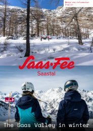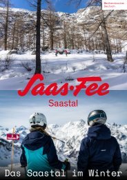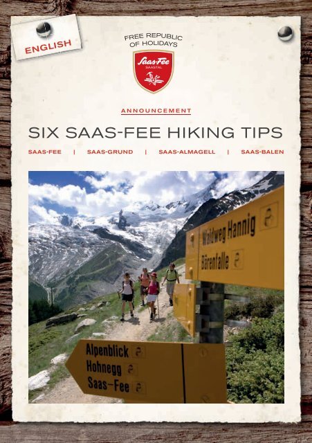
Hiking Tips Saas-Fee EN

Create successful ePaper yourself
Turn your PDF publications into a flip-book with our unique Google optimized e-Paper software.
<strong>EN</strong>GLISH<br />
ANNOUNCEM<strong>EN</strong>T<br />
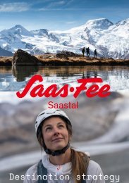
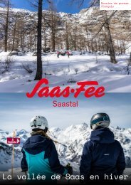
SIX SAAS-FEE HIKING TIPS<br />
SAAS-FEE | SAAS-GRUND | SAAS-ALMAGELL | SAAS-BAL<strong>EN</strong>
Dear hiking fans,<br />
The Free Republic of Holidays isn’t only known for its unique<br />
mountain landscape and year-round ski resort – with over 300 km<br />
of hiking trails, the <strong>Saas</strong> Valley also offers many beautiful tours for<br />
hikers of all abilities, complete with breathtaking views and many<br />
more delights. It doesn’t matter whether you’re a leisurely walker<br />
looking for a rustic mountain restaurant with great food, a thrillseeker<br />
keen to conquer hanging bridges, glaciers and steep cliffs, or<br />
an extreme endurance hiker looking to tackle challenging routes<br />
that take five hours or more.<br />
In this small brochure, we have put together six suggestions for<br />
beautiful and unforgettable hikes through our unique mountain<br />
landscape. You can find additional hiking trails on the hiking map<br />
or at www.saas-fee.ch/bergtouren.<br />
Enjoy a fabulous hiking holiday in the Free Republic of Holidays<br />
<strong>Saas</strong>-<strong>Fee</strong>!<br />
Partners:<br />
This brochure was put together with the help and support of GPS-<br />
Tracks.com.<br />
Reproduced with permission of swisstopo (BA 160139)<br />
You can access all the tours described in this brochure by scanning<br />
the QR code with the app on your smartphone.
General information<br />
G<strong>EN</strong>ERAL INFORMATION<br />
Content<br />
- General information.....................P.5<br />
- Important Phone...........................P.5<br />
light paths:<br />
- <strong>Saas</strong> Valley Riverbank Trail........P.6<br />
- Mattmark Circular Trail................P.7<br />
moderate paths:<br />
- Almagell High-Altitude Trail.........P.8<br />
- Chamois Trail..................................P.9<br />
advanced paths:<br />
- Glacier Trail.....................................P.10<br />
- Swiss Trail........................................P.11<br />
When hiking, please pay attention to the weather conditions, any notices about the<br />
condition of the trails, and the operating times of the cableways and PostAuto buses.<br />
EQUIPM<strong>EN</strong>T:<br />
• Appropriate footwear with slip-resistant soles<br />
• Appropriate clothing (windbreaker/sweater, change of T-shirt, etc.)<br />
• Sun protection (hat, sunglasses, sunscreen)<br />
• Water/drinks<br />
• First aid kit (plasters, thermal blanket, etc.)<br />
• Trekking poles<br />
• <strong>Hiking</strong> map<br />
• Citizens’ Pass (in the <strong>Saas</strong> Valley)<br />
LEVELS:<br />
- Easy: Accessible hikes for visitors of all abilities, with gentle ascents and descents.<br />
These require a basic level of fitness and appropriate walking shoes, but no mountaineering<br />
equipment. We recommend bringing refreshments (e.g. water and a<br />
snack).<br />
- Moderate: Longer hikes with steep ascents and descents; may lead across sloping<br />
terrain. These require an intermediate level of fitness. Good walking shoes are<br />
important to ensure surefootedness. We recommend bringing refreshments (e.g.<br />
water and a snack).<br />
- Advanced: Challenging tours across glaciers, scree, sometimes climbing aids like<br />
iron footholds, and along steep cliffs and sloping terrain (may be marked blue-white).<br />
These require a high level of fitness, surefootedness and hiking experience.<br />
Good hiking shoes and equipment are a must. We recommend bringing refreshments<br />
(e.g. water and a snack).<br />
TÉLÉPHONE IMPORTANTS<br />
emergency call: 144<br />
<strong>Saas</strong>-<strong>Fee</strong>/<strong>Saas</strong>tal Tourismus: +41 27 958 18 58<br />
<strong>Saas</strong>tal Bergbahnen AG: +41 27 958 11 00<br />
Bergbahnen Hohsaas AG: +41 27 958 15 80<br />
Postauto: +41 58 454 26 16<br />
HUTS / RESTAURANTS ON THE PATHS:<br />
Restaurant Almagelleralp: +41 79 613 79 85 / +41 79 629 78 08<br />
Bergrestaurant Hannig: +41 27 957 14 19<br />
Restaurant Terminus Plattjen: +41 27 957 15 16<br />
Britannia Hütte SAC: +41 27 957 22 88<br />
Restaurant Mattmark: +41 27 957 29 06<br />
Restaurant Kreuzboden: +41 27 957 29 45<br />
4 5
easy<br />
easy<br />
SAAS VALLEY RIVER-<br />
BANK TRAIL<br />
(easy)<br />
This trail starts at the <strong>Saas</strong>-Balen village square and<br />
leads westwards towards the round church. From there,<br />
it branches off in a southerly direction up the valley<br />
before reaching the <strong>Saas</strong>er Vispa river. Hikers then follow<br />
the river to the hamlet of Biedermatten, which belongs<br />
to <strong>Saas</strong>-Balen but seems to be part of <strong>Saas</strong>-<br />
Grund. The path then continues through the old<br />
hamlet and over the meadows to the next bridge,<br />
which crosses over to Tamatten, a hamlet that is part<br />
of <strong>Saas</strong>-Grund. Keeping to the right-hand side of the<br />
river, hikers then continue past <strong>Saas</strong>-Grund and arrive<br />
at the road that leads to <strong>Saas</strong>-<strong>Fee</strong>. The trail crosses<br />
over the road and continues to the Kapellenweg<br />
campsite, where hikers have the option to branch off<br />
and follow the Chapel Trail to <strong>Saas</strong>-<strong>Fee</strong>. Those who<br />
stay on the Riverbank Trail walk past the next hamlet<br />
of Unter den Bodmen, through the forest and along<br />
the river to <strong>Saas</strong>-Almagell.<br />
MATTMARK CIRCULAR<br />
TRAIL<br />
(easy)<br />
The path around the Mattmark reservoir is a popular<br />
circular trail with high-Alpine charm.<br />
The west side of the trail (to the right of the lake, facing<br />
uphill) is suitable for pushchairs, and the entire<br />
circular trail is also good for joggers and bikers, with<br />
the option of switching to tarmac roads.<br />
At the southern end of the reservoir, the trail leads to<br />
the Distelalp, which is also the gateway to the Monte<br />
Rosa Trail that leads over the Monte Moro Pass (the<br />
Golden Madonna) towards Macugnaga.<br />
A number of folk tales and dramatic legends are associated<br />
with the waters of the reservoir, which was<br />
inaugurated in 1969.<br />
Technical details<br />
Starting point<br />
<strong>Saas</strong>-Balen, 1,483 m a.s.l.<br />
End point<br />
<strong>Saas</strong>-Almagell, 1,670 m a.s.l.<br />
Duration<br />
2 hours and 30 minutes<br />
Distance<br />
7.8 km<br />
Difference in altitude + 200 m / - 13 m<br />
Maximum altitude 1,670 m a.s.l.<br />
Fitness level *<br />
Difficulty level *<br />
Technical details<br />
Starting point Mattmark restaurant, 2,100 m a.s.l.<br />
End point<br />
Mattmark restaurant, 2,100 m a.s.l.<br />
Duration<br />
2 hours and 30 minutes<br />
Distance<br />
8.5 km<br />
Difference in + 110 m / - 110m<br />
altitude<br />
Maximum altitude<br />
Fitness level *<br />
Difficulty level *<br />
2,253 m a.s.l.<br />
6 7
moderate<br />
moderate<br />
ALMAGELL HIGH-<br />
ALTITUDE TRAIL<br />
(moderate)<br />
This trail starts on Kreuzboden, which can easily be<br />
reached with the Hohsaas Bergbahnen cableways.<br />
From there, the trail heads south along the first section<br />
of the Alpine Flower Trail to the Triftgrätji. After the<br />
avalanche barriers, the trail leads up the Grundberg<br />
and into the wild and wonderful Almagell Valley.<br />
After a quick break at the Almagelleralp mountain<br />
hotel, hikers will be ready to take on the steep descent<br />
to <strong>Saas</strong>-Almagell over the Chüelbrunnji and<br />
the Spissgrabe. They will then be able to catch a<br />
PostAuto bus from the village square in <strong>Saas</strong>-Almagell<br />
to their chosen destination.<br />
For an alternative route with a less demanding descent,<br />
hikers can take the Adventure Trail to<br />
Furggstalden instead. From there, it is possible to<br />
get down to <strong>Saas</strong>-Almagell on a chairlift.<br />
CHAMOIS TRAIL<br />
(moderate)<br />
The Chamois Trail heads south-southwest<br />
from Hannig mountain station. After a short<br />
walk, hikers leave the wide path and head towards<br />
the Torrentbach and Spissen. At the<br />
fork in the path, the trail continues along the<br />
lower branch to Trift, where it then descends<br />
in short but steep zigzags down to the next<br />
turnoff. Here, hikers branch off to the right<br />
and continue along Route 10 over the Gand<br />
moraine to the glacial lake. From there, the<br />
trail continues up across the ice grotto to the<br />
Sperwerzucht and then on until it reaches<br />
the riverbed. After a few minutes, it passes<br />
the <strong>Fee</strong>-Vispa waterfall in the direction of<br />
Oberi Schopfen. From there, it is a fairly<br />
steep ascent to Berghaus Plattjen – the oldest<br />
mountain hut in the <strong>Saas</strong> Valley – followed<br />
by a half-hour uphill walk to reach the<br />
Plattjen mountain station, where hikers can<br />
catch a gondola lift back down to <strong>Saas</strong>-<strong>Fee</strong>.<br />
Technical details<br />
Starting point Kreuzboden mountain station,<br />
2,397 m a.s.l.<br />
End point<br />
Duration<br />
Distance<br />
Difference in<br />
altitude<br />
Maximum<br />
altitude<br />
Fitness level **<br />
Difficulty level **<br />
<strong>Saas</strong>-Almagell village, 1,673 m a.s.l.<br />
3 hours and 30 minutes<br />
10.1 km<br />
+ 204m / - 931 m<br />
2,522 m a.s.l.<br />
Technical details<br />
Starting point Hannig mountain station,<br />
2,336 m a.s.l.<br />
End point<br />
Duration<br />
Distance<br />
Difference in<br />
altitude<br />
Maximum<br />
altitude<br />
Fitness level **<br />
Difficulty level **<br />
Plattjen mountain station,<br />
2,570 m a.s.l.<br />
4 hours<br />
9 km<br />
+ 684 m / - 450 m<br />
2,570 m a.s.l.<br />
8 9
advanced<br />
advanced<br />
GLACIER TRAIL<br />
(advanced)<br />
This high-Alpine hiking trail sets off at<br />
Felskinn mountain station and leads<br />
across the Chessjen glacier to the Brittania<br />
mountain hut. From there, the<br />
trail leads down the slope behind the<br />
hut (in a southerly direction), across<br />
the Hohlaub glacier and the Allalin glacier.<br />
The trail is well signposted.<br />
The crevasses are clearly visible and<br />
easy to cross.<br />
At the end of the Allalin glacier, hikers<br />
climb up the side of the Schwarzberg<br />
over snow and scree before reaching<br />
Schwarzbergchopf.<br />
From there, the trail is marked red-white.<br />
Some sections of the path are exposed.<br />
A mountain road then leads<br />
from the Schwarzbergalp down to the<br />
Mattmark reservoir.<br />
Technical details<br />
SWISS TRAIL<br />
(advanced)<br />
This trail starts behind the <strong>Saas</strong>-Grund<br />
artificial ice rink, heads south and branches<br />
off to the left (facing uphill) above<br />
Gasse towards the Chilchwald forest.<br />
After a small section along the Suonen<br />
Trail near the Chilchwald forest, hikers<br />
climb a few metres in the Furwald forest<br />
and branch off to the left towards<br />
Eichballu.<br />
Hikers then have to cross a well-secured<br />
rocky section to reach the Predigtstuhl<br />
just below the Chrome, before following<br />
the final section to the Triftalp.<br />
Technical details<br />
Starting point<br />
Felskinn mountain station,<br />
3,000 m a.s.l.<br />
Starting point<br />
<strong>Saas</strong>-Grund cableway station,<br />
1,580 m a.s.l.<br />
End point<br />
Mattmark restaurant, 2,100 m a.s.l.<br />
End point<br />
Triftalp, 2,072 m a.s.l.<br />
Duration<br />
4 hours and 30 minutes<br />
Duration<br />
1 hour and 45 minutes<br />
Distance<br />
9.1 km<br />
Distance<br />
2.9 km<br />
Difference in<br />
altitude<br />
+ 309 m / - 1,091 m<br />
Difference in<br />
altitude<br />
+ 522 m<br />
Maximum<br />
altitude<br />
3,037 m a.s.l.<br />
Maximum<br />
altitude<br />
2,072 m a.s.l.<br />
Fitness level ***<br />
Difficulty level ****<br />
Fitness level **<br />
Difficulty level ****<br />
10 11
<strong>Saas</strong>-<strong>Fee</strong> | <strong>Saas</strong> Valley tourism<br />
SAAS-FEE<br />
T +41 27 958 18 58 | info@saas-fee.ch<br />
SAAS-GRUND<br />
T +41 27 958 18 55 | info@saas-grund.ch<br />
SAAS-ALMAGELL<br />
T +41 27 958 18 88 | info@saas-almagell.ch<br />
SAAS-BAL<strong>EN</strong><br />
T +41 27 957 21 43 | info@saas-balen.ch<br />
www.saas-fee.ch<br />
12