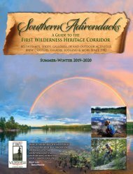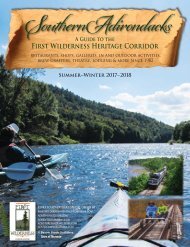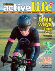
2017-18 Dining Guide Web

Create successful ePaper yourself
Turn your PDF publications into a flip-book with our unique Google optimized e-Paper software.
80<br />
We Cater<br />
every type of event<br />
Open daily 7am-8pm • (5<strong>18</strong>) 251-4017<br />
1396 County Rt 29 • Olmstedville, NY<br />
Across the Street from Courtney Park<br />
Scratch made pies, cakes and tarts<br />
using fresh ingredients.<br />
Cinnamon Rolls • Donuts • Breads<br />
Ask about our famous<br />
Orange Torte & Turtle Cheesecake<br />
Enjoy Breakfast and Lunch at the<br />
Sandwich Shop with homemade<br />
cole slaw, salads, deli<br />
sandwiches & more.<br />
1385 County Rt 29, Olmstedville, NY<br />
Call (5<strong>18</strong>) 251-2289 for seasonal hours<br />
Groceries • Diesel • Gas • Soda<br />
Green Mountain Coffee • Cold Beer<br />
Cigarettes • Newspapers • Souvenirs<br />
Camping & Fishing Supplies • Worms<br />
Locally Made Jellies & Maple Products<br />
Open daily 7am-8pm • (5<strong>18</strong>) 251-4017<br />
1396 County Rt 29 • Olmstedville, NY<br />
Across the Street from Courtney Park<br />
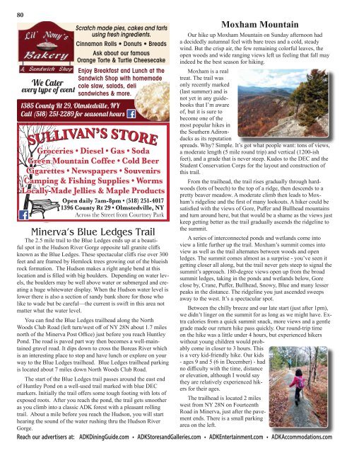
Minerva’s Blue Ledges Trail<br />
Scratch made pies, cakes and tarts<br />
using fresh ingredients.<br />
The 2.5 mile trail to the Blue Ledges ends up at a beautiful<br />
spot in the Hudson River Cinnamon Gorge opposite Rolls • tall Donuts granite • cliffs Breads<br />
known as the Blue Ledges. These Ask spectacular about our cliffs famous rise over 300<br />
feet and are framed by Hemlock Orange trees Torte growing & Turtle out Cheesecake<br />
of the blueish<br />
rock formation. The Hudson makes a right angle bend at this<br />
location and is filled with big<br />
Enjoy<br />
boulders.<br />
Breakfast<br />
Depending<br />
and Lunch<br />
on water<br />
at the<br />
levels,<br />
the boulders may be well Sandwich above water Shop or with submerged homemade and creating<br />
cole slaw, salads, deli<br />
We Cater<br />
every<br />
a huge<br />
type<br />
whitewater<br />
of eventdisplay. When the Hudson water level is<br />
lower there is also a section sandwiches of sandy bank & more. shore for those who<br />
like to wade but be careful—the current is swift in this area not<br />
matter 1385 what County the water Rt 29, level. Olmstedville, NY<br />
Call (5<strong>18</strong>) 251-2289 for seasonal hours<br />
You can find the Blue Ledges trailhead along the North<br />
Woods Club Road (left turn/west off of NY 28N about 1.7 miles<br />
north of the Minerva Post Office) just before you reach Huntley<br />
Pond. The road is paved part way then becomes a well-maintained<br />
gravel road. It dips down to cross the Boreas River which<br />
is an interesting place to stop and have lunch or explore on your<br />
way to the Blue Ledges trailhead. Blue Ledges trailhead parking<br />
is located about 7 miles down North Woods Club Road.<br />
Moxham Mountain<br />
Our hike up Moxham Mountain on Sunday afternoon had<br />
a decidedly autumnal feel with bare trees and a cold, steady<br />
wind. But the crisp air, the few remaining colorful leaves, the<br />
open woods and wide ranging views left us feeling that fall may<br />
indeed be the best season for hiking.<br />
Moxham is a real<br />
treat. The trail was<br />
only recently marked<br />
(last summer) and is<br />
not yet in any guidebooks<br />
that I’m aware<br />
of, but it is sure to<br />
become one of the<br />
most popular hikes in<br />
the Southern Adirondacks<br />
as its reputation<br />
spreads. Why? Simple. It’s got what people want: tons of views,<br />
a moderate length (5 mile round trip) and vertical (1200-ish<br />
feet), and a grade that is never steep. Kudos to the DEC and the<br />
Student Conservation Corps for the layout and construction of<br />
this trail.<br />
From the trailhead, the trail rises gradually through hardwoods<br />
(lots of beech) to the top of a ridge, then descends to a<br />
pretty beaver meadow. A moderate climb then leads to Moxham’s<br />
ridgeline and the first of many lookouts. A hiker could be<br />
satisfied with the views of Gore, Puffer and Bullhead mountains<br />
and turn around here, but that would be a shame as the views just<br />
keep getting better as the trail gradually ascends the ridgeline to<br />
the summit.<br />
A series of interconnected ponds and wetlands come into<br />
view a little further up the trail. Moxham’s summit comes into<br />
view as well as the trail alternates between woods and open<br />
ledges. The summit comes almost as a surprise - you’ve seen it<br />
getting closer all along, but the trail never gets steep to signal the<br />
summit’s approach. <strong>18</strong>0-degree views open up from the broad<br />
summit ledges, taking in the ponds and wetlands below, Gore<br />
close by, Crane, Puffer, Bullhead, Snowy, Blue and many lesser<br />
peaks in the distance. The ridgeline you just ascended sweeps<br />
away to the west. It’s a spectacular spot.<br />
Between the chilly breeze and our late start (just after 1pm),<br />
we didn’t linger on the summit for as long as we might have. Extra<br />
calories from a quick summit snack, more views and a gentle<br />
grade made our return hike pass quickly. Our round-trip time<br />
on the hike was a little under 4 hours, but experienced hikers<br />
without young children would probably<br />
come in closer to 3 hours. This<br />
is a very kid-friendly hike. Our kids<br />
- ages 9 and 5 (6 in December) - had<br />
no difficulty with the time, distance<br />
or elevation, although I would say<br />
The start of the Blue Ledges trail passes around the east end<br />
they are relatively experienced hikers<br />
for their ages.<br />
of Huntley Pond on a well-used trail marked with blue DEC<br />
markers. Initially the trail offers some tough footing with lots of<br />
exposed roots. After you reach the pond, the trail gets smoother The trailhead is located 2 miles<br />
as you climb into a classic ADK forest with a pleasant rolling<br />
west from NY 28N on Fourteenth<br />
trail. About a mile before you reach the Hudson, you will start<br />
Road in Minerva, just after the pavement<br />
ends. There is a small parking<br />
hearing the sound of the water rushing thru the Hudson River<br />
area on the left.<br />
Gorge.<br />
Reach our advertisers at: ADK<strong>Dining</strong><strong>Guide</strong>.com • ADKStoresandGalleries.com • ADKEntertainment.com • ADKAccommodations.com